

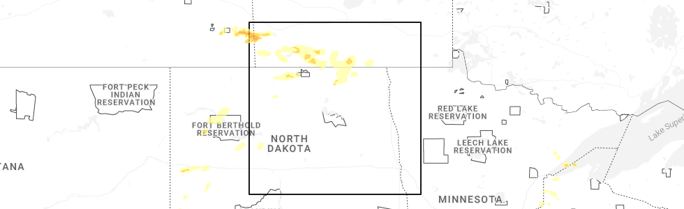
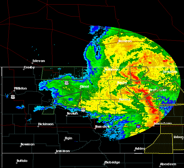
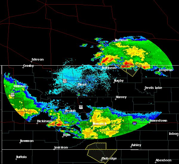
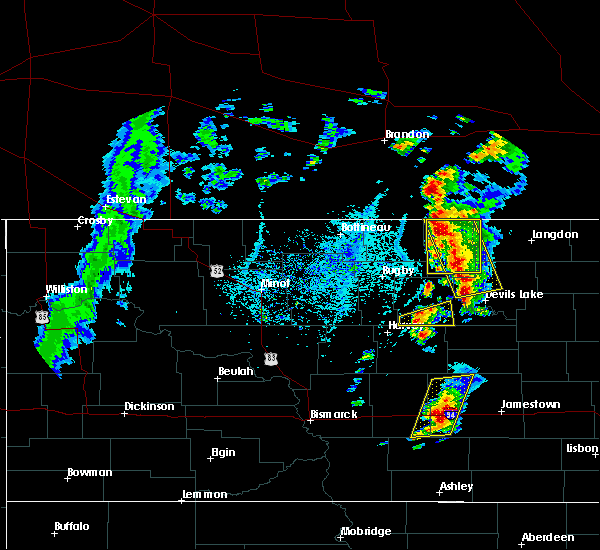
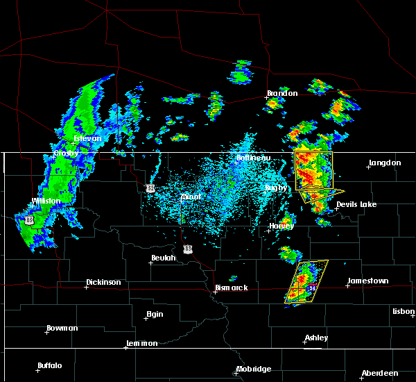
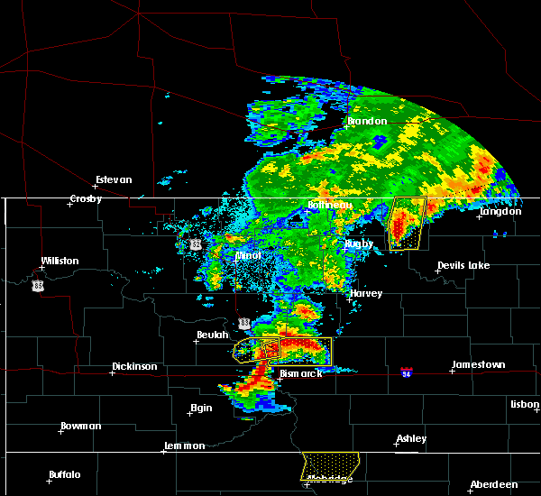
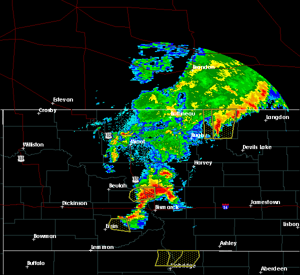
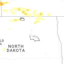
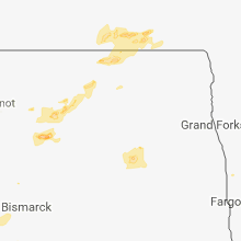
Hail Map for Hansboro, ND
The Hansboro, ND area has had 0 reports of on-the-ground hail by trained spotters, and has been under severe weather warnings 0 times during the past 12 months. Doppler radar has detected hail at or near Hansboro, ND on 16 occasions, including 2 occasions during the past year.
| Name: | Hansboro, ND |
| Where Located: | 62.8 miles NNW of Devils Lake, ND |
| Map: | Google Map for Hansboro, ND |
| Population: | 12 |
| Housing Units: | 14 |
| More Info: | Search Google for Hansboro, ND |
0
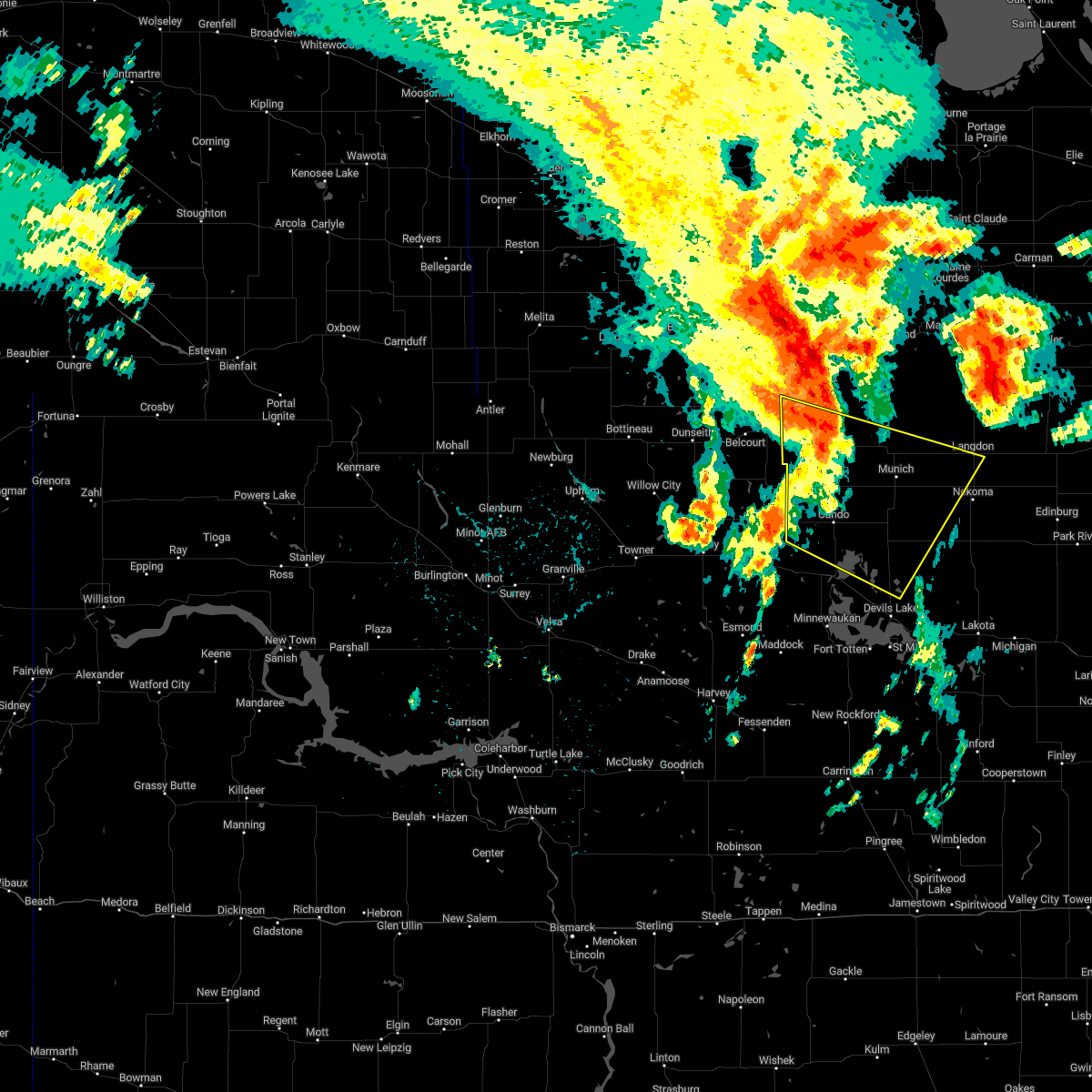
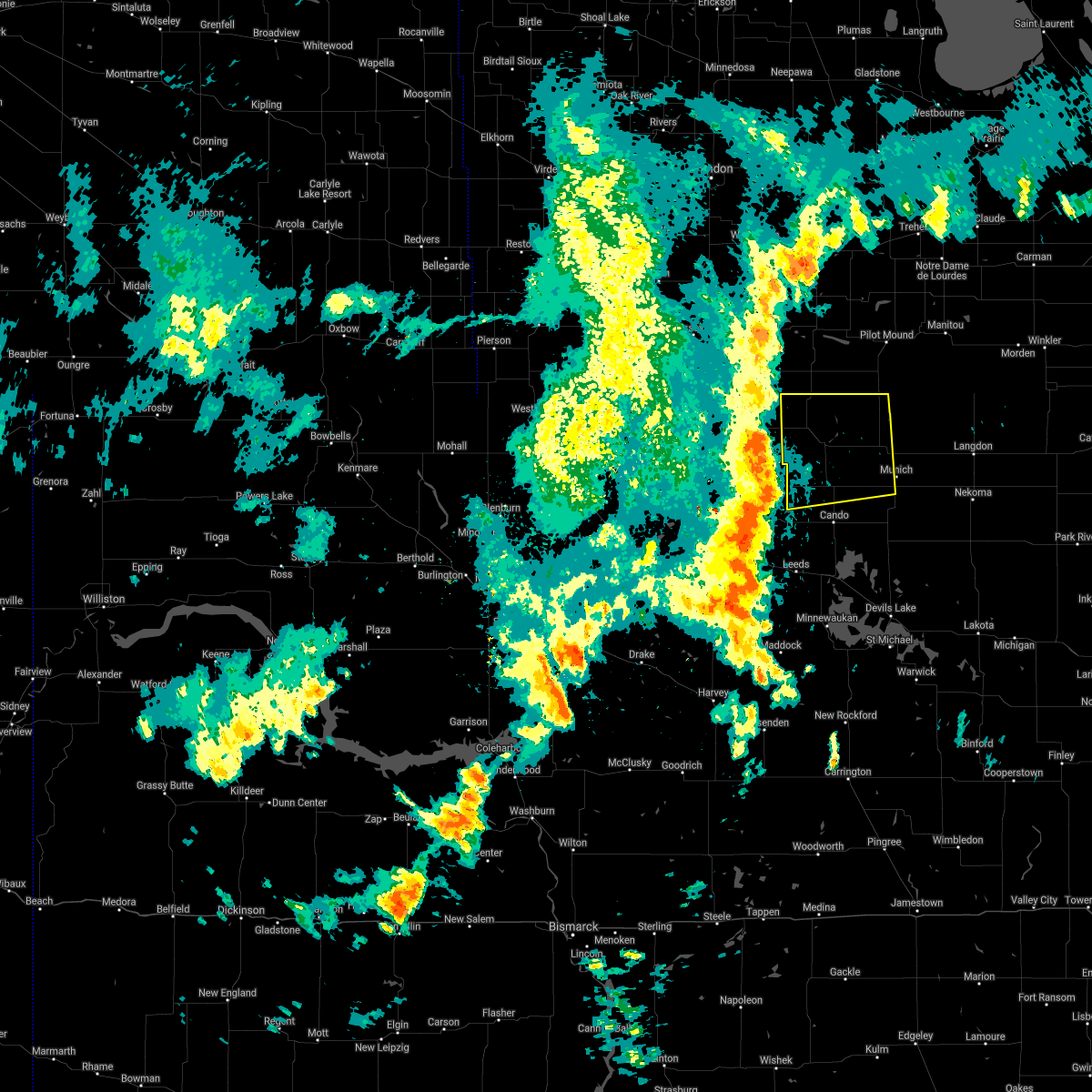
The Top Recent Hail Date for Hansboro, ND is Thursday, July 3, 2025 (16th out of 16)
Hail and Wind Damage Spotted near Hansboro, ND
| Date / Time | Report Details |
|---|---|
| 6/16/2024 2:50 AM CDT |
 The storms which prompted the warning have weakened below severe limits, and no longer pose an immediate threat to life or property. therefore, the warning will be allowed to expire. however, gusty winds are still possible with these thunderstorms. a severe thunderstorm watch remains in effect until 600 am cdt for northeastern north dakota. The storms which prompted the warning have weakened below severe limits, and no longer pose an immediate threat to life or property. therefore, the warning will be allowed to expire. however, gusty winds are still possible with these thunderstorms. a severe thunderstorm watch remains in effect until 600 am cdt for northeastern north dakota.
|
| 6/16/2024 2:12 AM CDT |
 Svrfgf the national weather service in grand forks has issued a * severe thunderstorm warning for, benson county in northeastern north dakota, towner county in northeastern north dakota, western cavalier county in northeastern north dakota, western ramsey county in northeastern north dakota, * until 300 am cdt. * at 212 am cdt, severe thunderstorms were located along a line extending from 12 miles north of sarles to near heimdal, moving east at 35 mph (radar indicated). Hazards include 60 mph wind gusts and quarter size hail. Hail damage to vehicles is expected. Expect wind damage to roofs, siding, and trees. Svrfgf the national weather service in grand forks has issued a * severe thunderstorm warning for, benson county in northeastern north dakota, towner county in northeastern north dakota, western cavalier county in northeastern north dakota, western ramsey county in northeastern north dakota, * until 300 am cdt. * at 212 am cdt, severe thunderstorms were located along a line extending from 12 miles north of sarles to near heimdal, moving east at 35 mph (radar indicated). Hazards include 60 mph wind gusts and quarter size hail. Hail damage to vehicles is expected. Expect wind damage to roofs, siding, and trees.
|
| 6/16/2024 1:49 AM CDT |
 At 149 am cdt, severe thunderstorms were located along a line extending from 25 miles north of hansboro to rocklake to near esmond, moving east at 55 mph (radar indicated). Hazards include 60 mph wind gusts and penny size hail. Expect damage to roofs, siding, and trees. Locations impacted include, cando, leeds, minnewaukan, munich, bisbee, starkweather, and rocklake. At 149 am cdt, severe thunderstorms were located along a line extending from 25 miles north of hansboro to rocklake to near esmond, moving east at 55 mph (radar indicated). Hazards include 60 mph wind gusts and penny size hail. Expect damage to roofs, siding, and trees. Locations impacted include, cando, leeds, minnewaukan, munich, bisbee, starkweather, and rocklake.
|
| 6/16/2024 1:23 AM CDT |
 Svrfgf the national weather service in grand forks has issued a * severe thunderstorm warning for, benson county in northeastern north dakota, towner county in northeastern north dakota, western cavalier county in northeastern north dakota, western ramsey county in northeastern north dakota, * until 215 am cdt. * at 123 am cdt, severe thunderstorms were located along a line extending from 21 miles northeast of international peace garden to 6 miles northeast of rolette to 6 miles southwest of orrin, moving northeast at 60 mph (radar indicated). Hazards include 60 mph wind gusts and penny size hail. expect damage to roofs, siding, and trees Svrfgf the national weather service in grand forks has issued a * severe thunderstorm warning for, benson county in northeastern north dakota, towner county in northeastern north dakota, western cavalier county in northeastern north dakota, western ramsey county in northeastern north dakota, * until 215 am cdt. * at 123 am cdt, severe thunderstorms were located along a line extending from 21 miles northeast of international peace garden to 6 miles northeast of rolette to 6 miles southwest of orrin, moving northeast at 60 mph (radar indicated). Hazards include 60 mph wind gusts and penny size hail. expect damage to roofs, siding, and trees
|
| 7/19/2022 4:09 AM CDT |
 At 408 am cdt, a severe thunderstorm was located over arndt, or 38 miles west of langdon, moving east at 55 mph (radar indicated). Hazards include 70 mph wind gusts and quarter size hail. Hail damage to vehicles is expected. expect considerable tree damage. wind damage is also likely to mobile homes, roofs, and outbuildings. locations impacted include, egeland, calio, munich, alsen, hampden and derrick. thunderstorm damage threat, considerable hail threat, radar indicated max hail size, 1. 00 in wind threat, radar indicated max wind gust, 70 mph. At 408 am cdt, a severe thunderstorm was located over arndt, or 38 miles west of langdon, moving east at 55 mph (radar indicated). Hazards include 70 mph wind gusts and quarter size hail. Hail damage to vehicles is expected. expect considerable tree damage. wind damage is also likely to mobile homes, roofs, and outbuildings. locations impacted include, egeland, calio, munich, alsen, hampden and derrick. thunderstorm damage threat, considerable hail threat, radar indicated max hail size, 1. 00 in wind threat, radar indicated max wind gust, 70 mph.
|
| 7/19/2022 3:48 AM CDT |
 At 347 am cdt, a severe thunderstorm was located near rolla, or 56 miles northwest of devils lake, moving east at 55 mph (radar indicated). Hazards include 60 mph wind gusts and quarter size hail. Hail damage to vehicles is expected. expect wind damage to roofs, siding, and trees. this severe thunderstorm will be near, perth around 355 am cdt. bisbee around 400 am cdt. rocklake around 405 am cdt. other locations in the path of this severe thunderstorm include arndt and egeland. hail threat, radar indicated max hail size, 1. 00 in wind threat, radar indicated max wind gust, 60 mph. At 347 am cdt, a severe thunderstorm was located near rolla, or 56 miles northwest of devils lake, moving east at 55 mph (radar indicated). Hazards include 60 mph wind gusts and quarter size hail. Hail damage to vehicles is expected. expect wind damage to roofs, siding, and trees. this severe thunderstorm will be near, perth around 355 am cdt. bisbee around 400 am cdt. rocklake around 405 am cdt. other locations in the path of this severe thunderstorm include arndt and egeland. hail threat, radar indicated max hail size, 1. 00 in wind threat, radar indicated max wind gust, 60 mph.
|
| 6/13/2022 10:51 PM CDT |
 At 1051 pm cdt, severe thunderstorms were located along a line extending from near egeland to near churchs ferry, moving east at 35 mph (radar indicated). Hazards include 70 mph wind gusts and quarter size hail. Hail damage to vehicles is expected. expect considerable tree damage. wind damage is also likely to mobile homes, roofs, and outbuildings. severe thunderstorms will be near, calio around 1105 pm cdt. webster, garske and clyde around 1110 pm cdt. Other locations in the path of these severe thunderstorms include munich, alsen and loma. At 1051 pm cdt, severe thunderstorms were located along a line extending from near egeland to near churchs ferry, moving east at 35 mph (radar indicated). Hazards include 70 mph wind gusts and quarter size hail. Hail damage to vehicles is expected. expect considerable tree damage. wind damage is also likely to mobile homes, roofs, and outbuildings. severe thunderstorms will be near, calio around 1105 pm cdt. webster, garske and clyde around 1110 pm cdt. Other locations in the path of these severe thunderstorms include munich, alsen and loma.
|
| 6/6/2021 2:17 AM CDT |
 At 217 am cdt, severe thunderstorms were located along a line extending from 7 miles northeast of st. john to 6 miles south of agate, moving east at 35 mph (radar indicated). Hazards include 60 mph wind gusts. expect damage to roofs, siding, and trees At 217 am cdt, severe thunderstorms were located along a line extending from 7 miles northeast of st. john to 6 miles south of agate, moving east at 35 mph (radar indicated). Hazards include 60 mph wind gusts. expect damage to roofs, siding, and trees
|
| 7/17/2020 2:26 PM CDT |
 At 226 pm cdt, a severe thunderstorm was located near calvin, or 30 miles west of langdon, moving east at 50 mph (radar indicated). Hazards include 60 mph wind gusts and quarter size hail. Hail damage to vehicles is expected. expect wind damage to roofs, siding, and trees. this severe storm will be near, calvin around 230 pm cdt. clyde around 235 pm cdt. wales around 250 pm cdt. Dresden around 255 pm cdt. At 226 pm cdt, a severe thunderstorm was located near calvin, or 30 miles west of langdon, moving east at 50 mph (radar indicated). Hazards include 60 mph wind gusts and quarter size hail. Hail damage to vehicles is expected. expect wind damage to roofs, siding, and trees. this severe storm will be near, calvin around 230 pm cdt. clyde around 235 pm cdt. wales around 250 pm cdt. Dresden around 255 pm cdt.
|
| 7/17/2020 2:01 PM CDT |
 At 201 pm cdt, a severe thunderstorm was located near amourdale, or 50 miles west of langdon, moving east at 50 mph (radar indicated). Hazards include 60 mph wind gusts and quarter size hail. Hail damage to vehicles is expected. expect wind damage to roofs, siding, and trees. this severe thunderstorm will be near, amourdale around 205 pm cdt. rocklake around 215 pm cdt. calvin around 230 pm cdt. clyde around 235 pm cdt. Wales around 250 pm cdt. At 201 pm cdt, a severe thunderstorm was located near amourdale, or 50 miles west of langdon, moving east at 50 mph (radar indicated). Hazards include 60 mph wind gusts and quarter size hail. Hail damage to vehicles is expected. expect wind damage to roofs, siding, and trees. this severe thunderstorm will be near, amourdale around 205 pm cdt. rocklake around 215 pm cdt. calvin around 230 pm cdt. clyde around 235 pm cdt. Wales around 250 pm cdt.
|
| 6/29/2019 8:07 AM CDT |
 At 806 am cdt, severe thunderstorms were located along a line extending from near perth to near maza to 6 miles south of esmond, moving east at 30 mph (radar indicated). Hazards include 60 mph wind gusts and quarter size hail. Hail damage to vehicles is expected. expect wind damage to roofs, siding, and trees. severe thunderstorms will be near, cando around 815 am cdt. maza, rocklake and churchs ferry around 820 am cdt. maddock and arndt around 830 am cdt. egeland and flora around 840 am cdt. Webster and garske around 850 am cdt. At 806 am cdt, severe thunderstorms were located along a line extending from near perth to near maza to 6 miles south of esmond, moving east at 30 mph (radar indicated). Hazards include 60 mph wind gusts and quarter size hail. Hail damage to vehicles is expected. expect wind damage to roofs, siding, and trees. severe thunderstorms will be near, cando around 815 am cdt. maza, rocklake and churchs ferry around 820 am cdt. maddock and arndt around 830 am cdt. egeland and flora around 840 am cdt. Webster and garske around 850 am cdt.
|
| 6/29/2019 7:50 AM CDT |
 At 750 am cdt, severe thunderstorms were located along a line extending from near rolla to 10 miles northeast of york to 7 miles north of selz, moving east at 40 mph (radar indicated). Hazards include 60 mph wind gusts and quarter size hail. Hail damage to vehicles is expected. expect wind damage to roofs, siding, and trees. these severe storms will be near, perth around 755 am cdt. amourdale around 800 am cdt. maza and cando around 805 am cdt. rocklake around 810 am cdt. Maddock and flora around 815 am cdt. At 750 am cdt, severe thunderstorms were located along a line extending from near rolla to 10 miles northeast of york to 7 miles north of selz, moving east at 40 mph (radar indicated). Hazards include 60 mph wind gusts and quarter size hail. Hail damage to vehicles is expected. expect wind damage to roofs, siding, and trees. these severe storms will be near, perth around 755 am cdt. amourdale around 800 am cdt. maza and cando around 805 am cdt. rocklake around 810 am cdt. Maddock and flora around 815 am cdt.
|
| 6/29/2019 7:18 AM CDT |
 At 717 am cdt, severe thunderstorms were located along a line extending from near shell valley to near pleasant lake to orrin, moving east at 45 mph (radar indicated). Hazards include 70 mph wind gusts and quarter size hail. Hail damage to vehicles is expected. expect considerable tree damage. wind damage is also likely to mobile homes, roofs, and outbuildings. severe thunderstorms will be near, pleasant lake around 725 am cdt. knox around 730 am cdt. york around 740 am cdt. esmond, leeds and perth around 745 am cdt. Bisbee, brinsmade and rocklake around 755 am cdt. At 717 am cdt, severe thunderstorms were located along a line extending from near shell valley to near pleasant lake to orrin, moving east at 45 mph (radar indicated). Hazards include 70 mph wind gusts and quarter size hail. Hail damage to vehicles is expected. expect considerable tree damage. wind damage is also likely to mobile homes, roofs, and outbuildings. severe thunderstorms will be near, pleasant lake around 725 am cdt. knox around 730 am cdt. york around 740 am cdt. esmond, leeds and perth around 745 am cdt. Bisbee, brinsmade and rocklake around 755 am cdt.
|
| 6/29/2018 3:15 AM CDT |
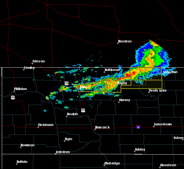
 At 315 am cdt, severe thunderstorms were located along a line extending from 8 miles northwest of hansboro to near arndt, moving east at 30 mph (radar indicated). Hazards include 60 mph wind gusts. Expect damage to roofs, siding, and trees. Locations impacted include, bisbee, rocklake, sarles, calvin, hansboro, perth and arndt. At 315 am cdt, severe thunderstorms were located along a line extending from 8 miles northwest of hansboro to near arndt, moving east at 30 mph (radar indicated). Hazards include 60 mph wind gusts. Expect damage to roofs, siding, and trees. Locations impacted include, bisbee, rocklake, sarles, calvin, hansboro, perth and arndt.
|
| 6/29/2018 2:44 AM CDT |
 At 244 am cdt, severe thunderstorms were located along a line extending from near rolla to 7 miles southwest of considine, moving northeast at 30 mph (radar indicated). Hazards include 60 mph wind gusts. expect damage to roofs, siding, and trees At 244 am cdt, severe thunderstorms were located along a line extending from near rolla to 7 miles southwest of considine, moving northeast at 30 mph (radar indicated). Hazards include 60 mph wind gusts. expect damage to roofs, siding, and trees
|
| 6/29/2018 2:19 AM CDT |
 At 218 am cdt, severe thunderstorms were located along a line extending from near esmond to near maddock to near flora, moving northeast at 45 mph (radar indicated). Hazards include 70 mph wind gusts and penny size hail. Expect considerable tree damage. damage is likely to mobile homes, roofs, and outbuildings. these severe storms will be near, flora and maddock around 220 am cdt. baker around 230 am cdt. harlow around 235 am cdt. minnewaukan around 240 am cdt. Brinsmade, leeds and penn around 245 am cdt. At 218 am cdt, severe thunderstorms were located along a line extending from near esmond to near maddock to near flora, moving northeast at 45 mph (radar indicated). Hazards include 70 mph wind gusts and penny size hail. Expect considerable tree damage. damage is likely to mobile homes, roofs, and outbuildings. these severe storms will be near, flora and maddock around 220 am cdt. baker around 230 am cdt. harlow around 235 am cdt. minnewaukan around 240 am cdt. Brinsmade, leeds and penn around 245 am cdt.
|
| 6/29/2018 1:48 AM CDT |
 At 147 am cdt, severe thunderstorms were located along a line extending from near shell valley to near pleasant lake to 7 miles northeast of anamoose, moving east at 30 mph (radar indicated). Hazards include 60 mph wind gusts and penny size hail. Expect damage to roofs, siding, and trees. severe thunderstorms will be near, pleasant lake around 150 am cdt. knox around 200 am cdt. york around 215 am cdt. esmond around 220 am cdt. Leeds around 225 am cdt. At 147 am cdt, severe thunderstorms were located along a line extending from near shell valley to near pleasant lake to 7 miles northeast of anamoose, moving east at 30 mph (radar indicated). Hazards include 60 mph wind gusts and penny size hail. Expect damage to roofs, siding, and trees. severe thunderstorms will be near, pleasant lake around 150 am cdt. knox around 200 am cdt. york around 215 am cdt. esmond around 220 am cdt. Leeds around 225 am cdt.
|
| 6/14/2018 8:54 PM CDT |
 At 854 pm cdt, a severe thunderstorm was located over rolla, or 39 miles east of bottineau, moving east at 30 mph (radar indicated). Hazards include golf ball size hail and 60 mph wind gusts. People and animals outdoors will be injured. expect hail damage to roofs, siding, windows, and vehicles. expect wind damage to roofs, siding, and trees. this severe thunderstorm will be near, perth and amourdale around 910 pm cdt. rocklake around 925 pm cdt. clyde around 955 pm cdt. munich and calio around 1000 pm cdt. A tornado watch remains in effect until 200 am cdt for northeastern north dakota. At 854 pm cdt, a severe thunderstorm was located over rolla, or 39 miles east of bottineau, moving east at 30 mph (radar indicated). Hazards include golf ball size hail and 60 mph wind gusts. People and animals outdoors will be injured. expect hail damage to roofs, siding, windows, and vehicles. expect wind damage to roofs, siding, and trees. this severe thunderstorm will be near, perth and amourdale around 910 pm cdt. rocklake around 925 pm cdt. clyde around 955 pm cdt. munich and calio around 1000 pm cdt. A tornado watch remains in effect until 200 am cdt for northeastern north dakota.
|
| 7/19/2017 8:55 AM CDT |
 At 854 am cdt, a severe thunderstorm was located near amourdale, or 43 miles west of langdon, moving east at 35 mph (radar indicated). Hazards include 60 mph wind gusts and quarter size hail. Hail damage to vehicles is expected. expect wind damage to roofs, siding, and trees. This severe storm will be near, rocklake around 905 am cdt. At 854 am cdt, a severe thunderstorm was located near amourdale, or 43 miles west of langdon, moving east at 35 mph (radar indicated). Hazards include 60 mph wind gusts and quarter size hail. Hail damage to vehicles is expected. expect wind damage to roofs, siding, and trees. This severe storm will be near, rocklake around 905 am cdt.
|
| 7/19/2017 8:28 AM CDT |
 At 828 am cdt, a severe thunderstorm was located near st. john, or 37 miles east of bottineau, moving southeast at 30 mph (radar indicated). Hazards include ping pong ball size hail and 60 mph wind gusts. People and animals outdoors will be injured. expect hail damage to roofs, siding, windows, and vehicles. expect wind damage to roofs, siding, and trees. this severe thunderstorm will be near, hansboro around 845 am cdt. amourdale around 850 am cdt. Rocklake around 905 am cdt. At 828 am cdt, a severe thunderstorm was located near st. john, or 37 miles east of bottineau, moving southeast at 30 mph (radar indicated). Hazards include ping pong ball size hail and 60 mph wind gusts. People and animals outdoors will be injured. expect hail damage to roofs, siding, windows, and vehicles. expect wind damage to roofs, siding, and trees. this severe thunderstorm will be near, hansboro around 845 am cdt. amourdale around 850 am cdt. Rocklake around 905 am cdt.
|
| 6/2/2017 5:03 PM CDT |
 At 503 pm cdt, severe thunderstorms were located along a line extending from near hansboro to near cando, moving north at 30 mph (radar indicated). Hazards include 60 mph wind gusts and quarter size hail. Hail damage to vehicles is expected. expect wind damage to roofs, siding, and trees. severe thunderstorms will be near, hansboro around 505 pm cdt. arndt around 525 pm cdt. egeland around 530 pm cdt. rocklake around 550 pm cdt. Calvin and sarles around 600 pm cdt. At 503 pm cdt, severe thunderstorms were located along a line extending from near hansboro to near cando, moving north at 30 mph (radar indicated). Hazards include 60 mph wind gusts and quarter size hail. Hail damage to vehicles is expected. expect wind damage to roofs, siding, and trees. severe thunderstorms will be near, hansboro around 505 pm cdt. arndt around 525 pm cdt. egeland around 530 pm cdt. rocklake around 550 pm cdt. Calvin and sarles around 600 pm cdt.
|
| 6/2/2017 4:43 PM CDT |
 At 442 pm cdt, severe thunderstorms were located along a line extending from 6 miles northeast of hansboro to near cando, moving northeast at 15 mph (radar indicated). Hazards include 60 mph wind gusts and half dollar size hail. Hail damage to vehicles is expected. expect wind damage to roofs, siding, and trees. These severe thunderstorms will remain over mainly rural areas of towner, western cavalier and northwestern ramsey counties. At 442 pm cdt, severe thunderstorms were located along a line extending from 6 miles northeast of hansboro to near cando, moving northeast at 15 mph (radar indicated). Hazards include 60 mph wind gusts and half dollar size hail. Hail damage to vehicles is expected. expect wind damage to roofs, siding, and trees. These severe thunderstorms will remain over mainly rural areas of towner, western cavalier and northwestern ramsey counties.
|
| 6/2/2017 4:15 PM CDT |
 At 414 pm cdt, severe thunderstorms were located along a line extending from hansboro to 8 miles north of leeds, moving northeast at 15 mph (radar indicated). Hazards include 60 mph wind gusts and half dollar size hail. Hail damage to vehicles is expected. expect wind damage to roofs, siding, and trees. severe thunderstorms will be near, hansboro and amourdale around 420 pm cdt. considine around 455 pm cdt. Cando around 500 pm cdt. At 414 pm cdt, severe thunderstorms were located along a line extending from hansboro to 8 miles north of leeds, moving northeast at 15 mph (radar indicated). Hazards include 60 mph wind gusts and half dollar size hail. Hail damage to vehicles is expected. expect wind damage to roofs, siding, and trees. severe thunderstorms will be near, hansboro and amourdale around 420 pm cdt. considine around 455 pm cdt. Cando around 500 pm cdt.
|
| 8/3/2016 5:17 PM CDT |
 At 516 pm cdt, severe thunderstorms were located along a line extending from 6 miles north of shell valley to 7 miles south of agate, moving northeast at 25 mph (radar indicated). Hazards include ping pong ball size hail and 60 mph wind gusts. People and animals outdoors will be injured. expect hail damage to roofs, siding, windows, and vehicles. expect wind damage to roofs, siding, and trees. severe thunderstorms will be near, bisbee and considine around 535 pm cdt. arndt around 545 pm cdt. egeland around 555 pm cdt. calio around 610 pm cdt. munich and clyde around 615 pm cdt. A tornado watch remains in effect until 1100 pm cdt for northeastern north dakota. At 516 pm cdt, severe thunderstorms were located along a line extending from 6 miles north of shell valley to 7 miles south of agate, moving northeast at 25 mph (radar indicated). Hazards include ping pong ball size hail and 60 mph wind gusts. People and animals outdoors will be injured. expect hail damage to roofs, siding, windows, and vehicles. expect wind damage to roofs, siding, and trees. severe thunderstorms will be near, bisbee and considine around 535 pm cdt. arndt around 545 pm cdt. egeland around 555 pm cdt. calio around 610 pm cdt. munich and clyde around 615 pm cdt. A tornado watch remains in effect until 1100 pm cdt for northeastern north dakota.
|
| 7/20/2016 8:05 PM CDT |
 At 804 pm cdt, a severe thunderstorm was located near rocklake, or 37 miles west of langdon, moving east at 30 mph (radar indicated). Hazards include quarter size hail. Damage to vehicles is expected. this severe storm will be near, calvin and clyde around 820 pm cdt. A tornado watch remains in effect until 1100 pm cdt for northeastern north dakota. At 804 pm cdt, a severe thunderstorm was located near rocklake, or 37 miles west of langdon, moving east at 30 mph (radar indicated). Hazards include quarter size hail. Damage to vehicles is expected. this severe storm will be near, calvin and clyde around 820 pm cdt. A tornado watch remains in effect until 1100 pm cdt for northeastern north dakota.
|
| 7/20/2016 7:40 PM CDT |
 At 739 pm cdt, a severe thunderstorm was located near amourdale, or 44 miles east of bottineau, moving east at 30 mph (radar indicated). Hazards include quarter size hail. Damage to vehicles is expected. this severe thunderstorm will be near, rocklake around 750 pm cdt. sarles around 805 pm cdt. calvin and clyde around 810 pm cdt. A tornado watch remains in effect until 1100 pm cdt for northeastern north dakota. At 739 pm cdt, a severe thunderstorm was located near amourdale, or 44 miles east of bottineau, moving east at 30 mph (radar indicated). Hazards include quarter size hail. Damage to vehicles is expected. this severe thunderstorm will be near, rocklake around 750 pm cdt. sarles around 805 pm cdt. calvin and clyde around 810 pm cdt. A tornado watch remains in effect until 1100 pm cdt for northeastern north dakota.
|
| 7/20/2016 7:40 PM CDT |
 The national weather service in grand forks has issued a * severe thunderstorm warning for. northern towner county in northeastern north dakota. western cavalier county in northeastern north dakota. until 830 pm cdt * at 739 pm cdt. A severe thunderstorm was located near. The national weather service in grand forks has issued a * severe thunderstorm warning for. northern towner county in northeastern north dakota. western cavalier county in northeastern north dakota. until 830 pm cdt * at 739 pm cdt. A severe thunderstorm was located near.
|
| 7/20/2016 7:40 PM CDT |
 At 739 pm cdt, a severe thunderstorm was located near amourdale, or 44 miles east of bottineau, moving east at 30 mph (radar indicated). Hazards include quarter size hail. Damage to vehicles is expected. this severe thunderstorm will be near, rocklake around 750 pm cdt. sarles around 805 pm cdt. calvin and clyde around 810 pm cdt. A tornado watch remains in effect until 1100 pm cdt for northeastern north dakota. At 739 pm cdt, a severe thunderstorm was located near amourdale, or 44 miles east of bottineau, moving east at 30 mph (radar indicated). Hazards include quarter size hail. Damage to vehicles is expected. this severe thunderstorm will be near, rocklake around 750 pm cdt. sarles around 805 pm cdt. calvin and clyde around 810 pm cdt. A tornado watch remains in effect until 1100 pm cdt for northeastern north dakota.
|
| 6/3/2016 3:37 PM CDT |
 At 336 pm cdt, a severe thunderstorm was located near hansboro, or 43 miles west of langdon, moving east at 20 mph (radar indicated). Hazards include quarter size hail. Damage to vehicles is expected. This severe thunderstorm will remain over mainly rural areas of northeastern towner county. At 336 pm cdt, a severe thunderstorm was located near hansboro, or 43 miles west of langdon, moving east at 20 mph (radar indicated). Hazards include quarter size hail. Damage to vehicles is expected. This severe thunderstorm will remain over mainly rural areas of northeastern towner county.
|
| 7/23/2015 8:07 PM CDT |
 At 806 pm cdt, severe thunderstorms were located along a line extending from near rocklake to 6 miles northwest of maza, moving east at 20 mph (radar indicated). Hazards include ping pong ball size hail and 60 mph wind gusts. People and animals outdoors will be injured. expect hail damage to roofs, siding, windows and vehicles. expect wind damage to roofs, siding and trees. these severe storms will be near, rocklake around 810 pm cdt. maza and considine around 820 pm cdt. Cando around 825 pm cdt. At 806 pm cdt, severe thunderstorms were located along a line extending from near rocklake to 6 miles northwest of maza, moving east at 20 mph (radar indicated). Hazards include ping pong ball size hail and 60 mph wind gusts. People and animals outdoors will be injured. expect hail damage to roofs, siding, windows and vehicles. expect wind damage to roofs, siding and trees. these severe storms will be near, rocklake around 810 pm cdt. maza and considine around 820 pm cdt. Cando around 825 pm cdt.
|
| 7/23/2015 7:57 PM CDT |
 At 755 pm cdt, severe thunderstorms were located along a line extending from near perth to 8 miles north of leeds, moving southeast at 20 mph (radar indicated). Hazards include 60 mph wind gusts and quarter size hail. Hail damage to vehicles is expected. expect wind damage to roofs, siding and trees. these severe storms will be near, rocklake around 805 pm cdt. arndt around 820 pm cdt. maza around 825 pm cdt. Egeland around 830 pm cdt. At 755 pm cdt, severe thunderstorms were located along a line extending from near perth to 8 miles north of leeds, moving southeast at 20 mph (radar indicated). Hazards include 60 mph wind gusts and quarter size hail. Hail damage to vehicles is expected. expect wind damage to roofs, siding and trees. these severe storms will be near, rocklake around 805 pm cdt. arndt around 820 pm cdt. maza around 825 pm cdt. Egeland around 830 pm cdt.
|
| 7/23/2015 7:25 PM CDT |
 At 724 pm cdt, severe thunderstorms were located along a line extending from near hansboro to wolford, moving east at 20 mph (radar indicated). Hazards include 60 mph wind gusts and quarter size hail. Hail damage to vehicles is expected. expect wind damage to roofs, siding and trees. severe thunderstorms will be near, hansboro and amourdale around 735 pm cdt. bisbee around 810 pm cdt. considine around 820 pm cdt. cando around 825 pm cdt. Arndt and egeland around 830 pm cdt. At 724 pm cdt, severe thunderstorms were located along a line extending from near hansboro to wolford, moving east at 20 mph (radar indicated). Hazards include 60 mph wind gusts and quarter size hail. Hail damage to vehicles is expected. expect wind damage to roofs, siding and trees. severe thunderstorms will be near, hansboro and amourdale around 735 pm cdt. bisbee around 810 pm cdt. considine around 820 pm cdt. cando around 825 pm cdt. Arndt and egeland around 830 pm cdt.
|
Hail Maps for Hansboro, ND


Connect with Interactive Hail Maps