

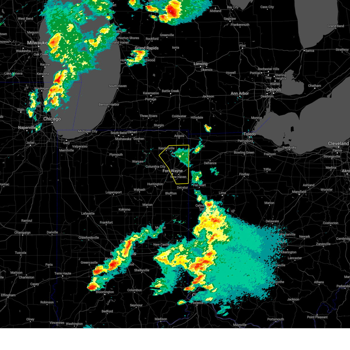
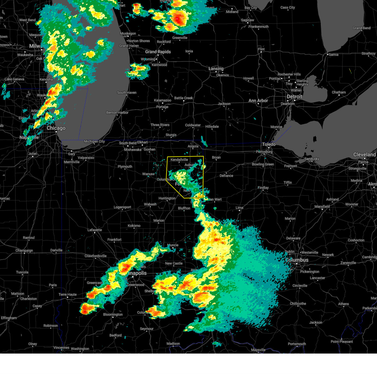
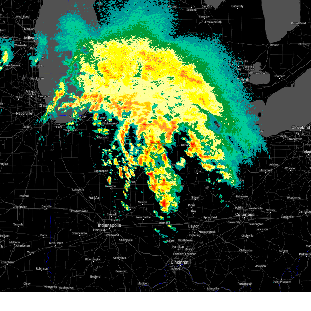
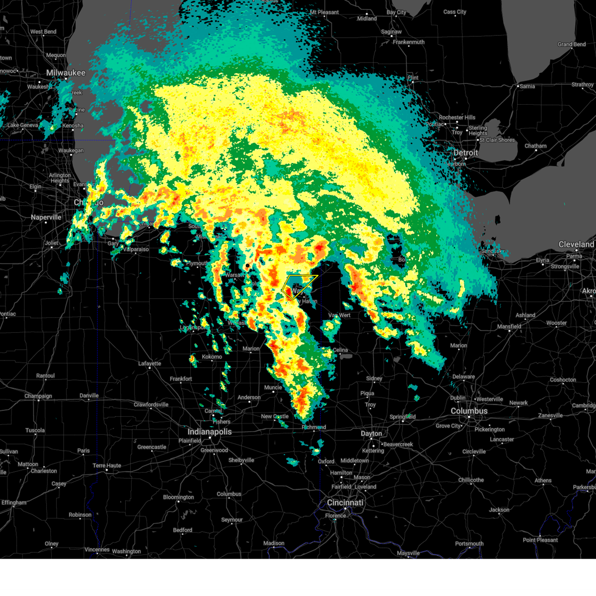
Hail Map for Harlan, IN
The Harlan, IN area has had 1 report of on-the-ground hail by trained spotters, and has been under severe weather warnings 17 times during the past 12 months. Doppler radar has detected hail at or near Harlan, IN on 31 occasions, including 1 occasion during the past year.
| Name: | Harlan, IN |
| Where Located: | 12.5 miles NE of Fort Wayne, IN |
| Map: | Google Map for Harlan, IN |
| Population: | 1634 |
| Housing Units: | 619 |
| More Info: | Search Google for Harlan, IN |
0
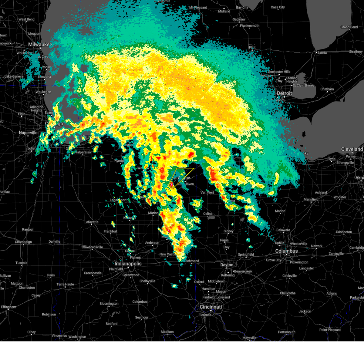
The Top Recent Hail Date for Harlan, IN is Wednesday, April 2, 2025 (14th out of 31)

Hail and Wind Damage Spotted near Harlan, IN
| Date / Time | Report Details |
|---|---|
| 6/18/2025 5:42 PM EDT |
 Svriwx the national weather service in northern indiana has issued a * severe thunderstorm warning for, northeastern allen county in northeastern indiana, de kalb county in northeastern indiana, * until 615 pm edt. * at 542 pm edt, a severe thunderstorm was located near garrett, moving northeast at 55 mph (radar indicated). Hazards include 60 mph wind gusts and quarter size hail. Hail damage to vehicles is expected. Expect wind damage to roofs, siding, and trees. Svriwx the national weather service in northern indiana has issued a * severe thunderstorm warning for, northeastern allen county in northeastern indiana, de kalb county in northeastern indiana, * until 615 pm edt. * at 542 pm edt, a severe thunderstorm was located near garrett, moving northeast at 55 mph (radar indicated). Hazards include 60 mph wind gusts and quarter size hail. Hail damage to vehicles is expected. Expect wind damage to roofs, siding, and trees.
|
| 5/16/2025 8:43 PM EDT |
 The storms which prompted the warning have moved out of the area. therefore, the warning will be allowed to expire. however, gusty winds are still possible with these thunderstorms. a severe thunderstorm watch remains in effect until midnight edt for northeastern indiana. to report severe weather, contact your nearest law enforcement agency. they will relay your report to the national weather service northern indiana. The storms which prompted the warning have moved out of the area. therefore, the warning will be allowed to expire. however, gusty winds are still possible with these thunderstorms. a severe thunderstorm watch remains in effect until midnight edt for northeastern indiana. to report severe weather, contact your nearest law enforcement agency. they will relay your report to the national weather service northern indiana.
|
| 5/16/2025 8:33 PM EDT | the severe thunderstorm warning has been cancelled and is no longer in effect |
| 5/16/2025 8:33 PM EDT | At 831 pm edt, showers and embedded thunderstorms producing strong wind gusts were located along a line extending from auburn to woodburn to 6 miles east of decatur, moving northeast at 45 mph (radar indicated). Hazards include 70 mph wind gusts. these storms have a history of producing significant wind damage. Expect considerable tree damage. damage is likely to mobile homes, roofs, and outbuildings. locations impacted include, fort wayne, new haven, auburn, kendallville, garrett, butler, huntertown, avilla, waterloo, hamilton, woodburn, monroeville, grabill, st. joe, leo-cedarville, swan, middletown, concord, ashley, and newville. this includes the following highways, interstate 469 between mile markers 11 and 30. Interstate 69 in indiana between mile markers 310 and 339. |
| 5/16/2025 8:24 PM EDT |
 the severe thunderstorm warning has been cancelled and is no longer in effect the severe thunderstorm warning has been cancelled and is no longer in effect
|
| 5/16/2025 8:24 PM EDT |
 At 823 pm edt, showers and embedded thunderstorms with strong winds were located along a line extending from near garrett to near woodburn to near monroe, moving east at 50 mph (radar indicated). Hazards include 70 mph wind gusts. a wind gust to 66 mph was observed at the fort wayne airport as a result of these storms. Expect considerable tree damage. damage is likely to mobile homes, roofs, and outbuildings. locations impacted include, fort wayne, new haven, auburn, kendallville, columbia city, garrett, butler, tri-lakes, huntertown, avilla, albion, waterloo, churubusco, hamilton, woodburn, rome city, monroeville, grabill, st. joe, and leo-cedarville. this includes the following highways, interstate 469 near mile marker 1, between mile markers 4 and 6, and between mile markers 9 and 30. Interstate 69 in indiana between mile markers 299 and 340. At 823 pm edt, showers and embedded thunderstorms with strong winds were located along a line extending from near garrett to near woodburn to near monroe, moving east at 50 mph (radar indicated). Hazards include 70 mph wind gusts. a wind gust to 66 mph was observed at the fort wayne airport as a result of these storms. Expect considerable tree damage. damage is likely to mobile homes, roofs, and outbuildings. locations impacted include, fort wayne, new haven, auburn, kendallville, columbia city, garrett, butler, tri-lakes, huntertown, avilla, albion, waterloo, churubusco, hamilton, woodburn, rome city, monroeville, grabill, st. joe, and leo-cedarville. this includes the following highways, interstate 469 near mile marker 1, between mile markers 4 and 6, and between mile markers 9 and 30. Interstate 69 in indiana between mile markers 299 and 340.
|
| 5/16/2025 7:52 PM EDT | Svriwx the national weather service in northern indiana has issued a * severe thunderstorm warning for, allen county in northeastern indiana, noble county in northeastern indiana, whitley county in northeastern indiana, northeastern huntington county in northeastern indiana, de kalb county in northeastern indiana, * until 845 pm edt. * at 751 pm edt, showers and embedded thunderstorms with strong winds were located along a line extending from near ligonier to 6 miles southeast of columbia city to 8 miles northeast of van buren, moving northeast at 45 mph (radar indicated). Hazards include 60 mph wind gusts. expect damage to roofs, siding, and trees |
| 4/2/2025 8:38 AM EDT |
 The storm which prompted the warning has moved out of the area. therefore, the warning will be allowed to expire. The storm which prompted the warning has moved out of the area. therefore, the warning will be allowed to expire.
|
| 4/2/2025 8:30 AM EDT |
 At 830 am edt, a severe thunderstorm was located near huntertown, or near fort wayne, moving northeast at 85 mph (trained weather spotters reported nickel size hail 9 miles northwest of fort wayne). Hazards include quarter size hail. Damage to vehicles is expected. locations impacted include, leo-cedarville, grabill, huntertown, wallen, and fort wayne. this includes the following highways, interstate 469 between mile markers 26 and 30. Interstate 69 in indiana between mile markers 307 and 322. At 830 am edt, a severe thunderstorm was located near huntertown, or near fort wayne, moving northeast at 85 mph (trained weather spotters reported nickel size hail 9 miles northwest of fort wayne). Hazards include quarter size hail. Damage to vehicles is expected. locations impacted include, leo-cedarville, grabill, huntertown, wallen, and fort wayne. this includes the following highways, interstate 469 between mile markers 26 and 30. Interstate 69 in indiana between mile markers 307 and 322.
|
| 4/2/2025 8:24 AM EDT |
 Svriwx the national weather service in northern indiana has issued a * severe thunderstorm warning for, northwestern allen county in northeastern indiana, * until 845 am edt. * at 824 am edt, a severe thunderstorm was located near fort wayne, moving northeast at 85 mph (radar indicated). Hazards include quarter size hail. damage to vehicles is expected Svriwx the national weather service in northern indiana has issued a * severe thunderstorm warning for, northwestern allen county in northeastern indiana, * until 845 am edt. * at 824 am edt, a severe thunderstorm was located near fort wayne, moving northeast at 85 mph (radar indicated). Hazards include quarter size hail. damage to vehicles is expected
|
| 3/30/2025 5:57 PM EDT | At 557 pm edt, severe thunderstorms were located along a line extending from 8 miles west of pioneer to woodburn, moving northeast at 45 mph (radar indicated). Hazards include 70 mph wind gusts and nickel size hail. Expect considerable tree damage. damage is likely to mobile homes, roofs, and outbuildings. locations impacted include, paulding, grelton, ridgeville corners, gerald, liberty center, fayette, lake seneca, zulu, tedrow, antwerp, latty, okolona, mark center, kunkle, worstville, bryan, poe, hessen cassel, florida, and winameg. this includes the following highways, interstate 469 between mile markers 12 and 22. interstate 80 in indiana near mile marker 156. Interstate 80 in ohio between mile markers 0 and 48. |
| 3/30/2025 5:52 PM EDT | The storms which prompted the warning have weakened below severe limits, and have exited the warned area. therefore, the warning will be allowed to expire. however, gusty winds are still possible with these thunderstorms. a tornado watch remains in effect until 800 pm edt for central, north central and northeastern indiana. a severe thunderstorm watch remains in effect until 1000 pm edt for west central ohio. remember, a severe thunderstorm warning still remains in effect for allen, deklab, and steuben counties. |
| 3/30/2025 5:36 PM EDT |
 At 535 pm edt, severe thunderstorms were located along a line extending from 6 miles east of reading to near van wert, moving east at 115 mph (radar indicated). Hazards include 70 mph wind gusts and quarter size hail. Hail damage to vehicles is expected. expect considerable tree damage. wind damage is also likely to mobile homes, roofs, and outbuildings. locations impacted include, preble, yoder, angola, alvarado, fairfield center, aboite, liberty center, hamilton lake, laotto, zulu, big long lake, tocsin, salem center, helmer, kingsland, rivare, metz, sedan, bowerstown, and dunfee. this includes the following highways, interstate 469 between mile markers 0 and 30. interstate 69 in indiana between mile markers 270 and 355. Interstate 80 in indiana between mile markers 146 and 156. At 535 pm edt, severe thunderstorms were located along a line extending from 6 miles east of reading to near van wert, moving east at 115 mph (radar indicated). Hazards include 70 mph wind gusts and quarter size hail. Hail damage to vehicles is expected. expect considerable tree damage. wind damage is also likely to mobile homes, roofs, and outbuildings. locations impacted include, preble, yoder, angola, alvarado, fairfield center, aboite, liberty center, hamilton lake, laotto, zulu, big long lake, tocsin, salem center, helmer, kingsland, rivare, metz, sedan, bowerstown, and dunfee. this includes the following highways, interstate 469 between mile markers 0 and 30. interstate 69 in indiana between mile markers 270 and 355. Interstate 80 in indiana between mile markers 146 and 156.
|
| 3/30/2025 5:36 PM EDT |
 the severe thunderstorm warning has been cancelled and is no longer in effect the severe thunderstorm warning has been cancelled and is no longer in effect
|
| 3/30/2025 5:34 PM EDT |
 Svriwx the national weather service in northern indiana has issued a * severe thunderstorm warning for, steuben county in northeastern indiana, allen county in northeastern indiana, de kalb county in northeastern indiana, southern hillsdale county in southeastern michigan, northern putnam county in west central ohio, defiance county in northwestern ohio, paulding county in west central ohio, henry county in northwestern ohio, northwestern van wert county in west central ohio, williams county in northwestern ohio, fulton county in northwestern ohio, * until 630 pm edt. * at 533 pm edt, severe thunderstorms were located along a line extending from angola to near ossian, moving east at 70 mph (radar indicated). Hazards include 70 mph wind gusts and nickel size hail. Expect considerable tree damage. Damage is likely to mobile homes, roofs, and outbuildings. Svriwx the national weather service in northern indiana has issued a * severe thunderstorm warning for, steuben county in northeastern indiana, allen county in northeastern indiana, de kalb county in northeastern indiana, southern hillsdale county in southeastern michigan, northern putnam county in west central ohio, defiance county in northwestern ohio, paulding county in west central ohio, henry county in northwestern ohio, northwestern van wert county in west central ohio, williams county in northwestern ohio, fulton county in northwestern ohio, * until 630 pm edt. * at 533 pm edt, severe thunderstorms were located along a line extending from angola to near ossian, moving east at 70 mph (radar indicated). Hazards include 70 mph wind gusts and nickel size hail. Expect considerable tree damage. Damage is likely to mobile homes, roofs, and outbuildings.
|
| 3/30/2025 5:05 PM EDT |
 Svriwx the national weather service in northern indiana has issued a * severe thunderstorm warning for, southeastern elkhart county in north central indiana, wabash county in north central indiana, noble county in northeastern indiana, northern grant county in central indiana, whitley county in northeastern indiana, huntington county in northeastern indiana, eastern kosciusko county in north central indiana, southern lagrange county in northeastern indiana, steuben county in northeastern indiana, allen county in northeastern indiana, de kalb county in northeastern indiana, wells county in northeastern indiana, northern adams county in northeastern indiana, * until 600 pm edt. * at 504 pm edt, severe thunderstorms were located along a line extending from millersburg to 6 miles northwest of van buren, moving east at 115 mph (radar indicated). Hazards include 70 mph wind gusts and quarter size hail. Hail damage to vehicles is expected. expect considerable tree damage. Wind damage is also likely to mobile homes, roofs, and outbuildings. Svriwx the national weather service in northern indiana has issued a * severe thunderstorm warning for, southeastern elkhart county in north central indiana, wabash county in north central indiana, noble county in northeastern indiana, northern grant county in central indiana, whitley county in northeastern indiana, huntington county in northeastern indiana, eastern kosciusko county in north central indiana, southern lagrange county in northeastern indiana, steuben county in northeastern indiana, allen county in northeastern indiana, de kalb county in northeastern indiana, wells county in northeastern indiana, northern adams county in northeastern indiana, * until 600 pm edt. * at 504 pm edt, severe thunderstorms were located along a line extending from millersburg to 6 miles northwest of van buren, moving east at 115 mph (radar indicated). Hazards include 70 mph wind gusts and quarter size hail. Hail damage to vehicles is expected. expect considerable tree damage. Wind damage is also likely to mobile homes, roofs, and outbuildings.
|
| 7/16/2024 12:50 AM EDT |
 Svriwx the national weather service in northern indiana has issued a * severe thunderstorm warning for, steuben county in northeastern indiana, allen county in northeastern indiana, eastern noble county in northeastern indiana, de kalb county in northeastern indiana, eastern lagrange county in northeastern indiana, southern branch county in southwestern michigan, * until 130 am edt. * at 1250 am edt, severe thunderstorms were located along a line extending from near sturgis to near kendallville to near churubusco to 9 miles south of columbia city, moving northeast at 55 mph (radar indicated). Hazards include 60 mph wind gusts. Expect damage to roofs, siding, and trees. severe thunderstorms will be near, kendallville and avilla around 1255 am edt. fort wayne, garrett, huntertown, and bronson around 100 am edt. auburn, angola, and waterloo around 105 am edt. fremont and hamilton around 110 am edt. grabill around 115 am edt. butler and st. joe around 120 am edt. other locations impacted by these severe thunderstorms include yoder, alvarado, fairfield center, saint johns, aboite, edgerton in allen county, ray, hamilton lake, laotto, and zulu. this includes the following highways, interstate 469 between mile markers 0 and 30. interstate 69 in indiana between mile markers 294 and 357. interstate 69 in michigan between mile markers 1 and 10. Interstate 80 in indiana between mile markers 133 and 156. Svriwx the national weather service in northern indiana has issued a * severe thunderstorm warning for, steuben county in northeastern indiana, allen county in northeastern indiana, eastern noble county in northeastern indiana, de kalb county in northeastern indiana, eastern lagrange county in northeastern indiana, southern branch county in southwestern michigan, * until 130 am edt. * at 1250 am edt, severe thunderstorms were located along a line extending from near sturgis to near kendallville to near churubusco to 9 miles south of columbia city, moving northeast at 55 mph (radar indicated). Hazards include 60 mph wind gusts. Expect damage to roofs, siding, and trees. severe thunderstorms will be near, kendallville and avilla around 1255 am edt. fort wayne, garrett, huntertown, and bronson around 100 am edt. auburn, angola, and waterloo around 105 am edt. fremont and hamilton around 110 am edt. grabill around 115 am edt. butler and st. joe around 120 am edt. other locations impacted by these severe thunderstorms include yoder, alvarado, fairfield center, saint johns, aboite, edgerton in allen county, ray, hamilton lake, laotto, and zulu. this includes the following highways, interstate 469 between mile markers 0 and 30. interstate 69 in indiana between mile markers 294 and 357. interstate 69 in michigan between mile markers 1 and 10. Interstate 80 in indiana between mile markers 133 and 156.
|
| 4/17/2024 1:52 PM EDT |
 The severe thunderstorm which prompted the warning has weakened and moved out of the warned area. therefore, the warning will be allowed to expire. a tornado watch remains in effect until 700 pm edt for northeastern indiana, and northwestern and west central ohio. The severe thunderstorm which prompted the warning has weakened and moved out of the warned area. therefore, the warning will be allowed to expire. a tornado watch remains in effect until 700 pm edt for northeastern indiana, and northwestern and west central ohio.
|
| 4/17/2024 1:40 PM EDT |
 At 140 pm edt, a severe thunderstorm was located over st. joe, or near hicksville, moving northeast at 50 mph (radar indicated). Hazards include 60 mph wind gusts and quarter size hail. Hail damage to vehicles is expected. expect wind damage to roofs, siding, and trees. locations impacted include, grabill, st. Joe, leo-cedarville, concord, newville, cuba, saint joe, harlan, and spencerville in dekalb county. At 140 pm edt, a severe thunderstorm was located over st. joe, or near hicksville, moving northeast at 50 mph (radar indicated). Hazards include 60 mph wind gusts and quarter size hail. Hail damage to vehicles is expected. expect wind damage to roofs, siding, and trees. locations impacted include, grabill, st. Joe, leo-cedarville, concord, newville, cuba, saint joe, harlan, and spencerville in dekalb county.
|
| 4/17/2024 1:28 PM EDT |
 Svriwx the national weather service in northern indiana has issued a * severe thunderstorm warning for, northeastern allen county in northeastern indiana, southeastern de kalb county in northeastern indiana, * until 200 pm edt. * at 128 pm edt, a severe thunderstorm was located near grabill, or 10 miles southeast of garrett, moving northeast at 50 mph (radar indicated). Hazards include 60 mph wind gusts and quarter size hail. Hail damage to vehicles is expected. Expect wind damage to roofs, siding, and trees. Svriwx the national weather service in northern indiana has issued a * severe thunderstorm warning for, northeastern allen county in northeastern indiana, southeastern de kalb county in northeastern indiana, * until 200 pm edt. * at 128 pm edt, a severe thunderstorm was located near grabill, or 10 miles southeast of garrett, moving northeast at 50 mph (radar indicated). Hazards include 60 mph wind gusts and quarter size hail. Hail damage to vehicles is expected. Expect wind damage to roofs, siding, and trees.
|
| 7/29/2023 3:02 AM EDT |
 At 302 am edt, severe thunderstorms were located along a line extending from holiday city to near paulding, moving east at 60 mph (radar indicated). Hazards include 60 mph wind gusts. Expect damage to roofs, siding, and trees. locations impacted include, defiance, bryan, montpelier, hicksville, butler, paulding, edgerton, antwerp, west unity, woodburn, stryker, edon, st. joe, holiday city, edgerton in williams county, columbia, west jefferson, pulaski, farmer, and newville. this includes the following highways, interstate 80 in indiana near mile marker 156. Interstate 80 in ohio between mile markers 0 and 22. At 302 am edt, severe thunderstorms were located along a line extending from holiday city to near paulding, moving east at 60 mph (radar indicated). Hazards include 60 mph wind gusts. Expect damage to roofs, siding, and trees. locations impacted include, defiance, bryan, montpelier, hicksville, butler, paulding, edgerton, antwerp, west unity, woodburn, stryker, edon, st. joe, holiday city, edgerton in williams county, columbia, west jefferson, pulaski, farmer, and newville. this includes the following highways, interstate 80 in indiana near mile marker 156. Interstate 80 in ohio between mile markers 0 and 22.
|
| 7/29/2023 2:38 AM EDT |
 At 238 am edt, severe thunderstorms were located along a line extending from angola to near fort wayne, moving east at 60 mph (radar indicated). Hazards include 60 mph wind gusts. expect damage to roofs, siding, and trees At 238 am edt, severe thunderstorms were located along a line extending from angola to near fort wayne, moving east at 60 mph (radar indicated). Hazards include 60 mph wind gusts. expect damage to roofs, siding, and trees
|
| 7/20/2023 5:11 PM EDT |
 At 511 pm edt, a severe thunderstorm was located near grabill, or 7 miles southwest of hicksville, moving east at 40 mph (radar indicated). Hazards include 70 mph wind gusts and penny size hail. Expect considerable tree damage. damage is likely to mobile homes, roofs, and outbuildings. locations impacted include, fort wayne, defiance, hicksville, paulding, antwerp, woodburn, payne, grabill, st. joe, newville, grover hill, scott, melrose, haviland, latty, cecil, broughton, arthur, charloe, and edgerton in allen county. This includes interstate 469 between mile markers 22 and 26. At 511 pm edt, a severe thunderstorm was located near grabill, or 7 miles southwest of hicksville, moving east at 40 mph (radar indicated). Hazards include 70 mph wind gusts and penny size hail. Expect considerable tree damage. damage is likely to mobile homes, roofs, and outbuildings. locations impacted include, fort wayne, defiance, hicksville, paulding, antwerp, woodburn, payne, grabill, st. joe, newville, grover hill, scott, melrose, haviland, latty, cecil, broughton, arthur, charloe, and edgerton in allen county. This includes interstate 469 between mile markers 22 and 26.
|
| 7/20/2023 4:53 PM EDT |
 At 453 pm edt, a severe thunderstorm was located near huntertown, or near garrett, moving east at 40 mph (radar indicated). Hazards include 70 mph wind gusts and penny size hail. Expect considerable tree damage. Damage is likely to mobile homes, roofs, and outbuildings. At 453 pm edt, a severe thunderstorm was located near huntertown, or near garrett, moving east at 40 mph (radar indicated). Hazards include 70 mph wind gusts and penny size hail. Expect considerable tree damage. Damage is likely to mobile homes, roofs, and outbuildings.
|
| 7/20/2023 4:50 PM EDT |
 At 449 pm edt, a severe thunderstorm was located near huntertown, or near garrett, moving southeast at 45 mph (radar indicated). Hazards include 70 mph wind gusts and quarter size hail. Hail damage to vehicles is expected. expect considerable tree damage. wind damage is also likely to mobile homes, roofs, and outbuildings. locations impacted include, auburn, garrett, huntertown, avilla, woodburn, grabill, st. joe, leo-cedarville, swan, concord, newville, corunna, altona, butler center, saint johns, merriam, laotto, spencerville in dekalb county, moore, and saint joe. this includes the following highways, interstate 469 between mile markers 26 and 27. Interstate 69 in indiana between mile markers 316 and 333. At 449 pm edt, a severe thunderstorm was located near huntertown, or near garrett, moving southeast at 45 mph (radar indicated). Hazards include 70 mph wind gusts and quarter size hail. Hail damage to vehicles is expected. expect considerable tree damage. wind damage is also likely to mobile homes, roofs, and outbuildings. locations impacted include, auburn, garrett, huntertown, avilla, woodburn, grabill, st. joe, leo-cedarville, swan, concord, newville, corunna, altona, butler center, saint johns, merriam, laotto, spencerville in dekalb county, moore, and saint joe. this includes the following highways, interstate 469 between mile markers 26 and 27. Interstate 69 in indiana between mile markers 316 and 333.
|
| 7/20/2023 4:24 PM EDT |
 At 423 pm edt, a severe thunderstorm was located over albion, or 9 miles southeast of ligonier, moving east at 40 mph (radar indicated). Hazards include 70 mph wind gusts and quarter size hail. Hail damage to vehicles is expected. expect considerable tree damage. Wind damage is also likely to mobile homes, roofs, and outbuildings. At 423 pm edt, a severe thunderstorm was located over albion, or 9 miles southeast of ligonier, moving east at 40 mph (radar indicated). Hazards include 70 mph wind gusts and quarter size hail. Hail damage to vehicles is expected. expect considerable tree damage. Wind damage is also likely to mobile homes, roofs, and outbuildings.
|
| 6/25/2023 5:41 PM EDT |
 The severe thunderstorm warning for central allen county will expire at 545 pm edt, the storms which prompted the warning have moved out of the area. therefore, the warning will be allowed to expire. however a seperate thunderstorm will move across eastern allen county with small hail and heavy rain still possible. a tornado watch remains in effect until 800 pm edt for northeastern indiana, and west central ohio. The severe thunderstorm warning for central allen county will expire at 545 pm edt, the storms which prompted the warning have moved out of the area. therefore, the warning will be allowed to expire. however a seperate thunderstorm will move across eastern allen county with small hail and heavy rain still possible. a tornado watch remains in effect until 800 pm edt for northeastern indiana, and west central ohio.
|
| 6/25/2023 5:20 PM EDT |
 At 520 pm edt, severe thunderstorms were located along a line extending from near grabill to near woodburn to near new haven, moving east at 60 mph (radar indicated). Hazards include 60 mph wind gusts and quarter size hail. Hail damage to vehicles is expected. expect wind damage to roofs, siding, and trees. these severe storms will be near, woodburn around 525 pm edt. other locations impacted by these severe thunderstorms include cuba, tillman, harlan, edgerton in allen county, townley, wallen, zulu, maples and leo-cedarville. this includes the following highways, interstate 469 between mile markers 12 and 30. interstate 69 in indiana between mile markers 305 and 317. hail threat, radar indicated max hail size, 1. 00 in wind threat, radar indicated max wind gust, 60 mph. At 520 pm edt, severe thunderstorms were located along a line extending from near grabill to near woodburn to near new haven, moving east at 60 mph (radar indicated). Hazards include 60 mph wind gusts and quarter size hail. Hail damage to vehicles is expected. expect wind damage to roofs, siding, and trees. these severe storms will be near, woodburn around 525 pm edt. other locations impacted by these severe thunderstorms include cuba, tillman, harlan, edgerton in allen county, townley, wallen, zulu, maples and leo-cedarville. this includes the following highways, interstate 469 between mile markers 12 and 30. interstate 69 in indiana between mile markers 305 and 317. hail threat, radar indicated max hail size, 1. 00 in wind threat, radar indicated max wind gust, 60 mph.
|
| 6/25/2023 5:09 PM EDT |
 At 509 pm edt, severe thunderstorms were located along a line extending from near fort wayne to near new haven to 7 miles northwest of ossian, moving east at 45 mph (radar indicated). Hazards include 60 mph wind gusts and half dollar size hail. Hail damage to vehicles is expected. expect wind damage to roofs, siding, and trees. severe thunderstorms will be near, new haven and grabill around 520 pm edt. woodburn and monroeville around 530 pm edt. other locations impacted by these severe thunderstorms include nine mile, dunfee, aboite, harlan, edgerton in allen county, hessen cassel, wallen, zulu, maples and cuba. this includes the following highways, interstate 469 between mile markers 5 and 6, and between mile markers 9 and 30. interstate 69 in indiana between mile markers 297 and 318. hail threat, radar indicated max hail size, 1. 25 in wind threat, radar indicated max wind gust, 60 mph. At 509 pm edt, severe thunderstorms were located along a line extending from near fort wayne to near new haven to 7 miles northwest of ossian, moving east at 45 mph (radar indicated). Hazards include 60 mph wind gusts and half dollar size hail. Hail damage to vehicles is expected. expect wind damage to roofs, siding, and trees. severe thunderstorms will be near, new haven and grabill around 520 pm edt. woodburn and monroeville around 530 pm edt. other locations impacted by these severe thunderstorms include nine mile, dunfee, aboite, harlan, edgerton in allen county, hessen cassel, wallen, zulu, maples and cuba. this includes the following highways, interstate 469 between mile markers 5 and 6, and between mile markers 9 and 30. interstate 69 in indiana between mile markers 297 and 318. hail threat, radar indicated max hail size, 1. 25 in wind threat, radar indicated max wind gust, 60 mph.
|
| 6/25/2023 4:14 PM EDT |
 At 414 pm edt, severe thunderstorms were located along a line extending from 9 miles west of angola to near waterloo to churubusco, moving east at 45 mph (radar indicated). Hazards include 70 mph wind gusts and quarter size hail. Hail damage to vehicles is expected. expect considerable tree damage. wind damage is also likely to mobile homes, roofs, and outbuildings. these severe storms will be near, auburn and waterloo around 420 pm edt. angola around 425 pm edt. butler and hamilton around 430 pm edt. garrett around 435 pm edt. grabill around 440 pm edt. st. joe around 445 pm edt. other locations impacted by these severe thunderstorms include brimfield, butler center, york, alvarado, fairfield center, brushy prairie, saint johns, merriam, blue lake and big lake. this includes the following highways, interstate 69 in indiana between mile markers 318 and 352. Interstate 80 in indiana between mile markers 150 and 156. At 414 pm edt, severe thunderstorms were located along a line extending from 9 miles west of angola to near waterloo to churubusco, moving east at 45 mph (radar indicated). Hazards include 70 mph wind gusts and quarter size hail. Hail damage to vehicles is expected. expect considerable tree damage. wind damage is also likely to mobile homes, roofs, and outbuildings. these severe storms will be near, auburn and waterloo around 420 pm edt. angola around 425 pm edt. butler and hamilton around 430 pm edt. garrett around 435 pm edt. grabill around 440 pm edt. st. joe around 445 pm edt. other locations impacted by these severe thunderstorms include brimfield, butler center, york, alvarado, fairfield center, brushy prairie, saint johns, merriam, blue lake and big lake. this includes the following highways, interstate 69 in indiana between mile markers 318 and 352. Interstate 80 in indiana between mile markers 150 and 156.
|
| 6/25/2023 3:49 PM EDT |
 At 349 pm edt, severe thunderstorms were located along a line extending from near topeka to near albion to 6 miles southeast of north webster, moving east at 45 mph (radar indicated). Hazards include 70 mph wind gusts and quarter size hail. Hail damage to vehicles is expected. expect considerable tree damage. wind damage is also likely to mobile homes, roofs, and outbuildings. severe thunderstorms will be near, albion and rome city around 355 pm edt. kendallville and lagrange around 400 pm edt. avilla and churubusco around 405 pm edt. auburn around 415 pm edt. huntertown and waterloo around 420 pm edt. angola and garrett around 425 pm edt. butler, hamilton and grabill around 430 pm edt. st. joe around 435 pm edt. other locations impacted by these severe thunderstorms include honeyville, alvarado, fairfield center, saint johns, blue lake, hamilton lake, laotto, moore, big long lake and salem center. this includes the following highways, interstate 69 in indiana between mile markers 318 and 352. Interstate 80 in indiana between mile markers 150 and 156. At 349 pm edt, severe thunderstorms were located along a line extending from near topeka to near albion to 6 miles southeast of north webster, moving east at 45 mph (radar indicated). Hazards include 70 mph wind gusts and quarter size hail. Hail damage to vehicles is expected. expect considerable tree damage. wind damage is also likely to mobile homes, roofs, and outbuildings. severe thunderstorms will be near, albion and rome city around 355 pm edt. kendallville and lagrange around 400 pm edt. avilla and churubusco around 405 pm edt. auburn around 415 pm edt. huntertown and waterloo around 420 pm edt. angola and garrett around 425 pm edt. butler, hamilton and grabill around 430 pm edt. st. joe around 435 pm edt. other locations impacted by these severe thunderstorms include honeyville, alvarado, fairfield center, saint johns, blue lake, hamilton lake, laotto, moore, big long lake and salem center. this includes the following highways, interstate 69 in indiana between mile markers 318 and 352. Interstate 80 in indiana between mile markers 150 and 156.
|
| 3/31/2023 11:40 PM EDT | Numerous reports of large trees and powerlines downed. also received a report of vehicles blown off roa in allen county IN, 0.6 miles WSW of Harlan, IN |
| 8/29/2022 5:07 PM EDT |
 At 506 pm edt, severe thunderstorms were located along a line extending from near hicksville to 6 miles southeast of ossian, moving east at 50 mph (radar indicated). Hazards include 70 mph wind gusts. Expect considerable tree damage. damage is likely to mobile homes, roofs, and outbuildings. locations impacted include, fort wayne, new haven, bluffton, decatur, ossian, butler, woodburn, monroeville, grabill, monroe, st. joe, leo-cedarville, middletown, concord, preble, dixon, newville, uniondale, yoder and edgerton in allen county. this includes interstate 469 between mile markers 5 and 6, and between mile markers 9 and 28. thunderstorm damage threat, considerable hail threat, radar indicated max hail size, <. 75 in wind threat, radar indicated max wind gust, 70 mph. At 506 pm edt, severe thunderstorms were located along a line extending from near hicksville to 6 miles southeast of ossian, moving east at 50 mph (radar indicated). Hazards include 70 mph wind gusts. Expect considerable tree damage. damage is likely to mobile homes, roofs, and outbuildings. locations impacted include, fort wayne, new haven, bluffton, decatur, ossian, butler, woodburn, monroeville, grabill, monroe, st. joe, leo-cedarville, middletown, concord, preble, dixon, newville, uniondale, yoder and edgerton in allen county. this includes interstate 469 between mile markers 5 and 6, and between mile markers 9 and 28. thunderstorm damage threat, considerable hail threat, radar indicated max hail size, <. 75 in wind threat, radar indicated max wind gust, 70 mph.
|
| 8/29/2022 4:47 PM EDT |
 At 447 pm edt, severe thunderstorms were located along a line extending from near auburn to 6 miles north of markle, moving east at 50 mph (radar indicated). Hazards include 70 mph wind gusts. Expect considerable tree damage. damage is likely to mobile homes, roofs, and outbuildings. locations impacted include, fort wayne, huntington, new haven, auburn, bluffton, decatur, garrett, ossian, butler, huntertown, waterloo, woodburn, monroeville, markle, grabill, monroe, st. joe, aboite, leo-cedarville and middletown. this includes the following highways, interstate 469 between mile markers 0 and 30. interstate 69 in indiana between mile markers 284 and 333. thunderstorm damage threat, considerable hail threat, radar indicated max hail size, <. 75 in wind threat, radar indicated max wind gust, 70 mph. At 447 pm edt, severe thunderstorms were located along a line extending from near auburn to 6 miles north of markle, moving east at 50 mph (radar indicated). Hazards include 70 mph wind gusts. Expect considerable tree damage. damage is likely to mobile homes, roofs, and outbuildings. locations impacted include, fort wayne, huntington, new haven, auburn, bluffton, decatur, garrett, ossian, butler, huntertown, waterloo, woodburn, monroeville, markle, grabill, monroe, st. joe, aboite, leo-cedarville and middletown. this includes the following highways, interstate 469 between mile markers 0 and 30. interstate 69 in indiana between mile markers 284 and 333. thunderstorm damage threat, considerable hail threat, radar indicated max hail size, <. 75 in wind threat, radar indicated max wind gust, 70 mph.
|
| 8/29/2022 4:34 PM EDT |
 At 433 pm edt, severe thunderstorms were located along a line extending from near avilla to 6 miles north of huntington, moving east at 50 mph (radar indicated). Hazards include 70 mph wind gusts. Expect considerable tree damage. Damage is likely to mobile homes, roofs, and outbuildings. At 433 pm edt, severe thunderstorms were located along a line extending from near avilla to 6 miles north of huntington, moving east at 50 mph (radar indicated). Hazards include 70 mph wind gusts. Expect considerable tree damage. Damage is likely to mobile homes, roofs, and outbuildings.
|
| 7/23/2022 8:30 AM EDT |
 At 829 am edt, severe thunderstorms were located along a line extending from near butler to near new haven to near markle, moving east at 45 mph (radar indicated). Hazards include 60 mph wind gusts. expect damage to roofs, siding, and trees At 829 am edt, severe thunderstorms were located along a line extending from near butler to near new haven to near markle, moving east at 45 mph (radar indicated). Hazards include 60 mph wind gusts. expect damage to roofs, siding, and trees
|
| 7/5/2022 8:40 PM EDT |
 At 839 pm edt, a severe thunderstorm was located over new haven, moving southeast at 50 mph (radar indicated). Hazards include 70 mph wind gusts. Expect considerable tree damage. damage is likely to mobile homes, roofs, and outbuildings. locations impacted include, fort wayne, new haven, woodburn, grabill, leo-cedarville, cuba, harlan, tillman, edgerton in allen county, zulu and maples. this includes the following highways, interstate 469 between mile markers 13 and 30. interstate 69 in indiana between mile markers 313 and 314. thunderstorm damage threat, considerable hail threat, radar indicated max hail size, <. 75 in wind threat, radar indicated max wind gust, 70 mph. At 839 pm edt, a severe thunderstorm was located over new haven, moving southeast at 50 mph (radar indicated). Hazards include 70 mph wind gusts. Expect considerable tree damage. damage is likely to mobile homes, roofs, and outbuildings. locations impacted include, fort wayne, new haven, woodburn, grabill, leo-cedarville, cuba, harlan, tillman, edgerton in allen county, zulu and maples. this includes the following highways, interstate 469 between mile markers 13 and 30. interstate 69 in indiana between mile markers 313 and 314. thunderstorm damage threat, considerable hail threat, radar indicated max hail size, <. 75 in wind threat, radar indicated max wind gust, 70 mph.
|
| 7/5/2022 8:22 PM EDT |
 At 822 pm edt, a severe thunderstorm was located near huntertown, or 10 miles northwest of fort wayne, moving southeast at 30 mph (radar indicated). Hazards include 60 mph wind gusts. expect damage to roofs, siding, and trees At 822 pm edt, a severe thunderstorm was located near huntertown, or 10 miles northwest of fort wayne, moving southeast at 30 mph (radar indicated). Hazards include 60 mph wind gusts. expect damage to roofs, siding, and trees
|
| 5/25/2022 7:43 PM EDT |
 The severe thunderstorm warning for eastern allen county will expire at 745 pm edt, the storm which prompted the warning has moved out of the area. therefore, the warning will be allowed to expire. The severe thunderstorm warning for eastern allen county will expire at 745 pm edt, the storm which prompted the warning has moved out of the area. therefore, the warning will be allowed to expire.
|
| 5/25/2022 7:25 PM EDT |
 At 725 pm edt, a severe thunderstorm was located near new haven, moving north at 50 mph (radar indicated). Hazards include 60 mph wind gusts. Expect damage to roofs, siding, and trees. locations impacted include, fort wayne, new haven, woodburn, monroeville, grabill, leo-cedarville, middletown, harlan, edgerton in allen county, zulu, maples, cuba, hoagland, tillman and townley. this includes the following highways, interstate 469 between mile markers 13 and 30. interstate 69 in indiana near mile marker 320. hail threat, radar indicated max hail size, <. 75 in wind threat, observed max wind gust, 60 mph. At 725 pm edt, a severe thunderstorm was located near new haven, moving north at 50 mph (radar indicated). Hazards include 60 mph wind gusts. Expect damage to roofs, siding, and trees. locations impacted include, fort wayne, new haven, woodburn, monroeville, grabill, leo-cedarville, middletown, harlan, edgerton in allen county, zulu, maples, cuba, hoagland, tillman and townley. this includes the following highways, interstate 469 between mile markers 13 and 30. interstate 69 in indiana near mile marker 320. hail threat, radar indicated max hail size, <. 75 in wind threat, observed max wind gust, 60 mph.
|
| 5/25/2022 7:03 PM EDT |
 At 702 pm edt, a severe thunderstorm was located over decatur, moving north at 50 mph (radar indicated). Hazards include 60 mph wind gusts. expect damage to roofs, siding, and trees At 702 pm edt, a severe thunderstorm was located over decatur, moving north at 50 mph (radar indicated). Hazards include 60 mph wind gusts. expect damage to roofs, siding, and trees
|
| 3/23/2022 2:42 PM EDT |
 At 242 pm edt, severe thunderstorms were located along a line extending from near grabill to 6 miles south of woodburn to near monroeville, moving northeast at 40 mph (radar indicated). Hazards include 60 mph wind gusts and nickel size hail. expect damage to roofs, siding, and trees At 242 pm edt, severe thunderstorms were located along a line extending from near grabill to 6 miles south of woodburn to near monroeville, moving northeast at 40 mph (radar indicated). Hazards include 60 mph wind gusts and nickel size hail. expect damage to roofs, siding, and trees
|
| 3/6/2022 3:21 AM EST |
 At 321 am est, severe thunderstorms were located along a line extending from near auburn to near monroeville to near matthews, moving east at 80 mph (radar indicated). Hazards include 70 mph wind gusts. Expect considerable tree damage. Damage is likely to mobile homes, roofs, and outbuildings. At 321 am est, severe thunderstorms were located along a line extending from near auburn to near monroeville to near matthews, moving east at 80 mph (radar indicated). Hazards include 70 mph wind gusts. Expect considerable tree damage. Damage is likely to mobile homes, roofs, and outbuildings.
|
| 8/11/2021 2:36 PM EDT |
 At 236 pm edt, severe thunderstorms were located along a line extending from 6 miles northeast of antwerp to near ohio city to near geneva, moving southeast at 40 mph (radar indicated). Hazards include 60 mph wind gusts and penny size hail. Expect damage to roofs, siding, and trees. locations impacted include, fort wayne, defiance, new haven, van wert, bluffton, decatur, berne, hicksville, ossian, paulding, antwerp, woodburn, geneva, monroeville, payne, markle, convoy, monroe, ohio city and westchester. this includes the following highways, interstate 469 near mile marker 6, and between mile markers 9 and 23. interstate 69 in indiana between mile markers 276 and 282. hail threat, radar indicated max hail size, 0. 75 in wind threat, radar indicated max wind gust, 60 mph. At 236 pm edt, severe thunderstorms were located along a line extending from 6 miles northeast of antwerp to near ohio city to near geneva, moving southeast at 40 mph (radar indicated). Hazards include 60 mph wind gusts and penny size hail. Expect damage to roofs, siding, and trees. locations impacted include, fort wayne, defiance, new haven, van wert, bluffton, decatur, berne, hicksville, ossian, paulding, antwerp, woodburn, geneva, monroeville, payne, markle, convoy, monroe, ohio city and westchester. this includes the following highways, interstate 469 near mile marker 6, and between mile markers 9 and 23. interstate 69 in indiana between mile markers 276 and 282. hail threat, radar indicated max hail size, 0. 75 in wind threat, radar indicated max wind gust, 60 mph.
|
| 8/11/2021 2:14 PM EDT |
 At 214 pm edt, severe thunderstorms were located along a line extending from st. joe to near decatur to 7 miles north of montpelier, moving southeast at 40 mph (radar indicated). Hazards include 60 mph wind gusts and penny size hail. expect damage to roofs, siding, and trees At 214 pm edt, severe thunderstorms were located along a line extending from st. joe to near decatur to 7 miles north of montpelier, moving southeast at 40 mph (radar indicated). Hazards include 60 mph wind gusts and penny size hail. expect damage to roofs, siding, and trees
|
| 8/11/2021 2:07 PM EDT | Report from mping: 3-inch tree limbs broken; power poles broke in allen county IN, 0.5 miles N of Harlan, IN |
| 8/11/2021 1:48 PM EDT |
 At 148 pm edt, severe thunderstorms were located along a line extending from near avilla to 8 miles northwest of ossian to near la fontaine, moving east at 55 mph (radar indicated). Hazards include 60 mph wind gusts and penny size hail. expect damage to roofs, siding, and trees At 148 pm edt, severe thunderstorms were located along a line extending from near avilla to 8 miles northwest of ossian to near la fontaine, moving east at 55 mph (radar indicated). Hazards include 60 mph wind gusts and penny size hail. expect damage to roofs, siding, and trees
|
| 8/11/2021 1:15 AM EDT | Numerous trees down around harla in allen county IN, 0.2 miles SSW of Harlan, IN |
| 8/7/2021 12:36 PM EDT |
 The severe thunderstorm warning for north central allen county will expire at 1245 pm edt, the storm which prompted the warning has weakened below severe limits, and no longer poses an immediate threat to life or property. therefore, the warning will be allowed to expire. however gusty winds and heavy rain are still possible with this thunderstorm. The severe thunderstorm warning for north central allen county will expire at 1245 pm edt, the storm which prompted the warning has weakened below severe limits, and no longer poses an immediate threat to life or property. therefore, the warning will be allowed to expire. however gusty winds and heavy rain are still possible with this thunderstorm.
|
| 8/7/2021 12:08 PM EDT |
 At 1208 pm edt, a severe thunderstorm was located near huntertown, or 9 miles south of garrett, moving southeast at 20 mph (radar indicated). Hazards include 60 mph wind gusts and quarter size hail. Hail damage to vehicles is expected. Expect wind damage to roofs, siding, and trees. At 1208 pm edt, a severe thunderstorm was located near huntertown, or 9 miles south of garrett, moving southeast at 20 mph (radar indicated). Hazards include 60 mph wind gusts and quarter size hail. Hail damage to vehicles is expected. Expect wind damage to roofs, siding, and trees.
|
| 7/29/2021 6:07 AM EDT |
 At 607 am edt, severe thunderstorms were located along a line extending from near butler to near grabill to near fort wayne, moving east at 50 mph (radar indicated). Hazards include 60 mph wind gusts. expect damage to roofs, siding, and trees At 607 am edt, severe thunderstorms were located along a line extending from near butler to near grabill to near fort wayne, moving east at 50 mph (radar indicated). Hazards include 60 mph wind gusts. expect damage to roofs, siding, and trees
|
| 7/29/2021 5:49 AM EDT |
 At 548 am edt, severe thunderstorms were located along a line extending from near kendallville to avilla to near tri-lakes, moving east at 55 mph (radar indicated). Hazards include 60 mph wind gusts. Expect damage to roofs, siding, and trees. locations impacted include, fort wayne, auburn, kendallville, garrett, butler, tri-lakes, huntertown, avilla, albion, waterloo, churubusco, hamilton, woodburn, rome city, grabill, st. Joe, leo-cedarville, swan, etna and concord. At 548 am edt, severe thunderstorms were located along a line extending from near kendallville to avilla to near tri-lakes, moving east at 55 mph (radar indicated). Hazards include 60 mph wind gusts. Expect damage to roofs, siding, and trees. locations impacted include, fort wayne, auburn, kendallville, garrett, butler, tri-lakes, huntertown, avilla, albion, waterloo, churubusco, hamilton, woodburn, rome city, grabill, st. Joe, leo-cedarville, swan, etna and concord.
|
| 7/29/2021 5:25 AM EDT |
 At 525 am edt, severe thunderstorms were located along a line extending from near ligonier to near syracuse to near north webster, moving east at 55 mph (radar indicated). Hazards include 60 mph wind gusts. expect damage to roofs, siding, and trees At 525 am edt, severe thunderstorms were located along a line extending from near ligonier to near syracuse to near north webster, moving east at 55 mph (radar indicated). Hazards include 60 mph wind gusts. expect damage to roofs, siding, and trees
|
| 6/20/2021 7:49 PM EDT |
 At 749 pm edt, a severe thunderstorm was located over fort wayne, moving northeast at 35 mph (radar indicated). Hazards include 60 mph wind gusts and penny size hail. Expect damage to roofs, siding, and trees. this severe thunderstorm will be near, new haven around 800 pm edt. grabill around 810 pm edt. woodburn around 815 pm edt. st. joe around 825 pm edt. other locations impacted by this severe thunderstorm include concord, harlan, cuba, leo-cedarville, saint joe and spencerville in dekalb county. this includes the following highways, interstate 469 between mile markers 18 and 30. Interstate 69 in indiana between mile markers 307 and 317. At 749 pm edt, a severe thunderstorm was located over fort wayne, moving northeast at 35 mph (radar indicated). Hazards include 60 mph wind gusts and penny size hail. Expect damage to roofs, siding, and trees. this severe thunderstorm will be near, new haven around 800 pm edt. grabill around 810 pm edt. woodburn around 815 pm edt. st. joe around 825 pm edt. other locations impacted by this severe thunderstorm include concord, harlan, cuba, leo-cedarville, saint joe and spencerville in dekalb county. this includes the following highways, interstate 469 between mile markers 18 and 30. Interstate 69 in indiana between mile markers 307 and 317.
|
| 8/28/2020 1:36 PM EDT |
 At 136 pm edt, a severe thunderstorm was located near antwerp, or 7 miles southeast of hicksville, moving east at 25 mph (radar indicated). Hazards include 60 mph wind gusts and quarter size hail. Hail damage to vehicles is expected. expect wind damage to roofs, siding, and trees. Locations impacted include, hicksville, antwerp and harlan. At 136 pm edt, a severe thunderstorm was located near antwerp, or 7 miles southeast of hicksville, moving east at 25 mph (radar indicated). Hazards include 60 mph wind gusts and quarter size hail. Hail damage to vehicles is expected. expect wind damage to roofs, siding, and trees. Locations impacted include, hicksville, antwerp and harlan.
|
| 8/28/2020 1:21 PM EDT |
 The national weather service in northern indiana has issued a * severe thunderstorm warning for. northeastern allen county in northeastern indiana. southeastern de kalb county in northeastern indiana. northwestern defiance county in northwestern ohio. Northwestern paulding county in west central ohio. The national weather service in northern indiana has issued a * severe thunderstorm warning for. northeastern allen county in northeastern indiana. southeastern de kalb county in northeastern indiana. northwestern defiance county in northwestern ohio. Northwestern paulding county in west central ohio.
|
| 8/10/2020 7:57 PM EDT |
 At 744 pm edt, severe thunderstorms were located along a line extending from auburn to 6 miles south of fort wayne, moving east at 35 mph (trained weather spotters have reported downed trees and branches). Hazards include 70 mph wind gusts. Expect considerable tree damage. damage is likely to mobile homes, roofs, and outbuildings. these severe storms will be near, butler and st. joe around 800 pm edt. monroeville around 805 pm edt. Other locations impacted by these severe thunderstorms include preble, yoder, butler center, fairfield center, saint johns, edgerton in allen county, peterson, laotto, spencerville in dekalb county and zulu. At 744 pm edt, severe thunderstorms were located along a line extending from auburn to 6 miles south of fort wayne, moving east at 35 mph (trained weather spotters have reported downed trees and branches). Hazards include 70 mph wind gusts. Expect considerable tree damage. damage is likely to mobile homes, roofs, and outbuildings. these severe storms will be near, butler and st. joe around 800 pm edt. monroeville around 805 pm edt. Other locations impacted by these severe thunderstorms include preble, yoder, butler center, fairfield center, saint johns, edgerton in allen county, peterson, laotto, spencerville in dekalb county and zulu.
|
| 8/10/2020 7:44 PM EDT |
 At 744 pm edt, severe thunderstorms were located along a line extending from auburn to 6 miles south of fort wayne, moving east at 35 mph (trained weather spotters have reported downed trees and branches). Hazards include 70 mph wind gusts. Expect considerable tree damage. damage is likely to mobile homes, roofs, and outbuildings. these severe storms will be near, butler and st. joe around 800 pm edt. monroeville around 805 pm edt. Other locations impacted by these severe thunderstorms include preble, yoder, butler center, fairfield center, saint johns, edgerton in allen county, peterson, laotto, spencerville in dekalb county and zulu. At 744 pm edt, severe thunderstorms were located along a line extending from auburn to 6 miles south of fort wayne, moving east at 35 mph (trained weather spotters have reported downed trees and branches). Hazards include 70 mph wind gusts. Expect considerable tree damage. damage is likely to mobile homes, roofs, and outbuildings. these severe storms will be near, butler and st. joe around 800 pm edt. monroeville around 805 pm edt. Other locations impacted by these severe thunderstorms include preble, yoder, butler center, fairfield center, saint johns, edgerton in allen county, peterson, laotto, spencerville in dekalb county and zulu.
|
| 8/10/2020 7:18 PM EDT |
 At 717 pm edt, severe thunderstorms were located along a line extending from near albion to 9 miles northeast of huntington, moving east at 35 mph (radar indicated). Hazards include 70 mph wind gusts. Expect considerable tree damage. damage is likely to mobile homes, roofs, and outbuildings. severe thunderstorms will be near, churubusco around 720 pm edt. kendallville around 725 pm edt. avilla around 730 pm edt. ossian around 735 pm edt. garrett around 740 pm edt. auburn and waterloo around 745 pm edt. new haven around 750 pm edt. butler and st. joe around 755 pm edt. this includes the following highways, interstate 469 between mile markers 0 and 30. Interstate 69 in indiana between mile markers 286 and 340. At 717 pm edt, severe thunderstorms were located along a line extending from near albion to 9 miles northeast of huntington, moving east at 35 mph (radar indicated). Hazards include 70 mph wind gusts. Expect considerable tree damage. damage is likely to mobile homes, roofs, and outbuildings. severe thunderstorms will be near, churubusco around 720 pm edt. kendallville around 725 pm edt. avilla around 730 pm edt. ossian around 735 pm edt. garrett around 740 pm edt. auburn and waterloo around 745 pm edt. new haven around 750 pm edt. butler and st. joe around 755 pm edt. this includes the following highways, interstate 469 between mile markers 0 and 30. Interstate 69 in indiana between mile markers 286 and 340.
|
| 7/19/2020 3:21 PM EDT |
 The severe thunderstorm warning for northeastern allen and southeastern de kalb counties will expire at 330 pm edt, the storm which prompted the warning has moved out of the area. therefore, the warning will be allowed to expire. a severe thunderstorm watch remains in effect until 700 pm edt for northeastern indiana, and west central ohio. to report severe weather, contact your nearest law enforcement agency. they will relay your report to the national weather service northern indiana. The severe thunderstorm warning for northeastern allen and southeastern de kalb counties will expire at 330 pm edt, the storm which prompted the warning has moved out of the area. therefore, the warning will be allowed to expire. a severe thunderstorm watch remains in effect until 700 pm edt for northeastern indiana, and west central ohio. to report severe weather, contact your nearest law enforcement agency. they will relay your report to the national weather service northern indiana.
|
| 7/19/2020 3:10 PM EDT |
 At 310 pm edt, a severe thunderstorm was located near hicksville, moving east at 40 mph (radar indicated). Hazards include 60 mph wind gusts. Expect damage to roofs, siding, and trees. locations impacted include, fort wayne, new haven, woodburn, grabill, st. Joe, leo-cedarville, concord, newville, harlan, edgerton in allen county, spencerville in dekalb county, cuba and saint joe. At 310 pm edt, a severe thunderstorm was located near hicksville, moving east at 40 mph (radar indicated). Hazards include 60 mph wind gusts. Expect damage to roofs, siding, and trees. locations impacted include, fort wayne, new haven, woodburn, grabill, st. Joe, leo-cedarville, concord, newville, harlan, edgerton in allen county, spencerville in dekalb county, cuba and saint joe.
|
| 7/19/2020 3:02 PM EDT |
 At 302 pm edt, a severe thunderstorm was located near grabill, or 7 miles southwest of hicksville, moving east at 40 mph (radar indicated). Hazards include 60 mph wind gusts and quarter size hail. Hail damage to vehicles is expected. expect wind damage to roofs, siding, and trees. locations impacted include, fort wayne, new haven, auburn, huntertown, woodburn, grabill, st. Joe, leo-cedarville, concord, newville, butler center, saint johns, harlan, edgerton in allen county, wallen, spencerville in dekalb county, cuba and saint joe. At 302 pm edt, a severe thunderstorm was located near grabill, or 7 miles southwest of hicksville, moving east at 40 mph (radar indicated). Hazards include 60 mph wind gusts and quarter size hail. Hail damage to vehicles is expected. expect wind damage to roofs, siding, and trees. locations impacted include, fort wayne, new haven, auburn, huntertown, woodburn, grabill, st. Joe, leo-cedarville, concord, newville, butler center, saint johns, harlan, edgerton in allen county, wallen, spencerville in dekalb county, cuba and saint joe.
|
| 7/19/2020 2:43 PM EDT |
 At 242 pm edt, a severe thunderstorm was located near huntertown, or 7 miles north of fort wayne, moving east at 40 mph (radar indicated). Hazards include 60 mph wind gusts and quarter size hail. Hail damage to vehicles is expected. Expect wind damage to roofs, siding, and trees. At 242 pm edt, a severe thunderstorm was located near huntertown, or 7 miles north of fort wayne, moving east at 40 mph (radar indicated). Hazards include 60 mph wind gusts and quarter size hail. Hail damage to vehicles is expected. Expect wind damage to roofs, siding, and trees.
|
| 6/26/2020 11:40 PM EDT |
 At 1139 pm edt, a severe thunderstorm was located near fort wayne, moving east at 65 mph (radar indicated). Hazards include 70 mph wind gusts. Expect considerable tree damage. damage is likely to mobile homes, roofs, and outbuildings. Locations impacted include, fort wayne, new haven, garrett, huntertown, woodburn, monroeville, grabill, aboite, leo-cedarville, middletown, zanesville, yoder, butler center, saint johns, edgerton in allen county, spencerville in dekalb county, zulu, arcola, rolling hills and townley. At 1139 pm edt, a severe thunderstorm was located near fort wayne, moving east at 65 mph (radar indicated). Hazards include 70 mph wind gusts. Expect considerable tree damage. damage is likely to mobile homes, roofs, and outbuildings. Locations impacted include, fort wayne, new haven, garrett, huntertown, woodburn, monroeville, grabill, aboite, leo-cedarville, middletown, zanesville, yoder, butler center, saint johns, edgerton in allen county, spencerville in dekalb county, zulu, arcola, rolling hills and townley.
|
| 6/26/2020 11:07 PM EDT |
 At 1106 pm edt, a severe thunderstorm was located near north webster, or 8 miles northeast of winona lake, moving east at 70 mph (radar indicated). Hazards include 70 mph wind gusts. Expect considerable tree damage. Damage is likely to mobile homes, roofs, and outbuildings. At 1106 pm edt, a severe thunderstorm was located near north webster, or 8 miles northeast of winona lake, moving east at 70 mph (radar indicated). Hazards include 70 mph wind gusts. Expect considerable tree damage. Damage is likely to mobile homes, roofs, and outbuildings.
|
| 6/10/2020 4:15 PM EDT |
 At 414 pm edt, severe thunderstorms were located along a line extending from near grabill to near edon, moving northeast at 80 mph (radar indicated). Hazards include 70 mph wind gusts and half dollar size hail. Hail damage to vehicles is expected. expect considerable tree damage. wind damage is also likely to mobile homes, roofs, and outbuildings. these severe storms will be near, butler and edgerton around 430 pm edt. montpelier and holiday city around 440 pm edt. Other locations impacted by these severe thunderstorms include leo-cedarville, west jefferson, alvordton, newville, concord, williams center, harlan, melbern, edgerton in allen county and pulaski. At 414 pm edt, severe thunderstorms were located along a line extending from near grabill to near edon, moving northeast at 80 mph (radar indicated). Hazards include 70 mph wind gusts and half dollar size hail. Hail damage to vehicles is expected. expect considerable tree damage. wind damage is also likely to mobile homes, roofs, and outbuildings. these severe storms will be near, butler and edgerton around 430 pm edt. montpelier and holiday city around 440 pm edt. Other locations impacted by these severe thunderstorms include leo-cedarville, west jefferson, alvordton, newville, concord, williams center, harlan, melbern, edgerton in allen county and pulaski.
|
| 6/10/2020 3:58 PM EDT |
 At 358 pm edt, severe thunderstorms were located along a line extending from near ossian to near st. joe, moving northeast at 80 mph (radar indicated). Hazards include 70 mph wind gusts and quarter size hail. Hail damage to vehicles is expected. expect considerable tree damage. wind damage is also likely to mobile homes, roofs, and outbuildings. severe thunderstorms will be near, butler around 405 pm edt. edgerton around 410 pm edt. woodburn, grabill and edon around 415 pm edt. montpelier, st. joe and holiday city around 420 pm edt. hicksville around 425 pm edt. other locations impacted by these severe thunderstorms include alvordton, melbern, edgerton in allen county, pulaski, spencerville in dekalb county, zulu, moore, artic, saint joe and middletown. this includes the following highways, interstate 469 between mile markers 5 and 6, and between mile markers 9 and 30. interstate 69 in indiana between mile markers 312 and 324. Interstate 80 in ohio between mile markers 10 and 21. At 358 pm edt, severe thunderstorms were located along a line extending from near ossian to near st. joe, moving northeast at 80 mph (radar indicated). Hazards include 70 mph wind gusts and quarter size hail. Hail damage to vehicles is expected. expect considerable tree damage. wind damage is also likely to mobile homes, roofs, and outbuildings. severe thunderstorms will be near, butler around 405 pm edt. edgerton around 410 pm edt. woodburn, grabill and edon around 415 pm edt. montpelier, st. joe and holiday city around 420 pm edt. hicksville around 425 pm edt. other locations impacted by these severe thunderstorms include alvordton, melbern, edgerton in allen county, pulaski, spencerville in dekalb county, zulu, moore, artic, saint joe and middletown. this includes the following highways, interstate 469 between mile markers 5 and 6, and between mile markers 9 and 30. interstate 69 in indiana between mile markers 312 and 324. Interstate 80 in ohio between mile markers 10 and 21.
|
| 6/10/2020 3:05 PM EDT |
 At 304 pm edt, severe thunderstorms were located along a line extending from near fremont to near st. joe, moving north at 75 mph (radar indicated). Hazards include 70 mph wind gusts and quarter size hail. Hail damage to vehicles is expected. expect considerable tree damage. wind damage is also likely to mobile homes, roofs, and outbuildings. these severe storms will be near, fremont around 310 pm edt. edgerton around 315 pm edt. hamilton and edon around 320 pm edt. reading around 335 pm edt. hillsdale around 340 pm edt. Other locations impacted by these severe thunderstorms include alvarado, fairfield center, saint johns, ray, hamilton lake, laotto, lake seneca, moore, kinderhook and shadyside. At 304 pm edt, severe thunderstorms were located along a line extending from near fremont to near st. joe, moving north at 75 mph (radar indicated). Hazards include 70 mph wind gusts and quarter size hail. Hail damage to vehicles is expected. expect considerable tree damage. wind damage is also likely to mobile homes, roofs, and outbuildings. these severe storms will be near, fremont around 310 pm edt. edgerton around 315 pm edt. hamilton and edon around 320 pm edt. reading around 335 pm edt. hillsdale around 340 pm edt. Other locations impacted by these severe thunderstorms include alvarado, fairfield center, saint johns, ray, hamilton lake, laotto, lake seneca, moore, kinderhook and shadyside.
|
| 6/10/2020 2:40 PM EDT |
 The national weather service in northern indiana has issued a * severe thunderstorm warning for. steuben county in northeastern indiana. northern allen county in northeastern indiana. eastern noble county in northeastern indiana. Northeastern whitley county in northeastern indiana. The national weather service in northern indiana has issued a * severe thunderstorm warning for. steuben county in northeastern indiana. northern allen county in northeastern indiana. eastern noble county in northeastern indiana. Northeastern whitley county in northeastern indiana.
|
| 6/10/2020 2:40 PM EDT |
 At 239 pm edt, severe thunderstorms were located along a line extending from 9 miles southwest of angola to near churubusco, moving northeast at 65 mph (radar indicated). Hazards include 70 mph wind gusts and quarter size hail. Hail damage to vehicles is expected. expect considerable tree damage. wind damage is also likely to mobile homes, roofs, and outbuildings. severe thunderstorms will be near, angola around 250 pm edt. auburn, waterloo and fremont around 255 pm edt. hamilton around 305 pm edt. reading around 325 pm edt. hillsdale around 330 pm edt. this includes the following highways, interstate 469 between mile markers 22 and 30. interstate 69 in indiana between mile markers 306 and 357. interstate 69 in michigan between mile markers 1 and 10. interstate 80 in indiana between mile markers 134 and 156. Interstate 80 in ohio between mile markers 0 and 12. At 239 pm edt, severe thunderstorms were located along a line extending from 9 miles southwest of angola to near churubusco, moving northeast at 65 mph (radar indicated). Hazards include 70 mph wind gusts and quarter size hail. Hail damage to vehicles is expected. expect considerable tree damage. wind damage is also likely to mobile homes, roofs, and outbuildings. severe thunderstorms will be near, angola around 250 pm edt. auburn, waterloo and fremont around 255 pm edt. hamilton around 305 pm edt. reading around 325 pm edt. hillsdale around 330 pm edt. this includes the following highways, interstate 469 between mile markers 22 and 30. interstate 69 in indiana between mile markers 306 and 357. interstate 69 in michigan between mile markers 1 and 10. interstate 80 in indiana between mile markers 134 and 156. Interstate 80 in ohio between mile markers 0 and 12.
|
| 5/10/2020 2:53 PM EDT |
 At 252 pm edt, severe thunderstorms were located along a line extending from near waterloo to near hicksville to near paulding, moving northeast at 45 mph (radar indicated. at 247 pm, a 61 mph gust was reported by a mesonet station 4 miles northeast of antwerp). Hazards include 60 mph wind gusts. Expect damage to roofs, siding, and trees. Locations impacted include, defiance, auburn, napoleon, bryan, wauseon, garrett, archbold, montpelier, hicksville, butler, paulding, delta, waterloo, edgerton, antwerp, west unity, hamilton, pioneer, stryker and fayette. At 252 pm edt, severe thunderstorms were located along a line extending from near waterloo to near hicksville to near paulding, moving northeast at 45 mph (radar indicated. at 247 pm, a 61 mph gust was reported by a mesonet station 4 miles northeast of antwerp). Hazards include 60 mph wind gusts. Expect damage to roofs, siding, and trees. Locations impacted include, defiance, auburn, napoleon, bryan, wauseon, garrett, archbold, montpelier, hicksville, butler, paulding, delta, waterloo, edgerton, antwerp, west unity, hamilton, pioneer, stryker and fayette.
|
| 5/10/2020 2:41 PM EDT |
 At 241 pm edt, severe thunderstorms were located along a line extending from near auburn to near antwerp to near convoy, moving northeast at 45 mph (radar indicated). Hazards include 60 mph wind gusts. expect damage to roofs, siding, and trees At 241 pm edt, severe thunderstorms were located along a line extending from near auburn to near antwerp to near convoy, moving northeast at 45 mph (radar indicated). Hazards include 60 mph wind gusts. expect damage to roofs, siding, and trees
|
| 5/10/2020 2:08 PM EDT |
 At 207 pm edt, severe thunderstorms were located along a line extending from grabill to near monroeville to near decatur, moving northeast at 40 mph (radar indicated). Hazards include 60 mph wind gusts. expect damage to roofs, siding, and trees At 207 pm edt, severe thunderstorms were located along a line extending from grabill to near monroeville to near decatur, moving northeast at 40 mph (radar indicated). Hazards include 60 mph wind gusts. expect damage to roofs, siding, and trees
|
| 9/13/2019 3:31 PM EDT |
 A severe thunderstorm warning remains in effect until 400 pm edt for southeastern allen and western paulding counties. at 330 pm edt, a severe thunderstorm was located near new haven, moving northeast at 35 mph. hazard. 60 mph wind gusts and penny size hail. source. Radar indicated. A severe thunderstorm warning remains in effect until 400 pm edt for southeastern allen and western paulding counties. at 330 pm edt, a severe thunderstorm was located near new haven, moving northeast at 35 mph. hazard. 60 mph wind gusts and penny size hail. source. Radar indicated.
|
| 9/13/2019 3:31 PM EDT |
 At 330 pm edt, a severe thunderstorm was located near new haven, moving northeast at 35 mph (radar indicated). Hazards include 60 mph wind gusts and penny size hail. Expect damage to roofs, siding, and trees. Locations impacted include, fort wayne, new haven, antwerp, woodburn, monroeville, payne, latty, worstville, edgerton in allen county, zulu, maples, mcgill, tillman, briceton and townley. At 330 pm edt, a severe thunderstorm was located near new haven, moving northeast at 35 mph (radar indicated). Hazards include 60 mph wind gusts and penny size hail. Expect damage to roofs, siding, and trees. Locations impacted include, fort wayne, new haven, antwerp, woodburn, monroeville, payne, latty, worstville, edgerton in allen county, zulu, maples, mcgill, tillman, briceton and townley.
|
| 9/13/2019 3:20 PM EDT |
 At 320 pm edt, a severe thunderstorm was located near new haven, moving northeast at 35 mph (radar indicated). Hazards include 60 mph wind gusts and penny size hail. expect damage to roofs, siding, and trees At 320 pm edt, a severe thunderstorm was located near new haven, moving northeast at 35 mph (radar indicated). Hazards include 60 mph wind gusts and penny size hail. expect damage to roofs, siding, and trees
|
| 8/18/2019 8:40 PM EDT | Tree down on sr 37 nort in allen county IN, 0.6 miles WSW of Harlan, IN |
| 8/18/2019 8:40 PM EDT |
 At 817 pm edt, a severe thunderstorm was located over grabill, or 7 miles north of new haven, moving east at 35 mph. this storm has some rotation observed on radar (radar indicated). Hazards include 60 mph wind gusts and penny size hail. expect damage to roofs, siding, and trees At 817 pm edt, a severe thunderstorm was located over grabill, or 7 miles north of new haven, moving east at 35 mph. this storm has some rotation observed on radar (radar indicated). Hazards include 60 mph wind gusts and penny size hail. expect damage to roofs, siding, and trees
|
| 8/18/2019 8:40 PM EDT |
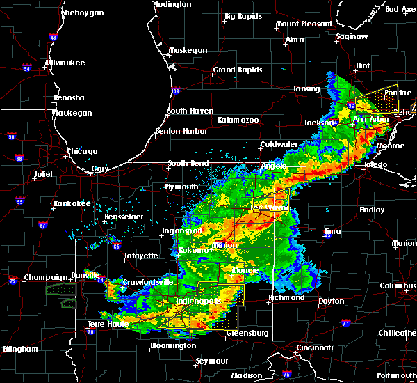 At 817 pm edt, a severe thunderstorm was located over grabill, or 7 miles north of new haven, moving east at 35 mph. this storm has some rotation observed on radar (radar indicated). Hazards include 60 mph wind gusts and penny size hail. expect damage to roofs, siding, and trees At 817 pm edt, a severe thunderstorm was located over grabill, or 7 miles north of new haven, moving east at 35 mph. this storm has some rotation observed on radar (radar indicated). Hazards include 60 mph wind gusts and penny size hail. expect damage to roofs, siding, and trees
|
| 8/18/2019 8:20 PM EDT | 3 ft diameter tree down. time estimated from rada in allen county IN, 0.7 miles NE of Harlan, IN |
| 8/18/2019 8:18 PM EDT |
 The national weather service in northern indiana has issued a * severe thunderstorm warning for. northeastern allen county in northeastern indiana. southeastern de kalb county in northeastern indiana. northwestern defiance county in northwestern ohio. Northwestern paulding county in west central ohio. The national weather service in northern indiana has issued a * severe thunderstorm warning for. northeastern allen county in northeastern indiana. southeastern de kalb county in northeastern indiana. northwestern defiance county in northwestern ohio. Northwestern paulding county in west central ohio.
|
| 8/18/2019 8:06 PM EDT |
 At 745 pm edt, a severe thunderstorm was located over churubusco, or 9 miles east of tri-lakes, moving east at 45 mph (radar indicated). Hazards include 60 mph wind gusts and penny size hail. expect damage to roofs, siding, and trees At 745 pm edt, a severe thunderstorm was located over churubusco, or 9 miles east of tri-lakes, moving east at 45 mph (radar indicated). Hazards include 60 mph wind gusts and penny size hail. expect damage to roofs, siding, and trees
|
| 8/18/2019 7:46 PM EDT |
 At 745 pm edt, a severe thunderstorm was located over churubusco, or 9 miles east of tri-lakes, moving east at 45 mph (radar indicated). Hazards include 60 mph wind gusts and penny size hail. expect damage to roofs, siding, and trees At 745 pm edt, a severe thunderstorm was located over churubusco, or 9 miles east of tri-lakes, moving east at 45 mph (radar indicated). Hazards include 60 mph wind gusts and penny size hail. expect damage to roofs, siding, and trees
|
| 7/2/2019 11:18 PM EDT |
 At 1118 pm edt, severe thunderstorms were located along a line extending from churubusco to near south whitley, moving southeast at 25 mph (radar indicated). Hazards include 60 mph wind gusts. expect damage to roofs, siding, and trees At 1118 pm edt, severe thunderstorms were located along a line extending from churubusco to near south whitley, moving southeast at 25 mph (radar indicated). Hazards include 60 mph wind gusts. expect damage to roofs, siding, and trees
|
| 6/1/2019 9:56 PM EDT |
 At 956 pm edt, a severe thunderstorm was located over new haven, moving east at 30 mph (radar indicated). Hazards include ping pong ball size hail. People and animals outdoors will be injured. Expect damage to roofs, siding, windows, and vehicles. At 956 pm edt, a severe thunderstorm was located over new haven, moving east at 30 mph (radar indicated). Hazards include ping pong ball size hail. People and animals outdoors will be injured. Expect damage to roofs, siding, windows, and vehicles.
|
| 6/1/2019 9:56 PM EDT |
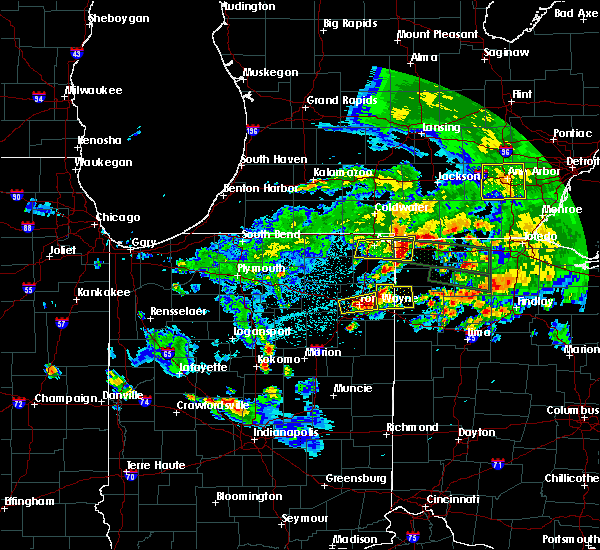 At 956 pm edt, a severe thunderstorm was located over new haven, moving east at 30 mph (radar indicated). Hazards include ping pong ball size hail. People and animals outdoors will be injured. Expect damage to roofs, siding, windows, and vehicles. At 956 pm edt, a severe thunderstorm was located over new haven, moving east at 30 mph (radar indicated). Hazards include ping pong ball size hail. People and animals outdoors will be injured. Expect damage to roofs, siding, windows, and vehicles.
|
| 5/23/2019 5:27 AM EDT |
 A severe thunderstorm warning remains in effect until 545 am edt for eastern steuben. allen. de kalb. west central defiance and southwestern williams counties. at 526 am edt, severe thunderstorms were located along a line extending from near reading to near st. Joe to near new haven, moving east at 60 mph. A severe thunderstorm warning remains in effect until 545 am edt for eastern steuben. allen. de kalb. west central defiance and southwestern williams counties. at 526 am edt, severe thunderstorms were located along a line extending from near reading to near st. Joe to near new haven, moving east at 60 mph.
|
| 5/23/2019 5:27 AM EDT |
 At 526 am edt, severe thunderstorms were located along a line extending from near reading to near st. joe to near new haven, moving east at 60 mph (radar indicated). Hazards include 70 mph wind gusts. Expect considerable tree damage. damage is likely to mobile homes, roofs, and outbuildings. locations impacted include, fort wayne, new haven, auburn, angola, garrett, butler, huntertown, waterloo, fremont, hamilton, woodburn, grabill, st. joe, aboite, ray, leo-cedarville, concord, ashley, newville and hudson. this is a dangerous line of storms. These storms have a history of producing 60 to 70 mph wind gusts. At 526 am edt, severe thunderstorms were located along a line extending from near reading to near st. joe to near new haven, moving east at 60 mph (radar indicated). Hazards include 70 mph wind gusts. Expect considerable tree damage. damage is likely to mobile homes, roofs, and outbuildings. locations impacted include, fort wayne, new haven, auburn, angola, garrett, butler, huntertown, waterloo, fremont, hamilton, woodburn, grabill, st. joe, aboite, ray, leo-cedarville, concord, ashley, newville and hudson. this is a dangerous line of storms. These storms have a history of producing 60 to 70 mph wind gusts.
|
| 5/23/2019 4:48 AM EDT |
 At 447 am edt, severe thunderstorms were located along a line extending from 6 miles southeast of white pigeon to 6 miles west of tri-lakes to near north manchester, moving east at 65 mph (radar indicated). Hazards include 70 mph wind gusts. Expect considerable tree damage. Damage is likely to mobile homes, roofs, and outbuildings. At 447 am edt, severe thunderstorms were located along a line extending from 6 miles southeast of white pigeon to 6 miles west of tri-lakes to near north manchester, moving east at 65 mph (radar indicated). Hazards include 70 mph wind gusts. Expect considerable tree damage. Damage is likely to mobile homes, roofs, and outbuildings.
|
| 5/19/2019 6:37 PM EDT |
 At 636 pm edt, severe thunderstorms were located along a line extending from near grabill to near new haven to near markle, moving northeast at 55 mph (radar indicated). Hazards include 60 mph wind gusts and penny size hail. Expect damage to roofs, siding, and trees. Locations impacted include, fort wayne, huntington, new haven, grabill, la fontaine, leo-cedarville, zanesville, nine mile, bowerstown, yoder, lincolnville, cuba, mahon and rolling hills. At 636 pm edt, severe thunderstorms were located along a line extending from near grabill to near new haven to near markle, moving northeast at 55 mph (radar indicated). Hazards include 60 mph wind gusts and penny size hail. Expect damage to roofs, siding, and trees. Locations impacted include, fort wayne, huntington, new haven, grabill, la fontaine, leo-cedarville, zanesville, nine mile, bowerstown, yoder, lincolnville, cuba, mahon and rolling hills.
|
| 5/19/2019 6:18 PM EDT |
 At 618 pm edt, severe thunderstorms were located along a line extending from near churubusco to 8 miles southwest of fort wayne to 7 miles south of andrews, moving northeast at 55 mph (radar indicated). Hazards include 60 mph wind gusts and penny size hail. Expect damage to roofs, siding, and trees. locations impacted include, fort wayne, huntington, new haven, auburn, garrett, butler, huntertown, churubusco, andrews, grabill, la fontaine, st. Joe, aboite, leo-cedarville, roanoke, concord, zanesville, newville, yoder and butler center. At 618 pm edt, severe thunderstorms were located along a line extending from near churubusco to 8 miles southwest of fort wayne to 7 miles south of andrews, moving northeast at 55 mph (radar indicated). Hazards include 60 mph wind gusts and penny size hail. Expect damage to roofs, siding, and trees. locations impacted include, fort wayne, huntington, new haven, auburn, garrett, butler, huntertown, churubusco, andrews, grabill, la fontaine, st. Joe, aboite, leo-cedarville, roanoke, concord, zanesville, newville, yoder and butler center.
|
| 5/19/2019 5:59 PM EDT |
 The national weather service in northern indiana has issued a * severe thunderstorm warning for. allen county in northeastern indiana. southeastern wabash county in north central indiana. southeastern noble county in northeastern indiana. Whitley county in northeastern indiana. The national weather service in northern indiana has issued a * severe thunderstorm warning for. allen county in northeastern indiana. southeastern wabash county in north central indiana. southeastern noble county in northeastern indiana. Whitley county in northeastern indiana.
|
| 5/16/2019 10:54 PM EDT |
 The severe thunderstorm warning for eastern allen, southwestern putnam, southern paulding and northern van wert counties will expire at 1100 pm edt, the storm which prompted the warning has weakened below severe limits therefore, the warning will be allowed to expire. however nickel sized hail will be possible with thunderstorms through 1130 pm edt. The severe thunderstorm warning for eastern allen, southwestern putnam, southern paulding and northern van wert counties will expire at 1100 pm edt, the storm which prompted the warning has weakened below severe limits therefore, the warning will be allowed to expire. however nickel sized hail will be possible with thunderstorms through 1130 pm edt.
|
| 5/16/2019 10:26 PM EDT |
 At 1026 pm edt, a severe thunderstorm was located near payne, or 14 miles northwest of van wert, moving southeast at 40 mph (radar indicated). Hazards include quarter size hail. Damage to vehicles is expected. Locations impacted include, fort wayne, new haven, woodburn, monroeville, payne, grabill, ottoville, leo-cedarville, dixon, grover hill, scott, haviland, edgerton in allen county, zulu, cavett, mcgill, townley, wetzel, worstville and harlan. At 1026 pm edt, a severe thunderstorm was located near payne, or 14 miles northwest of van wert, moving southeast at 40 mph (radar indicated). Hazards include quarter size hail. Damage to vehicles is expected. Locations impacted include, fort wayne, new haven, woodburn, monroeville, payne, grabill, ottoville, leo-cedarville, dixon, grover hill, scott, haviland, edgerton in allen county, zulu, cavett, mcgill, townley, wetzel, worstville and harlan.
|
| 5/16/2019 10:14 PM EDT |
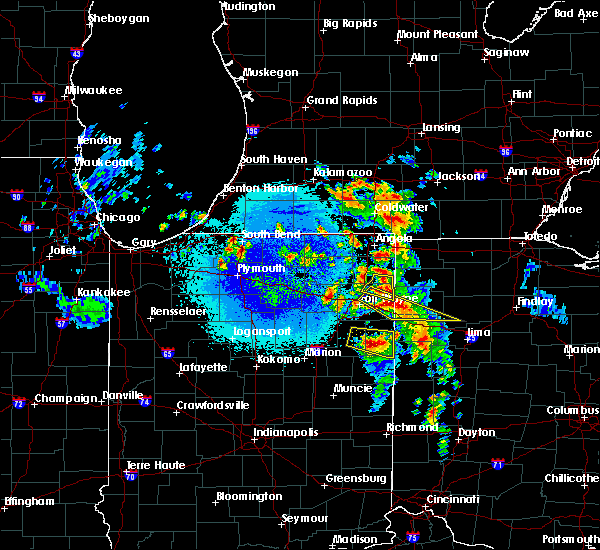 At 1014 pm edt, a severe thunderstorm was located over grabill, or 9 miles southwest of hicksville, moving southeast at 40 mph (radar indicated). Hazards include quarter size hail. Damage to vehicles is expected. locations impacted include, woodburn, grabill, st. Joe, leo-cedarville, concord, cuba, saint joe, harlan and spencerville in dekalb county. At 1014 pm edt, a severe thunderstorm was located over grabill, or 9 miles southwest of hicksville, moving southeast at 40 mph (radar indicated). Hazards include quarter size hail. Damage to vehicles is expected. locations impacted include, woodburn, grabill, st. Joe, leo-cedarville, concord, cuba, saint joe, harlan and spencerville in dekalb county.
|
| 5/16/2019 10:06 PM EDT |
 At 1003 pm edt, a severe thunderstorm was located near grabill, or near new haven, moving southeast at 40 mph (radar indicated). Hazards include 60 mph wind gusts and quarter size hail. Hail damage to vehicles is expected. Expect wind damage to roofs, siding, and trees. At 1003 pm edt, a severe thunderstorm was located near grabill, or near new haven, moving southeast at 40 mph (radar indicated). Hazards include 60 mph wind gusts and quarter size hail. Hail damage to vehicles is expected. Expect wind damage to roofs, siding, and trees.
|
| 5/16/2019 9:24 PM EDT |
 At 924 pm edt, a severe thunderstorm was located over avilla, or 7 miles west of garrett, moving east at 30 mph (radar indicated). Hazards include 60 mph wind gusts and half dollar size hail. Hail damage to vehicles is expected. Expect wind damage to roofs, siding, and trees. At 924 pm edt, a severe thunderstorm was located over avilla, or 7 miles west of garrett, moving east at 30 mph (radar indicated). Hazards include 60 mph wind gusts and half dollar size hail. Hail damage to vehicles is expected. Expect wind damage to roofs, siding, and trees.
|
| 5/16/2019 9:17 PM EDT |
 At 916 pm edt, a severe thunderstorm was located near albion, or 7 miles southwest of kendallville, moving east at 25 mph (radar indicated). Hazards include quarter size hail. Damage to vehicles is expected. Locations impacted include, auburn, garrett, huntertown, avilla, albion, grabill, leo-cedarville, swan, concord, altona, ege, green center, butler center, lisbon, saint johns, laotto, spencerville in dekalb county, moore, cuba and ari. At 916 pm edt, a severe thunderstorm was located near albion, or 7 miles southwest of kendallville, moving east at 25 mph (radar indicated). Hazards include quarter size hail. Damage to vehicles is expected. Locations impacted include, auburn, garrett, huntertown, avilla, albion, grabill, leo-cedarville, swan, concord, altona, ege, green center, butler center, lisbon, saint johns, laotto, spencerville in dekalb county, moore, cuba and ari.
|
| 5/16/2019 8:54 PM EDT |
 The national weather service in northern indiana has issued a * severe thunderstorm warning for. northwestern allen county in northeastern indiana. southeastern noble county in northeastern indiana. southwestern de kalb county in northeastern indiana. Until 930 pm edt. The national weather service in northern indiana has issued a * severe thunderstorm warning for. northwestern allen county in northeastern indiana. southeastern noble county in northeastern indiana. southwestern de kalb county in northeastern indiana. Until 930 pm edt.
|
| 8/11/2018 8:08 PM EDT |
 The severe thunderstorm warning for northern allen county will expire at 815 pm edt, the storm which prompted the warning has weakened below severe limits, and no longer poses an immediate threat to life or property. therefore, the warning will be allowed to expire. however heavy rain is still possible with this thunderstorm. The severe thunderstorm warning for northern allen county will expire at 815 pm edt, the storm which prompted the warning has weakened below severe limits, and no longer poses an immediate threat to life or property. therefore, the warning will be allowed to expire. however heavy rain is still possible with this thunderstorm.
|
| 8/11/2018 7:49 PM EDT |
 At 748 pm edt, a severe thunderstorm was located near grabill, or 8 miles south of auburn, moving southwest at 15 mph (radar indicated). Hazards include 60 mph wind gusts and quarter size hail. Hail damage to vehicles is expected. expect wind damage to roofs, siding, and trees. Locations impacted include, fort wayne, new haven, huntertown, grabill, leo-cedarville, cuba, harlan and wallen. At 748 pm edt, a severe thunderstorm was located near grabill, or 8 miles south of auburn, moving southwest at 15 mph (radar indicated). Hazards include 60 mph wind gusts and quarter size hail. Hail damage to vehicles is expected. expect wind damage to roofs, siding, and trees. Locations impacted include, fort wayne, new haven, huntertown, grabill, leo-cedarville, cuba, harlan and wallen.
|
| 8/11/2018 7:34 PM EDT |
 At 734 pm edt, a severe thunderstorm was located near grabill, or near auburn, moving southwest at 15 mph (radar indicated). Hazards include 60 mph wind gusts and quarter size hail. Hail damage to vehicles is expected. Expect wind damage to roofs, siding, and trees. At 734 pm edt, a severe thunderstorm was located near grabill, or near auburn, moving southwest at 15 mph (radar indicated). Hazards include 60 mph wind gusts and quarter size hail. Hail damage to vehicles is expected. Expect wind damage to roofs, siding, and trees.
|
| 8/6/2018 9:37 PM EDT |
 The severe thunderstorm warning for northern allen, southeastern noble, northeastern whitley and southern de kalb counties will expire at 945 pm edt, the storm which prompted the warning has weakened below severe limits, and no longer poses an immediate threat to life or property. therefore, the warning will be allowed to expire. however gusty winds and heavy rain are still possible with this thunderstorm. The severe thunderstorm warning for northern allen, southeastern noble, northeastern whitley and southern de kalb counties will expire at 945 pm edt, the storm which prompted the warning has weakened below severe limits, and no longer poses an immediate threat to life or property. therefore, the warning will be allowed to expire. however gusty winds and heavy rain are still possible with this thunderstorm.
|
| 8/6/2018 9:05 PM EDT |
 At 905 pm edt, a severe thunderstorm was located over churubusco, or near tri-lakes, moving east at 40 mph (radar indicated). Hazards include 60 mph wind gusts. expect damage to roofs, siding, and trees At 905 pm edt, a severe thunderstorm was located over churubusco, or near tri-lakes, moving east at 40 mph (radar indicated). Hazards include 60 mph wind gusts. expect damage to roofs, siding, and trees
|
| 5/31/2018 3:24 PM EDT |
 The severe thunderstorm warning for central allen, southeastern huntington, northern wells and northwestern adams counties will expire at 330 pm edt, the storms which prompted the warning have weakened below severe limits, and no longer pose an immediate threat to life or property. therefore, the warning will be allowed to expire. The severe thunderstorm warning for central allen, southeastern huntington, northern wells and northwestern adams counties will expire at 330 pm edt, the storms which prompted the warning have weakened below severe limits, and no longer pose an immediate threat to life or property. therefore, the warning will be allowed to expire.
|
| 5/31/2018 3:11 PM EDT |
 At 311 pm edt, severe thunderstorms were located along a line extending from near new haven to 6 miles south of markle, moving east at 30 mph (radar indicated). Hazards include 60 mph wind gusts and quarter size hail. Hail damage to vehicles is expected. expect wind damage to roofs, siding, and trees. Locations impacted include, fort wayne, new haven, bluffton, ossian, woodburn, markle, middletown, warren, zanesville, uniondale, yoder, murray, liberty center, zulu, buckeye, tocsin, kingsland, nine mile, magley and travisville. At 311 pm edt, severe thunderstorms were located along a line extending from near new haven to 6 miles south of markle, moving east at 30 mph (radar indicated). Hazards include 60 mph wind gusts and quarter size hail. Hail damage to vehicles is expected. expect wind damage to roofs, siding, and trees. Locations impacted include, fort wayne, new haven, bluffton, ossian, woodburn, markle, middletown, warren, zanesville, uniondale, yoder, murray, liberty center, zulu, buckeye, tocsin, kingsland, nine mile, magley and travisville.
|
| 5/31/2018 2:48 PM EDT |
 At 248 pm edt, severe thunderstorms were located along a line extending from near fort wayne to near van buren, moving east at 30 mph (radar indicated). Hazards include 60 mph wind gusts and quarter size hail. Hail damage to vehicles is expected. Expect wind damage to roofs, siding, and trees. At 248 pm edt, severe thunderstorms were located along a line extending from near fort wayne to near van buren, moving east at 30 mph (radar indicated). Hazards include 60 mph wind gusts and quarter size hail. Hail damage to vehicles is expected. Expect wind damage to roofs, siding, and trees.
|
| 5/2/2018 9:49 PM EDT |
 At 949 pm edt, severe thunderstorms were located along a line extending from avilla to near huntertown to near churubusco, moving east at 35 mph (radar indicated). Hazards include 60 mph wind gusts. expect damage to roofs, siding, and trees At 949 pm edt, severe thunderstorms were located along a line extending from avilla to near huntertown to near churubusco, moving east at 35 mph (radar indicated). Hazards include 60 mph wind gusts. expect damage to roofs, siding, and trees
|
| 11/5/2017 1:06 PM EDT |
 The severe thunderstorm warning for southeastern steuben, northeastern allen, eastern de kalb, defiance, western paulding and williams counties will expire at 1215 pm est, the storms which prompted the warning have moved out of the area. therefore the warning will be allowed to expire. however heavy rain is still possible with these thunderstorms. The severe thunderstorm warning for southeastern steuben, northeastern allen, eastern de kalb, defiance, western paulding and williams counties will expire at 1215 pm est, the storms which prompted the warning have moved out of the area. therefore the warning will be allowed to expire. however heavy rain is still possible with these thunderstorms.
|
| 11/5/2017 12:35 PM EDT |
 At 1134 am est, severe thunderstorms were located along a line extending from near edon to near butler to near grabill, moving east at 30 mph. this line has a history of producing isolated wind damage (radar indicated). Hazards include 70 mph wind gusts and quarter size hail. Hail damage to vehicles is expected. expect considerable tree damage. Wind damage is also likely to mobile homes, roofs, and outbuildings. At 1134 am est, severe thunderstorms were located along a line extending from near edon to near butler to near grabill, moving east at 30 mph. this line has a history of producing isolated wind damage (radar indicated). Hazards include 70 mph wind gusts and quarter size hail. Hail damage to vehicles is expected. expect considerable tree damage. Wind damage is also likely to mobile homes, roofs, and outbuildings.
|
| 11/5/2017 12:28 PM EDT |
 At 1126 am est, severe thunderstorms were located along a line extending from near butler to near huntertown to near churubusco, moving east at 40 mph. at 1110 am, emergency management officials reported a tree down near lisbon as well as avilla, both onto local roadways (radar indicated). Hazards include 60 mph wind gusts. Expect damage to roofs, siding, and trees. locations impacted include, fort wayne, auburn, garrett, butler, huntertown, waterloo, grabill, st. Joe, leo-cedarville, concord, newville, altona, butler center, saint johns, wallen, spencerville in dekalb county, moore, saint joe and sedan. At 1126 am est, severe thunderstorms were located along a line extending from near butler to near huntertown to near churubusco, moving east at 40 mph. at 1110 am, emergency management officials reported a tree down near lisbon as well as avilla, both onto local roadways (radar indicated). Hazards include 60 mph wind gusts. Expect damage to roofs, siding, and trees. locations impacted include, fort wayne, auburn, garrett, butler, huntertown, waterloo, grabill, st. Joe, leo-cedarville, concord, newville, altona, butler center, saint johns, wallen, spencerville in dekalb county, moore, saint joe and sedan.
|
| 11/5/2017 12:05 PM EDT |
 At 1105 am est, severe thunderstorms were located along a line extending from kendallville to 6 miles southeast of albion to near tri-lakes, moving east at 35 mph (radar indicated). Hazards include 60 mph wind gusts. expect damage to roofs, siding, and trees At 1105 am est, severe thunderstorms were located along a line extending from kendallville to 6 miles southeast of albion to near tri-lakes, moving east at 35 mph (radar indicated). Hazards include 60 mph wind gusts. expect damage to roofs, siding, and trees
|
| 6/4/2017 4:20 PM EDT |
 At 419 pm edt, a severe thunderstorm was located near huntertown, or near garrett, moving east at 30 mph (radar indicated). Hazards include 60 mph wind gusts. Expect damage to roofs, siding, and trees. locations impacted include, garrett, huntertown, grabill, st. Joe, leo-cedarville, concord, newville, butler center, saint johns, harlan, spencerville in dekalb county, cuba and saint joe. At 419 pm edt, a severe thunderstorm was located near huntertown, or near garrett, moving east at 30 mph (radar indicated). Hazards include 60 mph wind gusts. Expect damage to roofs, siding, and trees. locations impacted include, garrett, huntertown, grabill, st. Joe, leo-cedarville, concord, newville, butler center, saint johns, harlan, spencerville in dekalb county, cuba and saint joe.
|
| 6/4/2017 4:08 PM EDT |
 At 408 pm edt, a severe thunderstorm was located near huntertown, or 8 miles southwest of garrett, moving east at 30 mph (radar indicated). Hazards include 60 mph wind gusts and penny size hail. expect damage to roofs, siding, and trees At 408 pm edt, a severe thunderstorm was located near huntertown, or 8 miles southwest of garrett, moving east at 30 mph (radar indicated). Hazards include 60 mph wind gusts and penny size hail. expect damage to roofs, siding, and trees
|
| 5/28/2017 9:02 PM EDT |
 At 901 pm edt, a severe thunderstorm was located over grabill, or 7 miles northeast of new haven, moving east at 35 mph (radar indicated). Hazards include quarter size hail. Damage to vehicles is expected. Locations impacted include, fort wayne, new haven, woodburn, grabill, leo-cedarville, cuba, harlan and edgerton in allen county. At 901 pm edt, a severe thunderstorm was located over grabill, or 7 miles northeast of new haven, moving east at 35 mph (radar indicated). Hazards include quarter size hail. Damage to vehicles is expected. Locations impacted include, fort wayne, new haven, woodburn, grabill, leo-cedarville, cuba, harlan and edgerton in allen county.
|
| 5/28/2017 8:36 PM EDT |
 At 836 pm edt, a severe thunderstorm was located near fort wayne, moving east at 25 mph (radar indicated). Hazards include 60 mph wind gusts and quarter size hail. Hail damage to vehicles is expected. Expect wind damage to roofs, siding, and trees. At 836 pm edt, a severe thunderstorm was located near fort wayne, moving east at 25 mph (radar indicated). Hazards include 60 mph wind gusts and quarter size hail. Hail damage to vehicles is expected. Expect wind damage to roofs, siding, and trees.
|
| 4/26/2017 9:26 PM EDT |
 At 926 pm edt, severe thunderstorms were located along a line extending from near auburn to near woodburn, moving northeast at 55 mph (trained weather spotters). Hazards include 60 mph wind gusts and penny size hail. expect damage to roofs, siding, and trees At 926 pm edt, severe thunderstorms were located along a line extending from near auburn to near woodburn, moving northeast at 55 mph (trained weather spotters). Hazards include 60 mph wind gusts and penny size hail. expect damage to roofs, siding, and trees
|
| 4/19/2017 8:27 PM EDT | Hen Egg sized hail reported 7.3 miles SW of Harlan, IN |
| 4/19/2017 8:13 PM EDT |
 At 812 pm edt, a severe thunderstorm was located over hicksville, moving east at 40 mph (radar indicated). Hazards include quarter size hail and 40 to 50 mph winds. damage to vehicles is expected At 812 pm edt, a severe thunderstorm was located over hicksville, moving east at 40 mph (radar indicated). Hazards include quarter size hail and 40 to 50 mph winds. damage to vehicles is expected
|
| 4/19/2017 8:13 PM EDT |
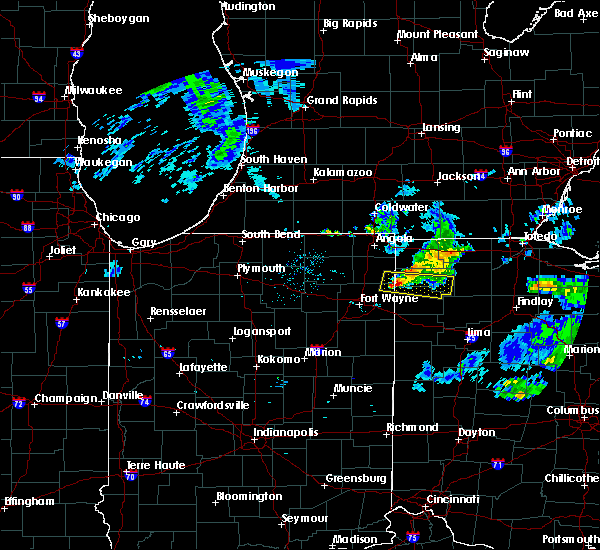 At 812 pm edt, a severe thunderstorm was located over hicksville, moving east at 40 mph (radar indicated). Hazards include quarter size hail and 40 to 50 mph winds. damage to vehicles is expected At 812 pm edt, a severe thunderstorm was located over hicksville, moving east at 40 mph (radar indicated). Hazards include quarter size hail and 40 to 50 mph winds. damage to vehicles is expected
|
| 3/1/2017 2:54 AM EST |
 At 253 am est, severe thunderstorms were located along a line extending from near pioneer to 7 miles north of paulding to near monroeville, moving east at 70 mph (radar indicated). Hazards include 70 mph wind gusts and penny size hail. Expect considerable tree damage. damage is likely to mobile homes, roofs, and outbuildings. locations impacted include, fort wayne, defiance, new haven, napoleon, bryan, wauseon, delphos, ottawa, archbold, bluffton, montpelier, swanton, hicksville, paulding, delta, columbus grove, leipsic, edgerton, deshler and antwerp. this includes the following highways, interstate 469 between mile markers 9 and 24. interstate 75 between mile markers 133 and 141. interstate 80 in ohio between mile markers 2 and 48. This storm has a history of producing 70 to 80 mph wind gusts! a tornado watch remains in effect until 700 am est for northeastern indiana, and northwestern and west central ohio. At 253 am est, severe thunderstorms were located along a line extending from near pioneer to 7 miles north of paulding to near monroeville, moving east at 70 mph (radar indicated). Hazards include 70 mph wind gusts and penny size hail. Expect considerable tree damage. damage is likely to mobile homes, roofs, and outbuildings. locations impacted include, fort wayne, defiance, new haven, napoleon, bryan, wauseon, delphos, ottawa, archbold, bluffton, montpelier, swanton, hicksville, paulding, delta, columbus grove, leipsic, edgerton, deshler and antwerp. this includes the following highways, interstate 469 between mile markers 9 and 24. interstate 75 between mile markers 133 and 141. interstate 80 in ohio between mile markers 2 and 48. This storm has a history of producing 70 to 80 mph wind gusts! a tornado watch remains in effect until 700 am est for northeastern indiana, and northwestern and west central ohio.
|
| 3/1/2017 2:39 AM EST |
 At 239 am est, a severe squall line capable of producing both tornadoes and extensive straight line wind damage was located along a line extending from near grabill to near new haven, moving east at 70 mph (radar indicated rotation). Hazards include tornado and quarter size hail. Flying debris will be dangerous to those caught without shelter. mobile homes will be damaged or destroyed. damage to roofs, windows, and vehicles will occur. tree damage is likely. these dangerous storms will be near, woodburn around 250 am est. antwerp and payne around 255 am est. paulding around 300 am est. other locations impacted by these tornadic storms include worstville, cuba, leo-cedarville, latty, harlan, briceton, cecil, wallen and broughton. this includes the following highways, interstate 469 between mile markers 22 and 30. Interstate 69 in indiana between mile markers 309 and 321. At 239 am est, a severe squall line capable of producing both tornadoes and extensive straight line wind damage was located along a line extending from near grabill to near new haven, moving east at 70 mph (radar indicated rotation). Hazards include tornado and quarter size hail. Flying debris will be dangerous to those caught without shelter. mobile homes will be damaged or destroyed. damage to roofs, windows, and vehicles will occur. tree damage is likely. these dangerous storms will be near, woodburn around 250 am est. antwerp and payne around 255 am est. paulding around 300 am est. other locations impacted by these tornadic storms include worstville, cuba, leo-cedarville, latty, harlan, briceton, cecil, wallen and broughton. this includes the following highways, interstate 469 between mile markers 22 and 30. Interstate 69 in indiana between mile markers 309 and 321.
|
| 3/1/2017 2:31 AM EST |
 At 231 am est, a severe thunderstorm capable of producing a tornado was located near huntertown, or near fort wayne, moving east at 75 mph (radar indicated rotation). Hazards include tornado and quarter size hail. Flying debris will be dangerous to those caught without shelter. mobile homes will be damaged or destroyed. damage to roofs, windows, and vehicles will occur. tree damage is likely. this dangerous storm will be near, grabill around 240 am est. woodburn around 245 am est. antwerp and payne around 250 am est. paulding around 255 am est. Other locations impacted by this tornadic thunderstorm include worstville, cuba, leo-cedarville, latty, harlan, briceton, cecil, wallen and broughton. At 231 am est, a severe thunderstorm capable of producing a tornado was located near huntertown, or near fort wayne, moving east at 75 mph (radar indicated rotation). Hazards include tornado and quarter size hail. Flying debris will be dangerous to those caught without shelter. mobile homes will be damaged or destroyed. damage to roofs, windows, and vehicles will occur. tree damage is likely. this dangerous storm will be near, grabill around 240 am est. woodburn around 245 am est. antwerp and payne around 250 am est. paulding around 255 am est. Other locations impacted by this tornadic thunderstorm include worstville, cuba, leo-cedarville, latty, harlan, briceton, cecil, wallen and broughton.
|
| 3/1/2017 2:29 AM EST |
 At 227 am est, severe thunderstorms were located along a line extending from fremont to near auburn to 10 miles west of fort wayne, moving east at 70 mph. these are very dangerous storms (radar indicated). Hazards include 80 mph wind gusts and nickel size hail. Flying debris will be dangerous to those caught without shelter. mobile homes will be heavily damaged. expect considerable damage to roofs, windows, and vehicles. Extensive tree damage and power outages are likely. At 227 am est, severe thunderstorms were located along a line extending from fremont to near auburn to 10 miles west of fort wayne, moving east at 70 mph. these are very dangerous storms (radar indicated). Hazards include 80 mph wind gusts and nickel size hail. Flying debris will be dangerous to those caught without shelter. mobile homes will be heavily damaged. expect considerable damage to roofs, windows, and vehicles. Extensive tree damage and power outages are likely.
|
| 2/28/2017 7:08 PM EST |
 The severe thunderstorm warning for central allen county will expire at 715 pm est, the storm which prompted the warning has weakened below severe limits, and no longer pose an immediate threat to life or property. therefore, the warning will be allowed to expire. The severe thunderstorm warning for central allen county will expire at 715 pm est, the storm which prompted the warning has weakened below severe limits, and no longer pose an immediate threat to life or property. therefore, the warning will be allowed to expire.
|
| 2/28/2017 6:41 PM EST |
 At 640 pm est, a severe thunderstorm was located near fort wayne, moving east at 50 mph (radar indicated). Hazards include quarter size hail. Damage to vehicles is expected. locations impacted include, fort wayne, new haven, woodburn, grabill, nine mile, cuba, tillman, harlan, rolling hills, townley, zulu and maples. this includes the following highways, interstate 469 between mile markers 13 and 29. interstate 69 in indiana between mile markers 299 and 307. At 629 pm est, quarter sized hail was reported 2 miles northwest of huntington. At 640 pm est, a severe thunderstorm was located near fort wayne, moving east at 50 mph (radar indicated). Hazards include quarter size hail. Damage to vehicles is expected. locations impacted include, fort wayne, new haven, woodburn, grabill, nine mile, cuba, tillman, harlan, rolling hills, townley, zulu and maples. this includes the following highways, interstate 469 between mile markers 13 and 29. interstate 69 in indiana between mile markers 299 and 307. At 629 pm est, quarter sized hail was reported 2 miles northwest of huntington.
|
| 2/28/2017 6:29 PM EST |
 At 629 pm est, a severe thunderstorm was located 10 miles northeast of huntington, moving east at 50 mph (radar indicated). Hazards include quarter size hail. damage to vehicles is expected At 629 pm est, a severe thunderstorm was located 10 miles northeast of huntington, moving east at 50 mph (radar indicated). Hazards include quarter size hail. damage to vehicles is expected
|
| 8/24/2016 5:39 PM EDT |
 At 538 pm edt, a confirmed large and extremely dangerous tornado was located near woodburn, or 8 miles southwest of hicksville, moving northeast at 25 mph. this is a particularly dangerous situation. take cover now! (radar confirmed tornado). Hazards include damaging tornado. You are in a life-threatening situation. flying debris may be deadly to those caught without shelter. mobile homes will be destroyed. considerable damage to homes, businesses, and vehicles is likely and complete destruction is possible. the tornado will be near, antwerp around 550 pm edt. hicksville around 555 pm edt. Other locations impacted by this tornadic thunderstorm include cecil and mark center. At 538 pm edt, a confirmed large and extremely dangerous tornado was located near woodburn, or 8 miles southwest of hicksville, moving northeast at 25 mph. this is a particularly dangerous situation. take cover now! (radar confirmed tornado). Hazards include damaging tornado. You are in a life-threatening situation. flying debris may be deadly to those caught without shelter. mobile homes will be destroyed. considerable damage to homes, businesses, and vehicles is likely and complete destruction is possible. the tornado will be near, antwerp around 550 pm edt. hicksville around 555 pm edt. Other locations impacted by this tornadic thunderstorm include cecil and mark center.
|
| 8/24/2016 5:31 PM EDT |
 At 531 pm edt, a confirmed large and extremely dangerous tornado was located over woodburn, or 9 miles northeast of new haven, moving east at 30 mph. this is a particularly dangerous situation. take cover now! (law enforcement confirmed tornado at doty and brush college roads). Hazards include damaging tornado. You are in a life-threatening situation. flying debris may be deadly to those caught without shelter. mobile homes will be destroyed. considerable damage to homes, businesses, and vehicles is likely and complete destruction is possible. This tornadic thunderstorm will remain over mainly rural areas of northeastern allen county, including the following locations: cuba and harlan. At 531 pm edt, a confirmed large and extremely dangerous tornado was located over woodburn, or 9 miles northeast of new haven, moving east at 30 mph. this is a particularly dangerous situation. take cover now! (law enforcement confirmed tornado at doty and brush college roads). Hazards include damaging tornado. You are in a life-threatening situation. flying debris may be deadly to those caught without shelter. mobile homes will be destroyed. considerable damage to homes, businesses, and vehicles is likely and complete destruction is possible. This tornadic thunderstorm will remain over mainly rural areas of northeastern allen county, including the following locations: cuba and harlan.
|
| 8/24/2016 5:14 PM EDT |
 At 513 pm edt, a severe thunderstorm capable of producing a tornado was located near new haven, moving northeast at 30 mph (radar indicated rotation). Hazards include tornado. Flying debris will be dangerous to those caught without shelter. mobile homes will be damaged or destroyed. damage to roofs, windows, and vehicles will occur. tree damage is likely. this dangerous storm will be near, grabill around 530 pm edt. Other locations impacted by this tornadic thunderstorm include cuba, harlan and leo-cedarville. At 513 pm edt, a severe thunderstorm capable of producing a tornado was located near new haven, moving northeast at 30 mph (radar indicated rotation). Hazards include tornado. Flying debris will be dangerous to those caught without shelter. mobile homes will be damaged or destroyed. damage to roofs, windows, and vehicles will occur. tree damage is likely. this dangerous storm will be near, grabill around 530 pm edt. Other locations impacted by this tornadic thunderstorm include cuba, harlan and leo-cedarville.
|
| 8/20/2016 5:55 PM EDT |
 At 554 pm edt, a confirmed tornado was located just southeast of leo-cedarville, or 9 miles north of new haven, moving northeast at 25 mph (weather spotters confirmed tornado). Hazards include damaging tornado. Flying debris will be dangerous to those caught without shelter. mobile homes will be damaged or destroyed. damage to roofs, windows, and vehicles will occur. tree damage is likely. This tornadic thunderstorm will remain over mainly rural areas of northeastern allen county, including the following locations: harlan and leo-cedarville. At 554 pm edt, a confirmed tornado was located just southeast of leo-cedarville, or 9 miles north of new haven, moving northeast at 25 mph (weather spotters confirmed tornado). Hazards include damaging tornado. Flying debris will be dangerous to those caught without shelter. mobile homes will be damaged or destroyed. damage to roofs, windows, and vehicles will occur. tree damage is likely. This tornadic thunderstorm will remain over mainly rural areas of northeastern allen county, including the following locations: harlan and leo-cedarville.
|
| 8/20/2016 5:46 PM EDT |
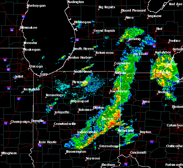 At 546 pm edt, a severe thunderstorm capable of producing a tornado was located near grabill, or 7 miles north of new haven, moving northeast at 25 mph (radar indicated rotation). Hazards include tornado. Flying debris will be dangerous to those caught without shelter. mobile homes will be damaged or destroyed. damage to roofs, windows, and vehicles will occur. tree damage is likely. this dangerous storm will be near, grabill around 555 pm edt. Other locations impacted by this tornadic thunderstorm include cuba, harlan and leo-cedarville. At 546 pm edt, a severe thunderstorm capable of producing a tornado was located near grabill, or 7 miles north of new haven, moving northeast at 25 mph (radar indicated rotation). Hazards include tornado. Flying debris will be dangerous to those caught without shelter. mobile homes will be damaged or destroyed. damage to roofs, windows, and vehicles will occur. tree damage is likely. this dangerous storm will be near, grabill around 555 pm edt. Other locations impacted by this tornadic thunderstorm include cuba, harlan and leo-cedarville.
|
| 8/23/2015 5:05 PM EDT | 2-3 ft diameter limbs down and partial barn roof blown off. time estimated from rada in allen county IN, 3.2 miles W of Harlan, IN |
| 7/18/2015 8:25 PM EDT |
 At 824 pm edt, severe thunderstorms were located along a line extending from auburn to near new haven to 6 miles south of fort wayne, moving east at 40 mph (radar indicated). Hazards include 60 mph wind gusts. Expect damage to roofs. siding and trees. locations impacted include, fort wayne, new haven, auburn, garrett, huntertown, woodburn, monroeville, grabill, st. joe, aboite, leo-cedarville, concord, newville, altona, butler center, zulu, tillman, hessen cassel, townley and cuba. this includes the following highways, interstate 469 near mile marker 6, and between mile markers 9 and 30. interstate 69 in indiana between mile markers 298 and 330. A tornado watch remains in effect until midnight edt for northeastern indiana and northwestern ohio. At 824 pm edt, severe thunderstorms were located along a line extending from auburn to near new haven to 6 miles south of fort wayne, moving east at 40 mph (radar indicated). Hazards include 60 mph wind gusts. Expect damage to roofs. siding and trees. locations impacted include, fort wayne, new haven, auburn, garrett, huntertown, woodburn, monroeville, grabill, st. joe, aboite, leo-cedarville, concord, newville, altona, butler center, zulu, tillman, hessen cassel, townley and cuba. this includes the following highways, interstate 469 near mile marker 6, and between mile markers 9 and 30. interstate 69 in indiana between mile markers 298 and 330. A tornado watch remains in effect until midnight edt for northeastern indiana and northwestern ohio.
|
| 7/18/2015 7:57 PM EDT |
 At 756 pm edt, severe thunderstorms were located along a line extending from albion to near columbia city to 8 miles southeast of south whitley, moving east at 40 mph (radar indicated). Hazards include 60 mph wind gusts. Expect damage to roofs. Siding and trees. At 756 pm edt, severe thunderstorms were located along a line extending from albion to near columbia city to 8 miles southeast of south whitley, moving east at 40 mph (radar indicated). Hazards include 60 mph wind gusts. Expect damage to roofs. Siding and trees.
|
| 7/13/2015 9:50 PM EDT |
 At 950 pm edt, severe thunderstorms were located along a line extending from columbia city to near ossian, moving east at 50 mph (radar indicated). Hazards include 60 mph wind gusts and quarter size hail. Hail damage to vehicles is expected. expect wind damage to roofs, siding and trees. locations impacted include, fort wayne, new haven, columbia city, ossian, huntertown, woodburn, monroeville, grabill, aboite, leo-cedarville, middletown, roanoke, zanesville, dixon, lake everett, zulu, dunfee, tillman, williams and hessen cassel. this includes the following highways, interstate 469 between mile markers 0 and 30. interstate 69 in indiana between mile markers 289 and 321. A tornado watch remains in effect until 300 am edt for northeastern indiana. At 950 pm edt, severe thunderstorms were located along a line extending from columbia city to near ossian, moving east at 50 mph (radar indicated). Hazards include 60 mph wind gusts and quarter size hail. Hail damage to vehicles is expected. expect wind damage to roofs, siding and trees. locations impacted include, fort wayne, new haven, columbia city, ossian, huntertown, woodburn, monroeville, grabill, aboite, leo-cedarville, middletown, roanoke, zanesville, dixon, lake everett, zulu, dunfee, tillman, williams and hessen cassel. this includes the following highways, interstate 469 between mile markers 0 and 30. interstate 69 in indiana between mile markers 289 and 321. A tornado watch remains in effect until 300 am edt for northeastern indiana.
|
| 7/13/2015 9:18 PM EDT |
 At 917 pm edt, severe thunderstorms were located along a line extending from near columbia city to near markle, moving east at 35 mph (radar indicated). Hazards include 60 mph wind gusts and quarter size hail. Hail damage to vehicles is expected. Expect wind damage to roofs, siding and trees. At 917 pm edt, severe thunderstorms were located along a line extending from near columbia city to near markle, moving east at 35 mph (radar indicated). Hazards include 60 mph wind gusts and quarter size hail. Hail damage to vehicles is expected. Expect wind damage to roofs, siding and trees.
|
| 6/18/2015 5:56 PM EDT | At 555 pm edt, a severe thunderstorm was located near st. joe, or near auburn, moving east at 45 mph (radar indicated). Hazards include 60 mph wind gusts. Damage to roofs. siding and trees possible. locations impacted include, auburn, hicksville, grabill, st. Joe, leo-cedarville, concord, farmer, newville, mark center, moore and saint joe. |
| 6/18/2015 5:56 PM EDT | At 555 pm edt, a severe thunderstorm was located near st. joe, or near auburn, moving east at 45 mph (radar indicated). Hazards include 60 mph wind gusts. Damage to roofs. siding and trees possible. locations impacted include, auburn, hicksville, grabill, st. Joe, leo-cedarville, concord, farmer, newville, mark center, moore and saint joe. |
| 6/18/2015 5:40 PM EDT | At 539 pm edt, a severe thunderstorm was located over avilla, or near garrett, moving east at 45 mph (radar indicated). Hazards include 60 mph wind gusts. Damage to roofs. Siding and trees possible. |
| 6/18/2015 5:40 PM EDT | At 539 pm edt, a severe thunderstorm was located over avilla, or near garrett, moving east at 45 mph (radar indicated). Hazards include 60 mph wind gusts. Damage to roofs. Siding and trees possible. |
| 6/13/2015 7:09 PM EDT |
 The severe thunderstorm warning for southeastern de kalb and northeastern allen counties will expire at 715 pm edt. the storm which prompted the warning has weakened below severe limits. and no longer pose an immediate threat to life or property. Therefore the warning will be allowed to expire. The severe thunderstorm warning for southeastern de kalb and northeastern allen counties will expire at 715 pm edt. the storm which prompted the warning has weakened below severe limits. and no longer pose an immediate threat to life or property. Therefore the warning will be allowed to expire.
|
| 6/13/2015 6:55 PM EDT |
 At 654 pm edt, a severe thunderstorm was located over grabill, or 9 miles south of auburn, moving northeast at 25 mph (radar indicated). Hazards include 60 mph wind gusts and penny size hail. Expect damage to roofs. siding and trees. locations impacted include, fort wayne, grabill, st. joe, leo-cedarville, concord, spencerville in dekalb county, cuba, saint joe and harlan. this includes the following highways, interstate 469 between mile markers 25 and 29. Interstate 69 in indiana between mile markers 317 and 318. At 654 pm edt, a severe thunderstorm was located over grabill, or 9 miles south of auburn, moving northeast at 25 mph (radar indicated). Hazards include 60 mph wind gusts and penny size hail. Expect damage to roofs. siding and trees. locations impacted include, fort wayne, grabill, st. joe, leo-cedarville, concord, spencerville in dekalb county, cuba, saint joe and harlan. this includes the following highways, interstate 469 between mile markers 25 and 29. Interstate 69 in indiana between mile markers 317 and 318.
|
| 6/13/2015 6:37 PM EDT |
 At 635 pm edt, a severe thunderstorm was located near over the far northwest side of fort wayne, moving northeast at 25 mph (radar indicated). Hazards include 60 mph wind gusts and quarter size hail. Hail damage to vehicles is expected. Expect wind damage to roofs, siding and trees. At 635 pm edt, a severe thunderstorm was located near over the far northwest side of fort wayne, moving northeast at 25 mph (radar indicated). Hazards include 60 mph wind gusts and quarter size hail. Hail damage to vehicles is expected. Expect wind damage to roofs, siding and trees.
|
| 5/27/2015 2:35 PM EDT | 4-5 inch diameter limb dow in allen county IN, 3.5 miles SW of Harlan, IN |
| 5/27/2015 2:31 PM EDT | At 230 pm edt, a severe thunderstorm was located near new haven, and moving northeast at 40 mph (radar indicated). Hazards include quarter size hail and 60 mph wind gusts. Hail damage to vehicles is expected. Expect wind damage to roofs, siding and trees. |
| 5/27/2015 2:31 PM EDT | At 230 pm edt, a severe thunderstorm was located near new haven, and moving northeast at 40 mph (radar indicated). Hazards include quarter size hail and 60 mph wind gusts. Hail damage to vehicles is expected. Expect wind damage to roofs, siding and trees. |
| 5/11/2015 1:50 PM EDT | At 147 pm edt, a severe thunderstorm was located near woodburn, and moving northeast at 55 mph (radar indicated). Hazards include golf ball size hail and 60 mph wind gusts. People and animals outdoors will be injured. expect hail damage to roofs, siding, windows and vehicles. expect wind damage to roofs, siding and trees. the severe thunderstorm will be near, hicksville around 155 pm edt. other locations in the warning include mark center, farmer and ney. 1. 75in. |
| 5/11/2015 1:50 PM EDT | At 147 pm edt, a severe thunderstorm was located near woodburn, and moving northeast at 55 mph (radar indicated). Hazards include golf ball size hail and 60 mph wind gusts. People and animals outdoors will be injured. expect hail damage to roofs, siding, windows and vehicles. expect wind damage to roofs, siding and trees. the severe thunderstorm will be near, hicksville around 155 pm edt. other locations in the warning include mark center, farmer and ney. 1. 75in. |
| 5/11/2015 1:41 PM EDT | At 138 pm edt, a severe thunderstorm was located 5 miles southwest of woodburn, and moving northeast at 55 mph (radar indicated). Hazards include quarter size hail and 60 mph wind gusts. Hail damage to vehicles is expected. expect wind damage to roofs, siding and trees. the severe thunderstorm will be near, antwerp around 150 pm edt. hicksville around 155 pm edt. other locations in the warning include georgetown, mark center, farmer and ney. this includes interstate 469 between mile markers 23 and 25. 1. 00in. |
| 5/11/2015 1:41 PM EDT | At 138 pm edt, a severe thunderstorm was located 5 miles southwest of woodburn, and moving northeast at 55 mph (radar indicated). Hazards include quarter size hail and 60 mph wind gusts. Hail damage to vehicles is expected. expect wind damage to roofs, siding and trees. the severe thunderstorm will be near, antwerp around 150 pm edt. hicksville around 155 pm edt. other locations in the warning include georgetown, mark center, farmer and ney. this includes interstate 469 between mile markers 23 and 25. 1. 00in. |
Hail Maps for Harlan, IN


Connect with Interactive Hail Maps