

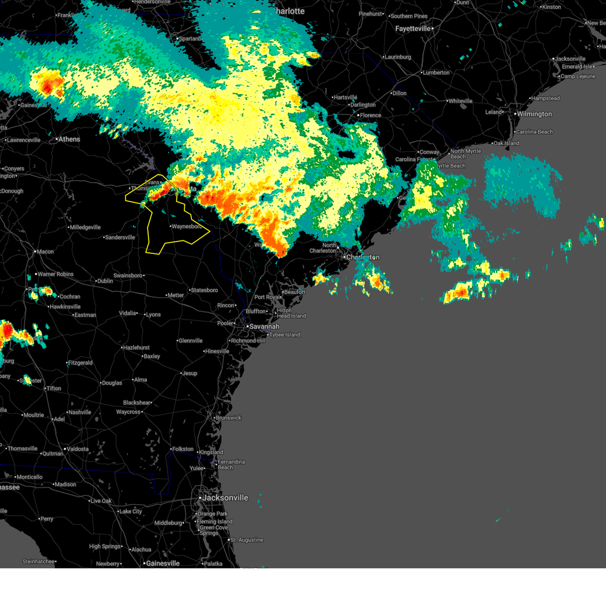
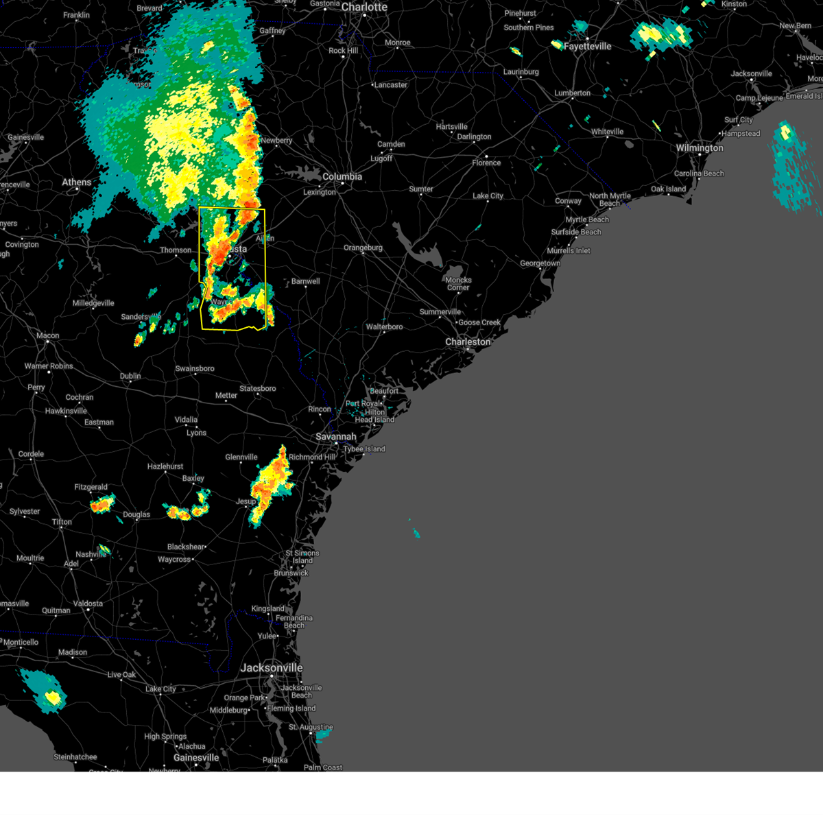
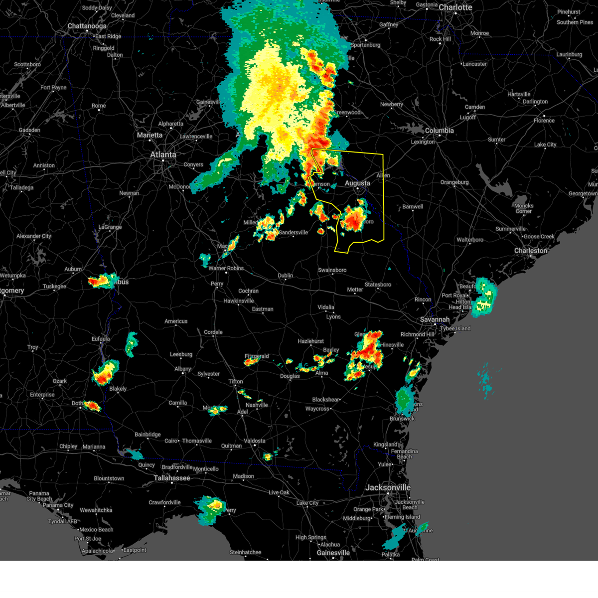
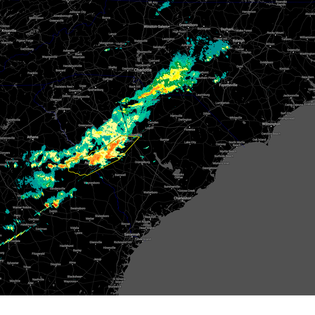
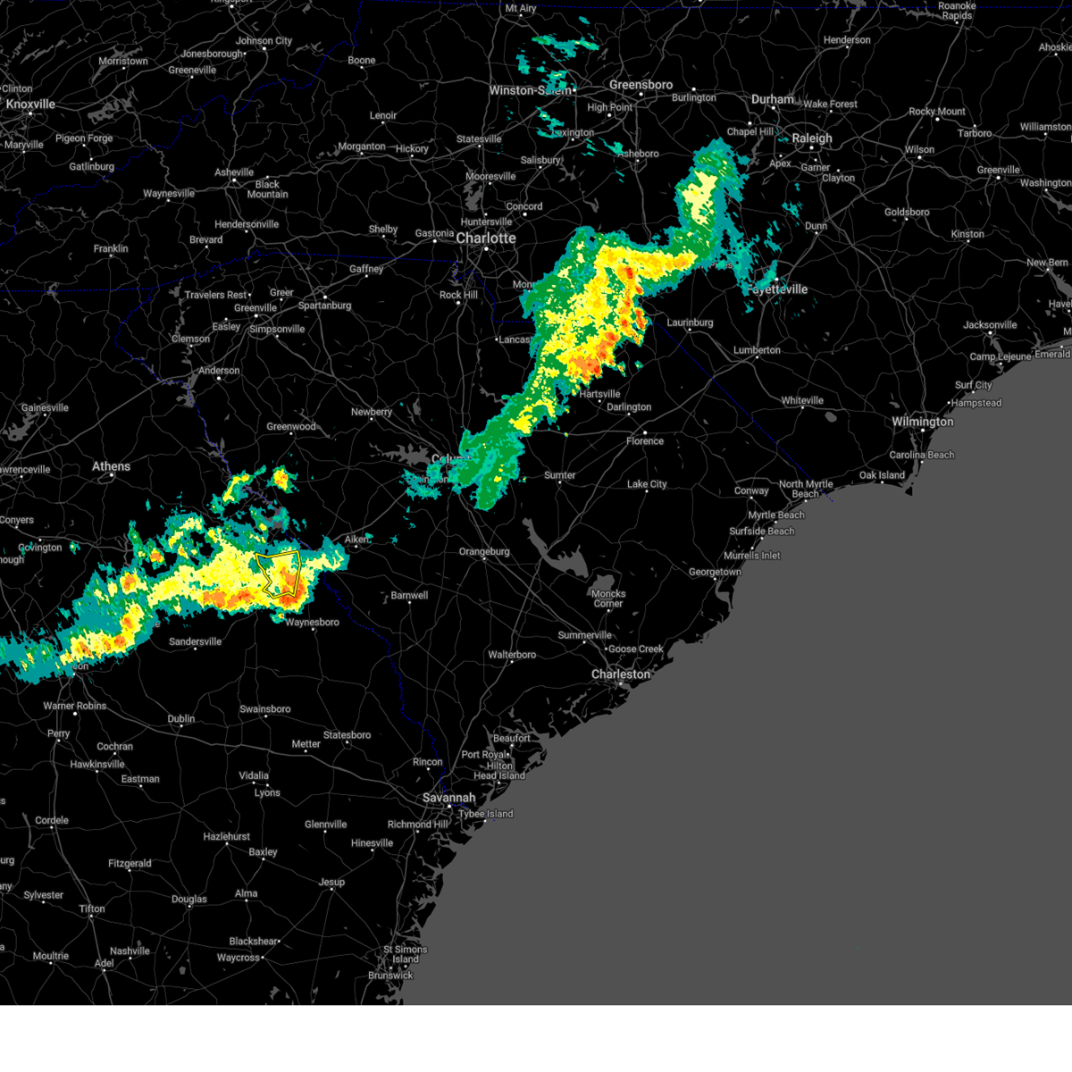
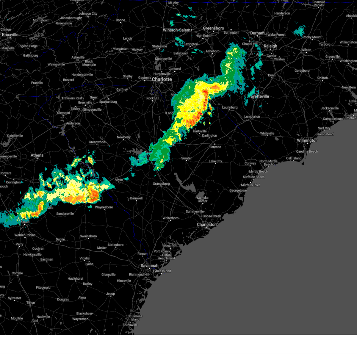
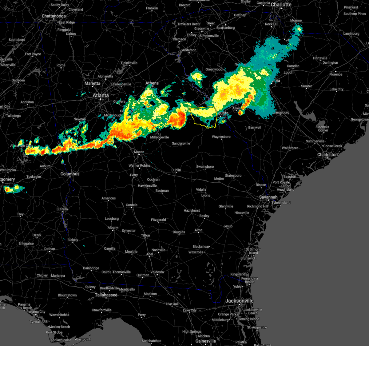
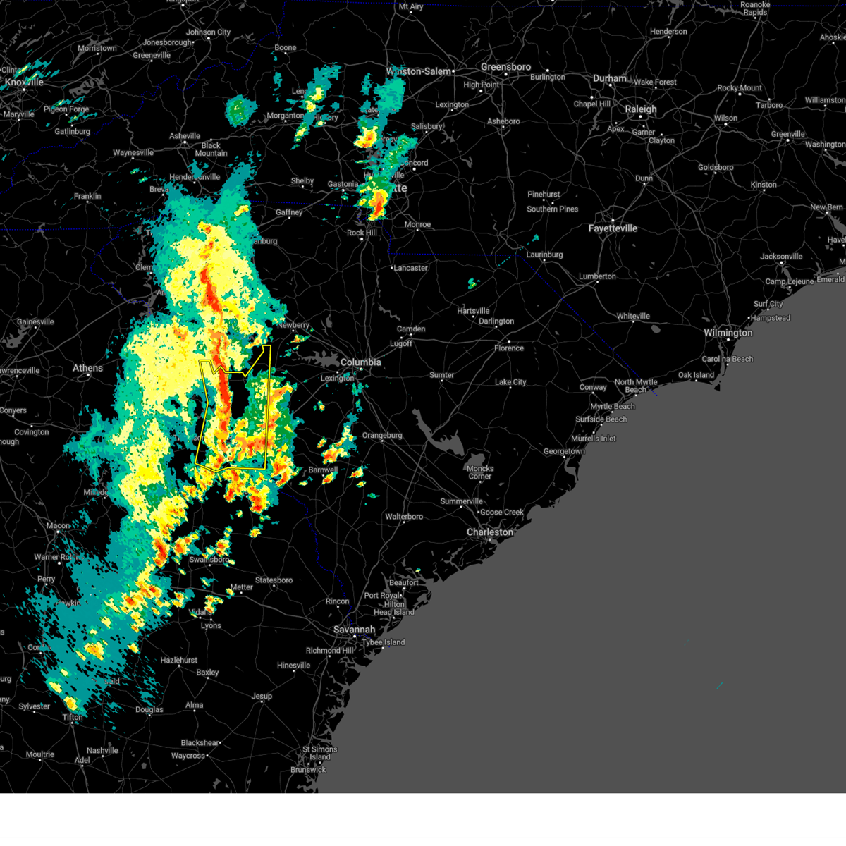
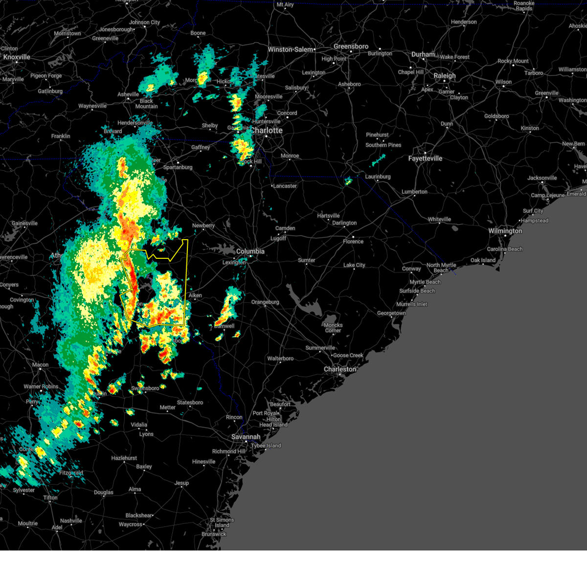
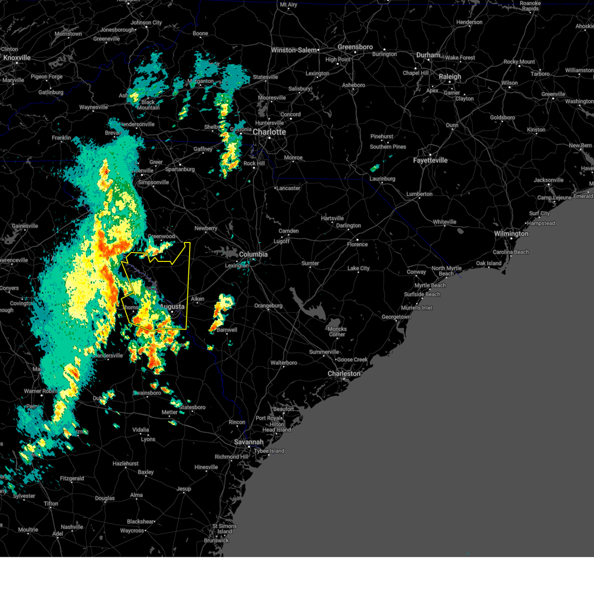
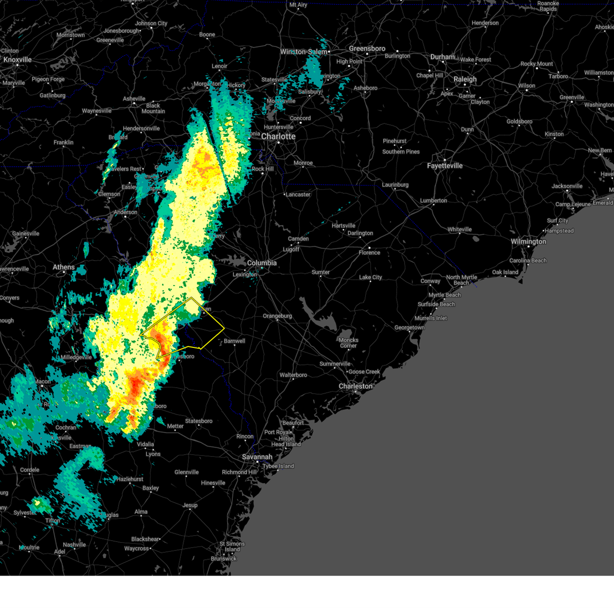
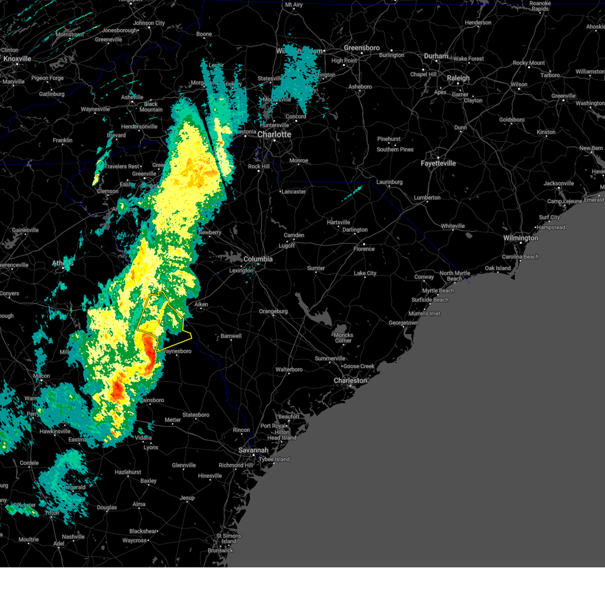
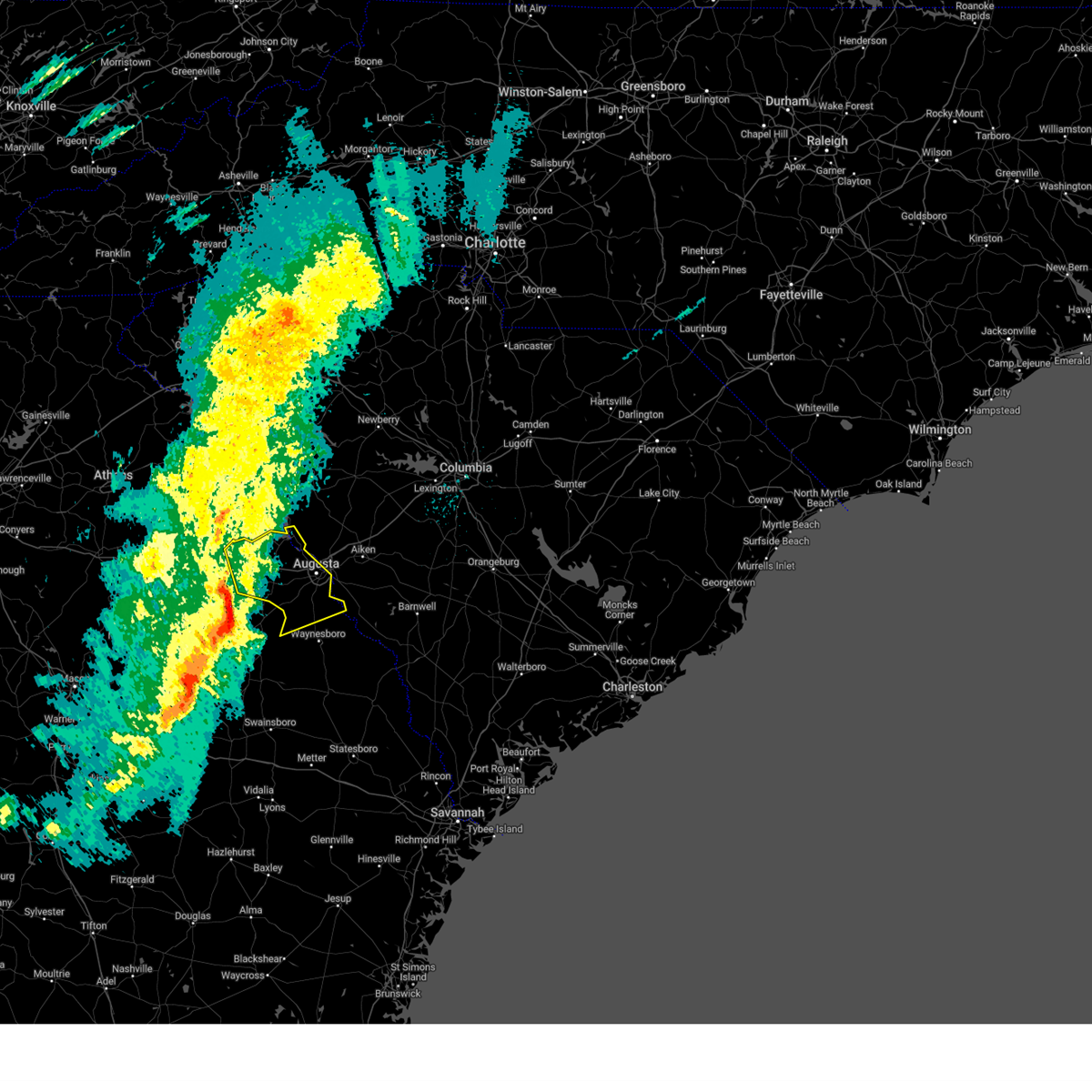
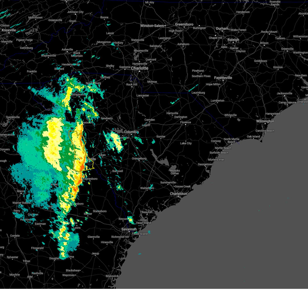
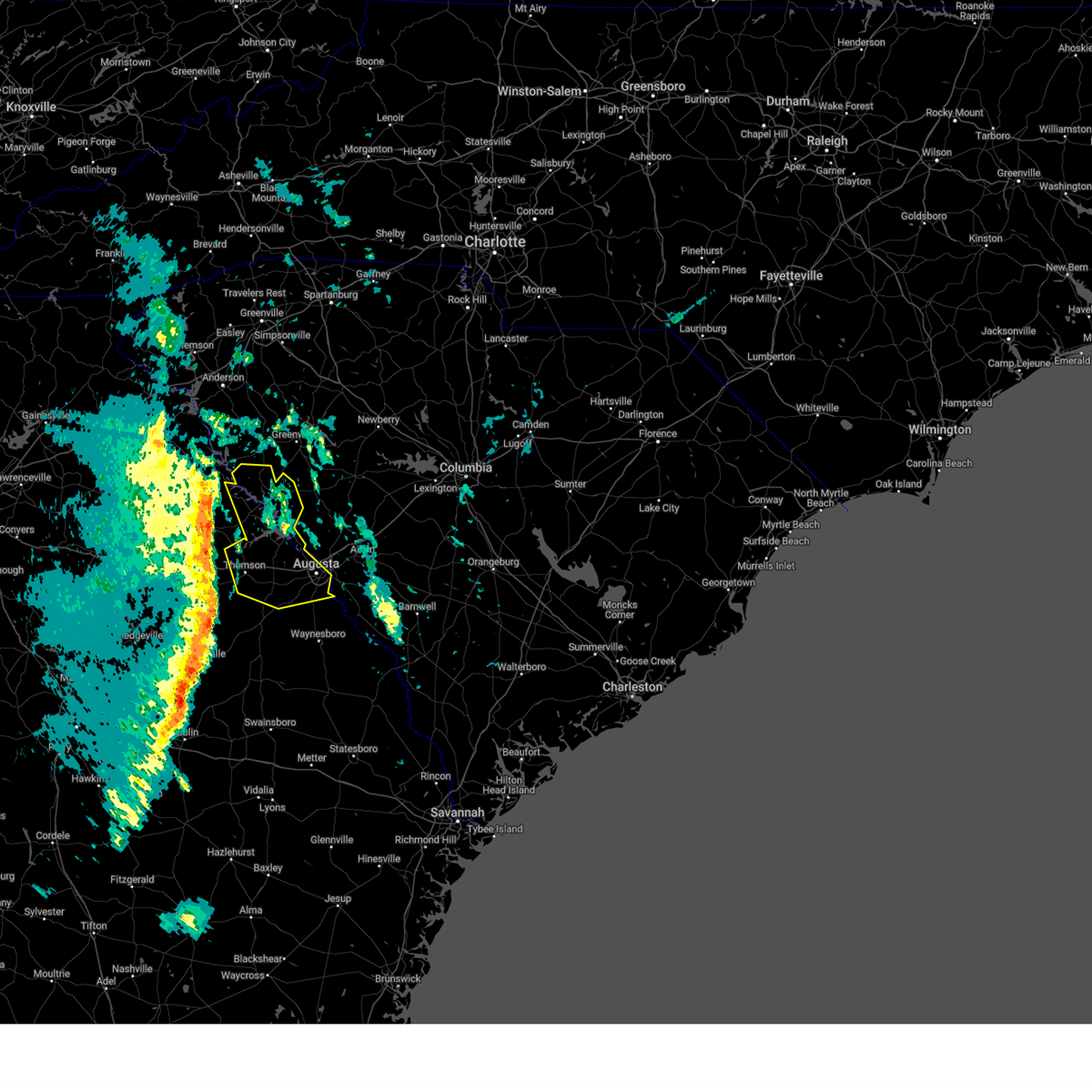
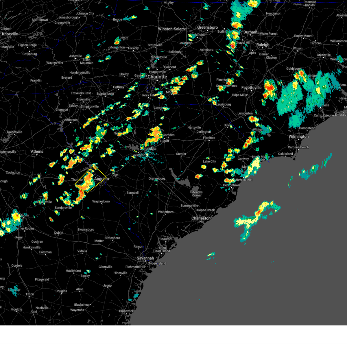
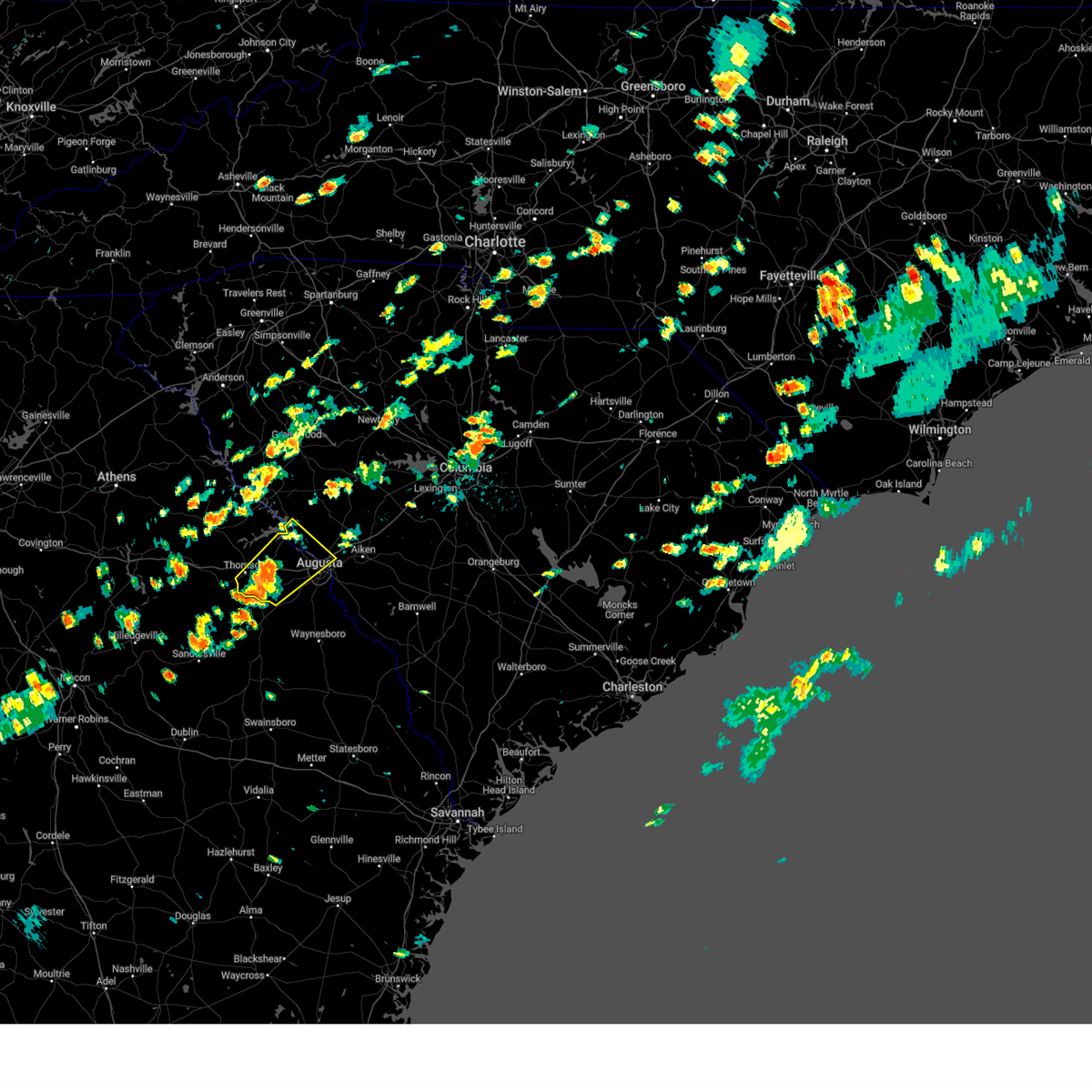
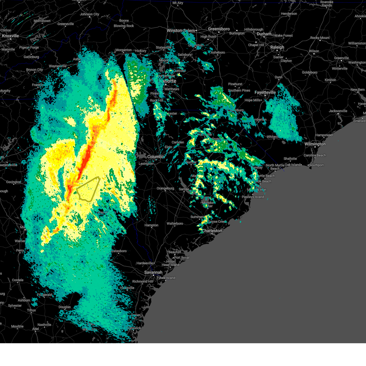
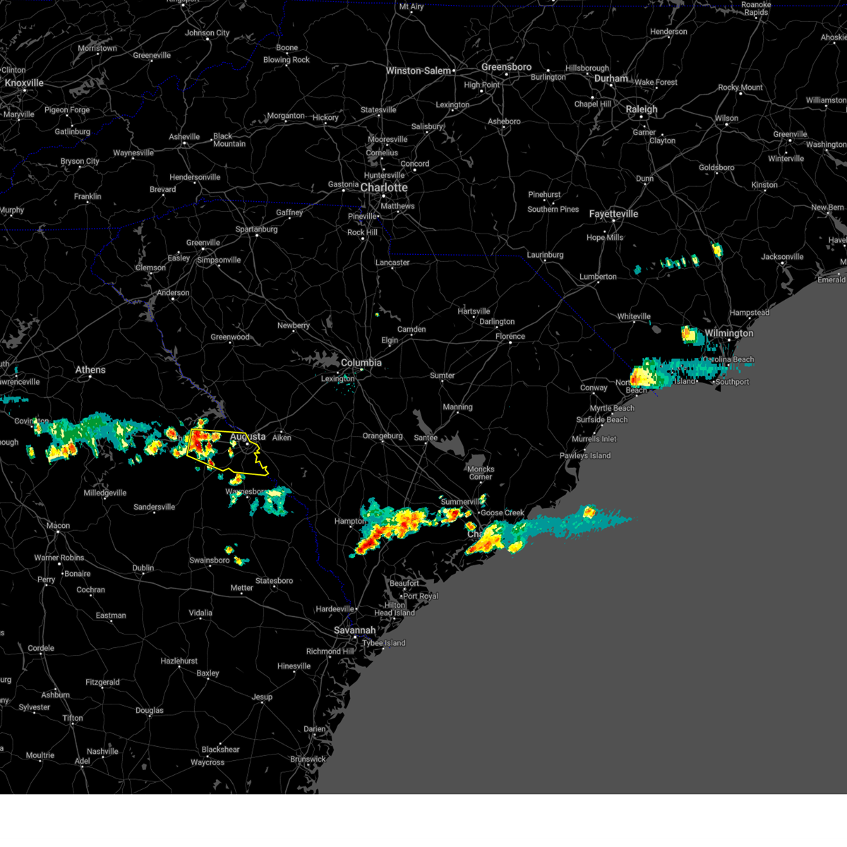
Hail Map for Harlem, GA
The Harlem, GA area has had 2 reports of on-the-ground hail by trained spotters, and has been under severe weather warnings 22 times during the past 12 months. Doppler radar has detected hail at or near Harlem, GA on 48 occasions, including 1 occasion during the past year.
| Name: | Harlem, GA |
| Where Located: | 20.2 miles WSW of Augusta, GA |
| Map: | Google Map for Harlem, GA |
| Population: | 2666 |
| Housing Units: | 1120 |
| More Info: | Search Google for Harlem, GA |
0
The Top Recent Hail Date for Harlem, GA is Wednesday, June 25, 2025 (48th out of 48)

Hail and Wind Damage Spotted near Harlem, GA
| Date / Time | Report Details |
|---|---|
| 6/25/2025 10:09 PM EDT |
 Svrcae the national weather service in columbia has issued a * severe thunderstorm warning for, southeastern mcduffie county in east central georgia, central columbia county in east central georgia, burke county in east central georgia, richmond county in east central georgia, * until 1115 pm edt. * at 1009 pm edt, severe thunderstorms were located along a line extending from near ulmer to fort eisenhower, moving southwest at 55 mph (radar indicated). Hazards include 60 mph wind gusts and quarter size hail. Hail damage to vehicles is expected. Expect wind damage to trees and powerlines. Svrcae the national weather service in columbia has issued a * severe thunderstorm warning for, southeastern mcduffie county in east central georgia, central columbia county in east central georgia, burke county in east central georgia, richmond county in east central georgia, * until 1115 pm edt. * at 1009 pm edt, severe thunderstorms were located along a line extending from near ulmer to fort eisenhower, moving southwest at 55 mph (radar indicated). Hazards include 60 mph wind gusts and quarter size hail. Hail damage to vehicles is expected. Expect wind damage to trees and powerlines.
|
| 6/7/2025 8:26 PM EDT |
 the severe thunderstorm warning has been cancelled and is no longer in effect the severe thunderstorm warning has been cancelled and is no longer in effect
|
| 6/7/2025 8:26 PM EDT |
 At 825 pm edt, severe thunderstorms were located along a line extending from near hamilton branch state park to near gough, moving east at 40 mph (radar indicated). Hazards include 60 mph wind gusts. Expect damage to trees and powerlines. locations impacted include, aiken, north augusta, grovetown, evans, waynesboro, fort eisenhower, augusta, clearwater, martinez, plant vogtle, belvedere, edgefield, hephzibah, jackson, sardis, glendale, gough, south augusta, clarks hill recreation area, and edgefield county airport. this includes the following highways, interstate 20 in georgia between mile markers 184 and 201. interstate 20 in south carolina between mile markers 0 and 19. interstate 520 in georgia between mile markers 1 and 15. Interstate 520 in south carolina between mile markers 16 and 23. At 825 pm edt, severe thunderstorms were located along a line extending from near hamilton branch state park to near gough, moving east at 40 mph (radar indicated). Hazards include 60 mph wind gusts. Expect damage to trees and powerlines. locations impacted include, aiken, north augusta, grovetown, evans, waynesboro, fort eisenhower, augusta, clearwater, martinez, plant vogtle, belvedere, edgefield, hephzibah, jackson, sardis, glendale, gough, south augusta, clarks hill recreation area, and edgefield county airport. this includes the following highways, interstate 20 in georgia between mile markers 184 and 201. interstate 20 in south carolina between mile markers 0 and 19. interstate 520 in georgia between mile markers 1 and 15. Interstate 520 in south carolina between mile markers 16 and 23.
|
| 6/7/2025 8:04 PM EDT | Columbia county dispatch reported powerlines down at the intersection of white oak and pineridge rd. time estimated by rada in columbia county GA, 9.2 miles S of Harlem, GA |
| 6/7/2025 7:53 PM EDT |
 Svrcae the national weather service in columbia has issued a * severe thunderstorm warning for, mcduffie county in east central georgia, columbia county in east central georgia, lincoln county in east central georgia, burke county in east central georgia, richmond county in east central georgia, edgefield county in central south carolina, southwestern barnwell county in central south carolina, western aiken county in central south carolina, southeastern mccormick county in central south carolina, * until 845 pm edt. * at 753 pm edt, severe thunderstorms were located along a line extending from lincolnton to near louisville, moving east at 40 mph (radar indicated). Hazards include 60 mph wind gusts. expect damage to trees and powerlines Svrcae the national weather service in columbia has issued a * severe thunderstorm warning for, mcduffie county in east central georgia, columbia county in east central georgia, lincoln county in east central georgia, burke county in east central georgia, richmond county in east central georgia, edgefield county in central south carolina, southwestern barnwell county in central south carolina, western aiken county in central south carolina, southeastern mccormick county in central south carolina, * until 845 pm edt. * at 753 pm edt, severe thunderstorms were located along a line extending from lincolnton to near louisville, moving east at 40 mph (radar indicated). Hazards include 60 mph wind gusts. expect damage to trees and powerlines
|
| 5/30/2025 3:56 PM EDT |
 At 355 pm edt, severe thunderstorms were located along a line extending from near lexington to near aiken municipal airport to near grovetown, moving east at 50 mph (radar indicated). Hazards include 60 mph wind gusts. Expect damage to trees and powerlines. locations impacted include, columbia, aiken, north augusta, lexington, west columbia, cayce, grovetown, evans, forest acres, thomson, batesburg-leesville, oak grove, fort eisenhower, augusta, clearwater, martinez, aiken mall, red bank, belvedere, and st. andrews. this includes the following highways, interstate 126 between mile markers 1 and 3. interstate 20 in georgia between mile markers 167 and 201. interstate 20 in south carolina between mile markers 0 and 62. interstate 26 between mile markers 109 and 118. interstate 520 in georgia between mile markers 1 and 15. interstate 520 in south carolina between mile markers 16 and 23. Interstate 77 between mile markers 0 and 5, and between mile markers 10 and 11. At 355 pm edt, severe thunderstorms were located along a line extending from near lexington to near aiken municipal airport to near grovetown, moving east at 50 mph (radar indicated). Hazards include 60 mph wind gusts. Expect damage to trees and powerlines. locations impacted include, columbia, aiken, north augusta, lexington, west columbia, cayce, grovetown, evans, forest acres, thomson, batesburg-leesville, oak grove, fort eisenhower, augusta, clearwater, martinez, aiken mall, red bank, belvedere, and st. andrews. this includes the following highways, interstate 126 between mile markers 1 and 3. interstate 20 in georgia between mile markers 167 and 201. interstate 20 in south carolina between mile markers 0 and 62. interstate 26 between mile markers 109 and 118. interstate 520 in georgia between mile markers 1 and 15. interstate 520 in south carolina between mile markers 16 and 23. Interstate 77 between mile markers 0 and 5, and between mile markers 10 and 11.
|
| 5/30/2025 3:56 PM EDT |
 the severe thunderstorm warning has been cancelled and is no longer in effect the severe thunderstorm warning has been cancelled and is no longer in effect
|
| 5/30/2025 3:34 PM EDT |
 Svrcae the national weather service in columbia has issued a * severe thunderstorm warning for, mcduffie county in east central georgia, columbia county in east central georgia, richmond county in east central georgia, southeastern newberry county in central south carolina, central edgefield county in central south carolina, lexington county in central south carolina, eastern saluda county in central south carolina, aiken county in central south carolina, southeastern mccormick county in central south carolina, central richland county in central south carolina, * until 415 pm edt. * at 333 pm edt, severe thunderstorms were located along a line extending from 7 miles north of batesburg-leesville to 9 miles northwest of belvedere to thomson-mcduffie county airport, moving east at 35 mph (radar indicated). Hazards include 60 mph wind gusts. expect damage to trees and powerlines Svrcae the national weather service in columbia has issued a * severe thunderstorm warning for, mcduffie county in east central georgia, columbia county in east central georgia, richmond county in east central georgia, southeastern newberry county in central south carolina, central edgefield county in central south carolina, lexington county in central south carolina, eastern saluda county in central south carolina, aiken county in central south carolina, southeastern mccormick county in central south carolina, central richland county in central south carolina, * until 415 pm edt. * at 333 pm edt, severe thunderstorms were located along a line extending from 7 miles north of batesburg-leesville to 9 miles northwest of belvedere to thomson-mcduffie county airport, moving east at 35 mph (radar indicated). Hazards include 60 mph wind gusts. expect damage to trees and powerlines
|
| 5/21/2025 5:11 AM EDT |
 The storm which prompted the warning has weakened below severe limits, and no longer poses an immediate threat to life or property. therefore, the warning will be allowed to expire. The storm which prompted the warning has weakened below severe limits, and no longer poses an immediate threat to life or property. therefore, the warning will be allowed to expire.
|
| 5/21/2025 5:07 AM EDT |
 the severe thunderstorm warning has been cancelled and is no longer in effect the severe thunderstorm warning has been cancelled and is no longer in effect
|
| 5/21/2025 5:07 AM EDT |
 At 507 am edt, a severe thunderstorm was located over fort eisenhower, moving east at 45 mph (radar indicated). Hazards include 60 mph wind gusts. Expect damage to trees and powerlines. locations impacted include, grovetown, evans, fort eisenhower, martinez, hephzibah, harlem, blythe, leitner lake conference center, liberty park community center, bath-edie, pea patch aerodrome, blanchard park, columbia county exhibition center, westmont, and bellevue memorial gardens. This includes interstate 20 in georgia between mile markers 179 and 195. At 507 am edt, a severe thunderstorm was located over fort eisenhower, moving east at 45 mph (radar indicated). Hazards include 60 mph wind gusts. Expect damage to trees and powerlines. locations impacted include, grovetown, evans, fort eisenhower, martinez, hephzibah, harlem, blythe, leitner lake conference center, liberty park community center, bath-edie, pea patch aerodrome, blanchard park, columbia county exhibition center, westmont, and bellevue memorial gardens. This includes interstate 20 in georgia between mile markers 179 and 195.
|
| 5/21/2025 4:55 AM EDT | Georgia power website reported power outages on morris calloway road due to a fallen tree. time estimated by rada in columbia county GA, 8.6 miles SSE of Harlem, GA |
| 5/21/2025 4:30 AM EDT |
 Svrcae the national weather service in columbia has issued a * severe thunderstorm warning for, mcduffie county in east central georgia, columbia county in east central georgia, western richmond county in east central georgia, * until 515 am edt. * at 429 am edt, a severe thunderstorm was located over camak, or over warrenton, moving east at 45 mph (radar indicated). Hazards include 60 mph wind gusts. expect damage to trees and powerlines Svrcae the national weather service in columbia has issued a * severe thunderstorm warning for, mcduffie county in east central georgia, columbia county in east central georgia, western richmond county in east central georgia, * until 515 am edt. * at 429 am edt, a severe thunderstorm was located over camak, or over warrenton, moving east at 45 mph (radar indicated). Hazards include 60 mph wind gusts. expect damage to trees and powerlines
|
| 3/31/2025 3:31 PM EDT |
 At 331 pm edt, severe thunderstorms were located along a line extending from 7 miles southeast of abbeville to near hamilton branch state park to evans, moving east at 55 mph (radar indicated). Hazards include 60 mph wind gusts. Expect damage to trees and powerlines. locations impacted include, west end augusta, parksville, new savannah bluff lock & dam park, poverty hill, blythe, glenn hills, scott's landing, northside fire station main, edgefield, westover, knox scout reservation, glendale, savannah bluffs heritage preserve, cleora, south augusta, clarks hill recreation area, westmont, long cane creek picnic area, dearing, and forest hills. this includes the following highways, interstate 20 in georgia between mile markers 178 and 201. interstate 20 in south carolina between mile markers 0 and 11. interstate 520 in georgia between mile markers 1 and 15. Interstate 520 in south carolina between mile markers 16 and 23. At 331 pm edt, severe thunderstorms were located along a line extending from 7 miles southeast of abbeville to near hamilton branch state park to evans, moving east at 55 mph (radar indicated). Hazards include 60 mph wind gusts. Expect damage to trees and powerlines. locations impacted include, west end augusta, parksville, new savannah bluff lock & dam park, poverty hill, blythe, glenn hills, scott's landing, northside fire station main, edgefield, westover, knox scout reservation, glendale, savannah bluffs heritage preserve, cleora, south augusta, clarks hill recreation area, westmont, long cane creek picnic area, dearing, and forest hills. this includes the following highways, interstate 20 in georgia between mile markers 178 and 201. interstate 20 in south carolina between mile markers 0 and 11. interstate 520 in georgia between mile markers 1 and 15. Interstate 520 in south carolina between mile markers 16 and 23.
|
| 3/31/2025 3:12 PM EDT |
 At 310 pm edt, severe thunderstorms were located along a line extending from near lake strom thurmond to near lincolnton to near thomson, moving east at 60 mph (radar indicated). Hazards include 60 mph wind gusts. Expect damage to trees and powerlines. locations impacted include, west end augusta, bordeaux, parksville, new savannah bluff lock & dam park, poverty hill, blythe, glenn hills, thomson fire department, scott's landing, mcduffie regional medical center, northside fire station main, edgefield, westover, knox scout reservation, glendale, savannah bluffs heritage preserve, cleora, south augusta, clarks hill recreation area, and westmont. this includes the following highways, interstate 20 in georgia between mile markers 166 and 201. interstate 20 in south carolina between mile markers 0 and 11. interstate 520 in georgia between mile markers 1 and 15. Interstate 520 in south carolina between mile markers 16 and 23. At 310 pm edt, severe thunderstorms were located along a line extending from near lake strom thurmond to near lincolnton to near thomson, moving east at 60 mph (radar indicated). Hazards include 60 mph wind gusts. Expect damage to trees and powerlines. locations impacted include, west end augusta, bordeaux, parksville, new savannah bluff lock & dam park, poverty hill, blythe, glenn hills, thomson fire department, scott's landing, mcduffie regional medical center, northside fire station main, edgefield, westover, knox scout reservation, glendale, savannah bluffs heritage preserve, cleora, south augusta, clarks hill recreation area, and westmont. this includes the following highways, interstate 20 in georgia between mile markers 166 and 201. interstate 20 in south carolina between mile markers 0 and 11. interstate 520 in georgia between mile markers 1 and 15. Interstate 520 in south carolina between mile markers 16 and 23.
|
| 3/31/2025 2:50 PM EDT |
 Svrcae the national weather service in columbia has issued a * severe thunderstorm warning for, mcduffie county in east central georgia, columbia county in east central georgia, lincoln county in east central georgia, richmond county in east central georgia, edgefield county in central south carolina, western saluda county in central south carolina, southwestern aiken county in central south carolina, mccormick county in central south carolina, * until 345 pm edt. * at 250 pm edt, severe thunderstorms were located along a line extending from 7 miles west of nancy hart state park to near sparta, moving east at 50 mph (radar indicated). Hazards include 60 mph wind gusts. expect damage to trees and powerlines Svrcae the national weather service in columbia has issued a * severe thunderstorm warning for, mcduffie county in east central georgia, columbia county in east central georgia, lincoln county in east central georgia, richmond county in east central georgia, edgefield county in central south carolina, western saluda county in central south carolina, southwestern aiken county in central south carolina, mccormick county in central south carolina, * until 345 pm edt. * at 250 pm edt, severe thunderstorms were located along a line extending from 7 miles west of nancy hart state park to near sparta, moving east at 50 mph (radar indicated). Hazards include 60 mph wind gusts. expect damage to trees and powerlines
|
| 3/16/2025 5:56 AM EDT |
 Svrcae the national weather service in columbia has issued a * severe thunderstorm warning for, southeastern mcduffie county in east central georgia, southeastern columbia county in east central georgia, northwestern burke county in east central georgia, richmond county in east central georgia, south central edgefield county in central south carolina, southwestern aiken county in central south carolina, * until 645 am edt. * at 556 am edt, a severe thunderstorm was located over hephzibah, or 9 miles south of fort eisenhower, moving northeast at 55 mph (radar indicated). Hazards include 60 mph wind gusts. expect damage to trees and powerlines Svrcae the national weather service in columbia has issued a * severe thunderstorm warning for, southeastern mcduffie county in east central georgia, southeastern columbia county in east central georgia, northwestern burke county in east central georgia, richmond county in east central georgia, south central edgefield county in central south carolina, southwestern aiken county in central south carolina, * until 645 am edt. * at 556 am edt, a severe thunderstorm was located over hephzibah, or 9 miles south of fort eisenhower, moving northeast at 55 mph (radar indicated). Hazards include 60 mph wind gusts. expect damage to trees and powerlines
|
| 3/16/2025 5:41 AM EDT |
 At 540 am edt, a severe thunderstorm was located near belvedere, moving northeast at 55 mph (radar indicated). Hazards include 60 mph wind gusts. Expect damage to trees and powerlines. locations impacted include, west end augusta, martinez, appling, arties pond public fishing area, new savannah bluff lock & dam park, blythe, glenn hills, adamsville, scott's landing, westover, glendale, autney, wildwood park, harlem, south augusta, clarks hill recreation area, ansley mill, westmont, keysville, and dearing. this includes the following highways, interstate 20 in georgia between mile markers 177 and 201. Interstate 520 in georgia between mile markers 1 and 14. At 540 am edt, a severe thunderstorm was located near belvedere, moving northeast at 55 mph (radar indicated). Hazards include 60 mph wind gusts. Expect damage to trees and powerlines. locations impacted include, west end augusta, martinez, appling, arties pond public fishing area, new savannah bluff lock & dam park, blythe, glenn hills, adamsville, scott's landing, westover, glendale, autney, wildwood park, harlem, south augusta, clarks hill recreation area, ansley mill, westmont, keysville, and dearing. this includes the following highways, interstate 20 in georgia between mile markers 177 and 201. Interstate 520 in georgia between mile markers 1 and 14.
|
| 3/16/2025 5:01 AM EDT |
 Svrcae the national weather service in columbia has issued a * severe thunderstorm warning for, mcduffie county in east central georgia, columbia county in east central georgia, northwestern burke county in east central georgia, richmond county in east central georgia, southeastern mccormick county in central south carolina, * until 600 am edt. * at 501 am edt, a severe thunderstorm was located 7 miles southeast of warrenton, moving northeast at 55 mph (radar indicated). Hazards include 60 mph wind gusts. expect damage to trees and powerlines Svrcae the national weather service in columbia has issued a * severe thunderstorm warning for, mcduffie county in east central georgia, columbia county in east central georgia, northwestern burke county in east central georgia, richmond county in east central georgia, southeastern mccormick county in central south carolina, * until 600 am edt. * at 501 am edt, a severe thunderstorm was located 7 miles southeast of warrenton, moving northeast at 55 mph (radar indicated). Hazards include 60 mph wind gusts. expect damage to trees and powerlines
|
| 2/16/2025 6:36 AM EST |
 Svrcae the national weather service in columbia has issued a * severe thunderstorm warning for, columbia county in east central georgia, burke county in east central georgia, southeastern mcduffie county in east central georgia, southeastern lincoln county in east central georgia, richmond county in east central georgia, fairfield county in central south carolina, newberry county in central south carolina, western lexington county in central south carolina, saluda county in central south carolina, aiken county in central south carolina, southeastern mccormick county in central south carolina, edgefield county in central south carolina, northwestern richland county in central south carolina, * until 730 am est. * at 635 am est, severe thunderstorms were located along a line extending from near clinton to near thomson-mcduffie county airport, moving east at 65 mph (radar indicated). Hazards include 60 mph wind gusts. expect damage to trees and powerlines Svrcae the national weather service in columbia has issued a * severe thunderstorm warning for, columbia county in east central georgia, burke county in east central georgia, southeastern mcduffie county in east central georgia, southeastern lincoln county in east central georgia, richmond county in east central georgia, fairfield county in central south carolina, newberry county in central south carolina, western lexington county in central south carolina, saluda county in central south carolina, aiken county in central south carolina, southeastern mccormick county in central south carolina, edgefield county in central south carolina, northwestern richland county in central south carolina, * until 730 am est. * at 635 am est, severe thunderstorms were located along a line extending from near clinton to near thomson-mcduffie county airport, moving east at 65 mph (radar indicated). Hazards include 60 mph wind gusts. expect damage to trees and powerlines
|
| 12/29/2024 7:33 AM EST |
 At 733 am est, severe thunderstorms were located along a line extending from 6 miles southeast of abbeville to near harlem, moving east at 40 mph (radar indicated). Hazards include 60 mph wind gusts. Expect damage to trees and powerlines. locations impacted include, north augusta, grovetown, evans, fort eisenhower, augusta, martinez, hephzibah, mccormick, harlem, glendale, south augusta, clarks hill recreation area, elijah clark state park, summerville, augusta mall, daniel field, village plaza shopping center, augusta national golf club, j. strom thurmond dam, and appling. this includes the following highways, interstate 20 in georgia between mile markers 180 and 201. Interstate 520 in georgia between mile markers 1 and 14. At 733 am est, severe thunderstorms were located along a line extending from 6 miles southeast of abbeville to near harlem, moving east at 40 mph (radar indicated). Hazards include 60 mph wind gusts. Expect damage to trees and powerlines. locations impacted include, north augusta, grovetown, evans, fort eisenhower, augusta, martinez, hephzibah, mccormick, harlem, glendale, south augusta, clarks hill recreation area, elijah clark state park, summerville, augusta mall, daniel field, village plaza shopping center, augusta national golf club, j. strom thurmond dam, and appling. this includes the following highways, interstate 20 in georgia between mile markers 180 and 201. Interstate 520 in georgia between mile markers 1 and 14.
|
| 12/29/2024 7:30 AM EST | Broadcast media forwarded reports of tree damage near the intersection of 223 and 221. time estimated by rada in columbia county GA, 4.2 miles S of Harlem, GA |
| 12/29/2024 6:44 AM EST |
 Svrcae the national weather service in columbia has issued a * severe thunderstorm warning for, mcduffie county in east central georgia, columbia county in east central georgia, lincoln county in east central georgia, richmond county in east central georgia, mccormick county in central south carolina, * until 745 am est. * at 642 am est, severe thunderstorms were located along a line extending from near nancy hart state park to near mitchell, moving northeast at 40 mph (radar indicated). Hazards include 60 mph wind gusts. expect damage to trees and powerlines Svrcae the national weather service in columbia has issued a * severe thunderstorm warning for, mcduffie county in east central georgia, columbia county in east central georgia, lincoln county in east central georgia, richmond county in east central georgia, mccormick county in central south carolina, * until 745 am est. * at 642 am est, severe thunderstorms were located along a line extending from near nancy hart state park to near mitchell, moving northeast at 40 mph (radar indicated). Hazards include 60 mph wind gusts. expect damage to trees and powerlines
|
| 8/3/2024 2:39 PM EDT |
 At 239 pm edt, a severe thunderstorm was located near riverwood, or near evans, moving northeast at 25 mph (radar indicated). Hazards include 60 mph wind gusts and penny size hail. Expect damage to trees and powerlines. locations impacted include, north augusta, grovetown, evans, thomson, martinez, fort eisenhower, belvedere, harlem, appling, clarks hill recreation area, riverwood, augusta mall, daniel field, village plaza shopping center, augusta national golf club, j. strom thurmond dam, dearing, arties pond public fishing area, poverty hill, and adamsville. this includes the following highways, interstate 20 in georgia between mile markers 174 and 201. interstate 20 in south carolina between mile markers 0 and 5. interstate 520 in georgia between mile markers 1 and 3. Interstate 520 in south carolina between mile markers 22 and 23. At 239 pm edt, a severe thunderstorm was located near riverwood, or near evans, moving northeast at 25 mph (radar indicated). Hazards include 60 mph wind gusts and penny size hail. Expect damage to trees and powerlines. locations impacted include, north augusta, grovetown, evans, thomson, martinez, fort eisenhower, belvedere, harlem, appling, clarks hill recreation area, riverwood, augusta mall, daniel field, village plaza shopping center, augusta national golf club, j. strom thurmond dam, dearing, arties pond public fishing area, poverty hill, and adamsville. this includes the following highways, interstate 20 in georgia between mile markers 174 and 201. interstate 20 in south carolina between mile markers 0 and 5. interstate 520 in georgia between mile markers 1 and 3. Interstate 520 in south carolina between mile markers 22 and 23.
|
| 8/3/2024 2:27 PM EDT | Columbia county dispatch reported trees down along appling harlem rd and i-2 in columbia county GA, 5.6 miles S of Harlem, GA |
| 8/3/2024 2:23 PM EDT |
 Svrcae the national weather service in columbia has issued a * severe thunderstorm warning for, southern mcduffie county in east central georgia, columbia county in east central georgia, northwestern richmond county in east central georgia, southwestern edgefield county in central south carolina, west central aiken county in central south carolina, southeastern mccormick county in central south carolina, * until 300 pm edt. * at 221 pm edt, a cluster of severe thunderstorms was located near harlem, or 8 miles east of thomson, moving northeast at 25 mph (radar indicated). Hazards include 60 mph wind gusts and penny size hail. expect damage to trees and powerlines Svrcae the national weather service in columbia has issued a * severe thunderstorm warning for, southern mcduffie county in east central georgia, columbia county in east central georgia, northwestern richmond county in east central georgia, southwestern edgefield county in central south carolina, west central aiken county in central south carolina, southeastern mccormick county in central south carolina, * until 300 pm edt. * at 221 pm edt, a cluster of severe thunderstorms was located near harlem, or 8 miles east of thomson, moving northeast at 25 mph (radar indicated). Hazards include 60 mph wind gusts and penny size hail. expect damage to trees and powerlines
|
| 7/16/2024 4:25 PM EDT |
 the severe thunderstorm warning has been cancelled and is no longer in effect the severe thunderstorm warning has been cancelled and is no longer in effect
|
| 7/16/2024 4:25 PM EDT |
 At 425 pm edt, a severe thunderstorm was located over harlem, or 8 miles southwest of grovetown, moving northeast at 15 mph (radar indicated). Hazards include 60 mph wind gusts and quarter size hail. Hail damage to vehicles is expected. expect wind damage to trees and powerlines. locations impacted include, grovetown, evans, fort eisenhower, hephzibah, harlem, south augusta, blythe, dearing, leitner lake conference center, liberty park community center, arties pond public fishing area, adamsville, bath-edie, pea patch aerodrome, columbia county exhibition center, diamond lakes regional park, patriots park, and bellevue memorial gardens. This includes interstate 20 in georgia between mile markers 182 and 193. At 425 pm edt, a severe thunderstorm was located over harlem, or 8 miles southwest of grovetown, moving northeast at 15 mph (radar indicated). Hazards include 60 mph wind gusts and quarter size hail. Hail damage to vehicles is expected. expect wind damage to trees and powerlines. locations impacted include, grovetown, evans, fort eisenhower, hephzibah, harlem, south augusta, blythe, dearing, leitner lake conference center, liberty park community center, arties pond public fishing area, adamsville, bath-edie, pea patch aerodrome, columbia county exhibition center, diamond lakes regional park, patriots park, and bellevue memorial gardens. This includes interstate 20 in georgia between mile markers 182 and 193.
|
| 7/16/2024 3:57 PM EDT |
 Svrcae the national weather service in columbia has issued a * severe thunderstorm warning for, southeastern mcduffie county in east central georgia, southwestern columbia county in east central georgia, northwestern burke county in east central georgia, southwestern richmond county in east central georgia, * until 445 pm edt. * at 356 pm edt, a severe thunderstorm was located near stapleton, or 11 miles northeast of gibson, moving northeast at 15 mph (radar indicated). Hazards include 60 mph wind gusts and quarter size hail. Hail damage to vehicles is expected. Expect wind damage to trees and powerlines. Svrcae the national weather service in columbia has issued a * severe thunderstorm warning for, southeastern mcduffie county in east central georgia, southwestern columbia county in east central georgia, northwestern burke county in east central georgia, southwestern richmond county in east central georgia, * until 445 pm edt. * at 356 pm edt, a severe thunderstorm was located near stapleton, or 11 miles northeast of gibson, moving northeast at 15 mph (radar indicated). Hazards include 60 mph wind gusts and quarter size hail. Hail damage to vehicles is expected. Expect wind damage to trees and powerlines.
|
| 5/24/2024 7:20 PM EDT | Columbia county em relayed several reports of damage in the area. approximately 25-30 downed trees were reported on county line road between hinton wilson road and sawd in mcduffie county GA, 5.6 miles SE of Harlem, GA |
| 5/6/2024 3:07 PM EDT |
 Svrcae the national weather service in columbia has issued a * severe thunderstorm warning for, central columbia county in east central georgia, central richmond county in east central georgia, * until 345 pm edt. * at 306 pm edt, a severe thunderstorm was located near grovetown, moving northeast at 15 mph (radar indicated). Hazards include 60 mph wind gusts and quarter size hail. Hail damage to vehicles is expected. Expect wind damage to trees and powerlines. Svrcae the national weather service in columbia has issued a * severe thunderstorm warning for, central columbia county in east central georgia, central richmond county in east central georgia, * until 345 pm edt. * at 306 pm edt, a severe thunderstorm was located near grovetown, moving northeast at 15 mph (radar indicated). Hazards include 60 mph wind gusts and quarter size hail. Hail damage to vehicles is expected. Expect wind damage to trees and powerlines.
|
| 2/28/2024 6:18 PM EST | Svrcae the national weather service in columbia has issued a * severe thunderstorm warning for, southeastern mcduffie county in east central georgia, southern columbia county in east central georgia, northwestern burke county in east central georgia, richmond county in east central georgia, southern edgefield county in central south carolina, central barnwell county in central south carolina, southeastern saluda county in central south carolina, aiken county in central south carolina, northwestern orangeburg county in central south carolina, * until 715 pm est. * at 617 pm est, severe thunderstorms were located along a line extending from near batesburg-leesville to 6 miles north of stapleton, moving southeast at 30 mph (radar indicated). Hazards include 60 mph wind gusts. expect damage to trees and powerlines |
| 2/28/2024 5:48 PM EST | At 548 pm est, severe thunderstorms were located along a line extending from near prosperity to 6 miles northwest of wrightsboro, moving east at 35 mph (radar indicated). Hazards include 60 mph wind gusts. Expect damage to trees and powerlines. locations impacted include, north augusta, grovetown, evans, thomson, batesburg-leesville, martinez, edgefield, saluda, harlem, johnston, ridge spring, clarks hill recreation area, edgefield county airport, mistletoe state park, wrightsboro, village plaza shopping center, j. strom thurmond dam, thomson-mcduffie county airport, appling, and riverwood. this includes the following highways, interstate 20 in georgia between mile markers 166 and 201. Interstate 20 in south carolina near mile marker 0. |
| 2/28/2024 4:59 PM EST | At 459 pm est, severe thunderstorms were located along a line extending from near cokesbury to near maxeys, moving east at 35 mph (radar indicated). Hazards include 60 mph wind gusts. Expect damage to trees and powerlines. locations impacted include, north augusta, grovetown, evans, thomson, batesburg-leesville, martinez, edgefield, saluda, mccormick, harlem, johnston, lincolnton, ridge spring, clarks hill recreation area, edgefield county airport, elijah clark state park, mistletoe state park, wrightsboro, village plaza shopping center, and j. strom thurmond dam. this includes the following highways, interstate 20 in georgia between mile markers 166 and 201. Interstate 20 in south carolina near mile marker 0. |
| 2/28/2024 4:54 PM EST | Svrcae the national weather service in columbia has issued a * severe thunderstorm warning for, mcduffie county in east central georgia, columbia county in east central georgia, lincoln county in east central georgia, edgefield county in central south carolina, saluda county in central south carolina, mccormick county in central south carolina, * until 615 pm est. * at 452 pm est, severe thunderstorms were located along a line extending from near cokesbury to near maxeys, moving east at 35 mph (radar indicated). Hazards include 60 mph wind gusts. expect damage to trees and powerlines |
| 1/9/2024 12:30 PM EST | Tree down on george walton d in columbia county GA, 2.2 miles S of Harlem, GA |
| 1/9/2024 12:30 PM EST | Tree down on old union r in columbia county GA, 3.6 miles S of Harlem, GA |
| 1/9/2024 12:26 PM EST |
 At 1224 pm est, severe thunderstorms were located along a line extending from near hamilton branch state park to 6 miles southwest of harlem to near davisboro, moving east at 35 mph (radar indicated). Hazards include 70 mph wind gusts. Expect considerable tree damage. Damage is likely to mobile homes, roofs, and outbuildings. At 1224 pm est, severe thunderstorms were located along a line extending from near hamilton branch state park to 6 miles southwest of harlem to near davisboro, moving east at 35 mph (radar indicated). Hazards include 70 mph wind gusts. Expect considerable tree damage. Damage is likely to mobile homes, roofs, and outbuildings.
|
| 1/9/2024 11:44 AM EST |
 At 1143 am est, severe thunderstorms were located along a line extending from near wrightsboro to near tennille, moving east at 40 mph (radar indicated). Hazards include 70 mph wind gusts. Expect considerable tree damage. Damage is likely to mobile homes, roofs, and outbuildings. At 1143 am est, severe thunderstorms were located along a line extending from near wrightsboro to near tennille, moving east at 40 mph (radar indicated). Hazards include 70 mph wind gusts. Expect considerable tree damage. Damage is likely to mobile homes, roofs, and outbuildings.
|
| 9/7/2023 3:45 PM EDT |
 At 345 pm edt, a severe thunderstorm was located over fort gordon, moving northeast at 10 mph (radar indicated). Hazards include 60 mph wind gusts. Expect damage to trees and powerlines. locations impacted include, grovetown, evans, martinez, fort gordon, hephzibah, glendale, south augusta, midtown, summerville, augusta mall, daniel field, augusta regional airport, village plaza shopping center, augusta national golf club, liberty park community center, new savannah bluff lock & dam park, glenn hills, bath-edie, westover memorial park, and westover. this includes the following highways, interstate 20 in georgia between mile markers 190 and 200. interstate 520 in georgia between mile markers 1 and 12. hail threat, radar indicated max hail size, <. 75 in wind threat, radar indicated max wind gust, 60 mph. At 345 pm edt, a severe thunderstorm was located over fort gordon, moving northeast at 10 mph (radar indicated). Hazards include 60 mph wind gusts. Expect damage to trees and powerlines. locations impacted include, grovetown, evans, martinez, fort gordon, hephzibah, glendale, south augusta, midtown, summerville, augusta mall, daniel field, augusta regional airport, village plaza shopping center, augusta national golf club, liberty park community center, new savannah bluff lock & dam park, glenn hills, bath-edie, westover memorial park, and westover. this includes the following highways, interstate 20 in georgia between mile markers 190 and 200. interstate 520 in georgia between mile markers 1 and 12. hail threat, radar indicated max hail size, <. 75 in wind threat, radar indicated max wind gust, 60 mph.
|
| 9/7/2023 3:33 PM EDT |
 At 333 pm edt, a severe thunderstorm was located near fort gordon, moving northeast at 10 mph (radar indicated). Hazards include 60 mph wind gusts. expect damage to trees and powerlines At 333 pm edt, a severe thunderstorm was located near fort gordon, moving northeast at 10 mph (radar indicated). Hazards include 60 mph wind gusts. expect damage to trees and powerlines
|
| 7/20/2023 8:05 PM EDT |
 At 804 pm edt, severe thunderstorms were located along a line extending from 6 miles east of troy to near thomson-mcduffie county airport to 7 miles northeast of sparta, moving southeast at 40 mph (radar indicated). Hazards include 60 to 70 mph wind gusts and penny size hail. this storm has had a history of knocking down trees. Expect damage to trees and powerlines. locations impacted include, aiken, north augusta, grovetown, evans, thomson, fort gordon, augusta, clearwater, martinez, belvedere, edgefield, hephzibah, harlem, johnston, jackson, ridge spring, glendale, south augusta, clarks hill recreation area and edgefield county airport. this includes the following highways, interstate 20 in georgia between mile markers 173 and 201. interstate 20 in south carolina between mile markers 0 and 25. interstate 520 in georgia between mile markers 1 and 15. interstate 520 in south carolina between mile markers 16 and 23. hail threat, radar indicated max hail size, 0. 75 in wind threat, radar indicated max wind gust, 60 mph. At 804 pm edt, severe thunderstorms were located along a line extending from 6 miles east of troy to near thomson-mcduffie county airport to 7 miles northeast of sparta, moving southeast at 40 mph (radar indicated). Hazards include 60 to 70 mph wind gusts and penny size hail. this storm has had a history of knocking down trees. Expect damage to trees and powerlines. locations impacted include, aiken, north augusta, grovetown, evans, thomson, fort gordon, augusta, clearwater, martinez, belvedere, edgefield, hephzibah, harlem, johnston, jackson, ridge spring, glendale, south augusta, clarks hill recreation area and edgefield county airport. this includes the following highways, interstate 20 in georgia between mile markers 173 and 201. interstate 20 in south carolina between mile markers 0 and 25. interstate 520 in georgia between mile markers 1 and 15. interstate 520 in south carolina between mile markers 16 and 23. hail threat, radar indicated max hail size, 0. 75 in wind threat, radar indicated max wind gust, 60 mph.
|
| 7/20/2023 7:40 PM EDT |
 At 739 pm edt, severe thunderstorms were located along a line extending from near abbeville to 6 miles southeast of washington to near white plains, moving southeast at 50 mph (radar indicated). Hazards include 60 to 70 mph wind gusts and penny size hail. expect damage to trees and powerlines At 739 pm edt, severe thunderstorms were located along a line extending from near abbeville to 6 miles southeast of washington to near white plains, moving southeast at 50 mph (radar indicated). Hazards include 60 to 70 mph wind gusts and penny size hail. expect damage to trees and powerlines
|
| 6/6/2023 8:25 PM EDT | Multiple trees down within the town limits of harlem... including one down on a house and car on w. forrest st. time estimate in columbia county GA, 0.5 miles WSW of Harlem, GA |
| 6/6/2023 8:06 PM EDT |
 At 806 pm edt, a severe thunderstorm was located near thomson, moving east at 30 mph (radar indicated). Hazards include 60 mph wind gusts and quarter size hail. Hail damage to vehicles is expected. Expect wind damage to trees and powerlines. At 806 pm edt, a severe thunderstorm was located near thomson, moving east at 30 mph (radar indicated). Hazards include 60 mph wind gusts and quarter size hail. Hail damage to vehicles is expected. Expect wind damage to trees and powerlines.
|
| 3/26/2023 9:56 AM EDT |
 At 955 am edt, a severe thunderstorm was located near harlem, or near thomson, moving east at 65 mph (radar indicated). Hazards include 60 mph wind gusts and quarter size hail. Hail damage to vehicles is expected. Expect wind damage to trees and powerlines. At 955 am edt, a severe thunderstorm was located near harlem, or near thomson, moving east at 65 mph (radar indicated). Hazards include 60 mph wind gusts and quarter size hail. Hail damage to vehicles is expected. Expect wind damage to trees and powerlines.
|
| 3/26/2023 9:00 AM EDT |
 At 859 am edt, a severe thunderstorm was located over grovetown, moving northeast at 45 mph (radar indicated). Hazards include 60 mph wind gusts and quarter size hail. Hail damage to vehicles is expected. Expect wind damage to trees and powerlines. At 859 am edt, a severe thunderstorm was located over grovetown, moving northeast at 45 mph (radar indicated). Hazards include 60 mph wind gusts and quarter size hail. Hail damage to vehicles is expected. Expect wind damage to trees and powerlines.
|
| 3/26/2023 8:24 AM EDT |
 At 823 am edt, a severe thunderstorm was located near warrenton, moving northeast at 45 mph (radar indicated). Hazards include 60 mph wind gusts and quarter size hail. Hail damage to vehicles is expected. Expect wind damage to trees and powerlines. At 823 am edt, a severe thunderstorm was located near warrenton, moving northeast at 45 mph (radar indicated). Hazards include 60 mph wind gusts and quarter size hail. Hail damage to vehicles is expected. Expect wind damage to trees and powerlines.
|
| 1/12/2023 5:56 PM EST |
 At 556 pm est, severe thunderstorms were located along a line extending from near nancy hart state park to 7 miles southeast of sparta, moving east at 55 mph (radar indicated). Hazards include 60 mph wind gusts and penny size hail. expect damage to trees and powerlines At 556 pm est, severe thunderstorms were located along a line extending from near nancy hart state park to 7 miles southeast of sparta, moving east at 55 mph (radar indicated). Hazards include 60 mph wind gusts and penny size hail. expect damage to trees and powerlines
|
| 1/4/2023 9:34 AM EST |
 At 934 am est, severe thunderstorms were located along a line extending from near evans to 8 miles south of gough, moving east at 45 mph (radar indicated). Hazards include 60 mph wind gusts. Expect damage to trees and powerlines. locations impacted include, aiken, north augusta, grovetown, evans, waynesboro, martinez, fort gordon, augusta, clearwater, belvedere, hephzibah, harlem, jackson, midville, glendale, gough, south augusta, midtown, summerville and augusta mall. this includes the following highways, interstate 20 in georgia between mile markers 183 and 201. interstate 20 in south carolina between mile markers 0 and 16. interstate 520 in georgia between mile markers 1 and 15. Interstate 520 in south carolina between mile markers 16 and 23. At 934 am est, severe thunderstorms were located along a line extending from near evans to 8 miles south of gough, moving east at 45 mph (radar indicated). Hazards include 60 mph wind gusts. Expect damage to trees and powerlines. locations impacted include, aiken, north augusta, grovetown, evans, waynesboro, martinez, fort gordon, augusta, clearwater, belvedere, hephzibah, harlem, jackson, midville, glendale, gough, south augusta, midtown, summerville and augusta mall. this includes the following highways, interstate 20 in georgia between mile markers 183 and 201. interstate 20 in south carolina between mile markers 0 and 16. interstate 520 in georgia between mile markers 1 and 15. Interstate 520 in south carolina between mile markers 16 and 23.
|
| 1/4/2023 9:25 AM EST | Columbia co ga em reported one tree down at county line rd and sawdust rd... resulting in a total of 794 customers without power. time estimate in columbia county GA, 0.7 miles E of Harlem, GA |
| 1/4/2023 9:21 AM EST |
 At 920 am est, severe thunderstorms were located along a line extending from near harlem to near wadley, moving east at 45 mph (radar indicated). Hazards include 60 mph wind gusts. expect damage to trees and powerlines At 920 am est, severe thunderstorms were located along a line extending from near harlem to near wadley, moving east at 45 mph (radar indicated). Hazards include 60 mph wind gusts. expect damage to trees and powerlines
|
| 7/7/2022 6:56 PM EDT |
 At 655 pm edt, severe thunderstorms were located along a line extending from near ridge spring to harlem, moving southeast at 20 mph (radar indicated). Hazards include 60 mph wind gusts. Expect damage to trees and powerlines. locations impacted include, aiken, north augusta, grovetown, evans, batesburg-leesville, fort gordon, augusta, clearwater, martinez, aiken mall, belvedere, edgefield, hephzibah, harlem, johnston, new ellenton, jackson, ridge spring, glendale and south augusta. this includes the following highways, interstate 20 in georgia between mile markers 178 and 201. interstate 20 in south carolina between mile markers 0 and 42. interstate 520 in georgia between mile markers 1 and 15. interstate 520 in south carolina between mile markers 16 and 23. hail threat, radar indicated max hail size, <. 75 in wind threat, radar indicated max wind gust, 60 mph. At 655 pm edt, severe thunderstorms were located along a line extending from near ridge spring to harlem, moving southeast at 20 mph (radar indicated). Hazards include 60 mph wind gusts. Expect damage to trees and powerlines. locations impacted include, aiken, north augusta, grovetown, evans, batesburg-leesville, fort gordon, augusta, clearwater, martinez, aiken mall, belvedere, edgefield, hephzibah, harlem, johnston, new ellenton, jackson, ridge spring, glendale and south augusta. this includes the following highways, interstate 20 in georgia between mile markers 178 and 201. interstate 20 in south carolina between mile markers 0 and 42. interstate 520 in georgia between mile markers 1 and 15. interstate 520 in south carolina between mile markers 16 and 23. hail threat, radar indicated max hail size, <. 75 in wind threat, radar indicated max wind gust, 60 mph.
|
| 7/7/2022 6:41 PM EDT |
 At 640 pm edt, severe thunderstorms were located along a line extending from near ridge spring to near thomson, moving southeast at 20 mph (radar indicated). Hazards include 60 mph wind gusts. Expect damage to trees and powerlines. locations impacted include, aiken, north augusta, grovetown, evans, thomson, batesburg-leesville, fort gordon, augusta, clearwater, martinez, aiken mall, belvedere, edgefield, hephzibah, harlem, johnston, new ellenton, jackson, ridge spring and glendale. this includes the following highways, interstate 20 in georgia between mile markers 170 and 201. interstate 20 in south carolina between mile markers 0 and 42. interstate 520 in georgia between mile markers 1 and 15. interstate 520 in south carolina between mile markers 16 and 23. hail threat, radar indicated max hail size, <. 75 in wind threat, radar indicated max wind gust, 60 mph. At 640 pm edt, severe thunderstorms were located along a line extending from near ridge spring to near thomson, moving southeast at 20 mph (radar indicated). Hazards include 60 mph wind gusts. Expect damage to trees and powerlines. locations impacted include, aiken, north augusta, grovetown, evans, thomson, batesburg-leesville, fort gordon, augusta, clearwater, martinez, aiken mall, belvedere, edgefield, hephzibah, harlem, johnston, new ellenton, jackson, ridge spring and glendale. this includes the following highways, interstate 20 in georgia between mile markers 170 and 201. interstate 20 in south carolina between mile markers 0 and 42. interstate 520 in georgia between mile markers 1 and 15. interstate 520 in south carolina between mile markers 16 and 23. hail threat, radar indicated max hail size, <. 75 in wind threat, radar indicated max wind gust, 60 mph.
|
| 7/7/2022 6:25 PM EDT |
 At 624 pm edt, severe thunderstorms were located along a line extending from near saluda county airport to near thomson, moving southeast at 20 mph. additional widespread strong to severe thunderstorms are developing ahead of the line of storms (mccormick county emergency management reported trees down). Hazards include 60 mph wind gusts. expect damage to trees and powerlines At 624 pm edt, severe thunderstorms were located along a line extending from near saluda county airport to near thomson, moving southeast at 20 mph. additional widespread strong to severe thunderstorms are developing ahead of the line of storms (mccormick county emergency management reported trees down). Hazards include 60 mph wind gusts. expect damage to trees and powerlines
|
| 5/6/2022 4:30 PM EDT |
 At 430 pm edt, a severe thunderstorm was located near harlem, or near grovetown, moving northeast at 55 mph (radar indicated). Hazards include ping pong ball size hail and 60 mph wind gusts. People and animals outdoors will be injured. expect hail damage to roofs, siding, windows, and vehicles. expect wind damage to trees and powerlines. locations impacted include, grovetown, evans, martinez, fort gordon, augusta, hephzibah, harlem, glendale, gough, south augusta, midtown, summerville, augusta mall, daniel field, augusta regional airport, village plaza shopping center, augusta national golf club, mcbean, blythe and dearing. this includes the following highways, interstate 20 in georgia between mile markers 185 and 201. interstate 520 in georgia between mile markers 1 and 15. hail threat, radar indicated max hail size, 1. 50 in wind threat, radar indicated max wind gust, 60 mph. At 430 pm edt, a severe thunderstorm was located near harlem, or near grovetown, moving northeast at 55 mph (radar indicated). Hazards include ping pong ball size hail and 60 mph wind gusts. People and animals outdoors will be injured. expect hail damage to roofs, siding, windows, and vehicles. expect wind damage to trees and powerlines. locations impacted include, grovetown, evans, martinez, fort gordon, augusta, hephzibah, harlem, glendale, gough, south augusta, midtown, summerville, augusta mall, daniel field, augusta regional airport, village plaza shopping center, augusta national golf club, mcbean, blythe and dearing. this includes the following highways, interstate 20 in georgia between mile markers 185 and 201. interstate 520 in georgia between mile markers 1 and 15. hail threat, radar indicated max hail size, 1. 50 in wind threat, radar indicated max wind gust, 60 mph.
|
| 5/6/2022 4:22 PM EDT |
 At 421 pm edt, a severe thunderstorm was located near wrens, or 14 miles southwest of grovetown, moving northeast at 55 mph (radar indicated). Hazards include 60 mph wind gusts and quarter size hail. Hail damage to vehicles is expected. Expect wind damage to trees and powerlines. At 421 pm edt, a severe thunderstorm was located near wrens, or 14 miles southwest of grovetown, moving northeast at 55 mph (radar indicated). Hazards include 60 mph wind gusts and quarter size hail. Hail damage to vehicles is expected. Expect wind damage to trees and powerlines.
|
| 4/5/2022 5:42 PM EDT | Tree down on power lines. lines down 400 block of leitner mill rd. time estimated by rada in columbia county GA, 2.5 miles WNW of Harlem, GA |
| 4/5/2022 5:15 PM EDT |
 At 514 pm edt, severe thunderstorms were located along a line extending from 10 miles southwest of ninety six historic site to near appling, moving northeast at 50 mph (radar indicated). Hazards include 60 mph wind gusts. expect damage to trees and powerlines At 514 pm edt, severe thunderstorms were located along a line extending from 10 miles southwest of ninety six historic site to near appling, moving northeast at 50 mph (radar indicated). Hazards include 60 mph wind gusts. expect damage to trees and powerlines
|
| 4/5/2022 5:10 PM EDT |
 At 510 pm edt, severe thunderstorms were located along a line extending from near harlem to 6 miles northwest of adrian, moving northeast at 65 mph (radar indicated). Hazards include 60 mph wind gusts. expect damage to trees and powerlines At 510 pm edt, severe thunderstorms were located along a line extending from near harlem to 6 miles northwest of adrian, moving northeast at 65 mph (radar indicated). Hazards include 60 mph wind gusts. expect damage to trees and powerlines
|
| 3/16/2022 8:40 PM EDT |
 The severe thunderstorm warning for central columbia and northwestern richmond counties will expire at 845 pm edt, the storm which prompted the warning has weakened below severe limits, and no longer poses an immediate threat to life or property. therefore, the warning will be allowed to expire. The severe thunderstorm warning for central columbia and northwestern richmond counties will expire at 845 pm edt, the storm which prompted the warning has weakened below severe limits, and no longer poses an immediate threat to life or property. therefore, the warning will be allowed to expire.
|
| 3/16/2022 8:18 PM EDT |
 At 817 pm edt, a severe thunderstorm was located over grovetown, moving north at 20 mph (radar indicated). Hazards include quarter size hail. Damage to vehicles is expected. locations impacted include, grovetown, evans, martinez, fort gordon, harlem, south augusta, riverwood, augusta mall, village plaza shopping center, liberty park community center, bath-edie, blanchard park, columbia county jail, westmont, bellevue memorial gardens, leitner lake conference center, riverside park, evans medical center, blanchard woods park and columbia county exhibition center. this includes the following highways, interstate 20 in georgia between mile markers 179 and 196. interstate 520 in georgia between mile markers 1 and 2. hail threat, radar indicated max hail size, 1. 00 in wind threat, radar indicated max wind gust, <50 mph. At 817 pm edt, a severe thunderstorm was located over grovetown, moving north at 20 mph (radar indicated). Hazards include quarter size hail. Damage to vehicles is expected. locations impacted include, grovetown, evans, martinez, fort gordon, harlem, south augusta, riverwood, augusta mall, village plaza shopping center, liberty park community center, bath-edie, blanchard park, columbia county jail, westmont, bellevue memorial gardens, leitner lake conference center, riverside park, evans medical center, blanchard woods park and columbia county exhibition center. this includes the following highways, interstate 20 in georgia between mile markers 179 and 196. interstate 520 in georgia between mile markers 1 and 2. hail threat, radar indicated max hail size, 1. 00 in wind threat, radar indicated max wind gust, <50 mph.
|
| 3/16/2022 7:59 PM EDT |
 At 759 pm edt, a severe thunderstorm was located near hephzibah, or near fort gordon, moving north at 20 mph (radar indicated). Hazards include quarter size hail. damage to vehicles is expected At 759 pm edt, a severe thunderstorm was located near hephzibah, or near fort gordon, moving north at 20 mph (radar indicated). Hazards include quarter size hail. damage to vehicles is expected
|
| 12/30/2021 1:12 PM EST |
 At 110 pm est, a severe thunderstorm was located near wrightsboro, or near thomson, moving east at 45 mph (radar indicated). Hazards include 60 mph wind gusts and nickel size hail. expect damage to roofs, siding, and trees At 110 pm est, a severe thunderstorm was located near wrightsboro, or near thomson, moving east at 45 mph (radar indicated). Hazards include 60 mph wind gusts and nickel size hail. expect damage to roofs, siding, and trees
|
| 8/31/2021 2:29 PM EDT | Columbia county sheriff office reported trees down at louisville and grant road. time estimated by rada in columbia county GA, 3.6 miles SW of Harlem, GA |
| 8/31/2021 2:21 PM EDT |
 At 221 pm edt, severe thunderstorms were located along a line extending from near wrightsboro to near harlem, moving northeast at 40 mph (radar indicated). Hazards include 60 mph wind gusts. expect damage to roofs, siding, and trees At 221 pm edt, severe thunderstorms were located along a line extending from near wrightsboro to near harlem, moving northeast at 40 mph (radar indicated). Hazards include 60 mph wind gusts. expect damage to roofs, siding, and trees
|
| 5/4/2021 5:20 PM EDT |
 At 519 pm edt, severe thunderstorms were located along a line extending from near ridge spring to near appling, moving east at 25 mph (radar indicated). Hazards include 60 mph wind gusts. Expect damage to roofs, siding, and trees. locations impacted include, north augusta, grovetown, evans, thomson, batesburg-leesville, martinez, edgefield, harlem, johnston, ridge spring, appling, clarks hill recreation area, edgefield county airport, riverwood, village plaza shopping center, j. strom thurmond dam, thomson-mcduffie county airport, saluda county airport, dearing and monetta. This includes interstate 20 in georgia between mile markers 167 and 198. At 519 pm edt, severe thunderstorms were located along a line extending from near ridge spring to near appling, moving east at 25 mph (radar indicated). Hazards include 60 mph wind gusts. Expect damage to roofs, siding, and trees. locations impacted include, north augusta, grovetown, evans, thomson, batesburg-leesville, martinez, edgefield, harlem, johnston, ridge spring, appling, clarks hill recreation area, edgefield county airport, riverwood, village plaza shopping center, j. strom thurmond dam, thomson-mcduffie county airport, saluda county airport, dearing and monetta. This includes interstate 20 in georgia between mile markers 167 and 198.
|
| 5/4/2021 4:38 PM EDT |
 At 437 pm edt, severe thunderstorms were located along a line extending from near saluda county airport to near wrightsboro, moving east at 20 mph (radar indicated). Hazards include 60 mph wind gusts and penny size hail. expect damage to roofs, siding, and trees At 437 pm edt, severe thunderstorms were located along a line extending from near saluda county airport to near wrightsboro, moving east at 20 mph (radar indicated). Hazards include 60 mph wind gusts and penny size hail. expect damage to roofs, siding, and trees
|
| 8/5/2020 6:04 PM EDT |
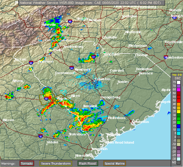 At 604 pm edt, severe thunderstorms were located along a line extending from near mistletoe state park to near harlem, moving northeast at 20 mph (radar indicated). Hazards include 60 mph wind gusts and quarter size hail. Hail damage to vehicles is expected. expect wind damage to roofs, siding, and trees. locations impacted include, grovetown, evans, harlem, lincolnton, appling, riverwood, mistletoe state park, winfield, knox scout reservation, double branches, columbia county jail, wildwood park, eubank-blanchard community center, bussey point campground, new hope, loce, leah, clay hill campground, blanchard woods park and phinizy. This includes interstate 20 in georgia between mile markers 179 and 191. At 604 pm edt, severe thunderstorms were located along a line extending from near mistletoe state park to near harlem, moving northeast at 20 mph (radar indicated). Hazards include 60 mph wind gusts and quarter size hail. Hail damage to vehicles is expected. expect wind damage to roofs, siding, and trees. locations impacted include, grovetown, evans, harlem, lincolnton, appling, riverwood, mistletoe state park, winfield, knox scout reservation, double branches, columbia county jail, wildwood park, eubank-blanchard community center, bussey point campground, new hope, loce, leah, clay hill campground, blanchard woods park and phinizy. This includes interstate 20 in georgia between mile markers 179 and 191.
|
| 8/5/2020 6:02 PM EDT | Multiple trees down on the road with multiple accidents reported. time estimated by rada in columbia county GA, 5.6 miles S of Harlem, GA |
| 8/5/2020 5:32 PM EDT |
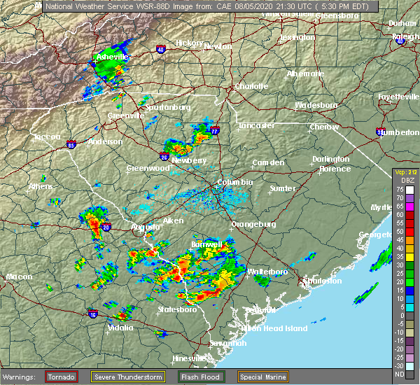 At 532 pm edt, severe thunderstorms were located along a line extending from 7 miles north of wrightsboro to near thomson, moving northeast at 20 mph (radar indicated). Hazards include 60 mph wind gusts and quarter size hail. Hail damage to vehicles is expected. Expect wind damage to roofs, siding, and trees. At 532 pm edt, severe thunderstorms were located along a line extending from 7 miles north of wrightsboro to near thomson, moving northeast at 20 mph (radar indicated). Hazards include 60 mph wind gusts and quarter size hail. Hail damage to vehicles is expected. Expect wind damage to roofs, siding, and trees.
|
| 6/27/2020 7:23 PM EDT |
 At 721 pm edt, severe thunderstorms were located along a line extending from 7 miles west of edgefield to near grovetown to near thomson, moving east at 30 mph (radar indicated). Hazards include 60 mph wind gusts. Expect damage to roofs, siding, and trees. a wind gust to 54 mph was already reported with this line of thundertorms in thomson. locations impacted include, aiken, north augusta, grovetown, evans, thomson, fort gordon, augusta, clearwater, martinez, belvedere, edgefield, hephzibah, harlem, johnston, jackson, glendale, south augusta, clarks hill recreation area, edgefield county airport and summerville. this includes the following highways, interstate 20 in georgia between mile markers 172 and 201. interstate 20 in south carolina between mile markers 0 and 20. interstate 520 in georgia between mile markers 1 and 15. Interstate 520 in south carolina between mile markers 16 and 23. At 721 pm edt, severe thunderstorms were located along a line extending from 7 miles west of edgefield to near grovetown to near thomson, moving east at 30 mph (radar indicated). Hazards include 60 mph wind gusts. Expect damage to roofs, siding, and trees. a wind gust to 54 mph was already reported with this line of thundertorms in thomson. locations impacted include, aiken, north augusta, grovetown, evans, thomson, fort gordon, augusta, clearwater, martinez, belvedere, edgefield, hephzibah, harlem, johnston, jackson, glendale, south augusta, clarks hill recreation area, edgefield county airport and summerville. this includes the following highways, interstate 20 in georgia between mile markers 172 and 201. interstate 20 in south carolina between mile markers 0 and 20. interstate 520 in georgia between mile markers 1 and 15. Interstate 520 in south carolina between mile markers 16 and 23.
|
| 6/27/2020 6:57 PM EDT |
 At 656 pm edt, severe thunderstorms were located along a line extending from near hamilton branch state park to near appling to warrenton, moving east at 30 mph. a wind gust over 50 mph was recorded in thomson at the airport (radar indicated). Hazards include 60 mph wind gusts. expect damage to roofs, siding, and trees At 656 pm edt, severe thunderstorms were located along a line extending from near hamilton branch state park to near appling to warrenton, moving east at 30 mph. a wind gust over 50 mph was recorded in thomson at the airport (radar indicated). Hazards include 60 mph wind gusts. expect damage to roofs, siding, and trees
|
| 4/13/2020 4:09 AM EDT |
 At 408 am edt, severe thunderstorms were located along a line extending from rayle to 6 miles west of mitchell, moving northeast at 50 mph (radar indicated). Hazards include 70 mph wind gusts and penny size hail. Expect considerable tree damage. Damage is likely to mobile homes, roofs, and outbuildings. At 408 am edt, severe thunderstorms were located along a line extending from rayle to 6 miles west of mitchell, moving northeast at 50 mph (radar indicated). Hazards include 70 mph wind gusts and penny size hail. Expect considerable tree damage. Damage is likely to mobile homes, roofs, and outbuildings.
|
| 2/13/2020 10:41 AM EST |
 At 1040 am est, severe thunderstorms were located along a line extending from 7 miles west of saluda county airport to near appling, moving east at 50 mph (radar indicated). Hazards include 60 mph wind gusts. Expect damage to roofs, siding, and trees. locations impacted include, north augusta, grovetown, evans, martinez, edgefield, harlem, johnston, appling, clarks hill recreation area, edgefield county airport, riverwood, hamilton branch state park, j. strom thurmond dam, dearing, trenton, arties pond public fishing area, poverty hill, adamsville, scott`s landing and northside fire station main. This includes interstate 20 in georgia between mile markers 178 and 194. At 1040 am est, severe thunderstorms were located along a line extending from 7 miles west of saluda county airport to near appling, moving east at 50 mph (radar indicated). Hazards include 60 mph wind gusts. Expect damage to roofs, siding, and trees. locations impacted include, north augusta, grovetown, evans, martinez, edgefield, harlem, johnston, appling, clarks hill recreation area, edgefield county airport, riverwood, hamilton branch state park, j. strom thurmond dam, dearing, trenton, arties pond public fishing area, poverty hill, adamsville, scott`s landing and northside fire station main. This includes interstate 20 in georgia between mile markers 178 and 194.
|
| 2/13/2020 10:15 AM EST |
 At 1014 am est, severe thunderstorms were located along a line extending from near hamilton branch state park to camak, moving east at 50 mph (radar indicated). Hazards include 60 mph wind gusts. expect damage to roofs, siding, and trees At 1014 am est, severe thunderstorms were located along a line extending from near hamilton branch state park to camak, moving east at 50 mph (radar indicated). Hazards include 60 mph wind gusts. expect damage to roofs, siding, and trees
|
| 2/6/2020 3:15 PM EST |
 At 315 pm est, severe thunderstorms were located along a line extending from edgefield to near grovetown, moving east at 50 mph (radar indicated). Hazards include 60 mph wind gusts. Expect damage to roofs, siding, and trees. locations impacted include, grovetown, evans, martinez, harlem, appling, clarks hill recreation area, j. strom thurmond dam, riverwood, village plaza shopping center, dearing, liberty park community center, arties pond public fishing area, adamsville, scott`s landing, autney, blanchard park, columbia county jail, westmont, river island and bellevue memorial gardens. This includes interstate 20 in georgia between mile markers 181 and 195. At 315 pm est, severe thunderstorms were located along a line extending from edgefield to near grovetown, moving east at 50 mph (radar indicated). Hazards include 60 mph wind gusts. Expect damage to roofs, siding, and trees. locations impacted include, grovetown, evans, martinez, harlem, appling, clarks hill recreation area, j. strom thurmond dam, riverwood, village plaza shopping center, dearing, liberty park community center, arties pond public fishing area, adamsville, scott`s landing, autney, blanchard park, columbia county jail, westmont, river island and bellevue memorial gardens. This includes interstate 20 in georgia between mile markers 181 and 195.
|
| 2/6/2020 2:58 PM EST |
 At 258 pm est, severe thunderstorms were located along a line extending from near hamilton branch state park to 6 miles west of harlem, moving east at 50 mph (radar indicated). Hazards include 60 mph wind gusts. expect damage to roofs, siding, and trees At 258 pm est, severe thunderstorms were located along a line extending from near hamilton branch state park to 6 miles west of harlem, moving east at 50 mph (radar indicated). Hazards include 60 mph wind gusts. expect damage to roofs, siding, and trees
|
| 2/6/2020 2:09 PM EST |
 At 209 pm est, a severe thunderstorm was located 7 miles south of harlem, or 11 miles southwest of grovetown, moving northeast at 55 mph (radar indicated). Hazards include 60 mph wind gusts. expect damage to roofs, siding, and trees At 209 pm est, a severe thunderstorm was located 7 miles south of harlem, or 11 miles southwest of grovetown, moving northeast at 55 mph (radar indicated). Hazards include 60 mph wind gusts. expect damage to roofs, siding, and trees
|
| 1/11/2020 8:53 PM EST |
 At 853 pm est, severe thunderstorms were located along a line extending from near appling to near edgehill, moving northeast at 55 mph (radar indicated). Hazards include 60 mph wind gusts. expect damage to roofs, siding, and trees At 853 pm est, severe thunderstorms were located along a line extending from near appling to near edgehill, moving northeast at 55 mph (radar indicated). Hazards include 60 mph wind gusts. expect damage to roofs, siding, and trees
|
| 10/31/2019 4:43 PM EDT |
 At 442 pm edt, severe thunderstorms were located along a line extending from near appling to near louisville, moving northeast at 50 mph (radar indicated). Hazards include 60 mph wind gusts and penny size hail. expect damage to roofs, siding, and trees At 442 pm edt, severe thunderstorms were located along a line extending from near appling to near louisville, moving northeast at 50 mph (radar indicated). Hazards include 60 mph wind gusts and penny size hail. expect damage to roofs, siding, and trees
|
| 9/10/2019 6:19 PM EDT |
 At 614 pm edt, a severe thunderstorm was likely in the highway 221 area south of harlem in southwest columbia county and southern mcduffie county and also in the west part of fort gordon in western richmond county. movement was west near 20 mph (radar indicated). Hazards include 60 mph wind gusts and quarter size hail. Hail damage to vehicles is expected. expect wind damage to roofs, siding, and trees. Locations impacted include, the highway 221 area south of harlem in southwest columbia county and southern mcduffie county and also in the west part of fort gordon in western richmond county. At 614 pm edt, a severe thunderstorm was likely in the highway 221 area south of harlem in southwest columbia county and southern mcduffie county and also in the west part of fort gordon in western richmond county. movement was west near 20 mph (radar indicated). Hazards include 60 mph wind gusts and quarter size hail. Hail damage to vehicles is expected. expect wind damage to roofs, siding, and trees. Locations impacted include, the highway 221 area south of harlem in southwest columbia county and southern mcduffie county and also in the west part of fort gordon in western richmond county.
|
| 9/10/2019 6:06 PM EDT |
 The national weather service in columbia has issued a * severe thunderstorm warning for. southeastern mcduffie county in east central georgia. southwestern columbia county in east central georgia. northwestern burke county in east central georgia. Southwestern richmond county in east central georgia. The national weather service in columbia has issued a * severe thunderstorm warning for. southeastern mcduffie county in east central georgia. southwestern columbia county in east central georgia. northwestern burke county in east central georgia. Southwestern richmond county in east central georgia.
|
| 7/31/2019 3:25 PM EDT |
 The national weather service in columbia has issued a * severe thunderstorm warning for. southeastern columbia county in east central georgia. central richmond county in east central georgia. southwestern edgefield county in central south carolina. West central aiken county in central south carolina. The national weather service in columbia has issued a * severe thunderstorm warning for. southeastern columbia county in east central georgia. central richmond county in east central georgia. southwestern edgefield county in central south carolina. West central aiken county in central south carolina.
|
| 7/31/2019 3:25 PM EDT |
 At 325 pm edt, a severe thunderstorm was located over fort gordon, moving northeast at 30 mph (radar indicated). Hazards include 60 mph wind gusts and nickel size hail. expect damage to roofs, siding, and trees At 325 pm edt, a severe thunderstorm was located over fort gordon, moving northeast at 30 mph (radar indicated). Hazards include 60 mph wind gusts and nickel size hail. expect damage to roofs, siding, and trees
|
| 6/24/2019 9:24 PM EDT |
 At 923 pm edt, severe thunderstorms were located along a line extending from near mistletoe state park to near warrenton, moving east at 60 mph (radar indicated). Hazards include 60 mph wind gusts and penny size hail. expect damage to roofs, siding, and trees At 923 pm edt, severe thunderstorms were located along a line extending from near mistletoe state park to near warrenton, moving east at 60 mph (radar indicated). Hazards include 60 mph wind gusts and penny size hail. expect damage to roofs, siding, and trees
|
| 6/22/2019 5:58 PM EDT |
 The severe thunderstorm warning for mcduffie. columbia. southeastern lincoln. northwestern burke. richmond. southwestern edgefield. west central aiken and southeastern mccormick counties will expire at 600 pm edt. The storms which prompted the warning have weakened below severe limits, and no longer pose an immediate threat to life or property. The severe thunderstorm warning for mcduffie. columbia. southeastern lincoln. northwestern burke. richmond. southwestern edgefield. west central aiken and southeastern mccormick counties will expire at 600 pm edt. The storms which prompted the warning have weakened below severe limits, and no longer pose an immediate threat to life or property.
|
| 6/22/2019 5:15 PM EDT |
 At 514 pm edt, severe thunderstorms were located along a line extending from near appling to 7 miles south of thomson, moving east at 30 mph (radar indicated). Hazards include 60 mph wind gusts and penny size hail. expect damage to roofs, siding, and trees At 514 pm edt, severe thunderstorms were located along a line extending from near appling to 7 miles south of thomson, moving east at 30 mph (radar indicated). Hazards include 60 mph wind gusts and penny size hail. expect damage to roofs, siding, and trees
|
| 6/22/2019 4:51 PM EDT |
 At 450 pm edt, severe thunderstorms were located along a line extending from near grovetown to near appleton, moving east at 40 mph (radar indicated). Hazards include 70 mph wind gusts and quarter size hail. Hail damage to vehicles is expected. expect considerable tree damage. wind damage is also likely to mobile homes, roofs, and outbuildings. locations impacted include, grovetown, evans, savannah river site, fort gordon, plant vogtle, hephzibah, harlem, jackson, sardis, glendale, south augusta, midtown, summerville, augusta mall, daniel field, augusta regional airport, mcbean, blythe, dearing and snelling. this includes the following highways, interstate 20 in georgia between mile markers 193 and 195. Interstate 520 in georgia between mile markers 1 and 14. At 450 pm edt, severe thunderstorms were located along a line extending from near grovetown to near appleton, moving east at 40 mph (radar indicated). Hazards include 70 mph wind gusts and quarter size hail. Hail damage to vehicles is expected. expect considerable tree damage. wind damage is also likely to mobile homes, roofs, and outbuildings. locations impacted include, grovetown, evans, savannah river site, fort gordon, plant vogtle, hephzibah, harlem, jackson, sardis, glendale, south augusta, midtown, summerville, augusta mall, daniel field, augusta regional airport, mcbean, blythe, dearing and snelling. this includes the following highways, interstate 20 in georgia between mile markers 193 and 195. Interstate 520 in georgia between mile markers 1 and 14.
|
| 6/22/2019 4:23 PM EDT |
 At 422 pm edt, severe thunderstorms were located along a line extending from 6 miles south of thomson to near millhaven, moving east at 40 mph (radar indicated). Hazards include 70 mph wind gusts and quarter size hail. Hail damage to vehicles is expected. expect considerable tree damage. Wind damage is also likely to mobile homes, roofs, and outbuildings. At 422 pm edt, severe thunderstorms were located along a line extending from 6 miles south of thomson to near millhaven, moving east at 40 mph (radar indicated). Hazards include 70 mph wind gusts and quarter size hail. Hail damage to vehicles is expected. expect considerable tree damage. Wind damage is also likely to mobile homes, roofs, and outbuildings.
|
| 6/22/2019 3:57 PM EDT |
 At 356 pm edt, severe thunderstorms were located along a line extending from 6 miles south of thomson to near gough, moving east at 30 mph (radar indicated). Hazards include 70 mph wind gusts and quarter size hail. Hail damage to vehicles is expected. expect considerable tree damage. wind damage is also likely to mobile homes, roofs, and outbuildings. locations impacted include, grovetown, thomson, waynesboro, hephzibah, harlem, mcbean, gough, blythe, dearing, keysville, vidette, leitner lake conference center, liberty park community center, arties pond public fishing area, mcduffie county fire department, adamsville, bath-edie, pea patch aerodrome, mcduffie regional medical center and boneville. This includes interstate 20 in georgia between mile markers 180 and 188. At 356 pm edt, severe thunderstorms were located along a line extending from 6 miles south of thomson to near gough, moving east at 30 mph (radar indicated). Hazards include 70 mph wind gusts and quarter size hail. Hail damage to vehicles is expected. expect considerable tree damage. wind damage is also likely to mobile homes, roofs, and outbuildings. locations impacted include, grovetown, thomson, waynesboro, hephzibah, harlem, mcbean, gough, blythe, dearing, keysville, vidette, leitner lake conference center, liberty park community center, arties pond public fishing area, mcduffie county fire department, adamsville, bath-edie, pea patch aerodrome, mcduffie regional medical center and boneville. This includes interstate 20 in georgia between mile markers 180 and 188.
|
| 6/22/2019 3:39 PM EDT |
 At 338 pm edt, severe thunderstorms were located along a line extending from near warrenton to gough, moving east at 30 mph (radar indicated). Hazards include 70 mph wind gusts and penny size hail. Expect considerable tree damage. Damage is likely to mobile homes, roofs, and outbuildings. At 338 pm edt, severe thunderstorms were located along a line extending from near warrenton to gough, moving east at 30 mph (radar indicated). Hazards include 70 mph wind gusts and penny size hail. Expect considerable tree damage. Damage is likely to mobile homes, roofs, and outbuildings.
|
| 6/20/2019 5:00 PM EDT |
 At 459 pm edt, severe thunderstorms were located along a line extending from belvedere to near gibson, moving east at 60 mph (radar indicated). Hazards include 70 mph wind gusts. Expect considerable tree damage. Damage is likely to mobile homes, roofs, and outbuildings. At 459 pm edt, severe thunderstorms were located along a line extending from belvedere to near gibson, moving east at 60 mph (radar indicated). Hazards include 70 mph wind gusts. Expect considerable tree damage. Damage is likely to mobile homes, roofs, and outbuildings.
|
| 6/20/2019 4:09 PM EDT |
 At 409 pm edt, severe thunderstorms were located along a line extending from near edgefield to near appling, moving east at 55 mph (radar indicated). Hazards include 60 mph wind gusts and quarter size hail. Hail damage to vehicles is expected. Expect wind damage to roofs, siding, and trees. At 409 pm edt, severe thunderstorms were located along a line extending from near edgefield to near appling, moving east at 55 mph (radar indicated). Hazards include 60 mph wind gusts and quarter size hail. Hail damage to vehicles is expected. Expect wind damage to roofs, siding, and trees.
|
| 6/8/2019 4:49 PM EDT |
 At 428 pm edt, a severe thunderstorm was located near fort gordon, moving northeast at 15 mph (radar indicated). Hazards include 60 mph wind gusts and penny size hail. expect damage to roofs, siding, and trees At 428 pm edt, a severe thunderstorm was located near fort gordon, moving northeast at 15 mph (radar indicated). Hazards include 60 mph wind gusts and penny size hail. expect damage to roofs, siding, and trees
|
| 6/8/2019 4:49 PM EDT |
 At 448 pm edt, a severe thunderstorm was located over augusta mall, or near fort gordon, moving northeast at 20 mph (radar indicated). Hazards include 60 mph wind gusts. Expect damage to roofs, siding, and trees. locations impacted include, north augusta, grovetown, evans, martinez, fort gordon, augusta, belvedere, clearwater, hephzibah, midtown, summerville, augusta mall, daniel field, village plaza shopping center and augusta national golf club. this includes the following highways, interstate 20 in georgia between mile markers 189 and 201. interstate 20 in south carolina between mile markers 0 and 3. interstate 26 interstate 520 in georgia between mile markers 1 and 15. Interstate 520 in south carolina between mile markers 16 and 19. At 448 pm edt, a severe thunderstorm was located over augusta mall, or near fort gordon, moving northeast at 20 mph (radar indicated). Hazards include 60 mph wind gusts. Expect damage to roofs, siding, and trees. locations impacted include, north augusta, grovetown, evans, martinez, fort gordon, augusta, belvedere, clearwater, hephzibah, midtown, summerville, augusta mall, daniel field, village plaza shopping center and augusta national golf club. this includes the following highways, interstate 20 in georgia between mile markers 189 and 201. interstate 20 in south carolina between mile markers 0 and 3. interstate 26 interstate 520 in georgia between mile markers 1 and 15. Interstate 520 in south carolina between mile markers 16 and 19.
|
| 6/8/2019 4:28 PM EDT |
 At 428 pm edt, a severe thunderstorm was located near fort gordon, moving northeast at 15 mph (radar indicated). Hazards include 60 mph wind gusts and penny size hail. expect damage to roofs, siding, and trees At 428 pm edt, a severe thunderstorm was located near fort gordon, moving northeast at 15 mph (radar indicated). Hazards include 60 mph wind gusts and penny size hail. expect damage to roofs, siding, and trees
|
| 4/19/2019 12:00 PM EDT |
 At 1159 am edt, severe thunderstorms were located along a line extending from near wrightsboro to near wrens to midville, moving north at 40 mph (radar indicated). Hazards include 60 mph wind gusts. Expect damage to roofs, siding, and trees. Locations impacted include, north augusta, grovetown, evans, thomson, waynesboro, fort gordon, augusta, martinez, plant vogtle, hephzibah, harlem, lincolnton, sardis, midville, glendale, gough, south augusta, elijah clark state park, mistletoe state park and summerville. At 1159 am edt, severe thunderstorms were located along a line extending from near wrightsboro to near wrens to midville, moving north at 40 mph (radar indicated). Hazards include 60 mph wind gusts. Expect damage to roofs, siding, and trees. Locations impacted include, north augusta, grovetown, evans, thomson, waynesboro, fort gordon, augusta, martinez, plant vogtle, hephzibah, harlem, lincolnton, sardis, midville, glendale, gough, south augusta, elijah clark state park, mistletoe state park and summerville.
|
| 4/19/2019 11:35 AM EDT |
 At 1134 am edt, severe thunderstorms were located along a line extending from 6 miles northeast of sharon to near louisville to oak park, moving northeast at 60 mph (radar indicated). Hazards include 60 mph wind gusts. expect damage to roofs, siding, and trees At 1134 am edt, severe thunderstorms were located along a line extending from 6 miles northeast of sharon to near louisville to oak park, moving northeast at 60 mph (radar indicated). Hazards include 60 mph wind gusts. expect damage to roofs, siding, and trees
|
| 4/8/2019 4:07 PM EDT |
 At 406 pm edt, a severe thunderstorm was located near fort gordon, moving northeast at 30 mph (radar indicated). Hazards include 60 mph wind gusts and penny size hail. expect damage to roofs, siding, and trees At 406 pm edt, a severe thunderstorm was located near fort gordon, moving northeast at 30 mph (radar indicated). Hazards include 60 mph wind gusts and penny size hail. expect damage to roofs, siding, and trees
|
| 8/9/2018 5:20 PM EDT |
 At 519 pm edt, national weather service doppler radar indicated strong thunderstorms extending through southern richmond county into southern aiken county. this includes the augusta area. some of these storms likely contained wind gusts near 60 mph (radar indicated). Hazards include 60 mph wind gusts. expect damage to roofs, siding, and trees At 519 pm edt, national weather service doppler radar indicated strong thunderstorms extending through southern richmond county into southern aiken county. this includes the augusta area. some of these storms likely contained wind gusts near 60 mph (radar indicated). Hazards include 60 mph wind gusts. expect damage to roofs, siding, and trees
|
| 6/26/2018 10:07 PM EDT |
 At 1007 pm edt, severe thunderstorms were located along a line extending from 13 miles northwest of evans to near washington, moving southeast at 15 mph (radar indicated). Hazards include 60 mph wind gusts. expect damage to roofs, siding, and trees At 1007 pm edt, severe thunderstorms were located along a line extending from 13 miles northwest of evans to near washington, moving southeast at 15 mph (radar indicated). Hazards include 60 mph wind gusts. expect damage to roofs, siding, and trees
|
| 6/26/2018 8:46 PM EDT |
 At 846 pm edt, a severe thunderstorm was located near harlem, or near grovetown, moving southeast at 15 mph (radar indicated). Hazards include 60 mph wind gusts and quarter size hail. Hail damage to vehicles is expected. expect wind damage to roofs, siding, and trees. locations impacted include, north augusta, grovetown, evans, thomson, augusta, martinez, clearwater, fort gordon, belvedere, hephzibah, harlem, burnettown, blythe and dearing. this includes the following highways, interstate 20 in georgia between mile markers 173 and 201. interstate 20 in south carolina between mile markers 0 and 3. interstate 520 in georgia between mile markers 1 and 15. Interstate 520 in south carolina between mile markers 16 and 21. At 846 pm edt, a severe thunderstorm was located near harlem, or near grovetown, moving southeast at 15 mph (radar indicated). Hazards include 60 mph wind gusts and quarter size hail. Hail damage to vehicles is expected. expect wind damage to roofs, siding, and trees. locations impacted include, north augusta, grovetown, evans, thomson, augusta, martinez, clearwater, fort gordon, belvedere, hephzibah, harlem, burnettown, blythe and dearing. this includes the following highways, interstate 20 in georgia between mile markers 173 and 201. interstate 20 in south carolina between mile markers 0 and 3. interstate 520 in georgia between mile markers 1 and 15. Interstate 520 in south carolina between mile markers 16 and 21.
|
| 6/26/2018 8:16 PM EDT |
 At 815 pm edt, a severe thunderstorm was located near thomson, moving southeast at 15 mph (radar indicated). Hazards include 60 mph wind gusts and quarter size hail. Hail damage to vehicles is expected. Expect wind damage to roofs, siding, and trees. At 815 pm edt, a severe thunderstorm was located near thomson, moving southeast at 15 mph (radar indicated). Hazards include 60 mph wind gusts and quarter size hail. Hail damage to vehicles is expected. Expect wind damage to roofs, siding, and trees.
|
| 6/24/2018 10:00 PM EDT |
 At 1000 pm edt, severe thunderstorms were located along a line extending from 7 miles northeast of aiken to 6 miles southeast of harlem, moving southeast at 20 mph (radar indicated). Hazards include 60 mph wind gusts and nickel size hail. expect damage to roofs, siding, and trees At 1000 pm edt, severe thunderstorms were located along a line extending from 7 miles northeast of aiken to 6 miles southeast of harlem, moving southeast at 20 mph (radar indicated). Hazards include 60 mph wind gusts and nickel size hail. expect damage to roofs, siding, and trees
|
| 6/24/2018 9:35 PM EDT |
 At 935 pm edt, severe thunderstorms were located along a line extending from evans to near harlem, moving southeast at 20 mph (radar indicated). Hazards include 60 mph wind gusts. expect damage to roofs, siding, and trees At 935 pm edt, severe thunderstorms were located along a line extending from evans to near harlem, moving southeast at 20 mph (radar indicated). Hazards include 60 mph wind gusts. expect damage to roofs, siding, and trees
|
| 6/22/2018 10:56 PM EDT |
 At 1055 pm edt, severe thunderstorms were located along a line extending from 7 miles north of harlem to 10 miles southeast of wrens, moving northeast at 40 mph (radar indicated). Hazards include 60 mph wind gusts. expect damage to roofs, siding, and trees At 1055 pm edt, severe thunderstorms were located along a line extending from 7 miles north of harlem to 10 miles southeast of wrens, moving northeast at 40 mph (radar indicated). Hazards include 60 mph wind gusts. expect damage to roofs, siding, and trees
|
| 6/11/2018 6:06 PM EDT |
 The severe thunderstorm warning for southwestern columbia and southeastern mcduffie counties will expire at 615 pm edt, the storms which prompted the warning have moved south of the area. The severe thunderstorm warning for southwestern columbia and southeastern mcduffie counties will expire at 615 pm edt, the storms which prompted the warning have moved south of the area.
|
| 6/11/2018 5:40 PM EDT | Half Dollar sized hail reported 0.7 miles E of Harlem, GA, member of the public reported hail up to half dollar size in harlem... ga. video of hail shared via social media. |
| 6/11/2018 5:13 PM EDT |
 At 512 pm edt, severe thunderstorms in central mcduffie county were moving southward near 15 mph and toward the south part of mcduffie county and parts of western columbia county (radar indicated). Hazards include 60 mph wind gusts and quarter size hail. Hail damage to vehicles is expected. Expect wind damage to roofs, siding, and trees. At 512 pm edt, severe thunderstorms in central mcduffie county were moving southward near 15 mph and toward the south part of mcduffie county and parts of western columbia county (radar indicated). Hazards include 60 mph wind gusts and quarter size hail. Hail damage to vehicles is expected. Expect wind damage to roofs, siding, and trees.
|
| 6/1/2018 5:51 PM EDT |
 At 551 pm edt, severe thunderstorms were located along a line extending from 9 miles north of thomson to warrenton, moving east at 30 mph (radar indicated). Hazards include 60 mph wind gusts. expect damage to roofs, siding, and trees At 551 pm edt, severe thunderstorms were located along a line extending from 9 miles north of thomson to warrenton, moving east at 30 mph (radar indicated). Hazards include 60 mph wind gusts. expect damage to roofs, siding, and trees
|
| 3/20/2018 2:05 AM EDT |
 At 204 am edt, a likely severe thunderstorm was in the dearing area of southern mcduffie county, moving east at 45 mph (radar indicated). Hazards include 60 mph wind gusts. Expect damage to roofs, siding, and trees. Locations impacted include, grovetown, harlem and dearing. At 204 am edt, a likely severe thunderstorm was in the dearing area of southern mcduffie county, moving east at 45 mph (radar indicated). Hazards include 60 mph wind gusts. Expect damage to roofs, siding, and trees. Locations impacted include, grovetown, harlem and dearing.
|
| 3/20/2018 1:32 AM EDT |
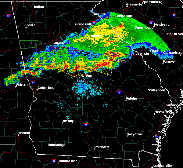 At 131 am edt, a severe thunderstorm was just west of columbia county moving east near 45 mph (radar indicated). Hazards include 60 mph wind gusts. expect damage to roofs, siding, and trees At 131 am edt, a severe thunderstorm was just west of columbia county moving east near 45 mph (radar indicated). Hazards include 60 mph wind gusts. expect damage to roofs, siding, and trees
|
| 8/31/2017 3:52 PM EDT |
 At 348 pm edt, a severe thunderstorm was located near martinez, moving east at 35 mph. a severe thunderstorm is also located near new ellington moving northeast at 30 mph (radar indicated). Hazards include radar indicated 60 mph wind gusts near evans and martinez. quarter size hail and 60 mph winds are also possible with the storm near new ellington. Hail damage to vehicles is expected. expect wind damage to roofs, siding, and trees. Locations impacted include, aiken, north augusta, grovetown, evans, augusta, martinez, clearwater, fort gordon, belvedere, hephzibah, harlem, new ellenton, jackson, gloverville, burnettown, blythe, trenton, murphys estates and clarks hill. At 348 pm edt, a severe thunderstorm was located near martinez, moving east at 35 mph. a severe thunderstorm is also located near new ellington moving northeast at 30 mph (radar indicated). Hazards include radar indicated 60 mph wind gusts near evans and martinez. quarter size hail and 60 mph winds are also possible with the storm near new ellington. Hail damage to vehicles is expected. expect wind damage to roofs, siding, and trees. Locations impacted include, aiken, north augusta, grovetown, evans, augusta, martinez, clearwater, fort gordon, belvedere, hephzibah, harlem, new ellenton, jackson, gloverville, burnettown, blythe, trenton, murphys estates and clarks hill.
|
| 8/31/2017 3:30 PM EDT | Columbia county sheriff reported tree in roadway at n. fairfield drive and sawdust road in harle in columbia county GA, 0.8 miles S of Harlem, GA |
| 8/31/2017 3:26 PM EDT |
 At 326 pm edt, a severe thunderstorm was located near grovetown, moving east at 30 mph (radar indicated). Hazards include 60 mph wind gusts. expect damage to roofs, siding, and trees At 326 pm edt, a severe thunderstorm was located near grovetown, moving east at 30 mph (radar indicated). Hazards include 60 mph wind gusts. expect damage to roofs, siding, and trees
|
| 7/26/2017 3:29 PM EDT |
 At 329 pm edt, severe thunderstorms were located along a line extending from evans to 7 miles northeast of thomson, moving southwest at 10 mph (radar indicated). Hazards include 60 mph wind gusts and penny size hail. Expect damage to roofs, siding, and trees. Locations impacted include, grovetown, evans, martinez, harlem and dearing. At 329 pm edt, severe thunderstorms were located along a line extending from evans to 7 miles northeast of thomson, moving southwest at 10 mph (radar indicated). Hazards include 60 mph wind gusts and penny size hail. Expect damage to roofs, siding, and trees. Locations impacted include, grovetown, evans, martinez, harlem and dearing.
|
| 7/26/2017 3:16 PM EDT |
 At 316 pm edt, a severe thunderstorm was located 7 miles west of evans, moving west at 10 mph (radar indicated). Hazards include 60 mph wind gusts and penny size hail. Expect damage to roofs, siding, and trees. Locations impacted include, grovetown, evans, thomson, martinez, harlem and dearing. At 316 pm edt, a severe thunderstorm was located 7 miles west of evans, moving west at 10 mph (radar indicated). Hazards include 60 mph wind gusts and penny size hail. Expect damage to roofs, siding, and trees. Locations impacted include, grovetown, evans, thomson, martinez, harlem and dearing.
|
| 7/26/2017 2:56 PM EDT |
 At 256 pm edt, a severe thunderstorm was located near evans, moving west at 10 mph (radar indicated). Hazards include 60 mph wind gusts and quarter size hail. Hail damage to vehicles is expected. Expect wind damage to roofs, siding, and trees. At 256 pm edt, a severe thunderstorm was located near evans, moving west at 10 mph (radar indicated). Hazards include 60 mph wind gusts and quarter size hail. Hail damage to vehicles is expected. Expect wind damage to roofs, siding, and trees.
|
| 7/23/2017 10:09 PM EDT |
 At 1009 pm edt, a severe thunderstorm was located over thomson, moving south at 10 mph (radar indicated). Hazards include 60 mph wind gusts and nickel size hail. Expect damage to roofs, siding, and trees. Locations impacted include, thomson, harlem and dearing. At 1009 pm edt, a severe thunderstorm was located over thomson, moving south at 10 mph (radar indicated). Hazards include 60 mph wind gusts and nickel size hail. Expect damage to roofs, siding, and trees. Locations impacted include, thomson, harlem and dearing.
|
| 7/23/2017 9:39 PM EDT |
 At 939 pm edt, a severe thunderstorm was located near thomson, moving south at 15 mph (radar indicated). Hazards include 60 mph wind gusts and nickel size hail. expect damage to roofs, siding, and trees At 939 pm edt, a severe thunderstorm was located near thomson, moving south at 15 mph (radar indicated). Hazards include 60 mph wind gusts and nickel size hail. expect damage to roofs, siding, and trees
|
| 7/23/2017 8:12 PM EDT |
 At 812 pm edt, a severe thunderstorm was located near martinez, moving south at 15 mph (radar indicated). Hazards include 60 mph wind gusts and quarter size hail. Hail damage to vehicles is expected. expect wind damage to roofs, siding, and trees. Locations impacted include, north augusta, grovetown, evans, thomson, augusta, martinez, fort gordon, belvedere, edgefield, hephzibah, harlem, blythe, dearing, keysville, trenton, modoc, murphys estates and clarks hill. At 812 pm edt, a severe thunderstorm was located near martinez, moving south at 15 mph (radar indicated). Hazards include 60 mph wind gusts and quarter size hail. Hail damage to vehicles is expected. expect wind damage to roofs, siding, and trees. Locations impacted include, north augusta, grovetown, evans, thomson, augusta, martinez, fort gordon, belvedere, edgefield, hephzibah, harlem, blythe, dearing, keysville, trenton, modoc, murphys estates and clarks hill.
|
| 7/23/2017 7:41 PM EDT |
 At 741 pm edt, a severe thunderstorm was located 9 miles north of martinez, moving south at 35 mph (radar indicated). Hazards include 60 mph wind gusts and quarter size hail. Hail damage to vehicles is expected. Expect wind damage to roofs, siding, and trees. At 741 pm edt, a severe thunderstorm was located 9 miles north of martinez, moving south at 35 mph (radar indicated). Hazards include 60 mph wind gusts and quarter size hail. Hail damage to vehicles is expected. Expect wind damage to roofs, siding, and trees.
|
| 5/29/2017 6:49 PM EDT |
 At 648 pm edt, a severe thunderstorm was located over thomson, moving northeast at 45 mph (radar indicated). Hazards include 60 mph wind gusts and quarter size hail. Hail damage to vehicles is expected. Expect wind damage to roofs, siding, and trees. At 648 pm edt, a severe thunderstorm was located over thomson, moving northeast at 45 mph (radar indicated). Hazards include 60 mph wind gusts and quarter size hail. Hail damage to vehicles is expected. Expect wind damage to roofs, siding, and trees.
|
| 5/24/2017 2:07 PM EDT |
 At 207 pm edt, a severe thunderstorm was located 7 miles northwest of evans, moving northeast at 55 mph (radar indicated). Hazards include 70 mph wind gusts. Expect considerable tree damage. damage is likely to mobile homes, roofs, and outbuildings. locations impacted include, evans, edgefield, parksville, modoc and clarks hill. a tornado watch remains in effect until 600 pm edt for east central georgia, and central south carolina. A tornado watch also remains in effect until 600 pm edt for east central georgia, and central south carolina. At 207 pm edt, a severe thunderstorm was located 7 miles northwest of evans, moving northeast at 55 mph (radar indicated). Hazards include 70 mph wind gusts. Expect considerable tree damage. damage is likely to mobile homes, roofs, and outbuildings. locations impacted include, evans, edgefield, parksville, modoc and clarks hill. a tornado watch remains in effect until 600 pm edt for east central georgia, and central south carolina. A tornado watch also remains in effect until 600 pm edt for east central georgia, and central south carolina.
|
| 5/24/2017 1:57 PM EDT |
 At 157 pm edt, a severe thunderstorm was located 7 miles north of harlem, or 9 miles northeast of thomson, moving northeast at 55 mph (radar indicated). Hazards include 60 mph wind gusts. expect damage to roofs, siding, and trees At 157 pm edt, a severe thunderstorm was located 7 miles north of harlem, or 9 miles northeast of thomson, moving northeast at 55 mph (radar indicated). Hazards include 60 mph wind gusts. expect damage to roofs, siding, and trees
|
| 4/3/2017 3:37 PM EDT |
 At 336 pm edt, severe thunderstorms were located along a line extending from 10 miles southwest of ninety six historic site to near grovetown, moving east at 50 mph (radar indicated). Hazards include 70 mph wind gusts and quarter size hail. Hail damage to vehicles is expected. expect considerable tree damage. wind damage is also likely to mobile homes, roofs, and outbuildings. locations impacted include, grovetown, evans, martinez, mccormick, harlem, dearing, parksville, plum branch, modoc and clarks hill. A tornado watch remains in effect until 900 pm edt for east central georgia, and central south carolina. At 336 pm edt, severe thunderstorms were located along a line extending from 10 miles southwest of ninety six historic site to near grovetown, moving east at 50 mph (radar indicated). Hazards include 70 mph wind gusts and quarter size hail. Hail damage to vehicles is expected. expect considerable tree damage. wind damage is also likely to mobile homes, roofs, and outbuildings. locations impacted include, grovetown, evans, martinez, mccormick, harlem, dearing, parksville, plum branch, modoc and clarks hill. A tornado watch remains in effect until 900 pm edt for east central georgia, and central south carolina.
|
| 4/3/2017 3:08 PM EDT |
 At 307 pm edt, severe thunderstorms were located along a line extending from near abbeville to near mitchell, moving northeast at 65 mph (radar indicated). Hazards include 70 mph wind gusts and quarter size hail. Hail damage to vehicles is expected. expect considerable tree damage. wind damage is also likely to mobile homes, roofs, and outbuildings. locations impacted include, grovetown, evans, thomson, martinez, mccormick, harlem, lincolnton, dearing, parksville, plum branch, mount carmel, modoc, willington and clarks hill. A tornado watch remains in effect until 900 pm edt for east central georgia, and central south carolina. At 307 pm edt, severe thunderstorms were located along a line extending from near abbeville to near mitchell, moving northeast at 65 mph (radar indicated). Hazards include 70 mph wind gusts and quarter size hail. Hail damage to vehicles is expected. expect considerable tree damage. wind damage is also likely to mobile homes, roofs, and outbuildings. locations impacted include, grovetown, evans, thomson, martinez, mccormick, harlem, lincolnton, dearing, parksville, plum branch, mount carmel, modoc, willington and clarks hill. A tornado watch remains in effect until 900 pm edt for east central georgia, and central south carolina.
|
| 4/3/2017 2:47 PM EDT |
 At 247 pm edt, severe thunderstorms were located along a line extending from near lake secession to 8 miles southwest of warrenton, moving east at 50 mph (radar indicated). Hazards include 60 mph wind gusts and quarter size hail. Hail damage to vehicles is expected. Expect wind damage to roofs, siding, and trees. At 247 pm edt, severe thunderstorms were located along a line extending from near lake secession to 8 miles southwest of warrenton, moving east at 50 mph (radar indicated). Hazards include 60 mph wind gusts and quarter size hail. Hail damage to vehicles is expected. Expect wind damage to roofs, siding, and trees.
|
| 4/3/2017 2:47 PM EDT |
 The national weather service in columbia has issued a * severe thunderstorm warning for. columbia county in east central georgia. mcduffie county in east central georgia. lincoln county in east central georgia. Mccormick county in central south carolina. The national weather service in columbia has issued a * severe thunderstorm warning for. columbia county in east central georgia. mcduffie county in east central georgia. lincoln county in east central georgia. Mccormick county in central south carolina.
|
| 3/21/2017 10:45 PM EDT |
 At 1045 pm edt, a severe thunderstorm was located over evans, moving east at 50 mph (radar indicated). Hazards include 60 mph wind gusts. expect damage to roofs, siding, and trees At 1045 pm edt, a severe thunderstorm was located over evans, moving east at 50 mph (radar indicated). Hazards include 60 mph wind gusts. expect damage to roofs, siding, and trees
|
| 3/21/2017 10:25 PM EDT |
 At 1024 pm edt, severe thunderstorms were located along a line extending from 10 miles south of lincolnton to 6 miles north of mitchell, moving east at 45 mph (radar indicated). Hazards include 70 mph wind gusts. Expect considerable tree damage. damage is likely to mobile homes, roofs, and outbuildings. Locations impacted include, grovetown, evans, thomson, martinez, fort gordon, harlem, blythe, dearing, modoc, murphys estates and clarks hill. At 1024 pm edt, severe thunderstorms were located along a line extending from 10 miles south of lincolnton to 6 miles north of mitchell, moving east at 45 mph (radar indicated). Hazards include 70 mph wind gusts. Expect considerable tree damage. damage is likely to mobile homes, roofs, and outbuildings. Locations impacted include, grovetown, evans, thomson, martinez, fort gordon, harlem, blythe, dearing, modoc, murphys estates and clarks hill.
|
| 3/21/2017 10:08 PM EDT |
 At 1007 pm edt, severe thunderstorms were located along a line extending from 10 miles southeast of washington to near sparta, moving east at 45 mph (radar indicated). Hazards include 70 mph wind gusts. Expect considerable tree damage. Damage is likely to mobile homes, roofs, and outbuildings. At 1007 pm edt, severe thunderstorms were located along a line extending from 10 miles southeast of washington to near sparta, moving east at 45 mph (radar indicated). Hazards include 70 mph wind gusts. Expect considerable tree damage. Damage is likely to mobile homes, roofs, and outbuildings.
|
| 8/18/2016 4:11 PM EDT |
 The severe thunderstorm warning for southeastern mcduffie, southern columbia and western richmond counties will expire at 415 pm edt, the storm which prompted the warning has weakened below severe limits, and no longer pose an immediate threat to life or property. therefore the warning will be allowed to expire. however heavy rain is still possible with this thunderstorm. The severe thunderstorm warning for southeastern mcduffie, southern columbia and western richmond counties will expire at 415 pm edt, the storm which prompted the warning has weakened below severe limits, and no longer pose an immediate threat to life or property. therefore the warning will be allowed to expire. however heavy rain is still possible with this thunderstorm.
|
| 8/18/2016 3:31 PM EDT |
 At 331 pm edt, a severe thunderstorm was located near grovetown, and is nearly stationary (radar indicated). Hazards include 60 mph wind gusts and penny size hail. Expect damage to roofs. siding. And trees. At 331 pm edt, a severe thunderstorm was located near grovetown, and is nearly stationary (radar indicated). Hazards include 60 mph wind gusts and penny size hail. Expect damage to roofs. siding. And trees.
|
| 7/19/2016 4:51 PM EDT |
 At 451 pm edt, a severe thunderstorm was located over fort gordon, moving southwest at 5 mph (radar indicated). Hazards include 60 mph wind gusts and quarter size hail. Hail damage to vehicles is expected. Expect wind damage to roofs, siding, and trees. At 451 pm edt, a severe thunderstorm was located over fort gordon, moving southwest at 5 mph (radar indicated). Hazards include 60 mph wind gusts and quarter size hail. Hail damage to vehicles is expected. Expect wind damage to roofs, siding, and trees.
|
| 7/8/2016 11:50 PM EDT |
 At 1150 pm edt, severe thunderstorms were located along a line extending from 9 miles northeast of aiken to near martinez to 7 miles south of thomson, moving east at 50 mph (radar indicated). Hazards include 60 mph wind gusts. Expect damage to roofs. siding. And trees. At 1150 pm edt, severe thunderstorms were located along a line extending from 9 miles northeast of aiken to near martinez to 7 miles south of thomson, moving east at 50 mph (radar indicated). Hazards include 60 mph wind gusts. Expect damage to roofs. siding. And trees.
|
| 7/8/2016 11:39 PM EDT |
 At 1139 pm edt, a severe thunderstorm was located over thomson, moving southeast at 45 mph (radar indicated). Hazards include 60 mph wind gusts. Expect damage to roofs. siding. And trees. At 1139 pm edt, a severe thunderstorm was located over thomson, moving southeast at 45 mph (radar indicated). Hazards include 60 mph wind gusts. Expect damage to roofs. siding. And trees.
|
| 7/6/2016 3:37 PM EDT |
 The severe thunderstorm warning for southern mcduffie, columbia, southeastern lincoln and southeastern mccormick counties will expire at 345 pm edt, the storms which prompted the warning have weakened below severe limits, and have exited the warned area. therefore the warning will be allowed to expire. however gusty winds are still possible with these thunderstorms. a severe thunderstorm watch remains in effect until 900 pm edt for east central georgia, and central south carolina. The severe thunderstorm warning for southern mcduffie, columbia, southeastern lincoln and southeastern mccormick counties will expire at 345 pm edt, the storms which prompted the warning have weakened below severe limits, and have exited the warned area. therefore the warning will be allowed to expire. however gusty winds are still possible with these thunderstorms. a severe thunderstorm watch remains in effect until 900 pm edt for east central georgia, and central south carolina.
|
| 7/6/2016 3:27 PM EDT |
 At 327 pm edt, severe thunderstorms were located along a line extending from 11 miles southeast of mccormick to 6 miles southwest of harlem, moving east at 20 mph (radar indicated). Hazards include 60 mph wind gusts. Expect damage to roofs. siding. and trees. Locations impacted include, grovetown, evans, thomson, martinez, harlem, dearing, parksville, modoc and clarks hill. At 327 pm edt, severe thunderstorms were located along a line extending from 11 miles southeast of mccormick to 6 miles southwest of harlem, moving east at 20 mph (radar indicated). Hazards include 60 mph wind gusts. Expect damage to roofs. siding. and trees. Locations impacted include, grovetown, evans, thomson, martinez, harlem, dearing, parksville, modoc and clarks hill.
|
| 7/6/2016 3:05 PM EDT |
 At 304 pm edt, a severe thunderstorm was located near thomson, moving northeast at 25 mph (radar indicated). Hazards include 60 mph wind gusts and nickel size hail. Expect damage to roofs. siding. And trees. At 304 pm edt, a severe thunderstorm was located near thomson, moving northeast at 25 mph (radar indicated). Hazards include 60 mph wind gusts and nickel size hail. Expect damage to roofs. siding. And trees.
|
| 7/5/2016 4:38 PM EDT |
 At 436 pm edt, a line of thunderstorms extended from just west of thomson in mcduffie county southward to just west of burke county. movement was eastward near 30 mph. some of the thunderstorms likely contained wind of 40 to 60 mph (radar indicated). Hazards include 60 mph wind gusts. Expect damage to roofs. siding. And trees. At 436 pm edt, a line of thunderstorms extended from just west of thomson in mcduffie county southward to just west of burke county. movement was eastward near 30 mph. some of the thunderstorms likely contained wind of 40 to 60 mph (radar indicated). Hazards include 60 mph wind gusts. Expect damage to roofs. siding. And trees.
|
| 6/17/2016 3:33 PM EDT |
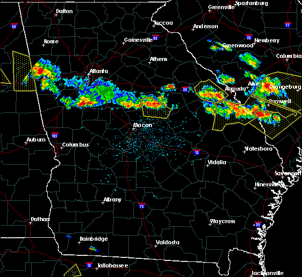 At 333 pm edt, a severe thunderstorm was located near harlem, or 8 miles south of grovetown, moving southeast at 50 mph (radar indicated). Hazards include 60 mph wind gusts and quarter size hail. Hail damage to vehicles is expected. expect wind damage to roofs, siding, and trees. Locations impacted include, grovetown, thomson, fort gordon, harlem, blythe and dearing. At 333 pm edt, a severe thunderstorm was located near harlem, or 8 miles south of grovetown, moving southeast at 50 mph (radar indicated). Hazards include 60 mph wind gusts and quarter size hail. Hail damage to vehicles is expected. expect wind damage to roofs, siding, and trees. Locations impacted include, grovetown, thomson, fort gordon, harlem, blythe and dearing.
|
| 6/17/2016 3:10 PM EDT |
 At 310 pm edt, a severe thunderstorm was located near thomson, moving southeast at 50 mph (radar indicated). Hazards include 60 mph wind gusts. Expect damage to roofs. siding. And trees. At 310 pm edt, a severe thunderstorm was located near thomson, moving southeast at 50 mph (radar indicated). Hazards include 60 mph wind gusts. Expect damage to roofs. siding. And trees.
|
| 12/24/2015 4:09 PM EST |
 At 409 pm est, doppler radar indicated a severe thunderstorm capable of producing damaging winds in excess of 60 mph. this storm was located 13 miles northwest of evans, and moving east at 30 mph. At 409 pm est, doppler radar indicated a severe thunderstorm capable of producing damaging winds in excess of 60 mph. this storm was located 13 miles northwest of evans, and moving east at 30 mph.
|
| 8/6/2015 4:50 PM EDT |
 At 449 pm edt, doppler radar indicated an area of severe thunderstorms over the csra capable of producing damaging winds in excess of 60 mph. these storms were moving east at 30 mph. At 449 pm edt, doppler radar indicated an area of severe thunderstorms over the csra capable of producing damaging winds in excess of 60 mph. these storms were moving east at 30 mph.
|
| 8/6/2015 4:38 PM EDT |
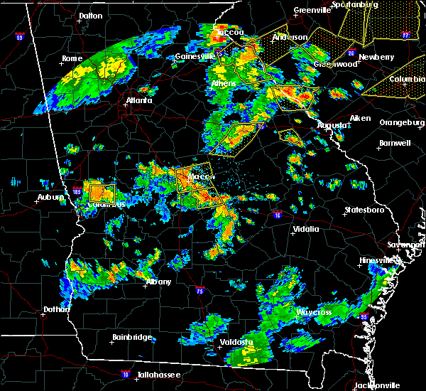 At 437 pm edt, doppler radar indicated a severe thunderstorm capable of producing damaging winds in excess of 60 mph. this storm was located 7 miles north of wrens, or 11 miles southeast of thomson, and moving east at 30 mph. At 437 pm edt, doppler radar indicated a severe thunderstorm capable of producing damaging winds in excess of 60 mph. this storm was located 7 miles north of wrens, or 11 miles southeast of thomson, and moving east at 30 mph.
|
| 7/3/2015 12:13 PM EDT |
 At 1213 pm edt, doppler radar indicated a line of severe thunderstorms capable of producing damaging winds in excess of 60 mph. these storms were located along a line extending from 9 miles southwest of edgefield to augusta to near thomson to near sandersville, moving east at 40 mph. locations impacted include, aiken, north augusta, grovetown, evans, thomson, clearwater, belvedere, augusta, fort gordon, martinez, hephzibah, harlem, gloverville, burnettown, blythe, dearing, murphys estates and clarks hill. At 1213 pm edt, doppler radar indicated a line of severe thunderstorms capable of producing damaging winds in excess of 60 mph. these storms were located along a line extending from 9 miles southwest of edgefield to augusta to near thomson to near sandersville, moving east at 40 mph. locations impacted include, aiken, north augusta, grovetown, evans, thomson, clearwater, belvedere, augusta, fort gordon, martinez, hephzibah, harlem, gloverville, burnettown, blythe, dearing, murphys estates and clarks hill.
|
| 7/3/2015 11:28 AM EDT |
 At 1128 am edt, doppler radar indicated a line of severe thunderstorms capable of producing damaging winds in excess of 60 mph. these storms were located along a line extending from near lincolnton to 8 miles northwest of midway-hardwick, and moving east at 35 mph. At 1128 am edt, doppler radar indicated a line of severe thunderstorms capable of producing damaging winds in excess of 60 mph. these storms were located along a line extending from near lincolnton to 8 miles northwest of midway-hardwick, and moving east at 35 mph.
|
| 7/2/2015 3:52 PM EDT |
 At 351 pm edt, doppler radar indicated a line of severe thunderstorms capable of producing damaging winds in excess of 60 mph. these storms were located along a line extending from near batesburg to 11 miles east of mccormick to 8 miles south of lincolnton, and moving east at 45 mph. At 351 pm edt, doppler radar indicated a line of severe thunderstorms capable of producing damaging winds in excess of 60 mph. these storms were located along a line extending from near batesburg to 11 miles east of mccormick to 8 miles south of lincolnton, and moving east at 45 mph.
|
| 6/27/2015 5:17 PM EDT |
 At 517 pm edt, doppler radar indicated a line of severe thunderstorms capable of producing damaging winds in excess of 60 mph. these storms were located along a line extending from near harlem to 6 miles west of hephzibah to 7 miles north of louisville, and moving east at 30 mph. At 517 pm edt, doppler radar indicated a line of severe thunderstorms capable of producing damaging winds in excess of 60 mph. these storms were located along a line extending from near harlem to 6 miles west of hephzibah to 7 miles north of louisville, and moving east at 30 mph.
|
| 6/24/2015 4:10 PM EDT |
 At 409 pm edt, doppler radar indicated a severe thunderstorm capable of producing quarter size hail and damaging winds in excess of 60 mph. this storm was located near fort gordon, and moving southeast at 10 mph. At 409 pm edt, doppler radar indicated a severe thunderstorm capable of producing quarter size hail and damaging winds in excess of 60 mph. this storm was located near fort gordon, and moving southeast at 10 mph.
|
| 6/24/2015 3:39 PM EDT |
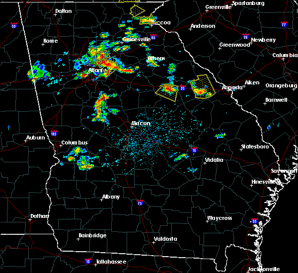 At 336 pm edt, law enforcement reported a severe thunderstorm producing quarter size hail and damaging winds in excess of 60 mph in the town of thomson. this storm was located near thomson, moving east at 10 mph. locations impacted include, grovetown, thomson, harlem and dearing. At 336 pm edt, law enforcement reported a severe thunderstorm producing quarter size hail and damaging winds in excess of 60 mph in the town of thomson. this storm was located near thomson, moving east at 10 mph. locations impacted include, grovetown, thomson, harlem and dearing.
|
| 6/24/2015 3:17 PM EDT |
 At 315 pm edt, doppler radar indicated a severe thunderstorm capable of producing quarter size hail and damaging winds in excess of 60 mph. the most threatend area is located just south of thomson near state highway 17. locations impacted include, grovetown, thomson, harlem and dearing. At 315 pm edt, doppler radar indicated a severe thunderstorm capable of producing quarter size hail and damaging winds in excess of 60 mph. the most threatend area is located just south of thomson near state highway 17. locations impacted include, grovetown, thomson, harlem and dearing.
|
| 6/24/2015 3:11 PM EDT |
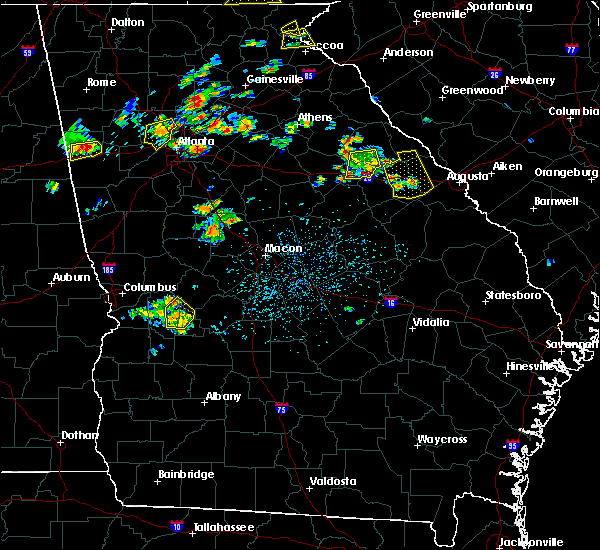 At 309 pm edt, doppler radar indicated a thunderstorm capable of producing quarter size hail and damaging winds in excess of 60 mph. this storm was located over thomson, and moving east at 10 mph. developing storms are also located just north of thomson. At 309 pm edt, doppler radar indicated a thunderstorm capable of producing quarter size hail and damaging winds in excess of 60 mph. this storm was located over thomson, and moving east at 10 mph. developing storms are also located just north of thomson.
|
| 6/22/2015 5:12 PM EDT |
 At 512 pm edt, doppler radar indicated a severe thunderstorm capable of producing quarter size hail and damaging winds in excess of 60 mph. this storm was located near hephzibah, or near fort gordon, and moving east at 10 mph. At 512 pm edt, doppler radar indicated a severe thunderstorm capable of producing quarter size hail and damaging winds in excess of 60 mph. this storm was located near hephzibah, or near fort gordon, and moving east at 10 mph.
|
| 6/9/2015 4:06 PM EDT |
 At 405 pm edt, doppler radar indicated a line of severe thunderstorms in mdcuffie and northern burke counties capable of producing quarter size hail and damaging winds in excess of 60 mph. these storms were moving east at 20 mph. At 405 pm edt, doppler radar indicated a line of severe thunderstorms in mdcuffie and northern burke counties capable of producing quarter size hail and damaging winds in excess of 60 mph. these storms were moving east at 20 mph.
|
| 6/9/2015 3:43 PM EDT |
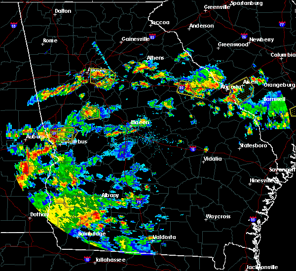 At 343 pm edt, doppler radar indicated a severe thunderstorm capable of producing quarter size hail and damaging winds in excess of 60 mph. this storm was located near thomson, and moving east at 20 mph. At 343 pm edt, doppler radar indicated a severe thunderstorm capable of producing quarter size hail and damaging winds in excess of 60 mph. this storm was located near thomson, and moving east at 20 mph.
|
| 4/19/2013 3:53 PM EDT | Emergency manager reported power lines down in harle in columbia county GA, 0.5 miles WSW of Harlem, GA |
| 1/1/0001 12:00 AM | Quarter sized hail reported 0.6 miles NNE of Harlem, GA, one inch hail reported in harlem ga. |
| 1/1/0001 12:00 AM | Public report of grill blown into yard and large treebranches broke in columbia county GA, 6.4 miles S of Harlem, GA |
Hail Maps for Harlem, GA


Connect with Interactive Hail Maps