

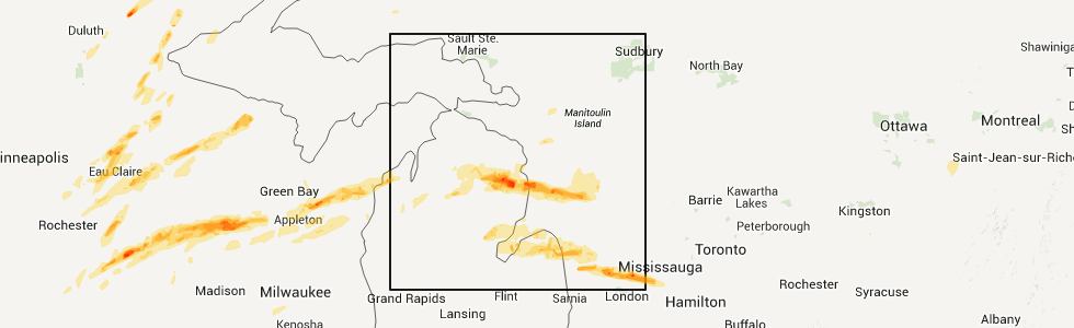
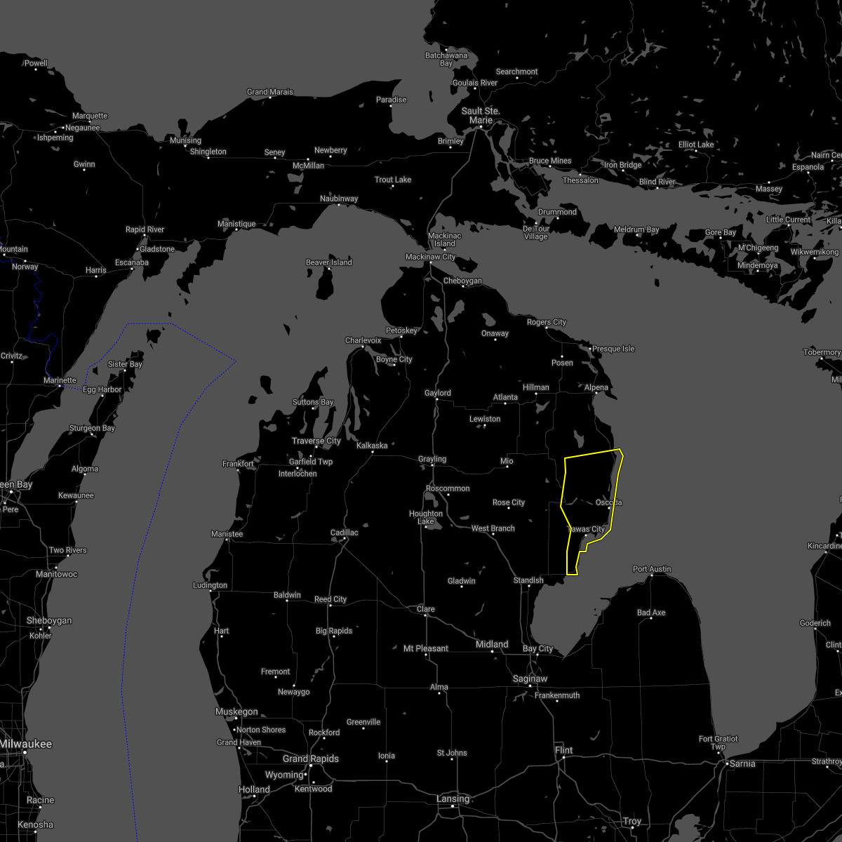
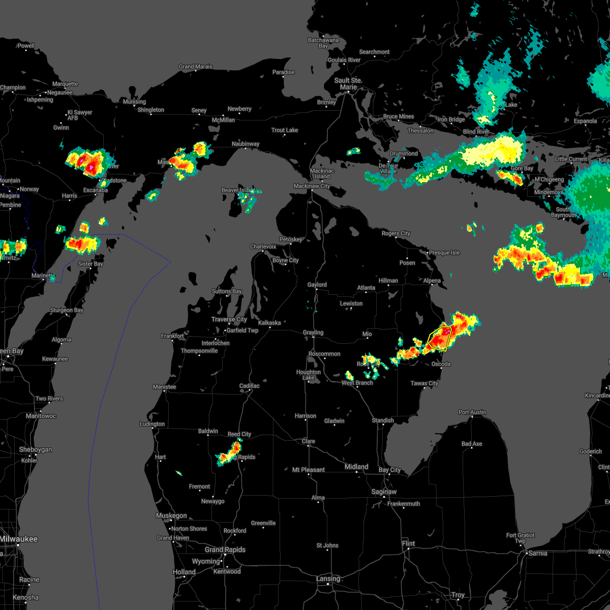
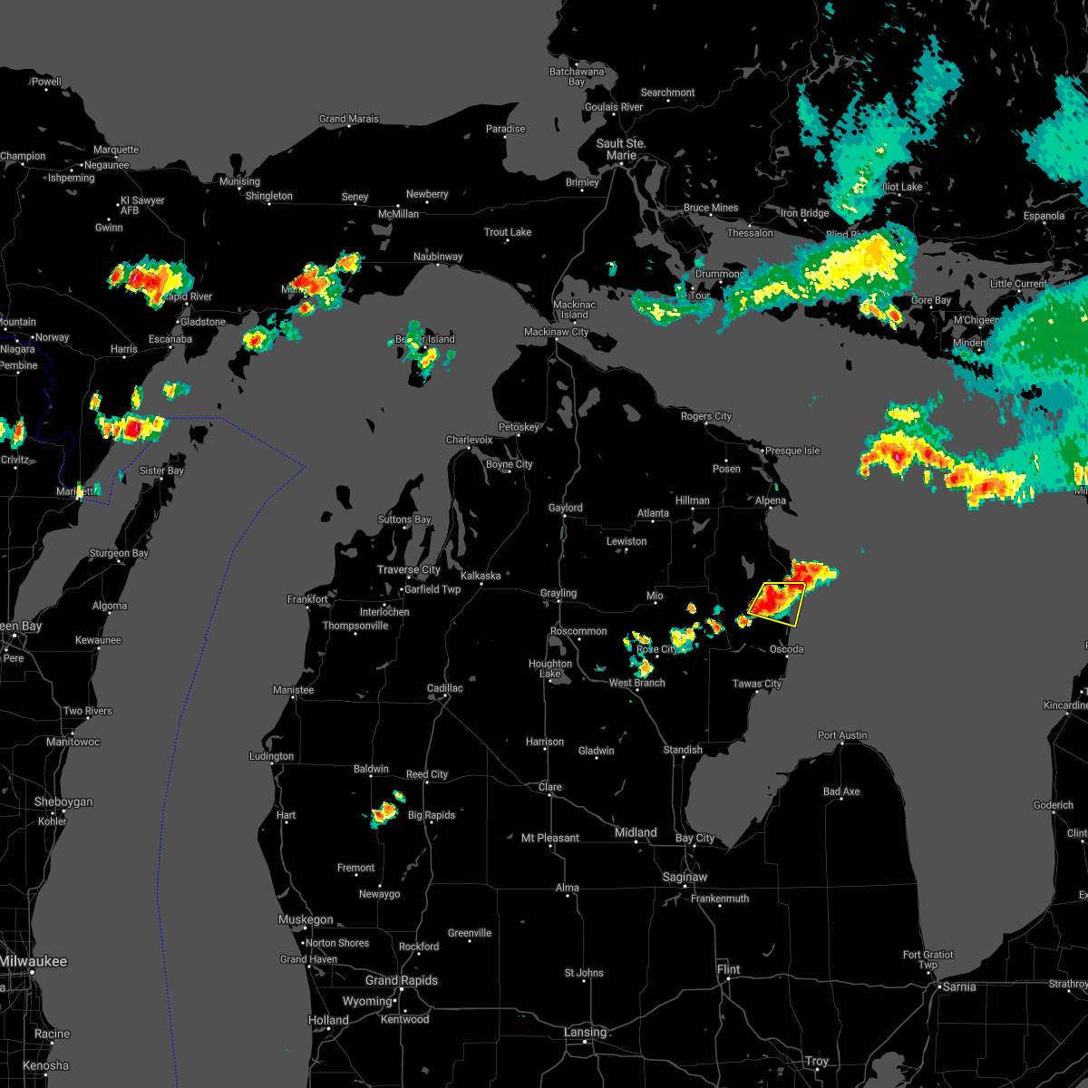
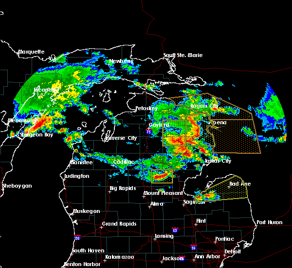
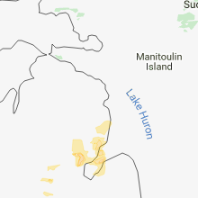
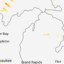
Hail Map for Harrisville, MI
The Harrisville, MI area has had 1 report of on-the-ground hail by trained spotters, and has been under severe weather warnings 0 times during the past 12 months. Doppler radar has detected hail at or near Harrisville, MI on 22 occasions.
| Name: | Harrisville, MI |
| Where Located: | 28.9 miles SSE of Alpena, MI |
| Map: | Google Map for Harrisville, MI |
| Population: | 493 |
| Housing Units: | 329 |
| More Info: | Search Google for Harrisville, MI |
5
The Top Recent Hail Date for Harrisville, MI is Sunday, April 10, 2011 (1st out of 22)
Hail and Wind Damage Spotted near Harrisville, MI
| Date / Time | Report Details |
|---|---|
| 5/20/2024 9:57 PM EDT |
 the severe thunderstorm warning has been cancelled and is no longer in effect the severe thunderstorm warning has been cancelled and is no longer in effect
|
| 5/20/2024 9:41 PM EDT |
 Svrapx the national weather service in gaylord has issued a * severe thunderstorm warning for, southwestern alpena county in northern michigan, alcona county in northern michigan, southeastern montmorency county in northern michigan, northeastern oscoda county in northern michigan, northeastern iosco county in northern michigan, * until 1030 pm edt. * at 941 pm edt, severe thunderstorms were located along a line extending from near comins to near barton city to 8 miles northeast of plainfield township, moving northeast at 40 mph (radar indicated). Hazards include 60 mph wind gusts. Expect damage to roofs, siding, and trees. severe thunderstorms will be near, barton city around 945 pm edt. mikado and hubbard lake around 950 pm edt. lincoln, lost lake woods, and ossineke township around 955 pm edt. harrisville, the town of hubbard lake, spruce, and spratt around 1000 pm edt. ossineke and harrisville state park around 1005 pm edt. black river and negwegon state park around 1010 pm edt. Other locations impacted by these severe thunderstorms include devils lake, milen township, mitchell township, and sid town. Svrapx the national weather service in gaylord has issued a * severe thunderstorm warning for, southwestern alpena county in northern michigan, alcona county in northern michigan, southeastern montmorency county in northern michigan, northeastern oscoda county in northern michigan, northeastern iosco county in northern michigan, * until 1030 pm edt. * at 941 pm edt, severe thunderstorms were located along a line extending from near comins to near barton city to 8 miles northeast of plainfield township, moving northeast at 40 mph (radar indicated). Hazards include 60 mph wind gusts. Expect damage to roofs, siding, and trees. severe thunderstorms will be near, barton city around 945 pm edt. mikado and hubbard lake around 950 pm edt. lincoln, lost lake woods, and ossineke township around 955 pm edt. harrisville, the town of hubbard lake, spruce, and spratt around 1000 pm edt. ossineke and harrisville state park around 1005 pm edt. black river and negwegon state park around 1010 pm edt. Other locations impacted by these severe thunderstorms include devils lake, milen township, mitchell township, and sid town.
|
| 8/3/2022 12:07 PM EDT |
 At 1207 pm edt, a severe thunderstorm was located near mikado, or 10 miles northwest of oscoda, moving east at 65 mph (radar indicated. this storm has a history of producing tree and powerline damage). Hazards include 60 mph wind gusts and quarter size hail. Hail damage to vehicles is expected. expect wind damage to roofs, siding, and trees. locations impacted include, oscoda, east tawas, tawas city, harrisville, au sable, glennie, south branch, mikado, whittemore, lincoln, tawas point state park, curran, plainfield township, national city, black river, wurtsmith airfield, barton city, curtisville, hale and harrisville state park. hail threat, radar indicated max hail size, 1. 00 in wind threat, observed max wind gust, 60 mph. At 1207 pm edt, a severe thunderstorm was located near mikado, or 10 miles northwest of oscoda, moving east at 65 mph (radar indicated. this storm has a history of producing tree and powerline damage). Hazards include 60 mph wind gusts and quarter size hail. Hail damage to vehicles is expected. expect wind damage to roofs, siding, and trees. locations impacted include, oscoda, east tawas, tawas city, harrisville, au sable, glennie, south branch, mikado, whittemore, lincoln, tawas point state park, curran, plainfield township, national city, black river, wurtsmith airfield, barton city, curtisville, hale and harrisville state park. hail threat, radar indicated max hail size, 1. 00 in wind threat, observed max wind gust, 60 mph.
|
| 8/3/2022 11:56 AM EDT |
 At 1155 am edt, a severe thunderstorm was located near glennie, moving east at 70 mph (radar indicated. this storm has a history of producing tree and powerline damage). Hazards include 60 mph wind gusts and quarter size hail. Hail damage to vehicles is expected. expect wind damage to roofs, siding, and trees. locations impacted include, oscoda, au sable, mikado, wurtsmith airfield and harrisville state park. hail threat, radar indicated max hail size, 1. 00 in wind threat, observed max wind gust, 60 mph. At 1155 am edt, a severe thunderstorm was located near glennie, moving east at 70 mph (radar indicated. this storm has a history of producing tree and powerline damage). Hazards include 60 mph wind gusts and quarter size hail. Hail damage to vehicles is expected. expect wind damage to roofs, siding, and trees. locations impacted include, oscoda, au sable, mikado, wurtsmith airfield and harrisville state park. hail threat, radar indicated max hail size, 1. 00 in wind threat, observed max wind gust, 60 mph.
|
| 8/3/2022 11:41 AM EDT |
 At 1140 am edt, a severe thunderstorm was located over rose city, or 12 miles northeast of west branch, moving east at 60 mph (radar indicated. this storm has a history of producing tree and powerline damage across wexford and missaukee counties). Hazards include 60 mph wind gusts. Expect damage to roofs, siding, and trees. this severe thunderstorm will be near, long lake, south branch, hale and curtisville around 1150 am edt. glennie around 1200 pm edt. other locations in the path of this severe thunderstorm include au sable, mikado, wurtsmith airfield, oscoda and harrisville state park. hail threat, radar indicated max hail size, <. 75 in wind threat, observed max wind gust, 60 mph. At 1140 am edt, a severe thunderstorm was located over rose city, or 12 miles northeast of west branch, moving east at 60 mph (radar indicated. this storm has a history of producing tree and powerline damage across wexford and missaukee counties). Hazards include 60 mph wind gusts. Expect damage to roofs, siding, and trees. this severe thunderstorm will be near, long lake, south branch, hale and curtisville around 1150 am edt. glennie around 1200 pm edt. other locations in the path of this severe thunderstorm include au sable, mikado, wurtsmith airfield, oscoda and harrisville state park. hail threat, radar indicated max hail size, <. 75 in wind threat, observed max wind gust, 60 mph.
|
| 7/23/2022 9:57 PM EDT |
 At 957 pm edt, a severe thunderstorm was located near curran, or 8 miles north of glennie, moving east at 15 mph (radar indicated). Hazards include 60 mph wind gusts and quarter size hail. Hail damage to vehicles is expected. expect wind damage to roofs, siding, and trees. locations impacted include, barton city, mikado and lincoln. hail threat, radar indicated max hail size, 1. 00 in wind threat, radar indicated max wind gust, 60 mph. At 957 pm edt, a severe thunderstorm was located near curran, or 8 miles north of glennie, moving east at 15 mph (radar indicated). Hazards include 60 mph wind gusts and quarter size hail. Hail damage to vehicles is expected. expect wind damage to roofs, siding, and trees. locations impacted include, barton city, mikado and lincoln. hail threat, radar indicated max hail size, 1. 00 in wind threat, radar indicated max wind gust, 60 mph.
|
| 7/23/2022 9:37 PM EDT |
 At 936 pm edt, a severe thunderstorm was located over curran, or 10 miles northwest of glennie, moving east at 15 mph (radar indicated). Hazards include ping pong ball size hail and 60 mph wind gusts. People and animals outdoors will be injured. expect hail damage to roofs, siding, windows, and vehicles. Expect wind damage to roofs, siding, and trees. At 936 pm edt, a severe thunderstorm was located over curran, or 10 miles northwest of glennie, moving east at 15 mph (radar indicated). Hazards include ping pong ball size hail and 60 mph wind gusts. People and animals outdoors will be injured. expect hail damage to roofs, siding, windows, and vehicles. Expect wind damage to roofs, siding, and trees.
|
| 9/7/2021 2:05 PM EDT |
 The severe thunderstorm warning for eastern alcona and northeastern iosco counties will expire at 215 pm edt, the storms which prompted the warning have moved out of the area. therefore, the warning will be allowed to expire. however heavy rain is still possible with these thunderstorms. a severe thunderstorm watch remains in effect until 700 pm edt for northern michigan. The severe thunderstorm warning for eastern alcona and northeastern iosco counties will expire at 215 pm edt, the storms which prompted the warning have moved out of the area. therefore, the warning will be allowed to expire. however heavy rain is still possible with these thunderstorms. a severe thunderstorm watch remains in effect until 700 pm edt for northern michigan.
|
| 9/7/2021 1:51 PM EDT |
 At 151 pm edt, severe thunderstorms were located along a line extending from near negwegon state park to 6 miles southeast of glennie, moving east at 35 mph (radar indicated). Hazards include 60 mph wind gusts and quarter size hail. Hail damage to vehicles is expected. expect wind damage to roofs, siding, and trees. these severe storms will be near, negwegon state park and black river around 155 pm edt. other locations in the path of these severe thunderstorms include harrisville and harrisville state park. hail threat, radar indicated max hail size, 1. 00 in wind threat, radar indicated max wind gust, 60 mph. At 151 pm edt, severe thunderstorms were located along a line extending from near negwegon state park to 6 miles southeast of glennie, moving east at 35 mph (radar indicated). Hazards include 60 mph wind gusts and quarter size hail. Hail damage to vehicles is expected. expect wind damage to roofs, siding, and trees. these severe storms will be near, negwegon state park and black river around 155 pm edt. other locations in the path of these severe thunderstorms include harrisville and harrisville state park. hail threat, radar indicated max hail size, 1. 00 in wind threat, radar indicated max wind gust, 60 mph.
|
| 9/7/2021 1:37 PM EDT |
 At 137 pm edt, severe thunderstorms were located along a line extending from spruce to near glennie, moving east at 35 mph (radar indicated). Hazards include 60 mph wind gusts and quarter size hail. Hail damage to vehicles is expected. expect wind damage to roofs, siding, and trees. severe thunderstorms will be near, ossineke, lost lake woods and spruce around 145 pm edt. negwegon state park and black river around 150 pm edt. other locations in the path of these severe thunderstorms include mikado, harrisville and harrisville state park. hail threat, radar indicated max hail size, 1. 00 in wind threat, radar indicated max wind gust, 60 mph. At 137 pm edt, severe thunderstorms were located along a line extending from spruce to near glennie, moving east at 35 mph (radar indicated). Hazards include 60 mph wind gusts and quarter size hail. Hail damage to vehicles is expected. expect wind damage to roofs, siding, and trees. severe thunderstorms will be near, ossineke, lost lake woods and spruce around 145 pm edt. negwegon state park and black river around 150 pm edt. other locations in the path of these severe thunderstorms include mikado, harrisville and harrisville state park. hail threat, radar indicated max hail size, 1. 00 in wind threat, radar indicated max wind gust, 60 mph.
|
| 9/7/2021 12:08 PM EDT |
 At 1208 pm edt, a severe thunderstorm was located over rifle river state park, or 15 miles northeast of west branch, moving east at 45 mph (radar indicated). Hazards include 60 mph wind gusts and quarter size hail. Hail damage to vehicles is expected. expect wind damage to roofs, siding, and trees. this severe thunderstorm will be near, long lake around 1215 pm edt. hale around 1220 pm edt. plainfield township around 1225 pm edt. other locations in the path of this severe thunderstorm include mikado, wurtsmith airfield, oscoda and au sable. hail threat, radar indicated max hail size, 1. 00 in wind threat, radar indicated max wind gust, 60 mph. At 1208 pm edt, a severe thunderstorm was located over rifle river state park, or 15 miles northeast of west branch, moving east at 45 mph (radar indicated). Hazards include 60 mph wind gusts and quarter size hail. Hail damage to vehicles is expected. expect wind damage to roofs, siding, and trees. this severe thunderstorm will be near, long lake around 1215 pm edt. hale around 1220 pm edt. plainfield township around 1225 pm edt. other locations in the path of this severe thunderstorm include mikado, wurtsmith airfield, oscoda and au sable. hail threat, radar indicated max hail size, 1. 00 in wind threat, radar indicated max wind gust, 60 mph.
|
| 8/28/2021 5:23 PM EDT |
 At 523 pm edt, severe thunderstorms were located along a line extending from near mikado to near wurtsmith airfield to tawas city, moving east at 35 mph (radar indicated). Hazards include 60 mph wind gusts and nickel size hail. Expect damage to roofs, siding, and trees. locations impacted include, oscoda, east tawas, tawas city, harrisville, au sable, mikado, harrisville state park, wurtsmith airfield, tawas point state park and wilber. hail threat, radar indicated max hail size, 0. 88 in wind threat, radar indicated max wind gust, 60 mph. At 523 pm edt, severe thunderstorms were located along a line extending from near mikado to near wurtsmith airfield to tawas city, moving east at 35 mph (radar indicated). Hazards include 60 mph wind gusts and nickel size hail. Expect damage to roofs, siding, and trees. locations impacted include, oscoda, east tawas, tawas city, harrisville, au sable, mikado, harrisville state park, wurtsmith airfield, tawas point state park and wilber. hail threat, radar indicated max hail size, 0. 88 in wind threat, radar indicated max wind gust, 60 mph.
|
| 8/28/2021 5:09 PM EDT |
 At 509 pm edt, severe thunderstorms were located along a line extending from 6 miles south of barton city to near plainfield township to near national city, moving east at 35 mph (radar indicated). Hazards include 60 mph wind gusts and quarter size hail. Hail damage to vehicles is expected. expect wind damage to roofs, siding, and trees. locations impacted include, tawas city, mikado, oscoda, east tawas, au sable, tawas point state park, wurtsmith airfield, harrisville and harrisville state park. hail threat, radar indicated max hail size, 1. 00 in wind threat, radar indicated max wind gust, 60 mph. At 509 pm edt, severe thunderstorms were located along a line extending from 6 miles south of barton city to near plainfield township to near national city, moving east at 35 mph (radar indicated). Hazards include 60 mph wind gusts and quarter size hail. Hail damage to vehicles is expected. expect wind damage to roofs, siding, and trees. locations impacted include, tawas city, mikado, oscoda, east tawas, au sable, tawas point state park, wurtsmith airfield, harrisville and harrisville state park. hail threat, radar indicated max hail size, 1. 00 in wind threat, radar indicated max wind gust, 60 mph.
|
| 8/28/2021 4:52 PM EDT |
 At 452 pm edt, severe thunderstorms were located along a line extending from glennie to near whittemore, moving east at 35 mph (radar indicated). Hazards include 60 mph wind gusts and quarter size hail. Hail damage to vehicles is expected. expect wind damage to roofs, siding, and trees. severe thunderstorms will be near, glennie around 500 pm edt. plainfield township around 510 pm edt. other locations in the path of these severe thunderstorms include mikado, tawas city, east tawas, harrisville, tawas point state park and harrisville state park. hail threat, radar indicated max hail size, 1. 00 in wind threat, radar indicated max wind gust, 60 mph. At 452 pm edt, severe thunderstorms were located along a line extending from glennie to near whittemore, moving east at 35 mph (radar indicated). Hazards include 60 mph wind gusts and quarter size hail. Hail damage to vehicles is expected. expect wind damage to roofs, siding, and trees. severe thunderstorms will be near, glennie around 500 pm edt. plainfield township around 510 pm edt. other locations in the path of these severe thunderstorms include mikado, tawas city, east tawas, harrisville, tawas point state park and harrisville state park. hail threat, radar indicated max hail size, 1. 00 in wind threat, radar indicated max wind gust, 60 mph.
|
| 8/11/2021 1:02 AM EDT |
 At 101 am edt, severe thunderstorms were located along a line extending from near barton city to near plainfield township to 8 miles northeast of au gres, moving east at 50 mph (radar indicated). Hazards include 60 mph wind gusts. Expect damage to roofs, siding, and trees. locations impacted include, oscoda, east tawas, tawas city, harrisville, au sable, mikado, lincoln, tawas point state park, harrisville state park, wurtsmith airfield, barton city, wilber and sid town. hail threat, radar indicated max hail size, <. 75 in wind threat, radar indicated max wind gust, 60 mph. At 101 am edt, severe thunderstorms were located along a line extending from near barton city to near plainfield township to 8 miles northeast of au gres, moving east at 50 mph (radar indicated). Hazards include 60 mph wind gusts. Expect damage to roofs, siding, and trees. locations impacted include, oscoda, east tawas, tawas city, harrisville, au sable, mikado, lincoln, tawas point state park, harrisville state park, wurtsmith airfield, barton city, wilber and sid town. hail threat, radar indicated max hail size, <. 75 in wind threat, radar indicated max wind gust, 60 mph.
|
| 8/11/2021 12:48 AM EDT |
 At 1247 am edt, severe thunderstorms were located along a line extending from near glennie to near hale to twining, moving east at 45 mph (radar indicated). Hazards include 60 mph wind gusts and penny size hail. Expect damage to roofs, siding, and trees. locations impacted include, glennie, long lake, national city, au gres, plainfield township, barton city, tawas city, east tawas, mikado, tawas point state park, lincoln, wurtsmith airfield, oscoda, harrisville, au sable and harrisville state park. hail threat, radar indicated max hail size, 0. 75 in wind threat, radar indicated max wind gust, 60 mph. At 1247 am edt, severe thunderstorms were located along a line extending from near glennie to near hale to twining, moving east at 45 mph (radar indicated). Hazards include 60 mph wind gusts and penny size hail. Expect damage to roofs, siding, and trees. locations impacted include, glennie, long lake, national city, au gres, plainfield township, barton city, tawas city, east tawas, mikado, tawas point state park, lincoln, wurtsmith airfield, oscoda, harrisville, au sable and harrisville state park. hail threat, radar indicated max hail size, 0. 75 in wind threat, radar indicated max wind gust, 60 mph.
|
| 8/11/2021 12:28 AM EDT |
 At 1227 am edt, severe thunderstorms were located along a line extending from near mckinley to selkirk to 7 miles south of rhodes, moving east at 50 mph (radar indicated). Hazards include 60 mph wind gusts and penny size hail. Expect damage to roofs, siding, and trees. severe thunderstorms will be near, mckinley, curtisville and rifle river state park around 1235 am edt. long lake around 1240 am edt. glennie, whittemore and hale around 1245 am edt. other locations in the path of these severe thunderstorms include plainfield township, barton city, national city, tawas city, mikado, lincoln, east tawas, tawas point state park, harrisville, harrisville state park, wurtsmith airfield, oscoda and au sable. hail threat, radar indicated max hail size, 0. 75 in wind threat, radar indicated max wind gust, 60 mph. At 1227 am edt, severe thunderstorms were located along a line extending from near mckinley to selkirk to 7 miles south of rhodes, moving east at 50 mph (radar indicated). Hazards include 60 mph wind gusts and penny size hail. Expect damage to roofs, siding, and trees. severe thunderstorms will be near, mckinley, curtisville and rifle river state park around 1235 am edt. long lake around 1240 am edt. glennie, whittemore and hale around 1245 am edt. other locations in the path of these severe thunderstorms include plainfield township, barton city, national city, tawas city, mikado, lincoln, east tawas, tawas point state park, harrisville, harrisville state park, wurtsmith airfield, oscoda and au sable. hail threat, radar indicated max hail size, 0. 75 in wind threat, radar indicated max wind gust, 60 mph.
|
| 7/5/2021 2:52 PM EDT |
 At 251 pm edt, a severe thunderstorm was located over harrisville, moving east at 30 mph (radar indicated). Hazards include 60 mph wind gusts and quarter size hail. Hail damage to vehicles is expected. expect wind damage to roofs, siding, and trees. This severe thunderstorm will remain over mainly rural areas of southeastern alcona county. At 251 pm edt, a severe thunderstorm was located over harrisville, moving east at 30 mph (radar indicated). Hazards include 60 mph wind gusts and quarter size hail. Hail damage to vehicles is expected. expect wind damage to roofs, siding, and trees. This severe thunderstorm will remain over mainly rural areas of southeastern alcona county.
|
| 7/5/2021 2:43 PM EDT |
 At 243 pm edt, a severe thunderstorm was located over lincoln, or near harrisville, moving east at 30 mph (radar indicated). Hazards include 60 mph wind gusts and quarter size hail. Hail damage to vehicles is expected. expect wind damage to roofs, siding, and trees. This severe thunderstorm will be near, harrisville and harrisville state park around 255 pm edt. At 243 pm edt, a severe thunderstorm was located over lincoln, or near harrisville, moving east at 30 mph (radar indicated). Hazards include 60 mph wind gusts and quarter size hail. Hail damage to vehicles is expected. expect wind damage to roofs, siding, and trees. This severe thunderstorm will be near, harrisville and harrisville state park around 255 pm edt.
|
| 6/12/2021 7:39 PM EDT |
 At 738 pm edt, a severe thunderstorm was located 9 miles south of the town of hubbard lake, moving east at 25 mph (radar indicated). Hazards include 60 mph wind gusts and quarter size hail. Hail damage to vehicles is expected. expect wind damage to roofs, siding, and trees. Locations impacted include, spruce, lost lake woods, lincoln, black river, negwegon state park, harrisville and harrisville state park. At 738 pm edt, a severe thunderstorm was located 9 miles south of the town of hubbard lake, moving east at 25 mph (radar indicated). Hazards include 60 mph wind gusts and quarter size hail. Hail damage to vehicles is expected. expect wind damage to roofs, siding, and trees. Locations impacted include, spruce, lost lake woods, lincoln, black river, negwegon state park, harrisville and harrisville state park.
|
| 6/12/2021 7:24 PM EDT |
 At 724 pm edt, a severe thunderstorm was located near curran, or 11 miles southwest of the town of hubbard lake, moving east at 25 mph (radar indicated). Hazards include golf ball size hail and 60 mph wind gusts. People and animals outdoors will be injured. expect hail damage to roofs, siding, windows, and vehicles. expect wind damage to roofs, siding, and trees. this severe thunderstorm will be near, barton city around 740 pm edt. Other locations in the path of this severe thunderstorm include hubbard lake, spruce, lost lake woods, lincoln, harrisville, black river, negwegon state park and harrisville state park. At 724 pm edt, a severe thunderstorm was located near curran, or 11 miles southwest of the town of hubbard lake, moving east at 25 mph (radar indicated). Hazards include golf ball size hail and 60 mph wind gusts. People and animals outdoors will be injured. expect hail damage to roofs, siding, windows, and vehicles. expect wind damage to roofs, siding, and trees. this severe thunderstorm will be near, barton city around 740 pm edt. Other locations in the path of this severe thunderstorm include hubbard lake, spruce, lost lake woods, lincoln, harrisville, black river, negwegon state park and harrisville state park.
|
| 7/18/2020 1:57 PM EDT |
 The severe thunderstorm warning for northeastern alcona county will expire at 200 pm edt, the storm which prompted the warning has moved out of the area. therefore, the warning will be allowed to expire. The severe thunderstorm warning for northeastern alcona county will expire at 200 pm edt, the storm which prompted the warning has moved out of the area. therefore, the warning will be allowed to expire.
|
| 7/18/2020 1:33 PM EDT |
 At 133 pm edt, a severe thunderstorm was located over lincoln, or 7 miles northwest of harrisville, moving east at 35 mph (radar indicated). Hazards include 60 mph wind gusts and quarter size hail. Hail damage to vehicles is expected. expect wind damage to roofs, siding, and trees. Locations impacted include, harrisville, lincoln, spruce, black river, harrisville state park, lost lake woods, hubbard lake, barton city and negwegon state park. At 133 pm edt, a severe thunderstorm was located over lincoln, or 7 miles northwest of harrisville, moving east at 35 mph (radar indicated). Hazards include 60 mph wind gusts and quarter size hail. Hail damage to vehicles is expected. expect wind damage to roofs, siding, and trees. Locations impacted include, harrisville, lincoln, spruce, black river, harrisville state park, lost lake woods, hubbard lake, barton city and negwegon state park.
|
| 7/18/2020 1:18 PM EDT |
 At 117 pm edt, a severe thunderstorm was located over barton city, or 11 miles south of the town of hubbard lake, moving east at 40 mph (radar indicated). Hazards include 60 mph wind gusts and quarter size hail. Hail damage to vehicles is expected. Expect wind damage to roofs, siding, and trees. At 117 pm edt, a severe thunderstorm was located over barton city, or 11 miles south of the town of hubbard lake, moving east at 40 mph (radar indicated). Hazards include 60 mph wind gusts and quarter size hail. Hail damage to vehicles is expected. Expect wind damage to roofs, siding, and trees.
|
| 6/10/2020 2:16 PM EDT |
 At 214 pm edt, a severe thunderstorm was located near east tawas, moving northeast at 60 mph (law enforcement). Hazards include 60 mph wind gusts. expect damage to roofs, siding, and trees At 214 pm edt, a severe thunderstorm was located near east tawas, moving northeast at 60 mph (law enforcement). Hazards include 60 mph wind gusts. expect damage to roofs, siding, and trees
|
| 8/5/2019 8:11 PM EDT |
 At 811 pm edt, severe thunderstorms were located along a line extending from near lost lake woods to near mikado, moving east at 30 mph (radar indicated). Hazards include 60 mph wind gusts and penny size hail. expect damage to roofs, siding, and trees At 811 pm edt, severe thunderstorms were located along a line extending from near lost lake woods to near mikado, moving east at 30 mph (radar indicated). Hazards include 60 mph wind gusts and penny size hail. expect damage to roofs, siding, and trees
|
| 7/29/2018 5:35 PM EDT |
 At 535 pm edt, a severe thunderstorm was located over harrisville state park, or near harrisville, moving southeast at 10 mph (radar indicated). Hazards include 60 mph wind gusts and quarter size hail. Hail damage to vehicles is expected. expect wind damage to roofs, siding, and trees. Locations impacted include, harrisville and mikado. At 535 pm edt, a severe thunderstorm was located over harrisville state park, or near harrisville, moving southeast at 10 mph (radar indicated). Hazards include 60 mph wind gusts and quarter size hail. Hail damage to vehicles is expected. expect wind damage to roofs, siding, and trees. Locations impacted include, harrisville and mikado.
|
| 7/29/2018 5:22 PM EDT |
 At 522 pm edt, a severe thunderstorm was located over harrisville state park, or near harrisville, moving southeast at 15 mph (radar indicated). Hazards include 60 mph wind gusts and quarter size hail. Hail damage to vehicles is expected. Expect wind damage to roofs, siding, and trees. At 522 pm edt, a severe thunderstorm was located over harrisville state park, or near harrisville, moving southeast at 15 mph (radar indicated). Hazards include 60 mph wind gusts and quarter size hail. Hail damage to vehicles is expected. Expect wind damage to roofs, siding, and trees.
|
| 7/16/2018 1:42 PM EDT |
 At 141 pm edt, a severe thunderstorm was located near glennie, moving east at 25 mph. additional thunderstorms are developing over southern alcona county and northern iosco county which may become severe (radar indicated). Hazards include 60 mph wind gusts and quarter size hail. Hail damage to vehicles is expected. Expect wind damage to roofs, siding, and trees. At 141 pm edt, a severe thunderstorm was located near glennie, moving east at 25 mph. additional thunderstorms are developing over southern alcona county and northern iosco county which may become severe (radar indicated). Hazards include 60 mph wind gusts and quarter size hail. Hail damage to vehicles is expected. Expect wind damage to roofs, siding, and trees.
|
| 6/13/2018 10:55 AM EDT |
 The severe thunderstorm warning for eastern alcona county will expire at 1100 am edt, the storm which prompted the warning has moved out of the area. therefore, the warning will be allowed to expire. The severe thunderstorm warning for eastern alcona county will expire at 1100 am edt, the storm which prompted the warning has moved out of the area. therefore, the warning will be allowed to expire.
|
| 6/13/2018 10:43 AM EDT |
 At 1042 am edt, a severe thunderstorm was located near harrisville, moving east at 60 mph (radar indicated). Hazards include quarter size hail. damage to vehicles is expected At 1042 am edt, a severe thunderstorm was located near harrisville, moving east at 60 mph (radar indicated). Hazards include quarter size hail. damage to vehicles is expected
|
| 5/27/2018 3:57 PM EDT |
 At 357 pm edt, severe thunderstorms were located along a line extending from 7 miles east of harrisville state park to near tawas city, moving east at 25 mph (radar indicated). Hazards include 60 mph wind gusts and quarter size hail. Hail damage to vehicles is expected. expect wind damage to roofs, siding, and trees. Locations impacted include, oscoda, east tawas, tawas city, harrisville, au sable, mikado, plainfield township, wurtsmith airfield, wilber and sid town. At 357 pm edt, severe thunderstorms were located along a line extending from 7 miles east of harrisville state park to near tawas city, moving east at 25 mph (radar indicated). Hazards include 60 mph wind gusts and quarter size hail. Hail damage to vehicles is expected. expect wind damage to roofs, siding, and trees. Locations impacted include, oscoda, east tawas, tawas city, harrisville, au sable, mikado, plainfield township, wurtsmith airfield, wilber and sid town.
|
| 5/27/2018 3:47 PM EDT |
 At 346 pm edt, severe thunderstorms were located along a line extending from 6 miles east of harrisville state park to 6 miles east of plainfield township, moving east at 25 mph (radar indicated). Hazards include 60 mph wind gusts and half dollar size hail. Hail damage to vehicles is expected. Expect wind damage to roofs, siding, and trees. At 346 pm edt, severe thunderstorms were located along a line extending from 6 miles east of harrisville state park to 6 miles east of plainfield township, moving east at 25 mph (radar indicated). Hazards include 60 mph wind gusts and half dollar size hail. Hail damage to vehicles is expected. Expect wind damage to roofs, siding, and trees.
|
| 7/6/2017 7:21 PM EDT |
 A severe thunderstorm warning remains in effect until 745 pm edt for southeastern alcona. northeastern arenac and iosco counties. at 720 pm edt, severe thunderstorms were located along a line extending from near mikado to 6 miles east of turner, moving east at 35 mph. hazard. 70 mph wind gusts and quarter size hail. A severe thunderstorm warning remains in effect until 745 pm edt for southeastern alcona. northeastern arenac and iosco counties. at 720 pm edt, severe thunderstorms were located along a line extending from near mikado to 6 miles east of turner, moving east at 35 mph. hazard. 70 mph wind gusts and quarter size hail.
|
| 7/6/2017 6:51 PM EDT |
 At 651 pm edt, severe thunderstorms were located along a line extending from near curran to near skidway lake, moving east at 35 mph (radar indicated). Hazards include 70 mph wind gusts and quarter size hail. Hail damage to vehicles is expected. expect considerable tree damage. Wind damage is also likely to mobile homes, roofs, and outbuildings. At 651 pm edt, severe thunderstorms were located along a line extending from near curran to near skidway lake, moving east at 35 mph (radar indicated). Hazards include 70 mph wind gusts and quarter size hail. Hail damage to vehicles is expected. expect considerable tree damage. Wind damage is also likely to mobile homes, roofs, and outbuildings.
|
| 10/17/2016 10:57 AM EDT |
 The severe thunderstorm warning for southeastern alcona and northeastern iosco counties will expire at 1100 am edt, the storm which prompted the warning is moving out into lake huron. therefore the warning will be allowed to expire. The severe thunderstorm warning for southeastern alcona and northeastern iosco counties will expire at 1100 am edt, the storm which prompted the warning is moving out into lake huron. therefore the warning will be allowed to expire.
|
| 10/17/2016 10:40 AM EDT |
 At 1039 am edt, a severe thunderstorm was located 7 miles west of mikado, or 8 miles east of glennie, moving east at 50 mph (radar indicated). Hazards include quarter size hail. Damage to vehicles is expected. Locations impacted include, harrisville, mikado, lincoln, barton city, harrisville state park, lost lake woods and sid town. At 1039 am edt, a severe thunderstorm was located 7 miles west of mikado, or 8 miles east of glennie, moving east at 50 mph (radar indicated). Hazards include quarter size hail. Damage to vehicles is expected. Locations impacted include, harrisville, mikado, lincoln, barton city, harrisville state park, lost lake woods and sid town.
|
| 10/17/2016 10:25 AM EDT |
 At 1025 am edt, a severe thunderstorm was located near south branch, or near glennie, moving east at 50 mph (radar indicated). Hazards include ping pong ball size hail. People and animals outdoors will be injured. expect damage to roofs, siding, windows, and vehicles. Locations impacted include, harrisville, glennie, south branch, mikado, lincoln, curtisville, barton city, harrisville state park, sid town and milen township. At 1025 am edt, a severe thunderstorm was located near south branch, or near glennie, moving east at 50 mph (radar indicated). Hazards include ping pong ball size hail. People and animals outdoors will be injured. expect damage to roofs, siding, windows, and vehicles. Locations impacted include, harrisville, glennie, south branch, mikado, lincoln, curtisville, barton city, harrisville state park, sid town and milen township.
|
| 10/17/2016 10:10 AM EDT |
 At 1009 am edt, a severe thunderstorm was located over lupton, or 14 miles northeast of west branch, moving northeast at 50 mph (radar indicated). Hazards include ping pong ball size hail. People and animals outdoors will be injured. Expect damage to roofs, siding, windows, and vehicles. At 1009 am edt, a severe thunderstorm was located over lupton, or 14 miles northeast of west branch, moving northeast at 50 mph (radar indicated). Hazards include ping pong ball size hail. People and animals outdoors will be injured. Expect damage to roofs, siding, windows, and vehicles.
|
| 9/10/2016 4:24 PM EDT |
 The severe thunderstorm warning for alcona, oscoda, iosco and northeastern ogemaw counties will expire at 430 pm edt, the line of showers producing gusty winds which prompted the warning have weakened moved out of the area. therefore, the warning will be allowed to expire. The severe thunderstorm warning for alcona, oscoda, iosco and northeastern ogemaw counties will expire at 430 pm edt, the line of showers producing gusty winds which prompted the warning have weakened moved out of the area. therefore, the warning will be allowed to expire.
|
| 9/10/2016 3:37 PM EDT |
 At 335 pm edt, a line of showers with embedded thunder was producing severe winds along a line extending from near red oak to near rifle river state park, moving northeast at 45 mph (radar indicated). Hazards include 60 mph wind gusts. Expect damage to roofs. siding. And trees. At 335 pm edt, a line of showers with embedded thunder was producing severe winds along a line extending from near red oak to near rifle river state park, moving northeast at 45 mph (radar indicated). Hazards include 60 mph wind gusts. Expect damage to roofs. siding. And trees.
|
| 8/30/2016 6:01 PM EDT |
 At 601 pm edt, a severe thunderstorm was located over mikado, or 9 miles southwest of harrisville, moving east at 20 mph (radar indicated). Hazards include 60 mph wind gusts and quarter size hail. Hail damage to vehicles is expected. Expect wind damage to roofs, siding, and trees. At 601 pm edt, a severe thunderstorm was located over mikado, or 9 miles southwest of harrisville, moving east at 20 mph (radar indicated). Hazards include 60 mph wind gusts and quarter size hail. Hail damage to vehicles is expected. Expect wind damage to roofs, siding, and trees.
|
| 8/30/2016 4:45 PM EDT | Report from nws coop observer of trees down and power outage 2 miles north of harrisville. relayed by former nws employee via ham radi in alcona county MI, 2.2 miles SSE of Harrisville, MI |
| 7/8/2016 2:55 PM EDT |
 At 254 pm edt, severe thunderstorms were located along a line extending from near cathro to near hubbard lake to near mckinley, moving east at 40 mph (radar indicated). Hazards include two inch hail and 60 mph wind gusts. People and animals outdoors will be injured. expect hail damage to roofs, siding, windows, and vehicles. expect wind damage to roofs, siding, and trees. Locations impacted include, alpena, ossineke, harrisville, the town of hubbard lake, lachine, mckinley, long rapids, lincoln, fletcher pond, curran, lost lake woods, black river, lakewood, spruce, cathro, harrisville state park, hubbard lake, ossineke township, spratt and barton city. At 254 pm edt, severe thunderstorms were located along a line extending from near cathro to near hubbard lake to near mckinley, moving east at 40 mph (radar indicated). Hazards include two inch hail and 60 mph wind gusts. People and animals outdoors will be injured. expect hail damage to roofs, siding, windows, and vehicles. expect wind damage to roofs, siding, and trees. Locations impacted include, alpena, ossineke, harrisville, the town of hubbard lake, lachine, mckinley, long rapids, lincoln, fletcher pond, curran, lost lake woods, black river, lakewood, spruce, cathro, harrisville state park, hubbard lake, ossineke township, spratt and barton city.
|
| 7/8/2016 2:17 PM EDT |
 At 217 pm edt, a severe thunderstorm was located near atlanta, moving east at 35 mph (radar indicated). Hazards include two inch hail and 60 mph wind gusts. People and animals outdoors will be injured. expect hail damage to roofs, siding, windows, and vehicles. Expect wind damage to roofs, siding, and trees. At 217 pm edt, a severe thunderstorm was located near atlanta, moving east at 35 mph (radar indicated). Hazards include two inch hail and 60 mph wind gusts. People and animals outdoors will be injured. expect hail damage to roofs, siding, windows, and vehicles. Expect wind damage to roofs, siding, and trees.
|
| 6/20/2016 11:14 AM EDT |
 At 1114 am edt, severe thunderstorms were located along a line extending from near negwegon state park to near barton city, moving east at 55 mph (radar indicated). Hazards include 60 mph wind gusts and quarter size hail. Hail damage to vehicles is expected. expect wind damage to roofs, siding, and trees. Locations impacted include, ossineke, harrisville, lincoln, lost lake woods, black river, barton city, spruce, harrisville state park, negwegon state park and hubbard lake. At 1114 am edt, severe thunderstorms were located along a line extending from near negwegon state park to near barton city, moving east at 55 mph (radar indicated). Hazards include 60 mph wind gusts and quarter size hail. Hail damage to vehicles is expected. expect wind damage to roofs, siding, and trees. Locations impacted include, ossineke, harrisville, lincoln, lost lake woods, black river, barton city, spruce, harrisville state park, negwegon state park and hubbard lake.
|
| 6/20/2016 10:57 AM EDT |
 At 1057 am edt, a severe thunderstorm was located near hubbard lake, or near the town of hubbard lake, moving east at 50 mph (radar indicated). Hazards include ping pong ball size hail and 60 mph wind gusts. People and animals outdoors will be injured. expect hail damage to roofs, siding, windows, and vehicles. expect wind damage to roofs, siding, and trees. Locations impacted include, ossineke, harrisville, the town of hubbard lake, lincoln, curran, lost lake woods, black river, spruce, harrisville state park, hubbard lake, ossineke township, barton city, negwegon state park, devils lake, mitchell township and milen township. At 1057 am edt, a severe thunderstorm was located near hubbard lake, or near the town of hubbard lake, moving east at 50 mph (radar indicated). Hazards include ping pong ball size hail and 60 mph wind gusts. People and animals outdoors will be injured. expect hail damage to roofs, siding, windows, and vehicles. expect wind damage to roofs, siding, and trees. Locations impacted include, ossineke, harrisville, the town of hubbard lake, lincoln, curran, lost lake woods, black river, spruce, harrisville state park, hubbard lake, ossineke township, barton city, negwegon state park, devils lake, mitchell township and milen township.
|
| 6/20/2016 10:43 AM EDT |
 At 1042 am edt, severe thunderstorms were located along a line extending from near ossineke township to near fairview, moving east at 60 mph (radar indicated). Hazards include ping pong ball size hail and 60 mph wind gusts. People and animals outdoors will be injured. expect hail damage to roofs, siding, windows, and vehicles. Expect wind damage to roofs, siding, and trees. At 1042 am edt, severe thunderstorms were located along a line extending from near ossineke township to near fairview, moving east at 60 mph (radar indicated). Hazards include ping pong ball size hail and 60 mph wind gusts. People and animals outdoors will be injured. expect hail damage to roofs, siding, windows, and vehicles. Expect wind damage to roofs, siding, and trees.
|
| 5/26/2016 5:56 PM EDT | The severe thunderstorm warning for eastern alcona and northeastern iosco counties will expire at 600 pm edt, the storm which prompted the warning has weakened below severe limits, and no longer poses an immediate threat to life or property. therefore, the warning will be allowed to expire. however heavy rain is still possible with this thunderstorm. |
| 5/26/2016 5:42 PM EDT |
 At 542 pm edt, a severe thunderstorm was located near mikado, or 7 miles north of oscoda, moving east at 40 mph (radar indicated). Hazards include 60 mph wind gusts and quarter size hail. Hail damage to vehicles is expected. expect wind damage to roofs, siding, and trees. Locations impacted include, oscoda, harrisville, au sable, mikado, lincoln, lost lake woods, wurtsmith airfield, black river, barton city, harrisville state park, negwegon state park, plainfield township and sid town. At 542 pm edt, a severe thunderstorm was located near mikado, or 7 miles north of oscoda, moving east at 40 mph (radar indicated). Hazards include 60 mph wind gusts and quarter size hail. Hail damage to vehicles is expected. expect wind damage to roofs, siding, and trees. Locations impacted include, oscoda, harrisville, au sable, mikado, lincoln, lost lake woods, wurtsmith airfield, black river, barton city, harrisville state park, negwegon state park, plainfield township and sid town.
|
| 5/26/2016 5:17 PM EDT |
 At 516 pm edt, a severe thunderstorm was located near hale, or 7 miles south of glennie, moving east at 40 mph (radar indicated). Hazards include 60 mph wind gusts and quarter size hail. Hail damage to vehicles is expected. Expect wind damage to roofs, siding, and trees. At 516 pm edt, a severe thunderstorm was located near hale, or 7 miles south of glennie, moving east at 40 mph (radar indicated). Hazards include 60 mph wind gusts and quarter size hail. Hail damage to vehicles is expected. Expect wind damage to roofs, siding, and trees.
|
| 9/8/2015 4:02 PM EDT |
 At 402 pm edt, a severe thunderstorm was located over south branch, or 10 miles southwest of glennie, moving northeast at 45 mph (radar indicated). Hazards include 60 mph wind gusts. Expect damage to roofs. Siding and trees. At 402 pm edt, a severe thunderstorm was located over south branch, or 10 miles southwest of glennie, moving northeast at 45 mph (radar indicated). Hazards include 60 mph wind gusts. Expect damage to roofs. Siding and trees.
|
| 8/14/2015 3:12 PM EDT |
 At 312 pm edt, a severe thunderstorm was located near barton city, or 10 miles west of harrisville, moving southeast at 15 mph (radar indicated). Hazards include ping pong ball size hail and 60 mph wind gusts. People and animals outdoors will be injured. expect hail damage to roofs, siding, windows and vehicles. Expect wind damage to roofs, siding and trees. At 312 pm edt, a severe thunderstorm was located near barton city, or 10 miles west of harrisville, moving southeast at 15 mph (radar indicated). Hazards include ping pong ball size hail and 60 mph wind gusts. People and animals outdoors will be injured. expect hail damage to roofs, siding, windows and vehicles. Expect wind damage to roofs, siding and trees.
|
| 8/2/2015 6:51 PM EDT |
 The severe thunderstorm warning for iosco, alcona and arenac counties will expire at 700 pm edt, the storms which prompted the warning have moved out of the area. therefore the warning will be allowed to expire. however gusty winds are still possible with these thunderstorms. a severe thunderstorm watch remains in effect until 1100 pm edt for northern michigan. The severe thunderstorm warning for iosco, alcona and arenac counties will expire at 700 pm edt, the storms which prompted the warning have moved out of the area. therefore the warning will be allowed to expire. however gusty winds are still possible with these thunderstorms. a severe thunderstorm watch remains in effect until 1100 pm edt for northern michigan.
|
| 8/2/2015 6:36 PM EDT |
 At 635 pm edt, severe thunderstorms were located along a line extending from near lincoln to 7 miles south of tawas point state park to 8 miles northeast of pinconning, and are nearly stationary (radar indicated). Hazards include 70 mph wind gusts and quarter size hail. Hail damage to vehicles is expected. expect considerable tree damage. wind damage is also likely to mobile homes, roofs and outbuildings. Locations impacted include, alger, oscoda, east tawas, tawas city, standish, au gres, sterling, harrisville, au sable, glennie, maple ridge, mikado, whittemore, lincoln, omer, twining, turner, curtisville, black river and plainfield township. At 635 pm edt, severe thunderstorms were located along a line extending from near lincoln to 7 miles south of tawas point state park to 8 miles northeast of pinconning, and are nearly stationary (radar indicated). Hazards include 70 mph wind gusts and quarter size hail. Hail damage to vehicles is expected. expect considerable tree damage. wind damage is also likely to mobile homes, roofs and outbuildings. Locations impacted include, alger, oscoda, east tawas, tawas city, standish, au gres, sterling, harrisville, au sable, glennie, maple ridge, mikado, whittemore, lincoln, omer, twining, turner, curtisville, black river and plainfield township.
|
| 8/2/2015 6:17 PM EDT |
 At 617 pm edt, severe thunderstorms were located along a line extending from near lincoln to 7 miles south of tawas point state park to 7 miles northeast of pinconning, moving east at 70 mph (radar indicated). Hazards include 70 mph wind gusts and quarter size hail. Hail damage to vehicles is expected. expect considerable tree damage. wind damage is also likely to mobile homes, roofs and outbuildings. Locations impacted include, alger, oscoda, east tawas, tawas city, standish, au gres, sterling, harrisville, au sable, glennie, maple ridge, mikado, whittemore, lincoln, omer, twining, turner, curtisville, black river and plainfield township. At 617 pm edt, severe thunderstorms were located along a line extending from near lincoln to 7 miles south of tawas point state park to 7 miles northeast of pinconning, moving east at 70 mph (radar indicated). Hazards include 70 mph wind gusts and quarter size hail. Hail damage to vehicles is expected. expect considerable tree damage. wind damage is also likely to mobile homes, roofs and outbuildings. Locations impacted include, alger, oscoda, east tawas, tawas city, standish, au gres, sterling, harrisville, au sable, glennie, maple ridge, mikado, whittemore, lincoln, omer, twining, turner, curtisville, black river and plainfield township.
|
| 8/2/2015 5:56 PM EDT |
 At 554 pm edt, severe thunderstorms were located along a line extending from 7 miles southeast of lockwood lake to near whittemore to near wooden shoe village, moving east at 70 mph (radar indicated. widespread tree damage in ogemaw county). Hazards include 70 mph wind gusts and quarter size hail. Hail damage to vehicles is expected. expect considerable tree damage. Wind damage is also likely to mobile homes, roofs and outbuildings. At 554 pm edt, severe thunderstorms were located along a line extending from 7 miles southeast of lockwood lake to near whittemore to near wooden shoe village, moving east at 70 mph (radar indicated. widespread tree damage in ogemaw county). Hazards include 70 mph wind gusts and quarter size hail. Hail damage to vehicles is expected. expect considerable tree damage. Wind damage is also likely to mobile homes, roofs and outbuildings.
|
| 8/2/2015 2:11 PM EDT | The severe thunderstorm warning for northeastern alcona county will expire at 215 pm edt, the storm which prompted the warning has moved out of the area. therefore the warning will be allowed to expire. a severe thunderstorm watch remains in effect until 500 pm edt for northern michigan. |
| 8/2/2015 2:00 PM EDT |
 At 200 pm edt, a severe thunderstorm was located near lost lake woods, or 7 miles northwest of harrisville, moving east at 60 mph (radar indicated). Hazards include 60 mph wind gusts and quarter size hail. Hail damage to vehicles is expected. expect wind damage to roofs, siding and trees. Locations impacted include, harrisville, lincoln, black river, spruce and lost lake woods. At 200 pm edt, a severe thunderstorm was located near lost lake woods, or 7 miles northwest of harrisville, moving east at 60 mph (radar indicated). Hazards include 60 mph wind gusts and quarter size hail. Hail damage to vehicles is expected. expect wind damage to roofs, siding and trees. Locations impacted include, harrisville, lincoln, black river, spruce and lost lake woods.
|
| 8/2/2015 1:53 PM EDT |
 At 153 pm edt, a severe thunderstorm was located near glennie, moving east at 35 mph (radar indicated). Hazards include 60 mph wind gusts and quarter size hail. Hail damage to vehicles is expected. expect wind damage to roofs, siding and trees. Locations impacted include, oscoda, harrisville, au sable, mikado, wurtsmith airfield, plainfield township, wilber and sid town. At 153 pm edt, a severe thunderstorm was located near glennie, moving east at 35 mph (radar indicated). Hazards include 60 mph wind gusts and quarter size hail. Hail damage to vehicles is expected. expect wind damage to roofs, siding and trees. Locations impacted include, oscoda, harrisville, au sable, mikado, wurtsmith airfield, plainfield township, wilber and sid town.
|
| 8/2/2015 1:36 PM EDT |
 At 135 pm edt, a severe thunderstorm was located near south branch, or 7 miles southwest of glennie, moving east at 35 mph (radar indicated). Hazards include 60 mph wind gusts and quarter size hail. Hail damage to vehicles is expected. Expect wind damage to roofs, siding and trees. At 135 pm edt, a severe thunderstorm was located near south branch, or 7 miles southwest of glennie, moving east at 35 mph (radar indicated). Hazards include 60 mph wind gusts and quarter size hail. Hail damage to vehicles is expected. Expect wind damage to roofs, siding and trees.
|
| 8/2/2015 1:19 PM EDT |
 At 119 pm edt, severe thunderstorms were located along a line extending from bisma township to near fletcher pond to near fairview, moving east at 55 mph (radar indicated). Hazards include 60 mph wind gusts and quarter size hail. Hail damage to vehicles is expected. Expect wind damage to roofs, siding and trees. At 119 pm edt, severe thunderstorms were located along a line extending from bisma township to near fletcher pond to near fairview, moving east at 55 mph (radar indicated). Hazards include 60 mph wind gusts and quarter size hail. Hail damage to vehicles is expected. Expect wind damage to roofs, siding and trees.
|
| 7/18/2013 2:00 PM EDT | County dispatch reports scattered trees and power lines down countywid in alcona county MI, 0.5 miles ESE of Harrisville, MI |
| 5/30/2013 4:50 PM EDT | Multiple trees down on south poor farm road in greenbush township. most of the tree damage occurred in a 3/4 mile are in alcona county MI, 5.3 miles NNE of Harrisville, MI |
| 8/21/2011 1:40 PM EDT | Golf Ball sized hail reported 6.6 miles NNE of Harrisville, MI, time estimated from radar |
Hail Maps for Harrisville, MI


Connect with Interactive Hail Maps