

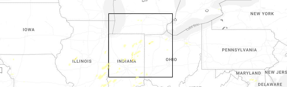
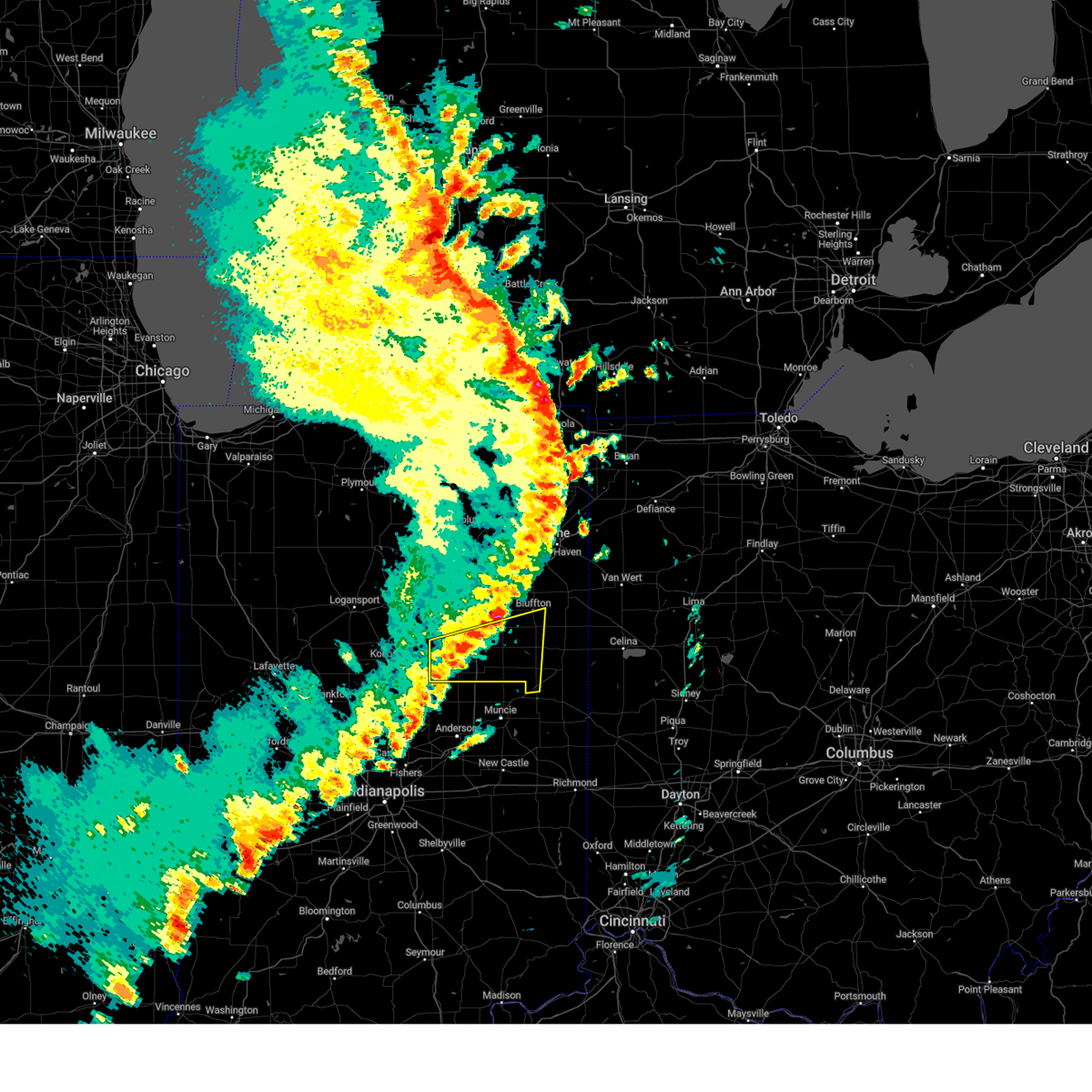
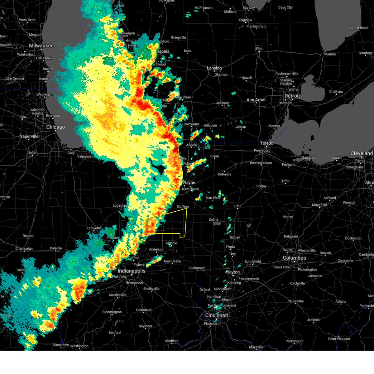
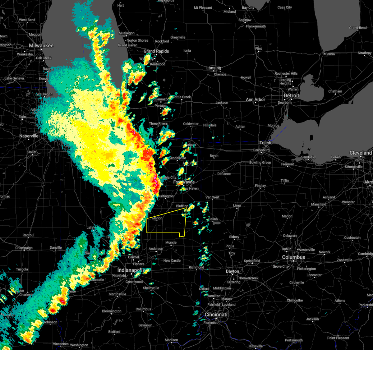
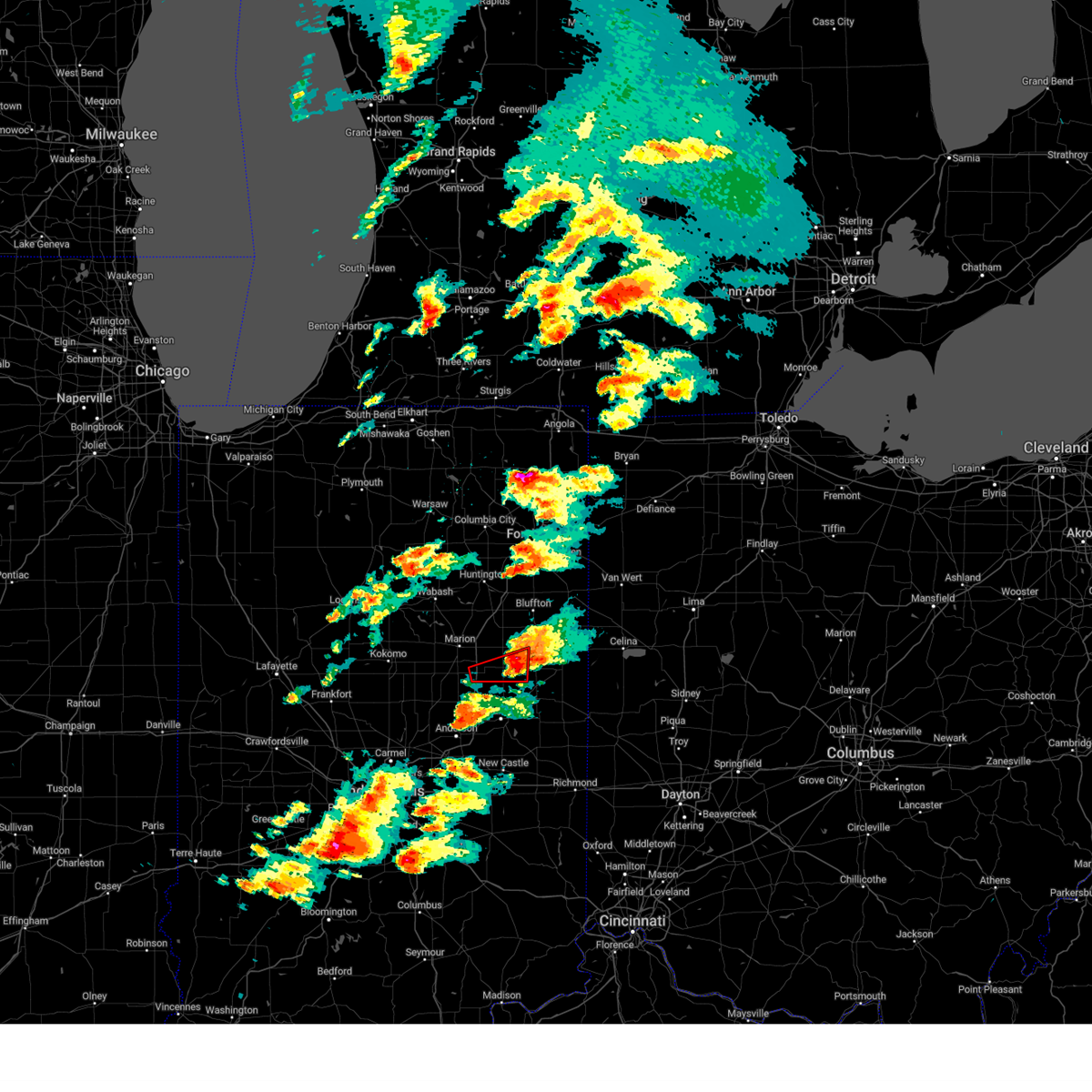
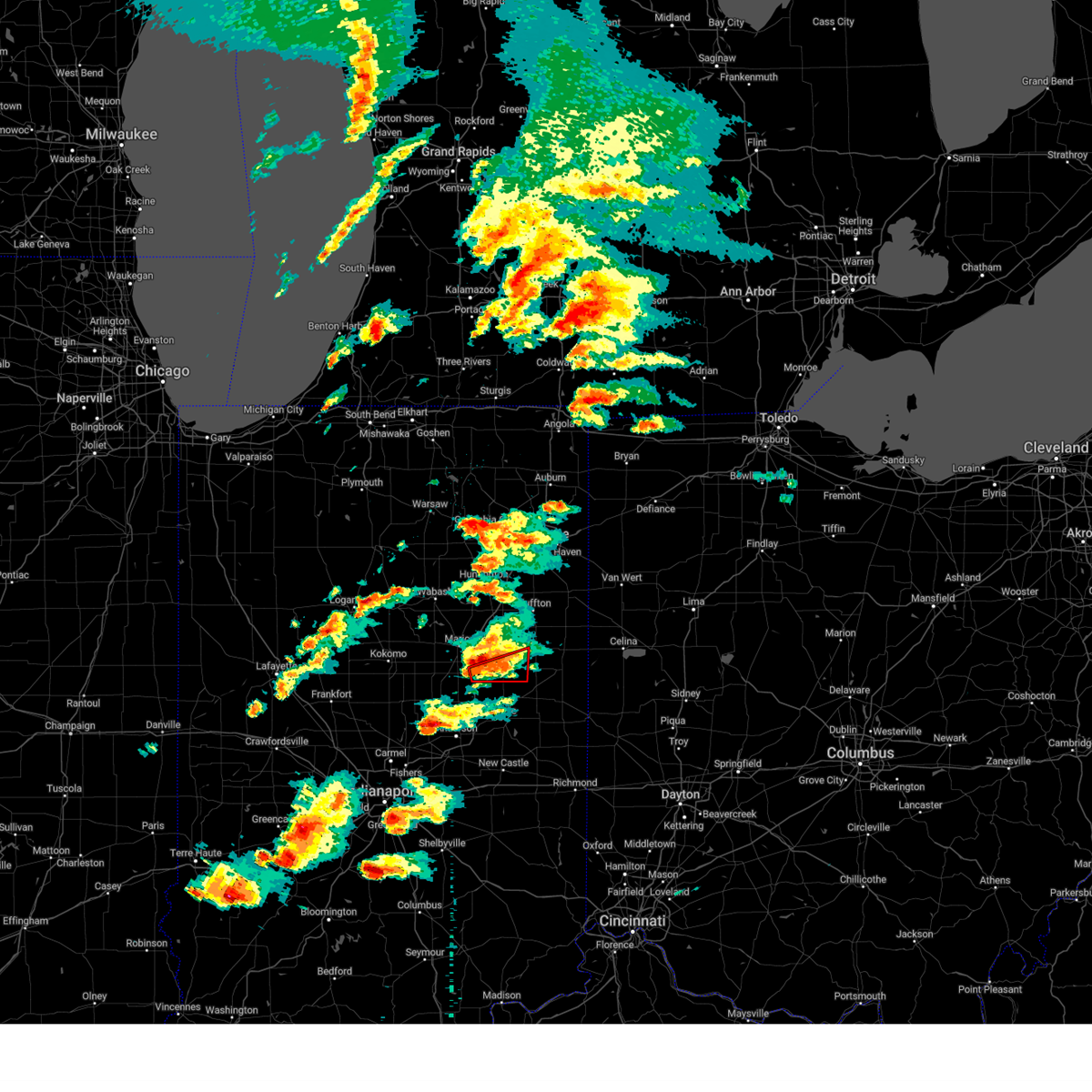
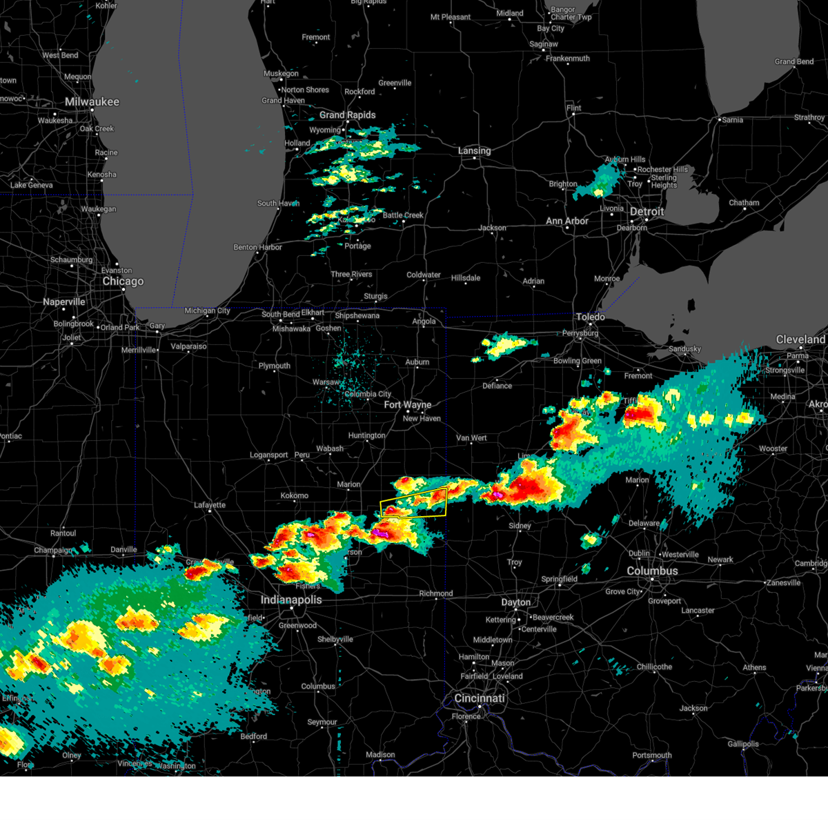
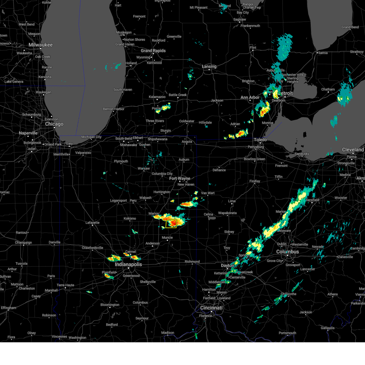
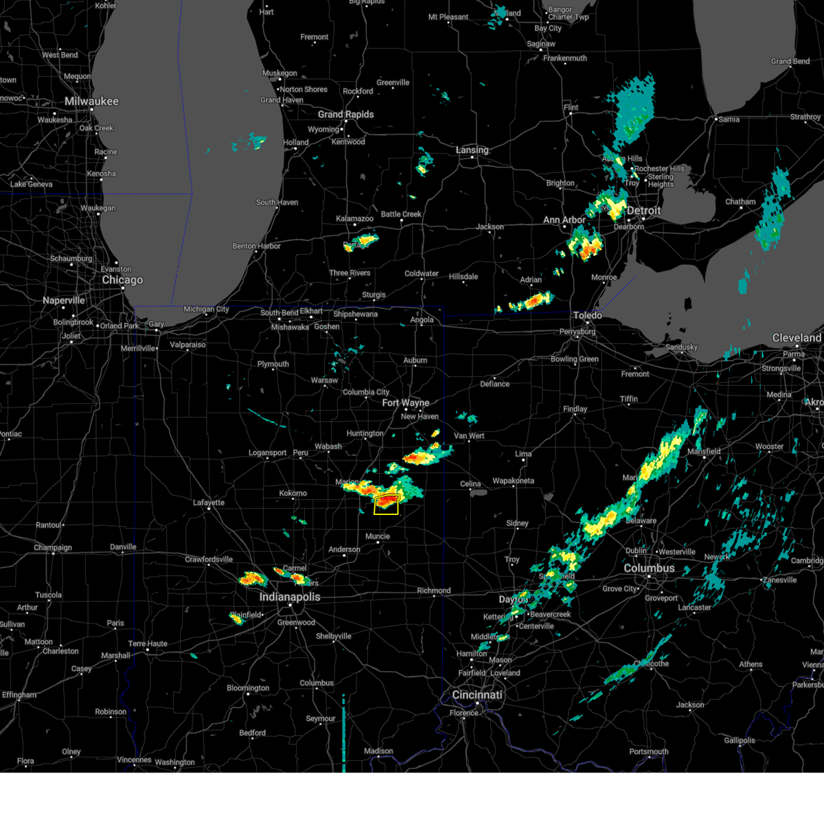
Hail Map for Hartford City, IN
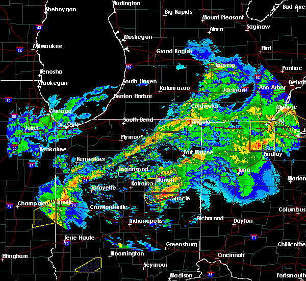
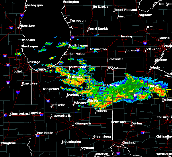
The Hartford City, IN area has had 8 reports of on-the-ground hail by trained spotters, and has been under severe weather warnings 11 times during the past 12 months. Doppler radar has detected hail at or near Hartford City, IN on 43 occasions, including 1 occasion during the past year.
| Name: | Hartford City, IN |
| Where Located: | 45.3 miles SSW of Fort Wayne, IN |
| Map: | Google Map for Hartford City, IN |
| Population: | 6220 |
| Housing Units: | 3158 |
| More Info: | Search Google for Hartford City, IN |
1
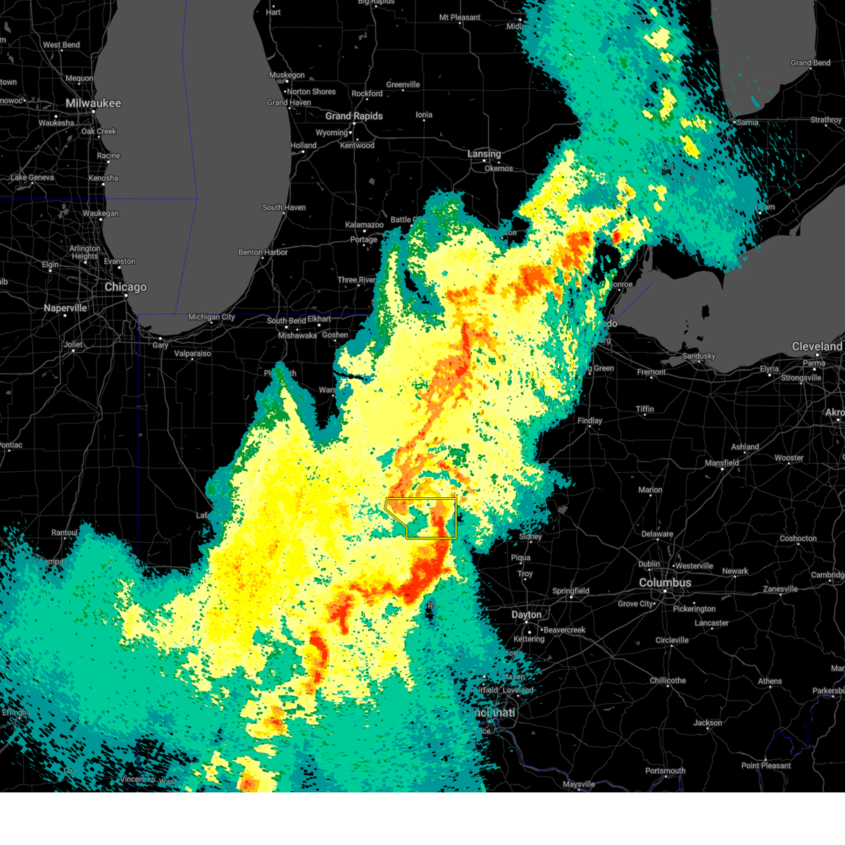
The Top Recent Hail Date for Hartford City, IN is Wednesday, June 18, 2025 (12th out of 43)
Hail and Wind Damage Spotted near Hartford City, IN
| Date / Time | Report Details |
|---|---|
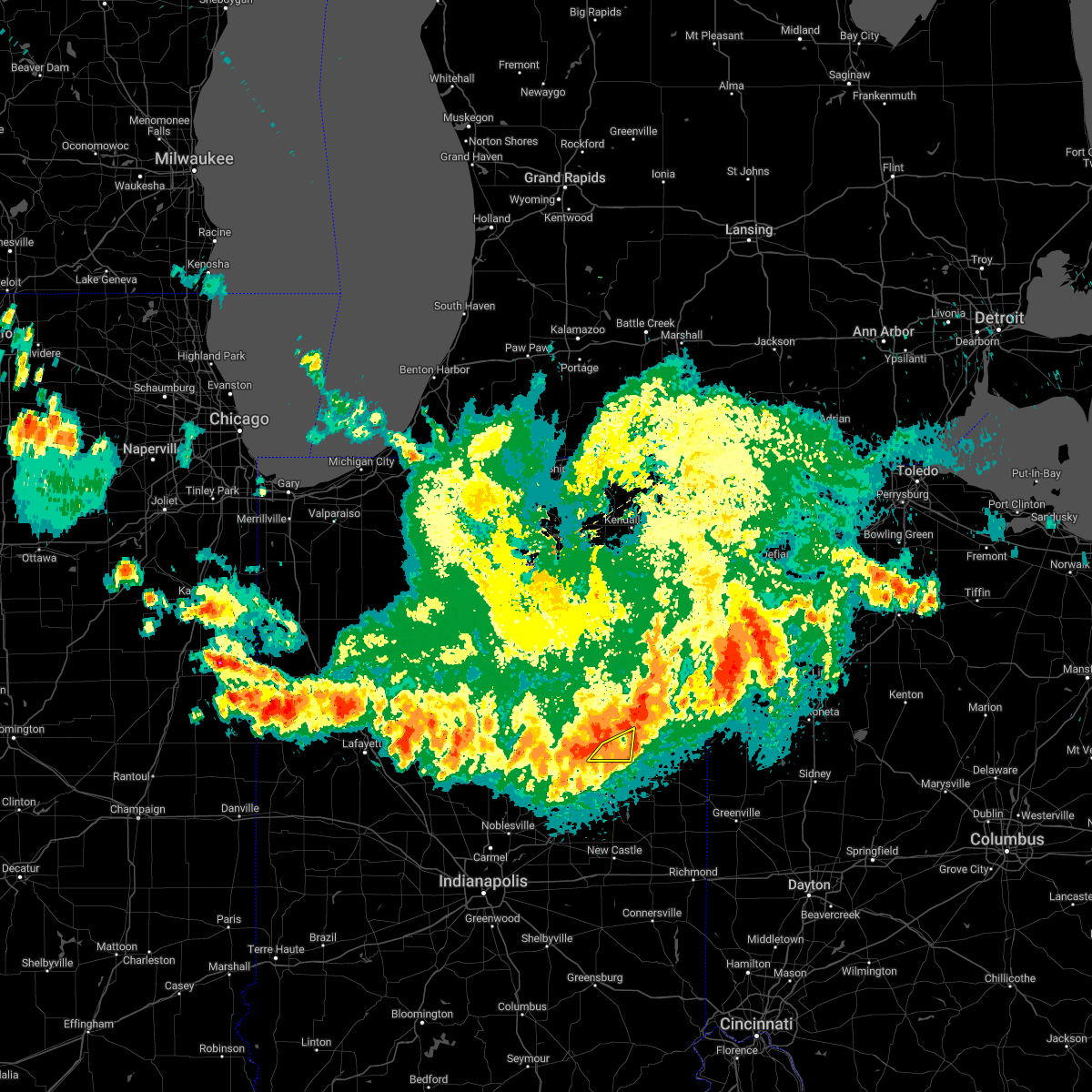
| 6/26/2025 2:55 PM EDT | Svriwx the national weather service in northern indiana has issued a * severe thunderstorm warning for, northern blackford county in east central indiana, southern wells county in northeastern indiana, southwestern adams county in northeastern indiana, northern jay county in east central indiana, * until 330 pm edt. * at 255 pm edt, a severe thunderstorm was located over montpelier, or 7 miles northeast of hartford city, moving northeast at 20 mph (radar indicated). Hazards include 60 mph wind gusts and quarter size hail. Hail damage to vehicles is expected. Expect wind damage to roofs, siding, and trees. |
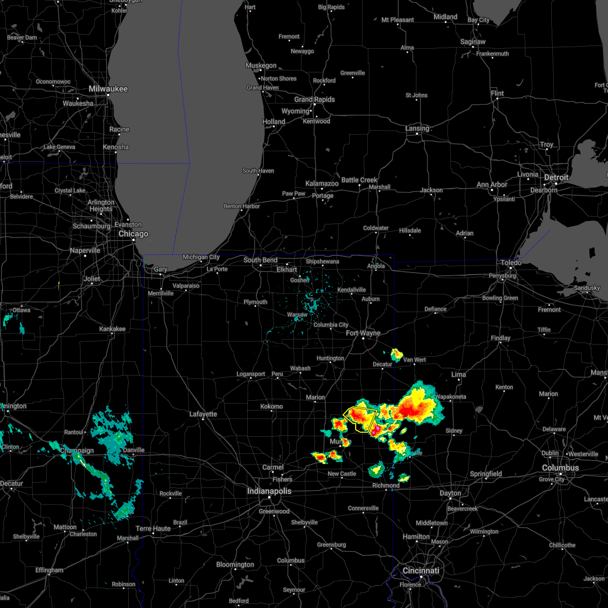
| 5/16/2025 7:41 PM EDT | Svriwx the national weather service in northern indiana has issued a * severe thunderstorm warning for, grant county in central indiana, huntington county in northeastern indiana, blackford county in east central indiana, wells county in northeastern indiana, adams county in northeastern indiana, jay county in east central indiana, * until 845 pm edt. * at 741 pm edt, severe thunderstorms were located along a line extending from la fontaine to near muncie, moving northeast at 55 mph (radar indicated). Hazards include 60 mph wind gusts. expect damage to roofs, siding, and trees |
| 4/2/2025 10:47 PM EDT | the severe thunderstorm warning has been cancelled and is no longer in effect |
| 4/2/2025 10:29 PM EDT |
 At 1027 pm edt, severe thunderstorms were located along a line extending from near montpelier to near pennville to near union city, moving east at 65 mph. these are destructive storms for locations that include portland, westchester, and boundary city (radar indicated). Hazards include 80 mph wind gusts and quarter size hail. Flying debris will be dangerous to those caught without shelter. mobile homes will be heavily damaged. expect considerable damage to roofs, windows, and vehicles. extensive tree damage and power outages are likely. Locations impacted include, westchester, portland, trinity, brice, como, bellfountain, pennville, collett, balbec, new mount pleasant, montpelier, bryant, center, redkey, college corner, boundary city, liber, blaine, new corydon, and fiat. At 1027 pm edt, severe thunderstorms were located along a line extending from near montpelier to near pennville to near union city, moving east at 65 mph. these are destructive storms for locations that include portland, westchester, and boundary city (radar indicated). Hazards include 80 mph wind gusts and quarter size hail. Flying debris will be dangerous to those caught without shelter. mobile homes will be heavily damaged. expect considerable damage to roofs, windows, and vehicles. extensive tree damage and power outages are likely. Locations impacted include, westchester, portland, trinity, brice, como, bellfountain, pennville, collett, balbec, new mount pleasant, montpelier, bryant, center, redkey, college corner, boundary city, liber, blaine, new corydon, and fiat.
|
| 4/2/2025 10:29 PM EDT |
 the severe thunderstorm warning has been cancelled and is no longer in effect the severe thunderstorm warning has been cancelled and is no longer in effect
|
| 4/2/2025 10:08 PM EDT | Law enforcement reports of a large tree downed near mill grove in blackford county in indiana. time is radar estimate in blackford county IN, 4.9 miles NW of Hartford City, IN |
| 4/2/2025 10:07 PM EDT |
 At 1005 pm edt, severe thunderstorms were located along a line extending from near jonesboro to matthews to 6 miles southeast of muncie, moving east at 65 mph. these are destructive storms for hartford city, pennville, and portland (radar indicated). Hazards include 80 mph wind gusts and quarter size hail. Flying debris will be dangerous to those caught without shelter. mobile homes will be heavily damaged. expect considerable damage to roofs, windows, and vehicles. extensive tree damage and power outages are likely. locations impacted include, westchester, gas city, portland, trinity, brice, upland, mill grove, como, bellfountain, pennville, jonesboro, collett, balbec, new mount pleasant, montpelier, bryant, center, redkey, michaelsville, and fowlerton. This includes interstate 69 in indiana between mile markers 252 and 262. At 1005 pm edt, severe thunderstorms were located along a line extending from near jonesboro to matthews to 6 miles southeast of muncie, moving east at 65 mph. these are destructive storms for hartford city, pennville, and portland (radar indicated). Hazards include 80 mph wind gusts and quarter size hail. Flying debris will be dangerous to those caught without shelter. mobile homes will be heavily damaged. expect considerable damage to roofs, windows, and vehicles. extensive tree damage and power outages are likely. locations impacted include, westchester, gas city, portland, trinity, brice, upland, mill grove, como, bellfountain, pennville, jonesboro, collett, balbec, new mount pleasant, montpelier, bryant, center, redkey, michaelsville, and fowlerton. This includes interstate 69 in indiana between mile markers 252 and 262.
|
| 4/2/2025 10:06 PM EDT | *** 1 inj *** corrects previous tstm wnd dmg report from 1 wsw mill grove. law enforcement reported a barn was blown into a house near mill grove in blackford county in in blackford county IN, 5.2 miles NW of Hartford City, IN |
| 4/2/2025 10:03 PM EDT |
 At 1000 pm edt, severe thunderstorms were located along a line extending from near swayzee to near matthews to 9 miles southwest of muncie, moving east at 65 mph (radar indicated). Hazards include 70 mph wind gusts and quarter size hail. Hail damage to vehicles is expected. expect considerable tree damage. wind damage is also likely to mobile homes, roofs, and outbuildings. locations impacted include, westchester, gas city, portland, trinity, brice, upland, mill grove, como, bellfountain, pennville, point isabel, jonesboro, collett, balbec, new mount pleasant, montpelier, bryant, center, redkey, and michaelsville. This includes interstate 69 in indiana between mile markers 252 and 262. At 1000 pm edt, severe thunderstorms were located along a line extending from near swayzee to near matthews to 9 miles southwest of muncie, moving east at 65 mph (radar indicated). Hazards include 70 mph wind gusts and quarter size hail. Hail damage to vehicles is expected. expect considerable tree damage. wind damage is also likely to mobile homes, roofs, and outbuildings. locations impacted include, westchester, gas city, portland, trinity, brice, upland, mill grove, como, bellfountain, pennville, point isabel, jonesboro, collett, balbec, new mount pleasant, montpelier, bryant, center, redkey, and michaelsville. This includes interstate 69 in indiana between mile markers 252 and 262.
|
| 4/2/2025 9:57 PM EDT | Svriwx the national weather service in northern indiana has issued a * severe thunderstorm warning for, southern grant county in central indiana, blackford county in east central indiana, jay county in east central indiana, * until 1100 pm edt. * at 957 pm edt, severe thunderstorms were located along a line extending from near swayzee to near fairmount to 9 miles east of anderson, moving east at 65 mph (radar indicated). Hazards include 70 mph wind gusts and quarter size hail. Hail damage to vehicles is expected. expect considerable tree damage. Wind damage is also likely to mobile homes, roofs, and outbuildings. |
| 3/30/2025 5:41 PM EDT |
 The storms which prompted the warning have weakened below severe limits, and no longer pose an immediate threat to life or property. therefore, the warning will be allowed to expire. however, gusty winds and heavy rain are still possible with these thunderstorms. a tornado watch remains in effect until 800 pm edt for central, northeastern and east central indiana. The storms which prompted the warning have weakened below severe limits, and no longer pose an immediate threat to life or property. therefore, the warning will be allowed to expire. however, gusty winds and heavy rain are still possible with these thunderstorms. a tornado watch remains in effect until 800 pm edt for central, northeastern and east central indiana.
|
| 3/30/2025 5:26 PM EDT |
 At 526 pm edt, severe thunderstorms were located along a line extending from near van buren to near fairmount, moving east at 60 mph (radar indicated). Hazards include 60 mph wind gusts. Expect damage to roofs, siding, and trees. locations impacted include, nottingham, mcnatts, landess, wellsburg, liberty center, mill grove, herbst, buckeye, point isabel, swayzee, home corner, fowlerton, hartford city, dillman, petroleum, shamrock lakes, matthews, hanfield, sweetser, and sims. This includes interstate 69 in indiana between mile markers 252 and 272. At 526 pm edt, severe thunderstorms were located along a line extending from near van buren to near fairmount, moving east at 60 mph (radar indicated). Hazards include 60 mph wind gusts. Expect damage to roofs, siding, and trees. locations impacted include, nottingham, mcnatts, landess, wellsburg, liberty center, mill grove, herbst, buckeye, point isabel, swayzee, home corner, fowlerton, hartford city, dillman, petroleum, shamrock lakes, matthews, hanfield, sweetser, and sims. This includes interstate 69 in indiana between mile markers 252 and 272.
|
| 3/30/2025 5:01 PM EDT |
 Svriwx the national weather service in northern indiana has issued a * severe thunderstorm warning for, grant county in central indiana, southeastern huntington county in northeastern indiana, blackford county in east central indiana, southern wells county in northeastern indiana, western jay county in east central indiana, * until 545 pm edt. * at 501 pm edt, severe thunderstorms were located along a line extending from 7 miles east of kokomo to near tipton, moving east at 60 mph (radar indicated). Hazards include 60 mph wind gusts. expect damage to roofs, siding, and trees Svriwx the national weather service in northern indiana has issued a * severe thunderstorm warning for, grant county in central indiana, southeastern huntington county in northeastern indiana, blackford county in east central indiana, southern wells county in northeastern indiana, western jay county in east central indiana, * until 545 pm edt. * at 501 pm edt, severe thunderstorms were located along a line extending from 7 miles east of kokomo to near tipton, moving east at 60 mph (radar indicated). Hazards include 60 mph wind gusts. expect damage to roofs, siding, and trees
|
| 5/24/2024 7:30 PM EDT | Report of small tree limbs down due to estimated 40 mph gust in blackford county IN, 0.2 miles NNW of Hartford City, IN |
| 5/7/2024 6:54 PM EDT |
 The tornado threat has diminished and the tornado warning has been cancelled. however, large hail and damaging winds remain likely and a severe thunderstorm warning remains in effect for the area. a tornado watch remains in effect until 900 pm edt for central indiana. a tornado watch also remains in effect until 1100 pm edt for east central indiana. The tornado threat has diminished and the tornado warning has been cancelled. however, large hail and damaging winds remain likely and a severe thunderstorm warning remains in effect for the area. a tornado watch remains in effect until 900 pm edt for central indiana. a tornado watch also remains in effect until 1100 pm edt for east central indiana.
|
| 5/7/2024 6:53 PM EDT |
 Svriwx the national weather service in northern indiana has issued a * severe thunderstorm warning for, blackford county in east central indiana, southeastern wells county in northeastern indiana, southwestern adams county in northeastern indiana, northwestern jay county in east central indiana, * until 730 pm edt. * at 653 pm edt, a severe thunderstorm was located near montpelier, or near hartford city, moving east at 35 mph (radar indicated). Hazards include 60 mph wind gusts and quarter size hail. Hail damage to vehicles is expected. Expect wind damage to roofs, siding, and trees. Svriwx the national weather service in northern indiana has issued a * severe thunderstorm warning for, blackford county in east central indiana, southeastern wells county in northeastern indiana, southwestern adams county in northeastern indiana, northwestern jay county in east central indiana, * until 730 pm edt. * at 653 pm edt, a severe thunderstorm was located near montpelier, or near hartford city, moving east at 35 mph (radar indicated). Hazards include 60 mph wind gusts and quarter size hail. Hail damage to vehicles is expected. Expect wind damage to roofs, siding, and trees.
|
| 5/7/2024 6:33 PM EDT |
 Toriwx the national weather service in northern indiana has issued a * tornado warning for, southeastern grant county in central indiana, blackford county in east central indiana, * until 700 pm edt. * at 632 pm edt, a severe thunderstorm capable of producing a tornado was located near upland, moving east at 40 mph (radar indicated rotation). Hazards include tornado and quarter size hail. Flying debris will be dangerous to those caught without shelter. mobile homes will be damaged or destroyed. damage to roofs, windows, and vehicles will occur. tree damage is likely. this dangerous storm will be near, hartford city and upland around 640 pm edt. other locations impacted by this tornadic thunderstorm include shamrock lakes, trenton, fowlerton, and mill grove. This includes interstate 69 in indiana between mile markers 253 and 257. Toriwx the national weather service in northern indiana has issued a * tornado warning for, southeastern grant county in central indiana, blackford county in east central indiana, * until 700 pm edt. * at 632 pm edt, a severe thunderstorm capable of producing a tornado was located near upland, moving east at 40 mph (radar indicated rotation). Hazards include tornado and quarter size hail. Flying debris will be dangerous to those caught without shelter. mobile homes will be damaged or destroyed. damage to roofs, windows, and vehicles will occur. tree damage is likely. this dangerous storm will be near, hartford city and upland around 640 pm edt. other locations impacted by this tornadic thunderstorm include shamrock lakes, trenton, fowlerton, and mill grove. This includes interstate 69 in indiana between mile markers 253 and 257.
|
| 4/17/2024 12:47 PM EDT | Quarter sized hail reported 0.2 miles NNW of Hartford City, IN, several pictures and reports of hail up to at least the size of quarters in and around hartford city. |
| 4/17/2024 12:45 PM EDT |
 At 1245 pm edt, severe thunderstorms were located along a line extending from 7 miles north of montpelier to near matthews, moving northeast at 35 mph (radar indicated). Hazards include 60 mph wind gusts and half dollar size hail. Hail damage to vehicles is expected. expect wind damage to roofs, siding, and trees. Locations impacted include, hartford city, berne, dunkirk, montpelier, pennville, nottingham, shamrock lakes, dillman, mill grove, petroleum, keystone, linn grove, domestic, fiat, balbec, and trenton. At 1245 pm edt, severe thunderstorms were located along a line extending from 7 miles north of montpelier to near matthews, moving northeast at 35 mph (radar indicated). Hazards include 60 mph wind gusts and half dollar size hail. Hail damage to vehicles is expected. expect wind damage to roofs, siding, and trees. Locations impacted include, hartford city, berne, dunkirk, montpelier, pennville, nottingham, shamrock lakes, dillman, mill grove, petroleum, keystone, linn grove, domestic, fiat, balbec, and trenton.
|
| 4/17/2024 12:45 PM EDT |
 the severe thunderstorm warning has been cancelled and is no longer in effect the severe thunderstorm warning has been cancelled and is no longer in effect
|
| 4/17/2024 12:35 PM EDT |
 At 1235 pm edt, severe thunderstorms were located along a line extending from near montpelier to near matthews, moving northeast at 40 mph (radar indicated). Hazards include 60 mph wind gusts and half dollar size hail. Hail damage to vehicles is expected. expect wind damage to roofs, siding, and trees. locations impacted include, hartford city, berne, upland, dunkirk, montpelier, pennville, matthews, nottingham, fowlerton, shamrock lakes, dillman, mill grove, petroleum, keystone, linn grove, domestic, fiat, balbec, trenton, and roll. This includes interstate 69 in indiana between mile markers 252 and 259. At 1235 pm edt, severe thunderstorms were located along a line extending from near montpelier to near matthews, moving northeast at 40 mph (radar indicated). Hazards include 60 mph wind gusts and half dollar size hail. Hail damage to vehicles is expected. expect wind damage to roofs, siding, and trees. locations impacted include, hartford city, berne, upland, dunkirk, montpelier, pennville, matthews, nottingham, fowlerton, shamrock lakes, dillman, mill grove, petroleum, keystone, linn grove, domestic, fiat, balbec, trenton, and roll. This includes interstate 69 in indiana between mile markers 252 and 259.
|
| 4/17/2024 12:28 PM EDT |
 Svriwx the national weather service in northern indiana has issued a * severe thunderstorm warning for, eastern grant county in central indiana, blackford county in east central indiana, southern wells county in northeastern indiana, southwestern adams county in northeastern indiana, northwestern jay county in east central indiana, * until 115 pm edt. * at 1228 pm edt, severe thunderstorms were located along a line extending from near van buren to near alexandria, moving northeast at 40 mph (radar indicated). Hazards include 60 mph wind gusts and nickel size hail. expect damage to roofs, siding, and trees Svriwx the national weather service in northern indiana has issued a * severe thunderstorm warning for, eastern grant county in central indiana, blackford county in east central indiana, southern wells county in northeastern indiana, southwestern adams county in northeastern indiana, northwestern jay county in east central indiana, * until 115 pm edt. * at 1228 pm edt, severe thunderstorms were located along a line extending from near van buren to near alexandria, moving northeast at 40 mph (radar indicated). Hazards include 60 mph wind gusts and nickel size hail. expect damage to roofs, siding, and trees
|
| 3/14/2024 7:30 PM EDT | Quarter sized hail reported 4.8 miles W of Hartford City, IN |
| 3/14/2024 7:28 PM EDT |
 Svriwx the national weather service in northern indiana has issued a * severe thunderstorm warning for, southeastern blackford county in east central indiana, jay county in east central indiana, * until 800 pm edt. * at 728 pm edt, a severe thunderstorm was located near dunkirk, moving east at 60 mph (radar indicated). Hazards include ping pong ball size hail and 60 mph wind gusts. People and animals outdoors will be injured. expect hail damage to roofs, siding, windows, and vehicles. Expect wind damage to roofs, siding, and trees. Svriwx the national weather service in northern indiana has issued a * severe thunderstorm warning for, southeastern blackford county in east central indiana, jay county in east central indiana, * until 800 pm edt. * at 728 pm edt, a severe thunderstorm was located near dunkirk, moving east at 60 mph (radar indicated). Hazards include ping pong ball size hail and 60 mph wind gusts. People and animals outdoors will be injured. expect hail damage to roofs, siding, windows, and vehicles. Expect wind damage to roofs, siding, and trees.
|
| 3/14/2024 6:41 PM EDT |
 At 641 pm edt, a severe thunderstorm was located near van buren, or near upland, moving east at 45 mph (radar indicated). Hazards include 60 mph wind gusts and quarter size hail. Hail damage to vehicles is expected. expect wind damage to roofs, siding, and trees. locations impacted include, marion, hartford city, gas city, upland, montpelier, jonesboro, home corner, roll, lake wood, and arcana. This includes interstate 69 in indiana between mile markers 258 and 266. At 641 pm edt, a severe thunderstorm was located near van buren, or near upland, moving east at 45 mph (radar indicated). Hazards include 60 mph wind gusts and quarter size hail. Hail damage to vehicles is expected. expect wind damage to roofs, siding, and trees. locations impacted include, marion, hartford city, gas city, upland, montpelier, jonesboro, home corner, roll, lake wood, and arcana. This includes interstate 69 in indiana between mile markers 258 and 266.
|
| 3/14/2024 6:32 PM EDT |
 At 632 pm edt, a severe thunderstorm was located near gas city, moving east at 45 mph (radar indicated). Hazards include 60 mph wind gusts and quarter size hail. Hail damage to vehicles is expected. expect wind damage to roofs, siding, and trees. locations impacted include, marion, hartford city, gas city, upland, montpelier, jonesboro, home corner, roll, lake wood, and arcana. This includes interstate 69 in indiana between mile markers 258 and 266. At 632 pm edt, a severe thunderstorm was located near gas city, moving east at 45 mph (radar indicated). Hazards include 60 mph wind gusts and quarter size hail. Hail damage to vehicles is expected. expect wind damage to roofs, siding, and trees. locations impacted include, marion, hartford city, gas city, upland, montpelier, jonesboro, home corner, roll, lake wood, and arcana. This includes interstate 69 in indiana between mile markers 258 and 266.
|
| 3/14/2024 6:23 PM EDT |
 Svriwx the national weather service in northern indiana has issued a * severe thunderstorm warning for, central grant county in central indiana, northwestern blackford county in east central indiana, southwestern wells county in northeastern indiana, * until 700 pm edt. * at 623 pm edt, a severe thunderstorm was located over marion, moving east at 45 mph (radar indicated). Hazards include 60 mph wind gusts and quarter size hail. Hail damage to vehicles is expected. Expect wind damage to roofs, siding, and trees. Svriwx the national weather service in northern indiana has issued a * severe thunderstorm warning for, central grant county in central indiana, northwestern blackford county in east central indiana, southwestern wells county in northeastern indiana, * until 700 pm edt. * at 623 pm edt, a severe thunderstorm was located over marion, moving east at 45 mph (radar indicated). Hazards include 60 mph wind gusts and quarter size hail. Hail damage to vehicles is expected. Expect wind damage to roofs, siding, and trees.
|
| 8/17/2023 7:21 PM EDT |
 The severe thunderstorm warning for southern blackford county will expire at 730 pm edt, the storms which prompted the warning have weakened below severe limits, and have exited the warned area. therefore, the warning will be allowed to expire. gusty winds to 40 to 50 mph will be possible through 735 pm edt across southeast blackford county with lingering thunderstorms. The severe thunderstorm warning for southern blackford county will expire at 730 pm edt, the storms which prompted the warning have weakened below severe limits, and have exited the warned area. therefore, the warning will be allowed to expire. gusty winds to 40 to 50 mph will be possible through 735 pm edt across southeast blackford county with lingering thunderstorms.
|
| 8/17/2023 7:10 PM EDT |
 At 710 pm edt, severe thunderstorms were located along a line extending from near pennville to near hartford city, moving southeast at 35 mph (radar indicated). Hazards include 60 mph wind gusts. Expect damage to roofs, siding, and trees. locations impacted include, hartford city, trenton, and mill grove. hail threat, radar indicated max hail size, <. 75 in wind threat, radar indicated max wind gust, 60 mph. At 710 pm edt, severe thunderstorms were located along a line extending from near pennville to near hartford city, moving southeast at 35 mph (radar indicated). Hazards include 60 mph wind gusts. Expect damage to roofs, siding, and trees. locations impacted include, hartford city, trenton, and mill grove. hail threat, radar indicated max hail size, <. 75 in wind threat, radar indicated max wind gust, 60 mph.
|
| 8/17/2023 6:55 PM EDT |
 At 655 pm edt, severe thunderstorms were located along a line extending from montpelier to near gas city, moving southeast at 30 mph (radar indicated). Hazards include 60 mph wind gusts and quarter size hail. Hail damage to vehicles is expected. Expect wind damage to roofs, siding, and trees. At 655 pm edt, severe thunderstorms were located along a line extending from montpelier to near gas city, moving southeast at 30 mph (radar indicated). Hazards include 60 mph wind gusts and quarter size hail. Hail damage to vehicles is expected. Expect wind damage to roofs, siding, and trees.
|
| 8/5/2023 7:53 PM EDT |
 The severe thunderstorm warning for grant, western blackford and southwestern wells counties will expire at 800 pm edt, the storm which prompted the warning has weakened below severe limits, and no longer poses an immediate threat to life or property. therefore, the warning will be allowed to expire. however, heavy rain is still possible with this thunderstorm. The severe thunderstorm warning for grant, western blackford and southwestern wells counties will expire at 800 pm edt, the storm which prompted the warning has weakened below severe limits, and no longer poses an immediate threat to life or property. therefore, the warning will be allowed to expire. however, heavy rain is still possible with this thunderstorm.
|
| 8/5/2023 7:39 PM EDT |
 At 739 pm edt, a severe thunderstorm was located near upland, moving northeast at 25 mph (radar indicated). Hazards include 60 mph wind gusts. Expect damage to roofs, siding, and trees. locations impacted include, marion, hartford city, gas city, upland, fairmount, jonesboro, swayzee, van buren, matthews, sims, fowlerton, shamrock lakes, landess, herbst, point isabel, roseburg, home corner, michaelsville, normal, and hanfield. This includes interstate 69 in indiana between mile markers 253 and 271. At 739 pm edt, a severe thunderstorm was located near upland, moving northeast at 25 mph (radar indicated). Hazards include 60 mph wind gusts. Expect damage to roofs, siding, and trees. locations impacted include, marion, hartford city, gas city, upland, fairmount, jonesboro, swayzee, van buren, matthews, sims, fowlerton, shamrock lakes, landess, herbst, point isabel, roseburg, home corner, michaelsville, normal, and hanfield. This includes interstate 69 in indiana between mile markers 253 and 271.
|
| 8/5/2023 7:17 PM EDT |
 At 717 pm edt, a severe thunderstorm was located near fairmount, moving northeast at 25 mph (radar indicated). Hazards include 60 mph wind gusts. expect damage to roofs, siding, and trees At 717 pm edt, a severe thunderstorm was located near fairmount, moving northeast at 25 mph (radar indicated). Hazards include 60 mph wind gusts. expect damage to roofs, siding, and trees
|
| 7/29/2023 2:49 AM EDT |
 At 248 am edt, severe thunderstorms were located along a line extending from near huntington to near windfall, moving east at 55 mph (radar indicated). Hazards include 60 mph wind gusts. Expect damage to roofs, siding, and trees. locations impacted include, marion, hartford city, gas city, upland, fairmount, montpelier, jonesboro, sweetser, swayzee, la fontaine, van buren, matthews, warren, fowlerton, shamrock lakes, poneto, mcnatts, landess, wellsburg, and liberty center. this includes interstate 69 in indiana between mile markers 252 and 278. hail threat, radar indicated max hail size, <. 75 in wind threat, radar indicated max wind gust, 60 mph. At 248 am edt, severe thunderstorms were located along a line extending from near huntington to near windfall, moving east at 55 mph (radar indicated). Hazards include 60 mph wind gusts. Expect damage to roofs, siding, and trees. locations impacted include, marion, hartford city, gas city, upland, fairmount, montpelier, jonesboro, sweetser, swayzee, la fontaine, van buren, matthews, warren, fowlerton, shamrock lakes, poneto, mcnatts, landess, wellsburg, and liberty center. this includes interstate 69 in indiana between mile markers 252 and 278. hail threat, radar indicated max hail size, <. 75 in wind threat, radar indicated max wind gust, 60 mph.
|
| 7/29/2023 2:27 AM EDT |
 At 226 am edt, severe thunderstorms were located along a line extending from near wabash to 11 miles southwest of kokomo, moving east at 55 mph (radar indicated). Hazards include 60 mph wind gusts. expect damage to roofs, siding, and trees At 226 am edt, severe thunderstorms were located along a line extending from near wabash to 11 miles southwest of kokomo, moving east at 55 mph (radar indicated). Hazards include 60 mph wind gusts. expect damage to roofs, siding, and trees
|
| 4/5/2023 1:36 PM EDT |
 The severe thunderstorm warning for southern allen, southeastern grant, blackford, southeastern huntington, wells, adams and jay counties will expire at 145 pm edt, the storms which prompted the warning have moved out of the area. therefore, the warning will be allowed to expire. a tornado watch remains in effect until 400 pm edt for northeastern and east central indiana, and west central ohio. The severe thunderstorm warning for southern allen, southeastern grant, blackford, southeastern huntington, wells, adams and jay counties will expire at 145 pm edt, the storms which prompted the warning have moved out of the area. therefore, the warning will be allowed to expire. a tornado watch remains in effect until 400 pm edt for northeastern and east central indiana, and west central ohio.
|
| 4/5/2023 1:13 PM EDT |
 At 113 pm edt, severe thunderstorms were located along a line extending from near new haven to near hartford city, moving northeast at 80 mph (radar indicated). Hazards include 60 mph wind gusts. Expect damage to roofs, siding, and trees. locations impacted include, fort wayne, new haven, bluffton, decatur, portland, hartford city, berne, ossian, dunkirk, montpelier, woodburn, redkey, geneva, monroeville, markle, monroe, pennville, matthews, westchester and center. this includes the following highways, interstate 469 between mile markers 0 and 7, and between mile markers 9 and 23. Interstate 69 in indiana between mile markers 299 and 302, and between mile markers 304 and 306. At 113 pm edt, severe thunderstorms were located along a line extending from near new haven to near hartford city, moving northeast at 80 mph (radar indicated). Hazards include 60 mph wind gusts. Expect damage to roofs, siding, and trees. locations impacted include, fort wayne, new haven, bluffton, decatur, portland, hartford city, berne, ossian, dunkirk, montpelier, woodburn, redkey, geneva, monroeville, markle, monroe, pennville, matthews, westchester and center. this includes the following highways, interstate 469 between mile markers 0 and 7, and between mile markers 9 and 23. Interstate 69 in indiana between mile markers 299 and 302, and between mile markers 304 and 306.
|
| 4/5/2023 12:54 PM EDT |
 At 1254 pm edt, severe thunderstorms were located along a line extending from near markle to alexandria, moving northeast at 80 mph (radar indicated). Hazards include 60 mph wind gusts. expect damage to roofs, siding, and trees At 1254 pm edt, severe thunderstorms were located along a line extending from near markle to alexandria, moving northeast at 80 mph (radar indicated). Hazards include 60 mph wind gusts. expect damage to roofs, siding, and trees
|
| 7/23/2022 9:45 AM EDT |
 At 945 am edt, severe thunderstorms were located along a line extending from near hartford city to 6 miles east of alexandria, moving south at 40 mph (radar indicated). Hazards include 70 mph wind gusts. Expect considerable tree damage. damage is likely to mobile homes, roofs, and outbuildings. locations impacted include, hartford city, matthews, shamrock lakes and mill grove. thunderstorm damage threat, considerable hail threat, radar indicated max hail size, <. 75 in wind threat, radar indicated max wind gust, 70 mph. At 945 am edt, severe thunderstorms were located along a line extending from near hartford city to 6 miles east of alexandria, moving south at 40 mph (radar indicated). Hazards include 70 mph wind gusts. Expect considerable tree damage. damage is likely to mobile homes, roofs, and outbuildings. locations impacted include, hartford city, matthews, shamrock lakes and mill grove. thunderstorm damage threat, considerable hail threat, radar indicated max hail size, <. 75 in wind threat, radar indicated max wind gust, 70 mph.
|
| 7/23/2022 9:30 AM EDT |
 At 930 am edt, severe thunderstorms were located along a line extending from near montpelier to near fairmount, moving southeast at 50 mph (radar indicated). Hazards include 70 mph wind gusts. Expect considerable tree damage. damage is likely to mobile homes, roofs, and outbuildings. locations impacted include, marion, hartford city, gas city, upland, fairmount, montpelier, jonesboro, van buren, matthews, fowlerton, shamrock lakes, mcnatts, landess, mill grove, point isabel, roseburg, home corner, michaelsville, normal and hackleman. this includes interstate 69 in indiana between mile markers 252 and 269. thunderstorm damage threat, considerable hail threat, radar indicated max hail size, <. 75 in wind threat, radar indicated max wind gust, 70 mph. At 930 am edt, severe thunderstorms were located along a line extending from near montpelier to near fairmount, moving southeast at 50 mph (radar indicated). Hazards include 70 mph wind gusts. Expect considerable tree damage. damage is likely to mobile homes, roofs, and outbuildings. locations impacted include, marion, hartford city, gas city, upland, fairmount, montpelier, jonesboro, van buren, matthews, fowlerton, shamrock lakes, mcnatts, landess, mill grove, point isabel, roseburg, home corner, michaelsville, normal and hackleman. this includes interstate 69 in indiana between mile markers 252 and 269. thunderstorm damage threat, considerable hail threat, radar indicated max hail size, <. 75 in wind threat, radar indicated max wind gust, 70 mph.
|
| 7/23/2022 9:04 AM EDT |
 At 904 am edt, severe thunderstorms were located along a line extending from near andrews to near la fontaine to near kokomo, moving south at 40 mph (radar indicated). Hazards include 70 mph wind gusts. Expect considerable tree damage. Damage is likely to mobile homes, roofs, and outbuildings. At 904 am edt, severe thunderstorms were located along a line extending from near andrews to near la fontaine to near kokomo, moving south at 40 mph (radar indicated). Hazards include 70 mph wind gusts. Expect considerable tree damage. Damage is likely to mobile homes, roofs, and outbuildings.
|
| 3/6/2022 3:16 AM EST |
 At 315 am est, severe thunderstorms were located along a line extending from near van buren to elwood, moving east at 60 mph (radar indicated). Hazards include 60 mph wind gusts. Expect damage to roofs, siding, and trees. locations impacted include, marion, hartford city, gas city, upland, fairmount, dunkirk, montpelier, jonesboro, redkey, pennville, matthews, nottingham, fowlerton, shamrock lakes, mill grove, herbst, keystone, point isabel, roseburg and balbec. This includes interstate 69 in indiana between mile markers 252 and 266. At 315 am est, severe thunderstorms were located along a line extending from near van buren to elwood, moving east at 60 mph (radar indicated). Hazards include 60 mph wind gusts. Expect damage to roofs, siding, and trees. locations impacted include, marion, hartford city, gas city, upland, fairmount, dunkirk, montpelier, jonesboro, redkey, pennville, matthews, nottingham, fowlerton, shamrock lakes, mill grove, herbst, keystone, point isabel, roseburg and balbec. This includes interstate 69 in indiana between mile markers 252 and 266.
|
| 3/6/2022 2:53 AM EST |
 At 253 am est, severe thunderstorms were located along a line extending from near sweetser to 6 miles northwest of noblesville, moving east at 60 mph (radar indicated). Hazards include 60 mph wind gusts. expect damage to roofs, siding, and trees At 253 am est, severe thunderstorms were located along a line extending from near sweetser to 6 miles northwest of noblesville, moving east at 60 mph (radar indicated). Hazards include 60 mph wind gusts. expect damage to roofs, siding, and trees
|
| 12/11/2021 1:36 AM EST | Time estimated by rada in blackford county IN, 0.2 miles NNW of Hartford City, IN |
| 9/14/2021 9:09 PM EDT |
 At 909 pm edt, a severe thunderstorm was located near van buren, or near upland, moving east at 30 mph (radar indicated). Hazards include 60 mph wind gusts and penny size hail. Expect damage to roofs, siding, and trees. locations impacted include, marion, hartford city, gas city, upland, montpelier, jonesboro, sweetser, swayzee, van buren, sims, converse, poneto, mcnatts, landess, mount zion, mier, herbst, keystone, roseburg and home corner. this includes interstate 69 in indiana between mile markers 257 and 270. hail threat, radar indicated max hail size, 0. 75 in wind threat, radar indicated max wind gust, 60 mph. At 909 pm edt, a severe thunderstorm was located near van buren, or near upland, moving east at 30 mph (radar indicated). Hazards include 60 mph wind gusts and penny size hail. Expect damage to roofs, siding, and trees. locations impacted include, marion, hartford city, gas city, upland, montpelier, jonesboro, sweetser, swayzee, van buren, sims, converse, poneto, mcnatts, landess, mount zion, mier, herbst, keystone, roseburg and home corner. this includes interstate 69 in indiana between mile markers 257 and 270. hail threat, radar indicated max hail size, 0. 75 in wind threat, radar indicated max wind gust, 60 mph.
|
| 9/14/2021 8:46 PM EDT |
 At 846 pm edt, a severe thunderstorm was located over marion, moving east at 30 mph (law enforcement). Hazards include 60 mph wind gusts and penny size hail. expect damage to roofs, siding, and trees At 846 pm edt, a severe thunderstorm was located over marion, moving east at 30 mph (law enforcement). Hazards include 60 mph wind gusts and penny size hail. expect damage to roofs, siding, and trees
|
| 8/11/2021 2:37 PM EDT |
 At 237 pm edt, severe thunderstorms were located along a line extending from near portland to near dunkirk to near alexandria, moving southeast at 40 mph (radar indicated). Hazards include 60 mph wind gusts and penny size hail. Expect damage to roofs, siding, and trees. locations impacted include, marion, portland, hartford city, gas city, upland, fairmount, dunkirk, montpelier, jonesboro, redkey, van buren, pennville, matthews, center, warren, nottingham, fowlerton, shamrock lakes, salamonia and mcnatts. this includes interstate 69 in indiana between mile markers 252 and 275. hail threat, radar indicated max hail size, 0. 75 in wind threat, radar indicated max wind gust, 60 mph. At 237 pm edt, severe thunderstorms were located along a line extending from near portland to near dunkirk to near alexandria, moving southeast at 40 mph (radar indicated). Hazards include 60 mph wind gusts and penny size hail. Expect damage to roofs, siding, and trees. locations impacted include, marion, portland, hartford city, gas city, upland, fairmount, dunkirk, montpelier, jonesboro, redkey, van buren, pennville, matthews, center, warren, nottingham, fowlerton, shamrock lakes, salamonia and mcnatts. this includes interstate 69 in indiana between mile markers 252 and 275. hail threat, radar indicated max hail size, 0. 75 in wind threat, radar indicated max wind gust, 60 mph.
|
| 8/11/2021 2:05 PM EDT |
 At 204 pm edt, severe thunderstorms were located along a line extending from 9 miles southwest of bluffton to near van buren to windfall city, moving southeast at 40 mph (radar indicated). Hazards include 60 mph wind gusts and penny size hail. expect damage to roofs, siding, and trees At 204 pm edt, severe thunderstorms were located along a line extending from 9 miles southwest of bluffton to near van buren to windfall city, moving southeast at 40 mph (radar indicated). Hazards include 60 mph wind gusts and penny size hail. expect damage to roofs, siding, and trees
|
| 6/18/2021 4:13 PM EDT |
 At 413 pm edt, a severe thunderstorm was located near hartford city, moving southeast at 30 mph (radar indicated). Hazards include 70 mph wind gusts and quarter size hail. Hail damage to vehicles is expected. expect considerable tree damage. wind damage is also likely to mobile homes, roofs, and outbuildings. this severe storm will be near, pennville around 420 pm edt. dunkirk around 425 pm edt. redkey around 430 pm edt. Other locations impacted by this severe thunderstorm include center, blaine, powers, trenton, new mount pleasant, mill grove and como. At 413 pm edt, a severe thunderstorm was located near hartford city, moving southeast at 30 mph (radar indicated). Hazards include 70 mph wind gusts and quarter size hail. Hail damage to vehicles is expected. expect considerable tree damage. wind damage is also likely to mobile homes, roofs, and outbuildings. this severe storm will be near, pennville around 420 pm edt. dunkirk around 425 pm edt. redkey around 430 pm edt. Other locations impacted by this severe thunderstorm include center, blaine, powers, trenton, new mount pleasant, mill grove and como.
|
| 6/18/2021 3:58 PM EDT |
 At 358 pm edt, a severe thunderstorm was located near hartford city, moving southeast at 30 mph (radar indicated). Hazards include 70 mph wind gusts and quarter size hail. Hail damage to vehicles is expected. expect considerable tree damage. wind damage is also likely to mobile homes, roofs, and outbuildings. this severe thunderstorm will be near, montpelier around 405 pm edt. pennville around 420 pm edt. dunkirk around 425 pm edt. redkey around 430 pm edt. Other locations impacted by this severe thunderstorm include center, blaine, powers, trenton, roll, new mount pleasant, mill grove and como. At 358 pm edt, a severe thunderstorm was located near hartford city, moving southeast at 30 mph (radar indicated). Hazards include 70 mph wind gusts and quarter size hail. Hail damage to vehicles is expected. expect considerable tree damage. wind damage is also likely to mobile homes, roofs, and outbuildings. this severe thunderstorm will be near, montpelier around 405 pm edt. pennville around 420 pm edt. dunkirk around 425 pm edt. redkey around 430 pm edt. Other locations impacted by this severe thunderstorm include center, blaine, powers, trenton, roll, new mount pleasant, mill grove and como.
|
| 7/19/2020 2:31 PM EDT |
 At 230 pm edt, severe thunderstorms were located along a line extending from 8 miles north of huntington to 6 miles southwest of markle to near fairmount, moving east at 57 mph (radar indicated). Hazards include 60 mph wind gusts. Expect damage to roofs, siding, and trees. Locations impacted include, fort wayne, marion, huntington, bluffton, hartford city, gas city, upland, ossian, fairmount, montpelier, jonesboro, andrews, markle, van buren, matthews, aboite, roanoke, warren, lancaster and nottingham. At 230 pm edt, severe thunderstorms were located along a line extending from 8 miles north of huntington to 6 miles southwest of markle to near fairmount, moving east at 57 mph (radar indicated). Hazards include 60 mph wind gusts. Expect damage to roofs, siding, and trees. Locations impacted include, fort wayne, marion, huntington, bluffton, hartford city, gas city, upland, ossian, fairmount, montpelier, jonesboro, andrews, markle, van buren, matthews, aboite, roanoke, warren, lancaster and nottingham.
|
| 7/19/2020 2:22 PM EDT |
 At 222 pm edt, severe thunderstorms were located along a line extending from near south whitley to 8 miles south of huntington to 6 miles southwest of fairmount, moving east at 60 mph (radar indicated). Hazards include 60 mph wind gusts. Expect damage to roofs, siding, and trees. Locations impacted include, fort wayne, marion, huntington, new haven, bluffton, hartford city, north manchester, gas city, berne, upland, ossian, fairmount, dunkirk, montpelier, jonesboro, redkey, geneva, sweetser, andrews and markle. At 222 pm edt, severe thunderstorms were located along a line extending from near south whitley to 8 miles south of huntington to 6 miles southwest of fairmount, moving east at 60 mph (radar indicated). Hazards include 60 mph wind gusts. Expect damage to roofs, siding, and trees. Locations impacted include, fort wayne, marion, huntington, new haven, bluffton, hartford city, north manchester, gas city, berne, upland, ossian, fairmount, dunkirk, montpelier, jonesboro, redkey, geneva, sweetser, andrews and markle.
|
| 7/19/2020 2:12 PM EDT |
 At 212 pm edt, severe thunderstorms were located along a line extending from north manchester to 6 miles north of la fontaine to near windfall city, moving east at 60 mph (radar indicated). Hazards include 60 mph wind gusts. Expect damage to roofs, siding, and trees. Locations impacted include, fort wayne, marion, huntington, new haven, wabash, bluffton, hartford city, north manchester, gas city, berne, upland, ossian, fairmount, dunkirk, montpelier, jonesboro, redkey, geneva, sweetser and andrews. At 212 pm edt, severe thunderstorms were located along a line extending from north manchester to 6 miles north of la fontaine to near windfall city, moving east at 60 mph (radar indicated). Hazards include 60 mph wind gusts. Expect damage to roofs, siding, and trees. Locations impacted include, fort wayne, marion, huntington, new haven, wabash, bluffton, hartford city, north manchester, gas city, berne, upland, ossian, fairmount, dunkirk, montpelier, jonesboro, redkey, geneva, sweetser and andrews.
|
| 7/19/2020 1:58 PM EDT |
 At 158 pm edt, severe thunderstorms were located along a line extending from near akron to near wabash to 6 miles west of windfall city, moving east at 60 mph (radar indicated). Hazards include 60 mph wind gusts. expect damage to roofs, siding, and trees At 158 pm edt, severe thunderstorms were located along a line extending from near akron to near wabash to 6 miles west of windfall city, moving east at 60 mph (radar indicated). Hazards include 60 mph wind gusts. expect damage to roofs, siding, and trees
|
| 6/10/2020 4:09 PM EDT |
 At 409 pm edt, a severe thunderstorm was located near matthews, or 9 miles northwest of muncie, moving north at 55 mph (radar indicated). Hazards include 60 mph wind gusts and quarter size hail. Hail damage to vehicles is expected. Expect wind damage to roofs, siding, and trees. At 409 pm edt, a severe thunderstorm was located near matthews, or 9 miles northwest of muncie, moving north at 55 mph (radar indicated). Hazards include 60 mph wind gusts and quarter size hail. Hail damage to vehicles is expected. Expect wind damage to roofs, siding, and trees.
|
| 6/10/2020 3:09 PM EDT |
 At 309 pm edt, a severe thunderstorm was located near van buren, or 9 miles northeast of upland, moving north at 75 mph (radar indicated). Hazards include 70 mph wind gusts and quarter size hail. Hail damage to vehicles is expected. expect considerable tree damage. wind damage is also likely to mobile homes, roofs, and outbuildings. this severe thunderstorm will be near, bluffton around 320 pm edt. markle around 325 pm edt. ossian around 330 pm edt. fort wayne around 345 pm edt. other locations impacted by this severe thunderstorm include nottingham, mcnatts, preble, yoder, landess, aboite, wellsburg, edgerton in allen county, liberty center and zulu. this includes the following highways, interstate 469 between mile markers 0 and 21. Interstate 69 in indiana between mile markers 252 and 305. At 309 pm edt, a severe thunderstorm was located near van buren, or 9 miles northeast of upland, moving north at 75 mph (radar indicated). Hazards include 70 mph wind gusts and quarter size hail. Hail damage to vehicles is expected. expect considerable tree damage. wind damage is also likely to mobile homes, roofs, and outbuildings. this severe thunderstorm will be near, bluffton around 320 pm edt. markle around 325 pm edt. ossian around 330 pm edt. fort wayne around 345 pm edt. other locations impacted by this severe thunderstorm include nottingham, mcnatts, preble, yoder, landess, aboite, wellsburg, edgerton in allen county, liberty center and zulu. this includes the following highways, interstate 469 between mile markers 0 and 21. Interstate 69 in indiana between mile markers 252 and 305.
|
| 5/23/2019 5:32 AM EDT |
 A severe thunderstorm warning remains in effect until 600 am edt for southern allen. eastern grant. blackford. southeastern huntington. wells. adams and western jay counties. At 531 am edt, severe thunderstorms were located along a line extending from near new haven to bluffton to near hartford city, moving east at 50 mph. A severe thunderstorm warning remains in effect until 600 am edt for southern allen. eastern grant. blackford. southeastern huntington. wells. adams and western jay counties. At 531 am edt, severe thunderstorms were located along a line extending from near new haven to bluffton to near hartford city, moving east at 50 mph.
|
| 5/23/2019 5:03 AM EDT |
 At 503 am edt, severe thunderstorms were located along a line extending from 9 miles south of columbia city to 7 miles south of andrews to near windfall city, moving east at 65 mph (radar indicated). Hazards include 70 mph wind gusts and penny size hail. Expect considerable tree damage. Damage is likely to mobile homes, roofs, and outbuildings. At 503 am edt, severe thunderstorms were located along a line extending from 9 miles south of columbia city to 7 miles south of andrews to near windfall city, moving east at 65 mph (radar indicated). Hazards include 70 mph wind gusts and penny size hail. Expect considerable tree damage. Damage is likely to mobile homes, roofs, and outbuildings.
|
| 5/19/2019 6:48 PM EDT |
 At 648 pm edt, a severe thunderstorm was located over hartford city, moving east at 40 mph (radar indicated). Hazards include 60 mph wind gusts and quarter size hail. Hail damage to vehicles is expected. Expect wind damage to roofs, siding, and trees. At 648 pm edt, a severe thunderstorm was located over hartford city, moving east at 40 mph (radar indicated). Hazards include 60 mph wind gusts and quarter size hail. Hail damage to vehicles is expected. Expect wind damage to roofs, siding, and trees.
|
| 5/19/2019 6:38 PM EDT |
 At 638 pm edt, severe thunderstorms were located along a line extending from 8 miles north of van buren to near upland to near matthews, moving east at 50 mph (radar indicated). Hazards include 60 mph wind gusts and penny size hail. Expect damage to roofs, siding, and trees. Locations impacted include, marion, hartford city, gas city, upland, fairmount, montpelier, jonesboro, van buren, matthews, warren, lancaster, fowlerton, shamrock lakes, mount etna, mcnatts, landess, mount zion, buckeye, majenica and keystone. At 638 pm edt, severe thunderstorms were located along a line extending from 8 miles north of van buren to near upland to near matthews, moving east at 50 mph (radar indicated). Hazards include 60 mph wind gusts and penny size hail. Expect damage to roofs, siding, and trees. Locations impacted include, marion, hartford city, gas city, upland, fairmount, montpelier, jonesboro, van buren, matthews, warren, lancaster, fowlerton, shamrock lakes, mount etna, mcnatts, landess, mount zion, buckeye, majenica and keystone.
|
| 5/19/2019 6:07 PM EDT |
 At 607 pm edt, severe thunderstorms were located along a line extending from near kokomo to near windfall city to tipton, moving east at 50 mph (radar indicated). Hazards include 60 mph wind gusts and penny size hail. expect damage to roofs, siding, and trees At 607 pm edt, severe thunderstorms were located along a line extending from near kokomo to near windfall city to tipton, moving east at 50 mph (radar indicated). Hazards include 60 mph wind gusts and penny size hail. expect damage to roofs, siding, and trees
|
| 7/20/2018 4:20 PM EDT | Tree down. tree did not appear health in blackford county IN, 0.2 miles NNW of Hartford City, IN |
| 7/20/2018 4:09 PM EDT |
 The tornado warning for northern blackford county will expire at 415 pm edt, the storm which prompted the warning has moved out of the area. therefore, the warning will be allowed to expire. a tornado watch remains in effect until 600 pm edt for central and east central indiana. The tornado warning for northern blackford county will expire at 415 pm edt, the storm which prompted the warning has moved out of the area. therefore, the warning will be allowed to expire. a tornado watch remains in effect until 600 pm edt for central and east central indiana.
|
| 7/20/2018 4:00 PM EDT |
 At 359 pm edt, a severe thunderstorm was located near berne, moving northeast at 45 mph (radar indicated). Hazards include 60 mph wind gusts and penny size hail. Expect damage to roofs, siding, and trees. locations impacted include, bluffton, hartford city, berne, ossian, montpelier, geneva, monroe, pennville, preble, nottingham, uniondale, bryant, shamrock lakes, poneto, vera cruz, mcnatts, trinity, wellsburg, murray and liberty center. A tornado watch remains in effect until 600 pm edt for central, northeastern and east central indiana. At 359 pm edt, a severe thunderstorm was located near berne, moving northeast at 45 mph (radar indicated). Hazards include 60 mph wind gusts and penny size hail. Expect damage to roofs, siding, and trees. locations impacted include, bluffton, hartford city, berne, ossian, montpelier, geneva, monroe, pennville, preble, nottingham, uniondale, bryant, shamrock lakes, poneto, vera cruz, mcnatts, trinity, wellsburg, murray and liberty center. A tornado watch remains in effect until 600 pm edt for central, northeastern and east central indiana.
|
| 7/20/2018 3:45 PM EDT |
 At 345 pm edt, a severe thunderstorm capable of producing a tornado was located near hartford city, moving northeast at 25 mph (radar indicated rotation). Hazards include tornado. Flying debris will be dangerous to those caught without shelter. mobile homes will be damaged or destroyed. damage to roofs, windows, and vehicles will occur. tree damage is likely. This dangerous storm will be near, hartford city around 355 pm edt. At 345 pm edt, a severe thunderstorm capable of producing a tornado was located near hartford city, moving northeast at 25 mph (radar indicated rotation). Hazards include tornado. Flying debris will be dangerous to those caught without shelter. mobile homes will be damaged or destroyed. damage to roofs, windows, and vehicles will occur. tree damage is likely. This dangerous storm will be near, hartford city around 355 pm edt.
|
| 7/20/2018 3:40 PM EDT |
 At 339 pm edt, a line of severe thunderstorms were located from near pleasant plain to just south of hartford city, moving northeast at 45 mph (radar indicated). Hazards include 60 mph wind gusts and penny size hail. expect damage to roofs, siding, and trees At 339 pm edt, a line of severe thunderstorms were located from near pleasant plain to just south of hartford city, moving northeast at 45 mph (radar indicated). Hazards include 60 mph wind gusts and penny size hail. expect damage to roofs, siding, and trees
|
| 11/5/2017 3:59 PM EDT |
 At 259 pm est, severe thunderstorms were located along a line extending from 6 miles east of ossian to 6 miles northwest of muncie, moving east at 55 mph (radar indicated). Hazards include 60 mph wind gusts. expect damage to roofs, siding, and trees At 259 pm est, severe thunderstorms were located along a line extending from 6 miles east of ossian to 6 miles northwest of muncie, moving east at 55 mph (radar indicated). Hazards include 60 mph wind gusts. expect damage to roofs, siding, and trees
|
| 11/5/2017 2:39 PM EDT |
 The tornado warning for blackford county will expire at 145 pm est, the tornado warning that was previously in effect has been reissued for southeastern blackford and central jay county until 2 pm est. please refer to that bulletin for the latest severe weather information. a tornado watch remains in effect until 700 pm est for northeastern and east central indiana. The tornado warning for blackford county will expire at 145 pm est, the tornado warning that was previously in effect has been reissued for southeastern blackford and central jay county until 2 pm est. please refer to that bulletin for the latest severe weather information. a tornado watch remains in effect until 700 pm est for northeastern and east central indiana.
|
| 11/5/2017 2:23 PM EDT |
 At 122 pm est, a severe thunderstorm capable of producing a tornado was located over hartford city, moving northeast at 45 mph. additional rotation has been noted over northern madison county, northeast of gaston, moving northeast at 45 mph (radar indicated rotation). Hazards include tornado. Flying debris will be dangerous to those caught without shelter. mobile homes will be damaged or destroyed. damage to roofs, windows, and vehicles will occur. tree damage is likely. This tornadic thunderstorm will remain over mainly rural areas of blackford county, including the following locations: shamrock lakes, mill grove and trenton. At 122 pm est, a severe thunderstorm capable of producing a tornado was located over hartford city, moving northeast at 45 mph. additional rotation has been noted over northern madison county, northeast of gaston, moving northeast at 45 mph (radar indicated rotation). Hazards include tornado. Flying debris will be dangerous to those caught without shelter. mobile homes will be damaged or destroyed. damage to roofs, windows, and vehicles will occur. tree damage is likely. This tornadic thunderstorm will remain over mainly rural areas of blackford county, including the following locations: shamrock lakes, mill grove and trenton.
|
| 11/5/2017 2:13 PM EDT |
 At 112 pm est, a severe thunderstorm capable of producing a tornado was located over matthews, or near upland, moving northeast at 45 mph (radar indicated rotation). Hazards include tornado. Flying debris will be dangerous to those caught without shelter. mobile homes will be damaged or destroyed. damage to roofs, windows, and vehicles will occur. tree damage is likely. this dangerous storm will be near, hartford city around 125 pm est. Other locations impacted by this tornadic thunderstorm include shamrock lakes, mill grove and trenton. At 112 pm est, a severe thunderstorm capable of producing a tornado was located over matthews, or near upland, moving northeast at 45 mph (radar indicated rotation). Hazards include tornado. Flying debris will be dangerous to those caught without shelter. mobile homes will be damaged or destroyed. damage to roofs, windows, and vehicles will occur. tree damage is likely. this dangerous storm will be near, hartford city around 125 pm est. Other locations impacted by this tornadic thunderstorm include shamrock lakes, mill grove and trenton.
|
| 11/5/2017 2:10 PM EDT |
 The severe thunderstorm warning for grant, blackford, southern huntington and southwestern wells counties will expire at 115 pm est, the storms which prompted the warning have weakened below severe limits, and no longer pose an immediate threat to life or property. therefore the warning will be allowed to expire. a tornado watch remains in effect until 700 pm est for central, northeastern and east central indiana. a storm in northern madison county is currently being monitored. The severe thunderstorm warning for grant, blackford, southern huntington and southwestern wells counties will expire at 115 pm est, the storms which prompted the warning have weakened below severe limits, and no longer pose an immediate threat to life or property. therefore the warning will be allowed to expire. a tornado watch remains in effect until 700 pm est for central, northeastern and east central indiana. a storm in northern madison county is currently being monitored.
|
| 11/5/2017 1:35 PM EDT |
 At 1233 pm est, severe thunderstorms were located along a line extending from near sweetser to gas city to near elwood, moving northeast at 50 mph (trained weather spotters). Hazards include 60 mph wind gusts. expect damage to roofs, siding, and trees At 1233 pm est, severe thunderstorms were located along a line extending from near sweetser to gas city to near elwood, moving northeast at 50 mph (trained weather spotters). Hazards include 60 mph wind gusts. expect damage to roofs, siding, and trees
|
| 7/7/2017 11:46 AM EDT |
 At 1145 am edt, a severe thunderstorm was located over berne, moving southeast at 25 mph (radar indicated). Hazards include 60 mph wind gusts and nickel size hail. Expect damage to roofs, siding, and trees. Locations impacted include, portland, hartford city, berne, dunkirk, redkey, geneva, pennville, westchester, center, bryant, shamrock lakes, salamonia, trinity, brice, mill grove, como, bellfountain, collett, balbec and new mount pleasant. At 1145 am edt, a severe thunderstorm was located over berne, moving southeast at 25 mph (radar indicated). Hazards include 60 mph wind gusts and nickel size hail. Expect damage to roofs, siding, and trees. Locations impacted include, portland, hartford city, berne, dunkirk, redkey, geneva, pennville, westchester, center, bryant, shamrock lakes, salamonia, trinity, brice, mill grove, como, bellfountain, collett, balbec and new mount pleasant.
|
| 7/7/2017 11:15 AM EDT |
 At 1115 am edt, a severe thunderstorm was located over bluffton, moving southeast at 25 mph (radar indicated). Hazards include 60 mph wind gusts and nickel size hail. expect damage to roofs, siding, and trees At 1115 am edt, a severe thunderstorm was located over bluffton, moving southeast at 25 mph (radar indicated). Hazards include 60 mph wind gusts and nickel size hail. expect damage to roofs, siding, and trees
|
| 6/18/2017 2:00 AM EDT |
 At 159 am edt, severe thunderstorms were located along a line extending from near van buren to near montpelier to near matthews, moving east at 45 mph (radar indicated). Hazards include 60 mph wind gusts. Expect damage to roofs, siding, and trees. Locations impacted include, portland, hartford city, berne, dunkirk, montpelier, redkey, geneva, pennville, westchester, center, nottingham, bryant, shamrock lakes, poneto, salamonia, vera cruz, mcnatts, trinity, wellsburg and brice. At 159 am edt, severe thunderstorms were located along a line extending from near van buren to near montpelier to near matthews, moving east at 45 mph (radar indicated). Hazards include 60 mph wind gusts. Expect damage to roofs, siding, and trees. Locations impacted include, portland, hartford city, berne, dunkirk, montpelier, redkey, geneva, pennville, westchester, center, nottingham, bryant, shamrock lakes, poneto, salamonia, vera cruz, mcnatts, trinity, wellsburg and brice.
|
| 6/18/2017 1:39 AM EDT |
 At 139 am edt, severe thunderstorms were located along a line extending from 7 miles northeast of la fontaine to near gas city to near fairmount, moving east at 45 mph (radar indicated). Hazards include 60 mph wind gusts. expect damage to roofs, siding, and trees At 139 am edt, severe thunderstorms were located along a line extending from 7 miles northeast of la fontaine to near gas city to near fairmount, moving east at 45 mph (radar indicated). Hazards include 60 mph wind gusts. expect damage to roofs, siding, and trees
|
| 4/26/2017 8:44 PM EDT |
 At 843 pm edt, a severe thunderstorm was located near upland, moving northeast at 55 mph (radar indicated). Hazards include 60 mph wind gusts and half dollar size hail. Hail damage to vehicles is expected. expect wind damage to roofs, siding, and trees. locations impacted include, marion, hartford city, gas city, upland, montpelier, jonesboro, van buren, nottingham, shamrock lakes, mcnatts, home corner, dillman, petroleum, keystone, roll, lake wood and arcana. This severe thunderstorm has a history of producing large hail. At 843 pm edt, a severe thunderstorm was located near upland, moving northeast at 55 mph (radar indicated). Hazards include 60 mph wind gusts and half dollar size hail. Hail damage to vehicles is expected. expect wind damage to roofs, siding, and trees. locations impacted include, marion, hartford city, gas city, upland, montpelier, jonesboro, van buren, nottingham, shamrock lakes, mcnatts, home corner, dillman, petroleum, keystone, roll, lake wood and arcana. This severe thunderstorm has a history of producing large hail.
|
| 4/26/2017 8:28 PM EDT |
 At 828 pm edt, a severe thunderstorm was located near fairmount, moving northeast at 55 mph (radar indicated). Hazards include ping pong ball size hail and 60 mph wind gusts. People and animals outdoors will be injured. expect hail damage to roofs, siding, windows, and vehicles. Expect wind damage to roofs, siding, and trees. At 828 pm edt, a severe thunderstorm was located near fairmount, moving northeast at 55 mph (radar indicated). Hazards include ping pong ball size hail and 60 mph wind gusts. People and animals outdoors will be injured. expect hail damage to roofs, siding, windows, and vehicles. Expect wind damage to roofs, siding, and trees.
|
| 3/30/2017 6:00 PM EDT | Half Dollar sized hail reported 3.4 miles SW of Hartford City, IN, from social media. |
| 3/30/2017 5:53 PM EDT |
 At 550 pm edt, a severe thunderstorm was located over montpelier, or near hartford city, moving northeast at 40 mph (trained weather spotters). Hazards include ping pong ball size hail and 60 mph wind gusts. People and animals outdoors will be injured. expect hail damage to roofs, siding, windows, and vehicles. expect wind damage to roofs, siding, and trees. locations impacted include, bluffton, hartford city, berne, upland, montpelier, geneva, pennville, matthews, nottingham, fowlerton, shamrock lakes, poneto, vera cruz, wellsburg, liberty center, mount zion, mill grove, keystone, domestic and balbec. trained spotters reported dime size hail 3 to 4 inches deep covering the ground in hartford city. hail up to ping pong size is still possible with this storm. reports of funnel clouds and a possible tornado have also been reported near the delaware and blackford county line. this includes interstate 69 in indiana between mile markers 252 and 255. A tornado watch remains in effect until 1000 pm edt for central, northeastern and east central indiana. At 550 pm edt, a severe thunderstorm was located over montpelier, or near hartford city, moving northeast at 40 mph (trained weather spotters). Hazards include ping pong ball size hail and 60 mph wind gusts. People and animals outdoors will be injured. expect hail damage to roofs, siding, windows, and vehicles. expect wind damage to roofs, siding, and trees. locations impacted include, bluffton, hartford city, berne, upland, montpelier, geneva, pennville, matthews, nottingham, fowlerton, shamrock lakes, poneto, vera cruz, wellsburg, liberty center, mount zion, mill grove, keystone, domestic and balbec. trained spotters reported dime size hail 3 to 4 inches deep covering the ground in hartford city. hail up to ping pong size is still possible with this storm. reports of funnel clouds and a possible tornado have also been reported near the delaware and blackford county line. this includes interstate 69 in indiana between mile markers 252 and 255. A tornado watch remains in effect until 1000 pm edt for central, northeastern and east central indiana.
|
| 3/30/2017 5:45 PM EDT | Hail was covering roa in blackford county IN, 0.2 miles NNW of Hartford City, IN |
| 3/30/2017 5:30 PM EDT |
 At 529 pm edt, a severe thunderstorm was located near matthews, or 8 miles south of upland, moving northeast at 40 mph (trained weather spotters). Hazards include ping pong ball size hail and 60 mph wind gusts. People and animals outdoors will be injured. expect hail damage to roofs, siding, windows, and vehicles. Expect wind damage to roofs, siding, and trees. At 529 pm edt, a severe thunderstorm was located near matthews, or 8 miles south of upland, moving northeast at 40 mph (trained weather spotters). Hazards include ping pong ball size hail and 60 mph wind gusts. People and animals outdoors will be injured. expect hail damage to roofs, siding, windows, and vehicles. Expect wind damage to roofs, siding, and trees.
|
| 8/28/2016 7:28 PM EDT |
 At 728 pm edt, a severe thunderstorm was located over matthews, or near upland, moving southeast at 20 mph (radar indicated). Hazards include 60 mph wind gusts and quarter size hail. Hail damage to vehicles is expected. expect wind damage to roofs, siding, and trees. locations impacted include, hartford city, upland, matthews, fowlerton, shamrock lakes and mill grove. This includes interstate 69 in indiana between mile markers 252 and 258. At 728 pm edt, a severe thunderstorm was located over matthews, or near upland, moving southeast at 20 mph (radar indicated). Hazards include 60 mph wind gusts and quarter size hail. Hail damage to vehicles is expected. expect wind damage to roofs, siding, and trees. locations impacted include, hartford city, upland, matthews, fowlerton, shamrock lakes and mill grove. This includes interstate 69 in indiana between mile markers 252 and 258.
|
| 8/28/2016 7:16 PM EDT |
 At 715 pm edt, a severe thunderstorm was located over upland, moving southeast at 20 mph (radar indicated). Hazards include 60 mph wind gusts and quarter size hail. Hail damage to vehicles is expected. Expect wind damage to roofs, siding, and trees. At 715 pm edt, a severe thunderstorm was located over upland, moving southeast at 20 mph (radar indicated). Hazards include 60 mph wind gusts and quarter size hail. Hail damage to vehicles is expected. Expect wind damage to roofs, siding, and trees.
|
| 7/21/2016 5:47 PM EDT |
 At 547 pm edt, severe thunderstorms were located along a line extending from near pennville to hartford city, moving southeast at 30 mph (radar indicated). Hazards include 60 mph wind gusts and penny size hail. Expect damage to roofs. siding and trees. Locations impacted include, hartford city, dunkirk, montpelier, redkey, pennville, nottingham, powers, mill grove, balbec, dillman, keystone, fiat, roll, petroleum and trenton. At 547 pm edt, severe thunderstorms were located along a line extending from near pennville to hartford city, moving southeast at 30 mph (radar indicated). Hazards include 60 mph wind gusts and penny size hail. Expect damage to roofs. siding and trees. Locations impacted include, hartford city, dunkirk, montpelier, redkey, pennville, nottingham, powers, mill grove, balbec, dillman, keystone, fiat, roll, petroleum and trenton.
|
| 7/21/2016 5:29 PM EDT |
 At 529 pm edt, a severe thunderstorm was located over montpelier, or 8 miles northeast of hartford city, moving southeast at 45 mph (radar indicated). Hazards include 60 mph wind gusts and quarter size hail. Hail damage to vehicles is expected. Expect wind damage to roofs, siding and trees. At 529 pm edt, a severe thunderstorm was located over montpelier, or 8 miles northeast of hartford city, moving southeast at 45 mph (radar indicated). Hazards include 60 mph wind gusts and quarter size hail. Hail damage to vehicles is expected. Expect wind damage to roofs, siding and trees.
|
| 6/23/2016 1:30 AM EDT |
 At 130 am edt, a severe thunderstorm was located near montpelier, or 9 miles north of hartford city, moving east at 25 mph (radar indicated). Hazards include 60 mph wind gusts. Expect damage to roofs. siding and trees. this severe thunderstorm will be near, montpelier around 140 am edt. pennville around 200 am edt. geneva around 215 am edt. portland around 225 am edt. other locations impacted by this severe thunderstorm include liber, bryant, trinity, domestic, brice, dillman, reiffsburg, nottingham, westchester and petroleum. A tornado watch remains in effect until 500 am edt for northeastern indiana. At 130 am edt, a severe thunderstorm was located near montpelier, or 9 miles north of hartford city, moving east at 25 mph (radar indicated). Hazards include 60 mph wind gusts. Expect damage to roofs. siding and trees. this severe thunderstorm will be near, montpelier around 140 am edt. pennville around 200 am edt. geneva around 215 am edt. portland around 225 am edt. other locations impacted by this severe thunderstorm include liber, bryant, trinity, domestic, brice, dillman, reiffsburg, nottingham, westchester and petroleum. A tornado watch remains in effect until 500 am edt for northeastern indiana.
|
| 7/18/2015 8:05 PM EDT | Tree blocking state route 3 in hartford cit in blackford county IN, 0.2 miles NNW of Hartford City, IN |
| 7/18/2015 7:40 PM EDT | Several trees and wires down in town in blackford county IN, 0.2 miles NNW of Hartford City, IN |
| 11/17/2013 3:30 PM EST | Reports of trees and power line damage. no major damage reporte in blackford county IN, 0.2 miles NNW of Hartford City, IN |
| 7/10/2013 2:07 PM EDT | At the intersection of 200 n and 200 w in blackford county IN, 2.8 miles SE of Hartford City, IN |
| 7/10/2013 2:05 PM EDT | One tree uprooted...several large tree limbs down. one small tree blown dow in blackford county IN, 0.2 miles NNW of Hartford City, IN |
| 6/29/2012 3:08 PM EDT | Windows blown in throughout county. roofs blown off of barns. tent down at the fairgrounds. 3 to 5 foot trees down. shingles blown off roofs. siding off buildings. welc in blackford county IN, 0.2 miles NNW of Hartford City, IN |
| 1/1/0001 12:00 AM | Relayed report of 60 mph or greater win in blackford county IN, 0.2 miles NNW of Hartford City, IN |
| 1/1/0001 12:00 AM | Several trees and power lines down in hartford city and throughout the county. time estimated from rada in blackford county IN, 0.2 miles NNW of Hartford City, IN |
| 1/1/0001 12:00 AM | Storm damage reported in blackford county IN, 0.2 miles NNW of Hartford City, IN |
| 1/1/0001 12:00 AM | Trees down throughout the city. windows blown out of businesses downtown. time estimated by radar in blackford county IN, 0.2 miles NNW of Hartford City, IN |
| 1/1/0001 12:00 AM | Quarter sized hail reported 1 miles E of Hartford City, IN |
| 1/1/0001 12:00 AM | Golf Ball sized hail reported 2.6 miles S of Hartford City, IN, there was some denting of cars and minor leaf shredding...time estimated from radar |
| 1/1/0001 12:00 AM | Quarter sized hail reported 0.2 miles NNW of Hartford City, IN |
| 1/1/0001 12:00 AM | Quarter sized hail reported 0.2 miles NNW of Hartford City, IN |
| 1/1/0001 12:00 AM | Hen Egg sized hail reported 0.2 miles NNW of Hartford City, IN |
| 1/1/0001 12:00 AM | Barn blown off foundation in blackford county IN, 4.8 miles SSE of Hartford City, IN |
Hail Maps for Hartford City, IN


Connect with Interactive Hail Maps