

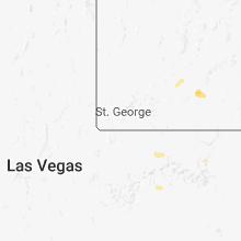
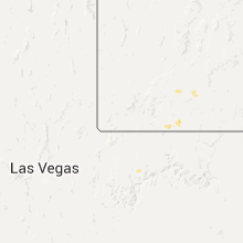
Hail Map for Hatch, UT
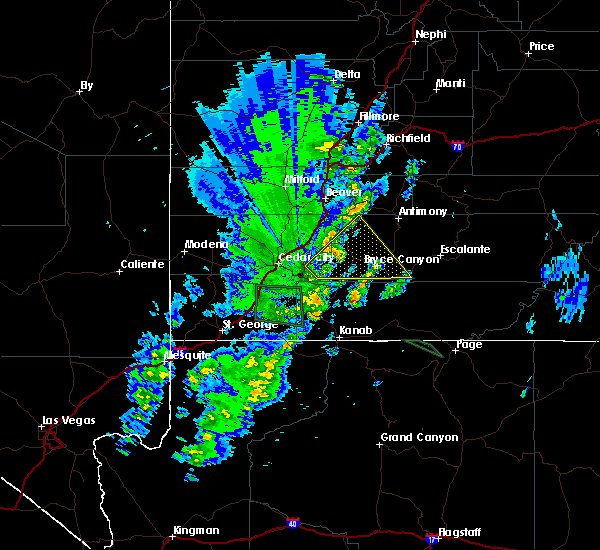
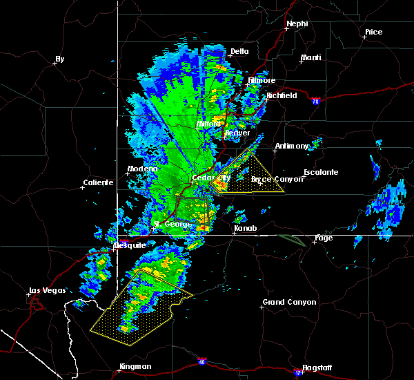
The Hatch, UT area has had 0 reports of on-the-ground hail by trained spotters, and has been under severe weather warnings 0 times during the past 12 months. Doppler radar has detected hail at or near Hatch, UT on 8 occasions, including 1 occasion during the past year.
| Name: | Hatch, UT |
| Where Located: | 69.8 miles SSW of Monroe, UT |
| Map: | Google Map for Hatch, UT |
| Population: | 133 |
| Housing Units: | 95 |
| More Info: | Search Google for Hatch, UT |
0
The Top Recent Hail Date for Hatch, UT is Sunday, August 11, 2024 (3rd out of 8)

Hail and Wind Damage Spotted near Hatch, UT
| Date / Time | Report Details |
|---|---|
| 10/2/2022 5:49 PM MDT |
 At 549 pm mdt, a severe thunderstorm was located over panguitch lake, or 22 miles east of cedar city, moving east at 25 mph (public). Hazards include 60 mph wind gusts and half dollar size hail. Hail damage to vehicles is expected. expect wind damage to roofs, siding, and trees. locations impacted include, cedar city, enoch, parowan, hatch, panguitch lake, cedar breaks national monument, summit and brian head. this includes the following highways, interstate 15 between mile markers 62 and 79. us route 89 between mile markers 109 and 117. hail threat, observed max hail size, 1. 25 in wind threat, radar indicated max wind gust, 60 mph. At 549 pm mdt, a severe thunderstorm was located over panguitch lake, or 22 miles east of cedar city, moving east at 25 mph (public). Hazards include 60 mph wind gusts and half dollar size hail. Hail damage to vehicles is expected. expect wind damage to roofs, siding, and trees. locations impacted include, cedar city, enoch, parowan, hatch, panguitch lake, cedar breaks national monument, summit and brian head. this includes the following highways, interstate 15 between mile markers 62 and 79. us route 89 between mile markers 109 and 117. hail threat, observed max hail size, 1. 25 in wind threat, radar indicated max wind gust, 60 mph.
|
| 10/2/2022 5:33 PM MDT |
 At 532 pm mdt, a severe thunderstorm was located near parowan, or 15 miles east of cedar city, moving east at 25 mph (public). Hazards include 60 mph wind gusts and half dollar size hail. Hail damage to vehicles is expected. Expect wind damage to roofs, siding, and trees. At 532 pm mdt, a severe thunderstorm was located near parowan, or 15 miles east of cedar city, moving east at 25 mph (public). Hazards include 60 mph wind gusts and half dollar size hail. Hail damage to vehicles is expected. Expect wind damage to roofs, siding, and trees.
|
| 9/22/2016 6:36 PM MDT |
 At 635 pm mdt, doppler radar indicated a severe thunderstorm capable of producing quarter size hail and damaging winds in excess of 60 mph. this storm was located near panguitch, or 32 miles east of cedar city, moving northeast at 50 mph. locations impacted include, panguitch, hatch, bryce canyon national park, tropic, cannonville, hillsdale and rubys inn. At 635 pm mdt, doppler radar indicated a severe thunderstorm capable of producing quarter size hail and damaging winds in excess of 60 mph. this storm was located near panguitch, or 32 miles east of cedar city, moving northeast at 50 mph. locations impacted include, panguitch, hatch, bryce canyon national park, tropic, cannonville, hillsdale and rubys inn.
|
| 9/22/2016 6:20 PM MDT |
 At 619 pm mdt, doppler radar indicated a severe thunderstorm capable of producing quarter size hail and damaging winds in excess of 60 mph. this storm was located 12 miles west of hatch, or 22 miles east of cedar city, and moving northeast at 50 mph. At 619 pm mdt, doppler radar indicated a severe thunderstorm capable of producing quarter size hail and damaging winds in excess of 60 mph. this storm was located 12 miles west of hatch, or 22 miles east of cedar city, and moving northeast at 50 mph.
|
Hail Maps for Hatch, UT


Connect with Interactive Hail Maps