

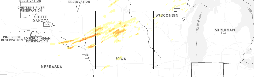
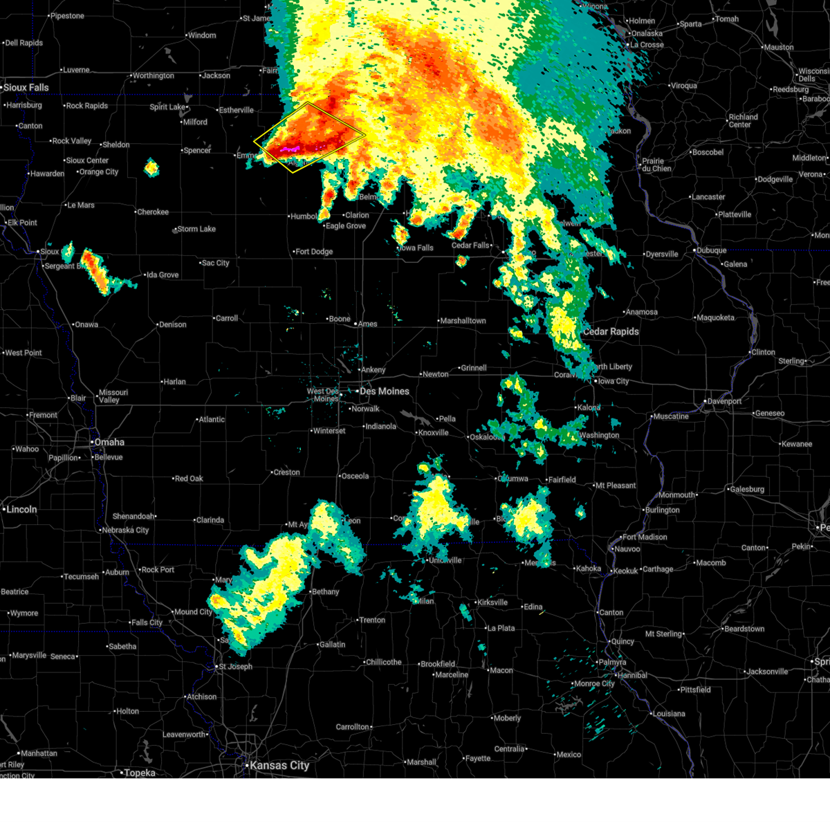
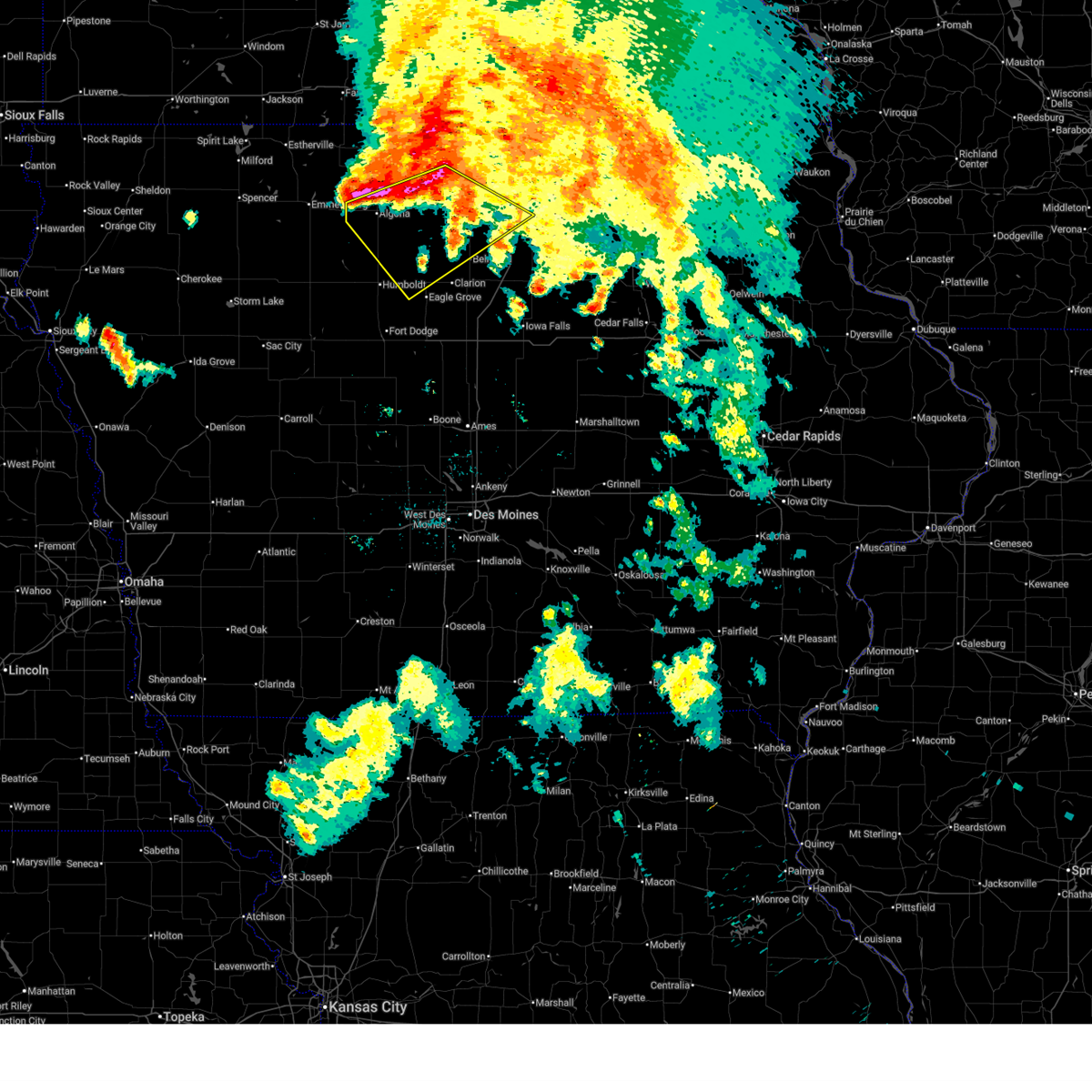
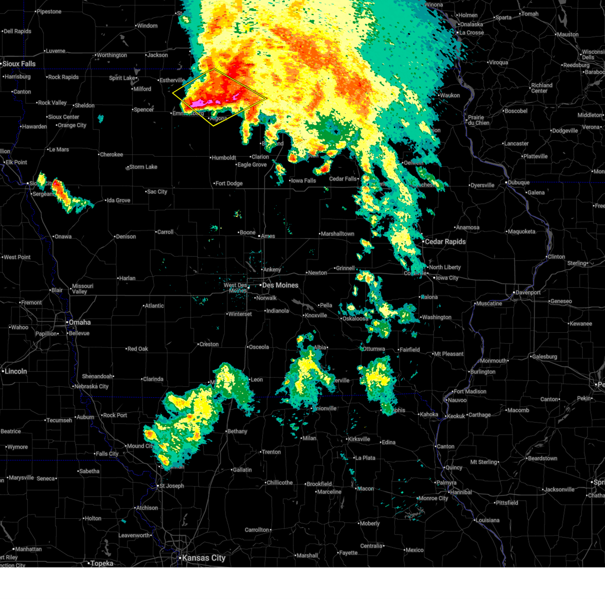
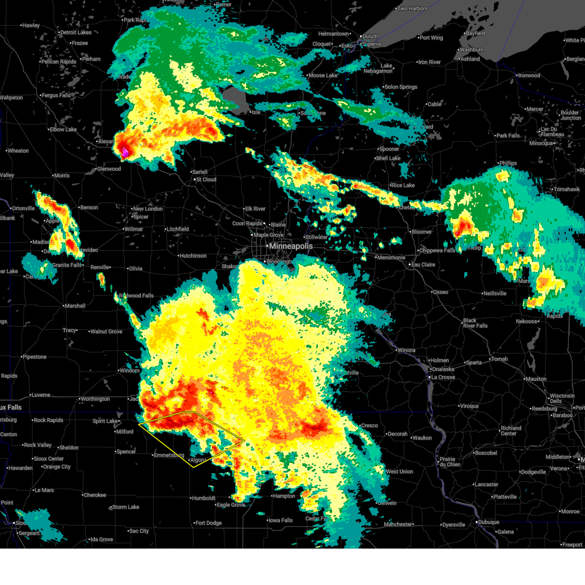
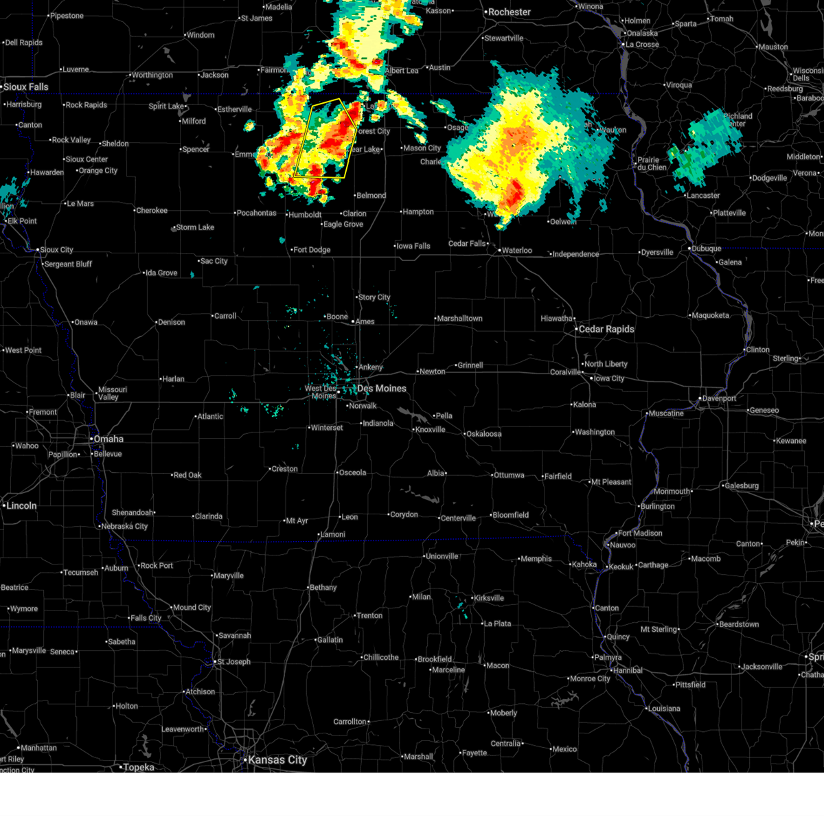
Hail Map for Hayfield, IA
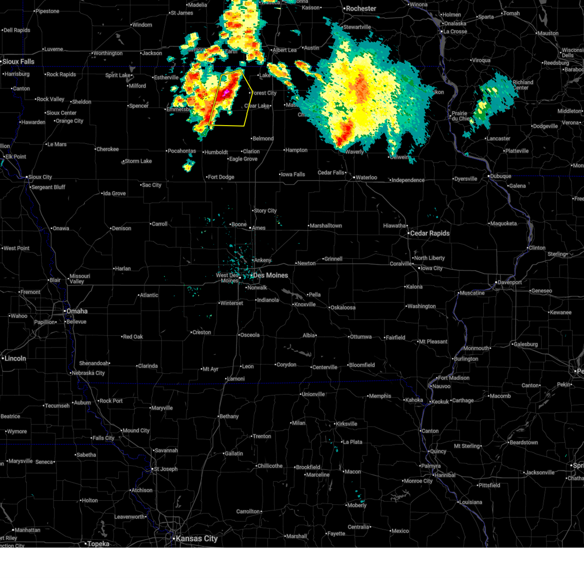
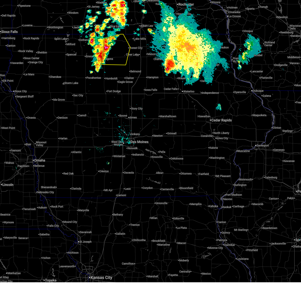
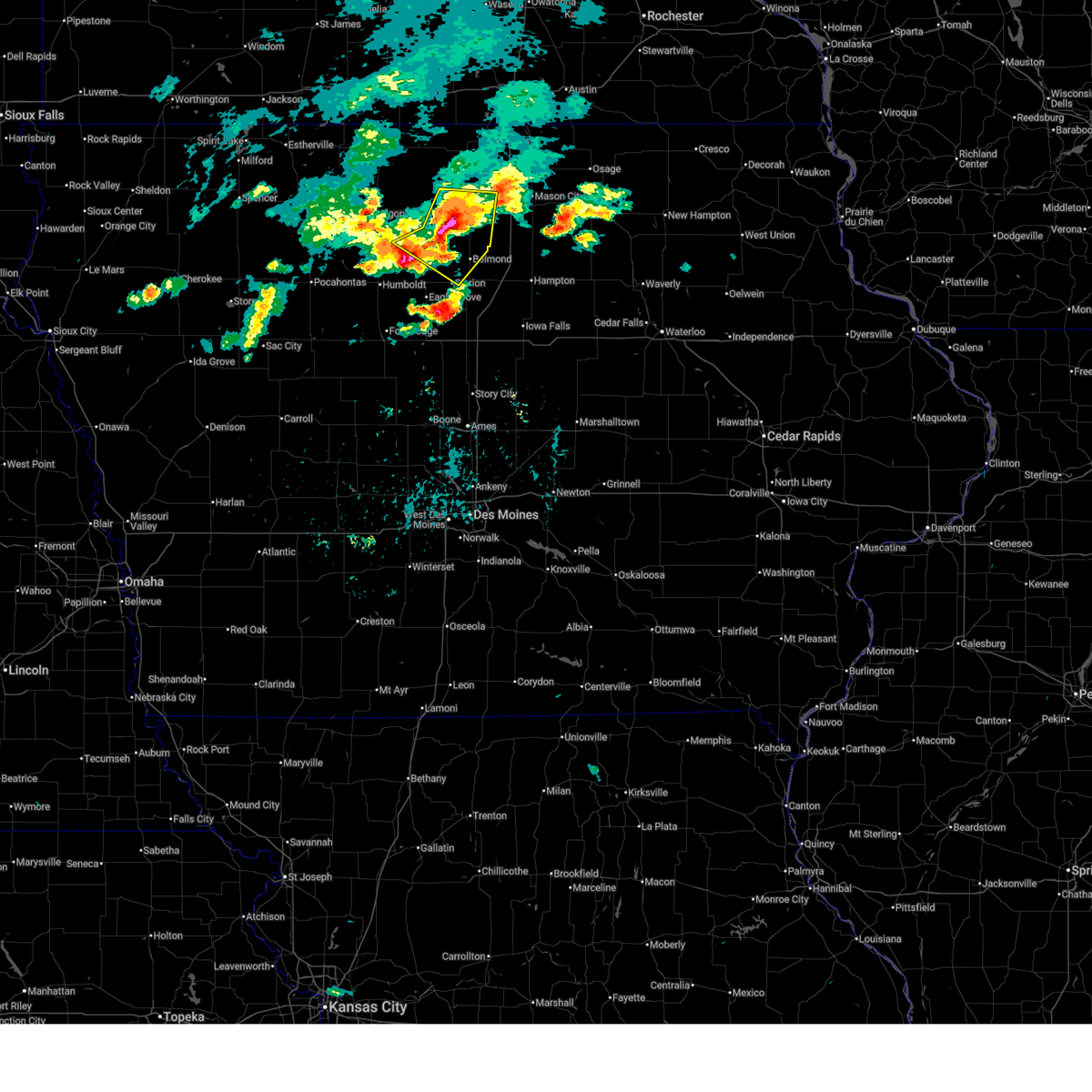
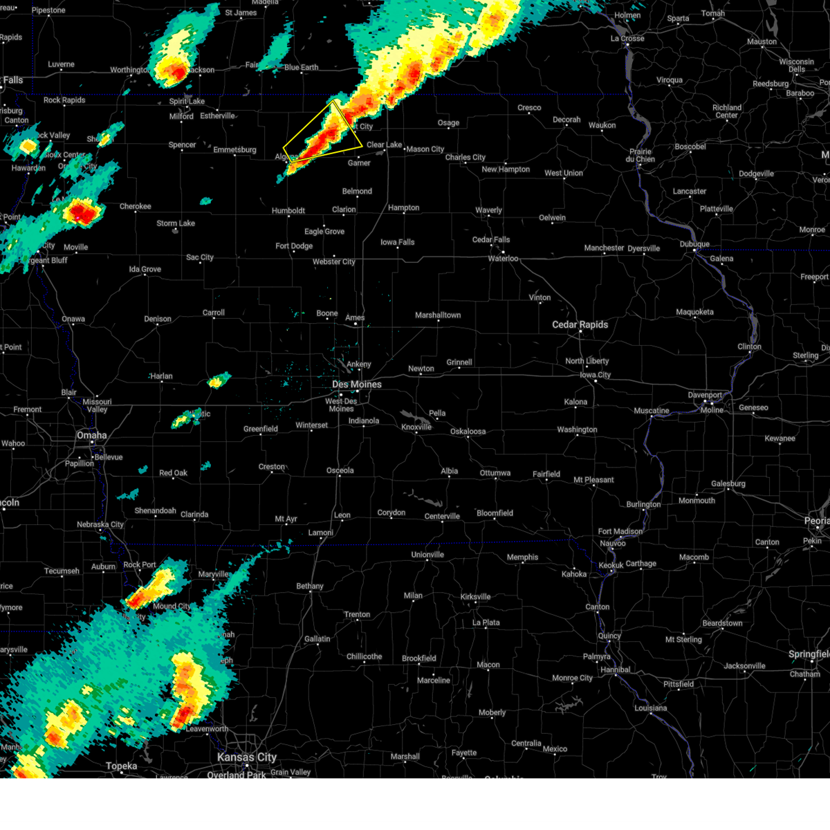
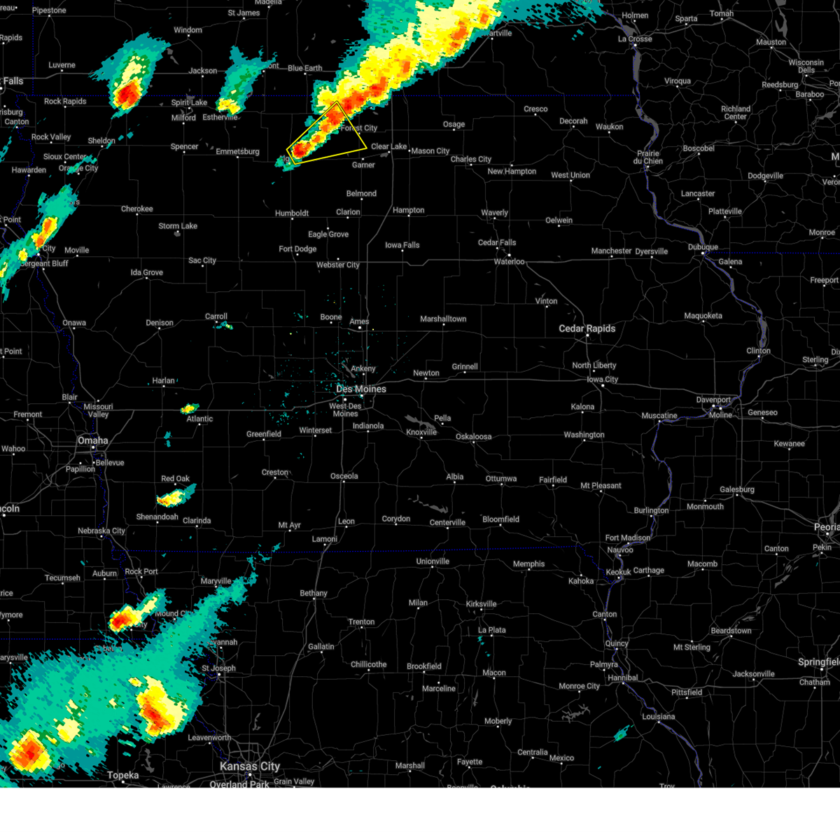
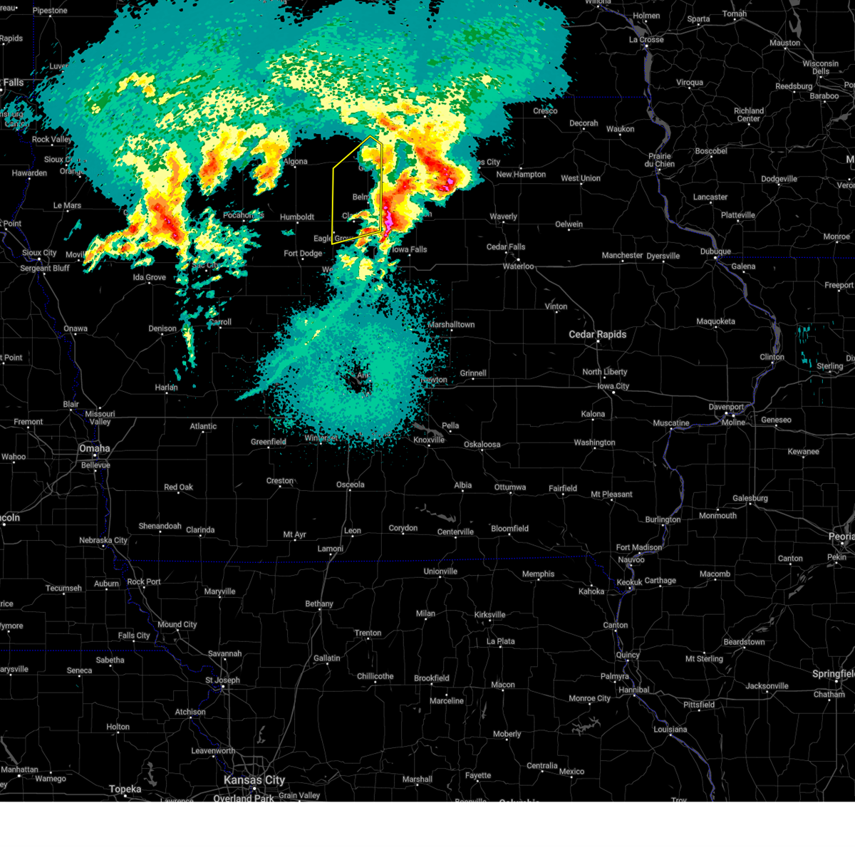
The Hayfield, IA area has had 0 reports of on-the-ground hail by trained spotters, and has been under severe weather warnings 25 times during the past 12 months. Doppler radar has detected hail at or near Hayfield, IA on 61 occasions, including 3 occasions during the past year.
| Name: | Hayfield, IA |
| Where Located: | 24.8 miles W of Mason City, IA |
| Map: | Google Map for Hayfield, IA |
| Population: | 43 |
| Housing Units: | 25 |
| More Info: | Search Google for Hayfield, IA |
5
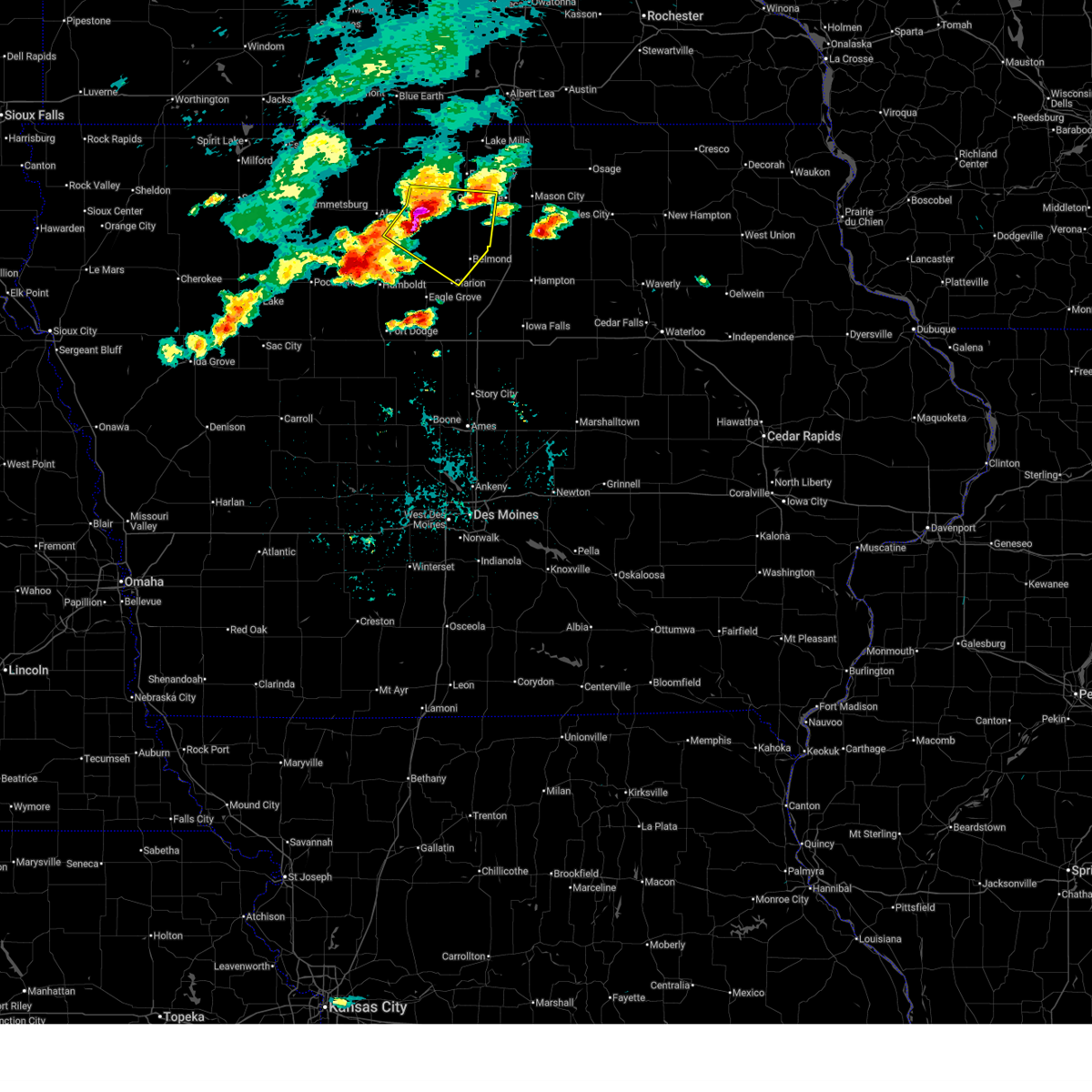
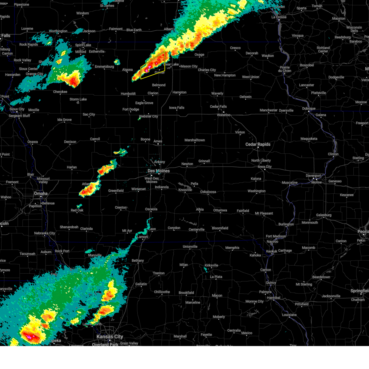
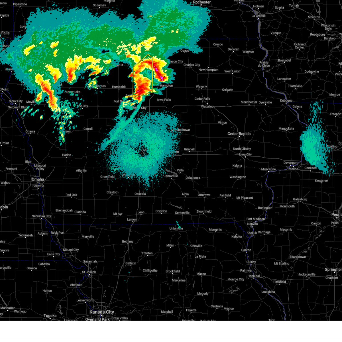
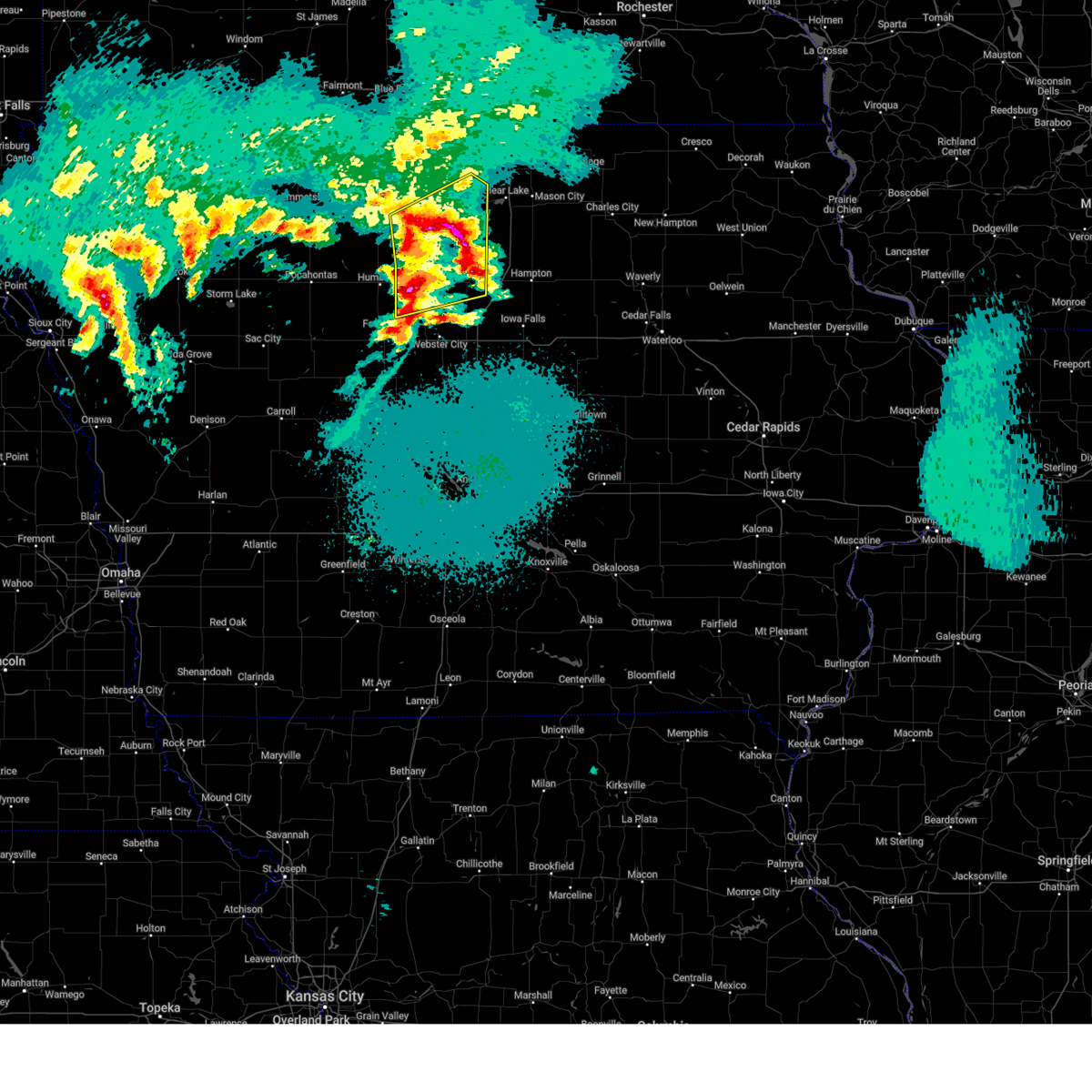
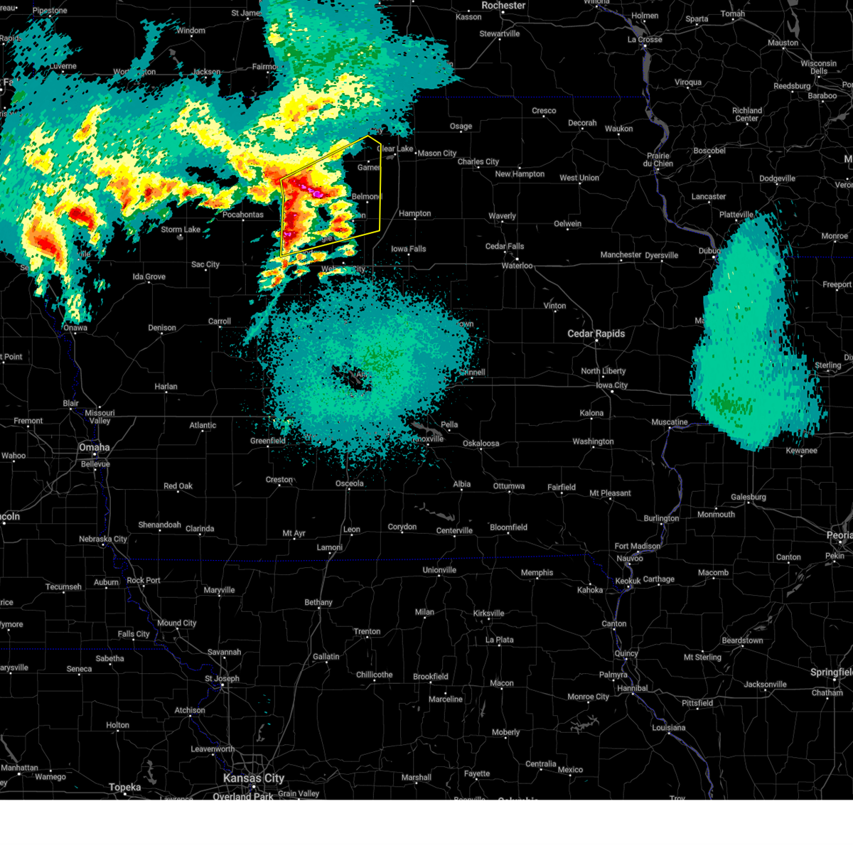
The Top Recent Hail Date for Hayfield, IA is Monday, April 28, 2025 (3rd out of 61)
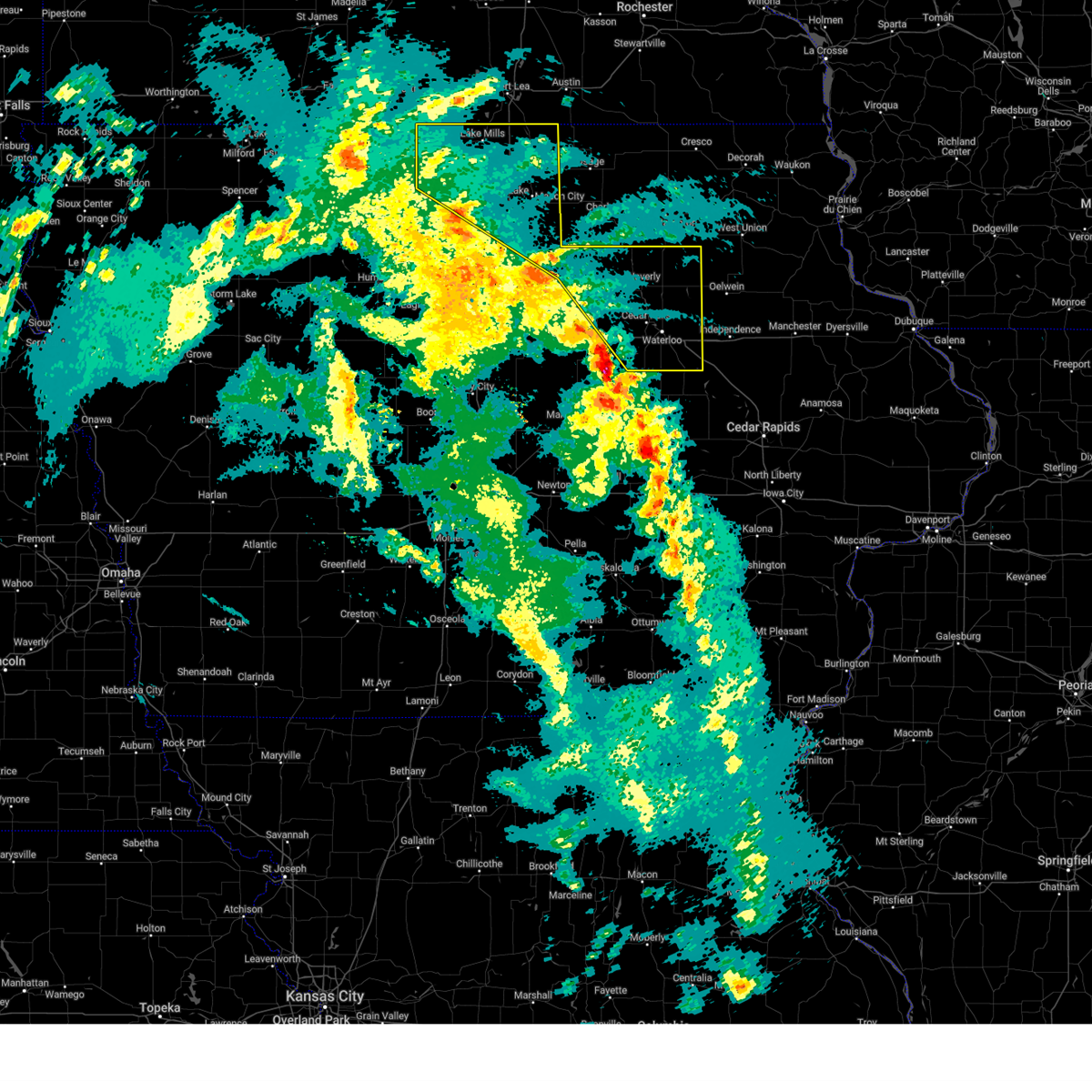
Hail and Wind Damage Spotted near Hayfield, IA
| Date / Time | Report Details |
|---|---|
| 6/20/2025 6:18 AM CDT |
 At 617 am cdt, a severe thunderstorm was located over pilot knob state park, or near forest city, moving southeast at 30 mph (radar indicated). Hazards include two inch hail and 60 mph wind gusts. People and animals outdoors will be injured. expect hail damage to roofs, siding, windows, and vehicles. expect wind damage to roofs, siding, and trees. locations impacted include, mason city, forest city, garner, manly, mason city municipal airport, rice lake, clear lake, ventura, fertile, leland, hanlontown, joice, miller, hayfield, pilot knob state park, mcintosh woods state park, forest city municipal airport, clear lake state park, and rice lake state park. This includes interstate 35 between mile markers 188 and 208. At 617 am cdt, a severe thunderstorm was located over pilot knob state park, or near forest city, moving southeast at 30 mph (radar indicated). Hazards include two inch hail and 60 mph wind gusts. People and animals outdoors will be injured. expect hail damage to roofs, siding, windows, and vehicles. expect wind damage to roofs, siding, and trees. locations impacted include, mason city, forest city, garner, manly, mason city municipal airport, rice lake, clear lake, ventura, fertile, leland, hanlontown, joice, miller, hayfield, pilot knob state park, mcintosh woods state park, forest city municipal airport, clear lake state park, and rice lake state park. This includes interstate 35 between mile markers 188 and 208.
|
| 6/20/2025 6:09 AM CDT |
 Svrdmx the national weather service in des moines has issued a * severe thunderstorm warning for, southern worth county in north central iowa, northeastern hancock county in north central iowa, western cerro gordo county in north central iowa, southeastern winnebago county in north central iowa, * until 700 am cdt. * at 609 am cdt, a severe thunderstorm was located over leland, or near forest city, moving southeast at 30 mph (radar indicated). Hazards include 60 mph wind gusts and quarter size hail. Hail damage to vehicles is expected. Expect wind damage to roofs, siding, and trees. Svrdmx the national weather service in des moines has issued a * severe thunderstorm warning for, southern worth county in north central iowa, northeastern hancock county in north central iowa, western cerro gordo county in north central iowa, southeastern winnebago county in north central iowa, * until 700 am cdt. * at 609 am cdt, a severe thunderstorm was located over leland, or near forest city, moving southeast at 30 mph (radar indicated). Hazards include 60 mph wind gusts and quarter size hail. Hail damage to vehicles is expected. Expect wind damage to roofs, siding, and trees.
|
| 6/20/2025 3:19 AM CDT |
 the severe thunderstorm warning has been cancelled and is no longer in effect the severe thunderstorm warning has been cancelled and is no longer in effect
|
| 6/20/2025 3:19 AM CDT |
 At 319 am cdt, a severe thunderstorm was located near hutchins, or 14 miles west of garner, moving southeast at 40 mph (radar indicated). Hazards include 60 mph wind gusts and nickel size hail. Expect damage to roofs, siding, and trees. locations impacted include, algona, forest city, union slogh, buffalo center, bancroft, burt, titonka, wesley, fenton, lakota, crystal lake, woden, lone rock, hayfield, st. Benedict, irvington, sexton, forest city municipal airport, algona municipal airport, and aa call state park. At 319 am cdt, a severe thunderstorm was located near hutchins, or 14 miles west of garner, moving southeast at 40 mph (radar indicated). Hazards include 60 mph wind gusts and nickel size hail. Expect damage to roofs, siding, and trees. locations impacted include, algona, forest city, union slogh, buffalo center, bancroft, burt, titonka, wesley, fenton, lakota, crystal lake, woden, lone rock, hayfield, st. Benedict, irvington, sexton, forest city municipal airport, algona municipal airport, and aa call state park.
|
| 6/20/2025 3:16 AM CDT |
 Svrdmx the national weather service in des moines has issued a * severe thunderstorm warning for, northern wright county in north central iowa, southern kossuth county in north central iowa, eastern humboldt county in north central iowa, hancock county in north central iowa, southwestern cerro gordo county in north central iowa, south central winnebago county in north central iowa, * until 400 am cdt. * at 314 am cdt, severe thunderstorms were located along a line extending from near crystal lake to 4 miles north of whittemore, moving southeast at 45 mph (radar indicated). Hazards include 60 mph wind gusts and nickel size hail. expect damage to roofs, siding, and trees Svrdmx the national weather service in des moines has issued a * severe thunderstorm warning for, northern wright county in north central iowa, southern kossuth county in north central iowa, eastern humboldt county in north central iowa, hancock county in north central iowa, southwestern cerro gordo county in north central iowa, south central winnebago county in north central iowa, * until 400 am cdt. * at 314 am cdt, severe thunderstorms were located along a line extending from near crystal lake to 4 miles north of whittemore, moving southeast at 45 mph (radar indicated). Hazards include 60 mph wind gusts and nickel size hail. expect damage to roofs, siding, and trees
|
| 6/20/2025 3:08 AM CDT |
 At 307 am cdt, a severe thunderstorm was located near titonka, or 13 miles northeast of algona, moving southeast at 40 mph (radar indicated). Hazards include 60 mph wind gusts and nickel size hail. Expect damage to roofs, siding, and trees. locations impacted include, algona, forest city, union slogh, buffalo center, bancroft, swea city, burt, titonka, ringsted, wesley, fenton, lakota, crystal lake, woden, lone rock, ledyard, hayfield, st. Benedict, irvington, and sexton. At 307 am cdt, a severe thunderstorm was located near titonka, or 13 miles northeast of algona, moving southeast at 40 mph (radar indicated). Hazards include 60 mph wind gusts and nickel size hail. Expect damage to roofs, siding, and trees. locations impacted include, algona, forest city, union slogh, buffalo center, bancroft, swea city, burt, titonka, ringsted, wesley, fenton, lakota, crystal lake, woden, lone rock, ledyard, hayfield, st. Benedict, irvington, and sexton.
|
| 6/20/2025 2:42 AM CDT |
 Svrdmx the national weather service in des moines has issued a * severe thunderstorm warning for, emmet county in northwestern iowa, kossuth county in north central iowa, northwestern hancock county in north central iowa, southwestern winnebago county in north central iowa, northeastern palo alto county in northwestern iowa, * until 330 am cdt. * at 242 am cdt, a severe thunderstorm was located near swea city, or 17 miles north of algona, moving southeast at 40 mph (radar indicated). Hazards include 60 mph wind gusts and nickel size hail. expect damage to roofs, siding, and trees Svrdmx the national weather service in des moines has issued a * severe thunderstorm warning for, emmet county in northwestern iowa, kossuth county in north central iowa, northwestern hancock county in north central iowa, southwestern winnebago county in north central iowa, northeastern palo alto county in northwestern iowa, * until 330 am cdt. * at 242 am cdt, a severe thunderstorm was located near swea city, or 17 miles north of algona, moving southeast at 40 mph (radar indicated). Hazards include 60 mph wind gusts and nickel size hail. expect damage to roofs, siding, and trees
|
| 6/16/2025 10:38 AM CDT |
 The storms which prompted the warning have weakened below severe limits, and no longer pose an immediate threat to life or property. therefore, the warning will be allowed to expire. however, small hail and gusty winds are still possible with these thunderstorms. The storms which prompted the warning have weakened below severe limits, and no longer pose an immediate threat to life or property. therefore, the warning will be allowed to expire. however, small hail and gusty winds are still possible with these thunderstorms.
|
| 6/16/2025 10:20 AM CDT |
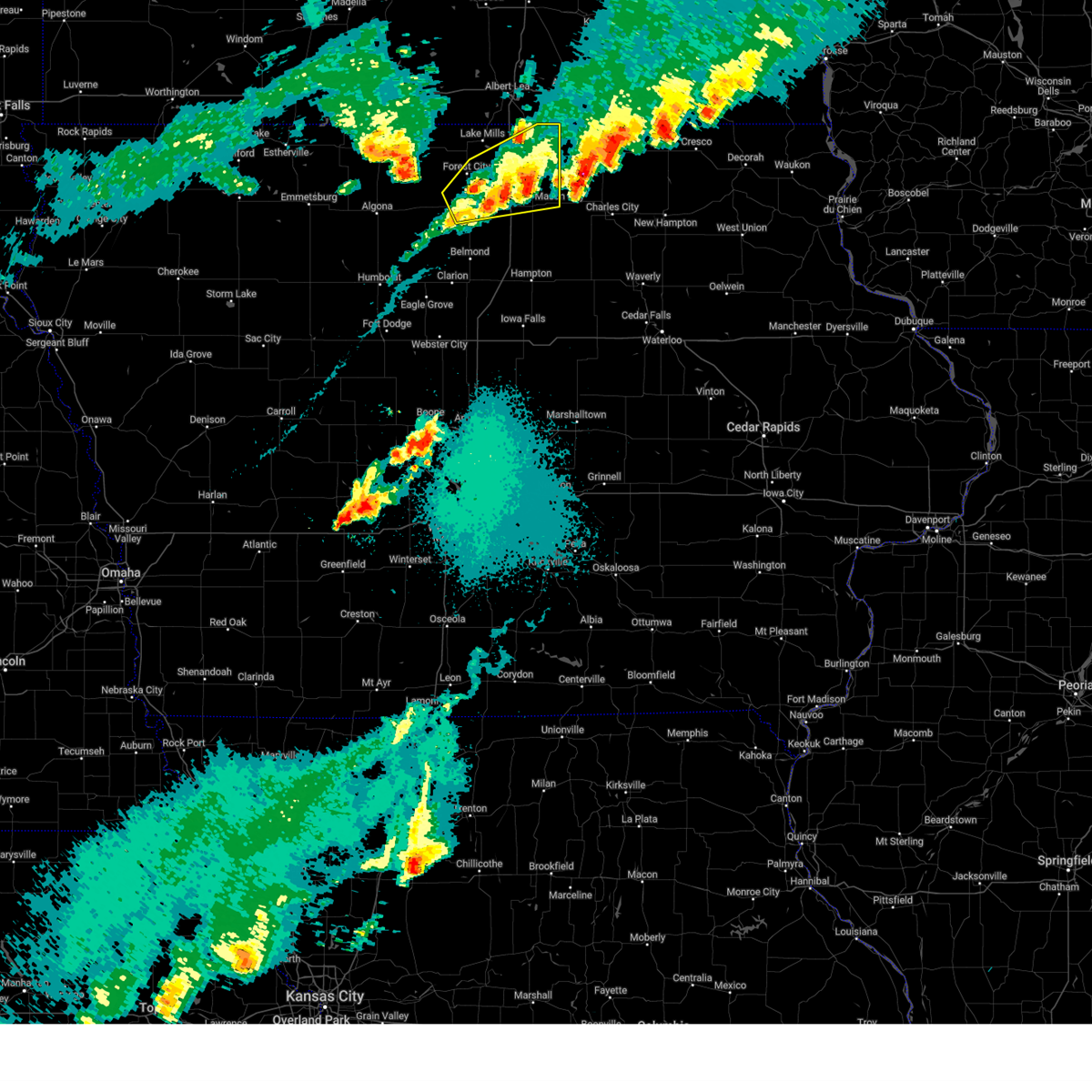
 At 1019 am cdt, severe thunderstorms were located along a line extending from near thompson to crystal lake to near st. benedict, moving east at 35 mph (radar indicated). Hazards include 60 mph wind gusts and quarter size hail. Hail damage to vehicles is expected. expect wind damage to roofs, siding, and trees. locations impacted include, forest city, britt, eagle lake, buffalo center, thompson, titonka, wesley, corwith, leland, crystal lake, woden, duncan, hayfield, st. Benedict, sexton, hutchins, forest city municipal airport, and eagle lake state park. At 1019 am cdt, severe thunderstorms were located along a line extending from near thompson to crystal lake to near st. benedict, moving east at 35 mph (radar indicated). Hazards include 60 mph wind gusts and quarter size hail. Hail damage to vehicles is expected. expect wind damage to roofs, siding, and trees. locations impacted include, forest city, britt, eagle lake, buffalo center, thompson, titonka, wesley, corwith, leland, crystal lake, woden, duncan, hayfield, st. Benedict, sexton, hutchins, forest city municipal airport, and eagle lake state park.
|
| 6/16/2025 9:57 AM CDT |
 Svrdmx the national weather service in des moines has issued a * severe thunderstorm warning for, eastern kossuth county in north central iowa, western hancock county in north central iowa, western winnebago county in north central iowa, * until 1045 am cdt. * at 957 am cdt, severe thunderstorms were located along a line extending from ledyard to near titonka to irvington, moving east at 35 mph (radar indicated). Hazards include 60 mph wind gusts and quarter size hail. Hail damage to vehicles is expected. Expect wind damage to roofs, siding, and trees. Svrdmx the national weather service in des moines has issued a * severe thunderstorm warning for, eastern kossuth county in north central iowa, western hancock county in north central iowa, western winnebago county in north central iowa, * until 1045 am cdt. * at 957 am cdt, severe thunderstorms were located along a line extending from ledyard to near titonka to irvington, moving east at 35 mph (radar indicated). Hazards include 60 mph wind gusts and quarter size hail. Hail damage to vehicles is expected. Expect wind damage to roofs, siding, and trees.
|
| 6/11/2025 5:17 PM CDT |
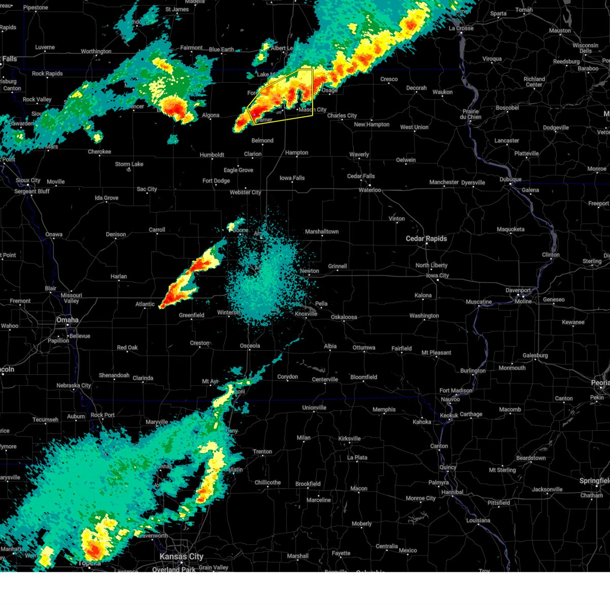
 At 517 pm cdt, severe thunderstorms were located along a line extending from near hayfield to near klemme to near kanawha, moving southeast at 30 mph (radar indicated). Hazards include 70 mph wind gusts and half dollar size hail. Hail damage to vehicles is expected. expect considerable tree damage. wind damage is also likely to mobile homes, roofs, and outbuildings. Locations impacted include, garner, clarion, belmond, britt, elm lake, eagle lake, clear lake, ventura, kanawha, klemme, corwith, lu verne, meservey, goodell, duncan, miller, hayfield, mcintosh woods state park, eagle lake state park, and belmond municipal airport. At 517 pm cdt, severe thunderstorms were located along a line extending from near hayfield to near klemme to near kanawha, moving southeast at 30 mph (radar indicated). Hazards include 70 mph wind gusts and half dollar size hail. Hail damage to vehicles is expected. expect considerable tree damage. wind damage is also likely to mobile homes, roofs, and outbuildings. Locations impacted include, garner, clarion, belmond, britt, elm lake, eagle lake, clear lake, ventura, kanawha, klemme, corwith, lu verne, meservey, goodell, duncan, miller, hayfield, mcintosh woods state park, eagle lake state park, and belmond municipal airport.
|
| 6/11/2025 4:54 PM CDT |
 Svrdmx the national weather service in des moines has issued a * severe thunderstorm warning for, northern wright county in north central iowa, southeastern kossuth county in north central iowa, northeastern humboldt county in north central iowa, hancock county in north central iowa, southwestern cerro gordo county in north central iowa, * until 545 pm cdt. * at 453 pm cdt, severe thunderstorms were located along a line extending from near crystal lake to near hutchins to near corwith, moving southeast at 30 mph (radar indicated). Hazards include 70 mph wind gusts and half dollar size hail. Hail damage to vehicles is expected. expect considerable tree damage. Wind damage is also likely to mobile homes, roofs, and outbuildings. Svrdmx the national weather service in des moines has issued a * severe thunderstorm warning for, northern wright county in north central iowa, southeastern kossuth county in north central iowa, northeastern humboldt county in north central iowa, hancock county in north central iowa, southwestern cerro gordo county in north central iowa, * until 545 pm cdt. * at 453 pm cdt, severe thunderstorms were located along a line extending from near crystal lake to near hutchins to near corwith, moving southeast at 30 mph (radar indicated). Hazards include 70 mph wind gusts and half dollar size hail. Hail damage to vehicles is expected. expect considerable tree damage. Wind damage is also likely to mobile homes, roofs, and outbuildings.
|
| 4/28/2025 9:36 PM CDT |
 the severe thunderstorm warning has been cancelled and is no longer in effect the severe thunderstorm warning has been cancelled and is no longer in effect
|
| 4/28/2025 9:10 PM CDT |
 Svrdmx the national weather service in des moines has issued a * severe thunderstorm warning for, worth county in north central iowa, northeastern hancock county in north central iowa, northern cerro gordo county in north central iowa, southeastern winnebago county in north central iowa, * until 1000 pm cdt. * at 910 pm cdt, a severe thunderstorm was located over garner, moving northeast at 60 mph (radar indicated). Hazards include 60 mph wind gusts and quarter size hail. Hail damage to vehicles is expected. Expect wind damage to roofs, siding, and trees. Svrdmx the national weather service in des moines has issued a * severe thunderstorm warning for, worth county in north central iowa, northeastern hancock county in north central iowa, northern cerro gordo county in north central iowa, southeastern winnebago county in north central iowa, * until 1000 pm cdt. * at 910 pm cdt, a severe thunderstorm was located over garner, moving northeast at 60 mph (radar indicated). Hazards include 60 mph wind gusts and quarter size hail. Hail damage to vehicles is expected. Expect wind damage to roofs, siding, and trees.
|
| 4/28/2025 8:41 PM CDT |
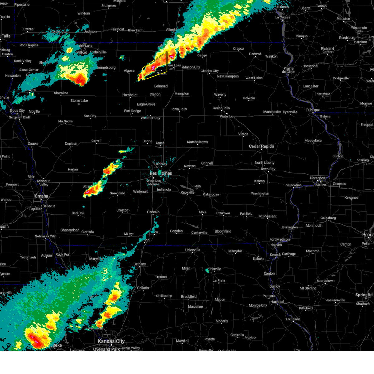 At 840 pm cdt, a severe thunderstorm was located over eagle lake, or 5 miles northwest of garner, moving northeast at 50 mph (radar indicated. at 838 pm a trained spotter reported half dollar sized hail east southeast of britt). Hazards include ping pong ball size hail and 60 mph wind gusts. People and animals outdoors will be injured. expect hail damage to roofs, siding, windows, and vehicles. expect wind damage to roofs, siding, and trees. Locations impacted include, hayfield, hutchins, pilot knob state park, forest city municipal airport, corwith, britt, eagle lake state park, miller, garner, crystal lake, forest city, duncan, and eagle lake. At 840 pm cdt, a severe thunderstorm was located over eagle lake, or 5 miles northwest of garner, moving northeast at 50 mph (radar indicated. at 838 pm a trained spotter reported half dollar sized hail east southeast of britt). Hazards include ping pong ball size hail and 60 mph wind gusts. People and animals outdoors will be injured. expect hail damage to roofs, siding, windows, and vehicles. expect wind damage to roofs, siding, and trees. Locations impacted include, hayfield, hutchins, pilot knob state park, forest city municipal airport, corwith, britt, eagle lake state park, miller, garner, crystal lake, forest city, duncan, and eagle lake.
|
| 4/28/2025 8:34 PM CDT |
 Svrdmx the national weather service in des moines has issued a * severe thunderstorm warning for, central hancock county in north central iowa, southeastern winnebago county in north central iowa, * until 915 pm cdt. * at 834 pm cdt, a severe thunderstorm was located over britt, or 9 miles west of garner, moving northeast at 35 mph (radar indicated). Hazards include 60 mph wind gusts and quarter size hail. Hail damage to vehicles is expected. Expect wind damage to roofs, siding, and trees. Svrdmx the national weather service in des moines has issued a * severe thunderstorm warning for, central hancock county in north central iowa, southeastern winnebago county in north central iowa, * until 915 pm cdt. * at 834 pm cdt, a severe thunderstorm was located over britt, or 9 miles west of garner, moving northeast at 35 mph (radar indicated). Hazards include 60 mph wind gusts and quarter size hail. Hail damage to vehicles is expected. Expect wind damage to roofs, siding, and trees.
|
| 4/28/2025 7:56 PM CDT |
 The storm which prompted the warning has weakened below severe limits, and no longer poses an immediate threat to life or property. therefore, the warning will be allowed to expire. however, small hail, gusty winds and heavy rain are still possible with this thunderstorm. a tornado watch remains in effect until 1100 pm cdt for north central iowa. The storm which prompted the warning has weakened below severe limits, and no longer poses an immediate threat to life or property. therefore, the warning will be allowed to expire. however, small hail, gusty winds and heavy rain are still possible with this thunderstorm. a tornado watch remains in effect until 1100 pm cdt for north central iowa.
|
| 4/28/2025 7:29 PM CDT |
 Svrdmx the national weather service in des moines has issued a * severe thunderstorm warning for, east central kossuth county in north central iowa, northern hancock county in north central iowa, western winnebago county in north central iowa, * until 800 pm cdt. * at 729 pm cdt, a severe thunderstorm was located 5 miles north of sexton, or 8 miles northeast of algona, moving northeast at 60 mph (radar indicated). Hazards include 60 mph wind gusts and quarter size hail. Hail damage to vehicles is expected. Expect wind damage to roofs, siding, and trees. Svrdmx the national weather service in des moines has issued a * severe thunderstorm warning for, east central kossuth county in north central iowa, northern hancock county in north central iowa, western winnebago county in north central iowa, * until 800 pm cdt. * at 729 pm cdt, a severe thunderstorm was located 5 miles north of sexton, or 8 miles northeast of algona, moving northeast at 60 mph (radar indicated). Hazards include 60 mph wind gusts and quarter size hail. Hail damage to vehicles is expected. Expect wind damage to roofs, siding, and trees.
|
| 4/18/2025 2:59 AM CDT |
 The storms which prompted the warning have moved out of the area. therefore, the warning will be allowed to expire. The storms which prompted the warning have moved out of the area. therefore, the warning will be allowed to expire.
|
| 4/18/2025 2:39 AM CDT |
 At 238 am cdt, severe thunderstorms were located along a line extending from 4 miles southeast of woden to near kanawha to 5 miles southwest of clarion, moving northeast at 50 mph (radar indicated). Hazards include 60 mph wind gusts and half dollar size hail. Hail damage to vehicles is expected. expect wind damage to roofs, siding, and trees. Locations impacted include, hayfield, galt, forest city municipal airport, goodell, clarion municipal airport, britt, elm lake, rowan, eagle grove municipal airport, kanawha, eagle lake state park, miller, garner, clarion, belmond, eagle grove, belmond municipal airport, klemme, duncan, and eagle lake. At 238 am cdt, severe thunderstorms were located along a line extending from 4 miles southeast of woden to near kanawha to 5 miles southwest of clarion, moving northeast at 50 mph (radar indicated). Hazards include 60 mph wind gusts and half dollar size hail. Hail damage to vehicles is expected. expect wind damage to roofs, siding, and trees. Locations impacted include, hayfield, galt, forest city municipal airport, goodell, clarion municipal airport, britt, elm lake, rowan, eagle grove municipal airport, kanawha, eagle lake state park, miller, garner, clarion, belmond, eagle grove, belmond municipal airport, klemme, duncan, and eagle lake.
|
| 4/18/2025 2:39 AM CDT |
 the severe thunderstorm warning has been cancelled and is no longer in effect the severe thunderstorm warning has been cancelled and is no longer in effect
|
| 4/18/2025 2:23 AM CDT |
 At 223 am cdt, severe thunderstorms were located along a line extending from sexton to 5 miles northeast of renwick to near vincent, moving northeast at 50 mph (radar indicated). Hazards include 60 mph wind gusts and half dollar size hail. Hail damage to vehicles is expected. expect wind damage to roofs, siding, and trees. locations impacted include, wesley, hutchins, forest city municipal airport, corwith, clarion municipal airport, goldfield, thor, rowan, kanawha, st. Benedict, eagle lake state park, garner, clarion, belmond, lu verne, belmond municipal airport, klemme, eagle lake, hayfield, and vincent. At 223 am cdt, severe thunderstorms were located along a line extending from sexton to 5 miles northeast of renwick to near vincent, moving northeast at 50 mph (radar indicated). Hazards include 60 mph wind gusts and half dollar size hail. Hail damage to vehicles is expected. expect wind damage to roofs, siding, and trees. locations impacted include, wesley, hutchins, forest city municipal airport, corwith, clarion municipal airport, goldfield, thor, rowan, kanawha, st. Benedict, eagle lake state park, garner, clarion, belmond, lu verne, belmond municipal airport, klemme, eagle lake, hayfield, and vincent.
|
| 4/18/2025 2:10 AM CDT |
 Svrdmx the national weather service in des moines has issued a * severe thunderstorm warning for, northern webster county in central iowa, wright county in north central iowa, southeastern kossuth county in north central iowa, humboldt county in north central iowa, hancock county in north central iowa, * until 300 am cdt. * at 210 am cdt, severe thunderstorms were located along a line extending from aa call state park to 5 miles south of corwith to 4 miles northwest of fort dodge regional airport, moving northeast at 50 mph (radar indicated). Hazards include 60 mph wind gusts and half dollar size hail. Hail damage to vehicles is expected. Expect wind damage to roofs, siding, and trees. Svrdmx the national weather service in des moines has issued a * severe thunderstorm warning for, northern webster county in central iowa, wright county in north central iowa, southeastern kossuth county in north central iowa, humboldt county in north central iowa, hancock county in north central iowa, * until 300 am cdt. * at 210 am cdt, severe thunderstorms were located along a line extending from aa call state park to 5 miles south of corwith to 4 miles northwest of fort dodge regional airport, moving northeast at 50 mph (radar indicated). Hazards include 60 mph wind gusts and half dollar size hail. Hail damage to vehicles is expected. Expect wind damage to roofs, siding, and trees.
|
| 3/14/2025 7:24 PM CDT |
 At 722 pm cdt, severe thunderstorms were located along a line extending from near crystal lake to near dougherty to near hudson, moving north at 60 mph (trained weather spotters. at 720pm, a trained spotter reported a wind gust of 71mph in grundy center). Hazards include 70 mph wind gusts. Expect considerable tree damage. damage is likely to mobile homes, roofs, and outbuildings. locations impacted include, clarksville, lake mills municipal airport, mcintosh woods state park, forest city municipal airport, plainfield, grafton, waterloo, george wyth state park, buffalo center, mason city, readlyn, eagle lake state park, kensett, ventura, evansdale, thompson, dike, cedar falls, hayfield, and janesville. this includes the following highways, interstate 35 between mile markers 177 and 218. Interstate 380 between mile markers 57 and 73. At 722 pm cdt, severe thunderstorms were located along a line extending from near crystal lake to near dougherty to near hudson, moving north at 60 mph (trained weather spotters. at 720pm, a trained spotter reported a wind gust of 71mph in grundy center). Hazards include 70 mph wind gusts. Expect considerable tree damage. damage is likely to mobile homes, roofs, and outbuildings. locations impacted include, clarksville, lake mills municipal airport, mcintosh woods state park, forest city municipal airport, plainfield, grafton, waterloo, george wyth state park, buffalo center, mason city, readlyn, eagle lake state park, kensett, ventura, evansdale, thompson, dike, cedar falls, hayfield, and janesville. this includes the following highways, interstate 35 between mile markers 177 and 218. Interstate 380 between mile markers 57 and 73.
|
| 3/14/2025 7:11 PM CDT |
 Svrdmx the national weather service in des moines has issued a * severe thunderstorm warning for, black hawk county in northeastern iowa, worth county in north central iowa, bremer county in northeastern iowa, northeastern franklin county in north central iowa, northern hancock county in north central iowa, northeastern grundy county in central iowa, butler county in north central iowa, cerro gordo county in north central iowa, winnebago county in north central iowa, * until 815 pm cdt. * at 710 pm cdt, severe thunderstorms were located along a line extending from near eagle lake state park to aredale to 6 miles north of tf clark state park, moving northeast at 45 mph (radar indicated). Hazards include 60 mph wind gusts. expect damage to roofs, siding, and trees Svrdmx the national weather service in des moines has issued a * severe thunderstorm warning for, black hawk county in northeastern iowa, worth county in north central iowa, bremer county in northeastern iowa, northeastern franklin county in north central iowa, northern hancock county in north central iowa, northeastern grundy county in central iowa, butler county in north central iowa, cerro gordo county in north central iowa, winnebago county in north central iowa, * until 815 pm cdt. * at 710 pm cdt, severe thunderstorms were located along a line extending from near eagle lake state park to aredale to 6 miles north of tf clark state park, moving northeast at 45 mph (radar indicated). Hazards include 60 mph wind gusts. expect damage to roofs, siding, and trees
|
| 6/18/2024 8:30 PM CDT |
 The storms which prompted the warning have weakened below severe limits, and no longer pose an immediate threat to life or property. therefore, the warning will be allowed to expire. however, gusty winds are still possible with these thunderstorms. a severe thunderstorm watch remains in effect until 1000 pm cdt for north central iowa. The storms which prompted the warning have weakened below severe limits, and no longer pose an immediate threat to life or property. therefore, the warning will be allowed to expire. however, gusty winds are still possible with these thunderstorms. a severe thunderstorm watch remains in effect until 1000 pm cdt for north central iowa.
|
| 6/18/2024 8:14 PM CDT |
 At 814 pm cdt, severe thunderstorms were located along a line extending from near rake to crystal lake to near klemme, moving northeast at 45 mph (radar indicated). Hazards include 60 mph wind gusts. Expect damage to roofs, siding, and trees. Locations impacted include, forest city, garner, britt, eagle lake, union slogh, buffalo center, kanawha, klemme, thompson, titonka, wesley, corwith, leland, lakota, crystal lake, woden, rake, goodell, duncan, and ledyard. At 814 pm cdt, severe thunderstorms were located along a line extending from near rake to crystal lake to near klemme, moving northeast at 45 mph (radar indicated). Hazards include 60 mph wind gusts. Expect damage to roofs, siding, and trees. Locations impacted include, forest city, garner, britt, eagle lake, union slogh, buffalo center, kanawha, klemme, thompson, titonka, wesley, corwith, leland, lakota, crystal lake, woden, rake, goodell, duncan, and ledyard.
|
| 6/18/2024 8:14 PM CDT |
 the severe thunderstorm warning has been cancelled and is no longer in effect the severe thunderstorm warning has been cancelled and is no longer in effect
|
| 6/18/2024 8:01 PM CDT |
 At 801 pm cdt, severe thunderstorms were located along a line extending from near ledyard to near wesley to 4 miles southwest of kanawha, moving northeast at 45 mph (radar indicated). Hazards include 60 mph wind gusts. Expect damage to roofs, siding, and trees. Locations impacted include, algona, forest city, garner, britt, eagle lake, union slogh, buffalo center, bancroft, kanawha, burt, klemme, thompson, titonka, wesley, livermore, corwith, leland, lu verne, lakota, and crystal lake. At 801 pm cdt, severe thunderstorms were located along a line extending from near ledyard to near wesley to 4 miles southwest of kanawha, moving northeast at 45 mph (radar indicated). Hazards include 60 mph wind gusts. Expect damage to roofs, siding, and trees. Locations impacted include, algona, forest city, garner, britt, eagle lake, union slogh, buffalo center, bancroft, kanawha, burt, klemme, thompson, titonka, wesley, livermore, corwith, leland, lu verne, lakota, and crystal lake.
|
| 6/18/2024 7:41 PM CDT |
 Svrdmx the national weather service in des moines has issued a * severe thunderstorm warning for, northwestern wright county in north central iowa, kossuth county in north central iowa, eastern humboldt county in north central iowa, hancock county in north central iowa, winnebago county in north central iowa, * until 830 pm cdt. * at 741 pm cdt, severe thunderstorms were located along a line extending from 5 miles east of ringsted to algona to hardy, moving northeast at 55 mph (radar indicated). Hazards include 60 mph wind gusts. expect damage to roofs, siding, and trees Svrdmx the national weather service in des moines has issued a * severe thunderstorm warning for, northwestern wright county in north central iowa, kossuth county in north central iowa, eastern humboldt county in north central iowa, hancock county in north central iowa, winnebago county in north central iowa, * until 830 pm cdt. * at 741 pm cdt, severe thunderstorms were located along a line extending from 5 miles east of ringsted to algona to hardy, moving northeast at 55 mph (radar indicated). Hazards include 60 mph wind gusts. expect damage to roofs, siding, and trees
|
| 5/24/2024 5:47 AM CDT |
 At 547 am cdt, severe thunderstorms were located along a line extending from near bricelyn to 4 miles northwest of thornton, moving east at 50 mph (radar indicated). Hazards include 60 mph wind gusts and penny size hail. Expect damage to roofs, siding, and trees. locations impacted include, mason city, forest city, garner, northwood, belmond, lake mills, manly, sheffield, rockwell, emmons, clear lake, eagle lake, mason city municipal airport, rice lake, ventura, klemme, thompson, thornton, plymouth, and fertile. This includes interstate 35 between mile markers 175 and 218. At 547 am cdt, severe thunderstorms were located along a line extending from near bricelyn to 4 miles northwest of thornton, moving east at 50 mph (radar indicated). Hazards include 60 mph wind gusts and penny size hail. Expect damage to roofs, siding, and trees. locations impacted include, mason city, forest city, garner, northwood, belmond, lake mills, manly, sheffield, rockwell, emmons, clear lake, eagle lake, mason city municipal airport, rice lake, ventura, klemme, thompson, thornton, plymouth, and fertile. This includes interstate 35 between mile markers 175 and 218.
|
| 5/24/2024 5:42 AM CDT |
 the severe thunderstorm warning has been cancelled and is no longer in effect the severe thunderstorm warning has been cancelled and is no longer in effect
|
| 5/24/2024 5:42 AM CDT |
 At 542 am cdt, severe thunderstorms were located along a line extending from near bricelyn to near meservey, moving east at 50 mph (radar indicated). Hazards include 60 mph wind gusts and penny size hail. Expect damage to roofs, siding, and trees. locations impacted include, mason city, forest city, garner, northwood, belmond, lake mills, manly, sheffield, rockwell, emmons, clear lake, eagle lake, mason city municipal airport, rice lake, ventura, klemme, thompson, thornton, plymouth, and fertile. This includes interstate 35 between mile markers 175 and 218. At 542 am cdt, severe thunderstorms were located along a line extending from near bricelyn to near meservey, moving east at 50 mph (radar indicated). Hazards include 60 mph wind gusts and penny size hail. Expect damage to roofs, siding, and trees. locations impacted include, mason city, forest city, garner, northwood, belmond, lake mills, manly, sheffield, rockwell, emmons, clear lake, eagle lake, mason city municipal airport, rice lake, ventura, klemme, thompson, thornton, plymouth, and fertile. This includes interstate 35 between mile markers 175 and 218.
|
| 5/24/2024 5:19 AM CDT |
 Svrdmx the national weather service in des moines has issued a * severe thunderstorm warning for, worth county in north central iowa, northern wright county in north central iowa, northern franklin county in north central iowa, kossuth county in north central iowa, northeastern humboldt county in north central iowa, hancock county in north central iowa, cerro gordo county in north central iowa, winnebago county in north central iowa, * until 615 am cdt. * at 519 am cdt, severe thunderstorms were located along a line extending from 4 miles west of elmore to near kanawha, moving east at 50 mph (radar indicated). Hazards include 60 mph wind gusts and quarter size hail. Hail damage to vehicles is expected. Expect wind damage to roofs, siding, and trees. Svrdmx the national weather service in des moines has issued a * severe thunderstorm warning for, worth county in north central iowa, northern wright county in north central iowa, northern franklin county in north central iowa, kossuth county in north central iowa, northeastern humboldt county in north central iowa, hancock county in north central iowa, cerro gordo county in north central iowa, winnebago county in north central iowa, * until 615 am cdt. * at 519 am cdt, severe thunderstorms were located along a line extending from 4 miles west of elmore to near kanawha, moving east at 50 mph (radar indicated). Hazards include 60 mph wind gusts and quarter size hail. Hail damage to vehicles is expected. Expect wind damage to roofs, siding, and trees.
|
| 5/24/2024 5:08 AM CDT |
 the severe thunderstorm warning has been cancelled and is no longer in effect the severe thunderstorm warning has been cancelled and is no longer in effect
|
| 5/24/2024 5:08 AM CDT |
 At 508 am cdt, severe thunderstorms were located along a line extending from near granada to bancroft to near lu verne, moving northeast at 55 mph (radar indicated). Hazards include 60 mph wind gusts and quarter size hail. Hail damage to vehicles is expected. expect wind damage to roofs, siding, and trees. Locations impacted include, algona, forest city, garner, clarion, dakota city, humboldt, belmond, britt, iowa lake, elm lake, union slogh, eagle lake, okamanpedan lake, armstrong, buffalo center, bancroft, kanawha, goldfield, swea city, and burt. At 508 am cdt, severe thunderstorms were located along a line extending from near granada to bancroft to near lu verne, moving northeast at 55 mph (radar indicated). Hazards include 60 mph wind gusts and quarter size hail. Hail damage to vehicles is expected. expect wind damage to roofs, siding, and trees. Locations impacted include, algona, forest city, garner, clarion, dakota city, humboldt, belmond, britt, iowa lake, elm lake, union slogh, eagle lake, okamanpedan lake, armstrong, buffalo center, bancroft, kanawha, goldfield, swea city, and burt.
|
| 5/24/2024 4:51 AM CDT |
 Svrdmx the national weather service in des moines has issued a * severe thunderstorm warning for, eastern emmet county in northwestern iowa, northwestern webster county in central iowa, eastern pocahontas county in northwestern iowa, northern wright county in north central iowa, kossuth county in north central iowa, humboldt county in north central iowa, hancock county in north central iowa, winnebago county in north central iowa, eastern palo alto county in northwestern iowa, * until 530 am cdt. * at 450 am cdt, severe thunderstorms were located along a line extending from 4 miles southeast of welcome to near fenton to near bode, moving northeast at 55 mph (radar indicated). Hazards include 60 mph wind gusts and quarter size hail. Hail damage to vehicles is expected. Expect wind damage to roofs, siding, and trees. Svrdmx the national weather service in des moines has issued a * severe thunderstorm warning for, eastern emmet county in northwestern iowa, northwestern webster county in central iowa, eastern pocahontas county in northwestern iowa, northern wright county in north central iowa, kossuth county in north central iowa, humboldt county in north central iowa, hancock county in north central iowa, winnebago county in north central iowa, eastern palo alto county in northwestern iowa, * until 530 am cdt. * at 450 am cdt, severe thunderstorms were located along a line extending from 4 miles southeast of welcome to near fenton to near bode, moving northeast at 55 mph (radar indicated). Hazards include 60 mph wind gusts and quarter size hail. Hail damage to vehicles is expected. Expect wind damage to roofs, siding, and trees.
|
| 5/21/2024 4:15 PM CDT |
 Svrdmx the national weather service in des moines has issued a * severe thunderstorm warning for, southwestern worth county in north central iowa, wright county in north central iowa, northwestern franklin county in north central iowa, hancock county in north central iowa, western cerro gordo county in north central iowa, * until 500 pm cdt. * at 415 pm cdt, a severe thunderstorm was located near kanawha, or 11 miles north of clarion, moving northeast at 65 mph (radar indicated). Hazards include 60 mph wind gusts and quarter size hail. Hail damage to vehicles is expected. Expect wind damage to roofs, siding, and trees. Svrdmx the national weather service in des moines has issued a * severe thunderstorm warning for, southwestern worth county in north central iowa, wright county in north central iowa, northwestern franklin county in north central iowa, hancock county in north central iowa, western cerro gordo county in north central iowa, * until 500 pm cdt. * at 415 pm cdt, a severe thunderstorm was located near kanawha, or 11 miles north of clarion, moving northeast at 65 mph (radar indicated). Hazards include 60 mph wind gusts and quarter size hail. Hail damage to vehicles is expected. Expect wind damage to roofs, siding, and trees.
|
| 5/20/2024 9:52 PM CDT |
 the severe thunderstorm warning has been cancelled and is no longer in effect the severe thunderstorm warning has been cancelled and is no longer in effect
|
| 5/20/2024 9:32 PM CDT |
 The storm which prompted the warning has moved out of the area. therefore, the warning has been allowed to expire. however, heavy rain is still possible with this thunderstorm. a severe thunderstorm watch remains in effect until midnight cdt for north central iowa. remember, a severe thunderstorm warning still remains in effect for winnebago, worth and hancock counties. The storm which prompted the warning has moved out of the area. therefore, the warning has been allowed to expire. however, heavy rain is still possible with this thunderstorm. a severe thunderstorm watch remains in effect until midnight cdt for north central iowa. remember, a severe thunderstorm warning still remains in effect for winnebago, worth and hancock counties.
|
| 5/20/2024 9:30 PM CDT |
 Svrdmx the national weather service in des moines has issued a * severe thunderstorm warning for, northwestern worth county in north central iowa, north central hancock county in north central iowa, winnebago county in north central iowa, * until 1015 pm cdt. * at 929 pm cdt, a severe thunderstorm was located over scarville, or 14 miles north of forest city, moving northeast at 10 mph (radar indicated). Hazards include quarter size hail. damage to vehicles is expected Svrdmx the national weather service in des moines has issued a * severe thunderstorm warning for, northwestern worth county in north central iowa, north central hancock county in north central iowa, winnebago county in north central iowa, * until 1015 pm cdt. * at 929 pm cdt, a severe thunderstorm was located over scarville, or 14 miles north of forest city, moving northeast at 10 mph (radar indicated). Hazards include quarter size hail. damage to vehicles is expected
|
| 5/20/2024 8:48 PM CDT |
 Svrdmx the national weather service in des moines has issued a * severe thunderstorm warning for, east central kossuth county in north central iowa, northern hancock county in north central iowa, western winnebago county in north central iowa, * until 930 pm cdt. * at 847 pm cdt, a severe thunderstorm was located over titonka, or 16 miles northeast of algona, moving northeast at 15 mph (radar indicated). Hazards include ping pong ball size hail and 60 mph wind gusts. People and animals outdoors will be injured. expect hail damage to roofs, siding, windows, and vehicles. Expect wind damage to roofs, siding, and trees. Svrdmx the national weather service in des moines has issued a * severe thunderstorm warning for, east central kossuth county in north central iowa, northern hancock county in north central iowa, western winnebago county in north central iowa, * until 930 pm cdt. * at 847 pm cdt, a severe thunderstorm was located over titonka, or 16 miles northeast of algona, moving northeast at 15 mph (radar indicated). Hazards include ping pong ball size hail and 60 mph wind gusts. People and animals outdoors will be injured. expect hail damage to roofs, siding, windows, and vehicles. Expect wind damage to roofs, siding, and trees.
|
| 7/13/2023 5:54 PM CDT |
 At 554 pm cdt, a severe thunderstorm was located over eagle lake state park, or 7 miles west of garner, moving southeast at 20 mph (radar indicated). Hazards include 60 mph wind gusts and quarter size hail. Hail damage to vehicles is expected. expect wind damage to roofs, siding, and trees. locations impacted include, garner, britt, eagle lake, duncan, miller, hayfield and eagle lake state park. hail threat, radar indicated max hail size, 1. 00 in wind threat, radar indicated max wind gust, 60 mph. At 554 pm cdt, a severe thunderstorm was located over eagle lake state park, or 7 miles west of garner, moving southeast at 20 mph (radar indicated). Hazards include 60 mph wind gusts and quarter size hail. Hail damage to vehicles is expected. expect wind damage to roofs, siding, and trees. locations impacted include, garner, britt, eagle lake, duncan, miller, hayfield and eagle lake state park. hail threat, radar indicated max hail size, 1. 00 in wind threat, radar indicated max wind gust, 60 mph.
|
| 7/13/2023 5:31 PM CDT |
 At 531 pm cdt, a severe thunderstorm was located over crystal lake, or 10 miles west of forest city, moving southeast at 20 mph (radar indicated). Hazards include 60 mph wind gusts and quarter size hail. Hail damage to vehicles is expected. Expect wind damage to roofs, siding, and trees. At 531 pm cdt, a severe thunderstorm was located over crystal lake, or 10 miles west of forest city, moving southeast at 20 mph (radar indicated). Hazards include 60 mph wind gusts and quarter size hail. Hail damage to vehicles is expected. Expect wind damage to roofs, siding, and trees.
|
| 7/13/2023 3:10 PM CDT |
 At 309 pm cdt, a severe thunderstorm was located near duncan, or 6 miles southwest of garner, moving southeast at 30 mph (radar indicated). Hazards include 60 mph wind gusts and half dollar size hail. Hail damage to vehicles is expected. expect wind damage to roofs, siding, and trees. locations impacted include, klemme and goodell. hail threat, radar indicated max hail size, 1. 25 in wind threat, radar indicated max wind gust, 60 mph. At 309 pm cdt, a severe thunderstorm was located near duncan, or 6 miles southwest of garner, moving southeast at 30 mph (radar indicated). Hazards include 60 mph wind gusts and half dollar size hail. Hail damage to vehicles is expected. expect wind damage to roofs, siding, and trees. locations impacted include, klemme and goodell. hail threat, radar indicated max hail size, 1. 25 in wind threat, radar indicated max wind gust, 60 mph.
|
| 7/13/2023 2:56 PM CDT |
 The severe thunderstorm warning for east central kossuth, northwestern hancock and southwestern winnebago counties will expire at 300 pm cdt, the storm which prompted the warning has moved out of the area. therefore, the warning will be allowed to expire. however gusty winds are still possible with this thunderstorm. remember, a new severe thunderstorm warning still remains in effect for hancock county for this storm. The severe thunderstorm warning for east central kossuth, northwestern hancock and southwestern winnebago counties will expire at 300 pm cdt, the storm which prompted the warning has moved out of the area. therefore, the warning will be allowed to expire. however gusty winds are still possible with this thunderstorm. remember, a new severe thunderstorm warning still remains in effect for hancock county for this storm.
|
| 7/13/2023 2:55 PM CDT |
 At 255 pm cdt, a severe thunderstorm was located over britt, or 9 miles west of garner, moving southeast at 25 mph (radar indicated). Hazards include ping pong ball size hail and 60 mph wind gusts. People and animals outdoors will be injured. expect hail damage to roofs, siding, windows, and vehicles. expect wind damage to roofs, siding, and trees. this severe storm will be near, duncan around 300 pm cdt. garner around 310 pm cdt. other locations in the path of this severe thunderstorm include kanawha, klemme and goodell. hail threat, radar indicated max hail size, 1. 50 in wind threat, radar indicated max wind gust, 60 mph. At 255 pm cdt, a severe thunderstorm was located over britt, or 9 miles west of garner, moving southeast at 25 mph (radar indicated). Hazards include ping pong ball size hail and 60 mph wind gusts. People and animals outdoors will be injured. expect hail damage to roofs, siding, windows, and vehicles. expect wind damage to roofs, siding, and trees. this severe storm will be near, duncan around 300 pm cdt. garner around 310 pm cdt. other locations in the path of this severe thunderstorm include kanawha, klemme and goodell. hail threat, radar indicated max hail size, 1. 50 in wind threat, radar indicated max wind gust, 60 mph.
|
| 7/13/2023 2:51 PM CDT |
 At 250 pm cdt, a severe thunderstorm was located over britt, or 11 miles west of garner, moving southeast at 30 mph (radar indicated). Hazards include 60 mph wind gusts and quarter size hail. Hail damage to vehicles is expected. expect wind damage to roofs, siding, and trees. this severe thunderstorm will be near, britt and hayfield around 255 pm cdt. eagle lake, duncan and eagle lake state park around 300 pm cdt. garner around 310 pm cdt. other locations in the path of this severe thunderstorm include klemme and goodell. hail threat, radar indicated max hail size, 1. 00 in wind threat, radar indicated max wind gust, 60 mph. At 250 pm cdt, a severe thunderstorm was located over britt, or 11 miles west of garner, moving southeast at 30 mph (radar indicated). Hazards include 60 mph wind gusts and quarter size hail. Hail damage to vehicles is expected. expect wind damage to roofs, siding, and trees. this severe thunderstorm will be near, britt and hayfield around 255 pm cdt. eagle lake, duncan and eagle lake state park around 300 pm cdt. garner around 310 pm cdt. other locations in the path of this severe thunderstorm include klemme and goodell. hail threat, radar indicated max hail size, 1. 00 in wind threat, radar indicated max wind gust, 60 mph.
|
| 7/13/2023 2:43 PM CDT |
 At 243 pm cdt, a severe thunderstorm was located near woden, or 14 miles southwest of forest city, moving southeast at 30 mph (radar indicated). Hazards include 60 mph wind gusts and half dollar size hail. Hail damage to vehicles is expected. expect wind damage to roofs, siding, and trees. locations impacted include, hutchins, britt and eagle lake. hail threat, radar indicated max hail size, 1. 25 in wind threat, radar indicated max wind gust, 60 mph. At 243 pm cdt, a severe thunderstorm was located near woden, or 14 miles southwest of forest city, moving southeast at 30 mph (radar indicated). Hazards include 60 mph wind gusts and half dollar size hail. Hail damage to vehicles is expected. expect wind damage to roofs, siding, and trees. locations impacted include, hutchins, britt and eagle lake. hail threat, radar indicated max hail size, 1. 25 in wind threat, radar indicated max wind gust, 60 mph.
|
| 7/13/2023 2:31 PM CDT |
 At 231 pm cdt, a severe thunderstorm was located near titonka, or 16 miles northeast of algona, moving southeast at 30 mph (radar indicated). Hazards include ping pong ball size hail and 60 mph wind gusts. People and animals outdoors will be injured. expect hail damage to roofs, siding, windows, and vehicles. expect wind damage to roofs, siding, and trees. this severe storm will be near, woden around 235 pm cdt. other locations in the path of this severe thunderstorm include wesley, crystal lake, hutchins, britt, hayfield and eagle lake. hail threat, radar indicated max hail size, 1. 50 in wind threat, radar indicated max wind gust, 60 mph. At 231 pm cdt, a severe thunderstorm was located near titonka, or 16 miles northeast of algona, moving southeast at 30 mph (radar indicated). Hazards include ping pong ball size hail and 60 mph wind gusts. People and animals outdoors will be injured. expect hail damage to roofs, siding, windows, and vehicles. expect wind damage to roofs, siding, and trees. this severe storm will be near, woden around 235 pm cdt. other locations in the path of this severe thunderstorm include wesley, crystal lake, hutchins, britt, hayfield and eagle lake. hail threat, radar indicated max hail size, 1. 50 in wind threat, radar indicated max wind gust, 60 mph.
|
| 7/13/2023 2:19 PM CDT |
 At 219 pm cdt, a severe thunderstorm was located near titonka, or 17 miles northeast of algona, moving southeast at 25 mph (radar indicated). Hazards include 60 mph wind gusts and quarter size hail. Hail damage to vehicles is expected. expect wind damage to roofs, siding, and trees. this severe thunderstorm will be near, titonka around 225 pm cdt. woden around 235 pm cdt. other locations in the path of this severe thunderstorm include wesley, crystal lake, hutchins, britt and eagle lake. hail threat, radar indicated max hail size, 1. 00 in wind threat, radar indicated max wind gust, 60 mph. At 219 pm cdt, a severe thunderstorm was located near titonka, or 17 miles northeast of algona, moving southeast at 25 mph (radar indicated). Hazards include 60 mph wind gusts and quarter size hail. Hail damage to vehicles is expected. expect wind damage to roofs, siding, and trees. this severe thunderstorm will be near, titonka around 225 pm cdt. woden around 235 pm cdt. other locations in the path of this severe thunderstorm include wesley, crystal lake, hutchins, britt and eagle lake. hail threat, radar indicated max hail size, 1. 00 in wind threat, radar indicated max wind gust, 60 mph.
|
| 7/5/2022 7:12 PM CDT |
 At 711 pm cdt, severe thunderstorms were located along a line extending from near elmore to 8 miles east of forest city, moving north at 40 mph (radar indicated). Hazards include 60 mph wind gusts. expect damage to roofs, siding, and trees At 711 pm cdt, severe thunderstorms were located along a line extending from near elmore to 8 miles east of forest city, moving north at 40 mph (radar indicated). Hazards include 60 mph wind gusts. expect damage to roofs, siding, and trees
|
| 7/5/2022 6:19 PM CDT |
 At 618 pm cdt, severe thunderstorms were located along a line extending from 6 miles north of forest city to 9 miles east of swan lake, moving northeast at 45 mph (radar indicated). Hazards include 60 mph wind gusts and penny size hail. Expect damage to roofs, siding, and trees. severe thunderstorms will be near, leland and scarville around 625 pm cdt. lake mills, rice lake, rice lake state park, lake mills municipal airport and hogsback wildlife area around 630 pm cdt. other locations in the path of these severe thunderstorms include lakota, ledyard and rake. hail threat, radar indicated max hail size, 0. 75 in wind threat, radar indicated max wind gust, 60 mph. At 618 pm cdt, severe thunderstorms were located along a line extending from 6 miles north of forest city to 9 miles east of swan lake, moving northeast at 45 mph (radar indicated). Hazards include 60 mph wind gusts and penny size hail. Expect damage to roofs, siding, and trees. severe thunderstorms will be near, leland and scarville around 625 pm cdt. lake mills, rice lake, rice lake state park, lake mills municipal airport and hogsback wildlife area around 630 pm cdt. other locations in the path of these severe thunderstorms include lakota, ledyard and rake. hail threat, radar indicated max hail size, 0. 75 in wind threat, radar indicated max wind gust, 60 mph.
|
| 6/13/2022 8:37 AM CDT |
 At 837 am cdt, a severe thunderstorm was located over garner, moving northeast at 35 mph (radar indicated). Hazards include golf ball size hail and 60 mph wind gusts. People and animals outdoors will be injured. expect hail damage to roofs, siding, windows, and vehicles. expect wind damage to roofs, siding, and trees. this severe thunderstorm will remain over mainly rural areas of north central franklin, northeastern hancock and southwestern cerro gordo counties, including the following locations, thornton and duncan. thunderstorm damage threat, considerable hail threat, radar indicated max hail size, 1. 75 in wind threat, radar indicated max wind gust, 60 mph. At 837 am cdt, a severe thunderstorm was located over garner, moving northeast at 35 mph (radar indicated). Hazards include golf ball size hail and 60 mph wind gusts. People and animals outdoors will be injured. expect hail damage to roofs, siding, windows, and vehicles. expect wind damage to roofs, siding, and trees. this severe thunderstorm will remain over mainly rural areas of north central franklin, northeastern hancock and southwestern cerro gordo counties, including the following locations, thornton and duncan. thunderstorm damage threat, considerable hail threat, radar indicated max hail size, 1. 75 in wind threat, radar indicated max wind gust, 60 mph.
|
| 6/13/2022 8:26 AM CDT |
 At 825 am cdt, a severe thunderstorm was located near garner, moving northeast at 40 mph (radar indicated). Hazards include golf ball size hail and 60 mph wind gusts. People and animals outdoors will be injured. expect hail damage to roofs, siding, windows, and vehicles. expect wind damage to roofs, siding, and trees. this severe thunderstorm will be near, garner and hayfield around 835 am cdt. miller around 840 am cdt. ventura, mcintosh woods state park and clear lake state park around 845 am cdt. other locations in the path of this severe thunderstorm include clear lake, pilot knob state park, mason city municipal airport, fertile, hanlontown, manly and kensett. this includes interstate 35 between mile markers 178 and 218. thunderstorm damage threat, considerable hail threat, radar indicated max hail size, 1. 75 in wind threat, radar indicated max wind gust, 60 mph. At 825 am cdt, a severe thunderstorm was located near garner, moving northeast at 40 mph (radar indicated). Hazards include golf ball size hail and 60 mph wind gusts. People and animals outdoors will be injured. expect hail damage to roofs, siding, windows, and vehicles. expect wind damage to roofs, siding, and trees. this severe thunderstorm will be near, garner and hayfield around 835 am cdt. miller around 840 am cdt. ventura, mcintosh woods state park and clear lake state park around 845 am cdt. other locations in the path of this severe thunderstorm include clear lake, pilot knob state park, mason city municipal airport, fertile, hanlontown, manly and kensett. this includes interstate 35 between mile markers 178 and 218. thunderstorm damage threat, considerable hail threat, radar indicated max hail size, 1. 75 in wind threat, radar indicated max wind gust, 60 mph.
|
| 6/13/2022 8:17 AM CDT |
 At 817 am cdt, a severe thunderstorm was located 9 miles south of britt, or 11 miles southwest of garner, moving northeast at 40 mph (radar indicated). Hazards include golf ball size hail and 60 mph wind gusts. People and animals outdoors will be injured. expect hail damage to roofs, siding, windows, and vehicles. expect wind damage to roofs, siding, and trees. this severe storm will be near, goodell around 820 am cdt. other locations in the path of this severe thunderstorm include eagle lake, klemme, duncan and garner. thunderstorm damage threat, considerable hail threat, radar indicated max hail size, 1. 75 in wind threat, radar indicated max wind gust, 60 mph. At 817 am cdt, a severe thunderstorm was located 9 miles south of britt, or 11 miles southwest of garner, moving northeast at 40 mph (radar indicated). Hazards include golf ball size hail and 60 mph wind gusts. People and animals outdoors will be injured. expect hail damage to roofs, siding, windows, and vehicles. expect wind damage to roofs, siding, and trees. this severe storm will be near, goodell around 820 am cdt. other locations in the path of this severe thunderstorm include eagle lake, klemme, duncan and garner. thunderstorm damage threat, considerable hail threat, radar indicated max hail size, 1. 75 in wind threat, radar indicated max wind gust, 60 mph.
|
| 6/13/2022 8:03 AM CDT |
 At 803 am cdt, a severe thunderstorm was located 12 miles northwest of clarion, moving northeast at 35 mph (radar indicated). Hazards include 60 mph wind gusts and quarter size hail. Hail damage to vehicles is expected. expect wind damage to roofs, siding, and trees. this severe thunderstorm will be near, kanawha around 820 am cdt. other locations in the path of this severe thunderstorm include goodell, eagle lake, klemme, duncan, eagle lake state park and garner. this includes interstate 35 between mile markers 177 and 181. hail threat, radar indicated max hail size, 1. 00 in wind threat, radar indicated max wind gust, 60 mph. At 803 am cdt, a severe thunderstorm was located 12 miles northwest of clarion, moving northeast at 35 mph (radar indicated). Hazards include 60 mph wind gusts and quarter size hail. Hail damage to vehicles is expected. expect wind damage to roofs, siding, and trees. this severe thunderstorm will be near, kanawha around 820 am cdt. other locations in the path of this severe thunderstorm include goodell, eagle lake, klemme, duncan, eagle lake state park and garner. this includes interstate 35 between mile markers 177 and 181. hail threat, radar indicated max hail size, 1. 00 in wind threat, radar indicated max wind gust, 60 mph.
|
| 4/23/2022 7:03 PM CDT |
 At 702 pm cdt, severe thunderstorms were located along a line extending from near twin lakes to 11 miles south of clear lake, moving east at 35 mph (radar indicated. also, at 655 pm a 59 mph wind gust was observed at the forest city airport). Hazards include 60 mph wind gusts. Expect damage to roofs, siding, and trees. Locations impacted include, forest city, garner, lake mills, rice lake, klemme, thompson, leland, goodell, scarville, miller, hayfield, pilot knob state park, lake mills municipal airport, forest city municipal airport, hogsback wildlife area and rice lake state park. At 702 pm cdt, severe thunderstorms were located along a line extending from near twin lakes to 11 miles south of clear lake, moving east at 35 mph (radar indicated. also, at 655 pm a 59 mph wind gust was observed at the forest city airport). Hazards include 60 mph wind gusts. Expect damage to roofs, siding, and trees. Locations impacted include, forest city, garner, lake mills, rice lake, klemme, thompson, leland, goodell, scarville, miller, hayfield, pilot knob state park, lake mills municipal airport, forest city municipal airport, hogsback wildlife area and rice lake state park.
|
| 4/23/2022 6:37 PM CDT |
 At 637 pm cdt, severe thunderstorms were located along a line extending from near freeborn to 8 miles west of belmond, moving northeast at 45 mph (radar indicated). Hazards include 60 mph wind gusts. Expect damage to roofs, siding, and trees. Locations impacted include, forest city, garner, lake mills, britt, eagle lake, rice lake, buffalo center, kanawha, klemme, thompson, wesley, corwith, leland, crystal lake, woden, rake, goodell, duncan, scarville and miller. At 637 pm cdt, severe thunderstorms were located along a line extending from near freeborn to 8 miles west of belmond, moving northeast at 45 mph (radar indicated). Hazards include 60 mph wind gusts. Expect damage to roofs, siding, and trees. Locations impacted include, forest city, garner, lake mills, britt, eagle lake, rice lake, buffalo center, kanawha, klemme, thompson, wesley, corwith, leland, crystal lake, woden, rake, goodell, duncan, scarville and miller.
|
| 4/23/2022 6:16 PM CDT |
 At 616 pm cdt, severe thunderstorms were located along a line extending from near wells to 7 miles northwest of eagle grove, moving northeast at 40 mph (radar indicated). Hazards include 60 mph wind gusts. expect damage to roofs, siding, and trees At 616 pm cdt, severe thunderstorms were located along a line extending from near wells to 7 miles northwest of eagle grove, moving northeast at 40 mph (radar indicated). Hazards include 60 mph wind gusts. expect damage to roofs, siding, and trees
|
| 4/12/2022 10:16 PM CDT |
 At 1015 pm cdt, severe thunderstorms were located along a line extending from near glenville to 7 miles southeast of rice lake to near belmond, moving east at 50 mph (radar indicated). Hazards include 60 mph wind gusts and quarter size hail. Hail damage to vehicles is expected. expect wind damage to roofs, siding, and trees. these severe thunderstorms will remain over mainly rural areas of hancock and eastern winnebago counties, including the following locations, hayfield, pilot knob state park, lake mills municipal airport, forest city municipal airport, hogsback wildlife area, goodell, scarville, kanawha, eagle lake state park and leland. hail threat, radar indicated max hail size, 1. 00 in wind threat, radar indicated max wind gust, 60 mph. At 1015 pm cdt, severe thunderstorms were located along a line extending from near glenville to 7 miles southeast of rice lake to near belmond, moving east at 50 mph (radar indicated). Hazards include 60 mph wind gusts and quarter size hail. Hail damage to vehicles is expected. expect wind damage to roofs, siding, and trees. these severe thunderstorms will remain over mainly rural areas of hancock and eastern winnebago counties, including the following locations, hayfield, pilot knob state park, lake mills municipal airport, forest city municipal airport, hogsback wildlife area, goodell, scarville, kanawha, eagle lake state park and leland. hail threat, radar indicated max hail size, 1. 00 in wind threat, radar indicated max wind gust, 60 mph.
|
| 4/12/2022 9:55 PM CDT |
 At 955 pm cdt, severe thunderstorms were located along a line extending from emmons to 6 miles west of forest city to 12 miles north of eagle grove, moving east at 50 mph (radar indicated). Hazards include 60 mph wind gusts and quarter size hail. Hail damage to vehicles is expected. expect wind damage to roofs, siding, and trees. these severe storms will be near, lake mills around 1000 pm cdt. other locations in the path of these severe thunderstorms include forest city. hail threat, radar indicated max hail size, 1. 00 in wind threat, radar indicated max wind gust, 60 mph. At 955 pm cdt, severe thunderstorms were located along a line extending from emmons to 6 miles west of forest city to 12 miles north of eagle grove, moving east at 50 mph (radar indicated). Hazards include 60 mph wind gusts and quarter size hail. Hail damage to vehicles is expected. expect wind damage to roofs, siding, and trees. these severe storms will be near, lake mills around 1000 pm cdt. other locations in the path of these severe thunderstorms include forest city. hail threat, radar indicated max hail size, 1. 00 in wind threat, radar indicated max wind gust, 60 mph.
|
| 4/12/2022 9:41 PM CDT |
 At 941 pm cdt, severe thunderstorms were located along a line extending from 6 miles southeast of bricelyn to 7 miles east of union slogh to 6 miles north of dakota city, moving east at 50 mph (radar indicated). Hazards include 60 mph wind gusts and quarter size hail. Hail damage to vehicles is expected. expect wind damage to roofs, siding, and trees. severe thunderstorms will be near, lake mills and rice lake around 955 pm cdt. other locations in the path of these severe thunderstorms include forest city. hail threat, radar indicated max hail size, 1. 00 in wind threat, radar indicated max wind gust, 60 mph. At 941 pm cdt, severe thunderstorms were located along a line extending from 6 miles southeast of bricelyn to 7 miles east of union slogh to 6 miles north of dakota city, moving east at 50 mph (radar indicated). Hazards include 60 mph wind gusts and quarter size hail. Hail damage to vehicles is expected. expect wind damage to roofs, siding, and trees. severe thunderstorms will be near, lake mills and rice lake around 955 pm cdt. other locations in the path of these severe thunderstorms include forest city. hail threat, radar indicated max hail size, 1. 00 in wind threat, radar indicated max wind gust, 60 mph.
|
| 4/12/2022 8:55 PM CDT |
 At 855 pm cdt, a severe thunderstorm was located over clear lake, or 8 miles east of garner, moving northeast at 50 mph (radar indicated). Hazards include 60 mph wind gusts and quarter size hail. Hail damage to vehicles is expected. expect wind damage to roofs, siding, and trees. this severe thunderstorm will be near, mason city municipal airport around 905 pm cdt. mason city around 910 pm cdt. this includes interstate 35 between mile markers 179 and 204. hail threat, radar indicated max hail size, 1. 00 in wind threat, radar indicated max wind gust, 60 mph. At 855 pm cdt, a severe thunderstorm was located over clear lake, or 8 miles east of garner, moving northeast at 50 mph (radar indicated). Hazards include 60 mph wind gusts and quarter size hail. Hail damage to vehicles is expected. expect wind damage to roofs, siding, and trees. this severe thunderstorm will be near, mason city municipal airport around 905 pm cdt. mason city around 910 pm cdt. this includes interstate 35 between mile markers 179 and 204. hail threat, radar indicated max hail size, 1. 00 in wind threat, radar indicated max wind gust, 60 mph.
|
| 4/12/2022 7:32 PM CDT |
 At 731 pm cdt, a severe thunderstorm was located 12 miles south of britt, or 15 miles northwest of clarion, moving northeast at 30 mph (radar indicated). Hazards include golf ball size hail and 60 mph wind gusts. People and animals outdoors will be injured. expect hail damage to roofs, siding, windows, and vehicles. Expect wind damage to roofs, siding, and trees. At 731 pm cdt, a severe thunderstorm was located 12 miles south of britt, or 15 miles northwest of clarion, moving northeast at 30 mph (radar indicated). Hazards include golf ball size hail and 60 mph wind gusts. People and animals outdoors will be injured. expect hail damage to roofs, siding, windows, and vehicles. Expect wind damage to roofs, siding, and trees.
|
| 12/15/2021 6:34 PM CST |
 At 634 pm cst, severe thunderstorms were located along a line extending from near alden to near grundy center, moving east at 85 mph (radar indicated). Hazards include 70 mph wind gusts. Expect considerable tree damage. damage is likely to mobile homes, roofs, and outbuildings. these severe thunderstorms will remain over mainly rural areas of story, marshall, hardin, eastern wright, western franklin, northeastern kossuth, hancock, southeastern boone, eastern hamilton and winnebago counties, including the following locations, wesley, steamboat rock, ferguson, forest city municipal airport, radcliffe, bradford, maxwell, cambridge, melbourne and buffalo center. thunderstorm damage threat, considerable hail threat, radar indicated max hail size, <. 75 in wind threat, radar indicated max wind gust, 70 mph. At 634 pm cst, severe thunderstorms were located along a line extending from near alden to near grundy center, moving east at 85 mph (radar indicated). Hazards include 70 mph wind gusts. Expect considerable tree damage. damage is likely to mobile homes, roofs, and outbuildings. these severe thunderstorms will remain over mainly rural areas of story, marshall, hardin, eastern wright, western franklin, northeastern kossuth, hancock, southeastern boone, eastern hamilton and winnebago counties, including the following locations, wesley, steamboat rock, ferguson, forest city municipal airport, radcliffe, bradford, maxwell, cambridge, melbourne and buffalo center. thunderstorm damage threat, considerable hail threat, radar indicated max hail size, <. 75 in wind threat, radar indicated max wind gust, 70 mph.
|
| 12/15/2021 5:52 PM CST |
 At 552 pm cst, severe thunderstorms were located along a line extending from near swan lake to near slater, moving northeast at 85 mph. these are destructive storms for portions of central and northern iowa (radar indicated). Hazards include 80 mph wind gusts. Flying debris will be dangerous to those caught without shelter. mobile homes will be heavily damaged. expect considerable damage to roofs, windows, and vehicles. extensive tree damage and power outages are likely. severe thunderstorms will be near, slater and iowa state center around 555 pm cst. ames, nevada and huxley around 600 pm cst. other locations in the path of these severe thunderstorms include state center. this includes interstate 35 between mile markers 102 and 178. thunderstorm damage threat, destructive hail threat, radar indicated max hail size, <. 75 in wind threat, radar indicated max wind gust, 80 mph. At 552 pm cst, severe thunderstorms were located along a line extending from near swan lake to near slater, moving northeast at 85 mph. these are destructive storms for portions of central and northern iowa (radar indicated). Hazards include 80 mph wind gusts. Flying debris will be dangerous to those caught without shelter. mobile homes will be heavily damaged. expect considerable damage to roofs, windows, and vehicles. extensive tree damage and power outages are likely. severe thunderstorms will be near, slater and iowa state center around 555 pm cst. ames, nevada and huxley around 600 pm cst. other locations in the path of these severe thunderstorms include state center. this includes interstate 35 between mile markers 102 and 178. thunderstorm damage threat, destructive hail threat, radar indicated max hail size, <. 75 in wind threat, radar indicated max wind gust, 80 mph.
|
| 8/24/2021 12:56 PM CDT |
 At 1256 pm cdt, a severe thunderstorm was located near rockwell, or 11 miles south of mason city, moving east at 45 mph (radar indicated). Hazards include 60 mph wind gusts and quarter size hail. Hail damage to vehicles is expected. expect wind damage to roofs, siding, and trees. locations impacted include, mason city, garner, britt, rockwell, mason city municipal airport, clear lake, eagle lake, ventura, klemme, thornton, swaledale, rock falls, duncan, miller, dougherty, hayfield, burchinal, portland, mcintosh woods state park and clear lake state park. hail threat, radar indicated max hail size, 1. 00 in wind threat, radar indicated max wind gust, 60 mph. At 1256 pm cdt, a severe thunderstorm was located near rockwell, or 11 miles south of mason city, moving east at 45 mph (radar indicated). Hazards include 60 mph wind gusts and quarter size hail. Hail damage to vehicles is expected. expect wind damage to roofs, siding, and trees. locations impacted include, mason city, garner, britt, rockwell, mason city municipal airport, clear lake, eagle lake, ventura, klemme, thornton, swaledale, rock falls, duncan, miller, dougherty, hayfield, burchinal, portland, mcintosh woods state park and clear lake state park. hail threat, radar indicated max hail size, 1. 00 in wind threat, radar indicated max wind gust, 60 mph.
|
| 8/24/2021 12:26 PM CDT |
 At 1226 pm cdt, a severe thunderstorm was located near garner, moving east at 60 mph (radar indicated). Hazards include 60 mph wind gusts and quarter size hail. Hail damage to vehicles is expected. Expect wind damage to roofs, siding, and trees. At 1226 pm cdt, a severe thunderstorm was located near garner, moving east at 60 mph (radar indicated). Hazards include 60 mph wind gusts and quarter size hail. Hail damage to vehicles is expected. Expect wind damage to roofs, siding, and trees.
|
| 7/14/2021 8:43 AM CDT |
 At 843 am cdt, severe thunderstorms were located along a line extending from near mansfield to near clear lake, moving northeast at 40 mph (radar indicated). Hazards include 60 mph wind gusts. Expect damage to roofs, siding, and trees. severe thunderstorms will be near, emmons and mason city municipal airport around 855 am cdt. other locations in the path of these severe thunderstorms include mason city and manly. This includes interstate 35 between mile markers 194 and 218. At 843 am cdt, severe thunderstorms were located along a line extending from near mansfield to near clear lake, moving northeast at 40 mph (radar indicated). Hazards include 60 mph wind gusts. Expect damage to roofs, siding, and trees. severe thunderstorms will be near, emmons and mason city municipal airport around 855 am cdt. other locations in the path of these severe thunderstorms include mason city and manly. This includes interstate 35 between mile markers 194 and 218.
|
| 10/12/2020 2:39 AM CDT |
 At 238 am cdt, severe thunderstorms were located along a line extending from near lake mills to 8 miles west of rockwell, moving east at 45 mph (radar indicated). Hazards include 60 mph wind gusts. Expect damage to roofs, siding, and trees. Locations impacted include, mason city, forest city, garner, northwood, lake mills, britt, manly, rockwell, emmons, clear lake, eagle lake, mason city municipal airport, rice lake, ventura, kanawha, klemme, thompson, thornton, plymouth and fertile. At 238 am cdt, severe thunderstorms were located along a line extending from near lake mills to 8 miles west of rockwell, moving east at 45 mph (radar indicated). Hazards include 60 mph wind gusts. Expect damage to roofs, siding, and trees. Locations impacted include, mason city, forest city, garner, northwood, lake mills, britt, manly, rockwell, emmons, clear lake, eagle lake, mason city municipal airport, rice lake, ventura, kanawha, klemme, thompson, thornton, plymouth and fertile.
|
| 10/12/2020 2:11 AM CDT |
 At 210 am cdt, severe thunderstorms were located along a line extending from near bricelyn to 10 miles west of belmond, moving east at 45 mph (asos reports at mason city airport). Hazards include 65 mph wind gusts. expect damage to roofs, siding, and trees At 210 am cdt, severe thunderstorms were located along a line extending from near bricelyn to 10 miles west of belmond, moving east at 45 mph (asos reports at mason city airport). Hazards include 65 mph wind gusts. expect damage to roofs, siding, and trees
|
| 9/6/2020 3:42 AM CDT |
 The severe thunderstorm warning for southwestern worth, eastern kossuth, hancock, western cerro gordo and southeastern winnebago counties will expire at 345 am cdt, the storm which prompted the warning has moved out of the area. therefore, the warning will be allowed to expire. a severe thunderstorm watch remains in effect until 500 am cdt for north central iowa. a severe thunderstorm watch also remains in effect until 900 am cdt for north central iowa. The severe thunderstorm warning for southwestern worth, eastern kossuth, hancock, western cerro gordo and southeastern winnebago counties will expire at 345 am cdt, the storm which prompted the warning has moved out of the area. therefore, the warning will be allowed to expire. a severe thunderstorm watch remains in effect until 500 am cdt for north central iowa. a severe thunderstorm watch also remains in effect until 900 am cdt for north central iowa.
|
| 9/6/2020 3:16 AM CDT |
 At 316 am cdt, a severe thunderstorm was located near forest city, moving southeast at 50 mph (radar indicated). Hazards include 70 mph wind gusts and half dollar size hail. Hail damage to vehicles is expected. expect considerable tree damage. wind damage is also likely to mobile homes, roofs, and outbuildings. locations impacted include, mason city, forest city, garner, britt, mason city municipal airport, clear lake, eagle lake, ventura, klemme, fertile, leland, meservey, crystal lake, woden, hanlontown, duncan, miller, hayfield, pilot knob state park and mcintosh woods state park. This includes interstate 35 between mile markers 187 and 204. At 316 am cdt, a severe thunderstorm was located near forest city, moving southeast at 50 mph (radar indicated). Hazards include 70 mph wind gusts and half dollar size hail. Hail damage to vehicles is expected. expect considerable tree damage. wind damage is also likely to mobile homes, roofs, and outbuildings. locations impacted include, mason city, forest city, garner, britt, mason city municipal airport, clear lake, eagle lake, ventura, klemme, fertile, leland, meservey, crystal lake, woden, hanlontown, duncan, miller, hayfield, pilot knob state park and mcintosh woods state park. This includes interstate 35 between mile markers 187 and 204.
|
| 9/6/2020 2:57 AM CDT |
 At 257 am cdt, a severe thunderstorm was located 12 miles east of union slogh, or 13 miles west of forest city, moving southeast at 50 mph (radar indicated). Hazards include golf ball size hail and 70 mph wind gusts. People and animals outdoors will be injured. expect hail damage to roofs, siding, windows, and vehicles. expect considerable tree damage. Wind damage is also likely to mobile homes, roofs, and outbuildings. At 257 am cdt, a severe thunderstorm was located 12 miles east of union slogh, or 13 miles west of forest city, moving southeast at 50 mph (radar indicated). Hazards include golf ball size hail and 70 mph wind gusts. People and animals outdoors will be injured. expect hail damage to roofs, siding, windows, and vehicles. expect considerable tree damage. Wind damage is also likely to mobile homes, roofs, and outbuildings.
|
| 9/6/2020 2:45 AM CDT |
 At 245 am cdt, a severe thunderstorm was located near elmore, or 24 miles northwest of forest city, moving southeast at 40 mph (radar indicated). Hazards include two inch hail and 60 mph wind gusts. People and animals outdoors will be injured. expect hail damage to roofs, siding, windows, and vehicles. expect wind damage to roofs, siding, and trees. Locations impacted include, forest city, lake mills, rice lake, union slogh, buffalo center, bancroft, swea city, thompson, leland, lakota, crystal lake, woden, rake, ledyard, scarville, miller, hayfield, pilot knob state park, lake mills municipal airport and forest city municipal airport. At 245 am cdt, a severe thunderstorm was located near elmore, or 24 miles northwest of forest city, moving southeast at 40 mph (radar indicated). Hazards include two inch hail and 60 mph wind gusts. People and animals outdoors will be injured. expect hail damage to roofs, siding, windows, and vehicles. expect wind damage to roofs, siding, and trees. Locations impacted include, forest city, lake mills, rice lake, union slogh, buffalo center, bancroft, swea city, thompson, leland, lakota, crystal lake, woden, rake, ledyard, scarville, miller, hayfield, pilot knob state park, lake mills municipal airport and forest city municipal airport.
|
| 9/6/2020 2:36 AM CDT |
 At 235 am cdt, a severe thunderstorm was located near elmore, or 18 miles southeast of fairmont, moving east at 50 mph. another strong storm was further east moving into winnebago county (radar indicated). Hazards include golf ball size hail and 60 mph wind gusts. People and animals outdoors will be injured. expect hail damage to roofs, siding, windows, and vehicles. expect wind damage to roofs, siding, and trees. Locations impacted include, forest city, lake mills, iowa lake, rice lake, union slogh, armstrong, buffalo center, bancroft, swea city, thompson, leland, lakota, crystal lake, woden, rake, ledyard, scarville, miller, hayfield and pilot knob state park. At 235 am cdt, a severe thunderstorm was located near elmore, or 18 miles southeast of fairmont, moving east at 50 mph. another strong storm was further east moving into winnebago county (radar indicated). Hazards include golf ball size hail and 60 mph wind gusts. People and animals outdoors will be injured. expect hail damage to roofs, siding, windows, and vehicles. expect wind damage to roofs, siding, and trees. Locations impacted include, forest city, lake mills, iowa lake, rice lake, union slogh, armstrong, buffalo center, bancroft, swea city, thompson, leland, lakota, crystal lake, woden, rake, ledyard, scarville, miller, hayfield and pilot knob state park.
|
| 9/6/2020 2:14 AM CDT |
 At 214 am cdt, a severe thunderstorm was located 7 miles southwest of elmore, or 20 miles southeast of fairmont, moving east at 35 mph (radar indicated). Hazards include 60 mph wind gusts and half dollar size hail. Hail damage to vehicles is expected. Expect wind damage to roofs, siding, and trees. At 214 am cdt, a severe thunderstorm was located 7 miles southwest of elmore, or 20 miles southeast of fairmont, moving east at 35 mph (radar indicated). Hazards include 60 mph wind gusts and half dollar size hail. Hail damage to vehicles is expected. Expect wind damage to roofs, siding, and trees.
|
| 9/6/2020 2:01 AM CDT |
 A severe thunderstorm warning remains in effect until 215 am cdt for northern kossuth. northwestern hancock and winnebago counties. at 200 am cdt, a severe thunderstorm was located 8 miles northeast of union slogh, or 21 miles west of forest city, moving east at 45 mph. hazard. 60 mph wind gusts and quarter size hail. source. Radar indicated. A severe thunderstorm warning remains in effect until 215 am cdt for northern kossuth. northwestern hancock and winnebago counties. at 200 am cdt, a severe thunderstorm was located 8 miles northeast of union slogh, or 21 miles west of forest city, moving east at 45 mph. hazard. 60 mph wind gusts and quarter size hail. source. Radar indicated.
|
| 9/6/2020 1:50 AM CDT |
 At 150 am cdt, a severe thunderstorm was located near elmore, or 22 miles southeast of fairmont, moving east at 50 mph (radar indicated). Hazards include 60 mph wind gusts and quarter size hail. Hail damage to vehicles is expected. expect wind damage to roofs, siding, and trees. Locations impacted include, iowa lake, union slogh, okamanpedan lake, armstrong, buffalo center, bancroft, swea city, thompson, titonka, ringsted, lakota, crystal lake, woden, rake, ledyard, hayfield and okamanpedan state park. At 150 am cdt, a severe thunderstorm was located near elmore, or 22 miles southeast of fairmont, moving east at 50 mph (radar indicated). Hazards include 60 mph wind gusts and quarter size hail. Hail damage to vehicles is expected. expect wind damage to roofs, siding, and trees. Locations impacted include, iowa lake, union slogh, okamanpedan lake, armstrong, buffalo center, bancroft, swea city, thompson, titonka, ringsted, lakota, crystal lake, woden, rake, ledyard, hayfield and okamanpedan state park.
|
| 9/6/2020 1:32 AM CDT |
 At 131 am cdt, a severe thunderstorm was located near iowa lake, or 13 miles south of fairmont, moving east at 50 mph (radar indicated). Hazards include 60 mph wind gusts and half dollar size hail. Hail damage to vehicles is expected. Expect wind damage to roofs, siding, and trees. At 131 am cdt, a severe thunderstorm was located near iowa lake, or 13 miles south of fairmont, moving east at 50 mph (radar indicated). Hazards include 60 mph wind gusts and half dollar size hail. Hail damage to vehicles is expected. Expect wind damage to roofs, siding, and trees.
|
| 7/9/2020 11:42 AM CDT |
 At 1141 am cdt, severe thunderstorms were located along a line extending from near garner to near mason city municipal airport to near sheffield, moving northeast at 35 mph (radar indicated). Hazards include 60 mph wind gusts. expect damage to roofs, siding, and trees At 1141 am cdt, severe thunderstorms were located along a line extending from near garner to near mason city municipal airport to near sheffield, moving northeast at 35 mph (radar indicated). Hazards include 60 mph wind gusts. expect damage to roofs, siding, and trees
|
| 7/9/2020 11:28 AM CDT |
 At 1127 am cdt, severe thunderstorms were located along a line extending from 9 miles northwest of britt to near garner to near clear lake, moving northeast at 15 mph (radar indicated). Hazards include 60 mph wind gusts and penny size hail. Expect damage to roofs, siding, and trees. locations impacted include, forest city, garner, lake mills, britt, emmons, clear lake, eagle lake, rice lake, buffalo center, ventura, thompson, fertile, leland, kensett, crystal lake, woden, hanlontown, rake, joice and duncan. This includes interstate 35 between mile markers 198 and 215. At 1127 am cdt, severe thunderstorms were located along a line extending from 9 miles northwest of britt to near garner to near clear lake, moving northeast at 15 mph (radar indicated). Hazards include 60 mph wind gusts and penny size hail. Expect damage to roofs, siding, and trees. locations impacted include, forest city, garner, lake mills, britt, emmons, clear lake, eagle lake, rice lake, buffalo center, ventura, thompson, fertile, leland, kensett, crystal lake, woden, hanlontown, rake, joice and duncan. This includes interstate 35 between mile markers 198 and 215.
|
| 7/9/2020 11:04 AM CDT |
 At 1103 am cdt, a severe thunderstorm was located near britt, or 13 miles west of garner, moving north at 15 mph (radar indicated). Hazards include 60 mph wind gusts and penny size hail. Expect damage to roofs, siding, and trees. Locations impacted include, britt, eagle lake, kanawha, corwith, duncan, hayfield, hutchins and eagle lake state park. At 1103 am cdt, a severe thunderstorm was located near britt, or 13 miles west of garner, moving north at 15 mph (radar indicated). Hazards include 60 mph wind gusts and penny size hail. Expect damage to roofs, siding, and trees. Locations impacted include, britt, eagle lake, kanawha, corwith, duncan, hayfield, hutchins and eagle lake state park.
|
| 7/9/2020 10:47 AM CDT |
 At 1046 am cdt, severe thunderstorms were located along a line extending from near union slogh to near britt to near clear lake, moving northeast at 20 mph (radar indicated). Hazards include 60 mph wind gusts and penny size hail. expect damage to roofs, siding, and trees At 1046 am cdt, severe thunderstorms were located along a line extending from near union slogh to near britt to near clear lake, moving northeast at 20 mph (radar indicated). Hazards include 60 mph wind gusts and penny size hail. expect damage to roofs, siding, and trees
|
| 7/9/2020 10:26 AM CDT |
 At 1026 am cdt, a severe thunderstorm was located 13 miles south of britt, or 14 miles northwest of clarion, moving north at 15 mph (radar indicated). Hazards include 60 mph wind gusts and quarter size hail. Hail damage to vehicles is expected. Expect wind damage to roofs, siding, and trees. At 1026 am cdt, a severe thunderstorm was located 13 miles south of britt, or 14 miles northwest of clarion, moving north at 15 mph (radar indicated). Hazards include 60 mph wind gusts and quarter size hail. Hail damage to vehicles is expected. Expect wind damage to roofs, siding, and trees.
|
| 6/18/2020 6:55 PM CDT |
 At 655 pm cdt, severe thunderstorms were located along a line extending from near frost to 12 miles east of union slogh to 10 miles west of britt, moving northeast at 30 mph (radar indicated). Hazards include 60 mph wind gusts and quarter size hail. Hail damage to vehicles is expected. Expect wind damage to roofs, siding, and trees. At 655 pm cdt, severe thunderstorms were located along a line extending from near frost to 12 miles east of union slogh to 10 miles west of britt, moving northeast at 30 mph (radar indicated). Hazards include 60 mph wind gusts and quarter size hail. Hail damage to vehicles is expected. Expect wind damage to roofs, siding, and trees.
|
| 6/2/2020 7:13 PM CDT |
 The national weather service in des moines has issued a * severe thunderstorm warning for. worth county in north central iowa. hancock county in north central iowa. northern cerro gordo county in north central iowa. Southern winnebago county in north central iowa. The national weather service in des moines has issued a * severe thunderstorm warning for. worth county in north central iowa. hancock county in north central iowa. northern cerro gordo county in north central iowa. Southern winnebago county in north central iowa.
|
| 9/12/2019 1:08 PM CDT |
 The national weather service in des moines has issued a * severe thunderstorm warning for. north central hancock county in north central iowa. southeastern winnebago county in north central iowa. until 145 pm cdt. At 107 pm cdt, a severe thunderstorm was located 7 miles northwest. The national weather service in des moines has issued a * severe thunderstorm warning for. north central hancock county in north central iowa. southeastern winnebago county in north central iowa. until 145 pm cdt. At 107 pm cdt, a severe thunderstorm was located 7 miles northwest.
|
| 7/20/2019 11:04 AM CDT |
 At 1104 am cdt, severe thunderstorms were located along a line extending from near glenville to 8 miles northwest of belmond, moving east at 85 mph (radar indicated. at around 1100am tree damage and 60 mph winds were reported in forest city). Hazards include 60 mph wind gusts. expect damage to roofs, siding, and trees At 1104 am cdt, severe thunderstorms were located along a line extending from near glenville to 8 miles northwest of belmond, moving east at 85 mph (radar indicated. at around 1100am tree damage and 60 mph winds were reported in forest city). Hazards include 60 mph wind gusts. expect damage to roofs, siding, and trees
|
| 7/17/2019 11:55 PM CDT |
 At 1155 pm cdt, a severe thunderstorm was located near forest city, moving northeast at 30 mph (radar indicated). Hazards include 60 mph wind gusts and quarter size hail. Hail damage to vehicles is expected. expect wind damage to roofs, siding, and trees. locations impacted include, forest city, lake mills, rice lake, eagle lake, fertile, leland, crystal lake, hanlontown, joice, miller, hayfield, pilot knob state park, lake mills municipal airport, forest city municipal airport and rice lake state park. This includes interstate 35 between mile markers 200 and 206. At 1155 pm cdt, a severe thunderstorm was located near forest city, moving northeast at 30 mph (radar indicated). Hazards include 60 mph wind gusts and quarter size hail. Hail damage to vehicles is expected. expect wind damage to roofs, siding, and trees. locations impacted include, forest city, lake mills, rice lake, eagle lake, fertile, leland, crystal lake, hanlontown, joice, miller, hayfield, pilot knob state park, lake mills municipal airport, forest city municipal airport and rice lake state park. This includes interstate 35 between mile markers 200 and 206.
|
| 7/17/2019 11:38 PM CDT |
 At 1137 pm cdt, a severe thunderstorm was located near eagle lake, or 8 miles southwest of forest city, moving northeast at 30 mph (radar indicated). Hazards include 60 mph wind gusts and quarter size hail. Hail damage to vehicles is expected. Expect wind damage to roofs, siding, and trees. At 1137 pm cdt, a severe thunderstorm was located near eagle lake, or 8 miles southwest of forest city, moving northeast at 30 mph (radar indicated). Hazards include 60 mph wind gusts and quarter size hail. Hail damage to vehicles is expected. Expect wind damage to roofs, siding, and trees.
|
| 7/3/2019 5:31 PM CDT |
 At 531 pm cdt, a severe thunderstorm was located near eagle lake, or near garner, moving north at 15 mph (radar indicated). Hazards include 60 mph wind gusts and quarter size hail. Hail damage to vehicles is expected. Expect wind damage to roofs, siding, and trees. At 531 pm cdt, a severe thunderstorm was located near eagle lake, or near garner, moving north at 15 mph (radar indicated). Hazards include 60 mph wind gusts and quarter size hail. Hail damage to vehicles is expected. Expect wind damage to roofs, siding, and trees.
|
| 6/27/2019 1:42 PM CDT |
 At 141 pm cdt, a severe thunderstorm was located near algona, moving east at 45 mph (radar indicated). Hazards include 60 mph wind gusts and quarter size hail. Hail damage to vehicles is expected. Expect wind damage to roofs, siding, and trees. At 141 pm cdt, a severe thunderstorm was located near algona, moving east at 45 mph (radar indicated). Hazards include 60 mph wind gusts and quarter size hail. Hail damage to vehicles is expected. Expect wind damage to roofs, siding, and trees.
|
| 9/20/2018 6:28 PM CDT |
 At 628 pm cdt, severe thunderstorms were located along a line extending from near bricelyn to 9 miles southeast of algona, moving east at 45 mph (radar indicated). Hazards include 60 mph wind gusts. expect damage to roofs, siding, and trees At 628 pm cdt, severe thunderstorms were located along a line extending from near bricelyn to 9 miles southeast of algona, moving east at 45 mph (radar indicated). Hazards include 60 mph wind gusts. expect damage to roofs, siding, and trees
|
| 9/20/2018 6:20 PM CDT |
 At 620 pm cdt, severe thunderstorms were located along a line extending from 6 miles northeast of frost to near britt, moving east at 60 mph (algona awos measured 55 knot wind gust). Hazards include 60 mph wind gusts. Expect damage to roofs, siding, and trees. Locations impacted include, algona, forest city, garner, lake mills, britt, emmons, eagle lake, rice lake, union slogh, buffalo center, bancroft, burt, whittemore, thompson, titonka, wesley, corwith, leland, lakota and crystal lake. At 620 pm cdt, severe thunderstorms were located along a line extending from 6 miles northeast of frost to near britt, moving east at 60 mph (algona awos measured 55 knot wind gust). Hazards include 60 mph wind gusts. Expect damage to roofs, siding, and trees. Locations impacted include, algona, forest city, garner, lake mills, britt, emmons, eagle lake, rice lake, union slogh, buffalo center, bancroft, burt, whittemore, thompson, titonka, wesley, corwith, leland, lakota and crystal lake.
|
| 9/20/2018 5:52 PM CDT |
 At 552 pm cdt, severe thunderstorms were located along a line extending from 6 miles northeast of iowa lake to 8 miles southwest of algona, moving east at 60 mph (radar indicated). Hazards include 60 mph wind gusts and penny size hail. expect damage to roofs, siding, and trees At 552 pm cdt, severe thunderstorms were located along a line extending from 6 miles northeast of iowa lake to 8 miles southwest of algona, moving east at 60 mph (radar indicated). Hazards include 60 mph wind gusts and penny size hail. expect damage to roofs, siding, and trees
|
| 9/17/2018 3:02 PM CDT |
 At 302 pm cdt, severe thunderstorms were located along a line extending from near eagle lake to 14 miles southwest of algona, moving east at 30 mph (radar indicated). Hazards include 60 mph wind gusts. expect damage to roofs, siding, and trees At 302 pm cdt, severe thunderstorms were located along a line extending from near eagle lake to 14 miles southwest of algona, moving east at 30 mph (radar indicated). Hazards include 60 mph wind gusts. expect damage to roofs, siding, and trees
|
| 8/28/2018 1:11 PM CDT |
 The severe thunderstorm warning for east central kossuth, northern hancock and southern winnebago counties will expire at 115 pm cdt, the storm which prompted the warning has weakened below severe limits, and has exited the warned area. therefore, the warning will be allowed to expire. to report severe weather, contact your nearest law enforcement agency. they will relay your report to the national weather service des moines. The severe thunderstorm warning for east central kossuth, northern hancock and southern winnebago counties will expire at 115 pm cdt, the storm which prompted the warning has weakened below severe limits, and has exited the warned area. therefore, the warning will be allowed to expire. to report severe weather, contact your nearest law enforcement agency. they will relay your report to the national weather service des moines.
|
| 8/28/2018 12:48 PM CDT |
 At 1248 pm cdt, a severe thunderstorm was located near britt, or 15 miles east of algona, moving northeast at 45 mph (radar indicated). Hazards include quarter size hail. Damage to vehicles is expected. Locations impacted include, forest city, garner, britt, eagle lake, buffalo center, titonka, wesley, crystal lake, woden, duncan, miller, hayfield, sexton, hutchins, pilot knob state park, forest city municipal airport and eagle lake state park. At 1248 pm cdt, a severe thunderstorm was located near britt, or 15 miles east of algona, moving northeast at 45 mph (radar indicated). Hazards include quarter size hail. Damage to vehicles is expected. Locations impacted include, forest city, garner, britt, eagle lake, buffalo center, titonka, wesley, crystal lake, woden, duncan, miller, hayfield, sexton, hutchins, pilot knob state park, forest city municipal airport and eagle lake state park.
|
| 8/28/2018 12:39 PM CDT |
 At 1239 pm cdt, a severe thunderstorm was located 11 miles southwest of britt, or 12 miles east of algona, moving northeast at 45 mph (radar indicated). Hazards include quarter size hail. damage to vehicles is expected At 1239 pm cdt, a severe thunderstorm was located 11 miles southwest of britt, or 12 miles east of algona, moving northeast at 45 mph (radar indicated). Hazards include quarter size hail. damage to vehicles is expected
|
| 8/28/2018 8:22 AM CDT |
 The severe thunderstorm warning for southwestern worth, northeastern wright, northwestern franklin, hancock, western cerro gordo and southeastern winnebago counties will expire at 830 am cdt, the storm which prompted the warning has moved out of the area. therefore, the warning will be allowed to expire. to report severe weather, contact your nearest law enforcement agency. they will relay your report to the national weather service des moines. The severe thunderstorm warning for southwestern worth, northeastern wright, northwestern franklin, hancock, western cerro gordo and southeastern winnebago counties will expire at 830 am cdt, the storm which prompted the warning has moved out of the area. therefore, the warning will be allowed to expire. to report severe weather, contact your nearest law enforcement agency. they will relay your report to the national weather service des moines.
|
| 8/28/2018 8:09 AM CDT |
 At 809 am cdt, a severe thunderstorm was located near belmond, or 12 miles north of clarion, moving east at 45 mph (radar indicated). Hazards include 60 mph wind gusts and half dollar size hail. Hail damage to vehicles is expected. expect wind damage to roofs, siding, and trees. Locations impacted include, forest city, garner, belmond, britt, eagle lake, elm lake, ventura, kanawha, klemme, meservey, crystal lake, alexander, goodell, duncan, miller, hayfield, pilot knob state park, forest city municipal airport, eagle lake state park and belmond municipal airport. At 809 am cdt, a severe thunderstorm was located near belmond, or 12 miles north of clarion, moving east at 45 mph (radar indicated). Hazards include 60 mph wind gusts and half dollar size hail. Hail damage to vehicles is expected. expect wind damage to roofs, siding, and trees. Locations impacted include, forest city, garner, belmond, britt, eagle lake, elm lake, ventura, kanawha, klemme, meservey, crystal lake, alexander, goodell, duncan, miller, hayfield, pilot knob state park, forest city municipal airport, eagle lake state park and belmond municipal airport.
|
| 8/28/2018 7:44 AM CDT |
 At 744 am cdt, a severe thunderstorm was located 16 miles southeast of algona, moving east at 45 mph (trained weather spotters). Hazards include golf ball size hail and 60 mph wind gusts. People and animals outdoors will be injured. expect hail damage to roofs, siding, windows, and vehicles. Expect wind damage to roofs, siding, and trees. At 744 am cdt, a severe thunderstorm was located 16 miles southeast of algona, moving east at 45 mph (trained weather spotters). Hazards include golf ball size hail and 60 mph wind gusts. People and animals outdoors will be injured. expect hail damage to roofs, siding, windows, and vehicles. Expect wind damage to roofs, siding, and trees.
|
| 8/24/2018 6:11 PM CDT |
 At 611 pm cdt, a severe thunderstorm was located near forest city, moving east at 30 mph (radar indicated). Hazards include quarter size hail. damage to vehicles is expected At 611 pm cdt, a severe thunderstorm was located near forest city, moving east at 30 mph (radar indicated). Hazards include quarter size hail. damage to vehicles is expected
|
| 8/24/2018 5:43 PM CDT |
 At 543 pm cdt, a severe thunderstorm was located 9 miles west of forest city, moving southeast at 30 mph (radar indicated). Hazards include quarter size hail. Damage to vehicles is expected. Locations impacted include, forest city, crystal lake, woden and hayfield. At 543 pm cdt, a severe thunderstorm was located 9 miles west of forest city, moving southeast at 30 mph (radar indicated). Hazards include quarter size hail. Damage to vehicles is expected. Locations impacted include, forest city, crystal lake, woden and hayfield.
|
| 8/24/2018 5:35 PM CDT |
 At 535 pm cdt, a severe thunderstorm was located 12 miles east of union slogh, or 13 miles west of forest city, moving southeast at 30 mph (radar indicated). Hazards include ping pong ball size hail. People and animals outdoors will be injured. expect damage to roofs, siding, windows, and vehicles. Locations impacted include, forest city, crystal lake, woden and hayfield. At 535 pm cdt, a severe thunderstorm was located 12 miles east of union slogh, or 13 miles west of forest city, moving southeast at 30 mph (radar indicated). Hazards include ping pong ball size hail. People and animals outdoors will be injured. expect damage to roofs, siding, windows, and vehicles. Locations impacted include, forest city, crystal lake, woden and hayfield.
|
| 8/24/2018 5:20 PM CDT |
 The national weather service in des moines has issued a * severe thunderstorm warning for. northeastern kossuth county in north central iowa. northwestern hancock county in north central iowa. southwestern winnebago county in north central iowa. Until 600 pm cdt. The national weather service in des moines has issued a * severe thunderstorm warning for. northeastern kossuth county in north central iowa. northwestern hancock county in north central iowa. southwestern winnebago county in north central iowa. Until 600 pm cdt.
|
| 8/5/2018 4:58 AM CDT |
 At 457 am cdt, severe thunderstorms were located along a line extending from 11 miles east of algona to near eagle grove to 9 miles northeast of gowrie, moving east at 60 mph (radar indicated). Hazards include 60 mph wind gusts. Expect damage to roofs, siding, and trees. locations impacted include, fort dodge, webster city, algona, garner, clarion, dakota city, humboldt, eagle grove, belmond, britt, jewell junction, gowrie, elm lake, fort dodge regional airport, big wall lake, eagle lake, dayton, stratford, kanawha and goldfield. This includes interstate 35 between mile markers 127 and 154. At 457 am cdt, severe thunderstorms were located along a line extending from 11 miles east of algona to near eagle grove to 9 miles northeast of gowrie, moving east at 60 mph (radar indicated). Hazards include 60 mph wind gusts. Expect damage to roofs, siding, and trees. locations impacted include, fort dodge, webster city, algona, garner, clarion, dakota city, humboldt, eagle grove, belmond, britt, jewell junction, gowrie, elm lake, fort dodge regional airport, big wall lake, eagle lake, dayton, stratford, kanawha and goldfield. This includes interstate 35 between mile markers 127 and 154.
|
| 8/5/2018 4:41 AM CDT |
 At 441 am cdt, severe thunderstorms were located along a line extending from near algona to near dakota city to 10 miles east of rockwell city, moving east at 60 mph (radar indicated). Hazards include 70 mph wind gusts. Expect considerable tree damage. damage is likely to mobile homes, roofs, and outbuildings. locations impacted include, fort dodge, webster city, algona, garner, clarion, dakota city, humboldt, eagle grove, belmond, britt, jewell junction, gowrie, elm lake, fort dodge regional airport, big wall lake, eagle lake, dayton, west bend, stratford and kanawha. This includes interstate 35 between mile markers 127 and 154. At 441 am cdt, severe thunderstorms were located along a line extending from near algona to near dakota city to 10 miles east of rockwell city, moving east at 60 mph (radar indicated). Hazards include 70 mph wind gusts. Expect considerable tree damage. damage is likely to mobile homes, roofs, and outbuildings. locations impacted include, fort dodge, webster city, algona, garner, clarion, dakota city, humboldt, eagle grove, belmond, britt, jewell junction, gowrie, elm lake, fort dodge regional airport, big wall lake, eagle lake, dayton, west bend, stratford and kanawha. This includes interstate 35 between mile markers 127 and 154.
|
| 8/5/2018 4:24 AM CDT |
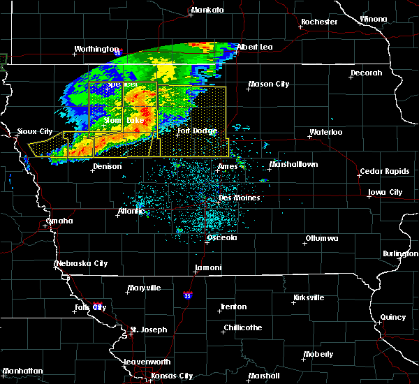 At 423 am cdt, severe thunderstorms were located along a line extending from five island lake to near pocahontas to near north twin lake, moving east at 60 mph. these are very dangerous storms (radar indicated). Hazards include 80 mph wind gusts and nickel size hail. Flying debris will be dangerous to those caught without shelter. mobile homes will be heavily damaged. expect considerable damage to roofs, windows, and vehicles. Extensive tree damage and power outages are likely. At 423 am cdt, severe thunderstorms were located along a line extending from five island lake to near pocahontas to near north twin lake, moving east at 60 mph. these are very dangerous storms (radar indicated). Hazards include 80 mph wind gusts and nickel size hail. Flying debris will be dangerous to those caught without shelter. mobile homes will be heavily damaged. expect considerable damage to roofs, windows, and vehicles. Extensive tree damage and power outages are likely.
|
| 6/30/2018 1:54 PM CDT |
 At 153 pm cdt, a severe thunderstorm was located near eagle lake, or near garner, moving northeast at 25 mph (radar indicated). Hazards include 60 mph wind gusts and quarter size hail. Hail damage to vehicles is expected. Expect wind damage to roofs, siding, and trees. At 153 pm cdt, a severe thunderstorm was located near eagle lake, or near garner, moving northeast at 25 mph (radar indicated). Hazards include 60 mph wind gusts and quarter size hail. Hail damage to vehicles is expected. Expect wind damage to roofs, siding, and trees.
|
| 6/24/2018 6:25 PM CDT |
 At 625 pm cdt, a severe thunderstorm was located near garner, moving southeast at 20 mph (radar indicated). Hazards include 60 mph wind gusts and penny size hail. Expect damage to roofs, siding, and trees. Locations impacted include, forest city, garner, eagle lake, ventura, leland, crystal lake, duncan, miller, hayfield, pilot knob state park, forest city municipal airport and eagle lake state park. At 625 pm cdt, a severe thunderstorm was located near garner, moving southeast at 20 mph (radar indicated). Hazards include 60 mph wind gusts and penny size hail. Expect damage to roofs, siding, and trees. Locations impacted include, forest city, garner, eagle lake, ventura, leland, crystal lake, duncan, miller, hayfield, pilot knob state park, forest city municipal airport and eagle lake state park.
|
| 6/24/2018 6:12 PM CDT |
 At 612 pm cdt, a severe thunderstorm was located over forest city, moving southeast at 20 mph (radar indicated). Hazards include 60 mph wind gusts and penny size hail. expect damage to roofs, siding, and trees At 612 pm cdt, a severe thunderstorm was located over forest city, moving southeast at 20 mph (radar indicated). Hazards include 60 mph wind gusts and penny size hail. expect damage to roofs, siding, and trees
|
| 5/28/2018 5:27 PM CDT |
 At 527 pm cdt, a severe thunderstorm was located 8 miles south of clear lake, or 9 miles southeast of garner, moving north at 25 mph (radar indicated). Hazards include golf ball size hail and 70 mph wind gusts. People and animals outdoors will be injured. expect hail damage to roofs, siding, windows, and vehicles. expect considerable tree damage. wind damage is also likely to mobile homes, roofs, and outbuildings. locations impacted include, mason city, forest city, garner, belmond, britt, sheffield, rockwell, clear lake, eagle lake, mason city municipal airport, ventura, klemme, thornton, meservey, crystal lake, alexander, swaledale, rock falls, goodell and duncan. This includes interstate 35 between mile markers 170 and 200. At 527 pm cdt, a severe thunderstorm was located 8 miles south of clear lake, or 9 miles southeast of garner, moving north at 25 mph (radar indicated). Hazards include golf ball size hail and 70 mph wind gusts. People and animals outdoors will be injured. expect hail damage to roofs, siding, windows, and vehicles. expect considerable tree damage. wind damage is also likely to mobile homes, roofs, and outbuildings. locations impacted include, mason city, forest city, garner, belmond, britt, sheffield, rockwell, clear lake, eagle lake, mason city municipal airport, ventura, klemme, thornton, meservey, crystal lake, alexander, swaledale, rock falls, goodell and duncan. This includes interstate 35 between mile markers 170 and 200.
|
| 5/28/2018 5:15 PM CDT |
 At 514 pm cdt, a severe thunderstorm was located near belmond, or 15 miles northeast of clarion, moving north at 20 mph (radar indicated). Hazards include golf ball size hail and 70 mph wind gusts. People and animals outdoors will be injured. expect hail damage to roofs, siding, windows, and vehicles. expect considerable tree damage. wind damage is also likely to mobile homes, roofs, and outbuildings. locations impacted include, mason city, forest city, garner, clarion, belmond, britt, sheffield, rockwell, clear lake, eagle lake, mason city municipal airport, elm lake, ventura, kanawha, klemme, latimer, thornton, coulter, meservey and crystal lake. This includes interstate 35 between mile markers 164 and 200. At 514 pm cdt, a severe thunderstorm was located near belmond, or 15 miles northeast of clarion, moving north at 20 mph (radar indicated). Hazards include golf ball size hail and 70 mph wind gusts. People and animals outdoors will be injured. expect hail damage to roofs, siding, windows, and vehicles. expect considerable tree damage. wind damage is also likely to mobile homes, roofs, and outbuildings. locations impacted include, mason city, forest city, garner, clarion, belmond, britt, sheffield, rockwell, clear lake, eagle lake, mason city municipal airport, elm lake, ventura, kanawha, klemme, latimer, thornton, coulter, meservey and crystal lake. This includes interstate 35 between mile markers 164 and 200.
|
| 5/28/2018 5:03 PM CDT |
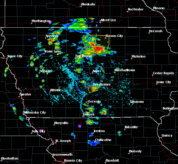 At 503 pm cdt, a severe thunderstorm was located near belmond, or 13 miles northeast of clarion, moving north at 20 mph (radar indicated). Hazards include 60 mph wind gusts and quarter size hail. Hail damage to vehicles is expected. Expect wind damage to roofs, siding, and trees. At 503 pm cdt, a severe thunderstorm was located near belmond, or 13 miles northeast of clarion, moving north at 20 mph (radar indicated). Hazards include 60 mph wind gusts and quarter size hail. Hail damage to vehicles is expected. Expect wind damage to roofs, siding, and trees.
|
| 7/19/2017 4:38 PM CDT |
 At 436 pm cdt, severe thunderstorms were located along a line extending from near northwood to near mason city municipal airport to near eagle lake, moving southeast at 60 mph (trained weather spotters. at 435 pm...a 66 mph wind gust was reported at the forest city airport. other reports of downed trees and powerlines have occurred over winnebago and hancock counties). Hazards include 70 mph wind gusts and penny size hail. Expect considerable tree damage. damage is likely to mobile homes, roofs, and outbuildings. locations impacted include, mason city, forest city, garner, northwood, lake mills, britt, nora springs, manly, rockwell, emmons, clear lake, eagle lake, mason city municipal airport, rice lake, ventura, klemme, thompson, thornton, plymouth and fertile. This includes interstate 35 between mile markers 178 and 218. At 436 pm cdt, severe thunderstorms were located along a line extending from near northwood to near mason city municipal airport to near eagle lake, moving southeast at 60 mph (trained weather spotters. at 435 pm...a 66 mph wind gust was reported at the forest city airport. other reports of downed trees and powerlines have occurred over winnebago and hancock counties). Hazards include 70 mph wind gusts and penny size hail. Expect considerable tree damage. damage is likely to mobile homes, roofs, and outbuildings. locations impacted include, mason city, forest city, garner, northwood, lake mills, britt, nora springs, manly, rockwell, emmons, clear lake, eagle lake, mason city municipal airport, rice lake, ventura, klemme, thompson, thornton, plymouth and fertile. This includes interstate 35 between mile markers 178 and 218.
|
| 7/19/2017 4:34 PM CDT |
 At 433 pm cdt, severe thunderstorms were located along a line extending from near northwood to 7 miles east of forest city to eagle lake, moving southeast at 50 mph (radar indicated. at 415pm cdt...trained weather spotters reported a large tree uprooted in thompson). Hazards include 70 mph wind gusts and penny size hail. Expect considerable tree damage. damage is likely to mobile homes, roofs, and outbuildings. locations impacted include, mason city, forest city, garner, northwood, lake mills, britt, nora springs, manly, rockwell, emmons, clear lake, eagle lake, mason city municipal airport, rice lake, ventura, klemme, thompson, thornton, plymouth and fertile. This includes interstate 35 between mile markers 178 and 218. At 433 pm cdt, severe thunderstorms were located along a line extending from near northwood to 7 miles east of forest city to eagle lake, moving southeast at 50 mph (radar indicated. at 415pm cdt...trained weather spotters reported a large tree uprooted in thompson). Hazards include 70 mph wind gusts and penny size hail. Expect considerable tree damage. damage is likely to mobile homes, roofs, and outbuildings. locations impacted include, mason city, forest city, garner, northwood, lake mills, britt, nora springs, manly, rockwell, emmons, clear lake, eagle lake, mason city municipal airport, rice lake, ventura, klemme, thompson, thornton, plymouth and fertile. This includes interstate 35 between mile markers 178 and 218.
|
| 7/19/2017 4:26 PM CDT |
 At 425 pm cdt, severe thunderstorms were located along a line extending from near rice lake to near forest city to 8 miles northwest of britt, moving east at 55 mph (radar indicated). Hazards include 60 mph wind gusts and penny size hail. Expect damage to roofs, siding, and trees. Locations impacted include, forest city, lake mills, rice lake, buffalo center, thompson, leland, crystal lake, woden, rake, scarville, miller, hayfield, pilot knob state park, lake mills municipal airport, forest city municipal airport, hogsback wildlife area and rice lake state park. At 425 pm cdt, severe thunderstorms were located along a line extending from near rice lake to near forest city to 8 miles northwest of britt, moving east at 55 mph (radar indicated). Hazards include 60 mph wind gusts and penny size hail. Expect damage to roofs, siding, and trees. Locations impacted include, forest city, lake mills, rice lake, buffalo center, thompson, leland, crystal lake, woden, rake, scarville, miller, hayfield, pilot knob state park, lake mills municipal airport, forest city municipal airport, hogsback wildlife area and rice lake state park.
|
| 7/19/2017 4:19 PM CDT |
 At 419 pm cdt, severe thunderstorms were located along a line extending from near mansfield to 7 miles northwest of forest city to 6 miles east of union slogh, moving southeast at 55 mph (radar indicated). Hazards include 60 mph wind gusts and penny size hail. expect damage to roofs, siding, and trees At 419 pm cdt, severe thunderstorms were located along a line extending from near mansfield to 7 miles northwest of forest city to 6 miles east of union slogh, moving southeast at 55 mph (radar indicated). Hazards include 60 mph wind gusts and penny size hail. expect damage to roofs, siding, and trees
|
| 7/19/2017 4:15 PM CDT |
 At 415 pm cdt, severe thunderstorms were located along a line extending from 7 miles southwest of mansfield to 11 miles northwest of forest city to union slogh, moving east at 60 mph (radar indicated). Hazards include 60 mph wind gusts and penny size hail. Expect damage to roofs, siding, and trees. Locations impacted include, forest city, lake mills, union slogh, rice lake, buffalo center, bancroft, swea city, burt, thompson, titonka, leland, lakota, crystal lake, woden, rake, lone rock, ledyard, scarville, miller and hayfield. At 415 pm cdt, severe thunderstorms were located along a line extending from 7 miles southwest of mansfield to 11 miles northwest of forest city to union slogh, moving east at 60 mph (radar indicated). Hazards include 60 mph wind gusts and penny size hail. Expect damage to roofs, siding, and trees. Locations impacted include, forest city, lake mills, union slogh, rice lake, buffalo center, bancroft, swea city, burt, thompson, titonka, leland, lakota, crystal lake, woden, rake, lone rock, ledyard, scarville, miller and hayfield.
|
| 7/19/2017 4:00 PM CDT |
 At 400 pm cdt, severe thunderstorms were located along a line extending from near bricelyn to 6 miles south of elmore to 11 miles northwest of union slogh, moving east at 60 mph (radar indicated). Hazards include 60 mph wind gusts and quarter size hail. Hail damage to vehicles is expected. Expect wind damage to roofs, siding, and trees. At 400 pm cdt, severe thunderstorms were located along a line extending from near bricelyn to 6 miles south of elmore to 11 miles northwest of union slogh, moving east at 60 mph (radar indicated). Hazards include 60 mph wind gusts and quarter size hail. Hail damage to vehicles is expected. Expect wind damage to roofs, siding, and trees.
|
| 7/10/2017 1:42 AM CDT |
 At 142 am cdt, a severe thunderstorm was located 8 miles southeast of britt, or 8 miles southwest of garner, moving southeast at 45 mph (radar indicated). Hazards include two inch hail and 60 mph wind gusts. People and animals outdoors will be injured. expect hail damage to roofs, siding, windows, and vehicles. expect wind damage to roofs, siding, and trees. locations impacted include, garner, belmond, britt, sheffield, eagle lake, elm lake, clear lake, ventura, kanawha, klemme, latimer, thornton, meservey, alexander, swaledale, rowan, goodell, duncan, chapin and miller. This includes interstate 35 between mile markers 168 and 186. At 142 am cdt, a severe thunderstorm was located 8 miles southeast of britt, or 8 miles southwest of garner, moving southeast at 45 mph (radar indicated). Hazards include two inch hail and 60 mph wind gusts. People and animals outdoors will be injured. expect hail damage to roofs, siding, windows, and vehicles. expect wind damage to roofs, siding, and trees. locations impacted include, garner, belmond, britt, sheffield, eagle lake, elm lake, clear lake, ventura, kanawha, klemme, latimer, thornton, meservey, alexander, swaledale, rowan, goodell, duncan, chapin and miller. This includes interstate 35 between mile markers 168 and 186.
|
| 7/10/2017 1:28 AM CDT |
 At 128 am cdt, a severe thunderstorm was located over britt, or 11 miles west of garner, moving southeast at 45 mph (radar indicated). Hazards include ping pong ball size hail and 60 mph wind gusts. People and animals outdoors will be injured. expect hail damage to roofs, siding, windows, and vehicles. Expect wind damage to roofs, siding, and trees. At 128 am cdt, a severe thunderstorm was located over britt, or 11 miles west of garner, moving southeast at 45 mph (radar indicated). Hazards include ping pong ball size hail and 60 mph wind gusts. People and animals outdoors will be injured. expect hail damage to roofs, siding, windows, and vehicles. Expect wind damage to roofs, siding, and trees.
|
| 7/10/2017 1:21 AM CDT |
 At 121 am cdt, a severe thunderstorm was located near britt, or 11 miles southwest of forest city, moving southeast at 45 mph (radar indicated). Hazards include ping pong ball size hail and 60 mph wind gusts. People and animals outdoors will be injured. expect hail damage to roofs, siding, windows, and vehicles. expect wind damage to roofs, siding, and trees. Locations impacted include, forest city, thompson, titonka, leland, crystal lake, woden, miller, hayfield and forest city municipal airport. At 121 am cdt, a severe thunderstorm was located near britt, or 11 miles southwest of forest city, moving southeast at 45 mph (radar indicated). Hazards include ping pong ball size hail and 60 mph wind gusts. People and animals outdoors will be injured. expect hail damage to roofs, siding, windows, and vehicles. expect wind damage to roofs, siding, and trees. Locations impacted include, forest city, thompson, titonka, leland, crystal lake, woden, miller, hayfield and forest city municipal airport.
|
| 7/10/2017 12:59 AM CDT |
 At 1259 am cdt, a severe thunderstorm was located 10 miles southeast of elmore, or 19 miles northwest of forest city, moving southeast at 45 mph (radar indicated). Hazards include ping pong ball size hail and 60 mph wind gusts. People and animals outdoors will be injured. expect hail damage to roofs, siding, windows, and vehicles. expect wind damage to roofs, siding, and trees. Locations impacted include, forest city, union slogh, buffalo center, thompson, titonka, leland, lakota, crystal lake, woden, rake, ledyard, miller, hayfield and forest city municipal airport. At 1259 am cdt, a severe thunderstorm was located 10 miles southeast of elmore, or 19 miles northwest of forest city, moving southeast at 45 mph (radar indicated). Hazards include ping pong ball size hail and 60 mph wind gusts. People and animals outdoors will be injured. expect hail damage to roofs, siding, windows, and vehicles. expect wind damage to roofs, siding, and trees. Locations impacted include, forest city, union slogh, buffalo center, thompson, titonka, leland, lakota, crystal lake, woden, rake, ledyard, miller, hayfield and forest city municipal airport.
|
| 7/10/2017 12:46 AM CDT |
 At 1246 am cdt, a severe thunderstorm was located over elmore, or 21 miles southeast of fairmont, moving southeast at 45 mph (radar indicated). Hazards include 60 mph wind gusts and quarter size hail. Hail damage to vehicles is expected. Expect wind damage to roofs, siding, and trees. At 1246 am cdt, a severe thunderstorm was located over elmore, or 21 miles southeast of fairmont, moving southeast at 45 mph (radar indicated). Hazards include 60 mph wind gusts and quarter size hail. Hail damage to vehicles is expected. Expect wind damage to roofs, siding, and trees.
|
| 5/17/2017 5:53 PM CDT |
 At 553 pm cdt, severe thunderstorms were located along a line extending from near rockwell to 6 miles southeast of garner to near britt, moving north at 50 mph (radar indicated). Hazards include 60 mph wind gusts. expect damage to roofs, siding, and trees At 553 pm cdt, severe thunderstorms were located along a line extending from near rockwell to 6 miles southeast of garner to near britt, moving north at 50 mph (radar indicated). Hazards include 60 mph wind gusts. expect damage to roofs, siding, and trees
|
| 5/16/2017 10:11 PM CDT |
 The severe thunderstorm warning for western worth, northeastern kossuth, northern hancock and winnebago counties will expire at 1015 pm cdt, the storm which prompted the warning has weakened below severe limits, and has exited the warned area. therefore, the warning will be allowed to expire. however gusty winds are still possible with this thunderstorm. a severe thunderstorm watch remains in effect until 300 am cdt for north central iowa. The severe thunderstorm warning for western worth, northeastern kossuth, northern hancock and winnebago counties will expire at 1015 pm cdt, the storm which prompted the warning has weakened below severe limits, and has exited the warned area. therefore, the warning will be allowed to expire. however gusty winds are still possible with this thunderstorm. a severe thunderstorm watch remains in effect until 300 am cdt for north central iowa.
|
| 5/16/2017 9:52 PM CDT |
 At 952 pm cdt, a severe thunderstorm was located over emmons, or 12 miles southwest of albert lea, moving northeast at 40 mph (trained weather spotters). Hazards include 70 mph wind gusts and quarter size hail. Hail damage to vehicles is expected. expect considerable tree damage. wind damage is also likely to mobile homes, roofs, and outbuildings. locations impacted include, forest city, lake mills, britt, emmons, union slough, eagle lake, rice lake, buffalo center, thompson, titonka, wesley, leland, lakota, crystal lake, woden, rake, joice, ledyard, scarville and miller. This includes interstate 35 between mile markers 211 and 218. At 952 pm cdt, a severe thunderstorm was located over emmons, or 12 miles southwest of albert lea, moving northeast at 40 mph (trained weather spotters). Hazards include 70 mph wind gusts and quarter size hail. Hail damage to vehicles is expected. expect considerable tree damage. wind damage is also likely to mobile homes, roofs, and outbuildings. locations impacted include, forest city, lake mills, britt, emmons, union slough, eagle lake, rice lake, buffalo center, thompson, titonka, wesley, leland, lakota, crystal lake, woden, rake, joice, ledyard, scarville and miller. This includes interstate 35 between mile markers 211 and 218.
|
| 5/16/2017 9:49 PM CDT |
 At 949 pm cdt, severe thunderstorms were located along a line extending from near eagle lake to 8 miles southeast of garner to 7 miles west of hampton, moving northeast at 55 mph (trained weather spotters). Hazards include 70 mph wind gusts and penny size hail. Expect considerable tree damage. Damage is likely to mobile homes, roofs, and outbuildings. At 949 pm cdt, severe thunderstorms were located along a line extending from near eagle lake to 8 miles southeast of garner to 7 miles west of hampton, moving northeast at 55 mph (trained weather spotters). Hazards include 70 mph wind gusts and penny size hail. Expect considerable tree damage. Damage is likely to mobile homes, roofs, and outbuildings.
|
| 5/16/2017 9:30 PM CDT |
 At 930 pm cdt, a severe thunderstorm was located near forest city, moving northeast at 40 mph (trained weather spotters). Hazards include 70 mph wind gusts and half dollar size hail. Hail damage to vehicles is expected. expect considerable tree damage. wind damage is also likely to mobile homes, roofs, and outbuildings. locations impacted include, algona, forest city, lake mills, britt, emmons, union slough, eagle lake, rice lake, buffalo center, bancroft, burt, thompson, titonka, wesley, leland, lakota, crystal lake, woden, rake and joice. This includes interstate 35 between mile markers 211 and 218. At 930 pm cdt, a severe thunderstorm was located near forest city, moving northeast at 40 mph (trained weather spotters). Hazards include 70 mph wind gusts and half dollar size hail. Hail damage to vehicles is expected. expect considerable tree damage. wind damage is also likely to mobile homes, roofs, and outbuildings. locations impacted include, algona, forest city, lake mills, britt, emmons, union slough, eagle lake, rice lake, buffalo center, bancroft, burt, thompson, titonka, wesley, leland, lakota, crystal lake, woden, rake and joice. This includes interstate 35 between mile markers 211 and 218.
|
| 5/16/2017 9:19 PM CDT |
 At 919 pm cdt, a severe thunderstorm was located 7 miles west of forest city, moving northeast at 40 mph (trained weather spotters). Hazards include 60 mph wind gusts and half dollar size hail. Hail damage to vehicles is expected. Expect wind damage to roofs, siding, and trees. At 919 pm cdt, a severe thunderstorm was located 7 miles west of forest city, moving northeast at 40 mph (trained weather spotters). Hazards include 60 mph wind gusts and half dollar size hail. Hail damage to vehicles is expected. Expect wind damage to roofs, siding, and trees.
|
| 5/15/2017 4:34 PM CDT |
 At 434 pm cdt, a severe thunderstorm was located 8 miles southwest of britt, or 13 miles east of algona, moving east at 45 mph (radar indicated). Hazards include 60 mph wind gusts and quarter size hail. Hail damage to vehicles is expected. expect wind damage to roofs, siding, and trees. locations impacted include, forest city, garner, britt, eagle lake, klemme, wesley, corwith, duncan, miller, hayfield, st. Benedict, sexton, hutchins, eagle lake state park and forest city municipal airport. At 434 pm cdt, a severe thunderstorm was located 8 miles southwest of britt, or 13 miles east of algona, moving east at 45 mph (radar indicated). Hazards include 60 mph wind gusts and quarter size hail. Hail damage to vehicles is expected. expect wind damage to roofs, siding, and trees. locations impacted include, forest city, garner, britt, eagle lake, klemme, wesley, corwith, duncan, miller, hayfield, st. Benedict, sexton, hutchins, eagle lake state park and forest city municipal airport.
|
| 5/15/2017 4:20 PM CDT |
 At 420 pm cdt, a severe thunderstorm was located near algona, moving east at 45 mph (radar indicated). Hazards include 60 mph wind gusts and quarter size hail. Hail damage to vehicles is expected. Expect wind damage to roofs, siding, and trees. At 420 pm cdt, a severe thunderstorm was located near algona, moving east at 45 mph (radar indicated). Hazards include 60 mph wind gusts and quarter size hail. Hail damage to vehicles is expected. Expect wind damage to roofs, siding, and trees.
|
| 5/8/2017 8:41 PM CDT |
 At 841 pm cdt, a severe thunderstorm was located near eagle lake, or near garner, moving east at 25 mph (radar indicated). Hazards include quarter size hail. damage to vehicles is expected At 841 pm cdt, a severe thunderstorm was located near eagle lake, or near garner, moving east at 25 mph (radar indicated). Hazards include quarter size hail. damage to vehicles is expected
|
| 3/6/2017 5:14 PM CST |
 At 514 pm cst, a severe thunderstorm was located 10 miles northwest of forest city, moving northeast at 60 mph (radar indicated). Hazards include 60 mph wind gusts and half dollar size hail. Hail damage to vehicles is expected. expect wind damage to roofs, siding, and trees. locations impacted include, algona, forest city, dakota city, humboldt, eagle grove, lake mills, britt, smith pool, eagle lake, rice lake, buffalo center, bancroft, kanawha, goldfield, badger, burt, thompson, titonka, wesley and livermore. A tornado watch remains in effect until 1000 pm cst for central and north central iowa. At 514 pm cst, a severe thunderstorm was located 10 miles northwest of forest city, moving northeast at 60 mph (radar indicated). Hazards include 60 mph wind gusts and half dollar size hail. Hail damage to vehicles is expected. expect wind damage to roofs, siding, and trees. locations impacted include, algona, forest city, dakota city, humboldt, eagle grove, lake mills, britt, smith pool, eagle lake, rice lake, buffalo center, bancroft, kanawha, goldfield, badger, burt, thompson, titonka, wesley and livermore. A tornado watch remains in effect until 1000 pm cst for central and north central iowa.
|
| 3/6/2017 4:58 PM CST |
 At 457 pm cst, a severe thunderstorm was located near eagle grove, or 10 miles east of dakota city. a second severe storm was located near wesley. both storms were moving north at 70 mph (radar indicated. these storms have a history of producing golfball sized hail). Hazards include golf ball size hail and 60 mph wind gusts. People and animals outdoors will be injured. expect hail damage to roofs, siding, windows, and vehicles. Expect wind damage to roofs, siding, and trees. At 457 pm cst, a severe thunderstorm was located near eagle grove, or 10 miles east of dakota city. a second severe storm was located near wesley. both storms were moving north at 70 mph (radar indicated. these storms have a history of producing golfball sized hail). Hazards include golf ball size hail and 60 mph wind gusts. People and animals outdoors will be injured. expect hail damage to roofs, siding, windows, and vehicles. Expect wind damage to roofs, siding, and trees.
|
| 6/22/2016 2:39 AM CDT |
 At 239 am cdt, severe thunderstorms were located along a line extending from near forest city to 9 miles northwest of clear lake to near britt, moving southeast at 40 mph (radar indicated). Hazards include 60 mph wind gusts. Expect damage to roofs. siding. and trees. Locations impacted include, mason city, forest city, garner, britt, eagle lake, clear lake, mason city municipal airport, ventura, kanawha, klemme, wesley, fertile, corwith, goodell, duncan, miller, hayfield, hutchins, forest city municipal airport and clear lake state park. At 239 am cdt, severe thunderstorms were located along a line extending from near forest city to 9 miles northwest of clear lake to near britt, moving southeast at 40 mph (radar indicated). Hazards include 60 mph wind gusts. Expect damage to roofs. siding. and trees. Locations impacted include, mason city, forest city, garner, britt, eagle lake, clear lake, mason city municipal airport, ventura, kanawha, klemme, wesley, fertile, corwith, goodell, duncan, miller, hayfield, hutchins, forest city municipal airport and clear lake state park.
|
| 6/22/2016 2:25 AM CDT |
 At 225 am cdt, severe thunderstorms were located along a line extending from near forest city to 8 miles southeast of smith pool, moving southeast at 40 mph (radar indicated). Hazards include 60 mph wind gusts. Expect damage to roofs. siding. And trees. At 225 am cdt, severe thunderstorms were located along a line extending from near forest city to 8 miles southeast of smith pool, moving southeast at 40 mph (radar indicated). Hazards include 60 mph wind gusts. Expect damage to roofs. siding. And trees.
|
| 6/21/2016 11:58 PM CDT | The severe thunderstorm warning for northeastern hancock, winnebago, northeastern kossuth, southwestern worth and cerro gordo counties will expire at midnight cdt, the storms which prompted the warning have weakened below severe limits, and no longer pose an immediate threat to life or property. therefore, the warning will be allowed to expire. however small hail to nickel size and heavy rain are still possible with these thunderstorms. a severe thunderstorm watch remains in effect until 700 am cdt for north central and northwestern iowa. |
| 6/21/2016 11:40 PM CDT |
 At 1140 pm cdt, severe thunderstorms were located along a line extending from 8 miles southeast of elmore to near marble rock, moving east at 35 mph (radar indicated). Hazards include quarter size hail. Damage to vehicles is expected. Locations impacted include, mason city, forest city, nora springs, rockwell, clear lake, mason city municipal airport, buffalo center, ventura, thompson, fertile, leland, lakota, crystal lake, hanlontown, rake, rock falls, ledyard, miller, dougherty and hayfield. At 1140 pm cdt, severe thunderstorms were located along a line extending from 8 miles southeast of elmore to near marble rock, moving east at 35 mph (radar indicated). Hazards include quarter size hail. Damage to vehicles is expected. Locations impacted include, mason city, forest city, nora springs, rockwell, clear lake, mason city municipal airport, buffalo center, ventura, thompson, fertile, leland, lakota, crystal lake, hanlontown, rake, rock falls, ledyard, miller, dougherty and hayfield.
|
| 6/21/2016 11:20 PM CDT |
 At 1120 pm cdt, severe thunderstorms were located along a line extending from near elmore to near rockford, moving southeast at 40 mph (radar indicated). Hazards include quarter size hail. damage to vehicles is expected At 1120 pm cdt, severe thunderstorms were located along a line extending from near elmore to near rockford, moving southeast at 40 mph (radar indicated). Hazards include quarter size hail. damage to vehicles is expected
|
| 9/6/2015 6:56 PM CDT | The severe thunderstorm warning for central hancock county will expire at 700 pm cdt, the storm which prompted the warning has weakened below severe limits, and no longer pose an immediate threat to life or property. therefore the warning will be allowed to expire. however small hail and gusty winds are still possible with this thunderstorm. a severe thunderstorm watch remains in effect until 100 am cdt for north central iowa. to report severe weather, contact your nearest law enforcement agency. they will relay your report to the national weather service des moines. |
| 9/6/2015 6:28 PM CDT |
 At 628 pm cdt, a severe thunderstorm was located near britt, or 9 miles west of garner, moving northeast at 25 mph (radar indicated). Hazards include 60 mph wind gusts and quarter size hail. Hail damage to vehicles is expected. expect wind damage to roofs, siding and trees. this severe storm will be near, eagle lake around 640 pm cdt. garner around 650 pm cdt. Other locations impacted by this severe thunderstorm include klemme, kanawha, duncan, hayfield, eagle lake state park, corwith and hutchins. At 628 pm cdt, a severe thunderstorm was located near britt, or 9 miles west of garner, moving northeast at 25 mph (radar indicated). Hazards include 60 mph wind gusts and quarter size hail. Hail damage to vehicles is expected. expect wind damage to roofs, siding and trees. this severe storm will be near, eagle lake around 640 pm cdt. garner around 650 pm cdt. Other locations impacted by this severe thunderstorm include klemme, kanawha, duncan, hayfield, eagle lake state park, corwith and hutchins.
|
| 9/6/2015 6:13 PM CDT |
 At 611 pm cdt, a severe thunderstorm was located 8 miles southwest of britt, or 15 miles southwest of garner, moving northeast at 25 mph (radar indicated). Hazards include 60 mph wind gusts and quarter size hail. Hail damage to vehicles is expected. Expect wind damage to roofs, siding and trees. At 611 pm cdt, a severe thunderstorm was located 8 miles southwest of britt, or 15 miles southwest of garner, moving northeast at 25 mph (radar indicated). Hazards include 60 mph wind gusts and quarter size hail. Hail damage to vehicles is expected. Expect wind damage to roofs, siding and trees.
|
| 6/22/2015 7:09 AM CDT |
 At 708 am cdt, severe thunderstorms were located along a line extending from 9 miles west of lake mills to 7 miles east of dakota city to 4 miles south of rockwell city, moving east at 60 mph (radar indicated). Hazards include 60 mph wind gusts and penny size hail. Expect damage to roofs. siding and trees. Locations impacted include, fort dodge, forest city, garner, clarion, pocahontas, rockwell city, dakota city, humboldt, eagle grove, britt, lake city, manson, fort dodge regional airport, north twin lake, eagle lake, south twin lake, pomeroy, kanawha, goldfield and fonda. At 708 am cdt, severe thunderstorms were located along a line extending from 9 miles west of lake mills to 7 miles east of dakota city to 4 miles south of rockwell city, moving east at 60 mph (radar indicated). Hazards include 60 mph wind gusts and penny size hail. Expect damage to roofs. siding and trees. Locations impacted include, fort dodge, forest city, garner, clarion, pocahontas, rockwell city, dakota city, humboldt, eagle grove, britt, lake city, manson, fort dodge regional airport, north twin lake, eagle lake, south twin lake, pomeroy, kanawha, goldfield and fonda.
|
| 6/22/2015 6:43 AM CDT |
 At 642 am cdt, severe thunderstorms were located along a line extending from 9 miles south of blue earth to 9 miles northeast of pocahontas to 4 miles west of sac city, moving east at 60 mph (emergency management). Hazards include 60 mph wind gusts and penny size hail. Expect damage to roofs. Siding and trees. At 642 am cdt, severe thunderstorms were located along a line extending from 9 miles south of blue earth to 9 miles northeast of pocahontas to 4 miles west of sac city, moving east at 60 mph (emergency management). Hazards include 60 mph wind gusts and penny size hail. Expect damage to roofs. Siding and trees.
|
| 6/26/2013 10:10 AM CDT | Half mile wide swath of wind damage. a number of 8 inch branches broken as well as a large tree down over the road. time estimated from rada in hancock county IA, 3.1 miles NE of Hayfield, IA |
Hail Maps for Hayfield, IA


Connect with Interactive Hail Maps