

Hail Map for Heavener, OK
The Heavener, OK area has had 12 reports of on-the-ground hail by trained spotters, and has been under severe weather warnings 42 times during the past 12 months. Doppler radar has detected hail at or near Heavener, OK on 73 occasions, including 3 occasions during the past year.
| Name: | Heavener, OK |
| Where Located: | 35.6 miles SSW of Fort Smith, AR |
| Map: | Google Map for Heavener, OK |
| Population: | 3414 |
| Housing Units: | 1265 |
| More Info: | Search Google for Heavener, OK |
0
The Top Recent Hail Date for Heavener, OK is Monday, May 19, 2025 (40th out of 73)
Hail and Wind Damage Spotted near Heavener, OK
| Date / Time | Report Details |
|---|---|
| 6/7/2025 7:06 AM CDT |
 At 706 am cdt, a severe thunderstorm capable of producing a tornado was located 8 miles north of muse, moving east at 40 mph (radar indicated rotation). Hazards include tornado. Flying debris will be dangerous to those caught without shelter. mobile homes will be damaged or destroyed. damage to roofs, windows, and vehicles will occur. tree damage is likely. Locations in or near the path include, hodgen, heavener,. At 706 am cdt, a severe thunderstorm capable of producing a tornado was located 8 miles north of muse, moving east at 40 mph (radar indicated rotation). Hazards include tornado. Flying debris will be dangerous to those caught without shelter. mobile homes will be damaged or destroyed. damage to roofs, windows, and vehicles will occur. tree damage is likely. Locations in or near the path include, hodgen, heavener,.
|
| 5/24/2025 9:13 AM CDT |
 At 913 am cdt, severe thunderstorms were located along a line extending from near talimena state park to 8 miles south of whitesboro to 9 miles southeast of nashoba, moving southeast at 40 mph (radar indicated). Hazards include 60 mph wind gusts and quarter size hail. Hail damage to vehicles is expected. expect wind damage to roofs, siding, and trees. Locations in or near the path include, talimena state park, octavia, bengal, summerfield, big cedar, heavener, nashoba, whitesboro, albion, hodgen, talihina, muse, honobia,. At 913 am cdt, severe thunderstorms were located along a line extending from near talimena state park to 8 miles south of whitesboro to 9 miles southeast of nashoba, moving southeast at 40 mph (radar indicated). Hazards include 60 mph wind gusts and quarter size hail. Hail damage to vehicles is expected. expect wind damage to roofs, siding, and trees. Locations in or near the path include, talimena state park, octavia, bengal, summerfield, big cedar, heavener, nashoba, whitesboro, albion, hodgen, talihina, muse, honobia,.
|
| 5/24/2025 9:02 AM CDT |
 At 902 am cdt, severe thunderstorms were located along a line extending from 4 miles north of bengal to 7 miles southeast of albion to 2 miles south of nashoba, moving southeast at 55 mph (radar indicated). Hazards include 60 mph wind gusts and penny size hail. Expect damage to roofs, siding, and trees. Locations in or near the path include, talimena state park, octavia, clayton lake state park, red oak, bengal, panola, tuskahoma, summerfield, fanshawe, big cedar, lake wister state park, heavener, nashoba, kiamichi, whitesboro, albion, hodgen, talihina, muse, honobia,. At 902 am cdt, severe thunderstorms were located along a line extending from 4 miles north of bengal to 7 miles southeast of albion to 2 miles south of nashoba, moving southeast at 55 mph (radar indicated). Hazards include 60 mph wind gusts and penny size hail. Expect damage to roofs, siding, and trees. Locations in or near the path include, talimena state park, octavia, clayton lake state park, red oak, bengal, panola, tuskahoma, summerfield, fanshawe, big cedar, lake wister state park, heavener, nashoba, kiamichi, whitesboro, albion, hodgen, talihina, muse, honobia,.
|
| 5/24/2025 8:51 AM CDT |
 At 851 am cdt, severe thunderstorms were located along a line extending from 3 miles northwest of red oak to 3 miles north of albion to 2 miles west of nashoba, moving east at 35 mph (radar indicated). Hazards include 70 mph wind gusts and nickel size hail. Expect considerable tree damage. damage is likely to mobile homes, roofs, and outbuildings. Locations in or near the path include, talimena state park, octavia, panola, tuskahoma, big cedar, howe, kiamichi, whitesboro, talihina, clayton lake state park, red oak, bengal, summerfield, yanush, robbers cave state park, fanshawe, clayton, wilburton, wister, lake wister state park,. At 851 am cdt, severe thunderstorms were located along a line extending from 3 miles northwest of red oak to 3 miles north of albion to 2 miles west of nashoba, moving east at 35 mph (radar indicated). Hazards include 70 mph wind gusts and nickel size hail. Expect considerable tree damage. damage is likely to mobile homes, roofs, and outbuildings. Locations in or near the path include, talimena state park, octavia, panola, tuskahoma, big cedar, howe, kiamichi, whitesboro, talihina, clayton lake state park, red oak, bengal, summerfield, yanush, robbers cave state park, fanshawe, clayton, wilburton, wister, lake wister state park,.
|
| 5/24/2025 8:38 AM CDT |
 Svrtsa the national weather service in tulsa has issued a * severe thunderstorm warning for, northeastern pushmataha county in southeastern oklahoma, latimer county in southeastern oklahoma, southern le flore county in southeastern oklahoma, * until 930 am cdt. * at 838 am cdt, severe thunderstorms were located along a line extending from 4 miles east of robbers cave state park to 4 miles northeast of yanush to near clayton, moving east at 60 mph (radar indicated). Hazards include 70 mph wind gusts and half dollar size hail. Hail damage to vehicles is expected. expect considerable tree damage. wind damage is also likely to mobile homes, roofs, and outbuildings. Locations in or near the path include, talimena state park, octavia, panola, tuskahoma, big cedar, stanley, howe, kiamichi, whitesboro, talihina, clayton lake state park, red oak, sardis, damon, bengal, summerfield, yanush, robbers cave state park, fanshawe, clayton,. Svrtsa the national weather service in tulsa has issued a * severe thunderstorm warning for, northeastern pushmataha county in southeastern oklahoma, latimer county in southeastern oklahoma, southern le flore county in southeastern oklahoma, * until 930 am cdt. * at 838 am cdt, severe thunderstorms were located along a line extending from 4 miles east of robbers cave state park to 4 miles northeast of yanush to near clayton, moving east at 60 mph (radar indicated). Hazards include 70 mph wind gusts and half dollar size hail. Hail damage to vehicles is expected. expect considerable tree damage. wind damage is also likely to mobile homes, roofs, and outbuildings. Locations in or near the path include, talimena state park, octavia, panola, tuskahoma, big cedar, stanley, howe, kiamichi, whitesboro, talihina, clayton lake state park, red oak, sardis, damon, bengal, summerfield, yanush, robbers cave state park, fanshawe, clayton,.
|
| 5/20/2025 1:51 AM CDT |
 At 151 am cdt, a severe thunderstorm was located 7 miles west of beauchamp, moving northeast at 65 mph (radar indicated). Hazards include 60 mph wind gusts. Expect damage to roofs, siding, and trees. Locations in or near the path include, big cedar, hodgen, heavener,. At 151 am cdt, a severe thunderstorm was located 7 miles west of beauchamp, moving northeast at 65 mph (radar indicated). Hazards include 60 mph wind gusts. Expect damage to roofs, siding, and trees. Locations in or near the path include, big cedar, hodgen, heavener,.
|
| 5/20/2025 1:35 AM CDT |
 the severe thunderstorm warning has been cancelled and is no longer in effect the severe thunderstorm warning has been cancelled and is no longer in effect
|
| 5/20/2025 1:35 AM CDT |
 At 134 am cdt, a severe thunderstorm was located 3 miles northwest of big cedar, moving northeast at 65 mph (radar indicated). Hazards include 60 mph wind gusts. Expect damage to roofs, siding, and trees. Locations in or near the path include, whitesboro, octavia, hodgen, muse, honobia, big cedar,. At 134 am cdt, a severe thunderstorm was located 3 miles northwest of big cedar, moving northeast at 65 mph (radar indicated). Hazards include 60 mph wind gusts. Expect damage to roofs, siding, and trees. Locations in or near the path include, whitesboro, octavia, hodgen, muse, honobia, big cedar,.
|
| 5/20/2025 1:17 AM CDT |
 Svrtsa the national weather service in tulsa has issued a * severe thunderstorm warning for, eastern pushmataha county in southeastern oklahoma, southern le flore county in southeastern oklahoma, * until 200 am cdt. * at 117 am cdt, a severe thunderstorm was located 8 miles southeast of albion, moving northeast at 65 mph (radar indicated). Hazards include 60 mph wind gusts. Expect damage to roofs, siding, and trees. Locations in or near the path include, octavia, kiamichi, whitesboro, albion, hodgen, muse, honobia, big cedar,. Svrtsa the national weather service in tulsa has issued a * severe thunderstorm warning for, eastern pushmataha county in southeastern oklahoma, southern le flore county in southeastern oklahoma, * until 200 am cdt. * at 117 am cdt, a severe thunderstorm was located 8 miles southeast of albion, moving northeast at 65 mph (radar indicated). Hazards include 60 mph wind gusts. Expect damage to roofs, siding, and trees. Locations in or near the path include, octavia, kiamichi, whitesboro, albion, hodgen, muse, honobia, big cedar,.
|
| 5/19/2025 9:28 PM CDT |
 the severe thunderstorm warning has been cancelled and is no longer in effect the severe thunderstorm warning has been cancelled and is no longer in effect
|
| 5/19/2025 9:13 PM CDT |
 Svrtsa the national weather service in tulsa has issued a * severe thunderstorm warning for, southeastern le flore county in southeastern oklahoma, * until 1000 pm cdt. * at 913 pm cdt, severe thunderstorms were located along a line extending from 8 miles southwest of morgan springs to octavia, moving east at 10 mph (radar indicated). Hazards include 60 mph wind gusts. Expect damage to roofs, siding, and trees. Locations in or near the path include, octavia, hodgen, muse, big cedar,. Svrtsa the national weather service in tulsa has issued a * severe thunderstorm warning for, southeastern le flore county in southeastern oklahoma, * until 1000 pm cdt. * at 913 pm cdt, severe thunderstorms were located along a line extending from 8 miles southwest of morgan springs to octavia, moving east at 10 mph (radar indicated). Hazards include 60 mph wind gusts. Expect damage to roofs, siding, and trees. Locations in or near the path include, octavia, hodgen, muse, big cedar,.
|
| 5/19/2025 9:00 PM CDT |
 Svrtsa the national weather service in tulsa has issued a * severe thunderstorm warning for, southern franklin county in west central arkansas, sebastian county in west central arkansas, east central le flore county in southeastern oklahoma, * until 945 pm cdt. * at 900 pm cdt, severe thunderstorms were located along a line extending from near branch to 6 miles east of heavener, moving east at 25 mph (radar indicated). Hazards include 60 mph wind gusts. Expect damage to roofs, siding, and trees. Locations in or near the path include, charleston, arkola, huntington, crossroads, central city, witcherville, dayton, poteau, milltown, branch, howe, excelsior, vesta, cecil, ursula, lavaca, denning, etna, alix, greenwood,. Svrtsa the national weather service in tulsa has issued a * severe thunderstorm warning for, southern franklin county in west central arkansas, sebastian county in west central arkansas, east central le flore county in southeastern oklahoma, * until 945 pm cdt. * at 900 pm cdt, severe thunderstorms were located along a line extending from near branch to 6 miles east of heavener, moving east at 25 mph (radar indicated). Hazards include 60 mph wind gusts. Expect damage to roofs, siding, and trees. Locations in or near the path include, charleston, arkola, huntington, crossroads, central city, witcherville, dayton, poteau, milltown, branch, howe, excelsior, vesta, cecil, ursula, lavaca, denning, etna, alix, greenwood,.
|
| 5/19/2025 8:50 PM CDT |
 the severe thunderstorm warning has been cancelled and is no longer in effect the severe thunderstorm warning has been cancelled and is no longer in effect
|
| 5/19/2025 8:50 PM CDT |
 At 850 pm cdt, severe thunderstorms were located along a line extending from 2 miles east of denning to 2 miles northwest of huntington to 2 miles west of heavener, moving east at 20 mph (radar indicated). Hazards include 60 mph wind gusts and nickel size hail. Expect damage to roofs, siding, and trees. locations in or near the path include, alma, charleston, shibley, dyer, kibler, central city, cameron, panama, howe, vesta, lonelm, ursula, altus, mulberry, alix, greenwood, bloomer, hackett, patterson, arkoma, this includes the following highways, interstate 40 in arkansas between mile markers 7 and 42. interstate 540 between mile markers 1 and 14. Interstate 49 near mile marker 22. At 850 pm cdt, severe thunderstorms were located along a line extending from 2 miles east of denning to 2 miles northwest of huntington to 2 miles west of heavener, moving east at 20 mph (radar indicated). Hazards include 60 mph wind gusts and nickel size hail. Expect damage to roofs, siding, and trees. locations in or near the path include, alma, charleston, shibley, dyer, kibler, central city, cameron, panama, howe, vesta, lonelm, ursula, altus, mulberry, alix, greenwood, bloomer, hackett, patterson, arkoma, this includes the following highways, interstate 40 in arkansas between mile markers 7 and 42. interstate 540 between mile markers 1 and 14. Interstate 49 near mile marker 22.
|
| 5/19/2025 8:48 PM CDT |
 Svrtsa the national weather service in tulsa has issued a * severe thunderstorm warning for, southeastern le flore county in southeastern oklahoma, * until 930 pm cdt. * at 848 pm cdt, severe thunderstorms were located along a line extending from 2 miles west of heavener to 2 miles south of big cedar to near octavia, moving east at 40 mph (radar indicated). Hazards include 60 mph wind gusts and nickel size hail. Expect damage to roofs, siding, and trees. Locations in or near the path include, whitesboro, octavia, hodgen, muse, honobia, big cedar,. Svrtsa the national weather service in tulsa has issued a * severe thunderstorm warning for, southeastern le flore county in southeastern oklahoma, * until 930 pm cdt. * at 848 pm cdt, severe thunderstorms were located along a line extending from 2 miles west of heavener to 2 miles south of big cedar to near octavia, moving east at 40 mph (radar indicated). Hazards include 60 mph wind gusts and nickel size hail. Expect damage to roofs, siding, and trees. Locations in or near the path include, whitesboro, octavia, hodgen, muse, honobia, big cedar,.
|
| 5/19/2025 8:27 PM CDT |
 Svrtsa the national weather service in tulsa has issued a * severe thunderstorm warning for, southern franklin county in west central arkansas, southern crawford county in northwestern arkansas, sebastian county in west central arkansas, southeastern sequoyah county in east central oklahoma, northern le flore county in southeastern oklahoma, * until 915 pm cdt. * at 827 pm cdt, severe thunderstorms were located along a line extending from near ozark to mansfield to near lake wister state park, moving east at 30 mph (radar indicated). Hazards include 60 mph wind gusts. Expect damage to roofs, siding, and trees. locations in or near the path include, alma, charleston, shibley, dyer, kibler, central city, cameron, spiro, moffett, panama, howe, vesta, lonelm, ursula, rudy, altus, mulberry, alix, greenwood, bloomer, this includes the following highways, interstate 40 in arkansas between mile markers 0 and 42. interstate 40 in oklahoma between mile markers 327 and 328. interstate 540 between mile markers 1 and 14. Interstate 49 between mile markers 22 and 27. Svrtsa the national weather service in tulsa has issued a * severe thunderstorm warning for, southern franklin county in west central arkansas, southern crawford county in northwestern arkansas, sebastian county in west central arkansas, southeastern sequoyah county in east central oklahoma, northern le flore county in southeastern oklahoma, * until 915 pm cdt. * at 827 pm cdt, severe thunderstorms were located along a line extending from near ozark to mansfield to near lake wister state park, moving east at 30 mph (radar indicated). Hazards include 60 mph wind gusts. Expect damage to roofs, siding, and trees. locations in or near the path include, alma, charleston, shibley, dyer, kibler, central city, cameron, spiro, moffett, panama, howe, vesta, lonelm, ursula, rudy, altus, mulberry, alix, greenwood, bloomer, this includes the following highways, interstate 40 in arkansas between mile markers 0 and 42. interstate 40 in oklahoma between mile markers 327 and 328. interstate 540 between mile markers 1 and 14. Interstate 49 between mile markers 22 and 27.
|
| 5/19/2025 8:11 PM CDT | Svrtsa the national weather service in tulsa has issued a * severe thunderstorm warning for, pushmataha county in southeastern oklahoma, southeastern latimer county in southeastern oklahoma, northeastern choctaw county in southeastern oklahoma, southern le flore county in southeastern oklahoma, * until 900 pm cdt. * at 811 pm cdt, severe thunderstorms were located along a line extending from 6 miles north of talimena state park to 2 miles northwest of rattan, moving east at 20 mph (radar indicated). Hazards include 60 mph wind gusts. Expect damage to roofs, siding, and trees. Locations in or near the path include, talimena state park, snow, rattan, sobol, tuskahoma, kiamichi, whitesboro, talihina, clayton lake state park, corinne, bengal, swink, clayton, apple, dela, nashoba, albion, finley, hodgen, muse,. |
| 5/19/2025 7:46 PM CDT | Svrtsa the national weather service in tulsa has issued a * severe thunderstorm warning for, southern franklin county in west central arkansas, southern crawford county in northwestern arkansas, sebastian county in west central arkansas, southeastern sequoyah county in east central oklahoma, northern le flore county in southeastern oklahoma, * until 830 pm cdt. * at 746 pm cdt, severe thunderstorms were located along a line extending from 4 miles north of rudy to 3 miles northwest of midland to 2 miles east of fanshawe, moving northeast at 40 mph (radar indicated). Hazards include 70 mph wind gusts. Expect considerable tree damage. damage is likely to mobile homes, roofs, and outbuildings. locations in or near the path include, alma, charleston, shibley, dyer, kibler, central city, cameron, spiro, moffett, panama, howe, vesta, lonelm, ursula, rudy, altus, mulberry, alix, greenwood, bloomer, this includes the following highways, interstate 40 in arkansas between mile markers 0 and 42. interstate 40 in oklahoma between mile markers 322 and 328. interstate 540 between mile markers 1 and 14. Interstate 49 between mile markers 22 and 27. |
| 5/19/2025 7:19 PM CDT | the severe thunderstorm warning has been cancelled and is no longer in effect |
| 5/19/2025 7:19 PM CDT | At 719 pm cdt, severe thunderstorms were located along a line extending from 3 miles southwest of strickler to 3 miles southwest of arkoma to 5 miles southwest of lake wister state park, moving east at 40 mph (radar indicated). Hazards include 70 mph wind gusts. Expect considerable tree damage. damage is likely to mobile homes, roofs, and outbuildings. locations in or near the path include, alma, shibley, brushy, adair state park, kibler, woolsey, central city, cameron, spiro, maryetta, mc curtain, moffett, panama, howe, odell, stilwell, muldrow, short, gans, rudy, this includes the following highways, interstate 40 in arkansas between mile markers 0 and 15. interstate 40 in oklahoma between mile markers 304 and 328. interstate 540 between mile markers 1 and 14. Interstate 49 between mile markers 22 and 51. |
| 5/19/2025 6:54 PM CDT | Svrtsa the national weather service in tulsa has issued a * severe thunderstorm warning for, crawford county in northwestern arkansas, sebastian county in west central arkansas, southwestern washington county in northwestern arkansas, haskell county in southeastern oklahoma, sequoyah county in east central oklahoma, northeastern latimer county in southeastern oklahoma, southern adair county in northeastern oklahoma, le flore county in southeastern oklahoma, southeastern cherokee county in east central oklahoma, * until 745 pm cdt. * at 654 pm cdt, severe thunderstorms were located along a line extending from 4 miles southwest of maryetta to 4 miles southwest of gans to 3 miles northeast of bengal, moving east at 40 mph (radar indicated). Hazards include 70 mph wind gusts. Expect considerable tree damage. damage is likely to mobile homes, roofs, and outbuildings. locations in or near the path include, kanima, alma, shibley, adair state park, brushy, kibler, woolsey, panola, central city, cameron, maryetta, spiro, mc curtain, moffett, panama, howe, odell, stilwell, lake tenkiller state park, muldrow, this includes the following highways, interstate 40 in arkansas between mile markers 0 and 15. interstate 40 in oklahoma between mile markers 290 and 328. interstate 540 between mile markers 1 and 14. Interstate 49 between mile markers 22 and 51. |
| 5/19/2025 6:33 PM CDT |
 Svrtsa the national weather service in tulsa has issued a * severe thunderstorm warning for, haskell county in southeastern oklahoma, sequoyah county in east central oklahoma, northeastern latimer county in southeastern oklahoma, southern adair county in northeastern oklahoma, northern le flore county in southeastern oklahoma, southeastern cherokee county in east central oklahoma, eastern muskogee county in east central oklahoma, * until 715 pm cdt. * at 633 pm cdt, severe thunderstorms were located along a line extending from 2 miles east of pumpkin center to 4 miles north of stigler to 5 miles northwest of red oak, moving east at 55 mph (radar indicated). Hazards include 70 mph wind gusts. Expect considerable tree damage. damage is likely to mobile homes, roofs, and outbuildings. Locations in or near the path include, kanima, brushy, adair state park, panola, whitefield, pumpkin center, cameron, webbers falls, spiro, maryetta, mc curtain, porum, braggs, moffett, panama, howe, stilwell, gore, lake tenkiller state park, muldrow, this includes interstate 40 in oklahoma between mile markers 279 and 328. Svrtsa the national weather service in tulsa has issued a * severe thunderstorm warning for, haskell county in southeastern oklahoma, sequoyah county in east central oklahoma, northeastern latimer county in southeastern oklahoma, southern adair county in northeastern oklahoma, northern le flore county in southeastern oklahoma, southeastern cherokee county in east central oklahoma, eastern muskogee county in east central oklahoma, * until 715 pm cdt. * at 633 pm cdt, severe thunderstorms were located along a line extending from 2 miles east of pumpkin center to 4 miles north of stigler to 5 miles northwest of red oak, moving east at 55 mph (radar indicated). Hazards include 70 mph wind gusts. Expect considerable tree damage. damage is likely to mobile homes, roofs, and outbuildings. Locations in or near the path include, kanima, brushy, adair state park, panola, whitefield, pumpkin center, cameron, webbers falls, spiro, maryetta, mc curtain, porum, braggs, moffett, panama, howe, stilwell, gore, lake tenkiller state park, muldrow, this includes interstate 40 in oklahoma between mile markers 279 and 328.
|
| 5/2/2025 2:17 AM CDT |
 the severe thunderstorm warning has been cancelled and is no longer in effect the severe thunderstorm warning has been cancelled and is no longer in effect
|
| 5/2/2025 2:01 AM CDT |
 At 201 am cdt, a severe thunderstorm was located 3 miles northeast of howe, moving northeast at 25 mph (radar indicated). Hazards include 60 mph wind gusts and quarter size hail. Hail damage to vehicles is expected. expect wind damage to roofs, siding, and trees. Locations in or near the path include, poteau, howe,. At 201 am cdt, a severe thunderstorm was located 3 miles northeast of howe, moving northeast at 25 mph (radar indicated). Hazards include 60 mph wind gusts and quarter size hail. Hail damage to vehicles is expected. expect wind damage to roofs, siding, and trees. Locations in or near the path include, poteau, howe,.
|
| 5/2/2025 1:42 AM CDT |
 Svrtsa the national weather service in tulsa has issued a * severe thunderstorm warning for, northeastern le flore county in southeastern oklahoma, * until 230 am cdt. * at 142 am cdt, a severe thunderstorm was located over lake wister state park, moving northeast at 25 mph (radar indicated). Hazards include 60 mph wind gusts and quarter size hail. Hail damage to vehicles is expected. expect wind damage to roofs, siding, and trees. Locations in or near the path include, poteau, wister, lake wister state park, shady point, howe,. Svrtsa the national weather service in tulsa has issued a * severe thunderstorm warning for, northeastern le flore county in southeastern oklahoma, * until 230 am cdt. * at 142 am cdt, a severe thunderstorm was located over lake wister state park, moving northeast at 25 mph (radar indicated). Hazards include 60 mph wind gusts and quarter size hail. Hail damage to vehicles is expected. expect wind damage to roofs, siding, and trees. Locations in or near the path include, poteau, wister, lake wister state park, shady point, howe,.
|
| 4/30/2025 2:14 PM CDT |
 the severe thunderstorm warning has been cancelled and is no longer in effect the severe thunderstorm warning has been cancelled and is no longer in effect
|
| 4/30/2025 2:05 PM CDT |
 At 205 pm cdt, severe thunderstorms were located along a line extending from 2 miles northwest of hartford to 4 miles west of morgan springs, moving east at 30 mph (radar indicated). Hazards include 60 mph wind gusts. Expect damage to roofs, siding, and trees. Locations in or near the path include, patterson, hartford, heavener,. At 205 pm cdt, severe thunderstorms were located along a line extending from 2 miles northwest of hartford to 4 miles west of morgan springs, moving east at 30 mph (radar indicated). Hazards include 60 mph wind gusts. Expect damage to roofs, siding, and trees. Locations in or near the path include, patterson, hartford, heavener,.
|
| 4/30/2025 1:40 PM CDT |
 Svrtsa the national weather service in tulsa has issued a * severe thunderstorm warning for, southwestern sebastian county in west central arkansas, southeastern le flore county in southeastern oklahoma, * until 230 pm cdt. * at 140 pm cdt, severe thunderstorms were located along a line extending from near howe to 4 miles east of octavia, moving east at 30 mph (radar indicated). Hazards include 60 mph wind gusts. Expect damage to roofs, siding, and trees. Locations in or near the path include, octavia, lake wister state park, heavener, howe, patterson, hartford, hodgen, muse, big cedar, huntington,. Svrtsa the national weather service in tulsa has issued a * severe thunderstorm warning for, southwestern sebastian county in west central arkansas, southeastern le flore county in southeastern oklahoma, * until 230 pm cdt. * at 140 pm cdt, severe thunderstorms were located along a line extending from near howe to 4 miles east of octavia, moving east at 30 mph (radar indicated). Hazards include 60 mph wind gusts. Expect damage to roofs, siding, and trees. Locations in or near the path include, octavia, lake wister state park, heavener, howe, patterson, hartford, hodgen, muse, big cedar, huntington,.
|
| 4/30/2025 1:32 PM CDT | the severe thunderstorm warning has been cancelled and is no longer in effect |
| 4/30/2025 1:32 PM CDT | At 132 pm cdt, severe thunderstorms were located along a line extending from 2 miles northwest of muldrow to 3 miles west of poteau, moving northeast at 35 mph (radar indicated). Hazards include 60 mph wind gusts. Expect damage to roofs, siding, and trees. Locations in or near the path include, bokoshe, sallisaw, scullyville, arkoma, cameron, pocola, braden, spiro, cowlington, poteau, wister, roland, moffett, lake wister state park, shady point, panama, jenson, cottonwood, howe, muldrow, this includes interstate 40 in oklahoma between mile markers 305 and 327. |
| 4/30/2025 1:26 PM CDT | the severe thunderstorm warning has been cancelled and is no longer in effect |
| 4/30/2025 1:26 PM CDT | At 126 pm cdt, severe thunderstorms were located along a line extending from 8 miles north of muse to near octavia, moving northeast at 20 mph (radar indicated). Hazards include 60 mph wind gusts. Expect damage to roofs, siding, and trees. Locations in or near the path include, whitesboro, octavia, hodgen, muse, heavener, big cedar,. |
| 4/30/2025 1:12 PM CDT |
 At 112 pm cdt, severe thunderstorms were located along a line extending from 5 miles southwest of gans to 4 miles west of lake wister state park, moving northeast at 25 mph (radar indicated). Hazards include 60 mph wind gusts. Expect damage to roofs, siding, and trees. Locations in or near the path include, cameron, pocola, spiro, cowlington, poteau, moffett, shady point, panama, howe, muldrow, gans, bokoshe, sallisaw, scullyville, arkoma, summerfield, fanshawe, braden, keota, wister, this includes interstate 40 in oklahoma between mile markers 303 and 327. At 112 pm cdt, severe thunderstorms were located along a line extending from 5 miles southwest of gans to 4 miles west of lake wister state park, moving northeast at 25 mph (radar indicated). Hazards include 60 mph wind gusts. Expect damage to roofs, siding, and trees. Locations in or near the path include, cameron, pocola, spiro, cowlington, poteau, moffett, shady point, panama, howe, muldrow, gans, bokoshe, sallisaw, scullyville, arkoma, summerfield, fanshawe, braden, keota, wister, this includes interstate 40 in oklahoma between mile markers 303 and 327.
|
| 4/30/2025 1:12 PM CDT |
 the severe thunderstorm warning has been cancelled and is no longer in effect the severe thunderstorm warning has been cancelled and is no longer in effect
|
| 4/30/2025 12:56 PM CDT |
 Svrtsa the national weather service in tulsa has issued a * severe thunderstorm warning for, northeastern pushmataha county in southeastern oklahoma, southern le flore county in southeastern oklahoma, * until 145 pm cdt. * at 1256 pm cdt, severe thunderstorms were located along a line extending from 6 miles south of whitesboro to 10 miles southwest of octavia, moving northeast at 30 mph (radar indicated). Hazards include 60 mph wind gusts. Expect damage to roofs, siding, and trees. Locations in or near the path include, octavia, heavener, whitesboro, hodgen, muse, honobia, big cedar,. Svrtsa the national weather service in tulsa has issued a * severe thunderstorm warning for, northeastern pushmataha county in southeastern oklahoma, southern le flore county in southeastern oklahoma, * until 145 pm cdt. * at 1256 pm cdt, severe thunderstorms were located along a line extending from 6 miles south of whitesboro to 10 miles southwest of octavia, moving northeast at 30 mph (radar indicated). Hazards include 60 mph wind gusts. Expect damage to roofs, siding, and trees. Locations in or near the path include, octavia, heavener, whitesboro, hodgen, muse, honobia, big cedar,.
|
| 4/30/2025 12:55 PM CDT |
 Svrtsa the national weather service in tulsa has issued a * severe thunderstorm warning for, eastern haskell county in southeastern oklahoma, eastern sequoyah county in east central oklahoma, northeastern latimer county in southeastern oklahoma, central le flore county in southeastern oklahoma, * until 145 pm cdt. * at 1254 pm cdt, severe thunderstorms were located along a line extending from 6 miles northeast of keota to 5 miles north of talimena state park, moving northeast at 35 mph (radar indicated). Hazards include 60 mph wind gusts. Expect damage to roofs, siding, and trees. Locations in or near the path include, kanima, talimena state park, mccurtain, cameron, pocola, spiro, cowlington, mc curtain, poteau, moffett, shady point, panama, howe, talihina, muldrow, gans, bokoshe, sallisaw, scullyville, arkoma, this includes interstate 40 in oklahoma between mile markers 303 and 327. Svrtsa the national weather service in tulsa has issued a * severe thunderstorm warning for, eastern haskell county in southeastern oklahoma, eastern sequoyah county in east central oklahoma, northeastern latimer county in southeastern oklahoma, central le flore county in southeastern oklahoma, * until 145 pm cdt. * at 1254 pm cdt, severe thunderstorms were located along a line extending from 6 miles northeast of keota to 5 miles north of talimena state park, moving northeast at 35 mph (radar indicated). Hazards include 60 mph wind gusts. Expect damage to roofs, siding, and trees. Locations in or near the path include, kanima, talimena state park, mccurtain, cameron, pocola, spiro, cowlington, mc curtain, poteau, moffett, shady point, panama, howe, talihina, muldrow, gans, bokoshe, sallisaw, scullyville, arkoma, this includes interstate 40 in oklahoma between mile markers 303 and 327.
|
| 4/26/2025 5:54 PM CDT |
 Svrtsa the national weather service in tulsa has issued a * severe thunderstorm warning for, northeastern le flore county in southeastern oklahoma, * until 645 pm cdt. * at 554 pm cdt, severe thunderstorms were located along a line extending from near bokoshe to 7 miles north of wister to near lake wister state park, moving east at 30 mph (radar indicated). Hazards include 60 mph wind gusts. Expect damage to roofs, siding, and trees. Locations in or near the path include, bokoshe, poteau, wister, scullyville, lake wister state park, shady point, panama, howe, cameron, rock island, pocola, spiro,. Svrtsa the national weather service in tulsa has issued a * severe thunderstorm warning for, northeastern le flore county in southeastern oklahoma, * until 645 pm cdt. * at 554 pm cdt, severe thunderstorms were located along a line extending from near bokoshe to 7 miles north of wister to near lake wister state park, moving east at 30 mph (radar indicated). Hazards include 60 mph wind gusts. Expect damage to roofs, siding, and trees. Locations in or near the path include, bokoshe, poteau, wister, scullyville, lake wister state park, shady point, panama, howe, cameron, rock island, pocola, spiro,.
|
| 3/4/2025 8:27 AM CST |
 the severe thunderstorm warning has been cancelled and is no longer in effect the severe thunderstorm warning has been cancelled and is no longer in effect
|
| 3/4/2025 8:27 AM CST |
 At 827 am cst, severe thunderstorms were located along a line extending from 3 miles east of baron to 6 miles southeast of heavener, moving northeast at 40 mph (radar indicated). Hazards include 60 mph wind gusts and penny size hail. Expect damage to roofs, siding, and trees. Locations in or near the path include, adair state park, scullyville, arkoma, cameron, pocola, braden, maryetta, spiro, roland, moffett, jenson, heavener, cottonwood, stilwell, muldrow, baron, short, rock island, poteau, bonanza, this includes interstate 40 in oklahoma between mile markers 317 and 328. At 827 am cst, severe thunderstorms were located along a line extending from 3 miles east of baron to 6 miles southeast of heavener, moving northeast at 40 mph (radar indicated). Hazards include 60 mph wind gusts and penny size hail. Expect damage to roofs, siding, and trees. Locations in or near the path include, adair state park, scullyville, arkoma, cameron, pocola, braden, maryetta, spiro, roland, moffett, jenson, heavener, cottonwood, stilwell, muldrow, baron, short, rock island, poteau, bonanza, this includes interstate 40 in oklahoma between mile markers 317 and 328.
|
| 3/4/2025 7:57 AM CST |
 Svrtsa the national weather service in tulsa has issued a * severe thunderstorm warning for, sequoyah county in east central oklahoma, southern adair county in northeastern oklahoma, le flore county in southeastern oklahoma, southeastern cherokee county in east central oklahoma, * until 845 am cst. * at 757 am cst, severe thunderstorms were located along a line extending from 3 miles southwest of bunch to 4 miles west of octavia, moving northeast at 60 mph (radar indicated). Hazards include 60 mph wind gusts and penny size hail. Expect damage to roofs, siding, and trees. Locations in or near the path include, octavia, adair state park, brushy, marble city, cameron, pocola, maryetta, spiro, big cedar, cowlington, brushy lake state park, poteau, moffett, shady point, panama, howe, stilwell, bunch, muldrow, baron, this includes interstate 40 in oklahoma between mile markers 303 and 328. Svrtsa the national weather service in tulsa has issued a * severe thunderstorm warning for, sequoyah county in east central oklahoma, southern adair county in northeastern oklahoma, le flore county in southeastern oklahoma, southeastern cherokee county in east central oklahoma, * until 845 am cst. * at 757 am cst, severe thunderstorms were located along a line extending from 3 miles southwest of bunch to 4 miles west of octavia, moving northeast at 60 mph (radar indicated). Hazards include 60 mph wind gusts and penny size hail. Expect damage to roofs, siding, and trees. Locations in or near the path include, octavia, adair state park, brushy, marble city, cameron, pocola, maryetta, spiro, big cedar, cowlington, brushy lake state park, poteau, moffett, shady point, panama, howe, stilwell, bunch, muldrow, baron, this includes interstate 40 in oklahoma between mile markers 303 and 328.
|
| 8/17/2024 6:11 AM CDT |
 At 611 am cdt, severe thunderstorms were located along a line extending from near heavener to 5 miles northeast of muse, moving southeast at 30 mph (radar indicated). Hazards include 60 mph wind gusts. Expect damage to roofs, siding, and trees. Locations in or near the path include, heavener, hodgen,. At 611 am cdt, severe thunderstorms were located along a line extending from near heavener to 5 miles northeast of muse, moving southeast at 30 mph (radar indicated). Hazards include 60 mph wind gusts. Expect damage to roofs, siding, and trees. Locations in or near the path include, heavener, hodgen,.
|
| 8/17/2024 5:46 AM CDT |
 Svrtsa the national weather service in tulsa has issued a * severe thunderstorm warning for, east central le flore county in southeastern oklahoma, * until 630 am cdt. * at 546 am cdt, severe thunderstorms were located along a line extending from 4 miles southwest of panama to fanshawe, moving southeast at 20 mph (radar indicated). Hazards include 60 mph wind gusts. Expect damage to roofs, siding, and trees. Locations in or near the path include, poteau, heavener, wister, howe, fanshawe, lake wister state park, hodgen,. Svrtsa the national weather service in tulsa has issued a * severe thunderstorm warning for, east central le flore county in southeastern oklahoma, * until 630 am cdt. * at 546 am cdt, severe thunderstorms were located along a line extending from 4 miles southwest of panama to fanshawe, moving southeast at 20 mph (radar indicated). Hazards include 60 mph wind gusts. Expect damage to roofs, siding, and trees. Locations in or near the path include, poteau, heavener, wister, howe, fanshawe, lake wister state park, hodgen,.
|
| 6/26/2024 9:43 AM CDT |
 The storms which prompted the warning have moved out of the warned area. therefore, the warning will be allowed to expire. however, gusty winds of 40 to 50 mph are still possible with the thunderstorms ongoing across the area. a severe thunderstorm watch remains in effect until 1100 am cdt for west central arkansas, and southeastern oklahoma. The storms which prompted the warning have moved out of the warned area. therefore, the warning will be allowed to expire. however, gusty winds of 40 to 50 mph are still possible with the thunderstorms ongoing across the area. a severe thunderstorm watch remains in effect until 1100 am cdt for west central arkansas, and southeastern oklahoma.
|
| 6/26/2024 9:39 AM CDT | Large tree blown dow in le flore county OK, 0.5 miles W of Heavener, OK |
| 6/26/2024 9:33 AM CDT |
 At 933 am cdt, severe thunderstorms were located along a line extending from 3 miles west of bengal to 7 miles south of lake wister state park to near cardiff, moving southeast at 35 mph (radar indicated). Hazards include 60 mph wind gusts. Expect damage to roofs, siding, and trees. Locations in or near the path include, poteau, heavener, wister, howe, hartford, huntington, red oak, fanshawe, midland, bengal, washburn, lake wister state park, burnville, patterson, arkola, panola, crossroads, witcherville, summerfield, dayton,. At 933 am cdt, severe thunderstorms were located along a line extending from 3 miles west of bengal to 7 miles south of lake wister state park to near cardiff, moving southeast at 35 mph (radar indicated). Hazards include 60 mph wind gusts. Expect damage to roofs, siding, and trees. Locations in or near the path include, poteau, heavener, wister, howe, hartford, huntington, red oak, fanshawe, midland, bengal, washburn, lake wister state park, burnville, patterson, arkola, panola, crossroads, witcherville, summerfield, dayton,.
|
| 6/26/2024 9:33 AM CDT |
 the severe thunderstorm warning has been cancelled and is no longer in effect the severe thunderstorm warning has been cancelled and is no longer in effect
|
| 6/26/2024 9:24 AM CDT |
 Svrtsa the national weather service in tulsa has issued a * severe thunderstorm warning for, southern le flore county in southeastern oklahoma, * until 1030 am cdt. * at 924 am cdt, severe thunderstorms were located along a line extending from 5 miles northeast of bengal to 6 miles northwest of waldron, moving southeast at 35 mph (radar indicated). Hazards include 60 mph wind gusts. Expect damage to roofs, siding, and trees. Locations in or near the path include, heavener, octavia, talimena state park, whitesboro, muse, big cedar, hodgen,. Svrtsa the national weather service in tulsa has issued a * severe thunderstorm warning for, southern le flore county in southeastern oklahoma, * until 1030 am cdt. * at 924 am cdt, severe thunderstorms were located along a line extending from 5 miles northeast of bengal to 6 miles northwest of waldron, moving southeast at 35 mph (radar indicated). Hazards include 60 mph wind gusts. Expect damage to roofs, siding, and trees. Locations in or near the path include, heavener, octavia, talimena state park, whitesboro, muse, big cedar, hodgen,.
|
| 6/26/2024 9:15 AM CDT |
 At 915 am cdt, severe thunderstorms were located along a line extending from 5 miles northeast of wilburton to 3 miles east of fanshawe to 4 miles east of echo, moving south at 35 mph (radar indicated). Hazards include 70 mph wind gusts. Expect considerable tree damage. damage is likely to mobile homes, roofs, and outbuildings. Locations in or near the path include, poteau, greenwood, pocola, heavener, panama, wister, hackett, howe, hartford, huntington, bonanza, red oak, mccurtain, bokoshe, fanshawe, midland, cameron, kinta, mc curtain, excelsior,. At 915 am cdt, severe thunderstorms were located along a line extending from 5 miles northeast of wilburton to 3 miles east of fanshawe to 4 miles east of echo, moving south at 35 mph (radar indicated). Hazards include 70 mph wind gusts. Expect considerable tree damage. damage is likely to mobile homes, roofs, and outbuildings. Locations in or near the path include, poteau, greenwood, pocola, heavener, panama, wister, hackett, howe, hartford, huntington, bonanza, red oak, mccurtain, bokoshe, fanshawe, midland, cameron, kinta, mc curtain, excelsior,.
|
| 6/26/2024 9:15 AM CDT |
 the severe thunderstorm warning has been cancelled and is no longer in effect the severe thunderstorm warning has been cancelled and is no longer in effect
|
| 6/26/2024 8:49 AM CDT |
 Svrtsa the national weather service in tulsa has issued a * severe thunderstorm warning for, sebastian county in west central arkansas, haskell county in southeastern oklahoma, southeastern sequoyah county in east central oklahoma, northeastern latimer county in southeastern oklahoma, le flore county in southeastern oklahoma, * until 945 am cdt. * at 849 am cdt, severe thunderstorms were located along a line extending from 3 miles west of whitefield to keota to 4 miles northeast of lavaca, moving southeast at 30 mph (radar indicated). Hazards include 60 mph wind gusts. Expect damage to roofs, siding, and trees. Locations in or near the path include, fort smith, poteau, stigler, greenwood, barling, pocola, heavener, lavaca, spiro, arkoma, panama, wister, hackett, howe, hartford, huntington, bonanza, keota, red oak, mccurtain, this includes interstate 540 between mile markers 8 and 14. Svrtsa the national weather service in tulsa has issued a * severe thunderstorm warning for, sebastian county in west central arkansas, haskell county in southeastern oklahoma, southeastern sequoyah county in east central oklahoma, northeastern latimer county in southeastern oklahoma, le flore county in southeastern oklahoma, * until 945 am cdt. * at 849 am cdt, severe thunderstorms were located along a line extending from 3 miles west of whitefield to keota to 4 miles northeast of lavaca, moving southeast at 30 mph (radar indicated). Hazards include 60 mph wind gusts. Expect damage to roofs, siding, and trees. Locations in or near the path include, fort smith, poteau, stigler, greenwood, barling, pocola, heavener, lavaca, spiro, arkoma, panama, wister, hackett, howe, hartford, huntington, bonanza, keota, red oak, mccurtain, this includes interstate 540 between mile markers 8 and 14.
|
| 6/4/2024 5:53 AM CDT |
 The storms which prompted the warning have moved out of the area. therefore, the warning will be allowed to expire. The storms which prompted the warning have moved out of the area. therefore, the warning will be allowed to expire.
|
| 6/4/2024 5:41 AM CDT |
 At 541 am cdt, severe thunderstorms were located along a line extending from 2 miles northeast of heavener to 4 miles northwest of hatfield to 6 miles east of broken bow, moving east at 45 mph (radar indicated). Hazards include 60 mph wind gusts. Expect damage to roofs, siding, and trees. Locations in or near the path include, poteau, heavener, howe, patterson, hodgen,. At 541 am cdt, severe thunderstorms were located along a line extending from 2 miles northeast of heavener to 4 miles northwest of hatfield to 6 miles east of broken bow, moving east at 45 mph (radar indicated). Hazards include 60 mph wind gusts. Expect damage to roofs, siding, and trees. Locations in or near the path include, poteau, heavener, howe, patterson, hodgen,.
|
| 6/4/2024 5:18 AM CDT |
 Svrtsa the national weather service in tulsa has issued a * severe thunderstorm warning for, southwestern sebastian county in west central arkansas, southern le flore county in southeastern oklahoma, * until 600 am cdt. * at 517 am cdt, a gust front ahead of thunderstorms were located along a line extending from near fanshawe to 2 miles northwest of octavia to 11 miles west of broken bow, moving east at 50 mph (radar indicated). Hazards include 60 mph wind gusts. Expect damage to roofs, siding, and trees. Locations in or near the path include, poteau, heavener, wister, howe, fanshawe, octavia, lake wister state park, muse, big cedar, patterson, hodgen, summerfield,. Svrtsa the national weather service in tulsa has issued a * severe thunderstorm warning for, southwestern sebastian county in west central arkansas, southern le flore county in southeastern oklahoma, * until 600 am cdt. * at 517 am cdt, a gust front ahead of thunderstorms were located along a line extending from near fanshawe to 2 miles northwest of octavia to 11 miles west of broken bow, moving east at 50 mph (radar indicated). Hazards include 60 mph wind gusts. Expect damage to roofs, siding, and trees. Locations in or near the path include, poteau, heavener, wister, howe, fanshawe, octavia, lake wister state park, muse, big cedar, patterson, hodgen, summerfield,.
|
| 6/4/2024 5:15 AM CDT |
 the severe thunderstorm warning has been cancelled and is no longer in effect the severe thunderstorm warning has been cancelled and is no longer in effect
|
| 6/4/2024 5:15 AM CDT |
 At 515 am cdt, severe thunderstorms were located along a line extending from 3 miles southwest of fanshawe to 6 miles west of octavia to 14 miles east of raymond gary state park, moving east at 45 mph (radar indicated). Hazards include 70 mph wind gusts. Expect considerable tree damage. damage is likely to mobile homes, roofs, and outbuildings. Locations in or near the path include, poteau, heavener, talihina, wister, howe, fanshawe, octavia, talimena state park, big cedar, lake wister state park, whitesboro, muse, summerfield, hodgen, honobia,. At 515 am cdt, severe thunderstorms were located along a line extending from 3 miles southwest of fanshawe to 6 miles west of octavia to 14 miles east of raymond gary state park, moving east at 45 mph (radar indicated). Hazards include 70 mph wind gusts. Expect considerable tree damage. damage is likely to mobile homes, roofs, and outbuildings. Locations in or near the path include, poteau, heavener, talihina, wister, howe, fanshawe, octavia, talimena state park, big cedar, lake wister state park, whitesboro, muse, summerfield, hodgen, honobia,.
|
| 6/4/2024 5:08 AM CDT |
 At 508 am cdt, severe thunderstorms were located along a line extending from 2 miles east of red oak to 10 miles south of whitesboro to 10 miles northeast of fort towson, moving east at 45 mph (radar indicated). Hazards include 70 mph wind gusts. Expect considerable tree damage. damage is likely to mobile homes, roofs, and outbuildings. Locations in or near the path include, poteau, wilburton, heavener, talihina, wister, howe, red oak, fort towson, fanshawe, albion, octavia, talimena state park, big cedar, hugo lake state park, kiamichi, whitesboro, bengal, lake wister state park, muse, sobol,. At 508 am cdt, severe thunderstorms were located along a line extending from 2 miles east of red oak to 10 miles south of whitesboro to 10 miles northeast of fort towson, moving east at 45 mph (radar indicated). Hazards include 70 mph wind gusts. Expect considerable tree damage. damage is likely to mobile homes, roofs, and outbuildings. Locations in or near the path include, poteau, wilburton, heavener, talihina, wister, howe, red oak, fort towson, fanshawe, albion, octavia, talimena state park, big cedar, hugo lake state park, kiamichi, whitesboro, bengal, lake wister state park, muse, sobol,.
|
| 6/4/2024 4:42 AM CDT |
 Svrtsa the national weather service in tulsa has issued a * severe thunderstorm warning for, eastern pushmataha county in southeastern oklahoma, latimer county in southeastern oklahoma, northeastern choctaw county in southeastern oklahoma, southern le flore county in southeastern oklahoma, * until 530 am cdt. * at 442 am cdt, severe thunderstorms were located along a line extending from robbers cave state park to 4 miles south of kiamichi to 4 miles north of hugo lake state park, moving east at 45 mph (radar indicated). Hazards include 70 mph wind gusts and quarter size hail. Hail damage to vehicles is expected. expect considerable tree damage. wind damage is also likely to mobile homes, roofs, and outbuildings. Locations in or near the path include, poteau, wilburton, heavener, talihina, wister, howe, red oak, fort towson, fanshawe, rattan, albion, octavia, talimena state park, tuskahoma, big cedar, hugo lake state park, kiamichi, whitesboro, damon, bengal,. Svrtsa the national weather service in tulsa has issued a * severe thunderstorm warning for, eastern pushmataha county in southeastern oklahoma, latimer county in southeastern oklahoma, northeastern choctaw county in southeastern oklahoma, southern le flore county in southeastern oklahoma, * until 530 am cdt. * at 442 am cdt, severe thunderstorms were located along a line extending from robbers cave state park to 4 miles south of kiamichi to 4 miles north of hugo lake state park, moving east at 45 mph (radar indicated). Hazards include 70 mph wind gusts and quarter size hail. Hail damage to vehicles is expected. expect considerable tree damage. wind damage is also likely to mobile homes, roofs, and outbuildings. Locations in or near the path include, poteau, wilburton, heavener, talihina, wister, howe, red oak, fort towson, fanshawe, rattan, albion, octavia, talimena state park, tuskahoma, big cedar, hugo lake state park, kiamichi, whitesboro, damon, bengal,.
|
| 5/22/2024 11:04 AM CDT |
 the severe thunderstorm warning has been cancelled and is no longer in effect the severe thunderstorm warning has been cancelled and is no longer in effect
|
| 5/22/2024 10:57 AM CDT |
 the severe thunderstorm warning has been cancelled and is no longer in effect the severe thunderstorm warning has been cancelled and is no longer in effect
|
| 5/22/2024 10:57 AM CDT |
 At 1057 am cdt, a severe thunderstorm was located near fanshawe, moving east at 35 mph (radar indicated). Hazards include 60 mph wind gusts and quarter size hail. Hail damage to vehicles is expected. expect wind damage to roofs, siding, and trees. Locations in or near the path include, poteau, wister, howe, fanshawe, lake wister state park, summerfield,. At 1057 am cdt, a severe thunderstorm was located near fanshawe, moving east at 35 mph (radar indicated). Hazards include 60 mph wind gusts and quarter size hail. Hail damage to vehicles is expected. expect wind damage to roofs, siding, and trees. Locations in or near the path include, poteau, wister, howe, fanshawe, lake wister state park, summerfield,.
|
| 5/22/2024 10:46 AM CDT |
 Svrtsa the national weather service in tulsa has issued a * severe thunderstorm warning for, northeastern latimer county in southeastern oklahoma, central le flore county in southeastern oklahoma, * until 1130 am cdt. * at 1045 am cdt, a severe thunderstorm was located 4 miles east of red oak, moving east at 35 mph (radar indicated). Hazards include 60 mph wind gusts and quarter size hail. Hail damage to vehicles is expected. expect wind damage to roofs, siding, and trees. Locations in or near the path include, poteau, heavener, wister, howe, red oak, fanshawe, lake wister state park, summerfield,. Svrtsa the national weather service in tulsa has issued a * severe thunderstorm warning for, northeastern latimer county in southeastern oklahoma, central le flore county in southeastern oklahoma, * until 1130 am cdt. * at 1045 am cdt, a severe thunderstorm was located 4 miles east of red oak, moving east at 35 mph (radar indicated). Hazards include 60 mph wind gusts and quarter size hail. Hail damage to vehicles is expected. expect wind damage to roofs, siding, and trees. Locations in or near the path include, poteau, heavener, wister, howe, red oak, fanshawe, lake wister state park, summerfield,.
|
| 5/7/2024 3:43 AM CDT |
 The storms which prompted the warning have weakened below severe limits, and no longer pose an immediate threat to life or property. therefore, the warning will be allowed to expire. however, gusty winds are still possible with these thunderstorms. a tornado watch remains in effect until 700 am cdt for west central arkansas, and southeastern oklahoma. The storms which prompted the warning have weakened below severe limits, and no longer pose an immediate threat to life or property. therefore, the warning will be allowed to expire. however, gusty winds are still possible with these thunderstorms. a tornado watch remains in effect until 700 am cdt for west central arkansas, and southeastern oklahoma.
|
| 5/7/2024 3:20 AM CDT |
 the severe thunderstorm warning has been cancelled and is no longer in effect the severe thunderstorm warning has been cancelled and is no longer in effect
|
| 5/7/2024 3:20 AM CDT |
 At 319 am cdt, severe thunderstorm outflow winds were located along a line extending from washburn to 7 miles southeast of mccurtain, moving southeast at 20 mph (radar indicated). Hazards include 60 mph wind gusts. Expect damage to roofs, siding, and trees. Locations in or near the path include, poteau, greenwood, wister, hackett, howe, hartford, huntington, midland, cameron, washburn, lake wister state park, burnville, shady point, patterson, arkola, crossroads, liberty, witcherville, dayton, milltown,. At 319 am cdt, severe thunderstorm outflow winds were located along a line extending from washburn to 7 miles southeast of mccurtain, moving southeast at 20 mph (radar indicated). Hazards include 60 mph wind gusts. Expect damage to roofs, siding, and trees. Locations in or near the path include, poteau, greenwood, wister, hackett, howe, hartford, huntington, midland, cameron, washburn, lake wister state park, burnville, shady point, patterson, arkola, crossroads, liberty, witcherville, dayton, milltown,.
|
| 5/7/2024 3:01 AM CDT |
 Svrtsa the national weather service in tulsa has issued a * severe thunderstorm warning for, sebastian county in west central arkansas, southeastern haskell county in southeastern oklahoma, northern le flore county in southeastern oklahoma, * until 345 am cdt. * at 300 am cdt, severe thunderstorm outflow winds were located along a line extending from 3 miles south of bloomer to 3 miles east of mccurtain, moving southeast at 20 mph (radar indicated). Hazards include 60 mph wind gusts. Expect damage to roofs, siding, and trees. Locations in or near the path include, poteau, greenwood, pocola, panama, wister, hackett, howe, hartford, huntington, bonanza, mccurtain, bokoshe, midland, cameron, mc curtain, excelsior, bloomer, washburn, lake wister state park, burnville,. Svrtsa the national weather service in tulsa has issued a * severe thunderstorm warning for, sebastian county in west central arkansas, southeastern haskell county in southeastern oklahoma, northern le flore county in southeastern oklahoma, * until 345 am cdt. * at 300 am cdt, severe thunderstorm outflow winds were located along a line extending from 3 miles south of bloomer to 3 miles east of mccurtain, moving southeast at 20 mph (radar indicated). Hazards include 60 mph wind gusts. Expect damage to roofs, siding, and trees. Locations in or near the path include, poteau, greenwood, pocola, panama, wister, hackett, howe, hartford, huntington, bonanza, mccurtain, bokoshe, midland, cameron, mc curtain, excelsior, bloomer, washburn, lake wister state park, burnville,.
|
| 4/28/2024 8:13 PM CDT |
 Tortsa the national weather service in tulsa has issued a * tornado warning for, southwestern sebastian county in west central arkansas, east central le flore county in southeastern oklahoma, * until 845 pm cdt. * at 812 pm cdt, a confirmed tornado was located 3 miles east of heavener, moving northeast at 30 mph (weather spotters confirmed tornado). Hazards include damaging tornado and quarter size hail. Flying debris will be dangerous to those caught without shelter. mobile homes will be damaged or destroyed. damage to roofs, windows, and vehicles will occur. tree damage is likely. Locations in or near the path include, heavener, howe, hartford, huntington, midland, patterson, arkola,. Tortsa the national weather service in tulsa has issued a * tornado warning for, southwestern sebastian county in west central arkansas, east central le flore county in southeastern oklahoma, * until 845 pm cdt. * at 812 pm cdt, a confirmed tornado was located 3 miles east of heavener, moving northeast at 30 mph (weather spotters confirmed tornado). Hazards include damaging tornado and quarter size hail. Flying debris will be dangerous to those caught without shelter. mobile homes will be damaged or destroyed. damage to roofs, windows, and vehicles will occur. tree damage is likely. Locations in or near the path include, heavener, howe, hartford, huntington, midland, patterson, arkola,.
|
| 4/28/2024 8:05 PM CDT |
 At 805 pm cdt, a severe thunderstorm capable of producing a tornado was located near heavener, moving northeast at 30 mph (radar indicated rotation). Hazards include tornado. Flying debris will be dangerous to those caught without shelter. mobile homes will be damaged or destroyed. damage to roofs, windows, and vehicles will occur. tree damage is likely. Locations in or near the path include, heavener,. At 805 pm cdt, a severe thunderstorm capable of producing a tornado was located near heavener, moving northeast at 30 mph (radar indicated rotation). Hazards include tornado. Flying debris will be dangerous to those caught without shelter. mobile homes will be damaged or destroyed. damage to roofs, windows, and vehicles will occur. tree damage is likely. Locations in or near the path include, heavener,.
|
| 4/28/2024 7:50 PM CDT |
 Tortsa the national weather service in tulsa has issued a * tornado warning for, southwestern sebastian county in west central arkansas, east central le flore county in southeastern oklahoma, * until 815 pm cdt. * at 750 pm cdt, a severe thunderstorm capable of producing a tornado was located 6 miles southwest of heavener, moving northeast at 30 mph (radar indicated rotation). Hazards include tornado. Flying debris will be dangerous to those caught without shelter. mobile homes will be damaged or destroyed. damage to roofs, windows, and vehicles will occur. tree damage is likely. Locations in or near the path include, heavener, hodgen,. Tortsa the national weather service in tulsa has issued a * tornado warning for, southwestern sebastian county in west central arkansas, east central le flore county in southeastern oklahoma, * until 815 pm cdt. * at 750 pm cdt, a severe thunderstorm capable of producing a tornado was located 6 miles southwest of heavener, moving northeast at 30 mph (radar indicated rotation). Hazards include tornado. Flying debris will be dangerous to those caught without shelter. mobile homes will be damaged or destroyed. damage to roofs, windows, and vehicles will occur. tree damage is likely. Locations in or near the path include, heavener, hodgen,.
|
| 4/28/2024 7:43 PM CDT |
 Svrtsa the national weather service in tulsa has issued a * severe thunderstorm warning for, southwestern sebastian county in west central arkansas, southeastern le flore county in southeastern oklahoma, * until 830 pm cdt. * at 743 pm cdt, a severe thunderstorm was located 9 miles south of lake wister state park, moving northeast at 30 mph (radar indicated). Hazards include 60 mph wind gusts and quarter size hail. Hail damage to vehicles is expected. expect wind damage to roofs, siding, and trees. Locations in or near the path include, poteau, heavener, wister, howe, hartford, cameron, lake wister state park, patterson, hodgen,. Svrtsa the national weather service in tulsa has issued a * severe thunderstorm warning for, southwestern sebastian county in west central arkansas, southeastern le flore county in southeastern oklahoma, * until 830 pm cdt. * at 743 pm cdt, a severe thunderstorm was located 9 miles south of lake wister state park, moving northeast at 30 mph (radar indicated). Hazards include 60 mph wind gusts and quarter size hail. Hail damage to vehicles is expected. expect wind damage to roofs, siding, and trees. Locations in or near the path include, poteau, heavener, wister, howe, hartford, cameron, lake wister state park, patterson, hodgen,.
|
| 4/28/2024 7:14 PM CDT |
 Svrtsa the national weather service in tulsa has issued a * severe thunderstorm warning for, northeastern pushmataha county in southeastern oklahoma, southern le flore county in southeastern oklahoma, * until 745 pm cdt. * at 714 pm cdt, a severe thunderstorm was located over whitesboro, moving northeast at 30 mph (radar indicated). Hazards include 60 mph wind gusts and nickel size hail. Expect damage to roofs, siding, and trees. Locations in or near the path include, wister, fanshawe, talimena state park, lake wister state park, whitesboro, muse, hodgen, summerfield, honobia,. Svrtsa the national weather service in tulsa has issued a * severe thunderstorm warning for, northeastern pushmataha county in southeastern oklahoma, southern le flore county in southeastern oklahoma, * until 745 pm cdt. * at 714 pm cdt, a severe thunderstorm was located over whitesboro, moving northeast at 30 mph (radar indicated). Hazards include 60 mph wind gusts and nickel size hail. Expect damage to roofs, siding, and trees. Locations in or near the path include, wister, fanshawe, talimena state park, lake wister state park, whitesboro, muse, hodgen, summerfield, honobia,.
|
| 4/28/2024 4:53 AM CDT |
 The storms which prompted the warning have weakened below severe limits, and no longer pose an immediate threat to life or property. therefore, the warning will be allowed to expire. however, gusty winds are still possible with these thunderstorms. a tornado watch remains in effect until 700 am cdt for southeastern oklahoma. The storms which prompted the warning have weakened below severe limits, and no longer pose an immediate threat to life or property. therefore, the warning will be allowed to expire. however, gusty winds are still possible with these thunderstorms. a tornado watch remains in effect until 700 am cdt for southeastern oklahoma.
|
| 4/28/2024 4:39 AM CDT |
 the severe thunderstorm warning has been cancelled and is no longer in effect the severe thunderstorm warning has been cancelled and is no longer in effect
|
| 4/28/2024 4:39 AM CDT |
 At 438 am cdt, severe thunderstorms were located along a line extending from 5 miles northeast of talimena state park to 12 miles south of whitesboro, moving east at 35 mph (radar indicated). Hazards include 60 mph wind gusts. Expect damage to roofs, siding, and trees. Locations in or near the path include, heavener, talihina, howe, octavia, talimena state park, whitesboro, muse, big cedar, hodgen, summerfield, honobia,. At 438 am cdt, severe thunderstorms were located along a line extending from 5 miles northeast of talimena state park to 12 miles south of whitesboro, moving east at 35 mph (radar indicated). Hazards include 60 mph wind gusts. Expect damage to roofs, siding, and trees. Locations in or near the path include, heavener, talihina, howe, octavia, talimena state park, whitesboro, muse, big cedar, hodgen, summerfield, honobia,.
|
| 4/28/2024 4:11 AM CDT |
 Svrtsa the national weather service in tulsa has issued a * severe thunderstorm warning for, northeastern pushmataha county in southeastern oklahoma, southeastern latimer county in southeastern oklahoma, southern le flore county in southeastern oklahoma, * until 500 am cdt. * at 411 am cdt, severe thunderstorms were located along a line extending from 7 miles northeast of yanush to 4 miles southwest of nashoba, moving east at 45 mph (radar indicated). Hazards include 60 mph wind gusts. Expect damage to roofs, siding, and trees. Locations in or near the path include, heavener, talihina, howe, albion, octavia, talimena state park, bengal, tuskahoma, big cedar, nashoba, kiamichi, whitesboro, muse, summerfield, hodgen, honobia,. Svrtsa the national weather service in tulsa has issued a * severe thunderstorm warning for, northeastern pushmataha county in southeastern oklahoma, southeastern latimer county in southeastern oklahoma, southern le flore county in southeastern oklahoma, * until 500 am cdt. * at 411 am cdt, severe thunderstorms were located along a line extending from 7 miles northeast of yanush to 4 miles southwest of nashoba, moving east at 45 mph (radar indicated). Hazards include 60 mph wind gusts. Expect damage to roofs, siding, and trees. Locations in or near the path include, heavener, talihina, howe, albion, octavia, talimena state park, bengal, tuskahoma, big cedar, nashoba, kiamichi, whitesboro, muse, summerfield, hodgen, honobia,.
|
| 4/26/2024 10:13 AM CDT |
 The storms which prompted the warning have weakened below severe limits, and no longer pose an immediate threat to life or property. therefore, the warning will be allowed to expire. however, gusty winds to 40 mph are still possible with these thunderstorms. a tornado watch remains in effect until 1100 am cdt for southeastern oklahoma. The storms which prompted the warning have weakened below severe limits, and no longer pose an immediate threat to life or property. therefore, the warning will be allowed to expire. however, gusty winds to 40 mph are still possible with these thunderstorms. a tornado watch remains in effect until 1100 am cdt for southeastern oklahoma.
|
| 4/26/2024 10:00 AM CDT |
 At 959 am cdt, severe thunderstorms were located along a line extending from 3 miles east of poteau to 2 miles west of heavener, moving northeast at 35 mph (radar indicated). Hazards include 60 mph wind gusts and penny size hail. Expect damage to roofs, siding, and trees. Locations in or near the path include, poteau, heavener, howe, hodgen,. At 959 am cdt, severe thunderstorms were located along a line extending from 3 miles east of poteau to 2 miles west of heavener, moving northeast at 35 mph (radar indicated). Hazards include 60 mph wind gusts and penny size hail. Expect damage to roofs, siding, and trees. Locations in or near the path include, poteau, heavener, howe, hodgen,.
|
| 4/26/2024 9:50 AM CDT |
 At 950 am cdt, severe thunderstorms were located along a line extending from near poteau to 7 miles north of muse, moving east at 25 mph (radar indicated). Hazards include 60 mph wind gusts and penny size hail. Expect damage to roofs, siding, and trees. Locations in or near the path include, poteau, heavener, wister, howe, hodgen,. At 950 am cdt, severe thunderstorms were located along a line extending from near poteau to 7 miles north of muse, moving east at 25 mph (radar indicated). Hazards include 60 mph wind gusts and penny size hail. Expect damage to roofs, siding, and trees. Locations in or near the path include, poteau, heavener, wister, howe, hodgen,.
|
| 4/26/2024 9:29 AM CDT |
 Svrtsa the national weather service in tulsa has issued a * severe thunderstorm warning for, central le flore county in southeastern oklahoma, * until 1015 am cdt. * at 929 am cdt, severe thunderstorms were located along a line extending from 4 miles northeast of fanshawe to 2 miles north of whitesboro, moving east at 30 mph (radar indicated). Hazards include 60 mph wind gusts and penny size hail. Expect damage to roofs, siding, and trees. Locations in or near the path include, poteau, heavener, wister, howe, lake wister state park, hodgen, summerfield,. Svrtsa the national weather service in tulsa has issued a * severe thunderstorm warning for, central le flore county in southeastern oklahoma, * until 1015 am cdt. * at 929 am cdt, severe thunderstorms were located along a line extending from 4 miles northeast of fanshawe to 2 miles north of whitesboro, moving east at 30 mph (radar indicated). Hazards include 60 mph wind gusts and penny size hail. Expect damage to roofs, siding, and trees. Locations in or near the path include, poteau, heavener, wister, howe, lake wister state park, hodgen, summerfield,.
|
| 4/26/2024 9:26 AM CDT |
 The storms which prompted the warning have weakened below severe limits, and no longer pose an immediate threat to life or property. therefore, the warning will be allowed to expire. however, gusty winds to 50mph are still possible with these thunderstorms. a tornado watch remains in effect until 1100 am cdt for southeastern oklahoma. The storms which prompted the warning have weakened below severe limits, and no longer pose an immediate threat to life or property. therefore, the warning will be allowed to expire. however, gusty winds to 50mph are still possible with these thunderstorms. a tornado watch remains in effect until 1100 am cdt for southeastern oklahoma.
|
| 4/26/2024 9:04 AM CDT |
 At 904 am cdt, severe thunderstorms were located along a line extending from arkoma to 4 miles east of cameron to 2 miles north of wister, moving east at 45 mph (radar indicated). Hazards include 60 mph wind gusts and penny size hail. Expect damage to roofs, siding, and trees. Locations in or near the path include, fort smith, poteau, greenwood, barling, pocola, heavener, spiro, arkoma, panama, wister, hackett, howe, hartford, huntington, bonanza, bokoshe, fanshawe, midland, cameron, excelsior, this includes interstate 540 between mile markers 9 and 14. At 904 am cdt, severe thunderstorms were located along a line extending from arkoma to 4 miles east of cameron to 2 miles north of wister, moving east at 45 mph (radar indicated). Hazards include 60 mph wind gusts and penny size hail. Expect damage to roofs, siding, and trees. Locations in or near the path include, fort smith, poteau, greenwood, barling, pocola, heavener, spiro, arkoma, panama, wister, hackett, howe, hartford, huntington, bonanza, bokoshe, fanshawe, midland, cameron, excelsior, this includes interstate 540 between mile markers 9 and 14.
|
| 4/26/2024 9:04 AM CDT |
 the severe thunderstorm warning has been cancelled and is no longer in effect the severe thunderstorm warning has been cancelled and is no longer in effect
|
| 4/26/2024 8:30 AM CDT |
 Svrtsa the national weather service in tulsa has issued a * severe thunderstorm warning for, sebastian county in west central arkansas, east central haskell county in southeastern oklahoma, northern le flore county in southeastern oklahoma, * until 930 am cdt. * at 830 am cdt, severe thunderstorms were located along a line extending from 3 miles north of keota to 7 miles northeast of fanshawe to 3 miles east of bengal, moving east at 35 mph (radar indicated). Hazards include 60 mph wind gusts and penny size hail. Expect damage to roofs, siding, and trees. Locations in or near the path include, fort smith, poteau, greenwood, barling, pocola, heavener, spiro, arkoma, panama, wister, hackett, howe, hartford, huntington, bonanza, keota, bokoshe, fanshawe, midland, cameron, this includes interstate 540 between mile markers 9 and 14. Svrtsa the national weather service in tulsa has issued a * severe thunderstorm warning for, sebastian county in west central arkansas, east central haskell county in southeastern oklahoma, northern le flore county in southeastern oklahoma, * until 930 am cdt. * at 830 am cdt, severe thunderstorms were located along a line extending from 3 miles north of keota to 7 miles northeast of fanshawe to 3 miles east of bengal, moving east at 35 mph (radar indicated). Hazards include 60 mph wind gusts and penny size hail. Expect damage to roofs, siding, and trees. Locations in or near the path include, fort smith, poteau, greenwood, barling, pocola, heavener, spiro, arkoma, panama, wister, hackett, howe, hartford, huntington, bonanza, keota, bokoshe, fanshawe, midland, cameron, this includes interstate 540 between mile markers 9 and 14.
|
| 8/8/2023 1:50 AM CDT |
 At 150 am cdt, a severe thunderstorm was located 8 miles south of lake wister state park, moving southeast at 30 mph (radar indicated). Hazards include 60 mph wind gusts and half dollar size hail. Hail damage to vehicles is expected. expect wind damage to roofs, siding, and trees. locations in or near the path include, big cedar, hodgen, hail threat, radar indicated max hail size, 1. 25 in wind threat, radar indicated max wind gust, 60 mph. At 150 am cdt, a severe thunderstorm was located 8 miles south of lake wister state park, moving southeast at 30 mph (radar indicated). Hazards include 60 mph wind gusts and half dollar size hail. Hail damage to vehicles is expected. expect wind damage to roofs, siding, and trees. locations in or near the path include, big cedar, hodgen, hail threat, radar indicated max hail size, 1. 25 in wind threat, radar indicated max wind gust, 60 mph.
|
| 8/8/2023 12:59 AM CDT |
 At 1258 am cdt, a severe thunderstorm was located 7 miles north of big cedar, moving east at 35 mph (radar indicated). Hazards include 60 mph wind gusts and half dollar size hail. Hail damage to vehicles is expected. expect wind damage to roofs, siding, and trees. locations in or near the path include, heavener, muse, big cedar, hodgen, hail threat, radar indicated max hail size, 1. 25 in wind threat, radar indicated max wind gust, 60 mph. At 1258 am cdt, a severe thunderstorm was located 7 miles north of big cedar, moving east at 35 mph (radar indicated). Hazards include 60 mph wind gusts and half dollar size hail. Hail damage to vehicles is expected. expect wind damage to roofs, siding, and trees. locations in or near the path include, heavener, muse, big cedar, hodgen, hail threat, radar indicated max hail size, 1. 25 in wind threat, radar indicated max wind gust, 60 mph.
|
| 8/8/2023 12:43 AM CDT |
 At 1243 am cdt, a severe thunderstorm was located 7 miles east of talimena state park, moving east at 35 mph (radar indicated). Hazards include 60 mph wind gusts and quarter size hail. Hail damage to vehicles is expected. expect wind damage to roofs, siding, and trees. locations in or near the path include, heavener, fanshawe, talimena state park, muse, big cedar, lake wister state park, heavener runestone park, hodgen, summerfield, hail threat, radar indicated max hail size, 1. 00 in wind threat, radar indicated max wind gust, 60 mph. At 1243 am cdt, a severe thunderstorm was located 7 miles east of talimena state park, moving east at 35 mph (radar indicated). Hazards include 60 mph wind gusts and quarter size hail. Hail damage to vehicles is expected. expect wind damage to roofs, siding, and trees. locations in or near the path include, heavener, fanshawe, talimena state park, muse, big cedar, lake wister state park, heavener runestone park, hodgen, summerfield, hail threat, radar indicated max hail size, 1. 00 in wind threat, radar indicated max wind gust, 60 mph.
|
| 7/8/2023 9:40 AM CDT | Large tree and power pole snapped in hodgen via twitte in le flore county OK, 3.7 miles NNE of Heavener, OK |
| 7/8/2023 9:38 AM CDT | Report from mping: 3-inch tree limbs broken; power poles broke in le flore county OK, 5.2 miles NNE of Heavener, OK |
| 6/18/2023 12:20 AM CDT |
 At 1219 am cdt, severe thunderstorms were located along a line extending from 3 miles south of stigler to 3 miles south of morgan springs, moving northeast at 30 mph (radar indicated). Hazards include 60 mph wind gusts and quarter size hail. Hail damage to vehicles is expected. expect wind damage to roofs, siding, and trees. locations in or near the path include, poteau, heavener, talihina, wister, howe, red oak, mccurtain, fanshawe, octavia, talimena state park, bengal, big cedar, mc curtain, lake wister state park, whitesboro, muse, summerfield, heavener runestone park, hodgen, milton, hail threat, radar indicated max hail size, 1. 00 in wind threat, radar indicated max wind gust, 60 mph. At 1219 am cdt, severe thunderstorms were located along a line extending from 3 miles south of stigler to 3 miles south of morgan springs, moving northeast at 30 mph (radar indicated). Hazards include 60 mph wind gusts and quarter size hail. Hail damage to vehicles is expected. expect wind damage to roofs, siding, and trees. locations in or near the path include, poteau, heavener, talihina, wister, howe, red oak, mccurtain, fanshawe, octavia, talimena state park, bengal, big cedar, mc curtain, lake wister state park, whitesboro, muse, summerfield, heavener runestone park, hodgen, milton, hail threat, radar indicated max hail size, 1. 00 in wind threat, radar indicated max wind gust, 60 mph.
|
| 6/18/2023 12:05 AM CDT |
 At 1204 am cdt, severe thunderstorms were located along a line extending from 3 miles north of stigler to 5 miles southwest of morgan springs, moving northeast at 45 mph (radar indicated). Hazards include 70 mph wind gusts and nickel size hail. Expect considerable tree damage. damage is likely to mobile homes, roofs, and outbuildings. locations in or near the path include, fort smith, van buren, sallisaw, poteau, charleston, cedarville, greenwood, alma, barling, pocola, muldrow, heavener, roland, lavaca, spiro, arkoma, panama, wister, hackett, howe, this includes the following highways, interstate 40 in arkansas between mile markers 0 and 11. interstate 40 in oklahoma between mile markers 301 and 328. interstate 540 between mile markers 1 and 14. thunderstorm damage threat, considerable hail threat, radar indicated max hail size, 0. 88 in wind threat, radar indicated max wind gust, 70 mph. At 1204 am cdt, severe thunderstorms were located along a line extending from 3 miles north of stigler to 5 miles southwest of morgan springs, moving northeast at 45 mph (radar indicated). Hazards include 70 mph wind gusts and nickel size hail. Expect considerable tree damage. damage is likely to mobile homes, roofs, and outbuildings. locations in or near the path include, fort smith, van buren, sallisaw, poteau, charleston, cedarville, greenwood, alma, barling, pocola, muldrow, heavener, roland, lavaca, spiro, arkoma, panama, wister, hackett, howe, this includes the following highways, interstate 40 in arkansas between mile markers 0 and 11. interstate 40 in oklahoma between mile markers 301 and 328. interstate 540 between mile markers 1 and 14. thunderstorm damage threat, considerable hail threat, radar indicated max hail size, 0. 88 in wind threat, radar indicated max wind gust, 70 mph.
|
| 6/17/2023 11:53 PM CDT |
 At 1153 pm cdt, severe thunderstorms were located along a line extending from 5 miles south of kinta to 3 miles northwest of mountain fork, moving northeast at 30 mph (radar indicated). Hazards include 70 mph wind gusts and quarter size hail. Hail damage to vehicles is expected. expect considerable tree damage. wind damage is also likely to mobile homes, roofs, and outbuildings. locations in or near the path include, poteau, wilburton, stigler, heavener, talihina, wister, howe, red oak, mccurtain, fanshawe, whitefield, kinta, octavia, talimena state park, big cedar, mc curtain, whitesboro, lequire, damon, bengal, thunderstorm damage threat, considerable hail threat, radar indicated max hail size, 1. 00 in wind threat, radar indicated max wind gust, 70 mph. At 1153 pm cdt, severe thunderstorms were located along a line extending from 5 miles south of kinta to 3 miles northwest of mountain fork, moving northeast at 30 mph (radar indicated). Hazards include 70 mph wind gusts and quarter size hail. Hail damage to vehicles is expected. expect considerable tree damage. wind damage is also likely to mobile homes, roofs, and outbuildings. locations in or near the path include, poteau, wilburton, stigler, heavener, talihina, wister, howe, red oak, mccurtain, fanshawe, whitefield, kinta, octavia, talimena state park, big cedar, mc curtain, whitesboro, lequire, damon, bengal, thunderstorm damage threat, considerable hail threat, radar indicated max hail size, 1. 00 in wind threat, radar indicated max wind gust, 70 mph.
|
| 6/17/2023 11:45 PM CDT |
 At 1145 pm cdt, severe thunderstorms were located along a line extending from 2 miles east of robbers cave state park to 4 miles west of mountain fork, moving northeast at 30 mph (radar indicated). Hazards include 60 mph wind gusts and quarter size hail. Hail damage to vehicles is expected. expect wind damage to roofs, siding, and trees. locations in or near the path include, poteau, wilburton, stigler, heavener, talihina, wister, howe, red oak, mccurtain, fanshawe, whitefield, kinta, octavia, talimena state park, big cedar, mc curtain, whitesboro, lequire, damon, bengal, hail threat, radar indicated max hail size, 1. 00 in wind threat, radar indicated max wind gust, 60 mph. At 1145 pm cdt, severe thunderstorms were located along a line extending from 2 miles east of robbers cave state park to 4 miles west of mountain fork, moving northeast at 30 mph (radar indicated). Hazards include 60 mph wind gusts and quarter size hail. Hail damage to vehicles is expected. expect wind damage to roofs, siding, and trees. locations in or near the path include, poteau, wilburton, stigler, heavener, talihina, wister, howe, red oak, mccurtain, fanshawe, whitefield, kinta, octavia, talimena state park, big cedar, mc curtain, whitesboro, lequire, damon, bengal, hail threat, radar indicated max hail size, 1. 00 in wind threat, radar indicated max wind gust, 60 mph.
|
| 5/13/2023 5:57 PM CDT |
 The severe thunderstorm warning for southwestern sebastian and east central le flore counties will expire at 600 pm cdt, the storms which prompted the warning have weakened below severe limits, and no longer pose an immediate threat to life or property. therefore, the warning will be allowed to expire. however gusty winds of 40 to 50 mph are still possible with these thunderstorms. The severe thunderstorm warning for southwestern sebastian and east central le flore counties will expire at 600 pm cdt, the storms which prompted the warning have weakened below severe limits, and no longer pose an immediate threat to life or property. therefore, the warning will be allowed to expire. however gusty winds of 40 to 50 mph are still possible with these thunderstorms.
|
| 5/13/2023 5:37 PM CDT |
 At 537 pm cdt, severe thunderstorms were located along a line extending from 3 miles southeast of poteau to 5 miles south of hartford, moving northeast at 30 mph (radar indicated). Hazards include 60 mph wind gusts. Expect damage to roofs, siding, and trees. locations in or near the path include, poteau, heavener, hartford, huntington, midland, cameron, patterson, heavener runestone park, arkola, hail threat, radar indicated max hail size, <. 75 in wind threat, radar indicated max wind gust, 60 mph. At 537 pm cdt, severe thunderstorms were located along a line extending from 3 miles southeast of poteau to 5 miles south of hartford, moving northeast at 30 mph (radar indicated). Hazards include 60 mph wind gusts. Expect damage to roofs, siding, and trees. locations in or near the path include, poteau, heavener, hartford, huntington, midland, cameron, patterson, heavener runestone park, arkola, hail threat, radar indicated max hail size, <. 75 in wind threat, radar indicated max wind gust, 60 mph.
|
| 5/13/2023 5:20 PM CDT |
 At 520 pm cdt, severe thunderstorms were located along a line extending from 2 miles west of heavener to 8 miles west of morgan springs, moving northeast at 25 mph (radar indicated). Hazards include 60 mph wind gusts. Expect damage to roofs, siding, and trees. locations in or near the path include, poteau, heavener, howe, hartford, huntington, midland, cameron, patterson, heavener runestone park, arkola, hodgen, hail threat, radar indicated max hail size, <. 75 in wind threat, radar indicated max wind gust, 60 mph. At 520 pm cdt, severe thunderstorms were located along a line extending from 2 miles west of heavener to 8 miles west of morgan springs, moving northeast at 25 mph (radar indicated). Hazards include 60 mph wind gusts. Expect damage to roofs, siding, and trees. locations in or near the path include, poteau, heavener, howe, hartford, huntington, midland, cameron, patterson, heavener runestone park, arkola, hodgen, hail threat, radar indicated max hail size, <. 75 in wind threat, radar indicated max wind gust, 60 mph.
|
| 5/12/2023 2:01 AM CDT |
 At 201 am cdt, severe thunderstorms were located along a line extending from near mccurtain to 7 miles south of lake wister state park to 10 miles east of nashoba, moving east at 35 mph (radar indicated). Hazards include 60 mph wind gusts and quarter size hail. Hail damage to vehicles is expected. expect wind damage to roofs, siding, and trees. locations in or near the path include, poteau, heavener, panama, wister, howe, mccurtain, bokoshe, fanshawe, octavia, big cedar, mc curtain, lake wister state park, whitesboro, muse, shady point, summerfield, heavener runestone park, hodgen, milton, honobia, hail threat, radar indicated max hail size, 1. 00 in wind threat, radar indicated max wind gust, 60 mph. At 201 am cdt, severe thunderstorms were located along a line extending from near mccurtain to 7 miles south of lake wister state park to 10 miles east of nashoba, moving east at 35 mph (radar indicated). Hazards include 60 mph wind gusts and quarter size hail. Hail damage to vehicles is expected. expect wind damage to roofs, siding, and trees. locations in or near the path include, poteau, heavener, panama, wister, howe, mccurtain, bokoshe, fanshawe, octavia, big cedar, mc curtain, lake wister state park, whitesboro, muse, shady point, summerfield, heavener runestone park, hodgen, milton, honobia, hail threat, radar indicated max hail size, 1. 00 in wind threat, radar indicated max wind gust, 60 mph.
|
| 5/12/2023 1:43 AM CDT |
 At 142 am cdt, severe thunderstorms were located along a line extending from near lequire to 2 miles east of talimena state park to 7 miles southeast of kiamichi, moving east at 15 mph (radar indicated). Hazards include 60 mph wind gusts and quarter size hail. Hail damage to vehicles is expected. expect wind damage to roofs, siding, and trees. locations in or near the path include, poteau, heavener, panama, talihina, wister, howe, red oak, mccurtain, bokoshe, fanshawe, kinta, albion, octavia, talimena state park, big cedar, mc curtain, whitesboro, lequire, bengal, lake wister state park, hail threat, radar indicated max hail size, 1. 00 in wind threat, radar indicated max wind gust, 60 mph. At 142 am cdt, severe thunderstorms were located along a line extending from near lequire to 2 miles east of talimena state park to 7 miles southeast of kiamichi, moving east at 15 mph (radar indicated). Hazards include 60 mph wind gusts and quarter size hail. Hail damage to vehicles is expected. expect wind damage to roofs, siding, and trees. locations in or near the path include, poteau, heavener, panama, talihina, wister, howe, red oak, mccurtain, bokoshe, fanshawe, kinta, albion, octavia, talimena state park, big cedar, mc curtain, whitesboro, lequire, bengal, lake wister state park, hail threat, radar indicated max hail size, 1. 00 in wind threat, radar indicated max wind gust, 60 mph.
|
| 5/12/2023 1:06 AM CDT |
 At 106 am cdt, severe thunderstorms were located along a line extending from 4 miles southeast of quinton to 2 miles southwest of yanush to 4 miles northwest of moyers, moving east at 60 mph (radar indicated). Hazards include 60 mph wind gusts and quarter size hail. Hail damage to vehicles is expected. expect wind damage to roofs, siding, and trees. locations in or near the path include, poteau, wilburton, clayton, pocola, heavener, spiro, panama, talihina, wister, howe, red oak, mccurtain, bokoshe, fanshawe, cameron, kinta, albion, talimena state park, snow, tuskahoma, hail threat, radar indicated max hail size, 1. 00 in wind threat, radar indicated max wind gust, 60 mph. At 106 am cdt, severe thunderstorms were located along a line extending from 4 miles southeast of quinton to 2 miles southwest of yanush to 4 miles northwest of moyers, moving east at 60 mph (radar indicated). Hazards include 60 mph wind gusts and quarter size hail. Hail damage to vehicles is expected. expect wind damage to roofs, siding, and trees. locations in or near the path include, poteau, wilburton, clayton, pocola, heavener, spiro, panama, talihina, wister, howe, red oak, mccurtain, bokoshe, fanshawe, cameron, kinta, albion, talimena state park, snow, tuskahoma, hail threat, radar indicated max hail size, 1. 00 in wind threat, radar indicated max wind gust, 60 mph.
|
| 4/20/2023 10:36 PM CDT |
 The severe thunderstorm warning for southeastern le flore county will expire at 1045 pm cdt, the storm which prompted the warning has weakened below severe limits, and no longer poses an immediate threat to life or property. therefore, the warning will be allowed to expire. however small hail to around penny size is still possible with this thunderstorm. The severe thunderstorm warning for southeastern le flore county will expire at 1045 pm cdt, the storm which prompted the warning has weakened below severe limits, and no longer poses an immediate threat to life or property. therefore, the warning will be allowed to expire. however small hail to around penny size is still possible with this thunderstorm.
|
| 4/20/2023 10:30 PM CDT |
 At 1030 pm cdt, a severe thunderstorm was located 8 miles north of muse, moving northeast at 45 mph (radar indicated). Hazards include quarter size hail. Damage to vehicles is expected. locations in or near the path include, hodgen, hail threat, radar indicated max hail size, 1. 00 in wind threat, radar indicated max wind gust, <50 mph. At 1030 pm cdt, a severe thunderstorm was located 8 miles north of muse, moving northeast at 45 mph (radar indicated). Hazards include quarter size hail. Damage to vehicles is expected. locations in or near the path include, hodgen, hail threat, radar indicated max hail size, 1. 00 in wind threat, radar indicated max wind gust, <50 mph.
|
| 4/20/2023 10:10 PM CDT |
 At 1010 pm cdt, a severe thunderstorm was located 4 miles south of whitesboro, moving northeast at 35 mph (radar indicated). Hazards include half dollar size hail. Damage to vehicles is expected. locations in or near the path include, whitesboro, muse, hodgen, honobia, hail threat, radar indicated max hail size, 1. 25 in wind threat, radar indicated max wind gust, <50 mph. At 1010 pm cdt, a severe thunderstorm was located 4 miles south of whitesboro, moving northeast at 35 mph (radar indicated). Hazards include half dollar size hail. Damage to vehicles is expected. locations in or near the path include, whitesboro, muse, hodgen, honobia, hail threat, radar indicated max hail size, 1. 25 in wind threat, radar indicated max wind gust, <50 mph.
|
| 4/20/2023 10:03 PM CDT |
 At 1003 pm cdt, a severe thunderstorm was located 8 miles southwest of whitesboro, moving northeast at 35 mph (radar indicated). Hazards include quarter size hail. Damage to vehicles is expected. locations in or near the path include, whitesboro, muse, hodgen, honobia, hail threat, radar indicated max hail size, 1. 00 in wind threat, radar indicated max wind gust, <50 mph. At 1003 pm cdt, a severe thunderstorm was located 8 miles southwest of whitesboro, moving northeast at 35 mph (radar indicated). Hazards include quarter size hail. Damage to vehicles is expected. locations in or near the path include, whitesboro, muse, hodgen, honobia, hail threat, radar indicated max hail size, 1. 00 in wind threat, radar indicated max wind gust, <50 mph.
|
| 4/15/2023 3:26 PM CDT |
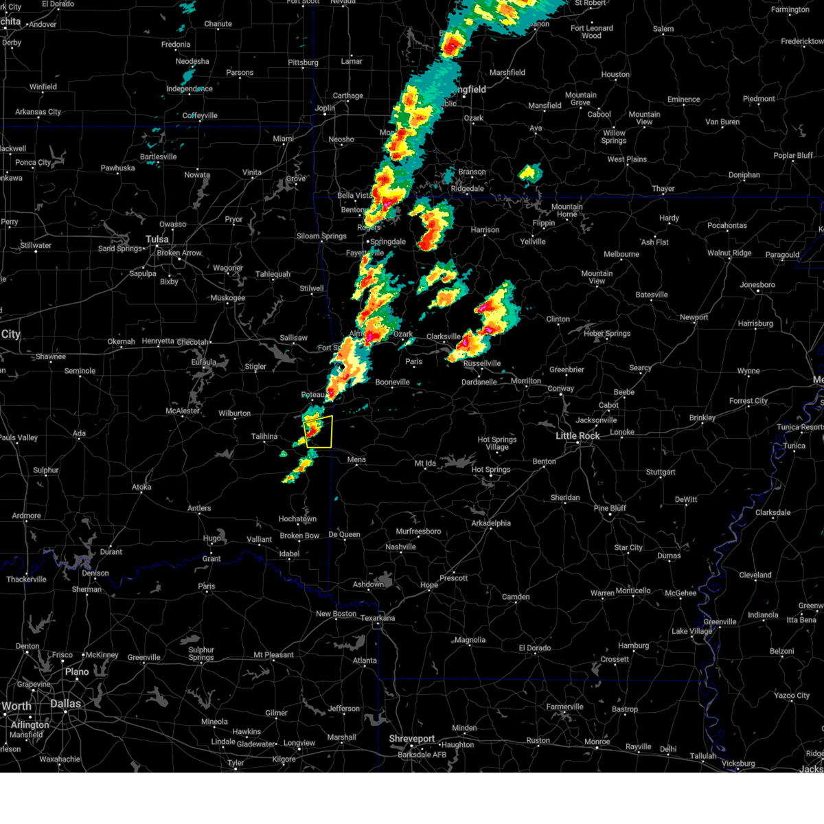 At 326 pm cdt, a severe thunderstorm was located 5 miles south of heavener, moving east at 25 mph (radar indicated). Hazards include 60 mph wind gusts and half dollar size hail. Hail damage to vehicles is expected. expect wind damage to roofs, siding, and trees. locations in or near the path include, heavener, heavener runestone park, hodgen, hail threat, radar indicated max hail size, 1. 25 in wind threat, radar indicated max wind gust, 60 mph. At 326 pm cdt, a severe thunderstorm was located 5 miles south of heavener, moving east at 25 mph (radar indicated). Hazards include 60 mph wind gusts and half dollar size hail. Hail damage to vehicles is expected. expect wind damage to roofs, siding, and trees. locations in or near the path include, heavener, heavener runestone park, hodgen, hail threat, radar indicated max hail size, 1. 25 in wind threat, radar indicated max wind gust, 60 mph.
|
| 2/16/2023 1:24 AM CST |
 The severe thunderstorm warning for southwestern sebastian, northeastern pushmataha and southern le flore counties will expire at 130 am cst, the storms which prompted the warning have weakened below severe limits, and no longer pose an immediate threat to life or property. therefore, the warning will be allowed to expire. however small hail and gusty winds are still possible with these thunderstorms. a severe thunderstorm watch remains in effect until 300 am cst for west central arkansas, and southeastern oklahoma. The severe thunderstorm warning for southwestern sebastian, northeastern pushmataha and southern le flore counties will expire at 130 am cst, the storms which prompted the warning have weakened below severe limits, and no longer pose an immediate threat to life or property. therefore, the warning will be allowed to expire. however small hail and gusty winds are still possible with these thunderstorms. a severe thunderstorm watch remains in effect until 300 am cst for west central arkansas, and southeastern oklahoma.
|
| 2/16/2023 1:13 AM CST |
 At 113 am cst, severe thunderstorms were located along a line extending from 4 miles east of howe to 5 miles south of whitesboro, moving northeast at 55 mph (radar indicated). Hazards include 60 mph wind gusts and quarter size hail. Hail damage to vehicles is expected. expect wind damage to roofs, siding, and trees. locations in or near the path include, heavener, wister, howe, lake wister state park, whitesboro, muse, patterson, heavener runestone park, hodgen, hail threat, radar indicated max hail size, 1. 00 in wind threat, radar indicated max wind gust, 60 mph. At 113 am cst, severe thunderstorms were located along a line extending from 4 miles east of howe to 5 miles south of whitesboro, moving northeast at 55 mph (radar indicated). Hazards include 60 mph wind gusts and quarter size hail. Hail damage to vehicles is expected. expect wind damage to roofs, siding, and trees. locations in or near the path include, heavener, wister, howe, lake wister state park, whitesboro, muse, patterson, heavener runestone park, hodgen, hail threat, radar indicated max hail size, 1. 00 in wind threat, radar indicated max wind gust, 60 mph.
|
| 2/16/2023 12:40 AM CST |
 At 1240 am cst, severe thunderstorms were located along a line extending from near wister to 2 miles southeast of kiamichi, moving east at 50 mph (radar indicated). Hazards include 60 mph wind gusts and quarter size hail. Hail damage to vehicles is expected. expect wind damage to roofs, siding, and trees. locations in or near the path include, heavener, talihina, wister, howe, albion, talimena state park, lake wister state park, whitesboro, muse, patterson, summerfield, heavener runestone park, hodgen, hail threat, radar indicated max hail size, 1. 00 in wind threat, radar indicated max wind gust, 60 mph. At 1240 am cst, severe thunderstorms were located along a line extending from near wister to 2 miles southeast of kiamichi, moving east at 50 mph (radar indicated). Hazards include 60 mph wind gusts and quarter size hail. Hail damage to vehicles is expected. expect wind damage to roofs, siding, and trees. locations in or near the path include, heavener, talihina, wister, howe, albion, talimena state park, lake wister state park, whitesboro, muse, patterson, summerfield, heavener runestone park, hodgen, hail threat, radar indicated max hail size, 1. 00 in wind threat, radar indicated max wind gust, 60 mph.
|
| 2/16/2023 12:26 AM CST |
 At 1226 am cst, severe thunderstorms were located along a line extending from 3 miles south of panama to 7 miles northeast of talimena state park to 4 miles north of snow, moving east at 30 mph (radar indicated). Hazards include 60 mph wind gusts and quarter size hail. Hail damage to vehicles is expected. expect wind damage to roofs, siding, and trees. locations in or near the path include, poteau, clayton, heavener, panama, talihina, wister, howe, fanshawe, cameron, albion, talimena state park, snow, tuskahoma, kiamichi, whitesboro, clayton lake state park, bengal, lake wister state park, nashoba, muse, hail threat, radar indicated max hail size, 1. 00 in wind threat, radar indicated max wind gust, 60 mph. At 1226 am cst, severe thunderstorms were located along a line extending from 3 miles south of panama to 7 miles northeast of talimena state park to 4 miles north of snow, moving east at 30 mph (radar indicated). Hazards include 60 mph wind gusts and quarter size hail. Hail damage to vehicles is expected. expect wind damage to roofs, siding, and trees. locations in or near the path include, poteau, clayton, heavener, panama, talihina, wister, howe, fanshawe, cameron, albion, talimena state park, snow, tuskahoma, kiamichi, whitesboro, clayton lake state park, bengal, lake wister state park, nashoba, muse, hail threat, radar indicated max hail size, 1. 00 in wind threat, radar indicated max wind gust, 60 mph.
|
| 2/16/2023 12:07 AM CST |
 At 1206 am cst, severe thunderstorms were located along a line extending from 7 miles south of bokoshe to 3 miles northwest of talimena state park to 2 miles south of dunbar, moving east at 50 mph (radar indicated). Hazards include 60 mph wind gusts and quarter size hail. Hail damage to vehicles is expected. expect wind damage to roofs, siding, and trees. locations in or near the path include, poteau, wilburton, clayton, heavener, panama, talihina, wister, howe, red oak, mccurtain, fanshawe, cameron, albion, talimena state park, snow, tuskahoma, mc curtain, stanley, kiamichi, whitesboro, hail threat, radar indicated max hail size, 1. 00 in wind threat, radar indicated max wind gust, 60 mph. At 1206 am cst, severe thunderstorms were located along a line extending from 7 miles south of bokoshe to 3 miles northwest of talimena state park to 2 miles south of dunbar, moving east at 50 mph (radar indicated). Hazards include 60 mph wind gusts and quarter size hail. Hail damage to vehicles is expected. expect wind damage to roofs, siding, and trees. locations in or near the path include, poteau, wilburton, clayton, heavener, panama, talihina, wister, howe, red oak, mccurtain, fanshawe, cameron, albion, talimena state park, snow, tuskahoma, mc curtain, stanley, kiamichi, whitesboro, hail threat, radar indicated max hail size, 1. 00 in wind threat, radar indicated max wind gust, 60 mph.
|
| 1/11/2023 8:20 PM CST |
 At 820 pm cst, a severe thunderstorm was located 5 miles east of howe, moving northeast at 50 mph (radar indicated). Hazards include 60 mph wind gusts and quarter size hail. Hail damage to vehicles is expected. expect wind damage to roofs, siding, and trees. locations in or near the path include, poteau, greenwood, heavener, howe, hartford, huntington, midland, washburn, excelsior, burnville, patterson, arkola, crossroads, witcherville, dayton, milltown, heavener runestone park, hodgen, hail threat, radar indicated max hail size, 1. 00 in wind threat, radar indicated max wind gust, 60 mph. At 820 pm cst, a severe thunderstorm was located 5 miles east of howe, moving northeast at 50 mph (radar indicated). Hazards include 60 mph wind gusts and quarter size hail. Hail damage to vehicles is expected. expect wind damage to roofs, siding, and trees. locations in or near the path include, poteau, greenwood, heavener, howe, hartford, huntington, midland, washburn, excelsior, burnville, patterson, arkola, crossroads, witcherville, dayton, milltown, heavener runestone park, hodgen, hail threat, radar indicated max hail size, 1. 00 in wind threat, radar indicated max wind gust, 60 mph.
|
| 1/11/2023 8:15 PM CST | Quarter sized hail reported 0.8 miles SW of Heavener, OK |
| 1/11/2023 8:05 PM CST |
 At 804 pm cst, a severe thunderstorm was located 3 miles south of lake wister state park, moving northeast at 50 mph (radar indicated). Hazards include 60 mph wind gusts and quarter size hail. Hail damage to vehicles is expected. expect wind damage to roofs, siding, and trees. locations in or near the path include, poteau, greenwood, heavener, wister, howe, hartford, huntington, midland, washburn, lake wister state park, excelsior, burnville, patterson, arkola, crossroads, witcherville, dayton, milltown, heavener runestone park, hodgen, hail threat, radar indicated max hail size, 1. 00 in wind threat, radar indicated max wind gust, 60 mph. At 804 pm cst, a severe thunderstorm was located 3 miles south of lake wister state park, moving northeast at 50 mph (radar indicated). Hazards include 60 mph wind gusts and quarter size hail. Hail damage to vehicles is expected. expect wind damage to roofs, siding, and trees. locations in or near the path include, poteau, greenwood, heavener, wister, howe, hartford, huntington, midland, washburn, lake wister state park, excelsior, burnville, patterson, arkola, crossroads, witcherville, dayton, milltown, heavener runestone park, hodgen, hail threat, radar indicated max hail size, 1. 00 in wind threat, radar indicated max wind gust, 60 mph.
|
| 11/4/2022 6:37 PM CDT |
 At 636 pm cdt, a confirmed large and extremely dangerous tornado was located 3 miles northeast of heavener, moving northeast at 50 mph. this is a particularly dangerous situation. take cover now! (radar confirmed tornado). Hazards include damaging tornado. You are in a life-threatening situation. flying debris may be deadly to those caught without shelter. mobile homes will be destroyed. considerable damage to homes, businesses, and vehicles is likely and complete destruction is possible. Locations in or near the path include, heavener, hartford, huntington, midland, patterson, heavener runestone park, arkola, hodgen, crossroads, witcherville, dayton,. At 636 pm cdt, a confirmed large and extremely dangerous tornado was located 3 miles northeast of heavener, moving northeast at 50 mph. this is a particularly dangerous situation. take cover now! (radar confirmed tornado). Hazards include damaging tornado. You are in a life-threatening situation. flying debris may be deadly to those caught without shelter. mobile homes will be destroyed. considerable damage to homes, businesses, and vehicles is likely and complete destruction is possible. Locations in or near the path include, heavener, hartford, huntington, midland, patterson, heavener runestone park, arkola, hodgen, crossroads, witcherville, dayton,.
|
| 11/4/2022 6:37 PM CDT |
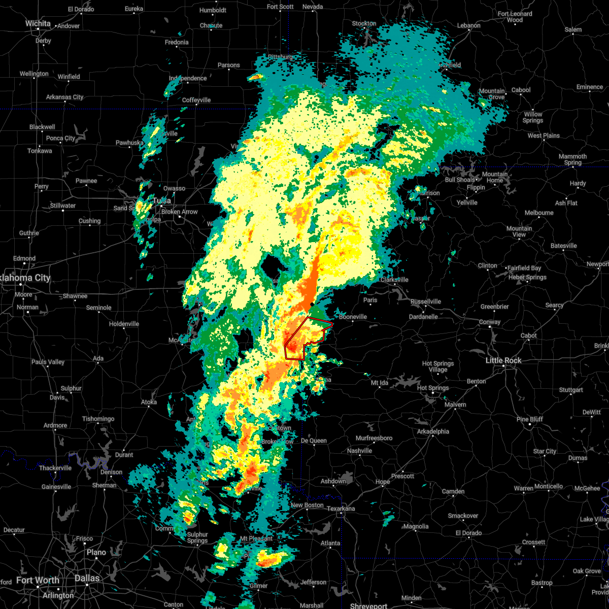 At 636 pm cdt, a confirmed large and extremely dangerous tornado was located 3 miles northeast of heavener, moving northeast at 50 mph. this is a particularly dangerous situation. take cover now! (radar confirmed tornado). Hazards include damaging tornado. You are in a life-threatening situation. flying debris may be deadly to those caught without shelter. mobile homes will be destroyed. considerable damage to homes, businesses, and vehicles is likely and complete destruction is possible. Locations in or near the path include, heavener, hartford, huntington, midland, patterson, heavener runestone park, arkola, hodgen, crossroads, witcherville, dayton,. At 636 pm cdt, a confirmed large and extremely dangerous tornado was located 3 miles northeast of heavener, moving northeast at 50 mph. this is a particularly dangerous situation. take cover now! (radar confirmed tornado). Hazards include damaging tornado. You are in a life-threatening situation. flying debris may be deadly to those caught without shelter. mobile homes will be destroyed. considerable damage to homes, businesses, and vehicles is likely and complete destruction is possible. Locations in or near the path include, heavener, hartford, huntington, midland, patterson, heavener runestone park, arkola, hodgen, crossroads, witcherville, dayton,.
|
| 11/4/2022 6:18 PM CDT |
 At 618 pm cdt, a severe thunderstorm capable of producing a tornado was located 4 miles north of big cedar, moving northeast at 45 mph. this storm has a history of producing tornadoes (radar indicated rotation). Hazards include tornado and quarter size hail. Flying debris will be dangerous to those caught without shelter. mobile homes will be damaged or destroyed. damage to roofs, windows, and vehicles will occur. tree damage is likely. Locations in or near the path include, heavener, hartford, huntington, midland, big cedar, muse, patterson, arkola, crossroads, witcherville, dayton, heavener runestone park, hodgen,. At 618 pm cdt, a severe thunderstorm capable of producing a tornado was located 4 miles north of big cedar, moving northeast at 45 mph. this storm has a history of producing tornadoes (radar indicated rotation). Hazards include tornado and quarter size hail. Flying debris will be dangerous to those caught without shelter. mobile homes will be damaged or destroyed. damage to roofs, windows, and vehicles will occur. tree damage is likely. Locations in or near the path include, heavener, hartford, huntington, midland, big cedar, muse, patterson, arkola, crossroads, witcherville, dayton, heavener runestone park, hodgen,.
|
| 5/15/2022 7:01 PM CDT |
 At 701 pm cdt, a severe thunderstorm was located 8 miles south of bokoshe, moving southeast at 25 mph (radar indicated). Hazards include 60 mph wind gusts and half dollar size hail. Hail damage to vehicles is expected. expect wind damage to roofs, siding, and trees. locations in or near the path include, poteau, wister, howe, lake wister state park, hail threat, radar indicated max hail size, 1. 25 in wind threat, radar indicated max wind gust, 60 mph. At 701 pm cdt, a severe thunderstorm was located 8 miles south of bokoshe, moving southeast at 25 mph (radar indicated). Hazards include 60 mph wind gusts and half dollar size hail. Hail damage to vehicles is expected. expect wind damage to roofs, siding, and trees. locations in or near the path include, poteau, wister, howe, lake wister state park, hail threat, radar indicated max hail size, 1. 25 in wind threat, radar indicated max wind gust, 60 mph.
|
| 5/15/2022 6:45 PM CDT |
 At 645 pm cdt, a severe thunderstorm was located 4 miles southwest of bokoshe, moving southeast at 30 mph (radar indicated). Hazards include 60 mph wind gusts and half dollar size hail. Hail damage to vehicles is expected. expect wind damage to roofs, siding, and trees. locations in or near the path include, poteau, wister, howe, mccurtain, bokoshe, lake wister state park, mc curtain, milton, hail threat, radar indicated max hail size, 1. 25 in wind threat, radar indicated max wind gust, 60 mph. At 645 pm cdt, a severe thunderstorm was located 4 miles southwest of bokoshe, moving southeast at 30 mph (radar indicated). Hazards include 60 mph wind gusts and half dollar size hail. Hail damage to vehicles is expected. expect wind damage to roofs, siding, and trees. locations in or near the path include, poteau, wister, howe, mccurtain, bokoshe, lake wister state park, mc curtain, milton, hail threat, radar indicated max hail size, 1. 25 in wind threat, radar indicated max wind gust, 60 mph.
|
| 5/15/2022 6:44 PM CDT |
 At 644 pm cdt, a severe thunderstorm was located near heavener, moving southeast at 25 mph (radar indicated). Hazards include 60 mph wind gusts and half dollar size hail. Hail damage to vehicles is expected. expect wind damage to roofs, siding, and trees. locations in or near the path include, heavener, heavener runestone state park, hodgen, hail threat, radar indicated max hail size, 1. 25 in wind threat, radar indicated max wind gust, 60 mph. At 644 pm cdt, a severe thunderstorm was located near heavener, moving southeast at 25 mph (radar indicated). Hazards include 60 mph wind gusts and half dollar size hail. Hail damage to vehicles is expected. expect wind damage to roofs, siding, and trees. locations in or near the path include, heavener, heavener runestone state park, hodgen, hail threat, radar indicated max hail size, 1. 25 in wind threat, radar indicated max wind gust, 60 mph.
|
| 5/15/2022 6:32 PM CDT |
 At 632 pm cdt, a severe thunderstorm was located near heavener, moving southeast at 25 mph (radar indicated). Hazards include ping pong ball size hail and 60 mph wind gusts. People and animals outdoors will be injured. expect hail damage to roofs, siding, windows, and vehicles. expect wind damage to roofs, siding, and trees. locations in or near the path include, poteau, heavener, howe, heavener runestone state park, hodgen, hail threat, radar indicated max hail size, 1. 50 in wind threat, radar indicated max wind gust, 60 mph. At 632 pm cdt, a severe thunderstorm was located near heavener, moving southeast at 25 mph (radar indicated). Hazards include ping pong ball size hail and 60 mph wind gusts. People and animals outdoors will be injured. expect hail damage to roofs, siding, windows, and vehicles. expect wind damage to roofs, siding, and trees. locations in or near the path include, poteau, heavener, howe, heavener runestone state park, hodgen, hail threat, radar indicated max hail size, 1. 50 in wind threat, radar indicated max wind gust, 60 mph.
|
| 5/15/2022 6:19 PM CDT |
 At 618 pm cdt, a severe thunderstorm was located over wister, moving south at 30 mph (radar indicated). Hazards include two inch hail and 60 mph wind gusts. People and animals outdoors will be injured. expect hail damage to roofs, siding, windows, and vehicles. expect wind damage to roofs, siding, and trees. locations in or near the path include, poteau, heavener, wister, howe, heavener runestone state park, lake wister state park, hodgen, thunderstorm damage threat, considerable hail threat, radar indicated max hail size, 2. 00 in wind threat, radar indicated max wind gust, 60 mph. At 618 pm cdt, a severe thunderstorm was located over wister, moving south at 30 mph (radar indicated). Hazards include two inch hail and 60 mph wind gusts. People and animals outdoors will be injured. expect hail damage to roofs, siding, windows, and vehicles. expect wind damage to roofs, siding, and trees. locations in or near the path include, poteau, heavener, wister, howe, heavener runestone state park, lake wister state park, hodgen, thunderstorm damage threat, considerable hail threat, radar indicated max hail size, 2. 00 in wind threat, radar indicated max wind gust, 60 mph.
|
| 5/15/2022 6:07 PM CDT |
 At 607 pm cdt, a severe thunderstorm was located 5 miles north of wister, moving south at 30 mph (radar indicated). Hazards include two inch hail and 60 mph wind gusts. People and animals outdoors will be injured. expect hail damage to roofs, siding, windows, and vehicles. expect wind damage to roofs, siding, and trees. locations in or near the path include, poteau, heavener, wister, howe, heavener runestone state park, lake wister state park, shady point, hodgen, summerfield, thunderstorm damage threat, considerable hail threat, radar indicated max hail size, 2. 00 in wind threat, radar indicated max wind gust, 60 mph. At 607 pm cdt, a severe thunderstorm was located 5 miles north of wister, moving south at 30 mph (radar indicated). Hazards include two inch hail and 60 mph wind gusts. People and animals outdoors will be injured. expect hail damage to roofs, siding, windows, and vehicles. expect wind damage to roofs, siding, and trees. locations in or near the path include, poteau, heavener, wister, howe, heavener runestone state park, lake wister state park, shady point, hodgen, summerfield, thunderstorm damage threat, considerable hail threat, radar indicated max hail size, 2. 00 in wind threat, radar indicated max wind gust, 60 mph.
|
| 5/15/2022 5:50 PM CDT |
 At 549 pm cdt, a severe thunderstorm was located near bokoshe, moving south at 30 mph (radar indicated). Hazards include two inch hail and 60 mph wind gusts. People and animals outdoors will be injured. expect hail damage to roofs, siding, windows, and vehicles. expect wind damage to roofs, siding, and trees. locations in or near the path include, poteau, heavener, panama, wister, howe, fanshawe, heavener runestone state park, lake wister state park, shady point, hodgen, summerfield, thunderstorm damage threat, considerable hail threat, radar indicated max hail size, 2. 00 in wind threat, radar indicated max wind gust, 60 mph. At 549 pm cdt, a severe thunderstorm was located near bokoshe, moving south at 30 mph (radar indicated). Hazards include two inch hail and 60 mph wind gusts. People and animals outdoors will be injured. expect hail damage to roofs, siding, windows, and vehicles. expect wind damage to roofs, siding, and trees. locations in or near the path include, poteau, heavener, panama, wister, howe, fanshawe, heavener runestone state park, lake wister state park, shady point, hodgen, summerfield, thunderstorm damage threat, considerable hail threat, radar indicated max hail size, 2. 00 in wind threat, radar indicated max wind gust, 60 mph.
|
| 5/5/2022 3:17 AM CDT |
 At 316 am cdt, severe thunderstorms were located along a line extending from 4 miles south of mountainburg to heavener runestone state park, moving east at 50 mph (radar indicated). Hazards include 60 mph wind gusts and nickel size hail. Expect damage to roofs, siding, and trees. locations in or near the path include, fort smith, van buren, poteau, ozark, charleston, cedarville, greenwood, alma, barling, pocola, heavener, roland, lavaca, spiro, arkoma, mulberry, wister, dyer, hackett, howe, this includes the following highways, interstate 40 in arkansas between mile markers 0 and 42. interstate 40 in oklahoma between mile markers 322 and 328. interstate 540 between mile markers 1 and 14. interstate 49 between mile markers 22 and 27. hail threat, radar indicated max hail size, 0. 88 in wind threat, radar indicated max wind gust, 60 mph. At 316 am cdt, severe thunderstorms were located along a line extending from 4 miles south of mountainburg to heavener runestone state park, moving east at 50 mph (radar indicated). Hazards include 60 mph wind gusts and nickel size hail. Expect damage to roofs, siding, and trees. locations in or near the path include, fort smith, van buren, poteau, ozark, charleston, cedarville, greenwood, alma, barling, pocola, heavener, roland, lavaca, spiro, arkoma, mulberry, wister, dyer, hackett, howe, this includes the following highways, interstate 40 in arkansas between mile markers 0 and 42. interstate 40 in oklahoma between mile markers 322 and 328. interstate 540 between mile markers 1 and 14. interstate 49 between mile markers 22 and 27. hail threat, radar indicated max hail size, 0. 88 in wind threat, radar indicated max wind gust, 60 mph.
|
| 5/5/2022 3:07 AM CDT |
 At 307 am cdt, severe thunderstorms were located along a line extending from 3 miles north of rudy to 8 miles south of lake wister state park, moving east at 55 mph (radar indicated). Hazards include 60 mph wind gusts and quarter size hail. Hail damage to vehicles is expected. expect wind damage to roofs, siding, and trees. locations in or near the path include, fort smith, van buren, poteau, ozark, charleston, cedarville, greenwood, alma, barling, pocola, muldrow, heavener, roland, lavaca, spiro, arkoma, mulberry, panama, wister, dyer, this includes the following highways, interstate 40 in arkansas between mile markers 0 and 42. interstate 40 in oklahoma between mile markers 311 and 328. interstate 540 between mile markers 1 and 14. interstate 49 between mile markers 22 and 27. hail threat, radar indicated max hail size, 1. 00 in wind threat, radar indicated max wind gust, 60 mph. At 307 am cdt, severe thunderstorms were located along a line extending from 3 miles north of rudy to 8 miles south of lake wister state park, moving east at 55 mph (radar indicated). Hazards include 60 mph wind gusts and quarter size hail. Hail damage to vehicles is expected. expect wind damage to roofs, siding, and trees. locations in or near the path include, fort smith, van buren, poteau, ozark, charleston, cedarville, greenwood, alma, barling, pocola, muldrow, heavener, roland, lavaca, spiro, arkoma, mulberry, panama, wister, dyer, this includes the following highways, interstate 40 in arkansas between mile markers 0 and 42. interstate 40 in oklahoma between mile markers 311 and 328. interstate 540 between mile markers 1 and 14. interstate 49 between mile markers 22 and 27. hail threat, radar indicated max hail size, 1. 00 in wind threat, radar indicated max wind gust, 60 mph.
|
| 5/5/2022 2:55 AM CDT |
 At 255 am cdt, severe thunderstorms were located along a line extending from 3 miles northeast of short to 2 miles east of talihina, moving east at 45 mph (radar indicated). Hazards include 60 mph wind gusts and quarter size hail. Hail damage to vehicles is expected. expect wind damage to roofs, siding, and trees. locations in or near the path include, fort smith, van buren, sallisaw, poteau, ozark, charleston, cedarville, greenwood, alma, barling, pocola, muldrow, heavener, roland, lavaca, spiro, arkoma, mulberry, panama, wister, this includes the following highways, interstate 40 in arkansas between mile markers 0 and 42. interstate 40 in oklahoma between mile markers 304 and 328. interstate 540 between mile markers 1 and 14. interstate 49 between mile markers 22 and 27. hail threat, radar indicated max hail size, 1. 00 in wind threat, radar indicated max wind gust, 60 mph. At 255 am cdt, severe thunderstorms were located along a line extending from 3 miles northeast of short to 2 miles east of talihina, moving east at 45 mph (radar indicated). Hazards include 60 mph wind gusts and quarter size hail. Hail damage to vehicles is expected. expect wind damage to roofs, siding, and trees. locations in or near the path include, fort smith, van buren, sallisaw, poteau, ozark, charleston, cedarville, greenwood, alma, barling, pocola, muldrow, heavener, roland, lavaca, spiro, arkoma, mulberry, panama, wister, this includes the following highways, interstate 40 in arkansas between mile markers 0 and 42. interstate 40 in oklahoma between mile markers 304 and 328. interstate 540 between mile markers 1 and 14. interstate 49 between mile markers 22 and 27. hail threat, radar indicated max hail size, 1. 00 in wind threat, radar indicated max wind gust, 60 mph.
|
| 5/2/2022 11:09 PM CDT |
 At 1109 pm cdt, severe thunderstorms were located along a line extending from 6 miles southeast of cass to near bonanza to 3 miles east of muse, moving east at 45 mph (radar indicated). Hazards include 60 mph wind gusts and quarter size hail. Hail damage to vehicles is expected. expect wind damage to roofs, siding, and trees. locations in or near the path include, fort smith, van buren, poteau, ozark, charleston, mountainburg, greenwood, alma, barling, pocola, muldrow, heavener, roland, lavaca, spiro, arkoma, mulberry, panama, wister, dyer, this includes the following highways, interstate 40 in arkansas between mile markers 0 and 42. interstate 40 in oklahoma between mile markers 319 and 328. interstate 540 between mile markers 1 and 14. interstate 49 between mile markers 22 and 29. hail threat, radar indicated max hail size, 1. 00 in wind threat, radar indicated max wind gust, 60 mph. At 1109 pm cdt, severe thunderstorms were located along a line extending from 6 miles southeast of cass to near bonanza to 3 miles east of muse, moving east at 45 mph (radar indicated). Hazards include 60 mph wind gusts and quarter size hail. Hail damage to vehicles is expected. expect wind damage to roofs, siding, and trees. locations in or near the path include, fort smith, van buren, poteau, ozark, charleston, mountainburg, greenwood, alma, barling, pocola, muldrow, heavener, roland, lavaca, spiro, arkoma, mulberry, panama, wister, dyer, this includes the following highways, interstate 40 in arkansas between mile markers 0 and 42. interstate 40 in oklahoma between mile markers 319 and 328. interstate 540 between mile markers 1 and 14. interstate 49 between mile markers 22 and 29. hail threat, radar indicated max hail size, 1. 00 in wind threat, radar indicated max wind gust, 60 mph.
|
| 5/2/2022 10:48 PM CDT |
 At 1047 pm cdt, severe thunderstorms were located along a line extending from 2 miles northeast of fern to 3 miles west of spiro to 5 miles northeast of muse, moving east at 50 mph (radar indicated). Hazards include 60 mph wind gusts and quarter size hail. Hail damage to vehicles is expected. expect wind damage to roofs, siding, and trees. locations in or near the path include, fort smith, van buren, sallisaw, poteau, ozark, charleston, cedarville, mountainburg, natural dam, greenwood, alma, barling, pocola, muldrow, heavener, roland, lavaca, spiro, arkoma, mulberry, this includes the following highways, interstate 40 in arkansas between mile markers 0 and 42. interstate 40 in oklahoma between mile markers 299 and 328. interstate 540 between mile markers 1 and 14. interstate 49 between mile markers 22 and 37. hail threat, radar indicated max hail size, 1. 00 in wind threat, radar indicated max wind gust, 60 mph. At 1047 pm cdt, severe thunderstorms were located along a line extending from 2 miles northeast of fern to 3 miles west of spiro to 5 miles northeast of muse, moving east at 50 mph (radar indicated). Hazards include 60 mph wind gusts and quarter size hail. Hail damage to vehicles is expected. expect wind damage to roofs, siding, and trees. locations in or near the path include, fort smith, van buren, sallisaw, poteau, ozark, charleston, cedarville, mountainburg, natural dam, greenwood, alma, barling, pocola, muldrow, heavener, roland, lavaca, spiro, arkoma, mulberry, this includes the following highways, interstate 40 in arkansas between mile markers 0 and 42. interstate 40 in oklahoma between mile markers 299 and 328. interstate 540 between mile markers 1 and 14. interstate 49 between mile markers 22 and 37. hail threat, radar indicated max hail size, 1. 00 in wind threat, radar indicated max wind gust, 60 mph.
|
| 5/2/2022 10:33 PM CDT |
 At 1032 pm cdt, severe thunderstorms were located along a line extending from 4 miles southeast of tamaha to 4 miles east of fanshawe to 4 miles east of albion, moving east at 50 mph. a second severe thundestorm was located near blanco (radar indicated). Hazards include 60 mph wind gusts and penny size hail. Expect damage to roofs, siding, and trees. Locations in or near the path include, mcalester, poteau, wilburton, stigler, antlers, clayton, pocola, muldrow, heavener, roland, spiro, hartshorne, krebs, arkoma, panama, talihina, wister, quinton, howe, kiowa, this includes interstate 40 in oklahoma between mile markers 312 and 328. At 1032 pm cdt, severe thunderstorms were located along a line extending from 4 miles southeast of tamaha to 4 miles east of fanshawe to 4 miles east of albion, moving east at 50 mph. a second severe thundestorm was located near blanco (radar indicated). Hazards include 60 mph wind gusts and penny size hail. Expect damage to roofs, siding, and trees. Locations in or near the path include, mcalester, poteau, wilburton, stigler, antlers, clayton, pocola, muldrow, heavener, roland, spiro, hartshorne, krebs, arkoma, panama, talihina, wister, quinton, howe, kiowa, this includes interstate 40 in oklahoma between mile markers 312 and 328.
|
| 5/2/2022 10:10 PM CDT |
 At 1010 pm cdt, severe thunderstorms were located along a line extending from near whitefield to 5 miles southwest of red oak to 4 miles east of daisy, moving east at 55 mph (radar indicated). Hazards include 60 mph wind gusts and penny size hail. Expect damage to roofs, siding, and trees. locations in or near the path include, mcalester, poteau, wilburton, stigler, antlers, clayton, pocola, muldrow, heavener, roland, spiro, hartshorne, krebs, arkoma, panama, talihina, wister, quinton, howe, kiowa, this includes interstate 40 in oklahoma between mile markers 312 and 328. hail threat, radar indicated max hail size, 0. 75 in wind threat, radar indicated max wind gust, 60 mph. At 1010 pm cdt, severe thunderstorms were located along a line extending from near whitefield to 5 miles southwest of red oak to 4 miles east of daisy, moving east at 55 mph (radar indicated). Hazards include 60 mph wind gusts and penny size hail. Expect damage to roofs, siding, and trees. locations in or near the path include, mcalester, poteau, wilburton, stigler, antlers, clayton, pocola, muldrow, heavener, roland, spiro, hartshorne, krebs, arkoma, panama, talihina, wister, quinton, howe, kiowa, this includes interstate 40 in oklahoma between mile markers 312 and 328. hail threat, radar indicated max hail size, 0. 75 in wind threat, radar indicated max wind gust, 60 mph.
|
| 5/2/2022 5:13 PM CDT |
 At 512 pm cdt, a severe thunderstorm was located near poteau, moving northeast at 40 mph (radar indicated). Hazards include 60 mph wind gusts and quarter size hail. Hail damage to vehicles is expected. expect wind damage to roofs, siding, and trees. locations in or near the path include, fort smith, poteau, heavener, hackett, howe, hartford, huntington, bonanza, midland, cameron, heavener runestone state park, excelsior, jenny lind, rock island, patterson, arkola, witcherville, dayton, rye hill, jenson, hail threat, radar indicated max hail size, 1. 00 in wind threat, radar indicated max wind gust, 60 mph. At 512 pm cdt, a severe thunderstorm was located near poteau, moving northeast at 40 mph (radar indicated). Hazards include 60 mph wind gusts and quarter size hail. Hail damage to vehicles is expected. expect wind damage to roofs, siding, and trees. locations in or near the path include, fort smith, poteau, heavener, hackett, howe, hartford, huntington, bonanza, midland, cameron, heavener runestone state park, excelsior, jenny lind, rock island, patterson, arkola, witcherville, dayton, rye hill, jenson, hail threat, radar indicated max hail size, 1. 00 in wind threat, radar indicated max wind gust, 60 mph.
|
| 5/2/2022 4:58 PM CDT |
 At 458 pm cdt, a severe thunderstorm was located over wister, moving northeast at 40 mph (radar indicated). Hazards include 60 mph wind gusts and quarter size hail. Hail damage to vehicles is expected. expect wind damage to roofs, siding, and trees. locations in or near the path include, fort smith, poteau, heavener, wister, hackett, howe, hartford, huntington, bonanza, midland, cameron, heavener runestone state park, lake wister state park, excelsior, jenny lind, rock island, patterson, arkola, witcherville, dayton, hail threat, radar indicated max hail size, 1. 00 in wind threat, radar indicated max wind gust, 60 mph. At 458 pm cdt, a severe thunderstorm was located over wister, moving northeast at 40 mph (radar indicated). Hazards include 60 mph wind gusts and quarter size hail. Hail damage to vehicles is expected. expect wind damage to roofs, siding, and trees. locations in or near the path include, fort smith, poteau, heavener, wister, hackett, howe, hartford, huntington, bonanza, midland, cameron, heavener runestone state park, lake wister state park, excelsior, jenny lind, rock island, patterson, arkola, witcherville, dayton, hail threat, radar indicated max hail size, 1. 00 in wind threat, radar indicated max wind gust, 60 mph.
|
| 4/16/2022 4:15 AM CDT |
 At 415 am cdt, a severe thunderstorm was located near heavener runestone state park, moving southeast at 25 mph (radar indicated). Hazards include 60 mph wind gusts and half dollar size hail. Hail damage to vehicles is expected. expect wind damage to roofs, siding, and trees. locations in or near the path include, heavener, heavener runestone state park, hodgen, hail threat, radar indicated max hail size, 1. 25 in wind threat, radar indicated max wind gust, 60 mph. At 415 am cdt, a severe thunderstorm was located near heavener runestone state park, moving southeast at 25 mph (radar indicated). Hazards include 60 mph wind gusts and half dollar size hail. Hail damage to vehicles is expected. expect wind damage to roofs, siding, and trees. locations in or near the path include, heavener, heavener runestone state park, hodgen, hail threat, radar indicated max hail size, 1. 25 in wind threat, radar indicated max wind gust, 60 mph.
|
| 4/16/2022 4:06 AM CDT | Quarter sized hail reported 0.5 miles W of Heavener, OK |
| 4/16/2022 4:03 AM CDT |
 At 400 am cdt, severe thunderstorms were located along a line extending from 2 miles south of howe to 3 miles south of hartford, moving south at 20 mph. these are potentially destructive storms for howe, heavener and hodgen (radar indicated). Hazards include baseball size hail and 60 mph wind gusts. People and animals outdoors will be severely injured. expect shattered windows, extensive damage to roofs, siding, and vehicles. locations in or near the path include, poteau, heavener, wister, howe, hartford, huntington, heavener runestone state park, lake wister state park, patterson, arkola, crossroads, dayton, hodgen, thunderstorm damage threat, destructive hail threat, radar indicated max hail size, 2. 75 in wind threat, radar indicated max wind gust, 60 mph. At 400 am cdt, severe thunderstorms were located along a line extending from 2 miles south of howe to 3 miles south of hartford, moving south at 20 mph. these are potentially destructive storms for howe, heavener and hodgen (radar indicated). Hazards include baseball size hail and 60 mph wind gusts. People and animals outdoors will be severely injured. expect shattered windows, extensive damage to roofs, siding, and vehicles. locations in or near the path include, poteau, heavener, wister, howe, hartford, huntington, heavener runestone state park, lake wister state park, patterson, arkola, crossroads, dayton, hodgen, thunderstorm damage threat, destructive hail threat, radar indicated max hail size, 2. 75 in wind threat, radar indicated max wind gust, 60 mph.
|
| 4/16/2022 3:45 AM CDT |
 At 345 am cdt, severe thunderstorms were located along a line extending from near wister to mansfield, moving southeast at 35 mph (radar indicated). Hazards include ping pong ball size hail and 60 mph wind gusts. People and animals outdoors will be injured. expect hail damage to roofs, siding, windows, and vehicles. expect wind damage to roofs, siding, and trees. locations in or near the path include, poteau, heavener, wister, howe, hartford, huntington, midland, heavener runestone state park, washburn, lake wister state park, burnville, patterson, arkola, crossroads, witcherville, dayton, milltown, hodgen, hail threat, radar indicated max hail size, 1. 50 in wind threat, radar indicated max wind gust, 60 mph. At 345 am cdt, severe thunderstorms were located along a line extending from near wister to mansfield, moving southeast at 35 mph (radar indicated). Hazards include ping pong ball size hail and 60 mph wind gusts. People and animals outdoors will be injured. expect hail damage to roofs, siding, windows, and vehicles. expect wind damage to roofs, siding, and trees. locations in or near the path include, poteau, heavener, wister, howe, hartford, huntington, midland, heavener runestone state park, washburn, lake wister state park, burnville, patterson, arkola, crossroads, witcherville, dayton, milltown, hodgen, hail threat, radar indicated max hail size, 1. 50 in wind threat, radar indicated max wind gust, 60 mph.
|
| 4/16/2022 3:37 AM CDT |
 At 337 am cdt, a severe thunderstorm was located 4 miles southwest of panama, moving southeast at 30 mph (radar indicated). Hazards include 60 mph wind gusts and quarter size hail. Hail damage to vehicles is expected. expect wind damage to roofs, siding, and trees. locations in or near the path include, poteau, panama, wister, howe, cameron, shady point, hail threat, radar indicated max hail size, 1. 00 in wind threat, radar indicated max wind gust, 60 mph. At 337 am cdt, a severe thunderstorm was located 4 miles southwest of panama, moving southeast at 30 mph (radar indicated). Hazards include 60 mph wind gusts and quarter size hail. Hail damage to vehicles is expected. expect wind damage to roofs, siding, and trees. locations in or near the path include, poteau, panama, wister, howe, cameron, shady point, hail threat, radar indicated max hail size, 1. 00 in wind threat, radar indicated max wind gust, 60 mph.
|
| 4/16/2022 3:20 AM CDT |
 At 320 am cdt, a severe thunderstorm was located 4 miles west of bokoshe, moving southeast at 30 mph (radar indicated). Hazards include 60 mph wind gusts and half dollar size hail. Hail damage to vehicles is expected. expect wind damage to roofs, siding, and trees. locations in or near the path include, poteau, panama, wister, howe, keota, mccurtain, bokoshe, cameron, mc curtain, shady point, milton, hail threat, radar indicated max hail size, 1. 25 in wind threat, radar indicated max wind gust, 60 mph. At 320 am cdt, a severe thunderstorm was located 4 miles west of bokoshe, moving southeast at 30 mph (radar indicated). Hazards include 60 mph wind gusts and half dollar size hail. Hail damage to vehicles is expected. expect wind damage to roofs, siding, and trees. locations in or near the path include, poteau, panama, wister, howe, keota, mccurtain, bokoshe, cameron, mc curtain, shady point, milton, hail threat, radar indicated max hail size, 1. 25 in wind threat, radar indicated max wind gust, 60 mph.
|
| 4/16/2022 3:09 AM CDT |
 At 309 am cdt, a severe thunderstorm was located 3 miles north of mc curtain, moving southeast at 30 mph (radar indicated). Hazards include 60 mph wind gusts and quarter size hail. Hail damage to vehicles is expected. expect wind damage to roofs, siding, and trees. locations in or near the path include, poteau, panama, wister, howe, keota, mccurtain, bokoshe, cameron, mc curtain, lequire, shady point, kanima, milton, hail threat, radar indicated max hail size, 1. 00 in wind threat, radar indicated max wind gust, 60 mph. At 309 am cdt, a severe thunderstorm was located 3 miles north of mc curtain, moving southeast at 30 mph (radar indicated). Hazards include 60 mph wind gusts and quarter size hail. Hail damage to vehicles is expected. expect wind damage to roofs, siding, and trees. locations in or near the path include, poteau, panama, wister, howe, keota, mccurtain, bokoshe, cameron, mc curtain, lequire, shady point, kanima, milton, hail threat, radar indicated max hail size, 1. 00 in wind threat, radar indicated max wind gust, 60 mph.
|
| 4/11/2022 8:19 PM CDT |
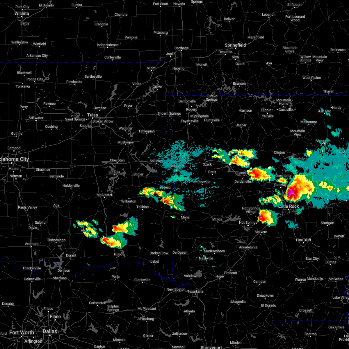 At 818 pm cdt, a severe thunderstorm was located near heavener, moving east at 20 mph (radar indicated). Hazards include 60 mph wind gusts and quarter size hail. Hail damage to vehicles is expected. expect wind damage to roofs, siding, and trees. locations in or near the path include, heavener, heavener runestone state park, hodgen, hail threat, radar indicated max hail size, 1. 00 in wind threat, radar indicated max wind gust, 60 mph. At 818 pm cdt, a severe thunderstorm was located near heavener, moving east at 20 mph (radar indicated). Hazards include 60 mph wind gusts and quarter size hail. Hail damage to vehicles is expected. expect wind damage to roofs, siding, and trees. locations in or near the path include, heavener, heavener runestone state park, hodgen, hail threat, radar indicated max hail size, 1. 00 in wind threat, radar indicated max wind gust, 60 mph.
|
| 4/11/2022 8:07 PM CDT |
 At 807 pm cdt, a severe thunderstorm was located 4 miles southwest of heavener, moving east at 20 mph (radar indicated). Hazards include 60 mph wind gusts and quarter size hail. Hail damage to vehicles is expected. expect wind damage to roofs, siding, and trees. locations in or near the path include, heavener, heavener runestone state park, hodgen, hail threat, radar indicated max hail size, 1. 00 in wind threat, radar indicated max wind gust, 60 mph. At 807 pm cdt, a severe thunderstorm was located 4 miles southwest of heavener, moving east at 20 mph (radar indicated). Hazards include 60 mph wind gusts and quarter size hail. Hail damage to vehicles is expected. expect wind damage to roofs, siding, and trees. locations in or near the path include, heavener, heavener runestone state park, hodgen, hail threat, radar indicated max hail size, 1. 00 in wind threat, radar indicated max wind gust, 60 mph.
|
| 4/11/2022 7:54 PM CDT |
 At 754 pm cdt, a severe thunderstorm was located 7 miles south of lake wister state park, moving east at 25 mph (radar indicated). Hazards include 60 mph wind gusts and quarter size hail. Hail damage to vehicles is expected. expect wind damage to roofs, siding, and trees. locations in or near the path include, heavener, heavener runestone state park, lake wister state park, hodgen, hail threat, radar indicated max hail size, 1. 00 in wind threat, radar indicated max wind gust, 60 mph. At 754 pm cdt, a severe thunderstorm was located 7 miles south of lake wister state park, moving east at 25 mph (radar indicated). Hazards include 60 mph wind gusts and quarter size hail. Hail damage to vehicles is expected. expect wind damage to roofs, siding, and trees. locations in or near the path include, heavener, heavener runestone state park, lake wister state park, hodgen, hail threat, radar indicated max hail size, 1. 00 in wind threat, radar indicated max wind gust, 60 mph.
|
| 4/11/2022 7:45 PM CDT |
 At 745 pm cdt, a severe thunderstorm was located 7 miles south of lake wister state park, moving east at 55 mph (radar indicated). Hazards include 60 mph wind gusts and quarter size hail. Hail damage to vehicles is expected. expect wind damage to roofs, siding, and trees. locations in or near the path include, heavener, heavener runestone state park, lake wister state park, hodgen, summerfield, hail threat, radar indicated max hail size, 1. 00 in wind threat, radar indicated max wind gust, 60 mph. At 745 pm cdt, a severe thunderstorm was located 7 miles south of lake wister state park, moving east at 55 mph (radar indicated). Hazards include 60 mph wind gusts and quarter size hail. Hail damage to vehicles is expected. expect wind damage to roofs, siding, and trees. locations in or near the path include, heavener, heavener runestone state park, lake wister state park, hodgen, summerfield, hail threat, radar indicated max hail size, 1. 00 in wind threat, radar indicated max wind gust, 60 mph.
|
| 3/30/2022 5:47 AM CDT |
 At 546 am cdt, severe thunderstorms were located along a line extending from 3 miles north of spiro to near lake wister state park, moving east at 40 mph (radar indicated). Hazards include 60 mph wind gusts. Expect damage to roofs, siding, and trees. locations in or near the path include, poteau, pocola, muldrow, roland, spiro, arkoma, panama, wister, howe, cameron, moffett, lake wister state park, shady point, rock island, scullyville, braden, cottonwood, dora, this includes interstate 40 in oklahoma between mile markers 318 and 328. hail threat, radar indicated max hail size, <. 75 in wind threat, radar indicated max wind gust, 60 mph. At 546 am cdt, severe thunderstorms were located along a line extending from 3 miles north of spiro to near lake wister state park, moving east at 40 mph (radar indicated). Hazards include 60 mph wind gusts. Expect damage to roofs, siding, and trees. locations in or near the path include, poteau, pocola, muldrow, roland, spiro, arkoma, panama, wister, howe, cameron, moffett, lake wister state park, shady point, rock island, scullyville, braden, cottonwood, dora, this includes interstate 40 in oklahoma between mile markers 318 and 328. hail threat, radar indicated max hail size, <. 75 in wind threat, radar indicated max wind gust, 60 mph.
|
| 3/30/2022 5:30 AM CDT |
 At 530 am cdt, severe thunderstorms were located along a line extending from 6 miles northeast of bokoshe to 5 miles south of fanshawe, moving northeast at 30 mph (radar indicated). Hazards include 60 mph wind gusts. Expect damage to roofs, siding, and trees. Locations in or near the path include, poteau, pocola, muldrow, roland, spiro, arkoma, panama, wister, howe, bokoshe, fanshawe, gans, cameron, moffett, lake wister state park, shady point, rock island, cowlington, scullyville, summerfield, this includes interstate 40 in oklahoma between mile markers 314 and 328. At 530 am cdt, severe thunderstorms were located along a line extending from 6 miles northeast of bokoshe to 5 miles south of fanshawe, moving northeast at 30 mph (radar indicated). Hazards include 60 mph wind gusts. Expect damage to roofs, siding, and trees. Locations in or near the path include, poteau, pocola, muldrow, roland, spiro, arkoma, panama, wister, howe, bokoshe, fanshawe, gans, cameron, moffett, lake wister state park, shady point, rock island, cowlington, scullyville, summerfield, this includes interstate 40 in oklahoma between mile markers 314 and 328.
|
| 2/21/2022 11:53 PM CST |
 At 1153 pm cst, severe thunderstorms were located along a line extending from 4 miles southwest of howe to 4 miles south of heavener to 3 miles south of big cedar, moving northeast at 45 mph (radar indicated). Hazards include 60 mph wind gusts and penny size hail. Expect damage to roofs, siding, and trees. locations in or near the path include, poteau, heavener, wister, howe, hartford, huntington, midland, heavener runestone state park, big cedar, lake wister state park, patterson, arkola, crossroads, witcherville, dayton, hodgen, hail threat, radar indicated max hail size, 0. 75 in wind threat, radar indicated max wind gust, 60 mph. At 1153 pm cst, severe thunderstorms were located along a line extending from 4 miles southwest of howe to 4 miles south of heavener to 3 miles south of big cedar, moving northeast at 45 mph (radar indicated). Hazards include 60 mph wind gusts and penny size hail. Expect damage to roofs, siding, and trees. locations in or near the path include, poteau, heavener, wister, howe, hartford, huntington, midland, heavener runestone state park, big cedar, lake wister state park, patterson, arkola, crossroads, witcherville, dayton, hodgen, hail threat, radar indicated max hail size, 0. 75 in wind threat, radar indicated max wind gust, 60 mph.
|
| 5/27/2021 9:07 PM CDT |
 At 907 pm cdt, severe thunderstorms were located along a line extending from 6 miles south of lake wister state park to 4 miles southwest of muse, moving southeast at 40 mph (radar indicated). Hazards include 60 mph wind gusts and half dollar size hail. Hail damage to vehicles is expected. expect wind damage to roofs, siding, and trees. Locations in or near the path include, heavener, octavia, lake wister state park, muse, big cedar, hodgen,. At 907 pm cdt, severe thunderstorms were located along a line extending from 6 miles south of lake wister state park to 4 miles southwest of muse, moving southeast at 40 mph (radar indicated). Hazards include 60 mph wind gusts and half dollar size hail. Hail damage to vehicles is expected. expect wind damage to roofs, siding, and trees. Locations in or near the path include, heavener, octavia, lake wister state park, muse, big cedar, hodgen,.
|
| 5/27/2021 8:58 PM CDT |
 At 853 pm cdt, severe thunderstorms were located along a line extending from 5 miles north of wister to 5 miles southwest of lake wister state park, moving east at 45 mph (radar indicated). Hazards include 60 mph wind gusts and half dollar size hail. Hail damage to vehicles is expected. expect wind damage to roofs, siding, and trees. Locations in or near the path include, poteau, heavener, wister, howe, heavener runestone state park, lake wister state park, hodgen, summerfield,. At 853 pm cdt, severe thunderstorms were located along a line extending from 5 miles north of wister to 5 miles southwest of lake wister state park, moving east at 45 mph (radar indicated). Hazards include 60 mph wind gusts and half dollar size hail. Hail damage to vehicles is expected. expect wind damage to roofs, siding, and trees. Locations in or near the path include, poteau, heavener, wister, howe, heavener runestone state park, lake wister state park, hodgen, summerfield,.
|
| 5/27/2021 8:52 PM CDT |
 At 852 pm cdt, a severe thunderstorm was located 4 miles east of talimena state park, moving east southeast at 40 mph (radar indicated). Hazards include 60 mph wind gusts and half dollar size hail. Hail damage to vehicles is expected. expect wind damage to roofs, siding, and trees. Locations in or near the path include, heavener, fanshawe, octavia, talimena state park, lake wister state park, whitesboro, muse, big cedar, heavener runestone state park, hodgen, summerfield,. At 852 pm cdt, a severe thunderstorm was located 4 miles east of talimena state park, moving east southeast at 40 mph (radar indicated). Hazards include 60 mph wind gusts and half dollar size hail. Hail damage to vehicles is expected. expect wind damage to roofs, siding, and trees. Locations in or near the path include, heavener, fanshawe, octavia, talimena state park, lake wister state park, whitesboro, muse, big cedar, heavener runestone state park, hodgen, summerfield,.
|
| 5/27/2021 8:36 PM CDT |
 At 836 pm cdt, severe thunderstorms were located along a line extending from 4 miles south of mccurtain to 2 miles southeast of red oak, moving east at 45 mph (radar indicated). Hazards include 60 mph wind gusts and half dollar size hail. Hail damage to vehicles is expected. expect wind damage to roofs, siding, and trees. Locations in or near the path include, poteau, heavener, wister, howe, red oak, mccurtain, fanshawe, heavener runestone state park, lake wister state park, hodgen, summerfield, a tornado watch remains in effect until 900 pm cdt for southeastern oklahoma. At 836 pm cdt, severe thunderstorms were located along a line extending from 4 miles south of mccurtain to 2 miles southeast of red oak, moving east at 45 mph (radar indicated). Hazards include 60 mph wind gusts and half dollar size hail. Hail damage to vehicles is expected. expect wind damage to roofs, siding, and trees. Locations in or near the path include, poteau, heavener, wister, howe, red oak, mccurtain, fanshawe, heavener runestone state park, lake wister state park, hodgen, summerfield, a tornado watch remains in effect until 900 pm cdt for southeastern oklahoma.
|
| 5/18/2021 4:41 PM CDT |
 The severe thunderstorm warning for southern le flore county will expire at 445 pm cdt, the storms which prompted the warning have weakened below severe limits, and no longer pose an immediate threat to life or property. therefore the warning will be allowed to expire. however gusty winds and heavy rain are still possible with these thunderstorms. a severe thunderstorm watch remains in effect until 900 pm cdt for southeastern oklahoma. The severe thunderstorm warning for southern le flore county will expire at 445 pm cdt, the storms which prompted the warning have weakened below severe limits, and no longer pose an immediate threat to life or property. therefore the warning will be allowed to expire. however gusty winds and heavy rain are still possible with these thunderstorms. a severe thunderstorm watch remains in effect until 900 pm cdt for southeastern oklahoma.
|
| 5/18/2021 4:22 PM CDT |
 At 422 pm cdt, severe thunderstorms were located along a line extending from 4 miles west of whitesboro to 5 miles north of big cedar to 4 miles southwest of mountain fork, moving northeast at 45 mph (radar indicated). Hazards include 60 mph wind gusts. Expect damage to roofs, siding, and trees. Locations in or near the path include, heavener, talimena state park, heavener runestone state park, lake wister state park, whitesboro, muse, big cedar, hodgen, summerfield,. At 422 pm cdt, severe thunderstorms were located along a line extending from 4 miles west of whitesboro to 5 miles north of big cedar to 4 miles southwest of mountain fork, moving northeast at 45 mph (radar indicated). Hazards include 60 mph wind gusts. Expect damage to roofs, siding, and trees. Locations in or near the path include, heavener, talimena state park, heavener runestone state park, lake wister state park, whitesboro, muse, big cedar, hodgen, summerfield,.
|
| 5/18/2021 4:07 PM CDT |
 At 407 pm cdt, severe thunderstorms were located along a line extending from 7 miles southeast of albion to 4 miles northwest of octavia to 9 miles west of hatfield, moving northeast at 45 mph (radar indicated). Hazards include 60 mph wind gusts. Expect damage to roofs, siding, and trees. Locations in or near the path include, heavener, talihina, octavia, talimena state park, heavener runestone state park, lake wister state park, whitesboro, muse, big cedar, hodgen, summerfield, honobia,. At 407 pm cdt, severe thunderstorms were located along a line extending from 7 miles southeast of albion to 4 miles northwest of octavia to 9 miles west of hatfield, moving northeast at 45 mph (radar indicated). Hazards include 60 mph wind gusts. Expect damage to roofs, siding, and trees. Locations in or near the path include, heavener, talihina, octavia, talimena state park, heavener runestone state park, lake wister state park, whitesboro, muse, big cedar, hodgen, summerfield, honobia,.
|
| 5/3/2021 10:55 PM CDT |
 The severe thunderstorm warning for southeastern le flore county will expire at 1100 pm cdt, the storms which prompted the warning have moved out of the area. therefore the warning will be allowed to expire. a tornado watch remains in effect until 1100 pm cdt for southeastern oklahoma. The severe thunderstorm warning for southeastern le flore county will expire at 1100 pm cdt, the storms which prompted the warning have moved out of the area. therefore the warning will be allowed to expire. a tornado watch remains in effect until 1100 pm cdt for southeastern oklahoma.
|
| 5/3/2021 10:50 PM CDT |
 The severe thunderstorm warning for central le flore county will expire at 1100 pm cdt, the storms which prompted the warning have weakened below severe limits, and no longer pose an immediate threat to life or property. therefore the warning will be allowed to expire. a tornado watch remains in effect until 1100 pm cdt for southeastern and east central oklahoma. a severe thunderstorm watch remains in effect until 400 am cdt for west central arkansas. The severe thunderstorm warning for central le flore county will expire at 1100 pm cdt, the storms which prompted the warning have weakened below severe limits, and no longer pose an immediate threat to life or property. therefore the warning will be allowed to expire. a tornado watch remains in effect until 1100 pm cdt for southeastern and east central oklahoma. a severe thunderstorm watch remains in effect until 400 am cdt for west central arkansas.
|
| 5/3/2021 10:35 PM CDT |
 At 1035 pm cdt, severe thunderstorms were located along a line extending from 4 miles northeast of muse to 8 miles northeast of big cedar to 5 miles north of hatfield, moving north at 50 mph (radar indicated). Hazards include 60 mph wind gusts and penny size hail. Expect damage to roofs, siding, and trees. Locations in or near the path include, poteau, heavener, howe, octavia, heavener runestone state park, muse, big cedar, hodgen, a tornado watch remains in effect until 1100 pm cdt for southeastern oklahoma. At 1035 pm cdt, severe thunderstorms were located along a line extending from 4 miles northeast of muse to 8 miles northeast of big cedar to 5 miles north of hatfield, moving north at 50 mph (radar indicated). Hazards include 60 mph wind gusts and penny size hail. Expect damage to roofs, siding, and trees. Locations in or near the path include, poteau, heavener, howe, octavia, heavener runestone state park, muse, big cedar, hodgen, a tornado watch remains in effect until 1100 pm cdt for southeastern oklahoma.
|
| 5/3/2021 10:21 PM CDT |
 At 1021 pm cdt, severe thunderstorms were located along a line extending from 3 miles southwest of fanshawe to 6 miles southwest of lake wister state park to 8 miles east of talimena state park to 3 miles northwest of muse, moving northeast at 45 mph (radar indicated). Hazards include 60 mph wind gusts. Expect damage to roofs, siding, and trees. Locations in or near the path include, poteau, pocola, heavener, spiro, arkoma, panama, wister, howe, bonanza, bokoshe, fanshawe, cameron, heavener runestone state park, lake wister state park, shady point, rock island, cowlington, scullyville, summerfield, braden, a tornado watch remains in effect until 1100 pm cdt for southeastern and east central oklahoma. At 1021 pm cdt, severe thunderstorms were located along a line extending from 3 miles southwest of fanshawe to 6 miles southwest of lake wister state park to 8 miles east of talimena state park to 3 miles northwest of muse, moving northeast at 45 mph (radar indicated). Hazards include 60 mph wind gusts. Expect damage to roofs, siding, and trees. Locations in or near the path include, poteau, pocola, heavener, spiro, arkoma, panama, wister, howe, bonanza, bokoshe, fanshawe, cameron, heavener runestone state park, lake wister state park, shady point, rock island, cowlington, scullyville, summerfield, braden, a tornado watch remains in effect until 1100 pm cdt for southeastern and east central oklahoma.
|
| 5/3/2021 10:15 PM CDT |
 At 1015 pm cdt, severe thunderstorms were located along a line extending from 11 miles west of octavia to 14 miles west of vandervoort, moving north at 55 mph (radar indicated). Hazards include 60 mph wind gusts and penny size hail. Expect damage to roofs, siding, and trees. Locations in or near the path include, poteau, heavener, wister, howe, octavia, heavener runestone state park, big cedar, lake wister state park, whitesboro, muse, summerfield, hodgen, honobia, a tornado watch remains in effect until 1100 pm cdt for southeastern oklahoma. At 1015 pm cdt, severe thunderstorms were located along a line extending from 11 miles west of octavia to 14 miles west of vandervoort, moving north at 55 mph (radar indicated). Hazards include 60 mph wind gusts and penny size hail. Expect damage to roofs, siding, and trees. Locations in or near the path include, poteau, heavener, wister, howe, octavia, heavener runestone state park, big cedar, lake wister state park, whitesboro, muse, summerfield, hodgen, honobia, a tornado watch remains in effect until 1100 pm cdt for southeastern oklahoma.
|
| 4/9/2021 10:49 PM CDT |
 At 1048 pm cdt, severe thunderstorms were located along a line extending from 3 miles northeast of greenwood to 2 miles northwest of poteau to 6 miles east of heavener runestone state park, moving east at 40 mph (radar indicated). Hazards include 60 mph wind gusts and quarter size hail. Hail damage to vehicles is expected. expect wind damage to roofs, siding, and trees. Locations in or near the path include, fort smith, van buren, poteau, charleston, greenwood, barling, pocola, lavaca, arkoma, hackett, howe, hartford, huntington, bonanza, branch, midland, cameron, excelsior, fort smith regional airport, bloomer, this includes interstate 540 between mile markers 6 and 14. At 1048 pm cdt, severe thunderstorms were located along a line extending from 3 miles northeast of greenwood to 2 miles northwest of poteau to 6 miles east of heavener runestone state park, moving east at 40 mph (radar indicated). Hazards include 60 mph wind gusts and quarter size hail. Hail damage to vehicles is expected. expect wind damage to roofs, siding, and trees. Locations in or near the path include, fort smith, van buren, poteau, charleston, greenwood, barling, pocola, lavaca, arkoma, hackett, howe, hartford, huntington, bonanza, branch, midland, cameron, excelsior, fort smith regional airport, bloomer, this includes interstate 540 between mile markers 6 and 14.
|
| 4/9/2021 10:33 PM CDT |
 At 1033 pm cdt, severe thunderstorms were located along a line extending from 3 miles northeast of spiro to 7 miles south of bokoshe to 7 miles southeast of heavener, moving east at 40 mph (radar indicated). Hazards include 60 mph wind gusts and quarter size hail. Hail damage to vehicles is expected. expect wind damage to roofs, siding, and trees. locations in or near the path include, fort smith, poteau, charleston, greenwood, barling, pocola, muldrow, heavener, roland, lavaca, spiro, arkoma, panama, wister, hackett, howe, hartford, huntington, bonanza, bokoshe, this includes the following highways, interstate 40 in oklahoma between mile markers 319 and 324. Interstate 540 between mile markers 6 and 14. At 1033 pm cdt, severe thunderstorms were located along a line extending from 3 miles northeast of spiro to 7 miles south of bokoshe to 7 miles southeast of heavener, moving east at 40 mph (radar indicated). Hazards include 60 mph wind gusts and quarter size hail. Hail damage to vehicles is expected. expect wind damage to roofs, siding, and trees. locations in or near the path include, fort smith, poteau, charleston, greenwood, barling, pocola, muldrow, heavener, roland, lavaca, spiro, arkoma, panama, wister, hackett, howe, hartford, huntington, bonanza, bokoshe, this includes the following highways, interstate 40 in oklahoma between mile markers 319 and 324. Interstate 540 between mile markers 6 and 14.
|
| 4/9/2021 10:19 PM CDT |
 At 1019 pm cdt, severe thunderstorms were located along a line extending from 4 miles west of fanshawe to 7 miles south of lake wister state park to 6 miles southwest of muse, moving east at 45 mph (radar indicated). Hazards include 60 mph wind gusts and quarter size hail. Hail damage to vehicles is expected. expect wind damage to roofs, siding, and trees. Locations in or near the path include, poteau, wister, howe, fanshawe, lake wister state park, whitesboro, muse, big cedar, hodgen, summerfield,. At 1019 pm cdt, severe thunderstorms were located along a line extending from 4 miles west of fanshawe to 7 miles south of lake wister state park to 6 miles southwest of muse, moving east at 45 mph (radar indicated). Hazards include 60 mph wind gusts and quarter size hail. Hail damage to vehicles is expected. expect wind damage to roofs, siding, and trees. Locations in or near the path include, poteau, wister, howe, fanshawe, lake wister state park, whitesboro, muse, big cedar, hodgen, summerfield,.
|
| 4/9/2021 10:05 PM CDT |
 At 1005 pm cdt, severe thunderstorms were located along a line extending from 2 miles west of red oak to 2 miles north of talimena state park to 7 miles southwest of whitesboro, moving east at 45 mph (radar indicated). Hazards include 60 mph wind gusts and quarter size hail. Hail damage to vehicles is expected. expect wind damage to roofs, siding, and trees. Locations in or near the path include, poteau, talihina, wister, howe, red oak, fanshawe, albion, talimena state park, bengal, big cedar, lake wister state park, kiamichi, whitesboro, muse, summerfield, hodgen,. At 1005 pm cdt, severe thunderstorms were located along a line extending from 2 miles west of red oak to 2 miles north of talimena state park to 7 miles southwest of whitesboro, moving east at 45 mph (radar indicated). Hazards include 60 mph wind gusts and quarter size hail. Hail damage to vehicles is expected. expect wind damage to roofs, siding, and trees. Locations in or near the path include, poteau, talihina, wister, howe, red oak, fanshawe, albion, talimena state park, bengal, big cedar, lake wister state park, kiamichi, whitesboro, muse, summerfield, hodgen,.
|
| 4/9/2021 9:50 PM CDT |
 At 950 pm cdt, severe thunderstorms were located along a line extending from 2 miles southeast of robbers cave state park to 2 miles west of bengal to near kiamichi, moving east at 55 mph (radar indicated). Hazards include 60 mph wind gusts and quarter size hail. Hail damage to vehicles is expected. expect wind damage to roofs, siding, and trees. Locations in or near the path include, poteau, wilburton, talihina, wister, howe, red oak, fanshawe, albion, talimena state park, damon, bengal, tuskahoma, robbers cave state park, big cedar, lake wister state park, kiamichi, whitesboro, muse, panola, summerfield,. At 950 pm cdt, severe thunderstorms were located along a line extending from 2 miles southeast of robbers cave state park to 2 miles west of bengal to near kiamichi, moving east at 55 mph (radar indicated). Hazards include 60 mph wind gusts and quarter size hail. Hail damage to vehicles is expected. expect wind damage to roofs, siding, and trees. Locations in or near the path include, poteau, wilburton, talihina, wister, howe, red oak, fanshawe, albion, talimena state park, damon, bengal, tuskahoma, robbers cave state park, big cedar, lake wister state park, kiamichi, whitesboro, muse, panola, summerfield,.
|
| 4/9/2021 9:35 PM CDT |
 At 935 pm cdt, severe thunderstorms were located along a line extending from 3 miles west of wilburton to 2 miles west of yanush, moving east at 40 mph (radar indicated). Hazards include 60 mph wind gusts and quarter size hail. Hail damage to vehicles is expected. expect wind damage to roofs, siding, and trees. Locations in or near the path include, poteau, wilburton, talihina, wister, howe, red oak, fanshawe, albion, talimena state park, higgins, damon, bengal, tuskahoma, yanush, robbers cave state park, big cedar, lake wister state park, kiamichi, whitesboro, muse,. At 935 pm cdt, severe thunderstorms were located along a line extending from 3 miles west of wilburton to 2 miles west of yanush, moving east at 40 mph (radar indicated). Hazards include 60 mph wind gusts and quarter size hail. Hail damage to vehicles is expected. expect wind damage to roofs, siding, and trees. Locations in or near the path include, poteau, wilburton, talihina, wister, howe, red oak, fanshawe, albion, talimena state park, higgins, damon, bengal, tuskahoma, yanush, robbers cave state park, big cedar, lake wister state park, kiamichi, whitesboro, muse,.
|
| 3/17/2021 2:09 AM CDT |
 The severe thunderstorm warning for southwestern sebastian and east central le flore counties will expire at 215 am cdt, the storm which prompted the warning has weakened below severe limits. therefore the warning will be allowed to expire. The severe thunderstorm warning for southwestern sebastian and east central le flore counties will expire at 215 am cdt, the storm which prompted the warning has weakened below severe limits. therefore the warning will be allowed to expire.
|
| 3/17/2021 2:09 AM CDT |
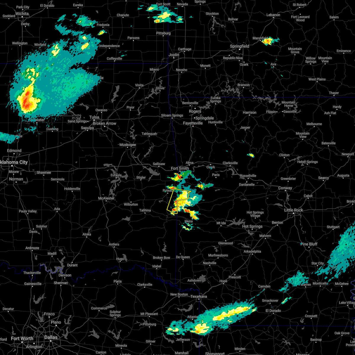 The severe thunderstorm warning for southwestern sebastian and east central le flore counties will expire at 215 am cdt, the storm which prompted the warning has weakened below severe limits. therefore the warning will be allowed to expire. The severe thunderstorm warning for southwestern sebastian and east central le flore counties will expire at 215 am cdt, the storm which prompted the warning has weakened below severe limits. therefore the warning will be allowed to expire.
|
| 3/17/2021 1:53 AM CDT |
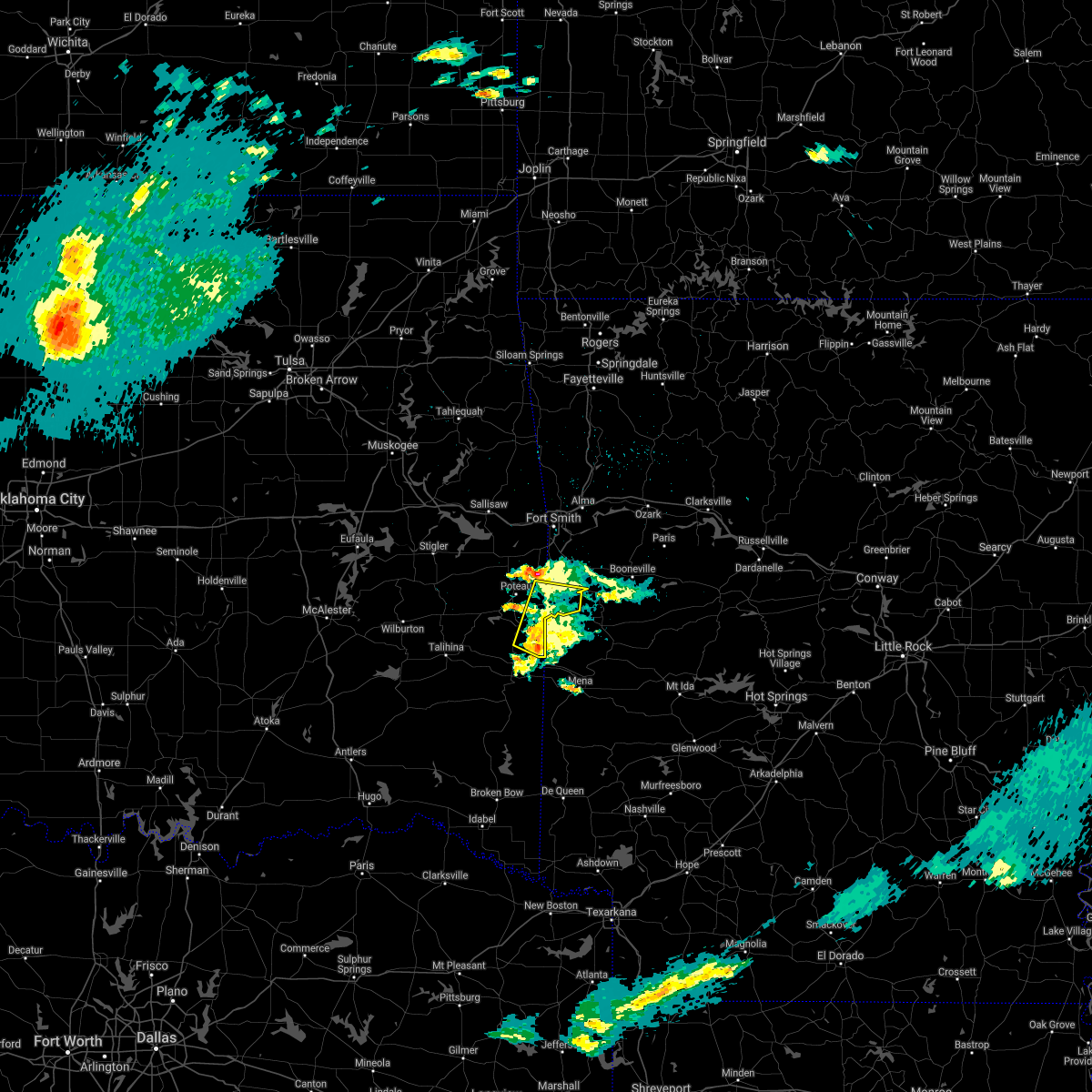 At 153 am cdt, a severe thunderstorm was located 6 miles southeast of heavener runestone state park, moving northeast at 35 mph (radar indicated). Hazards include 60 mph wind gusts and quarter size hail. Hail damage to vehicles is expected. expect wind damage to roofs, siding, and trees. Locations in or near the path include, heavener, hartford, huntington, midland, heavener runestone state park, patterson, arkola,. At 153 am cdt, a severe thunderstorm was located 6 miles southeast of heavener runestone state park, moving northeast at 35 mph (radar indicated). Hazards include 60 mph wind gusts and quarter size hail. Hail damage to vehicles is expected. expect wind damage to roofs, siding, and trees. Locations in or near the path include, heavener, hartford, huntington, midland, heavener runestone state park, patterson, arkola,.
|
| 3/17/2021 1:33 AM CDT |
 At 133 am cdt, a severe thunderstorm was located 6 miles northeast of big cedar, moving northeast at 40 mph (radar indicated). Hazards include 60 mph wind gusts and quarter size hail. Hail damage to vehicles is expected. expect wind damage to roofs, siding, and trees. Locations in or near the path include, poteau, heavener, spiro, howe, hartford, huntington, midland, cameron, heavener runestone state park, rock island, patterson, arkola, hodgen,. At 133 am cdt, a severe thunderstorm was located 6 miles northeast of big cedar, moving northeast at 40 mph (radar indicated). Hazards include 60 mph wind gusts and quarter size hail. Hail damage to vehicles is expected. expect wind damage to roofs, siding, and trees. Locations in or near the path include, poteau, heavener, spiro, howe, hartford, huntington, midland, cameron, heavener runestone state park, rock island, patterson, arkola, hodgen,.
|
| 11/14/2020 10:45 PM CST |
 At 1045 pm cst, severe thunderstorms were located along a line extending from 3 miles northwest of upper buffalo wilderness area to 6 miles northwest of ozark to 4 miles northeast of fanshawe, moving southeast at 45 mph (radar indicated). Hazards include 60 mph wind gusts. Expect damage to roofs, siding, and trees. locations in or near the path include, fort smith, van buren, poteau, ozark, charleston, mountainburg, greenwood, alma, barling, pocola, muldrow, roland, lavaca, spiro, arkoma, mulberry, panama, wister, dyer, hackett, this includes the following highways, interstate 40 in arkansas between mile markers 0 and 38. interstate 40 in oklahoma between mile markers 319 and 328. interstate 540 between mile markers 1 and 14. interstate 49 between mile markers 22 and 32. A tornado watch remains in effect until midnight cst for northwestern and west central arkansas, and east central oklahoma. At 1045 pm cst, severe thunderstorms were located along a line extending from 3 miles northwest of upper buffalo wilderness area to 6 miles northwest of ozark to 4 miles northeast of fanshawe, moving southeast at 45 mph (radar indicated). Hazards include 60 mph wind gusts. Expect damage to roofs, siding, and trees. locations in or near the path include, fort smith, van buren, poteau, ozark, charleston, mountainburg, greenwood, alma, barling, pocola, muldrow, roland, lavaca, spiro, arkoma, mulberry, panama, wister, dyer, hackett, this includes the following highways, interstate 40 in arkansas between mile markers 0 and 38. interstate 40 in oklahoma between mile markers 319 and 328. interstate 540 between mile markers 1 and 14. interstate 49 between mile markers 22 and 32. A tornado watch remains in effect until midnight cst for northwestern and west central arkansas, and east central oklahoma.
|
| 11/14/2020 10:43 PM CST |
 At 1039 pm cst, severe thunderstorms were located along a line extending from 2 miles north of red bank to 5 miles northeast of mulberry to 4 miles north of fanshawe, moving southeast at 45 mph. wind gusts of 40 to 50 mph were occurring along much of the line. the strongest part of the line extended from near fort smith to mulberry to northern franklin county. wind gust to near 60 mph are most likely with these stronger storms (radar indicated). Hazards include 60 mph wind gusts. Expect damage to roofs, siding, and trees. locations in or near the path include, fort smith, van buren, poteau, ozark, charleston, cedarville, mountainburg, greenwood, alma, barling, pocola, muldrow, roland, lavaca, spiro, arkoma, mulberry, panama, wister, dyer, this includes the following highways, interstate 40 in arkansas between mile markers 0 and 38. interstate 40 in oklahoma between mile markers 314 and 328. interstate 540 between mile markers 1 and 14. interstate 49 between mile markers 22 and 33. A tornado watch remains in effect until midnight cst for northwestern and west central arkansas, and east central oklahoma. At 1039 pm cst, severe thunderstorms were located along a line extending from 2 miles north of red bank to 5 miles northeast of mulberry to 4 miles north of fanshawe, moving southeast at 45 mph. wind gusts of 40 to 50 mph were occurring along much of the line. the strongest part of the line extended from near fort smith to mulberry to northern franklin county. wind gust to near 60 mph are most likely with these stronger storms (radar indicated). Hazards include 60 mph wind gusts. Expect damage to roofs, siding, and trees. locations in or near the path include, fort smith, van buren, poteau, ozark, charleston, cedarville, mountainburg, greenwood, alma, barling, pocola, muldrow, roland, lavaca, spiro, arkoma, mulberry, panama, wister, dyer, this includes the following highways, interstate 40 in arkansas between mile markers 0 and 38. interstate 40 in oklahoma between mile markers 314 and 328. interstate 540 between mile markers 1 and 14. interstate 49 between mile markers 22 and 33. A tornado watch remains in effect until midnight cst for northwestern and west central arkansas, and east central oklahoma.
|
| 11/14/2020 10:34 PM CST |
 At 1034 pm cst, severe thunderstorms were located along a line extending from carrollton to 3 miles south of fern to 6 miles south of mccurtain, moving southeast at 45 mph (radar indicated). Hazards include 60 mph wind gusts. Expect damage to roofs, siding, and trees. locations in or near the path include, fort smith, van buren, poteau, berryville, ozark, charleston, huntsville, cedarville, mountainburg, natural dam, greenwood, alma, barling, pocola, muldrow, roland, green forest, lavaca, spiro, arkoma, this includes the following highways, interstate 40 in arkansas between mile markers 0 and 38. interstate 40 in oklahoma between mile markers 311 and 328. interstate 540 between mile markers 1 and 14. interstate 49 between mile markers 22 and 42. A tornado watch remains in effect until midnight cst for northwestern and west central arkansas, and east central oklahoma. At 1034 pm cst, severe thunderstorms were located along a line extending from carrollton to 3 miles south of fern to 6 miles south of mccurtain, moving southeast at 45 mph (radar indicated). Hazards include 60 mph wind gusts. Expect damage to roofs, siding, and trees. locations in or near the path include, fort smith, van buren, poteau, berryville, ozark, charleston, huntsville, cedarville, mountainburg, natural dam, greenwood, alma, barling, pocola, muldrow, roland, green forest, lavaca, spiro, arkoma, this includes the following highways, interstate 40 in arkansas between mile markers 0 and 38. interstate 40 in oklahoma between mile markers 311 and 328. interstate 540 between mile markers 1 and 14. interstate 49 between mile markers 22 and 42. A tornado watch remains in effect until midnight cst for northwestern and west central arkansas, and east central oklahoma.
|
| 11/14/2020 10:29 PM CST |
 At 1028 pm cst, severe thunderstorms were located along a line extending from 3 miles west of carrollton to 2 miles southeast of lake fort smith to 4 miles south of mccurtain, moving southeast at 45 mph. other smaller storms from north fort smith to near rudy were also capable of producing winds of 50 to 60 mph (radar indicated). Hazards include 60 mph wind gusts. Expect damage to roofs, siding, and trees. locations in or near the path include, fort smith, fayetteville, van buren, sallisaw, poteau, berryville, ozark, charleston, huntsville, cedarville, mountainburg, natural dam, greenwood, alma, barling, pocola, muldrow, roland, green forest, elkins, this includes the following highways, interstate 40 in arkansas between mile markers 0 and 38. interstate 40 in oklahoma between mile markers 306 and 328. interstate 540 between mile markers 1 and 14. interstate 49 between mile markers 22 and 53. A tornado watch remains in effect until midnight cst for northwestern and west central arkansas, and northeastern and east central oklahoma. At 1028 pm cst, severe thunderstorms were located along a line extending from 3 miles west of carrollton to 2 miles southeast of lake fort smith to 4 miles south of mccurtain, moving southeast at 45 mph. other smaller storms from north fort smith to near rudy were also capable of producing winds of 50 to 60 mph (radar indicated). Hazards include 60 mph wind gusts. Expect damage to roofs, siding, and trees. locations in or near the path include, fort smith, fayetteville, van buren, sallisaw, poteau, berryville, ozark, charleston, huntsville, cedarville, mountainburg, natural dam, greenwood, alma, barling, pocola, muldrow, roland, green forest, elkins, this includes the following highways, interstate 40 in arkansas between mile markers 0 and 38. interstate 40 in oklahoma between mile markers 306 and 328. interstate 540 between mile markers 1 and 14. interstate 49 between mile markers 22 and 53. A tornado watch remains in effect until midnight cst for northwestern and west central arkansas, and northeastern and east central oklahoma.
|
| 11/14/2020 10:23 PM CST |
 At 1022 pm cst, severe thunderstorms were located along a line extending from green forest to near chester to 2 miles southeast of mccurtain, moving southeast at 45 mph. wind gusts of 50 to 60 mph have occurred at many locations along this line of storms (radar indicated). Hazards include 60 mph wind gusts. Expect damage to roofs, siding, and trees. locations in or near the path include, fort smith, fayetteville, van buren, sallisaw, poteau, berryville, ozark, charleston, huntsville, cedarville, mountainburg, natural dam, greenwood, alma, barling, pocola, muldrow, roland, green forest, elkins, this includes the following highways, interstate 40 in arkansas between mile markers 0 and 38. interstate 40 in oklahoma between mile markers 306 and 328. interstate 540 between mile markers 1 and 14. interstate 49 between mile markers 22 and 53. A tornado watch remains in effect until midnight cst for northwestern and west central arkansas, and northeastern and east central oklahoma. At 1022 pm cst, severe thunderstorms were located along a line extending from green forest to near chester to 2 miles southeast of mccurtain, moving southeast at 45 mph. wind gusts of 50 to 60 mph have occurred at many locations along this line of storms (radar indicated). Hazards include 60 mph wind gusts. Expect damage to roofs, siding, and trees. locations in or near the path include, fort smith, fayetteville, van buren, sallisaw, poteau, berryville, ozark, charleston, huntsville, cedarville, mountainburg, natural dam, greenwood, alma, barling, pocola, muldrow, roland, green forest, elkins, this includes the following highways, interstate 40 in arkansas between mile markers 0 and 38. interstate 40 in oklahoma between mile markers 306 and 328. interstate 540 between mile markers 1 and 14. interstate 49 between mile markers 22 and 53. A tornado watch remains in effect until midnight cst for northwestern and west central arkansas, and northeastern and east central oklahoma.
|
| 11/14/2020 10:11 PM CST |
 At 1009 pm cst, severe thunderstorms were located along a line extending from near urbanette to near devils den state park to 5 miles northwest of mccurtain, moving southeast at 45 mph (radar indicated). Hazards include 60 mph wind gusts. Expect damage to roofs, siding, and trees. locations in or near the path include, fort smith, fayetteville, van buren, sallisaw, poteau, berryville, ozark, charleston, huntsville, cedarville, mountainburg, natural dam, greenwood, alma, barling, pocola, muldrow, roland, green forest, elkins, this includes the following highways, interstate 40 in arkansas between mile markers 0 and 38. interstate 40 in oklahoma between mile markers 306 and 328. interstate 540 between mile markers 1 and 14. interstate 49 between mile markers 22 and 53. A tornado watch remains in effect until midnight cst for northwestern and west central arkansas, and northeastern and east central oklahoma. At 1009 pm cst, severe thunderstorms were located along a line extending from near urbanette to near devils den state park to 5 miles northwest of mccurtain, moving southeast at 45 mph (radar indicated). Hazards include 60 mph wind gusts. Expect damage to roofs, siding, and trees. locations in or near the path include, fort smith, fayetteville, van buren, sallisaw, poteau, berryville, ozark, charleston, huntsville, cedarville, mountainburg, natural dam, greenwood, alma, barling, pocola, muldrow, roland, green forest, elkins, this includes the following highways, interstate 40 in arkansas between mile markers 0 and 38. interstate 40 in oklahoma between mile markers 306 and 328. interstate 540 between mile markers 1 and 14. interstate 49 between mile markers 22 and 53. A tornado watch remains in effect until midnight cst for northwestern and west central arkansas, and northeastern and east central oklahoma.
|
| 8/29/2020 8:30 PM CDT |
 At 830 pm cdt, a severe thunderstorm was located 3 miles south of lake wister state park, moving southeast at 5 mph (radar indicated). Hazards include 60 mph wind gusts and half dollar size hail. Hail damage to vehicles is expected. expect wind damage to roofs, siding, and trees. Locations in or near the path include, heavener, wister, howe, heavener runestone state park, lake wister state park, hodgen, summerfield,. At 830 pm cdt, a severe thunderstorm was located 3 miles south of lake wister state park, moving southeast at 5 mph (radar indicated). Hazards include 60 mph wind gusts and half dollar size hail. Hail damage to vehicles is expected. expect wind damage to roofs, siding, and trees. Locations in or near the path include, heavener, wister, howe, heavener runestone state park, lake wister state park, hodgen, summerfield,.
|
| 8/29/2020 8:08 PM CDT |
 At 808 pm cdt, a severe thunderstorm was located 3 miles southwest of howe, moving southeast at 20 mph (radar indicated). Hazards include golf ball size hail and 60 mph wind gusts. People and animals outdoors will be injured. expect hail damage to roofs, siding, windows, and vehicles. expect wind damage to roofs, siding, and trees. Locations in or near the path include, heavener, wister, howe, heavener runestone state park, lake wister state park, hodgen, summerfield,. At 808 pm cdt, a severe thunderstorm was located 3 miles southwest of howe, moving southeast at 20 mph (radar indicated). Hazards include golf ball size hail and 60 mph wind gusts. People and animals outdoors will be injured. expect hail damage to roofs, siding, windows, and vehicles. expect wind damage to roofs, siding, and trees. Locations in or near the path include, heavener, wister, howe, heavener runestone state park, lake wister state park, hodgen, summerfield,.
|
| 8/29/2020 7:53 PM CDT |
 At 752 pm cdt, a severe thunderstorm was located over lake wister state park, moving southeast at 20 mph (radar indicated). Hazards include 60 mph wind gusts and quarter size hail. Hail damage to vehicles is expected. expect wind damage to roofs, siding, and trees. Locations in or near the path include, heavener, wister, howe, heavener runestone state park, lake wister state park, hodgen, summerfield,. At 752 pm cdt, a severe thunderstorm was located over lake wister state park, moving southeast at 20 mph (radar indicated). Hazards include 60 mph wind gusts and quarter size hail. Hail damage to vehicles is expected. expect wind damage to roofs, siding, and trees. Locations in or near the path include, heavener, wister, howe, heavener runestone state park, lake wister state park, hodgen, summerfield,.
|
| 7/30/2020 9:52 PM CDT |
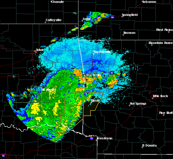 At 952 pm cdt, severe thunderstorms were located along a line extending from 4 miles southeast of octavia to 9 miles east of manchester, moving east at 30 mph (radar indicated). Hazards include 60 mph wind gusts. Expect damage to roofs, siding, and trees. Locations in or near the path include, heavener, octavia, heavener runestone state park, big cedar, hodgen,. At 952 pm cdt, severe thunderstorms were located along a line extending from 4 miles southeast of octavia to 9 miles east of manchester, moving east at 30 mph (radar indicated). Hazards include 60 mph wind gusts. Expect damage to roofs, siding, and trees. Locations in or near the path include, heavener, octavia, heavener runestone state park, big cedar, hodgen,.
|
| 7/30/2020 9:29 PM CDT |
 At 928 pm cdt, severe thunderstorms were located along a line extending from 7 miles west of octavia to near manchester, moving east at 30 mph (radar indicated). Hazards include 60 mph wind gusts. Expect damage to roofs, siding, and trees. Locations in or near the path include, heavener, octavia, talimena state park, heavener runestone state park, whitesboro, muse, big cedar, hodgen, honobia,. At 928 pm cdt, severe thunderstorms were located along a line extending from 7 miles west of octavia to near manchester, moving east at 30 mph (radar indicated). Hazards include 60 mph wind gusts. Expect damage to roofs, siding, and trees. Locations in or near the path include, heavener, octavia, talimena state park, heavener runestone state park, whitesboro, muse, big cedar, hodgen, honobia,.
|
| 7/30/2020 9:12 PM CDT |
 At 911 pm cdt, severe thunderstorms were located along a line extending from 9 miles southeast of albion to 8 miles south of raymond gary state park, moving east at 30 mph (radar indicated). Hazards include 60 mph wind gusts. Expect damage to roofs, siding, and trees. Locations in or near the path include, hugo, clayton, heavener, talihina, fort towson, sawyer, albion, octavia, talimena state park, heavener runestone state park, tuskahoma, big cedar, hugo lake state park, kiamichi, whitesboro, clayton lake state park, bengal, yanush, raymond gary state park, nashoba,. At 911 pm cdt, severe thunderstorms were located along a line extending from 9 miles southeast of albion to 8 miles south of raymond gary state park, moving east at 30 mph (radar indicated). Hazards include 60 mph wind gusts. Expect damage to roofs, siding, and trees. Locations in or near the path include, hugo, clayton, heavener, talihina, fort towson, sawyer, albion, octavia, talimena state park, heavener runestone state park, tuskahoma, big cedar, hugo lake state park, kiamichi, whitesboro, clayton lake state park, bengal, yanush, raymond gary state park, nashoba,.
|
| 7/30/2020 9:02 PM CDT |
 At 900 pm cdt, severe thunderstorms were located along a line extending from 4 miles southeast of albion to 7 miles south of sawyer, moving east at 30 mph (public). Hazards include 60 mph wind gusts. public reported trees down and power out in the city of hugo. additional tree damage was located near the border of mccurtain county. Expect damage to roofs, siding, and trees. Locations in or near the path include, hugo, antlers, clayton, heavener, talihina, fort towson, sawyer, rattan, soper, albion, octavia, talimena state park, snow, heavener runestone state park, tuskahoma, big cedar, hugo lake state park, kiamichi, whitesboro, clayton lake state park,. At 900 pm cdt, severe thunderstorms were located along a line extending from 4 miles southeast of albion to 7 miles south of sawyer, moving east at 30 mph (public). Hazards include 60 mph wind gusts. public reported trees down and power out in the city of hugo. additional tree damage was located near the border of mccurtain county. Expect damage to roofs, siding, and trees. Locations in or near the path include, hugo, antlers, clayton, heavener, talihina, fort towson, sawyer, rattan, soper, albion, octavia, talimena state park, snow, heavener runestone state park, tuskahoma, big cedar, hugo lake state park, kiamichi, whitesboro, clayton lake state park,.
|
| 7/30/2020 8:56 PM CDT |
 At 856 pm cdt, severe thunderstorms were located along a line extending from 4 miles southeast of albion to 7 miles south of sawyer, moving east at 30 mph (radar indicated). Hazards include 60 mph wind gusts. Expect damage to roofs, siding, and trees. Locations in or near the path include, hugo, antlers, clayton, heavener, talihina, fort towson, sawyer, rattan, soper, albion, octavia, talimena state park, snow, heavener runestone state park, tuskahoma, big cedar, hugo lake state park, kiamichi, whitesboro, clayton lake state park,. At 856 pm cdt, severe thunderstorms were located along a line extending from 4 miles southeast of albion to 7 miles south of sawyer, moving east at 30 mph (radar indicated). Hazards include 60 mph wind gusts. Expect damage to roofs, siding, and trees. Locations in or near the path include, hugo, antlers, clayton, heavener, talihina, fort towson, sawyer, rattan, soper, albion, octavia, talimena state park, snow, heavener runestone state park, tuskahoma, big cedar, hugo lake state park, kiamichi, whitesboro, clayton lake state park,.
|
| 7/11/2020 11:17 PM CDT |
 At 1117 pm cdt, severe thunderstorms were located along a line extending from 6 miles east of heavener runestone state park to 4 miles southwest of lequire, moving south at 20 mph (radar indicated). Hazards include 60 mph wind gusts. Expect damage to roofs, siding, and trees. Locations in or near the path include, poteau, heavener, wister, howe, red oak, fanshawe, talimena state park, heavener runestone state park, lake wister state park, bengal, hodgen, summerfield,. At 1117 pm cdt, severe thunderstorms were located along a line extending from 6 miles east of heavener runestone state park to 4 miles southwest of lequire, moving south at 20 mph (radar indicated). Hazards include 60 mph wind gusts. Expect damage to roofs, siding, and trees. Locations in or near the path include, poteau, heavener, wister, howe, red oak, fanshawe, talimena state park, heavener runestone state park, lake wister state park, bengal, hodgen, summerfield,.
|
| 7/11/2020 10:29 PM CDT |
 At 1028 pm cdt, severe thunderstorms were located along a line extending from near hackett to 2 miles northwest of wister to near lequire, moving south at 45 mph (radar indicated). Hazards include 70 mph wind gusts and quarter size hail. Hail damage to vehicles is expected. expect considerable tree damage. wind damage is also likely to mobile homes, roofs, and outbuildings. Locations in or near the path include, poteau, stigler, heavener, talihina, wister, howe, red oak, mccurtain, bokoshe, fanshawe, talimena state park, heavener runestone state park, bengal, mc curtain, lake wister state park, whitesboro, lequire, muse, summerfield, hodgen,. At 1028 pm cdt, severe thunderstorms were located along a line extending from near hackett to 2 miles northwest of wister to near lequire, moving south at 45 mph (radar indicated). Hazards include 70 mph wind gusts and quarter size hail. Hail damage to vehicles is expected. expect considerable tree damage. wind damage is also likely to mobile homes, roofs, and outbuildings. Locations in or near the path include, poteau, stigler, heavener, talihina, wister, howe, red oak, mccurtain, bokoshe, fanshawe, talimena state park, heavener runestone state park, bengal, mc curtain, lake wister state park, whitesboro, lequire, muse, summerfield, hodgen,.
|
| 7/10/2020 2:25 PM CDT |
 At 225 pm cdt, severe thunderstorms were located along a line extending from near poteau to 6 miles southwest of heavener, moving east at 20 mph (radar indicated). Hazards include 60 mph wind gusts. Expect damage to roofs, siding, and trees. Locations in or near the path include, poteau, heavener, wister, howe, hodgen,. At 225 pm cdt, severe thunderstorms were located along a line extending from near poteau to 6 miles southwest of heavener, moving east at 20 mph (radar indicated). Hazards include 60 mph wind gusts. Expect damage to roofs, siding, and trees. Locations in or near the path include, poteau, heavener, wister, howe, hodgen,.
|
| 7/10/2020 2:06 PM CDT |
 At 205 pm cdt, severe thunderstorms were located along a line extending from 5 miles south of bokoshe to 6 miles northeast of whitesboro, moving southeast at 20 mph (radar indicated). Hazards include 60 mph wind gusts. Expect damage to roofs, siding, and trees. Locations in or near the path include, poteau, heavener, panama, wister, howe, bokoshe, fanshawe, talimena state park, big cedar, lake wister state park, whitesboro, muse, shady point, summerfield, hodgen, milton,. At 205 pm cdt, severe thunderstorms were located along a line extending from 5 miles south of bokoshe to 6 miles northeast of whitesboro, moving southeast at 20 mph (radar indicated). Hazards include 60 mph wind gusts. Expect damage to roofs, siding, and trees. Locations in or near the path include, poteau, heavener, panama, wister, howe, bokoshe, fanshawe, talimena state park, big cedar, lake wister state park, whitesboro, muse, shady point, summerfield, hodgen, milton,.
|
| 7/10/2020 1:46 PM CDT |
 At 146 pm cdt, severe thunderstorms were located along a line extending from 5 miles east of mc curtain to 2 miles northeast of talimena state park, moving southeast at 20 mph (radar indicated). Hazards include 60 mph wind gusts. Expect damage to roofs, siding, and trees. Locations in or near the path include, poteau, heavener, panama, talihina, wister, howe, bokoshe, fanshawe, talimena state park, big cedar, lake wister state park, whitesboro, muse, shady point, summerfield, hodgen, milton,. At 146 pm cdt, severe thunderstorms were located along a line extending from 5 miles east of mc curtain to 2 miles northeast of talimena state park, moving southeast at 20 mph (radar indicated). Hazards include 60 mph wind gusts. Expect damage to roofs, siding, and trees. Locations in or near the path include, poteau, heavener, panama, talihina, wister, howe, bokoshe, fanshawe, talimena state park, big cedar, lake wister state park, whitesboro, muse, shady point, summerfield, hodgen, milton,.
|
| 7/9/2020 12:30 PM CDT |
 At 1229 pm cdt, severe thunderstorms were located along a line extending from 4 miles northeast of heavener runestone state park to 4 miles north of talimena state park, moving southeast at 25 mph (radar indicated). Hazards include 60 mph wind gusts and penny size hail. Expect damage to roofs, siding, and trees. Locations in or near the path include, heavener, howe, octavia, talimena state park, heavener runestone state park, lake wister state park, whitesboro, muse, big cedar, hodgen, summerfield, honobia,. At 1229 pm cdt, severe thunderstorms were located along a line extending from 4 miles northeast of heavener runestone state park to 4 miles north of talimena state park, moving southeast at 25 mph (radar indicated). Hazards include 60 mph wind gusts and penny size hail. Expect damage to roofs, siding, and trees. Locations in or near the path include, heavener, howe, octavia, talimena state park, heavener runestone state park, lake wister state park, whitesboro, muse, big cedar, hodgen, summerfield, honobia,.
|
| 7/9/2020 11:48 AM CDT |
 At 1148 am cdt, severe thunderstorms were located along a line extending from 6 miles south of mulberry to near greenwood to 6 miles west of poteau, moving southeast at 25 mph (radar indicated). Hazards include 60 mph wind gusts. Expect damage to roofs, siding, and trees. locations in or near the path include, fort smith, van buren, poteau, ozark, charleston, greenwood, alma, barling, pocola, lavaca, spiro, arkoma, mulberry, panama, wister, dyer, hackett, howe, altus, hartford, this includes the following highways, interstate 40 in arkansas between mile markers 7 and 35. Interstate 540 between mile markers 1 and 14. At 1148 am cdt, severe thunderstorms were located along a line extending from 6 miles south of mulberry to near greenwood to 6 miles west of poteau, moving southeast at 25 mph (radar indicated). Hazards include 60 mph wind gusts. Expect damage to roofs, siding, and trees. locations in or near the path include, fort smith, van buren, poteau, ozark, charleston, greenwood, alma, barling, pocola, lavaca, spiro, arkoma, mulberry, panama, wister, dyer, hackett, howe, altus, hartford, this includes the following highways, interstate 40 in arkansas between mile markers 7 and 35. Interstate 540 between mile markers 1 and 14.
|
| 7/9/2020 11:14 AM CDT |
 At 1113 am cdt, severe thunderstorms were located along a line extending from 4 miles south of mountainburg to fort smith to 4 miles northwest of bokoshe, moving southeast at 25 mph (radar indicated). Hazards include 60 mph wind gusts and penny size hail. Expect damage to roofs, siding, and trees. locations in or near the path include, fort smith, van buren, poteau, ozark, charleston, cedarville, mountainburg, greenwood, alma, barling, pocola, muldrow, roland, lavaca, spiro, arkoma, mulberry, panama, wister, dyer, this includes the following highways, interstate 40 in arkansas between mile markers 0 and 35. interstate 40 in oklahoma between mile markers 312 and 328. interstate 540 between mile markers 1 and 14. Interstate 49 between mile markers 22 and 35. At 1113 am cdt, severe thunderstorms were located along a line extending from 4 miles south of mountainburg to fort smith to 4 miles northwest of bokoshe, moving southeast at 25 mph (radar indicated). Hazards include 60 mph wind gusts and penny size hail. Expect damage to roofs, siding, and trees. locations in or near the path include, fort smith, van buren, poteau, ozark, charleston, cedarville, mountainburg, greenwood, alma, barling, pocola, muldrow, roland, lavaca, spiro, arkoma, mulberry, panama, wister, dyer, this includes the following highways, interstate 40 in arkansas between mile markers 0 and 35. interstate 40 in oklahoma between mile markers 312 and 328. interstate 540 between mile markers 1 and 14. Interstate 49 between mile markers 22 and 35.
|
| 5/23/2020 12:45 AM CDT |
 At 1245 am cdt, a severe thunderstorm was located near heavener runestone state park, moving east at 20 mph (radar indicated). Hazards include 60 mph wind gusts and quarter size hail. Hail damage to vehicles is expected. expect wind damage to roofs, siding, and trees. Locations in or near the path include, poteau, heavener, howe, hartford, heavener runestone state park, patterson,. At 1245 am cdt, a severe thunderstorm was located near heavener runestone state park, moving east at 20 mph (radar indicated). Hazards include 60 mph wind gusts and quarter size hail. Hail damage to vehicles is expected. expect wind damage to roofs, siding, and trees. Locations in or near the path include, poteau, heavener, howe, hartford, heavener runestone state park, patterson,.
|
| 5/23/2020 12:28 AM CDT |
 At 1228 am cdt, a severe thunderstorm was located over heavener, moving northeast at 15 mph (radar indicated). Hazards include 60 mph wind gusts and quarter size hail. Hail damage to vehicles is expected. expect wind damage to roofs, siding, and trees. Locations in or near the path include, poteau, heavener, howe, hartford, heavener runestone state park, patterson, hodgen,. At 1228 am cdt, a severe thunderstorm was located over heavener, moving northeast at 15 mph (radar indicated). Hazards include 60 mph wind gusts and quarter size hail. Hail damage to vehicles is expected. expect wind damage to roofs, siding, and trees. Locations in or near the path include, poteau, heavener, howe, hartford, heavener runestone state park, patterson, hodgen,.
|
| 5/22/2020 10:56 PM CDT |
 At 1056 pm cdt, a severe thunderstorm capable of producing a tornado was located 9 miles northwest of mountain fork, moving east at 30 mph (radar indicated rotation). Hazards include tornado and half dollar size hail. Flying debris will be dangerous to those caught without shelter. mobile homes will be damaged or destroyed. damage to roofs, windows, and vehicles will occur. tree damage is likely. Locations in or near the path include, heavener, heavener runestone state park, hodgen,. At 1056 pm cdt, a severe thunderstorm capable of producing a tornado was located 9 miles northwest of mountain fork, moving east at 30 mph (radar indicated rotation). Hazards include tornado and half dollar size hail. Flying debris will be dangerous to those caught without shelter. mobile homes will be damaged or destroyed. damage to roofs, windows, and vehicles will occur. tree damage is likely. Locations in or near the path include, heavener, heavener runestone state park, hodgen,.
|
| 5/22/2020 10:42 PM CDT |
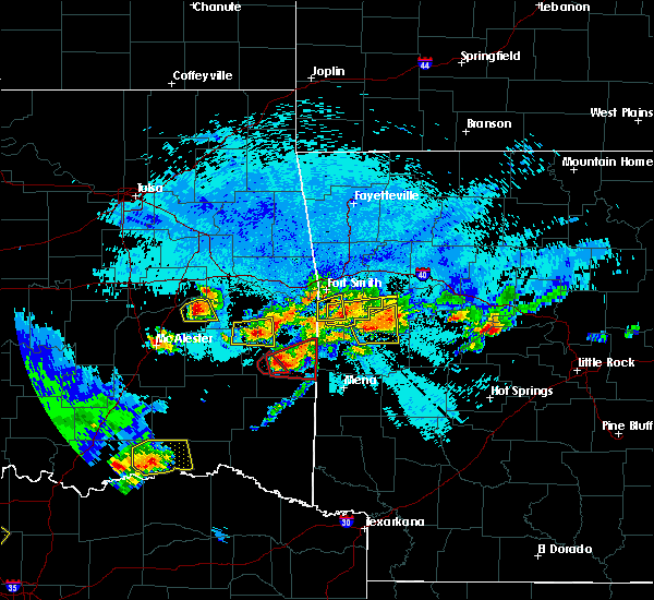 At 1042 pm cdt, a severe thunderstorm capable of producing a tornado was located 6 miles north of big cedar, moving east at 30 mph (radar indicated rotation). Hazards include tornado and golf ball size hail. Flying debris will be dangerous to those caught without shelter. mobile homes will be damaged or destroyed. damage to roofs, windows, and vehicles will occur. tree damage is likely. Locations in or near the path include, heavener, heavener runestone state park, hodgen,. At 1042 pm cdt, a severe thunderstorm capable of producing a tornado was located 6 miles north of big cedar, moving east at 30 mph (radar indicated rotation). Hazards include tornado and golf ball size hail. Flying debris will be dangerous to those caught without shelter. mobile homes will be damaged or destroyed. damage to roofs, windows, and vehicles will occur. tree damage is likely. Locations in or near the path include, heavener, heavener runestone state park, hodgen,.
|
| 5/22/2020 10:32 PM CDT |
 At 1031 pm cdt, a severe thunderstorm capable of producing a tornado was located 3 miles north of muse, moving east at 20 mph (spotter reported a tornado 2 miles east southeast of whitesboro at 1018 pm). Hazards include tornado and golf ball size hail. Flying debris will be dangerous to those caught without shelter. mobile homes will be damaged or destroyed. damage to roofs, windows, and vehicles will occur. tree damage is likely. Locations in or near the path include, heavener, heavener runestone state park, hodgen,. At 1031 pm cdt, a severe thunderstorm capable of producing a tornado was located 3 miles north of muse, moving east at 20 mph (spotter reported a tornado 2 miles east southeast of whitesboro at 1018 pm). Hazards include tornado and golf ball size hail. Flying debris will be dangerous to those caught without shelter. mobile homes will be damaged or destroyed. damage to roofs, windows, and vehicles will occur. tree damage is likely. Locations in or near the path include, heavener, heavener runestone state park, hodgen,.
|
| 5/22/2020 10:27 PM CDT |
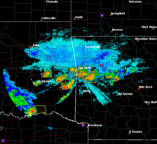 At 1026 pm cdt, a severe thunderstorm capable of producing a tornado was located 3 miles north of muse, moving east at 30 mph (radar indicated rotation). Hazards include tornado and golf ball size hail. Flying debris will be dangerous to those caught without shelter. mobile homes will be damaged or destroyed. damage to roofs, windows, and vehicles will occur. tree damage is likely. Locations in or near the path include, heavener, heavener runestone state park, hodgen,. At 1026 pm cdt, a severe thunderstorm capable of producing a tornado was located 3 miles north of muse, moving east at 30 mph (radar indicated rotation). Hazards include tornado and golf ball size hail. Flying debris will be dangerous to those caught without shelter. mobile homes will be damaged or destroyed. damage to roofs, windows, and vehicles will occur. tree damage is likely. Locations in or near the path include, heavener, heavener runestone state park, hodgen,.
|
| 5/22/2020 8:47 PM CDT |
 At 847 pm cdt, a severe thunderstorm capable of producing a tornado was located over heavener runestone state park, moving east at 25 mph (radar indicated rotation). Hazards include tornado. Flying debris will be dangerous to those caught without shelter. mobile homes will be damaged or destroyed. damage to roofs, windows, and vehicles will occur. tree damage is likely. Locations in or near the path include, heavener, hartford, heavener runestone state park, patterson,. At 847 pm cdt, a severe thunderstorm capable of producing a tornado was located over heavener runestone state park, moving east at 25 mph (radar indicated rotation). Hazards include tornado. Flying debris will be dangerous to those caught without shelter. mobile homes will be damaged or destroyed. damage to roofs, windows, and vehicles will occur. tree damage is likely. Locations in or near the path include, heavener, hartford, heavener runestone state park, patterson,.
|
| 5/22/2020 8:39 PM CDT |
 At 839 pm cdt, a severe thunderstorm was located over heavener runestone state park, moving northeast at 20 mph (radar indicated). Hazards include 60 mph wind gusts and half dollar size hail. Hail damage to vehicles is expected. expect wind damage to roofs, siding, and trees. Locations in or near the path include, heavener, howe, hartford, midland, heavener runestone state park, patterson, hodgen,. At 839 pm cdt, a severe thunderstorm was located over heavener runestone state park, moving northeast at 20 mph (radar indicated). Hazards include 60 mph wind gusts and half dollar size hail. Hail damage to vehicles is expected. expect wind damage to roofs, siding, and trees. Locations in or near the path include, heavener, howe, hartford, midland, heavener runestone state park, patterson, hodgen,.
|
| 5/22/2020 8:39 PM CDT |
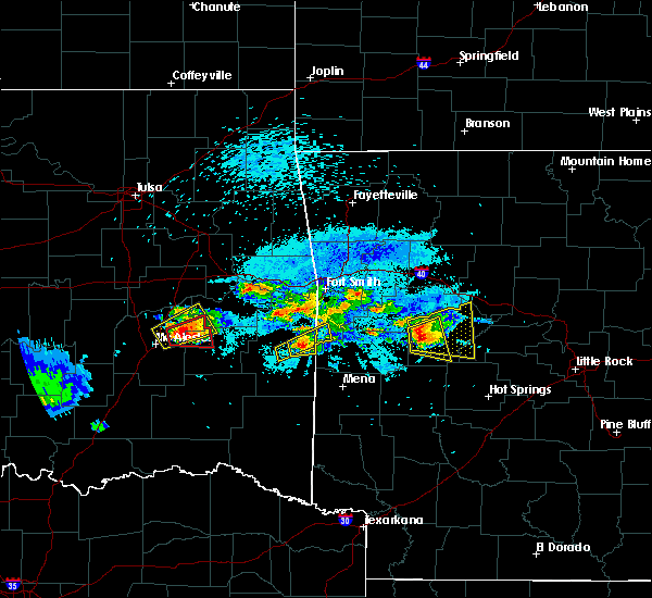 At 839 pm cdt, a severe thunderstorm was located over heavener runestone state park, moving northeast at 20 mph (radar indicated). Hazards include 60 mph wind gusts and half dollar size hail. Hail damage to vehicles is expected. expect wind damage to roofs, siding, and trees. Locations in or near the path include, heavener, howe, hartford, midland, heavener runestone state park, patterson, hodgen,. At 839 pm cdt, a severe thunderstorm was located over heavener runestone state park, moving northeast at 20 mph (radar indicated). Hazards include 60 mph wind gusts and half dollar size hail. Hail damage to vehicles is expected. expect wind damage to roofs, siding, and trees. Locations in or near the path include, heavener, howe, hartford, midland, heavener runestone state park, patterson, hodgen,.
|
| 5/22/2020 8:32 PM CDT | Golf Ball sized hail reported 1.6 miles NNW of Heavener, OK |
| 5/22/2020 8:32 PM CDT | Baseball sized hail reported 0.5 miles W of Heavener, OK |
| 5/22/2020 8:32 PM CDT |
 At 831 pm cdt, a severe thunderstorm was located over heavener, moving northeast at 30 mph (radar indicated). Hazards include ping pong ball size hail and 60 mph wind gusts. People and animals outdoors will be injured. expect hail damage to roofs, siding, windows, and vehicles. expect wind damage to roofs, siding, and trees. Locations in or near the path include, heavener, howe, heavener runestone state park, hodgen,. At 831 pm cdt, a severe thunderstorm was located over heavener, moving northeast at 30 mph (radar indicated). Hazards include ping pong ball size hail and 60 mph wind gusts. People and animals outdoors will be injured. expect hail damage to roofs, siding, windows, and vehicles. expect wind damage to roofs, siding, and trees. Locations in or near the path include, heavener, howe, heavener runestone state park, hodgen,.
|
| 5/22/2020 8:26 PM CDT |
 At 826 pm cdt, a severe thunderstorm was located near heavener, moving east at 25 mph (radar indicated). Hazards include ping pong ball size hail and 60 mph wind gusts. People and animals outdoors will be injured. expect hail damage to roofs, siding, windows, and vehicles. expect wind damage to roofs, siding, and trees. Locations in or near the path include, heavener, howe, hartford, midland, heavener runestone state park, patterson, hodgen,. At 826 pm cdt, a severe thunderstorm was located near heavener, moving east at 25 mph (radar indicated). Hazards include ping pong ball size hail and 60 mph wind gusts. People and animals outdoors will be injured. expect hail damage to roofs, siding, windows, and vehicles. expect wind damage to roofs, siding, and trees. Locations in or near the path include, heavener, howe, hartford, midland, heavener runestone state park, patterson, hodgen,.
|
| 5/22/2020 8:22 PM CDT | Ping Pong Ball sized hail reported 3.5 miles N of Heavener, OK |
| 5/22/2020 8:04 PM CDT |
 At 803 pm cdt, a severe thunderstorm was located 3 miles southeast of poteau, moving northeast at 20 mph (radar indicated). Hazards include 60 mph wind gusts and quarter size hail. Hail damage to vehicles is expected. expect wind damage to roofs, siding, and trees. Locations in or near the path include, poteau, heavener, hackett, howe, hartford, midland, cameron, heavener runestone state park, rock island, patterson, jenson,. At 803 pm cdt, a severe thunderstorm was located 3 miles southeast of poteau, moving northeast at 20 mph (radar indicated). Hazards include 60 mph wind gusts and quarter size hail. Hail damage to vehicles is expected. expect wind damage to roofs, siding, and trees. Locations in or near the path include, poteau, heavener, hackett, howe, hartford, midland, cameron, heavener runestone state park, rock island, patterson, jenson,.
|
| 5/22/2020 8:00 PM CDT |
 At 800 pm cdt, a severe thunderstorm was located 4 miles south of lake wister state park, moving northeast at 25 mph (radar indicated). Hazards include 60 mph wind gusts and quarter size hail. Hail damage to vehicles is expected. expect wind damage to roofs, siding, and trees. Locations in or near the path include, poteau, heavener, wister, howe, cameron, heavener runestone state park, lake wister state park, hodgen, summerfield,. At 800 pm cdt, a severe thunderstorm was located 4 miles south of lake wister state park, moving northeast at 25 mph (radar indicated). Hazards include 60 mph wind gusts and quarter size hail. Hail damage to vehicles is expected. expect wind damage to roofs, siding, and trees. Locations in or near the path include, poteau, heavener, wister, howe, cameron, heavener runestone state park, lake wister state park, hodgen, summerfield,.
|
| 5/22/2020 7:43 PM CDT |
 At 743 pm cdt, a severe thunderstorm was located near wister, moving northeast at 20 mph (radar indicated). Hazards include 60 mph wind gusts and quarter size hail. Hail damage to vehicles is expected. expect wind damage to roofs, siding, and trees. Locations in or near the path include, poteau, pocola, heavener, wister, hackett, howe, hartford, midland, cameron, lake wister state park, rock island, patterson, jenson,. At 743 pm cdt, a severe thunderstorm was located near wister, moving northeast at 20 mph (radar indicated). Hazards include 60 mph wind gusts and quarter size hail. Hail damage to vehicles is expected. expect wind damage to roofs, siding, and trees. Locations in or near the path include, poteau, pocola, heavener, wister, hackett, howe, hartford, midland, cameron, lake wister state park, rock island, patterson, jenson,.
|
| 5/22/2020 7:30 PM CDT |
 At 729 pm cdt, a severe thunderstorm was located near talimena state park, moving northeast at 20 mph (radar indicated). Hazards include 60 mph wind gusts and quarter size hail. Hail damage to vehicles is expected. expect wind damage to roofs, siding, and trees. Locations in or near the path include, wister, fanshawe, talimena state park, lake wister state park, summerfield,. At 729 pm cdt, a severe thunderstorm was located near talimena state park, moving northeast at 20 mph (radar indicated). Hazards include 60 mph wind gusts and quarter size hail. Hail damage to vehicles is expected. expect wind damage to roofs, siding, and trees. Locations in or near the path include, wister, fanshawe, talimena state park, lake wister state park, summerfield,.
|
| 5/22/2020 7:11 PM CDT |
 At 711 pm cdt, a severe thunderstorm was located 3 miles southwest of talimena state park, moving northeast at 20 mph (radar indicated). Hazards include 60 mph wind gusts and quarter size hail. Hail damage to vehicles is expected. expect wind damage to roofs, siding, and trees. Locations in or near the path include, talihina, wister, fanshawe, talimena state park, lake wister state park, whitesboro, summerfield,. At 711 pm cdt, a severe thunderstorm was located 3 miles southwest of talimena state park, moving northeast at 20 mph (radar indicated). Hazards include 60 mph wind gusts and quarter size hail. Hail damage to vehicles is expected. expect wind damage to roofs, siding, and trees. Locations in or near the path include, talihina, wister, fanshawe, talimena state park, lake wister state park, whitesboro, summerfield,.
|
| 5/8/2020 4:07 AM CDT |
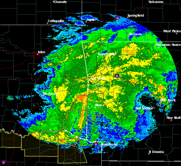 At 407 am cdt, severe thunderstorms were located along a line extending from 4 miles northwest of morgan springs to 8 miles west of hatfield, moving east at 50 mph (radar indicated). Hazards include 60 mph wind gusts and penny size hail. Expect damage to roofs, siding, and trees. Locations in or near the path include, heavener, heavener runestone state park,. At 407 am cdt, severe thunderstorms were located along a line extending from 4 miles northwest of morgan springs to 8 miles west of hatfield, moving east at 50 mph (radar indicated). Hazards include 60 mph wind gusts and penny size hail. Expect damage to roofs, siding, and trees. Locations in or near the path include, heavener, heavener runestone state park,.
|
| 5/8/2020 3:47 AM CDT |
 At 347 am cdt, severe thunderstorms were located along a line extending from 4 miles southwest of howe to 7 miles west of octavia, moving east at 65 mph (radar indicated). Hazards include 70 mph wind gusts and nickel size hail. Expect considerable tree damage. damage is likely to mobile homes, roofs, and outbuildings. Locations in or near the path include, heavener, octavia, heavener runestone state park, muse, big cedar, hodgen,. At 347 am cdt, severe thunderstorms were located along a line extending from 4 miles southwest of howe to 7 miles west of octavia, moving east at 65 mph (radar indicated). Hazards include 70 mph wind gusts and nickel size hail. Expect considerable tree damage. damage is likely to mobile homes, roofs, and outbuildings. Locations in or near the path include, heavener, octavia, heavener runestone state park, muse, big cedar, hodgen,.
|
| 5/8/2020 3:22 AM CDT |
 At 322 am cdt, severe thunderstorms were located along a line extending from 5 miles northwest of bengal to 3 miles south of snow, moving east at 55 mph (radar indicated). Hazards include 70 mph wind gusts and quarter size hail. Hail damage to vehicles is expected. expect considerable tree damage. wind damage is also likely to mobile homes, roofs, and outbuildings. Locations in or near the path include, heavener, octavia, heavener runestone state park, muse, big cedar, hodgen,. At 322 am cdt, severe thunderstorms were located along a line extending from 5 miles northwest of bengal to 3 miles south of snow, moving east at 55 mph (radar indicated). Hazards include 70 mph wind gusts and quarter size hail. Hail damage to vehicles is expected. expect considerable tree damage. wind damage is also likely to mobile homes, roofs, and outbuildings. Locations in or near the path include, heavener, octavia, heavener runestone state park, muse, big cedar, hodgen,.
|
| 4/28/2020 9:43 PM CDT |
 At 943 pm cdt, severe thunderstorms were located along a line extending from near moyers to 7 miles northwest of mountain fork, moving southeast at 45 mph (radar indicated). Hazards include 60 mph wind gusts and quarter size hail. Hail damage to vehicles is expected. expect wind damage to roofs, siding, and trees. Locations in or near the path include, hugo, antlers, clayton, heavener, talihina, fort towson, sawyer, rattan, albion, octavia, talimena state park, snow, heavener runestone state park, tuskahoma, big cedar, hugo lake state park, stanley, kiamichi, whitesboro, kellond, a tornado watch remains in effect until 1100 pm cdt for west central arkansas, and southeastern oklahoma. At 943 pm cdt, severe thunderstorms were located along a line extending from near moyers to 7 miles northwest of mountain fork, moving southeast at 45 mph (radar indicated). Hazards include 60 mph wind gusts and quarter size hail. Hail damage to vehicles is expected. expect wind damage to roofs, siding, and trees. Locations in or near the path include, hugo, antlers, clayton, heavener, talihina, fort towson, sawyer, rattan, albion, octavia, talimena state park, snow, heavener runestone state park, tuskahoma, big cedar, hugo lake state park, stanley, kiamichi, whitesboro, kellond, a tornado watch remains in effect until 1100 pm cdt for west central arkansas, and southeastern oklahoma.
|
| 4/28/2020 9:29 PM CDT |
 At 928 pm cdt, severe thunderstorms were located along a line extending from 7 miles southwest of daisy to 2 miles south of heavener, moving southeast at 45 mph (radar indicated). Hazards include 60 mph wind gusts and half dollar size hail. Hail damage to vehicles is expected. expect wind damage to roofs, siding, and trees. Locations in or near the path include, poteau, hugo, antlers, clayton, heavener, talihina, wister, howe, fort towson, fanshawe, sawyer, rattan, albion, octavia, snow, big cedar, whitesboro, clayton lake state park, goodland, raymond gary state park, a tornado watch remains in effect until 1100 pm cdt for west central arkansas, and southeastern oklahoma. At 928 pm cdt, severe thunderstorms were located along a line extending from 7 miles southwest of daisy to 2 miles south of heavener, moving southeast at 45 mph (radar indicated). Hazards include 60 mph wind gusts and half dollar size hail. Hail damage to vehicles is expected. expect wind damage to roofs, siding, and trees. Locations in or near the path include, poteau, hugo, antlers, clayton, heavener, talihina, wister, howe, fort towson, fanshawe, sawyer, rattan, albion, octavia, snow, big cedar, whitesboro, clayton lake state park, goodland, raymond gary state park, a tornado watch remains in effect until 1100 pm cdt for west central arkansas, and southeastern oklahoma.
|
| 4/28/2020 9:07 PM CDT |
 At 907 pm cdt, severe thunderstorms were located along a line extending from 5 miles south of bokoshe to 4 miles east of ashland, moving southeast at 40 mph (radar indicated). Hazards include 60 mph wind gusts and quarter size hail. Hail damage to vehicles is expected. expect wind damage to roofs, siding, and trees. Locations in or near the path include, mcalester, poteau, wilburton, clayton, heavener, hartshorne, krebs, talihina, wister, quinton, howe, kiowa, savanna, red oak, mccurtain, fanshawe, alderson, kinta, albion, ashland, a tornado watch remains in effect until 1100 pm cdt for west central arkansas, and southeastern oklahoma. At 907 pm cdt, severe thunderstorms were located along a line extending from 5 miles south of bokoshe to 4 miles east of ashland, moving southeast at 40 mph (radar indicated). Hazards include 60 mph wind gusts and quarter size hail. Hail damage to vehicles is expected. expect wind damage to roofs, siding, and trees. Locations in or near the path include, mcalester, poteau, wilburton, clayton, heavener, hartshorne, krebs, talihina, wister, quinton, howe, kiowa, savanna, red oak, mccurtain, fanshawe, alderson, kinta, albion, ashland, a tornado watch remains in effect until 1100 pm cdt for west central arkansas, and southeastern oklahoma.
|
| 4/24/2020 9:10 PM CDT |
 The severe thunderstorm warning for southwestern sebastian, east central pushmataha and southeastern le flore counties will expire at 915 pm cdt, the storms which prompted the warning have weakened below severe limits, and have exited the warned area. therefore the warning will be allowed to expire. a tornado watch remains in effect until midnight cdt for southeastern oklahoma. a severe thunderstorm watch remains in effect until 1100 pm cdt for west central arkansas, and southeastern oklahoma. The severe thunderstorm warning for southwestern sebastian, east central pushmataha and southeastern le flore counties will expire at 915 pm cdt, the storms which prompted the warning have weakened below severe limits, and have exited the warned area. therefore the warning will be allowed to expire. a tornado watch remains in effect until midnight cdt for southeastern oklahoma. a severe thunderstorm watch remains in effect until 1100 pm cdt for west central arkansas, and southeastern oklahoma.
|
| 4/24/2020 9:00 PM CDT |
 At 859 pm cdt, severe thunderstorms were located along a line extending from 3 miles southwest of hartford to 9 miles southeast of heavener to 8 miles east of nashoba, moving east at 40 mph (radar indicated). Hazards include 60 mph wind gusts and quarter size hail. Hail damage to vehicles is expected. expect wind damage to roofs, siding, and trees. Locations in or near the path include, hartford, huntington, midland, heavener runestone state park, nashoba, muse, big cedar, patterson, arkola, honobia, dayton, a tornado watch remains in effect until midnight cdt for southeastern oklahoma. At 859 pm cdt, severe thunderstorms were located along a line extending from 3 miles southwest of hartford to 9 miles southeast of heavener to 8 miles east of nashoba, moving east at 40 mph (radar indicated). Hazards include 60 mph wind gusts and quarter size hail. Hail damage to vehicles is expected. expect wind damage to roofs, siding, and trees. Locations in or near the path include, hartford, huntington, midland, heavener runestone state park, nashoba, muse, big cedar, patterson, arkola, honobia, dayton, a tornado watch remains in effect until midnight cdt for southeastern oklahoma.
|
| 4/24/2020 9:00 PM CDT |
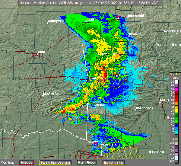 At 859 pm cdt, severe thunderstorms were located along a line extending from 3 miles southwest of hartford to 9 miles southeast of heavener to 8 miles east of nashoba, moving east at 40 mph (radar indicated). Hazards include 60 mph wind gusts and quarter size hail. Hail damage to vehicles is expected. expect wind damage to roofs, siding, and trees. Locations in or near the path include, hartford, huntington, midland, heavener runestone state park, nashoba, muse, big cedar, patterson, arkola, honobia, dayton, a tornado watch remains in effect until midnight cdt for southeastern oklahoma. At 859 pm cdt, severe thunderstorms were located along a line extending from 3 miles southwest of hartford to 9 miles southeast of heavener to 8 miles east of nashoba, moving east at 40 mph (radar indicated). Hazards include 60 mph wind gusts and quarter size hail. Hail damage to vehicles is expected. expect wind damage to roofs, siding, and trees. Locations in or near the path include, hartford, huntington, midland, heavener runestone state park, nashoba, muse, big cedar, patterson, arkola, honobia, dayton, a tornado watch remains in effect until midnight cdt for southeastern oklahoma.
|
| 4/24/2020 8:31 PM CDT |
 At 831 pm cdt, severe thunderstorms were located along a line extending from 2 miles north of cameron to 6 miles northeast of talimena state park to 5 miles southeast of stanley, moving east at 40 mph (radar indicated). Hazards include 60 mph wind gusts and quarter size hail. Hail damage to vehicles is expected. expect wind damage to roofs, siding, and trees. Locations in or near the path include, poteau, clayton, heavener, panama, talihina, wister, howe, hartford, huntington, midland, cameron, albion, talimena state park, heavener runestone state park, tuskahoma, big cedar, stanley, kiamichi, whitesboro, clayton lake state park, a tornado watch remains in effect until midnight cdt for southeastern oklahoma. At 831 pm cdt, severe thunderstorms were located along a line extending from 2 miles north of cameron to 6 miles northeast of talimena state park to 5 miles southeast of stanley, moving east at 40 mph (radar indicated). Hazards include 60 mph wind gusts and quarter size hail. Hail damage to vehicles is expected. expect wind damage to roofs, siding, and trees. Locations in or near the path include, poteau, clayton, heavener, panama, talihina, wister, howe, hartford, huntington, midland, cameron, albion, talimena state park, heavener runestone state park, tuskahoma, big cedar, stanley, kiamichi, whitesboro, clayton lake state park, a tornado watch remains in effect until midnight cdt for southeastern oklahoma.
|
| 4/24/2020 8:08 PM CDT |
 The national weather service in tulsa has issued a * severe thunderstorm warning for. southwestern sebastian county in west central arkansas. southeastern haskell county in southeastern oklahoma. northern pushmataha county in southeastern oklahoma. Central latimer county in southeastern oklahoma. The national weather service in tulsa has issued a * severe thunderstorm warning for. southwestern sebastian county in west central arkansas. southeastern haskell county in southeastern oklahoma. northern pushmataha county in southeastern oklahoma. Central latimer county in southeastern oklahoma.
|
| 4/24/2020 8:08 PM CDT |
 At 808 pm cdt, severe thunderstorms were located along a line extending from near bokoshe to 4 miles northwest of bengal to 4 miles west of stanley, moving east at 40 mph (radar indicated). Hazards include 60 mph wind gusts and quarter size hail. Hail damage to vehicles is expected. expect wind damage to roofs, siding, and trees. Locations in or near the path include, poteau, clayton, heavener, panama, talihina, wister, howe, hartford, huntington, red oak, mccurtain, bokoshe, fanshawe, midland, cameron, albion, talimena state park, heavener runestone state park, tuskahoma, big cedar, a tornado watch remains in effect until midnight cdt for southeastern oklahoma. At 808 pm cdt, severe thunderstorms were located along a line extending from near bokoshe to 4 miles northwest of bengal to 4 miles west of stanley, moving east at 40 mph (radar indicated). Hazards include 60 mph wind gusts and quarter size hail. Hail damage to vehicles is expected. expect wind damage to roofs, siding, and trees. Locations in or near the path include, poteau, clayton, heavener, panama, talihina, wister, howe, hartford, huntington, red oak, mccurtain, bokoshe, fanshawe, midland, cameron, albion, talimena state park, heavener runestone state park, tuskahoma, big cedar, a tornado watch remains in effect until midnight cdt for southeastern oklahoma.
|
| 3/12/2020 5:29 PM CDT |
 At 528 pm cdt, a severe thunderstorm was located 7 miles north of big cedar, moving east at 35 mph. another storm was located 4 miles northeast of whitesboro, moving east at 35 mph (radar indicated). Hazards include golf ball size hail and 60 mph wind gusts. People and animals outdoors will be injured. expect hail damage to roofs, siding, windows, and vehicles. expect wind damage to roofs, siding, and trees. Locations in or near the path include, heavener, heavener runestone state park, hodgen, summerfield,. At 528 pm cdt, a severe thunderstorm was located 7 miles north of big cedar, moving east at 35 mph. another storm was located 4 miles northeast of whitesboro, moving east at 35 mph (radar indicated). Hazards include golf ball size hail and 60 mph wind gusts. People and animals outdoors will be injured. expect hail damage to roofs, siding, windows, and vehicles. expect wind damage to roofs, siding, and trees. Locations in or near the path include, heavener, heavener runestone state park, hodgen, summerfield,.
|
| 3/12/2020 5:08 PM CDT |
 At 508 pm cdt, a severe thunderstorm was located 7 miles northeast of whitesboro, moving east at 30 mph (radar indicated). Hazards include ping pong ball size hail and 60 mph wind gusts. People and animals outdoors will be injured. expect hail damage to roofs, siding, windows, and vehicles. expect wind damage to roofs, siding, and trees. Locations in or near the path include, heavener, heavener runestone state park, hodgen, summerfield,. At 508 pm cdt, a severe thunderstorm was located 7 miles northeast of whitesboro, moving east at 30 mph (radar indicated). Hazards include ping pong ball size hail and 60 mph wind gusts. People and animals outdoors will be injured. expect hail damage to roofs, siding, windows, and vehicles. expect wind damage to roofs, siding, and trees. Locations in or near the path include, heavener, heavener runestone state park, hodgen, summerfield,.
|
| 3/12/2020 5:03 PM CDT |
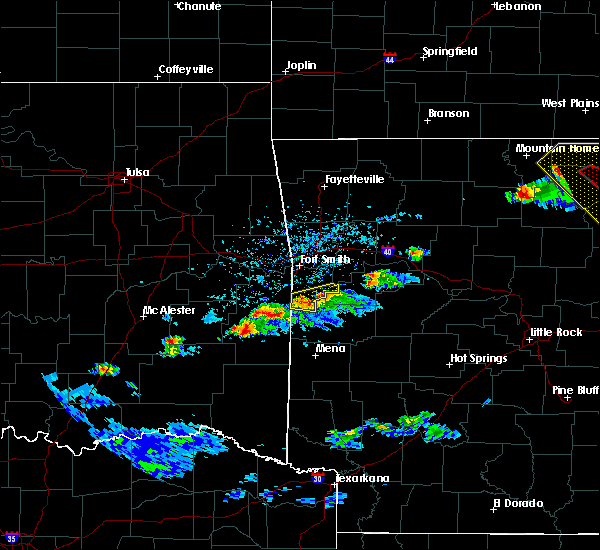 At 503 pm cdt, a severe thunderstorm was located 6 miles east of talimena state park, moving east at 30 mph (radar indicated). Hazards include 60 mph wind gusts and quarter size hail. Hail damage to vehicles is expected. expect wind damage to roofs, siding, and trees. Locations in or near the path include, heavener, talimena state park, heavener runestone state park, hodgen, summerfield,. At 503 pm cdt, a severe thunderstorm was located 6 miles east of talimena state park, moving east at 30 mph (radar indicated). Hazards include 60 mph wind gusts and quarter size hail. Hail damage to vehicles is expected. expect wind damage to roofs, siding, and trees. Locations in or near the path include, heavener, talimena state park, heavener runestone state park, hodgen, summerfield,.
|
| 1/10/2020 7:01 PM CST |
 At 701 pm cst, severe thunderstorms were located along a line extending from 2 miles southeast of panama to 3 miles northeast of howe to 6 miles southwest of heavener, moving northeast at 55 mph (radar indicated). Hazards include 60 mph wind gusts and penny size hail. Expect damage to roofs, siding, and trees. locations in or near the path include, fort smith, poteau, charleston, greenwood, barling, pocola, heavener, lavaca, spiro, arkoma, mulberry, panama, hackett, howe, hartford, huntington, bonanza, branch, midland, cameron, this includes interstate 540 between mile markers 8 and 14. A tornado watch remains in effect until 900 pm cst for west central arkansas, and southeastern oklahoma. At 701 pm cst, severe thunderstorms were located along a line extending from 2 miles southeast of panama to 3 miles northeast of howe to 6 miles southwest of heavener, moving northeast at 55 mph (radar indicated). Hazards include 60 mph wind gusts and penny size hail. Expect damage to roofs, siding, and trees. locations in or near the path include, fort smith, poteau, charleston, greenwood, barling, pocola, heavener, lavaca, spiro, arkoma, mulberry, panama, hackett, howe, hartford, huntington, bonanza, branch, midland, cameron, this includes interstate 540 between mile markers 8 and 14. A tornado watch remains in effect until 900 pm cst for west central arkansas, and southeastern oklahoma.
|
| 10/21/2019 1:00 AM CDT |
 At 100 am cdt, severe thunderstorms were located along a line extending from near howe to 16 miles southwest of octavia, moving east at 70 mph (radar indicated). Hazards include 60 mph wind gusts and quarter size hail. Hail damage to vehicles is expected. expect wind damage to roofs, siding, and trees. Locations in or near the path include, poteau, heavener, talihina, wister, howe, hartford, fanshawe, rattan, albion, octavia, talimena state park, heavener runestone state park, big cedar, kiamichi, whitesboro, lake wister state park, nashoba, oleta, muse, cloudy, a tornado watch remains in effect until 300 am cdt for west central arkansas, and southeastern oklahoma. At 100 am cdt, severe thunderstorms were located along a line extending from near howe to 16 miles southwest of octavia, moving east at 70 mph (radar indicated). Hazards include 60 mph wind gusts and quarter size hail. Hail damage to vehicles is expected. expect wind damage to roofs, siding, and trees. Locations in or near the path include, poteau, heavener, talihina, wister, howe, hartford, fanshawe, rattan, albion, octavia, talimena state park, heavener runestone state park, big cedar, kiamichi, whitesboro, lake wister state park, nashoba, oleta, muse, cloudy, a tornado watch remains in effect until 300 am cdt for west central arkansas, and southeastern oklahoma.
|
| 10/21/2019 12:42 AM CDT |
 At 1241 am cdt, severe thunderstorms were located along a line extending from 3 miles northeast of bengal to cloudy, moving east at 50 mph (radar indicated). Hazards include 60 mph wind gusts and quarter size hail. Hail damage to vehicles is expected. expect wind damage to roofs, siding, and trees. Locations in or near the path include, poteau, wilburton, clayton, heavener, talihina, wister, howe, hartford, red oak, fanshawe, rattan, albion, octavia, talimena state park, snow, heavener runestone state park, tuskahoma, big cedar, kiamichi, whitesboro, a tornado watch remains in effect until 300 am cdt for west central arkansas, and southeastern oklahoma. At 1241 am cdt, severe thunderstorms were located along a line extending from 3 miles northeast of bengal to cloudy, moving east at 50 mph (radar indicated). Hazards include 60 mph wind gusts and quarter size hail. Hail damage to vehicles is expected. expect wind damage to roofs, siding, and trees. Locations in or near the path include, poteau, wilburton, clayton, heavener, talihina, wister, howe, hartford, red oak, fanshawe, rattan, albion, octavia, talimena state park, snow, heavener runestone state park, tuskahoma, big cedar, kiamichi, whitesboro, a tornado watch remains in effect until 300 am cdt for west central arkansas, and southeastern oklahoma.
|
| 10/6/2019 4:54 PM CDT |
 The severe thunderstorm warning for southwestern sebastian and east central le flore counties will expire at 500 pm cdt, the storms which prompted the warning have weakened below severe limits, and no longer pose an immediate threat to life or property. therefore the warning will be allowed to expire. however gusty winds to 40 mph are still possible with these thunderstorms. The severe thunderstorm warning for southwestern sebastian and east central le flore counties will expire at 500 pm cdt, the storms which prompted the warning have weakened below severe limits, and no longer pose an immediate threat to life or property. therefore the warning will be allowed to expire. however gusty winds to 40 mph are still possible with these thunderstorms.
|
| 10/6/2019 4:31 PM CDT |
 At 431 pm cdt, severe thunderstorms were located along a line extending from 2 miles northwest of midland to 3 miles northeast of heavener runestone state park to near lake wister state park, moving southeast at 20 mph (radar indicated). Hazards include 60 mph wind gusts and quarter size hail. Hail damage to vehicles is expected. expect wind damage to roofs, siding, and trees. Locations in or near the path include, poteau, heavener, wister, howe, hartford, huntington, midland, heavener runestone state park, lake wister state park, patterson, arkola, crossroads, witcherville, dayton,. At 431 pm cdt, severe thunderstorms were located along a line extending from 2 miles northwest of midland to 3 miles northeast of heavener runestone state park to near lake wister state park, moving southeast at 20 mph (radar indicated). Hazards include 60 mph wind gusts and quarter size hail. Hail damage to vehicles is expected. expect wind damage to roofs, siding, and trees. Locations in or near the path include, poteau, heavener, wister, howe, hartford, huntington, midland, heavener runestone state park, lake wister state park, patterson, arkola, crossroads, witcherville, dayton,.
|
| 10/6/2019 3:55 PM CDT |
 At 355 pm cdt, severe thunderstorms were located along a line extending from 3 miles west of hackett to 3 miles north of fanshawe, moving east at 20 mph (radar indicated). Hazards include 60 mph wind gusts and quarter size hail. Hail damage to vehicles is expected. expect wind damage to roofs, siding, and trees. Locations in or near the path include, poteau, greenwood, heavener, wister, hackett, howe, hartford, huntington, midland, cameron, heavener runestone state park, washburn, lake wister state park, excelsior, burnville, shady point, rock island, patterson, arkola, crossroads,. At 355 pm cdt, severe thunderstorms were located along a line extending from 3 miles west of hackett to 3 miles north of fanshawe, moving east at 20 mph (radar indicated). Hazards include 60 mph wind gusts and quarter size hail. Hail damage to vehicles is expected. expect wind damage to roofs, siding, and trees. Locations in or near the path include, poteau, greenwood, heavener, wister, hackett, howe, hartford, huntington, midland, cameron, heavener runestone state park, washburn, lake wister state park, excelsior, burnville, shady point, rock island, patterson, arkola, crossroads,.
|
| 8/27/2019 2:11 AM CDT |
 The severe thunderstorm warning for southwestern franklin, sebastian, southeastern haskell, northeastern latimer and central le flore counties will expire at 215 am cdt, the storms which prompted the warning have weakened below severe limits, and no longer pose an immediate threat to life or property. therefore the warning will be allowed to expire. however gusty winds and heavy rain are still possible with these thunderstorms. a severe thunderstorm watch remains in effect until 600 am cdt for west central arkansas, and southeastern oklahoma. The severe thunderstorm warning for southwestern franklin, sebastian, southeastern haskell, northeastern latimer and central le flore counties will expire at 215 am cdt, the storms which prompted the warning have weakened below severe limits, and no longer pose an immediate threat to life or property. therefore the warning will be allowed to expire. however gusty winds and heavy rain are still possible with these thunderstorms. a severe thunderstorm watch remains in effect until 600 am cdt for west central arkansas, and southeastern oklahoma.
|
| 8/27/2019 1:45 AM CDT |
 At 144 am cdt, severe thunderstorms were located along a line extending from 5 miles southwest of denning to near hartford to 3 miles southeast of kinta, moving southeast at 30 mph (radar indicated). Hazards include 60 mph wind gusts. Expect damage to roofs, siding, and trees. Locations in or near the path include, poteau, wilburton, stigler, charleston, greenwood, pocola, heavener, lavaca, spiro, panama, wister, hackett, howe, hartford, huntington, bonanza, keota, red oak, mccurtain, bokoshe,. At 144 am cdt, severe thunderstorms were located along a line extending from 5 miles southwest of denning to near hartford to 3 miles southeast of kinta, moving southeast at 30 mph (radar indicated). Hazards include 60 mph wind gusts. Expect damage to roofs, siding, and trees. Locations in or near the path include, poteau, wilburton, stigler, charleston, greenwood, pocola, heavener, lavaca, spiro, panama, wister, hackett, howe, hartford, huntington, bonanza, keota, red oak, mccurtain, bokoshe,.
|
| 8/27/2019 1:23 AM CDT |
 At 123 am cdt, severe thunderstorms were located along a line extending from 5 miles east of mulberry to 2 miles northwest of jenny lind to briartown, moving southeast at 40 mph (radar indicated). Hazards include 60 mph wind gusts. Expect damage to roofs, siding, and trees. locations in or near the path include, fort smith, van buren, poteau, wilburton, stigler, charleston, greenwood, alma, barling, pocola, heavener, lavaca, spiro, arkoma, mulberry, panama, wister, dyer, hackett, howe, this includes the following highways, interstate 40 in arkansas between mile markers 13 and 28. Interstate 540 between mile markers 2 and 14. At 123 am cdt, severe thunderstorms were located along a line extending from 5 miles east of mulberry to 2 miles northwest of jenny lind to briartown, moving southeast at 40 mph (radar indicated). Hazards include 60 mph wind gusts. Expect damage to roofs, siding, and trees. locations in or near the path include, fort smith, van buren, poteau, wilburton, stigler, charleston, greenwood, alma, barling, pocola, heavener, lavaca, spiro, arkoma, mulberry, panama, wister, dyer, hackett, howe, this includes the following highways, interstate 40 in arkansas between mile markers 13 and 28. Interstate 540 between mile markers 2 and 14.
|
| 6/19/2019 4:26 AM CDT |
 At 426 am cdt, severe thunderstorms were located along a line extending from 2 miles northwest of keota to near wister to near octavia to 2 miles southwest of idabel, moving east at 55 mph (radar indicated). Hazards include 60 mph wind gusts and penny size hail. Expect damage to roofs, siding, and trees. Locations in or near the path include, poteau, stigler, heavener, panama, wister, howe, keota, mccurtain, bokoshe, fanshawe, octavia, talimena state park, heavener runestone state park, big cedar, mc curtain, whitesboro, lake wister state park, muse, shady point, cowlington,. At 426 am cdt, severe thunderstorms were located along a line extending from 2 miles northwest of keota to near wister to near octavia to 2 miles southwest of idabel, moving east at 55 mph (radar indicated). Hazards include 60 mph wind gusts and penny size hail. Expect damage to roofs, siding, and trees. Locations in or near the path include, poteau, stigler, heavener, panama, wister, howe, keota, mccurtain, bokoshe, fanshawe, octavia, talimena state park, heavener runestone state park, big cedar, mc curtain, whitesboro, lake wister state park, muse, shady point, cowlington,.
|
| 6/19/2019 4:17 AM CDT |
 At 417 am cdt, severe thunderstorms were located along a line extending from 3 miles northwest of stigler to 2 miles northwest of fanshawe to 10 miles south of whitesboro to 7 miles northeast of manchester, moving east at 55 mph (radar indicated). Hazards include 60 mph wind gusts and penny size hail. Expect damage to roofs, siding, and trees. Locations in or near the path include, poteau, stigler, heavener, panama, talihina, wister, howe, keota, red oak, fort towson, mccurtain, bokoshe, fanshawe, whitefield, kinta, albion, octavia, talimena state park, heavener runestone state park, big cedar,. At 417 am cdt, severe thunderstorms were located along a line extending from 3 miles northwest of stigler to 2 miles northwest of fanshawe to 10 miles south of whitesboro to 7 miles northeast of manchester, moving east at 55 mph (radar indicated). Hazards include 60 mph wind gusts and penny size hail. Expect damage to roofs, siding, and trees. Locations in or near the path include, poteau, stigler, heavener, panama, talihina, wister, howe, keota, red oak, fort towson, mccurtain, bokoshe, fanshawe, whitefield, kinta, albion, octavia, talimena state park, heavener runestone state park, big cedar,.
|
| 6/19/2019 4:04 AM CDT |
 At 404 am cdt, severe thunderstorms were located along a line extending from 2 miles west of briartown to 5 miles west of red oak to 7 miles east of nashoba to 3 miles north of manchester, moving east at 55 mph (radar indicated). Hazards include 60 mph wind gusts and penny size hail. Expect damage to roofs, siding, and trees. Locations in or near the path include, poteau, hugo, wilburton, stigler, clayton, heavener, panama, talihina, wister, quinton, howe, keota, red oak, fort towson, mccurtain, bokoshe, fanshawe, whitefield, sawyer, rattan,. At 404 am cdt, severe thunderstorms were located along a line extending from 2 miles west of briartown to 5 miles west of red oak to 7 miles east of nashoba to 3 miles north of manchester, moving east at 55 mph (radar indicated). Hazards include 60 mph wind gusts and penny size hail. Expect damage to roofs, siding, and trees. Locations in or near the path include, poteau, hugo, wilburton, stigler, clayton, heavener, panama, talihina, wister, quinton, howe, keota, red oak, fort towson, mccurtain, bokoshe, fanshawe, whitefield, sawyer, rattan,.
|
| 6/19/2019 3:45 AM CDT |
 At 344 am cdt, severe thunderstorms were located along a line extending from 3 miles northeast of eufaula to 7 miles southeast of blocker to 3 miles west of clayton lake state park to 8 miles south of sawyer, moving east at 55 mph (radar indicated). Hazards include 65 mph wind gusts and penny size hail. Expect damage to roofs, siding, and trees. Locations in or near the path include, poteau, hugo, wilburton, stigler, clayton, heavener, hartshorne, panama, talihina, wister, quinton, howe, keota, red oak, fort towson, mccurtain, bokoshe, fanshawe, whitefield, sawyer,. At 344 am cdt, severe thunderstorms were located along a line extending from 3 miles northeast of eufaula to 7 miles southeast of blocker to 3 miles west of clayton lake state park to 8 miles south of sawyer, moving east at 55 mph (radar indicated). Hazards include 65 mph wind gusts and penny size hail. Expect damage to roofs, siding, and trees. Locations in or near the path include, poteau, hugo, wilburton, stigler, clayton, heavener, hartshorne, panama, talihina, wister, quinton, howe, keota, red oak, fort towson, mccurtain, bokoshe, fanshawe, whitefield, sawyer,.
|
| 5/21/2019 11:40 AM CDT |
 The severe thunderstorm warning for sebastian and eastern le flore counties will expire at 1145 am cdt, the storms which prompted the warning have weakened below severe limits, and no longer pose an immediate threat to life or property. therefore the warning will be allowed to expire. however isolated gusty winds of 50 to 55 mph are still possible with these thunderstorms. a tornado watch remains in effect until 200 pm cdt for northwestern and west central arkansas, and southeastern and east central oklahoma. The severe thunderstorm warning for sebastian and eastern le flore counties will expire at 1145 am cdt, the storms which prompted the warning have weakened below severe limits, and no longer pose an immediate threat to life or property. therefore the warning will be allowed to expire. however isolated gusty winds of 50 to 55 mph are still possible with these thunderstorms. a tornado watch remains in effect until 200 pm cdt for northwestern and west central arkansas, and southeastern and east central oklahoma.
|
| 5/21/2019 11:11 AM CDT |
 At 1110 am cdt, severe thunderstorms were located along a line extending from 2 miles northwest of pocola to near hackett to 4 miles south of big cedar, moving northeast at 60 mph (radar indicated). Hazards include 60 mph wind gusts and nickel size hail. Expect damage to roofs, siding, and trees. locations in or near the path include, fort smith, poteau, greenwood, barling, pocola, heavener, lavaca, mansfield, hackett, howe, hartford, huntington, bonanza, midland, cameron, octavia, heavener runestone state park, big cedar, excelsior, bloomer, this includes interstate 540 between mile markers 12 and 14. A tornado watch remains in effect until noon cdt for northwestern and west central arkansas, and southeastern and east central oklahoma. At 1110 am cdt, severe thunderstorms were located along a line extending from 2 miles northwest of pocola to near hackett to 4 miles south of big cedar, moving northeast at 60 mph (radar indicated). Hazards include 60 mph wind gusts and nickel size hail. Expect damage to roofs, siding, and trees. locations in or near the path include, fort smith, poteau, greenwood, barling, pocola, heavener, lavaca, mansfield, hackett, howe, hartford, huntington, bonanza, midland, cameron, octavia, heavener runestone state park, big cedar, excelsior, bloomer, this includes interstate 540 between mile markers 12 and 14. A tornado watch remains in effect until noon cdt for northwestern and west central arkansas, and southeastern and east central oklahoma.
|
| 5/21/2019 10:40 AM CDT |
 At 1040 am cdt, severe thunderstorms were located along a line extending from near wister to 7 miles northeast of muse to 6 miles west of octavia, moving northeast at 60 mph (radar indicated). Hazards include 60 mph wind gusts and quarter size hail. Hail damage to vehicles is expected. expect wind damage to roofs, siding, and trees. locations in or near the path include, fort smith, poteau, greenwood, barling, pocola, heavener, lavaca, spiro, panama, mansfield, wister, hackett, howe, hartford, huntington, bonanza, midland, cameron, octavia, heavener runestone state park, this includes interstate 540 between mile markers 12 and 14. A tornado watch remains in effect until noon cdt for northwestern and west central arkansas, and southeastern and east central oklahoma. At 1040 am cdt, severe thunderstorms were located along a line extending from near wister to 7 miles northeast of muse to 6 miles west of octavia, moving northeast at 60 mph (radar indicated). Hazards include 60 mph wind gusts and quarter size hail. Hail damage to vehicles is expected. expect wind damage to roofs, siding, and trees. locations in or near the path include, fort smith, poteau, greenwood, barling, pocola, heavener, lavaca, spiro, panama, mansfield, wister, hackett, howe, hartford, huntington, bonanza, midland, cameron, octavia, heavener runestone state park, this includes interstate 540 between mile markers 12 and 14. A tornado watch remains in effect until noon cdt for northwestern and west central arkansas, and southeastern and east central oklahoma.
|
| 5/21/2019 10:31 AM CDT |
 At 1031 am cdt, severe thunderstorms were located along a line extending from 2 miles southeast of bunch to near roland to 4 miles south of whitesboro, moving northeast at 50 mph (radar indicated). Hazards include 60 mph wind gusts and quarter size hail. Hail damage to vehicles is expected. expect wind damage to roofs, siding, and trees. locations in or near the path include, sallisaw, poteau, pocola, muldrow, heavener, roland, spiro, arkoma, panama, wister, howe, bonanza, bokoshe, fanshawe, gans, cameron, marble city, moffett, octavia, brushy, this includes interstate 40 in oklahoma between mile markers 306 and 328. A tornado watch remains in effect until noon cdt for northwestern and west central arkansas, and southeastern, northeastern and east central oklahoma. At 1031 am cdt, severe thunderstorms were located along a line extending from 2 miles southeast of bunch to near roland to 4 miles south of whitesboro, moving northeast at 50 mph (radar indicated). Hazards include 60 mph wind gusts and quarter size hail. Hail damage to vehicles is expected. expect wind damage to roofs, siding, and trees. locations in or near the path include, sallisaw, poteau, pocola, muldrow, heavener, roland, spiro, arkoma, panama, wister, howe, bonanza, bokoshe, fanshawe, gans, cameron, marble city, moffett, octavia, brushy, this includes interstate 40 in oklahoma between mile markers 306 and 328. A tornado watch remains in effect until noon cdt for northwestern and west central arkansas, and southeastern, northeastern and east central oklahoma.
|
| 5/21/2019 9:40 AM CDT |
 At 940 am cdt, severe thunderstorms were located along a line extending from 2 miles northeast of tamaha to 7 miles southwest of gans to 5 miles southeast of cloudy, moving northeast at 60 mph (radar indicated). Hazards include 60 mph wind gusts and quarter size hail. Hail damage to vehicles is expected. expect wind damage to roofs, siding, and trees. locations in or near the path include, sallisaw, poteau, pocola, muldrow, heavener, roland, spiro, arkoma, panama, talihina, wister, howe, bonanza, keota, bokoshe, fanshawe, gans, cameron, marble city, tamaha, this includes interstate 40 in oklahoma between mile markers 297 and 328. A tornado watch remains in effect until noon cdt for northwestern and west central arkansas, and southeastern, northeastern and east central oklahoma. At 940 am cdt, severe thunderstorms were located along a line extending from 2 miles northeast of tamaha to 7 miles southwest of gans to 5 miles southeast of cloudy, moving northeast at 60 mph (radar indicated). Hazards include 60 mph wind gusts and quarter size hail. Hail damage to vehicles is expected. expect wind damage to roofs, siding, and trees. locations in or near the path include, sallisaw, poteau, pocola, muldrow, heavener, roland, spiro, arkoma, panama, talihina, wister, howe, bonanza, keota, bokoshe, fanshawe, gans, cameron, marble city, tamaha, this includes interstate 40 in oklahoma between mile markers 297 and 328. A tornado watch remains in effect until noon cdt for northwestern and west central arkansas, and southeastern, northeastern and east central oklahoma.
|
| 5/18/2019 1:34 PM CDT |
 At 134 pm cdt, severe thunderstorms were located along a line extending from 5 miles southeast of baron to 6 miles southeast of octavia, moving east at 45 mph (radar indicated). Hazards include 60 mph wind gusts. Expect damage to roofs, siding, and trees. locations in or near the path include, fort smith, van buren, sallisaw, poteau, stilwell, charleston, cedarville, mountainburg, natural dam, greenwood, alma, barling, pocola, muldrow, heavener, roland, west fork, lavaca, spiro, arkoma, this includes the following highways, interstate 40 in arkansas between mile markers 0 and 23. interstate 40 in oklahoma between mile markers 291 and 328. interstate 540 between mile markers 1 and 14. interstate 49 between mile markers 22 and 52. A tornado watch remains in effect until 500 pm cdt for northwestern and west central arkansas, and southeastern, northeastern and east central oklahoma. At 134 pm cdt, severe thunderstorms were located along a line extending from 5 miles southeast of baron to 6 miles southeast of octavia, moving east at 45 mph (radar indicated). Hazards include 60 mph wind gusts. Expect damage to roofs, siding, and trees. locations in or near the path include, fort smith, van buren, sallisaw, poteau, stilwell, charleston, cedarville, mountainburg, natural dam, greenwood, alma, barling, pocola, muldrow, heavener, roland, west fork, lavaca, spiro, arkoma, this includes the following highways, interstate 40 in arkansas between mile markers 0 and 23. interstate 40 in oklahoma between mile markers 291 and 328. interstate 540 between mile markers 1 and 14. interstate 49 between mile markers 22 and 52. A tornado watch remains in effect until 500 pm cdt for northwestern and west central arkansas, and southeastern, northeastern and east central oklahoma.
|
| 5/18/2019 12:57 PM CDT |
 At 1256 pm cdt, severe thunderstorms were located along a line extending from 3 miles northeast of briartown to talihina to 6 miles northeast of cloudy to 5 miles south of goodland, moving east at 40 mph (radar indicated). Hazards include 60 mph wind gusts. Expect damage to roofs, siding, and trees. Locations in or near the path include, poteau, hugo, wilburton, eufaula, stigler, antlers, clayton, pocola, heavener, spiro, hartshorne, arkoma, panama, talihina, wister, quinton, howe, bonanza, keota, red oak, a tornado watch remains in effect until 500 pm cdt for west central arkansas, and southeastern and east central oklahoma. At 1256 pm cdt, severe thunderstorms were located along a line extending from 3 miles northeast of briartown to talihina to 6 miles northeast of cloudy to 5 miles south of goodland, moving east at 40 mph (radar indicated). Hazards include 60 mph wind gusts. Expect damage to roofs, siding, and trees. Locations in or near the path include, poteau, hugo, wilburton, eufaula, stigler, antlers, clayton, pocola, heavener, spiro, hartshorne, arkoma, panama, talihina, wister, quinton, howe, bonanza, keota, red oak, a tornado watch remains in effect until 500 pm cdt for west central arkansas, and southeastern and east central oklahoma.
|
| 4/17/2019 9:22 PM CDT |
 At 921 pm cdt, a severe thunderstorm was located 5 miles east of big cedar, moving northeast at 45 mph (radar indicated). Hazards include 60 mph wind gusts and quarter size hail. Hail damage to vehicles is expected. expect wind damage to roofs, siding, and trees. Locations in or near the path include, heavener, heavener runestone state park, big cedar, hodgen,. At 921 pm cdt, a severe thunderstorm was located 5 miles east of big cedar, moving northeast at 45 mph (radar indicated). Hazards include 60 mph wind gusts and quarter size hail. Hail damage to vehicles is expected. expect wind damage to roofs, siding, and trees. Locations in or near the path include, heavener, heavener runestone state park, big cedar, hodgen,.
|
| 4/17/2019 9:06 PM CDT |
 At 906 pm cdt, a severe thunderstorm was located over octavia, moving northeast at 45 mph (radar indicated). Hazards include 60 mph wind gusts and quarter size hail. Hail damage to vehicles is expected. expect wind damage to roofs, siding, and trees. Locations in or near the path include, heavener, octavia, heavener runestone state park, muse, big cedar, hodgen,. At 906 pm cdt, a severe thunderstorm was located over octavia, moving northeast at 45 mph (radar indicated). Hazards include 60 mph wind gusts and quarter size hail. Hail damage to vehicles is expected. expect wind damage to roofs, siding, and trees. Locations in or near the path include, heavener, octavia, heavener runestone state park, muse, big cedar, hodgen,.
|
| 3/9/2019 6:53 AM CST |
 At 652 am cst, severe thunderstorms were located along a line extending from 6 miles west of hartford to 10 miles south of octavia, moving northeast at 70 mph (radar indicated). Hazards include 65 mph wind gusts and penny size hail. Expect damage to roofs, siding, and trees. Locations in or near the path include, heavener, octavia, heavener runestone state park, big cedar, hodgen,. At 652 am cst, severe thunderstorms were located along a line extending from 6 miles west of hartford to 10 miles south of octavia, moving northeast at 70 mph (radar indicated). Hazards include 65 mph wind gusts and penny size hail. Expect damage to roofs, siding, and trees. Locations in or near the path include, heavener, octavia, heavener runestone state park, big cedar, hodgen,.
|
| 3/9/2019 6:46 AM CST |
 At 646 am cst, severe thunderstorms were located along a line extending from 3 miles east of cameron to near heavener runestone state park, moving northeast at 50 mph (radar indicated). Hazards include 60 mph wind gusts and penny size hail. Expect damage to roofs, siding, and trees. Locations in or near the path include, poteau, charleston, greenwood, mansfield, hackett, howe, hartford, huntington, bonanza, branch, midland, cameron, excelsior, bloomer, washburn, burnville, fort chaffee, jenny lind, rock island, patterson,. At 646 am cst, severe thunderstorms were located along a line extending from 3 miles east of cameron to near heavener runestone state park, moving northeast at 50 mph (radar indicated). Hazards include 60 mph wind gusts and penny size hail. Expect damage to roofs, siding, and trees. Locations in or near the path include, poteau, charleston, greenwood, mansfield, hackett, howe, hartford, huntington, bonanza, branch, midland, cameron, excelsior, bloomer, washburn, burnville, fort chaffee, jenny lind, rock island, patterson,.
|
| 3/9/2019 6:39 AM CST |
 At 638 am cst, severe thunderstorms were located along a line extending from 3 miles south of lake wister state park to 17 miles east of cloudy, moving northeast at 65 mph (radar indicated). Hazards include 65 mph wind gusts. Expect damage to roofs, siding, and trees. Locations in or near the path include, heavener, octavia, heavener runestone state park, muse, big cedar, hodgen,. At 638 am cst, severe thunderstorms were located along a line extending from 3 miles south of lake wister state park to 17 miles east of cloudy, moving northeast at 65 mph (radar indicated). Hazards include 65 mph wind gusts. Expect damage to roofs, siding, and trees. Locations in or near the path include, heavener, octavia, heavener runestone state park, muse, big cedar, hodgen,.
|
| 11/30/2018 11:52 PM CST | Roof blown off house. multiple trees dow in le flore county OK, 0.5 miles W of Heavener, OK |
| 11/30/2018 11:00 PM CST |
 At 1059 pm cst, severe thunderstorms were located along a line extending from 5 miles north of muldrow to 4 miles northwest of pocola to 2 miles northwest of octavia, moving northeast at 60 mph (radar indicated). Hazards include 70 mph wind gusts. Expect considerable tree damage. damage is likely to mobile homes, roofs, and outbuildings. locations in or near the path include, poteau, pocola, muldrow, heavener, roland, spiro, arkoma, panama, wister, howe, bonanza, keota, mccurtain, bokoshe, fanshawe, gans, cameron, moffett, octavia, talimena state park, this includes interstate 40 in oklahoma between mile markers 313 and 328. a tornado watch remains in effect until midnight cst for southeastern and east central oklahoma. A tornado watch also remains in effect until 200 am cst for west central arkansas. At 1059 pm cst, severe thunderstorms were located along a line extending from 5 miles north of muldrow to 4 miles northwest of pocola to 2 miles northwest of octavia, moving northeast at 60 mph (radar indicated). Hazards include 70 mph wind gusts. Expect considerable tree damage. damage is likely to mobile homes, roofs, and outbuildings. locations in or near the path include, poteau, pocola, muldrow, heavener, roland, spiro, arkoma, panama, wister, howe, bonanza, keota, mccurtain, bokoshe, fanshawe, gans, cameron, moffett, octavia, talimena state park, this includes interstate 40 in oklahoma between mile markers 313 and 328. a tornado watch remains in effect until midnight cst for southeastern and east central oklahoma. A tornado watch also remains in effect until 200 am cst for west central arkansas.
|
| 11/30/2018 10:46 PM CST |
 At 1046 pm cst, severe thunderstorms were located along a line extending from 3 miles south of sallisaw to 3 miles east of bokoshe to 13 miles west of octavia, moving northeast at 70 mph (radar indicated). Hazards include 70 mph wind gusts. Expect considerable tree damage. damage is likely to mobile homes, roofs, and outbuildings. locations in or near the path include, poteau, pocola, muldrow, heavener, roland, spiro, arkoma, panama, talihina, wister, howe, bonanza, keota, red oak, mccurtain, bokoshe, fanshawe, gans, cameron, moffett, this includes interstate 40 in oklahoma between mile markers 313 and 328. a tornado watch remains in effect until midnight cst for southeastern and east central oklahoma. A tornado watch also remains in effect until 200 am cst for west central arkansas. At 1046 pm cst, severe thunderstorms were located along a line extending from 3 miles south of sallisaw to 3 miles east of bokoshe to 13 miles west of octavia, moving northeast at 70 mph (radar indicated). Hazards include 70 mph wind gusts. Expect considerable tree damage. damage is likely to mobile homes, roofs, and outbuildings. locations in or near the path include, poteau, pocola, muldrow, heavener, roland, spiro, arkoma, panama, talihina, wister, howe, bonanza, keota, red oak, mccurtain, bokoshe, fanshawe, gans, cameron, moffett, this includes interstate 40 in oklahoma between mile markers 313 and 328. a tornado watch remains in effect until midnight cst for southeastern and east central oklahoma. A tornado watch also remains in effect until 200 am cst for west central arkansas.
|
| 11/30/2018 10:18 PM CST |
 The national weather service in tulsa has issued a * severe thunderstorm warning for. southeastern haskell county in southeastern oklahoma. eastern pushmataha county in southeastern oklahoma. southeastern sequoyah county in east central oklahoma. Latimer county in southeastern oklahoma. The national weather service in tulsa has issued a * severe thunderstorm warning for. southeastern haskell county in southeastern oklahoma. eastern pushmataha county in southeastern oklahoma. southeastern sequoyah county in east central oklahoma. Latimer county in southeastern oklahoma.
|
| 7/12/2018 6:53 PM CDT |
 The severe thunderstorm warning for central le flore county will expire at 700 pm cdt, the storms which prompted the warning have weakened below severe limits, and have exited the warned area. therefore the warning will be allowed to expire. The severe thunderstorm warning for central le flore county will expire at 700 pm cdt, the storms which prompted the warning have weakened below severe limits, and have exited the warned area. therefore the warning will be allowed to expire.
|
| 7/12/2018 6:32 PM CDT |
 At 632 pm cdt, severe thunderstorms were located along a line extending from 6 miles south of lake wister state park to 4 miles southwest of panama, moving northwest at 15 mph (radar indicated). Hazards include 60 mph wind gusts. Expect damage to roofs, siding, and trees. Locations in or near the path include, poteau, wister, howe, fanshawe, talimena state park, lake wister state park, hodgen, milton, summerfield,. At 632 pm cdt, severe thunderstorms were located along a line extending from 6 miles south of lake wister state park to 4 miles southwest of panama, moving northwest at 15 mph (radar indicated). Hazards include 60 mph wind gusts. Expect damage to roofs, siding, and trees. Locations in or near the path include, poteau, wister, howe, fanshawe, talimena state park, lake wister state park, hodgen, milton, summerfield,.
|
| 7/12/2018 5:56 PM CDT |
 The national weather service in tulsa has issued a * severe thunderstorm warning for. central le flore county in southeastern oklahoma. until 700 pm cdt. At 556 pm cdt, a severe thunderstorm was located over howe, moving west at 15 mph. The national weather service in tulsa has issued a * severe thunderstorm warning for. central le flore county in southeastern oklahoma. until 700 pm cdt. At 556 pm cdt, a severe thunderstorm was located over howe, moving west at 15 mph.
|
| 6/24/2018 5:10 PM CDT |
 At 509 pm cdt, severe thunderstorms were located along a line extending from 7 miles east of heavener runestone state park to 11 miles west of octavia to boswell, moving east at 55 mph (radar indicated). Hazards include 60 mph wind gusts and penny size hail. Expect damage to roofs, siding, and trees. Locations in or near the path include, poteau, antlers, heavener, wister, howe, boswell, rattan, talimena state park, kent, snow, heavener runestone state park, lake wister state park, moyers, nashoba, whitesboro, kosoma, kellond, cloudy, muse, summerfield,. At 509 pm cdt, severe thunderstorms were located along a line extending from 7 miles east of heavener runestone state park to 11 miles west of octavia to boswell, moving east at 55 mph (radar indicated). Hazards include 60 mph wind gusts and penny size hail. Expect damage to roofs, siding, and trees. Locations in or near the path include, poteau, antlers, heavener, wister, howe, boswell, rattan, talimena state park, kent, snow, heavener runestone state park, lake wister state park, moyers, nashoba, whitesboro, kosoma, kellond, cloudy, muse, summerfield,.
|
| 6/24/2018 4:48 PM CDT |
 At 448 pm cdt, severe thunderstorms were located along a line extending from 3 miles north of wister to 2 miles south of kiamichi to 7 miles north of bokchito, moving east at 35 mph (radar indicated). Hazards include 60 mph wind gusts and nickel size hail. Expect damage to roofs, siding, and trees. Locations in or near the path include, poteau, antlers, clayton, heavener, talihina, wister, howe, boswell, fanshawe, rattan, albion, talimena state park, snow, heavener runestone state park, tuskahoma, stanley, kiamichi, whitesboro, kellond, clayton lake state park,. At 448 pm cdt, severe thunderstorms were located along a line extending from 3 miles north of wister to 2 miles south of kiamichi to 7 miles north of bokchito, moving east at 35 mph (radar indicated). Hazards include 60 mph wind gusts and nickel size hail. Expect damage to roofs, siding, and trees. Locations in or near the path include, poteau, antlers, clayton, heavener, talihina, wister, howe, boswell, fanshawe, rattan, albion, talimena state park, snow, heavener runestone state park, tuskahoma, stanley, kiamichi, whitesboro, kellond, clayton lake state park,.
|
| 6/24/2018 4:24 PM CDT |
 At 423 pm cdt, severe thunderstorms were located along a line extending from 6 miles south of mccurtain to 6 miles southwest of yanush to caney, moving southeast at 30 mph (radar indicated). Hazards include 60 mph wind gusts and nickel size hail. Expect damage to roofs, siding, and trees. Locations in or near the path include, poteau, antlers, clayton, heavener, talihina, wister, howe, boswell, red oak, fanshawe, rattan, albion, talimena state park, snow, heavener runestone state park, tuskahoma, stanley, kiamichi, whitesboro, kellond,. At 423 pm cdt, severe thunderstorms were located along a line extending from 6 miles south of mccurtain to 6 miles southwest of yanush to caney, moving southeast at 30 mph (radar indicated). Hazards include 60 mph wind gusts and nickel size hail. Expect damage to roofs, siding, and trees. Locations in or near the path include, poteau, antlers, clayton, heavener, talihina, wister, howe, boswell, red oak, fanshawe, rattan, albion, talimena state park, snow, heavener runestone state park, tuskahoma, stanley, kiamichi, whitesboro, kellond,.
|
| 6/24/2018 7:25 AM CDT |
 At 724 am cdt, severe thunderstorms were located along a line extending from 9 miles northwest of queen wilhelmina state park to 3 miles southwest of octavia to 19 miles west of vandervoort to 18 miles northwest of broken bow, moving southeast at 40 mph (radar indicated). Hazards include 60 mph wind gusts. Expect damage to roofs, siding, and trees. Locations in or near the path include, heavener, talihina, wister, howe, octavia, talimena state park, heavener runestone state park, big cedar, lake wister state park, whitesboro, muse, hodgen, honobia,. At 724 am cdt, severe thunderstorms were located along a line extending from 9 miles northwest of queen wilhelmina state park to 3 miles southwest of octavia to 19 miles west of vandervoort to 18 miles northwest of broken bow, moving southeast at 40 mph (radar indicated). Hazards include 60 mph wind gusts. Expect damage to roofs, siding, and trees. Locations in or near the path include, heavener, talihina, wister, howe, octavia, talimena state park, heavener runestone state park, big cedar, lake wister state park, whitesboro, muse, hodgen, honobia,.
|
| 6/24/2018 6:40 AM CDT |
 At 640 am cdt, severe thunderstorms were located along a line extending from 3 miles northeast of fanshawe to 4 miles east of bengal to 5 miles northwest of albion to near kiamichi to 5 miles southwest of clayton lake state park, moving southeast at 40 mph (radar indicated). Hazards include 60 mph wind gusts and half dollar size hail. Hail damage to vehicles is expected. expect wind damage to roofs, siding, and trees. Locations in or near the path include, clayton, heavener, talihina, wister, howe, red oak, fanshawe, albion, octavia, talimena state park, snow, heavener runestone state park, tuskahoma, big cedar, kiamichi, whitesboro, clayton lake state park, damon, bengal, yanush,. At 640 am cdt, severe thunderstorms were located along a line extending from 3 miles northeast of fanshawe to 4 miles east of bengal to 5 miles northwest of albion to near kiamichi to 5 miles southwest of clayton lake state park, moving southeast at 40 mph (radar indicated). Hazards include 60 mph wind gusts and half dollar size hail. Hail damage to vehicles is expected. expect wind damage to roofs, siding, and trees. Locations in or near the path include, clayton, heavener, talihina, wister, howe, red oak, fanshawe, albion, octavia, talimena state park, snow, heavener runestone state park, tuskahoma, big cedar, kiamichi, whitesboro, clayton lake state park, damon, bengal, yanush,.
|
| 6/24/2018 6:19 AM CDT |
 At 618 am cdt, severe thunderstorms were located along a line extending from 5 miles south of kinta to 3 miles south of damon to 7 miles north of daisy, moving southeast at 45 mph (radar indicated). Hazards include 60 mph wind gusts and half dollar size hail. Hail damage to vehicles is expected. expect wind damage to roofs, siding, and trees. Locations in or near the path include, wilburton, clayton, heavener, talihina, wister, howe, red oak, fanshawe, kinta, albion, octavia, talimena state park, snow, heavener runestone state park, tuskahoma, big cedar, stanley, kiamichi, whitesboro, clayton lake state park,. At 618 am cdt, severe thunderstorms were located along a line extending from 5 miles south of kinta to 3 miles south of damon to 7 miles north of daisy, moving southeast at 45 mph (radar indicated). Hazards include 60 mph wind gusts and half dollar size hail. Hail damage to vehicles is expected. expect wind damage to roofs, siding, and trees. Locations in or near the path include, wilburton, clayton, heavener, talihina, wister, howe, red oak, fanshawe, kinta, albion, octavia, talimena state park, snow, heavener runestone state park, tuskahoma, big cedar, stanley, kiamichi, whitesboro, clayton lake state park,.
|
| 6/24/2018 5:37 AM CDT |
 At 536 am cdt, severe thunderstorms were located along a line extending from muldrow to 3 miles northeast of cameron to 2 miles west of howe, moving east at 35 mph (radar indicated). Hazards include 60 mph wind gusts and penny size hail. Expect damage to roofs, siding, and trees. locations in or near the path include, fort smith, van buren, poteau, cedarville, greenwood, barling, pocola, muldrow, heavener, roland, spiro, arkoma, panama, wister, hackett, howe, hartford, bonanza, midland, gans, this includes the following highways, interstate 40 in arkansas between mile markers 0 and 5. interstate 40 in oklahoma between mile markers 314 and 328. Interstate 540 between mile markers 3 and 14. At 536 am cdt, severe thunderstorms were located along a line extending from muldrow to 3 miles northeast of cameron to 2 miles west of howe, moving east at 35 mph (radar indicated). Hazards include 60 mph wind gusts and penny size hail. Expect damage to roofs, siding, and trees. locations in or near the path include, fort smith, van buren, poteau, cedarville, greenwood, barling, pocola, muldrow, heavener, roland, spiro, arkoma, panama, wister, hackett, howe, hartford, bonanza, midland, gans, this includes the following highways, interstate 40 in arkansas between mile markers 0 and 5. interstate 40 in oklahoma between mile markers 314 and 328. Interstate 540 between mile markers 3 and 14.
|
| 6/24/2018 5:29 AM CDT |
 At 529 am cdt, severe thunderstorms were located along a line extending from 2 miles northeast of gans to 2 miles northwest of cameron to near lake wister state park, moving east at 35 mph (radar indicated). Hazards include 60 mph wind gusts and penny size hail. Expect damage to roofs, siding, and trees. locations in or near the path include, fort smith, van buren, sallisaw, poteau, cedarville, greenwood, barling, pocola, muldrow, heavener, roland, spiro, arkoma, panama, wister, hackett, howe, hartford, bonanza, midland, this includes the following highways, interstate 40 in arkansas between mile markers 0 and 5. interstate 40 in oklahoma between mile markers 308 and 328. Interstate 540 between mile markers 3 and 14. At 529 am cdt, severe thunderstorms were located along a line extending from 2 miles northeast of gans to 2 miles northwest of cameron to near lake wister state park, moving east at 35 mph (radar indicated). Hazards include 60 mph wind gusts and penny size hail. Expect damage to roofs, siding, and trees. locations in or near the path include, fort smith, van buren, sallisaw, poteau, cedarville, greenwood, barling, pocola, muldrow, heavener, roland, spiro, arkoma, panama, wister, hackett, howe, hartford, bonanza, midland, this includes the following highways, interstate 40 in arkansas between mile markers 0 and 5. interstate 40 in oklahoma between mile markers 308 and 328. Interstate 540 between mile markers 3 and 14.
|
| 6/24/2018 5:12 AM CDT |
 At 512 am cdt, severe thunderstorms were located along a line extending from 3 miles southwest of sallisaw to 2 miles west of panama to near fanshawe, moving east at 35 mph (radar indicated). Hazards include 60 mph wind gusts and penny size hail. Expect damage to roofs, siding, and trees. locations in or near the path include, fort smith, van buren, sallisaw, poteau, cedarville, greenwood, barling, pocola, muldrow, heavener, roland, spiro, arkoma, panama, wister, hackett, howe, hartford, bonanza, midland, this includes the following highways, interstate 40 in arkansas between mile markers 0 and 5. interstate 40 in oklahoma between mile markers 306 and 328. Interstate 540 between mile markers 3 and 14. At 512 am cdt, severe thunderstorms were located along a line extending from 3 miles southwest of sallisaw to 2 miles west of panama to near fanshawe, moving east at 35 mph (radar indicated). Hazards include 60 mph wind gusts and penny size hail. Expect damage to roofs, siding, and trees. locations in or near the path include, fort smith, van buren, sallisaw, poteau, cedarville, greenwood, barling, pocola, muldrow, heavener, roland, spiro, arkoma, panama, wister, hackett, howe, hartford, bonanza, midland, this includes the following highways, interstate 40 in arkansas between mile markers 0 and 5. interstate 40 in oklahoma between mile markers 306 and 328. Interstate 540 between mile markers 3 and 14.
|
| 6/2/2018 2:47 PM CDT |
 At 247 pm cdt, a severe thunderstorm was located 5 miles south of heavener, moving southeast at 30 mph (radar indicated). Hazards include 60 mph wind gusts and quarter size hail. Hail damage to vehicles is expected. expect wind damage to roofs, siding, and trees. Locations in or near the path include, hodgen,. At 247 pm cdt, a severe thunderstorm was located 5 miles south of heavener, moving southeast at 30 mph (radar indicated). Hazards include 60 mph wind gusts and quarter size hail. Hail damage to vehicles is expected. expect wind damage to roofs, siding, and trees. Locations in or near the path include, hodgen,.
|
| 6/2/2018 2:46 PM CDT | Quarter sized hail reported 4.4 miles NNE of Heavener, OK |
| 6/2/2018 2:29 PM CDT |
 At 215 pm cdt, a severe thunderstorm was located near wister, moving east at 35 mph (radar indicated). Hazards include 60 mph wind gusts and quarter size hail. Hail damage to vehicles is expected. expect wind damage to roofs, siding, and trees. Locations in or near the path include, poteau, heavener, wister, howe, lake wister state park, heavener runestone state park, hodgen, summerfield,. At 215 pm cdt, a severe thunderstorm was located near wister, moving east at 35 mph (radar indicated). Hazards include 60 mph wind gusts and quarter size hail. Hail damage to vehicles is expected. expect wind damage to roofs, siding, and trees. Locations in or near the path include, poteau, heavener, wister, howe, lake wister state park, heavener runestone state park, hodgen, summerfield,.
|
| 6/2/2018 2:29 PM CDT |
 At 229 pm cdt, severe thunderstorms were located along a line extending from 3 miles north of heavener runestone state park to 4 miles southeast of lake wister state park, moving east at 30 mph (radar indicated). Hazards include 60 mph wind gusts and quarter size hail. Hail damage to vehicles is expected. expect wind damage to roofs, siding, and trees. Locations in or near the path include, poteau, heavener, howe, heavener runestone state park, hodgen,. At 229 pm cdt, severe thunderstorms were located along a line extending from 3 miles north of heavener runestone state park to 4 miles southeast of lake wister state park, moving east at 30 mph (radar indicated). Hazards include 60 mph wind gusts and quarter size hail. Hail damage to vehicles is expected. expect wind damage to roofs, siding, and trees. Locations in or near the path include, poteau, heavener, howe, heavener runestone state park, hodgen,.
|
| 6/2/2018 2:15 PM CDT |
 At 215 pm cdt, a severe thunderstorm was located near wister, moving east at 35 mph (radar indicated). Hazards include 60 mph wind gusts and quarter size hail. Hail damage to vehicles is expected. expect wind damage to roofs, siding, and trees. Locations in or near the path include, poteau, heavener, wister, howe, lake wister state park, heavener runestone state park, hodgen, summerfield,. At 215 pm cdt, a severe thunderstorm was located near wister, moving east at 35 mph (radar indicated). Hazards include 60 mph wind gusts and quarter size hail. Hail damage to vehicles is expected. expect wind damage to roofs, siding, and trees. Locations in or near the path include, poteau, heavener, wister, howe, lake wister state park, heavener runestone state park, hodgen, summerfield,.
|
| 1/21/2018 7:56 PM CST |
 The severe thunderstorm warning for southeastern le flore county will expire at 800 pm cst, the storm which prompted the warning has weakened below severe limits, and no longer poses an immediate threat to life or property. therefore the warning will be allowed to expire. a tornado watch remains in effect until 1100 pm cst for southeastern oklahoma. to report severe weather, contact your nearest law enforcement agency. they will relay your report to the national weather service tulsa. The severe thunderstorm warning for southeastern le flore county will expire at 800 pm cst, the storm which prompted the warning has weakened below severe limits, and no longer poses an immediate threat to life or property. therefore the warning will be allowed to expire. a tornado watch remains in effect until 1100 pm cst for southeastern oklahoma. to report severe weather, contact your nearest law enforcement agency. they will relay your report to the national weather service tulsa.
|
| 1/21/2018 7:37 PM CST |
 At 737 pm cst, a severe thunderstorm was located 3 miles northeast of muse, moving northeast at 45 mph (radar indicated). Hazards include 60 mph wind gusts. Expect damage to roofs, siding, and trees. Locations in or near the path include, muse, big cedar, hodgen, a tornado watch remains in effect until 1100 pm cst for southeastern oklahoma. At 737 pm cst, a severe thunderstorm was located 3 miles northeast of muse, moving northeast at 45 mph (radar indicated). Hazards include 60 mph wind gusts. Expect damage to roofs, siding, and trees. Locations in or near the path include, muse, big cedar, hodgen, a tornado watch remains in effect until 1100 pm cst for southeastern oklahoma.
|
| 1/21/2018 7:23 PM CST |
 At 723 pm cst, a severe thunderstorm was located 5 miles southwest of muse, moving northeast at 45 mph (radar indicated). Hazards include 60 mph wind gusts and nickel size hail. Expect damage to roofs, siding, and trees. Locations in or near the path include, muse, big cedar, hodgen, a tornado watch remains in effect until 1100 pm cst for southeastern oklahoma. At 723 pm cst, a severe thunderstorm was located 5 miles southwest of muse, moving northeast at 45 mph (radar indicated). Hazards include 60 mph wind gusts and nickel size hail. Expect damage to roofs, siding, and trees. Locations in or near the path include, muse, big cedar, hodgen, a tornado watch remains in effect until 1100 pm cst for southeastern oklahoma.
|
| 1/21/2018 7:11 PM CST |
 The severe thunderstorm warning for southwestern sebastian and east central le flore counties will expire at 715 pm cst, the storm which prompted the warning has weakened below severe limits, and no longer poses an immediate threat to life or property. therefore the warning will be allowed to expire. however gusty winds are still possible with this thunderstorm. a tornado watch remains in effect until 1100 pm cst for west central arkansas, and southeastern oklahoma. to report severe weather, contact your nearest law enforcement agency. they will relay your report to the national weather service tulsa. The severe thunderstorm warning for southwestern sebastian and east central le flore counties will expire at 715 pm cst, the storm which prompted the warning has weakened below severe limits, and no longer poses an immediate threat to life or property. therefore the warning will be allowed to expire. however gusty winds are still possible with this thunderstorm. a tornado watch remains in effect until 1100 pm cst for west central arkansas, and southeastern oklahoma. to report severe weather, contact your nearest law enforcement agency. they will relay your report to the national weather service tulsa.
|
| 1/21/2018 6:42 PM CST |
 At 642 pm cst, a severe thunderstorm was located 4 miles southwest of heavener, moving northeast at 50 mph (radar indicated). Hazards include 60 mph wind gusts and penny size hail. Expect damage to roofs, siding, and trees. Locations in or near the path include, poteau, heavener, howe, hartford, cameron, heavener runestone state park, patterson, hodgen, a tornado watch remains in effect until 1100 pm cst for west central arkansas, and southeastern oklahoma. At 642 pm cst, a severe thunderstorm was located 4 miles southwest of heavener, moving northeast at 50 mph (radar indicated). Hazards include 60 mph wind gusts and penny size hail. Expect damage to roofs, siding, and trees. Locations in or near the path include, poteau, heavener, howe, hartford, cameron, heavener runestone state park, patterson, hodgen, a tornado watch remains in effect until 1100 pm cst for west central arkansas, and southeastern oklahoma.
|
| 10/22/2017 1:27 AM CDT |
 At 121 am cdt, severe thunderstorms were located along a line extending from near wesley to 2 miles northeast of midland, moving east at 35 mph (trained weather spotters). Hazards include 70 mph wind gusts. Expect considerable tree damage. damage is likely to mobile homes, roofs, and outbuildings. locations in or near the path include, fort smith, fayetteville, van buren, poteau, ozark, charleston, cedarville, mountainburg, natural dam, greenwood, farmington, alma, barling, prairie grove, pocola, heavener, roland, elkins, west fork, lavaca, this includes the following highways, interstate 40 in arkansas between mile markers 0 and 42. interstate 40 in oklahoma between mile markers 323 and 328. interstate 540 between mile markers 1 and 14. interstate 49 between mile markers 22 and 63. a tornado watch remains in effect until 200 am cdt for southeastern and east central oklahoma. A severe thunderstorm watch remains in effect until 700 am cdt for west central arkansas. At 121 am cdt, severe thunderstorms were located along a line extending from near wesley to 2 miles northeast of midland, moving east at 35 mph (trained weather spotters). Hazards include 70 mph wind gusts. Expect considerable tree damage. damage is likely to mobile homes, roofs, and outbuildings. locations in or near the path include, fort smith, fayetteville, van buren, poteau, ozark, charleston, cedarville, mountainburg, natural dam, greenwood, farmington, alma, barling, prairie grove, pocola, heavener, roland, elkins, west fork, lavaca, this includes the following highways, interstate 40 in arkansas between mile markers 0 and 42. interstate 40 in oklahoma between mile markers 323 and 328. interstate 540 between mile markers 1 and 14. interstate 49 between mile markers 22 and 63. a tornado watch remains in effect until 200 am cdt for southeastern and east central oklahoma. A severe thunderstorm watch remains in effect until 700 am cdt for west central arkansas.
|
| 10/22/2017 1:08 AM CDT |
 At 106 am cdt, severe thunderstorms were located along a line extending from 6 miles southeast of elkins to 6 miles east of heavener runestone state park, moving east at 45 mph (spotter reports and radar indicated). Hazards include 70 mph wind gusts. Expect considerable tree damage. damage is likely to mobile homes, roofs, and outbuildings. locations in or near the path include, fort smith, fayetteville, van buren, poteau, ozark, charleston, cedarville, mountainburg, natural dam, greenwood, farmington, alma, barling, prairie grove, pocola, heavener, roland, elkins, west fork, lavaca, this includes the following highways, interstate 40 in arkansas between mile markers 0 and 42. interstate 40 in oklahoma between mile markers 323 and 328. interstate 540 between mile markers 1 and 14. interstate 49 between mile markers 22 and 63. A tornado watch remains in effect until 200 am cdt for southeastern and east central oklahoma. At 106 am cdt, severe thunderstorms were located along a line extending from 6 miles southeast of elkins to 6 miles east of heavener runestone state park, moving east at 45 mph (spotter reports and radar indicated). Hazards include 70 mph wind gusts. Expect considerable tree damage. damage is likely to mobile homes, roofs, and outbuildings. locations in or near the path include, fort smith, fayetteville, van buren, poteau, ozark, charleston, cedarville, mountainburg, natural dam, greenwood, farmington, alma, barling, prairie grove, pocola, heavener, roland, elkins, west fork, lavaca, this includes the following highways, interstate 40 in arkansas between mile markers 0 and 42. interstate 40 in oklahoma between mile markers 323 and 328. interstate 540 between mile markers 1 and 14. interstate 49 between mile markers 22 and 63. A tornado watch remains in effect until 200 am cdt for southeastern and east central oklahoma.
|
| 6/30/2017 9:58 PM CDT |
 At 957 pm cdt, severe thunderstorms were located along a line extending from 4 miles south of hartford to 4 miles southeast of big cedar to 4 miles west of nashoba, moving southeast at 35 mph (radar indicated). Hazards include 60 mph wind gusts and penny size hail. Expect damage to roofs, siding, and trees. Locations in or near the path include, poteau, heavener, wister, howe, octavia, lake wister state park, heavener runestone state park, whitesboro, muse, big cedar, hodgen, honobia,. At 957 pm cdt, severe thunderstorms were located along a line extending from 4 miles south of hartford to 4 miles southeast of big cedar to 4 miles west of nashoba, moving southeast at 35 mph (radar indicated). Hazards include 60 mph wind gusts and penny size hail. Expect damage to roofs, siding, and trees. Locations in or near the path include, poteau, heavener, wister, howe, octavia, lake wister state park, heavener runestone state park, whitesboro, muse, big cedar, hodgen, honobia,.
|
| 6/30/2017 9:48 PM CDT |
 At 948 pm cdt, severe thunderstorms were located along a line extending from 6 miles southwest of hartford to near big cedar to 4 miles southwest of clayton lake state park, moving southeast at 50 mph (radar indicated). Hazards include 60 mph wind gusts and penny size hail. Expect damage to roofs, siding, and trees. Locations in or near the path include, poteau, clayton, heavener, talihina, wister, howe, fanshawe, albion, octavia, clayton lake state park, talimena state park, heavener runestone state park, tuskahoma, big cedar, stanley, lake wister state park, nashoba, kiamichi, whitesboro, muse,. At 948 pm cdt, severe thunderstorms were located along a line extending from 6 miles southwest of hartford to near big cedar to 4 miles southwest of clayton lake state park, moving southeast at 50 mph (radar indicated). Hazards include 60 mph wind gusts and penny size hail. Expect damage to roofs, siding, and trees. Locations in or near the path include, poteau, clayton, heavener, talihina, wister, howe, fanshawe, albion, octavia, clayton lake state park, talimena state park, heavener runestone state park, tuskahoma, big cedar, stanley, lake wister state park, nashoba, kiamichi, whitesboro, muse,.
|
| 6/30/2017 9:23 PM CDT |
 At 923 pm cdt, severe thunderstorms were located along a line extending from 6 miles north of fanshawe to talimena state park to 2 miles north of stanley, moving southeast at 35 mph (radar indicated). Hazards include 70 mph wind gusts and nickel size hail. Expect considerable tree damage. damage is likely to mobile homes, roofs, and outbuildings. Locations in or near the path include, poteau, clayton, heavener, talihina, wister, howe, red oak, fanshawe, albion, octavia, talimena state park, heavener runestone state park, tuskahoma, big cedar, stanley, kiamichi, whitesboro, clayton lake state park, damon, bengal,. At 923 pm cdt, severe thunderstorms were located along a line extending from 6 miles north of fanshawe to talimena state park to 2 miles north of stanley, moving southeast at 35 mph (radar indicated). Hazards include 70 mph wind gusts and nickel size hail. Expect considerable tree damage. damage is likely to mobile homes, roofs, and outbuildings. Locations in or near the path include, poteau, clayton, heavener, talihina, wister, howe, red oak, fanshawe, albion, octavia, talimena state park, heavener runestone state park, tuskahoma, big cedar, stanley, kiamichi, whitesboro, clayton lake state park, damon, bengal,.
|
| 6/18/2017 9:54 AM CDT |
 At 953 am cdt, severe thunderstorms were located along a line extending from 5 miles southeast of echo to 4 miles northeast of queen wilhelmina state park to 4 miles west of octavia, moving east at 45 mph (radar indicated). Hazards include 60 mph wind gusts and quarter size hail. Hail damage to vehicles is expected. expect wind damage to roofs, siding, and trees. Locations in or near the path include, heavener, mansfield, hartford, huntington, midland, octavia, heavener runestone state park, big cedar, muse, patterson, arkola, crossroads, witcherville, dayton, hodgen, honobia,. At 953 am cdt, severe thunderstorms were located along a line extending from 5 miles southeast of echo to 4 miles northeast of queen wilhelmina state park to 4 miles west of octavia, moving east at 45 mph (radar indicated). Hazards include 60 mph wind gusts and quarter size hail. Hail damage to vehicles is expected. expect wind damage to roofs, siding, and trees. Locations in or near the path include, heavener, mansfield, hartford, huntington, midland, octavia, heavener runestone state park, big cedar, muse, patterson, arkola, crossroads, witcherville, dayton, hodgen, honobia,.
|
| 6/18/2017 9:40 AM CDT |
 At 939 am cdt, severe thunderstorms were located along a line extending from oliver to 2 miles west of mountain fork to 15 miles east of nashoba, moving east at 35 mph (radar indicated). Hazards include 60 mph wind gusts and quarter size hail. Hail damage to vehicles is expected. expect wind damage to roofs, siding, and trees. Locations in or near the path include, poteau, heavener, mansfield, talihina, wister, hackett, howe, hartford, huntington, midland, cameron, albion, octavia, talimena state park, heavener runestone state park, big cedar, kiamichi, whitesboro, lake wister state park, muse,. At 939 am cdt, severe thunderstorms were located along a line extending from oliver to 2 miles west of mountain fork to 15 miles east of nashoba, moving east at 35 mph (radar indicated). Hazards include 60 mph wind gusts and quarter size hail. Hail damage to vehicles is expected. expect wind damage to roofs, siding, and trees. Locations in or near the path include, poteau, heavener, mansfield, talihina, wister, hackett, howe, hartford, huntington, midland, cameron, albion, octavia, talimena state park, heavener runestone state park, big cedar, kiamichi, whitesboro, lake wister state park, muse,.
|
| 6/18/2017 9:25 AM CDT |
 At 924 am cdt, severe thunderstorms were located along a line extending from near hartford to 5 miles northeast of big cedar to 8 miles east of nashoba, moving east at 35 mph (radar indicated). Hazards include 70 mph wind gusts and quarter size hail. Hail damage to vehicles is expected. expect considerable tree damage. wind damage is also likely to mobile homes, roofs, and outbuildings. Locations in or near the path include, poteau, heavener, spiro, panama, mansfield, talihina, wister, hackett, howe, hartford, huntington, fanshawe, midland, cameron, albion, octavia, talimena state park, heavener runestone state park, big cedar, kiamichi,. At 924 am cdt, severe thunderstorms were located along a line extending from near hartford to 5 miles northeast of big cedar to 8 miles east of nashoba, moving east at 35 mph (radar indicated). Hazards include 70 mph wind gusts and quarter size hail. Hail damage to vehicles is expected. expect considerable tree damage. wind damage is also likely to mobile homes, roofs, and outbuildings. Locations in or near the path include, poteau, heavener, spiro, panama, mansfield, talihina, wister, hackett, howe, hartford, huntington, fanshawe, midland, cameron, albion, octavia, talimena state park, heavener runestone state park, big cedar, kiamichi,.
|
| 6/18/2017 9:08 AM CDT |
 At 907 am cdt, severe thunderstorms were located along a line extending from 3 miles east of poteau to 5 miles north of muse to 2 miles east of clayton lake state park, moving southeast at 30 mph (radar indicated). Hazards include 60 mph wind gusts and half dollar size hail. Hail damage to vehicles is expected. expect wind damage to roofs, siding, and trees. Locations in or near the path include, poteau, heavener, spiro, panama, mansfield, talihina, wister, hackett, howe, hartford, huntington, fanshawe, midland, cameron, albion, octavia, talimena state park, heavener runestone state park, tuskahoma, big cedar,. At 907 am cdt, severe thunderstorms were located along a line extending from 3 miles east of poteau to 5 miles north of muse to 2 miles east of clayton lake state park, moving southeast at 30 mph (radar indicated). Hazards include 60 mph wind gusts and half dollar size hail. Hail damage to vehicles is expected. expect wind damage to roofs, siding, and trees. Locations in or near the path include, poteau, heavener, spiro, panama, mansfield, talihina, wister, hackett, howe, hartford, huntington, fanshawe, midland, cameron, albion, octavia, talimena state park, heavener runestone state park, tuskahoma, big cedar,.
|
| 5/28/2017 1:21 AM CDT |
 The severe thunderstorm warning for southwestern sebastian and east central le flore counties will expire at 130 am cdt, the storm which prompted the warning has weakened below severe limits, and no longer poses an immediate threat to life or property. therefore the warning will be allowed to expire. however gusty winds are still possible with this thunderstorm. a severe thunderstorm watch remains in effect until 700 am cdt for west central arkansas, and southeastern oklahoma. The severe thunderstorm warning for southwestern sebastian and east central le flore counties will expire at 130 am cdt, the storm which prompted the warning has weakened below severe limits, and no longer poses an immediate threat to life or property. therefore the warning will be allowed to expire. however gusty winds are still possible with this thunderstorm. a severe thunderstorm watch remains in effect until 700 am cdt for west central arkansas, and southeastern oklahoma.
|
| 5/28/2017 1:20 AM CDT | Damage to barn... tin blown off roof in haw cree in le flore county OK, 10.1 miles NW of Heavener, OK |
| 5/28/2017 1:10 AM CDT | In hontunby. time estimated by rada in le flore county OK, 3.5 miles NW of Heavener, OK |
| 5/28/2017 1:10 AM CDT |
 At 109 am cdt, a severe thunderstorm was located 6 miles west of morgan springs, moving northeast at 55 mph (radar indicated). Hazards include 70 mph wind gusts. Expect considerable tree damage. damage is likely to mobile homes, roofs, and outbuildings. Locations in or near the path include, heavener, hartford, huntington, heavener runestone state park, patterson, hodgen, a tornado watch remains in effect until 200 am cdt for west central arkansas, and southeastern oklahoma. At 109 am cdt, a severe thunderstorm was located 6 miles west of morgan springs, moving northeast at 55 mph (radar indicated). Hazards include 70 mph wind gusts. Expect considerable tree damage. damage is likely to mobile homes, roofs, and outbuildings. Locations in or near the path include, heavener, hartford, huntington, heavener runestone state park, patterson, hodgen, a tornado watch remains in effect until 200 am cdt for west central arkansas, and southeastern oklahoma.
|
| 5/28/2017 12:58 AM CDT |
 At 1256 am cdt, a severe thunderstorm was located 9 miles southwest of heavener, moving northeast at 50 mph. this is a very dangerous storm (radar indicated). Hazards include 80 mph wind gusts. Flying debris will be dangerous to those caught without shelter. mobile homes will be heavily damaged. expect considerable damage to roofs, windows, and vehicles. extensive tree damage and power outages are likely. Locations in or near the path include, heavener, hartford, huntington, heavener runestone state park, patterson, hodgen,. At 1256 am cdt, a severe thunderstorm was located 9 miles southwest of heavener, moving northeast at 50 mph. this is a very dangerous storm (radar indicated). Hazards include 80 mph wind gusts. Flying debris will be dangerous to those caught without shelter. mobile homes will be heavily damaged. expect considerable damage to roofs, windows, and vehicles. extensive tree damage and power outages are likely. Locations in or near the path include, heavener, hartford, huntington, heavener runestone state park, patterson, hodgen,.
|
| 5/28/2017 12:00 AM CDT | Medium size trees snapped in le flore county OK, 3.7 miles NNE of Heavener, OK |
| 5/19/2017 12:43 AM CDT |
 At 1243 am cdt, severe thunderstorms were located along a line extending from 2 miles northwest of huntington to 4 miles east of heavener runestone state park to 7 miles southeast of albion, moving east at 45 mph (radar indicated). Hazards include 60 mph wind gusts and quarter size hail. Hail damage to vehicles is expected. expect wind damage to roofs, siding, and trees. locations in or near the path include, poteau, wilburton, heavener, mansfield, talihina, wister, howe, hartford, red oak, fanshawe, albion, octavia, talimena state park, heavener runestone state park, tuskahoma, big cedar, kiamichi, whitesboro, clayton lake state park, damon, a tornado watch remains in effect until 100 am cdt for southeastern oklahoma. A tornado watch also remains in effect until 300 am cdt for west central arkansas. At 1243 am cdt, severe thunderstorms were located along a line extending from 2 miles northwest of huntington to 4 miles east of heavener runestone state park to 7 miles southeast of albion, moving east at 45 mph (radar indicated). Hazards include 60 mph wind gusts and quarter size hail. Hail damage to vehicles is expected. expect wind damage to roofs, siding, and trees. locations in or near the path include, poteau, wilburton, heavener, mansfield, talihina, wister, howe, hartford, red oak, fanshawe, albion, octavia, talimena state park, heavener runestone state park, tuskahoma, big cedar, kiamichi, whitesboro, clayton lake state park, damon, a tornado watch remains in effect until 100 am cdt for southeastern oklahoma. A tornado watch also remains in effect until 300 am cdt for west central arkansas.
|
| 5/19/2017 12:35 AM CDT |
 At 1235 am cdt, severe thunderstorms were located along a line extending from 2 miles west of midland to near heavener runestone state park to 5 miles southeast of kiamichi, moving east at 40 mph (radar indicated). Hazards include 60 mph wind gusts and nickel size hail. Expect damage to roofs, siding, and trees. locations in or near the path include, poteau, wilburton, clayton, heavener, mansfield, talihina, wister, howe, hartford, red oak, fanshawe, albion, octavia, talimena state park, heavener runestone state park, tuskahoma, big cedar, stanley, kiamichi, whitesboro, a tornado watch remains in effect until 100 am cdt for southeastern oklahoma. A tornado watch also remains in effect until 300 am cdt for west central arkansas. At 1235 am cdt, severe thunderstorms were located along a line extending from 2 miles west of midland to near heavener runestone state park to 5 miles southeast of kiamichi, moving east at 40 mph (radar indicated). Hazards include 60 mph wind gusts and nickel size hail. Expect damage to roofs, siding, and trees. locations in or near the path include, poteau, wilburton, clayton, heavener, mansfield, talihina, wister, howe, hartford, red oak, fanshawe, albion, octavia, talimena state park, heavener runestone state park, tuskahoma, big cedar, stanley, kiamichi, whitesboro, a tornado watch remains in effect until 100 am cdt for southeastern oklahoma. A tornado watch also remains in effect until 300 am cdt for west central arkansas.
|
| 5/18/2017 11:58 PM CDT |
 The national weather service in tulsa has issued a * severe thunderstorm warning for. southwestern sebastian county in west central arkansas. pushmataha county in southeastern oklahoma. latimer county in southeastern oklahoma. Le flore county in southeastern oklahoma. The national weather service in tulsa has issued a * severe thunderstorm warning for. southwestern sebastian county in west central arkansas. pushmataha county in southeastern oklahoma. latimer county in southeastern oklahoma. Le flore county in southeastern oklahoma.
|
| 5/3/2017 8:52 AM CDT |
 At 851 am cdt, severe thunderstorms were located along a line extending from 5 miles southwest of figure five to 2 miles south of hackett to 2 miles northwest of howe, moving northeast at 45 mph (radar indicated). Hazards include 60 mph wind gusts and quarter size hail. Hail damage to vehicles is expected. expect wind damage to roofs, siding, and trees. locations in or near the path include, fort smith, van buren, poteau, charleston, cedarville, mountainburg, greenwood, alma, barling, pocola, heavener, roland, lavaca, spiro, arkoma, mulberry, panama, mansfield, wister, dyer, this includes the following highways, interstate 40 in arkansas between mile markers 0 and 29. interstate 40 in oklahoma between mile markers 321 and 328. interstate 540 between mile markers 1 and 14. Interstate 49 between mile markers 22 and 33. At 851 am cdt, severe thunderstorms were located along a line extending from 5 miles southwest of figure five to 2 miles south of hackett to 2 miles northwest of howe, moving northeast at 45 mph (radar indicated). Hazards include 60 mph wind gusts and quarter size hail. Hail damage to vehicles is expected. expect wind damage to roofs, siding, and trees. locations in or near the path include, fort smith, van buren, poteau, charleston, cedarville, mountainburg, greenwood, alma, barling, pocola, heavener, roland, lavaca, spiro, arkoma, mulberry, panama, mansfield, wister, dyer, this includes the following highways, interstate 40 in arkansas between mile markers 0 and 29. interstate 40 in oklahoma between mile markers 321 and 328. interstate 540 between mile markers 1 and 14. Interstate 49 between mile markers 22 and 33.
|
| 5/3/2017 8:46 AM CDT |
 At 846 am cdt, a severe thunderstorm was located 5 miles west of hartford, moving northeast at 50 mph (radar indicated). Hazards include 60 mph wind gusts and quarter size hail. Hail damage to vehicles is expected. expect wind damage to roofs, siding, and trees. Locations in or near the path include, poteau, pocola, wister, hackett, howe, hartford, bonanza, midland, cameron, heavener runestone state park, rock island, patterson, arkola, jenson,. At 846 am cdt, a severe thunderstorm was located 5 miles west of hartford, moving northeast at 50 mph (radar indicated). Hazards include 60 mph wind gusts and quarter size hail. Hail damage to vehicles is expected. expect wind damage to roofs, siding, and trees. Locations in or near the path include, poteau, pocola, wister, hackett, howe, hartford, bonanza, midland, cameron, heavener runestone state park, rock island, patterson, arkola, jenson,.
|
| 5/3/2017 8:25 AM CDT |
 At 824 am cdt, a severe thunderstorm was located 7 miles southwest of heavener, moving northeast at 50 mph (radar indicated). Hazards include 60 mph wind gusts and quarter size hail. Hail damage to vehicles is expected. expect wind damage to roofs, siding, and trees. Locations in or near the path include, poteau, pocola, heavener, wister, hackett, howe, hartford, bonanza, midland, cameron, heavener runestone state park, lake wister state park, rock island, patterson, arkola, jenson, hodgen,. At 824 am cdt, a severe thunderstorm was located 7 miles southwest of heavener, moving northeast at 50 mph (radar indicated). Hazards include 60 mph wind gusts and quarter size hail. Hail damage to vehicles is expected. expect wind damage to roofs, siding, and trees. Locations in or near the path include, poteau, pocola, heavener, wister, hackett, howe, hartford, bonanza, midland, cameron, heavener runestone state park, lake wister state park, rock island, patterson, arkola, jenson, hodgen,.
|
| 4/26/2017 8:12 AM CDT | Golf Ball sized hail reported 0.5 miles W of Heavener, OK, several vehicles have broken windshields and body damage on the north side of town. |
| 4/26/2017 7:50 AM CDT |
 At 750 am cdt, a severe thunderstorm was located near lake wister state park, moving northeast at 55 mph (radar indicated). Hazards include 60 mph wind gusts and quarter size hail. Hail damage to vehicles is expected. expect wind damage to roofs, siding, and trees. Locations in or near the path include, fort smith, poteau, pocola, heavener, wister, hackett, howe, bonanza, fanshawe, cameron, heavener runestone state park, lake wister state park, rock island, summerfield, jenson, hodgen,. At 750 am cdt, a severe thunderstorm was located near lake wister state park, moving northeast at 55 mph (radar indicated). Hazards include 60 mph wind gusts and quarter size hail. Hail damage to vehicles is expected. expect wind damage to roofs, siding, and trees. Locations in or near the path include, fort smith, poteau, pocola, heavener, wister, hackett, howe, bonanza, fanshawe, cameron, heavener runestone state park, lake wister state park, rock island, summerfield, jenson, hodgen,.
|
| 4/21/2017 12:38 PM CDT |
 At 1238 pm cdt, severe thunderstorms were located along a line extending from 4 miles northwest of spiro to 2 miles east of panama to near fanshawe to 3 miles southwest of talimena state park, moving east at 55 mph (radar indicated). Hazards include 60 mph wind gusts. Expect damage to roofs, siding, and trees. Locations in or near the path include, fort smith, poteau, charleston, greenwood, barling, pocola, heavener, lavaca, spiro, arkoma, panama, mansfield, talihina, wister, hackett, howe, hartford, huntington, bonanza, red oak, this includes interstate 540 between mile markers 9 and 14. At 1238 pm cdt, severe thunderstorms were located along a line extending from 4 miles northwest of spiro to 2 miles east of panama to near fanshawe to 3 miles southwest of talimena state park, moving east at 55 mph (radar indicated). Hazards include 60 mph wind gusts. Expect damage to roofs, siding, and trees. Locations in or near the path include, fort smith, poteau, charleston, greenwood, barling, pocola, heavener, lavaca, spiro, arkoma, panama, mansfield, talihina, wister, hackett, howe, hartford, huntington, bonanza, red oak, this includes interstate 540 between mile markers 9 and 14.
|
| 4/21/2017 12:10 PM CDT |
 At 1210 pm cdt, severe thunderstorms were located along a line extending from 3 miles east of stigler to 7 miles east of robbers cave state park to 7 miles southwest of higgins, moving east at 55 mph (radar indicated). Hazards include 60 mph wind gusts. Expect damage to roofs, siding, and trees. Locations in or near the path include, poteau, wilburton, stigler, pocola, heavener, spiro, panama, talihina, wister, howe, keota, red oak, mccurtain, bokoshe, fanshawe, cameron, albion, talimena state park, higgins, heavener runestone state park,. At 1210 pm cdt, severe thunderstorms were located along a line extending from 3 miles east of stigler to 7 miles east of robbers cave state park to 7 miles southwest of higgins, moving east at 55 mph (radar indicated). Hazards include 60 mph wind gusts. Expect damage to roofs, siding, and trees. Locations in or near the path include, poteau, wilburton, stigler, pocola, heavener, spiro, panama, talihina, wister, howe, keota, red oak, mccurtain, bokoshe, fanshawe, cameron, albion, talimena state park, higgins, heavener runestone state park,.
|
| 3/7/2017 1:28 AM CST |
 At 127 am cst, severe thunderstorms were located along a line extending from 4 miles northwest of wister to 9 miles east of stringtown, moving east at 75 mph (radar indicated). Hazards include 60 mph wind gusts. Expect damage to roofs, siding, and trees. Locations in or near the path include, poteau, clayton, heavener, mansfield, talihina, wister, howe, hartford, huntington, fanshawe, midland, albion, octavia, talimena state park, heavener runestone state park, tuskahoma, big cedar, stanley, kiamichi, whitesboro, a tornado watch remains in effect until 300 am cst for west central arkansas, and southeastern oklahoma. At 127 am cst, severe thunderstorms were located along a line extending from 4 miles northwest of wister to 9 miles east of stringtown, moving east at 75 mph (radar indicated). Hazards include 60 mph wind gusts. Expect damage to roofs, siding, and trees. Locations in or near the path include, poteau, clayton, heavener, mansfield, talihina, wister, howe, hartford, huntington, fanshawe, midland, albion, octavia, talimena state park, heavener runestone state park, tuskahoma, big cedar, stanley, kiamichi, whitesboro, a tornado watch remains in effect until 300 am cst for west central arkansas, and southeastern oklahoma.
|
| 3/7/2017 12:51 AM CST |
 At 1249 am cst, severe thunderstorms were located along a line extending from robbers cave state park to 3 miles northwest of tishomingo, moving east at 45 mph (radar indicated. at 12:40 am, a wind gust to 64 mph was observed at the mesonet site 2 miles southwest of wilburton). Hazards include 70 mph wind gusts. Expect considerable tree damage. damage is likely to mobile homes, roofs, and outbuildings. Locations in or near the path include, poteau, wilburton, antlers, clayton, heavener, hartshorne, talihina, wister, howe, kiowa, hartford, red oak, fanshawe, albion, talimena state park, snow, higgins, heavener runestone state park, tuskahoma, stanley, a tornado watch remains in effect until 300 am cst for west central arkansas, and southeastern oklahoma. At 1249 am cst, severe thunderstorms were located along a line extending from robbers cave state park to 3 miles northwest of tishomingo, moving east at 45 mph (radar indicated. at 12:40 am, a wind gust to 64 mph was observed at the mesonet site 2 miles southwest of wilburton). Hazards include 70 mph wind gusts. Expect considerable tree damage. damage is likely to mobile homes, roofs, and outbuildings. Locations in or near the path include, poteau, wilburton, antlers, clayton, heavener, hartshorne, talihina, wister, howe, kiowa, hartford, red oak, fanshawe, albion, talimena state park, snow, higgins, heavener runestone state park, tuskahoma, stanley, a tornado watch remains in effect until 300 am cst for west central arkansas, and southeastern oklahoma.
|
| 9/16/2016 7:41 PM CDT |
 At 741 pm cdt, severe thunderstorms were located along a line extending from near cameron to 2 miles southeast of heavener, moving northeast at 45 mph (radar indicated). Hazards include 60 mph wind gusts and nickel size hail. Expect damage to roofs. siding. and trees. Locations in or near the path include, poteau, heavener, howe, heavener runestone state park, hodgen,. At 741 pm cdt, severe thunderstorms were located along a line extending from near cameron to 2 miles southeast of heavener, moving northeast at 45 mph (radar indicated). Hazards include 60 mph wind gusts and nickel size hail. Expect damage to roofs. siding. and trees. Locations in or near the path include, poteau, heavener, howe, heavener runestone state park, hodgen,.
|
| 9/16/2016 7:12 PM CDT |
 At 712 pm cdt, severe thunderstorms were located along a line extending from near lake wister state park to 2 miles northwest of whitesboro, moving northeast at 45 mph (radar indicated). Hazards include 60 mph wind gusts and quarter size hail. Hail damage to vehicles is expected. expect wind damage to roofs, siding, and trees. Locations in or near the path include, poteau, heavener, wister, howe, lake wister state park, heavener runestone state park, hodgen, summerfield,. At 712 pm cdt, severe thunderstorms were located along a line extending from near lake wister state park to 2 miles northwest of whitesboro, moving northeast at 45 mph (radar indicated). Hazards include 60 mph wind gusts and quarter size hail. Hail damage to vehicles is expected. expect wind damage to roofs, siding, and trees. Locations in or near the path include, poteau, heavener, wister, howe, lake wister state park, heavener runestone state park, hodgen, summerfield,.
|
| 7/30/2016 2:56 PM CDT |
 At 256 pm cdt, a severe thunderstorm was located 6 miles south of heavener, moving southeast at 35 mph (radar indicated). Hazards include 60 mph wind gusts and nickel size hail. Expect damage to roofs. siding. and trees. Locations in or near the path include, heavener, heavener runestone state park, hodgen,. At 256 pm cdt, a severe thunderstorm was located 6 miles south of heavener, moving southeast at 35 mph (radar indicated). Hazards include 60 mph wind gusts and nickel size hail. Expect damage to roofs. siding. and trees. Locations in or near the path include, heavener, heavener runestone state park, hodgen,.
|
| 7/14/2016 3:52 PM CDT |
 The severe thunderstorm warning for le flore, southeastern latimer and pushmataha counties will expire at 400 pm cdt, the storms which prompted the warning have weakened below severe limits, and have exited the warned area. therefore the warning will be allowed to expire. a severe thunderstorm watch remains in effect until 500 pm cdt for west central arkansas, and southeastern oklahoma. The severe thunderstorm warning for le flore, southeastern latimer and pushmataha counties will expire at 400 pm cdt, the storms which prompted the warning have weakened below severe limits, and have exited the warned area. therefore the warning will be allowed to expire. a severe thunderstorm watch remains in effect until 500 pm cdt for west central arkansas, and southeastern oklahoma.
|
| 7/14/2016 3:40 PM CDT | Minor wind damage to a barn and chicken house in the haw creek area. time estimate in le flore county OK, 11 miles NNW of Heavener, OK |
| 7/14/2016 3:02 PM CDT |
 At 302 pm cdt, severe thunderstorms were located along a line extending from 3 miles north of wister to 2 miles northeast of talihina to near clayton to near daisy, moving east at 30 mph (radar indicated). Hazards include 60 mph wind gusts and quarter size hail. Hail damage to vehicles is expected. expect wind damage to roofs, siding, and trees. Locations in or near the path include, poteau, antlers, clayton, heavener, talihina, wister, howe, fanshawe, rattan, albion, octavia, heavener runestone state park, cloudy, tuskahoma, big cedar, stanley, muse, talimena state park, nashoba, clayton lake state park,. At 302 pm cdt, severe thunderstorms were located along a line extending from 3 miles north of wister to 2 miles northeast of talihina to near clayton to near daisy, moving east at 30 mph (radar indicated). Hazards include 60 mph wind gusts and quarter size hail. Hail damage to vehicles is expected. expect wind damage to roofs, siding, and trees. Locations in or near the path include, poteau, antlers, clayton, heavener, talihina, wister, howe, fanshawe, rattan, albion, octavia, heavener runestone state park, cloudy, tuskahoma, big cedar, stanley, muse, talimena state park, nashoba, clayton lake state park,.
|
| 7/14/2016 2:48 PM CDT |
 At 248 pm cdt, severe thunderstorms were located along a line extending from 5 miles south of keota to 3 miles southwest of damon, moving southeast at 30 mph (radar indicated). Hazards include 60 mph wind gusts and quarter size hail. Hail damage to vehicles is expected. expect wind damage to roofs, siding, and trees. Locations in or near the path include, poteau, wilburton, heavener, talihina, wister, howe, red oak, mccurtain, fanshawe, albion, mc curtain, bengal, whitesboro, heavener runestone state park, lequire, damon, muse, lake wister state park, talimena state park, honobia,. At 248 pm cdt, severe thunderstorms were located along a line extending from 5 miles south of keota to 3 miles southwest of damon, moving southeast at 30 mph (radar indicated). Hazards include 60 mph wind gusts and quarter size hail. Hail damage to vehicles is expected. expect wind damage to roofs, siding, and trees. Locations in or near the path include, poteau, wilburton, heavener, talihina, wister, howe, red oak, mccurtain, fanshawe, albion, mc curtain, bengal, whitesboro, heavener runestone state park, lequire, damon, muse, lake wister state park, talimena state park, honobia,.
|
| 7/14/2016 2:30 PM CDT |
 At 229 pm cdt, severe thunderstorms were located along a line extending from 3 miles southwest of keota to 4 miles north of higgins, moving southeast at 35 mph (radar indicated). Hazards include 60 mph wind gusts and nickel size hail. Expect damage to roofs. siding. and trees. Locations in or near the path include, poteau, wilburton, heavener, talihina, wister, howe, red oak, mccurtain, fanshawe, albion, mc curtain, bengal, whitesboro, heavener runestone state park, lequire, damon, muse, lake wister state park, talimena state park, honobia,. At 229 pm cdt, severe thunderstorms were located along a line extending from 3 miles southwest of keota to 4 miles north of higgins, moving southeast at 35 mph (radar indicated). Hazards include 60 mph wind gusts and nickel size hail. Expect damage to roofs. siding. and trees. Locations in or near the path include, poteau, wilburton, heavener, talihina, wister, howe, red oak, mccurtain, fanshawe, albion, mc curtain, bengal, whitesboro, heavener runestone state park, lequire, damon, muse, lake wister state park, talimena state park, honobia,.
|
| 7/14/2016 4:12 AM CDT | The severe thunderstorm warning for southern pittsburg, le flore, latimer, northern pushmataha and southeastern haskell counties will expire at 415 am cdt, the storms which prompted the warning have weakened below severe limits, and no longer pose an immediate threat to life or property. therefore the warning will be allowed to expire. however gusty winds are still possible with these thunderstorms. |
| 7/14/2016 3:32 AM CDT |
 At 332 am cdt, severe thunderstorms were located along a line extending from 3 miles northwest of mccurtain to 4 miles northeast of higgins to 4 miles southwest of savanna, moving southeast at 30 mph (radar indicated). Hazards include 60 mph wind gusts and penny size hail. Expect damage to roofs. siding. and trees. Locations in or near the path include, mcalester, poteau, wilburton, clayton, heavener, hartshorne, talihina, wister, howe, savanna, red oak, mccurtain, fanshawe, alderson, kinta, albion, blanco, heavener runestone state park, higgins, tuskahoma,. At 332 am cdt, severe thunderstorms were located along a line extending from 3 miles northwest of mccurtain to 4 miles northeast of higgins to 4 miles southwest of savanna, moving southeast at 30 mph (radar indicated). Hazards include 60 mph wind gusts and penny size hail. Expect damage to roofs. siding. and trees. Locations in or near the path include, mcalester, poteau, wilburton, clayton, heavener, hartshorne, talihina, wister, howe, savanna, red oak, mccurtain, fanshawe, alderson, kinta, albion, blanco, heavener runestone state park, higgins, tuskahoma,.
|
| 5/12/2016 4:18 AM CDT |
 At 418 am cdt, severe thunderstorms were located along a line extending from 2 miles east of burnville to 7 miles north of wister to 3 miles southwest of muse, moving east at 50 mph (radar indicated). Hazards include 60 mph wind gusts and quarter size hail. Hail damage to vehicles is expected. expect wind damage to roofs, siding, and trees. Locations in or near the path include, poteau, charleston, greenwood, heavener, mansfield, wister, hackett, howe, hartford, huntington, branch, midland, cameron, heavener runestone state park, washburn, burnville, muse, fort chaffee, whitesboro, excelsior,. At 418 am cdt, severe thunderstorms were located along a line extending from 2 miles east of burnville to 7 miles north of wister to 3 miles southwest of muse, moving east at 50 mph (radar indicated). Hazards include 60 mph wind gusts and quarter size hail. Hail damage to vehicles is expected. expect wind damage to roofs, siding, and trees. Locations in or near the path include, poteau, charleston, greenwood, heavener, mansfield, wister, hackett, howe, hartford, huntington, branch, midland, cameron, heavener runestone state park, washburn, burnville, muse, fort chaffee, whitesboro, excelsior,.
|
| 5/12/2016 4:09 AM CDT |
 At 409 am cdt, severe thunderstorms were located along a line extending from 2 miles south of excelsior to 6 miles south of mccurtain to 7 miles southeast of albion, moving east at 40 mph (radar indicated). Hazards include 60 mph wind gusts and quarter size hail. Hail damage to vehicles is expected. expect wind damage to roofs, siding, and trees. Locations in or near the path include, fort smith, poteau, charleston, greenwood, pocola, heavener, spiro, panama, mansfield, talihina, wister, hackett, howe, hartford, huntington, bonanza, red oak, mccurtain, bokoshe, fanshawe, this includes interstate 540 between mile markers 13 and 14. At 409 am cdt, severe thunderstorms were located along a line extending from 2 miles south of excelsior to 6 miles south of mccurtain to 7 miles southeast of albion, moving east at 40 mph (radar indicated). Hazards include 60 mph wind gusts and quarter size hail. Hail damage to vehicles is expected. expect wind damage to roofs, siding, and trees. Locations in or near the path include, fort smith, poteau, charleston, greenwood, pocola, heavener, spiro, panama, mansfield, talihina, wister, hackett, howe, hartford, huntington, bonanza, red oak, mccurtain, bokoshe, fanshawe, this includes interstate 540 between mile markers 13 and 14.
|
| 5/12/2016 4:05 AM CDT |
 At 404 am cdt, severe thunderstorms were located along a line extending from 5 miles northeast of talimena state park to 3 miles southeast of whitesboro, moving east at 45 mph (radar indicated). Hazards include 60 mph wind gusts and quarter size hail. Hail damage to vehicles is expected. expect wind damage to roofs, siding, and trees. Locations in or near the path include, heavener, howe, big cedar, muse, octavia, whitesboro, heavener runestone state park, lake wister state park, patterson, honobia, hodgen, summerfield, liberty,. At 404 am cdt, severe thunderstorms were located along a line extending from 5 miles northeast of talimena state park to 3 miles southeast of whitesboro, moving east at 45 mph (radar indicated). Hazards include 60 mph wind gusts and quarter size hail. Hail damage to vehicles is expected. expect wind damage to roofs, siding, and trees. Locations in or near the path include, heavener, howe, big cedar, muse, octavia, whitesboro, heavener runestone state park, lake wister state park, patterson, honobia, hodgen, summerfield, liberty,.
|
| 5/12/2016 3:26 AM CDT |
 At 325 am cdt, severe thunderstorms were located along a line extending from 4 miles north of bokoshe to 3 miles northwest of robbers cave state park to 7 miles north of stanley, moving east at 40 mph (radar indicated). Hazards include 60 mph wind gusts and quarter size hail. Hail damage to vehicles is expected. expect wind damage to roofs, siding, and trees. Locations in or near the path include, fort smith, poteau, wilburton, stigler, charleston, clayton, greenwood, barling, pocola, heavener, spiro, arkoma, panama, mansfield, talihina, wister, quinton, hackett, howe, hartford, this includes interstate 540 between mile markers 12 and 14. At 325 am cdt, severe thunderstorms were located along a line extending from 4 miles north of bokoshe to 3 miles northwest of robbers cave state park to 7 miles north of stanley, moving east at 40 mph (radar indicated). Hazards include 60 mph wind gusts and quarter size hail. Hail damage to vehicles is expected. expect wind damage to roofs, siding, and trees. Locations in or near the path include, fort smith, poteau, wilburton, stigler, charleston, clayton, greenwood, barling, pocola, heavener, spiro, arkoma, panama, mansfield, talihina, wister, quinton, hackett, howe, hartford, this includes interstate 540 between mile markers 12 and 14.
|
| 4/29/2016 5:22 PM CDT |
 At 521 pm cdt, a severe thunderstorm was located 5 miles north of big cedar, moving northeast at 50 mph (radar indicated). Hazards include quarter size hail. Damage to vehicles is expected. locations in or near the path include, poteau, heavener, howe, big cedar, muse, heavener runestone state park, hodgen, the storm has shown a weakening trend. If this trend continues the warning may be canceled early. At 521 pm cdt, a severe thunderstorm was located 5 miles north of big cedar, moving northeast at 50 mph (radar indicated). Hazards include quarter size hail. Damage to vehicles is expected. locations in or near the path include, poteau, heavener, howe, big cedar, muse, heavener runestone state park, hodgen, the storm has shown a weakening trend. If this trend continues the warning may be canceled early.
|
| 4/29/2016 5:04 PM CDT |
 At 504 pm cdt, a severe thunderstorm was located 7 miles west of octavia, moving northeast at 50 mph (radar indicated). Hazards include quarter size hail. Damage to vehicles is expected. Locations in or near the path include, poteau, heavener, howe, big cedar, muse, heavener runestone state park, honobia, hodgen, a tornado watch remains in effect until 1000 pm cdt for southeastern oklahoma. At 504 pm cdt, a severe thunderstorm was located 7 miles west of octavia, moving northeast at 50 mph (radar indicated). Hazards include quarter size hail. Damage to vehicles is expected. Locations in or near the path include, poteau, heavener, howe, big cedar, muse, heavener runestone state park, honobia, hodgen, a tornado watch remains in effect until 1000 pm cdt for southeastern oklahoma.
|
| 4/27/2016 12:54 AM CDT |
 At 1254 am cdt, severe thunderstorms were located along a line extending from 3 miles northeast of strickler to 4 miles southwest of lavaca to 4 miles north of mountain fork, moving east at 45 mph (radar indicated). Hazards include 60 mph wind gusts and penny size hail. Expect damage to roofs. siding. and trees. locations in or near the path include, fort smith, van buren, poteau, ozark, charleston, cedarville, mountainburg, natural dam, greenwood, alma, barling, pocola, heavener, roland, lavaca, arkoma, mulberry, mansfield, dyer, hackett, this includes the following highways, interstate 40 in arkansas between mile markers 0 and 42. interstate 40 in oklahoma between mile markers 324 and 328. interstate 540 between mile markers 1 and 14. Interstate 49 between mile markers 22 and 42. At 1254 am cdt, severe thunderstorms were located along a line extending from 3 miles northeast of strickler to 4 miles southwest of lavaca to 4 miles north of mountain fork, moving east at 45 mph (radar indicated). Hazards include 60 mph wind gusts and penny size hail. Expect damage to roofs. siding. and trees. locations in or near the path include, fort smith, van buren, poteau, ozark, charleston, cedarville, mountainburg, natural dam, greenwood, alma, barling, pocola, heavener, roland, lavaca, arkoma, mulberry, mansfield, dyer, hackett, this includes the following highways, interstate 40 in arkansas between mile markers 0 and 42. interstate 40 in oklahoma between mile markers 324 and 328. interstate 540 between mile markers 1 and 14. Interstate 49 between mile markers 22 and 42.
|
| 4/27/2016 12:34 AM CDT |
 At 1233 am cdt, severe thunderstorms were located along a line extending from 5 miles east of stilwell to 2 miles northwest of pocola to 3 miles southeast of muse, moving east at 45 mph (radar indicated). Hazards include 70 mph wind gusts and penny size hail. Expect considerable tree damage. damage is likely to mobile homes, roofs, and outbuildings. locations in or near the path include, fort smith, van buren, sallisaw, poteau, ozark, charleston, cedarville, mountainburg, natural dam, greenwood, alma, barling, pocola, muldrow, heavener, roland, lavaca, spiro, arkoma, mulberry, this includes the following highways, interstate 40 in arkansas between mile markers 0 and 42. interstate 40 in oklahoma between mile markers 307 and 328. interstate 540 between mile markers 1 and 14. Interstate 49 between mile markers 22 and 41. At 1233 am cdt, severe thunderstorms were located along a line extending from 5 miles east of stilwell to 2 miles northwest of pocola to 3 miles southeast of muse, moving east at 45 mph (radar indicated). Hazards include 70 mph wind gusts and penny size hail. Expect considerable tree damage. damage is likely to mobile homes, roofs, and outbuildings. locations in or near the path include, fort smith, van buren, sallisaw, poteau, ozark, charleston, cedarville, mountainburg, natural dam, greenwood, alma, barling, pocola, muldrow, heavener, roland, lavaca, spiro, arkoma, mulberry, this includes the following highways, interstate 40 in arkansas between mile markers 0 and 42. interstate 40 in oklahoma between mile markers 307 and 328. interstate 540 between mile markers 1 and 14. Interstate 49 between mile markers 22 and 41.
|
| 4/27/2016 12:16 AM CDT |
 At 1215 am cdt, severe thunderstorms were located along a line extending from 5 miles north of bunch to 3 miles northeast of bokoshe to 6 miles southwest of whitesboro, moving east at 45 mph (radar indicated). Hazards include 70 mph wind gusts and penny size hail. Expect considerable tree damage. damage is likely to mobile homes, roofs, and outbuildings. locations in or near the path include, fort smith, van buren, sallisaw, poteau, ozark, charleston, cedarville, mountainburg, natural dam, greenwood, alma, barling, pocola, muldrow, heavener, roland, lavaca, spiro, arkoma, mulberry, this includes the following highways, interstate 40 in arkansas between mile markers 0 and 42. interstate 40 in oklahoma between mile markers 293 and 328. interstate 540 between mile markers 1 and 14. Interstate 49 between mile markers 22 and 41. At 1215 am cdt, severe thunderstorms were located along a line extending from 5 miles north of bunch to 3 miles northeast of bokoshe to 6 miles southwest of whitesboro, moving east at 45 mph (radar indicated). Hazards include 70 mph wind gusts and penny size hail. Expect considerable tree damage. damage is likely to mobile homes, roofs, and outbuildings. locations in or near the path include, fort smith, van buren, sallisaw, poteau, ozark, charleston, cedarville, mountainburg, natural dam, greenwood, alma, barling, pocola, muldrow, heavener, roland, lavaca, spiro, arkoma, mulberry, this includes the following highways, interstate 40 in arkansas between mile markers 0 and 42. interstate 40 in oklahoma between mile markers 293 and 328. interstate 540 between mile markers 1 and 14. Interstate 49 between mile markers 22 and 41.
|
| 4/26/2016 11:43 PM CDT |
 At 1143 pm cdt, severe thunderstorms were located along a line extending from near webbers falls to 2 miles north of tuskahoma, moving northeast at 45 mph (radar indicated). Hazards include 70 mph wind gusts. Expect considerable tree damage. damage is likely to mobile homes, roofs, and outbuildings. Locations in or near the path include, sallisaw, poteau, wilburton, stigler, pocola, muldrow, heavener, roland, spiro, arkoma, panama, talihina, wister, howe, keota, red oak, mccurtain, bokoshe, fanshawe, gans, this includes interstate 40 in oklahoma between mile markers 299 and 328. At 1143 pm cdt, severe thunderstorms were located along a line extending from near webbers falls to 2 miles north of tuskahoma, moving northeast at 45 mph (radar indicated). Hazards include 70 mph wind gusts. Expect considerable tree damage. damage is likely to mobile homes, roofs, and outbuildings. Locations in or near the path include, sallisaw, poteau, wilburton, stigler, pocola, muldrow, heavener, roland, spiro, arkoma, panama, talihina, wister, howe, keota, red oak, mccurtain, bokoshe, fanshawe, gans, this includes interstate 40 in oklahoma between mile markers 299 and 328.
|
| 3/23/2016 10:10 PM CDT |
 At 1010 pm cdt, a severe thunderstorm was located 6 miles northeast of howe, moving northeast at 40 mph (trained weather spotters). Hazards include 60 mph wind gusts. Expect damage to roofs. siding. and trees. Locations in or near the path include, poteau, greenwood, mansfield, hartford, huntington, midland, heavener runestone state park, washburn, excelsior, burnville, bloomer, patterson, crossroads, witcherville, dayton, milltown, arkola,. At 1010 pm cdt, a severe thunderstorm was located 6 miles northeast of howe, moving northeast at 40 mph (trained weather spotters). Hazards include 60 mph wind gusts. Expect damage to roofs. siding. and trees. Locations in or near the path include, poteau, greenwood, mansfield, hartford, huntington, midland, heavener runestone state park, washburn, excelsior, burnville, bloomer, patterson, crossroads, witcherville, dayton, milltown, arkola,.
|
| 3/23/2016 10:06 PM CDT | 60 to 70 mph in le flore county OK, 0.5 miles W of Heavener, OK |
| 3/23/2016 10:06 PM CDT | 60 to 70 mph in le flore county OK, 0.5 miles W of Heavener, OK |
| 3/23/2016 9:54 PM CDT |
 The severe thunderstorm warning for southwestern le flore county will expire at 1000 pm cdt, the storm which prompted the warning has weakened below severe limits, and no longer poses an immediate threat to life or property. therefore the warning will be allowed to expire. however small hail is still possible with this thunderstorm. a severe thunderstorm watch remains in effect until midnight cdt for southeastern oklahoma. The severe thunderstorm warning for southwestern le flore county will expire at 1000 pm cdt, the storm which prompted the warning has weakened below severe limits, and no longer poses an immediate threat to life or property. therefore the warning will be allowed to expire. however small hail is still possible with this thunderstorm. a severe thunderstorm watch remains in effect until midnight cdt for southeastern oklahoma.
|
| 3/23/2016 9:27 PM CDT |
 At 927 pm cdt, a severe thunderstorm was located 3 miles northeast of talimena state park, moving northeast at 45 mph (radar indicated). Hazards include 60 mph wind gusts and half dollar size hail. Hail damage to vehicles is expected. expect wind damage to roofs, siding, and trees. Locations in or near the path include, poteau, howe, lake wister state park, talimena state park, hodgen, summerfield,. At 927 pm cdt, a severe thunderstorm was located 3 miles northeast of talimena state park, moving northeast at 45 mph (radar indicated). Hazards include 60 mph wind gusts and half dollar size hail. Hail damage to vehicles is expected. expect wind damage to roofs, siding, and trees. Locations in or near the path include, poteau, howe, lake wister state park, talimena state park, hodgen, summerfield,.
|
| 3/23/2016 9:10 PM CDT |
 At 909 pm cdt, a severe thunderstorm was located 4 miles west of talihina, moving east at 45 mph (radar indicated). Hazards include 60 mph wind gusts and half dollar size hail. Hail damage to vehicles is expected. expect wind damage to roofs, siding, and trees. Locations in or near the path include, poteau, talihina, wister, howe, bengal, muse, lake wister state park, whitesboro, talimena state park, hodgen, summerfield,. At 909 pm cdt, a severe thunderstorm was located 4 miles west of talihina, moving east at 45 mph (radar indicated). Hazards include 60 mph wind gusts and half dollar size hail. Hail damage to vehicles is expected. expect wind damage to roofs, siding, and trees. Locations in or near the path include, poteau, talihina, wister, howe, bengal, muse, lake wister state park, whitesboro, talimena state park, hodgen, summerfield,.
|
| 3/13/2016 3:40 PM CDT |
 At 339 pm cdt, a severe thunderstorm was centered 3 miles southeast of poteau, moving northeast at 35 mph (radar indicated). Hazards include 60 mph wind gusts and half dollar size hail. Hail damage to vehicles is expected. expect wind damage to roofs, siding, and trees. Locations in or near the path include, poteau, howe, cameron, a tornado watch remains in effect until 700 pm cdt for west central arkansas and southeastern oklahoma. At 339 pm cdt, a severe thunderstorm was centered 3 miles southeast of poteau, moving northeast at 35 mph (radar indicated). Hazards include 60 mph wind gusts and half dollar size hail. Hail damage to vehicles is expected. expect wind damage to roofs, siding, and trees. Locations in or near the path include, poteau, howe, cameron, a tornado watch remains in effect until 700 pm cdt for west central arkansas and southeastern oklahoma.
|
| 3/13/2016 3:27 PM CDT |
 At 326 pm cdt, a severe thunderstorm was located over howe, moving northeast at 35 mph (radar indicated). Hazards include 60 mph wind gusts and half dollar size hail. Hail damage to vehicles is expected. expect wind damage to roofs, siding, and trees. Locations in or near the path include, poteau, heavener, howe, cameron, heavener runestone state park, lake wister state park, a tornado watch remains in effect until 700 pm cdt for west central arkansas and southeastern oklahoma. At 326 pm cdt, a severe thunderstorm was located over howe, moving northeast at 35 mph (radar indicated). Hazards include 60 mph wind gusts and half dollar size hail. Hail damage to vehicles is expected. expect wind damage to roofs, siding, and trees. Locations in or near the path include, poteau, heavener, howe, cameron, heavener runestone state park, lake wister state park, a tornado watch remains in effect until 700 pm cdt for west central arkansas and southeastern oklahoma.
|
| 3/13/2016 3:22 PM CDT |
 At 322 pm cdt, a severe thunderstorm was located 3 miles southwest of howe, moving northeast at 35 mph (radar indicated). Hazards include golf ball size hail and 60 mph wind gusts. People and animals outdoors will be injured. expect hail damage to roofs, siding, windows, and vehicles. expect wind damage to roofs, siding, and trees. Locations in or near the path include, poteau, heavener, wister, howe, heavener runestone state park, lake wister state park, a tornado watch remains in effect until 700 pm cdt for southeastern oklahoma. At 322 pm cdt, a severe thunderstorm was located 3 miles southwest of howe, moving northeast at 35 mph (radar indicated). Hazards include golf ball size hail and 60 mph wind gusts. People and animals outdoors will be injured. expect hail damage to roofs, siding, windows, and vehicles. expect wind damage to roofs, siding, and trees. Locations in or near the path include, poteau, heavener, wister, howe, heavener runestone state park, lake wister state park, a tornado watch remains in effect until 700 pm cdt for southeastern oklahoma.
|
| 3/13/2016 3:14 PM CDT |
 At 314 pm cdt, a severe thunderstorm was located 4 miles south of lake wister state park, moving northeast at 35 mph (radar indicated). Hazards include 60 mph wind gusts and half dollar size hail. Hail damage to vehicles is expected. expect wind damage to roofs, siding, and trees. Locations in or near the path include, poteau, heavener, wister, howe, lake wister state park, heavener runestone state park, a tornado watch remains in effect until 700 pm cdt for southeastern oklahoma. At 314 pm cdt, a severe thunderstorm was located 4 miles south of lake wister state park, moving northeast at 35 mph (radar indicated). Hazards include 60 mph wind gusts and half dollar size hail. Hail damage to vehicles is expected. expect wind damage to roofs, siding, and trees. Locations in or near the path include, poteau, heavener, wister, howe, lake wister state park, heavener runestone state park, a tornado watch remains in effect until 700 pm cdt for southeastern oklahoma.
|
| 3/13/2016 3:08 PM CDT |
 At 308 pm cdt, a severe thunderstorm was located 7 miles south of lake wister state park, moving northeast at 25 mph (radar indicated). Hazards include 60 mph wind gusts and quarter size hail. Hail damage to vehicles is expected. expect wind damage to roofs, siding, and trees. Locations in or near the path include, poteau, heavener, wister, howe, lake wister state park, heavener runestone state park, a tornado watch remains in effect until 700 pm cdt for southeastern oklahoma. At 308 pm cdt, a severe thunderstorm was located 7 miles south of lake wister state park, moving northeast at 25 mph (radar indicated). Hazards include 60 mph wind gusts and quarter size hail. Hail damage to vehicles is expected. expect wind damage to roofs, siding, and trees. Locations in or near the path include, poteau, heavener, wister, howe, lake wister state park, heavener runestone state park, a tornado watch remains in effect until 700 pm cdt for southeastern oklahoma.
|
| 3/13/2016 2:59 PM CDT |
 At 259 pm cdt, a severe thunderstorm was located 6 miles northeast of whitesboro, moving northeast at 35 mph (radar indicated). Hazards include 60 mph wind gusts and quarter size hail. Hail damage to vehicles is expected. expect wind damage to roofs, siding, and trees. Locations in or near the path include, poteau, heavener, wister, howe, lake wister state park, heavener runestone state park, hodgen, a tornado watch remains in effect until 700 pm cdt for southeastern oklahoma. At 259 pm cdt, a severe thunderstorm was located 6 miles northeast of whitesboro, moving northeast at 35 mph (radar indicated). Hazards include 60 mph wind gusts and quarter size hail. Hail damage to vehicles is expected. expect wind damage to roofs, siding, and trees. Locations in or near the path include, poteau, heavener, wister, howe, lake wister state park, heavener runestone state park, hodgen, a tornado watch remains in effect until 700 pm cdt for southeastern oklahoma.
|
| 11/5/2015 7:12 PM CST |
 At 711 pm cst, severe thunderstorms were located along a line extending from near cameron to 8 miles southwest of morgan springs to 2 miles northwest of octavia, moving northeast at 60 mph (radar indicated). Hazards include 60 mph wind gusts and penny size hail. Expect damage to roofs. siding and trees. locations in or near the path include, poteau, greenwood, heavener, mansfield, hackett, hartford, huntington, midland, cameron, heavener runestone state park, washburn, excelsior, burnville, patterson, crossroads, witcherville, dayton, milltown, arkola, a tornado watch remains in effect until 800 pm cst for southeastern oklahoma. A tornado watch also remains in effect until 900 pm cst for west central arkansas. At 711 pm cst, severe thunderstorms were located along a line extending from near cameron to 8 miles southwest of morgan springs to 2 miles northwest of octavia, moving northeast at 60 mph (radar indicated). Hazards include 60 mph wind gusts and penny size hail. Expect damage to roofs. siding and trees. locations in or near the path include, poteau, greenwood, heavener, mansfield, hackett, hartford, huntington, midland, cameron, heavener runestone state park, washburn, excelsior, burnville, patterson, crossroads, witcherville, dayton, milltown, arkola, a tornado watch remains in effect until 800 pm cst for southeastern oklahoma. A tornado watch also remains in effect until 900 pm cst for west central arkansas.
|
| 11/5/2015 7:06 PM CST | Trees down on morris creek roa in le flore county OK, 2.1 miles SSW of Heavener, OK |
| 11/5/2015 7:06 PM CST |
 At 706 pm cst, severe thunderstorms were located along a line extending from 3 miles west of poteau to 4 miles south of heavener runestone state park to 7 miles west of octavia, moving northeast at 60 mph (radar indicated). Hazards include 60 mph wind gusts and penny size hail. Expect damage to roofs. siding and trees. Locations in or near the path include, poteau, heavener, wister, howe, cameron, big cedar, muse, lake wister state park, octavia, heavener runestone state park, rock island, hodgen, a tornado watch remains in effect until 800 pm cst for southeastern oklahoma. At 706 pm cst, severe thunderstorms were located along a line extending from 3 miles west of poteau to 4 miles south of heavener runestone state park to 7 miles west of octavia, moving northeast at 60 mph (radar indicated). Hazards include 60 mph wind gusts and penny size hail. Expect damage to roofs. siding and trees. Locations in or near the path include, poteau, heavener, wister, howe, cameron, big cedar, muse, lake wister state park, octavia, heavener runestone state park, rock island, hodgen, a tornado watch remains in effect until 800 pm cst for southeastern oklahoma.
|
| 11/5/2015 7:05 PM CST | Power lines down on highway 59 in le flore county OK, 2.1 miles SSW of Heavener, OK |
| 11/5/2015 6:59 PM CST |
 A severe thunderstorm warning remains in effect until 715 pm cst for le flore and northeastern pushmataha counties. at 658 pm cst. severe thunderstorms were located along a line extending from 3 miles northwest of wister to 8 miles southwest of heavener to 13 miles east of nashoba. moving northeast at 75 mph. hazard. 60 mph wind gusts and penny size hail. A severe thunderstorm warning remains in effect until 715 pm cst for le flore and northeastern pushmataha counties. at 658 pm cst. severe thunderstorms were located along a line extending from 3 miles northwest of wister to 8 miles southwest of heavener to 13 miles east of nashoba. moving northeast at 75 mph. hazard. 60 mph wind gusts and penny size hail.
|
| 11/5/2015 6:49 PM CST |
 At 648 pm cst, severe thunderstorms were located along a line extending from 2 miles south of fanshawe to 6 miles south of whitesboro to 8 miles southeast of nashoba, moving northeast at 60 mph (radar indicated). Hazards include 60 mph wind gusts and penny size hail. Expect damage to roofs. siding and trees. Locations in or near the path include, poteau, heavener, talihina, wister, howe, fanshawe, cameron, octavia, whitesboro, heavener runestone state park, big cedar, muse, lake wister state park, talimena state park, rock island, honobia, hodgen, summerfield, a tornado watch remains in effect until 800 pm cst for southeastern oklahoma. At 648 pm cst, severe thunderstorms were located along a line extending from 2 miles south of fanshawe to 6 miles south of whitesboro to 8 miles southeast of nashoba, moving northeast at 60 mph (radar indicated). Hazards include 60 mph wind gusts and penny size hail. Expect damage to roofs. siding and trees. Locations in or near the path include, poteau, heavener, talihina, wister, howe, fanshawe, cameron, octavia, whitesboro, heavener runestone state park, big cedar, muse, lake wister state park, talimena state park, rock island, honobia, hodgen, summerfield, a tornado watch remains in effect until 800 pm cst for southeastern oklahoma.
|
| 11/5/2015 5:58 PM CST |
 A severe thunderstorm warning remains in effect until 630 pm cst for western sebastian. western crawford. eastern sequoyah. le flore. eastern latimer. southeastern adair and southern haskell counties. at 558 pm cst. Severe thunderstorms were located along a line extending from 3 miles southeast of lee creek to near jenny lind to 7. A severe thunderstorm warning remains in effect until 630 pm cst for western sebastian. western crawford. eastern sequoyah. le flore. eastern latimer. southeastern adair and southern haskell counties. at 558 pm cst. Severe thunderstorms were located along a line extending from 3 miles southeast of lee creek to near jenny lind to 7.
|
| 11/5/2015 5:48 PM CST |
 At 547 pm cst, severe thunderstorms were located along a line extending from 5 miles northwest of short to panama to 2 miles west of albion, moving east at 30 mph (radar indicated). Hazards include 60 mph wind gusts. Expect damage to roofs. siding and trees. locations in or near the path include, fort smith, van buren, poteau, cedarville, mountainburg, natural dam, greenwood, alma, barling, pocola, muldrow, heavener, roland, spiro, arkoma, panama, talihina, wister, hackett, howe, this includes the following highways, interstate 40 in arkansas between mile markers 0 and 14. interstate 40 in oklahoma between mile markers 310 and 328. a tornado watch remains in effect until 800 pm cst for eastern oklahoma. A tornado watch also remains in effect until 900 pm cst for northwestern arkansas. At 547 pm cst, severe thunderstorms were located along a line extending from 5 miles northwest of short to panama to 2 miles west of albion, moving east at 30 mph (radar indicated). Hazards include 60 mph wind gusts. Expect damage to roofs. siding and trees. locations in or near the path include, fort smith, van buren, poteau, cedarville, mountainburg, natural dam, greenwood, alma, barling, pocola, muldrow, heavener, roland, spiro, arkoma, panama, talihina, wister, hackett, howe, this includes the following highways, interstate 40 in arkansas between mile markers 0 and 14. interstate 40 in oklahoma between mile markers 310 and 328. a tornado watch remains in effect until 800 pm cst for eastern oklahoma. A tornado watch also remains in effect until 900 pm cst for northwestern arkansas.
|
| 11/5/2015 5:28 PM CST |
 At 527 pm cst, severe thunderstorms were located along a line extending from 4 miles north of brushy to 3 miles southwest of bokoshe to 2 miles northwest of tuskahoma, moving east at 30 mph (radar indicated). Hazards include 60 mph wind gusts. Expect damage to roofs. siding and trees. locations in or near the path include, fort smith, van buren, sallisaw, poteau, cedarville, clayton, mountainburg, natural dam, greenwood, alma, barling, pocola, muldrow, heavener, roland, spiro, arkoma, panama, talihina, wister, this includes the following highways, interstate 40 in arkansas between mile markers 0 and 14. interstate 40 in oklahoma between mile markers 303 and 328. a tornado watch remains in effect until 800 pm cst for eastern oklahoma. A tornado watch also remains in effect until 900 pm cst for northwestern arkansas. At 527 pm cst, severe thunderstorms were located along a line extending from 4 miles north of brushy to 3 miles southwest of bokoshe to 2 miles northwest of tuskahoma, moving east at 30 mph (radar indicated). Hazards include 60 mph wind gusts. Expect damage to roofs. siding and trees. locations in or near the path include, fort smith, van buren, sallisaw, poteau, cedarville, clayton, mountainburg, natural dam, greenwood, alma, barling, pocola, muldrow, heavener, roland, spiro, arkoma, panama, talihina, wister, this includes the following highways, interstate 40 in arkansas between mile markers 0 and 14. interstate 40 in oklahoma between mile markers 303 and 328. a tornado watch remains in effect until 800 pm cst for eastern oklahoma. A tornado watch also remains in effect until 900 pm cst for northwestern arkansas.
|
| 6/26/2015 7:32 PM CDT | At 732 pm cdt, a severe thunderstorm was located near bengal, moving east at 30 mph (radar indicated). Hazards include 60 mph wind gusts and penny size hail. Expect damage to roofs. siding and trees. Locations impacted include, poteau, talihina, wister, howe, red oak, fanshawe, bengal, lake wister state park, whitesboro, talimena state park, hodgen and summerfield. |
| 6/26/2015 7:12 PM CDT | At 712 pm cdt, a severe thunderstorm was located 6 miles east of damon, moving east at 35 mph (radar indicated). Hazards include 60 mph wind gusts and quarter size hail. Hail damage to vehicles is expected. Expect wind damage to roofs, siding and trees. |
| 5/28/2015 10:52 AM CDT | The severe thunderstorm warning for northern le flore county will expire at 1100 am cdt, the line of storms which prompted the warning has weakened below severe limits, and no longer poses an immediate threat to life or property. however, gusty winds are still possible with these thunderstorms. |
| 5/28/2015 10:39 AM CDT | At 1038 am cdt, severe thunderstorms were located along a line extending from mccurtain to wister to 9 miles northeast of muse, and moving northeast at 40 mph (radar indicated). Hazards include 60 mph wind gusts and penny size hail. Expect damage to roofs. siding and trees. Locations in or near the path include, howe, heavener, poteau, heavener runestone state park, shady point and cameron. |
| 5/28/2015 10:25 AM CDT | At 1022 am cdt, a severe thunderstorm was located 5 miles southwest of lake wister state park, and moving northeast at 40 mph (radar indicated). Hazards include 60 mph wind gusts and penny size hail. Expect damage to roofs. siding and trees. Locations in or near the path include, lake wister state park, hodgen, wister, heavener, howe, heavener runestone state park, poteau, shady point, panama and cameron. |
| 5/28/2015 10:18 AM CDT | At 1017 am cdt, a severe thunderstorm was located 5 miles south of fanshawe, and moving northeast at 40 mph (radar indicated). Hazards include 60 mph wind gusts and quarter size hail. Hail damage to vehicles is expected. expect wind damage to roofs, siding and trees. Locations in or near the path include, fanshawe, lake wister state park, hodgen, wister, heavener, howe, heavener runestone state park, poteau, shady point, panama and cameron. |
| 5/25/2015 6:12 PM CDT | At 611 pm cdt, severe thunderstorms were located along a line extending from brushy lake state park to hackett to 10 miles southwest of waldron, and moving northeast at 45 mph. these are very dangerous storms (trained weather spotters). Hazards include 80 mph wind gusts and quarter size hail. Flying debris will be dangerous to those caught without shelter. mobile homes will be heavily damaged. expect considerable damage to roofs, windows and vehicles. extensive tree damage and power outages are likely. locations in or near the path include, cottonwood, muldrow, arkola, brushy, huntington, excelsior, witcherville, mansfield, rye hill, mill creek, arkoma, jenny lind, roland, dayton, moffett, greenwood, fort smith regional airport, fort smith, crossroads, barling, burnville, dora, milltown, central city, short, van buren, washburn, bloomer, lavaca, uniontown, shibley, furry, figure five, kibler, cedarville, fort chaffee, concord, ursula, natural dam, alma, rudy, charleston, lee creek, lake fort smith, dyer, chester, mountainburg, toney, cecil, meg, peter pender, branch, mulberry, piney, pleasant hill and vesta this includes interstate 40 in oklahoma between mile markers 295 and 328. This includes interstate 40 in arkansas between mile markers 0 and 27. |
| 5/25/2015 6:12 PM CDT | At 611 pm cdt, severe thunderstorms were located along a line extending from brushy lake state park to hackett to 10 miles southwest of waldron, and moving northeast at 45 mph. these are very dangerous storms (trained weather spotters). Hazards include 80 mph wind gusts and quarter size hail. Flying debris will be dangerous to those caught without shelter. mobile homes will be heavily damaged. expect considerable damage to roofs, windows and vehicles. extensive tree damage and power outages are likely. locations in or near the path include, cottonwood, muldrow, arkola, brushy, huntington, excelsior, witcherville, mansfield, rye hill, mill creek, arkoma, jenny lind, roland, dayton, moffett, greenwood, fort smith regional airport, fort smith, crossroads, barling, burnville, dora, milltown, central city, short, van buren, washburn, bloomer, lavaca, uniontown, shibley, furry, figure five, kibler, cedarville, fort chaffee, concord, ursula, natural dam, alma, rudy, charleston, lee creek, lake fort smith, dyer, chester, mountainburg, toney, cecil, meg, peter pender, branch, mulberry, piney, pleasant hill and vesta this includes interstate 40 in oklahoma between mile markers 295 and 328. This includes interstate 40 in arkansas between mile markers 0 and 27. |
| 5/25/2015 5:59 PM CDT | At 558 pm cdt, severe thunderstorms were located along a line extending from 5 miles east of porum to heavener runestone state park to hatfield, and moving east at 35 mph (radar indicated). Hazards include 60 mph wind gusts and quarter size hail. Hail damage to vehicles is expected. expect wind damage to roofs, siding and trees. Locations in or near the path include, kanima, milton, keota, bokoshe, poteau, cowlington, panama, shady point, mc key and tamaha this includes interstate 40 between mile markers 297 and 303. |
| 5/25/2015 5:50 PM CDT | At 547 pm cdt, severe thunderstorms were located along a line extending from 6 miles east of porum to poteau to 10 miles east of big cedar, and moving northeast at 45 mph (radar indicated). Hazards include 60 mph wind gusts and quarter size hail. Hail damage to vehicles is expected. expect wind damage to roofs, siding and trees. locations in or near the path include, shady point, panama, tamaha, cameron, cowlington, spiro, vian, patterson, rock island, hartford, scullyville, mc key, midland, pocola, hackett, jenson, gans, sallisaw, braden, bonanza, arkola, excelsior, muldrow, liberty, huntington, cottonwood, witcherville, brushy lake state park, mansfield, rye hill, jenny lind, dayton, mill creek, greenwood, arkoma, roland, brushy, crossroads, moffett, fort smith regional airport, burnville, barling, fort smith, central city, milltown, dora, washburn, bloomer, van buren, lavaca, short, fort chaffee, ursula, shibley, furry, kibler, figure five, concord, uniontown, charleston, cedarville, rudy, alma, vesta, lake fort smith, lee creek, dyer, chester, natural dam, mountainburg, toney, cecil, meg, peter pender, branch, mulberry, piney and pleasant hill. this includes interstate 40 in oklahoma between mile markers 296 and 328. This includes interstate 40 in arkansas between mile markers 0 and 27. |
| 5/25/2015 5:50 PM CDT | At 547 pm cdt, severe thunderstorms were located along a line extending from 6 miles east of porum to poteau to 10 miles east of big cedar, and moving northeast at 45 mph (radar indicated). Hazards include 60 mph wind gusts and quarter size hail. Hail damage to vehicles is expected. expect wind damage to roofs, siding and trees. locations in or near the path include, shady point, panama, tamaha, cameron, cowlington, spiro, vian, patterson, rock island, hartford, scullyville, mc key, midland, pocola, hackett, jenson, gans, sallisaw, braden, bonanza, arkola, excelsior, muldrow, liberty, huntington, cottonwood, witcherville, brushy lake state park, mansfield, rye hill, jenny lind, dayton, mill creek, greenwood, arkoma, roland, brushy, crossroads, moffett, fort smith regional airport, burnville, barling, fort smith, central city, milltown, dora, washburn, bloomer, van buren, lavaca, short, fort chaffee, ursula, shibley, furry, kibler, figure five, concord, uniontown, charleston, cedarville, rudy, alma, vesta, lake fort smith, lee creek, dyer, chester, natural dam, mountainburg, toney, cecil, meg, peter pender, branch, mulberry, piney and pleasant hill. this includes interstate 40 in oklahoma between mile markers 296 and 328. This includes interstate 40 in arkansas between mile markers 0 and 27. |
| 5/25/2015 5:40 PM CDT | At 537 pm cdt, severe thunderstorms were located along a line extending from whitefield to lake wister state park to 8 miles east of octavia, and moving east at 35 mph (radar indicated). Hazards include 60 mph wind gusts and quarter size hail. Hail damage to vehicles is expected. expect wind damage to roofs, siding and trees. Locations in or near the path include, lake wister state park, hodgen, stigler, wister, mccurtain, heavener, kanima, heavener runestone state park, howe, tamaha, milton, keota, mc key, poteau, bokoshe, cowlington, panama and shady point this includes interstate 40 between mile markers 297 and 303. |
| 5/25/2015 5:38 PM CDT | At 534 pm cdt, a severe thunderstorm capable of producing a tornado was located 7 miles southwest of heavener, and moving northeast at 55 mph (radar indicated rotation). Hazards include tornado and quarter size hail. Flying debris will be dangerous to those caught without shelter. mobile homes will be damaged or destroyed. damage to roofs, windows and vehicles will occur. tree damage is likely. Locations in or near the path include, heavener, heavener runestone state park and howe. |
| 5/25/2015 5:29 PM CDT | At 526 pm cdt, a severe thunderstorm capable of producing a tornado was located near muse, and moving northeast at 55 mph (radar indicated rotation). Hazards include tornado. Flying debris will be dangerous to those caught without shelter. mobile homes will be damaged or destroyed. damage to roofs, windows and vehicles will occur. tree damage is likely. Locations in or near the path include, hodgen, heavener, heavener runestone state park and howe. |
| 5/25/2015 5:23 PM CDT | At 521 pm cdt, severe thunderstorms were located along a line extending from enterprise to fanshawe to octavia, and moving east at 35 mph (radar indicated). Hazards include 60 mph wind gusts and quarter size hail. Hail damage to vehicles is expected. expect wind damage to roofs, siding and trees. locations in or near the path include, octavia, muse, summerfield, fanshawe, lequire, porum, briartown, whitefield, big cedar, lake wister state park, stigler, hodgen, mccurtain, wister, heavener, kanima, heavener runestone state park, howe, tamaha, milton, keota, mc key, poteau, cowlington, panama, shady point and bokoshe. This includes interstate 40 between mile markers 297 and 303. |
| 5/25/2015 5:19 PM CDT | At 516 pm cdt, a severe thunderstorm capable of producing a tornado was located near whitesboro, and moving northeast at 55 mph (radar indicated rotation). Hazards include tornado. Flying debris will be dangerous to those caught without shelter. mobile homes will be damaged or destroyed. damage to roofs, windows and vehicles will occur. tree damage is likely. Locations in or near the path include, muse, hodgen, heavener, heavener runestone state park and howe. |
| 5/17/2015 3:37 AM CDT | At 335 am cdt, severe thunderstorms were located along a line extending from 6 miles southeast of poteau to heavener to 8 miles south of heavener, and moving northeast at 55 mph (radar indicated). Hazards include 60 mph wind gusts and penny size hail. Expect damage to roofs. siding and trees. the line of storms will otherwise remain over mainly rural areas of the indicated county. 0. 75in. |
| 5/17/2015 3:28 AM CDT | At 324 am cdt, severe thunderstorms were located along a line extending from poteau to 7 miles southeast of lake wister state park to muse, and moving northeast at 55 mph (radar indicated). Hazards include 60 mph wind gusts and penny size hail. Expect damage to roofs. siding and trees. locations in or near the path include, poteau, hodgen, heavener and heavener runestone state park , 0. 75in. |
| 5/17/2015 3:14 AM CDT | At 311 am cdt, severe thunderstorms were located along a line extending from fanshawe to whitesboro, and moving northeast at 55 mph (radar indicated). Hazards include 60 mph wind gusts and penny size hail. Expect damage to roofs. siding and trees. locations in or near the path include, lake wister state park, wister, howe, hodgen, heavener, poteau and heavener runestone state park , 0. 75in. |
| 5/17/2015 3:00 AM CDT | At 259 am cdt, a severe thunderstorm was located near albion, and moving northeast at 55 mph (radar indicated). Hazards include 60 mph wind gusts and penny size hail. Expect damage to roofs. siding and trees. locations in or near the path include, talihina, whitesboro, talimena state park, summerfield, lake wister state park, hodgen, wister, heavener, howe, heavener runestone state park and poteau. 0. 75in. |
| 5/10/2015 10:48 AM CDT | At 1046 am cdt, severe thunderstorms were located along a line extending from 8 miles northwest of short to hartford to 5 miles northeast of octavia, and moving northeast at 50 mph (radar indicated). Hazards include 60 mph wind gusts. Expect damage to roofs. siding and trees. locations in or near the path include, mill creek, moffett, dora, hackett, uniontown, midland, fort smith, rye hill, hartford, fort smith regional airport, excelsior, van buren, jenny lind, patterson, natural dam, arkola, figure five, cedarville, barling, lee creek, witcherville, greenwood, shibley, huntington, furry, rudy, central city, mansfield, kibler, dayton, concord, burnville, alma, crossroads, lavaca, bloomer, milltown, mountainburg, chester, dyer, ursula, lake fort smith and washburn this includes interstate 40 in oklahoma between mile markers 315 and 328. this includes interstate 40 in arkansas between mile markers 0 and 21. 75in. |
| 5/10/2015 10:48 AM CDT | At 1046 am cdt, severe thunderstorms were located along a line extending from 8 miles northwest of short to hartford to 5 miles northeast of octavia, and moving northeast at 50 mph (radar indicated). Hazards include 60 mph wind gusts. Expect damage to roofs. siding and trees. locations in or near the path include, mill creek, moffett, dora, hackett, uniontown, midland, fort smith, rye hill, hartford, fort smith regional airport, excelsior, van buren, jenny lind, patterson, natural dam, arkola, figure five, cedarville, barling, lee creek, witcherville, greenwood, shibley, huntington, furry, rudy, central city, mansfield, kibler, dayton, concord, burnville, alma, crossroads, lavaca, bloomer, milltown, mountainburg, chester, dyer, ursula, lake fort smith and washburn this includes interstate 40 in oklahoma between mile markers 315 and 328. this includes interstate 40 in arkansas between mile markers 0 and 21. 75in. |
| 5/10/2015 10:27 AM CDT | At 1025 am cdt, severe thunderstorms were located along a line extending from brushy to howe to 11 miles southwest of octavia, and moving northeast at 50 mph (radar indicated). Hazards include 60 mph wind gusts. Expect damage to roofs. siding and trees. locations in or near the path include, shady point, brushy, panama, gans, poteau, hodgen, spiro, heavener, scullyville, heavener runestone state park, muldrow, cameron, octavia, cottonwood, big cedar, rock island, roland, pocola, braden, short, jenson, moffett, hackett, bonanza, arkoma, mill creek, dora, uniontown, midland, fort smith regional airport, hartford, fort smith, rye hill, natural dam, excelsior, cedarville, patterson, van buren, jenny lind, arkola, figure five, barling, witcherville, lee creek, furry, greenwood, shibley, huntington, central city, concord, rudy, mansfield, dayton, burnville, kibler, alma, crossroads, liberty, lavaca, milltown, bloomer, mountainburg, chester, dyer, lake fort smith, washburn and ursula. this includes interstate 40 in oklahoma between mile markers 305 and 328. this includes interstate 40 in arkansas between mile markers 0 and 21. 75in. |
| 5/10/2015 10:27 AM CDT | At 1025 am cdt, severe thunderstorms were located along a line extending from brushy to howe to 11 miles southwest of octavia, and moving northeast at 50 mph (radar indicated). Hazards include 60 mph wind gusts. Expect damage to roofs. siding and trees. locations in or near the path include, shady point, brushy, panama, gans, poteau, hodgen, spiro, heavener, scullyville, heavener runestone state park, muldrow, cameron, octavia, cottonwood, big cedar, rock island, roland, pocola, braden, short, jenson, moffett, hackett, bonanza, arkoma, mill creek, dora, uniontown, midland, fort smith regional airport, hartford, fort smith, rye hill, natural dam, excelsior, cedarville, patterson, van buren, jenny lind, arkola, figure five, barling, witcherville, lee creek, furry, greenwood, shibley, huntington, central city, concord, rudy, mansfield, dayton, burnville, kibler, alma, crossroads, liberty, lavaca, milltown, bloomer, mountainburg, chester, dyer, lake fort smith, washburn and ursula. this includes interstate 40 in oklahoma between mile markers 305 and 328. this includes interstate 40 in arkansas between mile markers 0 and 21. 75in. |
| 5/10/2015 10:18 AM CDT | At 1014 am cdt, severe thunderstorms were located along a line extending from marble city to bokoshe to 5 miles north of muse to 16 miles east of cloudy, and moving east at 55 mph (radar indicated). Hazards include 60 mph wind gusts and penny size hail. Expect damage to roofs. siding and trees. locations in or near the path include, gans, shady point, spiro, howe, poteau, hodgen, heavener, scullyville, heavener runestone state park, cameron, octavia and big cedar this includes interstate 40 between mile markers 289 and 317. 0. 75in. |
| 5/10/2015 10:05 AM CDT | At 1001 am cdt, severe thunderstorms were located along a line extending from webbers falls to mccurtain to whitesboro to 16 miles southeast of cloudy, and moving east at 40 mph (radar indicated). Hazards include 60 mph wind gusts and penny size hail. Expect damage to roofs. siding and trees. locations in or near the path include, gore, keota, tamaha, milton, lake wister state park, bokoshe, vian, muse, box, wister, mc key, hodgen, octavia, cowlington, panama, howe, shady point, big cedar, heavener, poteau, sallisaw, heavener runestone state park, brushy lake state park, scullyville, spiro, cameron, marble city and gans this includes interstate 40 between mile markers 279 and 317. 0. 75in. |
| 5/10/2015 9:54 AM CDT | At 951 am cdt, severe thunderstorms were located along a line extending from warner to lequire to 5 miles east of albion to 12 miles east of oleta, and moving east at 40 mph (radar indicated). Hazards include 60 mph wind gusts and penny size hail. Expect damage to roofs. siding and trees. locations in or near the path include, talimena state park, honobia, mccurtain, whitesboro, kanima, fanshawe, webbers falls, gore, summerfield, keota, tamaha, milton, muse, vian, lake wister state park, box, bokoshe, mc key, wister, octavia, cowlington, big cedar, hodgen, sallisaw, panama, howe, shady point, heavener runestone state park, brushy lake state park, scullyville, spiro, cameron, heavener, poteau, marble city and gans this includes interstate 40 between mile markers 277 and 317. 0. 75in. |
| 5/10/2015 9:25 AM CDT | At 922 am cdt, severe thunderstorms were located along a line extending from eufaula to robbers cave state park to clayton lake state park to messer, and moving northeast at 50 mph (radar indicated). Hazards include 60 mph wind gusts and penny size hail. Expect damage to roofs. siding and trees. locations in or near the path include, hugo lake state park, oleta, wilburton, quinton, huskey, kiamichi, cloudy, enterprise, nashoba, raymond gary state park, fort towson, corinne, lewisville, panola, albion, kinta, swink, sobol, whitefield, talihina, bengal, red oak, briartown, porum, lequire, talimena state park, stigler, whitesboro, honobia, fanshawe, kanima, mccurtain, webbers falls, summerfield, gore, keota, tamaha, milton, muse, lake wister state park, vian, wister, bokoshe, box, hodgen, octavia, mc key, cowlington, howe, big cedar, heavener, panama, shady point, sallisaw, brushy lake state park, heavener runestone state park, poteau, marble city, gans, spiro, scullyville and cameron. this includes interstate 40 between mile markers 277 and 317. 0. 75in. |
| 5/9/2015 1:35 PM CDT | At 133 pm cdt, severe thunderstorms were located along a line extending from mccurtain to 8 miles southeast of mccurtain to fanshawe, and moving east at 35 mph (radar indicated). Hazards include 60 mph wind gusts. Expect damage to roofs. siding and trees. locations in or near the path include, summerfield, milton, bokoshe, lake wister state park, shady point, wister, panama, cowlington, poteau, howe, cameron, spiro, heavener runestone state park, scullyville, rock island, jenson, arkoma, braden and pocola. 75in. |
| 4/9/2015 6:13 PM CDT | The severe thunderstorm warning for central le flore county will expire at 615 pm cdt. the storm which prompted the warning has weakened below severe limits. and no longer poses an immediate threat to life or property. A severe thunderstorm watch remains in effect until 10 pm. |
| 4/9/2015 5:47 PM CDT | A severe thunderstorm warning remains in effect for central le flore county until 615 pm cdt. at 543 pm cdt. a severe thunderstorm was located near fanshawe. and moving east at 45 mph. hazard. 60 mph wind gusts and quarter size hail. source. Radar indicated. |
| 4/9/2015 5:29 PM CDT | The national weather service in tulsa has issued a * severe thunderstorm warning for. east central latimer county in southeast oklahoma. central le flore county in southeast oklahoma. until 615 pm cdt * at 526 pm cdt. a severe thunderstorm was located near bengal. And. |
| 9/17/2014 10:10 PM CDT | Large trees down in the haw creek communit in le flore county OK, 11 miles NNW of Heavener, OK |
| 7/23/2014 3:41 PM CDT | Power lines blown dow in le flore county OK, 3.7 miles NNE of Heavener, OK |
| 7/23/2014 3:34 PM CDT | Power lines dow in le flore county OK, 0.5 miles W of Heavener, OK |
| 4/24/2014 3:50 PM CDT | Quarter sized hail reported 2.2 miles W of Heavener, OK, quarter size hail in hontubby. time estimated by radar. |
| 4/24/2014 3:42 PM CDT | Quarter sized hail reported 0.5 miles W of Heavener, OK, time estimated by radar. |
| 8/9/2013 5:22 PM CDT | Trees and power lines down in le flore county OK, 0.5 miles W of Heavener, OK |
| 1/1/0001 12:00 AM | Quarter sized hail reported 20.7 miles NNE of Heavener, OK |
| 1/1/0001 12:00 AM | Golf Ball sized hail reported 20.7 miles NNE of Heavener, OK, a lot of hail. very windy. |
| 1/1/0001 12:00 AM | Houses damaged...people trappe in le flore county OK, 0.5 miles W of Heavener, OK |
| 1/1/0001 12:00 AM | Structural damag in le flore county OK, 0.5 miles W of Heavener, OK |
| 1/1/0001 12:00 AM | Small barn destroyed...mobile home shifted off foundation...severeal trees snapped. possible tornad in le flore county OK, 6.2 miles NE of Heavener, OK |
| 1/1/0001 12:00 AM | Quarter sized hail reported 25.4 miles NNE of Heavener, OK |
Hail Maps for Heavener, OK


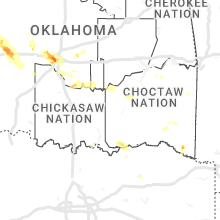


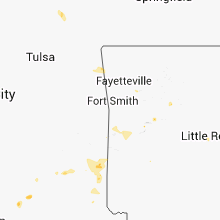


Connect with Interactive Hail Maps