

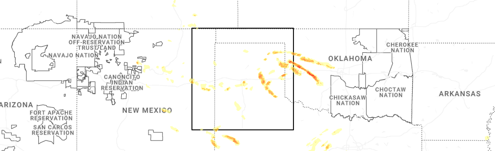
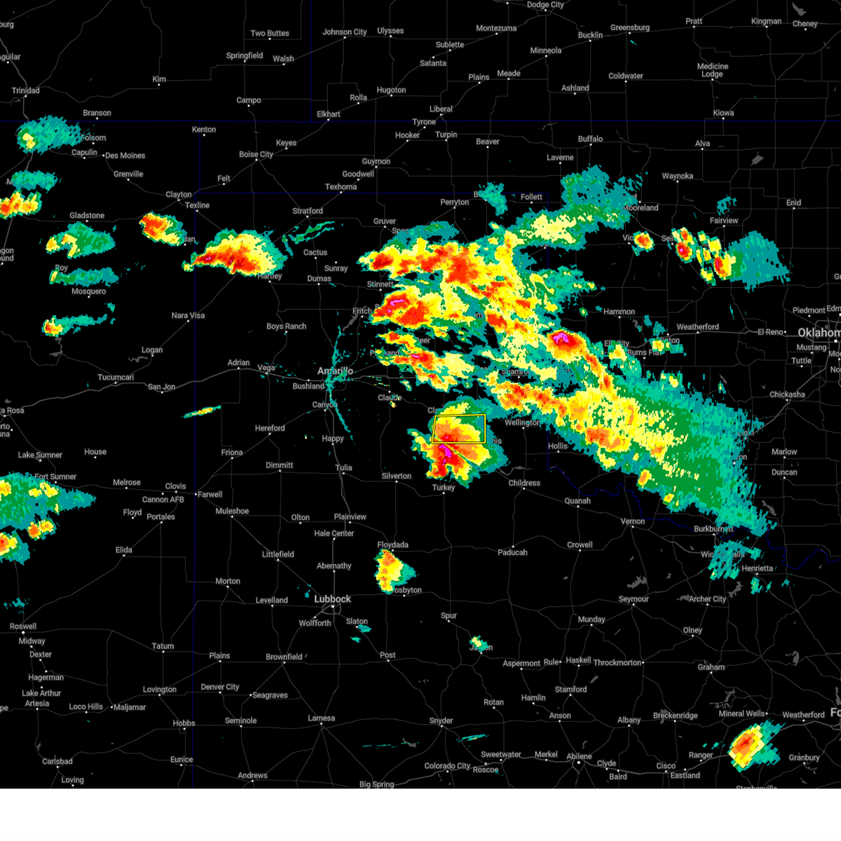
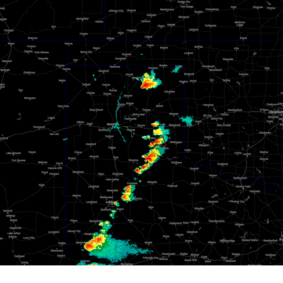
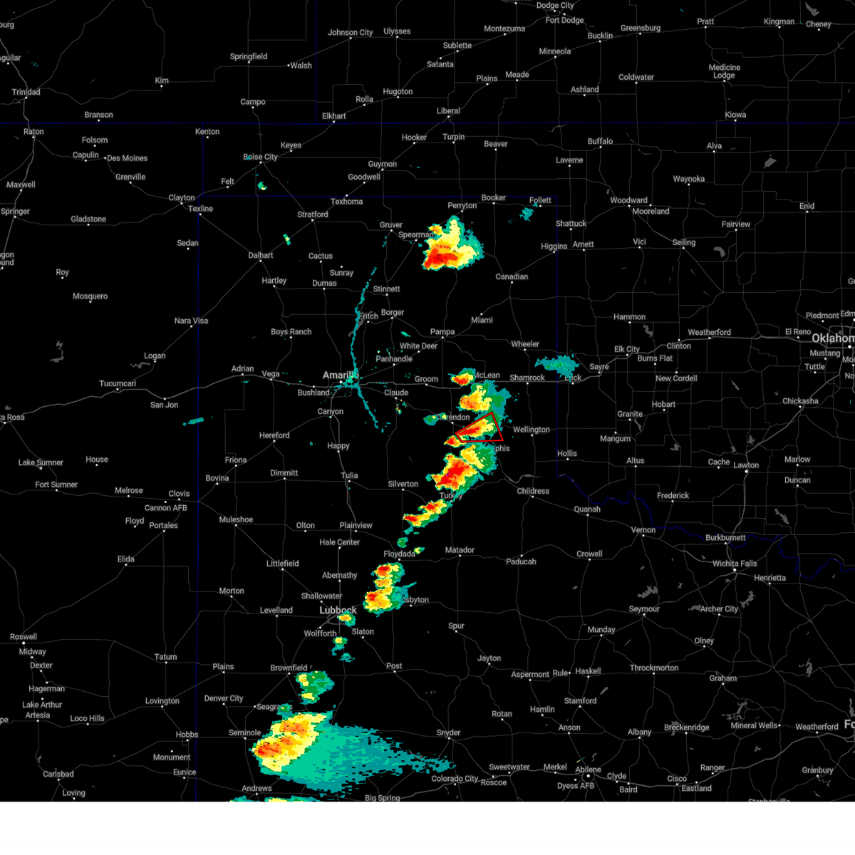
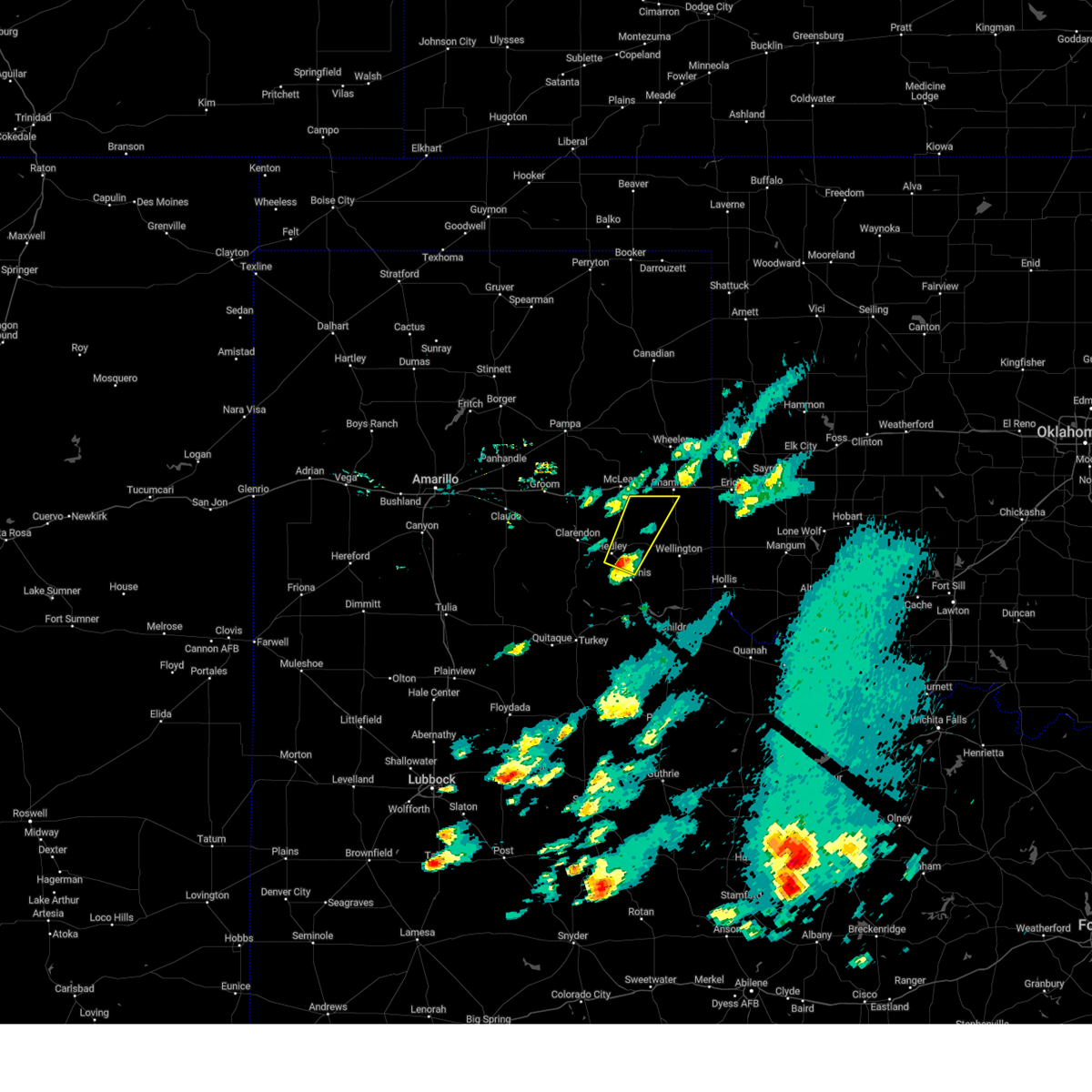
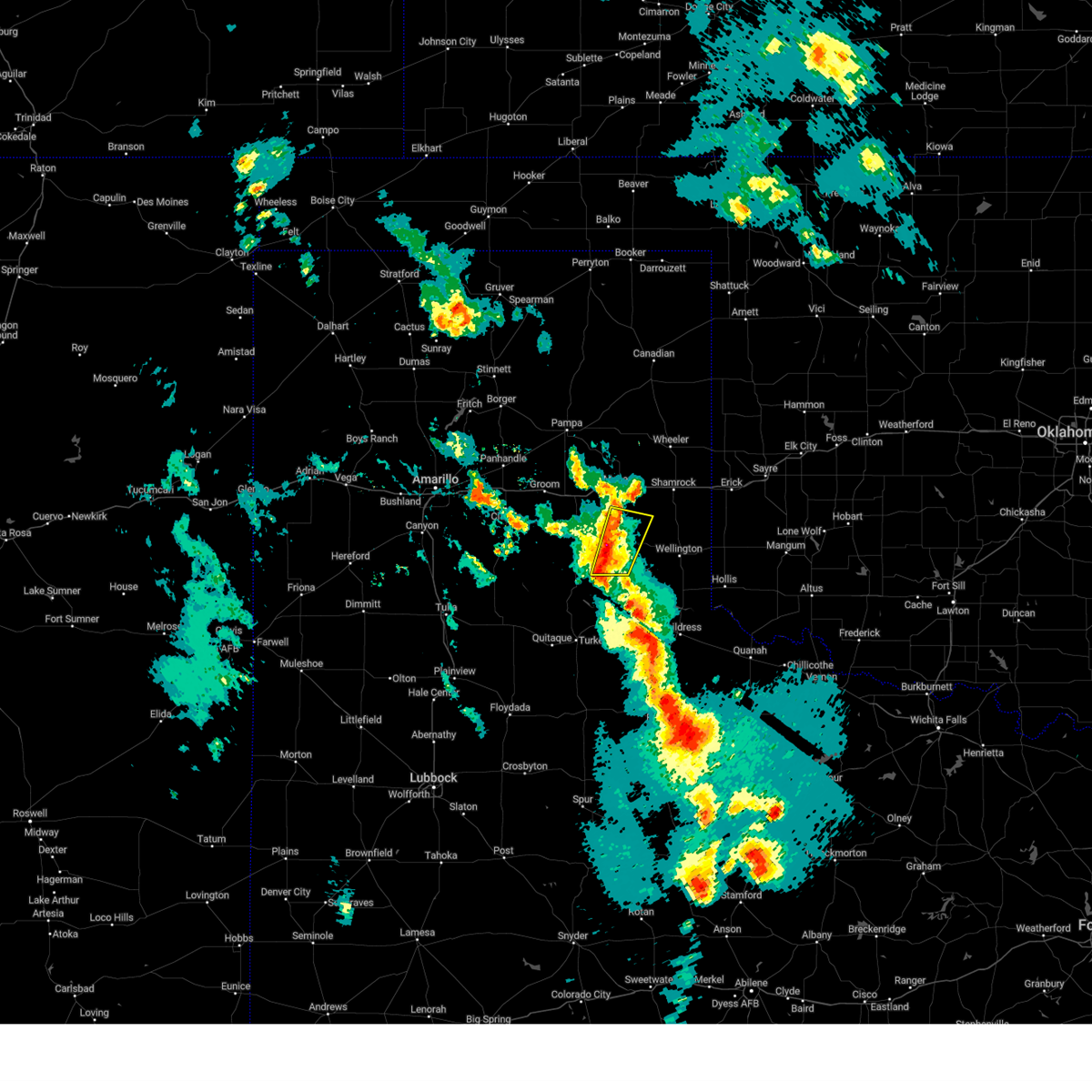
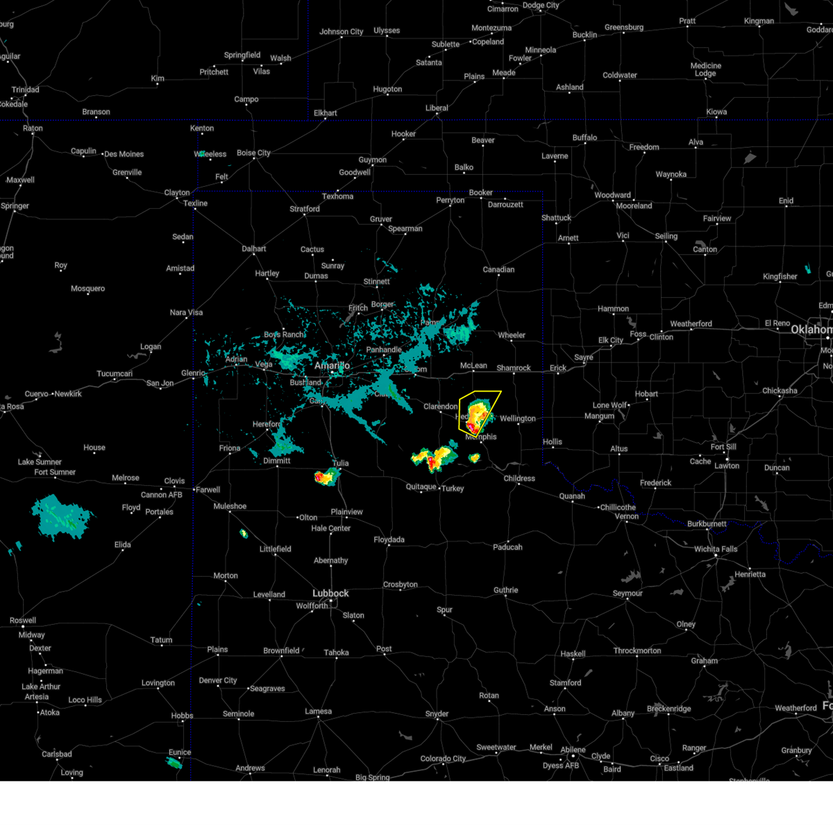
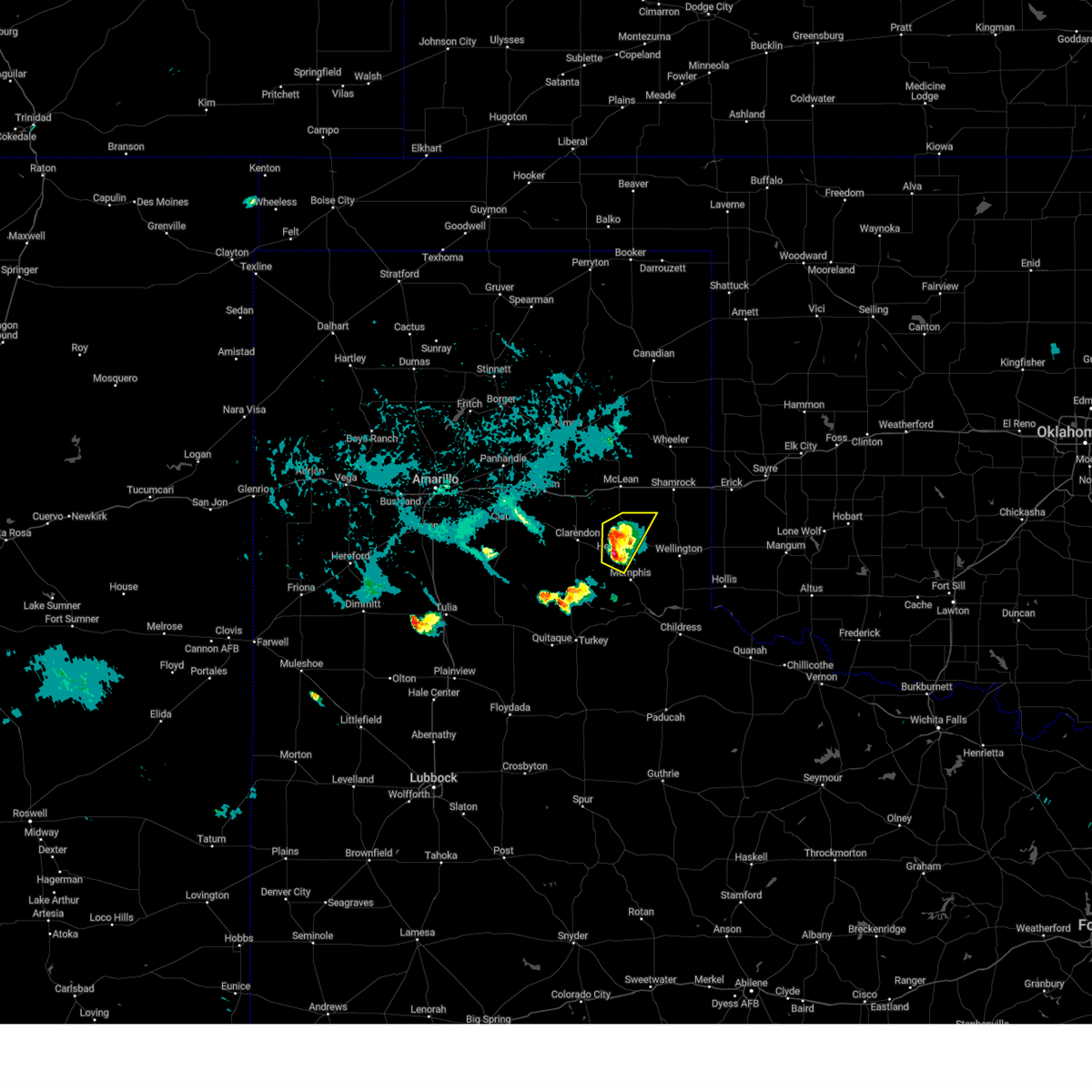
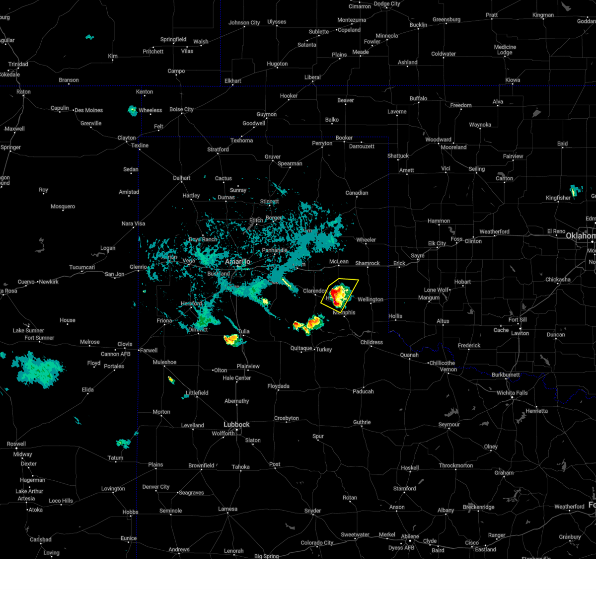
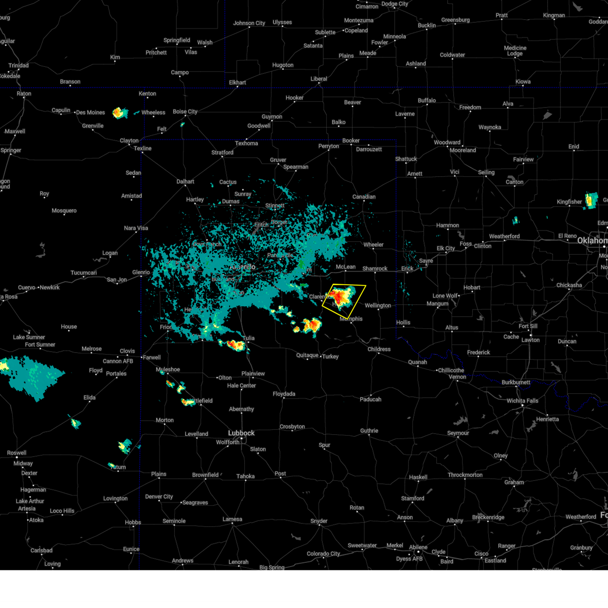
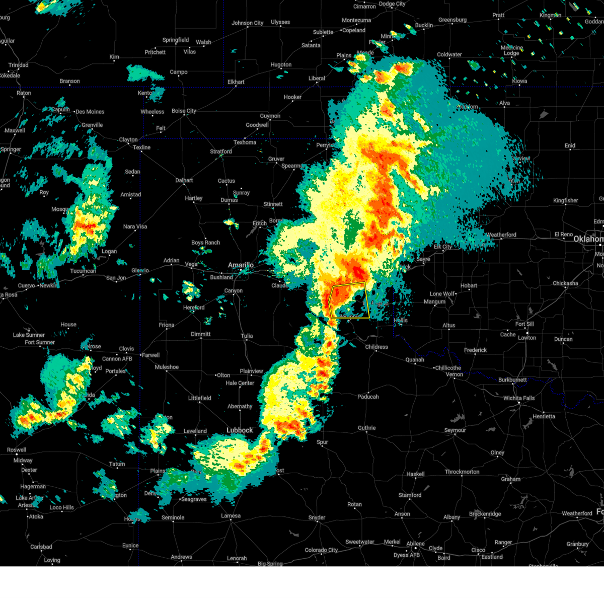
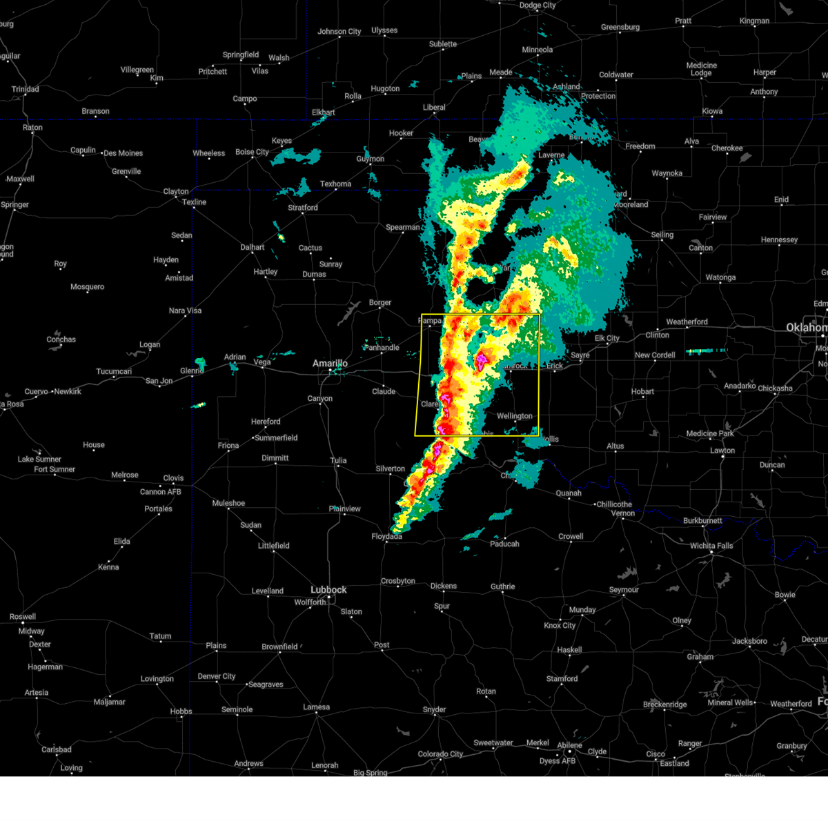
Hail Map for Hedley, TX
The Hedley, TX area has had 26 reports of on-the-ground hail by trained spotters, and has been under severe weather warnings 14 times during the past 12 months. Doppler radar has detected hail at or near Hedley, TX on 101 occasions, including 2 occasions during the past year.
| Name: | Hedley, TX |
| Where Located: | 39.7 miles NW of Childress, TX |
| Map: | Google Map for Hedley, TX |
| Population: | 329 |
| Housing Units: | 187 |
| More Info: | Search Google for Hedley, TX |
0
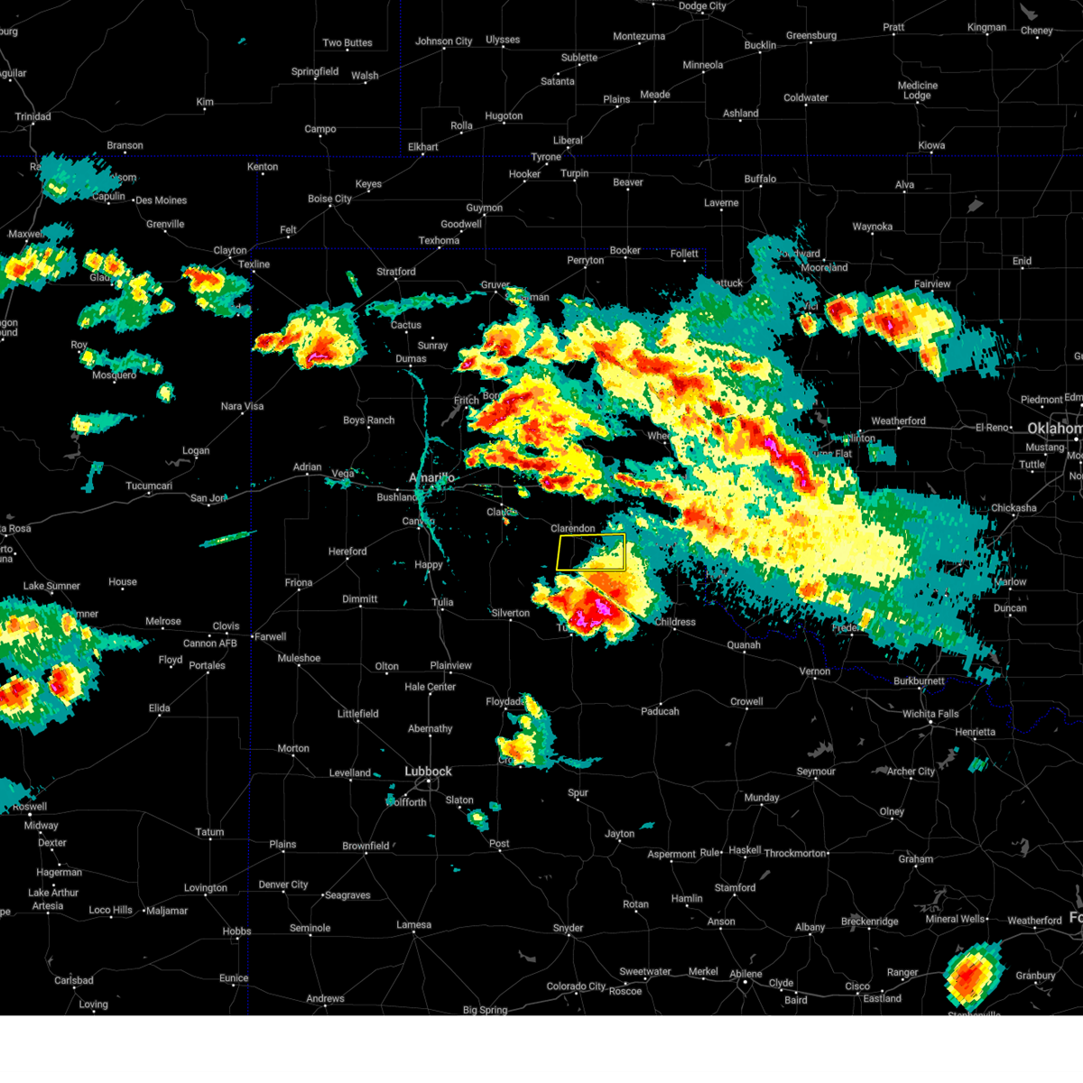
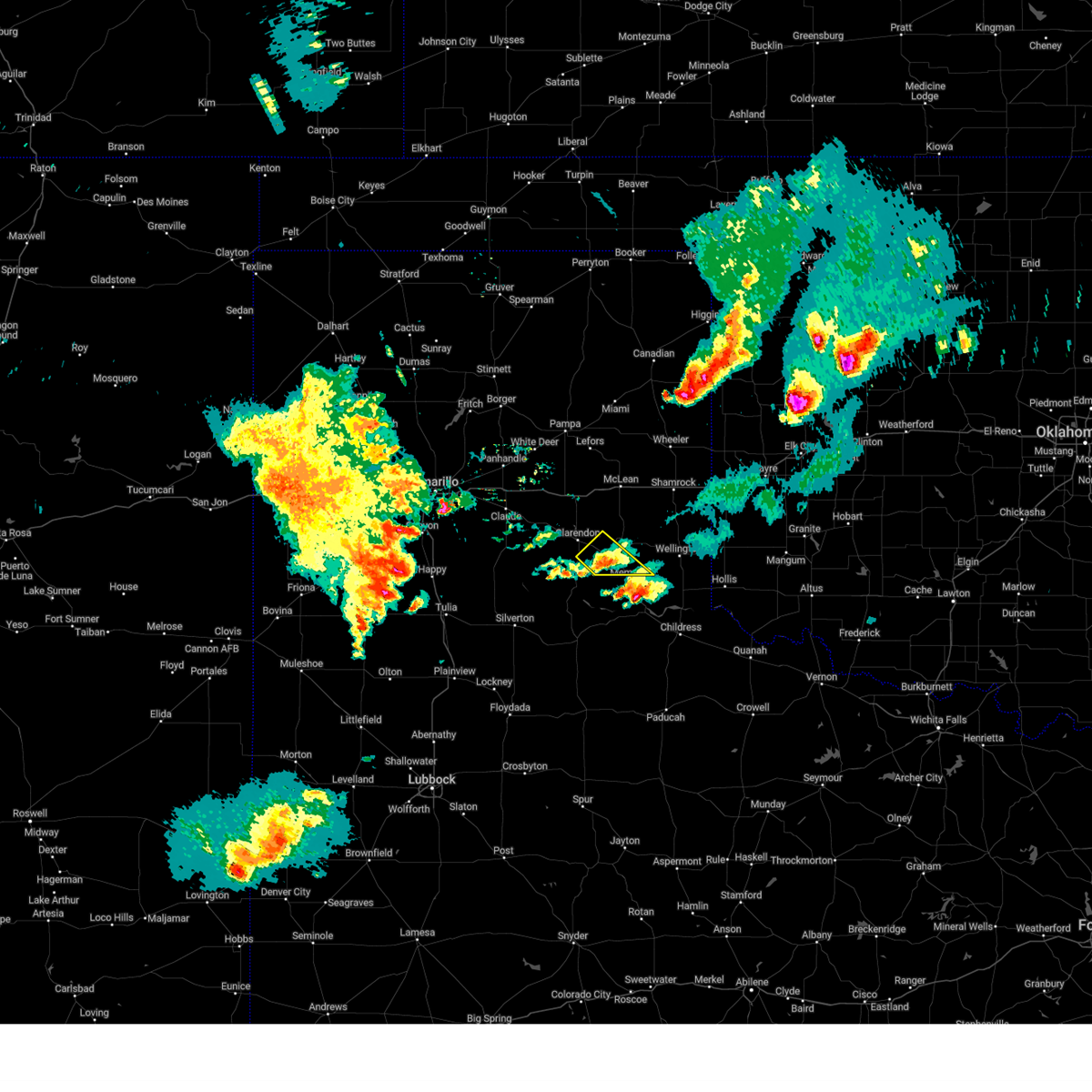
The Top Recent Hail Date for Hedley, TX is Monday, May 26, 2025 (38th out of 101)
Hail and Wind Damage Spotted near Hedley, TX
| Date / Time | Report Details |
|---|---|
| 6/8/2025 7:37 PM CDT |
 the severe thunderstorm warning has been cancelled and is no longer in effect the severe thunderstorm warning has been cancelled and is no longer in effect
|
| 6/8/2025 7:24 PM CDT | the severe thunderstorm warning has been cancelled and is no longer in effect |
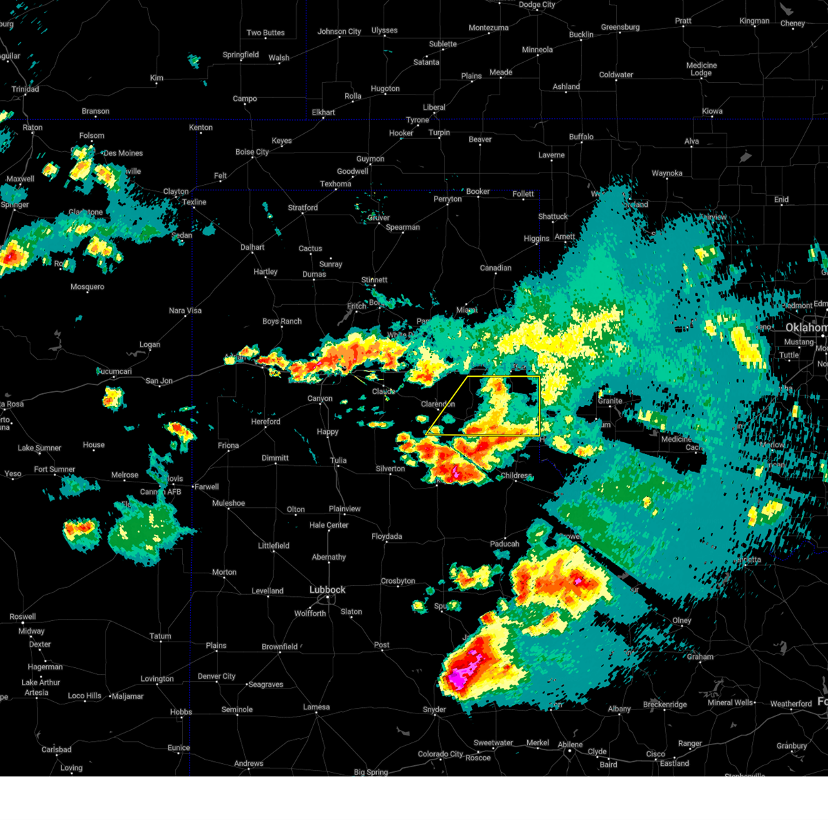
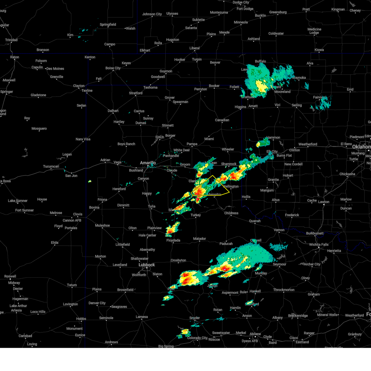
| 6/8/2025 7:24 PM CDT | At 724 pm cdt, severe thunderstorms were located along a line extending from 10 miles south of mclean to 7 miles southwest of hedley, moving southeast at 40 mph (radar indicated). Hazards include 60 mph wind gusts and half dollar size hail. Minor damage to roofs, siding, and trees is possible. hail damage to vehicles is expected. Locations impacted include, lutie, hedley, lelia lake, dozier, quail, samnorwood, dodson, and wellington. |
| 6/8/2025 6:53 PM CDT |
 Svrama the national weather service in amarillo has issued a * severe thunderstorm warning for, southeastern armstrong county in the panhandle of texas, southern wheeler county in the panhandle of texas, southeastern gray county in the panhandle of texas, collingsworth county in the panhandle of texas, donley county in the panhandle of texas, * until 830 pm cdt. * at 653 pm cdt, severe thunderstorms were located along a line extending from 4 miles northeast of lake mcclellan to 7 miles southwest of greenbelt lake, moving east at 30 mph (radar indicated). Hazards include 60 mph wind gusts and half dollar size hail. Minor damage to roofs, siding, and trees is possible. Hail damage to vehicles is expected. Svrama the national weather service in amarillo has issued a * severe thunderstorm warning for, southeastern armstrong county in the panhandle of texas, southern wheeler county in the panhandle of texas, southeastern gray county in the panhandle of texas, collingsworth county in the panhandle of texas, donley county in the panhandle of texas, * until 830 pm cdt. * at 653 pm cdt, severe thunderstorms were located along a line extending from 4 miles northeast of lake mcclellan to 7 miles southwest of greenbelt lake, moving east at 30 mph (radar indicated). Hazards include 60 mph wind gusts and half dollar size hail. Minor damage to roofs, siding, and trees is possible. Hail damage to vehicles is expected.
|
| 6/8/2025 5:31 PM CDT |
 the severe thunderstorm warning has been cancelled and is no longer in effect the severe thunderstorm warning has been cancelled and is no longer in effect
|
| 6/8/2025 5:13 PM CDT |
 At 513 pm cdt, a severe thunderstorm was located 4 miles north of brice, or 11 miles south of clarendon, moving east at 30 mph (radar indicated). Hazards include 70 mph wind gusts and ping pong ball size hail. Expect some tree damage. damage is likely to mobile homes, roofs, and outbuildings. people and animals outdoors will be injured. expect hail damage to roofs, siding, windows, and vehicles. Locations impacted include, hedley, clarendon, and lelia lake. At 513 pm cdt, a severe thunderstorm was located 4 miles north of brice, or 11 miles south of clarendon, moving east at 30 mph (radar indicated). Hazards include 70 mph wind gusts and ping pong ball size hail. Expect some tree damage. damage is likely to mobile homes, roofs, and outbuildings. people and animals outdoors will be injured. expect hail damage to roofs, siding, windows, and vehicles. Locations impacted include, hedley, clarendon, and lelia lake.
|
| 6/8/2025 5:13 PM CDT |
 the severe thunderstorm warning has been cancelled and is no longer in effect the severe thunderstorm warning has been cancelled and is no longer in effect
|
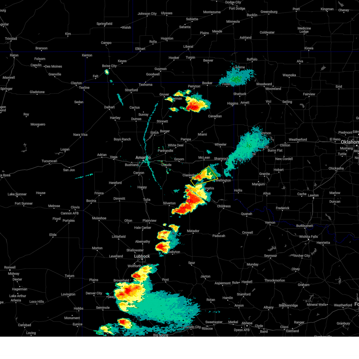
| 6/8/2025 4:53 PM CDT | Svrama the national weather service in amarillo has issued a * severe thunderstorm warning for, southeastern armstrong county in the panhandle of texas, southern donley county in the panhandle of texas, * until 600 pm cdt. * at 453 pm cdt, a severe thunderstorm was located 9 miles northwest of brice, or 13 miles southwest of clarendon, moving east at 30 mph. this is a destructive storm for southwest donley county (radar indicated). Hazards include three inch hail and 70 mph wind gusts. People and animals outdoors will be severely injured. Expect shattered windows, extensive damage to roofs, siding, and vehicles. |
| 6/2/2025 4:40 PM CDT | Svrama the national weather service in amarillo has issued a * severe thunderstorm warning for, northeastern armstrong county in the panhandle of texas, western wheeler county in the panhandle of texas, carson county in the panhandle of texas, hutchinson county in the panhandle of texas, gray county in the panhandle of texas, southeastern hansford county in the panhandle of texas, northwestern collingsworth county in the panhandle of texas, roberts county in the panhandle of texas, southern ochiltree county in the panhandle of texas, donley county in the panhandle of texas, * until 545 pm cdt. * at 439 pm cdt, severe thunderstorms were located along a line extending from 10 miles south of spearman to 3 miles west of kingsmill to 3 miles west of lelia lake, moving east at 45 mph (radar indicated). Hazards include 60 mph wind gusts and quarter size hail. Minor damage to roofs, siding, and trees is possible. Hail damage to vehicles is expected. |
| 5/26/2025 9:18 PM CDT |
 the severe thunderstorm warning has been cancelled and is no longer in effect the severe thunderstorm warning has been cancelled and is no longer in effect
|
| 5/26/2025 8:53 PM CDT |
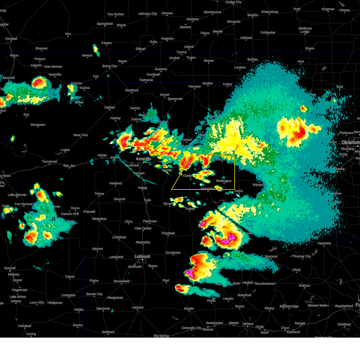
 Svrama the national weather service in amarillo has issued a * severe thunderstorm warning for, southwestern collingsworth county in the panhandle of texas, southeastern donley county in the panhandle of texas, * until 945 pm cdt. * at 853 pm cdt, a severe thunderstorm was located over lelia lake, or 7 miles east of clarendon, moving southeast at 25 mph (radar indicated). Hazards include golf ball size hail and 60 mph wind gusts. Minor damage to roofs, siding, and trees is possible. people and animals outdoors will be injured. Expect hail damage to roofs, siding, windows, and vehicles. Svrama the national weather service in amarillo has issued a * severe thunderstorm warning for, southwestern collingsworth county in the panhandle of texas, southeastern donley county in the panhandle of texas, * until 945 pm cdt. * at 853 pm cdt, a severe thunderstorm was located over lelia lake, or 7 miles east of clarendon, moving southeast at 25 mph (radar indicated). Hazards include golf ball size hail and 60 mph wind gusts. Minor damage to roofs, siding, and trees is possible. people and animals outdoors will be injured. Expect hail damage to roofs, siding, windows, and vehicles.
|
| 5/26/2025 8:25 PM CDT |
 Svrama the national weather service in amarillo has issued a * severe thunderstorm warning for, southwestern collingsworth county in the panhandle of texas, southeastern donley county in the panhandle of texas, * until 930 pm cdt. * at 825 pm cdt, a severe thunderstorm was located 4 miles southwest of hedley, or 10 miles northwest of memphis, moving southeast at 20 mph (radar indicated). Hazards include ping pong ball size hail and 60 mph wind gusts. Minor damage to roofs, siding, and trees is possible. people and animals outdoors will be injured. expect hail damage to roofs, siding, windows, and vehicles. This severe thunderstorm will remain over mainly rural areas of southwestern collingsworth and southeastern donley counties. Svrama the national weather service in amarillo has issued a * severe thunderstorm warning for, southwestern collingsworth county in the panhandle of texas, southeastern donley county in the panhandle of texas, * until 930 pm cdt. * at 825 pm cdt, a severe thunderstorm was located 4 miles southwest of hedley, or 10 miles northwest of memphis, moving southeast at 20 mph (radar indicated). Hazards include ping pong ball size hail and 60 mph wind gusts. Minor damage to roofs, siding, and trees is possible. people and animals outdoors will be injured. expect hail damage to roofs, siding, windows, and vehicles. This severe thunderstorm will remain over mainly rural areas of southwestern collingsworth and southeastern donley counties.
|
| 4/22/2025 5:59 PM CDT |
 At 558 pm cdt, a severe thunderstorm was located 6 miles northeast of brice, or 11 miles south of clarendon, moving east at 10 mph (radar indicated). Hazards include golf ball size hail and 60 mph wind gusts. Minor damage to roofs, siding, and trees is possible. people and animals outdoors will be injured. expect hail damage to roofs, siding, windows, and vehicles. Locations impacted include, hedley and lelia lake. At 558 pm cdt, a severe thunderstorm was located 6 miles northeast of brice, or 11 miles south of clarendon, moving east at 10 mph (radar indicated). Hazards include golf ball size hail and 60 mph wind gusts. Minor damage to roofs, siding, and trees is possible. people and animals outdoors will be injured. expect hail damage to roofs, siding, windows, and vehicles. Locations impacted include, hedley and lelia lake.
|
| 4/22/2025 5:44 PM CDT |
 Svrama the national weather service in amarillo has issued a * severe thunderstorm warning for, southern donley county in the panhandle of texas, * until 645 pm cdt. * at 544 pm cdt, a severe thunderstorm was located 5 miles north of brice, or 10 miles south of clarendon, moving east at 10 mph (radar indicated). Hazards include tennis ball size hail and 60 mph wind gusts. Minor damage to roofs, siding, and trees is possible. people and animals outdoors will be injured. Expect hail damage to roofs, siding, windows, and vehicles. Svrama the national weather service in amarillo has issued a * severe thunderstorm warning for, southern donley county in the panhandle of texas, * until 645 pm cdt. * at 544 pm cdt, a severe thunderstorm was located 5 miles north of brice, or 10 miles south of clarendon, moving east at 10 mph (radar indicated). Hazards include tennis ball size hail and 60 mph wind gusts. Minor damage to roofs, siding, and trees is possible. people and animals outdoors will be injured. Expect hail damage to roofs, siding, windows, and vehicles.
|
| 5/15/2024 5:15 PM CDT |
 the severe thunderstorm warning has been cancelled and is no longer in effect the severe thunderstorm warning has been cancelled and is no longer in effect
|
| 5/15/2024 5:14 PM CDT |
 The storm which prompted the warning has moved out of the area. therefore, the warning will be allowed to expire. a severe thunderstorm watch remains in effect until 1000 pm cdt for the panhandle of texas. The storm which prompted the warning has moved out of the area. therefore, the warning will be allowed to expire. a severe thunderstorm watch remains in effect until 1000 pm cdt for the panhandle of texas.
|
| 5/15/2024 4:55 PM CDT |
 At 454 pm cdt, a severe thunderstorm was located 4 miles east of clarendon, moving northeast at 25 mph (radar indicated). Hazards include 60 mph wind gusts and half dollar size hail. Minor damage to roofs, siding, and trees is possible. hail damage to vehicles is expected. Locations impacted include, hedley and lelia lake. At 454 pm cdt, a severe thunderstorm was located 4 miles east of clarendon, moving northeast at 25 mph (radar indicated). Hazards include 60 mph wind gusts and half dollar size hail. Minor damage to roofs, siding, and trees is possible. hail damage to vehicles is expected. Locations impacted include, hedley and lelia lake.
|
| 5/15/2024 4:52 PM CDT |
 Svrama the national weather service in amarillo has issued a * severe thunderstorm warning for, southwestern collingsworth county in the panhandle of texas, southeastern donley county in the panhandle of texas, * until 545 pm cdt. * at 451 pm cdt, a severe thunderstorm was located 5 miles southeast of hedley, or 7 miles north of memphis, moving east at 15 mph (radar indicated). Hazards include 60 mph wind gusts and half dollar size hail. Minor damage to roofs, siding, and trees is possible. Hail damage to vehicles is expected. Svrama the national weather service in amarillo has issued a * severe thunderstorm warning for, southwestern collingsworth county in the panhandle of texas, southeastern donley county in the panhandle of texas, * until 545 pm cdt. * at 451 pm cdt, a severe thunderstorm was located 5 miles southeast of hedley, or 7 miles north of memphis, moving east at 15 mph (radar indicated). Hazards include 60 mph wind gusts and half dollar size hail. Minor damage to roofs, siding, and trees is possible. Hail damage to vehicles is expected.
|
| 5/15/2024 4:20 PM CDT |
 Svrama the national weather service in amarillo has issued a * severe thunderstorm warning for, donley county in the panhandle of texas, * until 515 pm cdt. * at 419 pm cdt, a severe thunderstorm was located 4 miles northwest of brice, or 11 miles south of clarendon, moving northeast at 25 mph (radar indicated). Hazards include 60 mph wind gusts and half dollar size hail. Minor damage to roofs, siding, and trees is possible. Hail damage to vehicles is expected. Svrama the national weather service in amarillo has issued a * severe thunderstorm warning for, donley county in the panhandle of texas, * until 515 pm cdt. * at 419 pm cdt, a severe thunderstorm was located 4 miles northwest of brice, or 11 miles south of clarendon, moving northeast at 25 mph (radar indicated). Hazards include 60 mph wind gusts and half dollar size hail. Minor damage to roofs, siding, and trees is possible. Hail damage to vehicles is expected.
|
| 5/12/2024 8:15 AM CDT |
 The storm which prompted the warning has moved out of the area. therefore, the warning has been allowed to expire. The storm which prompted the warning has moved out of the area. therefore, the warning has been allowed to expire.
|
| 5/12/2024 7:53 AM CDT |
 At 753 am cdt, a severe thunderstorm was located near hedley, or 8 miles northwest of memphis, moving northeast at 35 mph (radar indicated). Hazards include 60 mph wind gusts and half dollar size hail. Minor damage to roofs, siding, and trees is possible. hail damage to vehicles is expected. Locations impacted include, hedley and quail. At 753 am cdt, a severe thunderstorm was located near hedley, or 8 miles northwest of memphis, moving northeast at 35 mph (radar indicated). Hazards include 60 mph wind gusts and half dollar size hail. Minor damage to roofs, siding, and trees is possible. hail damage to vehicles is expected. Locations impacted include, hedley and quail.
|
| 5/12/2024 7:32 AM CDT |
 Svrama the national weather service in amarillo has issued a * severe thunderstorm warning for, southwestern collingsworth county in the panhandle of texas, southeastern donley county in the panhandle of texas, * until 815 am cdt. * at 731 am cdt, a severe thunderstorm was located near brice, or 14 miles south of clarendon, moving northeast at 40 mph (radar indicated). Hazards include 60 mph wind gusts and quarter size hail. Minor damage to roofs, siding, and trees is possible. Hail damage to vehicles is expected. Svrama the national weather service in amarillo has issued a * severe thunderstorm warning for, southwestern collingsworth county in the panhandle of texas, southeastern donley county in the panhandle of texas, * until 815 am cdt. * at 731 am cdt, a severe thunderstorm was located near brice, or 14 miles south of clarendon, moving northeast at 40 mph (radar indicated). Hazards include 60 mph wind gusts and quarter size hail. Minor damage to roofs, siding, and trees is possible. Hail damage to vehicles is expected.
|
| 5/1/2024 10:06 PM CDT |
 The storms which prompted the warning have weakened below severe limits, and no longer pose an immediate threat to life or property. therefore, the warning will be allowed to expire. a tornado watch remains in effect until 1100 pm cdt for the panhandle of texas. The storms which prompted the warning have weakened below severe limits, and no longer pose an immediate threat to life or property. therefore, the warning will be allowed to expire. a tornado watch remains in effect until 1100 pm cdt for the panhandle of texas.
|
| 5/1/2024 9:46 PM CDT |
 At 945 pm cdt, severe thunderstorms were located along a line extending from 6 miles west of lake mcclellan to 6 miles northeast of howardwick to near hedley, moving northeast at 40 mph (radar indicated). Hazards include 60 mph wind gusts. Minor damage to roofs, siding, and trees is possible. Locations impacted include, mclean, hedley, alanreed, and lake mcclellan. At 945 pm cdt, severe thunderstorms were located along a line extending from 6 miles west of lake mcclellan to 6 miles northeast of howardwick to near hedley, moving northeast at 40 mph (radar indicated). Hazards include 60 mph wind gusts. Minor damage to roofs, siding, and trees is possible. Locations impacted include, mclean, hedley, alanreed, and lake mcclellan.
|
| 5/1/2024 9:46 PM CDT |
 the severe thunderstorm warning has been cancelled and is no longer in effect the severe thunderstorm warning has been cancelled and is no longer in effect
|
| 5/1/2024 9:28 PM CDT |
 Svrama the national weather service in amarillo has issued a * severe thunderstorm warning for, eastern armstrong county in the panhandle of texas, southwestern wheeler county in the panhandle of texas, southern gray county in the panhandle of texas, northwestern collingsworth county in the panhandle of texas, donley county in the panhandle of texas, * until 1015 pm cdt. * at 928 pm cdt, severe thunderstorms were located along a line extending from 4 miles south of groom to greenbelt lake to 5 miles south of lelia lake, moving northeast at 40 mph (radar indicated). Hazards include 60 mph wind gusts and penny size hail. minor damage to roofs, siding, and trees is possible Svrama the national weather service in amarillo has issued a * severe thunderstorm warning for, eastern armstrong county in the panhandle of texas, southwestern wheeler county in the panhandle of texas, southern gray county in the panhandle of texas, northwestern collingsworth county in the panhandle of texas, donley county in the panhandle of texas, * until 1015 pm cdt. * at 928 pm cdt, severe thunderstorms were located along a line extending from 4 miles south of groom to greenbelt lake to 5 miles south of lelia lake, moving northeast at 40 mph (radar indicated). Hazards include 60 mph wind gusts and penny size hail. minor damage to roofs, siding, and trees is possible
|
| 5/1/2024 6:23 PM CDT |
 Svrama the national weather service in amarillo has issued a * severe thunderstorm warning for, southeastern armstrong county in the panhandle of texas, southern donley county in the panhandle of texas, * until 715 pm cdt. * at 622 pm cdt, a severe thunderstorm was located 10 miles northwest of brice, or 14 miles southwest of clarendon, moving northeast at 30 mph (radar indicated). Hazards include golf ball size hail and 60 mph wind gusts. Minor damage to roofs, siding, and trees is possible. people and animals outdoors will be injured. Expect hail damage to roofs, siding, windows, and vehicles. Svrama the national weather service in amarillo has issued a * severe thunderstorm warning for, southeastern armstrong county in the panhandle of texas, southern donley county in the panhandle of texas, * until 715 pm cdt. * at 622 pm cdt, a severe thunderstorm was located 10 miles northwest of brice, or 14 miles southwest of clarendon, moving northeast at 30 mph (radar indicated). Hazards include golf ball size hail and 60 mph wind gusts. Minor damage to roofs, siding, and trees is possible. people and animals outdoors will be injured. Expect hail damage to roofs, siding, windows, and vehicles.
|
| 5/1/2024 6:01 PM CDT |
 the severe thunderstorm warning has been cancelled and is no longer in effect the severe thunderstorm warning has been cancelled and is no longer in effect
|
| 5/1/2024 5:42 PM CDT |
 The storm which prompted the warning has weakened below severe limits, and no longer appears capable of producing a tornado. therefore, the warning will be allowed to expire. a tornado watch remains in effect until 1100 pm cdt for the panhandle of texas. remember, a severe thunderstorm warning still remains in effect for portions of donley and collingsworth county. The storm which prompted the warning has weakened below severe limits, and no longer appears capable of producing a tornado. therefore, the warning will be allowed to expire. a tornado watch remains in effect until 1100 pm cdt for the panhandle of texas. remember, a severe thunderstorm warning still remains in effect for portions of donley and collingsworth county.
|
| 5/1/2024 5:38 PM CDT |
 Svrama the national weather service in amarillo has issued a * severe thunderstorm warning for, west central collingsworth county in the panhandle of texas, southeastern donley county in the panhandle of texas, * until 645 pm cdt. * at 537 pm cdt, a severe thunderstorm was located over lelia lake, or 9 miles east of clarendon, moving northeast at 15 mph (radar indicated). Hazards include 60 mph wind gusts and quarter size hail. Minor damage to roofs, siding, and trees is possible. Hail damage to vehicles is expected. Svrama the national weather service in amarillo has issued a * severe thunderstorm warning for, west central collingsworth county in the panhandle of texas, southeastern donley county in the panhandle of texas, * until 645 pm cdt. * at 537 pm cdt, a severe thunderstorm was located over lelia lake, or 9 miles east of clarendon, moving northeast at 15 mph (radar indicated). Hazards include 60 mph wind gusts and quarter size hail. Minor damage to roofs, siding, and trees is possible. Hail damage to vehicles is expected.
|
| 5/1/2024 5:26 PM CDT |
 At 526 pm cdt, a severe thunderstorm capable of producing a tornado was located near lelia lake, or 9 miles southeast of clarendon, moving northeast at 15 mph (radar indicated rotation). Hazards include tornado and ping pong ball size hail. Flying debris will be dangerous to those caught without shelter. mobile homes will be damaged or destroyed. damage to roofs, windows, and vehicles will occur. tree damage is likely. Locations impacted include, hedley and lelia lake. At 526 pm cdt, a severe thunderstorm capable of producing a tornado was located near lelia lake, or 9 miles southeast of clarendon, moving northeast at 15 mph (radar indicated rotation). Hazards include tornado and ping pong ball size hail. Flying debris will be dangerous to those caught without shelter. mobile homes will be damaged or destroyed. damage to roofs, windows, and vehicles will occur. tree damage is likely. Locations impacted include, hedley and lelia lake.
|
| 5/1/2024 5:16 PM CDT |
 Torama the national weather service in amarillo has issued a * tornado warning for, west central collingsworth county in the panhandle of texas, southeastern donley county in the panhandle of texas, * until 545 pm cdt. * at 516 pm cdt, a severe thunderstorm capable of producing a tornado was located 4 miles southwest of lelia lake, or 8 miles southeast of clarendon, moving northeast at 15 mph (law enforcment reported funnel cloud). Hazards include tornado and quarter size hail. Flying debris will be dangerous to those caught without shelter. mobile homes will be damaged or destroyed. damage to roofs, windows, and vehicles will occur. Tree damage is likely. Torama the national weather service in amarillo has issued a * tornado warning for, west central collingsworth county in the panhandle of texas, southeastern donley county in the panhandle of texas, * until 545 pm cdt. * at 516 pm cdt, a severe thunderstorm capable of producing a tornado was located 4 miles southwest of lelia lake, or 8 miles southeast of clarendon, moving northeast at 15 mph (law enforcment reported funnel cloud). Hazards include tornado and quarter size hail. Flying debris will be dangerous to those caught without shelter. mobile homes will be damaged or destroyed. damage to roofs, windows, and vehicles will occur. Tree damage is likely.
|
| 5/1/2024 5:09 PM CDT |
 At 509 pm cdt, a severe thunderstorm was located 5 miles northeast of hedley, or 12 miles north of memphis, moving east at 30 mph (radar indicated). Hazards include 60 mph wind gusts and quarter size hail. Minor damage to roofs, siding, and trees is possible. hail damage to vehicles is expected. Locations impacted include, hedley, lelia lake, quail, and samnorwood. At 509 pm cdt, a severe thunderstorm was located 5 miles northeast of hedley, or 12 miles north of memphis, moving east at 30 mph (radar indicated). Hazards include 60 mph wind gusts and quarter size hail. Minor damage to roofs, siding, and trees is possible. hail damage to vehicles is expected. Locations impacted include, hedley, lelia lake, quail, and samnorwood.
|
| 5/1/2024 4:48 PM CDT |
 Svrama the national weather service in amarillo has issued a * severe thunderstorm warning for, western collingsworth county in the panhandle of texas, southeastern donley county in the panhandle of texas, * until 545 pm cdt. * at 447 pm cdt, a severe thunderstorm was located 4 miles south of lelia lake, or 10 miles southeast of clarendon, moving east at 30 mph (radar indicated). Hazards include ping pong ball size hail and 60 mph wind gusts. Minor damage to roofs, siding, and trees is possible. people and animals outdoors will be injured. Expect hail damage to roofs, siding, windows, and vehicles. Svrama the national weather service in amarillo has issued a * severe thunderstorm warning for, western collingsworth county in the panhandle of texas, southeastern donley county in the panhandle of texas, * until 545 pm cdt. * at 447 pm cdt, a severe thunderstorm was located 4 miles south of lelia lake, or 10 miles southeast of clarendon, moving east at 30 mph (radar indicated). Hazards include ping pong ball size hail and 60 mph wind gusts. Minor damage to roofs, siding, and trees is possible. people and animals outdoors will be injured. Expect hail damage to roofs, siding, windows, and vehicles.
|
| 4/27/2024 10:05 AM CDT |
 At 1004 am cdt, a severe thunderstorm was located over samnorwood, or 10 miles south of shamrock, moving north at 55 mph (radar indicated). Hazards include 60 mph wind gusts and half dollar size hail. Minor damage to roofs, siding, and trees is possible. hail damage to vehicles is expected. Locations impacted include, shamrock, wheeler, hedley, lutie, twitty, dozier, lela, quail, and samnorwood. At 1004 am cdt, a severe thunderstorm was located over samnorwood, or 10 miles south of shamrock, moving north at 55 mph (radar indicated). Hazards include 60 mph wind gusts and half dollar size hail. Minor damage to roofs, siding, and trees is possible. hail damage to vehicles is expected. Locations impacted include, shamrock, wheeler, hedley, lutie, twitty, dozier, lela, quail, and samnorwood.
|
| 4/27/2024 10:05 AM CDT |
 the severe thunderstorm warning has been cancelled and is no longer in effect the severe thunderstorm warning has been cancelled and is no longer in effect
|
| 4/27/2024 9:48 AM CDT |
 At 947 am cdt, a severe thunderstorm was located over shamrock, moving northeast at 50 mph. another severe thunderstorm is located southwest of shamrock (radar indicated). Hazards include 60 mph wind gusts and half dollar size hail. Minor damage to roofs, siding, and trees is possible. hail damage to vehicles is expected. Locations impacted include, shamrock, hedley, lutie, twitty, dozier, lela, quail, and samnorwood. At 947 am cdt, a severe thunderstorm was located over shamrock, moving northeast at 50 mph. another severe thunderstorm is located southwest of shamrock (radar indicated). Hazards include 60 mph wind gusts and half dollar size hail. Minor damage to roofs, siding, and trees is possible. hail damage to vehicles is expected. Locations impacted include, shamrock, hedley, lutie, twitty, dozier, lela, quail, and samnorwood.
|
| 4/27/2024 9:38 AM CDT |
 At 937 am cdt, a severe thunderstorm was located 4 miles north of samnorwood, or 6 miles south of shamrock, moving northeast at 55 mph (radar indicated). Hazards include 60 mph wind gusts and half dollar size hail. Minor damage to roofs, siding, and trees is possible. hail damage to vehicles is expected. Locations impacted include, shamrock, hedley, lutie, twitty, dozier, lela, quail, and samnorwood. At 937 am cdt, a severe thunderstorm was located 4 miles north of samnorwood, or 6 miles south of shamrock, moving northeast at 55 mph (radar indicated). Hazards include 60 mph wind gusts and half dollar size hail. Minor damage to roofs, siding, and trees is possible. hail damage to vehicles is expected. Locations impacted include, shamrock, hedley, lutie, twitty, dozier, lela, quail, and samnorwood.
|
| 4/27/2024 9:23 AM CDT |
 Svrama the national weather service in amarillo has issued a * severe thunderstorm warning for, southern wheeler county in the panhandle of texas, southeastern gray county in the panhandle of texas, collingsworth county in the panhandle of texas, eastern donley county in the panhandle of texas, * until 1030 am cdt. * at 922 am cdt, a severe thunderstorm was located 6 miles south of hedley, or 8 miles west of memphis, moving northeast at 45 mph (radar indicated). Hazards include 60 mph wind gusts and quarter size hail. Minor damage to roofs, siding, and trees is possible. Hail damage to vehicles is expected. Svrama the national weather service in amarillo has issued a * severe thunderstorm warning for, southern wheeler county in the panhandle of texas, southeastern gray county in the panhandle of texas, collingsworth county in the panhandle of texas, eastern donley county in the panhandle of texas, * until 1030 am cdt. * at 922 am cdt, a severe thunderstorm was located 6 miles south of hedley, or 8 miles west of memphis, moving northeast at 45 mph (radar indicated). Hazards include 60 mph wind gusts and quarter size hail. Minor damage to roofs, siding, and trees is possible. Hail damage to vehicles is expected.
|
| 4/8/2024 10:01 PM CDT |
 Svrama the national weather service in amarillo has issued a * severe thunderstorm warning for, western collingsworth county in the panhandle of texas, southeastern donley county in the panhandle of texas, * until 1045 pm cdt. * at 1000 pm cdt, a severe thunderstorm was located 4 miles east of hedley, or 9 miles north of memphis, moving northeast at 35 mph (radar indicated). Hazards include quarter size hail. damage to vehicles is expected Svrama the national weather service in amarillo has issued a * severe thunderstorm warning for, western collingsworth county in the panhandle of texas, southeastern donley county in the panhandle of texas, * until 1045 pm cdt. * at 1000 pm cdt, a severe thunderstorm was located 4 miles east of hedley, or 9 miles north of memphis, moving northeast at 35 mph (radar indicated). Hazards include quarter size hail. damage to vehicles is expected
|
| 2/2/2024 6:03 PM CST |
 At 603 pm cst, a severe thunderstorm was located over hedley, or 12 miles northwest of memphis, moving northeast at 40 mph (radar indicated). Hazards include 60 mph wind gusts and quarter size hail. Minor damage to roofs, siding, and trees is possible. Hail damage to vehicles is expected. At 603 pm cst, a severe thunderstorm was located over hedley, or 12 miles northwest of memphis, moving northeast at 40 mph (radar indicated). Hazards include 60 mph wind gusts and quarter size hail. Minor damage to roofs, siding, and trees is possible. Hail damage to vehicles is expected.
|
| 9/11/2023 12:22 AM CDT |
 At 1220 am cdt, automated weather equipment reported severe thunderstorms were located along a line extending from near kellerville to 6 miles south of hedley, moving east at 40 mph. these are destructive storms for eastern donley and gray counties and for wheeler and collingsworth counties (automated weather equipment. at 1214 am cdt, automated weather equipment recorded an 83 mph wind gust at mclean. additionally, a 77 mph gust was recorded at goodnight at 1132 pm cdt with these storms). Hazards include 80 mph wind gusts. Flying debris will be dangerous to those caught without shelter. mobile homes will be heavily damaged. expect considerable damage to roofs, windows, and vehicles. tree damage and power outages are likely. locations impacted include, wellington, shamrock, wheeler, mclean, hedley, dodson, lutie, twitty, lela, quail, samnorwood, kellerville, and dozier. thunderstorm damage threat, destructive hail threat, radar indicated max hail size, <. 75 in wind threat, observed max wind gust, 80 mph. At 1220 am cdt, automated weather equipment reported severe thunderstorms were located along a line extending from near kellerville to 6 miles south of hedley, moving east at 40 mph. these are destructive storms for eastern donley and gray counties and for wheeler and collingsworth counties (automated weather equipment. at 1214 am cdt, automated weather equipment recorded an 83 mph wind gust at mclean. additionally, a 77 mph gust was recorded at goodnight at 1132 pm cdt with these storms). Hazards include 80 mph wind gusts. Flying debris will be dangerous to those caught without shelter. mobile homes will be heavily damaged. expect considerable damage to roofs, windows, and vehicles. tree damage and power outages are likely. locations impacted include, wellington, shamrock, wheeler, mclean, hedley, dodson, lutie, twitty, lela, quail, samnorwood, kellerville, and dozier. thunderstorm damage threat, destructive hail threat, radar indicated max hail size, <. 75 in wind threat, observed max wind gust, 80 mph.
|
| 9/11/2023 12:14 AM CDT |
 At 1214 am cdt, severe thunderstorms were located along a line extending from 7 miles west of kellerville to 6 miles south of hedley, moving east at 40 mph (radar indicated). Hazards include 60 mph wind gusts. Minor damage to roofs, siding, and trees is possible. locations impacted include, wellington, clarendon, shamrock, wheeler, mclean, lefors, howardwick, hedley, dodson, lutie, lelia lake, lake mcclellan, twitty, lela, quail, samnorwood, kellerville, dozier, alanreed, and greenbelt lake. hail threat, radar indicated max hail size, <. 75 in wind threat, radar indicated max wind gust, 60 mph. At 1214 am cdt, severe thunderstorms were located along a line extending from 7 miles west of kellerville to 6 miles south of hedley, moving east at 40 mph (radar indicated). Hazards include 60 mph wind gusts. Minor damage to roofs, siding, and trees is possible. locations impacted include, wellington, clarendon, shamrock, wheeler, mclean, lefors, howardwick, hedley, dodson, lutie, lelia lake, lake mcclellan, twitty, lela, quail, samnorwood, kellerville, dozier, alanreed, and greenbelt lake. hail threat, radar indicated max hail size, <. 75 in wind threat, radar indicated max wind gust, 60 mph.
|
| 9/11/2023 12:01 AM CDT |
 At 1200 am cdt, automated weather equipment reported severe thunderstorms were located along a line extending from 6 miles south of lefors to 5 miles northeast of brice, moving east at 35 mph (automated weather equipment. at 1154 pm cdt, automated weather equipment recorded a 58 mph wind gust 2 miles west southwest of clarendon). Hazards include 70 mph wind gusts. Expect some tree damage. damage is likely to mobile homes, roofs, and outbuildings. locations impacted include, wellington, clarendon, shamrock, wheeler, mclean, lefors, howardwick, hedley, dodson, lutie, lelia lake, lake mcclellan, twitty, lela, quail, samnorwood, kellerville, dozier, alanreed, and greenbelt lake. thunderstorm damage threat, considerable hail threat, radar indicated max hail size, <. 75 in wind threat, observed max wind gust, 70 mph. At 1200 am cdt, automated weather equipment reported severe thunderstorms were located along a line extending from 6 miles south of lefors to 5 miles northeast of brice, moving east at 35 mph (automated weather equipment. at 1154 pm cdt, automated weather equipment recorded a 58 mph wind gust 2 miles west southwest of clarendon). Hazards include 70 mph wind gusts. Expect some tree damage. damage is likely to mobile homes, roofs, and outbuildings. locations impacted include, wellington, clarendon, shamrock, wheeler, mclean, lefors, howardwick, hedley, dodson, lutie, lelia lake, lake mcclellan, twitty, lela, quail, samnorwood, kellerville, dozier, alanreed, and greenbelt lake. thunderstorm damage threat, considerable hail threat, radar indicated max hail size, <. 75 in wind threat, observed max wind gust, 70 mph.
|
| 9/10/2023 11:45 PM CDT |
 At 1144 pm cdt, automated weather equipment reported severe thunderstorms were located along a line extending from 9 miles south of kingsmill to 9 miles northwest of brice, moving east at 40 mph (automated weather equipment. at 1136 pm cdt, automated weather equipment recorded a 67 mph gust 4 miles east of palo duro). Hazards include 70 mph wind gusts and penny size hail. Expect some tree damage. damage is likely to mobile homes, roofs, and outbuildings. locations impacted include, wellington, clarendon, shamrock, wheeler, mclean, lefors, howardwick, hedley, dodson, lutie, lelia lake, lake mcclellan, twitty, lela, quail, samnorwood, kellerville, dozier, alanreed, and greenbelt lake. thunderstorm damage threat, considerable hail threat, radar indicated max hail size, 0. 75in wind threat, observed max wind gust, 70 mph. At 1144 pm cdt, automated weather equipment reported severe thunderstorms were located along a line extending from 9 miles south of kingsmill to 9 miles northwest of brice, moving east at 40 mph (automated weather equipment. at 1136 pm cdt, automated weather equipment recorded a 67 mph gust 4 miles east of palo duro). Hazards include 70 mph wind gusts and penny size hail. Expect some tree damage. damage is likely to mobile homes, roofs, and outbuildings. locations impacted include, wellington, clarendon, shamrock, wheeler, mclean, lefors, howardwick, hedley, dodson, lutie, lelia lake, lake mcclellan, twitty, lela, quail, samnorwood, kellerville, dozier, alanreed, and greenbelt lake. thunderstorm damage threat, considerable hail threat, radar indicated max hail size, 0. 75in wind threat, observed max wind gust, 70 mph.
|
| 9/10/2023 11:41 PM CDT |
 At 1140 pm cdt, severe thunderstorms were located along a line extending from 9 miles south of kingsmill to 10 miles northwest of brice, moving east at 40 mph (radar indicated). Hazards include 60 mph wind gusts and penny size hail. minor damage to roofs, siding, and trees is possible At 1140 pm cdt, severe thunderstorms were located along a line extending from 9 miles south of kingsmill to 10 miles northwest of brice, moving east at 40 mph (radar indicated). Hazards include 60 mph wind gusts and penny size hail. minor damage to roofs, siding, and trees is possible
|
| 8/8/2023 10:45 PM CDT |
 At 1045 pm cdt, severe thunderstorms were located along a line extending from 6 miles southwest of wheeler to 4 miles southwest of dozier to 3 miles northeast of memphis to 13 miles southeast of brice, moving east at 25 mph (radar indicated). Hazards include 70 mph wind gusts and penny size hail. Expect some tree damage. Damage is likely to mobile homes, roofs, and outbuildings. At 1045 pm cdt, severe thunderstorms were located along a line extending from 6 miles southwest of wheeler to 4 miles southwest of dozier to 3 miles northeast of memphis to 13 miles southeast of brice, moving east at 25 mph (radar indicated). Hazards include 70 mph wind gusts and penny size hail. Expect some tree damage. Damage is likely to mobile homes, roofs, and outbuildings.
|
| 8/4/2023 7:25 PM CDT |
 The severe thunderstorm warning for northwestern collingsworth and southeastern donley counties will expire at 730 pm cdt, the storm which prompted the warning has weakened below severe limits, and no longer poses an immediate threat to life or property. therefore, the warning will be allowed to expire. however gusty winds and heavy rain are still possible with this thunderstorm. The severe thunderstorm warning for northwestern collingsworth and southeastern donley counties will expire at 730 pm cdt, the storm which prompted the warning has weakened below severe limits, and no longer poses an immediate threat to life or property. therefore, the warning will be allowed to expire. however gusty winds and heavy rain are still possible with this thunderstorm.
|
| 8/4/2023 7:15 PM CDT |
 At 715 pm cdt, a severe thunderstorm was located near hedley, or 8 miles northwest of memphis, moving southeast at 10 mph (radar indicated). Hazards include 60 mph wind gusts and nickel size hail. Minor damage to roofs, siding, and trees is possible. locations impacted include, hedley. hail threat, radar indicated max hail size, 0. 88in wind threat, radar indicated max wind gust, 60 mph. At 715 pm cdt, a severe thunderstorm was located near hedley, or 8 miles northwest of memphis, moving southeast at 10 mph (radar indicated). Hazards include 60 mph wind gusts and nickel size hail. Minor damage to roofs, siding, and trees is possible. locations impacted include, hedley. hail threat, radar indicated max hail size, 0. 88in wind threat, radar indicated max wind gust, 60 mph.
|
| 8/4/2023 7:08 PM CDT |
 At 707 pm cdt, a severe thunderstorm was located over hedley, or 9 miles northwest of memphis, moving southeast at 20 mph (radar indicated). Hazards include 60 mph wind gusts and penny size hail. Minor damage to roofs, siding, and trees is possible. locations impacted include, hedley and lelia lake. hail threat, radar indicated max hail size, 0. 75in wind threat, radar indicated max wind gust, 60 mph. At 707 pm cdt, a severe thunderstorm was located over hedley, or 9 miles northwest of memphis, moving southeast at 20 mph (radar indicated). Hazards include 60 mph wind gusts and penny size hail. Minor damage to roofs, siding, and trees is possible. locations impacted include, hedley and lelia lake. hail threat, radar indicated max hail size, 0. 75in wind threat, radar indicated max wind gust, 60 mph.
|
| 8/4/2023 6:58 PM CDT |
 At 657 pm cdt, a severe thunderstorm was located near hedley, or 13 miles east of clarendon, moving southeast at 10 mph (radar indicated). Hazards include 60 mph wind gusts and penny size hail. Minor damage to roofs, siding, and trees is possible. locations impacted include, hedley and lelia lake. hail threat, radar indicated max hail size, 0. 75in wind threat, radar indicated max wind gust, 60 mph. At 657 pm cdt, a severe thunderstorm was located near hedley, or 13 miles east of clarendon, moving southeast at 10 mph (radar indicated). Hazards include 60 mph wind gusts and penny size hail. Minor damage to roofs, siding, and trees is possible. locations impacted include, hedley and lelia lake. hail threat, radar indicated max hail size, 0. 75in wind threat, radar indicated max wind gust, 60 mph.
|
| 8/4/2023 6:45 PM CDT |
 At 645 pm cdt, a severe thunderstorm was located 4 miles north of hedley, or 11 miles east of clarendon, moving southeast at 10 mph (radar indicated). Hazards include 60 mph wind gusts and penny size hail. Minor damage to roofs, siding, and trees is possible. hail may accumulate on roadways causing hazardous travel. locations impacted include, clarendon, hedley and lelia lake. hail threat, radar indicated max hail size, 0. 75in wind threat, radar indicated max wind gust, 60 mph. At 645 pm cdt, a severe thunderstorm was located 4 miles north of hedley, or 11 miles east of clarendon, moving southeast at 10 mph (radar indicated). Hazards include 60 mph wind gusts and penny size hail. Minor damage to roofs, siding, and trees is possible. hail may accumulate on roadways causing hazardous travel. locations impacted include, clarendon, hedley and lelia lake. hail threat, radar indicated max hail size, 0. 75in wind threat, radar indicated max wind gust, 60 mph.
|
| 8/4/2023 6:28 PM CDT |
 At 628 pm cdt, a severe thunderstorm was located near lelia lake, or 9 miles east of clarendon, moving southeast at 10 mph (radar indicated). Hazards include 70 mph wind gusts and penny size hail. Expect some tree damage. Damage is likely to mobile homes, roofs, and outbuildings. At 628 pm cdt, a severe thunderstorm was located near lelia lake, or 9 miles east of clarendon, moving southeast at 10 mph (radar indicated). Hazards include 70 mph wind gusts and penny size hail. Expect some tree damage. Damage is likely to mobile homes, roofs, and outbuildings.
|
| 7/13/2023 11:38 PM CDT |
 The severe thunderstorm warning for western collingsworth and southern donley counties will expire at 1145 pm cdt, the severe thunderstorm which prompted the warning has weakened. therefore, the warning will be allowed to expire. however gusty winds are still possible with this thunderstorm. a severe thunderstorm watch remains in effect until 100 am cdt for the panhandle of texas. The severe thunderstorm warning for western collingsworth and southern donley counties will expire at 1145 pm cdt, the severe thunderstorm which prompted the warning has weakened. therefore, the warning will be allowed to expire. however gusty winds are still possible with this thunderstorm. a severe thunderstorm watch remains in effect until 100 am cdt for the panhandle of texas.
|
| 7/13/2023 11:01 PM CDT |
 At 1101 pm cdt, a severe thunderstorm was located 4 miles northeast of lelia lake, or 9 miles east of clarendon, moving east at 20 mph (radar indicated). Hazards include 60 mph wind gusts and quarter size hail. Minor damage to roofs, siding, and trees is possible. hail damage to vehicles is expected. locations impacted include, clarendon, howardwick, hedley, lelia lake, quail and greenbelt lake. hail threat, radar indicated max hail size, 1. 00in wind threat, radar indicated max wind gust, 60 mph. At 1101 pm cdt, a severe thunderstorm was located 4 miles northeast of lelia lake, or 9 miles east of clarendon, moving east at 20 mph (radar indicated). Hazards include 60 mph wind gusts and quarter size hail. Minor damage to roofs, siding, and trees is possible. hail damage to vehicles is expected. locations impacted include, clarendon, howardwick, hedley, lelia lake, quail and greenbelt lake. hail threat, radar indicated max hail size, 1. 00in wind threat, radar indicated max wind gust, 60 mph.
|
| 7/13/2023 10:45 PM CDT |
 At 1045 pm cdt, a severe thunderstorm was located 4 miles east of clarendon, moving east at 20 mph (radar indicated). Hazards include 60 mph wind gusts and quarter size hail. Minor damage to roofs, siding, and trees is possible. Hail damage to vehicles is expected. At 1045 pm cdt, a severe thunderstorm was located 4 miles east of clarendon, moving east at 20 mph (radar indicated). Hazards include 60 mph wind gusts and quarter size hail. Minor damage to roofs, siding, and trees is possible. Hail damage to vehicles is expected.
|
| 7/7/2023 8:01 PM CDT |
 At 801 pm cdt, a severe thunderstorm was located 7 miles northwest of quail, or 18 miles northwest of wellington, moving east at 45 mph (radar indicated). Hazards include 70 mph wind gusts. Expect some tree damage. damage is likely to mobile homes, roofs, and outbuildings. Locations impacted include, hedley, quail and lelia lake. At 801 pm cdt, a severe thunderstorm was located 7 miles northwest of quail, or 18 miles northwest of wellington, moving east at 45 mph (radar indicated). Hazards include 70 mph wind gusts. Expect some tree damage. damage is likely to mobile homes, roofs, and outbuildings. Locations impacted include, hedley, quail and lelia lake.
|
| 7/7/2023 7:56 PM CDT |
 At 756 pm cdt, severe thunderstorms were located along a line extending from 4 miles southeast of shamrock to 6 miles east of hedley, moving east at 50 mph (radar indicated). Hazards include 70 mph wind gusts and penny size hail. Expect some tree damage. Damage is likely to mobile homes, roofs, and outbuildings. At 756 pm cdt, severe thunderstorms were located along a line extending from 4 miles southeast of shamrock to 6 miles east of hedley, moving east at 50 mph (radar indicated). Hazards include 70 mph wind gusts and penny size hail. Expect some tree damage. Damage is likely to mobile homes, roofs, and outbuildings.
|
| 7/7/2023 7:44 PM CDT |
 At 744 pm cdt, a severe thunderstorm was located 7 miles northeast of lelia lake, or 11 miles east of clarendon, moving east at 45 mph (radar indicated). Hazards include 70 mph wind gusts and penny size hail. Expect some tree damage. damage is likely to mobile homes, roofs, and outbuildings. Locations impacted include, clarendon, howardwick, hedley, lelia lake, quail and greenbelt lake. At 744 pm cdt, a severe thunderstorm was located 7 miles northeast of lelia lake, or 11 miles east of clarendon, moving east at 45 mph (radar indicated). Hazards include 70 mph wind gusts and penny size hail. Expect some tree damage. damage is likely to mobile homes, roofs, and outbuildings. Locations impacted include, clarendon, howardwick, hedley, lelia lake, quail and greenbelt lake.
|
| 7/7/2023 7:13 PM CDT |
 At 713 pm cdt, a severe thunderstorm was located 6 miles southeast of goodnight, or 12 miles west of clarendon, moving east at 45 mph (radar indicated). Hazards include 60 mph wind gusts and penny size hail. minor damage to roofs, siding, and trees is possible At 713 pm cdt, a severe thunderstorm was located 6 miles southeast of goodnight, or 12 miles west of clarendon, moving east at 45 mph (radar indicated). Hazards include 60 mph wind gusts and penny size hail. minor damage to roofs, siding, and trees is possible
|
| 6/30/2023 5:05 PM CDT |
 At 504 pm cdt, severe thunderstorms were located along a line extending from mobeetie to shamrock to 4 miles northwest of memphis, moving east at 40 mph (radar indicated). Hazards include 60 mph wind gusts. Minor damage to roofs, siding, and trees is possible. locations impacted include, wellington, shamrock, briscoe, wheeler, mclean, hedley, dodson, lutie, twitty, allison, lela, quail, samnorwood, kellerville, dozier and mobeetie. hail threat, radar indicated max hail size, <. 75 in wind threat, radar indicated max wind gust, 60 mph. At 504 pm cdt, severe thunderstorms were located along a line extending from mobeetie to shamrock to 4 miles northwest of memphis, moving east at 40 mph (radar indicated). Hazards include 60 mph wind gusts. Minor damage to roofs, siding, and trees is possible. locations impacted include, wellington, shamrock, briscoe, wheeler, mclean, hedley, dodson, lutie, twitty, allison, lela, quail, samnorwood, kellerville, dozier and mobeetie. hail threat, radar indicated max hail size, <. 75 in wind threat, radar indicated max wind gust, 60 mph.
|
| 6/30/2023 4:46 PM CDT |
 At 445 pm cdt, severe thunderstorms were located along a line extending from 4 miles northwest of new mobeetie to 5 miles west of lela to 5 miles northeast of brice, moving east at 40 mph (automated weather equipment. at 440 pm cdt, automated weather equipment recorded a 64 mph wind gust at mclean). Hazards include 70 mph wind gusts. Expect some tree damage. Damage is likely to mobile homes, roofs, and outbuildings. At 445 pm cdt, severe thunderstorms were located along a line extending from 4 miles northwest of new mobeetie to 5 miles west of lela to 5 miles northeast of brice, moving east at 40 mph (automated weather equipment. at 440 pm cdt, automated weather equipment recorded a 64 mph wind gust at mclean). Hazards include 70 mph wind gusts. Expect some tree damage. Damage is likely to mobile homes, roofs, and outbuildings.
|
| 6/4/2023 3:22 PM CDT |
 At 322 pm cdt, a severe thunderstorm was located 7 miles north of hedley, or 14 miles east of clarendon, moving east at 15 mph (radar indicated). Hazards include 60 mph wind gusts and penny size hail. Minor damage to roofs, siding, and trees is possible. locations impacted include, clarendon, howardwick, hedley, lelia lake, greenbelt lake and goodnight. hail threat, radar indicated max hail size, 0. 75in wind threat, radar indicated max wind gust, 60 mph. At 322 pm cdt, a severe thunderstorm was located 7 miles north of hedley, or 14 miles east of clarendon, moving east at 15 mph (radar indicated). Hazards include 60 mph wind gusts and penny size hail. Minor damage to roofs, siding, and trees is possible. locations impacted include, clarendon, howardwick, hedley, lelia lake, greenbelt lake and goodnight. hail threat, radar indicated max hail size, 0. 75in wind threat, radar indicated max wind gust, 60 mph.
|
| 6/4/2023 2:51 PM CDT |
 At 251 pm cdt, a severe thunderstorm was located 4 miles east of clarendon, moving southeast at 10 mph (radar indicated). Hazards include 60 mph wind gusts and quarter size hail. Minor damage to roofs, siding, and trees is possible. hail damage to vehicles is expected. locations impacted include, clarendon, howardwick, hedley, lelia lake, greenbelt lake and goodnight. hail threat, radar indicated max hail size, 1. 00in wind threat, radar indicated max wind gust, 60 mph. At 251 pm cdt, a severe thunderstorm was located 4 miles east of clarendon, moving southeast at 10 mph (radar indicated). Hazards include 60 mph wind gusts and quarter size hail. Minor damage to roofs, siding, and trees is possible. hail damage to vehicles is expected. locations impacted include, clarendon, howardwick, hedley, lelia lake, greenbelt lake and goodnight. hail threat, radar indicated max hail size, 1. 00in wind threat, radar indicated max wind gust, 60 mph.
|
| 6/4/2023 2:24 PM CDT |
 At 224 pm cdt, a severe thunderstorm was located 4 miles south of clarendon, moving northeast at 5 mph (radar indicated). Hazards include 60 mph wind gusts and penny size hail. minor damage to roofs, siding, and trees is possible At 224 pm cdt, a severe thunderstorm was located 4 miles south of clarendon, moving northeast at 5 mph (radar indicated). Hazards include 60 mph wind gusts and penny size hail. minor damage to roofs, siding, and trees is possible
|
| 6/3/2023 9:15 PM CDT |
 At 914 pm cdt, severe thunderstorms were located along a line extending from 7 miles southwest of lefors to 6 miles northeast of palo duro canyon, moving east at 15 mph (radar indicated). Hazards include 60 mph wind gusts and half dollar size hail. Minor damage to roofs, siding, and trees is possible. hail damage to vehicles is expected. locations impacted include, amarillo, pampa, panhandle, clarendon, claude, white deer, groom, howardwick, hedley, lelia lake, lake mcclellan, washburn, goodnight, kingsmill, alanreed, greenbelt lake and pantex. hail threat, radar indicated max hail size, 1. 25 in wind threat, radar indicated max wind gust, 60 mph. At 914 pm cdt, severe thunderstorms were located along a line extending from 7 miles southwest of lefors to 6 miles northeast of palo duro canyon, moving east at 15 mph (radar indicated). Hazards include 60 mph wind gusts and half dollar size hail. Minor damage to roofs, siding, and trees is possible. hail damage to vehicles is expected. locations impacted include, amarillo, pampa, panhandle, clarendon, claude, white deer, groom, howardwick, hedley, lelia lake, lake mcclellan, washburn, goodnight, kingsmill, alanreed, greenbelt lake and pantex. hail threat, radar indicated max hail size, 1. 25 in wind threat, radar indicated max wind gust, 60 mph.
|
| 6/3/2023 8:53 PM CDT |
 At 853 pm cdt, severe thunderstorms were located along a line extending from 9 miles southeast of kingsmill to 5 miles east of lake tanglewood, moving south at 10 mph (radar indicated). Hazards include 60 mph wind gusts and half dollar size hail. Minor damage to roofs, siding, and trees is possible. hail damage to vehicles is expected. locations impacted include, amarillo, pampa, panhandle, clarendon, claude, white deer, groom, howardwick, hedley, lelia lake, lake mcclellan, washburn, quail, goodnight, kingsmill, alanreed, greenbelt lake and pantex. hail threat, radar indicated max hail size, 1. 25 in wind threat, radar indicated max wind gust, 60 mph. At 853 pm cdt, severe thunderstorms were located along a line extending from 9 miles southeast of kingsmill to 5 miles east of lake tanglewood, moving south at 10 mph (radar indicated). Hazards include 60 mph wind gusts and half dollar size hail. Minor damage to roofs, siding, and trees is possible. hail damage to vehicles is expected. locations impacted include, amarillo, pampa, panhandle, clarendon, claude, white deer, groom, howardwick, hedley, lelia lake, lake mcclellan, washburn, quail, goodnight, kingsmill, alanreed, greenbelt lake and pantex. hail threat, radar indicated max hail size, 1. 25 in wind threat, radar indicated max wind gust, 60 mph.
|
| 6/3/2023 8:38 PM CDT |
 At 838 pm cdt, severe thunderstorms were located along a line extending from 3 miles south of pampa to amarillo, moving east at 15 mph (radar indicated). Hazards include 60 mph wind gusts and half dollar size hail. Minor damage to roofs, siding, and trees is possible. Hail damage to vehicles is expected. At 838 pm cdt, severe thunderstorms were located along a line extending from 3 miles south of pampa to amarillo, moving east at 15 mph (radar indicated). Hazards include 60 mph wind gusts and half dollar size hail. Minor damage to roofs, siding, and trees is possible. Hail damage to vehicles is expected.
|
| 6/2/2023 4:25 PM CDT |
 The severe thunderstorm warning for northeastern armstrong, eastern carson, gray, southeastern roberts and donley counties will expire at 430 pm cdt, the storm which prompted the warning has moved out of the area. therefore, the warning will be allowed to expire. however gusty winds are still possible with this thunderstorm. a tornado watch remains in effect until 800 pm cdt for the panhandle of texas. remember, a severe thunderstorm warning still remains in effect for gray and donley counties until 530 pm. The severe thunderstorm warning for northeastern armstrong, eastern carson, gray, southeastern roberts and donley counties will expire at 430 pm cdt, the storm which prompted the warning has moved out of the area. therefore, the warning will be allowed to expire. however gusty winds are still possible with this thunderstorm. a tornado watch remains in effect until 800 pm cdt for the panhandle of texas. remember, a severe thunderstorm warning still remains in effect for gray and donley counties until 530 pm.
|
| 6/2/2023 4:08 PM CDT |
 At 407 pm cdt, a severe thunderstorm was located 7 miles northeast of groom, or 18 miles south of pampa, moving east at 25 mph (radar indicated). Hazards include 60 mph wind gusts. Minor damage to roofs, siding, and trees is possible. locations impacted include, pampa, clarendon, white deer, mclean, groom, lefors, skellytown, howardwick, hedley, lelia lake, lake mcclellan, goodnight, kingsmill, alanreed and greenbelt lake. hail threat, radar indicated max hail size, <. 75 in wind threat, radar indicated max wind gust, 60 mph. At 407 pm cdt, a severe thunderstorm was located 7 miles northeast of groom, or 18 miles south of pampa, moving east at 25 mph (radar indicated). Hazards include 60 mph wind gusts. Minor damage to roofs, siding, and trees is possible. locations impacted include, pampa, clarendon, white deer, mclean, groom, lefors, skellytown, howardwick, hedley, lelia lake, lake mcclellan, goodnight, kingsmill, alanreed and greenbelt lake. hail threat, radar indicated max hail size, <. 75 in wind threat, radar indicated max wind gust, 60 mph.
|
| 6/2/2023 3:54 PM CDT |
 At 353 pm cdt, a severe thunderstorm was located 5 miles northeast of groom, or 18 miles east of panhandle, moving east at 30 mph (radar indicated). Hazards include 60 mph wind gusts. Minor damage to roofs, siding, and trees is possible. locations impacted include, pampa, panhandle, clarendon, claude, white deer, mclean, groom, lefors, skellytown, howardwick, hedley, lelia lake, lake mcclellan, goodnight, kingsmill, alanreed and greenbelt lake. hail threat, radar indicated max hail size, <. 75 in wind threat, radar indicated max wind gust, 60 mph. At 353 pm cdt, a severe thunderstorm was located 5 miles northeast of groom, or 18 miles east of panhandle, moving east at 30 mph (radar indicated). Hazards include 60 mph wind gusts. Minor damage to roofs, siding, and trees is possible. locations impacted include, pampa, panhandle, clarendon, claude, white deer, mclean, groom, lefors, skellytown, howardwick, hedley, lelia lake, lake mcclellan, goodnight, kingsmill, alanreed and greenbelt lake. hail threat, radar indicated max hail size, <. 75 in wind threat, radar indicated max wind gust, 60 mph.
|
| 6/2/2023 3:37 PM CDT |
 At 337 pm cdt, a severe thunderstorm was located 6 miles northwest of groom, or 11 miles southeast of panhandle, moving east at 30 mph (radar indicated). Hazards include 60 mph wind gusts. Minor damage to roofs, siding, and trees is possible. locations impacted include, pampa, panhandle, clarendon, claude, white deer, mclean, groom, lefors, skellytown, howardwick, hedley, lelia lake, lake mcclellan, goodnight, kingsmill, alanreed and greenbelt lake. hail threat, radar indicated max hail size, <. 75 in wind threat, radar indicated max wind gust, 60 mph. At 337 pm cdt, a severe thunderstorm was located 6 miles northwest of groom, or 11 miles southeast of panhandle, moving east at 30 mph (radar indicated). Hazards include 60 mph wind gusts. Minor damage to roofs, siding, and trees is possible. locations impacted include, pampa, panhandle, clarendon, claude, white deer, mclean, groom, lefors, skellytown, howardwick, hedley, lelia lake, lake mcclellan, goodnight, kingsmill, alanreed and greenbelt lake. hail threat, radar indicated max hail size, <. 75 in wind threat, radar indicated max wind gust, 60 mph.
|
| 6/2/2023 3:29 PM CDT |
 At 329 pm cdt, a severe thunderstorm was located 8 miles southeast of panhandle, moving east at 30 mph (radar indicated). Hazards include 60 mph wind gusts. Minor damage to roofs, siding, and trees is possible. locations impacted include, pampa, panhandle, clarendon, claude, white deer, mclean, groom, lefors, skellytown, howardwick, hedley, lelia lake, lake mcclellan, washburn, goodnight, kingsmill, alanreed, greenbelt lake and pantex. hail threat, radar indicated max hail size, <. 75 in wind threat, radar indicated max wind gust, 60 mph. At 329 pm cdt, a severe thunderstorm was located 8 miles southeast of panhandle, moving east at 30 mph (radar indicated). Hazards include 60 mph wind gusts. Minor damage to roofs, siding, and trees is possible. locations impacted include, pampa, panhandle, clarendon, claude, white deer, mclean, groom, lefors, skellytown, howardwick, hedley, lelia lake, lake mcclellan, washburn, goodnight, kingsmill, alanreed, greenbelt lake and pantex. hail threat, radar indicated max hail size, <. 75 in wind threat, radar indicated max wind gust, 60 mph.
|
| 6/2/2023 3:04 PM CDT |
 At 304 pm cdt, a severe thunderstorm was located 5 miles northeast of washburn, or 10 miles southwest of panhandle, moving east at 30 mph (radar indicated). Hazards include 60 mph wind gusts. minor damage to roofs, siding, and trees is possible At 304 pm cdt, a severe thunderstorm was located 5 miles northeast of washburn, or 10 miles southwest of panhandle, moving east at 30 mph (radar indicated). Hazards include 60 mph wind gusts. minor damage to roofs, siding, and trees is possible
|
| 5/31/2023 3:54 AM CDT |
 At 354 am cdt, a severe thunderstorm was located near clarendon, moving east at 25 mph (radar indicated). Hazards include 60 mph wind gusts and quarter size hail. Minor damage to roofs, siding, and trees is possible. hail damage to vehicles is expected. locations impacted include, clarendon, howardwick, hedley, lelia lake and greenbelt lake. hail threat, radar indicated max hail size, 1. 00in wind threat, radar indicated max wind gust, 60 mph. At 354 am cdt, a severe thunderstorm was located near clarendon, moving east at 25 mph (radar indicated). Hazards include 60 mph wind gusts and quarter size hail. Minor damage to roofs, siding, and trees is possible. hail damage to vehicles is expected. locations impacted include, clarendon, howardwick, hedley, lelia lake and greenbelt lake. hail threat, radar indicated max hail size, 1. 00in wind threat, radar indicated max wind gust, 60 mph.
|
| 5/31/2023 3:37 AM CDT |
 At 337 am cdt, a severe thunderstorm was located 6 miles west of howardwick, or 10 miles northwest of clarendon, moving east at 30 mph (radar indicated). Hazards include quarter size hail. damage to vehicles is expected At 337 am cdt, a severe thunderstorm was located 6 miles west of howardwick, or 10 miles northwest of clarendon, moving east at 30 mph (radar indicated). Hazards include quarter size hail. damage to vehicles is expected
|
| 5/22/2023 4:52 PM CDT |
 The severe thunderstorm warning for southern donley county will expire at 500 pm cdt, the storms which prompted the warning have weakened below severe limits, and no longer pose an immediate threat to life or property. therefore, the warning will be allowed to expire. however small hail is still possible with these thunderstorms. a severe thunderstorm watch remains in effect until 1000 pm cdt for the panhandle of texas. The severe thunderstorm warning for southern donley county will expire at 500 pm cdt, the storms which prompted the warning have weakened below severe limits, and no longer pose an immediate threat to life or property. therefore, the warning will be allowed to expire. however small hail is still possible with these thunderstorms. a severe thunderstorm watch remains in effect until 1000 pm cdt for the panhandle of texas.
|
| 5/22/2023 4:38 PM CDT |
 At 438 pm cdt, severe thunderstorms were located along a line extending from 7 miles west of greenbelt lake to 8 miles southwest of clarendon, moving east at 20 mph (radar indicated). Hazards include 60 mph wind gusts and quarter size hail. Minor damage to roofs, siding, and trees is possible. hail damage to vehicles is expected. locations impacted include, clarendon, hedley and lelia lake. hail threat, radar indicated max hail size, 1. 00in wind threat, radar indicated max wind gust, 60 mph. At 438 pm cdt, severe thunderstorms were located along a line extending from 7 miles west of greenbelt lake to 8 miles southwest of clarendon, moving east at 20 mph (radar indicated). Hazards include 60 mph wind gusts and quarter size hail. Minor damage to roofs, siding, and trees is possible. hail damage to vehicles is expected. locations impacted include, clarendon, hedley and lelia lake. hail threat, radar indicated max hail size, 1. 00in wind threat, radar indicated max wind gust, 60 mph.
|
| 5/22/2023 3:53 PM CDT |
 At 353 pm cdt, severe thunderstorms were located along a line extending from 9 miles southeast of goodnight to 6 miles east of wayside, moving east at 10 mph (radar indicated). Hazards include 60 mph wind gusts and half dollar size hail. Minor damage to roofs, siding, and trees is possible. Hail damage to vehicles is expected. At 353 pm cdt, severe thunderstorms were located along a line extending from 9 miles southeast of goodnight to 6 miles east of wayside, moving east at 10 mph (radar indicated). Hazards include 60 mph wind gusts and half dollar size hail. Minor damage to roofs, siding, and trees is possible. Hail damage to vehicles is expected.
|
| 5/18/2023 11:51 PM CDT |
 The severe thunderstorm warning for gray and donley counties will expire at midnight cdt, the storms which prompted the warning have weakened below severe limits, and have exited the warned area. therefore, the warning will be allowed to expire. however heavy rain is still possible with these thunderstorms. The severe thunderstorm warning for gray and donley counties will expire at midnight cdt, the storms which prompted the warning have weakened below severe limits, and have exited the warned area. therefore, the warning will be allowed to expire. however heavy rain is still possible with these thunderstorms.
|
| 5/18/2023 11:46 PM CDT |
 At 1146 pm cdt, severe thunderstorms were located along a line extending from 6 miles southeast of codman to 8 miles northwest of kellerville to mclean to 10 miles northeast of lelia lake to 5 miles north of brice, moving east at 30 mph (radar indicated). Hazards include 60 mph wind gusts. Minor damage to roofs, siding, and trees is possible. locations impacted include, clarendon, mclean, lefors, howardwick, hedley, lelia lake, lake mcclellan, alanreed and greenbelt lake. hail threat, radar indicated max hail size, <. 75 in wind threat, radar indicated max wind gust, 60 mph. At 1146 pm cdt, severe thunderstorms were located along a line extending from 6 miles southeast of codman to 8 miles northwest of kellerville to mclean to 10 miles northeast of lelia lake to 5 miles north of brice, moving east at 30 mph (radar indicated). Hazards include 60 mph wind gusts. Minor damage to roofs, siding, and trees is possible. locations impacted include, clarendon, mclean, lefors, howardwick, hedley, lelia lake, lake mcclellan, alanreed and greenbelt lake. hail threat, radar indicated max hail size, <. 75 in wind threat, radar indicated max wind gust, 60 mph.
|
| 5/18/2023 11:26 PM CDT |
 At 1125 pm cdt, severe thunderstorms were located along a line extending from pampa to lefors to alanreed to howardwick to 16 miles west of brice, moving east at 20 mph (radar indicated). Hazards include 60 mph wind gusts. Minor damage to roofs, siding, and trees is possible. locations impacted include, pampa, clarendon, mclean, lefors, howardwick, hedley, lelia lake, lake mcclellan, kingsmill, alanreed, greenbelt lake and goodnight. hail threat, radar indicated max hail size, <. 75 in wind threat, radar indicated max wind gust, 60 mph. At 1125 pm cdt, severe thunderstorms were located along a line extending from pampa to lefors to alanreed to howardwick to 16 miles west of brice, moving east at 20 mph (radar indicated). Hazards include 60 mph wind gusts. Minor damage to roofs, siding, and trees is possible. locations impacted include, pampa, clarendon, mclean, lefors, howardwick, hedley, lelia lake, lake mcclellan, kingsmill, alanreed, greenbelt lake and goodnight. hail threat, radar indicated max hail size, <. 75 in wind threat, radar indicated max wind gust, 60 mph.
|
| 5/18/2023 10:57 PM CDT |
 At 1057 pm cdt, severe thunderstorms were located along a line extending from near kingsmill to 9 miles east of white deer to 7 miles west of lake mcclellan to 7 miles east of goodnight to 7 miles east of wayside, moving east at 25 mph (radar indicated). Hazards include 70 mph wind gusts. Expect some tree damage. damage is likely to mobile homes, roofs, and outbuildings. Locations impacted include, pampa, panhandle, clarendon, claude, white deer, mclean, groom, lefors, howardwick, hedley, lelia lake, lake mcclellan, wayside, goodnight, kingsmill, alanreed and greenbelt lake. At 1057 pm cdt, severe thunderstorms were located along a line extending from near kingsmill to 9 miles east of white deer to 7 miles west of lake mcclellan to 7 miles east of goodnight to 7 miles east of wayside, moving east at 25 mph (radar indicated). Hazards include 70 mph wind gusts. Expect some tree damage. damage is likely to mobile homes, roofs, and outbuildings. Locations impacted include, pampa, panhandle, clarendon, claude, white deer, mclean, groom, lefors, howardwick, hedley, lelia lake, lake mcclellan, wayside, goodnight, kingsmill, alanreed and greenbelt lake.
|
| 5/18/2023 10:28 PM CDT |
 At 1028 pm cdt, severe thunderstorms were located along a line extending from 4 miles north of panhandle to 9 miles southwest of white deer to 8 miles west of groom to 6 miles south of claude to 7 miles west of wayside, moving east at 30 mph (automated weather equipment. at 1017 pm cdt, automated weather equipment recorded a 59 mph wind gust 1 mile east of happy). Hazards include 60 mph wind gusts. minor damage to roofs, siding, and trees is possible At 1028 pm cdt, severe thunderstorms were located along a line extending from 4 miles north of panhandle to 9 miles southwest of white deer to 8 miles west of groom to 6 miles south of claude to 7 miles west of wayside, moving east at 30 mph (automated weather equipment. at 1017 pm cdt, automated weather equipment recorded a 59 mph wind gust 1 mile east of happy). Hazards include 60 mph wind gusts. minor damage to roofs, siding, and trees is possible
|
| 5/18/2023 10:27 PM CDT |
 At 1027 pm cdt, severe thunderstorms were located along a line extending from 5 miles northeast of panhandle to 8 miles southwest of white deer to 6 miles west of groom to 6 miles west of goodnight to 6 miles west of wayside, moving east at 30 mph (automated weather equipment. at 1017 pm cdt, automated weather equipment recorded a 59 mph wind gust 1 mile east of happy). Hazards include 60 mph wind gusts. minor damage to roofs, siding, and trees is possible At 1027 pm cdt, severe thunderstorms were located along a line extending from 5 miles northeast of panhandle to 8 miles southwest of white deer to 6 miles west of groom to 6 miles west of goodnight to 6 miles west of wayside, moving east at 30 mph (automated weather equipment. at 1017 pm cdt, automated weather equipment recorded a 59 mph wind gust 1 mile east of happy). Hazards include 60 mph wind gusts. minor damage to roofs, siding, and trees is possible
|
| 2/26/2023 6:25 PM CST |
 At 623 pm cst, automated weather equipment reported severe thunderstorms were located along a line extending from 4 miles southeast of codman to alanreed to 7 miles northeast of brice, moving east at 60 mph. these are destructive storms for hedley, mclean, shamrock, wellington, lela, dozier, samnorwood, lutie, and quail (automated weather equipment. at 615 pm cst, automated weather equipment recorded a 78 mph wind gust at clarendon). Hazards include 80 mph wind gusts and quarter size hail. Flying debris will be dangerous to those caught without shelter. mobile homes will be heavily damaged. expect considerable damage to roofs, windows, and vehicles. tree damage and power outages are likely. hail damage to vehicles is expected. Locations impacted include, wellington, clarendon, shamrock, briscoe, wheeler, mclean, lefors, howardwick, hedley, dodson, lutie, lelia lake, new mobeetie, lake mcclellan, twitty, allison, lela, quail, samnorwood and kellerville. At 623 pm cst, automated weather equipment reported severe thunderstorms were located along a line extending from 4 miles southeast of codman to alanreed to 7 miles northeast of brice, moving east at 60 mph. these are destructive storms for hedley, mclean, shamrock, wellington, lela, dozier, samnorwood, lutie, and quail (automated weather equipment. at 615 pm cst, automated weather equipment recorded a 78 mph wind gust at clarendon). Hazards include 80 mph wind gusts and quarter size hail. Flying debris will be dangerous to those caught without shelter. mobile homes will be heavily damaged. expect considerable damage to roofs, windows, and vehicles. tree damage and power outages are likely. hail damage to vehicles is expected. Locations impacted include, wellington, clarendon, shamrock, briscoe, wheeler, mclean, lefors, howardwick, hedley, dodson, lutie, lelia lake, new mobeetie, lake mcclellan, twitty, allison, lela, quail, samnorwood and kellerville.
|
| 2/26/2023 6:22 PM CST |
 At 621 pm cst, automated weather equipment reported severe thunderstorms were located along a line extending from 3 miles south of codman to near alanreed to 5 miles northeast of brice, moving east at 60 mph (automated weather equipment. at 610 pm cst, automated weather equipment at ja ranch recorded a 66 mph wind gust). Hazards include 70 mph wind gusts and quarter size hail. Expect some tree damage. damage is likely to mobile homes, roofs, and outbuildings. hail damage to vehicles is expected. locations impacted include, pampa, wellington, clarendon, shamrock, briscoe, wheeler, mclean, lefors, howardwick, hedley, dodson, lelia lake, lake mcclellan, twitty, dozier, alanreed, greenbelt lake, lutie, new mobeetie and allison. thunderstorm damage threat, considerable hail threat, radar indicated max hail size, 1. 00in wind threat, radar indicated max wind gust, 70 mph. At 621 pm cst, automated weather equipment reported severe thunderstorms were located along a line extending from 3 miles south of codman to near alanreed to 5 miles northeast of brice, moving east at 60 mph (automated weather equipment. at 610 pm cst, automated weather equipment at ja ranch recorded a 66 mph wind gust). Hazards include 70 mph wind gusts and quarter size hail. Expect some tree damage. damage is likely to mobile homes, roofs, and outbuildings. hail damage to vehicles is expected. locations impacted include, pampa, wellington, clarendon, shamrock, briscoe, wheeler, mclean, lefors, howardwick, hedley, dodson, lelia lake, lake mcclellan, twitty, dozier, alanreed, greenbelt lake, lutie, new mobeetie and allison. thunderstorm damage threat, considerable hail threat, radar indicated max hail size, 1. 00in wind threat, radar indicated max wind gust, 70 mph.
|
| 2/26/2023 6:13 PM CST |
 At 613 pm cst, severe thunderstorms were located along a line extending from 5 miles west of codman to 6 miles southwest of lefors to 8 miles northwest of brice, moving east at 60 mph (radar indicated). Hazards include 70 mph wind gusts and penny size hail. Expect some tree damage. damage is likely to mobile homes, roofs, and outbuildings. locations impacted include, pampa, wellington, clarendon, shamrock, briscoe, wheeler, mclean, lefors, howardwick, hedley, dodson, lelia lake, lake mcclellan, twitty, dozier, alanreed, greenbelt lake, lutie, new mobeetie and allison. thunderstorm damage threat, considerable hail threat, radar indicated max hail size, 0. 75in wind threat, radar indicated max wind gust, 70 mph. At 613 pm cst, severe thunderstorms were located along a line extending from 5 miles west of codman to 6 miles southwest of lefors to 8 miles northwest of brice, moving east at 60 mph (radar indicated). Hazards include 70 mph wind gusts and penny size hail. Expect some tree damage. damage is likely to mobile homes, roofs, and outbuildings. locations impacted include, pampa, wellington, clarendon, shamrock, briscoe, wheeler, mclean, lefors, howardwick, hedley, dodson, lelia lake, lake mcclellan, twitty, dozier, alanreed, greenbelt lake, lutie, new mobeetie and allison. thunderstorm damage threat, considerable hail threat, radar indicated max hail size, 0. 75in wind threat, radar indicated max wind gust, 70 mph.
|
| 2/26/2023 5:55 PM CST |
 At 554 pm cst, severe thunderstorms were located along a line extending from 4 miles north of skellytown to 5 miles south of white deer to 15 miles northeast of vigo park, moving east at 60 mph (radar indicated). Hazards include 70 mph wind gusts and penny size hail. Expect some tree damage. Damage is likely to mobile homes, roofs, and outbuildings. At 554 pm cst, severe thunderstorms were located along a line extending from 4 miles north of skellytown to 5 miles south of white deer to 15 miles northeast of vigo park, moving east at 60 mph (radar indicated). Hazards include 70 mph wind gusts and penny size hail. Expect some tree damage. Damage is likely to mobile homes, roofs, and outbuildings.
|
| 12/12/2022 10:41 PM CST |
 At 1041 pm cst, a severe thunderstorm was located over lelia lake, or 6 miles east of clarendon, moving east at 50 mph (radar indicated). Hazards include quarter size hail. damage to vehicles is expected At 1041 pm cst, a severe thunderstorm was located over lelia lake, or 6 miles east of clarendon, moving east at 50 mph (radar indicated). Hazards include quarter size hail. damage to vehicles is expected
|
| 9/1/2022 9:35 PM CDT |
 At 935 pm cdt, a severe thunderstorm was located 4 miles southwest of samnorwood, or 13 miles northwest of wellington, moving south at 55 mph (radar indicated). Hazards include 60 mph wind gusts. minor damage to roofs, siding, and trees is possible At 935 pm cdt, a severe thunderstorm was located 4 miles southwest of samnorwood, or 13 miles northwest of wellington, moving south at 55 mph (radar indicated). Hazards include 60 mph wind gusts. minor damage to roofs, siding, and trees is possible
|
| 8/28/2022 6:23 PM CDT | The severe thunderstorm warning for western collingsworth and donley counties will expire at 630 pm cdt, the storm which prompted the warning has weakened below severe limits, and no longer poses an immediate threat to life or property. therefore, the warning will be allowed to expire. however gusty winds and heavy rain are still possible with this thunderstorm. |
| 8/28/2022 6:02 PM CDT | At 602 pm cdt, a severe thunderstorm was located near clarendon, moving northeast at 25 mph (radar indicated). Hazards include 60 mph wind gusts and penny size hail. Minor damage to roofs, siding, and trees is possible. locations impacted include, clarendon, howardwick, hedley, lelia lake and greenbelt lake. hail threat, radar indicated max hail size, 0. 75in wind threat, radar indicated max wind gust, 60 mph. |
| 8/28/2022 5:48 PM CDT | At 548 pm cdt, a severe thunderstorm was located over clarendon, moving northeast at 20 mph (radar indicated). Hazards include 60 mph wind gusts and quarter size hail. Minor damage to roofs, siding, and trees is possible. hail damage to vehicles is expected. locations impacted include, clarendon, howardwick, hedley, lelia lake and greenbelt lake. hail threat, radar indicated max hail size, 1. 00in wind threat, radar indicated max wind gust, 60 mph. |
| 8/28/2022 5:34 PM CDT | At 533 pm cdt, a severe thunderstorm was located 7 miles north of brice, or 8 miles south of clarendon, moving northeast at 10 mph. another severe thunderstorm was located 8 miles west of clarendon, moving east at 10 mph (radar indicated). Hazards include 60 mph wind gusts and quarter size hail. Minor damage to roofs, siding, and trees is possible. hail damage to vehicles is expected. locations impacted include, clarendon, howardwick, hedley, lelia lake and greenbelt lake. hail threat, radar indicated max hail size, 1. 00in wind threat, radar indicated max wind gust, 60 mph. |
| 8/28/2022 5:19 PM CDT | At 519 pm cdt, a severe thunderstorm was located 6 miles north of brice, or 10 miles south of clarendon, moving northeast at 10 mph (radar indicated). Hazards include 60 mph wind gusts and quarter size hail. Minor damage to roofs, siding, and trees is possible. hail damage to vehicles is expected. locations impacted include, clarendon, howardwick, hedley, lelia lake and greenbelt lake. hail threat, radar indicated max hail size, 1. 00in wind threat, radar indicated max wind gust, 60 mph. |
| 8/28/2022 5:06 PM CDT | At 506 pm cdt, a severe thunderstorm was located 4 miles northwest of brice, or 12 miles south of clarendon, moving northeast at 10 mph (radar indicated). Hazards include 60 mph wind gusts and quarter size hail. Minor damage to roofs, siding, and trees is possible. Hail damage to vehicles is expected. |
| 8/4/2022 6:32 PM CDT |
 At 632 pm cdt, severe thunderstorms were located along a line extending from 17 miles north of skellytown to 5 miles southeast of pampa to clarendon, moving east at 10 mph (radar indicated). Hazards include 60 mph wind gusts. Minor damage to roofs, siding, and trees is possible. locations impacted include, pampa, clarendon, miami, white deer, mclean, groom, lefors, skellytown, howardwick, hedley, lelia lake, lake mcclellan, goodnight, lora, kingsmill, alanreed, codman and greenbelt lake. hail threat, radar indicated max hail size, <. 75 in wind threat, radar indicated max wind gust, 60 mph. At 632 pm cdt, severe thunderstorms were located along a line extending from 17 miles north of skellytown to 5 miles southeast of pampa to clarendon, moving east at 10 mph (radar indicated). Hazards include 60 mph wind gusts. Minor damage to roofs, siding, and trees is possible. locations impacted include, pampa, clarendon, miami, white deer, mclean, groom, lefors, skellytown, howardwick, hedley, lelia lake, lake mcclellan, goodnight, lora, kingsmill, alanreed, codman and greenbelt lake. hail threat, radar indicated max hail size, <. 75 in wind threat, radar indicated max wind gust, 60 mph.
|
| 8/4/2022 5:57 PM CDT |
 At 557 pm cdt, severe thunderstorms were located along a line extending from 10 miles north of pampa to 4 miles south of kingsmill to 11 miles south of goodnight, moving east at 40 mph (radar indicated). Hazards include 70 mph wind gusts and penny size hail. Expect some tree damage. Damage is likely to mobile homes, roofs, and outbuildings. At 557 pm cdt, severe thunderstorms were located along a line extending from 10 miles north of pampa to 4 miles south of kingsmill to 11 miles south of goodnight, moving east at 40 mph (radar indicated). Hazards include 70 mph wind gusts and penny size hail. Expect some tree damage. Damage is likely to mobile homes, roofs, and outbuildings.
|
| 8/4/2022 5:26 PM CDT |
 At 526 pm cdt, severe thunderstorms were located along a line extending from 4 miles south of kingsmill to 4 miles southeast of goodnight to 6 miles east of happy, moving east at 25 mph (radar indicated). Hazards include 70 mph wind gusts and quarter size hail. Expect some tree damage. damage is likely to mobile homes, roofs, and outbuildings. hail damage to vehicles is expected. locations impacted include, clarendon, claude, groom, lefors, howardwick, hedley, lelia lake, lake mcclellan, wayside, palo duro canyon, goodnight, alanreed and greenbelt lake. thunderstorm damage threat, considerable hail threat, radar indicated max hail size, 1. 00in wind threat, radar indicated max wind gust, 70 mph. At 526 pm cdt, severe thunderstorms were located along a line extending from 4 miles south of kingsmill to 4 miles southeast of goodnight to 6 miles east of happy, moving east at 25 mph (radar indicated). Hazards include 70 mph wind gusts and quarter size hail. Expect some tree damage. damage is likely to mobile homes, roofs, and outbuildings. hail damage to vehicles is expected. locations impacted include, clarendon, claude, groom, lefors, howardwick, hedley, lelia lake, lake mcclellan, wayside, palo duro canyon, goodnight, alanreed and greenbelt lake. thunderstorm damage threat, considerable hail threat, radar indicated max hail size, 1. 00in wind threat, radar indicated max wind gust, 70 mph.
|
| 8/4/2022 4:56 PM CDT |
 At 455 pm cdt, severe thunderstorms were located along a line extending from 7 miles north of groom to 4 miles southwest of goodnight to vigo park, moving east at 30 mph (radar indicated). Hazards include 60 mph wind gusts and quarter size hail. Minor damage to roofs, siding, and trees is possible. Hail damage to vehicles is expected. At 455 pm cdt, severe thunderstorms were located along a line extending from 7 miles north of groom to 4 miles southwest of goodnight to vigo park, moving east at 30 mph (radar indicated). Hazards include 60 mph wind gusts and quarter size hail. Minor damage to roofs, siding, and trees is possible. Hail damage to vehicles is expected.
|
| 6/25/2022 6:48 PM CDT |
 At 648 pm cdt, a severe thunderstorm was located near howardwick, or 8 miles north of clarendon, moving east at 10 mph (radar indicated). Hazards include 60 mph wind gusts and half dollar size hail. Minor damage to roofs, siding, and trees is possible. Hail damage to vehicles is expected. At 648 pm cdt, a severe thunderstorm was located near howardwick, or 8 miles north of clarendon, moving east at 10 mph (radar indicated). Hazards include 60 mph wind gusts and half dollar size hail. Minor damage to roofs, siding, and trees is possible. Hail damage to vehicles is expected.
|
| 6/9/2022 11:12 PM CDT |
 At 1112 pm cdt, severe thunderstorms were located along a line extending from 7 miles east of lutie to 6 miles northwest of wellington to 7 miles northeast of memphis, moving east at 45 mph (radar indicated). Hazards include 60 mph wind gusts and quarter size hail. Minor damage to roofs, siding, and trees is possible. hail damage to vehicles is expected. locations impacted include, wellington, shamrock, hedley, dodson, lutie, dozier, lela, samnorwood and quail. hail threat, radar indicated max hail size, 1. 00in wind threat, radar indicated max wind gust, 60 mph. At 1112 pm cdt, severe thunderstorms were located along a line extending from 7 miles east of lutie to 6 miles northwest of wellington to 7 miles northeast of memphis, moving east at 45 mph (radar indicated). Hazards include 60 mph wind gusts and quarter size hail. Minor damage to roofs, siding, and trees is possible. hail damage to vehicles is expected. locations impacted include, wellington, shamrock, hedley, dodson, lutie, dozier, lela, samnorwood and quail. hail threat, radar indicated max hail size, 1. 00in wind threat, radar indicated max wind gust, 60 mph.
|
| 6/9/2022 10:57 PM CDT |
 At 1056 pm cdt, severe thunderstorms were located along a line extending from 7 miles southwest of texola to 7 miles north of quail to 5 miles northwest of memphis, moving east at 40 mph (radar indicated). Hazards include ping pong ball size hail and 60 mph wind gusts. Minor damage to roofs, siding, and trees is possible. people and animals outdoors will be injured. Expect hail damage to roofs, siding, windows, and vehicles. At 1056 pm cdt, severe thunderstorms were located along a line extending from 7 miles southwest of texola to 7 miles north of quail to 5 miles northwest of memphis, moving east at 40 mph (radar indicated). Hazards include ping pong ball size hail and 60 mph wind gusts. Minor damage to roofs, siding, and trees is possible. people and animals outdoors will be injured. Expect hail damage to roofs, siding, windows, and vehicles.
|
| 6/9/2022 10:24 PM CDT |
 At 1024 pm cdt, severe thunderstorms were located along a line extending from 9 miles west of sweetwater to 7 miles south of mclean to 9 miles southwest of clarendon, moving southeast at 30 mph (radar indicated). Hazards include 60 mph wind gusts and half dollar size hail. Minor damage to roofs, siding, and trees is possible. hail damage to vehicles is expected. locations impacted include, clarendon, shamrock, briscoe, wheeler, mclean, howardwick, hedley, lutie, lelia lake, new mobeetie, lake mcclellan, twitty, allison, lela, samnorwood, quail, kellerville, goodnight, dozier and alanreed. hail threat, radar indicated max hail size, 1. 25 in wind threat, radar indicated max wind gust, 60 mph. At 1024 pm cdt, severe thunderstorms were located along a line extending from 9 miles west of sweetwater to 7 miles south of mclean to 9 miles southwest of clarendon, moving southeast at 30 mph (radar indicated). Hazards include 60 mph wind gusts and half dollar size hail. Minor damage to roofs, siding, and trees is possible. hail damage to vehicles is expected. locations impacted include, clarendon, shamrock, briscoe, wheeler, mclean, howardwick, hedley, lutie, lelia lake, new mobeetie, lake mcclellan, twitty, allison, lela, samnorwood, quail, kellerville, goodnight, dozier and alanreed. hail threat, radar indicated max hail size, 1. 25 in wind threat, radar indicated max wind gust, 60 mph.
|
| 6/9/2022 10:15 PM CDT |
 At 1014 pm cdt, severe thunderstorms were located along a line extending from 8 miles south of allison to 4 miles southwest of mclean to 9 miles west of clarendon, moving east at 35 mph (radar indicated). Hazards include 60 mph wind gusts and quarter size hail. Minor damage to roofs, siding, and trees is possible. hail damage to vehicles is expected. locations impacted include, clarendon, shamrock, briscoe, wheeler, mclean, groom, lefors, howardwick, hedley, lutie, lelia lake, new mobeetie, lake mcclellan, twitty, allison, lela, samnorwood, quail, kellerville and goodnight. hail threat, radar indicated max hail size, 1. 00in wind threat, radar indicated max wind gust, 60 mph. At 1014 pm cdt, severe thunderstorms were located along a line extending from 8 miles south of allison to 4 miles southwest of mclean to 9 miles west of clarendon, moving east at 35 mph (radar indicated). Hazards include 60 mph wind gusts and quarter size hail. Minor damage to roofs, siding, and trees is possible. hail damage to vehicles is expected. locations impacted include, clarendon, shamrock, briscoe, wheeler, mclean, groom, lefors, howardwick, hedley, lutie, lelia lake, new mobeetie, lake mcclellan, twitty, allison, lela, samnorwood, quail, kellerville and goodnight. hail threat, radar indicated max hail size, 1. 00in wind threat, radar indicated max wind gust, 60 mph.
|
| 6/9/2022 9:43 PM CDT |
 At 942 pm cdt, severe thunderstorms were located along a line extending from 7 miles east of lefors to 7 miles northeast of groom to 5 miles northwest of goodnight, moving southeast at 30 mph (radar indicated). Hazards include 70 mph wind gusts and quarter size hail. Expect some tree damage. damage is likely to mobile homes, roofs, and outbuildings. Hail damage to vehicles is expected. At 942 pm cdt, severe thunderstorms were located along a line extending from 7 miles east of lefors to 7 miles northeast of groom to 5 miles northwest of goodnight, moving southeast at 30 mph (radar indicated). Hazards include 70 mph wind gusts and quarter size hail. Expect some tree damage. damage is likely to mobile homes, roofs, and outbuildings. Hail damage to vehicles is expected.
|
| 6/8/2022 8:36 AM CDT |
 The severe thunderstorm warning for collingsworth and donley counties will expire at 845 am cdt, the storms which prompted the warning have moved out of the area. therefore, the warning will be allowed to expire. however gusty winds and heavy rain are still possible with these thunderstorms. a severe thunderstorm watch remains in effect until 1100 am cdt for the panhandle of texas. The severe thunderstorm warning for collingsworth and donley counties will expire at 845 am cdt, the storms which prompted the warning have moved out of the area. therefore, the warning will be allowed to expire. however gusty winds and heavy rain are still possible with these thunderstorms. a severe thunderstorm watch remains in effect until 1100 am cdt for the panhandle of texas.
|
| 6/8/2022 8:25 AM CDT |
 At 825 am cdt, severe thunderstorms were located along a line extending from mangum to wellington to 8 miles southwest of memphis, moving east at 45 mph (radar indicated). Hazards include 60 mph wind gusts. Minor damage to roofs, siding, and trees is possible. locations impacted include, wellington, clarendon, howardwick, hedley, dodson, lutie, lelia lake, samnorwood, quail and greenbelt lake. hail threat, radar indicated max hail size, <. 75 in wind threat, radar indicated max wind gust, 60 mph. At 825 am cdt, severe thunderstorms were located along a line extending from mangum to wellington to 8 miles southwest of memphis, moving east at 45 mph (radar indicated). Hazards include 60 mph wind gusts. Minor damage to roofs, siding, and trees is possible. locations impacted include, wellington, clarendon, howardwick, hedley, dodson, lutie, lelia lake, samnorwood, quail and greenbelt lake. hail threat, radar indicated max hail size, <. 75 in wind threat, radar indicated max wind gust, 60 mph.
|
| 6/8/2022 8:09 AM CDT |
 At 808 am cdt, severe thunderstorms were located over mainly rural areas of donley and collingsworth counties, moving east at 45 mph (radar indicated). Hazards include 60 mph wind gusts. Minor damage to roofs, siding, and trees is possible. locations impacted include, wellington, clarendon, howardwick, hedley, dodson, lutie, lelia lake, dozier, samnorwood, quail and greenbelt lake. hail threat, radar indicated max hail size, <. 75 in wind threat, radar indicated max wind gust, 60 mph. At 808 am cdt, severe thunderstorms were located over mainly rural areas of donley and collingsworth counties, moving east at 45 mph (radar indicated). Hazards include 60 mph wind gusts. Minor damage to roofs, siding, and trees is possible. locations impacted include, wellington, clarendon, howardwick, hedley, dodson, lutie, lelia lake, dozier, samnorwood, quail and greenbelt lake. hail threat, radar indicated max hail size, <. 75 in wind threat, radar indicated max wind gust, 60 mph.
|
| 6/8/2022 7:42 AM CDT |
 At 742 am cdt, severe thunderstorms were located along a line extending from 8 miles northwest of vinson to 7 miles northeast of lelia lake to 11 miles west of brice, moving east at 45 mph (radar indicated). Hazards include 70 mph wind gusts. Expect some tree damage. Damage is likely to mobile homes, roofs, and outbuildings. At 742 am cdt, severe thunderstorms were located along a line extending from 8 miles northwest of vinson to 7 miles northeast of lelia lake to 11 miles west of brice, moving east at 45 mph (radar indicated). Hazards include 70 mph wind gusts. Expect some tree damage. Damage is likely to mobile homes, roofs, and outbuildings.
|
| 6/8/2022 6:36 AM CDT |
 At 636 am cdt, severe thunderstorms were located along a line extending from 7 miles north of sweetwater to 5 miles north of lefors to 7 miles west of panhandle to 8 miles northeast of bushland, moving southeast at 55 mph (radar indicated). Hazards include 70 mph wind gusts and quarter size hail. Expect some tree damage. damage is likely to mobile homes, roofs, and outbuildings. Hail damage to vehicles is expected. At 636 am cdt, severe thunderstorms were located along a line extending from 7 miles north of sweetwater to 5 miles north of lefors to 7 miles west of panhandle to 8 miles northeast of bushland, moving southeast at 55 mph (radar indicated). Hazards include 70 mph wind gusts and quarter size hail. Expect some tree damage. damage is likely to mobile homes, roofs, and outbuildings. Hail damage to vehicles is expected.
|
| 5/31/2022 5:13 PM CDT |
 At 513 pm cdt, a severe thunderstorm was located 10 miles southwest of wellington, moving northeast at 25 mph (radar indicated). Hazards include two inch hail and 60 mph wind gusts. Minor damage to roofs, siding, and trees is possible. people and animals outdoors will be injured. Expect hail damage to roofs, siding, windows, and vehicles. At 513 pm cdt, a severe thunderstorm was located 10 miles southwest of wellington, moving northeast at 25 mph (radar indicated). Hazards include two inch hail and 60 mph wind gusts. Minor damage to roofs, siding, and trees is possible. people and animals outdoors will be injured. Expect hail damage to roofs, siding, windows, and vehicles.
|
| 5/31/2022 4:20 PM CDT |
 At 420 pm cdt, a severe thunderstorm was located 6 miles northeast of memphis, moving northeast at 15 mph (radar indicated). Hazards include 60 mph wind gusts and half dollar size hail. Minor damage to roofs, siding, and trees is possible. Hail damage to vehicles is expected. At 420 pm cdt, a severe thunderstorm was located 6 miles northeast of memphis, moving northeast at 15 mph (radar indicated). Hazards include 60 mph wind gusts and half dollar size hail. Minor damage to roofs, siding, and trees is possible. Hail damage to vehicles is expected.
|
| 5/10/2022 8:27 PM CDT |
 At 826 pm cdt, severe thunderstorms were located along a line extending from 16 miles north of codman to 6 miles southeast of miami to 5 miles southwest of kellerville to 7 miles north of brice, moving northeast at 55 mph (radar indicated). Hazards include 70 mph wind gusts and quarter size hail. Expect some tree damage. damage is likely to mobile homes, roofs, and outbuildings. Hail damage to vehicles is expected. At 826 pm cdt, severe thunderstorms were located along a line extending from 16 miles north of codman to 6 miles southeast of miami to 5 miles southwest of kellerville to 7 miles north of brice, moving northeast at 55 mph (radar indicated). Hazards include 70 mph wind gusts and quarter size hail. Expect some tree damage. damage is likely to mobile homes, roofs, and outbuildings. Hail damage to vehicles is expected.
|
| 5/10/2022 7:40 PM CDT |
 At 740 pm cdt, severe thunderstorms were located along a line extending from near pringle to 7 miles east of borger to 3 miles southeast of white deer to 7 miles east of goodnight, moving northeast at 55 mph (radar indicated). Hazards include 70 mph wind gusts and quarter size hail. Expect some tree damage. damage is likely to mobile homes, roofs, and outbuildings. Hail damage to vehicles is expected. At 740 pm cdt, severe thunderstorms were located along a line extending from near pringle to 7 miles east of borger to 3 miles southeast of white deer to 7 miles east of goodnight, moving northeast at 55 mph (radar indicated). Hazards include 70 mph wind gusts and quarter size hail. Expect some tree damage. damage is likely to mobile homes, roofs, and outbuildings. Hail damage to vehicles is expected.
|
| 5/4/2022 7:39 PM CDT |
 The severe thunderstorm warning for west central collingsworth and eastern donley counties will expire at 745 pm cdt, the storm which prompted the warning has moved out of the area. therefore, the warning will be allowed to expire. a tornado watch remains in effect until 1000 pm cdt for the panhandle of texas. remember, a tornado warning still remains in effect for southern collingsworth county until 800 pm cdt. The severe thunderstorm warning for west central collingsworth and eastern donley counties will expire at 745 pm cdt, the storm which prompted the warning has moved out of the area. therefore, the warning will be allowed to expire. a tornado watch remains in effect until 1000 pm cdt for the panhandle of texas. remember, a tornado warning still remains in effect for southern collingsworth county until 800 pm cdt.
|
| 5/4/2022 6:58 PM CDT |
 At 658 pm cdt, a severe thunderstorm was located near hedley, or 11 miles southeast of clarendon, moving northeast at 40 mph (radar indicated). Hazards include ping pong ball size hail and 60 mph wind gusts. Minor damage to roofs, siding, and trees is possible. people and animals outdoors will be injured. expect hail damage to roofs, siding, windows, and vehicles. locations impacted include, hedley, quail and lelia lake. hail threat, radar indicated max hail size, 1. 50 in wind threat, radar indicated max wind gust, 60 mph. At 658 pm cdt, a severe thunderstorm was located near hedley, or 11 miles southeast of clarendon, moving northeast at 40 mph (radar indicated). Hazards include ping pong ball size hail and 60 mph wind gusts. Minor damage to roofs, siding, and trees is possible. people and animals outdoors will be injured. expect hail damage to roofs, siding, windows, and vehicles. locations impacted include, hedley, quail and lelia lake. hail threat, radar indicated max hail size, 1. 50 in wind threat, radar indicated max wind gust, 60 mph.
|
| 5/4/2022 6:47 PM CDT |
 At 647 pm cdt, a severe thunderstorm was located 6 miles northeast of brice, or 10 miles south of clarendon, moving northeast at 40 mph (radar indicated). Hazards include two inch hail and 60 mph wind gusts. Minor damage to roofs, siding, and trees is possible. people and animals outdoors will be injured. expect hail damage to roofs, siding, windows, and vehicles. locations impacted include, clarendon, howardwick, hedley, lelia lake, quail and greenbelt lake. thunderstorm damage threat, considerable hail threat, radar indicated max hail size, 2. 00 in wind threat, radar indicated max wind gust, 60 mph. At 647 pm cdt, a severe thunderstorm was located 6 miles northeast of brice, or 10 miles south of clarendon, moving northeast at 40 mph (radar indicated). Hazards include two inch hail and 60 mph wind gusts. Minor damage to roofs, siding, and trees is possible. people and animals outdoors will be injured. expect hail damage to roofs, siding, windows, and vehicles. locations impacted include, clarendon, howardwick, hedley, lelia lake, quail and greenbelt lake. thunderstorm damage threat, considerable hail threat, radar indicated max hail size, 2. 00 in wind threat, radar indicated max wind gust, 60 mph.
|
| 5/4/2022 6:39 PM CDT |
 At 639 pm cdt, a severe thunderstorm was located over brice, or 15 miles south of clarendon, moving northeast at 35 mph (radar indicated). Hazards include 60 mph wind gusts and half dollar size hail. Minor damage to roofs, siding, and trees is possible. Hail damage to vehicles is expected. At 639 pm cdt, a severe thunderstorm was located over brice, or 15 miles south of clarendon, moving northeast at 35 mph (radar indicated). Hazards include 60 mph wind gusts and half dollar size hail. Minor damage to roofs, siding, and trees is possible. Hail damage to vehicles is expected.
|
| 6/25/2021 9:43 PM CDT |
 At 942 pm cdt, a severe thunderstorm was located over clarendon, moving northeast at 40 mph (radar indicated). Hazards include 60 mph wind gusts and quarter size hail. Minor damage to roofs, siding, and trees is possible. hail damage to vehicles is expected. Locations impacted include, clarendon, howardwick, hedley, lelia lake and greenbelt lake. At 942 pm cdt, a severe thunderstorm was located over clarendon, moving northeast at 40 mph (radar indicated). Hazards include 60 mph wind gusts and quarter size hail. Minor damage to roofs, siding, and trees is possible. hail damage to vehicles is expected. Locations impacted include, clarendon, howardwick, hedley, lelia lake and greenbelt lake.
|
| 6/25/2021 9:16 PM CDT |
 At 916 pm cdt, a severe thunderstorm was located 13 miles west of brice, or 18 miles southwest of clarendon, moving northeast at 40 mph (radar indicated). Hazards include two inch hail and 60 mph wind gusts. Minor damage to roofs, siding, and trees is possible. people and animals outdoors will be injured. Expect hail damage to roofs, siding, windows, and vehicles. At 916 pm cdt, a severe thunderstorm was located 13 miles west of brice, or 18 miles southwest of clarendon, moving northeast at 40 mph (radar indicated). Hazards include two inch hail and 60 mph wind gusts. Minor damage to roofs, siding, and trees is possible. people and animals outdoors will be injured. Expect hail damage to roofs, siding, windows, and vehicles.
|
| 6/25/2021 8:44 PM CDT |
 At 843 pm cdt, a severe thunderstorm was located 5 miles northwest of memphis, moving east at 25 mph. this is a very dangerous storm (radar indicated). Hazards include baseball size hail and 60 mph wind gusts. People and animals outdoors will be severely injured. expect shattered windows, extensive damage to roofs, siding, and vehicles. Locations impacted include, wellington, dodson and quail. At 843 pm cdt, a severe thunderstorm was located 5 miles northwest of memphis, moving east at 25 mph. this is a very dangerous storm (radar indicated). Hazards include baseball size hail and 60 mph wind gusts. People and animals outdoors will be severely injured. expect shattered windows, extensive damage to roofs, siding, and vehicles. Locations impacted include, wellington, dodson and quail.
|
| 6/25/2021 8:40 PM CDT |
 At 839 pm cdt, a severe thunderstorm was located 4 miles northwest of memphis, moving east at 20 mph (radar indicated). Hazards include two inch hail and 60 mph wind gusts. Minor damage to roofs, siding, and trees is possible. people and animals outdoors will be injured. Expect hail damage to roofs, siding, windows, and vehicles. At 839 pm cdt, a severe thunderstorm was located 4 miles northwest of memphis, moving east at 20 mph (radar indicated). Hazards include two inch hail and 60 mph wind gusts. Minor damage to roofs, siding, and trees is possible. people and animals outdoors will be injured. Expect hail damage to roofs, siding, windows, and vehicles.
|
| 5/27/2021 7:19 PM CDT |
 At 719 pm cdt, a severe thunderstorm was located 4 miles south of clarendon, moving northeast at 30 mph (radar indicated). Hazards include quarter size hail. Damage to vehicles is expected. Locations impacted include, clarendon, hedley and lelia lake. At 719 pm cdt, a severe thunderstorm was located 4 miles south of clarendon, moving northeast at 30 mph (radar indicated). Hazards include quarter size hail. Damage to vehicles is expected. Locations impacted include, clarendon, hedley and lelia lake.
|
| 5/27/2021 7:04 PM CDT |
 At 704 pm cdt, a severe thunderstorm was located 7 miles northwest of brice, or 10 miles southwest of clarendon, moving northeast at 30 mph (radar indicated). Hazards include 60 mph wind gusts and half dollar size hail. Minor damage to roofs, siding, and trees is possible. Hail damage to vehicles is expected. At 704 pm cdt, a severe thunderstorm was located 7 miles northwest of brice, or 10 miles southwest of clarendon, moving northeast at 30 mph (radar indicated). Hazards include 60 mph wind gusts and half dollar size hail. Minor damage to roofs, siding, and trees is possible. Hail damage to vehicles is expected.
|
| 5/26/2021 12:53 AM CDT |
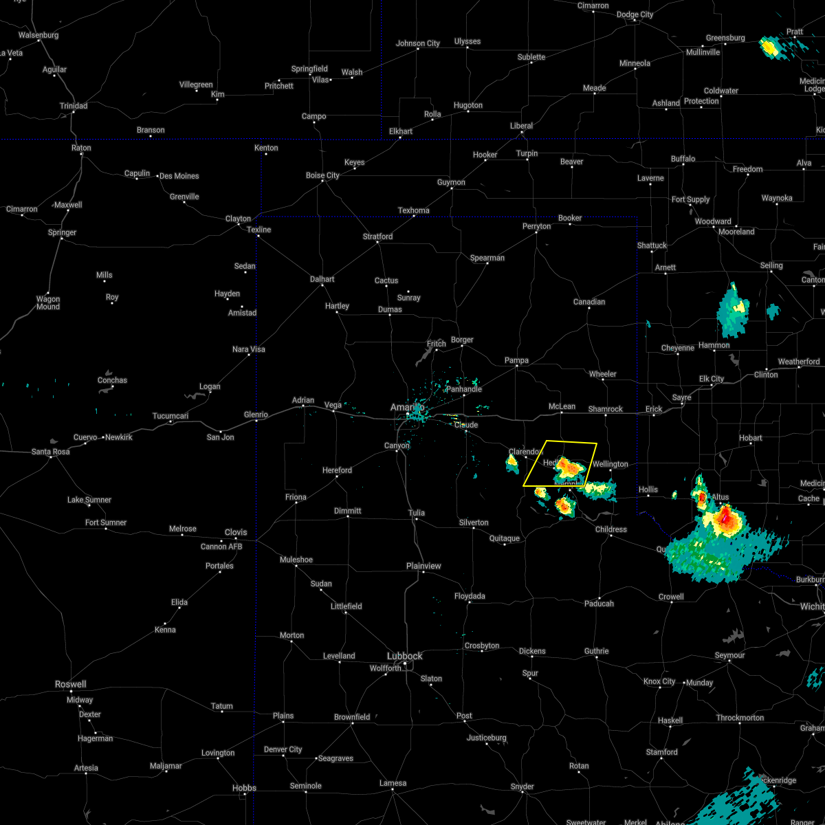 The severe thunderstorm warning for southwestern collingsworth and southeastern donley counties will expire at 100 am cdt, the storm which prompted the warning has weakened below severe limits, and no longer poses an immediate threat to life or property. therefore, the warning will be allowed to expire. The severe thunderstorm warning for southwestern collingsworth and southeastern donley counties will expire at 100 am cdt, the storm which prompted the warning has weakened below severe limits, and no longer poses an immediate threat to life or property. therefore, the warning will be allowed to expire.
|
| 5/26/2021 12:48 AM CDT |
 At 1247 am cdt, a severe thunderstorm was located near hedley, or 13 miles north of memphis, moving northeast at 15 mph (radar indicated). Hazards include 60 mph wind gusts and quarter size hail. Minor damage to roofs, siding, and trees is possible. hail damage to vehicles is expected. Locations impacted include, hedley, quail and lelia lake. At 1247 am cdt, a severe thunderstorm was located near hedley, or 13 miles north of memphis, moving northeast at 15 mph (radar indicated). Hazards include 60 mph wind gusts and quarter size hail. Minor damage to roofs, siding, and trees is possible. hail damage to vehicles is expected. Locations impacted include, hedley, quail and lelia lake.
|
| 5/26/2021 12:29 AM CDT |
 At 1228 am cdt, a severe thunderstorm was located near hedley, or 11 miles southeast of clarendon, moving northeast at 15 mph (radar indicated). Hazards include 60 mph wind gusts and quarter size hail. Minor damage to roofs, siding, and trees is possible. hail damage to vehicles is expected. Locations impacted include, clarendon, howardwick, hedley, lelia lake, quail and greenbelt lake. At 1228 am cdt, a severe thunderstorm was located near hedley, or 11 miles southeast of clarendon, moving northeast at 15 mph (radar indicated). Hazards include 60 mph wind gusts and quarter size hail. Minor damage to roofs, siding, and trees is possible. hail damage to vehicles is expected. Locations impacted include, clarendon, howardwick, hedley, lelia lake, quail and greenbelt lake.
|
| 5/26/2021 12:13 AM CDT |
 At 1213 am cdt, a severe thunderstorm was located 5 miles southwest of lelia lake, or 8 miles southeast of clarendon, moving northeast at 15 mph (radar indicated). Hazards include golf ball size hail and 60 mph wind gusts. Minor damage to roofs, siding, and trees is possible. people and animals outdoors will be injured. expect hail damage to roofs, siding, windows, and vehicles. Locations impacted include, clarendon, howardwick, hedley, lelia lake, quail and greenbelt lake. At 1213 am cdt, a severe thunderstorm was located 5 miles southwest of lelia lake, or 8 miles southeast of clarendon, moving northeast at 15 mph (radar indicated). Hazards include golf ball size hail and 60 mph wind gusts. Minor damage to roofs, siding, and trees is possible. people and animals outdoors will be injured. expect hail damage to roofs, siding, windows, and vehicles. Locations impacted include, clarendon, howardwick, hedley, lelia lake, quail and greenbelt lake.
|
| 5/26/2021 12:01 AM CDT |
 At 1201 am cdt, a severe thunderstorm was located 6 miles northeast of brice, or 10 miles south of clarendon, moving northeast at 15 mph (radar indicated). Hazards include ping pong ball size hail and 60 mph wind gusts. Minor damage to roofs, siding, and trees is possible. people and animals outdoors will be injured. Expect hail damage to roofs, siding, windows, and vehicles. At 1201 am cdt, a severe thunderstorm was located 6 miles northeast of brice, or 10 miles south of clarendon, moving northeast at 15 mph (radar indicated). Hazards include ping pong ball size hail and 60 mph wind gusts. Minor damage to roofs, siding, and trees is possible. people and animals outdoors will be injured. Expect hail damage to roofs, siding, windows, and vehicles.
|
| 5/17/2021 8:38 PM CDT |
 At 836 pm cdt, a severe thunderstorm was located near lake mcclellan, or 17 miles north of clarendon, moving north at 25 mph. a storm southwest of brice is moving northeast and may have hail of ping pong ball size (radar indicated). Hazards include 60 mph wind gusts and nickel size hail. Minor damage to roofs, siding, and trees is possible. Locations impacted include, clarendon, mclean, lefors, howardwick, hedley, lelia lake, lake mcclellan, kingsmill, alanreed and greenbelt lake. At 836 pm cdt, a severe thunderstorm was located near lake mcclellan, or 17 miles north of clarendon, moving north at 25 mph. a storm southwest of brice is moving northeast and may have hail of ping pong ball size (radar indicated). Hazards include 60 mph wind gusts and nickel size hail. Minor damage to roofs, siding, and trees is possible. Locations impacted include, clarendon, mclean, lefors, howardwick, hedley, lelia lake, lake mcclellan, kingsmill, alanreed and greenbelt lake.
|
| 5/17/2021 8:09 PM CDT |
 At 809 pm cdt, a severe thunderstorm was located 5 miles east of howardwick, or 7 miles northeast of clarendon, moving north at 25 mph (radar indicated). Hazards include 60 mph wind gusts and nickel size hail. minor damage to roofs, siding, and trees is possible At 809 pm cdt, a severe thunderstorm was located 5 miles east of howardwick, or 7 miles northeast of clarendon, moving north at 25 mph (radar indicated). Hazards include 60 mph wind gusts and nickel size hail. minor damage to roofs, siding, and trees is possible
|
| 4/23/2021 5:36 PM CDT |
 At 535 pm cdt, a severe thunderstorm was located over lelia lake, or 8 miles southeast of clarendon, moving east at 30 mph (radar indicated). Hazards include 60 mph wind gusts and half dollar size hail. Minor damage to roofs, siding, and trees is possible. hail damage to vehicles is expected. Locations impacted include, clarendon, howardwick, hedley, lelia lake and greenbelt lake. At 535 pm cdt, a severe thunderstorm was located over lelia lake, or 8 miles southeast of clarendon, moving east at 30 mph (radar indicated). Hazards include 60 mph wind gusts and half dollar size hail. Minor damage to roofs, siding, and trees is possible. hail damage to vehicles is expected. Locations impacted include, clarendon, howardwick, hedley, lelia lake and greenbelt lake.
|
| 4/23/2021 4:54 PM CDT |
 At 454 pm cdt, a severe thunderstorm was located 7 miles south of goodnight, or 15 miles west of clarendon, moving east at 35 mph (radar indicated). Hazards include ping pong ball size hail and 60 mph wind gusts. Minor damage to roofs, siding, and trees is possible. people and animals outdoors will be injured. Expect hail damage to roofs, siding, windows, and vehicles. At 454 pm cdt, a severe thunderstorm was located 7 miles south of goodnight, or 15 miles west of clarendon, moving east at 35 mph (radar indicated). Hazards include ping pong ball size hail and 60 mph wind gusts. Minor damage to roofs, siding, and trees is possible. people and animals outdoors will be injured. Expect hail damage to roofs, siding, windows, and vehicles.
|
| 9/1/2020 7:03 PM CDT |
 At 703 pm cdt, a severe thunderstorm was located 4 miles east of brice, or 15 miles west of memphis, moving east at 25 mph (radar indicated). Hazards include 60 mph wind gusts and penny size hail. Minor damage to roofs, siding, and trees is possible. Locations impacted include, clarendon, hedley and lelia lake. At 703 pm cdt, a severe thunderstorm was located 4 miles east of brice, or 15 miles west of memphis, moving east at 25 mph (radar indicated). Hazards include 60 mph wind gusts and penny size hail. Minor damage to roofs, siding, and trees is possible. Locations impacted include, clarendon, hedley and lelia lake.
|
| 9/1/2020 6:18 PM CDT |
 At 617 pm cdt, a severe thunderstorm was located 15 miles west of brice, or 18 miles southwest of clarendon, moving east at 25 mph (radar indicated). Hazards include 70 mph wind gusts and ping pong ball size hail. Expect some tree damage. damage is likely to mobile homes, roofs, and outbuildings. people and animals outdoors will be injured. Expect hail damage to roofs, siding, windows, and vehicles. At 617 pm cdt, a severe thunderstorm was located 15 miles west of brice, or 18 miles southwest of clarendon, moving east at 25 mph (radar indicated). Hazards include 70 mph wind gusts and ping pong ball size hail. Expect some tree damage. damage is likely to mobile homes, roofs, and outbuildings. people and animals outdoors will be injured. Expect hail damage to roofs, siding, windows, and vehicles.
|
| 8/29/2020 9:48 PM CDT |
 At 947 pm cdt, automated weather equipment reported a severe thunderstorm was located near alanreed, or 17 miles northeast of clarendon, moving east at 40 mph (automated weather equipment. at 938 pm cdt, automated weather equipment recorded a 63 mph wind gust 2 miles northwest of lake mcclellan). Hazards include 60 mph wind gusts and quarter size hail. Minor damage to roofs, siding, and trees is possible. hail damage to vehicles is expected. Locations impacted include, clarendon, mclean, groom, lefors, howardwick, hedley, lelia lake, lake mcclellan, wayside, quail, kellerville, goodnight, alanreed and greenbelt lake. At 947 pm cdt, automated weather equipment reported a severe thunderstorm was located near alanreed, or 17 miles northeast of clarendon, moving east at 40 mph (automated weather equipment. at 938 pm cdt, automated weather equipment recorded a 63 mph wind gust 2 miles northwest of lake mcclellan). Hazards include 60 mph wind gusts and quarter size hail. Minor damage to roofs, siding, and trees is possible. hail damage to vehicles is expected. Locations impacted include, clarendon, mclean, groom, lefors, howardwick, hedley, lelia lake, lake mcclellan, wayside, quail, kellerville, goodnight, alanreed and greenbelt lake.
|
| 8/29/2020 9:10 PM CDT |
 At 909 pm cdt, a severe thunderstorm was located 4 miles northwest of groom, or 13 miles northeast of claude, moving east at 40 mph (radar indicated). Hazards include 70 mph wind gusts and quarter size hail. Expect some tree damage. damage is likely to mobile homes, roofs, and outbuildings. Hail damage to vehicles is expected. At 909 pm cdt, a severe thunderstorm was located 4 miles northwest of groom, or 13 miles northeast of claude, moving east at 40 mph (radar indicated). Hazards include 70 mph wind gusts and quarter size hail. Expect some tree damage. damage is likely to mobile homes, roofs, and outbuildings. Hail damage to vehicles is expected.
|
| 8/16/2020 4:42 PM CDT |
 At 441 pm cdt, a severe thunderstorm was located over memphis, moving south at 20 mph (radar indicated). Hazards include 60 mph wind gusts and half dollar size hail. Minor damage to roofs, siding, and trees is possible. hail damage to vehicles is expected. Locations impacted include, hedley and lelia lake. At 441 pm cdt, a severe thunderstorm was located over memphis, moving south at 20 mph (radar indicated). Hazards include 60 mph wind gusts and half dollar size hail. Minor damage to roofs, siding, and trees is possible. hail damage to vehicles is expected. Locations impacted include, hedley and lelia lake.
|
| 8/16/2020 4:29 PM CDT |
 At 429 pm cdt, a severe thunderstorm was located near memphis, moving south at 20 mph (radar indicated). Hazards include two inch hail and 60 mph wind gusts. Minor damage to roofs, siding, and trees is possible. people and animals outdoors will be injured. expect hail damage to roofs, siding, windows, and vehicles. Locations impacted include, clarendon, hedley and lelia lake. At 429 pm cdt, a severe thunderstorm was located near memphis, moving south at 20 mph (radar indicated). Hazards include two inch hail and 60 mph wind gusts. Minor damage to roofs, siding, and trees is possible. people and animals outdoors will be injured. expect hail damage to roofs, siding, windows, and vehicles. Locations impacted include, clarendon, hedley and lelia lake.
|
| 8/16/2020 4:09 PM CDT |
 At 409 pm cdt, a severe thunderstorm was located 4 miles southwest of hedley, or 11 miles southeast of clarendon, moving south at 30 mph (radar indicated). Hazards include golf ball size hail and 60 mph wind gusts. Minor damage to roofs, siding, and trees is possible. people and animals outdoors will be injured. Expect hail damage to roofs, siding, windows, and vehicles. At 409 pm cdt, a severe thunderstorm was located 4 miles southwest of hedley, or 11 miles southeast of clarendon, moving south at 30 mph (radar indicated). Hazards include golf ball size hail and 60 mph wind gusts. Minor damage to roofs, siding, and trees is possible. people and animals outdoors will be injured. Expect hail damage to roofs, siding, windows, and vehicles.
|
| 8/16/2020 3:55 PM CDT |
 At 355 pm cdt, a severe thunderstorm was located 4 miles northeast of lelia lake, or 11 miles east of clarendon, moving south at 30 mph (radar indicated). Hazards include golf ball size hail and 60 mph wind gusts. Minor damage to roofs, siding, and trees is possible. people and animals outdoors will be injured. Expect hail damage to roofs, siding, windows, and vehicles. At 355 pm cdt, a severe thunderstorm was located 4 miles northeast of lelia lake, or 11 miles east of clarendon, moving south at 30 mph (radar indicated). Hazards include golf ball size hail and 60 mph wind gusts. Minor damage to roofs, siding, and trees is possible. people and animals outdoors will be injured. Expect hail damage to roofs, siding, windows, and vehicles.
|
| 8/2/2020 5:04 PM CDT |
 At 504 pm cdt, a severe thunderstorm was located 6 miles south of clarendon, moving southeast at 20 mph (radar indicated). Hazards include 60 mph wind gusts and quarter size hail. Minor damage to roofs, siding, and trees is possible. hail damage to vehicles is expected. Locations impacted include, clarendon, hedley and lelia lake. At 504 pm cdt, a severe thunderstorm was located 6 miles south of clarendon, moving southeast at 20 mph (radar indicated). Hazards include 60 mph wind gusts and quarter size hail. Minor damage to roofs, siding, and trees is possible. hail damage to vehicles is expected. Locations impacted include, clarendon, hedley and lelia lake.
|
| 8/2/2020 4:45 PM CDT |
 At 445 pm cdt, a severe thunderstorm was located near clarendon, moving southeast at 20 mph (radar indicated). Hazards include 70 mph wind gusts and ping pong ball size hail. Expect some tree damage. damage is likely to mobile homes, roofs, and outbuildings. people and animals outdoors will be injured. expect hail damage to roofs, siding, windows, and vehicles. Locations impacted include, clarendon, howardwick, hedley, lelia lake and greenbelt lake. At 445 pm cdt, a severe thunderstorm was located near clarendon, moving southeast at 20 mph (radar indicated). Hazards include 70 mph wind gusts and ping pong ball size hail. Expect some tree damage. damage is likely to mobile homes, roofs, and outbuildings. people and animals outdoors will be injured. expect hail damage to roofs, siding, windows, and vehicles. Locations impacted include, clarendon, howardwick, hedley, lelia lake and greenbelt lake.
|
| 8/2/2020 4:41 PM CDT |
 At 441 pm cdt, a severe thunderstorm was located 4 miles west of clarendon, moving southeast at 20 mph (radar indicated). Hazards include 70 mph wind gusts and quarter size hail. Expect some tree damage. damage is likely to mobile homes, roofs, and outbuildings. Hail damage to vehicles is expected. At 441 pm cdt, a severe thunderstorm was located 4 miles west of clarendon, moving southeast at 20 mph (radar indicated). Hazards include 70 mph wind gusts and quarter size hail. Expect some tree damage. damage is likely to mobile homes, roofs, and outbuildings. Hail damage to vehicles is expected.
|
| 7/11/2020 9:24 PM CDT |
 At 924 pm cdt, severe thunderstorms were located along a line extending from 3 miles south of lake mcclellan to 6 miles north of greenbelt lake to 4 miles west of howardwick, moving southeast at 20 mph (radar indicated). Hazards include 60 mph wind gusts and quarter size hail. Minor damage to roofs, siding, and trees is possible. Hail damage to vehicles is expected. At 924 pm cdt, severe thunderstorms were located along a line extending from 3 miles south of lake mcclellan to 6 miles north of greenbelt lake to 4 miles west of howardwick, moving southeast at 20 mph (radar indicated). Hazards include 60 mph wind gusts and quarter size hail. Minor damage to roofs, siding, and trees is possible. Hail damage to vehicles is expected.
|
| 6/19/2020 6:27 PM CDT |
 At 627 pm cdt, severe thunderstorms were located along a line extending from 3 miles southeast of lefors to 9 miles west of brice, moving east at 25 mph (radar indicated). Hazards include ping pong ball size hail and 60 mph wind gusts. Minor damage to roofs, siding, and trees is possible. people and animals outdoors will be injured. Expect hail damage to roofs, siding, windows, and vehicles. At 627 pm cdt, severe thunderstorms were located along a line extending from 3 miles southeast of lefors to 9 miles west of brice, moving east at 25 mph (radar indicated). Hazards include ping pong ball size hail and 60 mph wind gusts. Minor damage to roofs, siding, and trees is possible. people and animals outdoors will be injured. Expect hail damage to roofs, siding, windows, and vehicles.
|
| 5/24/2020 9:43 PM CDT |
 The severe thunderstorm warning for collingsworth and eastern donley counties will expire at 945 pm cdt, the storms which prompted the warning have weakened below severe limits, and no longer pose an immediate threat to life or property. therefore, the warning will be allowed to expire. however small hail, gusty winds and heavy rain are still possible with these thunderstorms. a severe thunderstorm watch remains in effect until 1000 pm cdt for the panhandle of texas. The severe thunderstorm warning for collingsworth and eastern donley counties will expire at 945 pm cdt, the storms which prompted the warning have weakened below severe limits, and no longer pose an immediate threat to life or property. therefore, the warning will be allowed to expire. however small hail, gusty winds and heavy rain are still possible with these thunderstorms. a severe thunderstorm watch remains in effect until 1000 pm cdt for the panhandle of texas.
|
| 5/24/2020 9:28 PM CDT |
 At 928 pm cdt, severe thunderstorms were located along a line extending from 6 miles north of lutie to 6 miles northwest of quail to near hedley to 8 miles northeast of brice, moving southeast at 10 mph (radar indicated). Hazards include 60 mph wind gusts and half dollar size hail. Minor damage to roofs, siding, and trees is possible. hail damage to vehicles is expected. Locations impacted include, wellington, clarendon, hedley, dodson, lutie, lelia lake, dozier, quail and samnorwood. At 928 pm cdt, severe thunderstorms were located along a line extending from 6 miles north of lutie to 6 miles northwest of quail to near hedley to 8 miles northeast of brice, moving southeast at 10 mph (radar indicated). Hazards include 60 mph wind gusts and half dollar size hail. Minor damage to roofs, siding, and trees is possible. hail damage to vehicles is expected. Locations impacted include, wellington, clarendon, hedley, dodson, lutie, lelia lake, dozier, quail and samnorwood.
|
| 5/24/2020 9:17 PM CDT |
 At 917 pm cdt, severe thunderstorms were located along a line extending from 6 miles north of lutie to 6 miles northwest of quail to near hedley to 8 miles northeast of brice, moving southeast at 10 mph (radar indicated). Hazards include 60 mph wind gusts and quarter size hail. Minor damage to roofs, siding, and trees is possible. hail damage to vehicles is expected. Locations impacted include, wellington, clarendon, hedley, dodson, lutie, lelia lake, dozier, quail, samnorwood and greenbelt lake. At 917 pm cdt, severe thunderstorms were located along a line extending from 6 miles north of lutie to 6 miles northwest of quail to near hedley to 8 miles northeast of brice, moving southeast at 10 mph (radar indicated). Hazards include 60 mph wind gusts and quarter size hail. Minor damage to roofs, siding, and trees is possible. hail damage to vehicles is expected. Locations impacted include, wellington, clarendon, hedley, dodson, lutie, lelia lake, dozier, quail, samnorwood and greenbelt lake.
|
| 5/24/2020 9:00 PM CDT |
 At 900 pm cdt, severe thunderstorms were located along a line extending from 6 miles south of shamrock to 7 miles northwest of quail to 3 miles northwest of hedley to 7 miles northeast of brice, moving southeast at 5 mph (radar indicated). Hazards include 60 mph wind gusts and quarter size hail. Minor damage to roofs, siding, and trees is possible. hail damage to vehicles is expected. Locations impacted include, wellington, clarendon, hedley, dodson, lutie, lelia lake, dozier, quail, samnorwood and greenbelt lake. At 900 pm cdt, severe thunderstorms were located along a line extending from 6 miles south of shamrock to 7 miles northwest of quail to 3 miles northwest of hedley to 7 miles northeast of brice, moving southeast at 5 mph (radar indicated). Hazards include 60 mph wind gusts and quarter size hail. Minor damage to roofs, siding, and trees is possible. hail damage to vehicles is expected. Locations impacted include, wellington, clarendon, hedley, dodson, lutie, lelia lake, dozier, quail, samnorwood and greenbelt lake.
|
| 5/24/2020 8:38 PM CDT |
 At 838 pm cdt, severe thunderstorms were located along a line extending from 3 miles northeast of shamrock to 10 miles northeast of hedley to 9 miles west of brice, moving southeast at 10 mph (radar indicated). Hazards include 60 mph wind gusts and half dollar size hail. Minor damage to roofs, siding, and trees is possible. Hail damage to vehicles is expected. At 838 pm cdt, severe thunderstorms were located along a line extending from 3 miles northeast of shamrock to 10 miles northeast of hedley to 9 miles west of brice, moving southeast at 10 mph (radar indicated). Hazards include 60 mph wind gusts and half dollar size hail. Minor damage to roofs, siding, and trees is possible. Hail damage to vehicles is expected.
|
| 5/24/2020 8:23 PM CDT |
 The severe thunderstorm warning for western wheeler, southern gray, northwestern collingsworth and donley counties will expire at 830 pm cdt, the storms which prompted the warning have weakened below severe limits, and no longer pose an immediate threat to life or property. therefore, the warning will be allowed to expire. however small hail and gusty winds are still possible with these thunderstorms. a severe thunderstorm watch remains in effect until 1000 pm cdt for the panhandle of texas. The severe thunderstorm warning for western wheeler, southern gray, northwestern collingsworth and donley counties will expire at 830 pm cdt, the storms which prompted the warning have weakened below severe limits, and no longer pose an immediate threat to life or property. therefore, the warning will be allowed to expire. however small hail and gusty winds are still possible with these thunderstorms. a severe thunderstorm watch remains in effect until 1000 pm cdt for the panhandle of texas.
|
| 5/24/2020 8:05 PM CDT |
 At 803 pm cdt, severe thunderstorms were located along a line extending from 5 miles northwest of mclean to 11 miles south of alanreed to 3 miles southwest of lelia lake, moving northeast at 30 mph (radar indicated). Hazards include 60 mph wind gusts and quarter size hail. Minor damage to roofs, siding, and trees is possible. hail damage to vehicles is expected. Locations impacted include, clarendon, mclean, lefors, howardwick, hedley, lelia lake, new mobeetie, lake mcclellan, alanreed, kellerville, greenbelt lake and mobeetie. At 803 pm cdt, severe thunderstorms were located along a line extending from 5 miles northwest of mclean to 11 miles south of alanreed to 3 miles southwest of lelia lake, moving northeast at 30 mph (radar indicated). Hazards include 60 mph wind gusts and quarter size hail. Minor damage to roofs, siding, and trees is possible. hail damage to vehicles is expected. Locations impacted include, clarendon, mclean, lefors, howardwick, hedley, lelia lake, new mobeetie, lake mcclellan, alanreed, kellerville, greenbelt lake and mobeetie.
|
| 5/24/2020 7:44 PM CDT |
 At 743 pm cdt, severe thunderstorms were located along a line extending from 4 miles north of alanreed to 8 miles north of lelia lake to 7 miles south of clarendon, moving northeast at 30 mph (radar indicated). Hazards include 60 mph wind gusts and quarter size hail. Minor damage to roofs, siding, and trees is possible. hail damage to vehicles is expected. Locations impacted include, clarendon, mclean, lefors, howardwick, hedley, lelia lake, new mobeetie, lake mcclellan, alanreed, kellerville, greenbelt lake and mobeetie. At 743 pm cdt, severe thunderstorms were located along a line extending from 4 miles north of alanreed to 8 miles north of lelia lake to 7 miles south of clarendon, moving northeast at 30 mph (radar indicated). Hazards include 60 mph wind gusts and quarter size hail. Minor damage to roofs, siding, and trees is possible. hail damage to vehicles is expected. Locations impacted include, clarendon, mclean, lefors, howardwick, hedley, lelia lake, new mobeetie, lake mcclellan, alanreed, kellerville, greenbelt lake and mobeetie.
|
| 5/24/2020 7:28 PM CDT |
 At 728 pm cdt, severe thunderstorms were located along a line extending from near lake mcclellan to 3 miles northeast of clarendon to 7 miles northwest of brice, moving northeast at 30 mph (radar indicated). Hazards include 60 mph wind gusts and half dollar size hail. Minor damage to roofs, siding, and trees is possible. Hail damage to vehicles is expected. At 728 pm cdt, severe thunderstorms were located along a line extending from near lake mcclellan to 3 miles northeast of clarendon to 7 miles northwest of brice, moving northeast at 30 mph (radar indicated). Hazards include 60 mph wind gusts and half dollar size hail. Minor damage to roofs, siding, and trees is possible. Hail damage to vehicles is expected.
|
| 5/23/2020 6:43 PM CDT |
 At 643 pm cdt, severe thunderstorms were located along a line extending from near briscoe to near lelia lake, moving east at 25 mph (radar indicated). Hazards include 60 mph wind gusts and quarter size hail. Minor damage to roofs, siding, and trees is possible. Hail damage to vehicles is expected. At 643 pm cdt, severe thunderstorms were located along a line extending from near briscoe to near lelia lake, moving east at 25 mph (radar indicated). Hazards include 60 mph wind gusts and quarter size hail. Minor damage to roofs, siding, and trees is possible. Hail damage to vehicles is expected.
|
| 5/23/2020 6:21 PM CDT |
 At 621 pm cdt, a severe thunderstorm was located 5 miles south of lake mcclellan, or 13 miles north of clarendon, moving northeast at 20 mph (radar indicated). Hazards include two inch hail and 60 mph wind gusts. Minor damage to roofs, siding, and trees is possible. people and animals outdoors will be injured. expect hail damage to roofs, siding, windows, and vehicles. Locations impacted include, clarendon, mclean, howardwick, hedley, lelia lake, lake mcclellan, alanreed and greenbelt lake. At 621 pm cdt, a severe thunderstorm was located 5 miles south of lake mcclellan, or 13 miles north of clarendon, moving northeast at 20 mph (radar indicated). Hazards include two inch hail and 60 mph wind gusts. Minor damage to roofs, siding, and trees is possible. people and animals outdoors will be injured. expect hail damage to roofs, siding, windows, and vehicles. Locations impacted include, clarendon, mclean, howardwick, hedley, lelia lake, lake mcclellan, alanreed and greenbelt lake.
|
| 5/23/2020 6:09 PM CDT |
 At 609 pm cdt, a severe thunderstorm was located 6 miles north of howardwick, or 12 miles north of clarendon, moving northeast at 25 mph (radar indicated). Hazards include 60 mph wind gusts and half dollar size hail. Minor damage to roofs, siding, and trees is possible. Hail damage to vehicles is expected. At 609 pm cdt, a severe thunderstorm was located 6 miles north of howardwick, or 12 miles north of clarendon, moving northeast at 25 mph (radar indicated). Hazards include 60 mph wind gusts and half dollar size hail. Minor damage to roofs, siding, and trees is possible. Hail damage to vehicles is expected.
|
| 9/12/2019 6:36 PM CDT |
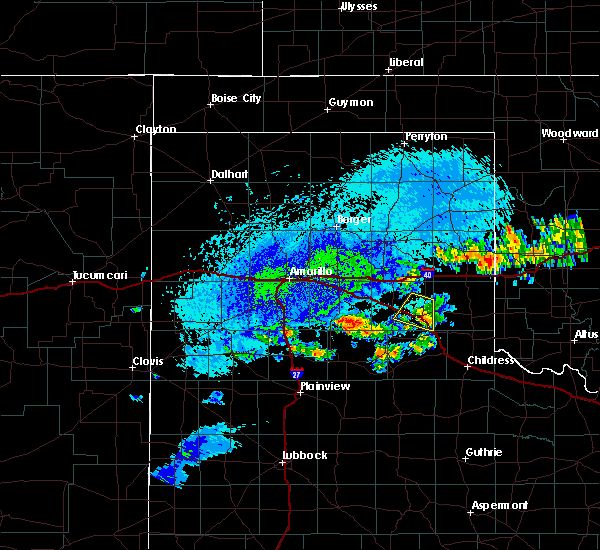 The severe thunderstorm warning for southeastern donley county will expire at 645 pm cdt, the storm which prompted the warning has weakened below severe limits, and no longer poses an immediate threat to life or property. therefore, the warning will be allowed to expire. however small hail and gusty winds are still possible with this thunderstorm. The severe thunderstorm warning for southeastern donley county will expire at 645 pm cdt, the storm which prompted the warning has weakened below severe limits, and no longer poses an immediate threat to life or property. therefore, the warning will be allowed to expire. however small hail and gusty winds are still possible with this thunderstorm.
|
| 9/12/2019 6:24 PM CDT |
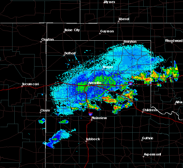 At 608 pm cdt, a severe thunderstorm was located near lelia lake, or 10 miles east of clarendon, moving east at 10 mph (radar indicated). Hazards include 60 mph wind gusts and quarter size hail. Minor damage to roofs, siding, and trees is possible. Hail damage to vehicles is expected. At 608 pm cdt, a severe thunderstorm was located near lelia lake, or 10 miles east of clarendon, moving east at 10 mph (radar indicated). Hazards include 60 mph wind gusts and quarter size hail. Minor damage to roofs, siding, and trees is possible. Hail damage to vehicles is expected.
|
| 9/12/2019 6:09 PM CDT |
 The national weather service in amarillo has issued a * severe thunderstorm warning for. southeastern donley county in the panhandle of texas. until 645 pm cdt. At 608 pm cdt, a severe thunderstorm was located near lelia lake, or 10 miles east of clarendon, moving east at 10 mph. The national weather service in amarillo has issued a * severe thunderstorm warning for. southeastern donley county in the panhandle of texas. until 645 pm cdt. At 608 pm cdt, a severe thunderstorm was located near lelia lake, or 10 miles east of clarendon, moving east at 10 mph.
|
| 7/11/2019 3:32 AM CDT |
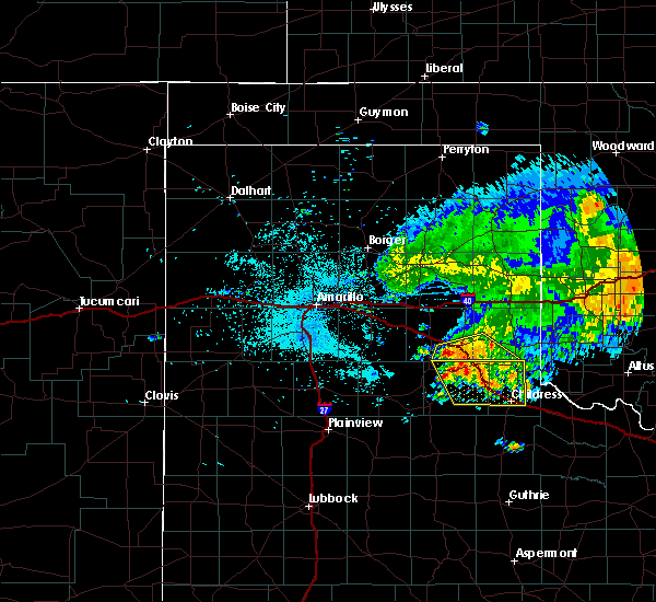 At 332 am cdt, a severe thunderstorm was located 5 miles east of hedley, or 10 miles north of memphis, moving southeast at 10 mph (radar indicated). Hazards include 60 mph wind gusts and penny size hail. Minor damage to roofs, siding, and trees is possible. Locations impacted include, hedley and quail. At 332 am cdt, a severe thunderstorm was located 5 miles east of hedley, or 10 miles north of memphis, moving southeast at 10 mph (radar indicated). Hazards include 60 mph wind gusts and penny size hail. Minor damage to roofs, siding, and trees is possible. Locations impacted include, hedley and quail.
|
| 7/11/2019 2:51 AM CDT |
 At 251 am cdt, a severe thunderstorm was located 5 miles north of hedley, or 14 miles east of clarendon, moving southeast at 10 mph (radar indicated). Hazards include 60 mph wind gusts and half dollar size hail. Minor damage to roofs, siding, and trees is possible. Hail damage to vehicles is expected. At 251 am cdt, a severe thunderstorm was located 5 miles north of hedley, or 14 miles east of clarendon, moving southeast at 10 mph (radar indicated). Hazards include 60 mph wind gusts and half dollar size hail. Minor damage to roofs, siding, and trees is possible. Hail damage to vehicles is expected.
|
| 5/26/2019 11:24 PM CDT |
 At 1124 pm cdt, severe thunderstorms were located along a line extending from near lefors to 6 miles east of goodnight, moving northeast at 60 mph (radar indicated). Hazards include 70 mph wind gusts and nickel size hail. Expect some tree damage. damage is likely to mobile homes, roofs, and outbuildings. locations impacted include, wellington, clarendon, shamrock, wheeler, mclean, lefors, howardwick, hedley, lutie, lelia lake, lake mcclellan, twitty, lela, quail, samnorwood, kellerville, dozier, alanreed and greenbelt lake. A tornado watch remains in effect until 200 am cdt for the panhandle of texas. At 1124 pm cdt, severe thunderstorms were located along a line extending from near lefors to 6 miles east of goodnight, moving northeast at 60 mph (radar indicated). Hazards include 70 mph wind gusts and nickel size hail. Expect some tree damage. damage is likely to mobile homes, roofs, and outbuildings. locations impacted include, wellington, clarendon, shamrock, wheeler, mclean, lefors, howardwick, hedley, lutie, lelia lake, lake mcclellan, twitty, lela, quail, samnorwood, kellerville, dozier, alanreed and greenbelt lake. A tornado watch remains in effect until 200 am cdt for the panhandle of texas.
|
| 5/26/2019 11:13 PM CDT |
 At 1113 pm cdt, severe thunderstorms were located along a line extending from 7 miles southwest of lefors to 5 miles south of goodnight, moving northeast at 60 mph (radar indicated). Hazards include 70 mph wind gusts. Expect some tree damage. Damage is likely to mobile homes, roofs, and outbuildings. At 1113 pm cdt, severe thunderstorms were located along a line extending from 7 miles southwest of lefors to 5 miles south of goodnight, moving northeast at 60 mph (radar indicated). Hazards include 70 mph wind gusts. Expect some tree damage. Damage is likely to mobile homes, roofs, and outbuildings.
|
| 5/25/2019 4:22 PM CDT |
 At 422 pm cdt, a severe thunderstorm was located 12 miles west of brice, or 19 miles southwest of clarendon, moving northeast at 40 mph (radar indicated). Hazards include 60 mph wind gusts and half dollar size hail. Minor damage to roofs, siding, and trees is possible. Hail damage to vehicles is expected. At 422 pm cdt, a severe thunderstorm was located 12 miles west of brice, or 19 miles southwest of clarendon, moving northeast at 40 mph (radar indicated). Hazards include 60 mph wind gusts and half dollar size hail. Minor damage to roofs, siding, and trees is possible. Hail damage to vehicles is expected.
|
| 5/20/2019 8:21 PM CDT |
 At 821 pm cdt, a severe thunderstorm was located 6 miles north of hedley, or 15 miles east of clarendon, moving northeast at 70 mph (radar indicated). Hazards include golf ball size hail and 60 mph wind gusts. Minor damage to roofs, siding, and trees is possible. people and animals outdoors will be injured. expect hail damage to roofs, siding, windows, and vehicles. Locations impacted include, shamrock, briscoe, wheeler, mclean, hedley, lelia lake, new mobeetie, twitty, lela, quail, samnorwood, kellerville, dozier, alanreed and mobeetie. At 821 pm cdt, a severe thunderstorm was located 6 miles north of hedley, or 15 miles east of clarendon, moving northeast at 70 mph (radar indicated). Hazards include golf ball size hail and 60 mph wind gusts. Minor damage to roofs, siding, and trees is possible. people and animals outdoors will be injured. expect hail damage to roofs, siding, windows, and vehicles. Locations impacted include, shamrock, briscoe, wheeler, mclean, hedley, lelia lake, new mobeetie, twitty, lela, quail, samnorwood, kellerville, dozier, alanreed and mobeetie.
|
| 5/20/2019 8:13 PM CDT |
 At 813 pm cdt, a severe thunderstorm was located near hedley, or 10 miles southeast of clarendon, moving northeast at 60 mph (radar indicated). Hazards include ping pong ball size hail and 60 mph wind gusts. Minor damage to roofs, siding, and trees is possible. people and animals outdoors will be injured. Expect hail damage to roofs, siding, windows, and vehicles. At 813 pm cdt, a severe thunderstorm was located near hedley, or 10 miles southeast of clarendon, moving northeast at 60 mph (radar indicated). Hazards include ping pong ball size hail and 60 mph wind gusts. Minor damage to roofs, siding, and trees is possible. people and animals outdoors will be injured. Expect hail damage to roofs, siding, windows, and vehicles.
|
| 5/20/2019 3:33 PM CDT |
 At 333 pm cdt, a severe thunderstorm capable of producing a tornado was located 6 miles north of memphis, moving northeast at 35 mph (radar indicated rotation). Hazards include tornado and quarter size hail. Flying debris will be dangerous to those caught without shelter. mobile homes will be damaged or destroyed. damage to roofs, windows, and vehicles will occur. Tree damage is likely. At 333 pm cdt, a severe thunderstorm capable of producing a tornado was located 6 miles north of memphis, moving northeast at 35 mph (radar indicated rotation). Hazards include tornado and quarter size hail. Flying debris will be dangerous to those caught without shelter. mobile homes will be damaged or destroyed. damage to roofs, windows, and vehicles will occur. Tree damage is likely.
|
| 5/20/2019 3:10 PM CDT |
 At 310 pm cdt, a severe thunderstorm was located 7 miles east of brice, or 12 miles west of memphis, moving northeast at 35 mph (radar indicated). Hazards include golf ball size hail and 60 mph wind gusts. Minor damage to roofs, siding, and trees is possible. people and animals outdoors will be injured. Expect hail damage to roofs, siding, windows, and vehicles. At 310 pm cdt, a severe thunderstorm was located 7 miles east of brice, or 12 miles west of memphis, moving northeast at 35 mph (radar indicated). Hazards include golf ball size hail and 60 mph wind gusts. Minor damage to roofs, siding, and trees is possible. people and animals outdoors will be injured. Expect hail damage to roofs, siding, windows, and vehicles.
|
| 4/3/2019 5:24 PM CDT |
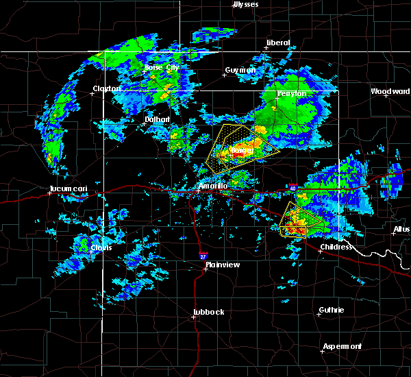 At 523 pm cdt, a severe thunderstorm was located 7 miles west of memphis, moving northeast at 20 mph (radar indicated). Hazards include 70 mph wind gusts and ping pong ball size hail. Expect some tree damage. damage is likely to mobile homes, roofs, and outbuildings. people and animals outdoors will be injured. Expect hail damage to roofs, siding, windows, and vehicles. At 523 pm cdt, a severe thunderstorm was located 7 miles west of memphis, moving northeast at 20 mph (radar indicated). Hazards include 70 mph wind gusts and ping pong ball size hail. Expect some tree damage. damage is likely to mobile homes, roofs, and outbuildings. people and animals outdoors will be injured. Expect hail damage to roofs, siding, windows, and vehicles.
|
| 7/29/2018 8:44 PM CDT |
 At 844 pm cdt, a severe thunderstorm was located 5 miles south of lelia lake, or 9 miles southeast of clarendon, moving southeast at 15 mph (radar indicated). Hazards include 60 mph wind gusts and nickel size hail. Minor damage to roofs, siding, and trees is possible. Locations impacted include, hedley and lelia lake. At 844 pm cdt, a severe thunderstorm was located 5 miles south of lelia lake, or 9 miles southeast of clarendon, moving southeast at 15 mph (radar indicated). Hazards include 60 mph wind gusts and nickel size hail. Minor damage to roofs, siding, and trees is possible. Locations impacted include, hedley and lelia lake.
|
| 7/29/2018 8:30 PM CDT |
 At 830 pm cdt, a severe thunderstorm was located near lelia lake, or 6 miles southeast of clarendon, moving southeast at 15 mph (radar indicated). Hazards include ping pong ball size hail and 60 mph wind gusts. Minor damage to roofs, siding, and trees is possible. people and animals outdoors will be injured. expect hail damage to roofs, siding, windows, and vehicles. Locations impacted include, clarendon, hedley and lelia lake. At 830 pm cdt, a severe thunderstorm was located near lelia lake, or 6 miles southeast of clarendon, moving southeast at 15 mph (radar indicated). Hazards include ping pong ball size hail and 60 mph wind gusts. Minor damage to roofs, siding, and trees is possible. people and animals outdoors will be injured. expect hail damage to roofs, siding, windows, and vehicles. Locations impacted include, clarendon, hedley and lelia lake.
|
| 7/29/2018 8:16 PM CDT |
 At 816 pm cdt, a severe thunderstorm was located over clarendon, moving southeast at 15 mph (radar indicated). Hazards include 60 mph wind gusts and nickel size hail. minor damage to roofs, siding, and trees is possible At 816 pm cdt, a severe thunderstorm was located over clarendon, moving southeast at 15 mph (radar indicated). Hazards include 60 mph wind gusts and nickel size hail. minor damage to roofs, siding, and trees is possible
|
| 6/29/2018 11:12 PM CDT |
 The severe thunderstorm warning for wheeler, eastern gray, collingsworth, southeastern hemphill and eastern donley counties will expire at 1115 pm cdt, the storm which prompted the warning has weakened below severe limits, and no longer poses an immediate threat to life or property. therefore, the warning will be allowed to expire. however gusty winds are still possible with this thunderstorm. The severe thunderstorm warning for wheeler, eastern gray, collingsworth, southeastern hemphill and eastern donley counties will expire at 1115 pm cdt, the storm which prompted the warning has weakened below severe limits, and no longer poses an immediate threat to life or property. therefore, the warning will be allowed to expire. however gusty winds are still possible with this thunderstorm.
|
| 6/29/2018 11:02 PM CDT |
 At 1102 pm cdt, a severe thunderstorm was located 5 miles northwest of memphis, moving east at 25 mph (radar indicated). Hazards include 60 mph wind gusts. Minor damage to roofs, siding, and trees is possible. Locations impacted include, wellington, shamrock, briscoe, wheeler, mclean, hedley, dodson, lutie, lelia lake, new mobeetie, twitty, allison, lela, quail, samnorwood, kellerville, dozier and mobeetie. At 1102 pm cdt, a severe thunderstorm was located 5 miles northwest of memphis, moving east at 25 mph (radar indicated). Hazards include 60 mph wind gusts. Minor damage to roofs, siding, and trees is possible. Locations impacted include, wellington, shamrock, briscoe, wheeler, mclean, hedley, dodson, lutie, lelia lake, new mobeetie, twitty, allison, lela, quail, samnorwood, kellerville, dozier and mobeetie.
|
| 6/29/2018 10:53 PM CDT |
 At 1053 pm cdt, severe thunderstorms were located along a line extending from briscoe to 6 miles northwest of memphis, moving northeast at 35 mph (radar indicated). Hazards include 60 mph wind gusts. Minor damage to roofs, siding, and trees is possible. Locations impacted include, wellington, shamrock, briscoe, wheeler, mclean, hedley, dodson, lutie, lelia lake, new mobeetie, twitty, allison, lela, quail, samnorwood, kellerville, dozier and mobeetie. At 1053 pm cdt, severe thunderstorms were located along a line extending from briscoe to 6 miles northwest of memphis, moving northeast at 35 mph (radar indicated). Hazards include 60 mph wind gusts. Minor damage to roofs, siding, and trees is possible. Locations impacted include, wellington, shamrock, briscoe, wheeler, mclean, hedley, dodson, lutie, lelia lake, new mobeetie, twitty, allison, lela, quail, samnorwood, kellerville, dozier and mobeetie.
|
| 6/29/2018 10:28 PM CDT |
 At 1028 pm cdt, severe thunderstorms were located along a line extending from 5 miles southwest of new mobeetie to 8 miles northwest of quail, moving east at 25 mph (radar indicated). Hazards include 60 mph wind gusts. Minor damage to roofs, siding, and trees is possible. Locations impacted include, wellington, shamrock, briscoe, wheeler, mclean, hedley, dodson, lutie, lelia lake, new mobeetie, twitty, allison, lela, quail, samnorwood, kellerville, dozier and mobeetie. At 1028 pm cdt, severe thunderstorms were located along a line extending from 5 miles southwest of new mobeetie to 8 miles northwest of quail, moving east at 25 mph (radar indicated). Hazards include 60 mph wind gusts. Minor damage to roofs, siding, and trees is possible. Locations impacted include, wellington, shamrock, briscoe, wheeler, mclean, hedley, dodson, lutie, lelia lake, new mobeetie, twitty, allison, lela, quail, samnorwood, kellerville, dozier and mobeetie.
|
| 6/29/2018 10:05 PM CDT |
 At 1004 pm cdt, severe thunderstorms were located along a line extending from 5 miles west of new mobeetie to 5 miles north of hedley, moving east at 20 mph (radar indicated). Hazards include 60 mph wind gusts. Minor damage to roofs, siding, and trees is possible. Locations impacted include, wellington, shamrock, briscoe, wheeler, mclean, hedley, dodson, lutie, lelia lake, new mobeetie, twitty, allison, lela, quail, samnorwood, kellerville, dozier and mobeetie. At 1004 pm cdt, severe thunderstorms were located along a line extending from 5 miles west of new mobeetie to 5 miles north of hedley, moving east at 20 mph (radar indicated). Hazards include 60 mph wind gusts. Minor damage to roofs, siding, and trees is possible. Locations impacted include, wellington, shamrock, briscoe, wheeler, mclean, hedley, dodson, lutie, lelia lake, new mobeetie, twitty, allison, lela, quail, samnorwood, kellerville, dozier and mobeetie.
|
| 6/29/2018 9:38 PM CDT |
 At 938 pm cdt, severe thunderstorms were located along a line extending from 7 miles northeast of lefors to 5 miles northeast of lelia lake, moving east at 40 mph (radar indicated). Hazards include 60 mph wind gusts. minor damage to roofs, siding, and trees is possible At 938 pm cdt, severe thunderstorms were located along a line extending from 7 miles northeast of lefors to 5 miles northeast of lelia lake, moving east at 40 mph (radar indicated). Hazards include 60 mph wind gusts. minor damage to roofs, siding, and trees is possible
|
| 6/25/2018 2:07 AM CDT |
 The severe thunderstorm warning for wheeler, collingsworth and southeastern donley counties will expire at 215 am cdt, the storms which prompted the warning have weakened below severe limits, and no longer pose an immediate threat to life or property. therefore the warning will be allowed to expire. however heavy rain is still possible with these thunderstorms. a severe thunderstorm watch remains in effect until 400 am cdt for the panhandle of texas. The severe thunderstorm warning for wheeler, collingsworth and southeastern donley counties will expire at 215 am cdt, the storms which prompted the warning have weakened below severe limits, and no longer pose an immediate threat to life or property. therefore the warning will be allowed to expire. however heavy rain is still possible with these thunderstorms. a severe thunderstorm watch remains in effect until 400 am cdt for the panhandle of texas.
|
| 6/25/2018 1:35 AM CDT |
 At 135 am cdt, severe thunderstorms were located along a line extending from 9 miles west of sweetwater to 3 miles north of quail, moving northeast at 35 mph (radar indicated). Hazards include 60 mph wind gusts and quarter size hail. Minor damage to roofs, siding, and trees is possible. hail damage to vehicles is expected. Locations impacted include, wellington, shamrock, wheeler, hedley, dodson, lutie, twitty, dozier, lela, quail and samnorwood. At 135 am cdt, severe thunderstorms were located along a line extending from 9 miles west of sweetwater to 3 miles north of quail, moving northeast at 35 mph (radar indicated). Hazards include 60 mph wind gusts and quarter size hail. Minor damage to roofs, siding, and trees is possible. hail damage to vehicles is expected. Locations impacted include, wellington, shamrock, wheeler, hedley, dodson, lutie, twitty, dozier, lela, quail and samnorwood.
|
| 6/25/2018 1:19 AM CDT |
 The national weather service in amarillo has issued a * severe thunderstorm warning for. wheeler county in the panhandle of texas. collingsworth county in the panhandle of texas. southeastern donley county in the panhandle of texas. Until 215 am cdt. The national weather service in amarillo has issued a * severe thunderstorm warning for. wheeler county in the panhandle of texas. collingsworth county in the panhandle of texas. southeastern donley county in the panhandle of texas. Until 215 am cdt.
|
| 6/22/2018 10:55 PM CDT |
 The severe thunderstorm warning for wheeler, southeastern gray, western collingsworth, southeastern hemphill and eastern donley counties will expire at 1100 pm cdt, the storms which prompted the warning have moved out of the area. therefore the warning will be allowed to expire. a severe thunderstorm watch remains in effect until midnight cdt for the panhandle of texas. The severe thunderstorm warning for wheeler, southeastern gray, western collingsworth, southeastern hemphill and eastern donley counties will expire at 1100 pm cdt, the storms which prompted the warning have moved out of the area. therefore the warning will be allowed to expire. a severe thunderstorm watch remains in effect until midnight cdt for the panhandle of texas.
|
| 6/22/2018 10:22 PM CDT |
 At 1022 pm cdt, severe thunderstorms were located along a line extending from 8 miles east of twitty to 6 miles northwest of quail, moving southeast at 45 mph (radar indicated). Hazards include 70 mph wind gusts and quarter size hail. Expect some tree damage. damage is likely to mobile homes, roofs, and outbuildings. hail damage to vehicles is expected. Locations impacted include, shamrock, briscoe, wheeler, mclean, hedley, lelia lake, twitty, allison, lela, quail, samnorwood, kellerville, dozier and alanreed. At 1022 pm cdt, severe thunderstorms were located along a line extending from 8 miles east of twitty to 6 miles northwest of quail, moving southeast at 45 mph (radar indicated). Hazards include 70 mph wind gusts and quarter size hail. Expect some tree damage. damage is likely to mobile homes, roofs, and outbuildings. hail damage to vehicles is expected. Locations impacted include, shamrock, briscoe, wheeler, mclean, hedley, lelia lake, twitty, allison, lela, quail, samnorwood, kellerville, dozier and alanreed.
|
| 6/22/2018 10:10 PM CDT |
 At 1009 pm cdt, severe thunderstorms were located along a line extending from near wheeler to 11 miles north of hedley, moving southeast at 45 mph (radar indicated). Hazards include 70 mph wind gusts. Expect some tree damage. damage is likely to mobile homes, roofs, and outbuildings. Locations impacted include, shamrock, briscoe, wheeler, mclean, hedley, lelia lake, twitty, allison, lela, quail, samnorwood, kellerville, dozier and alanreed. At 1009 pm cdt, severe thunderstorms were located along a line extending from near wheeler to 11 miles north of hedley, moving southeast at 45 mph (radar indicated). Hazards include 70 mph wind gusts. Expect some tree damage. damage is likely to mobile homes, roofs, and outbuildings. Locations impacted include, shamrock, briscoe, wheeler, mclean, hedley, lelia lake, twitty, allison, lela, quail, samnorwood, kellerville, dozier and alanreed.
|
| 6/22/2018 9:54 PM CDT |
 At 954 pm cdt, severe thunderstorms were located along a line extending from near new mobeetie to 7 miles northeast of howardwick, moving southeast at 45 mph (radar indicated). Hazards include 60 mph wind gusts. minor damage to roofs, siding, and trees is possible At 954 pm cdt, severe thunderstorms were located along a line extending from near new mobeetie to 7 miles northeast of howardwick, moving southeast at 45 mph (radar indicated). Hazards include 60 mph wind gusts. minor damage to roofs, siding, and trees is possible
|
| 6/5/2018 8:08 PM CDT |
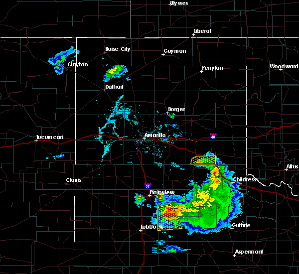 At 808 pm cdt, a severe thunderstorm was located 6 miles northeast of brice, or 10 miles south of clarendon, moving southeast at 15 mph (radar indicated). Hazards include 60 mph wind gusts. Minor damage to roofs, siding, and trees is possible. Locations impacted include, hedley. At 808 pm cdt, a severe thunderstorm was located 6 miles northeast of brice, or 10 miles south of clarendon, moving southeast at 15 mph (radar indicated). Hazards include 60 mph wind gusts. Minor damage to roofs, siding, and trees is possible. Locations impacted include, hedley.
|
| 6/5/2018 7:52 PM CDT |
 At 751 pm cdt, a severe thunderstorm was located 5 miles southwest of lelia lake, or 6 miles southeast of clarendon, moving southeast at 15 mph (radar indicated). Hazards include 60 mph wind gusts. Minor damage to roofs, siding, and trees is possible. Locations impacted include, clarendon, hedley and lelia lake. At 751 pm cdt, a severe thunderstorm was located 5 miles southwest of lelia lake, or 6 miles southeast of clarendon, moving southeast at 15 mph (radar indicated). Hazards include 60 mph wind gusts. Minor damage to roofs, siding, and trees is possible. Locations impacted include, clarendon, hedley and lelia lake.
|
| 6/5/2018 7:40 PM CDT |
 At 739 pm cdt, a severe thunderstorm was located over clarendon, moving south at 10 mph (radar indicated). Hazards include 60 mph wind gusts. Minor damage to roofs, siding, and trees is possible. Locations impacted include, clarendon, hedley, lelia lake and greenbelt lake. At 739 pm cdt, a severe thunderstorm was located over clarendon, moving south at 10 mph (radar indicated). Hazards include 60 mph wind gusts. Minor damage to roofs, siding, and trees is possible. Locations impacted include, clarendon, hedley, lelia lake and greenbelt lake.
|
| 6/5/2018 7:27 PM CDT |
 At 726 pm cdt, a severe thunderstorm was located over clarendon, moving south at 10 mph (radar indicated). Hazards include 60 mph wind gusts and quarter size hail. Minor damage to roofs, siding, and trees is possible. Hail damage to vehicles is expected. At 726 pm cdt, a severe thunderstorm was located over clarendon, moving south at 10 mph (radar indicated). Hazards include 60 mph wind gusts and quarter size hail. Minor damage to roofs, siding, and trees is possible. Hail damage to vehicles is expected.
|
| 5/14/2018 5:56 PM CDT |
 The severe thunderstorm warning for southern wheeler, collingsworth and eastern donley counties will expire at 600 pm cdt, the storm which prompted the warning has weakened below severe limits, and no longer poses an immediate threat to life or property. therefore the warning will be allowed to expire. however heavy rain is still possible with this thunderstorm. The severe thunderstorm warning for southern wheeler, collingsworth and eastern donley counties will expire at 600 pm cdt, the storm which prompted the warning has weakened below severe limits, and no longer poses an immediate threat to life or property. therefore the warning will be allowed to expire. however heavy rain is still possible with this thunderstorm.
|
| 5/14/2018 5:47 PM CDT |
 At 547 pm cdt, a severe thunderstorm was located 6 miles northeast of memphis, moving north at 20 mph (radar indicated). Hazards include 60 mph wind gusts and quarter size hail. Minor damage to roofs, siding, and trees is possible. hail damage to vehicles is expected. Locations impacted include, wellington, shamrock, hedley, dodson, lutie, lelia lake, dozier, lela, quail and samnorwood. At 547 pm cdt, a severe thunderstorm was located 6 miles northeast of memphis, moving north at 20 mph (radar indicated). Hazards include 60 mph wind gusts and quarter size hail. Minor damage to roofs, siding, and trees is possible. hail damage to vehicles is expected. Locations impacted include, wellington, shamrock, hedley, dodson, lutie, lelia lake, dozier, lela, quail and samnorwood.
|
| 5/14/2018 5:35 PM CDT |
 At 534 pm cdt, a severe thunderstorm was located over hedley, or 10 miles northwest of memphis, moving northeast at 30 mph (radar indicated). Hazards include 60 mph wind gusts and quarter size hail. Minor damage to roofs, siding, and trees is possible. hail damage to vehicles is expected. Locations impacted include, wellington, shamrock, hedley, dodson, lutie, lelia lake, dozier, lela, quail and samnorwood. At 534 pm cdt, a severe thunderstorm was located over hedley, or 10 miles northwest of memphis, moving northeast at 30 mph (radar indicated). Hazards include 60 mph wind gusts and quarter size hail. Minor damage to roofs, siding, and trees is possible. hail damage to vehicles is expected. Locations impacted include, wellington, shamrock, hedley, dodson, lutie, lelia lake, dozier, lela, quail and samnorwood.
|
| 5/14/2018 5:26 PM CDT |
 At 526 pm cdt, a severe thunderstorm was located 4 miles northwest of memphis, moving northeast at 15 mph (radar indicated). Hazards include 60 mph wind gusts and quarter size hail. Minor damage to roofs, siding, and trees is possible. hail damage to vehicles is expected. Locations impacted include, wellington, shamrock, hedley, dodson, lutie, lelia lake, dozier, lela, quail and samnorwood. At 526 pm cdt, a severe thunderstorm was located 4 miles northwest of memphis, moving northeast at 15 mph (radar indicated). Hazards include 60 mph wind gusts and quarter size hail. Minor damage to roofs, siding, and trees is possible. hail damage to vehicles is expected. Locations impacted include, wellington, shamrock, hedley, dodson, lutie, lelia lake, dozier, lela, quail and samnorwood.
|
| 5/14/2018 5:17 PM CDT |
 At 517 pm cdt, a severe thunderstorm was located near memphis, moving east at 15 mph (radar indicated). Hazards include 60 mph wind gusts and half dollar size hail. Minor damage to roofs, siding, and trees is possible. hail damage to vehicles is expected. Locations impacted include, wellington, shamrock, hedley, dodson, lutie, lelia lake, dozier, lela, quail and samnorwood. At 517 pm cdt, a severe thunderstorm was located near memphis, moving east at 15 mph (radar indicated). Hazards include 60 mph wind gusts and half dollar size hail. Minor damage to roofs, siding, and trees is possible. hail damage to vehicles is expected. Locations impacted include, wellington, shamrock, hedley, dodson, lutie, lelia lake, dozier, lela, quail and samnorwood.
|
| 5/14/2018 4:55 PM CDT |
 At 455 pm cdt, a severe thunderstorm was located near hedley, or 8 miles northwest of memphis, moving east at 15 mph (radar indicated). Hazards include 60 mph wind gusts and half dollar size hail. Minor damage to roofs, siding, and trees is possible. hail damage to vehicles is expected. Locations impacted include, wellington, shamrock, hedley, dodson, lutie, lelia lake, dozier, lela, quail and samnorwood. At 455 pm cdt, a severe thunderstorm was located near hedley, or 8 miles northwest of memphis, moving east at 15 mph (radar indicated). Hazards include 60 mph wind gusts and half dollar size hail. Minor damage to roofs, siding, and trees is possible. hail damage to vehicles is expected. Locations impacted include, wellington, shamrock, hedley, dodson, lutie, lelia lake, dozier, lela, quail and samnorwood.
|
| 5/14/2018 4:37 PM CDT |
 At 437 pm cdt, a severe thunderstorm was located over hedley, or 12 miles southeast of clarendon, moving northeast at 15 mph (radar indicated). Hazards include golf ball size hail and 60 mph wind gusts. Minor damage to roofs, siding, and trees is possible. people and animals outdoors will be injured. expect hail damage to roofs, siding, windows, and vehicles. Locations impacted include, wellington, shamrock, hedley, dodson, lutie, lelia lake, dozier, lela, quail and samnorwood. At 437 pm cdt, a severe thunderstorm was located over hedley, or 12 miles southeast of clarendon, moving northeast at 15 mph (radar indicated). Hazards include golf ball size hail and 60 mph wind gusts. Minor damage to roofs, siding, and trees is possible. people and animals outdoors will be injured. expect hail damage to roofs, siding, windows, and vehicles. Locations impacted include, wellington, shamrock, hedley, dodson, lutie, lelia lake, dozier, lela, quail and samnorwood.
|
| 5/14/2018 4:29 PM CDT |
 The national weather service in amarillo has issued a * severe thunderstorm warning for. southern wheeler county in the panhandle of texas. collingsworth county in the panhandle of texas. eastern donley county in the panhandle of texas. Until 600 pm cdt. The national weather service in amarillo has issued a * severe thunderstorm warning for. southern wheeler county in the panhandle of texas. collingsworth county in the panhandle of texas. eastern donley county in the panhandle of texas. Until 600 pm cdt.
|
| 5/13/2018 6:53 PM CDT |
 At 652 pm cdt, a severe thunderstorm was located 6 miles east of hedley, or 9 miles north of memphis, moving northeast at 30 mph (radar indicated). Hazards include 60 mph wind gusts and half dollar size hail. Minor damage to roofs, siding, and trees is possible. Hail damage to vehicles is expected. At 652 pm cdt, a severe thunderstorm was located 6 miles east of hedley, or 9 miles north of memphis, moving northeast at 30 mph (radar indicated). Hazards include 60 mph wind gusts and half dollar size hail. Minor damage to roofs, siding, and trees is possible. Hail damage to vehicles is expected.
|
| 5/13/2018 5:25 PM CDT |
 At 525 pm cdt, a severe thunderstorm was located 5 miles east of greenbelt lake, or 5 miles northeast of clarendon, moving northeast at 30 mph (radar indicated). Hazards include ping pong ball size hail and 60 mph wind gusts. Minor damage to roofs, siding, and trees is possible. people and animals outdoors will be injured. Expect hail damage to roofs, siding, windows, and vehicles. At 525 pm cdt, a severe thunderstorm was located 5 miles east of greenbelt lake, or 5 miles northeast of clarendon, moving northeast at 30 mph (radar indicated). Hazards include ping pong ball size hail and 60 mph wind gusts. Minor damage to roofs, siding, and trees is possible. people and animals outdoors will be injured. Expect hail damage to roofs, siding, windows, and vehicles.
|
| 5/12/2018 7:49 PM CDT |
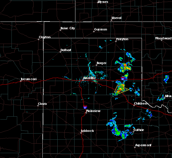 At 749 pm cdt, a severe thunderstorm was located over hedley, or 11 miles east of clarendon, moving northeast at 25 mph (radar indicated). Hazards include 60 mph wind gusts and quarter size hail. Minor damage to roofs, siding, and trees is possible. hail damage to vehicles is expected. Locations impacted include, hedley, quail and lelia lake. At 749 pm cdt, a severe thunderstorm was located over hedley, or 11 miles east of clarendon, moving northeast at 25 mph (radar indicated). Hazards include 60 mph wind gusts and quarter size hail. Minor damage to roofs, siding, and trees is possible. hail damage to vehicles is expected. Locations impacted include, hedley, quail and lelia lake.
|
| 5/12/2018 7:27 PM CDT |
 At 727 pm cdt, a severe thunderstorm was located 7 miles northeast of brice, or 11 miles southeast of clarendon, moving northeast at 20 mph (radar indicated). Hazards include 60 mph wind gusts and quarter size hail. Minor damage to roofs, siding, and trees is possible. Hail damage to vehicles is expected. At 727 pm cdt, a severe thunderstorm was located 7 miles northeast of brice, or 11 miles southeast of clarendon, moving northeast at 20 mph (radar indicated). Hazards include 60 mph wind gusts and quarter size hail. Minor damage to roofs, siding, and trees is possible. Hail damage to vehicles is expected.
|
| 10/6/2017 10:58 PM CDT |
 At 1058 pm cdt, severe thunderstorms were located along a line extending from 4 miles north of wheeler to near lela to 4 miles south of hedley, moving east at 50 mph (radar indicated). Hazards include 70 mph wind gusts and nickel size hail. Expect some tree damage. Damage is likely to mobile homes, roofs, and outbuildings. At 1058 pm cdt, severe thunderstorms were located along a line extending from 4 miles north of wheeler to near lela to 4 miles south of hedley, moving east at 50 mph (radar indicated). Hazards include 70 mph wind gusts and nickel size hail. Expect some tree damage. Damage is likely to mobile homes, roofs, and outbuildings.
|
| 6/15/2017 7:46 PM CDT |
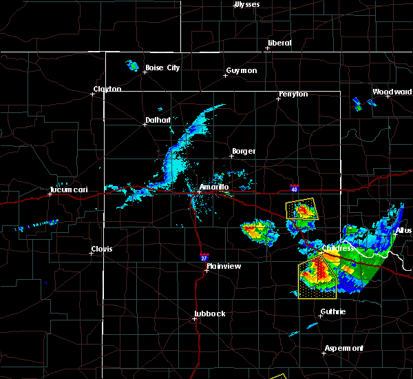 At 745 pm cdt, a severe thunderstorm was located 5 miles north of quail, or 13 miles northwest of wellington, moving east at 45 mph (radar indicated). Hazards include 60 mph wind gusts and half dollar size hail. Minor damage to roofs, siding, and trees is possible. hail damage to vehicles is expected. Locations impacted include, hedley, quail and dozier. At 745 pm cdt, a severe thunderstorm was located 5 miles north of quail, or 13 miles northwest of wellington, moving east at 45 mph (radar indicated). Hazards include 60 mph wind gusts and half dollar size hail. Minor damage to roofs, siding, and trees is possible. hail damage to vehicles is expected. Locations impacted include, hedley, quail and dozier.
|
| 6/15/2017 7:42 PM CDT |
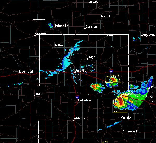 At 741 pm cdt, a severe thunderstorm was located 5 miles north of quail, or 15 miles northwest of wellington, moving east at 45 mph (trained weather spotters). Hazards include half dollar size hail. Damage to vehicles is expected. Locations impacted include, hedley, dozier, lelia lake and quail. At 741 pm cdt, a severe thunderstorm was located 5 miles north of quail, or 15 miles northwest of wellington, moving east at 45 mph (trained weather spotters). Hazards include half dollar size hail. Damage to vehicles is expected. Locations impacted include, hedley, dozier, lelia lake and quail.
|
| 6/15/2017 7:31 PM CDT |
 At 731 pm cdt, a severe thunderstorm was located 7 miles northeast of hedley, or 15 miles north of memphis, moving east at 45 mph (trained weather spotters). Hazards include golf ball size hail. People and animals outdoors will be injured. expect damage to roofs, siding, windows, and vehicles. Locations impacted include, hedley, dozier, lelia lake and quail. At 731 pm cdt, a severe thunderstorm was located 7 miles northeast of hedley, or 15 miles north of memphis, moving east at 45 mph (trained weather spotters). Hazards include golf ball size hail. People and animals outdoors will be injured. expect damage to roofs, siding, windows, and vehicles. Locations impacted include, hedley, dozier, lelia lake and quail.
|
| 6/15/2017 7:18 PM CDT |
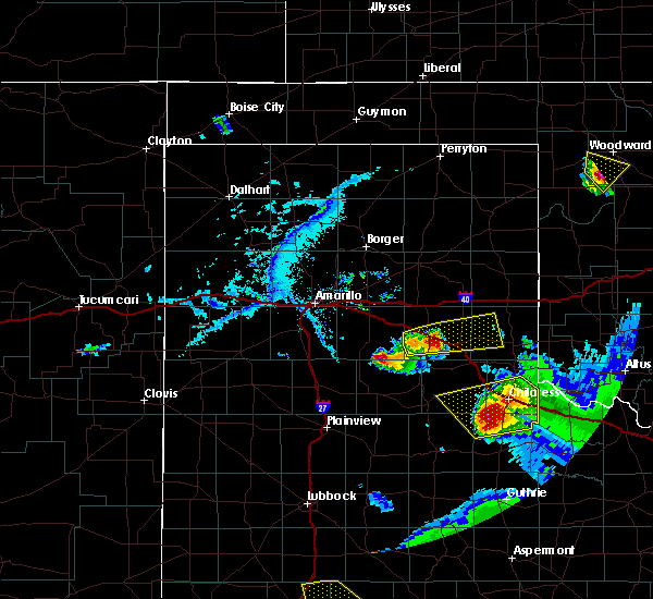 At 718 pm cdt, a severe thunderstorm was located near lelia lake, or 9 miles east of clarendon, moving east at 45 mph (trained weather spotters). Hazards include golf ball size hail. People and animals outdoors will be injured. expect damage to roofs, siding, windows, and vehicles. Locations impacted include, clarendon, hedley, dozier, lelia lake, quail and greenbelt lake. At 718 pm cdt, a severe thunderstorm was located near lelia lake, or 9 miles east of clarendon, moving east at 45 mph (trained weather spotters). Hazards include golf ball size hail. People and animals outdoors will be injured. expect damage to roofs, siding, windows, and vehicles. Locations impacted include, clarendon, hedley, dozier, lelia lake, quail and greenbelt lake.
|
| 6/15/2017 7:14 PM CDT |
 At 714 pm cdt, a severe thunderstorm was located over lelia lake, or 6 miles east of clarendon, moving east at 45 mph (radar indicated). Hazards include half dollar size hail. damage to vehicles is expected At 714 pm cdt, a severe thunderstorm was located over lelia lake, or 6 miles east of clarendon, moving east at 45 mph (radar indicated). Hazards include half dollar size hail. damage to vehicles is expected
|
| 6/13/2017 6:25 PM CDT | Hen Egg sized hail reported 6.1 miles NW of Hedley, TX |
| 6/13/2017 6:23 PM CDT |
 The severe thunderstorm warning for southeastern gray and eastern donley counties will expire at 630 pm cdt, the storms which prompted the warning have moved out of the area. therefore the warning will be allowed to expire. a severe thunderstorm watch remains in effect until 1100 pm cdt for the panhandle of texas. The severe thunderstorm warning for southeastern gray and eastern donley counties will expire at 630 pm cdt, the storms which prompted the warning have moved out of the area. therefore the warning will be allowed to expire. a severe thunderstorm watch remains in effect until 1100 pm cdt for the panhandle of texas.
|
| 6/13/2017 6:19 PM CDT | Ping Pong Ball sized hail reported 4.8 miles NW of Hedley, TX |
| 6/13/2017 6:19 PM CDT | Ping Pong Ball sized hail reported 6.1 miles NW of Hedley, TX |
| 6/13/2017 6:11 PM CDT |
 At 611 pm cdt, severe thunderstorms were located along a line extending from 10 miles south of mclean to 4 miles west of memphis, moving east at 35 mph (radar indicated). Hazards include 60 mph wind gusts and half dollar size hail. Minor damage to roofs, siding, and trees is possible. Hail damage to vehicles is expected. At 611 pm cdt, severe thunderstorms were located along a line extending from 10 miles south of mclean to 4 miles west of memphis, moving east at 35 mph (radar indicated). Hazards include 60 mph wind gusts and half dollar size hail. Minor damage to roofs, siding, and trees is possible. Hail damage to vehicles is expected.
|
| 6/13/2017 5:59 PM CDT |
 At 558 pm cdt, severe thunderstorms were located along a line extending from 9 miles south of alanreed to 8 miles east of brice, moving northeast at 40 mph (radar indicated). Hazards include 60 mph wind gusts and quarter size hail. Minor damage to roofs, siding, and trees is possible. hail damage to vehicles is expected. Locations impacted include, mclean, hedley, lelia lake and alanreed. At 558 pm cdt, severe thunderstorms were located along a line extending from 9 miles south of alanreed to 8 miles east of brice, moving northeast at 40 mph (radar indicated). Hazards include 60 mph wind gusts and quarter size hail. Minor damage to roofs, siding, and trees is possible. hail damage to vehicles is expected. Locations impacted include, mclean, hedley, lelia lake and alanreed.
|
| 6/13/2017 5:29 PM CDT |
 At 529 pm cdt, severe thunderstorms were located along a line extending from 4 miles southwest of greenbelt lake to 11 miles north of caprock canyon state park, moving northeast at 35 mph (radar indicated). Hazards include 60 mph wind gusts and quarter size hail. Minor damage to roofs, siding, and trees is possible. Hail damage to vehicles is expected. At 529 pm cdt, severe thunderstorms were located along a line extending from 4 miles southwest of greenbelt lake to 11 miles north of caprock canyon state park, moving northeast at 35 mph (radar indicated). Hazards include 60 mph wind gusts and quarter size hail. Minor damage to roofs, siding, and trees is possible. Hail damage to vehicles is expected.
|
| 5/10/2017 5:28 PM CDT | Quarter sized hail reported 8.5 miles NW of Hedley, TX |
| 5/10/2017 5:15 PM CDT |
 At 515 pm cdt, a severe thunderstorm was located 9 miles west of memphis, moving east at 25 mph. this is a very dangerous storm (radar indicated. baseball size hail was reported with this storm earlier). Hazards include baseball size hail and 60 mph wind gusts. People and animals outdoors will be severely injured. expect shattered windows, extensive damage to roofs, siding, and vehicles. Locations impacted include, hedley. At 515 pm cdt, a severe thunderstorm was located 9 miles west of memphis, moving east at 25 mph. this is a very dangerous storm (radar indicated. baseball size hail was reported with this storm earlier). Hazards include baseball size hail and 60 mph wind gusts. People and animals outdoors will be severely injured. expect shattered windows, extensive damage to roofs, siding, and vehicles. Locations impacted include, hedley.
|
| 5/10/2017 4:57 PM CDT |
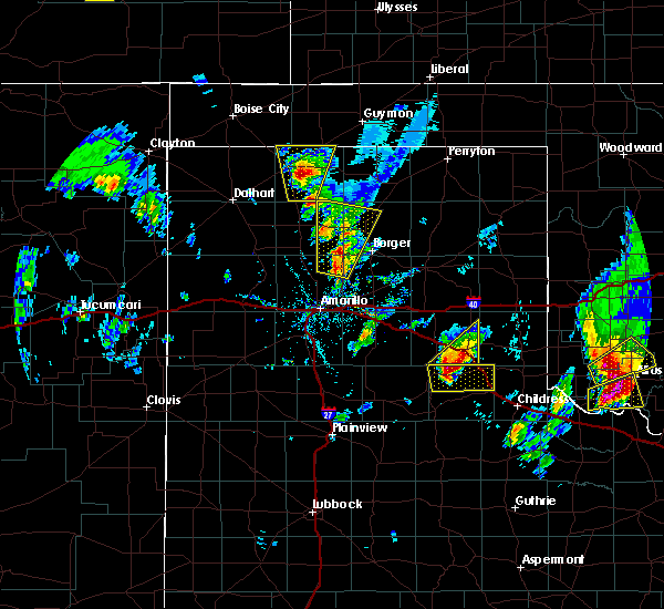 At 457 pm cdt, a severe thunderstorm was located near brice, or 17 miles west of memphis, moving east at 25 mph (radar indicated). Hazards include golf ball size hail and 60 mph wind gusts. Minor damage to roofs, siding, and trees is possible. people and animals outdoors will be injured. Expect hail damage to roofs, siding, windows, and vehicles. At 457 pm cdt, a severe thunderstorm was located near brice, or 17 miles west of memphis, moving east at 25 mph (radar indicated). Hazards include golf ball size hail and 60 mph wind gusts. Minor damage to roofs, siding, and trees is possible. people and animals outdoors will be injured. Expect hail damage to roofs, siding, windows, and vehicles.
|
| 3/28/2017 5:10 PM CDT |
 At 510 pm cdt, a severe thunderstorm was located over memphis, moving northeast at 35 mph (radar indicated). Hazards include 60 mph wind gusts and quarter size hail. Minor damage to roofs, siding, and trees is possible. Hail damage to vehicles is expected. At 510 pm cdt, a severe thunderstorm was located over memphis, moving northeast at 35 mph (radar indicated). Hazards include 60 mph wind gusts and quarter size hail. Minor damage to roofs, siding, and trees is possible. Hail damage to vehicles is expected.
|
| 9/17/2016 1:52 PM CDT |
 At 151 pm cdt, a severe thunderstorm was located over lela, or 6 miles west of shamrock, moving east at 45 mph (radar indicated). Hazards include 60 mph wind gusts and half dollar size hail. Minor damage to roofs. siding. and trees is possible. hail damage to vehicles is expected. locations impacted include, wellington, shamrock, briscoe, wheeler, mclean, lefors, hedley, dodson, lutie, lela, lelia lake, twitty, samnorwood, quail, dozier, allison, alanreed, new mobeetie, kellerville and mobeetie. This includes interstate 40 between mile markers 130 and 176. At 151 pm cdt, a severe thunderstorm was located over lela, or 6 miles west of shamrock, moving east at 45 mph (radar indicated). Hazards include 60 mph wind gusts and half dollar size hail. Minor damage to roofs. siding. and trees is possible. hail damage to vehicles is expected. locations impacted include, wellington, shamrock, briscoe, wheeler, mclean, lefors, hedley, dodson, lutie, lela, lelia lake, twitty, samnorwood, quail, dozier, allison, alanreed, new mobeetie, kellerville and mobeetie. This includes interstate 40 between mile markers 130 and 176.
|
| 9/17/2016 1:34 PM CDT |
 At 134 pm cdt, a severe thunderstorm was located over mclean, or 20 miles west of shamrock, moving east at 45 mph (radar indicated). Hazards include 70 mph wind gusts and ping pong ball size hail. Expect some tree damage. damage is likely to mobile homes, roofs, and outbuildings. people and animals outdoors will be injured. Expect hail damage to roofs, siding, windows, and vehicles. At 134 pm cdt, a severe thunderstorm was located over mclean, or 20 miles west of shamrock, moving east at 45 mph (radar indicated). Hazards include 70 mph wind gusts and ping pong ball size hail. Expect some tree damage. damage is likely to mobile homes, roofs, and outbuildings. people and animals outdoors will be injured. Expect hail damage to roofs, siding, windows, and vehicles.
|
| 8/25/2016 3:19 PM CDT |
 At 319 pm cdt, a severe thunderstorm was located 7 miles west of quail, or 15 miles north of memphis, moving northeast at 20 mph (radar indicated). Hazards include 60 mph wind gusts and quarter size hail. Minor damage to roofs. siding. and trees is possible. Hail damage to vehicles is expected. At 319 pm cdt, a severe thunderstorm was located 7 miles west of quail, or 15 miles north of memphis, moving northeast at 20 mph (radar indicated). Hazards include 60 mph wind gusts and quarter size hail. Minor damage to roofs. siding. and trees is possible. Hail damage to vehicles is expected.
|
| 7/26/2016 4:31 PM CDT |
 At 431 pm cdt, a severe thunderstorm was located near lelia lake, or 8 miles southeast of clarendon, moving south at 10 mph (radar indicated). Hazards include 60 mph wind gusts and quarter size hail. Minor damage to roofs. siding. and trees is possible. hail damage to vehicles is expected. Locations impacted include, clarendon, hedley and lelia lake. At 431 pm cdt, a severe thunderstorm was located near lelia lake, or 8 miles southeast of clarendon, moving south at 10 mph (radar indicated). Hazards include 60 mph wind gusts and quarter size hail. Minor damage to roofs. siding. and trees is possible. hail damage to vehicles is expected. Locations impacted include, clarendon, hedley and lelia lake.
|
| 7/26/2016 4:14 PM CDT |
 At 413 pm cdt, a severe thunderstorm was located over lelia lake, or 8 miles east of clarendon, moving south at 10 mph (radar indicated). Hazards include 60 mph wind gusts and quarter size hail. Minor damage to roofs. siding. and trees is possible. hail damage to vehicles is expected. Locations impacted include, clarendon, howardwick, hedley, lelia lake and greenbelt lake. At 413 pm cdt, a severe thunderstorm was located over lelia lake, or 8 miles east of clarendon, moving south at 10 mph (radar indicated). Hazards include 60 mph wind gusts and quarter size hail. Minor damage to roofs. siding. and trees is possible. hail damage to vehicles is expected. Locations impacted include, clarendon, howardwick, hedley, lelia lake and greenbelt lake.
|
| 7/26/2016 3:55 PM CDT |
 At 355 pm cdt, a severe thunderstorm was located near lelia lake, or 9 miles east of clarendon, moving south at 10 mph (radar indicated). Hazards include 60 mph wind gusts and quarter size hail. Minor damage to roofs. siding. and trees is possible. Hail damage to vehicles is expected. At 355 pm cdt, a severe thunderstorm was located near lelia lake, or 9 miles east of clarendon, moving south at 10 mph (radar indicated). Hazards include 60 mph wind gusts and quarter size hail. Minor damage to roofs. siding. and trees is possible. Hail damage to vehicles is expected.
|
| 7/15/2016 10:18 PM CDT |
 At 1017 pm cdt, severe thunderstorms were located along a line extending from near texola to 4 miles northeast of memphis, moving east-southeast at 40 mph (radar indicated). Hazards include 70 mph wind gusts and penny size hail. Expect some tree damage. damage is likely to mobile homes. roofs, and outbuildings. locations impacted include, wellington, shamrock, hedley, lutie, dozier, lela, lelia lake, twitty, samnorwood and quail. This includes interstate 40 between mile markers 154 and 176. At 1017 pm cdt, severe thunderstorms were located along a line extending from near texola to 4 miles northeast of memphis, moving east-southeast at 40 mph (radar indicated). Hazards include 70 mph wind gusts and penny size hail. Expect some tree damage. damage is likely to mobile homes. roofs, and outbuildings. locations impacted include, wellington, shamrock, hedley, lutie, dozier, lela, lelia lake, twitty, samnorwood and quail. This includes interstate 40 between mile markers 154 and 176.
|
| 7/15/2016 10:06 PM CDT |
 At 1006 pm cdt, severe thunderstorms were located along a line extending from 3 miles west of texola to 5 miles southeast of hedley, moving southeast at 45 mph (radar indicated). Hazards include 60 mph wind gusts and penny size hail. Minor damage to roofs. siding. and trees is possible. locations impacted include, wellington, clarendon, shamrock, wheeler, hedley, lutie, lela, lelia lake, twitty, quail, samnorwood, dozier and kellerville. This includes interstate 40 between mile markers 147 and 176. At 1006 pm cdt, severe thunderstorms were located along a line extending from 3 miles west of texola to 5 miles southeast of hedley, moving southeast at 45 mph (radar indicated). Hazards include 60 mph wind gusts and penny size hail. Minor damage to roofs. siding. and trees is possible. locations impacted include, wellington, clarendon, shamrock, wheeler, hedley, lutie, lela, lelia lake, twitty, quail, samnorwood, dozier and kellerville. This includes interstate 40 between mile markers 147 and 176.
|
| 7/15/2016 9:48 PM CDT |
 At 947 pm cdt, severe thunderstorms were located along a line extending from 7 miles northeast of twitty to 6 miles northeast of lelia lake, moving east at 40 mph (radar indicated). Hazards include 60 mph wind gusts and penny size hail. Minor damage to roofs. siding. and trees is possible. Locations impacted include, wellington, clarendon, shamrock, briscoe, wheeler, mclean, lefors, howardwick, hedley, lutie, lake mcclellan, lela, lelia lake, twitty, samnorwood, quail, dozier, allison, greenbelt lake and alanreed. At 947 pm cdt, severe thunderstorms were located along a line extending from 7 miles northeast of twitty to 6 miles northeast of lelia lake, moving east at 40 mph (radar indicated). Hazards include 60 mph wind gusts and penny size hail. Minor damage to roofs. siding. and trees is possible. Locations impacted include, wellington, clarendon, shamrock, briscoe, wheeler, mclean, lefors, howardwick, hedley, lutie, lake mcclellan, lela, lelia lake, twitty, samnorwood, quail, dozier, allison, greenbelt lake and alanreed.
|
| 7/15/2016 9:30 PM CDT |
 At 930 pm cdt, severe thunderstorms were located along a line extending from 3 miles east of briscoe to 4 miles southwest of alanreed, moving east at 40 mph (radar indicated). Hazards include 60 mph wind gusts and penny size hail. Minor damage to roofs. siding. And trees is possible. At 930 pm cdt, severe thunderstorms were located along a line extending from 3 miles east of briscoe to 4 miles southwest of alanreed, moving east at 40 mph (radar indicated). Hazards include 60 mph wind gusts and penny size hail. Minor damage to roofs. siding. And trees is possible.
|
| 7/6/2016 7:44 PM CDT |
 At 744 pm cdt, a severe thunderstorm was located 4 miles southwest of hedley, or 10 miles northwest of memphis, moving east at 15 mph (radar indicated). Hazards include 70 mph wind gusts and nickel size hail. Expect some tree damage. Damage is likely to mobile homes, roofs, and outbuildings. At 744 pm cdt, a severe thunderstorm was located 4 miles southwest of hedley, or 10 miles northwest of memphis, moving east at 15 mph (radar indicated). Hazards include 70 mph wind gusts and nickel size hail. Expect some tree damage. Damage is likely to mobile homes, roofs, and outbuildings.
|
| 7/6/2016 7:27 PM CDT |
 At 727 pm cdt, a severe thunderstorm was located 5 miles southwest of lelia lake, or 7 miles south of clarendon, moving northeast at 30 mph (radar indicated). Hazards include 70 mph wind gusts and quarter size hail. Expect some tree damage. damage is likely to mobile homes. roofs, and outbuildings. hail damage to vehicles is expected. Locations impacted include, clarendon, hedley, lelia lake and greenbelt lake. At 727 pm cdt, a severe thunderstorm was located 5 miles southwest of lelia lake, or 7 miles south of clarendon, moving northeast at 30 mph (radar indicated). Hazards include 70 mph wind gusts and quarter size hail. Expect some tree damage. damage is likely to mobile homes. roofs, and outbuildings. hail damage to vehicles is expected. Locations impacted include, clarendon, hedley, lelia lake and greenbelt lake.
|
| 7/6/2016 7:12 PM CDT |
 At 712 pm cdt, a severe thunderstorm was located 7 miles northwest of brice, or 10 miles southwest of clarendon, moving northeast at 30 mph (radar indicated). Hazards include 70 mph wind gusts and quarter size hail. Expect some tree damage. damage is likely to mobile homes, roofs, and outbuildings. Hail damage to vehicles is expected. At 712 pm cdt, a severe thunderstorm was located 7 miles northwest of brice, or 10 miles southwest of clarendon, moving northeast at 30 mph (radar indicated). Hazards include 70 mph wind gusts and quarter size hail. Expect some tree damage. damage is likely to mobile homes, roofs, and outbuildings. Hail damage to vehicles is expected.
|
| 6/14/2016 12:56 AM CDT | The severe thunderstorm warning for southern collingsworth and southeastern donley counties will expire at 100 am cdt, the severe thunderstorm which prompted the warning has weakened. therefore the warning will be allowed to expire. |
| 6/14/2016 12:27 AM CDT |
 At 1227 am cdt, a severe thunderstorm was located over hedley, or 9 miles northwest of memphis, moving east at 35 mph (radar indicated). Hazards include 60 mph wind gusts and quarter size hail. Minor damage to roofs. siding. and trees is possible. hail damage to vehicles is expected. locations impacted include, wellington, hedley, dodson and quail. A tornado watch remains in effect until 200 am cdt for the panhandle of texas. At 1227 am cdt, a severe thunderstorm was located over hedley, or 9 miles northwest of memphis, moving east at 35 mph (radar indicated). Hazards include 60 mph wind gusts and quarter size hail. Minor damage to roofs. siding. and trees is possible. hail damage to vehicles is expected. locations impacted include, wellington, hedley, dodson and quail. A tornado watch remains in effect until 200 am cdt for the panhandle of texas.
|
| 6/14/2016 12:06 AM CDT |
 At 1205 am cdt, a severe thunderstorm was located 7 miles north of brice, or 8 miles south of clarendon, moving east at 35 mph (radar indicated). Hazards include ping pong ball size hail and 60 mph wind gusts. Minor damage to roofs. siding. and trees is possible. people and animals outdoors will be injured. Expect hail damage to roofs, siding, windows, and vehicles. At 1205 am cdt, a severe thunderstorm was located 7 miles north of brice, or 8 miles south of clarendon, moving east at 35 mph (radar indicated). Hazards include ping pong ball size hail and 60 mph wind gusts. Minor damage to roofs. siding. and trees is possible. people and animals outdoors will be injured. Expect hail damage to roofs, siding, windows, and vehicles.
|
| 5/29/2016 4:55 PM CDT | The severe thunderstorm warning for collingsworth, armstrong, carson, southern wheeler, southern gray and donley counties will expire at 500 pm cdt, the storms which prompted the warning have weakened below severe limits, and no longer pose an immediate threat to life or property. therefore the warning will be allowed to expire. however heavy rain is still possible with these thunderstorms. a severe thunderstorm watch remains in effect until 1000 pm cdt for central texas. remember, a severe thunderstorm warning still remains in effect for the texas panhandle until 10 pm. |
| 5/29/2016 4:42 PM CDT |
 At 442 pm cdt, severe thunderstorms were located along a line extending from 6 miles northeast of twitty to 6 miles north of wayside, moving east at 15 mph (radar indicated). Hazards include golf ball size hail and 60 mph wind gusts. Minor damage to roofs. siding. and trees is possible. people and animals outdoors will be injured. expect hail damage to roofs, siding, windows, and vehicles. locations impacted include, panhandle, wellington, clarendon, shamrock, claude, white deer, mclean, groom, howardwick, hedley, dodson, lutie, lake mcclellan, lela, lelia lake, twitty, goodnight, samnorwood, quail and wayside. This includes interstate 40 between mile markers 84 and 176. At 442 pm cdt, severe thunderstorms were located along a line extending from 6 miles northeast of twitty to 6 miles north of wayside, moving east at 15 mph (radar indicated). Hazards include golf ball size hail and 60 mph wind gusts. Minor damage to roofs. siding. and trees is possible. people and animals outdoors will be injured. expect hail damage to roofs, siding, windows, and vehicles. locations impacted include, panhandle, wellington, clarendon, shamrock, claude, white deer, mclean, groom, howardwick, hedley, dodson, lutie, lake mcclellan, lela, lelia lake, twitty, goodnight, samnorwood, quail and wayside. This includes interstate 40 between mile markers 84 and 176.
|
| 5/29/2016 3:56 PM CDT |
 At 356 pm cdt, severe thunderstorms were located along a line extending from 8 miles southeast of allison to 4 miles southwest of groom, moving east at 20 mph (radar indicated). Hazards include golf ball size hail and 60 mph wind gusts. Minor damage to roofs. siding. and trees is possible. people and animals outdoors will be injured. Expect hail damage to roofs, siding, windows, and vehicles. At 356 pm cdt, severe thunderstorms were located along a line extending from 8 miles southeast of allison to 4 miles southwest of groom, moving east at 20 mph (radar indicated). Hazards include golf ball size hail and 60 mph wind gusts. Minor damage to roofs. siding. and trees is possible. people and animals outdoors will be injured. Expect hail damage to roofs, siding, windows, and vehicles.
|
| 5/23/2016 7:10 PM CDT | Quarter sized hail reported 6.5 miles ESE of Hedley, TX, received via twitter. |
| 5/23/2016 4:18 PM CDT | A severe thunderstorm warning remains in effect until 500 pm cdt for west central collingsworth and northeastern donley counties. at 417 pm cdt. a severe thunderstorm was located over lelia lake. or 8 miles east of clarendon. moving northeast at 10 mph. hazard. golf ball size hail and 60 mph wind gusts. source. trained weather spotters. At 413 pm hail to the size of. |
| 5/23/2016 4:15 PM CDT | Golf Ball sized hail reported 4.5 miles E of Hedley, TX |
| 5/23/2016 4:03 PM CDT | Golf Ball sized hail reported 5.8 miles ESE of Hedley, TX, received via spotter network. |
| 5/23/2016 3:53 PM CDT |
 At 417 pm cdt, a severe thunderstorm was located over lelia lake, or 8 miles east of clarendon, moving northeast at 10 mph (trained weather spotters. at 413 pm hail to the size of golf balls was reported 2 miles southeast of lelia lake). Hazards include golf ball size hail and 60 mph wind gusts. Minor damage to roofs. siding. and trees is possible. people and animals outdoors will be injured. expect hail damage to roofs, siding, windows, and vehicles. locations impacted include, lelia lake. A tornado watch remains in effect until 1000 pm cdt for central texas. At 417 pm cdt, a severe thunderstorm was located over lelia lake, or 8 miles east of clarendon, moving northeast at 10 mph (trained weather spotters. at 413 pm hail to the size of golf balls was reported 2 miles southeast of lelia lake). Hazards include golf ball size hail and 60 mph wind gusts. Minor damage to roofs. siding. and trees is possible. people and animals outdoors will be injured. expect hail damage to roofs, siding, windows, and vehicles. locations impacted include, lelia lake. A tornado watch remains in effect until 1000 pm cdt for central texas.
|
| 5/22/2016 6:51 PM CDT | A severe thunderstorm warning remains in effect until 715 pm cdt for southwestern collingsworth and southeastern donley counties. at 648 pm cdt. a severe thunderstorm was located 4 miles west of memphis. moving northeast at 10 mph. hazard. golf ball size hail. 60 mph wind gusts. And flash flooding. |
| 5/22/2016 3:57 PM CDT | The national weather service in amarillo has issued a * severe thunderstorm warning for. donley county in the panhandle of texas. until 445 pm cdt * at 357 pm cdt. a severe thunderstorm was located over brice. or 14 miles south of clarendon. Moving northeast at 30 mph. |
| 5/17/2016 12:16 AM CDT |
 At 1216 am cdt, severe thunderstorms were located along a line extending from lutie to 3 miles east of hedley to brice, moving east at 30 mph (radar indicated). Hazards include 60 mph wind gusts and quarter size hail. Minor damage to roofs. siding. and trees is possible. hail damage to vehicles is expected. Locations impacted include, wellington, hedley, dodson, lutie, samnorwood and quail. At 1216 am cdt, severe thunderstorms were located along a line extending from lutie to 3 miles east of hedley to brice, moving east at 30 mph (radar indicated). Hazards include 60 mph wind gusts and quarter size hail. Minor damage to roofs. siding. and trees is possible. hail damage to vehicles is expected. Locations impacted include, wellington, hedley, dodson, lutie, samnorwood and quail.
|
| 5/16/2016 11:59 PM CDT |
 At 1159 pm cdt, severe thunderstorms were located along a line extending from samnorwood to near lelia lake to 12 miles south of goodnight, moving east at 30 mph (radar indicated). Hazards include 60 mph wind gusts and quarter size hail. Minor damage to roofs. siding. and trees is possible. Hail damage to vehicles is expected. At 1159 pm cdt, severe thunderstorms were located along a line extending from samnorwood to near lelia lake to 12 miles south of goodnight, moving east at 30 mph (radar indicated). Hazards include 60 mph wind gusts and quarter size hail. Minor damage to roofs. siding. and trees is possible. Hail damage to vehicles is expected.
|
| 5/16/2016 11:31 PM CDT |
 At 1131 pm cdt, severe thunderstorms were located along a line extending from 3 miles southeast of mclean to clarendon to 11 miles northeast of wayside, moving southeast at 20 mph (radar indicated). Hazards include 60 mph wind gusts and quarter size hail. Minor damage to roofs. siding. and trees is possible. hail damage to vehicles is expected. Locations impacted include, wellington, clarendon, shamrock, mclean, howardwick, hedley, dodson, lutie, lela, lelia lake, samnorwood, quail, dozier and greenbelt lake. At 1131 pm cdt, severe thunderstorms were located along a line extending from 3 miles southeast of mclean to clarendon to 11 miles northeast of wayside, moving southeast at 20 mph (radar indicated). Hazards include 60 mph wind gusts and quarter size hail. Minor damage to roofs. siding. and trees is possible. hail damage to vehicles is expected. Locations impacted include, wellington, clarendon, shamrock, mclean, howardwick, hedley, dodson, lutie, lela, lelia lake, samnorwood, quail, dozier and greenbelt lake.
|
| 5/16/2016 11:18 PM CDT |
 At 1117 pm cdt, severe thunderstorms were located along a line extending from alanreed to greenbelt lake to 10 miles northeast of wayside, moving southeast at 20 mph (radar indicated). Hazards include 60 mph wind gusts and half dollar size hail. Minor damage to roofs. siding. and trees is possible. hail damage to vehicles is expected. hail may accumulate on roadways causing hazardous travel. Locations impacted include, wellington, clarendon, shamrock, mclean, howardwick, hedley, dodson, lutie, lela, lelia lake, goodnight, samnorwood, quail, dozier, greenbelt lake and alanreed. At 1117 pm cdt, severe thunderstorms were located along a line extending from alanreed to greenbelt lake to 10 miles northeast of wayside, moving southeast at 20 mph (radar indicated). Hazards include 60 mph wind gusts and half dollar size hail. Minor damage to roofs. siding. and trees is possible. hail damage to vehicles is expected. hail may accumulate on roadways causing hazardous travel. Locations impacted include, wellington, clarendon, shamrock, mclean, howardwick, hedley, dodson, lutie, lela, lelia lake, goodnight, samnorwood, quail, dozier, greenbelt lake and alanreed.
|
| 5/16/2016 11:03 PM CDT |
 At 1101 pm cdt, severe thunderstorms were located along a line extending from 7 miles southeast of lefors to howardwick to 10 miles northeast of wayside, moving southeast at 25 mph. another severe thunderstorm was located just east of shamrock and was also moving southeast at 25 mph (radar indicated). Hazards include 60 mph wind gusts and half dollar size hail. Minor damage to roofs. siding. and trees is possible. hail damage to vehicles is expected. hail may accumulate on roadways causing hazardous travel. Locations impacted include, clarendon, shamrock, mclean, howardwick, hedley, dodson, lutie, lake mcclellan, lela, lelia lake, twitty, goodnight, samnorwood, quail, dozier, greenbelt lake, alanreed and kellerville. At 1101 pm cdt, severe thunderstorms were located along a line extending from 7 miles southeast of lefors to howardwick to 10 miles northeast of wayside, moving southeast at 25 mph. another severe thunderstorm was located just east of shamrock and was also moving southeast at 25 mph (radar indicated). Hazards include 60 mph wind gusts and half dollar size hail. Minor damage to roofs. siding. and trees is possible. hail damage to vehicles is expected. hail may accumulate on roadways causing hazardous travel. Locations impacted include, clarendon, shamrock, mclean, howardwick, hedley, dodson, lutie, lake mcclellan, lela, lelia lake, twitty, goodnight, samnorwood, quail, dozier, greenbelt lake, alanreed and kellerville.
|
| 5/16/2016 10:47 PM CDT |
 At 1047 pm cdt, severe thunderstorms were located along a line extending from near shamrock to near lake mcclellan to 9 miles southwest of claude, moving southeast at 30 mph (radar indicated). Hazards include ping pong ball size hail and 60 mph wind gusts. Minor damage to roofs. siding. and trees is possible. people and animals outdoors will be injured. expect hail damage to roofs, siding, windows, and vehicles. Hail may accumulate on roadways causing hazardous travel. At 1047 pm cdt, severe thunderstorms were located along a line extending from near shamrock to near lake mcclellan to 9 miles southwest of claude, moving southeast at 30 mph (radar indicated). Hazards include ping pong ball size hail and 60 mph wind gusts. Minor damage to roofs. siding. and trees is possible. people and animals outdoors will be injured. expect hail damage to roofs, siding, windows, and vehicles. Hail may accumulate on roadways causing hazardous travel.
|
| 5/11/2016 11:42 PM CDT | Quarter sized hail reported 6.5 miles ESE of Hedley, TX |
| 5/11/2016 11:42 PM CDT |
 At 1142 pm cdt, a severe thunderstorm was located over lelia lake, or 9 miles southeast of clarendon, moving east at 45 mph (public). Hazards include 60 mph wind gusts and quarter size hail. Minor damage to roofs. siding. and trees is possible. hail damage to vehicles is expected. Hail may accumulate on roadways causing hazardous travel. At 1142 pm cdt, a severe thunderstorm was located over lelia lake, or 9 miles southeast of clarendon, moving east at 45 mph (public). Hazards include 60 mph wind gusts and quarter size hail. Minor damage to roofs. siding. and trees is possible. hail damage to vehicles is expected. Hail may accumulate on roadways causing hazardous travel.
|
| 4/20/2016 8:59 PM CDT |
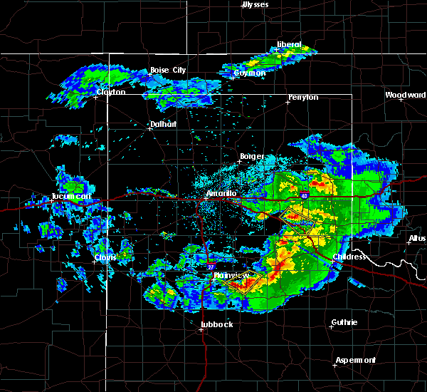 At 859 pm cdt, a severe thunderstorm was located 4 miles north of lelia lake, or 6 miles east of clarendon, moving southeast at 30 mph (radar indicated). Hazards include 60 mph wind gusts and quarter size hail. Minor damage to roofs. siding. and trees is possible. hail damage to vehicles is expected. hail may accumulate on roadways causing hazardous travel. Locations impacted include, hedley and lelia lake. At 859 pm cdt, a severe thunderstorm was located 4 miles north of lelia lake, or 6 miles east of clarendon, moving southeast at 30 mph (radar indicated). Hazards include 60 mph wind gusts and quarter size hail. Minor damage to roofs. siding. and trees is possible. hail damage to vehicles is expected. hail may accumulate on roadways causing hazardous travel. Locations impacted include, hedley and lelia lake.
|
| 4/20/2016 8:41 PM CDT |
 At 841 pm cdt, a severe thunderstorm was located over greenbelt lake, or 6 miles northwest of clarendon, moving southeast at 30 mph (radar indicated. similar storms today have produced hail up to an inch and a quarter in size). Hazards include 60 mph wind gusts and quarter size hail. Minor damage to roofs. siding. and trees is possible. hail damage to vehicles is expected. Hail may accumulate on roadways causing hazardous travel. At 841 pm cdt, a severe thunderstorm was located over greenbelt lake, or 6 miles northwest of clarendon, moving southeast at 30 mph (radar indicated. similar storms today have produced hail up to an inch and a quarter in size). Hazards include 60 mph wind gusts and quarter size hail. Minor damage to roofs. siding. and trees is possible. hail damage to vehicles is expected. Hail may accumulate on roadways causing hazardous travel.
|
| 4/20/2016 8:40 PM CDT |
 At 839 pm cdt, a severe thunderstorm was located over greenbelt lake, or 6 miles northwest of clarendon, moving southeast at 30 mph (radar indicated. similar storms today have produced hail up to an inch and a quarter in size). Hazards include 60 mph wind gusts and quarter size hail. Minor damage to roofs. siding. and trees is possible. hail damage to vehicles is expected. Hail may accumulate on roadways causing hazardous travel. At 839 pm cdt, a severe thunderstorm was located over greenbelt lake, or 6 miles northwest of clarendon, moving southeast at 30 mph (radar indicated. similar storms today have produced hail up to an inch and a quarter in size). Hazards include 60 mph wind gusts and quarter size hail. Minor damage to roofs. siding. and trees is possible. hail damage to vehicles is expected. Hail may accumulate on roadways causing hazardous travel.
|
| 4/16/2016 6:06 PM CDT | Half Dollar sized hail reported 6.5 miles ESE of Hedley, TX, hail between the size of quarters and ping pong balls was falling near lelia lake. |
| 4/16/2016 5:56 PM CDT | Half Dollar sized hail reported 6.5 miles ESE of Hedley, TX |
| 4/16/2016 5:54 PM CDT |
 At 553 pm cdt, a severe thunderstorm was located near lelia lake, or 7 miles southeast of clarendon, moving northeast at 25 mph (trained weather spotters). Hazards include golf ball size hail. People and animals outdoors will be injured. expect damage to roofs, siding, windows, and vehicles. this storm produced golf ball size hail 4 miles north of brice. locations impacted include, hedley and lelia lake. A tornado watch remains in effect until 900 pm cdt. At 553 pm cdt, a severe thunderstorm was located near lelia lake, or 7 miles southeast of clarendon, moving northeast at 25 mph (trained weather spotters). Hazards include golf ball size hail. People and animals outdoors will be injured. expect damage to roofs, siding, windows, and vehicles. this storm produced golf ball size hail 4 miles north of brice. locations impacted include, hedley and lelia lake. A tornado watch remains in effect until 900 pm cdt.
|
| 4/16/2016 5:44 PM CDT |
 At 544 pm cdt, a severe thunderstorm was located 6 miles southwest of lelia lake, or 8 miles south of clarendon, moving northeast at 20 mph (radar indicated). Hazards include ping pong ball size hail. People and animals outdoors will be injured. expect damage to roofs, siding, windows, and vehicles. locations impacted include, hedley and lelia lake. A tornado watch remains in effect until 900 pm cdt. At 544 pm cdt, a severe thunderstorm was located 6 miles southwest of lelia lake, or 8 miles south of clarendon, moving northeast at 20 mph (radar indicated). Hazards include ping pong ball size hail. People and animals outdoors will be injured. expect damage to roofs, siding, windows, and vehicles. locations impacted include, hedley and lelia lake. A tornado watch remains in effect until 900 pm cdt.
|
| 4/16/2016 5:34 PM CDT |
 At 534 pm cdt, a severe thunderstorm was located near brice, or 12 miles south of clarendon, moving northeast at 30 mph (radar indicated). Hazards include half dollar size hail. damage to vehicles is expected At 534 pm cdt, a severe thunderstorm was located near brice, or 12 miles south of clarendon, moving northeast at 30 mph (radar indicated). Hazards include half dollar size hail. damage to vehicles is expected
|
| 4/10/2016 8:25 PM CDT |
 The severe thunderstorm warning for southeastern donley county will expire at 830 pm cdt, the storm which prompted the warning has moved out of the area. therefore the warning will be allowed to expire. a severe thunderstorm watch remains in effect until 1000 pm cdt for central texas. The severe thunderstorm warning for southeastern donley county will expire at 830 pm cdt, the storm which prompted the warning has moved out of the area. therefore the warning will be allowed to expire. a severe thunderstorm watch remains in effect until 1000 pm cdt for central texas.
|
| 4/10/2016 8:10 PM CDT | Quarter sized hail reported 0.2 miles SW of Hedley, TX |
| 4/10/2016 8:10 PM CDT |
 At 809 pm cdt, a severe thunderstorm was located 5 miles south of hedley, or 6 miles northwest of memphis, moving east at 30 mph (radar indicated). Hazards include 60 mph wind gusts and quarter size hail. Minor damage to roofs. siding. and trees is possible. hail damage to vehicles is expected. Locations impacted include, hedley. At 809 pm cdt, a severe thunderstorm was located 5 miles south of hedley, or 6 miles northwest of memphis, moving east at 30 mph (radar indicated). Hazards include 60 mph wind gusts and quarter size hail. Minor damage to roofs. siding. and trees is possible. hail damage to vehicles is expected. Locations impacted include, hedley.
|
| 4/10/2016 8:01 PM CDT |
 At 759 pm cdt, a severe thunderstorm was located 6 miles southwest of hedley, or 11 miles west of memphis, moving east at 35 mph (radar indicated). Hazards include 60 mph wind gusts and quarter size hail. Minor damage to roofs. siding. and trees is possible. hail damage to vehicles is expected. Locations impacted include, hedley. At 759 pm cdt, a severe thunderstorm was located 6 miles southwest of hedley, or 11 miles west of memphis, moving east at 35 mph (radar indicated). Hazards include 60 mph wind gusts and quarter size hail. Minor damage to roofs. siding. and trees is possible. hail damage to vehicles is expected. Locations impacted include, hedley.
|
| 4/10/2016 7:55 PM CDT |
 At 754 pm cdt, a severe thunderstorm was located 7 miles northeast of brice, or 11 miles southeast of clarendon, moving east at 30 mph (radar indicated). Hazards include 60 mph wind gusts and quarter size hail. Minor damage to roofs. siding. and trees is possible. Hail damage to vehicles is expected. At 754 pm cdt, a severe thunderstorm was located 7 miles northeast of brice, or 11 miles southeast of clarendon, moving east at 30 mph (radar indicated). Hazards include 60 mph wind gusts and quarter size hail. Minor damage to roofs. siding. and trees is possible. Hail damage to vehicles is expected.
|
| 9/20/2015 6:29 PM CDT | Metal roof torn off of home and wind damage to power poles and trees on county road 2 in donley county TX, 5.7 miles SSE of Hedley, TX |
| 7/9/2015 12:12 AM CDT | The severe thunderstorm warning for western collingsworth and eastern donley counties will expire at 1215 am cdt, the line of storms which prompted the warning has weakened below severe limits, and no longer poses an immediate threat to life or property. however, gusty winds to 50 mph and heavy rain are still possible with these thunderstorms. |
| 7/8/2015 11:58 PM CDT |
 At 1155 pm cdt, severe thunderstorms were located along a line extending from 7 miles southeast of mclean to 9 miles northeast of hedley to hedley, and moving east at 30 mph (radar indicated). Hazards include 60 mph wind gusts. Minor damage to roofs. Siding and trees is possible. At 1155 pm cdt, severe thunderstorms were located along a line extending from 7 miles southeast of mclean to 9 miles northeast of hedley to hedley, and moving east at 30 mph (radar indicated). Hazards include 60 mph wind gusts. Minor damage to roofs. Siding and trees is possible.
|
| 7/8/2015 11:22 PM CDT |
 At 1120 pm cdt, severe thunderstorms were located along a line extending from lake mcclellan to clarendon to 7 miles southwest of clarendon, and moving east at 30 mph (radar indicated). Hazards include 70 mph wind gusts and penny size hail. Expect some tree damage. Damage is likely to mobile homes, roofs and outbuildings. At 1120 pm cdt, severe thunderstorms were located along a line extending from lake mcclellan to clarendon to 7 miles southwest of clarendon, and moving east at 30 mph (radar indicated). Hazards include 70 mph wind gusts and penny size hail. Expect some tree damage. Damage is likely to mobile homes, roofs and outbuildings.
|
| 6/7/2015 8:42 PM CDT | At 838 pm cdt, severe thunderstorms were located along a line extending from 6 miles south of lake marvin to 7 miles north of lela to 8 miles west of howardwick, and moving southeast at 30 mph (radar indicated). Hazards include 60 mph wind gusts. Minor damage to roofs. Siding and trees is possible. |
| 6/7/2015 8:25 PM CDT | At 822 pm cdt, severe thunderstorms were located along a line extending from 6 miles west of durham to new mobeetie to 6 miles southeast of groom, and moving southeast at 30 mph (radar indicated). Hazards include 60 mph wind gusts. Minor damage to roofs. Siding and trees is possible. |
| 6/7/2015 8:01 PM CDT | At 759 pm cdt, severe thunderstorms were located along a line extending from 6 miles south of higgins to 9 miles east of lora to 9 miles southeast of kingsmill, and moving southeast at 30 mph (radar indicated). Hazards include 70 mph wind gusts. Expect some tree damage. damage is likely to mobile homes. Roofs and outbuildings. |
| 6/7/2015 7:45 PM CDT | At 742 pm cdt, severe thunderstorms were located along a line extending from 9 miles southeast of follett to 6 miles southeast of canadian to kingsmill, and moving southeast at 30 mph (radar indicated). Hazards include 70 mph wind gusts. Expect some tree damage. Damage is likely to mobile homes, roofs and outbuildings. |
| 5/27/2015 10:46 PM CDT | At 1043 pm cdt, a severe thunderstorm was located 5 miles northeast of memphis, and moving northeast at 5 mph (radar indicated). Hazards include hen egg size hail and 60 mph wind gusts. People and animals outdoors will be injured. expect hail damage to roofs, siding, windows and vehicles. Minor wind damage to roofs, siding and trees is possible. |
| 5/27/2015 10:08 PM CDT | At 1006 pm cdt, a severe thunderstorm was located near memphis, and moving north at 10 mph (radar indicated). Hazards include golf ball size hail and 60 mph wind gusts. People and animals outdoors will be injured. expect hail damage to roofs, siding, windows and vehicles. Minor wind damage to roofs, siding and trees is possible. |
| 5/16/2015 2:31 PM CDT | Golf Ball sized hail reported 6.5 miles ESE of Hedley, TX |
| 5/16/2015 2:22 PM CDT | At 220 pm cdt, a severe thunderstorm capable of producing a tornado was located near lelia lake, and moving northeast at 35 mph (radar indicated rotation). Hazards include tornado and baseball size hail. Flying debris will be dangerous to those caught without shelter. mobile homes will be damaged or destroyed. damage to roofs, windows and vehicles will occur. Tree damage is likely. |
| 5/16/2015 2:04 PM CDT | At 201 pm cdt, a severe thunderstorm capable of producing a tornado was located 5 miles north of brice, and moving northeast at 30 mph (radar indicated rotation). Hazards include tornado and golf ball size hail. Flying debris will be dangerous to those caught without shelter. mobile homes will be damaged or destroyed. damage to roofs, windows and vehicles will occur. Tree damage is likely. |
| 5/16/2015 1:50 PM CDT | At 139 pm cdt, a severe thunderstorm was located 12 miles west of brice, and moving northeast at 35 mph (radar indicated). Hazards include ping pong ball size hail and 60 mph wind gusts. People and animals outdoors will be injured. expect hail damage to roofs, siding, windows and vehicles. Minor wind damage to roofs, siding and trees is possible. |
| 5/16/2015 1:38 PM CDT | At 129 pm cdt, a severe thunderstorm was located 16 miles west of brice, and moving northeast at 35 mph (radar indicated). Hazards include 60 mph wind gusts and quarter size hail. Hail damage to vehicles is expected. Minor wind damage to roofs, siding and trees is possible. |
| 4/26/2015 4:11 PM CDT | At 409 pm cdt, a severe thunderstorm was located 9 miles southwest of hedley, and moving north at 50 mph (radar indicated). Hazards include golf ball size hail and 60 mph wind gusts. People and animals outdoors will be injured. expect hail damage to roofs, siding, windows and vehicles. Minor wind damage to roofs, siding and trees is possible. |
| 4/16/2015 7:21 PM CDT | At 720 pm cdt, a severe thunderstorm was located 9 miles southeast of alanreed, and moving northeast at 35 mph (radar indicated). Hazards include quarter size hail. damage to vehicles is expected |
| 4/16/2015 7:07 PM CDT | At 706 pm cdt, a severe thunderstorm was located near lelia lake, and moving north at 30 mph (radar indicated). Hazards include half dollar size hail. damage to vehicles is expected |
| 4/16/2015 7:05 PM CDT | Quarter sized hail reported 6.5 miles ESE of Hedley, TX |
| 4/16/2015 6:55 PM CDT | At 653 pm cdt, a severe thunderstorm was located 7 miles south of lelia lake, and moving north at 25 mph (radar indicated). Hazards include ping pong ball size hail. People and animals outdoors will be injured. Expect damage to roofs, siding, windows and vehicles. |
| 4/12/2015 7:10 PM CDT | A severe thunderstorm warning remains in effect for collingsworth and southeastern donley counties until 800 pm cdt. at 710 pm cdt. a severe thunderstorm was located 6 miles south of quail. and moving northeast at 20 mph. hazard. ping pong ball size hail. source. Radar indicated. |
| 4/12/2015 6:58 PM CDT | The national weather service in amarillo has issued a * severe thunderstorm warning for. collingsworth county in the panhandle of texas. southeastern donley county in the panhandle of texas. until 800 pm cdt * at 658 pm cdt. A severe thunderstorm was located 7 miles northeast. |
| 6/27/2014 9:14 PM CDT | Half Dollar sized hail reported 0.2 miles SW of Hedley, TX |
| 2/9/2013 8:00 PM CST | Half Dollar sized hail reported 4.8 miles NW of Hedley, TX |
| 2/9/2013 8:00 PM CST | Golf Ball sized hail reported 5.1 miles E of Hedley, TX |
| 8/25/2012 5:07 PM CDT | Report of large tree across fm 1932 west of hedley near the for in donley county TX, 0.5 miles ESE of Hedley, TX |
| 5/30/2012 4:01 PM CDT | Quarter sized hail reported 5.4 miles N of Hedley, TX |
| 5/30/2012 4:00 PM CDT | Hen Egg sized hail reported 7.7 miles NE of Hedley, TX |
| 5/30/2012 3:58 PM CDT | Golf Ball sized hail reported 6.8 miles N of Hedley, TX |
| 4/30/2012 9:00 PM CDT | Golf Ball sized hail reported 6.5 miles ESE of Hedley, TX |
| 4/30/2012 7:49 PM CDT | Baseball sized hail reported 3.1 miles SSW of Hedley, TX, baseball size hail fell for five minutes. multiple vehicle windshields and windows smashed according to this report. |
| 4/30/2012 7:30 PM CDT | Tennis Ball sized hail reported 6.5 miles ESE of Hedley, TX |
| 4/30/2012 7:14 PM CDT | Hen Egg sized hail reported 6.5 miles ESE of Hedley, TX |
| 4/30/2012 7:00 PM CDT | Tea Cup sized hail reported 7.5 miles SE of Hedley, TX, largest hail stone measured 2.5 inches by 3.5 inches. |
| 3/18/2012 9:39 PM CDT | Quarter sized hail reported 7.9 miles SE of Hedley, TX |
| 10/11/2011 7:45 PM CDT | Golf Ball sized hail reported 0.2 miles SW of Hedley, TX, golf ball size hail reported in hedley |
Hail Maps for Hedley, TX


Connect with Interactive Hail Maps