

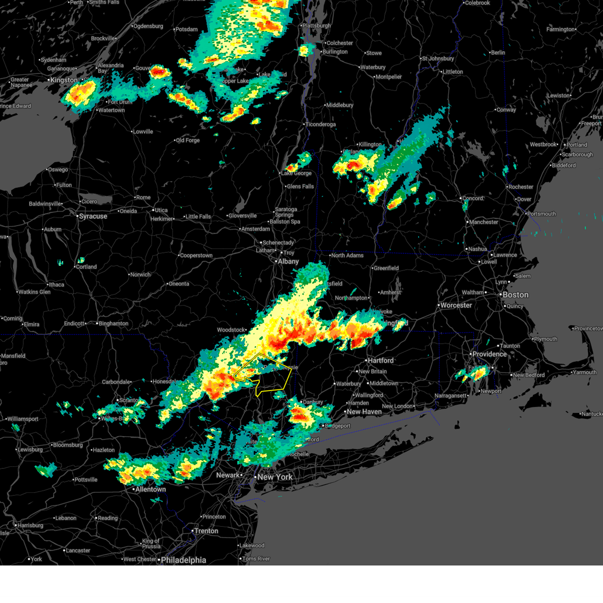
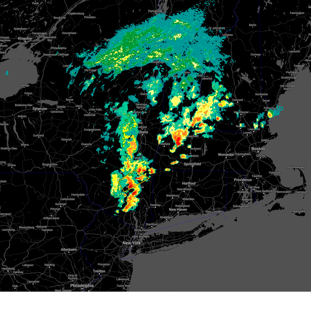
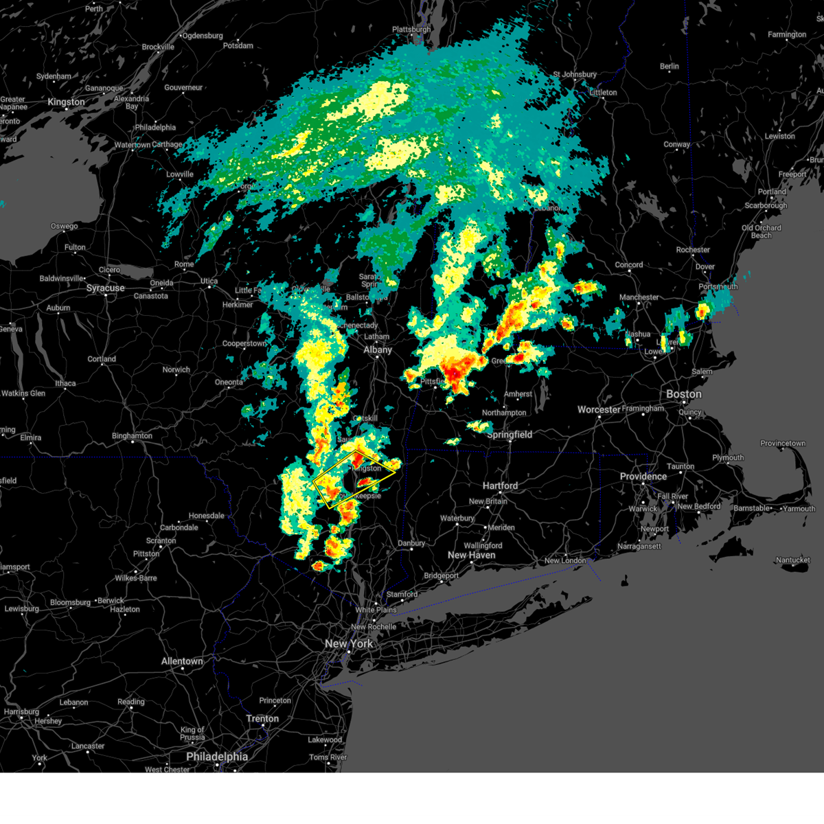
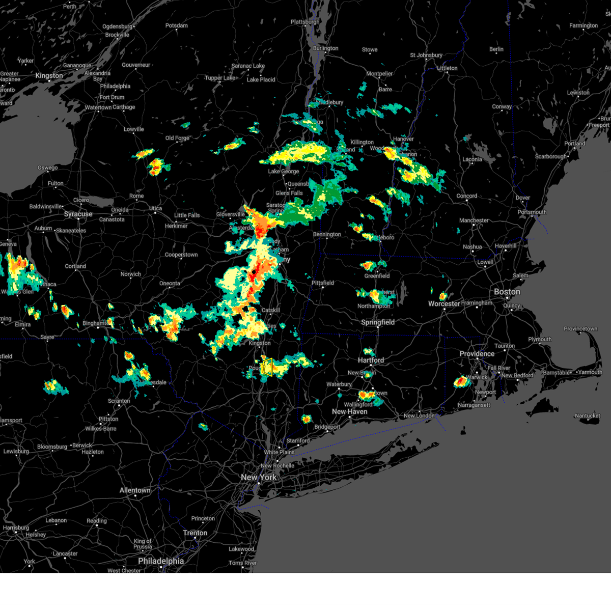
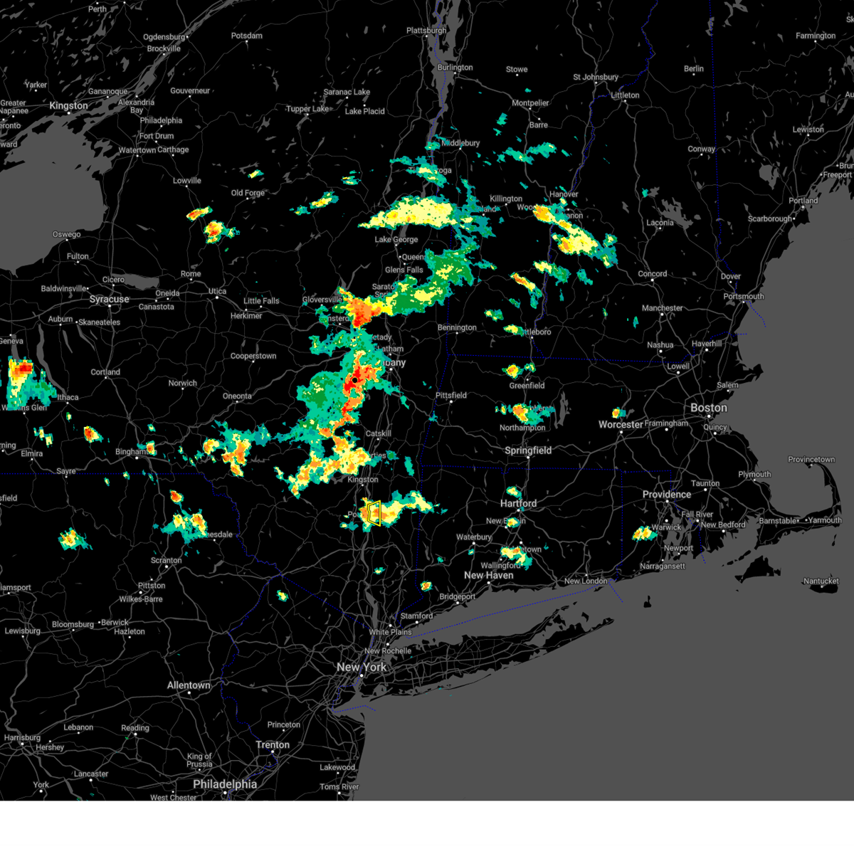
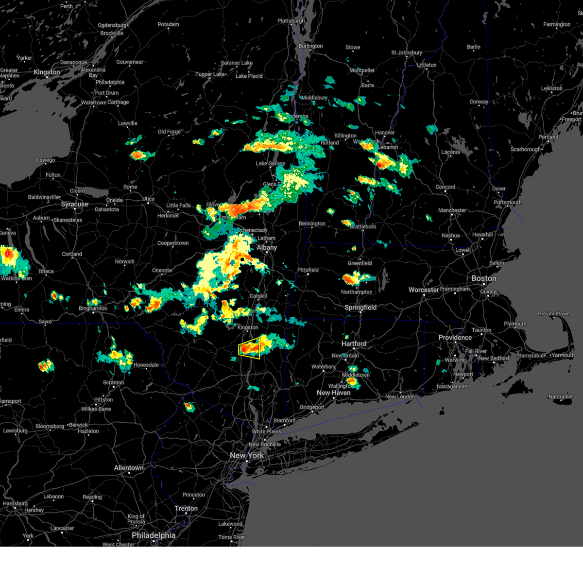
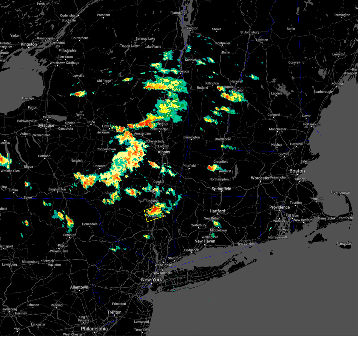
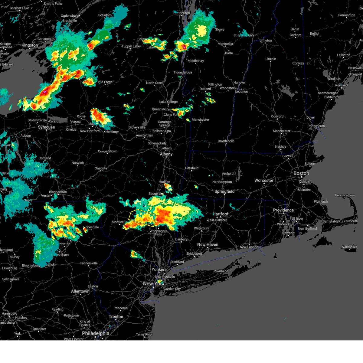
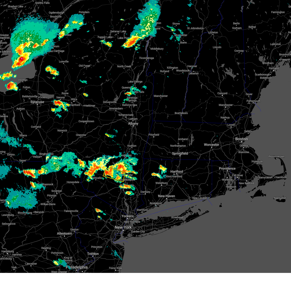
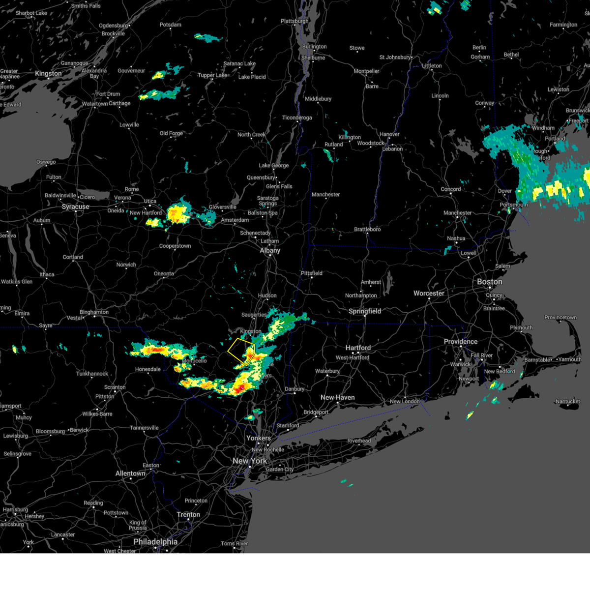
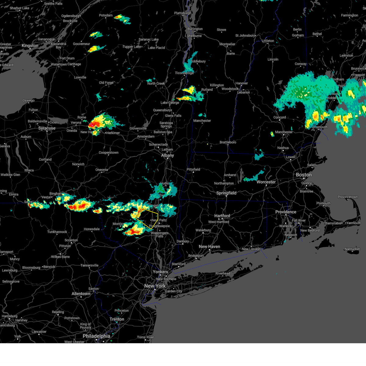
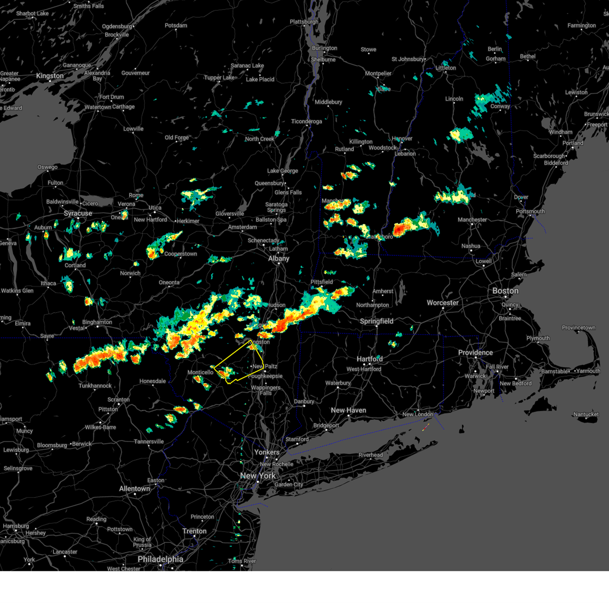
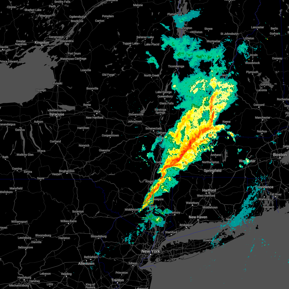
Hail Map for Highland, NY
The Highland, NY area has had 1 report of on-the-ground hail by trained spotters, and has been under severe weather warnings 6 times during the past 12 months. Doppler radar has detected hail at or near Highland, NY on 24 occasions, including 1 occasion during the past year.
| Name: | Highland, NY |
| Where Located: | 70.9 miles N of Brooklyn, NY |
| Map: | Google Map for Highland, NY |
| Population: | 5647 |
| Housing Units: | 2366 |
| More Info: | Search Google for Highland, NY |
0
The Top Recent Hail Date for Highland, NY is Friday, August 2, 2024 (23rd out of 24)

Hail and Wind Damage Spotted near Highland, NY
| Date / Time | Report Details |
|---|---|
| 7/3/2025 5:23 PM EDT |
 Svraly the national weather service in albany has issued a * severe thunderstorm warning for, southeastern ulster county in east central new york, southern dutchess county in east central new york, * until 630 pm edt. * at 523 pm edt, a severe thunderstorm was located near walden, moving east at 30 mph (radar indicated). Hazards include 60 mph wind gusts and quarter size hail. Hail damage to vehicles is expected. Expect wind damage to roofs, siding, and trees. Svraly the national weather service in albany has issued a * severe thunderstorm warning for, southeastern ulster county in east central new york, southern dutchess county in east central new york, * until 630 pm edt. * at 523 pm edt, a severe thunderstorm was located near walden, moving east at 30 mph (radar indicated). Hazards include 60 mph wind gusts and quarter size hail. Hail damage to vehicles is expected. Expect wind damage to roofs, siding, and trees.
|
| 7/1/2025 5:26 PM EDT |
 the severe thunderstorm warning has been cancelled and is no longer in effect the severe thunderstorm warning has been cancelled and is no longer in effect
|
| 7/1/2025 4:48 PM EDT |
 Svraly the national weather service in albany has issued a * severe thunderstorm warning for, northwestern litchfield county in northern connecticut, southeastern ulster county in east central new york, dutchess county in east central new york, * until 545 pm edt. * at 447 pm edt, severe thunderstorms were located along a line extending from near pine plains to plattekill, moving east at 15 mph (radar indicated). Hazards include 60 mph wind gusts. expect damage to roofs, siding, and trees Svraly the national weather service in albany has issued a * severe thunderstorm warning for, northwestern litchfield county in northern connecticut, southeastern ulster county in east central new york, dutchess county in east central new york, * until 545 pm edt. * at 447 pm edt, severe thunderstorms were located along a line extending from near pine plains to plattekill, moving east at 15 mph (radar indicated). Hazards include 60 mph wind gusts. expect damage to roofs, siding, and trees
|
| 5/3/2025 2:31 PM EDT |
 Svraly the national weather service in albany has issued a * severe thunderstorm warning for, northwestern litchfield county in northern connecticut, southwestern berkshire county in western massachusetts, east central ulster county in east central new york, northern dutchess county in east central new york, southern columbia county in east central new york, * until 330 pm edt. * at 231 pm edt, a severe thunderstorm was located over staatsburg, or near rhinebeck, moving northeast at 50 mph (radar indicated). Hazards include 60 mph wind gusts and quarter size hail. Hail damage to vehicles is expected. Expect wind damage to roofs, siding, and trees. Svraly the national weather service in albany has issued a * severe thunderstorm warning for, northwestern litchfield county in northern connecticut, southwestern berkshire county in western massachusetts, east central ulster county in east central new york, northern dutchess county in east central new york, southern columbia county in east central new york, * until 330 pm edt. * at 231 pm edt, a severe thunderstorm was located over staatsburg, or near rhinebeck, moving northeast at 50 mph (radar indicated). Hazards include 60 mph wind gusts and quarter size hail. Hail damage to vehicles is expected. Expect wind damage to roofs, siding, and trees.
|
| 5/3/2025 2:23 PM EDT |
 the severe thunderstorm warning has been cancelled and is no longer in effect the severe thunderstorm warning has been cancelled and is no longer in effect
|
| 5/3/2025 2:13 PM EDT |
 At 212 pm edt, a severe thunderstorm was located over high falls, or near new paltz, moving northeast at 35 mph (radar indicated). Hazards include 60 mph wind gusts and quarter size hail. Hail damage to vehicles is expected. expect wind damage to roofs, siding, and trees. Locations impacted include, rolling meadows, norrie heights, maple hill, atwood, hillside, stone ridge, elting corners, marbletown, eighmyville, cottekill, hyde park, plutarch, high falls, kallops corners, ponck hockie, milan, springtown, lomontville, binnewater, and stanfordville. At 212 pm edt, a severe thunderstorm was located over high falls, or near new paltz, moving northeast at 35 mph (radar indicated). Hazards include 60 mph wind gusts and quarter size hail. Hail damage to vehicles is expected. expect wind damage to roofs, siding, and trees. Locations impacted include, rolling meadows, norrie heights, maple hill, atwood, hillside, stone ridge, elting corners, marbletown, eighmyville, cottekill, hyde park, plutarch, high falls, kallops corners, ponck hockie, milan, springtown, lomontville, binnewater, and stanfordville.
|
| 6/30/2024 12:23 PM EDT |
 Svraly the national weather service in albany has issued a * severe thunderstorm warning for, litchfield county in northern connecticut, southwestern berkshire county in western massachusetts, central dutchess county in east central new york, south central columbia county in east central new york, * until 100 pm edt. * at 1222 pm edt, severe thunderstorms were located along a line extending from copake to near millerton to poughkeepsie, moving east at 40 mph (radar indicated). Hazards include 60 mph wind gusts and penny size hail. Expect damage to roofs, siding, and trees. severe thunderstorms will be near, poughkeepsie, pleasant valley, amenia, sharon, millbrook, millerton, and falls village around 1225 pm edt. canaan, ashley falls, and dover plains around 1230 pm edt. norfolk and cornwall bridge around 1240 pm edt. torrington, kent, and winsted around 1245 pm edt. Other locations impacted by these severe thunderstorms include cornwall, salt point, ancramdale, lithgow, hoxie corner, wrightville, salisbury, and smithfield. Svraly the national weather service in albany has issued a * severe thunderstorm warning for, litchfield county in northern connecticut, southwestern berkshire county in western massachusetts, central dutchess county in east central new york, south central columbia county in east central new york, * until 100 pm edt. * at 1222 pm edt, severe thunderstorms were located along a line extending from copake to near millerton to poughkeepsie, moving east at 40 mph (radar indicated). Hazards include 60 mph wind gusts and penny size hail. Expect damage to roofs, siding, and trees. severe thunderstorms will be near, poughkeepsie, pleasant valley, amenia, sharon, millbrook, millerton, and falls village around 1225 pm edt. canaan, ashley falls, and dover plains around 1230 pm edt. norfolk and cornwall bridge around 1240 pm edt. torrington, kent, and winsted around 1245 pm edt. Other locations impacted by these severe thunderstorms include cornwall, salt point, ancramdale, lithgow, hoxie corner, wrightville, salisbury, and smithfield.
|
| 6/30/2024 12:13 PM EDT |
 At 1213 pm edt, severe thunderstorms were located along a line extending from ancram to near pine plains to fairview, moving east at 40 mph (radar indicated). Hazards include 60 mph wind gusts and penny size hail. Expect damage to roofs, siding, and trees. these severe storms will be near, pleasant valley, amenia, millbrook, and millerton around 1220 pm edt. dover plains around 1225 pm edt. Other locations impacted by these severe thunderstorms include salt point, pachin mills, ancramdale, norrie heights, lithgow, hoxie corner, elting corners, haviland, smithfield, and south amenia. At 1213 pm edt, severe thunderstorms were located along a line extending from ancram to near pine plains to fairview, moving east at 40 mph (radar indicated). Hazards include 60 mph wind gusts and penny size hail. Expect damage to roofs, siding, and trees. these severe storms will be near, pleasant valley, amenia, millbrook, and millerton around 1220 pm edt. dover plains around 1225 pm edt. Other locations impacted by these severe thunderstorms include salt point, pachin mills, ancramdale, norrie heights, lithgow, hoxie corner, elting corners, haviland, smithfield, and south amenia.
|
| 6/30/2024 11:55 AM EDT |
 Svraly the national weather service in albany has issued a * severe thunderstorm warning for, southeastern ulster county in east central new york, dutchess county in east central new york, southern columbia county in east central new york, * until 1230 pm edt. * at 1154 am edt, severe thunderstorms were located along a line extending from livingston to red hook to new paltz, moving east at 35 mph (radar indicated). Hazards include 60 mph wind gusts and penny size hail. Expect damage to roofs, siding, and trees. severe thunderstorms will be near, poughkeepsie, hyde park, highland, fairview, and staatsburg around 1200 pm edt. pleasant valley, pine plains, and ancram around 1205 pm edt. copake and stanfordville around 1210 pm edt. millbrook around 1215 pm edt. millerton around 1220 pm edt. Other locations impacted by these severe thunderstorms include salt point, ancramdale, norrie heights, kerleys corners, lithgow, burden, hoxie corner, linden acres, elting corners, and smithfield. Svraly the national weather service in albany has issued a * severe thunderstorm warning for, southeastern ulster county in east central new york, dutchess county in east central new york, southern columbia county in east central new york, * until 1230 pm edt. * at 1154 am edt, severe thunderstorms were located along a line extending from livingston to red hook to new paltz, moving east at 35 mph (radar indicated). Hazards include 60 mph wind gusts and penny size hail. Expect damage to roofs, siding, and trees. severe thunderstorms will be near, poughkeepsie, hyde park, highland, fairview, and staatsburg around 1200 pm edt. pleasant valley, pine plains, and ancram around 1205 pm edt. copake and stanfordville around 1210 pm edt. millbrook around 1215 pm edt. millerton around 1220 pm edt. Other locations impacted by these severe thunderstorms include salt point, ancramdale, norrie heights, kerleys corners, lithgow, burden, hoxie corner, linden acres, elting corners, and smithfield.
|
| 6/30/2024 11:27 AM EDT |
 Svraly the national weather service in albany has issued a * severe thunderstorm warning for, ulster county in east central new york, northwestern dutchess county in east central new york, southwestern columbia county in east central new york, southeastern greene county in east central new york, * until noon edt. * at 1126 am edt, severe thunderstorms were located along a line extending from near woodstock to near west shokan to south fallsburg, moving east at 40 mph (radar indicated). Hazards include 60 mph wind gusts and penny size hail. expect damage to roofs, siding, and trees Svraly the national weather service in albany has issued a * severe thunderstorm warning for, ulster county in east central new york, northwestern dutchess county in east central new york, southwestern columbia county in east central new york, southeastern greene county in east central new york, * until noon edt. * at 1126 am edt, severe thunderstorms were located along a line extending from near woodstock to near west shokan to south fallsburg, moving east at 40 mph (radar indicated). Hazards include 60 mph wind gusts and penny size hail. expect damage to roofs, siding, and trees
|
| 6/26/2024 8:55 PM EDT |
 At 854 pm edt, severe thunderstorms were located along a line extending from highland to near hopewell junction to near lake carmel, moving northeast at 45 mph (radar indicated). Hazards include 60 mph wind gusts. Expect damage to roofs, siding, and trees. these severe storms will be near, poughkeepsie, pawling, pleasant valley, highland, and fairview around 900 pm edt. sherman, millbrook, wingdale, and dover plains around 905 pm edt. Other locations impacted by these severe thunderstorms include tuckers corner, stormville, salt point, baker corner, knapps corner, beekman, south dover, lithgow, hoxie corner, and new hamburg. At 854 pm edt, severe thunderstorms were located along a line extending from highland to near hopewell junction to near lake carmel, moving northeast at 45 mph (radar indicated). Hazards include 60 mph wind gusts. Expect damage to roofs, siding, and trees. these severe storms will be near, poughkeepsie, pawling, pleasant valley, highland, and fairview around 900 pm edt. sherman, millbrook, wingdale, and dover plains around 905 pm edt. Other locations impacted by these severe thunderstorms include tuckers corner, stormville, salt point, baker corner, knapps corner, beekman, south dover, lithgow, hoxie corner, and new hamburg.
|
| 6/26/2024 8:24 PM EDT |
 Svraly the national weather service in albany has issued a * severe thunderstorm warning for, southeastern ulster county in east central new york, southern dutchess county in east central new york, * until 915 pm edt. * at 823 pm edt, severe thunderstorms were located along a line extending from near montgomery to near west point to ramsey, moving northeast at 50 mph (radar indicated). Hazards include 60 mph wind gusts. Expect damage to roofs, siding, and trees. severe thunderstorms will be near, beacon and wallkill around 830 pm edt. plattekill, fishkill, modena, and marlboro around 835 pm edt. milton, wappingers falls, hopewell junction, and myers corner around 840 pm edt. poughkeepsie, highland, and red oaks mill around 845 pm edt. pawling, pleasant valley, and fairview around 850 pm edt. sherman, millbrook, and wingdale around 900 pm edt. dover plains around 905 pm edt. Other locations impacted by these severe thunderstorms include tuckers corner, stormville, salt point, baker corner, knapps corner, beekman, south dover, lithgow, hoxie corner, and new hamburg. Svraly the national weather service in albany has issued a * severe thunderstorm warning for, southeastern ulster county in east central new york, southern dutchess county in east central new york, * until 915 pm edt. * at 823 pm edt, severe thunderstorms were located along a line extending from near montgomery to near west point to ramsey, moving northeast at 50 mph (radar indicated). Hazards include 60 mph wind gusts. Expect damage to roofs, siding, and trees. severe thunderstorms will be near, beacon and wallkill around 830 pm edt. plattekill, fishkill, modena, and marlboro around 835 pm edt. milton, wappingers falls, hopewell junction, and myers corner around 840 pm edt. poughkeepsie, highland, and red oaks mill around 845 pm edt. pawling, pleasant valley, and fairview around 850 pm edt. sherman, millbrook, and wingdale around 900 pm edt. dover plains around 905 pm edt. Other locations impacted by these severe thunderstorms include tuckers corner, stormville, salt point, baker corner, knapps corner, beekman, south dover, lithgow, hoxie corner, and new hamburg.
|
| 6/23/2024 4:11 PM EDT |
 Svraly the national weather service in albany has issued a * severe thunderstorm warning for, northwestern litchfield county in northern connecticut, southeastern ulster county in east central new york, dutchess county in east central new york, south central columbia county in east central new york, * until 445 pm edt. * at 411 pm edt, a severe thunderstorm was located over hyde park, or 7 miles north of poughkeepsie, moving east at 50 mph (radar indicated). Hazards include 60 mph wind gusts and quarter size hail. Hail damage to vehicles is expected. Expect wind damage to roofs, siding, and trees. Svraly the national weather service in albany has issued a * severe thunderstorm warning for, northwestern litchfield county in northern connecticut, southeastern ulster county in east central new york, dutchess county in east central new york, south central columbia county in east central new york, * until 445 pm edt. * at 411 pm edt, a severe thunderstorm was located over hyde park, or 7 miles north of poughkeepsie, moving east at 50 mph (radar indicated). Hazards include 60 mph wind gusts and quarter size hail. Hail damage to vehicles is expected. Expect wind damage to roofs, siding, and trees.
|
| 6/21/2024 2:40 PM EDT |
 the severe thunderstorm warning has been cancelled and is no longer in effect the severe thunderstorm warning has been cancelled and is no longer in effect
|
| 6/21/2024 2:34 PM EDT |
 At 233 pm edt, a severe thunderstorm was located near new paltz, moving east at 15 mph (radar indicated). Hazards include 60 mph wind gusts and quarter size hail. Hail damage to vehicles is expected. expect wind damage to roofs, siding, and trees. Locations impacted include, poughkeepsie, hyde park, fairview, haviland, macdonnell heights, rochdale, manchester bridge, colonial heights, dongan place, and arlington. At 233 pm edt, a severe thunderstorm was located near new paltz, moving east at 15 mph (radar indicated). Hazards include 60 mph wind gusts and quarter size hail. Hail damage to vehicles is expected. expect wind damage to roofs, siding, and trees. Locations impacted include, poughkeepsie, hyde park, fairview, haviland, macdonnell heights, rochdale, manchester bridge, colonial heights, dongan place, and arlington.
|
| 6/21/2024 2:34 PM EDT |
 the severe thunderstorm warning has been cancelled and is no longer in effect the severe thunderstorm warning has been cancelled and is no longer in effect
|
| 6/21/2024 2:18 PM EDT |
 Svraly the national weather service in albany has issued a * severe thunderstorm warning for, southeastern ulster county in east central new york, west central dutchess county in east central new york, * until 300 pm edt. * at 218 pm edt, a severe thunderstorm was located over new paltz, moving east at 15 mph (radar indicated). Hazards include 60 mph wind gusts and quarter size hail. Hail damage to vehicles is expected. Expect wind damage to roofs, siding, and trees. Svraly the national weather service in albany has issued a * severe thunderstorm warning for, southeastern ulster county in east central new york, west central dutchess county in east central new york, * until 300 pm edt. * at 218 pm edt, a severe thunderstorm was located over new paltz, moving east at 15 mph (radar indicated). Hazards include 60 mph wind gusts and quarter size hail. Hail damage to vehicles is expected. Expect wind damage to roofs, siding, and trees.
|
| 6/21/2024 2:01 PM EDT |
 At 200 pm edt, a severe thunderstorm was located over hyde park, or near new paltz, moving south at 10 mph (public. this storm has produced wind damage and pea size hail). Hazards include 60 mph wind gusts and quarter size hail. Hail damage to vehicles is expected. expect wind damage to roofs, siding, and trees. this severe storm will be near, hyde park and highland around 205 pm edt. poughkeepsie and fairview around 210 pm edt. Other locations impacted by this severe thunderstorm include tuckers corner, norrie heights, esopus, dewitt mills, elting corners, haviland, pleasant plains, timothy heights, ardonia, and colonial heights. At 200 pm edt, a severe thunderstorm was located over hyde park, or near new paltz, moving south at 10 mph (public. this storm has produced wind damage and pea size hail). Hazards include 60 mph wind gusts and quarter size hail. Hail damage to vehicles is expected. expect wind damage to roofs, siding, and trees. this severe storm will be near, hyde park and highland around 205 pm edt. poughkeepsie and fairview around 210 pm edt. Other locations impacted by this severe thunderstorm include tuckers corner, norrie heights, esopus, dewitt mills, elting corners, haviland, pleasant plains, timothy heights, ardonia, and colonial heights.
|
| 6/21/2024 1:30 PM EDT |
 Svraly the national weather service in albany has issued a * severe thunderstorm warning for, southeastern ulster county in east central new york, west central dutchess county in east central new york, * until 215 pm edt. * at 130 pm edt, a severe thunderstorm was located near port ewen, or near kingston, moving south at 10 mph (radar indicated). Hazards include 60 mph wind gusts and quarter size hail. Hail damage to vehicles is expected. expect wind damage to roofs, siding, and trees. this severe thunderstorm will be near, tillson and staatsburg around 135 pm edt. hyde park around 145 pm edt. Other locations impacted by this severe thunderstorm include rolling meadows, norrie heights, rosendale, maple hill, atwood, pacama, hillside, stone ridge, elting corners, and haviland. Svraly the national weather service in albany has issued a * severe thunderstorm warning for, southeastern ulster county in east central new york, west central dutchess county in east central new york, * until 215 pm edt. * at 130 pm edt, a severe thunderstorm was located near port ewen, or near kingston, moving south at 10 mph (radar indicated). Hazards include 60 mph wind gusts and quarter size hail. Hail damage to vehicles is expected. expect wind damage to roofs, siding, and trees. this severe thunderstorm will be near, tillson and staatsburg around 135 pm edt. hyde park around 145 pm edt. Other locations impacted by this severe thunderstorm include rolling meadows, norrie heights, rosendale, maple hill, atwood, pacama, hillside, stone ridge, elting corners, and haviland.
|
| 9/7/2023 8:00 PM EDT |
 At 800 pm edt, severe thunderstorms were located along a line extending from near hunter to rhinebeck to near fishkill, moving east at 35 mph (radar indicated). Hazards include 60 mph wind gusts and quarter size hail. Hail damage to vehicles is expected. Expect wind damage to roofs, siding, and trees. At 800 pm edt, severe thunderstorms were located along a line extending from near hunter to rhinebeck to near fishkill, moving east at 35 mph (radar indicated). Hazards include 60 mph wind gusts and quarter size hail. Hail damage to vehicles is expected. Expect wind damage to roofs, siding, and trees.
|
| 9/7/2023 7:54 PM EDT |
 At 754 pm edt, a severe thunderstorm was located near highland, or near poughkeepsie, moving north at 40 mph (radar indicated). Hazards include 60 mph wind gusts and quarter size hail. Hail damage to vehicles is expected. expect wind damage to roofs, siding, and trees. locations impacted include, kingston, new paltz, hudson, catskill, saugerties, rhinebeck, hunter, wallkill, hyde park, milton, plattekill, hurley, woodstock, highland, red hook, windham, athens, prattsville, high falls and tillson. hail threat, radar indicated max hail size, 1. 00 in wind threat, radar indicated max wind gust, 60 mph. At 754 pm edt, a severe thunderstorm was located near highland, or near poughkeepsie, moving north at 40 mph (radar indicated). Hazards include 60 mph wind gusts and quarter size hail. Hail damage to vehicles is expected. expect wind damage to roofs, siding, and trees. locations impacted include, kingston, new paltz, hudson, catskill, saugerties, rhinebeck, hunter, wallkill, hyde park, milton, plattekill, hurley, woodstock, highland, red hook, windham, athens, prattsville, high falls and tillson. hail threat, radar indicated max hail size, 1. 00 in wind threat, radar indicated max wind gust, 60 mph.
|
| 9/7/2023 7:21 PM EDT |
 At 721 pm edt, a severe thunderstorm was located near kerhonkson, or 7 miles northeast of ellenville, moving northeast at 50 mph (radar indicated). Hazards include 60 mph wind gusts and quarter size hail. Hail damage to vehicles is expected. Expect wind damage to roofs, siding, and trees. At 721 pm edt, a severe thunderstorm was located near kerhonkson, or 7 miles northeast of ellenville, moving northeast at 50 mph (radar indicated). Hazards include 60 mph wind gusts and quarter size hail. Hail damage to vehicles is expected. Expect wind damage to roofs, siding, and trees.
|
| 8/12/2023 8:56 PM EDT |
 The severe thunderstorm warning for southwestern litchfield, southeastern ulster and southern dutchess counties will expire at 900 pm edt, the storms which prompted the warning are moving out of the area. therefore, the warning will be allowed to expire. however hail, gusty winds and heavy rain are still possible with these thunderstorms, and another severe thunderstorm warning has been issued for southeastern dutchess and southwestern litchfield counties until 930 pm edt. a severe thunderstorm watch remains in effect until midnight edt for northern connecticut, and east central new york. remember, a severe thunderstorm warning still remains in effect for southeastern dutchess and southwestern litchfield counties until 930 pm edt. The severe thunderstorm warning for southwestern litchfield, southeastern ulster and southern dutchess counties will expire at 900 pm edt, the storms which prompted the warning are moving out of the area. therefore, the warning will be allowed to expire. however hail, gusty winds and heavy rain are still possible with these thunderstorms, and another severe thunderstorm warning has been issued for southeastern dutchess and southwestern litchfield counties until 930 pm edt. a severe thunderstorm watch remains in effect until midnight edt for northern connecticut, and east central new york. remember, a severe thunderstorm warning still remains in effect for southeastern dutchess and southwestern litchfield counties until 930 pm edt.
|
| 8/12/2023 8:23 PM EDT |
 The severe thunderstorm warning for southeastern ulster and southwestern dutchess counties will expire at 830 pm edt, the storms which prompted the warning have moved out of portions of the warned area. therefore, the warning will be allowed to expire. however hail, gusty winds, and heavy rain are still possible with these thunderstorms, and another severe thudnerstorm warning has been issed for southeastern ulster and southern dutchess counties until 900 pm edt. a severe thunderstorm watch remains in effect until midnight edt for east central new york. remember, a severe thunderstorm warning still remains in effect for southeastern ulster and southern dutchess counties until 900 pm edt. The severe thunderstorm warning for southeastern ulster and southwestern dutchess counties will expire at 830 pm edt, the storms which prompted the warning have moved out of portions of the warned area. therefore, the warning will be allowed to expire. however hail, gusty winds, and heavy rain are still possible with these thunderstorms, and another severe thudnerstorm warning has been issed for southeastern ulster and southern dutchess counties until 900 pm edt. a severe thunderstorm watch remains in effect until midnight edt for east central new york. remember, a severe thunderstorm warning still remains in effect for southeastern ulster and southern dutchess counties until 900 pm edt.
|
| 8/12/2023 8:11 PM EDT |
 At 811 pm edt, severe thunderstorms were located along a line extending from dover plains to myers corner to near bloomingburg, moving east at 30 mph (radar indicated). Hazards include 60 mph wind gusts and half dollar size hail. Hail damage to vehicles is expected. Expect wind damage to roofs, siding, and trees. At 811 pm edt, severe thunderstorms were located along a line extending from dover plains to myers corner to near bloomingburg, moving east at 30 mph (radar indicated). Hazards include 60 mph wind gusts and half dollar size hail. Hail damage to vehicles is expected. Expect wind damage to roofs, siding, and trees.
|
| 8/12/2023 8:03 PM EDT |
 At 802 pm edt, severe thunderstorms were located along a line extending from fairview to near gardnertown to wurtsboro, moving east at 35 mph (radar indicated). Hazards include 60 mph wind gusts and half dollar size hail. Hail damage to vehicles is expected. expect wind damage to roofs, siding, and trees. Locations impacted include, poughkeepsie, beacon, new paltz, ellenville, wallkill, plattekill, wappingers falls, highland, fishkill, modena, marlboro, red oaks mill, myers corner, hopewell junction, lloyd, crawford, gardiner, tuckers corner, forest glen and knapps corner. At 802 pm edt, severe thunderstorms were located along a line extending from fairview to near gardnertown to wurtsboro, moving east at 35 mph (radar indicated). Hazards include 60 mph wind gusts and half dollar size hail. Hail damage to vehicles is expected. expect wind damage to roofs, siding, and trees. Locations impacted include, poughkeepsie, beacon, new paltz, ellenville, wallkill, plattekill, wappingers falls, highland, fishkill, modena, marlboro, red oaks mill, myers corner, hopewell junction, lloyd, crawford, gardiner, tuckers corner, forest glen and knapps corner.
|
| 8/12/2023 7:58 PM EDT |
 At 757 pm edt, severe thunderstorms were located along a line extending from near ancram to near litchfield, moving east at 55 mph (radar indicated). Hazards include 60 mph wind gusts and half dollar size hail. Hail damage to vehicles is expected. expect wind damage to roofs, siding, and trees. Locations impacted include, poughkeepsie, hyde park, pleasant valley, amenia, kent, pine plains, millbrook, fairview, red oaks mill, stanfordville, staatsburg, dover plains, beekman, bethel, smithfield, salt point, norrie heights, south dover, lithgow and hoxie corner. At 757 pm edt, severe thunderstorms were located along a line extending from near ancram to near litchfield, moving east at 55 mph (radar indicated). Hazards include 60 mph wind gusts and half dollar size hail. Hail damage to vehicles is expected. expect wind damage to roofs, siding, and trees. Locations impacted include, poughkeepsie, hyde park, pleasant valley, amenia, kent, pine plains, millbrook, fairview, red oaks mill, stanfordville, staatsburg, dover plains, beekman, bethel, smithfield, salt point, norrie heights, south dover, lithgow and hoxie corner.
|
| 8/12/2023 7:42 PM EDT |
 The severe thunderstorm warning for southeastern ulster county will expire at 745 pm edt, this warning will be allowed to expire. however hail, gusty winds, and heavy rain remain possible with this thunderstorm and another severe thunderstorm warning has been issued. a severe thunderstorm watch remains in effect until midnight edt for east central new york. remember, a severe thunderstorm warning still remains in effect for portions of ulster and dutchess counties through 830 pm edt. The severe thunderstorm warning for southeastern ulster county will expire at 745 pm edt, this warning will be allowed to expire. however hail, gusty winds, and heavy rain remain possible with this thunderstorm and another severe thunderstorm warning has been issued. a severe thunderstorm watch remains in effect until midnight edt for east central new york. remember, a severe thunderstorm warning still remains in effect for portions of ulster and dutchess counties through 830 pm edt.
|
| 8/12/2023 7:39 PM EDT |
 At 739 pm edt, severe thunderstorms were located along a line extending from near new paltz to near rock hill, moving east at 40 mph (radar indicated). Hazards include 60 mph wind gusts and quarter size hail. Hail damage to vehicles is expected. Expect wind damage to roofs, siding, and trees. At 739 pm edt, severe thunderstorms were located along a line extending from near new paltz to near rock hill, moving east at 40 mph (radar indicated). Hazards include 60 mph wind gusts and quarter size hail. Hail damage to vehicles is expected. Expect wind damage to roofs, siding, and trees.
|
| 8/12/2023 7:32 PM EDT |
 At 732 pm edt, severe thunderstorms were located along a line extending from port ewen to 6 miles west of wingdale, moving east at 55 mph (radar indicated). Hazards include 60 mph wind gusts and half dollar size hail. Hail damage to vehicles is expected. Expect wind damage to roofs, siding, and trees. At 732 pm edt, severe thunderstorms were located along a line extending from port ewen to 6 miles west of wingdale, moving east at 55 mph (radar indicated). Hazards include 60 mph wind gusts and half dollar size hail. Hail damage to vehicles is expected. Expect wind damage to roofs, siding, and trees.
|
| 8/12/2023 7:28 PM EDT | Tree and wires down. time estimated from rada in ulster county NY, 1.6 miles SSE of Highland, NY |
| 8/12/2023 7:18 PM EDT | Tree and wires down at lloyd cemetery in lloyd... ny in ulster county NY, 4.2 miles ESE of Highland, NY |
| 8/12/2023 6:58 PM EDT |
 At 657 pm edt, a severe thunderstorm was located over napanoch, or near ellenville, moving east at 35 mph (radar indicated). Hazards include ping pong ball size hail and 60 mph wind gusts. People and animals outdoors will be injured. expect hail damage to roofs, siding, windows, and vehicles. Expect wind damage to roofs, siding, and trees. At 657 pm edt, a severe thunderstorm was located over napanoch, or near ellenville, moving east at 35 mph (radar indicated). Hazards include ping pong ball size hail and 60 mph wind gusts. People and animals outdoors will be injured. expect hail damage to roofs, siding, windows, and vehicles. Expect wind damage to roofs, siding, and trees.
|
| 8/4/2023 9:25 PM EDT |
 The severe thunderstorm warning for southeastern ulster county will expire at 930 pm edt, the storm which prompted the warning has weakened below severe limits, and has exited the warned area. therefore, the warning will be allowed to expire. a severe thunderstorm watch remains in effect until 1000 pm edt for east central new york. The severe thunderstorm warning for southeastern ulster county will expire at 930 pm edt, the storm which prompted the warning has weakened below severe limits, and has exited the warned area. therefore, the warning will be allowed to expire. a severe thunderstorm watch remains in effect until 1000 pm edt for east central new york.
|
| 8/4/2023 9:00 PM EDT |
 At 900 pm edt, a severe thunderstorm was located over tillson, or near new paltz, moving southeast at 30 mph (radar indicated). Hazards include 60 mph wind gusts and quarter size hail. Hail damage to vehicles is expected. expect wind damage to roofs, siding, and trees. locations impacted include, new paltz, tillson, high falls, kerhonkson, lloyd, esopus, rosendale, marbletown, lefever falls, maple hill, forest glen, atwood, alligerville, stone ridge, elting corners, ardonia, rosendale village, rifton, jenkinstown and mill hook. hail threat, radar indicated max hail size, 1. 00 in wind threat, radar indicated max wind gust, 60 mph. At 900 pm edt, a severe thunderstorm was located over tillson, or near new paltz, moving southeast at 30 mph (radar indicated). Hazards include 60 mph wind gusts and quarter size hail. Hail damage to vehicles is expected. expect wind damage to roofs, siding, and trees. locations impacted include, new paltz, tillson, high falls, kerhonkson, lloyd, esopus, rosendale, marbletown, lefever falls, maple hill, forest glen, atwood, alligerville, stone ridge, elting corners, ardonia, rosendale village, rifton, jenkinstown and mill hook. hail threat, radar indicated max hail size, 1. 00 in wind threat, radar indicated max wind gust, 60 mph.
|
| 8/4/2023 8:45 PM EDT |
 At 845 pm edt, a severe thunderstorm was located near kerhonkson, or 11 miles northwest of new paltz, moving southeast at 20 mph (radar indicated). Hazards include 60 mph wind gusts and quarter size hail. Hail damage to vehicles is expected. Expect wind damage to roofs, siding, and trees. At 845 pm edt, a severe thunderstorm was located near kerhonkson, or 11 miles northwest of new paltz, moving southeast at 20 mph (radar indicated). Hazards include 60 mph wind gusts and quarter size hail. Hail damage to vehicles is expected. Expect wind damage to roofs, siding, and trees.
|
| 7/27/2023 5:42 PM EDT |
 The severe thunderstorm warning for litchfield, southeastern ulster and dutchess counties will expire at 545 pm edt, the storms which prompted the warning have moved out portions of the area and another warning has been issued. therefore, this warning will be allowed to expire. a severe thunderstorm watch remains in effect until 800 pm edt for northern connecticut, and east central new york. remember, a severe thunderstorm warning still remains in effect for portions of dutchess and litchfield county until 630 pm edt. The severe thunderstorm warning for litchfield, southeastern ulster and dutchess counties will expire at 545 pm edt, the storms which prompted the warning have moved out portions of the area and another warning has been issued. therefore, this warning will be allowed to expire. a severe thunderstorm watch remains in effect until 800 pm edt for northern connecticut, and east central new york. remember, a severe thunderstorm warning still remains in effect for portions of dutchess and litchfield county until 630 pm edt.
|
| 7/27/2023 4:55 PM EDT |
 At 454 pm edt, severe thunderstorms were located along a line extending from near hartland to near litchfield to new paltz, moving south at 40 mph (radar indicated). Hazards include 60 mph wind gusts and penny size hail. expect damage to roofs, siding, and trees At 454 pm edt, severe thunderstorms were located along a line extending from near hartland to near litchfield to new paltz, moving south at 40 mph (radar indicated). Hazards include 60 mph wind gusts and penny size hail. expect damage to roofs, siding, and trees
|
| 7/27/2023 3:54 PM EDT |
 At 354 pm edt, a severe thunderstorm was located over rhinebeck, moving east at 40 mph (radar indicated). Hazards include 60 mph wind gusts and quarter size hail. Hail damage to vehicles is expected. Expect wind damage to roofs, siding, and trees. At 354 pm edt, a severe thunderstorm was located over rhinebeck, moving east at 40 mph (radar indicated). Hazards include 60 mph wind gusts and quarter size hail. Hail damage to vehicles is expected. Expect wind damage to roofs, siding, and trees.
|
| 7/27/2023 2:44 PM EDT |
 At 243 pm edt, a severe thunderstorm was located over ellenville, moving northeast at 35 mph (radar indicated). Hazards include 60 mph wind gusts and quarter size hail. Hail damage to vehicles is expected. Expect wind damage to roofs, siding, and trees. At 243 pm edt, a severe thunderstorm was located over ellenville, moving northeast at 35 mph (radar indicated). Hazards include 60 mph wind gusts and quarter size hail. Hail damage to vehicles is expected. Expect wind damage to roofs, siding, and trees.
|
| 6/26/2023 11:51 AM EDT |
 The severe thunderstorm warning for southeastern ulster and west central dutchess counties will expire at noon edt, the storm which prompted the warning has weakened below severe limits, and no longer poses an immediate threat to life or property. therefore, the warning will be allowed to expire. The severe thunderstorm warning for southeastern ulster and west central dutchess counties will expire at noon edt, the storm which prompted the warning has weakened below severe limits, and no longer poses an immediate threat to life or property. therefore, the warning will be allowed to expire.
|
| 6/26/2023 11:38 AM EDT |
 At 1138 am edt, a severe thunderstorm was located near staatsburg, or 7 miles southeast of rhinebeck, moving northeast at 35 mph (radar indicated). Hazards include 60 mph wind gusts. Expect damage to roofs, siding, and trees. locations impacted include, poughkeepsie, new paltz, hyde park, pleasant valley, highland, tillson, fairview, port ewen, staatsburg, red oaks mill, lloyd, esopus, norrie heights, knapps corner, titusville, elting corners, haviland, crown heights, timothy heights and stoneco. hail threat, radar indicated max hail size, <. 75 in wind threat, radar indicated max wind gust, 60 mph. At 1138 am edt, a severe thunderstorm was located near staatsburg, or 7 miles southeast of rhinebeck, moving northeast at 35 mph (radar indicated). Hazards include 60 mph wind gusts. Expect damage to roofs, siding, and trees. locations impacted include, poughkeepsie, new paltz, hyde park, pleasant valley, highland, tillson, fairview, port ewen, staatsburg, red oaks mill, lloyd, esopus, norrie heights, knapps corner, titusville, elting corners, haviland, crown heights, timothy heights and stoneco. hail threat, radar indicated max hail size, <. 75 in wind threat, radar indicated max wind gust, 60 mph.
|
| 6/26/2023 11:04 AM EDT |
 At 1104 am edt, a severe thunderstorm was located over plattekill, or 7 miles northeast of walden, moving northeast at 35 mph (radar indicated). Hazards include 60 mph wind gusts. expect damage to roofs, siding, and trees At 1104 am edt, a severe thunderstorm was located over plattekill, or 7 miles northeast of walden, moving northeast at 35 mph (radar indicated). Hazards include 60 mph wind gusts. expect damage to roofs, siding, and trees
|
| 7/24/2022 8:22 PM EDT |
 At 821 pm edt, severe thunderstorms were located along a line extending from near athens to near red hook to near newburgh, moving east at 40 mph (radar indicated. at 8:15 pm the red hook mesonet site reported a wind gust of 45 mph). Hazards include 60 mph wind gusts. Expect damage to roofs, siding, and trees. locations impacted include, poughkeepsie, kingston, beacon, new paltz, hudson, catskill, saugerties, rhinebeck, pawling, chatham, wallkill, hyde park, milton, plattekill, pleasant valley, hurley, claverack, wappingers falls, amenia and livingston. hail threat, radar indicated max hail size, <. 75 in wind threat, observed max wind gust, 60 mph. At 821 pm edt, severe thunderstorms were located along a line extending from near athens to near red hook to near newburgh, moving east at 40 mph (radar indicated. at 8:15 pm the red hook mesonet site reported a wind gust of 45 mph). Hazards include 60 mph wind gusts. Expect damage to roofs, siding, and trees. locations impacted include, poughkeepsie, kingston, beacon, new paltz, hudson, catskill, saugerties, rhinebeck, pawling, chatham, wallkill, hyde park, milton, plattekill, pleasant valley, hurley, claverack, wappingers falls, amenia and livingston. hail threat, radar indicated max hail size, <. 75 in wind threat, observed max wind gust, 60 mph.
|
| 7/24/2022 8:11 PM EDT |
 At 810 pm edt, severe thunderstorms were located along a line extending from 7 miles north of north-south lake campground to rhinebeck to near gardnertown, moving east at 40 mph (between 7:45 and 7:50 pm, the high falls mesonet camera showed large downed tree limbs as a result of this storm). Hazards include 60 mph wind gusts. Expect damage to roofs, siding, and trees. locations impacted include, poughkeepsie, kingston, beacon, new paltz, hudson, ellenville, catskill, saugerties, rhinebeck, pawling, chatham, hunter, wallkill, hyde park, milton, plattekill, pleasant valley, hurley, claverack and woodstock. hail threat, radar indicated max hail size, <. 75 in wind threat, observed max wind gust, 60 mph. At 810 pm edt, severe thunderstorms were located along a line extending from 7 miles north of north-south lake campground to rhinebeck to near gardnertown, moving east at 40 mph (between 7:45 and 7:50 pm, the high falls mesonet camera showed large downed tree limbs as a result of this storm). Hazards include 60 mph wind gusts. Expect damage to roofs, siding, and trees. locations impacted include, poughkeepsie, kingston, beacon, new paltz, hudson, ellenville, catskill, saugerties, rhinebeck, pawling, chatham, hunter, wallkill, hyde park, milton, plattekill, pleasant valley, hurley, claverack and woodstock. hail threat, radar indicated max hail size, <. 75 in wind threat, observed max wind gust, 60 mph.
|
| 7/24/2022 7:51 PM EDT |
 At 749 pm edt, severe thunderstorms were located along a line extending from near windham to near olivebridge to near bloomingburg, moving east at 40 mph (emergency management reported trees and wires down in the towns of kerhonkson with this line of storms). Hazards include 60 mph wind gusts. expect damage to roofs, siding, and trees At 749 pm edt, severe thunderstorms were located along a line extending from near windham to near olivebridge to near bloomingburg, moving east at 40 mph (emergency management reported trees and wires down in the towns of kerhonkson with this line of storms). Hazards include 60 mph wind gusts. expect damage to roofs, siding, and trees
|
| 5/22/2022 6:37 PM EDT |
 At 637 pm edt, a severe thunderstorm was located over modena, or near walden, moving east at 30 mph (radar indicated). Hazards include 60 mph wind gusts and penny size hail. expect damage to roofs, siding, and trees At 637 pm edt, a severe thunderstorm was located over modena, or near walden, moving east at 30 mph (radar indicated). Hazards include 60 mph wind gusts and penny size hail. expect damage to roofs, siding, and trees
|
| 5/16/2022 4:36 PM EDT | Large tree limb down. time estimated from rada in ulster county NY, 0.2 miles W of Highland, NY |
| 5/16/2022 4:27 PM EDT |
 At 426 pm edt, severe thunderstorms were located along a line extending from near chatham to near pine plains to near hopewell junction, moving northeast at 75 mph (radar indicated). Hazards include 60 mph wind gusts and quarter size hail. Hail damage to vehicles is expected. Expect wind damage to roofs, siding, and trees. At 426 pm edt, severe thunderstorms were located along a line extending from near chatham to near pine plains to near hopewell junction, moving northeast at 75 mph (radar indicated). Hazards include 60 mph wind gusts and quarter size hail. Hail damage to vehicles is expected. Expect wind damage to roofs, siding, and trees.
|
| 5/16/2022 3:26 PM EDT |
 At 326 pm edt, severe thunderstorms were located along a line extending from near grahamsville to near ellenville to near sussex, moving northeast at 50 mph (radar indicated). Hazards include 60 mph wind gusts and quarter size hail. Hail damage to vehicles is expected. Expect wind damage to roofs, siding, and trees. At 326 pm edt, severe thunderstorms were located along a line extending from near grahamsville to near ellenville to near sussex, moving northeast at 50 mph (radar indicated). Hazards include 60 mph wind gusts and quarter size hail. Hail damage to vehicles is expected. Expect wind damage to roofs, siding, and trees.
|
| 3/7/2022 8:59 PM EST |
 At 859 pm est, severe thunderstorms were located along a line extending from staatsburg to plattekill, moving east at 60 mph (radar indicated). Hazards include 60 mph wind gusts. expect damage to roofs, siding, and trees At 859 pm est, severe thunderstorms were located along a line extending from staatsburg to plattekill, moving east at 60 mph (radar indicated). Hazards include 60 mph wind gusts. expect damage to roofs, siding, and trees
|
| 3/7/2022 8:50 PM EST |
 At 849 pm est, severe thunderstorms were located along a line extending from near new lebanon to new paltz, moving east at 55 mph (radar indicated). Hazards include 60 mph wind gusts. Expect damage to roofs, siding, and trees. these severe storms will be near, new lebanon around 855 pm est. lenox around 900 pm est. pittsfield, pleasant valley, lee and red oaks mill around 905 pm est. becket and millbrook around 910 pm est. middlefield, dover plains and wingdale around 920 pm est. sherman, kent and gaylordsville around 925 pm est. new milford around 930 pm est. new preston around 935 pm est. Other locations impacted by these severe thunderstorms include norrie heights, lithgow, hoxie corner, south amenia, pleasant ridge, jackson corners, verbank, bulls bridge, niverville and dempsey landing. At 849 pm est, severe thunderstorms were located along a line extending from near new lebanon to new paltz, moving east at 55 mph (radar indicated). Hazards include 60 mph wind gusts. Expect damage to roofs, siding, and trees. these severe storms will be near, new lebanon around 855 pm est. lenox around 900 pm est. pittsfield, pleasant valley, lee and red oaks mill around 905 pm est. becket and millbrook around 910 pm est. middlefield, dover plains and wingdale around 920 pm est. sherman, kent and gaylordsville around 925 pm est. new milford around 930 pm est. new preston around 935 pm est. Other locations impacted by these severe thunderstorms include norrie heights, lithgow, hoxie corner, south amenia, pleasant ridge, jackson corners, verbank, bulls bridge, niverville and dempsey landing.
|
| 3/7/2022 8:48 PM EST |
 At 847 pm est, severe thunderstorms were located along a line extending from near claverack to near red hook, moving east at 60 mph (radar indicated). Hazards include 60 mph wind gusts. Expect damage to roofs, siding, and trees. These severe thunderstorms will remain over mainly rural areas of eastern ulster county, including the following locations, tuckers corner, rolling meadows, maple hill, glenford, atwood, manorville, katsbaan, shultis corners, sweet meadows and pacama. At 847 pm est, severe thunderstorms were located along a line extending from near claverack to near red hook, moving east at 60 mph (radar indicated). Hazards include 60 mph wind gusts. Expect damage to roofs, siding, and trees. These severe thunderstorms will remain over mainly rural areas of eastern ulster county, including the following locations, tuckers corner, rolling meadows, maple hill, glenford, atwood, manorville, katsbaan, shultis corners, sweet meadows and pacama.
|
| 3/7/2022 8:41 PM EST |
 At 841 pm est, severe thunderstorms were located along a line extending from near valatie to near kerhonkson, moving east at 55 mph (radar indicated). Hazards include 60 mph wind gusts. Expect damage to roofs, siding, and trees. severe thunderstorms will be near, chatham and valatie around 845 pm est. austerlitz around 850 pm est. hyde park, highland and new lebanon around 855 pm est. poughkeepsie, lenox, fairview and red oaks mill around 900 pm est. pittsfield, pleasant valley and lee around 905 pm est. becket and millbrook around 910 pm est. dover plains around 915 pm est. sherman, kent, middlefield, gaylordsville and wingdale around 920 pm est. other locations impacted by these severe thunderstorms include norrie heights, lithgow, hoxie corner, south amenia, pleasant ridge, jackson corners, verbank, bulls bridge, niverville and dempsey landing. please report hail size, damaging winds and reports of trees down to the national weather service by email at alb. stormreport@noaa. gov, on facebook at www. facebook. com/nwsalbany or twitter @nwsalbany hail threat, radar indicated max hail size, <. 75 in wind threat, radar indicated max wind gust, 60 mph. At 841 pm est, severe thunderstorms were located along a line extending from near valatie to near kerhonkson, moving east at 55 mph (radar indicated). Hazards include 60 mph wind gusts. Expect damage to roofs, siding, and trees. severe thunderstorms will be near, chatham and valatie around 845 pm est. austerlitz around 850 pm est. hyde park, highland and new lebanon around 855 pm est. poughkeepsie, lenox, fairview and red oaks mill around 900 pm est. pittsfield, pleasant valley and lee around 905 pm est. becket and millbrook around 910 pm est. dover plains around 915 pm est. sherman, kent, middlefield, gaylordsville and wingdale around 920 pm est. other locations impacted by these severe thunderstorms include norrie heights, lithgow, hoxie corner, south amenia, pleasant ridge, jackson corners, verbank, bulls bridge, niverville and dempsey landing. please report hail size, damaging winds and reports of trees down to the national weather service by email at alb. stormreport@noaa. gov, on facebook at www. facebook. com/nwsalbany or twitter @nwsalbany hail threat, radar indicated max hail size, <. 75 in wind threat, radar indicated max wind gust, 60 mph.
|
| 3/7/2022 8:21 PM EST |
 At 821 pm est, severe thunderstorms were located along a line extending from near lanesville to near grahamsville, moving east at 60 mph (radar indicated). Hazards include 60 mph wind gusts. Expect damage to roofs, siding, and trees. severe thunderstorms will be near, phoenicia and mount tremper around 825 pm est. woodstock and west shokan around 830 pm est. saugerties, olivebridge, west hurley, kenneth l wilson campground, saugerties south and tillson around 835 pm est. kingston, hurley, lake katrine and port ewen around 840 pm est. other locations impacted by these severe thunderstorms include cherrytown, tuckers corner, rolling meadows, maple hill, glenford, atwood, manorville, katsbaan, shultis corners and sweet meadows. please report hail size, damaging winds and reports of trees down to the national weather service by email at alb. stormreport@noaa. gov, on facebook at www. facebook. com/nwsalbany or twitter @nwsalbany hail threat, radar indicated max hail size, <. 75 in wind threat, radar indicated max wind gust, 60 mph. At 821 pm est, severe thunderstorms were located along a line extending from near lanesville to near grahamsville, moving east at 60 mph (radar indicated). Hazards include 60 mph wind gusts. Expect damage to roofs, siding, and trees. severe thunderstorms will be near, phoenicia and mount tremper around 825 pm est. woodstock and west shokan around 830 pm est. saugerties, olivebridge, west hurley, kenneth l wilson campground, saugerties south and tillson around 835 pm est. kingston, hurley, lake katrine and port ewen around 840 pm est. other locations impacted by these severe thunderstorms include cherrytown, tuckers corner, rolling meadows, maple hill, glenford, atwood, manorville, katsbaan, shultis corners and sweet meadows. please report hail size, damaging winds and reports of trees down to the national weather service by email at alb. stormreport@noaa. gov, on facebook at www. facebook. com/nwsalbany or twitter @nwsalbany hail threat, radar indicated max hail size, <. 75 in wind threat, radar indicated max wind gust, 60 mph.
|
| 8/13/2021 8:34 PM EDT |
 At 834 pm edt, a severe thunderstorm was located over high falls, or 7 miles northwest of new paltz, moving east at 25 mph (radar indicated). Hazards include 60 mph wind gusts and quarter size hail. Hail damage to vehicles is expected. expect wind damage to roofs, siding, and trees. locations impacted include, kingston, new paltz, rhinebeck, hyde park, hurley, highland, fairview, high falls, staatsburg, tillson, olivebridge, port ewen, kerhonkson, lloyd, esopus, rosendale, marbletown, rolling meadows, norrie heights and maple hill. hail threat, radar indicated max hail size, 1. 00 in wind threat, radar indicated max wind gust, 60 mph. At 834 pm edt, a severe thunderstorm was located over high falls, or 7 miles northwest of new paltz, moving east at 25 mph (radar indicated). Hazards include 60 mph wind gusts and quarter size hail. Hail damage to vehicles is expected. expect wind damage to roofs, siding, and trees. locations impacted include, kingston, new paltz, rhinebeck, hyde park, hurley, highland, fairview, high falls, staatsburg, tillson, olivebridge, port ewen, kerhonkson, lloyd, esopus, rosendale, marbletown, rolling meadows, norrie heights and maple hill. hail threat, radar indicated max hail size, 1. 00 in wind threat, radar indicated max wind gust, 60 mph.
|
| 8/13/2021 8:12 PM EDT |
 At 812 pm edt, a severe thunderstorm was located near kerhonkson, or 8 miles north of ellenville, moving east at 25 mph (radar indicated). Hazards include 60 mph wind gusts and quarter size hail. Hail damage to vehicles is expected. Expect wind damage to roofs, siding, and trees. At 812 pm edt, a severe thunderstorm was located near kerhonkson, or 8 miles north of ellenville, moving east at 25 mph (radar indicated). Hazards include 60 mph wind gusts and quarter size hail. Hail damage to vehicles is expected. Expect wind damage to roofs, siding, and trees.
|
| 8/11/2021 4:20 PM EDT |
 At 419 pm edt, a severe thunderstorm was located over fairview, or over poughkeepsie, moving east at 40 mph (radar indicated). Hazards include 60 mph wind gusts and quarter size hail. Hail damage to vehicles is expected. Expect wind damage to roofs, siding, and trees. At 419 pm edt, a severe thunderstorm was located over fairview, or over poughkeepsie, moving east at 40 mph (radar indicated). Hazards include 60 mph wind gusts and quarter size hail. Hail damage to vehicles is expected. Expect wind damage to roofs, siding, and trees.
|
| 8/11/2021 4:10 PM EDT | Downed powerline in ulster county NY, 0.8 miles NNE of Highland, NY |
| 7/17/2021 4:47 PM EDT |
 At 447 pm edt, a severe thunderstorm was located over high falls, or near new paltz, moving northeast at 25 mph (radar indicated). Hazards include 60 mph wind gusts and quarter size hail. Hail damage to vehicles is expected. Expect wind damage to roofs, siding, and trees. At 447 pm edt, a severe thunderstorm was located over high falls, or near new paltz, moving northeast at 25 mph (radar indicated). Hazards include 60 mph wind gusts and quarter size hail. Hail damage to vehicles is expected. Expect wind damage to roofs, siding, and trees.
|
| 7/6/2021 4:37 PM EDT |
 The severe thunderstorm warning for central dutchess county will expire at 445 pm edt, the storm which prompted the warning has moved out of the area. therefore, the warning will be allowed to expire. a severe thunderstorm watch remains in effect until 800 pm edt for east central new york. The severe thunderstorm warning for central dutchess county will expire at 445 pm edt, the storm which prompted the warning has moved out of the area. therefore, the warning will be allowed to expire. a severe thunderstorm watch remains in effect until 800 pm edt for east central new york.
|
| 7/6/2021 4:13 PM EDT |
 At 413 pm edt, a severe thunderstorm was located over pleasant valley, or near poughkeepsie, moving east at 20 mph (radar indicated). Hazards include 70 mph wind gusts and ping pong ball size hail. People and animals outdoors will be injured. expect hail damage to roofs, siding, windows, and vehicles. expect considerable tree damage. wind damage is also likely to mobile homes, roofs, and outbuildings. Locations impacted include, poughkeepsie, hyde park, pleasant valley, millbrook, fairview, red oaks mill, stanfordville, staatsburg, beekman, salt point, norrie heights, lithgow, hoxie corner, clove valley, haviland, poughquag, billings, shunpike, pleasant ridge and washington hollow. At 413 pm edt, a severe thunderstorm was located over pleasant valley, or near poughkeepsie, moving east at 20 mph (radar indicated). Hazards include 70 mph wind gusts and ping pong ball size hail. People and animals outdoors will be injured. expect hail damage to roofs, siding, windows, and vehicles. expect considerable tree damage. wind damage is also likely to mobile homes, roofs, and outbuildings. Locations impacted include, poughkeepsie, hyde park, pleasant valley, millbrook, fairview, red oaks mill, stanfordville, staatsburg, beekman, salt point, norrie heights, lithgow, hoxie corner, clove valley, haviland, poughquag, billings, shunpike, pleasant ridge and washington hollow.
|
| 7/6/2021 3:57 PM EDT | Trees and wires down. time estimated by rada in ulster county NY, 0.8 miles SSE of Highland, NY |
| 7/6/2021 3:57 PM EDT | Trees and wires down. time estimated by rada in ulster county NY, 1.4 miles SSE of Highland, NY |
| 7/6/2021 3:56 PM EDT |
 At 356 pm edt, a severe thunderstorm was located over highland, or near poughkeepsie, moving east at 30 mph (radar indicated). Hazards include 70 mph wind gusts and penny size hail. Expect considerable tree damage. damage is likely to mobile homes, roofs, and outbuildings. Locations impacted include, poughkeepsie, new paltz, hyde park, pleasant valley, highland, millbrook, fairview, red oaks mill, stanfordville, staatsburg, tillson, beekman, lloyd, esopus, tuckers corner, salt point, norrie heights, maple hill, knapps corner and lithgow. At 356 pm edt, a severe thunderstorm was located over highland, or near poughkeepsie, moving east at 30 mph (radar indicated). Hazards include 70 mph wind gusts and penny size hail. Expect considerable tree damage. damage is likely to mobile homes, roofs, and outbuildings. Locations impacted include, poughkeepsie, new paltz, hyde park, pleasant valley, highland, millbrook, fairview, red oaks mill, stanfordville, staatsburg, tillson, beekman, lloyd, esopus, tuckers corner, salt point, norrie heights, maple hill, knapps corner and lithgow.
|
| 7/6/2021 3:43 PM EDT |
 At 343 pm edt, a severe thunderstorm was located over high falls, or near new paltz, moving east at 20 mph (radar indicated). Hazards include 60 mph wind gusts and penny size hail. expect damage to roofs, siding, and trees At 343 pm edt, a severe thunderstorm was located over high falls, or near new paltz, moving east at 20 mph (radar indicated). Hazards include 60 mph wind gusts and penny size hail. expect damage to roofs, siding, and trees
|
| 6/30/2021 6:56 PM EDT |
 At 656 pm edt, a severe thunderstorm was located over wappingers falls, or near poughkeepsie, moving east at 25 mph (radar indicated). Hazards include 70 mph wind gusts and quarter size hail. Hail damage to vehicles is expected. expect considerable tree damage. wind damage is also likely to mobile homes, roofs, and outbuildings. Locations impacted include, poughkeepsie, wappingers falls, highland, hopewell junction, marlboro, red oaks mill, myers corner, wingdale, dover plains, beekman, tuckers corner, knapps corner, south dover, hoxie corner, new hamburg, clove valley, south amenia, poughquag, billings and pleasant ridge. At 656 pm edt, a severe thunderstorm was located over wappingers falls, or near poughkeepsie, moving east at 25 mph (radar indicated). Hazards include 70 mph wind gusts and quarter size hail. Hail damage to vehicles is expected. expect considerable tree damage. wind damage is also likely to mobile homes, roofs, and outbuildings. Locations impacted include, poughkeepsie, wappingers falls, highland, hopewell junction, marlboro, red oaks mill, myers corner, wingdale, dover plains, beekman, tuckers corner, knapps corner, south dover, hoxie corner, new hamburg, clove valley, south amenia, poughquag, billings and pleasant ridge.
|
| 6/30/2021 6:34 PM EDT |
 At 634 pm edt, a severe thunderstorm was located over marlboro, or 7 miles southwest of poughkeepsie, moving east at 45 mph (radar indicated). Hazards include 60 mph wind gusts and penny size hail. expect damage to roofs, siding, and trees At 634 pm edt, a severe thunderstorm was located over marlboro, or 7 miles southwest of poughkeepsie, moving east at 45 mph (radar indicated). Hazards include 60 mph wind gusts and penny size hail. expect damage to roofs, siding, and trees
|
| 5/26/2021 6:55 PM EDT |
 The severe thunderstorm warning for southeastern ulster and central dutchess counties will expire at 700 pm edt, the storm which prompted the warning has moved out of the area. therefore, the warning will be allowed to expire. a severe thunderstorm watch remains in effect until 800 pm edt for east central new york. The severe thunderstorm warning for southeastern ulster and central dutchess counties will expire at 700 pm edt, the storm which prompted the warning has moved out of the area. therefore, the warning will be allowed to expire. a severe thunderstorm watch remains in effect until 800 pm edt for east central new york.
|
| 5/26/2021 6:32 PM EDT |
 At 632 pm edt, a severe thunderstorm was located over highland, or near poughkeepsie, moving southeast at 50 mph (radar indicated). Hazards include 60 mph wind gusts and quarter size hail. Hail damage to vehicles is expected. expect wind damage to roofs, siding, and trees. Locations impacted include, poughkeepsie, kingston, new paltz, rhinebeck, hyde park, pleasant valley, hurley, amenia, highland, millbrook, high falls, stanfordville, tillson, port ewen, fairview, red oaks mill, staatsburg, dover plains, lloyd and esopus. At 632 pm edt, a severe thunderstorm was located over highland, or near poughkeepsie, moving southeast at 50 mph (radar indicated). Hazards include 60 mph wind gusts and quarter size hail. Hail damage to vehicles is expected. expect wind damage to roofs, siding, and trees. Locations impacted include, poughkeepsie, kingston, new paltz, rhinebeck, hyde park, pleasant valley, hurley, amenia, highland, millbrook, high falls, stanfordville, tillson, port ewen, fairview, red oaks mill, staatsburg, dover plains, lloyd and esopus.
|
| 5/26/2021 5:53 PM EDT |
 At 553 pm edt, a severe thunderstorm was located 7 miles southwest of west shokan, or 12 miles north of ellenville, moving east at 50 mph (radar indicated). Hazards include 60 mph wind gusts and quarter size hail. Hail damage to vehicles is expected. Expect wind damage to roofs, siding, and trees. At 553 pm edt, a severe thunderstorm was located 7 miles southwest of west shokan, or 12 miles north of ellenville, moving east at 50 mph (radar indicated). Hazards include 60 mph wind gusts and quarter size hail. Hail damage to vehicles is expected. Expect wind damage to roofs, siding, and trees.
|
| 4/21/2021 2:04 PM EDT |
 At 203 pm edt, a severe thunderstorm was located near gardnertown, or near newburgh, moving northeast at 40 mph (radar indicated). Hazards include 60 mph wind gusts and quarter size hail. Hail damage to vehicles is expected. Expect wind damage to roofs, siding, and trees. At 203 pm edt, a severe thunderstorm was located near gardnertown, or near newburgh, moving northeast at 40 mph (radar indicated). Hazards include 60 mph wind gusts and quarter size hail. Hail damage to vehicles is expected. Expect wind damage to roofs, siding, and trees.
|
| 11/15/2020 8:18 PM EST |
 At 817 pm est, severe thunderstorms were located along a line extending from near saugerties south to new windsor, moving northeast at 45 mph (radar indicated). Hazards include 60 mph wind gusts. expect damage to roofs, siding, and trees At 817 pm est, severe thunderstorms were located along a line extending from near saugerties south to new windsor, moving northeast at 45 mph (radar indicated). Hazards include 60 mph wind gusts. expect damage to roofs, siding, and trees
|
| 11/15/2020 8:08 PM EST |
 The severe thunderstorm warning for ulster, northwestern dutchess and southern greene counties will expire at 815 pm est, the storms which prompted the warning have weakened below severe limits, and no longer pose an immediate threat to life or property. therefore, the warning will be allowed to expire. a severe thunderstorm watch remains in effect until 200 am est for east central new york. The severe thunderstorm warning for ulster, northwestern dutchess and southern greene counties will expire at 815 pm est, the storms which prompted the warning have weakened below severe limits, and no longer pose an immediate threat to life or property. therefore, the warning will be allowed to expire. a severe thunderstorm watch remains in effect until 200 am est for east central new york.
|
| 11/15/2020 7:51 PM EST |
 At 751 pm est, severe thunderstorms were located along a line extending from 7 miles southeast of prattsville to near bloomingburg, moving northeast at 55 mph (radar indicated). Hazards include 60 mph wind gusts. Expect damage to roofs, siding, and trees. Locations impacted include, poughkeepsie, kingston, new paltz, ellenville, saugerties, wallkill, hyde park, plattekill, hurley, woodstock, highland, high falls, tillson, napanoch, woodland valley campground, phoenicia, mount tremper, olivebridge, modena and kerhonkson. At 751 pm est, severe thunderstorms were located along a line extending from 7 miles southeast of prattsville to near bloomingburg, moving northeast at 55 mph (radar indicated). Hazards include 60 mph wind gusts. Expect damage to roofs, siding, and trees. Locations impacted include, poughkeepsie, kingston, new paltz, ellenville, saugerties, wallkill, hyde park, plattekill, hurley, woodstock, highland, high falls, tillson, napanoch, woodland valley campground, phoenicia, mount tremper, olivebridge, modena and kerhonkson.
|
| 11/15/2020 7:14 PM EST |
 At 712 pm est, severe thunderstorms were located along a line extending from near roscoe to paradise valley, moving northeast at 65 mph (radar indicated). Hazards include 60 mph wind gusts. expect damage to roofs, siding, and trees At 712 pm est, severe thunderstorms were located along a line extending from near roscoe to paradise valley, moving northeast at 65 mph (radar indicated). Hazards include 60 mph wind gusts. expect damage to roofs, siding, and trees
|
| 10/7/2020 4:47 PM EDT |
 At 447 pm edt, a severe thunderstorm was located over pleasant valley, or near poughkeepsie, moving southeast at 35 mph (radar indicated). Hazards include 60 mph wind gusts and penny size hail. expect damage to roofs, siding, and trees At 447 pm edt, a severe thunderstorm was located over pleasant valley, or near poughkeepsie, moving southeast at 35 mph (radar indicated). Hazards include 60 mph wind gusts and penny size hail. expect damage to roofs, siding, and trees
|
| 10/7/2020 4:09 PM EDT |
 At 408 pm edt, a severe thunderstorm was located near pownal, or near bennington, moving east at 70 mph. this is a very dangerous storm (radar indicated). Hazards include 80 mph wind gusts and nickel size hail. Flying debris will be dangerous to those caught without shelter. mobile homes will be heavily damaged. expect considerable damage to roofs, windows, and vehicles. extensive tree damage and power outages are likely. Locations impacted include, albany, troy, pittsfield, bennington, kingston, east greenbush, cohoes, north adams, brattleboro, watervliet, rensselaer, colonie, great barrington, new paltz, hudson, ellenville, catskill, saugerties, hoosick falls and bellows falls. At 408 pm edt, a severe thunderstorm was located near pownal, or near bennington, moving east at 70 mph. this is a very dangerous storm (radar indicated). Hazards include 80 mph wind gusts and nickel size hail. Flying debris will be dangerous to those caught without shelter. mobile homes will be heavily damaged. expect considerable damage to roofs, windows, and vehicles. extensive tree damage and power outages are likely. Locations impacted include, albany, troy, pittsfield, bennington, kingston, east greenbush, cohoes, north adams, brattleboro, watervliet, rensselaer, colonie, great barrington, new paltz, hudson, ellenville, catskill, saugerties, hoosick falls and bellows falls.
|
| 10/7/2020 3:56 PM EDT |
 At 356 pm edt, severe thunderstorms were located along a line extending from near pawlet to center brunswick to near davenport, moving southeast at 80 mph (radar indicated). Hazards include 70 mph wind gusts. Expect considerable tree damage. Damage is likely to mobile homes, roofs, and outbuildings. At 356 pm edt, severe thunderstorms were located along a line extending from near pawlet to center brunswick to near davenport, moving southeast at 80 mph (radar indicated). Hazards include 70 mph wind gusts. Expect considerable tree damage. Damage is likely to mobile homes, roofs, and outbuildings.
|
| 8/29/2020 8:09 PM EDT |
 At 808 pm edt, a severe thunderstorm was located over staatsburg, or 7 miles south of rhinebeck, moving east at 45 mph (radar indicated). Hazards include 60 mph wind gusts. expect damage to roofs, siding, and trees At 808 pm edt, a severe thunderstorm was located over staatsburg, or 7 miles south of rhinebeck, moving east at 45 mph (radar indicated). Hazards include 60 mph wind gusts. expect damage to roofs, siding, and trees
|
| 8/27/2020 3:40 PM EDT |
 At 340 pm edt, severe thunderstorms were located along a line extending from near hyde park to near millbrook to near amenia, moving southeast at 45 mph (radar indicated). Hazards include 60 mph wind gusts and quarter size hail. Hail damage to vehicles is expected. Expect wind damage to roofs, siding, and trees. At 340 pm edt, severe thunderstorms were located along a line extending from near hyde park to near millbrook to near amenia, moving southeast at 45 mph (radar indicated). Hazards include 60 mph wind gusts and quarter size hail. Hail damage to vehicles is expected. Expect wind damage to roofs, siding, and trees.
|
| 8/27/2020 2:31 PM EDT |
 At 231 pm edt, severe thunderstorms were located along a line extending from near ancram to red hook to phoenicia, moving southeast at 50 mph (radar indicated). Hazards include 60 mph wind gusts and quarter size hail. Hail damage to vehicles is expected. Expect wind damage to roofs, siding, and trees. At 231 pm edt, severe thunderstorms were located along a line extending from near ancram to red hook to phoenicia, moving southeast at 50 mph (radar indicated). Hazards include 60 mph wind gusts and quarter size hail. Hail damage to vehicles is expected. Expect wind damage to roofs, siding, and trees.
|
| 7/22/2020 4:41 PM EDT | Downed trees and wires in ulster county NY, 2.1 miles N of Highland, NY |
| 7/22/2020 4:28 PM EDT |
 At 428 pm edt, a severe thunderstorm was located over plattekill, or near poughkeepsie, moving northeast at 30 mph (radar indicated). Hazards include 60 mph wind gusts and quarter size hail. Hail damage to vehicles is expected. Expect wind damage to roofs, siding, and trees. At 428 pm edt, a severe thunderstorm was located over plattekill, or near poughkeepsie, moving northeast at 30 mph (radar indicated). Hazards include 60 mph wind gusts and quarter size hail. Hail damage to vehicles is expected. Expect wind damage to roofs, siding, and trees.
|
| 7/19/2020 8:08 PM EDT |
 At 808 pm edt, severe thunderstorms were located along a line extending from near tillson to near new paltz to near ellenville, moving east at 30 mph (radar indicated). Hazards include 60 mph wind gusts. Expect damage to roofs, siding, and trees. severe thunderstorms will be near, new paltz, hurley, tillson and high falls around 815 pm edt. kingston and port ewen around 820 pm edt. highland around 825 pm edt. wallkill, hyde park, fairview, staatsburg and modena around 830 pm edt. poughkeepsie and plattekill around 835 pm edt. red oaks mill and myers corner around 840 pm edt. pleasant valley and marlboro around 845 pm edt. beacon, hopewell junction and stanfordville around 850 pm edt. please report hail size, damaging winds and reports of trees down to the national weather service by email at alb. stormreport@noaa. gov, on facebook at www. facebook. Com/nwsalbany or twitter @nwsalbany. At 808 pm edt, severe thunderstorms were located along a line extending from near tillson to near new paltz to near ellenville, moving east at 30 mph (radar indicated). Hazards include 60 mph wind gusts. Expect damage to roofs, siding, and trees. severe thunderstorms will be near, new paltz, hurley, tillson and high falls around 815 pm edt. kingston and port ewen around 820 pm edt. highland around 825 pm edt. wallkill, hyde park, fairview, staatsburg and modena around 830 pm edt. poughkeepsie and plattekill around 835 pm edt. red oaks mill and myers corner around 840 pm edt. pleasant valley and marlboro around 845 pm edt. beacon, hopewell junction and stanfordville around 850 pm edt. please report hail size, damaging winds and reports of trees down to the national weather service by email at alb. stormreport@noaa. gov, on facebook at www. facebook. Com/nwsalbany or twitter @nwsalbany.
|
| 7/11/2020 6:56 PM EDT |
 At 656 pm edt, a severe thunderstorm was located over modena, or near new paltz, moving northeast at 25 mph (radar indicated). Hazards include 60 mph wind gusts and penny size hail. expect damage to roofs, siding, and trees At 656 pm edt, a severe thunderstorm was located over modena, or near new paltz, moving northeast at 25 mph (radar indicated). Hazards include 60 mph wind gusts and penny size hail. expect damage to roofs, siding, and trees
|
| 7/3/2020 4:49 PM EDT |
 At 449 pm edt, a severe thunderstorm was located near pleasant valley, or 7 miles northeast of poughkeepsie, moving south at 20 mph (radar indicated). Hazards include 60 mph wind gusts and penny size hail. Expect damage to roofs, siding, and trees. Locations impacted include, poughkeepsie, beacon, hyde park, pleasant valley, wappingers falls, highland, fishkill, fairview, hopewell junction, marlboro, red oaks mill, myers corner, staatsburg, east fishkill, beekman, lloyd, esopus, stormville, salt point and norrie heights. At 449 pm edt, a severe thunderstorm was located near pleasant valley, or 7 miles northeast of poughkeepsie, moving south at 20 mph (radar indicated). Hazards include 60 mph wind gusts and penny size hail. Expect damage to roofs, siding, and trees. Locations impacted include, poughkeepsie, beacon, hyde park, pleasant valley, wappingers falls, highland, fishkill, fairview, hopewell junction, marlboro, red oaks mill, myers corner, staatsburg, east fishkill, beekman, lloyd, esopus, stormville, salt point and norrie heights.
|
| 7/3/2020 4:22 PM EDT |
 At 421 pm edt, a severe thunderstorm was located over staatsburg, or near rhinebeck, moving south at 30 mph (radar indicated). Hazards include 60 mph wind gusts and penny size hail. expect damage to roofs, siding, and trees At 421 pm edt, a severe thunderstorm was located over staatsburg, or near rhinebeck, moving south at 30 mph (radar indicated). Hazards include 60 mph wind gusts and penny size hail. expect damage to roofs, siding, and trees
|
| 6/29/2020 4:22 PM EDT |
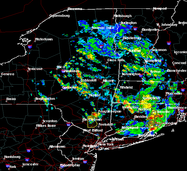 At 421 pm edt, a severe thunderstorm was located over modena, or near new paltz, moving south at 15 mph (radar indicated). Hazards include golf ball size hail and 60 mph wind gusts. People and animals outdoors will be injured. expect hail damage to roofs, siding, windows, and vehicles. expect wind damage to roofs, siding, and trees. Locations impacted include, plattekill, highland, modena, marlboro, barnegat, jenkinstown, oakes, tuckers corner, lattintown, stoneco, clintondale, ardonia, sylva, baileys gap, clintondale station, van keurens and crown heights. At 421 pm edt, a severe thunderstorm was located over modena, or near new paltz, moving south at 15 mph (radar indicated). Hazards include golf ball size hail and 60 mph wind gusts. People and animals outdoors will be injured. expect hail damage to roofs, siding, windows, and vehicles. expect wind damage to roofs, siding, and trees. Locations impacted include, plattekill, highland, modena, marlboro, barnegat, jenkinstown, oakes, tuckers corner, lattintown, stoneco, clintondale, ardonia, sylva, baileys gap, clintondale station, van keurens and crown heights.
|
| 6/29/2020 4:15 PM EDT |
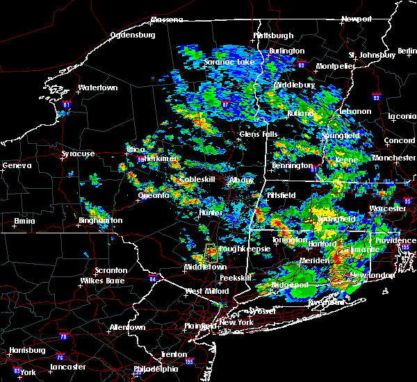 At 414 pm edt, a severe thunderstorm was located near modena, or near new paltz, moving south at 15 mph (radar indicated). Hazards include ping pong ball size hail and 60 mph wind gusts. People and animals outdoors will be injured. expect hail damage to roofs, siding, windows, and vehicles. expect wind damage to roofs, siding, and trees. Locations impacted include, new paltz, plattekill, highland, modena, marlboro, lloyd, barnegat, jenkinstown, oakes, tuckers corner, lattintown, elting corners, ohioville, stoneco, clintondale, ardonia, sylva, baileys gap, clintondale station and putt corners. At 414 pm edt, a severe thunderstorm was located near modena, or near new paltz, moving south at 15 mph (radar indicated). Hazards include ping pong ball size hail and 60 mph wind gusts. People and animals outdoors will be injured. expect hail damage to roofs, siding, windows, and vehicles. expect wind damage to roofs, siding, and trees. Locations impacted include, new paltz, plattekill, highland, modena, marlboro, lloyd, barnegat, jenkinstown, oakes, tuckers corner, lattintown, elting corners, ohioville, stoneco, clintondale, ardonia, sylva, baileys gap, clintondale station and putt corners.
|
| 6/29/2020 4:10 PM EDT |
 At 409 pm edt, a severe thunderstorm was located over new paltz, moving south at 20 mph (radar indicated). Hazards include 60 mph wind gusts and half dollar size hail. Hail damage to vehicles is expected. expect wind damage to roofs, siding, and trees. Locations impacted include, new paltz, plattekill, highland, modena, marlboro, lloyd, barnegat, jenkinstown, oakes, tuckers corner, lattintown, elting corners, ohioville, stoneco, clintondale, ardonia, sylva, baileys gap, clintondale station and putt corners. At 409 pm edt, a severe thunderstorm was located over new paltz, moving south at 20 mph (radar indicated). Hazards include 60 mph wind gusts and half dollar size hail. Hail damage to vehicles is expected. expect wind damage to roofs, siding, and trees. Locations impacted include, new paltz, plattekill, highland, modena, marlboro, lloyd, barnegat, jenkinstown, oakes, tuckers corner, lattintown, elting corners, ohioville, stoneco, clintondale, ardonia, sylva, baileys gap, clintondale station and putt corners.
|
| 6/29/2020 3:52 PM EDT |
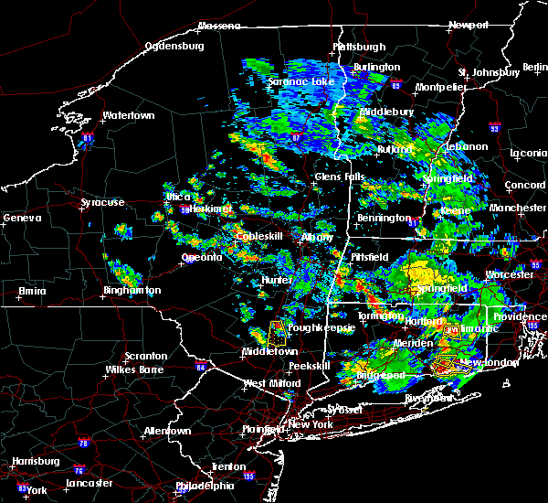 At 352 pm edt, a severe thunderstorm was located near tillson, or near new paltz, moving south at 15 mph (radar indicated). Hazards include quarter size hail. damage to vehicles is expected At 352 pm edt, a severe thunderstorm was located near tillson, or near new paltz, moving south at 15 mph (radar indicated). Hazards include quarter size hail. damage to vehicles is expected
|
| 5/15/2020 7:21 PM EDT |
 The national weather service in albany has issued a * tornado warning for. southeastern ulster county in east central new york. until 745 pm edt. At 721 pm edt, a severe thunderstorm capable of producing a tornado was located near kerhonkson, or 9 miles northwest of new paltz,. The national weather service in albany has issued a * tornado warning for. southeastern ulster county in east central new york. until 745 pm edt. At 721 pm edt, a severe thunderstorm capable of producing a tornado was located near kerhonkson, or 9 miles northwest of new paltz,.
|
| 8/18/2019 7:19 PM EDT |
 At 718 pm edt, severe thunderstorms were located along a line extending from near westerlo to near north-south lake campground to hurley, moving northeast at 25 mph (radar indicated). Hazards include 60 mph wind gusts. expect damage to roofs, siding, and trees At 718 pm edt, severe thunderstorms were located along a line extending from near westerlo to near north-south lake campground to hurley, moving northeast at 25 mph (radar indicated). Hazards include 60 mph wind gusts. expect damage to roofs, siding, and trees
|
| 8/18/2019 6:14 PM EDT |
 At 613 pm edt, severe thunderstorms were located along a line extending from hobart to monticello, moving east at 30 mph (radar indicated). Hazards include 60 mph wind gusts and quarter size hail. Hail damage to vehicles is expected. Expect wind damage to roofs, siding, and trees. At 613 pm edt, severe thunderstorms were located along a line extending from hobart to monticello, moving east at 30 mph (radar indicated). Hazards include 60 mph wind gusts and quarter size hail. Hail damage to vehicles is expected. Expect wind damage to roofs, siding, and trees.
|
| 8/8/2019 6:16 PM EDT |
 At 615 pm edt, severe thunderstorms were located along a line extending from near falls village to plattekill, moving east at 40 mph (trained weather spotters). Hazards include 60 mph wind gusts. Expect damage to roofs, siding, and trees. these severe storms will be near, falls village and cornwall bridge around 620 pm edt. norfolk around 625 pm edt. torrington and myers corner around 630 pm edt. fishkill around 635 pm edt. hopewell junction and winsted around 640 pm edt. canton, new hartford, new hartford center and northwest harwinton around 645 pm edt. Other locations impacted by these severe thunderstorms include south canaan, lithgow, hoxie corner, wrightville, salisbury, south amenia, pleasant ridge, east litchfield, washington hollow and plymouth green. At 615 pm edt, severe thunderstorms were located along a line extending from near falls village to plattekill, moving east at 40 mph (trained weather spotters). Hazards include 60 mph wind gusts. Expect damage to roofs, siding, and trees. these severe storms will be near, falls village and cornwall bridge around 620 pm edt. norfolk around 625 pm edt. torrington and myers corner around 630 pm edt. fishkill around 635 pm edt. hopewell junction and winsted around 640 pm edt. canton, new hartford, new hartford center and northwest harwinton around 645 pm edt. Other locations impacted by these severe thunderstorms include south canaan, lithgow, hoxie corner, wrightville, salisbury, south amenia, pleasant ridge, east litchfield, washington hollow and plymouth green.
|
| 8/8/2019 5:48 PM EDT |
 At 547 pm edt, severe thunderstorms were located along a line extending from near pine plains to near ellenville, moving east at 40 mph (trained weather spotters reported trees and wires down near glasco and kingston). Hazards include 60 mph wind gusts. Expect damage to roofs, siding, and trees. severe thunderstorms will be near, pine plains around 555 pm edt. amenia and millerton around 600 pm edt. sharon around 605 pm edt. wallkill and modena around 610 pm edt. plattekill, falls village and cornwall bridge around 615 pm edt. beacon, norfolk and marlboro around 625 pm edt. torrington, wappingers falls, fishkill and myers corner around 630 pm edt. hopewell junction and winsted around 635 pm edt. Other locations impacted by these severe thunderstorms include norrie heights, atwood, lithgow, hoxie corner, south amenia, pleasant ridge, jackson corners, verbank, bulls bridge and dempsey landing. At 547 pm edt, severe thunderstorms were located along a line extending from near pine plains to near ellenville, moving east at 40 mph (trained weather spotters reported trees and wires down near glasco and kingston). Hazards include 60 mph wind gusts. Expect damage to roofs, siding, and trees. severe thunderstorms will be near, pine plains around 555 pm edt. amenia and millerton around 600 pm edt. sharon around 605 pm edt. wallkill and modena around 610 pm edt. plattekill, falls village and cornwall bridge around 615 pm edt. beacon, norfolk and marlboro around 625 pm edt. torrington, wappingers falls, fishkill and myers corner around 630 pm edt. hopewell junction and winsted around 635 pm edt. Other locations impacted by these severe thunderstorms include norrie heights, atwood, lithgow, hoxie corner, south amenia, pleasant ridge, jackson corners, verbank, bulls bridge and dempsey landing.
|
| 7/29/2019 7:08 PM EDT |
 The severe thunderstorm warning for southeastern ulster and west central dutchess counties will expire at 715 pm edt, the storm which prompted the warning has weakened below severe limits, and has exited the warned area. therefore, the warning will be allowed to expire. however gusty winds and heavy rain are still possible with this thunderstorm. The severe thunderstorm warning for southeastern ulster and west central dutchess counties will expire at 715 pm edt, the storm which prompted the warning has weakened below severe limits, and has exited the warned area. therefore, the warning will be allowed to expire. however gusty winds and heavy rain are still possible with this thunderstorm.
|
| 7/29/2019 6:51 PM EDT | Tree and wires down on river road in highland in ulster county NY, 0.7 miles W of Highland, NY |
| 7/29/2019 6:47 PM EDT | Trees... wires... and poles down on orchard road in milto in ulster county NY, 2.5 miles NNE of Highland, NY |
| 7/29/2019 6:45 PM EDT |
 At 645 pm edt, a severe thunderstorm was located over highland, or near poughkeepsie, moving east at 15 mph (radar indicated). Hazards include 70 mph wind gusts and quarter size hail. Hail damage to vehicles is expected. expect considerable tree damage. wind damage is also likely to mobile homes, roofs, and outbuildings. Locations impacted include, poughkeepsie, hyde park, highland, fairview, red oaks mill, lloyd, oakes, macdonnell heights, highland landing, plutarch, titusville, elting corners, haviland, rombout ridge, manchester bridge, clintondale, colonial heights, baileys gap, dongan place and arlington. At 645 pm edt, a severe thunderstorm was located over highland, or near poughkeepsie, moving east at 15 mph (radar indicated). Hazards include 70 mph wind gusts and quarter size hail. Hail damage to vehicles is expected. expect considerable tree damage. wind damage is also likely to mobile homes, roofs, and outbuildings. Locations impacted include, poughkeepsie, hyde park, highland, fairview, red oaks mill, lloyd, oakes, macdonnell heights, highland landing, plutarch, titusville, elting corners, haviland, rombout ridge, manchester bridge, clintondale, colonial heights, baileys gap, dongan place and arlington.
|
| 7/29/2019 6:28 PM EDT |
 At 628 pm edt, a severe thunderstorm was located over hyde park, or near poughkeepsie, moving east at 15 mph (radar indicated). Hazards include 60 mph wind gusts and penny size hail. expect damage to roofs, siding, and trees At 628 pm edt, a severe thunderstorm was located over hyde park, or near poughkeepsie, moving east at 15 mph (radar indicated). Hazards include 60 mph wind gusts and penny size hail. expect damage to roofs, siding, and trees
|
| 7/29/2019 6:18 PM EDT |
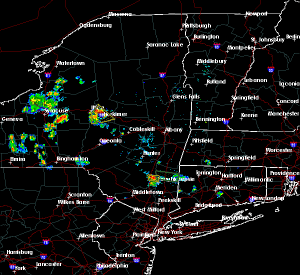 At 618 pm edt, a severe thunderstorm was located over hyde park, or near new paltz, moving east at 10 mph (radar indicated). Hazards include 60 mph wind gusts and penny size hail. Expect damage to roofs, siding, and trees. Locations impacted include, new paltz, hyde park, tillson, fairview, esopus, rosendale, rifton, norrie heights, cottekill, plutarch, haviland, dashville, springtown, binnewater and rosendale village. At 618 pm edt, a severe thunderstorm was located over hyde park, or near new paltz, moving east at 10 mph (radar indicated). Hazards include 60 mph wind gusts and penny size hail. Expect damage to roofs, siding, and trees. Locations impacted include, new paltz, hyde park, tillson, fairview, esopus, rosendale, rifton, norrie heights, cottekill, plutarch, haviland, dashville, springtown, binnewater and rosendale village.
|
| 7/29/2019 5:55 PM EDT |
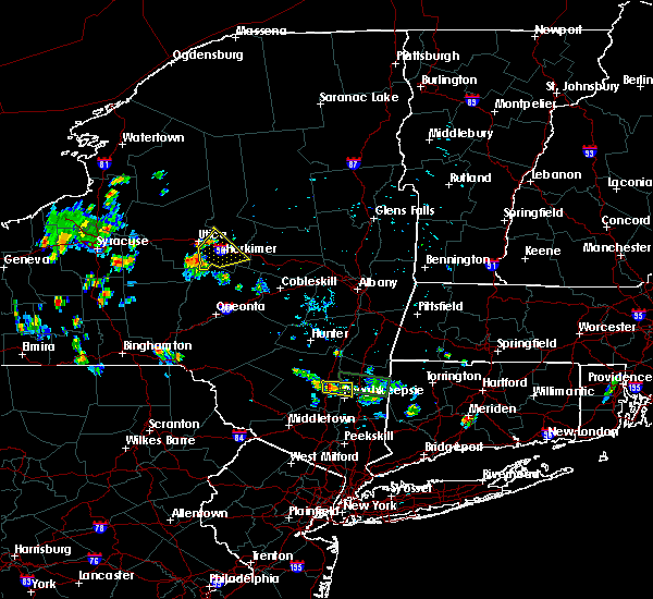 The national weather service in albany has issued a * severe thunderstorm warning for. east central ulster county in east central new york. west central dutchess county in east central new york. until 630 pm edt. At 555 pm edt, a severe thunderstorm was located over tillson, or. The national weather service in albany has issued a * severe thunderstorm warning for. east central ulster county in east central new york. west central dutchess county in east central new york. until 630 pm edt. At 555 pm edt, a severe thunderstorm was located over tillson, or.
|
| 6/30/2019 1:36 PM EDT |
 The severe thunderstorm warning for northeastern ulster and northwestern dutchess counties will expire at 145 pm edt, the storm which prompted the warning has weakened below severe limits, and no longer poses an immediate threat to life or property. therefore, the warning will be allowed to expire. remember, a severe thunderstorm warning still remains in effect for southern dutchess and southwestern ulster county until 215 pm. The severe thunderstorm warning for northeastern ulster and northwestern dutchess counties will expire at 145 pm edt, the storm which prompted the warning has weakened below severe limits, and no longer poses an immediate threat to life or property. therefore, the warning will be allowed to expire. remember, a severe thunderstorm warning still remains in effect for southern dutchess and southwestern ulster county until 215 pm.
|
| 6/30/2019 1:32 PM EDT |
 At 132 pm edt, a severe thunderstorm was located over wappingers falls, or near poughkeepsie, moving southeast at 30 mph (radar indicated). Hazards include 60 mph wind gusts and quarter size hail. Hail damage to vehicles is expected. expect wind damage to roofs, siding, and trees. this severe thunderstorm will be near, beacon and myers corner around 140 pm edt. fishkill and hopewell junction around 145 pm edt. Other locations impacted by this severe thunderstorm include tuckers corner, stormville, knapps corner, new hamburg, glenham, stoneco, chelsea, wiccopee, colonial heights and groveville. At 132 pm edt, a severe thunderstorm was located over wappingers falls, or near poughkeepsie, moving southeast at 30 mph (radar indicated). Hazards include 60 mph wind gusts and quarter size hail. Hail damage to vehicles is expected. expect wind damage to roofs, siding, and trees. this severe thunderstorm will be near, beacon and myers corner around 140 pm edt. fishkill and hopewell junction around 145 pm edt. Other locations impacted by this severe thunderstorm include tuckers corner, stormville, knapps corner, new hamburg, glenham, stoneco, chelsea, wiccopee, colonial heights and groveville.
|
| 6/30/2019 1:30 PM EDT |
 At 129 pm edt, a severe thunderstorm was located over west hurley, or 7 miles southwest of saugerties, moving south at 35 mph (radar indicated). Hazards include 60 mph wind gusts. Expect damage to roofs, siding, and trees. this severe storm will be near, lake katrine around 135 pm edt. kingston, rhinebeck and hurley around 140 pm edt. port ewen, tillson, staatsburg and high falls around 145 pm edt. Other locations impacted by this severe thunderstorm include rolling meadows, salt point, norrie heights, kerleys corners, maple hill, glenford, atwood, manorville, katsbaan and shultis corners. At 129 pm edt, a severe thunderstorm was located over west hurley, or 7 miles southwest of saugerties, moving south at 35 mph (radar indicated). Hazards include 60 mph wind gusts. Expect damage to roofs, siding, and trees. this severe storm will be near, lake katrine around 135 pm edt. kingston, rhinebeck and hurley around 140 pm edt. port ewen, tillson, staatsburg and high falls around 145 pm edt. Other locations impacted by this severe thunderstorm include rolling meadows, salt point, norrie heights, kerleys corners, maple hill, glenford, atwood, manorville, katsbaan and shultis corners.
|
| 6/30/2019 1:05 PM EDT |
 At 104 pm edt, a severe thunderstorm was located near hunter, moving south at 35 mph (radar indicated). Hazards include 60 mph wind gusts. Expect damage to roofs, siding, and trees. this severe thunderstorm will be near, north-south lake campground around 110 pm edt. lanesville around 115 pm edt. saugerties and woodstock around 125 pm edt. west hurley, kenneth l wilson campground and saugerties south around 130 pm edt. lake katrine around 135 pm edt. kingston and hurley around 140 pm edt. rhinebeck, port ewen, tillson, staatsburg and high falls around 145 pm edt. Other locations impacted by this severe thunderstorm include rolling meadows, salt point, norrie heights, kerleys corners, maple hill, glenford, atwood, manorville, katsbaan and shultis corners. At 104 pm edt, a severe thunderstorm was located near hunter, moving south at 35 mph (radar indicated). Hazards include 60 mph wind gusts. Expect damage to roofs, siding, and trees. this severe thunderstorm will be near, north-south lake campground around 110 pm edt. lanesville around 115 pm edt. saugerties and woodstock around 125 pm edt. west hurley, kenneth l wilson campground and saugerties south around 130 pm edt. lake katrine around 135 pm edt. kingston and hurley around 140 pm edt. rhinebeck, port ewen, tillson, staatsburg and high falls around 145 pm edt. Other locations impacted by this severe thunderstorm include rolling meadows, salt point, norrie heights, kerleys corners, maple hill, glenford, atwood, manorville, katsbaan and shultis corners.
|
| 6/26/2019 7:57 PM EDT |
 At 757 pm edt, severe thunderstorms were located along a line extending from near millbrook to near gardnertown, moving east at 25 mph (radar indicated). Hazards include 60 mph wind gusts. Expect damage to roofs, siding, and trees. Locations impacted include, poughkeepsie, beacon, pawling, wallkill, hyde park, plattekill, pleasant valley, wappingers falls, highland, fishkill, millbrook, modena, fairview, hopewell junction, marlboro, red oaks mill, myers corner, wingdale, dover plains and east fishkill. At 757 pm edt, severe thunderstorms were located along a line extending from near millbrook to near gardnertown, moving east at 25 mph (radar indicated). Hazards include 60 mph wind gusts. Expect damage to roofs, siding, and trees. Locations impacted include, poughkeepsie, beacon, pawling, wallkill, hyde park, plattekill, pleasant valley, wappingers falls, highland, fishkill, millbrook, modena, fairview, hopewell junction, marlboro, red oaks mill, myers corner, wingdale, dover plains and east fishkill.
|
| 6/26/2019 7:32 PM EDT |
 At 731 pm edt, severe thunderstorms were located along a line extending from near pleasant valley to walden, moving east at 40 mph (radar indicated). Hazards include 60 mph wind gusts. expect damage to roofs, siding, and trees At 731 pm edt, severe thunderstorms were located along a line extending from near pleasant valley to walden, moving east at 40 mph (radar indicated). Hazards include 60 mph wind gusts. expect damage to roofs, siding, and trees
|
| 4/15/2019 4:22 AM EDT |
 At 422 am edt, a severe thunderstorm was located over fairview, or over poughkeepsie, moving northeast at 50 mph (radar indicated). Hazards include 60 mph wind gusts and quarter size hail. Hail damage to vehicles is expected. Expect wind damage to roofs, siding, and trees. At 422 am edt, a severe thunderstorm was located over fairview, or over poughkeepsie, moving northeast at 50 mph (radar indicated). Hazards include 60 mph wind gusts and quarter size hail. Hail damage to vehicles is expected. Expect wind damage to roofs, siding, and trees.
|
| 10/2/2018 2:33 PM EDT |
 At 233 pm edt, a severe thunderstorm was located over hyde park, or 7 miles north of poughkeepsie, moving east at 30 mph (radar indicated). Hazards include 60 mph wind gusts. Expect damage to roofs, siding, and trees. this severe thunderstorm will be near, pleasant valley around 240 pm edt. millbrook and stanfordville around 255 pm edt. dover plains around 305 pm edt. amenia around 310 pm edt. Other locations impacted by this severe thunderstorm include salt point, norrie heights, rosendale, maple hill, lithgow, elting corners, haviland, smithfield, shunpike and shekomeko. At 233 pm edt, a severe thunderstorm was located over hyde park, or 7 miles north of poughkeepsie, moving east at 30 mph (radar indicated). Hazards include 60 mph wind gusts. Expect damage to roofs, siding, and trees. this severe thunderstorm will be near, pleasant valley around 240 pm edt. millbrook and stanfordville around 255 pm edt. dover plains around 305 pm edt. amenia around 310 pm edt. Other locations impacted by this severe thunderstorm include salt point, norrie heights, rosendale, maple hill, lithgow, elting corners, haviland, smithfield, shunpike and shekomeko.
|
| 8/3/2018 4:19 PM EDT |
 At 418 pm edt, a severe thunderstorm was located over rhinebeck, moving north at 40 mph (radar indicated). Hazards include 60 mph wind gusts. Expect damage to roofs, siding, and trees. this severe storm will be near, red hook around 430 pm edt. saugerties and saugerties south around 435 pm edt. Other locations impacted by this severe thunderstorm include rolling meadows, salt point, norrie heights, kerleys corners, maple hill, glenford, atwood, manorville, lithgow and katsbaan. At 418 pm edt, a severe thunderstorm was located over rhinebeck, moving north at 40 mph (radar indicated). Hazards include 60 mph wind gusts. Expect damage to roofs, siding, and trees. this severe storm will be near, red hook around 430 pm edt. saugerties and saugerties south around 435 pm edt. Other locations impacted by this severe thunderstorm include rolling meadows, salt point, norrie heights, kerleys corners, maple hill, glenford, atwood, manorville, lithgow and katsbaan.
|
| 8/3/2018 3:54 PM EDT |
 At 354 pm edt, a severe thunderstorm was located over red oaks mill, or near poughkeepsie, moving north at 35 mph (radar indicated). Hazards include 70 mph wind gusts and quarter size hail. Hail damage to vehicles is expected. expect considerable tree damage. wind damage is also likely to mobile homes, roofs, and outbuildings. this severe storm will be near, poughkeepsie, highland and fairview around 405 pm edt. hyde park and pleasant valley around 410 pm edt. staatsburg around 420 pm edt. kingston, rhinebeck and port ewen around 430 pm edt. red hook and lake katrine around 440 pm edt. saugerties south around 445 pm edt. saugerties around 450 pm edt. Other locations impacted by this severe thunderstorm include norrie heights, maple hill, atwood, lithgow, katsbaan, shultis corners, pacama, hoxie corner, linden acres and elting corners. At 354 pm edt, a severe thunderstorm was located over red oaks mill, or near poughkeepsie, moving north at 35 mph (radar indicated). Hazards include 70 mph wind gusts and quarter size hail. Hail damage to vehicles is expected. expect considerable tree damage. wind damage is also likely to mobile homes, roofs, and outbuildings. this severe storm will be near, poughkeepsie, highland and fairview around 405 pm edt. hyde park and pleasant valley around 410 pm edt. staatsburg around 420 pm edt. kingston, rhinebeck and port ewen around 430 pm edt. red hook and lake katrine around 440 pm edt. saugerties south around 445 pm edt. saugerties around 450 pm edt. Other locations impacted by this severe thunderstorm include norrie heights, maple hill, atwood, lithgow, katsbaan, shultis corners, pacama, hoxie corner, linden acres and elting corners.
|
| 8/3/2018 3:36 PM EDT |
 At 336 pm edt, a severe thunderstorm was located near fahnestock state park, or near beacon, moving north at 35 mph (radar indicated). Hazards include 60 mph wind gusts and quarter size hail. Hail damage to vehicles is expected. expect wind damage to roofs, siding, and trees. this severe thunderstorm will be near, fishkill around 345 pm edt. wappingers falls, hopewell junction and marlboro around 350 pm edt. myers corner around 355 pm edt. red oaks mill around 400 pm edt. poughkeepsie and fairview around 405 pm edt. pleasant valley and highland around 410 pm edt. hyde park around 415 pm edt. staatsburg and stanfordville around 425 pm edt. Other locations impacted by this severe thunderstorm include norrie heights, maple hill, atwood, lithgow, katsbaan, shultis corners, pacama, hoxie corner, linden acres and elting corners. At 336 pm edt, a severe thunderstorm was located near fahnestock state park, or near beacon, moving north at 35 mph (radar indicated). Hazards include 60 mph wind gusts and quarter size hail. Hail damage to vehicles is expected. expect wind damage to roofs, siding, and trees. this severe thunderstorm will be near, fishkill around 345 pm edt. wappingers falls, hopewell junction and marlboro around 350 pm edt. myers corner around 355 pm edt. red oaks mill around 400 pm edt. poughkeepsie and fairview around 405 pm edt. pleasant valley and highland around 410 pm edt. hyde park around 415 pm edt. staatsburg and stanfordville around 425 pm edt. Other locations impacted by this severe thunderstorm include norrie heights, maple hill, atwood, lithgow, katsbaan, shultis corners, pacama, hoxie corner, linden acres and elting corners.
|
| 7/27/2018 5:23 PM EDT |
 At 523 pm edt, a severe thunderstorm was located over hyde park, or 7 miles north of poughkeepsie, moving northeast at 40 mph (radar indicated). Hazards include 60 mph wind gusts and quarter size hail. Hail damage to vehicles is expected. expect wind damage to roofs, siding, and trees. this severe thunderstorm will be near, millbrook and stanfordville around 540 pm edt. amenia and pine plains around 550 pm edt. sharon and millerton around 555 pm edt. falls village around 605 pm edt. sheffield, canaan and ashley falls around 615 pm edt. norfolk around 620 pm edt. sandisfield around 630 pm edt. Other locations impacted by this severe thunderstorm include salt point, ancramdale, norrie heights, south canaan, maple hill, lithgow, hillside, salisbury, smithfield and alander. At 523 pm edt, a severe thunderstorm was located over hyde park, or 7 miles north of poughkeepsie, moving northeast at 40 mph (radar indicated). Hazards include 60 mph wind gusts and quarter size hail. Hail damage to vehicles is expected. expect wind damage to roofs, siding, and trees. this severe thunderstorm will be near, millbrook and stanfordville around 540 pm edt. amenia and pine plains around 550 pm edt. sharon and millerton around 555 pm edt. falls village around 605 pm edt. sheffield, canaan and ashley falls around 615 pm edt. norfolk around 620 pm edt. sandisfield around 630 pm edt. Other locations impacted by this severe thunderstorm include salt point, ancramdale, norrie heights, south canaan, maple hill, lithgow, hillside, salisbury, smithfield and alander.
|
| 7/17/2018 1:25 PM EDT |
 At 125 pm edt, severe thunderstorms were located along a line extending from near livingston to near pine plains to near pleasant valley to newburgh, moving east at 40 mph (radar indicated). Hazards include 60 mph wind gusts. Expect damage to roofs, siding, and trees. severe thunderstorms will be near, pine plains and stanfordville around 130 pm edt. ancram and millbrook around 135 pm edt. copake, millerton and hopewell junction around 140 pm edt. amenia and dover plains around 145 pm edt. pawling around 155 pm edt. Other locations impacted by these severe thunderstorms include tuckers corner, salt point, ancramdale, norrie heights, kerleys corners, baker corner, beekman, lithgow, hoxie corner and linden acres. At 125 pm edt, severe thunderstorms were located along a line extending from near livingston to near pine plains to near pleasant valley to newburgh, moving east at 40 mph (radar indicated). Hazards include 60 mph wind gusts. Expect damage to roofs, siding, and trees. severe thunderstorms will be near, pine plains and stanfordville around 130 pm edt. ancram and millbrook around 135 pm edt. copake, millerton and hopewell junction around 140 pm edt. amenia and dover plains around 145 pm edt. pawling around 155 pm edt. Other locations impacted by these severe thunderstorms include tuckers corner, salt point, ancramdale, norrie heights, kerleys corners, baker corner, beekman, lithgow, hoxie corner and linden acres.
|
| 6/28/2018 3:22 PM EDT |
 At 322 pm edt, a severe thunderstorm was located near hyde park, or 8 miles north of poughkeepsie, moving east at 20 mph (radar indicated). Hazards include 60 mph wind gusts and quarter size hail. Hail damage to vehicles is expected. expect wind damage to roofs, siding, and trees. this severe storm will be near, pleasant valley, millbrook and stanfordville around 330 pm edt. Other locations impacted by this severe thunderstorm include rolling meadows, salt point, norrie heights, rosendale, maple hill, hillside, elting corners, haviland, billings and shunpike. At 322 pm edt, a severe thunderstorm was located near hyde park, or 8 miles north of poughkeepsie, moving east at 20 mph (radar indicated). Hazards include 60 mph wind gusts and quarter size hail. Hail damage to vehicles is expected. expect wind damage to roofs, siding, and trees. this severe storm will be near, pleasant valley, millbrook and stanfordville around 330 pm edt. Other locations impacted by this severe thunderstorm include rolling meadows, salt point, norrie heights, rosendale, maple hill, hillside, elting corners, haviland, billings and shunpike.
|
| 6/28/2018 2:56 PM EDT |
 At 255 pm edt, a severe thunderstorm was located over tillson, or near new paltz, moving east at 25 mph (radar indicated). Hazards include 60 mph wind gusts and quarter size hail. Hail damage to vehicles is expected. expect wind damage to roofs, siding, and trees. this severe thunderstorm will be near, hyde park, highland and staatsburg around 305 pm edt. fairview around 310 pm edt. poughkeepsie around 315 pm edt. pleasant valley around 320 pm edt. millbrook and stanfordville around 330 pm edt. Other locations impacted by this severe thunderstorm include rolling meadows, salt point, norrie heights, rosendale, maple hill, atwood, pacama, fantinekill, hillside and stone ridge. At 255 pm edt, a severe thunderstorm was located over tillson, or near new paltz, moving east at 25 mph (radar indicated). Hazards include 60 mph wind gusts and quarter size hail. Hail damage to vehicles is expected. expect wind damage to roofs, siding, and trees. this severe thunderstorm will be near, hyde park, highland and staatsburg around 305 pm edt. fairview around 310 pm edt. poughkeepsie around 315 pm edt. pleasant valley around 320 pm edt. millbrook and stanfordville around 330 pm edt. Other locations impacted by this severe thunderstorm include rolling meadows, salt point, norrie heights, rosendale, maple hill, atwood, pacama, fantinekill, hillside and stone ridge.
|
| 6/18/2018 6:48 PM EDT |
 At 648 pm edt, a severe thunderstorm was located over marlboro, or near beacon, moving east at 45 mph (radar indicated). Hazards include 60 mph wind gusts. Expect damage to roofs, siding, and trees. this severe thunderstorm will be near, myers corner around 655 pm edt. hopewell junction around 700 pm edt. pawling and wingdale around 715 pm edt. Other locations impacted by this severe thunderstorm include tuckers corner, stormville, baker corner, knapps corner, beekman, south dover, new hamburg, glenham, clove valley and poughquag. At 648 pm edt, a severe thunderstorm was located over marlboro, or near beacon, moving east at 45 mph (radar indicated). Hazards include 60 mph wind gusts. Expect damage to roofs, siding, and trees. this severe thunderstorm will be near, myers corner around 655 pm edt. hopewell junction around 700 pm edt. pawling and wingdale around 715 pm edt. Other locations impacted by this severe thunderstorm include tuckers corner, stormville, baker corner, knapps corner, beekman, south dover, new hamburg, glenham, clove valley and poughquag.
|
| 5/15/2018 4:27 PM EDT |
 The severe thunderstorm warning for eastern ulster county will expire at 430 pm edt, the storms which prompted the warning have moved out of the area. therefore, the warning will be allowed to expire. a tornado watch remains in effect until 800 pm edt for east central new york. The severe thunderstorm warning for eastern ulster county will expire at 430 pm edt, the storms which prompted the warning have moved out of the area. therefore, the warning will be allowed to expire. a tornado watch remains in effect until 800 pm edt for east central new york.
|
| 5/15/2018 4:17 PM EDT |
 At 417 pm edt, severe thunderstorms were located along a line extending from near west hurley to beacon, moving east at 60 mph (radar indicated). Hazards include 70 mph wind gusts and quarter size hail. Hail damage to vehicles is expected. expect considerable tree damage. wind damage is also likely to mobile homes, roofs, and outbuildings. these severe storms will be near, saugerties around 420 pm edt. saugerties south around 425 pm edt. other locations impacted by these severe thunderstorms include tuckers corner, rolling meadows, rosendale, maple hill, glenford, forest glen, atwood, katsbaan, shultis corners and sweet meadows. A tornado watch remains in effect until 800 pm edt for east central new york. At 417 pm edt, severe thunderstorms were located along a line extending from near west hurley to beacon, moving east at 60 mph (radar indicated). Hazards include 70 mph wind gusts and quarter size hail. Hail damage to vehicles is expected. expect considerable tree damage. wind damage is also likely to mobile homes, roofs, and outbuildings. these severe storms will be near, saugerties around 420 pm edt. saugerties south around 425 pm edt. other locations impacted by these severe thunderstorms include tuckers corner, rolling meadows, rosendale, maple hill, glenford, forest glen, atwood, katsbaan, shultis corners and sweet meadows. A tornado watch remains in effect until 800 pm edt for east central new york.
|
| 5/15/2018 4:15 PM EDT |
 At 414 pm edt, a severe thunderstorm capable of producing a tornado was located near plattekill, or near poughkeepsie, moving east at 65 mph (radar indicated rotation). Hazards include tornado and quarter size hail. Flying debris will be dangerous to those caught without shelter. mobile homes will be damaged or destroyed. damage to roofs, windows, and vehicles will occur. tree damage is likely. this dangerous storm will be near, poughkeepsie, myers corner and fairview around 420 pm edt. pleasant valley, red oaks mill and hopewell junction around 425 pm edt. millbrook, dover plains and wingdale around 435 pm edt. Other locations impacted by this tornadic thunderstorm include tuckers corner, salt point, baker corner, beekman, lithgow, hoxie corner, smithfield, south amenia, pleasant ridge and bains corner. At 414 pm edt, a severe thunderstorm capable of producing a tornado was located near plattekill, or near poughkeepsie, moving east at 65 mph (radar indicated rotation). Hazards include tornado and quarter size hail. Flying debris will be dangerous to those caught without shelter. mobile homes will be damaged or destroyed. damage to roofs, windows, and vehicles will occur. tree damage is likely. this dangerous storm will be near, poughkeepsie, myers corner and fairview around 420 pm edt. pleasant valley, red oaks mill and hopewell junction around 425 pm edt. millbrook, dover plains and wingdale around 435 pm edt. Other locations impacted by this tornadic thunderstorm include tuckers corner, salt point, baker corner, beekman, lithgow, hoxie corner, smithfield, south amenia, pleasant ridge and bains corner.
|
| 5/15/2018 4:07 PM EDT |
 At 407 pm edt, a severe thunderstorm capable of producing a tornado was located over wallkill, or near walden, moving east at 50 mph (radar indicated rotation). Hazards include tornado and quarter size hail. Flying debris will be dangerous to those caught without shelter. mobile homes will be damaged or destroyed. damage to roofs, windows, and vehicles will occur. tree damage is likely. this dangerous storm will be near, modena around 410 pm edt. plattekill and marlboro around 415 pm edt. Other locations impacted by this tornadic thunderstorm include tuckers corner, forest glen, dwaarkill, fantinekill, awosting, elting corners, ireland corners, stoneco, honk hill and sylva. At 407 pm edt, a severe thunderstorm capable of producing a tornado was located over wallkill, or near walden, moving east at 50 mph (radar indicated rotation). Hazards include tornado and quarter size hail. Flying debris will be dangerous to those caught without shelter. mobile homes will be damaged or destroyed. damage to roofs, windows, and vehicles will occur. tree damage is likely. this dangerous storm will be near, modena around 410 pm edt. plattekill and marlboro around 415 pm edt. Other locations impacted by this tornadic thunderstorm include tuckers corner, forest glen, dwaarkill, fantinekill, awosting, elting corners, ireland corners, stoneco, honk hill and sylva.
|
| 5/15/2018 3:51 PM EDT |
 At 350 pm edt, a severe thunderstorm capable of producing a tornado was located over phillipsport, or 8 miles southwest of ellenville, moving east at 65 mph (radar indicated rotation). Hazards include tornado and quarter size hail. Flying debris will be dangerous to those caught without shelter. mobile homes will be damaged or destroyed. damage to roofs, windows, and vehicles will occur. tree damage is likely. this dangerous storm will be near, ellenville around 355 pm edt. wallkill around 405 pm edt. plattekill and modena around 410 pm edt. marlboro around 415 pm edt. Other locations impacted by this tornadic thunderstorm include tuckers corner, forest glen, dwaarkill, fantinekill, awosting, elting corners, ireland corners, cragsmoor, stoneco and honk hill. At 350 pm edt, a severe thunderstorm capable of producing a tornado was located over phillipsport, or 8 miles southwest of ellenville, moving east at 65 mph (radar indicated rotation). Hazards include tornado and quarter size hail. Flying debris will be dangerous to those caught without shelter. mobile homes will be damaged or destroyed. damage to roofs, windows, and vehicles will occur. tree damage is likely. this dangerous storm will be near, ellenville around 355 pm edt. wallkill around 405 pm edt. plattekill and modena around 410 pm edt. marlboro around 415 pm edt. Other locations impacted by this tornadic thunderstorm include tuckers corner, forest glen, dwaarkill, fantinekill, awosting, elting corners, ireland corners, cragsmoor, stoneco and honk hill.
|
| 5/15/2018 3:42 PM EDT |
 At 342 pm edt, severe thunderstorms were located along a line extending from near willowemoc to otisville, moving east at 55 mph (radar indicated). Hazards include 70 mph wind gusts and quarter size hail. Hail damage to vehicles is expected. expect considerable tree damage. wind damage is also likely to mobile homes, roofs, and outbuildings. severe thunderstorms will be near, west shokan, woodland valley campground and phoenicia around 400 pm edt. kenneth l wilson campground, mount tremper and olivebridge around 405 pm edt. woodstock and west hurley around 410 pm edt. hurley and marlboro around 415 pm edt. kingston, saugerties, lake katrine, saugerties south and port ewen around 420 pm edt. other locations impacted by these severe thunderstorms include cherrytown, tuckers corner, rolling meadows, maple hill, glenford, atwood, katsbaan, shultis corners, sweet meadows and pacama. A tornado watch remains in effect until 800 pm edt for east central new york. At 342 pm edt, severe thunderstorms were located along a line extending from near willowemoc to otisville, moving east at 55 mph (radar indicated). Hazards include 70 mph wind gusts and quarter size hail. Hail damage to vehicles is expected. expect considerable tree damage. wind damage is also likely to mobile homes, roofs, and outbuildings. severe thunderstorms will be near, west shokan, woodland valley campground and phoenicia around 400 pm edt. kenneth l wilson campground, mount tremper and olivebridge around 405 pm edt. woodstock and west hurley around 410 pm edt. hurley and marlboro around 415 pm edt. kingston, saugerties, lake katrine, saugerties south and port ewen around 420 pm edt. other locations impacted by these severe thunderstorms include cherrytown, tuckers corner, rolling meadows, maple hill, glenford, atwood, katsbaan, shultis corners, sweet meadows and pacama. A tornado watch remains in effect until 800 pm edt for east central new york.
|
| 5/15/2018 3:34 PM EDT |
 At 334 pm edt, a severe thunderstorm was located over tillson, or near kingston, moving east at 50 mph (radar indicated). Hazards include two inch hail and 60 mph wind gusts. People and animals outdoors will be injured. expect hail damage to roofs, siding, windows, and vehicles. expect wind damage to roofs, siding, and trees. this severe thunderstorm will be near, rhinebeck, hyde park and staatsburg around 340 pm edt. pleasant valley around 345 pm edt. millbrook and stanfordville around 355 pm edt. dover plains around 400 pm edt. amenia and millerton around 405 pm edt. sharon around 410 pm edt. cornwall bridge and falls village around 415 pm edt. torrington, new hartford, winsted and northwest harwinton around 430 pm edt. other locations impacted by this severe thunderstorm include norrie heights, south canaan, maple hill, atwood, lithgow, hoxie corner, elting corners, wrightville, salisbury and south amenia. A tornado watch remains in effect until 800 pm edt for northern connecticut, and east central new york. At 334 pm edt, a severe thunderstorm was located over tillson, or near kingston, moving east at 50 mph (radar indicated). Hazards include two inch hail and 60 mph wind gusts. People and animals outdoors will be injured. expect hail damage to roofs, siding, windows, and vehicles. expect wind damage to roofs, siding, and trees. this severe thunderstorm will be near, rhinebeck, hyde park and staatsburg around 340 pm edt. pleasant valley around 345 pm edt. millbrook and stanfordville around 355 pm edt. dover plains around 400 pm edt. amenia and millerton around 405 pm edt. sharon around 410 pm edt. cornwall bridge and falls village around 415 pm edt. torrington, new hartford, winsted and northwest harwinton around 430 pm edt. other locations impacted by this severe thunderstorm include norrie heights, south canaan, maple hill, atwood, lithgow, hoxie corner, elting corners, wrightville, salisbury and south amenia. A tornado watch remains in effect until 800 pm edt for northern connecticut, and east central new york.
|
| 8/22/2017 10:01 PM EDT |
 At 1000 pm edt, a severe thunderstorm was located over myers corner, or near poughkeepsie, moving east at 35 mph (radar indicated). Hazards include 60 mph wind gusts and penny size hail. Expect damage to trees, and power lines. This severe storm will be near, wingdale, poughkeepsie and dover plains around 1025 pm edt. At 1000 pm edt, a severe thunderstorm was located over myers corner, or near poughkeepsie, moving east at 35 mph (radar indicated). Hazards include 60 mph wind gusts and penny size hail. Expect damage to trees, and power lines. This severe storm will be near, wingdale, poughkeepsie and dover plains around 1025 pm edt.
|
| 8/22/2017 9:23 PM EDT |
 At 922 pm edt, a severe thunderstorm was located near montgomery, or near walden, moving east at 35 mph (radar indicated). Hazards include 60 mph wind gusts and penny size hail. Expect damage to trees, and power lines. this severe thunderstorm will be near, wallkill around 935 pm edt. plattekill and modena around 940 pm edt. beacon and marlboro around 950 pm edt. wappingers falls, fishkill and fairview around 955 pm edt. poughkeepsie, myers corner and red oaks mill around 1000 pm edt. hopewell junction around 1005 pm edt. pawling around 1020 pm edt. Wingdale and dover plains around 1025 pm edt. At 922 pm edt, a severe thunderstorm was located near montgomery, or near walden, moving east at 35 mph (radar indicated). Hazards include 60 mph wind gusts and penny size hail. Expect damage to trees, and power lines. this severe thunderstorm will be near, wallkill around 935 pm edt. plattekill and modena around 940 pm edt. beacon and marlboro around 950 pm edt. wappingers falls, fishkill and fairview around 955 pm edt. poughkeepsie, myers corner and red oaks mill around 1000 pm edt. hopewell junction around 1005 pm edt. pawling around 1020 pm edt. Wingdale and dover plains around 1025 pm edt.
|
| 7/13/2017 3:17 PM EDT |
 At 317 pm edt, a severe thunderstorm was located over new paltz, moving east at 20 mph (radar indicated). Hazards include 60 mph wind gusts and quarter size hail. Minor damage to vehicles is possible. expect wind damage to trees, and power lines. this severe thunderstorm will be near, high falls around 320 pm edt. highland around 330 pm edt. hyde park and fairview around 340 pm edt. poughkeepsie and wappingers falls around 345 pm edt. red oaks mill and myers corner around 350 pm edt. pleasant valley around 355 pm edt. hopewell junction around 405 pm edt. millbrook, dover plains and wingdale around 415 pm edt. Other locations impacted by this severe thunderstorm include tuckers corner, stormville, salt point, forest glen, knapps corner, beekman, south dover, hoxie corner, elting corners and clove valley. At 317 pm edt, a severe thunderstorm was located over new paltz, moving east at 20 mph (radar indicated). Hazards include 60 mph wind gusts and quarter size hail. Minor damage to vehicles is possible. expect wind damage to trees, and power lines. this severe thunderstorm will be near, high falls around 320 pm edt. highland around 330 pm edt. hyde park and fairview around 340 pm edt. poughkeepsie and wappingers falls around 345 pm edt. red oaks mill and myers corner around 350 pm edt. pleasant valley around 355 pm edt. hopewell junction around 405 pm edt. millbrook, dover plains and wingdale around 415 pm edt. Other locations impacted by this severe thunderstorm include tuckers corner, stormville, salt point, forest glen, knapps corner, beekman, south dover, hoxie corner, elting corners and clove valley.
|
| 6/30/2017 5:04 PM EDT |
 At 504 pm edt, a severe thunderstorm was located near hopewell junction, or 8 miles east of poughkeepsie, moving east at 45 mph (radar indicated). Hazards include 60 mph wind gusts and quarter size hail. Minor damage to vehicles is possible. expect wind damage to trees, and power lines. Locations impacted include, poughkeepsie, pleasant valley, wappingers falls, millbrook, fairview, hopewell junction, red oaks mill, myers corner, wingdale, dover plains, beekman, knapps corner, south dover, hoxie corner, new hamburg, clove valley, poughquag, billings, pleasant ridge and stoneco. At 504 pm edt, a severe thunderstorm was located near hopewell junction, or 8 miles east of poughkeepsie, moving east at 45 mph (radar indicated). Hazards include 60 mph wind gusts and quarter size hail. Minor damage to vehicles is possible. expect wind damage to trees, and power lines. Locations impacted include, poughkeepsie, pleasant valley, wappingers falls, millbrook, fairview, hopewell junction, red oaks mill, myers corner, wingdale, dover plains, beekman, knapps corner, south dover, hoxie corner, new hamburg, clove valley, poughquag, billings, pleasant ridge and stoneco.
|
| 6/30/2017 4:43 PM EDT |
 At 442 pm edt, a severe thunderstorm was located over plattekill, or 7 miles south of new paltz, moving east at 35 mph (radar indicated). Hazards include 60 mph wind gusts and quarter size hail. Minor damage to vehicles is possible. expect wind damage to trees, and power lines. this severe thunderstorm will be near, marlboro around 450 pm edt. wappingers falls and highland around 455 pm edt. poughkeepsie, red oaks mill, myers corner and fairview around 500 pm edt. pleasant valley and hopewell junction around 505 pm edt. millbrook around 520 pm edt. wingdale and dover plains around 530 pm edt. Other locations impacted by this severe thunderstorm include tuckers corner, forest glen, knapps corner, beekman, south dover, hoxie corner, new hamburg, clove valley, ireland corners and poughquag. At 442 pm edt, a severe thunderstorm was located over plattekill, or 7 miles south of new paltz, moving east at 35 mph (radar indicated). Hazards include 60 mph wind gusts and quarter size hail. Minor damage to vehicles is possible. expect wind damage to trees, and power lines. this severe thunderstorm will be near, marlboro around 450 pm edt. wappingers falls and highland around 455 pm edt. poughkeepsie, red oaks mill, myers corner and fairview around 500 pm edt. pleasant valley and hopewell junction around 505 pm edt. millbrook around 520 pm edt. wingdale and dover plains around 530 pm edt. Other locations impacted by this severe thunderstorm include tuckers corner, forest glen, knapps corner, beekman, south dover, hoxie corner, new hamburg, clove valley, ireland corners and poughquag.
|
| 6/19/2017 3:33 PM EDT |
 At 333 pm edt, a severe thunderstorm was located over highland, or over poughkeepsie, moving northeast at 30 mph (radar indicated). Hazards include 60 mph wind gusts and quarter size hail. Minor damage to vehicles is possible. expect wind damage to trees, and power lines. this severe storm will be near, fairview and red oaks mill around 340 pm edt. hyde park around 345 pm edt. pleasant valley and staatsburg around 350 pm edt. millbrook and stanfordville around 405 pm edt. Other locations impacted by this severe thunderstorm include tuckers corner, rolling meadows, salt point, norrie heights, kerleys corners, maple hill, lithgow, hoxie corner, linden acres and hillside. At 333 pm edt, a severe thunderstorm was located over highland, or over poughkeepsie, moving northeast at 30 mph (radar indicated). Hazards include 60 mph wind gusts and quarter size hail. Minor damage to vehicles is possible. expect wind damage to trees, and power lines. this severe storm will be near, fairview and red oaks mill around 340 pm edt. hyde park around 345 pm edt. pleasant valley and staatsburg around 350 pm edt. millbrook and stanfordville around 405 pm edt. Other locations impacted by this severe thunderstorm include tuckers corner, rolling meadows, salt point, norrie heights, kerleys corners, maple hill, lithgow, hoxie corner, linden acres and hillside.
|
| 6/19/2017 3:19 PM EDT |
 At 318 pm edt, a severe thunderstorm was located over modena, or near walden, moving northeast at 30 mph (radar indicated). Hazards include 60 mph wind gusts and quarter size hail. Minor damage to vehicles is possible. expect wind damage to trees, and power lines. this severe thunderstorm will be near, new paltz and marlboro around 330 pm edt. poughkeepsie, highland and fairview around 340 pm edt. hyde park and red oaks mill around 345 pm edt. pleasant valley and staatsburg around 350 pm edt. millbrook around 405 pm edt. stanfordville around 410 pm edt. dover plains around 415 pm edt. Other locations impacted by this severe thunderstorm include tuckers corner, rolling meadows, salt point, norrie heights, kerleys corners, maple hill, lithgow, hoxie corner, linden acres and hillside. At 318 pm edt, a severe thunderstorm was located over modena, or near walden, moving northeast at 30 mph (radar indicated). Hazards include 60 mph wind gusts and quarter size hail. Minor damage to vehicles is possible. expect wind damage to trees, and power lines. this severe thunderstorm will be near, new paltz and marlboro around 330 pm edt. poughkeepsie, highland and fairview around 340 pm edt. hyde park and red oaks mill around 345 pm edt. pleasant valley and staatsburg around 350 pm edt. millbrook around 405 pm edt. stanfordville around 410 pm edt. dover plains around 415 pm edt. Other locations impacted by this severe thunderstorm include tuckers corner, rolling meadows, salt point, norrie heights, kerleys corners, maple hill, lithgow, hoxie corner, linden acres and hillside.
|
| 6/19/2017 12:27 PM EDT |
 At 1227 pm edt, a severe thunderstorm was located over wappingers falls, or near poughkeepsie, moving northeast at 30 mph (radar indicated). Hazards include 60 mph wind gusts and quarter size hail. Minor damage to vehicles is possible. expect wind damage to trees, and power lines. this severe thunderstorm will be near, poughkeepsie and myers corner around 1235 pm edt. red oaks mill, fairview and hopewell junction around 1240 pm edt. pleasant valley around 1245 pm edt. millbrook around 100 pm edt. dover plains around 110 pm edt. kent around 115 pm edt. amenia around 120 pm edt. sharon around 125 pm edt. Other locations impacted by this severe thunderstorm include tuckers corner, cornwall, salt point, lithgow, hoxie corner, salisbury, smithfield, south amenia, bains corner and washington hollow. At 1227 pm edt, a severe thunderstorm was located over wappingers falls, or near poughkeepsie, moving northeast at 30 mph (radar indicated). Hazards include 60 mph wind gusts and quarter size hail. Minor damage to vehicles is possible. expect wind damage to trees, and power lines. this severe thunderstorm will be near, poughkeepsie and myers corner around 1235 pm edt. red oaks mill, fairview and hopewell junction around 1240 pm edt. pleasant valley around 1245 pm edt. millbrook around 100 pm edt. dover plains around 110 pm edt. kent around 115 pm edt. amenia around 120 pm edt. sharon around 125 pm edt. Other locations impacted by this severe thunderstorm include tuckers corner, cornwall, salt point, lithgow, hoxie corner, salisbury, smithfield, south amenia, bains corner and washington hollow.
|
| 6/13/2017 3:31 PM EDT |
 At 330 pm edt, a severe thunderstorm was located near tillson, or near new paltz, moving east at 20 mph (radar indicated). Hazards include 60 mph wind gusts and quarter size hail. Minor damage to vehicles is possible. expect wind damage to trees, and power lines. this severe thunderstorm will be near, highland and high falls around 335 pm edt. hyde park and port ewen around 340 pm edt. poughkeepsie, staatsburg and fairview around 345 pm edt. pleasant valley around 400 pm edt. stanfordville around 420 pm edt. millbrook around 425 pm edt. amenia and dover plains around 430 pm edt. Other locations impacted by this severe thunderstorm include salt point, norrie heights, rosendale, maple hill, lithgow, hoxie corner, elting corners, haviland, smithfield and marbletown. At 330 pm edt, a severe thunderstorm was located near tillson, or near new paltz, moving east at 20 mph (radar indicated). Hazards include 60 mph wind gusts and quarter size hail. Minor damage to vehicles is possible. expect wind damage to trees, and power lines. this severe thunderstorm will be near, highland and high falls around 335 pm edt. hyde park and port ewen around 340 pm edt. poughkeepsie, staatsburg and fairview around 345 pm edt. pleasant valley around 400 pm edt. stanfordville around 420 pm edt. millbrook around 425 pm edt. amenia and dover plains around 430 pm edt. Other locations impacted by this severe thunderstorm include salt point, norrie heights, rosendale, maple hill, lithgow, hoxie corner, elting corners, haviland, smithfield and marbletown.
|
| 5/31/2017 6:56 PM EDT |
 At 655 pm edt, severe thunderstorms were located along a line extending from near great barrington to near millerton to stanfordville to marlboro, moving east at 40 mph (radar indicated). Hazards include golf ball size hail and 60 mph wind gusts. People and animals outdoors will be injured. expect hail damage to roofs, siding, windows, and vehicles. expect wind damage to roofs, siding, and trees. these severe storms will be near, great barrington, copake, sheffield, millerton and housatonic around 700 pm edt. dover plains around 705 pm edt. amenia, canaan, ashley falls and falls village around 710 pm edt. sharon and sandisfield around 715 pm edt. norfolk, otis, tolland and cornwall bridge around 720 pm edt. pawling around 725 pm edt. wingdale around 730 pm edt. gaylordsville and winsted around 735 pm edt. Other locations impacted by these severe thunderstorms include norrie heights, south canaan, lithgow, hoxie corner, elting corners, wrightville, salisbury, south amenia, harlemville and pleasant ridge. At 655 pm edt, severe thunderstorms were located along a line extending from near great barrington to near millerton to stanfordville to marlboro, moving east at 40 mph (radar indicated). Hazards include golf ball size hail and 60 mph wind gusts. People and animals outdoors will be injured. expect hail damage to roofs, siding, windows, and vehicles. expect wind damage to roofs, siding, and trees. these severe storms will be near, great barrington, copake, sheffield, millerton and housatonic around 700 pm edt. dover plains around 705 pm edt. amenia, canaan, ashley falls and falls village around 710 pm edt. sharon and sandisfield around 715 pm edt. norfolk, otis, tolland and cornwall bridge around 720 pm edt. pawling around 725 pm edt. wingdale around 730 pm edt. gaylordsville and winsted around 735 pm edt. Other locations impacted by these severe thunderstorms include norrie heights, south canaan, lithgow, hoxie corner, elting corners, wrightville, salisbury, south amenia, harlemville and pleasant ridge.
|
| 5/31/2017 6:44 PM EDT |
 At 643 pm edt, severe thunderstorms were located along a line extending from near philmont to ancram to near rhinebeck to wallkill, moving east at 40 mph (radar indicated). Hazards include 60 mph wind gusts and quarter size hail. Hail damage to vehicles is expected. expect wind damage to roofs, siding, and trees. severe thunderstorms will be near, copake, pine plains and ancram around 650 pm edt. great barrington, millerton, stanfordville and housatonic around 655 pm edt. sheffield and millbrook around 700 pm edt. amenia, fishkill and myers corner around 705 pm edt. canaan, falls village, hopewell junction, ashley falls and dover plains around 710 pm edt. kent, sharon and sandisfield around 715 pm edt. norfolk, otis, tolland and cornwall bridge around 720 pm edt. pawling around 725 pm edt. Other locations impacted by these severe thunderstorms include norrie heights, south canaan, lithgow, hoxie corner, elting corners, wrightville, salisbury, south amenia, harlemville and pleasant ridge. At 643 pm edt, severe thunderstorms were located along a line extending from near philmont to ancram to near rhinebeck to wallkill, moving east at 40 mph (radar indicated). Hazards include 60 mph wind gusts and quarter size hail. Hail damage to vehicles is expected. expect wind damage to roofs, siding, and trees. severe thunderstorms will be near, copake, pine plains and ancram around 650 pm edt. great barrington, millerton, stanfordville and housatonic around 655 pm edt. sheffield and millbrook around 700 pm edt. amenia, fishkill and myers corner around 705 pm edt. canaan, falls village, hopewell junction, ashley falls and dover plains around 710 pm edt. kent, sharon and sandisfield around 715 pm edt. norfolk, otis, tolland and cornwall bridge around 720 pm edt. pawling around 725 pm edt. Other locations impacted by these severe thunderstorms include norrie heights, south canaan, lithgow, hoxie corner, elting corners, wrightville, salisbury, south amenia, harlemville and pleasant ridge.
|
| 5/1/2017 9:25 PM EDT |
 At 925 pm edt, severe thunderstorms were located along a line extending from near galway to duanesburg to near windham to hortonville, moving east at 65 mph (radar indicated). Hazards include 70 mph wind gusts. Expect considerable tree damage. Damage is likely to mobile homes, roofs, and outbuildings. At 925 pm edt, severe thunderstorms were located along a line extending from near galway to duanesburg to near windham to hortonville, moving east at 65 mph (radar indicated). Hazards include 70 mph wind gusts. Expect considerable tree damage. Damage is likely to mobile homes, roofs, and outbuildings.
|
| 2/25/2017 6:04 PM EST |
 At 603 pm est, severe thunderstorms were located along a line extending from near west hurley to near hyde park to near wappingers falls, moving northeast at 65 mph (radar indicated). Hazards include 60 mph wind gusts and penny size hail. Expect damage to roofs, siding, and trees. Locations impacted include, eastern ulster county toward the hudson river. At 603 pm est, severe thunderstorms were located along a line extending from near west hurley to near hyde park to near wappingers falls, moving northeast at 65 mph (radar indicated). Hazards include 60 mph wind gusts and penny size hail. Expect damage to roofs, siding, and trees. Locations impacted include, eastern ulster county toward the hudson river.
|
| 2/25/2017 5:33 PM EST |
 At 532 pm est, a severe thunderstorm was located near phillipsport, or near ellenville, moving northeast at 40 mph (radar indicated). Hazards include 60 mph wind gusts and penny size hail. Expect damage to roofs, siding, and trees. this severe thunderstorm will be near, ellenville around 540 pm est. napanoch around 545 pm est. kerhonkson around 550 pm est. new paltz and olivebridge around 600 pm est. tillson and high falls around 605 pm est. hurley around 610 pm est. port ewen around 615 pm est. kingston and lake katrine around 620 pm est. Other locations impacted by this severe thunderstorm include cherrytown, tuckers corner, rolling meadows, maple hill, glenford, atwood, sweet meadows, pacama, brodhead and hillside. At 532 pm est, a severe thunderstorm was located near phillipsport, or near ellenville, moving northeast at 40 mph (radar indicated). Hazards include 60 mph wind gusts and penny size hail. Expect damage to roofs, siding, and trees. this severe thunderstorm will be near, ellenville around 540 pm est. napanoch around 545 pm est. kerhonkson around 550 pm est. new paltz and olivebridge around 600 pm est. tillson and high falls around 605 pm est. hurley around 610 pm est. port ewen around 615 pm est. kingston and lake katrine around 620 pm est. Other locations impacted by this severe thunderstorm include cherrytown, tuckers corner, rolling meadows, maple hill, glenford, atwood, sweet meadows, pacama, brodhead and hillside.
|
| 7/18/2016 2:35 PM EDT |
 At 235 pm edt, a severe thunderstorm was located over wappingers falls, or near poughkeepsie, moving east at 40 mph (radar indicated). Hazards include 60 mph wind gusts. Expect damage to roofs. siding. And trees. At 235 pm edt, a severe thunderstorm was located over wappingers falls, or near poughkeepsie, moving east at 40 mph (radar indicated). Hazards include 60 mph wind gusts. Expect damage to roofs. siding. And trees.
|
| 7/1/2016 3:43 PM EDT |
 At 343 pm edt, a severe thunderstorm capable of producing a tornado was located over red oaks mill, or near poughkeepsie, moving northeast at 20 mph (radar indicated rotation). Hazards include tornado and quarter size hail. Flying debris will be dangerous to those caught without shelter. mobile homes will be damaged or destroyed. damage to roofs, windows, and vehicles will occur. tree damage is likely. this dangerous storm will be near, hopewell junction around 355 pm edt. pleasant valley around 405 pm edt. millbrook, dover plains and wingdale around 430 pm edt. Other locations impacted by this tornadic thunderstorm include arthursburg, colonial heights, hillside lake, mabbettsville, clove, macdonnell heights, dover furnace, timothy heights, camby and rudco. At 343 pm edt, a severe thunderstorm capable of producing a tornado was located over red oaks mill, or near poughkeepsie, moving northeast at 20 mph (radar indicated rotation). Hazards include tornado and quarter size hail. Flying debris will be dangerous to those caught without shelter. mobile homes will be damaged or destroyed. damage to roofs, windows, and vehicles will occur. tree damage is likely. this dangerous storm will be near, hopewell junction around 355 pm edt. pleasant valley around 405 pm edt. millbrook, dover plains and wingdale around 430 pm edt. Other locations impacted by this tornadic thunderstorm include arthursburg, colonial heights, hillside lake, mabbettsville, clove, macdonnell heights, dover furnace, timothy heights, camby and rudco.
|
| 7/1/2016 3:29 PM EDT |
 At 328 pm edt, a severe thunderstorm was located over marlboro, or near poughkeepsie, moving northeast at 15 mph (radar indicated). Hazards include 60 mph wind gusts and quarter size hail. Hail damage to vehicles is expected. Expect wind damage to roofs, siding, and trees. At 328 pm edt, a severe thunderstorm was located over marlboro, or near poughkeepsie, moving northeast at 15 mph (radar indicated). Hazards include 60 mph wind gusts and quarter size hail. Hail damage to vehicles is expected. Expect wind damage to roofs, siding, and trees.
|
| 7/1/2016 3:23 PM EDT |
 At 322 pm edt, a severe thunderstorm was located over fairview, or over poughkeepsie, moving northeast at 30 mph (radar indicated). Hazards include 60 mph wind gusts and quarter size hail. Hail damage to vehicles is expected. expect wind damage to roofs, siding, and trees. this severe thunderstorm will remain over mainly rural areas of southeastern ulster and central dutchess counties, including the following locations: pleasant plains, arthursburg, colonial heights, haviland, hillside lake, jenkinstown, clove, highland landing, macdonnell heights and netherwood. A tornado watch remains in effect until 1000 pm edt for east central new york. At 322 pm edt, a severe thunderstorm was located over fairview, or over poughkeepsie, moving northeast at 30 mph (radar indicated). Hazards include 60 mph wind gusts and quarter size hail. Hail damage to vehicles is expected. expect wind damage to roofs, siding, and trees. this severe thunderstorm will remain over mainly rural areas of southeastern ulster and central dutchess counties, including the following locations: pleasant plains, arthursburg, colonial heights, haviland, hillside lake, jenkinstown, clove, highland landing, macdonnell heights and netherwood. A tornado watch remains in effect until 1000 pm edt for east central new york.
|
| 7/1/2016 2:52 PM EDT |
 At 251 pm edt, a severe thunderstorm was located over wallkill, or over walden, moving northeast at 30 mph (radar indicated). Hazards include 60 mph wind gusts and quarter size hail. Hail damage to vehicles is expected. expect wind damage to roofs, siding, and trees. this severe thunderstorm will be near, plattekill around 300 pm edt. modena around 305 pm edt. marlboro around 310 pm edt. new paltz and wappingers falls around 315 pm edt. highland around 320 pm edt. poughkeepsie, hyde park, fairview and red oaks mill around 325 pm edt. pleasant valley and staatsburg around 330 pm edt. other locations impacted by this severe thunderstorm include libertyville, tuthilltown, pleasant plains, ohioville, galeville, arthursburg, colonial heights, haviland, saint elmo and hillside lake. A tornado watch remains in effect until 1000 pm edt for east central new york. At 251 pm edt, a severe thunderstorm was located over wallkill, or over walden, moving northeast at 30 mph (radar indicated). Hazards include 60 mph wind gusts and quarter size hail. Hail damage to vehicles is expected. expect wind damage to roofs, siding, and trees. this severe thunderstorm will be near, plattekill around 300 pm edt. modena around 305 pm edt. marlboro around 310 pm edt. new paltz and wappingers falls around 315 pm edt. highland around 320 pm edt. poughkeepsie, hyde park, fairview and red oaks mill around 325 pm edt. pleasant valley and staatsburg around 330 pm edt. other locations impacted by this severe thunderstorm include libertyville, tuthilltown, pleasant plains, ohioville, galeville, arthursburg, colonial heights, haviland, saint elmo and hillside lake. A tornado watch remains in effect until 1000 pm edt for east central new york.
|
| 2/24/2016 11:22 PM EST |
 At 1121 pm est, severe thunderstorms were located along a line extending from near saugerties to near fahnestock state park, moving northeast at 70 mph (radar indicated). Hazards include 60 mph wind gusts. Expect damage to roofs. siding and trees. severe thunderstorms will be near, saugerties, woodstock, saugerties south and lake katrine around 1125 pm est. clermont, hopewell junction and myers corner around 1130 pm est. hudson, catskill, pawling and livingston around 1135 pm est. claverack, athens, philmont, wingdale, claverack-red mills and lorenz park around 1140 pm est. new milford, sherman, kent, gaylordsville and dover plains around 1145 pm est. new preston around 1150 pm est. cornwall bridge around 1155 pm est. litchfield around 1200 am est. Other locations impacted by these severe thunderstorms include ohioville, arthursburg, the cedars, sharon valley, birch groves, macdonnell heights, east cornwall, mount ross, east kingston and kelly corner. At 1121 pm est, severe thunderstorms were located along a line extending from near saugerties to near fahnestock state park, moving northeast at 70 mph (radar indicated). Hazards include 60 mph wind gusts. Expect damage to roofs. siding and trees. severe thunderstorms will be near, saugerties, woodstock, saugerties south and lake katrine around 1125 pm est. clermont, hopewell junction and myers corner around 1130 pm est. hudson, catskill, pawling and livingston around 1135 pm est. claverack, athens, philmont, wingdale, claverack-red mills and lorenz park around 1140 pm est. new milford, sherman, kent, gaylordsville and dover plains around 1145 pm est. new preston around 1150 pm est. cornwall bridge around 1155 pm est. litchfield around 1200 am est. Other locations impacted by these severe thunderstorms include ohioville, arthursburg, the cedars, sharon valley, birch groves, macdonnell heights, east cornwall, mount ross, east kingston and kelly corner.
|
| 7/26/2015 2:47 PM EDT |
 At 247 pm edt, a severe thunderstorm was located over ellenville, moving northeast at 55 mph (trained weather spotters). Hazards include 60 mph wind gusts and quarter size hail. Hail damage to vehicles is expected. expect wind damage to roofs, siding and trees. this severe thunderstorm will be near, kerhonkson around 250 pm edt. modena around 255 pm edt. new paltz and high falls around 300 pm edt. highland and tillson around 305 pm edt. hyde park and fairview around 310 pm edt. kingston, rhinebeck, staatsburg and port ewen around 315 pm edt. red hook around 320 pm edt. Other locations impacted by this severe thunderstorm include pataukunk, libertyville, ohioville, ulsterville, colonial heights, jenkinstown, highland landing, awosting, hillside and macdonnell heights. At 247 pm edt, a severe thunderstorm was located over ellenville, moving northeast at 55 mph (trained weather spotters). Hazards include 60 mph wind gusts and quarter size hail. Hail damage to vehicles is expected. expect wind damage to roofs, siding and trees. this severe thunderstorm will be near, kerhonkson around 250 pm edt. modena around 255 pm edt. new paltz and high falls around 300 pm edt. highland and tillson around 305 pm edt. hyde park and fairview around 310 pm edt. kingston, rhinebeck, staatsburg and port ewen around 315 pm edt. red hook around 320 pm edt. Other locations impacted by this severe thunderstorm include pataukunk, libertyville, ohioville, ulsterville, colonial heights, jenkinstown, highland landing, awosting, hillside and macdonnell heights.
|
| 7/19/2015 6:25 PM EDT |
 At 624 pm edt, a severe thunderstorm was located over phillipsport, or near ellenville, moving east at 35 mph (radar indicated). Hazards include 60 mph wind gusts and quarter size hail. Hail damage to vehicles is expected. expect wind damage to roofs, siding and trees. this severe thunderstorm will be near, ellenville and napanoch around 635 pm edt. wallkill around 650 pm edt. plattekill and modena around 655 pm edt. new paltz around 700 pm edt. highland around 710 pm edt. Other locations impacted by this severe thunderstorm include pataukunk, libertyville, tuthilltown, ohioville, galeville, springtown, ulsterville, saint elmo, jenkinstown and highland landing. At 624 pm edt, a severe thunderstorm was located over phillipsport, or near ellenville, moving east at 35 mph (radar indicated). Hazards include 60 mph wind gusts and quarter size hail. Hail damage to vehicles is expected. expect wind damage to roofs, siding and trees. this severe thunderstorm will be near, ellenville and napanoch around 635 pm edt. wallkill around 650 pm edt. plattekill and modena around 655 pm edt. new paltz around 700 pm edt. highland around 710 pm edt. Other locations impacted by this severe thunderstorm include pataukunk, libertyville, tuthilltown, ohioville, galeville, springtown, ulsterville, saint elmo, jenkinstown and highland landing.
|
| 6/23/2015 7:35 PM EDT |
 At 734 pm edt, a severe thunderstorm was located over dover plains, or 13 miles north of pawling, moving east at 55 mph (radar indicated). Hazards include 60 mph wind gusts. Expect damage to roofs. siding and trees. This severe thunderstorm will remain over mainly rural areas of east central ulster and central dutchess counties, including the following locations, pleasant plains, ohioville, colonial heights, haviland, mabbettsville, clove, highland landing, macdonnell heights, netherwood and dover furnace. At 734 pm edt, a severe thunderstorm was located over dover plains, or 13 miles north of pawling, moving east at 55 mph (radar indicated). Hazards include 60 mph wind gusts. Expect damage to roofs. siding and trees. This severe thunderstorm will remain over mainly rural areas of east central ulster and central dutchess counties, including the following locations, pleasant plains, ohioville, colonial heights, haviland, mabbettsville, clove, highland landing, macdonnell heights, netherwood and dover furnace.
|
| 6/23/2015 7:08 PM EDT |
 At 708 pm edt, a severe thunderstorm was located over tillson, or near kingston, moving east at 55 mph (radar indicated). Hazards include 60 mph wind gusts and penny size hail. Expect damage to roofs. siding and trees. this severe thunderstorm will be near, rhinebeck, hyde park, highland and staatsburg around 715 pm edt. poughkeepsie and fairview around 720 pm edt. pleasant valley around 725 pm edt. millbrook and stanfordville around 730 pm edt. dover plains and wingdale around 740 pm edt. Other locations impacted by this severe thunderstorm include pleasant plains, ohioville, springtown, colonial heights, haviland, mabbettsville, clove, highland landing, hillside and macdonnell heights. At 708 pm edt, a severe thunderstorm was located over tillson, or near kingston, moving east at 55 mph (radar indicated). Hazards include 60 mph wind gusts and penny size hail. Expect damage to roofs. siding and trees. this severe thunderstorm will be near, rhinebeck, hyde park, highland and staatsburg around 715 pm edt. poughkeepsie and fairview around 720 pm edt. pleasant valley around 725 pm edt. millbrook and stanfordville around 730 pm edt. dover plains and wingdale around 740 pm edt. Other locations impacted by this severe thunderstorm include pleasant plains, ohioville, springtown, colonial heights, haviland, mabbettsville, clove, highland landing, hillside and macdonnell heights.
|
| 6/12/2015 5:23 PM EDT |
 At 522 pm edt, a severe thunderstorm was located near poughkeepsie, moving east at 25 mph (radar indicated). Hazards include 60 mph wind gusts and quarter size hail. Hail damage to vehicles is expected. expect wind damage to roofs, siding and trees. this severe thunderstorm will be near, fairview around 525 pm edt. poughkeepsie and wappingers falls around 530 pm edt. red oaks mill and myers corner around 535 pm edt. pleasant valley around 540 pm edt. hopewell junction around 545 pm edt. pawling and wingdale around 610 pm edt. other locations impacted by this severe thunderstorm include arthursburg, colonial heights, haviland, hillside lake, clove, highland landing, macdonnell heights, dover furnace, new hamburg and lloyd. A tornado watch remains in effect until 1100 pm edt for east central new york. At 522 pm edt, a severe thunderstorm was located near poughkeepsie, moving east at 25 mph (radar indicated). Hazards include 60 mph wind gusts and quarter size hail. Hail damage to vehicles is expected. expect wind damage to roofs, siding and trees. this severe thunderstorm will be near, fairview around 525 pm edt. poughkeepsie and wappingers falls around 530 pm edt. red oaks mill and myers corner around 535 pm edt. pleasant valley around 540 pm edt. hopewell junction around 545 pm edt. pawling and wingdale around 610 pm edt. other locations impacted by this severe thunderstorm include arthursburg, colonial heights, haviland, hillside lake, clove, highland landing, macdonnell heights, dover furnace, new hamburg and lloyd. A tornado watch remains in effect until 1100 pm edt for east central new york.
|
| 6/12/2015 5:20 PM EDT |
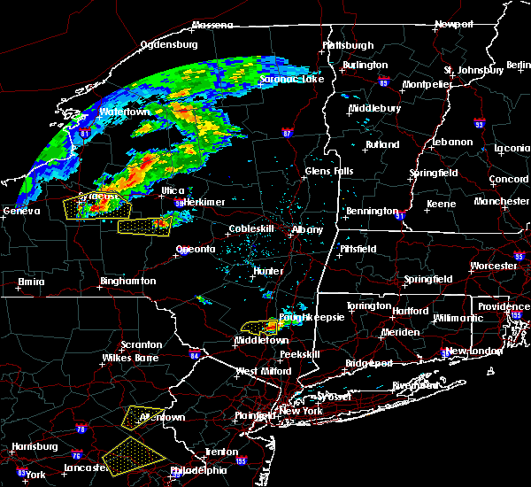 At 519 pm edt, a severe thunderstorm was located near highland, or near poughkeepsie, moving east at 20 mph (radar indicated). Hazards include 60 mph wind gusts and nickel size hail. Expect damage to roofs. siding and trees. this severe storm will be just west of, poughkeepsie around 530 pm edt. other locations impacted by this severe thunderstorm include stoneco, jenkinstown, highland landing, lloyd, clintondale station, oakes, lattintown, tuckers corner, sylva and ardonia. A tornado watch remains in effect until 1100 pm edt for east central new york. At 519 pm edt, a severe thunderstorm was located near highland, or near poughkeepsie, moving east at 20 mph (radar indicated). Hazards include 60 mph wind gusts and nickel size hail. Expect damage to roofs. siding and trees. this severe storm will be just west of, poughkeepsie around 530 pm edt. other locations impacted by this severe thunderstorm include stoneco, jenkinstown, highland landing, lloyd, clintondale station, oakes, lattintown, tuckers corner, sylva and ardonia. A tornado watch remains in effect until 1100 pm edt for east central new york.
|
| 6/12/2015 4:53 PM EDT |
 At 452 pm edt, a severe thunderstorm was located near wallkill, or 7 miles east of ellenville, moving east at 25 mph (radar indicated). Hazards include 60 mph wind gusts and nickel size hail. Expect damage to roofs. siding and trees. this severe storm will be near, new paltz, plattekill and modena around 510 pm edt. highland and marlboro around 525 pm edt. other locations impacted by this severe thunderstorm include libertyville, tuthilltown, galeville, saint elmo, jenkinstown, highland landing, awosting, crawford, lloyd and bruynswick. A tornado watch remains in effect until 1100 pm edt for east central new york. At 452 pm edt, a severe thunderstorm was located near wallkill, or 7 miles east of ellenville, moving east at 25 mph (radar indicated). Hazards include 60 mph wind gusts and nickel size hail. Expect damage to roofs. siding and trees. this severe storm will be near, new paltz, plattekill and modena around 510 pm edt. highland and marlboro around 525 pm edt. other locations impacted by this severe thunderstorm include libertyville, tuthilltown, galeville, saint elmo, jenkinstown, highland landing, awosting, crawford, lloyd and bruynswick. A tornado watch remains in effect until 1100 pm edt for east central new york.
|
| 6/12/2015 4:27 PM EDT |
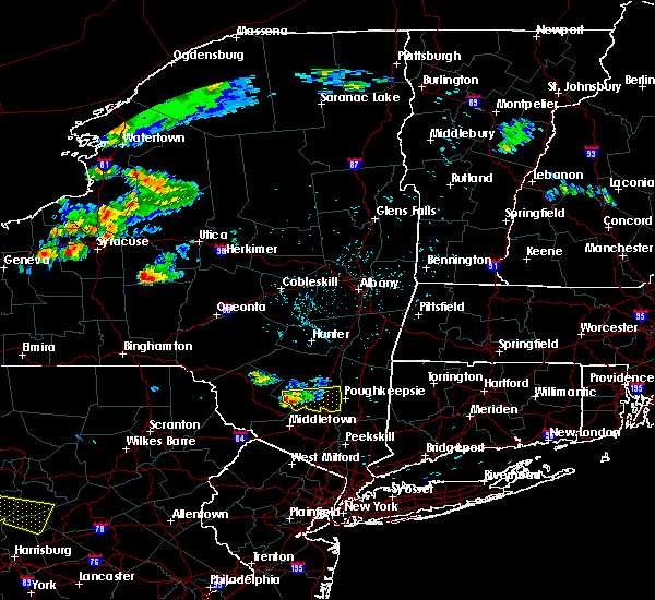 At 427 pm edt, a severe thunderstorm was located over ellenville, moving east at 30 mph (radar indicated). Hazards include 60 mph wind gusts and penny size hail. Expect damage to roofs. siding and trees. this severe thunderstorm will be near, kerhonkson around 430 pm edt. wallkill around 445 pm edt. modena around 450 pm edt. new paltz and plattekill around 455 pm edt. highland and marlboro around 505 pm edt. poughkeepsie around 510 pm edt. other locations impacted by this severe thunderstorm include libertyville, tuthilltown, ohioville, galeville, springtown, ulsterville, saint elmo, jenkinstown, highland landing and awosting. A tornado watch remains in effect until 1100 pm edt for east central new york. At 427 pm edt, a severe thunderstorm was located over ellenville, moving east at 30 mph (radar indicated). Hazards include 60 mph wind gusts and penny size hail. Expect damage to roofs. siding and trees. this severe thunderstorm will be near, kerhonkson around 430 pm edt. wallkill around 445 pm edt. modena around 450 pm edt. new paltz and plattekill around 455 pm edt. highland and marlboro around 505 pm edt. poughkeepsie around 510 pm edt. other locations impacted by this severe thunderstorm include libertyville, tuthilltown, ohioville, galeville, springtown, ulsterville, saint elmo, jenkinstown, highland landing and awosting. A tornado watch remains in effect until 1100 pm edt for east central new york.
|
| 5/27/2015 5:40 PM EDT | At 539 pm edt, severe thunderstorms were located along a line extending from stanfordville to cold spring, moving east at 50 mph (radar indicated). Hazards include 60 mph wind gusts and penny size hail. Expect damage to roofs. siding and trees. severe thunderstorms will be near, millbrook around 545 pm edt. amenia around 550 pm edt. sharon and hopewell junction around 555 pm edt. pawling around 605 pm edt. brookfield, new fairfield and wingdale around 610 pm edt. sherman and gaylordsville around 615 pm edt. new milford and winsted around 620 pm edt. hartland, new preston and woodbury center around 625 pm edt. Other locations impacted by these severe thunderstorms include dean corners, ohioville, arthursburg, sharon valley, birch groves, minortown, macdonnell heights, netherwood, east cornwall and clintondale station. |
| 5/27/2015 5:40 PM EDT | At 539 pm edt, severe thunderstorms were located along a line extending from stanfordville to cold spring, moving east at 50 mph (radar indicated). Hazards include 60 mph wind gusts and penny size hail. Expect damage to roofs. siding and trees. severe thunderstorms will be near, millbrook around 545 pm edt. amenia around 550 pm edt. sharon and hopewell junction around 555 pm edt. pawling around 605 pm edt. brookfield, new fairfield and wingdale around 610 pm edt. sherman and gaylordsville around 615 pm edt. new milford and winsted around 620 pm edt. hartland, new preston and woodbury center around 625 pm edt. Other locations impacted by these severe thunderstorms include dean corners, ohioville, arthursburg, sharon valley, birch groves, minortown, macdonnell heights, netherwood, east cornwall and clintondale station. |
| 8/6/2014 3:55 PM EDT | Trees and wires down in ulster county NY, 2.1 miles N of Highland, NY |
| 7/13/2014 7:30 PM EDT | Tree down on a house. time estimated by radar in ulster county NY, 0.3 miles E of Highland, NY |
| 7/13/2014 7:25 PM EDT | Trees and wires down in the road at intersection of routes 44 and 5 in ulster county NY, 0.3 miles E of Highland, NY |
| 6/30/2013 1:40 PM EDT | Quarter sized hail reported 1.4 miles NNE of Highland, NY, time estimated by radar |
Hail Maps for Highland, NY


Connect with Interactive Hail Maps