

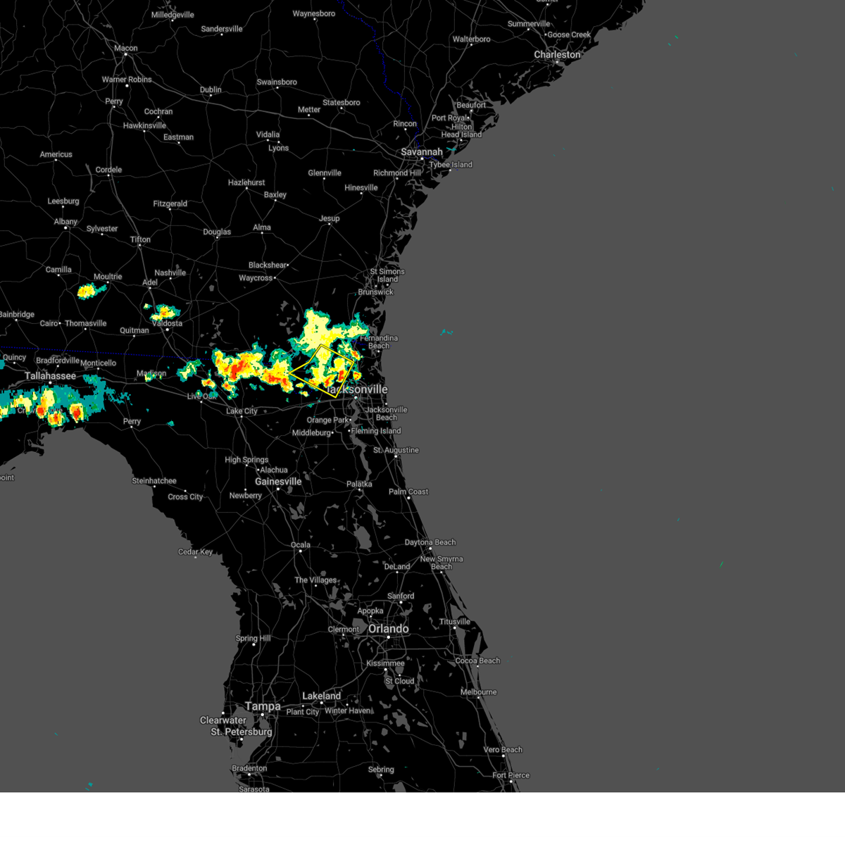
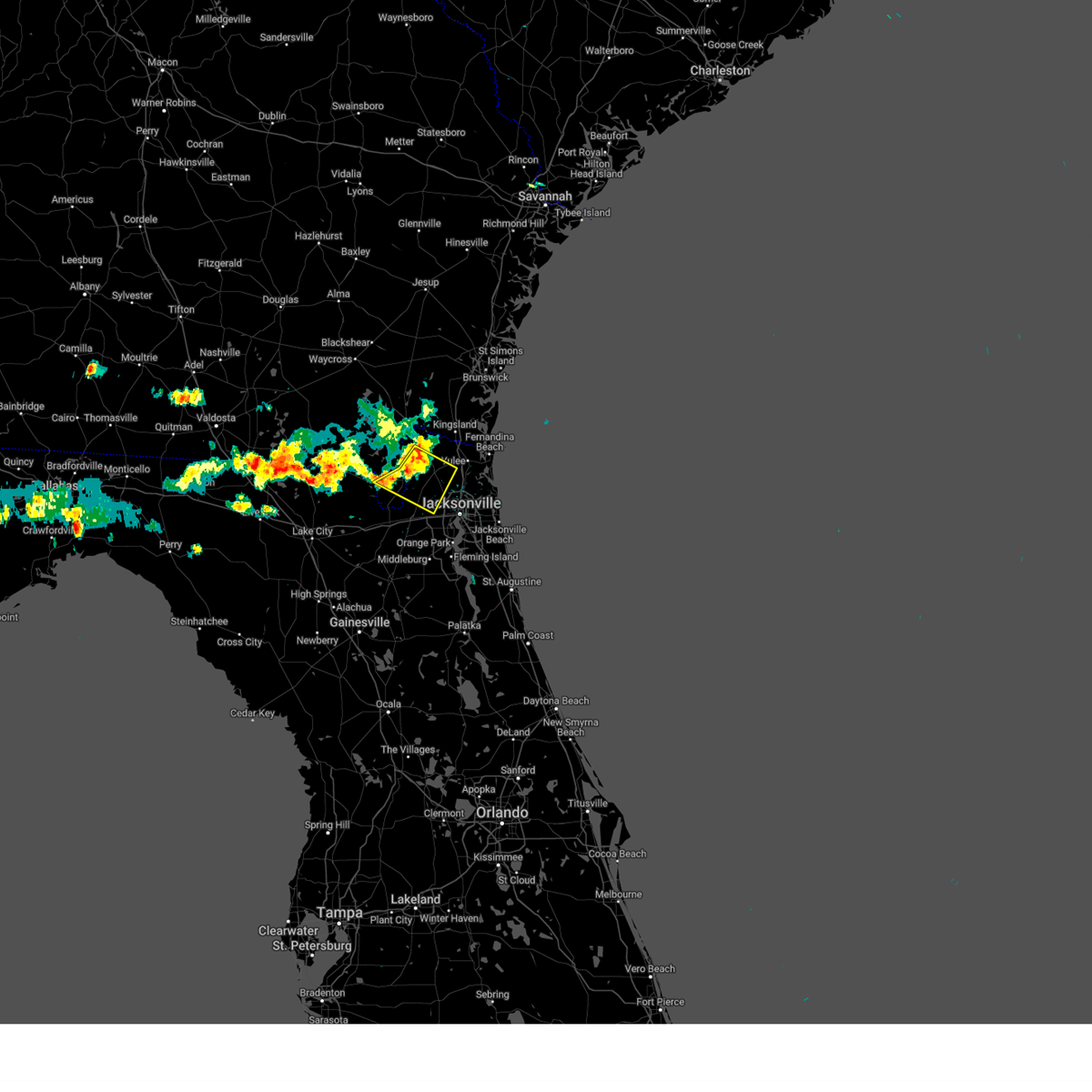
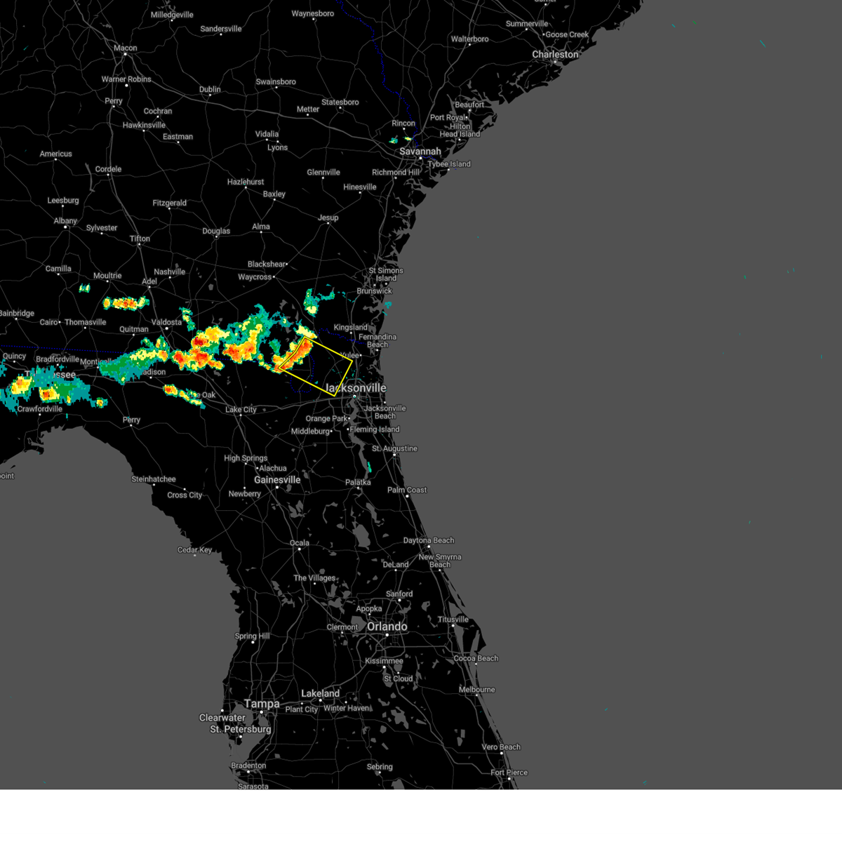
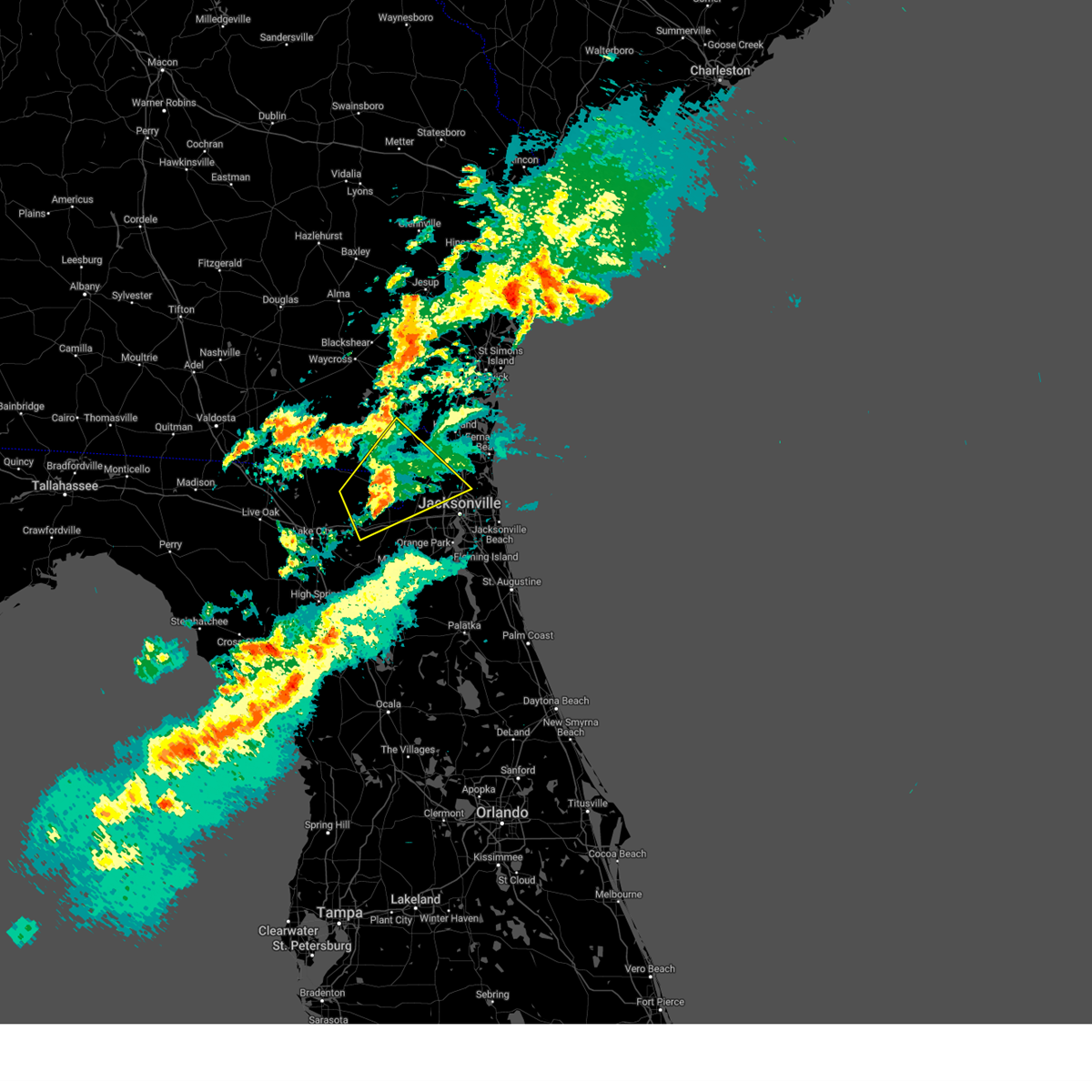
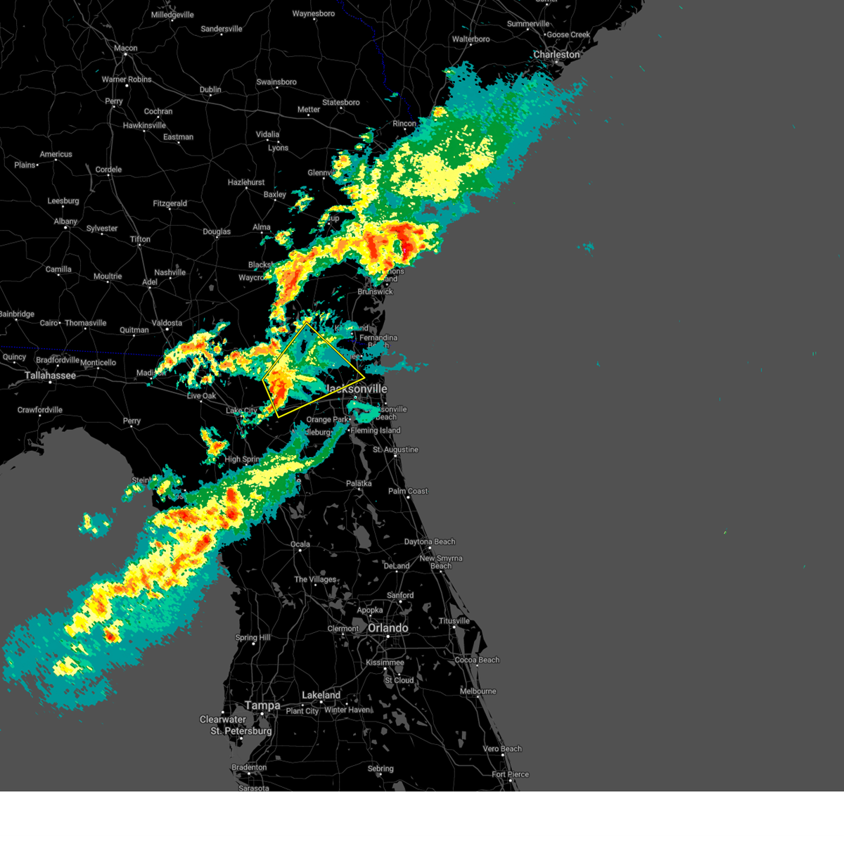
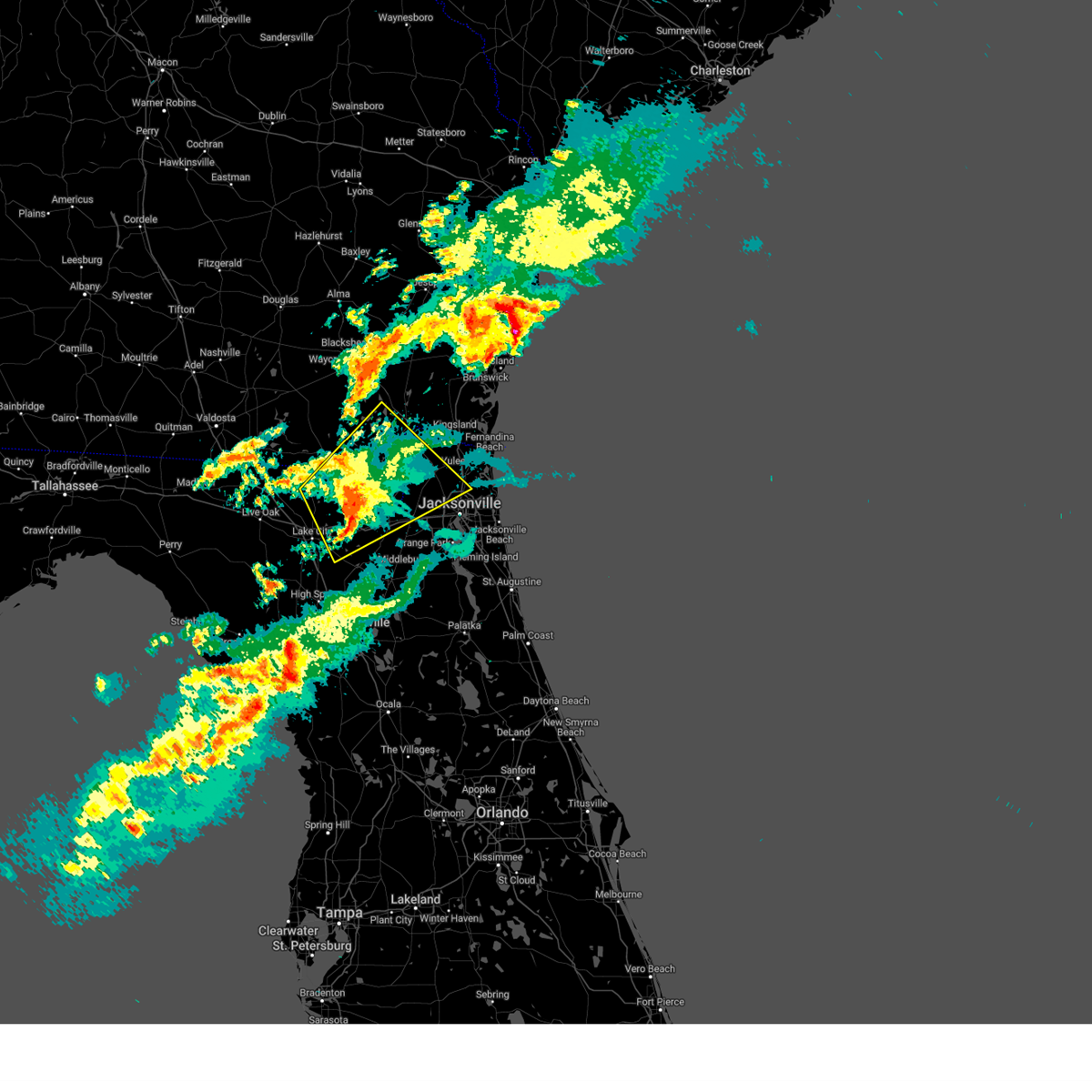
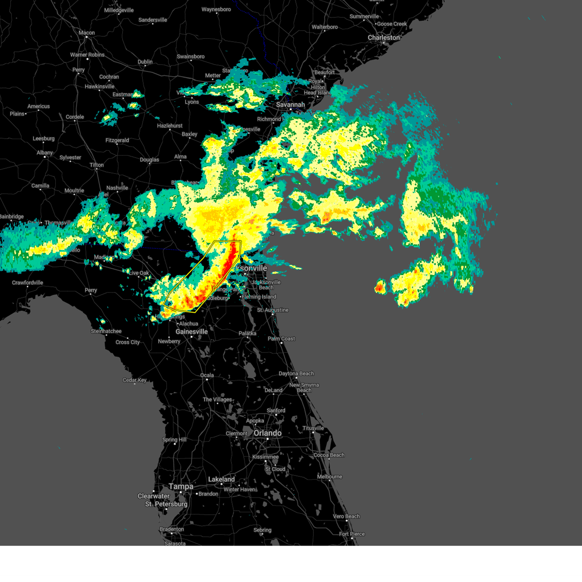
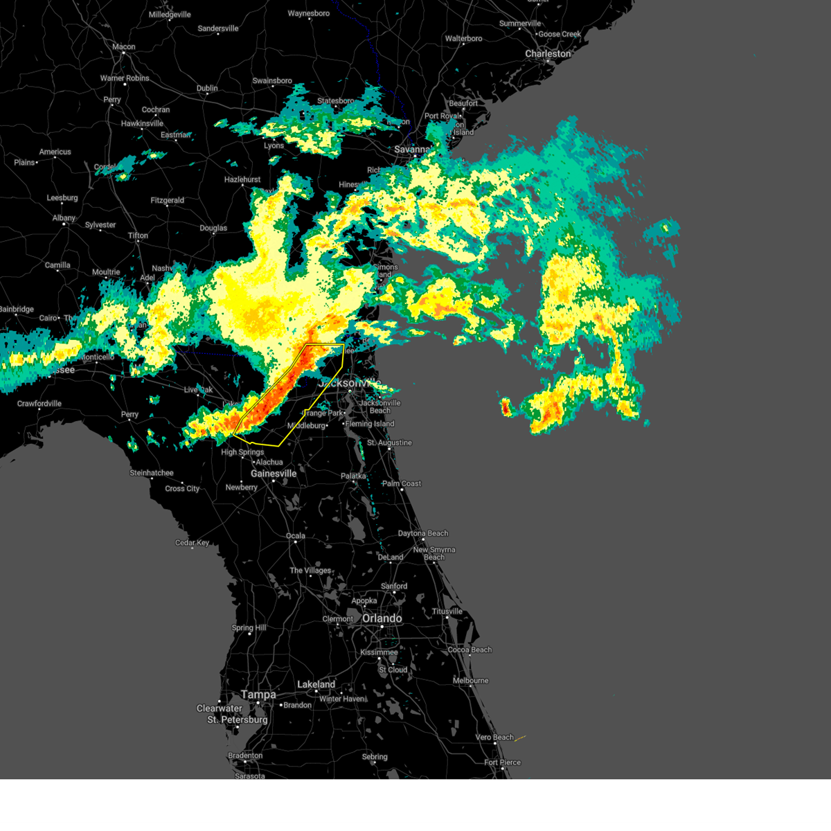
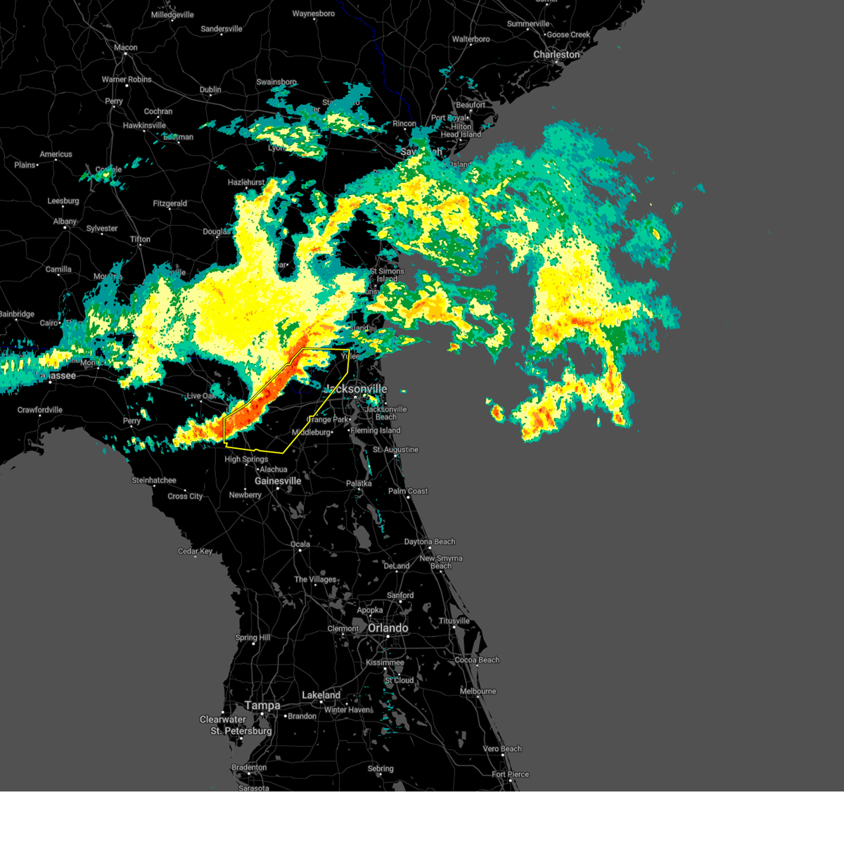
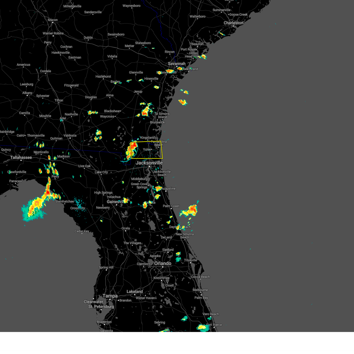
Hail Map for Hilliard, FL
The Hilliard, FL area has had 3 reports of on-the-ground hail by trained spotters, and has been under severe weather warnings 16 times during the past 12 months. Doppler radar has detected hail at or near Hilliard, FL on 81 occasions, including 2 occasions during the past year.
| Name: | Hilliard, FL |
| Where Located: | 28.8 miles NNW of Jacksonville, FL |
| Map: | Google Map for Hilliard, FL |
| Population: | 3086 |
| Housing Units: | 1206 |
| More Info: | Search Google for Hilliard, FL |
1
The Top Recent Hail Date for Hilliard, FL is Monday, July 15, 2024 (28th out of 81)

Hail and Wind Damage Spotted near Hilliard, FL
| Date / Time | Report Details |
|---|---|
| 5/21/2025 2:42 PM EDT |
 The storm which prompted the warning has moved out of the area. therefore, the warning will be allowed to expire. however, gusty winds are still possible with this thunderstorm. remember, a severe thunderstorm warning still remains in effect for portions of nassau and duval counties. The storm which prompted the warning has moved out of the area. therefore, the warning will be allowed to expire. however, gusty winds are still possible with this thunderstorm. remember, a severe thunderstorm warning still remains in effect for portions of nassau and duval counties.
|
| 5/21/2025 2:24 PM EDT |
 the severe thunderstorm warning has been cancelled and is no longer in effect the severe thunderstorm warning has been cancelled and is no longer in effect
|
| 5/21/2025 2:24 PM EDT |
 At 224 pm edt, a severe thunderstorm was located near st. george, or 7 miles west of callahan, moving southeast at 35 mph (radar indicated). Hazards include 60 mph wind gusts and penny size hail. Expect damage to roofs, siding, and trees. locations impacted include, hilliard, callahan, st. George, ratliff, bryceville, and nassau village-ratliff. At 224 pm edt, a severe thunderstorm was located near st. george, or 7 miles west of callahan, moving southeast at 35 mph (radar indicated). Hazards include 60 mph wind gusts and penny size hail. Expect damage to roofs, siding, and trees. locations impacted include, hilliard, callahan, st. George, ratliff, bryceville, and nassau village-ratliff.
|
| 5/21/2025 2:06 PM EDT |
 Svrjax the national weather service in jacksonville has issued a * severe thunderstorm warning for, southwestern nassau county in northeastern florida, north central baker county in northeastern florida, northwestern duval county in northeastern florida, southern ware county in southeastern georgia, southeastern charlton county in southeastern georgia, * until 245 pm edt. * at 206 pm edt, a severe thunderstorm was located 8 miles northwest of st. george, or 12 miles west of hilliard, moving southeast at 35 mph (radar indicated). Hazards include 60 mph wind gusts and penny size hail. expect damage to roofs, siding, and trees Svrjax the national weather service in jacksonville has issued a * severe thunderstorm warning for, southwestern nassau county in northeastern florida, north central baker county in northeastern florida, northwestern duval county in northeastern florida, southern ware county in southeastern georgia, southeastern charlton county in southeastern georgia, * until 245 pm edt. * at 206 pm edt, a severe thunderstorm was located 8 miles northwest of st. george, or 12 miles west of hilliard, moving southeast at 35 mph (radar indicated). Hazards include 60 mph wind gusts and penny size hail. expect damage to roofs, siding, and trees
|
| 3/16/2025 12:17 PM EDT |
 the severe thunderstorm warning has been cancelled and is no longer in effect the severe thunderstorm warning has been cancelled and is no longer in effect
|
| 3/16/2025 12:04 PM EDT |
 the severe thunderstorm warning has been cancelled and is no longer in effect the severe thunderstorm warning has been cancelled and is no longer in effect
|
| 3/16/2025 12:04 PM EDT |
 At 1204 pm edt, a severe thunderstorm was located near st. george, or 9 miles southwest of hilliard, moving northeast at 50 mph (radar indicated). Hazards include 60 mph wind gusts and penny size hail. Expect damage to roofs, siding, and trees. locations impacted include, callahan, taylor, st. George, jacksonville international arpt, macclenny, bryceville, nassau village-ratliff, ratliff, oceanway, and sanderson. At 1204 pm edt, a severe thunderstorm was located near st. george, or 9 miles southwest of hilliard, moving northeast at 50 mph (radar indicated). Hazards include 60 mph wind gusts and penny size hail. Expect damage to roofs, siding, and trees. locations impacted include, callahan, taylor, st. George, jacksonville international arpt, macclenny, bryceville, nassau village-ratliff, ratliff, oceanway, and sanderson.
|
| 3/16/2025 11:46 AM EDT |
 Svrjax the national weather service in jacksonville has issued a * severe thunderstorm warning for, western nassau county in northeastern florida, baker county in northeastern florida, northwestern union county in northern florida, northeastern columbia county in northern florida, northwestern duval county in northeastern florida, east central hamilton county in northern florida, southeastern ware county in southeastern georgia, southeastern clinch county in southeastern georgia, central charlton county in southeastern georgia, * until 1230 pm edt. * at 1146 am edt, a severe thunderstorm was located near taylor, or 22 miles southeast of fargo, moving northeast at 50 mph (radar indicated). Hazards include 60 mph wind gusts and penny size hail. expect damage to roofs, siding, and trees Svrjax the national weather service in jacksonville has issued a * severe thunderstorm warning for, western nassau county in northeastern florida, baker county in northeastern florida, northwestern union county in northern florida, northeastern columbia county in northern florida, northwestern duval county in northeastern florida, east central hamilton county in northern florida, southeastern ware county in southeastern georgia, southeastern clinch county in southeastern georgia, central charlton county in southeastern georgia, * until 1230 pm edt. * at 1146 am edt, a severe thunderstorm was located near taylor, or 22 miles southeast of fargo, moving northeast at 50 mph (radar indicated). Hazards include 60 mph wind gusts and penny size hail. expect damage to roofs, siding, and trees
|
| 3/9/2025 10:13 AM EDT |
 The storms which prompted the warning have weakened below severe limits, and no longer pose an immediate threat to life or property. therefore, the warning will be allowed to expire. however, small hail and strong gusty winds are still possible with these thunderstorms. The storms which prompted the warning have weakened below severe limits, and no longer pose an immediate threat to life or property. therefore, the warning will be allowed to expire. however, small hail and strong gusty winds are still possible with these thunderstorms.
|
| 3/9/2025 10:01 AM EDT |
 At 1000 am edt, severe thunderstorms were located along a line extending from 6 miles northeast of st. george to near olustee, moving east at 60 mph (radar indicated). Hazards include 60 mph wind gusts and nickel size hail. Expect damage to roofs, siding, and trees. locations impacted include, palestine community, groves, callahan, worthington spring, st. George, johnstown, raiford, new river, macclenny, and lake butler. At 1000 am edt, severe thunderstorms were located along a line extending from 6 miles northeast of st. george to near olustee, moving east at 60 mph (radar indicated). Hazards include 60 mph wind gusts and nickel size hail. Expect damage to roofs, siding, and trees. locations impacted include, palestine community, groves, callahan, worthington spring, st. George, johnstown, raiford, new river, macclenny, and lake butler.
|
| 3/9/2025 9:44 AM EDT |
 Svrjax the national weather service in jacksonville has issued a * severe thunderstorm warning for, southwestern nassau county in northeastern florida, northwestern bradford county in northern florida, baker county in northeastern florida, union county in northern florida, central columbia county in northern florida, northwestern duval county in northeastern florida, southeastern charlton county in southeastern georgia, * until 1015 am edt. * at 944 am edt, severe thunderstorms were located along a line extending from 8 miles northeast of taylor to near lake city, moving east at 60 mph (radar indicated). Hazards include 60 mph wind gusts and quarter size hail. Hail damage to vehicles is expected. Expect wind damage to roofs, siding, and trees. Svrjax the national weather service in jacksonville has issued a * severe thunderstorm warning for, southwestern nassau county in northeastern florida, northwestern bradford county in northern florida, baker county in northeastern florida, union county in northern florida, central columbia county in northern florida, northwestern duval county in northeastern florida, southeastern charlton county in southeastern georgia, * until 1015 am edt. * at 944 am edt, severe thunderstorms were located along a line extending from 8 miles northeast of taylor to near lake city, moving east at 60 mph (radar indicated). Hazards include 60 mph wind gusts and quarter size hail. Hail damage to vehicles is expected. Expect wind damage to roofs, siding, and trees.
|
| 2/16/2025 10:54 AM EST |
 The storm which prompted the warning has weakened below severe limits, and no longer poses an immediate threat to life or property. therefore, the warning will be allowed to expire. a severe thunderstorm watch remains in effect until 100 pm est for northeastern florida, and southeastern georgia. The storm which prompted the warning has weakened below severe limits, and no longer poses an immediate threat to life or property. therefore, the warning will be allowed to expire. a severe thunderstorm watch remains in effect until 100 pm est for northeastern florida, and southeastern georgia.
|
| 2/16/2025 10:39 AM EST |
 the severe thunderstorm warning has been cancelled and is no longer in effect the severe thunderstorm warning has been cancelled and is no longer in effect
|
| 2/16/2025 10:39 AM EST |
 At 1039 am est, a severe thunderstorm was located near hilliard, moving east at 50 mph (radar indicated). Hazards include 60 mph wind gusts. Expect damage to roofs, siding, and trees. Locations impacted include, hilliard, callahan, ratliff, and nassau village-ratliff. At 1039 am est, a severe thunderstorm was located near hilliard, moving east at 50 mph (radar indicated). Hazards include 60 mph wind gusts. Expect damage to roofs, siding, and trees. Locations impacted include, hilliard, callahan, ratliff, and nassau village-ratliff.
|
| 2/16/2025 10:32 AM EST |
 Svrjax the national weather service in jacksonville has issued a * severe thunderstorm warning for, northwestern nassau county in northeastern florida, east central charlton county in southeastern georgia, * until 1100 am est. * at 1032 am est, a severe thunderstorm was located 7 miles north of st. george, or 9 miles southwest of hilliard, moving east at 50 mph (radar indicated). Hazards include 60 mph wind gusts. possible tornado. expect damage to roofs, siding, and trees Svrjax the national weather service in jacksonville has issued a * severe thunderstorm warning for, northwestern nassau county in northeastern florida, east central charlton county in southeastern georgia, * until 1100 am est. * at 1032 am est, a severe thunderstorm was located 7 miles north of st. george, or 9 miles southwest of hilliard, moving east at 50 mph (radar indicated). Hazards include 60 mph wind gusts. possible tornado. expect damage to roofs, siding, and trees
|
| 8/19/2024 4:11 PM EDT |
 Svrjax the national weather service in jacksonville has issued a * severe thunderstorm warning for, nassau county in northeastern florida, northeastern duval county in northeastern florida, southeastern camden county in southeastern georgia, * until 500 pm edt. * at 410 pm edt, a severe thunderstorm was located near hilliard, moving east at 30 mph (radar indicated). Hazards include 60 mph wind gusts. expect damage to roofs, siding, and trees Svrjax the national weather service in jacksonville has issued a * severe thunderstorm warning for, nassau county in northeastern florida, northeastern duval county in northeastern florida, southeastern camden county in southeastern georgia, * until 500 pm edt. * at 410 pm edt, a severe thunderstorm was located near hilliard, moving east at 30 mph (radar indicated). Hazards include 60 mph wind gusts. expect damage to roofs, siding, and trees
|
| 6/28/2024 3:09 PM EDT |
 Svrjax the national weather service in jacksonville has issued a * severe thunderstorm warning for, northeastern nassau county in northeastern florida, southwestern camden county in southeastern georgia, * until 400 pm edt. * at 309 pm edt, a severe thunderstorm was located 7 miles northeast of callahan, moving northeast at 20 mph (radar indicated). Hazards include 60 mph wind gusts. expect damage to roofs, siding, and trees Svrjax the national weather service in jacksonville has issued a * severe thunderstorm warning for, northeastern nassau county in northeastern florida, southwestern camden county in southeastern georgia, * until 400 pm edt. * at 309 pm edt, a severe thunderstorm was located 7 miles northeast of callahan, moving northeast at 20 mph (radar indicated). Hazards include 60 mph wind gusts. expect damage to roofs, siding, and trees
|
| 6/5/2024 4:58 PM EDT |
 Svrjax the national weather service in jacksonville has issued a * severe thunderstorm warning for, northwestern nassau county in northeastern florida, north central duval county in northeastern florida, southern camden county in southeastern georgia, * until 530 pm edt. * at 458 pm edt, a severe thunderstorm was located near hilliard, moving east at 15 mph (radar indicated). Hazards include 60 mph wind gusts and quarter size hail. Hail damage to vehicles is expected. Expect wind damage to roofs, siding, and trees. Svrjax the national weather service in jacksonville has issued a * severe thunderstorm warning for, northwestern nassau county in northeastern florida, north central duval county in northeastern florida, southern camden county in southeastern georgia, * until 530 pm edt. * at 458 pm edt, a severe thunderstorm was located near hilliard, moving east at 15 mph (radar indicated). Hazards include 60 mph wind gusts and quarter size hail. Hail damage to vehicles is expected. Expect wind damage to roofs, siding, and trees.
|
| 5/10/2024 9:59 AM EDT |
 The storms which prompted the warning have moved out of the area. therefore, the warning will be allowed to expire. however, heavy rain is still possible with these thunderstorms. a severe thunderstorm watch remains in effect until noon edt for northern and northeastern florida, and southeastern georgia. The storms which prompted the warning have moved out of the area. therefore, the warning will be allowed to expire. however, heavy rain is still possible with these thunderstorms. a severe thunderstorm watch remains in effect until noon edt for northern and northeastern florida, and southeastern georgia.
|
| 5/10/2024 9:25 AM EDT |
 Svrjax the national weather service in jacksonville has issued a * severe thunderstorm warning for, nassau county in northeastern florida, southeastern alachua county in northern florida, st. johns county in northeastern florida, central marion county in northern florida, putnam county in northeastern florida, clay county in northeastern florida, duval county in northeastern florida, camden county in southeastern georgia, northeastern charlton county in southeastern georgia, * until 1000 am edt. * at 925 am edt, severe thunderstorms were located along a line extending from near kings ferry to near florahome to near williston municipal airport, moving east at 60 mph (radar indicated). Hazards include 60 mph wind gusts and penny size hail. expect damage to roofs, siding, and trees Svrjax the national weather service in jacksonville has issued a * severe thunderstorm warning for, nassau county in northeastern florida, southeastern alachua county in northern florida, st. johns county in northeastern florida, central marion county in northern florida, putnam county in northeastern florida, clay county in northeastern florida, duval county in northeastern florida, camden county in southeastern georgia, northeastern charlton county in southeastern georgia, * until 1000 am edt. * at 925 am edt, severe thunderstorms were located along a line extending from near kings ferry to near florahome to near williston municipal airport, moving east at 60 mph (radar indicated). Hazards include 60 mph wind gusts and penny size hail. expect damage to roofs, siding, and trees
|
| 5/10/2024 9:20 AM EDT |
 At 920 am edt, severe thunderstorms were located along a line extending from 10 miles east of woodbine to baymeadows to near bardin to 8 miles southwest of cross creek, moving east at 90 mph (radar indicated). Hazards include 60 mph wind gusts and penny size hail. Expect damage to roofs, siding, and trees. locations impacted include, jacksonville, st. Marys, kingsland, fernandina beach, palatka, orange park, green cove springs, rainbow lakes estates, woodbine, and interlachen. At 920 am edt, severe thunderstorms were located along a line extending from 10 miles east of woodbine to baymeadows to near bardin to 8 miles southwest of cross creek, moving east at 90 mph (radar indicated). Hazards include 60 mph wind gusts and penny size hail. Expect damage to roofs, siding, and trees. locations impacted include, jacksonville, st. Marys, kingsland, fernandina beach, palatka, orange park, green cove springs, rainbow lakes estates, woodbine, and interlachen.
|
| 5/10/2024 9:00 AM EDT |
 Svrjax the national weather service in jacksonville has issued a * severe thunderstorm warning for, nassau county in northeastern florida, southeastern bradford county in northern florida, southeastern alachua county in northern florida, northwestern st. johns county in northeastern florida, northwestern marion county in northern florida, northwestern putnam county in northeastern florida, clay county in northeastern florida, duval county in northeastern florida, camden county in southeastern georgia, * until 930 am edt. * at 900 am edt, severe thunderstorms were located along a line extending from near hickox to near bryceville to near keystone heights to near archer, moving east at 70 mph (radar indicated). Hazards include 70 mph wind gusts and quarter size hail. Hail damage to vehicles is expected. expect considerable tree damage. Wind damage is also likely to mobile homes, roofs, and outbuildings. Svrjax the national weather service in jacksonville has issued a * severe thunderstorm warning for, nassau county in northeastern florida, southeastern bradford county in northern florida, southeastern alachua county in northern florida, northwestern st. johns county in northeastern florida, northwestern marion county in northern florida, northwestern putnam county in northeastern florida, clay county in northeastern florida, duval county in northeastern florida, camden county in southeastern georgia, * until 930 am edt. * at 900 am edt, severe thunderstorms were located along a line extending from near hickox to near bryceville to near keystone heights to near archer, moving east at 70 mph (radar indicated). Hazards include 70 mph wind gusts and quarter size hail. Hail damage to vehicles is expected. expect considerable tree damage. Wind damage is also likely to mobile homes, roofs, and outbuildings.
|
| 5/10/2024 8:44 AM EDT |
 Svrjax the national weather service in jacksonville has issued a * severe thunderstorm warning for, nassau county in northeastern florida, bradford county in northern florida, alachua county in northern florida, north central marion county in northern florida, baker county in northeastern florida, northwestern putnam county in northeastern florida, union county in northern florida, western clay county in northeastern florida, western duval county in northeastern florida, southwestern camden county in southeastern georgia, southeastern ware county in southeastern georgia, charlton county in southeastern georgia, * until 915 am edt. * at 843 am edt, severe thunderstorms were located along a line extending from 9 miles south of argyle to near lulu to 7 miles southeast of cross city, moving east at 70 mph. these are destructive storms for lake butler, starke, gainesville, macclenny, baldwin, and hilliard. (radar indicated). Hazards include 80 mph wind gusts and quarter size hail. Flying debris will be dangerous to those caught without shelter. mobile homes will be heavily damaged. expect considerable damage to roofs, windows, and vehicles. Extensive tree damage and power outages are likely. Svrjax the national weather service in jacksonville has issued a * severe thunderstorm warning for, nassau county in northeastern florida, bradford county in northern florida, alachua county in northern florida, north central marion county in northern florida, baker county in northeastern florida, northwestern putnam county in northeastern florida, union county in northern florida, western clay county in northeastern florida, western duval county in northeastern florida, southwestern camden county in southeastern georgia, southeastern ware county in southeastern georgia, charlton county in southeastern georgia, * until 915 am edt. * at 843 am edt, severe thunderstorms were located along a line extending from 9 miles south of argyle to near lulu to 7 miles southeast of cross city, moving east at 70 mph. these are destructive storms for lake butler, starke, gainesville, macclenny, baldwin, and hilliard. (radar indicated). Hazards include 80 mph wind gusts and quarter size hail. Flying debris will be dangerous to those caught without shelter. mobile homes will be heavily damaged. expect considerable damage to roofs, windows, and vehicles. Extensive tree damage and power outages are likely.
|
| 2/4/2024 6:38 PM EST |
 The tornado warning for central nassau county will expire at 645 pm est, the storm which prompted the warning has weakened below severe limits, and no longer appears capable of producing a tornado. therefore, the warning will be allowed to expire. however, hail is still possible with this thunderstorm. The tornado warning for central nassau county will expire at 645 pm est, the storm which prompted the warning has weakened below severe limits, and no longer appears capable of producing a tornado. therefore, the warning will be allowed to expire. however, hail is still possible with this thunderstorm.
|
| 2/4/2024 6:16 PM EST |
 At 615 pm est, a severe thunderstorm capable of producing a tornado was just south of callahan, moving north at 40 mph (radar indicated rotation). Hazards include tornado. Flying debris will be dangerous to those caught without shelter. mobile homes will be damaged or destroyed. damage to roofs, windows, and vehicles will occur. tree damage is likely. This dangerous storm will be near, callahan and nassau village-ratliff around 620 pm est. At 615 pm est, a severe thunderstorm capable of producing a tornado was just south of callahan, moving north at 40 mph (radar indicated rotation). Hazards include tornado. Flying debris will be dangerous to those caught without shelter. mobile homes will be damaged or destroyed. damage to roofs, windows, and vehicles will occur. tree damage is likely. This dangerous storm will be near, callahan and nassau village-ratliff around 620 pm est.
|
| 2/4/2024 4:35 PM EST |
 At 435 pm est, a severe thunderstorm was located 7 miles north of st. george, or 7 miles southwest of hilliard, moving north at 25 mph (radar indicated). Hazards include 60 mph wind gusts and nickel size hail. Expect damage to roofs, siding, and trees. locations impacted include, hilliard. hail threat, radar indicated max hail size, 0. 88 in wind threat, radar indicated max wind gust, 60 mph. At 435 pm est, a severe thunderstorm was located 7 miles north of st. george, or 7 miles southwest of hilliard, moving north at 25 mph (radar indicated). Hazards include 60 mph wind gusts and nickel size hail. Expect damage to roofs, siding, and trees. locations impacted include, hilliard. hail threat, radar indicated max hail size, 0. 88 in wind threat, radar indicated max wind gust, 60 mph.
|
| 2/4/2024 4:12 PM EST |
 At 412 pm est, a severe thunderstorm was located over st. george, or 14 miles west of callahan, moving north at 25 mph (radar indicated). Hazards include 60 mph wind gusts and quarter size hail. Hail damage to vehicles is expected. Expect wind damage to roofs, siding, and trees. At 412 pm est, a severe thunderstorm was located over st. george, or 14 miles west of callahan, moving north at 25 mph (radar indicated). Hazards include 60 mph wind gusts and quarter size hail. Hail damage to vehicles is expected. Expect wind damage to roofs, siding, and trees.
|
| 1/9/2024 3:12 PM EST |
 A severe thunderstorm warning remains in effect until 345 pm est for nassau. eastern bradford. northeastern alachua. west central st. johns. north central putnam. clay. duval and southeastern camden counties. At 311 pm est, severe thunderstorms were located along a line extending from near hilliard to near sampson, moving east at 35 mph. A severe thunderstorm warning remains in effect until 345 pm est for nassau. eastern bradford. northeastern alachua. west central st. johns. north central putnam. clay. duval and southeastern camden counties. At 311 pm est, severe thunderstorms were located along a line extending from near hilliard to near sampson, moving east at 35 mph.
|
| 1/9/2024 3:12 PM EST |
 At 311 pm est, severe thunderstorms were located along a line extending from near hilliard to near sampson, moving east at 35 mph (radar indicated). Hazards include 60 mph wind gusts. Expect damage to roofs, siding, and trees. locations impacted include, jacksonville, st. Marys, fernandina beach, orange park, green cove springs, starke, hilliard, keystone heights, callahan, and jacksonville international arpt. At 311 pm est, severe thunderstorms were located along a line extending from near hilliard to near sampson, moving east at 35 mph (radar indicated). Hazards include 60 mph wind gusts. Expect damage to roofs, siding, and trees. locations impacted include, jacksonville, st. Marys, fernandina beach, orange park, green cove springs, starke, hilliard, keystone heights, callahan, and jacksonville international arpt.
|
| 1/9/2024 3:10 PM EST |
 The national weather service in jacksonville has issued a * severe thunderstorm warning for. northwestern nassau county in northeastern florida. western camden county in southeastern georgia. western glynn county in southeastern georgia. East central charlton county in southeastern georgia. The national weather service in jacksonville has issued a * severe thunderstorm warning for. northwestern nassau county in northeastern florida. western camden county in southeastern georgia. western glynn county in southeastern georgia. East central charlton county in southeastern georgia.
|
| 1/9/2024 3:10 PM EST |
 At 310 pm est, severe thunderstorms were located along a line extending from near woodbine to near st. george, moving northeast at 55 mph (radar indicated). Hazards include 60 mph wind gusts. expect damage to roofs, siding, and trees At 310 pm est, severe thunderstorms were located along a line extending from near woodbine to near st. george, moving northeast at 55 mph (radar indicated). Hazards include 60 mph wind gusts. expect damage to roofs, siding, and trees
|
| 1/9/2024 2:52 PM EST |
 The severe thunderstorm warning for northwestern nassau, camden, western glynn, brantley, southeastern ware, southeastern wayne and northeastern charlton counties will expire at 300 pm est, the storms which prompted the warning have moved out of the area. therefore, the warning will be allowed to expire. however, gusty winds are still possible with these thunderstorms. a tornado watch remains in effect until 600 pm est for northeastern florida, and southeastern georgia. The severe thunderstorm warning for northwestern nassau, camden, western glynn, brantley, southeastern ware, southeastern wayne and northeastern charlton counties will expire at 300 pm est, the storms which prompted the warning have moved out of the area. therefore, the warning will be allowed to expire. however, gusty winds are still possible with these thunderstorms. a tornado watch remains in effect until 600 pm est for northeastern florida, and southeastern georgia.
|
| 1/9/2024 2:44 PM EST |
 At 244 pm est, severe thunderstorms were located along a line extending from 11 miles northwest of st. george to near alachua, moving east at 35 mph (radar indicated). Hazards include 60 mph wind gusts. expect damage to roofs, siding, and trees At 244 pm est, severe thunderstorms were located along a line extending from 11 miles northwest of st. george to near alachua, moving east at 35 mph (radar indicated). Hazards include 60 mph wind gusts. expect damage to roofs, siding, and trees
|
| 1/9/2024 2:03 PM EST |
 At 202 pm est, severe thunderstorms were located along a line extending from near race pond to 10 miles north of taylor, moving northeast at 70 mph (radar indicated). Hazards include 70 mph wind gusts and penny size hail. Expect considerable tree damage. damage is likely to mobile homes, roofs, and outbuildings. Locations impacted include, kingsland, jesup, hilliard, folkston, woodbine, nahunta, gardi, dock junction, homeland, and hickox. At 202 pm est, severe thunderstorms were located along a line extending from near race pond to 10 miles north of taylor, moving northeast at 70 mph (radar indicated). Hazards include 70 mph wind gusts and penny size hail. Expect considerable tree damage. damage is likely to mobile homes, roofs, and outbuildings. Locations impacted include, kingsland, jesup, hilliard, folkston, woodbine, nahunta, gardi, dock junction, homeland, and hickox.
|
| 1/9/2024 2:02 PM EST |
 At 201 pm est, severe thunderstorms were located along a line extending from 7 miles north of taylor to near high springs, moving east at 40 mph (radar indicated). Hazards include 60 mph wind gusts. expect damage to roofs, siding, and trees At 201 pm est, severe thunderstorms were located along a line extending from 7 miles north of taylor to near high springs, moving east at 40 mph (radar indicated). Hazards include 60 mph wind gusts. expect damage to roofs, siding, and trees
|
| 1/9/2024 1:55 PM EST |
 At 155 pm est, severe thunderstorms were located along a line extending from 7 miles southeast of hickox to 9 miles southeast of fargo, moving northeast at 95 mph (radar indicated). Hazards include 70 mph wind gusts and penny size hail. Expect considerable tree damage. Damage is likely to mobile homes, roofs, and outbuildings. At 155 pm est, severe thunderstorms were located along a line extending from 7 miles southeast of hickox to 9 miles southeast of fargo, moving northeast at 95 mph (radar indicated). Hazards include 70 mph wind gusts and penny size hail. Expect considerable tree damage. Damage is likely to mobile homes, roofs, and outbuildings.
|
| 9/12/2023 8:39 PM EDT |
 The severe thunderstorm warning for nassau and central duval counties will expire at 845 pm edt, the storms which prompted the warning have weakened below severe limits, and no longer pose an immediate threat to life or property. therefore, the warning will be allowed to expire. however, gusty winds and heavy rain are still possible with these thunderstorms. The severe thunderstorm warning for nassau and central duval counties will expire at 845 pm edt, the storms which prompted the warning have weakened below severe limits, and no longer pose an immediate threat to life or property. therefore, the warning will be allowed to expire. however, gusty winds and heavy rain are still possible with these thunderstorms.
|
| 9/12/2023 8:34 PM EDT |
 At 834 pm edt, severe thunderstorms were located along a line extending from near woodbine to near bryceville, moving east at 15 mph (radar indicated). Hazards include 60 mph wind gusts. Expect damage to roofs, siding, and trees. locations impacted include, hilliard, callahan, jacksonville international arpt, kings ferry, cisco gardens, nassau village-ratliff, ratliff, normandy, bryceville, and jacksonville heights. hail threat, radar indicated max hail size, <. 75 in wind threat, radar indicated max wind gust, 60 mph. At 834 pm edt, severe thunderstorms were located along a line extending from near woodbine to near bryceville, moving east at 15 mph (radar indicated). Hazards include 60 mph wind gusts. Expect damage to roofs, siding, and trees. locations impacted include, hilliard, callahan, jacksonville international arpt, kings ferry, cisco gardens, nassau village-ratliff, ratliff, normandy, bryceville, and jacksonville heights. hail threat, radar indicated max hail size, <. 75 in wind threat, radar indicated max wind gust, 60 mph.
|
| 9/12/2023 8:27 PM EDT |
 At 827 pm edt, severe thunderstorms were located along a line extending from near woodbine to near bryceville, moving east at 25 mph (radar indicated). Hazards include 60 mph wind gusts. Expect damage to roofs, siding, and trees. locations impacted include, hilliard, woodbine, callahan, jacksonville international arpt, kings ferry, cisco gardens, bryceville, nassau village-ratliff, ratliff, and normandy. hail threat, radar indicated max hail size, <. 75 in wind threat, radar indicated max wind gust, 60 mph. At 827 pm edt, severe thunderstorms were located along a line extending from near woodbine to near bryceville, moving east at 25 mph (radar indicated). Hazards include 60 mph wind gusts. Expect damage to roofs, siding, and trees. locations impacted include, hilliard, woodbine, callahan, jacksonville international arpt, kings ferry, cisco gardens, bryceville, nassau village-ratliff, ratliff, and normandy. hail threat, radar indicated max hail size, <. 75 in wind threat, radar indicated max wind gust, 60 mph.
|
| 9/12/2023 8:13 PM EDT |
 At 813 pm edt, severe thunderstorms were located along a line extending from 10 miles southwest of waverly to 7 miles west of bryceville, moving east at 15 mph (radar indicated). Hazards include 60 mph wind gusts. expect damage to roofs, siding, and trees At 813 pm edt, severe thunderstorms were located along a line extending from 10 miles southwest of waverly to 7 miles west of bryceville, moving east at 15 mph (radar indicated). Hazards include 60 mph wind gusts. expect damage to roofs, siding, and trees
|
| 9/12/2023 8:08 PM EDT |
 The severe thunderstorm warning for northwestern nassau, southwestern camden and central charlton counties will expire at 815 pm edt, the storms which prompted the warning have weakened below severe limits, and no longer pose an immediate threat to life or property. therefore, the warning will be allowed to expire. however, gusty winds are still possible with these thunderstorms. the severe thunderstorm warning may be reissued if the storms become severe again. remain alert for possible warnings. to report severe weather, contact your nearest law enforcement agency. they will relay your report to the national weather service jacksonville. The severe thunderstorm warning for northwestern nassau, southwestern camden and central charlton counties will expire at 815 pm edt, the storms which prompted the warning have weakened below severe limits, and no longer pose an immediate threat to life or property. therefore, the warning will be allowed to expire. however, gusty winds are still possible with these thunderstorms. the severe thunderstorm warning may be reissued if the storms become severe again. remain alert for possible warnings. to report severe weather, contact your nearest law enforcement agency. they will relay your report to the national weather service jacksonville.
|
| 9/12/2023 7:42 PM EDT |
 At 741 pm edt, severe thunderstorms were located along a line extending from homeland to near st. george, moving southeast at 35 mph (radar indicated). Hazards include 60 mph wind gusts. expect damage to roofs, siding, and trees At 741 pm edt, severe thunderstorms were located along a line extending from homeland to near st. george, moving southeast at 35 mph (radar indicated). Hazards include 60 mph wind gusts. expect damage to roofs, siding, and trees
|
| 8/10/2023 3:03 PM EDT |
 At 303 pm edt, a severe thunderstorm was located over hilliard, moving east at 25 mph (radar indicated). Hazards include 60 mph wind gusts. expect damage to roofs, siding, and trees At 303 pm edt, a severe thunderstorm was located over hilliard, moving east at 25 mph (radar indicated). Hazards include 60 mph wind gusts. expect damage to roofs, siding, and trees
|
| 7/30/2023 5:05 PM EDT |
 The severe thunderstorm warning for northern nassau and southern camden counties will expire at 515 pm edt, the storm which prompted the warning has weakened below severe limits, and no longer poses an immediate threat to life or property. therefore, the warning will be allowed to expire. however small hail, gusty winds and heavy rain are still possible with this thunderstorm. The severe thunderstorm warning for northern nassau and southern camden counties will expire at 515 pm edt, the storm which prompted the warning has weakened below severe limits, and no longer poses an immediate threat to life or property. therefore, the warning will be allowed to expire. however small hail, gusty winds and heavy rain are still possible with this thunderstorm.
|
| 7/30/2023 4:33 PM EDT |
 At 433 pm edt, a severe thunderstorm was located near kings ferry, or 10 miles southwest of woodbine, moving east at 15 mph (radar indicated). Hazards include 60 mph wind gusts and penny size hail. expect damage to roofs, siding, and trees At 433 pm edt, a severe thunderstorm was located near kings ferry, or 10 miles southwest of woodbine, moving east at 15 mph (radar indicated). Hazards include 60 mph wind gusts and penny size hail. expect damage to roofs, siding, and trees
|
| 7/16/2023 5:52 PM EDT |
 The severe thunderstorm warning for northwestern nassau county will expire at 600 pm edt, the storm which prompted the warning has moved out of the area. therefore, the warning will be allowed to expire. to report severe weather, contact your nearest law enforcement agency. they will relay your report to the national weather service jacksonville. The severe thunderstorm warning for northwestern nassau county will expire at 600 pm edt, the storm which prompted the warning has moved out of the area. therefore, the warning will be allowed to expire. to report severe weather, contact your nearest law enforcement agency. they will relay your report to the national weather service jacksonville.
|
| 7/16/2023 5:33 PM EDT |
 At 533 pm edt, a severe thunderstorm was located near st. george, or 7 miles southwest of hilliard, moving east at 15 mph (radar indicated). Hazards include 60 mph wind gusts. Expect damage to roofs, siding, and trees. locations impacted include, hilliard. hail threat, radar indicated max hail size, <. 75 in wind threat, radar indicated max wind gust, 60 mph. At 533 pm edt, a severe thunderstorm was located near st. george, or 7 miles southwest of hilliard, moving east at 15 mph (radar indicated). Hazards include 60 mph wind gusts. Expect damage to roofs, siding, and trees. locations impacted include, hilliard. hail threat, radar indicated max hail size, <. 75 in wind threat, radar indicated max wind gust, 60 mph.
|
| 7/16/2023 5:17 PM EDT |
 At 516 pm edt, a severe thunderstorm was located 7 miles northwest of st. george, or 11 miles southwest of hilliard, moving east at 15 mph (radar indicated). Hazards include 60 mph wind gusts. expect damage to roofs, siding, and trees At 516 pm edt, a severe thunderstorm was located 7 miles northwest of st. george, or 11 miles southwest of hilliard, moving east at 15 mph (radar indicated). Hazards include 60 mph wind gusts. expect damage to roofs, siding, and trees
|
| 7/10/2023 11:40 AM EDT | Tree down blocking the road near haddock drive/haddock rd. time estimated by rada in nassau county FL, 6.6 miles SW of Hilliard, FL |
| 6/19/2023 11:47 AM EDT |
 At 1147 am edt, severe thunderstorms were located along a line extending from near race pond to 10 miles west of homeland to 8 miles south of stephen foster state park, moving northeast at 45 mph (radar indicated). Hazards include 60 mph wind gusts. Expect damage to roofs, siding, and trees. locations impacted include, hilliard, folkston, homeland, race pond and winokur. hail threat, radar indicated max hail size, <. 75 in wind threat, radar indicated max wind gust, 60 mph. At 1147 am edt, severe thunderstorms were located along a line extending from near race pond to 10 miles west of homeland to 8 miles south of stephen foster state park, moving northeast at 45 mph (radar indicated). Hazards include 60 mph wind gusts. Expect damage to roofs, siding, and trees. locations impacted include, hilliard, folkston, homeland, race pond and winokur. hail threat, radar indicated max hail size, <. 75 in wind threat, radar indicated max wind gust, 60 mph.
|
| 6/19/2023 11:30 AM EDT |
 At 1130 am edt, severe thunderstorms were located along a line extending from 11 miles southwest of braganza to near stephen foster state park to 8 miles southeast of fargo, moving northeast at 45 mph (radar indicated). Hazards include 60 mph wind gusts and penny size hail. expect damage to roofs, siding, and trees At 1130 am edt, severe thunderstorms were located along a line extending from 11 miles southwest of braganza to near stephen foster state park to 8 miles southeast of fargo, moving northeast at 45 mph (radar indicated). Hazards include 60 mph wind gusts and penny size hail. expect damage to roofs, siding, and trees
|
| 6/14/2023 9:38 PM EDT |
 The severe thunderstorm warning for nassau and southeastern charlton counties will expire at 945 pm edt, the storm which prompted the warning has moved out of the area. therefore, the warning will be allowed to expire. a tornado watch remains in effect until 1000 pm edt for northeastern florida, and southeastern georgia. a severe thunderstorm watch remains in effect until 100 am edt for northeastern florida. The severe thunderstorm warning for nassau and southeastern charlton counties will expire at 945 pm edt, the storm which prompted the warning has moved out of the area. therefore, the warning will be allowed to expire. a tornado watch remains in effect until 1000 pm edt for northeastern florida, and southeastern georgia. a severe thunderstorm watch remains in effect until 100 am edt for northeastern florida.
|
| 6/14/2023 9:20 PM EDT |
 At 920 pm edt, a severe thunderstorm was located near callahan, moving east at 55 mph (radar indicated). Hazards include 60 mph wind gusts and nickel size hail. Expect damage to roofs, siding, and trees. locations impacted include, hilliard, callahan, kings ferry, nassau village-ratliff, st. George, ratliff and bryceville. At 920 pm edt, a severe thunderstorm was located near callahan, moving east at 55 mph (radar indicated). Hazards include 60 mph wind gusts and nickel size hail. Expect damage to roofs, siding, and trees. locations impacted include, hilliard, callahan, kings ferry, nassau village-ratliff, st. George, ratliff and bryceville.
|
| 6/14/2023 9:15 PM EDT | Reported power lines down... trees down (2 oaks... large pine) over road... skirting down from homes... access to ga-121 blocked. location: 2 miles north of saint georg in charlton county GA, 11.7 miles NE of Hilliard, FL |
| 6/14/2023 9:12 PM EDT |
 At 911 pm edt, a severe thunderstorm was located near st. george, or 10 miles southwest of hilliard, moving east at 50 mph (radar indicated). Hazards include 60 mph wind gusts and nickel size hail. expect damage to roofs, siding, and trees At 911 pm edt, a severe thunderstorm was located near st. george, or 10 miles southwest of hilliard, moving east at 50 mph (radar indicated). Hazards include 60 mph wind gusts and nickel size hail. expect damage to roofs, siding, and trees
|
| 6/13/2023 7:40 PM EDT |
 The severe thunderstorm warning for northwestern nassau, southwestern camden, southeastern ware and east central charlton counties will expire at 745 pm edt, the storm which prompted the warning has moved out of the area. therefore, the warning will be allowed to expire. a severe thunderstorm watch remains in effect until 1000 pm edt for northeastern florida, and southeastern georgia. The severe thunderstorm warning for northwestern nassau, southwestern camden, southeastern ware and east central charlton counties will expire at 745 pm edt, the storm which prompted the warning has moved out of the area. therefore, the warning will be allowed to expire. a severe thunderstorm watch remains in effect until 1000 pm edt for northeastern florida, and southeastern georgia.
|
| 6/13/2023 7:24 PM EDT |
 At 724 pm edt, a severe thunderstorm was located near hilliard, moving east at 40 mph (radar indicated). Hazards include 60 mph wind gusts and penny size hail. Expect damage to roofs, siding, and trees. locations impacted include, hilliard, folkston and kings ferry. hail threat, radar indicated max hail size, 0. 75 in wind threat, radar indicated max wind gust, 60 mph. At 724 pm edt, a severe thunderstorm was located near hilliard, moving east at 40 mph (radar indicated). Hazards include 60 mph wind gusts and penny size hail. Expect damage to roofs, siding, and trees. locations impacted include, hilliard, folkston and kings ferry. hail threat, radar indicated max hail size, 0. 75 in wind threat, radar indicated max wind gust, 60 mph.
|
| 6/13/2023 7:13 PM EDT |
 At 713 pm edt, a severe thunderstorm was located 10 miles southwest of folkston, moving east at 40 mph (radar indicated). Hazards include 60 mph wind gusts and penny size hail. expect damage to roofs, siding, and trees At 713 pm edt, a severe thunderstorm was located 10 miles southwest of folkston, moving east at 40 mph (radar indicated). Hazards include 60 mph wind gusts and penny size hail. expect damage to roofs, siding, and trees
|
| 5/22/2023 10:28 AM EDT |
 The severe thunderstorm warning for northwestern nassau and southwestern camden counties will expire at 1030 am edt, the storm which prompted the warning has weakened below severe limits, and no longer poses an immediate threat to life or property. therefore, the warning will be allowed to expire. however small hail, gusty winds and heavy rain are still possible with this thunderstorm. The severe thunderstorm warning for northwestern nassau and southwestern camden counties will expire at 1030 am edt, the storm which prompted the warning has weakened below severe limits, and no longer poses an immediate threat to life or property. therefore, the warning will be allowed to expire. however small hail, gusty winds and heavy rain are still possible with this thunderstorm.
|
| 5/22/2023 10:14 AM EDT |
 At 1014 am edt, a severe thunderstorm was located near kings ferry, or near folkston, moving southeast at 5 mph (radar indicated). Hazards include 60 mph wind gusts and half dollar size hail. Hail damage to vehicles is expected. expect wind damage to roofs, siding, and trees. Locations impacted include, hilliard and kings ferry. At 1014 am edt, a severe thunderstorm was located near kings ferry, or near folkston, moving southeast at 5 mph (radar indicated). Hazards include 60 mph wind gusts and half dollar size hail. Hail damage to vehicles is expected. expect wind damage to roofs, siding, and trees. Locations impacted include, hilliard and kings ferry.
|
| 5/22/2023 10:10 AM EDT | Several tree limbs dow in nassau county FL, 6.1 miles SSE of Hilliard, FL |
| 5/22/2023 10:03 AM EDT |
 At 1003 am edt, a severe thunderstorm was located near folkston, moving southeast at 5 mph (radar indicated). Hazards include ping pong ball size hail and 60 mph wind gusts. People and animals outdoors will be injured. expect hail damage to roofs, siding, windows, and vehicles. expect wind damage to roofs, siding, and trees. Locations impacted include, hilliard, folkston and kings ferry. At 1003 am edt, a severe thunderstorm was located near folkston, moving southeast at 5 mph (radar indicated). Hazards include ping pong ball size hail and 60 mph wind gusts. People and animals outdoors will be injured. expect hail damage to roofs, siding, windows, and vehicles. expect wind damage to roofs, siding, and trees. Locations impacted include, hilliard, folkston and kings ferry.
|
| 5/22/2023 9:53 AM EDT |
 At 953 am edt, a severe thunderstorm was located near folkston, moving southeast at 5 mph (radar indicated). Hazards include 60 mph wind gusts and quarter size hail. Hail damage to vehicles is expected. Expect wind damage to roofs, siding, and trees. At 953 am edt, a severe thunderstorm was located near folkston, moving southeast at 5 mph (radar indicated). Hazards include 60 mph wind gusts and quarter size hail. Hail damage to vehicles is expected. Expect wind damage to roofs, siding, and trees.
|
| 5/18/2023 3:01 PM EDT |
 At 301 pm edt, a severe thunderstorm was located near kings ferry, or near hilliard, moving east at 10 mph (radar indicated). Hazards include 60 mph wind gusts and nickel size hail. Expect damage to roofs, siding, and trees. locations impacted include, kingsland, hilliard and kings ferry. hail threat, radar indicated max hail size, 0. 88 in wind threat, radar indicated max wind gust, 60 mph. At 301 pm edt, a severe thunderstorm was located near kings ferry, or near hilliard, moving east at 10 mph (radar indicated). Hazards include 60 mph wind gusts and nickel size hail. Expect damage to roofs, siding, and trees. locations impacted include, kingsland, hilliard and kings ferry. hail threat, radar indicated max hail size, 0. 88 in wind threat, radar indicated max wind gust, 60 mph.
|
| 5/18/2023 2:45 PM EDT |
 At 245 pm edt, a severe thunderstorm was located over hilliard, moving east at 10 mph (radar indicated). Hazards include 60 mph wind gusts and nickel size hail. expect damage to roofs, siding, and trees At 245 pm edt, a severe thunderstorm was located over hilliard, moving east at 10 mph (radar indicated). Hazards include 60 mph wind gusts and nickel size hail. expect damage to roofs, siding, and trees
|
| 5/17/2023 4:24 PM EDT |
 At 424 pm edt, a severe thunderstorm was located near callahan, moving east at 10 mph (radar indicated). Hazards include 60 mph wind gusts and quarter size hail. Hail damage to vehicles is expected. Expect wind damage to roofs, siding, and trees. At 424 pm edt, a severe thunderstorm was located near callahan, moving east at 10 mph (radar indicated). Hazards include 60 mph wind gusts and quarter size hail. Hail damage to vehicles is expected. Expect wind damage to roofs, siding, and trees.
|
| 4/26/2023 4:25 PM EDT | Golf Ball sized hail reported 3 miles NE of Hilliard, FL, multiple photos relayed of large hail estimated around golf ball size. |
| 4/26/2023 4:20 PM EDT | Large tree snapped at trunk. photo relayed via social media. damage took place near hilliar in nassau county FL, 4.3 miles E of Hilliard, FL |
| 1/22/2023 8:27 PM EST |
 The severe thunderstorm warning for northwestern nassau and southwestern camden counties will expire at 830 pm est, the storm which prompted the warning has weakened below severe limits, and has exited the warned area. therefore, the warning will be allowed to expire. however gusty winds are still possible with this thunderstorm. The severe thunderstorm warning for northwestern nassau and southwestern camden counties will expire at 830 pm est, the storm which prompted the warning has weakened below severe limits, and has exited the warned area. therefore, the warning will be allowed to expire. however gusty winds are still possible with this thunderstorm.
|
| 1/22/2023 8:18 PM EST |
 At 818 pm est, a severe thunderstorm was located near kings ferry, or 9 miles west of kingsland, moving east at 55 mph (radar indicated). Hazards include 60 mph wind gusts. Expect damage to roofs, siding, and trees. Locations impacted include, kings ferry. At 818 pm est, a severe thunderstorm was located near kings ferry, or 9 miles west of kingsland, moving east at 55 mph (radar indicated). Hazards include 60 mph wind gusts. Expect damage to roofs, siding, and trees. Locations impacted include, kings ferry.
|
| 1/22/2023 8:00 PM EST |
 At 759 pm est, a severe thunderstorm was located near folkston, moving east at 55 mph (radar indicated). Hazards include 60 mph wind gusts. expect damage to roofs, siding, and trees At 759 pm est, a severe thunderstorm was located near folkston, moving east at 55 mph (radar indicated). Hazards include 60 mph wind gusts. expect damage to roofs, siding, and trees
|
| 1/4/2023 2:58 PM EST |
 At 257 pm est, a severe thunderstorm was located over hilliard, moving northeast at 45 mph (radar indicated). Hazards include 70 mph wind gusts and nickel size hail. possible tornado. Expect considerable tree damage. damage is likely to mobile homes, roofs, and outbuildings. Locations impacted include, hilliard, callahan and kings ferry. At 257 pm est, a severe thunderstorm was located over hilliard, moving northeast at 45 mph (radar indicated). Hazards include 70 mph wind gusts and nickel size hail. possible tornado. Expect considerable tree damage. damage is likely to mobile homes, roofs, and outbuildings. Locations impacted include, hilliard, callahan and kings ferry.
|
| 1/4/2023 2:47 PM EST |
 At 247 pm est, a severe thunderstorm was located near st. george, or 7 miles southwest of hilliard, moving northeast at 50 mph (radar indicated). Hazards include 70 mph wind gusts and ping pong ball size hail. possible tornado. People and animals outdoors will be injured. expect hail damage to roofs, siding, windows, and vehicles. expect considerable tree damage. Wind damage is also likely to mobile homes, roofs, and outbuildings. At 247 pm est, a severe thunderstorm was located near st. george, or 7 miles southwest of hilliard, moving northeast at 50 mph (radar indicated). Hazards include 70 mph wind gusts and ping pong ball size hail. possible tornado. People and animals outdoors will be injured. expect hail damage to roofs, siding, windows, and vehicles. expect considerable tree damage. Wind damage is also likely to mobile homes, roofs, and outbuildings.
|
| 1/4/2023 1:39 PM EST |
 At 139 pm est, severe thunderstorms were located along a line extending from 6 miles southeast of gardi to near waverly to woodbine to st. george, moving east at 50 mph (radar indicated). Hazards include 60 mph wind gusts and quarter size hail. Hail damage to vehicles is expected. expect wind damage to roofs, siding, and trees. Locations impacted include, kingsland, brunswick, jesup, hilliard, folkston, woodbine, callahan, gardi, dock junction and homeland. At 139 pm est, severe thunderstorms were located along a line extending from 6 miles southeast of gardi to near waverly to woodbine to st. george, moving east at 50 mph (radar indicated). Hazards include 60 mph wind gusts and quarter size hail. Hail damage to vehicles is expected. expect wind damage to roofs, siding, and trees. Locations impacted include, kingsland, brunswick, jesup, hilliard, folkston, woodbine, callahan, gardi, dock junction and homeland.
|
| 1/4/2023 1:36 PM EST |
 At 136 pm est, severe thunderstorms were located along a line extending from near gardi to near waynesville to near woodbine to near st. george, moving east at 50 mph (radar indicated). Hazards include 60 mph wind gusts and quarter size hail. Hail damage to vehicles is expected. expect wind damage to roofs, siding, and trees. Locations impacted include, kingsland, brunswick, jesup, hilliard, folkston, woodbine, callahan, dock junction, gardi and homeland. At 136 pm est, severe thunderstorms were located along a line extending from near gardi to near waynesville to near woodbine to near st. george, moving east at 50 mph (radar indicated). Hazards include 60 mph wind gusts and quarter size hail. Hail damage to vehicles is expected. expect wind damage to roofs, siding, and trees. Locations impacted include, kingsland, brunswick, jesup, hilliard, folkston, woodbine, callahan, dock junction, gardi and homeland.
|
| 1/4/2023 1:30 PM EST |
 At 130 pm est, severe thunderstorms were located along a line extending from near gardi to near waynesville to 7 miles west of woodbine to 6 miles northwest of st. george, moving east at 50 mph (radar indicated). Hazards include 60 mph wind gusts and quarter size hail. Hail damage to vehicles is expected. expect wind damage to roofs, siding, and trees. Locations impacted include, kingsland, brunswick, jesup, hilliard, folkston, woodbine, callahan, nahunta, dock junction and gardi. At 130 pm est, severe thunderstorms were located along a line extending from near gardi to near waynesville to 7 miles west of woodbine to 6 miles northwest of st. george, moving east at 50 mph (radar indicated). Hazards include 60 mph wind gusts and quarter size hail. Hail damage to vehicles is expected. expect wind damage to roofs, siding, and trees. Locations impacted include, kingsland, brunswick, jesup, hilliard, folkston, woodbine, callahan, nahunta, dock junction and gardi.
|
| 1/4/2023 1:11 PM EST |
 At 110 pm est, severe thunderstorms were located along a line extending from near screven to near nahunta to race pond to 12 miles northwest of taylor, moving east at 50 mph (radar indicated). Hazards include 60 mph wind gusts and quarter size hail. Hail damage to vehicles is expected. Expect wind damage to roofs, siding, and trees. At 110 pm est, severe thunderstorms were located along a line extending from near screven to near nahunta to race pond to 12 miles northwest of taylor, moving east at 50 mph (radar indicated). Hazards include 60 mph wind gusts and quarter size hail. Hail damage to vehicles is expected. Expect wind damage to roofs, siding, and trees.
|
| 6/18/2022 8:50 AM EDT |
 At 850 am edt, a severe thunderstorm was located near hilliard, moving south at 20 mph (radar indicated). Hazards include 60 mph wind gusts and quarter size hail. Hail damage to vehicles is expected. expect wind damage to roofs, siding, and trees. locations impacted include, hilliard and callahan. hail threat, radar indicated max hail size, 1. 00 in wind threat, radar indicated max wind gust, 60 mph. At 850 am edt, a severe thunderstorm was located near hilliard, moving south at 20 mph (radar indicated). Hazards include 60 mph wind gusts and quarter size hail. Hail damage to vehicles is expected. expect wind damage to roofs, siding, and trees. locations impacted include, hilliard and callahan. hail threat, radar indicated max hail size, 1. 00 in wind threat, radar indicated max wind gust, 60 mph.
|
| 6/18/2022 8:46 AM EDT |
 At 846 am edt, a severe thunderstorm was located near hilliard, moving south at 20 mph (radar indicated). Hazards include 60 mph wind gusts and quarter size hail. Hail damage to vehicles is expected. expect wind damage to roofs, siding, and trees. locations impacted include, hilliard and callahan. hail threat, radar indicated max hail size, 1. 00 in wind threat, radar indicated max wind gust, 60 mph. At 846 am edt, a severe thunderstorm was located near hilliard, moving south at 20 mph (radar indicated). Hazards include 60 mph wind gusts and quarter size hail. Hail damage to vehicles is expected. expect wind damage to roofs, siding, and trees. locations impacted include, hilliard and callahan. hail threat, radar indicated max hail size, 1. 00 in wind threat, radar indicated max wind gust, 60 mph.
|
| 6/18/2022 8:40 AM EDT |
 At 840 am edt, a severe thunderstorm was located over hilliard, moving south at 20 mph (radar indicated). Hazards include 60 mph wind gusts and quarter size hail. Hail damage to vehicles is expected. Expect wind damage to roofs, siding, and trees. At 840 am edt, a severe thunderstorm was located over hilliard, moving south at 20 mph (radar indicated). Hazards include 60 mph wind gusts and quarter size hail. Hail damage to vehicles is expected. Expect wind damage to roofs, siding, and trees.
|
| 6/18/2022 12:06 AM EDT |
 At 1205 am edt, weakening thunderstorms were located along a line extending from near homeland to near kings ferry to 6 miles north of kings bay base, moving southeast at 40 mph. although the storms are weakening, they are still capable of producing 40-50 mph wind gusts (radar indicated). Hazards include 40 to 50 mph wind gusts. Expect minor damage to trees and structures. locations impacted include, st. marys, kingsland, fernandina beach, hilliard, folkston, woodbine, kings bay base, yulee, homeland and kings ferry. hail threat, radar indicated max hail size, <. 75 in wind threat, radar indicated max wind gust, 60 mph. At 1205 am edt, weakening thunderstorms were located along a line extending from near homeland to near kings ferry to 6 miles north of kings bay base, moving southeast at 40 mph. although the storms are weakening, they are still capable of producing 40-50 mph wind gusts (radar indicated). Hazards include 40 to 50 mph wind gusts. Expect minor damage to trees and structures. locations impacted include, st. marys, kingsland, fernandina beach, hilliard, folkston, woodbine, kings bay base, yulee, homeland and kings ferry. hail threat, radar indicated max hail size, <. 75 in wind threat, radar indicated max wind gust, 60 mph.
|
| 6/17/2022 11:39 PM EDT |
 At 1139 pm edt, severe thunderstorms were located along a line extending from 6 miles northwest of race pond to 10 miles west of woodbine to near waverly, moving southeast at 50 mph. the storms have a history of producing damage (radar indicated). Hazards include 60 mph wind gusts. expect damage to roofs, siding, and trees At 1139 pm edt, severe thunderstorms were located along a line extending from 6 miles northwest of race pond to 10 miles west of woodbine to near waverly, moving southeast at 50 mph. the storms have a history of producing damage (radar indicated). Hazards include 60 mph wind gusts. expect damage to roofs, siding, and trees
|
| 6/17/2022 11:39 PM EDT |
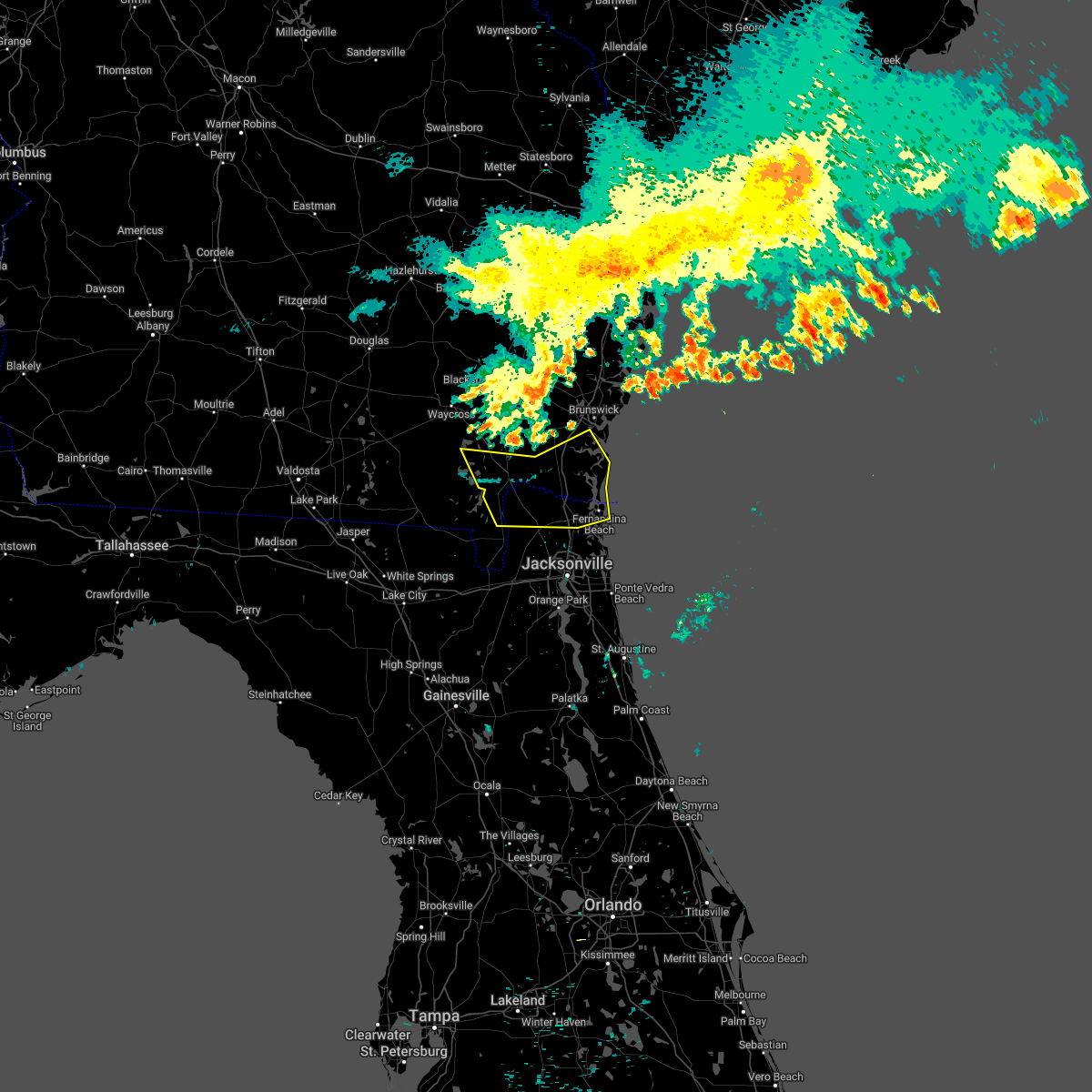 At 1139 pm edt, severe thunderstorms were located along a line extending from 6 miles northwest of race pond to 10 miles west of woodbine to near waverly, moving southeast at 50 mph. the storms have a history of producing damage (radar indicated). Hazards include 60 mph wind gusts. expect damage to roofs, siding, and trees At 1139 pm edt, severe thunderstorms were located along a line extending from 6 miles northwest of race pond to 10 miles west of woodbine to near waverly, moving southeast at 50 mph. the storms have a history of producing damage (radar indicated). Hazards include 60 mph wind gusts. expect damage to roofs, siding, and trees
|
| 5/20/2022 8:12 PM EDT |
 The severe thunderstorm warning for northwestern nassau, western camden, southern brantley, southeastern ware and charlton counties will expire at 815 pm edt, the storm which prompted the warning has weakened below severe limits, and no longer poses an immediate threat to life or property. therefore, the warning will be allowed to expire. however gusty winds and heavy rain are still possible with this thunderstorm. The severe thunderstorm warning for northwestern nassau, western camden, southern brantley, southeastern ware and charlton counties will expire at 815 pm edt, the storm which prompted the warning has weakened below severe limits, and no longer poses an immediate threat to life or property. therefore, the warning will be allowed to expire. however gusty winds and heavy rain are still possible with this thunderstorm.
|
| 5/20/2022 7:51 PM EDT |
 At 750 pm edt, a severe thunderstorm was located near homeland, or near folkston, moving northeast at 30 mph (radar indicated). Hazards include 60 mph wind gusts and penny size hail. expect damage to roofs, siding, and trees At 750 pm edt, a severe thunderstorm was located near homeland, or near folkston, moving northeast at 30 mph (radar indicated). Hazards include 60 mph wind gusts and penny size hail. expect damage to roofs, siding, and trees
|
| 4/7/2022 2:56 AM EDT |
 The severe thunderstorm warning for northwestern nassau, southwestern camden and northeastern charlton counties will expire at 300 am edt, the storms which prompted the warning have moved out of the area. therefore, the warning will be allowed to expire. however gusty winds and heavy rain are still possible with these thunderstorms. remember, a severe thunderstorm warning still remains in effect for nassau and camden counties. The severe thunderstorm warning for northwestern nassau, southwestern camden and northeastern charlton counties will expire at 300 am edt, the storms which prompted the warning have moved out of the area. therefore, the warning will be allowed to expire. however gusty winds and heavy rain are still possible with these thunderstorms. remember, a severe thunderstorm warning still remains in effect for nassau and camden counties.
|
| 4/7/2022 2:49 AM EDT |
 At 248 am edt, severe thunderstorms were located along a line extending from waverly to 6 miles east of kings ferry to st. george, moving east at 45 mph (radar indicated). Hazards include 70 mph wind gusts. Expect considerable tree damage. Damage is likely to mobile homes, roofs, and outbuildings. At 248 am edt, severe thunderstorms were located along a line extending from waverly to 6 miles east of kings ferry to st. george, moving east at 45 mph (radar indicated). Hazards include 70 mph wind gusts. Expect considerable tree damage. Damage is likely to mobile homes, roofs, and outbuildings.
|
| 4/7/2022 2:43 AM EDT |
 At 243 am edt, severe thunderstorms were located along a line extending from near waverly to near kings ferry to near st. george, moving east at 50 mph (radar indicated). Hazards include 70 mph wind gusts. Expect considerable tree damage. damage is likely to mobile homes, roofs, and outbuildings. Locations impacted include, kingsland, hilliard, folkston, woodbine, homeland, kings ferry, tarboro and colesburg. At 243 am edt, severe thunderstorms were located along a line extending from near waverly to near kings ferry to near st. george, moving east at 50 mph (radar indicated). Hazards include 70 mph wind gusts. Expect considerable tree damage. damage is likely to mobile homes, roofs, and outbuildings. Locations impacted include, kingsland, hilliard, folkston, woodbine, homeland, kings ferry, tarboro and colesburg.
|
| 4/7/2022 2:23 AM EDT |
 At 223 am edt, severe thunderstorms were located along a line extending from near race pond to 7 miles southwest of folkston to 6 miles north of taylor, moving east at 50 mph (radar indicated). Hazards include 70 mph wind gusts. Expect considerable tree damage. Damage is likely to mobile homes, roofs, and outbuildings. At 223 am edt, severe thunderstorms were located along a line extending from near race pond to 7 miles southwest of folkston to 6 miles north of taylor, moving east at 50 mph (radar indicated). Hazards include 70 mph wind gusts. Expect considerable tree damage. Damage is likely to mobile homes, roofs, and outbuildings.
|
| 4/7/2022 2:20 AM EDT |
 At 219 am edt, severe thunderstorms were located along a line extending from near homeland to 11 miles southwest of folkston to 8 miles north of taylor, moving east at 50 mph (radar indicated). Hazards include 70 mph wind gusts. Expect considerable tree damage. damage is likely to mobile homes, roofs, and outbuildings. Locations impacted include, folkston, stephen foster state park and homeland. At 219 am edt, severe thunderstorms were located along a line extending from near homeland to 11 miles southwest of folkston to 8 miles north of taylor, moving east at 50 mph (radar indicated). Hazards include 70 mph wind gusts. Expect considerable tree damage. damage is likely to mobile homes, roofs, and outbuildings. Locations impacted include, folkston, stephen foster state park and homeland.
|
| 4/7/2022 2:07 AM EDT |
 At 207 am edt, severe thunderstorms were located along a line extending from 6 miles northeast of stephen foster state park to 18 miles north of taylor to 10 miles south of fargo, moving east at 50 mph (radar indicated). Hazards include 60 mph wind gusts. expect damage to roofs, siding, and trees At 207 am edt, severe thunderstorms were located along a line extending from 6 miles northeast of stephen foster state park to 18 miles north of taylor to 10 miles south of fargo, moving east at 50 mph (radar indicated). Hazards include 60 mph wind gusts. expect damage to roofs, siding, and trees
|
| 8/23/2021 2:08 PM EDT |
 The severe thunderstorm warning for nassau and central duval counties will expire at 215 pm edt, the storm which prompted the warning has weakened below severe limits, and no longer poses an immediate threat to life or property. therefore, the warning will be allowed to expire. however gusty winds and heavy rain are still possible with this thunderstorm. The severe thunderstorm warning for nassau and central duval counties will expire at 215 pm edt, the storm which prompted the warning has weakened below severe limits, and no longer poses an immediate threat to life or property. therefore, the warning will be allowed to expire. however gusty winds and heavy rain are still possible with this thunderstorm.
|
| 8/23/2021 1:57 PM EDT |
 At 157 pm edt, a severe thunderstorm was located near ratliff, or near callahan, moving east at 25 mph (radar indicated). Hazards include 60 mph wind gusts. Expect damage to roofs, siding, and trees. locations impacted include, jacksonville, hilliard, callahan, jacksonville international arpt, cisco gardens, nassau village-ratliff, ratliff, bryceville and whitehouse air field. hail threat, radar indicated max hail size, <. 75 in wind threat, radar indicated max wind gust, 60 mph. At 157 pm edt, a severe thunderstorm was located near ratliff, or near callahan, moving east at 25 mph (radar indicated). Hazards include 60 mph wind gusts. Expect damage to roofs, siding, and trees. locations impacted include, jacksonville, hilliard, callahan, jacksonville international arpt, cisco gardens, nassau village-ratliff, ratliff, bryceville and whitehouse air field. hail threat, radar indicated max hail size, <. 75 in wind threat, radar indicated max wind gust, 60 mph.
|
| 8/23/2021 1:39 PM EDT |
 At 139 pm edt, a severe thunderstorm was located near bryceville, or 10 miles southwest of callahan, moving east at 35 mph (radar indicated). Hazards include 60 mph wind gusts. expect damage to roofs, siding, and trees At 139 pm edt, a severe thunderstorm was located near bryceville, or 10 miles southwest of callahan, moving east at 35 mph (radar indicated). Hazards include 60 mph wind gusts. expect damage to roofs, siding, and trees
|
| 6/15/2021 4:54 PM EDT |
 At 454 pm edt, severe thunderstorms located near hilliard, moving southeast at 15 mph (radar indicated). Hazards include 60 mph wind gusts and quarter size hail. Hail damage to vehicles is expected. Expect wind damage to roofs, siding, and trees. At 454 pm edt, severe thunderstorms located near hilliard, moving southeast at 15 mph (radar indicated). Hazards include 60 mph wind gusts and quarter size hail. Hail damage to vehicles is expected. Expect wind damage to roofs, siding, and trees.
|
| 6/12/2021 4:23 PM EDT |
 At 423 pm edt, severe thunderstorms were located along a line extending from 6 miles north of stephen foster state park to near white springs, moving east at 25 mph (radar indicated). Hazards include 60 mph wind gusts. Expect damage to roofs, siding, and trees. locations impacted include, hilliard, white springs, raiford, taylor, macclenny, glen st. mary, winfield, olustee, suwannee valley and st. George. At 423 pm edt, severe thunderstorms were located along a line extending from 6 miles north of stephen foster state park to near white springs, moving east at 25 mph (radar indicated). Hazards include 60 mph wind gusts. Expect damage to roofs, siding, and trees. locations impacted include, hilliard, white springs, raiford, taylor, macclenny, glen st. mary, winfield, olustee, suwannee valley and st. George.
|
| 6/12/2021 4:10 PM EDT |
 At 410 pm edt, severe thunderstorms were located along a line extending from 8 miles northwest of stephen foster state park to near white springs, moving east at 25 mph (radar indicated). Hazards include 60 mph wind gusts. expect damage to roofs, siding, and trees At 410 pm edt, severe thunderstorms were located along a line extending from 8 miles northwest of stephen foster state park to near white springs, moving east at 25 mph (radar indicated). Hazards include 60 mph wind gusts. expect damage to roofs, siding, and trees
|
| 4/24/2021 3:57 PM EDT |
 At 357 pm edt, a severe thunderstorm was located 10 miles north of taylor, or 17 miles south of stephen foster state park, moving east at 55 mph (radar indicated). Hazards include golf ball size hail. People and animals outdoors will be injured. Expect damage to roofs, siding, windows, and vehicles. At 357 pm edt, a severe thunderstorm was located 10 miles north of taylor, or 17 miles south of stephen foster state park, moving east at 55 mph (radar indicated). Hazards include golf ball size hail. People and animals outdoors will be injured. Expect damage to roofs, siding, windows, and vehicles.
|
| 1/31/2021 11:30 PM EST |
 At 1129 pm est, a severe thunderstorm was located near bryceville, or 9 miles south of callahan, moving east at 45 mph (radar indicated). Hazards include 60 mph wind gusts. expect damage to roofs, siding, and trees At 1129 pm est, a severe thunderstorm was located near bryceville, or 9 miles south of callahan, moving east at 45 mph (radar indicated). Hazards include 60 mph wind gusts. expect damage to roofs, siding, and trees
|
| 12/24/2020 6:28 PM EST |
 At 627 pm est, severe thunderstorms were located along a line extending from 10 miles west of woodbine to near orange heights, moving northeast at 55 mph (radar indicated). Hazards include 60 mph wind gusts. expect damage to roofs, siding, and trees At 627 pm est, severe thunderstorms were located along a line extending from 10 miles west of woodbine to near orange heights, moving northeast at 55 mph (radar indicated). Hazards include 60 mph wind gusts. expect damage to roofs, siding, and trees
|
| 12/24/2020 6:03 PM EST |
 At 602 pm est, severe thunderstorms were located along a line extending from 10 miles southeast of stephen foster state park to near sanderson to alachua, moving east at 60 mph (radar indicated). Hazards include 60 mph wind gusts. Expect damage to roofs, siding, and trees. Locations impacted include, starke, hilliard, lake butler, keystone heights, callahan, raiford, worthington spring, taylor, alachua and macclenny. At 602 pm est, severe thunderstorms were located along a line extending from 10 miles southeast of stephen foster state park to near sanderson to alachua, moving east at 60 mph (radar indicated). Hazards include 60 mph wind gusts. Expect damage to roofs, siding, and trees. Locations impacted include, starke, hilliard, lake butler, keystone heights, callahan, raiford, worthington spring, taylor, alachua and macclenny.
|
| 12/24/2020 5:42 PM EST |
 At 542 pm est, severe thunderstorms were located along a line extending from 6 miles southeast of fargo to near watertown to 6 miles northeast of trenton, moving east at 55 mph (radar indicated). Hazards include 60 mph wind gusts. expect damage to roofs, siding, and trees At 542 pm est, severe thunderstorms were located along a line extending from 6 miles southeast of fargo to near watertown to 6 miles northeast of trenton, moving east at 55 mph (radar indicated). Hazards include 60 mph wind gusts. expect damage to roofs, siding, and trees
|
| 6/24/2020 6:32 PM EDT |
 At 632 pm edt, a severe thunderstorm was located over callahan, moving east at 20 mph (radar indicated). Hazards include 60 mph wind gusts and nickel size hail. Expect damage to roofs, siding, and trees. Locations impacted include, hilliard, callahan, jacksonville international arpt, ratliff and nassau village-ratliff. At 632 pm edt, a severe thunderstorm was located over callahan, moving east at 20 mph (radar indicated). Hazards include 60 mph wind gusts and nickel size hail. Expect damage to roofs, siding, and trees. Locations impacted include, hilliard, callahan, jacksonville international arpt, ratliff and nassau village-ratliff.
|
| 6/24/2020 6:22 PM EDT |
 At 604 pm edt, a severe thunderstorm was located near hilliard, moving east at 40 mph (radar indicated). Hazards include 60 mph wind gusts and nickel size hail. Expect damage to roofs, siding, and trees. locations impacted include, hilliard and st. George. At 604 pm edt, a severe thunderstorm was located near hilliard, moving east at 40 mph (radar indicated). Hazards include 60 mph wind gusts and nickel size hail. Expect damage to roofs, siding, and trees. locations impacted include, hilliard and st. George.
|
| 6/24/2020 6:22 PM EDT |
 The severe thunderstorm warning for northwestern nassau and central charlton counties will expire at 630 pm edt, the storm which prompted the warning has moved out of the area. therefore, the warning will be allowed to expire. remember, a severe thunderstorm warning still remains in effect for western nassau county in northeastern florida until 700 pm. The severe thunderstorm warning for northwestern nassau and central charlton counties will expire at 630 pm edt, the storm which prompted the warning has moved out of the area. therefore, the warning will be allowed to expire. remember, a severe thunderstorm warning still remains in effect for western nassau county in northeastern florida until 700 pm.
|
| 6/24/2020 6:15 PM EDT |
 At 615 pm edt, a severe thunderstorm was located near callahan, moving east at 20 mph (radar indicated). Hazards include 60 mph wind gusts and nickel size hail. expect damage to roofs, siding, and trees At 615 pm edt, a severe thunderstorm was located near callahan, moving east at 20 mph (radar indicated). Hazards include 60 mph wind gusts and nickel size hail. expect damage to roofs, siding, and trees
|
| 6/24/2020 6:04 PM EDT |
 At 604 pm edt, a severe thunderstorm was located near hilliard, moving east at 40 mph (radar indicated). Hazards include 60 mph wind gusts and nickel size hail. Expect damage to roofs, siding, and trees. locations impacted include, hilliard and st. George. At 604 pm edt, a severe thunderstorm was located near hilliard, moving east at 40 mph (radar indicated). Hazards include 60 mph wind gusts and nickel size hail. Expect damage to roofs, siding, and trees. locations impacted include, hilliard and st. George.
|
| 6/24/2020 5:44 PM EDT |
 At 543 pm edt, a severe thunderstorm was located 12 miles northwest of st. george, or 14 miles southeast of stephen foster state park, moving east at 40 mph (radar indicated). Hazards include 70 mph wind gusts and nickel size hail. Expect considerable tree damage. Damage is likely to mobile homes, roofs, and outbuildings. At 543 pm edt, a severe thunderstorm was located 12 miles northwest of st. george, or 14 miles southeast of stephen foster state park, moving east at 40 mph (radar indicated). Hazards include 70 mph wind gusts and nickel size hail. Expect considerable tree damage. Damage is likely to mobile homes, roofs, and outbuildings.
|
| 6/19/2020 4:42 PM EDT |
 At 441 pm edt, a severe thunderstorm was located near kingsland, moving south at 10 mph (radar indicated). Hazards include 60 mph wind gusts and half dollar size hail. Hail damage to vehicles is expected. Expect wind damage to roofs, siding, and trees. At 441 pm edt, a severe thunderstorm was located near kingsland, moving south at 10 mph (radar indicated). Hazards include 60 mph wind gusts and half dollar size hail. Hail damage to vehicles is expected. Expect wind damage to roofs, siding, and trees.
|
| 5/21/2020 4:55 PM EDT |
 At 454 pm edt, a severe thunderstorm was located near folkston, moving east at 15 mph (radar indicated). Hazards include 60 mph wind gusts and half dollar size hail. Hail damage to vehicles is expected. expect wind damage to roofs, siding, and trees. Locations impacted include, folkston. At 454 pm edt, a severe thunderstorm was located near folkston, moving east at 15 mph (radar indicated). Hazards include 60 mph wind gusts and half dollar size hail. Hail damage to vehicles is expected. expect wind damage to roofs, siding, and trees. Locations impacted include, folkston.
|
| 5/21/2020 4:38 PM EDT |
 At 438 pm edt, a severe thunderstorm was located 9 miles southwest of folkston, moving east at 15 mph (radar indicated). Hazards include 60 mph wind gusts and half dollar size hail. Hail damage to vehicles is expected. Expect wind damage to roofs, siding, and trees. At 438 pm edt, a severe thunderstorm was located 9 miles southwest of folkston, moving east at 15 mph (radar indicated). Hazards include 60 mph wind gusts and half dollar size hail. Hail damage to vehicles is expected. Expect wind damage to roofs, siding, and trees.
|
| 4/23/2020 3:04 PM EDT |
 At 303 pm edt, severe thunderstorms were located along a line extending from near fort mudge to 6 miles east of fargo, moving east at 50 mph (radar indicated). Hazards include golf ball size hail and 60 mph wind gusts. People and animals outdoors will be injured. expect hail damage to roofs, siding, windows, and vehicles. expect wind damage to roofs, siding, and trees. Locations impacted include, hilliard, folkston, woodbine, callahan, stephen foster state park, homeland, boggy bay, kings ferry, race pond and fort mudge. At 303 pm edt, severe thunderstorms were located along a line extending from near fort mudge to 6 miles east of fargo, moving east at 50 mph (radar indicated). Hazards include golf ball size hail and 60 mph wind gusts. People and animals outdoors will be injured. expect hail damage to roofs, siding, windows, and vehicles. expect wind damage to roofs, siding, and trees. Locations impacted include, hilliard, folkston, woodbine, callahan, stephen foster state park, homeland, boggy bay, kings ferry, race pond and fort mudge.
|
| 4/23/2020 2:41 PM EDT |
 At 240 pm edt, severe thunderstorms were located along a line extending from 6 miles south of boggy bay to near needmore, moving east at 50 mph (radar indicated). Hazards include 60 mph wind gusts and quarter size hail. Hail damage to vehicles is expected. Expect wind damage to roofs, siding, and trees. At 240 pm edt, severe thunderstorms were located along a line extending from 6 miles south of boggy bay to near needmore, moving east at 50 mph (radar indicated). Hazards include 60 mph wind gusts and quarter size hail. Hail damage to vehicles is expected. Expect wind damage to roofs, siding, and trees.
|
| 4/20/2020 6:09 AM EDT |
 At 609 am edt, a severe thunderstorm was located near kings ferry, or near hilliard, moving east at 60 mph (radar indicated). Hazards include 60 mph wind gusts and quarter size hail. Hail damage to vehicles is expected. Expect wind damage to roofs, siding, and trees. At 609 am edt, a severe thunderstorm was located near kings ferry, or near hilliard, moving east at 60 mph (radar indicated). Hazards include 60 mph wind gusts and quarter size hail. Hail damage to vehicles is expected. Expect wind damage to roofs, siding, and trees.
|
| 4/20/2020 4:47 AM EDT |
 At 447 am edt, a severe thunderstorm was located near callahan, moving northeast at 60 mph (radar indicated). Hazards include 60 mph wind gusts and penny size hail. Expect damage to roofs, siding, and trees. locations impacted include, st. Marys, kingsland, fernandina beach, callahan, kings bay base, yulee and cumberland island. At 447 am edt, a severe thunderstorm was located near callahan, moving northeast at 60 mph (radar indicated). Hazards include 60 mph wind gusts and penny size hail. Expect damage to roofs, siding, and trees. locations impacted include, st. Marys, kingsland, fernandina beach, callahan, kings bay base, yulee and cumberland island.
|
| 4/20/2020 4:38 AM EDT |
 At 438 am edt, a severe thunderstorm was located over st. george, or 10 miles west of callahan, moving northeast at 60 mph (radar indicated). Hazards include 60 mph wind gusts and penny size hail. expect damage to roofs, siding, and trees At 438 am edt, a severe thunderstorm was located over st. george, or 10 miles west of callahan, moving northeast at 60 mph (radar indicated). Hazards include 60 mph wind gusts and penny size hail. expect damage to roofs, siding, and trees
|
| 4/13/2020 10:09 AM EDT |
 The severe thunderstorm warning for northern nassau, camden, southeastern glynn, southeastern ware and central charlton counties will expire at 1015 am edt, the storms which prompted the warning have weakened and some have moved out of the warned area. therefore, the warning will be allowed to expire. however gusty winds are still possible with these thunderstorms and a significant weather advisory is in effect. a tornado watch remains in effect until 1100 am edt for northeastern florida, and southeastern georgia. The severe thunderstorm warning for northern nassau, camden, southeastern glynn, southeastern ware and central charlton counties will expire at 1015 am edt, the storms which prompted the warning have weakened and some have moved out of the warned area. therefore, the warning will be allowed to expire. however gusty winds are still possible with these thunderstorms and a significant weather advisory is in effect. a tornado watch remains in effect until 1100 am edt for northeastern florida, and southeastern georgia.
|
| 4/13/2020 9:42 AM EDT |
 At 941 am edt, severe thunderstorms were located along a line extending from 8 miles east of jekyll island to 10 miles southeast of stephen foster state park, moving east at 60 mph (radar indicated). Hazards include 60 mph wind gusts. Expect damage to roofs, siding, and trees. locations impacted include, st. marys, kingsland, brunswick, st. Simons island, hilliard, folkston, woodbine, kings bay base, homeland and kings ferry. At 941 am edt, severe thunderstorms were located along a line extending from 8 miles east of jekyll island to 10 miles southeast of stephen foster state park, moving east at 60 mph (radar indicated). Hazards include 60 mph wind gusts. Expect damage to roofs, siding, and trees. locations impacted include, st. marys, kingsland, brunswick, st. Simons island, hilliard, folkston, woodbine, kings bay base, homeland and kings ferry.
|
| 4/13/2020 9:29 AM EDT |
 At 929 am edt, severe thunderstorms were located along a line extending from near jekyll island to 9 miles east of fargo, moving east at 60 mph (radar indicated). Hazards include 70 mph wind gusts and quarter size hail. Hail damage to vehicles is expected. expect considerable tree damage. wind damage is also likely to mobile homes, roofs, and outbuildings. locations impacted include, st. marys, kingsland, brunswick, st. Simons island, hilliard, folkston, woodbine, fargo, statenville and dock junction. At 929 am edt, severe thunderstorms were located along a line extending from near jekyll island to 9 miles east of fargo, moving east at 60 mph (radar indicated). Hazards include 70 mph wind gusts and quarter size hail. Hail damage to vehicles is expected. expect considerable tree damage. wind damage is also likely to mobile homes, roofs, and outbuildings. locations impacted include, st. marys, kingsland, brunswick, st. Simons island, hilliard, folkston, woodbine, fargo, statenville and dock junction.
|
| 4/13/2020 9:08 AM EDT |
 At 908 am edt, severe thunderstorms were located along a line extending from 6 miles west of woodbine to near needmore, moving east at 60 mph (radar indicated). Hazards include 70 mph wind gusts and quarter size hail. Hail damage to vehicles is expected. expect considerable tree damage. Wind damage is also likely to mobile homes, roofs, and outbuildings. At 908 am edt, severe thunderstorms were located along a line extending from 6 miles west of woodbine to near needmore, moving east at 60 mph (radar indicated). Hazards include 70 mph wind gusts and quarter size hail. Hail damage to vehicles is expected. expect considerable tree damage. Wind damage is also likely to mobile homes, roofs, and outbuildings.
|
| 3/31/2020 5:27 PM EDT |
 At 527 pm edt, a band of severe thunderstorms was located 11 miles northwest of st. george, or 13 miles west of hilliard, moving east at 45 mph (radar indicated). Hazards include 60 mph wind gusts. expect damage to roofs, siding, and trees At 527 pm edt, a band of severe thunderstorms was located 11 miles northwest of st. george, or 13 miles west of hilliard, moving east at 45 mph (radar indicated). Hazards include 60 mph wind gusts. expect damage to roofs, siding, and trees
|
| 2/6/2020 10:06 PM EST |
 The severe thunderstorm warning for northwestern nassau, western camden and southwestern glynn counties will expire at 1015 pm est, the storm which prompted the warning has moved out of the area. therefore, the warning will be allowed to expire. a tornado watch remains in effect until midnight est for northeastern florida, and southeastern georgia. The severe thunderstorm warning for northwestern nassau, western camden and southwestern glynn counties will expire at 1015 pm est, the storm which prompted the warning has moved out of the area. therefore, the warning will be allowed to expire. a tornado watch remains in effect until midnight est for northeastern florida, and southeastern georgia.
|
| 2/6/2020 10:02 PM EST |
 At 1001 pm est, a severe thunderstorm was located near waverly, or 9 miles northwest of woodbine, moving northeast at 70 mph (radar indicated). Hazards include 60 mph wind gusts. Expect damage to roofs, siding, and trees. Locations impacted include, hilliard, woodbine, kings ferry, waverly, tarboro and colesburg. At 1001 pm est, a severe thunderstorm was located near waverly, or 9 miles northwest of woodbine, moving northeast at 70 mph (radar indicated). Hazards include 60 mph wind gusts. Expect damage to roofs, siding, and trees. Locations impacted include, hilliard, woodbine, kings ferry, waverly, tarboro and colesburg.
|
| 2/6/2020 9:54 PM EST |
 At 954 pm est, severe thunderstorms were located along a line extending from 7 miles southwest of waverly to 6 miles southwest of hilliard, moving northeast at 50 mph (radar indicated). Hazards include 70 mph wind gusts. Expect considerable tree damage. Damage is likely to mobile homes, roofs, and outbuildings. At 954 pm est, severe thunderstorms were located along a line extending from 7 miles southwest of waverly to 6 miles southwest of hilliard, moving northeast at 50 mph (radar indicated). Hazards include 70 mph wind gusts. Expect considerable tree damage. Damage is likely to mobile homes, roofs, and outbuildings.
|
| 2/6/2020 9:28 PM EST |
 At 927 pm est, a severe thunderstorm was located 10 miles southeast of stephen foster state park, moving northeast at 70 mph (radar indicated). Hazards include 60 mph wind gusts. expect damage to roofs, siding, and trees At 927 pm est, a severe thunderstorm was located 10 miles southeast of stephen foster state park, moving northeast at 70 mph (radar indicated). Hazards include 60 mph wind gusts. expect damage to roofs, siding, and trees
|
| 8/10/2019 9:33 PM EDT |
 At 932 pm edt, a severe thunderstorm was located near st. george, or 8 miles west of callahan, moving northwest at 5 mph (radar indicated). Hazards include 60 mph wind gusts. expect damage to roofs, siding, and trees At 932 pm edt, a severe thunderstorm was located near st. george, or 8 miles west of callahan, moving northwest at 5 mph (radar indicated). Hazards include 60 mph wind gusts. expect damage to roofs, siding, and trees
|
| 7/19/2019 3:02 PM EDT |
 The national weather service in jacksonville has issued a * severe thunderstorm warning for. northwestern nassau county in northeastern florida. southwestern camden county in southeastern georgia. east central charlton county in southeastern georgia. Until 345 pm edt. The national weather service in jacksonville has issued a * severe thunderstorm warning for. northwestern nassau county in northeastern florida. southwestern camden county in southeastern georgia. east central charlton county in southeastern georgia. Until 345 pm edt.
|
| 7/19/2019 3:02 PM EDT |
 At 302 pm edt, a severe thunderstorm was located over kings ferry, or near hilliard, moving northwest at 20 mph (radar indicated). Hazards include 60 mph wind gusts and quarter size hail. Hail damage to vehicles is expected. Expect wind damage to roofs, siding, and trees. At 302 pm edt, a severe thunderstorm was located over kings ferry, or near hilliard, moving northwest at 20 mph (radar indicated). Hazards include 60 mph wind gusts and quarter size hail. Hail damage to vehicles is expected. Expect wind damage to roofs, siding, and trees.
|
| 7/17/2019 4:36 PM EDT |
 The severe thunderstorm warning for northwestern nassau and southeastern charlton counties will expire at 445 pm edt, the storm which prompted the warning has weakened below severe limits, and has exited the warned area. therefore, the warning will be allowed to expire. however gusty winds are still possible with this thunderstorm. to report severe weather, contact your nearest law enforcement agency. they will relay your report to the national weather service jacksonville. The severe thunderstorm warning for northwestern nassau and southeastern charlton counties will expire at 445 pm edt, the storm which prompted the warning has weakened below severe limits, and has exited the warned area. therefore, the warning will be allowed to expire. however gusty winds are still possible with this thunderstorm. to report severe weather, contact your nearest law enforcement agency. they will relay your report to the national weather service jacksonville.
|
| 7/17/2019 4:36 PM EDT |
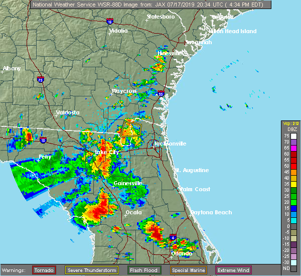 The severe thunderstorm warning for northwestern nassau and southeastern charlton counties will expire at 445 pm edt, the storm which prompted the warning has weakened below severe limits, and has exited the warned area. therefore, the warning will be allowed to expire. however gusty winds are still possible with this thunderstorm. to report severe weather, contact your nearest law enforcement agency. they will relay your report to the national weather service jacksonville. The severe thunderstorm warning for northwestern nassau and southeastern charlton counties will expire at 445 pm edt, the storm which prompted the warning has weakened below severe limits, and has exited the warned area. therefore, the warning will be allowed to expire. however gusty winds are still possible with this thunderstorm. to report severe weather, contact your nearest law enforcement agency. they will relay your report to the national weather service jacksonville.
|
| 7/17/2019 3:55 PM EDT |
 At 354 pm edt, a severe thunderstorm was located near hilliard, moving west at 10 mph (radar indicated). Hazards include 60 mph wind gusts. expect damage to roofs, siding, and trees At 354 pm edt, a severe thunderstorm was located near hilliard, moving west at 10 mph (radar indicated). Hazards include 60 mph wind gusts. expect damage to roofs, siding, and trees
|
| 7/4/2019 5:51 PM EDT |
 The severe thunderstorm warning for northwestern nassau county will expire at 600 pm edt, the storm which prompted the warning has weakened below severe limits, and no longer poses an immediate threat to life or property. therefore, the warning will be allowed to expire. however gusty winds and heavy rain are still possible with this thunderstorm. to report severe weather, contact your nearest law enforcement agency. they will relay your report to the national weather service jacksonville. The severe thunderstorm warning for northwestern nassau county will expire at 600 pm edt, the storm which prompted the warning has weakened below severe limits, and no longer poses an immediate threat to life or property. therefore, the warning will be allowed to expire. however gusty winds and heavy rain are still possible with this thunderstorm. to report severe weather, contact your nearest law enforcement agency. they will relay your report to the national weather service jacksonville.
|
| 7/4/2019 5:25 PM EDT |
 At 525 pm edt, a severe thunderstorm was located over hilliard, and is nearly stationary (radar indicated). Hazards include 60 mph wind gusts. expect damage to roofs, siding, and trees At 525 pm edt, a severe thunderstorm was located over hilliard, and is nearly stationary (radar indicated). Hazards include 60 mph wind gusts. expect damage to roofs, siding, and trees
|
| 6/20/2019 9:27 PM EDT |
 The national weather service in jacksonville has issued a * severe thunderstorm warning for. northwestern nassau county in northeastern florida. southwestern camden county in southeastern georgia. south central brantley county in southeastern georgia. Southeastern ware county in southeastern georgia. The national weather service in jacksonville has issued a * severe thunderstorm warning for. northwestern nassau county in northeastern florida. southwestern camden county in southeastern georgia. south central brantley county in southeastern georgia. Southeastern ware county in southeastern georgia.
|
| 4/19/2019 11:53 AM EDT | Trees snapped and hanging on power lines in hilliard along murrhee road. time estimated by rada in nassau county FL, 4.6 miles S of Hilliard, FL |
| 4/19/2019 11:49 AM EDT |
 At 1149 am edt, a severe thunderstorm capable of producing a tornado was located near hilliard, moving northeast at 50 mph (radar indicated rotation). Hazards include tornado. Flying debris will be dangerous to those caught without shelter. mobile homes will be damaged or destroyed. damage to roofs, windows, and vehicles will occur. tree damage is likely. this dangerous storm will be near, kings ferry around 1205 pm edt. st. marys, kingsland, woodbine and kings bay base around 1215 pm edt. Other locations impacted by this tornadic thunderstorm include colesburg and harrietts bluff. At 1149 am edt, a severe thunderstorm capable of producing a tornado was located near hilliard, moving northeast at 50 mph (radar indicated rotation). Hazards include tornado. Flying debris will be dangerous to those caught without shelter. mobile homes will be damaged or destroyed. damage to roofs, windows, and vehicles will occur. tree damage is likely. this dangerous storm will be near, kings ferry around 1205 pm edt. st. marys, kingsland, woodbine and kings bay base around 1215 pm edt. Other locations impacted by this tornadic thunderstorm include colesburg and harrietts bluff.
|
| 4/19/2019 11:33 AM EDT |
 At 1133 am edt, severe thunderstorms were located along a line extending from near fort mudge to near raiford, moving northeast at 55 mph (radar indicated). Hazards include 70 mph wind gusts. Expect considerable tree damage. Damage is likely to mobile homes, roofs, and outbuildings. At 1133 am edt, severe thunderstorms were located along a line extending from near fort mudge to near raiford, moving northeast at 55 mph (radar indicated). Hazards include 70 mph wind gusts. Expect considerable tree damage. Damage is likely to mobile homes, roofs, and outbuildings.
|
| 3/1/2019 2:33 PM EST |
 At 233 pm est, severe thunderstorms were located along a line extending from 7 miles southwest of kingsland to 7 miles southeast of sanderson, moving east at 40 mph (radar indicated). Hazards include 60 mph wind gusts and quarter size hail. Hail damage to vehicles is expected. Expect wind damage to roofs, siding, and trees. At 233 pm est, severe thunderstorms were located along a line extending from 7 miles southwest of kingsland to 7 miles southeast of sanderson, moving east at 40 mph (radar indicated). Hazards include 60 mph wind gusts and quarter size hail. Hail damage to vehicles is expected. Expect wind damage to roofs, siding, and trees.
|
| 3/1/2019 2:09 PM EST |
 At 209 pm est, a severe thunderstorm was located 7 miles north of glen st. mary, or 21 miles north of raiford, moving northeast at 35 mph (radar indicated). Hazards include 60 mph wind gusts and quarter size hail. Hail damage to vehicles is expected. Expect wind damage to roofs, siding, and trees. At 209 pm est, a severe thunderstorm was located 7 miles north of glen st. mary, or 21 miles north of raiford, moving northeast at 35 mph (radar indicated). Hazards include 60 mph wind gusts and quarter size hail. Hail damage to vehicles is expected. Expect wind damage to roofs, siding, and trees.
|
| 3/1/2019 1:58 PM EST | A tree reported down along sr-121 near mile marker 7 in charlton county GA, 9 miles ENE of Hilliard, FL |
| 12/2/2018 3:34 PM EST |
 At 334 pm est, a severe thunderstorm capable of producing a tornado was located over kings ferry, or near hilliard, moving east at 40 mph (radar indicated rotation). Hazards include tornado and quarter size hail. Flying debris will be dangerous to those caught without shelter. mobile homes will be damaged or destroyed. damage to roofs, windows, and vehicles will occur. tree damage is likely. this dangerous storm will be near, kingsland around 355 pm est. st. Marys around 400 pm est. At 334 pm est, a severe thunderstorm capable of producing a tornado was located over kings ferry, or near hilliard, moving east at 40 mph (radar indicated rotation). Hazards include tornado and quarter size hail. Flying debris will be dangerous to those caught without shelter. mobile homes will be damaged or destroyed. damage to roofs, windows, and vehicles will occur. tree damage is likely. this dangerous storm will be near, kingsland around 355 pm est. st. Marys around 400 pm est.
|
| 12/2/2018 3:04 PM EST |
 At 304 pm est, a severe thunderstorm was located over hilliard, moving east at 40 mph (radar indicated). Hazards include 60 mph wind gusts and quarter size hail. Hail damage to vehicles is expected. Expect wind damage to roofs, siding, and trees. At 304 pm est, a severe thunderstorm was located over hilliard, moving east at 40 mph (radar indicated). Hazards include 60 mph wind gusts and quarter size hail. Hail damage to vehicles is expected. Expect wind damage to roofs, siding, and trees.
|
| 12/2/2018 2:41 PM EST |
 At 240 pm est, a severe thunderstorm capable of producing a tornado was located over hilliard, moving northeast at 40 mph (radar indicated rotation). Hazards include tornado. Flying debris will be dangerous to those caught without shelter. mobile homes will be damaged or destroyed. damage to roofs, windows, and vehicles will occur. tree damage is likely. this dangerous storm will be near, kings ferry around 250 pm est. kingsland around 305 pm est. st. Marys around 310 pm est. At 240 pm est, a severe thunderstorm capable of producing a tornado was located over hilliard, moving northeast at 40 mph (radar indicated rotation). Hazards include tornado. Flying debris will be dangerous to those caught without shelter. mobile homes will be damaged or destroyed. damage to roofs, windows, and vehicles will occur. tree damage is likely. this dangerous storm will be near, kings ferry around 250 pm est. kingsland around 305 pm est. st. Marys around 310 pm est.
|
| 12/2/2018 2:37 PM EST |
 At 236 pm est, a severe thunderstorm was located over hilliard, moving northeast at 40 mph. radar indicated rotation with this storm. tornadoes can occur rapidly with little advanced warning (radar indicated). Hazards include 60 mph wind gusts. expect damage to roofs, siding, and trees At 236 pm est, a severe thunderstorm was located over hilliard, moving northeast at 40 mph. radar indicated rotation with this storm. tornadoes can occur rapidly with little advanced warning (radar indicated). Hazards include 60 mph wind gusts. expect damage to roofs, siding, and trees
|
| 10/10/2018 4:37 PM EDT |
 At 437 pm edt, a severe thunderstorm capable of producing a tornado was located over hilliard, moving north at 30 mph (radar indicated rotation). Hazards include tornado. Flying debris will be dangerous to those caught without shelter. mobile homes will be damaged or destroyed. damage to roofs, windows, and vehicles will occur. tree damage is likely. This dangerous storm will be near, folkston and homeland around 500 pm edt. At 437 pm edt, a severe thunderstorm capable of producing a tornado was located over hilliard, moving north at 30 mph (radar indicated rotation). Hazards include tornado. Flying debris will be dangerous to those caught without shelter. mobile homes will be damaged or destroyed. damage to roofs, windows, and vehicles will occur. tree damage is likely. This dangerous storm will be near, folkston and homeland around 500 pm edt.
|
| 8/17/2018 5:29 PM EDT |
 At 528 pm edt, a severe thunderstorm was located near kings ferry, or near hilliard, moving north at 15 to 20 mph (radar indicated). Hazards include 60 mph wind gusts and penny size hail. expect damage to roofs, siding, and trees At 528 pm edt, a severe thunderstorm was located near kings ferry, or near hilliard, moving north at 15 to 20 mph (radar indicated). Hazards include 60 mph wind gusts and penny size hail. expect damage to roofs, siding, and trees
|
| 7/22/2018 2:07 PM EDT |
 The severe thunderstorm warning for nassau and western duval counties will expire at 215 pm edt, a new severe thunderstorm warning has been issed for the central and eastern portions of nassau and duval counties. The severe thunderstorm warning for nassau and western duval counties will expire at 215 pm edt, a new severe thunderstorm warning has been issed for the central and eastern portions of nassau and duval counties.
|
| 7/22/2018 1:45 PM EDT |
 At 144 pm edt, severe thunderstorms were located along a line extending from near st. george to near riverside, moving northeast at 30 mph (radar indicated). Hazards include 70 mph wind gusts and quarter size hail. Hail damage to vehicles is expected. expect considerable tree damage. wind damage is also likely to mobile homes, roofs, and outbuildings. Locations impacted include, hilliard, callahan, jacksonville international arpt, maxville, kings ferry, cisco gardens, ortega, bryceville, cecil field and nassau village-ratliff. At 144 pm edt, severe thunderstorms were located along a line extending from near st. george to near riverside, moving northeast at 30 mph (radar indicated). Hazards include 70 mph wind gusts and quarter size hail. Hail damage to vehicles is expected. expect considerable tree damage. wind damage is also likely to mobile homes, roofs, and outbuildings. Locations impacted include, hilliard, callahan, jacksonville international arpt, maxville, kings ferry, cisco gardens, ortega, bryceville, cecil field and nassau village-ratliff.
|
| 7/22/2018 1:37 PM EDT |
 At 137 pm edt, severe thunderstorms were located along a line extending from near st. george to near jacksonville, moving northeast at 35 mph (radar indicated). Hazards include 70 mph wind gusts and quarter size hail. Hail damage to vehicles is expected. expect considerable tree damage. wind damage is also likely to mobile homes, roofs, and outbuildings. locations impacted include, hilliard, callahan, jacksonville international arpt, taylor, macclenny, glen st. Mary, maxville, kings ferry, cisco gardens and ortega. At 137 pm edt, severe thunderstorms were located along a line extending from near st. george to near jacksonville, moving northeast at 35 mph (radar indicated). Hazards include 70 mph wind gusts and quarter size hail. Hail damage to vehicles is expected. expect considerable tree damage. wind damage is also likely to mobile homes, roofs, and outbuildings. locations impacted include, hilliard, callahan, jacksonville international arpt, taylor, macclenny, glen st. Mary, maxville, kings ferry, cisco gardens and ortega.
|
| 7/22/2018 1:25 PM EDT |
 At 124 pm edt, severe thunderstorms were located along a line extending from near st. george to near oakleaf plantation, moving east at 35 mph (radar indicated). Hazards include 70 mph wind gusts and quarter size hail. Hail damage to vehicles is expected. expect considerable tree damage. Wind damage is also likely to mobile homes, roofs, and outbuildings. At 124 pm edt, severe thunderstorms were located along a line extending from near st. george to near oakleaf plantation, moving east at 35 mph (radar indicated). Hazards include 70 mph wind gusts and quarter size hail. Hail damage to vehicles is expected. expect considerable tree damage. Wind damage is also likely to mobile homes, roofs, and outbuildings.
|
| 7/22/2018 1:25 PM EDT |
 The national weather service in jacksonville has issued a * severe thunderstorm warning for. nassau county in northeastern florida. northeastern baker county in northeastern florida. western duval county in northeastern florida. Southeastern charlton county in southeastern georgia. The national weather service in jacksonville has issued a * severe thunderstorm warning for. nassau county in northeastern florida. northeastern baker county in northeastern florida. western duval county in northeastern florida. Southeastern charlton county in southeastern georgia.
|
| 6/28/2018 7:55 PM EDT |
 The severe thunderstorm warning for nassau, northern duval, south central camden and southeastern charlton counties will expire at 800 pm edt, the storms which prompted the warning have weakened below severe limits, and no longer pose an immediate threat to life or property. therefore, the warning will be allowed to expire. however gusty winds and heavy rain are still possible with these thunderstorms. The severe thunderstorm warning for nassau, northern duval, south central camden and southeastern charlton counties will expire at 800 pm edt, the storms which prompted the warning have weakened below severe limits, and no longer pose an immediate threat to life or property. therefore, the warning will be allowed to expire. however gusty winds and heavy rain are still possible with these thunderstorms.
|
| 6/28/2018 7:27 PM EDT |
 At 727 pm edt, severe thunderstorms were located along a line extending from near kings bay base to 7 miles north of jacksonville international arpt to 7 miles southwest of hilliard, moving southeast at 40 mph (radar indicated). Hazards include 60 mph wind gusts. Expect damage to roofs, siding, and trees. locations impacted include, st. marys, kingsland, hilliard, callahan, jacksonville international arpt, yulee, cisco gardens, st. George, bryceville and nassau village-ratliff. At 727 pm edt, severe thunderstorms were located along a line extending from near kings bay base to 7 miles north of jacksonville international arpt to 7 miles southwest of hilliard, moving southeast at 40 mph (radar indicated). Hazards include 60 mph wind gusts. Expect damage to roofs, siding, and trees. locations impacted include, st. marys, kingsland, hilliard, callahan, jacksonville international arpt, yulee, cisco gardens, st. George, bryceville and nassau village-ratliff.
|
| 6/28/2018 7:11 PM EDT |
 At 711 pm edt, severe thunderstorms were located along a line extending from 7 miles northwest of kings bay base to near kings ferry to 6 miles west of hilliard, moving south at 45 mph (radar indicated). Hazards include 60 mph wind gusts. expect damage to roofs, siding, and trees At 711 pm edt, severe thunderstorms were located along a line extending from 7 miles northwest of kings bay base to near kings ferry to 6 miles west of hilliard, moving south at 45 mph (radar indicated). Hazards include 60 mph wind gusts. expect damage to roofs, siding, and trees
|
| 6/28/2018 7:11 PM EDT |
 The national weather service in jacksonville has issued a * severe thunderstorm warning for. nassau county in northeastern florida. northern duval county in northeastern florida. south central camden county in southeastern georgia. Southeastern charlton county in southeastern georgia. The national weather service in jacksonville has issued a * severe thunderstorm warning for. nassau county in northeastern florida. northern duval county in northeastern florida. south central camden county in southeastern georgia. Southeastern charlton county in southeastern georgia.
|
| 6/28/2018 7:03 PM EDT |
 At 703 pm edt, a severe thunderstorm was located over kings ferry, or 7 miles north of hilliard, moving south at 30 mph (radar indicated). Hazards include 60 mph wind gusts. Expect damage to roofs, siding, and trees. Locations impacted include, hilliard, folkston, woodbine, homeland and kings ferry. At 703 pm edt, a severe thunderstorm was located over kings ferry, or 7 miles north of hilliard, moving south at 30 mph (radar indicated). Hazards include 60 mph wind gusts. Expect damage to roofs, siding, and trees. Locations impacted include, hilliard, folkston, woodbine, homeland and kings ferry.
|
| 6/28/2018 6:46 PM EDT |
 At 646 pm edt, a severe thunderstorm was located 8 miles west of woodbine, moving south at 20 mph (radar indicated). Hazards include 60 mph wind gusts. expect damage to roofs, siding, and trees At 646 pm edt, a severe thunderstorm was located 8 miles west of woodbine, moving south at 20 mph (radar indicated). Hazards include 60 mph wind gusts. expect damage to roofs, siding, and trees
|
| 6/2/2018 5:38 PM EDT |
 The severe thunderstorm warning for northwestern nassau and southwestern camden counties will expire at 545 pm edt, the storms which prompted the warning have moved out of the area. therefore, the warning will be allowed to expire. however heavy rain is still possible with these thunderstorms. a severe thunderstorm watch remains in effect until 800 pm edt for northeastern florida, and southeastern georgia. The severe thunderstorm warning for northwestern nassau and southwestern camden counties will expire at 545 pm edt, the storms which prompted the warning have moved out of the area. therefore, the warning will be allowed to expire. however heavy rain is still possible with these thunderstorms. a severe thunderstorm watch remains in effect until 800 pm edt for northeastern florida, and southeastern georgia.
|
| 6/2/2018 5:33 PM EDT |
 At 533 pm edt, severe thunderstorms were located along a line extending from near woodbine to near kings ferry to near hilliard, moving southeast at 40 mph (radar indicated). Hazards include 60 mph wind gusts and quarter size hail. Hail damage to vehicles is expected. expect wind damage to roofs, siding, and trees. Locations impacted include, hilliard, woodbine, kings ferry and colesburg. At 533 pm edt, severe thunderstorms were located along a line extending from near woodbine to near kings ferry to near hilliard, moving southeast at 40 mph (radar indicated). Hazards include 60 mph wind gusts and quarter size hail. Hail damage to vehicles is expected. expect wind damage to roofs, siding, and trees. Locations impacted include, hilliard, woodbine, kings ferry and colesburg.
|
| 6/2/2018 5:16 PM EDT |
 At 516 pm edt, severe thunderstorms were located along a line extending from near woodbine to near kings ferry to near st. george, moving southeast at 30 mph (radar indicated). Hazards include 60 mph wind gusts and penny size hail. expect damage to roofs, siding, and trees At 516 pm edt, severe thunderstorms were located along a line extending from near woodbine to near kings ferry to near st. george, moving southeast at 30 mph (radar indicated). Hazards include 60 mph wind gusts and penny size hail. expect damage to roofs, siding, and trees
|
| 6/2/2018 4:57 PM EDT |
 At 456 pm edt, severe thunderstorms were located along a line extending from near homeland to 7 miles east of stephen foster state park, moving east at 25 mph (radar indicated). Hazards include 60 mph wind gusts and quarter size hail. Hail damage to vehicles is expected. Expect wind damage to roofs, siding, and trees. At 456 pm edt, severe thunderstorms were located along a line extending from near homeland to 7 miles east of stephen foster state park, moving east at 25 mph (radar indicated). Hazards include 60 mph wind gusts and quarter size hail. Hail damage to vehicles is expected. Expect wind damage to roofs, siding, and trees.
|
| 5/28/2018 4:20 PM EDT |
 At 419 pm edt, a severe thunderstorm was located over homeland, or over folkston, moving north at 40 mph (radar indicated). Hazards include 60 mph wind gusts. expect damage to roofs, siding, and trees At 419 pm edt, a severe thunderstorm was located over homeland, or over folkston, moving north at 40 mph (radar indicated). Hazards include 60 mph wind gusts. expect damage to roofs, siding, and trees
|
| 4/15/2018 2:45 PM EDT |
 At 245 pm edt, severe thunderstorms were located along a line extending from bryceville to cecil field to near interlachen, moving northeast at 50 mph (radar indicated). Hazards include 70 mph wind gusts. Expect considerable tree damage. Damage is likely to mobile homes, roofs, and outbuildings. At 245 pm edt, severe thunderstorms were located along a line extending from bryceville to cecil field to near interlachen, moving northeast at 50 mph (radar indicated). Hazards include 70 mph wind gusts. Expect considerable tree damage. Damage is likely to mobile homes, roofs, and outbuildings.
|
| 3/20/2018 3:22 PM EDT | Ping Pong Ball sized hail reported 0.5 miles SSE of Hilliard, FL, ping pong sized hail observed near hilliard in nassau county. |
| 3/20/2018 2:26 PM EDT |
 At 225 pm edt, a severe thunderstorm was located 10 miles northwest of taylor, or 13 miles southeast of fargo, moving northeast at 55 mph (radar indicated). Hazards include 60 mph wind gusts and quarter size hail. Hail damage to vehicles is expected. Expect wind damage to roofs, siding, and trees. At 225 pm edt, a severe thunderstorm was located 10 miles northwest of taylor, or 13 miles southeast of fargo, moving northeast at 55 mph (radar indicated). Hazards include 60 mph wind gusts and quarter size hail. Hail damage to vehicles is expected. Expect wind damage to roofs, siding, and trees.
|
| 8/24/2017 5:12 PM EDT |
 At 512 pm edt, a severe thunderstorm was located near hilliard, moving southwest at 10 mph (radar indicated). Hazards include 60 mph wind gusts and penny size hail. expect damage to roofs, siding, and trees At 512 pm edt, a severe thunderstorm was located near hilliard, moving southwest at 10 mph (radar indicated). Hazards include 60 mph wind gusts and penny size hail. expect damage to roofs, siding, and trees
|
| 8/6/2017 6:41 PM EDT |
 At 641 pm edt, a severe thunderstorm was located near callahan, moving northeast at 15 mph (radar indicated). Hazards include 60 mph wind gusts. Expect damage to roofs, siding, and trees. Locations impacted include, hilliard, callahan, ratliff and nassau village-ratliff. At 641 pm edt, a severe thunderstorm was located near callahan, moving northeast at 15 mph (radar indicated). Hazards include 60 mph wind gusts. Expect damage to roofs, siding, and trees. Locations impacted include, hilliard, callahan, ratliff and nassau village-ratliff.
|
| 8/6/2017 6:29 PM EDT |
 At 629 pm edt, a severe thunderstorm was located over ratliff, or near callahan, moving north at 10 mph. pea size hail is also possible (radar indicated). Hazards include 60 mph wind gusts. expect damage to roofs, siding, and trees At 629 pm edt, a severe thunderstorm was located over ratliff, or near callahan, moving north at 10 mph. pea size hail is also possible (radar indicated). Hazards include 60 mph wind gusts. expect damage to roofs, siding, and trees
|
| 6/14/2017 6:08 PM EDT |
 At 607 pm edt, a severe thunderstorm was located near callahan, moving east at 30 mph (radar indicated). Hazards include 60 mph wind gusts. expect damage to roofs, siding, and trees At 607 pm edt, a severe thunderstorm was located near callahan, moving east at 30 mph (radar indicated). Hazards include 60 mph wind gusts. expect damage to roofs, siding, and trees
|
| 5/23/2017 4:29 PM EDT |
 At 429 pm edt, a severe thunderstorm was located near callahan, moving northeast at 35 mph (radar indicated). Hazards include 60 mph wind gusts and quarter size hail. Hail damage to vehicles is expected. Expect wind damage to roofs, siding, and trees. At 429 pm edt, a severe thunderstorm was located near callahan, moving northeast at 35 mph (radar indicated). Hazards include 60 mph wind gusts and quarter size hail. Hail damage to vehicles is expected. Expect wind damage to roofs, siding, and trees.
|
| 5/13/2017 4:36 PM EDT |
 The severe thunderstorm warning for nassau, northern duval and southern camden counties will expire at 445 pm edt, the storm which prompted the warning has weakened below severe limits, and no longer poses an immediate threat to life or property. therefore the warning will be allowed to expire. however small hail, gusty winds and heavy rain are still possible with this thunderstorm. to report severe weather, contact your nearest law enforcement agency. they will relay your report to the national weather service jacksonville. The severe thunderstorm warning for nassau, northern duval and southern camden counties will expire at 445 pm edt, the storm which prompted the warning has weakened below severe limits, and no longer poses an immediate threat to life or property. therefore the warning will be allowed to expire. however small hail, gusty winds and heavy rain are still possible with this thunderstorm. to report severe weather, contact your nearest law enforcement agency. they will relay your report to the national weather service jacksonville.
|
| 5/13/2017 3:47 PM EDT |
 At 347 pm edt, a severe thunderstorm was located over st. george, or 12 miles west of callahan, moving east at 45 mph (radar indicated). Hazards include 70 mph wind gusts and quarter size hail. Hail damage to vehicles is expected. expect considerable tree damage. Wind damage is also likely to mobile homes, roofs, and outbuildings. At 347 pm edt, a severe thunderstorm was located over st. george, or 12 miles west of callahan, moving east at 45 mph (radar indicated). Hazards include 70 mph wind gusts and quarter size hail. Hail damage to vehicles is expected. expect considerable tree damage. Wind damage is also likely to mobile homes, roofs, and outbuildings.
|
| 5/13/2017 3:19 PM EDT |
 At 318 pm edt, severe thunderstorms were located along a line extending from 9 miles southeast of fargo to 12 miles northeast of suwannee valley, moving east at 30 mph (radar indicated). Hazards include 70 mph wind gusts and penny size hail. Expect considerable tree damage. Damage is likely to mobile homes, roofs, and outbuildings. At 318 pm edt, severe thunderstorms were located along a line extending from 9 miles southeast of fargo to 12 miles northeast of suwannee valley, moving east at 30 mph (radar indicated). Hazards include 70 mph wind gusts and penny size hail. Expect considerable tree damage. Damage is likely to mobile homes, roofs, and outbuildings.
|
| 4/6/2017 1:29 AM EDT |
 At 129 am edt, a severe thunderstorm was located 8 miles northwest of st. george, or 11 miles southwest of hilliard, moving east at 55 mph (radar indicated). Hazards include 60 mph wind gusts and quarter size hail. Hail damage to vehicles is expected. Expect wind damage to roofs, siding, and trees. At 129 am edt, a severe thunderstorm was located 8 miles northwest of st. george, or 11 miles southwest of hilliard, moving east at 55 mph (radar indicated). Hazards include 60 mph wind gusts and quarter size hail. Hail damage to vehicles is expected. Expect wind damage to roofs, siding, and trees.
|
| 2/7/2017 10:05 PM EST |
 At 1005 pm est, a severe thunderstorm was located near hilliard, moving northeast at 45 mph (radar indicated). Hazards include 60 mph wind gusts. expect damage to roofs, siding, and trees At 1005 pm est, a severe thunderstorm was located near hilliard, moving northeast at 45 mph (radar indicated). Hazards include 60 mph wind gusts. expect damage to roofs, siding, and trees
|
| 1/22/2017 6:44 PM EST |
 At 643 pm est, a severe thunderstorm was located near kingsland, moving northeast at 80 mph (radar indicated). Hazards include 60 mph wind gusts and quarter size hail. Hail damage to vehicles is expected. expect wind damage to roofs, siding, and trees. locations impacted include, st. marys, kingsland, fernandina beach, hilliard, callahan, kings bay base, yulee, cumberland island and harrietts bluff. A tornado watch remains in effect until 800 pm est for northeastern florida, and southeastern georgia. At 643 pm est, a severe thunderstorm was located near kingsland, moving northeast at 80 mph (radar indicated). Hazards include 60 mph wind gusts and quarter size hail. Hail damage to vehicles is expected. expect wind damage to roofs, siding, and trees. locations impacted include, st. marys, kingsland, fernandina beach, hilliard, callahan, kings bay base, yulee, cumberland island and harrietts bluff. A tornado watch remains in effect until 800 pm est for northeastern florida, and southeastern georgia.
|
| 1/22/2017 6:27 PM EST |
 At 626 pm est, a severe thunderstorm was located over st. george, or 12 miles west of callahan, moving northeast at 80 mph (radar indicated). Hazards include 60 mph wind gusts and quarter size hail. Hail damage to vehicles is expected. Expect wind damage to roofs, siding, and trees. At 626 pm est, a severe thunderstorm was located over st. george, or 12 miles west of callahan, moving northeast at 80 mph (radar indicated). Hazards include 60 mph wind gusts and quarter size hail. Hail damage to vehicles is expected. Expect wind damage to roofs, siding, and trees.
|
| 1/22/2017 6:14 PM EST |
 At 614 pm est, severe thunderstorms were located along a line extending from near waynesville to 6 miles north of st. george, moving northeast at 85 mph (radar indicated). Hazards include 60 mph wind gusts and quarter size hail. Hail damage to vehicles is expected. expect wind damage to roofs, siding, and trees. locations impacted include, st. marys, kingsland, brunswick, st. simons island, hilliard, folkston, woodbine, callahan, dock junction and kings bay base. A tornado watch remains in effect until 800 pm est for northern and northeastern florida, and southeastern georgia. At 614 pm est, severe thunderstorms were located along a line extending from near waynesville to 6 miles north of st. george, moving northeast at 85 mph (radar indicated). Hazards include 60 mph wind gusts and quarter size hail. Hail damage to vehicles is expected. expect wind damage to roofs, siding, and trees. locations impacted include, st. marys, kingsland, brunswick, st. simons island, hilliard, folkston, woodbine, callahan, dock junction and kings bay base. A tornado watch remains in effect until 800 pm est for northern and northeastern florida, and southeastern georgia.
|
| 1/22/2017 6:10 PM EST |
 At 609 pm est, severe thunderstorms were located along a line extending from near nahunta to near st. george, moving northeast at 85 mph (radar indicated). Hazards include 60 mph wind gusts and quarter size hail. Hail damage to vehicles is expected. expect wind damage to roofs, siding, and trees. locations impacted include, st. marys, kingsland, brunswick, st. simons island, hilliard, folkston, woodbine, callahan, dock junction and kings bay base. A tornado watch remains in effect until 800 pm est for northern and northeastern florida, and southeastern georgia. At 609 pm est, severe thunderstorms were located along a line extending from near nahunta to near st. george, moving northeast at 85 mph (radar indicated). Hazards include 60 mph wind gusts and quarter size hail. Hail damage to vehicles is expected. expect wind damage to roofs, siding, and trees. locations impacted include, st. marys, kingsland, brunswick, st. simons island, hilliard, folkston, woodbine, callahan, dock junction and kings bay base. A tornado watch remains in effect until 800 pm est for northern and northeastern florida, and southeastern georgia.
|
| 1/22/2017 5:50 PM EST |
 At 550 pm est, severe thunderstorms were located along a line extending from 8 miles west of race pond to 6 miles northwest of olustee, moving northeast at 85 mph (radar indicated). Hazards include 60 mph wind gusts and quarter size hail. Hail damage to vehicles is expected. Expect wind damage to roofs, siding, and trees. At 550 pm est, severe thunderstorms were located along a line extending from 8 miles west of race pond to 6 miles northwest of olustee, moving northeast at 85 mph (radar indicated). Hazards include 60 mph wind gusts and quarter size hail. Hail damage to vehicles is expected. Expect wind damage to roofs, siding, and trees.
|
| 1/22/2017 10:26 AM EST |
 At 1026 am est, severe thunderstorms were located along a line extending from near st. simons island to kingsland to near hilliard, moving east at 70 mph (radar indicated). Hazards include 60 mph wind gusts. Expect damage to roofs, siding, and trees. locations impacted include, st. marys, kingsland, brunswick, st. simons island, fernandina beach, hilliard, folkston, woodbine, dock junction and kings bay base. A tornado watch remains in effect until 1100 am est for northeastern florida, and southeastern georgia. At 1026 am est, severe thunderstorms were located along a line extending from near st. simons island to kingsland to near hilliard, moving east at 70 mph (radar indicated). Hazards include 60 mph wind gusts. Expect damage to roofs, siding, and trees. locations impacted include, st. marys, kingsland, brunswick, st. simons island, fernandina beach, hilliard, folkston, woodbine, dock junction and kings bay base. A tornado watch remains in effect until 1100 am est for northeastern florida, and southeastern georgia.
|
| 1/22/2017 10:02 AM EST |
 At 1002 am est, severe thunderstorms were located along a line extending from near sea island to 12 miles southeast of stephen foster state park, moving east at 70 mph (radar indicated). Hazards include 60 mph wind gusts. expect damage to roofs, siding, and trees At 1002 am est, severe thunderstorms were located along a line extending from near sea island to 12 miles southeast of stephen foster state park, moving east at 70 mph (radar indicated). Hazards include 60 mph wind gusts. expect damage to roofs, siding, and trees
|
| 1/21/2017 10:02 PM EST |
 At 1001 pm est, a severe thunderstorm was located near jacksonville international arpt, moving east at 30 mph (radar indicated). Hazards include 60 mph wind gusts. Expect damage to roofs, siding, and trees. locations impacted include, st. Marys, fernandina beach, hilliard, callahan, jacksonville international arpt, yulee, oceanway, little talbot island, ratliff and nassau village-ratliff. At 1001 pm est, a severe thunderstorm was located near jacksonville international arpt, moving east at 30 mph (radar indicated). Hazards include 60 mph wind gusts. Expect damage to roofs, siding, and trees. locations impacted include, st. Marys, fernandina beach, hilliard, callahan, jacksonville international arpt, yulee, oceanway, little talbot island, ratliff and nassau village-ratliff.
|
| 1/21/2017 9:46 PM EST |
 At 945 pm est, a severe thunderstorm was located over callahan, moving east at 30 mph (radar indicated). Hazards include 60 mph wind gusts. expect damage to roofs, siding, and trees At 945 pm est, a severe thunderstorm was located over callahan, moving east at 30 mph (radar indicated). Hazards include 60 mph wind gusts. expect damage to roofs, siding, and trees
|
| 1/21/2017 9:39 PM EST |
 At 938 pm est, severe thunderstorms were located along a line extending from 8 miles west of hilliard to near st. george to near taylor, moving east at 35 mph (radar indicated). Hazards include 60 mph wind gusts. Expect damage to roofs, siding, and trees. locations impacted include, hilliard, callahan, st. George and kings ferry. At 938 pm est, severe thunderstorms were located along a line extending from 8 miles west of hilliard to near st. george to near taylor, moving east at 35 mph (radar indicated). Hazards include 60 mph wind gusts. Expect damage to roofs, siding, and trees. locations impacted include, hilliard, callahan, st. George and kings ferry.
|
| 1/21/2017 9:33 PM EST |
 At 933 pm est, severe thunderstorms were located along a line extending from 6 miles west of hilliard to near st. george to near taylor, moving east at 35 mph (radar indicated). Hazards include 60 mph wind gusts. Expect damage to roofs, siding, and trees. locations impacted include, hilliard, callahan, st. George, kings ferry and nassau village-ratliff. At 933 pm est, severe thunderstorms were located along a line extending from 6 miles west of hilliard to near st. george to near taylor, moving east at 35 mph (radar indicated). Hazards include 60 mph wind gusts. Expect damage to roofs, siding, and trees. locations impacted include, hilliard, callahan, st. George, kings ferry and nassau village-ratliff.
|
| 1/21/2017 9:15 PM EST |
 At 914 pm est, severe thunderstorms were located along a line extending from 11 miles west of hilliard to 6 miles west of st. george to 9 miles southwest of taylor, moving east at 35 mph (radar indicated). Hazards include 60 mph wind gusts. expect damage to roofs, siding, and trees At 914 pm est, severe thunderstorms were located along a line extending from 11 miles west of hilliard to 6 miles west of st. george to 9 miles southwest of taylor, moving east at 35 mph (radar indicated). Hazards include 60 mph wind gusts. expect damage to roofs, siding, and trees
|
| 10/7/2016 10:53 AM EDT |
 The tornado warning for northern nassau and southeastern camden counties will expire at 1100 am edt, the storm which prompted the warning has weakened below severe limits, and no longer appears capable of producing a tornado. therefore the warning will be allowed to expire. however gusty winds are still possible with this thunderstorm. The tornado warning for northern nassau and southeastern camden counties will expire at 1100 am edt, the storm which prompted the warning has weakened below severe limits, and no longer appears capable of producing a tornado. therefore the warning will be allowed to expire. however gusty winds are still possible with this thunderstorm.
|
| 10/7/2016 10:36 AM EDT |
 At 1036 am edt, a severe thunderstorm capable of producing a tornado was located 8 miles east of kings bay base, moving southwest at 60 mph (radar indicated rotation). Hazards include tornado. Flying debris will be dangerous to those caught without shelter. mobile homes will be damaged or destroyed. damage to roofs, windows, and vehicles will occur. tree damage is likely. this dangerous storm will be near, fernandina beach and kings bay base around 1045 am edt. st. marys and yulee around 1050 am edt. Other locations impacted by this tornadic thunderstorm include cumberland island. At 1036 am edt, a severe thunderstorm capable of producing a tornado was located 8 miles east of kings bay base, moving southwest at 60 mph (radar indicated rotation). Hazards include tornado. Flying debris will be dangerous to those caught without shelter. mobile homes will be damaged or destroyed. damage to roofs, windows, and vehicles will occur. tree damage is likely. this dangerous storm will be near, fernandina beach and kings bay base around 1045 am edt. st. marys and yulee around 1050 am edt. Other locations impacted by this tornadic thunderstorm include cumberland island.
|
| 7/16/2016 5:12 PM EDT |
 At 512 pm edt, a severe thunderstorm was located near hilliard, moving north at 15 mph (radar indicated). Hazards include 60 mph wind gusts and quarter size hail. Hail damage to vehicles is expected. expect wind damage to roofs, siding, and trees. Locations impacted include, hilliard, folkston and homeland. At 512 pm edt, a severe thunderstorm was located near hilliard, moving north at 15 mph (radar indicated). Hazards include 60 mph wind gusts and quarter size hail. Hail damage to vehicles is expected. expect wind damage to roofs, siding, and trees. Locations impacted include, hilliard, folkston and homeland.
|
| 7/16/2016 5:03 PM EDT |
 At 503 pm edt, a severe thunderstorm was located near hilliard, moving north at 10 mph (radar indicated). Hazards include 60 mph wind gusts and nickel size hail. Expect damage to roofs. siding. And trees. At 503 pm edt, a severe thunderstorm was located near hilliard, moving north at 10 mph (radar indicated). Hazards include 60 mph wind gusts and nickel size hail. Expect damage to roofs. siding. And trees.
|
| 7/15/2016 4:50 PM EDT |
 At 450 pm edt, a severe thunderstorm was located near callahan, moving northeast at 10 mph (radar indicated). Hazards include 60 mph wind gusts and quarter size hail. Hail damage to vehicles is expected. Expect wind damage to roofs, siding, and trees. At 450 pm edt, a severe thunderstorm was located near callahan, moving northeast at 10 mph (radar indicated). Hazards include 60 mph wind gusts and quarter size hail. Hail damage to vehicles is expected. Expect wind damage to roofs, siding, and trees.
|
| 7/15/2016 4:31 PM EDT |
 At 431 pm edt, a severe thunderstorm was located over kings ferry, or near hilliard, moving north at 5 mph (radar indicated). Hazards include 60 mph wind gusts and quarter size hail. Hail damage to vehicles is expected. Expect wind damage to roofs, siding, and trees. At 431 pm edt, a severe thunderstorm was located over kings ferry, or near hilliard, moving north at 5 mph (radar indicated). Hazards include 60 mph wind gusts and quarter size hail. Hail damage to vehicles is expected. Expect wind damage to roofs, siding, and trees.
|
| 6/6/2016 4:06 PM EDT |
 The tornado warning for northwestern nassau, southwestern camden and northeastern charlton counties will expire at 415 pm edt, the storm which prompted the warning has weakened below severe limits, and no longer appears capable of producing a tornado. therefore the warning will be allowed to expire. The tornado warning for northwestern nassau, southwestern camden and northeastern charlton counties will expire at 415 pm edt, the storm which prompted the warning has weakened below severe limits, and no longer appears capable of producing a tornado. therefore the warning will be allowed to expire.
|
| 6/6/2016 3:57 PM EDT |
 At 356 pm edt, a severe thunderstorm capable of producing a tornado was located near kings ferry, or near hilliard, moving north at 20 mph (radar indicated rotation). Hazards include tornado. Flying debris will be dangerous to those caught without shelter. mobile homes will be damaged or destroyed. damage to roofs, windows, and vehicles will occur. tree damage is likely. this dangerous storm will be near, kings ferry around 400 pm edt. Homeland around 405 pm edt. At 356 pm edt, a severe thunderstorm capable of producing a tornado was located near kings ferry, or near hilliard, moving north at 20 mph (radar indicated rotation). Hazards include tornado. Flying debris will be dangerous to those caught without shelter. mobile homes will be damaged or destroyed. damage to roofs, windows, and vehicles will occur. tree damage is likely. this dangerous storm will be near, kings ferry around 400 pm edt. Homeland around 405 pm edt.
|
| 6/6/2016 3:36 PM EDT |
 At 336 pm edt, a severe thunderstorm capable of producing a tornado was located over hilliard, moving north at 20 mph (radar indicated rotation). Hazards include tornado. Flying debris will be dangerous to those caught without shelter. mobile homes will be damaged or destroyed. damage to roofs, windows, and vehicles will occur. tree damage is likely. this dangerous storm will be near, hilliard around 340 pm edt. kings ferry around 400 pm edt. homeland around 405 pm edt. Folkston around 410 pm edt. At 336 pm edt, a severe thunderstorm capable of producing a tornado was located over hilliard, moving north at 20 mph (radar indicated rotation). Hazards include tornado. Flying debris will be dangerous to those caught without shelter. mobile homes will be damaged or destroyed. damage to roofs, windows, and vehicles will occur. tree damage is likely. this dangerous storm will be near, hilliard around 340 pm edt. kings ferry around 400 pm edt. homeland around 405 pm edt. Folkston around 410 pm edt.
|
| 5/19/2016 3:35 PM EDT | Wjxt relayed a damage photo via social media of a tin roof ripped off an outbuilding by strong wind gusts near boulogne. time of damage based on radar dat in nassau county FL, 6.3 miles SE of Hilliard, FL |
| 3/24/2016 9:52 PM EDT |
 At 952 pm edt, severe thunderstorms were located along a line extending from near fargo to 11 miles east of belmont, moving east at 40 mph (radar indicated). Hazards include 60 to 70 mph wind gusts. Expect considerable tree damage. Damage is likely to mobile homes, roofs, and outbuildings. At 952 pm edt, severe thunderstorms were located along a line extending from near fargo to 11 miles east of belmont, moving east at 40 mph (radar indicated). Hazards include 60 to 70 mph wind gusts. Expect considerable tree damage. Damage is likely to mobile homes, roofs, and outbuildings.
|
| 8/23/2015 5:41 PM EDT |
 At 540 pm edt, doppler radar indicated a severe thunderstorm capable of producing damaging winds in excess of 60 mph. this storm was located over nassau village-ratliff, or near callahan, moving east at 40 mph. nickel size hail may also accompany the damaging winds. locations impacted include, jacksonville, st. marys, kingsland, fernandina beach, hilliard, callahan, jacksonville international arpt, arlington, yulee, neptune beach, oceanway, craig field, cisco gardens, san pablo, little talbot island, fort caroline, ratliff, nassau village-ratliff, bryceville and tallyrand. At 540 pm edt, doppler radar indicated a severe thunderstorm capable of producing damaging winds in excess of 60 mph. this storm was located over nassau village-ratliff, or near callahan, moving east at 40 mph. nickel size hail may also accompany the damaging winds. locations impacted include, jacksonville, st. marys, kingsland, fernandina beach, hilliard, callahan, jacksonville international arpt, arlington, yulee, neptune beach, oceanway, craig field, cisco gardens, san pablo, little talbot island, fort caroline, ratliff, nassau village-ratliff, bryceville and tallyrand.
|
| 8/23/2015 5:29 PM EDT |
 At 529 pm edt, doppler radar indicated a severe thunderstorm capable of producing damaging winds in excess of 60 mph. this storm was located near callahan, moving east at 40 mph. nickel size hail may also accompany the damaging winds. locations impacted include, jacksonville, st. marys, kingsland, fernandina beach, hilliard, callahan, jacksonville international arpt, arlington, yulee, neptune beach, oceanway, craig field, cisco gardens, san pablo, little talbot island, st. george, fort caroline, ratliff, nassau village-ratliff and tallyrand. At 529 pm edt, doppler radar indicated a severe thunderstorm capable of producing damaging winds in excess of 60 mph. this storm was located near callahan, moving east at 40 mph. nickel size hail may also accompany the damaging winds. locations impacted include, jacksonville, st. marys, kingsland, fernandina beach, hilliard, callahan, jacksonville international arpt, arlington, yulee, neptune beach, oceanway, craig field, cisco gardens, san pablo, little talbot island, st. george, fort caroline, ratliff, nassau village-ratliff and tallyrand.
|
| 8/23/2015 5:17 PM EDT |
 At 516 pm edt, doppler radar indicated a severe thunderstorm capable of producing damaging winds in excess of 60 mph. this storm was located near st. george, or 10 miles southwest of hilliard, and moving east at 40 mph. At 516 pm edt, doppler radar indicated a severe thunderstorm capable of producing damaging winds in excess of 60 mph. this storm was located near st. george, or 10 miles southwest of hilliard, and moving east at 40 mph.
|
| 8/23/2015 5:03 PM EDT |
 At 503 pm edt, doppler radar indicated a severe thunderstorm capable of producing damaging winds in excess of 60 mph. this storm was located over kings ferry, or near hilliard, and moving east at 35 mph. nickel size hail may also accompany the damaging winds. At 503 pm edt, doppler radar indicated a severe thunderstorm capable of producing damaging winds in excess of 60 mph. this storm was located over kings ferry, or near hilliard, and moving east at 35 mph. nickel size hail may also accompany the damaging winds.
|
| 8/22/2015 9:45 PM EDT |
 At 945 pm edt, doppler radar indicated a severe thunderstorm capable of producing destructive winds in excess of 80 mph. this storm was located near st. marys, moving south at 25 mph. locations impacted include, st. marys, kingsland, hilliard, kings bay base and yulee. At 945 pm edt, doppler radar indicated a severe thunderstorm capable of producing destructive winds in excess of 80 mph. this storm was located near st. marys, moving south at 25 mph. locations impacted include, st. marys, kingsland, hilliard, kings bay base and yulee.
|
| 8/22/2015 9:27 PM EDT |
 At 926 pm edt, doppler radar indicated a severe thunderstorm capable of producing quarter size hail and destructive winds in excess of 80 mph. this storm was located over kingsland, moving south at 25 mph. locations impacted include, st. marys, kingsland, hilliard, woodbine, kings bay base, yulee, kings ferry, colesburg and harrietts bluff. At 926 pm edt, doppler radar indicated a severe thunderstorm capable of producing quarter size hail and destructive winds in excess of 80 mph. this storm was located over kingsland, moving south at 25 mph. locations impacted include, st. marys, kingsland, hilliard, woodbine, kings bay base, yulee, kings ferry, colesburg and harrietts bluff.
|
| 8/22/2015 9:15 PM EDT |
 At 915 pm edt, doppler radar indicated a severe thunderstorm capable of producing quarter size hail and destructive winds in excess of 70 mph. this storm was located near woodbine, and moving south at 25 mph. At 915 pm edt, doppler radar indicated a severe thunderstorm capable of producing quarter size hail and destructive winds in excess of 70 mph. this storm was located near woodbine, and moving south at 25 mph.
|
| 8/7/2015 3:03 PM EDT | Tree down at cr 108 and 2 miles west of hwy 1 in nassau county FL, 1.3 miles SSW of Hilliard, FL |
| 8/7/2015 2:11 PM EDT |
 At 210 pm edt, doppler radar indicated a line of severe thunderstorms capable of producing damaging winds in excess of 60 mph. these storms were located along a line extending from near folkston to 9 miles northwest of st. george to 8 miles south of fargo, and moving southeast at 30 mph. At 210 pm edt, doppler radar indicated a line of severe thunderstorms capable of producing damaging winds in excess of 60 mph. these storms were located along a line extending from near folkston to 9 miles northwest of st. george to 8 miles south of fargo, and moving southeast at 30 mph.
|
| 8/7/2015 1:50 PM EDT |
 At 150 pm edt, doppler radar indicated a line of severe thunderstorms capable of producing damaging winds in excess of 60 mph. these storms were located along a line extending from near homeland to near belmont, and moving southeast at 30 mph. At 150 pm edt, doppler radar indicated a line of severe thunderstorms capable of producing damaging winds in excess of 60 mph. these storms were located along a line extending from near homeland to near belmont, and moving southeast at 30 mph.
|
| 7/21/2015 4:05 PM EDT |
 At 405 pm edt, doppler radar indicated a severe thunderstorm capable of producing damaging winds in excess of 60 mph. this storm was located over callahan, moving southeast at 30 mph. locations impacted include, jacksonville, st. marys, fernandina beach, hilliard, folkston, callahan, jacksonville international arpt, unf, arlington, yulee, neptune beach, oceanway, craig field, riverside, san marco, cisco gardens, san pablo, st. george, little talbot island and fort caroline. At 405 pm edt, doppler radar indicated a severe thunderstorm capable of producing damaging winds in excess of 60 mph. this storm was located over callahan, moving southeast at 30 mph. locations impacted include, jacksonville, st. marys, fernandina beach, hilliard, folkston, callahan, jacksonville international arpt, unf, arlington, yulee, neptune beach, oceanway, craig field, riverside, san marco, cisco gardens, san pablo, st. george, little talbot island and fort caroline.
|
| 7/21/2015 3:40 PM EDT |
 At 340 pm edt, doppler radar indicated a severe thunderstorm capable of producing damaging winds in excess of 60 mph. this storm was located near hilliard, and moving southeast at 30 mph. At 340 pm edt, doppler radar indicated a severe thunderstorm capable of producing damaging winds in excess of 60 mph. this storm was located near hilliard, and moving southeast at 30 mph.
|
| 7/5/2015 3:43 PM EDT |
 At 342 pm edt, doppler radar indicated a severe thunderstorm capable of producing quarter size hail and damaging winds in excess of 60 mph. this storm was located near kings ferry, or near hilliard, and moving northeast at 30 mph. At 342 pm edt, doppler radar indicated a severe thunderstorm capable of producing quarter size hail and damaging winds in excess of 60 mph. this storm was located near kings ferry, or near hilliard, and moving northeast at 30 mph.
|
| 6/30/2015 2:13 PM EDT |
 At 212 pm edt, doppler radar indicated a severe thunderstorm capable of producing damaging winds in excess of 60 mph. this storm was located over stephen foster state park, and moving east at 25 mph. At 212 pm edt, doppler radar indicated a severe thunderstorm capable of producing damaging winds in excess of 60 mph. this storm was located over stephen foster state park, and moving east at 25 mph.
|
| 6/28/2015 1:23 PM EDT |
 At 122 pm edt, doppler radar indicated a line of severe thunderstorms capable of producing damaging winds in excess of 60 mph. these storms were located along a line extending from near st. george to near maxville to near kingsley, moving northeast at 40 mph. locations impacted include, jacksonville, st. marys, saint augustine, fernandina beach, orange park, green cove springs, hilliard, callahan, jacksonville international arpt, unf, middleburg, ponte vedra beach, fruit cove, mandarin, arlington, yulee, neptune beach, world golf village, ortega and craig field. At 122 pm edt, doppler radar indicated a line of severe thunderstorms capable of producing damaging winds in excess of 60 mph. these storms were located along a line extending from near st. george to near maxville to near kingsley, moving northeast at 40 mph. locations impacted include, jacksonville, st. marys, saint augustine, fernandina beach, orange park, green cove springs, hilliard, callahan, jacksonville international arpt, unf, middleburg, ponte vedra beach, fruit cove, mandarin, arlington, yulee, neptune beach, world golf village, ortega and craig field.
|
| 6/28/2015 1:12 PM EDT |
 At 112 pm edt, doppler radar indicated a line of severe thunderstorms capable of producing damaging winds in excess of 60 mph. these storms were located along a line extending from near st. george to near maxville to near kingsley, moving east at 30 mph. locations impacted include, jacksonville, st. marys, saint augustine, fernandina beach, orange park, green cove springs, starke, hilliard, callahan, jacksonville international arpt, unf, middleburg, ponte vedra beach, fruit cove, mandarin, arlington, yulee, neptune beach, world golf village and macclenny. At 112 pm edt, doppler radar indicated a line of severe thunderstorms capable of producing damaging winds in excess of 60 mph. these storms were located along a line extending from near st. george to near maxville to near kingsley, moving east at 30 mph. locations impacted include, jacksonville, st. marys, saint augustine, fernandina beach, orange park, green cove springs, starke, hilliard, callahan, jacksonville international arpt, unf, middleburg, ponte vedra beach, fruit cove, mandarin, arlington, yulee, neptune beach, world golf village and macclenny.
|
| 6/28/2015 12:59 PM EDT |
 At 1258 pm edt, doppler radar indicated a line of severe thunderstorms capable of producing damaging winds in excess of 60 mph. these storms were located along a line extending from 6 miles west of st. george to near maxville to 6 miles south of kingsley, and moving northeast at 40 mph. At 1258 pm edt, doppler radar indicated a line of severe thunderstorms capable of producing damaging winds in excess of 60 mph. these storms were located along a line extending from 6 miles west of st. george to near maxville to 6 miles south of kingsley, and moving northeast at 40 mph.
|
| 6/12/2015 4:18 PM EDT |
 At 418 pm edt, doppler radar indicated a severe thunderstorm capable of producing quarter size hail and destructive winds in excess of 70 mph. this storm was located near hilliard, moving northeast at 5 mph. locations impacted include, hilliard, folkston and homeland. At 418 pm edt, doppler radar indicated a severe thunderstorm capable of producing quarter size hail and destructive winds in excess of 70 mph. this storm was located near hilliard, moving northeast at 5 mph. locations impacted include, hilliard, folkston and homeland.
|
| 6/12/2015 4:04 PM EDT |
 At 404 pm edt, doppler radar indicated a severe thunderstorm capable of producing destructive winds in excess of 70 mph. this storm was located near hilliard, and moving northeast at 5 mph. At 404 pm edt, doppler radar indicated a severe thunderstorm capable of producing destructive winds in excess of 70 mph. this storm was located near hilliard, and moving northeast at 5 mph.
|
| 6/3/2015 3:46 PM EDT | At 346 pm edt, doppler radar indicated a line of severe thunderstorms capable of producing damaging winds in excess of 60 mph. these storms were located along a line extending from near st. marys to near hilliard. these storms were nearly stationary. |
| 6/3/2015 3:46 PM EDT | At 346 pm edt, doppler radar indicated a line of severe thunderstorms capable of producing damaging winds in excess of 60 mph. these storms were located along a line extending from near st. marys to near hilliard. these storms were nearly stationary. |
| 6/1/2015 6:52 PM EDT | At 651 pm edt, doppler radar indicated a severe thunderstorm capable of producing quarter size hail and damaging winds in excess of 60 mph. this storm was located 11 miles northwest of st. george, or 13 miles west of hilliard, moving east at 20 mph. locations impacted include, hilliard, folkston, homeland and st. george. |
| 6/1/2015 6:52 PM EDT | At 651 pm edt, doppler radar indicated a severe thunderstorm capable of producing quarter size hail and damaging winds in excess of 60 mph. this storm was located 11 miles northwest of st. george, or 13 miles west of hilliard, moving east at 20 mph. locations impacted include, hilliard, folkston, homeland and st. george. |
| 6/1/2015 6:36 PM EDT | At 635 pm edt, doppler radar indicated a severe thunderstorm capable of producing quarter size hail and damaging winds in excess of 60 mph. this storm was located 11 miles north of taylor, or 17 miles southeast of stephen foster state park, and moving east at 25 mph. |
| 6/1/2015 6:36 PM EDT | At 635 pm edt, doppler radar indicated a severe thunderstorm capable of producing quarter size hail and damaging winds in excess of 60 mph. this storm was located 11 miles north of taylor, or 17 miles southeast of stephen foster state park, and moving east at 25 mph. |
| 5/19/2015 5:45 PM EDT | At 545 pm edt, doppler radar indicated a severe thunderstorm capable of producing quarter size hail and damaging winds in excess of 60 mph. this storm was located over kings ferry, or near hilliard, and moving south at 10 mph. |
| 4/19/2015 4:55 PM EDT | At 455 pm edt, doppler radar indicated a line of severe thunderstorms capable of producing damaging winds in excess of 60 mph. these storms were located along a line extending from near race pond to near folkston to bryceville, and moving east at 55 mph. |
| 4/19/2015 4:55 PM EDT | At 455 pm edt, doppler radar indicated a line of severe thunderstorms capable of producing damaging winds in excess of 60 mph. these storms were located along a line extending from near race pond to near folkston to bryceville, and moving east at 55 mph. |
| 4/12/2015 4:32 PM EDT | The national weather service in jacksonville has issued a * severe thunderstorm warning for. northwestern duval county in northeastern florida. western nassau county in northeastern florida. southeastern charlton county in southeastern georgia. Until 500 pm edt. |
| 4/12/2015 4:32 PM EDT | The national weather service in jacksonville has issued a * severe thunderstorm warning for. northwestern duval county in northeastern florida. western nassau county in northeastern florida. southeastern charlton county in southeastern georgia. Until 500 pm edt. |
| 10/14/2014 3:35 PM EDT | Large tree down in hilliar in nassau county FL, 0.5 miles SSE of Hilliard, FL |
| 10/14/2014 3:18 PM EDT | Tree down on road at the intersection of henry lee rd. and cr 12 in nassau county FL, 9.5 miles NNE of Hilliard, FL |
| 7/3/2014 5:10 PM EDT | Cluster of trees dow in nassau county FL, 3.2 miles NNW of Hilliard, FL |
| 5/29/2014 3:20 PM EDT | Powerlines down near conner nelson road in nassau county FL, 5 miles ESE of Hilliard, FL |
| 7/30/2012 4:00 PM EDT | The department of public works reported tree limbs down on pwerlines which caused power outages. the time given was based on rada in nassau county FL, 0.5 miles SSE of Hilliard, FL |
| 5/15/2012 4:15 PM EDT | Quarter sized hail reported 3.5 miles SSE of Hilliard, FL, hail of at least quarter sized fell between 415 pm and 430 pm. many cars pulled off u.s. highway 1 into the buford grove baptist church parking lot. |
| 1/1/0001 12:00 AM | The sheriffs office reported two trees blown down that were blocking the roads. one was on bay road and the other was on georgia stree in nassau county FL, 0.5 miles SSE of Hilliard, FL |
| 1/1/0001 12:00 AM | The sheriffs office reported two trees blown down that were blocking the roads. one was on bay road and the other was on georgia street. the time given was based on rad in nassau county FL, 0.5 miles SSE of Hilliard, FL |
| 1/1/0001 12:00 AM | The sheriffs office reported two trees down that were blocking the roads. one was on georgia street and the other was on bay road. the time given was based on rada in nassau county FL, 0.5 miles SSE of Hilliard, FL |
| 1/1/0001 12:00 AM | 911 call center reports 5 trees down on powerlines on state road 121 and lake hampton road northwest of hilliard. time is estimated based on radar imager in nassau county FL, 4.4 miles SSE of Hilliard, FL |
Hail Maps for Hilliard, FL


Connect with Interactive Hail Maps