

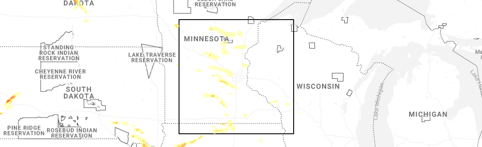
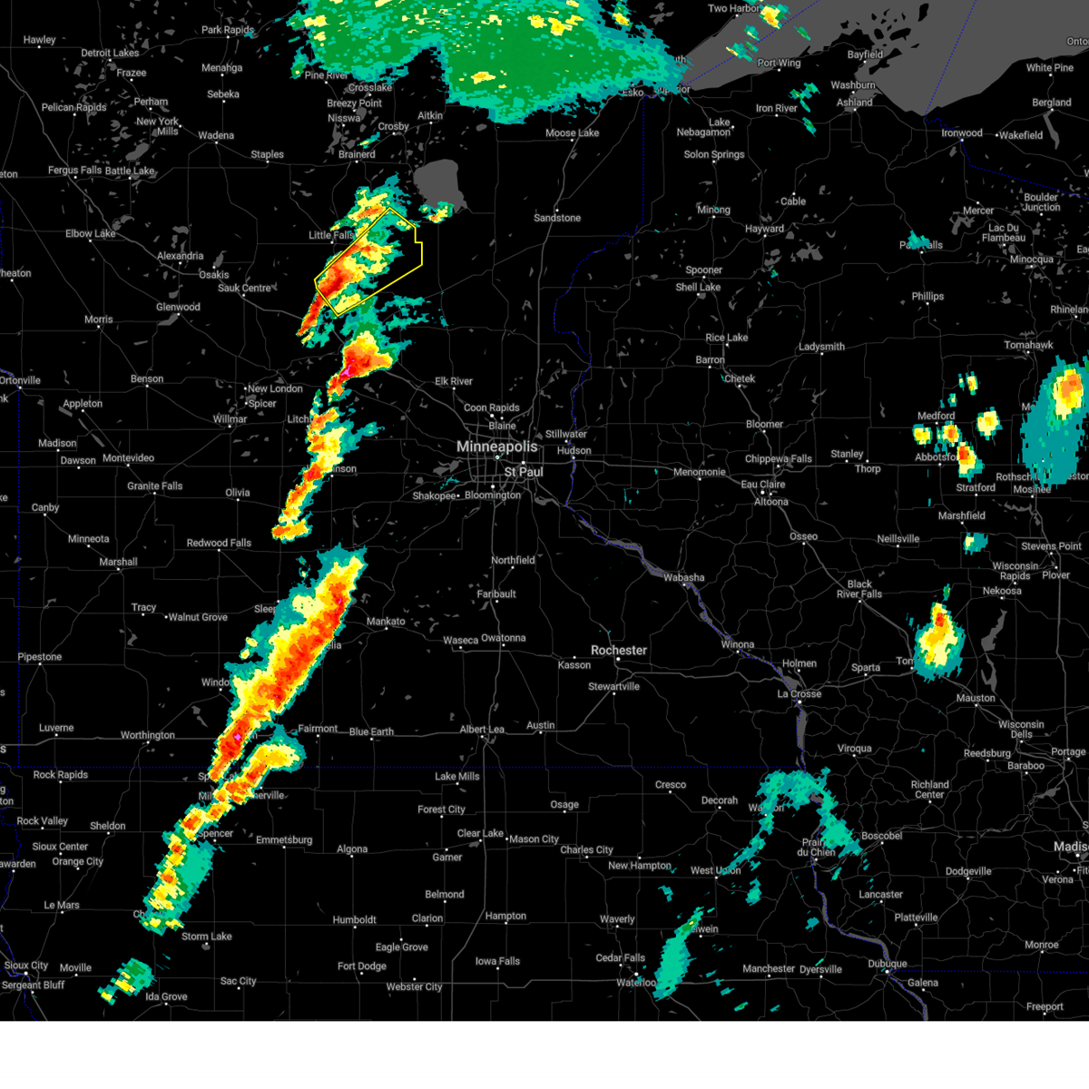
Hail Map for Hillman, MN
The Hillman, MN area has had 2 reports of on-the-ground hail by trained spotters, and has been under severe weather warnings 12 times during the past 12 months. Doppler radar has detected hail at or near Hillman, MN on 49 occasions, including 2 occasions during the past year.
| Name: | Hillman, MN |
| Where Located: | 77.2 miles NNW of Minneapolis, MN |
| Map: | Google Map for Hillman, MN |
| Population: | 38 |
| Housing Units: | 18 |
| More Info: | Search Google for Hillman, MN |
2
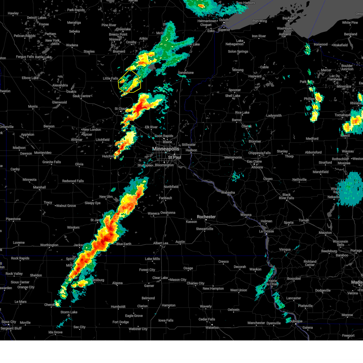
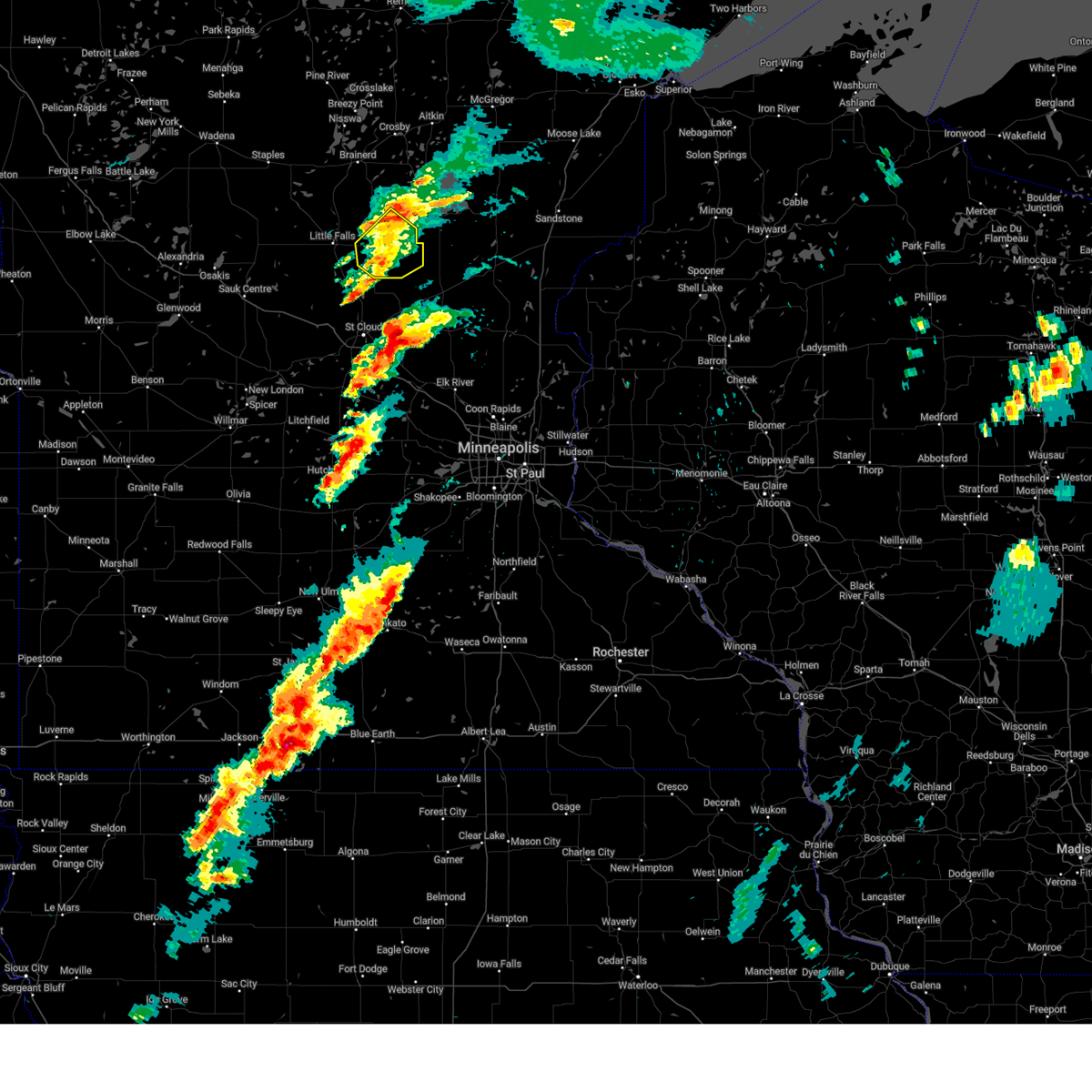
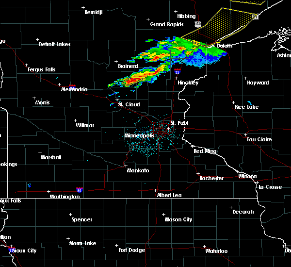
The Top Recent Hail Date for Hillman, MN is Monday, June 16, 2025 (4th out of 49)
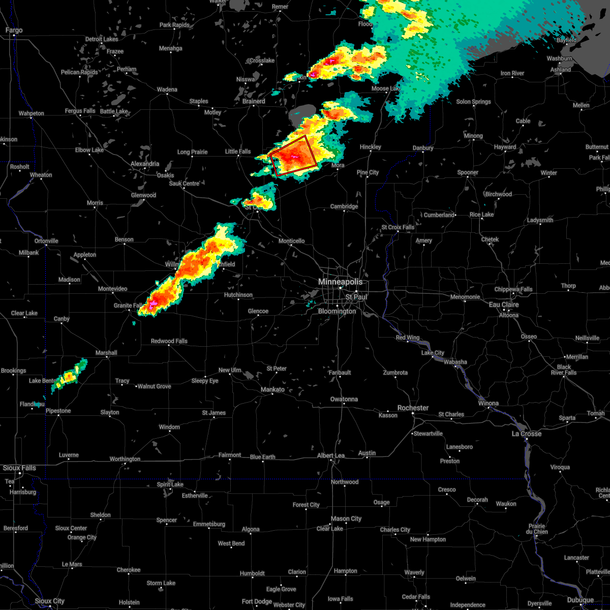
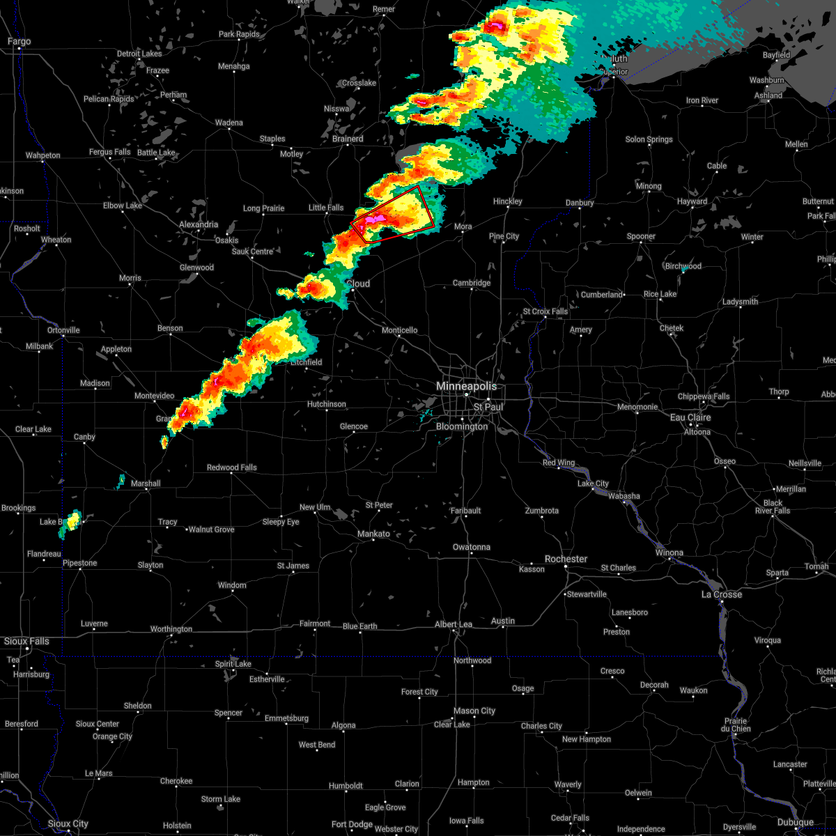
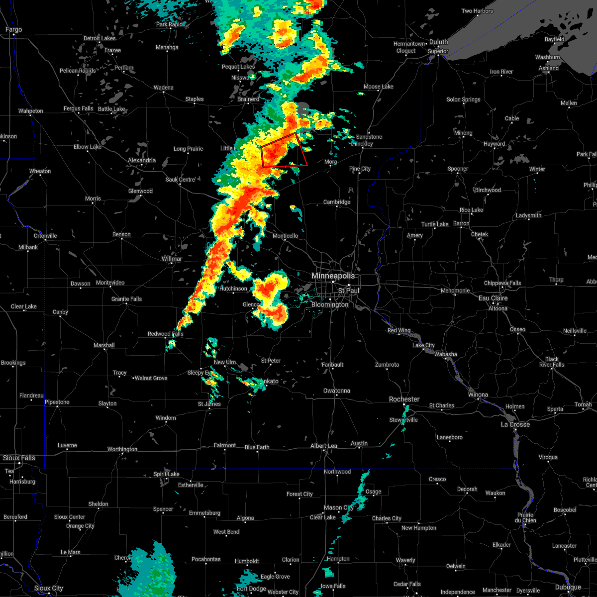
Hail and Wind Damage Spotted near Hillman, MN
| Date / Time | Report Details |
|---|---|
| 6/16/2025 6:15 PM CDT |
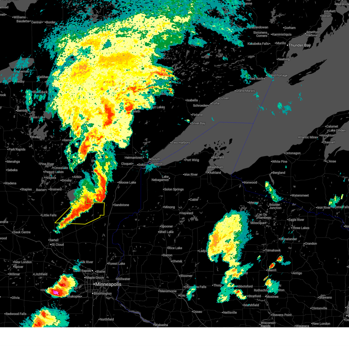 At 615 pm cdt, severe thunderstorms were located along a line from 8 miles east of isle to 9 miles north of milaca, or along a line from 43 miles north of cambridge to 32 miles east of little falls, moving east at 40 mph (radar indicated). Hazards include 60 mph wind gusts and quarter size hail. Hail damage to vehicles is expected. expect wind damage to roofs, siding, and trees. Other locations impacted by the severe thunderstorm include bayview, hillman, mille lacs kathio state park, father hennepin state park and rum river state forest. At 615 pm cdt, severe thunderstorms were located along a line from 8 miles east of isle to 9 miles north of milaca, or along a line from 43 miles north of cambridge to 32 miles east of little falls, moving east at 40 mph (radar indicated). Hazards include 60 mph wind gusts and quarter size hail. Hail damage to vehicles is expected. expect wind damage to roofs, siding, and trees. Other locations impacted by the severe thunderstorm include bayview, hillman, mille lacs kathio state park, father hennepin state park and rum river state forest.
|
| 6/16/2025 5:56 PM CDT | Svrmpx the national weather service in the twin cities has issued a * severe thunderstorm warning for, southeastern morrison county in central minnesota, kanabec county in east central minnesota, mille lacs county in east central minnesota, * until 645 pm cdt. * at 556 pm cdt, severe thunderstorms were located along a line from 8 miles north of isle to 8 miles southeast of lastrup, or along a line from 45 miles northeast of little falls to 21 miles east of little falls, moving east at 50 mph (radar indicated). Hazards include 60 mph wind gusts and quarter size hail. Hail damage to vehicles is expected. expect wind damage to roofs, siding, and trees. this severe thunderstorm will be near, wahkon and onamia around 605 pm cdt. isle around 610 pm cdt. Other locations impacted by the severe thunderstorm include hillman, lake mille lacs, mille lacs kathio state park, bayview and father hennepin state park. |
| 4/28/2025 4:38 PM CDT |
 The storm which prompted the warning has weakened below severe limits, and has exited the warned area. therefore, the warning will be allowed to expire. however, small hail and gusty winds are still possible with this thunderstorm. to report severe weather, contact your nearest law enforcement agency. they will send your report to the national weather service office. The storm which prompted the warning has weakened below severe limits, and has exited the warned area. therefore, the warning will be allowed to expire. however, small hail and gusty winds are still possible with this thunderstorm. to report severe weather, contact your nearest law enforcement agency. they will send your report to the national weather service office.
|
| 4/28/2025 4:25 PM CDT |
 the severe thunderstorm warning has been cancelled and is no longer in effect the severe thunderstorm warning has been cancelled and is no longer in effect
|
| 4/28/2025 4:25 PM CDT |
 At 425 pm cdt, a severe thunderstorm was located 7 miles southeast of pierz, or 17 miles east of little falls, moving northeast at 40 mph (radar indicated). Hazards include 60 mph wind gusts and quarter size hail. Hail damage to vehicles is expected. expect wind damage to roofs, siding, and trees. Locations impacted include, pierz, lastrup, morrill, buckman, harding, genola and hillman. At 425 pm cdt, a severe thunderstorm was located 7 miles southeast of pierz, or 17 miles east of little falls, moving northeast at 40 mph (radar indicated). Hazards include 60 mph wind gusts and quarter size hail. Hail damage to vehicles is expected. expect wind damage to roofs, siding, and trees. Locations impacted include, pierz, lastrup, morrill, buckman, harding, genola and hillman.
|
| 4/28/2025 4:10 PM CDT |
 Svrmpx the national weather service in the twin cities has issued a * severe thunderstorm warning for, northwestern benton county in central minnesota, southeastern morrison county in central minnesota, northeastern stearns county in central minnesota, * until 445 pm cdt. * at 410 pm cdt, a severe thunderstorm was located near royalton, or 14 miles south of little falls, moving northeast at 55 mph (radar indicated). Hazards include 60 mph wind gusts and quarter size hail. Hail damage to vehicles is expected. Expect wind damage to roofs, siding, and trees. Svrmpx the national weather service in the twin cities has issued a * severe thunderstorm warning for, northwestern benton county in central minnesota, southeastern morrison county in central minnesota, northeastern stearns county in central minnesota, * until 445 pm cdt. * at 410 pm cdt, a severe thunderstorm was located near royalton, or 14 miles south of little falls, moving northeast at 55 mph (radar indicated). Hazards include 60 mph wind gusts and quarter size hail. Hail damage to vehicles is expected. Expect wind damage to roofs, siding, and trees.
|
| 8/29/2024 4:59 PM CDT | A barn door was pushed in and damaged by the wind and a large pine tree was down. all brush surrounding the barn that was standing about 3 to 4 feet high was flattene in crow wing county MN, 12 miles S of Hillman, MN |
| 8/29/2024 4:21 PM CDT | The storms which prompted the warning have weakened below severe limits, and no longer pose an immediate threat to life or property. therefore, the warning will be allowed to expire. however, gusty winds are still possible with these thunderstorms. a severe thunderstorm watch remains in effect until 900 pm cdt for central and east central minnesota. |
| 8/29/2024 4:03 PM CDT |
 At 403 pm cdt, severe thunderstorms were located along a line extending from near vineland to near onamia to near foreston, moving northeast at 50 mph (radar indicated). Hazards include 60 mph wind gusts. Expect damage to roofs, siding, and trees. these severe storms will be near, mille lacs lake, isle, wahkon, and bock around 410 pm cdt. Other locations impacted by these severe thunderstorms include mille lacs kathio state park, glendorado, father hennepin state park, pease, oak park, rum river, lake mille lacs, rum river state forest, and bayview. At 403 pm cdt, severe thunderstorms were located along a line extending from near vineland to near onamia to near foreston, moving northeast at 50 mph (radar indicated). Hazards include 60 mph wind gusts. Expect damage to roofs, siding, and trees. these severe storms will be near, mille lacs lake, isle, wahkon, and bock around 410 pm cdt. Other locations impacted by these severe thunderstorms include mille lacs kathio state park, glendorado, father hennepin state park, pease, oak park, rum river, lake mille lacs, rum river state forest, and bayview.
|
| 8/29/2024 3:59 PM CDT | Corrects previous tstm wnd dmg report from 3 s pine center. a barn door was pushed in and damaged by the wind and a large pine tree was down. all brush surrounding the in crow wing county MN, 12 miles S of Hillman, MN |
| 8/29/2024 3:53 PM CDT |
 The tornado threat has diminished and the tornado warning will be allowed to expire. however, damaging winds remain likely and a severe thunderstorm warning remains in effect for the area. a severe thunderstorm watch remains in effect until 900 pm cdt for central and east central minnesota. The tornado threat has diminished and the tornado warning will be allowed to expire. however, damaging winds remain likely and a severe thunderstorm warning remains in effect for the area. a severe thunderstorm watch remains in effect until 900 pm cdt for central and east central minnesota.
|
| 8/29/2024 3:45 PM CDT |
 At 345 pm cdt, a severe thunderstorm capable of producing a tornado was located near lastrup, or 19 miles east of little falls, moving northeast at 55 mph (radar indicated rotation). Hazards include tornado. Flying debris will be dangerous to those caught without shelter. mobile homes will be damaged or destroyed. damage to roofs, windows, and vehicles will occur. tree damage is likely. this dangerous storm will be near, mille lacs lake and vineland around 355 pm cdt. Other locations impacted by this tornadic thunderstorm include mille lacs kathio state park, hillman, harding, and rum river state forest. At 345 pm cdt, a severe thunderstorm capable of producing a tornado was located near lastrup, or 19 miles east of little falls, moving northeast at 55 mph (radar indicated rotation). Hazards include tornado. Flying debris will be dangerous to those caught without shelter. mobile homes will be damaged or destroyed. damage to roofs, windows, and vehicles will occur. tree damage is likely. this dangerous storm will be near, mille lacs lake and vineland around 355 pm cdt. Other locations impacted by this tornadic thunderstorm include mille lacs kathio state park, hillman, harding, and rum river state forest.
|
| 8/29/2024 3:37 PM CDT | Svrmpx the national weather service in the twin cities has issued a * severe thunderstorm warning for, mille lacs county in east central minnesota, benton county in central minnesota, southeastern morrison county in central minnesota, * until 430 pm cdt. * at 337 pm cdt, severe thunderstorms were located along a line extending from near camp ripley to 7 miles south of pierz to near sauk rapids, moving northeast at 50 mph (radar indicated). Hazards include 60 mph wind gusts. Expect damage to roofs, siding, and trees. severe thunderstorms will be near, st. cloud, foley, pierz, and lastrup around 340 pm cdt. foreston around 355 pm cdt. mille lacs lake, milaca, onamia, and vineland around 400 pm cdt. bock around 405 pm cdt. wahkon around 410 pm cdt. isle around 415 pm cdt. Other locations impacted by these severe thunderstorms include duelm, mayhew, morrill, mille lacs kathio state park, glendorado, parent, father hennepin state park, pease, oak park, and lake mille lacs. |
| 8/29/2024 3:31 PM CDT |
 Tormpx the national weather service in the twin cities has issued a * tornado warning for, northwestern mille lacs county in east central minnesota, southeastern morrison county in central minnesota, * until 400 pm cdt. * at 330 pm cdt, a severe thunderstorm capable of producing a tornado was located near pierz, or 7 miles east of little falls, moving northeast at 55 mph (radar indicated rotation). Hazards include tornado. Flying debris will be dangerous to those caught without shelter. mobile homes will be damaged or destroyed. damage to roofs, windows, and vehicles will occur. tree damage is likely. this dangerous storm will be near, pierz and lastrup around 335 pm cdt. vineland around 355 pm cdt. Other locations impacted by this tornadic thunderstorm include mille lacs kathio state park, hillman, genola, harding, and rum river state forest. Tormpx the national weather service in the twin cities has issued a * tornado warning for, northwestern mille lacs county in east central minnesota, southeastern morrison county in central minnesota, * until 400 pm cdt. * at 330 pm cdt, a severe thunderstorm capable of producing a tornado was located near pierz, or 7 miles east of little falls, moving northeast at 55 mph (radar indicated rotation). Hazards include tornado. Flying debris will be dangerous to those caught without shelter. mobile homes will be damaged or destroyed. damage to roofs, windows, and vehicles will occur. tree damage is likely. this dangerous storm will be near, pierz and lastrup around 335 pm cdt. vineland around 355 pm cdt. Other locations impacted by this tornadic thunderstorm include mille lacs kathio state park, hillman, genola, harding, and rum river state forest.
|
| 6/12/2024 6:55 PM CDT |
 At 652 pm cdt, a confirmed tornado was located near camp ripley, or 7 miles northeast of little falls, moving east at 30 mph (weather spotters confirmed tornado). Hazards include damaging tornado. Flying debris will be dangerous to those caught without shelter. mobile homes will be damaged or destroyed. damage to roofs, windows, and vehicles will occur. tree damage is likely. This tornadic thunderstorm will remain over mainly rural areas of east central morrison county, including the following locations, camp ripley junction, hillman, and harding. At 652 pm cdt, a confirmed tornado was located near camp ripley, or 7 miles northeast of little falls, moving east at 30 mph (weather spotters confirmed tornado). Hazards include damaging tornado. Flying debris will be dangerous to those caught without shelter. mobile homes will be damaged or destroyed. damage to roofs, windows, and vehicles will occur. tree damage is likely. This tornadic thunderstorm will remain over mainly rural areas of east central morrison county, including the following locations, camp ripley junction, hillman, and harding.
|
| 6/12/2024 6:47 PM CDT |
 Tormpx the national weather service in the twin cities has issued a * tornado warning for, north central morrison county in central minnesota, * until 715 pm cdt. * at 647 pm cdt, a confirmed tornado was located near camp ripley, or 6 miles northeast of little falls, moving east at 40 mph (weather spotters confirmed tornado). Hazards include damaging tornado. Flying debris will be dangerous to those caught without shelter. mobile homes will be damaged or destroyed. damage to roofs, windows, and vehicles will occur. tree damage is likely. the tornado will be near, lastrup around 700 pm cdt. Other locations impacted by this tornadic thunderstorm include camp ripley junction, hillman, and harding. Tormpx the national weather service in the twin cities has issued a * tornado warning for, north central morrison county in central minnesota, * until 715 pm cdt. * at 647 pm cdt, a confirmed tornado was located near camp ripley, or 6 miles northeast of little falls, moving east at 40 mph (weather spotters confirmed tornado). Hazards include damaging tornado. Flying debris will be dangerous to those caught without shelter. mobile homes will be damaged or destroyed. damage to roofs, windows, and vehicles will occur. tree damage is likely. the tornado will be near, lastrup around 700 pm cdt. Other locations impacted by this tornadic thunderstorm include camp ripley junction, hillman, and harding.
|
| 8/11/2023 2:32 PM CDT |
 At 232 pm cdt, a severe thunderstorm was located near onamia, or 16 miles south of mille lacs lake, moving southeast at 45 mph (radar indicated). Hazards include 60 mph wind gusts and quarter size hail. Hail damage to vehicles is expected. expect wind damage to roofs, siding, and trees. locations impacted include, onamia, vineland, harding, hillman, mille lacs kathio state park and rum river state forest. hail threat, radar indicated max hail size, 1. 00 in wind threat, radar indicated max wind gust, 60 mph. At 232 pm cdt, a severe thunderstorm was located near onamia, or 16 miles south of mille lacs lake, moving southeast at 45 mph (radar indicated). Hazards include 60 mph wind gusts and quarter size hail. Hail damage to vehicles is expected. expect wind damage to roofs, siding, and trees. locations impacted include, onamia, vineland, harding, hillman, mille lacs kathio state park and rum river state forest. hail threat, radar indicated max hail size, 1. 00 in wind threat, radar indicated max wind gust, 60 mph.
|
| 8/11/2023 2:02 PM CDT |
 At 202 pm cdt, a severe thunderstorm was located near saint mathias, or 10 miles south of brainerd, moving southeast at 45 mph (radar indicated). Hazards include ping pong ball size hail and 60 mph wind gusts. People and animals outdoors will be injured. expect hail damage to roofs, siding, windows, and vehicles. Expect wind damage to roofs, siding, and trees. At 202 pm cdt, a severe thunderstorm was located near saint mathias, or 10 miles south of brainerd, moving southeast at 45 mph (radar indicated). Hazards include ping pong ball size hail and 60 mph wind gusts. People and animals outdoors will be injured. expect hail damage to roofs, siding, windows, and vehicles. Expect wind damage to roofs, siding, and trees.
|
| 7/12/2022 7:35 PM CDT |
 At 735 pm cdt, a severe thunderstorm was located 9 miles southeast of pierz, or 21 miles east of little falls, moving southeast at 40 mph (radar indicated). Hazards include 60 mph wind gusts and quarter size hail. Hail damage to vehicles is expected. expect wind damage to roofs, siding, and trees. Locations impacted include, milaca, foley, pierz, foreston, granite ledge, morrill, buckman, gilman, oak park, genola, hillman and ronneby. At 735 pm cdt, a severe thunderstorm was located 9 miles southeast of pierz, or 21 miles east of little falls, moving southeast at 40 mph (radar indicated). Hazards include 60 mph wind gusts and quarter size hail. Hail damage to vehicles is expected. expect wind damage to roofs, siding, and trees. Locations impacted include, milaca, foley, pierz, foreston, granite ledge, morrill, buckman, gilman, oak park, genola, hillman and ronneby.
|
| 7/12/2022 7:27 PM CDT |
 At 727 pm cdt, a severe thunderstorm was located near pierz, or 18 miles east of little falls, moving southeast at 40 mph (radar indicated). Hazards include 60 mph wind gusts and quarter size hail. Hail damage to vehicles is expected. Expect wind damage to roofs, siding, and trees. At 727 pm cdt, a severe thunderstorm was located near pierz, or 18 miles east of little falls, moving southeast at 40 mph (radar indicated). Hazards include 60 mph wind gusts and quarter size hail. Hail damage to vehicles is expected. Expect wind damage to roofs, siding, and trees.
|
| 5/30/2022 5:11 AM CDT |
 At 510 am cdt, severe thunderstorms were located along a line extending from near lastrup to 6 miles south of ogilvie, moving northeast at 70 mph (radar indicated). Hazards include 70 mph wind gusts. Expect considerable tree damage. damage is likely to mobile homes, roofs, and outbuildings. locations impacted include, brunswick, ogilvie, mora, grasston, quamba, vineland and mille lacs lake. thunderstorm damage threat, considerable hail threat, radar indicated max hail size, <. 75 in wind threat, radar indicated max wind gust, 70 mph. At 510 am cdt, severe thunderstorms were located along a line extending from near lastrup to 6 miles south of ogilvie, moving northeast at 70 mph (radar indicated). Hazards include 70 mph wind gusts. Expect considerable tree damage. damage is likely to mobile homes, roofs, and outbuildings. locations impacted include, brunswick, ogilvie, mora, grasston, quamba, vineland and mille lacs lake. thunderstorm damage threat, considerable hail threat, radar indicated max hail size, <. 75 in wind threat, radar indicated max wind gust, 70 mph.
|
| 5/30/2022 4:48 AM CDT |
 At 448 am cdt, severe thunderstorms were located along a line extending from near bowlus to 6 miles west of zimmerman, moving northeast at 70 mph (radar indicated). Hazards include 70 mph wind gusts. Expect considerable tree damage. damage is likely to mobile homes, roofs, and outbuildings. severe thunderstorms will be near, princeton around 455 am cdt. pierz, bock and lastrup around 505 am cdt. other locations in the path of these severe thunderstorms include ogilvie, mora, brunswick, grasston, quamba, vineland and mille lacs lake. thunderstorm damage threat, considerable hail threat, radar indicated max hail size, <. 75 in wind threat, radar indicated max wind gust, 70 mph. At 448 am cdt, severe thunderstorms were located along a line extending from near bowlus to 6 miles west of zimmerman, moving northeast at 70 mph (radar indicated). Hazards include 70 mph wind gusts. Expect considerable tree damage. damage is likely to mobile homes, roofs, and outbuildings. severe thunderstorms will be near, princeton around 455 am cdt. pierz, bock and lastrup around 505 am cdt. other locations in the path of these severe thunderstorms include ogilvie, mora, brunswick, grasston, quamba, vineland and mille lacs lake. thunderstorm damage threat, considerable hail threat, radar indicated max hail size, <. 75 in wind threat, radar indicated max wind gust, 70 mph.
|
| 5/12/2022 8:06 PM CDT |
 At 806 pm cdt, severe thunderstorms were located along a line extending from near lastrup to near foreston, moving northeast at 55 mph (radar indicated). Hazards include 60 mph wind gusts. Expect damage to roofs, siding, and trees. severe thunderstorms will be near, vineland around 820 pm cdt. ogilvie around 825 pm cdt. mora and brunswick around 830 pm cdt. grasston around 835 pm cdt. mille lacs lake and quamba around 840 pm cdt. Other locations impacted by these severe thunderstorms include mora airport, morrill, warman, knife lake, lake mille lacs, harding, hillman, lewis lake and bayview. At 806 pm cdt, severe thunderstorms were located along a line extending from near lastrup to near foreston, moving northeast at 55 mph (radar indicated). Hazards include 60 mph wind gusts. Expect damage to roofs, siding, and trees. severe thunderstorms will be near, vineland around 820 pm cdt. ogilvie around 825 pm cdt. mora and brunswick around 830 pm cdt. grasston around 835 pm cdt. mille lacs lake and quamba around 840 pm cdt. Other locations impacted by these severe thunderstorms include mora airport, morrill, warman, knife lake, lake mille lacs, harding, hillman, lewis lake and bayview.
|
| 5/12/2022 7:55 PM CDT |
 At 755 pm cdt, a severe thunderstorm capable of producing a tornado was located 7 miles northeast of rice, or 16 miles north of st. cloud, moving north at 60 mph (radar indicated rotation). Hazards include tornado. Flying debris will be dangerous to those caught without shelter. mobile homes will be damaged or destroyed. damage to roofs, windows, and vehicles will occur. tree damage is likely. this dangerous storm will be near, pierz around 805 pm cdt. Lastrup around 810 pm cdt. At 755 pm cdt, a severe thunderstorm capable of producing a tornado was located 7 miles northeast of rice, or 16 miles north of st. cloud, moving north at 60 mph (radar indicated rotation). Hazards include tornado. Flying debris will be dangerous to those caught without shelter. mobile homes will be damaged or destroyed. damage to roofs, windows, and vehicles will occur. tree damage is likely. this dangerous storm will be near, pierz around 805 pm cdt. Lastrup around 810 pm cdt.
|
| 5/12/2022 7:31 PM CDT |
 At 731 pm cdt, severe thunderstorms were located along a line extending from near bertha to 5 miles east of long prairie to near avon, moving northeast at 75 mph (radar indicated). Hazards include 70 mph wind gusts. Expect considerable tree damage. damage is likely to mobile homes, roofs, and outbuildings. severe thunderstorms will be near, bertha and hewitt around 735 pm cdt. royalton around 740 pm cdt. staples airport around 745 pm cdt. motley around 750 pm cdt. thunderstorm damage threat, considerable hail threat, radar indicated max hail size, <. 75 in wind threat, radar indicated max wind gust, 70 mph. At 731 pm cdt, severe thunderstorms were located along a line extending from near bertha to 5 miles east of long prairie to near avon, moving northeast at 75 mph (radar indicated). Hazards include 70 mph wind gusts. Expect considerable tree damage. damage is likely to mobile homes, roofs, and outbuildings. severe thunderstorms will be near, bertha and hewitt around 735 pm cdt. royalton around 740 pm cdt. staples airport around 745 pm cdt. motley around 750 pm cdt. thunderstorm damage threat, considerable hail threat, radar indicated max hail size, <. 75 in wind threat, radar indicated max wind gust, 70 mph.
|
| 5/12/2022 11:05 AM CDT |
 The severe thunderstorm warning for northwestern kanabec, northern mille lacs and east central morrison counties will expire at 1115 am cdt, the storm which prompted the warning has weakened below severe limits, and no longer poses an immediate threat to life or property. therefore, the warning will be allowed to expire. to report severe weather, contact your nearest law enforcement agency. they will relay your report to the national weather service the twin cities. The severe thunderstorm warning for northwestern kanabec, northern mille lacs and east central morrison counties will expire at 1115 am cdt, the storm which prompted the warning has weakened below severe limits, and no longer poses an immediate threat to life or property. therefore, the warning will be allowed to expire. to report severe weather, contact your nearest law enforcement agency. they will relay your report to the national weather service the twin cities.
|
| 5/12/2022 10:46 AM CDT |
 At 1045 am cdt, a severe thunderstorm was located near onamia, or 14 miles south of mille lacs lake, moving east at 55 mph (trained weather spotters). Hazards include 60 mph wind gusts and quarter size hail. Hail damage to vehicles is expected. expect wind damage to roofs, siding, and trees. this severe storm will be near, onamia around 1050 am cdt. other locations in the path of this severe thunderstorm include isle and wahkon. hail threat, observed max hail size, 1. 00 in wind threat, observed max wind gust, 60 mph. At 1045 am cdt, a severe thunderstorm was located near onamia, or 14 miles south of mille lacs lake, moving east at 55 mph (trained weather spotters). Hazards include 60 mph wind gusts and quarter size hail. Hail damage to vehicles is expected. expect wind damage to roofs, siding, and trees. this severe storm will be near, onamia around 1050 am cdt. other locations in the path of this severe thunderstorm include isle and wahkon. hail threat, observed max hail size, 1. 00 in wind threat, observed max wind gust, 60 mph.
|
| 5/12/2022 10:32 AM CDT |
 At 1032 am cdt, a severe thunderstorm was located near lastrup, or 17 miles east of little falls, moving east at 55 mph (trained weather spotters). Hazards include 60 mph wind gusts and quarter size hail. Hail damage to vehicles is expected. expect wind damage to roofs, siding, and trees. this severe thunderstorm will be near, onamia and vineland around 1050 am cdt. other locations in the path of this severe thunderstorm include isle and wahkon. hail threat, observed max hail size, 1. 00 in wind threat, observed max wind gust, 60 mph. At 1032 am cdt, a severe thunderstorm was located near lastrup, or 17 miles east of little falls, moving east at 55 mph (trained weather spotters). Hazards include 60 mph wind gusts and quarter size hail. Hail damage to vehicles is expected. expect wind damage to roofs, siding, and trees. this severe thunderstorm will be near, onamia and vineland around 1050 am cdt. other locations in the path of this severe thunderstorm include isle and wahkon. hail threat, observed max hail size, 1. 00 in wind threat, observed max wind gust, 60 mph.
|
| 9/16/2021 7:35 PM CDT | Tree down across road on powerline in morrison county MN, 9 miles NNW of Hillman, MN |
| 9/16/2021 7:22 PM CDT |
 At 722 pm cdt, a severe thunderstorm capable of producing a tornado was located 8 miles southwest of onamia, or 24 miles south of mille lacs lake, moving east at 40 mph (radar indicated rotation). Hazards include tornado and quarter size hail. Flying debris will be dangerous to those caught without shelter. mobile homes will be damaged or destroyed. damage to roofs, windows, and vehicles will occur. tree damage is likely. Locations impacted include, onamia and hillman. At 722 pm cdt, a severe thunderstorm capable of producing a tornado was located 8 miles southwest of onamia, or 24 miles south of mille lacs lake, moving east at 40 mph (radar indicated rotation). Hazards include tornado and quarter size hail. Flying debris will be dangerous to those caught without shelter. mobile homes will be damaged or destroyed. damage to roofs, windows, and vehicles will occur. tree damage is likely. Locations impacted include, onamia and hillman.
|
| 9/16/2021 7:11 PM CDT |
 The tornado warning for northern mille lacs and east central morrison counties will expire at 715 pm cdt, the storm which prompted the warning has moved out of the area. therefore, the warning will be allowed to expire. a tornado watch remains in effect until midnight cdt for central and east central minnesota. remember, a tornado warning still remains in effect for southeastern morrison and west-central mille lacs counties. The tornado warning for northern mille lacs and east central morrison counties will expire at 715 pm cdt, the storm which prompted the warning has moved out of the area. therefore, the warning will be allowed to expire. a tornado watch remains in effect until midnight cdt for central and east central minnesota. remember, a tornado warning still remains in effect for southeastern morrison and west-central mille lacs counties.
|
| 9/16/2021 7:07 PM CDT |
 At 706 pm cdt, a severe thunderstorm capable of producing a tornado was located 7 miles southeast of pierz, or 18 miles east of little falls, moving east at 40 mph (radar indicated rotation). Hazards include tornado and hail up to two inches in diameter. Flying debris will be dangerous to those caught without shelter. mobile homes will be damaged or destroyed. damage to roofs, windows, and vehicles will occur. Tree damage is likely. At 706 pm cdt, a severe thunderstorm capable of producing a tornado was located 7 miles southeast of pierz, or 18 miles east of little falls, moving east at 40 mph (radar indicated rotation). Hazards include tornado and hail up to two inches in diameter. Flying debris will be dangerous to those caught without shelter. mobile homes will be damaged or destroyed. damage to roofs, windows, and vehicles will occur. Tree damage is likely.
|
| 9/16/2021 6:51 PM CDT |
 At 650 pm cdt, a severe thunderstorm was located over vineland, or 9 miles southwest of mille lacs lake, moving northeast at 50 mph. storm has a history of producing large hail across morrison county (radar indicated). Hazards include ping pong ball size hail and 60 mph wind gusts. People and animals outdoors will be injured. expect hail damage to roofs, siding, windows, and vehicles. expect wind damage to roofs, siding, and trees. This severe thunderstorm will remain over mainly rural areas of east central morrison county, including the following locations, harding, genola and hillman. At 650 pm cdt, a severe thunderstorm was located over vineland, or 9 miles southwest of mille lacs lake, moving northeast at 50 mph. storm has a history of producing large hail across morrison county (radar indicated). Hazards include ping pong ball size hail and 60 mph wind gusts. People and animals outdoors will be injured. expect hail damage to roofs, siding, windows, and vehicles. expect wind damage to roofs, siding, and trees. This severe thunderstorm will remain over mainly rural areas of east central morrison county, including the following locations, harding, genola and hillman.
|
| 9/16/2021 6:38 PM CDT |
 At 637 pm cdt, a severe thunderstorm was located over royalton, or 10 miles southeast of little falls, moving northeast at 45 mph (radar indicated). Hazards include two inch hail and 60 mph wind gusts. People and animals outdoors will be injured. expect hail damage to roofs, siding, windows, and vehicles. expect wind damage to roofs, siding, and trees. locations impacted include, pierz. thunderstorm damage threat, considerable hail threat, observed max hail size, 2. 00 in wind threat, radar indicated max wind gust, 60 mph. At 637 pm cdt, a severe thunderstorm was located over royalton, or 10 miles southeast of little falls, moving northeast at 45 mph (radar indicated). Hazards include two inch hail and 60 mph wind gusts. People and animals outdoors will be injured. expect hail damage to roofs, siding, windows, and vehicles. expect wind damage to roofs, siding, and trees. locations impacted include, pierz. thunderstorm damage threat, considerable hail threat, observed max hail size, 2. 00 in wind threat, radar indicated max wind gust, 60 mph.
|
| 9/16/2021 6:32 PM CDT |
 At 632 pm cdt, a severe thunderstorm capable of producing a tornado was located over lastrup, or 13 miles east of little falls, moving northeast at 45 mph (radar indicated rotation). Hazards include tornado. Flying debris will be dangerous to those caught without shelter. mobile homes will be damaged or destroyed. damage to roofs, windows, and vehicles will occur. Tree damage is likely. At 632 pm cdt, a severe thunderstorm capable of producing a tornado was located over lastrup, or 13 miles east of little falls, moving northeast at 45 mph (radar indicated rotation). Hazards include tornado. Flying debris will be dangerous to those caught without shelter. mobile homes will be damaged or destroyed. damage to roofs, windows, and vehicles will occur. Tree damage is likely.
|
| 9/16/2021 6:26 PM CDT |
 At 626 pm cdt, a severe thunderstorm was located over bowlus, or 12 miles south of little falls, moving northeast at 45 mph (radar indicated). Hazards include golf ball size hail and 60 mph wind gusts. People and animals outdoors will be injured. expect hail damage to roofs, siding, windows, and vehicles. expect wind damage to roofs, siding, and trees. this severe thunderstorm will be near, royalton around 635 pm cdt. other locations in the path of this severe thunderstorm include pierz. thunderstorm damage threat, considerable hail threat, radar indicated max hail size, 1. 75 in wind threat, radar indicated max wind gust, 60 mph. At 626 pm cdt, a severe thunderstorm was located over bowlus, or 12 miles south of little falls, moving northeast at 45 mph (radar indicated). Hazards include golf ball size hail and 60 mph wind gusts. People and animals outdoors will be injured. expect hail damage to roofs, siding, windows, and vehicles. expect wind damage to roofs, siding, and trees. this severe thunderstorm will be near, royalton around 635 pm cdt. other locations in the path of this severe thunderstorm include pierz. thunderstorm damage threat, considerable hail threat, radar indicated max hail size, 1. 75 in wind threat, radar indicated max wind gust, 60 mph.
|
| 9/16/2021 6:25 PM CDT |
 At 625 pm cdt, a severe thunderstorm was located 7 miles west of lastrup, or 9 miles northeast of little falls, moving northeast at 55 mph (radar indicated). Hazards include ping pong ball size hail and 60 mph wind gusts. People and animals outdoors will be injured. expect hail damage to roofs, siding, windows, and vehicles. expect wind damage to roofs, siding, and trees. This severe thunderstorm will be near, lastrup around 630 pm cdt. At 625 pm cdt, a severe thunderstorm was located 7 miles west of lastrup, or 9 miles northeast of little falls, moving northeast at 55 mph (radar indicated). Hazards include ping pong ball size hail and 60 mph wind gusts. People and animals outdoors will be injured. expect hail damage to roofs, siding, windows, and vehicles. expect wind damage to roofs, siding, and trees. This severe thunderstorm will be near, lastrup around 630 pm cdt.
|
| 8/14/2020 6:13 PM CDT |
 At 613 pm cdt, a severe thunderstorm capable of producing a tornado was located 7 miles southwest of onamia, or 22 miles south of mille lacs lake, moving east at 60 mph (radar indicated rotation). Hazards include tornado and quarter size hail. Flying debris will be dangerous to those caught without shelter. mobile homes will be damaged or destroyed. damage to roofs, windows, and vehicles will occur. tree damage is likely. this dangerous storm will be near, onamia around 620 pm cdt. Other locations impacted by this tornadic thunderstorm include hillman. At 613 pm cdt, a severe thunderstorm capable of producing a tornado was located 7 miles southwest of onamia, or 22 miles south of mille lacs lake, moving east at 60 mph (radar indicated rotation). Hazards include tornado and quarter size hail. Flying debris will be dangerous to those caught without shelter. mobile homes will be damaged or destroyed. damage to roofs, windows, and vehicles will occur. tree damage is likely. this dangerous storm will be near, onamia around 620 pm cdt. Other locations impacted by this tornadic thunderstorm include hillman.
|
| 8/14/2020 5:58 PM CDT |
 At 558 pm cdt, a severe thunderstorm capable of producing a tornado was located near pierz, or 13 miles east of little falls, moving east at 60 mph (radar indicated rotation). Hazards include tornado and quarter size hail. Flying debris will be dangerous to those caught without shelter. mobile homes will be damaged or destroyed. damage to roofs, windows, and vehicles will occur. tree damage is likely. this dangerous storm will be near, onamia around 620 pm cdt. Other locations impacted by this tornadic thunderstorm include buckman, hillman and genola. At 558 pm cdt, a severe thunderstorm capable of producing a tornado was located near pierz, or 13 miles east of little falls, moving east at 60 mph (radar indicated rotation). Hazards include tornado and quarter size hail. Flying debris will be dangerous to those caught without shelter. mobile homes will be damaged or destroyed. damage to roofs, windows, and vehicles will occur. tree damage is likely. this dangerous storm will be near, onamia around 620 pm cdt. Other locations impacted by this tornadic thunderstorm include buckman, hillman and genola.
|
| 7/18/2020 12:19 AM CDT |
 At 1218 am cdt, severe thunderstorms were located along a line extending from 7 miles east of rice to near albany to near brooten, moving southeast at 35 mph (radar indicated). Hazards include 60 mph wind gusts. Expect damage to roofs, siding, and trees. these severe storms will be near, sauk rapids, foley and richmond around 1235 am cdt. st. cloud, cold spring and rockville around 1240 am cdt. new london around 1250 am cdt. other locations impacted by these severe thunderstorms include mayhew, morrill, parent, spring hill, opole, pleasant lake, hillman, st. Martin, greenwald and gilman. At 1218 am cdt, severe thunderstorms were located along a line extending from 7 miles east of rice to near albany to near brooten, moving southeast at 35 mph (radar indicated). Hazards include 60 mph wind gusts. Expect damage to roofs, siding, and trees. these severe storms will be near, sauk rapids, foley and richmond around 1235 am cdt. st. cloud, cold spring and rockville around 1240 am cdt. new london around 1250 am cdt. other locations impacted by these severe thunderstorms include mayhew, morrill, parent, spring hill, opole, pleasant lake, hillman, st. Martin, greenwald and gilman.
|
| 7/17/2020 11:58 PM CDT |
 At 1158 pm cdt, severe thunderstorms were located along a line extending from near royalton to near melrose to near brooten, moving southeast at 25 mph (radar indicated). Hazards include 60 mph wind gusts. Expect damage to roofs, siding, and trees. severe thunderstorms will be near, royalton around 1205 am cdt. st. anthony and freeport around 1215 am cdt. rice around 1220 am cdt. albany around 1225 am cdt. sauk rapids, paynesville and new london around 1250 am cdt. st. Cloud and cold spring around 100 am cdt. At 1158 pm cdt, severe thunderstorms were located along a line extending from near royalton to near melrose to near brooten, moving southeast at 25 mph (radar indicated). Hazards include 60 mph wind gusts. Expect damage to roofs, siding, and trees. severe thunderstorms will be near, royalton around 1205 am cdt. st. anthony and freeport around 1215 am cdt. rice around 1220 am cdt. albany around 1225 am cdt. sauk rapids, paynesville and new london around 1250 am cdt. st. Cloud and cold spring around 100 am cdt.
|
| 7/17/2020 11:41 PM CDT |
 At 1141 pm cdt, severe thunderstorms were located along a line extending from 6 miles southeast of malmo to near little falls to sauk centre, moving southeast at 20 mph (radar indicated). Hazards include 60 mph wind gusts. Expect damage to roofs, siding, and trees. these severe storms will be near, isle around 1155 pm cdt. royalton around 1205 am cdt. st. anthony around 1225 am cdt. other locations impacted by these severe thunderstorms include st. Rosa, round prairie, camp ripley junction, sobieski, burtrum, lake mille lacs, harding, hillman, pleasant beach and long prairie airport. At 1141 pm cdt, severe thunderstorms were located along a line extending from 6 miles southeast of malmo to near little falls to sauk centre, moving southeast at 20 mph (radar indicated). Hazards include 60 mph wind gusts. Expect damage to roofs, siding, and trees. these severe storms will be near, isle around 1155 pm cdt. royalton around 1205 am cdt. st. anthony around 1225 am cdt. other locations impacted by these severe thunderstorms include st. Rosa, round prairie, camp ripley junction, sobieski, burtrum, lake mille lacs, harding, hillman, pleasant beach and long prairie airport.
|
| 7/17/2020 11:18 PM CDT |
 At 1118 pm cdt, severe thunderstorms were located along a line extending from near mille lacs lake to near camp ripley to near lake osakis, moving southeast at 25 mph (radar indicated). Hazards include 60 mph wind gusts. Expect damage to roofs, siding, and trees. these severe storms will be near, little falls and mille lacs lake around 1125 pm cdt. lastrup around 1145 pm cdt. pierz and isle around 1150 pm cdt. melrose around 1200 am cdt. st. anthony around 1220 am cdt. other locations impacted by these severe thunderstorms include st. Rosa, round prairie, camp ripley junction, sobieski, burtrum, lake mille lacs, harding, hillman, pleasant beach and long prairie airport. At 1118 pm cdt, severe thunderstorms were located along a line extending from near mille lacs lake to near camp ripley to near lake osakis, moving southeast at 25 mph (radar indicated). Hazards include 60 mph wind gusts. Expect damage to roofs, siding, and trees. these severe storms will be near, little falls and mille lacs lake around 1125 pm cdt. lastrup around 1145 pm cdt. pierz and isle around 1150 pm cdt. melrose around 1200 am cdt. st. anthony around 1220 am cdt. other locations impacted by these severe thunderstorms include st. Rosa, round prairie, camp ripley junction, sobieski, burtrum, lake mille lacs, harding, hillman, pleasant beach and long prairie airport.
|
| 7/17/2020 10:58 PM CDT |
 At 1057 pm cdt, severe thunderstorms were located along a line extending from 6 miles northwest of mille lacs lake to near randall to near alexandria, moving southeast at 25 mph (radar indicated). Hazards include 60 mph wind gusts. Expect damage to roofs, siding, and trees. severe thunderstorms will be near, camp ripley around 1110 pm cdt. little falls and mille lacs lake around 1120 pm cdt. sauk centre around 1140 pm cdt. lastrup around 1145 pm cdt. pierz and isle around 1150 pm cdt. melrose around 1200 am cdt. other locations impacted by these severe thunderstorms include st. rosa, round prairie, camp ripley junction, sobieski, burtrum, lake mille lacs, harding, hillman, pleasant beach and long prairie airport. This also includes grand casino mille lacs. At 1057 pm cdt, severe thunderstorms were located along a line extending from 6 miles northwest of mille lacs lake to near randall to near alexandria, moving southeast at 25 mph (radar indicated). Hazards include 60 mph wind gusts. Expect damage to roofs, siding, and trees. severe thunderstorms will be near, camp ripley around 1110 pm cdt. little falls and mille lacs lake around 1120 pm cdt. sauk centre around 1140 pm cdt. lastrup around 1145 pm cdt. pierz and isle around 1150 pm cdt. melrose around 1200 am cdt. other locations impacted by these severe thunderstorms include st. rosa, round prairie, camp ripley junction, sobieski, burtrum, lake mille lacs, harding, hillman, pleasant beach and long prairie airport. This also includes grand casino mille lacs.
|
| 7/14/2020 12:00 AM CDT |
 At 1200 am cdt, a severe thunderstorm was located 9 miles southwest of onamia, or 25 miles south of mille lacs lake, moving east at 40 mph (trained weather spotters). Hazards include 60 mph wind gusts and nickel size hail. Expect damage to roofs, siding, and trees. This severe thunderstorm will remain over mainly rural areas of west central mille lacs and southeastern morrison counties, including the following locations, hillman. At 1200 am cdt, a severe thunderstorm was located 9 miles southwest of onamia, or 25 miles south of mille lacs lake, moving east at 40 mph (trained weather spotters). Hazards include 60 mph wind gusts and nickel size hail. Expect damage to roofs, siding, and trees. This severe thunderstorm will remain over mainly rural areas of west central mille lacs and southeastern morrison counties, including the following locations, hillman.
|
| 7/13/2020 11:45 PM CDT |
 At 1145 pm cdt, severe thunderstorms were located along a line extending from 6 miles east of lastrup to near pierz to 6 miles northeast of royalton, moving east at 30 mph (trained weather spotters). Hazards include 60 mph wind gusts and quarter size hail. Hail damage to vehicles is expected. expect wind damage to roofs, siding, and trees. these severe storms will be near, onamia around 1215 am cdt. Other locations impacted by these severe thunderstorms include buckman, hillman and genola. At 1145 pm cdt, severe thunderstorms were located along a line extending from 6 miles east of lastrup to near pierz to 6 miles northeast of royalton, moving east at 30 mph (trained weather spotters). Hazards include 60 mph wind gusts and quarter size hail. Hail damage to vehicles is expected. expect wind damage to roofs, siding, and trees. these severe storms will be near, onamia around 1215 am cdt. Other locations impacted by these severe thunderstorms include buckman, hillman and genola.
|
| 7/13/2020 11:34 PM CDT |
 At 1134 pm cdt, severe thunderstorms were located along a line extending from lastrup to near pierz to near little falls, moving east at 30 mph (radar indicated). Hazards include 60 mph wind gusts and quarter size hail. Hail damage to vehicles is expected. expect wind damage to roofs, siding, and trees. severe thunderstorms will be near, pierz and lastrup around 1140 pm cdt. onamia around 1210 am cdt. Other locations impacted by these severe thunderstorms include buckman, hillman and genola. At 1134 pm cdt, severe thunderstorms were located along a line extending from lastrup to near pierz to near little falls, moving east at 30 mph (radar indicated). Hazards include 60 mph wind gusts and quarter size hail. Hail damage to vehicles is expected. expect wind damage to roofs, siding, and trees. severe thunderstorms will be near, pierz and lastrup around 1140 pm cdt. onamia around 1210 am cdt. Other locations impacted by these severe thunderstorms include buckman, hillman and genola.
|
| 6/7/2020 2:33 AM CDT |
 At 232 am cdt, severe thunderstorms were located along a line extending from near saint mathias to 10 miles southeast of pierz, moving northeast at 25 mph (radar indicated). Hazards include half dollar size hail. Damage to vehicles is expected. Locations impacted include, pierz, lastrup, harding and hillman. At 232 am cdt, severe thunderstorms were located along a line extending from near saint mathias to 10 miles southeast of pierz, moving northeast at 25 mph (radar indicated). Hazards include half dollar size hail. Damage to vehicles is expected. Locations impacted include, pierz, lastrup, harding and hillman.
|
| 6/7/2020 2:00 AM CDT |
 At 159 am cdt, severe thunderstorms were located along a line extending from near randall to near rice, moving northeast at 25 mph (radar indicated). Hazards include half dollar size hail. damage to vehicles is expected At 159 am cdt, severe thunderstorms were located along a line extending from near randall to near rice, moving northeast at 25 mph (radar indicated). Hazards include half dollar size hail. damage to vehicles is expected
|
| 7/19/2019 4:24 PM CDT |
 The severe thunderstorm warning for southeastern morrison county will expire at 430 pm cdt, the storm which prompted the warning has weakened below severe limits, and has exited the warned area. therefore, the warning will be allowed to expire. however small hail and gusty winds are still possible with this thunderstorm. a tornado watch remains in effect until 1000 pm cdt for central and east central minnesota. The severe thunderstorm warning for southeastern morrison county will expire at 430 pm cdt, the storm which prompted the warning has weakened below severe limits, and has exited the warned area. therefore, the warning will be allowed to expire. however small hail and gusty winds are still possible with this thunderstorm. a tornado watch remains in effect until 1000 pm cdt for central and east central minnesota.
|
| 7/19/2019 4:22 PM CDT |
 The tornado warning for southeastern morrison county will expire at 430 pm cdt, the tornado threat has diminished and the tornado warning has been cancelled. however, large hail and damaging winds remain likely and a severe thunderstorm warning remains in effect for the area. however small hail and gusty winds are still possible with this thunderstorm. a tornado watch remains in effect until 1000 pm cdt for central and east central minnesota. remember, a severe thunderstorm warning still remains in effect for eastern morrison county until 430 pm cdt. The tornado warning for southeastern morrison county will expire at 430 pm cdt, the tornado threat has diminished and the tornado warning has been cancelled. however, large hail and damaging winds remain likely and a severe thunderstorm warning remains in effect for the area. however small hail and gusty winds are still possible with this thunderstorm. a tornado watch remains in effect until 1000 pm cdt for central and east central minnesota. remember, a severe thunderstorm warning still remains in effect for eastern morrison county until 430 pm cdt.
|
| 7/19/2019 4:19 PM CDT |
 At 418 pm cdt, a severe thunderstorm capable of producing a tornado was located 10 miles southeast of lastrup, or 22 miles east of little falls, moving east at 40 mph (weather spotters reported a funnel cloud). Hazards include tornado and golf ball size hail. Flying debris will be dangerous to those caught without shelter. mobile homes will be damaged or destroyed. damage to roofs, windows, and vehicles will occur. tree damage is likely. Locations impacted include, hillman. At 418 pm cdt, a severe thunderstorm capable of producing a tornado was located 10 miles southeast of lastrup, or 22 miles east of little falls, moving east at 40 mph (weather spotters reported a funnel cloud). Hazards include tornado and golf ball size hail. Flying debris will be dangerous to those caught without shelter. mobile homes will be damaged or destroyed. damage to roofs, windows, and vehicles will occur. tree damage is likely. Locations impacted include, hillman.
|
| 7/19/2019 4:17 PM CDT |
 At 417 pm cdt, a severe thunderstorm was located 9 miles southwest of onamia, or 21 miles south of mille lacs lake, moving east at 45 mph (radar indicated). Hazards include golf ball size hail and 60 mph wind gusts. People and animals outdoors will be injured. expect hail damage to roofs, siding, windows, and vehicles. expect wind damage to roofs, siding, and trees. Locations impacted include, hillman. At 417 pm cdt, a severe thunderstorm was located 9 miles southwest of onamia, or 21 miles south of mille lacs lake, moving east at 45 mph (radar indicated). Hazards include golf ball size hail and 60 mph wind gusts. People and animals outdoors will be injured. expect hail damage to roofs, siding, windows, and vehicles. expect wind damage to roofs, siding, and trees. Locations impacted include, hillman.
|
| 7/19/2019 4:12 PM CDT |
 At 411 pm cdt, a severe thunderstorm capable of producing a tornado was located near pierz, or 17 miles east of little falls, moving east at 40 mph (weather spotters reported a funnel cloud). Hazards include tornado and golf ball size hail. Flying debris will be dangerous to those caught without shelter. mobile homes will be damaged or destroyed. damage to roofs, windows, and vehicles will occur. tree damage is likely. Locations impacted include, pierz, lastrup, buckman, genola and hillman. At 411 pm cdt, a severe thunderstorm capable of producing a tornado was located near pierz, or 17 miles east of little falls, moving east at 40 mph (weather spotters reported a funnel cloud). Hazards include tornado and golf ball size hail. Flying debris will be dangerous to those caught without shelter. mobile homes will be damaged or destroyed. damage to roofs, windows, and vehicles will occur. tree damage is likely. Locations impacted include, pierz, lastrup, buckman, genola and hillman.
|
| 7/19/2019 4:04 PM CDT |
 At 404 pm cdt, a severe thunderstorm was located over lastrup, or 16 miles east of little falls, moving east at 45 mph (radar indicated). Hazards include golf ball size hail and 60 mph wind gusts. People and animals outdoors will be injured. expect hail damage to roofs, siding, windows, and vehicles. expect wind damage to roofs, siding, and trees. Locations impacted include, pierz, lastrup, morrill, buckman, harding, genola and hillman. At 404 pm cdt, a severe thunderstorm was located over lastrup, or 16 miles east of little falls, moving east at 45 mph (radar indicated). Hazards include golf ball size hail and 60 mph wind gusts. People and animals outdoors will be injured. expect hail damage to roofs, siding, windows, and vehicles. expect wind damage to roofs, siding, and trees. Locations impacted include, pierz, lastrup, morrill, buckman, harding, genola and hillman.
|
| 7/19/2019 4:02 PM CDT |
 At 402 pm cdt, a severe thunderstorm capable of producing a tornado was located over pierz, or 11 miles east of little falls, moving east at 40 mph (weather spotters reported funnel cloud). Hazards include tornado and golf ball size hail. Flying debris will be dangerous to those caught without shelter. mobile homes will be damaged or destroyed. damage to roofs, windows, and vehicles will occur. tree damage is likely. This tornadic thunderstorm will remain over mainly rural areas of southeastern morrison county, including the following locations, hillman and genola. At 402 pm cdt, a severe thunderstorm capable of producing a tornado was located over pierz, or 11 miles east of little falls, moving east at 40 mph (weather spotters reported funnel cloud). Hazards include tornado and golf ball size hail. Flying debris will be dangerous to those caught without shelter. mobile homes will be damaged or destroyed. damage to roofs, windows, and vehicles will occur. tree damage is likely. This tornadic thunderstorm will remain over mainly rural areas of southeastern morrison county, including the following locations, hillman and genola.
|
| 7/19/2019 3:45 PM CDT |
 At 344 pm cdt, a severe thunderstorm was located over camp ripley, or near little falls, moving east at 45 mph (radar indicated). Hazards include golf ball size hail and 60 mph wind gusts. People and animals outdoors will be injured. expect hail damage to roofs, siding, windows, and vehicles. Expect wind damage to roofs, siding, and trees. At 344 pm cdt, a severe thunderstorm was located over camp ripley, or near little falls, moving east at 45 mph (radar indicated). Hazards include golf ball size hail and 60 mph wind gusts. People and animals outdoors will be injured. expect hail damage to roofs, siding, windows, and vehicles. Expect wind damage to roofs, siding, and trees.
|
| 7/14/2019 7:50 PM CDT |
 At 750 pm cdt, severe thunderstorms were located along a line extending from near pierz to 8 miles northeast of lastrup, moving east at 25 mph (radar indicated). Hazards include 60 mph wind gusts and half dollar size hail. Hail damage to vehicles is expected. expect wind damage to roofs, siding, and trees. Locations impacted include, pierz, lastrup, harding, genola and hillman. At 750 pm cdt, severe thunderstorms were located along a line extending from near pierz to 8 miles northeast of lastrup, moving east at 25 mph (radar indicated). Hazards include 60 mph wind gusts and half dollar size hail. Hail damage to vehicles is expected. expect wind damage to roofs, siding, and trees. Locations impacted include, pierz, lastrup, harding, genola and hillman.
|
| 7/14/2019 7:33 PM CDT |
 At 733 pm cdt, severe thunderstorms were located along a line extending from near little falls to near lastrup, moving east at 20 mph (radar indicated). Hazards include 60 mph wind gusts and half dollar size hail. Hail damage to vehicles is expected. expect wind damage to roofs, siding, and trees. Locations impacted include, little falls, pierz, lastrup, harding, genola, hillman, little falls airport and camp ripley junction. At 733 pm cdt, severe thunderstorms were located along a line extending from near little falls to near lastrup, moving east at 20 mph (radar indicated). Hazards include 60 mph wind gusts and half dollar size hail. Hail damage to vehicles is expected. expect wind damage to roofs, siding, and trees. Locations impacted include, little falls, pierz, lastrup, harding, genola, hillman, little falls airport and camp ripley junction.
|
| 7/14/2019 7:17 PM CDT |
 At 717 pm cdt, severe thunderstorms were located along a line extending from near fort ripley to near pierz, moving east at 15 mph (radar indicated). Hazards include half dollar size hail. Damage to vehicles is expected. Locations impacted include, little falls, pierz, randall, lastrup, camp ripley, harding, genola, hillman, little falls airport, camp ripley junction and crow wing state park. At 717 pm cdt, severe thunderstorms were located along a line extending from near fort ripley to near pierz, moving east at 15 mph (radar indicated). Hazards include half dollar size hail. Damage to vehicles is expected. Locations impacted include, little falls, pierz, randall, lastrup, camp ripley, harding, genola, hillman, little falls airport, camp ripley junction and crow wing state park.
|
| 7/14/2019 6:57 PM CDT |
 At 657 pm cdt, severe thunderstorms were located along a line extending from 7 miles south of pillager to 6 miles northeast of little falls, moving east at 20 mph (radar indicated). Hazards include half dollar size hail. damage to vehicles is expected At 657 pm cdt, severe thunderstorms were located along a line extending from 7 miles south of pillager to 6 miles northeast of little falls, moving east at 20 mph (radar indicated). Hazards include half dollar size hail. damage to vehicles is expected
|
| 6/30/2019 10:07 AM CDT |
 At 1006 am cdt, a severe thunderstorm was located over lastrup, or 17 miles east of little falls, moving southeast at 30 mph (trained weather spotters). Hazards include 60 mph wind gusts and quarter size hail. Hail damage to vehicles is expected. Expect wind damage to roofs, siding, and trees. At 1006 am cdt, a severe thunderstorm was located over lastrup, or 17 miles east of little falls, moving southeast at 30 mph (trained weather spotters). Hazards include 60 mph wind gusts and quarter size hail. Hail damage to vehicles is expected. Expect wind damage to roofs, siding, and trees.
|
| 6/30/2018 2:42 AM CDT |
 The severe thunderstorm warning for mille lacs and southeastern morrison counties will expire at 245 am cdt, the storms which prompted the warning have moved out of the area. therefore, the warning will be allowed to expire. a severe thunderstorm watch remains in effect until 700 am cdt for central and east central minnesota. remember, a severe thunderstorm warning still remains in effect for central mille lacs county until 3 am. The severe thunderstorm warning for mille lacs and southeastern morrison counties will expire at 245 am cdt, the storms which prompted the warning have moved out of the area. therefore, the warning will be allowed to expire. a severe thunderstorm watch remains in effect until 700 am cdt for central and east central minnesota. remember, a severe thunderstorm warning still remains in effect for central mille lacs county until 3 am.
|
| 6/30/2018 2:31 AM CDT |
 At 230 am cdt, severe thunderstorms were located along a line extending from 6 miles west of mcgrath to near onamia to near morrill, moving east at 45 mph (radar indicated). Hazards include 60 mph wind gusts and penny size hail. Expect damage to roofs, siding, and trees. Locations impacted include, mille lacs lake, onamia, isle, wahkon, vineland, morrill, hillman, lake mille lacs and bayview. At 230 am cdt, severe thunderstorms were located along a line extending from 6 miles west of mcgrath to near onamia to near morrill, moving east at 45 mph (radar indicated). Hazards include 60 mph wind gusts and penny size hail. Expect damage to roofs, siding, and trees. Locations impacted include, mille lacs lake, onamia, isle, wahkon, vineland, morrill, hillman, lake mille lacs and bayview.
|
| 6/30/2018 2:02 AM CDT |
 At 201 am cdt, severe thunderstorms were located along a line extending from near erskin lake to near pierz to near st wendel, moving east at 45 mph (radar indicated. at 155 am, a 61 mph wind gust was reported in little falls). Hazards include 60 mph wind gusts and quarter size hail. Hail damage to vehicles is expected. Expect wind damage to roofs, siding, and trees. At 201 am cdt, severe thunderstorms were located along a line extending from near erskin lake to near pierz to near st wendel, moving east at 45 mph (radar indicated. at 155 am, a 61 mph wind gust was reported in little falls). Hazards include 60 mph wind gusts and quarter size hail. Hail damage to vehicles is expected. Expect wind damage to roofs, siding, and trees.
|
| 9/20/2017 1:49 AM CDT |
 At 148 am cdt, severe thunderstorms were located along a line extending from near erskin lake to granite ledge to parent, moving northeast at 60 mph (radar indicated). Hazards include 60 mph wind gusts and nickel size hail. Expect damage to roofs, siding, and trees. severe thunderstorms will be near, vineland around 155 am cdt. foreston around 205 am cdt. mille lacs lake and milaca around 210 am cdt. bock around 215 am cdt. ogilvie around 220 am cdt. mora and brunswick around 225 am cdt. Quamba around 235 am cdt. At 148 am cdt, severe thunderstorms were located along a line extending from near erskin lake to granite ledge to parent, moving northeast at 60 mph (radar indicated). Hazards include 60 mph wind gusts and nickel size hail. Expect damage to roofs, siding, and trees. severe thunderstorms will be near, vineland around 155 am cdt. foreston around 205 am cdt. mille lacs lake and milaca around 210 am cdt. bock around 215 am cdt. ogilvie around 220 am cdt. mora and brunswick around 225 am cdt. Quamba around 235 am cdt.
|
| 9/20/2017 1:27 AM CDT |
 At 127 am cdt, severe thunderstorms were located along a line extending from near camp ripley junction to near royalton to near st. joseph, moving northeast at 70 mph (radar indicated). Hazards include 70 mph wind gusts and nickel size hail. Expect considerable tree damage. damage is likely to mobile homes, roofs, and outbuildings. locations impacted include, st. cloud, little falls, sauk rapids, waite park, st. Joseph, cold spring, collegeville, foley, albany, rockville, paynesville and richmond. At 127 am cdt, severe thunderstorms were located along a line extending from near camp ripley junction to near royalton to near st. joseph, moving northeast at 70 mph (radar indicated). Hazards include 70 mph wind gusts and nickel size hail. Expect considerable tree damage. damage is likely to mobile homes, roofs, and outbuildings. locations impacted include, st. cloud, little falls, sauk rapids, waite park, st. Joseph, cold spring, collegeville, foley, albany, rockville, paynesville and richmond.
|
| 9/20/2017 1:11 AM CDT |
 At 110 am cdt, severe thunderstorms were located along a line extending from swanville to near albany to near manannah, moving northeast at 70 mph (radar indicated). Hazards include 60 mph wind gusts and nickel size hail. Expect damage to roofs, siding, and trees. These severe thunderstorms will remain over mainly rural areas of benton, northwestern sherburne, eastern stearns and morrison counties, including the following locations: mayhew, morrill, glendorado, parent, sobieski, st augusta, opole, pleasant lake, harding and hillman. At 110 am cdt, severe thunderstorms were located along a line extending from swanville to near albany to near manannah, moving northeast at 70 mph (radar indicated). Hazards include 60 mph wind gusts and nickel size hail. Expect damage to roofs, siding, and trees. These severe thunderstorms will remain over mainly rural areas of benton, northwestern sherburne, eastern stearns and morrison counties, including the following locations: mayhew, morrill, glendorado, parent, sobieski, st augusta, opole, pleasant lake, harding and hillman.
|
| 7/17/2017 6:50 PM CDT |
 The tornado warning for southeastern morrison county will expire at 700 pm cdt, the storm which prompted the warning has moved out of the area. therefore the warning will be allowed to expire. a severe thunderstorm watch remains in effect until 1100 pm cdt for central and east central minnesota. The tornado warning for southeastern morrison county will expire at 700 pm cdt, the storm which prompted the warning has moved out of the area. therefore the warning will be allowed to expire. a severe thunderstorm watch remains in effect until 1100 pm cdt for central and east central minnesota.
|
| 7/17/2017 6:47 PM CDT |
 At 646 pm cdt, severe thunderstorms were located along a line extending from near onamia to morrill, moving east at 45 mph (radar indicated). Hazards include 70 mph wind gusts and quarter size hail. Hail damage to vehicles is expected. expect considerable tree damage. wind damage is also likely to mobile homes, roofs, and outbuildings. severe thunderstorms will be near, onamia around 650 pm cdt. wahkon around 655 pm cdt. milaca and foreston around 705 pm cdt. bock around 710 pm cdt. ogilvie and quamba around 720 pm cdt. mora and brunswick around 730 pm cdt. Grasston around 735 pm cdt. At 646 pm cdt, severe thunderstorms were located along a line extending from near onamia to morrill, moving east at 45 mph (radar indicated). Hazards include 70 mph wind gusts and quarter size hail. Hail damage to vehicles is expected. expect considerable tree damage. wind damage is also likely to mobile homes, roofs, and outbuildings. severe thunderstorms will be near, onamia around 650 pm cdt. wahkon around 655 pm cdt. milaca and foreston around 705 pm cdt. bock around 710 pm cdt. ogilvie and quamba around 720 pm cdt. mora and brunswick around 730 pm cdt. Grasston around 735 pm cdt.
|
| 7/17/2017 6:36 PM CDT |
 At 636 pm cdt, a severe thunderstorm capable of producing a tornado was located near hillman, or 20 miles east of little falls, moving east at 45 mph (radar indicated rotation). Hazards include tornado and half dollar size hail. Flying debris will be dangerous to those caught without shelter. mobile homes will be damaged or destroyed. damage to roofs, windows, and vehicles will occur. tree damage is likely. This tornadic thunderstorm will remain over mainly rural areas of southeastern morrison county, including the following locations: buckman and hillman. At 636 pm cdt, a severe thunderstorm capable of producing a tornado was located near hillman, or 20 miles east of little falls, moving east at 45 mph (radar indicated rotation). Hazards include tornado and half dollar size hail. Flying debris will be dangerous to those caught without shelter. mobile homes will be damaged or destroyed. damage to roofs, windows, and vehicles will occur. tree damage is likely. This tornadic thunderstorm will remain over mainly rural areas of southeastern morrison county, including the following locations: buckman and hillman.
|
| 7/17/2017 6:19 PM CDT |
 At 619 pm cdt, a severe thunderstorm capable of producing a tornado was located near pierz, or 8 miles east of little falls, moving east at 40 mph (radar indicated rotation). Hazards include tornado and hail up to two inches in diameter. Flying debris will be dangerous to those caught without shelter. mobile homes will be damaged or destroyed. damage to roofs, windows, and vehicles will occur. tree damage is likely. this dangerous storm will be near, pierz around 625 pm cdt. lastrup around 630 pm cdt. other locations impacted by this tornadic thunderstorm include buckman, hillman, little falls airport and genola. this includes u. s. Highway 10 in minnesota between mile markers 145 and 146, and between mile markers 148 and 151. At 619 pm cdt, a severe thunderstorm capable of producing a tornado was located near pierz, or 8 miles east of little falls, moving east at 40 mph (radar indicated rotation). Hazards include tornado and hail up to two inches in diameter. Flying debris will be dangerous to those caught without shelter. mobile homes will be damaged or destroyed. damage to roofs, windows, and vehicles will occur. tree damage is likely. this dangerous storm will be near, pierz around 625 pm cdt. lastrup around 630 pm cdt. other locations impacted by this tornadic thunderstorm include buckman, hillman, little falls airport and genola. this includes u. s. Highway 10 in minnesota between mile markers 145 and 146, and between mile markers 148 and 151.
|
| 7/12/2017 12:10 AM CDT |
 At 1210 am cdt, a severe thunderstorm was located near onamia, or 15 miles south of mille lacs lake, moving east at 35 mph (radar indicated). Hazards include 60 mph wind gusts and quarter size hail. Hail damage to vehicles is expected. expect wind damage to roofs, siding, and trees. this severe thunderstorm will be near, onamia around 1220 am cdt. isle and wahkon around 1230 am cdt. other locations impacted by this severe thunderstorm include bayview, lake mille lacs and hillman. this includes u. s. highway 169 between mile markers 204 and 229. This includes grand casino mille lacs. At 1210 am cdt, a severe thunderstorm was located near onamia, or 15 miles south of mille lacs lake, moving east at 35 mph (radar indicated). Hazards include 60 mph wind gusts and quarter size hail. Hail damage to vehicles is expected. expect wind damage to roofs, siding, and trees. this severe thunderstorm will be near, onamia around 1220 am cdt. isle and wahkon around 1230 am cdt. other locations impacted by this severe thunderstorm include bayview, lake mille lacs and hillman. this includes u. s. highway 169 between mile markers 204 and 229. This includes grand casino mille lacs.
|
| 7/11/2016 5:09 AM CDT |
 The severe thunderstorm warning for kanabec, southeastern morrison and mille lacs counties will expire at 515 am cdt, the storms which prompted the warning have weakened below severe limits, and no longer pose an immediate threat to life or property. therefore the warning will be allowed to expire. a severe thunderstorm watch remains in effect until 900 am cdt for central and east central minnesota. The severe thunderstorm warning for kanabec, southeastern morrison and mille lacs counties will expire at 515 am cdt, the storms which prompted the warning have weakened below severe limits, and no longer pose an immediate threat to life or property. therefore the warning will be allowed to expire. a severe thunderstorm watch remains in effect until 900 am cdt for central and east central minnesota.
|
| 7/11/2016 4:49 AM CDT |
 At 449 am cdt, severe thunderstorms were located along a line extending from near finlayson to 8 miles west of knife lake, moving east at 80 mph (radar indicated). Hazards include 60 mph wind gusts and quarter size hail. Hail damage to vehicles is expected. expect wind damage to roofs, siding, and trees. These severe thunderstorms will remain over mainly rural areas of kanabec, southeastern morrison and mille lacs counties, including the following locations: hillman, warman, lake mille lacs, knife lake, mora airport, bayview and morrill. At 449 am cdt, severe thunderstorms were located along a line extending from near finlayson to 8 miles west of knife lake, moving east at 80 mph (radar indicated). Hazards include 60 mph wind gusts and quarter size hail. Hail damage to vehicles is expected. expect wind damage to roofs, siding, and trees. These severe thunderstorms will remain over mainly rural areas of kanabec, southeastern morrison and mille lacs counties, including the following locations: hillman, warman, lake mille lacs, knife lake, mora airport, bayview and morrill.
|
| 7/11/2016 4:24 AM CDT |
 At 424 am cdt, severe thunderstorms were located along a line extending from lake mille lacs to near buckman, moving east at 60 mph (radar indicated). Hazards include 60 mph wind gusts and quarter size hail. Hail damage to vehicles is expected. expect wind damage to roofs, siding, and trees. severe thunderstorms will be near, isle and wahkon around 430 am cdt. mora around 450 am cdt. quamba around 455 am cdt. other locations impacted by these severe thunderstorms include hillman, genola, harding, warman, buckman, lake mille lacs, morrill, knife lake, mora airport and bayview. this includes the following highways, u. s. highway 10 in minnesota between mile markers 154 and 156. u. s. Highway 169 between mile markers 197 and 229. At 424 am cdt, severe thunderstorms were located along a line extending from lake mille lacs to near buckman, moving east at 60 mph (radar indicated). Hazards include 60 mph wind gusts and quarter size hail. Hail damage to vehicles is expected. expect wind damage to roofs, siding, and trees. severe thunderstorms will be near, isle and wahkon around 430 am cdt. mora around 450 am cdt. quamba around 455 am cdt. other locations impacted by these severe thunderstorms include hillman, genola, harding, warman, buckman, lake mille lacs, morrill, knife lake, mora airport and bayview. this includes the following highways, u. s. highway 10 in minnesota between mile markers 154 and 156. u. s. Highway 169 between mile markers 197 and 229.
|
| 6/25/2016 4:22 PM CDT |
 At 422 pm cdt, severe thunderstorms were located along a line extending from near shephard to near harding to pierz, moving east at 35 mph (radar indicated). Hazards include 60 mph wind gusts. Expect damage to roofs. siding. and trees. these severe storms will be near, vineland around 440 pm cdt. onamia around 500 pm cdt. other locations impacted by these severe thunderstorms include hillman, lake mille lacs, genola, harding and bayview. A tornado watch remains in effect until 900 pm cdt for central and east central minnesota. At 422 pm cdt, severe thunderstorms were located along a line extending from near shephard to near harding to pierz, moving east at 35 mph (radar indicated). Hazards include 60 mph wind gusts. Expect damage to roofs. siding. and trees. these severe storms will be near, vineland around 440 pm cdt. onamia around 500 pm cdt. other locations impacted by these severe thunderstorms include hillman, lake mille lacs, genola, harding and bayview. A tornado watch remains in effect until 900 pm cdt for central and east central minnesota.
|
| 6/25/2016 4:07 PM CDT |
 At 407 pm cdt, severe thunderstorms were located along a line extending from near shephard to near harding to near little falls airport, moving east at 35 mph (radar indicated). Hazards include 60 mph wind gusts. Expect damage to roofs. siding. and trees. severe thunderstorms will be near, pierz around 420 pm cdt. lastrup around 425 pm cdt. vineland around 440 pm cdt. mille lacs lake and onamia around 500 pm cdt. other locations impacted by these severe thunderstorms include hillman, lake mille lacs, genola, harding and bayview. this includes u. s. highway 169 between mile markers 210 and 229. A tornado watch remains in effect until 900 pm cdt for central and east central minnesota. At 407 pm cdt, severe thunderstorms were located along a line extending from near shephard to near harding to near little falls airport, moving east at 35 mph (radar indicated). Hazards include 60 mph wind gusts. Expect damage to roofs. siding. and trees. severe thunderstorms will be near, pierz around 420 pm cdt. lastrup around 425 pm cdt. vineland around 440 pm cdt. mille lacs lake and onamia around 500 pm cdt. other locations impacted by these severe thunderstorms include hillman, lake mille lacs, genola, harding and bayview. this includes u. s. highway 169 between mile markers 210 and 229. A tornado watch remains in effect until 900 pm cdt for central and east central minnesota.
|
| 7/12/2015 9:08 PM CDT |
 At 908 pm cdt, a severe thunderstorm was located over granite ledge, or 21 miles northeast of st. cloud, moving southeast at 20 mph (radar indicated). Hazards include 70 mph wind gusts and quarter size hail. Hail damage to vehicles is expected. expect considerable tree damage. wind damage is also likely to mobile homes, roofs and outbuildings. locations impacted include, st. cloud, sartell, sauk rapids, foley, clearwater, clear lake, santiago, glendorado, granite ledge, morrill, gilman and little rock. A tornado watch remains in effect until 100 am cdt for east central minnesota. At 908 pm cdt, a severe thunderstorm was located over granite ledge, or 21 miles northeast of st. cloud, moving southeast at 20 mph (radar indicated). Hazards include 70 mph wind gusts and quarter size hail. Hail damage to vehicles is expected. expect considerable tree damage. wind damage is also likely to mobile homes, roofs and outbuildings. locations impacted include, st. cloud, sartell, sauk rapids, foley, clearwater, clear lake, santiago, glendorado, granite ledge, morrill, gilman and little rock. A tornado watch remains in effect until 100 am cdt for east central minnesota.
|
| 7/12/2015 8:44 PM CDT |
 At 843 pm cdt, a severe thunderstorm was located near little rock, or 17 miles southeast of little falls, moving southeast at 20 mph (radar indicated). Hazards include 70 mph wind gusts and quarter size hail. Hail damage to vehicles is expected. expect considerable tree damage. wind damage is also likely to mobile homes, roofs and outbuildings. locations impacted include, st. cloud, sartell, sauk rapids, foley, clearwater, pierz, royalton, clear lake, lastrup, rice, santiago and glendorado. A tornado watch remains in effect until 100 am cdt for east central minnesota. At 843 pm cdt, a severe thunderstorm was located near little rock, or 17 miles southeast of little falls, moving southeast at 20 mph (radar indicated). Hazards include 70 mph wind gusts and quarter size hail. Hail damage to vehicles is expected. expect considerable tree damage. wind damage is also likely to mobile homes, roofs and outbuildings. locations impacted include, st. cloud, sartell, sauk rapids, foley, clearwater, pierz, royalton, clear lake, lastrup, rice, santiago and glendorado. A tornado watch remains in effect until 100 am cdt for east central minnesota.
|
| 7/12/2015 8:24 PM CDT |
 At 824 pm cdt, a severe thunderstorm was located over buckman, or 11 miles southeast of little falls, moving southeast at 20 mph (radar indicated). Hazards include 60 mph wind gusts and quarter size hail. Hail damage to vehicles is expected. expect wind damage to roofs, siding and trees. this severe thunderstorm will remain over mainly rural areas of southeastern morrison, northwestern sherburne and benton counties, including the following locations, ronneby, hillman, parent, oak park, harding, st cloud airport, duelm, gilman, little rock and glendorado. A tornado watch remains in effect until 100 am cdt for east central minnesota. At 824 pm cdt, a severe thunderstorm was located over buckman, or 11 miles southeast of little falls, moving southeast at 20 mph (radar indicated). Hazards include 60 mph wind gusts and quarter size hail. Hail damage to vehicles is expected. expect wind damage to roofs, siding and trees. this severe thunderstorm will remain over mainly rural areas of southeastern morrison, northwestern sherburne and benton counties, including the following locations, ronneby, hillman, parent, oak park, harding, st cloud airport, duelm, gilman, little rock and glendorado. A tornado watch remains in effect until 100 am cdt for east central minnesota.
|
| 7/12/2015 8:16 PM CDT |
 At 816 pm cdt, a severe thunderstorm was located near royalton, or 8 miles southeast of little falls, moving southeast at 20 mph (radar indicated). Hazards include 60 mph wind gusts and quarter size hail. Hail damage to vehicles is expected. expect wind damage to roofs, siding and trees. locations impacted include, little falls, sartell, foley, albany, pierz, royalton, holdingford, upsala, bowlus, flensburg, lastrup and rice. this includes interstate 94 in minnesota between mile markers 143 and 144. A tornado watch remains in effect until 100 am cdt for east central minnesota. At 816 pm cdt, a severe thunderstorm was located near royalton, or 8 miles southeast of little falls, moving southeast at 20 mph (radar indicated). Hazards include 60 mph wind gusts and quarter size hail. Hail damage to vehicles is expected. expect wind damage to roofs, siding and trees. locations impacted include, little falls, sartell, foley, albany, pierz, royalton, holdingford, upsala, bowlus, flensburg, lastrup and rice. this includes interstate 94 in minnesota between mile markers 143 and 144. A tornado watch remains in effect until 100 am cdt for east central minnesota.
|
| 7/12/2015 7:40 PM CDT |
 At 740 pm cdt, a severe thunderstorm was located near little falls, moving southeast at 30 mph (radar indicated). Hazards include 60 mph wind gusts and quarter size hail. Hail damage to vehicles is expected. Expect wind damage to roofs, siding and trees. At 740 pm cdt, a severe thunderstorm was located near little falls, moving southeast at 30 mph (radar indicated). Hazards include 60 mph wind gusts and quarter size hail. Hail damage to vehicles is expected. Expect wind damage to roofs, siding and trees.
|
| 8/24/2014 6:06 PM CDT | Hen Egg sized hail reported 6.7 miles N of Hillman, MN, a trained spotter reported 2.2 inch diameter hail 7.5 miles south of hillman. |
| 5/28/2012 2:56 PM CDT | Ping Pong Ball sized hail reported 5.9 miles NW of Hillman, MN, hailed for 5 mins |
Hail Maps for Hillman, MN


Connect with Interactive Hail Maps