

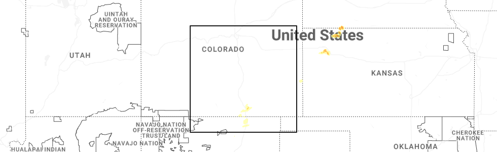
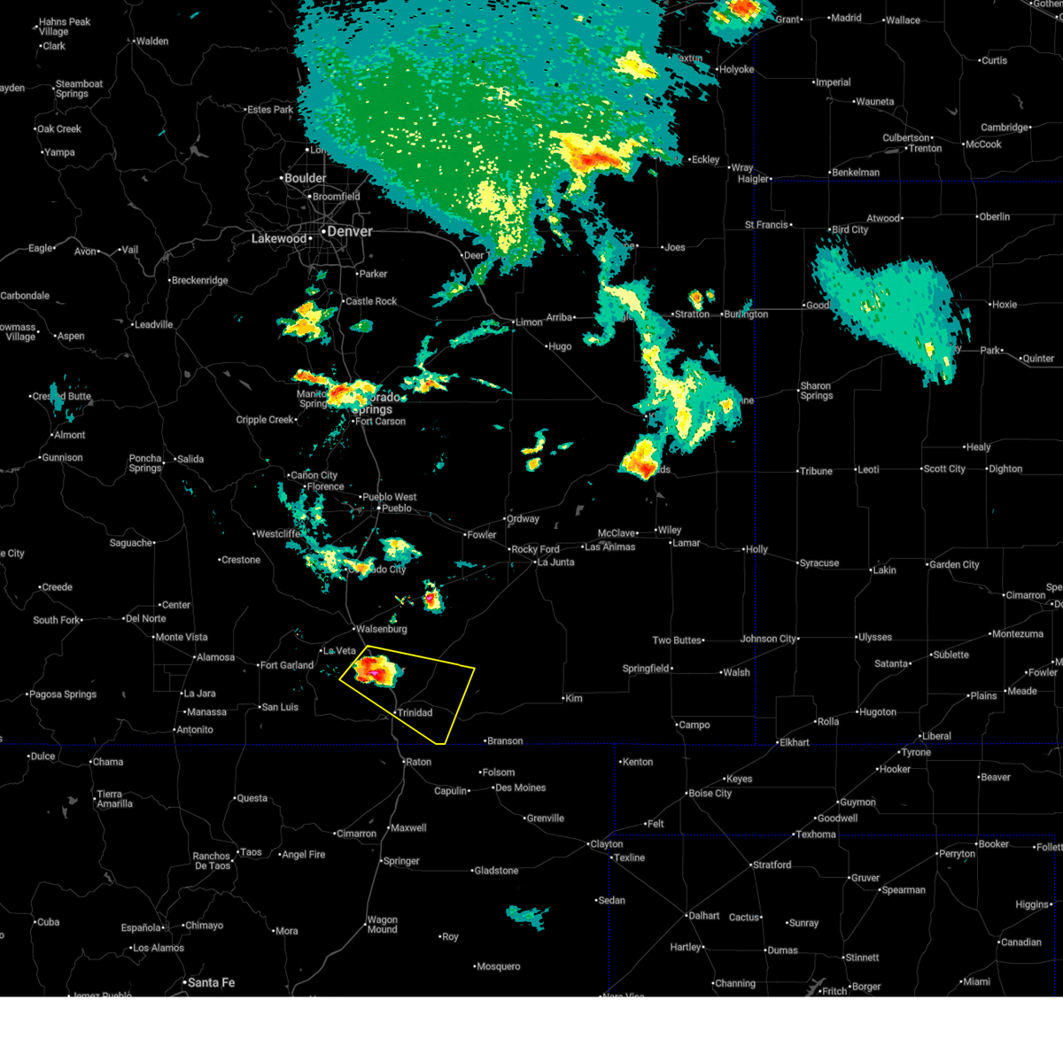
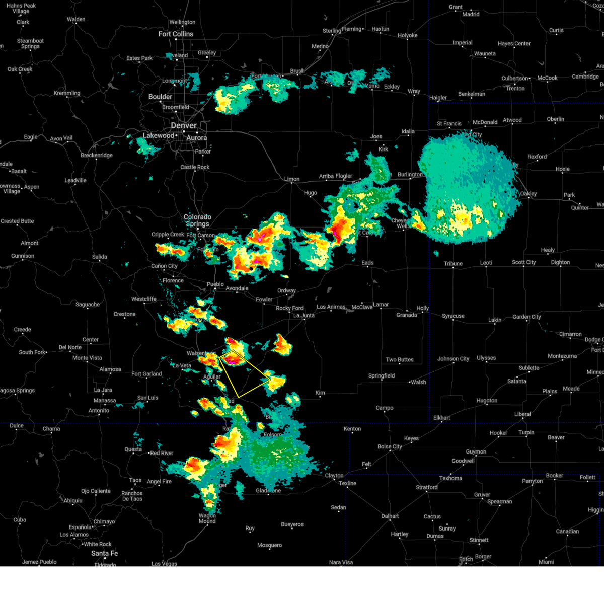
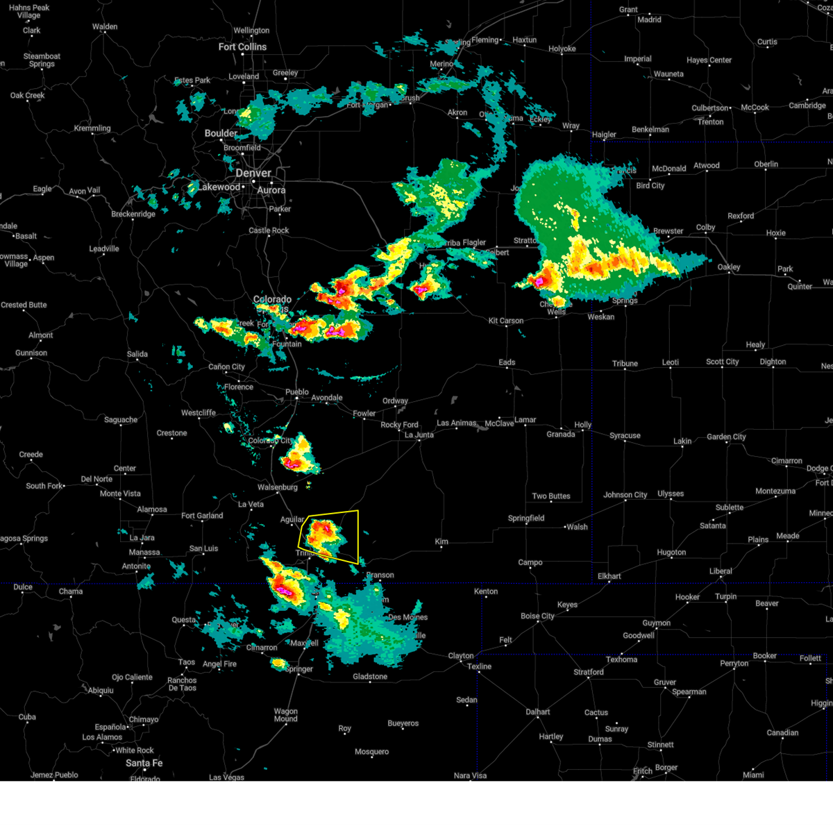
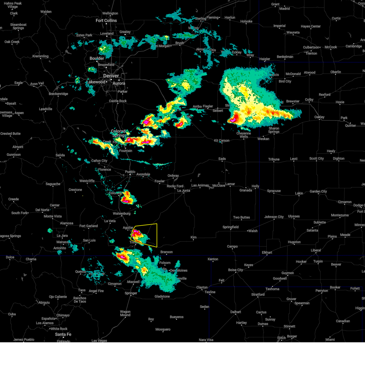
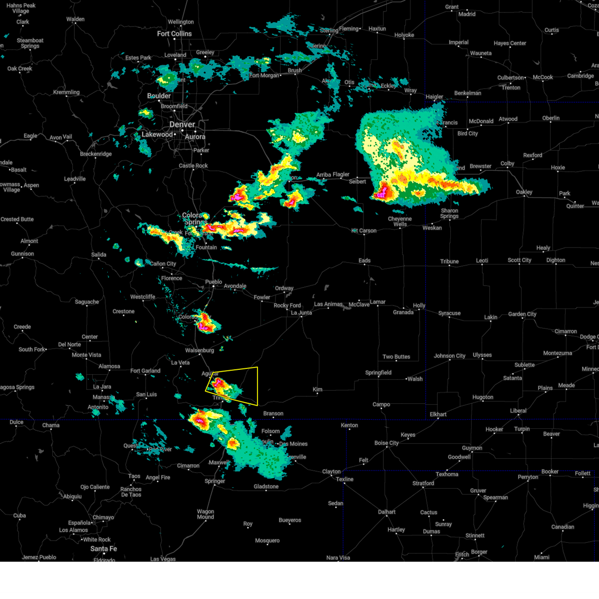
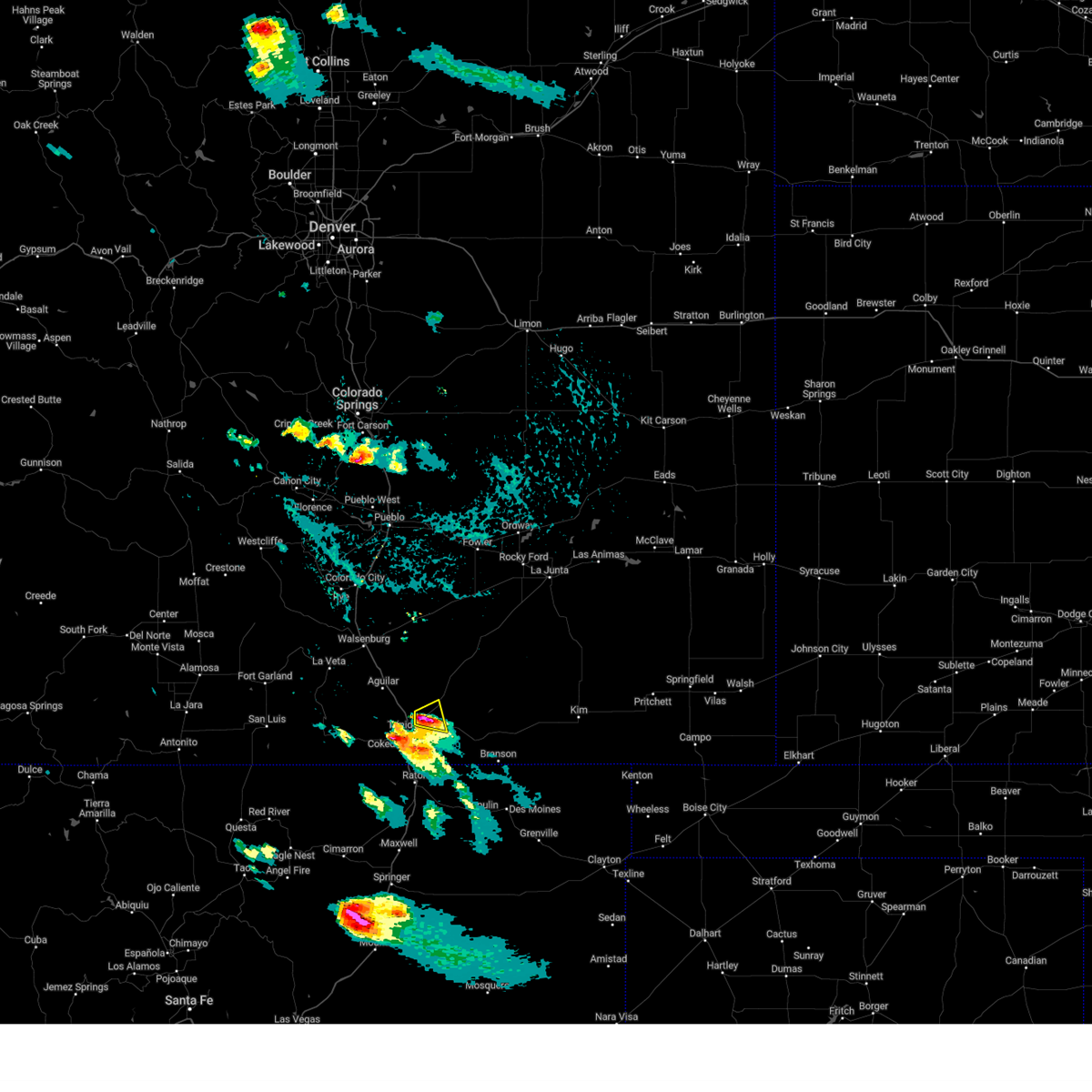
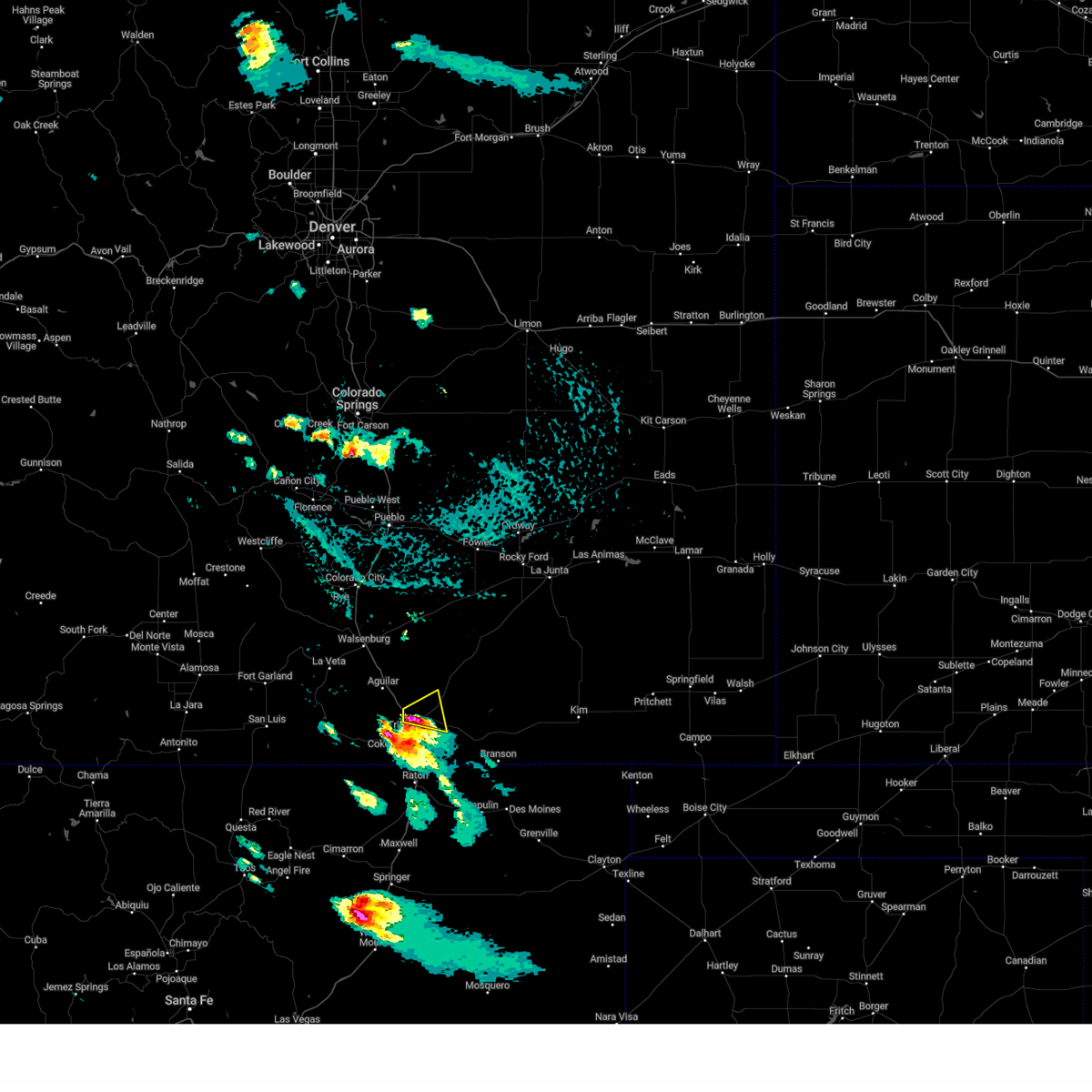
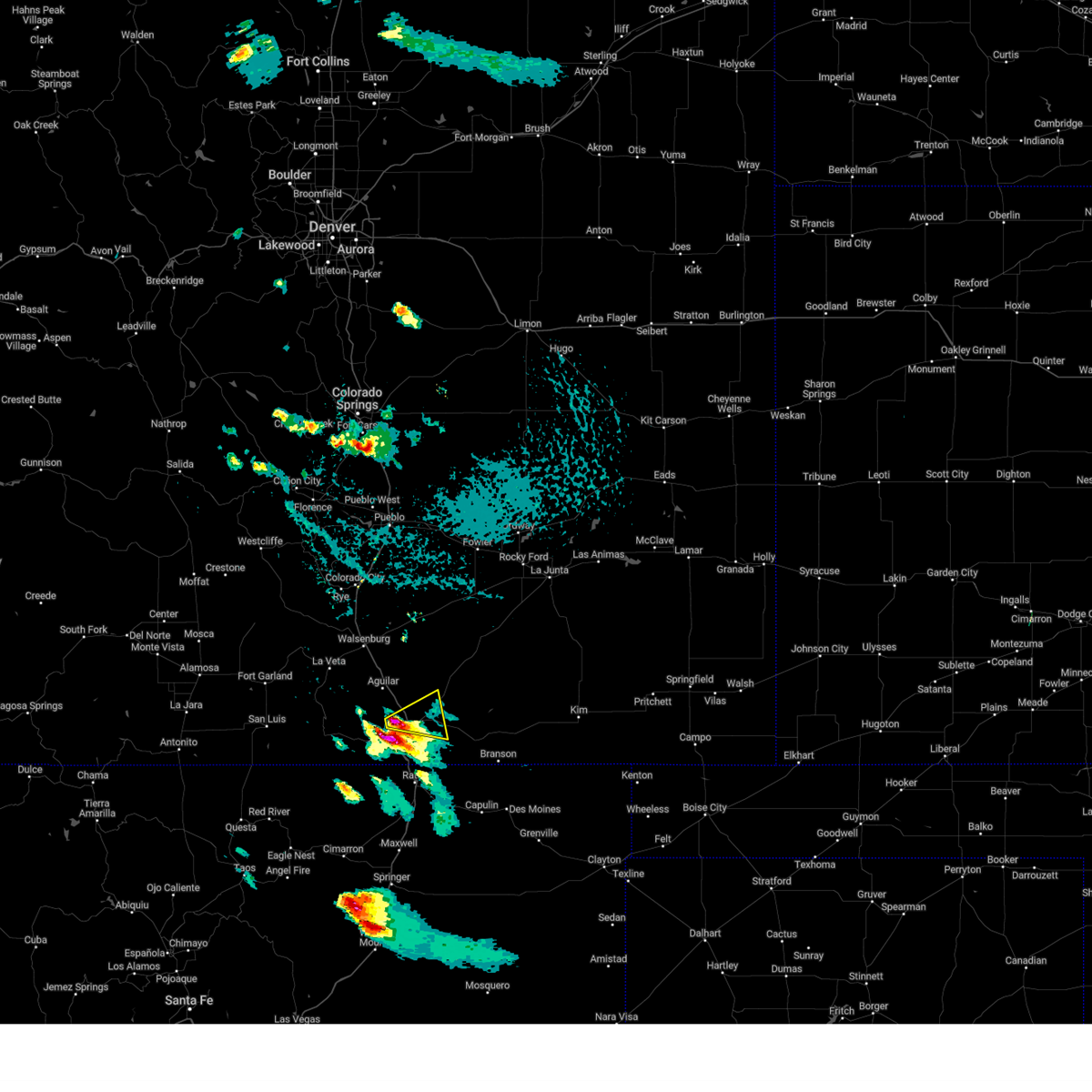
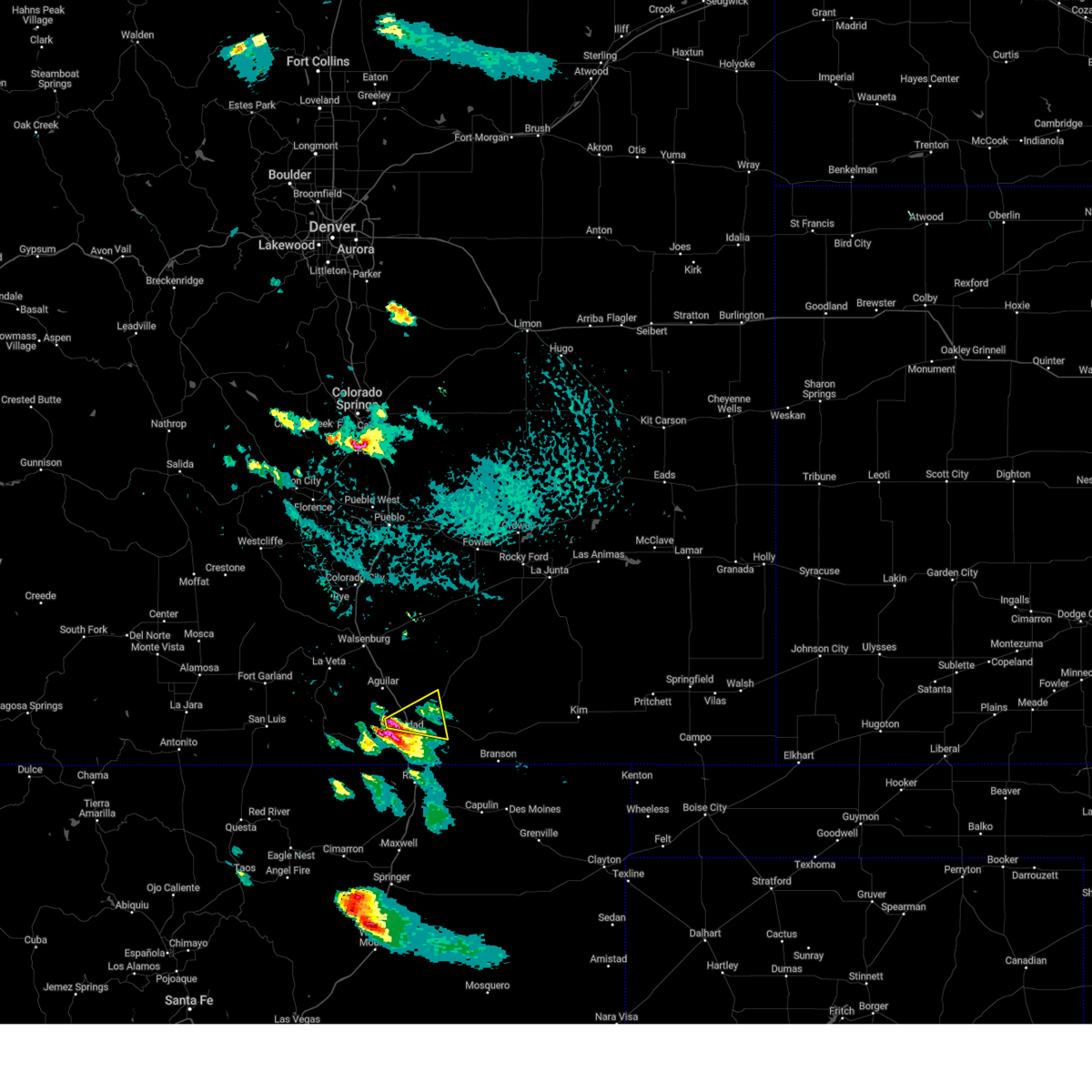
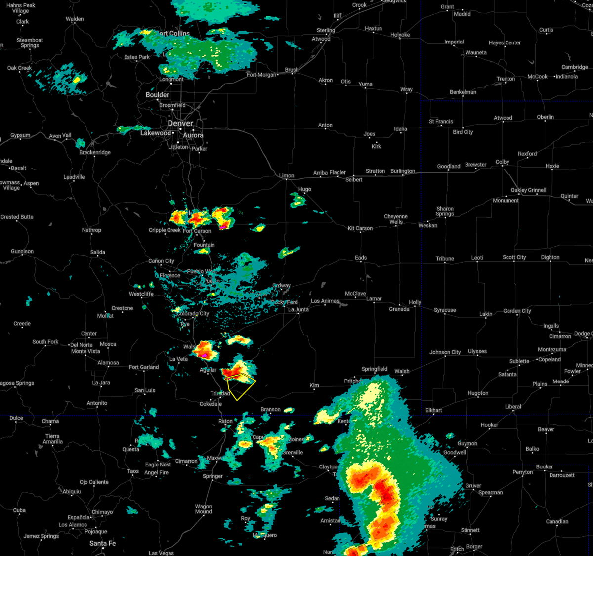
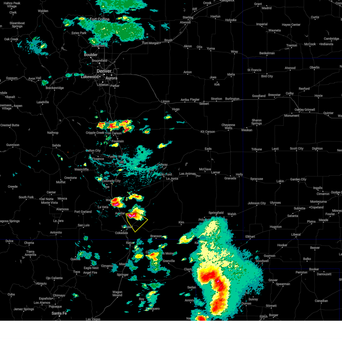
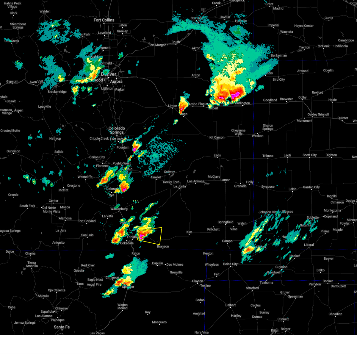
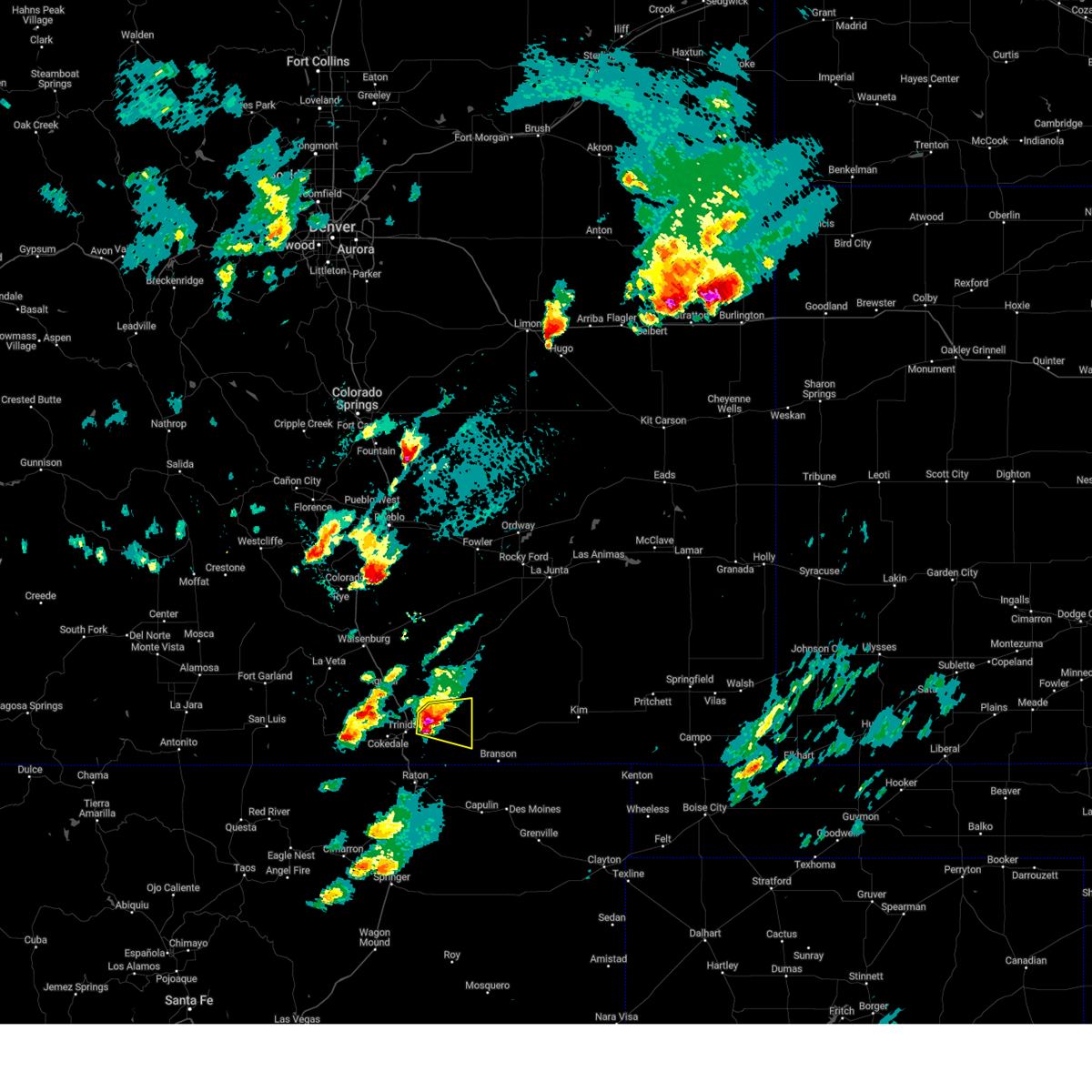
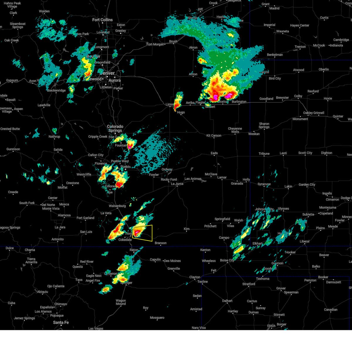
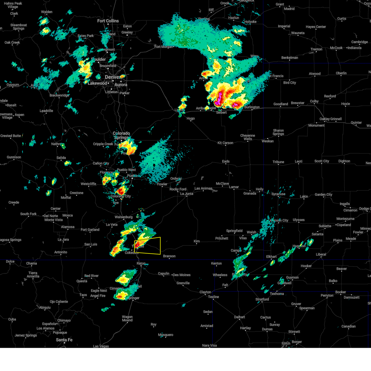
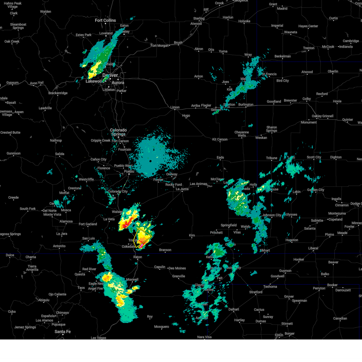
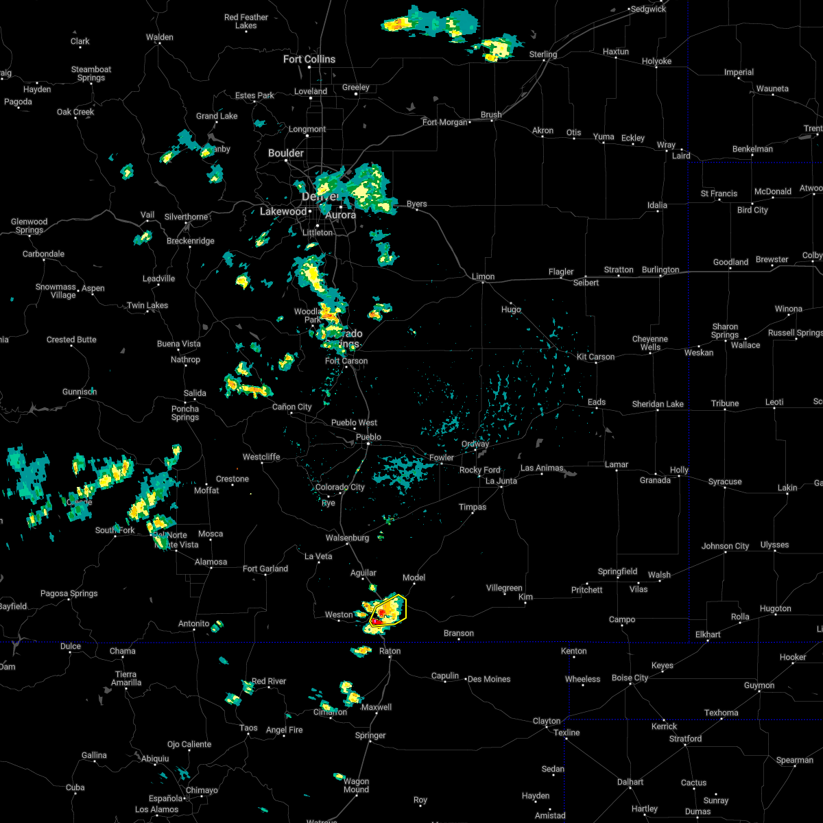
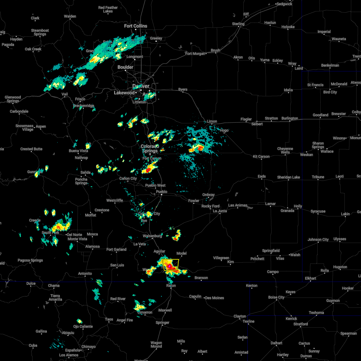
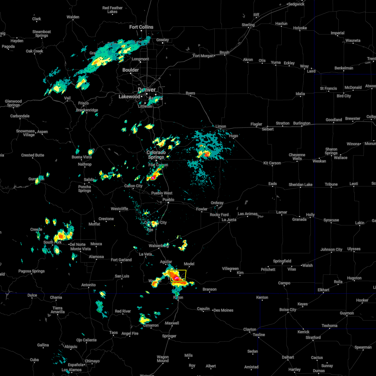
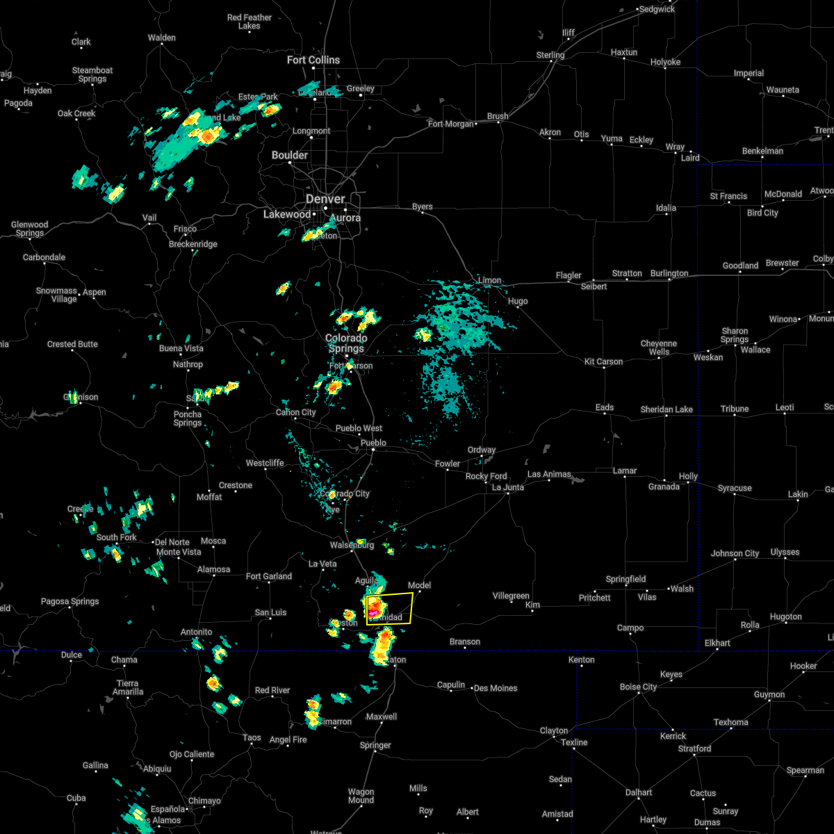
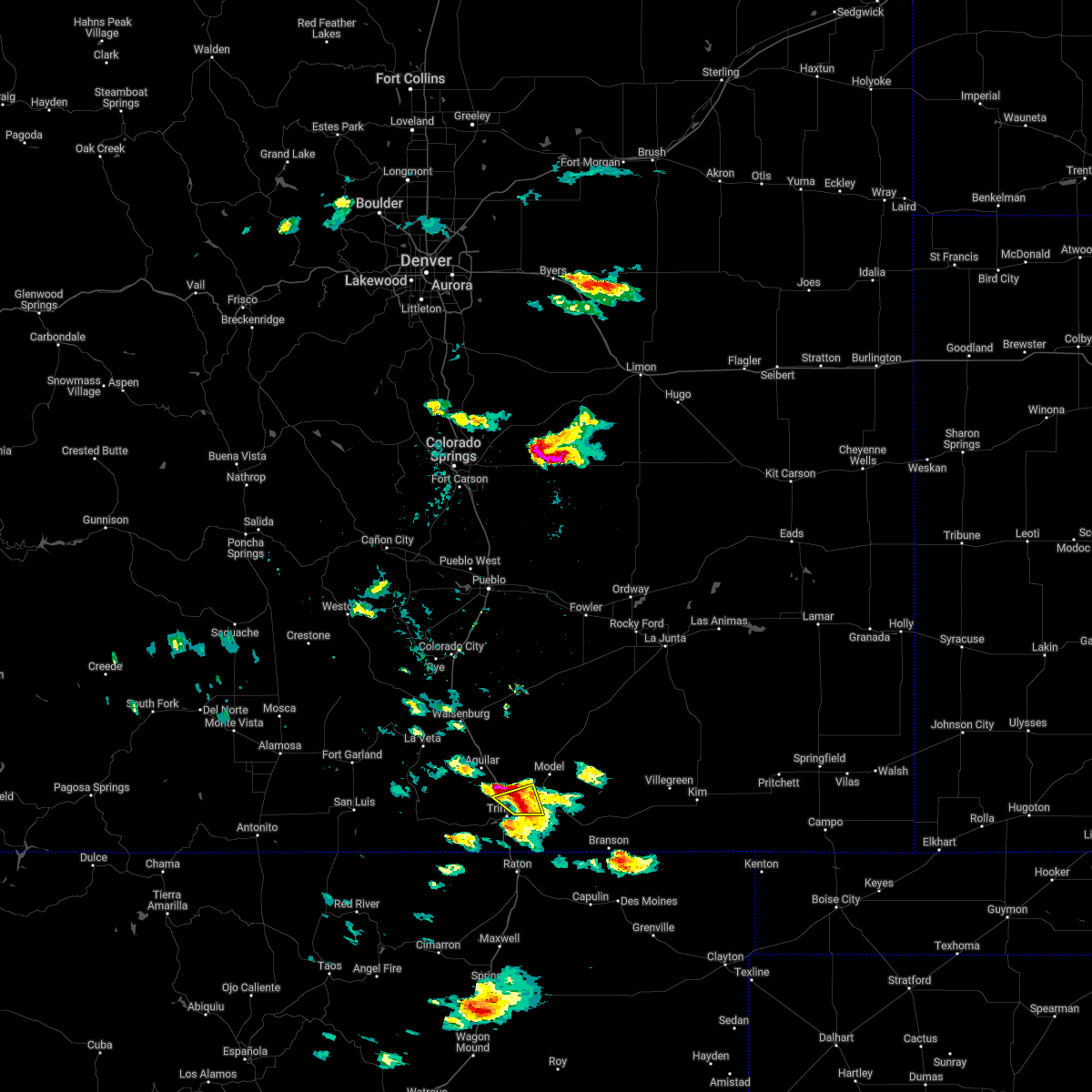
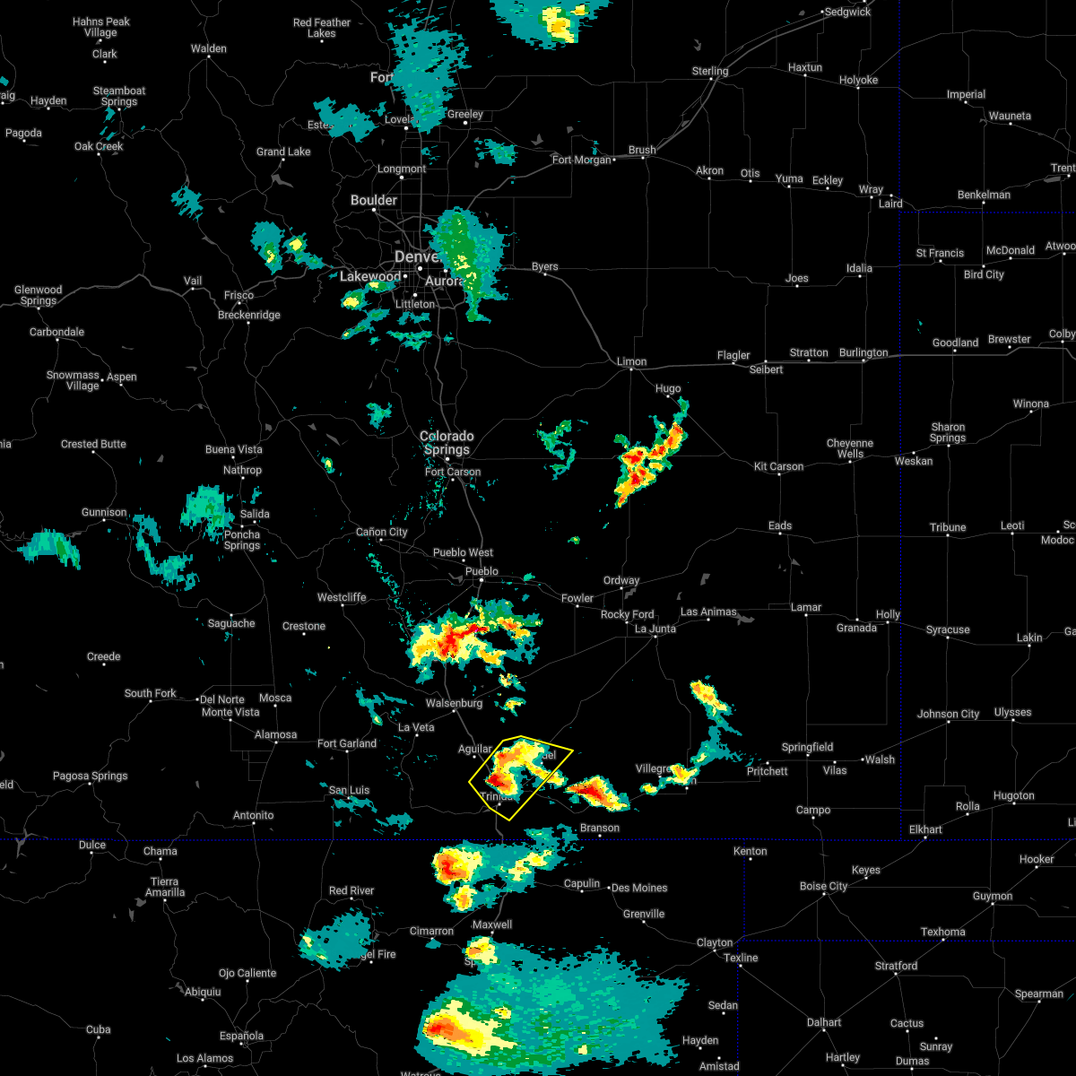
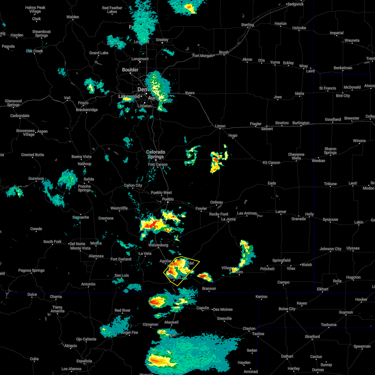
Hail Map for Hoehne, CO
The Hoehne, CO area has had 7 reports of on-the-ground hail by trained spotters, and has been under severe weather warnings 11 times during the past 12 months. Doppler radar has detected hail at or near Hoehne, CO on 50 occasions, including 4 occasions during the past year.
| Name: | Hoehne, CO |
| Where Located: | 68.4 miles S of Pueblo, CO |
| Map: | Google Map for Hoehne, CO |
| Population: | 111 |
| Housing Units: | 51 |
| More Info: | Search Google for Hoehne, CO |
3
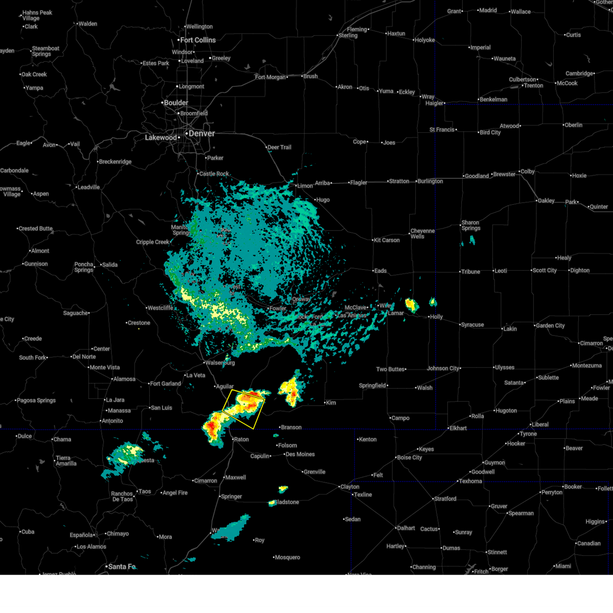
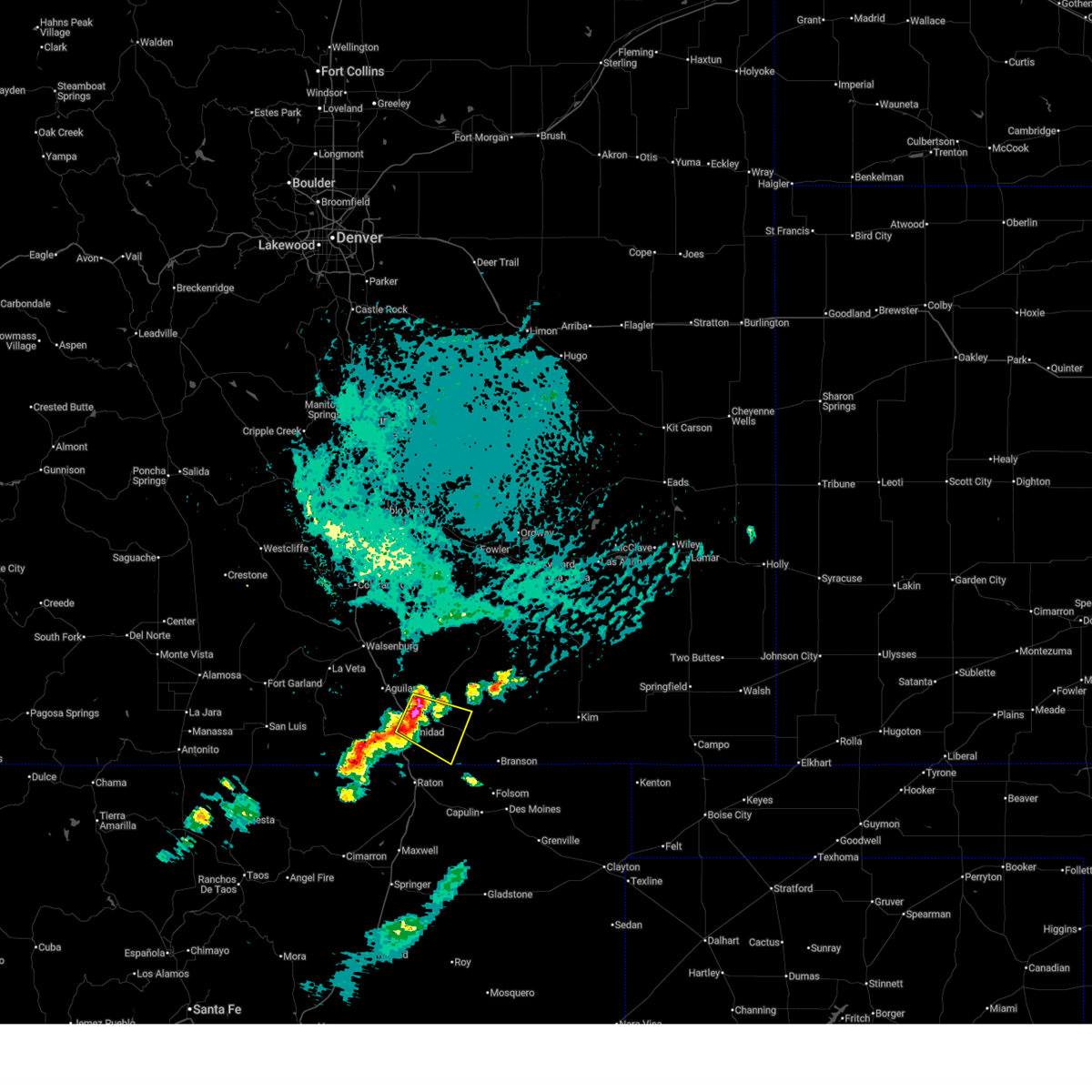
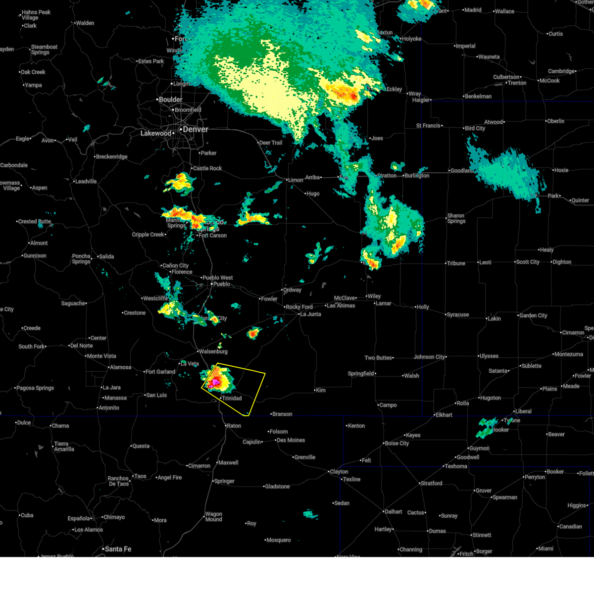
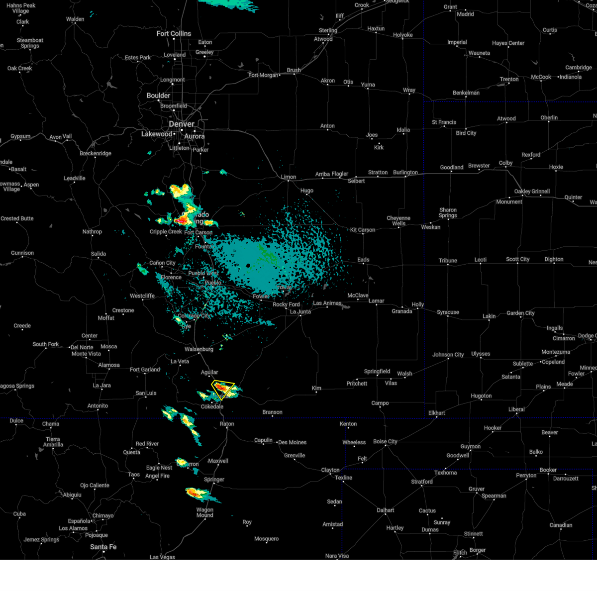
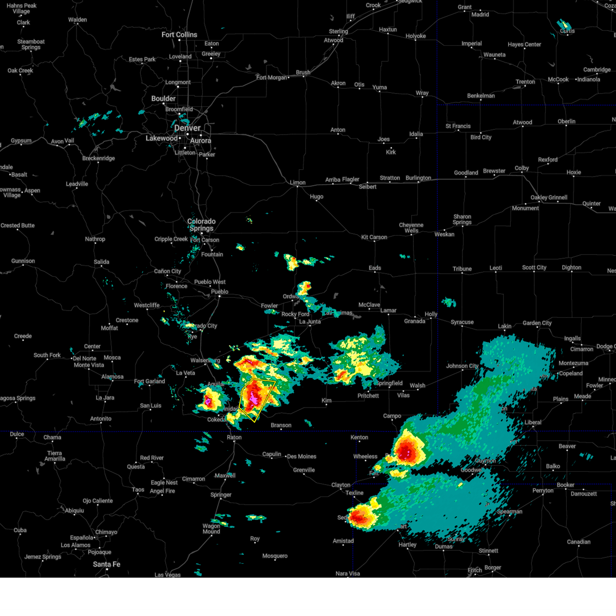
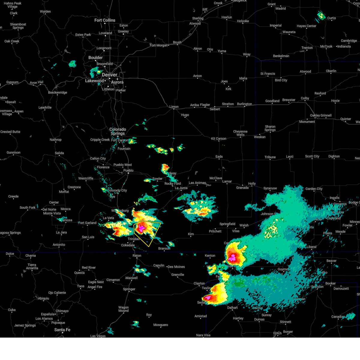
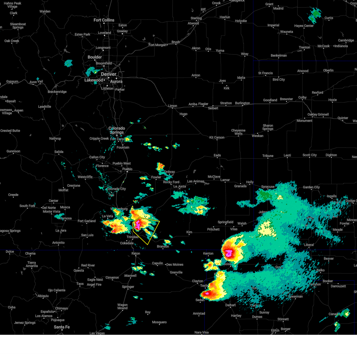
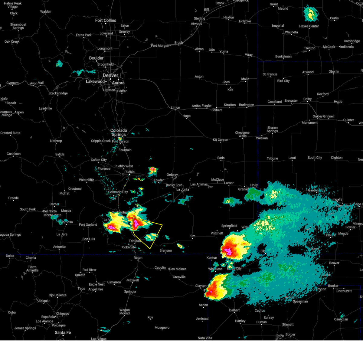
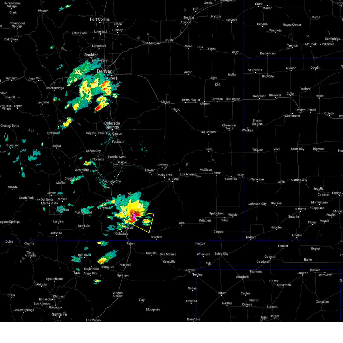
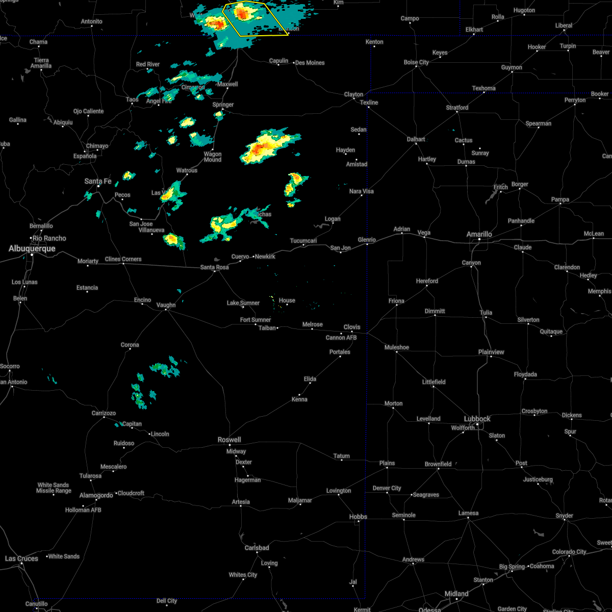
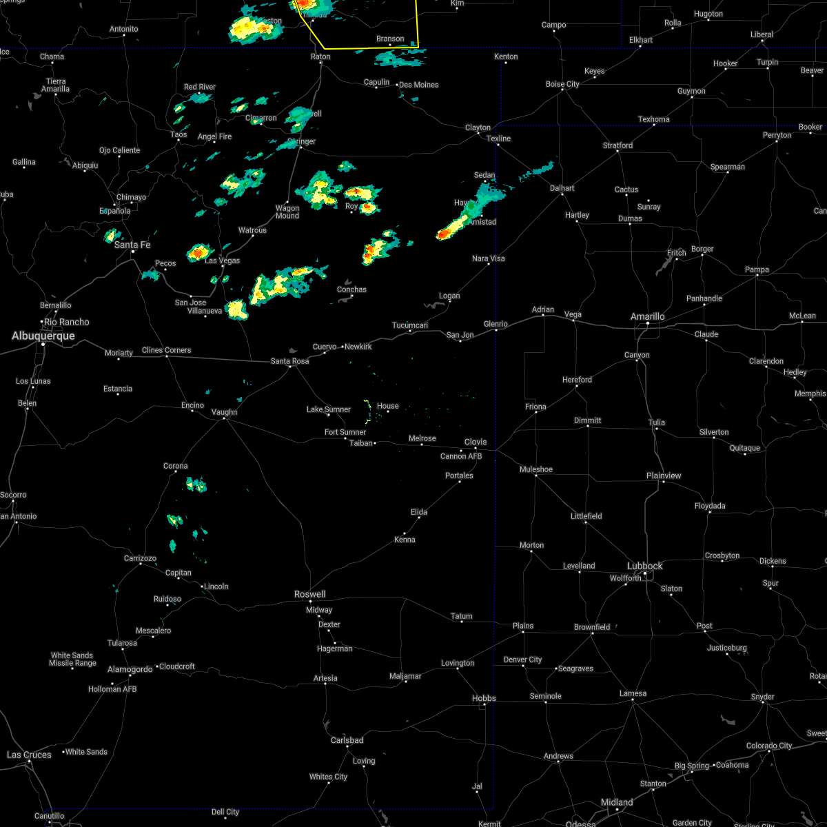
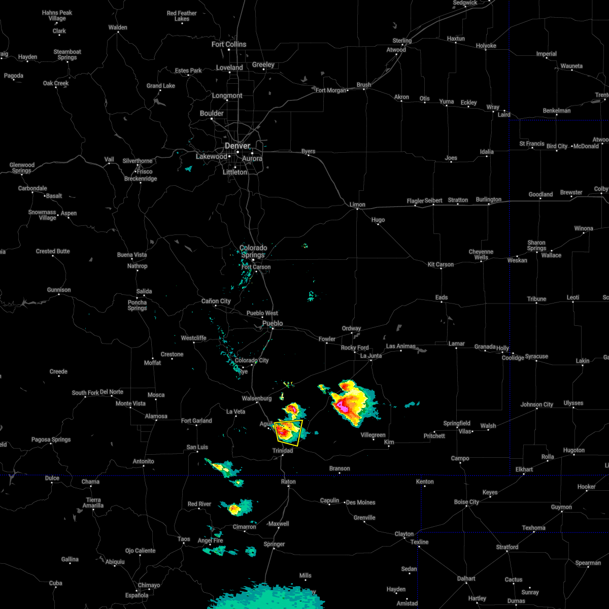
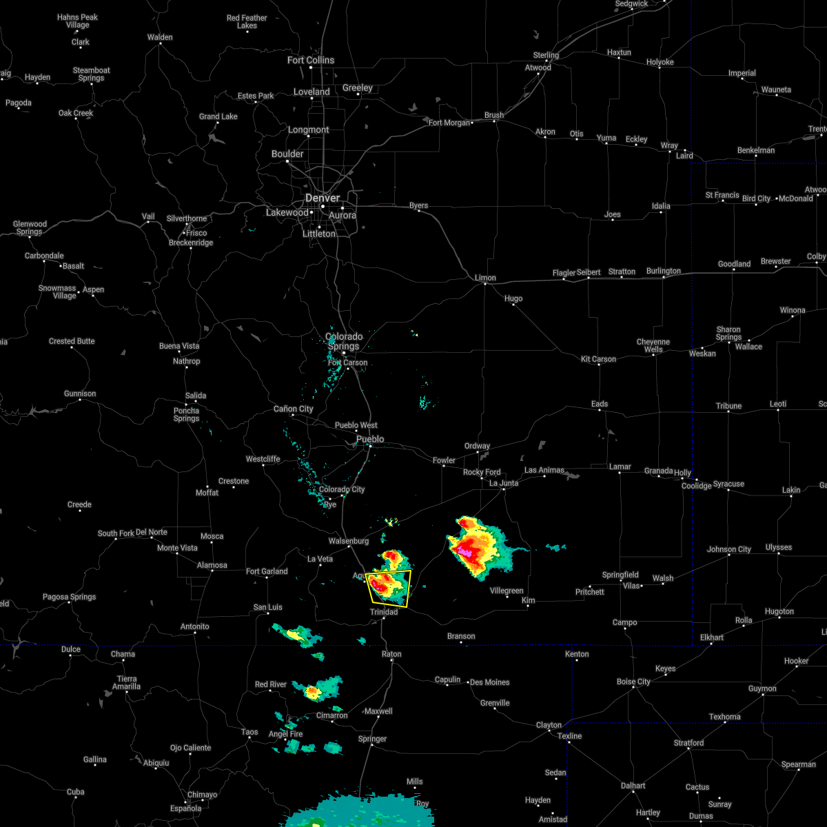
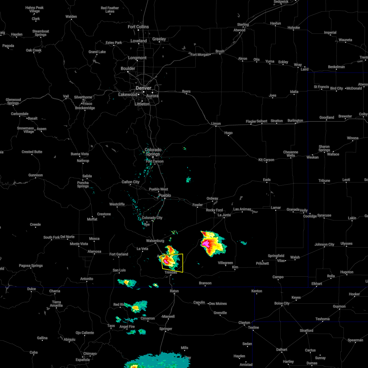
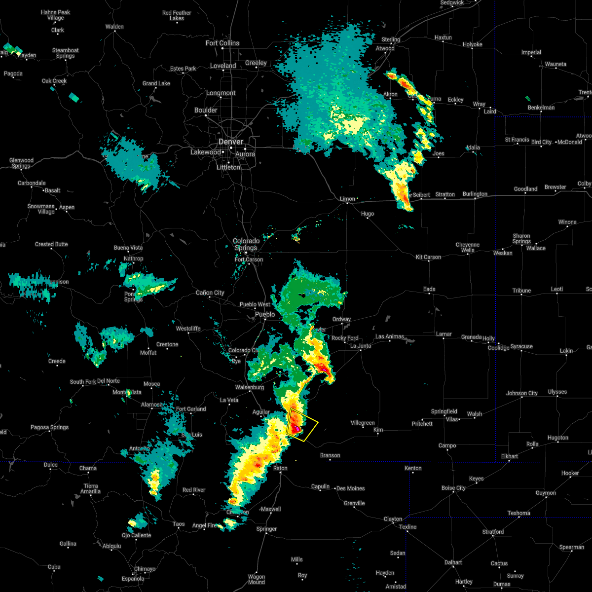
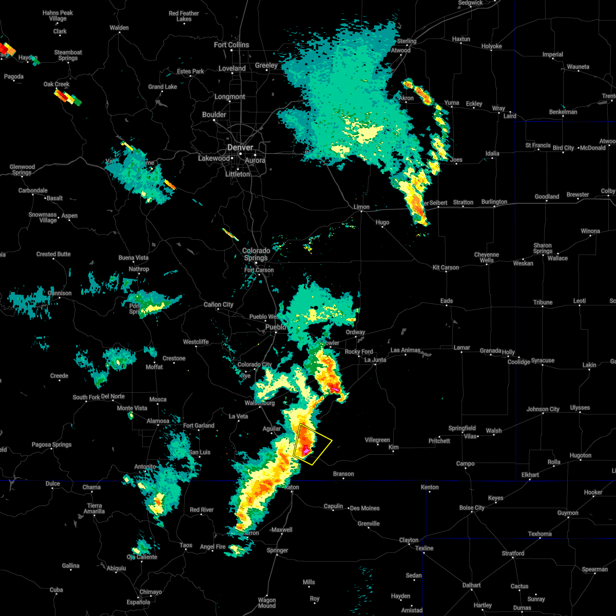
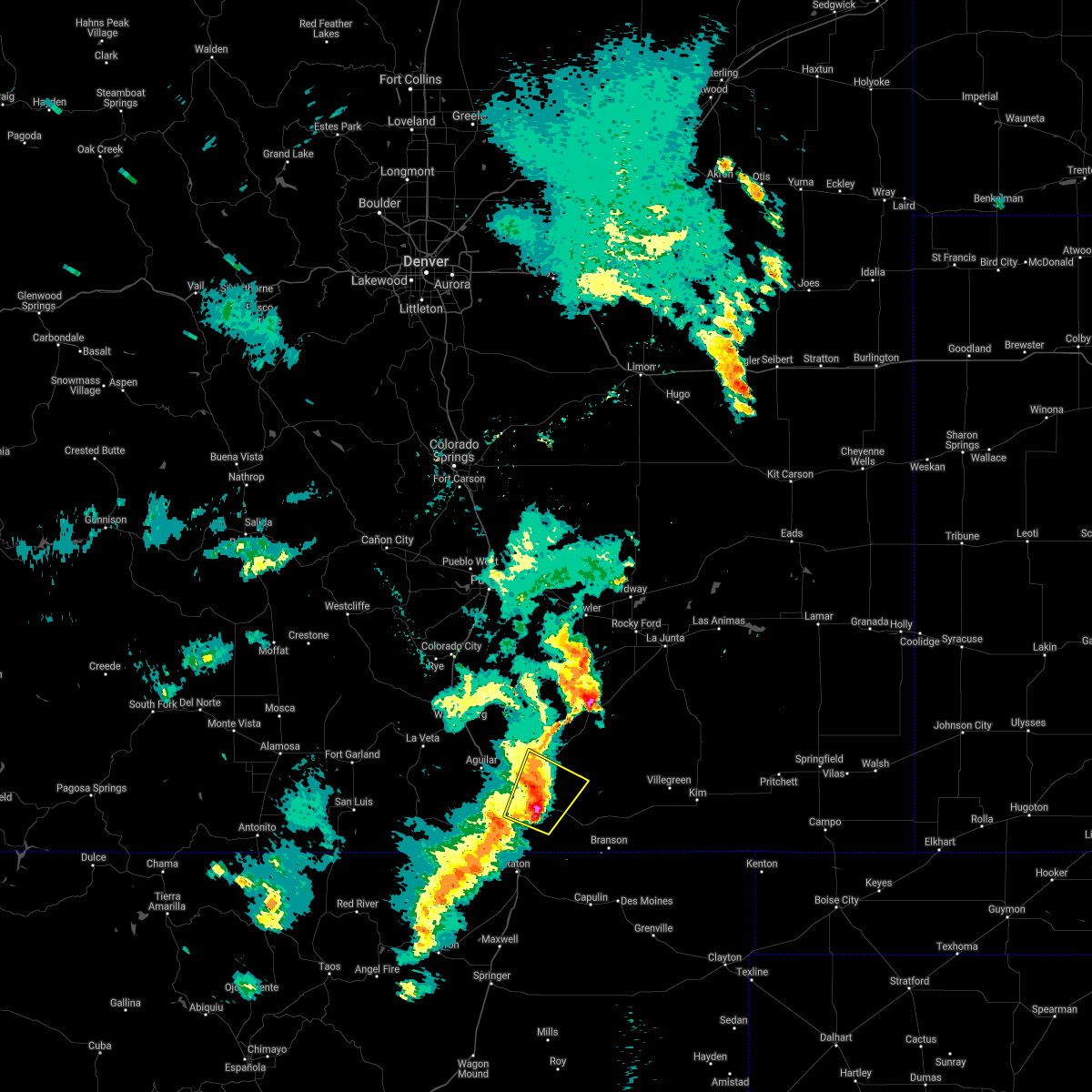
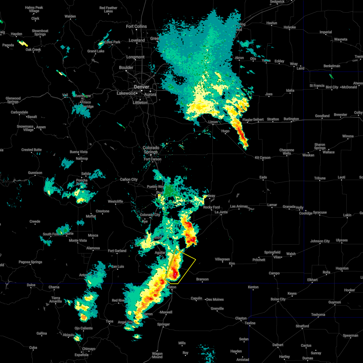
The Top Recent Hail Date for Hoehne, CO is Thursday, June 19, 2025 (3rd out of 50)
Hail and Wind Damage Spotted near Hoehne, CO
| Date / Time | Report Details |
|---|---|
| 6/19/2025 3:28 PM MDT |
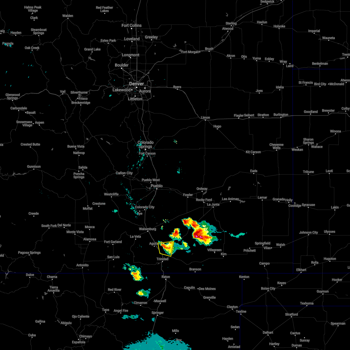
 The storm which prompted the warning has weakened below severe limits, and no longer poses an immediate threat to life or property. therefore, the warning will be allowed to expire. however, small hail and gusty winds are still possible with this thunderstorm. The storm which prompted the warning has weakened below severe limits, and no longer poses an immediate threat to life or property. therefore, the warning will be allowed to expire. however, small hail and gusty winds are still possible with this thunderstorm.
|
| 6/19/2025 3:13 PM MDT |
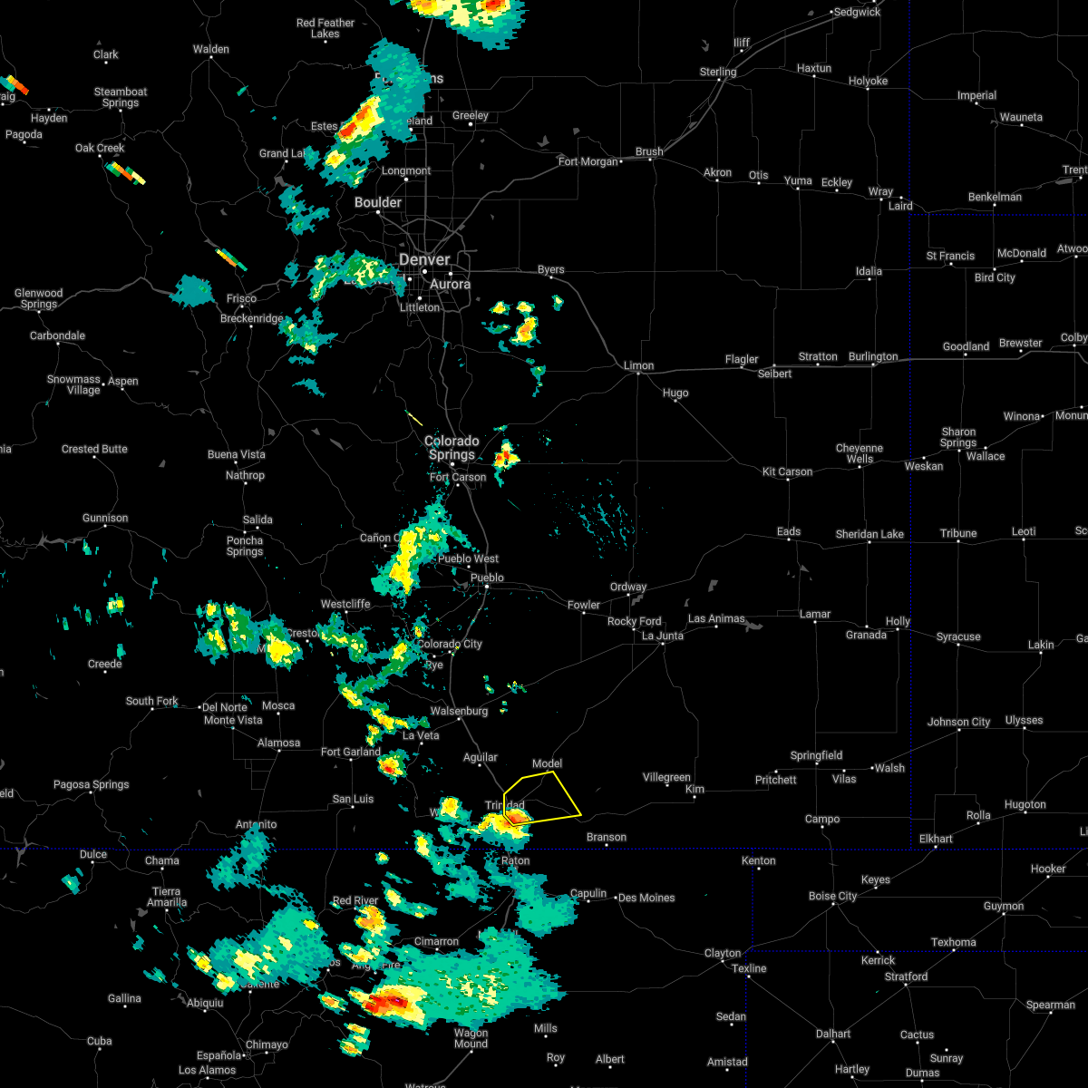
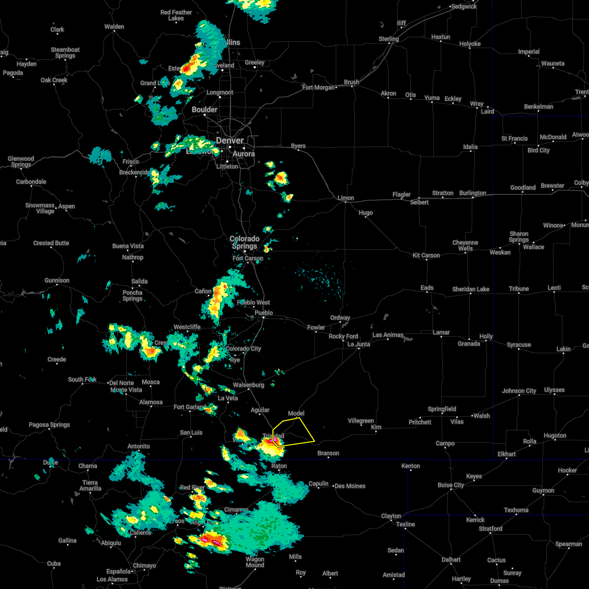
 At 313 pm mdt, a severe thunderstorm was located near model, or 14 miles northeast of trinidad, moving east at 20 mph (radar indicated). Hazards include 60 mph wind gusts and half dollar size hail. Hail damage to vehicles is expected. expect wind damage to roofs, siding, and trees. Locations impacted include, trinidad and hoehne. At 313 pm mdt, a severe thunderstorm was located near model, or 14 miles northeast of trinidad, moving east at 20 mph (radar indicated). Hazards include 60 mph wind gusts and half dollar size hail. Hail damage to vehicles is expected. expect wind damage to roofs, siding, and trees. Locations impacted include, trinidad and hoehne.
|
| 6/19/2025 2:58 PM MDT |
 Svrpub the national weather service in pueblo has issued a * severe thunderstorm warning for, south central las animas county in southeastern colorado, * until 330 pm mdt. * at 257 pm mdt, a severe thunderstorm was located over hoehne, or 7 miles northeast of trinidad, moving southeast at 20 mph (radar indicated). Hazards include 60 mph wind gusts and half dollar size hail. Hail damage to vehicles is expected. Expect wind damage to roofs, siding, and trees. Svrpub the national weather service in pueblo has issued a * severe thunderstorm warning for, south central las animas county in southeastern colorado, * until 330 pm mdt. * at 257 pm mdt, a severe thunderstorm was located over hoehne, or 7 miles northeast of trinidad, moving southeast at 20 mph (radar indicated). Hazards include 60 mph wind gusts and half dollar size hail. Hail damage to vehicles is expected. Expect wind damage to roofs, siding, and trees.
|
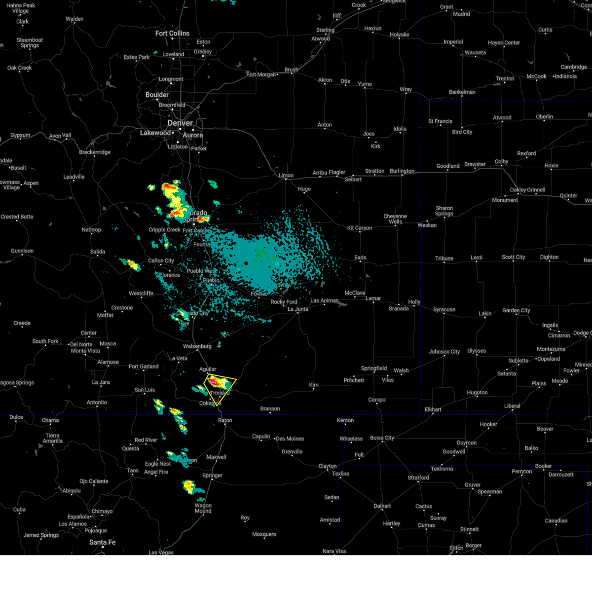
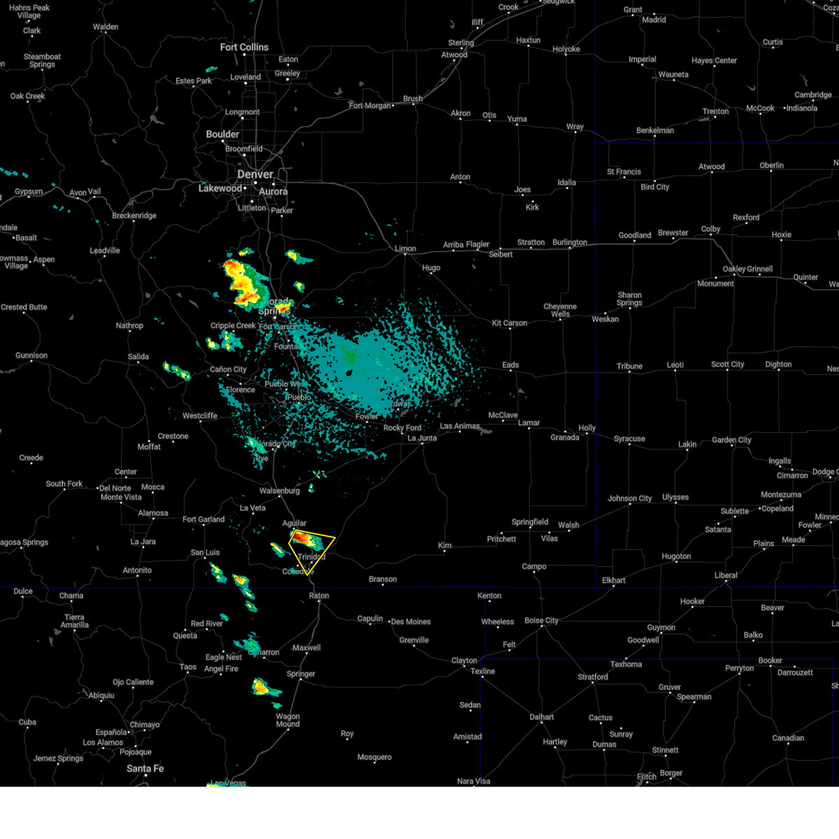
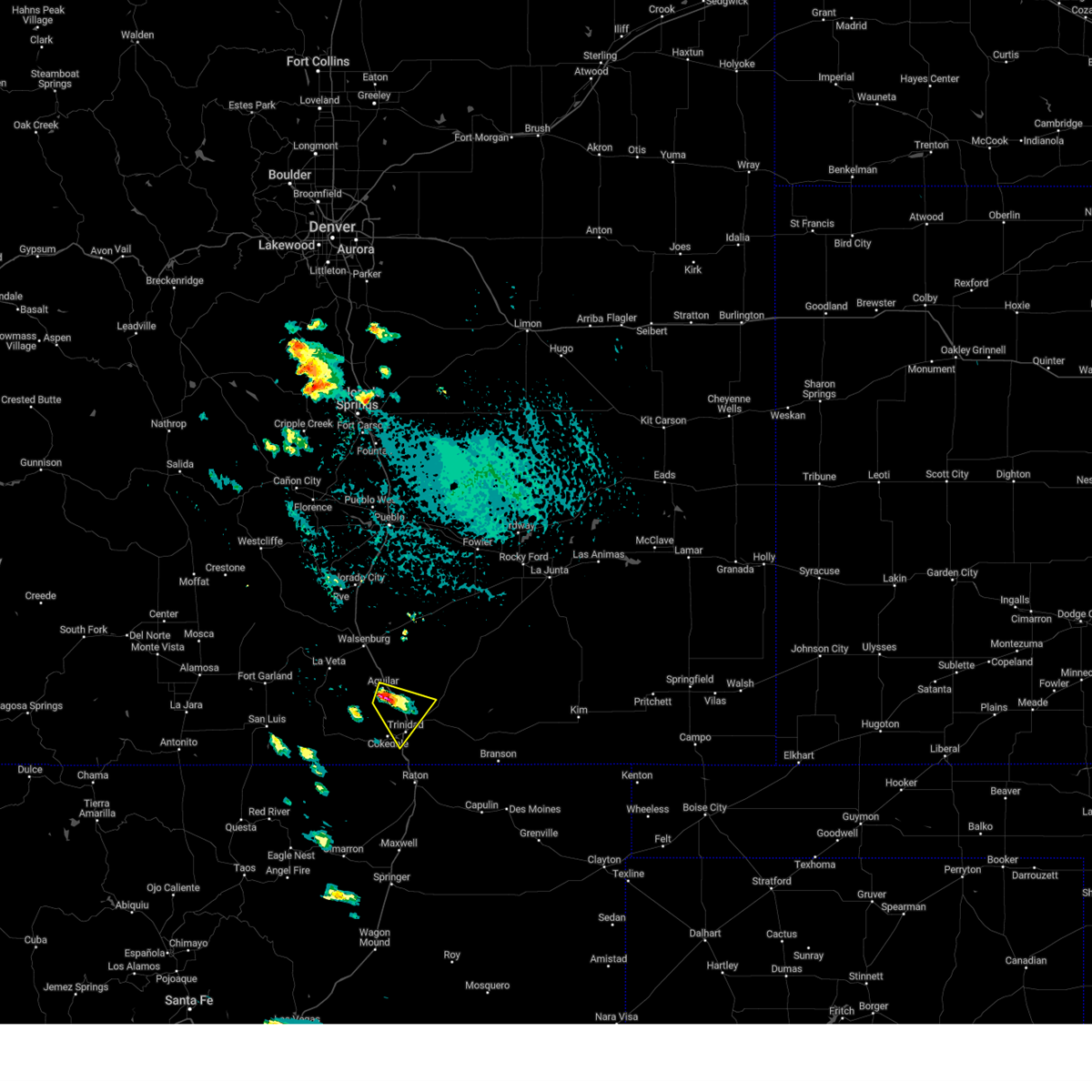
| 6/17/2025 4:41 PM MDT | Svrpub the national weather service in pueblo has issued a * severe thunderstorm warning for, south central las animas county in southeastern colorado, * until 515 pm mdt. * at 441 pm mdt, a severe thunderstorm was located near hoehne, or near trinidad, moving southeast at 20 mph (radar indicated). Hazards include 60 mph wind gusts and half dollar size hail. Hail damage to vehicles is expected. Expect wind damage to roofs, siding, and trees. |
| 6/17/2025 4:21 PM MDT |
 the severe thunderstorm warning has been cancelled and is no longer in effect the severe thunderstorm warning has been cancelled and is no longer in effect
|
| 6/17/2025 4:21 PM MDT |
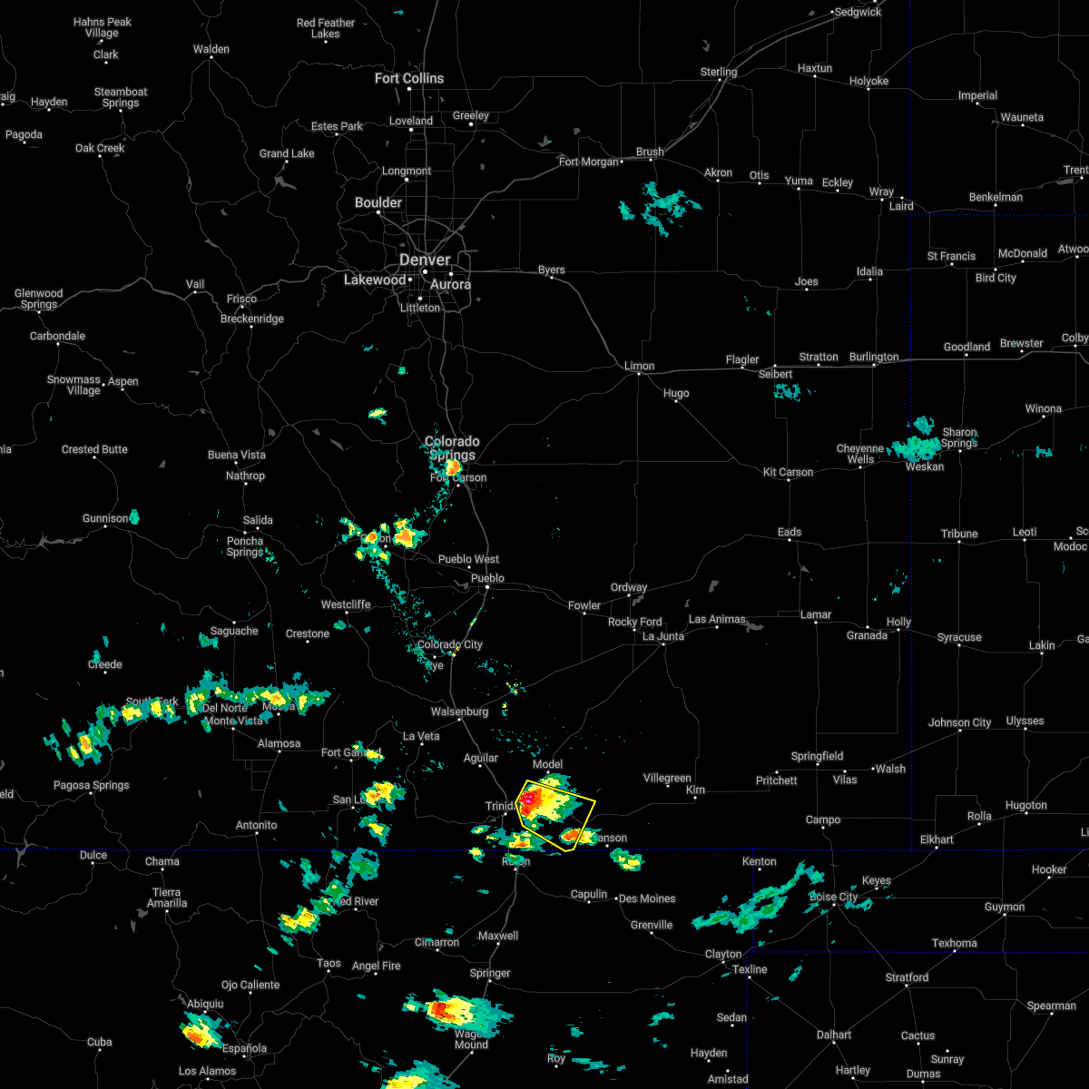
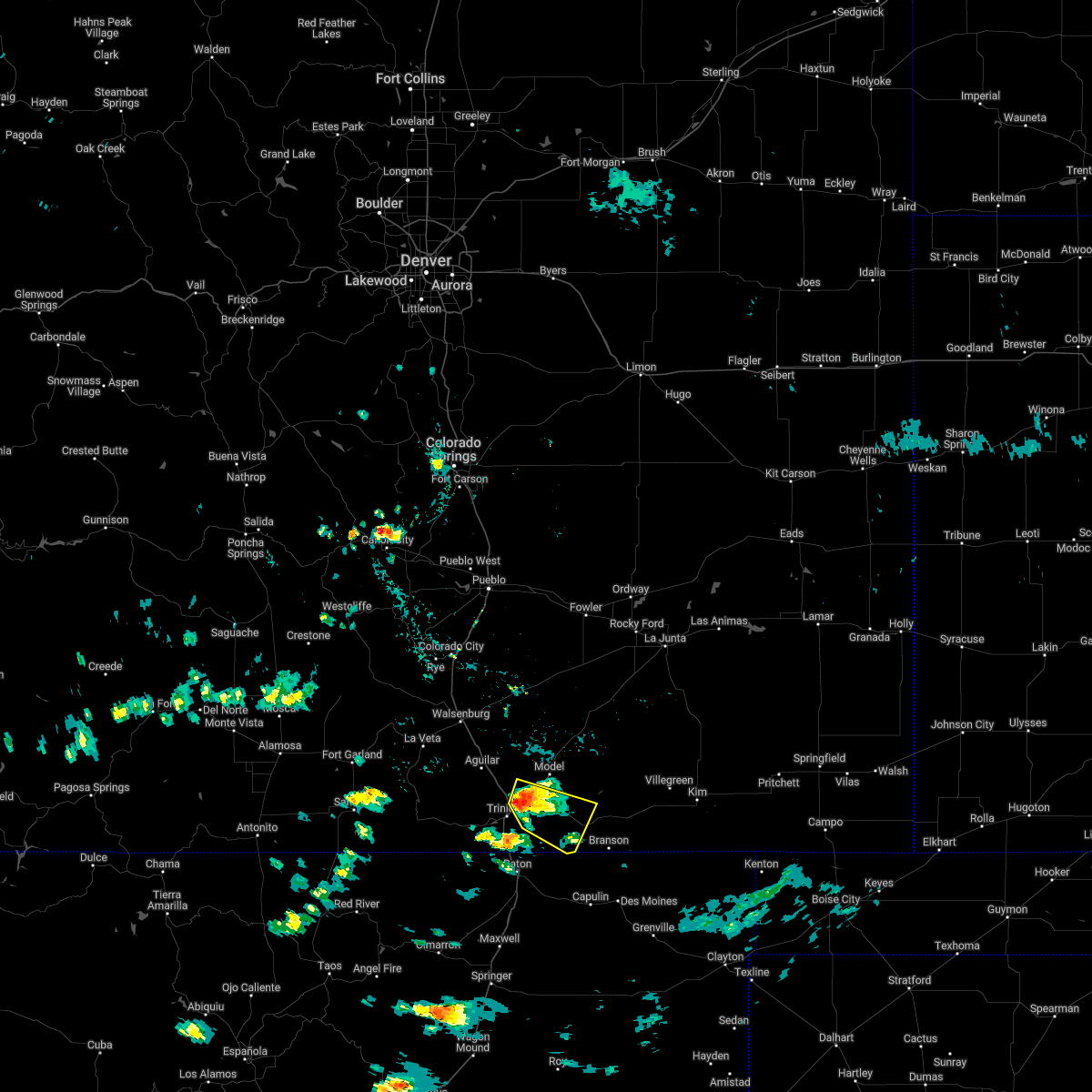
 At 421 pm mdt, a severe thunderstorm was located 8 miles northwest of hoehne, or 10 miles north of trinidad, moving east at 35 mph (radar indicated). Hazards include golf ball size hail and 70 mph wind gusts. People and animals outdoors will be injured. expect hail damage to roofs, siding, windows, and vehicles. expect considerable tree damage. wind damage is also likely to mobile homes, roofs, and outbuildings. Locations impacted include, trinidad, model, hoehne, and tyrone. At 421 pm mdt, a severe thunderstorm was located 8 miles northwest of hoehne, or 10 miles north of trinidad, moving east at 35 mph (radar indicated). Hazards include golf ball size hail and 70 mph wind gusts. People and animals outdoors will be injured. expect hail damage to roofs, siding, windows, and vehicles. expect considerable tree damage. wind damage is also likely to mobile homes, roofs, and outbuildings. Locations impacted include, trinidad, model, hoehne, and tyrone.
|
| 6/17/2025 4:06 PM MDT |
 Svrpub the national weather service in pueblo has issued a * severe thunderstorm warning for, south central huerfano county in southeastern colorado, southwestern las animas county in southeastern colorado, * until 445 pm mdt. * at 405 pm mdt, a severe thunderstorm was located over aguilar, or 16 miles northwest of trinidad, moving east at 40 mph (radar indicated). Hazards include ping pong ball size hail and 60 mph wind gusts. People and animals outdoors will be injured. expect hail damage to roofs, siding, windows, and vehicles. Expect wind damage to roofs, siding, and trees. Svrpub the national weather service in pueblo has issued a * severe thunderstorm warning for, south central huerfano county in southeastern colorado, southwestern las animas county in southeastern colorado, * until 445 pm mdt. * at 405 pm mdt, a severe thunderstorm was located over aguilar, or 16 miles northwest of trinidad, moving east at 40 mph (radar indicated). Hazards include ping pong ball size hail and 60 mph wind gusts. People and animals outdoors will be injured. expect hail damage to roofs, siding, windows, and vehicles. Expect wind damage to roofs, siding, and trees.
|
| 7/7/2024 6:55 PM MDT |
 Svrpub the national weather service in pueblo has issued a * severe thunderstorm warning for, eastern huerfano county in southeastern colorado, central las animas county in southeastern colorado, * until 730 pm mdt. * at 655 pm mdt, a severe thunderstorm was located 13 miles northwest of tyrone, or 27 miles north of trinidad, moving southeast at 35 mph (radar indicated). Hazards include ping pong ball size hail and 60 mph wind gusts. People and animals outdoors will be injured. expect hail damage to roofs, siding, windows, and vehicles. Expect wind damage to roofs, siding, and trees. Svrpub the national weather service in pueblo has issued a * severe thunderstorm warning for, eastern huerfano county in southeastern colorado, central las animas county in southeastern colorado, * until 730 pm mdt. * at 655 pm mdt, a severe thunderstorm was located 13 miles northwest of tyrone, or 27 miles north of trinidad, moving southeast at 35 mph (radar indicated). Hazards include ping pong ball size hail and 60 mph wind gusts. People and animals outdoors will be injured. expect hail damage to roofs, siding, windows, and vehicles. Expect wind damage to roofs, siding, and trees.
|
| 7/7/2024 6:11 PM MDT |
 The storm which prompted the warning has weakened below severe limits, and no longer poses an immediate threat to life or property. therefore, the warning will be allowed to expire. however, small hail and heavy rain are still possible with this thunderstorm. a severe thunderstorm watch remains in effect until 1100 pm mdt for southeastern colorado. The storm which prompted the warning has weakened below severe limits, and no longer poses an immediate threat to life or property. therefore, the warning will be allowed to expire. however, small hail and heavy rain are still possible with this thunderstorm. a severe thunderstorm watch remains in effect until 1100 pm mdt for southeastern colorado.
|
| 7/7/2024 6:03 PM MDT |
 At 603 pm mdt, a severe thunderstorm was located near hoehne, or 16 miles northeast of trinidad, moving east at 35 mph (radar indicated). Hazards include 60 mph wind gusts and quarter size hail. Hail damage to vehicles is expected. expect wind damage to roofs, siding, and trees. Locations impacted include, trinidad, model, hoehne, and tyrone. At 603 pm mdt, a severe thunderstorm was located near hoehne, or 16 miles northeast of trinidad, moving east at 35 mph (radar indicated). Hazards include 60 mph wind gusts and quarter size hail. Hail damage to vehicles is expected. expect wind damage to roofs, siding, and trees. Locations impacted include, trinidad, model, hoehne, and tyrone.
|
| 7/7/2024 5:49 PM MDT |
 Svrpub the national weather service in pueblo has issued a * severe thunderstorm warning for, central las animas county in southeastern colorado, * until 615 pm mdt. * at 548 pm mdt, a severe thunderstorm was located 8 miles southeast of aguilar, or 12 miles north of trinidad, moving east at 35 mph (radar indicated). Hazards include 60 mph wind gusts and quarter size hail. Hail damage to vehicles is expected. Expect wind damage to roofs, siding, and trees. Svrpub the national weather service in pueblo has issued a * severe thunderstorm warning for, central las animas county in southeastern colorado, * until 615 pm mdt. * at 548 pm mdt, a severe thunderstorm was located 8 miles southeast of aguilar, or 12 miles north of trinidad, moving east at 35 mph (radar indicated). Hazards include 60 mph wind gusts and quarter size hail. Hail damage to vehicles is expected. Expect wind damage to roofs, siding, and trees.
|
| 8/6/2023 5:32 PM MDT |
 At 530 pm mdt, a severe thunderstorm was located near starkville, or near trinidad, moving southeast at 30 mph (radar indicated). Hazards include ping pong ball size hail and 60 mph wind gusts. People and animals outdoors will be injured. expect hail damage to roofs, siding, windows, and vehicles. expect wind damage to roofs, siding, and trees. Locations impacted include, starkville, and raton pass. At 530 pm mdt, a severe thunderstorm was located near starkville, or near trinidad, moving southeast at 30 mph (radar indicated). Hazards include ping pong ball size hail and 60 mph wind gusts. People and animals outdoors will be injured. expect hail damage to roofs, siding, windows, and vehicles. expect wind damage to roofs, siding, and trees. Locations impacted include, starkville, and raton pass.
|
| 8/6/2023 5:18 PM MDT |
 At 518 pm mdt, a severe thunderstorm was located over starkville, or near trinidad, moving east at 25 mph (radar indicated). Hazards include 60 mph wind gusts and half dollar size hail. Hail damage to vehicles is expected. Expect wind damage to roofs, siding, and trees. At 518 pm mdt, a severe thunderstorm was located over starkville, or near trinidad, moving east at 25 mph (radar indicated). Hazards include 60 mph wind gusts and half dollar size hail. Hail damage to vehicles is expected. Expect wind damage to roofs, siding, and trees.
|
| 7/25/2023 1:57 PM MDT |
 The severe thunderstorm warning for southwestern otero, southeastern huerfano and western las animas counties will expire at 200 pm mdt, the storm which prompted the warning has weakened below severe limits, and no longer poses an immediate threat to life or property. therefore, the warning will be allowed to expire. however gusty winds are still possible with this thunderstorm. The severe thunderstorm warning for southwestern otero, southeastern huerfano and western las animas counties will expire at 200 pm mdt, the storm which prompted the warning has weakened below severe limits, and no longer poses an immediate threat to life or property. therefore, the warning will be allowed to expire. however gusty winds are still possible with this thunderstorm.
|
| 7/25/2023 1:47 PM MDT |
 At 146 pm mdt, a severe thunderstorm was located 11 miles northwest of trinchera, or 16 miles east of trinidad, moving east at 15 mph (trinidad airport equipment reported). Hazards include 60 mph wind gusts. Expect damage to roofs, siding, and trees. locations impacted include, trinidad, aguilar, cokedale, starkville, gulnare, raton pass, boncarbo, model, hoehne, thatcher, tyrone and trinchera. hail threat, radar indicated max hail size, <. 75 in wind threat, observed max wind gust, 60 mph. At 146 pm mdt, a severe thunderstorm was located 11 miles northwest of trinchera, or 16 miles east of trinidad, moving east at 15 mph (trinidad airport equipment reported). Hazards include 60 mph wind gusts. Expect damage to roofs, siding, and trees. locations impacted include, trinidad, aguilar, cokedale, starkville, gulnare, raton pass, boncarbo, model, hoehne, thatcher, tyrone and trinchera. hail threat, radar indicated max hail size, <. 75 in wind threat, observed max wind gust, 60 mph.
|
| 7/25/2023 1:31 PM MDT |
 At 130 pm mdt, a severe thunderstorm was located 12 miles northeast of sugarite canyon state park, or 12 miles east of trinidad, moving east at 15 mph (trinidad airport equipment reported). Hazards include 60 mph wind gusts. expect damage to roofs, siding, and trees At 130 pm mdt, a severe thunderstorm was located 12 miles northeast of sugarite canyon state park, or 12 miles east of trinidad, moving east at 15 mph (trinidad airport equipment reported). Hazards include 60 mph wind gusts. expect damage to roofs, siding, and trees
|
| 7/20/2023 2:45 PM MDT |
 At 245 pm mdt, severe thunderstorms were located along a line extending from near gulnare to near boncarbo to 11 miles southeast of stonewall, moving east at 20 mph (radar indicated). Hazards include 60 mph wind gusts and quarter size hail. Hail damage to vehicles is expected. expect wind damage to roofs, siding, and trees. locations impacted include, trinidad, aguilar, cokedale, starkville, gulnare, boncarbo, segundo, hoehne and weston. hail threat, radar indicated max hail size, 1. 00 in wind threat, radar indicated max wind gust, 60 mph. At 245 pm mdt, severe thunderstorms were located along a line extending from near gulnare to near boncarbo to 11 miles southeast of stonewall, moving east at 20 mph (radar indicated). Hazards include 60 mph wind gusts and quarter size hail. Hail damage to vehicles is expected. expect wind damage to roofs, siding, and trees. locations impacted include, trinidad, aguilar, cokedale, starkville, gulnare, boncarbo, segundo, hoehne and weston. hail threat, radar indicated max hail size, 1. 00 in wind threat, radar indicated max wind gust, 60 mph.
|
| 7/20/2023 2:25 PM MDT |
 At 225 pm mdt, severe thunderstorms were located along a line extending from near gulnare to 8 miles northwest of segundo to 11 miles south of stonewall, moving east at 10 mph (radar indicated). Hazards include torrential rainfall, 60 mph wind gusts, and quarter size hail. Hail damage to vehicles is expected. Expect wind damage to roofs, siding, and trees. At 225 pm mdt, severe thunderstorms were located along a line extending from near gulnare to 8 miles northwest of segundo to 11 miles south of stonewall, moving east at 10 mph (radar indicated). Hazards include torrential rainfall, 60 mph wind gusts, and quarter size hail. Hail damage to vehicles is expected. Expect wind damage to roofs, siding, and trees.
|
| 7/15/2023 8:19 PM MDT |
 At 818 pm mdt, a severe thunderstorm was located near hoehne, or near trinidad, moving northeast at 20 mph (radar indicated). Hazards include 60 mph wind gusts and half dollar size hail. Hail damage to vehicles is expected. expect wind damage to roofs, siding, and trees. this severe thunderstorm will be near, hoehne around 830 pm mdt. other locations in the path of this severe thunderstorm include model. hail threat, radar indicated max hail size, 1. 25 in wind threat, radar indicated max wind gust, 60 mph. At 818 pm mdt, a severe thunderstorm was located near hoehne, or near trinidad, moving northeast at 20 mph (radar indicated). Hazards include 60 mph wind gusts and half dollar size hail. Hail damage to vehicles is expected. expect wind damage to roofs, siding, and trees. this severe thunderstorm will be near, hoehne around 830 pm mdt. other locations in the path of this severe thunderstorm include model. hail threat, radar indicated max hail size, 1. 25 in wind threat, radar indicated max wind gust, 60 mph.
|
| 7/15/2023 3:42 PM MDT |
 The severe thunderstorm warning for central las animas county will expire at 345 pm mdt, the storm which prompted the warning has weakened below severe limits, and no longer poses an immediate threat to life or property. therefore, the warning will be allowed to expire. a severe thunderstorm watch remains in effect until 900 pm mdt for southeastern colorado. The severe thunderstorm warning for central las animas county will expire at 345 pm mdt, the storm which prompted the warning has weakened below severe limits, and no longer poses an immediate threat to life or property. therefore, the warning will be allowed to expire. a severe thunderstorm watch remains in effect until 900 pm mdt for southeastern colorado.
|
| 7/15/2023 3:39 PM MDT |
 At 339 pm mdt, a severe thunderstorm was located over hoehne, or 10 miles northeast of trinidad, moving east at 20 mph (radar indicated). Hazards include 60 mph wind gusts and quarter size hail. Hail damage to vehicles is expected. expect wind damage to roofs, siding, and trees. locations impacted include, hoehne. hail threat, radar indicated max hail size, 1. 00 in wind threat, radar indicated max wind gust, 60 mph. At 339 pm mdt, a severe thunderstorm was located over hoehne, or 10 miles northeast of trinidad, moving east at 20 mph (radar indicated). Hazards include 60 mph wind gusts and quarter size hail. Hail damage to vehicles is expected. expect wind damage to roofs, siding, and trees. locations impacted include, hoehne. hail threat, radar indicated max hail size, 1. 00 in wind threat, radar indicated max wind gust, 60 mph.
|
| 7/15/2023 3:34 PM MDT |
 At 334 pm mdt, a severe thunderstorm was located over hoehne, or 9 miles northeast of trinidad, moving east at 20 mph (radar indicated). Hazards include two inch hail and 60 mph wind gusts. People and animals outdoors will be injured. expect hail damage to roofs, siding, windows, and vehicles. expect wind damage to roofs, siding, and trees. locations impacted include, hoehne. thunderstorm damage threat, considerable hail threat, radar indicated max hail size, 2. 00 in wind threat, radar indicated max wind gust, 60 mph. At 334 pm mdt, a severe thunderstorm was located over hoehne, or 9 miles northeast of trinidad, moving east at 20 mph (radar indicated). Hazards include two inch hail and 60 mph wind gusts. People and animals outdoors will be injured. expect hail damage to roofs, siding, windows, and vehicles. expect wind damage to roofs, siding, and trees. locations impacted include, hoehne. thunderstorm damage threat, considerable hail threat, radar indicated max hail size, 2. 00 in wind threat, radar indicated max wind gust, 60 mph.
|
| 7/15/2023 3:25 PM MDT |
 At 325 pm mdt, a severe thunderstorm was located near hoehne, or near trinidad, moving east at 20 mph (radar indicated). Hazards include two inch hail and 60 mph wind gusts. People and animals outdoors will be injured. expect hail damage to roofs, siding, windows, and vehicles. expect wind damage to roofs, siding, and trees. locations impacted include, trinidad and hoehne. thunderstorm damage threat, considerable hail threat, radar indicated max hail size, 2. 00 in wind threat, radar indicated max wind gust, 60 mph. At 325 pm mdt, a severe thunderstorm was located near hoehne, or near trinidad, moving east at 20 mph (radar indicated). Hazards include two inch hail and 60 mph wind gusts. People and animals outdoors will be injured. expect hail damage to roofs, siding, windows, and vehicles. expect wind damage to roofs, siding, and trees. locations impacted include, trinidad and hoehne. thunderstorm damage threat, considerable hail threat, radar indicated max hail size, 2. 00 in wind threat, radar indicated max wind gust, 60 mph.
|
| 7/15/2023 3:11 PM MDT |
 At 310 pm mdt, a severe thunderstorm was located near trinidad, moving east at 20 mph (radar indicated). Hazards include two inch hail and 60 mph wind gusts. People and animals outdoors will be injured. expect hail damage to roofs, siding, windows, and vehicles. expect wind damage to roofs, siding, and trees. locations impacted include, trinidad and hoehne. thunderstorm damage threat, considerable hail threat, radar indicated max hail size, 2. 00 in wind threat, radar indicated max wind gust, 60 mph. At 310 pm mdt, a severe thunderstorm was located near trinidad, moving east at 20 mph (radar indicated). Hazards include two inch hail and 60 mph wind gusts. People and animals outdoors will be injured. expect hail damage to roofs, siding, windows, and vehicles. expect wind damage to roofs, siding, and trees. locations impacted include, trinidad and hoehne. thunderstorm damage threat, considerable hail threat, radar indicated max hail size, 2. 00 in wind threat, radar indicated max wind gust, 60 mph.
|
| 7/15/2023 3:08 PM MDT |
 At 308 pm mdt, a severe thunderstorm was located near trinidad, moving east at 20 mph (radar indicated). Hazards include golf ball size hail and 60 mph wind gusts. People and animals outdoors will be injured. expect hail damage to roofs, siding, windows, and vehicles. Expect wind damage to roofs, siding, and trees. At 308 pm mdt, a severe thunderstorm was located near trinidad, moving east at 20 mph (radar indicated). Hazards include golf ball size hail and 60 mph wind gusts. People and animals outdoors will be injured. expect hail damage to roofs, siding, windows, and vehicles. Expect wind damage to roofs, siding, and trees.
|
| 7/15/2023 2:10 PM MDT |
 The severe thunderstorm warning for south central las animas county will expire at 215 pm mdt, the storm which prompted the warning has weakened below severe limits, and no longer poses an immediate threat to life or property. therefore, the warning will be allowed to expire. however small hail and gusty winds are still possible with this thunderstorm. a severe thunderstorm watch remains in effect until 900 pm mdt for southeastern colorado. The severe thunderstorm warning for south central las animas county will expire at 215 pm mdt, the storm which prompted the warning has weakened below severe limits, and no longer poses an immediate threat to life or property. therefore, the warning will be allowed to expire. however small hail and gusty winds are still possible with this thunderstorm. a severe thunderstorm watch remains in effect until 900 pm mdt for southeastern colorado.
|
| 7/15/2023 2:02 PM MDT |
 At 202 pm mdt, a severe thunderstorm was located 9 miles southeast of aguilar, or 9 miles north of trinidad, moving southeast at 20 mph (radar indicated). Hazards include 60 mph wind gusts and penny size hail. Expect damage to roofs, siding, and trees. locations impacted include, trinidad. hail threat, radar indicated max hail size, 0. 75 in wind threat, radar indicated max wind gust, 60 mph. At 202 pm mdt, a severe thunderstorm was located 9 miles southeast of aguilar, or 9 miles north of trinidad, moving southeast at 20 mph (radar indicated). Hazards include 60 mph wind gusts and penny size hail. Expect damage to roofs, siding, and trees. locations impacted include, trinidad. hail threat, radar indicated max hail size, 0. 75 in wind threat, radar indicated max wind gust, 60 mph.
|
| 7/15/2023 1:57 PM MDT |
 At 157 pm mdt, a severe thunderstorm was located 8 miles southeast of aguilar, or 10 miles north of trinidad, moving southeast at 20 mph (radar indicated). Hazards include 60 mph wind gusts and quarter size hail. Hail damage to vehicles is expected. expect wind damage to roofs, siding, and trees. locations impacted include, trinidad, starkville and hoehne. hail threat, radar indicated max hail size, 1. 00 in wind threat, radar indicated max wind gust, 60 mph. At 157 pm mdt, a severe thunderstorm was located 8 miles southeast of aguilar, or 10 miles north of trinidad, moving southeast at 20 mph (radar indicated). Hazards include 60 mph wind gusts and quarter size hail. Hail damage to vehicles is expected. expect wind damage to roofs, siding, and trees. locations impacted include, trinidad, starkville and hoehne. hail threat, radar indicated max hail size, 1. 00 in wind threat, radar indicated max wind gust, 60 mph.
|
| 7/15/2023 1:50 PM MDT |
 At 150 pm mdt, a severe thunderstorm was located near aguilar, or 12 miles northwest of trinidad, moving southeast at 20 mph (radar indicated). Hazards include golf ball size hail and 60 mph wind gusts. People and animals outdoors will be injured. expect hail damage to roofs, siding, windows, and vehicles. expect wind damage to roofs, siding, and trees. locations impacted include, trinidad, starkville and hoehne. thunderstorm damage threat, considerable hail threat, radar indicated max hail size, 1. 75 in wind threat, radar indicated max wind gust, 60 mph. At 150 pm mdt, a severe thunderstorm was located near aguilar, or 12 miles northwest of trinidad, moving southeast at 20 mph (radar indicated). Hazards include golf ball size hail and 60 mph wind gusts. People and animals outdoors will be injured. expect hail damage to roofs, siding, windows, and vehicles. expect wind damage to roofs, siding, and trees. locations impacted include, trinidad, starkville and hoehne. thunderstorm damage threat, considerable hail threat, radar indicated max hail size, 1. 75 in wind threat, radar indicated max wind gust, 60 mph.
|
| 7/15/2023 1:43 PM MDT |
 At 143 pm mdt, a severe thunderstorm was located near aguilar, or 14 miles northwest of trinidad, moving southeast at 20 mph (radar indicated). Hazards include 60 mph wind gusts and quarter size hail. Hail damage to vehicles is expected. Expect wind damage to roofs, siding, and trees. At 143 pm mdt, a severe thunderstorm was located near aguilar, or 14 miles northwest of trinidad, moving southeast at 20 mph (radar indicated). Hazards include 60 mph wind gusts and quarter size hail. Hail damage to vehicles is expected. Expect wind damage to roofs, siding, and trees.
|
| 7/13/2023 9:24 PM MDT |
 The severe thunderstorm warning for southwestern las animas county will expire at 930 pm mdt, the storm which prompted the warning has weakened below severe limits, and no longer poses an immediate threat to life or property. therefore, the warning will be allowed to expire. however small hail, gusty winds and heavy rain are still possible with this thunderstorm. a tornado watch remains in effect until 1000 pm mdt for southeastern colorado. The severe thunderstorm warning for southwestern las animas county will expire at 930 pm mdt, the storm which prompted the warning has weakened below severe limits, and no longer poses an immediate threat to life or property. therefore, the warning will be allowed to expire. however small hail, gusty winds and heavy rain are still possible with this thunderstorm. a tornado watch remains in effect until 1000 pm mdt for southeastern colorado.
|
| 7/13/2023 9:12 PM MDT |
 At 912 pm mdt, a severe thunderstorm was located over trinidad, moving east at 25 mph (radar indicated). Hazards include 60 mph wind gusts and quarter size hail. Hail damage to vehicles is expected. expect wind damage to roofs, siding, and trees. locations impacted include, trinidad, cokedale, starkville, hoehne and boncarbo. hail threat, radar indicated max hail size, 1. 00 in wind threat, radar indicated max wind gust, 60 mph. At 912 pm mdt, a severe thunderstorm was located over trinidad, moving east at 25 mph (radar indicated). Hazards include 60 mph wind gusts and quarter size hail. Hail damage to vehicles is expected. expect wind damage to roofs, siding, and trees. locations impacted include, trinidad, cokedale, starkville, hoehne and boncarbo. hail threat, radar indicated max hail size, 1. 00 in wind threat, radar indicated max wind gust, 60 mph.
|
| 7/13/2023 8:45 PM MDT |
 At 845 pm mdt, a severe thunderstorm was located over boncarbo, or 12 miles northwest of trinidad, moving east at 25 mph (radar indicated). Hazards include ping pong ball size hail and 60 mph wind gusts. People and animals outdoors will be injured. expect hail damage to roofs, siding, windows, and vehicles. Expect wind damage to roofs, siding, and trees. At 845 pm mdt, a severe thunderstorm was located over boncarbo, or 12 miles northwest of trinidad, moving east at 25 mph (radar indicated). Hazards include ping pong ball size hail and 60 mph wind gusts. People and animals outdoors will be injured. expect hail damage to roofs, siding, windows, and vehicles. Expect wind damage to roofs, siding, and trees.
|
| 7/13/2023 8:42 PM MDT |
 At 842 pm mdt, a severe thunderstorm was located near model, or 17 miles northeast of trinidad, moving southeast at 25 mph (radar indicated). Hazards include two inch hail and 70 mph wind gusts. People and animals outdoors will be injured. expect hail damage to roofs, siding, windows, and vehicles. expect considerable tree damage. wind damage is also likely to mobile homes, roofs, and outbuildings. Locations impacted include, tyrone and model. At 842 pm mdt, a severe thunderstorm was located near model, or 17 miles northeast of trinidad, moving southeast at 25 mph (radar indicated). Hazards include two inch hail and 70 mph wind gusts. People and animals outdoors will be injured. expect hail damage to roofs, siding, windows, and vehicles. expect considerable tree damage. wind damage is also likely to mobile homes, roofs, and outbuildings. Locations impacted include, tyrone and model.
|
| 7/13/2023 8:21 PM MDT |
 At 821 pm mdt, a severe thunderstorm was located near hoehne, or 15 miles northeast of trinidad, moving southeast at 25 mph (radar indicated). Hazards include tennis ball size hail and 60 mph wind gusts. People and animals outdoors will be injured. expect hail damage to roofs, siding, windows, and vehicles. expect wind damage to roofs, siding, and trees. Locations impacted include, tyrone, model and hoehne. At 821 pm mdt, a severe thunderstorm was located near hoehne, or 15 miles northeast of trinidad, moving southeast at 25 mph (radar indicated). Hazards include tennis ball size hail and 60 mph wind gusts. People and animals outdoors will be injured. expect hail damage to roofs, siding, windows, and vehicles. expect wind damage to roofs, siding, and trees. Locations impacted include, tyrone, model and hoehne.
|
| 7/13/2023 8:16 PM MDT |
 At 816 pm mdt, a severe thunderstorm was located near hoehne, or 15 miles northeast of trinidad, moving southeast at 25 mph (radar indicated). Hazards include tennis ball size hail and 60 mph wind gusts. People and animals outdoors will be injured. expect hail damage to roofs, siding, windows, and vehicles. expect wind damage to roofs, siding, and trees. locations impacted include, tyrone, model and hoehne. thunderstorm damage threat, considerable hail threat, radar indicated max hail size, 2. 50 in wind threat, radar indicated max wind gust, 60 mph. At 816 pm mdt, a severe thunderstorm was located near hoehne, or 15 miles northeast of trinidad, moving southeast at 25 mph (radar indicated). Hazards include tennis ball size hail and 60 mph wind gusts. People and animals outdoors will be injured. expect hail damage to roofs, siding, windows, and vehicles. expect wind damage to roofs, siding, and trees. locations impacted include, tyrone, model and hoehne. thunderstorm damage threat, considerable hail threat, radar indicated max hail size, 2. 50 in wind threat, radar indicated max wind gust, 60 mph.
|
| 7/13/2023 7:57 PM MDT |
 At 757 pm mdt, a severe thunderstorm was located 9 miles east of aguilar, or 17 miles north of trinidad, moving southeast at 25 mph (radar indicated). Hazards include ping pong ball size hail and 60 mph wind gusts. People and animals outdoors will be injured. expect hail damage to roofs, siding, windows, and vehicles. Expect wind damage to roofs, siding, and trees. At 757 pm mdt, a severe thunderstorm was located 9 miles east of aguilar, or 17 miles north of trinidad, moving southeast at 25 mph (radar indicated). Hazards include ping pong ball size hail and 60 mph wind gusts. People and animals outdoors will be injured. expect hail damage to roofs, siding, windows, and vehicles. Expect wind damage to roofs, siding, and trees.
|
| 7/7/2023 4:05 PM MDT |
 At 405 pm mdt, a severe thunderstorm was located near hoehne, or 13 miles northeast of trinidad, moving southeast at 25 mph (radar indicated). Hazards include two inch hail and 60 mph wind gusts. People and animals outdoors will be injured. expect hail damage to roofs, siding, windows, and vehicles. expect wind damage to roofs, siding, and trees. Locations impacted include, model and hoehne. At 405 pm mdt, a severe thunderstorm was located near hoehne, or 13 miles northeast of trinidad, moving southeast at 25 mph (radar indicated). Hazards include two inch hail and 60 mph wind gusts. People and animals outdoors will be injured. expect hail damage to roofs, siding, windows, and vehicles. expect wind damage to roofs, siding, and trees. Locations impacted include, model and hoehne.
|
| 7/7/2023 3:48 PM MDT |
 At 348 pm mdt, a severe thunderstorm was located near hoehne, or 13 miles northeast of trinidad, moving southeast at 25 mph (radar indicated). Hazards include tennis ball size hail and 60 mph wind gusts. People and animals outdoors will be injured. expect hail damage to roofs, siding, windows, and vehicles. Expect wind damage to roofs, siding, and trees. At 348 pm mdt, a severe thunderstorm was located near hoehne, or 13 miles northeast of trinidad, moving southeast at 25 mph (radar indicated). Hazards include tennis ball size hail and 60 mph wind gusts. People and animals outdoors will be injured. expect hail damage to roofs, siding, windows, and vehicles. Expect wind damage to roofs, siding, and trees.
|
| 7/5/2023 5:03 PM MDT |
 At 503 pm mdt, a severe thunderstorm was located near trinidad, moving east at 20 mph (radar indicated). Hazards include tennis ball size hail and 60 mph wind gusts. People and animals outdoors will be injured. expect hail damage to roofs, siding, windows, and vehicles. expect wind damage to roofs, siding, and trees. locations impacted include, trinidad, starkville and hoehne. thunderstorm damage threat, considerable hail threat, radar indicated max hail size, 2. 50 in wind threat, radar indicated max wind gust, 60 mph. At 503 pm mdt, a severe thunderstorm was located near trinidad, moving east at 20 mph (radar indicated). Hazards include tennis ball size hail and 60 mph wind gusts. People and animals outdoors will be injured. expect hail damage to roofs, siding, windows, and vehicles. expect wind damage to roofs, siding, and trees. locations impacted include, trinidad, starkville and hoehne. thunderstorm damage threat, considerable hail threat, radar indicated max hail size, 2. 50 in wind threat, radar indicated max wind gust, 60 mph.
|
| 7/5/2023 4:57 PM MDT |
 At 456 pm mdt, a severe thunderstorm was located near hoehne, or near trinidad, moving east at 25 mph (radar indicated). Hazards include 60 mph wind gusts and half dollar size hail. Hail damage to vehicles is expected. expect wind damage to roofs, siding, and trees. this severe thunderstorm will remain over mainly rural areas of south central las animas county. hail threat, radar indicated max hail size, 1. 25 in wind threat, radar indicated max wind gust, 60 mph. At 456 pm mdt, a severe thunderstorm was located near hoehne, or near trinidad, moving east at 25 mph (radar indicated). Hazards include 60 mph wind gusts and half dollar size hail. Hail damage to vehicles is expected. expect wind damage to roofs, siding, and trees. this severe thunderstorm will remain over mainly rural areas of south central las animas county. hail threat, radar indicated max hail size, 1. 25 in wind threat, radar indicated max wind gust, 60 mph.
|
| 6/30/2023 2:28 PM MDT |
 At 228 pm mdt, a severe thunderstorm was located near hoehne, or 12 miles east of trinidad, moving east at 15 mph (radar indicated). Hazards include two inch hail and 60 mph wind gusts. People and animals outdoors will be injured. expect hail damage to roofs, siding, windows, and vehicles. expect wind damage to roofs, siding, and trees. This severe thunderstorm will remain over mainly rural areas of south central las animas county. At 228 pm mdt, a severe thunderstorm was located near hoehne, or 12 miles east of trinidad, moving east at 15 mph (radar indicated). Hazards include two inch hail and 60 mph wind gusts. People and animals outdoors will be injured. expect hail damage to roofs, siding, windows, and vehicles. expect wind damage to roofs, siding, and trees. This severe thunderstorm will remain over mainly rural areas of south central las animas county.
|
| 6/30/2023 2:22 PM MDT |
 At 222 pm mdt, a severe thunderstorm was located near hoehne, or 12 miles east of trinidad, moving east at 30 mph (radar indicated). Hazards include two inch hail and 60 mph wind gusts. People and animals outdoors will be injured. expect hail damage to roofs, siding, windows, and vehicles. expect wind damage to roofs, siding, and trees. Locations impacted include, hoehne. At 222 pm mdt, a severe thunderstorm was located near hoehne, or 12 miles east of trinidad, moving east at 30 mph (radar indicated). Hazards include two inch hail and 60 mph wind gusts. People and animals outdoors will be injured. expect hail damage to roofs, siding, windows, and vehicles. expect wind damage to roofs, siding, and trees. Locations impacted include, hoehne.
|
| 6/30/2023 2:16 PM MDT |
 At 216 pm mdt, a severe thunderstorm was located near hoehne, or 9 miles northeast of trinidad, moving east at 30 mph (radar indicated). Hazards include ping pong ball size hail and 60 mph wind gusts. People and animals outdoors will be injured. expect hail damage to roofs, siding, windows, and vehicles. expect wind damage to roofs, siding, and trees. This severe thunderstorm will remain over mainly rural areas of south central las animas county. At 216 pm mdt, a severe thunderstorm was located near hoehne, or 9 miles northeast of trinidad, moving east at 30 mph (radar indicated). Hazards include ping pong ball size hail and 60 mph wind gusts. People and animals outdoors will be injured. expect hail damage to roofs, siding, windows, and vehicles. expect wind damage to roofs, siding, and trees. This severe thunderstorm will remain over mainly rural areas of south central las animas county.
|
| 6/30/2023 1:57 PM MDT |
 At 157 pm mdt, a severe thunderstorm was located near trinidad, moving east at 35 mph (radar indicated). Hazards include 60 mph wind gusts and quarter size hail. Hail damage to vehicles is expected. expect wind damage to roofs, siding, and trees. this severe thunderstorm will be near, hoehne around 210 pm mdt. hail threat, radar indicated max hail size, 1. 00 in wind threat, radar indicated max wind gust, 60 mph. At 157 pm mdt, a severe thunderstorm was located near trinidad, moving east at 35 mph (radar indicated). Hazards include 60 mph wind gusts and quarter size hail. Hail damage to vehicles is expected. expect wind damage to roofs, siding, and trees. this severe thunderstorm will be near, hoehne around 210 pm mdt. hail threat, radar indicated max hail size, 1. 00 in wind threat, radar indicated max wind gust, 60 mph.
|
| 6/30/2023 1:42 PM MDT |
 At 142 pm mdt, a severe thunderstorm was located near trinidad, moving east at 25 mph (radar indicated). Hazards include 60 mph wind gusts and quarter size hail. Hail damage to vehicles is expected. expect wind damage to roofs, siding, and trees. locations impacted include, hoehne. hail threat, radar indicated max hail size, 1. 00 in wind threat, radar indicated max wind gust, 60 mph. At 142 pm mdt, a severe thunderstorm was located near trinidad, moving east at 25 mph (radar indicated). Hazards include 60 mph wind gusts and quarter size hail. Hail damage to vehicles is expected. expect wind damage to roofs, siding, and trees. locations impacted include, hoehne. hail threat, radar indicated max hail size, 1. 00 in wind threat, radar indicated max wind gust, 60 mph.
|
| 6/30/2023 1:32 PM MDT |
 At 132 pm mdt, a severe thunderstorm was located near trinidad, moving east at 30 mph (radar indicated). Hazards include 60 mph wind gusts and quarter size hail. Hail damage to vehicles is expected. expect wind damage to roofs, siding, and trees. this severe thunderstorm will be near, starkville around 135 pm mdt. trinidad around 140 pm mdt. hoehne around 150 pm mdt. hail threat, radar indicated max hail size, 1. 00 in wind threat, radar indicated max wind gust, 60 mph. At 132 pm mdt, a severe thunderstorm was located near trinidad, moving east at 30 mph (radar indicated). Hazards include 60 mph wind gusts and quarter size hail. Hail damage to vehicles is expected. expect wind damage to roofs, siding, and trees. this severe thunderstorm will be near, starkville around 135 pm mdt. trinidad around 140 pm mdt. hoehne around 150 pm mdt. hail threat, radar indicated max hail size, 1. 00 in wind threat, radar indicated max wind gust, 60 mph.
|
| 6/29/2023 1:52 PM MDT |
 The severe thunderstorm warning for south central las animas county will expire at 200 pm mdt, the storm which prompted the warning has moved out of the area. therefore, the warning will be allowed to expire. however small hail and gusty winds are still possible with this thunderstorm. to report severe weather, contact your nearest law enforcement agency. they will relay your report to the national weather service pueblo. The severe thunderstorm warning for south central las animas county will expire at 200 pm mdt, the storm which prompted the warning has moved out of the area. therefore, the warning will be allowed to expire. however small hail and gusty winds are still possible with this thunderstorm. to report severe weather, contact your nearest law enforcement agency. they will relay your report to the national weather service pueblo.
|
| 6/29/2023 1:47 PM MDT |
 At 147 pm mdt, a severe thunderstorm was located near hoehne, or 8 miles east of trinidad, moving northeast at 35 mph (radar indicated). Hazards include 60 mph wind gusts and quarter size hail. Hail damage to vehicles is expected. expect wind damage to roofs, siding, and trees. locations impacted include, trinidad and hoehne. hail threat, radar indicated max hail size, 1. 00 in wind threat, radar indicated max wind gust, 60 mph. At 147 pm mdt, a severe thunderstorm was located near hoehne, or 8 miles east of trinidad, moving northeast at 35 mph (radar indicated). Hazards include 60 mph wind gusts and quarter size hail. Hail damage to vehicles is expected. expect wind damage to roofs, siding, and trees. locations impacted include, trinidad and hoehne. hail threat, radar indicated max hail size, 1. 00 in wind threat, radar indicated max wind gust, 60 mph.
|
| 6/29/2023 1:36 PM MDT |
 At 136 pm mdt, a severe thunderstorm was located over trinidad, moving northeast at 25 mph (radar indicated). Hazards include ping pong ball size hail and 60 mph wind gusts. People and animals outdoors will be injured. expect hail damage to roofs, siding, windows, and vehicles. expect wind damage to roofs, siding, and trees. locations impacted include, trinidad, cokedale, starkville and hoehne. hail threat, radar indicated max hail size, 1. 50 in wind threat, radar indicated max wind gust, 60 mph. At 136 pm mdt, a severe thunderstorm was located over trinidad, moving northeast at 25 mph (radar indicated). Hazards include ping pong ball size hail and 60 mph wind gusts. People and animals outdoors will be injured. expect hail damage to roofs, siding, windows, and vehicles. expect wind damage to roofs, siding, and trees. locations impacted include, trinidad, cokedale, starkville and hoehne. hail threat, radar indicated max hail size, 1. 50 in wind threat, radar indicated max wind gust, 60 mph.
|
| 6/29/2023 1:28 PM MDT |
 At 127 pm mdt, a severe thunderstorm was located over trinidad, moving northeast at 30 mph (radar indicated). Hazards include 60 mph wind gusts and half dollar size hail. Hail damage to vehicles is expected. expect wind damage to roofs, siding, and trees. locations impacted include, hoehne. hail threat, radar indicated max hail size, 1. 25 in wind threat, radar indicated max wind gust, 60 mph. At 127 pm mdt, a severe thunderstorm was located over trinidad, moving northeast at 30 mph (radar indicated). Hazards include 60 mph wind gusts and half dollar size hail. Hail damage to vehicles is expected. expect wind damage to roofs, siding, and trees. locations impacted include, hoehne. hail threat, radar indicated max hail size, 1. 25 in wind threat, radar indicated max wind gust, 60 mph.
|
| 6/29/2023 1:19 PM MDT |
 At 119 pm mdt, a severe thunderstorm was located over starkville, or near trinidad, moving northeast at 30 mph (radar indicated). Hazards include 60 mph wind gusts and quarter size hail. Hail damage to vehicles is expected. expect wind damage to roofs, siding, and trees. this severe thunderstorm will be near, trinidad around 130 pm mdt. other locations in the path of this severe thunderstorm include hoehne. hail threat, radar indicated max hail size, 1. 00 in wind threat, radar indicated max wind gust, 60 mph. At 119 pm mdt, a severe thunderstorm was located over starkville, or near trinidad, moving northeast at 30 mph (radar indicated). Hazards include 60 mph wind gusts and quarter size hail. Hail damage to vehicles is expected. expect wind damage to roofs, siding, and trees. this severe thunderstorm will be near, trinidad around 130 pm mdt. other locations in the path of this severe thunderstorm include hoehne. hail threat, radar indicated max hail size, 1. 00 in wind threat, radar indicated max wind gust, 60 mph.
|
| 6/13/2023 1:17 PM MDT |
 At 117 pm mdt, a severe thunderstorm was located near hoehne, or 16 miles northeast of trinidad, moving southeast at 20 mph (radar indicated). Hazards include 60 mph wind gusts and quarter size hail. Hail damage to vehicles is expected. expect wind damage to roofs, siding, and trees. this severe thunderstorm will be near, model around 135 pm mdt. hail threat, radar indicated max hail size, 1. 00 in wind threat, radar indicated max wind gust, 60 mph. At 117 pm mdt, a severe thunderstorm was located near hoehne, or 16 miles northeast of trinidad, moving southeast at 20 mph (radar indicated). Hazards include 60 mph wind gusts and quarter size hail. Hail damage to vehicles is expected. expect wind damage to roofs, siding, and trees. this severe thunderstorm will be near, model around 135 pm mdt. hail threat, radar indicated max hail size, 1. 00 in wind threat, radar indicated max wind gust, 60 mph.
|
| 6/11/2023 3:20 PM MDT | Hen Egg sized hail reported 9.4 miles SW of Hoehne, CO, corrects previous hail report from 2 nnw model. |
| 6/11/2023 3:03 PM MDT | Quarter sized hail reported 4.2 miles W of Hoehne, CO |
| 6/11/2023 2:58 PM MDT |
 At 258 pm mdt, a severe thunderstorm was located near model, or 18 miles northeast of trinidad, moving east at 20 mph (radar indicated). Hazards include two inch hail and 60 mph wind gusts. People and animals outdoors will be injured. expect hail damage to roofs, siding, windows, and vehicles. Expect wind damage to roofs, siding, and trees. At 258 pm mdt, a severe thunderstorm was located near model, or 18 miles northeast of trinidad, moving east at 20 mph (radar indicated). Hazards include two inch hail and 60 mph wind gusts. People and animals outdoors will be injured. expect hail damage to roofs, siding, windows, and vehicles. Expect wind damage to roofs, siding, and trees.
|
| 7/18/2022 2:36 PM MDT |
 At 236 pm mdt, a severe thunderstorm was located over starkville, or over trinidad, moving northeast at 15 mph (radar indicated). Hazards include 60 mph wind gusts and quarter size hail. Hail damage to vehicles is expected. Expect wind damage to roofs, siding, and trees. At 236 pm mdt, a severe thunderstorm was located over starkville, or over trinidad, moving northeast at 15 mph (radar indicated). Hazards include 60 mph wind gusts and quarter size hail. Hail damage to vehicles is expected. Expect wind damage to roofs, siding, and trees.
|
| 7/16/2022 1:42 PM MDT |
 The severe thunderstorm warning for south central las animas county will expire at 145 pm mdt, the storm which prompted the warning has weakened below severe limits, and no longer poses an immediate threat to life or property. therefore, the warning will be allowed to expire. however copious amounts of small hail and gusty winds are still possible with this thunderstorm. The severe thunderstorm warning for south central las animas county will expire at 145 pm mdt, the storm which prompted the warning has weakened below severe limits, and no longer poses an immediate threat to life or property. therefore, the warning will be allowed to expire. however copious amounts of small hail and gusty winds are still possible with this thunderstorm.
|
| 7/16/2022 1:36 PM MDT |
 At 136 pm mdt, a severe thunderstorm was located near hoehne, or near trinidad, moving east at 15 mph (radar indicated). Hazards include 60 mph wind gusts and quarter size hail. Hail damage to vehicles is expected. expect wind damage to roofs, siding, and trees. locations impacted include, trinidad and hoehne. hail threat, radar indicated max hail size, 1. 00 in wind threat, radar indicated max wind gust, 60 mph. At 136 pm mdt, a severe thunderstorm was located near hoehne, or near trinidad, moving east at 15 mph (radar indicated). Hazards include 60 mph wind gusts and quarter size hail. Hail damage to vehicles is expected. expect wind damage to roofs, siding, and trees. locations impacted include, trinidad and hoehne. hail threat, radar indicated max hail size, 1. 00 in wind threat, radar indicated max wind gust, 60 mph.
|
| 7/16/2022 1:13 PM MDT |
 At 113 pm mdt, a severe thunderstorm was located near trinidad, moving east at 15 mph (radar indicated). Hazards include 60 mph wind gusts and quarter size hail. Hail damage to vehicles is expected. Expect wind damage to roofs, siding, and trees. At 113 pm mdt, a severe thunderstorm was located near trinidad, moving east at 15 mph (radar indicated). Hazards include 60 mph wind gusts and quarter size hail. Hail damage to vehicles is expected. Expect wind damage to roofs, siding, and trees.
|
| 7/12/2022 3:36 PM MDT |
 At 335 pm mdt, a severe thunderstorm was located near hoehne, or near trinidad, moving east at 20 mph (radar indicated). Hazards include 60 mph wind gusts and quarter size hail. Hail damage to vehicles is expected. expect wind damage to roofs, siding, and trees. locations impacted include, trinidad, model and hoehne. hail threat, radar indicated max hail size, 1. 00 in wind threat, radar indicated max wind gust, 60 mph. At 335 pm mdt, a severe thunderstorm was located near hoehne, or near trinidad, moving east at 20 mph (radar indicated). Hazards include 60 mph wind gusts and quarter size hail. Hail damage to vehicles is expected. expect wind damage to roofs, siding, and trees. locations impacted include, trinidad, model and hoehne. hail threat, radar indicated max hail size, 1. 00 in wind threat, radar indicated max wind gust, 60 mph.
|
| 7/12/2022 3:27 PM MDT |
 At 326 pm mdt, a severe thunderstorm was located near trinidad, moving east at 20 mph (public confirmed report of golf ball sized hail). Hazards include two inch hail and 70 mph wind gusts. People and animals outdoors will be injured. expect hail damage to roofs, siding, windows, and vehicles. expect considerable tree damage. Wind damage is also likely to mobile homes, roofs, and outbuildings. At 326 pm mdt, a severe thunderstorm was located near trinidad, moving east at 20 mph (public confirmed report of golf ball sized hail). Hazards include two inch hail and 70 mph wind gusts. People and animals outdoors will be injured. expect hail damage to roofs, siding, windows, and vehicles. expect considerable tree damage. Wind damage is also likely to mobile homes, roofs, and outbuildings.
|
| 7/12/2022 3:12 PM MDT |
 At 312 pm mdt, a severe thunderstorm was located near trinidad, moving east at 20 mph. this is a destructive storm for trinidad (trained weather spotters). Hazards include baseball size hail and 70 mph wind gusts. People and animals outdoors will be severely injured. expect shattered windows, extensive damage to roofs, siding, and vehicles. locations impacted include, trinidad, cokedale, starkville and hoehne. thunderstorm damage threat, destructive hail threat, observed max hail size, 2. 75 in wind threat, radar indicated max wind gust, 70 mph. At 312 pm mdt, a severe thunderstorm was located near trinidad, moving east at 20 mph. this is a destructive storm for trinidad (trained weather spotters). Hazards include baseball size hail and 70 mph wind gusts. People and animals outdoors will be severely injured. expect shattered windows, extensive damage to roofs, siding, and vehicles. locations impacted include, trinidad, cokedale, starkville and hoehne. thunderstorm damage threat, destructive hail threat, observed max hail size, 2. 75 in wind threat, radar indicated max wind gust, 70 mph.
|
| 7/12/2022 3:09 PM MDT |
 At 308 pm mdt, a severe thunderstorm was located over cokedale, or 8 miles west of trinidad, moving east at 15 mph (trained weather spotters). Hazards include two inch hail and 70 mph wind gusts. People and animals outdoors will be injured. expect hail damage to roofs, siding, windows, and vehicles. expect considerable tree damage. wind damage is also likely to mobile homes, roofs, and outbuildings. locations impacted include, trinidad, cokedale, starkville, hoehne, raton pass and boncarbo. thunderstorm damage threat, considerable hail threat, observed max hail size, 2. 00 in wind threat, radar indicated max wind gust, 70 mph. At 308 pm mdt, a severe thunderstorm was located over cokedale, or 8 miles west of trinidad, moving east at 15 mph (trained weather spotters). Hazards include two inch hail and 70 mph wind gusts. People and animals outdoors will be injured. expect hail damage to roofs, siding, windows, and vehicles. expect considerable tree damage. wind damage is also likely to mobile homes, roofs, and outbuildings. locations impacted include, trinidad, cokedale, starkville, hoehne, raton pass and boncarbo. thunderstorm damage threat, considerable hail threat, observed max hail size, 2. 00 in wind threat, radar indicated max wind gust, 70 mph.
|
| 7/12/2022 3:01 PM MDT |
 At 300 pm mdt, a severe thunderstorm was located near segundo, or 10 miles west of trinidad, moving east at 15 mph (trained weather spotters reported 1 inch hail just south of boncarbo). Hazards include golf ball size hail and 70 mph wind gusts. People and animals outdoors will be injured. expect hail damage to roofs, siding, windows, and vehicles. expect considerable tree damage. wind damage is also likely to mobile homes, roofs, and outbuildings. locations impacted include, trinidad, cokedale, starkville, raton pass, boncarbo, hoehne and segundo. thunderstorm damage threat, considerable hail threat, observed max hail size, 1. 75 in wind threat, radar indicated max wind gust, 70 mph. At 300 pm mdt, a severe thunderstorm was located near segundo, or 10 miles west of trinidad, moving east at 15 mph (trained weather spotters reported 1 inch hail just south of boncarbo). Hazards include golf ball size hail and 70 mph wind gusts. People and animals outdoors will be injured. expect hail damage to roofs, siding, windows, and vehicles. expect considerable tree damage. wind damage is also likely to mobile homes, roofs, and outbuildings. locations impacted include, trinidad, cokedale, starkville, raton pass, boncarbo, hoehne and segundo. thunderstorm damage threat, considerable hail threat, observed max hail size, 1. 75 in wind threat, radar indicated max wind gust, 70 mph.
|
| 7/12/2022 2:53 PM MDT |
 At 253 pm mdt, a severe thunderstorm was located near segundo, or 12 miles west of trinidad, moving east at 15 mph (radar indicated). Hazards include 70 mph wind gusts and half dollar size hail. Hail damage to vehicles is expected. expect considerable tree damage. Wind damage is also likely to mobile homes, roofs, and outbuildings. At 253 pm mdt, a severe thunderstorm was located near segundo, or 12 miles west of trinidad, moving east at 15 mph (radar indicated). Hazards include 70 mph wind gusts and half dollar size hail. Hail damage to vehicles is expected. expect considerable tree damage. Wind damage is also likely to mobile homes, roofs, and outbuildings.
|
| 6/9/2022 1:03 PM MDT |
 At 103 pm mdt, a severe thunderstorm was located near hoehne, or 9 miles east of trinidad, moving southeast at 25 mph (radar indicated). Hazards include 60 mph wind gusts and quarter size hail. Hail damage to vehicles is expected. expect wind damage to roofs, siding, and trees. locations impacted include, hoehne. hail threat, radar indicated max hail size, 1. 00 in wind threat, radar indicated max wind gust, 60 mph. At 103 pm mdt, a severe thunderstorm was located near hoehne, or 9 miles east of trinidad, moving southeast at 25 mph (radar indicated). Hazards include 60 mph wind gusts and quarter size hail. Hail damage to vehicles is expected. expect wind damage to roofs, siding, and trees. locations impacted include, hoehne. hail threat, radar indicated max hail size, 1. 00 in wind threat, radar indicated max wind gust, 60 mph.
|
| 6/9/2022 12:54 PM MDT |
 At 1253 pm mdt, a severe thunderstorm was located near hoehne, or 7 miles northeast of trinidad, moving southeast at 25 mph (radar indicated). Hazards include 60 mph wind gusts and half dollar size hail. Hail damage to vehicles is expected. Expect wind damage to roofs, siding, and trees. At 1253 pm mdt, a severe thunderstorm was located near hoehne, or 7 miles northeast of trinidad, moving southeast at 25 mph (radar indicated). Hazards include 60 mph wind gusts and half dollar size hail. Hail damage to vehicles is expected. Expect wind damage to roofs, siding, and trees.
|
| 6/7/2022 2:36 PM MDT |
 At 236 pm mdt, a severe thunderstorm was located near hoehne, or 7 miles northeast of trinidad, moving northeast at 30 mph (radar indicated). Hazards include 60 mph wind gusts and quarter size hail. Hail damage to vehicles is expected. expect wind damage to roofs, siding, and trees. locations impacted include, trinidad and hoehne. hail threat, radar indicated max hail size, 1. 00 in wind threat, radar indicated max wind gust, 60 mph. At 236 pm mdt, a severe thunderstorm was located near hoehne, or 7 miles northeast of trinidad, moving northeast at 30 mph (radar indicated). Hazards include 60 mph wind gusts and quarter size hail. Hail damage to vehicles is expected. expect wind damage to roofs, siding, and trees. locations impacted include, trinidad and hoehne. hail threat, radar indicated max hail size, 1. 00 in wind threat, radar indicated max wind gust, 60 mph.
|
| 6/7/2022 2:22 PM MDT |
 At 222 pm mdt, a severe thunderstorm was located over trinidad, moving east at 35 mph (radar indicated). Hazards include golf ball size hail and 60 mph wind gusts. People and animals outdoors will be injured. expect hail damage to roofs, siding, windows, and vehicles. expect wind damage to roofs, siding, and trees. locations impacted include, trinidad, cokedale, starkville and hoehne. thunderstorm damage threat, considerable hail threat, radar indicated max hail size, 1. 75 in wind threat, radar indicated max wind gust, 60 mph. At 222 pm mdt, a severe thunderstorm was located over trinidad, moving east at 35 mph (radar indicated). Hazards include golf ball size hail and 60 mph wind gusts. People and animals outdoors will be injured. expect hail damage to roofs, siding, windows, and vehicles. expect wind damage to roofs, siding, and trees. locations impacted include, trinidad, cokedale, starkville and hoehne. thunderstorm damage threat, considerable hail threat, radar indicated max hail size, 1. 75 in wind threat, radar indicated max wind gust, 60 mph.
|
| 6/7/2022 2:06 PM MDT |
 At 206 pm mdt, a severe thunderstorm was located near cokedale, or 10 miles west of trinidad, moving east at 30 mph (radar indicated). Hazards include golf ball size hail and 60 mph wind gusts. People and animals outdoors will be injured. expect hail damage to roofs, siding, windows, and vehicles. expect wind damage to roofs, siding, and trees. locations impacted include, trinidad, cokedale, starkville, hoehne and segundo. thunderstorm damage threat, considerable hail threat, radar indicated max hail size, 1. 75 in wind threat, radar indicated max wind gust, 60 mph. At 206 pm mdt, a severe thunderstorm was located near cokedale, or 10 miles west of trinidad, moving east at 30 mph (radar indicated). Hazards include golf ball size hail and 60 mph wind gusts. People and animals outdoors will be injured. expect hail damage to roofs, siding, windows, and vehicles. expect wind damage to roofs, siding, and trees. locations impacted include, trinidad, cokedale, starkville, hoehne and segundo. thunderstorm damage threat, considerable hail threat, radar indicated max hail size, 1. 75 in wind threat, radar indicated max wind gust, 60 mph.
|
| 6/7/2022 2:03 PM MDT |
 At 203 pm mdt, a severe thunderstorm was located over segundo, or 12 miles west of trinidad, moving east at 30 mph (radar indicated). Hazards include 60 mph wind gusts and quarter size hail. Hail damage to vehicles is expected. Expect wind damage to roofs, siding, and trees. At 203 pm mdt, a severe thunderstorm was located over segundo, or 12 miles west of trinidad, moving east at 30 mph (radar indicated). Hazards include 60 mph wind gusts and quarter size hail. Hail damage to vehicles is expected. Expect wind damage to roofs, siding, and trees.
|
| 6/3/2022 3:38 PM MDT |
 At 337 pm mdt, severe thunderstorms were located along a line extending from near model to near trinidad, moving southeast at 30 mph. the most dangerous storm will track near and north of the trinidad area (radar indicated). Hazards include golf ball size hail and 60 mph wind gusts. People and animals outdoors will be injured. expect hail damage to roofs, siding, windows, and vehicles. expect wind damage to roofs, siding, and trees. locations impacted include, trinidad, model, hoehne and tyrone. thunderstorm damage threat, considerable hail threat, radar indicated max hail size, 1. 75 in wind threat, radar indicated max wind gust, 60 mph. At 337 pm mdt, severe thunderstorms were located along a line extending from near model to near trinidad, moving southeast at 30 mph. the most dangerous storm will track near and north of the trinidad area (radar indicated). Hazards include golf ball size hail and 60 mph wind gusts. People and animals outdoors will be injured. expect hail damage to roofs, siding, windows, and vehicles. expect wind damage to roofs, siding, and trees. locations impacted include, trinidad, model, hoehne and tyrone. thunderstorm damage threat, considerable hail threat, radar indicated max hail size, 1. 75 in wind threat, radar indicated max wind gust, 60 mph.
|
| 6/3/2022 3:28 PM MDT |
 At 328 pm mdt, severe thunderstorms were located along a line extending from 6 miles northwest of model to near trinidad, moving east at 25 mph (radar indicated). Hazards include 60 mph wind gusts and quarter size hail. Hail damage to vehicles is expected. expect wind damage to roofs, siding, and trees. locations impacted include, trinidad, model, hoehne and tyrone. hail threat, radar indicated max hail size, 1. 00 in wind threat, radar indicated max wind gust, 60 mph. At 328 pm mdt, severe thunderstorms were located along a line extending from 6 miles northwest of model to near trinidad, moving east at 25 mph (radar indicated). Hazards include 60 mph wind gusts and quarter size hail. Hail damage to vehicles is expected. expect wind damage to roofs, siding, and trees. locations impacted include, trinidad, model, hoehne and tyrone. hail threat, radar indicated max hail size, 1. 00 in wind threat, radar indicated max wind gust, 60 mph.
|
| 6/3/2022 3:01 PM MDT |
 At 300 pm mdt, severe thunderstorms were located along a line extending from 9 miles northwest of hoehne to near boncarbo, moving southeast at 30 mph (radar indicated). Hazards include 60 mph wind gusts and quarter size hail. Hail damage to vehicles is expected. Expect wind damage to roofs, siding, and trees. At 300 pm mdt, severe thunderstorms were located along a line extending from 9 miles northwest of hoehne to near boncarbo, moving southeast at 30 mph (radar indicated). Hazards include 60 mph wind gusts and quarter size hail. Hail damage to vehicles is expected. Expect wind damage to roofs, siding, and trees.
|
| 9/14/2021 5:39 PM MDT |
 The severe thunderstorm warning for south central las animas county will expire at 545 pm mdt, the storm which prompted the warning has weakened below severe limits, and no longer poses an immediate threat to life or property. therefore, the warning will be allowed to expire. however small hail and gusty winds are still possible with this thunderstorm. a severe thunderstorm watch remains in effect until 900 pm mdt for southeastern colorado. The severe thunderstorm warning for south central las animas county will expire at 545 pm mdt, the storm which prompted the warning has weakened below severe limits, and no longer poses an immediate threat to life or property. therefore, the warning will be allowed to expire. however small hail and gusty winds are still possible with this thunderstorm. a severe thunderstorm watch remains in effect until 900 pm mdt for southeastern colorado.
|
| 9/14/2021 5:30 PM MDT |
 At 530 pm mdt, a severe thunderstorm was located near trinchera, or 21 miles northwest of des moines, moving southeast at 45 mph (radar indicated). Hazards include 60 mph wind gusts and quarter size hail. Hail damage to vehicles is expected. expect wind damage to roofs, siding, and trees. locations impacted include, trinidad, starkville, hoehne and trinchera. hail threat, radar indicated max hail size, 1. 00 in wind threat, radar indicated max wind gust, 60 mph. At 530 pm mdt, a severe thunderstorm was located near trinchera, or 21 miles northwest of des moines, moving southeast at 45 mph (radar indicated). Hazards include 60 mph wind gusts and quarter size hail. Hail damage to vehicles is expected. expect wind damage to roofs, siding, and trees. locations impacted include, trinidad, starkville, hoehne and trinchera. hail threat, radar indicated max hail size, 1. 00 in wind threat, radar indicated max wind gust, 60 mph.
|
| 9/14/2021 5:14 PM MDT |
 At 514 pm mdt, a severe thunderstorm was located 11 miles northeast of sugarite canyon state park, or 14 miles east of trinidad, moving southeast at 45 mph (radar indicated). Hazards include 60 mph wind gusts and quarter size hail. Hail damage to vehicles is expected. expect wind damage to roofs, siding, and trees. locations impacted include, trinchera. hail threat, radar indicated max hail size, 1. 00 in wind threat, radar indicated max wind gust, 60 mph. At 514 pm mdt, a severe thunderstorm was located 11 miles northeast of sugarite canyon state park, or 14 miles east of trinidad, moving southeast at 45 mph (radar indicated). Hazards include 60 mph wind gusts and quarter size hail. Hail damage to vehicles is expected. expect wind damage to roofs, siding, and trees. locations impacted include, trinchera. hail threat, radar indicated max hail size, 1. 00 in wind threat, radar indicated max wind gust, 60 mph.
|
| 9/14/2021 4:46 PM MDT |
 At 446 pm mdt, a severe thunderstorm was located 7 miles north of trinidad, moving southeast at 45 mph (radar indicated). Hazards include 60 mph wind gusts and quarter size hail. Hail damage to vehicles is expected. expect wind damage to roofs, siding, and trees. this severe thunderstorm will be near, trinidad, starkville and hoehne around 455 pm mdt. other locations in the path of this severe thunderstorm include trinchera. hail threat, radar indicated max hail size, 1. 00 in wind threat, radar indicated max wind gust, 60 mph. At 446 pm mdt, a severe thunderstorm was located 7 miles north of trinidad, moving southeast at 45 mph (radar indicated). Hazards include 60 mph wind gusts and quarter size hail. Hail damage to vehicles is expected. expect wind damage to roofs, siding, and trees. this severe thunderstorm will be near, trinidad, starkville and hoehne around 455 pm mdt. other locations in the path of this severe thunderstorm include trinchera. hail threat, radar indicated max hail size, 1. 00 in wind threat, radar indicated max wind gust, 60 mph.
|
| 6/12/2021 6:13 PM MDT |
 The severe thunderstorm warning for central las animas county will expire at 615 pm mdt, the storm which prompted the warning has weakened below severe limits, and no longer poses an immediate threat to life or property. therefore, the warning will be allowed to expire. however small hail is still possible with this thunderstorm. a severe thunderstorm watch remains in effect until 1000 pm mdt for southeastern colorado. The severe thunderstorm warning for central las animas county will expire at 615 pm mdt, the storm which prompted the warning has weakened below severe limits, and no longer poses an immediate threat to life or property. therefore, the warning will be allowed to expire. however small hail is still possible with this thunderstorm. a severe thunderstorm watch remains in effect until 1000 pm mdt for southeastern colorado.
|
| 6/12/2021 6:04 PM MDT |
 At 603 pm mdt, a severe thunderstorm was located 8 miles northwest of hoehne, or 15 miles north of trinidad, moving east at 15 mph (radar indicated). Hazards include 60 mph wind gusts and quarter size hail. Hail damage to vehicles is expected. expect wind damage to roofs, siding, and trees. Locations impacted include, hoehne. At 603 pm mdt, a severe thunderstorm was located 8 miles northwest of hoehne, or 15 miles north of trinidad, moving east at 15 mph (radar indicated). Hazards include 60 mph wind gusts and quarter size hail. Hail damage to vehicles is expected. expect wind damage to roofs, siding, and trees. Locations impacted include, hoehne.
|
| 6/12/2021 5:53 PM MDT |
 At 553 pm mdt, a severe thunderstorm was located 7 miles east of aguilar, or 14 miles north of trinidad, moving east at 15 mph (radar indicated). Hazards include 60 mph wind gusts and quarter size hail. Hail damage to vehicles is expected. expect wind damage to roofs, siding, and trees. Locations impacted include, hoehne. At 553 pm mdt, a severe thunderstorm was located 7 miles east of aguilar, or 14 miles north of trinidad, moving east at 15 mph (radar indicated). Hazards include 60 mph wind gusts and quarter size hail. Hail damage to vehicles is expected. expect wind damage to roofs, siding, and trees. Locations impacted include, hoehne.
|
| 6/12/2021 5:41 PM MDT |
 The national weather service in pueblo has issued a * severe thunderstorm warning for. central las animas county in southeastern colorado. until 615 pm mdt. At 541 pm mdt, a severe thunderstorm was located near aguilar, or 14 miles north of trinidad, moving east at 20 mph. The national weather service in pueblo has issued a * severe thunderstorm warning for. central las animas county in southeastern colorado. until 615 pm mdt. At 541 pm mdt, a severe thunderstorm was located near aguilar, or 14 miles north of trinidad, moving east at 20 mph.
|
| 5/30/2021 2:50 PM MDT |
 The severe thunderstorm warning for central las animas county will expire at 300 pm mdt, the storm which prompted the warning has weakened below severe limits, and has exited the warned area. therefore, the warning will be allowed to expire. a severe thunderstorm watch remains in effect until 600 pm mdt for southeastern colorado. The severe thunderstorm warning for central las animas county will expire at 300 pm mdt, the storm which prompted the warning has weakened below severe limits, and has exited the warned area. therefore, the warning will be allowed to expire. a severe thunderstorm watch remains in effect until 600 pm mdt for southeastern colorado.
|
| 5/30/2021 2:29 PM MDT |
 At 229 pm mdt, a severe thunderstorm was located 7 miles southeast of aguilar, or 11 miles north of trinidad, moving east at 15 mph (radar indicated). Hazards include 60 mph wind gusts and quarter size hail. Hail damage to vehicles is expected. expect wind damage to roofs, siding, and trees. This severe thunderstorm will remain over mainly rural areas of central las animas county. At 229 pm mdt, a severe thunderstorm was located 7 miles southeast of aguilar, or 11 miles north of trinidad, moving east at 15 mph (radar indicated). Hazards include 60 mph wind gusts and quarter size hail. Hail damage to vehicles is expected. expect wind damage to roofs, siding, and trees. This severe thunderstorm will remain over mainly rural areas of central las animas county.
|
| 5/30/2021 2:23 PM MDT |
 At 223 pm mdt, a severe thunderstorm capable of producing a tornado was located near hoehne, or 13 miles northeast of trinidad, moving east at 10 mph (radar indicated rotation). Hazards include tornado and golf ball size hail. Flying debris will be dangerous to those caught without shelter. mobile homes will be damaged or destroyed. damage to roofs, windows, and vehicles will occur. tree damage is likely. This dangerous storm will be near, model around 250 pm mdt. At 223 pm mdt, a severe thunderstorm capable of producing a tornado was located near hoehne, or 13 miles northeast of trinidad, moving east at 10 mph (radar indicated rotation). Hazards include tornado and golf ball size hail. Flying debris will be dangerous to those caught without shelter. mobile homes will be damaged or destroyed. damage to roofs, windows, and vehicles will occur. tree damage is likely. This dangerous storm will be near, model around 250 pm mdt.
|
| 5/30/2021 2:20 PM MDT |
 At 220 pm mdt, a severe thunderstorm was located near hoehne, or 14 miles northeast of trinidad, moving east at 15 mph (radar indicated). Hazards include golf ball size hail and 60 mph wind gusts. People and animals outdoors will be injured. expect hail damage to roofs, siding, windows, and vehicles. expect wind damage to roofs, siding, and trees. Locations impacted include, hoehne. At 220 pm mdt, a severe thunderstorm was located near hoehne, or 14 miles northeast of trinidad, moving east at 15 mph (radar indicated). Hazards include golf ball size hail and 60 mph wind gusts. People and animals outdoors will be injured. expect hail damage to roofs, siding, windows, and vehicles. expect wind damage to roofs, siding, and trees. Locations impacted include, hoehne.
|
| 5/30/2021 2:07 PM MDT |
 At 206 pm mdt, a severe thunderstorm was located near hoehne, or 12 miles north of trinidad, moving east at 15 mph (radar indicated). Hazards include 60 mph wind gusts and half dollar size hail. Hail damage to vehicles is expected. Expect wind damage to roofs, siding, and trees. At 206 pm mdt, a severe thunderstorm was located near hoehne, or 12 miles north of trinidad, moving east at 15 mph (radar indicated). Hazards include 60 mph wind gusts and half dollar size hail. Hail damage to vehicles is expected. Expect wind damage to roofs, siding, and trees.
|
| 5/22/2021 7:20 PM MDT |
 At 719 pm mdt, a severe thunderstorm was located over model, or 18 miles northeast of trinidad, moving northeast at 45 mph (radar indicated). Hazards include 60 mph wind gusts and quarter size hail. Hail damage to vehicles is expected. expect wind damage to roofs, siding, and trees. Locations impacted include, model. At 719 pm mdt, a severe thunderstorm was located over model, or 18 miles northeast of trinidad, moving northeast at 45 mph (radar indicated). Hazards include 60 mph wind gusts and quarter size hail. Hail damage to vehicles is expected. expect wind damage to roofs, siding, and trees. Locations impacted include, model.
|
| 5/22/2021 7:13 PM MDT |
 At 713 pm mdt, a severe thunderstorm was located near model, or 14 miles northeast of trinidad, moving northeast at 35 mph (radar indicated). Hazards include 60 mph wind gusts and quarter size hail. Hail damage to vehicles is expected. expect wind damage to roofs, siding, and trees. Locations impacted include, model and hoehne. At 713 pm mdt, a severe thunderstorm was located near model, or 14 miles northeast of trinidad, moving northeast at 35 mph (radar indicated). Hazards include 60 mph wind gusts and quarter size hail. Hail damage to vehicles is expected. expect wind damage to roofs, siding, and trees. Locations impacted include, model and hoehne.
|
| 5/22/2021 7:03 PM MDT |
 At 703 pm mdt, a severe thunderstorm was located 7 miles southeast of hoehne, or 11 miles east of trinidad, moving northeast at 35 mph (radar indicated). Hazards include 60 mph wind gusts and half dollar size hail. Hail damage to vehicles is expected. expect wind damage to roofs, siding, and trees. Locations impacted include, trinidad, model and hoehne. At 703 pm mdt, a severe thunderstorm was located 7 miles southeast of hoehne, or 11 miles east of trinidad, moving northeast at 35 mph (radar indicated). Hazards include 60 mph wind gusts and half dollar size hail. Hail damage to vehicles is expected. expect wind damage to roofs, siding, and trees. Locations impacted include, trinidad, model and hoehne.
|
| 5/22/2021 6:48 PM MDT |
 At 648 pm mdt, a severe thunderstorm was located 7 miles east of starkville, or 8 miles southeast of trinidad, moving northeast at 40 mph (radar indicated). Hazards include ping pong ball size hail and 60 mph wind gusts. People and animals outdoors will be injured. expect hail damage to roofs, siding, windows, and vehicles. expect wind damage to roofs, siding, and trees. Locations impacted include, trinidad, starkville, model, hoehne and raton pass. At 648 pm mdt, a severe thunderstorm was located 7 miles east of starkville, or 8 miles southeast of trinidad, moving northeast at 40 mph (radar indicated). Hazards include ping pong ball size hail and 60 mph wind gusts. People and animals outdoors will be injured. expect hail damage to roofs, siding, windows, and vehicles. expect wind damage to roofs, siding, and trees. Locations impacted include, trinidad, starkville, model, hoehne and raton pass.
|
| 5/22/2021 6:44 PM MDT |
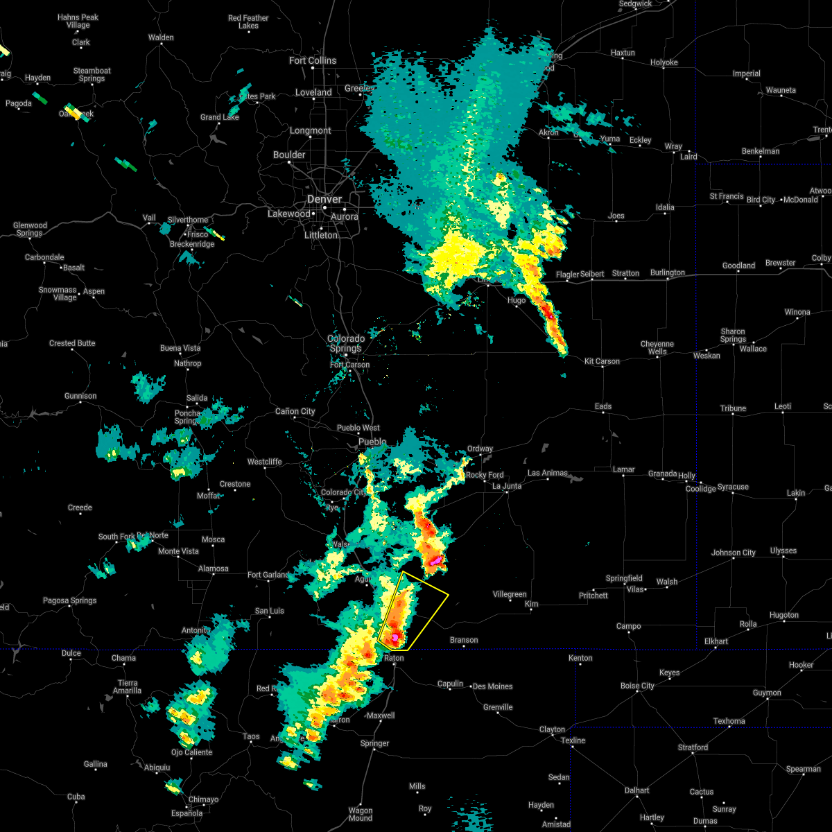 At 644 pm mdt, a severe thunderstorm was located near starkville, or 7 miles southeast of trinidad, moving northeast at 40 mph (radar indicated). Hazards include 60 mph wind gusts and quarter size hail. Hail damage to vehicles is expected. Expect wind damage to roofs, siding, and trees. At 644 pm mdt, a severe thunderstorm was located near starkville, or 7 miles southeast of trinidad, moving northeast at 40 mph (radar indicated). Hazards include 60 mph wind gusts and quarter size hail. Hail damage to vehicles is expected. Expect wind damage to roofs, siding, and trees.
|
| 5/22/2021 6:11 PM MDT |
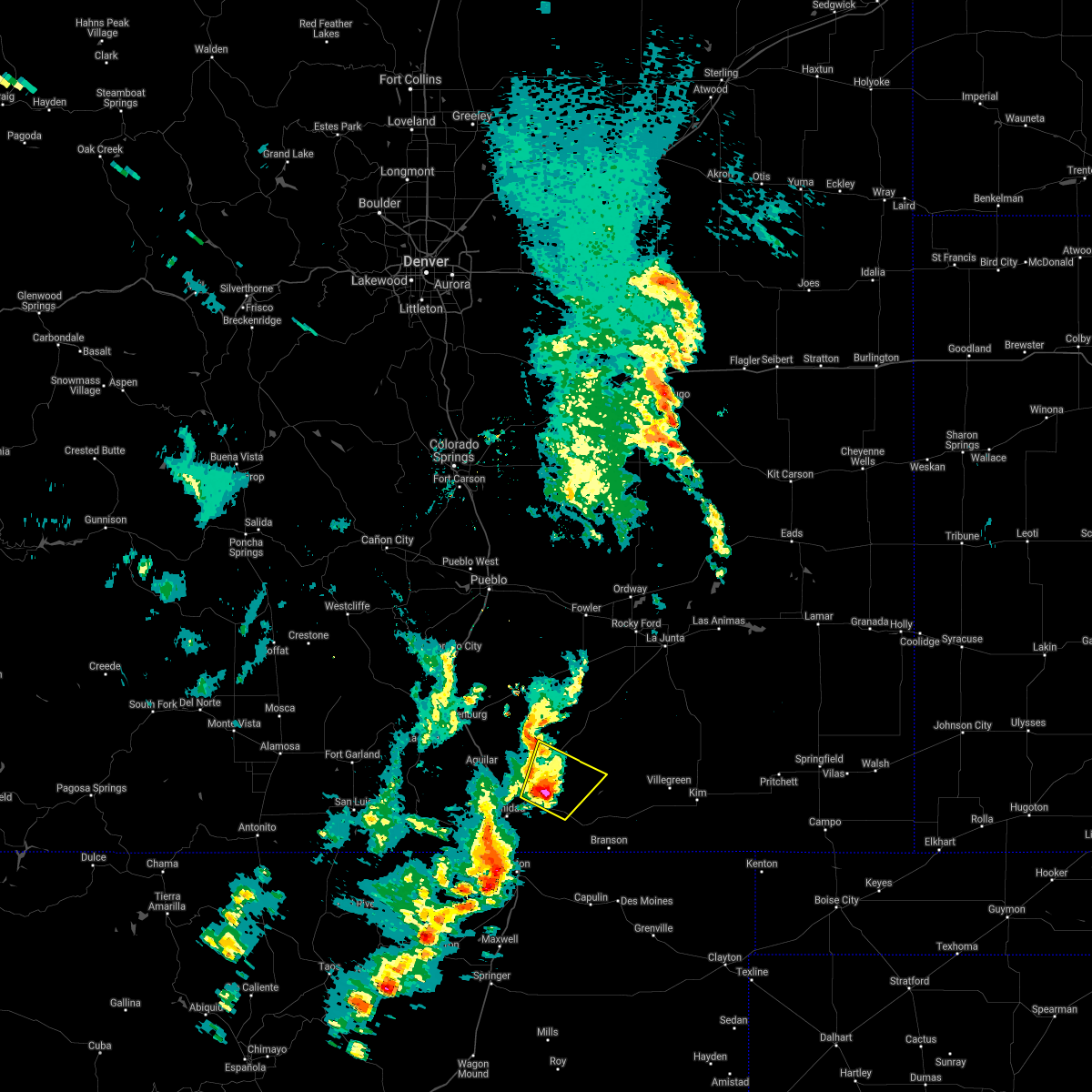 At 605 pm mdt, a severe thunderstorm was located near hoehne, or 10 miles northeast of trinidad, moving northeast at 30 mph (radar indicated). Hazards include 60 mph wind gusts and half dollar size hail. Hail damage to vehicles is expected. expect wind damage to roofs, siding, and trees. Locations impacted include, trinidad, model, hoehne and tyrone. At 605 pm mdt, a severe thunderstorm was located near hoehne, or 10 miles northeast of trinidad, moving northeast at 30 mph (radar indicated). Hazards include 60 mph wind gusts and half dollar size hail. Hail damage to vehicles is expected. expect wind damage to roofs, siding, and trees. Locations impacted include, trinidad, model, hoehne and tyrone.
|
| 5/22/2021 6:06 PM MDT |
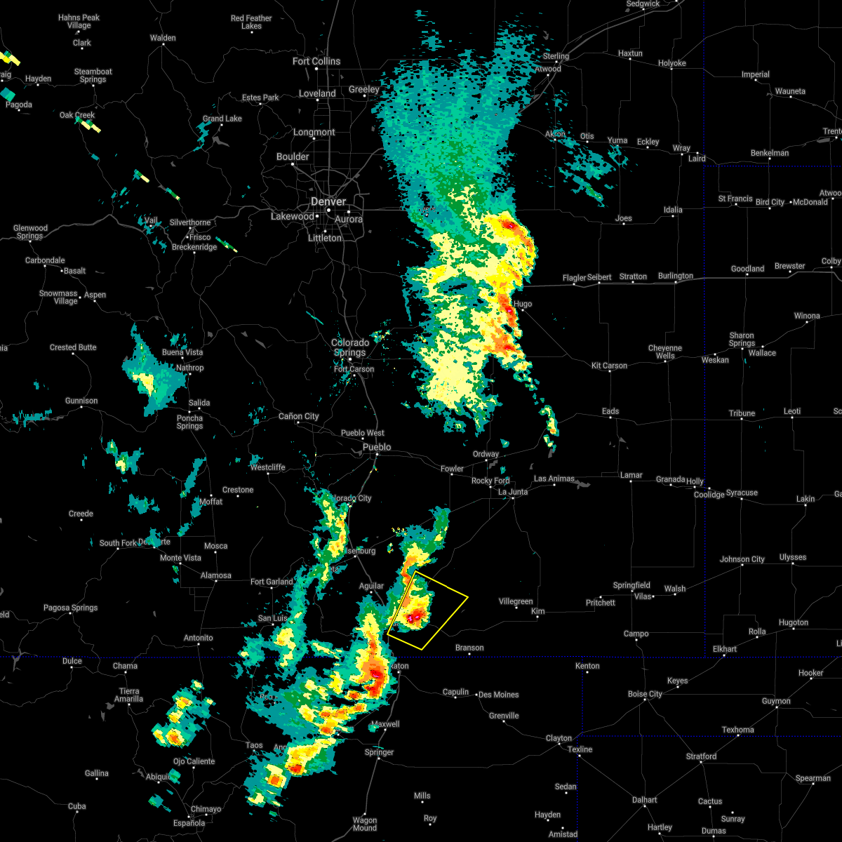 At 605 pm mdt, a severe thunderstorm was located near hoehne, or 10 miles northeast of trinidad, moving northeast at 30 mph (radar indicated). Hazards include 60 mph wind gusts and half dollar size hail. Hail damage to vehicles is expected. expect wind damage to roofs, siding, and trees. Locations impacted include, trinidad, model, hoehne and tyrone. At 605 pm mdt, a severe thunderstorm was located near hoehne, or 10 miles northeast of trinidad, moving northeast at 30 mph (radar indicated). Hazards include 60 mph wind gusts and half dollar size hail. Hail damage to vehicles is expected. expect wind damage to roofs, siding, and trees. Locations impacted include, trinidad, model, hoehne and tyrone.
|
| 5/22/2021 5:51 PM MDT |
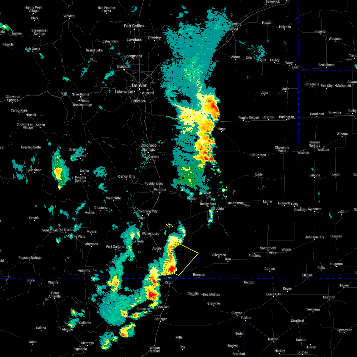 At 551 pm mdt, a severe thunderstorm was located near trinidad, moving northeast at 35 mph (radar indicated). Hazards include golf ball size hail and 60 mph wind gusts. People and animals outdoors will be injured. expect hail damage to roofs, siding, windows, and vehicles. Expect wind damage to roofs, siding, and trees. At 551 pm mdt, a severe thunderstorm was located near trinidad, moving northeast at 35 mph (radar indicated). Hazards include golf ball size hail and 60 mph wind gusts. People and animals outdoors will be injured. expect hail damage to roofs, siding, windows, and vehicles. Expect wind damage to roofs, siding, and trees.
|
| 5/22/2021 5:44 PM MDT |
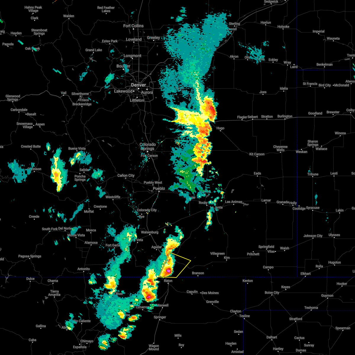 At 544 pm mdt, a severe thunderstorm was located near starkville, or near trinidad, moving northeast at 30 mph (radar indicated). Hazards include ping pong ball size hail and 60 mph wind gusts. People and animals outdoors will be injured. expect hail damage to roofs, siding, windows, and vehicles. expect wind damage to roofs, siding, and trees. Locations impacted include, trinidad, starkville, hoehne and raton pass. At 544 pm mdt, a severe thunderstorm was located near starkville, or near trinidad, moving northeast at 30 mph (radar indicated). Hazards include ping pong ball size hail and 60 mph wind gusts. People and animals outdoors will be injured. expect hail damage to roofs, siding, windows, and vehicles. expect wind damage to roofs, siding, and trees. Locations impacted include, trinidad, starkville, hoehne and raton pass.
|
| 5/22/2021 5:32 PM MDT |
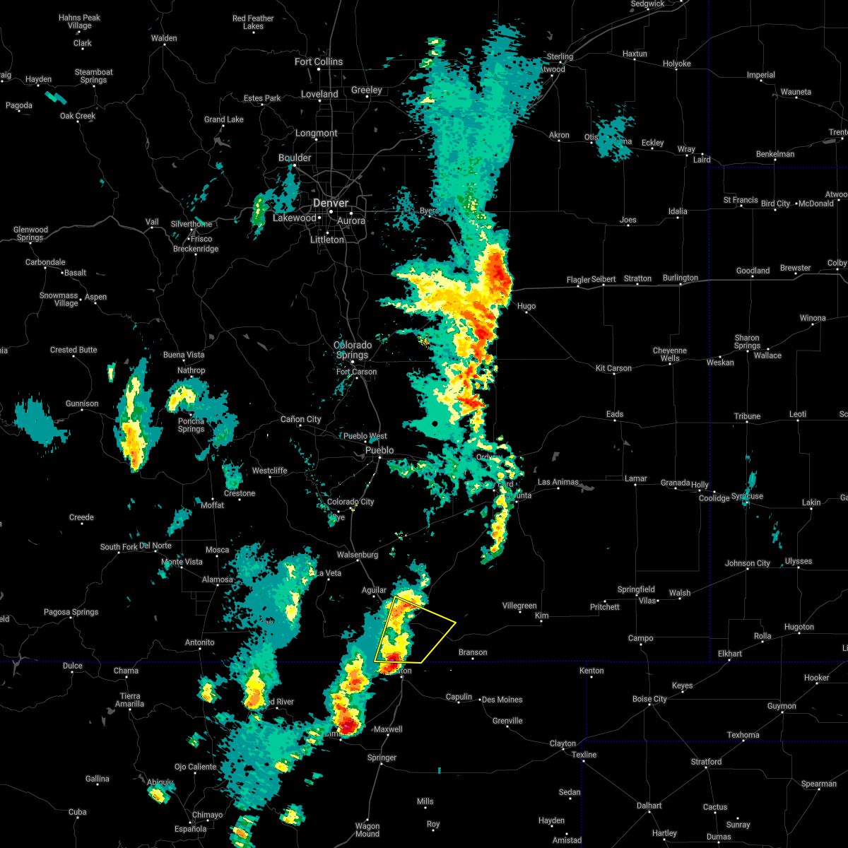 At 532 pm mdt, a severe thunderstorm was located over raton pass, or 9 miles north of raton, moving northeast at 35 mph (radar indicated). Hazards include 60 mph wind gusts and half dollar size hail. Hail damage to vehicles is expected. expect wind damage to roofs, siding, and trees. Locations impacted include, trinidad, starkville, hoehne and raton pass. At 532 pm mdt, a severe thunderstorm was located over raton pass, or 9 miles north of raton, moving northeast at 35 mph (radar indicated). Hazards include 60 mph wind gusts and half dollar size hail. Hail damage to vehicles is expected. expect wind damage to roofs, siding, and trees. Locations impacted include, trinidad, starkville, hoehne and raton pass.
|
| 5/22/2021 5:18 PM MDT |
 At 518 pm mdt, a severe thunderstorm was located 7 miles southwest of raton pass, or 8 miles west of raton, moving northeast at 35 mph (radar indicated). Hazards include ping pong ball size hail and 60 mph wind gusts. People and animals outdoors will be injured. expect hail damage to roofs, siding, windows, and vehicles. Expect wind damage to roofs, siding, and trees. At 518 pm mdt, a severe thunderstorm was located 7 miles southwest of raton pass, or 8 miles west of raton, moving northeast at 35 mph (radar indicated). Hazards include ping pong ball size hail and 60 mph wind gusts. People and animals outdoors will be injured. expect hail damage to roofs, siding, windows, and vehicles. Expect wind damage to roofs, siding, and trees.
|
| 5/22/2021 3:40 PM MDT |
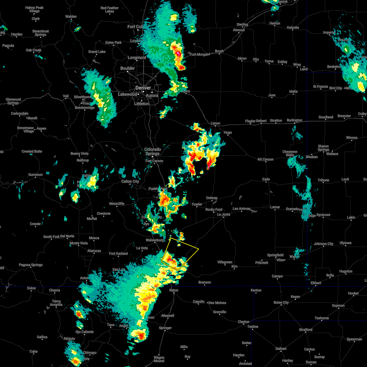 At 339 pm mdt, a severe thunderstorm was located 7 miles northwest of hoehne, or 12 miles north of trinidad, moving northeast at 45 mph (radar indicated). Hazards include 60 mph wind gusts and quarter size hail. Hail damage to vehicles is expected. expect wind damage to roofs, siding, and trees. Locations impacted include, tyrone, model and hoehne. At 339 pm mdt, a severe thunderstorm was located 7 miles northwest of hoehne, or 12 miles north of trinidad, moving northeast at 45 mph (radar indicated). Hazards include 60 mph wind gusts and quarter size hail. Hail damage to vehicles is expected. expect wind damage to roofs, siding, and trees. Locations impacted include, tyrone, model and hoehne.
|
| 5/22/2021 3:29 PM MDT |
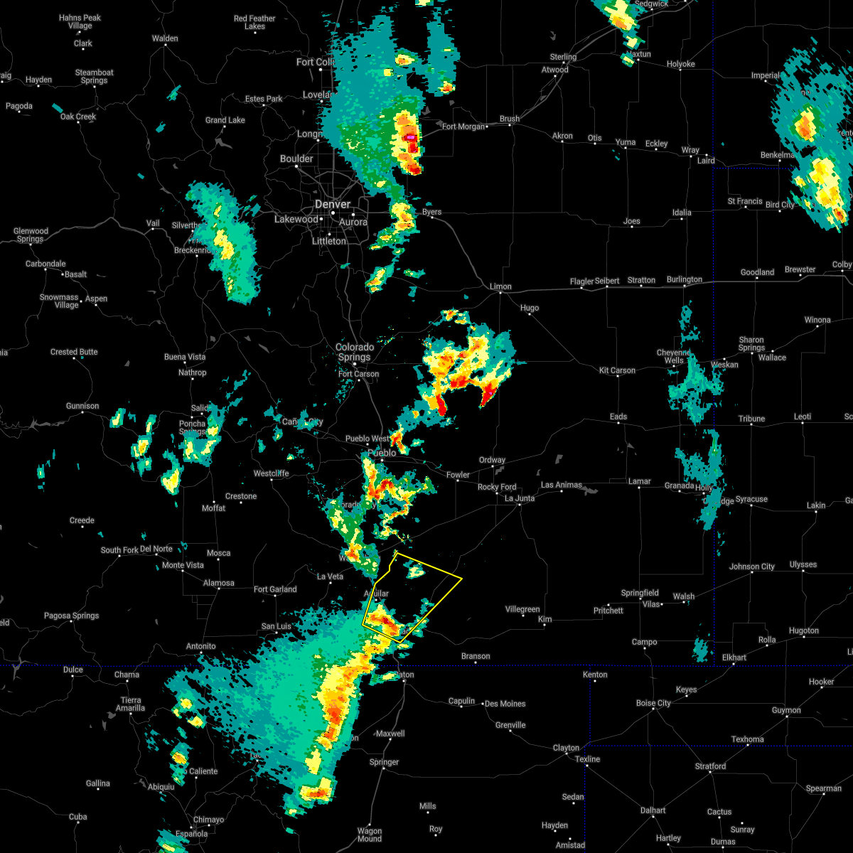 At 329 pm mdt, a severe thunderstorm was located 7 miles northeast of boncarbo, or 8 miles northwest of trinidad, moving northeast at 45 mph (radar indicated). Hazards include 60 mph wind gusts and quarter size hail. Hail damage to vehicles is expected. Expect wind damage to roofs, siding, and trees. At 329 pm mdt, a severe thunderstorm was located 7 miles northeast of boncarbo, or 8 miles northwest of trinidad, moving northeast at 45 mph (radar indicated). Hazards include 60 mph wind gusts and quarter size hail. Hail damage to vehicles is expected. Expect wind damage to roofs, siding, and trees.
|
| 5/22/2021 3:18 PM MDT |
 At 318 pm mdt, a severe thunderstorm was located near cokedale, or 7 miles west of trinidad, moving northeast at 45 mph (radar indicated). Hazards include 60 mph wind gusts and quarter size hail. Hail damage to vehicles is expected. expect wind damage to roofs, siding, and trees. Locations impacted include, trinidad, aguilar, cokedale, gulnare and boncarbo. At 318 pm mdt, a severe thunderstorm was located near cokedale, or 7 miles west of trinidad, moving northeast at 45 mph (radar indicated). Hazards include 60 mph wind gusts and quarter size hail. Hail damage to vehicles is expected. expect wind damage to roofs, siding, and trees. Locations impacted include, trinidad, aguilar, cokedale, gulnare and boncarbo.
|
| 5/22/2021 3:03 PM MDT |
 At 303 pm mdt, a severe thunderstorm was located near segundo, or 16 miles southwest of trinidad, moving northeast at 50 mph (radar indicated). Hazards include 60 mph wind gusts and quarter size hail. Hail damage to vehicles is expected. Expect wind damage to roofs, siding, and trees. At 303 pm mdt, a severe thunderstorm was located near segundo, or 16 miles southwest of trinidad, moving northeast at 50 mph (radar indicated). Hazards include 60 mph wind gusts and quarter size hail. Hail damage to vehicles is expected. Expect wind damage to roofs, siding, and trees.
|
| 5/17/2021 3:53 PM MDT |
 The severe thunderstorm warning for southwestern las animas county will expire at 400 pm mdt, the storms which prompted the warning have weakened below severe limits, and no longer pose an immediate threat to life or property. therefore, the warning will be allowed to expire. however small hail and gusty winds are still possible with these thunderstorms. a severe thunderstorm watch remains in effect until 1000 pm mdt for southeastern colorado. The severe thunderstorm warning for southwestern las animas county will expire at 400 pm mdt, the storms which prompted the warning have weakened below severe limits, and no longer pose an immediate threat to life or property. therefore, the warning will be allowed to expire. however small hail and gusty winds are still possible with these thunderstorms. a severe thunderstorm watch remains in effect until 1000 pm mdt for southeastern colorado.
|
| 5/17/2021 3:34 PM MDT |
 At 334 pm mdt, severe thunderstorms were located along a line extending from 6 miles west of raton pass to near hoehne, and are nearly stationary (radar indicated). Hazards include 60 mph wind gusts and half dollar size hail. Hail damage to vehicles is expected. expect wind damage to roofs, siding, and trees. Locations impacted include, trinidad, cokedale, starkville, model, hoehne and raton pass. At 334 pm mdt, severe thunderstorms were located along a line extending from 6 miles west of raton pass to near hoehne, and are nearly stationary (radar indicated). Hazards include 60 mph wind gusts and half dollar size hail. Hail damage to vehicles is expected. expect wind damage to roofs, siding, and trees. Locations impacted include, trinidad, cokedale, starkville, model, hoehne and raton pass.
|
| 5/17/2021 2:59 PM MDT |
 At 259 pm mdt, severe thunderstorms were located along a line extending from 6 miles west of raton pass to near hoehne, moving west at 10 mph (radar indicated). Hazards include 60 mph wind gusts and quarter size hail. Hail damage to vehicles is expected. Expect wind damage to roofs, siding, and trees. At 259 pm mdt, severe thunderstorms were located along a line extending from 6 miles west of raton pass to near hoehne, moving west at 10 mph (radar indicated). Hazards include 60 mph wind gusts and quarter size hail. Hail damage to vehicles is expected. Expect wind damage to roofs, siding, and trees.
|
| 7/4/2020 7:12 PM MDT |
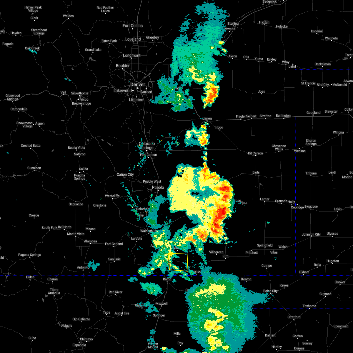 The severe thunderstorm warning for south central las animas county will expire at 715 pm mdt, the storm which prompted the warning has weakened below severe limits, and no longer poses an immediate threat to life or property. therefore, the warning will be allowed to expire. however gusty winds are still possible with this thunderstorm. The severe thunderstorm warning for south central las animas county will expire at 715 pm mdt, the storm which prompted the warning has weakened below severe limits, and no longer poses an immediate threat to life or property. therefore, the warning will be allowed to expire. however gusty winds are still possible with this thunderstorm.
|
| 7/4/2020 7:04 PM MDT |
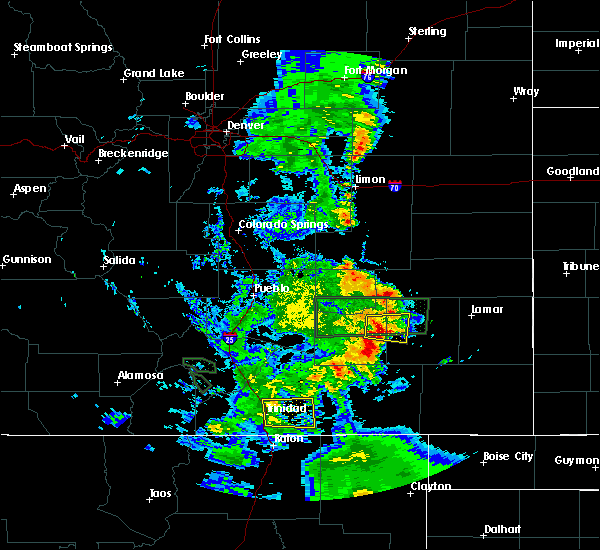 At 704 pm mdt, a severe thunderstorm was located 9 miles southeast of hoehne, or 14 miles east of trinidad, moving east at 35 mph (radar indicated). Hazards include 60 mph wind gusts. Expect damage to roofs, siding, and trees. Locations impacted include, hoehne. At 704 pm mdt, a severe thunderstorm was located 9 miles southeast of hoehne, or 14 miles east of trinidad, moving east at 35 mph (radar indicated). Hazards include 60 mph wind gusts. Expect damage to roofs, siding, and trees. Locations impacted include, hoehne.
|
| 7/4/2020 6:54 PM MDT |
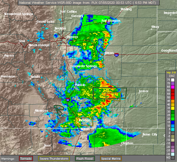 At 654 pm mdt, a severe thunderstorm was located near hoehne, or 9 miles east of trinidad, moving east at 35 mph (radar indicated). Hazards include 60 mph wind gusts. Expect damage to roofs, siding, and trees. Locations impacted include, trinidad and hoehne. At 654 pm mdt, a severe thunderstorm was located near hoehne, or 9 miles east of trinidad, moving east at 35 mph (radar indicated). Hazards include 60 mph wind gusts. Expect damage to roofs, siding, and trees. Locations impacted include, trinidad and hoehne.
|
| 7/4/2020 6:40 PM MDT |
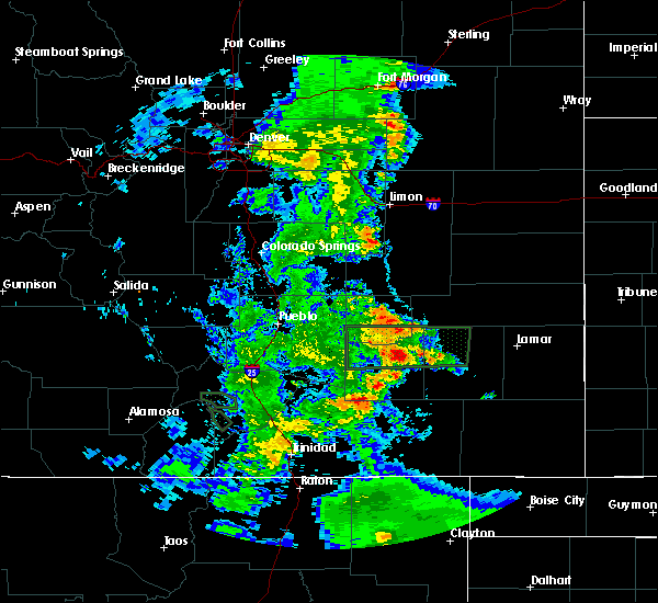 At 639 pm mdt, a severe thunderstorm was located over trinidad, moving east at 35 mph (trinidad asos reported a wind gust of 58 mph). Hazards include 60 mph wind gusts. expect damage to roofs, siding, and trees At 639 pm mdt, a severe thunderstorm was located over trinidad, moving east at 35 mph (trinidad asos reported a wind gust of 58 mph). Hazards include 60 mph wind gusts. expect damage to roofs, siding, and trees
|
| 6/18/2020 10:11 PM MDT |
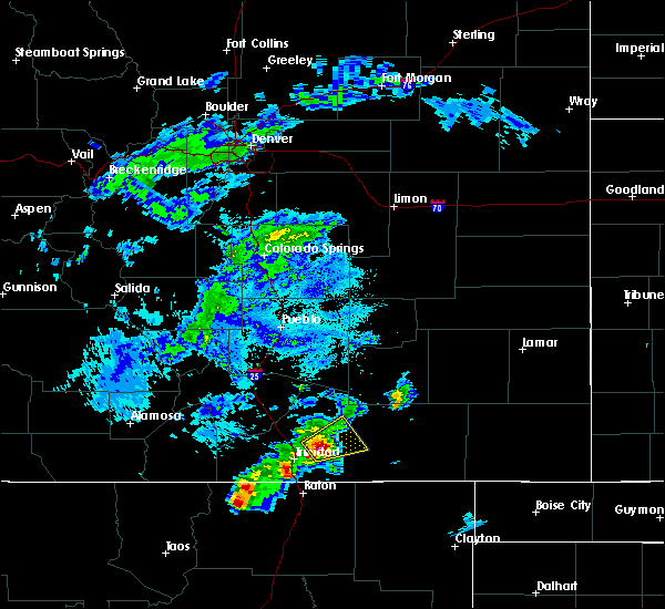 At 1010 pm mdt, a severe thunderstorm was located near model, or 17 miles northeast of trinidad, moving northeast at 15 mph (radar indicated). Hazards include 70 mph wind gusts and quarter size hail. Hail damage to vehicles is expected. expect considerable tree damage. wind damage is also likely to mobile homes, roofs, and outbuildings. Locations impacted include, tyrone, model and hoehne. At 1010 pm mdt, a severe thunderstorm was located near model, or 17 miles northeast of trinidad, moving northeast at 15 mph (radar indicated). Hazards include 70 mph wind gusts and quarter size hail. Hail damage to vehicles is expected. expect considerable tree damage. wind damage is also likely to mobile homes, roofs, and outbuildings. Locations impacted include, tyrone, model and hoehne.
|
| 6/18/2020 9:55 PM MDT |
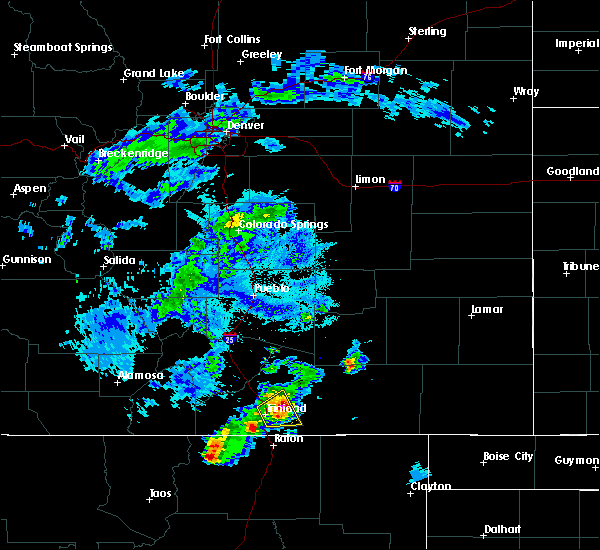 At 955 pm mdt, a severe thunderstorm was located near hoehne, or 13 miles northeast of trinidad, moving northeast at 20 mph (radar indicated). Hazards include 60 mph wind gusts and quarter size hail. Hail damage to vehicles is expected. Expect wind damage to roofs, siding, and trees. At 955 pm mdt, a severe thunderstorm was located near hoehne, or 13 miles northeast of trinidad, moving northeast at 20 mph (radar indicated). Hazards include 60 mph wind gusts and quarter size hail. Hail damage to vehicles is expected. Expect wind damage to roofs, siding, and trees.
|
| 6/18/2020 9:48 PM MDT |
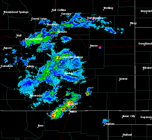 At 947 pm mdt, a severe thunderstorm was located near hoehne, or 11 miles northeast of trinidad, moving northeast at 15 mph (radar indicated). Hazards include 60 mph wind gusts and quarter size hail. Hail damage to vehicles is expected. expect wind damage to roofs, siding, and trees. Locations impacted include, trinidad and hoehne. At 947 pm mdt, a severe thunderstorm was located near hoehne, or 11 miles northeast of trinidad, moving northeast at 15 mph (radar indicated). Hazards include 60 mph wind gusts and quarter size hail. Hail damage to vehicles is expected. expect wind damage to roofs, siding, and trees. Locations impacted include, trinidad and hoehne.
|
| 6/18/2020 9:33 PM MDT |
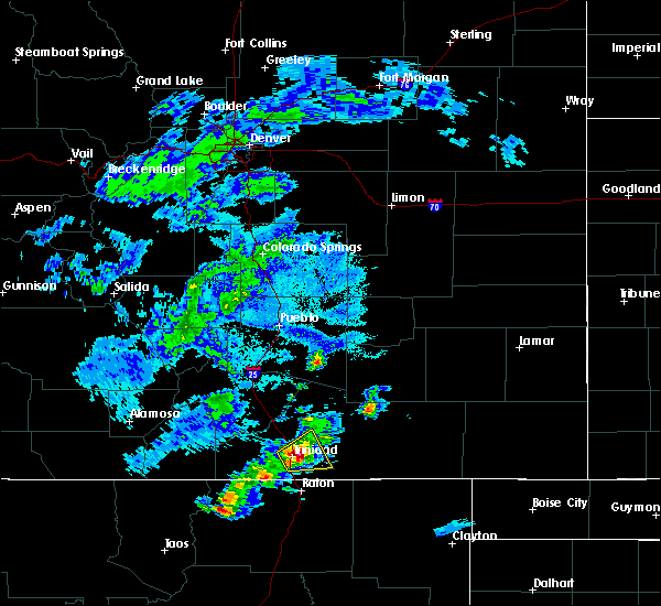 At 933 pm mdt, a severe thunderstorm was located near hoehne, or near trinidad, moving northeast at 15 mph (radar indicated). Hazards include 60 mph wind gusts and quarter size hail. Hail damage to vehicles is expected. expect wind damage to roofs, siding, and trees. Locations impacted include, trinidad, starkville and hoehne. At 933 pm mdt, a severe thunderstorm was located near hoehne, or near trinidad, moving northeast at 15 mph (radar indicated). Hazards include 60 mph wind gusts and quarter size hail. Hail damage to vehicles is expected. expect wind damage to roofs, siding, and trees. Locations impacted include, trinidad, starkville and hoehne.
|
| 6/18/2020 9:17 PM MDT |
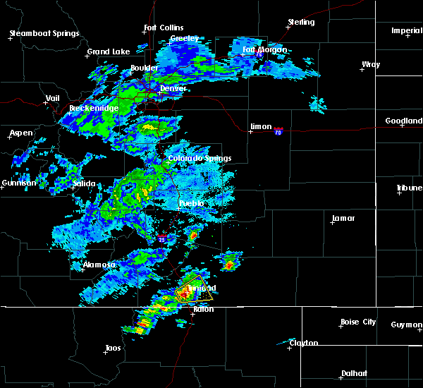 At 917 pm mdt, a severe thunderstorm was located over trinidad, moving northeast at 15 mph (radar indicated). Hazards include 60 mph wind gusts and quarter size hail. Hail damage to vehicles is expected. expect wind damage to roofs, siding, and trees. Locations impacted include, trinidad, starkville and hoehne. At 917 pm mdt, a severe thunderstorm was located over trinidad, moving northeast at 15 mph (radar indicated). Hazards include 60 mph wind gusts and quarter size hail. Hail damage to vehicles is expected. expect wind damage to roofs, siding, and trees. Locations impacted include, trinidad, starkville and hoehne.
|
| 6/18/2020 9:05 PM MDT |
 At 905 pm mdt, a severe thunderstorm was located over trinidad, moving northeast at 15 mph (radar indicated). Hazards include 60 mph wind gusts and quarter size hail. Hail damage to vehicles is expected. Expect wind damage to roofs, siding, and trees. At 905 pm mdt, a severe thunderstorm was located over trinidad, moving northeast at 15 mph (radar indicated). Hazards include 60 mph wind gusts and quarter size hail. Hail damage to vehicles is expected. Expect wind damage to roofs, siding, and trees.
|
| 5/17/2020 3:57 PM MDT |
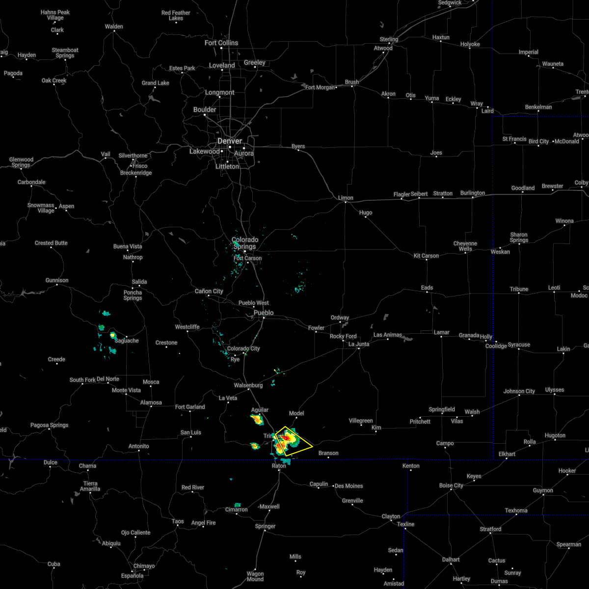 The severe thunderstorm warning for south central las animas county will expire at 400 pm mdt, the storm which prompted the warning has weakened below severe limits, and no longer poses an immediate threat to life or property. therefore, the warning will be allowed to expire. however nickel size hail is still possible with this thunderstorm. The severe thunderstorm warning for south central las animas county will expire at 400 pm mdt, the storm which prompted the warning has weakened below severe limits, and no longer poses an immediate threat to life or property. therefore, the warning will be allowed to expire. however nickel size hail is still possible with this thunderstorm.
|
| 5/17/2020 3:49 PM MDT |
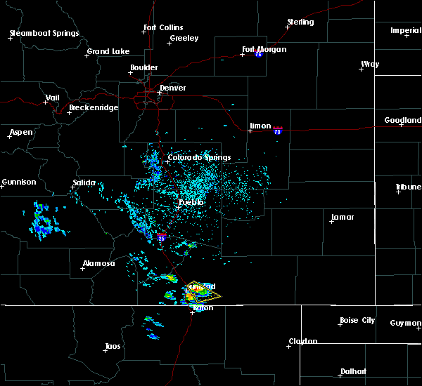 At 348 pm mdt, a severe thunderstorm was located near hoehne, or near trinidad, moving southeast at 15 mph (public). Hazards include 60 mph wind gusts and quarter size hail. Hail damage to vehicles is expected. expect wind damage to roofs, siding, and trees. Locations impacted include, rural areas east of trinidad. At 348 pm mdt, a severe thunderstorm was located near hoehne, or near trinidad, moving southeast at 15 mph (public). Hazards include 60 mph wind gusts and quarter size hail. Hail damage to vehicles is expected. expect wind damage to roofs, siding, and trees. Locations impacted include, rural areas east of trinidad.
|
| 5/17/2020 3:43 PM MDT |
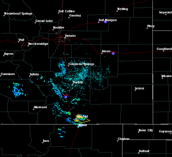 At 342 pm mdt, a severe thunderstorm was located near hoehne, or near trinidad, moving southeast at 15 mph (radar indicated). Hazards include 60 mph wind gusts and half dollar size hail. Hail damage to vehicles is expected. expect wind damage to roofs, siding, and trees. Locations impacted include, hoehne. At 342 pm mdt, a severe thunderstorm was located near hoehne, or near trinidad, moving southeast at 15 mph (radar indicated). Hazards include 60 mph wind gusts and half dollar size hail. Hail damage to vehicles is expected. expect wind damage to roofs, siding, and trees. Locations impacted include, hoehne.
|
| 5/17/2020 3:35 PM MDT |
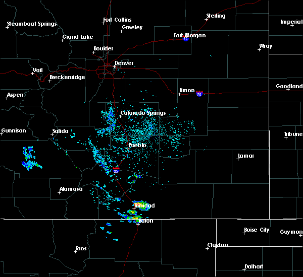 At 335 pm mdt, a severe thunderstorm was located near hoehne, or near trinidad, moving southeast at 15 mph (radar indicated). Hazards include 60 mph wind gusts and quarter size hail. Hail damage to vehicles is expected. Expect wind damage to roofs, siding, and trees. At 335 pm mdt, a severe thunderstorm was located near hoehne, or near trinidad, moving southeast at 15 mph (radar indicated). Hazards include 60 mph wind gusts and quarter size hail. Hail damage to vehicles is expected. Expect wind damage to roofs, siding, and trees.
|
| 6/7/2019 1:26 PM MDT |
 At 125 pm mdt, a severe thunderstorm was located over starkville, or over trinidad, moving northeast at 20 mph (radar indicated). Hazards include 60 mph wind gusts and quarter size hail. Hail damage to vehicles is expected. expect wind damage to roofs, siding, and trees. Locations impacted include, trinidad, cokedale and starkville. At 125 pm mdt, a severe thunderstorm was located over starkville, or over trinidad, moving northeast at 20 mph (radar indicated). Hazards include 60 mph wind gusts and quarter size hail. Hail damage to vehicles is expected. expect wind damage to roofs, siding, and trees. Locations impacted include, trinidad, cokedale and starkville.
|
| 6/7/2019 1:11 PM MDT |
 At 111 pm mdt, a severe thunderstorm was located over cokedale, or 7 miles southwest of trinidad, moving east at 20 mph (radar indicated). Hazards include 60 mph wind gusts and half dollar size hail. Hail damage to vehicles is expected. Expect wind damage to roofs, siding, and trees. At 111 pm mdt, a severe thunderstorm was located over cokedale, or 7 miles southwest of trinidad, moving east at 20 mph (radar indicated). Hazards include 60 mph wind gusts and half dollar size hail. Hail damage to vehicles is expected. Expect wind damage to roofs, siding, and trees.
|
| 8/18/2018 2:34 PM MDT |
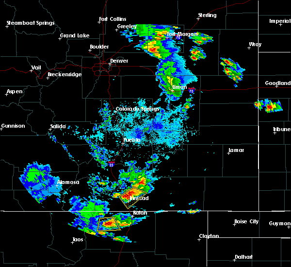 At 234 pm mdt, a severe thunderstorm was located 8 miles northeast of boncarbo, or 8 miles northwest of trinidad, moving southeast at 15 mph (radar indicated). Hazards include 60 mph wind gusts and quarter size hail. Hail damage to vehicles is expected. expect wind damage to roofs, siding, and trees. Locations impacted include, trinidad, starkville, model and hoehne. At 234 pm mdt, a severe thunderstorm was located 8 miles northeast of boncarbo, or 8 miles northwest of trinidad, moving southeast at 15 mph (radar indicated). Hazards include 60 mph wind gusts and quarter size hail. Hail damage to vehicles is expected. expect wind damage to roofs, siding, and trees. Locations impacted include, trinidad, starkville, model and hoehne.
|
| 8/18/2018 2:12 PM MDT |
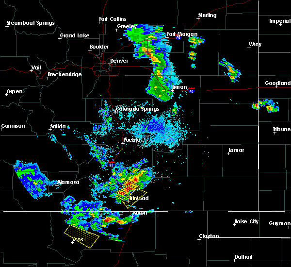 At 212 pm mdt, a severe thunderstorm was located near aguilar, or 13 miles northwest of trinidad, moving southeast at 15 mph (radar indicated). Hazards include 70 mph wind gusts and ping pong ball size hail. People and animals outdoors will be injured. expect hail damage to roofs, siding, windows, and vehicles. expect considerable tree damage. Wind damage is also likely to mobile homes, roofs, and outbuildings. At 212 pm mdt, a severe thunderstorm was located near aguilar, or 13 miles northwest of trinidad, moving southeast at 15 mph (radar indicated). Hazards include 70 mph wind gusts and ping pong ball size hail. People and animals outdoors will be injured. expect hail damage to roofs, siding, windows, and vehicles. expect considerable tree damage. Wind damage is also likely to mobile homes, roofs, and outbuildings.
|
| 8/15/2018 2:25 PM MDT |
 The severe thunderstorm warning for south central huerfano and southwestern las animas counties will expire at 230 pm mdt, the storms which prompted the warning has weakened below severe limits, and no longer poses an immediate threat to life or property. therefore, the warning will be allowed to expire. however small hail, gusty winds and heavy rain are still possible with these thunderstorms. The severe thunderstorm warning for south central huerfano and southwestern las animas counties will expire at 230 pm mdt, the storms which prompted the warning has weakened below severe limits, and no longer poses an immediate threat to life or property. therefore, the warning will be allowed to expire. however small hail, gusty winds and heavy rain are still possible with these thunderstorms.
|
| 8/15/2018 2:15 PM MDT |
 At 213 pm mdt, a severe thunderstorm was located near starkville, or 7 miles south of trinidad, moving east at 15 mph (radar indicated). Hazards include 60 mph wind gusts and half dollar size hail. Hail damage to vehicles is expected. expect wind damage to roofs, siding, and trees. other strong storms were noted along the i-25 corridor from just south of walsenburg to the new mexico border. Locations impacted include, trinidad, aguilar, cokedale, starkville, gulnare, boncarbo, segundo and raton pass. At 213 pm mdt, a severe thunderstorm was located near starkville, or 7 miles south of trinidad, moving east at 15 mph (radar indicated). Hazards include 60 mph wind gusts and half dollar size hail. Hail damage to vehicles is expected. expect wind damage to roofs, siding, and trees. other strong storms were noted along the i-25 corridor from just south of walsenburg to the new mexico border. Locations impacted include, trinidad, aguilar, cokedale, starkville, gulnare, boncarbo, segundo and raton pass.
|
| 8/15/2018 1:52 PM MDT |
 At 151 pm mdt, a severe thunderstorm was located near cokedale, or 9 miles southwest of trinidad, moving east at 15 mph (radar indicated). Hazards include 60 mph wind gusts and half dollar size hail. Hail damage to vehicles is expected. Expect wind damage to roofs, siding, and trees. At 151 pm mdt, a severe thunderstorm was located near cokedale, or 9 miles southwest of trinidad, moving east at 15 mph (radar indicated). Hazards include 60 mph wind gusts and half dollar size hail. Hail damage to vehicles is expected. Expect wind damage to roofs, siding, and trees.
|
| 8/6/2018 7:30 PM MDT | Quarter sized hail reported 15.1 miles WSW of Hoehne, CO |
| 8/6/2018 6:59 PM MDT |
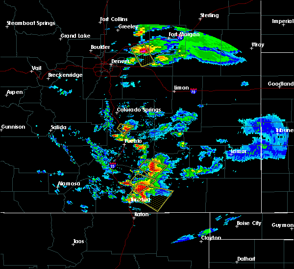 At 659 pm mdt, a severe thunderstorm was located near model, or 20 miles northeast of trinidad, moving southeast at 25 mph (radar indicated). Hazards include ping pong ball size hail and 60 mph wind gusts. People and animals outdoors will be injured. expect hail damage to roofs, siding, windows, and vehicles. Expect wind damage to roofs, siding, and trees. At 659 pm mdt, a severe thunderstorm was located near model, or 20 miles northeast of trinidad, moving southeast at 25 mph (radar indicated). Hazards include ping pong ball size hail and 60 mph wind gusts. People and animals outdoors will be injured. expect hail damage to roofs, siding, windows, and vehicles. Expect wind damage to roofs, siding, and trees.
|
| 8/5/2018 2:31 PM MDT |
 At 230 pm mdt, a severe thunderstorm was located near trinidad, moving east at 15 mph (radar indicated). Hazards include 60 mph wind gusts and quarter size hail. Hail damage to vehicles is expected. expect wind damage to roofs, siding, and trees. Locations impacted include, rural areas east of trinidad. At 230 pm mdt, a severe thunderstorm was located near trinidad, moving east at 15 mph (radar indicated). Hazards include 60 mph wind gusts and quarter size hail. Hail damage to vehicles is expected. expect wind damage to roofs, siding, and trees. Locations impacted include, rural areas east of trinidad.
|
| 8/5/2018 2:24 PM MDT |
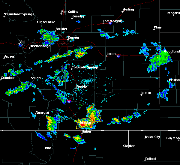 At 224 pm mdt, a severe thunderstorm was located near trinidad, moving east at 25 mph (radar indicated). Hazards include 60 mph wind gusts and quarter size hail. Hail damage to vehicles is expected. expect wind damage to roofs, siding, and trees. Locations impacted include, trinidad, starkville and hoehne. At 224 pm mdt, a severe thunderstorm was located near trinidad, moving east at 25 mph (radar indicated). Hazards include 60 mph wind gusts and quarter size hail. Hail damage to vehicles is expected. expect wind damage to roofs, siding, and trees. Locations impacted include, trinidad, starkville and hoehne.
|
| 8/5/2018 2:15 PM MDT |
 At 214 pm mdt, a severe thunderstorm was located near trinidad, moving east at 25 mph (radar indicated). Hazards include 60 mph wind gusts and quarter size hail. Hail damage to vehicles is expected. expect wind damage to roofs, siding, and trees. Locations impacted include, trinidad and hoehne. At 214 pm mdt, a severe thunderstorm was located near trinidad, moving east at 25 mph (radar indicated). Hazards include 60 mph wind gusts and quarter size hail. Hail damage to vehicles is expected. expect wind damage to roofs, siding, and trees. Locations impacted include, trinidad and hoehne.
|
| 8/5/2018 2:12 PM MDT |
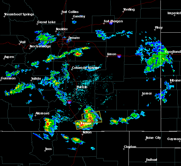 At 211 pm mdt, a severe thunderstorm was located over model, or 22 miles northeast of trinidad, moving east at 30 mph (radar indicated). Hazards include 60 mph wind gusts and quarter size hail. Hail damage to vehicles is expected. expect wind damage to roofs, siding, and trees. Locations impacted include, model and tyrone. At 211 pm mdt, a severe thunderstorm was located over model, or 22 miles northeast of trinidad, moving east at 30 mph (radar indicated). Hazards include 60 mph wind gusts and quarter size hail. Hail damage to vehicles is expected. expect wind damage to roofs, siding, and trees. Locations impacted include, model and tyrone.
|
| 8/5/2018 2:08 PM MDT |
 At 208 pm mdt, a severe thunderstorm was located near trinidad, moving east at 25 mph (radar indicated). Hazards include 60 mph wind gusts and quarter size hail. Hail damage to vehicles is expected. Expect wind damage to roofs, siding, and trees. At 208 pm mdt, a severe thunderstorm was located near trinidad, moving east at 25 mph (radar indicated). Hazards include 60 mph wind gusts and quarter size hail. Hail damage to vehicles is expected. Expect wind damage to roofs, siding, and trees.
|
| 8/5/2018 2:05 PM MDT |
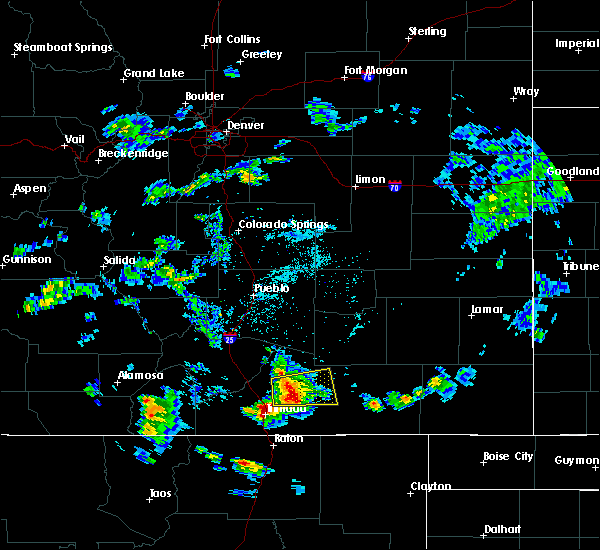 At 204 pm mdt, a severe thunderstorm was located near model, or 20 miles northeast of trinidad, moving east at 25 mph (radar indicated). Hazards include 60 mph wind gusts and quarter size hail. Hail damage to vehicles is expected. expect wind damage to roofs, siding, and trees. Locations impacted include, model, hoehne, and tyrone. At 204 pm mdt, a severe thunderstorm was located near model, or 20 miles northeast of trinidad, moving east at 25 mph (radar indicated). Hazards include 60 mph wind gusts and quarter size hail. Hail damage to vehicles is expected. expect wind damage to roofs, siding, and trees. Locations impacted include, model, hoehne, and tyrone.
|
| 8/5/2018 1:56 PM MDT |
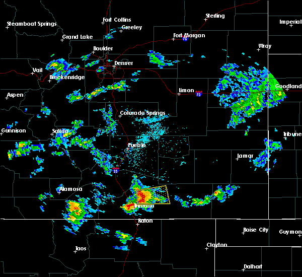 At 156 pm mdt, a severe thunderstorm was located near model, or 18 miles northeast of trinidad, moving east at 25 mph (radar indicated). Hazards include 60 mph wind gusts and quarter size hail. Hail damage to vehicles is expected. Expect wind damage to roofs, siding, and trees. At 156 pm mdt, a severe thunderstorm was located near model, or 18 miles northeast of trinidad, moving east at 25 mph (radar indicated). Hazards include 60 mph wind gusts and quarter size hail. Hail damage to vehicles is expected. Expect wind damage to roofs, siding, and trees.
|
| 7/21/2018 3:21 PM MDT |
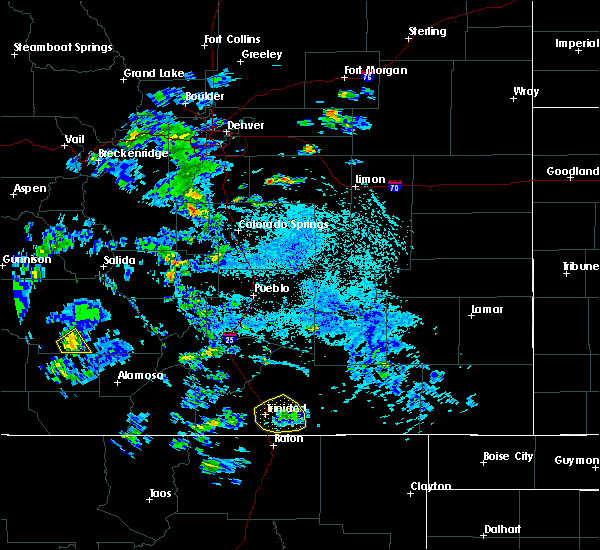 The national weather service in pueblo has issued a * severe thunderstorm warning for. south central las animas county in southeastern colorado. until 345 pm mdt. at 320 pm mdt, a severe thunderstorm was located near trinidad, moving northeast at 10 mph. 59 mph winds were observed at trinidad. The national weather service in pueblo has issued a * severe thunderstorm warning for. south central las animas county in southeastern colorado. until 345 pm mdt. at 320 pm mdt, a severe thunderstorm was located near trinidad, moving northeast at 10 mph. 59 mph winds were observed at trinidad.
|
| 8/10/2017 7:52 PM MDT |
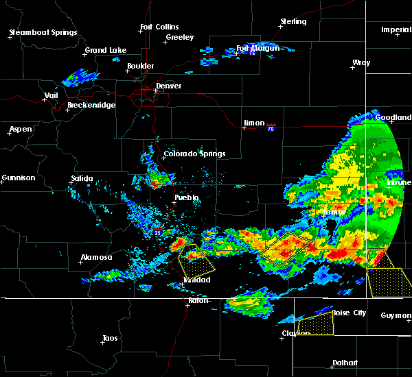 At 752 pm mdt, a severe thunderstorm was located 11 miles northwest of tyrone, or 26 miles north of trinidad, moving southeast at 35 mph (radar indicated). Hazards include 60 mph wind gusts and quarter size hail. Hail damage to vehicles is expected. expect wind damage to roofs, siding, and trees. Locations impacted include, tyrone, model and hoehne. At 752 pm mdt, a severe thunderstorm was located 11 miles northwest of tyrone, or 26 miles north of trinidad, moving southeast at 35 mph (radar indicated). Hazards include 60 mph wind gusts and quarter size hail. Hail damage to vehicles is expected. expect wind damage to roofs, siding, and trees. Locations impacted include, tyrone, model and hoehne.
|
| 8/10/2017 7:30 PM MDT |
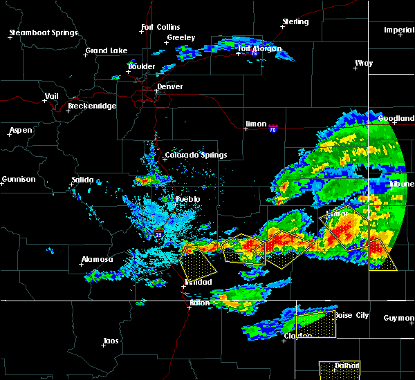 At 730 pm mdt, a severe thunderstorm was located 16 miles east of walsenburg, or 32 miles north of trinidad, moving south at 30 mph (radar indicated). Hazards include 60 mph wind gusts and quarter size hail. Hail damage to vehicles is expected. Expect wind damage to roofs, siding, and trees. At 730 pm mdt, a severe thunderstorm was located 16 miles east of walsenburg, or 32 miles north of trinidad, moving south at 30 mph (radar indicated). Hazards include 60 mph wind gusts and quarter size hail. Hail damage to vehicles is expected. Expect wind damage to roofs, siding, and trees.
|
| 8/10/2017 6:02 PM MDT |
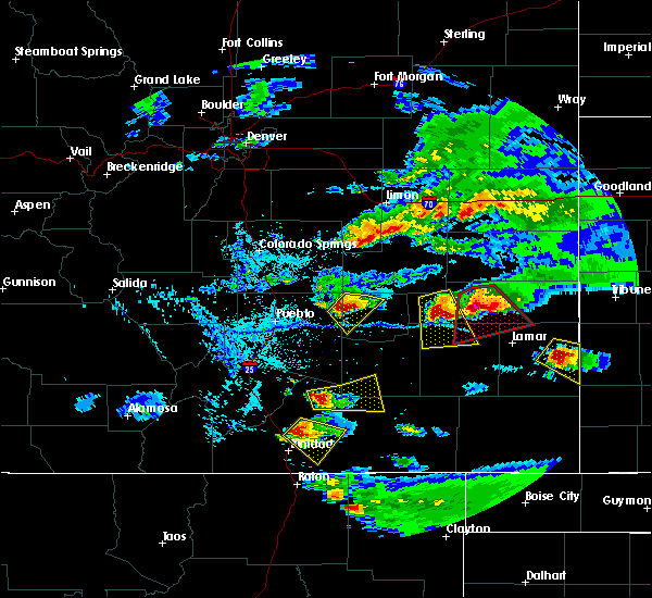 At 601 pm mdt, a severe thunderstorm was located near hoehne, or 13 miles northeast of trinidad, moving southeast at 20 mph (radar indicated). Hazards include 60 mph wind gusts and quarter size hail. Hail damage to vehicles is expected. expect wind damage to roofs, siding, and trees. Locations impacted include, model and hoehne. At 601 pm mdt, a severe thunderstorm was located near hoehne, or 13 miles northeast of trinidad, moving southeast at 20 mph (radar indicated). Hazards include 60 mph wind gusts and quarter size hail. Hail damage to vehicles is expected. expect wind damage to roofs, siding, and trees. Locations impacted include, model and hoehne.
|
| 8/10/2017 5:45 PM MDT |
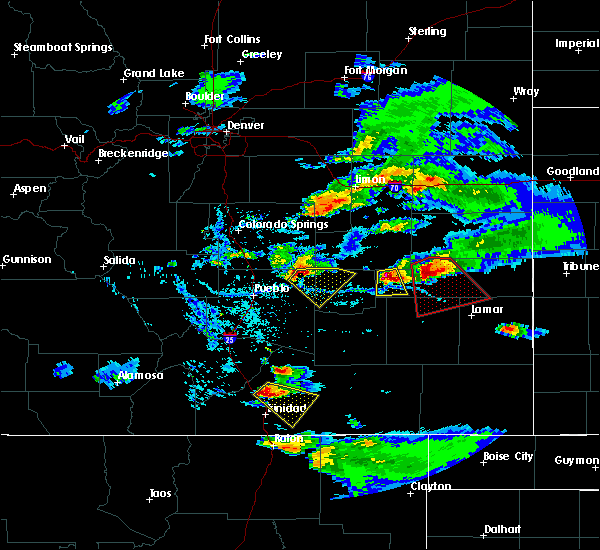 At 545 pm mdt, a severe thunderstorm was located 8 miles northwest of hoehne, or 14 miles north of trinidad, moving east at 30 mph (radar indicated). Hazards include 60 mph wind gusts and half dollar size hail. Hail damage to vehicles is expected. expect wind damage to roofs, siding, and trees. Locations impacted include, model and hoehne. At 545 pm mdt, a severe thunderstorm was located 8 miles northwest of hoehne, or 14 miles north of trinidad, moving east at 30 mph (radar indicated). Hazards include 60 mph wind gusts and half dollar size hail. Hail damage to vehicles is expected. expect wind damage to roofs, siding, and trees. Locations impacted include, model and hoehne.
|
| 8/10/2017 5:36 PM MDT |
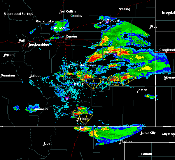 At 536 pm mdt, a severe thunderstorm was located near aguilar, or 15 miles north of trinidad, moving southeast at 10 mph (radar indicated). Hazards include 60 mph wind gusts and half dollar size hail. Hail damage to vehicles is expected. expect wind damage to roofs, siding, and trees. Locations impacted include, model and hoehne. At 536 pm mdt, a severe thunderstorm was located near aguilar, or 15 miles north of trinidad, moving southeast at 10 mph (radar indicated). Hazards include 60 mph wind gusts and half dollar size hail. Hail damage to vehicles is expected. expect wind damage to roofs, siding, and trees. Locations impacted include, model and hoehne.
|
| 8/10/2017 5:28 PM MDT |
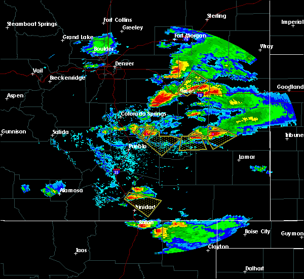 The national weather service in pueblo has issued a * severe thunderstorm warning for. central las animas county in southeastern colorado. Until 615 pm mdt * at 527 pm mdt, a severe thunderstorm was located near aguilar, or 16 miles north of trinidad, moving southeast at 30 mph. The national weather service in pueblo has issued a * severe thunderstorm warning for. central las animas county in southeastern colorado. Until 615 pm mdt * at 527 pm mdt, a severe thunderstorm was located near aguilar, or 16 miles north of trinidad, moving southeast at 30 mph.
|
| 8/10/2017 3:37 PM MDT |
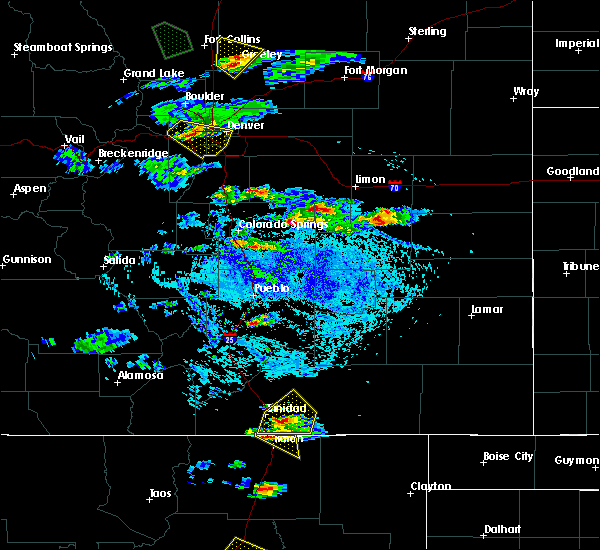 At 337 pm mdt, a severe thunderstorm was located 8 miles north of sugarite canyon state park, or 9 miles southeast of trinidad, moving east at 25 mph (radar indicated). Hazards include 60 mph wind gusts and quarter size hail. Hail damage to vehicles is expected. expect wind damage to roofs, siding, and trees. Locations impacted include, trinidad, starkville, model and hoehne. At 337 pm mdt, a severe thunderstorm was located 8 miles north of sugarite canyon state park, or 9 miles southeast of trinidad, moving east at 25 mph (radar indicated). Hazards include 60 mph wind gusts and quarter size hail. Hail damage to vehicles is expected. expect wind damage to roofs, siding, and trees. Locations impacted include, trinidad, starkville, model and hoehne.
|
| 8/10/2017 3:27 PM MDT |
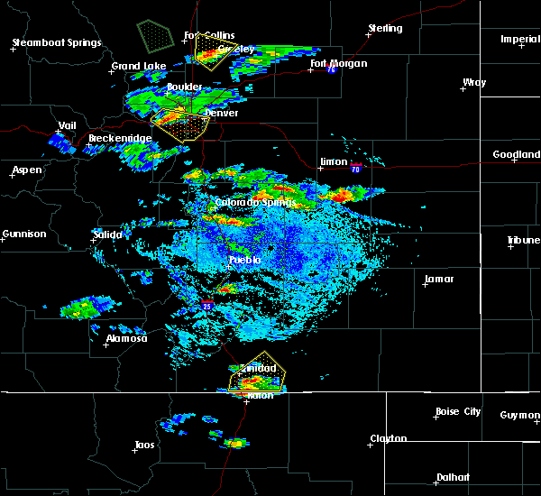 At 327 pm mdt, a severe thunderstorm was located near starkville, or 7 miles southeast of trinidad, moving east at 25 mph (radar indicated). Hazards include 60 mph wind gusts and quarter size hail. Hail damage to vehicles is expected. Expect wind damage to roofs, siding, and trees. At 327 pm mdt, a severe thunderstorm was located near starkville, or 7 miles southeast of trinidad, moving east at 25 mph (radar indicated). Hazards include 60 mph wind gusts and quarter size hail. Hail damage to vehicles is expected. Expect wind damage to roofs, siding, and trees.
|
| 6/25/2017 6:14 PM MDT |
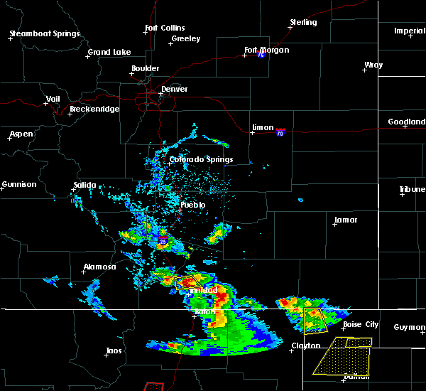 At 613 pm mdt, a severe thunderstorm was located 7 miles southeast of aguilar, or 11 miles north of trinidad, moving south at 15 mph (radar indicated). Hazards include 60 mph wind gusts and quarter size hail. Hail damage to vehicles is expected. expect wind damage to roofs, siding, and trees. This severe thunderstorm will remain over mainly rural areas of central las animas county. At 613 pm mdt, a severe thunderstorm was located 7 miles southeast of aguilar, or 11 miles north of trinidad, moving south at 15 mph (radar indicated). Hazards include 60 mph wind gusts and quarter size hail. Hail damage to vehicles is expected. expect wind damage to roofs, siding, and trees. This severe thunderstorm will remain over mainly rural areas of central las animas county.
|
| 6/25/2017 5:55 PM MDT |
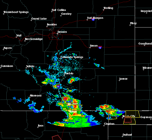 At 555 pm mdt, a severe thunderstorm was located near aguilar, or 15 miles north of trinidad, moving south at 15 mph (radar indicated). Hazards include 60 mph wind gusts and quarter size hail. Hail damage to vehicles is expected. Expect wind damage to roofs, siding, and trees. At 555 pm mdt, a severe thunderstorm was located near aguilar, or 15 miles north of trinidad, moving south at 15 mph (radar indicated). Hazards include 60 mph wind gusts and quarter size hail. Hail damage to vehicles is expected. Expect wind damage to roofs, siding, and trees.
|
| 5/8/2017 2:00 PM MDT | Quarter sized hail reported 15.2 miles SW of Hoehne, CO |
| 7/14/2016 8:15 PM MDT |
 At 814 pm mdt, a severe thunderstorm was located near segundo, or 11 miles west of trinidad, moving east at 25 mph (radar indicated). Hazards include 60 mph wind gusts and quarter size hail. Hail damage to vehicles is expected. expect wind damage to roofs, siding, and trees. Locations impacted include, trinidad, cokedale, starkville, boncarbo, segundo and weston. At 814 pm mdt, a severe thunderstorm was located near segundo, or 11 miles west of trinidad, moving east at 25 mph (radar indicated). Hazards include 60 mph wind gusts and quarter size hail. Hail damage to vehicles is expected. expect wind damage to roofs, siding, and trees. Locations impacted include, trinidad, cokedale, starkville, boncarbo, segundo and weston.
|
| 7/14/2016 8:02 PM MDT |
 At 800 pm mdt, a severe thunderstorm was located near segundo, or 17 miles west of trinidad, moving east at 30 mph (radar indicated). Hazards include 60 mph wind gusts and half dollar size hail. Hail damage to vehicles is expected. expect wind damage to roofs, siding, and trees. Locations impacted include, trinidad, cokedale, starkville, boncarbo, segundo and weston. At 800 pm mdt, a severe thunderstorm was located near segundo, or 17 miles west of trinidad, moving east at 30 mph (radar indicated). Hazards include 60 mph wind gusts and half dollar size hail. Hail damage to vehicles is expected. expect wind damage to roofs, siding, and trees. Locations impacted include, trinidad, cokedale, starkville, boncarbo, segundo and weston.
|
| 7/14/2016 7:47 PM MDT |
 At 745 pm mdt, a severe thunderstorm was located near stonewall, or 22 miles west of trinidad, moving east-southeast at 20 mph. in addition, another severe thunderstorm was located 4 miles south of model, moving to the east-southeast at 20 mph (radar indicated). Hazards include 60 mph wind gusts and half dollar size hail. Hail damage to vehicles is expected. expect wind damage to roofs, siding, and trees. Locations impacted include, trinidad, cokedale, starkville, boncarbo, segundo and weston. At 745 pm mdt, a severe thunderstorm was located near stonewall, or 22 miles west of trinidad, moving east-southeast at 20 mph. in addition, another severe thunderstorm was located 4 miles south of model, moving to the east-southeast at 20 mph (radar indicated). Hazards include 60 mph wind gusts and half dollar size hail. Hail damage to vehicles is expected. expect wind damage to roofs, siding, and trees. Locations impacted include, trinidad, cokedale, starkville, boncarbo, segundo and weston.
|
| 7/14/2016 7:33 PM MDT |
 At 733 pm mdt, a severe thunderstorm was located near stonewall, or 21 miles west of trinidad, moving east at 25 mph (radar indicated). Hazards include ping pong ball size hail and 60 mph wind gusts. People and animals outdoors will be injured. expect hail damage to roofs, siding, windows, and vehicles. Expect wind damage to roofs, siding, and trees. At 733 pm mdt, a severe thunderstorm was located near stonewall, or 21 miles west of trinidad, moving east at 25 mph (radar indicated). Hazards include ping pong ball size hail and 60 mph wind gusts. People and animals outdoors will be injured. expect hail damage to roofs, siding, windows, and vehicles. Expect wind damage to roofs, siding, and trees.
|
| 7/14/2016 6:28 PM MDT | Golf Ball sized hail reported 12.2 miles WSW of Hoehne, CO, . |
| 7/14/2016 6:26 PM MDT | Quarter sized hail reported 9 miles WSW of Hoehne, CO, observer had a window broken by the hail. |
| 7/14/2016 6:26 PM MDT |
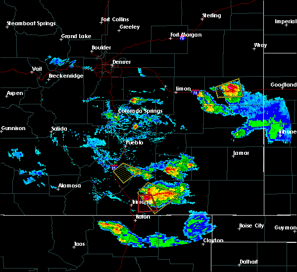 At 626 pm mdt, a severe thunderstorm capable of producing a tornado was located near model, or 16 miles northeast of trinidad, moving south at 25 mph (radar indicated rotation). Hazards include tornado and golf ball size hail. Flying debris will be dangerous to those caught without shelter. mobile homes will be damaged or destroyed. damage to roofs, windows, and vehicles will occur. tree damage is likely. Locations impacted include, model. At 626 pm mdt, a severe thunderstorm capable of producing a tornado was located near model, or 16 miles northeast of trinidad, moving south at 25 mph (radar indicated rotation). Hazards include tornado and golf ball size hail. Flying debris will be dangerous to those caught without shelter. mobile homes will be damaged or destroyed. damage to roofs, windows, and vehicles will occur. tree damage is likely. Locations impacted include, model.
|
| 7/14/2016 6:20 PM MDT |
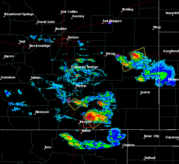 At 620 pm mdt, a severe thunderstorm capable of producing a tornado was located over model, or 17 miles northeast of trinidad, moving south at 25 mph (radar indicated rotation). Hazards include tornado and golf ball size hail. Flying debris will be dangerous to those caught without shelter. mobile homes will be damaged or destroyed. damage to roofs, windows, and vehicles will occur. tree damage is likely. This tornadic thunderstorm will remain over mainly rural areas of south central las animas county. At 620 pm mdt, a severe thunderstorm capable of producing a tornado was located over model, or 17 miles northeast of trinidad, moving south at 25 mph (radar indicated rotation). Hazards include tornado and golf ball size hail. Flying debris will be dangerous to those caught without shelter. mobile homes will be damaged or destroyed. damage to roofs, windows, and vehicles will occur. tree damage is likely. This tornadic thunderstorm will remain over mainly rural areas of south central las animas county.
|
| 7/14/2016 5:47 PM MDT |
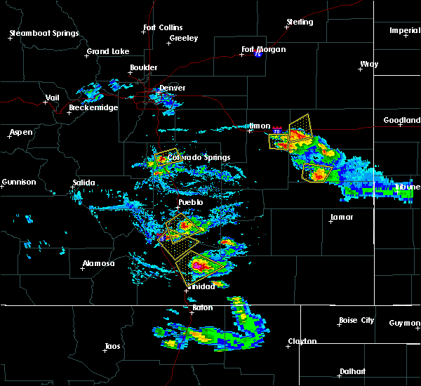 At 547 pm mdt, a severe thunderstorm was located 8 miles northwest of tyrone, or 24 miles north of trinidad, moving southeast at 20 mph (radar indicated). Hazards include 60 mph wind gusts and half dollar size hail. Hail damage to vehicles is expected. expect wind damage to roofs, siding, and trees. Locations impacted include, tyrone. At 547 pm mdt, a severe thunderstorm was located 8 miles northwest of tyrone, or 24 miles north of trinidad, moving southeast at 20 mph (radar indicated). Hazards include 60 mph wind gusts and half dollar size hail. Hail damage to vehicles is expected. expect wind damage to roofs, siding, and trees. Locations impacted include, tyrone.
|
| 7/14/2016 5:29 PM MDT |
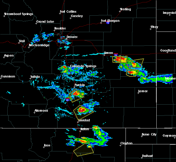 At 529 pm mdt, a severe thunderstorm was located 13 miles west of tyrone, or 24 miles north of trinidad, moving southeast at 25 mph (radar indicated). Hazards include 60 mph wind gusts and half dollar size hail. Hail damage to vehicles is expected. expect wind damage to roofs, siding, and trees. Locations impacted include, tyrone. At 529 pm mdt, a severe thunderstorm was located 13 miles west of tyrone, or 24 miles north of trinidad, moving southeast at 25 mph (radar indicated). Hazards include 60 mph wind gusts and half dollar size hail. Hail damage to vehicles is expected. expect wind damage to roofs, siding, and trees. Locations impacted include, tyrone.
|
| 7/14/2016 5:15 PM MDT |
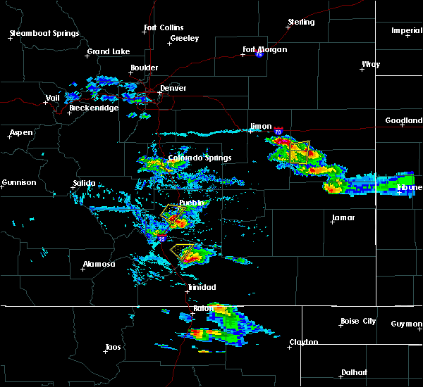 At 515 pm mdt, a severe thunderstorm was located 14 miles northeast of aguilar, or 28 miles north of trinidad, moving southeast at 30 mph (radar indicated). Hazards include ping pong ball size hail and 60 mph wind gusts. People and animals outdoors will be injured. expect hail damage to roofs, siding, windows, and vehicles. Expect wind damage to roofs, siding, and trees. At 515 pm mdt, a severe thunderstorm was located 14 miles northeast of aguilar, or 28 miles north of trinidad, moving southeast at 30 mph (radar indicated). Hazards include ping pong ball size hail and 60 mph wind gusts. People and animals outdoors will be injured. expect hail damage to roofs, siding, windows, and vehicles. Expect wind damage to roofs, siding, and trees.
|
| 6/13/2016 1:43 PM MDT |
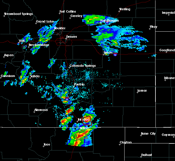 At 142 pm mdt, a severe thunderstorm capable of producing a tornado was located 11 miles south of model, or 16 miles east of trinidad, moving east at 15 mph (radar indicated rotation). Hazards include tornado and baseball size hail. Flying debris will be dangerous to those caught without shelter. mobile homes will be damaged or destroyed. damage to roofs, windows, and vehicles will occur. tree damage is likely. locations impacted include, hoehne. A weather service employee reports a rapidly rotating wall cloud. At 142 pm mdt, a severe thunderstorm capable of producing a tornado was located 11 miles south of model, or 16 miles east of trinidad, moving east at 15 mph (radar indicated rotation). Hazards include tornado and baseball size hail. Flying debris will be dangerous to those caught without shelter. mobile homes will be damaged or destroyed. damage to roofs, windows, and vehicles will occur. tree damage is likely. locations impacted include, hoehne. A weather service employee reports a rapidly rotating wall cloud.
|
| 6/13/2016 1:39 PM MDT |
 At 139 pm mdt, a severe thunderstorm capable of producing a tornado was located 10 miles southeast of hoehne, or 14 miles east of trinidad, moving east at 10 mph (radar indicated rotation). Hazards include tornado and baseball size hail. Flying debris will be dangerous to those caught without shelter. mobile homes will be damaged or destroyed. damage to roofs, windows, and vehicles will occur. tree damage is likely. Locations impacted include, hoehne. At 139 pm mdt, a severe thunderstorm capable of producing a tornado was located 10 miles southeast of hoehne, or 14 miles east of trinidad, moving east at 10 mph (radar indicated rotation). Hazards include tornado and baseball size hail. Flying debris will be dangerous to those caught without shelter. mobile homes will be damaged or destroyed. damage to roofs, windows, and vehicles will occur. tree damage is likely. Locations impacted include, hoehne.
|
| 6/13/2016 1:35 PM MDT |
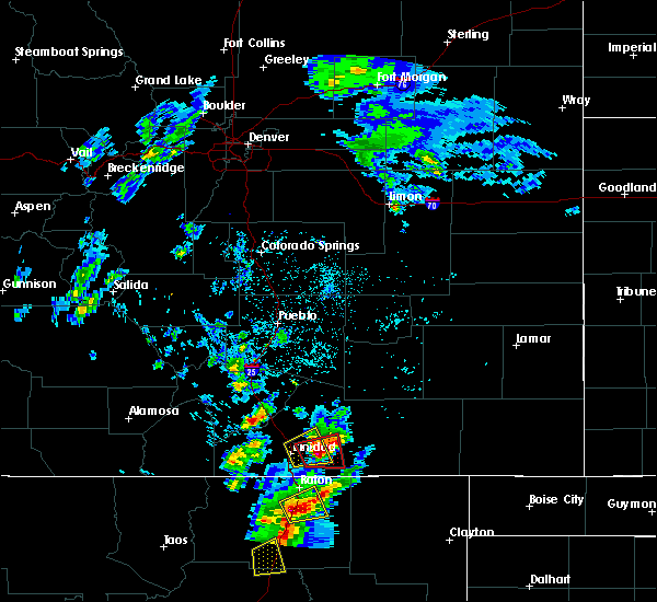 At 135 pm mdt, a severe thunderstorm capable of producing a tornado was located 10 miles southeast of hoehne, or 14 miles east of trinidad, moving east at 20 mph (radar indicated rotation). Hazards include tornado and two inch hail. Flying debris will be dangerous to those caught without shelter. mobile homes will be damaged or destroyed. damage to roofs, windows, and vehicles will occur. tree damage is likely. This tornadic thunderstorm will remain over mainly rural areas of south central las animas county. At 135 pm mdt, a severe thunderstorm capable of producing a tornado was located 10 miles southeast of hoehne, or 14 miles east of trinidad, moving east at 20 mph (radar indicated rotation). Hazards include tornado and two inch hail. Flying debris will be dangerous to those caught without shelter. mobile homes will be damaged or destroyed. damage to roofs, windows, and vehicles will occur. tree damage is likely. This tornadic thunderstorm will remain over mainly rural areas of south central las animas county.
|
| 6/13/2016 1:25 PM MDT |
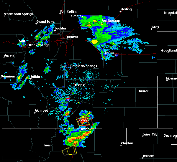 At 125 pm mdt, a severe thunderstorm capable of producing a tornado was located 8 miles southeast of hoehne, or 11 miles east of trinidad, moving east at 10 mph (radar indicated rotation). Hazards include tornado and hail up to two inches in diameter. Flying debris will be dangerous to those caught without shelter. mobile homes will be damaged or destroyed. damage to roofs, windows, and vehicles will occur. tree damage is likely. This tornadic thunderstorm will remain over mainly rural areas of south central las animas county. At 125 pm mdt, a severe thunderstorm capable of producing a tornado was located 8 miles southeast of hoehne, or 11 miles east of trinidad, moving east at 10 mph (radar indicated rotation). Hazards include tornado and hail up to two inches in diameter. Flying debris will be dangerous to those caught without shelter. mobile homes will be damaged or destroyed. damage to roofs, windows, and vehicles will occur. tree damage is likely. This tornadic thunderstorm will remain over mainly rural areas of south central las animas county.
|
| 6/13/2016 1:18 PM MDT |
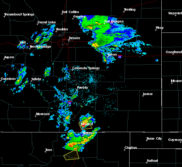 At 118 pm mdt, a severe thunderstorm was located near trinidad, moving east at 20 mph (radar indicated). Hazards include golf ball size hail. People and animals outdoors will be injured. expect damage to roofs, siding, windows, and vehicles. Locations impacted include, trinidad and hoehne. At 118 pm mdt, a severe thunderstorm was located near trinidad, moving east at 20 mph (radar indicated). Hazards include golf ball size hail. People and animals outdoors will be injured. expect damage to roofs, siding, windows, and vehicles. Locations impacted include, trinidad and hoehne.
|
| 6/13/2016 1:07 PM MDT |
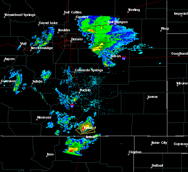 At 107 pm mdt, a severe thunderstorm was located over trinidad, moving east at 20 mph (radar indicated). Hazards include golf ball size hail. People and animals outdoors will be injured. Expect damage to roofs, siding, windows, and vehicles. At 107 pm mdt, a severe thunderstorm was located over trinidad, moving east at 20 mph (radar indicated). Hazards include golf ball size hail. People and animals outdoors will be injured. Expect damage to roofs, siding, windows, and vehicles.
|
| 6/13/2016 1:01 PM MDT |
 At 101 pm mdt, a severe thunderstorm was located over trinidad, moving northeast at 20 mph (trained weather spotters). Hazards include ping pong ball size hail and 60 mph wind gusts. People and animals outdoors will be injured. expect hail damage to roofs, siding, windows, and vehicles. expect wind damage to roofs, siding, and trees. Locations impacted include, trinidad, cokedale, starkville and hoehne. At 101 pm mdt, a severe thunderstorm was located over trinidad, moving northeast at 20 mph (trained weather spotters). Hazards include ping pong ball size hail and 60 mph wind gusts. People and animals outdoors will be injured. expect hail damage to roofs, siding, windows, and vehicles. expect wind damage to roofs, siding, and trees. Locations impacted include, trinidad, cokedale, starkville and hoehne.
|
| 6/13/2016 12:57 PM MDT |
 At 1256 pm mdt, a severe thunderstorm was located over trinidad, moving northeast at 15 mph (trained weather spotters). Hazards include 60 mph wind gusts and quarter size hail. Hail damage to vehicles is expected. expect wind damage to roofs, siding, and trees. locations impacted include, trinidad, cokedale, starkville and hoehne. A spotter 4 miles west southwest of trinidad reporter quarter size hail. At 1256 pm mdt, a severe thunderstorm was located over trinidad, moving northeast at 15 mph (trained weather spotters). Hazards include 60 mph wind gusts and quarter size hail. Hail damage to vehicles is expected. expect wind damage to roofs, siding, and trees. locations impacted include, trinidad, cokedale, starkville and hoehne. A spotter 4 miles west southwest of trinidad reporter quarter size hail.
|
| 6/13/2016 12:46 PM MDT |
 At 1245 pm mdt, a severe thunderstorm was located over cokedale, or near trinidad, moving northeast at 25 mph (radar indicated). Hazards include 60 mph wind gusts and quarter size hail. Hail damage to vehicles is expected. Expect wind damage to roofs, siding, and trees. At 1245 pm mdt, a severe thunderstorm was located over cokedale, or near trinidad, moving northeast at 25 mph (radar indicated). Hazards include 60 mph wind gusts and quarter size hail. Hail damage to vehicles is expected. Expect wind damage to roofs, siding, and trees.
|
| 5/27/2015 3:39 PM MDT | The severe thunderstorm warning for south central las animas county will expire at 345 pm mdt, the storm which prompted the warning has weakened below severe limits, and no longer pose an immediate threat to life or property. therefore the warning will be allowed to expire. however small hail is still possible with this thunderstorm. |
| 5/27/2015 3:30 PM MDT | At 329 pm mdt, a severe thunderstorm was located near trinidad, moving east at 25 mph. the strongest portion of the storm was now located east of interstate 25 (radar indicated). Hazards include 60 mph wind gusts and quarter size hail. Hail damage to vehicles is expected. expect wind damage to roofs, siding and trees. Locations impacted include, trinidad and hoehne. |
| 5/27/2015 3:20 PM MDT | At 319 pm mdt, a severe thunderstorm was located over trinidad, moving east at 25 mph (radar indicated). Hazards include 60 mph wind gusts and quarter size hail. Hail damage to vehicles is expected. Expect wind damage to roofs, siding and trees. |
| 7/16/2014 8:30 PM MDT | Storm damage reported in las animas county CO, 3.7 miles WNW of Hoehne, CO |
| 6/8/2014 3:07 PM MDT | Storm damage reported in las animas county CO, 3.2 miles NW of Hoehne, CO |
| 4/22/2014 2:58 PM MDT | Storm damage reported in las animas county CO, 3.2 miles NW of Hoehne, CO |
| 10/10/2013 3:09 PM MDT | Trinidad aso in las animas county CO, 3.2 miles NW of Hoehne, CO |
| 5/19/2012 2:17 PM MDT | Quarter sized hail reported 16.9 miles SSW of Hoehne, CO, fell for 9 minutes. |
| 1/1/0001 12:00 AM | Tad asos in las animas county CO, 3.2 miles NW of Hoehne, CO |
Hail Maps for Hoehne, CO
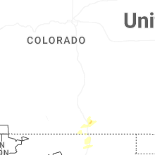
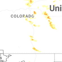


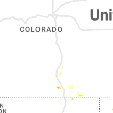
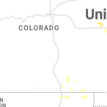


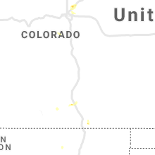


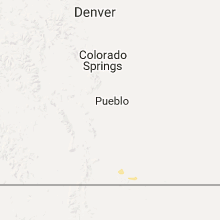


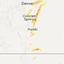


Connect with Interactive Hail Maps