

Hail Map for Holland, MA
The Holland, MA area has had 0 reports of on-the-ground hail by trained spotters, and has been under severe weather warnings 8 times during the past 12 months. Doppler radar has detected hail at or near Holland, MA on 25 occasions.
| Name: | Holland, MA |
| Where Located: | 41.6 miles WNW of Providence, RI |
| Map: | Google Map for Holland, MA |
| Population: | 1464 |
| Housing Units: | 957 |
| More Info: | Search Google for Holland, MA |
3
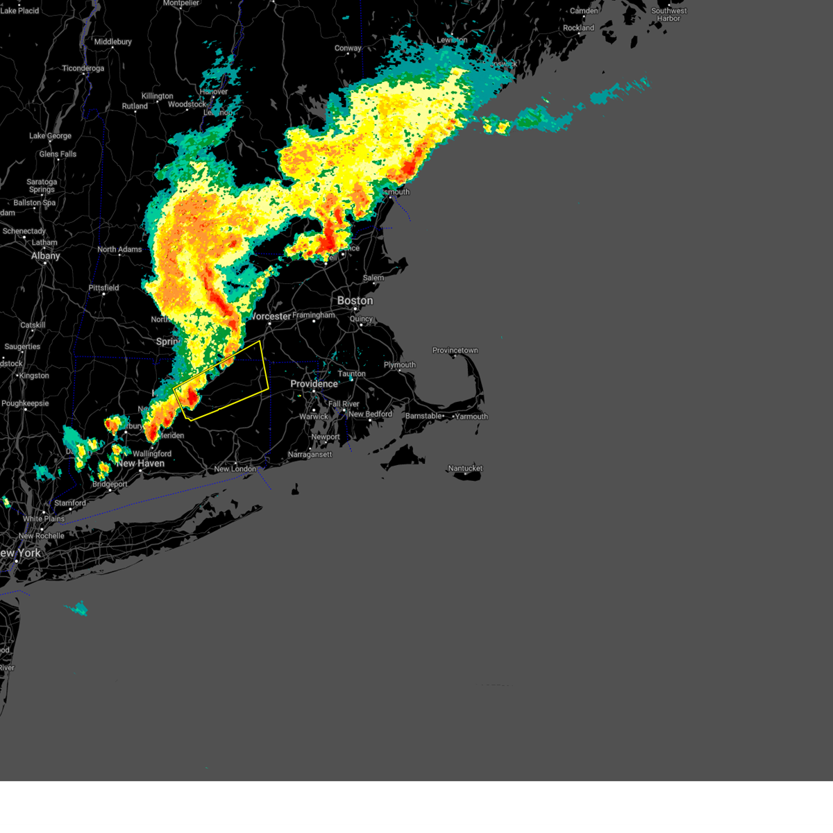
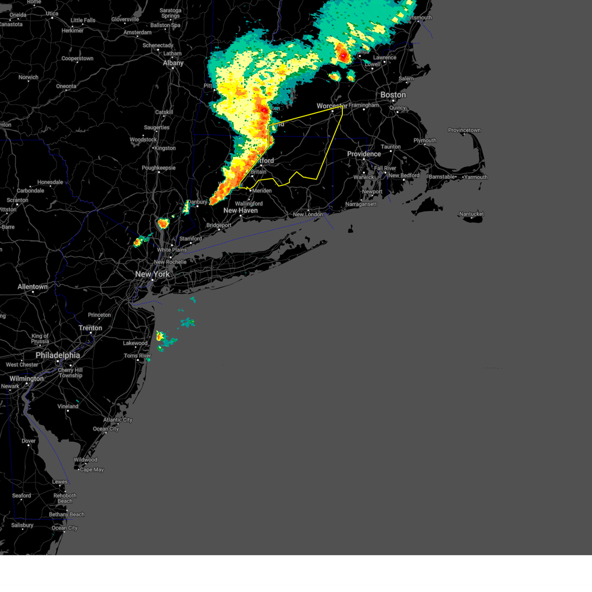
The Top Recent Hail Date for Holland, MA is Wednesday, May 8, 2024 (3rd out of 25)

Hail and Wind Damage Spotted near Holland, MA
| Date / Time | Report Details |
|---|---|
| 7/1/2025 6:39 PM EDT | Svrbox the national weather service in boston/norton has issued a * severe thunderstorm warning for, northern windham county in northern connecticut, northern tolland county in northern connecticut, southern worcester county in central massachusetts, southeastern hampden county in western massachusetts, northwestern providence county in rhode island, * until 730 pm edt. * at 638 pm edt, a line of severe thunderstorms was located over southbridge, or 19 miles southwest of worcester, moving east at 30 mph (radar indicated). Hazards include 60 mph wind gusts and nickel size hail. expect damage to trees and power lines |
| 5/3/2025 4:40 PM EDT |
 Svrbox the national weather service in boston/norton has issued a * severe thunderstorm warning for, northern windham county in northern connecticut, tolland county in northern connecticut, east central hartford county in northern connecticut, south central worcester county in central massachusetts, southeastern hampden county in western massachusetts, * until 530 pm edt. * at 440 pm edt, a severe thunderstorm was located over vernon, moving northeast at 45 mph (radar indicated). Hazards include 60 mph wind gusts and nickel size hail. expect damage to trees and power lines Svrbox the national weather service in boston/norton has issued a * severe thunderstorm warning for, northern windham county in northern connecticut, tolland county in northern connecticut, east central hartford county in northern connecticut, south central worcester county in central massachusetts, southeastern hampden county in western massachusetts, * until 530 pm edt. * at 440 pm edt, a severe thunderstorm was located over vernon, moving northeast at 45 mph (radar indicated). Hazards include 60 mph wind gusts and nickel size hail. expect damage to trees and power lines
|
| 5/3/2025 4:07 PM EDT |
 Svrbox the national weather service in boston/norton has issued a * severe thunderstorm warning for, windham county in northern connecticut, tolland county in northern connecticut, central hartford county in northern connecticut, southwestern worcester county in central massachusetts, southeastern hampden county in western massachusetts, * until 445 pm edt. * at 406 pm edt, severe thunderstorms were located along a line extending from near chicopee to near somers to near southington, moving northeast at 65 mph (radar indicated). Hazards include 60 mph wind gusts and penny size hail. expect damage to trees and power lines Svrbox the national weather service in boston/norton has issued a * severe thunderstorm warning for, windham county in northern connecticut, tolland county in northern connecticut, central hartford county in northern connecticut, southwestern worcester county in central massachusetts, southeastern hampden county in western massachusetts, * until 445 pm edt. * at 406 pm edt, severe thunderstorms were located along a line extending from near chicopee to near somers to near southington, moving northeast at 65 mph (radar indicated). Hazards include 60 mph wind gusts and penny size hail. expect damage to trees and power lines
|
| 8/26/2024 3:31 PM EDT |
 the severe thunderstorm warning has been cancelled and is no longer in effect the severe thunderstorm warning has been cancelled and is no longer in effect
|
| 8/26/2024 3:21 PM EDT |
 At 321 pm edt, a severe thunderstorm was located near palmer, or 12 miles east of springfield, moving south at 20 mph (radar indicated). Hazards include 60 mph wind gusts and quarter size hail. Hail damage to vehicles is expected. expect wind damage to trees and power lines. Locations impacted include, ludlow, southbridge, ellington, wilbraham, palmer, stafford, somers, sturbridge, monson, woodstock, hampden, warren, brimfield, holland, wales, and union. At 321 pm edt, a severe thunderstorm was located near palmer, or 12 miles east of springfield, moving south at 20 mph (radar indicated). Hazards include 60 mph wind gusts and quarter size hail. Hail damage to vehicles is expected. expect wind damage to trees and power lines. Locations impacted include, ludlow, southbridge, ellington, wilbraham, palmer, stafford, somers, sturbridge, monson, woodstock, hampden, warren, brimfield, holland, wales, and union.
|
| 8/26/2024 3:21 PM EDT |
 the severe thunderstorm warning has been cancelled and is no longer in effect the severe thunderstorm warning has been cancelled and is no longer in effect
|
| 8/26/2024 2:54 PM EDT |
 Svrbox the national weather service in boston/norton has issued a * severe thunderstorm warning for, north central windham county in northern connecticut, northeastern tolland county in northern connecticut, southwestern worcester county in central massachusetts, southeastern hampshire county in western massachusetts, southeastern franklin county in western massachusetts, southeastern hampden county in western massachusetts, * until 345 pm edt. * at 254 pm edt, a severe thunderstorm was located over belchertown, or 10 miles southeast of amherst, moving south at 20 mph (radar indicated). Hazards include 60 mph wind gusts and quarter size hail. Hail damage to vehicles is expected. Expect wind damage to trees and power lines. Svrbox the national weather service in boston/norton has issued a * severe thunderstorm warning for, north central windham county in northern connecticut, northeastern tolland county in northern connecticut, southwestern worcester county in central massachusetts, southeastern hampshire county in western massachusetts, southeastern franklin county in western massachusetts, southeastern hampden county in western massachusetts, * until 345 pm edt. * at 254 pm edt, a severe thunderstorm was located over belchertown, or 10 miles southeast of amherst, moving south at 20 mph (radar indicated). Hazards include 60 mph wind gusts and quarter size hail. Hail damage to vehicles is expected. Expect wind damage to trees and power lines.
|
| 7/17/2024 6:23 PM EDT | Svrbox the national weather service in boston/norton has issued a * severe thunderstorm warning for, worcester county in central massachusetts, central middlesex county in northeastern massachusetts, southeastern hampden county in western massachusetts, * until 730 pm edt. * at 622 pm edt, severe thunderstorms were located along a line extending from near ashburnham to spencer to near monson, moving east at 30 mph (radar indicated). Hazards include 60 mph wind gusts and penny size hail. expect damage to roofs, siding, and trees |
| 6/26/2024 10:29 PM EDT |
 Svrbox the national weather service in boston/norton has issued a * severe thunderstorm warning for, windham county in northern connecticut, eastern tolland county in northern connecticut, southwestern worcester county in central massachusetts, southeastern hampden county in western massachusetts, * until 1130 pm edt. * at 1026 pm edt, severe thunderstorms were located along a line extending from longmeadow to vernon to near colchester, moving northeast at 35 mph. these are destructive storms for willimantic, hampton, windham, woodstock and ashford (radar indicated). Hazards include 80 mph wind gusts. Flying debris will be dangerous to those caught without shelter. mobile homes will be heavily damaged. expect considerable damage to roofs, windows, and vehicles. Extensive tree damage and power outages are likely. Svrbox the national weather service in boston/norton has issued a * severe thunderstorm warning for, windham county in northern connecticut, eastern tolland county in northern connecticut, southwestern worcester county in central massachusetts, southeastern hampden county in western massachusetts, * until 1130 pm edt. * at 1026 pm edt, severe thunderstorms were located along a line extending from longmeadow to vernon to near colchester, moving northeast at 35 mph. these are destructive storms for willimantic, hampton, windham, woodstock and ashford (radar indicated). Hazards include 80 mph wind gusts. Flying debris will be dangerous to those caught without shelter. mobile homes will be heavily damaged. expect considerable damage to roofs, windows, and vehicles. Extensive tree damage and power outages are likely.
|
| 6/22/2024 3:56 PM EDT |
 Svrbox the national weather service in boston/norton has issued a * severe thunderstorm warning for, windham county in northern connecticut, northeastern tolland county in northern connecticut, southwestern worcester county in central massachusetts, southeastern hampden county in western massachusetts, western kent county in rhode island, providence county in rhode island, * until 500 pm edt. * at 356 pm edt, a severe thunderstorm was located over union, or 12 miles north of mansfield, moving southeast at 35 mph (radar indicated). Hazards include 60 mph wind gusts and quarter size hail. Hail damage to vehicles is expected. Expect wind damage to roofs, siding, and trees. Svrbox the national weather service in boston/norton has issued a * severe thunderstorm warning for, windham county in northern connecticut, northeastern tolland county in northern connecticut, southwestern worcester county in central massachusetts, southeastern hampden county in western massachusetts, western kent county in rhode island, providence county in rhode island, * until 500 pm edt. * at 356 pm edt, a severe thunderstorm was located over union, or 12 miles north of mansfield, moving southeast at 35 mph (radar indicated). Hazards include 60 mph wind gusts and quarter size hail. Hail damage to vehicles is expected. Expect wind damage to roofs, siding, and trees.
|
| 6/22/2024 3:53 PM EDT |
 the severe thunderstorm warning has been cancelled and is no longer in effect the severe thunderstorm warning has been cancelled and is no longer in effect
|
| 6/22/2024 3:53 PM EDT |
 At 353 pm edt, severe thunderstorms were located along a line extending from near boylston to brookfield to near stafford, moving east at 30 mph (radar indicated). Hazards include 60 mph wind gusts and quarter size hail. Hail damage to vehicles is expected. expect wind damage to roofs, siding, and trees. Locations impacted include, grafton, webster, southbridge, auburn, northbridge, ellington, oxford, millbury, charlton, stafford, spencer, dudley, leicester, putnam, thompson, sturbridge, sutton, douglas, woodstock, and upton. At 353 pm edt, severe thunderstorms were located along a line extending from near boylston to brookfield to near stafford, moving east at 30 mph (radar indicated). Hazards include 60 mph wind gusts and quarter size hail. Hail damage to vehicles is expected. expect wind damage to roofs, siding, and trees. Locations impacted include, grafton, webster, southbridge, auburn, northbridge, ellington, oxford, millbury, charlton, stafford, spencer, dudley, leicester, putnam, thompson, sturbridge, sutton, douglas, woodstock, and upton.
|
| 6/22/2024 3:35 PM EDT |
 At 334 pm edt, severe thunderstorms were located along a line extending from near rutland to near palmer to somers, moving east at 30 mph (radar indicated). Hazards include 60 mph wind gusts and penny size hail. Expect damage to roofs, siding, and trees. Locations impacted include, worcester, framingham, enfield, marlborough, shrewsbury, westborough, grafton, holden, webster, southbridge, ashland, auburn, east longmeadow, northbridge, ellington, hopkinton, belchertown, wilbraham, northborough, and oxford. At 334 pm edt, severe thunderstorms were located along a line extending from near rutland to near palmer to somers, moving east at 30 mph (radar indicated). Hazards include 60 mph wind gusts and penny size hail. Expect damage to roofs, siding, and trees. Locations impacted include, worcester, framingham, enfield, marlborough, shrewsbury, westborough, grafton, holden, webster, southbridge, ashland, auburn, east longmeadow, northbridge, ellington, hopkinton, belchertown, wilbraham, northborough, and oxford.
|
| 6/22/2024 3:35 PM EDT |
 the severe thunderstorm warning has been cancelled and is no longer in effect the severe thunderstorm warning has been cancelled and is no longer in effect
|
| 6/22/2024 3:22 PM EDT |
 Svrbox the national weather service in boston/norton has issued a * severe thunderstorm warning for, northern windham county in northern connecticut, northern tolland county in northern connecticut, northeastern hartford county in northern connecticut, southern worcester county in central massachusetts, southeastern hampshire county in western massachusetts, south central middlesex county in northeastern massachusetts, southeastern franklin county in western massachusetts, southeastern hampden county in western massachusetts, * until 415 pm edt. * at 321 pm edt, severe thunderstorms were located along a line extending from oakham to near ludlow to enfield, moving east at 30 mph (radar indicated). Hazards include 60 mph wind gusts and penny size hail. expect damage to roofs, siding, and trees Svrbox the national weather service in boston/norton has issued a * severe thunderstorm warning for, northern windham county in northern connecticut, northern tolland county in northern connecticut, northeastern hartford county in northern connecticut, southern worcester county in central massachusetts, southeastern hampshire county in western massachusetts, south central middlesex county in northeastern massachusetts, southeastern franklin county in western massachusetts, southeastern hampden county in western massachusetts, * until 415 pm edt. * at 321 pm edt, severe thunderstorms were located along a line extending from oakham to near ludlow to enfield, moving east at 30 mph (radar indicated). Hazards include 60 mph wind gusts and penny size hail. expect damage to roofs, siding, and trees
|
| 6/21/2024 6:00 PM EDT |
 the severe thunderstorm warning has been cancelled and is no longer in effect the severe thunderstorm warning has been cancelled and is no longer in effect
|
| 6/21/2024 5:43 PM EDT |
 Svrbox the national weather service in boston/norton has issued a * severe thunderstorm warning for, northern windham county in northern connecticut, northeastern tolland county in northern connecticut, south central worcester county in central massachusetts, southeastern hampden county in western massachusetts, northwestern providence county in rhode island, * until 645 pm edt. * at 543 pm edt, a severe thunderstorm was located over union, or 12 miles north of mansfield, moving northeast at 15 mph (radar indicated). Hazards include 60 mph wind gusts and quarter size hail. Hail damage to vehicles is expected. Expect wind damage to roofs, siding, and trees. Svrbox the national weather service in boston/norton has issued a * severe thunderstorm warning for, northern windham county in northern connecticut, northeastern tolland county in northern connecticut, south central worcester county in central massachusetts, southeastern hampden county in western massachusetts, northwestern providence county in rhode island, * until 645 pm edt. * at 543 pm edt, a severe thunderstorm was located over union, or 12 miles north of mansfield, moving northeast at 15 mph (radar indicated). Hazards include 60 mph wind gusts and quarter size hail. Hail damage to vehicles is expected. Expect wind damage to roofs, siding, and trees.
|
| 5/8/2024 5:12 PM EDT |
 The storms which prompted the warning have moved out of the area. therefore, the warning will be allowed to expire. however small hail and gusty winds are still possible with these thunderstorms. The storms which prompted the warning have moved out of the area. therefore, the warning will be allowed to expire. however small hail and gusty winds are still possible with these thunderstorms.
|
| 5/8/2024 4:46 PM EDT |
 the severe thunderstorm warning has been cancelled and is no longer in effect the severe thunderstorm warning has been cancelled and is no longer in effect
|
| 5/8/2024 4:46 PM EDT |
 At 445 pm edt, severe thunderstorms were located along a line extending from sutton to eastford, moving southeast at 30 mph (radar indicated). Hazards include 60 mph wind gusts and half dollar size hail. Hail damage to vehicles is expected. expect wind damage to roofs, siding, and trees. Locations impacted include, worcester, woonsocket, franklin, mansfield, windham, grafton, killingly, webster, southbridge, bellingham, auburn, burrillville, northbridge, ellington, tolland, oxford, uxbridge, millbury, charlton, and stafford. At 445 pm edt, severe thunderstorms were located along a line extending from sutton to eastford, moving southeast at 30 mph (radar indicated). Hazards include 60 mph wind gusts and half dollar size hail. Hail damage to vehicles is expected. expect wind damage to roofs, siding, and trees. Locations impacted include, worcester, woonsocket, franklin, mansfield, windham, grafton, killingly, webster, southbridge, bellingham, auburn, burrillville, northbridge, ellington, tolland, oxford, uxbridge, millbury, charlton, and stafford.
|
| 5/8/2024 4:27 PM EDT |
 At 426 pm edt, severe thunderstorms were located along a line extending from near spencer to stafford, moving southeast at 20 mph (radar indicated). Hazards include 60 mph wind gusts and quarter size hail. this storm has a history of hail up to 1 inch in diameter in springfield. Hail damage to vehicles is expected. expect wind damage to roofs, siding, and trees. Locations impacted include, worcester, enfield, woonsocket, franklin, mansfield, windham, grafton, killingly, webster, southbridge, bellingham, auburn, burrillville, longmeadow, east longmeadow, northbridge, ellington, tolland, wilbraham, and oxford. At 426 pm edt, severe thunderstorms were located along a line extending from near spencer to stafford, moving southeast at 20 mph (radar indicated). Hazards include 60 mph wind gusts and quarter size hail. this storm has a history of hail up to 1 inch in diameter in springfield. Hail damage to vehicles is expected. expect wind damage to roofs, siding, and trees. Locations impacted include, worcester, enfield, woonsocket, franklin, mansfield, windham, grafton, killingly, webster, southbridge, bellingham, auburn, burrillville, longmeadow, east longmeadow, northbridge, ellington, tolland, wilbraham, and oxford.
|
| 5/8/2024 4:22 PM EDT |
 Svrbox the national weather service in boston/norton has issued a * severe thunderstorm warning for, windham county in northern connecticut, northern tolland county in northern connecticut, northern hartford county in northern connecticut, southern worcester county in central massachusetts, western norfolk county in eastern massachusetts, southeastern hampden county in western massachusetts, northwestern providence county in rhode island, * until 515 pm edt. * at 421 pm edt, severe thunderstorms were located along a line extending from near leicester to stafford, moving southeast at 20 mph (radar indicated. at 415 pm, hail up to quarter size were reported in springfield). Hazards include 60 mph wind gusts and quarter size hail. Hail damage to vehicles is expected. Expect wind damage to roofs, siding, and trees. Svrbox the national weather service in boston/norton has issued a * severe thunderstorm warning for, windham county in northern connecticut, northern tolland county in northern connecticut, northern hartford county in northern connecticut, southern worcester county in central massachusetts, western norfolk county in eastern massachusetts, southeastern hampden county in western massachusetts, northwestern providence county in rhode island, * until 515 pm edt. * at 421 pm edt, severe thunderstorms were located along a line extending from near leicester to stafford, moving southeast at 20 mph (radar indicated. at 415 pm, hail up to quarter size were reported in springfield). Hazards include 60 mph wind gusts and quarter size hail. Hail damage to vehicles is expected. Expect wind damage to roofs, siding, and trees.
|
| 9/8/2023 6:17 PM EDT |
 At 616 pm edt, severe thunderstorms were located along a line extending from hampden to stafford to near willington, moving northeast at 50 mph (radar indicated). Hazards include 60 mph wind gusts and quarter size hail. Hail damage to vehicles is expected. expect wind damage to roofs, siding, and trees. locations impacted include, manchester, east hartford, enfield, glastonbury, vernon, windsor, mansfield, south windsor, windham, plainfield, bloomfield, rocky hill, willimantic, killingly, webster, southbridge, suffield, east longmeadow, ellington, and tolland. hail threat, radar indicated max hail size, 1. 00 in wind threat, radar indicated max wind gust, 60 mph. At 616 pm edt, severe thunderstorms were located along a line extending from hampden to stafford to near willington, moving northeast at 50 mph (radar indicated). Hazards include 60 mph wind gusts and quarter size hail. Hail damage to vehicles is expected. expect wind damage to roofs, siding, and trees. locations impacted include, manchester, east hartford, enfield, glastonbury, vernon, windsor, mansfield, south windsor, windham, plainfield, bloomfield, rocky hill, willimantic, killingly, webster, southbridge, suffield, east longmeadow, ellington, and tolland. hail threat, radar indicated max hail size, 1. 00 in wind threat, radar indicated max wind gust, 60 mph.
|
| 9/8/2023 5:58 PM EDT |
 At 558 pm edt, severe thunderstorms were located along a line extending from east windsor to vernon to near manchester, moving northeast at 55 mph (radar indicated). Hazards include 60 mph wind gusts and quarter size hail. Hail damage to vehicles is expected. Expect wind damage to roofs, siding, and trees. At 558 pm edt, severe thunderstorms were located along a line extending from east windsor to vernon to near manchester, moving northeast at 55 mph (radar indicated). Hazards include 60 mph wind gusts and quarter size hail. Hail damage to vehicles is expected. Expect wind damage to roofs, siding, and trees.
|
| 9/8/2023 1:46 PM EDT |
 At 146 pm edt, severe thunderstorms were located along a line extending from near north brookfield to southbridge to near woodstock, moving northeast at 30 mph (radar indicated). Hazards include 60 mph wind gusts and quarter size hail. Hail damage to vehicles is expected. expect wind damage to roofs, siding, and trees. locations impacted include, worcester, shrewsbury, grafton, holden, webster, southbridge, auburn, northbridge, oxford, uxbridge, millbury, charlton, stafford, spencer, dudley, leicester, thompson, sturbridge, sutton, and douglas. hail threat, radar indicated max hail size, 1. 00 in wind threat, radar indicated max wind gust, 60 mph. At 146 pm edt, severe thunderstorms were located along a line extending from near north brookfield to southbridge to near woodstock, moving northeast at 30 mph (radar indicated). Hazards include 60 mph wind gusts and quarter size hail. Hail damage to vehicles is expected. expect wind damage to roofs, siding, and trees. locations impacted include, worcester, shrewsbury, grafton, holden, webster, southbridge, auburn, northbridge, oxford, uxbridge, millbury, charlton, stafford, spencer, dudley, leicester, thompson, sturbridge, sutton, and douglas. hail threat, radar indicated max hail size, 1. 00 in wind threat, radar indicated max wind gust, 60 mph.
|
| 9/8/2023 1:27 PM EDT |
 At 127 pm edt, severe thunderstorms were located along a line extending from near brookfield to near union to ashford, moving northeast at 25 mph (radar indicated). Hazards include 60 mph wind gusts and quarter size hail. Hail damage to vehicles is expected. Expect wind damage to roofs, siding, and trees. At 127 pm edt, severe thunderstorms were located along a line extending from near brookfield to near union to ashford, moving northeast at 25 mph (radar indicated). Hazards include 60 mph wind gusts and quarter size hail. Hail damage to vehicles is expected. Expect wind damage to roofs, siding, and trees.
|
| 7/27/2023 5:36 PM EDT |
 At 533 pm edt, a severe thunderstorm was located over ashford, or 8 miles north of mansfield, moving east at 40 mph (trained weather spotters have reported pockets of wind damage west hartford, simsbury and south windsor). Hazards include 60 mph wind gusts and half dollar size hail. Expect wind damage to trees and power lines. minor hail damage to vehicles is possible. locations impacted include, hartford, west hartford, manchester, east hartford, enfield, glastonbury, newington, vernon, windsor, wethersfield, mansfield, south windsor, windham, plainfield, bloomfield, berlin, rocky hill, willimantic, killingly and webster hail threat, radar indicated max hail size, 1. 25 in wind threat, radar indicated max wind gust, 60 mph. At 533 pm edt, a severe thunderstorm was located over ashford, or 8 miles north of mansfield, moving east at 40 mph (trained weather spotters have reported pockets of wind damage west hartford, simsbury and south windsor). Hazards include 60 mph wind gusts and half dollar size hail. Expect wind damage to trees and power lines. minor hail damage to vehicles is possible. locations impacted include, hartford, west hartford, manchester, east hartford, enfield, glastonbury, newington, vernon, windsor, wethersfield, mansfield, south windsor, windham, plainfield, bloomfield, berlin, rocky hill, willimantic, killingly and webster hail threat, radar indicated max hail size, 1. 25 in wind threat, radar indicated max wind gust, 60 mph.
|
| 7/27/2023 5:22 PM EDT |
 At 521 pm edt, a severe thunderstorm was located over east windsor, or near vernon, moving east at 40 mph (radar indicated). Hazards include 60 mph wind gusts and penny size hail. expect damage to trees and power lines At 521 pm edt, a severe thunderstorm was located over east windsor, or near vernon, moving east at 40 mph (radar indicated). Hazards include 60 mph wind gusts and penny size hail. expect damage to trees and power lines
|
| 7/27/2023 4:29 PM EDT |
 At 428 pm edt, a severe thunderstorm was located over palmer, or 12 miles east of springfield, moving east at 35 mph (trained weather spotters have reported a history of wind damage with these storms). Hazards include 60 mph wind gusts and penny size hail. Expect damage to trees and power lines. locations impacted include, worcester, springfield, chicopee, enfield, westfield, holyoke, amherst, agawam, west springfield, ludlow, south hadley, holden, webster, southbridge, auburn, easthampton, longmeadow, suffield, east longmeadow and ellington. hail threat, radar indicated max hail size, 0. 75 in wind threat, observed max wind gust, 60 mph. At 428 pm edt, a severe thunderstorm was located over palmer, or 12 miles east of springfield, moving east at 35 mph (trained weather spotters have reported a history of wind damage with these storms). Hazards include 60 mph wind gusts and penny size hail. Expect damage to trees and power lines. locations impacted include, worcester, springfield, chicopee, enfield, westfield, holyoke, amherst, agawam, west springfield, ludlow, south hadley, holden, webster, southbridge, auburn, easthampton, longmeadow, suffield, east longmeadow and ellington. hail threat, radar indicated max hail size, 0. 75 in wind threat, observed max wind gust, 60 mph.
|
| 7/27/2023 4:19 PM EDT |
 At 417 pm edt, a severe thunderstorm was located over ludlow, or near springfield, moving east at 35 mph (trained weather spotters that these storms have resulted in wind damage. this is particularly true in the westfield area where the asos recorded a 66 mph wind gusts as the storms moved across the region). Hazards include 60 mph wind gusts and penny size hail. Expect damage to trees and power lines. locations impacted include, worcester, springfield, chicopee, enfield, westfield, holyoke, amherst, northampton, agawam, west springfield, ludlow, south hadley, holden, webster, southbridge, auburn, easthampton, longmeadow, suffield and east longmeadow. hail threat, radar indicated max hail size, 0. 75 in wind threat, observed max wind gust, 60 mph. At 417 pm edt, a severe thunderstorm was located over ludlow, or near springfield, moving east at 35 mph (trained weather spotters that these storms have resulted in wind damage. this is particularly true in the westfield area where the asos recorded a 66 mph wind gusts as the storms moved across the region). Hazards include 60 mph wind gusts and penny size hail. Expect damage to trees and power lines. locations impacted include, worcester, springfield, chicopee, enfield, westfield, holyoke, amherst, northampton, agawam, west springfield, ludlow, south hadley, holden, webster, southbridge, auburn, easthampton, longmeadow, suffield and east longmeadow. hail threat, radar indicated max hail size, 0. 75 in wind threat, observed max wind gust, 60 mph.
|
| 7/27/2023 4:03 PM EDT |
 At 400 pm edt, a severe thunderstorm was located over west springfield, moving east at 35 mph (the westfield asos just reported a wind gusts of 66 mph. these are dangerous storms that will produced wind damage). Hazards include 60 mph wind gusts and penny size hail. expect damage to trees and power lines At 400 pm edt, a severe thunderstorm was located over west springfield, moving east at 35 mph (the westfield asos just reported a wind gusts of 66 mph. these are dangerous storms that will produced wind damage). Hazards include 60 mph wind gusts and penny size hail. expect damage to trees and power lines
|
| 7/16/2023 10:16 AM EDT |
 At 1015 am edt, a severe thunderstorm was located over stafford, or 14 miles north of mansfield, moving northeast at 50 mph (radar indicated). Hazards include 60 mph wind gusts. expect damage to trees and power lines At 1015 am edt, a severe thunderstorm was located over stafford, or 14 miles north of mansfield, moving northeast at 50 mph (radar indicated). Hazards include 60 mph wind gusts. expect damage to trees and power lines
|
| 8/26/2022 4:24 PM EDT | The national weather service in boston/norton has issued a * severe thunderstorm warning for. central windham county in northern connecticut. tolland county in northern connecticut. northeastern hartford county in northern connecticut. South central worcester county in central massachusetts. |
| 8/26/2022 4:24 PM EDT | At 424 pm edt, severe thunderstorms were located along a line extending from somers to vernon to east hartford, moving east at 30 mph (radar indicated). Hazards include 60 mph wind gusts and quarter size hail. Expect wind damage to trees and power lines. Minor hail damage to vehicles is possible. |
| 8/26/2022 3:42 PM EDT | At 341 pm edt, a severe thunderstorm was located over east granby, or near windsor, moving east at 50 mph (radar indicated). Hazards include 60 mph wind gusts and quarter size hail. Expect wind damage to trees and power lines. Minor hail damage to vehicles is possible. |
| 8/26/2022 3:42 PM EDT | At 341 pm edt, a severe thunderstorm was located over east granby, or near windsor, moving east at 50 mph (radar indicated). Hazards include 60 mph wind gusts and quarter size hail. Expect wind damage to trees and power lines. Minor hail damage to vehicles is possible. |
| 8/26/2022 3:24 PM EDT | At 324 pm edt, severe thunderstorms were located along a line extending from near framingham to douglas to columbia, moving east at 35 mph (radar indicated). Hazards include 60 mph wind gusts and nickel size hail. expect damage to trees and power lines |
| 8/26/2022 3:24 PM EDT | At 324 pm edt, severe thunderstorms were located along a line extending from near framingham to douglas to columbia, moving east at 35 mph (radar indicated). Hazards include 60 mph wind gusts and nickel size hail. expect damage to trees and power lines |
| 8/26/2022 3:24 PM EDT | At 324 pm edt, severe thunderstorms were located along a line extending from near framingham to douglas to columbia, moving east at 35 mph (radar indicated). Hazards include 60 mph wind gusts and nickel size hail. expect damage to trees and power lines |
| 7/12/2022 6:40 PM EDT |
 The severe thunderstorm warning for southwestern worcester and southeastern hampden counties will expire at 645 pm edt, the storm which prompted the warning has weakened below severe limits, and has exited the warned area. therefore, the warning will be allowed to expire. however gusty winds are still possible with this thunderstorm. The severe thunderstorm warning for southwestern worcester and southeastern hampden counties will expire at 645 pm edt, the storm which prompted the warning has weakened below severe limits, and has exited the warned area. therefore, the warning will be allowed to expire. however gusty winds are still possible with this thunderstorm.
|
| 7/12/2022 6:26 PM EDT |
 At 626 pm edt, a severe thunderstorm was located over brimfield, or 19 miles east of springfield, moving east at 45 mph (radar indicated. at 605 pm, amateur radio reported trees down in longmeadow, ma). Hazards include 60 mph wind gusts and quarter size hail. Expect wind damage to trees and power lines. minor hail damage to vehicles is possible. locations impacted include, southbridge, charlton, palmer, spencer, dudley, leicester, sturbridge, monson, warren, north brookfield, west brookfield, brimfield, brookfield, holland, east brookfield and wales. hail threat, radar indicated max hail size, 1. 00 in wind threat, radar indicated max wind gust, 60 mph. At 626 pm edt, a severe thunderstorm was located over brimfield, or 19 miles east of springfield, moving east at 45 mph (radar indicated. at 605 pm, amateur radio reported trees down in longmeadow, ma). Hazards include 60 mph wind gusts and quarter size hail. Expect wind damage to trees and power lines. minor hail damage to vehicles is possible. locations impacted include, southbridge, charlton, palmer, spencer, dudley, leicester, sturbridge, monson, warren, north brookfield, west brookfield, brimfield, brookfield, holland, east brookfield and wales. hail threat, radar indicated max hail size, 1. 00 in wind threat, radar indicated max wind gust, 60 mph.
|
| 7/12/2022 6:10 PM EDT |
 At 610 pm edt, a severe thunderstorm was located near suffield, or near enfield, moving east at 45 mph (radar indicated). Hazards include 60 mph wind gusts and quarter size hail. Expect wind damage to trees and power lines. Minor hail damage to vehicles is possible. At 610 pm edt, a severe thunderstorm was located near suffield, or near enfield, moving east at 45 mph (radar indicated). Hazards include 60 mph wind gusts and quarter size hail. Expect wind damage to trees and power lines. Minor hail damage to vehicles is possible.
|
| 7/12/2022 6:00 PM EDT |
 At 559 pm edt, a severe thunderstorm was located over chicopee, moving east at 45 mph (radar indicated). Hazards include 60 mph wind gusts and quarter size hail. this storm has a history of producing tree damage. Expect wind damage to trees and power lines. Minor hail damage to vehicles is possible. At 559 pm edt, a severe thunderstorm was located over chicopee, moving east at 45 mph (radar indicated). Hazards include 60 mph wind gusts and quarter size hail. this storm has a history of producing tree damage. Expect wind damage to trees and power lines. Minor hail damage to vehicles is possible.
|
| 5/28/2022 3:20 PM EDT |
 The severe thunderstorm warning for northern windham, northern tolland, southwestern worcester, southeastern hampshire and southeastern hampden counties will expire at 330 pm edt, the storm which prompted the warning has weakened below severe limits, and no longer poses an immediate threat to life or property. therefore, the warning will be allowed to expire. however gusty winds and heavy rain are still possible with this thunderstorm. The severe thunderstorm warning for northern windham, northern tolland, southwestern worcester, southeastern hampshire and southeastern hampden counties will expire at 330 pm edt, the storm which prompted the warning has weakened below severe limits, and no longer poses an immediate threat to life or property. therefore, the warning will be allowed to expire. however gusty winds and heavy rain are still possible with this thunderstorm.
|
| 5/28/2022 2:54 PM EDT |
 At 253 pm edt, a severe thunderstorm was located over sturbridge, or 19 miles southwest of worcester, moving northeast at 35 mph (radar indicated). Hazards include 60 mph wind gusts and penny size hail. Expect damage to trees and power lines. locations impacted include, worcester, vernon, ludlow, holden, webster, southbridge, auburn, ellington, tolland, belchertown, wilbraham, oxford, millbury, charlton, palmer, stafford, spencer, somers, dudley and leicester. hail threat, radar indicated max hail size, 0. 75 in wind threat, radar indicated max wind gust, 60 mph. At 253 pm edt, a severe thunderstorm was located over sturbridge, or 19 miles southwest of worcester, moving northeast at 35 mph (radar indicated). Hazards include 60 mph wind gusts and penny size hail. Expect damage to trees and power lines. locations impacted include, worcester, vernon, ludlow, holden, webster, southbridge, auburn, ellington, tolland, belchertown, wilbraham, oxford, millbury, charlton, palmer, stafford, spencer, somers, dudley and leicester. hail threat, radar indicated max hail size, 0. 75 in wind threat, radar indicated max wind gust, 60 mph.
|
| 5/28/2022 2:34 PM EDT |
 At 234 pm edt, a severe thunderstorm was located over stafford, or 12 miles east of enfield, moving northeast at 35 mph (radar indicated). Hazards include 60 mph wind gusts and nickel size hail. expect damage to trees and power lines At 234 pm edt, a severe thunderstorm was located over stafford, or 12 miles east of enfield, moving northeast at 35 mph (radar indicated). Hazards include 60 mph wind gusts and nickel size hail. expect damage to trees and power lines
|
| 5/22/2022 8:20 PM EDT |
 At 819 pm edt, severe thunderstorms were located along a line extending from near hardwick to somers, moving east at 30 mph (amateur radio and radar indicated. at 810 pm, a large tree was downed in warren from these severe thunderstorms). Hazards include 60 mph wind gusts and penny size hail. Expect damage to trees and power lines. locations impacted include, worcester, springfield, enfield, shrewsbury, ludlow, grafton, holden, webster, southbridge, auburn, longmeadow, suffield, east longmeadow, belchertown, wilbraham, oxford, millbury, charlton, palmer and stafford. hail threat, radar indicated max hail size, 0. 75 in wind threat, observed max wind gust, 60 mph. At 819 pm edt, severe thunderstorms were located along a line extending from near hardwick to somers, moving east at 30 mph (amateur radio and radar indicated. at 810 pm, a large tree was downed in warren from these severe thunderstorms). Hazards include 60 mph wind gusts and penny size hail. Expect damage to trees and power lines. locations impacted include, worcester, springfield, enfield, shrewsbury, ludlow, grafton, holden, webster, southbridge, auburn, longmeadow, suffield, east longmeadow, belchertown, wilbraham, oxford, millbury, charlton, palmer and stafford. hail threat, radar indicated max hail size, 0. 75 in wind threat, observed max wind gust, 60 mph.
|
| 5/22/2022 8:00 PM EDT |
 At 800 pm edt, severe thunderstorms were located along a line extending from near belchertown to enfield, moving east at 30 mph (radar indicated). Hazards include 60 mph wind gusts and quarter size hail. Expect wind damage to trees and power lines. Minor hail damage to vehicles is possible. At 800 pm edt, severe thunderstorms were located along a line extending from near belchertown to enfield, moving east at 30 mph (radar indicated). Hazards include 60 mph wind gusts and quarter size hail. Expect wind damage to trees and power lines. Minor hail damage to vehicles is possible.
|
| 3/7/2022 10:24 PM EST |
 The severe thunderstorm warning for tolland and eastern hartford counties will expire at 1030 pm est, the storms which prompted the warning have moved out of the area. therefore, the warning will be allowed to expire. The severe thunderstorm warning for tolland and eastern hartford counties will expire at 1030 pm est, the storms which prompted the warning have moved out of the area. therefore, the warning will be allowed to expire.
|
| 3/7/2022 10:24 PM EST |
 The severe thunderstorm warning for central worcester, southeastern hampshire, northwestern middlesex and southeastern hampden counties will expire at 1030 pm est, the storms which prompted the warning have moved out of the area. therefore, the warning will be allowed to expire. The severe thunderstorm warning for central worcester, southeastern hampshire, northwestern middlesex and southeastern hampden counties will expire at 1030 pm est, the storms which prompted the warning have moved out of the area. therefore, the warning will be allowed to expire.
|
| 3/7/2022 10:16 PM EST | Tree down on a house on mashapaug r in hampden county MA, 0.6 miles NNW of Holland, MA |
| 3/7/2022 10:05 PM EST |
 At 1005 pm est, severe thunderstorms were located along a line extending from near somers to near north haven, moving east at 60 mph (radar indicated). Hazards include 60 mph wind gusts. Expect damage to trees and power lines. locations impacted include, hartford, new britain, west hartford, manchester, east hartford, enfield, southington, glastonbury, newington, vernon, windsor, wethersfield, mansfield, south windsor, windham, berlin, rocky hill, willimantic, east longmeadow and ellington. hail threat, radar indicated max hail size, <. 75 in wind threat, radar indicated max wind gust, 60 mph. At 1005 pm est, severe thunderstorms were located along a line extending from near somers to near north haven, moving east at 60 mph (radar indicated). Hazards include 60 mph wind gusts. Expect damage to trees and power lines. locations impacted include, hartford, new britain, west hartford, manchester, east hartford, enfield, southington, glastonbury, newington, vernon, windsor, wethersfield, mansfield, south windsor, windham, berlin, rocky hill, willimantic, east longmeadow and ellington. hail threat, radar indicated max hail size, <. 75 in wind threat, radar indicated max wind gust, 60 mph.
|
| 3/7/2022 10:03 PM EST |
 At 1003 pm est, severe thunderstorms were located along a line extending from near raymond to near leominster to near monson, moving east at 75 mph (radar indicated). Hazards include 60 mph wind gusts. Expect damage to trees and power lines. locations impacted include, worcester, springfield, leominster, fitchburg, shrewsbury, westford, ludlow, holden, southbridge, auburn, longmeadow, east longmeadow, belchertown, wilbraham, oxford, clinton, charlton, palmer, spencer and pepperell. hail threat, radar indicated max hail size, <. 75 in wind threat, radar indicated max wind gust, 60 mph. At 1003 pm est, severe thunderstorms were located along a line extending from near raymond to near leominster to near monson, moving east at 75 mph (radar indicated). Hazards include 60 mph wind gusts. Expect damage to trees and power lines. locations impacted include, worcester, springfield, leominster, fitchburg, shrewsbury, westford, ludlow, holden, southbridge, auburn, longmeadow, east longmeadow, belchertown, wilbraham, oxford, clinton, charlton, palmer, spencer and pepperell. hail threat, radar indicated max hail size, <. 75 in wind threat, radar indicated max wind gust, 60 mph.
|
| 3/7/2022 9:35 PM EST |
 At 934 pm est, severe thunderstorms were located along a line extending from hartland to near brookfield, moving east at 60 mph (radar indicated). Hazards include 60 mph wind gusts. expect damage to trees and power lines At 934 pm est, severe thunderstorms were located along a line extending from hartland to near brookfield, moving east at 60 mph (radar indicated). Hazards include 60 mph wind gusts. expect damage to trees and power lines
|
| 3/7/2022 9:23 PM EST |
 At 923 pm est, severe thunderstorms were located along a line extending from nelson to near whately to near norfolk, moving east at 75 mph (radar indicated). Hazards include 60 mph wind gusts. expect damage to trees and power lines At 923 pm est, severe thunderstorms were located along a line extending from nelson to near whately to near norfolk, moving east at 75 mph (radar indicated). Hazards include 60 mph wind gusts. expect damage to trees and power lines
|
| 12/11/2021 10:50 PM EST |
 The severe thunderstorm warning for tolland and hartford counties will expire at 1100 pm est, the storms which prompted the warning have weakened below severe limits, and no longer pose an immediate threat to life or property. therefore, the warning will be allowed to expire. however gusty winds are still possible. a wind advisory is in effect until 5 am sunday. The severe thunderstorm warning for tolland and hartford counties will expire at 1100 pm est, the storms which prompted the warning have weakened below severe limits, and no longer pose an immediate threat to life or property. therefore, the warning will be allowed to expire. however gusty winds are still possible. a wind advisory is in effect until 5 am sunday.
|
| 12/11/2021 10:21 PM EST |
 At 1021 pm est, a line of intense showers capable of producing damaging winds extended from near hartland to near woodbury center, moving east at 60 mph (radar indicated). Hazards include 60 mph wind gusts. expect damage to trees and power lines At 1021 pm est, a line of intense showers capable of producing damaging winds extended from near hartland to near woodbury center, moving east at 60 mph (radar indicated). Hazards include 60 mph wind gusts. expect damage to trees and power lines
|
| 8/12/2021 6:13 PM EDT |
 At 612 pm edt, severe thunderstorms were located along a line extending from spencer to near willington, moving east at 45 mph (radar indicated). Hazards include 60 mph wind gusts. expect damage to trees and power lines At 612 pm edt, severe thunderstorms were located along a line extending from spencer to near willington, moving east at 45 mph (radar indicated). Hazards include 60 mph wind gusts. expect damage to trees and power lines
|
| 7/30/2021 7:57 PM EDT |
 At 757 pm edt, a severe thunderstorm was located near putnam, or 15 miles west of woonsocket, moving east at 30 mph (radar indicated). Hazards include 60 mph wind gusts. Expect damage to trees and power lines. Locations impacted include, vernon, johnston, milford, mansfield, smithfield, killingly, webster, southbridge, burrillville, northbridge, ellington, tolland, wilbraham, oxford, uxbridge, millbury, charlton, coventry, stafford and north smithfield. At 757 pm edt, a severe thunderstorm was located near putnam, or 15 miles west of woonsocket, moving east at 30 mph (radar indicated). Hazards include 60 mph wind gusts. Expect damage to trees and power lines. Locations impacted include, vernon, johnston, milford, mansfield, smithfield, killingly, webster, southbridge, burrillville, northbridge, ellington, tolland, wilbraham, oxford, uxbridge, millbury, charlton, coventry, stafford and north smithfield.
|
| 7/27/2021 7:31 PM EDT |
 At 730 pm edt, a severe thunderstorm was located over thompson, or 18 miles south of worcester, moving southeast at 20 mph (radar indicated). Hazards include 60 mph wind gusts and penny size hail. Expect damage to trees and power lines. Locations impacted include, killingly, webster, southbridge, burrillville, northbridge, oxford, uxbridge, charlton, stafford, north smithfield, dudley, glocester, putnam, thompson, sturbridge, blackstone, sutton, douglas, brooklyn and woodstock. At 730 pm edt, a severe thunderstorm was located over thompson, or 18 miles south of worcester, moving southeast at 20 mph (radar indicated). Hazards include 60 mph wind gusts and penny size hail. Expect damage to trees and power lines. Locations impacted include, killingly, webster, southbridge, burrillville, northbridge, oxford, uxbridge, charlton, stafford, north smithfield, dudley, glocester, putnam, thompson, sturbridge, blackstone, sutton, douglas, brooklyn and woodstock.
|
| 7/27/2021 7:01 PM EDT |
 At 701 pm edt, a severe thunderstorm was located over southbridge, or 18 miles southwest of worcester, moving southeast at 20 mph (radar indicated). Hazards include 60 mph wind gusts and quarter size hail. Expect wind damage to trees and power lines. Minor hail damage to vehicles is possible. At 701 pm edt, a severe thunderstorm was located over southbridge, or 18 miles southwest of worcester, moving southeast at 20 mph (radar indicated). Hazards include 60 mph wind gusts and quarter size hail. Expect wind damage to trees and power lines. Minor hail damage to vehicles is possible.
|
| 7/17/2021 4:15 PM EDT |
 At 415 pm edt, a severe thunderstorm was located near wales, or 15 miles north of mansfield, moving northeast at 10 mph (radar indicated). Hazards include 60 mph wind gusts and quarter size hail. Expect wind damage to trees and power lines. Minor hail damage to vehicles is possible. At 415 pm edt, a severe thunderstorm was located near wales, or 15 miles north of mansfield, moving northeast at 10 mph (radar indicated). Hazards include 60 mph wind gusts and quarter size hail. Expect wind damage to trees and power lines. Minor hail damage to vehicles is possible.
|
| 7/16/2021 5:05 PM EDT |
 At 504 pm edt, a severe thunderstorm was located near union, or 15 miles northeast of mansfield, moving east at 20 mph (radar indicated). Hazards include 60 mph wind gusts and nickel size hail. expect damage to trees and power lines At 504 pm edt, a severe thunderstorm was located near union, or 15 miles northeast of mansfield, moving east at 20 mph (radar indicated). Hazards include 60 mph wind gusts and nickel size hail. expect damage to trees and power lines
|
| 7/7/2021 5:57 PM EDT |
 At 556 pm edt, severe thunderstorms were located along a line extending from sturbridge to near ashford to near hebron, moving east at 30 mph (radar indicated. 53 kt gust reported at bdl at 512 pm. this storm also has a history of producing tree damage). Hazards include 60 mph wind gusts and penny size hail. Expect damage to trees and power lines. Locations impacted include, mansfield, windham, plainfield, willimantic, killingly, webster, southbridge, ellington, tolland, oxford, charlton, coventry, stafford, dudley, hebron, putnam, thompson, sturbridge, monson and douglas. At 556 pm edt, severe thunderstorms were located along a line extending from sturbridge to near ashford to near hebron, moving east at 30 mph (radar indicated. 53 kt gust reported at bdl at 512 pm. this storm also has a history of producing tree damage). Hazards include 60 mph wind gusts and penny size hail. Expect damage to trees and power lines. Locations impacted include, mansfield, windham, plainfield, willimantic, killingly, webster, southbridge, ellington, tolland, oxford, charlton, coventry, stafford, dudley, hebron, putnam, thompson, sturbridge, monson and douglas.
|
| 7/7/2021 5:30 PM EDT |
 At 529 pm edt, severe thunderstorms were located along a line extending from near monson to ellington to glastonbury, moving east at 30 mph (radar indicated). Hazards include 60 mph wind gusts and penny size hail. expect damage to trees and power lines At 529 pm edt, severe thunderstorms were located along a line extending from near monson to ellington to glastonbury, moving east at 30 mph (radar indicated). Hazards include 60 mph wind gusts and penny size hail. expect damage to trees and power lines
|
| 7/6/2021 4:56 PM EDT |
 At 455 pm edt, a severe thunderstorm was located over west brookfield, or 17 miles west of worcester, moving east at 30 mph (radar indicated). Hazards include 60 mph wind gusts and penny size hail. Expect damage to trees and power lines. Locations impacted include, worcester, shrewsbury, grafton, holden, webster, southbridge, auburn, oxford, clinton, millbury, charlton, palmer, spencer, dudley, leicester, ware, sturbridge, sutton, monson and douglas. At 455 pm edt, a severe thunderstorm was located over west brookfield, or 17 miles west of worcester, moving east at 30 mph (radar indicated). Hazards include 60 mph wind gusts and penny size hail. Expect damage to trees and power lines. Locations impacted include, worcester, shrewsbury, grafton, holden, webster, southbridge, auburn, oxford, clinton, millbury, charlton, palmer, spencer, dudley, leicester, ware, sturbridge, sutton, monson and douglas.
|
| 7/6/2021 4:43 PM EDT |
 At 443 pm edt, a severe thunderstorm was located over belchertown, or 10 miles southeast of amherst, moving east at 35 mph (radar indicated). Hazards include 60 mph wind gusts and penny size hail. expect damage to trees and power lines At 443 pm edt, a severe thunderstorm was located over belchertown, or 10 miles southeast of amherst, moving east at 35 mph (radar indicated). Hazards include 60 mph wind gusts and penny size hail. expect damage to trees and power lines
|
| 6/30/2021 7:57 PM EDT |
 At 757 pm edt, a severe thunderstorm was located near putnam, or 15 miles west of woonsocket, moving east at 30 mph (radar indicated). Hazards include 60 mph wind gusts. Expect damage to trees and power lines. Locations impacted include, vernon, johnston, milford, mansfield, smithfield, killingly, webster, southbridge, burrillville, northbridge, ellington, tolland, wilbraham, oxford, uxbridge, millbury, charlton, coventry, stafford and north smithfield. At 757 pm edt, a severe thunderstorm was located near putnam, or 15 miles west of woonsocket, moving east at 30 mph (radar indicated). Hazards include 60 mph wind gusts. Expect damage to trees and power lines. Locations impacted include, vernon, johnston, milford, mansfield, smithfield, killingly, webster, southbridge, burrillville, northbridge, ellington, tolland, wilbraham, oxford, uxbridge, millbury, charlton, coventry, stafford and north smithfield.
|
| 6/30/2021 7:57 PM EDT |
 At 735 pm edt, a severe thunderstorm was located over woodstock, or 15 miles northeast of mansfield, moving east at 30 mph (radar indicated. at 727 pm tree an wires were knocked down in ellington, connecticut. at 732 pm, there was a tree down on 27 sturbridge road). Hazards include 60 mph wind gusts and penny size hail. Expect damage to trees and power lines. Locations impacted include, vernon, johnston, milford, mansfield, smithfield, killingly, webster, southbridge, burrillville, northbridge, ellington, tolland, wilbraham, oxford, uxbridge, millbury, charlton, coventry, stafford and north smithfield. At 735 pm edt, a severe thunderstorm was located over woodstock, or 15 miles northeast of mansfield, moving east at 30 mph (radar indicated. at 727 pm tree an wires were knocked down in ellington, connecticut. at 732 pm, there was a tree down on 27 sturbridge road). Hazards include 60 mph wind gusts and penny size hail. Expect damage to trees and power lines. Locations impacted include, vernon, johnston, milford, mansfield, smithfield, killingly, webster, southbridge, burrillville, northbridge, ellington, tolland, wilbraham, oxford, uxbridge, millbury, charlton, coventry, stafford and north smithfield.
|
| 6/30/2021 7:37 PM EDT |
 At 735 pm edt, a severe thunderstorm was located over woodstock, or 15 miles northeast of mansfield, moving east at 30 mph (radar indicated. at 727 pm tree an wires were knocked down in ellington, connecticut. at 732 pm, there was a tree down on 27 sturbridge road). Hazards include 60 mph wind gusts and penny size hail. Expect damage to trees and power lines. Locations impacted include, vernon, johnston, milford, mansfield, smithfield, killingly, webster, southbridge, burrillville, northbridge, ellington, tolland, wilbraham, oxford, uxbridge, millbury, charlton, coventry, stafford and north smithfield. At 735 pm edt, a severe thunderstorm was located over woodstock, or 15 miles northeast of mansfield, moving east at 30 mph (radar indicated. at 727 pm tree an wires were knocked down in ellington, connecticut. at 732 pm, there was a tree down on 27 sturbridge road). Hazards include 60 mph wind gusts and penny size hail. Expect damage to trees and power lines. Locations impacted include, vernon, johnston, milford, mansfield, smithfield, killingly, webster, southbridge, burrillville, northbridge, ellington, tolland, wilbraham, oxford, uxbridge, millbury, charlton, coventry, stafford and north smithfield.
|
| 6/30/2021 7:31 PM EDT |
 At 731 pm edt, a severe thunderstorm was located over woodstock, or 14 miles northeast of mansfield, moving east at 30 mph (radar indicated). Hazards include 60 mph wind gusts and penny size hail. Expect damage to trees and power lines. Locations impacted include, vernon, johnston, milford, mansfield, smithfield, killingly, webster, southbridge, burrillville, northbridge, ellington, tolland, wilbraham, oxford, uxbridge, millbury, charlton, coventry, stafford and north smithfield. At 731 pm edt, a severe thunderstorm was located over woodstock, or 14 miles northeast of mansfield, moving east at 30 mph (radar indicated). Hazards include 60 mph wind gusts and penny size hail. Expect damage to trees and power lines. Locations impacted include, vernon, johnston, milford, mansfield, smithfield, killingly, webster, southbridge, burrillville, northbridge, ellington, tolland, wilbraham, oxford, uxbridge, millbury, charlton, coventry, stafford and north smithfield.
|
| 6/30/2021 7:15 PM EDT |
 At 714 pm edt, a severe thunderstorm was located near stafford, or 11 miles north of mansfield, moving east at 30 mph (radar indicated). Hazards include 60 mph wind gusts and penny size hail. expect damage to trees and power lines At 714 pm edt, a severe thunderstorm was located near stafford, or 11 miles north of mansfield, moving east at 30 mph (radar indicated). Hazards include 60 mph wind gusts and penny size hail. expect damage to trees and power lines
|
| 6/30/2021 7:12 PM EDT |
 At 712 pm edt, a severe thunderstorm was located over tolland, or near vernon, moving east at 30 mph (radar indicated). Hazards include 60 mph wind gusts and penny size hail. Expect damage to trees and power lines. Locations impacted include, springfield, manchester, enfield, vernon, windsor, agawam, mansfield, south windsor, bloomfield, longmeadow, suffield, east longmeadow, ellington, tolland, windsor locks, coventry, stafford, somers, east windsor and southwick. At 712 pm edt, a severe thunderstorm was located over tolland, or near vernon, moving east at 30 mph (radar indicated). Hazards include 60 mph wind gusts and penny size hail. Expect damage to trees and power lines. Locations impacted include, springfield, manchester, enfield, vernon, windsor, agawam, mansfield, south windsor, bloomfield, longmeadow, suffield, east longmeadow, ellington, tolland, windsor locks, coventry, stafford, somers, east windsor and southwick.
|
| 6/30/2021 6:54 PM EDT |
 At 654 pm edt, a severe thunderstorm was located over east windsor, or near enfield, moving east at 25 mph (radar indicated). Hazards include 60 mph wind gusts and penny size hail. Expect damage to trees and power lines. Locations impacted include, springfield, manchester, enfield, vernon, windsor, agawam, mansfield, south windsor, simsbury, bloomfield, avon, longmeadow, suffield, east longmeadow, ellington, tolland, windsor locks, coventry, stafford and somers. At 654 pm edt, a severe thunderstorm was located over east windsor, or near enfield, moving east at 25 mph (radar indicated). Hazards include 60 mph wind gusts and penny size hail. Expect damage to trees and power lines. Locations impacted include, springfield, manchester, enfield, vernon, windsor, agawam, mansfield, south windsor, simsbury, bloomfield, avon, longmeadow, suffield, east longmeadow, ellington, tolland, windsor locks, coventry, stafford and somers.
|
| 6/30/2021 6:45 PM EDT |
 At 644 pm edt, a severe thunderstorm was located over east windsor, or near south windsor, moving east at 30 mph (radar indicated). Hazards include 60 mph wind gusts and penny size hail. expect damage to trees and power lines At 644 pm edt, a severe thunderstorm was located over east windsor, or near south windsor, moving east at 30 mph (radar indicated). Hazards include 60 mph wind gusts and penny size hail. expect damage to trees and power lines
|
| 6/29/2021 7:34 PM EDT |
 At 734 pm edt, severe thunderstorms were located along a line extending from near longmeadow to near rocky hill, moving southeast at 20 mph (radar indicated). Hazards include 60 mph wind gusts. expect damage to trees and power lines At 734 pm edt, severe thunderstorms were located along a line extending from near longmeadow to near rocky hill, moving southeast at 20 mph (radar indicated). Hazards include 60 mph wind gusts. expect damage to trees and power lines
|
| 5/26/2021 8:08 PM EDT |
 At 806 pm edt, severe thunderstorms were located along a line extending from near charlton to near bloomfield, moving east at 30 mph (radar indicated). Hazards include 60 mph wind gusts. Expect damage to trees and power lines. Locations impacted include, enfield, windsor, simsbury, bloomfield, webster, southbridge, auburn, longmeadow, suffield, east longmeadow, northbridge, ellington, tolland, wilbraham, oxford, uxbridge, millbury, charlton, windsor locks and palmer. At 806 pm edt, severe thunderstorms were located along a line extending from near charlton to near bloomfield, moving east at 30 mph (radar indicated). Hazards include 60 mph wind gusts. Expect damage to trees and power lines. Locations impacted include, enfield, windsor, simsbury, bloomfield, webster, southbridge, auburn, longmeadow, suffield, east longmeadow, northbridge, ellington, tolland, wilbraham, oxford, uxbridge, millbury, charlton, windsor locks and palmer.
|
| 5/26/2021 7:45 PM EDT |
 At 745 pm edt, severe thunderstorms were located along a line extending from brookfield to canton, moving east at 30 mph (radar indicated). Hazards include 60 mph wind gusts. expect damage to trees and power lines At 745 pm edt, severe thunderstorms were located along a line extending from brookfield to canton, moving east at 30 mph (radar indicated). Hazards include 60 mph wind gusts. expect damage to trees and power lines
|
| 5/26/2021 7:26 PM EDT |
 At 725 pm edt, severe thunderstorms were located along a line extending from lancaster to monson, moving east at 35 mph (trained weather spotters). Hazards include 60 mph wind gusts. Expect damage to trees and power lines. Locations impacted include, worcester, springfield, chicopee, westfield, leominster, holyoke, shrewsbury, west springfield, ludlow, south hadley, holden, southbridge, auburn, belchertown, wilbraham, northborough, oxford, clinton, millbury and charlton. At 725 pm edt, severe thunderstorms were located along a line extending from lancaster to monson, moving east at 35 mph (trained weather spotters). Hazards include 60 mph wind gusts. Expect damage to trees and power lines. Locations impacted include, worcester, springfield, chicopee, westfield, leominster, holyoke, shrewsbury, west springfield, ludlow, south hadley, holden, southbridge, auburn, belchertown, wilbraham, northborough, oxford, clinton, millbury and charlton.
|
| 5/26/2021 6:50 PM EDT |
 At 648 pm edt, severe thunderstorms were located along a line extending from hubbardston to near granby, moving east at 30 mph (trained weather spotters. at 640 pm edt trees down in pelham, ma on amherst and jones roads). Hazards include 60 mph wind gusts. Expect damage to trees and power lines. Locations impacted include, worcester, springfield, chicopee, westfield, leominster, holyoke, amherst, shrewsbury, northampton, west springfield, ludlow, south hadley, holden, southbridge, auburn, easthampton, belchertown, wilbraham, northborough and oxford. At 648 pm edt, severe thunderstorms were located along a line extending from hubbardston to near granby, moving east at 30 mph (trained weather spotters. at 640 pm edt trees down in pelham, ma on amherst and jones roads). Hazards include 60 mph wind gusts. Expect damage to trees and power lines. Locations impacted include, worcester, springfield, chicopee, westfield, leominster, holyoke, amherst, shrewsbury, northampton, west springfield, ludlow, south hadley, holden, southbridge, auburn, easthampton, belchertown, wilbraham, northborough and oxford.
|
| 5/26/2021 6:39 PM EDT |
 At 638 pm edt, severe thunderstorms were located along a line extending from near templeton to near south hadley, moving east at 30 mph (radar indicated). Hazards include 60 mph wind gusts. expect damage to trees and power lines At 638 pm edt, severe thunderstorms were located along a line extending from near templeton to near south hadley, moving east at 30 mph (radar indicated). Hazards include 60 mph wind gusts. expect damage to trees and power lines
|
| 11/15/2020 9:45 PM EST |
 At 944 pm est, severe thunderstorms were located along a line extending from granby to east windsor to cromwell, moving east at 55 mph (radar indicated). Hazards include 60 mph wind gusts. expect damage to trees and power lines At 944 pm est, severe thunderstorms were located along a line extending from granby to east windsor to cromwell, moving east at 55 mph (radar indicated). Hazards include 60 mph wind gusts. expect damage to trees and power lines
|
| 10/7/2020 5:55 PM EDT |
 The severe thunderstorm warning for northwestern windham, northern tolland, northeastern hartford, southern worcester and southeastern hampden counties will expire at 600 pm edt, the storms which prompted the warning have moved out of the area. therefore, the warning will be allowed to expire. The severe thunderstorm warning for northwestern windham, northern tolland, northeastern hartford, southern worcester and southeastern hampden counties will expire at 600 pm edt, the storms which prompted the warning have moved out of the area. therefore, the warning will be allowed to expire.
|
| 10/7/2020 5:38 PM EDT |
 At 537 pm edt, severe thunderstorms were located along a line extending from westborough to near enfield, moving east at 65 mph (radar indicated). Hazards include 70 mph wind gusts. Expect considerable damage to trees and power lines. Damage is likely to mobile homes and outbuildings. At 537 pm edt, severe thunderstorms were located along a line extending from westborough to near enfield, moving east at 65 mph (radar indicated). Hazards include 70 mph wind gusts. Expect considerable damage to trees and power lines. Damage is likely to mobile homes and outbuildings.
|
| 10/7/2020 5:29 PM EDT |
 At 528 pm edt, severe thunderstorms were located along a line extending from worcester to near suffield, moving east at 70 mph. a wind gust to 74 mph was recorded at westfield at 522 pm (radar indicated). Hazards include 70 mph wind gusts. Expect considerable damage to trees and power lines. damage is likely to mobile homes and outbuildings. Locations impacted include, worcester, springfield, enfield, shrewsbury, agawam, westborough, grafton, webster, southbridge, auburn, longmeadow, suffield, east longmeadow, ellington, wilbraham, northborough, oxford, millbury, charlton and palmer. At 528 pm edt, severe thunderstorms were located along a line extending from worcester to near suffield, moving east at 70 mph. a wind gust to 74 mph was recorded at westfield at 522 pm (radar indicated). Hazards include 70 mph wind gusts. Expect considerable damage to trees and power lines. damage is likely to mobile homes and outbuildings. Locations impacted include, worcester, springfield, enfield, shrewsbury, agawam, westborough, grafton, webster, southbridge, auburn, longmeadow, suffield, east longmeadow, ellington, wilbraham, northborough, oxford, millbury, charlton and palmer.
|
| 10/7/2020 5:22 PM EDT |
 At 522 pm edt, severe thunderstorms were located along a line extending from paxton to near granby, moving east at 85 mph (radar indicated). Hazards include 60 mph wind gusts. expect damage to trees and power lines At 522 pm edt, severe thunderstorms were located along a line extending from paxton to near granby, moving east at 85 mph (radar indicated). Hazards include 60 mph wind gusts. expect damage to trees and power lines
|
| 8/23/2020 8:10 PM EDT |
 The severe thunderstorm warning for southern worcester, southeastern hampshire and southeastern hampden counties will expire at 815 pm edt, the storm which prompted the warning has weakened below severe limits, and has exited the warned area. therefore, the warning will be allowed to expire. however gusty winds and heavy rain are still possible with this thunderstorm. The severe thunderstorm warning for southern worcester, southeastern hampshire and southeastern hampden counties will expire at 815 pm edt, the storm which prompted the warning has weakened below severe limits, and has exited the warned area. therefore, the warning will be allowed to expire. however gusty winds and heavy rain are still possible with this thunderstorm.
|
| 8/23/2020 7:57 PM EDT |
 At 757 pm edt, a severe thunderstorm was located over sturbridge, or 19 miles southwest of worcester, moving east at 15 mph (radar indicated). Hazards include 60 mph wind gusts and quarter size hail. Expect wind damage to trees and power lines. minor hail damage to vehicles is possible. Locations impacted include, worcester, shrewsbury, ludlow, westborough, grafton, webster, southbridge, auburn, northbridge, belchertown, wilbraham, northborough, oxford, uxbridge, millbury, charlton, palmer, spencer, dudley and leicester. At 757 pm edt, a severe thunderstorm was located over sturbridge, or 19 miles southwest of worcester, moving east at 15 mph (radar indicated). Hazards include 60 mph wind gusts and quarter size hail. Expect wind damage to trees and power lines. minor hail damage to vehicles is possible. Locations impacted include, worcester, shrewsbury, ludlow, westborough, grafton, webster, southbridge, auburn, northbridge, belchertown, wilbraham, northborough, oxford, uxbridge, millbury, charlton, palmer, spencer, dudley and leicester.
|
| 8/23/2020 7:40 PM EDT |
 At 740 pm edt, a severe thunderstorm was located over warren, or 19 miles east of springfield, moving east at 15 mph (radar indicated). Hazards include 60 mph wind gusts and quarter size hail. Expect wind damage to trees and power lines. minor hail damage to vehicles is possible. Locations impacted include, worcester, shrewsbury, ludlow, westborough, grafton, webster, southbridge, auburn, northbridge, belchertown, wilbraham, northborough, oxford, uxbridge, millbury, charlton, palmer, spencer, dudley and leicester. At 740 pm edt, a severe thunderstorm was located over warren, or 19 miles east of springfield, moving east at 15 mph (radar indicated). Hazards include 60 mph wind gusts and quarter size hail. Expect wind damage to trees and power lines. minor hail damage to vehicles is possible. Locations impacted include, worcester, shrewsbury, ludlow, westborough, grafton, webster, southbridge, auburn, northbridge, belchertown, wilbraham, northborough, oxford, uxbridge, millbury, charlton, palmer, spencer, dudley and leicester.
|
| 8/23/2020 7:22 PM EDT |
 At 721 pm edt, a severe thunderstorm was located over palmer, or 14 miles northeast of springfield, moving east at 15 mph (radar indicated). Hazards include 60 mph wind gusts and quarter size hail. Expect wind damage to trees and power lines. Minor hail damage to vehicles is possible. At 721 pm edt, a severe thunderstorm was located over palmer, or 14 miles northeast of springfield, moving east at 15 mph (radar indicated). Hazards include 60 mph wind gusts and quarter size hail. Expect wind damage to trees and power lines. Minor hail damage to vehicles is possible.
|
| 7/13/2020 7:20 PM EDT |
 At 720 pm edt, a severe thunderstorm was located over holland, or 18 miles north of mansfield, moving east at 20 mph (radar indicated). Hazards include 60 mph wind gusts and quarter size hail. Expect wind damage to trees and power lines. minor hail damage to vehicles is possible. Locations impacted include, webster, southbridge, auburn, ellington, tolland, oxford, millbury, charlton, stafford, dudley, putnam, thompson, sturbridge, sutton, monson, woodstock, willington, warren, ashford and pomfret. At 720 pm edt, a severe thunderstorm was located over holland, or 18 miles north of mansfield, moving east at 20 mph (radar indicated). Hazards include 60 mph wind gusts and quarter size hail. Expect wind damage to trees and power lines. minor hail damage to vehicles is possible. Locations impacted include, webster, southbridge, auburn, ellington, tolland, oxford, millbury, charlton, stafford, dudley, putnam, thompson, sturbridge, sutton, monson, woodstock, willington, warren, ashford and pomfret.
|
| 7/13/2020 7:20 PM EDT |
 At 705 pm edt, severe thunderstorms were located along a line extending from new braintree to near brookfield to near stafford, moving east at 15 mph (radar indicated). Hazards include 60 mph wind gusts and quarter size hail. Expect wind damage to trees and power lines. Minor hail damage to vehicles is possible. At 705 pm edt, severe thunderstorms were located along a line extending from new braintree to near brookfield to near stafford, moving east at 15 mph (radar indicated). Hazards include 60 mph wind gusts and quarter size hail. Expect wind damage to trees and power lines. Minor hail damage to vehicles is possible.
|
| 7/13/2020 7:07 PM EDT |
 The severe thunderstorm warning for southwestern worcester, southeastern hampshire and southeastern hampden counties will expire at 715 pm edt, the storms which prompted the warning remains severe, and a new severe thunderstorm warning has been issued for worcester county until 800 pm. The severe thunderstorm warning for southwestern worcester, southeastern hampshire and southeastern hampden counties will expire at 715 pm edt, the storms which prompted the warning remains severe, and a new severe thunderstorm warning has been issued for worcester county until 800 pm.
|
| 7/13/2020 7:06 PM EDT |
 At 705 pm edt, severe thunderstorms were located along a line extending from new braintree to near brookfield to near stafford, moving east at 15 mph (radar indicated). Hazards include 60 mph wind gusts and quarter size hail. Expect wind damage to trees and power lines. Minor hail damage to vehicles is possible. At 705 pm edt, severe thunderstorms were located along a line extending from new braintree to near brookfield to near stafford, moving east at 15 mph (radar indicated). Hazards include 60 mph wind gusts and quarter size hail. Expect wind damage to trees and power lines. Minor hail damage to vehicles is possible.
|
| 7/13/2020 7:06 PM EDT |
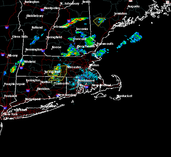 At 705 pm edt, severe thunderstorms were located along a line extending from new braintree to near brookfield to near stafford, moving east at 15 mph (radar indicated). Hazards include 60 mph wind gusts and quarter size hail. Expect wind damage to trees and power lines. Minor hail damage to vehicles is possible. At 705 pm edt, severe thunderstorms were located along a line extending from new braintree to near brookfield to near stafford, moving east at 15 mph (radar indicated). Hazards include 60 mph wind gusts and quarter size hail. Expect wind damage to trees and power lines. Minor hail damage to vehicles is possible.
|
| 7/13/2020 6:45 PM EDT |
 At 643 pm edt, a severe thunderstorm was located near brimfield. a new severe thunderstorm has developed near warren. each of these storms were moving east at 15 mph (radar indicated and trained spotters. multiple trees and powerlines have been reported downed in monson around 630 pm). Hazards include 60 mph wind gusts and quarter size hail. Expect wind damage to trees and power lines. minor hail damage to vehicles is possible. Locations impacted include, ludlow, southbridge, belchertown, wilbraham, charlton, palmer, spencer, ware, sturbridge, monson, hampden, warren, north brookfield, west brookfield, brimfield, brookfield, holland, east brookfield and wales. At 643 pm edt, a severe thunderstorm was located near brimfield. a new severe thunderstorm has developed near warren. each of these storms were moving east at 15 mph (radar indicated and trained spotters. multiple trees and powerlines have been reported downed in monson around 630 pm). Hazards include 60 mph wind gusts and quarter size hail. Expect wind damage to trees and power lines. minor hail damage to vehicles is possible. Locations impacted include, ludlow, southbridge, belchertown, wilbraham, charlton, palmer, spencer, ware, sturbridge, monson, hampden, warren, north brookfield, west brookfield, brimfield, brookfield, holland, east brookfield and wales.
|
| 7/13/2020 6:34 PM EDT |
 At 633 pm edt, a severe thunderstorm was located over brimfield, or 14 miles east of springfield, moving east at 15 mph (radar indicated and trained spotters. at 628 pm, trees and powerlines were downed in monson). Hazards include 60 mph wind gusts and quarter size hail. Expect wind damage to trees and power lines. minor hail damage to vehicles is possible. Locations impacted include, ludlow, southbridge, belchertown, wilbraham, charlton, palmer, spencer, ware, sturbridge, monson, hampden, warren, north brookfield, west brookfield, brimfield, brookfield, holland, east brookfield and wales. At 633 pm edt, a severe thunderstorm was located over brimfield, or 14 miles east of springfield, moving east at 15 mph (radar indicated and trained spotters. at 628 pm, trees and powerlines were downed in monson). Hazards include 60 mph wind gusts and quarter size hail. Expect wind damage to trees and power lines. minor hail damage to vehicles is possible. Locations impacted include, ludlow, southbridge, belchertown, wilbraham, charlton, palmer, spencer, ware, sturbridge, monson, hampden, warren, north brookfield, west brookfield, brimfield, brookfield, holland, east brookfield and wales.
|
| 7/13/2020 6:19 PM EDT |
 At 619 pm edt, a severe thunderstorm was located near palmer, or 10 miles east of springfield, moving east at 15 mph (radar indicated). Hazards include 60 mph wind gusts and quarter size hail. Expect wind damage to trees and power lines. Minor hail damage to vehicles is possible. At 619 pm edt, a severe thunderstorm was located near palmer, or 10 miles east of springfield, moving east at 15 mph (radar indicated). Hazards include 60 mph wind gusts and quarter size hail. Expect wind damage to trees and power lines. Minor hail damage to vehicles is possible.
|
| 7/6/2020 7:09 PM EDT |
 At 709 pm edt, a severe thunderstorm was located over windsor, moving east at 20 mph (radar indicated). Hazards include 60 mph wind gusts and quarter size hail. Expect wind damage to trees and power lines. Minor hail damage to vehicles is possible. At 709 pm edt, a severe thunderstorm was located over windsor, moving east at 20 mph (radar indicated). Hazards include 60 mph wind gusts and quarter size hail. Expect wind damage to trees and power lines. Minor hail damage to vehicles is possible.
|
| 7/2/2020 6:22 PM EDT |
 At 622 pm edt, a severe thunderstorm was located over sturbridge, or 16 miles southwest of worcester, moving south at 20 mph (radar indicated). Hazards include 60 mph wind gusts. Expect damage to trees and power lines. Locations impacted include, southbridge, oxford, charlton, spencer, dudley, sturbridge, warren, brimfield, brookfield, holland and east brookfield. At 622 pm edt, a severe thunderstorm was located over sturbridge, or 16 miles southwest of worcester, moving south at 20 mph (radar indicated). Hazards include 60 mph wind gusts. Expect damage to trees and power lines. Locations impacted include, southbridge, oxford, charlton, spencer, dudley, sturbridge, warren, brimfield, brookfield, holland and east brookfield.
|
| 7/2/2020 6:13 PM EDT |
 At 613 pm edt, a severe thunderstorm was located near brookfield, or 15 miles southwest of worcester, moving south at 20 mph (radar indicated). Hazards include 60 mph wind gusts and penny size hail. Expect damage to trees and power lines. Locations impacted include, southbridge, oxford, charlton, spencer, dudley, sturbridge, warren, north brookfield, west brookfield, brimfield, brookfield, holland and east brookfield. At 613 pm edt, a severe thunderstorm was located near brookfield, or 15 miles southwest of worcester, moving south at 20 mph (radar indicated). Hazards include 60 mph wind gusts and penny size hail. Expect damage to trees and power lines. Locations impacted include, southbridge, oxford, charlton, spencer, dudley, sturbridge, warren, north brookfield, west brookfield, brimfield, brookfield, holland and east brookfield.
|
| 7/2/2020 6:06 PM EDT |
 At 606 pm edt, a severe thunderstorm was located over east brookfield, or 14 miles west of worcester, moving south at 20 mph (radar indicated). Hazards include 60 mph wind gusts and penny size hail. Expect damage to trees and power lines. Locations impacted include, southbridge, oxford, charlton, spencer, dudley, sturbridge, warren, north brookfield, west brookfield, brimfield, brookfield, holland, east brookfield and oakham. At 606 pm edt, a severe thunderstorm was located over east brookfield, or 14 miles west of worcester, moving south at 20 mph (radar indicated). Hazards include 60 mph wind gusts and penny size hail. Expect damage to trees and power lines. Locations impacted include, southbridge, oxford, charlton, spencer, dudley, sturbridge, warren, north brookfield, west brookfield, brimfield, brookfield, holland, east brookfield and oakham.
|
| 7/2/2020 6:03 PM EDT |
 At 602 pm edt, a severe thunderstorm was located over east brookfield, or 14 miles west of worcester, moving south at 20 mph (radar indicated). Hazards include 60 mph wind gusts. Expect damage to trees and power lines. Locations impacted include, southbridge, oxford, charlton, spencer, dudley, leicester, sturbridge, rutland, warren, paxton, north brookfield, west brookfield, brimfield, brookfield, holland, east brookfield, oakham and new braintree. At 602 pm edt, a severe thunderstorm was located over east brookfield, or 14 miles west of worcester, moving south at 20 mph (radar indicated). Hazards include 60 mph wind gusts. Expect damage to trees and power lines. Locations impacted include, southbridge, oxford, charlton, spencer, dudley, leicester, sturbridge, rutland, warren, paxton, north brookfield, west brookfield, brimfield, brookfield, holland, east brookfield, oakham and new braintree.
|
| 7/2/2020 5:58 PM EDT |
 At 557 pm edt, a severe thunderstorm was located over north brookfield, or 14 miles west of worcester, moving south at 30 mph (radar indicated). Hazards include 60 mph wind gusts. Expect damage to trees and power lines. Locations impacted include, southbridge, oxford, charlton, spencer, dudley, leicester, sturbridge, rutland, warren, paxton, north brookfield, west brookfield, brimfield, brookfield, holland, east brookfield, oakham, wales and new braintree. At 557 pm edt, a severe thunderstorm was located over north brookfield, or 14 miles west of worcester, moving south at 30 mph (radar indicated). Hazards include 60 mph wind gusts. Expect damage to trees and power lines. Locations impacted include, southbridge, oxford, charlton, spencer, dudley, leicester, sturbridge, rutland, warren, paxton, north brookfield, west brookfield, brimfield, brookfield, holland, east brookfield, oakham, wales and new braintree.
|
| 7/2/2020 5:47 PM EDT |
 At 545 pm edt, a severe thunderstorm was located over new braintree, or 17 miles west of worcester, moving south at 20 mph (trained weather spotters reported a tree down on power lines in barre, ma at 544 pm). Hazards include 60 mph wind gusts and quarter size hail. Expect wind damage to trees and power lines. minor hail damage to vehicles is possible. Locations impacted include, southbridge, oxford, charlton, palmer, spencer, dudley, leicester, ware, sturbridge, rutland, barre, warren, paxton, north brookfield, west brookfield, brimfield, brookfield, hardwick, holland and east brookfield. At 545 pm edt, a severe thunderstorm was located over new braintree, or 17 miles west of worcester, moving south at 20 mph (trained weather spotters reported a tree down on power lines in barre, ma at 544 pm). Hazards include 60 mph wind gusts and quarter size hail. Expect wind damage to trees and power lines. minor hail damage to vehicles is possible. Locations impacted include, southbridge, oxford, charlton, palmer, spencer, dudley, leicester, ware, sturbridge, rutland, barre, warren, paxton, north brookfield, west brookfield, brimfield, brookfield, hardwick, holland and east brookfield.
|
| 7/2/2020 5:42 PM EDT |
 At 542 pm edt, a severe thunderstorm was located over new braintree, or 18 miles east of amherst, moving south at 20 mph (radar indicated). Hazards include 60 mph wind gusts and quarter size hail. Expect wind damage to trees and power lines. minor hail damage to vehicles is possible. Locations impacted include, southbridge, oxford, charlton, palmer, spencer, dudley, leicester, ware, sturbridge, rutland, barre, warren, paxton, north brookfield, hubbardston, west brookfield, brimfield, brookfield, hardwick and holland. At 542 pm edt, a severe thunderstorm was located over new braintree, or 18 miles east of amherst, moving south at 20 mph (radar indicated). Hazards include 60 mph wind gusts and quarter size hail. Expect wind damage to trees and power lines. minor hail damage to vehicles is possible. Locations impacted include, southbridge, oxford, charlton, palmer, spencer, dudley, leicester, ware, sturbridge, rutland, barre, warren, paxton, north brookfield, hubbardston, west brookfield, brimfield, brookfield, hardwick and holland.
|
| 7/2/2020 5:35 PM EDT |
 At 535 pm edt, a severe thunderstorm was located near barre, or 16 miles southeast of orange, moving south at 20 mph (radar indicated). Hazards include 60 mph wind gusts and quarter size hail. Expect wind damage to trees and power lines. Minor hail damage to vehicles is possible. At 535 pm edt, a severe thunderstorm was located near barre, or 16 miles southeast of orange, moving south at 20 mph (radar indicated). Hazards include 60 mph wind gusts and quarter size hail. Expect wind damage to trees and power lines. Minor hail damage to vehicles is possible.
|
| 7/1/2020 7:03 PM EDT |
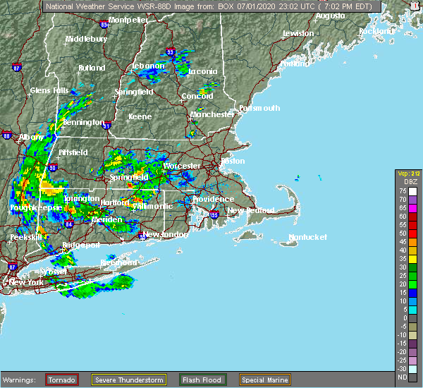 At 702 pm edt, a severe thunderstorm was located over wales, or 14 miles east of springfield, moving south at 10 mph (radar indicated). Hazards include quarter size hail. minor hail damage to vehicles is possible At 702 pm edt, a severe thunderstorm was located over wales, or 14 miles east of springfield, moving south at 10 mph (radar indicated). Hazards include quarter size hail. minor hail damage to vehicles is possible
|
| 6/29/2020 3:23 PM EDT |
 At 322 pm edt, a severe thunderstorm was located over wilbraham, or near springfield, moving southeast at 20 mph (radar indicated). Hazards include 60 mph wind gusts and quarter size hail. this storm has a history of producing damaging winds. Expect wind damage to trees and power lines. minor hail damage to vehicles is possible. Locations impacted include, springfield, chicopee, enfield, ludlow, longmeadow, east longmeadow, ellington, wilbraham, palmer, stafford, somers, monson, granby, hampden, brimfield, holland and wales. At 322 pm edt, a severe thunderstorm was located over wilbraham, or near springfield, moving southeast at 20 mph (radar indicated). Hazards include 60 mph wind gusts and quarter size hail. this storm has a history of producing damaging winds. Expect wind damage to trees and power lines. minor hail damage to vehicles is possible. Locations impacted include, springfield, chicopee, enfield, ludlow, longmeadow, east longmeadow, ellington, wilbraham, palmer, stafford, somers, monson, granby, hampden, brimfield, holland and wales.
|
| 6/29/2020 3:23 PM EDT |
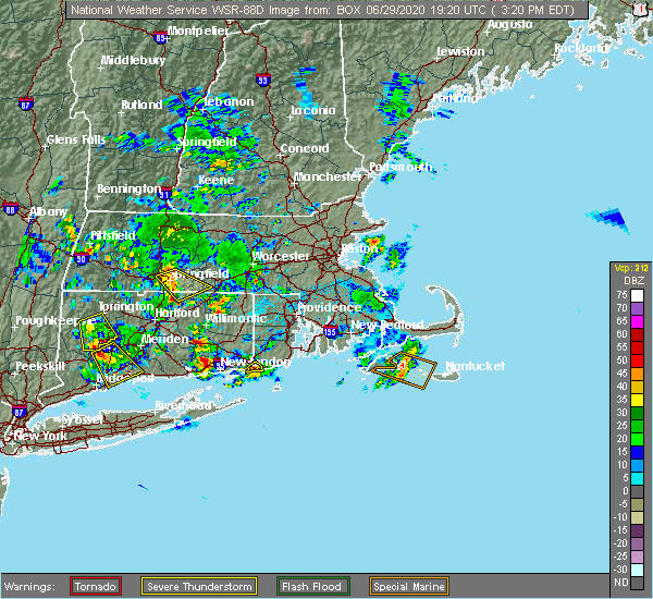 At 322 pm edt, a severe thunderstorm was located over wilbraham, or near springfield, moving southeast at 20 mph (radar indicated). Hazards include 60 mph wind gusts and quarter size hail. this storm has a history of producing damaging winds. Expect wind damage to trees and power lines. minor hail damage to vehicles is possible. Locations impacted include, springfield, chicopee, enfield, ludlow, longmeadow, east longmeadow, ellington, wilbraham, palmer, stafford, somers, monson, granby, hampden, brimfield, holland and wales. At 322 pm edt, a severe thunderstorm was located over wilbraham, or near springfield, moving southeast at 20 mph (radar indicated). Hazards include 60 mph wind gusts and quarter size hail. this storm has a history of producing damaging winds. Expect wind damage to trees and power lines. minor hail damage to vehicles is possible. Locations impacted include, springfield, chicopee, enfield, ludlow, longmeadow, east longmeadow, ellington, wilbraham, palmer, stafford, somers, monson, granby, hampden, brimfield, holland and wales.
|
| 6/29/2020 3:06 PM EDT |
 At 306 pm edt, a severe thunderstorm was located over chicopee, moving southeast at 20 mph (radar indicated). Hazards include 60 mph wind gusts and quarter size hail. Expect wind damage to trees and power lines. Minor hail damage to vehicles is possible. At 306 pm edt, a severe thunderstorm was located over chicopee, moving southeast at 20 mph (radar indicated). Hazards include 60 mph wind gusts and quarter size hail. Expect wind damage to trees and power lines. Minor hail damage to vehicles is possible.
|
| 6/28/2020 5:16 PM EDT |
 At 514 pm edt, a very severe thunderstorm was located over suffield, or over agawam, and is nearly stationary (radar indicated). Hazards include two inch hail and 60 mph wind gusts. Large hail may injure people caught outdoors. expect hail damage to roofs, siding, windows, and vehicles. expect wind damage to trees and power lines. Locations impacted include, springfield, chicopee, enfield, agawam, west springfield, ludlow, southbridge, longmeadow, suffield, east longmeadow, ellington, wilbraham, charlton, windsor locks, palmer, stafford, spencer, somers, dudley and thompson. At 514 pm edt, a very severe thunderstorm was located over suffield, or over agawam, and is nearly stationary (radar indicated). Hazards include two inch hail and 60 mph wind gusts. Large hail may injure people caught outdoors. expect hail damage to roofs, siding, windows, and vehicles. expect wind damage to trees and power lines. Locations impacted include, springfield, chicopee, enfield, agawam, west springfield, ludlow, southbridge, longmeadow, suffield, east longmeadow, ellington, wilbraham, charlton, windsor locks, palmer, stafford, spencer, somers, dudley and thompson.
|
| 6/28/2020 5:02 PM EDT |
 At 501 pm edt, a severe thunderstorm was located over east longmeadow, or near enfield, moving east at 25 mph (radar indicated). Hazards include 60 mph wind gusts and quarter size hail. Expect wind damage to trees and power lines. Minor hail damage to vehicles is possible. At 501 pm edt, a severe thunderstorm was located over east longmeadow, or near enfield, moving east at 25 mph (radar indicated). Hazards include 60 mph wind gusts and quarter size hail. Expect wind damage to trees and power lines. Minor hail damage to vehicles is possible.
|
| 6/6/2020 3:06 PM EDT |
 The severe thunderstorm warning for south central worcester and eastern hampden counties will expire at 315 pm edt, the severe thunderstorm which prompted the warning has moved out of the warned area. therefore, the warning will be allowed to expire. a severe thunderstorm watch remains in effect until 800 pm edt for northern connecticut, western and central massachusetts, and rhode island. remember, a severe thunderstorm warning still remains in effect for east-central worcester county until 345 pm. The severe thunderstorm warning for south central worcester and eastern hampden counties will expire at 315 pm edt, the severe thunderstorm which prompted the warning has moved out of the warned area. therefore, the warning will be allowed to expire. a severe thunderstorm watch remains in effect until 800 pm edt for northern connecticut, western and central massachusetts, and rhode island. remember, a severe thunderstorm warning still remains in effect for east-central worcester county until 345 pm.
|
| 6/6/2020 2:57 PM EDT |
 At 256 pm edt, a severe thunderstorm was located over oxford, or 7 miles south of worcester, moving east at 25 mph (radar indicated. this storm has a history of producing tree and powerline damage in brookfield, spencer, and monson). Hazards include 60 mph wind gusts and nickel size hail. Expect damage to trees and power lines. Locations impacted include, worcester, shrewsbury, holden, webster, southbridge, auburn, oxford, millbury, charlton, spencer, dudley, leicester, thompson, sturbridge, sutton, douglas, woodstock, paxton, north brookfield and holland. At 256 pm edt, a severe thunderstorm was located over oxford, or 7 miles south of worcester, moving east at 25 mph (radar indicated. this storm has a history of producing tree and powerline damage in brookfield, spencer, and monson). Hazards include 60 mph wind gusts and nickel size hail. Expect damage to trees and power lines. Locations impacted include, worcester, shrewsbury, holden, webster, southbridge, auburn, oxford, millbury, charlton, spencer, dudley, leicester, thompson, sturbridge, sutton, douglas, woodstock, paxton, north brookfield and holland.
|
| 6/6/2020 2:54 PM EDT |
 At 253 pm edt, a severe thunderstorm was located over woodstock, or 15 miles northeast of mansfield, moving east at 45 mph (radar indicated). Hazards include 60 mph wind gusts and quarter size hail. Expect wind damage to trees and power lines. minor hail damage to vehicles is possible. Locations impacted include, woonsocket, milford, smithfield, killingly, webster, southbridge, burrillville, northbridge, oxford, uxbridge, charlton, stafford, north smithfield, dudley, glocester, putnam, thompson, sturbridge, blackstone and sutton. At 253 pm edt, a severe thunderstorm was located over woodstock, or 15 miles northeast of mansfield, moving east at 45 mph (radar indicated). Hazards include 60 mph wind gusts and quarter size hail. Expect wind damage to trees and power lines. minor hail damage to vehicles is possible. Locations impacted include, woonsocket, milford, smithfield, killingly, webster, southbridge, burrillville, northbridge, oxford, uxbridge, charlton, stafford, north smithfield, dudley, glocester, putnam, thompson, sturbridge, blackstone and sutton.
|
| 6/6/2020 2:43 PM EDT |
 At 243 pm edt, a severe thunderstorm was located over charlton, or 10 miles southwest of worcester, moving east at 30 mph (radar indicated. trees were downed in west brookfield and monson from this storm). Hazards include 60 mph wind gusts and nickel size hail. Expect damage to trees and power lines. Locations impacted include, worcester, shrewsbury, grafton, holden, webster, southbridge, auburn, oxford, millbury, charlton, palmer, spencer, dudley, leicester, thompson, sturbridge, sutton, monson, douglas and rutland. At 243 pm edt, a severe thunderstorm was located over charlton, or 10 miles southwest of worcester, moving east at 30 mph (radar indicated. trees were downed in west brookfield and monson from this storm). Hazards include 60 mph wind gusts and nickel size hail. Expect damage to trees and power lines. Locations impacted include, worcester, shrewsbury, grafton, holden, webster, southbridge, auburn, oxford, millbury, charlton, palmer, spencer, dudley, leicester, thompson, sturbridge, sutton, monson, douglas and rutland.
|
| 6/6/2020 2:39 PM EDT |
 At 239 pm edt, a severe thunderstorm was located over stafford, or 12 miles north of mansfield, moving east at 35 mph (radar indicated). Hazards include 60 mph wind gusts and quarter size hail. Expect wind damage to trees and power lines. Minor hail damage to vehicles is possible. At 239 pm edt, a severe thunderstorm was located over stafford, or 12 miles north of mansfield, moving east at 35 mph (radar indicated). Hazards include 60 mph wind gusts and quarter size hail. Expect wind damage to trees and power lines. Minor hail damage to vehicles is possible.
|
| 6/6/2020 2:29 PM EDT |
 At 228 pm edt, a severe thunderstorm was located over brimfield, or 17 miles east of springfield, moving east at 25 mph (radar indicated. at 225 pm, a tree was downed in west brookfield). Hazards include 60 mph wind gusts and quarter size hail. Expect wind damage to trees and power lines. minor hail damage to vehicles is possible. Locations impacted include, worcester, shrewsbury, ludlow, grafton, holden, webster, southbridge, auburn, belchertown, wilbraham, oxford, millbury, charlton, palmer, spencer, dudley, leicester, ware, thompson and sturbridge. At 228 pm edt, a severe thunderstorm was located over brimfield, or 17 miles east of springfield, moving east at 25 mph (radar indicated. at 225 pm, a tree was downed in west brookfield). Hazards include 60 mph wind gusts and quarter size hail. Expect wind damage to trees and power lines. minor hail damage to vehicles is possible. Locations impacted include, worcester, shrewsbury, ludlow, grafton, holden, webster, southbridge, auburn, belchertown, wilbraham, oxford, millbury, charlton, palmer, spencer, dudley, leicester, ware, thompson and sturbridge.
|
| 6/6/2020 2:15 PM EDT |
 At 215 pm edt, a severe thunderstorm was located over palmer, or 11 miles east of springfield, moving east at 25 mph (radar indicated). Hazards include 60 mph wind gusts and quarter size hail. Expect wind damage to trees and power lines. Minor hail damage to vehicles is possible. At 215 pm edt, a severe thunderstorm was located over palmer, or 11 miles east of springfield, moving east at 25 mph (radar indicated). Hazards include 60 mph wind gusts and quarter size hail. Expect wind damage to trees and power lines. Minor hail damage to vehicles is possible.
|
| 5/15/2020 8:56 PM EDT |
 The severe thunderstorm warning for southwestern worcester, southeastern hampshire and southeastern hampden counties will expire at 900 pm edt, the storm which prompted the warning has moved out of the area. therefore, the warning will be allowed to expire. a tornado watch remains in effect until 1000 pm edt for western and central massachusetts. remember, a severe thunderstorm warning still remains in effect for southern worcester county until 915 pm. The severe thunderstorm warning for southwestern worcester, southeastern hampshire and southeastern hampden counties will expire at 900 pm edt, the storm which prompted the warning has moved out of the area. therefore, the warning will be allowed to expire. a tornado watch remains in effect until 1000 pm edt for western and central massachusetts. remember, a severe thunderstorm warning still remains in effect for southern worcester county until 915 pm.
|
| 5/15/2020 8:36 PM EDT |
 At 835 pm edt, a severe thunderstorm was located over brookfield, or 15 miles southwest of worcester, moving east at 45 mph (radar indicated. trees and powerlines have been reported downed in agawam and belchertown from these storms). Hazards include 60 mph wind gusts and quarter size hail. Expect wind damage to trees and power lines. minor hail damage to vehicles is possible. Locations impacted include, worcester, springfield, agawam, ludlow, holden, southbridge, auburn, longmeadow, east longmeadow, belchertown, wilbraham, oxford, charlton, palmer, spencer, dudley, leicester, ware, sturbridge and monson. At 835 pm edt, a severe thunderstorm was located over brookfield, or 15 miles southwest of worcester, moving east at 45 mph (radar indicated. trees and powerlines have been reported downed in agawam and belchertown from these storms). Hazards include 60 mph wind gusts and quarter size hail. Expect wind damage to trees and power lines. minor hail damage to vehicles is possible. Locations impacted include, worcester, springfield, agawam, ludlow, holden, southbridge, auburn, longmeadow, east longmeadow, belchertown, wilbraham, oxford, charlton, palmer, spencer, dudley, leicester, ware, sturbridge and monson.
|
| 5/15/2020 8:34 PM EDT |
 At 833 pm edt, severe thunderstorms were located along a line extending from barre to near west brookfield to hampden, moving east at 50 mph (radar indicated. at 817, trees and power lines were downed in belchertown). Hazards include 60 mph wind gusts and penny size hail. expect damage to trees and power lines At 833 pm edt, severe thunderstorms were located along a line extending from barre to near west brookfield to hampden, moving east at 50 mph (radar indicated. at 817, trees and power lines were downed in belchertown). Hazards include 60 mph wind gusts and penny size hail. expect damage to trees and power lines
|
| 5/15/2020 8:06 PM EDT |
 At 805 pm edt, a severe thunderstorm was located over granby, or near chicopee, moving east at 45 mph (radar indicated). Hazards include 60 mph wind gusts and quarter size hail. Expect wind damage to trees and power lines. Minor hail damage to vehicles is possible. At 805 pm edt, a severe thunderstorm was located over granby, or near chicopee, moving east at 45 mph (radar indicated). Hazards include 60 mph wind gusts and quarter size hail. Expect wind damage to trees and power lines. Minor hail damage to vehicles is possible.
|
| 5/11/2020 7:24 PM EDT |
 At 722 pm edt, a severe thunderstorm was located over east longmeadow, or near springfield, moving east at 40 mph (radar indicated). Hazards include 60 mph wind gusts and quarter size hail. Expect wind damage to trees and power lines. Minor hail damage to vehicles is possible. At 722 pm edt, a severe thunderstorm was located over east longmeadow, or near springfield, moving east at 40 mph (radar indicated). Hazards include 60 mph wind gusts and quarter size hail. Expect wind damage to trees and power lines. Minor hail damage to vehicles is possible.
|
| 8/19/2019 3:25 PM EDT |
 At 322 pm edt, severe thunderstorms were located from near brimfield to holland to union connecticut, moving east at 30 mph (radar indicated). Hazards include 60 mph wind gusts and quarter size hail. Expect damage to trees and power lines. Locations impacted include, springfield, ludlow, webster, southbridge, auburn, east longmeadow, wilbraham, oxford, charlton, palmer, stafford, spencer, somers, dudley, leicester, thompson, sturbridge, monson, woodstock and hampden. At 322 pm edt, severe thunderstorms were located from near brimfield to holland to union connecticut, moving east at 30 mph (radar indicated). Hazards include 60 mph wind gusts and quarter size hail. Expect damage to trees and power lines. Locations impacted include, springfield, ludlow, webster, southbridge, auburn, east longmeadow, wilbraham, oxford, charlton, palmer, stafford, spencer, somers, dudley, leicester, thompson, sturbridge, monson, woodstock and hampden.
|
| 8/19/2019 2:56 PM EDT |
 At 255 pm edt, a severe thunderstorm was located over hampden, or 7 miles east of springfield, moving east at 30 mph (radar indicated). Hazards include 60 mph wind gusts and quarter size hail. Expect damage to trees and power lines. Hail damage to vehicles is possible. At 255 pm edt, a severe thunderstorm was located over hampden, or 7 miles east of springfield, moving east at 30 mph (radar indicated). Hazards include 60 mph wind gusts and quarter size hail. Expect damage to trees and power lines. Hail damage to vehicles is possible.
|
| 8/19/2019 2:56 PM EDT |
 The national weather service in boston/norton has issued a * severe thunderstorm warning for. northeastern windham county in northern connecticut. northern tolland county in northern connecticut. southwestern worcester county in central massachusetts. Southeastern hampshire county in western massachusetts. The national weather service in boston/norton has issued a * severe thunderstorm warning for. northeastern windham county in northern connecticut. northern tolland county in northern connecticut. southwestern worcester county in central massachusetts. Southeastern hampshire county in western massachusetts.
|
| 8/19/2019 2:38 PM EDT |
 At 236 pm edt, a severe thunderstorm was located over monson, or 9 miles east of springfield, moving east at 30 mph. golfball size hail was reported in agawam. tree damage was reported in agawam, west springfield, and ludlow (radar indicated). Hazards include golf ball size hail and 60 mph wind gusts. Expect hail damage to roofs, siding, windows, and vehicles. expect damage to trees and power lines. Locations impacted include, springfield, chicopee, enfield, agawam, west springfield, ludlow, longmeadow, suffield, east longmeadow, belchertown, wilbraham, palmer, stafford, somers, ware, sturbridge, monson, woodstock, hampden and warren. At 236 pm edt, a severe thunderstorm was located over monson, or 9 miles east of springfield, moving east at 30 mph. golfball size hail was reported in agawam. tree damage was reported in agawam, west springfield, and ludlow (radar indicated). Hazards include golf ball size hail and 60 mph wind gusts. Expect hail damage to roofs, siding, windows, and vehicles. expect damage to trees and power lines. Locations impacted include, springfield, chicopee, enfield, agawam, west springfield, ludlow, longmeadow, suffield, east longmeadow, belchertown, wilbraham, palmer, stafford, somers, ware, sturbridge, monson, woodstock, hampden and warren.
|
| 8/19/2019 2:38 PM EDT |
 At 203 pm edt, a severe thunderstorm was located over agawam, moving east at 30 mph (radar indicated). Hazards include 60 mph wind gusts and quarter size hail. Expect damage to trees and power lines. Hail damage possible to vehicles. At 203 pm edt, a severe thunderstorm was located over agawam, moving east at 30 mph (radar indicated). Hazards include 60 mph wind gusts and quarter size hail. Expect damage to trees and power lines. Hail damage possible to vehicles.
|
| 8/19/2019 2:20 PM EDT |
 At 218 pm edt, a severe thunderstorm was located over springfield, moving east at 30 mph. radar indicated large hail near agawam and damaging winds between suffield connecticut and agawam (radar indicated). Hazards include 60 mph wind gusts and half dollar size hail. Hail damage to vehicles is possible. expect damage to trees and power lines. Locations impacted include, springfield, chicopee, enfield, westfield, holyoke, agawam, west springfield, ludlow, longmeadow, suffield, east longmeadow, belchertown, wilbraham, palmer, stafford, somers, ware, sturbridge, monson and woodstock. At 218 pm edt, a severe thunderstorm was located over springfield, moving east at 30 mph. radar indicated large hail near agawam and damaging winds between suffield connecticut and agawam (radar indicated). Hazards include 60 mph wind gusts and half dollar size hail. Hail damage to vehicles is possible. expect damage to trees and power lines. Locations impacted include, springfield, chicopee, enfield, westfield, holyoke, agawam, west springfield, ludlow, longmeadow, suffield, east longmeadow, belchertown, wilbraham, palmer, stafford, somers, ware, sturbridge, monson and woodstock.
|
| 8/19/2019 2:04 PM EDT |
 The national weather service in boston/norton has issued a * severe thunderstorm warning for. northwestern windham county in northern connecticut. northern tolland county in northern connecticut. north central hartford county in northern connecticut. Southwestern worcester county in central massachusetts. The national weather service in boston/norton has issued a * severe thunderstorm warning for. northwestern windham county in northern connecticut. northern tolland county in northern connecticut. north central hartford county in northern connecticut. Southwestern worcester county in central massachusetts.
|
| 8/17/2019 8:50 PM EDT |
 At 849 pm edt, a severe thunderstorm was located near amherst, moving east at 20 mph (radar indicated). Hazards include 60 mph wind gusts and quarter size hail. Hail damage to vehicles is possible. expect damage to trees and power lines. Locations impacted include, springfield, chicopee, holyoke, amherst, northampton, ludlow, south hadley, easthampton, belchertown, wilbraham, palmer, ware, monson, granby, barre, hadley, warren, west brookfield, brimfield and brookfield. At 849 pm edt, a severe thunderstorm was located near amherst, moving east at 20 mph (radar indicated). Hazards include 60 mph wind gusts and quarter size hail. Hail damage to vehicles is possible. expect damage to trees and power lines. Locations impacted include, springfield, chicopee, holyoke, amherst, northampton, ludlow, south hadley, easthampton, belchertown, wilbraham, palmer, ware, monson, granby, barre, hadley, warren, west brookfield, brimfield and brookfield.
|
| 8/17/2019 8:28 PM EDT |
 At 827 pm edt, a severe thunderstorm was located over northampton, moving east at 15 mph (radar indicated). Hazards include 60 mph wind gusts and quarter size hail. Hail damage to vehicles is possible. Expect damage to trees and power lines. At 827 pm edt, a severe thunderstorm was located over northampton, moving east at 15 mph (radar indicated). Hazards include 60 mph wind gusts and quarter size hail. Hail damage to vehicles is possible. Expect damage to trees and power lines.
|
| 8/8/2019 7:20 PM EDT |
 The national weather service in boston/norton has issued a * severe thunderstorm warning for. worcester county in central massachusetts. southeastern hampshire county in western massachusetts. northwestern middlesex county in northeastern massachusetts. Eastern franklin county in western massachusetts. The national weather service in boston/norton has issued a * severe thunderstorm warning for. worcester county in central massachusetts. southeastern hampshire county in western massachusetts. northwestern middlesex county in northeastern massachusetts. Eastern franklin county in western massachusetts.
|
| 7/31/2019 2:46 PM EDT |
 At 245 pm edt, a severe thunderstorm was located over holland, or 20 miles east of springfield, moving east at 20 mph (radar indicated). Hazards include 70 mph wind gusts and quarter size hail. Hail damage to vehicles is possible. expect considerable tree damage. Wind damage is also likely to mobile homes, roofs, and outbuildings. At 245 pm edt, a severe thunderstorm was located over holland, or 20 miles east of springfield, moving east at 20 mph (radar indicated). Hazards include 70 mph wind gusts and quarter size hail. Hail damage to vehicles is possible. expect considerable tree damage. Wind damage is also likely to mobile homes, roofs, and outbuildings.
|
| 7/31/2019 2:46 PM EDT |
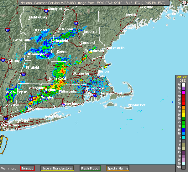 At 245 pm edt, a severe thunderstorm was located over holland, or 20 miles east of springfield, moving east at 20 mph (radar indicated). Hazards include 70 mph wind gusts and quarter size hail. Hail damage to vehicles is possible. expect considerable tree damage. Wind damage is also likely to mobile homes, roofs, and outbuildings. At 245 pm edt, a severe thunderstorm was located over holland, or 20 miles east of springfield, moving east at 20 mph (radar indicated). Hazards include 70 mph wind gusts and quarter size hail. Hail damage to vehicles is possible. expect considerable tree damage. Wind damage is also likely to mobile homes, roofs, and outbuildings.
|
| 7/31/2019 2:28 PM EDT |
 At 228 pm edt, a severe thunderstorm was located over monson, or 11 miles east of springfield, moving east at 20 mph (radar indicated). Hazards include 60 mph wind gusts and quarter size hail. Hail damage to vehicles is possible. expect damage to trees and power lines. Locations impacted include, southbridge, stafford, sturbridge, monson, woodstock, warren, west brookfield, brimfield, brookfield, holland, wales and union. At 228 pm edt, a severe thunderstorm was located over monson, or 11 miles east of springfield, moving east at 20 mph (radar indicated). Hazards include 60 mph wind gusts and quarter size hail. Hail damage to vehicles is possible. expect damage to trees and power lines. Locations impacted include, southbridge, stafford, sturbridge, monson, woodstock, warren, west brookfield, brimfield, brookfield, holland, wales and union.
|
| 7/31/2019 2:13 PM EDT |
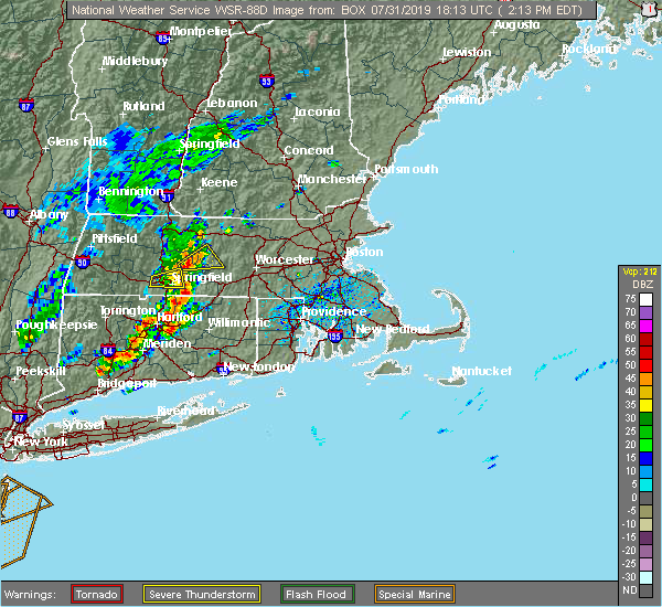 At 212 pm edt, a severe thunderstorm was located over hampden, or 7 miles southeast of springfield, moving east at 20 mph (radar indicated). Hazards include 60 mph wind gusts and quarter size hail. Hail damage to vehicles is possible. Expect damage to trees and power lines. At 212 pm edt, a severe thunderstorm was located over hampden, or 7 miles southeast of springfield, moving east at 20 mph (radar indicated). Hazards include 60 mph wind gusts and quarter size hail. Hail damage to vehicles is possible. Expect damage to trees and power lines.
|
| 7/6/2019 5:41 PM EDT |
 At 504 pm edt, severe thunderstorms were located along a line extending from near worcester to near enfield, moving east at 45 mph (radar indicated). Hazards include 60 mph wind gusts. expect damage to trees and power lines At 504 pm edt, severe thunderstorms were located along a line extending from near worcester to near enfield, moving east at 45 mph (radar indicated). Hazards include 60 mph wind gusts. expect damage to trees and power lines
|
| 7/6/2019 5:41 PM EDT |
 The severe thunderstorm warning for northern windham, northern tolland, northeastern hartford, southern worcester, north central norfolk, southeastern middlesex and southeastern hampden counties will expire at 545 pm edt, the storms which prompted the warning have weakened below severe limits, and no longer pose an immediate threat to life or property. therefore, the warning will be allowed to expire. however gusty winds and heavy rain are still possible with these thunderstorms. The severe thunderstorm warning for northern windham, northern tolland, northeastern hartford, southern worcester, north central norfolk, southeastern middlesex and southeastern hampden counties will expire at 545 pm edt, the storms which prompted the warning have weakened below severe limits, and no longer pose an immediate threat to life or property. therefore, the warning will be allowed to expire. however gusty winds and heavy rain are still possible with these thunderstorms.
|
| 7/6/2019 5:05 PM EDT |
 At 504 pm edt, severe thunderstorms were located along a line extending from near worcester to near enfield, moving east at 45 mph (radar indicated). Hazards include 60 mph wind gusts. expect damage to trees and power lines At 504 pm edt, severe thunderstorms were located along a line extending from near worcester to near enfield, moving east at 45 mph (radar indicated). Hazards include 60 mph wind gusts. expect damage to trees and power lines
|
| 7/6/2019 5:05 PM EDT |
 The national weather service in boston/norton has issued a * severe thunderstorm warning for. northern windham county in northern connecticut. northern tolland county in northern connecticut. northeastern hartford county in northern connecticut. Southern worcester county in central massachusetts. The national weather service in boston/norton has issued a * severe thunderstorm warning for. northern windham county in northern connecticut. northern tolland county in northern connecticut. northeastern hartford county in northern connecticut. Southern worcester county in central massachusetts.
|
| 7/6/2019 4:57 PM EDT |
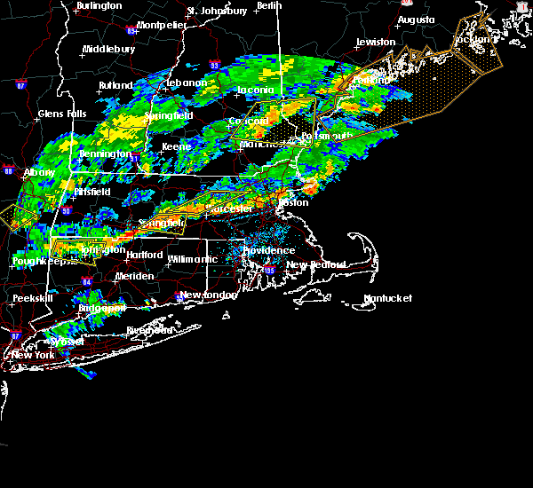 At 456 pm edt, severe thunderstorms were located from west brookfield to near palmer, moving east at 20 mph (radar indicated). Hazards include 60 mph wind gusts. Expect damage to trees and power lines. Locations impacted include, springfield, ludlow, southbridge, belchertown, wilbraham, charlton, palmer, spencer, ware, sturbridge, monson, warren, north brookfield, west brookfield, brimfield, brookfield, holland, east brookfield, wales and new braintree. At 456 pm edt, severe thunderstorms were located from west brookfield to near palmer, moving east at 20 mph (radar indicated). Hazards include 60 mph wind gusts. Expect damage to trees and power lines. Locations impacted include, springfield, ludlow, southbridge, belchertown, wilbraham, charlton, palmer, spencer, ware, sturbridge, monson, warren, north brookfield, west brookfield, brimfield, brookfield, holland, east brookfield, wales and new braintree.
|
| 7/6/2019 4:30 PM EDT |
 At 429 pm edt, a severe thunderstorm was located near ludlow, or 8 miles northeast of chicopee, moving east at 20 mph (radar indicated). Hazards include 60 mph wind gusts. expect damage to trees and power lines At 429 pm edt, a severe thunderstorm was located near ludlow, or 8 miles northeast of chicopee, moving east at 20 mph (radar indicated). Hazards include 60 mph wind gusts. expect damage to trees and power lines
|
| 5/23/2019 11:44 PM EDT |
 At 1144 pm edt, a severe thunderstorm was located over hampden, or 7 miles east of springfield, moving southeast at 35 mph (radar indicated). Hazards include 60 mph wind gusts. expect damage to trees and power lines At 1144 pm edt, a severe thunderstorm was located over hampden, or 7 miles east of springfield, moving southeast at 35 mph (radar indicated). Hazards include 60 mph wind gusts. expect damage to trees and power lines
|
| 5/23/2019 11:44 PM EDT |
 The national weather service in boston/norton has issued a * severe thunderstorm warning for. northern windham county in northern connecticut. northern tolland county in northern connecticut. south central worcester county in central massachusetts. Southeastern hampden county in western massachusetts. The national weather service in boston/norton has issued a * severe thunderstorm warning for. northern windham county in northern connecticut. northern tolland county in northern connecticut. south central worcester county in central massachusetts. Southeastern hampden county in western massachusetts.
|
| 5/20/2019 1:26 AM EDT |
 At 125 am edt, a severe thunderstorm was located over woodstock, or 18 miles northeast of mansfield, moving northeast at 50 mph (radar indicated). Hazards include 60 mph wind gusts and quarter size hail. Hail damage to vehicles is possible. Expect damage to trees and power lines. At 125 am edt, a severe thunderstorm was located over woodstock, or 18 miles northeast of mansfield, moving northeast at 50 mph (radar indicated). Hazards include 60 mph wind gusts and quarter size hail. Hail damage to vehicles is possible. Expect damage to trees and power lines.
|
| 5/20/2019 1:12 AM EDT |
 At 1256 am edt, a severe thunderstorm was located over windsor locks, or near enfield, moving northeast at 50 mph (radar indicated). Hazards include 60 mph wind gusts and quarter size hail. Hail damage to vehicles is possible. Expect damage to trees and power lines. At 1256 am edt, a severe thunderstorm was located over windsor locks, or near enfield, moving northeast at 50 mph (radar indicated). Hazards include 60 mph wind gusts and quarter size hail. Hail damage to vehicles is possible. Expect damage to trees and power lines.
|
| 5/20/2019 1:12 AM EDT |
 At 111 am edt, a severe thunderstorm was located over hampden, or 7 miles southeast of springfield, moving northeast at 50 mph (radar indicated). Hazards include 60 mph wind gusts and quarter size hail. Hail damage to vehicles is possible. expect damage to trees and power lines. Locations impacted include, springfield, ludlow, southbridge, east longmeadow, ellington, belchertown, wilbraham, oxford, charlton, palmer, stafford, spencer, somers, leicester, sturbridge, monson, hampden, warren, north brookfield and west brookfield. At 111 am edt, a severe thunderstorm was located over hampden, or 7 miles southeast of springfield, moving northeast at 50 mph (radar indicated). Hazards include 60 mph wind gusts and quarter size hail. Hail damage to vehicles is possible. expect damage to trees and power lines. Locations impacted include, springfield, ludlow, southbridge, east longmeadow, ellington, belchertown, wilbraham, oxford, charlton, palmer, stafford, spencer, somers, leicester, sturbridge, monson, hampden, warren, north brookfield and west brookfield.
|
| 5/20/2019 12:56 AM EDT |
 At 1256 am edt, a severe thunderstorm was located over windsor locks, or near enfield, moving northeast at 50 mph (radar indicated). Hazards include 60 mph wind gusts and quarter size hail. Hail damage to vehicles is possible. Expect damage to trees and power lines. At 1256 am edt, a severe thunderstorm was located over windsor locks, or near enfield, moving northeast at 50 mph (radar indicated). Hazards include 60 mph wind gusts and quarter size hail. Hail damage to vehicles is possible. Expect damage to trees and power lines.
|
| 4/26/2019 3:02 PM EDT |
 At 302 pm edt, a severe thunderstorm capable of producing a tornado was located over warren, or 18 miles east of springfield, moving north at 40 mph (radar indicated rotation). Hazards include tornado. Flying debris will be dangerous to those caught without shelter. mobile homes will be damaged or destroyed. damage to roofs, windows, and vehicles will occur. tree damage is likely. This dangerous storm will be near, north brookfield, west brookfield, east brookfield and new braintree around 315 pm edt. At 302 pm edt, a severe thunderstorm capable of producing a tornado was located over warren, or 18 miles east of springfield, moving north at 40 mph (radar indicated rotation). Hazards include tornado. Flying debris will be dangerous to those caught without shelter. mobile homes will be damaged or destroyed. damage to roofs, windows, and vehicles will occur. tree damage is likely. This dangerous storm will be near, north brookfield, west brookfield, east brookfield and new braintree around 315 pm edt.
|
| 4/26/2019 2:49 PM EDT |
 At 249 pm edt, a severe thunderstorm capable of producing a tornado was located over holland, or 17 miles east of springfield, moving northeast at 35 mph (radar indicated rotation). Hazards include tornado. Flying debris will be dangerous to those caught without shelter. mobile homes will be damaged or destroyed. damage to roofs, windows, and vehicles will occur. tree damage is likely. this dangerous storm will be near, brimfield around 300 pm edt. sturbridge and warren around 310 pm edt. North brookfield, west brookfield, brookfield, east brookfield and new braintree around 315 pm edt. At 249 pm edt, a severe thunderstorm capable of producing a tornado was located over holland, or 17 miles east of springfield, moving northeast at 35 mph (radar indicated rotation). Hazards include tornado. Flying debris will be dangerous to those caught without shelter. mobile homes will be damaged or destroyed. damage to roofs, windows, and vehicles will occur. tree damage is likely. this dangerous storm will be near, brimfield around 300 pm edt. sturbridge and warren around 310 pm edt. North brookfield, west brookfield, brookfield, east brookfield and new braintree around 315 pm edt.
|
| 8/17/2018 11:19 PM EDT |
 At 1118 pm edt, a severe thunderstorm was located over brimfield, or 19 miles east of springfield, moving northeast at 35 mph (radar indicated). Hazards include 60 mph wind gusts. Expect damage to trees and power lines. Locations impacted include, worcester, grafton, holden, southbridge, auburn, oxford, millbury, charlton, palmer, spencer, leicester, sturbridge, rutland, warren, paxton, north brookfield, west brookfield, brimfield, brookfield and holland. At 1118 pm edt, a severe thunderstorm was located over brimfield, or 19 miles east of springfield, moving northeast at 35 mph (radar indicated). Hazards include 60 mph wind gusts. Expect damage to trees and power lines. Locations impacted include, worcester, grafton, holden, southbridge, auburn, oxford, millbury, charlton, palmer, spencer, leicester, sturbridge, rutland, warren, paxton, north brookfield, west brookfield, brimfield, brookfield and holland.
|
| 8/17/2018 11:13 PM EDT |
 At 1113 pm edt, a severe thunderstorm was located over wales, or 17 miles east of springfield, moving northeast at 35 mph (radar indicated). Hazards include 60 mph wind gusts. expect damage to trees and power lines At 1113 pm edt, a severe thunderstorm was located over wales, or 17 miles east of springfield, moving northeast at 35 mph (radar indicated). Hazards include 60 mph wind gusts. expect damage to trees and power lines
|
| 8/2/2018 6:10 PM EDT |
 The severe thunderstorm warning for southern worcester and south central middlesex counties will expire at 615 pm edt, the severe thunderstorm which prompted the warning has weakened. therefore, the warning will be allowed to expire. The severe thunderstorm warning for southern worcester and south central middlesex counties will expire at 615 pm edt, the severe thunderstorm which prompted the warning has weakened. therefore, the warning will be allowed to expire.
|
| 8/2/2018 5:28 PM EDT |
 At 528 pm edt, a severe thunderstorm was located near sturbridge, or 14 miles southwest of worcester, moving east at 35 mph (radar indicated). Hazards include 60 mph wind gusts. expect damage to trees and power lines At 528 pm edt, a severe thunderstorm was located near sturbridge, or 14 miles southwest of worcester, moving east at 35 mph (radar indicated). Hazards include 60 mph wind gusts. expect damage to trees and power lines
|
| 8/2/2018 4:47 PM EDT |
 At 447 pm edt, severe thunderstorms were located along a line extending from ludlow to near ellington, moving northeast at 30 mph (radar indicated). Hazards include 60 mph wind gusts. expect damage to trees and power lines At 447 pm edt, severe thunderstorms were located along a line extending from ludlow to near ellington, moving northeast at 30 mph (radar indicated). Hazards include 60 mph wind gusts. expect damage to trees and power lines
|
| 8/2/2018 4:47 PM EDT |
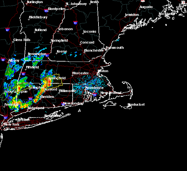 At 447 pm edt, severe thunderstorms were located along a line extending from ludlow to near ellington, moving northeast at 30 mph (radar indicated). Hazards include 60 mph wind gusts. expect damage to trees and power lines At 447 pm edt, severe thunderstorms were located along a line extending from ludlow to near ellington, moving northeast at 30 mph (radar indicated). Hazards include 60 mph wind gusts. expect damage to trees and power lines
|
| 6/18/2018 7:23 PM EDT |
 At 723 pm edt, a severe thunderstorm was located over sturbridge, or 16 miles southwest of worcester, moving east at 35 mph (radar indicated). Hazards include 60 mph wind gusts and quarter size hail. Hail damage to vehicles is possible. Expect damage to trees and power lines. At 723 pm edt, a severe thunderstorm was located over sturbridge, or 16 miles southwest of worcester, moving east at 35 mph (radar indicated). Hazards include 60 mph wind gusts and quarter size hail. Hail damage to vehicles is possible. Expect damage to trees and power lines.
|
| 6/18/2018 5:44 PM EDT |
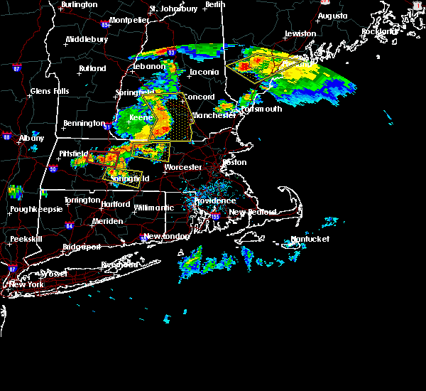 At 543 pm edt, a severe thunderstorm was located over granby, or near chicopee, moving east at 35 mph (radar indicated). Hazards include 60 mph wind gusts and quarter size hail. Hail damage to vehicles is possible. Expect damage to trees and power lines. At 543 pm edt, a severe thunderstorm was located over granby, or near chicopee, moving east at 35 mph (radar indicated). Hazards include 60 mph wind gusts and quarter size hail. Hail damage to vehicles is possible. Expect damage to trees and power lines.
|
| 5/15/2018 3:46 PM EDT |
 At 345 pm edt, a severe thunderstorm was located near hartland, or 14 miles northeast of torrington, moving east at 40 mph (radar indicated). Hazards include up to ping pong ball size hail and 60 mph wind gusts. People and animals outdoors will be injured. expect hail damage to roofs, siding, windows, and vehicles. Expect damage to trees and power lines. At 345 pm edt, a severe thunderstorm was located near hartland, or 14 miles northeast of torrington, moving east at 40 mph (radar indicated). Hazards include up to ping pong ball size hail and 60 mph wind gusts. People and animals outdoors will be injured. expect hail damage to roofs, siding, windows, and vehicles. Expect damage to trees and power lines.
|
| 5/31/2017 7:43 PM EDT |
 At 743 pm edt, severe thunderstorms were located along a line extending from barre to west brookfield to near palmer to near west springfield to near granby, moving southeast at 20 mph (trained weather spotters in and around the westfield massachusetts region have reported dime to quarter sized hail). Hazards include quarter size hail. Damage to vehicles is possible. Locations impacted include, springfield, chicopee, enfield, westfield, holyoke, windsor, agawam, west springfield, simsbury, ludlow, bloomfield, avon, south hadley, easthampton, longmeadow, suffield, east longmeadow, ellington, belchertown and wilbraham. At 743 pm edt, severe thunderstorms were located along a line extending from barre to west brookfield to near palmer to near west springfield to near granby, moving southeast at 20 mph (trained weather spotters in and around the westfield massachusetts region have reported dime to quarter sized hail). Hazards include quarter size hail. Damage to vehicles is possible. Locations impacted include, springfield, chicopee, enfield, westfield, holyoke, windsor, agawam, west springfield, simsbury, ludlow, bloomfield, avon, south hadley, easthampton, longmeadow, suffield, east longmeadow, ellington, belchertown and wilbraham.
|
| 5/31/2017 7:28 PM EDT |
 At 726 pm edt, severe thunderstorms were located along a line extending from near petersham to near ware to near ludlow to westfield to near hartland, moving southeast at 20 mph (trained weather spotters have reported mainly dime to nickel sized hail with a couple of reports of quarter sized hail with the latest reports out of granby massachusetts). Hazards include quarter size hail. damage to vehicles is possible At 726 pm edt, severe thunderstorms were located along a line extending from near petersham to near ware to near ludlow to westfield to near hartland, moving southeast at 20 mph (trained weather spotters have reported mainly dime to nickel sized hail with a couple of reports of quarter sized hail with the latest reports out of granby massachusetts). Hazards include quarter size hail. damage to vehicles is possible
|
| 4/6/2017 6:36 PM EDT |
 The severe thunderstorm warning for northern windham, northeastern tolland, southwestern worcester and southeastern hampden counties will expire at 645 pm edt, the storm which prompted the warning has weakened below severe limits, and no longer poses an immediate threat to life or property. therefore the warning will be allowed to expire. however gusty winds and heavy rain are still possible with this thunderstorm. The severe thunderstorm warning for northern windham, northeastern tolland, southwestern worcester and southeastern hampden counties will expire at 645 pm edt, the storm which prompted the warning has weakened below severe limits, and no longer poses an immediate threat to life or property. therefore the warning will be allowed to expire. however gusty winds and heavy rain are still possible with this thunderstorm.
|
| 4/6/2017 6:28 PM EDT |
 At 627 pm edt, a severe thunderstorm was located near southbridge, or 18 miles northeast of mansfield, moving north at 85 mph (radar indicated). Hazards include 60 mph wind gusts and penny size hail. Expect damage to roofs, siding, and trees. Locations impacted include, grafton, killingly, webster, southbridge, auburn, oxford, millbury, charlton, palmer, stafford, spencer, dudley, leicester, putnam, thompson, sturbridge, sutton, monson, douglas and brooklyn. At 627 pm edt, a severe thunderstorm was located near southbridge, or 18 miles northeast of mansfield, moving north at 85 mph (radar indicated). Hazards include 60 mph wind gusts and penny size hail. Expect damage to roofs, siding, and trees. Locations impacted include, grafton, killingly, webster, southbridge, auburn, oxford, millbury, charlton, palmer, stafford, spencer, dudley, leicester, putnam, thompson, sturbridge, sutton, monson, douglas and brooklyn.
|
| 4/6/2017 6:13 PM EDT |
 At 613 pm edt, a severe thunderstorm was located over scotland, or near windham, moving north at 85 mph (radar indicated). Hazards include 60 mph wind gusts and nickel size hail. expect damage to roofs, siding, and trees At 613 pm edt, a severe thunderstorm was located over scotland, or near windham, moving north at 85 mph (radar indicated). Hazards include 60 mph wind gusts and nickel size hail. expect damage to roofs, siding, and trees
|
| 9/11/2016 10:10 AM EDT |
 The severe thunderstorm warning for northwestern essex, southeastern hampshire, southeastern hampden, worcester and middlesex counties will expire at 1015 am edt, the storms which prompted the warning have moved out of the area. therefore, the warning will be allowed to expire. The severe thunderstorm warning for northwestern essex, southeastern hampshire, southeastern hampden, worcester and middlesex counties will expire at 1015 am edt, the storms which prompted the warning have moved out of the area. therefore, the warning will be allowed to expire.
|
| 9/11/2016 9:23 AM EDT |
 At 922 am edt, severe thunderstorms were located along a line extending from near new boston to near westminster to north brookfield to west hartford, moving east at 45 mph (radar indicated). Hazards include 60 mph wind gusts. Expect damage to roofs. siding. And trees. At 922 am edt, severe thunderstorms were located along a line extending from near new boston to near westminster to north brookfield to west hartford, moving east at 45 mph (radar indicated). Hazards include 60 mph wind gusts. Expect damage to roofs. siding. And trees.
|
| 9/11/2016 8:49 AM EDT |
 At 848 am edt, severe thunderstorms were located along a line extending from near danbury to near windsor to near richmond to leverett to new hartford, moving northeast at 45 mph (radar indicated). Hazards include 60 mph wind gusts. Expect damage to roofs. siding. And trees. At 848 am edt, severe thunderstorms were located along a line extending from near danbury to near windsor to near richmond to leverett to new hartford, moving northeast at 45 mph (radar indicated). Hazards include 60 mph wind gusts. Expect damage to roofs. siding. And trees.
|
| 8/13/2016 10:30 PM EDT |
 At 1030 pm edt, severe thunderstorms were located along a line extending from near new braintree to brookfield to holland, moving east at 30 mph (radar indicated). Hazards include 60 mph wind gusts. Expect damage to roofs. siding. and trees. Locations impacted include, worcester, holden, webster, southbridge, auburn, oxford, millbury, charlton, spencer, dudley, leicester, ware, sturbridge, sutton, rutland, west boylston, warren, paxton, north brookfield and west brookfield. At 1030 pm edt, severe thunderstorms were located along a line extending from near new braintree to brookfield to holland, moving east at 30 mph (radar indicated). Hazards include 60 mph wind gusts. Expect damage to roofs. siding. and trees. Locations impacted include, worcester, holden, webster, southbridge, auburn, oxford, millbury, charlton, spencer, dudley, leicester, ware, sturbridge, sutton, rutland, west boylston, warren, paxton, north brookfield and west brookfield.
|
| 8/13/2016 10:15 PM EDT |
 At 1015 pm edt, severe thunderstorms were located along a line extending from hardwick to near warren to near stafford, moving east at 35 mph (radar indicated). Hazards include 60 mph wind gusts. Expect damage to roofs. siding. And trees. At 1015 pm edt, severe thunderstorms were located along a line extending from hardwick to near warren to near stafford, moving east at 35 mph (radar indicated). Hazards include 60 mph wind gusts. Expect damage to roofs. siding. And trees.
|
| 8/13/2016 2:52 PM EDT |
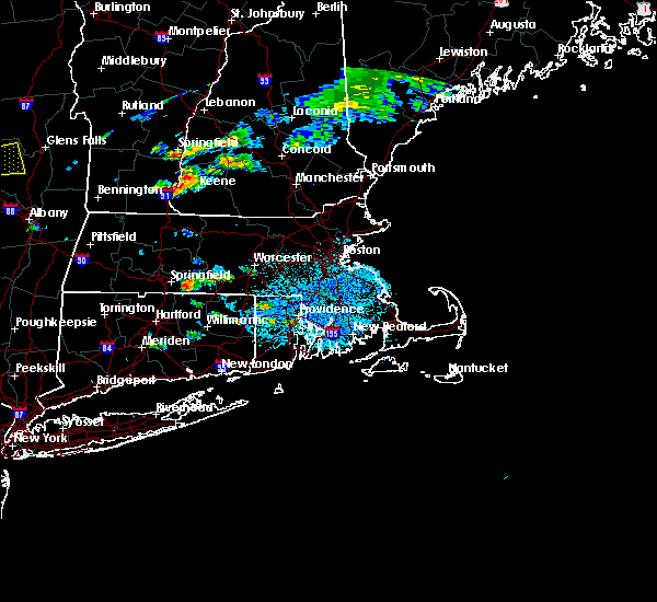 At 251 pm edt, a severe thunderstorm was located over hampden, or 8 miles east of springfield, moving east at 20 mph (radar indicated). Hazards include 60 mph wind gusts. Expect damage to roofs. siding. And trees. At 251 pm edt, a severe thunderstorm was located over hampden, or 8 miles east of springfield, moving east at 20 mph (radar indicated). Hazards include 60 mph wind gusts. Expect damage to roofs. siding. And trees.
|
| 8/13/2016 1:52 PM EDT |
 At 152 pm edt, a pair of severe thunderstorms were located near agawam, moving east at 10 mph (radar indicated). Hazards include 60 mph wind gusts. Expect damage to roofs. siding. And trees. At 152 pm edt, a pair of severe thunderstorms were located near agawam, moving east at 10 mph (radar indicated). Hazards include 60 mph wind gusts. Expect damage to roofs. siding. And trees.
|
| 8/12/2016 2:51 PM EDT |
 At 250 pm edt, severe thunderstorms were located along a line extending from near east brookfield to near brookfield to near palmer, moving east at 30 mph (radar indicated). Hazards include 60 mph wind gusts. Expect damage to roofs. siding. And trees. At 250 pm edt, severe thunderstorms were located along a line extending from near east brookfield to near brookfield to near palmer, moving east at 30 mph (radar indicated). Hazards include 60 mph wind gusts. Expect damage to roofs. siding. And trees.
|
| 7/22/2016 7:54 PM EDT |
 The severe thunderstorm warning for northern windham, northeastern tolland, southeastern hampden, southwestern worcester and western providence counties will expire at 800 pm edt, the main storm which prompted the warning has moved out of the area. therefore, the warning will be allowed to expire. however heavy rain is still possible with heavy showers and embedded thunderstorms. The severe thunderstorm warning for northern windham, northeastern tolland, southeastern hampden, southwestern worcester and western providence counties will expire at 800 pm edt, the main storm which prompted the warning has moved out of the area. therefore, the warning will be allowed to expire. however heavy rain is still possible with heavy showers and embedded thunderstorms.
|
| 7/22/2016 7:19 PM EDT |
 At 719 pm edt, a severe thunderstorm was located over willington, or 10 miles north of mansfield, moving east at 25 mph (radar indicated). Hazards include 60 mph wind gusts and penny size hail. Expect damage to roofs. siding. And trees. At 719 pm edt, a severe thunderstorm was located over willington, or 10 miles north of mansfield, moving east at 25 mph (radar indicated). Hazards include 60 mph wind gusts and penny size hail. Expect damage to roofs. siding. And trees.
|
| 7/22/2016 7:03 PM EDT |
 At 703 pm edt, a severe thunderstorm was located over ware, or 11 miles southeast of amherst, moving east at 30 mph (radar indicated). Hazards include 60 mph wind gusts and penny size hail. Expect damage to roofs. siding. and trees. This severe storm will be near, warren, west brookfield, brimfield and brookfield around 715 pm edt. At 703 pm edt, a severe thunderstorm was located over ware, or 11 miles southeast of amherst, moving east at 30 mph (radar indicated). Hazards include 60 mph wind gusts and penny size hail. Expect damage to roofs. siding. and trees. This severe storm will be near, warren, west brookfield, brimfield and brookfield around 715 pm edt.
|
| 7/22/2016 6:56 PM EDT |
 At 655 pm edt, a severe thunderstorm was located over belchertown, or near amherst, moving east at 30 mph (radar indicated). Hazards include 60 mph wind gusts and quarter size hail. Hail damage to vehicles is expected. expect wind damage to roofs, siding, and trees. this severe storm will be near, ware around 705 pm edt. Palmer, warren, west brookfield, brimfield and brookfield around 715 pm edt. At 655 pm edt, a severe thunderstorm was located over belchertown, or near amherst, moving east at 30 mph (radar indicated). Hazards include 60 mph wind gusts and quarter size hail. Hail damage to vehicles is expected. expect wind damage to roofs, siding, and trees. this severe storm will be near, ware around 705 pm edt. Palmer, warren, west brookfield, brimfield and brookfield around 715 pm edt.
|
| 7/22/2016 6:48 PM EDT |
 At 646 pm edt, a severe thunderstorm was located over amherst, moving east at 35 mph (radar indicated). Hazards include 60 mph wind gusts and quarter size hail. Hail damage to vehicles is expected. expect wind damage to roofs, siding, and trees. this severe storm will be near, belchertown and pelham around 700 pm edt. ware around 705 pm edt. palmer and warren around 710 pm edt. North brookfield, west brookfield, brookfield, hardwick and new braintree around 715 pm edt. At 646 pm edt, a severe thunderstorm was located over amherst, moving east at 35 mph (radar indicated). Hazards include 60 mph wind gusts and quarter size hail. Hail damage to vehicles is expected. expect wind damage to roofs, siding, and trees. this severe storm will be near, belchertown and pelham around 700 pm edt. ware around 705 pm edt. palmer and warren around 710 pm edt. North brookfield, west brookfield, brookfield, hardwick and new braintree around 715 pm edt.
|
| 7/22/2016 6:36 PM EDT |
 At 636 pm edt, a severe thunderstorm was located near hadley, or near northampton, moving east at 35 mph (radar indicated). Hazards include 60 mph wind gusts and quarter size hail. Hail damage to vehicles is expected. expect wind damage to roofs, siding, and trees. this severe thunderstorm will be near, granby around 650 pm edt. belchertown and pelham around 655 pm edt. ludlow and wilbraham around 700 pm edt. monson around 705 pm edt. palmer around 710 pm edt. Warren, west brookfield, brimfield, brookfield, holland and wales around 715 pm edt. At 636 pm edt, a severe thunderstorm was located near hadley, or near northampton, moving east at 35 mph (radar indicated). Hazards include 60 mph wind gusts and quarter size hail. Hail damage to vehicles is expected. expect wind damage to roofs, siding, and trees. this severe thunderstorm will be near, granby around 650 pm edt. belchertown and pelham around 655 pm edt. ludlow and wilbraham around 700 pm edt. monson around 705 pm edt. palmer around 710 pm edt. Warren, west brookfield, brimfield, brookfield, holland and wales around 715 pm edt.
|
| 2/25/2016 1:57 AM EST |
 At 156 am est, doppler radar indicated a line of severe thunderstorms capable of producing destructive winds in excess of 70 mph. these storms were located along a line extending from near gardner to near new braintree to near monson, and was moving northeast at 50 mph. At 156 am est, doppler radar indicated a line of severe thunderstorms capable of producing destructive winds in excess of 70 mph. these storms were located along a line extending from near gardner to near new braintree to near monson, and was moving northeast at 50 mph.
|
| 2/25/2016 12:58 AM EST |
 At 1258 am est, doppler radar indicated a severe thunderstorm capable of producing destructive winds in excess of 70 mph. this storm was located over east windsor, or near south windsor, and was moving northeast at 45 mph. At 1258 am est, doppler radar indicated a severe thunderstorm capable of producing destructive winds in excess of 70 mph. this storm was located over east windsor, or near south windsor, and was moving northeast at 45 mph.
|
| 8/4/2015 2:59 PM EDT |
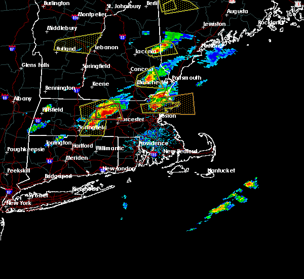 At 258 pm edt, doppler radar indicated a severe thunderstorm capable of producing quarter size hail and damaging winds in excess of 60 mph. this storm was located over ludlow, or near chicopee, moving east at 35 mph. locations impacted include, springfield, ludlow, southbridge, east longmeadow, belchertown, wilbraham, palmer, spencer, ware, sturbridge, monson, hampden, warren, north brookfield, west brookfield, brimfield, brookfield, hardwick, holland and east brookfield. At 258 pm edt, doppler radar indicated a severe thunderstorm capable of producing quarter size hail and damaging winds in excess of 60 mph. this storm was located over ludlow, or near chicopee, moving east at 35 mph. locations impacted include, springfield, ludlow, southbridge, east longmeadow, belchertown, wilbraham, palmer, spencer, ware, sturbridge, monson, hampden, warren, north brookfield, west brookfield, brimfield, brookfield, hardwick, holland and east brookfield.
|
| 8/4/2015 2:44 PM EDT |
 At 243 pm edt, doppler radar indicated a severe thunderstorm capable of producing quarter size hail and damaging winds in excess of 60 mph. this storm was located over holyoke, moving east at 35 mph. locations impacted include, springfield, chicopee, westfield, holyoke, amherst, agawam, west springfield, ludlow, south hadley, southbridge, longmeadow, east longmeadow, belchertown, wilbraham, palmer, spencer, ware, southwick, sturbridge and monson. At 243 pm edt, doppler radar indicated a severe thunderstorm capable of producing quarter size hail and damaging winds in excess of 60 mph. this storm was located over holyoke, moving east at 35 mph. locations impacted include, springfield, chicopee, westfield, holyoke, amherst, agawam, west springfield, ludlow, south hadley, southbridge, longmeadow, east longmeadow, belchertown, wilbraham, palmer, spencer, ware, southwick, sturbridge and monson.
|
| 8/4/2015 2:17 PM EDT |
 At 216 pm edt, doppler radar indicated a severe thunderstorm capable of producing quarter size hail and damaging winds in excess of 60 mph. this storm was located over blandford, or 12 miles northwest of westfield, and was moving east at 35 mph. * some locations impacted include, springfield, chicopee, westfield, holyoke, amherst, northampton, agawam, west springfield, ludlow, south hadley, southbridge, easthampton, longmeadow, east longmeadow, belchertown, wilbraham, palmer, spencer, ware and southwick. At 216 pm edt, doppler radar indicated a severe thunderstorm capable of producing quarter size hail and damaging winds in excess of 60 mph. this storm was located over blandford, or 12 miles northwest of westfield, and was moving east at 35 mph. * some locations impacted include, springfield, chicopee, westfield, holyoke, amherst, northampton, agawam, west springfield, ludlow, south hadley, southbridge, easthampton, longmeadow, east longmeadow, belchertown, wilbraham, palmer, spencer, ware and southwick.
|
| 6/23/2015 7:45 PM EDT |
 At 744 pm edt, doppler radar indicated a severe thunderstorm capable of producing damaging winds in excess of 60 mph. this storm was located near ludlow, or 8 miles northeast of springfield, and was moving southeast at 40 mph. * some locations impacted include, ludlow, southbridge, wilbraham, charlton, palmer, stafford, dudley, thompson, sturbridge, monson, woodstock, willington, hampden, warren, ashford, west brookfield, brimfield, brookfield, holland and wales. At 744 pm edt, doppler radar indicated a severe thunderstorm capable of producing damaging winds in excess of 60 mph. this storm was located near ludlow, or 8 miles northeast of springfield, and was moving southeast at 40 mph. * some locations impacted include, ludlow, southbridge, wilbraham, charlton, palmer, stafford, dudley, thompson, sturbridge, monson, woodstock, willington, hampden, warren, ashford, west brookfield, brimfield, brookfield, holland and wales.
|
| 1/1/0001 12:00 AM | Large trees down throughout tow in hampden county MA, 0.6 miles NNW of Holland, MA |
Hail Maps for Holland, MA


Connect with Interactive Hail Maps