

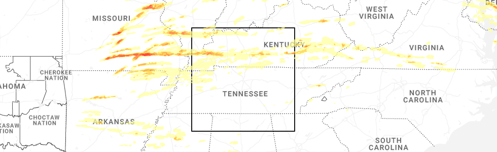
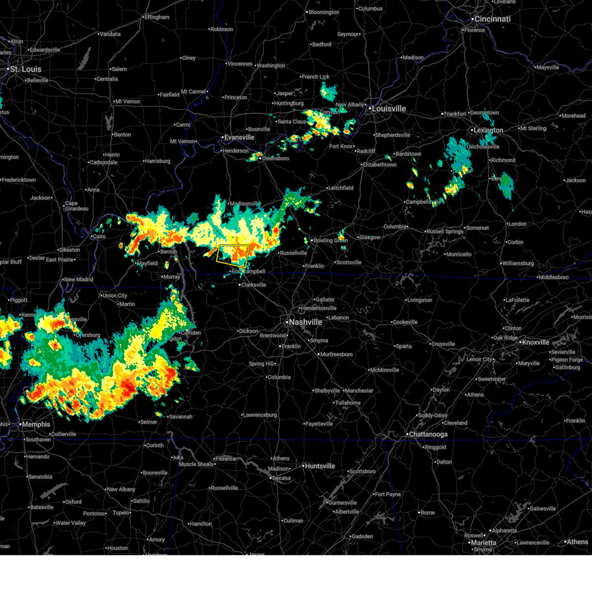
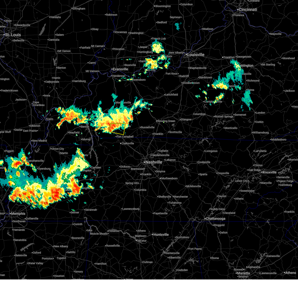
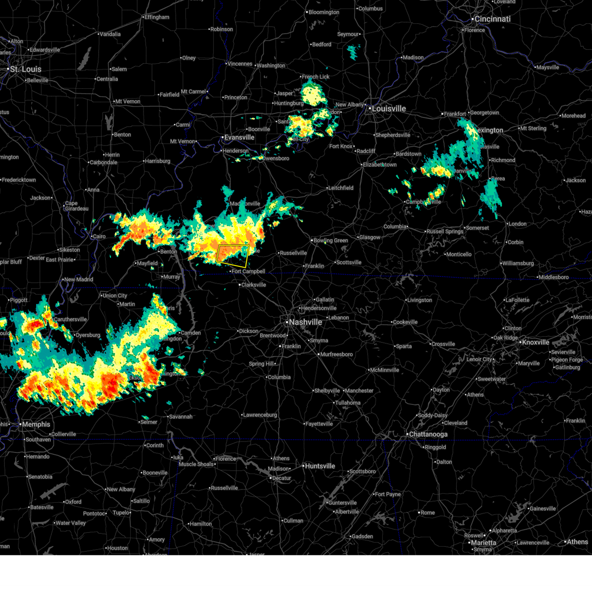
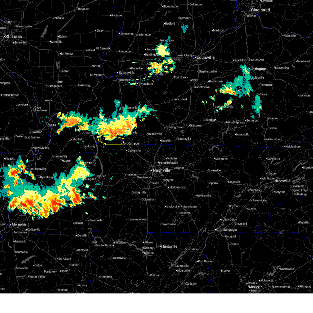
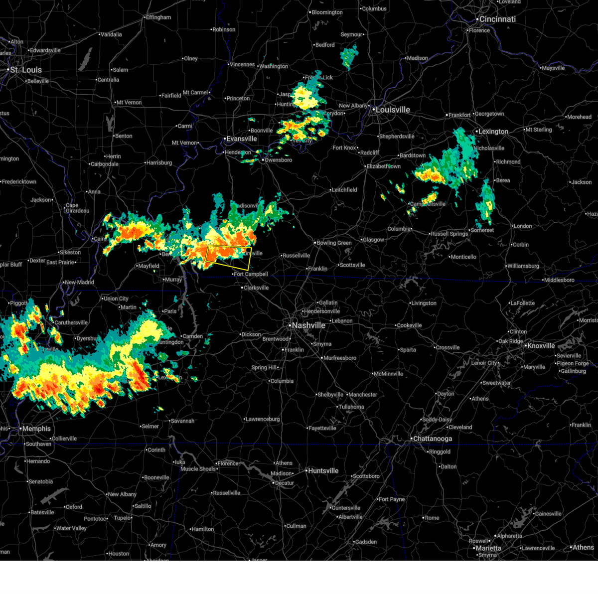
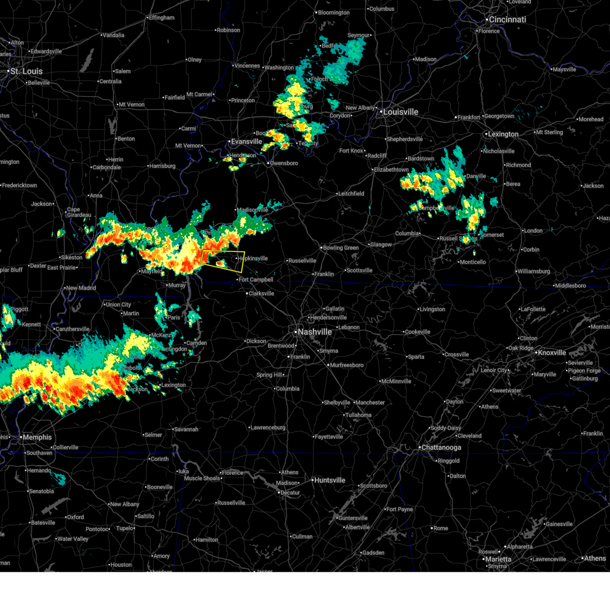
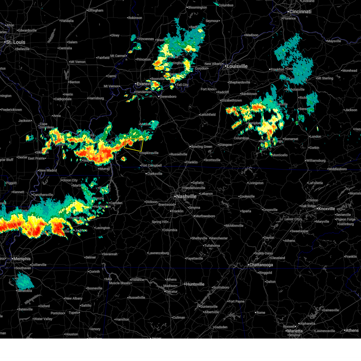
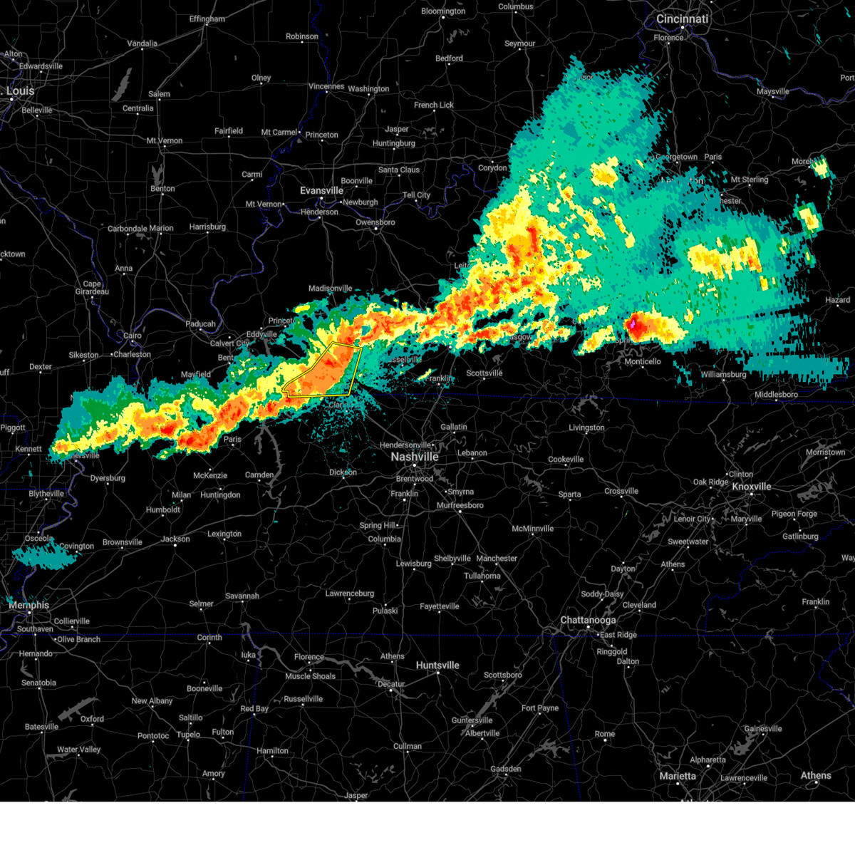
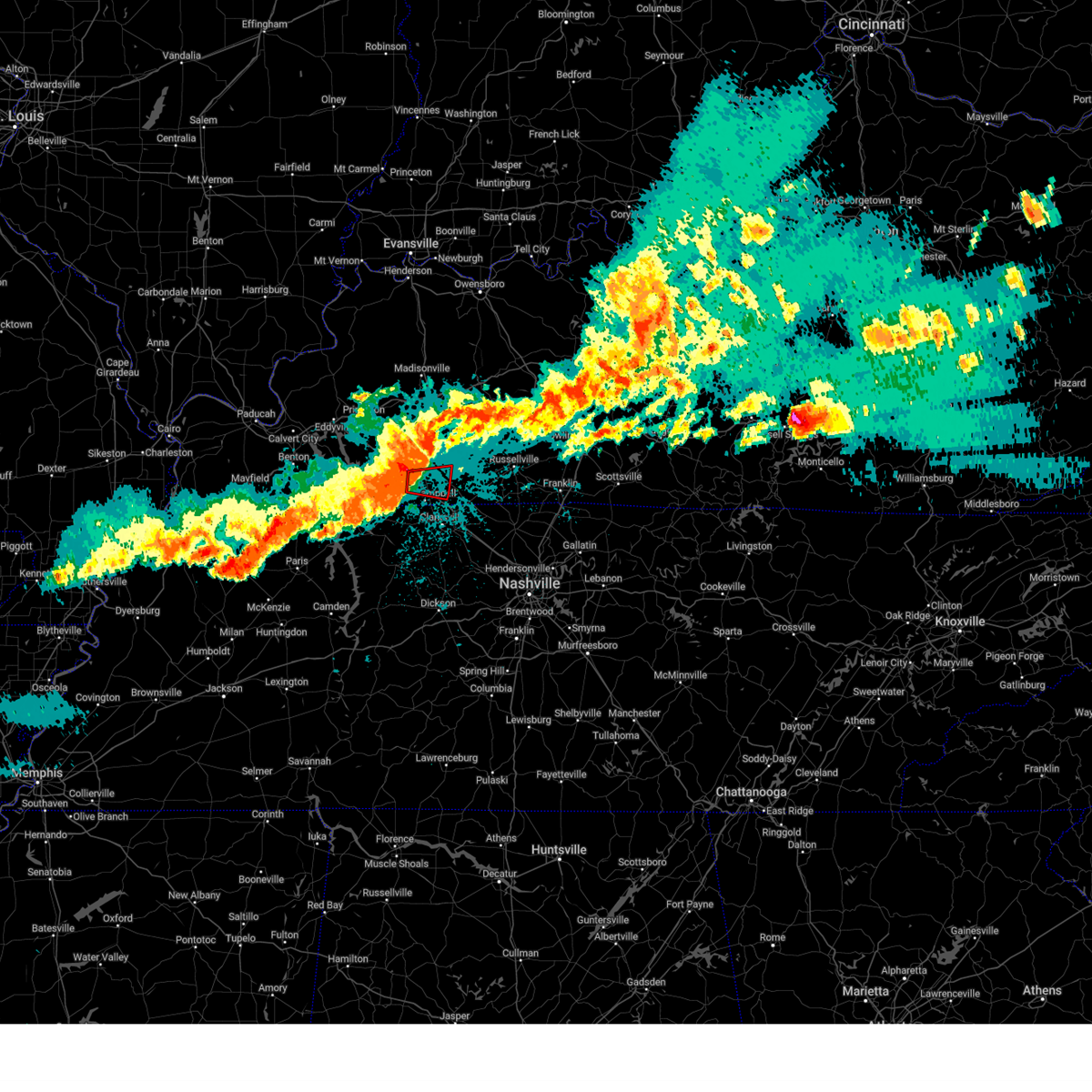
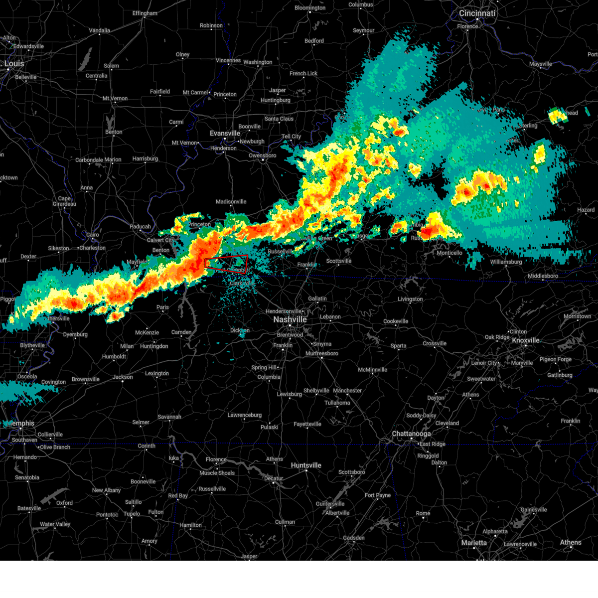
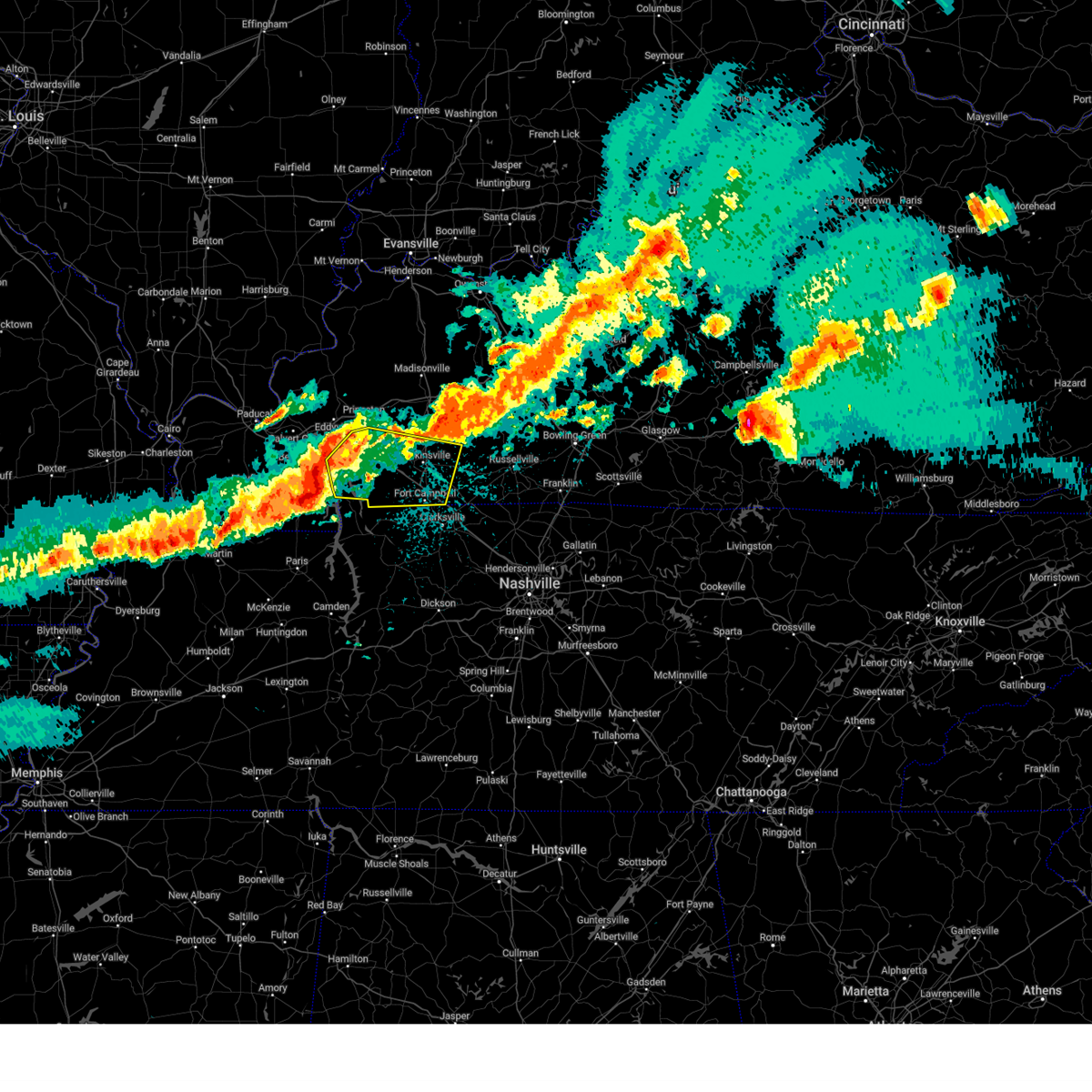
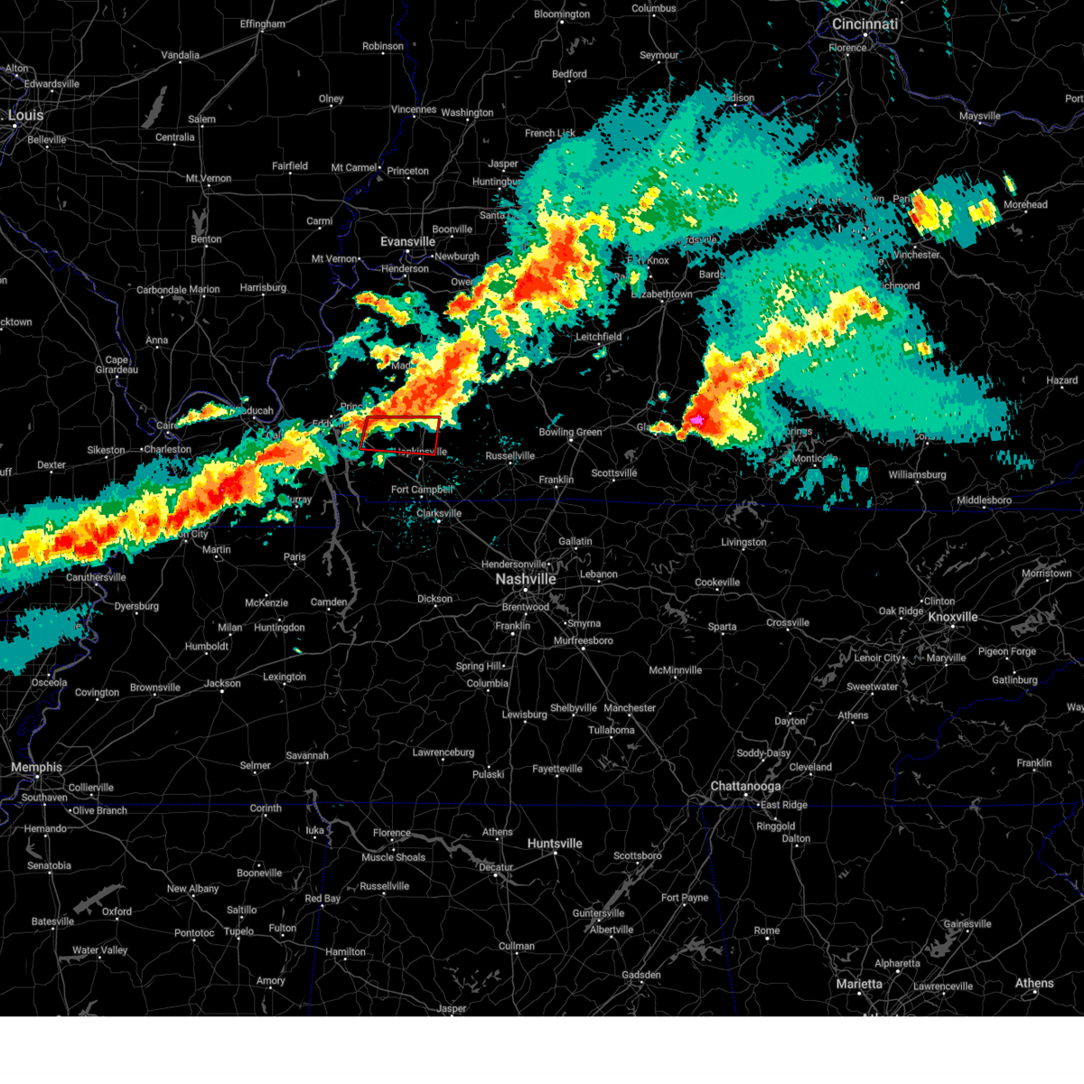
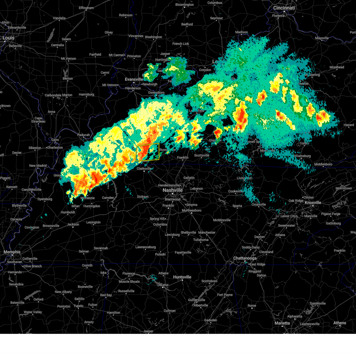
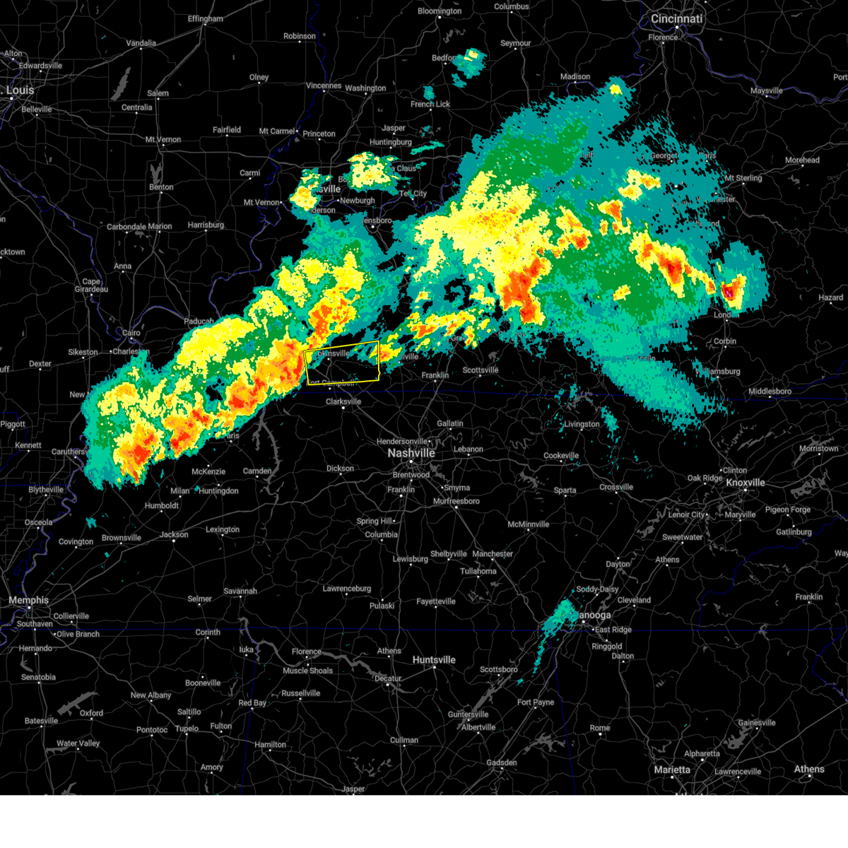
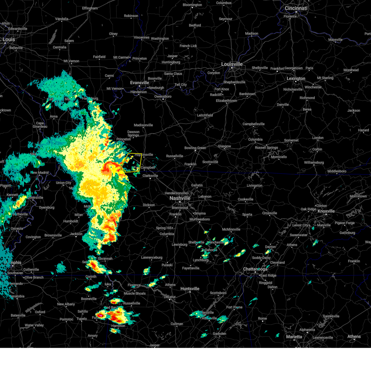
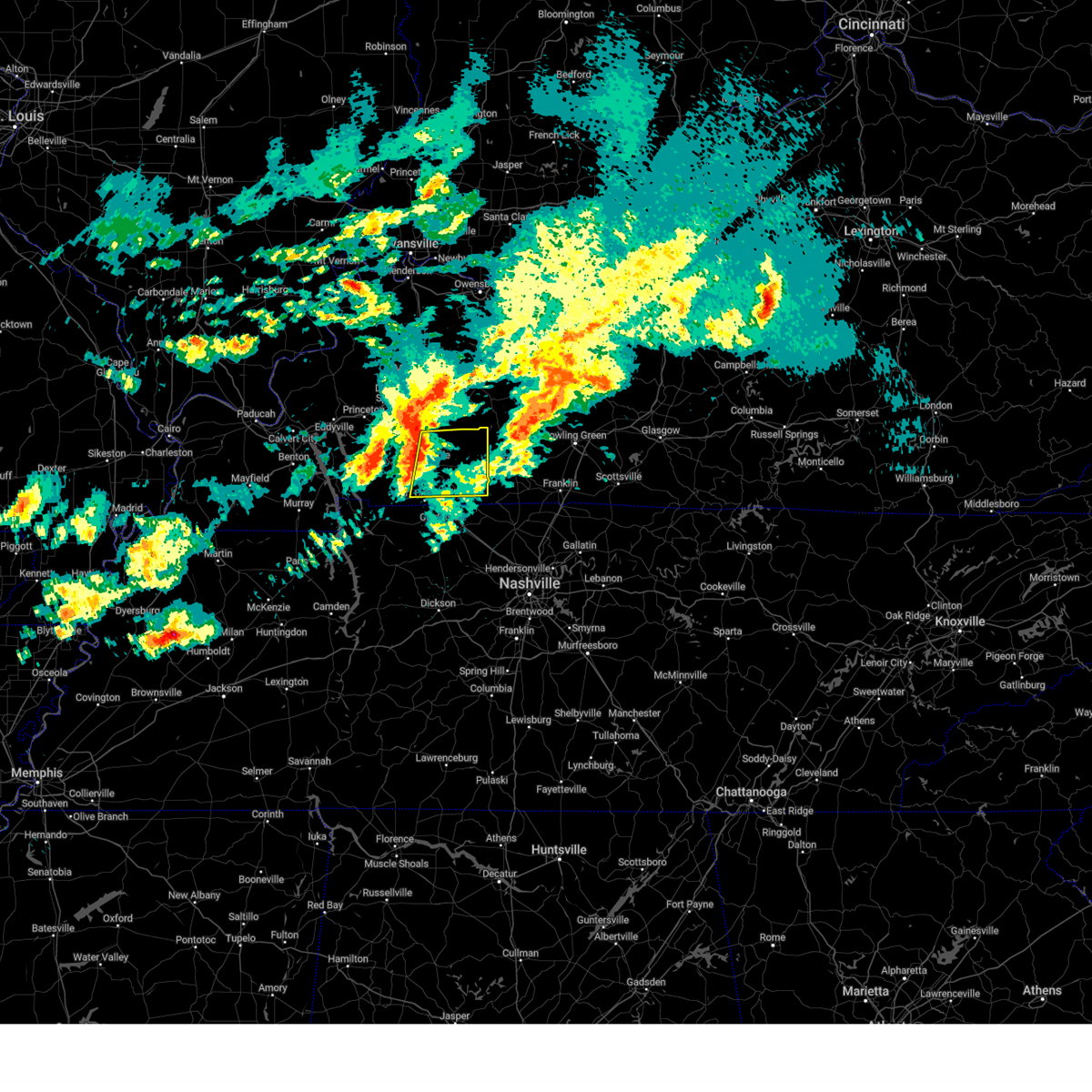
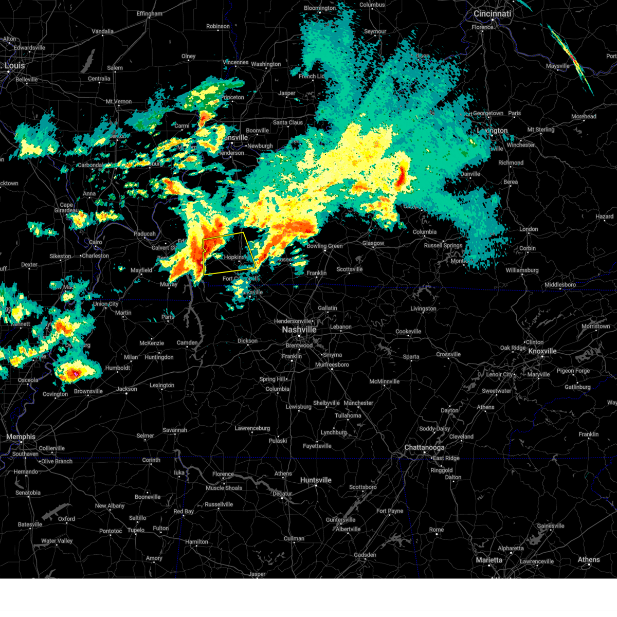
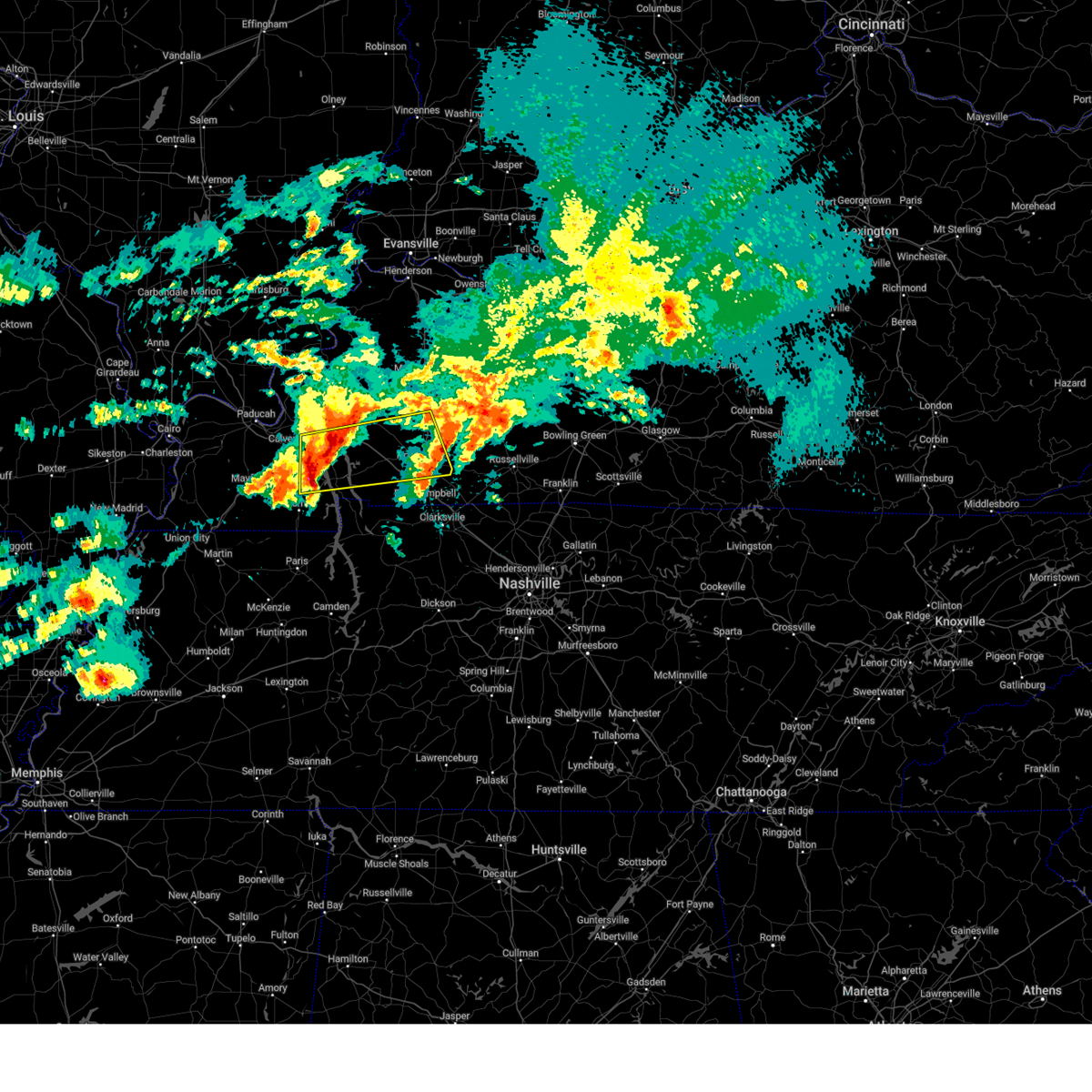
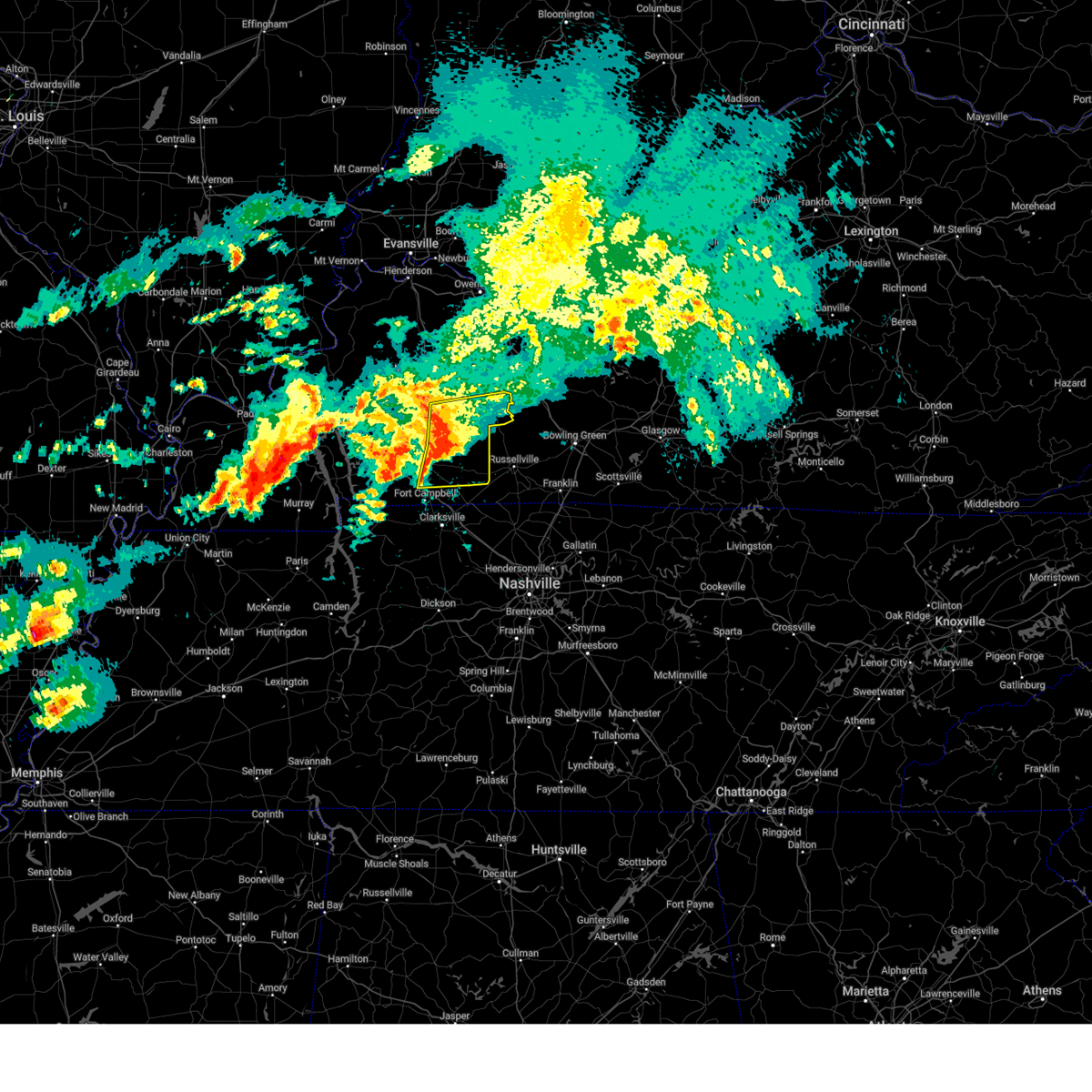
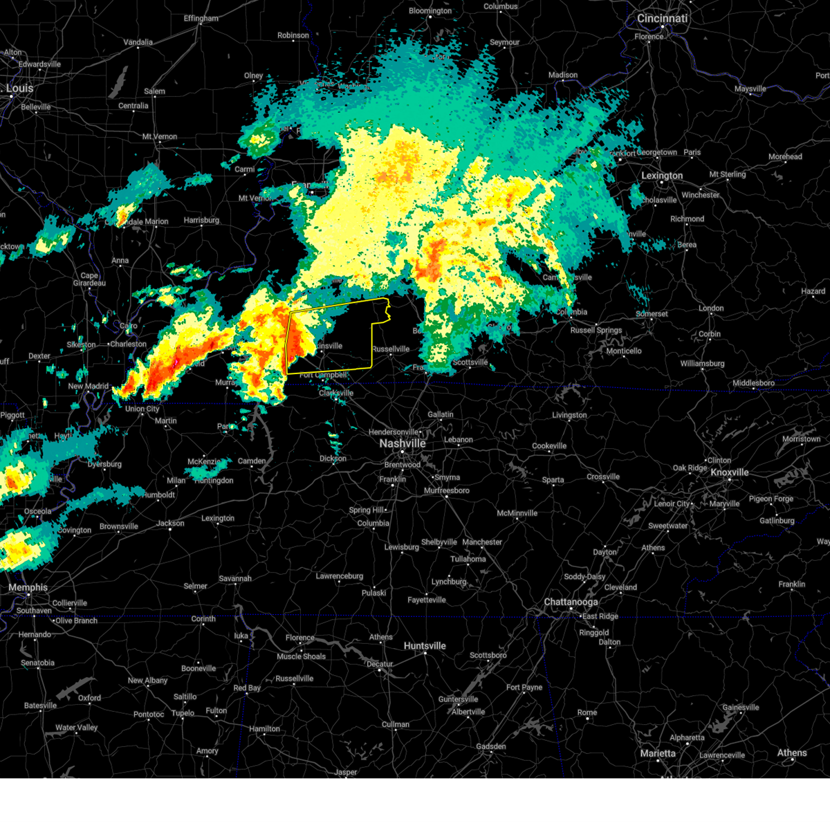
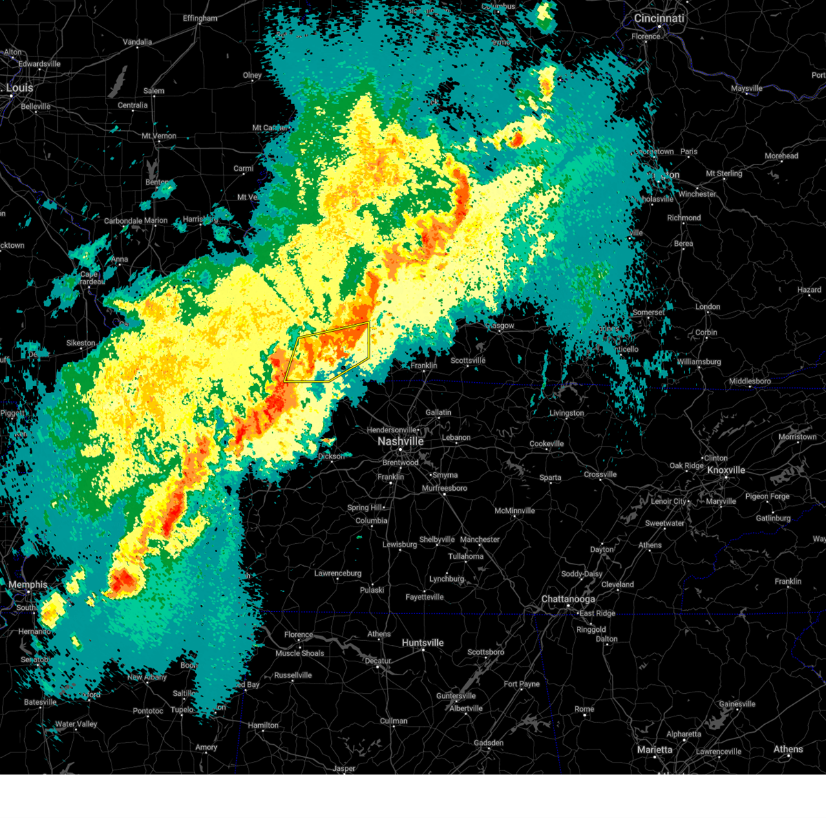
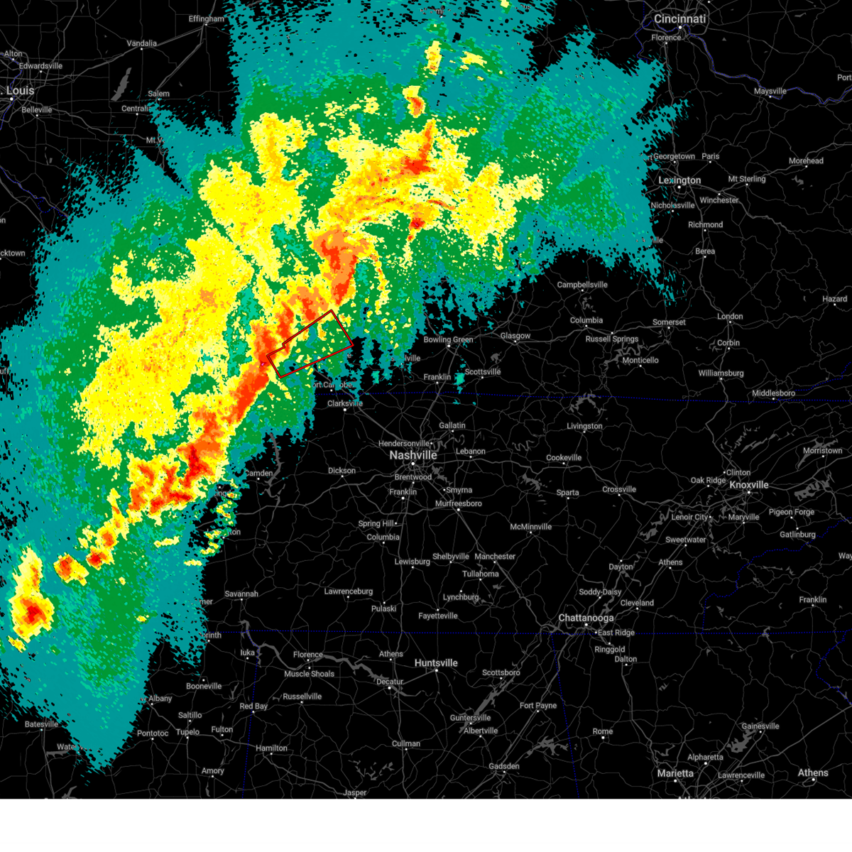
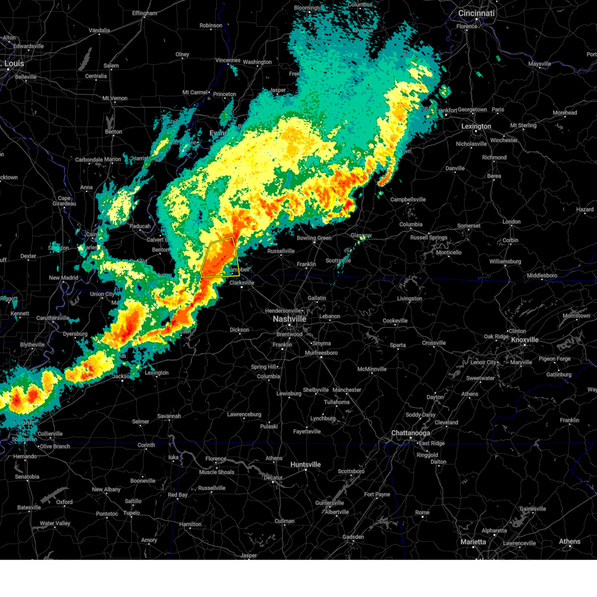
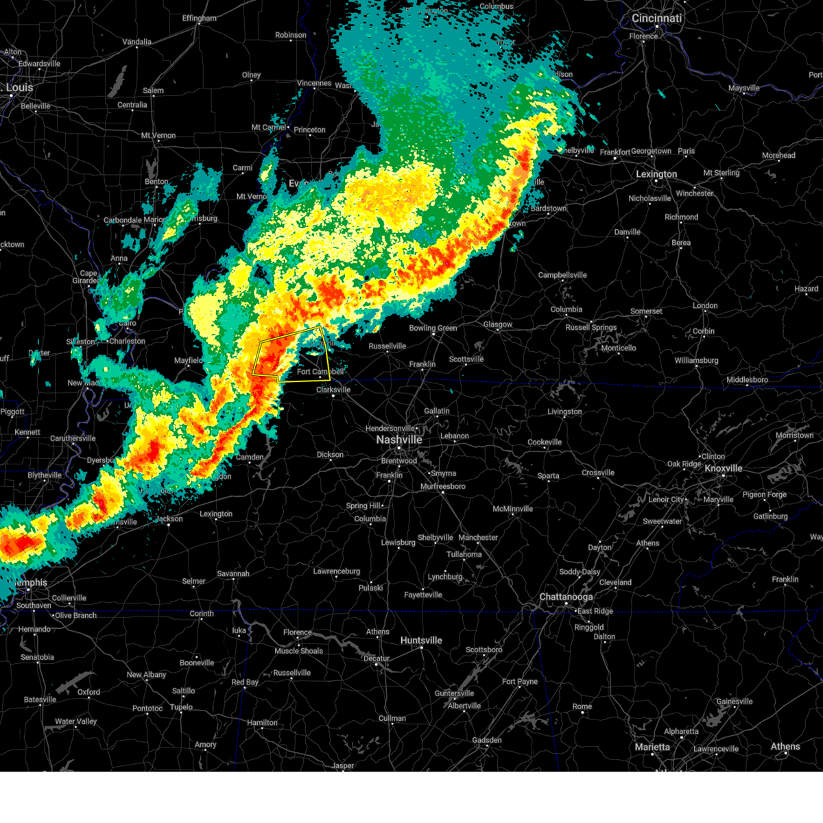
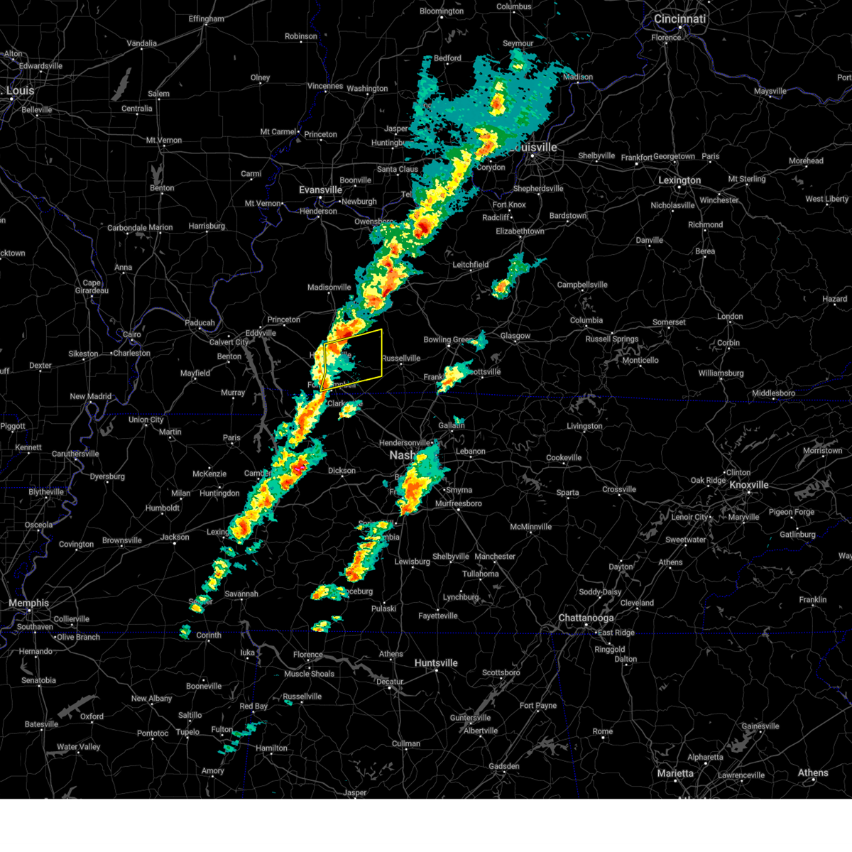
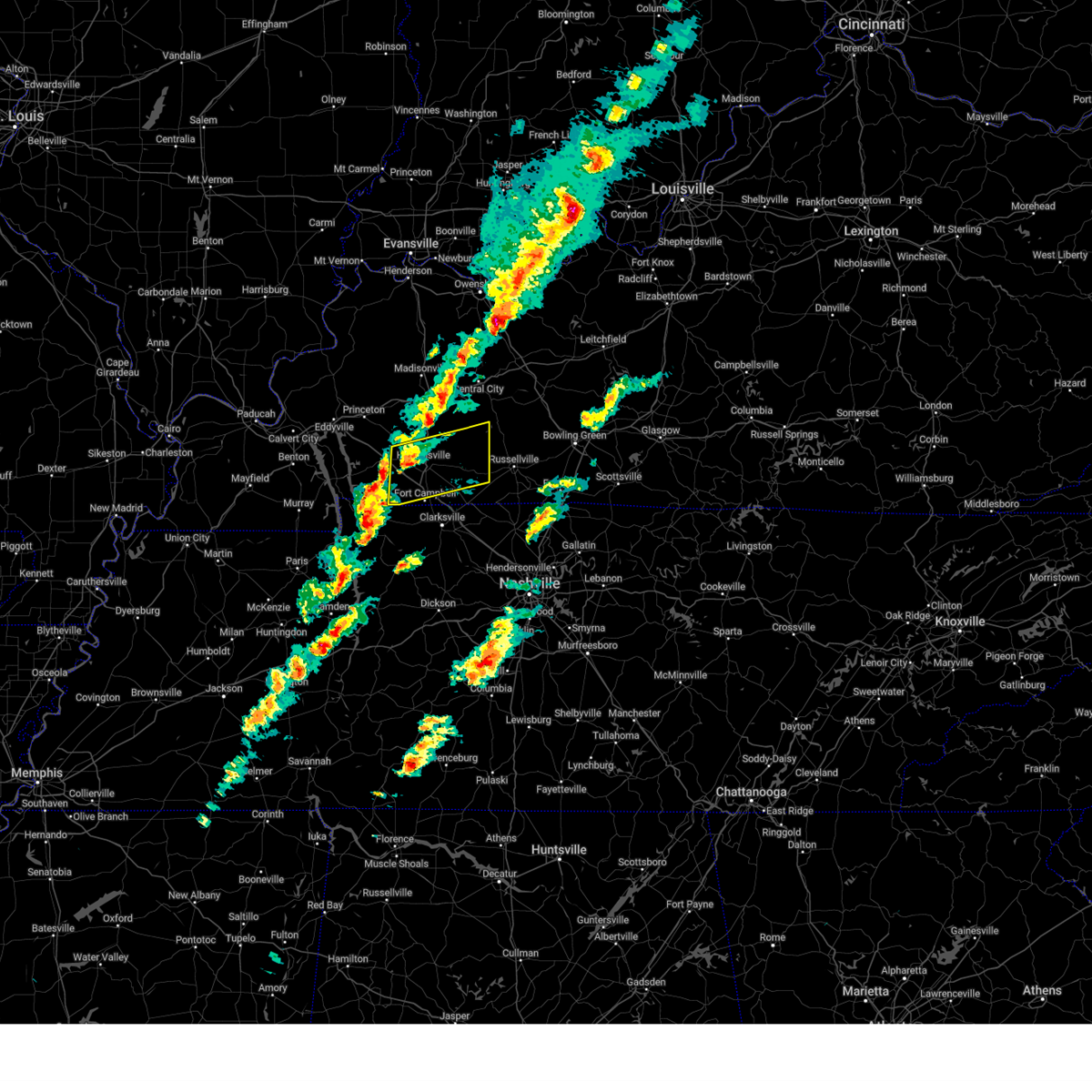
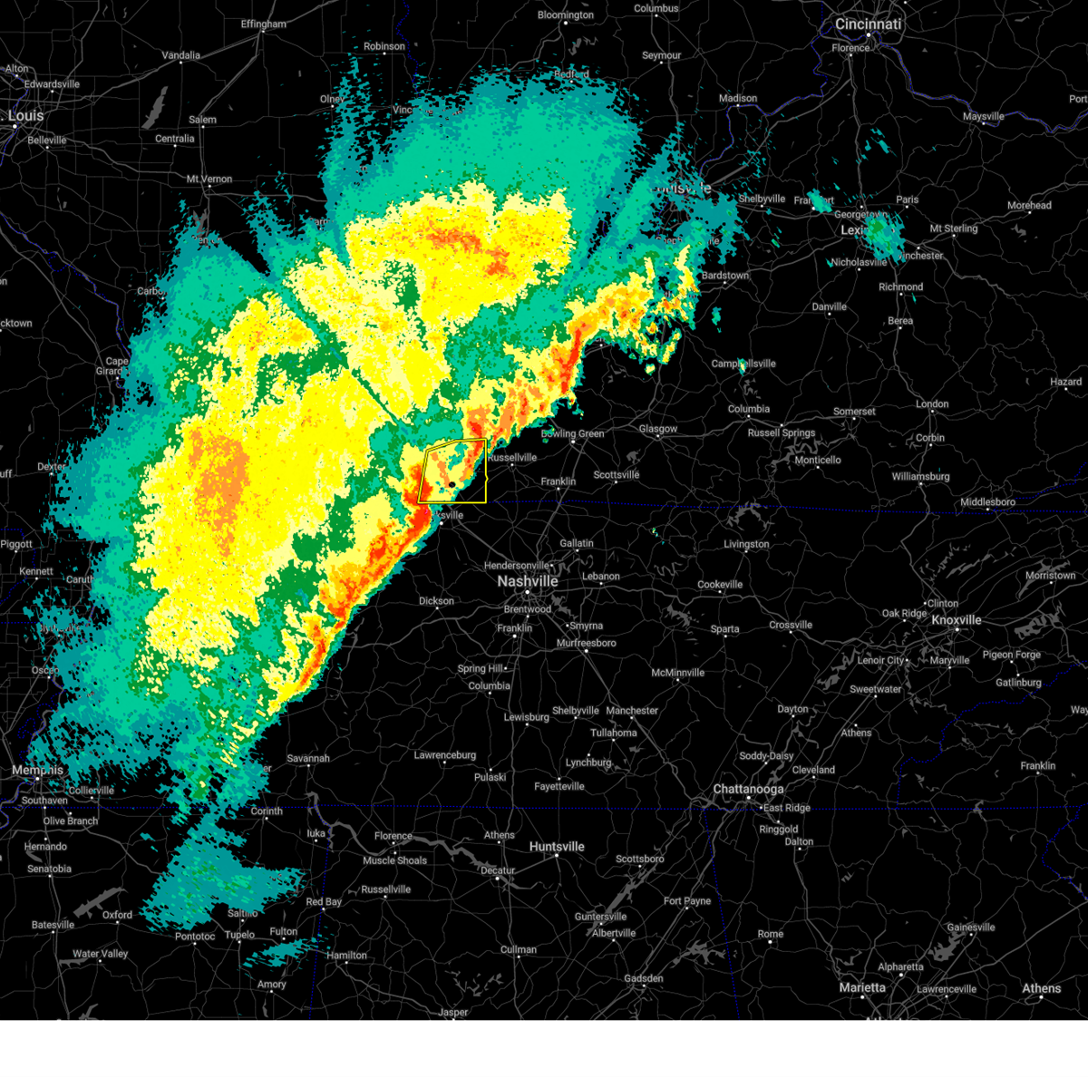
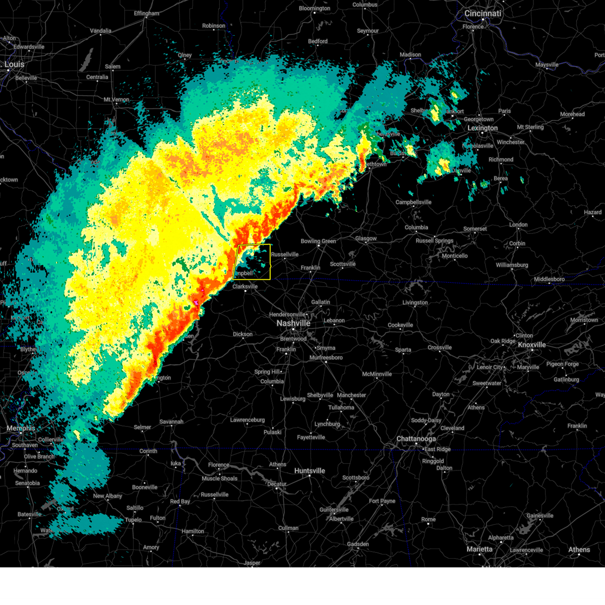
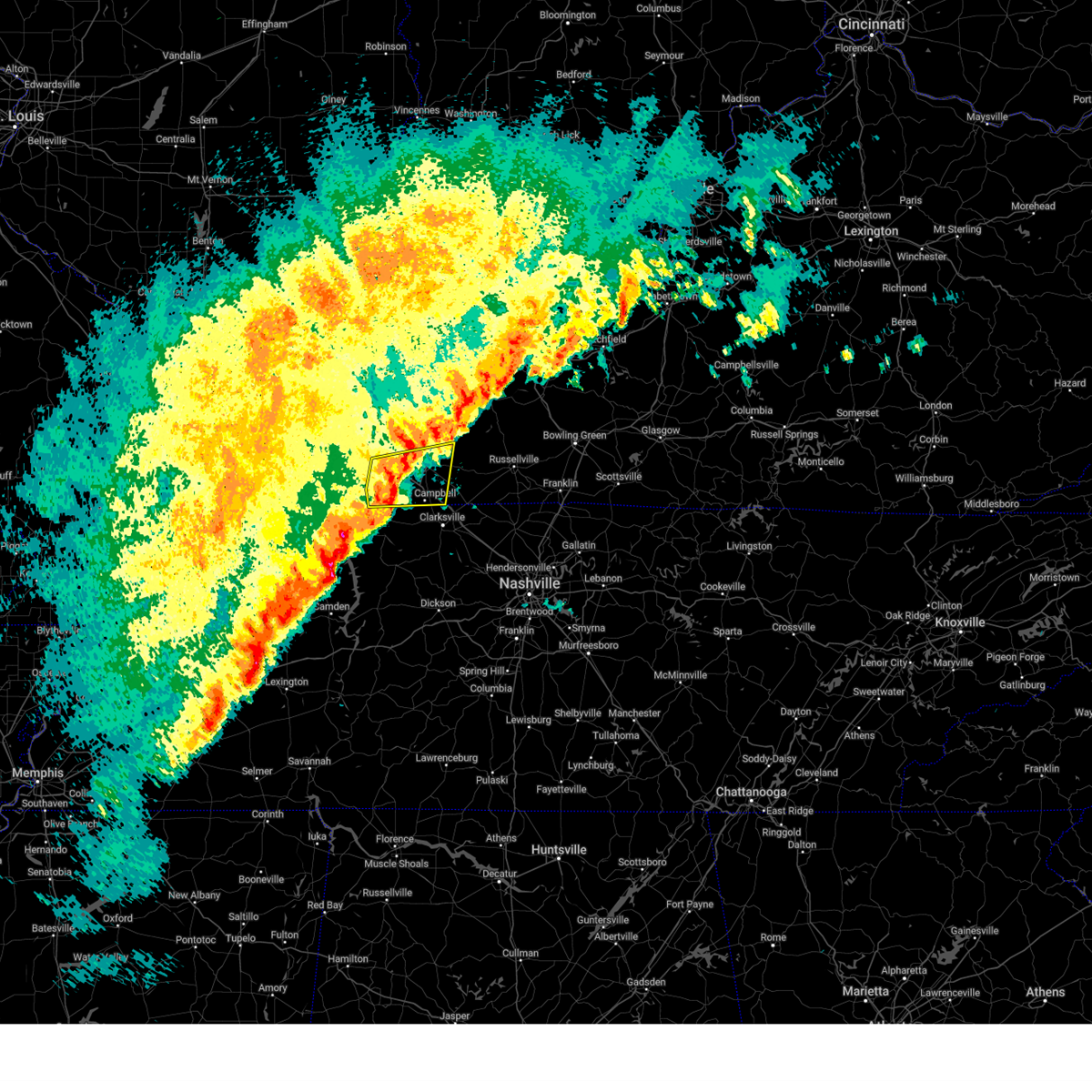
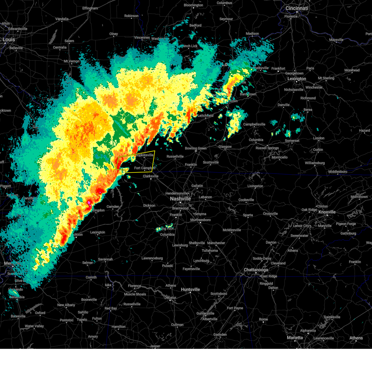
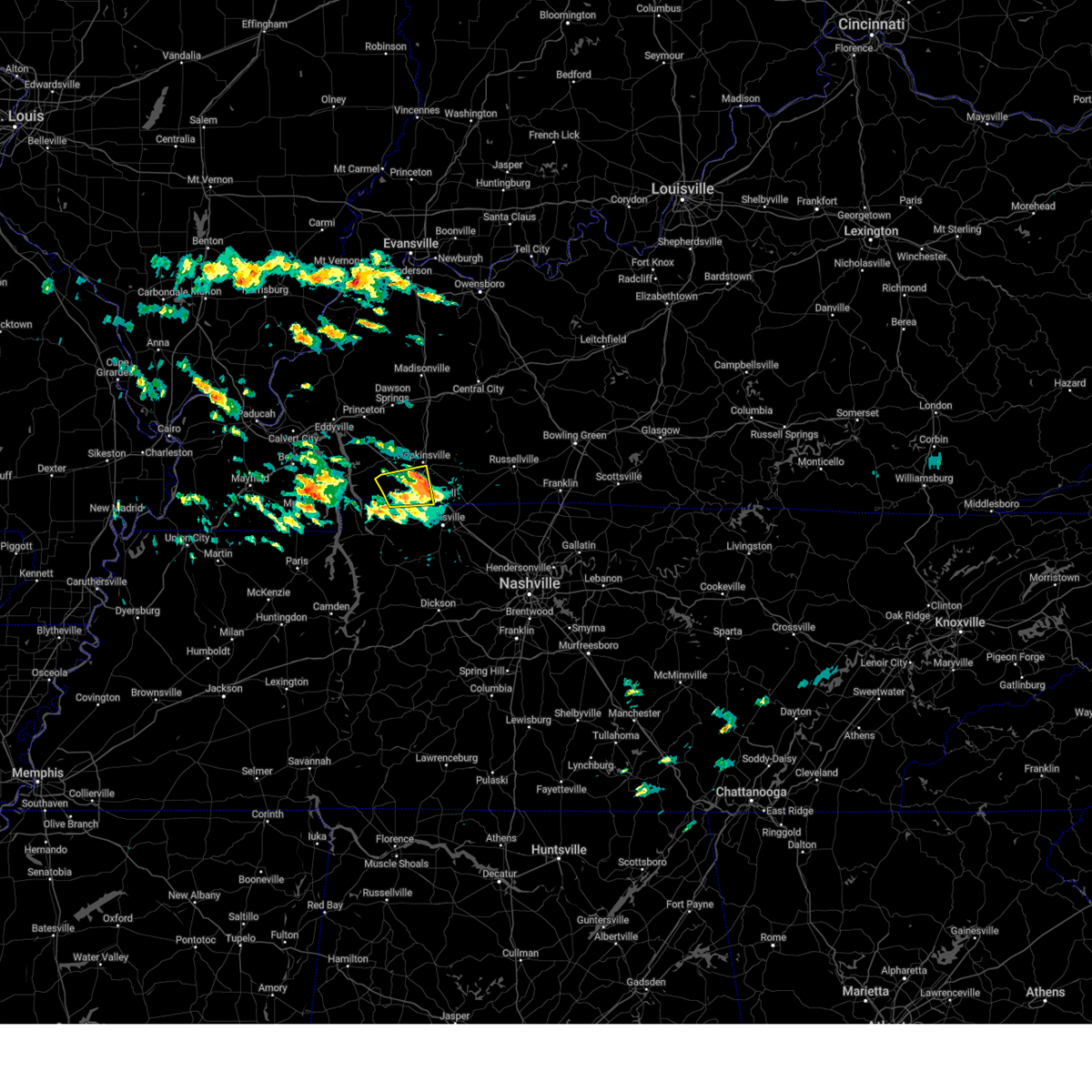
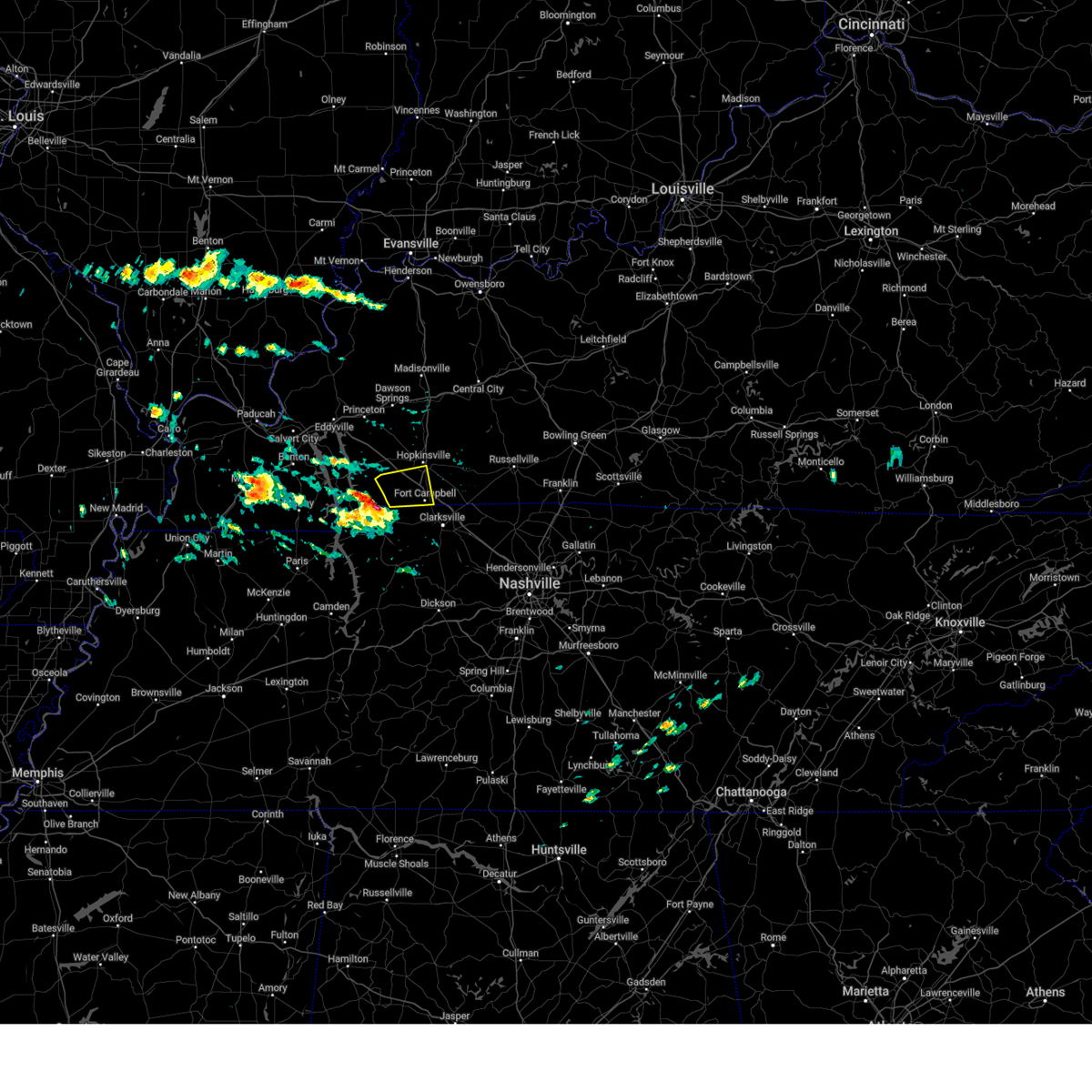
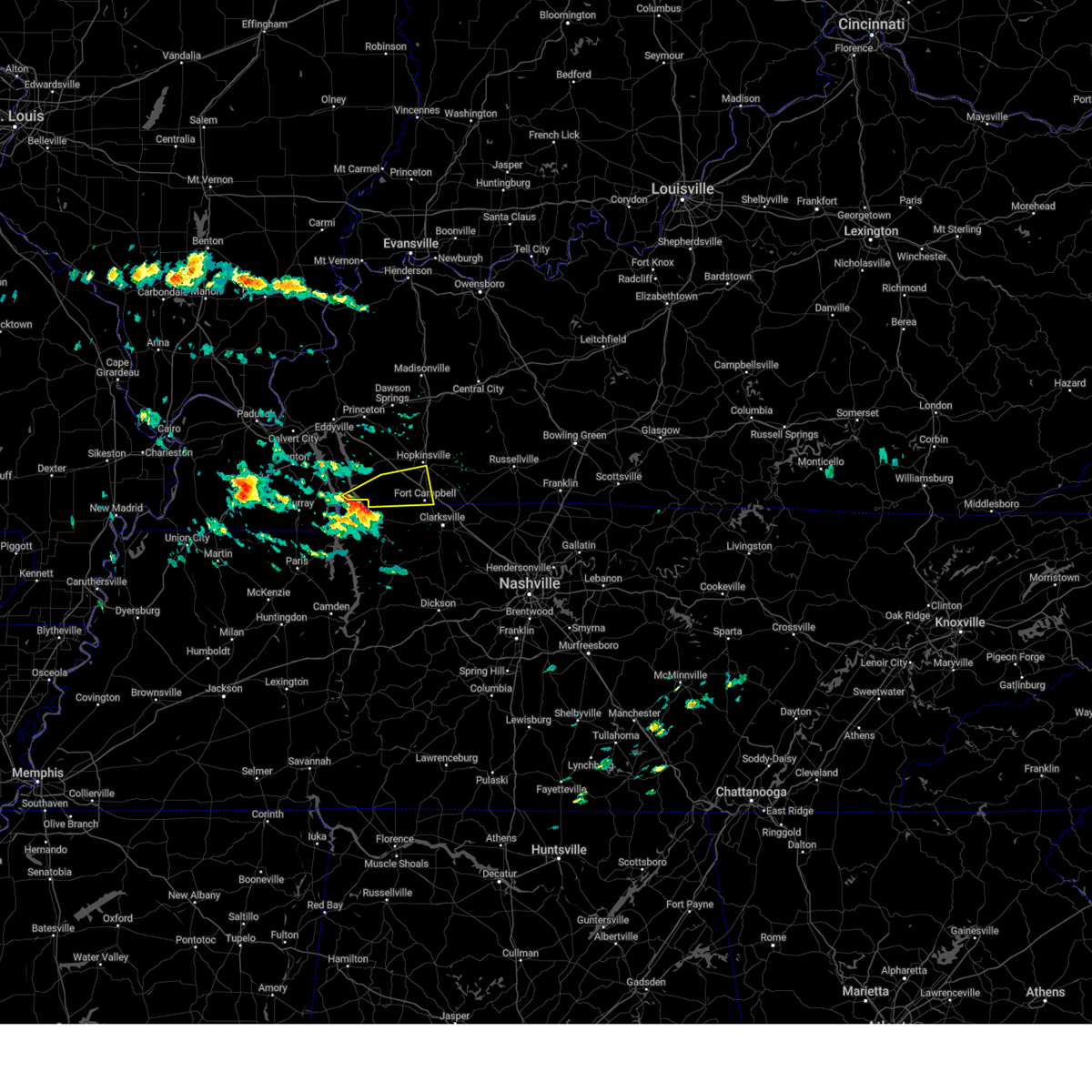
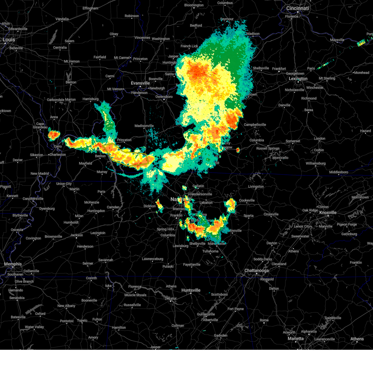
Hail Map for Hopkinsville, KY
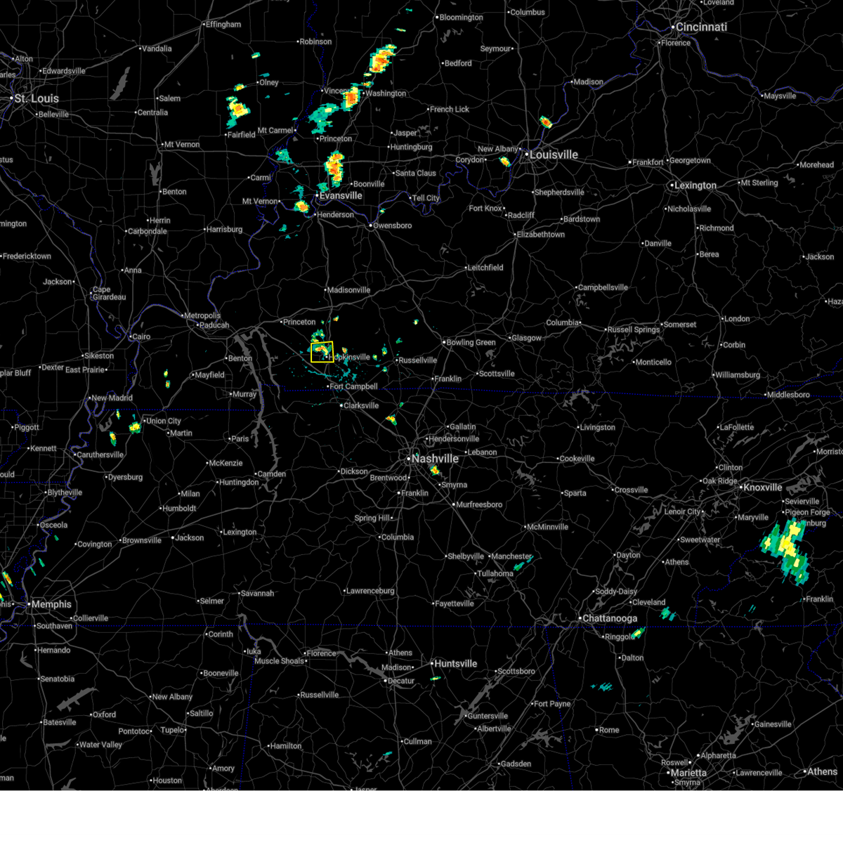
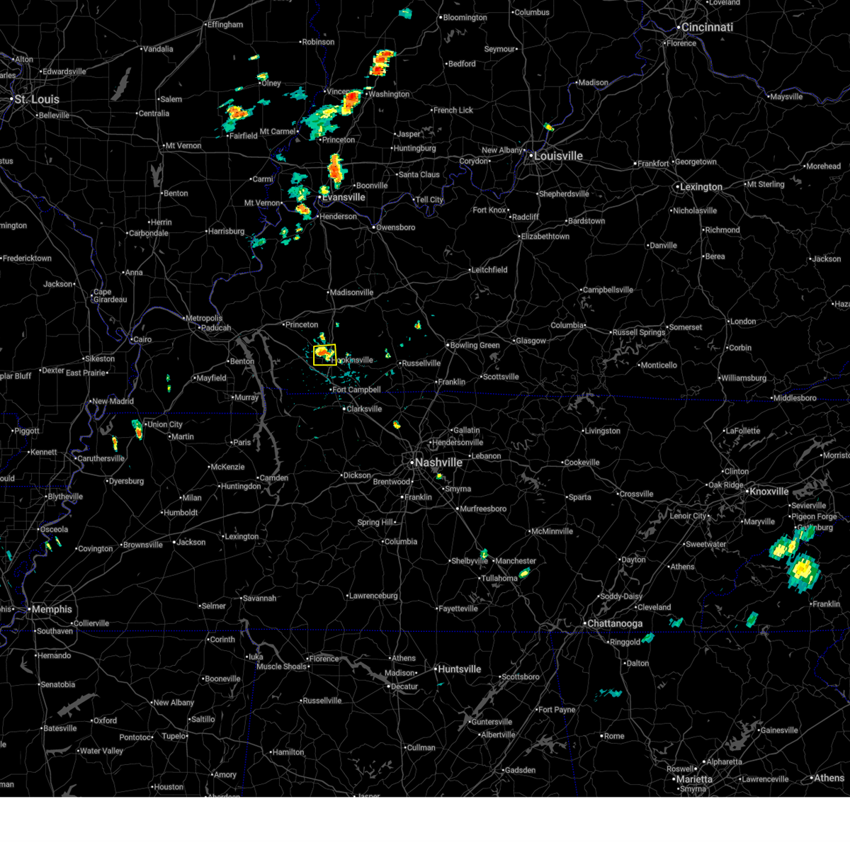
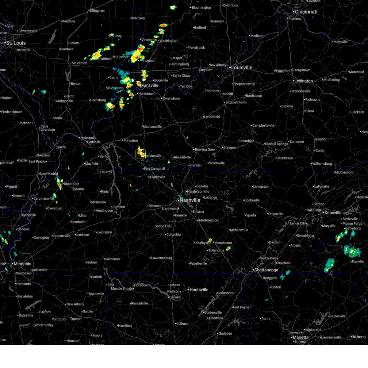
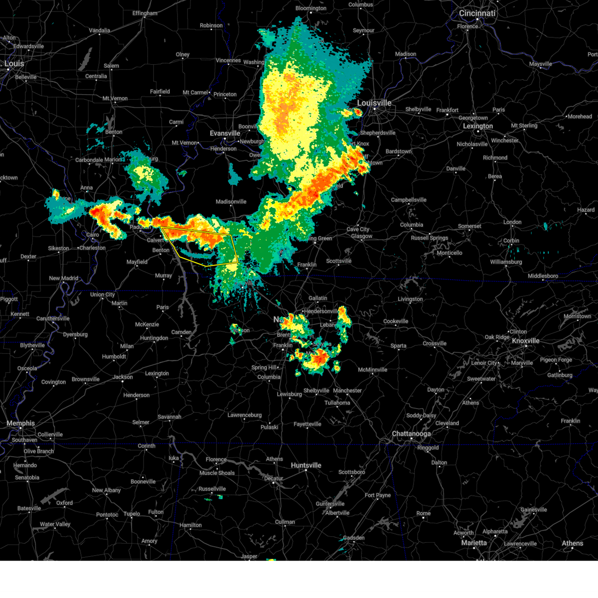
The Hopkinsville, KY area has had 16 reports of on-the-ground hail by trained spotters, and has been under severe weather warnings 85 times during the past 12 months. Doppler radar has detected hail at or near Hopkinsville, KY on 90 occasions, including 8 occasions during the past year.
| Name: | Hopkinsville, KY |
| Where Located: | 59.3 miles NW of Nashville, TN |
| Map: | Google Map for Hopkinsville, KY |
| Population: | 31577 |
| Housing Units: | 14318 |
| More Info: | Search Google for Hopkinsville, KY |
2
The Top Recent Hail Date for Hopkinsville, KY is Friday, May 16, 2025 (14th out of 90)
Hail and Wind Damage Spotted near Hopkinsville, KY
| Date / Time | Report Details |
|---|---|
| 6/24/2025 4:55 PM CDT |
 The storm which prompted the warning has weakened below severe limits, and no longer poses an immediate threat to life or property. therefore, the warning will be allowed to expire. The storm which prompted the warning has weakened below severe limits, and no longer poses an immediate threat to life or property. therefore, the warning will be allowed to expire.
|
| 6/24/2025 4:48 PM CDT |
 At 448 pm cdt, a severe thunderstorm was located over hopkinsville, and is nearly stationary (radar indicated). Hazards include 60 mph wind gusts. Expect damage to roofs, siding, and trees. locations impacted include, hopkinsville. This includes pennyrile parkway between mile markers 7 and 16. At 448 pm cdt, a severe thunderstorm was located over hopkinsville, and is nearly stationary (radar indicated). Hazards include 60 mph wind gusts. Expect damage to roofs, siding, and trees. locations impacted include, hopkinsville. This includes pennyrile parkway between mile markers 7 and 16.
|
| 6/24/2025 4:33 PM CDT |
 Svrpah the national weather service in paducah has issued a * severe thunderstorm warning for, central christian county in south central kentucky, * until 500 pm cdt. * at 432 pm cdt, a severe thunderstorm was located over hopkinsville, and is nearly stationary (radar indicated). Hazards include 60 mph wind gusts. expect damage to roofs, siding, and trees Svrpah the national weather service in paducah has issued a * severe thunderstorm warning for, central christian county in south central kentucky, * until 500 pm cdt. * at 432 pm cdt, a severe thunderstorm was located over hopkinsville, and is nearly stationary (radar indicated). Hazards include 60 mph wind gusts. expect damage to roofs, siding, and trees
|
| 6/19/2025 2:00 AM CDT |
 the severe thunderstorm warning has been cancelled and is no longer in effect the severe thunderstorm warning has been cancelled and is no longer in effect
|
| 6/19/2025 1:40 AM CDT |
 At 139 am cdt, a severe thunderstorm was located near hopkinsville, moving east at 40 mph (radar indicated). Hazards include 60 mph wind gusts and nickel size hail. Expect damage to roofs, siding, and trees. locations impacted include, hopkinsville and pembroke. this includes the following highways, interstate 24 in kentucky between mile markers 73 and 82. Pennyrile parkway between mile markers 1 and 13. At 139 am cdt, a severe thunderstorm was located near hopkinsville, moving east at 40 mph (radar indicated). Hazards include 60 mph wind gusts and nickel size hail. Expect damage to roofs, siding, and trees. locations impacted include, hopkinsville and pembroke. this includes the following highways, interstate 24 in kentucky between mile markers 73 and 82. Pennyrile parkway between mile markers 1 and 13.
|
| 6/19/2025 1:40 AM CDT |
 the severe thunderstorm warning has been cancelled and is no longer in effect the severe thunderstorm warning has been cancelled and is no longer in effect
|
| 6/19/2025 1:33 AM CDT |
 the severe thunderstorm warning has been cancelled and is no longer in effect the severe thunderstorm warning has been cancelled and is no longer in effect
|
| 6/19/2025 1:29 AM CDT |
 Svrpah the national weather service in paducah has issued a * severe thunderstorm warning for, southern christian county in south central kentucky, northeastern trigg county in western kentucky, southwestern todd county in south central kentucky, * until 215 am cdt. * at 128 am cdt, a severe thunderstorm was located near cadiz, moving east at 40 mph (radar indicated). Hazards include 60 mph wind gusts and nickel size hail. expect damage to roofs, siding, and trees Svrpah the national weather service in paducah has issued a * severe thunderstorm warning for, southern christian county in south central kentucky, northeastern trigg county in western kentucky, southwestern todd county in south central kentucky, * until 215 am cdt. * at 128 am cdt, a severe thunderstorm was located near cadiz, moving east at 40 mph (radar indicated). Hazards include 60 mph wind gusts and nickel size hail. expect damage to roofs, siding, and trees
|
| 6/19/2025 1:12 AM CDT |
 Svrpah the national weather service in paducah has issued a * severe thunderstorm warning for, southwestern christian county in south central kentucky, southeastern trigg county in western kentucky, * until 200 am cdt. * at 111 am cdt, a severe thunderstorm was located over canton, or near wranglers campground, moving east at 40 mph (radar indicated). Hazards include 60 mph wind gusts and nickel size hail. expect damage to roofs, siding, and trees Svrpah the national weather service in paducah has issued a * severe thunderstorm warning for, southwestern christian county in south central kentucky, southeastern trigg county in western kentucky, * until 200 am cdt. * at 111 am cdt, a severe thunderstorm was located over canton, or near wranglers campground, moving east at 40 mph (radar indicated). Hazards include 60 mph wind gusts and nickel size hail. expect damage to roofs, siding, and trees
|
| 6/19/2025 1:08 AM CDT |
 The storm which prompted the warning has weakened below severe limits, and no longer poses an immediate threat to life or property. therefore, the warning will be allowed to expire. however, gusty winds are still possible with this thunderstorm. The storm which prompted the warning has weakened below severe limits, and no longer poses an immediate threat to life or property. therefore, the warning will be allowed to expire. however, gusty winds are still possible with this thunderstorm.
|
| 6/19/2025 1:05 AM CDT |
 Svrpah the national weather service in paducah has issued a * severe thunderstorm warning for, central christian county in south central kentucky, northeastern trigg county in western kentucky, * until 130 am cdt. * at 104 am cdt, a severe thunderstorm was located over cadiz, moving east at 50 mph (radar indicated). Hazards include 60 mph wind gusts and nickel size hail. expect damage to roofs, siding, and trees Svrpah the national weather service in paducah has issued a * severe thunderstorm warning for, central christian county in south central kentucky, northeastern trigg county in western kentucky, * until 130 am cdt. * at 104 am cdt, a severe thunderstorm was located over cadiz, moving east at 50 mph (radar indicated). Hazards include 60 mph wind gusts and nickel size hail. expect damage to roofs, siding, and trees
|
| 6/19/2025 12:50 AM CDT |
 Svrpah the national weather service in paducah has issued a * severe thunderstorm warning for, northwestern christian county in south central kentucky, southeastern caldwell county in western kentucky, northeastern trigg county in western kentucky, * until 115 am cdt. * at 1250 am cdt, a severe thunderstorm was located over cobb, or 10 miles southeast of princeton, moving east at 35 mph (radar indicated). Hazards include 60 mph wind gusts and nickel size hail. expect damage to roofs, siding, and trees Svrpah the national weather service in paducah has issued a * severe thunderstorm warning for, northwestern christian county in south central kentucky, southeastern caldwell county in western kentucky, northeastern trigg county in western kentucky, * until 115 am cdt. * at 1250 am cdt, a severe thunderstorm was located over cobb, or 10 miles southeast of princeton, moving east at 35 mph (radar indicated). Hazards include 60 mph wind gusts and nickel size hail. expect damage to roofs, siding, and trees
|
| 5/20/2025 5:00 PM CDT | At 500 pm cdt, severe thunderstorms were located along a line extending from 7 miles southwest of crofton to near hopkinsville to 8 miles west of fort campbell, moving east at 60 mph (radar indicated). Hazards include 70 mph wind gusts and penny size hail. Expect considerable tree damage. damage is likely to mobile homes, roofs, and outbuildings. locations impacted include, hopkinsville, oak grove, fort campbell, clarksville, pembroke, trenton, lafayette, herndon, and allegre. this includes the following highways, interstate 24 in kentucky between mile markers 71 and 92. Pennyrile parkway between mile markers 1 and 20. |
| 5/20/2025 5:00 PM CDT | the severe thunderstorm warning has been cancelled and is no longer in effect |
| 5/20/2025 4:56 PM CDT | Tree down over roa in christian county KY, 9.4 miles S of Hopkinsville, KY |
| 5/20/2025 4:42 PM CDT | Svrpah the national weather service in paducah has issued a * severe thunderstorm warning for, christian county in south central kentucky, trigg county in western kentucky, western todd county in south central kentucky, * until 530 pm cdt. * at 442 pm cdt, severe thunderstorms were located along a line extending from 6 miles northwest of cadiz to near canton to 6 miles southeast of wranglers campground, moving east at 55 mph (radar indicated). Hazards include 70 mph wind gusts and penny size hail. Expect considerable tree damage. Damage is likely to mobile homes, roofs, and outbuildings. |
| 5/20/2025 4:39 PM CDT | Power outages reporte in christian county KY, 4.7 miles SSE of Hopkinsville, KY |
| 5/16/2025 9:59 PM CDT | The storms which prompted the warning have moved out of the area. therefore, the warning will be allowed to expire. |
| 5/16/2025 9:47 PM CDT | Power lines down blocking the roa in christian county KY, 1.3 miles SSE of Hopkinsville, KY |
| 5/16/2025 9:36 PM CDT |
 At 935 pm cdt, severe thunderstorms were located along a line extending from 8 miles south of weir to near hopkinsville to 6 miles west of pembroke to big rock, moving east at 65 mph (radar indicated). Hazards include 70 mph wind gusts and quarter size hail. Hail damage to vehicles is expected. expect considerable tree damage. wind damage is also likely to mobile homes, roofs, and outbuildings. locations impacted include, hopkinsville, oak grove, fort campbell, clarksville, pembroke, lafayette, and herndon. this includes the following highways, interstate 24 in kentucky between mile markers 72 and 92. Pennyrile parkway between mile markers 1 and 18. At 935 pm cdt, severe thunderstorms were located along a line extending from 8 miles south of weir to near hopkinsville to 6 miles west of pembroke to big rock, moving east at 65 mph (radar indicated). Hazards include 70 mph wind gusts and quarter size hail. Hail damage to vehicles is expected. expect considerable tree damage. wind damage is also likely to mobile homes, roofs, and outbuildings. locations impacted include, hopkinsville, oak grove, fort campbell, clarksville, pembroke, lafayette, and herndon. this includes the following highways, interstate 24 in kentucky between mile markers 72 and 92. Pennyrile parkway between mile markers 1 and 18.
|
| 5/16/2025 9:36 PM CDT |
 the severe thunderstorm warning has been cancelled and is no longer in effect the severe thunderstorm warning has been cancelled and is no longer in effect
|
| 5/16/2025 9:35 PM CDT |
 Svrpah the national weather service in paducah has issued a * severe thunderstorm warning for, southeastern christian county in south central kentucky, todd county in south central kentucky, * until 1015 pm cdt. * at 934 pm cdt, severe thunderstorms were located along a line extending from 8 miles southeast of crofton to 7 miles northeast of big rock, moving east at 55 mph. these are destructive storms for eastern christian and todd county! (radar indicated). Hazards include 90 mph wind gusts and nickel size hail. You are in a life-threatening situation. flying debris may be deadly to those caught without shelter. mobile homes will be heavily damaged or destroyed. homes and businesses will have substantial roof and window damage. expect extensive tree damage and power outages. severe thunderstorms will be near, oak grove, fort campbell, clarksville, and pembroke around 940 pm cdt. elkton around 945 pm cdt. guthrie around 955 pm cdt. other locations impacted by these severe thunderstorms include trenton, lafayette, allensville, clifty, herndon, and allegre. this includes the following highways, interstate 24 in kentucky between mile markers 77 and 92. Pennyrile parkway between mile markers 1 and 15. Svrpah the national weather service in paducah has issued a * severe thunderstorm warning for, southeastern christian county in south central kentucky, todd county in south central kentucky, * until 1015 pm cdt. * at 934 pm cdt, severe thunderstorms were located along a line extending from 8 miles southeast of crofton to 7 miles northeast of big rock, moving east at 55 mph. these are destructive storms for eastern christian and todd county! (radar indicated). Hazards include 90 mph wind gusts and nickel size hail. You are in a life-threatening situation. flying debris may be deadly to those caught without shelter. mobile homes will be heavily damaged or destroyed. homes and businesses will have substantial roof and window damage. expect extensive tree damage and power outages. severe thunderstorms will be near, oak grove, fort campbell, clarksville, and pembroke around 940 pm cdt. elkton around 945 pm cdt. guthrie around 955 pm cdt. other locations impacted by these severe thunderstorms include trenton, lafayette, allensville, clifty, herndon, and allegre. this includes the following highways, interstate 24 in kentucky between mile markers 77 and 92. Pennyrile parkway between mile markers 1 and 15.
|
| 5/16/2025 9:32 PM CDT |
 the tornado warning has been cancelled and is no longer in effect the tornado warning has been cancelled and is no longer in effect
|
| 5/16/2025 9:32 PM CDT |
 At 932 pm cdt, a severe thunderstorm capable of producing a tornado was located near fort campbell, moving east at 75 mph (radar indicated rotation). Hazards include tornado. Flying debris will be dangerous to those caught without shelter. mobile homes will be damaged or destroyed. damage to roofs, windows, and vehicles will occur. tree damage is likely. this dangerous storm will be near, hopkinsville, oak grove, and pembroke around 935 pm cdt. other locations impacted by this tornadic thunderstorm include herndon. this includes the following highways, interstate 24 in kentucky between mile markers 76 and 88. Pennyrile parkway between mile markers 1 and 6. At 932 pm cdt, a severe thunderstorm capable of producing a tornado was located near fort campbell, moving east at 75 mph (radar indicated rotation). Hazards include tornado. Flying debris will be dangerous to those caught without shelter. mobile homes will be damaged or destroyed. damage to roofs, windows, and vehicles will occur. tree damage is likely. this dangerous storm will be near, hopkinsville, oak grove, and pembroke around 935 pm cdt. other locations impacted by this tornadic thunderstorm include herndon. this includes the following highways, interstate 24 in kentucky between mile markers 76 and 88. Pennyrile parkway between mile markers 1 and 6.
|
| 5/16/2025 9:20 PM CDT |
 Torpah the national weather service in paducah has issued a * tornado warning for, southern christian county in south central kentucky, east central trigg county in western kentucky, * until 945 pm cdt. * at 920 pm cdt, a severe thunderstorm capable of producing a tornado was located 7 miles south of cadiz, moving east at 75 mph (radar indicated rotation). Hazards include tornado. Flying debris will be dangerous to those caught without shelter. mobile homes will be damaged or destroyed. damage to roofs, windows, and vehicles will occur. tree damage is likely. this dangerous storm will be near, hopkinsville around 925 pm cdt. oak grove and pembroke around 930 pm cdt. other locations impacted by this tornadic thunderstorm include herndon. this includes the following highways, interstate 24 in kentucky between mile markers 72 and 89. Pennyrile parkway between mile markers 1 and 7. Torpah the national weather service in paducah has issued a * tornado warning for, southern christian county in south central kentucky, east central trigg county in western kentucky, * until 945 pm cdt. * at 920 pm cdt, a severe thunderstorm capable of producing a tornado was located 7 miles south of cadiz, moving east at 75 mph (radar indicated rotation). Hazards include tornado. Flying debris will be dangerous to those caught without shelter. mobile homes will be damaged or destroyed. damage to roofs, windows, and vehicles will occur. tree damage is likely. this dangerous storm will be near, hopkinsville around 925 pm cdt. oak grove and pembroke around 930 pm cdt. other locations impacted by this tornadic thunderstorm include herndon. this includes the following highways, interstate 24 in kentucky between mile markers 72 and 89. Pennyrile parkway between mile markers 1 and 7.
|
| 5/16/2025 9:04 PM CDT |
 Svrpah the national weather service in paducah has issued a * severe thunderstorm warning for, christian county in south central kentucky, southeastern caldwell county in western kentucky, trigg county in western kentucky, west central todd county in south central kentucky, southeastern lyon county in western kentucky, * until 1000 pm cdt. * at 904 pm cdt, severe thunderstorms were located along a line extending from near cobb to near canton to golden pond visitors center to near murray, moving east at 65 mph (radar indicated). Hazards include 70 mph wind gusts and quarter size hail. Hail damage to vehicles is expected. expect considerable tree damage. Wind damage is also likely to mobile homes, roofs, and outbuildings. Svrpah the national weather service in paducah has issued a * severe thunderstorm warning for, christian county in south central kentucky, southeastern caldwell county in western kentucky, trigg county in western kentucky, west central todd county in south central kentucky, southeastern lyon county in western kentucky, * until 1000 pm cdt. * at 904 pm cdt, severe thunderstorms were located along a line extending from near cobb to near canton to golden pond visitors center to near murray, moving east at 65 mph (radar indicated). Hazards include 70 mph wind gusts and quarter size hail. Hail damage to vehicles is expected. expect considerable tree damage. Wind damage is also likely to mobile homes, roofs, and outbuildings.
|
| 5/16/2025 8:48 PM CDT | the tornado warning has been cancelled and is no longer in effect |
| 5/16/2025 8:37 PM CDT |
 Torpah the national weather service in paducah has issued a * tornado warning for, northern christian county in south central kentucky, southeastern caldwell county in western kentucky, northeastern trigg county in western kentucky, * until 900 pm cdt. * at 837 pm cdt, a severe thunderstorm capable of producing a tornado was located over cobb, or 8 miles north of cadiz, moving east at 55 mph (radar indicated rotation). Hazards include tornado. Flying debris will be dangerous to those caught without shelter. mobile homes will be damaged or destroyed. damage to roofs, windows, and vehicles will occur. tree damage is likely. this dangerous storm will be near, crofton around 850 pm cdt. other locations impacted by this tornadic thunderstorm include hawkins. this includes the following highways, interstate 24 in kentucky between mile markers 56 and 61. Pennyrile parkway between mile markers 12 and 25. Torpah the national weather service in paducah has issued a * tornado warning for, northern christian county in south central kentucky, southeastern caldwell county in western kentucky, northeastern trigg county in western kentucky, * until 900 pm cdt. * at 837 pm cdt, a severe thunderstorm capable of producing a tornado was located over cobb, or 8 miles north of cadiz, moving east at 55 mph (radar indicated rotation). Hazards include tornado. Flying debris will be dangerous to those caught without shelter. mobile homes will be damaged or destroyed. damage to roofs, windows, and vehicles will occur. tree damage is likely. this dangerous storm will be near, crofton around 850 pm cdt. other locations impacted by this tornadic thunderstorm include hawkins. this includes the following highways, interstate 24 in kentucky between mile markers 56 and 61. Pennyrile parkway between mile markers 12 and 25.
|
| 5/16/2025 6:26 PM CDT | the tornado warning has been cancelled and is no longer in effect |
| 5/16/2025 6:26 PM CDT | At 626 pm cdt, a severe thunderstorm capable of producing a tornado was located near hopkinsville, moving east at 50 mph (radar indicated rotation). Hazards include tornado. Flying debris will be dangerous to those caught without shelter. mobile homes will be damaged or destroyed. damage to roofs, windows, and vehicles will occur. tree damage is likely. this dangerous storm will be near, hopkinsville around 630 pm cdt. other locations impacted by this tornadic thunderstorm include clifty and allegre. This includes pennyrile parkway between mile markers 11 and 19. |
| 5/16/2025 6:08 PM CDT | Torpah the national weather service in paducah has issued a * tornado warning for, central christian county in south central kentucky, south central caldwell county in western kentucky, northeastern trigg county in western kentucky, northwestern todd county in south central kentucky, * until 700 pm cdt. * at 608 pm cdt, a severe thunderstorm capable of producing a tornado was located near cobb, or near cadiz, moving east at 55 mph (radar indicated rotation). Hazards include tornado. Flying debris will be dangerous to those caught without shelter. mobile homes will be damaged or destroyed. damage to roofs, windows, and vehicles will occur. tree damage is likely. this dangerous storm will be near, hopkinsville around 625 pm cdt. other locations impacted by this tornadic thunderstorm include clifty and allegre. this includes the following highways, interstate 24 in kentucky between mile markers 56 and 63. Pennyrile parkway between mile markers 10 and 19. |
| 5/16/2025 9:17 AM CDT |
 At 916 am cdt, a severe thunderstorm was located near pembroke, or 7 miles east of hopkinsville, moving east at 55 mph (radar indicated). Hazards include 60 mph wind gusts and nickel size hail. Expect damage to roofs, siding, and trees. locations impacted include, hopkinsville, elkton, pembroke, trenton, allegre, and allensville. this includes the following highways, interstate 24 in kentucky between mile markers 80 and 85. Pennyrile parkway between mile markers 1 and 15. At 916 am cdt, a severe thunderstorm was located near pembroke, or 7 miles east of hopkinsville, moving east at 55 mph (radar indicated). Hazards include 60 mph wind gusts and nickel size hail. Expect damage to roofs, siding, and trees. locations impacted include, hopkinsville, elkton, pembroke, trenton, allegre, and allensville. this includes the following highways, interstate 24 in kentucky between mile markers 80 and 85. Pennyrile parkway between mile markers 1 and 15.
|
| 5/16/2025 9:17 AM CDT |
 the severe thunderstorm warning has been cancelled and is no longer in effect the severe thunderstorm warning has been cancelled and is no longer in effect
|
| 5/16/2025 9:04 AM CDT |
 Svrpah the national weather service in paducah has issued a * severe thunderstorm warning for, southern christian county in south central kentucky, east central trigg county in western kentucky, todd county in south central kentucky, * until 945 am cdt. * at 904 am cdt, a severe thunderstorm was located near hopkinsville, moving east at 50 mph (radar indicated). Hazards include 70 mph wind gusts and quarter size hail. Hail damage to vehicles is expected. expect considerable tree damage. Wind damage is also likely to mobile homes, roofs, and outbuildings. Svrpah the national weather service in paducah has issued a * severe thunderstorm warning for, southern christian county in south central kentucky, east central trigg county in western kentucky, todd county in south central kentucky, * until 945 am cdt. * at 904 am cdt, a severe thunderstorm was located near hopkinsville, moving east at 50 mph (radar indicated). Hazards include 70 mph wind gusts and quarter size hail. Hail damage to vehicles is expected. expect considerable tree damage. Wind damage is also likely to mobile homes, roofs, and outbuildings.
|
| 5/2/2025 12:13 PM CDT | Svrpah the national weather service in paducah has issued a * severe thunderstorm warning for, muhlenberg county in south central kentucky, eastern christian county in south central kentucky, southeastern hopkins county in northwestern kentucky, todd county in south central kentucky, * until 100 pm cdt. * at 1213 pm cdt, severe thunderstorms were located along a line extending from near crofton to near pembroke to near guthrie, moving northeast at 35 mph (radar indicated). Hazards include 60 mph wind gusts and nickel size hail. expect damage to roofs, siding, and trees |
| 5/2/2025 12:07 PM CDT | The storm which prompted the warning has moved out of the area. therefore, the warning will be allowed to expire. however, gusty winds between 40-50 mph are still possible behind this thunderstorm. a severe thunderstorm watch remains in effect until 500 pm cdt for south central and western kentucky. |
| 5/2/2025 11:33 AM CDT |
 At 1133 am cdt, a severe thunderstorm was located 9 miles northwest of big rock, or 9 miles east of wranglers campground, moving northeast at 40 mph (radar indicated). Hazards include 60 mph wind gusts and quarter size hail. Hail damage to vehicles is expected. expect wind damage to roofs, siding, and trees. locations impacted include, hopkinsville, cadiz, lafayette, linton, and herndon. This includes interstate 24 in kentucky between mile markers 62 and 78. At 1133 am cdt, a severe thunderstorm was located 9 miles northwest of big rock, or 9 miles east of wranglers campground, moving northeast at 40 mph (radar indicated). Hazards include 60 mph wind gusts and quarter size hail. Hail damage to vehicles is expected. expect wind damage to roofs, siding, and trees. locations impacted include, hopkinsville, cadiz, lafayette, linton, and herndon. This includes interstate 24 in kentucky between mile markers 62 and 78.
|
| 5/2/2025 11:25 AM CDT |
 Svrpah the national weather service in paducah has issued a * severe thunderstorm warning for, southwestern christian county in south central kentucky, eastern trigg county in western kentucky, * until 1215 pm cdt. * at 1125 am cdt, a severe thunderstorm was located 7 miles southeast of wranglers campground, moving northeast at 40 mph (radar indicated). Hazards include 70 mph wind gusts. Expect considerable tree damage. Damage is likely to mobile homes, roofs, and outbuildings. Svrpah the national weather service in paducah has issued a * severe thunderstorm warning for, southwestern christian county in south central kentucky, eastern trigg county in western kentucky, * until 1215 pm cdt. * at 1125 am cdt, a severe thunderstorm was located 7 miles southeast of wranglers campground, moving northeast at 40 mph (radar indicated). Hazards include 70 mph wind gusts. Expect considerable tree damage. Damage is likely to mobile homes, roofs, and outbuildings.
|
| 4/5/2025 3:10 PM CDT | Svrpah the national weather service in paducah has issued a * severe thunderstorm warning for, southeastern christian county in south central kentucky, southern todd county in south central kentucky, * until 345 pm cdt. * at 310 pm cdt, severe thunderstorms were located along a line extending from near pembroke to near oak grove to near clarksville, moving northeast at 50 mph (radar indicated). Hazards include 60 mph wind gusts. expect damage to roofs, siding, and trees |
| 4/4/2025 12:18 AM CDT |
 Svrpah the national weather service in paducah has issued a * severe thunderstorm warning for, southeastern christian county in south central kentucky, todd county in south central kentucky, * until 1245 am cdt. * at 1218 am cdt, a severe thunderstorm was located near hopkinsville, moving east at 65 mph (radar indicated). Hazards include 60 mph wind gusts and nickel size hail. expect damage to roofs, siding, and trees Svrpah the national weather service in paducah has issued a * severe thunderstorm warning for, southeastern christian county in south central kentucky, todd county in south central kentucky, * until 1245 am cdt. * at 1218 am cdt, a severe thunderstorm was located near hopkinsville, moving east at 65 mph (radar indicated). Hazards include 60 mph wind gusts and nickel size hail. expect damage to roofs, siding, and trees
|
| 4/4/2025 12:13 AM CDT | Three power poles were damaged on canton pike between pyle lane and eagle way bypass in hopkinsville. the road remains closed. time estimated from rada in christian county KY, 4.7 miles ESE of Hopkinsville, KY |
| 4/4/2025 12:01 AM CDT |
 the severe thunderstorm warning has been cancelled and is no longer in effect the severe thunderstorm warning has been cancelled and is no longer in effect
|
| 4/4/2025 12:01 AM CDT |
 At 1201 am cdt, a severe thunderstorm was located near cadiz, moving east at 65 mph (radar indicated). Hazards include 60 mph wind gusts and quarter size hail. Hail damage to vehicles is expected. expect wind damage to roofs, siding, and trees. locations impacted include, cadiz, crofton, cobb, hopkinsville, and hawkins. this includes the following highways, interstate 24 in kentucky between mile markers 55 and 77. Pennyrile parkway between mile markers 4 and 28. At 1201 am cdt, a severe thunderstorm was located near cadiz, moving east at 65 mph (radar indicated). Hazards include 60 mph wind gusts and quarter size hail. Hail damage to vehicles is expected. expect wind damage to roofs, siding, and trees. locations impacted include, cadiz, crofton, cobb, hopkinsville, and hawkins. this includes the following highways, interstate 24 in kentucky between mile markers 55 and 77. Pennyrile parkway between mile markers 4 and 28.
|
| 4/3/2025 11:39 PM CDT |
 Svrpah the national weather service in paducah has issued a * severe thunderstorm warning for, north central calloway county in western kentucky, southeastern livingston county in western kentucky, central christian county in south central kentucky, southeastern caldwell county in western kentucky, eastern marshall county in western kentucky, trigg county in western kentucky, southern hopkins county in northwestern kentucky, lyon county in western kentucky, * until 1230 am cdt. * at 1139 pm cdt, a severe thunderstorm was located near birmingham ferry recreation area, moving east at 65 mph (radar indicated). Hazards include quarter size hail. damage to vehicles is expected Svrpah the national weather service in paducah has issued a * severe thunderstorm warning for, north central calloway county in western kentucky, southeastern livingston county in western kentucky, central christian county in south central kentucky, southeastern caldwell county in western kentucky, eastern marshall county in western kentucky, trigg county in western kentucky, southern hopkins county in northwestern kentucky, lyon county in western kentucky, * until 1230 am cdt. * at 1139 pm cdt, a severe thunderstorm was located near birmingham ferry recreation area, moving east at 65 mph (radar indicated). Hazards include quarter size hail. damage to vehicles is expected
|
| 4/3/2025 11:22 PM CDT |
 At 1122 pm cdt, severe thunderstorms were located along a line extending from weir to 9 miles southwest of dunmor to near elkton, moving east at 65 mph (radar indicated). Hazards include 60 mph wind gusts and nickel size hail. Expect damage to roofs, siding, and trees. locations impacted include, justice, drakesboro, greenville, allegre, everett, white plains, clifty, elkton, dunmor, weir, pembroke, and hopkinsville. this includes the following highways, interstate 24 in kentucky between mile markers 81 and 82. Pennyrile parkway between mile markers 1 and 13. At 1122 pm cdt, severe thunderstorms were located along a line extending from weir to 9 miles southwest of dunmor to near elkton, moving east at 65 mph (radar indicated). Hazards include 60 mph wind gusts and nickel size hail. Expect damage to roofs, siding, and trees. locations impacted include, justice, drakesboro, greenville, allegre, everett, white plains, clifty, elkton, dunmor, weir, pembroke, and hopkinsville. this includes the following highways, interstate 24 in kentucky between mile markers 81 and 82. Pennyrile parkway between mile markers 1 and 13.
|
| 4/3/2025 11:22 PM CDT |
 the severe thunderstorm warning has been cancelled and is no longer in effect the severe thunderstorm warning has been cancelled and is no longer in effect
|
| 4/3/2025 10:57 PM CDT |
 Svrpah the national weather service in paducah has issued a * severe thunderstorm warning for, southern muhlenberg county in south central kentucky, christian county in south central kentucky, southeastern caldwell county in western kentucky, eastern trigg county in western kentucky, southeastern hopkins county in northwestern kentucky, todd county in south central kentucky, * until 1145 pm cdt. * at 1057 pm cdt, severe thunderstorms were located along a line extending from 6 miles north of cobb to 10 miles northwest of hopkinsville to 8 miles southeast of cadiz, moving east at 60 mph (radar indicated). Hazards include 60 mph wind gusts and nickel size hail. expect damage to roofs, siding, and trees Svrpah the national weather service in paducah has issued a * severe thunderstorm warning for, southern muhlenberg county in south central kentucky, christian county in south central kentucky, southeastern caldwell county in western kentucky, eastern trigg county in western kentucky, southeastern hopkins county in northwestern kentucky, todd county in south central kentucky, * until 1145 pm cdt. * at 1057 pm cdt, severe thunderstorms were located along a line extending from 6 miles north of cobb to 10 miles northwest of hopkinsville to 8 miles southeast of cadiz, moving east at 60 mph (radar indicated). Hazards include 60 mph wind gusts and nickel size hail. expect damage to roofs, siding, and trees
|
| 4/2/2025 11:30 PM CDT | At 1130 pm cdt, severe thunderstorms were located along a line extending from 8 miles southwest of dunmor to near elkton to near oak grove, moving northeast at 45 mph (radar indicated). Hazards include 60 mph wind gusts. Expect damage to roofs, siding, and trees. locations impacted include, oak grove, trenton, fort campbell, elkton, and pembroke. This includes interstate 24 in kentucky between mile markers 83 and 91. |
| 4/2/2025 11:19 PM CDT | At 1119 pm cdt, severe thunderstorms were located along a line extending from 10 miles south of weir to pembroke to near fort campbell, moving northeast at 45 mph (radar indicated). Hazards include 60 mph wind gusts. Expect damage to roofs, siding, and trees. locations impacted include, fort campbell, hopkinsville, allegre, oak grove, trenton, clifty, elkton, herndon, and pembroke. this includes the following highways, interstate 24 in kentucky between mile markers 77 and 91. Pennyrile parkway between mile markers 1 and 17. |
| 4/2/2025 11:19 PM CDT | the severe thunderstorm warning has been cancelled and is no longer in effect |
| 4/2/2025 11:04 PM CDT |
 Svrpah the national weather service in paducah has issued a * severe thunderstorm warning for, christian county in south central kentucky, southeastern trigg county in western kentucky, todd county in south central kentucky, * until 1145 pm cdt. * at 1104 pm cdt, severe thunderstorms were located along a line extending from 7 miles northeast of hopkinsville to near fort campbell to near big rock, moving northeast at 45 mph (radar indicated). Hazards include 60 mph wind gusts. expect damage to roofs, siding, and trees Svrpah the national weather service in paducah has issued a * severe thunderstorm warning for, christian county in south central kentucky, southeastern trigg county in western kentucky, todd county in south central kentucky, * until 1145 pm cdt. * at 1104 pm cdt, severe thunderstorms were located along a line extending from 7 miles northeast of hopkinsville to near fort campbell to near big rock, moving northeast at 45 mph (radar indicated). Hazards include 60 mph wind gusts. expect damage to roofs, siding, and trees
|
| 4/2/2025 10:51 PM CDT | At 1051 pm cdt, severe thunderstorms were located along a line extending from near weir to 6 miles east of hopkinsville to near big rock, moving east at 45 mph (radar indicated). Hazards include 60 mph wind gusts. Expect damage to roofs, siding, and trees. locations impacted include, fort campbell, lafayette, hopkinsville, allegre, oak grove, clifty, herndon, pembroke, linton, and cadiz. this includes the following highways, interstate 24 in kentucky between mile markers 65 and 88. Pennyrile parkway between mile markers 1 and 21. |
| 4/2/2025 10:42 PM CDT | At 1042 pm cdt, severe thunderstorms were located along a line extending from 6 miles northeast of crofton to hopkinsville to big rock, moving east at 45 mph (radar indicated). Hazards include 70 mph wind gusts. Expect considerable tree damage. damage is likely to mobile homes, roofs, and outbuildings. locations impacted include, fort campbell, lafayette, hopkinsville, allegre, oak grove, linton, clifty, herndon, pembroke, and cadiz. this includes the following highways, interstate 24 in kentucky between mile markers 63 and 88. Pennyrile parkway between mile markers 1 and 21. |
| 4/2/2025 10:33 PM CDT | the tornado warning has been cancelled and is no longer in effect |
| 4/2/2025 10:16 PM CDT | Svrpah the national weather service in paducah has issued a * severe thunderstorm warning for, southeastern muhlenberg county in south central kentucky, christian county in south central kentucky, eastern trigg county in western kentucky, northern todd county in south central kentucky, * until 1100 pm cdt. * at 1016 pm cdt, severe thunderstorms were located along a line extending from 7 miles east of cobb to 7 miles southeast of cadiz to 6 miles northeast of paris landing state park, moving east at 45 mph (radar indicated). Hazards include 60 mph wind gusts. expect damage to roofs, siding, and trees |
| 4/2/2025 10:15 PM CDT | At 1015 pm cdt, a severe thunderstorm capable of producing a tornado was located near cobb, or 10 miles northeast of cadiz, moving northeast at 55 mph (radar indicated rotation). Hazards include tornado and quarter size hail. Flying debris will be dangerous to those caught without shelter. mobile homes will be damaged or destroyed. damage to roofs, windows, and vehicles will occur. tree damage is likely. this dangerous storm will be near, crofton around 1020 pm cdt. nortonville around 1030 pm cdt. other locations impacted by this tornadic thunderstorm include hawkins. this includes the following highways, interstate 24 in kentucky between mile markers 62 and 70. Pennyrile parkway between mile markers 13 and 31. |
| 4/2/2025 10:01 PM CDT |
 Torpah the national weather service in paducah has issued a * tornado warning for, northern christian county in south central kentucky, southeastern caldwell county in western kentucky, northeastern trigg county in western kentucky, south central hopkins county in northwestern kentucky, * until 1045 pm cdt. * at 1001 pm cdt, a severe thunderstorm capable of producing a tornado was located near cadiz, moving northeast at 55 mph (radar indicated rotation). Hazards include tornado and quarter size hail. Flying debris will be dangerous to those caught without shelter. mobile homes will be damaged or destroyed. damage to roofs, windows, and vehicles will occur. tree damage is likely. this dangerous storm will be near, cobb and cadiz around 1005 pm cdt. crofton around 1020 pm cdt. nortonville around 1030 pm cdt. other locations impacted by this tornadic thunderstorm include hawkins and rockcastle. this includes the following highways, interstate 24 in kentucky between mile markers 55 and 70. Pennyrile parkway between mile markers 13 and 31. Torpah the national weather service in paducah has issued a * tornado warning for, northern christian county in south central kentucky, southeastern caldwell county in western kentucky, northeastern trigg county in western kentucky, south central hopkins county in northwestern kentucky, * until 1045 pm cdt. * at 1001 pm cdt, a severe thunderstorm capable of producing a tornado was located near cadiz, moving northeast at 55 mph (radar indicated rotation). Hazards include tornado and quarter size hail. Flying debris will be dangerous to those caught without shelter. mobile homes will be damaged or destroyed. damage to roofs, windows, and vehicles will occur. tree damage is likely. this dangerous storm will be near, cobb and cadiz around 1005 pm cdt. crofton around 1020 pm cdt. nortonville around 1030 pm cdt. other locations impacted by this tornadic thunderstorm include hawkins and rockcastle. this includes the following highways, interstate 24 in kentucky between mile markers 55 and 70. Pennyrile parkway between mile markers 13 and 31.
|
| 4/2/2025 7:12 PM CDT | At 712 pm cdt, a severe thunderstorm was located near pembroke, or near oak grove, moving northeast at 50 mph (radar indicated). Hazards include 60 mph wind gusts and half dollar size hail. Hail damage to vehicles is expected. expect wind damage to roofs, siding, and trees. locations impacted include, justice, allegre, oak grove, everett, trenton, clifty, elkton, pembroke, and fort campbell. This includes interstate 24 in kentucky between mile markers 84 and 91. |
| 4/2/2025 6:55 PM CDT | Svrpah the national weather service in paducah has issued a * severe thunderstorm warning for, southeastern christian county in south central kentucky, todd county in south central kentucky, * until 745 pm cdt. * at 655 pm cdt, a severe thunderstorm was located 7 miles southwest of fort campbell, moving northeast at 50 mph (radar indicated). Hazards include 60 mph wind gusts and quarter size hail. Hail damage to vehicles is expected. Expect wind damage to roofs, siding, and trees. |
| 3/30/2025 9:15 PM CDT |
 At 915 pm cdt, severe thunderstorms were located along a line extending from near cobb to 7 miles west of hopkinsville to 11 miles northeast of big rock, moving east at 55 mph (radar indicated). Hazards include 60 mph wind gusts and nickel size hail. Expect damage to roofs, siding, and trees. locations impacted include, oak grove, fort campbell, lafayette, hopkinsville, herndon, and cadiz. this includes the following highways, interstate 24 in kentucky between mile markers 64 and 89. Pennyrile parkway between mile markers 1 and 17. At 915 pm cdt, severe thunderstorms were located along a line extending from near cobb to 7 miles west of hopkinsville to 11 miles northeast of big rock, moving east at 55 mph (radar indicated). Hazards include 60 mph wind gusts and nickel size hail. Expect damage to roofs, siding, and trees. locations impacted include, oak grove, fort campbell, lafayette, hopkinsville, herndon, and cadiz. this includes the following highways, interstate 24 in kentucky between mile markers 64 and 89. Pennyrile parkway between mile markers 1 and 17.
|
| 3/30/2025 9:14 PM CDT |
 Svrpah the national weather service in paducah has issued a * severe thunderstorm warning for, southeastern christian county in south central kentucky, todd county in south central kentucky, * until 1000 pm cdt. * at 913 pm cdt, severe thunderstorms were located along a line extending from near crofton to near hopkinsville to near big rock, moving east at 60 mph (radar indicated). Hazards include 60 mph wind gusts and penny size hail. expect damage to roofs, siding, and trees Svrpah the national weather service in paducah has issued a * severe thunderstorm warning for, southeastern christian county in south central kentucky, todd county in south central kentucky, * until 1000 pm cdt. * at 913 pm cdt, severe thunderstorms were located along a line extending from near crofton to near hopkinsville to near big rock, moving east at 60 mph (radar indicated). Hazards include 60 mph wind gusts and penny size hail. expect damage to roofs, siding, and trees
|
| 3/30/2025 9:03 PM CDT |
 the severe thunderstorm warning has been cancelled and is no longer in effect the severe thunderstorm warning has been cancelled and is no longer in effect
|
| 3/30/2025 9:03 PM CDT |
 At 903 pm cdt, severe thunderstorms were located along a line extending from near cobb to cadiz to 9 miles east of wranglers campground, moving east at 55 mph (radar indicated). Hazards include 70 mph wind gusts and quarter size hail. Hail damage to vehicles is expected. expect considerable tree damage. wind damage is also likely to mobile homes, roofs, and outbuildings. locations impacted include, fort campbell, rockcastle, lafayette, hopkinsville, oak grove, linton, cadiz, canton, herndon, wranglers campground, and land between the lakes area. this includes the following highways, interstate 24 in kentucky between mile markers 59 and 89. Pennyrile parkway between mile markers 1 and 17. At 903 pm cdt, severe thunderstorms were located along a line extending from near cobb to cadiz to 9 miles east of wranglers campground, moving east at 55 mph (radar indicated). Hazards include 70 mph wind gusts and quarter size hail. Hail damage to vehicles is expected. expect considerable tree damage. wind damage is also likely to mobile homes, roofs, and outbuildings. locations impacted include, fort campbell, rockcastle, lafayette, hopkinsville, oak grove, linton, cadiz, canton, herndon, wranglers campground, and land between the lakes area. this includes the following highways, interstate 24 in kentucky between mile markers 59 and 89. Pennyrile parkway between mile markers 1 and 17.
|
| 3/30/2025 8:42 PM CDT | Svrpah the national weather service in paducah has issued a * severe thunderstorm warning for, eastern calloway county in western kentucky, southwestern christian county in south central kentucky, southeastern marshall county in western kentucky, trigg county in western kentucky, south central lyon county in western kentucky, * until 930 pm cdt. * at 841 pm cdt, severe thunderstorms were located along a line extending from near birmingham ferry recreation area to near turkey bay to 7 miles east of murray, moving east at 55 mph (radar indicated). Hazards include 70 mph wind gusts and quarter size hail. Hail damage to vehicles is expected. expect considerable tree damage. Wind damage is also likely to mobile homes, roofs, and outbuildings. |
| 3/19/2025 8:18 PM CDT |
 At 818 pm cdt, severe thunderstorms were located along a line extending from near crofton to near hopkinsville to near fort campbell, moving east at 45 mph (trained weather spotters). Hazards include 70 mph wind gusts and quarter size hail. Hail damage to vehicles is expected. expect considerable tree damage. wind damage is also likely to mobile homes, roofs, and outbuildings. locations impacted include, justice, hopkinsville, allegre, everett, trenton, clifty, elkton, pembroke, fort campbell, and oak grove. this includes the following highways, interstate 24 in kentucky between mile markers 80 and 87. Pennyrile parkway between mile markers 1 and 18. At 818 pm cdt, severe thunderstorms were located along a line extending from near crofton to near hopkinsville to near fort campbell, moving east at 45 mph (trained weather spotters). Hazards include 70 mph wind gusts and quarter size hail. Hail damage to vehicles is expected. expect considerable tree damage. wind damage is also likely to mobile homes, roofs, and outbuildings. locations impacted include, justice, hopkinsville, allegre, everett, trenton, clifty, elkton, pembroke, fort campbell, and oak grove. this includes the following highways, interstate 24 in kentucky between mile markers 80 and 87. Pennyrile parkway between mile markers 1 and 18.
|
| 3/19/2025 8:18 PM CDT |
 the severe thunderstorm warning has been cancelled and is no longer in effect the severe thunderstorm warning has been cancelled and is no longer in effect
|
| 3/19/2025 8:13 PM CDT | Storm damage reported in christian county KY, 4.9 miles ESE of Hopkinsville, KY |
| 3/19/2025 8:04 PM CDT |
 Svrpah the national weather service in paducah has issued a * severe thunderstorm warning for, south central muhlenberg county in south central kentucky, christian county in south central kentucky, southeastern trigg county in western kentucky, todd county in south central kentucky, * until 845 pm cdt. * at 804 pm cdt, severe thunderstorms were located along a line extending from 8 miles southwest of crofton to 7 miles southwest of hopkinsville to 9 miles west of fort campbell, moving northeast at 50 mph (radar indicated). Hazards include 60 mph wind gusts. expect damage to roofs, siding, and trees Svrpah the national weather service in paducah has issued a * severe thunderstorm warning for, south central muhlenberg county in south central kentucky, christian county in south central kentucky, southeastern trigg county in western kentucky, todd county in south central kentucky, * until 845 pm cdt. * at 804 pm cdt, severe thunderstorms were located along a line extending from 8 miles southwest of crofton to 7 miles southwest of hopkinsville to 9 miles west of fort campbell, moving northeast at 50 mph (radar indicated). Hazards include 60 mph wind gusts. expect damage to roofs, siding, and trees
|
| 2/15/2025 8:49 PM CST |
 At 849 pm cst, a severe thunderstorm was located over oak grove, moving northeast at 65 mph (radar indicated). Hazards include 60 mph wind gusts and penny size hail. Expect damage to roofs, siding, and trees. locations impacted include, hopkinsville, oak grove, elkton, fort campbell, clarksville, guthrie, pembroke, trenton, allensville, and allegre. this includes the following highways, interstate 24 in kentucky between mile markers 83 and 92. Pennyrile parkway near mile marker 8. At 849 pm cst, a severe thunderstorm was located over oak grove, moving northeast at 65 mph (radar indicated). Hazards include 60 mph wind gusts and penny size hail. Expect damage to roofs, siding, and trees. locations impacted include, hopkinsville, oak grove, elkton, fort campbell, clarksville, guthrie, pembroke, trenton, allensville, and allegre. this includes the following highways, interstate 24 in kentucky between mile markers 83 and 92. Pennyrile parkway near mile marker 8.
|
| 2/15/2025 8:24 PM CST |
 Svrpah the national weather service in paducah has issued a * severe thunderstorm warning for, southeastern christian county in south central kentucky, todd county in south central kentucky, * until 900 pm cst. * at 824 pm cst, severe thunderstorms were located along a line extending from near hopkinsville to fort campbell, moving east at 60 mph (radar indicated). Hazards include 60 mph wind gusts and penny size hail. expect damage to roofs, siding, and trees Svrpah the national weather service in paducah has issued a * severe thunderstorm warning for, southeastern christian county in south central kentucky, todd county in south central kentucky, * until 900 pm cst. * at 824 pm cst, severe thunderstorms were located along a line extending from near hopkinsville to fort campbell, moving east at 60 mph (radar indicated). Hazards include 60 mph wind gusts and penny size hail. expect damage to roofs, siding, and trees
|
| 2/15/2025 8:08 PM CST |
 At 808 pm cst, severe thunderstorms were located along a line extending from 7 miles west of hopkinsville to 9 miles northeast of big rock, moving east at 50 mph (radar indicated). Hazards include 60 mph wind gusts and quarter size hail. Hail damage to vehicles is expected. expect wind damage to roofs, siding, and trees. locations impacted include, hopkinsville, oak grove, cadiz, fort campbell, clarksville, pembroke, lafayette, and herndon. this includes the following highways, interstate 24 in kentucky between mile markers 64 and 92. Pennyrile parkway between mile markers 1 and 15. At 808 pm cst, severe thunderstorms were located along a line extending from 7 miles west of hopkinsville to 9 miles northeast of big rock, moving east at 50 mph (radar indicated). Hazards include 60 mph wind gusts and quarter size hail. Hail damage to vehicles is expected. expect wind damage to roofs, siding, and trees. locations impacted include, hopkinsville, oak grove, cadiz, fort campbell, clarksville, pembroke, lafayette, and herndon. this includes the following highways, interstate 24 in kentucky between mile markers 64 and 92. Pennyrile parkway between mile markers 1 and 15.
|
| 2/15/2025 7:42 PM CST |
 Svrpah the national weather service in paducah has issued a * severe thunderstorm warning for, southern christian county in south central kentucky, trigg county in western kentucky, * until 830 pm cst. * at 741 pm cst, severe thunderstorms were located along a line extending from canton to near wranglers campground, moving east at 55 mph (radar indicated). Hazards include 60 mph wind gusts and quarter size hail. Hail damage to vehicles is expected. Expect wind damage to roofs, siding, and trees. Svrpah the national weather service in paducah has issued a * severe thunderstorm warning for, southern christian county in south central kentucky, trigg county in western kentucky, * until 830 pm cst. * at 741 pm cst, severe thunderstorms were located along a line extending from canton to near wranglers campground, moving east at 55 mph (radar indicated). Hazards include 60 mph wind gusts and quarter size hail. Hail damage to vehicles is expected. Expect wind damage to roofs, siding, and trees.
|
| 2/6/2025 2:28 PM CST |
 The storm which prompted the warning has moved out of the area. therefore, the warning will be allowed to expire. The storm which prompted the warning has moved out of the area. therefore, the warning will be allowed to expire.
|
| 2/6/2025 2:08 PM CST |
 At 208 pm cst, a severe thunderstorm was located 8 miles west of fort campbell, moving east at 45 mph (radar indicated). Hazards include 60 mph wind gusts and quarter size hail. Hail damage to vehicles is expected. expect wind damage to roofs, siding, and trees. locations impacted include, hopkinsville, oak grove, fort campbell, lafayette, and herndon. this includes the following highways, interstate 24 in kentucky between mile markers 72 and 86. Pennyrile parkway between mile markers 1 and 7. At 208 pm cst, a severe thunderstorm was located 8 miles west of fort campbell, moving east at 45 mph (radar indicated). Hazards include 60 mph wind gusts and quarter size hail. Hail damage to vehicles is expected. expect wind damage to roofs, siding, and trees. locations impacted include, hopkinsville, oak grove, fort campbell, lafayette, and herndon. this includes the following highways, interstate 24 in kentucky between mile markers 72 and 86. Pennyrile parkway between mile markers 1 and 7.
|
| 2/6/2025 1:53 PM CST |
 Svrpah the national weather service in paducah has issued a * severe thunderstorm warning for, southwestern christian county in south central kentucky, southeastern trigg county in western kentucky, * until 230 pm cst. * at 152 pm cst, a severe thunderstorm was located near big rock, or 11 miles north of dover, moving east at 45 mph (radar indicated). Hazards include 60 mph wind gusts and quarter size hail. Hail damage to vehicles is expected. Expect wind damage to roofs, siding, and trees. Svrpah the national weather service in paducah has issued a * severe thunderstorm warning for, southwestern christian county in south central kentucky, southeastern trigg county in western kentucky, * until 230 pm cst. * at 152 pm cst, a severe thunderstorm was located near big rock, or 11 miles north of dover, moving east at 45 mph (radar indicated). Hazards include 60 mph wind gusts and quarter size hail. Hail damage to vehicles is expected. Expect wind damage to roofs, siding, and trees.
|
| 8/1/2024 8:49 PM CDT |
 the severe thunderstorm warning has been cancelled and is no longer in effect the severe thunderstorm warning has been cancelled and is no longer in effect
|
| 8/1/2024 8:34 PM CDT |
 the severe thunderstorm warning has been cancelled and is no longer in effect the severe thunderstorm warning has been cancelled and is no longer in effect
|
| 8/1/2024 8:34 PM CDT |
 At 834 pm cdt, a severe thunderstorm was located near fort campbell, moving southeast at 20 mph (radar indicated). Hazards include 60 mph wind gusts. Expect damage to roofs, siding, and trees. locations impacted include, oak grove and fort campbell. this includes the following highways, interstate 24 in kentucky between mile markers 81 and 86. Pennyrile parkway near mile marker 1. At 834 pm cdt, a severe thunderstorm was located near fort campbell, moving southeast at 20 mph (radar indicated). Hazards include 60 mph wind gusts. Expect damage to roofs, siding, and trees. locations impacted include, oak grove and fort campbell. this includes the following highways, interstate 24 in kentucky between mile markers 81 and 86. Pennyrile parkway near mile marker 1.
|
| 8/1/2024 8:25 PM CDT |
 At 825 pm cdt, a severe thunderstorm was located 8 miles northwest of fort campbell, moving southeast at 20 mph (radar indicated). Hazards include 60 mph wind gusts. Expect damage to roofs, siding, and trees. locations impacted include, oak grove, fort campbell, lafayette, and herndon. this includes the following highways, interstate 24 in kentucky between mile markers 77 and 86. Pennyrile parkway between mile markers 1 and 2. At 825 pm cdt, a severe thunderstorm was located 8 miles northwest of fort campbell, moving southeast at 20 mph (radar indicated). Hazards include 60 mph wind gusts. Expect damage to roofs, siding, and trees. locations impacted include, oak grove, fort campbell, lafayette, and herndon. this includes the following highways, interstate 24 in kentucky between mile markers 77 and 86. Pennyrile parkway between mile markers 1 and 2.
|
| 8/1/2024 8:11 PM CDT |
 Svrpah the national weather service in paducah has issued a * severe thunderstorm warning for, southwestern christian county in south central kentucky, southeastern trigg county in western kentucky, * until 900 pm cdt. * at 811 pm cdt, a severe thunderstorm was located 10 miles southeast of cadiz, moving southeast at 20 mph (radar indicated). Hazards include 60 mph wind gusts. expect damage to roofs, siding, and trees Svrpah the national weather service in paducah has issued a * severe thunderstorm warning for, southwestern christian county in south central kentucky, southeastern trigg county in western kentucky, * until 900 pm cdt. * at 811 pm cdt, a severe thunderstorm was located 10 miles southeast of cadiz, moving southeast at 20 mph (radar indicated). Hazards include 60 mph wind gusts. expect damage to roofs, siding, and trees
|
| 7/30/2024 9:13 PM CDT |
 the severe thunderstorm warning has been cancelled and is no longer in effect the severe thunderstorm warning has been cancelled and is no longer in effect
|
| 7/30/2024 8:52 PM CDT |
 At 852 pm cdt, severe thunderstorms were located along a line extending from near pembroke to near fort campbell, moving southeast at 25 mph (public). Hazards include 60 mph wind gusts. Expect damage to roofs, siding, and trees. locations impacted include, oak grove, pembroke, and trenton. this includes the following highways, interstate 24 in kentucky between mile markers 80 and 83, and between mile markers 86 and 92. Pennyrile parkway between mile markers 1 and 2. At 852 pm cdt, severe thunderstorms were located along a line extending from near pembroke to near fort campbell, moving southeast at 25 mph (public). Hazards include 60 mph wind gusts. Expect damage to roofs, siding, and trees. locations impacted include, oak grove, pembroke, and trenton. this includes the following highways, interstate 24 in kentucky between mile markers 80 and 83, and between mile markers 86 and 92. Pennyrile parkway between mile markers 1 and 2.
|
| 7/30/2024 8:50 PM CDT |
 the severe thunderstorm warning has been cancelled and is no longer in effect the severe thunderstorm warning has been cancelled and is no longer in effect
|
| 7/30/2024 8:42 PM CDT |
 At 842 pm cdt, severe thunderstorms were located along a line extending from hopkinsville to near cadiz to birmingham ferry recreation area, moving southeast at 20 mph (radar indicated). Hazards include 60 mph wind gusts. Expect damage to roofs, siding, and trees. locations impacted include, hopkinsville, cadiz, eddyville, hillman ferry campground, energy lake campground, woodlands nature station, birmingham ferry recreation area, demumbers bay campground, land between the lakes area, cravens bay campground, canton, rockcastle, kuttawa, and grand rivers. this includes the following highways, interstate 24 in kentucky between mile markers 31 and 42, and between mile markers 58 and 78. interstate 69 in kentucky near mile marker 68. Pennyrile parkway between mile markers 3 and 14. At 842 pm cdt, severe thunderstorms were located along a line extending from hopkinsville to near cadiz to birmingham ferry recreation area, moving southeast at 20 mph (radar indicated). Hazards include 60 mph wind gusts. Expect damage to roofs, siding, and trees. locations impacted include, hopkinsville, cadiz, eddyville, hillman ferry campground, energy lake campground, woodlands nature station, birmingham ferry recreation area, demumbers bay campground, land between the lakes area, cravens bay campground, canton, rockcastle, kuttawa, and grand rivers. this includes the following highways, interstate 24 in kentucky between mile markers 31 and 42, and between mile markers 58 and 78. interstate 69 in kentucky near mile marker 68. Pennyrile parkway between mile markers 3 and 14.
|
| 7/30/2024 8:38 PM CDT |
 Svrpah the national weather service in paducah has issued a * severe thunderstorm warning for, southeastern christian county in south central kentucky, southern todd county in south central kentucky, * until 930 pm cdt. * at 838 pm cdt, severe thunderstorms were located along a line extending from near hopkinsville to 10 miles northwest of fort campbell, moving southeast at 25 mph (public). Hazards include 60 mph wind gusts. expect damage to roofs, siding, and trees Svrpah the national weather service in paducah has issued a * severe thunderstorm warning for, southeastern christian county in south central kentucky, southern todd county in south central kentucky, * until 930 pm cdt. * at 838 pm cdt, severe thunderstorms were located along a line extending from near hopkinsville to 10 miles northwest of fort campbell, moving southeast at 25 mph (public). Hazards include 60 mph wind gusts. expect damage to roofs, siding, and trees
|
| 7/30/2024 8:37 PM CDT | Storm damage reported in christian county KY, 4.5 miles SSE of Hopkinsville, KY |
| 7/30/2024 8:32 PM CDT |
 the severe thunderstorm warning has been cancelled and is no longer in effect the severe thunderstorm warning has been cancelled and is no longer in effect
|
| 7/30/2024 8:32 PM CDT |
 At 831 pm cdt, severe thunderstorms were located along a line extending from near hopkinsville to near cadiz to hillman ferry campground, moving southeast at 20 mph (radar indicated). Hazards include 60 mph wind gusts. Expect damage to roofs, siding, and trees. locations impacted include, hopkinsville, cadiz, eddyville, hillman ferry campground, energy lake campground, woodlands nature station, birmingham ferry recreation area, demumbers bay campground, land between the lakes area, cravens bay campground, canton, rockcastle, kuttawa, and grand rivers. this includes the following highways, interstate 24 in kentucky between mile markers 31 and 42, and between mile markers 58 and 78. interstate 69 in kentucky near mile marker 68. Pennyrile parkway between mile markers 3 and 14. At 831 pm cdt, severe thunderstorms were located along a line extending from near hopkinsville to near cadiz to hillman ferry campground, moving southeast at 20 mph (radar indicated). Hazards include 60 mph wind gusts. Expect damage to roofs, siding, and trees. locations impacted include, hopkinsville, cadiz, eddyville, hillman ferry campground, energy lake campground, woodlands nature station, birmingham ferry recreation area, demumbers bay campground, land between the lakes area, cravens bay campground, canton, rockcastle, kuttawa, and grand rivers. this includes the following highways, interstate 24 in kentucky between mile markers 31 and 42, and between mile markers 58 and 78. interstate 69 in kentucky near mile marker 68. Pennyrile parkway between mile markers 3 and 14.
|
| 7/30/2024 8:14 PM CDT |
 Svrpah the national weather service in paducah has issued a * severe thunderstorm warning for, southeastern livingston county in western kentucky, northwestern christian county in south central kentucky, southeastern caldwell county in western kentucky, trigg county in western kentucky, lyon county in western kentucky, * until 900 pm cdt. * at 814 pm cdt, severe thunderstorms were located along a line extending from 7 miles southwest of crofton to 6 miles east of woodlands nature station to near calvert city, moving southeast at 20 mph (radar indicated). Hazards include 60 mph wind gusts. expect damage to roofs, siding, and trees Svrpah the national weather service in paducah has issued a * severe thunderstorm warning for, southeastern livingston county in western kentucky, northwestern christian county in south central kentucky, southeastern caldwell county in western kentucky, trigg county in western kentucky, lyon county in western kentucky, * until 900 pm cdt. * at 814 pm cdt, severe thunderstorms were located along a line extending from 7 miles southwest of crofton to 6 miles east of woodlands nature station to near calvert city, moving southeast at 20 mph (radar indicated). Hazards include 60 mph wind gusts. expect damage to roofs, siding, and trees
|
| 7/9/2024 2:29 PM CDT |
 the tornado warning has been cancelled and is no longer in effect the tornado warning has been cancelled and is no longer in effect
|
| 7/9/2024 2:18 PM CDT |
 Torpah the national weather service in paducah has issued a * tornado warning for, east central christian county in south central kentucky, northwestern todd county in south central kentucky, * until 245 pm cdt. * at 218 pm cdt, a severe thunderstorm capable of producing a tornado was located near hopkinsville, moving northeast at 30 mph (radar indicated rotation). Hazards include tornado. Flying debris will be dangerous to those caught without shelter. mobile homes will be damaged or destroyed. damage to roofs, windows, and vehicles will occur. tree damage is likely. This tornadic thunderstorm will remain over mainly rural areas of east central christian and northwestern todd counties. Torpah the national weather service in paducah has issued a * tornado warning for, east central christian county in south central kentucky, northwestern todd county in south central kentucky, * until 245 pm cdt. * at 218 pm cdt, a severe thunderstorm capable of producing a tornado was located near hopkinsville, moving northeast at 30 mph (radar indicated rotation). Hazards include tornado. Flying debris will be dangerous to those caught without shelter. mobile homes will be damaged or destroyed. damage to roofs, windows, and vehicles will occur. tree damage is likely. This tornadic thunderstorm will remain over mainly rural areas of east central christian and northwestern todd counties.
|
| 7/5/2024 5:23 AM CDT |
 The storm which prompted the warning has weakened below severe limits, and no longer poses an immediate threat to life or property. therefore, the warning will be allowed to expire. however, gusty winds and heavy rain are still possible with this thunderstorm. The storm which prompted the warning has weakened below severe limits, and no longer poses an immediate threat to life or property. therefore, the warning will be allowed to expire. however, gusty winds and heavy rain are still possible with this thunderstorm.
|
| 7/5/2024 5:02 AM CDT |
 At 502 am cdt, a severe thunderstorm was located 7 miles southwest of hopkinsville, moving east at 25 mph (radar indicated). Hazards include 60 mph wind gusts. Expect damage to roofs, siding, and trees. locations impacted include, hopkinsville, pembroke, and herndon. this includes the following highways, interstate 24 in kentucky between mile markers 69 and 82. Pennyrile parkway between mile markers 1 and 17. At 502 am cdt, a severe thunderstorm was located 7 miles southwest of hopkinsville, moving east at 25 mph (radar indicated). Hazards include 60 mph wind gusts. Expect damage to roofs, siding, and trees. locations impacted include, hopkinsville, pembroke, and herndon. this includes the following highways, interstate 24 in kentucky between mile markers 69 and 82. Pennyrile parkway between mile markers 1 and 17.
|
| 7/5/2024 4:42 AM CDT |
 Svrpah the national weather service in paducah has issued a * severe thunderstorm warning for, central christian county in south central kentucky, southeastern trigg county in western kentucky, * until 530 am cdt. * at 442 am cdt, a severe thunderstorm was located near cadiz, moving east at 30 mph (radar indicated). Hazards include downburst wind gusts to 60 mph. expect damage to roofs, siding, and trees Svrpah the national weather service in paducah has issued a * severe thunderstorm warning for, central christian county in south central kentucky, southeastern trigg county in western kentucky, * until 530 am cdt. * at 442 am cdt, a severe thunderstorm was located near cadiz, moving east at 30 mph (radar indicated). Hazards include downburst wind gusts to 60 mph. expect damage to roofs, siding, and trees
|
| 7/4/2024 5:03 PM CDT |
 the severe thunderstorm warning has been cancelled and is no longer in effect the severe thunderstorm warning has been cancelled and is no longer in effect
|
| 7/4/2024 4:50 PM CDT |
 At 450 pm cdt, a severe thunderstorm was located near pembroke, or near oak grove, moving southeast at 35 mph (radar indicated). Hazards include 70 mph wind gusts. Expect considerable tree damage. damage is likely to mobile homes, roofs, and outbuildings. locations impacted include, oak grove, fort campbell, and pembroke. this includes the following highways, interstate 24 in kentucky between mile markers 84 and 88. Pennyrile parkway between mile markers 2 and 3. At 450 pm cdt, a severe thunderstorm was located near pembroke, or near oak grove, moving southeast at 35 mph (radar indicated). Hazards include 70 mph wind gusts. Expect considerable tree damage. damage is likely to mobile homes, roofs, and outbuildings. locations impacted include, oak grove, fort campbell, and pembroke. this includes the following highways, interstate 24 in kentucky between mile markers 84 and 88. Pennyrile parkway between mile markers 2 and 3.
|
| 7/4/2024 4:48 PM CDT | Power outages. wind speeds estimated 50 to 60 mph. time estimated via rada in christian county KY, 2.2 miles SE of Hopkinsville, KY |
| 7/4/2024 4:38 PM CDT |
 Svrpah the national weather service in paducah has issued a * severe thunderstorm warning for, southern christian county in south central kentucky, * until 515 pm cdt. * at 437 pm cdt, a severe thunderstorm was located near hopkinsville, moving southeast at 30 mph (radar indicated). Hazards include 60 mph wind gusts. expect damage to roofs, siding, and trees Svrpah the national weather service in paducah has issued a * severe thunderstorm warning for, southern christian county in south central kentucky, * until 515 pm cdt. * at 437 pm cdt, a severe thunderstorm was located near hopkinsville, moving southeast at 30 mph (radar indicated). Hazards include 60 mph wind gusts. expect damage to roofs, siding, and trees
|
| 6/26/2024 6:06 PM CDT |
 The storms which prompted the warning have weakened below severe limits, and no longer pose an immediate threat to life or property. therefore, the warning will be allowed to expire. The storms which prompted the warning have weakened below severe limits, and no longer pose an immediate threat to life or property. therefore, the warning will be allowed to expire.
|
| 6/26/2024 5:35 PM CDT |
 the severe thunderstorm warning has been cancelled and is no longer in effect the severe thunderstorm warning has been cancelled and is no longer in effect
|
| 6/26/2024 5:35 PM CDT |
 At 534 pm cdt, severe thunderstorms were located along a line extending from 12 miles east of cadiz to hopkinsville to pembroke, moving northeast at 35 mph (radar indicated). Hazards include 60 mph wind gusts. Expect damage to roofs, siding, and trees. locations impacted include, hopkinsville, oak grove, fort campbell, pembroke, and herndon. this includes the following highways, interstate 24 in kentucky between mile markers 71 and 92. Pennyrile parkway between mile markers 1 and 16. At 534 pm cdt, severe thunderstorms were located along a line extending from 12 miles east of cadiz to hopkinsville to pembroke, moving northeast at 35 mph (radar indicated). Hazards include 60 mph wind gusts. Expect damage to roofs, siding, and trees. locations impacted include, hopkinsville, oak grove, fort campbell, pembroke, and herndon. this includes the following highways, interstate 24 in kentucky between mile markers 71 and 92. Pennyrile parkway between mile markers 1 and 16.
|
| 6/26/2024 5:08 PM CDT |
 Svrpah the national weather service in paducah has issued a * severe thunderstorm warning for, christian county in south central kentucky, eastern trigg county in western kentucky, * until 615 pm cdt. * at 508 pm cdt, severe thunderstorms were located along a line extending from near wranglers campground to 10 miles north of big rock to near fort campbell, moving northeast at 35 mph (radar indicated). Hazards include 60 mph wind gusts and penny size hail. expect damage to roofs, siding, and trees Svrpah the national weather service in paducah has issued a * severe thunderstorm warning for, christian county in south central kentucky, eastern trigg county in western kentucky, * until 615 pm cdt. * at 508 pm cdt, severe thunderstorms were located along a line extending from near wranglers campground to 10 miles north of big rock to near fort campbell, moving northeast at 35 mph (radar indicated). Hazards include 60 mph wind gusts and penny size hail. expect damage to roofs, siding, and trees
|
| 6/17/2024 7:20 PM CDT |
 the severe thunderstorm warning has been cancelled and is no longer in effect the severe thunderstorm warning has been cancelled and is no longer in effect
|
| 6/17/2024 7:18 PM CDT |
 Svrpah the national weather service in paducah has issued a * severe thunderstorm warning for, northwestern christian county in south central kentucky, southeastern caldwell county in western kentucky, northeastern trigg county in western kentucky, * until 745 pm cdt. * at 718 pm cdt, a severe thunderstorm was located near cobb, or 8 miles northeast of cadiz, moving north at 30 mph (radar indicated). Hazards include 60 mph wind gusts. expect damage to roofs, siding, and trees Svrpah the national weather service in paducah has issued a * severe thunderstorm warning for, northwestern christian county in south central kentucky, southeastern caldwell county in western kentucky, northeastern trigg county in western kentucky, * until 745 pm cdt. * at 718 pm cdt, a severe thunderstorm was located near cobb, or 8 miles northeast of cadiz, moving north at 30 mph (radar indicated). Hazards include 60 mph wind gusts. expect damage to roofs, siding, and trees
|
| 6/17/2024 6:57 PM CDT |
 Svrpah the national weather service in paducah has issued a * severe thunderstorm warning for, southwestern christian county in south central kentucky, southeastern trigg county in western kentucky, * until 745 pm cdt. * at 657 pm cdt, severe thunderstorms were located along a line extending from near fort campbell to 6 miles northwest of big rock, moving northeast at 10 mph (radar indicated). Hazards include 60 mph wind gusts. expect damage to roofs, siding, and trees Svrpah the national weather service in paducah has issued a * severe thunderstorm warning for, southwestern christian county in south central kentucky, southeastern trigg county in western kentucky, * until 745 pm cdt. * at 657 pm cdt, severe thunderstorms were located along a line extending from near fort campbell to 6 miles northwest of big rock, moving northeast at 10 mph (radar indicated). Hazards include 60 mph wind gusts. expect damage to roofs, siding, and trees
|
| 5/26/2024 10:15 PM CDT |
 the severe thunderstorm warning has been cancelled and is no longer in effect the severe thunderstorm warning has been cancelled and is no longer in effect
|
| 5/26/2024 10:15 PM CDT |
 At 1015 pm cdt, severe thunderstorms were located along a line extending from 11 miles southeast of crofton to 9 miles southwest of hopkinsville to 8 miles east of murray, moving southeast at 50 mph (radar indicated). Hazards include 60 mph wind gusts and quarter size hail. Hail damage to vehicles is expected. expect wind damage to roofs, siding, and trees. locations impacted include, hopkinsville, murray, oak grove, cadiz, elkton, wranglers campground, energy lake campground, turkey bay, golden pond visitors center, fort campbell, land between the lakes area, clarksville, guthrie, pembroke, canton, dunmor, hazel, trenton, lafayette, and justice. this includes the following highways, interstate 24 in kentucky between mile markers 58 and 92. Pennyrile parkway between mile markers 1 and 21. At 1015 pm cdt, severe thunderstorms were located along a line extending from 11 miles southeast of crofton to 9 miles southwest of hopkinsville to 8 miles east of murray, moving southeast at 50 mph (radar indicated). Hazards include 60 mph wind gusts and quarter size hail. Hail damage to vehicles is expected. expect wind damage to roofs, siding, and trees. locations impacted include, hopkinsville, murray, oak grove, cadiz, elkton, wranglers campground, energy lake campground, turkey bay, golden pond visitors center, fort campbell, land between the lakes area, clarksville, guthrie, pembroke, canton, dunmor, hazel, trenton, lafayette, and justice. this includes the following highways, interstate 24 in kentucky between mile markers 58 and 92. Pennyrile parkway between mile markers 1 and 21.
|
| 5/26/2024 9:37 PM CDT |
 Svrpah the national weather service in paducah has issued a * severe thunderstorm warning for, calloway county in western kentucky, southern muhlenberg county in south central kentucky, christian county in south central kentucky, southern caldwell county in western kentucky, trigg county in western kentucky, todd county in south central kentucky, southeastern graves county in western kentucky, southeastern lyon county in western kentucky, * until 1030 pm cdt. * at 936 pm cdt, severe thunderstorms were located along a line extending from near dawson springs to near cravens bay campground to near mayfield, moving east at 85 mph (radar indicated). Hazards include 60 mph wind gusts and quarter size hail. Hail damage to vehicles is expected. Expect wind damage to roofs, siding, and trees. Svrpah the national weather service in paducah has issued a * severe thunderstorm warning for, calloway county in western kentucky, southern muhlenberg county in south central kentucky, christian county in south central kentucky, southern caldwell county in western kentucky, trigg county in western kentucky, todd county in south central kentucky, southeastern graves county in western kentucky, southeastern lyon county in western kentucky, * until 1030 pm cdt. * at 936 pm cdt, severe thunderstorms were located along a line extending from near dawson springs to near cravens bay campground to near mayfield, moving east at 85 mph (radar indicated). Hazards include 60 mph wind gusts and quarter size hail. Hail damage to vehicles is expected. Expect wind damage to roofs, siding, and trees.
|
| 5/26/2024 9:55 AM CDT |
 The storms which prompted the warning have moved out of the area. therefore, the warning will be allowed to expire. a tornado watch remains in effect until 300 pm cdt for southwestern indiana, and south central and northwestern kentucky. The storms which prompted the warning have moved out of the area. therefore, the warning will be allowed to expire. a tornado watch remains in effect until 300 pm cdt for southwestern indiana, and south central and northwestern kentucky.
|
| 5/26/2024 9:33 AM CDT |
 the severe thunderstorm warning has been cancelled and is no longer in effect the severe thunderstorm warning has been cancelled and is no longer in effect
|
| 5/26/2024 9:33 AM CDT |
 At 933 am cdt, severe thunderstorms were located along a line extending from near st. joseph to livermore to near guthrie, moving east at 60 mph (radar indicated). Hazards include 70 mph wind gusts and quarter size hail. Hail damage to vehicles is expected. expect considerable tree damage. wind damage is also likely to mobile homes, roofs, and outbuildings. locations impacted include, owensboro, oak grove, central city, elkton, calhoun, guthrie, livermore, pembroke, powderly, whitesville, graham, knottsville, st. joseph, masonville, beech grove, greenville, weir, dunmor, drakesboro, and sacramento. this includes the following highways, interstate 24 in kentucky between mile markers 87 and 91. interstate 165 between mile markers 60 and 70. western kentucky parkway between mile markers 46 and 65. Audubon parkway between mile markers 20 and 23. At 933 am cdt, severe thunderstorms were located along a line extending from near st. joseph to livermore to near guthrie, moving east at 60 mph (radar indicated). Hazards include 70 mph wind gusts and quarter size hail. Hail damage to vehicles is expected. expect considerable tree damage. wind damage is also likely to mobile homes, roofs, and outbuildings. locations impacted include, owensboro, oak grove, central city, elkton, calhoun, guthrie, livermore, pembroke, powderly, whitesville, graham, knottsville, st. joseph, masonville, beech grove, greenville, weir, dunmor, drakesboro, and sacramento. this includes the following highways, interstate 24 in kentucky between mile markers 87 and 91. interstate 165 between mile markers 60 and 70. western kentucky parkway between mile markers 46 and 65. Audubon parkway between mile markers 20 and 23.
|
| 5/26/2024 9:26 AM CDT |
 the tornado warning has been cancelled and is no longer in effect the tornado warning has been cancelled and is no longer in effect
|
| 5/26/2024 9:23 AM CDT |
 Svrpah the national weather service in paducah has issued a * severe thunderstorm warning for, daviess county in northwestern kentucky, southeastern henderson county in northwestern kentucky, muhlenberg county in south central kentucky, christian county in south central kentucky, mclean county in northwestern kentucky, eastern hopkins county in northwestern kentucky, todd county in south central kentucky, northeastern webster county in northwestern kentucky, * until 1000 am cdt. * at 922 am cdt, severe thunderstorms were located along a line extending from near sebree to 8 miles south of calhoun to near oak grove, moving northeast at 60 mph (radar indicated). Hazards include 70 mph wind gusts and penny size hail. Expect considerable tree damage. Damage is likely to mobile homes, roofs, and outbuildings. Svrpah the national weather service in paducah has issued a * severe thunderstorm warning for, daviess county in northwestern kentucky, southeastern henderson county in northwestern kentucky, muhlenberg county in south central kentucky, christian county in south central kentucky, mclean county in northwestern kentucky, eastern hopkins county in northwestern kentucky, todd county in south central kentucky, northeastern webster county in northwestern kentucky, * until 1000 am cdt. * at 922 am cdt, severe thunderstorms were located along a line extending from near sebree to 8 miles south of calhoun to near oak grove, moving northeast at 60 mph (radar indicated). Hazards include 70 mph wind gusts and penny size hail. Expect considerable tree damage. Damage is likely to mobile homes, roofs, and outbuildings.
|
| 5/26/2024 9:22 AM CDT |
 At 921 am cdt, a large and extremely dangerous tornado was located near pembroke, moving east at 65 mph. this is a particularly dangerous situation. take cover now! (radar indicated rotation). Hazards include damaging tornado. You are in a life-threatening situation. flying debris may be deadly to those caught without shelter. mobile homes will be destroyed. considerable damage to homes, businesses, and vehicles is likely and complete destruction is possible. This tornadic thunderstorm will remain over mainly rural areas of southeastern christian county. At 921 am cdt, a large and extremely dangerous tornado was located near pembroke, moving east at 65 mph. this is a particularly dangerous situation. take cover now! (radar indicated rotation). Hazards include damaging tornado. You are in a life-threatening situation. flying debris may be deadly to those caught without shelter. mobile homes will be destroyed. considerable damage to homes, businesses, and vehicles is likely and complete destruction is possible. This tornadic thunderstorm will remain over mainly rural areas of southeastern christian county.
|
| 5/26/2024 9:15 AM CDT |
 At 915 am cdt, severe thunderstorms were located along a line extending from near sebree to near madisonville to near fort campbell, moving northeast at 60 mph (trained weather spotters). Hazards include 70 mph wind gusts and penny size hail. Expect considerable tree damage. damage is likely to mobile homes, roofs, and outbuildings. locations impacted include, owensboro, hopkinsville, madisonville, oak grove, central city, dawson springs, elkton, calhoun, fort campbell, sebree, guthrie, earlington, livermore, nortonville, pembroke, mortons gap, dixon, crofton, powderly, and whitesville. this includes the following highways, interstate 24 in kentucky between mile markers 65 and 92. interstate 165 between mile markers 60 and 70. interstate 69 in kentucky between mile markers 94 and 137. western kentucky parkway between mile markers 39 and 65. pennyrile parkway between mile markers 1 and 34. Audubon parkway near mile marker 23. At 915 am cdt, severe thunderstorms were located along a line extending from near sebree to near madisonville to near fort campbell, moving northeast at 60 mph (trained weather spotters). Hazards include 70 mph wind gusts and penny size hail. Expect considerable tree damage. damage is likely to mobile homes, roofs, and outbuildings. locations impacted include, owensboro, hopkinsville, madisonville, oak grove, central city, dawson springs, elkton, calhoun, fort campbell, sebree, guthrie, earlington, livermore, nortonville, pembroke, mortons gap, dixon, crofton, powderly, and whitesville. this includes the following highways, interstate 24 in kentucky between mile markers 65 and 92. interstate 165 between mile markers 60 and 70. interstate 69 in kentucky between mile markers 94 and 137. western kentucky parkway between mile markers 39 and 65. pennyrile parkway between mile markers 1 and 34. Audubon parkway near mile marker 23.
|
| 5/26/2024 9:15 AM CDT |
 the severe thunderstorm warning has been cancelled and is no longer in effect the severe thunderstorm warning has been cancelled and is no longer in effect
|
| 5/26/2024 9:10 AM CDT |
 At 909 am cdt, a confirmed large and extremely dangerous tornado was located just south of hopkinsville, moving east at 65 mph. this is a particularly dangerous situation. if you live in pembroke, take cover now! (radar confirmed tornado). Hazards include damaging tornado. You are in a life-threatening situation. flying debris may be deadly to those caught without shelter. mobile homes will be destroyed. considerable damage to homes, businesses, and vehicles is likely and complete destruction is possible. the tornado will be near, just south of hopkinsville and pembroke around 915 am cdt. other locations impacted by this tornadic thunderstorm include herndon. this includes the following highways, interstate 24 in kentucky between mile markers 71 and 84. Pennyrile parkway between mile markers 1 and 11. At 909 am cdt, a confirmed large and extremely dangerous tornado was located just south of hopkinsville, moving east at 65 mph. this is a particularly dangerous situation. if you live in pembroke, take cover now! (radar confirmed tornado). Hazards include damaging tornado. You are in a life-threatening situation. flying debris may be deadly to those caught without shelter. mobile homes will be destroyed. considerable damage to homes, businesses, and vehicles is likely and complete destruction is possible. the tornado will be near, just south of hopkinsville and pembroke around 915 am cdt. other locations impacted by this tornadic thunderstorm include herndon. this includes the following highways, interstate 24 in kentucky between mile markers 71 and 84. Pennyrile parkway between mile markers 1 and 11.
|
| 5/26/2024 9:03 AM CDT |
 At 903 am cdt, a large and extremely dangerous tornado was located 9 miles southwest of hopkinsville, moving east at 70 mph. this is a particularly dangerous situation. take cover now! (radar indicated rotation). Hazards include damaging tornado. You are in a life-threatening situation. flying debris may be deadly to those caught without shelter. mobile homes will be destroyed. considerable damage to homes, businesses, and vehicles is likely and complete destruction is possible. the tornado will be near, hopkinsville and pembroke around 910 am cdt. other locations impacted by this tornadic thunderstorm include herndon. this includes the following highways, interstate 24 in kentucky between mile markers 71 and 84. Pennyrile parkway between mile markers 1 and 11. At 903 am cdt, a large and extremely dangerous tornado was located 9 miles southwest of hopkinsville, moving east at 70 mph. this is a particularly dangerous situation. take cover now! (radar indicated rotation). Hazards include damaging tornado. You are in a life-threatening situation. flying debris may be deadly to those caught without shelter. mobile homes will be destroyed. considerable damage to homes, businesses, and vehicles is likely and complete destruction is possible. the tornado will be near, hopkinsville and pembroke around 910 am cdt. other locations impacted by this tornadic thunderstorm include herndon. this includes the following highways, interstate 24 in kentucky between mile markers 71 and 84. Pennyrile parkway between mile markers 1 and 11.
|
| 5/26/2024 9:00 AM CDT |
 Torpah the national weather service in paducah has issued a * tornado warning for, southern christian county in south central kentucky, * until 945 am cdt. * at 859 am cdt, a severe thunderstorm capable of producing a tornado was located 8 miles southeast of cadiz, moving east at 70 mph (radar indicated rotation). Hazards include tornado. Flying debris will be dangerous to those caught without shelter. mobile homes will be damaged or destroyed. damage to roofs, windows, and vehicles will occur. tree damage is likely. this dangerous storm will be near, hopkinsville around 905 am cdt. pembroke around 910 am cdt. other locations impacted by this tornadic thunderstorm include herndon. this includes the following highways, interstate 24 in kentucky between mile markers 71 and 84. Pennyrile parkway between mile markers 1 and 11. Torpah the national weather service in paducah has issued a * tornado warning for, southern christian county in south central kentucky, * until 945 am cdt. * at 859 am cdt, a severe thunderstorm capable of producing a tornado was located 8 miles southeast of cadiz, moving east at 70 mph (radar indicated rotation). Hazards include tornado. Flying debris will be dangerous to those caught without shelter. mobile homes will be damaged or destroyed. damage to roofs, windows, and vehicles will occur. tree damage is likely. this dangerous storm will be near, hopkinsville around 905 am cdt. pembroke around 910 am cdt. other locations impacted by this tornadic thunderstorm include herndon. this includes the following highways, interstate 24 in kentucky between mile markers 71 and 84. Pennyrile parkway between mile markers 1 and 11.
|
| 5/26/2024 8:59 AM CDT |
 At 856 am cdt, severe thunderstorms were located along a line extending from clay to near olney to 7 miles north of big rock, moving east at 70 mph. these are destructive storms for all of caldwell, trigg, hopkins, and christian counties (trained weather spotters). Hazards include 80 mph wind gusts. Flying debris will be dangerous to those caught without shelter. mobile homes will be heavily damaged. expect considerable damage to roofs, windows, and vehicles. extensive tree damage and power outages are likely. locations impacted include, owensboro, hopkinsville, madisonville, oak grove, princeton, central city, providence, dawson springs, cadiz, elkton, calhoun, fort campbell, wranglers campground, land between the lakes area, sebree, guthrie, earlington, livermore, nortonville, and clay. this includes the following highways, interstate 24 in kentucky between mile markers 50 and 92. interstate 165 between mile markers 60 and 70. interstate 69 in kentucky between mile markers 76 and 137. western kentucky parkway between mile markers 39 and 65. pennyrile parkway between mile markers 1 and 34. Audubon parkway near mile marker 23. At 856 am cdt, severe thunderstorms were located along a line extending from clay to near olney to 7 miles north of big rock, moving east at 70 mph. these are destructive storms for all of caldwell, trigg, hopkins, and christian counties (trained weather spotters). Hazards include 80 mph wind gusts. Flying debris will be dangerous to those caught without shelter. mobile homes will be heavily damaged. expect considerable damage to roofs, windows, and vehicles. extensive tree damage and power outages are likely. locations impacted include, owensboro, hopkinsville, madisonville, oak grove, princeton, central city, providence, dawson springs, cadiz, elkton, calhoun, fort campbell, wranglers campground, land between the lakes area, sebree, guthrie, earlington, livermore, nortonville, and clay. this includes the following highways, interstate 24 in kentucky between mile markers 50 and 92. interstate 165 between mile markers 60 and 70. interstate 69 in kentucky between mile markers 76 and 137. western kentucky parkway between mile markers 39 and 65. pennyrile parkway between mile markers 1 and 34. Audubon parkway near mile marker 23.
|
| 5/26/2024 8:59 AM CDT |
 the severe thunderstorm warning has been cancelled and is no longer in effect the severe thunderstorm warning has been cancelled and is no longer in effect
|
| 5/26/2024 8:51 AM CDT |
 Svrpah the national weather service in paducah has issued a * severe thunderstorm warning for, southeastern henderson county in northwestern kentucky, caldwell county in western kentucky, trigg county in western kentucky, hopkins county in northwestern kentucky, southeastern lyon county in western kentucky, daviess county in northwestern kentucky, muhlenberg county in south central kentucky, northeastern crittenden county in western kentucky, christian county in south central kentucky, mclean county in northwestern kentucky, todd county in south central kentucky, south central union county in northwestern kentucky, webster county in northwestern kentucky, * until 930 am cdt. * at 850 am cdt, severe thunderstorms were located along a line extending from 6 miles northeast of marion to farmersville to 7 miles south of wranglers campground, moving east at 65 mph (radar indicated). Hazards include 70 mph wind gusts. Expect considerable tree damage. Damage is likely to mobile homes, roofs, and outbuildings. Svrpah the national weather service in paducah has issued a * severe thunderstorm warning for, southeastern henderson county in northwestern kentucky, caldwell county in western kentucky, trigg county in western kentucky, hopkins county in northwestern kentucky, southeastern lyon county in western kentucky, daviess county in northwestern kentucky, muhlenberg county in south central kentucky, northeastern crittenden county in western kentucky, christian county in south central kentucky, mclean county in northwestern kentucky, todd county in south central kentucky, south central union county in northwestern kentucky, webster county in northwestern kentucky, * until 930 am cdt. * at 850 am cdt, severe thunderstorms were located along a line extending from 6 miles northeast of marion to farmersville to 7 miles south of wranglers campground, moving east at 65 mph (radar indicated). Hazards include 70 mph wind gusts. Expect considerable tree damage. Damage is likely to mobile homes, roofs, and outbuildings.
|
| 5/14/2024 4:55 PM CDT |
 The storms which prompted the warning have weakened below severe limits, and no longer pose an immediate threat to life or property. therefore, the warning will be allowed to expire. however, small hail and gusty winds are still possible with these thunderstorms. The storms which prompted the warning have weakened below severe limits, and no longer pose an immediate threat to life or property. therefore, the warning will be allowed to expire. however, small hail and gusty winds are still possible with these thunderstorms.
|
| 5/14/2024 4:48 PM CDT |
 At 448 pm cdt, severe thunderstorms were located along a line extending from near fort campbell to 8 miles west of oak grove, moving east at 15 mph (radar indicated). Hazards include 60 mph wind gusts and quarter size hail. Hail damage to vehicles is expected. expect wind damage to roofs, siding, and trees. locations impacted include, oak grove and fort campbell. This includes interstate 24 in kentucky between mile markers 82 and 86. At 448 pm cdt, severe thunderstorms were located along a line extending from near fort campbell to 8 miles west of oak grove, moving east at 15 mph (radar indicated). Hazards include 60 mph wind gusts and quarter size hail. Hail damage to vehicles is expected. expect wind damage to roofs, siding, and trees. locations impacted include, oak grove and fort campbell. This includes interstate 24 in kentucky between mile markers 82 and 86.
|
| 5/14/2024 4:36 PM CDT |
 At 436 pm cdt, severe thunderstorms were located along a line extending from near fort campbell to 8 miles northeast of big rock, moving east at 15 mph (radar indicated). Hazards include 60 mph wind gusts and quarter size hail. Hail damage to vehicles is expected. expect wind damage to roofs, siding, and trees. locations impacted include, oak grove, fort campbell, and herndon. this includes the following highways, interstate 24 in kentucky between mile markers 79 and 86. Pennyrile parkway near mile marker 1. At 436 pm cdt, severe thunderstorms were located along a line extending from near fort campbell to 8 miles northeast of big rock, moving east at 15 mph (radar indicated). Hazards include 60 mph wind gusts and quarter size hail. Hail damage to vehicles is expected. expect wind damage to roofs, siding, and trees. locations impacted include, oak grove, fort campbell, and herndon. this includes the following highways, interstate 24 in kentucky between mile markers 79 and 86. Pennyrile parkway near mile marker 1.
|
| 5/14/2024 4:22 PM CDT |
 Svrpah the national weather service in paducah has issued a * severe thunderstorm warning for, southeastern christian county in south central kentucky, * until 500 pm cdt. * at 421 pm cdt, severe thunderstorms were located along a line extending from 6 miles northwest of fort campbell to near big rock, moving east at 15 mph (radar indicated). Hazards include 60 mph wind gusts and quarter size hail. Hail damage to vehicles is expected. Expect wind damage to roofs, siding, and trees. Svrpah the national weather service in paducah has issued a * severe thunderstorm warning for, southeastern christian county in south central kentucky, * until 500 pm cdt. * at 421 pm cdt, severe thunderstorms were located along a line extending from 6 miles northwest of fort campbell to near big rock, moving east at 15 mph (radar indicated). Hazards include 60 mph wind gusts and quarter size hail. Hail damage to vehicles is expected. Expect wind damage to roofs, siding, and trees.
|
| 5/9/2024 12:26 AM CDT |
 At 1226 am cdt, severe thunderstorms were located along a line extending from 9 miles northwest of elkton to near pembroke to 9 miles northeast of big rock, moving east at 40 mph (radar indicated). Hazards include 60 mph wind gusts and quarter size hail. Hail damage to vehicles is expected. expect wind damage to roofs, siding, and trees. locations impacted include, oak grove, elkton, fort campbell, clarksville, guthrie, pembroke, trenton, lafayette, justice, allensville, allegre, clifty, and herndon. this includes the following highways, interstate 24 in kentucky between mile markers 76 and 92. Pennyrile parkway between mile markers 1 and 5. At 1226 am cdt, severe thunderstorms were located along a line extending from 9 miles northwest of elkton to near pembroke to 9 miles northeast of big rock, moving east at 40 mph (radar indicated). Hazards include 60 mph wind gusts and quarter size hail. Hail damage to vehicles is expected. expect wind damage to roofs, siding, and trees. locations impacted include, oak grove, elkton, fort campbell, clarksville, guthrie, pembroke, trenton, lafayette, justice, allensville, allegre, clifty, and herndon. this includes the following highways, interstate 24 in kentucky between mile markers 76 and 92. Pennyrile parkway between mile markers 1 and 5.
|
| 5/9/2024 12:12 AM CDT | Quarter sized hail reported 2.2 miles SE of Hopkinsville, KY |
| 5/8/2024 11:54 PM CDT |
 Svrpah the national weather service in paducah has issued a * severe thunderstorm warning for, christian county in south central kentucky, todd county in south central kentucky, * until 100 am cdt. * at 1153 pm cdt, severe thunderstorms were located along a line extending from 8 miles northwest of hopkinsville to 6 miles southeast of cadiz to 7 miles southeast of wranglers campground, moving east at 40 mph (radar indicated). Hazards include 60 mph wind gusts and quarter size hail. Hail damage to vehicles is expected. Expect wind damage to roofs, siding, and trees. Svrpah the national weather service in paducah has issued a * severe thunderstorm warning for, christian county in south central kentucky, todd county in south central kentucky, * until 100 am cdt. * at 1153 pm cdt, severe thunderstorms were located along a line extending from 8 miles northwest of hopkinsville to 6 miles southeast of cadiz to 7 miles southeast of wranglers campground, moving east at 40 mph (radar indicated). Hazards include 60 mph wind gusts and quarter size hail. Hail damage to vehicles is expected. Expect wind damage to roofs, siding, and trees.
|
| 5/8/2024 10:26 PM CDT |
 The storm which prompted the warning has weakened below severe limits, and no longer poses an immediate threat to life or property. therefore, the warning will be allowed to expire. however, small hail and gusty winds are still possible with this thunderstorm. a tornado watch remains in effect until midnight cdt for south central kentucky. The storm which prompted the warning has weakened below severe limits, and no longer poses an immediate threat to life or property. therefore, the warning will be allowed to expire. however, small hail and gusty winds are still possible with this thunderstorm. a tornado watch remains in effect until midnight cdt for south central kentucky.
|
| 5/8/2024 10:05 PM CDT |
 the severe thunderstorm warning has been cancelled and is no longer in effect the severe thunderstorm warning has been cancelled and is no longer in effect
|
| 5/8/2024 10:05 PM CDT |
 At 1005 pm cdt, a severe thunderstorm was located over oak grove, moving east at 40 mph (radar indicated). Hazards include 60 mph wind gusts and quarter size hail. Hail damage to vehicles is expected. expect wind damage to roofs, siding, and trees. locations impacted include, oak grove, elkton, fort campbell, clarksville, guthrie, pembroke, and trenton. This includes interstate 24 in kentucky between mile markers 82 and 92. At 1005 pm cdt, a severe thunderstorm was located over oak grove, moving east at 40 mph (radar indicated). Hazards include 60 mph wind gusts and quarter size hail. Hail damage to vehicles is expected. expect wind damage to roofs, siding, and trees. locations impacted include, oak grove, elkton, fort campbell, clarksville, guthrie, pembroke, and trenton. This includes interstate 24 in kentucky between mile markers 82 and 92.
|
| 5/8/2024 9:47 PM CDT |
 Svrpah the national weather service in paducah has issued a * severe thunderstorm warning for, southern christian county in south central kentucky, southeastern trigg county in western kentucky, southwestern todd county in south central kentucky, * until 1030 pm cdt. * at 947 pm cdt, a severe thunderstorm was located 10 miles northwest of fort campbell, moving east at 40 mph (radar indicated). Hazards include 60 mph wind gusts and quarter size hail. Hail damage to vehicles is expected. Expect wind damage to roofs, siding, and trees. Svrpah the national weather service in paducah has issued a * severe thunderstorm warning for, southern christian county in south central kentucky, southeastern trigg county in western kentucky, southwestern todd county in south central kentucky, * until 1030 pm cdt. * at 947 pm cdt, a severe thunderstorm was located 10 miles northwest of fort campbell, moving east at 40 mph (radar indicated). Hazards include 60 mph wind gusts and quarter size hail. Hail damage to vehicles is expected. Expect wind damage to roofs, siding, and trees.
|
| 5/8/2024 4:53 PM CDT |
 The storm which prompted the warning has weakened below severe limits, and no longer poses an immediate threat to life or property. therefore, the warning will be allowed to expire. a tornado watch remains in effect until midnight cdt for western and south central kentucky. a tornado watch also remains in effect until midnight cdt for western and south central kentucky. The storm which prompted the warning has weakened below severe limits, and no longer poses an immediate threat to life or property. therefore, the warning will be allowed to expire. a tornado watch remains in effect until midnight cdt for western and south central kentucky. a tornado watch also remains in effect until midnight cdt for western and south central kentucky.
|
| 5/8/2024 4:43 PM CDT |
 The storms which prompted the warning have weakened below severe limits, and no longer pose an immediate threat to life or property. therefore, the warning will be allowed to expire. a tornado watch remains in effect until midnight cdt for south central kentucky. a tornado watch also remains in effect until midnight cdt for south central kentucky. The storms which prompted the warning have weakened below severe limits, and no longer pose an immediate threat to life or property. therefore, the warning will be allowed to expire. a tornado watch remains in effect until midnight cdt for south central kentucky. a tornado watch also remains in effect until midnight cdt for south central kentucky.
|
| 5/8/2024 4:35 PM CDT |
 At 435 pm cdt, a severe thunderstorm was located 8 miles southeast of cobb, or 9 miles northwest of hopkinsville, moving east at 35 mph (radar indicated). Hazards include 60 mph wind gusts and quarter size hail. Hail damage to vehicles is expected. expect wind damage to roofs, siding, and trees. locations impacted include, hopkinsville, crofton, and hawkins. this includes the following highways, interstate 24 in kentucky between mile markers 67 and 71. Pennyrile parkway between mile markers 9 and 23. At 435 pm cdt, a severe thunderstorm was located 8 miles southeast of cobb, or 9 miles northwest of hopkinsville, moving east at 35 mph (radar indicated). Hazards include 60 mph wind gusts and quarter size hail. Hail damage to vehicles is expected. expect wind damage to roofs, siding, and trees. locations impacted include, hopkinsville, crofton, and hawkins. this includes the following highways, interstate 24 in kentucky between mile markers 67 and 71. Pennyrile parkway between mile markers 9 and 23.
|
| 5/8/2024 4:12 PM CDT |
 The tornado threat has diminished and the tornado warning has been cancelled. however, large hail and damaging winds remain likely and a severe thunderstorm warning remains in effect for the area. a tornado watch remains in effect until 500 pm cdt for south central and western kentucky. The tornado threat has diminished and the tornado warning has been cancelled. however, large hail and damaging winds remain likely and a severe thunderstorm warning remains in effect for the area. a tornado watch remains in effect until 500 pm cdt for south central and western kentucky.
|
| 5/8/2024 4:08 PM CDT |
 Svrpah the national weather service in paducah has issued a * severe thunderstorm warning for, central christian county in south central kentucky, northeastern trigg county in western kentucky, * until 500 pm cdt. * at 408 pm cdt, a severe thunderstorm was located over cadiz, moving east at 50 mph (radar indicated). Hazards include 60 mph wind gusts and half dollar size hail. Hail damage to vehicles is expected. Expect wind damage to roofs, siding, and trees. Svrpah the national weather service in paducah has issued a * severe thunderstorm warning for, central christian county in south central kentucky, northeastern trigg county in western kentucky, * until 500 pm cdt. * at 408 pm cdt, a severe thunderstorm was located over cadiz, moving east at 50 mph (radar indicated). Hazards include 60 mph wind gusts and half dollar size hail. Hail damage to vehicles is expected. Expect wind damage to roofs, siding, and trees.
|
| 5/8/2024 4:05 PM CDT |
 Svrpah the national weather service in paducah has issued a * severe thunderstorm warning for, southeastern christian county in south central kentucky, southern todd county in south central kentucky, * until 445 pm cdt. * at 404 pm cdt, severe thunderstorms were located along a line extending from oak grove to near clarksville, moving east at 40 mph (radar indicated). Hazards include two inch hail and 60 mph wind gusts. People and animals outdoors will be injured. expect hail damage to roofs, siding, windows, and vehicles. Expect wind damage to roofs, siding, and trees. Svrpah the national weather service in paducah has issued a * severe thunderstorm warning for, southeastern christian county in south central kentucky, southern todd county in south central kentucky, * until 445 pm cdt. * at 404 pm cdt, severe thunderstorms were located along a line extending from oak grove to near clarksville, moving east at 40 mph (radar indicated). Hazards include two inch hail and 60 mph wind gusts. People and animals outdoors will be injured. expect hail damage to roofs, siding, windows, and vehicles. Expect wind damage to roofs, siding, and trees.
|
| 5/8/2024 3:51 PM CDT |
 At 348 pm cdt, a severe thunderstorm capable of producing a tornado was located near big rock, or 10 miles west of fort campbell, moving east at 30 mph (radar indicated rotation). Hazards include tornado and three inch hail. spottere reported three inch hail in stewart county. Flying debris will be dangerous to those caught without shelter. mobile homes will be damaged or destroyed. damage to roofs, windows, and vehicles will occur. tree damage is likely. this dangerous storm will be near, oak grove, fort campbell, and clarksville around 355 pm cdt. pembroke around 410 pm cdt. other locations impacted by this tornadic thunderstorm include lafayette and herndon. this includes the following highways, interstate 24 in kentucky between mile markers 81 and 92. Pennyrile parkway near mile marker 1. At 348 pm cdt, a severe thunderstorm capable of producing a tornado was located near big rock, or 10 miles west of fort campbell, moving east at 30 mph (radar indicated rotation). Hazards include tornado and three inch hail. spottere reported three inch hail in stewart county. Flying debris will be dangerous to those caught without shelter. mobile homes will be damaged or destroyed. damage to roofs, windows, and vehicles will occur. tree damage is likely. this dangerous storm will be near, oak grove, fort campbell, and clarksville around 355 pm cdt. pembroke around 410 pm cdt. other locations impacted by this tornadic thunderstorm include lafayette and herndon. this includes the following highways, interstate 24 in kentucky between mile markers 81 and 92. Pennyrile parkway near mile marker 1.
|
| 5/8/2024 3:35 PM CDT |
 Torpah the national weather service in paducah has issued a * tornado warning for, southern christian county in south central kentucky, southeastern trigg county in western kentucky, * until 415 pm cdt. * at 335 pm cdt, a severe thunderstorm capable of producing a tornado was located over big rock, or 8 miles northeast of dover, moving east at 30 mph (radar indicated rotation). Hazards include tornado. Flying debris will be dangerous to those caught without shelter. mobile homes will be damaged or destroyed. damage to roofs, windows, and vehicles will occur. tree damage is likely. this dangerous storm will be near, fort campbell around 350 pm cdt. oak grove around 355 pm cdt. other locations impacted by this tornadic thunderstorm include lafayette and herndon. this includes the following highways, interstate 24 in kentucky between mile markers 80 and 92. Pennyrile parkway between mile markers 1 and 2. Torpah the national weather service in paducah has issued a * tornado warning for, southern christian county in south central kentucky, southeastern trigg county in western kentucky, * until 415 pm cdt. * at 335 pm cdt, a severe thunderstorm capable of producing a tornado was located over big rock, or 8 miles northeast of dover, moving east at 30 mph (radar indicated rotation). Hazards include tornado. Flying debris will be dangerous to those caught without shelter. mobile homes will be damaged or destroyed. damage to roofs, windows, and vehicles will occur. tree damage is likely. this dangerous storm will be near, fort campbell around 350 pm cdt. oak grove around 355 pm cdt. other locations impacted by this tornadic thunderstorm include lafayette and herndon. this includes the following highways, interstate 24 in kentucky between mile markers 80 and 92. Pennyrile parkway between mile markers 1 and 2.
|
| 5/8/2024 3:10 PM CDT |
 Svrpah the national weather service in paducah has issued a * severe thunderstorm warning for, southern christian county in south central kentucky, southeastern trigg county in western kentucky, * until 400 pm cdt. * at 309 pm cdt, a severe thunderstorm was located 8 miles northwest of dover, moving east at 30 mph (radar indicated). Hazards include 60 mph wind gusts and half dollar size hail. Hail damage to vehicles is expected. Expect wind damage to roofs, siding, and trees. Svrpah the national weather service in paducah has issued a * severe thunderstorm warning for, southern christian county in south central kentucky, southeastern trigg county in western kentucky, * until 400 pm cdt. * at 309 pm cdt, a severe thunderstorm was located 8 miles northwest of dover, moving east at 30 mph (radar indicated). Hazards include 60 mph wind gusts and half dollar size hail. Hail damage to vehicles is expected. Expect wind damage to roofs, siding, and trees.
|
| 5/8/2024 12:43 PM CDT |
 The storm which prompted the warning has moved out of the area. therefore, the warning will be allowed to expire. a tornado watch remains in effect until 500 pm cdt for south central kentucky. The storm which prompted the warning has moved out of the area. therefore, the warning will be allowed to expire. a tornado watch remains in effect until 500 pm cdt for south central kentucky.
|
| 5/8/2024 12:23 PM CDT |
 At 1222 pm cdt, a severe thunderstorm was located over hopkinsville, moving northeast at 30 mph (radar indicated). Hazards include 60 mph wind gusts and quarter size hail. Hail damage to vehicles is expected. expect wind damage to roofs, siding, and trees. locations impacted include, hopkinsville and pembroke. This includes pennyrile parkway between mile markers 3 and 15. At 1222 pm cdt, a severe thunderstorm was located over hopkinsville, moving northeast at 30 mph (radar indicated). Hazards include 60 mph wind gusts and quarter size hail. Hail damage to vehicles is expected. expect wind damage to roofs, siding, and trees. locations impacted include, hopkinsville and pembroke. This includes pennyrile parkway between mile markers 3 and 15.
|
| 5/8/2024 11:57 AM CDT |
 Svrpah the national weather service in paducah has issued a * severe thunderstorm warning for, central christian county in south central kentucky, * until 1245 pm cdt. * at 1157 am cdt, a severe thunderstorm was located 10 miles northwest of fort campbell, moving northeast at 35 mph (radar indicated). Hazards include 60 mph wind gusts and quarter size hail. Hail damage to vehicles is expected. Expect wind damage to roofs, siding, and trees. Svrpah the national weather service in paducah has issued a * severe thunderstorm warning for, central christian county in south central kentucky, * until 1245 pm cdt. * at 1157 am cdt, a severe thunderstorm was located 10 miles northwest of fort campbell, moving northeast at 35 mph (radar indicated). Hazards include 60 mph wind gusts and quarter size hail. Hail damage to vehicles is expected. Expect wind damage to roofs, siding, and trees.
|
| 4/8/2024 7:59 PM CDT |
 The storm which prompted the warning has weakened below severe limits, and no longer poses an immediate threat to life or property. therefore, the warning will be allowed to expire. The storm which prompted the warning has weakened below severe limits, and no longer poses an immediate threat to life or property. therefore, the warning will be allowed to expire.
|
| 4/8/2024 7:44 PM CDT |
 At 743 pm cdt, a severe thunderstorm was located 7 miles northwest of guthrie, or 7 miles east of oak grove, moving northeast at 45 mph. the storm just produced a 46 mph wind gust as it moved through clarksville, but has a history of large hail and damaging winds (radar indicated). Hazards include 60 mph wind gusts and quarter size hail. Hail damage to vehicles is expected. expect wind damage to roofs, siding, and trees. locations impacted include, oak grove, elkton, fort campbell, clarksville, guthrie, pembroke, trenton, and allensville. This includes interstate 24 in kentucky between mile markers 84 and 92. At 743 pm cdt, a severe thunderstorm was located 7 miles northwest of guthrie, or 7 miles east of oak grove, moving northeast at 45 mph. the storm just produced a 46 mph wind gust as it moved through clarksville, but has a history of large hail and damaging winds (radar indicated). Hazards include 60 mph wind gusts and quarter size hail. Hail damage to vehicles is expected. expect wind damage to roofs, siding, and trees. locations impacted include, oak grove, elkton, fort campbell, clarksville, guthrie, pembroke, trenton, and allensville. This includes interstate 24 in kentucky between mile markers 84 and 92.
|
| 4/8/2024 7:31 PM CDT |
 Svrpah the national weather service in paducah has issued a * severe thunderstorm warning for, southeastern christian county in south central kentucky, southern todd county in south central kentucky, * until 800 pm cdt. * at 731 pm cdt, a severe thunderstorm was located near oak grove, moving northeast at 45 mph (radar indicated). Hazards include 60 mph wind gusts and quarter size hail. Hail damage to vehicles is expected. Expect wind damage to roofs, siding, and trees. Svrpah the national weather service in paducah has issued a * severe thunderstorm warning for, southeastern christian county in south central kentucky, southern todd county in south central kentucky, * until 800 pm cdt. * at 731 pm cdt, a severe thunderstorm was located near oak grove, moving northeast at 45 mph (radar indicated). Hazards include 60 mph wind gusts and quarter size hail. Hail damage to vehicles is expected. Expect wind damage to roofs, siding, and trees.
|
| 3/14/2024 10:54 PM CDT |
 The storm which prompted the warning has weakened below severe limits, and no longer poses an immediate threat to life or property. therefore, the warning will be allowed to expire. however, gusty winds are still possible with this thunderstorm. a tornado watch remains in effect until midnight cdt for south central kentucky. remember, a severe thunderstorm warning still remains in effect for southern todd county untill 1100 pm cdt. The storm which prompted the warning has weakened below severe limits, and no longer poses an immediate threat to life or property. therefore, the warning will be allowed to expire. however, gusty winds are still possible with this thunderstorm. a tornado watch remains in effect until midnight cdt for south central kentucky. remember, a severe thunderstorm warning still remains in effect for southern todd county untill 1100 pm cdt.
|
| 3/14/2024 10:41 PM CDT |
 At 1041 pm cdt, a severe thunderstorm was located over pembroke, or 8 miles west of elkton, moving east at 45 mph (trained weather spotters). Hazards include 60 mph wind gusts. Expect damage to roofs, siding, and trees. locations impacted include, oak grove, elkton, guthrie, pembroke, and trenton. This includes interstate 24 in kentucky between mile markers 90 and 92. At 1041 pm cdt, a severe thunderstorm was located over pembroke, or 8 miles west of elkton, moving east at 45 mph (trained weather spotters). Hazards include 60 mph wind gusts. Expect damage to roofs, siding, and trees. locations impacted include, oak grove, elkton, guthrie, pembroke, and trenton. This includes interstate 24 in kentucky between mile markers 90 and 92.
|
| 3/14/2024 10:40 PM CDT |
 At 1039 pm cdt, a severe thunderstorm was located near pembroke, or 7 miles east of hopkinsville, moving east at 40 mph (trained weather spotters). Hazards include 60 mph wind gusts. Expect damage to roofs, siding, and trees. locations impacted include, hopkinsville, elkton, pembroke, clifty, allegre, and everett. This includes pennyrile parkway between mile markers 15 and 17. At 1039 pm cdt, a severe thunderstorm was located near pembroke, or 7 miles east of hopkinsville, moving east at 40 mph (trained weather spotters). Hazards include 60 mph wind gusts. Expect damage to roofs, siding, and trees. locations impacted include, hopkinsville, elkton, pembroke, clifty, allegre, and everett. This includes pennyrile parkway between mile markers 15 and 17.
|
| 3/14/2024 10:31 PM CDT |
 At 1031 pm cdt, a severe thunderstorm was located near pembroke, or near hopkinsville, moving east at 45 mph (trained weather spotters). Hazards include 70 mph wind gusts and penny size hail. Expect considerable tree damage. damage is likely to mobile homes, roofs, and outbuildings. locations impacted include, oak grove, elkton, fort campbell, clarksville, guthrie, pembroke, and trenton. this includes the following highways, interstate 24 in kentucky between mile markers 79 and 92. Pennyrile parkway between mile markers 1 and 4. At 1031 pm cdt, a severe thunderstorm was located near pembroke, or near hopkinsville, moving east at 45 mph (trained weather spotters). Hazards include 70 mph wind gusts and penny size hail. Expect considerable tree damage. damage is likely to mobile homes, roofs, and outbuildings. locations impacted include, oak grove, elkton, fort campbell, clarksville, guthrie, pembroke, and trenton. this includes the following highways, interstate 24 in kentucky between mile markers 79 and 92. Pennyrile parkway between mile markers 1 and 4.
|
| 3/14/2024 10:29 PM CDT |
 Svrpah the national weather service in paducah has issued a * severe thunderstorm warning for, east central christian county in south central kentucky, central todd county in south central kentucky, * until 1100 pm cdt. * at 1029 pm cdt, a severe thunderstorm was located near hopkinsville, moving northeast at 40 mph (trained weather spotters). Hazards include 70 mph wind gusts and penny size hail. Expect considerable tree damage. Damage is likely to mobile homes, roofs, and outbuildings. Svrpah the national weather service in paducah has issued a * severe thunderstorm warning for, east central christian county in south central kentucky, central todd county in south central kentucky, * until 1100 pm cdt. * at 1029 pm cdt, a severe thunderstorm was located near hopkinsville, moving northeast at 40 mph (trained weather spotters). Hazards include 70 mph wind gusts and penny size hail. Expect considerable tree damage. Damage is likely to mobile homes, roofs, and outbuildings.
|
| 3/14/2024 10:28 PM CDT | Spotter measured 75 mph gust on i-24 at ky hwy 10 in christian county KY, 5.6 miles NE of Hopkinsville, KY |
| 3/14/2024 10:20 PM CDT |
 the severe thunderstorm warning has been cancelled and is no longer in effect the severe thunderstorm warning has been cancelled and is no longer in effect
|
| 3/14/2024 10:20 PM CDT |
 At 1020 pm cdt, a severe thunderstorm was located 8 miles southwest of hopkinsville, moving northeast at 40 mph (radar indicated). Hazards include 70 mph wind gusts and penny size hail. Expect considerable tree damage. damage is likely to mobile homes, roofs, and outbuildings. locations impacted include, oak grove, elkton, fort campbell, clarksville, guthrie, pembroke, trenton, lafayette, and herndon. this includes the following highways, interstate 24 in kentucky between mile markers 76 and 92. Pennyrile parkway between mile markers 1 and 4. At 1020 pm cdt, a severe thunderstorm was located 8 miles southwest of hopkinsville, moving northeast at 40 mph (radar indicated). Hazards include 70 mph wind gusts and penny size hail. Expect considerable tree damage. damage is likely to mobile homes, roofs, and outbuildings. locations impacted include, oak grove, elkton, fort campbell, clarksville, guthrie, pembroke, trenton, lafayette, and herndon. this includes the following highways, interstate 24 in kentucky between mile markers 76 and 92. Pennyrile parkway between mile markers 1 and 4.
|
| 3/14/2024 10:08 PM CDT |
 Svrpah the national weather service in paducah has issued a * severe thunderstorm warning for, southern christian county in south central kentucky, southeastern trigg county in western kentucky, southwestern todd county in south central kentucky, * until 1100 pm cdt. * at 1008 pm cdt, a severe thunderstorm was located 8 miles northeast of big rock, or 10 miles west of fort campbell, moving east at 40 mph (radar indicated). Hazards include 60 mph wind gusts and penny size hail. expect damage to roofs, siding, and trees Svrpah the national weather service in paducah has issued a * severe thunderstorm warning for, southern christian county in south central kentucky, southeastern trigg county in western kentucky, southwestern todd county in south central kentucky, * until 1100 pm cdt. * at 1008 pm cdt, a severe thunderstorm was located 8 miles northeast of big rock, or 10 miles west of fort campbell, moving east at 40 mph (radar indicated). Hazards include 60 mph wind gusts and penny size hail. expect damage to roofs, siding, and trees
|
| 3/6/2024 9:05 AM CST |
 Torpah the national weather service in paducah has issued a * this is a test message. tornado warning for, henderson county in northwestern kentucky, caldwell county in western kentucky, marshall county in western kentucky, trigg county in western kentucky, ballard county in western kentucky, mccracken county in western kentucky, hopkins county in northwestern kentucky, lyon county in western kentucky, fulton county in western kentucky, calloway county in western kentucky, daviess county in northwestern kentucky, muhlenberg county in south central kentucky, crittenden county in western kentucky, livingston county in western kentucky, christian county in south central kentucky, carlisle county in western kentucky, hickman county in western kentucky, mclean county in northwestern kentucky, todd county in south central kentucky, union county in northwestern kentucky, webster county in northwestern kentucky, graves county in western kentucky, * this is a test message. until 915 am cst. * this is a test message. this is a test tornado warning message. there is no severe weather occurring at this time. this test warning message is part of the annual kentucky tornado drill. if this were an actual severe weather event, you would be given information about the hazard. the national weather service, kentucky emergency management agency and the kentucky weather preparedness committee encourages the use of this time to activate and review your severe weather safety plans. repeating, this has been a test tornado warning message for the 2024 kentucky tornado drill. this concludes the test (test radar indicated rotation). Hazards include test tornado. There are no impacts. this is a test tornado warning. this is a test message. Locations include, all counties in western kentucky. Torpah the national weather service in paducah has issued a * this is a test message. tornado warning for, henderson county in northwestern kentucky, caldwell county in western kentucky, marshall county in western kentucky, trigg county in western kentucky, ballard county in western kentucky, mccracken county in western kentucky, hopkins county in northwestern kentucky, lyon county in western kentucky, fulton county in western kentucky, calloway county in western kentucky, daviess county in northwestern kentucky, muhlenberg county in south central kentucky, crittenden county in western kentucky, livingston county in western kentucky, christian county in south central kentucky, carlisle county in western kentucky, hickman county in western kentucky, mclean county in northwestern kentucky, todd county in south central kentucky, union county in northwestern kentucky, webster county in northwestern kentucky, graves county in western kentucky, * this is a test message. until 915 am cst. * this is a test message. this is a test tornado warning message. there is no severe weather occurring at this time. this test warning message is part of the annual kentucky tornado drill. if this were an actual severe weather event, you would be given information about the hazard. the national weather service, kentucky emergency management agency and the kentucky weather preparedness committee encourages the use of this time to activate and review your severe weather safety plans. repeating, this has been a test tornado warning message for the 2024 kentucky tornado drill. this concludes the test (test radar indicated rotation). Hazards include test tornado. There are no impacts. this is a test tornado warning. this is a test message. Locations include, all counties in western kentucky.
|
| 12/9/2023 1:36 PM CST |
 At 136 pm cst, severe thunderstorms were located along a line extending from 6 miles south of hopkinsville to 8 miles southwest of fort campbell, moving northeast at 50 mph (radar indicated). Hazards include 60 mph wind gusts and quarter size hail. Hail damage to vehicles is expected. Expect wind damage to roofs, siding, and trees. At 136 pm cst, severe thunderstorms were located along a line extending from 6 miles south of hopkinsville to 8 miles southwest of fort campbell, moving northeast at 50 mph (radar indicated). Hazards include 60 mph wind gusts and quarter size hail. Hail damage to vehicles is expected. Expect wind damage to roofs, siding, and trees.
|
| 12/9/2023 1:27 PM CST |
 At 127 pm cst, severe thunderstorms were located along a line extending from 9 miles west of fort campbell to near dover, moving east at 40 mph (radar indicated). Hazards include 60 mph wind gusts and half dollar size hail. Hail damage to vehicles is expected. expect wind damage to roofs, siding, and trees. locations impacted include, hopkinsville, oak grove, fort campbell, pembroke, lafayette, and herndon. this includes the following highways, interstate 24 in kentucky between mile markers 74 and 92. Pennyrile parkway between mile markers 1 and 7. At 127 pm cst, severe thunderstorms were located along a line extending from 9 miles west of fort campbell to near dover, moving east at 40 mph (radar indicated). Hazards include 60 mph wind gusts and half dollar size hail. Hail damage to vehicles is expected. expect wind damage to roofs, siding, and trees. locations impacted include, hopkinsville, oak grove, fort campbell, pembroke, lafayette, and herndon. this includes the following highways, interstate 24 in kentucky between mile markers 74 and 92. Pennyrile parkway between mile markers 1 and 7.
|
| 12/9/2023 1:13 PM CST |
 At 113 pm cst, severe thunderstorms were located along a line extending from 6 miles northwest of big rock to 6 miles southwest of dover, moving east at 35 mph (radar indicated). Hazards include 60 mph wind gusts and half dollar size hail. Hail damage to vehicles is expected. Expect wind damage to roofs, siding, and trees. At 113 pm cst, severe thunderstorms were located along a line extending from 6 miles northwest of big rock to 6 miles southwest of dover, moving east at 35 mph (radar indicated). Hazards include 60 mph wind gusts and half dollar size hail. Hail damage to vehicles is expected. Expect wind damage to roofs, siding, and trees.
|
| 9/17/2023 6:12 PM CDT |
 At 611 pm cdt, a severe thunderstorm was located over pembroke, or 7 miles southeast of hopkinsville, moving southeast at 25 mph (trained weather spotters). Hazards include 60 mph wind gusts and quarter size hail. Hail damage to vehicles is expected. expect wind damage to roofs, siding, and trees. this severe storm will be near, oak grove, fort campbell, and pembroke around 615 pm cdt. other locations in the path of this severe thunderstorm include guthrie. this includes the following highways, interstate 24 in kentucky between mile markers 79 and 92. pennyrile parkway between mile markers 1 and 6. hail threat, observed max hail size, 1. 00 in wind threat, radar indicated max wind gust, 60 mph. At 611 pm cdt, a severe thunderstorm was located over pembroke, or 7 miles southeast of hopkinsville, moving southeast at 25 mph (trained weather spotters). Hazards include 60 mph wind gusts and quarter size hail. Hail damage to vehicles is expected. expect wind damage to roofs, siding, and trees. this severe storm will be near, oak grove, fort campbell, and pembroke around 615 pm cdt. other locations in the path of this severe thunderstorm include guthrie. this includes the following highways, interstate 24 in kentucky between mile markers 79 and 92. pennyrile parkway between mile markers 1 and 6. hail threat, observed max hail size, 1. 00 in wind threat, radar indicated max wind gust, 60 mph.
|
| 9/17/2023 5:57 PM CDT |
 At 556 pm cdt, a severe thunderstorm was located over hopkinsville, moving southeast at 25 mph (trained weather spotters reported quarter size hail). Hazards include 60 mph wind gusts and quarter size hail. Hail damage to vehicles is expected. expect wind damage to roofs, siding, and trees. this severe thunderstorm will be near, hopkinsville and pembroke around 600 pm cdt. oak grove around 605 pm cdt. fort campbell around 615 pm cdt. this includes the following highways, interstate 24 in kentucky between mile markers 80 and 92. pennyrile parkway between mile markers 1 and 16. hail threat, observed max hail size, 1. 00 in wind threat, radar indicated max wind gust, 60 mph. At 556 pm cdt, a severe thunderstorm was located over hopkinsville, moving southeast at 25 mph (trained weather spotters reported quarter size hail). Hazards include 60 mph wind gusts and quarter size hail. Hail damage to vehicles is expected. expect wind damage to roofs, siding, and trees. this severe thunderstorm will be near, hopkinsville and pembroke around 600 pm cdt. oak grove around 605 pm cdt. fort campbell around 615 pm cdt. this includes the following highways, interstate 24 in kentucky between mile markers 80 and 92. pennyrile parkway between mile markers 1 and 16. hail threat, observed max hail size, 1. 00 in wind threat, radar indicated max wind gust, 60 mph.
|
| 9/17/2023 5:55 PM CDT | Quarter sized hail reported 3.4 miles SSE of Hopkinsville, KY, quarter size hail on north side of town. |
| 9/5/2023 6:24 PM CDT | Corrects previous tstm wnd dmg report from 4 ssw hopkinsville. mostly tree damage reported near gary lane and hillwood circle. possible tornad in christian county KY, 3.4 miles ENE of Hopkinsville, KY |
| 7/29/2023 8:36 PM CDT |
 At 835 pm cdt, severe thunderstorms were located along a line extending from near greenville to 8 miles northwest of elkton to near fort campbell, moving east at 40 mph (trained weather spotters). Hazards include 60 mph wind gusts and penny size hail. Expect damage to roofs, siding, and trees. locations impacted include, hopkinsville, oak grove, elkton, fort campbell, clarksville, guthrie, pembroke, powderly, greenville, weir, dunmor, drakesboro, trenton, justice, everett, allensville, allegre, clifty and herndon. this includes the following highways, interstate 24 in kentucky between mile markers 79 and 92. pennyrile parkway between mile markers 1 and 9. hail threat, radar indicated max hail size, 0. 75 in wind threat, observed max wind gust, 60 mph. At 835 pm cdt, severe thunderstorms were located along a line extending from near greenville to 8 miles northwest of elkton to near fort campbell, moving east at 40 mph (trained weather spotters). Hazards include 60 mph wind gusts and penny size hail. Expect damage to roofs, siding, and trees. locations impacted include, hopkinsville, oak grove, elkton, fort campbell, clarksville, guthrie, pembroke, powderly, greenville, weir, dunmor, drakesboro, trenton, justice, everett, allensville, allegre, clifty and herndon. this includes the following highways, interstate 24 in kentucky between mile markers 79 and 92. pennyrile parkway between mile markers 1 and 9. hail threat, radar indicated max hail size, 0. 75 in wind threat, observed max wind gust, 60 mph.
|
| 7/29/2023 8:22 PM CDT |
 At 822 pm cdt, severe thunderstorms were located along a line extending from near weir to near hopkinsville, moving east at 50 mph (trained weather spotters). Hazards include 60 mph wind gusts and penny size hail. Expect damage to roofs, siding, and trees. locations impacted include, hopkinsville, crofton and white plains. this includes the following highways, western kentucky parkway near mile marker 40. pennyrile parkway between mile markers 9 and 29. hail threat, radar indicated max hail size, 0. 75 in wind threat, observed max wind gust, 60 mph. At 822 pm cdt, severe thunderstorms were located along a line extending from near weir to near hopkinsville, moving east at 50 mph (trained weather spotters). Hazards include 60 mph wind gusts and penny size hail. Expect damage to roofs, siding, and trees. locations impacted include, hopkinsville, crofton and white plains. this includes the following highways, western kentucky parkway near mile marker 40. pennyrile parkway between mile markers 9 and 29. hail threat, radar indicated max hail size, 0. 75 in wind threat, observed max wind gust, 60 mph.
|
| 7/29/2023 8:15 PM CDT | At least a few trees down... including one on a house. power outage in christian county KY, 2.2 miles SE of Hopkinsville, KY |
| 7/29/2023 8:14 PM CDT |
 At 814 pm cdt, severe thunderstorms were located along a line extending from near weir to 6 miles northeast of hopkinsville to 7 miles northeast of big rock, moving east at 45 mph (trained weather spotters). Hazards include 60 mph wind gusts and nickel size hail. expect damage to roofs, siding, and trees At 814 pm cdt, severe thunderstorms were located along a line extending from near weir to 6 miles northeast of hopkinsville to 7 miles northeast of big rock, moving east at 45 mph (trained weather spotters). Hazards include 60 mph wind gusts and nickel size hail. expect damage to roofs, siding, and trees
|
| 7/29/2023 8:10 PM CDT | Measured at kentucky mesonet sit in christian county KY, 8.1 miles S of Hopkinsville, KY |
| 7/29/2023 8:08 PM CDT |
 At 807 pm cdt, a severe thunderstorm was located near crofton, or 8 miles north of hopkinsville, moving east at 40 mph (trained weather spotters). Hazards include 60 mph wind gusts and quarter size hail. Hail damage to vehicles is expected. expect wind damage to roofs, siding, and trees. locations impacted include, hopkinsville, dawson springs, nortonville, crofton, white plains, st. charles and hawkins. this includes pennyrile parkway between mile markers 9 and 33. hail threat, radar indicated max hail size, 1. 00 in wind threat, observed max wind gust, 60 mph. At 807 pm cdt, a severe thunderstorm was located near crofton, or 8 miles north of hopkinsville, moving east at 40 mph (trained weather spotters). Hazards include 60 mph wind gusts and quarter size hail. Hail damage to vehicles is expected. expect wind damage to roofs, siding, and trees. locations impacted include, hopkinsville, dawson springs, nortonville, crofton, white plains, st. charles and hawkins. this includes pennyrile parkway between mile markers 9 and 33. hail threat, radar indicated max hail size, 1. 00 in wind threat, observed max wind gust, 60 mph.
|
| 7/29/2023 7:51 PM CDT |
 At 751 pm cdt, a severe thunderstorm was located near cobb, or 7 miles south of dawson springs, moving east at 30 mph (radar indicated). Hazards include 60 mph wind gusts and quarter size hail. Hail damage to vehicles is expected. Expect wind damage to roofs, siding, and trees. At 751 pm cdt, a severe thunderstorm was located near cobb, or 7 miles south of dawson springs, moving east at 30 mph (radar indicated). Hazards include 60 mph wind gusts and quarter size hail. Hail damage to vehicles is expected. Expect wind damage to roofs, siding, and trees.
|
| 7/24/2023 4:42 PM CDT |
 At 441 pm cdt, a severe thunderstorm was located over hopkinsville, moving east at 30 mph (radar indicated). Hazards include 60 mph wind gusts and penny size hail. expect damage to roofs, siding, and trees At 441 pm cdt, a severe thunderstorm was located over hopkinsville, moving east at 30 mph (radar indicated). Hazards include 60 mph wind gusts and penny size hail. expect damage to roofs, siding, and trees
|
| 7/24/2023 4:35 PM CDT |
 At 434 pm cdt, a severe thunderstorm was located near hopkinsville, moving east at 45 mph (radar indicated). Hazards include 60 mph wind gusts and nickel size hail. Expect damage to roofs, siding, and trees. locations impacted include, hopkinsville and pembroke. this includes the following highways, interstate 24 in kentucky between mile markers 70 and 77. pennyrile parkway between mile markers 2 and 18. hail threat, radar indicated max hail size, 0. 88 in wind threat, radar indicated max wind gust, 60 mph. At 434 pm cdt, a severe thunderstorm was located near hopkinsville, moving east at 45 mph (radar indicated). Hazards include 60 mph wind gusts and nickel size hail. Expect damage to roofs, siding, and trees. locations impacted include, hopkinsville and pembroke. this includes the following highways, interstate 24 in kentucky between mile markers 70 and 77. pennyrile parkway between mile markers 2 and 18. hail threat, radar indicated max hail size, 0. 88 in wind threat, radar indicated max wind gust, 60 mph.
|
| 7/24/2023 4:10 PM CDT |
 At 409 pm cdt, a severe thunderstorm was located over cobb, or 8 miles north of cadiz, moving east at 45 mph (radar indicated). Hazards include 70 mph wind gusts and quarter size hail. Hail damage to vehicles is expected. expect considerable tree damage. Wind damage is also likely to mobile homes, roofs, and outbuildings. At 409 pm cdt, a severe thunderstorm was located over cobb, or 8 miles north of cadiz, moving east at 45 mph (radar indicated). Hazards include 70 mph wind gusts and quarter size hail. Hail damage to vehicles is expected. expect considerable tree damage. Wind damage is also likely to mobile homes, roofs, and outbuildings.
|
| 7/24/2023 4:02 PM CDT |
 At 402 pm cdt, a severe thunderstorm was located near cobb, or near princeton, moving east at 45 mph (radar indicated). Hazards include 70 mph wind gusts and nickel size hail. Expect considerable tree damage. damage is likely to mobile homes, roofs, and outbuildings. locations impacted include, hopkinsville, princeton, crofton, cobb and hawkins. this includes the following highways, interstate 69 in kentucky between mile markers 78 and 81. Pennyrile parkway between mile markers 12 and 25. At 402 pm cdt, a severe thunderstorm was located near cobb, or near princeton, moving east at 45 mph (radar indicated). Hazards include 70 mph wind gusts and nickel size hail. Expect considerable tree damage. damage is likely to mobile homes, roofs, and outbuildings. locations impacted include, hopkinsville, princeton, crofton, cobb and hawkins. this includes the following highways, interstate 69 in kentucky between mile markers 78 and 81. Pennyrile parkway between mile markers 12 and 25.
|
| 7/24/2023 3:58 PM CDT |
 At 358 pm cdt, a severe thunderstorm was located near princeton, moving east at 45 mph (radar indicated). Hazards include 70 mph wind gusts and nickel size hail. Expect considerable tree damage. Damage is likely to mobile homes, roofs, and outbuildings. At 358 pm cdt, a severe thunderstorm was located near princeton, moving east at 45 mph (radar indicated). Hazards include 70 mph wind gusts and nickel size hail. Expect considerable tree damage. Damage is likely to mobile homes, roofs, and outbuildings.
|
| 7/20/2023 12:04 PM CDT |
 At 1204 pm cdt, a severe thunderstorm was located near guthrie, or 8 miles east of oak grove, moving southeast at 45 mph (radar indicated). Hazards include 60 mph wind gusts and quarter size hail. Hail damage to vehicles is expected. expect wind damage to roofs, siding, and trees. locations impacted include, oak grove, fort campbell, guthrie, trenton and allensville. this includes interstate 24 in kentucky between mile markers 86 and 92. hail threat, radar indicated max hail size, 1. 00 in wind threat, radar indicated max wind gust, 60 mph. At 1204 pm cdt, a severe thunderstorm was located near guthrie, or 8 miles east of oak grove, moving southeast at 45 mph (radar indicated). Hazards include 60 mph wind gusts and quarter size hail. Hail damage to vehicles is expected. expect wind damage to roofs, siding, and trees. locations impacted include, oak grove, fort campbell, guthrie, trenton and allensville. this includes interstate 24 in kentucky between mile markers 86 and 92. hail threat, radar indicated max hail size, 1. 00 in wind threat, radar indicated max wind gust, 60 mph.
|
| 7/20/2023 12:00 PM CDT |
 At 1200 pm cdt, severe thunderstorms were located along a line extending from near nortonville to 6 miles northwest of elkton to near pembroke, moving east at 65 mph (radar indicated). Hazards include 60 mph wind gusts. Expect damage to roofs, siding, and trees. locations impacted include, elkton, nortonville, pembroke, weir, dunmor, white plains, justice, allegre, everett and clifty. this includes pennyrile parkway between mile markers 27 and 31. hail threat, radar indicated max hail size, <. 75 in wind threat, radar indicated max wind gust, 60 mph. At 1200 pm cdt, severe thunderstorms were located along a line extending from near nortonville to 6 miles northwest of elkton to near pembroke, moving east at 65 mph (radar indicated). Hazards include 60 mph wind gusts. Expect damage to roofs, siding, and trees. locations impacted include, elkton, nortonville, pembroke, weir, dunmor, white plains, justice, allegre, everett and clifty. this includes pennyrile parkway between mile markers 27 and 31. hail threat, radar indicated max hail size, <. 75 in wind threat, radar indicated max wind gust, 60 mph.
|
| 7/20/2023 11:58 AM CDT |
 At 1157 am cdt, a severe thunderstorm was located near pembroke, or near oak grove, moving southeast at 45 mph (radar indicated). Hazards include 60 mph wind gusts. expect damage to roofs, siding, and trees At 1157 am cdt, a severe thunderstorm was located near pembroke, or near oak grove, moving southeast at 45 mph (radar indicated). Hazards include 60 mph wind gusts. expect damage to roofs, siding, and trees
|
| 7/20/2023 11:40 AM CDT |
 At 1139 am cdt, severe thunderstorms were located along a line extending from near dawson springs to 8 miles northwest of hopkinsville to 8 miles east of wranglers campground, moving east at 55 mph (radar indicated). Hazards include 70 mph wind gusts. Expect considerable tree damage. Damage is likely to mobile homes, roofs, and outbuildings. At 1139 am cdt, severe thunderstorms were located along a line extending from near dawson springs to 8 miles northwest of hopkinsville to 8 miles east of wranglers campground, moving east at 55 mph (radar indicated). Hazards include 70 mph wind gusts. Expect considerable tree damage. Damage is likely to mobile homes, roofs, and outbuildings.
|
| 7/18/2023 2:33 PM CDT |
 At 232 pm cdt, severe thunderstorms were located along a line extending from 7 miles northeast of olney to near crofton to near fort campbell to 6 miles northwest of tennessee ridge, moving east at 55 mph (trained weather spotters). Hazards include 70 mph wind gusts. Expect considerable tree damage. damage is likely to mobile homes, roofs, and outbuildings. locations impacted include, hopkinsville, oak grove, dawson springs, fort campbell, earlington, nortonville, pembroke, mortons gap, crofton, olney, st. charles, lafayette, hawkins and herndon. this includes the following highways, interstate 24 in kentucky between mile markers 70 and 92. interstate 69 in kentucky between mile markers 90 and 105. pennyrile parkway between mile markers 1 and 32. thunderstorm damage threat, considerable hail threat, radar indicated max hail size, <. 75 in wind threat, radar indicated max wind gust, 70 mph. At 232 pm cdt, severe thunderstorms were located along a line extending from 7 miles northeast of olney to near crofton to near fort campbell to 6 miles northwest of tennessee ridge, moving east at 55 mph (trained weather spotters). Hazards include 70 mph wind gusts. Expect considerable tree damage. damage is likely to mobile homes, roofs, and outbuildings. locations impacted include, hopkinsville, oak grove, dawson springs, fort campbell, earlington, nortonville, pembroke, mortons gap, crofton, olney, st. charles, lafayette, hawkins and herndon. this includes the following highways, interstate 24 in kentucky between mile markers 70 and 92. interstate 69 in kentucky between mile markers 90 and 105. pennyrile parkway between mile markers 1 and 32. thunderstorm damage threat, considerable hail threat, radar indicated max hail size, <. 75 in wind threat, radar indicated max wind gust, 70 mph.
|
| 7/18/2023 2:26 PM CDT | Storm damage reported in christian county KY, 5.6 miles SSE of Hopkinsville, KY |
| 7/18/2023 2:19 PM CDT |
 At 219 pm cdt, severe thunderstorms were located along a line extending from near creswell to near cobb to 6 miles north of big rock to near paris landing state park, moving east at 55 mph (radar indicated). Hazards include 60 mph wind gusts. Expect damage to roofs, siding, and trees. locations impacted include, hopkinsville, oak grove, princeton, dawson springs, cadiz, wranglers campground, fort campbell, land between the lakes area, clarksville, earlington, nortonville, pembroke, mortons gap, crofton, olney, creswell, farmersville, cobb, canton and fredonia. this includes the following highways, interstate 24 in kentucky between mile markers 48 and 92. interstate 69 in kentucky between mile markers 74 and 105. pennyrile parkway between mile markers 1 and 32. hail threat, radar indicated max hail size, <. 75 in wind threat, radar indicated max wind gust, 60 mph. At 219 pm cdt, severe thunderstorms were located along a line extending from near creswell to near cobb to 6 miles north of big rock to near paris landing state park, moving east at 55 mph (radar indicated). Hazards include 60 mph wind gusts. Expect damage to roofs, siding, and trees. locations impacted include, hopkinsville, oak grove, princeton, dawson springs, cadiz, wranglers campground, fort campbell, land between the lakes area, clarksville, earlington, nortonville, pembroke, mortons gap, crofton, olney, creswell, farmersville, cobb, canton and fredonia. this includes the following highways, interstate 24 in kentucky between mile markers 48 and 92. interstate 69 in kentucky between mile markers 74 and 105. pennyrile parkway between mile markers 1 and 32. hail threat, radar indicated max hail size, <. 75 in wind threat, radar indicated max wind gust, 60 mph.
|
| 7/18/2023 2:07 PM CDT |
 At 207 pm cdt, severe thunderstorms were located along a line extending from near marion to near cobb to 8 miles southeast of wranglers campground to near paris landing state park, moving east at 45 mph (radar indicated). Hazards include 60 mph wind gusts. Expect damage to roofs, siding, and trees. locations impacted include, hopkinsville, madisonville, oak grove, princeton, providence, dawson springs, cadiz, wranglers campground, fort campbell, land between the lakes area, clarksville, earlington, nortonville, clay, pembroke, mortons gap, crofton, olney, creswell and farmersville. this includes the following highways, interstate 24 in kentucky between mile markers 48 and 92. interstate 69 in kentucky between mile markers 74 and 110. western kentucky parkway near mile marker 39. pennyrile parkway between mile markers 1 and 34. hail threat, radar indicated max hail size, <. 75 in wind threat, radar indicated max wind gust, 60 mph. At 207 pm cdt, severe thunderstorms were located along a line extending from near marion to near cobb to 8 miles southeast of wranglers campground to near paris landing state park, moving east at 45 mph (radar indicated). Hazards include 60 mph wind gusts. Expect damage to roofs, siding, and trees. locations impacted include, hopkinsville, madisonville, oak grove, princeton, providence, dawson springs, cadiz, wranglers campground, fort campbell, land between the lakes area, clarksville, earlington, nortonville, clay, pembroke, mortons gap, crofton, olney, creswell and farmersville. this includes the following highways, interstate 24 in kentucky between mile markers 48 and 92. interstate 69 in kentucky between mile markers 74 and 110. western kentucky parkway near mile marker 39. pennyrile parkway between mile markers 1 and 34. hail threat, radar indicated max hail size, <. 75 in wind threat, radar indicated max wind gust, 60 mph.
|
| 7/18/2023 1:45 PM CDT |
 At 144 pm cdt, severe thunderstorms were located along a line extending from near rosiclare to eddyville to near turkey bay to 6 miles north of cottage grove, moving east at 55 mph (radar indicated). Hazards include 60 mph wind gusts. expect damage to roofs, siding, and trees At 144 pm cdt, severe thunderstorms were located along a line extending from near rosiclare to eddyville to near turkey bay to 6 miles north of cottage grove, moving east at 55 mph (radar indicated). Hazards include 60 mph wind gusts. expect damage to roofs, siding, and trees
|
| 7/17/2023 9:38 PM CDT |
 At 938 pm cdt, severe thunderstorms were located along a line extending from near olney to cadiz, moving east at 35 mph (radar indicated). Hazards include 60 mph wind gusts and quarter size hail. Hail damage to vehicles is expected. expect wind damage to roofs, siding, and trees. locations impacted include, hopkinsville, madisonville, dawson springs, cadiz, earlington, nortonville, mortons gap, crofton, olney, cobb, white plains, st. charles and hawkins. this includes the following highways, interstate 24 in kentucky between mile markers 59 and 74. interstate 69 in kentucky between mile markers 86 and 113. western kentucky parkway between mile markers 39 and 43. pennyrile parkway between mile markers 5 and 34. hail threat, radar indicated max hail size, 1. 00 in wind threat, radar indicated max wind gust, 60 mph. At 938 pm cdt, severe thunderstorms were located along a line extending from near olney to cadiz, moving east at 35 mph (radar indicated). Hazards include 60 mph wind gusts and quarter size hail. Hail damage to vehicles is expected. expect wind damage to roofs, siding, and trees. locations impacted include, hopkinsville, madisonville, dawson springs, cadiz, earlington, nortonville, mortons gap, crofton, olney, cobb, white plains, st. charles and hawkins. this includes the following highways, interstate 24 in kentucky between mile markers 59 and 74. interstate 69 in kentucky between mile markers 86 and 113. western kentucky parkway between mile markers 39 and 43. pennyrile parkway between mile markers 5 and 34. hail threat, radar indicated max hail size, 1. 00 in wind threat, radar indicated max wind gust, 60 mph.
|
| 7/17/2023 9:12 PM CDT |
 At 911 pm cdt, severe thunderstorms were located along a line extending from 5 miles north of princeton to canton, moving east at 35 mph (radar indicated). Hazards include 60 mph wind gusts and quarter size hail. Hail damage to vehicles is expected. Expect wind damage to roofs, siding, and trees. At 911 pm cdt, severe thunderstorms were located along a line extending from 5 miles north of princeton to canton, moving east at 35 mph (radar indicated). Hazards include 60 mph wind gusts and quarter size hail. Hail damage to vehicles is expected. Expect wind damage to roofs, siding, and trees.
|
| 7/5/2023 5:47 PM CDT | Wind damage to several roofs in the are in christian county KY, 2.2 miles SE of Hopkinsville, KY |
| 6/30/2023 7:26 PM CDT |
 At 726 pm cdt, a severe thunderstorm was located 7 miles east of cobb, or 12 miles south of dawson springs, moving east at 30 mph (radar indicated). Hazards include ping pong ball size hail and 60 mph wind gusts. People and animals outdoors will be injured. expect hail damage to roofs, siding, windows, and vehicles. Expect wind damage to roofs, siding, and trees. At 726 pm cdt, a severe thunderstorm was located 7 miles east of cobb, or 12 miles south of dawson springs, moving east at 30 mph (radar indicated). Hazards include ping pong ball size hail and 60 mph wind gusts. People and animals outdoors will be injured. expect hail damage to roofs, siding, windows, and vehicles. Expect wind damage to roofs, siding, and trees.
|
| 6/30/2023 7:12 PM CDT |
 At 711 pm cdt, a severe thunderstorm was located near cobb, or 8 miles south of dawson springs, moving southeast at 30 mph (trained weather spotters). Hazards include 60 mph wind gusts and quarter size hail. Hail damage to vehicles is expected. expect wind damage to roofs, siding, and trees. locations impacted include, hopkinsville, crofton and hawkins. this includes pennyrile parkway between mile markers 12 and 25. hail threat, radar indicated max hail size, 1. 00 in wind threat, radar indicated max wind gust, 60 mph. At 711 pm cdt, a severe thunderstorm was located near cobb, or 8 miles south of dawson springs, moving southeast at 30 mph (trained weather spotters). Hazards include 60 mph wind gusts and quarter size hail. Hail damage to vehicles is expected. expect wind damage to roofs, siding, and trees. locations impacted include, hopkinsville, crofton and hawkins. this includes pennyrile parkway between mile markers 12 and 25. hail threat, radar indicated max hail size, 1. 00 in wind threat, radar indicated max wind gust, 60 mph.
|
| 6/30/2023 6:52 PM CDT |
 At 651 pm cdt, a severe thunderstorm was located near crofton, or 11 miles southeast of dawson springs, moving southeast at 25 mph (trained weather spotters. trees and powerlines have been downed in northern christian county). Hazards include golf ball size hail and 70 mph wind gusts. People and animals outdoors will be injured. expect hail damage to roofs, siding, windows, and vehicles. expect considerable tree damage. wind damage is also likely to mobile homes, roofs, and outbuildings. locations impacted include, hopkinsville, nortonville, crofton, st. charles and hawkins. this includes the following highways, interstate 69 in kentucky between mile markers 103 and 105. pennyrile parkway between mile markers 12 and 33. thunderstorm damage threat, considerable hail threat, radar indicated max hail size, 1. 75 in wind threat, radar indicated max wind gust, 70 mph. At 651 pm cdt, a severe thunderstorm was located near crofton, or 11 miles southeast of dawson springs, moving southeast at 25 mph (trained weather spotters. trees and powerlines have been downed in northern christian county). Hazards include golf ball size hail and 70 mph wind gusts. People and animals outdoors will be injured. expect hail damage to roofs, siding, windows, and vehicles. expect considerable tree damage. wind damage is also likely to mobile homes, roofs, and outbuildings. locations impacted include, hopkinsville, nortonville, crofton, st. charles and hawkins. this includes the following highways, interstate 69 in kentucky between mile markers 103 and 105. pennyrile parkway between mile markers 12 and 33. thunderstorm damage threat, considerable hail threat, radar indicated max hail size, 1. 75 in wind threat, radar indicated max wind gust, 70 mph.
|
| 6/30/2023 6:45 PM CDT | Roof and tree damage from thunderstorm wind in christian county KY, 1.9 miles SSE of Hopkinsville, KY |
| 6/30/2023 6:41 PM CDT |
 At 640 pm cdt, a severe thunderstorm was located just south of dawson springs, moving southeast at 20 mph (trained weather spotters. trees and powerlines were reported down in crofton at 635 pm). Hazards include golf ball size hail and 70 mph wind gusts. People and animals outdoors will be injured. expect hail damage to roofs, siding, windows, and vehicles. expect considerable tree damage. wind damage is also likely to mobile homes, roofs, and outbuildings. locations impacted include, hopkinsville, nortonville, crofton, st. charles and hawkins. this includes the following highways, interstate 69 in kentucky between mile markers 103 and 105. pennyrile parkway between mile markers 12 and 33. thunderstorm damage threat, considerable hail threat, radar indicated max hail size, 1. 75 in wind threat, radar indicated max wind gust, 70 mph. At 640 pm cdt, a severe thunderstorm was located just south of dawson springs, moving southeast at 20 mph (trained weather spotters. trees and powerlines were reported down in crofton at 635 pm). Hazards include golf ball size hail and 70 mph wind gusts. People and animals outdoors will be injured. expect hail damage to roofs, siding, windows, and vehicles. expect considerable tree damage. wind damage is also likely to mobile homes, roofs, and outbuildings. locations impacted include, hopkinsville, nortonville, crofton, st. charles and hawkins. this includes the following highways, interstate 69 in kentucky between mile markers 103 and 105. pennyrile parkway between mile markers 12 and 33. thunderstorm damage threat, considerable hail threat, radar indicated max hail size, 1. 75 in wind threat, radar indicated max wind gust, 70 mph.
|
| 6/30/2023 6:34 PM CDT |
 At 634 pm cdt, a severe thunderstorm was located near dawson springs, moving southeast at 20 mph (radar indicated). Hazards include golf ball size hail and 70 mph wind gusts. People and animals outdoors will be injured. expect hail damage to roofs, siding, windows, and vehicles. expect considerable tree damage. Wind damage is also likely to mobile homes, roofs, and outbuildings. At 634 pm cdt, a severe thunderstorm was located near dawson springs, moving southeast at 20 mph (radar indicated). Hazards include golf ball size hail and 70 mph wind gusts. People and animals outdoors will be injured. expect hail damage to roofs, siding, windows, and vehicles. expect considerable tree damage. Wind damage is also likely to mobile homes, roofs, and outbuildings.
|
| 6/29/2023 11:55 AM CDT |
 At 1155 am cdt, severe thunderstorms were located along a line extending from near pembroke to 8 miles southeast of elkton, moving south at 20 mph (radar indicated). Hazards include 60 mph wind gusts and quarter size hail. Hail damage to vehicles is expected. Expect wind damage to roofs, siding, and trees. At 1155 am cdt, severe thunderstorms were located along a line extending from near pembroke to 8 miles southeast of elkton, moving south at 20 mph (radar indicated). Hazards include 60 mph wind gusts and quarter size hail. Hail damage to vehicles is expected. Expect wind damage to roofs, siding, and trees.
|
| 5/9/2023 1:04 AM CDT |
 At 104 am cdt, a severe thunderstorm was located 9 miles northwest of elkton, moving east at 45 mph (radar indicated). Hazards include 60 mph wind gusts and quarter size hail. Hail damage to vehicles is expected. expect wind damage to roofs, siding, and trees. locations impacted include, elkton, pembroke, clifty and allegre. hail threat, radar indicated max hail size, 1. 00 in wind threat, radar indicated max wind gust, 60 mph. At 104 am cdt, a severe thunderstorm was located 9 miles northwest of elkton, moving east at 45 mph (radar indicated). Hazards include 60 mph wind gusts and quarter size hail. Hail damage to vehicles is expected. expect wind damage to roofs, siding, and trees. locations impacted include, elkton, pembroke, clifty and allegre. hail threat, radar indicated max hail size, 1. 00 in wind threat, radar indicated max wind gust, 60 mph.
|
| 5/9/2023 12:44 AM CDT |
 At 1243 am cdt, a severe thunderstorm was located near hopkinsville, moving east at 45 mph (radar indicated). Hazards include 60 mph wind gusts and penny size hail. expect damage to roofs, siding, and trees At 1243 am cdt, a severe thunderstorm was located near hopkinsville, moving east at 45 mph (radar indicated). Hazards include 60 mph wind gusts and penny size hail. expect damage to roofs, siding, and trees
|
| 5/7/2023 6:25 PM CDT |
 At 624 pm cdt, a severe thunderstorm was located near pembroke, or 9 miles east of hopkinsville, moving east at 30 mph (radar indicated). Hazards include quarter size hail. Damage to vehicles is expected. locations impacted include, elkton, pembroke, allegre and allensville. hail threat, radar indicated max hail size, 1. 00 in wind threat, radar indicated max wind gust, <50 mph. At 624 pm cdt, a severe thunderstorm was located near pembroke, or 9 miles east of hopkinsville, moving east at 30 mph (radar indicated). Hazards include quarter size hail. Damage to vehicles is expected. locations impacted include, elkton, pembroke, allegre and allensville. hail threat, radar indicated max hail size, 1. 00 in wind threat, radar indicated max wind gust, <50 mph.
|
| 5/7/2023 6:11 PM CDT |
 At 611 pm cdt, a severe thunderstorm was located over hopkinsville, moving east at 30 mph (radar indicated). Hazards include quarter size hail. damage to vehicles is expected At 611 pm cdt, a severe thunderstorm was located over hopkinsville, moving east at 30 mph (radar indicated). Hazards include quarter size hail. damage to vehicles is expected
|
| 5/7/2023 4:10 PM CDT | Golf Ball sized hail reported 8.3 miles NE of Hopkinsville, KY |
| 5/7/2023 4:03 PM CDT |
 At 402 pm cdt, a severe thunderstorm was located 8 miles southwest of hopkinsville, moving northeast at 30 mph (radar indicated). Hazards include two inch hail and 60 mph wind gusts. large hail may accumulate as it crosses interstate 24 between mile markers 73 and 78. People and animals outdoors will be injured. expect hail damage to roofs, siding, windows, and vehicles. expect wind damage to roofs, siding, and trees. locations impacted include, hopkinsville, oak grove, elkton, fort campbell, pembroke, trenton, lafayette, allegre and herndon. this includes the following highways, interstate 24 in kentucky between mile markers 71 and 88. pennyrile parkway between mile markers 1 and 12. thunderstorm damage threat, considerable hail threat, radar indicated max hail size, 2. 00 in wind threat, radar indicated max wind gust, 60 mph. At 402 pm cdt, a severe thunderstorm was located 8 miles southwest of hopkinsville, moving northeast at 30 mph (radar indicated). Hazards include two inch hail and 60 mph wind gusts. large hail may accumulate as it crosses interstate 24 between mile markers 73 and 78. People and animals outdoors will be injured. expect hail damage to roofs, siding, windows, and vehicles. expect wind damage to roofs, siding, and trees. locations impacted include, hopkinsville, oak grove, elkton, fort campbell, pembroke, trenton, lafayette, allegre and herndon. this includes the following highways, interstate 24 in kentucky between mile markers 71 and 88. pennyrile parkway between mile markers 1 and 12. thunderstorm damage threat, considerable hail threat, radar indicated max hail size, 2. 00 in wind threat, radar indicated max wind gust, 60 mph.
|
| 5/7/2023 3:55 PM CDT |
 At 355 pm cdt, a severe thunderstorm was located 10 miles northwest of fort campbell, moving northeast at 30 mph (radar indicated). Hazards include two inch hail and 60 mph wind gusts. People and animals outdoors will be injured. expect hail damage to roofs, siding, windows, and vehicles. expect wind damage to roofs, siding, and trees. locations impacted include, hopkinsville, oak grove, elkton, fort campbell, pembroke, trenton, lafayette, allegre and herndon. this includes the following highways, interstate 24 in kentucky between mile markers 71 and 88. pennyrile parkway between mile markers 1 and 12. thunderstorm damage threat, considerable hail threat, radar indicated max hail size, 2. 00 in wind threat, radar indicated max wind gust, 60 mph. At 355 pm cdt, a severe thunderstorm was located 10 miles northwest of fort campbell, moving northeast at 30 mph (radar indicated). Hazards include two inch hail and 60 mph wind gusts. People and animals outdoors will be injured. expect hail damage to roofs, siding, windows, and vehicles. expect wind damage to roofs, siding, and trees. locations impacted include, hopkinsville, oak grove, elkton, fort campbell, pembroke, trenton, lafayette, allegre and herndon. this includes the following highways, interstate 24 in kentucky between mile markers 71 and 88. pennyrile parkway between mile markers 1 and 12. thunderstorm damage threat, considerable hail threat, radar indicated max hail size, 2. 00 in wind threat, radar indicated max wind gust, 60 mph.
|
| 5/7/2023 3:53 PM CDT |
 At 353 pm cdt, a severe thunderstorm was located 10 miles northwest of fort campbell, moving northeast at 30 mph (radar indicated). Hazards include 60 mph wind gusts and half dollar size hail. Hail damage to vehicles is expected. Expect wind damage to roofs, siding, and trees. At 353 pm cdt, a severe thunderstorm was located 10 miles northwest of fort campbell, moving northeast at 30 mph (radar indicated). Hazards include 60 mph wind gusts and half dollar size hail. Hail damage to vehicles is expected. Expect wind damage to roofs, siding, and trees.
|
| 5/7/2023 3:36 PM CDT |
 At 335 pm cdt, a severe thunderstorm was located near fort campbell, moving northeast at 20 mph (trained weather spotters. quarter sized hail was reported in pembroke at 334 pm). Hazards include 60 mph wind gusts and quarter size hail. Hail damage to vehicles is expected. expect wind damage to roofs, siding, and trees. locations impacted include, oak grove, elkton, fort campbell, clarksville, guthrie, pembroke, trenton, lafayette and herndon. this includes the following highways, interstate 24 in kentucky between mile markers 80 and 92. pennyrile parkway between mile markers 1 and 3. hail threat, radar indicated max hail size, 1. 00 in wind threat, radar indicated max wind gust, 60 mph. At 335 pm cdt, a severe thunderstorm was located near fort campbell, moving northeast at 20 mph (trained weather spotters. quarter sized hail was reported in pembroke at 334 pm). Hazards include 60 mph wind gusts and quarter size hail. Hail damage to vehicles is expected. expect wind damage to roofs, siding, and trees. locations impacted include, oak grove, elkton, fort campbell, clarksville, guthrie, pembroke, trenton, lafayette and herndon. this includes the following highways, interstate 24 in kentucky between mile markers 80 and 92. pennyrile parkway between mile markers 1 and 3. hail threat, radar indicated max hail size, 1. 00 in wind threat, radar indicated max wind gust, 60 mph.
|
| 5/7/2023 3:29 PM CDT |
 At 329 pm cdt, a severe thunderstorm was located near cadiz, moving northeast at 25 mph (radar indicated). Hazards include 60 mph wind gusts and quarter size hail. Hail damage to vehicles is expected. expect wind damage to roofs, siding, and trees. locations impacted include, hopkinsville, cadiz, woodlands nature station, land between the lakes area, cobb, rockcastle and hawkins. this includes interstate 24 in kentucky between mile markers 53 and 69. hail threat, radar indicated max hail size, 1. 00 in wind threat, radar indicated max wind gust, 60 mph. At 329 pm cdt, a severe thunderstorm was located near cadiz, moving northeast at 25 mph (radar indicated). Hazards include 60 mph wind gusts and quarter size hail. Hail damage to vehicles is expected. expect wind damage to roofs, siding, and trees. locations impacted include, hopkinsville, cadiz, woodlands nature station, land between the lakes area, cobb, rockcastle and hawkins. this includes interstate 24 in kentucky between mile markers 53 and 69. hail threat, radar indicated max hail size, 1. 00 in wind threat, radar indicated max wind gust, 60 mph.
|
| 5/7/2023 3:21 PM CDT |
 At 320 pm cdt, a severe thunderstorm was located 8 miles northeast of big rock, or 8 miles west of fort campbell, moving northeast at 20 mph (radar indicated). Hazards include 60 mph wind gusts and quarter size hail. Hail damage to vehicles is expected. Expect wind damage to roofs, siding, and trees. At 320 pm cdt, a severe thunderstorm was located 8 miles northeast of big rock, or 8 miles west of fort campbell, moving northeast at 20 mph (radar indicated). Hazards include 60 mph wind gusts and quarter size hail. Hail damage to vehicles is expected. Expect wind damage to roofs, siding, and trees.
|
| 5/7/2023 3:04 PM CDT |
 At 304 pm cdt, a severe thunderstorm was located over energy lake campground, moving northeast at 30 mph (radar indicated). Hazards include quarter size hail. damage to vehicles is expected At 304 pm cdt, a severe thunderstorm was located over energy lake campground, moving northeast at 30 mph (radar indicated). Hazards include quarter size hail. damage to vehicles is expected
|
| 4/5/2023 3:07 PM CDT |
 At 307 pm cdt, severe thunderstorms were located along a line extending from near central city to near weir to near oak grove, moving east at 40 mph (radar indicated). Hazards include 60 mph wind gusts. expect damage to roofs, siding, and trees At 307 pm cdt, severe thunderstorms were located along a line extending from near central city to near weir to near oak grove, moving east at 40 mph (radar indicated). Hazards include 60 mph wind gusts. expect damage to roofs, siding, and trees
|
| 4/5/2023 3:01 PM CDT |
 At 300 pm cdt, severe thunderstorms were located along a line extending from 10 miles north of graham to 10 miles southeast of crofton to fort campbell, moving east at 60 mph (radar indicated). Hazards include 60 mph wind gusts. Expect damage to roofs, siding, and trees. locations impacted include, hopkinsville, madisonville, oak grove, central city, elkton, calhoun, fort campbell, earlington, livermore, nortonville, pembroke, mortons gap, crofton, powderly, graham, greenville, weir, white plains, hanson and sacramento. this includes the following highways, interstate 24 in kentucky between mile markers 70 and 92. interstate 69 in kentucky between mile markers 98 and 125. western kentucky parkway between mile markers 39 and 59. Pennyrile parkway between mile markers 1 and 34. At 300 pm cdt, severe thunderstorms were located along a line extending from 10 miles north of graham to 10 miles southeast of crofton to fort campbell, moving east at 60 mph (radar indicated). Hazards include 60 mph wind gusts. Expect damage to roofs, siding, and trees. locations impacted include, hopkinsville, madisonville, oak grove, central city, elkton, calhoun, fort campbell, earlington, livermore, nortonville, pembroke, mortons gap, crofton, powderly, graham, greenville, weir, white plains, hanson and sacramento. this includes the following highways, interstate 24 in kentucky between mile markers 70 and 92. interstate 69 in kentucky between mile markers 98 and 125. western kentucky parkway between mile markers 39 and 59. Pennyrile parkway between mile markers 1 and 34.
|
| 4/5/2023 2:43 PM CDT |
 At 242 pm cdt, severe thunderstorms were located along a line extending from 7 miles northwest of madisonville to 8 miles southwest of crofton to 6 miles north of big rock, moving east at 60 mph (radar indicated). Hazards include 60 mph wind gusts. Expect damage to roofs, siding, and trees. locations impacted include, hopkinsville, madisonville, oak grove, central city, dawson springs, cadiz, elkton, calhoun, fort campbell, sebree, earlington, livermore, nortonville, pembroke, mortons gap, crofton, powderly, graham, beech grove and greenville. this includes the following highways, interstate 24 in kentucky between mile markers 61 and 92. interstate 69 in kentucky between mile markers 89 and 136. western kentucky parkway between mile markers 39 and 59. Pennyrile parkway between mile markers 1 and 34. At 242 pm cdt, severe thunderstorms were located along a line extending from 7 miles northwest of madisonville to 8 miles southwest of crofton to 6 miles north of big rock, moving east at 60 mph (radar indicated). Hazards include 60 mph wind gusts. Expect damage to roofs, siding, and trees. locations impacted include, hopkinsville, madisonville, oak grove, central city, dawson springs, cadiz, elkton, calhoun, fort campbell, sebree, earlington, livermore, nortonville, pembroke, mortons gap, crofton, powderly, graham, beech grove and greenville. this includes the following highways, interstate 24 in kentucky between mile markers 61 and 92. interstate 69 in kentucky between mile markers 89 and 136. western kentucky parkway between mile markers 39 and 59. Pennyrile parkway between mile markers 1 and 34.
|
| 4/5/2023 2:27 PM CDT |
 At 226 pm cdt, severe thunderstorms were located along a line extending from near providence to near cobb to near wranglers campground, moving east at 60 mph (radar indicated). Hazards include 60 mph wind gusts. expect damage to roofs, siding, and trees At 226 pm cdt, severe thunderstorms were located along a line extending from near providence to near cobb to near wranglers campground, moving east at 60 mph (radar indicated). Hazards include 60 mph wind gusts. expect damage to roofs, siding, and trees
|
| 3/31/2023 11:00 PM CDT | Damage to the mixer restaurant in downtown hopkinsville. the the third story of the building collapse in christian county KY, 2.2 miles SE of Hopkinsville, KY |
| 3/24/2023 10:09 PM CDT |
 At 1009 pm cdt, severe thunderstorms were located along a line extending from 7 miles southwest of crofton to near hopkinsville to near fort campbell, moving east at 35 mph (radar indicated). Hazards include 60 mph wind gusts. Expect damage to roofs, siding, and trees. severe thunderstorms will be near, oak grove and pembroke around 1020 pm cdt. other locations in the path of these severe thunderstorms include elkton and guthrie. this includes the following highways, interstate 24 in kentucky between mile markers 77 and 92. pennyrile parkway between mile markers 1 and 19. hail threat, radar indicated max hail size, <. 75 in wind threat, radar indicated max wind gust, 60 mph. At 1009 pm cdt, severe thunderstorms were located along a line extending from 7 miles southwest of crofton to near hopkinsville to near fort campbell, moving east at 35 mph (radar indicated). Hazards include 60 mph wind gusts. Expect damage to roofs, siding, and trees. severe thunderstorms will be near, oak grove and pembroke around 1020 pm cdt. other locations in the path of these severe thunderstorms include elkton and guthrie. this includes the following highways, interstate 24 in kentucky between mile markers 77 and 92. pennyrile parkway between mile markers 1 and 19. hail threat, radar indicated max hail size, <. 75 in wind threat, radar indicated max wind gust, 60 mph.
|
| 3/24/2023 7:30 AM CDT | Damage to a building at 4475 butler rd east of hopkinsvill in christian county KY, 6.2 miles SW of Hopkinsville, KY |
| 3/3/2023 12:45 PM CST | Shingles off roofs... some siding off of houses and trees dow in christian county KY, 6 miles ESE of Hopkinsville, KY |
| 3/3/2023 12:23 PM CST |
 At 1222 pm cst, severe thunderstorms were located along a line extending from beech grove to 7 miles north of elkton, moving northeast at 70 mph (trained weather spotters). Hazards include 70 mph wind gusts. Expect considerable tree damage. damage is likely to mobile homes, roofs, and outbuildings. locations impacted include, hopkinsville, madisonville, oak grove, providence, dawson springs, fort campbell, sebree, earlington, nortonville, clay, pembroke, mortons gap, dixon, crofton, white plains, hanson, st. charles, nebo, slaughters and lafayette. this includes the following highways, interstate 24 in kentucky between mile markers 70 and 92. interstate 69 in kentucky between mile markers 90 and 137. western kentucky parkway between mile markers 39 and 42. pennyrile parkway between mile markers 1 and 34. thunderstorm damage threat, considerable hail threat, radar indicated max hail size, <. 75 in wind threat, radar indicated max wind gust, 70 mph. At 1222 pm cst, severe thunderstorms were located along a line extending from beech grove to 7 miles north of elkton, moving northeast at 70 mph (trained weather spotters). Hazards include 70 mph wind gusts. Expect considerable tree damage. damage is likely to mobile homes, roofs, and outbuildings. locations impacted include, hopkinsville, madisonville, oak grove, providence, dawson springs, fort campbell, sebree, earlington, nortonville, clay, pembroke, mortons gap, dixon, crofton, white plains, hanson, st. charles, nebo, slaughters and lafayette. this includes the following highways, interstate 24 in kentucky between mile markers 70 and 92. interstate 69 in kentucky between mile markers 90 and 137. western kentucky parkway between mile markers 39 and 42. pennyrile parkway between mile markers 1 and 34. thunderstorm damage threat, considerable hail threat, radar indicated max hail size, <. 75 in wind threat, radar indicated max wind gust, 70 mph.
|
| 3/3/2023 12:10 PM CST | Storm damage reported in christian county KY, 8.1 miles S of Hopkinsville, KY |
| 3/3/2023 11:42 AM CST |
 At 1141 am cst, severe thunderstorms were located along a line from about 10 miles southwest of cadiz to near marion. moving northeast at 70 mph. these are dangerous storms with a history of high winds and wind damage (radar indicated). Hazards include 70 mph wind gusts. Expect considerable tree damage. Damage is likely to mobile homes, roofs, and outbuildings. At 1141 am cst, severe thunderstorms were located along a line from about 10 miles southwest of cadiz to near marion. moving northeast at 70 mph. these are dangerous storms with a history of high winds and wind damage (radar indicated). Hazards include 70 mph wind gusts. Expect considerable tree damage. Damage is likely to mobile homes, roofs, and outbuildings.
|
| 3/3/2023 11:25 AM CST |
 The severe thunderstorm warning for southeastern christian and todd counties will expire at 1130 am cst, the storms which prompted the warning have moved out of the area. therefore, the warning will be allowed to expire. a tornado watch remains in effect until 100 pm cst for south central kentucky. The severe thunderstorm warning for southeastern christian and todd counties will expire at 1130 am cst, the storms which prompted the warning have moved out of the area. therefore, the warning will be allowed to expire. a tornado watch remains in effect until 100 pm cst for south central kentucky.
|
| 3/3/2023 11:05 AM CST |
 At 1105 am cst, severe thunderstorms were located along a line extending from 6 miles northwest of elkton to near guthrie, moving northeast at 60 mph (radar indicated). Hazards include 70 mph wind gusts. Expect considerable tree damage. damage is likely to mobile homes, roofs, and outbuildings. locations impacted include, oak grove, elkton, guthrie, pembroke, trenton, justice, allensville, allegre and clifty. this includes interstate 24 in kentucky between mile markers 90 and 92. thunderstorm damage threat, considerable hail threat, radar indicated max hail size, <. 75 in wind threat, radar indicated max wind gust, 70 mph. At 1105 am cst, severe thunderstorms were located along a line extending from 6 miles northwest of elkton to near guthrie, moving northeast at 60 mph (radar indicated). Hazards include 70 mph wind gusts. Expect considerable tree damage. damage is likely to mobile homes, roofs, and outbuildings. locations impacted include, oak grove, elkton, guthrie, pembroke, trenton, justice, allensville, allegre and clifty. this includes interstate 24 in kentucky between mile markers 90 and 92. thunderstorm damage threat, considerable hail threat, radar indicated max hail size, <. 75 in wind threat, radar indicated max wind gust, 70 mph.
|
| 3/3/2023 10:52 AM CST |
 At 1052 am cst, a severe thunderstorm capable of producing a tornado was located over oak grove, moving northeast at 45 mph (radar indicated rotation). Hazards include tornado. Flying debris will be dangerous to those caught without shelter. mobile homes will be damaged or destroyed. damage to roofs, windows, and vehicles will occur. Tree damage is likely. At 1052 am cst, a severe thunderstorm capable of producing a tornado was located over oak grove, moving northeast at 45 mph (radar indicated rotation). Hazards include tornado. Flying debris will be dangerous to those caught without shelter. mobile homes will be damaged or destroyed. damage to roofs, windows, and vehicles will occur. Tree damage is likely.
|
| 3/3/2023 10:41 AM CST |
 At 1040 am cst, severe thunderstorms were located along a line extending from near fort campbell to 11 miles northeast of erin, moving northeast at 60 mph (radar indicated). Hazards include 70 mph wind gusts. Expect considerable tree damage. damage is likely to mobile homes, roofs, and outbuildings. locations impacted include, oak grove, elkton, fort campbell, clarksville, guthrie, pembroke, trenton, justice, allensville, allegre and clifty. this includes the following highways, interstate 24 in kentucky between mile markers 81 and 92. pennyrile parkway between mile markers 1 and 2. thunderstorm damage threat, considerable hail threat, radar indicated max hail size, <. 75 in wind threat, radar indicated max wind gust, 70 mph. At 1040 am cst, severe thunderstorms were located along a line extending from near fort campbell to 11 miles northeast of erin, moving northeast at 60 mph (radar indicated). Hazards include 70 mph wind gusts. Expect considerable tree damage. damage is likely to mobile homes, roofs, and outbuildings. locations impacted include, oak grove, elkton, fort campbell, clarksville, guthrie, pembroke, trenton, justice, allensville, allegre and clifty. this includes the following highways, interstate 24 in kentucky between mile markers 81 and 92. pennyrile parkway between mile markers 1 and 2. thunderstorm damage threat, considerable hail threat, radar indicated max hail size, <. 75 in wind threat, radar indicated max wind gust, 70 mph.
|
| 3/3/2023 10:38 AM CST |
 At 1038 am cst, severe thunderstorms were located along a line extending from near fort campbell to 10 miles northeast of erin, moving northeast at 60 mph (radar indicated). Hazards include 60 mph wind gusts. expect damage to roofs, siding, and trees At 1038 am cst, severe thunderstorms were located along a line extending from near fort campbell to 10 miles northeast of erin, moving northeast at 60 mph (radar indicated). Hazards include 60 mph wind gusts. expect damage to roofs, siding, and trees
|
| 3/1/2023 6:02 PM CST |
 At 602 pm cst, a severe thunderstorm was located 8 miles west of hopkinsville, moving east at 40 mph (radar indicated). Hazards include 60 mph wind gusts. Expect damage to roofs, siding, and trees. locations impacted include, hopkinsville. this includes the following highways, interstate 24 in kentucky between mile markers 66 and 76. pennyrile parkway between mile markers 5 and 20. hail threat, radar indicated max hail size, <. 75 in wind threat, radar indicated max wind gust, 60 mph. At 602 pm cst, a severe thunderstorm was located 8 miles west of hopkinsville, moving east at 40 mph (radar indicated). Hazards include 60 mph wind gusts. Expect damage to roofs, siding, and trees. locations impacted include, hopkinsville. this includes the following highways, interstate 24 in kentucky between mile markers 66 and 76. pennyrile parkway between mile markers 5 and 20. hail threat, radar indicated max hail size, <. 75 in wind threat, radar indicated max wind gust, 60 mph.
|
| 3/1/2023 5:51 PM CST |
 At 551 pm cst, a severe thunderstorm was located near cadiz, moving east at 45 mph (radar indicated). Hazards include 60 mph wind gusts. Expect damage to roofs, siding, and trees. locations impacted include, hopkinsville and cadiz. this includes the following highways, interstate 24 in kentucky between mile markers 60 and 76. pennyrile parkway between mile markers 5 and 21. hail threat, radar indicated max hail size, <. 75 in wind threat, radar indicated max wind gust, 60 mph. At 551 pm cst, a severe thunderstorm was located near cadiz, moving east at 45 mph (radar indicated). Hazards include 60 mph wind gusts. Expect damage to roofs, siding, and trees. locations impacted include, hopkinsville and cadiz. this includes the following highways, interstate 24 in kentucky between mile markers 60 and 76. pennyrile parkway between mile markers 5 and 21. hail threat, radar indicated max hail size, <. 75 in wind threat, radar indicated max wind gust, 60 mph.
|
| 3/1/2023 5:41 PM CST |
 At 541 pm cst, a severe thunderstorm was located near canton, or near cadiz, moving east at 45 mph (radar indicated). Hazards include 60 mph wind gusts. expect damage to roofs, siding, and trees At 541 pm cst, a severe thunderstorm was located near canton, or near cadiz, moving east at 45 mph (radar indicated). Hazards include 60 mph wind gusts. expect damage to roofs, siding, and trees
|
| 1/3/2023 4:50 AM CST |
 The severe thunderstorm warning for christian county will expire at 500 am cst, the storms which prompted the warning have moved out of the area. therefore, the warning will be allowed to expire. a tornado watch remains in effect until 1100 am cst for south central and western kentucky. The severe thunderstorm warning for christian county will expire at 500 am cst, the storms which prompted the warning have moved out of the area. therefore, the warning will be allowed to expire. a tornado watch remains in effect until 1100 am cst for south central and western kentucky.
|
| 1/3/2023 4:25 AM CST | Trees down near herndon. time estimated by rada in christian county KY, 7.9 miles NE of Hopkinsville, KY |
| 1/3/2023 4:25 AM CST |
 At 424 am cst, severe thunderstorms were located along a line extending from 8 miles southwest of crofton to 7 miles north of big rock, moving east at 40 mph (radar indicated). Hazards include 60 mph wind gusts. Expect damage to roofs, siding, and trees. locations impacted include, crofton, hopkinsville, fort campbell, oak grove and pembroke. this includes the following highways, interstate 24 in kentucky between mile markers 71 and 91. Pennyrile parkway between mile markers 1 and 25. At 424 am cst, severe thunderstorms were located along a line extending from 8 miles southwest of crofton to 7 miles north of big rock, moving east at 40 mph (radar indicated). Hazards include 60 mph wind gusts. Expect damage to roofs, siding, and trees. locations impacted include, crofton, hopkinsville, fort campbell, oak grove and pembroke. this includes the following highways, interstate 24 in kentucky between mile markers 71 and 91. Pennyrile parkway between mile markers 1 and 25.
|
| 1/3/2023 4:12 AM CST |
 At 412 am cst, severe thunderstorms were located along a line extending from near cobb to 9 miles northwest of big rock, moving east at 40 mph (radar indicated). Hazards include 60 mph wind gusts. Expect damage to roofs, siding, and trees. severe thunderstorms will be near, crofton around 430 am cst. other locations in the path of these severe thunderstorms include hopkinsville, oak grove and fort campbell. this includes the following highways, interstate 24 in kentucky between mile markers 59 and 91. Pennyrile parkway between mile markers 1 and 25. At 412 am cst, severe thunderstorms were located along a line extending from near cobb to 9 miles northwest of big rock, moving east at 40 mph (radar indicated). Hazards include 60 mph wind gusts. Expect damage to roofs, siding, and trees. severe thunderstorms will be near, crofton around 430 am cst. other locations in the path of these severe thunderstorms include hopkinsville, oak grove and fort campbell. this includes the following highways, interstate 24 in kentucky between mile markers 59 and 91. Pennyrile parkway between mile markers 1 and 25.
|
| 1/3/2023 3:19 AM CST |
 At 319 am cst, a severe thunderstorm capable of producing a tornado was approaching northern hopkinsville, moving northeast at 20 mph (radar indicated rotation). Hazards include tornado. Flying debris will be dangerous to those caught without shelter. mobile homes will be damaged or destroyed. damage to roofs, windows, and vehicles will occur. tree damage is likely. this dangerous storm will be near, hopkinsville around 335 am cst. other locations in the path of this tornadic thunderstorm include crofton. This includes pennyrile parkway between mile markers 9 and 24. At 319 am cst, a severe thunderstorm capable of producing a tornado was approaching northern hopkinsville, moving northeast at 20 mph (radar indicated rotation). Hazards include tornado. Flying debris will be dangerous to those caught without shelter. mobile homes will be damaged or destroyed. damage to roofs, windows, and vehicles will occur. tree damage is likely. this dangerous storm will be near, hopkinsville around 335 am cst. other locations in the path of this tornadic thunderstorm include crofton. This includes pennyrile parkway between mile markers 9 and 24.
|
| 1/3/2023 3:15 AM CST |
 At 315 am cst, a severe thunderstorm capable of producing a tornado was located near hopkinsville, moving northeast at 50 mph (radar indicated rotation). Hazards include tornado. Flying debris will be dangerous to those caught without shelter. mobile homes will be damaged or destroyed. damage to roofs, windows, and vehicles will occur. tree damage is likely. this dangerous storm will be near, hopkinsville around 325 am cst. crofton around 330 am cst. this includes the following highways, interstate 24 in kentucky between mile markers 73 and 78. Pennyrile parkway between mile markers 5 and 24. At 315 am cst, a severe thunderstorm capable of producing a tornado was located near hopkinsville, moving northeast at 50 mph (radar indicated rotation). Hazards include tornado. Flying debris will be dangerous to those caught without shelter. mobile homes will be damaged or destroyed. damage to roofs, windows, and vehicles will occur. tree damage is likely. this dangerous storm will be near, hopkinsville around 325 am cst. crofton around 330 am cst. this includes the following highways, interstate 24 in kentucky between mile markers 73 and 78. Pennyrile parkway between mile markers 5 and 24.
|
| 1/3/2023 1:16 AM CST |
 At 116 am cst, a severe thunderstorm capable of producing a tornado was located about 3 miles southwest of elkton, moving northeast at 50 mph (radar indicated rotation). Hazards include tornado. Flying debris will be dangerous to those caught without shelter. mobile homes will be damaged or destroyed. damage to roofs, windows, and vehicles will occur. tree damage is likely. This dangerous storm will be near, elkton around 120 am cst. At 116 am cst, a severe thunderstorm capable of producing a tornado was located about 3 miles southwest of elkton, moving northeast at 50 mph (radar indicated rotation). Hazards include tornado. Flying debris will be dangerous to those caught without shelter. mobile homes will be damaged or destroyed. damage to roofs, windows, and vehicles will occur. tree damage is likely. This dangerous storm will be near, elkton around 120 am cst.
|
| 1/3/2023 1:11 AM CST |
 At 111 am cst, a severe thunderstorm capable of producing a tornado was located over oak grove, moving northeast at 40 mph (radar indicated rotation). Hazards include tornado. Flying debris will be dangerous to those caught without shelter. mobile homes will be damaged or destroyed. damage to roofs, windows, and vehicles will occur. tree damage is likely. this dangerous storm will be near, pembroke around 125 am cst. other locations in the path of this tornadic thunderstorm include elkton. This includes interstate 24 in kentucky between mile markers 85 and 92. At 111 am cst, a severe thunderstorm capable of producing a tornado was located over oak grove, moving northeast at 40 mph (radar indicated rotation). Hazards include tornado. Flying debris will be dangerous to those caught without shelter. mobile homes will be damaged or destroyed. damage to roofs, windows, and vehicles will occur. tree damage is likely. this dangerous storm will be near, pembroke around 125 am cst. other locations in the path of this tornadic thunderstorm include elkton. This includes interstate 24 in kentucky between mile markers 85 and 92.
|
| 1/3/2023 1:06 AM CST |
 At 106 am cst, a severe thunderstorm capable of producing a tornado was located over pembroke, or near oak grove, moving northeast at 50 mph (radar indicated rotation). Hazards include tornado. Flying debris will be dangerous to those caught without shelter. mobile homes will be damaged or destroyed. damage to roofs, windows, and vehicles will occur. tree damage is likely. This dangerous storm will be near, elkton around 120 am cst. At 106 am cst, a severe thunderstorm capable of producing a tornado was located over pembroke, or near oak grove, moving northeast at 50 mph (radar indicated rotation). Hazards include tornado. Flying debris will be dangerous to those caught without shelter. mobile homes will be damaged or destroyed. damage to roofs, windows, and vehicles will occur. tree damage is likely. This dangerous storm will be near, elkton around 120 am cst.
|
| 8/2/2022 2:16 AM CDT |
 At 216 am cdt, severe thunderstorms were located along a line extending from near crofton to near hopkinsville to 7 miles northwest of oak grove, moving east at 20 mph (radar indicated). Hazards include 60 mph wind gusts and quarter size hail. Hail damage to vehicles is expected. expect wind damage to roofs, siding, and trees. locations impacted include, hopkinsville, oak grove, fort campbell, pembroke, crofton, lafayette and herndon. this includes the following highways, interstate 24 in kentucky between mile markers 74 and 92. pennyrile parkway between mile markers 1 and 25. hail threat, radar indicated max hail size, 1. 00 in wind threat, radar indicated max wind gust, 60 mph. At 216 am cdt, severe thunderstorms were located along a line extending from near crofton to near hopkinsville to 7 miles northwest of oak grove, moving east at 20 mph (radar indicated). Hazards include 60 mph wind gusts and quarter size hail. Hail damage to vehicles is expected. expect wind damage to roofs, siding, and trees. locations impacted include, hopkinsville, oak grove, fort campbell, pembroke, crofton, lafayette and herndon. this includes the following highways, interstate 24 in kentucky between mile markers 74 and 92. pennyrile parkway between mile markers 1 and 25. hail threat, radar indicated max hail size, 1. 00 in wind threat, radar indicated max wind gust, 60 mph.
|
| 8/2/2022 1:56 AM CDT |
 At 155 am cdt, severe thunderstorms were located along a line extending from near crofton to near hopkinsville to 12 miles northwest of fort campbell, moving east at 20 mph (radar indicated). Hazards include 60 mph wind gusts and quarter size hail. Hail damage to vehicles is expected. expect wind damage to roofs, siding, and trees. locations impacted include, hopkinsville, oak grove, fort campbell, pembroke, crofton, lafayette, hawkins and herndon. this includes the following highways, interstate 24 in kentucky between mile markers 71 and 92. pennyrile parkway between mile markers 1 and 28. hail threat, radar indicated max hail size, 1. 00 in wind threat, radar indicated max wind gust, 60 mph. At 155 am cdt, severe thunderstorms were located along a line extending from near crofton to near hopkinsville to 12 miles northwest of fort campbell, moving east at 20 mph (radar indicated). Hazards include 60 mph wind gusts and quarter size hail. Hail damage to vehicles is expected. expect wind damage to roofs, siding, and trees. locations impacted include, hopkinsville, oak grove, fort campbell, pembroke, crofton, lafayette, hawkins and herndon. this includes the following highways, interstate 24 in kentucky between mile markers 71 and 92. pennyrile parkway between mile markers 1 and 28. hail threat, radar indicated max hail size, 1. 00 in wind threat, radar indicated max wind gust, 60 mph.
|
| 8/2/2022 1:49 AM CDT |
 At 148 am cdt, severe thunderstorms were located along a line extending from near crofton to hopkinsville to 10 miles northwest of fort campbell, moving east at 20 mph. the initial speed of movement was incorrect (radar indicated). Hazards include 60 mph wind gusts and quarter size hail. Hail damage to vehicles is expected. Expect wind damage to roofs, siding, and trees. At 148 am cdt, severe thunderstorms were located along a line extending from near crofton to hopkinsville to 10 miles northwest of fort campbell, moving east at 20 mph. the initial speed of movement was incorrect (radar indicated). Hazards include 60 mph wind gusts and quarter size hail. Hail damage to vehicles is expected. Expect wind damage to roofs, siding, and trees.
|
| 8/2/2022 1:43 AM CDT |
 At 143 am cdt, severe thunderstorms were located along a line extending from near hopkinsville to 6 miles west of pembroke to near fort campbell, moving southeast at 105 mph (radar indicated). Hazards include 60 mph wind gusts and quarter size hail. Hail damage to vehicles is expected. expect wind damage to roofs, siding, and trees. these severe thunderstorms will remain over mainly rural areas of christian and eastern trigg counties, including the following locations, lafayette, hawkins and herndon. this includes the following highways, interstate 24 in kentucky between mile markers 64 and 92. pennyrile parkway between mile markers 1 and 28. hail threat, radar indicated max hail size, 1. 00 in wind threat, radar indicated max wind gust, 60 mph. At 143 am cdt, severe thunderstorms were located along a line extending from near hopkinsville to 6 miles west of pembroke to near fort campbell, moving southeast at 105 mph (radar indicated). Hazards include 60 mph wind gusts and quarter size hail. Hail damage to vehicles is expected. expect wind damage to roofs, siding, and trees. these severe thunderstorms will remain over mainly rural areas of christian and eastern trigg counties, including the following locations, lafayette, hawkins and herndon. this includes the following highways, interstate 24 in kentucky between mile markers 64 and 92. pennyrile parkway between mile markers 1 and 28. hail threat, radar indicated max hail size, 1. 00 in wind threat, radar indicated max wind gust, 60 mph.
|
| 6/17/2022 9:00 AM CDT | Public report via mping - 1 inch tree limbs broken... shingles blown of in christian county KY, 2.8 miles SSE of Hopkinsville, KY |
| 6/17/2022 8:54 AM CDT |
 At 853 am cdt, severe thunderstorms were located along a line extending from 9 miles north of dunmor to near hopkinsville to near land between the lakes area, moving southeast at 30 mph (radar indicated. this is an extension to the previous warning). Hazards include 60 mph wind gusts. Expect damage to roofs, siding, and trees. severe thunderstorms will be near, hopkinsville and dunmor around 910 am cdt. this includes the following highways, interstate 24 in kentucky between mile markers 66 and 75. western kentucky parkway between mile markers 54 and 65. pennyrile parkway between mile markers 7 and 20. hail threat, radar indicated max hail size, <. 75 in wind threat, radar indicated max wind gust, 60 mph. At 853 am cdt, severe thunderstorms were located along a line extending from 9 miles north of dunmor to near hopkinsville to near land between the lakes area, moving southeast at 30 mph (radar indicated. this is an extension to the previous warning). Hazards include 60 mph wind gusts. Expect damage to roofs, siding, and trees. severe thunderstorms will be near, hopkinsville and dunmor around 910 am cdt. this includes the following highways, interstate 24 in kentucky between mile markers 66 and 75. western kentucky parkway between mile markers 54 and 65. pennyrile parkway between mile markers 7 and 20. hail threat, radar indicated max hail size, <. 75 in wind threat, radar indicated max wind gust, 60 mph.
|
| 6/17/2022 8:47 AM CDT |
 At 847 am cdt, severe thunderstorms were located along a line extending from 6 miles east of nortonville to 7 miles southeast of cobb to near land between the lakes area, moving southeast at 40 mph (radar indicated). Hazards include 60 mph wind gusts. expect damage to roofs, siding, and trees At 847 am cdt, severe thunderstorms were located along a line extending from 6 miles east of nortonville to 7 miles southeast of cobb to near land between the lakes area, moving southeast at 40 mph (radar indicated). Hazards include 60 mph wind gusts. expect damage to roofs, siding, and trees
|
| 6/17/2022 8:39 AM CDT |
 At 839 am cdt, severe thunderstorms were located along a line extending from near graham to near cobb to near land between the lakes area, moving southeast at 40 mph (radar indicated). Hazards include 60 mph wind gusts. Expect damage to roofs, siding, and trees. locations impacted include, canton and hopkinsville. this includes the following highways, interstate 24 in kentucky between mile markers 42 and 75. interstate 69 in kentucky between mile markers 68 and 90. pennyrile parkway between mile markers 7 and 26. hail threat, radar indicated max hail size, <. 75 in wind threat, radar indicated max wind gust, 60 mph. At 839 am cdt, severe thunderstorms were located along a line extending from near graham to near cobb to near land between the lakes area, moving southeast at 40 mph (radar indicated). Hazards include 60 mph wind gusts. Expect damage to roofs, siding, and trees. locations impacted include, canton and hopkinsville. this includes the following highways, interstate 24 in kentucky between mile markers 42 and 75. interstate 69 in kentucky between mile markers 68 and 90. pennyrile parkway between mile markers 7 and 26. hail threat, radar indicated max hail size, <. 75 in wind threat, radar indicated max wind gust, 60 mph.
|
| 6/17/2022 8:20 AM CDT |
 At 820 am cdt, severe thunderstorms were located along a line extending from near beech grove to near olney to near eddyville, moving southeast at 40 mph (radar indicated). Hazards include 60 mph wind gusts. Expect damage to roofs, siding, and trees. severe thunderstorms will be near, princeton around 840 am cdt. other locations in the path of these severe thunderstorms include crofton and cobb. this includes the following highways, interstate 24 in kentucky between mile markers 42 and 75. interstate 69 in kentucky between mile markers 68 and 90. pennyrile parkway between mile markers 7 and 26. hail threat, radar indicated max hail size, <. 75 in wind threat, radar indicated max wind gust, 60 mph. At 820 am cdt, severe thunderstorms were located along a line extending from near beech grove to near olney to near eddyville, moving southeast at 40 mph (radar indicated). Hazards include 60 mph wind gusts. Expect damage to roofs, siding, and trees. severe thunderstorms will be near, princeton around 840 am cdt. other locations in the path of these severe thunderstorms include crofton and cobb. this includes the following highways, interstate 24 in kentucky between mile markers 42 and 75. interstate 69 in kentucky between mile markers 68 and 90. pennyrile parkway between mile markers 7 and 26. hail threat, radar indicated max hail size, <. 75 in wind threat, radar indicated max wind gust, 60 mph.
|
| 4/13/2022 5:50 PM CDT |
 At 549 pm cdt, severe thunderstorms were located along a line extending from near livermore to central city to 7 miles south of weir, moving northeast at 65 mph (radar indicated). Hazards include 70 mph wind gusts and nickel size hail. Expect considerable tree damage. damage is likely to mobile homes, roofs, and outbuildings. locations impacted include, oak grove, central city, elkton, calhoun, fort campbell, guthrie, livermore, pembroke, powderly, graham, greenville, weir, dunmor, white plains, drakesboro, sacramento, island, trenton, bremen and south carrollton. this includes the following highways, interstate 24 in kentucky between mile markers 86 and 92. Western kentucky parkway between mile markers 42 and 65. At 549 pm cdt, severe thunderstorms were located along a line extending from near livermore to central city to 7 miles south of weir, moving northeast at 65 mph (radar indicated). Hazards include 70 mph wind gusts and nickel size hail. Expect considerable tree damage. damage is likely to mobile homes, roofs, and outbuildings. locations impacted include, oak grove, central city, elkton, calhoun, fort campbell, guthrie, livermore, pembroke, powderly, graham, greenville, weir, dunmor, white plains, drakesboro, sacramento, island, trenton, bremen and south carrollton. this includes the following highways, interstate 24 in kentucky between mile markers 86 and 92. Western kentucky parkway between mile markers 42 and 65.
|
| 4/13/2022 5:32 PM CDT |
 At 532 pm cdt, severe thunderstorms were located along a line extending from near madisonville to near nortonville to near hopkinsville, moving northeast at 65 mph (radar indicated). Hazards include 70 mph wind gusts and nickel size hail. Expect considerable tree damage. damage is likely to mobile homes, roofs, and outbuildings. locations impacted include, graham, weir, calhoun, powderly, greenville, central city, livermore and dunmor. this includes the following highways, interstate 24 in kentucky between mile markers 74 and 92. interstate 69 in kentucky between mile markers 95 and 133. western kentucky parkway between mile markers 39 and 65. Pennyrile parkway between mile markers 1 and 34. At 532 pm cdt, severe thunderstorms were located along a line extending from near madisonville to near nortonville to near hopkinsville, moving northeast at 65 mph (radar indicated). Hazards include 70 mph wind gusts and nickel size hail. Expect considerable tree damage. damage is likely to mobile homes, roofs, and outbuildings. locations impacted include, graham, weir, calhoun, powderly, greenville, central city, livermore and dunmor. this includes the following highways, interstate 24 in kentucky between mile markers 74 and 92. interstate 69 in kentucky between mile markers 95 and 133. western kentucky parkway between mile markers 39 and 65. Pennyrile parkway between mile markers 1 and 34.
|
| 4/13/2022 5:04 PM CDT |
 At 503 pm cdt, severe thunderstorms were located along a line extending from farmersville to 7 miles northwest of cadiz to near canton, moving northeast at 65 mph (radar indicated). Hazards include 70 mph wind gusts and nickel size hail. Expect considerable tree damage. damage is likely to mobile homes, roofs, and outbuildings. severe thunderstorms will be near, cobb, olney and creswell around 510 pm cdt. providence around 520 pm cdt. other locations in the path of these severe thunderstorms include hopkinsville, madisonville, earlington, crofton, nortonville, mortons gap, graham, weir, central city, calhoun, powderly, greenville, livermore and dunmor. this includes the following highways, interstate 24 in kentucky between mile markers 46 and 92. interstate 69 in kentucky between mile markers 73 and 138. western kentucky parkway between mile markers 39 and 65. Pennyrile parkway between mile markers 1 and 34. At 503 pm cdt, severe thunderstorms were located along a line extending from farmersville to 7 miles northwest of cadiz to near canton, moving northeast at 65 mph (radar indicated). Hazards include 70 mph wind gusts and nickel size hail. Expect considerable tree damage. damage is likely to mobile homes, roofs, and outbuildings. severe thunderstorms will be near, cobb, olney and creswell around 510 pm cdt. providence around 520 pm cdt. other locations in the path of these severe thunderstorms include hopkinsville, madisonville, earlington, crofton, nortonville, mortons gap, graham, weir, central city, calhoun, powderly, greenville, livermore and dunmor. this includes the following highways, interstate 24 in kentucky between mile markers 46 and 92. interstate 69 in kentucky between mile markers 73 and 138. western kentucky parkway between mile markers 39 and 65. Pennyrile parkway between mile markers 1 and 34.
|
| 3/30/2022 7:50 PM CDT |
 At 749 pm cdt, severe thunderstorms were located along a line extending from near fort campbell to 9 miles northeast of mcewen, moving northeast at 60 mph (radar indicated). Hazards include 60 mph wind gusts. Expect damage to roofs, siding, and trees. severe thunderstorms will be near, oak grove and fort campbell around 755 pm cdt. pembroke around 805 pm cdt. other locations in the path of these severe thunderstorms include elkton, clarksville and guthrie. this includes the following highways, interstate 24 in kentucky between mile markers 81 and 92. pennyrile parkway between mile markers 1 and 2. hail threat, radar indicated max hail size, <. 75 in wind threat, radar indicated max wind gust, 60 mph. At 749 pm cdt, severe thunderstorms were located along a line extending from near fort campbell to 9 miles northeast of mcewen, moving northeast at 60 mph (radar indicated). Hazards include 60 mph wind gusts. Expect damage to roofs, siding, and trees. severe thunderstorms will be near, oak grove and fort campbell around 755 pm cdt. pembroke around 805 pm cdt. other locations in the path of these severe thunderstorms include elkton, clarksville and guthrie. this includes the following highways, interstate 24 in kentucky between mile markers 81 and 92. pennyrile parkway between mile markers 1 and 2. hail threat, radar indicated max hail size, <. 75 in wind threat, radar indicated max wind gust, 60 mph.
|
| 3/30/2022 6:54 PM CDT |
 The severe thunderstorm warning for christian county will expire at 700 pm cdt, the storm which prompted the warning has moved out of the area. therefore, the warning will be allowed to expire. The severe thunderstorm warning for christian county will expire at 700 pm cdt, the storm which prompted the warning has moved out of the area. therefore, the warning will be allowed to expire.
|
| 3/30/2022 6:34 PM CDT |
 At 634 pm cdt, a severe thunderstorm was located 5 miles west of hopkinsville, moving northeast at 70 mph (radar indicated). Hazards include 60 mph wind gusts. Expect damage to roofs, siding, and trees. locations impacted include, hopkinsville, crofton, lafayette, hawkins and herndon. this includes the following highways, interstate 24 in kentucky between mile markers 70 and 81. pennyrile parkway between mile markers 1 and 25. hail threat, radar indicated max hail size, <. 75 in wind threat, radar indicated max wind gust, 60 mph. At 634 pm cdt, a severe thunderstorm was located 5 miles west of hopkinsville, moving northeast at 70 mph (radar indicated). Hazards include 60 mph wind gusts. Expect damage to roofs, siding, and trees. locations impacted include, hopkinsville, crofton, lafayette, hawkins and herndon. this includes the following highways, interstate 24 in kentucky between mile markers 70 and 81. pennyrile parkway between mile markers 1 and 25. hail threat, radar indicated max hail size, <. 75 in wind threat, radar indicated max wind gust, 60 mph.
|
| 3/30/2022 6:12 PM CDT |
 At 612 pm cdt, a severe thunderstorm was located near big rock, or near dover, moving northeast at 70 mph (radar indicated). Hazards include 60 mph wind gusts. expect damage to roofs, siding, and trees At 612 pm cdt, a severe thunderstorm was located near big rock, or near dover, moving northeast at 70 mph (radar indicated). Hazards include 60 mph wind gusts. expect damage to roofs, siding, and trees
|
| 1/1/2022 10:47 AM CST |
 At 1046 am cst, severe thunderstorms were located along a line extending from near fort campbell to 10 miles east of big rock, moving northeast at 60 mph (radar indicated). Hazards include 60 mph wind gusts. Expect damage to roofs, siding, and trees. severe thunderstorms will be near, oak grove and fort campbell around 1055 am cst. other locations in the path of these severe thunderstorms include elkton and guthrie. This includes interstate 24 in kentucky between mile markers 85 and 92. At 1046 am cst, severe thunderstorms were located along a line extending from near fort campbell to 10 miles east of big rock, moving northeast at 60 mph (radar indicated). Hazards include 60 mph wind gusts. Expect damage to roofs, siding, and trees. severe thunderstorms will be near, oak grove and fort campbell around 1055 am cst. other locations in the path of these severe thunderstorms include elkton and guthrie. This includes interstate 24 in kentucky between mile markers 85 and 92.
|
| 1/1/2022 10:13 AM CST |
 At 1012 am cst, a severe thunderstorm was located over pembroke, or 7 miles southeast of hopkinsville, moving east at 35 mph (radar indicated). Hazards include 60 mph wind gusts. Expect damage to roofs, siding, and trees. Locations impacted include, elkton, pembroke and allegre. At 1012 am cst, a severe thunderstorm was located over pembroke, or 7 miles southeast of hopkinsville, moving east at 35 mph (radar indicated). Hazards include 60 mph wind gusts. Expect damage to roofs, siding, and trees. Locations impacted include, elkton, pembroke and allegre.
|
| 1/1/2022 10:03 AM CST |
 At 1002 am cst, a severe thunderstorm was located near hopkinsville, moving east at 35 mph (radar indicated). Hazards include 60 mph wind gusts. expect damage to roofs, siding, and trees At 1002 am cst, a severe thunderstorm was located near hopkinsville, moving east at 35 mph (radar indicated). Hazards include 60 mph wind gusts. expect damage to roofs, siding, and trees
|
| 1/1/2022 9:22 AM CST | Building damage at western hills golf course on highway 68-80. possible tornad in christian county KY, 3.2 miles S of Hopkinsville, KY |
| 1/1/2022 9:20 AM CST | Damage to several structures on the east side of downtown hopkinsville. possible tornad in christian county KY, 3.3 miles SSE of Hopkinsville, KY |
| 1/1/2022 3:15 AM CST |
 At 315 am cst, severe thunderstorms were located along a line extending from 9 miles northeast of hopkinsville to pembroke to near fort campbell, moving northeast at 55 mph (radar indicated). Hazards include 60 mph wind gusts. expect damage to roofs, siding, and trees At 315 am cst, severe thunderstorms were located along a line extending from 9 miles northeast of hopkinsville to pembroke to near fort campbell, moving northeast at 55 mph (radar indicated). Hazards include 60 mph wind gusts. expect damage to roofs, siding, and trees
|
| 10/15/2021 4:25 PM CDT |
 The severe thunderstorm warning for central christian county will expire at 430 pm cdt, the storm which prompted the warning has weakened below severe limits, and no longer poses an immediate threat to life or property. therefore, the warning will be allowed to expire. however gusty winds and heavy rain are still possible with this thunderstorm. to report severe weather, contact your nearest law enforcement agency. they will relay your report to the national weather service paducah. The severe thunderstorm warning for central christian county will expire at 430 pm cdt, the storm which prompted the warning has weakened below severe limits, and no longer poses an immediate threat to life or property. therefore, the warning will be allowed to expire. however gusty winds and heavy rain are still possible with this thunderstorm. to report severe weather, contact your nearest law enforcement agency. they will relay your report to the national weather service paducah.
|
| 10/15/2021 4:14 PM CDT |
 At 414 pm cdt, a severe thunderstorm was located over hopkinsville, moving east at 35 mph (radar indicated). Hazards include 60 mph wind gusts. Expect damage to roofs, siding, and trees. locations impacted include, hopkinsville. this includes pennyrile parkway between mile markers 6 and 18. hail threat, radar indicated max hail size, <. 75 in wind threat, radar indicated max wind gust, 60 mph. At 414 pm cdt, a severe thunderstorm was located over hopkinsville, moving east at 35 mph (radar indicated). Hazards include 60 mph wind gusts. Expect damage to roofs, siding, and trees. locations impacted include, hopkinsville. this includes pennyrile parkway between mile markers 6 and 18. hail threat, radar indicated max hail size, <. 75 in wind threat, radar indicated max wind gust, 60 mph.
|
| 10/15/2021 4:08 PM CDT | Trees down around the 2500 block of cox mill roa in christian county KY, 3.1 miles SE of Hopkinsville, KY |
| 10/15/2021 4:07 PM CDT | Trees down at the 5 mile marker of princeton r in christian county KY, 7.9 miles SE of Hopkinsville, KY |
| 10/15/2021 4:06 PM CDT | Trees down at highway 272 and petsch lan in christian county KY, 5.7 miles ESE of Hopkinsville, KY |
| 10/15/2021 4:01 PM CDT |
 At 401 pm cdt, a severe thunderstorm was located near hopkinsville, moving east at 35 mph (radar indicated). Hazards include 60 mph wind gusts and penny size hail. Expect damage to roofs, siding, and trees. locations impacted include, hopkinsville. this includes the following highways, interstate 24 in kentucky between mile markers 64 and 74. pennyrile parkway between mile markers 5 and 20. hail threat, radar indicated max hail size, 0. 75 in wind threat, radar indicated max wind gust, 60 mph. At 401 pm cdt, a severe thunderstorm was located near hopkinsville, moving east at 35 mph (radar indicated). Hazards include 60 mph wind gusts and penny size hail. Expect damage to roofs, siding, and trees. locations impacted include, hopkinsville. this includes the following highways, interstate 24 in kentucky between mile markers 64 and 74. pennyrile parkway between mile markers 5 and 20. hail threat, radar indicated max hail size, 0. 75 in wind threat, radar indicated max wind gust, 60 mph.
|
| 10/15/2021 3:47 PM CDT |
 At 347 pm cdt, a severe thunderstorm was located over cadiz, moving east at 35 mph (radar indicated). Hazards include 60 mph wind gusts and penny size hail. Expect damage to roofs, siding, and trees. this severe thunderstorm will remain over mainly rural areas of central christian and northeastern trigg counties. this includes the following highways, interstate 24 in kentucky between mile markers 60 and 74. pennyrile parkway between mile markers 5 and 21. hail threat, radar indicated max hail size, 0. 75 in wind threat, radar indicated max wind gust, 60 mph. At 347 pm cdt, a severe thunderstorm was located over cadiz, moving east at 35 mph (radar indicated). Hazards include 60 mph wind gusts and penny size hail. Expect damage to roofs, siding, and trees. this severe thunderstorm will remain over mainly rural areas of central christian and northeastern trigg counties. this includes the following highways, interstate 24 in kentucky between mile markers 60 and 74. pennyrile parkway between mile markers 5 and 21. hail threat, radar indicated max hail size, 0. 75 in wind threat, radar indicated max wind gust, 60 mph.
|
| 7/11/2021 2:40 AM CDT | At 240 am cdt, a severe thunderstorm capable of producing a tornado was located over pembroke, moving east at 25 mph (radar indicated rotation). Hazards include tornado. Flying debris will be dangerous to those caught without shelter. mobile homes will be damaged or destroyed. damage to roofs, windows, and vehicles will occur. tree damage is likely. This dangerous storm will be near, elkton around 300 am cdt. |
| 7/11/2021 2:37 AM CDT | At 237 am cdt, a severe thunderstorm was located over pembroke, moving east at 25 mph (radar indicated). Hazards include 70 mph wind gusts. Expect considerable tree damage. Damage is likely to mobile homes, roofs, and outbuildings. |
| 7/11/2021 2:34 AM CDT | At 234 am cdt, a severe thunderstorm was located near hopkinsville, moving east at 15 mph (radar indicated). Hazards include 60 mph wind gusts. Expect damage to roofs, siding, and trees. Locations impacted include, hopkinsville. |
| 7/11/2021 2:26 AM CDT |
 At 226 am cdt, a severe thunderstorm was located near hopkinsville, moving east at 20 mph (radar indicated). Hazards include 70 mph wind gusts. Expect considerable tree damage. Damage is likely to mobile homes, roofs, and outbuildings. At 226 am cdt, a severe thunderstorm was located near hopkinsville, moving east at 20 mph (radar indicated). Hazards include 70 mph wind gusts. Expect considerable tree damage. Damage is likely to mobile homes, roofs, and outbuildings.
|
| 6/29/2021 3:09 PM CDT |
 At 309 pm cdt, an area of strong to severe thunderstorms was located between cadiz and gracey, moving northwest at 20 mph (radar indicated). Hazards include 60 mph wind gusts and quarter size hail. Hail damage to vehicles is possible, along with wind damage to roofs, siding, and trees. Locations impacted include, cadiz, gracey and cerulean, as well as the i-24 corridor in trigg county. At 309 pm cdt, an area of strong to severe thunderstorms was located between cadiz and gracey, moving northwest at 20 mph (radar indicated). Hazards include 60 mph wind gusts and quarter size hail. Hail damage to vehicles is possible, along with wind damage to roofs, siding, and trees. Locations impacted include, cadiz, gracey and cerulean, as well as the i-24 corridor in trigg county.
|
| 6/29/2021 2:49 PM CDT |
 At 246 pm cdt, a severe thunderstorm was located 8 miles west of hopkinsville, moving northwest at 20 mph (radar indicated). Hazards include 60 mph wind gusts and quarter size hail. Hail damage to vehicles is possible. Expect wind damage to roofs, siding, and trees. At 246 pm cdt, a severe thunderstorm was located 8 miles west of hopkinsville, moving northwest at 20 mph (radar indicated). Hazards include 60 mph wind gusts and quarter size hail. Hail damage to vehicles is possible. Expect wind damage to roofs, siding, and trees.
|
| 5/6/2021 4:15 PM CDT | Large tree down on vacant hous in christian county KY, 3.1 miles SE of Hopkinsville, KY |
| 5/6/2021 4:15 PM CDT |
 At 413 pm cdt, severe thunderstorms were located along a line extending from 8 miles north of elkton to near clarksville, moving east at 40 mph (law enforcement reported scattered trees blown down in christian county). Hazards include 60 mph wind gusts. Expect damage to roofs, siding, and trees. Locations impacted include, hopkinsville, oak grove, elkton, and fort campbell. At 413 pm cdt, severe thunderstorms were located along a line extending from 8 miles north of elkton to near clarksville, moving east at 40 mph (law enforcement reported scattered trees blown down in christian county). Hazards include 60 mph wind gusts. Expect damage to roofs, siding, and trees. Locations impacted include, hopkinsville, oak grove, elkton, and fort campbell.
|
| 5/6/2021 4:11 PM CDT | Several trees reported dow in christian county KY, 6.6 miles SE of Hopkinsville, KY |
| 5/6/2021 3:53 PM CDT |
 At 352 pm cdt, severe thunderstorms were located along a line extending from 7 miles east of crofton to hopkinsville, moving east at 40 mph (radar indicated). Hazards include 60 mph wind gusts and penny size hail. expect damage to roofs, siding, and trees At 352 pm cdt, severe thunderstorms were located along a line extending from 7 miles east of crofton to hopkinsville, moving east at 40 mph (radar indicated). Hazards include 60 mph wind gusts and penny size hail. expect damage to roofs, siding, and trees
|
| 5/4/2021 5:08 AM CDT | Tree down across both lanes of traffic on east 7th street at the 1700 bloc in christian county KY, 3.2 miles S of Hopkinsville, KY |
| 5/4/2021 5:08 AM CDT | Tree... power pole... and traffic lights down on fort campbell boulevard at the bypas in christian county KY, 0.8 miles ENE of Hopkinsville, KY |
| 5/4/2021 5:06 AM CDT |
 At 505 am cdt, severe thunderstorms were located along a line extending from 6 miles northwest of crofton to near fort campbell, moving east at 50 mph (radar indicated). Hazards include 60 mph wind gusts and penny size hail. expect damage to roofs, siding, and trees At 505 am cdt, severe thunderstorms were located along a line extending from 6 miles northwest of crofton to near fort campbell, moving east at 50 mph (radar indicated). Hazards include 60 mph wind gusts and penny size hail. expect damage to roofs, siding, and trees
|
| 5/25/2020 5:44 PM CDT |
 At 543 pm cdt, severe thunderstorms were located along a line extending from 6 miles north of elkton to pembroke to near clarksville, moving north at 25 mph (radar indicated). Hazards include 60 mph wind gusts and nickel size hail. expect damage to roofs, siding, and trees At 543 pm cdt, severe thunderstorms were located along a line extending from 6 miles north of elkton to pembroke to near clarksville, moving north at 25 mph (radar indicated). Hazards include 60 mph wind gusts and nickel size hail. expect damage to roofs, siding, and trees
|
| 4/8/2020 8:55 PM CDT |
 At 854 pm cdt, severe thunderstorms were located along a line extending from near weir to 7 miles southeast of big rock, moving east at 50 mph (radar indicated. quarter size hail and power outages were reported in hopkinsville). Hazards include 60 mph wind gusts and half dollar size hail. Hail damage to vehicles is expected. expect wind damage to roofs, siding, and trees. Locations impacted include, hopkinsville, oak grove, elkton, fort campbell, clarksville, guthrie, pembroke, trenton, lafayette, justice, everett, allensville, allegre, clifty and herndon. At 854 pm cdt, severe thunderstorms were located along a line extending from near weir to 7 miles southeast of big rock, moving east at 50 mph (radar indicated. quarter size hail and power outages were reported in hopkinsville). Hazards include 60 mph wind gusts and half dollar size hail. Hail damage to vehicles is expected. expect wind damage to roofs, siding, and trees. Locations impacted include, hopkinsville, oak grove, elkton, fort campbell, clarksville, guthrie, pembroke, trenton, lafayette, justice, everett, allensville, allegre, clifty and herndon.
|
| 4/8/2020 8:35 PM CDT | Quarter sized hail reported 2.2 miles SE of Hopkinsville, KY |
| 4/8/2020 8:24 PM CDT |
 At 824 pm cdt, severe thunderstorms were located along a line extending from near cobb to near paris landing state park, moving east at 50 mph (radar indicated). Hazards include 60 mph wind gusts and half dollar size hail. Hail damage to vehicles is expected. Expect wind damage to roofs, siding, and trees. At 824 pm cdt, severe thunderstorms were located along a line extending from near cobb to near paris landing state park, moving east at 50 mph (radar indicated). Hazards include 60 mph wind gusts and half dollar size hail. Hail damage to vehicles is expected. Expect wind damage to roofs, siding, and trees.
|
| 3/28/2020 10:34 PM CDT |
 At 1032 pm cdt, severe thunderstorms were located along a line extending from 9 miles northeast of hopkinsville to 12 miles southwest of clarksville, moving east at 40 mph (radar indicated). Hazards include 60 mph wind gusts. Expect damage to roofs, siding, and trees. Locations impacted include, hopkinsville, oak grove, elkton, fort campbell, clarksville, guthrie, pembroke, trenton, clifty. At 1032 pm cdt, severe thunderstorms were located along a line extending from 9 miles northeast of hopkinsville to 12 miles southwest of clarksville, moving east at 40 mph (radar indicated). Hazards include 60 mph wind gusts. Expect damage to roofs, siding, and trees. Locations impacted include, hopkinsville, oak grove, elkton, fort campbell, clarksville, guthrie, pembroke, trenton, clifty.
|
| 3/28/2020 10:12 PM CDT |
 At 1011 pm cdt, severe thunderstorms were located along a line extending from 6 miles south of crofton to 6 miles north of erin, moving northeast at 80 mph (radar indicated). Hazards include 60 mph wind gusts and penny size hail. expect damage to roofs, siding, and trees At 1011 pm cdt, severe thunderstorms were located along a line extending from 6 miles south of crofton to 6 miles north of erin, moving northeast at 80 mph (radar indicated). Hazards include 60 mph wind gusts and penny size hail. expect damage to roofs, siding, and trees
|
| 3/28/2020 7:56 PM CDT |
 At 755 pm cdt, a severe thunderstorm was located over oak grove, moving northeast at 35 mph (radar indicated). Hazards include 60 mph wind gusts and quarter size hail. Hail damage to vehicles is expected. Expect wind damage to roofs, siding, and trees. At 755 pm cdt, a severe thunderstorm was located over oak grove, moving northeast at 35 mph (radar indicated). Hazards include 60 mph wind gusts and quarter size hail. Hail damage to vehicles is expected. Expect wind damage to roofs, siding, and trees.
|
| 3/28/2020 7:39 PM CDT |
 At 739 pm cdt, a severe thunderstorm was located near fort campbell, moving northeast at 50 mph (radar indicated). Hazards include 70 mph wind gusts and half dollar size hail. Hail damage to vehicles is expected. expect considerable tree damage. wind damage is also likely to mobile homes, roofs, and outbuildings. Locations impacted include, hopkinsville, oak grove, elkton, fort campbell, pembroke, trenton, lafayette, allegre and herndon. At 739 pm cdt, a severe thunderstorm was located near fort campbell, moving northeast at 50 mph (radar indicated). Hazards include 70 mph wind gusts and half dollar size hail. Hail damage to vehicles is expected. expect considerable tree damage. wind damage is also likely to mobile homes, roofs, and outbuildings. Locations impacted include, hopkinsville, oak grove, elkton, fort campbell, pembroke, trenton, lafayette, allegre and herndon.
|
| 3/28/2020 7:22 PM CDT |
 At 721 pm cdt, a severe thunderstorm was located near big rock, or near dover, moving northeast at 50 mph (radar indicated). Hazards include golf ball size hail and 70 mph wind gusts. People and animals outdoors will be injured. expect hail damage to roofs, siding, windows, and vehicles. expect considerable tree damage. Wind damage is also likely to mobile homes, roofs, and outbuildings. At 721 pm cdt, a severe thunderstorm was located near big rock, or near dover, moving northeast at 50 mph (radar indicated). Hazards include golf ball size hail and 70 mph wind gusts. People and animals outdoors will be injured. expect hail damage to roofs, siding, windows, and vehicles. expect considerable tree damage. Wind damage is also likely to mobile homes, roofs, and outbuildings.
|
| 3/20/2020 4:49 AM CDT |
 At 448 am cdt, a severe thunderstorm was located over fort campbell, moving east at 55 mph (radar indicated). Hazards include 60 mph wind gusts and quarter size hail. Hail damage to vehicles is expected. Expect wind damage to roofs, siding, and trees. At 448 am cdt, a severe thunderstorm was located over fort campbell, moving east at 55 mph (radar indicated). Hazards include 60 mph wind gusts and quarter size hail. Hail damage to vehicles is expected. Expect wind damage to roofs, siding, and trees.
|
| 1/11/2020 7:40 AM CST | Numerous trees down along greenville roa in christian county KY, 4.6 miles S of Hopkinsville, KY |
| 1/11/2020 7:40 AM CST |
 At 740 am cst, a severe thunderstorm capable of producing a tornado was located just north of hopkinsville, moving northeast at 55 mph (radar indicated rotation). Hazards include tornado. Flying debris will be dangerous to those caught without shelter. mobile homes will be damaged or destroyed. damage to roofs, windows, and vehicles will occur. tree damage is likely. this tornadic thunderstorm will remain over mainly rural areas of northeastern christian county. This includes pennyrile parkway between mile markers 11 and 22. At 740 am cst, a severe thunderstorm capable of producing a tornado was located just north of hopkinsville, moving northeast at 55 mph (radar indicated rotation). Hazards include tornado. Flying debris will be dangerous to those caught without shelter. mobile homes will be damaged or destroyed. damage to roofs, windows, and vehicles will occur. tree damage is likely. this tornadic thunderstorm will remain over mainly rural areas of northeastern christian county. This includes pennyrile parkway between mile markers 11 and 22.
|
| 1/11/2020 7:39 AM CST | Eleven rail cars derailed at casky lane. time estimate in christian county KY, 2.1 miles W of Hopkinsville, KY |
| 1/11/2020 7:37 AM CST |
 At 737 am cst, a severe thunderstorm capable of producing a tornado was located near oak grove, moving northeast at 55 mph (radar indicated rotation). Hazards include tornado. Flying debris will be dangerous to those caught without shelter. mobile homes will be damaged or destroyed. damage to roofs, windows, and vehicles will occur. tree damage is likely. this dangerous storm will be near, pembroke around 745 am cst. Other locations impacted by this tornadic thunderstorm include lafayette and herndon. At 737 am cst, a severe thunderstorm capable of producing a tornado was located near oak grove, moving northeast at 55 mph (radar indicated rotation). Hazards include tornado. Flying debris will be dangerous to those caught without shelter. mobile homes will be damaged or destroyed. damage to roofs, windows, and vehicles will occur. tree damage is likely. this dangerous storm will be near, pembroke around 745 am cst. Other locations impacted by this tornadic thunderstorm include lafayette and herndon.
|
| 1/11/2020 7:36 AM CST | Roof damage reported to hopkinsville high school. time estimate in christian county KY, 2.6 miles ESE of Hopkinsville, KY |
| 1/11/2020 7:23 AM CST |
 At 722 am cst, a severe thunderstorm capable of producing a tornado was located near big rock, or 14 miles west of fort campbell, moving northeast at 55 mph (radar indicated rotation). Hazards include tornado. Flying debris will be dangerous to those caught without shelter. mobile homes will be damaged or destroyed. damage to roofs, windows, and vehicles will occur. tree damage is likely. this dangerous storm will be near, fort campbell around 735 am cst. hopkinsville around 740 am cst. pembroke around 745 am cst. other locations impacted by this tornadic thunderstorm include lafayette and herndon. this includes the following highways, interstate 24 in kentucky between mile markers 72 and 92. Pennyrile parkway between mile markers 1 and 10. At 722 am cst, a severe thunderstorm capable of producing a tornado was located near big rock, or 14 miles west of fort campbell, moving northeast at 55 mph (radar indicated rotation). Hazards include tornado. Flying debris will be dangerous to those caught without shelter. mobile homes will be damaged or destroyed. damage to roofs, windows, and vehicles will occur. tree damage is likely. this dangerous storm will be near, fort campbell around 735 am cst. hopkinsville around 740 am cst. pembroke around 745 am cst. other locations impacted by this tornadic thunderstorm include lafayette and herndon. this includes the following highways, interstate 24 in kentucky between mile markers 72 and 92. Pennyrile parkway between mile markers 1 and 10.
|
| 1/11/2020 6:54 AM CST |
 At 654 am cst, severe thunderstorms were located along a line extending from near land between the lakes area to 6 miles north of paris landing state park, moving northeast at 70 mph (radar indicated). Hazards include 60 mph wind gusts. expect damage to roofs, siding, and trees At 654 am cst, severe thunderstorms were located along a line extending from near land between the lakes area to 6 miles north of paris landing state park, moving northeast at 70 mph (radar indicated). Hazards include 60 mph wind gusts. expect damage to roofs, siding, and trees
|
| 10/26/2019 3:23 PM CDT |
 At 320 pm cdt, a severe thunderstorm was located near pembroke, or near elkton, moving northeast at 65 mph (radar indicated. at 315 pm...the todd county mesonet reported a wind gust to 63 mph near elkton). Hazards include 60 mph wind gusts. Expect damage to roofs, siding, and trees. Locations impacted include, elkton, guthrie, pembroke, trenton, clifty and allegre. At 320 pm cdt, a severe thunderstorm was located near pembroke, or near elkton, moving northeast at 65 mph (radar indicated. at 315 pm...the todd county mesonet reported a wind gust to 63 mph near elkton). Hazards include 60 mph wind gusts. Expect damage to roofs, siding, and trees. Locations impacted include, elkton, guthrie, pembroke, trenton, clifty and allegre.
|
| 10/26/2019 3:05 PM CDT |
 At 305 pm cdt, a severe thunderstorm was located near clarksville, moving northeast at 65 mph (radar indicated). Hazards include 60 mph wind gusts. expect damage to roofs, siding, and trees At 305 pm cdt, a severe thunderstorm was located near clarksville, moving northeast at 65 mph (radar indicated). Hazards include 60 mph wind gusts. expect damage to roofs, siding, and trees
|
| 8/6/2019 7:30 PM CDT |
 At 728 pm cdt, severe thunderstorms were located along a line extending from 6 miles southwest of russellville to fort campbell north, moving southeast at 20 mph (trained weather spotter reported trees on a mobile home just north of pembroke). Hazards include 60 mph wind gusts and nickel size hail. Expect damage to roofs, siding, and trees. Locations impacted include, hopkinsville, elkton, clarksville, guthrie, pembroke, trenton, justice, allensville and everett. At 728 pm cdt, severe thunderstorms were located along a line extending from 6 miles southwest of russellville to fort campbell north, moving southeast at 20 mph (trained weather spotter reported trees on a mobile home just north of pembroke). Hazards include 60 mph wind gusts and nickel size hail. Expect damage to roofs, siding, and trees. Locations impacted include, hopkinsville, elkton, clarksville, guthrie, pembroke, trenton, justice, allensville and everett.
|
| 8/6/2019 7:13 PM CDT |
 At 712 pm cdt, severe thunderstorms were located along a line extending from 7 miles west of russellville to 6 miles northwest of fort campbell north, moving southeast at 20 mph (radar indicated). Hazards include 60 mph wind gusts and nickel size hail. expect damage to roofs, siding, and trees At 712 pm cdt, severe thunderstorms were located along a line extending from 7 miles west of russellville to 6 miles northwest of fort campbell north, moving southeast at 20 mph (radar indicated). Hazards include 60 mph wind gusts and nickel size hail. expect damage to roofs, siding, and trees
|
| 8/6/2019 7:03 PM CDT | Trees down on trailer at yoakum circle off highway 10 in christian county KY, 1 miles WSW of Hopkinsville, KY |
| 8/6/2019 6:52 PM CDT |
 At 652 pm cdt, a severe thunderstorm was located near pembroke, or 7 miles east of hopkinsville, moving south at 50 mph (radar indicated). Hazards include 60 mph wind gusts and nickel size hail. Expect damage to roofs, siding, and trees. Locations impacted include, hopkinsville, elkton, pembroke, crofton, justice, hawkins, allegre and clifty. At 652 pm cdt, a severe thunderstorm was located near pembroke, or 7 miles east of hopkinsville, moving south at 50 mph (radar indicated). Hazards include 60 mph wind gusts and nickel size hail. Expect damage to roofs, siding, and trees. Locations impacted include, hopkinsville, elkton, pembroke, crofton, justice, hawkins, allegre and clifty.
|
| 8/6/2019 6:35 PM CDT |
 The national weather service in paducah has issued a * severe thunderstorm warning for. southwestern muhlenberg county in south central kentucky. christian county in south central kentucky. southeastern hopkins county in northwestern kentucky. Central todd county in south central kentucky. The national weather service in paducah has issued a * severe thunderstorm warning for. southwestern muhlenberg county in south central kentucky. christian county in south central kentucky. southeastern hopkins county in northwestern kentucky. Central todd county in south central kentucky.
|
| 6/23/2019 6:56 PM CDT |
 At 655 pm cdt, a severe thunderstorm capable of producing a tornado was located near pembroke, or near hopkinsville, moving northeast at 35 mph (radar indicated rotation). Hazards include tornado and quarter size hail. Flying debris will be dangerous to those caught without shelter. mobile homes will be damaged or destroyed. damage to roofs, windows, and vehicles will occur. tree damage is likely. This tornadic thunderstorm will remain over mainly rural areas of east central christian and central todd counties, including the following locations, clifty and allegre. At 655 pm cdt, a severe thunderstorm capable of producing a tornado was located near pembroke, or near hopkinsville, moving northeast at 35 mph (radar indicated rotation). Hazards include tornado and quarter size hail. Flying debris will be dangerous to those caught without shelter. mobile homes will be damaged or destroyed. damage to roofs, windows, and vehicles will occur. tree damage is likely. This tornadic thunderstorm will remain over mainly rural areas of east central christian and central todd counties, including the following locations, clifty and allegre.
|
| 6/23/2019 6:49 PM CDT |
 At 649 pm cdt, severe thunderstorms were located along a line extending from near weir to 11 miles east of crofton to near hopkinsville to 8 miles west of fort campbell north, moving east at 25 mph (radar indicated). Hazards include 60 mph wind gusts and penny size hail. Expect damage to roofs, siding, and trees. Locations impacted include, hopkinsville, oak grove, elkton, fort campbell north, clarksville, guthrie, pembroke, trenton, lafayette, allensville, allegre, clifty and herndon. At 649 pm cdt, severe thunderstorms were located along a line extending from near weir to 11 miles east of crofton to near hopkinsville to 8 miles west of fort campbell north, moving east at 25 mph (radar indicated). Hazards include 60 mph wind gusts and penny size hail. Expect damage to roofs, siding, and trees. Locations impacted include, hopkinsville, oak grove, elkton, fort campbell north, clarksville, guthrie, pembroke, trenton, lafayette, allensville, allegre, clifty and herndon.
|
| 6/23/2019 6:11 PM CDT |
 At 611 pm cdt, severe thunderstorms were located along a line extending from 6 miles east of madisonville to near graham to near crofton to near big rock, moving east at 50 mph (radar indicated). Hazards include 60 mph wind gusts and penny size hail. expect damage to roofs, siding, and trees At 611 pm cdt, severe thunderstorms were located along a line extending from 6 miles east of madisonville to near graham to near crofton to near big rock, moving east at 50 mph (radar indicated). Hazards include 60 mph wind gusts and penny size hail. expect damage to roofs, siding, and trees
|
| 6/23/2019 6:03 PM CDT |
 At 602 pm cdt, severe thunderstorms were located along a line extending from near breckinridge center to near sebree to 10 miles southwest of calhoun to near madisonville to near mortons gap to near dawson springs to 6 miles west of crofton to 8 miles southeast of cobb to cadiz to 6 miles south of canton, moving east at 60 mph (radar indicated). Hazards include 70 mph wind gusts and quarter size hail. Hail damage to vehicles is expected. expect considerable tree damage. wind damage is also likely to mobile homes, roofs, and outbuildings. locations impacted include, hopkinsville, madisonville, oak grove, providence, sturgis, clarksville, sebree, earlington, nortonville, clay, pembroke, mortons gap, dixon, crofton, white plains, hanson, st. Charles, nebo, slaughters and wheatcroft. At 602 pm cdt, severe thunderstorms were located along a line extending from near breckinridge center to near sebree to 10 miles southwest of calhoun to near madisonville to near mortons gap to near dawson springs to 6 miles west of crofton to 8 miles southeast of cobb to cadiz to 6 miles south of canton, moving east at 60 mph (radar indicated). Hazards include 70 mph wind gusts and quarter size hail. Hail damage to vehicles is expected. expect considerable tree damage. wind damage is also likely to mobile homes, roofs, and outbuildings. locations impacted include, hopkinsville, madisonville, oak grove, providence, sturgis, clarksville, sebree, earlington, nortonville, clay, pembroke, mortons gap, dixon, crofton, white plains, hanson, st. Charles, nebo, slaughters and wheatcroft.
|
| 6/23/2019 5:14 PM CDT |
 At 513 pm cdt, severe thunderstorms were located along a line extending from 10 miles northeast of dixon springs to joy to burna to 8 miles southwest of salem to near calvert city to near benton to 9 miles northeast of cottage grove to near dresden, moving east at 60 mph (radar indicated). Hazards include 70 mph wind gusts and quarter size hail. Hail damage to vehicles is expected. expect considerable tree damage. Wind damage is also likely to mobile homes, roofs, and outbuildings. At 513 pm cdt, severe thunderstorms were located along a line extending from 10 miles northeast of dixon springs to joy to burna to 8 miles southwest of salem to near calvert city to near benton to 9 miles northeast of cottage grove to near dresden, moving east at 60 mph (radar indicated). Hazards include 70 mph wind gusts and quarter size hail. Hail damage to vehicles is expected. expect considerable tree damage. Wind damage is also likely to mobile homes, roofs, and outbuildings.
|
| 6/22/2019 3:12 PM CDT |
 At 312 pm cdt, severe thunderstorms were located along a line extending from near hopkinsville to 8 miles west of fort campbell north, moving east at 50 mph (radar indicated). Hazards include 60 mph wind gusts and quarter size hail. Hail damage to vehicles is expected. Expect wind damage to roofs, siding, and trees. At 312 pm cdt, severe thunderstorms were located along a line extending from near hopkinsville to 8 miles west of fort campbell north, moving east at 50 mph (radar indicated). Hazards include 60 mph wind gusts and quarter size hail. Hail damage to vehicles is expected. Expect wind damage to roofs, siding, and trees.
|
| 6/21/2019 6:59 PM CDT |
 At 648 pm cdt, a severe thunderstorm capable of producing a tornado was located near hopkinsville, moving east at 30 mph (trained spotter indicated a possible tornado south of hopkinsville). Hazards include tornado. Flying debris will be dangerous to those caught without shelter. mobile homes will be damaged or destroyed. damage to roofs, windows, and vehicles will occur. tree damage is likely. This dangerous storm will be near, pembroke around 700 pm cdt. At 648 pm cdt, a severe thunderstorm capable of producing a tornado was located near hopkinsville, moving east at 30 mph (trained spotter indicated a possible tornado south of hopkinsville). Hazards include tornado. Flying debris will be dangerous to those caught without shelter. mobile homes will be damaged or destroyed. damage to roofs, windows, and vehicles will occur. tree damage is likely. This dangerous storm will be near, pembroke around 700 pm cdt.
|
| 6/21/2019 6:50 PM CDT | Trees down along mile 83 on i-2 in christian county KY, 6.6 miles N of Hopkinsville, KY |
| 6/21/2019 6:49 PM CDT |
 At 648 pm cdt, a severe thunderstorm capable of producing a tornado was located near hopkinsville, moving east at 30 mph (trained spotter indicated a possible tornado south of hopkinsville). Hazards include tornado. Flying debris will be dangerous to those caught without shelter. mobile homes will be damaged or destroyed. damage to roofs, windows, and vehicles will occur. tree damage is likely. This dangerous storm will be near, pembroke around 700 pm cdt. At 648 pm cdt, a severe thunderstorm capable of producing a tornado was located near hopkinsville, moving east at 30 mph (trained spotter indicated a possible tornado south of hopkinsville). Hazards include tornado. Flying debris will be dangerous to those caught without shelter. mobile homes will be damaged or destroyed. damage to roofs, windows, and vehicles will occur. tree damage is likely. This dangerous storm will be near, pembroke around 700 pm cdt.
|
| 6/21/2019 6:42 PM CDT | Tree blocking lafayette road. time estimate in christian county KY, 5.6 miles NE of Hopkinsville, KY |
| 6/21/2019 6:42 PM CDT | Significant damage to a house on locus grove road. time estimate in christian county KY, 4.7 miles NE of Hopkinsville, KY |
| 6/21/2019 6:41 PM CDT |
 At 641 pm cdt, a severe thunderstorm capable of producing a tornado was located over hopkinsville, moving east at 35 mph (radar indicated rotation). Hazards include tornado. Flying debris will be dangerous to those caught without shelter. mobile homes will be damaged or destroyed. damage to roofs, windows, and vehicles will occur. tree damage is likely. this dangerous storm will be near, hopkinsville around 645 pm cdt. pembroke around 700 pm cdt. Other locations impacted by this tornadic thunderstorm include herndon. At 641 pm cdt, a severe thunderstorm capable of producing a tornado was located over hopkinsville, moving east at 35 mph (radar indicated rotation). Hazards include tornado. Flying debris will be dangerous to those caught without shelter. mobile homes will be damaged or destroyed. damage to roofs, windows, and vehicles will occur. tree damage is likely. this dangerous storm will be near, hopkinsville around 645 pm cdt. pembroke around 700 pm cdt. Other locations impacted by this tornadic thunderstorm include herndon.
|
| 6/21/2019 6:40 PM CDT | Relayed spotter report of major tree damage and debris field on newstead r in christian county KY, 8 miles E of Hopkinsville, KY |
| 6/21/2019 6:40 PM CDT | Tree fell on hous in christian county KY, 5.6 miles NE of Hopkinsville, KY |
| 6/21/2019 6:40 PM CDT | Fiberglass pole is down. many trees down in are in christian county KY, 4.5 miles N of Hopkinsville, KY |
| 6/21/2019 6:33 PM CDT |
 The national weather service in paducah has issued a * severe thunderstorm warning for. christian county in south central kentucky. todd county in south central kentucky. until 730 pm cdt. At 631 pm cdt, severe thunderstorms were located along a line. The national weather service in paducah has issued a * severe thunderstorm warning for. christian county in south central kentucky. todd county in south central kentucky. until 730 pm cdt. At 631 pm cdt, severe thunderstorms were located along a line.
|
| 6/21/2019 5:43 PM CDT |
 At 541 pm cdt, severe thunderstorms were located along a line extending from near marion to near mayfield to near troy, moving east at 55 mph (law enforcement, emergency managers, and spotters have reported 60 to 70 mph winds, extensive tree damage, torrential rainfall, and power outages over southeast missouri, southern illinois, and parts of west kentucky). Hazards include 70 mph wind gusts and nickel size hail. Expect considerable tree damage. Damage is likely to mobile homes, roofs, and outbuildings. At 541 pm cdt, severe thunderstorms were located along a line extending from near marion to near mayfield to near troy, moving east at 55 mph (law enforcement, emergency managers, and spotters have reported 60 to 70 mph winds, extensive tree damage, torrential rainfall, and power outages over southeast missouri, southern illinois, and parts of west kentucky). Hazards include 70 mph wind gusts and nickel size hail. Expect considerable tree damage. Damage is likely to mobile homes, roofs, and outbuildings.
|
| 6/19/2019 5:36 PM CDT |
 At 535 pm cdt, severe thunderstorms were located along a line extending from 7 miles southeast of crofton to fort campbell north, moving east at 35 mph (radar indicated). Hazards include 60 mph wind gusts. Expect damage to roofs, siding, and trees. Locations impacted include, hopkinsville, oak grove, fort campbell north, clarksville and pembroke. At 535 pm cdt, severe thunderstorms were located along a line extending from 7 miles southeast of crofton to fort campbell north, moving east at 35 mph (radar indicated). Hazards include 60 mph wind gusts. Expect damage to roofs, siding, and trees. Locations impacted include, hopkinsville, oak grove, fort campbell north, clarksville and pembroke.
|
| 6/19/2019 5:14 PM CDT |
 At 514 pm cdt, severe thunderstorms were located along a line extending from 6 miles southeast of cobb to near big rock, moving east at 40 mph (radar indicated). Hazards include 60 mph wind gusts. expect damage to roofs, siding, and trees At 514 pm cdt, severe thunderstorms were located along a line extending from 6 miles southeast of cobb to near big rock, moving east at 40 mph (radar indicated). Hazards include 60 mph wind gusts. expect damage to roofs, siding, and trees
|
| 5/29/2019 2:35 PM CDT | Trees down in the princeton road and dawson springs road area. time estimated by rada in christian county KY, 6.3 miles SSE of Hopkinsville, KY |
| 5/29/2019 2:22 PM CDT |
 At 222 pm cdt, a severe thunderstorm was located 7 miles southwest of hopkinsville, moving east at 25 mph (radar indicated). Hazards include 60 mph wind gusts and quarter size hail. Hail damage to vehicles is expected. Expect wind damage to roofs, siding, and trees. At 222 pm cdt, a severe thunderstorm was located 7 miles southwest of hopkinsville, moving east at 25 mph (radar indicated). Hazards include 60 mph wind gusts and quarter size hail. Hail damage to vehicles is expected. Expect wind damage to roofs, siding, and trees.
|
| 12/31/2018 1:18 PM CST |
 At 118 pm cst, severe thunderstorms were located along a line extending from 7 miles south of weir to near oak grove, moving east at 50 mph (trained weather spotters). Hazards include 70 mph wind gusts. Expect considerable tree damage. damage is likely to mobile homes, roofs, and outbuildings. Locations impacted include, hopkinsville, oak grove, elkton, fort campbell north, clarksville, guthrie, pembroke, trenton, allensville, allegre and clifty. At 118 pm cst, severe thunderstorms were located along a line extending from 7 miles south of weir to near oak grove, moving east at 50 mph (trained weather spotters). Hazards include 70 mph wind gusts. Expect considerable tree damage. damage is likely to mobile homes, roofs, and outbuildings. Locations impacted include, hopkinsville, oak grove, elkton, fort campbell north, clarksville, guthrie, pembroke, trenton, allensville, allegre and clifty.
|
| 12/31/2018 1:05 PM CST | Storm damage reported in christian county KY, 3 miles E of Hopkinsville, KY |
| 12/31/2018 12:49 PM CST |
 At 1248 pm cst, severe winds with showers and isolated thunder were located along a line extending from 6 miles southeast of cobb to near big rock, moving east at 55 mph (radar indicated). Hazards include 60 mph wind gusts. expect damage to roofs, siding, and trees At 1248 pm cst, severe winds with showers and isolated thunder were located along a line extending from 6 miles southeast of cobb to near big rock, moving east at 55 mph (radar indicated). Hazards include 60 mph wind gusts. expect damage to roofs, siding, and trees
|
| 6/28/2018 9:39 PM CDT |
 The severe thunderstorm warning for southwestern muhlenberg, christian, southeastern trigg, southeastern hopkins and todd counties will expire at 945 pm cdt, the storms which prompted the warning have weakened below severe limits, and no longer pose an immediate threat to life or property. therefore, the warning will be allowed to expire. a severe thunderstorm watch remains in effect until 100 am cdt for south central, western and northwestern kentucky. The severe thunderstorm warning for southwestern muhlenberg, christian, southeastern trigg, southeastern hopkins and todd counties will expire at 945 pm cdt, the storms which prompted the warning have weakened below severe limits, and no longer pose an immediate threat to life or property. therefore, the warning will be allowed to expire. a severe thunderstorm watch remains in effect until 100 am cdt for south central, western and northwestern kentucky.
|
| 6/28/2018 9:16 PM CDT |
 At 915 pm cdt, severe thunderstorms were located along a line extending from near graham to near pembroke to 6 miles south of big rock, moving southeast at 40 mph. these are very dangerous storms (emergency management. 80 mph winds were measured 4 miles northwest of hopkinsville). Hazards include 80 mph wind gusts. Flying debris will be dangerous to those caught without shelter. mobile homes will be heavily damaged. expect considerable damage to roofs, windows, and vehicles. extensive tree damage and power outages are likely. Locations impacted include, hopkinsville, madisonville, oak grove, elkton, fort campbell north, clarksville, guthrie, pembroke, crofton, weir, white plains, trenton, lafayette, justice, everett, allensville, allegre, clifty and herndon. At 915 pm cdt, severe thunderstorms were located along a line extending from near graham to near pembroke to 6 miles south of big rock, moving southeast at 40 mph. these are very dangerous storms (emergency management. 80 mph winds were measured 4 miles northwest of hopkinsville). Hazards include 80 mph wind gusts. Flying debris will be dangerous to those caught without shelter. mobile homes will be heavily damaged. expect considerable damage to roofs, windows, and vehicles. extensive tree damage and power outages are likely. Locations impacted include, hopkinsville, madisonville, oak grove, elkton, fort campbell north, clarksville, guthrie, pembroke, crofton, weir, white plains, trenton, lafayette, justice, everett, allensville, allegre, clifty and herndon.
|
| 6/28/2018 9:10 PM CDT | Near sinking fork school on highway 91 northwest of hopkinsville in christian county KY, 6.6 miles SE of Hopkinsville, KY |
| 6/28/2018 9:10 PM CDT |
 At 910 pm cdt, severe thunderstorms were located along a line extending from near graham to near pembroke to near big rock, moving southeast at 40 mph (radar indicated). Hazards include 60 mph wind gusts. Expect damage to roofs, siding, and trees. Locations impacted include, hopkinsville, madisonville, oak grove, elkton, fort campbell north, clarksville, guthrie, pembroke, crofton, weir, white plains, trenton, lafayette, justice, everett, allensville, allegre, clifty and herndon. At 910 pm cdt, severe thunderstorms were located along a line extending from near graham to near pembroke to near big rock, moving southeast at 40 mph (radar indicated). Hazards include 60 mph wind gusts. Expect damage to roofs, siding, and trees. Locations impacted include, hopkinsville, madisonville, oak grove, elkton, fort campbell north, clarksville, guthrie, pembroke, crofton, weir, white plains, trenton, lafayette, justice, everett, allensville, allegre, clifty and herndon.
|
| 6/28/2018 9:00 PM CDT | 65 mph winds estimated and power is out on hwy 91 at sinking fork church in christian county KY, 7.5 miles SE of Hopkinsville, KY |
| 6/28/2018 8:39 PM CDT |
 At 839 pm cdt, severe thunderstorms were located along a line extending from near dixon to 6 miles northeast of cobb to near land between the lakes area, moving southeast at 55 mph (radar indicated). Hazards include 60 mph wind gusts. expect damage to roofs, siding, and trees At 839 pm cdt, severe thunderstorms were located along a line extending from near dixon to 6 miles northeast of cobb to near land between the lakes area, moving southeast at 55 mph (radar indicated). Hazards include 60 mph wind gusts. expect damage to roofs, siding, and trees
|
| 6/26/2018 8:59 PM CDT |
 At 859 pm cdt, a severe thunderstorm was located 7 miles northeast of big rock, or 12 miles west of fort campbell north, moving east at 30 mph (radar indicated). Hazards include 60 mph wind gusts and quarter size hail. Hail damage to vehicles is expected. expect wind damage to roofs, siding, and trees. Locations impacted include, oak grove, fort campbell north, clarksville, lafayette and herndon. At 859 pm cdt, a severe thunderstorm was located 7 miles northeast of big rock, or 12 miles west of fort campbell north, moving east at 30 mph (radar indicated). Hazards include 60 mph wind gusts and quarter size hail. Hail damage to vehicles is expected. expect wind damage to roofs, siding, and trees. Locations impacted include, oak grove, fort campbell north, clarksville, lafayette and herndon.
|
| 6/26/2018 8:26 PM CDT |
 At 826 pm cdt, a severe thunderstorm was located near big rock, or 12 miles north of dover, moving east at 35 mph (radar indicated). Hazards include 60 mph wind gusts and quarter size hail. Hail damage to vehicles is expected. Expect wind damage to roofs, siding, and trees. At 826 pm cdt, a severe thunderstorm was located near big rock, or 12 miles north of dover, moving east at 35 mph (radar indicated). Hazards include 60 mph wind gusts and quarter size hail. Hail damage to vehicles is expected. Expect wind damage to roofs, siding, and trees.
|
| 6/26/2018 8:15 PM CDT |
 At 815 pm cdt, severe thunderstorms were located along a line extending from 8 miles south of weir to 8 miles southwest of hopkinsville, moving east at 35 mph (radar indicated). Hazards include 60 mph wind gusts and nickel size hail. expect damage to roofs, siding, and trees At 815 pm cdt, severe thunderstorms were located along a line extending from 8 miles south of weir to 8 miles southwest of hopkinsville, moving east at 35 mph (radar indicated). Hazards include 60 mph wind gusts and nickel size hail. expect damage to roofs, siding, and trees
|
| 6/26/2018 8:05 PM CDT |
 At 804 pm cdt, severe thunderstorms were located along a line extending from dunmor to 8 miles east of crofton to 9 miles southwest of hopkinsville, moving east at 30 mph (radar indicated). Hazards include 60 mph wind gusts and nickel size hail. Expect damage to roofs, siding, and trees. Locations impacted include, hopkinsville, elkton, pembroke, crofton, dunmor, trenton, justice, allensville, allegre, everett and clifty. At 804 pm cdt, severe thunderstorms were located along a line extending from dunmor to 8 miles east of crofton to 9 miles southwest of hopkinsville, moving east at 30 mph (radar indicated). Hazards include 60 mph wind gusts and nickel size hail. Expect damage to roofs, siding, and trees. Locations impacted include, hopkinsville, elkton, pembroke, crofton, dunmor, trenton, justice, allensville, allegre, everett and clifty.
|
| 6/26/2018 7:34 PM CDT |
 At 733 pm cdt, severe thunderstorms were located along a line extending from 8 miles south of hartford to near weir to near cadiz, moving east at 40 mph (radar indicated). Hazards include 60 mph wind gusts and nickel size hail. expect damage to roofs, siding, and trees At 733 pm cdt, severe thunderstorms were located along a line extending from 8 miles south of hartford to near weir to near cadiz, moving east at 40 mph (radar indicated). Hazards include 60 mph wind gusts and nickel size hail. expect damage to roofs, siding, and trees
|
| 6/21/2018 6:27 PM CDT | Wind gust estimate in christian county KY, 2.2 miles SE of Hopkinsville, KY |
| 6/21/2018 6:18 PM CDT |
 At 617 pm cdt, a severe thunderstorm was located near hopkinsville, moving east at 40 mph. a trained spotter reported a billboard blown over east of cadiz at 607 pm (radar indicated). Hazards include 60 mph wind gusts and penny size hail. expect damage to roofs, siding, and trees At 617 pm cdt, a severe thunderstorm was located near hopkinsville, moving east at 40 mph. a trained spotter reported a billboard blown over east of cadiz at 607 pm (radar indicated). Hazards include 60 mph wind gusts and penny size hail. expect damage to roofs, siding, and trees
|
| 5/31/2018 5:21 PM CDT | Trees down blocking road near 4510 n greenville roa in christian county KY, 4.7 miles SSW of Hopkinsville, KY |
| 5/31/2018 5:20 PM CDT | Tree fell across power lines along parkview road. area without power. time estimate in christian county KY, 2.2 miles SE of Hopkinsville, KY |
| 5/31/2018 5:10 PM CDT | Trees down across intersection of shaw oval road and pilot rock roa in christian county KY, 11.1 miles SSW of Hopkinsville, KY |
| 5/31/2018 5:03 PM CDT |
 At 502 pm cdt, a severe thunderstorm was located 9 miles northeast of pembroke, or 9 miles northwest of elkton, moving east at 20 mph (radar indicated). Hazards include 60 mph wind gusts and quarter size hail. Hail damage to vehicles is expected. Expect wind damage to roofs, siding, and trees. At 502 pm cdt, a severe thunderstorm was located 9 miles northeast of pembroke, or 9 miles northwest of elkton, moving east at 20 mph (radar indicated). Hazards include 60 mph wind gusts and quarter size hail. Hail damage to vehicles is expected. Expect wind damage to roofs, siding, and trees.
|
| 5/31/2018 4:45 PM CDT | Across from 3990 princeton road... or highway 91... tree down and corn laying fla in christian county KY, 6.6 miles SE of Hopkinsville, KY |
| 5/31/2018 4:32 PM CDT | Trees down in christian county KY, 5.4 miles SSE of Hopkinsville, KY |
| 5/31/2018 4:30 PM CDT |
 At 430 pm cdt, a severe thunderstorm was located 8 miles southeast of cobb, or 10 miles northwest of hopkinsville, moving east at 30 mph (radar indicated). Hazards include 60 mph wind gusts and quarter size hail. Hail damage to vehicles is expected. Expect wind damage to roofs, siding, and trees. At 430 pm cdt, a severe thunderstorm was located 8 miles southeast of cobb, or 10 miles northwest of hopkinsville, moving east at 30 mph (radar indicated). Hazards include 60 mph wind gusts and quarter size hail. Hail damage to vehicles is expected. Expect wind damage to roofs, siding, and trees.
|
| 5/6/2018 3:05 PM CDT |
 At 304 pm cdt, a severe thunderstorm was located over pembroke, or 8 miles east of hopkinsville, moving southeast at 25 mph (radar indicated). Hazards include 60 mph wind gusts. Expect damage to roofs, siding, and trees. Locations impacted include, pembroke. At 304 pm cdt, a severe thunderstorm was located over pembroke, or 8 miles east of hopkinsville, moving southeast at 25 mph (radar indicated). Hazards include 60 mph wind gusts. Expect damage to roofs, siding, and trees. Locations impacted include, pembroke.
|
| 5/6/2018 2:44 PM CDT |
 At 243 pm cdt, a severe thunderstorm was located near hopkinsville, moving southeast at 25 mph (radar indicated. dime to nickel size hail was reported by a trained spotter at 240 pm north of hopkinsville). Hazards include 60 mph wind gusts and quarter size hail. Hail damage to vehicles is expected. expect wind damage to roofs, siding, and trees. Locations impacted include, hopkinsville and pembroke. At 243 pm cdt, a severe thunderstorm was located near hopkinsville, moving southeast at 25 mph (radar indicated. dime to nickel size hail was reported by a trained spotter at 240 pm north of hopkinsville). Hazards include 60 mph wind gusts and quarter size hail. Hail damage to vehicles is expected. expect wind damage to roofs, siding, and trees. Locations impacted include, hopkinsville and pembroke.
|
| 5/6/2018 2:27 PM CDT |
 At 227 pm cdt, a severe thunderstorm was located 7 miles northwest of hopkinsville, moving southeast at 25 mph (radar indicated). Hazards include 60 mph wind gusts and quarter size hail. Hail damage to vehicles is expected. Expect wind damage to roofs, siding, and trees. At 227 pm cdt, a severe thunderstorm was located 7 miles northwest of hopkinsville, moving southeast at 25 mph (radar indicated). Hazards include 60 mph wind gusts and quarter size hail. Hail damage to vehicles is expected. Expect wind damage to roofs, siding, and trees.
|
| 4/3/2018 8:08 PM CDT | Part of a roof off a building on east ninth street near the intersection of clay street. time radar estimate in christian county KY, 2.2 miles SE of Hopkinsville, KY |
| 4/3/2018 8:07 PM CDT |
 At 807 pm cdt, a severe thunderstorm was located over hopkinsville, moving east at 65 mph (radar indicated). Hazards include 60 mph wind gusts and quarter size hail. Hail damage to vehicles is expected. Expect wind damage to roofs, siding, and trees. At 807 pm cdt, a severe thunderstorm was located over hopkinsville, moving east at 65 mph (radar indicated). Hazards include 60 mph wind gusts and quarter size hail. Hail damage to vehicles is expected. Expect wind damage to roofs, siding, and trees.
|
| 4/3/2018 8:05 PM CDT | Measured at intersection of i-24 and cox mill road just south of tow in christian county KY, 2.2 miles SE of Hopkinsville, KY |
| 2/24/2018 9:52 PM CST | Roof damage to the audio specialists building on ft. campbell blv in christian county KY, 0.8 miles ESE of Hopkinsville, KY |
| 2/24/2018 9:34 PM CST | Structural damage at eagle crossing apartments on calvin drive. reports of multiple non-life-threatening injurie in christian county KY, 2.2 miles SE of Hopkinsville, KY |
| 2/24/2018 9:21 PM CST | Numerous buildings with damage including a kmart and the second story of an apartment complex... several power outages in the hopkinsville are in christian county KY, 2.2 miles SE of Hopkinsville, KY |
| 2/24/2018 8:49 PM CST |
 At 848 pm cst, severe thunderstorms were located along a line extending from crofton to near hopkinsville to oak grove, moving east at 65 mph (radar indicated). Hazards include 60 mph wind gusts. expect damage to roofs, siding, and trees At 848 pm cst, severe thunderstorms were located along a line extending from crofton to near hopkinsville to oak grove, moving east at 65 mph (radar indicated). Hazards include 60 mph wind gusts. expect damage to roofs, siding, and trees
|
| 2/24/2018 8:31 PM CST |
 At 831 pm cst, severe thunderstorms were located along a line extending from near cobb to 8 miles east of cadiz to 8 miles northeast of big rock, moving east at 50 mph (radar indicated). Hazards include 60 mph wind gusts. expect damage to roofs, siding, and trees At 831 pm cst, severe thunderstorms were located along a line extending from near cobb to 8 miles east of cadiz to 8 miles northeast of big rock, moving east at 50 mph (radar indicated). Hazards include 60 mph wind gusts. expect damage to roofs, siding, and trees
|
| 11/18/2017 3:29 PM CST |
 At 329 pm cst, severe thunderstorms were located along a line extending from near pembroke to 6 miles west of fort campbell north, moving east at 60 mph (radar indicated). Hazards include 60 mph wind gusts. expect damage to roofs, siding, and trees At 329 pm cst, severe thunderstorms were located along a line extending from near pembroke to 6 miles west of fort campbell north, moving east at 60 mph (radar indicated). Hazards include 60 mph wind gusts. expect damage to roofs, siding, and trees
|
| 11/18/2017 3:26 PM CST |
 At 326 pm cst, severe thunderstorms were located along a line extending from near weir to 12 miles south of greenville to 11 miles southeast of crofton to near hopkinsville, moving east at 55 mph (radar indicated). Hazards include 60 mph wind gusts. Expect damage to roofs, siding, and trees. Locations impacted include, hopkinsville, clifty and allegre. At 326 pm cst, severe thunderstorms were located along a line extending from near weir to 12 miles south of greenville to 11 miles southeast of crofton to near hopkinsville, moving east at 55 mph (radar indicated). Hazards include 60 mph wind gusts. Expect damage to roofs, siding, and trees. Locations impacted include, hopkinsville, clifty and allegre.
|
| 11/18/2017 3:09 PM CST | Storm damage reported in christian county KY, 9.8 miles ESE of Hopkinsville, KY |
| 11/18/2017 3:04 PM CST |
 At 303 pm cst, severe thunderstorms were located along a line extending from near crofton to near cobb to near cadiz, moving east at 60 mph (radar indicated). Hazards include 60 mph wind gusts. expect damage to roofs, siding, and trees At 303 pm cst, severe thunderstorms were located along a line extending from near crofton to near cobb to near cadiz, moving east at 60 mph (radar indicated). Hazards include 60 mph wind gusts. expect damage to roofs, siding, and trees
|
| 5/27/2017 7:32 PM CDT |
 At 732 pm cdt, severe thunderstorms were located along a line extending from near weir to 11 miles south of greenville to 7 miles northeast of pembroke to 6 miles west of fort campbell north, moving east at 75 mph (radar indicated). Hazards include 60 mph wind gusts. Expect damage to roofs, siding, and trees. Locations impacted include, hopkinsville, oak grove, elkton, fort campbell north, guthrie, pembroke, crofton, trenton, lafayette, allensville, allegre, clifty and herndon. At 732 pm cdt, severe thunderstorms were located along a line extending from near weir to 11 miles south of greenville to 7 miles northeast of pembroke to 6 miles west of fort campbell north, moving east at 75 mph (radar indicated). Hazards include 60 mph wind gusts. Expect damage to roofs, siding, and trees. Locations impacted include, hopkinsville, oak grove, elkton, fort campbell north, guthrie, pembroke, crofton, trenton, lafayette, allensville, allegre, clifty and herndon.
|
| 5/27/2017 7:30 PM CDT | Power lines down on fairview drive in christian county KY, 2.2 miles SE of Hopkinsville, KY |
| 5/27/2017 7:17 PM CDT |
 At 717 pm cdt, severe thunderstorms were located along a line extending from near providence to near earlington to 8 miles southwest of crofton to 6 miles southeast of canton, moving east at 70 mph (radar indicated). Hazards include 60 mph wind gusts. Expect damage to roofs, siding, and trees. Locations impacted include, hopkinsville, oak grove, cadiz, elkton, fort campbell north, guthrie, pembroke, crofton, canton, trenton, lafayette, linton, allensville, allegre, clifty and herndon. At 717 pm cdt, severe thunderstorms were located along a line extending from near providence to near earlington to 8 miles southwest of crofton to 6 miles southeast of canton, moving east at 70 mph (radar indicated). Hazards include 60 mph wind gusts. Expect damage to roofs, siding, and trees. Locations impacted include, hopkinsville, oak grove, cadiz, elkton, fort campbell north, guthrie, pembroke, crofton, canton, trenton, lafayette, linton, allensville, allegre, clifty and herndon.
|
| 5/27/2017 7:09 PM CDT |
 At 709 pm cdt, severe thunderstorms were located along a line extending from near clay to 6 miles southeast of providence to near cobb to near canton, moving east at 70 mph (radar indicated). Hazards include 70 mph wind gusts. Expect considerable tree damage. damage is likely to mobile homes, roofs, and outbuildings. Locations impacted include, hopkinsville, madisonville, oak grove, princeton, central city, greenville, dawson springs, cadiz, elkton, fort campbell north, land between the lakes area, guthrie, earlington, nortonville, pembroke, mortons gap, crofton, powderly, graham and olney. At 709 pm cdt, severe thunderstorms were located along a line extending from near clay to 6 miles southeast of providence to near cobb to near canton, moving east at 70 mph (radar indicated). Hazards include 70 mph wind gusts. Expect considerable tree damage. damage is likely to mobile homes, roofs, and outbuildings. Locations impacted include, hopkinsville, madisonville, oak grove, princeton, central city, greenville, dawson springs, cadiz, elkton, fort campbell north, land between the lakes area, guthrie, earlington, nortonville, pembroke, mortons gap, crofton, powderly, graham and olney.
|
| 5/27/2017 7:02 PM CDT |
 At 701 pm cdt, severe thunderstorms were located along a line extending from near sturgis to near providence to near cobb to near land between the lakes area, moving east at 75 mph (radar indicated). Hazards include 70 mph wind gusts. Expect considerable tree damage. damage is likely to mobile homes, roofs, and outbuildings. Locations impacted include, hopkinsville, madisonville, oak grove, princeton, central city, greenville, marion, dawson springs, cadiz, eddyville, elkton, fort campbell north, land between the lakes area, guthrie, earlington, nortonville, pembroke, mortons gap, salem and crofton. At 701 pm cdt, severe thunderstorms were located along a line extending from near sturgis to near providence to near cobb to near land between the lakes area, moving east at 75 mph (radar indicated). Hazards include 70 mph wind gusts. Expect considerable tree damage. damage is likely to mobile homes, roofs, and outbuildings. Locations impacted include, hopkinsville, madisonville, oak grove, princeton, central city, greenville, marion, dawson springs, cadiz, eddyville, elkton, fort campbell north, land between the lakes area, guthrie, earlington, nortonville, pembroke, mortons gap, salem and crofton.
|
| 5/27/2017 6:54 PM CDT | Tree down on trailor on madisonville road/hwy 4 in christian county KY, 9.5 miles S of Hopkinsville, KY |
| 5/27/2017 6:40 PM CDT |
 At 638 pm cdt, severe thunderstorms were located along a line extending from 9 miles north of golconda to joy to near calvert city to near mayfield, moving east at 70 mph (radar indicated. these storms downed trees in mccracken county). Hazards include 70 mph wind gusts. Expect considerable tree damage. Damage is likely to mobile homes, roofs, and outbuildings. At 638 pm cdt, severe thunderstorms were located along a line extending from 9 miles north of golconda to joy to near calvert city to near mayfield, moving east at 70 mph (radar indicated. these storms downed trees in mccracken county). Hazards include 70 mph wind gusts. Expect considerable tree damage. Damage is likely to mobile homes, roofs, and outbuildings.
|
| 5/27/2017 5:59 PM CDT |
 At 558 pm cdt, severe thunderstorms were located along a line extending from near graham to near crofton to near hopkinsville, moving east at 25 mph (radar indicated). Hazards include 60 mph wind gusts. expect damage to roofs, siding, and trees At 558 pm cdt, severe thunderstorms were located along a line extending from near graham to near crofton to near hopkinsville, moving east at 25 mph (radar indicated). Hazards include 60 mph wind gusts. expect damage to roofs, siding, and trees
|
| 5/27/2017 5:50 PM CDT | Tree blocking road on hwy 272 behind square deal market in christian county KY, 5.2 miles E of Hopkinsville, KY |
| 5/27/2017 5:21 PM CDT |
 At 521 pm cdt, severe thunderstorms were located along a line extending from near providence to 7 miles northwest of cadiz, moving east at 50 mph (radar indicated). Hazards include 60 mph wind gusts. expect damage to roofs, siding, and trees At 521 pm cdt, severe thunderstorms were located along a line extending from near providence to 7 miles northwest of cadiz, moving east at 50 mph (radar indicated). Hazards include 60 mph wind gusts. expect damage to roofs, siding, and trees
|
| 5/27/2017 4:55 PM CDT |
 At 455 pm cdt, a severe thunderstorm was located near crofton, or 9 miles north of hopkinsville, moving east at 25 mph (emergency management). Hazards include 60 mph wind gusts and quarter size hail. Hail damage to vehicles is expected. Expect wind damage to roofs, siding, and trees. At 455 pm cdt, a severe thunderstorm was located near crofton, or 9 miles north of hopkinsville, moving east at 25 mph (emergency management). Hazards include 60 mph wind gusts and quarter size hail. Hail damage to vehicles is expected. Expect wind damage to roofs, siding, and trees.
|
| 5/27/2017 4:50 PM CDT | Exit 17 on pennyrile parkway in christian county KY, 7.4 miles S of Hopkinsville, KY |
| 5/27/2017 4:32 PM CDT |
 At 432 pm cdt, a severe thunderstorm was located 7 miles southeast of cobb, or 9 miles northeast of cadiz, moving northeast at 25 mph (radar indicated). Hazards include half dollar size hail. Damage to vehicles is expected. Locations impacted include, hopkinsville and cadiz. At 432 pm cdt, a severe thunderstorm was located 7 miles southeast of cobb, or 9 miles northeast of cadiz, moving northeast at 25 mph (radar indicated). Hazards include half dollar size hail. Damage to vehicles is expected. Locations impacted include, hopkinsville and cadiz.
|
| 5/27/2017 4:16 PM CDT |
 At 416 pm cdt, a severe thunderstorm was located over cadiz, moving northeast at 25 mph (radar indicated). Hazards include half dollar size hail. damage to vehicles is expected At 416 pm cdt, a severe thunderstorm was located over cadiz, moving northeast at 25 mph (radar indicated). Hazards include half dollar size hail. damage to vehicles is expected
|
| 5/20/2017 3:29 PM CDT |
 At 328 pm cdt, a severe thunderstorm was located near pembroke, or near hopkinsville, moving northeast at 35 mph (radar indicated). Hazards include 60 mph wind gusts and quarter size hail. Hail damage to vehicles is expected. expect wind damage to roofs, siding, and trees. Locations impacted include, hopkinsville, elkton, pembroke, trenton, clifty and allegre. At 328 pm cdt, a severe thunderstorm was located near pembroke, or near hopkinsville, moving northeast at 35 mph (radar indicated). Hazards include 60 mph wind gusts and quarter size hail. Hail damage to vehicles is expected. expect wind damage to roofs, siding, and trees. Locations impacted include, hopkinsville, elkton, pembroke, trenton, clifty and allegre.
|
| 5/20/2017 3:15 PM CDT | Telephone pole down on herndon oak grove road in christian county KY, 3.9 miles NNE of Hopkinsville, KY |
| 5/20/2017 3:12 PM CDT |
 At 311 pm cdt, a severe thunderstorm was located over fort campbell north, moving northeast at 35 mph (radar indicated). Hazards include 60 mph wind gusts and quarter size hail. Hail damage to vehicles is expected. Expect wind damage to roofs, siding, and trees. At 311 pm cdt, a severe thunderstorm was located over fort campbell north, moving northeast at 35 mph (radar indicated). Hazards include 60 mph wind gusts and quarter size hail. Hail damage to vehicles is expected. Expect wind damage to roofs, siding, and trees.
|
| 3/30/2017 6:54 PM CDT |
 At 654 pm cdt, a severe thunderstorm was located 8 miles southwest of hopkinsville, moving northeast at 50 mph (radar indicated). Hazards include 60 mph wind gusts. Expect damage to roofs, siding, and trees. Locations impacted include, hopkinsville, pembroke and herndon. At 654 pm cdt, a severe thunderstorm was located 8 miles southwest of hopkinsville, moving northeast at 50 mph (radar indicated). Hazards include 60 mph wind gusts. Expect damage to roofs, siding, and trees. Locations impacted include, hopkinsville, pembroke and herndon.
|
| 3/30/2017 6:40 PM CDT |
 At 639 pm cdt, a severe thunderstorm was located 7 miles southwest of hopkinsville, moving northeast at 45 mph (radar indicated). Hazards include 60 mph wind gusts. expect damage to roofs, siding, and trees At 639 pm cdt, a severe thunderstorm was located 7 miles southwest of hopkinsville, moving northeast at 45 mph (radar indicated). Hazards include 60 mph wind gusts. expect damage to roofs, siding, and trees
|
| 3/27/2017 3:00 PM CDT | Trees down blocking the intersection of pylre and cox mill road in christian county KY, 2.2 miles SE of Hopkinsville, KY |
| 3/27/2017 2:48 PM CDT |
 At 247 pm cdt, severe thunderstorms were located along a line extending from near mortons gap to near crofton to near hopkinsville, moving northeast at 65 mph (radar indicated). Hazards include 60 mph wind gusts and half dollar size hail. Hail damage to vehicles is expected. expect wind damage to roofs, siding, and trees. locations impacted include, hopkinsville, madisonville, oak grove, fort campbell north, earlington, nortonville, pembroke, mortons gap, crofton, white plains, st. Charles, hawkins and herndon. At 247 pm cdt, severe thunderstorms were located along a line extending from near mortons gap to near crofton to near hopkinsville, moving northeast at 65 mph (radar indicated). Hazards include 60 mph wind gusts and half dollar size hail. Hail damage to vehicles is expected. expect wind damage to roofs, siding, and trees. locations impacted include, hopkinsville, madisonville, oak grove, fort campbell north, earlington, nortonville, pembroke, mortons gap, crofton, white plains, st. Charles, hawkins and herndon.
|
| 3/27/2017 2:41 PM CDT |
 At 240 pm cdt, severe thunderstorms capable of producing both tornadoes and extensive straight line wind damage were located near crofton, or 9 miles north of hopkinsville, moving northeast at 55 mph (radar indicated rotation. other areas of rotation were near hopkinsville and just northwest of crofton). Hazards include tornado. Flying debris will be dangerous to those caught without shelter. mobile homes will be damaged or destroyed. damage to roofs, windows, and vehicles will occur. tree damage is likely. This tornadic thunderstorm will remain over mainly rural areas of northern christian and southeastern hopkins counties, including the following locations: hawkins and white plains. At 240 pm cdt, severe thunderstorms capable of producing both tornadoes and extensive straight line wind damage were located near crofton, or 9 miles north of hopkinsville, moving northeast at 55 mph (radar indicated rotation. other areas of rotation were near hopkinsville and just northwest of crofton). Hazards include tornado. Flying debris will be dangerous to those caught without shelter. mobile homes will be damaged or destroyed. damage to roofs, windows, and vehicles will occur. tree damage is likely. This tornadic thunderstorm will remain over mainly rural areas of northern christian and southeastern hopkins counties, including the following locations: hawkins and white plains.
|
| 3/27/2017 2:36 PM CDT |
 At 236 pm cdt, severe thunderstorms were located along a line extending from dawson springs to 6 miles northwest of hopkinsville to 9 miles northwest of fort campbell north, moving northeast at 55 mph (radar indicated). Hazards include 60 mph wind gusts and half dollar size hail. Hail damage to vehicles is expected. expect wind damage to roofs, siding, and trees. locations impacted include, hopkinsville, madisonville, oak grove, dawson springs, fort campbell north, earlington, nortonville, pembroke, mortons gap, crofton, cobb, white plains, st. Charles, lafayette, hawkins and herndon. At 236 pm cdt, severe thunderstorms were located along a line extending from dawson springs to 6 miles northwest of hopkinsville to 9 miles northwest of fort campbell north, moving northeast at 55 mph (radar indicated). Hazards include 60 mph wind gusts and half dollar size hail. Hail damage to vehicles is expected. expect wind damage to roofs, siding, and trees. locations impacted include, hopkinsville, madisonville, oak grove, dawson springs, fort campbell north, earlington, nortonville, pembroke, mortons gap, crofton, cobb, white plains, st. Charles, lafayette, hawkins and herndon.
|
| 3/27/2017 2:32 PM CDT | Trees blocking southbound lane at intersection of ky-109 and mj boyd roa in christian county KY, 2.2 miles SE of Hopkinsville, KY |
| 3/27/2017 2:23 PM CDT |
 At 223 pm cdt, severe thunderstorms were located along a line extending from near princeton to near cadiz to near big rock, moving northeast at 65 mph (radar indicated). Hazards include 60 mph wind gusts and half dollar size hail. Hail damage to vehicles is expected. Expect wind damage to roofs, siding, and trees. At 223 pm cdt, severe thunderstorms were located along a line extending from near princeton to near cadiz to near big rock, moving northeast at 65 mph (radar indicated). Hazards include 60 mph wind gusts and half dollar size hail. Hail damage to vehicles is expected. Expect wind damage to roofs, siding, and trees.
|
| 3/9/2017 8:07 PM CST |
 At 806 pm cst, a severe thunderstorm was located over canton, or near land between the lakes area, moving northeast at 55 mph (radar indicated). Hazards include 60 mph wind gusts and quarter size hail. Hail damage to vehicles is expected. Expect wind damage to roofs, siding, and trees. At 806 pm cst, a severe thunderstorm was located over canton, or near land between the lakes area, moving northeast at 55 mph (radar indicated). Hazards include 60 mph wind gusts and quarter size hail. Hail damage to vehicles is expected. Expect wind damage to roofs, siding, and trees.
|
| 3/1/2017 6:20 AM CST | Measured at ky mesonet site in christian county KY, 8.1 miles S of Hopkinsville, KY |
| 3/1/2017 6:20 AM CST |
 At 619 am cst, severe thunderstorms were located along a line extending from near graham to near fort campbell north, moving east at 70 mph. these are very dangerous storms (radar indicated). Hazards include 80 mph wind gusts and penny size hail. Flying debris will be dangerous to those caught without shelter. mobile homes will be heavily damaged. expect considerable damage to roofs, windows, and vehicles. extensive tree damage and power outages are likely. locations impacted include, hopkinsville, oak grove, greenville, elkton, fort campbell north, guthrie, earlington, nortonville, pembroke, mortons gap, crofton, powderly, graham, dunmor, weir, white plains, drakesboro, trenton, allensville and allegre. a tornado watch remains in effect until 800 am cst for south central and northwestern kentucky. A tornado watch also remains in effect until 800 am cst for south central and northwestern kentucky. At 619 am cst, severe thunderstorms were located along a line extending from near graham to near fort campbell north, moving east at 70 mph. these are very dangerous storms (radar indicated). Hazards include 80 mph wind gusts and penny size hail. Flying debris will be dangerous to those caught without shelter. mobile homes will be heavily damaged. expect considerable damage to roofs, windows, and vehicles. extensive tree damage and power outages are likely. locations impacted include, hopkinsville, oak grove, greenville, elkton, fort campbell north, guthrie, earlington, nortonville, pembroke, mortons gap, crofton, powderly, graham, dunmor, weir, white plains, drakesboro, trenton, allensville and allegre. a tornado watch remains in effect until 800 am cst for south central and northwestern kentucky. A tornado watch also remains in effect until 800 am cst for south central and northwestern kentucky.
|
| 3/1/2017 6:11 AM CST |
 At 611 am cst, severe thunderstorms were located along a line extending from near earlington to near big rock, moving east at 65 mph. these are very dangerous storms (radar indicated). Hazards include 80 mph wind gusts and penny size hail. Flying debris will be dangerous to those caught without shelter. mobile homes will be heavily damaged. expect considerable damage to roofs, windows, and vehicles. Extensive tree damage and power outages are likely. At 611 am cst, severe thunderstorms were located along a line extending from near earlington to near big rock, moving east at 65 mph. these are very dangerous storms (radar indicated). Hazards include 80 mph wind gusts and penny size hail. Flying debris will be dangerous to those caught without shelter. mobile homes will be heavily damaged. expect considerable damage to roofs, windows, and vehicles. Extensive tree damage and power outages are likely.
|
| 3/1/2017 6:10 AM CST | Measured along hwy 68-80 at christian county line in christian county KY, 9.8 miles ESE of Hopkinsville, KY |
| 3/1/2017 5:44 AM CST |
 At 543 am cst, severe thunderstorms were located along a line extending from near marion to 7 miles south of murray, moving east at 75 mph (radar indicated). Hazards include 70 mph wind gusts and penny size hail. Expect considerable tree damage. Damage is likely to mobile homes, roofs, and outbuildings. At 543 am cst, severe thunderstorms were located along a line extending from near marion to 7 miles south of murray, moving east at 75 mph (radar indicated). Hazards include 70 mph wind gusts and penny size hail. Expect considerable tree damage. Damage is likely to mobile homes, roofs, and outbuildings.
|
| 2/28/2017 11:54 PM CST |
 At 1153 pm cst, a severe thunderstorm capable of producing a tornado was located over hopkinsville, moving east at 45 mph. this circulation has consolidated in and near hopkinsville, so intensifcation of this storm may occur very shortly (radar indicated rotation). Hazards include tornado and golf ball size hail. Flying debris will be dangerous to those caught without shelter. mobile homes will be damaged or destroyed. damage to roofs, windows, and vehicles will occur. tree damage is likely. This tornadic thunderstorm will remain over mainly rural areas of east central christian county. At 1153 pm cst, a severe thunderstorm capable of producing a tornado was located over hopkinsville, moving east at 45 mph. this circulation has consolidated in and near hopkinsville, so intensifcation of this storm may occur very shortly (radar indicated rotation). Hazards include tornado and golf ball size hail. Flying debris will be dangerous to those caught without shelter. mobile homes will be damaged or destroyed. damage to roofs, windows, and vehicles will occur. tree damage is likely. This tornadic thunderstorm will remain over mainly rural areas of east central christian county.
|
| 2/28/2017 11:43 PM CST |
 At 1140 pm cst, a severe thunderstorm capable of producing a tornado was located 7 miles southeast of cadiz, moving northeast at 45 mph. a second tornadic circulation was noted near the trigg, christian county line northwest of herndon. this circulation may intensify and move south of hopkinsville. so persons should be prepared to take cover (radar indicated rotation). Hazards include tornado and golf ball size hail. Flying debris will be dangerous to those caught without shelter. mobile homes will be damaged or destroyed. damage to roofs, windows, and vehicles will occur. tree damage is likely. This dangerous storm will be near, hopkinsville around 1200 am cst. At 1140 pm cst, a severe thunderstorm capable of producing a tornado was located 7 miles southeast of cadiz, moving northeast at 45 mph. a second tornadic circulation was noted near the trigg, christian county line northwest of herndon. this circulation may intensify and move south of hopkinsville. so persons should be prepared to take cover (radar indicated rotation). Hazards include tornado and golf ball size hail. Flying debris will be dangerous to those caught without shelter. mobile homes will be damaged or destroyed. damage to roofs, windows, and vehicles will occur. tree damage is likely. This dangerous storm will be near, hopkinsville around 1200 am cst.
|
| 12/17/2016 6:52 PM CST |
 At 651 pm cst, a severe thunderstorm was located 7 miles northwest of hopkinsville, moving northeast at 55 mph (radar indicated). Hazards include 60 mph wind gusts and quarter size hail. this storm has a history of 50 mph and nickel size hail. Hail damage to vehicles is expected. Expect wind damage to roofs, siding, and trees. At 651 pm cst, a severe thunderstorm was located 7 miles northwest of hopkinsville, moving northeast at 55 mph (radar indicated). Hazards include 60 mph wind gusts and quarter size hail. this storm has a history of 50 mph and nickel size hail. Hail damage to vehicles is expected. Expect wind damage to roofs, siding, and trees.
|
| 8/3/2016 1:44 PM CDT |
 At 144 pm cdt, severe thunderstorms were located along a line extending from 7 miles northeast of hopkinsville to near oak grove, moving east at 35 mph (radar indicated). Hazards include 60 mph wind gusts. Expect damage to roofs. siding. And trees. At 144 pm cdt, severe thunderstorms were located along a line extending from 7 miles northeast of hopkinsville to near oak grove, moving east at 35 mph (radar indicated). Hazards include 60 mph wind gusts. Expect damage to roofs. siding. And trees.
|
| 7/8/2016 7:43 PM CDT |
 At 743 pm cdt, severe thunderstorms were located along a line extending from hopkinsville to near fort campbell north, moving east at 50 mph (radar indicated). Hazards include 60 mph wind gusts. Expect damage to roofs. siding. And trees. At 743 pm cdt, severe thunderstorms were located along a line extending from hopkinsville to near fort campbell north, moving east at 50 mph (radar indicated). Hazards include 60 mph wind gusts. Expect damage to roofs. siding. And trees.
|
| 7/8/2016 7:40 PM CDT | Tree down on power line on plum street and another tree down on annett court on east side of town. around 2500 customers are without power in christian count in christian county KY, 2 miles SSW of Hopkinsville, KY |
| 7/8/2016 7:38 PM CDT |
 At 737 pm cdt, severe thunderstorms were located along a line extending from near hopkinsville to 9 miles northwest of fort campbell north to near big rock, moving east at 50 mph (radar indicated). Hazards include 60 mph wind gusts. Expect damage to roofs. siding. And trees. At 737 pm cdt, severe thunderstorms were located along a line extending from near hopkinsville to 9 miles northwest of fort campbell north to near big rock, moving east at 50 mph (radar indicated). Hazards include 60 mph wind gusts. Expect damage to roofs. siding. And trees.
|
| 7/8/2016 7:37 PM CDT | Numerous trees down. madisonville road and hwy 189 are blocked. barn leveled. widespread power outages reported across the northern half of the count in christian county KY, 2.2 miles SE of Hopkinsville, KY |
| 7/8/2016 7:37 PM CDT |
 The severe thunderstorm warning for central todd and east central christian counties will expire at 745 pm cdt, the storm which prompted the warning has moved out of the area. therefore, the warning will be allowed to expire. The severe thunderstorm warning for central todd and east central christian counties will expire at 745 pm cdt, the storm which prompted the warning has moved out of the area. therefore, the warning will be allowed to expire.
|
| 7/8/2016 7:24 PM CDT |
 At 724 pm cdt, severe thunderstorms were located along a line extending from near cadiz to near big rock, moving east at 50 mph (radar indicated). Hazards include 60 mph wind gusts. Expect damage to roofs. siding. And trees. At 724 pm cdt, severe thunderstorms were located along a line extending from near cadiz to near big rock, moving east at 50 mph (radar indicated). Hazards include 60 mph wind gusts. Expect damage to roofs. siding. And trees.
|
| 7/8/2016 7:11 PM CDT |
 At 710 pm cdt, a severe thunderstorm was located 7 miles northeast of hopkinsville, moving east at 40 mph (radar indicated). Hazards include 60 to 70 mph wind gusts and quarter size hail. Hail damage to vehicles is expected. expect considerable tree damage. Wind damage is also likely to mobile homes, roofs, and outbuildings. At 710 pm cdt, a severe thunderstorm was located 7 miles northeast of hopkinsville, moving east at 40 mph (radar indicated). Hazards include 60 to 70 mph wind gusts and quarter size hail. Hail damage to vehicles is expected. expect considerable tree damage. Wind damage is also likely to mobile homes, roofs, and outbuildings.
|
| 7/8/2016 7:03 PM CDT | Dime size hail reported with this storm as wel in christian county KY, 4.1 miles SSE of Hopkinsville, KY |
| 7/7/2016 1:49 PM CDT |
 At 148 pm cdt, severe thunderstorms were located along a line extending from 9 miles east of crofton to fort campbell north, moving east at 40 mph (radar indicated). Hazards include 60 mph wind gusts. Expect damage to roofs. siding. And trees. At 148 pm cdt, severe thunderstorms were located along a line extending from 9 miles east of crofton to fort campbell north, moving east at 40 mph (radar indicated). Hazards include 60 mph wind gusts. Expect damage to roofs. siding. And trees.
|
| 7/6/2016 2:18 PM CDT |
 At 217 pm cdt, severe thunderstorms were located along a line extending from marion to near energy to 8 miles southeast of murray, moving east at 60 mph (radar indicated). Hazards include 70 mph wind gusts and penny size hail. Expect considerable tree damage. Damage is likely to mobile homes, roofs, and outbuildings. At 217 pm cdt, severe thunderstorms were located along a line extending from marion to near energy to 8 miles southeast of murray, moving east at 60 mph (radar indicated). Hazards include 70 mph wind gusts and penny size hail. Expect considerable tree damage. Damage is likely to mobile homes, roofs, and outbuildings.
|
| 7/6/2016 1:42 PM CDT |
 At 142 pm cdt, a severe thunderstorm was located near crofton, or 8 miles north of hopkinsville, moving east at 25 mph (radar indicated). Hazards include 70 mph wind gusts. Expect considerable tree damage. damage is likely to mobile homes, roofs, and outbuildings. Locations impacted include, hopkinsville and crofton. At 142 pm cdt, a severe thunderstorm was located near crofton, or 8 miles north of hopkinsville, moving east at 25 mph (radar indicated). Hazards include 70 mph wind gusts. Expect considerable tree damage. damage is likely to mobile homes, roofs, and outbuildings. Locations impacted include, hopkinsville and crofton.
|
| 7/6/2016 1:16 PM CDT |
 At 116 pm cdt, a severe thunderstorm was located near cobb, or near cadiz, moving east at 25 mph (radar indicated). Hazards include 60 mph wind gusts. Expect damage to roofs. siding. And trees. At 116 pm cdt, a severe thunderstorm was located near cobb, or near cadiz, moving east at 25 mph (radar indicated). Hazards include 60 mph wind gusts. Expect damage to roofs. siding. And trees.
|
| 6/15/2016 3:00 PM CDT |
 At 259 pm cdt, a severe thunderstorm was located near pembroke, and near hopkinsville, moving southeast at 30 mph (trained weather spotters). Hazards include 60 mph wind gusts. Expect damage to roofs. siding. And trees. At 259 pm cdt, a severe thunderstorm was located near pembroke, and near hopkinsville, moving southeast at 30 mph (trained weather spotters). Hazards include 60 mph wind gusts. Expect damage to roofs. siding. And trees.
|
| 6/15/2016 2:55 PM CDT | Winds estimated in christian county KY, 9.8 miles ESE of Hopkinsville, KY |
| 6/15/2016 2:32 PM CDT |
 At 232 pm cdt, severe thunderstorms were located along a line extending from 9 miles northwest of hopkinsville to near big rock, moving east at 45 mph (radar indicated). Hazards include 60 mph wind gusts. Expect damage to roofs. siding. And trees. At 232 pm cdt, severe thunderstorms were located along a line extending from 9 miles northwest of hopkinsville to near big rock, moving east at 45 mph (radar indicated). Hazards include 60 mph wind gusts. Expect damage to roofs. siding. And trees.
|
| 5/10/2016 8:51 PM CDT |
 At 851 pm cdt, a severe thunderstorm was located near hopkinsville, moving east at 25 mph (radar indicated). Hazards include quarter size hail. Damage to vehicles is expected. locations impacted include, hopkinsville. A tornado watch remains in effect until 1100 pm cdt for south central kentucky. At 851 pm cdt, a severe thunderstorm was located near hopkinsville, moving east at 25 mph (radar indicated). Hazards include quarter size hail. Damage to vehicles is expected. locations impacted include, hopkinsville. A tornado watch remains in effect until 1100 pm cdt for south central kentucky.
|
| 5/10/2016 8:49 PM CDT |
 At 848 pm cdt, a severe thunderstorm capable of producing a tornado was located just east of hopkinsville, moving east at 25 mph (radar indicated rotation). Hazards include tornado and quarter size hail. Flying debris will be dangerous to those caught without shelter. mobile homes will be damaged or destroyed. damage to roofs, windows, and vehicles will occur. tree damage is likely. Locations impacted include, hopkinsville. At 848 pm cdt, a severe thunderstorm capable of producing a tornado was located just east of hopkinsville, moving east at 25 mph (radar indicated rotation). Hazards include tornado and quarter size hail. Flying debris will be dangerous to those caught without shelter. mobile homes will be damaged or destroyed. damage to roofs, windows, and vehicles will occur. tree damage is likely. Locations impacted include, hopkinsville.
|
| 5/10/2016 8:44 PM CDT |
 At 843 pm cdt, a severe thunderstorm capable of producing a tornado was located over hopkinsville, moving east at 25 mph (radar indicated rotation). Hazards include tornado and quarter size hail. Flying debris will be dangerous to those caught without shelter. mobile homes will be damaged or destroyed. damage to roofs, windows, and vehicles will occur. tree damage is likely. This tornadic thunderstorm will remain over mainly rural areas of east central christian county. At 843 pm cdt, a severe thunderstorm capable of producing a tornado was located over hopkinsville, moving east at 25 mph (radar indicated rotation). Hazards include tornado and quarter size hail. Flying debris will be dangerous to those caught without shelter. mobile homes will be damaged or destroyed. damage to roofs, windows, and vehicles will occur. tree damage is likely. This tornadic thunderstorm will remain over mainly rural areas of east central christian county.
|
| 5/10/2016 8:41 PM CDT | Quarter sized hail reported 3.2 miles S of Hopkinsville, KY |
| 5/10/2016 8:37 PM CDT | Quarter sized hail reported 2.2 miles SE of Hopkinsville, KY |
| 5/10/2016 8:34 PM CDT |
 At 834 pm cdt, a severe thunderstorm was located over hopkinsville, moving east at 25 mph (radar indicated). Hazards include quarter size hail. damage to vehicles is expected At 834 pm cdt, a severe thunderstorm was located over hopkinsville, moving east at 25 mph (radar indicated). Hazards include quarter size hail. damage to vehicles is expected
|
| 5/10/2016 7:52 PM CDT |
 At 751 pm cdt, a confirmed tornado was located over hopkinsville, moving east at 15 mph (weather spotters confirmed tornado). Hazards include damaging tornado. Flying debris will be dangerous to those caught without shelter. mobile homes will be damaged or destroyed. damage to roofs, windows, and vehicles will occur. tree damage is likely. This tornadic thunderstorm will remain over mainly rural areas of east central christian county. At 751 pm cdt, a confirmed tornado was located over hopkinsville, moving east at 15 mph (weather spotters confirmed tornado). Hazards include damaging tornado. Flying debris will be dangerous to those caught without shelter. mobile homes will be damaged or destroyed. damage to roofs, windows, and vehicles will occur. tree damage is likely. This tornadic thunderstorm will remain over mainly rural areas of east central christian county.
|
| 5/10/2016 7:14 PM CDT |
 At 714 pm cdt, a severe thunderstorm capable of producing a tornado was located near crofton, or 7 miles north of hopkinsville, moving east at 15 mph (weather spotters reported funnel cloud). Hazards include tornado and quarter size hail. Flying debris will be dangerous to those caught without shelter. mobile homes will be damaged or destroyed. damage to roofs, windows, and vehicles will occur. tree damage is likely. This tornadic thunderstorm will remain over mainly rural areas of east central christian county. At 714 pm cdt, a severe thunderstorm capable of producing a tornado was located near crofton, or 7 miles north of hopkinsville, moving east at 15 mph (weather spotters reported funnel cloud). Hazards include tornado and quarter size hail. Flying debris will be dangerous to those caught without shelter. mobile homes will be damaged or destroyed. damage to roofs, windows, and vehicles will occur. tree damage is likely. This tornadic thunderstorm will remain over mainly rural areas of east central christian county.
|
| 3/31/2016 3:24 PM CDT |
 At 323 pm cdt, a severe thunderstorm was located over fort campbell north, moving east at 50 mph (radar indicated). Hazards include 60 mph wind gusts. Expect damage to roofs. siding. And trees. At 323 pm cdt, a severe thunderstorm was located over fort campbell north, moving east at 50 mph (radar indicated). Hazards include 60 mph wind gusts. Expect damage to roofs. siding. And trees.
|
| 2/2/2016 3:57 PM CST |
 At 357 pm cst, a severe thunderstorm was located near pembroke, or near oak grove, moving northeast at 50 mph (radar indicated). Hazards include 60 mph wind gusts and penny size hail. Expect damage to roofs. Siding and trees. At 357 pm cst, a severe thunderstorm was located near pembroke, or near oak grove, moving northeast at 50 mph (radar indicated). Hazards include 60 mph wind gusts and penny size hail. Expect damage to roofs. Siding and trees.
|
| 12/23/2015 6:10 PM CST | At 609 pm cst, severe thunderstorms were located along a line extending from 10 miles west of morgantown to near oak grove. storms were moving northeast at 50 mph (radar indicated). Hazards include 60 mph wind gusts and penny size hail. Expect damage to roofs. siding and trees. locations impacted include, hopkinsville, central city, greenville, elkton, guthrie, powderly, weir, dunmor, drakesboro, trenton, allegre, clifty, everett and allensville. A tornado watch remains in effect until 800 pm cst for south central kentucky. |
| 12/23/2015 5:55 PM CST | At 553 pm cst, a severe thunderstorm was located hopkinsville, moving east at 65 mph (spotters continue to report 60 mph winds in and around hopkinsville). Hazards include 60 mph wind gusts and penny size hail. Expect damage to roofs. Siding and trees. |
| 12/23/2015 5:46 PM CST | At 546 pm cst, severe thunderstorms were located along a line extending from 8 miles west of morgantown to 8 miles northeast of big rock, moving east at 65 mph (radar indicated). Hazards include 60 mph wind gusts and penny size hail. Expect damage to roofs. Siding and trees. |
| 12/23/2015 5:44 PM CST | Power outages in the city and northern part of the county in christian county KY, 2.2 miles SE of Hopkinsville, KY |
| 12/23/2015 5:34 PM CST | At 533 pm cst, severe thunderstorms were located along a line extending from near greenville to near crofton, moving northeast at 60 mph (radar indicated). Hazards include 60 mph wind gusts and penny size hail. Expect damage to roofs. siding and trees. locations impacted include, hopkinsville, madisonville, central city, greenville, dawson springs, earlington, nortonville, mortons gap, crofton, powderly, weir, dunmor, graham, olney, white plains, drakesboro, st. charles, bremen, south carrollton and hawkins. a tornado watch remains in effect until 800 pm cst for western kentucky. Time, mot, loc 2333z 220deg 100kt 3791 8684 3761 8697. |
| 12/23/2015 5:28 PM CST | The national weather service in paducah has issued a * severe thunderstorm warning for. southern christian county in south central kentucky. until 600 pm cst * at 528 pm cst. a severe thunderstorm was located 7 miles northeast of big rock. or 12 miles west of fort campbell north. Moving. |
| 12/23/2015 5:00 PM CST | At 500 pm cst, severe thunderstorms were located along a line extending from earlington to 7 miles southeast of cobb, moving northeast at 50 mph (radar indicated). Hazards include 60 mph wind gusts and penny size hail. Expect damage to roofs. Siding and trees. |
| 7/7/2015 6:10 PM CDT |
 The severe thunderstorm warning for central christian and northeastern trigg counties will expire at 615 pm cdt, the storm which prompted the warning has weakened below severe limits, and no longer pose an immediate threat to life or property. therefore the warning will be allowed to expire. The severe thunderstorm warning for central christian and northeastern trigg counties will expire at 615 pm cdt, the storm which prompted the warning has weakened below severe limits, and no longer pose an immediate threat to life or property. therefore the warning will be allowed to expire.
|
| 7/7/2015 5:32 PM CDT |
 At 532 pm cdt, a severe thunderstorm was located near cadiz, moving east at 40 mph (radar indicated). Hazards include 60 mph wind gusts. Expect damage to roofs. Siding and trees. At 532 pm cdt, a severe thunderstorm was located near cadiz, moving east at 40 mph (radar indicated). Hazards include 60 mph wind gusts. Expect damage to roofs. Siding and trees.
|
| 6/26/2015 3:28 PM CDT | At 327 pm cdt, a severe thunderstorm was located 7 miles northeast of big rock, or 11 miles west of fort campbell north, moving east at 25 mph (radar indicated). Hazards include 60 mph wind gusts and quarter size hail. Hail damage to vehicles is expected. expect wind damage to roofs, siding and trees. Locations impacted include, hopkinsville, oak grove, fort campbell north, pembroke, lafayette and herndon. |
| 6/26/2015 3:11 PM CDT | At 311 pm cdt, a severe thunderstorm was located near big rock, or 12 miles north of dover, moving east at 25 mph (radar indicated). Hazards include 60 mph wind gusts and quarter size hail. Hail damage to vehicles is expected. Expect wind damage to roofs, siding and trees. |
| 6/8/2015 12:04 PM CDT |
 At 1203 pm cdt, a severe thunderstorm was located over oak grove, moving east at 45 mph (radar indicated). Hazards include 60 mph wind gusts and quarter size hail. Hail damage to vehicles is possible. Expect wind damage to roofs, siding and trees. At 1203 pm cdt, a severe thunderstorm was located over oak grove, moving east at 45 mph (radar indicated). Hazards include 60 mph wind gusts and quarter size hail. Hail damage to vehicles is possible. Expect wind damage to roofs, siding and trees.
|
| 6/8/2015 7:00 AM CDT | Microburst began at intersection of i-24 and cox mill road and end 4.5 miles sw hopkinsville along cox mill road. max wind 85 mph with path length 2.5 miles. path width in christian county KY, 6.9 miles ENE of Hopkinsville, KY |
| 5/16/2015 4:43 PM CDT | At 443 pm cdt, a severe thunderstorm capable of producing a tornado was located 8 miles west of fort campbell north, moving northeast at 10 mph (radar indicated rotation). Hazards include tornado. Flying debris will be dangerous to those caught without shelter. mobile homes will be damaged or destroyed. damage to roofs, windows and vehicles will occur. tree damage is likely. this tornadic thunderstorm will remain over mainly rural areas of southwestern christian county, including the following locations, herndon and lafayette. Radar indicated. |
| 10/3/2014 1:23 AM CDT | Estimated 60 mph wind gust on ne side of hopkinsville with power out in christian county KY, 2.6 miles SSE of Hopkinsville, KY |
| 7/1/2014 7:45 PM CDT | Large tree fell and damaged a house on hope st in hopkinsvill in christian county KY, 2.2 miles SE of Hopkinsville, KY |
| 6/4/2014 9:58 PM CDT | Storm damage reported in christian county KY, 3.4 miles SSE of Hopkinsville, KY |
| 6/4/2014 9:55 PM CDT | Reported through kentucky mesone in christian county KY, 8.1 miles S of Hopkinsville, KY |
| 5/14/2014 4:30 PM CDT | Damage on antioch road a 20 by 20 barn completly destroyed with 200 yard debris path. trees down in the lacy community at the 26 mile marker along greenville roa in christian county KY, 3.2 miles S of Hopkinsville, KY |
| 5/14/2014 4:30 PM CDT | Damage on antioch road a 20 by 20 barn completly destroyed with 200 yard debris path. trees down in the lacy community at the 26 mile marker along greenville roa in christian county KY, 3.2 miles S of Hopkinsville, KY |
| 12/21/2013 8:40 PM CST | One and half foot diametere tree uprooted at 123 moreland drive. tree in yard and not blocking road or any structur in christian county KY, 2.2 miles SE of Hopkinsville, KY |
| 12/21/2013 8:07 PM CST | Highway 68 west and bypas in christian county KY, 2.2 miles SE of Hopkinsville, KY |
| 12/21/2013 8:06 PM CST | Measured at highways 117 and 164 in western christian count in christian county KY, 9.2 miles E of Hopkinsville, KY |
| 12/21/2013 8:05 PM CST | Storm damage reported in christian county KY, 2.2 miles SE of Hopkinsville, KY |
| 4/16/2013 9:09 PM CDT | Quarter sized hail reported 2.2 miles SE of Hopkinsville, KY, quarter size hail reported in the downtown area. |
| 1/30/2013 1:41 AM CST | Power flashes observed and light debris in the air. pea size hail reported in hopkinsvill in christian county KY, 9.7 miles NE of Hopkinsville, KY |
| 1/30/2013 1:41 AM CST | A swath of damage averaging 300 yards wide extended from 4 miles east of hopkinsville to 8 miles east of hopkinsville leveling or heavily damaging a couple barns and ot in christian county KY, 3.2 miles SW of Hopkinsville, KY |
| 8/16/2012 8:55 PM CDT | Gust reported at u.s. route 41a and fort campbell blv in christian county KY, 1.3 miles ESE of Hopkinsville, KY |
| 8/16/2012 8:53 PM CDT | Report near lovers lane and pennyrile parkwa in christian county KY, 1.3 miles ESE of Hopkinsville, KY |
| 7/18/2012 4:09 PM CDT | Tree down on antioch road north of hopkinsville. a powerline down on butler road in christian county KY, 2.2 miles SE of Hopkinsville, KY |
| 7/18/2012 3:40 PM CDT | Late report. tree and multiple 5 inch limbs down along long pond road. corn flattene in christian county KY, 3.9 miles NNE of Hopkinsville, KY |
| 7/8/2012 6:00 PM CDT | A few trees down. one on a house...one on a road in christian county KY, 2.2 miles SE of Hopkinsville, KY |
| 7/6/2012 6:45 PM CDT | Midway between gracey and hopkinsville...two old wooden barns down...and about 10 trees damaged. one barn was flattened and another was pushed ove in christian county KY, 7.4 miles ESE of Hopkinsville, KY |
| 6/11/2012 5:15 PM CDT | At the ft campbell boulevard and the bypass in hopkinsvill in christian county KY, 2.2 miles SE of Hopkinsville, KY |
| 6/11/2012 5:15 PM CDT | Storm damage reported in christian county KY, 2.2 miles SE of Hopkinsville, KY |
| 6/11/2012 5:05 PM CDT | Just west of hopkinsville in christian county KY, 2.2 miles SE of Hopkinsville, KY |
| 6/11/2012 5:05 PM CDT | Storm damage reported in christian county KY, 2.2 miles SE of Hopkinsville, KY |
| 5/29/2012 3:47 PM CDT | Quarter sized hail reported 2.2 miles SE of Hopkinsville, KY |
| 5/29/2012 8:32 AM CDT | Quarter sized hail reported 2.2 miles SE of Hopkinsville, KY, south side of town |
| 4/30/2012 4:15 PM CDT | Thunderstorm wind gust estimated 70 mph. location was at the intersection of the bypass and ft. campbell blv in christian county KY, 2.2 miles SE of Hopkinsville, KY |
| 3/15/2012 2:53 PM CDT | Quarter sized hail reported 3.9 miles ESE of Hopkinsville, KY, quarter size hail reported west of town. |
| 3/15/2012 12:36 PM CDT | Golf Ball sized hail reported 2.2 miles SE of Hopkinsville, KY, golf ball size hail reported along glass avenue by law enforcement. |
| 1/1/0001 12:00 AM | Ping Pong Ball sized hail reported 7.3 miles SSW of Hopkinsville, KY |
| 1/1/0001 12:00 AM | Large barn on the ground with tin rolled up on adjacent roof. appears to be straight line wind in christian county KY, 2.2 miles SE of Hopkinsville, KY |
| 1/1/0001 12:00 AM | Quarter sized hail reported 2.2 miles SE of Hopkinsville, KY |
| 1/1/0001 12:00 AM | Also...dime size hail reported in christian county KY, 2.2 miles SE of Hopkinsville, KY |
| 1/1/0001 12:00 AM | Ping Pong Ball sized hail reported 9.8 miles ESE of Hopkinsville, KY |
| 1/1/0001 12:00 AM | Storm damage reported in christian county KY, 8.1 miles S of Hopkinsville, KY |
| 1/1/0001 12:00 AM | Storm damage reported in christian county KY, 6.1 miles NNW of Hopkinsville, KY |
| 1/1/0001 12:00 AM | Occurring on north side of tow in christian county KY, 2.2 miles SE of Hopkinsville, KY |
| 1/1/0001 12:00 AM | Storm damage reported in christian county KY, 2.2 miles SE of Hopkinsville, KY |
| 1/1/0001 12:00 AM | Quarter sized hail reported 1.6 miles NE of Hopkinsville, KY |
| 1/1/0001 12:00 AM | 8339 bradshaw road- barn dest in christian county KY, 1.8 miles WNW of Hopkinsville, KY |
| 1/1/0001 12:00 AM | Quarter sized hail reported 8.7 miles S of Hopkinsville, KY, 1 inch hail report just east-southeast of kelly in christian county. |
| 1/1/0001 12:00 AM | 10 power poles snapped and debris and electrical lines lying across princeton road on the northwest side of tow in christian county KY, 2.2 miles SE of Hopkinsville, KY |
| 1/1/0001 12:00 AM | Several power poles snapped and debris and electrical lines lying across princeton road on the northwest side of tim in christian county KY, 2.2 miles SE of Hopkinsville, KY |
| 1/1/0001 12:00 AM | Wind measured around the 68/80 bypass on the east side of town. measured winds 65 mph at lovers lan in christian county KY, 2.2 miles SE of Hopkinsville, KY |
Hail Maps for Hopkinsville, KY


Connect with Interactive Hail Maps