

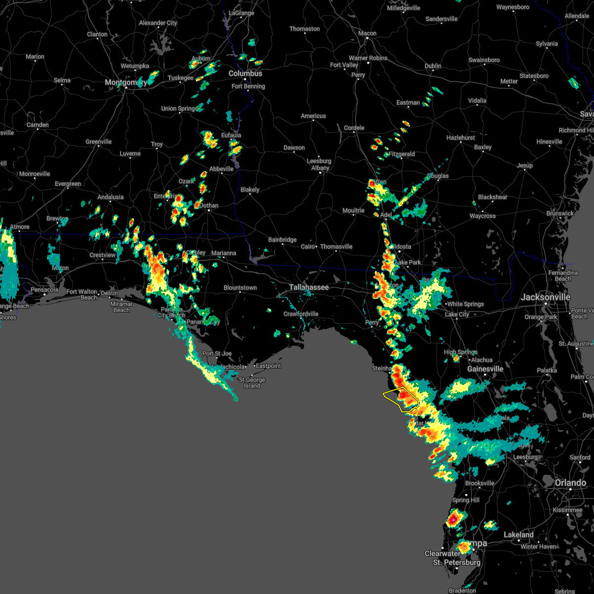
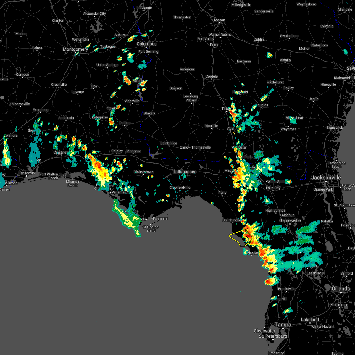
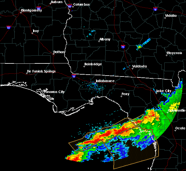
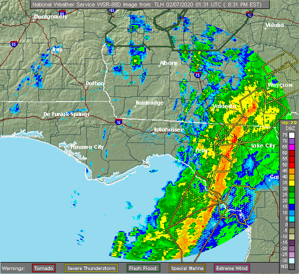
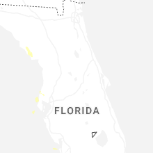
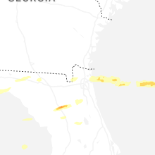
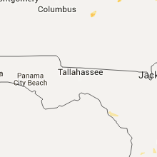
Hail Map for Horseshoe Beach, FL
The Horseshoe Beach, FL area has had 1 report of on-the-ground hail by trained spotters, and has been under severe weather warnings 0 times during the past 12 months. Doppler radar has detected hail at or near Horseshoe Beach, FL on 25 occasions, including 2 occasions during the past year.
| Name: | Horseshoe Beach, FL |
| Where Located: | 90.9 miles SE of Tallahassee, FL |
| Map: | Google Map for Horseshoe Beach, FL |
| Population: | 169 |
| Housing Units: | 378 |
| More Info: | Search Google for Horseshoe Beach, FL |
0
The Top Recent Hail Date for Horseshoe Beach, FL is Monday, June 23, 2025 (9th out of 25)

Hail and Wind Damage Spotted near Horseshoe Beach, FL
| Date / Time | Report Details |
|---|---|
| 6/20/2025 5:34 PM EDT | Power line down in suwanne in dixie county FL, 11.8 miles NW of Horseshoe Beach, FL |
| 5/10/2024 8:25 AM EDT | At 825 am edt, severe thunderstorms were located along a line extending from near obrien to 7 miles southeast of horseshoe point, moving southeast at 60 mph (radar indicated). Hazards include 60 mph wind gusts. Expect damage to roofs, siding, and trees. Locations impacted include, cross city, horseshoe point, suwannee, horseshoe beach, shamrock, cross city airport, shired island, old town, guaranto springs, hines, jonesboro, hatch bend, eugene, fletcher, yellow jacket, and fanning springs. |
| 5/10/2024 8:25 AM EDT | the severe thunderstorm warning has been cancelled and is no longer in effect |
| 5/10/2024 7:30 AM EDT | Svrtae the national weather service in tallahassee has issued a * severe thunderstorm warning for, lafayette county in big bend florida, dixie county in big bend florida, eastern taylor county in big bend florida, * until 900 am edt. * at 730 am edt, severe thunderstorms were located along a line extending from near monticello to 13 miles southeast of st. marks, moving east at 65 mph (radar indicated). Hazards include 60 mph wind gusts. expect damage to roofs, siding, and trees |
| 3/27/2024 8:55 AM EDT |
 The storms which prompted the warning have moved out of the area. therefore, the warning will be allowed to expire. however, gusty winds are still possible with these thunderstorms. The storms which prompted the warning have moved out of the area. therefore, the warning will be allowed to expire. however, gusty winds are still possible with these thunderstorms.
|
| 3/27/2024 8:33 AM EDT |
 the severe thunderstorm warning has been cancelled and is no longer in effect the severe thunderstorm warning has been cancelled and is no longer in effect
|
| 3/27/2024 8:33 AM EDT |
 At 833 am edt, severe thunderstorms were located along a line extending from 10 miles north of cross city to 8 miles northwest of fowlers bluff to 21 miles southwest of horseshoe point, moving east at 40 mph (radar indicated). Hazards include 60 mph wind gusts and nickel size hail. Expect damage to roofs, siding, and trees. Locations impacted include, cross city, horseshoe point, suwannee, horseshoe beach, shamrock, cross city airport, shired island, old town, guaranto springs, eugene, fletcher, yellow jacket, and fanning springs. At 833 am edt, severe thunderstorms were located along a line extending from 10 miles north of cross city to 8 miles northwest of fowlers bluff to 21 miles southwest of horseshoe point, moving east at 40 mph (radar indicated). Hazards include 60 mph wind gusts and nickel size hail. Expect damage to roofs, siding, and trees. Locations impacted include, cross city, horseshoe point, suwannee, horseshoe beach, shamrock, cross city airport, shired island, old town, guaranto springs, eugene, fletcher, yellow jacket, and fanning springs.
|
| 3/27/2024 8:10 AM EDT |
 Svrtae the national weather service in tallahassee has issued a * severe thunderstorm warning for, dixie county in big bend florida, southeastern taylor county in big bend florida, * until 900 am edt. * at 809 am edt, severe thunderstorms were located along a line extending from near steinhatchee to near horseshoe point, moving east at 40 mph (radar indicated). Hazards include 60 mph wind gusts and nickel size hail. expect damage to roofs, siding, and trees Svrtae the national weather service in tallahassee has issued a * severe thunderstorm warning for, dixie county in big bend florida, southeastern taylor county in big bend florida, * until 900 am edt. * at 809 am edt, severe thunderstorms were located along a line extending from near steinhatchee to near horseshoe point, moving east at 40 mph (radar indicated). Hazards include 60 mph wind gusts and nickel size hail. expect damage to roofs, siding, and trees
|
| 1/9/2024 1:19 PM EST |
 At 119 pm est, severe thunderstorms were located along a line extending from 6 miles west of obrien to 14 miles south of horseshoe point, moving northeast at 65 mph (radar indicated). Hazards include 70 mph wind gusts. Expect considerable tree damage. Damage is likely to mobile homes, roofs, and outbuildings. At 119 pm est, severe thunderstorms were located along a line extending from 6 miles west of obrien to 14 miles south of horseshoe point, moving northeast at 65 mph (radar indicated). Hazards include 70 mph wind gusts. Expect considerable tree damage. Damage is likely to mobile homes, roofs, and outbuildings.
|
| 1/9/2024 1:03 PM EST |
 At 103 pm est, severe thunderstorms were located along a line extending from 9 miles northwest of needmore to 9 miles south of mayo, moving east at 45 mph (radar indicated). Hazards include 70 mph wind gusts and penny size hail. Expect considerable tree damage. damage is likely to mobile homes, roofs, and outbuildings. Locations impacted include, mayo, cross city, steinhatchee, horseshoe point, suwannee, horseshoe beach, tennille, shamrock, clara, cross city airport, shired island, old town, jonesboro, hatch bend, salem, san pedro junction, cooks hammock, howell place, guaranto springs, and carbur. At 103 pm est, severe thunderstorms were located along a line extending from 9 miles northwest of needmore to 9 miles south of mayo, moving east at 45 mph (radar indicated). Hazards include 70 mph wind gusts and penny size hail. Expect considerable tree damage. damage is likely to mobile homes, roofs, and outbuildings. Locations impacted include, mayo, cross city, steinhatchee, horseshoe point, suwannee, horseshoe beach, tennille, shamrock, clara, cross city airport, shired island, old town, jonesboro, hatch bend, salem, san pedro junction, cooks hammock, howell place, guaranto springs, and carbur.
|
| 1/9/2024 11:58 AM EST |
 At 1158 am est, severe thunderstorms were located along a line extending from 10 miles south of quitman to 32 miles southwest of perry, moving east at 45 mph (radar indicated). Hazards include 70 mph wind gusts and penny size hail. Expect considerable tree damage. Damage is likely to mobile homes, roofs, and outbuildings. At 1158 am est, severe thunderstorms were located along a line extending from 10 miles south of quitman to 32 miles southwest of perry, moving east at 45 mph (radar indicated). Hazards include 70 mph wind gusts and penny size hail. Expect considerable tree damage. Damage is likely to mobile homes, roofs, and outbuildings.
|
| 8/4/2023 8:35 PM EDT |
 At 834 pm edt, severe thunderstorms were located along a line extending from near williston highlands to near horseshoe point, moving southeast at 45 mph (radar indicated). Hazards include 60 mph wind gusts. Expect damage to roofs, siding, and trees. locations impacted include, cross city, steinhatchee, horseshoe point, suwannee, horseshoe beach, shamrock, cross city airport, shired island, old town, jena, eugene, yellow jacket and fanning springs. hail threat, radar indicated max hail size, <. 75 in wind threat, radar indicated max wind gust, 60 mph. At 834 pm edt, severe thunderstorms were located along a line extending from near williston highlands to near horseshoe point, moving southeast at 45 mph (radar indicated). Hazards include 60 mph wind gusts. Expect damage to roofs, siding, and trees. locations impacted include, cross city, steinhatchee, horseshoe point, suwannee, horseshoe beach, shamrock, cross city airport, shired island, old town, jena, eugene, yellow jacket and fanning springs. hail threat, radar indicated max hail size, <. 75 in wind threat, radar indicated max wind gust, 60 mph.
|
| 8/4/2023 7:43 PM EDT |
 At 742 pm edt, severe thunderstorms were located along a line extending from near bell to 16 miles northwest of steinhatchee, moving southeast at 40 mph (radar indicated). Hazards include 60 mph wind gusts. expect damage to roofs, siding, and trees At 742 pm edt, severe thunderstorms were located along a line extending from near bell to 16 miles northwest of steinhatchee, moving southeast at 40 mph (radar indicated). Hazards include 60 mph wind gusts. expect damage to roofs, siding, and trees
|
| 7/10/2023 11:56 AM EDT |
 At 1156 am edt, severe thunderstorms were located along a line extending from near obrien to 30 miles west of horseshoe point, moving east at 25 mph (radar indicated). Hazards include 60 mph wind gusts. Expect damage to roofs, siding, and trees. locations impacted include, cross city, steinhatchee, horseshoe point, suwannee, horseshoe beach, tennille, shamrock, clara, cross city airport, shired island, old town, jena, alton, hines, jonesboro, grady, hatch bend, eugene, fletcher and yellow jacket. hail threat, radar indicated max hail size, <. 75 in wind threat, radar indicated max wind gust, 60 mph. At 1156 am edt, severe thunderstorms were located along a line extending from near obrien to 30 miles west of horseshoe point, moving east at 25 mph (radar indicated). Hazards include 60 mph wind gusts. Expect damage to roofs, siding, and trees. locations impacted include, cross city, steinhatchee, horseshoe point, suwannee, horseshoe beach, tennille, shamrock, clara, cross city airport, shired island, old town, jena, alton, hines, jonesboro, grady, hatch bend, eugene, fletcher and yellow jacket. hail threat, radar indicated max hail size, <. 75 in wind threat, radar indicated max wind gust, 60 mph.
|
| 7/10/2023 11:36 AM EDT |
 At 1135 am edt, severe thunderstorms were located along a line extending from luraville to 7 miles northwest of steinhatchee, moving east at 35 mph (radar indicated). Hazards include 60 mph wind gusts. expect damage to roofs, siding, and trees At 1135 am edt, severe thunderstorms were located along a line extending from luraville to 7 miles northwest of steinhatchee, moving east at 35 mph (radar indicated). Hazards include 60 mph wind gusts. expect damage to roofs, siding, and trees
|
| 6/14/2023 11:43 PM EDT |
 The severe thunderstorm warning for southern lafayette, dixie and southeastern taylor counties will expire at 1145 pm edt, the storms which prompted the warning have weakened below severe limits, and no longer pose an immediate threat to life or property. therefore, the warning will be allowed to expire. however gusty winds and heavy rain are still possible with these thunderstorms. a tornado watch remains in effect until midnight edt for big bend of florida. to report severe weather, contact your nearest law enforcement agency. they will relay your report to the national weather service tallahassee. The severe thunderstorm warning for southern lafayette, dixie and southeastern taylor counties will expire at 1145 pm edt, the storms which prompted the warning have weakened below severe limits, and no longer pose an immediate threat to life or property. therefore, the warning will be allowed to expire. however gusty winds and heavy rain are still possible with these thunderstorms. a tornado watch remains in effect until midnight edt for big bend of florida. to report severe weather, contact your nearest law enforcement agency. they will relay your report to the national weather service tallahassee.
|
| 6/14/2023 10:51 PM EDT |
 At 1051 pm edt, severe thunderstorms were located along a line extending from near bell to 16 miles west of steinhatchee, moving southeast at 45 mph (radar indicated). Hazards include 60 mph wind gusts and quarter size hail. Hail damage to vehicles is expected. Expect wind damage to roofs, siding, and trees. At 1051 pm edt, severe thunderstorms were located along a line extending from near bell to 16 miles west of steinhatchee, moving southeast at 45 mph (radar indicated). Hazards include 60 mph wind gusts and quarter size hail. Hail damage to vehicles is expected. Expect wind damage to roofs, siding, and trees.
|
| 4/27/2023 8:20 PM EDT |
 The severe thunderstorm warning for lafayette, dixie and southeastern taylor counties will expire at 830 pm edt, the storms which prompted the warning have moved out of the area. therefore, the warning will be allowed to expire. a severe thunderstorm watch remains in effect until 900 pm edt for big bend of florida. to report severe weather, contact your nearest law enforcement agency. they will relay your report to the national weather service tallahassee. The severe thunderstorm warning for lafayette, dixie and southeastern taylor counties will expire at 830 pm edt, the storms which prompted the warning have moved out of the area. therefore, the warning will be allowed to expire. a severe thunderstorm watch remains in effect until 900 pm edt for big bend of florida. to report severe weather, contact your nearest law enforcement agency. they will relay your report to the national weather service tallahassee.
|
| 4/27/2023 7:04 PM EDT |
 At 704 pm edt, severe thunderstorms were located along a line extending from 10 miles southwest of dowling park to 47 miles southwest of horseshoe point, moving east at 60 mph (radar indicated). Hazards include 60 mph wind gusts. expect damage to roofs, siding, and trees At 704 pm edt, severe thunderstorms were located along a line extending from 10 miles southwest of dowling park to 47 miles southwest of horseshoe point, moving east at 60 mph (radar indicated). Hazards include 60 mph wind gusts. expect damage to roofs, siding, and trees
|
| 4/15/2023 10:17 PM EDT |
 At 1017 pm edt, severe thunderstorms were located along a line extending from 13 miles northeast of perry to 19 miles west of horseshoe point, moving east at 35 mph (radar indicated). Hazards include 60 mph wind gusts. expect damage to roofs, siding, and trees At 1017 pm edt, severe thunderstorms were located along a line extending from 13 miles northeast of perry to 19 miles west of horseshoe point, moving east at 35 mph (radar indicated). Hazards include 60 mph wind gusts. expect damage to roofs, siding, and trees
|
| 5/31/2022 5:48 PM EDT |
 At 548 pm edt, a severe thunderstorm was located near horseshoe beach, moving west at 10 mph (radar indicated). Hazards include 60 mph wind gusts and quarter size hail. Hail damage to vehicles is expected. expect wind damage to roofs, siding, and trees. locations impacted include, horseshoe point, suwannee, horseshoe beach and shired island. hail threat, radar indicated max hail size, 1. 00 in wind threat, radar indicated max wind gust, 60 mph. At 548 pm edt, a severe thunderstorm was located near horseshoe beach, moving west at 10 mph (radar indicated). Hazards include 60 mph wind gusts and quarter size hail. Hail damage to vehicles is expected. expect wind damage to roofs, siding, and trees. locations impacted include, horseshoe point, suwannee, horseshoe beach and shired island. hail threat, radar indicated max hail size, 1. 00 in wind threat, radar indicated max wind gust, 60 mph.
|
| 5/31/2022 5:23 PM EDT |
 At 522 pm edt, a severe thunderstorm was located 7 miles east of horseshoe point, or 12 miles south of cross city, moving southwest at 15 mph (radar indicated). Hazards include 60 mph wind gusts and quarter size hail. Hail damage to vehicles is expected. Expect wind damage to roofs, siding, and trees. At 522 pm edt, a severe thunderstorm was located 7 miles east of horseshoe point, or 12 miles south of cross city, moving southwest at 15 mph (radar indicated). Hazards include 60 mph wind gusts and quarter size hail. Hail damage to vehicles is expected. Expect wind damage to roofs, siding, and trees.
|
| 3/12/2022 4:35 AM EST |
 At 435 am est, severe thunderstorms were located along a line extending from 8 miles west of luraville to 68 miles south of st george island, moving northeast at 60 mph (radar indicated). Hazards include 60 mph wind gusts. expect damage to roofs, siding, and trees At 435 am est, severe thunderstorms were located along a line extending from 8 miles west of luraville to 68 miles south of st george island, moving northeast at 60 mph (radar indicated). Hazards include 60 mph wind gusts. expect damage to roofs, siding, and trees
|
| 6/29/2021 2:52 PM EDT |
 The severe thunderstorm warning for central dixie county will expire at 300 pm edt, the storm which prompted the warning has weakened below severe limits, and no longer poses an immediate threat to life or property. therefore, the warning will be allowed to expire. however gusty winds around 40 mph are still possible with this thunderstorm. The severe thunderstorm warning for central dixie county will expire at 300 pm edt, the storm which prompted the warning has weakened below severe limits, and no longer poses an immediate threat to life or property. therefore, the warning will be allowed to expire. however gusty winds around 40 mph are still possible with this thunderstorm.
|
| 6/29/2021 2:28 PM EDT |
 At 228 pm edt, a severe thunderstorm was located near fowlers bluff, or 11 miles south of cross city, moving northwest at 20 mph (radar indicated). Hazards include 60 mph wind gusts. expect damage to roofs, siding, and trees At 228 pm edt, a severe thunderstorm was located near fowlers bluff, or 11 miles south of cross city, moving northwest at 20 mph (radar indicated). Hazards include 60 mph wind gusts. expect damage to roofs, siding, and trees
|
| 4/11/2021 6:13 AM EDT |
 The severe thunderstorm warning for dixie county will expire at 615 am edt, the storm which prompted the warning has weakened below severe limits, and has exited the warned area. therefore, the warning will be allowed to expire. The severe thunderstorm warning for dixie county will expire at 615 am edt, the storm which prompted the warning has weakened below severe limits, and has exited the warned area. therefore, the warning will be allowed to expire.
|
| 4/11/2021 5:36 AM EDT |
 At 536 am edt, a severe thunderstorm was located near horseshoe point, or 12 miles southwest of cross city, moving northeast at 40 mph (radar indicated). Hazards include 60 mph wind gusts and quarter size hail. Hail damage to vehicles is expected. Expect wind damage to roofs, siding, and trees. At 536 am edt, a severe thunderstorm was located near horseshoe point, or 12 miles southwest of cross city, moving northeast at 40 mph (radar indicated). Hazards include 60 mph wind gusts and quarter size hail. Hail damage to vehicles is expected. Expect wind damage to roofs, siding, and trees.
|
| 2/15/2021 7:07 PM EST |
 At 707 pm est, severe thunderstorms were located along a line extending from 7 miles southeast of mayo to 6 miles west of fowlers bluff, moving northeast at 60 mph (radar indicated). Hazards include 60 mph wind gusts and quarter size hail. Hail damage to vehicles is expected. Expect wind damage to roofs, siding, and trees. At 707 pm est, severe thunderstorms were located along a line extending from 7 miles southeast of mayo to 6 miles west of fowlers bluff, moving northeast at 60 mph (radar indicated). Hazards include 60 mph wind gusts and quarter size hail. Hail damage to vehicles is expected. Expect wind damage to roofs, siding, and trees.
|
| 2/15/2021 6:40 PM EST |
 At 640 pm est, severe thunderstorms were located along a line extending from near steinhatchee to 27 miles southwest of horseshoe point, moving northeast at 60 mph (radar indicated). Hazards include 60 mph wind gusts and quarter size hail. Hail damage to vehicles is expected. Expect wind damage to roofs, siding, and trees. At 640 pm est, severe thunderstorms were located along a line extending from near steinhatchee to 27 miles southwest of horseshoe point, moving northeast at 60 mph (radar indicated). Hazards include 60 mph wind gusts and quarter size hail. Hail damage to vehicles is expected. Expect wind damage to roofs, siding, and trees.
|
| 12/24/2020 5:00 PM EST |
 At 500 pm est, severe thunderstorms were located along a line extending from 14 miles northeast of steinhatchee to 21 miles southwest of horseshoe point, moving northeast at 30 mph (radar indicated). Hazards include 60 mph wind gusts. expect damage to roofs, siding, and trees At 500 pm est, severe thunderstorms were located along a line extending from 14 miles northeast of steinhatchee to 21 miles southwest of horseshoe point, moving northeast at 30 mph (radar indicated). Hazards include 60 mph wind gusts. expect damage to roofs, siding, and trees
|
| 7/21/2020 5:29 PM EDT |
 At 529 pm edt, a severe thunderstorm was located near steinhatchee, moving west at 25 mph (radar indicated). Hazards include 60 mph wind gusts. Expect damage to roofs, siding, and trees. Locations impacted include, cross city, horseshoe point, horseshoe beach, shamrock, hines, jonesboro and clara. At 529 pm edt, a severe thunderstorm was located near steinhatchee, moving west at 25 mph (radar indicated). Hazards include 60 mph wind gusts. Expect damage to roofs, siding, and trees. Locations impacted include, cross city, horseshoe point, horseshoe beach, shamrock, hines, jonesboro and clara.
|
| 7/21/2020 5:11 PM EDT |
 At 511 pm edt, a severe thunderstorm was located near cross city, moving west at 25 mph (radar indicated). Hazards include 60 mph wind gusts. Expect damage to roofs, siding, and trees. Locations impacted include, cross city, horseshoe point, horseshoe beach, shamrock, hines, jonesboro, cross city airport, shired island, eugene, fletcher, jena and clara. At 511 pm edt, a severe thunderstorm was located near cross city, moving west at 25 mph (radar indicated). Hazards include 60 mph wind gusts. Expect damage to roofs, siding, and trees. Locations impacted include, cross city, horseshoe point, horseshoe beach, shamrock, hines, jonesboro, cross city airport, shired island, eugene, fletcher, jena and clara.
|
| 7/21/2020 4:50 PM EDT |
 At 449 pm edt, a severe thunderstorm was located near cross city, moving west at 25 mph (radar indicated). Hazards include 60 mph wind gusts. expect damage to roofs, siding, and trees At 449 pm edt, a severe thunderstorm was located near cross city, moving west at 25 mph (radar indicated). Hazards include 60 mph wind gusts. expect damage to roofs, siding, and trees
|
| 4/24/2020 2:28 AM EDT |
 At 227 am edt, severe thunderstorms were located along a line extending from 6 miles southwest of obrien to near horseshoe point, moving east at 50 mph (radar indicated). Hazards include 60 mph wind gusts. Expect damage to roofs, siding, and trees. Locations impacted include, cross city, horseshoe point, suwannee, horseshoe beach, shamrock, cross city airport, shired island, old town, hatch bend, eugene, fletcher, yellow jacket and guaranto springs. At 227 am edt, severe thunderstorms were located along a line extending from 6 miles southwest of obrien to near horseshoe point, moving east at 50 mph (radar indicated). Hazards include 60 mph wind gusts. Expect damage to roofs, siding, and trees. Locations impacted include, cross city, horseshoe point, suwannee, horseshoe beach, shamrock, cross city airport, shired island, old town, hatch bend, eugene, fletcher, yellow jacket and guaranto springs.
|
| 4/24/2020 2:22 AM EDT |
 At 221 am edt, severe thunderstorms were located along a line extending from near dowling park to 6 miles northwest of fowlers bluff, moving east at 50 mph (radar indicated). Hazards include 60 mph wind gusts. Expect damage to roofs, siding, and trees. Locations impacted include, mayo, cross city, horseshoe point, suwannee, horseshoe beach, shamrock, cross city airport, shired island, old town, chancey, buckville, guaranto springs, alton, mayo junction, hines, hatch bend, eugene, fletcher, yellow jacket and san pedro junction. At 221 am edt, severe thunderstorms were located along a line extending from near dowling park to 6 miles northwest of fowlers bluff, moving east at 50 mph (radar indicated). Hazards include 60 mph wind gusts. Expect damage to roofs, siding, and trees. Locations impacted include, mayo, cross city, horseshoe point, suwannee, horseshoe beach, shamrock, cross city airport, shired island, old town, chancey, buckville, guaranto springs, alton, mayo junction, hines, hatch bend, eugene, fletcher, yellow jacket and san pedro junction.
|
| 4/24/2020 2:04 AM EDT |
 At 204 am edt, severe thunderstorms were located along a line extending from 6 miles east of perry to near horseshoe point, moving east at 60 mph (radar indicated). Hazards include 60 mph wind gusts. Expect damage to roofs, siding, and trees. Locations impacted include, mayo, perry, cross city, steinhatchee, horseshoe point, suwannee, horseshoe beach, pinland, tennille, shamrock, jug island, clara, cross city airport, shired island, old town, buckville, dekle beach, jonesboro, jack lee island and hatch bend. At 204 am edt, severe thunderstorms were located along a line extending from 6 miles east of perry to near horseshoe point, moving east at 60 mph (radar indicated). Hazards include 60 mph wind gusts. Expect damage to roofs, siding, and trees. Locations impacted include, mayo, perry, cross city, steinhatchee, horseshoe point, suwannee, horseshoe beach, pinland, tennille, shamrock, jug island, clara, cross city airport, shired island, old town, buckville, dekle beach, jonesboro, jack lee island and hatch bend.
|
| 4/24/2020 1:25 AM EDT |
 At 125 am edt, severe thunderstorms were located along a line extending from 17 miles southeast of st. marks to 53 miles southwest of horseshoe point, moving east at 50 mph (radar indicated). Hazards include 60 mph wind gusts. expect damage to roofs, siding, and trees At 125 am edt, severe thunderstorms were located along a line extending from 17 miles southeast of st. marks to 53 miles southwest of horseshoe point, moving east at 50 mph (radar indicated). Hazards include 60 mph wind gusts. expect damage to roofs, siding, and trees
|
| 4/23/2020 9:40 PM EDT |
 The severe thunderstorm warning for southeastern lafayette and dixie counties will expire at 945 pm edt, the storms which prompted the warning have moved out of the area. therefore, the warning will be allowed to expire. a tornado watch remains in effect until 1000 pm edt for big bend of florida. to report severe weather, contact your nearest law enforcement agency. they will relay your report to the national weather service tallahassee. The severe thunderstorm warning for southeastern lafayette and dixie counties will expire at 945 pm edt, the storms which prompted the warning have moved out of the area. therefore, the warning will be allowed to expire. a tornado watch remains in effect until 1000 pm edt for big bend of florida. to report severe weather, contact your nearest law enforcement agency. they will relay your report to the national weather service tallahassee.
|
| 4/23/2020 9:10 PM EDT |
 At 910 pm edt, severe thunderstorms were located along a line extending from near obrien to near horseshoe point, moving southeast at 30 mph (radar indicated). Hazards include 60 mph wind gusts. Expect damage to roofs, siding, and trees. Locations impacted include, cross city, shamrock, cross city airport, old town, grady, hatch bend, eugene, fletcher, guaranto springs, yellow jacket and fanning springs. At 910 pm edt, severe thunderstorms were located along a line extending from near obrien to near horseshoe point, moving southeast at 30 mph (radar indicated). Hazards include 60 mph wind gusts. Expect damage to roofs, siding, and trees. Locations impacted include, cross city, shamrock, cross city airport, old town, grady, hatch bend, eugene, fletcher, guaranto springs, yellow jacket and fanning springs.
|
| 4/20/2020 7:51 AM EDT |
 At 750 am edt, a severe thunderstorm was located over trenton, moving east at 55 mph (radar indicated). Hazards include 60 mph wind gusts. Expect damage to roofs, siding, and trees. Locations impacted include, horseshoe point, suwannee, horseshoe beach, shired island, old town, yellow jacket and fanning springs. At 750 am edt, a severe thunderstorm was located over trenton, moving east at 55 mph (radar indicated). Hazards include 60 mph wind gusts. Expect damage to roofs, siding, and trees. Locations impacted include, horseshoe point, suwannee, horseshoe beach, shired island, old town, yellow jacket and fanning springs.
|
| 4/20/2020 7:27 AM EDT |
 At 727 am edt, a severe thunderstorm was located near cross city, moving east at 55 mph (radar indicated). Hazards include 60 mph wind gusts and penny size hail. Expect damage to roofs, siding, and trees. Locations impacted include, cross city, horseshoe point, suwannee, horseshoe beach, shamrock, cross city airport, shired island, old town, eugene, yellow jacket and fanning springs. At 727 am edt, a severe thunderstorm was located near cross city, moving east at 55 mph (radar indicated). Hazards include 60 mph wind gusts and penny size hail. Expect damage to roofs, siding, and trees. Locations impacted include, cross city, horseshoe point, suwannee, horseshoe beach, shamrock, cross city airport, shired island, old town, eugene, yellow jacket and fanning springs.
|
| 4/20/2020 6:35 AM EDT |
 At 635 am edt, a severe thunderstorm was located 37 miles west of steinhatchee, moving east at 55 mph (radar indicated). Hazards include 60 mph wind gusts. expect damage to roofs, siding, and trees At 635 am edt, a severe thunderstorm was located 37 miles west of steinhatchee, moving east at 55 mph (radar indicated). Hazards include 60 mph wind gusts. expect damage to roofs, siding, and trees
|
| 4/14/2020 10:20 PM EDT |
 The severe thunderstorm warning for southern lafayette, dixie and southeastern taylor counties will expire at 1030 pm edt, the storm which prompted the warning has weakened below severe limits, and no longer poses an immediate threat to life or property. therefore, the warning will be allowed to expire. however gusty winds are still possible with this thunderstorm. to report severe weather, contact your nearest law enforcement agency. they will relay your report to the national weather service tallahassee. The severe thunderstorm warning for southern lafayette, dixie and southeastern taylor counties will expire at 1030 pm edt, the storm which prompted the warning has weakened below severe limits, and no longer poses an immediate threat to life or property. therefore, the warning will be allowed to expire. however gusty winds are still possible with this thunderstorm. to report severe weather, contact your nearest law enforcement agency. they will relay your report to the national weather service tallahassee.
|
| 4/14/2020 9:41 PM EDT |
 At 940 pm edt, a severe thunderstorm was located 7 miles northeast of steinhatchee, moving east at 40 mph. another severe storm was located offshore about 25 miles west of horseshoe beach also moving east around 40 mph (radar indicated). Hazards include 60 mph wind gusts and penny size hail. Expect damage to roofs, siding, and trees. Locations impacted include, cross city, steinhatchee, horseshoe point, suwannee, horseshoe beach, tennille, shamrock, howell place, clara, cross city airport, shired island, old town, jena, hines, jonesboro, hatch bend, eugene, fletcher, yellow jacket and fanning springs. At 940 pm edt, a severe thunderstorm was located 7 miles northeast of steinhatchee, moving east at 40 mph. another severe storm was located offshore about 25 miles west of horseshoe beach also moving east around 40 mph (radar indicated). Hazards include 60 mph wind gusts and penny size hail. Expect damage to roofs, siding, and trees. Locations impacted include, cross city, steinhatchee, horseshoe point, suwannee, horseshoe beach, tennille, shamrock, howell place, clara, cross city airport, shired island, old town, jena, hines, jonesboro, hatch bend, eugene, fletcher, yellow jacket and fanning springs.
|
| 4/14/2020 8:59 PM EDT |
 At 859 pm edt, a severe thunderstorm was located 20 miles west of steinhatchee, moving east at 35 mph (radar indicated). Hazards include 60 mph wind gusts and penny size hail. expect damage to roofs, siding, and trees At 859 pm edt, a severe thunderstorm was located 20 miles west of steinhatchee, moving east at 35 mph (radar indicated). Hazards include 60 mph wind gusts and penny size hail. expect damage to roofs, siding, and trees
|
| 2/6/2020 8:34 PM EST |
 At 834 pm est, severe thunderstorms were located along a line extending from 9 miles northeast of belmont to 26 miles south of horseshoe point, moving northeast at 70 mph (radar indicated). Hazards include 60 mph wind gusts. Expect damage to roofs, siding, and trees. Locations impacted include, horseshoe point, suwannee, horseshoe beach, shired island and alton. At 834 pm est, severe thunderstorms were located along a line extending from 9 miles northeast of belmont to 26 miles south of horseshoe point, moving northeast at 70 mph (radar indicated). Hazards include 60 mph wind gusts. Expect damage to roofs, siding, and trees. Locations impacted include, horseshoe point, suwannee, horseshoe beach, shired island and alton.
|
| 2/6/2020 7:54 PM EST |
 At 753 pm est, doppler radar indicated a line of severe thunderstorms capable of producing damaging winds in excess of 60 mph. these storms were located along a line extending from near luraville to 70 miles southwest of horseshoe point, and moving northeast at 70 mph. At 753 pm est, doppler radar indicated a line of severe thunderstorms capable of producing damaging winds in excess of 60 mph. these storms were located along a line extending from near luraville to 70 miles southwest of horseshoe point, and moving northeast at 70 mph.
|
| 4/19/2019 10:27 AM EDT |
 At 1027 am edt, doppler radar indicated a line of severe thunderstorms capable of producing damaging winds in excess of 60 mph. these storms were located along a line extending from near obrien to 6 miles southeast of cross city to 9 miles south of horseshoe point, and moving northeast at 70 mph. At 1027 am edt, doppler radar indicated a line of severe thunderstorms capable of producing damaging winds in excess of 60 mph. these storms were located along a line extending from near obrien to 6 miles southeast of cross city to 9 miles south of horseshoe point, and moving northeast at 70 mph.
|
| 4/19/2019 10:19 AM EDT |
 At 1019 am edt, severe thunderstorms were located along a line extending from 6 miles west of obrien to 17 miles south of horseshoe point, moving northeast at 45 mph (radar indicated). Hazards include 60 mph wind gusts. Expect damage to roofs, siding, and trees. locations impacted include, mayo, cross city, horseshoe point, suwannee, horseshoe beach, shamrock, cross city airport, shired island, old town, guaranto springs, alton, hines, grady, hatch bend, eugene, fletcher, yellow jacket, san pedro junction and fanning springs. A tornado watch remains in effect until 1100 am edt for big bend of florida. At 1019 am edt, severe thunderstorms were located along a line extending from 6 miles west of obrien to 17 miles south of horseshoe point, moving northeast at 45 mph (radar indicated). Hazards include 60 mph wind gusts. Expect damage to roofs, siding, and trees. locations impacted include, mayo, cross city, horseshoe point, suwannee, horseshoe beach, shamrock, cross city airport, shired island, old town, guaranto springs, alton, hines, grady, hatch bend, eugene, fletcher, yellow jacket, san pedro junction and fanning springs. A tornado watch remains in effect until 1100 am edt for big bend of florida.
|
| 4/19/2019 9:47 AM EDT |
 At 947 am edt, severe thunderstorms were located along a line extending from 11 miles north of steinhatchee to 39 miles southwest of horseshoe point, moving northeast at 45 mph (radar indicated). Hazards include 60 mph wind gusts. expect damage to roofs, siding, and trees At 947 am edt, severe thunderstorms were located along a line extending from 11 miles north of steinhatchee to 39 miles southwest of horseshoe point, moving northeast at 45 mph (radar indicated). Hazards include 60 mph wind gusts. expect damage to roofs, siding, and trees
|
| 3/3/2019 10:51 PM EST |
 At 1051 pm est, doppler radar indicated a severe thunderstorm capable of producing damaging winds in excess of 60 mph. this storm was located over cross city, and moving east at 70 mph. At 1051 pm est, doppler radar indicated a severe thunderstorm capable of producing damaging winds in excess of 60 mph. this storm was located over cross city, and moving east at 70 mph.
|
| 3/3/2019 10:22 PM EST |
 At 1022 pm est, a severe thunderstorm was located 11 miles northeast of steinhatchee, moving east at 50 mph (radar indicated). Hazards include 60 mph wind gusts. expect damage to roofs, siding, and trees At 1022 pm est, a severe thunderstorm was located 11 miles northeast of steinhatchee, moving east at 50 mph (radar indicated). Hazards include 60 mph wind gusts. expect damage to roofs, siding, and trees
|
| 3/3/2019 9:50 PM EST |
 At 950 pm est, a severe thunderstorm was located 11 miles northwest of steinhatchee, moving southeast at 40 mph (radar indicated). Hazards include 60 mph wind gusts. expect damage to roofs, siding, and trees At 950 pm est, a severe thunderstorm was located 11 miles northwest of steinhatchee, moving southeast at 40 mph (radar indicated). Hazards include 60 mph wind gusts. expect damage to roofs, siding, and trees
|
| 9/2/2018 4:07 PM EDT |
 The severe thunderstorm warning for southwestern dixie county will expire at 415 pm edt, the storm which prompted the warning has moved out of the area. therefore, the warning will be allowed to expire. to report severe weather, contact your nearest law enforcement agency. they will relay your report to the national weather service tallahassee. The severe thunderstorm warning for southwestern dixie county will expire at 415 pm edt, the storm which prompted the warning has moved out of the area. therefore, the warning will be allowed to expire. to report severe weather, contact your nearest law enforcement agency. they will relay your report to the national weather service tallahassee.
|
| 9/2/2018 3:54 PM EDT |
 At 354 pm edt, a severe thunderstorm was located near fowlers bluff, or 11 miles south of cross city, moving west at 20 mph (radar indicated). Hazards include 60 mph wind gusts. Expect damage to roofs, siding, and trees. Locations impacted include, cross city, horseshoe point, horseshoe beach and shired island. At 354 pm edt, a severe thunderstorm was located near fowlers bluff, or 11 miles south of cross city, moving west at 20 mph (radar indicated). Hazards include 60 mph wind gusts. Expect damage to roofs, siding, and trees. Locations impacted include, cross city, horseshoe point, horseshoe beach and shired island.
|
| 9/2/2018 3:45 PM EDT | Several trees down near suwannee in dixie county... f in dixie county FL, 11.8 miles NW of Horseshoe Beach, FL |
| 9/2/2018 3:19 PM EDT |
 At 319 pm edt, a severe thunderstorm was located over chiefland, moving west at 20 mph (radar indicated). Hazards include 60 mph wind gusts. expect damage to roofs, siding, and trees At 319 pm edt, a severe thunderstorm was located over chiefland, moving west at 20 mph (radar indicated). Hazards include 60 mph wind gusts. expect damage to roofs, siding, and trees
|
| 7/22/2018 10:30 PM EDT |
 At 1030 pm edt, a severe thunderstorm was located over steinhatchee, moving southeast at 20 mph (radar indicated). Hazards include 60 mph wind gusts and penny size hail. expect damage to roofs, siding, and trees At 1030 pm edt, a severe thunderstorm was located over steinhatchee, moving southeast at 20 mph (radar indicated). Hazards include 60 mph wind gusts and penny size hail. expect damage to roofs, siding, and trees
|
| 7/22/2018 7:50 PM EDT |
 At 750 pm edt, a severe thunderstorm was located near cross city, moving east at 55 mph (radar indicated). Hazards include 60 mph wind gusts and penny size hail. expect damage to roofs, siding, and trees At 750 pm edt, a severe thunderstorm was located near cross city, moving east at 55 mph (radar indicated). Hazards include 60 mph wind gusts and penny size hail. expect damage to roofs, siding, and trees
|
| 7/21/2018 3:33 PM EDT |
 At 332 pm edt, a severe thunderstorm was located near manattee road, or 10 miles west of chiefland, moving southeast at 40 mph (radar indicated). Hazards include 60 mph wind gusts and nickel size hail. Expect damage to roofs, siding, and trees. Locations impacted include, cross city, horseshoe point, suwannee, horseshoe beach, shamrock, cross city airport, shired island, old town, guaranto springs, jena, hines, jonesboro, grady, hatch bend, eugene, fletcher, yellow jacket and fanning springs. At 332 pm edt, a severe thunderstorm was located near manattee road, or 10 miles west of chiefland, moving southeast at 40 mph (radar indicated). Hazards include 60 mph wind gusts and nickel size hail. Expect damage to roofs, siding, and trees. Locations impacted include, cross city, horseshoe point, suwannee, horseshoe beach, shamrock, cross city airport, shired island, old town, guaranto springs, jena, hines, jonesboro, grady, hatch bend, eugene, fletcher, yellow jacket and fanning springs.
|
| 7/21/2018 2:39 PM EDT |
 At 238 pm edt, a severe thunderstorm was located 15 miles north of steinhatchee, moving southeast at 40 mph (radar indicated). Hazards include 60 mph wind gusts and nickel size hail. expect damage to roofs, siding, and trees At 238 pm edt, a severe thunderstorm was located 15 miles north of steinhatchee, moving southeast at 40 mph (radar indicated). Hazards include 60 mph wind gusts and nickel size hail. expect damage to roofs, siding, and trees
|
| 4/15/2018 10:58 AM EDT |
 The national weather service in tallahassee has issued a * severe thunderstorm warning for. southern lafayette county in big bend of florida. dixie county in big bend of florida. until 1145 am edt. At 1058 am edt, severe thunderstorms were located along a line. The national weather service in tallahassee has issued a * severe thunderstorm warning for. southern lafayette county in big bend of florida. dixie county in big bend of florida. until 1145 am edt. At 1058 am edt, severe thunderstorms were located along a line.
|
| 4/7/2018 3:35 PM EDT |
 At 334 pm edt, a severe thunderstorm was located 9 miles north of steinhatchee, moving east at 35 mph (radar indicated). Hazards include 60 mph wind gusts. expect damage to roofs, siding, and trees At 334 pm edt, a severe thunderstorm was located 9 miles north of steinhatchee, moving east at 35 mph (radar indicated). Hazards include 60 mph wind gusts. expect damage to roofs, siding, and trees
|
| 3/20/2018 1:28 PM EDT |
 The severe thunderstorm warning for southeastern dixie county will expire at 130 pm edt. the storm which prompted the warning has moved out of the area. therefore the warning will be allowed to expire. A tornado watch remains in effect until 700 pm edt for big bend of florida. The severe thunderstorm warning for southeastern dixie county will expire at 130 pm edt. the storm which prompted the warning has moved out of the area. therefore the warning will be allowed to expire. A tornado watch remains in effect until 700 pm edt for big bend of florida.
|
| 3/20/2018 12:48 PM EDT |
 At 1248 pm edt, a severe thunderstorm was located 7 miles south of horseshoe point, or 23 miles southwest of cross city, moving east at 60 mph (radar indicated). Hazards include 60 mph wind gusts and quarter size hail. Hail damage to vehicles is expected. Expect wind damage to roofs, siding, and trees. At 1248 pm edt, a severe thunderstorm was located 7 miles south of horseshoe point, or 23 miles southwest of cross city, moving east at 60 mph (radar indicated). Hazards include 60 mph wind gusts and quarter size hail. Hail damage to vehicles is expected. Expect wind damage to roofs, siding, and trees.
|
| 2/7/2017 9:21 PM EST |
 At 921 pm est, a severe thunderstorm was located near groves, or near worthington spring, moving east at 45 mph (radar indicated). Hazards include 60 mph wind gusts. Expect damage to roofs, siding, and trees. Locations impacted include, cross city, horseshoe point, suwannee, horseshoe beach, old town, guaranto springs, yellow jacket, tennille, cross city airport, shamrock, clara, fletcher, shired island, jonesboro, eugene, hines and fanning springs. At 921 pm est, a severe thunderstorm was located near groves, or near worthington spring, moving east at 45 mph (radar indicated). Hazards include 60 mph wind gusts. Expect damage to roofs, siding, and trees. Locations impacted include, cross city, horseshoe point, suwannee, horseshoe beach, old town, guaranto springs, yellow jacket, tennille, cross city airport, shamrock, clara, fletcher, shired island, jonesboro, eugene, hines and fanning springs.
|
| 2/7/2017 8:55 PM EST |
 At 854 pm est, a severe thunderstorm was located near ichetucknee spring, moving east at 45 mph (radar indicated). Hazards include 60 mph wind gusts. Expect damage to roofs, siding, and trees. Locations impacted include, cross city, steinhatchee, horseshoe point, suwannee, horseshoe beach, old town, guaranto springs, howell place, yellow jacket, jena, tennille, cross city airport, hatch bend, shamrock, clara, fletcher, shired island, jonesboro, cooks hammock and eugene. At 854 pm est, a severe thunderstorm was located near ichetucknee spring, moving east at 45 mph (radar indicated). Hazards include 60 mph wind gusts. Expect damage to roofs, siding, and trees. Locations impacted include, cross city, steinhatchee, horseshoe point, suwannee, horseshoe beach, old town, guaranto springs, howell place, yellow jacket, jena, tennille, cross city airport, hatch bend, shamrock, clara, fletcher, shired island, jonesboro, cooks hammock and eugene.
|
| 2/7/2017 8:39 PM EST |
 At 839 pm est, a severe thunderstorm was located near mayo, moving east at 45 mph (radar indicated). Hazards include 60 mph wind gusts. Expect damage to roofs, siding, and trees. Locations impacted include, mayo, cross city, steinhatchee, horseshoe point, suwannee, horseshoe beach, old town, howell place, yellow jacket, townsend, jena, tennille, keaton beach, blue springs, jack lee island, hatch bend, salem, day, clara and fish creek. At 839 pm est, a severe thunderstorm was located near mayo, moving east at 45 mph (radar indicated). Hazards include 60 mph wind gusts. Expect damage to roofs, siding, and trees. Locations impacted include, mayo, cross city, steinhatchee, horseshoe point, suwannee, horseshoe beach, old town, howell place, yellow jacket, townsend, jena, tennille, keaton beach, blue springs, jack lee island, hatch bend, salem, day, clara and fish creek.
|
| 2/7/2017 8:27 PM EST |
 At 826 pm est, severe thunderstorms were located 11 miles southeast of perry, moving east at 45 mph (radar indicated). Hazards include 60 mph wind gusts. expect damage to roofs, siding, and trees At 826 pm est, severe thunderstorms were located 11 miles southeast of perry, moving east at 45 mph (radar indicated). Hazards include 60 mph wind gusts. expect damage to roofs, siding, and trees
|
| 5/20/2016 10:20 AM EDT | Tree down in the shired area in dixie county FL, 6.4 miles NW of Horseshoe Beach, FL |
| 5/20/2016 9:39 AM EDT |
 At 939 am edt, severe thunderstorms were located along a line extending from 9 miles north of perry to 19 miles west of steinhatchee, moving southeast at 25 mph (radar indicated). Hazards include 60 mph wind gusts. Expect damage to roofs. siding. And trees. At 939 am edt, severe thunderstorms were located along a line extending from 9 miles north of perry to 19 miles west of steinhatchee, moving southeast at 25 mph (radar indicated). Hazards include 60 mph wind gusts. Expect damage to roofs. siding. And trees.
|
| 8/7/2015 9:36 PM EDT |
 The severe thunderstorm warning for central dixie and southeastern taylor counties will expire at 945 pm edt, the storm which prompted the warning has weakened below severe limits and exited the warned area. therefore the warning will be allowed to expire. The severe thunderstorm warning for central dixie and southeastern taylor counties will expire at 945 pm edt, the storm which prompted the warning has weakened below severe limits and exited the warned area. therefore the warning will be allowed to expire.
|
| 8/7/2015 8:53 PM EDT |
 At 853 pm edt, the national weather service has detected a severe thunderstorm capable of producing damaging winds in excess of 60 mph. this storm was located 9 miles northeast of horseshoe point, or 9 miles south of cross city, and moving southeast at 35 mph. At 853 pm edt, the national weather service has detected a severe thunderstorm capable of producing damaging winds in excess of 60 mph. this storm was located 9 miles northeast of horseshoe point, or 9 miles south of cross city, and moving southeast at 35 mph.
|
| 8/7/2015 8:17 PM EDT |
 At 817 pm edt, the national weather service has detected a severe thunderstorm capable of producing damaging winds in excess of 60 mph. this storm was located near steinhatchee, and moving southeast at 40 mph. At 817 pm edt, the national weather service has detected a severe thunderstorm capable of producing damaging winds in excess of 60 mph. this storm was located near steinhatchee, and moving southeast at 40 mph.
|
| 7/29/2015 3:55 PM EDT |
 At 355 pm edt, the national weather service has detected a line of severe thunderstorms capable of producing damaging winds in excess of 60 mph. these storms were located along a line extending from cross city to 10 miles northeast of horseshoe point, and moving southeast at 15 mph. At 355 pm edt, the national weather service has detected a line of severe thunderstorms capable of producing damaging winds in excess of 60 mph. these storms were located along a line extending from cross city to 10 miles northeast of horseshoe point, and moving southeast at 15 mph.
|
| 7/12/2015 3:03 PM EDT |
 At 302 pm edt, the national weather service has detected a severe thunderstorm capable of producing damaging winds in excess of 60 mph. this storm was located near suwannee, and moving northwest at 10 mph. At 302 pm edt, the national weather service has detected a severe thunderstorm capable of producing damaging winds in excess of 60 mph. this storm was located near suwannee, and moving northwest at 10 mph.
|
| 4/19/2015 3:29 PM EDT | At 328 pm edt, local law enforcement reported a line of severe thunderstorms producing damaging winds in excess of 60 mph. several trees have been blown down along highway 19 in taylor county near bill howell road. these storms were located along a line extending from near suwannee river state park to 16 miles south of horseshoe point, moving east at 35 mph. locations impacted include, mayo, cross city, suwannee, old town, yellow jacket, townsend, jena, hatch bend, tennille, day, clara, shired island, jonesboro, buckville, cooks hammock, guaranto springs, cross city airport, shamrock, alton and fletcher. |
| 4/19/2015 2:56 PM EDT | this alert has expired |
| 1/1/0001 12:00 AM | Quarter sized hail reported 0.2 miles NE of Horseshoe Beach, FL, emergency manager reports quarter size hail. time is estimated based on report and radar data. |
| 1/1/0001 12:00 AM | Trees down in dixie county FL, 11.8 miles NW of Horseshoe Beach, FL |
Hail Maps for Horseshoe Beach, FL


Connect with Interactive Hail Maps