

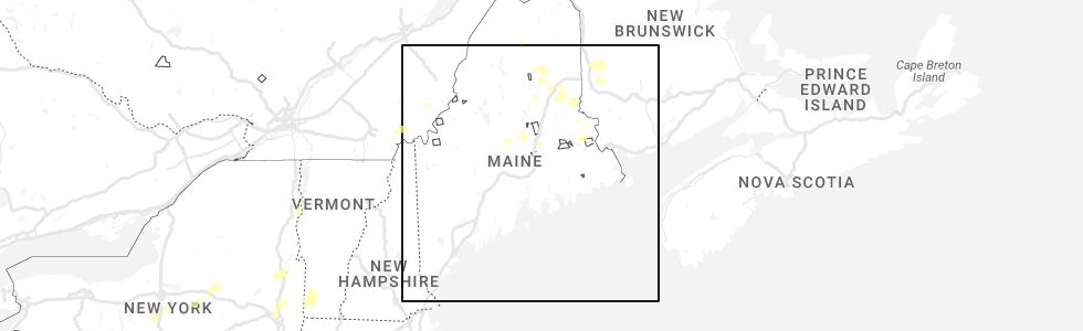
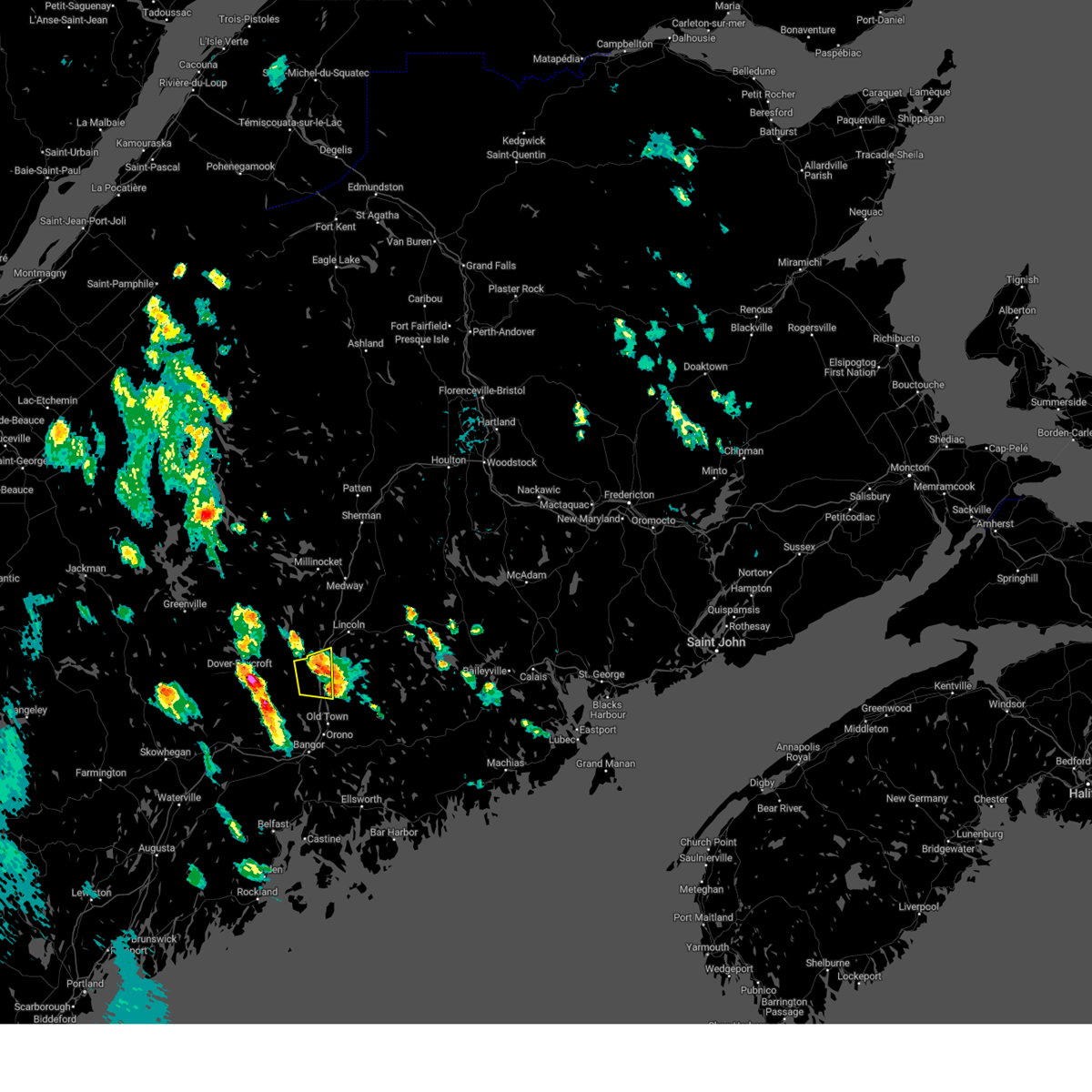
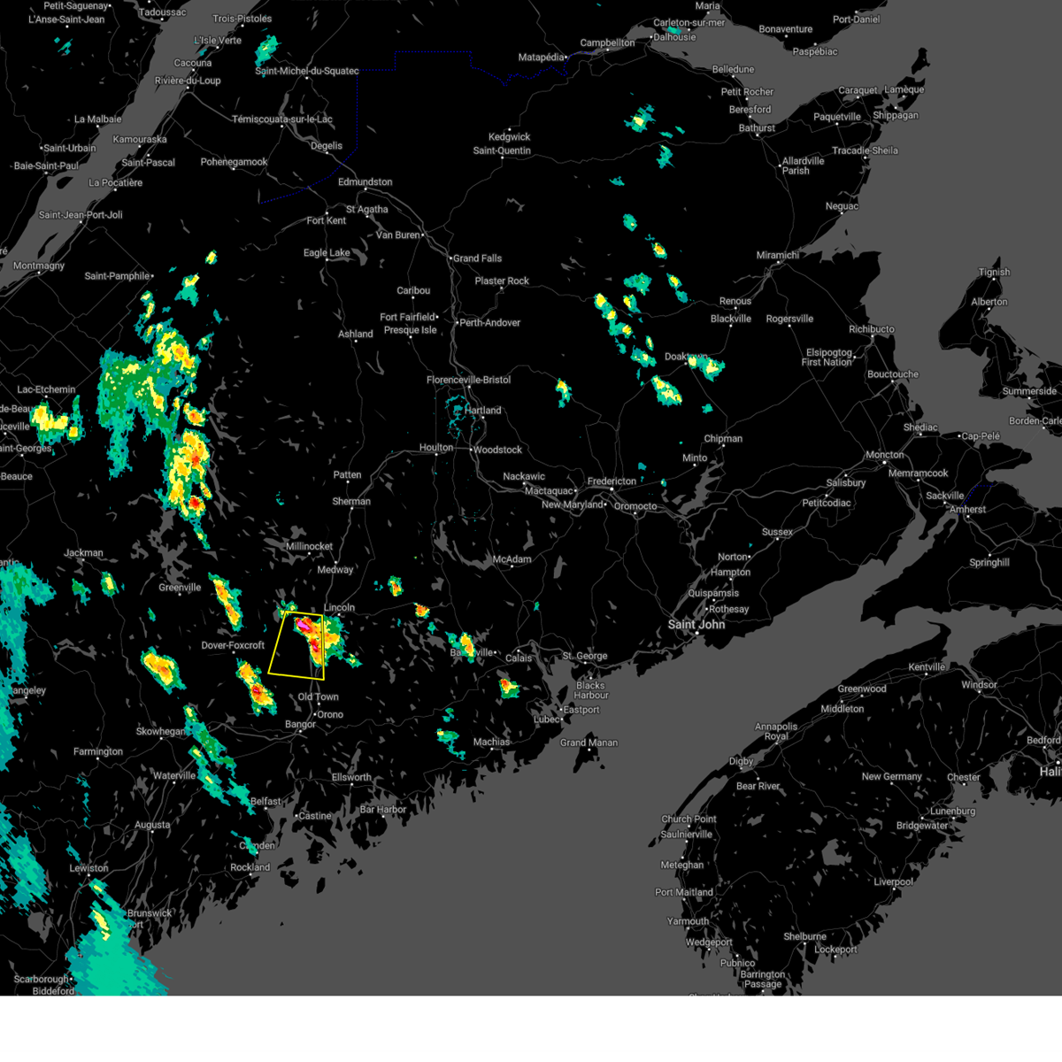
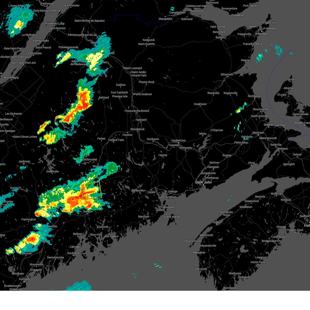
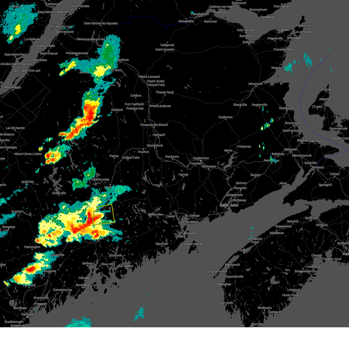
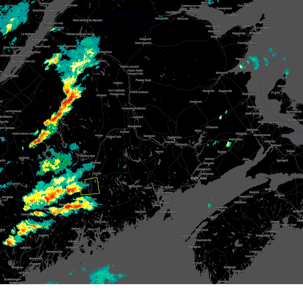
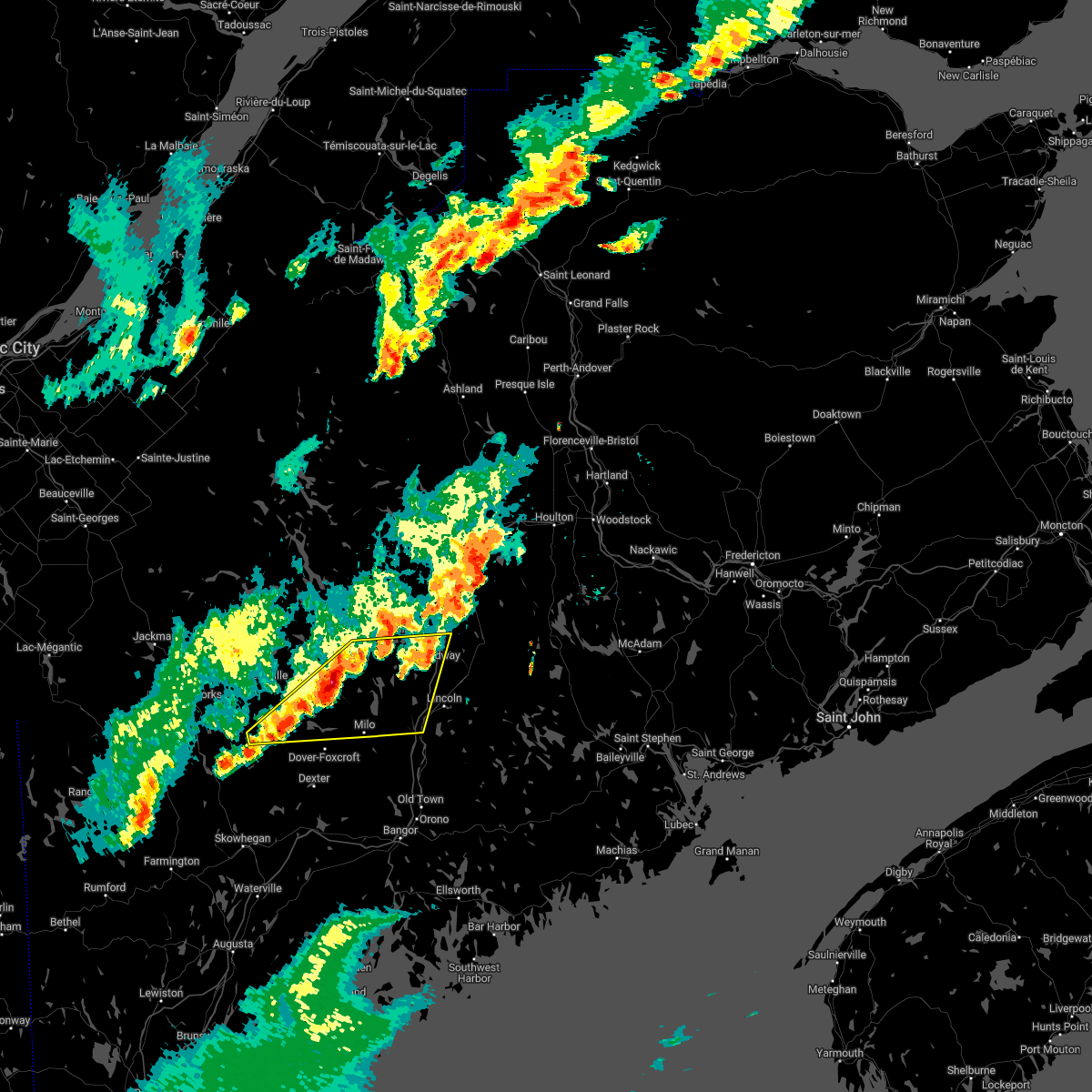
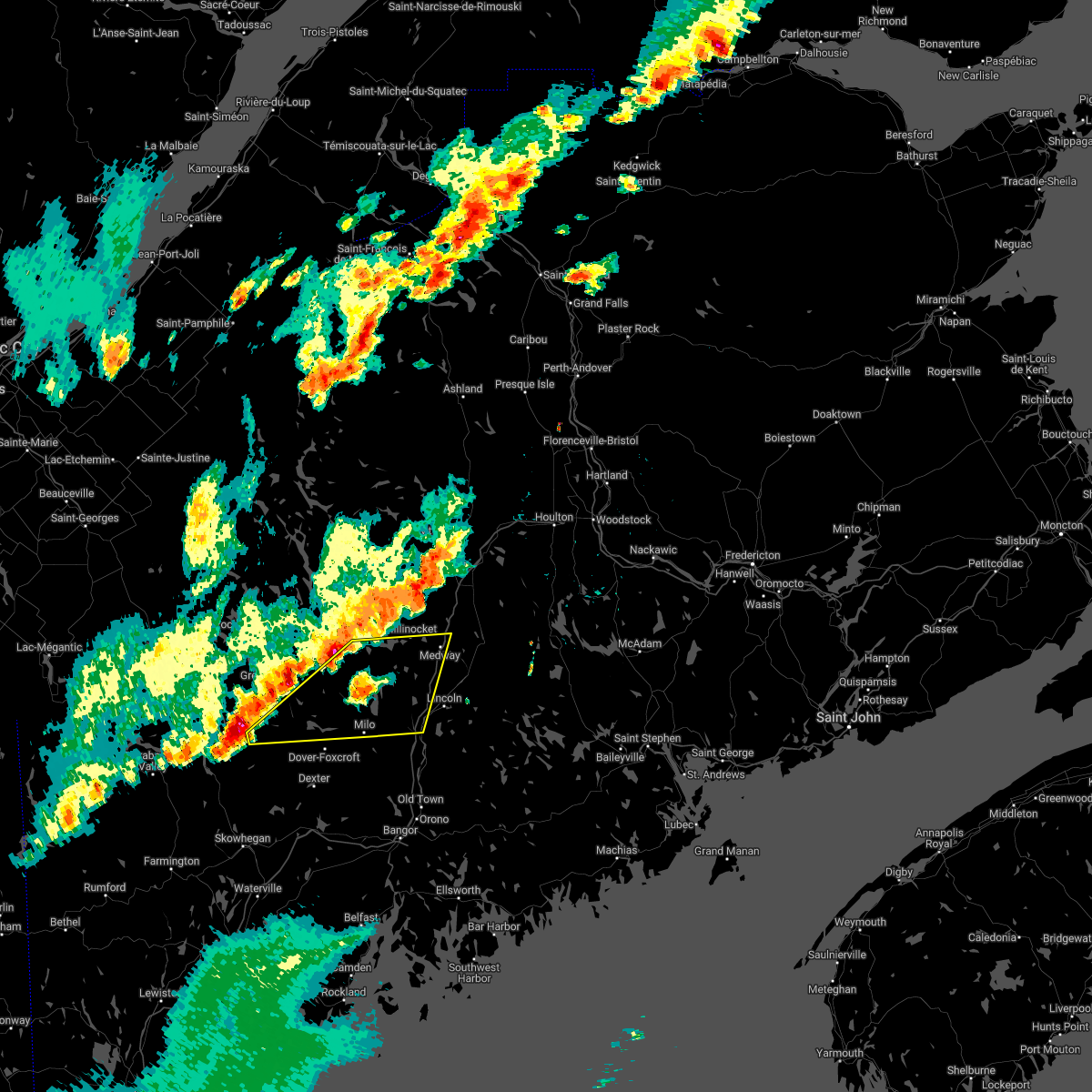
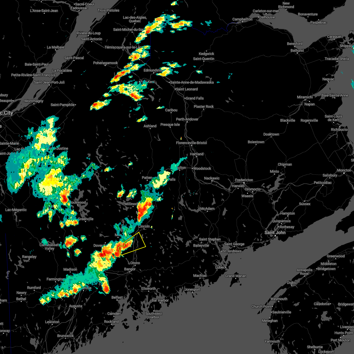
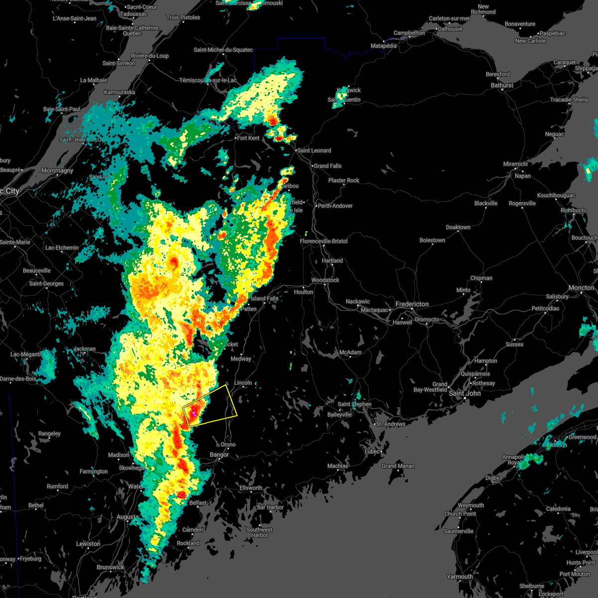
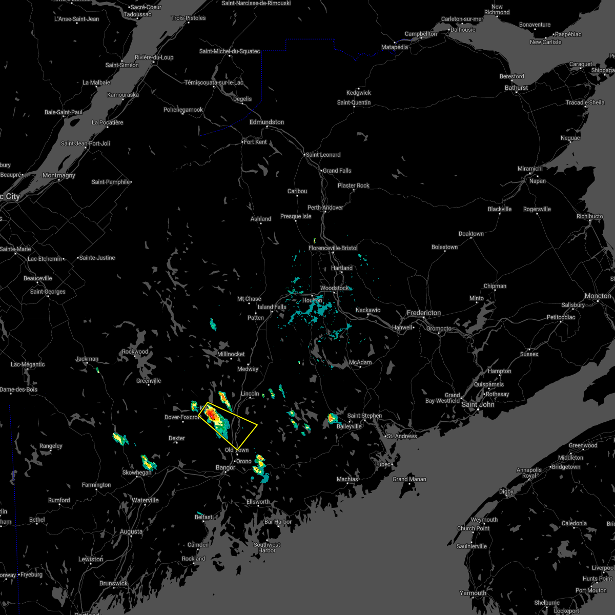
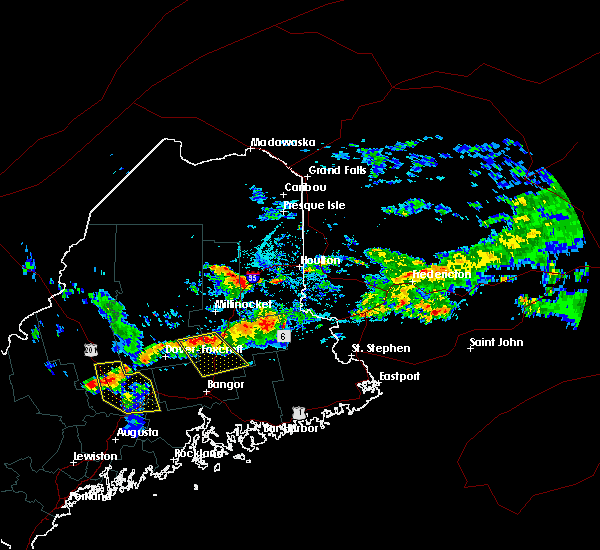
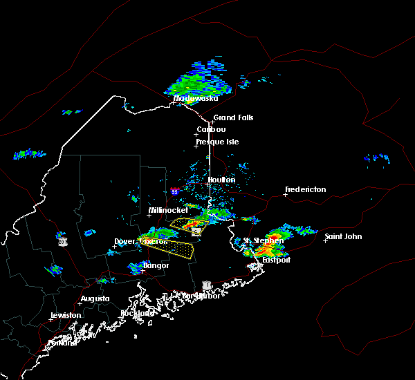
Hail Map for Howland, ME
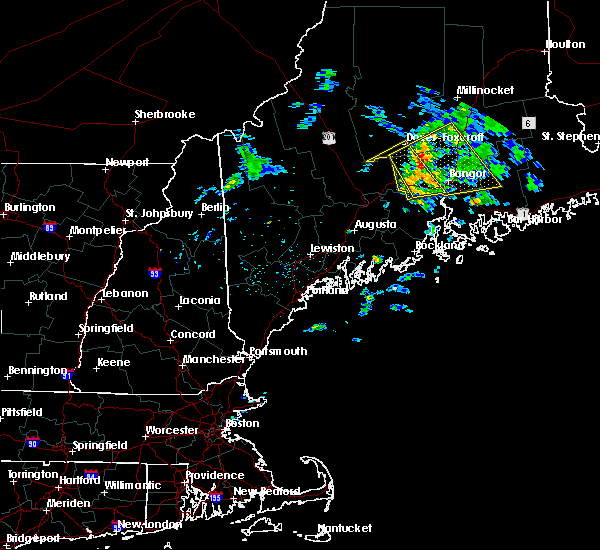
The Howland, ME area has had 0 reports of on-the-ground hail by trained spotters, and has been under severe weather warnings 2 times during the past 12 months. Doppler radar has detected hail at or near Howland, ME on 13 occasions.
| Name: | Howland, ME |
| Where Located: | 32 miles N of Bangor, ME |
| Map: | Google Map for Howland, ME |
| Population: | 1096 |
| Housing Units: | 554 |
| More Info: | Search Google for Howland, ME |
2
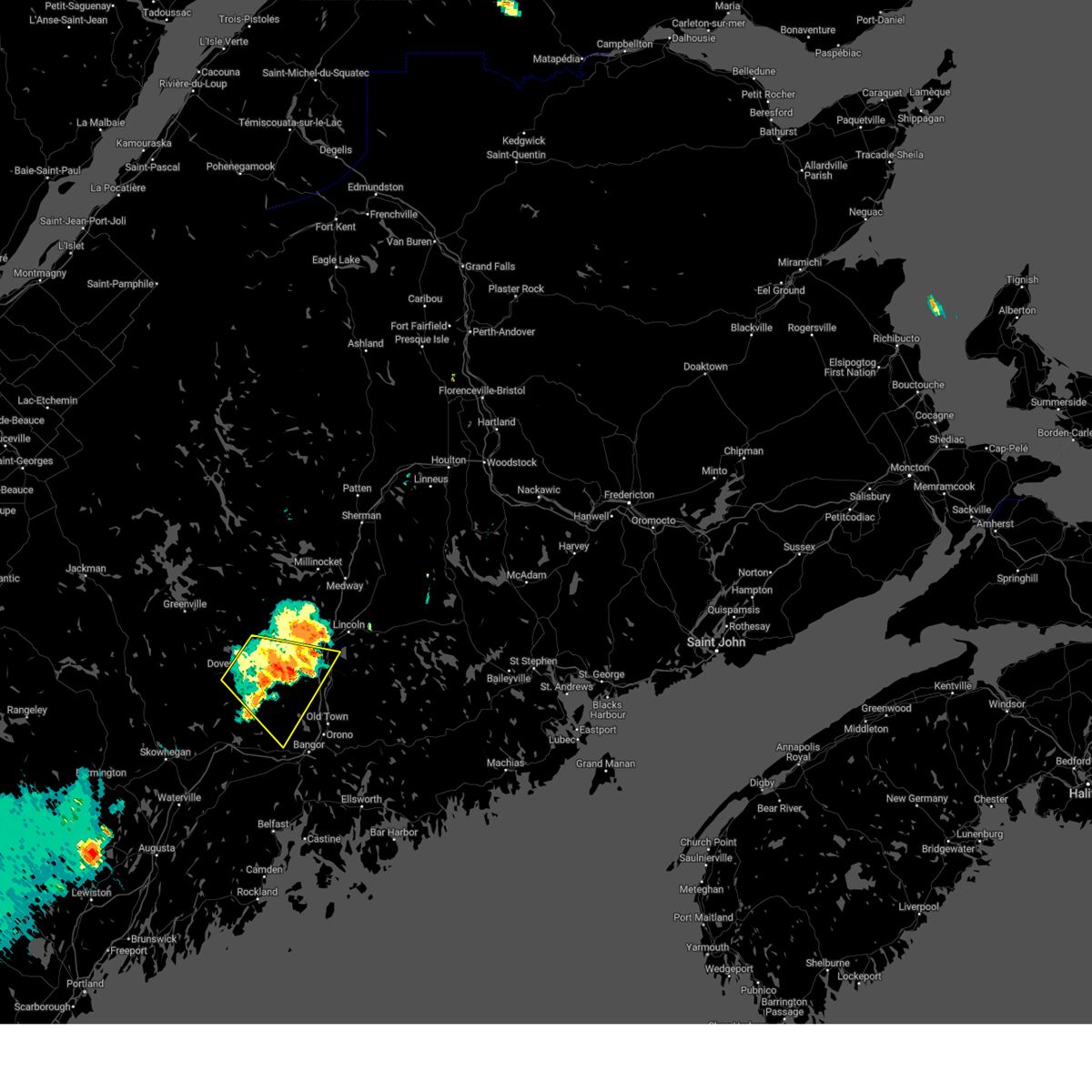
The Top Recent Hail Date for Howland, ME is Thursday, September 7, 2023 (3rd out of 13)
Hail and Wind Damage Spotted near Howland, ME
| Date / Time | Report Details |
|---|---|
| 7/9/2024 4:55 PM EDT |
 At 455 pm edt, a severe thunderstorm was located 7 miles south of licoln township, or 7 miles south of lincoln, moving northeast at 25 mph (radar indicated). Hazards include 60 mph wind gusts. Expect damage to trees and power lines. Locations impacted include, lincoln, howland, licoln township, enfield, greenbush, lee, chester, winn, passadumkeag, burlington, lowell, woodville, and maxfield. At 455 pm edt, a severe thunderstorm was located 7 miles south of licoln township, or 7 miles south of lincoln, moving northeast at 25 mph (radar indicated). Hazards include 60 mph wind gusts. Expect damage to trees and power lines. Locations impacted include, lincoln, howland, licoln township, enfield, greenbush, lee, chester, winn, passadumkeag, burlington, lowell, woodville, and maxfield.
|
| 7/9/2024 4:29 PM EDT |
 Svrcar the national weather service in caribou maine has issued a * severe thunderstorm warning for, east central penobscot county in east central maine, * until 530 pm edt. * at 429 pm edt, a severe thunderstorm was located near howland, moving northeast at 25 mph (radar indicated). Hazards include 60 mph wind gusts and penny size hail. expect damage to trees and power lines Svrcar the national weather service in caribou maine has issued a * severe thunderstorm warning for, east central penobscot county in east central maine, * until 530 pm edt. * at 429 pm edt, a severe thunderstorm was located near howland, moving northeast at 25 mph (radar indicated). Hazards include 60 mph wind gusts and penny size hail. expect damage to trees and power lines
|
| 6/30/2024 3:11 PM EDT |
 the severe thunderstorm warning has been cancelled and is no longer in effect the severe thunderstorm warning has been cancelled and is no longer in effect
|
| 6/30/2024 3:11 PM EDT |
 At 310 pm edt, severe thunderstorms were located along a line extending from near danforth to near springfield to 8 miles southeast of orneville, moving east at 45 mph (radar indicated). Hazards include 70 mph wind gusts and quarter size hail. Minor hail damage to vehicles is possible. expect considerable tree damage. wind damage is also likely to mobile homes, roofs, and outbuildings. Locations impacted include, old town, dexter, howland, danforth, vanceboro, orono, corinth, springfield, topsfield, grand lake stream, lakeville, indian island, licoln township, fowler township, dyer township, grand falls, codyville plantation, east corinth, glenburn, and milford. At 310 pm edt, severe thunderstorms were located along a line extending from near danforth to near springfield to 8 miles southeast of orneville, moving east at 45 mph (radar indicated). Hazards include 70 mph wind gusts and quarter size hail. Minor hail damage to vehicles is possible. expect considerable tree damage. wind damage is also likely to mobile homes, roofs, and outbuildings. Locations impacted include, old town, dexter, howland, danforth, vanceboro, orono, corinth, springfield, topsfield, grand lake stream, lakeville, indian island, licoln township, fowler township, dyer township, grand falls, codyville plantation, east corinth, glenburn, and milford.
|
| 6/30/2024 2:55 PM EDT | Numerous trees and wires down in howlan in penobscot county ME, 1.2 miles N of Howland, ME |
| 6/30/2024 2:50 PM EDT |
 Svrcar the national weather service in caribou maine has issued a * severe thunderstorm warning for, northwestern washington county in southeastern maine, northeastern hancock county in southeastern maine, southeastern piscataquis county in north central maine, southeastern aroostook county in northern maine, southern penobscot county in east central maine, * until 330 pm edt. * at 250 pm edt, severe thunderstorms were located along a line extending from wytopitlock to near licoln township to 6 miles southeast of dover-foxcroft, moving east at 45 mph (radar indicated). Hazards include 70 mph wind gusts and quarter size hail. Minor hail damage to vehicles is possible. expect considerable tree damage. Wind damage is also likely to mobile homes, roofs, and outbuildings. Svrcar the national weather service in caribou maine has issued a * severe thunderstorm warning for, northwestern washington county in southeastern maine, northeastern hancock county in southeastern maine, southeastern piscataquis county in north central maine, southeastern aroostook county in northern maine, southern penobscot county in east central maine, * until 330 pm edt. * at 250 pm edt, severe thunderstorms were located along a line extending from wytopitlock to near licoln township to 6 miles southeast of dover-foxcroft, moving east at 45 mph (radar indicated). Hazards include 70 mph wind gusts and quarter size hail. Minor hail damage to vehicles is possible. expect considerable tree damage. Wind damage is also likely to mobile homes, roofs, and outbuildings.
|
| 6/30/2024 2:32 PM EDT |
 At 232 pm edt, severe thunderstorms were located along a line extending from 7 miles northeast of medway to near brownville junction, moving east at 30 mph (radar indicated). Hazards include 70 mph wind gusts and half dollar size hail. Minor hail damage to vehicles is possible. expect considerable tree damage. wind damage is also likely to mobile homes, roofs, and outbuildings. Locations impacted include, lincoln, dover-foxcroft, guilford, howland, brownville junction, milo, east millinocket, medway, haynesville, licoln township, wytopitlock, lake view plantation, reed plantation, orneville, ebeemee, enfield, hudson, charleston, bradford, and brownville. At 232 pm edt, severe thunderstorms were located along a line extending from 7 miles northeast of medway to near brownville junction, moving east at 30 mph (radar indicated). Hazards include 70 mph wind gusts and half dollar size hail. Minor hail damage to vehicles is possible. expect considerable tree damage. wind damage is also likely to mobile homes, roofs, and outbuildings. Locations impacted include, lincoln, dover-foxcroft, guilford, howland, brownville junction, milo, east millinocket, medway, haynesville, licoln township, wytopitlock, lake view plantation, reed plantation, orneville, ebeemee, enfield, hudson, charleston, bradford, and brownville.
|
| 6/30/2024 2:07 PM EDT |
 Svrcar the national weather service in caribou maine has issued a * severe thunderstorm warning for, southeastern piscataquis county in north central maine, southeastern aroostook county in northern maine, central penobscot county in east central maine, * until 300 pm edt. * at 207 pm edt, severe thunderstorms were located along a line extending from near millinocket to 6 miles southeast of elliottsville, moving east at 30 mph (radar indicated). Hazards include 70 mph wind gusts and half dollar size hail. Minor hail damage to vehicles is possible. expect considerable tree damage. Wind damage is also likely to mobile homes, roofs, and outbuildings. Svrcar the national weather service in caribou maine has issued a * severe thunderstorm warning for, southeastern piscataquis county in north central maine, southeastern aroostook county in northern maine, central penobscot county in east central maine, * until 300 pm edt. * at 207 pm edt, severe thunderstorms were located along a line extending from near millinocket to 6 miles southeast of elliottsville, moving east at 30 mph (radar indicated). Hazards include 70 mph wind gusts and half dollar size hail. Minor hail damage to vehicles is possible. expect considerable tree damage. Wind damage is also likely to mobile homes, roofs, and outbuildings.
|
| 6/19/2024 4:55 PM EDT |
 The storm which prompted the warning has weakened below severe limits, and no longer poses an immediate threat to life or property. therefore, the warning will be allowed to expire. however, gusty winds and heavy rain are still possible with this thunderstorm. The storm which prompted the warning has weakened below severe limits, and no longer poses an immediate threat to life or property. therefore, the warning will be allowed to expire. however, gusty winds and heavy rain are still possible with this thunderstorm.
|
| 6/19/2024 4:44 PM EDT |
 At 444 pm edt, a severe thunderstorm was located near orneville, or 8 miles east of dover-foxcroft, moving southeast at 30 mph (radar indicated). Hazards include 60 mph wind gusts and penny size hail. Expect damage to trees and power lines. Locations impacted include, dover-foxcroft, dexter, guilford, howland, hermon, corinth, milo, kenduskeag, orneville, east corinth, lake view plantation, glenburn, levant, enfield, hudson, charleston, sangerville, bradford, brownville, and garland. At 444 pm edt, a severe thunderstorm was located near orneville, or 8 miles east of dover-foxcroft, moving southeast at 30 mph (radar indicated). Hazards include 60 mph wind gusts and penny size hail. Expect damage to trees and power lines. Locations impacted include, dover-foxcroft, dexter, guilford, howland, hermon, corinth, milo, kenduskeag, orneville, east corinth, lake view plantation, glenburn, levant, enfield, hudson, charleston, sangerville, bradford, brownville, and garland.
|
| 6/19/2024 4:17 PM EDT |
 Svrcar the national weather service in caribou maine has issued a * severe thunderstorm warning for, southeastern piscataquis county in north central maine, southwestern penobscot county in east central maine, * until 500 pm edt. * at 416 pm edt, a severe thunderstorm was located near guilford, moving southeast at 30 mph (radar indicated). Hazards include 60 mph wind gusts and penny size hail. expect damage to trees and power lines Svrcar the national weather service in caribou maine has issued a * severe thunderstorm warning for, southeastern piscataquis county in north central maine, southwestern penobscot county in east central maine, * until 500 pm edt. * at 416 pm edt, a severe thunderstorm was located near guilford, moving southeast at 30 mph (radar indicated). Hazards include 60 mph wind gusts and penny size hail. expect damage to trees and power lines
|
| 6/5/2024 4:21 PM EDT |
 the severe thunderstorm warning has been cancelled and is no longer in effect the severe thunderstorm warning has been cancelled and is no longer in effect
|
| 6/5/2024 4:21 PM EDT |
 At 419 pm edt, a severe thunderstorm was located 5 miles south of howland, moving south at 20 mph (radar indicated). Hazards include 60 mph wind gusts and quarter size hail. Minor hail damage to vehicles is possible. expect wind damage to trees and power lines. Locations impacted include, howland, enfield, greenbush, alton, lagrange, passadumkeag, argyle, medford, and maxfield. At 419 pm edt, a severe thunderstorm was located 5 miles south of howland, moving south at 20 mph (radar indicated). Hazards include 60 mph wind gusts and quarter size hail. Minor hail damage to vehicles is possible. expect wind damage to trees and power lines. Locations impacted include, howland, enfield, greenbush, alton, lagrange, passadumkeag, argyle, medford, and maxfield.
|
| 6/5/2024 3:55 PM EDT |
 Svrcar the national weather service in caribou maine has issued a * severe thunderstorm warning for, southeastern piscataquis county in north central maine, central penobscot county in east central maine, * until 445 pm edt. * at 354 pm edt, a severe thunderstorm was located near howland, moving south at 15 mph (radar indicated). Hazards include 60 mph wind gusts and quarter size hail. Minor hail damage to vehicles is possible. Expect wind damage to trees and power lines. Svrcar the national weather service in caribou maine has issued a * severe thunderstorm warning for, southeastern piscataquis county in north central maine, central penobscot county in east central maine, * until 445 pm edt. * at 354 pm edt, a severe thunderstorm was located near howland, moving south at 15 mph (radar indicated). Hazards include 60 mph wind gusts and quarter size hail. Minor hail damage to vehicles is possible. Expect wind damage to trees and power lines.
|
| 8/13/2023 4:54 PM EDT |
 The severe thunderstorm warning for south central penobscot county will expire at 500 pm edt, the storms which prompted the warning have weakened below severe limits, but frequent cloud to ground lightning and heavy downpours are still likely. therefore, the warning will be allowed to expire. however small hail is still possible with this thunderstorm. a severe thunderstorm watch remains in effect until 900 pm edt for north central and east central maine. The severe thunderstorm warning for south central penobscot county will expire at 500 pm edt, the storms which prompted the warning have weakened below severe limits, but frequent cloud to ground lightning and heavy downpours are still likely. therefore, the warning will be allowed to expire. however small hail is still possible with this thunderstorm. a severe thunderstorm watch remains in effect until 900 pm edt for north central and east central maine.
|
| 8/13/2023 4:41 PM EDT |
 At 441 pm edt, a severe thunderstorm was located 7 miles southwest of howland, moving east at 25 mph (radar indicated). Hazards include ping pong ball size hail and 60 mph wind gusts. People and animals outdoors will be injured. expect hail damage to roofs, siding, windows, and vehicles. expect wind damage to trees and power lines. locations impacted include, howland, licoln township, orneville, enfield, hudson, greenbush, bradford, alton, lagrange, passadumkeag, lowell, argyle, medford, maxfield and greenfield. this includes interstate 95 between mile markers 203 and 221. hail threat, radar indicated max hail size, 1. 50 in wind threat, radar indicated max wind gust, 60 mph. At 441 pm edt, a severe thunderstorm was located 7 miles southwest of howland, moving east at 25 mph (radar indicated). Hazards include ping pong ball size hail and 60 mph wind gusts. People and animals outdoors will be injured. expect hail damage to roofs, siding, windows, and vehicles. expect wind damage to trees and power lines. locations impacted include, howland, licoln township, orneville, enfield, hudson, greenbush, bradford, alton, lagrange, passadumkeag, lowell, argyle, medford, maxfield and greenfield. this includes interstate 95 between mile markers 203 and 221. hail threat, radar indicated max hail size, 1. 50 in wind threat, radar indicated max wind gust, 60 mph.
|
| 8/13/2023 4:15 PM EDT |
 At 415 pm edt, a severe thunderstorm was located near orneville, or 10 miles east of dover-foxcroft, moving east at 25 mph (radar indicated). Hazards include ping pong ball size hail and 60 mph wind gusts. People and animals outdoors will be injured. expect hail damage to roofs, siding, windows, and vehicles. Expect wind damage to trees and power lines. At 415 pm edt, a severe thunderstorm was located near orneville, or 10 miles east of dover-foxcroft, moving east at 25 mph (radar indicated). Hazards include ping pong ball size hail and 60 mph wind gusts. People and animals outdoors will be injured. expect hail damage to roofs, siding, windows, and vehicles. Expect wind damage to trees and power lines.
|
| 7/12/2022 8:07 PM EDT |
 At 807 pm edt, severe thunderstorms were located along a line extending from 7 miles east of sherman to near lake view plantation, moving northeast at 45 mph (radar indicated). Hazards include 60 mph wind gusts and quarter size hail. Minor hail damage to vehicles is possible. expect wind damage to trees and power lines. locations impacted include, millinocket, dover-foxcroft, howland, brownville junction, milo, east millinocket, medway, sherman, ebeemee, lake view plantation, licoln township, southeastern katahdin woods and waters national monument, enfield, brownville, lagrange, sebec, chester, stacyville, medford and woodville. hail threat, radar indicated max hail size, 1. 00 in wind threat, radar indicated max wind gust, 60 mph. At 807 pm edt, severe thunderstorms were located along a line extending from 7 miles east of sherman to near lake view plantation, moving northeast at 45 mph (radar indicated). Hazards include 60 mph wind gusts and quarter size hail. Minor hail damage to vehicles is possible. expect wind damage to trees and power lines. locations impacted include, millinocket, dover-foxcroft, howland, brownville junction, milo, east millinocket, medway, sherman, ebeemee, lake view plantation, licoln township, southeastern katahdin woods and waters national monument, enfield, brownville, lagrange, sebec, chester, stacyville, medford and woodville. hail threat, radar indicated max hail size, 1. 00 in wind threat, radar indicated max wind gust, 60 mph.
|
| 7/12/2022 7:45 PM EDT |
 At 744 pm edt, severe thunderstorms were located along a line extending from 8 miles northeast of east millinocket to 6 miles southwest of brownville junction, moving northeast at 45 mph (radar indicated). Hazards include 60 mph wind gusts and quarter size hail. Minor hail damage to vehicles is possible. Expect wind damage to trees and power lines. At 744 pm edt, severe thunderstorms were located along a line extending from 8 miles northeast of east millinocket to 6 miles southwest of brownville junction, moving northeast at 45 mph (radar indicated). Hazards include 60 mph wind gusts and quarter size hail. Minor hail damage to vehicles is possible. Expect wind damage to trees and power lines.
|
| 7/12/2022 7:29 PM EDT |
 At 729 pm edt, severe thunderstorms were located along a line extending from near millinocket to 6 miles southeast of elliottsville, moving east at 30 mph (radar indicated). Hazards include 70 mph wind gusts and ping pong ball size hail. People and animals outdoors will be injured. expect hail damage to roofs, siding, windows, and vehicles. expect considerable tree damage. wind damage is also likely to mobile homes, roofs, and outbuildings. locations impacted include, millinocket, dover-foxcroft, guilford, howland, brownville junction, milo, east millinocket, medway, monson, blanchard, ebeemee, elliottsville, lake view plantation, kingsbury plantation, enfield, brownville, abbot, sebec, chester and medford. thunderstorm damage threat, considerable hail threat, radar indicated max hail size, 1. 50 in wind threat, radar indicated max wind gust, 70 mph. At 729 pm edt, severe thunderstorms were located along a line extending from near millinocket to 6 miles southeast of elliottsville, moving east at 30 mph (radar indicated). Hazards include 70 mph wind gusts and ping pong ball size hail. People and animals outdoors will be injured. expect hail damage to roofs, siding, windows, and vehicles. expect considerable tree damage. wind damage is also likely to mobile homes, roofs, and outbuildings. locations impacted include, millinocket, dover-foxcroft, guilford, howland, brownville junction, milo, east millinocket, medway, monson, blanchard, ebeemee, elliottsville, lake view plantation, kingsbury plantation, enfield, brownville, abbot, sebec, chester and medford. thunderstorm damage threat, considerable hail threat, radar indicated max hail size, 1. 50 in wind threat, radar indicated max wind gust, 70 mph.
|
| 7/12/2022 7:01 PM EDT |
 At 700 pm edt, severe thunderstorms were located along a line extending from 10 miles northeast of white cap mountain to blanchard, moving east at 30 mph (radar indicated). Hazards include 70 mph wind gusts and ping pong ball size hail. People and animals outdoors will be injured. expect hail damage to roofs, siding, windows, and vehicles. expect considerable tree damage. Wind damage is also likely to mobile homes, roofs, and outbuildings. At 700 pm edt, severe thunderstorms were located along a line extending from 10 miles northeast of white cap mountain to blanchard, moving east at 30 mph (radar indicated). Hazards include 70 mph wind gusts and ping pong ball size hail. People and animals outdoors will be injured. expect hail damage to roofs, siding, windows, and vehicles. expect considerable tree damage. Wind damage is also likely to mobile homes, roofs, and outbuildings.
|
| 7/8/2022 4:53 PM EDT |
 At 453 pm edt, a severe thunderstorm was located over licoln township, or over lincoln, moving east at 30 mph (radar indicated). Hazards include 60 mph wind gusts and quarter size hail. Minor hail damage to vehicles is possible. Expect wind damage to trees and power lines. At 453 pm edt, a severe thunderstorm was located over licoln township, or over lincoln, moving east at 30 mph (radar indicated). Hazards include 60 mph wind gusts and quarter size hail. Minor hail damage to vehicles is possible. Expect wind damage to trees and power lines.
|
| 5/22/2022 6:08 PM EDT |
 At 608 pm edt, a severe thunderstorm was located near orneville, or 13 miles southwest of howland, moving east at 25 mph (radar indicated). Hazards include 60 mph wind gusts and quarter size hail. Minor hail damage to vehicles is possible. Expect wind damage to trees and power lines. At 608 pm edt, a severe thunderstorm was located near orneville, or 13 miles southwest of howland, moving east at 25 mph (radar indicated). Hazards include 60 mph wind gusts and quarter size hail. Minor hail damage to vehicles is possible. Expect wind damage to trees and power lines.
|
| 9/6/2021 5:20 PM EDT |
 At 520 pm edt, a severe thunderstorm was located near orneville, or 8 miles east of dover-foxcroft, moving east at 15 mph (radar indicated). Hazards include 60 mph wind gusts and quarter size hail. Minor hail damage to vehicles is possible. Expect wind damage to trees and power lines. At 520 pm edt, a severe thunderstorm was located near orneville, or 8 miles east of dover-foxcroft, moving east at 15 mph (radar indicated). Hazards include 60 mph wind gusts and quarter size hail. Minor hail damage to vehicles is possible. Expect wind damage to trees and power lines.
|
| 6/6/2021 4:41 PM EDT |
 At 440 pm edt, a severe thunderstorm was located near orneville, or 11 miles west of howland, moving southeast at 25 mph (radar indicated). Hazards include 60 mph wind gusts and penny size hail. expect damage to trees and power lines At 440 pm edt, a severe thunderstorm was located near orneville, or 11 miles west of howland, moving southeast at 25 mph (radar indicated). Hazards include 60 mph wind gusts and penny size hail. expect damage to trees and power lines
|
| 7/2/2020 4:45 PM EDT |
 At 445 pm edt, a severe thunderstorm was located near lake view plantation, or 8 miles northwest of howland, moving southeast at 30 mph (radar indicated). Hazards include 60 mph wind gusts and quarter size hail. Minor hail damage to vehicles is possible. Expect wind damage to trees and power lines. At 445 pm edt, a severe thunderstorm was located near lake view plantation, or 8 miles northwest of howland, moving southeast at 30 mph (radar indicated). Hazards include 60 mph wind gusts and quarter size hail. Minor hail damage to vehicles is possible. Expect wind damage to trees and power lines.
|
| 8/12/2019 5:21 PM EDT |
 At 521 pm edt, a severe thunderstorm was located over howland, moving east at 25 mph (radar indicated). Hazards include 60 mph wind gusts and nickel size hail. expect damage to trees and power lines At 521 pm edt, a severe thunderstorm was located over howland, moving east at 25 mph (radar indicated). Hazards include 60 mph wind gusts and nickel size hail. expect damage to trees and power lines
|
| 7/6/2019 2:55 PM EDT |
 The severe thunderstorm warning for southeastern piscataquis and east central penobscot counties will expire at 300 pm edt, the storm which prompted the warning has weakened below severe limits, but frequent cloud to ground lightning and heavy downpours are still likely. therefore, the warning will be allowed to expire. however heavy rain is still possible with this thunderstorm. a severe thunderstorm watch remains in effect until 800 pm edt for southeastern, north central and east central maine. The severe thunderstorm warning for southeastern piscataquis and east central penobscot counties will expire at 300 pm edt, the storm which prompted the warning has weakened below severe limits, but frequent cloud to ground lightning and heavy downpours are still likely. therefore, the warning will be allowed to expire. however heavy rain is still possible with this thunderstorm. a severe thunderstorm watch remains in effect until 800 pm edt for southeastern, north central and east central maine.
|
| 7/6/2019 2:37 PM EDT |
 At 236 pm edt, a severe thunderstorm was located near howland, moving east at 35 mph (radar indicated). Hazards include 70 mph wind gusts and half dollar size hail. Minor hail damage to vehicles is possible. expect considerable tree damage. wind damage is also likely to mobile homes, roofs, and outbuildings. Locations impacted include, lincoln, howland, milo, lincoln township, orneville, grand falls, lake view plantation, enfield, greenbush, brownville, lee, lagrange, chester, winn, passadumkeag, burlington, lowell, medford, maxfield and lake view. At 236 pm edt, a severe thunderstorm was located near howland, moving east at 35 mph (radar indicated). Hazards include 70 mph wind gusts and half dollar size hail. Minor hail damage to vehicles is possible. expect considerable tree damage. wind damage is also likely to mobile homes, roofs, and outbuildings. Locations impacted include, lincoln, howland, milo, lincoln township, orneville, grand falls, lake view plantation, enfield, greenbush, brownville, lee, lagrange, chester, winn, passadumkeag, burlington, lowell, medford, maxfield and lake view.
|
| 7/6/2019 2:22 PM EDT |
 At 221 pm edt, a severe thunderstorm was located near lake view plantation, or 9 miles northwest of howland, moving east at 35 mph (radar indicated). Hazards include 60 mph wind gusts and quarter size hail. Minor hail damage to vehicles is possible. Expect wind damage to trees and power lines. At 221 pm edt, a severe thunderstorm was located near lake view plantation, or 9 miles northwest of howland, moving east at 35 mph (radar indicated). Hazards include 60 mph wind gusts and quarter size hail. Minor hail damage to vehicles is possible. Expect wind damage to trees and power lines.
|
| 7/6/2019 2:06 PM EDT |
 The severe thunderstorm warning for eastern piscataquis and east central penobscot counties will expire at 215 pm edt, the storm which prompted the warning has weakened below severe limits, and has exited the warned area. therefore, the warning will be allowed to expire. however heavy rain is still possible with this thunderstorm. a severe thunderstorm watch remains in effect until 800 pm edt for southeastern, north central and east central maine. The severe thunderstorm warning for eastern piscataquis and east central penobscot counties will expire at 215 pm edt, the storm which prompted the warning has weakened below severe limits, and has exited the warned area. therefore, the warning will be allowed to expire. however heavy rain is still possible with this thunderstorm. a severe thunderstorm watch remains in effect until 800 pm edt for southeastern, north central and east central maine.
|
| 7/6/2019 1:37 PM EDT |
 At 136 pm edt, a severe thunderstorm was located near lincoln, moving east at 20 mph (radar indicated). Hazards include 60 mph wind gusts and quarter size hail. Minor hail damage to vehicles is possible. expect wind damage to trees and power lines. Locations impacted include, lincoln, howland, springfield, lakeville, lincoln township, lake view plantation, enfield, lee, lagrange, mattawamkeag, chester, winn, burlington, lowell, medford, woodville, prentiss, kingman, carroll and maxfield. At 136 pm edt, a severe thunderstorm was located near lincoln, moving east at 20 mph (radar indicated). Hazards include 60 mph wind gusts and quarter size hail. Minor hail damage to vehicles is possible. expect wind damage to trees and power lines. Locations impacted include, lincoln, howland, springfield, lakeville, lincoln township, lake view plantation, enfield, lee, lagrange, mattawamkeag, chester, winn, burlington, lowell, medford, woodville, prentiss, kingman, carroll and maxfield.
|
| 7/6/2019 1:13 PM EDT |
 At 113 pm edt, a severe thunderstorm was located near lake view plantation, or 10 miles northwest of howland, moving east at 20 mph (radar indicated). Hazards include 60 mph wind gusts and quarter size hail. Minor hail damage to vehicles is possible. Expect wind damage to trees and power lines. At 113 pm edt, a severe thunderstorm was located near lake view plantation, or 10 miles northwest of howland, moving east at 20 mph (radar indicated). Hazards include 60 mph wind gusts and quarter size hail. Minor hail damage to vehicles is possible. Expect wind damage to trees and power lines.
|
| 8/7/2018 2:40 PM EDT | Trees down on sebec shores r in penobscot county ME, 7.8 miles S of Howland, ME |
| 8/7/2018 1:40 PM EDT | Corrects previous tstm wnd dmg report from gilford. trees down on sebec shores r in penobscot county ME, 7.8 miles S of Howland, ME |
| 7/10/2018 2:37 PM EDT |
 At 237 pm edt, a severe thunderstorm was located near milo, or 7 miles southeast of brownville junction, moving east at 30 mph (radar indicated). Hazards include 60 mph wind gusts and quarter size hail. Minor hail damage to vehicles is possible. expect wind damage to trees and power lines. Locations impacted include, howland, milo, lake view plantation, orneville, licoln township, enfield, greenbush, brownville, lagrange, passadumkeag, burlington, lowell, argyle, medford, maxfield, lake view and seboeis. At 237 pm edt, a severe thunderstorm was located near milo, or 7 miles southeast of brownville junction, moving east at 30 mph (radar indicated). Hazards include 60 mph wind gusts and quarter size hail. Minor hail damage to vehicles is possible. expect wind damage to trees and power lines. Locations impacted include, howland, milo, lake view plantation, orneville, licoln township, enfield, greenbush, brownville, lagrange, passadumkeag, burlington, lowell, argyle, medford, maxfield, lake view and seboeis.
|
| 7/10/2018 2:15 PM EDT |
 At 215 pm edt, a severe thunderstorm was located near brownville junction, moving east at 40 mph (radar indicated). Hazards include 60 mph wind gusts and quarter size hail. Minor hail damage to vehicles is possible. Expect wind damage to trees and power lines. At 215 pm edt, a severe thunderstorm was located near brownville junction, moving east at 40 mph (radar indicated). Hazards include 60 mph wind gusts and quarter size hail. Minor hail damage to vehicles is possible. Expect wind damage to trees and power lines.
|
| 9/5/2017 8:21 PM EDT |
 At 820 pm edt, a severe thunderstorm was located 8 miles northeast of old town, moving northeast at 40 mph (radar indicated). Hazards include 60 mph wind gusts and quarter size hail. Minor hail damage to vehicles is possible. expect wind damage to trees and power lines. locations impacted include, bangor, old town, howland, orono, hermon, corinth, veazie, kenduskeag, indian island, glenburn, milford, levant, enfield, hudson, bradley, greenbush, bradford, alton, lagrange and passadumkeag. This includes interstate 95 between mile makers 181 and 218. At 820 pm edt, a severe thunderstorm was located 8 miles northeast of old town, moving northeast at 40 mph (radar indicated). Hazards include 60 mph wind gusts and quarter size hail. Minor hail damage to vehicles is possible. expect wind damage to trees and power lines. locations impacted include, bangor, old town, howland, orono, hermon, corinth, veazie, kenduskeag, indian island, glenburn, milford, levant, enfield, hudson, bradley, greenbush, bradford, alton, lagrange and passadumkeag. This includes interstate 95 between mile makers 181 and 218.
|
| 9/5/2017 7:58 PM EDT |
 At 757 pm edt, a severe thunderstorm was located near kenduskeag, moving northeast at 40 mph (radar indicated). Hazards include 60 mph wind gusts and quarter size hail. Minor hail damage to vehicles is possible. Expect wind damage to trees and power lines. At 757 pm edt, a severe thunderstorm was located near kenduskeag, moving northeast at 40 mph (radar indicated). Hazards include 60 mph wind gusts and quarter size hail. Minor hail damage to vehicles is possible. Expect wind damage to trees and power lines.
|
| 8/6/2016 2:00 PM EDT | A couple trees down... relayed by penobscot dispatc in penobscot county ME, 5 miles WSW of Howland, ME |
| 7/18/2016 3:03 PM EDT |
 At 302 pm edt, severe thunderstorms were located along a line extending from near medway to near east corinth, moving southeast at 40 mph (radar indicated). Hazards include 60 mph wind gusts and quarter size hail. Expect wind damage to roofs. siding. And trees. At 302 pm edt, severe thunderstorms were located along a line extending from near medway to near east corinth, moving southeast at 40 mph (radar indicated). Hazards include 60 mph wind gusts and quarter size hail. Expect wind damage to roofs. siding. And trees.
|
| 2/25/2016 5:26 AM EST |
 The severe thunderstorm warning for southwestern washington, hancock, southern aroostook and southeastern penobscot counties will expire at 530 am est, the storms which prompted the warning have moved out of the warned area. therefore the warning will be allowed to expire. The severe thunderstorm warning for southwestern washington, hancock, southern aroostook and southeastern penobscot counties will expire at 530 am est, the storms which prompted the warning have moved out of the warned area. therefore the warning will be allowed to expire.
|
| 2/25/2016 4:37 AM EST |
 At 436 am est, severe thunderstorms were located along a line extending from 6 miles north of lincoln to near bar harbor, moving east at 30 mph (radar indicated). Hazards include 60 mph wind gusts. Expect damage to roofs. siding and trees. locations impacted include, lincoln, ellsworth, howland, cherryfield, steuben, columbia, springfield, lakeville, deblois, millbridge, grand falls, licoln township, reed plantation, hancock, franklin, milford, gouldsboro, enfield, lamoine and tremont. This includes interstate 95 between mile markers 222 and 236. At 436 am est, severe thunderstorms were located along a line extending from 6 miles north of lincoln to near bar harbor, moving east at 30 mph (radar indicated). Hazards include 60 mph wind gusts. Expect damage to roofs. siding and trees. locations impacted include, lincoln, ellsworth, howland, cherryfield, steuben, columbia, springfield, lakeville, deblois, millbridge, grand falls, licoln township, reed plantation, hancock, franklin, milford, gouldsboro, enfield, lamoine and tremont. This includes interstate 95 between mile markers 222 and 236.
|
| 2/25/2016 4:03 AM EST |
 At 402 am est, severe thunderstorms were located along a line extending from near milo to near stonington, moving northeast at 45 mph (radar indicated). Hazards include 60 mph wind gusts. Expect damage to roofs. Siding and trees. At 402 am est, severe thunderstorms were located along a line extending from near milo to near stonington, moving northeast at 45 mph (radar indicated). Hazards include 60 mph wind gusts. Expect damage to roofs. Siding and trees.
|
| 10/29/2015 5:08 PM EDT |
 At 508 pm edt, a severe thunderstorm was located 7 miles northwest of east corinth, or 8 miles northeast of dexter, moving northeast at 35 mph (radar indicated). Hazards include 60 mph wind gusts. Expect damage to roofs. Siding and trees. At 508 pm edt, a severe thunderstorm was located 7 miles northwest of east corinth, or 8 miles northeast of dexter, moving northeast at 35 mph (radar indicated). Hazards include 60 mph wind gusts. Expect damage to roofs. Siding and trees.
|
| 8/4/2015 6:12 PM EDT | The severe thunderstorm warning for northern hancock, southeastern piscataquis, southern penobscot and west central washington counties will expire at 615 pm edt, the storm which prompted the warning has weakened below severe limits, and no longer poses an immediate threat to life or property. therefore the warning will be allowed to expire. a severe thunderstorm watch remains in effect until 800 pm edt for eastern maine. |
| 8/4/2015 5:48 PM EDT |
 At 545 pm edt, a severe thunderstorm was located near old town, moving east at 45 mph (radar indicated). Hazards include 60 mph wind gusts and quarter size hail. Hail damage to vehicles is expected. expect wind damage to roofs, siding and trees. Locations impacted include, bangor, old town, howland, orono, brewer, hampden, hermon, corinth, veazie, dedham, kenduskeag, springfield, east corinth, indian island, grand falls, licoln township, orneville, winterport, glenburn and orrington. At 545 pm edt, a severe thunderstorm was located near old town, moving east at 45 mph (radar indicated). Hazards include 60 mph wind gusts and quarter size hail. Hail damage to vehicles is expected. expect wind damage to roofs, siding and trees. Locations impacted include, bangor, old town, howland, orono, brewer, hampden, hermon, corinth, veazie, dedham, kenduskeag, springfield, east corinth, indian island, grand falls, licoln township, orneville, winterport, glenburn and orrington.
|
| 8/4/2015 5:09 PM EDT |
 At 507 pm edt, a severe thunderstorm was located over hermon, or 8 miles west of bangor, moving east at 45 mph (radar indicated). Hazards include 60 mph wind gusts and quarter size hail. Hail damage to vehicles is expected. Expect wind damage to roofs, siding and trees. At 507 pm edt, a severe thunderstorm was located over hermon, or 8 miles west of bangor, moving east at 45 mph (radar indicated). Hazards include 60 mph wind gusts and quarter size hail. Hail damage to vehicles is expected. Expect wind damage to roofs, siding and trees.
|
| 8/4/2015 4:45 PM EDT |
 At 442 pm edt, a severe thunderstorm was located 8 miles east of medway, or 17 miles east of millinocket, moving east at 45 mph (radar indicated). Hazards include 60 mph wind gusts and quarter size hail. Hail damage to vehicles is expected. expect wind damage to roofs, siding and trees. Locations impacted include, lincoln, millinocket, howland, danforth, east millinocket, medway, sherman, island falls, springfield, haynesville, lake view plantation, licoln township, reed plantation, wytopitlock, ebeemee, enfield, brownville, lee, mattawamkeag and chester. At 442 pm edt, a severe thunderstorm was located 8 miles east of medway, or 17 miles east of millinocket, moving east at 45 mph (radar indicated). Hazards include 60 mph wind gusts and quarter size hail. Hail damage to vehicles is expected. expect wind damage to roofs, siding and trees. Locations impacted include, lincoln, millinocket, howland, danforth, east millinocket, medway, sherman, island falls, springfield, haynesville, lake view plantation, licoln township, reed plantation, wytopitlock, ebeemee, enfield, brownville, lee, mattawamkeag and chester.
|
| 8/4/2015 4:30 PM EDT |
 At 428 pm edt, a severe thunderstorm was located near pittsfield, moving east at 50 mph (radar indicated). Hazards include 60 mph wind gusts and quarter size hail. Hail damage to vehicles is expected. Expect wind damage to roofs, siding and trees. At 428 pm edt, a severe thunderstorm was located near pittsfield, moving east at 50 mph (radar indicated). Hazards include 60 mph wind gusts and quarter size hail. Hail damage to vehicles is expected. Expect wind damage to roofs, siding and trees.
|
| 8/4/2015 4:12 PM EDT |
 At 411 pm edt, a severe thunderstorm was located 10 miles northeast of lake view plantation, or 11 miles south of millinocket, moving east at 45 mph (radar indicated). Hazards include 60 mph wind gusts and quarter size hail. Hail damage to vehicles is expected. Expect wind damage to roofs, siding and trees. At 411 pm edt, a severe thunderstorm was located 10 miles northeast of lake view plantation, or 11 miles south of millinocket, moving east at 45 mph (radar indicated). Hazards include 60 mph wind gusts and quarter size hail. Hail damage to vehicles is expected. Expect wind damage to roofs, siding and trees.
|
| 8/1/2015 3:32 PM EDT |
 At 330 pm edt, a severe thunderstorm was located 7 miles northwest of codyville plantation, or 10 miles southeast of danforth, moving east at 50 mph (radar indicated). Hazards include ping pong ball size hail and 60 mph wind gusts. People and animals outdoors will be injured. expect hail damage to roofs, siding, windows and vehicles. expect wind damage to roofs, siding and trees. Locations impacted include, lincoln, millinocket, dover-foxcroft, howland, danforth, vanceboro, brownville junction, corinth, milo, east millinocket, medway, princeton, springfield, topsfield, haynesville, grand lake stream, lakeville, east corinth, lake view plantation and ebeemee. At 330 pm edt, a severe thunderstorm was located 7 miles northwest of codyville plantation, or 10 miles southeast of danforth, moving east at 50 mph (radar indicated). Hazards include ping pong ball size hail and 60 mph wind gusts. People and animals outdoors will be injured. expect hail damage to roofs, siding, windows and vehicles. expect wind damage to roofs, siding and trees. Locations impacted include, lincoln, millinocket, dover-foxcroft, howland, danforth, vanceboro, brownville junction, corinth, milo, east millinocket, medway, princeton, springfield, topsfield, haynesville, grand lake stream, lakeville, east corinth, lake view plantation and ebeemee.
|
| 8/1/2015 3:01 PM EDT |
 At 300 pm edt, a severe thunderstorm was located near lake view plantation, or 10 miles northwest of howland, moving east at 50 mph (radar indicated). Hazards include 60 mph wind gusts and quarter size hail. Hail damage to vehicles is expected. Expect wind damage to roofs, siding and trees. At 300 pm edt, a severe thunderstorm was located near lake view plantation, or 10 miles northwest of howland, moving east at 50 mph (radar indicated). Hazards include 60 mph wind gusts and quarter size hail. Hail damage to vehicles is expected. Expect wind damage to roofs, siding and trees.
|
| 8/1/2015 2:39 PM EDT |
 At 238 pm edt, a severe thunderstorm was located over lake view plantation, or 7 miles east of brownville junction, moving east at 50 mph (radar indicated). Hazards include 60 mph wind gusts and quarter size hail. Hail damage to vehicles is expected. expect wind damage to roofs, siding and trees. Locations impacted include, millinocket, dover-foxcroft, dexter, greenville, guilford, howland, brownville junction, milo, east millinocket, monson, blanchard, lake view plantation, ebeemee, kingsbury plantation, frenchtown, elliottsville, white cap mountain, orneville, licoln township and enfield. At 238 pm edt, a severe thunderstorm was located over lake view plantation, or 7 miles east of brownville junction, moving east at 50 mph (radar indicated). Hazards include 60 mph wind gusts and quarter size hail. Hail damage to vehicles is expected. expect wind damage to roofs, siding and trees. Locations impacted include, millinocket, dover-foxcroft, dexter, greenville, guilford, howland, brownville junction, milo, east millinocket, monson, blanchard, lake view plantation, ebeemee, kingsbury plantation, frenchtown, elliottsville, white cap mountain, orneville, licoln township and enfield.
|
| 8/1/2015 2:06 PM EDT |
 At 204 pm edt, a severe thunderstorm was located over monson, or 8 miles northwest of guilford, moving east at 50 mph (radar indicated). Hazards include 60 mph wind gusts and quarter size hail. Hail damage to vehicles is expected. Expect wind damage to roofs, siding and trees. At 204 pm edt, a severe thunderstorm was located over monson, or 8 miles northwest of guilford, moving east at 50 mph (radar indicated). Hazards include 60 mph wind gusts and quarter size hail. Hail damage to vehicles is expected. Expect wind damage to roofs, siding and trees.
|
| 6/11/2015 5:47 AM EDT |
 At 545 am edt, a severe thunderstorm was located near springfield, or 15 miles east of lincoln, and is nearly stationary (radar indicated). Hazards include 60 mph wind gusts. Expect damage to trees. Locations impacted include, lincoln, bangor, old town, howland, orono, brewer, hampden, hermon, corinth, veazie, medway, kenduskeag, springfield, lakeville, reed plantation, indian island, wytopitlock, grand falls, licoln township and orneville. At 545 am edt, a severe thunderstorm was located near springfield, or 15 miles east of lincoln, and is nearly stationary (radar indicated). Hazards include 60 mph wind gusts. Expect damage to trees. Locations impacted include, lincoln, bangor, old town, howland, orono, brewer, hampden, hermon, corinth, veazie, medway, kenduskeag, springfield, lakeville, reed plantation, indian island, wytopitlock, grand falls, licoln township and orneville.
|
| 6/11/2015 5:10 AM EDT |
 At 510 am edt, a severe thunderstorm was located near howland, moving northeast at 55 mph (radar indicated). Hazards include 60 mph wind gusts. Expect damage to roofs. Siding and trees. At 510 am edt, a severe thunderstorm was located near howland, moving northeast at 55 mph (radar indicated). Hazards include 60 mph wind gusts. Expect damage to roofs. Siding and trees.
|
| 6/11/2015 5:08 AM EDT |
 The severe thunderstorm warning for central hancock, southeastern piscataquis and southwestern penobscot counties will expire at 515 am edt, the severe thunderstorm which prompted the warning has weakened. therefore the warning will be allowed to expire. The severe thunderstorm warning for central hancock, southeastern piscataquis and southwestern penobscot counties will expire at 515 am edt, the severe thunderstorm which prompted the warning has weakened. therefore the warning will be allowed to expire.
|
| 6/11/2015 5:01 AM EDT |
 At 500 am edt, a severe thunderstorm was located near indian island, or near old town, and is nearly stationary (radar indicated). Hazards include 60 mph wind gusts. Expect damage to roofs. siding and trees. Locations impacted include, bangor, old town, bucksport, dover-foxcroft, dexter, newport, howland, orono, brewer, hampden, hermon, corinth, milo, veazie, dedham, kenduskeag, east corinth, indian island, orneville and lake view plantation. At 500 am edt, a severe thunderstorm was located near indian island, or near old town, and is nearly stationary (radar indicated). Hazards include 60 mph wind gusts. Expect damage to roofs. siding and trees. Locations impacted include, bangor, old town, bucksport, dover-foxcroft, dexter, newport, howland, orono, brewer, hampden, hermon, corinth, milo, veazie, dedham, kenduskeag, east corinth, indian island, orneville and lake view plantation.
|
| 6/11/2015 4:35 AM EDT |
 At 434 am edt, a severe thunderstorm was located near kenduskeag, or 11 miles east of newport, moving northeast at 55 mph (radar indicated). Hazards include 60 mph wind gusts. Expect damage to roofs. Siding and trees. At 434 am edt, a severe thunderstorm was located near kenduskeag, or 11 miles east of newport, moving northeast at 55 mph (radar indicated). Hazards include 60 mph wind gusts. Expect damage to roofs. Siding and trees.
|
| 5/28/2015 2:41 PM EDT | The severe thunderstorm warning for southeastern piscataquis and central penobscot counties will expire at 245 pm edt, the storm which prompted the warning has weakened below severe limits and exited the warned area. therefore the warning will be allowed to expire. a severe thunderstorm watch remains in effect until 700 pm edt for northeastern maine. |
| 5/28/2015 2:30 PM EDT | At 230 pm edt, a severe thunderstorm was located near lincoln, moving northeast at 30 mph (radar indicated). Hazards include 60 mph wind gusts and quarter size hail. Hail damage to vehicles is expected. Expect wind damage to roofs, siding and trees. |
| 5/28/2015 2:23 PM EDT | At 223 pm edt, a severe thunderstorm was located near lake view plantation, or 8 miles east of brownville junction, moving east at 50 mph (radar indicated). Hazards include 60 mph wind gusts and quarter size hail. Hail damage to vehicles is expected. expect wind damage to roofs, siding and trees. Locations impacted include, howland, brownville junction, milo, lake view plantation, orneville, enfield, brownville, lagrange, sebec, passadumkeag, atkinson, medford, maxfield, lake view, seboeis, boyd lake, williamsburg and cedar lake. |
| 5/28/2015 1:43 PM EDT | At 142 pm edt, a severe thunderstorm was located over monson, or 7 miles northwest of guilford, moving east at 35 mph (radar indicated). Hazards include 60 mph wind gusts and quarter size hail. Hail damage to vehicles is expected. Expect wind damage to roofs, siding and trees. |
Hail Maps for Howland, ME


Connect with Interactive Hail Maps