

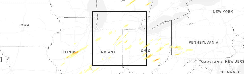
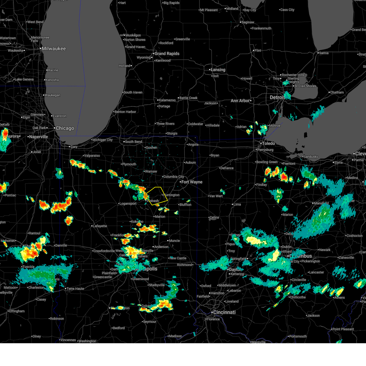
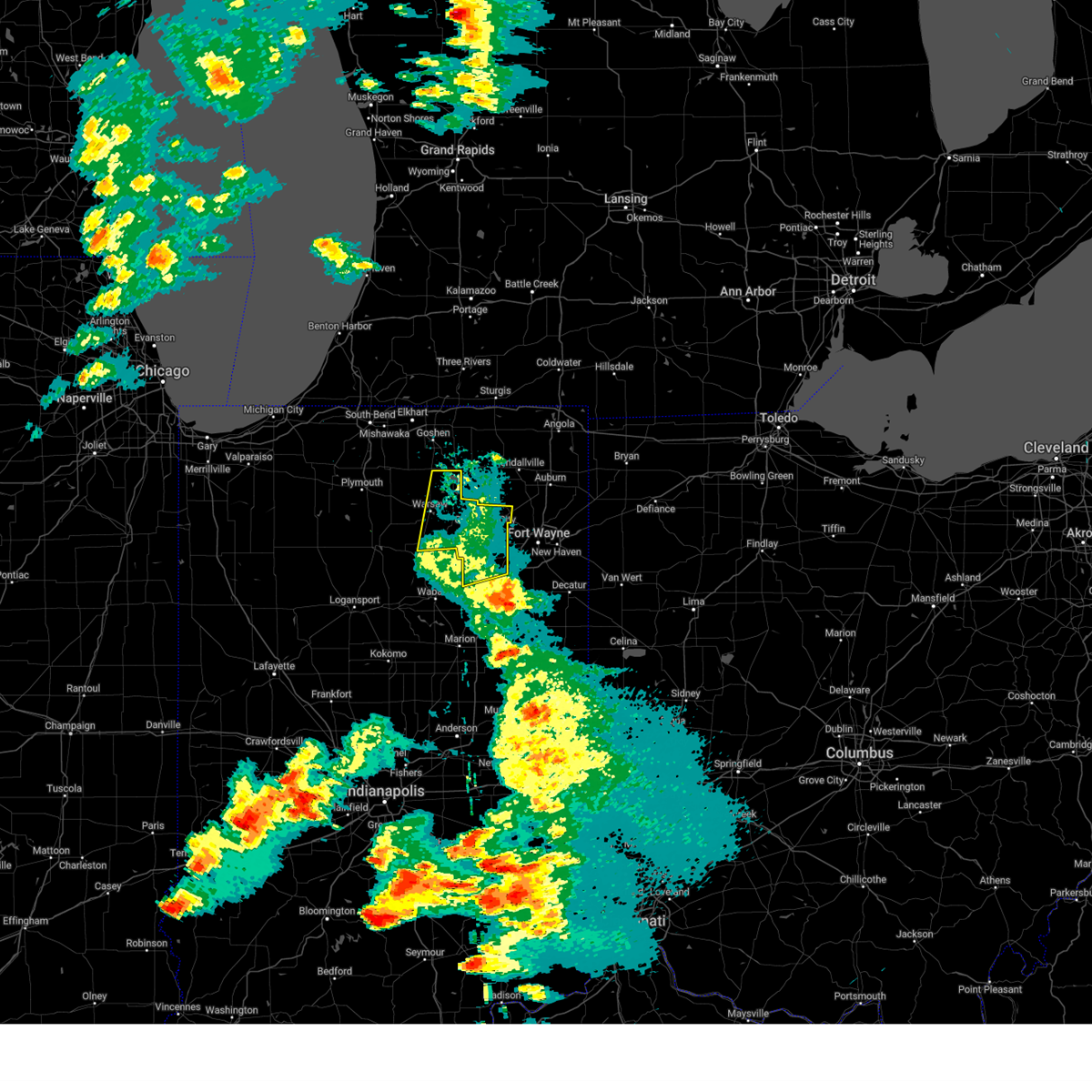
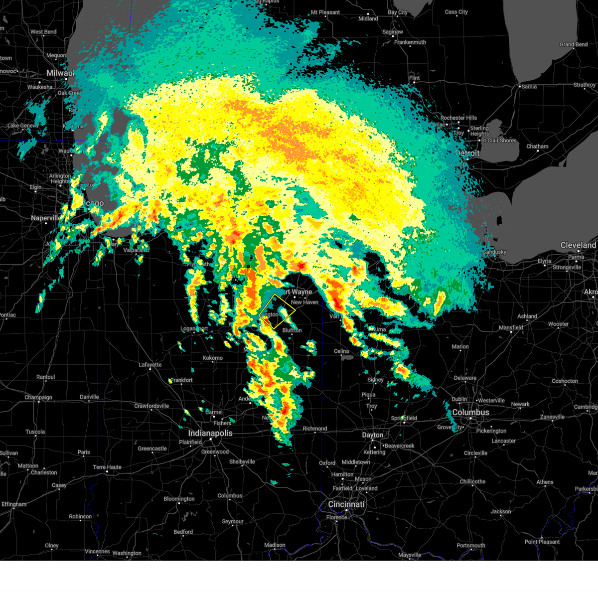
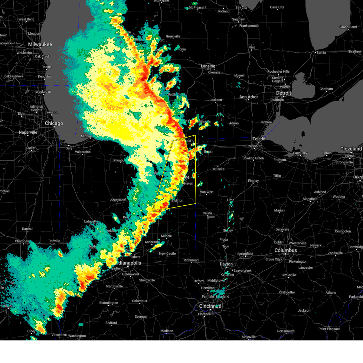
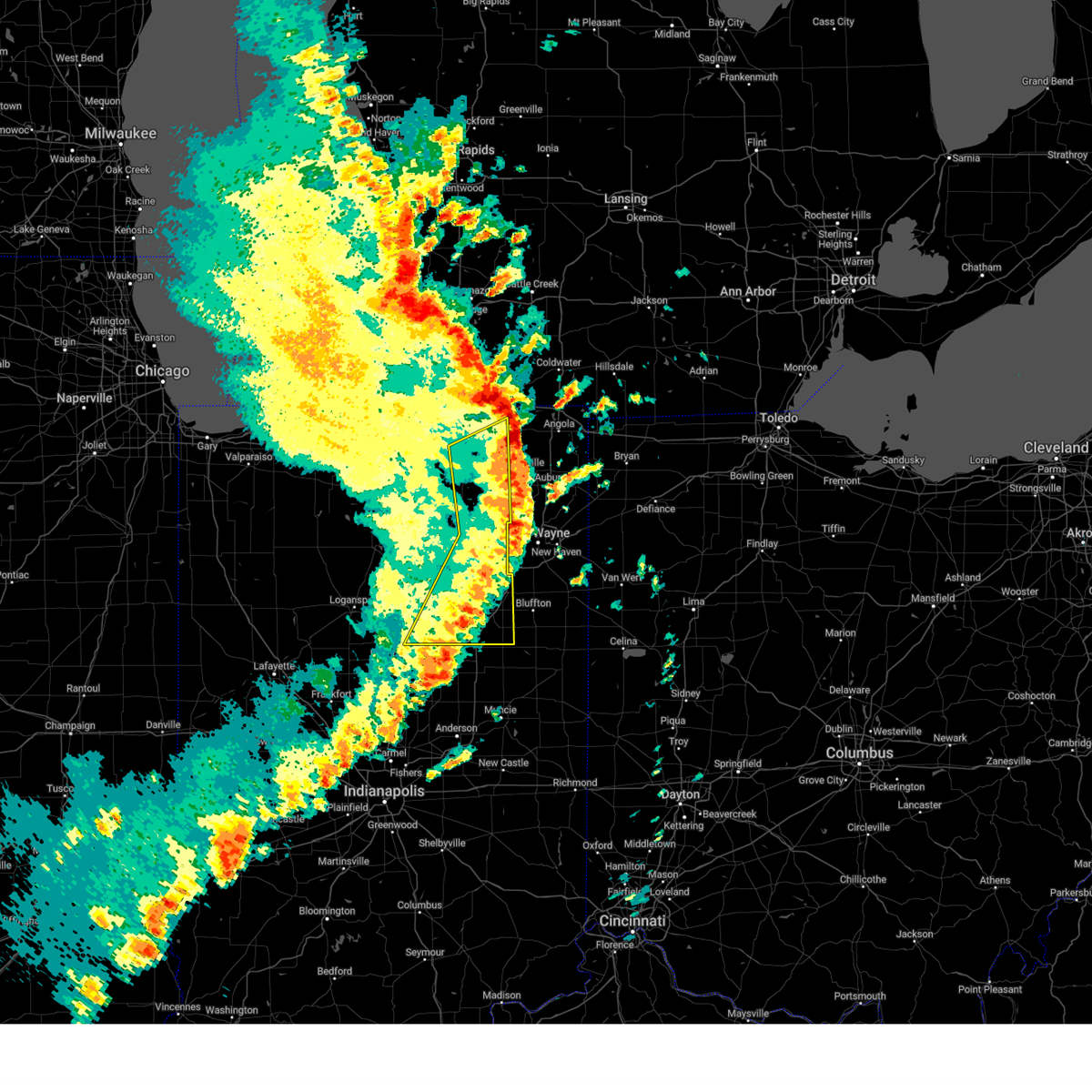
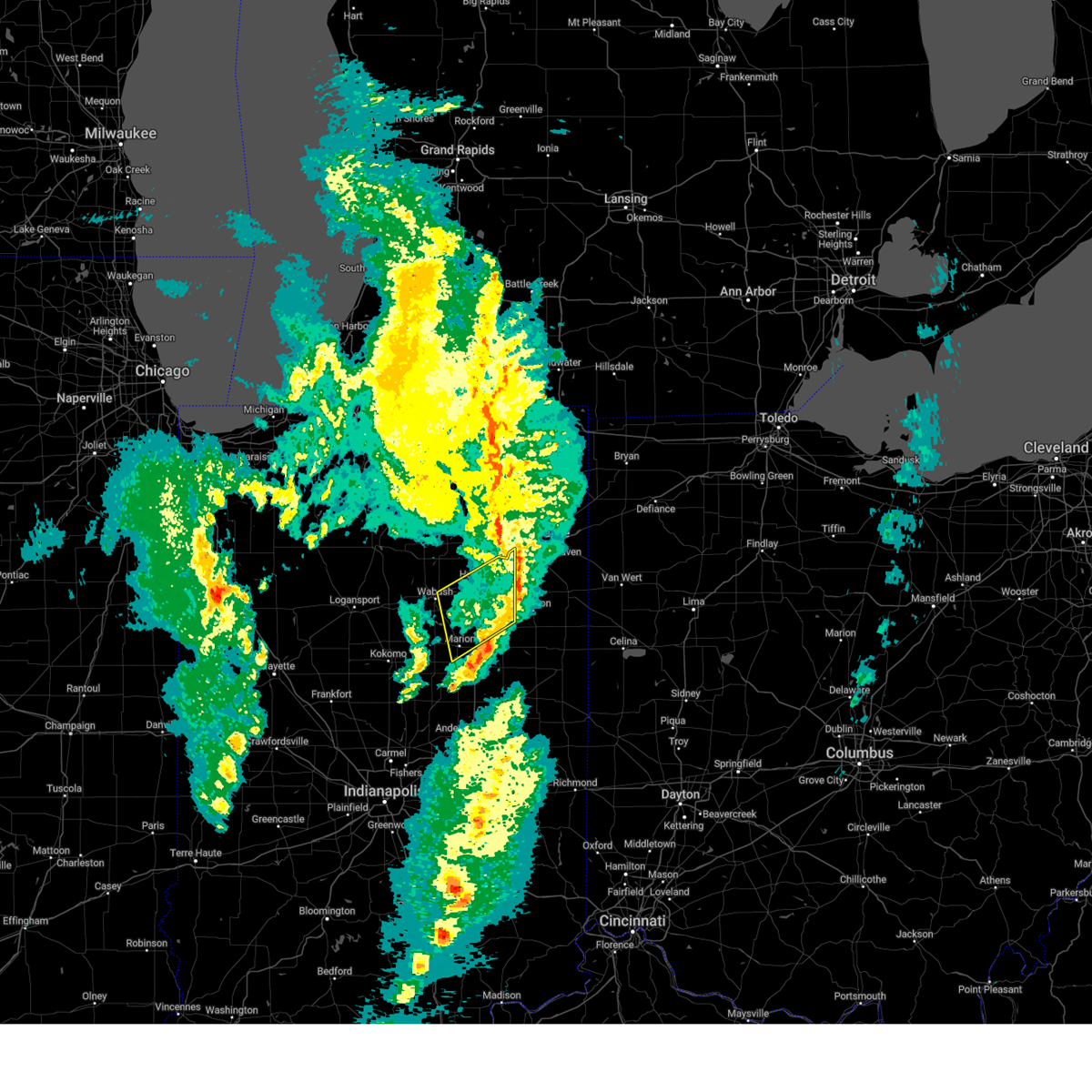
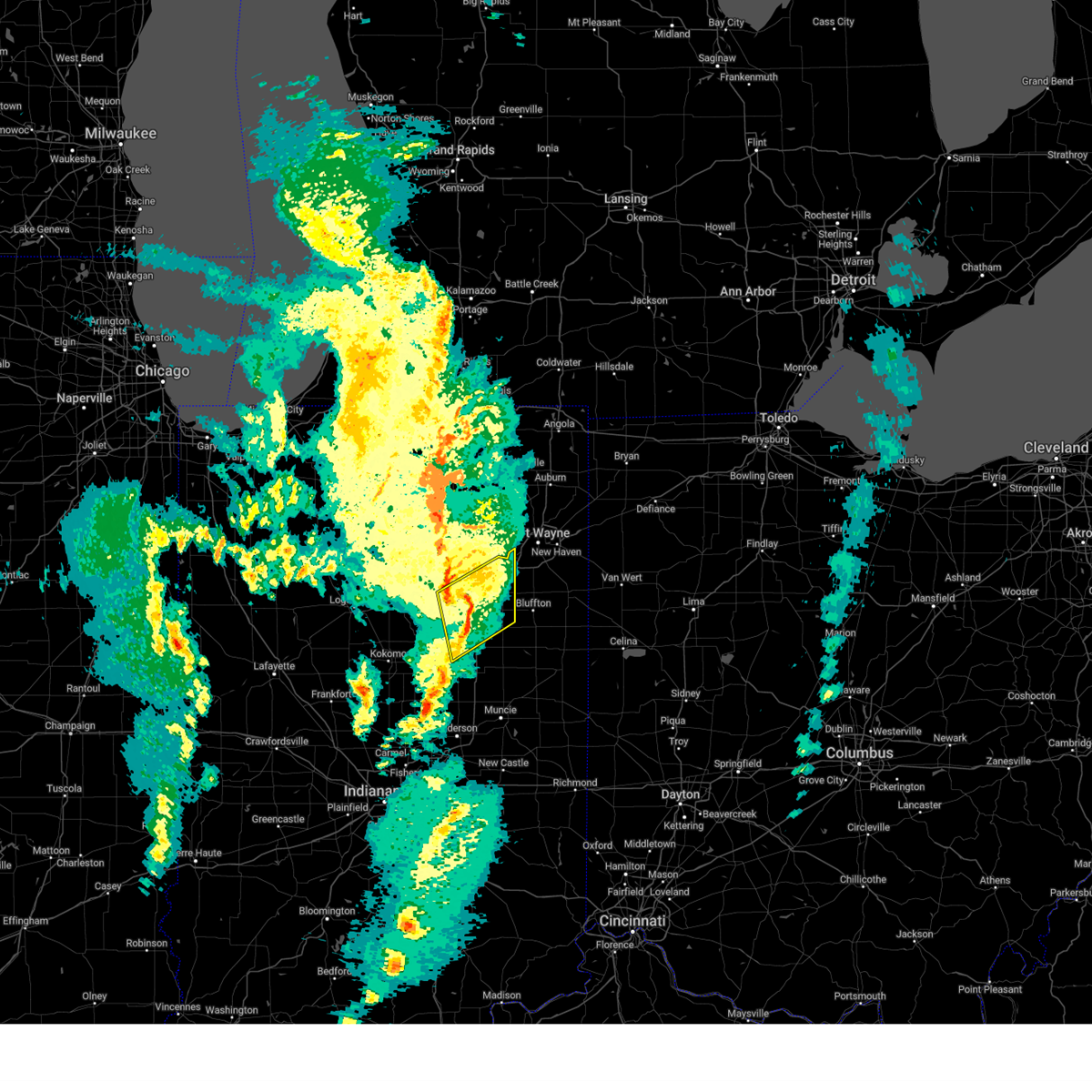
Hail Map for Huntington, IN
The Huntington, IN area has had 19 reports of on-the-ground hail by trained spotters, and has been under severe weather warnings 30 times during the past 12 months. Doppler radar has detected hail at or near Huntington, IN on 54 occasions, including 1 occasion during the past year.
| Name: | Huntington, IN |
| Where Located: | 25.3 miles WSW of Fort Wayne, IN |
| Map: | Google Map for Huntington, IN |
| Population: | 17391 |
| Housing Units: | 7487 |
| More Info: | Search Google for Huntington, IN |
1
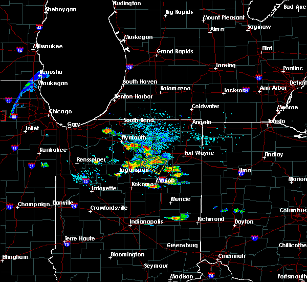
The Top Recent Hail Date for Huntington, IN is Wednesday, April 2, 2025 (19th out of 54)
Hail and Wind Damage Spotted near Huntington, IN
| Date / Time | Report Details |
|---|---|
| 6/25/2025 6:36 PM EDT | The severe thunderstorm which prompted the warning has weakened. therefore, the warning will be allowed to expire. |
| 6/25/2025 6:11 PM EDT |
 Svriwx the national weather service in northern indiana has issued a * severe thunderstorm warning for, northeastern wabash county in north central indiana, northern huntington county in northeastern indiana, * until 645 pm edt. * at 611 pm edt, a severe thunderstorm was located over andrews, or 7 miles west of huntington, moving northeast at 20 mph (radar indicated). Hazards include 60 mph wind gusts and penny size hail. expect damage to roofs, siding, and trees Svriwx the national weather service in northern indiana has issued a * severe thunderstorm warning for, northeastern wabash county in north central indiana, northern huntington county in northeastern indiana, * until 645 pm edt. * at 611 pm edt, a severe thunderstorm was located over andrews, or 7 miles west of huntington, moving northeast at 20 mph (radar indicated). Hazards include 60 mph wind gusts and penny size hail. expect damage to roofs, siding, and trees
|
| 6/18/2025 5:18 PM EDT | Large tree branches down blocking roadwa in huntington county IN, 7.4 miles N of Huntington, IN |
| 6/18/2025 5:08 PM EDT | Large tree down at the intersection of s 300 w and w 400 s. time estimated via rada in huntington county IN, 7.3 miles N of Huntington, IN |
| 5/16/2025 8:01 PM EDT |
 At 800 pm edt, showers and embedded thunderstorms with strong winds were affecting the warned area, moving northeast at 50 mph (radar indicated). Hazards include 60 mph wind gusts. Expect damage to roofs, siding, and trees. Locations impacted include, huntington, warsaw, columbia city, winona lake, syracuse, tri-lakes, churubusco, south whitley, milford, andrews, north webster, pierceton, roanoke, etna, silver lake, leesburg, claypool, larwill, sidney, and blue lake. At 800 pm edt, showers and embedded thunderstorms with strong winds were affecting the warned area, moving northeast at 50 mph (radar indicated). Hazards include 60 mph wind gusts. Expect damage to roofs, siding, and trees. Locations impacted include, huntington, warsaw, columbia city, winona lake, syracuse, tri-lakes, churubusco, south whitley, milford, andrews, north webster, pierceton, roanoke, etna, silver lake, leesburg, claypool, larwill, sidney, and blue lake.
|
| 5/16/2025 8:01 PM EDT |
 the severe thunderstorm warning has been cancelled and is no longer in effect the severe thunderstorm warning has been cancelled and is no longer in effect
|
| 5/16/2025 7:48 PM EDT | Mesonet station cw9663 huntingto in huntington county IN, 3.5 miles NNE of Huntington, IN |
| 5/16/2025 7:41 PM EDT | Svriwx the national weather service in northern indiana has issued a * severe thunderstorm warning for, grant county in central indiana, huntington county in northeastern indiana, blackford county in east central indiana, wells county in northeastern indiana, adams county in northeastern indiana, jay county in east central indiana, * until 845 pm edt. * at 741 pm edt, severe thunderstorms were located along a line extending from la fontaine to near muncie, moving northeast at 55 mph (radar indicated). Hazards include 60 mph wind gusts. expect damage to roofs, siding, and trees |
| 5/16/2025 7:29 PM EDT | Svriwx the national weather service in northern indiana has issued a * severe thunderstorm warning for, whitley county in northeastern indiana, northern huntington county in northeastern indiana, kosciusko county in north central indiana, southeastern marshall county in north central indiana, * until 815 pm edt. * at 729 pm edt, showers and embedded thunderstorms with strong winds were located along a line extending from near mentone to 6 miles east of akron to near wabash, moving northeast at 50 mph (radar indicated). Hazards include 60 mph wind gusts. expect damage to roofs, siding, and trees |
| 4/2/2025 8:15 AM EDT |
 Svriwx the national weather service in northern indiana has issued a * severe thunderstorm warning for, southwestern allen county in northeastern indiana, southeastern whitley county in northeastern indiana, northeastern huntington county in northeastern indiana, north central wells county in northeastern indiana, * until 830 am edt. * at 815 am edt, a severe thunderstorm was located near huntington, moving northeast at 90 mph (radar indicated). Hazards include quarter size hail. damage to vehicles is expected Svriwx the national weather service in northern indiana has issued a * severe thunderstorm warning for, southwestern allen county in northeastern indiana, southeastern whitley county in northeastern indiana, northeastern huntington county in northeastern indiana, north central wells county in northeastern indiana, * until 830 am edt. * at 815 am edt, a severe thunderstorm was located near huntington, moving northeast at 90 mph (radar indicated). Hazards include quarter size hail. damage to vehicles is expected
|
| 3/30/2025 5:52 PM EDT | The storms which prompted the warning have weakened below severe limits, and have exited the warned area. therefore, the warning will be allowed to expire. however, gusty winds are still possible with these thunderstorms. a tornado watch remains in effect until 800 pm edt for central, north central and northeastern indiana. a severe thunderstorm watch remains in effect until 1000 pm edt for west central ohio. remember, a severe thunderstorm warning still remains in effect for allen, deklab, and steuben counties. |
| 3/30/2025 5:36 PM EDT |
 At 535 pm edt, severe thunderstorms were located along a line extending from 6 miles east of reading to near van wert, moving east at 115 mph (radar indicated). Hazards include 70 mph wind gusts and quarter size hail. Hail damage to vehicles is expected. expect considerable tree damage. wind damage is also likely to mobile homes, roofs, and outbuildings. locations impacted include, preble, yoder, angola, alvarado, fairfield center, aboite, liberty center, hamilton lake, laotto, zulu, big long lake, tocsin, salem center, helmer, kingsland, rivare, metz, sedan, bowerstown, and dunfee. this includes the following highways, interstate 469 between mile markers 0 and 30. interstate 69 in indiana between mile markers 270 and 355. Interstate 80 in indiana between mile markers 146 and 156. At 535 pm edt, severe thunderstorms were located along a line extending from 6 miles east of reading to near van wert, moving east at 115 mph (radar indicated). Hazards include 70 mph wind gusts and quarter size hail. Hail damage to vehicles is expected. expect considerable tree damage. wind damage is also likely to mobile homes, roofs, and outbuildings. locations impacted include, preble, yoder, angola, alvarado, fairfield center, aboite, liberty center, hamilton lake, laotto, zulu, big long lake, tocsin, salem center, helmer, kingsland, rivare, metz, sedan, bowerstown, and dunfee. this includes the following highways, interstate 469 between mile markers 0 and 30. interstate 69 in indiana between mile markers 270 and 355. Interstate 80 in indiana between mile markers 146 and 156.
|
| 3/30/2025 5:36 PM EDT |
 the severe thunderstorm warning has been cancelled and is no longer in effect the severe thunderstorm warning has been cancelled and is no longer in effect
|
| 3/30/2025 5:21 PM EDT |
 The storms which prompted the warning have moved out of the area. therefore, the warning will be allowed to expire. however, gusty winds are still possible with these thunderstorms. a tornado watch remains in effect until 800 pm edt for central, north central and northeastern indiana. remember, a severe thunderstorm warning still remains in effect for whitley, huntington, and allen counties until 6 pm edt. The storms which prompted the warning have moved out of the area. therefore, the warning will be allowed to expire. however, gusty winds are still possible with these thunderstorms. a tornado watch remains in effect until 800 pm edt for central, north central and northeastern indiana. remember, a severe thunderstorm warning still remains in effect for whitley, huntington, and allen counties until 6 pm edt.
|
| 3/30/2025 5:12 PM EDT | At 511 pm edt, severe thunderstorms were located along a line extending from near middlebury to near andrews, moving east at 65 mph. damage was reported in etna green around 5 pm, including trees and powerlines down (public). Hazards include 70 mph wind gusts and nickel size hail. Expect considerable tree damage. damage is likely to mobile homes, roofs, and outbuildings. locations impacted include, mcnatts, topeka, honeyville, landess, blue lake, la fontaine, tri-lakes, buckeye, larwill, lake wawasee, bippus, luther, bowerstown, south whitley, servia, coesse, goose lake, knapp lake, jalapa, and loon lake. This includes interstate 69 in indiana between mile markers 266 and 293. |
| 3/30/2025 5:12 PM EDT | the severe thunderstorm warning has been cancelled and is no longer in effect |
| 3/30/2025 5:05 PM EDT |
 Svriwx the national weather service in northern indiana has issued a * severe thunderstorm warning for, southeastern elkhart county in north central indiana, wabash county in north central indiana, noble county in northeastern indiana, northern grant county in central indiana, whitley county in northeastern indiana, huntington county in northeastern indiana, eastern kosciusko county in north central indiana, southern lagrange county in northeastern indiana, steuben county in northeastern indiana, allen county in northeastern indiana, de kalb county in northeastern indiana, wells county in northeastern indiana, northern adams county in northeastern indiana, * until 600 pm edt. * at 504 pm edt, severe thunderstorms were located along a line extending from millersburg to 6 miles northwest of van buren, moving east at 115 mph (radar indicated). Hazards include 70 mph wind gusts and quarter size hail. Hail damage to vehicles is expected. expect considerable tree damage. Wind damage is also likely to mobile homes, roofs, and outbuildings. Svriwx the national weather service in northern indiana has issued a * severe thunderstorm warning for, southeastern elkhart county in north central indiana, wabash county in north central indiana, noble county in northeastern indiana, northern grant county in central indiana, whitley county in northeastern indiana, huntington county in northeastern indiana, eastern kosciusko county in north central indiana, southern lagrange county in northeastern indiana, steuben county in northeastern indiana, allen county in northeastern indiana, de kalb county in northeastern indiana, wells county in northeastern indiana, northern adams county in northeastern indiana, * until 600 pm edt. * at 504 pm edt, severe thunderstorms were located along a line extending from millersburg to 6 miles northwest of van buren, moving east at 115 mph (radar indicated). Hazards include 70 mph wind gusts and quarter size hail. Hail damage to vehicles is expected. expect considerable tree damage. Wind damage is also likely to mobile homes, roofs, and outbuildings.
|
| 3/30/2025 5:04 PM EDT | Truck and trailer overturne in huntington county IN, 8.7 miles SSW of Huntington, IN |
| 3/30/2025 4:50 PM EDT | the severe thunderstorm warning has been cancelled and is no longer in effect |
| 3/30/2025 4:50 PM EDT | At 450 pm edt, severe thunderstorms were located along a line extending from near nappanee to near peru, moving northeast at 65 mph (radar indicated). Hazards include 70 mph wind gusts and nickel size hail. Expect considerable tree damage. damage is likely to mobile homes, roofs, and outbuildings. locations impacted include, mcnatts, honeyville, atwood, la fontaine, macy, tri-lakes, locke, syracuse, bippus, luther, nead, bowerstown, little chapman lake, warsaw, james lake, goose lake, knapp lake, jalapa, new paris, and loon lake. This includes interstate 69 in indiana between mile markers 266 and 293. |
| 3/30/2025 4:33 PM EDT |
 Svriwx the national weather service in northern indiana has issued a * severe thunderstorm warning for, southern elkhart county in north central indiana, wabash county in north central indiana, noble county in northeastern indiana, northern grant county in central indiana, whitley county in northeastern indiana, huntington county in northeastern indiana, kosciusko county in north central indiana, cass county in north central indiana, southwestern lagrange county in northeastern indiana, fulton county in north central indiana, western wells county in northeastern indiana, miami county in north central indiana, marshall county in north central indiana, * until 530 pm edt. * at 433 pm edt, severe thunderstorms were located along a line extending from plymouth to near walton, moving northeast at 65 mph (radar indicated). Hazards include 70 mph wind gusts and nickel size hail. Expect considerable tree damage. Damage is likely to mobile homes, roofs, and outbuildings. Svriwx the national weather service in northern indiana has issued a * severe thunderstorm warning for, southern elkhart county in north central indiana, wabash county in north central indiana, noble county in northeastern indiana, northern grant county in central indiana, whitley county in northeastern indiana, huntington county in northeastern indiana, kosciusko county in north central indiana, cass county in north central indiana, southwestern lagrange county in northeastern indiana, fulton county in north central indiana, western wells county in northeastern indiana, miami county in north central indiana, marshall county in north central indiana, * until 530 pm edt. * at 433 pm edt, severe thunderstorms were located along a line extending from plymouth to near walton, moving northeast at 65 mph (radar indicated). Hazards include 70 mph wind gusts and nickel size hail. Expect considerable tree damage. Damage is likely to mobile homes, roofs, and outbuildings.
|
| 3/19/2025 9:05 PM EDT |
 The storms which prompted the warning have weakened below severe limits, and have exited the warned area. therefore, the warning will be allowed to expire. a severe thunderstorm watch remains in effect until 100 am edt for central, north central and northeastern indiana. The storms which prompted the warning have weakened below severe limits, and have exited the warned area. therefore, the warning will be allowed to expire. a severe thunderstorm watch remains in effect until 100 am edt for central, north central and northeastern indiana.
|
| 3/19/2025 8:41 PM EDT |
 Svriwx the national weather service in northern indiana has issued a * severe thunderstorm warning for, southwestern allen county in northeastern indiana, southeastern wabash county in north central indiana, northeastern grant county in central indiana, huntington county in northeastern indiana, western wells county in northeastern indiana, * until 915 pm edt. * at 841 pm edt, severe thunderstorms were located along a line extending from near andrews to 6 miles south of huntington to near jonesboro, moving northeast at 60 mph (radar indicated). Hazards include 60 mph wind gusts and penny size hail. expect damage to roofs, siding, and trees Svriwx the national weather service in northern indiana has issued a * severe thunderstorm warning for, southwestern allen county in northeastern indiana, southeastern wabash county in north central indiana, northeastern grant county in central indiana, huntington county in northeastern indiana, western wells county in northeastern indiana, * until 915 pm edt. * at 841 pm edt, severe thunderstorms were located along a line extending from near andrews to 6 miles south of huntington to near jonesboro, moving northeast at 60 mph (radar indicated). Hazards include 60 mph wind gusts and penny size hail. expect damage to roofs, siding, and trees
|
| 3/15/2025 4:16 AM EDT | Svriwx the national weather service in northern indiana has issued a * severe thunderstorm warning for, western allen county in northeastern indiana, eastern wabash county in north central indiana, southern noble county in northeastern indiana, whitley county in northeastern indiana, southwestern de kalb county in northeastern indiana, huntington county in northeastern indiana, southeastern kosciusko county in north central indiana, northeastern wells county in northeastern indiana, * until 445 am edt. * at 416 am edt, severe thunderstorms were located along a line extending from near north webster to andrews to near la fontaine, moving northeast at 55 mph (radar indicated). Hazards include 60 mph wind gusts. expect damage to roofs, siding, and trees |
| 8/30/2024 9:03 PM EDT | 10 in tree snapped and leaning on a hous in huntington county IN, 8.8 miles SE of Huntington, IN |
| 7/16/2024 1:22 AM EDT | Emergency manager reports tree blown down on east side of huntington... indiana on grayston avenue in huntington count in huntington county IN, 1.6 miles SW of Huntington, IN |
| 7/16/2024 1:05 AM EDT |
 the severe thunderstorm warning has been cancelled and is no longer in effect the severe thunderstorm warning has been cancelled and is no longer in effect
|
| 7/16/2024 12:52 AM EDT | Tree reported down on east side of town on grayston avenue. time estimated via rada in huntington county IN, 1.3 miles WSW of Huntington, IN |
| 7/16/2024 12:50 AM EDT |
 Svriwx the national weather service in northern indiana has issued a * severe thunderstorm warning for, southeastern wabash county in north central indiana, northeastern grant county in central indiana, huntington county in northeastern indiana, wells county in northeastern indiana, adams county in northeastern indiana, * until 130 am edt. * at 1250 am edt, severe thunderstorms were located along a line extending from near huntington to near van buren, moving east at 70 mph (radar indicated). Hazards include 60 mph wind gusts. expect damage to roofs, siding, and trees Svriwx the national weather service in northern indiana has issued a * severe thunderstorm warning for, southeastern wabash county in north central indiana, northeastern grant county in central indiana, huntington county in northeastern indiana, wells county in northeastern indiana, adams county in northeastern indiana, * until 130 am edt. * at 1250 am edt, severe thunderstorms were located along a line extending from near huntington to near van buren, moving east at 70 mph (radar indicated). Hazards include 60 mph wind gusts. expect damage to roofs, siding, and trees
|
| 7/16/2024 12:44 AM EDT |
 At 1244 am edt, severe thunderstorms were located along a line extending from near south whitley to near andrews, moving east at 45 mph (radar indicated). Hazards include 60 mph wind gusts. Expect damage to roofs, siding, and trees. these severe storms will be near, huntington around 1250 am edt. other locations impacted by these severe thunderstorms include tunker, laud, bowerstown, washington center, mahon, goblesville, roanoke, and luther. This includes interstate 69 in indiana between mile markers 290 and 291. At 1244 am edt, severe thunderstorms were located along a line extending from near south whitley to near andrews, moving east at 45 mph (radar indicated). Hazards include 60 mph wind gusts. Expect damage to roofs, siding, and trees. these severe storms will be near, huntington around 1250 am edt. other locations impacted by these severe thunderstorms include tunker, laud, bowerstown, washington center, mahon, goblesville, roanoke, and luther. This includes interstate 69 in indiana between mile markers 290 and 291.
|
| 7/16/2024 12:44 AM EDT |
 the severe thunderstorm warning has been cancelled and is no longer in effect the severe thunderstorm warning has been cancelled and is no longer in effect
|
| 7/16/2024 12:19 AM EDT |
 Svriwx the national weather service in northern indiana has issued a * severe thunderstorm warning for, northern wabash county in north central indiana, southern whitley county in northeastern indiana, northern huntington county in northeastern indiana, * until 115 am edt. * at 1219 am edt, severe thunderstorms were located along a line extending from near akron to near mexico, moving east at 40 mph (radar indicated). Hazards include 70 mph wind gusts. Expect considerable tree damage. Damage is likely to mobile homes, roofs, and outbuildings. Svriwx the national weather service in northern indiana has issued a * severe thunderstorm warning for, northern wabash county in north central indiana, southern whitley county in northeastern indiana, northern huntington county in northeastern indiana, * until 115 am edt. * at 1219 am edt, severe thunderstorms were located along a line extending from near akron to near mexico, moving east at 40 mph (radar indicated). Hazards include 70 mph wind gusts. Expect considerable tree damage. Damage is likely to mobile homes, roofs, and outbuildings.
|
| 7/14/2024 12:53 PM EDT | Large tree limbed fell onto a shed at a residence on n. goshen road. time estimated from rada in huntington county IN, 2.5 miles SSE of Huntington, IN |
| 7/14/2024 12:52 PM EDT | Tree down blocking the road on division road... just east of meridian road. time estimated from rada in huntington county IN, 3.4 miles WNW of Huntington, IN |
| 7/14/2024 12:49 PM EDT |
 the severe thunderstorm warning has been cancelled and is no longer in effect the severe thunderstorm warning has been cancelled and is no longer in effect
|
| 7/14/2024 12:49 PM EDT |
 At 1248 pm edt, a severe thunderstorm was located near huntington, moving southeast at 40 mph (emergency management reported trees down in south whitley). Hazards include 60 mph wind gusts. Expect damage to roofs, siding, and trees. locations impacted include, huntington, markle, roanoke, buckeye, bowerstown, majenica, mahon, and plum tree. This includes interstate 69 in indiana between mile markers 278 and 292. At 1248 pm edt, a severe thunderstorm was located near huntington, moving southeast at 40 mph (emergency management reported trees down in south whitley). Hazards include 60 mph wind gusts. Expect damage to roofs, siding, and trees. locations impacted include, huntington, markle, roanoke, buckeye, bowerstown, majenica, mahon, and plum tree. This includes interstate 69 in indiana between mile markers 278 and 292.
|
| 7/14/2024 12:47 PM EDT | Large tree down on oak stee in huntington county IN, 1 miles SSW of Huntington, IN |
| 7/14/2024 12:45 PM EDT | Large tree down on gardendale avenue. time estimated from rada in huntington county IN, 0.5 miles NNW of Huntington, IN |
| 7/14/2024 12:41 PM EDT | Large tree down on river road at rangeline road. time estimated from rada in huntington county IN, 1.9 miles E of Huntington, IN |
| 7/14/2024 12:40 PM EDT |
 the severe thunderstorm warning has been cancelled and is no longer in effect the severe thunderstorm warning has been cancelled and is no longer in effect
|
| 7/14/2024 12:40 PM EDT |
 At 1239 pm edt, a severe thunderstorm was located over huntington, moving southeast at 40 mph (emergency management reported trees down in south whitley). Hazards include 60 mph wind gusts. Expect damage to roofs, siding, and trees. locations impacted include, huntington, andrews, markle, roanoke, bowerstown, goblesville, plum tree, buckeye, washington center, majenica, mahon, bippus, and luther. This includes interstate 69 in indiana between mile markers 278 and 292. At 1239 pm edt, a severe thunderstorm was located over huntington, moving southeast at 40 mph (emergency management reported trees down in south whitley). Hazards include 60 mph wind gusts. Expect damage to roofs, siding, and trees. locations impacted include, huntington, andrews, markle, roanoke, bowerstown, goblesville, plum tree, buckeye, washington center, majenica, mahon, bippus, and luther. This includes interstate 69 in indiana between mile markers 278 and 292.
|
| 7/14/2024 12:26 PM EDT |
 Svriwx the national weather service in northern indiana has issued a * severe thunderstorm warning for, northeastern wabash county in north central indiana, southwestern whitley county in northeastern indiana, huntington county in northeastern indiana, * until 100 pm edt. * at 1226 pm edt, a severe thunderstorm was located near north manchester, moving southeast at 40 mph (radar indicated). Hazards include 60 mph wind gusts. expect damage to roofs, siding, and trees Svriwx the national weather service in northern indiana has issued a * severe thunderstorm warning for, northeastern wabash county in north central indiana, southwestern whitley county in northeastern indiana, huntington county in northeastern indiana, * until 100 pm edt. * at 1226 pm edt, a severe thunderstorm was located near north manchester, moving southeast at 40 mph (radar indicated). Hazards include 60 mph wind gusts. expect damage to roofs, siding, and trees
|
| 5/7/2024 6:15 PM EDT |
 the severe thunderstorm warning has been cancelled and is no longer in effect the severe thunderstorm warning has been cancelled and is no longer in effect
|
| 5/7/2024 6:15 PM EDT |
 At 615 pm edt, severe thunderstorms were located along a line extending from near north manchester to 7 miles south of south whitley to near huntington, moving northeast at 55 mph (radar indicated). Hazards include 60 mph wind gusts and half dollar size hail. Hail damage to vehicles is expected. expect wind damage to roofs, siding, and trees. Locations impacted include, huntington, north manchester, south whitley, roanoke, sidney, laud, ijamsville, bowerstown, liberty mills, collamer, goblesville, bracken, tunker, raber, washington center, packerton, laketon, mahon, bippus, and luther. At 615 pm edt, severe thunderstorms were located along a line extending from near north manchester to 7 miles south of south whitley to near huntington, moving northeast at 55 mph (radar indicated). Hazards include 60 mph wind gusts and half dollar size hail. Hail damage to vehicles is expected. expect wind damage to roofs, siding, and trees. Locations impacted include, huntington, north manchester, south whitley, roanoke, sidney, laud, ijamsville, bowerstown, liberty mills, collamer, goblesville, bracken, tunker, raber, washington center, packerton, laketon, mahon, bippus, and luther.
|
| 5/7/2024 6:04 PM EDT |
 Svriwx the national weather service in northern indiana has issued a * severe thunderstorm warning for, wabash county in north central indiana, southern whitley county in northeastern indiana, northern huntington county in northeastern indiana, southeastern kosciusko county in north central indiana, north central miami county in north central indiana, * until 630 pm edt. * at 604 pm edt, severe thunderstorms were located along a line extending from 9 miles northeast of mexico to 6 miles northeast of wabash to near huntington, moving northeast at 50 mph (radar indicated). Hazards include 60 mph wind gusts and quarter size hail. Hail damage to vehicles is expected. Expect wind damage to roofs, siding, and trees. Svriwx the national weather service in northern indiana has issued a * severe thunderstorm warning for, wabash county in north central indiana, southern whitley county in northeastern indiana, northern huntington county in northeastern indiana, southeastern kosciusko county in north central indiana, north central miami county in north central indiana, * until 630 pm edt. * at 604 pm edt, severe thunderstorms were located along a line extending from 9 miles northeast of mexico to 6 miles northeast of wabash to near huntington, moving northeast at 50 mph (radar indicated). Hazards include 60 mph wind gusts and quarter size hail. Hail damage to vehicles is expected. Expect wind damage to roofs, siding, and trees.
|
| 3/14/2024 6:50 PM EDT |
 the severe thunderstorm warning has been cancelled and is no longer in effect the severe thunderstorm warning has been cancelled and is no longer in effect
|
| 3/14/2024 6:42 PM EDT |
 the severe thunderstorm warning has been cancelled and is no longer in effect the severe thunderstorm warning has been cancelled and is no longer in effect
|
| 3/14/2024 6:42 PM EDT |
 At 642 pm edt, a severe thunderstorm was located near andrews, or near huntington, moving east at 75 mph (radar indicated). Hazards include 60 mph wind gusts and quarter size hail. Hail damage to vehicles is expected. expect wind damage to roofs, siding, and trees. locations impacted include, huntington, wabash, andrews, markle, lancaster, lagro, mount etna, bowerstown, majenica, servia, lincolnville, and plum tree. This includes interstate 69 in indiana between mile markers 280 and 291. At 642 pm edt, a severe thunderstorm was located near andrews, or near huntington, moving east at 75 mph (radar indicated). Hazards include 60 mph wind gusts and quarter size hail. Hail damage to vehicles is expected. expect wind damage to roofs, siding, and trees. locations impacted include, huntington, wabash, andrews, markle, lancaster, lagro, mount etna, bowerstown, majenica, servia, lincolnville, and plum tree. This includes interstate 69 in indiana between mile markers 280 and 291.
|
| 3/14/2024 6:29 PM EDT |
 Svriwx the national weather service in northern indiana has issued a * severe thunderstorm warning for, southern wabash county in north central indiana, central huntington county in northeastern indiana, central miami county in north central indiana, * until 700 pm edt. * at 628 pm edt, a severe thunderstorm was located near wabash, moving east at 75 mph (emergency management confirmed ping pong size hail in peru at of 625 pm edt). Hazards include ping pong ball size hail and 60 mph wind gusts. People and animals outdoors will be injured. expect hail damage to roofs, siding, windows, and vehicles. Expect wind damage to roofs, siding, and trees. Svriwx the national weather service in northern indiana has issued a * severe thunderstorm warning for, southern wabash county in north central indiana, central huntington county in northeastern indiana, central miami county in north central indiana, * until 700 pm edt. * at 628 pm edt, a severe thunderstorm was located near wabash, moving east at 75 mph (emergency management confirmed ping pong size hail in peru at of 625 pm edt). Hazards include ping pong ball size hail and 60 mph wind gusts. People and animals outdoors will be injured. expect hail damage to roofs, siding, windows, and vehicles. Expect wind damage to roofs, siding, and trees.
|
| 8/17/2023 6:03 PM EDT | Quarter sized hail reported 6.7 miles SSW of Huntington, IN, spotter also reported 50 mph wind gusts. |
| 7/29/2023 2:09 AM EDT |
 At 208 am edt, severe thunderstorms were located along a line extending from 6 miles south of winona lake to peru, moving east at 55 mph (radar indicated). Hazards include 60 mph wind gusts. expect damage to roofs, siding, and trees At 208 am edt, severe thunderstorms were located along a line extending from 6 miles south of winona lake to peru, moving east at 55 mph (radar indicated). Hazards include 60 mph wind gusts. expect damage to roofs, siding, and trees
|
| 4/5/2023 12:54 PM EDT |
 At 1254 pm edt, severe thunderstorms were located along a line extending from near markle to alexandria, moving northeast at 80 mph (radar indicated). Hazards include 60 mph wind gusts. expect damage to roofs, siding, and trees At 1254 pm edt, severe thunderstorms were located along a line extending from near markle to alexandria, moving northeast at 80 mph (radar indicated). Hazards include 60 mph wind gusts. expect damage to roofs, siding, and trees
|
| 3/31/2023 10:54 PM EDT | Tree across road. no information on health of tre in huntington county IN, 7.1 miles WSW of Huntington, IN |
| 8/29/2022 4:47 PM EDT |
 At 447 pm edt, severe thunderstorms were located along a line extending from near auburn to 6 miles north of markle, moving east at 50 mph (radar indicated). Hazards include 70 mph wind gusts. Expect considerable tree damage. damage is likely to mobile homes, roofs, and outbuildings. locations impacted include, fort wayne, huntington, new haven, auburn, bluffton, decatur, garrett, ossian, butler, huntertown, waterloo, woodburn, monroeville, markle, grabill, monroe, st. joe, aboite, leo-cedarville and middletown. this includes the following highways, interstate 469 between mile markers 0 and 30. interstate 69 in indiana between mile markers 284 and 333. thunderstorm damage threat, considerable hail threat, radar indicated max hail size, <. 75 in wind threat, radar indicated max wind gust, 70 mph. At 447 pm edt, severe thunderstorms were located along a line extending from near auburn to 6 miles north of markle, moving east at 50 mph (radar indicated). Hazards include 70 mph wind gusts. Expect considerable tree damage. damage is likely to mobile homes, roofs, and outbuildings. locations impacted include, fort wayne, huntington, new haven, auburn, bluffton, decatur, garrett, ossian, butler, huntertown, waterloo, woodburn, monroeville, markle, grabill, monroe, st. joe, aboite, leo-cedarville and middletown. this includes the following highways, interstate 469 between mile markers 0 and 30. interstate 69 in indiana between mile markers 284 and 333. thunderstorm damage threat, considerable hail threat, radar indicated max hail size, <. 75 in wind threat, radar indicated max wind gust, 70 mph.
|
| 8/29/2022 4:40 PM EDT | Multiple reports of trees and limbs down in the city. a stop light is also down. spotters were also estimating 50 mph gusts as the line went throug in huntington county IN, 0.4 miles SW of Huntington, IN |
| 8/29/2022 4:34 PM EDT |
 At 433 pm edt, severe thunderstorms were located along a line extending from near avilla to 6 miles north of huntington, moving east at 50 mph (radar indicated). Hazards include 70 mph wind gusts. Expect considerable tree damage. Damage is likely to mobile homes, roofs, and outbuildings. At 433 pm edt, severe thunderstorms were located along a line extending from near avilla to 6 miles north of huntington, moving east at 50 mph (radar indicated). Hazards include 70 mph wind gusts. Expect considerable tree damage. Damage is likely to mobile homes, roofs, and outbuildings.
|
| 7/23/2022 9:04 AM EDT |
 At 904 am edt, severe thunderstorms were located along a line extending from near andrews to near la fontaine to near kokomo, moving south at 40 mph (radar indicated). Hazards include 70 mph wind gusts. Expect considerable tree damage. Damage is likely to mobile homes, roofs, and outbuildings. At 904 am edt, severe thunderstorms were located along a line extending from near andrews to near la fontaine to near kokomo, moving south at 40 mph (radar indicated). Hazards include 70 mph wind gusts. Expect considerable tree damage. Damage is likely to mobile homes, roofs, and outbuildings.
|
| 7/23/2022 8:39 AM EDT |
 At 837 am edt, severe thunderstorms were located along a line extending from near huntertown to near roanoke, moving southeast at 35 mph (radar indicated). Hazards include 60 mph wind gusts. Expect damage to roofs, siding, and trees. locations impacted include, fort wayne, huntington, columbia city, north manchester, huntertown, churubusco, south whitley, aboite, roanoke, zanesville, sidney, laud, liberty mills, collamer, raber, arcola, bippus, rolling hills, lake everett and luther. this includes the following highways, interstate 469 near mile marker 0, between mile markers 2 and 3, and between mile markers 7 and 8, and near mile marker 30. interstate 69 in indiana near mile marker 291, and between mile markers 294 and 321. hail threat, radar indicated max hail size, <. 75 in wind threat, radar indicated max wind gust, 60 mph. At 837 am edt, severe thunderstorms were located along a line extending from near huntertown to near roanoke, moving southeast at 35 mph (radar indicated). Hazards include 60 mph wind gusts. Expect damage to roofs, siding, and trees. locations impacted include, fort wayne, huntington, columbia city, north manchester, huntertown, churubusco, south whitley, aboite, roanoke, zanesville, sidney, laud, liberty mills, collamer, raber, arcola, bippus, rolling hills, lake everett and luther. this includes the following highways, interstate 469 near mile marker 0, between mile markers 2 and 3, and between mile markers 7 and 8, and near mile marker 30. interstate 69 in indiana near mile marker 291, and between mile markers 294 and 321. hail threat, radar indicated max hail size, <. 75 in wind threat, radar indicated max wind gust, 60 mph.
|
| 7/23/2022 8:30 AM EDT |
 At 829 am edt, severe thunderstorms were located along a line extending from near butler to near new haven to near markle, moving east at 45 mph (radar indicated). Hazards include 60 mph wind gusts. expect damage to roofs, siding, and trees At 829 am edt, severe thunderstorms were located along a line extending from near butler to near new haven to near markle, moving east at 45 mph (radar indicated). Hazards include 60 mph wind gusts. expect damage to roofs, siding, and trees
|
| 7/23/2022 8:14 AM EDT |
 At 813 am edt, severe thunderstorms were located along a line extending from near rome city to churubusco to 6 miles northwest of huntington, moving southeast at 35 mph (radar indicated). Hazards include 70 mph wind gusts. Expect considerable tree damage. damage is likely to mobile homes, roofs, and outbuildings. locations impacted include, fort wayne, huntington, warsaw, auburn, kendallville, columbia city, garrett, north manchester, winona lake, ligonier, tri-lakes, huntertown, avilla, albion, churubusco, south whitley, rome city, north webster, pierceton and aboite. this includes the following highways, interstate 469 near mile marker 0, between mile markers 2 and 3, and between mile markers 7 and 8, and near mile marker 30. interstate 69 in indiana near mile marker 291, and between mile markers 294 and 329. thunderstorm damage threat, considerable hail threat, radar indicated max hail size, <. 75 in wind threat, radar indicated max wind gust, 70 mph. At 813 am edt, severe thunderstorms were located along a line extending from near rome city to churubusco to 6 miles northwest of huntington, moving southeast at 35 mph (radar indicated). Hazards include 70 mph wind gusts. Expect considerable tree damage. damage is likely to mobile homes, roofs, and outbuildings. locations impacted include, fort wayne, huntington, warsaw, auburn, kendallville, columbia city, garrett, north manchester, winona lake, ligonier, tri-lakes, huntertown, avilla, albion, churubusco, south whitley, rome city, north webster, pierceton and aboite. this includes the following highways, interstate 469 near mile marker 0, between mile markers 2 and 3, and between mile markers 7 and 8, and near mile marker 30. interstate 69 in indiana near mile marker 291, and between mile markers 294 and 329. thunderstorm damage threat, considerable hail threat, radar indicated max hail size, <. 75 in wind threat, radar indicated max wind gust, 70 mph.
|
| 7/23/2022 7:53 AM EDT |
 At 753 am edt, severe thunderstorms were located along a line extending from near topeka to near tri-lakes to near north manchester, moving southeast at 40 mph (radar indicated). Hazards include 70 mph wind gusts. Expect considerable tree damage. Damage is likely to mobile homes, roofs, and outbuildings. At 753 am edt, severe thunderstorms were located along a line extending from near topeka to near tri-lakes to near north manchester, moving southeast at 40 mph (radar indicated). Hazards include 70 mph wind gusts. Expect considerable tree damage. Damage is likely to mobile homes, roofs, and outbuildings.
|
| 3/23/2022 1:57 PM EDT |
 At 157 pm edt, severe thunderstorms were located along a line extending from huntington to near markle to near van buren, moving northeast at 35 mph (radar indicated). Hazards include 60 mph wind gusts and quarter size hail. Hail damage to vehicles is expected. Expect wind damage to roofs, siding, and trees. At 157 pm edt, severe thunderstorms were located along a line extending from huntington to near markle to near van buren, moving northeast at 35 mph (radar indicated). Hazards include 60 mph wind gusts and quarter size hail. Hail damage to vehicles is expected. Expect wind damage to roofs, siding, and trees.
|
| 3/6/2022 3:28 AM EST |
 The severe thunderstorm warning for western allen, southeastern wabash, southeastern noble, northern grant, whitley, huntington and wells counties will expire at 330 am est, the storms which prompted the warning have moved out of the area. therefore, the warning will be allowed to expire. however gusty winds up to around 45 mph are still possible. a severe thunderstorm watch remains in effect until 500 am est for central, north central and northeastern indiana. there are other warnings still in effect. visit our website for more information. The severe thunderstorm warning for western allen, southeastern wabash, southeastern noble, northern grant, whitley, huntington and wells counties will expire at 330 am est, the storms which prompted the warning have moved out of the area. therefore, the warning will be allowed to expire. however gusty winds up to around 45 mph are still possible. a severe thunderstorm watch remains in effect until 500 am est for central, north central and northeastern indiana. there are other warnings still in effect. visit our website for more information.
|
| 3/6/2022 3:19 AM EST | Power pole down on sr 5 just south of us 22 in huntington county IN, 2.1 miles WNW of Huntington, IN |
| 3/6/2022 3:15 AM EST | Storm damage reported in huntington county IN, 3.4 miles WNW of Huntington, IN |
| 3/6/2022 3:13 AM EST |
 At 312 am est, severe thunderstorms were located along a line extending from huntertown to near markle to van buren, moving east at 65 mph (radar indicated). Hazards include 60 mph wind gusts. Expect damage to roofs, siding, and trees. locations impacted include, fort wayne, marion, huntington, new haven, bluffton, columbia city, ossian, tri-lakes, huntertown, avilla, churubusco, south whitley, sweetser, andrews, markle, la fontaine, van buren, aboite, leo-cedarville and swan. this includes the following highways, interstate 469 between mile markers 0 and 15, and between mile markers 25 and 30. Interstate 69 in indiana between mile markers 266 and 322. At 312 am est, severe thunderstorms were located along a line extending from huntertown to near markle to van buren, moving east at 65 mph (radar indicated). Hazards include 60 mph wind gusts. Expect damage to roofs, siding, and trees. locations impacted include, fort wayne, marion, huntington, new haven, bluffton, columbia city, ossian, tri-lakes, huntertown, avilla, churubusco, south whitley, sweetser, andrews, markle, la fontaine, van buren, aboite, leo-cedarville and swan. this includes the following highways, interstate 469 between mile markers 0 and 15, and between mile markers 25 and 30. Interstate 69 in indiana between mile markers 266 and 322.
|
| 3/6/2022 3:07 AM EST |
 At 307 am est, severe thunderstorms were located along a line extending from near churubusco to near markle to near van buren, moving east at 65 mph (radar indicated). Hazards include 60 mph wind gusts. Expect damage to roofs, siding, and trees. locations impacted include, fort wayne, marion, huntington, new haven, bluffton, columbia city, ossian, tri-lakes, huntertown, avilla, churubusco, south whitley, sweetser, andrews, markle, la fontaine, van buren, aboite, leo-cedarville and swan. this includes the following highways, interstate 469 between mile markers 0 and 15, and between mile markers 25 and 30. interstate 69 in indiana between mile markers 266 and 322. hail threat, radar indicated max hail size, <. 75 in wind threat, observed max wind gust, 60 mph. At 307 am est, severe thunderstorms were located along a line extending from near churubusco to near markle to near van buren, moving east at 65 mph (radar indicated). Hazards include 60 mph wind gusts. Expect damage to roofs, siding, and trees. locations impacted include, fort wayne, marion, huntington, new haven, bluffton, columbia city, ossian, tri-lakes, huntertown, avilla, churubusco, south whitley, sweetser, andrews, markle, la fontaine, van buren, aboite, leo-cedarville and swan. this includes the following highways, interstate 469 between mile markers 0 and 15, and between mile markers 25 and 30. interstate 69 in indiana between mile markers 266 and 322. hail threat, radar indicated max hail size, <. 75 in wind threat, observed max wind gust, 60 mph.
|
| 3/6/2022 2:43 AM EST |
 At 243 am est, severe thunderstorms were located along a line extending from near winona lake to 6 miles northwest of wabash to 6 miles northeast of kokomo, moving east at 65 mph (radar indicated). Hazards include 60 mph wind gusts. expect damage to roofs, siding, and trees At 243 am est, severe thunderstorms were located along a line extending from near winona lake to 6 miles northwest of wabash to 6 miles northeast of kokomo, moving east at 65 mph (radar indicated). Hazards include 60 mph wind gusts. expect damage to roofs, siding, and trees
|
| 9/14/2021 8:05 PM EDT | Multiple trees and tree limbs blown down in south-central huntington county. time estimated by rada in huntington county IN, 5.4 miles NNE of Huntington, IN |
| 8/11/2021 1:50 PM EDT |
 At 150 pm edt, severe thunderstorms were located along a line extending from near rome city to huntertown to near andrews, moving east at 50 mph (radar indicated). Hazards include 60 mph wind gusts and penny size hail. Expect damage to roofs, siding, and trees. locations impacted include, fort wayne, huntington, kendallville, columbia city, garrett, tri-lakes, huntertown, avilla, albion, churubusco, rome city, andrews, aboite, swan, roanoke, lagro, corunna, altona, mount etna and saint johns. this includes interstate 69 in indiana between mile markers 300 and 312, and between mile markers 315 and 326. hail threat, radar indicated max hail size, 0. 75 in wind threat, radar indicated max wind gust, 60 mph. At 150 pm edt, severe thunderstorms were located along a line extending from near rome city to huntertown to near andrews, moving east at 50 mph (radar indicated). Hazards include 60 mph wind gusts and penny size hail. Expect damage to roofs, siding, and trees. locations impacted include, fort wayne, huntington, kendallville, columbia city, garrett, tri-lakes, huntertown, avilla, albion, churubusco, rome city, andrews, aboite, swan, roanoke, lagro, corunna, altona, mount etna and saint johns. this includes interstate 69 in indiana between mile markers 300 and 312, and between mile markers 315 and 326. hail threat, radar indicated max hail size, 0. 75 in wind threat, radar indicated max wind gust, 60 mph.
|
| 8/11/2021 1:42 PM EDT |
 At 142 pm edt, severe thunderstorms were located along a line extending from near rome city to churubusco to near wabash, moving east at 50 mph (radar indicated). Hazards include 60 mph wind gusts and penny size hail. Expect damage to roofs, siding, and trees. locations impacted include, fort wayne, huntington, peru, wabash, kendallville, columbia city, garrett, north manchester, ligonier, tri-lakes, huntertown, avilla, albion, churubusco, south whitley, rome city, andrews, north webster, pierceton and aboite. this includes interstate 69 in indiana between mile markers 300 and 312, and between mile markers 315 and 326. hail threat, radar indicated max hail size, 0. 75 in wind threat, radar indicated max wind gust, 60 mph. At 142 pm edt, severe thunderstorms were located along a line extending from near rome city to churubusco to near wabash, moving east at 50 mph (radar indicated). Hazards include 60 mph wind gusts and penny size hail. Expect damage to roofs, siding, and trees. locations impacted include, fort wayne, huntington, peru, wabash, kendallville, columbia city, garrett, north manchester, ligonier, tri-lakes, huntertown, avilla, albion, churubusco, south whitley, rome city, andrews, north webster, pierceton and aboite. this includes interstate 69 in indiana between mile markers 300 and 312, and between mile markers 315 and 326. hail threat, radar indicated max hail size, 0. 75 in wind threat, radar indicated max wind gust, 60 mph.
|
| 8/11/2021 1:17 PM EDT |
 At 116 pm edt, severe thunderstorms were located along a line extending from near new paris to pierceton to near mexico, moving east at 50 mph (radar indicated). Hazards include 60 mph wind gusts and penny size hail. expect damage to roofs, siding, and trees At 116 pm edt, severe thunderstorms were located along a line extending from near new paris to pierceton to near mexico, moving east at 50 mph (radar indicated). Hazards include 60 mph wind gusts and penny size hail. expect damage to roofs, siding, and trees
|
| 3/27/2021 9:02 PM EDT | Tree downed blocking the road near intersection of division st and guilford s in huntington county IN, 1 miles SSW of Huntington, IN |
| 9/8/2020 4:42 PM EDT |
 At 441 pm edt, a severe thunderstorm was located over huntington, moving east at 20 mph. at 435 pm edt hail to the size of dimes was was reported (radar indicated). Hazards include 60 mph wind gusts and quarter size hail. Hail damage to vehicles is expected. Expect wind damage to roofs, siding, and trees. At 441 pm edt, a severe thunderstorm was located over huntington, moving east at 20 mph. at 435 pm edt hail to the size of dimes was was reported (radar indicated). Hazards include 60 mph wind gusts and quarter size hail. Hail damage to vehicles is expected. Expect wind damage to roofs, siding, and trees.
|
| 9/8/2020 4:40 PM EDT | Quarter sized hail reported 1 miles SSE of Huntington, IN, quarter sized hail at huntington north high school. lasted for 5 minutes. |
| 9/8/2020 4:36 PM EDT | Tree dow in huntington county IN, 1.6 miles SW of Huntington, IN |
| 9/8/2020 4:35 PM EDT | Large limb on hous in huntington county IN, 1.6 miles SW of Huntington, IN |
| 9/8/2020 4:35 PM EDT | Several limbs down on power lines and broken utility pol in huntington county IN, 2.1 miles SW of Huntington, IN |
| 8/10/2020 7:20 PM EDT | Several trees down blocking road near 900n and 300e. damage also to a house. time estimated from rada in huntington county IN, 6.3 miles WNW of Huntington, IN |
| 8/10/2020 7:20 PM EDT |
 At 719 pm edt, severe thunderstorms were located along a line extending from near columbia city to andrews, moving east at 45 mph (radar indicated). Hazards include 60 mph wind gusts. Expect damage to roofs, siding, and trees. These severe thunderstorms will remain over mainly rural areas of northeastern wabash, southern whitley and northern huntington counties, including the following locations, laud, bowerstown, collamer, servia, bracken, goblesville, roanoke, tunker, washington center and raber. At 719 pm edt, severe thunderstorms were located along a line extending from near columbia city to andrews, moving east at 45 mph (radar indicated). Hazards include 60 mph wind gusts. Expect damage to roofs, siding, and trees. These severe thunderstorms will remain over mainly rural areas of northeastern wabash, southern whitley and northern huntington counties, including the following locations, laud, bowerstown, collamer, servia, bracken, goblesville, roanoke, tunker, washington center and raber.
|
| 8/10/2020 7:16 PM EDT | Large portion of a tree down. picture on twitte in huntington county IN, 0.4 miles SW of Huntington, IN |
| 8/10/2020 7:16 PM EDT | 25 foot tall tree down across a fence. trunk snapped 2 or 3 feet from the ground. time estimated from rada in huntington county IN, 6.4 miles SW of Huntington, IN |
| 8/10/2020 7:14 PM EDT | Healthy tree snapped at the base. photo on twitte in huntington county IN, 6.1 miles SSW of Huntington, IN |
| 8/10/2020 7:14 PM EDT | Empty grain bin toppled. photo on twitte in huntington county IN, 7.9 miles S of Huntington, IN |
| 8/10/2020 6:48 PM EDT |
 At 648 pm edt, severe thunderstorms were located along a line extending from 7 miles northwest of north manchester to 6 miles northeast of mexico, moving east at 45 mph (radar indicated). Hazards include 60 mph wind gusts. Expect damage to roofs, siding, and trees. severe thunderstorms will be near, north manchester around 655 pm edt. wabash around 700 pm edt. south whitley around 705 pm edt. andrews around 720 pm edt. huntington around 725 pm edt. This includes interstate 69 in indiana near mile marker 284. At 648 pm edt, severe thunderstorms were located along a line extending from 7 miles northwest of north manchester to 6 miles northeast of mexico, moving east at 45 mph (radar indicated). Hazards include 60 mph wind gusts. Expect damage to roofs, siding, and trees. severe thunderstorms will be near, north manchester around 655 pm edt. wabash around 700 pm edt. south whitley around 705 pm edt. andrews around 720 pm edt. huntington around 725 pm edt. This includes interstate 69 in indiana near mile marker 284.
|
| 7/19/2020 2:31 PM EDT |
 At 230 pm edt, severe thunderstorms were located along a line extending from 8 miles north of huntington to 6 miles southwest of markle to near fairmount, moving east at 57 mph (radar indicated). Hazards include 60 mph wind gusts. Expect damage to roofs, siding, and trees. Locations impacted include, fort wayne, marion, huntington, bluffton, hartford city, gas city, upland, ossian, fairmount, montpelier, jonesboro, andrews, markle, van buren, matthews, aboite, roanoke, warren, lancaster and nottingham. At 230 pm edt, severe thunderstorms were located along a line extending from 8 miles north of huntington to 6 miles southwest of markle to near fairmount, moving east at 57 mph (radar indicated). Hazards include 60 mph wind gusts. Expect damage to roofs, siding, and trees. Locations impacted include, fort wayne, marion, huntington, bluffton, hartford city, gas city, upland, ossian, fairmount, montpelier, jonesboro, andrews, markle, van buren, matthews, aboite, roanoke, warren, lancaster and nottingham.
|
| 7/19/2020 2:23 PM EDT | Sporadic reports of roughly 6 inch diameter tree limbs down just north of huntington... just north of mt etna and at county roads 300 n and 300 e. time estimated from r in huntington county IN, 1.8 miles SSW of Huntington, IN |
| 7/19/2020 2:22 PM EDT |
 At 222 pm edt, severe thunderstorms were located along a line extending from near south whitley to 8 miles south of huntington to 6 miles southwest of fairmount, moving east at 60 mph (radar indicated). Hazards include 60 mph wind gusts. Expect damage to roofs, siding, and trees. Locations impacted include, fort wayne, marion, huntington, new haven, bluffton, hartford city, north manchester, gas city, berne, upland, ossian, fairmount, dunkirk, montpelier, jonesboro, redkey, geneva, sweetser, andrews and markle. At 222 pm edt, severe thunderstorms were located along a line extending from near south whitley to 8 miles south of huntington to 6 miles southwest of fairmount, moving east at 60 mph (radar indicated). Hazards include 60 mph wind gusts. Expect damage to roofs, siding, and trees. Locations impacted include, fort wayne, marion, huntington, new haven, bluffton, hartford city, north manchester, gas city, berne, upland, ossian, fairmount, dunkirk, montpelier, jonesboro, redkey, geneva, sweetser, andrews and markle.
|
| 7/19/2020 2:12 PM EDT |
 At 212 pm edt, severe thunderstorms were located along a line extending from north manchester to 6 miles north of la fontaine to near windfall city, moving east at 60 mph (radar indicated). Hazards include 60 mph wind gusts. Expect damage to roofs, siding, and trees. Locations impacted include, fort wayne, marion, huntington, new haven, wabash, bluffton, hartford city, north manchester, gas city, berne, upland, ossian, fairmount, dunkirk, montpelier, jonesboro, redkey, geneva, sweetser and andrews. At 212 pm edt, severe thunderstorms were located along a line extending from north manchester to 6 miles north of la fontaine to near windfall city, moving east at 60 mph (radar indicated). Hazards include 60 mph wind gusts. Expect damage to roofs, siding, and trees. Locations impacted include, fort wayne, marion, huntington, new haven, wabash, bluffton, hartford city, north manchester, gas city, berne, upland, ossian, fairmount, dunkirk, montpelier, jonesboro, redkey, geneva, sweetser and andrews.
|
| 7/19/2020 1:58 PM EDT |
 At 158 pm edt, severe thunderstorms were located along a line extending from near akron to near wabash to 6 miles west of windfall city, moving east at 60 mph (radar indicated). Hazards include 60 mph wind gusts. expect damage to roofs, siding, and trees At 158 pm edt, severe thunderstorms were located along a line extending from near akron to near wabash to 6 miles west of windfall city, moving east at 60 mph (radar indicated). Hazards include 60 mph wind gusts. expect damage to roofs, siding, and trees
|
| 6/10/2020 2:33 PM EDT |
 At 231 pm edt, a severe thunderstorm was located near columbia city, moving northeast at 70 mph. another severe thunderstorm was near salamonie lake, moving northeast at 70 mph. reports of winds in excess of 60 mph, as well as trees and power lines down have been reported with both of these storms (radar indicated). Hazards include 60 mph wind gusts and half dollar size hail. Hail damage to vehicles is expected. expect wind damage to roofs, siding, and trees. Locations impacted include, fort wayne, huntington, columbia city, tri-lakes, huntertown, churubusco, andrews, markle, aboite, leo-cedarville, roanoke, warren, lancaster, zanesville, lagro, mount etna, laud, merriam, blue lake and laotto. At 231 pm edt, a severe thunderstorm was located near columbia city, moving northeast at 70 mph. another severe thunderstorm was near salamonie lake, moving northeast at 70 mph. reports of winds in excess of 60 mph, as well as trees and power lines down have been reported with both of these storms (radar indicated). Hazards include 60 mph wind gusts and half dollar size hail. Hail damage to vehicles is expected. expect wind damage to roofs, siding, and trees. Locations impacted include, fort wayne, huntington, columbia city, tri-lakes, huntertown, churubusco, andrews, markle, aboite, leo-cedarville, roanoke, warren, lancaster, zanesville, lagro, mount etna, laud, merriam, blue lake and laotto.
|
| 6/10/2020 2:20 PM EDT | Large tree down sr 114/sr in huntington county IN, 9.2 miles SSE of Huntington, IN |
| 6/10/2020 2:13 PM EDT |
 At 213 pm edt, a severe thunderstorm was located near andrews, or 7 miles west of huntington, moving northeast at 70 mph (radar indicated). Hazards include golf ball size hail and 70 mph wind gusts. People and animals outdoors will be injured. expect hail damage to roofs, siding, windows, and vehicles. expect considerable tree damage. Wind damage is also likely to mobile homes, roofs, and outbuildings. At 213 pm edt, a severe thunderstorm was located near andrews, or 7 miles west of huntington, moving northeast at 70 mph (radar indicated). Hazards include golf ball size hail and 70 mph wind gusts. People and animals outdoors will be injured. expect hail damage to roofs, siding, windows, and vehicles. expect considerable tree damage. Wind damage is also likely to mobile homes, roofs, and outbuildings.
|
| 6/10/2020 1:55 PM EDT |
 At 154 pm edt, a severe thunderstorm was located 7 miles northwest of sweetser, or 10 miles south of wabash, moving northeast at 70 mph. golf ball size hail was reported with this storm near the miami and howard county line (trained weather spotters). Hazards include golf ball size hail and 70 mph wind gusts. People and animals outdoors will be injured. expect hail damage to roofs, siding, windows, and vehicles. expect considerable tree damage. wind damage is also likely to mobile homes, roofs, and outbuildings. Locations impacted include, marion, huntington, wabash, north manchester, gas city, sweetser, andrews, swayzee, la fontaine, sims, converse, lagro, amboy, mount etna, mier, herbst, point isabel, banquo, roseburg and bippus. At 154 pm edt, a severe thunderstorm was located 7 miles northwest of sweetser, or 10 miles south of wabash, moving northeast at 70 mph. golf ball size hail was reported with this storm near the miami and howard county line (trained weather spotters). Hazards include golf ball size hail and 70 mph wind gusts. People and animals outdoors will be injured. expect hail damage to roofs, siding, windows, and vehicles. expect considerable tree damage. wind damage is also likely to mobile homes, roofs, and outbuildings. Locations impacted include, marion, huntington, wabash, north manchester, gas city, sweetser, andrews, swayzee, la fontaine, sims, converse, lagro, amboy, mount etna, mier, herbst, point isabel, banquo, roseburg and bippus.
|
| 6/10/2020 1:47 PM EDT |
 At 146 pm edt, a severe thunderstorm was located near swayzee, or 12 miles northeast of kokomo, moving northeast at 75 mph (radar indicated). Hazards include 70 mph wind gusts and ping pong ball size hail. People and animals outdoors will be injured. expect hail damage to roofs, siding, windows, and vehicles. expect considerable tree damage. Wind damage is also likely to mobile homes, roofs, and outbuildings. At 146 pm edt, a severe thunderstorm was located near swayzee, or 12 miles northeast of kokomo, moving northeast at 75 mph (radar indicated). Hazards include 70 mph wind gusts and ping pong ball size hail. People and animals outdoors will be injured. expect hail damage to roofs, siding, windows, and vehicles. expect considerable tree damage. Wind damage is also likely to mobile homes, roofs, and outbuildings.
|
| 6/9/2020 7:03 PM EDT |
 At 703 pm edt, severe thunderstorms were located along a line extending from 6 miles south of pierceton to south whitley to 9 miles southwest of columbia city, moving north at 45 mph (radar indicated). Hazards include 60 mph wind gusts. Expect damage to roofs, siding, and trees. severe thunderstorms will be near, warsaw and pierceton around 710 pm edt. columbia city and winona lake around 715 pm edt. tri-lakes around 720 pm edt. north webster around 725 pm edt. syracuse around 730 pm edt. ligonier, albion and millersburg around 740 pm edt. rome city and topeka around 745 pm edt. Other locations impacted by these severe thunderstorms include laud, brimfield, big barbee lake, honeyville, ridinger lake, lorane, merriam, collamer, big lake and irish lake. At 703 pm edt, severe thunderstorms were located along a line extending from 6 miles south of pierceton to south whitley to 9 miles southwest of columbia city, moving north at 45 mph (radar indicated). Hazards include 60 mph wind gusts. Expect damage to roofs, siding, and trees. severe thunderstorms will be near, warsaw and pierceton around 710 pm edt. columbia city and winona lake around 715 pm edt. tri-lakes around 720 pm edt. north webster around 725 pm edt. syracuse around 730 pm edt. ligonier, albion and millersburg around 740 pm edt. rome city and topeka around 745 pm edt. Other locations impacted by these severe thunderstorms include laud, brimfield, big barbee lake, honeyville, ridinger lake, lorane, merriam, collamer, big lake and irish lake.
|
| 6/9/2020 6:47 PM EDT |
 At 647 pm edt, severe thunderstorms were located along a line extending from near north manchester to near andrews to 8 miles northeast of la fontaine, moving northeast at 40 mph (radar indicated). Hazards include 60 mph wind gusts. Expect damage to roofs, siding, and trees. these severe storms will be near, andrews around 655 pm edt. north manchester around 700 pm edt. huntington around 705 pm edt. south whitley around 710 pm edt. Other locations impacted by these severe thunderstorms include laud, ijamsville, bowerstown, liberty mills, collamer, bracken, goblesville, sidney, roanoke and urbana. At 647 pm edt, severe thunderstorms were located along a line extending from near north manchester to near andrews to 8 miles northeast of la fontaine, moving northeast at 40 mph (radar indicated). Hazards include 60 mph wind gusts. Expect damage to roofs, siding, and trees. these severe storms will be near, andrews around 655 pm edt. north manchester around 700 pm edt. huntington around 705 pm edt. south whitley around 710 pm edt. Other locations impacted by these severe thunderstorms include laud, ijamsville, bowerstown, liberty mills, collamer, bracken, goblesville, sidney, roanoke and urbana.
|
| 6/9/2020 6:29 PM EDT |
 At 627 pm edt, severe thunderstorms were located along a line extending from near wabash to near la fontaine to near sweetser, moving northeast at 40 mph (radar indicated). Hazards include 60 mph wind gusts. Expect damage to roofs, siding, and trees. severe thunderstorms will be near, wabash around 635 pm edt. north manchester and andrews around 655 pm edt. huntington and south whitley around 705 pm edt. Other locations impacted by these severe thunderstorms include laud, liberty mills, collamer, roanoke, banquo, bippus, luther, somerset, ijamsville and bowerstown. At 627 pm edt, severe thunderstorms were located along a line extending from near wabash to near la fontaine to near sweetser, moving northeast at 40 mph (radar indicated). Hazards include 60 mph wind gusts. Expect damage to roofs, siding, and trees. severe thunderstorms will be near, wabash around 635 pm edt. north manchester and andrews around 655 pm edt. huntington and south whitley around 705 pm edt. Other locations impacted by these severe thunderstorms include laud, liberty mills, collamer, roanoke, banquo, bippus, luther, somerset, ijamsville and bowerstown.
|
| 6/9/2020 4:38 PM EDT | Tree snapped in tw in huntington county IN, 1.6 miles SW of Huntington, IN |
| 6/9/2020 4:38 PM EDT | Two trees blow over... one onto a vehicl in huntington county IN, 0.8 miles WSW of Huntington, IN |
| 5/10/2020 1:50 PM EDT |
 At 149 pm edt, a severe thunderstorm was located 8 miles northwest of ossian, moving northeast at 45 mph (radar indicated). Hazards include 70 mph wind gusts. Expect considerable tree damage. Damage is likely to mobile homes, roofs, and outbuildings. At 149 pm edt, a severe thunderstorm was located 8 miles northwest of ossian, moving northeast at 45 mph (radar indicated). Hazards include 70 mph wind gusts. Expect considerable tree damage. Damage is likely to mobile homes, roofs, and outbuildings.
|
| 9/13/2019 2:45 PM EDT | A few utility poles were knocked down within huntington count in huntington county IN, 5.4 miles SW of Huntington, IN |
| 9/12/2019 5:03 PM EDT |
 At 437 pm edt, a severe thunderstorm was located over north manchester, moving southeast at 10 mph (radar indicated). Hazards include 60 mph wind gusts and penny size hail. expect damage to roofs, siding, and trees At 437 pm edt, a severe thunderstorm was located over north manchester, moving southeast at 10 mph (radar indicated). Hazards include 60 mph wind gusts and penny size hail. expect damage to roofs, siding, and trees
|
| 9/12/2019 4:37 PM EDT |
 At 437 pm edt, a severe thunderstorm was located over north manchester, moving southeast at 10 mph (radar indicated). Hazards include 60 mph wind gusts and penny size hail. expect damage to roofs, siding, and trees At 437 pm edt, a severe thunderstorm was located over north manchester, moving southeast at 10 mph (radar indicated). Hazards include 60 mph wind gusts and penny size hail. expect damage to roofs, siding, and trees
|
| 8/8/2019 4:05 PM EDT | Delayed report. spotter arrived home from work to find several 4-6 inch healthy limbs broken off his trees with a couple landing 50-60 ft. away. his neighbor had two 8- in huntington county IN, 7.6 miles NW of Huntington, IN |
| 7/2/2019 11:18 PM EDT |
 At 1118 pm edt, severe thunderstorms were located along a line extending from churubusco to near south whitley, moving southeast at 25 mph (radar indicated). Hazards include 60 mph wind gusts. expect damage to roofs, siding, and trees At 1118 pm edt, severe thunderstorms were located along a line extending from churubusco to near south whitley, moving southeast at 25 mph (radar indicated). Hazards include 60 mph wind gusts. expect damage to roofs, siding, and trees
|
| 6/1/2019 10:30 PM EDT | Tree down and blocking road. time estimated by rada in huntington county IN, 4.8 miles NW of Huntington, IN |
| 6/1/2019 10:25 PM EDT | Tree down and damaged a house. time estimated by rada in huntington county IN, 2 miles NNE of Huntington, IN |
| 5/28/2019 4:50 PM EDT |
 The severe thunderstorm warning for southern huntington county will expire at 500 pm edt, the storm which prompted the warning has moved out of the area. therefore, the warning will be allowed to expire. a severe thunderstorm watch remains in effect until 800 pm edt for north central and northeastern indiana. The severe thunderstorm warning for southern huntington county will expire at 500 pm edt, the storm which prompted the warning has moved out of the area. therefore, the warning will be allowed to expire. a severe thunderstorm watch remains in effect until 800 pm edt for north central and northeastern indiana.
|
| 5/28/2019 4:43 PM EDT | Quarter sized hail reported 8.7 miles N of Huntington, IN, picture on social media. |
| 5/28/2019 4:32 PM EDT | Quarter sized hail reported 7.9 miles NNE of Huntington, IN |
| 5/28/2019 4:30 PM EDT |
 At 429 pm edt, a severe thunderstorm was located near andrews, or 8 miles southwest of huntington, moving east at 35 mph (emergency management reported half dollar size hail at 425 pm edt west of mount etna). Hazards include 60 mph wind gusts and half dollar size hail. Hail damage to vehicles is expected. expect wind damage to roofs, siding, and trees. Locations impacted include, huntington, markle, warren, lancaster, mount etna, buckeye, majenica and plum tree. At 429 pm edt, a severe thunderstorm was located near andrews, or 8 miles southwest of huntington, moving east at 35 mph (emergency management reported half dollar size hail at 425 pm edt west of mount etna). Hazards include 60 mph wind gusts and half dollar size hail. Hail damage to vehicles is expected. expect wind damage to roofs, siding, and trees. Locations impacted include, huntington, markle, warren, lancaster, mount etna, buckeye, majenica and plum tree.
|
| 5/28/2019 4:20 PM EDT |
 At 419 pm edt, a severe thunderstorm was located near andrews, or 7 miles east of wabash, moving east at 35 mph (trained weather spotters reported pea sized hail in wabash at 405 pm edt). Hazards include 60 mph wind gusts and quarter size hail. Hail damage to vehicles is expected. expect wind damage to roofs, siding, and trees. Locations impacted include, huntington, andrews, markle, warren, lancaster, lagro, mount etna, buckeye, majenica, lincolnville and plum tree. At 419 pm edt, a severe thunderstorm was located near andrews, or 7 miles east of wabash, moving east at 35 mph (trained weather spotters reported pea sized hail in wabash at 405 pm edt). Hazards include 60 mph wind gusts and quarter size hail. Hail damage to vehicles is expected. expect wind damage to roofs, siding, and trees. Locations impacted include, huntington, andrews, markle, warren, lancaster, lagro, mount etna, buckeye, majenica, lincolnville and plum tree.
|
| 5/28/2019 4:09 PM EDT |
 At 409 pm edt, a severe thunderstorm was located over wabash, moving east at 35 mph (trained weather spotters reported pea sized hail in wabash at 405 pm edt). Hazards include 60 mph wind gusts and quarter size hail. Hail damage to vehicles is expected. Expect wind damage to roofs, siding, and trees. At 409 pm edt, a severe thunderstorm was located over wabash, moving east at 35 mph (trained weather spotters reported pea sized hail in wabash at 405 pm edt). Hazards include 60 mph wind gusts and quarter size hail. Hail damage to vehicles is expected. Expect wind damage to roofs, siding, and trees.
|
| 5/28/2019 4:08 PM EDT | Golf Ball sized hail reported 0.4 miles SE of Huntington, IN, hail sized increased. |
| 5/28/2019 4:05 PM EDT | Ping Pong Ball sized hail reported 0.4 miles SE of Huntington, IN, 1-1.5 hail. |
| 5/28/2019 4:05 PM EDT |
 At 404 pm edt, a severe thunderstorm was located near huntington, moving east at 40 mph (emergency management reported ping pong ball sized hail in andrews at 402 pm edt). Hazards include ping pong ball size hail and 60 mph wind gusts. People and animals outdoors will be injured. expect hail damage to roofs, siding, windows, and vehicles. expect wind damage to roofs, siding, and trees. Locations impacted include, huntington, andrews, markle, roanoke, mahon and bowerstown. At 404 pm edt, a severe thunderstorm was located near huntington, moving east at 40 mph (emergency management reported ping pong ball sized hail in andrews at 402 pm edt). Hazards include ping pong ball size hail and 60 mph wind gusts. People and animals outdoors will be injured. expect hail damage to roofs, siding, windows, and vehicles. expect wind damage to roofs, siding, and trees. Locations impacted include, huntington, andrews, markle, roanoke, mahon and bowerstown.
|
| 5/28/2019 4:00 PM EDT | Ping Pong Ball sized hail reported 1.7 miles S of Huntington, IN, delayed report relayed via broadcast media. |
| 5/28/2019 3:58 PM EDT |
 At 356 pm edt, a severe thunderstorm was located near huntington, moving east at 40 mph (trained weather spotters reported pea sized hail northwest of huntington at 355 pm edt). Hazards include 60 mph wind gusts and quarter size hail. Hail damage to vehicles is expected. expect wind damage to roofs, siding, and trees. Locations impacted include, huntington, andrews, markle, roanoke, lagro, bowerstown, mahon, bippus, bracken, goblesville and luther. At 356 pm edt, a severe thunderstorm was located near huntington, moving east at 40 mph (trained weather spotters reported pea sized hail northwest of huntington at 355 pm edt). Hazards include 60 mph wind gusts and quarter size hail. Hail damage to vehicles is expected. expect wind damage to roofs, siding, and trees. Locations impacted include, huntington, andrews, markle, roanoke, lagro, bowerstown, mahon, bippus, bracken, goblesville and luther.
|
| 5/28/2019 3:39 PM EDT |
 At 339 pm edt, a severe thunderstorm was located 7 miles south of north manchester, moving east at 40 mph (radar indicated). Hazards include 60 mph wind gusts and nickel size hail. expect damage to roofs, siding, and trees At 339 pm edt, a severe thunderstorm was located 7 miles south of north manchester, moving east at 40 mph (radar indicated). Hazards include 60 mph wind gusts and nickel size hail. expect damage to roofs, siding, and trees
|
| 5/27/2019 8:40 PM EDT | Quarter sized hail reported 4.8 miles NNW of Huntington, IN |
| 5/23/2019 5:12 AM EDT | Report of a semi blown over at intersection of sr9 and sr12 in huntington county IN, 10 miles NNE of Huntington, IN |
| 5/23/2019 5:10 AM EDT | Report of tree down and estimated 55-60 mph winds in city of huntingto in huntington county IN, 0.5 miles NNW of Huntington, IN |
| 5/23/2019 5:03 AM EDT | Minor structural damage to a church... and to the mt etna fire department next door... time estimated by rada in huntington county IN, 9.8 miles NNE of Huntington, IN |
| 5/23/2019 5:03 AM EDT |
 At 503 am edt, severe thunderstorms were located along a line extending from 9 miles south of columbia city to 7 miles south of andrews to near windfall city, moving east at 65 mph (radar indicated). Hazards include 70 mph wind gusts and penny size hail. Expect considerable tree damage. Damage is likely to mobile homes, roofs, and outbuildings. At 503 am edt, severe thunderstorms were located along a line extending from 9 miles south of columbia city to 7 miles south of andrews to near windfall city, moving east at 65 mph (radar indicated). Hazards include 70 mph wind gusts and penny size hail. Expect considerable tree damage. Damage is likely to mobile homes, roofs, and outbuildings.
|
| 5/23/2019 5:02 AM EDT | Trees down on roads... time estimated by rada in huntington county IN, 2.5 miles SE of Huntington, IN |
| 5/23/2019 4:56 AM EDT |
 At 456 am edt, severe thunderstorms were located along a line extending from near albion to near south whitley to 6 miles west of swayzee, moving east at 45 mph (radar indicated). Hazards include 70 mph wind gusts. Expect considerable tree damage. damage is likely to mobile homes, roofs, and outbuildings. locations impacted include, marion, huntington, warsaw, peru, wabash, columbia city, north manchester, winona lake, tri-lakes, grissom afb, south whitley, sweetser, andrews, pierceton, swayzee, bunker hill, la fontaine, sims, etna and miami. This is a dangerous line of storms with a history of producing wind gusts of 60 to 70 mph. At 456 am edt, severe thunderstorms were located along a line extending from near albion to near south whitley to 6 miles west of swayzee, moving east at 45 mph (radar indicated). Hazards include 70 mph wind gusts. Expect considerable tree damage. damage is likely to mobile homes, roofs, and outbuildings. locations impacted include, marion, huntington, warsaw, peru, wabash, columbia city, north manchester, winona lake, tri-lakes, grissom afb, south whitley, sweetser, andrews, pierceton, swayzee, bunker hill, la fontaine, sims, etna and miami. This is a dangerous line of storms with a history of producing wind gusts of 60 to 70 mph.
|
| 5/23/2019 4:37 AM EDT |
 At 436 am edt, severe thunderstorms were located along a line extending from near warsaw to 6 miles northwest of north manchester to 11 miles east of frankfort, moving east at 65 mph (radar indicated). Hazards include 60 mph wind gusts. Expect damage to roofs, siding, and trees. Locations impacted include, marion, logansport, huntington, warsaw, peru, wabash, columbia city, rochester, north manchester, winona lake, tri-lakes, grissom afb, south whitley, sweetser, akron, andrews, walton, pierceton, mentone and swayzee. At 436 am edt, severe thunderstorms were located along a line extending from near warsaw to 6 miles northwest of north manchester to 11 miles east of frankfort, moving east at 65 mph (radar indicated). Hazards include 60 mph wind gusts. Expect damage to roofs, siding, and trees. Locations impacted include, marion, logansport, huntington, warsaw, peru, wabash, columbia city, rochester, north manchester, winona lake, tri-lakes, grissom afb, south whitley, sweetser, akron, andrews, walton, pierceton, mentone and swayzee.
|
| 5/23/2019 4:09 AM EDT |
 At 407 am edt, severe thunderstorms were located along a line extending from near culver to 9 miles northeast of royal center to 8 miles north of crawfordsville, moving east at 65 mph (radar indicated). Hazards include 70 mph wind gusts. Expect considerable tree damage. Damage is likely to mobile homes, roofs, and outbuildings. At 407 am edt, severe thunderstorms were located along a line extending from near culver to 9 miles northeast of royal center to 8 miles north of crawfordsville, moving east at 65 mph (radar indicated). Hazards include 70 mph wind gusts. Expect considerable tree damage. Damage is likely to mobile homes, roofs, and outbuildings.
|
| 5/19/2019 6:37 PM EDT |
 At 636 pm edt, severe thunderstorms were located along a line extending from near grabill to near new haven to near markle, moving northeast at 55 mph (radar indicated). Hazards include 60 mph wind gusts and penny size hail. Expect damage to roofs, siding, and trees. Locations impacted include, fort wayne, huntington, new haven, grabill, la fontaine, leo-cedarville, zanesville, nine mile, bowerstown, yoder, lincolnville, cuba, mahon and rolling hills. At 636 pm edt, severe thunderstorms were located along a line extending from near grabill to near new haven to near markle, moving northeast at 55 mph (radar indicated). Hazards include 60 mph wind gusts and penny size hail. Expect damage to roofs, siding, and trees. Locations impacted include, fort wayne, huntington, new haven, grabill, la fontaine, leo-cedarville, zanesville, nine mile, bowerstown, yoder, lincolnville, cuba, mahon and rolling hills.
|
| 5/19/2019 6:25 PM EDT | Tree down across roa in huntington county IN, 5.2 miles S of Huntington, IN |
| 5/19/2019 6:18 PM EDT |
 At 618 pm edt, severe thunderstorms were located along a line extending from near churubusco to 8 miles southwest of fort wayne to 7 miles south of andrews, moving northeast at 55 mph (radar indicated). Hazards include 60 mph wind gusts and penny size hail. Expect damage to roofs, siding, and trees. locations impacted include, fort wayne, huntington, new haven, auburn, garrett, butler, huntertown, churubusco, andrews, grabill, la fontaine, st. Joe, aboite, leo-cedarville, roanoke, concord, zanesville, newville, yoder and butler center. At 618 pm edt, severe thunderstorms were located along a line extending from near churubusco to 8 miles southwest of fort wayne to 7 miles south of andrews, moving northeast at 55 mph (radar indicated). Hazards include 60 mph wind gusts and penny size hail. Expect damage to roofs, siding, and trees. locations impacted include, fort wayne, huntington, new haven, auburn, garrett, butler, huntertown, churubusco, andrews, grabill, la fontaine, st. Joe, aboite, leo-cedarville, roanoke, concord, zanesville, newville, yoder and butler center.
|
| 5/19/2019 6:15 PM EDT | Trees dow in huntington county IN, 3.2 miles N of Huntington, IN |
| 5/19/2019 6:10 PM EDT | Power lines down across roa in huntington county IN, 5.8 miles SSW of Huntington, IN |
| 5/19/2019 5:59 PM EDT |
 The national weather service in northern indiana has issued a * severe thunderstorm warning for. allen county in northeastern indiana. southeastern wabash county in north central indiana. southeastern noble county in northeastern indiana. Whitley county in northeastern indiana. The national weather service in northern indiana has issued a * severe thunderstorm warning for. allen county in northeastern indiana. southeastern wabash county in north central indiana. southeastern noble county in northeastern indiana. Whitley county in northeastern indiana.
|
| 5/16/2019 9:31 PM EDT |
 At 929 pm edt, a severe thunderstorm was located near huntington, moving east at 30 mph (radar indicated). Hazards include two inch hail and 60 mph wind gusts. People and animals outdoors will be injured. expect hail damage to roofs, siding, windows, and vehicles. expect wind damage to roofs, siding, and trees. locations impacted include, huntington, bluffton, decatur, ossian, markle, monroe, middletown, roanoke, preble, zanesville, uniondale, yoder, murray, peterson, tocsin, kingsland, nine mile, bowerstown, magley and craigville. At 925 pm edt, trained weather spotters reported golf ball sized hail 3 miles south of goblesville. At 929 pm edt, a severe thunderstorm was located near huntington, moving east at 30 mph (radar indicated). Hazards include two inch hail and 60 mph wind gusts. People and animals outdoors will be injured. expect hail damage to roofs, siding, windows, and vehicles. expect wind damage to roofs, siding, and trees. locations impacted include, huntington, bluffton, decatur, ossian, markle, monroe, middletown, roanoke, preble, zanesville, uniondale, yoder, murray, peterson, tocsin, kingsland, nine mile, bowerstown, magley and craigville. At 925 pm edt, trained weather spotters reported golf ball sized hail 3 miles south of goblesville.
|
| 5/16/2019 9:25 PM EDT | Golf Ball sized hail reported 5.1 miles S of Huntington, IN, golf ball sized hail fell for a few minutes. said the hail stripped the leaves from the trees. |
| 5/16/2019 9:22 PM EDT | Tennis Ball sized hail reported 2.7 miles SSE of Huntington, IN |
| 5/16/2019 9:20 PM EDT | Ping Pong Ball sized hail reported 2.9 miles SE of Huntington, IN |
| 5/16/2019 9:19 PM EDT | Quarter sized hail reported 0.4 miles SE of Huntington, IN |
| 5/16/2019 9:16 PM EDT | Golf Ball sized hail reported 4 miles E of Huntington, IN, also reported a rotating wall cloud. |
| 5/16/2019 9:11 PM EDT |
 At 911 pm edt, a severe thunderstorm was located near huntington, moving east at 40 mph (radar indicated). Hazards include golf ball size hail and 60 mph wind gusts. People and animals outdoors will be injured. expect hail damage to roofs, siding, windows, and vehicles. Expect wind damage to roofs, siding, and trees. At 911 pm edt, a severe thunderstorm was located near huntington, moving east at 40 mph (radar indicated). Hazards include golf ball size hail and 60 mph wind gusts. People and animals outdoors will be injured. expect hail damage to roofs, siding, windows, and vehicles. Expect wind damage to roofs, siding, and trees.
|
| 8/8/2018 5:25 PM EDT | Spotter report of numerous healthy trees and limbs up to 6 inches diameter down on sr 105 between 250 s and the salamonie reservoir in huntington county. all damage see in huntington county IN, 9 miles NE of Huntington, IN |
| 7/20/2018 3:39 PM EDT | 1"-1.25 " tree branches down. minor street floodin in huntington county IN, 0.4 miles SE of Huntington, IN |
| 7/20/2018 3:15 PM EDT |
 At 315 pm edt, severe thunderstorms were located along a line extending from near tri-lakes to 6 miles north of huntington to 8 miles northeast of la fontaine, moving east at 30 mph (radar indicated). Hazards include 60 mph wind gusts and penny size hail. Expect damage to roofs, siding, and trees. locations impacted include, huntington, columbia city, tri-lakes, churubusco, south whitley, andrews, markle, aboite, roanoke, lancaster, zanesville, lagro, mount etna, laud, raber, arcola, majenica, banquo, bippus and rolling hills. A tornado watch remains in effect until 600 pm edt for north central and northeastern indiana. At 315 pm edt, severe thunderstorms were located along a line extending from near tri-lakes to 6 miles north of huntington to 8 miles northeast of la fontaine, moving east at 30 mph (radar indicated). Hazards include 60 mph wind gusts and penny size hail. Expect damage to roofs, siding, and trees. locations impacted include, huntington, columbia city, tri-lakes, churubusco, south whitley, andrews, markle, aboite, roanoke, lancaster, zanesville, lagro, mount etna, laud, raber, arcola, majenica, banquo, bippus and rolling hills. A tornado watch remains in effect until 600 pm edt for north central and northeastern indiana.
|
| 7/20/2018 3:00 PM EDT |
 At 259 pm edt, severe thunderstorms were located along a line extending from near columbia city to 6 miles north of andrews to la fontaine, moving east at 30 mph (radar indicated). Hazards include 60 mph wind gusts and penny size hail. expect damage to roofs, siding, and trees At 259 pm edt, severe thunderstorms were located along a line extending from near columbia city to 6 miles north of andrews to la fontaine, moving east at 30 mph (radar indicated). Hazards include 60 mph wind gusts and penny size hail. expect damage to roofs, siding, and trees
|
| 7/16/2018 3:15 PM EDT | Fiber optic line dow in huntington county IN, 1.6 miles SW of Huntington, IN |
| 6/18/2018 11:02 PM EDT | Reports of some trees and tree limbs downed in huntington. no specific details on tree health or size. wind gust estimated at 45 mp in huntington county IN, 0.4 miles SE of Huntington, IN |
| 6/18/2018 11:02 PM EDT | Tree downed across the 800 block of byron. no info on size/health of the tre in huntington county IN, 1.2 miles SW of Huntington, IN |
| 6/18/2018 11:02 PM EDT | A tree fell on two vehicles in the 1400 block of byron st. no information on size/health of the tre in huntington county IN, 1 miles SSW of Huntington, IN |
| 6/18/2018 11:02 PM EDT | A tree fell on two vehicles in the 1400 block of byron st. no information on size/health of the tre in huntington county IN, 1 miles SSW of Huntington, IN |
| 6/18/2018 11:02 PM EDT | A tree fell on two vehicles in the 1400 block of byron st. no information on size/health of the tre in huntington county IN, 1 miles SSW of Huntington, IN |
| 6/18/2018 11:02 PM EDT | Tree downed on a motorcycle and a car. no information on size/health of the tre in huntington county IN, 0.4 miles SW of Huntington, IN |
| 5/31/2018 9:36 PM EDT |
 At 935 pm edt, severe thunderstorms were located along a line extending from 9 miles east of akron to north manchester to near wabash, moving east at 35 mph (radar indicated). Hazards include 60 mph wind gusts and nickel size hail. Expect damage to roofs, siding, and trees. Locations impacted include, huntington, wabash, north manchester, south whitley, lagro, liberty mills, urbana, tunker, speicherville, laketon, bippus and luther. At 935 pm edt, severe thunderstorms were located along a line extending from 9 miles east of akron to north manchester to near wabash, moving east at 35 mph (radar indicated). Hazards include 60 mph wind gusts and nickel size hail. Expect damage to roofs, siding, and trees. Locations impacted include, huntington, wabash, north manchester, south whitley, lagro, liberty mills, urbana, tunker, speicherville, laketon, bippus and luther.
|
| 5/31/2018 9:20 PM EDT |
 At 920 pm edt, severe thunderstorms were located along a line extending from near akron to 9 miles southwest of north manchester to 6 miles east of mexico, moving east at 35 mph (radar indicated). Hazards include 60 mph wind gusts and nickel size hail. expect damage to roofs, siding, and trees At 920 pm edt, severe thunderstorms were located along a line extending from near akron to 9 miles southwest of north manchester to 6 miles east of mexico, moving east at 35 mph (radar indicated). Hazards include 60 mph wind gusts and nickel size hail. expect damage to roofs, siding, and trees
|
| 5/31/2018 2:50 PM EDT |
 At 250 pm edt, a severe thunderstorm was located near huntington, moving east at 25 mph (radar indicated). Hazards include 60 mph wind gusts and nickel size hail. Expect damage to roofs, siding, and trees. Locations impacted include, huntington, lancaster, mount etna, bowerstown and majenica. At 250 pm edt, a severe thunderstorm was located near huntington, moving east at 25 mph (radar indicated). Hazards include 60 mph wind gusts and nickel size hail. Expect damage to roofs, siding, and trees. Locations impacted include, huntington, lancaster, mount etna, bowerstown and majenica.
|
| 5/31/2018 2:48 PM EDT |
 At 248 pm edt, severe thunderstorms were located along a line extending from near fort wayne to near van buren, moving east at 30 mph (radar indicated). Hazards include 60 mph wind gusts and quarter size hail. Hail damage to vehicles is expected. Expect wind damage to roofs, siding, and trees. At 248 pm edt, severe thunderstorms were located along a line extending from near fort wayne to near van buren, moving east at 30 mph (radar indicated). Hazards include 60 mph wind gusts and quarter size hail. Hail damage to vehicles is expected. Expect wind damage to roofs, siding, and trees.
|
| 5/31/2018 2:25 PM EDT |
 At 224 pm edt, a severe thunderstorm was located near andrews, or 7 miles east of wabash, moving east at 25 mph (radar indicated). Hazards include 60 mph wind gusts and nickel size hail. Expect damage to roofs, siding, and trees. Locations impacted include, huntington, wabash, andrews, lancaster, lagro, mount etna, bowerstown, majenica, servia, lincolnville and bippus. At 224 pm edt, a severe thunderstorm was located near andrews, or 7 miles east of wabash, moving east at 25 mph (radar indicated). Hazards include 60 mph wind gusts and nickel size hail. Expect damage to roofs, siding, and trees. Locations impacted include, huntington, wabash, andrews, lancaster, lagro, mount etna, bowerstown, majenica, servia, lincolnville and bippus.
|
| 5/31/2018 2:12 PM EDT |
 At 212 pm edt, a severe thunderstorm was located near wabash, moving east at 25 mph (radar indicated). Hazards include 60 mph wind gusts and quarter size hail. Hail damage to vehicles is expected. Expect wind damage to roofs, siding, and trees. At 212 pm edt, a severe thunderstorm was located near wabash, moving east at 25 mph (radar indicated). Hazards include 60 mph wind gusts and quarter size hail. Hail damage to vehicles is expected. Expect wind damage to roofs, siding, and trees.
|
| 7/10/2017 9:21 PM EDT |
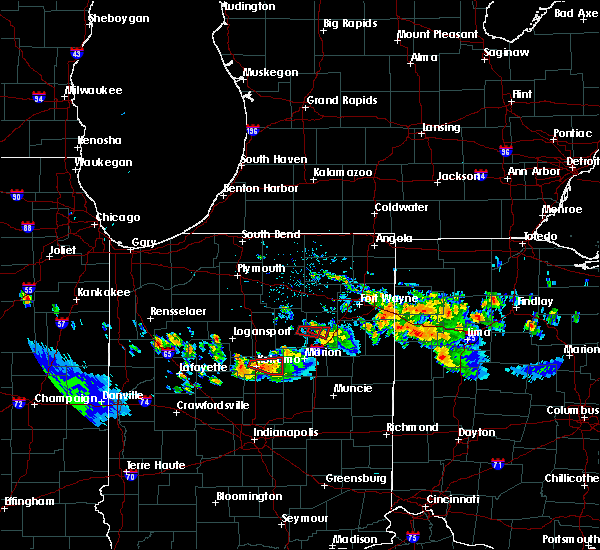 The tornado warning for central huntington county will expire at 930 pm edt, the storm which prompted the warning has weakened below severe limits, and no longer appears capable of producing a tornado. therefore the warning will be allowed to expire. a severe thunderstorm watch remains in effect until midnight edt for northeastern indiana. The tornado warning for central huntington county will expire at 930 pm edt, the storm which prompted the warning has weakened below severe limits, and no longer appears capable of producing a tornado. therefore the warning will be allowed to expire. a severe thunderstorm watch remains in effect until midnight edt for northeastern indiana.
|
| 7/10/2017 9:16 PM EDT |
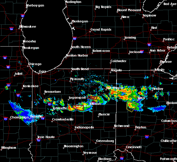 At 916 pm edt, a severe thunderstorm capable of producing a tornado was located over andrews, or near huntington, moving east at 20 mph (radar indicated rotation). Hazards include tornado. Flying debris will be dangerous to those caught without shelter. mobile homes will be damaged or destroyed. damage to roofs, windows, and vehicles will occur. tree damage is likely. This tornadic thunderstorm will remain over mainly rural areas of central huntington county, including the following locations: majenica. At 916 pm edt, a severe thunderstorm capable of producing a tornado was located over andrews, or near huntington, moving east at 20 mph (radar indicated rotation). Hazards include tornado. Flying debris will be dangerous to those caught without shelter. mobile homes will be damaged or destroyed. damage to roofs, windows, and vehicles will occur. tree damage is likely. This tornadic thunderstorm will remain over mainly rural areas of central huntington county, including the following locations: majenica.
|
| 7/10/2017 9:06 PM EDT |
 At 906 pm edt, a confirmed large and extremely dangerous tornado was located near andrews, or 8 miles east of wabash, moving east at 20 mph. this is a particularly dangerous situation. take cover now! (radar confirmed tornado). Hazards include damaging tornado. You are in a life-threatening situation. flying debris may be deadly to those caught without shelter. mobile homes will be destroyed. considerable damage to homes, businesses, and vehicles is likely and complete destruction is possible. the tornado will be near, andrews around 915 pm edt. Huntington around 930 pm edt. At 906 pm edt, a confirmed large and extremely dangerous tornado was located near andrews, or 8 miles east of wabash, moving east at 20 mph. this is a particularly dangerous situation. take cover now! (radar confirmed tornado). Hazards include damaging tornado. You are in a life-threatening situation. flying debris may be deadly to those caught without shelter. mobile homes will be destroyed. considerable damage to homes, businesses, and vehicles is likely and complete destruction is possible. the tornado will be near, andrews around 915 pm edt. Huntington around 930 pm edt.
|
| 7/10/2017 8:42 PM EDT |
 At 842 pm edt, a severe thunderstorm capable of producing a tornado was located near andrews, or 7 miles east of wabash, moving east at 15 mph (weather spotters reported funnel cloud). Hazards include tornado. Flying debris will be dangerous to those caught without shelter. mobile homes will be damaged or destroyed. damage to roofs, windows, and vehicles will occur. tree damage is likely. this dangerous storm will be near, andrews around 900 pm edt. huntington around 915 pm edt. Other locations impacted by this tornadic thunderstorm include majenica. At 842 pm edt, a severe thunderstorm capable of producing a tornado was located near andrews, or 7 miles east of wabash, moving east at 15 mph (weather spotters reported funnel cloud). Hazards include tornado. Flying debris will be dangerous to those caught without shelter. mobile homes will be damaged or destroyed. damage to roofs, windows, and vehicles will occur. tree damage is likely. this dangerous storm will be near, andrews around 900 pm edt. huntington around 915 pm edt. Other locations impacted by this tornadic thunderstorm include majenica.
|
| 7/10/2017 9:03 AM EDT | Tree limb on vehicle at hardees. dime sized hail also reporte in huntington county IN, 1.7 miles S of Huntington, IN |
| 7/7/2017 11:09 AM EDT |
 At 1108 am edt, a severe thunderstorm was located near andrews, or near huntington, moving southeast at 25 mph (radar indicated). Hazards include 60 mph wind gusts and nickel size hail. torrential rainfall is expected. Expect damage to roofs, siding, and trees. Locations impacted include, huntington, north manchester, andrews, claypool, lagro, ijamsville, liberty mills, goblesville, bracken, urbana, laketon, bippus, disko and luther. At 1108 am edt, a severe thunderstorm was located near andrews, or near huntington, moving southeast at 25 mph (radar indicated). Hazards include 60 mph wind gusts and nickel size hail. torrential rainfall is expected. Expect damage to roofs, siding, and trees. Locations impacted include, huntington, north manchester, andrews, claypool, lagro, ijamsville, liberty mills, goblesville, bracken, urbana, laketon, bippus, disko and luther.
|
| 7/7/2017 10:29 AM EDT |
 The national weather service in northern indiana has issued a * severe thunderstorm warning for. northern wabash county in north central indiana. southwestern whitley county in northeastern indiana. northwestern huntington county in northeastern indiana. Southeastern kosciusko county in north central indiana. The national weather service in northern indiana has issued a * severe thunderstorm warning for. northern wabash county in north central indiana. southwestern whitley county in northeastern indiana. northwestern huntington county in northeastern indiana. Southeastern kosciusko county in north central indiana.
|
| 6/30/2017 2:28 PM EDT | Tree limb dow in huntington county IN, 0.8 miles WSW of Huntington, IN |
| 6/4/2017 6:10 PM EDT | 18" non-healthy tree limb fell on edge of a hous in huntington county IN, 0.4 miles SW of Huntington, IN |
| 6/4/2017 5:50 PM EDT | 4" diameter healthy limb down and shingle damage along with pea sized hai in huntington county IN, 7.2 miles WSW of Huntington, IN |
| 5/28/2017 7:17 PM EDT |
 The national weather service in northern indiana has issued a * severe thunderstorm warning for. southern huntington county in northeastern indiana. central wells county in northeastern indiana. Until 800 pm edt * at 716 pm edt, a severe thunderstorm was located 7 miles southeast. The national weather service in northern indiana has issued a * severe thunderstorm warning for. southern huntington county in northeastern indiana. central wells county in northeastern indiana. Until 800 pm edt * at 716 pm edt, a severe thunderstorm was located 7 miles southeast.
|
| 5/28/2017 5:49 PM EDT |
 At 547 pm edt, a severe thunderstorm was located near huntington, moving east at 35 mph (radar indicated). Hazards include 60 mph wind gusts and quarter size hail. Hail damage to vehicles is expected. expect wind damage to roofs, siding, and trees. Locations impacted include, huntington, andrews, markle, lancaster, bowerstown, majenica and plum tree. At 547 pm edt, a severe thunderstorm was located near huntington, moving east at 35 mph (radar indicated). Hazards include 60 mph wind gusts and quarter size hail. Hail damage to vehicles is expected. expect wind damage to roofs, siding, and trees. Locations impacted include, huntington, andrews, markle, lancaster, bowerstown, majenica and plum tree.
|
| 5/28/2017 5:19 PM EDT |
 At 518 pm edt, a severe thunderstorm was located near wabash, moving east at 35 mph (radar indicated). Hazards include 60 mph wind gusts and quarter size hail. Hail damage to vehicles is expected. Expect wind damage to roofs, siding, and trees. At 518 pm edt, a severe thunderstorm was located near wabash, moving east at 35 mph (radar indicated). Hazards include 60 mph wind gusts and quarter size hail. Hail damage to vehicles is expected. Expect wind damage to roofs, siding, and trees.
|
| 5/18/2017 7:36 PM EDT |
 At 736 pm edt, a severe thunderstorm was located 8 miles northeast of huntington, moving east at 40 mph (radar indicated). Hazards include 60 mph wind gusts and penny size hail. expect damage to roofs, siding, and trees At 736 pm edt, a severe thunderstorm was located 8 miles northeast of huntington, moving east at 40 mph (radar indicated). Hazards include 60 mph wind gusts and penny size hail. expect damage to roofs, siding, and trees
|
| 5/18/2017 7:32 PM EDT | Healthy 2-3" limb downed at intersection of sr9 and 900 in huntington county IN, 6.1 miles SSW of Huntington, IN |
| 4/26/2017 9:02 PM EDT | Trees down across the roa in huntington county IN, 0.4 miles SW of Huntington, IN |
| 4/26/2017 9:00 PM EDT | 10 inch healthy tree down across roa in huntington county IN, 3 miles WSW of Huntington, IN |
| 4/26/2017 9:00 PM EDT | Power lines down across roa in huntington county IN, 6.7 miles WSW of Huntington, IN |
| 4/26/2017 8:55 PM EDT | 1 foot diameter tree limbs down and pea sized hai in huntington county IN, 0.4 miles SW of Huntington, IN |
| 4/26/2017 8:42 PM EDT |
 At 842 pm edt, a severe thunderstorm was located near huntington, moving northeast at 40 mph (radar indicated). Hazards include 60 mph wind gusts and quarter size hail. Hail damage to vehicles is expected. Expect wind damage to roofs, siding, and trees. At 842 pm edt, a severe thunderstorm was located near huntington, moving northeast at 40 mph (radar indicated). Hazards include 60 mph wind gusts and quarter size hail. Hail damage to vehicles is expected. Expect wind damage to roofs, siding, and trees.
|
| 4/26/2017 8:20 PM EDT |
 At 820 pm edt, a severe thunderstorm was located near la fontaine, or 9 miles north of marion, moving northeast at 45 mph (radar indicated). Hazards include ping pong ball size hail and 60 mph wind gusts. People and animals outdoors will be injured. expect hail damage to roofs, siding, windows, and vehicles. Expect wind damage to roofs, siding, and trees. At 820 pm edt, a severe thunderstorm was located near la fontaine, or 9 miles north of marion, moving northeast at 45 mph (radar indicated). Hazards include ping pong ball size hail and 60 mph wind gusts. People and animals outdoors will be injured. expect hail damage to roofs, siding, windows, and vehicles. Expect wind damage to roofs, siding, and trees.
|
| 3/1/2017 2:59 AM EST |
 At 258 am est, a severe thunderstorm was located near la fontaine, or near marion, moving east at 75 mph (radar indicated). Hazards include 60 mph wind gusts and quarter size hail. Hail damage to vehicles is expected. Expect wind damage to roofs, siding, and trees. At 258 am est, a severe thunderstorm was located near la fontaine, or near marion, moving east at 75 mph (radar indicated). Hazards include 60 mph wind gusts and quarter size hail. Hail damage to vehicles is expected. Expect wind damage to roofs, siding, and trees.
|
| 2/28/2017 6:20 PM EST | Quarter sized hail reported 6.1 miles SSW of Huntington, IN, . |
| 11/18/2016 6:42 PM EST |
 At 642 pm est, a severe thunderstorm was located 8 miles northeast of van buren, or 11 miles southwest of bluffton, moving northeast at 70 mph (radar indicated). Hazards include 60 mph wind gusts. Expect damage to roofs. siding. and trees. this severe thunderstorm will be near, bluffton around 650 pm est. ossian around 655 pm est. decatur around 700 pm est. monroeville around 705 pm est. other locations impacted by this severe thunderstorm include vera cruz, domestic, dixon, liberty center, travisville, yoder, dillman, reiffsburg, nottingham and rockford. this includes the following highways, interstate 469 between mile markers 0 and 2, between mile markers 4 and 6, and between mile markers 9 and 15. Interstate 69 in indiana between mile markers 272 and 294. At 642 pm est, a severe thunderstorm was located 8 miles northeast of van buren, or 11 miles southwest of bluffton, moving northeast at 70 mph (radar indicated). Hazards include 60 mph wind gusts. Expect damage to roofs. siding. and trees. this severe thunderstorm will be near, bluffton around 650 pm est. ossian around 655 pm est. decatur around 700 pm est. monroeville around 705 pm est. other locations impacted by this severe thunderstorm include vera cruz, domestic, dixon, liberty center, travisville, yoder, dillman, reiffsburg, nottingham and rockford. this includes the following highways, interstate 469 between mile markers 0 and 2, between mile markers 4 and 6, and between mile markers 9 and 15. Interstate 69 in indiana between mile markers 272 and 294.
|
| 8/24/2016 7:16 PM EDT |
 At 716 pm edt, a severe thunderstorm capable of producing a tornado was located near huntington, moving east at 25 mph (radar indicated rotation). Hazards include tornado. Flying debris will be dangerous to those caught without shelter. mobile homes will be damaged or destroyed. damage to roofs, windows, and vehicles will occur. tree damage is likely. this tornadic thunderstorm will remain over mainly rural areas of northeastern huntington county, including the following locations: mahon, bowerstown and roanoke. This includes interstate 69 in indiana between mile markers 288 and 291. At 716 pm edt, a severe thunderstorm capable of producing a tornado was located near huntington, moving east at 25 mph (radar indicated rotation). Hazards include tornado. Flying debris will be dangerous to those caught without shelter. mobile homes will be damaged or destroyed. damage to roofs, windows, and vehicles will occur. tree damage is likely. this tornadic thunderstorm will remain over mainly rural areas of northeastern huntington county, including the following locations: mahon, bowerstown and roanoke. This includes interstate 69 in indiana between mile markers 288 and 291.
|
| 8/24/2016 7:05 PM EDT |
 At 705 pm edt, a severe thunderstorm capable of producing a tornado was located near huntington, moving east at 25 mph (radar indicated rotation). Hazards include tornado. Flying debris will be dangerous to those caught without shelter. mobile homes will be damaged or destroyed. damage to roofs, windows, and vehicles will occur. tree damage is likely. this dangerous storm will be near, huntington around 710 pm edt. Other locations impacted by this tornadic thunderstorm include mahon, bowerstown, bippus and roanoke. At 705 pm edt, a severe thunderstorm capable of producing a tornado was located near huntington, moving east at 25 mph (radar indicated rotation). Hazards include tornado. Flying debris will be dangerous to those caught without shelter. mobile homes will be damaged or destroyed. damage to roofs, windows, and vehicles will occur. tree damage is likely. this dangerous storm will be near, huntington around 710 pm edt. Other locations impacted by this tornadic thunderstorm include mahon, bowerstown, bippus and roanoke.
|
| 8/17/2016 8:00 PM EDT | 12-16" diameter tree limbs down near wilkerson and first street. in huntington county IN, 0.9 miles WNW of Huntington, IN |
| 8/15/2016 9:06 PM EDT |
 At 905 pm edt, a severe thunderstorm capable of producing a tornado was located over andrews, or near huntington, moving northeast at 25 mph (radar indicated rotation. spotters were reporting funnel clouds with this storm). Hazards include tornado. Flying debris will be dangerous to those caught without shelter. mobile homes will be damaged or destroyed. damage to roofs, windows, and vehicles will occur. tree damage is likely. this dangerous storm will be near, huntington around 915 pm edt. Other locations impacted by this tornadic thunderstorm include bippus, washington center, goblesville, luther, tunker and roanoke. At 905 pm edt, a severe thunderstorm capable of producing a tornado was located over andrews, or near huntington, moving northeast at 25 mph (radar indicated rotation. spotters were reporting funnel clouds with this storm). Hazards include tornado. Flying debris will be dangerous to those caught without shelter. mobile homes will be damaged or destroyed. damage to roofs, windows, and vehicles will occur. tree damage is likely. this dangerous storm will be near, huntington around 915 pm edt. Other locations impacted by this tornadic thunderstorm include bippus, washington center, goblesville, luther, tunker and roanoke.
|
| 6/23/2016 1:00 AM EDT | Trees downed on sr-5. in huntington county IN, 7.9 miles NNW of Huntington, IN |
| 6/23/2016 12:55 AM EDT | Roofs damage in huntington county IN, 6.3 miles NNW of Huntington, IN |
| 6/23/2016 12:55 AM EDT | Roof blown off bar in huntington county IN, 7.7 miles NW of Huntington, IN |
| 6/23/2016 12:54 AM EDT | Trees and power lines downed. awning blown off of a hous in huntington county IN, 7.1 miles NNW of Huntington, IN |
| 6/23/2016 12:54 AM EDT | Silo blown down... garage doors broken... barn damage. in huntington county IN, 8.3 miles NW of Huntington, IN |
| 6/23/2016 12:54 AM EDT | Trees laying in opposite direction of other damag in huntington county IN, 6.9 miles NW of Huntington, IN |
| 6/23/2016 12:49 AM EDT |
 At 1248 am edt, a severe thunderstorm was located near huntington, moving east at 40 mph (radar indicated). Hazards include 60 mph wind gusts. Expect damage to roofs. siding and trees. this severe storm will be near, markle around 100 am edt. other locations impacted by this severe thunderstorm include mahon, bowerstown, goblesville, laud and roanoke. this includes interstate 69 in indiana between mile markers 283 and 292. A tornado watch remains in effect until 500 am edt for northeastern indiana. At 1248 am edt, a severe thunderstorm was located near huntington, moving east at 40 mph (radar indicated). Hazards include 60 mph wind gusts. Expect damage to roofs. siding and trees. this severe storm will be near, markle around 100 am edt. other locations impacted by this severe thunderstorm include mahon, bowerstown, goblesville, laud and roanoke. this includes interstate 69 in indiana between mile markers 283 and 292. A tornado watch remains in effect until 500 am edt for northeastern indiana.
|
| 6/23/2016 12:46 AM EDT | Road is blocked by downed tree in huntington county IN, 2.6 miles NNW of Huntington, IN |
| 6/23/2016 12:46 AM EDT | 60 ft tall pine tree downe in huntington county IN, 4.9 miles NNW of Huntington, IN |
| 6/23/2016 12:30 AM EDT |
 At 1229 am edt, a severe thunderstorm was located 7 miles east of north manchester, moving southeast at 40 mph (radar indicated). Hazards include 60 mph wind gusts. Expect damage to roofs. siding and trees. this severe thunderstorm will be near, andrews around 1240 am edt. huntington around 1245 am edt. markle around 100 am edt. other locations impacted by this severe thunderstorm include mahon, washington center, bippus, bracken, laud, collamer, tunker, bowerstown, goblesville and luther. this includes interstate 69 in indiana between mile markers 283 and 292. A tornado watch remains in effect until 500 am edt for northeastern indiana. At 1229 am edt, a severe thunderstorm was located 7 miles east of north manchester, moving southeast at 40 mph (radar indicated). Hazards include 60 mph wind gusts. Expect damage to roofs. siding and trees. this severe thunderstorm will be near, andrews around 1240 am edt. huntington around 1245 am edt. markle around 100 am edt. other locations impacted by this severe thunderstorm include mahon, washington center, bippus, bracken, laud, collamer, tunker, bowerstown, goblesville and luther. this includes interstate 69 in indiana between mile markers 283 and 292. A tornado watch remains in effect until 500 am edt for northeastern indiana.
|
| 6/20/2016 5:31 PM EDT | Two trees down in town... blocking roads. multiple trees down across the northern part of the county. in huntington county IN, 0.4 miles SE of Huntington, IN |
| 6/20/2016 5:00 PM EDT | Grain bin blown over at 6654 w 700 in huntington county IN, 4.2 miles SE of Huntington, IN |
| 5/10/2016 8:20 PM EDT |
 The severe thunderstorm warning for southwestern huntington, southeastern wabash and north central grant counties will expire at 830 pm edt, the storm which prompted the warning has weakened below severe limits, and no longer pose an immediate threat to life or property. therefore the warning will be allowed to expire. The severe thunderstorm warning for southwestern huntington, southeastern wabash and north central grant counties will expire at 830 pm edt, the storm which prompted the warning has weakened below severe limits, and no longer pose an immediate threat to life or property. therefore the warning will be allowed to expire.
|
| 5/10/2016 7:48 PM EDT |
 At 747 pm edt, a severe thunderstorm was located over la fontaine, moving north at 30 mph (radar indicated). Hazards include quarter size hail. damage to vehicles is expected At 747 pm edt, a severe thunderstorm was located over la fontaine, moving north at 30 mph (radar indicated). Hazards include quarter size hail. damage to vehicles is expected
|
| 3/27/2016 6:15 PM EDT | Ping Pong Ball sized hail reported 6.4 miles NNW of Huntington, IN, siding damage... screen damage and a broken window due to hail. |
| 3/27/2016 6:10 PM EDT |
 At 610 pm edt, a severe thunderstorm was located near van buren, or 13 miles south of huntington, moving northeast at 45 mph (radar indicated). Hazards include quarter size hail. Damage to vehicles is expected. locations impacted include, huntington, ossian, andrews, markle, warren, lancaster, zanesville, lagro, uniondale, mount etna, mahon, pleasant plain, majenica, plum tree, rockford and bowerstown. This includes interstate 69 in indiana between mile markers 272 and 293. At 610 pm edt, a severe thunderstorm was located near van buren, or 13 miles south of huntington, moving northeast at 45 mph (radar indicated). Hazards include quarter size hail. Damage to vehicles is expected. locations impacted include, huntington, ossian, andrews, markle, warren, lancaster, zanesville, lagro, uniondale, mount etna, mahon, pleasant plain, majenica, plum tree, rockford and bowerstown. This includes interstate 69 in indiana between mile markers 272 and 293.
|
| 3/27/2016 5:56 PM EDT |
 At 556 pm edt, a severe thunderstorm was located near marion, moving northeast at 45 mph (radar indicated). Hazards include quarter size hail. damage to vehicles is expected At 556 pm edt, a severe thunderstorm was located near marion, moving northeast at 45 mph (radar indicated). Hazards include quarter size hail. damage to vehicles is expected
|
| 12/23/2015 7:42 PM EST | Tree down at riverside dr. and whitelock s in huntington county IN, 0.8 miles WSW of Huntington, IN |
| 9/4/2015 4:48 PM EDT | 60 to 65 mph wind gust with four trees downed... approx. 6" in diameter. numerous branches down. pea sized hail was also observe in huntington county IN, 0.8 miles WSW of Huntington, IN |
| 9/4/2015 4:47 PM EDT |
 At 446 pm edt, a severe thunderstorm was located over markle, or 8 miles east of huntington, moving east at 30 mph (trained weather spotters). Hazards include 60 mph wind gusts and quarter size hail. Hail damage to vehicles is expected. expect wind damage to roofs, siding and trees. locations impacted include, fort wayne, markle, roanoke, zanesville, uniondale, mahon, rockford, nine mile and bowerstown. this includes the following highways, interstate 469 between mile markers 0 and 4, and between mile markers 7 and 8. interstate 69 in indiana between mile markers 283 and 298. trained weather spotters have reported 60 mph winds near markle. Tree limbs have also been reported down within the warning area. At 446 pm edt, a severe thunderstorm was located over markle, or 8 miles east of huntington, moving east at 30 mph (trained weather spotters). Hazards include 60 mph wind gusts and quarter size hail. Hail damage to vehicles is expected. expect wind damage to roofs, siding and trees. locations impacted include, fort wayne, markle, roanoke, zanesville, uniondale, mahon, rockford, nine mile and bowerstown. this includes the following highways, interstate 469 between mile markers 0 and 4, and between mile markers 7 and 8. interstate 69 in indiana between mile markers 283 and 298. trained weather spotters have reported 60 mph winds near markle. Tree limbs have also been reported down within the warning area.
|
| 9/4/2015 4:38 PM EDT |
 At 435 pm edt, a severe thunderstorm was located from near goblesville to huntington and moving southeast at 25 mph (radar indicated). Hazards include 60 mph wind gusts and quarter size hail. Hail damage to vehicles is expected. expect wind damage to roofs, siding and trees. locations impacted include, huntington, roanoke, bracken, goblesville and mahon. this includes interstate 69 in indiana near mile marker 291. Reports of winds to 55 mph and dime size hail have been received with small diamter tree limbs blown down. At 435 pm edt, a severe thunderstorm was located from near goblesville to huntington and moving southeast at 25 mph (radar indicated). Hazards include 60 mph wind gusts and quarter size hail. Hail damage to vehicles is expected. expect wind damage to roofs, siding and trees. locations impacted include, huntington, roanoke, bracken, goblesville and mahon. this includes interstate 69 in indiana near mile marker 291. Reports of winds to 55 mph and dime size hail have been received with small diamter tree limbs blown down.
|
| 9/4/2015 4:35 PM EDT | 5 power lines downed... snapped at the base on w 600 n between n 200 w and n 300 in huntington county IN, 3 miles S of Huntington, IN |
| 9/4/2015 4:35 PM EDT | 8-12 inch limbs downed. power line pole snapped in hal in huntington county IN, 5.1 miles S of Huntington, IN |
| 9/4/2015 4:31 PM EDT |
 At 431 pm edt, a severe thunderstorm was located over huntington, moving east at 30 mph (radar indicated). Hazards include 60 mph wind gusts and quarter size hail. Hail damage to vehicles is expected. Expect wind damage to roofs, siding and trees. At 431 pm edt, a severe thunderstorm was located over huntington, moving east at 30 mph (radar indicated). Hazards include 60 mph wind gusts and quarter size hail. Hail damage to vehicles is expected. Expect wind damage to roofs, siding and trees.
|
| 9/4/2015 4:30 PM EDT | Multiple reports of 3-5 inch limbs down. spotter reported 50 mph winds on the south side of huntington cit in huntington county IN, 0.4 miles SE of Huntington, IN |
| 9/4/2015 4:16 PM EDT |
 At 416 pm edt, a severe thunderstorm was located 9 miles southeast of south whitley, or 9 miles north of huntington, moving east at 25 mph. Hazards include 60 mph wind gusts and quarter size hail. Hail damage to vehicles is expected. Expect wind damage to roofs, siding and trees. At 416 pm edt, a severe thunderstorm was located 9 miles southeast of south whitley, or 9 miles north of huntington, moving east at 25 mph. Hazards include 60 mph wind gusts and quarter size hail. Hail damage to vehicles is expected. Expect wind damage to roofs, siding and trees.
|
| 6/18/2015 4:59 PM EDT | Several trees and power lines down... some 8 to 12 inches in diamete in huntington county IN, 0.4 miles SW of Huntington, IN |
| 5/27/2015 1:45 PM EDT | Trees and powerlines down on the east side of tow in huntington county IN, 0.8 miles WSW of Huntington, IN |
| 5/27/2015 1:45 PM EDT | Report of a tree and powerline down across the roadway at division rd/200w in huntington county IN, 3.3 miles NNW of Huntington, IN |
| 10/7/2014 5:05 PM EDT | Quarter sized hail reported 0.4 miles SW of Huntington, IN |
| 10/7/2014 5:05 PM EDT | Several 2 to 4 inch diameter tree limbs downe in huntington county IN, 0.4 miles SW of Huntington, IN |
| 5/9/2014 6:11 PM EDT | Tree down blocking one lane of state route 5 between 900 and 1000 nort in huntington county IN, 6.5 miles SSE of Huntington, IN |
| 11/17/2013 3:59 PM EST | Several tree limbs down throughout the city in huntington county IN, 0.4 miles SW of Huntington, IN |
| 11/17/2013 3:57 PM EST | Pole barn garage completely destroyed. 2 cars damage in huntington county IN, 5.3 miles SSE of Huntington, IN |
| 7/10/2013 1:30 PM EDT | Tree down blocking rangeline road west southwest of huntington. time estimated from rada in huntington county IN, 1.4 miles ENE of Huntington, IN |
| 6/27/2013 8:25 PM EDT | Quarter sized hail reported 8.1 miles SSW of Huntington, IN |
| 6/22/2013 4:15 PM EDT | Large tree down on frederick street in between hannah st and herman s in huntington county IN, 0.4 miles SW of Huntington, IN |
| 6/22/2013 4:15 PM EDT | Large tree limb down at gardendale and engle streets. limb was too big for 2 officers to move in huntington county IN, 0.5 miles NNW of Huntington, IN |
| 6/12/2013 11:14 PM EDT | Numerous tree down throughout huntington in huntington county IN, 0.4 miles SW of Huntington, IN |
| 8/4/2012 7:52 PM EDT | Trees and power lines down on rangeline road and 500 n in huntington county IN, 1.8 miles SSE of Huntington, IN |
| 7/24/2012 9:48 AM EDT | Large branch measured one inch in diameter down on state road 9 and 100 s. time estimated from rada in huntington county IN, 4.9 miles NNE of Huntington, IN |
| 7/24/2012 9:47 AM EDT | Unknown sized tree down on grayston avenue in huntington. time estimated from rada in huntington county IN, 1.6 miles SW of Huntington, IN |
| 7/6/2012 4:32 PM EDT | Two 3 to 5 inch branches down on south briant stree in huntington county IN, 0.5 miles NNW of Huntington, IN |
| 7/6/2012 4:31 PM EDT | A large tree fell onto two houses on west park drive near downtown huntington causing moderate damage to one and minor damage to the other. the tree appeared to have be in huntington county IN, 0.4 miles SW of Huntington, IN |
| 7/6/2012 4:30 PM EDT | Power lines reported down on tipton and woodlawn streets in huntingto in huntington county IN, 1.2 miles SW of Huntington, IN |
| 7/6/2012 4:22 PM EDT | Tree across 200w just south of 600 in huntington county IN, 3.1 miles SSW of Huntington, IN |
| 7/6/2012 4:14 PM EDT | Corn laying on its side at 500n and clear creek r in huntington county IN, 2.3 miles S of Huntington, IN |
| 7/6/2012 4:07 PM EDT | Quarter sized hail reported 3.7 miles S of Huntington, IN |
| 7/6/2012 3:30 PM EDT | Power lines reported down on tipton and woodlawn streets in huntingto in huntington county IN, 1.2 miles SW of Huntington, IN |
| 7/1/2012 3:44 PM EDT | Quarter sized hail reported 0.4 miles SW of Huntington, IN |
| 1/1/0001 12:00 AM | Tree down into power lines and on top of house at fruit and wesley street on the east side of huntington. power outages reported in that area. time estimated from radar in huntington county IN, 0.4 miles SW of Huntington, IN |
Hail Maps for Huntington, IN


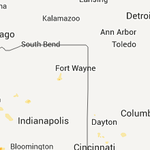


Connect with Interactive Hail Maps