

Hail Map for Huron, KS
The Huron, KS area has had 0 reports of on-the-ground hail by trained spotters, and has been under severe weather warnings 21 times during the past 12 months. Doppler radar has detected hail at or near Huron, KS on 81 occasions, including 6 occasions during the past year.
| Name: | Huron, KS |
| Where Located: | 55.4 miles NW of Kansas City, MO |
| Map: | Google Map for Huron, KS |
| Population: | 54 |
| Housing Units: | 25 |
| More Info: | Search Google for Huron, KS |
2
The Top Recent Hail Date for Huron, KS is Monday, May 19, 2025 (26th out of 81)
Hail and Wind Damage Spotted near Huron, KS
| Date / Time | Report Details |
|---|---|
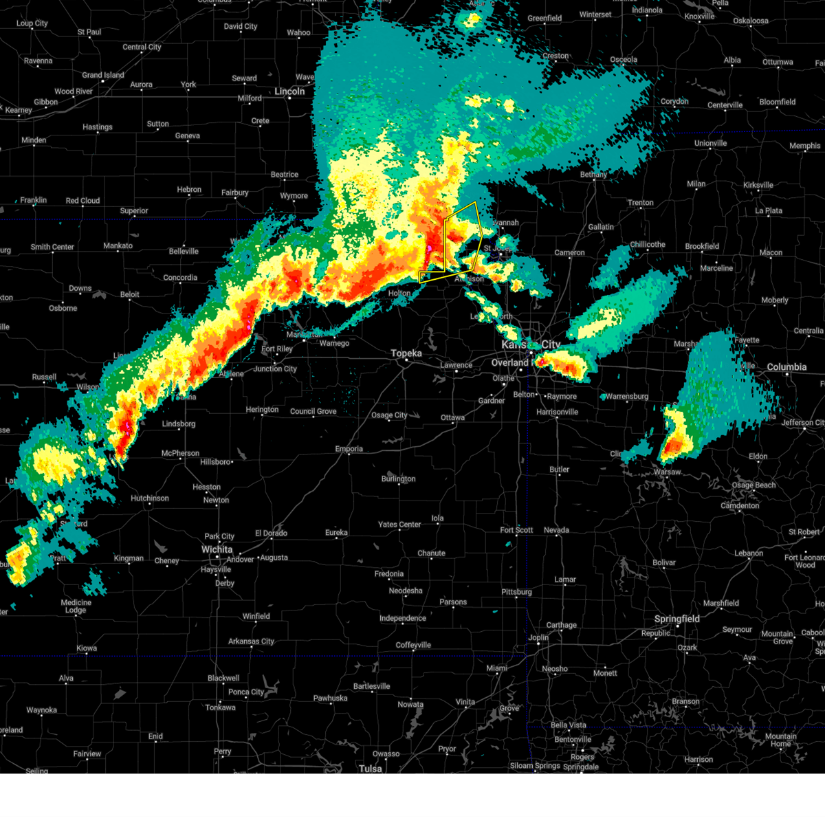
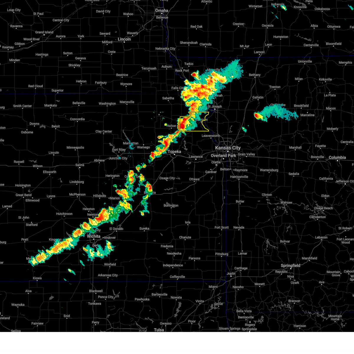
| 5/19/2025 7:49 PM CDT |
 Svreax the national weather service in pleasant hill has issued a * severe thunderstorm warning for, doniphan county in northeastern kansas, eastern atchison county in northeastern kansas, central buchanan county in northwestern missouri, southeastern holt county in northwestern missouri, northwestern platte county in west central missouri, southwestern andrew county in northwestern missouri, * until 830 pm cdt. * at 749 pm cdt, severe thunderstorms were located along a line extending from near denton to near atchison to 7 miles northwest of easton, moving northeast at 30 mph (radar indicated). Hazards include 60 mph wind gusts and penny size hail. expect damage to roofs, siding, and trees Svreax the national weather service in pleasant hill has issued a * severe thunderstorm warning for, doniphan county in northeastern kansas, eastern atchison county in northeastern kansas, central buchanan county in northwestern missouri, southeastern holt county in northwestern missouri, northwestern platte county in west central missouri, southwestern andrew county in northwestern missouri, * until 830 pm cdt. * at 749 pm cdt, severe thunderstorms were located along a line extending from near denton to near atchison to 7 miles northwest of easton, moving northeast at 30 mph (radar indicated). Hazards include 60 mph wind gusts and penny size hail. expect damage to roofs, siding, and trees
|
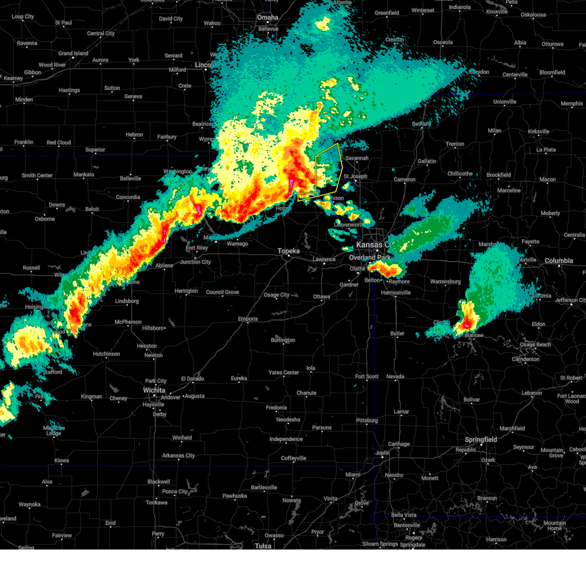
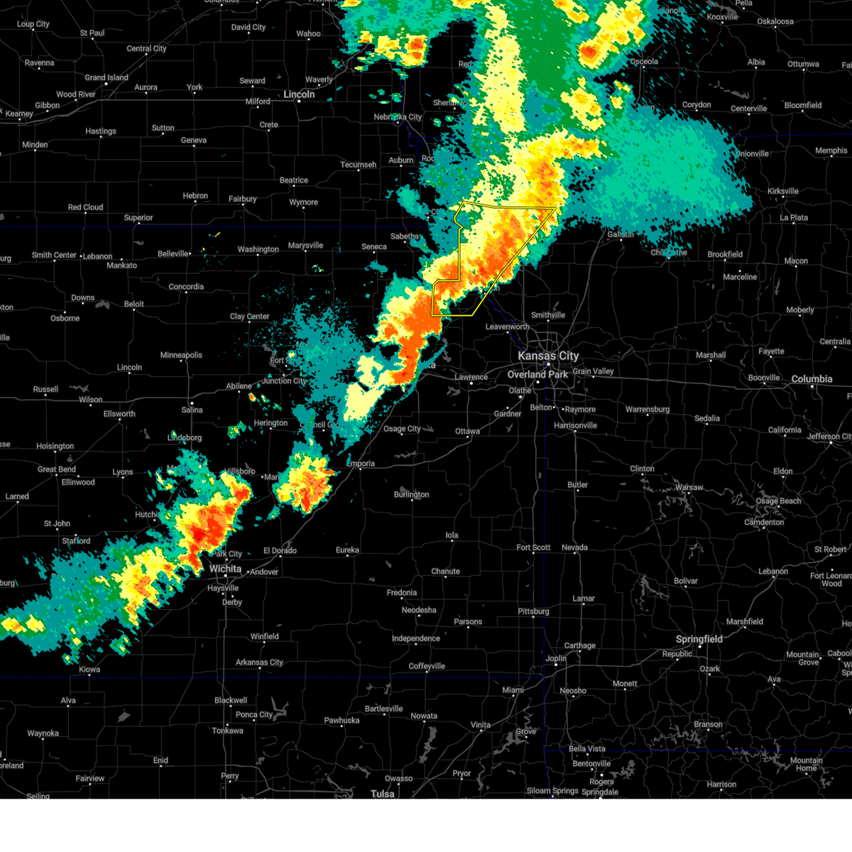
| 5/19/2025 7:35 PM CDT |
 At 735 pm cdt, a severe thunderstorm was located over lancaster, or 10 miles east of horton, moving northeast at 35 mph (radar indicated). Hazards include 60 mph wind gusts and penny size hail. Expect damage to roofs, siding, and trees. Locations impacted include, atchison, effingham, lancaster, denton, lewis and clark village, severance, farmington, huron, and lewis and clark vi. At 735 pm cdt, a severe thunderstorm was located over lancaster, or 10 miles east of horton, moving northeast at 35 mph (radar indicated). Hazards include 60 mph wind gusts and penny size hail. Expect damage to roofs, siding, and trees. Locations impacted include, atchison, effingham, lancaster, denton, lewis and clark village, severance, farmington, huron, and lewis and clark vi.
|
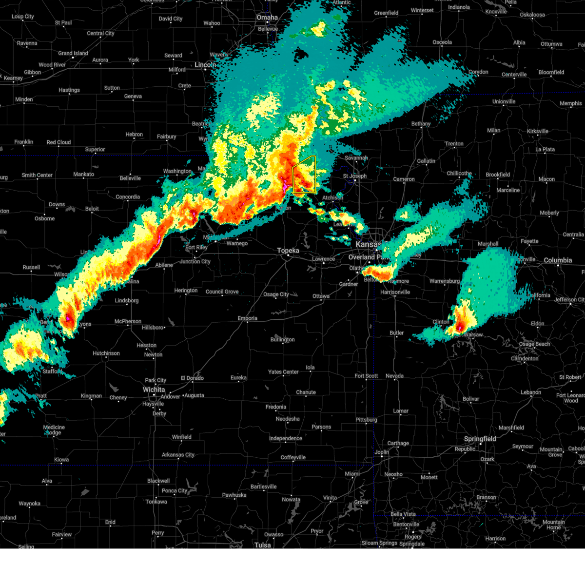
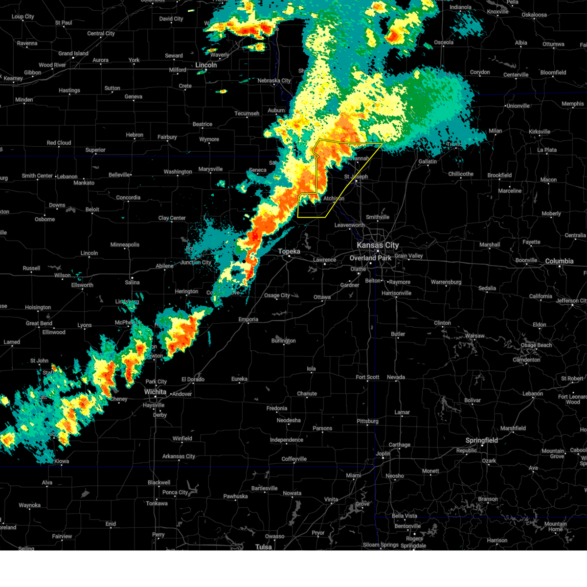
| 5/19/2025 7:24 PM CDT | Svreax the national weather service in pleasant hill has issued a * severe thunderstorm warning for, southwestern doniphan county in northeastern kansas, atchison county in northeastern kansas, southwestern buchanan county in northwestern missouri, * until 800 pm cdt. * at 723 pm cdt, a severe thunderstorm was located over effingham, or 9 miles southeast of horton, moving northeast at 35 mph (radar indicated). Hazards include 60 mph wind gusts and penny size hail. expect damage to roofs, siding, and trees |
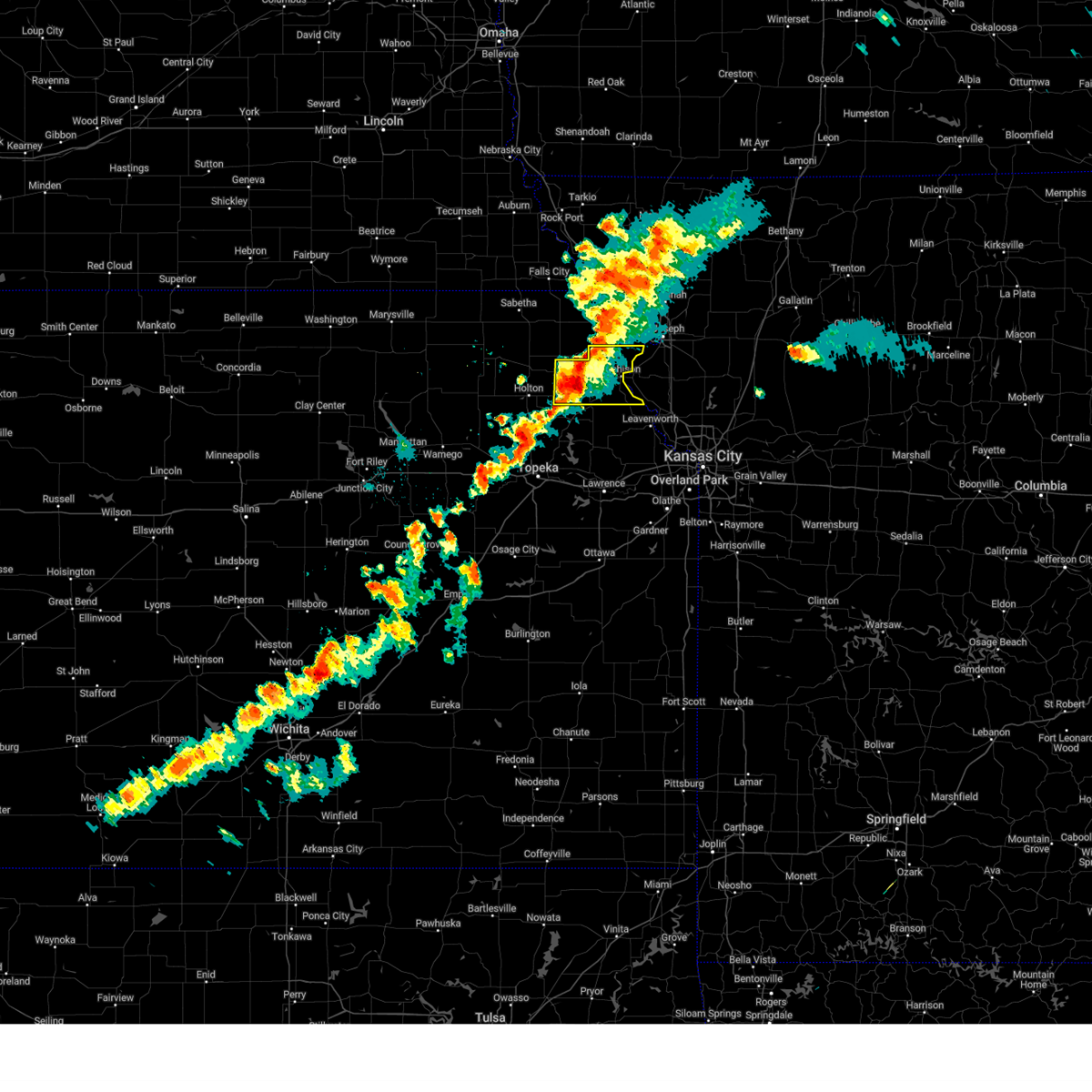
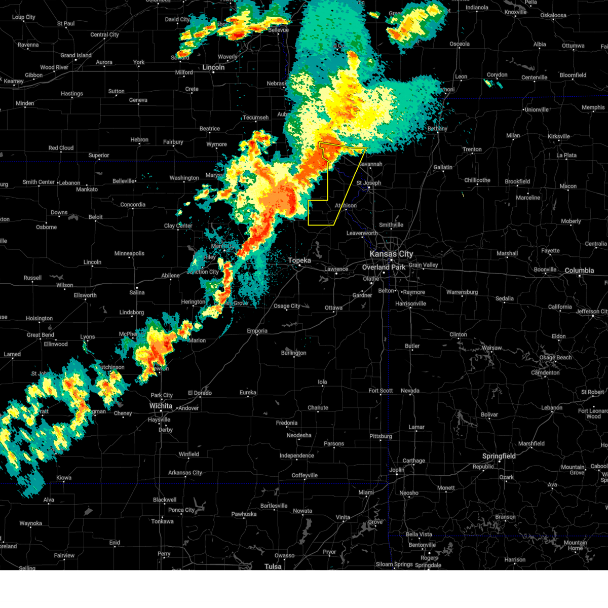
| 4/28/2025 7:42 PM CDT | Svreax the national weather service in pleasant hill has issued a * severe thunderstorm warning for, doniphan county in northeastern kansas, northwestern leavenworth county in northeastern kansas, atchison county in northeastern kansas, buchanan county in northwestern missouri, northern platte county in west central missouri, * until 815 pm cdt. * at 742 pm cdt, a severe thunderstorm was located near atchison, moving east at 55 mph (radar indicated). Hazards include two inch hail and 70 mph wind gusts. People and animals outdoors will be injured. expect hail damage to roofs, siding, windows, and vehicles. expect considerable tree damage. Wind damage is also likely to mobile homes, roofs, and outbuildings. |
| 4/2/2025 3:18 AM CDT |
 Svreax the national weather service in pleasant hill has issued a * severe thunderstorm warning for, southwestern doniphan county in northeastern kansas, leavenworth county in northeastern kansas, atchison county in northeastern kansas, buchanan county in northwestern missouri, northern platte county in west central missouri, * until 345 am cdt. * at 317 am cdt, severe thunderstorms were located along a line extending from lewis and clark village to easton to carbondale, moving east at 60 mph (radar indicated). Hazards include 60 mph wind gusts. expect damage to roofs, siding, and trees Svreax the national weather service in pleasant hill has issued a * severe thunderstorm warning for, southwestern doniphan county in northeastern kansas, leavenworth county in northeastern kansas, atchison county in northeastern kansas, buchanan county in northwestern missouri, northern platte county in west central missouri, * until 345 am cdt. * at 317 am cdt, severe thunderstorms were located along a line extending from lewis and clark village to easton to carbondale, moving east at 60 mph (radar indicated). Hazards include 60 mph wind gusts. expect damage to roofs, siding, and trees
|
| 4/2/2025 12:10 AM CDT |
 the severe thunderstorm warning has been cancelled and is no longer in effect the severe thunderstorm warning has been cancelled and is no longer in effect
|
| 4/2/2025 12:10 AM CDT |
 At 1210 am cdt, severe thunderstorms were located along a line extending from 6 miles northeast of hiawatha to near robinson to everest, moving east at 45 mph (radar indicated). Hazards include 70 mph wind gusts and penny size hail. Expect considerable tree damage. damage is likely to mobile homes, roofs, and outbuildings. locations impacted include, oregon, severance, white cloud, leona, denton, forest city, iowa point, fanning, bendena, highland, troy, and iowa reservation of kansas and nebraska. This includes interstate 29 between mile markers 69 and 78. At 1210 am cdt, severe thunderstorms were located along a line extending from 6 miles northeast of hiawatha to near robinson to everest, moving east at 45 mph (radar indicated). Hazards include 70 mph wind gusts and penny size hail. Expect considerable tree damage. damage is likely to mobile homes, roofs, and outbuildings. locations impacted include, oregon, severance, white cloud, leona, denton, forest city, iowa point, fanning, bendena, highland, troy, and iowa reservation of kansas and nebraska. This includes interstate 29 between mile markers 69 and 78.
|
| 4/2/2025 12:04 AM CDT |
 At 1203 am cdt, severe thunderstorms were located along a line extending from 6 miles southwest of white cloud to near everest, moving northeast at 50 mph (radar indicated). Hazards include 70 mph wind gusts and quarter size hail. Hail damage to vehicles is expected. expect considerable tree damage. wind damage is also likely to mobile homes, roofs, and outbuildings. Locations impacted include, everest and robinson. At 1203 am cdt, severe thunderstorms were located along a line extending from 6 miles southwest of white cloud to near everest, moving northeast at 50 mph (radar indicated). Hazards include 70 mph wind gusts and quarter size hail. Hail damage to vehicles is expected. expect considerable tree damage. wind damage is also likely to mobile homes, roofs, and outbuildings. Locations impacted include, everest and robinson.
|
| 4/2/2025 12:01 AM CDT |
 At 1200 am cdt, severe thunderstorms were located along a line extending from near hiawatha to willis to near horton, moving northeast at 45 mph (radar indicated). Hazards include 70 mph wind gusts and penny size hail. Expect considerable tree damage. damage is likely to mobile homes, roofs, and outbuildings. locations impacted include, oregon, white cloud, huron, denton, bendena, troy, severance, leona, forest city, iowa point, fanning, highland, and iowa reservation of kansas and nebraska. This includes interstate 29 between mile markers 69 and 78. At 1200 am cdt, severe thunderstorms were located along a line extending from near hiawatha to willis to near horton, moving northeast at 45 mph (radar indicated). Hazards include 70 mph wind gusts and penny size hail. Expect considerable tree damage. damage is likely to mobile homes, roofs, and outbuildings. locations impacted include, oregon, white cloud, huron, denton, bendena, troy, severance, leona, forest city, iowa point, fanning, highland, and iowa reservation of kansas and nebraska. This includes interstate 29 between mile markers 69 and 78.
|
| 4/1/2025 11:46 PM CDT |
 Svreax the national weather service in pleasant hill has issued a * severe thunderstorm warning for, doniphan county in northeastern kansas, northwestern atchison county in northeastern kansas, southeastern holt county in northwestern missouri, * until 1230 am cdt. * at 1146 pm cdt, severe thunderstorms were located along a line extending from fairview to kickapoo reservation to near netawaka, moving northeast at 45 mph (radar indicated). Hazards include 70 mph wind gusts and half dollar size hail. Hail damage to vehicles is expected. expect considerable tree damage. Wind damage is also likely to mobile homes, roofs, and outbuildings. Svreax the national weather service in pleasant hill has issued a * severe thunderstorm warning for, doniphan county in northeastern kansas, northwestern atchison county in northeastern kansas, southeastern holt county in northwestern missouri, * until 1230 am cdt. * at 1146 pm cdt, severe thunderstorms were located along a line extending from fairview to kickapoo reservation to near netawaka, moving northeast at 45 mph (radar indicated). Hazards include 70 mph wind gusts and half dollar size hail. Hail damage to vehicles is expected. expect considerable tree damage. Wind damage is also likely to mobile homes, roofs, and outbuildings.
|
| 4/1/2025 11:40 PM CDT |
 Svrtop the national weather service in topeka has issued a * severe thunderstorm warning for, eastern brown county in northeastern kansas, * until 1230 am cdt. * at 1139 pm cdt, severe thunderstorms were located along a line extending from 3 miles south of fairview to near netawaka, moving northeast at 50 mph (radar indicated). Hazards include 70 mph wind gusts and half dollar size hail. Hail damage to vehicles is expected. expect considerable tree damage. Wind damage is also likely to mobile homes, roofs, and outbuildings. Svrtop the national weather service in topeka has issued a * severe thunderstorm warning for, eastern brown county in northeastern kansas, * until 1230 am cdt. * at 1139 pm cdt, severe thunderstorms were located along a line extending from 3 miles south of fairview to near netawaka, moving northeast at 50 mph (radar indicated). Hazards include 70 mph wind gusts and half dollar size hail. Hail damage to vehicles is expected. expect considerable tree damage. Wind damage is also likely to mobile homes, roofs, and outbuildings.
|
| 10/24/2024 7:40 PM CDT |
 At 740 pm cdt, a severe thunderstorm was located near effingham, or 11 miles southwest of atchison, moving east at 50 mph (automated weather station). Hazards include 70 mph wind gusts and quarter size hail. Hail damage to vehicles is expected. expect considerable tree damage. wind damage is also likely to mobile homes, roofs, and outbuildings. Locations impacted include, atchison, effingham, lancaster, muscotah, doniphan, farmington, huron, cummings, arrington, and potter. At 740 pm cdt, a severe thunderstorm was located near effingham, or 11 miles southwest of atchison, moving east at 50 mph (automated weather station). Hazards include 70 mph wind gusts and quarter size hail. Hail damage to vehicles is expected. expect considerable tree damage. wind damage is also likely to mobile homes, roofs, and outbuildings. Locations impacted include, atchison, effingham, lancaster, muscotah, doniphan, farmington, huron, cummings, arrington, and potter.
|
| 10/24/2024 7:29 PM CDT |
 Svreax the national weather service in pleasant hill has issued a * severe thunderstorm warning for, southwestern doniphan county in northeastern kansas, atchison county in northeastern kansas, * until 800 pm cdt. * at 729 pm cdt, a severe thunderstorm was located near muscotah, or 8 miles north of valley falls, moving east at 50 mph (radar indicated). Hazards include 60 mph wind gusts and quarter size hail. Hail damage to vehicles is expected. Expect wind damage to roofs, siding, and trees. Svreax the national weather service in pleasant hill has issued a * severe thunderstorm warning for, southwestern doniphan county in northeastern kansas, atchison county in northeastern kansas, * until 800 pm cdt. * at 729 pm cdt, a severe thunderstorm was located near muscotah, or 8 miles north of valley falls, moving east at 50 mph (radar indicated). Hazards include 60 mph wind gusts and quarter size hail. Hail damage to vehicles is expected. Expect wind damage to roofs, siding, and trees.
|
| 8/14/2024 10:46 PM CDT | Svreax the national weather service in pleasant hill has issued a * severe thunderstorm warning for, northwestern leavenworth county in northeastern kansas, atchison county in northeastern kansas, * until 1115 pm cdt. * at 1045 pm cdt, severe thunderstorms were located along a line extending from near lancaster to near winchester to topeka, moving east at 30 mph (radar indicated). Hazards include 60 mph wind gusts. expect damage to roofs, siding, and trees |
| 8/14/2024 10:24 PM CDT |
 The storms which prompted the warning have weakened below severe limits, and no longer pose an immediate threat to life or property. therefore, the warning will be allowed to expire. however, gusty winds and heavy rain are still possible with these thunderstorms. a severe thunderstorm watch remains in effect until 100 am cdt for northeastern kansas, and northwestern missouri. The storms which prompted the warning have weakened below severe limits, and no longer pose an immediate threat to life or property. therefore, the warning will be allowed to expire. however, gusty winds and heavy rain are still possible with these thunderstorms. a severe thunderstorm watch remains in effect until 100 am cdt for northeastern kansas, and northwestern missouri.
|
| 8/14/2024 9:53 PM CDT |
 Svreax the national weather service in pleasant hill has issued a * severe thunderstorm warning for, doniphan county in northeastern kansas, atchison county in northeastern kansas, northwestern buchanan county in northwestern missouri, western gentry county in northwestern missouri, southeastern holt county in northwestern missouri, andrew county in northwestern missouri, * until 1030 pm cdt. * at 953 pm cdt, severe thunderstorms were located along a line extending from 6 miles northeast of fillmore to 6 miles east of highland to near denton to 3 miles south of potawatomi reservation, moving east at 35 mph (radar indicated). Hazards include 60 mph wind gusts. expect damage to roofs, siding, and trees Svreax the national weather service in pleasant hill has issued a * severe thunderstorm warning for, doniphan county in northeastern kansas, atchison county in northeastern kansas, northwestern buchanan county in northwestern missouri, western gentry county in northwestern missouri, southeastern holt county in northwestern missouri, andrew county in northwestern missouri, * until 1030 pm cdt. * at 953 pm cdt, severe thunderstorms were located along a line extending from 6 miles northeast of fillmore to 6 miles east of highland to near denton to 3 miles south of potawatomi reservation, moving east at 35 mph (radar indicated). Hazards include 60 mph wind gusts. expect damage to roofs, siding, and trees
|
| 8/14/2024 9:24 PM CDT |
 Svrtop the national weather service in topeka has issued a * severe thunderstorm warning for, northwestern jefferson county in northeastern kansas, northwestern shawnee county in east central kansas, northern wabaunsee county in east central kansas, southeastern pottawatomie county in northeastern kansas, southeastern nemaha county in northeastern kansas, jackson county in northeastern kansas, brown county in northeastern kansas, * until 1000 pm cdt. * at 923 pm cdt, severe thunderstorms were located along a line extending from 4 miles northwest of forest city to near kickapoo reservation to 5 miles northwest of paxico, moving east at 50 mph (radar indicated). Hazards include 60 mph wind gusts. expect damage to roofs, siding, and trees Svrtop the national weather service in topeka has issued a * severe thunderstorm warning for, northwestern jefferson county in northeastern kansas, northwestern shawnee county in east central kansas, northern wabaunsee county in east central kansas, southeastern pottawatomie county in northeastern kansas, southeastern nemaha county in northeastern kansas, jackson county in northeastern kansas, brown county in northeastern kansas, * until 1000 pm cdt. * at 923 pm cdt, severe thunderstorms were located along a line extending from 4 miles northwest of forest city to near kickapoo reservation to 5 miles northwest of paxico, moving east at 50 mph (radar indicated). Hazards include 60 mph wind gusts. expect damage to roofs, siding, and trees
|
| 8/14/2024 9:22 PM CDT |
 Svreax the national weather service in pleasant hill has issued a * severe thunderstorm warning for, doniphan county in northeastern kansas, atchison county in northeastern kansas, holt county in northwestern missouri, northwestern andrew county in northwestern missouri, * until 1000 pm cdt. * at 921 pm cdt, severe thunderstorms were located along a line extending from 5 miles south of maitland to near hiawatha to near holton, moving east at 35 mph (radar indicated). Hazards include 60 mph wind gusts and penny size hail. expect damage to roofs, siding, and trees Svreax the national weather service in pleasant hill has issued a * severe thunderstorm warning for, doniphan county in northeastern kansas, atchison county in northeastern kansas, holt county in northwestern missouri, northwestern andrew county in northwestern missouri, * until 1000 pm cdt. * at 921 pm cdt, severe thunderstorms were located along a line extending from 5 miles south of maitland to near hiawatha to near holton, moving east at 35 mph (radar indicated). Hazards include 60 mph wind gusts and penny size hail. expect damage to roofs, siding, and trees
|
| 7/31/2024 10:22 PM CDT |
 Svreax the national weather service in pleasant hill has issued a * severe thunderstorm warning for, leavenworth county in northeastern kansas, central atchison county in northeastern kansas, wyandotte county in northeastern kansas, northeastern miami county in east central kansas, doniphan county in northeastern kansas, johnson county in east central kansas, buchanan county in northwestern missouri, southeastern holt county in northwestern missouri, southern andrew county in northwestern missouri, western jackson county in west central missouri, northwestern cass county in west central missouri, clinton county in northwestern missouri, clay county in west central missouri, west central ray county in west central missouri, platte county in west central missouri, western dekalb county in northwestern missouri, * until 1115 pm cdt. * at 1022 pm cdt, severe thunderstorms were located along a line extending from 7 miles northwest of rushville to near lansing to near lawrence, moving east at 55 mph (radar indicated). Hazards include 70 mph wind gusts. Expect considerable tree damage. Damage is likely to mobile homes, roofs, and outbuildings. Svreax the national weather service in pleasant hill has issued a * severe thunderstorm warning for, leavenworth county in northeastern kansas, central atchison county in northeastern kansas, wyandotte county in northeastern kansas, northeastern miami county in east central kansas, doniphan county in northeastern kansas, johnson county in east central kansas, buchanan county in northwestern missouri, southeastern holt county in northwestern missouri, southern andrew county in northwestern missouri, western jackson county in west central missouri, northwestern cass county in west central missouri, clinton county in northwestern missouri, clay county in west central missouri, west central ray county in west central missouri, platte county in west central missouri, western dekalb county in northwestern missouri, * until 1115 pm cdt. * at 1022 pm cdt, severe thunderstorms were located along a line extending from 7 miles northwest of rushville to near lansing to near lawrence, moving east at 55 mph (radar indicated). Hazards include 70 mph wind gusts. Expect considerable tree damage. Damage is likely to mobile homes, roofs, and outbuildings.
|
| 7/31/2024 10:10 PM CDT |
 At 1010 pm cdt, a severe thunderstorm was located near lewis and clark village, or 7 miles west of weston, moving east at 55 mph (radar indicated). Hazards include 70 mph wind gusts. Expect considerable tree damage. damage is likely to mobile homes, roofs, and outbuildings. locations impacted include, overland park, olathe, shawnee, lenexa, leavenworth, leawood, prairie village, lansing, atchison, merriam, mission, bonner springs, de soto, parkville, tonganoxie, platte city, basehor, edwardsville, fairway, and mission hills. this includes the following highways, interstate 70 in missouri near mile marker 0. interstate 70 in kansas between mile markers 410 and 423. interstate 35 in kansas between mile markers 215 and 234. interstate 29 between mile markers 4 and 40. interstate 635 between mile markers 0 and 12. interstate 435 between mile markers 0 and 38, and between mile markers 76 and 83. Kansas turnpike between mile markers 206 and 226. At 1010 pm cdt, a severe thunderstorm was located near lewis and clark village, or 7 miles west of weston, moving east at 55 mph (radar indicated). Hazards include 70 mph wind gusts. Expect considerable tree damage. damage is likely to mobile homes, roofs, and outbuildings. locations impacted include, overland park, olathe, shawnee, lenexa, leavenworth, leawood, prairie village, lansing, atchison, merriam, mission, bonner springs, de soto, parkville, tonganoxie, platte city, basehor, edwardsville, fairway, and mission hills. this includes the following highways, interstate 70 in missouri near mile marker 0. interstate 70 in kansas between mile markers 410 and 423. interstate 35 in kansas between mile markers 215 and 234. interstate 29 between mile markers 4 and 40. interstate 635 between mile markers 0 and 12. interstate 435 between mile markers 0 and 38, and between mile markers 76 and 83. Kansas turnpike between mile markers 206 and 226.
|
| 7/31/2024 9:41 PM CDT |
 Svreax the national weather service in pleasant hill has issued a * severe thunderstorm warning for, wyandotte county in northeastern kansas, southwestern doniphan county in northeastern kansas, leavenworth county in northeastern kansas, johnson county in east central kansas, atchison county in northeastern kansas, southwestern buchanan county in northwestern missouri, platte county in west central missouri, * until 1030 pm cdt. * at 941 pm cdt, a severe thunderstorm was located near denison, or 7 miles northwest of valley falls, moving east at 55 mph (radar indicated). Hazards include 60 mph wind gusts. expect damage to roofs, siding, and trees Svreax the national weather service in pleasant hill has issued a * severe thunderstorm warning for, wyandotte county in northeastern kansas, southwestern doniphan county in northeastern kansas, leavenworth county in northeastern kansas, johnson county in east central kansas, atchison county in northeastern kansas, southwestern buchanan county in northwestern missouri, platte county in west central missouri, * until 1030 pm cdt. * at 941 pm cdt, a severe thunderstorm was located near denison, or 7 miles northwest of valley falls, moving east at 55 mph (radar indicated). Hazards include 60 mph wind gusts. expect damage to roofs, siding, and trees
|
| 6/15/2024 7:57 PM CDT |
 the severe thunderstorm warning has been cancelled and is no longer in effect the severe thunderstorm warning has been cancelled and is no longer in effect
|
| 6/15/2024 7:57 PM CDT |
 At 757 pm cdt, severe thunderstorms were located along a line extending from near falls city to near hiawatha to near kickapoo reservation, moving east at 25 mph (radar indicated). Hazards include 60 mph wind gusts and nickel size hail. Expect damage to roofs, siding, and trees. Locations impacted include, hiawatha, sabetha, horton, everest, fairview, robinson, morrill, reserve, powhattan, hamlin, willis, and kickapoo reservation. At 757 pm cdt, severe thunderstorms were located along a line extending from near falls city to near hiawatha to near kickapoo reservation, moving east at 25 mph (radar indicated). Hazards include 60 mph wind gusts and nickel size hail. Expect damage to roofs, siding, and trees. Locations impacted include, hiawatha, sabetha, horton, everest, fairview, robinson, morrill, reserve, powhattan, hamlin, willis, and kickapoo reservation.
|
| 6/15/2024 7:43 PM CDT |
 Svrtop the national weather service in topeka has issued a * severe thunderstorm warning for, eastern nemaha county in northeastern kansas, northeastern jackson county in northeastern kansas, brown county in northeastern kansas, * until 830 pm cdt. * at 743 pm cdt, severe thunderstorms were located along a line extending from 5 miles southeast of salem to near fairview to 4 miles south of netawaka, moving east at 25 mph (radar indicated). Hazards include 60 mph wind gusts and nickel size hail. expect damage to roofs, siding, and trees Svrtop the national weather service in topeka has issued a * severe thunderstorm warning for, eastern nemaha county in northeastern kansas, northeastern jackson county in northeastern kansas, brown county in northeastern kansas, * until 830 pm cdt. * at 743 pm cdt, severe thunderstorms were located along a line extending from 5 miles southeast of salem to near fairview to 4 miles south of netawaka, moving east at 25 mph (radar indicated). Hazards include 60 mph wind gusts and nickel size hail. expect damage to roofs, siding, and trees
|
| 6/15/2024 7:21 PM CDT |
 the severe thunderstorm warning has been cancelled and is no longer in effect the severe thunderstorm warning has been cancelled and is no longer in effect
|
| 6/15/2024 7:21 PM CDT |
 At 718 pm cdt, severe thunderstorms were located along a line extending from 6 miles northeast of bern to near sabetha to 4 miles north of circleville, moving northeast at 40 mph (trained weather spotters. at 712 pm trained spotters reported 60 mph winds in corning. also a home weather station recorded a 64 mph wind gust 1 mile north northwest of bern at 708 pm). Hazards include 60 mph wind gusts and nickel size hail. Expect damage to roofs, siding, and trees. Locations impacted include, hiawatha, sabetha, seneca, horton, centralia, wetmore, everest, fairview, robinson, morrill, whiting, bern, corning, netawaka, soldier, goff, reserve, powhattan, oneida, and hamlin. At 718 pm cdt, severe thunderstorms were located along a line extending from 6 miles northeast of bern to near sabetha to 4 miles north of circleville, moving northeast at 40 mph (trained weather spotters. at 712 pm trained spotters reported 60 mph winds in corning. also a home weather station recorded a 64 mph wind gust 1 mile north northwest of bern at 708 pm). Hazards include 60 mph wind gusts and nickel size hail. Expect damage to roofs, siding, and trees. Locations impacted include, hiawatha, sabetha, seneca, horton, centralia, wetmore, everest, fairview, robinson, morrill, whiting, bern, corning, netawaka, soldier, goff, reserve, powhattan, oneida, and hamlin.
|
| 6/15/2024 7:04 PM CDT |
 Svrtop the national weather service in topeka has issued a * severe thunderstorm warning for, northeastern pottawatomie county in northeastern kansas, nemaha county in northeastern kansas, northern jackson county in northeastern kansas, brown county in northeastern kansas, * until 745 pm cdt. * at 704 pm cdt, severe thunderstorms were located along a line extending from near du bois to oneida to near soldier, moving northeast at 40 mph (radar indicated). Hazards include 60 mph wind gusts and nickel size hail. expect damage to roofs, siding, and trees Svrtop the national weather service in topeka has issued a * severe thunderstorm warning for, northeastern pottawatomie county in northeastern kansas, nemaha county in northeastern kansas, northern jackson county in northeastern kansas, brown county in northeastern kansas, * until 745 pm cdt. * at 704 pm cdt, severe thunderstorms were located along a line extending from near du bois to oneida to near soldier, moving northeast at 40 mph (radar indicated). Hazards include 60 mph wind gusts and nickel size hail. expect damage to roofs, siding, and trees
|
| 5/25/2024 11:36 PM CDT |
 At 1136 pm cdt, severe thunderstorms were located along a line extending from 5 miles south of rulo to 3 miles southeast of robinson to 3 miles north of effingham, moving east at 40 mph (radar indicated). Hazards include 60 mph wind gusts and quarter size hail. Hail damage to vehicles is expected. expect wind damage to roofs, siding, and trees. Locations impacted include, everest, robinson, and willis. At 1136 pm cdt, severe thunderstorms were located along a line extending from 5 miles south of rulo to 3 miles southeast of robinson to 3 miles north of effingham, moving east at 40 mph (radar indicated). Hazards include 60 mph wind gusts and quarter size hail. Hail damage to vehicles is expected. expect wind damage to roofs, siding, and trees. Locations impacted include, everest, robinson, and willis.
|
| 5/25/2024 11:29 PM CDT |
 the severe thunderstorm warning has been cancelled and is no longer in effect the severe thunderstorm warning has been cancelled and is no longer in effect
|
| 5/25/2024 11:29 PM CDT |
 At 1129 pm cdt, severe thunderstorms were located along a line extending from 3 miles east of reserve to 3 miles southwest of robinson to 3 miles northeast of muscotah, moving east at 40 mph (radar indicated). Hazards include 60 mph wind gusts and quarter size hail. Hail damage to vehicles is expected. expect wind damage to roofs, siding, and trees. Locations impacted include, hiawatha, horton, everest, robinson, reserve, and willis. At 1129 pm cdt, severe thunderstorms were located along a line extending from 3 miles east of reserve to 3 miles southwest of robinson to 3 miles northeast of muscotah, moving east at 40 mph (radar indicated). Hazards include 60 mph wind gusts and quarter size hail. Hail damage to vehicles is expected. expect wind damage to roofs, siding, and trees. Locations impacted include, hiawatha, horton, everest, robinson, reserve, and willis.
|
| 5/25/2024 11:22 PM CDT |
 At 1121 pm cdt, severe thunderstorms were located along a line extending from near reserve to 4 miles north of willis to near muscotah, moving east at 40 mph (radar indicated). Hazards include 60 mph wind gusts and quarter size hail. Hail damage to vehicles is expected. expect wind damage to roofs, siding, and trees. Locations impacted include, hiawatha, horton, everest, robinson, whiting, netawaka, reserve, powhattan, hamlin, willis, and kickapoo reservation. At 1121 pm cdt, severe thunderstorms were located along a line extending from near reserve to 4 miles north of willis to near muscotah, moving east at 40 mph (radar indicated). Hazards include 60 mph wind gusts and quarter size hail. Hail damage to vehicles is expected. expect wind damage to roofs, siding, and trees. Locations impacted include, hiawatha, horton, everest, robinson, whiting, netawaka, reserve, powhattan, hamlin, willis, and kickapoo reservation.
|
| 5/25/2024 11:18 PM CDT |
 Svreax the national weather service in pleasant hill has issued a * severe thunderstorm warning for, doniphan county in northeastern kansas, northern atchison county in northeastern kansas, central buchanan county in northwestern missouri, southeastern atchison county in northwestern missouri, holt county in northwestern missouri, southwestern nodaway county in northwestern missouri, andrew county in northwestern missouri, * until 1215 am cdt. * at 1117 pm cdt, severe thunderstorms were located along a line extending from 6 miles southeast of nemaha to near hiawatha to near muscotah, moving east at 50 mph (radar indicated). Hazards include 60 mph wind gusts and penny size hail. expect damage to roofs, siding, and trees Svreax the national weather service in pleasant hill has issued a * severe thunderstorm warning for, doniphan county in northeastern kansas, northern atchison county in northeastern kansas, central buchanan county in northwestern missouri, southeastern atchison county in northwestern missouri, holt county in northwestern missouri, southwestern nodaway county in northwestern missouri, andrew county in northwestern missouri, * until 1215 am cdt. * at 1117 pm cdt, severe thunderstorms were located along a line extending from 6 miles southeast of nemaha to near hiawatha to near muscotah, moving east at 50 mph (radar indicated). Hazards include 60 mph wind gusts and penny size hail. expect damage to roofs, siding, and trees
|
| 5/25/2024 11:14 PM CDT |
 the severe thunderstorm warning has been cancelled and is no longer in effect the severe thunderstorm warning has been cancelled and is no longer in effect
|
| 5/25/2024 11:14 PM CDT |
 At 1113 pm cdt, severe thunderstorms were located along a line extending from 4 miles northeast of morrill to near powhattan to whiting, moving east at 40 mph (radar indicated). Hazards include 60 mph wind gusts and quarter size hail. Hail damage to vehicles is expected. expect wind damage to roofs, siding, and trees. Locations impacted include, hiawatha, sabetha, horton, everest, fairview, robinson, morrill, whiting, netawaka, reserve, powhattan, hamlin, willis, and kickapoo reservation. At 1113 pm cdt, severe thunderstorms were located along a line extending from 4 miles northeast of morrill to near powhattan to whiting, moving east at 40 mph (radar indicated). Hazards include 60 mph wind gusts and quarter size hail. Hail damage to vehicles is expected. expect wind damage to roofs, siding, and trees. Locations impacted include, hiawatha, sabetha, horton, everest, fairview, robinson, morrill, whiting, netawaka, reserve, powhattan, hamlin, willis, and kickapoo reservation.
|
| 5/25/2024 11:07 PM CDT |
 At 1107 pm cdt, severe thunderstorms were located along a line extending from 3 miles northwest of morrill to near powhattan to near netawaka, moving east at 35 mph (radar indicated). Hazards include 60 mph wind gusts and quarter size hail. Hail damage to vehicles is expected. expect wind damage to roofs, siding, and trees. Locations impacted include, hiawatha, sabetha, horton, wetmore, everest, fairview, robinson, morrill, whiting, netawaka, reserve, powhattan, hamlin, willis, and kickapoo reservation. At 1107 pm cdt, severe thunderstorms were located along a line extending from 3 miles northwest of morrill to near powhattan to near netawaka, moving east at 35 mph (radar indicated). Hazards include 60 mph wind gusts and quarter size hail. Hail damage to vehicles is expected. expect wind damage to roofs, siding, and trees. Locations impacted include, hiawatha, sabetha, horton, wetmore, everest, fairview, robinson, morrill, whiting, netawaka, reserve, powhattan, hamlin, willis, and kickapoo reservation.
|
| 5/25/2024 10:53 PM CDT |
 Svrtop the national weather service in topeka has issued a * severe thunderstorm warning for, eastern nemaha county in northeastern kansas, northeastern jackson county in northeastern kansas, brown county in northeastern kansas, * until 1145 pm cdt. * at 1052 pm cdt, severe thunderstorms were located along a line extending from 4 miles east of bern to near woodlawn to 4 miles northeast of soldier, moving east at 40 mph (radar indicated). Hazards include 60 mph wind gusts and quarter size hail. Hail damage to vehicles is expected. Expect wind damage to roofs, siding, and trees. Svrtop the national weather service in topeka has issued a * severe thunderstorm warning for, eastern nemaha county in northeastern kansas, northeastern jackson county in northeastern kansas, brown county in northeastern kansas, * until 1145 pm cdt. * at 1052 pm cdt, severe thunderstorms were located along a line extending from 4 miles east of bern to near woodlawn to 4 miles northeast of soldier, moving east at 40 mph (radar indicated). Hazards include 60 mph wind gusts and quarter size hail. Hail damage to vehicles is expected. Expect wind damage to roofs, siding, and trees.
|
| 5/19/2024 11:07 PM CDT |
 Svreax the national weather service in pleasant hill has issued a * severe thunderstorm warning for, doniphan county in northeastern kansas, northeastern atchison county in northeastern kansas, buchanan county in northwestern missouri, clinton county in northwestern missouri, northern clay county in west central missouri, northern platte county in west central missouri, southwestern dekalb county in northwestern missouri, * until 1145 pm cdt. * at 1107 pm cdt, severe thunderstorms were located along a line extending from near atchison to near camden point to near liberty, moving northeast at 50 mph (radar indicated). Hazards include 60 mph wind gusts. expect damage to roofs, siding, and trees Svreax the national weather service in pleasant hill has issued a * severe thunderstorm warning for, doniphan county in northeastern kansas, northeastern atchison county in northeastern kansas, buchanan county in northwestern missouri, clinton county in northwestern missouri, northern clay county in west central missouri, northern platte county in west central missouri, southwestern dekalb county in northwestern missouri, * until 1145 pm cdt. * at 1107 pm cdt, severe thunderstorms were located along a line extending from near atchison to near camden point to near liberty, moving northeast at 50 mph (radar indicated). Hazards include 60 mph wind gusts. expect damage to roofs, siding, and trees
|
| 4/30/2024 6:48 PM CDT |
 the severe thunderstorm warning has been cancelled and is no longer in effect the severe thunderstorm warning has been cancelled and is no longer in effect
|
| 4/30/2024 6:25 PM CDT |
 At 625 pm cdt, a severe thunderstorm was located over muscotah, or 7 miles south of horton, moving east at 35 mph (radar indicated). Hazards include 60 mph wind gusts and quarter size hail. Hail damage to vehicles is expected. expect wind damage to roofs, siding, and trees. Locations impacted include, effingham, lancaster, muscotah, farmington, and huron. At 625 pm cdt, a severe thunderstorm was located over muscotah, or 7 miles south of horton, moving east at 35 mph (radar indicated). Hazards include 60 mph wind gusts and quarter size hail. Hail damage to vehicles is expected. expect wind damage to roofs, siding, and trees. Locations impacted include, effingham, lancaster, muscotah, farmington, and huron.
|
| 4/30/2024 6:06 PM CDT |
 Svreax the national weather service in pleasant hill has issued a * severe thunderstorm warning for, western atchison county in northeastern kansas, * until 700 pm cdt. * at 606 pm cdt, a severe thunderstorm was located over whiting, or 7 miles southwest of horton, moving east at 20 mph (radar indicated). Hazards include 60 mph wind gusts and quarter size hail. Hail damage to vehicles is expected. Expect wind damage to roofs, siding, and trees. Svreax the national weather service in pleasant hill has issued a * severe thunderstorm warning for, western atchison county in northeastern kansas, * until 700 pm cdt. * at 606 pm cdt, a severe thunderstorm was located over whiting, or 7 miles southwest of horton, moving east at 20 mph (radar indicated). Hazards include 60 mph wind gusts and quarter size hail. Hail damage to vehicles is expected. Expect wind damage to roofs, siding, and trees.
|
| 4/30/2024 6:06 PM CDT |
 Svrtop the national weather service in topeka has issued a * severe thunderstorm warning for, northeastern jackson county in northeastern kansas, southeastern brown county in northeastern kansas, * until 630 pm cdt. * at 605 pm cdt, a severe thunderstorm was located near whiting, moving east at 25 mph (radar indicated). Hazards include 70 mph wind gusts and ping pong ball size hail. People and animals outdoors will be injured. expect hail damage to roofs, siding, windows, and vehicles. expect considerable tree damage. Wind damage is also likely to mobile homes, roofs, and outbuildings. Svrtop the national weather service in topeka has issued a * severe thunderstorm warning for, northeastern jackson county in northeastern kansas, southeastern brown county in northeastern kansas, * until 630 pm cdt. * at 605 pm cdt, a severe thunderstorm was located near whiting, moving east at 25 mph (radar indicated). Hazards include 70 mph wind gusts and ping pong ball size hail. People and animals outdoors will be injured. expect hail damage to roofs, siding, windows, and vehicles. expect considerable tree damage. Wind damage is also likely to mobile homes, roofs, and outbuildings.
|
| 4/26/2024 5:30 PM CDT |
 At 530 pm cdt, severe thunderstorms were located along a line extending from 5 miles northeast of hiawatha to 3 miles northwest of willis, moving northeast at 65 mph (radar indicated). Hazards include golf ball size hail and 60 mph wind gusts. People and animals outdoors will be injured. expect hail damage to roofs, siding, windows, and vehicles. expect wind damage to roofs, siding, and trees. Locations impacted include, hiawatha, horton, everest, robinson, reserve, powhattan, hamlin, willis, and kickapoo reservation. At 530 pm cdt, severe thunderstorms were located along a line extending from 5 miles northeast of hiawatha to 3 miles northwest of willis, moving northeast at 65 mph (radar indicated). Hazards include golf ball size hail and 60 mph wind gusts. People and animals outdoors will be injured. expect hail damage to roofs, siding, windows, and vehicles. expect wind damage to roofs, siding, and trees. Locations impacted include, hiawatha, horton, everest, robinson, reserve, powhattan, hamlin, willis, and kickapoo reservation.
|
| 4/26/2024 5:15 PM CDT |
 At 515 pm cdt, severe thunderstorms were located along a line extending from 4 miles north of hiawatha to near powhattan, moving northeast at 55 mph (radar indicated). Hazards include 60 mph wind gusts and half dollar size hail. Hail damage to vehicles is expected. expect wind damage to roofs, siding, and trees. Locations impacted include, hiawatha, sabetha, horton, everest, fairview, robinson, morrill, reserve, powhattan, hamlin, willis, and kickapoo reservation. At 515 pm cdt, severe thunderstorms were located along a line extending from 4 miles north of hiawatha to near powhattan, moving northeast at 55 mph (radar indicated). Hazards include 60 mph wind gusts and half dollar size hail. Hail damage to vehicles is expected. expect wind damage to roofs, siding, and trees. Locations impacted include, hiawatha, sabetha, horton, everest, fairview, robinson, morrill, reserve, powhattan, hamlin, willis, and kickapoo reservation.
|
| 4/26/2024 5:01 PM CDT |
 Svrtop the national weather service in topeka has issued a * severe thunderstorm warning for, brown county in northeastern kansas, * until 545 pm cdt. * at 501 pm cdt, severe thunderstorms were located along a line extending from near fairview to near wetmore, moving northeast at 55 mph (radar indicated). Hazards include 60 mph wind gusts and half dollar size hail. Hail damage to vehicles is expected. Expect wind damage to roofs, siding, and trees. Svrtop the national weather service in topeka has issued a * severe thunderstorm warning for, brown county in northeastern kansas, * until 545 pm cdt. * at 501 pm cdt, severe thunderstorms were located along a line extending from near fairview to near wetmore, moving northeast at 55 mph (radar indicated). Hazards include 60 mph wind gusts and half dollar size hail. Hail damage to vehicles is expected. Expect wind damage to roofs, siding, and trees.
|
| 4/16/2024 8:37 AM CDT |
 At 837 am cdt, severe thunderstorms were located along a line extending from near skidmore to near fillmore, moving northeast at 55 mph (radar indicated). Hazards include 60 mph wind gusts. Expect damage to roofs, siding, and trees. locations impacted include, maryville, atchison, mound city, highland, troy, oregon, effingham, burlington junction, hopkins, maitland, lancaster, skidmore, forest city, fillmore, white cloud, muscotah, braddyville, denton, blanchard, and barnard. This includes interstate 29 between mile markers 62 and 90. At 837 am cdt, severe thunderstorms were located along a line extending from near skidmore to near fillmore, moving northeast at 55 mph (radar indicated). Hazards include 60 mph wind gusts. Expect damage to roofs, siding, and trees. locations impacted include, maryville, atchison, mound city, highland, troy, oregon, effingham, burlington junction, hopkins, maitland, lancaster, skidmore, forest city, fillmore, white cloud, muscotah, braddyville, denton, blanchard, and barnard. This includes interstate 29 between mile markers 62 and 90.
|
| 4/16/2024 8:13 AM CDT |
 Svreax the national weather service in pleasant hill has issued a * severe thunderstorm warning for, doniphan county in northeastern kansas, atchison county in northeastern kansas, eastern atchison county in northwestern missouri, holt county in northwestern missouri, nodaway county in northwestern missouri, northwestern andrew county in northwestern missouri, * until 900 am cdt. * at 813 am cdt, severe thunderstorms were located along a line extending from rulo to highland, moving northeast at 55 mph (radar indicated). Hazards include 60 mph wind gusts. expect damage to roofs, siding, and trees Svreax the national weather service in pleasant hill has issued a * severe thunderstorm warning for, doniphan county in northeastern kansas, atchison county in northeastern kansas, eastern atchison county in northwestern missouri, holt county in northwestern missouri, nodaway county in northwestern missouri, northwestern andrew county in northwestern missouri, * until 900 am cdt. * at 813 am cdt, severe thunderstorms were located along a line extending from rulo to highland, moving northeast at 55 mph (radar indicated). Hazards include 60 mph wind gusts. expect damage to roofs, siding, and trees
|
| 4/16/2024 8:10 AM CDT |
 At 810 am cdt, a severe thunderstorm was located near white cloud, moving northeast at 45 mph (radar indicated). Hazards include 60 mph wind gusts and nickel size hail. Expect damage to roofs, siding, and trees. Locations impacted include, horton, everest, robinson, and willis. At 810 am cdt, a severe thunderstorm was located near white cloud, moving northeast at 45 mph (radar indicated). Hazards include 60 mph wind gusts and nickel size hail. Expect damage to roofs, siding, and trees. Locations impacted include, horton, everest, robinson, and willis.
|
| 4/16/2024 7:49 AM CDT |
 the severe thunderstorm warning has been cancelled and is no longer in effect the severe thunderstorm warning has been cancelled and is no longer in effect
|
| 4/16/2024 7:49 AM CDT |
 At 749 am cdt, a severe thunderstorm was located near troy, moving north at 50 mph (radar indicated). Hazards include 60 mph wind gusts and penny size hail. Expect damage to roofs, siding, and trees. locations impacted include, savannah, wathena, highland, troy, oregon, amazonia, forest city, fillmore, denton, barnard, bolckow, rosendale, severance, guilford, rea, st. joseph airport, bendena, iowa point, and fanning. this includes the following highways, interstate 29 between mile markers 56 and 79. Interstate 229 between mile markers 11 and 14. At 749 am cdt, a severe thunderstorm was located near troy, moving north at 50 mph (radar indicated). Hazards include 60 mph wind gusts and penny size hail. Expect damage to roofs, siding, and trees. locations impacted include, savannah, wathena, highland, troy, oregon, amazonia, forest city, fillmore, denton, barnard, bolckow, rosendale, severance, guilford, rea, st. joseph airport, bendena, iowa point, and fanning. this includes the following highways, interstate 29 between mile markers 56 and 79. Interstate 229 between mile markers 11 and 14.
|
| 4/16/2024 7:41 AM CDT |
 Svrtop the national weather service in topeka has issued a * severe thunderstorm warning for, brown county in northeastern kansas, * until 830 am cdt. * at 741 am cdt, a severe thunderstorm was located over horton, moving northeast at 45 mph (radar indicated). Hazards include 60 mph wind gusts and nickel size hail. expect damage to roofs, siding, and trees Svrtop the national weather service in topeka has issued a * severe thunderstorm warning for, brown county in northeastern kansas, * until 830 am cdt. * at 741 am cdt, a severe thunderstorm was located over horton, moving northeast at 45 mph (radar indicated). Hazards include 60 mph wind gusts and nickel size hail. expect damage to roofs, siding, and trees
|
| 4/16/2024 7:31 AM CDT |
 Svreax the national weather service in pleasant hill has issued a * severe thunderstorm warning for, doniphan county in northeastern kansas, northeastern atchison county in northeastern kansas, western buchanan county in northwestern missouri, southwestern gentry county in northwestern missouri, eastern holt county in northwestern missouri, southeastern nodaway county in northwestern missouri, andrew county in northwestern missouri, * until 815 am cdt. * at 731 am cdt, a severe thunderstorm was located near troy, moving northeast at 55 mph (radar indicated). Hazards include 60 mph wind gusts and penny size hail. expect damage to roofs, siding, and trees Svreax the national weather service in pleasant hill has issued a * severe thunderstorm warning for, doniphan county in northeastern kansas, northeastern atchison county in northeastern kansas, western buchanan county in northwestern missouri, southwestern gentry county in northwestern missouri, eastern holt county in northwestern missouri, southeastern nodaway county in northwestern missouri, andrew county in northwestern missouri, * until 815 am cdt. * at 731 am cdt, a severe thunderstorm was located near troy, moving northeast at 55 mph (radar indicated). Hazards include 60 mph wind gusts and penny size hail. expect damage to roofs, siding, and trees
|
| 8/6/2023 1:12 AM CDT |
 The severe thunderstorm warning for southeastern brown county will expire at 115 am cdt, the storm which prompted the warning has moved out of the area. therefore, the warning will be allowed to expire. a severe thunderstorm watch remains in effect until 300 am cdt for northeastern kansas. The severe thunderstorm warning for southeastern brown county will expire at 115 am cdt, the storm which prompted the warning has moved out of the area. therefore, the warning will be allowed to expire. a severe thunderstorm watch remains in effect until 300 am cdt for northeastern kansas.
|
| 8/6/2023 12:52 AM CDT |
 At 1251 am cdt, a severe thunderstorm was located near willis, moving east at 45 mph (radar indicated). Hazards include 60 mph wind gusts and penny size hail. expect damage to roofs, siding, and trees At 1251 am cdt, a severe thunderstorm was located near willis, moving east at 45 mph (radar indicated). Hazards include 60 mph wind gusts and penny size hail. expect damage to roofs, siding, and trees
|
| 7/30/2023 7:24 PM CDT |
 At 723 pm cdt, severe thunderstorms were located along a line extending from near clarksdale to near rushville to near lancaster, moving southeast at 55 mph (radar indicated). Hazards include 70 mph wind gusts and penny size hail. Expect considerable tree damage. Damage is likely to mobile homes, roofs, and outbuildings. At 723 pm cdt, severe thunderstorms were located along a line extending from near clarksdale to near rushville to near lancaster, moving southeast at 55 mph (radar indicated). Hazards include 70 mph wind gusts and penny size hail. Expect considerable tree damage. Damage is likely to mobile homes, roofs, and outbuildings.
|
| 7/30/2023 7:20 PM CDT |
 At 719 pm cdt, a severe thunderstorm was located 7 miles southwest of wathena, moving southeast at 45 mph (law enforcement). Hazards include 60 mph wind gusts and penny size hail. Expect damage to roofs, siding, and trees. locations impacted include, st. joseph, atchison, savannah, wathena, elwood, highland, troy, country club villa, country club, oregon, effingham, amazonia, rushville, lancaster, forest city, fillmore, white cloud, muscotah, denton and lewis and clark village. this includes the following highways, interstate 29 between mile markers 40 and 72. interstate 229 between mile markers 0 and 14. hail threat, radar indicated max hail size, 0. 75 in wind threat, radar indicated max wind gust, 60 mph. At 719 pm cdt, a severe thunderstorm was located 7 miles southwest of wathena, moving southeast at 45 mph (law enforcement). Hazards include 60 mph wind gusts and penny size hail. Expect damage to roofs, siding, and trees. locations impacted include, st. joseph, atchison, savannah, wathena, elwood, highland, troy, country club villa, country club, oregon, effingham, amazonia, rushville, lancaster, forest city, fillmore, white cloud, muscotah, denton and lewis and clark village. this includes the following highways, interstate 29 between mile markers 40 and 72. interstate 229 between mile markers 0 and 14. hail threat, radar indicated max hail size, 0. 75 in wind threat, radar indicated max wind gust, 60 mph.
|
| 7/30/2023 7:10 PM CDT |
 At 709 pm cdt, a severe thunderstorm was located over troy, moving southeast at 45 mph (law enforcement reported several trees down across roads in oregon missouri). Hazards include 60 mph wind gusts and penny size hail. Expect damage to roofs, siding, and trees. locations impacted include, st. joseph, atchison, savannah, wathena, elwood, mound city, highland, troy, country club villa, country club, oregon, effingham, amazonia, rushville, lancaster, forest city, fillmore, white cloud, muscotah and denton. this includes the following highways, interstate 29 between mile markers 40 and 88. interstate 229 between mile markers 0 and 14. hail threat, radar indicated max hail size, 0. 75 in wind threat, radar indicated max wind gust, 60 mph. At 709 pm cdt, a severe thunderstorm was located over troy, moving southeast at 45 mph (law enforcement reported several trees down across roads in oregon missouri). Hazards include 60 mph wind gusts and penny size hail. Expect damage to roofs, siding, and trees. locations impacted include, st. joseph, atchison, savannah, wathena, elwood, mound city, highland, troy, country club villa, country club, oregon, effingham, amazonia, rushville, lancaster, forest city, fillmore, white cloud, muscotah and denton. this includes the following highways, interstate 29 between mile markers 40 and 88. interstate 229 between mile markers 0 and 14. hail threat, radar indicated max hail size, 0. 75 in wind threat, radar indicated max wind gust, 60 mph.
|
| 7/30/2023 6:52 PM CDT |
 At 652 pm cdt, a severe thunderstorm was located over white cloud, or near highland, moving southeast at 45 mph (radar indicated). Hazards include 60 mph wind gusts and penny size hail. expect damage to roofs, siding, and trees At 652 pm cdt, a severe thunderstorm was located over white cloud, or near highland, moving southeast at 45 mph (radar indicated). Hazards include 60 mph wind gusts and penny size hail. expect damage to roofs, siding, and trees
|
| 7/29/2023 10:17 AM CDT |
 At 1017 am cdt, severe thunderstorms were located along a line extending from near skidmore to 9 miles northeast of fillmore to near denton, moving east at 55 mph (radar indicated). Hazards include 60 mph wind gusts and nickel size hail. Expect damage to roofs, siding, and trees. locations impacted include, st. joseph, maryville, atchison, savannah, wathena, elwood, mound city, highland, troy, country club villa, country club, oregon, burlington junction, maitland, amazonia, rushville, skidmore, forest city, fillmore and white cloud. this includes the following highways, interstate 29 between mile markers 43 and 85. interstate 229 between mile markers 0 and 14. hail threat, radar indicated max hail size, 0. 88 in wind threat, radar indicated max wind gust, 60 mph. At 1017 am cdt, severe thunderstorms were located along a line extending from near skidmore to 9 miles northeast of fillmore to near denton, moving east at 55 mph (radar indicated). Hazards include 60 mph wind gusts and nickel size hail. Expect damage to roofs, siding, and trees. locations impacted include, st. joseph, maryville, atchison, savannah, wathena, elwood, mound city, highland, troy, country club villa, country club, oregon, burlington junction, maitland, amazonia, rushville, skidmore, forest city, fillmore and white cloud. this includes the following highways, interstate 29 between mile markers 43 and 85. interstate 229 between mile markers 0 and 14. hail threat, radar indicated max hail size, 0. 88 in wind threat, radar indicated max wind gust, 60 mph.
|
| 7/29/2023 10:06 AM CDT |
 The severe thunderstorm warning for brown county will expire at 1015 am cdt, the storms which prompted the warning have moved out of the area. therefore, the warning will be allowed to expire. however small hail, gusty winds and heavy rain are still possible with these thunderstorms. a severe thunderstorm watch remains in effect until 200 pm cdt for northeastern kansas. The severe thunderstorm warning for brown county will expire at 1015 am cdt, the storms which prompted the warning have moved out of the area. therefore, the warning will be allowed to expire. however small hail, gusty winds and heavy rain are still possible with these thunderstorms. a severe thunderstorm watch remains in effect until 200 pm cdt for northeastern kansas.
|
| 7/29/2023 9:57 AM CDT |
 At 956 am cdt, severe thunderstorms were located along a line extending from white cloud to near robinson to 3 miles southeast of hiawatha, moving southeast at 40 mph (radar indicated). Hazards include 60 mph wind gusts and penny size hail. Expect damage to roofs, siding, and trees. locations impacted include, hiawatha, robinson, morrill, reserve and hamlin. hail threat, radar indicated max hail size, 0. 75 in wind threat, radar indicated max wind gust, 60 mph. At 956 am cdt, severe thunderstorms were located along a line extending from white cloud to near robinson to 3 miles southeast of hiawatha, moving southeast at 40 mph (radar indicated). Hazards include 60 mph wind gusts and penny size hail. Expect damage to roofs, siding, and trees. locations impacted include, hiawatha, robinson, morrill, reserve and hamlin. hail threat, radar indicated max hail size, 0. 75 in wind threat, radar indicated max wind gust, 60 mph.
|
| 7/29/2023 9:56 AM CDT |
 At 955 am cdt, severe thunderstorms were located along a line extending from near tarkio to near mound city to near hiawatha, moving east at 45 mph (radar indicated). Hazards include 60 mph wind gusts and nickel size hail. expect damage to roofs, siding, and trees At 955 am cdt, severe thunderstorms were located along a line extending from near tarkio to near mound city to near hiawatha, moving east at 45 mph (radar indicated). Hazards include 60 mph wind gusts and nickel size hail. expect damage to roofs, siding, and trees
|
| 7/29/2023 9:49 AM CDT |
 At 949 am cdt, severe thunderstorms were located along a line extending from 5 miles west of white cloud to near hiawatha to powhattan, moving southeast at 45 mph (radar indicated). Hazards include 60 mph wind gusts and quarter size hail. Hail damage to vehicles is expected. expect wind damage to roofs, siding, and trees. locations impacted include, hiawatha, sabetha, robinson, morrill, reserve and hamlin. hail threat, radar indicated max hail size, 1. 00 in wind threat, radar indicated max wind gust, 60 mph. At 949 am cdt, severe thunderstorms were located along a line extending from 5 miles west of white cloud to near hiawatha to powhattan, moving southeast at 45 mph (radar indicated). Hazards include 60 mph wind gusts and quarter size hail. Hail damage to vehicles is expected. expect wind damage to roofs, siding, and trees. locations impacted include, hiawatha, sabetha, robinson, morrill, reserve and hamlin. hail threat, radar indicated max hail size, 1. 00 in wind threat, radar indicated max wind gust, 60 mph.
|
| 7/29/2023 9:37 AM CDT |
 At 936 am cdt, severe thunderstorms were located along a line extending from 4 miles east of falls city to near hamlin to near fairview, moving southeast at 45 mph (radar indicated). Hazards include 60 mph wind gusts and quarter size hail. Hail damage to vehicles is expected. Expect wind damage to roofs, siding, and trees. At 936 am cdt, severe thunderstorms were located along a line extending from 4 miles east of falls city to near hamlin to near fairview, moving southeast at 45 mph (radar indicated). Hazards include 60 mph wind gusts and quarter size hail. Hail damage to vehicles is expected. Expect wind damage to roofs, siding, and trees.
|
| 7/28/2023 10:51 PM CDT |
 The severe thunderstorm warning for southwestern doniphan and northwestern atchison counties will expire at 1100 pm cdt, the storm which prompted the warning has weakened below severe limits, and no longer poses an immediate threat to life or property. therefore, the warning will be allowed to expire. however gusty winds are still possible with this thunderstorm. The severe thunderstorm warning for southwestern doniphan and northwestern atchison counties will expire at 1100 pm cdt, the storm which prompted the warning has weakened below severe limits, and no longer poses an immediate threat to life or property. therefore, the warning will be allowed to expire. however gusty winds are still possible with this thunderstorm.
|
| 7/28/2023 10:43 PM CDT |
 At 1042 pm cdt, a severe thunderstorm was located near denton, or 10 miles northwest of atchison, moving east at 25 mph (radar indicated). Hazards include 60 mph wind gusts and penny size hail. Expect damage to roofs, siding, and trees. locations impacted include, atchison, troy, lancaster, denton, severance, huron, leona and bendena. hail threat, radar indicated max hail size, 0. 75 in wind threat, radar indicated max wind gust, 60 mph. At 1042 pm cdt, a severe thunderstorm was located near denton, or 10 miles northwest of atchison, moving east at 25 mph (radar indicated). Hazards include 60 mph wind gusts and penny size hail. Expect damage to roofs, siding, and trees. locations impacted include, atchison, troy, lancaster, denton, severance, huron, leona and bendena. hail threat, radar indicated max hail size, 0. 75 in wind threat, radar indicated max wind gust, 60 mph.
|
| 7/28/2023 10:42 PM CDT |
 The severe thunderstorm warning for southeastern brown county will expire at 1045 pm cdt. the storm which prompted the warning has weakened below severe limits, and no longer poses an immediate threat to life or property. therefore, the warning will be allowed to expire. However gusty winds and heavy rain are still possible with this thunderstorm. The severe thunderstorm warning for southeastern brown county will expire at 1045 pm cdt. the storm which prompted the warning has weakened below severe limits, and no longer poses an immediate threat to life or property. therefore, the warning will be allowed to expire. However gusty winds and heavy rain are still possible with this thunderstorm.
|
| 7/28/2023 10:35 PM CDT |
 At 1035 pm cdt, a severe thunderstorm was located near lancaster, moving east at 30 mph (radar indicated). Hazards include 60 mph wind gusts and quarter size hail. Hail damage to vehicles is expected. expect wind damage to roofs, siding, and trees. locations impacted include, horton and everest. hail threat, radar indicated max hail size, 1. 00 in wind threat, radar indicated max wind gust, 60 mph. At 1035 pm cdt, a severe thunderstorm was located near lancaster, moving east at 30 mph (radar indicated). Hazards include 60 mph wind gusts and quarter size hail. Hail damage to vehicles is expected. expect wind damage to roofs, siding, and trees. locations impacted include, horton and everest. hail threat, radar indicated max hail size, 1. 00 in wind threat, radar indicated max wind gust, 60 mph.
|
| 7/28/2023 10:31 PM CDT |
 At 1031 pm cdt, a severe thunderstorm was located over everest, or 8 miles east of horton, moving east at 20 mph (radar indicated). Hazards include 70 mph wind gusts and quarter size hail. Hail damage to vehicles is expected. expect considerable tree damage. wind damage is also likely to mobile homes, roofs, and outbuildings. locations impacted include, atchison, troy, lancaster, denton, severance, huron, leona and bendena. thunderstorm damage threat, considerable hail threat, radar indicated max hail size, 1. 00 in wind threat, radar indicated max wind gust, 70 mph. At 1031 pm cdt, a severe thunderstorm was located over everest, or 8 miles east of horton, moving east at 20 mph (radar indicated). Hazards include 70 mph wind gusts and quarter size hail. Hail damage to vehicles is expected. expect considerable tree damage. wind damage is also likely to mobile homes, roofs, and outbuildings. locations impacted include, atchison, troy, lancaster, denton, severance, huron, leona and bendena. thunderstorm damage threat, considerable hail threat, radar indicated max hail size, 1. 00 in wind threat, radar indicated max wind gust, 70 mph.
|
| 7/28/2023 10:24 PM CDT |
 At 1024 pm cdt, a severe thunderstorm was located near everest, moving east at 30 mph (public. at 1016 pm, a personal weather station reported a wind gust of 60 mph in everest). Hazards include 70 mph wind gusts and half dollar size hail. Hail damage to vehicles is expected. expect considerable tree damage. wind damage is also likely to mobile homes, roofs, and outbuildings. locations impacted include, horton, everest and willis. thunderstorm damage threat, considerable hail threat, radar indicated max hail size, 1. 25 in wind threat, observed max wind gust, 70 mph. At 1024 pm cdt, a severe thunderstorm was located near everest, moving east at 30 mph (public. at 1016 pm, a personal weather station reported a wind gust of 60 mph in everest). Hazards include 70 mph wind gusts and half dollar size hail. Hail damage to vehicles is expected. expect considerable tree damage. wind damage is also likely to mobile homes, roofs, and outbuildings. locations impacted include, horton, everest and willis. thunderstorm damage threat, considerable hail threat, radar indicated max hail size, 1. 25 in wind threat, observed max wind gust, 70 mph.
|
| 7/28/2023 10:22 PM CDT |
 At 1022 pm cdt, a severe thunderstorm was located over everest, or near horton, moving east at 20 mph (radar indicated). Hazards include 70 mph wind gusts and quarter size hail. Hail damage to vehicles is expected. expect considerable tree damage. Wind damage is also likely to mobile homes, roofs, and outbuildings. At 1022 pm cdt, a severe thunderstorm was located over everest, or near horton, moving east at 20 mph (radar indicated). Hazards include 70 mph wind gusts and quarter size hail. Hail damage to vehicles is expected. expect considerable tree damage. Wind damage is also likely to mobile homes, roofs, and outbuildings.
|
| 7/28/2023 10:13 PM CDT |
 At 1013 pm cdt, a severe thunderstorm was located near everest, moving east at 30 mph (radar indicated). Hazards include 70 mph wind gusts and quarter size hail. Hail damage to vehicles is expected. expect considerable tree damage. Wind damage is also likely to mobile homes, roofs, and outbuildings. At 1013 pm cdt, a severe thunderstorm was located near everest, moving east at 30 mph (radar indicated). Hazards include 70 mph wind gusts and quarter size hail. Hail damage to vehicles is expected. expect considerable tree damage. Wind damage is also likely to mobile homes, roofs, and outbuildings.
|
| 7/28/2023 10:08 PM CDT |
 At 1008 pm cdt, a severe thunderstorm was located near horton, moving east at 30 mph (radar indicated). Hazards include 70 mph wind gusts and quarter size hail. Hail damage to vehicles is expected. expect considerable tree damage. wind damage is also likely to mobile homes, roofs, and outbuildings. locations impacted include, horton, everest, powhattan, willis and kickapoo reservation. thunderstorm damage threat, considerable hail threat, radar indicated max hail size, 1. 00 in wind threat, radar indicated max wind gust, 70 mph. At 1008 pm cdt, a severe thunderstorm was located near horton, moving east at 30 mph (radar indicated). Hazards include 70 mph wind gusts and quarter size hail. Hail damage to vehicles is expected. expect considerable tree damage. wind damage is also likely to mobile homes, roofs, and outbuildings. locations impacted include, horton, everest, powhattan, willis and kickapoo reservation. thunderstorm damage threat, considerable hail threat, radar indicated max hail size, 1. 00 in wind threat, radar indicated max wind gust, 70 mph.
|
| 7/28/2023 10:05 PM CDT |
 At 1005 pm cdt, a severe thunderstorm was located near horton, moving east at 20 mph (radar indicated). Hazards include 60 mph wind gusts and quarter size hail. Hail damage to vehicles is expected. Expect wind damage to roofs, siding, and trees. At 1005 pm cdt, a severe thunderstorm was located near horton, moving east at 20 mph (radar indicated). Hazards include 60 mph wind gusts and quarter size hail. Hail damage to vehicles is expected. Expect wind damage to roofs, siding, and trees.
|
| 7/28/2023 9:59 PM CDT |
 At 959 pm cdt, a severe thunderstorm was located 4 miles west of willis, moving east at 30 mph (public. at 953 pm, a personal weather station reported a 71 mph wind gust 1 mile east of powhattan). Hazards include 70 mph wind gusts and quarter size hail. Hail damage to vehicles is expected. expect considerable tree damage. wind damage is also likely to mobile homes, roofs, and outbuildings. locations impacted include, horton, everest, fairview, powhattan, willis and kickapoo reservation. thunderstorm damage threat, considerable hail threat, radar indicated max hail size, 1. 00 in wind threat, observed max wind gust, 70 mph. At 959 pm cdt, a severe thunderstorm was located 4 miles west of willis, moving east at 30 mph (public. at 953 pm, a personal weather station reported a 71 mph wind gust 1 mile east of powhattan). Hazards include 70 mph wind gusts and quarter size hail. Hail damage to vehicles is expected. expect considerable tree damage. wind damage is also likely to mobile homes, roofs, and outbuildings. locations impacted include, horton, everest, fairview, powhattan, willis and kickapoo reservation. thunderstorm damage threat, considerable hail threat, radar indicated max hail size, 1. 00 in wind threat, observed max wind gust, 70 mph.
|
| 7/28/2023 9:52 PM CDT |
 At 952 pm cdt, a severe thunderstorm was located near powhattan, moving southeast at 30 mph (radar indicated). Hazards include 60 mph wind gusts and quarter size hail. Hail damage to vehicles is expected. Expect wind damage to roofs, siding, and trees. At 952 pm cdt, a severe thunderstorm was located near powhattan, moving southeast at 30 mph (radar indicated). Hazards include 60 mph wind gusts and quarter size hail. Hail damage to vehicles is expected. Expect wind damage to roofs, siding, and trees.
|
| 7/4/2023 11:20 PM CDT |
 At 1120 pm cdt, severe thunderstorms were located along a line extending from denton to near nortonville to near meriden, moving east at 25 mph (radar indicated). Hazards include 60 mph wind gusts. expect damage to roofs, siding, and trees At 1120 pm cdt, severe thunderstorms were located along a line extending from denton to near nortonville to near meriden, moving east at 25 mph (radar indicated). Hazards include 60 mph wind gusts. expect damage to roofs, siding, and trees
|
| 7/4/2023 11:07 PM CDT |
 At 1107 pm cdt, severe thunderstorms were located along a line extending from 6 miles east of savannah to 5 miles southwest of lewis and clark village to near dover, moving east at 55 mph (radar indicated). Hazards include 70 mph wind gusts and penny size hail. Expect considerable tree damage. damage is likely to mobile homes, roofs, and outbuildings. locations impacted include, topeka, northwestern lawrence, wamego, holton, hiawatha, horton, valley falls, rossville, oskaloosa, alma, tecumseh, st. marys, richland, dover, silver lake, auburn, perry, mclouth, meriden and hoyt. this includes the following highways, interstate 70 between mile markers 314 and 355. kansas turnpike between mile markers 165 and 202. thunderstorm damage threat, considerable hail threat, radar indicated max hail size, 0. 75 in wind threat, radar indicated max wind gust, 70 mph. At 1107 pm cdt, severe thunderstorms were located along a line extending from 6 miles east of savannah to 5 miles southwest of lewis and clark village to near dover, moving east at 55 mph (radar indicated). Hazards include 70 mph wind gusts and penny size hail. Expect considerable tree damage. damage is likely to mobile homes, roofs, and outbuildings. locations impacted include, topeka, northwestern lawrence, wamego, holton, hiawatha, horton, valley falls, rossville, oskaloosa, alma, tecumseh, st. marys, richland, dover, silver lake, auburn, perry, mclouth, meriden and hoyt. this includes the following highways, interstate 70 between mile markers 314 and 355. kansas turnpike between mile markers 165 and 202. thunderstorm damage threat, considerable hail threat, radar indicated max hail size, 0. 75 in wind threat, radar indicated max wind gust, 70 mph.
|
| 7/4/2023 11:04 PM CDT |
 At 1104 pm cdt, severe thunderstorms were located along a line extending from 4 miles southeast of savannah to 6 miles southwest of atchison to near dover, moving east at 55 mph (radar indicated). Hazards include 70 mph wind gusts and penny size hail. Expect considerable tree damage. damage is likely to mobile homes, roofs, and outbuildings. locations impacted include, topeka, northwestern lawrence, wamego, holton, hiawatha, sabetha, horton, valley falls, rossville, oskaloosa, alma, tecumseh, st. marys, richland, dover, silver lake, auburn, perry, mclouth and meriden. this includes the following highways, interstate 70 between mile markers 309 and 355. kansas turnpike between mile markers 165 and 202. thunderstorm damage threat, considerable hail threat, radar indicated max hail size, 0. 75 in wind threat, radar indicated max wind gust, 70 mph. At 1104 pm cdt, severe thunderstorms were located along a line extending from 4 miles southeast of savannah to 6 miles southwest of atchison to near dover, moving east at 55 mph (radar indicated). Hazards include 70 mph wind gusts and penny size hail. Expect considerable tree damage. damage is likely to mobile homes, roofs, and outbuildings. locations impacted include, topeka, northwestern lawrence, wamego, holton, hiawatha, sabetha, horton, valley falls, rossville, oskaloosa, alma, tecumseh, st. marys, richland, dover, silver lake, auburn, perry, mclouth and meriden. this includes the following highways, interstate 70 between mile markers 309 and 355. kansas turnpike between mile markers 165 and 202. thunderstorm damage threat, considerable hail threat, radar indicated max hail size, 0. 75 in wind threat, radar indicated max wind gust, 70 mph.
|
| 7/4/2023 10:42 PM CDT |
 At 1042 pm cdt, severe thunderstorms were located along a line extending from 3 miles southeast of oregon to near muscotah to near alma, moving east at 55 mph (radar indicated). Hazards include 70 mph wind gusts and penny size hail. Expect considerable tree damage. Damage is likely to mobile homes, roofs, and outbuildings. At 1042 pm cdt, severe thunderstorms were located along a line extending from 3 miles southeast of oregon to near muscotah to near alma, moving east at 55 mph (radar indicated). Hazards include 70 mph wind gusts and penny size hail. Expect considerable tree damage. Damage is likely to mobile homes, roofs, and outbuildings.
|
| 7/4/2023 10:31 PM CDT |
 At 1031 pm cdt, severe thunderstorms were located along a line extending from near white cloud to 4 miles southwest of whiting to 4 miles northwest of belvue, moving east at 55 mph (radar indicated). Hazards include 70 mph wind gusts and penny size hail. Expect considerable tree damage. damage is likely to mobile homes, roofs, and outbuildings. locations impacted include, holton, hiawatha, sabetha, seneca, horton, valley falls, westmoreland, blaine, meriden, onaga, hoyt, centralia, axtell, wetmore, mayetta, everest, fairview, robinson, morrill and emmett. thunderstorm damage threat, considerable hail threat, radar indicated max hail size, 0. 75 in wind threat, radar indicated max wind gust, 70 mph. At 1031 pm cdt, severe thunderstorms were located along a line extending from near white cloud to 4 miles southwest of whiting to 4 miles northwest of belvue, moving east at 55 mph (radar indicated). Hazards include 70 mph wind gusts and penny size hail. Expect considerable tree damage. damage is likely to mobile homes, roofs, and outbuildings. locations impacted include, holton, hiawatha, sabetha, seneca, horton, valley falls, westmoreland, blaine, meriden, onaga, hoyt, centralia, axtell, wetmore, mayetta, everest, fairview, robinson, morrill and emmett. thunderstorm damage threat, considerable hail threat, radar indicated max hail size, 0. 75 in wind threat, radar indicated max wind gust, 70 mph.
|
| 7/4/2023 10:31 PM CDT |
 At 1030 pm cdt, severe thunderstorms were located along a line extending from near white cloud to whiting to 7 miles southeast of havensville, moving southeast at 35 mph (trained weather spotters reported 60 to 70 mph wind in corning kansas at 1010 pm). Hazards include 60 mph wind gusts. expect damage to roofs, siding, and trees At 1030 pm cdt, severe thunderstorms were located along a line extending from near white cloud to whiting to 7 miles southeast of havensville, moving southeast at 35 mph (trained weather spotters reported 60 to 70 mph wind in corning kansas at 1010 pm). Hazards include 60 mph wind gusts. expect damage to roofs, siding, and trees
|
| 7/4/2023 10:22 PM CDT |
 At 1022 pm cdt, severe thunderstorms were located along a line extending from 4 miles east of reserve to 4 miles northeast of circleville to near louisville, moving east at 55 mph (radar indicated). Hazards include 70 mph wind gusts and penny size hail. Expect considerable tree damage. Damage is likely to mobile homes, roofs, and outbuildings. At 1022 pm cdt, severe thunderstorms were located along a line extending from 4 miles east of reserve to 4 miles northeast of circleville to near louisville, moving east at 55 mph (radar indicated). Hazards include 70 mph wind gusts and penny size hail. Expect considerable tree damage. Damage is likely to mobile homes, roofs, and outbuildings.
|
| 7/4/2023 10:16 PM CDT |
 At 1015 pm cdt, severe thunderstorms were located along a line extending from 4 miles east of reserve to near kickapoo reservation to near havensville, moving east at 40 mph (trained weather spotter in corning at 1010 pm cdt). Hazards include 70 mph wind gusts. Expect considerable tree damage. damage is likely to mobile homes, roofs, and outbuildings. locations impacted include, holton, hiawatha, sabetha, horton, onaga, centralia, wetmore, everest, fairview, robinson, morrill, whiting, circleville, corning, netawaka, soldier, havensville, goff, reserve and powhattan. thunderstorm damage threat, considerable hail threat, radar indicated max hail size, <. 75 in wind threat, radar indicated max wind gust, 70 mph. At 1015 pm cdt, severe thunderstorms were located along a line extending from 4 miles east of reserve to near kickapoo reservation to near havensville, moving east at 40 mph (trained weather spotter in corning at 1010 pm cdt). Hazards include 70 mph wind gusts. Expect considerable tree damage. damage is likely to mobile homes, roofs, and outbuildings. locations impacted include, holton, hiawatha, sabetha, horton, onaga, centralia, wetmore, everest, fairview, robinson, morrill, whiting, circleville, corning, netawaka, soldier, havensville, goff, reserve and powhattan. thunderstorm damage threat, considerable hail threat, radar indicated max hail size, <. 75 in wind threat, radar indicated max wind gust, 70 mph.
|
| 7/4/2023 10:12 PM CDT |
 At 1011 pm cdt, severe thunderstorms were located along a line extending from 3 miles east of reserve to 3 miles northwest of kickapoo reservation to near havensville, moving east at 40 mph (radar indicated). Hazards include 70 mph wind gusts. Expect considerable tree damage. damage is likely to mobile homes, roofs, and outbuildings. locations impacted include, holton, hiawatha, sabetha, horton, onaga, centralia, wetmore, everest, fairview, robinson, morrill, whiting, circleville, corning, netawaka, soldier, havensville, goff, reserve and powhattan. thunderstorm damage threat, considerable hail threat, radar indicated max hail size, <. 75 in wind threat, radar indicated max wind gust, 70 mph. At 1011 pm cdt, severe thunderstorms were located along a line extending from 3 miles east of reserve to 3 miles northwest of kickapoo reservation to near havensville, moving east at 40 mph (radar indicated). Hazards include 70 mph wind gusts. Expect considerable tree damage. damage is likely to mobile homes, roofs, and outbuildings. locations impacted include, holton, hiawatha, sabetha, horton, onaga, centralia, wetmore, everest, fairview, robinson, morrill, whiting, circleville, corning, netawaka, soldier, havensville, goff, reserve and powhattan. thunderstorm damage threat, considerable hail threat, radar indicated max hail size, <. 75 in wind threat, radar indicated max wind gust, 70 mph.
|
| 7/4/2023 10:02 PM CDT |
 At 1001 pm cdt, severe thunderstorms were located along a line extending from near reserve to near woodlawn to 3 miles northwest of onaga, moving east at 40 mph (radar indicated). Hazards include 60 mph wind gusts. expect damage to roofs, siding, and trees At 1001 pm cdt, severe thunderstorms were located along a line extending from near reserve to near woodlawn to 3 miles northwest of onaga, moving east at 40 mph (radar indicated). Hazards include 60 mph wind gusts. expect damage to roofs, siding, and trees
|
| 6/29/2023 8:24 AM CDT |
 The severe thunderstorm warning for brown county will expire at 830 am cdt, the storm which prompted the warning has moved out of the area. therefore, the warning will be allowed to expire. The severe thunderstorm warning for brown county will expire at 830 am cdt, the storm which prompted the warning has moved out of the area. therefore, the warning will be allowed to expire.
|
| 6/29/2023 8:18 AM CDT |
 At 816 am cdt, a severe thunderstorm was located near robinson, moving east at 40 mph (public. personal weather stations have reported winds of 68 mph near powhattan. also 60 mph winds were reported in hiawatha). Hazards include 70 mph wind gusts and quarter size hail. Hail damage to vehicles is expected. expect considerable tree damage. wind damage is also likely to mobile homes, roofs, and outbuildings. locations impacted include, hiawatha, horton, everest, robinson, reserve, powhattan, hamlin and willis. thunderstorm damage threat, considerable hail threat, radar indicated max hail size, 1. 00 in wind threat, radar indicated max wind gust, 70 mph. At 816 am cdt, a severe thunderstorm was located near robinson, moving east at 40 mph (public. personal weather stations have reported winds of 68 mph near powhattan. also 60 mph winds were reported in hiawatha). Hazards include 70 mph wind gusts and quarter size hail. Hail damage to vehicles is expected. expect considerable tree damage. wind damage is also likely to mobile homes, roofs, and outbuildings. locations impacted include, hiawatha, horton, everest, robinson, reserve, powhattan, hamlin and willis. thunderstorm damage threat, considerable hail threat, radar indicated max hail size, 1. 00 in wind threat, radar indicated max wind gust, 70 mph.
|
| 6/29/2023 8:17 AM CDT |
 At 816 am cdt, severe thunderstorms were located along a line extending from forest city to near troy to near atchison, moving east at 60 mph (trained weather spotters). Hazards include 70 mph wind gusts. Expect considerable tree damage. damage is likely to mobile homes, roofs, and outbuildings. locations impacted include, st. joseph, atchison, savannah, wathena, elwood, highland, troy, country club villa, country club, oregon, agency, dearborn, amazonia, rushville, lancaster, forest city, fillmore, white cloud, denton and lewis and clark village. this includes the following highways, interstate 29 between mile markers 28 and 82. interstate 229 between mile markers 0 and 14. thunderstorm damage threat, considerable hail threat, radar indicated max hail size, <. 75 in wind threat, observed max wind gust, 70 mph. At 816 am cdt, severe thunderstorms were located along a line extending from forest city to near troy to near atchison, moving east at 60 mph (trained weather spotters). Hazards include 70 mph wind gusts. Expect considerable tree damage. damage is likely to mobile homes, roofs, and outbuildings. locations impacted include, st. joseph, atchison, savannah, wathena, elwood, highland, troy, country club villa, country club, oregon, agency, dearborn, amazonia, rushville, lancaster, forest city, fillmore, white cloud, denton and lewis and clark village. this includes the following highways, interstate 29 between mile markers 28 and 82. interstate 229 between mile markers 0 and 14. thunderstorm damage threat, considerable hail threat, radar indicated max hail size, <. 75 in wind threat, observed max wind gust, 70 mph.
|
| 6/29/2023 7:53 AM CDT |
 At 751 am cdt, a severe thunderstorm was located over horton, moving east at 55 mph (radar indicated). Hazards include 70 mph wind gusts and quarter size hail. Hail damage to vehicles is expected. expect considerable tree damage. Wind damage is also likely to mobile homes, roofs, and outbuildings. At 751 am cdt, a severe thunderstorm was located over horton, moving east at 55 mph (radar indicated). Hazards include 70 mph wind gusts and quarter size hail. Hail damage to vehicles is expected. expect considerable tree damage. Wind damage is also likely to mobile homes, roofs, and outbuildings.
|
| 6/29/2023 7:52 AM CDT |
 At 750 am cdt, severe thunderstorms were located along a line extending from near morrill to near powhattan to near holton, moving east at 55 mph (trained weather spotters). Hazards include 70 mph wind gusts and quarter size hail. Hail damage to vehicles is expected. expect considerable tree damage. Wind damage is also likely to mobile homes, roofs, and outbuildings. At 750 am cdt, severe thunderstorms were located along a line extending from near morrill to near powhattan to near holton, moving east at 55 mph (trained weather spotters). Hazards include 70 mph wind gusts and quarter size hail. Hail damage to vehicles is expected. expect considerable tree damage. Wind damage is also likely to mobile homes, roofs, and outbuildings.
|
| 5/12/2023 8:22 PM CDT |
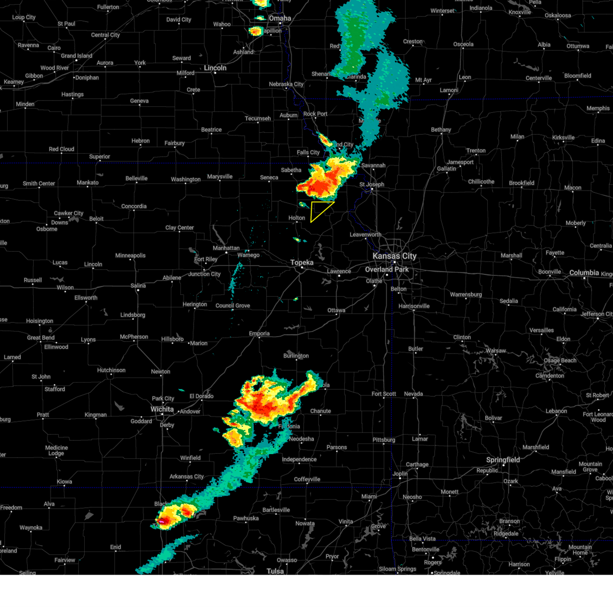 The severe thunderstorm warning for northwestern atchison county will expire at 830 pm cdt, the storm which prompted the warning has moved out of the area. therefore, the warning will be allowed to expire. a tornado watch remains in effect until 1100 pm cdt for northeastern kansas. The severe thunderstorm warning for northwestern atchison county will expire at 830 pm cdt, the storm which prompted the warning has moved out of the area. therefore, the warning will be allowed to expire. a tornado watch remains in effect until 1100 pm cdt for northeastern kansas.
|
| 5/12/2023 8:21 PM CDT |
 At 821 pm cdt, a severe thunderstorm was located over highland, moving northeast at 20 mph (radar indicated). Hazards include 60 mph wind gusts and quarter size hail. Hail damage to vehicles is expected. expect wind damage to roofs, siding, and trees. locations impacted include, highland, troy, oregon, forest city, white cloud, denton, severance, leona, iowa point, fanning, bendena and iowa reservation of kansas and nebraska. hail threat, radar indicated max hail size, 1. 00 in wind threat, radar indicated max wind gust, 60 mph. At 821 pm cdt, a severe thunderstorm was located over highland, moving northeast at 20 mph (radar indicated). Hazards include 60 mph wind gusts and quarter size hail. Hail damage to vehicles is expected. expect wind damage to roofs, siding, and trees. locations impacted include, highland, troy, oregon, forest city, white cloud, denton, severance, leona, iowa point, fanning, bendena and iowa reservation of kansas and nebraska. hail threat, radar indicated max hail size, 1. 00 in wind threat, radar indicated max wind gust, 60 mph.
|
| 5/12/2023 8:13 PM CDT |
 At 813 pm cdt, severe thunderstorms were located along a line extending from 4 miles northeast of robinson to 4 miles north of willis to near horton, moving northeast at 40 mph (radar indicated). Hazards include 60 mph wind gusts and quarter size hail. Hail damage to vehicles is expected. expect wind damage to roofs, siding, and trees. locations impacted include, hiawatha, horton, everest, robinson, reserve, powhattan, hamlin, willis and kickapoo reservation. hail threat, radar indicated max hail size, 1. 00 in wind threat, radar indicated max wind gust, 60 mph. At 813 pm cdt, severe thunderstorms were located along a line extending from 4 miles northeast of robinson to 4 miles north of willis to near horton, moving northeast at 40 mph (radar indicated). Hazards include 60 mph wind gusts and quarter size hail. Hail damage to vehicles is expected. expect wind damage to roofs, siding, and trees. locations impacted include, hiawatha, horton, everest, robinson, reserve, powhattan, hamlin, willis and kickapoo reservation. hail threat, radar indicated max hail size, 1. 00 in wind threat, radar indicated max wind gust, 60 mph.
|
| 5/12/2023 8:07 PM CDT |
 At 806 pm cdt, severe thunderstorms were located along a line extending from near hiawatha to 3 miles southeast of powhattan to whiting, moving north at 40 mph (radar indicated). Hazards include 60 mph wind gusts and quarter size hail. Hail damage to vehicles is expected. expect wind damage to roofs, siding, and trees. locations impacted include, hiawatha, horton, everest, fairview, robinson, morrill, whiting, reserve, powhattan, hamlin, willis and kickapoo reservation. hail threat, radar indicated max hail size, 1. 00 in wind threat, radar indicated max wind gust, 60 mph. At 806 pm cdt, severe thunderstorms were located along a line extending from near hiawatha to 3 miles southeast of powhattan to whiting, moving north at 40 mph (radar indicated). Hazards include 60 mph wind gusts and quarter size hail. Hail damage to vehicles is expected. expect wind damage to roofs, siding, and trees. locations impacted include, hiawatha, horton, everest, fairview, robinson, morrill, whiting, reserve, powhattan, hamlin, willis and kickapoo reservation. hail threat, radar indicated max hail size, 1. 00 in wind threat, radar indicated max wind gust, 60 mph.
|
| 5/12/2023 8:01 PM CDT |
 At 801 pm cdt, a severe thunderstorm was located over robinson, or near highland, moving northeast at 25 mph (radar indicated). Hazards include 60 mph wind gusts and quarter size hail. Hail damage to vehicles is expected. Expect wind damage to roofs, siding, and trees. At 801 pm cdt, a severe thunderstorm was located over robinson, or near highland, moving northeast at 25 mph (radar indicated). Hazards include 60 mph wind gusts and quarter size hail. Hail damage to vehicles is expected. Expect wind damage to roofs, siding, and trees.
|
| 5/12/2023 7:57 PM CDT |
 At 757 pm cdt, a severe thunderstorm was located over whiting, or 8 miles southwest of horton, moving northeast at 55 mph (radar indicated). Hazards include 60 mph wind gusts and quarter size hail. Hail damage to vehicles is expected. Expect wind damage to roofs, siding, and trees. At 757 pm cdt, a severe thunderstorm was located over whiting, or 8 miles southwest of horton, moving northeast at 55 mph (radar indicated). Hazards include 60 mph wind gusts and quarter size hail. Hail damage to vehicles is expected. Expect wind damage to roofs, siding, and trees.
|
| 5/12/2023 7:53 PM CDT |
 At 753 pm cdt, severe thunderstorms were located along a line extending from near powhattan to 3 miles northwest of whiting to 5 miles east of holton, moving north at 65 mph (radar indicated). Hazards include golf ball size hail and 60 mph wind gusts. People and animals outdoors will be injured. expect hail damage to roofs, siding, windows, and vehicles. Expect wind damage to roofs, siding, and trees. At 753 pm cdt, severe thunderstorms were located along a line extending from near powhattan to 3 miles northwest of whiting to 5 miles east of holton, moving north at 65 mph (radar indicated). Hazards include golf ball size hail and 60 mph wind gusts. People and animals outdoors will be injured. expect hail damage to roofs, siding, windows, and vehicles. Expect wind damage to roofs, siding, and trees.
|
| 4/20/2023 4:06 AM CDT |
 At 405 am cdt, severe thunderstorms were located along a line extending from 3 miles north of reserve to near whiting, moving northeast at 45 mph (radar indicated). Hazards include 60 mph wind gusts and nickel size hail. Expect damage to roofs, siding, and trees. locations impacted include, hiawatha, horton, everest, robinson, reserve, powhattan, hamlin, willis and kickapoo reservation. hail threat, radar indicated max hail size, 0. 88 in wind threat, radar indicated max wind gust, 60 mph. At 405 am cdt, severe thunderstorms were located along a line extending from 3 miles north of reserve to near whiting, moving northeast at 45 mph (radar indicated). Hazards include 60 mph wind gusts and nickel size hail. Expect damage to roofs, siding, and trees. locations impacted include, hiawatha, horton, everest, robinson, reserve, powhattan, hamlin, willis and kickapoo reservation. hail threat, radar indicated max hail size, 0. 88 in wind threat, radar indicated max wind gust, 60 mph.
|
| 4/20/2023 3:59 AM CDT |
 At 359 am cdt, severe thunderstorms were located along a line extending from 3 miles northwest of reserve to near whiting, moving east at 40 mph (radar indicated). Hazards include 60 mph wind gusts and nickel size hail. Expect damage to roofs, siding, and trees. locations impacted include, hiawatha, sabetha, horton, wetmore, everest, fairview, robinson, morrill, whiting, netawaka, reserve, powhattan, hamlin, willis and kickapoo reservation. hail threat, radar indicated max hail size, 0. 88 in wind threat, radar indicated max wind gust, 60 mph. At 359 am cdt, severe thunderstorms were located along a line extending from 3 miles northwest of reserve to near whiting, moving east at 40 mph (radar indicated). Hazards include 60 mph wind gusts and nickel size hail. Expect damage to roofs, siding, and trees. locations impacted include, hiawatha, sabetha, horton, wetmore, everest, fairview, robinson, morrill, whiting, netawaka, reserve, powhattan, hamlin, willis and kickapoo reservation. hail threat, radar indicated max hail size, 0. 88 in wind threat, radar indicated max wind gust, 60 mph.
|
| 4/20/2023 3:40 AM CDT |
 At 340 am cdt, severe thunderstorms were located along a line extending from 5 miles northeast of bern to 4 miles southwest of wetmore, moving east at 50 mph (trained weather spotters reported 70 mph winds in corning). Hazards include 70 mph wind gusts and quarter size hail. Hail damage to vehicles is expected. expect considerable tree damage. wind damage is also likely to mobile homes, roofs, and outbuildings. locations impacted include, hiawatha, sabetha, horton, wetmore, everest, fairview, robinson, morrill, whiting, bern, netawaka, goff, reserve, powhattan, oneida, hamlin, willis, kickapoo reservation and woodlawn. thunderstorm damage threat, considerable hail threat, radar indicated max hail size, 1. 00 in wind threat, radar indicated max wind gust, 70 mph. At 340 am cdt, severe thunderstorms were located along a line extending from 5 miles northeast of bern to 4 miles southwest of wetmore, moving east at 50 mph (trained weather spotters reported 70 mph winds in corning). Hazards include 70 mph wind gusts and quarter size hail. Hail damage to vehicles is expected. expect considerable tree damage. wind damage is also likely to mobile homes, roofs, and outbuildings. locations impacted include, hiawatha, sabetha, horton, wetmore, everest, fairview, robinson, morrill, whiting, bern, netawaka, goff, reserve, powhattan, oneida, hamlin, willis, kickapoo reservation and woodlawn. thunderstorm damage threat, considerable hail threat, radar indicated max hail size, 1. 00 in wind threat, radar indicated max wind gust, 70 mph.
|
| 4/20/2023 3:33 AM CDT |
 At 332 am cdt, severe thunderstorms were located along a line extending from 6 miles west of bern to 4 miles northeast of havensville, moving northeast at 45 mph (radar indicated). Hazards include 60 mph wind gusts and quarter size hail. Hail damage to vehicles is expected. Expect wind damage to roofs, siding, and trees. At 332 am cdt, severe thunderstorms were located along a line extending from 6 miles west of bern to 4 miles northeast of havensville, moving northeast at 45 mph (radar indicated). Hazards include 60 mph wind gusts and quarter size hail. Hail damage to vehicles is expected. Expect wind damage to roofs, siding, and trees.
|
| 4/4/2023 8:42 PM CDT |
 At 842 pm cdt, severe thunderstorms were located along a line extending from near fillmore to near ozawkie, moving northeast at 45 mph (radar indicated). Hazards include 60 mph wind gusts and quarter size hail. Hail damage to vehicles is expected. expect wind damage to roofs, siding, and trees. locations impacted include, st. joseph, atchison, savannah, wathena, elwood, highland, troy, country club villa, country club, effingham, amazonia, rushville, lancaster, denton, lewis and clark village, doniphan, de kalb, severance, farmington and huron. this includes the following highways, interstate 29 between mile markers 40 and 69. interstate 229 between mile markers 0 and 14. hail threat, radar indicated max hail size, 1. 00 in wind threat, radar indicated max wind gust, 60 mph. At 842 pm cdt, severe thunderstorms were located along a line extending from near fillmore to near ozawkie, moving northeast at 45 mph (radar indicated). Hazards include 60 mph wind gusts and quarter size hail. Hail damage to vehicles is expected. expect wind damage to roofs, siding, and trees. locations impacted include, st. joseph, atchison, savannah, wathena, elwood, highland, troy, country club villa, country club, effingham, amazonia, rushville, lancaster, denton, lewis and clark village, doniphan, de kalb, severance, farmington and huron. this includes the following highways, interstate 29 between mile markers 40 and 69. interstate 229 between mile markers 0 and 14. hail threat, radar indicated max hail size, 1. 00 in wind threat, radar indicated max wind gust, 60 mph.
|
| 4/4/2023 8:17 PM CDT |
 At 817 pm cdt, severe thunderstorms were located along a line extending from highland to near silver lake, moving east at 50 mph (radar indicated). Hazards include 60 mph wind gusts and quarter size hail. Hail damage to vehicles is expected. Expect wind damage to roofs, siding, and trees. At 817 pm cdt, severe thunderstorms were located along a line extending from highland to near silver lake, moving east at 50 mph (radar indicated). Hazards include 60 mph wind gusts and quarter size hail. Hail damage to vehicles is expected. Expect wind damage to roofs, siding, and trees.
|
| 4/4/2023 8:00 PM CDT |
 At 759 pm cdt, severe thunderstorms were located along a line extending from 5 miles north of forest city to horton, moving northeast at 50 mph (radar indicated). Hazards include 60 mph wind gusts and quarter size hail. Hail damage to vehicles is expected. Expect wind damage to roofs, siding, and trees. At 759 pm cdt, severe thunderstorms were located along a line extending from 5 miles north of forest city to horton, moving northeast at 50 mph (radar indicated). Hazards include 60 mph wind gusts and quarter size hail. Hail damage to vehicles is expected. Expect wind damage to roofs, siding, and trees.
|
| 4/4/2023 6:02 PM CDT |
 At 602 pm cdt, a severe thunderstorm was located near denton, or 10 miles east of horton, moving northeast at 60 mph (radar indicated). Hazards include 60 mph wind gusts and half dollar size hail. Hail damage to vehicles is expected. Expect wind damage to roofs, siding, and trees. At 602 pm cdt, a severe thunderstorm was located near denton, or 10 miles east of horton, moving northeast at 60 mph (radar indicated). Hazards include 60 mph wind gusts and half dollar size hail. Hail damage to vehicles is expected. Expect wind damage to roofs, siding, and trees.
|
| 2/27/2023 12:50 AM CST |
 At 1250 am cst, severe thunderstorms were located along a line extending from near lancaster to near nortonville to near oskaloosa, moving northeast at 60 mph (radar indicated). Hazards include 60 mph wind gusts. Expect damage to roofs, siding, and trees. locations impacted include, atchison, highland, effingham, rushville, lancaster, easton, muscotah, denton, lewis and clark village, doniphan, severance, farmington, huron, leona, iatan, arrington, bean lake, lewis and clark vi, bendena and lowemont. hail threat, radar indicated max hail size, <. 75 in wind threat, radar indicated max wind gust, 60 mph. At 1250 am cst, severe thunderstorms were located along a line extending from near lancaster to near nortonville to near oskaloosa, moving northeast at 60 mph (radar indicated). Hazards include 60 mph wind gusts. Expect damage to roofs, siding, and trees. locations impacted include, atchison, highland, effingham, rushville, lancaster, easton, muscotah, denton, lewis and clark village, doniphan, severance, farmington, huron, leona, iatan, arrington, bean lake, lewis and clark vi, bendena and lowemont. hail threat, radar indicated max hail size, <. 75 in wind threat, radar indicated max wind gust, 60 mph.
|
| 2/27/2023 12:49 AM CST |
 At 1249 am cst, severe thunderstorms were located along a line extending from 3 miles south of robinson to 5 miles southeast of lancaster to 3 miles southwest of mclouth, moving northeast at 60 mph (radar indicated). Hazards include 60 mph wind gusts. Expect damage to roofs, siding, and trees. locations impacted include, horton, oskaloosa, perry, mclouth, nortonville, winchester, everest, robinson and willis. hail threat, radar indicated max hail size, <. 75 in wind threat, radar indicated max wind gust, 60 mph. At 1249 am cst, severe thunderstorms were located along a line extending from 3 miles south of robinson to 5 miles southeast of lancaster to 3 miles southwest of mclouth, moving northeast at 60 mph (radar indicated). Hazards include 60 mph wind gusts. Expect damage to roofs, siding, and trees. locations impacted include, horton, oskaloosa, perry, mclouth, nortonville, winchester, everest, robinson and willis. hail threat, radar indicated max hail size, <. 75 in wind threat, radar indicated max wind gust, 60 mph.
|
| 2/27/2023 12:40 AM CST |
 At 1240 am cst, severe thunderstorms were located along a line extending from near everest to near nortonville to williamstown, moving northeast at 60 mph (radar indicated). Hazards include 60 mph wind gusts. Expect damage to roofs, siding, and trees. locations impacted include, horton, valley falls, oskaloosa, perry, mclouth, ozawkie, nortonville, lecompton, winchester, everest, robinson, whiting, willis, williamstown and perry lake. this includes kansas turnpike between mile markers 189 and 194. hail threat, radar indicated max hail size, <. 75 in wind threat, radar indicated max wind gust, 60 mph. At 1240 am cst, severe thunderstorms were located along a line extending from near everest to near nortonville to williamstown, moving northeast at 60 mph (radar indicated). Hazards include 60 mph wind gusts. Expect damage to roofs, siding, and trees. locations impacted include, horton, valley falls, oskaloosa, perry, mclouth, ozawkie, nortonville, lecompton, winchester, everest, robinson, whiting, willis, williamstown and perry lake. this includes kansas turnpike between mile markers 189 and 194. hail threat, radar indicated max hail size, <. 75 in wind threat, radar indicated max wind gust, 60 mph.
|
| 2/27/2023 12:29 AM CST |
 At 1228 am cst, severe thunderstorms were located along a line extending from near horton to 3 miles southwest of valley falls to richland, moving northeast at 60 mph (radar indicated). Hazards include 60 mph wind gusts. Expect damage to roofs, siding, and trees. locations impacted include, northeastern topeka, holton, horton, valley falls, oskaloosa, tecumseh, richland, perry, mclouth, meriden, ozawkie, nortonville, lecompton, winchester, everest, robinson, whiting, denison, willis and williamstown. this includes kansas turnpike between mile markers 182 and 195. hail threat, radar indicated max hail size, <. 75 in wind threat, radar indicated max wind gust, 60 mph. At 1228 am cst, severe thunderstorms were located along a line extending from near horton to 3 miles southwest of valley falls to richland, moving northeast at 60 mph (radar indicated). Hazards include 60 mph wind gusts. Expect damage to roofs, siding, and trees. locations impacted include, northeastern topeka, holton, horton, valley falls, oskaloosa, tecumseh, richland, perry, mclouth, meriden, ozawkie, nortonville, lecompton, winchester, everest, robinson, whiting, denison, willis and williamstown. this includes kansas turnpike between mile markers 182 and 195. hail threat, radar indicated max hail size, <. 75 in wind threat, radar indicated max wind gust, 60 mph.
|
| 2/27/2023 12:26 AM CST |
 At 1226 am cst, severe thunderstorms were located along a line extending from near hoyt to meriden to near berryton, moving northeast at 60 mph (radar indicated). Hazards include 60 mph wind gusts. expect damage to roofs, siding, and trees At 1226 am cst, severe thunderstorms were located along a line extending from near hoyt to meriden to near berryton, moving northeast at 60 mph (radar indicated). Hazards include 60 mph wind gusts. expect damage to roofs, siding, and trees
|
| 2/27/2023 12:13 AM CST |
 At 1212 am cst, severe thunderstorms were located along a line extending from near holton to 6 miles north of topeka to 6 miles south of scranton, moving northeast at 60 mph (radar indicated). Hazards include 60 mph wind gusts. expect damage to roofs, siding, and trees At 1212 am cst, severe thunderstorms were located along a line extending from near holton to 6 miles north of topeka to 6 miles south of scranton, moving northeast at 60 mph (radar indicated). Hazards include 60 mph wind gusts. expect damage to roofs, siding, and trees
|
| 8/29/2022 5:22 PM CDT |
 At 522 pm cdt, a severe thunderstorm was located over lancaster, or 10 miles southeast of horton, moving east at 15 mph (radar indicated). Hazards include 60 mph wind gusts and quarter size hail. Hail damage to vehicles is expected. Expect wind damage to roofs, siding, and trees. At 522 pm cdt, a severe thunderstorm was located over lancaster, or 10 miles southeast of horton, moving east at 15 mph (radar indicated). Hazards include 60 mph wind gusts and quarter size hail. Hail damage to vehicles is expected. Expect wind damage to roofs, siding, and trees.
|
| 7/7/2022 2:34 AM CDT |
 At 234 am cdt, severe thunderstorms were located along a line extending from near villisca to near ravenwood to near dearborn, moving northeast at 50 mph (radar indicated). Hazards include 60 mph wind gusts and quarter size hail. Hail damage to vehicles is expected. expect wind damage to roofs, siding, and trees. locations impacted include, st. joseph, maryville, savannah, albany, wathena, elwood, stanberry, maysville, highland, troy, country club villa, country club, king city, grant city, oregon, stewartsville, burlington junction, hopkins, ravenwood and union star. this includes the following highways, interstate 29 between mile markers 44 and 79. interstate 229 between mile markers 2 and 14. hail threat, radar indicated max hail size, 1. 00 in wind threat, radar indicated max wind gust, 60 mph. At 234 am cdt, severe thunderstorms were located along a line extending from near villisca to near ravenwood to near dearborn, moving northeast at 50 mph (radar indicated). Hazards include 60 mph wind gusts and quarter size hail. Hail damage to vehicles is expected. expect wind damage to roofs, siding, and trees. locations impacted include, st. joseph, maryville, savannah, albany, wathena, elwood, stanberry, maysville, highland, troy, country club villa, country club, king city, grant city, oregon, stewartsville, burlington junction, hopkins, ravenwood and union star. this includes the following highways, interstate 29 between mile markers 44 and 79. interstate 229 between mile markers 2 and 14. hail threat, radar indicated max hail size, 1. 00 in wind threat, radar indicated max wind gust, 60 mph.
|
| 7/7/2022 2:07 AM CDT |
 At 206 am cdt, severe thunderstorms were located along a line extending from near shenandoah to near skidmore to near nortonville, moving northeast at 50 mph (radar indicated). Hazards include 60 mph wind gusts and nickel size hail. expect damage to roofs, siding, and trees At 206 am cdt, severe thunderstorms were located along a line extending from near shenandoah to near skidmore to near nortonville, moving northeast at 50 mph (radar indicated). Hazards include 60 mph wind gusts and nickel size hail. expect damage to roofs, siding, and trees
|
| 6/21/2022 8:25 PM CDT |
 The severe thunderstorm warning for western atchison county will expire at 830 pm cdt, the storm which prompted the warning has moved out of western atchison couty ks. therefore, the warning will be allowed to expire in western atchison county ks. a severe thunderstorm watch remains in effect until midnight cdt for northeastern kansas. remember, a severe thunderstorm warning still remains in effect for eastern atchison county ks and southern doniphan county ks until 900 pm. The severe thunderstorm warning for western atchison county will expire at 830 pm cdt, the storm which prompted the warning has moved out of western atchison couty ks. therefore, the warning will be allowed to expire in western atchison county ks. a severe thunderstorm watch remains in effect until midnight cdt for northeastern kansas. remember, a severe thunderstorm warning still remains in effect for eastern atchison county ks and southern doniphan county ks until 900 pm.
|
| 6/21/2022 8:23 PM CDT |
 At 823 pm cdt, a severe thunderstorm was located over lancaster, or 8 miles west of atchison, moving east at 25 mph (radar indicated). Hazards include 60 mph wind gusts and penny size hail. expect damage to roofs, siding, and trees At 823 pm cdt, a severe thunderstorm was located over lancaster, or 8 miles west of atchison, moving east at 25 mph (radar indicated). Hazards include 60 mph wind gusts and penny size hail. expect damage to roofs, siding, and trees
|
| 6/21/2022 8:16 PM CDT |
 At 816 pm cdt, a severe thunderstorm was located near everest, or 7 miles east of horton, moving east at 20 mph (radar indicated). Hazards include 60 mph wind gusts and penny size hail. Expect damage to roofs, siding, and trees. locations impacted include, effingham, lancaster, farmington and huron. hail threat, radar indicated max hail size, 0. 75 in wind threat, radar indicated max wind gust, 60 mph. At 816 pm cdt, a severe thunderstorm was located near everest, or 7 miles east of horton, moving east at 20 mph (radar indicated). Hazards include 60 mph wind gusts and penny size hail. Expect damage to roofs, siding, and trees. locations impacted include, effingham, lancaster, farmington and huron. hail threat, radar indicated max hail size, 0. 75 in wind threat, radar indicated max wind gust, 60 mph.
|
| 6/21/2022 7:59 PM CDT |
 At 758 pm cdt, a severe thunderstorm was located near horton, moving east at 20 mph (radar indicated). Hazards include 60 mph wind gusts and penny size hail. expect damage to roofs, siding, and trees At 758 pm cdt, a severe thunderstorm was located near horton, moving east at 20 mph (radar indicated). Hazards include 60 mph wind gusts and penny size hail. expect damage to roofs, siding, and trees
|
| 6/12/2022 10:11 AM CDT |
 At 1010 am cdt, a severe thunderstorm was located near lancaster, or near atchison, moving east at 40 mph (radar indicated). Hazards include 60 mph wind gusts and quarter size hail. Hail damage to vehicles is expected. expect wind damage to roofs, siding, and trees. locations impacted include, atchison, rushville, lancaster, denton, lewis and clark village, doniphan, de kalb, severance, farmington, huron, iatan, bean lake, lewis and clark vi, bendena, lowemont, cummings and potter. hail threat, radar indicated max hail size, 1. 00 in wind threat, radar indicated max wind gust, 60 mph. At 1010 am cdt, a severe thunderstorm was located near lancaster, or near atchison, moving east at 40 mph (radar indicated). Hazards include 60 mph wind gusts and quarter size hail. Hail damage to vehicles is expected. expect wind damage to roofs, siding, and trees. locations impacted include, atchison, rushville, lancaster, denton, lewis and clark village, doniphan, de kalb, severance, farmington, huron, iatan, bean lake, lewis and clark vi, bendena, lowemont, cummings and potter. hail threat, radar indicated max hail size, 1. 00 in wind threat, radar indicated max wind gust, 60 mph.
|
| 6/12/2022 9:59 AM CDT |
 At 959 am cdt, a severe thunderstorm was located near lancaster, or 9 miles east of horton, moving east at 40 mph (radar indicated). Hazards include 60 mph wind gusts and quarter size hail. Hail damage to vehicles is expected. Expect wind damage to roofs, siding, and trees. At 959 am cdt, a severe thunderstorm was located near lancaster, or 9 miles east of horton, moving east at 40 mph (radar indicated). Hazards include 60 mph wind gusts and quarter size hail. Hail damage to vehicles is expected. Expect wind damage to roofs, siding, and trees.
|
| 6/12/2022 9:52 AM CDT |
 The severe thunderstorm warning for northeastern jackson and southern brown counties will expire at 1000 am cdt, the storm which prompted the warning has weakened below severe limits, and has exited the warned area. therefore, the warning will be allowed to expire. however gusty winds and heavy rain are still possible with this thunderstorm. The severe thunderstorm warning for northeastern jackson and southern brown counties will expire at 1000 am cdt, the storm which prompted the warning has weakened below severe limits, and has exited the warned area. therefore, the warning will be allowed to expire. however gusty winds and heavy rain are still possible with this thunderstorm.
|
| 6/12/2022 9:42 AM CDT |
 At 942 am cdt, a severe thunderstorm was located near horton, moving east at 50 mph (radar indicated). Hazards include 60 mph wind gusts and quarter size hail. Hail damage to vehicles is expected. expect wind damage to roofs, siding, and trees. locations impacted include, hiawatha, horton, everest, robinson, whiting, netawaka, powhattan, willis and kickapoo reservation. hail threat, radar indicated max hail size, 1. 00 in wind threat, radar indicated max wind gust, 60 mph. At 942 am cdt, a severe thunderstorm was located near horton, moving east at 50 mph (radar indicated). Hazards include 60 mph wind gusts and quarter size hail. Hail damage to vehicles is expected. expect wind damage to roofs, siding, and trees. locations impacted include, hiawatha, horton, everest, robinson, whiting, netawaka, powhattan, willis and kickapoo reservation. hail threat, radar indicated max hail size, 1. 00 in wind threat, radar indicated max wind gust, 60 mph.
|
| 6/12/2022 9:36 AM CDT |
 At 935 am cdt, a severe thunderstorm was located over kickapoo reservation, or near horton, moving east at 45 mph (radar indicated). Hazards include 60 mph wind gusts and quarter size hail. Hail damage to vehicles is expected. Expect wind damage to roofs, siding, and trees. At 935 am cdt, a severe thunderstorm was located over kickapoo reservation, or near horton, moving east at 45 mph (radar indicated). Hazards include 60 mph wind gusts and quarter size hail. Hail damage to vehicles is expected. Expect wind damage to roofs, siding, and trees.
|
| 6/12/2022 9:30 AM CDT |
 At 930 am cdt, a severe thunderstorm was located 5 miles northwest of kickapoo reservation, moving southeast at 50 mph (radar indicated). Hazards include 60 mph wind gusts and quarter size hail. Hail damage to vehicles is expected. Expect wind damage to roofs, siding, and trees. At 930 am cdt, a severe thunderstorm was located 5 miles northwest of kickapoo reservation, moving southeast at 50 mph (radar indicated). Hazards include 60 mph wind gusts and quarter size hail. Hail damage to vehicles is expected. Expect wind damage to roofs, siding, and trees.
|
| 6/8/2022 12:39 AM CDT |
 The severe thunderstorm warning for southwestern doniphan and atchison counties will expire at 1245 am cdt, this warning has been replaced. storms moving through atchison county, ks and southern doniphan are still capable of producing 60 mph winds and penny size hail. please refer to the most recent warning for those areas. a severe thunderstorm watch remains in effect until 300 am cdt for northeastern kansas. a severe thunderstorm watch also remains in effect until 500 am cdt for northeastern kansas. The severe thunderstorm warning for southwestern doniphan and atchison counties will expire at 1245 am cdt, this warning has been replaced. storms moving through atchison county, ks and southern doniphan are still capable of producing 60 mph winds and penny size hail. please refer to the most recent warning for those areas. a severe thunderstorm watch remains in effect until 300 am cdt for northeastern kansas. a severe thunderstorm watch also remains in effect until 500 am cdt for northeastern kansas.
|
| 6/8/2022 12:30 AM CDT |
 At 1230 am cdt, severe thunderstorms were located along a line extending from near lancaster to near winchester to near perry lake, moving east at 45 mph (radar indicated). Hazards include 60 mph wind gusts and penny size hail. expect damage to roofs, siding, and trees At 1230 am cdt, severe thunderstorms were located along a line extending from near lancaster to near winchester to near perry lake, moving east at 45 mph (radar indicated). Hazards include 60 mph wind gusts and penny size hail. expect damage to roofs, siding, and trees
|
| 6/8/2022 12:25 AM CDT |
 At 1225 am cdt, severe thunderstorms were located along a line extending from willis to near effingham to perry lake, moving east at 45 mph (radar indicated). Hazards include 60 mph wind gusts and penny size hail. Expect damage to roofs, siding, and trees. locations impacted include, atchison, effingham, lancaster, muscotah, denton, severance, farmington, huron, leona, arrington, bendena, cummings and fanning. hail threat, radar indicated max hail size, 0. 75 in wind threat, radar indicated max wind gust, 60 mph. At 1225 am cdt, severe thunderstorms were located along a line extending from willis to near effingham to perry lake, moving east at 45 mph (radar indicated). Hazards include 60 mph wind gusts and penny size hail. Expect damage to roofs, siding, and trees. locations impacted include, atchison, effingham, lancaster, muscotah, denton, severance, farmington, huron, leona, arrington, bendena, cummings and fanning. hail threat, radar indicated max hail size, 0. 75 in wind threat, radar indicated max wind gust, 60 mph.
|
| 6/8/2022 12:21 AM CDT |
 At 1221 am cdt, severe thunderstorms were located along a line extending from horton to 4 miles northwest of nortonville to near perry lake, moving east at 60 mph (radar indicated). Hazards include 60 mph wind gusts. Expect damage to roofs, siding, and trees. locations impacted include, horton, valley falls, oskaloosa, mclouth, meriden, ozawkie, nortonville, winchester, everest, robinson, whiting, denison, willis, kickapoo reservation and perry lake. hail threat, radar indicated max hail size, <. 75 in wind threat, radar indicated max wind gust, 60 mph. At 1221 am cdt, severe thunderstorms were located along a line extending from horton to 4 miles northwest of nortonville to near perry lake, moving east at 60 mph (radar indicated). Hazards include 60 mph wind gusts. Expect damage to roofs, siding, and trees. locations impacted include, horton, valley falls, oskaloosa, mclouth, meriden, ozawkie, nortonville, winchester, everest, robinson, whiting, denison, willis, kickapoo reservation and perry lake. hail threat, radar indicated max hail size, <. 75 in wind threat, radar indicated max wind gust, 60 mph.
|
| 6/8/2022 12:08 AM CDT |
 At 1208 am cdt, severe thunderstorms were located along a line extending from 3 miles southwest of kickapoo reservation to 3 miles northeast of denison to 4 miles south of hoyt, moving east at 60 mph (radar indicated). Hazards include 60 mph wind gusts. Expect damage to roofs, siding, and trees. locations impacted include, holton, horton, valley falls, oskaloosa, mclouth, meriden, hoyt, ozawkie, nortonville, winchester, wetmore, mayetta, everest, robinson, whiting, denison, netawaka, powhattan, willis and kickapoo reservation. hail threat, radar indicated max hail size, <. 75 in wind threat, radar indicated max wind gust, 60 mph. At 1208 am cdt, severe thunderstorms were located along a line extending from 3 miles southwest of kickapoo reservation to 3 miles northeast of denison to 4 miles south of hoyt, moving east at 60 mph (radar indicated). Hazards include 60 mph wind gusts. Expect damage to roofs, siding, and trees. locations impacted include, holton, horton, valley falls, oskaloosa, mclouth, meriden, hoyt, ozawkie, nortonville, winchester, wetmore, mayetta, everest, robinson, whiting, denison, netawaka, powhattan, willis and kickapoo reservation. hail threat, radar indicated max hail size, <. 75 in wind threat, radar indicated max wind gust, 60 mph.
|
| 6/8/2022 12:04 AM CDT |
 At 1204 am cdt, severe thunderstorms were located along a line extending from 3 miles south of fairview to 3 miles north of denison to 5 miles southwest of hoyt, moving east at 60 mph (radar indicated). Hazards include 60 mph wind gusts. Expect damage to roofs, siding, and trees. locations impacted include, holton, hiawatha, horton, valley falls, oskaloosa, mclouth, meriden, hoyt, ozawkie, nortonville, winchester, wetmore, mayetta, everest, robinson, whiting, denison, circleville, netawaka and goff. hail threat, radar indicated max hail size, <. 75 in wind threat, radar indicated max wind gust, 60 mph. At 1204 am cdt, severe thunderstorms were located along a line extending from 3 miles south of fairview to 3 miles north of denison to 5 miles southwest of hoyt, moving east at 60 mph (radar indicated). Hazards include 60 mph wind gusts. Expect damage to roofs, siding, and trees. locations impacted include, holton, hiawatha, horton, valley falls, oskaloosa, mclouth, meriden, hoyt, ozawkie, nortonville, winchester, wetmore, mayetta, everest, robinson, whiting, denison, circleville, netawaka and goff. hail threat, radar indicated max hail size, <. 75 in wind threat, radar indicated max wind gust, 60 mph.
|
| 6/7/2022 11:59 PM CDT |
 At 1159 pm cdt, severe thunderstorms were located along a line extending from near woodlawn to near holton to near st. marys, moving east at 50 mph (radar indicated). Hazards include 60 mph wind gusts and penny size hail. expect damage to roofs, siding, and trees At 1159 pm cdt, severe thunderstorms were located along a line extending from near woodlawn to near holton to near st. marys, moving east at 50 mph (radar indicated). Hazards include 60 mph wind gusts and penny size hail. expect damage to roofs, siding, and trees
|
| 6/7/2022 11:55 PM CDT |
 At 1155 pm cdt, severe thunderstorms were located along a line extending from 3 miles northeast of woodlawn to near holton to 4 miles southeast of delia, moving east at 60 mph (radar indicated). Hazards include 60 mph wind gusts. expect damage to roofs, siding, and trees At 1155 pm cdt, severe thunderstorms were located along a line extending from 3 miles northeast of woodlawn to near holton to 4 miles southeast of delia, moving east at 60 mph (radar indicated). Hazards include 60 mph wind gusts. expect damage to roofs, siding, and trees
|
| 6/6/2022 4:52 PM CDT |
 At 451 pm cdt, a severe thunderstorm was located near denton, or 7 miles southwest of troy, moving southeast at 25 mph (radar indicated). Hazards include 60 mph wind gusts and quarter size hail. Hail damage to vehicles is expected. Expect wind damage to roofs, siding, and trees. At 451 pm cdt, a severe thunderstorm was located near denton, or 7 miles southwest of troy, moving southeast at 25 mph (radar indicated). Hazards include 60 mph wind gusts and quarter size hail. Hail damage to vehicles is expected. Expect wind damage to roofs, siding, and trees.
|
| 5/30/2022 6:41 PM CDT |
 At 640 pm cdt, a severe thunderstorm was located over lancaster, or 10 miles east of horton, moving northeast at 50 mph (trained weather spotters). Hazards include 60 mph wind gusts and half dollar size hail. Hail damage to vehicles is expected. expect wind damage to roofs, siding, and trees. locations impacted include, effingham, lancaster, muscotah, farmington, huron and arrington. hail threat, observed max hail size, 1. 25 in wind threat, radar indicated max wind gust, 60 mph. At 640 pm cdt, a severe thunderstorm was located over lancaster, or 10 miles east of horton, moving northeast at 50 mph (trained weather spotters). Hazards include 60 mph wind gusts and half dollar size hail. Hail damage to vehicles is expected. expect wind damage to roofs, siding, and trees. locations impacted include, effingham, lancaster, muscotah, farmington, huron and arrington. hail threat, observed max hail size, 1. 25 in wind threat, radar indicated max wind gust, 60 mph.
|
| 5/30/2022 6:26 PM CDT |
 At 626 pm cdt, a severe thunderstorm was located near muscotah, or 10 miles south of horton, moving northeast at 50 mph (radar indicated). Hazards include 60 mph wind gusts and half dollar size hail. Hail damage to vehicles is expected. Expect wind damage to roofs, siding, and trees. At 626 pm cdt, a severe thunderstorm was located near muscotah, or 10 miles south of horton, moving northeast at 50 mph (radar indicated). Hazards include 60 mph wind gusts and half dollar size hail. Hail damage to vehicles is expected. Expect wind damage to roofs, siding, and trees.
|
| 5/30/2022 6:06 PM CDT |
 At 606 pm cdt, a severe thunderstorm was located over potawatomi reservation, or 8 miles southwest of holton, moving northeast at 50 mph (radar indicated). Hazards include 60 mph wind gusts and quarter size hail. Hail damage to vehicles is expected. Expect wind damage to roofs, siding, and trees. At 606 pm cdt, a severe thunderstorm was located over potawatomi reservation, or 8 miles southwest of holton, moving northeast at 50 mph (radar indicated). Hazards include 60 mph wind gusts and quarter size hail. Hail damage to vehicles is expected. Expect wind damage to roofs, siding, and trees.
|
| 5/15/2022 5:49 AM CDT |
 At 549 am cdt, a severe thunderstorm was located near effingham, or 9 miles southeast of horton, moving southeast at 25 mph (radar indicated). Hazards include quarter size hail. Damage to vehicles is expected. locations impacted include, effingham, lancaster, muscotah and huron. hail threat, radar indicated max hail size, 1. 00 in wind threat, radar indicated max wind gust, <50 mph. At 549 am cdt, a severe thunderstorm was located near effingham, or 9 miles southeast of horton, moving southeast at 25 mph (radar indicated). Hazards include quarter size hail. Damage to vehicles is expected. locations impacted include, effingham, lancaster, muscotah and huron. hail threat, radar indicated max hail size, 1. 00 in wind threat, radar indicated max wind gust, <50 mph.
|
| 5/15/2022 5:35 AM CDT |
 The severe thunderstorm warning for northeastern jackson and southeastern brown counties will expire at 545 am cdt, the storm which prompted the warning has moved out of the area. therefore, the warning will be allowed to expire. The severe thunderstorm warning for northeastern jackson and southeastern brown counties will expire at 545 am cdt, the storm which prompted the warning has moved out of the area. therefore, the warning will be allowed to expire.
|
| 5/15/2022 5:25 AM CDT |
 At 524 am cdt, a severe thunderstorm was located 3 miles west of horton, moving east-southeast at 30 mph (radar indicated). Hazards include half dollar size hail. Damage to vehicles is expected. locations impacted include, horton, everest, whiting and kickapoo reservation. hail threat, radar indicated max hail size, 1. 25 in wind threat, radar indicated max wind gust, <50 mph. At 524 am cdt, a severe thunderstorm was located 3 miles west of horton, moving east-southeast at 30 mph (radar indicated). Hazards include half dollar size hail. Damage to vehicles is expected. locations impacted include, horton, everest, whiting and kickapoo reservation. hail threat, radar indicated max hail size, 1. 25 in wind threat, radar indicated max wind gust, <50 mph.
|
| 5/15/2022 5:21 AM CDT |
 At 521 am cdt, a severe thunderstorm was located near horton, moving southeast at 30 mph (radar indicated). Hazards include quarter size hail. damage to vehicles is expected At 521 am cdt, a severe thunderstorm was located near horton, moving southeast at 30 mph (radar indicated). Hazards include quarter size hail. damage to vehicles is expected
|
| 5/15/2022 5:20 AM CDT |
 At 519 am cdt, a severe thunderstorm was located 4 miles west of horton, moving east-southeast at 30 mph (radar indicated). Hazards include quarter size hail. Damage to vehicles is expected. locations impacted include, horton, everest, whiting, powhattan, willis and kickapoo reservation. hail threat, radar indicated max hail size, 1. 00 in wind threat, radar indicated max wind gust, <50 mph. At 519 am cdt, a severe thunderstorm was located 4 miles west of horton, moving east-southeast at 30 mph (radar indicated). Hazards include quarter size hail. Damage to vehicles is expected. locations impacted include, horton, everest, whiting, powhattan, willis and kickapoo reservation. hail threat, radar indicated max hail size, 1. 00 in wind threat, radar indicated max wind gust, <50 mph.
|
| 5/15/2022 5:11 AM CDT |
 At 510 am cdt, a severe thunderstorm was located over kickapoo reservation, moving east-southeast at 30 mph (radar indicated). Hazards include half dollar size hail. damage to vehicles is expected At 510 am cdt, a severe thunderstorm was located over kickapoo reservation, moving east-southeast at 30 mph (radar indicated). Hazards include half dollar size hail. damage to vehicles is expected
|
| 4/29/2022 9:11 PM CDT |
 The severe thunderstorm warning for northeastern jackson and brown counties will expire at 915 pm cdt, the storms which prompted the warning have weakened below severe limits, and no longer pose an immediate threat to life or property. therefore, the warning will be allowed to expire. however gusty winds are still possible with these thunderstorms. a tornado watch remains in effect until 1100 pm cdt for northeastern kansas. The severe thunderstorm warning for northeastern jackson and brown counties will expire at 915 pm cdt, the storms which prompted the warning have weakened below severe limits, and no longer pose an immediate threat to life or property. therefore, the warning will be allowed to expire. however gusty winds are still possible with these thunderstorms. a tornado watch remains in effect until 1100 pm cdt for northeastern kansas.
|
| 4/29/2022 8:45 PM CDT |
 At 845 pm cdt, severe thunderstorms were located along a line extending from near reserve to near willis to near potawatomi reservation, moving northeast at 35 mph (radar indicated). Hazards include 60 mph wind gusts and quarter size hail. Hail damage to vehicles is expected. Expect wind damage to roofs, siding, and trees. At 845 pm cdt, severe thunderstorms were located along a line extending from near reserve to near willis to near potawatomi reservation, moving northeast at 35 mph (radar indicated). Hazards include 60 mph wind gusts and quarter size hail. Hail damage to vehicles is expected. Expect wind damage to roofs, siding, and trees.
|
| 4/29/2022 8:35 PM CDT |
 At 835 pm cdt, severe thunderstorms were located along a line extending from 3 miles west of reserve to near horton to 5 miles south of whiting, moving northeast at 25 mph (radar indicated). Hazards include 60 mph wind gusts and nickel size hail. expect damage to roofs, siding, and trees At 835 pm cdt, severe thunderstorms were located along a line extending from 3 miles west of reserve to near horton to 5 miles south of whiting, moving northeast at 25 mph (radar indicated). Hazards include 60 mph wind gusts and nickel size hail. expect damage to roofs, siding, and trees
|
| 3/29/2022 7:44 PM CDT |
 At 743 pm cdt, a severe thunderstorm was located over muscotah, or 9 miles south of horton, moving east at 45 mph (radar indicated). Hazards include 60 mph wind gusts and penny size hail. expect damage to roofs, siding, and trees At 743 pm cdt, a severe thunderstorm was located over muscotah, or 9 miles south of horton, moving east at 45 mph (radar indicated). Hazards include 60 mph wind gusts and penny size hail. expect damage to roofs, siding, and trees
|
| 11/10/2021 1:53 PM CST |
 At 152 pm cst, a severe thunderstorm was located over mayetta, or near holton, moving northeast at 35 mph (radar indicated). Hazards include 60 mph wind gusts. expect damage to roofs, siding, and trees At 152 pm cst, a severe thunderstorm was located over mayetta, or near holton, moving northeast at 35 mph (radar indicated). Hazards include 60 mph wind gusts. expect damage to roofs, siding, and trees
|
| 11/10/2021 1:49 PM CST |
 At 148 pm cst, severe thunderstorms were located along a line extending from near morrill to near hiawatha to 4 miles west of denton, moving northeast at 45 mph (radar indicated). Hazards include 60 mph wind gusts and nickel size hail. Expect damage to roofs, siding, and trees. locations impacted include, hiawatha, horton, everest, fairview, robinson, morrill, reserve, powhattan, hamlin, willis and kickapoo reservation. hail threat, radar indicated max hail size, 0. 88 in wind threat, radar indicated max wind gust, 60 mph. At 148 pm cst, severe thunderstorms were located along a line extending from near morrill to near hiawatha to 4 miles west of denton, moving northeast at 45 mph (radar indicated). Hazards include 60 mph wind gusts and nickel size hail. Expect damage to roofs, siding, and trees. locations impacted include, hiawatha, horton, everest, fairview, robinson, morrill, reserve, powhattan, hamlin, willis and kickapoo reservation. hail threat, radar indicated max hail size, 0. 88 in wind threat, radar indicated max wind gust, 60 mph.
|
| 11/10/2021 1:30 PM CST |
 At 130 pm cst, severe thunderstorms were located along a line extending from 3 miles west of woodlawn to near kickapoo reservation to 3 miles northwest of muscotah, moving northeast at 45 mph (radar indicated). Hazards include 60 mph wind gusts and nickel size hail. expect damage to roofs, siding, and trees At 130 pm cst, severe thunderstorms were located along a line extending from 3 miles west of woodlawn to near kickapoo reservation to 3 miles northwest of muscotah, moving northeast at 45 mph (radar indicated). Hazards include 60 mph wind gusts and nickel size hail. expect damage to roofs, siding, and trees
|
| 11/10/2021 1:28 PM CST |
 At 126 pm cst, a severe thunderstorm was located near whiting, or near holton, moving northeast at 65 mph (radar indicated). Hazards include 60 mph wind gusts. expect damage to roofs, siding, and trees At 126 pm cst, a severe thunderstorm was located near whiting, or near holton, moving northeast at 65 mph (radar indicated). Hazards include 60 mph wind gusts. expect damage to roofs, siding, and trees
|
| 10/24/2021 1:27 AM CDT |
 The severe thunderstorm warning for western atchison county will expire at 130 am cdt, the storm which prompted the warning has weakened below severe limits, and no longer poses an immediate threat to life or property. therefore, the warning will be allowed to expire. however small hail to penny size is still possible with this thunderstorm. a severe thunderstorm watch remains in effect until 500 am cdt for northeastern kansas and northern missouri. The severe thunderstorm warning for western atchison county will expire at 130 am cdt, the storm which prompted the warning has weakened below severe limits, and no longer poses an immediate threat to life or property. therefore, the warning will be allowed to expire. however small hail to penny size is still possible with this thunderstorm. a severe thunderstorm watch remains in effect until 500 am cdt for northeastern kansas and northern missouri.
|
| 10/24/2021 1:04 AM CDT |
 At 103 am cdt, a severe thunderstorm was located near muscotah, or 9 miles east of holton, moving northeast at 40 mph (radar indicated). Hazards include quarter size hail. damage to vehicles is expected At 103 am cdt, a severe thunderstorm was located near muscotah, or 9 miles east of holton, moving northeast at 40 mph (radar indicated). Hazards include quarter size hail. damage to vehicles is expected
|
| 8/31/2021 8:40 AM CDT |
 At 839 am cdt, severe thunderstorms were located along a line extending from near troy to near effingham to near circleville, moving southeast at 40 mph (radar indicated). Hazards include 60 mph wind gusts. Expect damage to roofs, siding, and trees. locations impacted include, atchison, effingham, lancaster, muscotah, farmington, huron, cummings, arrington and bendena. hail threat, radar indicated max hail size, <. 75 in wind threat, radar indicated max wind gust, 60 mph. At 839 am cdt, severe thunderstorms were located along a line extending from near troy to near effingham to near circleville, moving southeast at 40 mph (radar indicated). Hazards include 60 mph wind gusts. Expect damage to roofs, siding, and trees. locations impacted include, atchison, effingham, lancaster, muscotah, farmington, huron, cummings, arrington and bendena. hail threat, radar indicated max hail size, <. 75 in wind threat, radar indicated max wind gust, 60 mph.
|
| 8/31/2021 8:30 AM CDT |
 At 829 am cdt, severe thunderstorms were located along a line extending from near highland to near everest to near wetmore, moving southeast at 45 mph (radar indicated). Hazards include 60 mph wind gusts. Expect damage to roofs, siding, and trees. locations impacted include, atchison, highland, effingham, lancaster, muscotah, denton, severance, farmington, huron, leona, arrington, bendena and cummings. hail threat, radar indicated max hail size, <. 75 in wind threat, radar indicated max wind gust, 60 mph. At 829 am cdt, severe thunderstorms were located along a line extending from near highland to near everest to near wetmore, moving southeast at 45 mph (radar indicated). Hazards include 60 mph wind gusts. Expect damage to roofs, siding, and trees. locations impacted include, atchison, highland, effingham, lancaster, muscotah, denton, severance, farmington, huron, leona, arrington, bendena and cummings. hail threat, radar indicated max hail size, <. 75 in wind threat, radar indicated max wind gust, 60 mph.
|
| 8/31/2021 8:28 AM CDT |
 At 827 am cdt, a severe thunderstorm was located near horton, moving southeast at 40 mph (radar indicated). Hazards include 60 mph wind gusts. Expect damage to roofs, siding, and trees. locations impacted include, holton, horton, wetmore, everest, robinson, whiting, netawaka, goff, powhattan, willis and kickapoo reservation. hail threat, radar indicated max hail size, <. 75 in wind threat, radar indicated max wind gust, 60 mph. At 827 am cdt, a severe thunderstorm was located near horton, moving southeast at 40 mph (radar indicated). Hazards include 60 mph wind gusts. Expect damage to roofs, siding, and trees. locations impacted include, holton, horton, wetmore, everest, robinson, whiting, netawaka, goff, powhattan, willis and kickapoo reservation. hail threat, radar indicated max hail size, <. 75 in wind threat, radar indicated max wind gust, 60 mph.
|
| 8/31/2021 8:17 AM CDT |
 At 816 am cdt, severe thunderstorms were located along a line extending from near white cloud to goff, moving southeast at 40 mph (radar indicated). Hazards include 60 mph wind gusts. expect damage to roofs, siding, and trees At 816 am cdt, severe thunderstorms were located along a line extending from near white cloud to goff, moving southeast at 40 mph (radar indicated). Hazards include 60 mph wind gusts. expect damage to roofs, siding, and trees
|
| 8/31/2021 8:10 AM CDT |
 At 809 am cdt, a severe thunderstorm was located over powhattan, moving southeast at 40 mph (radar indicated). Hazards include 60 mph wind gusts. expect damage to roofs, siding, and trees At 809 am cdt, a severe thunderstorm was located over powhattan, moving southeast at 40 mph (radar indicated). Hazards include 60 mph wind gusts. expect damage to roofs, siding, and trees
|
| 8/13/2021 12:22 AM CDT |
 At 1221 am cdt, a severe thunderstorm was located 4 miles south of fairview, moving southeast at 35 mph (radar indicated). Hazards include 60 mph wind gusts and quarter size hail. Hail damage to vehicles is expected. Expect wind damage to roofs, siding, and trees. At 1221 am cdt, a severe thunderstorm was located 4 miles south of fairview, moving southeast at 35 mph (radar indicated). Hazards include 60 mph wind gusts and quarter size hail. Hail damage to vehicles is expected. Expect wind damage to roofs, siding, and trees.
|
| 7/10/2021 1:45 AM CDT |
 At 144 am cdt, severe thunderstorms were located along a line extending from 3 miles northwest of forest city to near muscotah, moving east at 60 mph (77 mph wind gust was reported at falls city, nebraska at 138 am). Hazards include 70 mph wind gusts. Expect considerable tree damage. Damage is likely to mobile homes, roofs, and outbuildings. At 144 am cdt, severe thunderstorms were located along a line extending from 3 miles northwest of forest city to near muscotah, moving east at 60 mph (77 mph wind gust was reported at falls city, nebraska at 138 am). Hazards include 70 mph wind gusts. Expect considerable tree damage. Damage is likely to mobile homes, roofs, and outbuildings.
|
| 7/10/2021 1:44 AM CDT |
 At 143 am cdt, severe thunderstorms were located along a line extending from near white cloud to near denison, moving east at 65 mph. automated weather station in falls city nebraska reported a 75 mph wind gust (trained weather spotters). Hazards include 70 mph wind gusts. Expect considerable tree damage. Damage is likely to mobile homes, roofs, and outbuildings. At 143 am cdt, severe thunderstorms were located along a line extending from near white cloud to near denison, moving east at 65 mph. automated weather station in falls city nebraska reported a 75 mph wind gust (trained weather spotters). Hazards include 70 mph wind gusts. Expect considerable tree damage. Damage is likely to mobile homes, roofs, and outbuildings.
|
| 6/24/2021 9:09 PM CDT |
 The severe thunderstorm warning for northeastern jackson and southeastern brown counties will expire at 915 pm cdt, the storms which prompted the warning have weakened below severe limits, and no longer pose an immediate threat to life or property. therefore, the warning will be allowed to expire. however small hail, gusty winds and heavy rain are still possible with these thunderstorms. a severe thunderstorm watch remains in effect until 300 am cdt for northeastern kansas. The severe thunderstorm warning for northeastern jackson and southeastern brown counties will expire at 915 pm cdt, the storms which prompted the warning have weakened below severe limits, and no longer pose an immediate threat to life or property. therefore, the warning will be allowed to expire. however small hail, gusty winds and heavy rain are still possible with these thunderstorms. a severe thunderstorm watch remains in effect until 300 am cdt for northeastern kansas.
|
| 6/24/2021 9:00 PM CDT |
 At 859 pm cdt, severe thunderstorms were located along a line extending from 3 miles northwest of atchison to 5 miles south of whiting, moving southeast at 40 mph (radar indicated). Hazards include 60 mph wind gusts and penny size hail. Expect damage to roofs, siding, and trees. Locations impacted include, horton, everest, whiting and netawaka. At 859 pm cdt, severe thunderstorms were located along a line extending from 3 miles northwest of atchison to 5 miles south of whiting, moving southeast at 40 mph (radar indicated). Hazards include 60 mph wind gusts and penny size hail. Expect damage to roofs, siding, and trees. Locations impacted include, horton, everest, whiting and netawaka.
|
| 6/24/2021 8:41 PM CDT | At 841 pm cdt, severe thunderstorms were located along a line extending from 3 miles east of everest to near wetmore, moving southeast at 40 mph (radar indicated). Hazards include 60 mph wind gusts and nickel size hail. expect damage to roofs, siding, and trees |
| 6/24/2021 8:37 PM CDT |
 At 837 pm cdt, severe thunderstorms were located along a line extending from near clarksdale to near st. joseph to near troy to near denton, moving southeast at 20 mph (radar indicated). Hazards include 60 mph wind gusts and penny size hail. expect damage to roofs, siding, and trees At 837 pm cdt, severe thunderstorms were located along a line extending from near clarksdale to near st. joseph to near troy to near denton, moving southeast at 20 mph (radar indicated). Hazards include 60 mph wind gusts and penny size hail. expect damage to roofs, siding, and trees
|
| 6/11/2021 1:41 PM CDT |
 At 140 pm cdt, severe thunderstorms were located along a line extending from oregon to near lancaster to near denison, moving east at 30 mph (radar indicated). Hazards include 70 mph wind gusts and quarter size hail. Hail damage to vehicles is expected. expect considerable tree damage. wind damage is also likely to mobile homes, roofs, and outbuildings. severe thunderstorms will be near, oregon, forest city and denton around 145 pm cdt. fillmore around 155 pm cdt. atchison around 200 pm cdt. other locations in the path of these severe thunderstorms include amazonia, rushville, lewis and clark village and savannah. this includes the following highways, interstate 29 between mile markers 56 and 89. Interstate 229 between mile markers 4 and 14. At 140 pm cdt, severe thunderstorms were located along a line extending from oregon to near lancaster to near denison, moving east at 30 mph (radar indicated). Hazards include 70 mph wind gusts and quarter size hail. Hail damage to vehicles is expected. expect considerable tree damage. wind damage is also likely to mobile homes, roofs, and outbuildings. severe thunderstorms will be near, oregon, forest city and denton around 145 pm cdt. fillmore around 155 pm cdt. atchison around 200 pm cdt. other locations in the path of these severe thunderstorms include amazonia, rushville, lewis and clark village and savannah. this includes the following highways, interstate 29 between mile markers 56 and 89. Interstate 229 between mile markers 4 and 14.
|
| 6/11/2021 1:16 PM CDT |
 At 115 pm cdt, severe thunderstorms were located along a line extending from near mound city to near willis to near holton, moving southeast at 30 mph (radar indicated). Hazards include 60 mph wind gusts and quarter size hail. Hail damage to vehicles is expected. expect wind damage to roofs, siding, and trees. severe thunderstorms will be near, oregon, forest city and denton around 135 pm cdt. other locations in the path of these severe thunderstorms include effingham and lancaster. This includes interstate 29 between mile markers 67 and 93. At 115 pm cdt, severe thunderstorms were located along a line extending from near mound city to near willis to near holton, moving southeast at 30 mph (radar indicated). Hazards include 60 mph wind gusts and quarter size hail. Hail damage to vehicles is expected. expect wind damage to roofs, siding, and trees. severe thunderstorms will be near, oregon, forest city and denton around 135 pm cdt. other locations in the path of these severe thunderstorms include effingham and lancaster. This includes interstate 29 between mile markers 67 and 93.
|
| 7/9/2020 3:07 AM CDT |
 The severe thunderstorm warning for northwestern wyandotte, doniphan, leavenworth, northwestern johnson, atchison, buchanan and platte counties will expire at 315 am cdt, the storms which prompted the warning have weakened below severe limits, and no longer pose an immediate threat to life or property. therefore, the warning will be allowed to expire. however gusty winds are still possible with these thunderstorms. a severe thunderstorm watch remains in effect until 1000 am cdt for northeastern and east central kansas, and northwestern and west central missouri. The severe thunderstorm warning for northwestern wyandotte, doniphan, leavenworth, northwestern johnson, atchison, buchanan and platte counties will expire at 315 am cdt, the storms which prompted the warning have weakened below severe limits, and no longer pose an immediate threat to life or property. therefore, the warning will be allowed to expire. however gusty winds are still possible with these thunderstorms. a severe thunderstorm watch remains in effect until 1000 am cdt for northeastern and east central kansas, and northwestern and west central missouri.
|
| 7/9/2020 3:07 AM CDT |
 The severe thunderstorm warning for jefferson, southeastern geary, southeastern riley, shawnee, wabaunsee, southeastern pottawatomie, jackson, southeastern nemaha and brown counties will expire at 315 am cdt, the storms which prompted the warning have weakened below severe limits, and no longer pose an immediate threat to life or property. therefore, the warning will be allowed to expire. however gusty winds and heavy rain are still possible with these thunderstorms. a severe thunderstorm watch remains in effect until 500 am cdt for northeastern and east central kansas. The severe thunderstorm warning for jefferson, southeastern geary, southeastern riley, shawnee, wabaunsee, southeastern pottawatomie, jackson, southeastern nemaha and brown counties will expire at 315 am cdt, the storms which prompted the warning have weakened below severe limits, and no longer pose an immediate threat to life or property. therefore, the warning will be allowed to expire. however gusty winds and heavy rain are still possible with these thunderstorms. a severe thunderstorm watch remains in effect until 500 am cdt for northeastern and east central kansas.
|
| 7/9/2020 3:07 AM CDT |
 The severe thunderstorm warning for northwestern wyandotte, doniphan, leavenworth, northwestern johnson, atchison, buchanan and platte counties will expire at 315 am cdt, the storms which prompted the warning have weakened below severe limits, and no longer pose an immediate threat to life or property. therefore, the warning will be allowed to expire. however gusty winds are still possible with these thunderstorms. a severe thunderstorm watch remains in effect until 1000 am cdt for northeastern and east central kansas, and northwestern and west central missouri. The severe thunderstorm warning for northwestern wyandotte, doniphan, leavenworth, northwestern johnson, atchison, buchanan and platte counties will expire at 315 am cdt, the storms which prompted the warning have weakened below severe limits, and no longer pose an immediate threat to life or property. therefore, the warning will be allowed to expire. however gusty winds are still possible with these thunderstorms. a severe thunderstorm watch remains in effect until 1000 am cdt for northeastern and east central kansas, and northwestern and west central missouri.
|
| 7/9/2020 2:41 AM CDT |
 At 241 am cdt, severe thunderstorms were located along a line extending from 4 miles northeast of morrill to 6 miles southwest of hoyt to 8 miles west of eskridge, moving east at 45 mph (radar indicated). Hazards include 60 mph wind gusts. Expect damage to roofs, siding, and trees. locations impacted include, topeka, holton, hiawatha, sabetha, horton, valley falls, rossville, oskaloosa, alma, tecumseh, st. marys, dover, silver lake, auburn, meriden, hoyt, ozawkie, nortonville, maple hill and wetmore. this includes the following highways, interstate 70 between mile markers 313 and 355. Kansas turnpike between mile markers 166 and 185. At 241 am cdt, severe thunderstorms were located along a line extending from 4 miles northeast of morrill to 6 miles southwest of hoyt to 8 miles west of eskridge, moving east at 45 mph (radar indicated). Hazards include 60 mph wind gusts. Expect damage to roofs, siding, and trees. locations impacted include, topeka, holton, hiawatha, sabetha, horton, valley falls, rossville, oskaloosa, alma, tecumseh, st. marys, dover, silver lake, auburn, meriden, hoyt, ozawkie, nortonville, maple hill and wetmore. this includes the following highways, interstate 70 between mile markers 313 and 355. Kansas turnpike between mile markers 166 and 185.
|
| 7/9/2020 2:30 AM CDT |
 At 230 am cdt, severe thunderstorms were located along a line extending from near falls city to near maple hill, moving east at 50 mph (radar indicated). Hazards include 60 mph wind gusts. expect damage to roofs, siding, and trees At 230 am cdt, severe thunderstorms were located along a line extending from near falls city to near maple hill, moving east at 50 mph (radar indicated). Hazards include 60 mph wind gusts. expect damage to roofs, siding, and trees
|
| 7/9/2020 2:09 AM CDT |
 At 209 am cdt, severe thunderstorms were located along a line extending from 4 miles northeast of bern to near belvue to 8 miles southeast of ogden, moving east at 65 mph (radar indicated). Hazards include 60 mph wind gusts. expect damage to roofs, siding, and trees At 209 am cdt, severe thunderstorms were located along a line extending from 4 miles northeast of bern to near belvue to 8 miles southeast of ogden, moving east at 65 mph (radar indicated). Hazards include 60 mph wind gusts. expect damage to roofs, siding, and trees
|
| 7/1/2020 3:54 AM CDT |
 At 353 am cdt, severe thunderstorms were located along a line extending from 6 miles west of amazonia to near troy to near denton, moving southeast at 40 mph (radar indicated). Hazards include 60 mph wind gusts and quarter size hail. Hail damage to vehicles is expected. Expect wind damage to roofs, siding, and trees. At 353 am cdt, severe thunderstorms were located along a line extending from 6 miles west of amazonia to near troy to near denton, moving southeast at 40 mph (radar indicated). Hazards include 60 mph wind gusts and quarter size hail. Hail damage to vehicles is expected. Expect wind damage to roofs, siding, and trees.
|
| 6/28/2020 5:10 AM CDT |
 The severe thunderstorm warning for eastern brown county will expire at 515 am cdt, the strong winds with the storm which prompted the warning has moved out of the area. therefore, the warning will be allowed to expire. however gusty winds are still possible with this thunderstorm. The severe thunderstorm warning for eastern brown county will expire at 515 am cdt, the strong winds with the storm which prompted the warning has moved out of the area. therefore, the warning will be allowed to expire. however gusty winds are still possible with this thunderstorm.
|
| 6/28/2020 4:57 AM CDT |
 At 456 am cdt, severe thunderstorms were located along a line extending from near white cloud to near highland to everest to near whiting, moving east at 40 mph (radar indicated). Hazards include 60 mph wind gusts and penny size hail. expect damage to roofs, siding, and trees At 456 am cdt, severe thunderstorms were located along a line extending from near white cloud to near highland to everest to near whiting, moving east at 40 mph (radar indicated). Hazards include 60 mph wind gusts and penny size hail. expect damage to roofs, siding, and trees
|
| 6/28/2020 4:57 AM CDT |
 The national weather service in pleasant hill has issued a * severe thunderstorm warning for. doniphan county in northeastern kansas. atchison county in northeastern kansas. buchanan county in northwestern missouri. Southeastern holt county in northwestern missouri. The national weather service in pleasant hill has issued a * severe thunderstorm warning for. doniphan county in northeastern kansas. atchison county in northeastern kansas. buchanan county in northwestern missouri. Southeastern holt county in northwestern missouri.
|
| 6/28/2020 4:50 AM CDT |
 At 450 am cdt, a severe thunderstorm was located near powhattan, moving southeast at 50 mph (radar indicated). Hazards include 60 mph wind gusts and penny size hail. expect damage to roofs, siding, and trees At 450 am cdt, a severe thunderstorm was located near powhattan, moving southeast at 50 mph (radar indicated). Hazards include 60 mph wind gusts and penny size hail. expect damage to roofs, siding, and trees
|
| 6/5/2020 2:30 AM CDT |
 At 229 am cdt, severe thunderstorms were located along a line extending from near maryville to near oregon to robinson, moving southeast at 30 mph (radar indicated). Hazards include 70 mph wind gusts and quarter size hail. Hail damage to vehicles is expected. expect considerable tree damage. Wind damage is also likely to mobile homes, roofs, and outbuildings. At 229 am cdt, severe thunderstorms were located along a line extending from near maryville to near oregon to robinson, moving southeast at 30 mph (radar indicated). Hazards include 70 mph wind gusts and quarter size hail. Hail damage to vehicles is expected. expect considerable tree damage. Wind damage is also likely to mobile homes, roofs, and outbuildings.
|
| 6/5/2020 2:20 AM CDT |
 At 220 am cdt, a severe thunderstorm was located over robinson, or near hiawatha, moving southeast at 45 mph (radar indicated). Hazards include 70 mph wind gusts and quarter size hail. Hail damage to vehicles is expected. expect considerable tree damage. wind damage is also likely to mobile homes, roofs, and outbuildings. Locations impacted include, highland, troy, denton, severance, leona, iowa point, fanning and bendena. At 220 am cdt, a severe thunderstorm was located over robinson, or near hiawatha, moving southeast at 45 mph (radar indicated). Hazards include 70 mph wind gusts and quarter size hail. Hail damage to vehicles is expected. expect considerable tree damage. wind damage is also likely to mobile homes, roofs, and outbuildings. Locations impacted include, highland, troy, denton, severance, leona, iowa point, fanning and bendena.
|
| 6/5/2020 2:13 AM CDT |
 At 213 am cdt, a severe thunderstorm was located over hiawatha, moving southeast at 45 mph (radar indicated). Hazards include 60 mph wind gusts and quarter size hail. Hail damage to vehicles is expected. Expect wind damage to roofs, siding, and trees. At 213 am cdt, a severe thunderstorm was located over hiawatha, moving southeast at 45 mph (radar indicated). Hazards include 60 mph wind gusts and quarter size hail. Hail damage to vehicles is expected. Expect wind damage to roofs, siding, and trees.
|
| 6/4/2020 1:23 AM CDT |
 The severe thunderstorm warning for northern dickinson, geary, southern riley, western shawnee, wabaunsee, southern pottawatomie, jackson and southeastern brown counties will expire at 130 am cdt, the storms which prompted the warning have weakened below severe limits, and no longer pose an immediate threat to life or property. therefore, the warning will be allowed to expire. however gusty winds and heavy rain are still possible with these thunderstorms. a severe thunderstorm watch remains in effect until 300 am cdt for central, northeastern and east central kansas. The severe thunderstorm warning for northern dickinson, geary, southern riley, western shawnee, wabaunsee, southern pottawatomie, jackson and southeastern brown counties will expire at 130 am cdt, the storms which prompted the warning have weakened below severe limits, and no longer pose an immediate threat to life or property. therefore, the warning will be allowed to expire. however gusty winds and heavy rain are still possible with these thunderstorms. a severe thunderstorm watch remains in effect until 300 am cdt for central, northeastern and east central kansas.
|
| 6/4/2020 1:09 AM CDT |
 At 108 am cdt, severe thunderstorms were located along a line extending from near st. joseph to topeka to 3 miles east of woodbine, moving southeast at 60 mph (radar indicated). Hazards include 60 mph wind gusts and nickel size hail. Expect damage to roofs, siding, and trees. locations impacted include, northwestern topeka, manhattan, junction city, abilene, wamego, holton, horton, rossville, alma, st. marys, ogden, grandview plaza, dover, silver lake, chapman, enterprise, hoyt, st. george, maple hill and milford. This includes interstate 70 between mile markers 268 and 355. At 108 am cdt, severe thunderstorms were located along a line extending from near st. joseph to topeka to 3 miles east of woodbine, moving southeast at 60 mph (radar indicated). Hazards include 60 mph wind gusts and nickel size hail. Expect damage to roofs, siding, and trees. locations impacted include, northwestern topeka, manhattan, junction city, abilene, wamego, holton, horton, rossville, alma, st. marys, ogden, grandview plaza, dover, silver lake, chapman, enterprise, hoyt, st. george, maple hill and milford. This includes interstate 70 between mile markers 268 and 355.
|
| 6/4/2020 1:06 AM CDT |
 At 106 am cdt, severe thunderstorms were located along a line extending from near mound city to near everest to near potawatomi reservation, moving east at 45 mph (radar indicated). Hazards include 60 mph wind gusts and half dollar size hail. Hail damage to vehicles is expected. expect wind damage to roofs, siding, and trees. locations impacted include, st. Joseph, atchison, savannah, wathena, elwood, mound city, highland, troy, country club villa, country club, oregon, effingham, amazonia, rushville, lancaster, forest city, fillmore, white cloud, muscotah and denton. At 106 am cdt, severe thunderstorms were located along a line extending from near mound city to near everest to near potawatomi reservation, moving east at 45 mph (radar indicated). Hazards include 60 mph wind gusts and half dollar size hail. Hail damage to vehicles is expected. expect wind damage to roofs, siding, and trees. locations impacted include, st. Joseph, atchison, savannah, wathena, elwood, mound city, highland, troy, country club villa, country club, oregon, effingham, amazonia, rushville, lancaster, forest city, fillmore, white cloud, muscotah and denton.
|
| 6/4/2020 12:56 AM CDT |
 At 1255 am cdt, severe thunderstorms were located along a line extending from 5 miles north of troy to 5 miles northeast of rossville to 5 miles southeast of enterprise, moving southeast at 55 mph (radar indicated). Hazards include 60 mph wind gusts and nickel size hail. Expect damage to roofs, siding, and trees. locations impacted include, northwestern topeka, manhattan, junction city, abilene, wamego, holton, hiawatha, sabetha, horton, rossville, alma, westmoreland, blaine, st. marys, ogden, grandview plaza, dover, silver lake, chapman and solomon. This includes interstate 70 between mile markers 267 and 355. At 1255 am cdt, severe thunderstorms were located along a line extending from 5 miles north of troy to 5 miles northeast of rossville to 5 miles southeast of enterprise, moving southeast at 55 mph (radar indicated). Hazards include 60 mph wind gusts and nickel size hail. Expect damage to roofs, siding, and trees. locations impacted include, northwestern topeka, manhattan, junction city, abilene, wamego, holton, hiawatha, sabetha, horton, rossville, alma, westmoreland, blaine, st. marys, ogden, grandview plaza, dover, silver lake, chapman and solomon. This includes interstate 70 between mile markers 267 and 355.
|
| 6/4/2020 12:46 AM CDT |
 At 1246 am cdt, severe thunderstorms were located along a line extending from near white cloud to kickapoo reservation to near onaga, moving east at 45 mph (radar indicated). Hazards include 60 mph wind gusts and quarter size hail. Hail damage to vehicles is expected. Expect wind damage to roofs, siding, and trees. At 1246 am cdt, severe thunderstorms were located along a line extending from near white cloud to kickapoo reservation to near onaga, moving east at 45 mph (radar indicated). Hazards include 60 mph wind gusts and quarter size hail. Hail damage to vehicles is expected. Expect wind damage to roofs, siding, and trees.
|
| 6/4/2020 12:31 AM CDT |
 At 1230 am cdt, severe thunderstorms were located along a line extending from 5 miles northeast of reserve to near havensville to near moonlight, moving east at 55 mph (radar indicated). Hazards include 60 mph wind gusts and nickel size hail. Expect damage to roofs, siding, and trees. locations impacted include, northwestern topeka, manhattan, junction city, abilene, wamego, holton, hiawatha, sabetha, seneca, horton, rossville, alma, westmoreland, blaine, st. marys, ogden, grandview plaza, dover, silver lake and chapman. This includes interstate 70 between mile markers 267 and 355. At 1230 am cdt, severe thunderstorms were located along a line extending from 5 miles northeast of reserve to near havensville to near moonlight, moving east at 55 mph (radar indicated). Hazards include 60 mph wind gusts and nickel size hail. Expect damage to roofs, siding, and trees. locations impacted include, northwestern topeka, manhattan, junction city, abilene, wamego, holton, hiawatha, sabetha, seneca, horton, rossville, alma, westmoreland, blaine, st. marys, ogden, grandview plaza, dover, silver lake and chapman. This includes interstate 70 between mile markers 267 and 355.
|
| 6/4/2020 12:25 AM CDT |
 At 1224 am cdt, severe thunderstorms were located along a line extending from 3 miles north of reserve to onaga to 4 miles northeast of talmage, moving east at 55 mph (radar indicated). Hazards include 60 mph wind gusts and nickel size hail. expect damage to roofs, siding, and trees At 1224 am cdt, severe thunderstorms were located along a line extending from 3 miles north of reserve to onaga to 4 miles northeast of talmage, moving east at 55 mph (radar indicated). Hazards include 60 mph wind gusts and nickel size hail. expect damage to roofs, siding, and trees
|
| 5/14/2020 8:59 PM CDT |
 At 859 pm cdt, a severe thunderstorm was located near lancaster, or 10 miles west of atchison, moving east at 40 mph (radar indicated). Hazards include 60 mph wind gusts and quarter size hail. Hail damage to vehicles is expected. Expect wind damage to roofs, siding, and trees. At 859 pm cdt, a severe thunderstorm was located near lancaster, or 10 miles west of atchison, moving east at 40 mph (radar indicated). Hazards include 60 mph wind gusts and quarter size hail. Hail damage to vehicles is expected. Expect wind damage to roofs, siding, and trees.
|
| 4/11/2020 10:17 PM CDT |
 At 1017 pm cdt, a severe thunderstorm was located near denison, or 9 miles northwest of valley falls, moving northeast at 30 mph (radar indicated). Hazards include 60 mph wind gusts and quarter size hail. Hail damage to vehicles is expected. Expect wind damage to roofs, siding, and trees. At 1017 pm cdt, a severe thunderstorm was located near denison, or 9 miles northwest of valley falls, moving northeast at 30 mph (radar indicated). Hazards include 60 mph wind gusts and quarter size hail. Hail damage to vehicles is expected. Expect wind damage to roofs, siding, and trees.
|
| 4/11/2020 10:16 PM CDT |
 At 1015 pm cdt, severe thunderstorms were located along a line extending from 5 miles northwest of randolph to near muscotah, moving northeast at 35 mph (radar indicated). Hazards include half dollar size hail and wind gusts up to 50 mph. damage to vehicles is expected At 1015 pm cdt, severe thunderstorms were located along a line extending from 5 miles northwest of randolph to near muscotah, moving northeast at 35 mph (radar indicated). Hazards include half dollar size hail and wind gusts up to 50 mph. damage to vehicles is expected
|
| 4/11/2020 8:56 PM CDT |
 At 856 pm cdt, a severe thunderstorm was located near denton, or 7 miles southwest of troy, moving northeast at 40 mph (radar indicated). Hazards include tennis ball size hail and 60 mph wind gusts. People and animals outdoors will be injured. expect hail damage to roofs, siding, windows, and vehicles. expect wind damage to roofs, siding, and trees. locations impacted include, st. Joseph, atchison, wathena, troy, rushville, denton, lewis and clark village, doniphan, de kalb, severance, lewis and clark vi, bendena and fanning. At 856 pm cdt, a severe thunderstorm was located near denton, or 7 miles southwest of troy, moving northeast at 40 mph (radar indicated). Hazards include tennis ball size hail and 60 mph wind gusts. People and animals outdoors will be injured. expect hail damage to roofs, siding, windows, and vehicles. expect wind damage to roofs, siding, and trees. locations impacted include, st. Joseph, atchison, wathena, troy, rushville, denton, lewis and clark village, doniphan, de kalb, severance, lewis and clark vi, bendena and fanning.
|
| 4/11/2020 8:52 PM CDT |
 At 852 pm cdt, a severe thunderstorm was located near lancaster, or near atchison, moving east at 30 mph (radar indicated). Hazards include golf ball size hail and 60 mph wind gusts. People and animals outdoors will be injured. expect hail damage to roofs, siding, windows, and vehicles. expect wind damage to roofs, siding, and trees. Locations impacted include, lancaster, farmington, huron and cummings. At 852 pm cdt, a severe thunderstorm was located near lancaster, or near atchison, moving east at 30 mph (radar indicated). Hazards include golf ball size hail and 60 mph wind gusts. People and animals outdoors will be injured. expect hail damage to roofs, siding, windows, and vehicles. expect wind damage to roofs, siding, and trees. Locations impacted include, lancaster, farmington, huron and cummings.
|
| 4/11/2020 8:44 PM CDT |
 At 844 pm cdt, a severe thunderstorm was located near lancaster, or 10 miles west of atchison, moving northeast at 35 mph (radar indicated). Hazards include golf ball size hail and 60 mph wind gusts. People and animals outdoors will be injured. expect hail damage to roofs, siding, windows, and vehicles. Expect wind damage to roofs, siding, and trees. At 844 pm cdt, a severe thunderstorm was located near lancaster, or 10 miles west of atchison, moving northeast at 35 mph (radar indicated). Hazards include golf ball size hail and 60 mph wind gusts. People and animals outdoors will be injured. expect hail damage to roofs, siding, windows, and vehicles. Expect wind damage to roofs, siding, and trees.
|
| 4/11/2020 8:21 PM CDT |
 At 821 pm cdt, a severe thunderstorm was located near muscotah, or 9 miles north of valley falls, moving east at 35 mph (radar indicated). Hazards include two inch hail and 60 mph wind gusts. People and animals outdoors will be injured. expect hail damage to roofs, siding, windows, and vehicles. expect wind damage to roofs, siding, and trees. Locations impacted include, atchison, effingham, lancaster, muscotah, farmington, huron, arrington and cummings. At 821 pm cdt, a severe thunderstorm was located near muscotah, or 9 miles north of valley falls, moving east at 35 mph (radar indicated). Hazards include two inch hail and 60 mph wind gusts. People and animals outdoors will be injured. expect hail damage to roofs, siding, windows, and vehicles. expect wind damage to roofs, siding, and trees. Locations impacted include, atchison, effingham, lancaster, muscotah, farmington, huron, arrington and cummings.
|
| 4/11/2020 8:11 PM CDT |
 At 811 pm cdt, a severe thunderstorm was located near denison, or near holton, moving east at 30 mph (radar indicated). Hazards include ping pong ball size hail and 60 mph wind gusts. People and animals outdoors will be injured. expect hail damage to roofs, siding, windows, and vehicles. Expect wind damage to roofs, siding, and trees. At 811 pm cdt, a severe thunderstorm was located near denison, or near holton, moving east at 30 mph (radar indicated). Hazards include ping pong ball size hail and 60 mph wind gusts. People and animals outdoors will be injured. expect hail damage to roofs, siding, windows, and vehicles. Expect wind damage to roofs, siding, and trees.
|
| 8/17/2019 1:40 AM CDT |
 The national weather service in topeka has issued a * severe thunderstorm warning for. northern jefferson county in northeastern kansas. central jackson county in northeastern kansas. southeastern brown county in northeastern kansas. Until 245 am cdt. The national weather service in topeka has issued a * severe thunderstorm warning for. northern jefferson county in northeastern kansas. central jackson county in northeastern kansas. southeastern brown county in northeastern kansas. Until 245 am cdt.
|
| 8/17/2019 1:03 AM CDT |
 The national weather service in pleasant hill has issued a * severe thunderstorm warning for. southern doniphan county in northeastern kansas. central atchison county in northeastern kansas. buchanan county in northwestern missouri. Until 145 am cdt. The national weather service in pleasant hill has issued a * severe thunderstorm warning for. southern doniphan county in northeastern kansas. central atchison county in northeastern kansas. buchanan county in northwestern missouri. Until 145 am cdt.
|
| 8/15/2019 8:00 PM CDT |
 At 759 pm cdt, a severe thunderstorm was located near denton, or near highland, moving southeast at 30 mph (radar indicated). Hazards include golf ball size hail and 60 mph wind gusts. People and animals outdoors will be injured. expect hail damage to roofs, siding, windows, and vehicles. expect wind damage to roofs, siding, and trees. Locations impacted include, highland, troy, lancaster, denton, doniphan, severance, huron, leona, fanning and bendena. At 759 pm cdt, a severe thunderstorm was located near denton, or near highland, moving southeast at 30 mph (radar indicated). Hazards include golf ball size hail and 60 mph wind gusts. People and animals outdoors will be injured. expect hail damage to roofs, siding, windows, and vehicles. expect wind damage to roofs, siding, and trees. Locations impacted include, highland, troy, lancaster, denton, doniphan, severance, huron, leona, fanning and bendena.
|
| 8/15/2019 7:47 PM CDT |
 A severe thunderstorm warning remains in effect until 815 pm cdt for brown county. at 747 pm cdt, a severe thunderstorm was located near hiawatha, moving southeast at 25 mph. hazard. golf ball size hail and 60 mph wind gusts. source. Trained weather spotters. A severe thunderstorm warning remains in effect until 815 pm cdt for brown county. at 747 pm cdt, a severe thunderstorm was located near hiawatha, moving southeast at 25 mph. hazard. golf ball size hail and 60 mph wind gusts. source. Trained weather spotters.
|
| 8/15/2019 7:46 PM CDT |
 The national weather service in pleasant hill has issued a * severe thunderstorm warning for. doniphan county in northeastern kansas. north central atchison county in northeastern kansas. until 830 pm cdt. At 746 pm cdt, a severe thunderstorm was located near robinson, or. The national weather service in pleasant hill has issued a * severe thunderstorm warning for. doniphan county in northeastern kansas. north central atchison county in northeastern kansas. until 830 pm cdt. At 746 pm cdt, a severe thunderstorm was located near robinson, or.
|
| 8/15/2019 7:23 PM CDT |
 At 723 pm cdt, a severe thunderstorm was located 4 miles northeast of morrill, moving southeast at 25 mph (radar indicated). Hazards include ping pong ball size hail and 60 mph wind gusts. People and animals outdoors will be injured. expect hail damage to roofs, siding, windows, and vehicles. Expect wind damage to roofs, siding, and trees. At 723 pm cdt, a severe thunderstorm was located 4 miles northeast of morrill, moving southeast at 25 mph (radar indicated). Hazards include ping pong ball size hail and 60 mph wind gusts. People and animals outdoors will be injured. expect hail damage to roofs, siding, windows, and vehicles. Expect wind damage to roofs, siding, and trees.
|
| 8/15/2019 5:24 PM CDT |
 At 523 pm cdt, a severe thunderstorm was located over troy, moving southeast at 35 mph (emergency management). Hazards include golf ball size hail and 70 mph wind gusts. People and animals outdoors will be injured. expect hail damage to roofs, siding, windows, and vehicles. expect considerable tree damage. wind damage is also likely to mobile homes, roofs, and outbuildings. locations impacted include, st. joseph, atchison, wathena, elwood, highland, troy, rushville, denton, doniphan, de kalb, severance, huron, leona, st. Joseph airport, bendena and fanning. At 523 pm cdt, a severe thunderstorm was located over troy, moving southeast at 35 mph (emergency management). Hazards include golf ball size hail and 70 mph wind gusts. People and animals outdoors will be injured. expect hail damage to roofs, siding, windows, and vehicles. expect considerable tree damage. wind damage is also likely to mobile homes, roofs, and outbuildings. locations impacted include, st. joseph, atchison, wathena, elwood, highland, troy, rushville, denton, doniphan, de kalb, severance, huron, leona, st. Joseph airport, bendena and fanning.
|
| 8/15/2019 4:54 PM CDT |
 At 453 pm cdt, a severe thunderstorm was located near robinson, or near highland, moving southeast at 35 mph (radar indicated). Hazards include ping pong ball size hail and 60 mph wind gusts. People and animals outdoors will be injured. expect hail damage to roofs, siding, windows, and vehicles. Expect wind damage to roofs, siding, and trees. At 453 pm cdt, a severe thunderstorm was located near robinson, or near highland, moving southeast at 35 mph (radar indicated). Hazards include ping pong ball size hail and 60 mph wind gusts. People and animals outdoors will be injured. expect hail damage to roofs, siding, windows, and vehicles. Expect wind damage to roofs, siding, and trees.
|
| 8/15/2019 4:33 PM CDT |
 At 432 pm cdt, a severe thunderstorm was located over robinson, or 7 miles southwest of highland, moving southeast at 30 mph (radar indicated). Hazards include ping pong ball size hail and 60 mph wind gusts. People and animals outdoors will be injured. expect hail damage to roofs, siding, windows, and vehicles. expect wind damage to roofs, siding, and trees. Locations impacted include, atchison, highland, troy, denton, doniphan, severance, leona, fanning and bendena. At 432 pm cdt, a severe thunderstorm was located over robinson, or 7 miles southwest of highland, moving southeast at 30 mph (radar indicated). Hazards include ping pong ball size hail and 60 mph wind gusts. People and animals outdoors will be injured. expect hail damage to roofs, siding, windows, and vehicles. expect wind damage to roofs, siding, and trees. Locations impacted include, atchison, highland, troy, denton, doniphan, severance, leona, fanning and bendena.
|
| 8/15/2019 4:14 PM CDT |
 At 413 pm cdt, a severe thunderstorm was located over hiawatha, moving southeast at 30 mph (radar indicated). Hazards include two inch hail and 60 mph wind gusts. People and animals outdoors will be injured. expect hail damage to roofs, siding, windows, and vehicles. Expect wind damage to roofs, siding, and trees. At 413 pm cdt, a severe thunderstorm was located over hiawatha, moving southeast at 30 mph (radar indicated). Hazards include two inch hail and 60 mph wind gusts. People and animals outdoors will be injured. expect hail damage to roofs, siding, windows, and vehicles. Expect wind damage to roofs, siding, and trees.
|
| 7/10/2019 8:32 AM CDT |
 At 832 am cdt, severe thunderstorms were located along a line extending from near atchison to 7 miles southwest of leavenworth to near lawrence, moving east at 50 mph (radar indicated). Hazards include 60 mph wind gusts and quarter size hail. Hail damage to vehicles is expected. expect wind damage to roofs, siding, and trees. Locations impacted include, olathe, shawnee, lenexa, leavenworth, lansing, atchison, bonner springs, de soto, tonganoxie, platte city, basehor, edwardsville, weston, kansas city, effingham, linwood, rushville, lancaster, easton and tracy. At 832 am cdt, severe thunderstorms were located along a line extending from near atchison to 7 miles southwest of leavenworth to near lawrence, moving east at 50 mph (radar indicated). Hazards include 60 mph wind gusts and quarter size hail. Hail damage to vehicles is expected. expect wind damage to roofs, siding, and trees. Locations impacted include, olathe, shawnee, lenexa, leavenworth, lansing, atchison, bonner springs, de soto, tonganoxie, platte city, basehor, edwardsville, weston, kansas city, effingham, linwood, rushville, lancaster, easton and tracy.
|
| 7/10/2019 8:11 AM CDT |
 At 810 am cdt, severe thunderstorms were located along a line extending from near everest to near winchester to near perry, moving east at 40 mph (radar indicated). Hazards include 60 mph wind gusts and quarter size hail. Hail damage to vehicles is expected. Expect wind damage to roofs, siding, and trees. At 810 am cdt, severe thunderstorms were located along a line extending from near everest to near winchester to near perry, moving east at 40 mph (radar indicated). Hazards include 60 mph wind gusts and quarter size hail. Hail damage to vehicles is expected. Expect wind damage to roofs, siding, and trees.
|
| 7/10/2019 8:06 AM CDT |
 At 804 am cdt, severe thunderstorms were located along a line extending from near lancaster to 3 miles south of winchester to 5 miles northwest of clinton lake, moving east at 50 mph (emergency management reported 60 mph winds in ozawkie at 8 am). Hazards include 60 mph wind gusts and penny size hail. Expect damage to roofs, siding, and trees. locations impacted include, topeka, lawrence, holton, horton, valley falls, oskaloosa, tecumseh, eudora, perry, mclouth, meriden, hoyt, ozawkie, nortonville, lecompton, clinton, winchester, mayetta, everest and whiting. this includes the following highways, interstate 70 between mile markers 353 and 355. Kansas turnpike between mile markers 173 and 205. At 804 am cdt, severe thunderstorms were located along a line extending from near lancaster to 3 miles south of winchester to 5 miles northwest of clinton lake, moving east at 50 mph (emergency management reported 60 mph winds in ozawkie at 8 am). Hazards include 60 mph wind gusts and penny size hail. Expect damage to roofs, siding, and trees. locations impacted include, topeka, lawrence, holton, horton, valley falls, oskaloosa, tecumseh, eudora, perry, mclouth, meriden, hoyt, ozawkie, nortonville, lecompton, clinton, winchester, mayetta, everest and whiting. this includes the following highways, interstate 70 between mile markers 353 and 355. Kansas turnpike between mile markers 173 and 205.
|
| 7/10/2019 7:57 AM CDT |
 At 757 am cdt, severe thunderstorms were located along a line extending from 4 miles west of lancaster to 4 miles northeast of ozawkie to 3 miles northeast of berryton, moving east at 50 mph (radar indicated). Hazards include 60 mph wind gusts and penny size hail. expect damage to roofs, siding, and trees At 757 am cdt, severe thunderstorms were located along a line extending from 4 miles west of lancaster to 4 miles northeast of ozawkie to 3 miles northeast of berryton, moving east at 50 mph (radar indicated). Hazards include 60 mph wind gusts and penny size hail. expect damage to roofs, siding, and trees
|
| 7/10/2019 7:35 AM CDT |
 At 734 am cdt, severe thunderstorms were located along a line extending from near netawaka to mayetta to 3 miles south of willard, moving east at 50 mph (trained weather spotters. at 716 am cdt...trained spotters reported estimated 80 mph wind gusts 4 miles southeast of lillis). Hazards include 70 mph wind gusts and quarter size hail. Hail damage to vehicles is expected. expect considerable tree damage. wind damage is also likely to mobile homes, roofs, and outbuildings. locations impacted include, topeka, wamego, holton, horton, valley falls, rossville, tecumseh, st. marys, silver lake, meriden, onaga, hoyt, ozawkie, nortonville, maple hill, centralia, wetmore, mayetta, everest and mcfarland. this includes the following highways, interstate 70 between mile markers 328 and 355. Kansas turnpike between mile markers 172 and 186. At 734 am cdt, severe thunderstorms were located along a line extending from near netawaka to mayetta to 3 miles south of willard, moving east at 50 mph (trained weather spotters. at 716 am cdt...trained spotters reported estimated 80 mph wind gusts 4 miles southeast of lillis). Hazards include 70 mph wind gusts and quarter size hail. Hail damage to vehicles is expected. expect considerable tree damage. wind damage is also likely to mobile homes, roofs, and outbuildings. locations impacted include, topeka, wamego, holton, horton, valley falls, rossville, tecumseh, st. marys, silver lake, meriden, onaga, hoyt, ozawkie, nortonville, maple hill, centralia, wetmore, mayetta, everest and mcfarland. this includes the following highways, interstate 70 between mile markers 328 and 355. Kansas turnpike between mile markers 172 and 186.
|
| 7/10/2019 7:30 AM CDT |
 At 714 am cdt, severe thunderstorms were located along a line extending from near goff to 5 miles north of emmett to near alma, moving east at 50 mph (radar indicated). Hazards include 60 mph wind gusts and quarter size hail. Hail damage to vehicles is expected. Expect wind damage to roofs, siding, and trees. At 714 am cdt, severe thunderstorms were located along a line extending from near goff to 5 miles north of emmett to near alma, moving east at 50 mph (radar indicated). Hazards include 60 mph wind gusts and quarter size hail. Hail damage to vehicles is expected. Expect wind damage to roofs, siding, and trees.
|
| 7/10/2019 7:27 AM CDT |
 At 726 am cdt, severe thunderstorms were located along a line extending from near wetmore to near potawatomi reservation to near rossville, moving east at 45 mph (radar indicated). Hazards include 70 mph wind gusts and quarter size hail. Hail damage to vehicles is expected. expect considerable tree damage. Wind damage is also likely to mobile homes, roofs, and outbuildings. At 726 am cdt, severe thunderstorms were located along a line extending from near wetmore to near potawatomi reservation to near rossville, moving east at 45 mph (radar indicated). Hazards include 70 mph wind gusts and quarter size hail. Hail damage to vehicles is expected. expect considerable tree damage. Wind damage is also likely to mobile homes, roofs, and outbuildings.
|
| 7/10/2019 7:15 AM CDT |
 At 714 am cdt, severe thunderstorms were located along a line extending from near goff to 5 miles north of emmett to near alma, moving east at 50 mph (radar indicated). Hazards include 60 mph wind gusts and quarter size hail. Hail damage to vehicles is expected. Expect wind damage to roofs, siding, and trees. At 714 am cdt, severe thunderstorms were located along a line extending from near goff to 5 miles north of emmett to near alma, moving east at 50 mph (radar indicated). Hazards include 60 mph wind gusts and quarter size hail. Hail damage to vehicles is expected. Expect wind damage to roofs, siding, and trees.
|
| 6/22/2019 8:10 PM CDT |
 At 810 pm cdt, a severe thunderstorm was located near denison, or 8 miles east of holton, moving east at 45 mph (radar indicated). Hazards include 70 mph wind gusts and quarter size hail. Hail damage to vehicles is expected. expect considerable tree damage. Wind damage is also likely to mobile homes, roofs, and outbuildings. At 810 pm cdt, a severe thunderstorm was located near denison, or 8 miles east of holton, moving east at 45 mph (radar indicated). Hazards include 70 mph wind gusts and quarter size hail. Hail damage to vehicles is expected. expect considerable tree damage. Wind damage is also likely to mobile homes, roofs, and outbuildings.
|
| 6/22/2019 7:37 PM CDT |
 The severe thunderstorm warning for doniphan, northwestern leavenworth, atchison and southeastern holt counties will expire at 745 pm cdt, the storms which prompted the warning have weakened below severe limits, and no longer pose an immediate threat to life or property. therefore, the warning will be allowed to expire. however gusty winds are still possible with these thunderstorms. a severe thunderstorm watch remains in effect until 1000 pm cdt for northeastern kansas, and northwestern and west central missouri. The severe thunderstorm warning for doniphan, northwestern leavenworth, atchison and southeastern holt counties will expire at 745 pm cdt, the storms which prompted the warning have weakened below severe limits, and no longer pose an immediate threat to life or property. therefore, the warning will be allowed to expire. however gusty winds are still possible with these thunderstorms. a severe thunderstorm watch remains in effect until 1000 pm cdt for northeastern kansas, and northwestern and west central missouri.
|
| 6/22/2019 7:15 PM CDT |
 At 715 pm cdt, severe thunderstorms were located along a line extending from near hiawatha to near muscotah to near hoyt, moving northeast at 40 mph (radar indicated). Hazards include 70 mph wind gusts and quarter size hail. Hail damage to vehicles is expected. expect considerable tree damage. Wind damage is also likely to mobile homes, roofs, and outbuildings. At 715 pm cdt, severe thunderstorms were located along a line extending from near hiawatha to near muscotah to near hoyt, moving northeast at 40 mph (radar indicated). Hazards include 70 mph wind gusts and quarter size hail. Hail damage to vehicles is expected. expect considerable tree damage. Wind damage is also likely to mobile homes, roofs, and outbuildings.
|
| 6/21/2019 8:46 AM CDT |
 At 845 am cdt, severe thunderstorms were located along a line extending from 4 miles northeast of oregon to near delia to 6 miles southeast of alma, moving east at 55 mph (radar indicated). Hazards include 60 mph wind gusts and penny size hail. Expect damage to roofs, siding, and trees. locations impacted include, holton, hiawatha, horton, rossville, alma, st. marys, maple hill, wetmore, mayetta, everest, fairview, mcfarland, robinson, morrill, paxico, belvue, emmett, whiting, circleville and delia. This includes interstate 70 between mile markers 323 and 343. At 845 am cdt, severe thunderstorms were located along a line extending from 4 miles northeast of oregon to near delia to 6 miles southeast of alma, moving east at 55 mph (radar indicated). Hazards include 60 mph wind gusts and penny size hail. Expect damage to roofs, siding, and trees. locations impacted include, holton, hiawatha, horton, rossville, alma, st. marys, maple hill, wetmore, mayetta, everest, fairview, mcfarland, robinson, morrill, paxico, belvue, emmett, whiting, circleville and delia. This includes interstate 70 between mile markers 323 and 343.
|
| 6/21/2019 8:33 AM CDT |
 At 833 am cdt, a severe thunderstorm was located near netawaka, or 8 miles west of horton, moving northeast at 60 mph (radar indicated). Hazards include 60 mph wind gusts. expect damage to roofs, siding, and trees At 833 am cdt, a severe thunderstorm was located near netawaka, or 8 miles west of horton, moving northeast at 60 mph (radar indicated). Hazards include 60 mph wind gusts. expect damage to roofs, siding, and trees
|
| 6/21/2019 8:22 AM CDT |
 At 822 am cdt, severe thunderstorms were located along a line extending from 6 miles northeast of reserve to near wamego to 7 miles northwest of alta vista, moving east at 55 mph (radar indicated). Hazards include 60 mph wind gusts and penny size hail. expect damage to roofs, siding, and trees At 822 am cdt, severe thunderstorms were located along a line extending from 6 miles northeast of reserve to near wamego to 7 miles northwest of alta vista, moving east at 55 mph (radar indicated). Hazards include 60 mph wind gusts and penny size hail. expect damage to roofs, siding, and trees
|
| 5/28/2019 10:02 PM CDT |
 At 1001 pm cdt, severe thunderstorms were located along a line extending from 6 miles southwest of craig to 6 miles east of reserve to 3 miles southeast of kickapoo reservation, moving northeast at 50 mph (radar indicated). Hazards include 60 mph wind gusts and quarter size hail. Hail damage to vehicles is expected. expect wind damage to roofs, siding, and trees. Locations impacted include, hiawatha, sabetha, horton, everest, fairview, robinson, morrill, reserve, powhattan, hamlin, willis and kickapoo reservation. At 1001 pm cdt, severe thunderstorms were located along a line extending from 6 miles southwest of craig to 6 miles east of reserve to 3 miles southeast of kickapoo reservation, moving northeast at 50 mph (radar indicated). Hazards include 60 mph wind gusts and quarter size hail. Hail damage to vehicles is expected. expect wind damage to roofs, siding, and trees. Locations impacted include, hiawatha, sabetha, horton, everest, fairview, robinson, morrill, reserve, powhattan, hamlin, willis and kickapoo reservation.
|
| 5/28/2019 9:54 PM CDT |
 At 954 pm cdt, severe thunderstorms were located along a line extending from 3 miles north of falls city to 3 miles east of hamlin to near wetmore, moving northeast at 50 mph (radar indicated). Hazards include 70 mph wind gusts and half dollar size hail. Hail damage to vehicles is expected. expect considerable tree damage. wind damage is also likely to mobile homes, roofs, and outbuildings. Locations impacted include, hiawatha, sabetha, horton, wetmore, everest, fairview, robinson, morrill, netawaka, goff, reserve, powhattan, hamlin, willis, kickapoo reservation and woodlawn. At 954 pm cdt, severe thunderstorms were located along a line extending from 3 miles north of falls city to 3 miles east of hamlin to near wetmore, moving northeast at 50 mph (radar indicated). Hazards include 70 mph wind gusts and half dollar size hail. Hail damage to vehicles is expected. expect considerable tree damage. wind damage is also likely to mobile homes, roofs, and outbuildings. Locations impacted include, hiawatha, sabetha, horton, wetmore, everest, fairview, robinson, morrill, netawaka, goff, reserve, powhattan, hamlin, willis, kickapoo reservation and woodlawn.
|
| 5/28/2019 9:46 PM CDT |
 At 945 pm cdt, severe thunderstorms were located along a line extending from near verdon to near hamlin to 3 miles south of goff, moving east at 50 mph (trained weather spotter). Hazards include 60 mph wind gusts in corning. Expect damage to roofs, siding, and trees. Locations impacted include, hiawatha, sabetha, horton, wetmore, everest, fairview, robinson, morrill, bern, corning, netawaka, goff, reserve, powhattan, oneida, hamlin, willis, kickapoo reservation and woodlawn. At 945 pm cdt, severe thunderstorms were located along a line extending from near verdon to near hamlin to 3 miles south of goff, moving east at 50 mph (trained weather spotter). Hazards include 60 mph wind gusts in corning. Expect damage to roofs, siding, and trees. Locations impacted include, hiawatha, sabetha, horton, wetmore, everest, fairview, robinson, morrill, bern, corning, netawaka, goff, reserve, powhattan, oneida, hamlin, willis, kickapoo reservation and woodlawn.
|
| 5/28/2019 9:35 PM CDT |
 At 934 pm cdt, severe thunderstorms were located along a line extending from near humboldt to near sabetha to 4 miles south of corning, moving northeast at 55 mph (radar indicated). Hazards include 70 mph wind gusts and half dollar size hail. Hail damage to vehicles is expected. expect considerable tree damage. Wind damage is also likely to mobile homes, roofs, and outbuildings. At 934 pm cdt, severe thunderstorms were located along a line extending from near humboldt to near sabetha to 4 miles south of corning, moving northeast at 55 mph (radar indicated). Hazards include 70 mph wind gusts and half dollar size hail. Hail damage to vehicles is expected. expect considerable tree damage. Wind damage is also likely to mobile homes, roofs, and outbuildings.
|
| 5/28/2019 5:54 PM CDT |
 The severe thunderstorm warning for western atchison county will expire at 600 pm cdt, the storm which prompted the warning has weakened below severe limits, and has exited the warned area. therefore, the warning will be allowed to expire. a tornado watch remains in effect until 1000 pm cdt for northeastern kansas. to report severe weather, contact your nearest law enforcement agency. they will relay your report to the national weather service pleasant hill. The severe thunderstorm warning for western atchison county will expire at 600 pm cdt, the storm which prompted the warning has weakened below severe limits, and has exited the warned area. therefore, the warning will be allowed to expire. a tornado watch remains in effect until 1000 pm cdt for northeastern kansas. to report severe weather, contact your nearest law enforcement agency. they will relay your report to the national weather service pleasant hill.
|
| 5/28/2019 5:36 PM CDT |
 At 536 pm cdt, a severe thunderstorm was located near muscotah, or 8 miles north of valley falls, moving northeast at 45 mph (radar indicated). Hazards include 60 mph wind gusts and quarter size hail. Hail damage to vehicles is expected. expect wind damage to roofs, siding, and trees. Locations impacted include, effingham, lancaster, muscotah, huron and arrington. At 536 pm cdt, a severe thunderstorm was located near muscotah, or 8 miles north of valley falls, moving northeast at 45 mph (radar indicated). Hazards include 60 mph wind gusts and quarter size hail. Hail damage to vehicles is expected. expect wind damage to roofs, siding, and trees. Locations impacted include, effingham, lancaster, muscotah, huron and arrington.
|
| 5/28/2019 5:26 PM CDT |
 At 526 pm cdt, a severe thunderstorm was located near denison, or near valley falls, moving northeast at 45 mph (radar indicated). Hazards include 60 mph wind gusts and quarter size hail. Hail damage to vehicles is expected. Expect wind damage to roofs, siding, and trees. At 526 pm cdt, a severe thunderstorm was located near denison, or near valley falls, moving northeast at 45 mph (radar indicated). Hazards include 60 mph wind gusts and quarter size hail. Hail damage to vehicles is expected. Expect wind damage to roofs, siding, and trees.
|
| 5/28/2019 2:07 PM CDT |
 At 207 pm cdt, a severe thunderstorm was located near willis, moving northeast at 50 mph (radar indicated). Hazards include 60 mph wind gusts and half dollar size hail. Hail damage to vehicles is expected. expect wind damage to roofs, siding, and trees. Locations impacted include, horton, everest, robinson and willis. At 207 pm cdt, a severe thunderstorm was located near willis, moving northeast at 50 mph (radar indicated). Hazards include 60 mph wind gusts and half dollar size hail. Hail damage to vehicles is expected. expect wind damage to roofs, siding, and trees. Locations impacted include, horton, everest, robinson and willis.
|
| 5/28/2019 1:56 PM CDT |
 At 155 pm cdt, a severe thunderstorm was located near netawaka, moving northeast at 50 mph (radar indicated). Hazards include 60 mph wind gusts and half dollar size hail. Hail damage to vehicles is expected. expect wind damage to roofs, siding, and trees. Locations impacted include, horton, everest, robinson, whiting, netawaka, powhattan, willis and kickapoo reservation. At 155 pm cdt, a severe thunderstorm was located near netawaka, moving northeast at 50 mph (radar indicated). Hazards include 60 mph wind gusts and half dollar size hail. Hail damage to vehicles is expected. expect wind damage to roofs, siding, and trees. Locations impacted include, horton, everest, robinson, whiting, netawaka, powhattan, willis and kickapoo reservation.
|
| 5/28/2019 1:48 PM CDT |
 At 137 pm cdt, a severe thunderstorm was located 4 miles southwest of circleville, moving northeast at 50 mph (radar indicated). Hazards include 60 mph wind gusts and quarter size hail. Hail damage to vehicles is expected. Expect wind damage to roofs, siding, and trees. At 137 pm cdt, a severe thunderstorm was located 4 miles southwest of circleville, moving northeast at 50 mph (radar indicated). Hazards include 60 mph wind gusts and quarter size hail. Hail damage to vehicles is expected. Expect wind damage to roofs, siding, and trees.
|
| 5/28/2019 1:37 PM CDT |
 At 137 pm cdt, a severe thunderstorm was located 4 miles southwest of circleville, moving northeast at 50 mph (radar indicated). Hazards include 60 mph wind gusts and quarter size hail. Hail damage to vehicles is expected. Expect wind damage to roofs, siding, and trees. At 137 pm cdt, a severe thunderstorm was located 4 miles southwest of circleville, moving northeast at 50 mph (radar indicated). Hazards include 60 mph wind gusts and quarter size hail. Hail damage to vehicles is expected. Expect wind damage to roofs, siding, and trees.
|
| 5/24/2019 4:58 AM CDT |
 At 457 am cdt, a severe thunderstorm was located 5 miles southeast of reserve, moving east at 55 mph (radar indicated). Hazards include 60 mph wind gusts and nickel size hail. expect damage to roofs, siding, and trees At 457 am cdt, a severe thunderstorm was located 5 miles southeast of reserve, moving east at 55 mph (radar indicated). Hazards include 60 mph wind gusts and nickel size hail. expect damage to roofs, siding, and trees
|
| 5/24/2019 4:37 AM CDT |
 At 436 am cdt, a severe thunderstorm was located near goff, moving east at 45 mph (radar indicated). Hazards include 60 mph wind gusts and nickel size hail. expect damage to roofs, siding, and trees At 436 am cdt, a severe thunderstorm was located near goff, moving east at 45 mph (radar indicated). Hazards include 60 mph wind gusts and nickel size hail. expect damage to roofs, siding, and trees
|
| 5/21/2019 2:18 PM CDT |
 At 718 pm cdt, tornado producing storms were located along a line extending from 3 miles west of willis to 4 miles southeast of everest, moving northeast at 45 mph (weather spotters confirmed tornado near huron). Hazards include damaging tornado and quarter size hail. Flying debris will be dangerous to those caught without shelter. mobile homes will be damaged or destroyed. damage to roofs, windows, and vehicles will occur. tree damage is likely. these tornadic storms will be near, hiawatha and robinson around 730 pm cdt. Other locations impacted by these tornadic storms include huron. At 718 pm cdt, tornado producing storms were located along a line extending from 3 miles west of willis to 4 miles southeast of everest, moving northeast at 45 mph (weather spotters confirmed tornado near huron). Hazards include damaging tornado and quarter size hail. Flying debris will be dangerous to those caught without shelter. mobile homes will be damaged or destroyed. damage to roofs, windows, and vehicles will occur. tree damage is likely. these tornadic storms will be near, hiawatha and robinson around 730 pm cdt. Other locations impacted by these tornadic storms include huron.
|
| 5/21/2019 2:11 PM CDT |
 At 710 pm cdt, a severe thunderstorm capable of producing a tornado was located near effingham, or 8 miles southeast of horton, moving northeast at 35 mph (radar indicated rotation). Hazards include tornado and quarter size hail. Flying debris will be dangerous to those caught without shelter. mobile homes will be damaged or destroyed. damage to roofs, windows, and vehicles will occur. Tree damage is likely. At 710 pm cdt, a severe thunderstorm capable of producing a tornado was located near effingham, or 8 miles southeast of horton, moving northeast at 35 mph (radar indicated rotation). Hazards include tornado and quarter size hail. Flying debris will be dangerous to those caught without shelter. mobile homes will be damaged or destroyed. damage to roofs, windows, and vehicles will occur. Tree damage is likely.
|
| 5/21/2019 2:07 PM CDT |
 At 706 pm cdt, a severe thunderstorm capable of producing a tornado was located near whiting, moving north at 45 mph (weather spotters reported funnel cloud). Hazards include tornado and quarter size hail. Flying debris will be dangerous to those caught without shelter. mobile homes will be damaged or destroyed. damage to roofs, windows, and vehicles will occur. tree damage is likely. this dangerous storm will be near, horton and horton around 710 pm cdt. everest around 715 pm cdt. powhattan and willis around 720 pm cdt. hiawatha around 725 pm cdt. robinson around 730 pm cdt. Other locations impacted by this tornadic thunderstorm include huron. At 706 pm cdt, a severe thunderstorm capable of producing a tornado was located near whiting, moving north at 45 mph (weather spotters reported funnel cloud). Hazards include tornado and quarter size hail. Flying debris will be dangerous to those caught without shelter. mobile homes will be damaged or destroyed. damage to roofs, windows, and vehicles will occur. tree damage is likely. this dangerous storm will be near, horton and horton around 710 pm cdt. everest around 715 pm cdt. powhattan and willis around 720 pm cdt. hiawatha around 725 pm cdt. robinson around 730 pm cdt. Other locations impacted by this tornadic thunderstorm include huron.
|
| 5/21/2019 1:50 PM CDT |
 At 650 pm cdt, a severe thunderstorm capable of producing a tornado was located near muscotah, or 9 miles northwest of valley falls, moving north at 70 mph (radar indicated rotation). Hazards include tornado and quarter size hail. Flying debris will be dangerous to those caught without shelter. mobile homes will be damaged or destroyed. damage to roofs, windows, and vehicles will occur. Tree damage is likely. At 650 pm cdt, a severe thunderstorm capable of producing a tornado was located near muscotah, or 9 miles northwest of valley falls, moving north at 70 mph (radar indicated rotation). Hazards include tornado and quarter size hail. Flying debris will be dangerous to those caught without shelter. mobile homes will be damaged or destroyed. damage to roofs, windows, and vehicles will occur. Tree damage is likely.
|
| 10/8/2018 5:42 PM CDT |
 The severe thunderstorm warning for western doniphan, north central atchison and southeastern holt counties will expire at 545 pm cdt, the storm which prompted the warning has moved out of the area. therefore, the warning will be allowed to expire. a tornado watch remains in effect until 1000 pm cdt for northeastern kansas, and northwestern missouri. The severe thunderstorm warning for western doniphan, north central atchison and southeastern holt counties will expire at 545 pm cdt, the storm which prompted the warning has moved out of the area. therefore, the warning will be allowed to expire. a tornado watch remains in effect until 1000 pm cdt for northeastern kansas, and northwestern missouri.
|
| 10/8/2018 5:22 PM CDT |
 The severe thunderstorm warning for southeastern brown county will expire at 530 pm cdt, the storm which prompted the warning has moved out of the area. therefore, the warning will be allowed to expire. however gusty winds and heavy rain are still possible with this thunderstorm. The severe thunderstorm warning for southeastern brown county will expire at 530 pm cdt, the storm which prompted the warning has moved out of the area. therefore, the warning will be allowed to expire. however gusty winds and heavy rain are still possible with this thunderstorm.
|
| 10/8/2018 5:02 PM CDT |
 At 502 pm cdt, a severe thunderstorm was located over everest, or 7 miles east of horton, moving northeast at 45 mph (radar indicated). Hazards include 60 mph wind gusts and nickel size hail. expect damage to roofs, siding, and trees At 502 pm cdt, a severe thunderstorm was located over everest, or 7 miles east of horton, moving northeast at 45 mph (radar indicated). Hazards include 60 mph wind gusts and nickel size hail. expect damage to roofs, siding, and trees
|
| 10/8/2018 5:01 PM CDT |
 At 501 pm cdt, a severe thunderstorm was located over everest, moving northeast at 50 mph (radar indicated). Hazards include 60 mph wind gusts and penny size hail. expect damage to roofs, siding, and trees At 501 pm cdt, a severe thunderstorm was located over everest, moving northeast at 50 mph (radar indicated). Hazards include 60 mph wind gusts and penny size hail. expect damage to roofs, siding, and trees
|
| 6/30/2018 7:22 PM CDT |
 The severe thunderstorm warning for eastern brown county will expire at 730 pm cdt, the storms which prompted the warning have moved out of the area. therefore, the warning will be allowed to expire. a severe thunderstorm watch remains in effect until 1100 pm cdt for northeastern kansas. The severe thunderstorm warning for eastern brown county will expire at 730 pm cdt, the storms which prompted the warning have moved out of the area. therefore, the warning will be allowed to expire. a severe thunderstorm watch remains in effect until 1100 pm cdt for northeastern kansas.
|
| 6/30/2018 6:55 PM CDT |
 At 655 pm cdt, severe thunderstorms were located along a line extending from 3 miles south of hiawatha to 4 miles west of denton, moving northeast at 30 mph (trained weather spotters). Hazards include 60 mph wind gusts. expect damage to roofs, siding, and trees At 655 pm cdt, severe thunderstorms were located along a line extending from 3 miles south of hiawatha to 4 miles west of denton, moving northeast at 30 mph (trained weather spotters). Hazards include 60 mph wind gusts. expect damage to roofs, siding, and trees
|
| 6/30/2018 6:53 PM CDT |
 At 652 pm cdt, severe thunderstorms were located along a line extending from 3 miles northwest of powhattan to near everest, moving northeast at 30 mph. 60 mph wind gusts were reported in everest at 643 pm (trained weather spotters). Hazards include 60 mph wind gusts. Expect damage to roofs, siding, and trees. Locations impacted include, hiawatha, horton, everest, fairview, robinson, morrill, reserve, powhattan, hamlin and willis. At 652 pm cdt, severe thunderstorms were located along a line extending from 3 miles northwest of powhattan to near everest, moving northeast at 30 mph. 60 mph wind gusts were reported in everest at 643 pm (trained weather spotters). Hazards include 60 mph wind gusts. Expect damage to roofs, siding, and trees. Locations impacted include, hiawatha, horton, everest, fairview, robinson, morrill, reserve, powhattan, hamlin and willis.
|
| 6/30/2018 6:36 PM CDT |
 At 635 pm cdt, severe thunderstorms were located along a line extending from 3 miles southeast of woodlawn to near horton, moving northeast at 45 mph (doppler radar indicated). Hazards include 60 mph wind gusts. Expect damage to roofs, siding, and trees. Locations impacted include, holton, hiawatha, sabetha, horton, wetmore, everest, fairview, robinson, morrill, whiting, corning, netawaka, goff, reserve, powhattan, hamlin, willis, kickapoo reservation and woodlawn. At 635 pm cdt, severe thunderstorms were located along a line extending from 3 miles southeast of woodlawn to near horton, moving northeast at 45 mph (doppler radar indicated). Hazards include 60 mph wind gusts. Expect damage to roofs, siding, and trees. Locations impacted include, holton, hiawatha, sabetha, horton, wetmore, everest, fairview, robinson, morrill, whiting, corning, netawaka, goff, reserve, powhattan, hamlin, willis, kickapoo reservation and woodlawn.
|
| 6/30/2018 6:19 PM CDT |
 At 619 pm cdt, severe thunderstorms were located along a line extending from near fairview to muscotah to meriden, moving northeast at 35 mph (radar indicated). Hazards include 60 mph wind gusts and nickel size hail. expect damage to roofs, siding, and trees At 619 pm cdt, severe thunderstorms were located along a line extending from near fairview to muscotah to meriden, moving northeast at 35 mph (radar indicated). Hazards include 60 mph wind gusts and nickel size hail. expect damage to roofs, siding, and trees
|
| 6/30/2018 6:13 PM CDT |
 At 612 pm cdt, severe thunderstorms were located along a line extending from near woodlawn to near horton, moving northeast at 30 mph. 60 mph wind gusts were reported 6 miles northeast of wetmore at 610 pm (public). Hazards include 60 mph wind gusts. Expect damage to roofs, siding, and trees. Locations impacted include, holton, hiawatha, sabetha, horton, wetmore, everest, fairview, robinson, morrill, whiting, circleville, corning, netawaka, soldier, goff, reserve, powhattan, hamlin, willis and kickapoo reservation. At 612 pm cdt, severe thunderstorms were located along a line extending from near woodlawn to near horton, moving northeast at 30 mph. 60 mph wind gusts were reported 6 miles northeast of wetmore at 610 pm (public). Hazards include 60 mph wind gusts. Expect damage to roofs, siding, and trees. Locations impacted include, holton, hiawatha, sabetha, horton, wetmore, everest, fairview, robinson, morrill, whiting, circleville, corning, netawaka, soldier, goff, reserve, powhattan, hamlin, willis and kickapoo reservation.
|
| 6/30/2018 6:02 PM CDT |
 At 602 pm cdt, severe thunderstorms were located along a line extending from 4 miles north of goff to near whiting, moving northeast at 30 mph (radar indicated). Hazards include 60 mph wind gusts. expect damage to roofs, siding, and trees At 602 pm cdt, severe thunderstorms were located along a line extending from 4 miles north of goff to near whiting, moving northeast at 30 mph (radar indicated). Hazards include 60 mph wind gusts. expect damage to roofs, siding, and trees
|
| 6/11/2018 10:58 PM CDT |
 At 1058 pm cdt, severe thunderstorms were located along a line extending from near oskaloosa to near meriden to 4 miles southeast of potawatomi reservation to near emmett, moving south at 35 mph (radar indicated). Hazards include 70 mph wind gusts and half dollar size hail. Hail damage to vehicles is expected. expect considerable tree damage. wind damage is also likely to mobile homes, roofs, and outbuildings. Locations impacted include, holton, hiawatha, horton, valley falls, oskaloosa, hoyt, ozawkie, nortonville, winchester, wetmore, mayetta, everest, fairview, robinson, whiting, denison, circleville, delia, netawaka and soldier. At 1058 pm cdt, severe thunderstorms were located along a line extending from near oskaloosa to near meriden to 4 miles southeast of potawatomi reservation to near emmett, moving south at 35 mph (radar indicated). Hazards include 70 mph wind gusts and half dollar size hail. Hail damage to vehicles is expected. expect considerable tree damage. wind damage is also likely to mobile homes, roofs, and outbuildings. Locations impacted include, holton, hiawatha, horton, valley falls, oskaloosa, hoyt, ozawkie, nortonville, winchester, wetmore, mayetta, everest, fairview, robinson, whiting, denison, circleville, delia, netawaka and soldier.
|
| 6/11/2018 10:12 PM CDT |
 At 1012 pm cdt, severe thunderstorms were located along a line extending from near savannah to near fairview, moving southeast at 30 mph (radar indicated). Hazards include ping pong ball size hail and 60 mph wind gusts. People and animals outdoors will be injured. expect hail damage to roofs, siding, windows, and vehicles. Expect wind damage to roofs, siding, and trees. At 1012 pm cdt, severe thunderstorms were located along a line extending from near savannah to near fairview, moving southeast at 30 mph (radar indicated). Hazards include ping pong ball size hail and 60 mph wind gusts. People and animals outdoors will be injured. expect hail damage to roofs, siding, windows, and vehicles. Expect wind damage to roofs, siding, and trees.
|
| 6/11/2018 10:09 PM CDT |
 At 1009 pm cdt, severe thunderstorms were located along a line extending from 4 miles southeast of lancaster to 4 miles southwest of muscotah to 3 miles southwest of netawaka to 3 miles northwest of soldier, moving south at 40 mph (radar indicated). Hazards include 60 mph wind gusts and quarter size hail. Hail damage to vehicles is expected. Expect wind damage to roofs, siding, and trees. At 1009 pm cdt, severe thunderstorms were located along a line extending from 4 miles southeast of lancaster to 4 miles southwest of muscotah to 3 miles southwest of netawaka to 3 miles northwest of soldier, moving south at 40 mph (radar indicated). Hazards include 60 mph wind gusts and quarter size hail. Hail damage to vehicles is expected. Expect wind damage to roofs, siding, and trees.
|
| 6/11/2018 9:51 PM CDT |
 At 950 pm cdt, severe thunderstorms were located along a line extending from 6 miles north of pattonsburg to robinson, moving southeast at 30 mph (radar indicated). Hazards include 60 mph wind gusts and nickel size hail. expect damage to roofs, siding, and trees At 950 pm cdt, severe thunderstorms were located along a line extending from 6 miles north of pattonsburg to robinson, moving southeast at 30 mph (radar indicated). Hazards include 60 mph wind gusts and nickel size hail. expect damage to roofs, siding, and trees
|
| 6/11/2018 9:38 PM CDT |
 At 938 pm cdt, severe thunderstorms were located along a line extending from 4 miles east of robinson to 4 miles southeast of woodlawn, moving south at 25 mph (radar indicated). Hazards include 60 mph wind gusts and quarter size hail. Hail damage to vehicles is expected. expect wind damage to roofs, siding, and trees. Locations impacted include, hiawatha, sabetha, horton, everest, fairview, robinson, morrill, bern, reserve, powhattan, hamlin, willis, kickapoo reservation and woodlawn. At 938 pm cdt, severe thunderstorms were located along a line extending from 4 miles east of robinson to 4 miles southeast of woodlawn, moving south at 25 mph (radar indicated). Hazards include 60 mph wind gusts and quarter size hail. Hail damage to vehicles is expected. expect wind damage to roofs, siding, and trees. Locations impacted include, hiawatha, sabetha, horton, everest, fairview, robinson, morrill, bern, reserve, powhattan, hamlin, willis, kickapoo reservation and woodlawn.
|
| 6/11/2018 9:28 PM CDT |
 At 927 pm cdt, severe thunderstorms were located along a line extending from near stanberry to 6 miles northeast of hiawatha, moving southeast at 40 mph (radar indicated). Hazards include 60 mph wind gusts and nickel size hail. expect damage to roofs, siding, and trees At 927 pm cdt, severe thunderstorms were located along a line extending from near stanberry to 6 miles northeast of hiawatha, moving southeast at 40 mph (radar indicated). Hazards include 60 mph wind gusts and nickel size hail. expect damage to roofs, siding, and trees
|
| 6/11/2018 9:26 PM CDT |
 At 925 pm cdt, severe thunderstorms were located along a line extending from near oregon to 4 miles east of woodlawn, moving southeast at 30 mph (radar indicated). Hazards include 60 mph wind gusts and quarter size hail. Hail damage to vehicles is expected. Expect wind damage to roofs, siding, and trees. At 925 pm cdt, severe thunderstorms were located along a line extending from near oregon to 4 miles east of woodlawn, moving southeast at 30 mph (radar indicated). Hazards include 60 mph wind gusts and quarter size hail. Hail damage to vehicles is expected. Expect wind damage to roofs, siding, and trees.
|
| 6/11/2018 9:26 PM CDT |
 At 926 pm cdt, severe thunderstorms were located along a line extending from 3 miles south of oregon to near woodlawn, moving southeast at 30 mph (trained weather spotters reported 60 mph winds, and winds of 70 mph will also be possible). Hazards include 70 mph wind gusts and half dollar size hail. Hail damage to vehicles is expected. expect considerable tree damage. wind damage is also likely to mobile homes, roofs, and outbuildings. Locations impacted include, hiawatha, horton, everest, fairview, robinson, powhattan, willis, kickapoo reservation and woodlawn. At 926 pm cdt, severe thunderstorms were located along a line extending from 3 miles south of oregon to near woodlawn, moving southeast at 30 mph (trained weather spotters reported 60 mph winds, and winds of 70 mph will also be possible). Hazards include 70 mph wind gusts and half dollar size hail. Hail damage to vehicles is expected. expect considerable tree damage. wind damage is also likely to mobile homes, roofs, and outbuildings. Locations impacted include, hiawatha, horton, everest, fairview, robinson, powhattan, willis, kickapoo reservation and woodlawn.
|
| 6/11/2018 9:11 PM CDT |
 At 911 pm cdt, severe thunderstorms were located along a line extending from 3 miles northeast of white cloud to 3 miles north of woodlawn, moving southeast at 30 mph (radar indicated). Hazards include 70 mph wind gusts and half dollar size hail. Hail damage to vehicles is expected. expect considerable tree damage. Wind damage is also likely to mobile homes, roofs, and outbuildings. At 911 pm cdt, severe thunderstorms were located along a line extending from 3 miles northeast of white cloud to 3 miles north of woodlawn, moving southeast at 30 mph (radar indicated). Hazards include 70 mph wind gusts and half dollar size hail. Hail damage to vehicles is expected. expect considerable tree damage. Wind damage is also likely to mobile homes, roofs, and outbuildings.
|
| 6/9/2018 8:28 PM CDT |
 The severe thunderstorm warning for doniphan, north central buchanan, southeastern holt and southwestern andrew counties will expire at 830 pm cdt, the storm which prompted the warning has moved out of the area. therefore, the warning will be allowed to expire. remember, a severe thunderstorm warning still remains in effect for southeastern doniphan county, buchanan county, and south central andrew county. The severe thunderstorm warning for doniphan, north central buchanan, southeastern holt and southwestern andrew counties will expire at 830 pm cdt, the storm which prompted the warning has moved out of the area. therefore, the warning will be allowed to expire. remember, a severe thunderstorm warning still remains in effect for southeastern doniphan county, buchanan county, and south central andrew county.
|
| 6/9/2018 8:06 PM CDT |
 At 805 pm cdt, a severe thunderstorm was located near troy, moving southeast at 30 mph (radar indicated). Hazards include 70 mph wind gusts and quarter size hail. Hail damage to vehicles is expected. expect considerable tree damage. wind damage is also likely to mobile homes, roofs, and outbuildings. locations impacted include, st. joseph, savannah, wathena, elwood, highland, troy, country club villa, country club, amazonia, denton, severance, leona, st. joseph airport, bendena and fanning. those attending the rodeo in troy are in the path of this storm and should prepare for imminent dangerous weather conditions. seek shelter now! this includes the following highways, interstate 29 between mile markers 53 and 71. Interstate 229 between mile markers 7 and 14. At 805 pm cdt, a severe thunderstorm was located near troy, moving southeast at 30 mph (radar indicated). Hazards include 70 mph wind gusts and quarter size hail. Hail damage to vehicles is expected. expect considerable tree damage. wind damage is also likely to mobile homes, roofs, and outbuildings. locations impacted include, st. joseph, savannah, wathena, elwood, highland, troy, country club villa, country club, amazonia, denton, severance, leona, st. joseph airport, bendena and fanning. those attending the rodeo in troy are in the path of this storm and should prepare for imminent dangerous weather conditions. seek shelter now! this includes the following highways, interstate 29 between mile markers 53 and 71. Interstate 229 between mile markers 7 and 14.
|
| 6/9/2018 7:56 PM CDT |
 At 755 pm cdt, a severe thunderstorm was located near troy, moving southeast at 30 mph (radar indicated. at 754 pm cdt a tree and powerpole were reported down in oregon, mo). Hazards include 70 mph wind gusts and quarter size hail. Hail damage to vehicles is expected. expect considerable tree damage. Wind damage is also likely to mobile homes, roofs, and outbuildings. At 755 pm cdt, a severe thunderstorm was located near troy, moving southeast at 30 mph (radar indicated. at 754 pm cdt a tree and powerpole were reported down in oregon, mo). Hazards include 70 mph wind gusts and quarter size hail. Hail damage to vehicles is expected. expect considerable tree damage. Wind damage is also likely to mobile homes, roofs, and outbuildings.
|
| 5/2/2018 7:50 PM CDT |
 At 749 pm cdt, severe thunderstorms were located along a line extending from near burlington junction to near skidmore to near maitland to 6 miles south of fillmore to 7 miles north of atchison to 7 miles northeast of nortonville, moving northeast at 50 mph (trained weather spotters reported 65 mph winds west of st. joseph). Hazards include 70 mph wind gusts and quarter size hail. Hail damage to vehicles is expected. expect considerable tree damage. wind damage is also likely to mobile homes, roofs, and outbuildings. locations impacted include, st. joseph, maryville, atchison, savannah, tarkio, wathena, elwood, mound city, highland, troy, country club, oregon, fairfax, effingham, burlington junction, hopkins, maitland, amazonia, rushville and lancaster. this includes the following highways, interstate 29 between mile markers 54 and 94. interstate 229 between mile markers 5 and 14. A tornado watch remains in effect until 100 am cdt for northeastern kansas, and northwestern and west central missouri. At 749 pm cdt, severe thunderstorms were located along a line extending from near burlington junction to near skidmore to near maitland to 6 miles south of fillmore to 7 miles north of atchison to 7 miles northeast of nortonville, moving northeast at 50 mph (trained weather spotters reported 65 mph winds west of st. joseph). Hazards include 70 mph wind gusts and quarter size hail. Hail damage to vehicles is expected. expect considerable tree damage. wind damage is also likely to mobile homes, roofs, and outbuildings. locations impacted include, st. joseph, maryville, atchison, savannah, tarkio, wathena, elwood, mound city, highland, troy, country club, oregon, fairfax, effingham, burlington junction, hopkins, maitland, amazonia, rushville and lancaster. this includes the following highways, interstate 29 between mile markers 54 and 94. interstate 229 between mile markers 5 and 14. A tornado watch remains in effect until 100 am cdt for northeastern kansas, and northwestern and west central missouri.
|
| 5/2/2018 7:27 PM CDT |
 At 727 pm cdt, severe thunderstorms were located along a line extending from near fairfax to mound city to near forest city to near denton to near effingham, moving northeast at 50 mph (radar indicated). Hazards include 70 mph wind gusts and quarter size hail. Hail damage to vehicles is expected. expect considerable tree damage. Wind damage is also likely to mobile homes, roofs, and outbuildings. At 727 pm cdt, severe thunderstorms were located along a line extending from near fairfax to mound city to near forest city to near denton to near effingham, moving northeast at 50 mph (radar indicated). Hazards include 70 mph wind gusts and quarter size hail. Hail damage to vehicles is expected. expect considerable tree damage. Wind damage is also likely to mobile homes, roofs, and outbuildings.
|
| 5/2/2018 7:27 PM CDT |
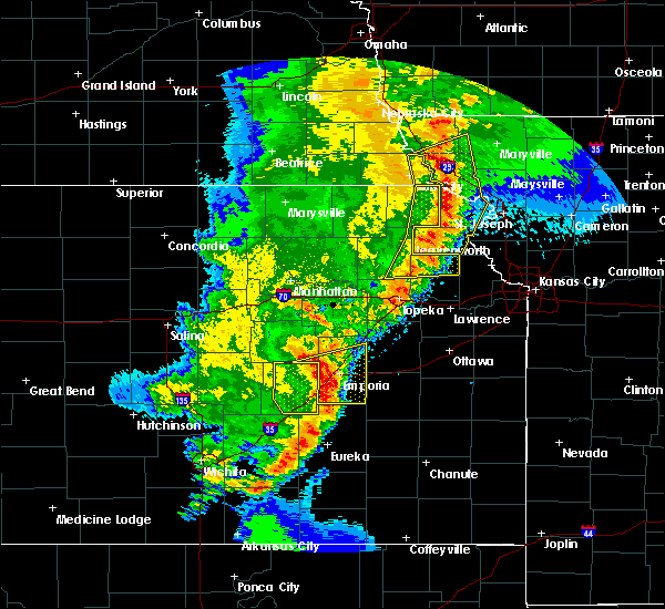 At 727 pm cdt, severe thunderstorms were located along a line extending from near fairfax to mound city to near forest city to near denton to near effingham, moving northeast at 50 mph (radar indicated). Hazards include 70 mph wind gusts and quarter size hail. Hail damage to vehicles is expected. expect considerable tree damage. Wind damage is also likely to mobile homes, roofs, and outbuildings. At 727 pm cdt, severe thunderstorms were located along a line extending from near fairfax to mound city to near forest city to near denton to near effingham, moving northeast at 50 mph (radar indicated). Hazards include 70 mph wind gusts and quarter size hail. Hail damage to vehicles is expected. expect considerable tree damage. Wind damage is also likely to mobile homes, roofs, and outbuildings.
|
| 5/2/2018 7:21 PM CDT |
 At 721 pm cdt, severe thunderstorms were located along a line extending from 3 miles northwest of white cloud to near lancaster to near ozawkie, moving east at 40 mph (radar indicated). Hazards include 60 mph wind gusts and quarter size hail. Hail damage to vehicles is expected. expect wind damage to roofs, siding, and trees. locations impacted include, hiawatha, horton, valley falls, hoyt, ozawkie, nortonville, winchester, mayetta, everest, robinson, whiting, denison and willis. A tornado watch remains in effect until 1000 pm cdt for northeastern kansas. At 721 pm cdt, severe thunderstorms were located along a line extending from 3 miles northwest of white cloud to near lancaster to near ozawkie, moving east at 40 mph (radar indicated). Hazards include 60 mph wind gusts and quarter size hail. Hail damage to vehicles is expected. expect wind damage to roofs, siding, and trees. locations impacted include, hiawatha, horton, valley falls, hoyt, ozawkie, nortonville, winchester, mayetta, everest, robinson, whiting, denison and willis. A tornado watch remains in effect until 1000 pm cdt for northeastern kansas.
|
| 5/2/2018 7:13 PM CDT |
 At 713 pm cdt, severe thunderstorms were located along a line extending from 7 miles northwest of white cloud to near effingham to 3 miles west of ozawkie, moving east at 35 mph (radar indicated). Hazards include 60 mph wind gusts and quarter size hail. Hail damage to vehicles is expected. expect wind damage to roofs, siding, and trees. locations impacted include, holton, hiawatha, horton, valley falls, hoyt, ozawkie, nortonville, winchester, mayetta, everest, robinson, whiting, denison, reserve, powhattan, hamlin and willis. A tornado watch remains in effect until 1000 pm cdt for northeastern kansas. At 713 pm cdt, severe thunderstorms were located along a line extending from 7 miles northwest of white cloud to near effingham to 3 miles west of ozawkie, moving east at 35 mph (radar indicated). Hazards include 60 mph wind gusts and quarter size hail. Hail damage to vehicles is expected. expect wind damage to roofs, siding, and trees. locations impacted include, holton, hiawatha, horton, valley falls, hoyt, ozawkie, nortonville, winchester, mayetta, everest, robinson, whiting, denison, reserve, powhattan, hamlin and willis. A tornado watch remains in effect until 1000 pm cdt for northeastern kansas.
|
| 5/2/2018 7:07 PM CDT |
 At 706 pm cdt, severe thunderstorms were located along a line extending from 7 miles southwest of craig to near hiawatha to everest to 6 miles north of valley falls to near denison to near hoyt, moving northeast at 45 mph (radar indicated). Hazards include 60 mph wind gusts and quarter size hail. Hail damage to vehicles is expected. expect wind damage to roofs, siding, and trees. locations impacted include, atchison, mound city, highland, troy, oregon, effingham, maitland, lancaster, skidmore, forest city, craig, white cloud, muscotah, denton, doniphan, big lake, severance, farmington, huron and leona. this includes interstate 29 between mile markers 67 and 102. A tornado watch remains in effect until 100 am cdt for northeastern kansas, and northwestern and west central missouri. At 706 pm cdt, severe thunderstorms were located along a line extending from 7 miles southwest of craig to near hiawatha to everest to 6 miles north of valley falls to near denison to near hoyt, moving northeast at 45 mph (radar indicated). Hazards include 60 mph wind gusts and quarter size hail. Hail damage to vehicles is expected. expect wind damage to roofs, siding, and trees. locations impacted include, atchison, mound city, highland, troy, oregon, effingham, maitland, lancaster, skidmore, forest city, craig, white cloud, muscotah, denton, doniphan, big lake, severance, farmington, huron and leona. this includes interstate 29 between mile markers 67 and 102. A tornado watch remains in effect until 100 am cdt for northeastern kansas, and northwestern and west central missouri.
|
| 5/2/2018 7:06 PM CDT |
 At 706 pm cdt, severe thunderstorms were located along a line extending from 4 miles northeast of reserve to 3 miles west of effingham to 4 miles northwest of meriden, moving east at 35 mph (radar indicated). Hazards include 60 mph wind gusts and quarter size hail. Hail damage to vehicles is expected. expect wind damage to roofs, siding, and trees. locations impacted include, holton, hiawatha, horton, valley falls, hoyt, ozawkie, nortonville, winchester, mayetta, everest, fairview, robinson, morrill, whiting, denison, netawaka, reserve, powhattan, hamlin and willis. A tornado watch remains in effect until 1000 pm cdt for northeastern kansas. At 706 pm cdt, severe thunderstorms were located along a line extending from 4 miles northeast of reserve to 3 miles west of effingham to 4 miles northwest of meriden, moving east at 35 mph (radar indicated). Hazards include 60 mph wind gusts and quarter size hail. Hail damage to vehicles is expected. expect wind damage to roofs, siding, and trees. locations impacted include, holton, hiawatha, horton, valley falls, hoyt, ozawkie, nortonville, winchester, mayetta, everest, fairview, robinson, morrill, whiting, denison, netawaka, reserve, powhattan, hamlin and willis. A tornado watch remains in effect until 1000 pm cdt for northeastern kansas.
|
| 5/2/2018 6:49 PM CDT |
 At 648 pm cdt, severe thunderstorms were located along a line extending from near falls city to near powhattan to near netawaka to mayetta to near potawatomi reservation to near willard, moving northeast at 45 mph (radar indicated). Hazards include 60 mph wind gusts and quarter size hail. Hail damage to vehicles is expected. Expect wind damage to roofs, siding, and trees. At 648 pm cdt, severe thunderstorms were located along a line extending from near falls city to near powhattan to near netawaka to mayetta to near potawatomi reservation to near willard, moving northeast at 45 mph (radar indicated). Hazards include 60 mph wind gusts and quarter size hail. Hail damage to vehicles is expected. Expect wind damage to roofs, siding, and trees.
|
| 5/2/2018 6:41 PM CDT |
 At 641 pm cdt, severe thunderstorms were located along a line extending from 6 miles north of sabetha to near holton to 4 miles southeast of delia, moving east at 35 mph (radar indicated). Hazards include 60 mph wind gusts and quarter size hail. Hail damage to vehicles is expected. Expect wind damage to roofs, siding, and trees. At 641 pm cdt, severe thunderstorms were located along a line extending from 6 miles north of sabetha to near holton to 4 miles southeast of delia, moving east at 35 mph (radar indicated). Hazards include 60 mph wind gusts and quarter size hail. Hail damage to vehicles is expected. Expect wind damage to roofs, siding, and trees.
|
| 10/21/2017 3:56 PM CDT |
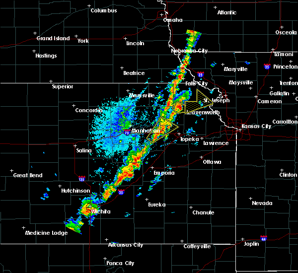 At 355 pm cdt, a severe thunderstorm was located over everest, or over horton, moving northeast at 60 mph (radar indicated). Hazards include 60 mph wind gusts and quarter size hail. Hail damage to vehicles is expected. expect wind damage to roofs, siding, and trees. Locations impacted include, muscotah and huron. At 355 pm cdt, a severe thunderstorm was located over everest, or over horton, moving northeast at 60 mph (radar indicated). Hazards include 60 mph wind gusts and quarter size hail. Hail damage to vehicles is expected. expect wind damage to roofs, siding, and trees. Locations impacted include, muscotah and huron.
|
| 10/21/2017 3:44 PM CDT |
 At 343 pm cdt, a severe thunderstorm was located near whiting, or near holton, moving northeast at 60 mph (radar indicated). Hazards include 60 mph wind gusts and quarter size hail. Hail damage to vehicles is expected. Expect wind damage to roofs, siding, and trees. At 343 pm cdt, a severe thunderstorm was located near whiting, or near holton, moving northeast at 60 mph (radar indicated). Hazards include 60 mph wind gusts and quarter size hail. Hail damage to vehicles is expected. Expect wind damage to roofs, siding, and trees.
|
| 6/16/2017 11:21 PM CDT |
 The tornado warning for southwestern doniphan and central atchison counties will expire at 1130 pm cdt, the tornado threat has diminished and the tornado warning has been cancelled. however, damaging winds to 70 mph remain likely and a severe thunderstorm warning remains in effect for the area. The tornado warning for southwestern doniphan and central atchison counties will expire at 1130 pm cdt, the tornado threat has diminished and the tornado warning has been cancelled. however, damaging winds to 70 mph remain likely and a severe thunderstorm warning remains in effect for the area.
|
| 6/16/2017 11:05 PM CDT |
 At 1105 pm cdt, a severe thunderstorm capable of producing a tornado was located near everest, or 9 miles east of horton, moving southeast at 45 mph (radar indicated rotation). Hazards include tornado. Flying debris will be dangerous to those caught without shelter. mobile homes will be damaged or destroyed. damage to roofs, windows, and vehicles will occur. Tree damage is likely. At 1105 pm cdt, a severe thunderstorm capable of producing a tornado was located near everest, or 9 miles east of horton, moving southeast at 45 mph (radar indicated rotation). Hazards include tornado. Flying debris will be dangerous to those caught without shelter. mobile homes will be damaged or destroyed. damage to roofs, windows, and vehicles will occur. Tree damage is likely.
|
| 6/16/2017 11:04 PM CDT |
 At 1104 pm cdt, severe thunderstorms were located along a line extending from horton to 7 miles southeast of denton, moving southeast at 45 mph (radar indicated). Hazards include 70 mph wind gusts. Expect considerable tree damage. Damage is likely to mobile homes, roofs, and outbuildings. At 1104 pm cdt, severe thunderstorms were located along a line extending from horton to 7 miles southeast of denton, moving southeast at 45 mph (radar indicated). Hazards include 70 mph wind gusts. Expect considerable tree damage. Damage is likely to mobile homes, roofs, and outbuildings.
|
| 6/16/2017 10:52 PM CDT |
 At 1051 pm cdt, severe thunderstorms were located along a line extending from near st. joseph to near union star, moving east at 65 mph. at 10:48 pm the st. joseph airport recorded a 76 mph wind gust. these are very dangerous storms (trained weather spotters). Hazards include 80 mph wind gusts. Flying debris will be dangerous to those caught without shelter. mobile homes will be heavily damaged. expect considerable damage to roofs, windows, and vehicles. extensive tree damage and power outages are likely. locations impacted include, st. joseph, cameron, savannah, wathena, elwood, maysville, highland, troy, country club villa, country club, king city, oregon, stewartsville, agency, union star, osborn, amazonia, clarksdale, forest city and fillmore. this includes the following highways, interstate 35 in missouri between mile markers 52 and 66. Interstate 29 between mile markers 39 and 73. At 1051 pm cdt, severe thunderstorms were located along a line extending from near st. joseph to near union star, moving east at 65 mph. at 10:48 pm the st. joseph airport recorded a 76 mph wind gust. these are very dangerous storms (trained weather spotters). Hazards include 80 mph wind gusts. Flying debris will be dangerous to those caught without shelter. mobile homes will be heavily damaged. expect considerable damage to roofs, windows, and vehicles. extensive tree damage and power outages are likely. locations impacted include, st. joseph, cameron, savannah, wathena, elwood, maysville, highland, troy, country club villa, country club, king city, oregon, stewartsville, agency, union star, osborn, amazonia, clarksdale, forest city and fillmore. this includes the following highways, interstate 35 in missouri between mile markers 52 and 66. Interstate 29 between mile markers 39 and 73.
|
| 6/16/2017 10:36 PM CDT |
 At 1036 pm cdt, severe thunderstorms were located along a line extending from 7 miles west of amazonia to near savannah, moving southeast at 65 mph. these are very dangerous storms (radar indicated). Hazards include 80 mph wind gusts. Flying debris will be dangerous to those caught without shelter. mobile homes will be heavily damaged. expect considerable damage to roofs, windows, and vehicles. extensive tree damage and power outages are likely. locations impacted include, st. joseph, cameron, savannah, wathena, elwood, maysville, highland, troy, country club villa, country club, king city, oregon, stewartsville, agency, union star, osborn, amazonia, clarksdale, forest city and fillmore. this includes the following highways, interstate 35 in missouri between mile markers 52 and 66. Interstate 29 between mile markers 39 and 76. At 1036 pm cdt, severe thunderstorms were located along a line extending from 7 miles west of amazonia to near savannah, moving southeast at 65 mph. these are very dangerous storms (radar indicated). Hazards include 80 mph wind gusts. Flying debris will be dangerous to those caught without shelter. mobile homes will be heavily damaged. expect considerable damage to roofs, windows, and vehicles. extensive tree damage and power outages are likely. locations impacted include, st. joseph, cameron, savannah, wathena, elwood, maysville, highland, troy, country club villa, country club, king city, oregon, stewartsville, agency, union star, osborn, amazonia, clarksdale, forest city and fillmore. this includes the following highways, interstate 35 in missouri between mile markers 52 and 66. Interstate 29 between mile markers 39 and 76.
|
| 6/16/2017 10:29 PM CDT |
 At 1028 pm cdt, severe thunderstorms were located along a line extending from 6 miles southeast of maitland to near oregon to 6 miles southeast of reserve, moving southeast at 50 mph (radar indicated). Hazards include 70 mph wind gusts and quarter size hail. Hail damage to vehicles is expected. expect considerable tree damage. wind damage is also likely to mobile homes, roofs, and outbuildings. These severe thunderstorms will remain over mainly rural areas of eastern brown county. At 1028 pm cdt, severe thunderstorms were located along a line extending from 6 miles southeast of maitland to near oregon to 6 miles southeast of reserve, moving southeast at 50 mph (radar indicated). Hazards include 70 mph wind gusts and quarter size hail. Hail damage to vehicles is expected. expect considerable tree damage. wind damage is also likely to mobile homes, roofs, and outbuildings. These severe thunderstorms will remain over mainly rural areas of eastern brown county.
|
| 6/16/2017 10:14 PM CDT |
 At 1014 pm cdt, severe thunderstorms were located along a line extending from near white cloud to 7 miles southeast of maryville, moving east at 65 mph. these are very dangerous storms (radar indicated). Hazards include 80 mph wind gusts. Flying debris will be dangerous to those caught without shelter. mobile homes will be heavily damaged. expect considerable damage to roofs, windows, and vehicles. Extensive tree damage and power outages are likely. At 1014 pm cdt, severe thunderstorms were located along a line extending from near white cloud to 7 miles southeast of maryville, moving east at 65 mph. these are very dangerous storms (radar indicated). Hazards include 80 mph wind gusts. Flying debris will be dangerous to those caught without shelter. mobile homes will be heavily damaged. expect considerable damage to roofs, windows, and vehicles. Extensive tree damage and power outages are likely.
|
| 6/16/2017 10:07 PM CDT |
 At 1007 pm cdt, severe thunderstorms were located along a line extending from near craig to near reserve to 5 miles south of humboldt, moving southeast at 65 mph. these are very dangerous storms (radar indicated). Hazards include 80 mph wind gusts and ping pong ball size hail. Flying debris will be dangerous to those caught without shelter. mobile homes will be heavily damaged. expect considerable damage to roofs, windows, and vehicles. extensive tree damage and power outages are likely. these severe storms will be near, reserve around 1010 pm cdt. sabetha, robinson and morrill around 1020 pm cdt. fairview and hamlin around 1025 pm cdt. Hiawatha and powhattan around 1030 pm cdt. At 1007 pm cdt, severe thunderstorms were located along a line extending from near craig to near reserve to 5 miles south of humboldt, moving southeast at 65 mph. these are very dangerous storms (radar indicated). Hazards include 80 mph wind gusts and ping pong ball size hail. Flying debris will be dangerous to those caught without shelter. mobile homes will be heavily damaged. expect considerable damage to roofs, windows, and vehicles. extensive tree damage and power outages are likely. these severe storms will be near, reserve around 1010 pm cdt. sabetha, robinson and morrill around 1020 pm cdt. fairview and hamlin around 1025 pm cdt. Hiawatha and powhattan around 1030 pm cdt.
|
| 6/16/2017 9:49 PM CDT |
 At 948 pm cdt, severe thunderstorms were located along a line extending from 6 miles southwest of fairfax to 3 miles northwest of verdon to near table rock, moving southeast at 70 mph. these are very dangerous storms (radar indicated). Hazards include 80 mph wind gusts and ping pong ball size hail. Flying debris will be dangerous to those caught without shelter. mobile homes will be heavily damaged. expect considerable damage to roofs, windows, and vehicles. Extensive tree damage and power outages are likely. At 948 pm cdt, severe thunderstorms were located along a line extending from 6 miles southwest of fairfax to 3 miles northwest of verdon to near table rock, moving southeast at 70 mph. these are very dangerous storms (radar indicated). Hazards include 80 mph wind gusts and ping pong ball size hail. Flying debris will be dangerous to those caught without shelter. mobile homes will be heavily damaged. expect considerable damage to roofs, windows, and vehicles. Extensive tree damage and power outages are likely.
|
| 5/18/2017 8:37 PM CDT |
 At 837 pm cdt, severe thunderstorms were located along a line extending from lancaster to 7 miles southwest of atchison to easton, moving northeast at 25 mph (radar indicated). Hazards include 60 mph wind gusts and half dollar size hail. Hail damage to vehicles is expected. expect wind damage to roofs, siding, and trees. locations impacted include, leavenworth, atchison, effingham, lancaster, easton, farmington, huron, lowemont, cummings and potter. A tornado watch remains in effect until 1000 pm cdt for northeastern kansas, and northwestern and west central missouri. At 837 pm cdt, severe thunderstorms were located along a line extending from lancaster to 7 miles southwest of atchison to easton, moving northeast at 25 mph (radar indicated). Hazards include 60 mph wind gusts and half dollar size hail. Hail damage to vehicles is expected. expect wind damage to roofs, siding, and trees. locations impacted include, leavenworth, atchison, effingham, lancaster, easton, farmington, huron, lowemont, cummings and potter. A tornado watch remains in effect until 1000 pm cdt for northeastern kansas, and northwestern and west central missouri.
|
| 5/18/2017 8:15 PM CDT |
 At 815 pm cdt, a severe thunderstorm was located near effingham, or 7 miles north of valley falls, moving northeast at 45 mph (radar indicated). Hazards include 70 mph wind gusts and ping pong ball size hail. People and animals outdoors will be injured. expect hail damage to roofs, siding, windows, and vehicles. expect considerable tree damage. wind damage is also likely to mobile homes, roofs, and outbuildings. locations impacted include, leavenworth, atchison, effingham, lancaster, easton, muscotah, farmington, huron, lowemont, cummings, arrington and potter. A tornado watch remains in effect until 1000 pm cdt for northeastern kansas, and northwestern and west central missouri. At 815 pm cdt, a severe thunderstorm was located near effingham, or 7 miles north of valley falls, moving northeast at 45 mph (radar indicated). Hazards include 70 mph wind gusts and ping pong ball size hail. People and animals outdoors will be injured. expect hail damage to roofs, siding, windows, and vehicles. expect considerable tree damage. wind damage is also likely to mobile homes, roofs, and outbuildings. locations impacted include, leavenworth, atchison, effingham, lancaster, easton, muscotah, farmington, huron, lowemont, cummings, arrington and potter. A tornado watch remains in effect until 1000 pm cdt for northeastern kansas, and northwestern and west central missouri.
|
| 5/18/2017 8:06 PM CDT |
 At 806 pm cdt, a severe thunderstorm was located near valley falls, moving northeast at 45 mph (radar indicated). Hazards include ping pong ball size hail and 60 mph wind gusts. People and animals outdoors will be injured. expect hail damage to roofs, siding, windows, and vehicles. Expect wind damage to roofs, siding, and trees. At 806 pm cdt, a severe thunderstorm was located near valley falls, moving northeast at 45 mph (radar indicated). Hazards include ping pong ball size hail and 60 mph wind gusts. People and animals outdoors will be injured. expect hail damage to roofs, siding, windows, and vehicles. Expect wind damage to roofs, siding, and trees.
|
| 3/6/2017 6:01 PM CST |
 At 601 pm cst, severe thunderstorms were located along a line extending from near reserve to 5 miles south of soldier, moving east at 40 mph (radar indicated). Hazards include 70 mph wind gusts and nickel size hail. Expect considerable tree damage. damage is likely to mobile homes, roofs, and outbuildings. locations impacted include, hiawatha, sabetha, horton, wetmore, everest, fairview, robinson, morrill, whiting, circleville, corning, netawaka, soldier, havensville, goff, reserve, powhattan, oneida, hamlin and willis. A tornado watch remains in effect until 1000 pm cst for northeastern kansas. At 601 pm cst, severe thunderstorms were located along a line extending from near reserve to 5 miles south of soldier, moving east at 40 mph (radar indicated). Hazards include 70 mph wind gusts and nickel size hail. Expect considerable tree damage. damage is likely to mobile homes, roofs, and outbuildings. locations impacted include, hiawatha, sabetha, horton, wetmore, everest, fairview, robinson, morrill, whiting, circleville, corning, netawaka, soldier, havensville, goff, reserve, powhattan, oneida, hamlin and willis. A tornado watch remains in effect until 1000 pm cst for northeastern kansas.
|
| 3/6/2017 5:40 PM CST |
 At 539 pm cst, severe thunderstorms were located along a line extending from 5 miles northwest of sabetha to 3 miles southwest of onaga, moving east at 40 mph (radar indicated). Hazards include 60 mph wind gusts and nickel size hail. expect damage to roofs, siding, and trees At 539 pm cst, severe thunderstorms were located along a line extending from 5 miles northwest of sabetha to 3 miles southwest of onaga, moving east at 40 mph (radar indicated). Hazards include 60 mph wind gusts and nickel size hail. expect damage to roofs, siding, and trees
|
| 7/13/2016 9:45 AM CDT |
 At 945 am cdt, severe thunderstorms were located along a line extending from 5 miles southwest of falls city to muscotah, moving east at 45 mph (trained weather spotters). Hazards include 60 mph wind gusts and nickel size hail. Expect damage to roofs. siding. and trees. Locations impacted include, hiawatha, sabetha, horton, everest, fairview, robinson, morrill, whiting, netawaka, reserve, powhattan, hamlin, willis and kickapoo reservation. At 945 am cdt, severe thunderstorms were located along a line extending from 5 miles southwest of falls city to muscotah, moving east at 45 mph (trained weather spotters). Hazards include 60 mph wind gusts and nickel size hail. Expect damage to roofs. siding. and trees. Locations impacted include, hiawatha, sabetha, horton, everest, fairview, robinson, morrill, whiting, netawaka, reserve, powhattan, hamlin, willis and kickapoo reservation.
|
| 7/13/2016 9:39 AM CDT |
 At 938 am cdt, severe thunderstorms were located along a line extending from fairview to near whiting to near hoyt, moving northeast at 40 mph (radar indicated). Hazards include 70 mph wind gusts and nickel size hail. Expect considerable tree damage. Damage is likely to mobile homes, roofs, and outbuildings. At 938 am cdt, severe thunderstorms were located along a line extending from fairview to near whiting to near hoyt, moving northeast at 40 mph (radar indicated). Hazards include 70 mph wind gusts and nickel size hail. Expect considerable tree damage. Damage is likely to mobile homes, roofs, and outbuildings.
|
| 7/13/2016 9:33 AM CDT |
 At 932 am cdt, severe thunderstorms were located along a line extending from 7 miles northwest of morrill to holton, moving east at 50 mph (trained weather spotters reported 60 mph winds with tree limbs down in circleville at 928 am cdt). Hazards include 60 mph wind gusts and nickel size hail. Expect damage to roofs. siding. and trees. Locations impacted include, holton, hiawatha, sabetha, horton, wetmore, everest, fairview, robinson, morrill, whiting, circleville, netawaka, goff, reserve, powhattan, oneida, hamlin, willis, kickapoo reservation and woodlawn. At 932 am cdt, severe thunderstorms were located along a line extending from 7 miles northwest of morrill to holton, moving east at 50 mph (trained weather spotters reported 60 mph winds with tree limbs down in circleville at 928 am cdt). Hazards include 60 mph wind gusts and nickel size hail. Expect damage to roofs. siding. and trees. Locations impacted include, holton, hiawatha, sabetha, horton, wetmore, everest, fairview, robinson, morrill, whiting, circleville, netawaka, goff, reserve, powhattan, oneida, hamlin, willis, kickapoo reservation and woodlawn.
|
| 7/13/2016 9:26 AM CDT |
 At 925 am cdt, severe thunderstorms were located along a line extending from 7 miles northeast of bern to 5 miles north of potawatomi reservation, moving east at 45 mph (radar indicated). Hazards include 60 mph wind gusts and nickel size hail. Expect damage to roofs. siding. And trees. At 925 am cdt, severe thunderstorms were located along a line extending from 7 miles northeast of bern to 5 miles north of potawatomi reservation, moving east at 45 mph (radar indicated). Hazards include 60 mph wind gusts and nickel size hail. Expect damage to roofs. siding. And trees.
|
| 7/7/2016 4:10 AM CDT |
 The severe thunderstorm warning for doniphan, atchison, southwestern andrew and southeastern holt counties will expire at 415 am cdt, the storms which prompted the warning have weakened below severe limits, and no longer pose an immediate threat to life or property. therefore the warning will be allowed to expire. a severe thunderstorm watch remains in effect until 900 am cdt for northeastern kansas, and northwestern missouri. The severe thunderstorm warning for doniphan, atchison, southwestern andrew and southeastern holt counties will expire at 415 am cdt, the storms which prompted the warning have weakened below severe limits, and no longer pose an immediate threat to life or property. therefore the warning will be allowed to expire. a severe thunderstorm watch remains in effect until 900 am cdt for northeastern kansas, and northwestern missouri.
|
| 7/7/2016 3:45 AM CDT |
 At 344 am cdt, severe thunderstorms were located along a line extending from near oregon to near robinson to near netawaka, moving southeast at 55 mph (radar indicated). Hazards include 60 mph wind gusts. Expect damage to roofs. siding. and trees. locations impacted include, atchison, savannah, wathena, highland, troy, oregon, effingham, amazonia, lancaster, forest city, white cloud, muscotah, denton, doniphan, severance, farmington, huron, leona, bendena and fanning. This includes interstate 29 between mile markers 57 and 64. At 344 am cdt, severe thunderstorms were located along a line extending from near oregon to near robinson to near netawaka, moving southeast at 55 mph (radar indicated). Hazards include 60 mph wind gusts. Expect damage to roofs. siding. and trees. locations impacted include, atchison, savannah, wathena, highland, troy, oregon, effingham, amazonia, lancaster, forest city, white cloud, muscotah, denton, doniphan, severance, farmington, huron, leona, bendena and fanning. This includes interstate 29 between mile markers 57 and 64.
|
| 7/7/2016 3:26 AM CDT |
 At 325 am cdt, severe thunderstorms were located along a line extending from 7 miles northwest of white cloud to near hamlin to near woodlawn, moving southeast at 50 mph. a 68 mph wind gust was observed at falls city nebraska with this line of storms (radar indicated). Hazards include 70 mph wind gusts. Expect considerable tree damage. Damage is likely to mobile homes, roofs, and outbuildings. At 325 am cdt, severe thunderstorms were located along a line extending from 7 miles northwest of white cloud to near hamlin to near woodlawn, moving southeast at 50 mph. a 68 mph wind gust was observed at falls city nebraska with this line of storms (radar indicated). Hazards include 70 mph wind gusts. Expect considerable tree damage. Damage is likely to mobile homes, roofs, and outbuildings.
|
| 7/7/2016 3:21 AM CDT |
 At 321 am cdt, severe thunderstorms were located along a line extending from 5 miles southwest of craig to near sabetha, moving southeast at 55 mph (emergency management). Hazards include 60 mph wind gusts. Expect damage to roofs. siding. And trees. At 321 am cdt, severe thunderstorms were located along a line extending from 5 miles southwest of craig to near sabetha, moving southeast at 55 mph (emergency management). Hazards include 60 mph wind gusts. Expect damage to roofs. siding. And trees.
|
| 5/26/2016 11:41 AM CDT |
 At 1141 am cdt, a severe thunderstorm was located over denton, or 7 miles southwest of troy, moving northeast at 20 mph (radar indicated). Hazards include golf ball size hail and 60 mph wind gusts. People and animals outdoors will be injured. expect hail damage to roofs, siding, windows, and vehicles. Expect wind damage to roofs, siding, and trees. At 1141 am cdt, a severe thunderstorm was located over denton, or 7 miles southwest of troy, moving northeast at 20 mph (radar indicated). Hazards include golf ball size hail and 60 mph wind gusts. People and animals outdoors will be injured. expect hail damage to roofs, siding, windows, and vehicles. Expect wind damage to roofs, siding, and trees.
|
| 4/27/2016 3:22 PM CDT |
 The severe thunderstorm warning for southwestern doniphan county will expire at 330 pm cdt, the storm which prompted the warning has weakened below severe limits, and no longer pose an immediate threat to life or property. therefore the warning will be allowed to expire. a severe thunderstorm warning remains in effect for southeastern doniphan county until 345 pm cdt. a tornado watch remains in effect until 900 pm cdt for northeastern kansas. The severe thunderstorm warning for southwestern doniphan county will expire at 330 pm cdt, the storm which prompted the warning has weakened below severe limits, and no longer pose an immediate threat to life or property. therefore the warning will be allowed to expire. a severe thunderstorm warning remains in effect for southeastern doniphan county until 345 pm cdt. a tornado watch remains in effect until 900 pm cdt for northeastern kansas.
|
| 4/27/2016 3:13 PM CDT |
 At 313 pm cdt, a severe thunderstorm was located near everest, or 9 miles east of horton, moving north at 30 mph (radar indicated). Hazards include 60 mph wind gusts and quarter size hail. Hail damage to vehicles is expected. expect wind damage to roofs, siding, and trees. locations impacted include, denton, severance, leona and bendena. A tornado watch remains in effect until 900 pm cdt for northeastern kansas. At 313 pm cdt, a severe thunderstorm was located near everest, or 9 miles east of horton, moving north at 30 mph (radar indicated). Hazards include 60 mph wind gusts and quarter size hail. Hail damage to vehicles is expected. expect wind damage to roofs, siding, and trees. locations impacted include, denton, severance, leona and bendena. A tornado watch remains in effect until 900 pm cdt for northeastern kansas.
|
| 4/27/2016 3:12 PM CDT |
 At 312 pm cdt, a severe thunderstorm was located over denton, moving northeast at 35 mph (radar indicated). Hazards include quarter size hail. Damage to vehicles is expected. Locations impacted include, everest. At 312 pm cdt, a severe thunderstorm was located over denton, moving northeast at 35 mph (radar indicated). Hazards include quarter size hail. Damage to vehicles is expected. Locations impacted include, everest.
|
| 4/27/2016 3:00 PM CDT |
 At 300 pm cdt, a severe thunderstorm was located near everest, moving northeast at 35 mph (radar indicated). Hazards include 60 mph wind gusts and quarter size hail. Hail damage to vehicles is expected. Expect wind damage to roofs, siding, and trees. At 300 pm cdt, a severe thunderstorm was located near everest, moving northeast at 35 mph (radar indicated). Hazards include 60 mph wind gusts and quarter size hail. Hail damage to vehicles is expected. Expect wind damage to roofs, siding, and trees.
|
| 4/27/2016 2:57 PM CDT |
 At 257 pm cdt, a severe thunderstorm was located near lancaster, or 9 miles southeast of horton, moving northeast at 30 mph (radar indicated). Hazards include 60 mph wind gusts and half dollar size hail. Hail damage to vehicles is expected. Expect wind damage to roofs, siding, and trees. At 257 pm cdt, a severe thunderstorm was located near lancaster, or 9 miles southeast of horton, moving northeast at 30 mph (radar indicated). Hazards include 60 mph wind gusts and half dollar size hail. Hail damage to vehicles is expected. Expect wind damage to roofs, siding, and trees.
|
| 4/27/2016 2:46 PM CDT |
 At 246 pm cdt, a severe thunderstorm was located over muscotah, or near horton, moving northeast at 25 mph (law enforcement). Hazards include golf ball size hail and 60 mph wind gusts. People and animals outdoors will be injured. expect hail damage to roofs, siding, windows, and vehicles. expect wind damage to roofs, siding, and trees. Locations impacted include, effingham, muscotah, huron and arrington. At 246 pm cdt, a severe thunderstorm was located over muscotah, or near horton, moving northeast at 25 mph (law enforcement). Hazards include golf ball size hail and 60 mph wind gusts. People and animals outdoors will be injured. expect hail damage to roofs, siding, windows, and vehicles. expect wind damage to roofs, siding, and trees. Locations impacted include, effingham, muscotah, huron and arrington.
|
| 4/27/2016 2:32 PM CDT |
 At 232 pm cdt, a severe thunderstorm was located over muscotah, or 10 miles south of horton, moving northeast at 20 mph (radar indicated). Hazards include 60 mph wind gusts and quarter size hail. Hail damage to vehicles is expected. Expect wind damage to roofs, siding, and trees. At 232 pm cdt, a severe thunderstorm was located over muscotah, or 10 miles south of horton, moving northeast at 20 mph (radar indicated). Hazards include 60 mph wind gusts and quarter size hail. Hail damage to vehicles is expected. Expect wind damage to roofs, siding, and trees.
|
| 4/27/2016 2:23 PM CDT |
 The severe thunderstorm warning for southern brown, northwestern jefferson and east central jackson counties will expire at 230 pm cdt, the storm which prompted the warning has moved out of the area. therefore the warning will be allowed to expire. The severe thunderstorm warning for southern brown, northwestern jefferson and east central jackson counties will expire at 230 pm cdt, the storm which prompted the warning has moved out of the area. therefore the warning will be allowed to expire.
|
| 4/27/2016 2:14 PM CDT |
 At 213 pm cdt, a severe thunderstorm was located near denison, moving northeast at 25 mph (law enforcement reported quarter size hail in denison at 205 pm). Hazards include 60 mph wind gusts and quarter size hail. Hail damage to vehicles is expected. expect wind damage to roofs, siding, and trees. Locations impacted include, everest and denison. At 213 pm cdt, a severe thunderstorm was located near denison, moving northeast at 25 mph (law enforcement reported quarter size hail in denison at 205 pm). Hazards include 60 mph wind gusts and quarter size hail. Hail damage to vehicles is expected. expect wind damage to roofs, siding, and trees. Locations impacted include, everest and denison.
|
| 4/27/2016 2:13 PM CDT |
 At 213 pm cdt, a severe thunderstorm was located near denison, or 7 miles east of holton, moving northeast at 30 mph (radar indicated). Hazards include 60 mph wind gusts and quarter size hail. Hail damage to vehicles is expected. expect wind damage to roofs, siding, and trees. Locations impacted include, atchison, horton, effingham, lancaster, muscotah, farmington, huron and arrington. At 213 pm cdt, a severe thunderstorm was located near denison, or 7 miles east of holton, moving northeast at 30 mph (radar indicated). Hazards include 60 mph wind gusts and quarter size hail. Hail damage to vehicles is expected. expect wind damage to roofs, siding, and trees. Locations impacted include, atchison, horton, effingham, lancaster, muscotah, farmington, huron and arrington.
|
| 4/27/2016 2:04 PM CDT |
 At 204 pm cdt, a severe thunderstorm was located over denison, moving northeast at 22 mph (radar indicated). Hazards include 60 mph wind gusts and quarter size hail. Hail damage to vehicles is expected. expect wind damage to roofs, siding, and trees. Locations impacted include, mayetta, everest and denison. At 204 pm cdt, a severe thunderstorm was located over denison, moving northeast at 22 mph (radar indicated). Hazards include 60 mph wind gusts and quarter size hail. Hail damage to vehicles is expected. expect wind damage to roofs, siding, and trees. Locations impacted include, mayetta, everest and denison.
|
| 4/27/2016 1:54 PM CDT |
 At 154 pm cdt, a severe thunderstorm was located over mayetta, or 8 miles south of holton, moving northeast at 25 mph (radar indicated). Hazards include quarter size hail. damage to vehicles is expected At 154 pm cdt, a severe thunderstorm was located over mayetta, or 8 miles south of holton, moving northeast at 25 mph (radar indicated). Hazards include quarter size hail. damage to vehicles is expected
|
| 4/27/2016 1:49 PM CDT |
 At 149 pm cdt, a severe thunderstorm was located near denison, moving northeast at 25 mph (radar indicated). Hazards include 60 mph wind gusts and quarter size hail. Hail damage to vehicles is expected. Expect wind damage to roofs, siding, and trees. At 149 pm cdt, a severe thunderstorm was located near denison, moving northeast at 25 mph (radar indicated). Hazards include 60 mph wind gusts and quarter size hail. Hail damage to vehicles is expected. Expect wind damage to roofs, siding, and trees.
|
| 4/26/2016 7:44 AM CDT |
 At 744 am cdt, severe thunderstorms were located along a line extending from fillmore to near lancaster, moving east at 45 mph (trained weather spotters). Hazards include tennis ball size hail and 70 mph wind gusts. People and animals outdoors will be injured. expect hail damage to roofs, siding, windows, and vehicles. expect considerable tree damage. wind damage is also likely to mobile homes, roofs, and outbuildings. locations impacted include, atchison, wathena, highland, troy, oregon, effingham, amazonia, rushville, lancaster, forest city, fillmore, denton, lewis and clark village, doniphan, severance, farmington, huron, leona, bendena and fanning. This includes interstate 29 between mile markers 59 and 75. At 744 am cdt, severe thunderstorms were located along a line extending from fillmore to near lancaster, moving east at 45 mph (trained weather spotters). Hazards include tennis ball size hail and 70 mph wind gusts. People and animals outdoors will be injured. expect hail damage to roofs, siding, windows, and vehicles. expect considerable tree damage. wind damage is also likely to mobile homes, roofs, and outbuildings. locations impacted include, atchison, wathena, highland, troy, oregon, effingham, amazonia, rushville, lancaster, forest city, fillmore, denton, lewis and clark village, doniphan, severance, farmington, huron, leona, bendena and fanning. This includes interstate 29 between mile markers 59 and 75.
|
| 4/26/2016 7:23 AM CDT |
 The severe thunderstorm warning for brown and northeastern jackson counties will expire at 730 am cdt, the storm which prompted the warning has weakened below severe limits, and no longer pose an immediate threat to life or property. therefore the warning will be allowed to expire. however gusty winds and heavy rain are still possible with this thunderstorm. a severe thunderstorm watch remains in effect until 1000 am cdt for northeastern kansas. The severe thunderstorm warning for brown and northeastern jackson counties will expire at 730 am cdt, the storm which prompted the warning has weakened below severe limits, and no longer pose an immediate threat to life or property. therefore the warning will be allowed to expire. however gusty winds and heavy rain are still possible with this thunderstorm. a severe thunderstorm watch remains in effect until 1000 am cdt for northeastern kansas.
|
| 4/26/2016 7:19 AM CDT |
 At 718 am cdt, severe thunderstorms were located along a line extending from near oregon to near nortonville, moving east at 30 mph (trained weather spotters). Hazards include tennis ball size hail and 70 mph wind gusts. People and animals outdoors will be injured. expect hail damage to roofs, siding, windows, and vehicles. expect considerable tree damage. wind damage is also likely to mobile homes, roofs, and outbuildings. locations impacted include, atchison, wathena, highland, troy, oregon, effingham, amazonia, rushville, lancaster, forest city, fillmore, white cloud, muscotah, denton, lewis and clark village, doniphan, severance, farmington, huron and leona. This includes interstate 29 between mile markers 59 and 78. At 718 am cdt, severe thunderstorms were located along a line extending from near oregon to near nortonville, moving east at 30 mph (trained weather spotters). Hazards include tennis ball size hail and 70 mph wind gusts. People and animals outdoors will be injured. expect hail damage to roofs, siding, windows, and vehicles. expect considerable tree damage. wind damage is also likely to mobile homes, roofs, and outbuildings. locations impacted include, atchison, wathena, highland, troy, oregon, effingham, amazonia, rushville, lancaster, forest city, fillmore, white cloud, muscotah, denton, lewis and clark village, doniphan, severance, farmington, huron and leona. This includes interstate 29 between mile markers 59 and 78.
|
| 4/26/2016 7:11 AM CDT |
 At 710 am cdt, severe thunderstorms were located along a line extending from near forest city to near nortonville, moving east at 30 mph (radar indicated). Hazards include 70 mph wind gusts and half dollar size hail. Hail damage to vehicles is expected. expect considerable tree damage. Wind damage is also likely to mobile homes, roofs, and outbuildings. At 710 am cdt, severe thunderstorms were located along a line extending from near forest city to near nortonville, moving east at 30 mph (radar indicated). Hazards include 70 mph wind gusts and half dollar size hail. Hail damage to vehicles is expected. expect considerable tree damage. Wind damage is also likely to mobile homes, roofs, and outbuildings.
|
| 4/26/2016 7:02 AM CDT |
 At 701 am cdt, a severe thunderstorm was located over lancaster, or 9 miles west of atchison, moving north at 50 mph (radar indicated). Hazards include 60 mph wind gusts and half dollar size hail. Hail damage to vehicles is expected. expect wind damage to roofs, siding, and trees. Locations impacted include, atchison, effingham, lancaster, denton, doniphan, severance, farmington, huron, leona and bendena. At 701 am cdt, a severe thunderstorm was located over lancaster, or 9 miles west of atchison, moving north at 50 mph (radar indicated). Hazards include 60 mph wind gusts and half dollar size hail. Hail damage to vehicles is expected. expect wind damage to roofs, siding, and trees. Locations impacted include, atchison, effingham, lancaster, denton, doniphan, severance, farmington, huron, leona and bendena.
|
| 4/26/2016 6:51 AM CDT |
 At 651 am cdt, a severe thunderstorm was located near effingham, or 10 miles northeast of valley falls, moving north at 55 mph (radar indicated). Hazards include 60 mph wind gusts and half dollar size hail. Hail damage to vehicles is expected. Expect wind damage to roofs, siding, and trees. At 651 am cdt, a severe thunderstorm was located near effingham, or 10 miles northeast of valley falls, moving north at 55 mph (radar indicated). Hazards include 60 mph wind gusts and half dollar size hail. Hail damage to vehicles is expected. Expect wind damage to roofs, siding, and trees.
|
| 4/26/2016 6:36 AM CDT |
 At 635 am cdt, a severe thunderstorm was located near goff, moving east at 35 mph (radar indicated). Hazards include 60 mph wind gusts and half dollar size hail. Hail damage to vehicles is expected. Expect wind damage to roofs, siding, and trees. At 635 am cdt, a severe thunderstorm was located near goff, moving east at 35 mph (radar indicated). Hazards include 60 mph wind gusts and half dollar size hail. Hail damage to vehicles is expected. Expect wind damage to roofs, siding, and trees.
|
| 4/24/2016 8:31 PM CDT |
 At 829 pm cdt, a severe thunderstorm was located over soldier, moving east at 40 mph. this is a very dangerous storm (trained weather spotters. spotters have reported damaging winds with this storm). Hazards include 80 mph wind gusts and quarter size hail. Flying debris will be dangerous to those caught without shelter. mobile homes will be heavily damaged. expect considerable damage to roofs, windows, and vehicles. Extensive tree damage and power outages are likely. At 829 pm cdt, a severe thunderstorm was located over soldier, moving east at 40 mph. this is a very dangerous storm (trained weather spotters. spotters have reported damaging winds with this storm). Hazards include 80 mph wind gusts and quarter size hail. Flying debris will be dangerous to those caught without shelter. mobile homes will be heavily damaged. expect considerable damage to roofs, windows, and vehicles. Extensive tree damage and power outages are likely.
|
| 9/17/2015 9:54 PM CDT |
 The severe thunderstorm warning for southeastern brown county will expire at 1000 pm cdt, the storm which prompted the warning has moved out of the area. therefore the warning will be allowed to expire. however gusty winds and heavy rain are still possible with developing thunderstorms west of everest. a severe thunderstorm watch remains in effect until 100 am cdt for northeastern kansas. The severe thunderstorm warning for southeastern brown county will expire at 1000 pm cdt, the storm which prompted the warning has moved out of the area. therefore the warning will be allowed to expire. however gusty winds and heavy rain are still possible with developing thunderstorms west of everest. a severe thunderstorm watch remains in effect until 100 am cdt for northeastern kansas.
|
| 9/17/2015 9:49 PM CDT |
 At 949 pm cdt, a severe thunderstorm was located over lancaster, or 9 miles west of atchison, moving east at 35 mph (radar indicated). Hazards include 60 mph wind gusts and half dollar size hail. Hail damage to vehicles is expected. expect wind damage to roofs, siding and trees. Locations impacted include, atchison, effingham, lancaster, doniphan, farmington, huron, potter and cummings. At 949 pm cdt, a severe thunderstorm was located over lancaster, or 9 miles west of atchison, moving east at 35 mph (radar indicated). Hazards include 60 mph wind gusts and half dollar size hail. Hail damage to vehicles is expected. expect wind damage to roofs, siding and trees. Locations impacted include, atchison, effingham, lancaster, doniphan, farmington, huron, potter and cummings.
|
| 9/17/2015 9:47 PM CDT |
 At 944 pm cdt, a severe thunderstorm was located 2 miles southeast of everest, moving east-southeast at 35 mph. a second thunderstorm was intensifying over horton, and was moving to the east-southeast at 25 mph (radar indicated). Hazards include 60 mph wind gusts and quarter size hail. Hail damage to vehicles is expected. expect wind damage to roofs, siding and trees. locations impacted include, horton and everest. At 929 pm, a storm spotter reported quarter size hail in horton. At 944 pm cdt, a severe thunderstorm was located 2 miles southeast of everest, moving east-southeast at 35 mph. a second thunderstorm was intensifying over horton, and was moving to the east-southeast at 25 mph (radar indicated). Hazards include 60 mph wind gusts and quarter size hail. Hail damage to vehicles is expected. expect wind damage to roofs, siding and trees. locations impacted include, horton and everest. At 929 pm, a storm spotter reported quarter size hail in horton.
|
| 9/17/2015 9:33 PM CDT |
 At 933 pm cdt, a severe thunderstorm was located near muscotah, or near horton, moving east at 40 mph (radar indicated). Hazards include 60 mph wind gusts and half dollar size hail. Hail damage to vehicles is expected. Expect wind damage to roofs, siding and trees. At 933 pm cdt, a severe thunderstorm was located near muscotah, or near horton, moving east at 40 mph (radar indicated). Hazards include 60 mph wind gusts and half dollar size hail. Hail damage to vehicles is expected. Expect wind damage to roofs, siding and trees.
|
| 9/17/2015 9:28 PM CDT |
 At 928 pm cdt, a severe thunderstorm was located over horton, moving east at 35 mph (radar indicated). Hazards include 60 mph wind gusts and quarter size hail. Hail damage to vehicles is expected. Expect wind damage to roofs, siding and trees. At 928 pm cdt, a severe thunderstorm was located over horton, moving east at 35 mph (radar indicated). Hazards include 60 mph wind gusts and quarter size hail. Hail damage to vehicles is expected. Expect wind damage to roofs, siding and trees.
|
| 9/17/2015 9:21 PM CDT |
 At 920 pm cdt, a severe thunderstorm was located near lancaster, or 9 miles southeast of horton, moving east at 20 mph (radar indicated). Hazards include 60 mph wind gusts and half dollar size hail. Hail damage to vehicles is expected. expect wind damage to roofs, siding and trees. Locations impacted include, atchison, lancaster, muscotah and huron. At 920 pm cdt, a severe thunderstorm was located near lancaster, or 9 miles southeast of horton, moving east at 20 mph (radar indicated). Hazards include 60 mph wind gusts and half dollar size hail. Hail damage to vehicles is expected. expect wind damage to roofs, siding and trees. Locations impacted include, atchison, lancaster, muscotah and huron.
|
| 9/17/2015 9:01 PM CDT |
 At 901 pm cdt, severe thunderstorms were located along a line extending from near country club to near rushville, moving east at 30 mph (radar indicated). Hazards include 60 mph wind gusts and half dollar size hail. Hail damage to vehicles is expected. expect wind damage to roofs, siding and trees. Locations impacted include, atchison, lancaster, muscotah, denton, huron and bendena. At 901 pm cdt, severe thunderstorms were located along a line extending from near country club to near rushville, moving east at 30 mph (radar indicated). Hazards include 60 mph wind gusts and half dollar size hail. Hail damage to vehicles is expected. expect wind damage to roofs, siding and trees. Locations impacted include, atchison, lancaster, muscotah, denton, huron and bendena.
|
| 9/17/2015 8:59 PM CDT |
 At 857 pm cdt, a severe thunderstorm was located 3 miles southeast of horton, moving east-southeast at 25 mph (radar indicated). Hazards include 60 mph wind gusts and quarter size hail. Hail damage to vehicles is expected. expect wind damage to roofs, siding and trees. Locations impacted include, rural areas east of horton and south of everest. At 857 pm cdt, a severe thunderstorm was located 3 miles southeast of horton, moving east-southeast at 25 mph (radar indicated). Hazards include 60 mph wind gusts and quarter size hail. Hail damage to vehicles is expected. expect wind damage to roofs, siding and trees. Locations impacted include, rural areas east of horton and south of everest.
|
| 9/17/2015 8:55 PM CDT |
 At 854 pm cdt, a severe thunderstorm was located 2 miles south of horton, moving east-southeast at 25 mph (radar indicated). Hazards include 60 mph wind gusts and quarter size hail. Hail damage to vehicles is expected. expect wind damage to roofs, siding and trees. Locations impacted include, horton. At 854 pm cdt, a severe thunderstorm was located 2 miles south of horton, moving east-southeast at 25 mph (radar indicated). Hazards include 60 mph wind gusts and quarter size hail. Hail damage to vehicles is expected. expect wind damage to roofs, siding and trees. Locations impacted include, horton.
|
| 9/17/2015 8:49 PM CDT |
 At 848 pm cdt, a severe thunderstorm was located 2 miles north of whiting, moving east-southeast at 25 mph (radar indicated). Hazards include 60 mph wind gusts and half dollar size hail. Hail damage to vehicles is expected. expect wind damage to roofs, siding and trees. Locations impacted include, horton, everest and whiting. At 848 pm cdt, a severe thunderstorm was located 2 miles north of whiting, moving east-southeast at 25 mph (radar indicated). Hazards include 60 mph wind gusts and half dollar size hail. Hail damage to vehicles is expected. expect wind damage to roofs, siding and trees. Locations impacted include, horton, everest and whiting.
|
| 9/17/2015 8:42 PM CDT |
 At 840 pm cdt, a severe thunderstorm was located near whiting, moving east at 25 mph. a second severe thunderstorms was located 3 miles northeast of everest, moving east-southeast at 25 mph (radar indicated). Hazards include 60 mph wind gusts and quarter size hail. Hail damage to vehicles is expected. Expect wind damage to roofs, siding and trees. At 840 pm cdt, a severe thunderstorm was located near whiting, moving east at 25 mph. a second severe thunderstorms was located 3 miles northeast of everest, moving east-southeast at 25 mph (radar indicated). Hazards include 60 mph wind gusts and quarter size hail. Hail damage to vehicles is expected. Expect wind damage to roofs, siding and trees.
|
| 9/17/2015 8:33 PM CDT |
 At 832 pm cdt, severe thunderstorms were located along a line extending from robinson to near whiting, moving east at 25 mph (radar indicated). Hazards include ping pong ball size hail and 60 mph wind gusts. People and animals outdoors will be injured. expect hail damage to roofs, siding, windows and vehicles. Expect wind damage to roofs, siding and trees. At 832 pm cdt, severe thunderstorms were located along a line extending from robinson to near whiting, moving east at 25 mph (radar indicated). Hazards include ping pong ball size hail and 60 mph wind gusts. People and animals outdoors will be injured. expect hail damage to roofs, siding, windows and vehicles. Expect wind damage to roofs, siding and trees.
|
| 7/25/2015 9:09 PM CDT |
 The national weather service in pleasant hill has issued a * severe thunderstorm warning for. southern doniphan county in northeastern kansas. northeastern atchison county in northeastern kansas. southwestern buchanan county in northwestern missouri. Until 1000 pm cdt. The national weather service in pleasant hill has issued a * severe thunderstorm warning for. southern doniphan county in northeastern kansas. northeastern atchison county in northeastern kansas. southwestern buchanan county in northwestern missouri. Until 1000 pm cdt.
|
| 7/25/2015 9:09 PM CDT |
 At 909 pm cdt, a severe thunderstorm was located over denton, or 8 miles south of highland, moving east at 15 mph (radar indicated). Hazards include 60 mph wind gusts and nickel size hail. Expect damage to roofs. Siding and trees. At 909 pm cdt, a severe thunderstorm was located over denton, or 8 miles south of highland, moving east at 15 mph (radar indicated). Hazards include 60 mph wind gusts and nickel size hail. Expect damage to roofs. Siding and trees.
|
| 6/11/2015 9:11 PM CDT |
 The severe thunderstorm warning for west central buchanan, southern doniphan and northern atchison counties will expire at 915 pm cdt, the storm which prompted the warning has weakened below severe limits, and no longer poses an immediate threat to life or property. however, gusty winds and heavy rain are still possible with this thunderstorm. in addition, strong thunderstorms may redevelop, and a severe thunderstorm watch remains in effect until midnight. The severe thunderstorm warning for west central buchanan, southern doniphan and northern atchison counties will expire at 915 pm cdt, the storm which prompted the warning has weakened below severe limits, and no longer poses an immediate threat to life or property. however, gusty winds and heavy rain are still possible with this thunderstorm. in addition, strong thunderstorms may redevelop, and a severe thunderstorm watch remains in effect until midnight.
|
| 6/11/2015 8:54 PM CDT |
 At 853 pm cdt, a severe thunderstorm was located near lancaster, and moving east at 30 mph (radar indicated). Hazards include 60 mph wind gusts and penny size hail. Expect damage to roofs. siding and trees. Locations impacted include, doniphan. At 853 pm cdt, a severe thunderstorm was located near lancaster, and moving east at 30 mph (radar indicated). Hazards include 60 mph wind gusts and penny size hail. Expect damage to roofs. siding and trees. Locations impacted include, doniphan.
|
| 6/11/2015 8:34 PM CDT |
 At 832 pm cdt, a severe thunderstorm was located near effingham, and moving east at 35 mph (radar indicated). Hazards include 70 mph wind gusts and nickel size hail. Expect considerable tree damage. Damage is likely to mobile homes, roofs and outbuildings. At 832 pm cdt, a severe thunderstorm was located near effingham, and moving east at 35 mph (radar indicated). Hazards include 70 mph wind gusts and nickel size hail. Expect considerable tree damage. Damage is likely to mobile homes, roofs and outbuildings.
|
| 6/4/2015 5:23 AM CDT | The severe thunderstorm warning for southwestern doniphan and northwestern atchison counties will expire at 530 am cdt, the storm which prompted the warning has weakened and moved out of the warned area. however, heavy rain is still possible with this thunderstorm. |
| 6/4/2015 5:12 AM CDT | The severe thunderstorm warning for southeastern brown county will expire at 515 am cdt, the storm which prompted the warning has weakened and moved out of the warned area. |
| 6/4/2015 5:00 AM CDT | At 457 am cdt, a severe thunderstorm was located near everest, and moving east at 40 mph (radar indicated). Hazards include quarter size hail. Damage to vehicles is expected. Locations impacted include, mainly rural areas of southeastern brown county. |
| 6/4/2015 4:53 AM CDT | At 451 am cdt, a severe thunderstorm was located near horton, and moving east at 30 mph (radar indicated). Hazards include quarter size hail. damage to vehicles is expected |
| 6/4/2015 4:43 AM CDT | At 441 am cdt, a severe thunderstorm was located near whiting, and moving east at 35 mph (radar indicated). Hazards include quarter size hail. damage to vehicles is expected |
| 5/4/2015 4:37 PM CDT | At 435 pm cdt, severe thunderstorms were located along a line extending from robinson to 5 miles southwest of denton to effingham, and moving east at 25 mph (radar indicated). Hazards include 60 mph wind gusts and penny size hail. Expect damage to roofs. Siding and trees. |
| 6/3/2014 11:42 PM CDT | Storm damage reported in brown county KS, 0.8 miles SE of Huron, KS |
Hail Maps for Huron, KS


Connect with Interactive Hail Maps