

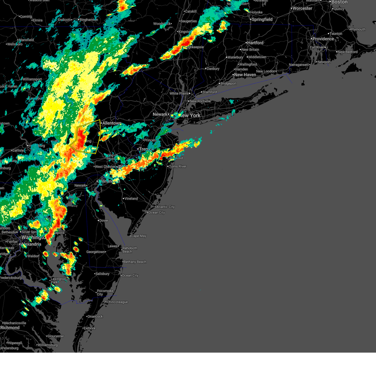
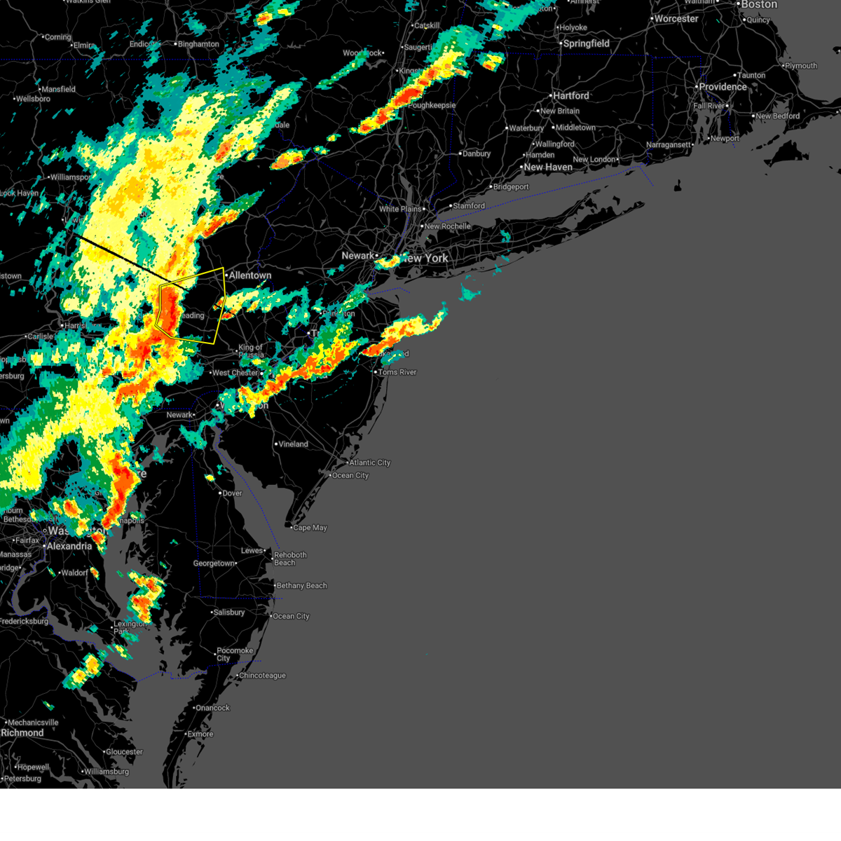
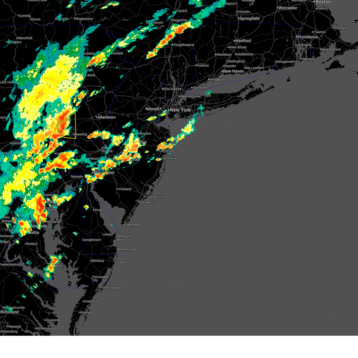
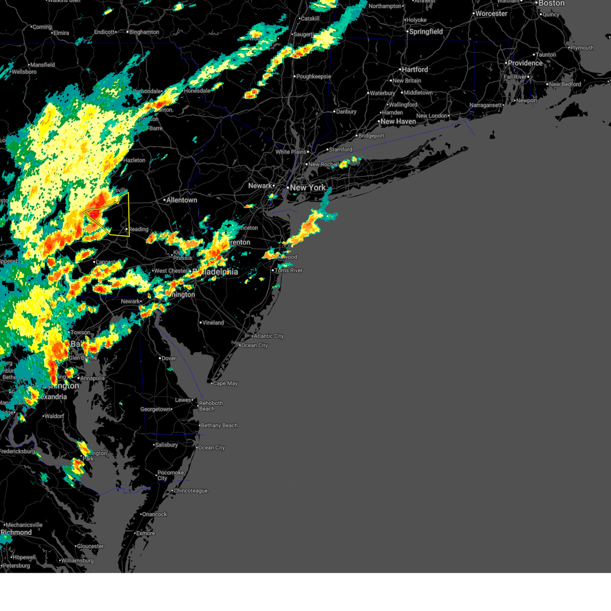
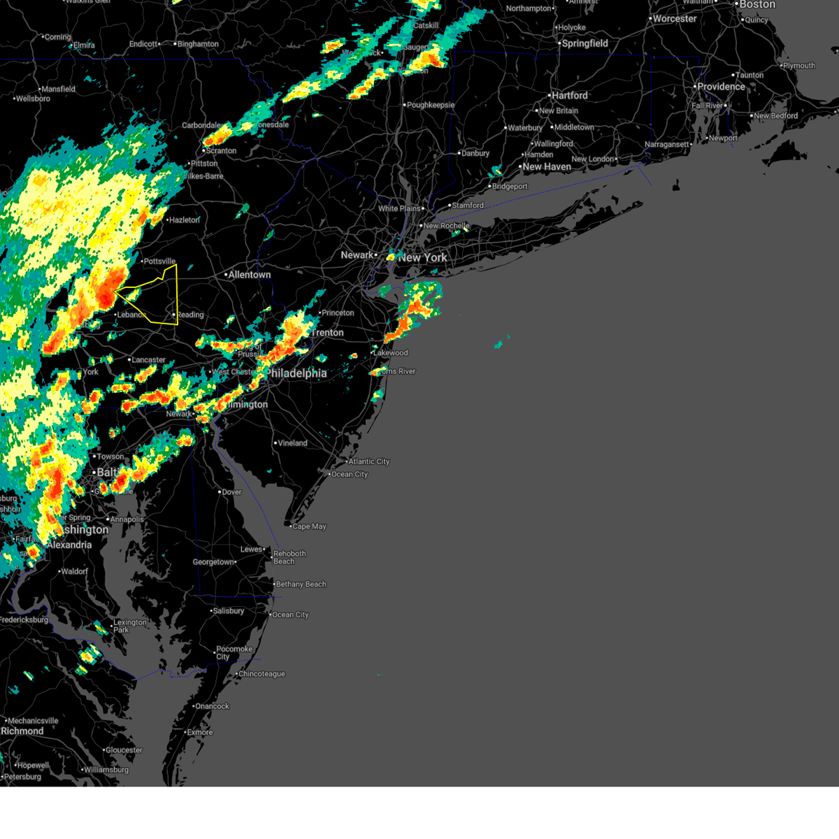
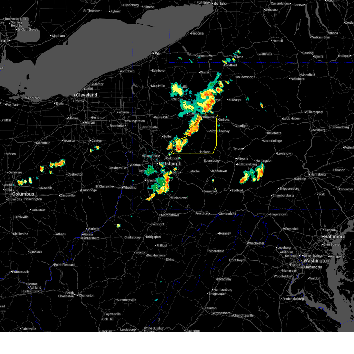
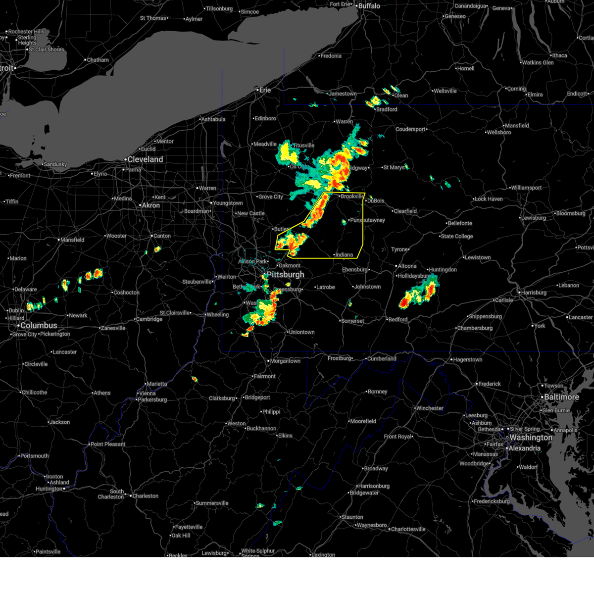
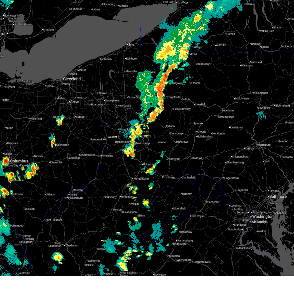
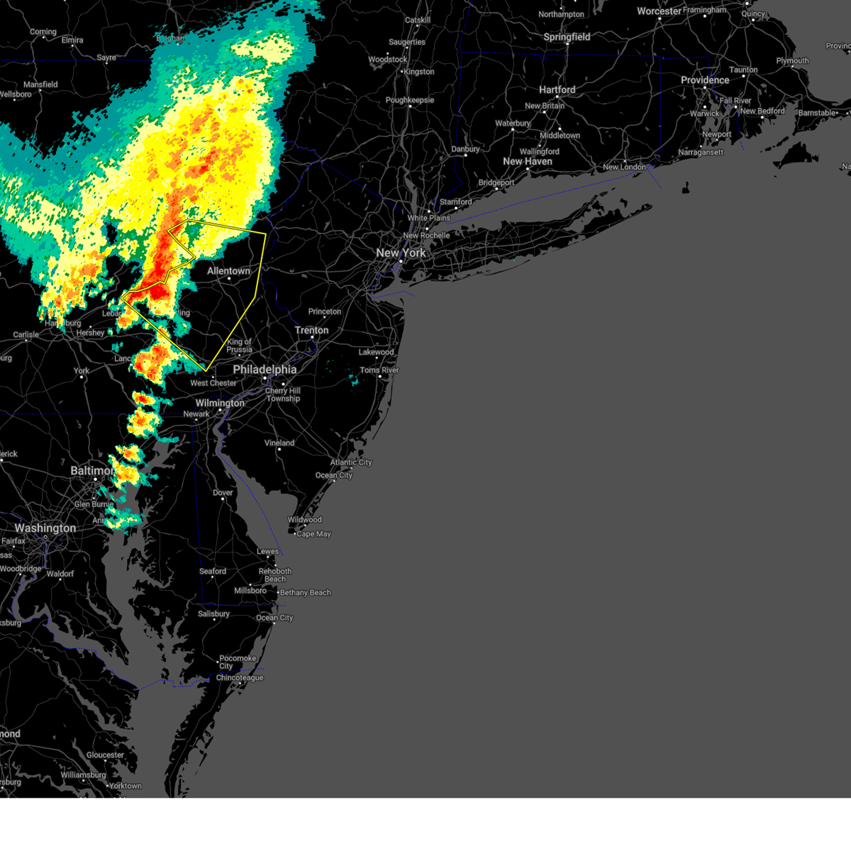
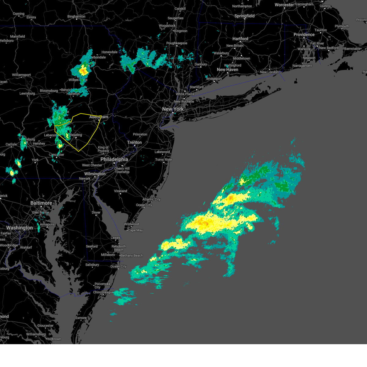
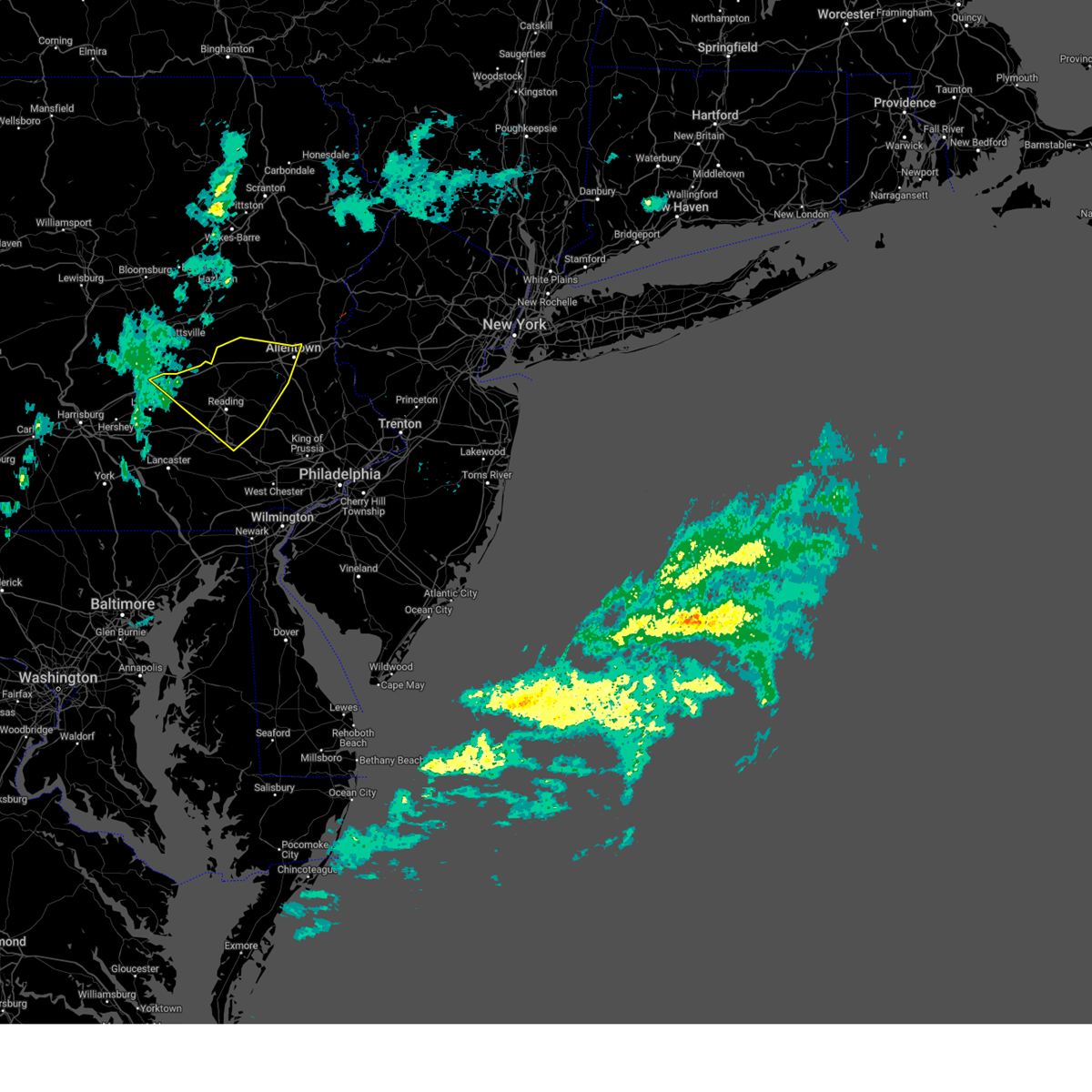
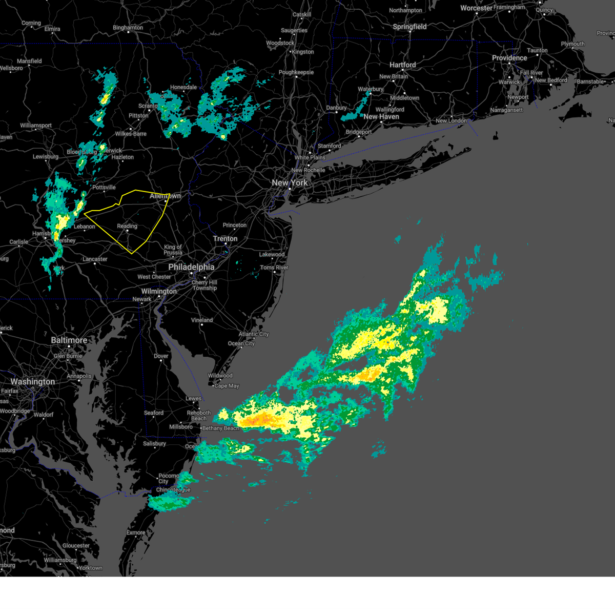
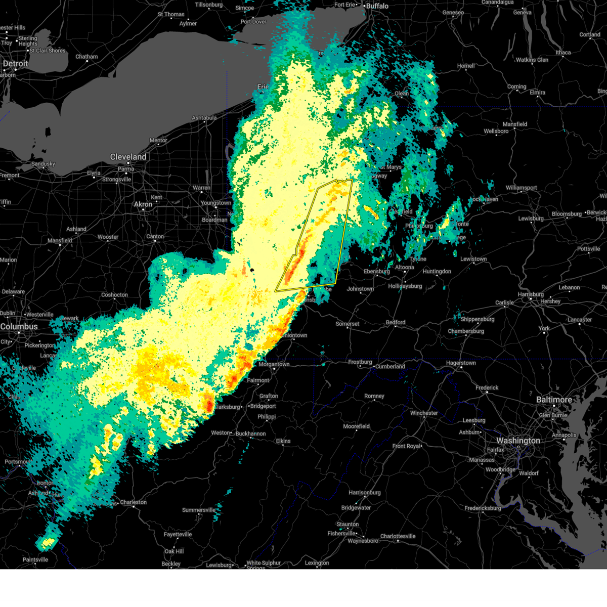
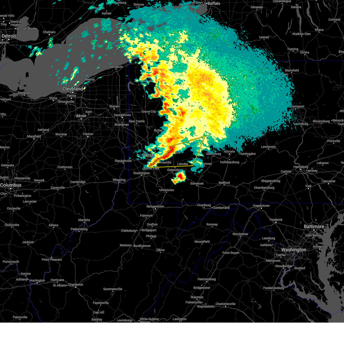
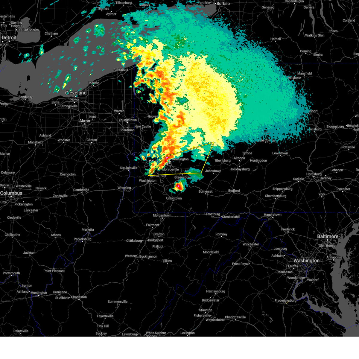
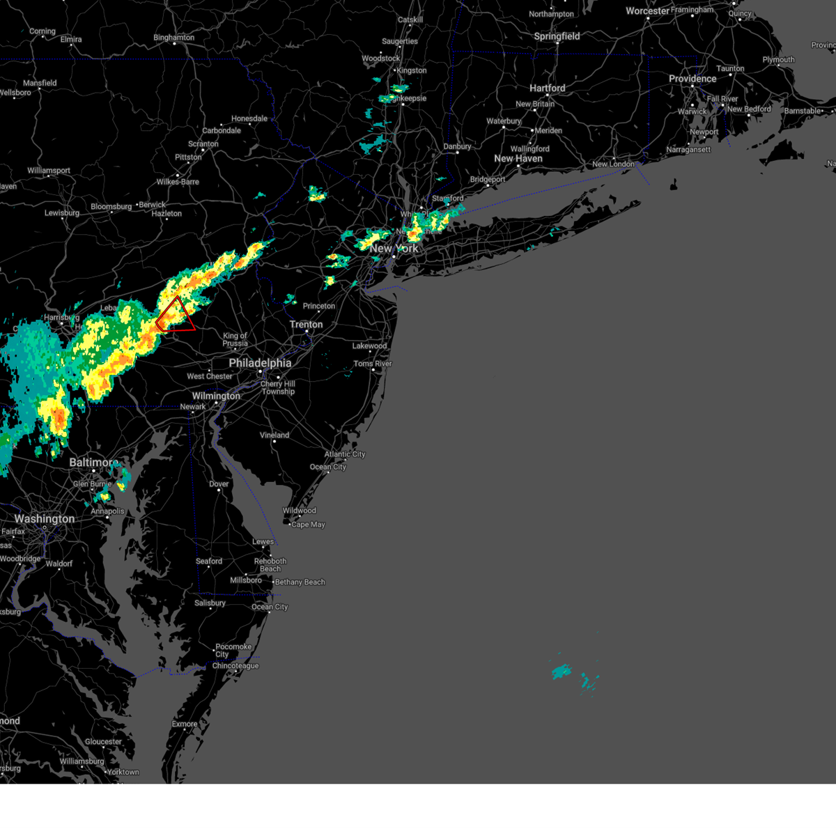
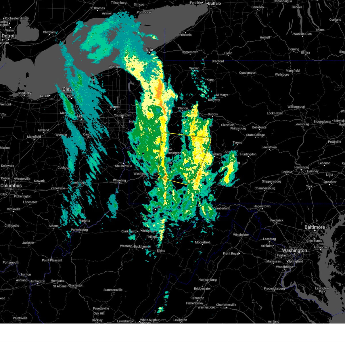
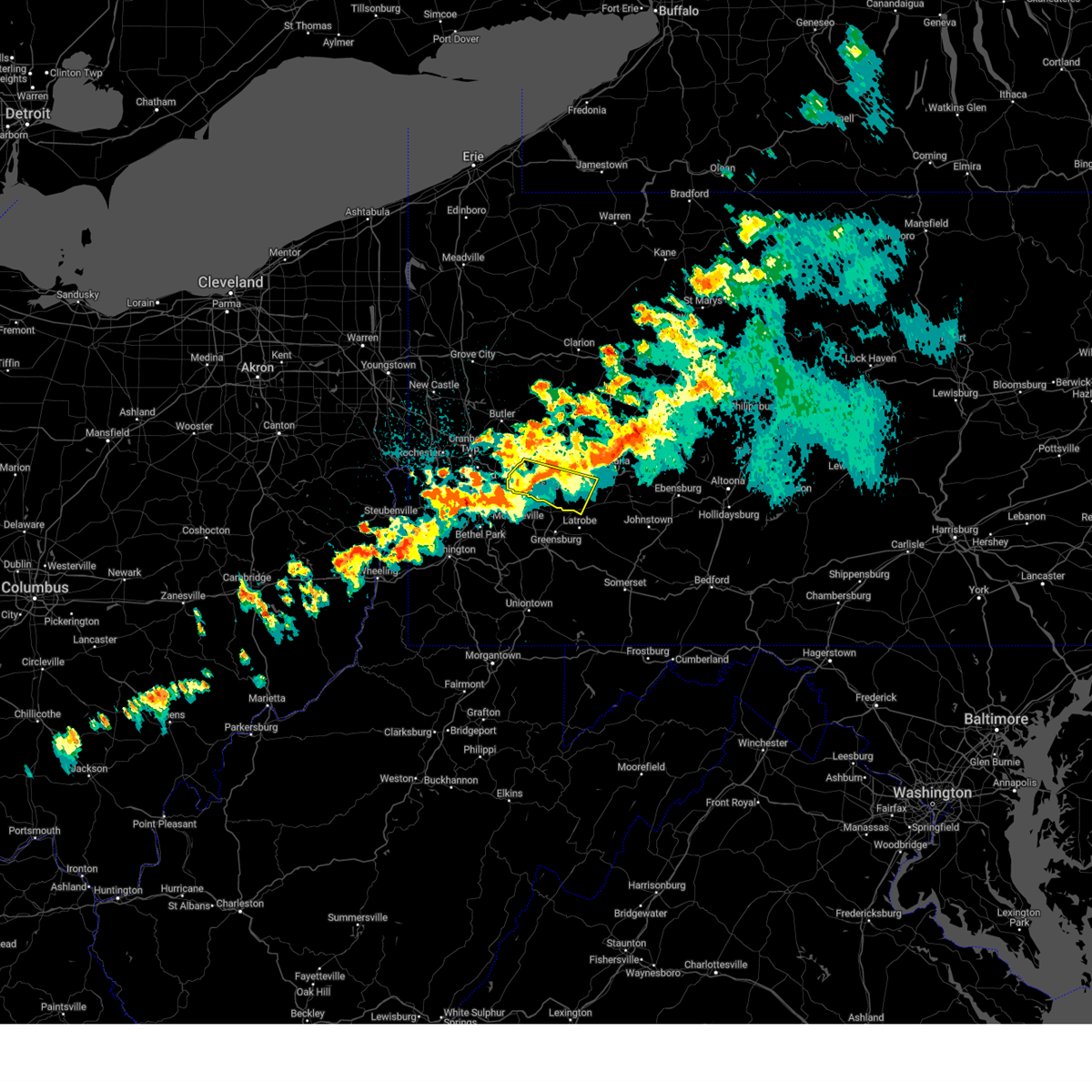
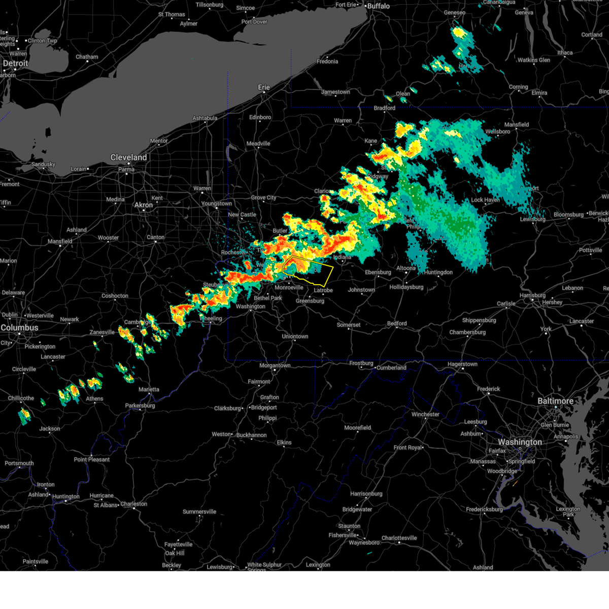
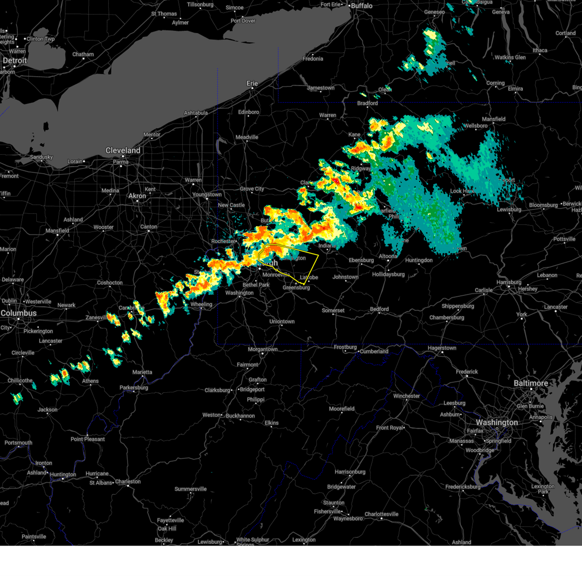
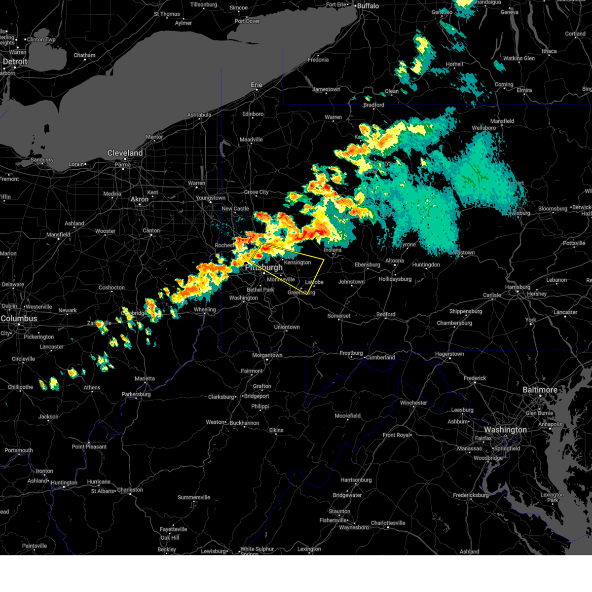
Hail Map for Hyde Park, PA
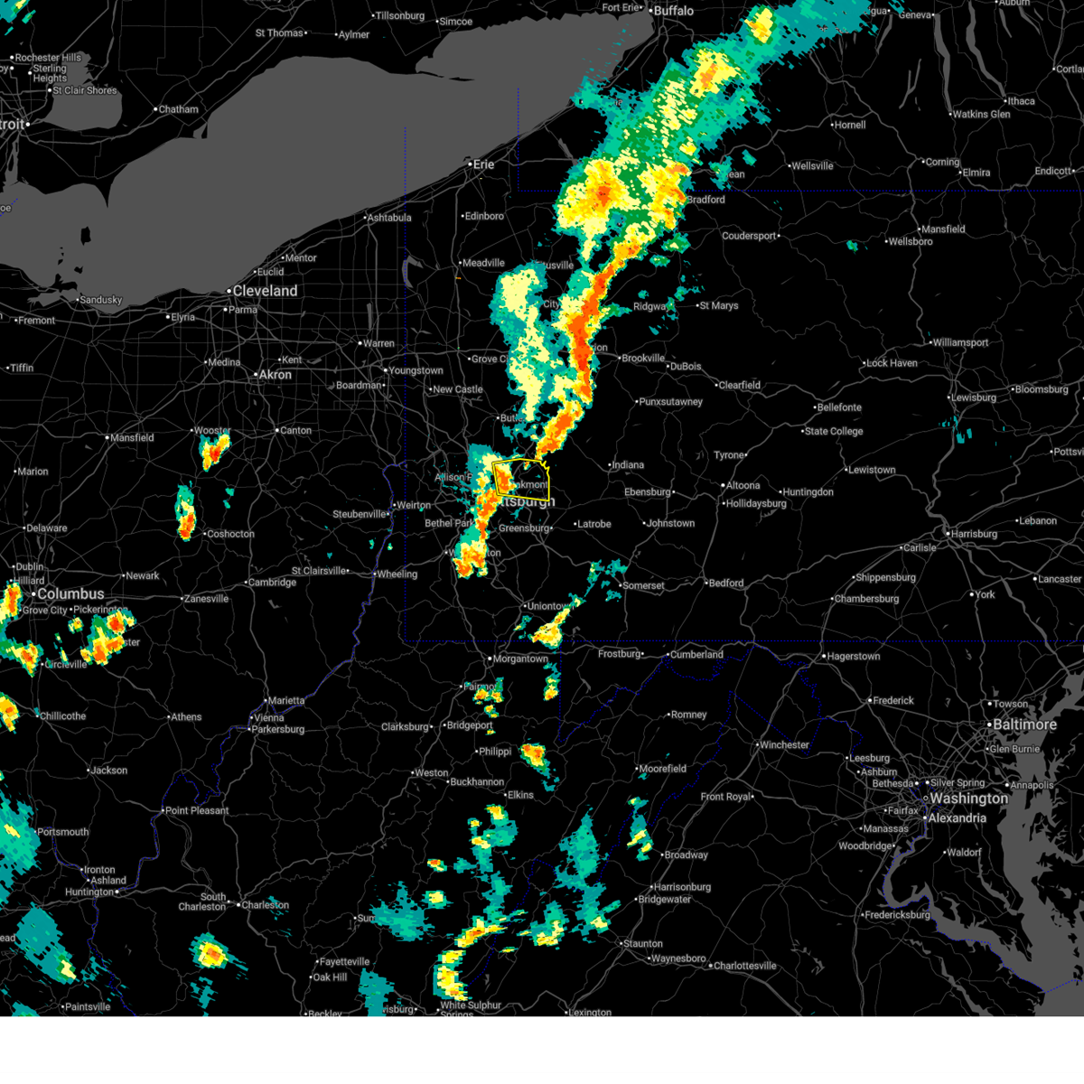
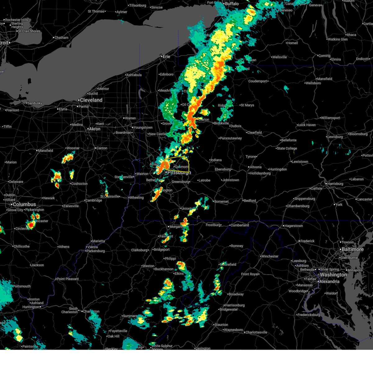
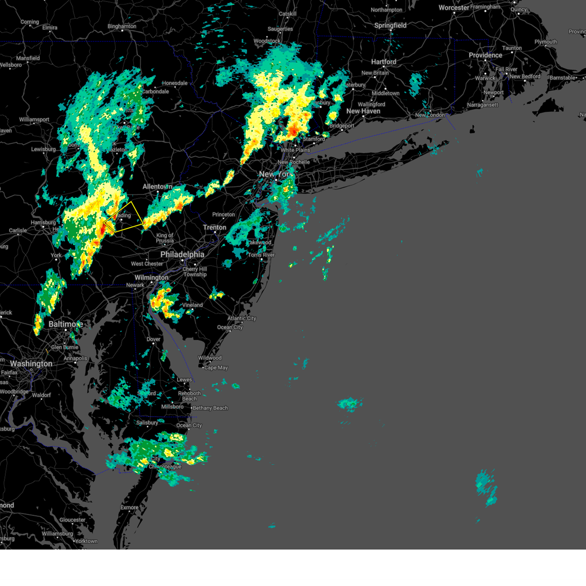
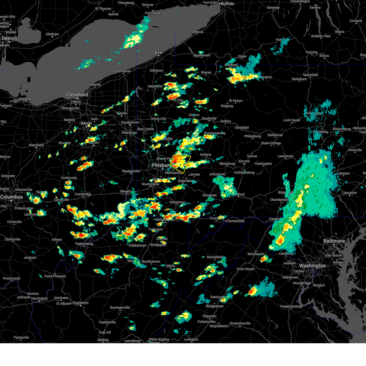
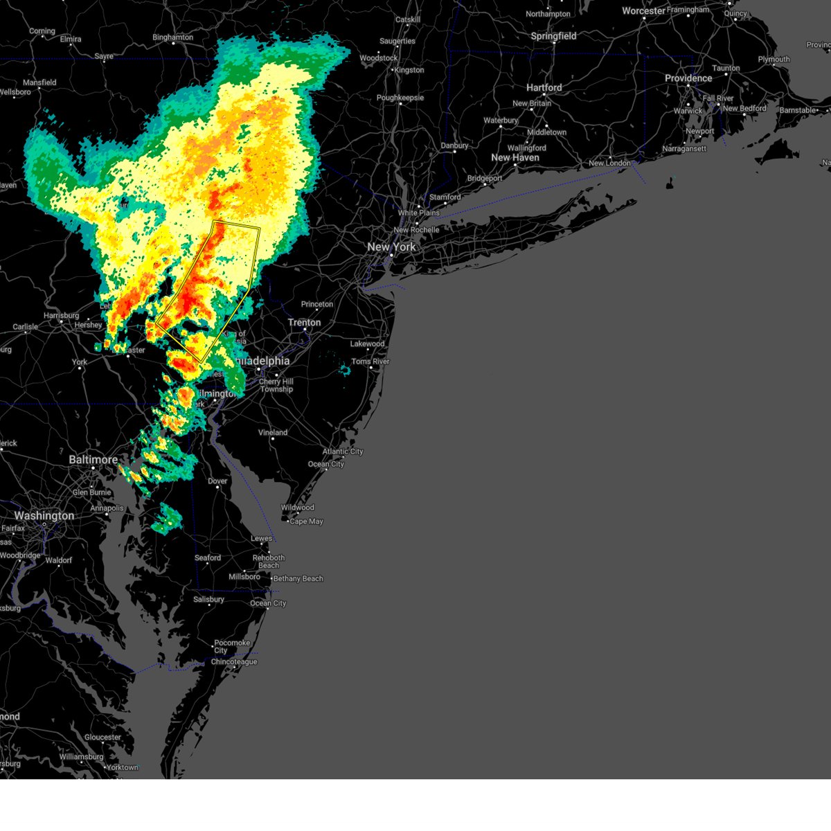
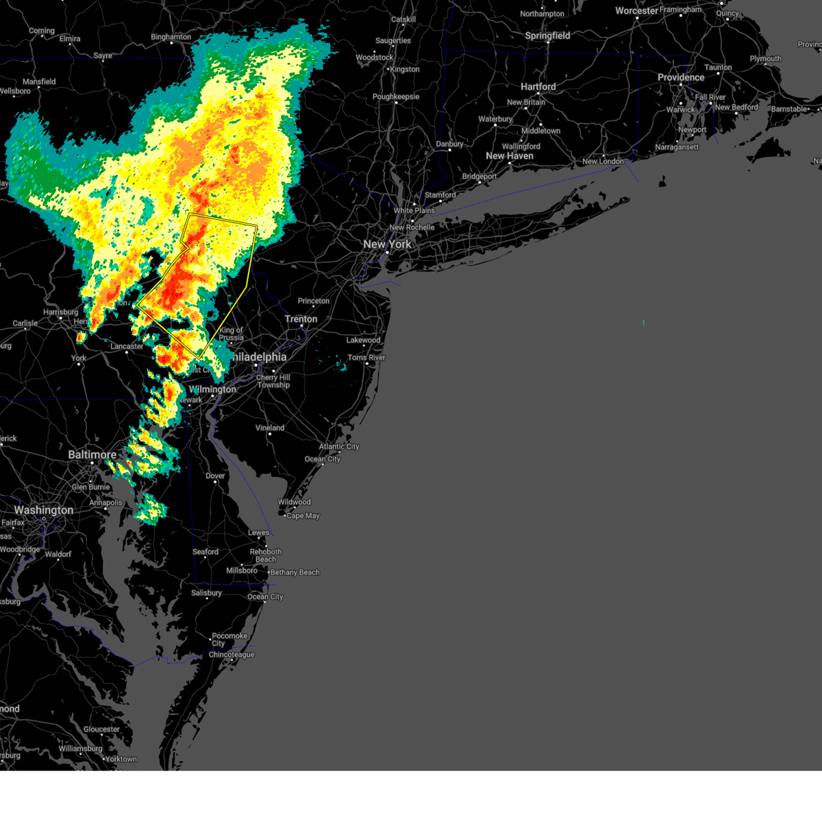
The Hyde Park, PA area has had 0 reports of on-the-ground hail by trained spotters, and has been under severe weather warnings 96 times during the past 12 months. Doppler radar has detected hail at or near Hyde Park, PA on 49 occasions, including 5 occasions during the past year.
| Name: | Hyde Park, PA |
| Where Located: | 72.7 miles S of Scranton, PA |
| Map: | Google Map for Hyde Park, PA |
| Population: | 2528 |
| Housing Units: | 1098 |
| More Info: | Search Google for Hyde Park, PA |
1
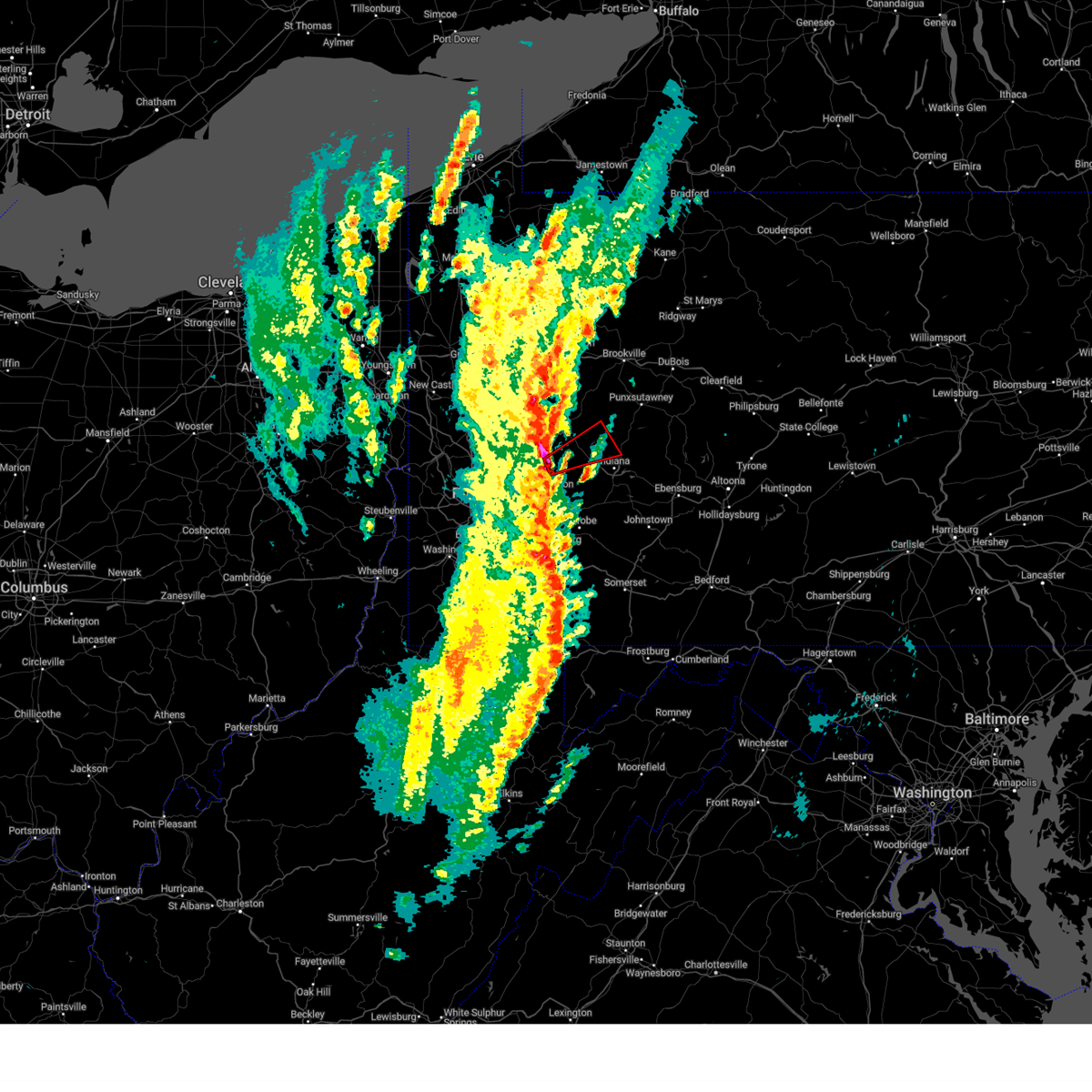
The Top Recent Hail Date for Hyde Park, PA is Sunday, March 16, 2025 (13th out of 49)

Hail and Wind Damage Spotted near Hyde Park, PA
| Date / Time | Report Details |
|---|---|
| 7/1/2025 4:48 PM EDT |
 At 448 pm edt, severe thunderstorms were located along a line extending from kutztown to near fleetwood to near birdsboro, moving east at 25 mph (radar indicated). Hazards include 60 mph wind gusts and quarter size hail. Minor damage to vehicles is possible. wind damage to roofs, siding, trees, and power lines is possible. Locations impacted include, allentown, reading, pottstown, emmaus, wyomissing, birdsboro, kutztown, fleetwood, laureldale, east greenville, topton, bally, bechtelsville, lyons, new morgan, zionsville, pughtown, ancient oaks, gilbertsville, and cedarville. At 448 pm edt, severe thunderstorms were located along a line extending from kutztown to near fleetwood to near birdsboro, moving east at 25 mph (radar indicated). Hazards include 60 mph wind gusts and quarter size hail. Minor damage to vehicles is possible. wind damage to roofs, siding, trees, and power lines is possible. Locations impacted include, allentown, reading, pottstown, emmaus, wyomissing, birdsboro, kutztown, fleetwood, laureldale, east greenville, topton, bally, bechtelsville, lyons, new morgan, zionsville, pughtown, ancient oaks, gilbertsville, and cedarville.
|
| 7/1/2025 4:34 PM EDT |
 At 434 pm edt, severe thunderstorms were located along a line extending from near shoemakersville to laureldale to near new morgan, moving east at 25 mph. a 58 mph wind gust was measured at the reading regional airport (automated weather station and radar). Hazards include 60 mph wind gusts and quarter size hail. Minor damage to vehicles is possible. wind damage to roofs, siding, trees, and power lines is possible. Locations impacted include, allentown, reading, pottstown, emmaus, wyomissing, birdsboro, kutztown, hamburg, fleetwood, sinking spring, laureldale, east greenville, topton, leesport, shoemakersville, bally, bechtelsville, lyons, new morgan, and pughtown. At 434 pm edt, severe thunderstorms were located along a line extending from near shoemakersville to laureldale to near new morgan, moving east at 25 mph. a 58 mph wind gust was measured at the reading regional airport (automated weather station and radar). Hazards include 60 mph wind gusts and quarter size hail. Minor damage to vehicles is possible. wind damage to roofs, siding, trees, and power lines is possible. Locations impacted include, allentown, reading, pottstown, emmaus, wyomissing, birdsboro, kutztown, hamburg, fleetwood, sinking spring, laureldale, east greenville, topton, leesport, shoemakersville, bally, bechtelsville, lyons, new morgan, and pughtown.
|
| 7/1/2025 4:27 PM EDT | Svrphi the national weather service in mount holly nj has issued a * severe thunderstorm warning for, berks county in eastern pennsylvania, south central lehigh county in eastern pennsylvania, northwestern montgomery county in southeastern pennsylvania, north central chester county in southeastern pennsylvania, * until 530 pm edt. * at 427 pm edt, severe thunderstorms were located along a line extending from shoemakersville to near laureldale to near adamstown, moving east at 25 mph (radar indicated). Hazards include 60 mph wind gusts. damage to roofs, siding, trees, and power lines is possible |
| 7/1/2025 4:07 PM EDT |
 At 407 pm edt, severe thunderstorms were located along a line extending from near strausstown to newmanstown, moving east at 35 mph (radar indicated). Hazards include 60 mph wind gusts and quarter size hail. Minor damage to vehicles is possible. wind damage to roofs, siding, trees, and power lines is possible. Locations impacted include, reading, wyomissing, hamburg, sinking spring, laureldale, womelsdorf, wernersville, robesonia, leesport, shoemakersville, bernville, strausstown, spring ridge, fairview hgts, shillington, west reading, mount penn, mohnton, kenhorst, and centerport. At 407 pm edt, severe thunderstorms were located along a line extending from near strausstown to newmanstown, moving east at 35 mph (radar indicated). Hazards include 60 mph wind gusts and quarter size hail. Minor damage to vehicles is possible. wind damage to roofs, siding, trees, and power lines is possible. Locations impacted include, reading, wyomissing, hamburg, sinking spring, laureldale, womelsdorf, wernersville, robesonia, leesport, shoemakersville, bernville, strausstown, spring ridge, fairview hgts, shillington, west reading, mount penn, mohnton, kenhorst, and centerport.
|
| 7/1/2025 3:54 PM EDT |
 At 354 pm edt, a severe thunderstorm was located near myerstown, moving east at 30 mph (radar indicated). Hazards include 60 mph wind gusts and quarter size hail. Minor damage to vehicles is possible. wind damage to roofs, siding, trees, and power lines is possible. Locations impacted include, reading, wyomissing, hamburg, sinking spring, laureldale, womelsdorf, wernersville, robesonia, leesport, shoemakersville, bernville, strausstown, spring ridge, fairview hgts, shillington, west reading, mount penn, mohnton, kenhorst, and centerport. At 354 pm edt, a severe thunderstorm was located near myerstown, moving east at 30 mph (radar indicated). Hazards include 60 mph wind gusts and quarter size hail. Minor damage to vehicles is possible. wind damage to roofs, siding, trees, and power lines is possible. Locations impacted include, reading, wyomissing, hamburg, sinking spring, laureldale, womelsdorf, wernersville, robesonia, leesport, shoemakersville, bernville, strausstown, spring ridge, fairview hgts, shillington, west reading, mount penn, mohnton, kenhorst, and centerport.
|
| 7/1/2025 3:34 PM EDT |
 Svrphi the national weather service in mount holly nj has issued a * severe thunderstorm warning for, central berks county in eastern pennsylvania, * until 430 pm edt. * at 333 pm edt, a severe thunderstorm was located over lickdale, or 7 miles north of annville, moving east at 30 mph (radar indicated). Hazards include 60 mph wind gusts and quarter size hail. Minor damage to vehicles is possible. Wind damage to roofs, siding, trees, and power lines is possible. Svrphi the national weather service in mount holly nj has issued a * severe thunderstorm warning for, central berks county in eastern pennsylvania, * until 430 pm edt. * at 333 pm edt, a severe thunderstorm was located over lickdale, or 7 miles north of annville, moving east at 30 mph (radar indicated). Hazards include 60 mph wind gusts and quarter size hail. Minor damage to vehicles is possible. Wind damage to roofs, siding, trees, and power lines is possible.
|
| 6/28/2025 1:01 PM EDT |
 At 101 pm edt, severe thunderstorms were located along a line from 12 miles north of brookville to 12 miles northeast of indiana, moving east at 45 mph (radar indicated). Hazards include 60 mph wind gusts. Expect damage to roofs, siding, and trees. Locations impacted include, indiana, punxsutawney, vandergrift, kittanning, brookville, lower burrell, harrison township, ford city, reynoldsville, leechburg, freeport, new bethlehem, west kittanning, clymer, north apollo, west leechburg, sykesville, falls creek, orchard hills and rural valley. At 101 pm edt, severe thunderstorms were located along a line from 12 miles north of brookville to 12 miles northeast of indiana, moving east at 45 mph (radar indicated). Hazards include 60 mph wind gusts. Expect damage to roofs, siding, and trees. Locations impacted include, indiana, punxsutawney, vandergrift, kittanning, brookville, lower burrell, harrison township, ford city, reynoldsville, leechburg, freeport, new bethlehem, west kittanning, clymer, north apollo, west leechburg, sykesville, falls creek, orchard hills and rural valley.
|
| 6/28/2025 1:01 PM EDT |
 the severe thunderstorm warning has been cancelled and is no longer in effect the severe thunderstorm warning has been cancelled and is no longer in effect
|
| 6/28/2025 12:44 PM EDT |
 Svrpbz the national weather service in pittsburgh has issued a * severe thunderstorm warning for, north central westmoreland county in southwestern pennsylvania, armstrong county in west central pennsylvania, southeastern butler county in west central pennsylvania, southeastern clarion county in west central pennsylvania, indiana county in west central pennsylvania, jefferson pa county in west central pennsylvania, * until 145 pm edt. * at 1244 pm edt, severe thunderstorms were located along a line from 10 miles northeast of clarion to near indiana, moving east at 45 mph (radar indicated). Hazards include 60 mph wind gusts. expect damage to roofs, siding, and trees Svrpbz the national weather service in pittsburgh has issued a * severe thunderstorm warning for, north central westmoreland county in southwestern pennsylvania, armstrong county in west central pennsylvania, southeastern butler county in west central pennsylvania, southeastern clarion county in west central pennsylvania, indiana county in west central pennsylvania, jefferson pa county in west central pennsylvania, * until 145 pm edt. * at 1244 pm edt, severe thunderstorms were located along a line from 10 miles northeast of clarion to near indiana, moving east at 45 mph (radar indicated). Hazards include 60 mph wind gusts. expect damage to roofs, siding, and trees
|
| 6/27/2025 6:01 PM EDT |
 the severe thunderstorm warning has been cancelled and is no longer in effect the severe thunderstorm warning has been cancelled and is no longer in effect
|
| 6/27/2025 5:55 PM EDT |
 At 555 pm edt, a severe thunderstorm was located over new kensington, or 6 miles northeast of penn hills, moving east at 25 mph (radar indicated). Hazards include 60 mph wind gusts. Expect damage to roofs, siding, and trees. Locations impacted include, pittsburgh, penn hills, monroeville, vandergrift, apollo, plum, murrysville, hampton township, new kensington, lower burrell, harrison township, o'hara township, oakmont, fox chapel, arnold, tarentum, natrona heights, springdale, brackenridge and aspinwall. At 555 pm edt, a severe thunderstorm was located over new kensington, or 6 miles northeast of penn hills, moving east at 25 mph (radar indicated). Hazards include 60 mph wind gusts. Expect damage to roofs, siding, and trees. Locations impacted include, pittsburgh, penn hills, monroeville, vandergrift, apollo, plum, murrysville, hampton township, new kensington, lower burrell, harrison township, o'hara township, oakmont, fox chapel, arnold, tarentum, natrona heights, springdale, brackenridge and aspinwall.
|
| 6/27/2025 5:34 PM EDT |
 Svrpbz the national weather service in pittsburgh has issued a * severe thunderstorm warning for, northeastern allegheny county in southwestern pennsylvania, northwestern westmoreland county in southwestern pennsylvania, * until 615 pm edt. * at 534 pm edt, a severe thunderstorm was located over fox chapel, or 6 miles east of ross township, moving east at 25 mph (radar indicated). Hazards include 60 mph wind gusts. expect damage to roofs, siding, and trees Svrpbz the national weather service in pittsburgh has issued a * severe thunderstorm warning for, northeastern allegheny county in southwestern pennsylvania, northwestern westmoreland county in southwestern pennsylvania, * until 615 pm edt. * at 534 pm edt, a severe thunderstorm was located over fox chapel, or 6 miles east of ross township, moving east at 25 mph (radar indicated). Hazards include 60 mph wind gusts. expect damage to roofs, siding, and trees
|
| 6/26/2025 6:08 PM EDT |
 At 608 pm edt, severe thunderstorms were located along a line extending from near reading to near adamstown to ephrata, moving east at 25 mph (radar indicated). Hazards include 60 mph wind gusts and quarter size hail. Minor damage to vehicles is possible. wind damage to roofs, siding, trees, and power lines is possible. Locations impacted include, reading, pottstown, wyomissing, birdsboro, royersford, sinking spring, laureldale, wernersville, schwenksville, elverson, new morgan, spring ridge, pughtown, spring mount, gilbertsville, cedarville, stowe, shillington, west reading, and boyertown. At 608 pm edt, severe thunderstorms were located along a line extending from near reading to near adamstown to ephrata, moving east at 25 mph (radar indicated). Hazards include 60 mph wind gusts and quarter size hail. Minor damage to vehicles is possible. wind damage to roofs, siding, trees, and power lines is possible. Locations impacted include, reading, pottstown, wyomissing, birdsboro, royersford, sinking spring, laureldale, wernersville, schwenksville, elverson, new morgan, spring ridge, pughtown, spring mount, gilbertsville, cedarville, stowe, shillington, west reading, and boyertown.
|
| 6/26/2025 5:45 PM EDT |
 Svrphi the national weather service in mount holly nj has issued a * severe thunderstorm warning for, central berks county in eastern pennsylvania, northwestern montgomery county in southeastern pennsylvania, north central chester county in southeastern pennsylvania, * until 630 pm edt. * at 544 pm edt, severe thunderstorms were located along a line extending from laureldale to near adamstown to brickerville, moving southeast at 25 mph (radar indicated). Hazards include 60 mph wind gusts and quarter size hail. Minor damage to vehicles is possible. Wind damage to roofs, siding, trees, and power lines is possible. Svrphi the national weather service in mount holly nj has issued a * severe thunderstorm warning for, central berks county in eastern pennsylvania, northwestern montgomery county in southeastern pennsylvania, north central chester county in southeastern pennsylvania, * until 630 pm edt. * at 544 pm edt, severe thunderstorms were located along a line extending from laureldale to near adamstown to brickerville, moving southeast at 25 mph (radar indicated). Hazards include 60 mph wind gusts and quarter size hail. Minor damage to vehicles is possible. Wind damage to roofs, siding, trees, and power lines is possible.
|
| 6/25/2025 6:34 PM EDT | At 634 pm edt, severe thunderstorms were located along a line extending from near lyons to wyomissing, moving southeast at 25 mph (radar indicated). Hazards include 60 mph wind gusts and quarter size hail. Minor damage to vehicles is possible. wind damage to roofs, siding, trees, and power lines is possible. Locations impacted include, reading, wyomissing, birdsboro, fleetwood, sinking spring, laureldale, wernersville, robesonia, leesport, bally, bechtelsville, lyons, new morgan, spring ridge, fairview hgts, shillington, west reading, boyertown, mount penn, and mohnton. |
| 6/25/2025 6:21 PM EDT | the severe thunderstorm warning has been cancelled and is no longer in effect |
| 6/25/2025 6:21 PM EDT | At 620 pm edt, severe thunderstorms were located along a line extending from fleetwood to sinking spring, moving southeast at 25 mph (radar indicated). Hazards include 60 mph wind gusts and quarter size hail. Minor damage to vehicles is possible. wind damage to roofs, siding, trees, and power lines is possible. Locations impacted include, reading, wyomissing, birdsboro, kutztown, fleetwood, sinking spring, laureldale, womelsdorf, wernersville, topton, robesonia, leesport, shoemakersville, bally, bernville, bechtelsville, lyons, new morgan, spring ridge, and fairview hgts. |
| 6/25/2025 5:59 PM EDT | At 559 pm edt, severe thunderstorms were located along a line extending from wanamakers to near fairview hgts, moving southeast at 25 mph (radar indicated). Hazards include 60 mph wind gusts and quarter size hail. Minor damage to vehicles is possible. wind damage to roofs, siding, trees, and power lines is possible. Locations impacted include, allentown, reading, emmaus, wyomissing, birdsboro, kutztown, hamburg, fleetwood, sinking spring, laureldale, womelsdorf, wernersville, topton, robesonia, leesport, shoemakersville, elverson, bally, bernville, and bechtelsville. |
| 6/25/2025 5:39 PM EDT | Svrphi the national weather service in mount holly nj has issued a * severe thunderstorm warning for, berks county in eastern pennsylvania, central lehigh county in eastern pennsylvania, * until 645 pm edt. * at 539 pm edt, severe thunderstorms were located along a line extending from near tuscarora to bernville, moving southeast at 25 mph (radar indicated). Hazards include 60 mph wind gusts and quarter size hail. Minor damage to vehicles is possible. Wind damage to roofs, siding, trees, and power lines is possible. |
| 6/19/2025 5:08 PM EDT | At 508 pm edt, a severe thunderstorm was located near apollo, moving east at 40 mph (radar indicated). Hazards include 60 mph wind gusts. Expect damage to roofs, siding, and trees. Locations impacted include, indiana, vandergrift, homer city, apollo, murrysville, lower burrell, blairsville, leechburg, black lick, north apollo, west leechburg, avonmore, orchard hills, saltsburg, oklahoma, west lebanon, east vandergrift, north vandergrift, hyde park and chevy chase heights. |
| 6/19/2025 5:08 PM EDT | the severe thunderstorm warning has been cancelled and is no longer in effect |
| 6/19/2025 4:59 PM EDT | Svrpbz the national weather service in pittsburgh has issued a * severe thunderstorm warning for, northeastern allegheny county in southwestern pennsylvania, northwestern westmoreland county in southwestern pennsylvania, southern armstrong county in west central pennsylvania, southwestern indiana county in west central pennsylvania, * until 545 pm edt. * at 459 pm edt, a severe thunderstorm was located over plum, or 7 miles northeast of penn hills, moving east at 40 mph (radar indicated). Hazards include 60 mph wind gusts. expect damage to roofs, siding, and trees |
| 6/19/2025 12:14 AM EDT |
 the severe thunderstorm warning has been cancelled and is no longer in effect the severe thunderstorm warning has been cancelled and is no longer in effect
|
| 6/19/2025 12:14 AM EDT |
 At 1214 am edt, severe thunderstorms were located along a line from 9 miles west of marienville to over murrysville, or along a line from 9 miles west of marienville to 6 miles east of monroeville, moving east at 30 mph (law enforcement reported trees and wires down with this line of storms). Hazards include 60 mph wind gusts. Expect damage to roofs, siding, and trees. Locations impacted include, pittsburgh, penn hills, monroeville, indiana, punxsutawney, clarion, vandergrift, kittanning, brookville, marienville, homer city, apollo, knox, rimersburg, plum, murrysville, wilkinsburg, new kensington, lower burrell and harrison township. At 1214 am edt, severe thunderstorms were located along a line from 9 miles west of marienville to over murrysville, or along a line from 9 miles west of marienville to 6 miles east of monroeville, moving east at 30 mph (law enforcement reported trees and wires down with this line of storms). Hazards include 60 mph wind gusts. Expect damage to roofs, siding, and trees. Locations impacted include, pittsburgh, penn hills, monroeville, indiana, punxsutawney, clarion, vandergrift, kittanning, brookville, marienville, homer city, apollo, knox, rimersburg, plum, murrysville, wilkinsburg, new kensington, lower burrell and harrison township.
|
| 6/18/2025 11:59 PM EDT |
 The storms which prompted the warning have moved out of a portion of the area. a new severe thunderstorm warning has been issued for this line of storms to the east. The storms which prompted the warning have moved out of a portion of the area. a new severe thunderstorm warning has been issued for this line of storms to the east.
|
| 6/18/2025 11:57 PM EDT |
 Svrpbz the national weather service in pittsburgh has issued a * severe thunderstorm warning for, forest county in northwestern pennsylvania, eastern venango county in northwestern pennsylvania, northeastern allegheny county in southwestern pennsylvania, northern westmoreland county in southwestern pennsylvania, armstrong county in west central pennsylvania, eastern butler county in west central pennsylvania, clarion county in west central pennsylvania, indiana county in west central pennsylvania, jefferson pa county in west central pennsylvania, * until 115 am edt. * at 1157 pm edt, severe thunderstorms were located along a line from near tionesta to over penn hills, or along a line from 16 miles northeast of oil city to over penn hills, moving east at 30 mph (law enforcement reported trees and wires down with this line of storms). Hazards include 60 mph wind gusts. expect damage to roofs, siding, and trees Svrpbz the national weather service in pittsburgh has issued a * severe thunderstorm warning for, forest county in northwestern pennsylvania, eastern venango county in northwestern pennsylvania, northeastern allegheny county in southwestern pennsylvania, northern westmoreland county in southwestern pennsylvania, armstrong county in west central pennsylvania, eastern butler county in west central pennsylvania, clarion county in west central pennsylvania, indiana county in west central pennsylvania, jefferson pa county in west central pennsylvania, * until 115 am edt. * at 1157 pm edt, severe thunderstorms were located along a line from near tionesta to over penn hills, or along a line from 16 miles northeast of oil city to over penn hills, moving east at 30 mph (law enforcement reported trees and wires down with this line of storms). Hazards include 60 mph wind gusts. expect damage to roofs, siding, and trees
|
| 6/18/2025 11:42 PM EDT |
 At 1142 pm edt, severe thunderstorms were located along a line from over tionesta to over monongahela, or along a line from 11 miles east of oil city to 5 miles southeast of gastonville, moving east at 45 mph (law enforcement reported trees down with this line of storms). Hazards include 60 mph wind gusts. Expect damage to roofs, siding, and trees. Locations impacted include, pittsburgh, penn hills, mount lebanon, bethel park, ross township, mccandless township, monroeville, mcmurray, mckeesport, butler, franklin park, oil city, jeannette, canonsburg, franklin, clarion, vandergrift, kittanning, apollo and knox. At 1142 pm edt, severe thunderstorms were located along a line from over tionesta to over monongahela, or along a line from 11 miles east of oil city to 5 miles southeast of gastonville, moving east at 45 mph (law enforcement reported trees down with this line of storms). Hazards include 60 mph wind gusts. Expect damage to roofs, siding, and trees. Locations impacted include, pittsburgh, penn hills, mount lebanon, bethel park, ross township, mccandless township, monroeville, mcmurray, mckeesport, butler, franklin park, oil city, jeannette, canonsburg, franklin, clarion, vandergrift, kittanning, apollo and knox.
|
| 6/18/2025 11:42 PM EDT |
 the severe thunderstorm warning has been cancelled and is no longer in effect the severe thunderstorm warning has been cancelled and is no longer in effect
|
| 6/18/2025 11:29 PM EDT |
 At 1129 pm edt, severe thunderstorms were located along a line from near oil city to near canonsburg, moving east at 45 mph (law enforcement reported trees down with this line of storms). Hazards include 60 mph wind gusts. Expect damage to roofs, siding, and trees. Locations impacted include, pittsburgh, penn hills, mount lebanon, bethel park, ross township, mccandless township, monroeville, cranberry, moon township, new castle, mcmurray, mckeesport, butler, washington, franklin park, oil city, jeannette, aliquippa, canonsburg and grove city. At 1129 pm edt, severe thunderstorms were located along a line from near oil city to near canonsburg, moving east at 45 mph (law enforcement reported trees down with this line of storms). Hazards include 60 mph wind gusts. Expect damage to roofs, siding, and trees. Locations impacted include, pittsburgh, penn hills, mount lebanon, bethel park, ross township, mccandless township, monroeville, cranberry, moon township, new castle, mcmurray, mckeesport, butler, washington, franklin park, oil city, jeannette, aliquippa, canonsburg and grove city.
|
| 6/18/2025 11:29 PM EDT |
 the severe thunderstorm warning has been cancelled and is no longer in effect the severe thunderstorm warning has been cancelled and is no longer in effect
|
| 6/18/2025 11:16 PM EDT |
 At 1116 pm edt, severe thunderstorms were located along a line from near sugarcreek to over wolfdale, or along a line from 6 miles north of franklin to near washington, moving east at 45 mph (law enforcement reported trees down with this line of storms). Hazards include 60 mph wind gusts. Expect damage to roofs, siding, and trees. Locations impacted include, pittsburgh, penn hills, mount lebanon, bethel park, ross township, mccandless township, monroeville, cranberry, moon township, new castle, mcmurray, weirton, mckeesport, steubenville, butler, franklin park, oil city, jeannette, aliquippa and canonsburg. At 1116 pm edt, severe thunderstorms were located along a line from near sugarcreek to over wolfdale, or along a line from 6 miles north of franklin to near washington, moving east at 45 mph (law enforcement reported trees down with this line of storms). Hazards include 60 mph wind gusts. Expect damage to roofs, siding, and trees. Locations impacted include, pittsburgh, penn hills, mount lebanon, bethel park, ross township, mccandless township, monroeville, cranberry, moon township, new castle, mcmurray, weirton, mckeesport, steubenville, butler, franklin park, oil city, jeannette, aliquippa and canonsburg.
|
| 6/18/2025 11:16 PM EDT |
 the severe thunderstorm warning has been cancelled and is no longer in effect the severe thunderstorm warning has been cancelled and is no longer in effect
|
| 6/18/2025 10:54 PM EDT |
 Svrpbz the national weather service in pittsburgh has issued a * severe thunderstorm warning for, eastern columbiana county in east central ohio, eastern jefferson oh county in east central ohio, western forest county in northwestern pennsylvania, mercer county in northwestern pennsylvania, venango county in northwestern pennsylvania, allegheny county in southwestern pennsylvania, northern washington county in southwestern pennsylvania, northwestern westmoreland county in southwestern pennsylvania, western armstrong county in west central pennsylvania, butler county in west central pennsylvania, clarion county in west central pennsylvania, beaver county in western pennsylvania, lawrence county in western pennsylvania, brooke county in northern west virginia, hancock county in northern west virginia, * until midnight edt. * at 1054 pm edt, severe thunderstorms were located along a line from 11 miles northeast of greenville to near west liberty, or along a line from 18 miles west of franklin to near west liberty, moving east at 45 mph (law enforcement reported trees were reported down with this line of storms). Hazards include 60 mph wind gusts. expect damage to roofs, siding, and trees Svrpbz the national weather service in pittsburgh has issued a * severe thunderstorm warning for, eastern columbiana county in east central ohio, eastern jefferson oh county in east central ohio, western forest county in northwestern pennsylvania, mercer county in northwestern pennsylvania, venango county in northwestern pennsylvania, allegheny county in southwestern pennsylvania, northern washington county in southwestern pennsylvania, northwestern westmoreland county in southwestern pennsylvania, western armstrong county in west central pennsylvania, butler county in west central pennsylvania, clarion county in west central pennsylvania, beaver county in western pennsylvania, lawrence county in western pennsylvania, brooke county in northern west virginia, hancock county in northern west virginia, * until midnight edt. * at 1054 pm edt, severe thunderstorms were located along a line from 11 miles northeast of greenville to near west liberty, or along a line from 18 miles west of franklin to near west liberty, moving east at 45 mph (law enforcement reported trees were reported down with this line of storms). Hazards include 60 mph wind gusts. expect damage to roofs, siding, and trees
|
| 6/10/2025 7:47 AM EDT |
 Svrphi the national weather service in mount holly nj has issued a * severe thunderstorm warning for, central berks county in eastern pennsylvania, * until 830 am edt. * at 746 am edt, a severe thunderstorm was located over denver, or near ephrata, moving northeast at 35 mph (radar indicated). Hazards include 60 mph wind gusts and penny size hail. damage to roofs, siding, trees, and power lines is possible Svrphi the national weather service in mount holly nj has issued a * severe thunderstorm warning for, central berks county in eastern pennsylvania, * until 830 am edt. * at 746 am edt, a severe thunderstorm was located over denver, or near ephrata, moving northeast at 35 mph (radar indicated). Hazards include 60 mph wind gusts and penny size hail. damage to roofs, siding, trees, and power lines is possible
|
| 6/6/2025 2:19 PM EDT |
 Svrpbz the national weather service in pittsburgh has issued a * severe thunderstorm warning for, northeastern allegheny county in southwestern pennsylvania, northwestern westmoreland county in southwestern pennsylvania, south central armstrong county in west central pennsylvania, * until 245 pm edt. * at 219 pm edt, a severe thunderstorm was located over springdale, or 5 miles northeast of penn hills, moving east at 20 mph (radar indicated). Hazards include 60 mph wind gusts and quarter size hail. Hail damage to vehicles is expected. Expect wind damage to roofs, siding, and trees. Svrpbz the national weather service in pittsburgh has issued a * severe thunderstorm warning for, northeastern allegheny county in southwestern pennsylvania, northwestern westmoreland county in southwestern pennsylvania, south central armstrong county in west central pennsylvania, * until 245 pm edt. * at 219 pm edt, a severe thunderstorm was located over springdale, or 5 miles northeast of penn hills, moving east at 20 mph (radar indicated). Hazards include 60 mph wind gusts and quarter size hail. Hail damage to vehicles is expected. Expect wind damage to roofs, siding, and trees.
|
| 5/16/2025 11:04 AM EDT |
 At 1103 am edt, severe thunderstorms were located along a line extending from near beersville to near ancient oaks to 6 miles northeast of birdsboro, moving east at 40 mph (law enforcement. at 1100 am edt, a downed tree and building collapse was reported in exeter township in berks county). Hazards include 60 mph wind gusts and quarter size hail. Minor damage to vehicles is possible. wind damage to roofs, siding, trees, and power lines is possible. Locations impacted include, allentown, reading, easton, bethlehem, pottstown, forks, emmaus, wyomissing, northampton, quakertown, wilson, downingtown, hellertown, nazareth, palmerton, bangor, birdsboro, kutztown, royersford, and slatington. At 1103 am edt, severe thunderstorms were located along a line extending from near beersville to near ancient oaks to 6 miles northeast of birdsboro, moving east at 40 mph (law enforcement. at 1100 am edt, a downed tree and building collapse was reported in exeter township in berks county). Hazards include 60 mph wind gusts and quarter size hail. Minor damage to vehicles is possible. wind damage to roofs, siding, trees, and power lines is possible. Locations impacted include, allentown, reading, easton, bethlehem, pottstown, forks, emmaus, wyomissing, northampton, quakertown, wilson, downingtown, hellertown, nazareth, palmerton, bangor, birdsboro, kutztown, royersford, and slatington.
|
| 5/16/2025 10:48 AM EDT |
 At 1048 am edt, severe thunderstorms were located along a line extending from near palmerton to near claussville to laureldale, moving east at 40 mph (radar indicated). Hazards include 60 mph wind gusts and quarter size hail. Minor damage to vehicles is possible. wind damage to roofs, siding, trees, and power lines is possible. Locations impacted include, allentown, reading, easton, lehighton, bethlehem, pottstown, forks, emmaus, wyomissing, northampton, quakertown, wilson, downingtown, hellertown, nazareth, palmerton, bangor, birdsboro, kutztown, and jim thorpe. At 1048 am edt, severe thunderstorms were located along a line extending from near palmerton to near claussville to laureldale, moving east at 40 mph (radar indicated). Hazards include 60 mph wind gusts and quarter size hail. Minor damage to vehicles is possible. wind damage to roofs, siding, trees, and power lines is possible. Locations impacted include, allentown, reading, easton, lehighton, bethlehem, pottstown, forks, emmaus, wyomissing, northampton, quakertown, wilson, downingtown, hellertown, nazareth, palmerton, bangor, birdsboro, kutztown, and jim thorpe.
|
| 5/16/2025 10:24 AM EDT |
 Svrphi the national weather service in mount holly nj has issued a * severe thunderstorm warning for, berks county in eastern pennsylvania, lehigh county in eastern pennsylvania, northwestern montgomery county in southeastern pennsylvania, carbon county in northeastern pennsylvania, northwestern bucks county in southeastern pennsylvania, north central chester county in southeastern pennsylvania, southwestern monroe county in northeastern pennsylvania, northampton county in eastern pennsylvania, * until 1130 am edt. * at 1024 am edt, severe thunderstorms were located along a line extending from near hazleton to near mckeansburg to near strausstown, moving east at 40 mph (radar indicated). Hazards include 60 mph wind gusts and quarter size hail. Minor damage to vehicles is possible. Wind damage to roofs, siding, trees, and power lines is possible. Svrphi the national weather service in mount holly nj has issued a * severe thunderstorm warning for, berks county in eastern pennsylvania, lehigh county in eastern pennsylvania, northwestern montgomery county in southeastern pennsylvania, carbon county in northeastern pennsylvania, northwestern bucks county in southeastern pennsylvania, north central chester county in southeastern pennsylvania, southwestern monroe county in northeastern pennsylvania, northampton county in eastern pennsylvania, * until 1130 am edt. * at 1024 am edt, severe thunderstorms were located along a line extending from near hazleton to near mckeansburg to near strausstown, moving east at 40 mph (radar indicated). Hazards include 60 mph wind gusts and quarter size hail. Minor damage to vehicles is possible. Wind damage to roofs, siding, trees, and power lines is possible.
|
| 5/6/2025 2:26 PM EDT |
 At 226 pm edt, a severe thunderstorm was located over laureldale, or near reading, moving north at 30 mph (radar indicated). Hazards include 60 mph wind gusts and quarter size hail. Minor damage to vehicles is possible. wind damage to roofs, siding, trees, and power lines is possible. locations impacted include, lyons, west lawn, west reading, spring ridge, hamburg, centerport, leesport, topton, wyomissing hills, fairview hgts, shoemakersville, lenhartsville, fleetwood, mount penn, laureldale, reiffton, reading, kutztown, whitfield, and wyomissing. this includes the following highways, interstate 78 in pennsylvania between mile markers 31 and 51. Interstate 176 in pennsylvania near mile marker 11. At 226 pm edt, a severe thunderstorm was located over laureldale, or near reading, moving north at 30 mph (radar indicated). Hazards include 60 mph wind gusts and quarter size hail. Minor damage to vehicles is possible. wind damage to roofs, siding, trees, and power lines is possible. locations impacted include, lyons, west lawn, west reading, spring ridge, hamburg, centerport, leesport, topton, wyomissing hills, fairview hgts, shoemakersville, lenhartsville, fleetwood, mount penn, laureldale, reiffton, reading, kutztown, whitfield, and wyomissing. this includes the following highways, interstate 78 in pennsylvania between mile markers 31 and 51. Interstate 176 in pennsylvania near mile marker 11.
|
| 5/6/2025 2:12 PM EDT |
 Svrphi the national weather service in mount holly nj has issued a * severe thunderstorm warning for, central berks county in eastern pennsylvania, central lehigh county in eastern pennsylvania, * until 300 pm edt. * at 212 pm edt, a severe thunderstorm was located near reading, moving north at 30 mph (radar indicated). Hazards include 60 mph wind gusts and quarter size hail. Minor damage to vehicles is possible. Wind damage to roofs, siding, trees, and power lines is possible. Svrphi the national weather service in mount holly nj has issued a * severe thunderstorm warning for, central berks county in eastern pennsylvania, central lehigh county in eastern pennsylvania, * until 300 pm edt. * at 212 pm edt, a severe thunderstorm was located near reading, moving north at 30 mph (radar indicated). Hazards include 60 mph wind gusts and quarter size hail. Minor damage to vehicles is possible. Wind damage to roofs, siding, trees, and power lines is possible.
|
| 4/29/2025 5:42 PM EDT | the severe thunderstorm warning has been cancelled and is no longer in effect |
| 4/29/2025 5:42 PM EDT | At 540 pm edt, severe thunderstorms were located along a line extending from 10 miles southwest of knox to near rimersburg to 9 miles east of ford city to 6 miles northeast of delmont, moving northeast at 70 mph. these are destructive storms for armstrong, indiana, and jefferson counties (radar indicated). Hazards include 80 mph wind gusts. Extensive tree damage and widespread power outages. mobile homes will be heavily damaged. expect considerable damage to roofs, windows and vehicles. Locations impacted include, greensburg, indiana, jeannette, latrobe, punxsutawney, clarion, vandergrift, kittanning, brookville, homer city, apollo, rimersburg, murrysville, irwin, mcchesneytown-loyalhanna, blairsville, manor, youngwood, ford city, and reynoldsville. |
| 4/29/2025 5:26 PM EDT | The storms which prompted the warning have moved out of the area. therefore, the warning will be allowed to expire. however, gusty winds are still possible with these thunderstorms. a severe thunderstorm watch remains in effect until 1000 pm edt for western, southwestern and west central pennsylvania. remember, a severe thunderstorm warning still remains in effect for butler, armstrong, and westmoreland counties. |
| 4/29/2025 5:21 PM EDT | Svrpbz the national weather service in pittsburgh has issued a * severe thunderstorm warning for, east central washington county in southwestern pennsylvania, southeastern lawrence county in western pennsylvania, butler county in west central pennsylvania, indiana county in west central pennsylvania, eastern allegheny county in southwestern pennsylvania, jefferson county in west central pennsylvania, westmoreland county in southwestern pennsylvania, armstrong county in west central pennsylvania, clarion county in west central pennsylvania, south central forest county in northwestern pennsylvania, * until 615 pm edt. * at 520 pm edt, severe thunderstorms were located along a line extending from 7 miles west of shanor-northvue to near meadowood to near new kensington to near clairton, moving northeast at 70 mph. these are destructive storms for butler, armstrong, and westmoreland counties (radar indicated). Hazards include 80 mph wind gusts. Extensive tree damage and widespread power outages. mobile homes will be heavily damaged. Expect considerable damage to roofs, windows and vehicles. |
| 4/29/2025 5:10 PM EDT | At 509 pm edt, severe thunderstorms were located along a line extending from near ellwood city to near gibsonia to brentwood to mcmurray, moving east at 65 mph. these are destructive storms for allegheny, butler, and armstrong counties (radar indicated). Hazards include 80 mph wind gusts. Extensive tree damage and widespread power outages. mobile homes will be heavily damaged. expect considerable damage to roofs, windows and vehicles. Locations impacted include, pittsburgh, penn hills, mount lebanon, bethel park, ross township, mccandless township, monroeville, cranberry, moon township, mcmurray, greensburg, mckeesport, butler, washington, franklin park, jeannette, aliquippa, canonsburg, beaver falls, and monaca. |
| 4/29/2025 5:10 PM EDT | the severe thunderstorm warning has been cancelled and is no longer in effect |
| 4/29/2025 4:46 PM EDT | Svrpbz the national weather service in pittsburgh has issued a * severe thunderstorm warning for, eastern columbiana county in east central ohio, beaver county in western pennsylvania, northern washington county in southwestern pennsylvania, southeastern lawrence county in western pennsylvania, butler county in west central pennsylvania, southwestern indiana county in west central pennsylvania, allegheny county in southwestern pennsylvania, northwestern westmoreland county in southwestern pennsylvania, armstrong county in west central pennsylvania, ohio county in northern west virginia, brooke county in northern west virginia, hancock county in northern west virginia, * until 530 pm edt. * at 445 pm edt, severe thunderstorms were located along a line extending from lisbon to near shippingport to near avella to west liberty, moving east at 75 mph. these are destructive storms for southern beaver, northern washington, and allegheny counties (radar indicated). Hazards include 80 mph wind gusts. Extensive tree damage and widespread power outages. mobile homes will be heavily damaged. Expect considerable damage to roofs, windows and vehicles. |
| 4/15/2025 3:56 PM EDT |
 Svrphi the national weather service in mount holly nj has issued a * severe thunderstorm warning for, berks county in eastern pennsylvania, lehigh county in eastern pennsylvania, montgomery county in southeastern pennsylvania, northwestern bucks county in southeastern pennsylvania, northeastern chester county in southeastern pennsylvania, central delaware county in southeastern pennsylvania, southern northampton county in eastern pennsylvania, * until 445 pm edt. * at 353 pm edt, showers and an outflow boundary producing severe wind gusts were located along a line extending from near claussville to near birdsboro to churchtown, moving east at 55 mph (trained weather spotters. at 343 pm edt, a 62 mph wind gust was measured at the reading regional airport. several areas of wind damage have been reported across berks county). Hazards include 60 mph wind gusts. damage to roofs, siding, trees, and power lines is possible Svrphi the national weather service in mount holly nj has issued a * severe thunderstorm warning for, berks county in eastern pennsylvania, lehigh county in eastern pennsylvania, montgomery county in southeastern pennsylvania, northwestern bucks county in southeastern pennsylvania, northeastern chester county in southeastern pennsylvania, central delaware county in southeastern pennsylvania, southern northampton county in eastern pennsylvania, * until 445 pm edt. * at 353 pm edt, showers and an outflow boundary producing severe wind gusts were located along a line extending from near claussville to near birdsboro to churchtown, moving east at 55 mph (trained weather spotters. at 343 pm edt, a 62 mph wind gust was measured at the reading regional airport. several areas of wind damage have been reported across berks county). Hazards include 60 mph wind gusts. damage to roofs, siding, trees, and power lines is possible
|
| 4/15/2025 3:46 PM EDT |
 At 344 pm edt, severe thunderstorms were located along a line extending from lenhartsville to reading to near terre hill, moving east at 55 mph (trained spotter. at 343 pm edt, a 62 mph wind gust was measured at the reading regional airport. several areas of wind damage have been reported across western berks county). Hazards include 60 mph wind gusts and penny size hail. Damage to roofs, siding, trees, and power lines is possible. locations impacted include, west lawn, boyertown, coffeetown, hokendauqua, new tripoli, emmaus, strausstown, new morgan, ancient oaks, catasauqua, leesport, mohnton, bechtelsville, shoemakersville, lenhartsville, fleetwood, mount penn, birdsboro, reiffton, and macungie. this includes the following highways, pennsylvania turnpike between mile markers 295 and 300. northeast extension between mile markers 50 and 63. interstate 78 in pennsylvania between mile markers 12 and 59. Interstate 176 in pennsylvania between mile markers 1 and 11. At 344 pm edt, severe thunderstorms were located along a line extending from lenhartsville to reading to near terre hill, moving east at 55 mph (trained spotter. at 343 pm edt, a 62 mph wind gust was measured at the reading regional airport. several areas of wind damage have been reported across western berks county). Hazards include 60 mph wind gusts and penny size hail. Damage to roofs, siding, trees, and power lines is possible. locations impacted include, west lawn, boyertown, coffeetown, hokendauqua, new tripoli, emmaus, strausstown, new morgan, ancient oaks, catasauqua, leesport, mohnton, bechtelsville, shoemakersville, lenhartsville, fleetwood, mount penn, birdsboro, reiffton, and macungie. this includes the following highways, pennsylvania turnpike between mile markers 295 and 300. northeast extension between mile markers 50 and 63. interstate 78 in pennsylvania between mile markers 12 and 59. Interstate 176 in pennsylvania between mile markers 1 and 11.
|
| 4/15/2025 3:27 PM EDT |
 At 325 pm edt, severe thunderstorms were located along a line extending from near schuylkill haven to near richland to mount gretna heights, moving east at 45 mph. a gust of 54 mph was recently measured at the muir army field in lebanon county pa (radar indicated). Hazards include 60 mph wind gusts and penny size hail. Damage to roofs, siding, trees, and power lines is possible. locations impacted include, west lawn, boyertown, coffeetown, hokendauqua, new tripoli, emmaus, strausstown, new morgan, ancient oaks, catasauqua, leesport, mohnton, bechtelsville, shoemakersville, lenhartsville, fleetwood, mount penn, birdsboro, reiffton, and macungie. this includes the following highways, pennsylvania turnpike between mile markers 295 and 300. northeast extension between mile markers 50 and 63. interstate 78 in pennsylvania near mile marker 8, and between mile markers 10 and 59. Interstate 176 in pennsylvania between mile markers 1 and 11. At 325 pm edt, severe thunderstorms were located along a line extending from near schuylkill haven to near richland to mount gretna heights, moving east at 45 mph. a gust of 54 mph was recently measured at the muir army field in lebanon county pa (radar indicated). Hazards include 60 mph wind gusts and penny size hail. Damage to roofs, siding, trees, and power lines is possible. locations impacted include, west lawn, boyertown, coffeetown, hokendauqua, new tripoli, emmaus, strausstown, new morgan, ancient oaks, catasauqua, leesport, mohnton, bechtelsville, shoemakersville, lenhartsville, fleetwood, mount penn, birdsboro, reiffton, and macungie. this includes the following highways, pennsylvania turnpike between mile markers 295 and 300. northeast extension between mile markers 50 and 63. interstate 78 in pennsylvania near mile marker 8, and between mile markers 10 and 59. Interstate 176 in pennsylvania between mile markers 1 and 11.
|
| 4/15/2025 3:07 PM EDT |
 Svrphi the national weather service in mount holly nj has issued a * severe thunderstorm warning for, berks county in eastern pennsylvania, central lehigh county in eastern pennsylvania, * until 400 pm edt. * at 307 pm edt, severe thunderstorms were located along a line extending from donaldson to lickdale to hummelstown, moving east at 50 mph (radar indicated). Hazards include 60 mph wind gusts and penny size hail. damage to roofs, siding, trees, and power lines is possible Svrphi the national weather service in mount holly nj has issued a * severe thunderstorm warning for, berks county in eastern pennsylvania, central lehigh county in eastern pennsylvania, * until 400 pm edt. * at 307 pm edt, severe thunderstorms were located along a line extending from donaldson to lickdale to hummelstown, moving east at 50 mph (radar indicated). Hazards include 60 mph wind gusts and penny size hail. damage to roofs, siding, trees, and power lines is possible
|
| 4/3/2025 5:10 AM EDT | The storms which prompted the warning have weakened below severe limits, and no longer pose an immediate threat to life or property. therefore, the warning will be allowed to expire. however, gusty winds are still possible with these thunderstorms. |
| 4/3/2025 5:05 AM EDT |
 the severe thunderstorm warning has been cancelled and is no longer in effect the severe thunderstorm warning has been cancelled and is no longer in effect
|
| 4/3/2025 5:05 AM EDT |
 At 505 am edt, severe thunderstorms were located along a line from 8 miles northeast of clarion to over plum, or along a line from 8 miles northeast of clarion to 6 miles northeast of monroeville, moving northeast at 65 mph (radar indicated). Hazards include 60 mph wind gusts. Expect damage to roofs, siding, and trees. Locations impacted include, monroeville, indiana, vandergrift, kittanning, apollo, murrysville, blairsville, trafford, ford city, delmont, leechburg, new bethlehem, black lick, west kittanning, north apollo, west leechburg, avonmore, orchard hills, export and rural valley. At 505 am edt, severe thunderstorms were located along a line from 8 miles northeast of clarion to over plum, or along a line from 8 miles northeast of clarion to 6 miles northeast of monroeville, moving northeast at 65 mph (radar indicated). Hazards include 60 mph wind gusts. Expect damage to roofs, siding, and trees. Locations impacted include, monroeville, indiana, vandergrift, kittanning, apollo, murrysville, blairsville, trafford, ford city, delmont, leechburg, new bethlehem, black lick, west kittanning, north apollo, west leechburg, avonmore, orchard hills, export and rural valley.
|
| 4/3/2025 4:57 AM EDT |
 the severe thunderstorm warning has been cancelled and is no longer in effect the severe thunderstorm warning has been cancelled and is no longer in effect
|
| 4/3/2025 4:57 AM EDT |
 At 457 am edt, severe thunderstorms were located along a line from over clarion to over churchill, or along a line from over clarion to over penn hills, moving northeast at 65 mph (radar indicated). Hazards include 60 mph wind gusts. Expect damage to roofs, siding, and trees. Locations impacted include, pittsburgh, penn hills, monroeville, mckeesport, clarion, vandergrift, kittanning, brookville, apollo, rimersburg, plum, west mifflin, murrysville, wilkinsburg, new kensington, lower burrell, munhall, harrison township, north versailles and swissvale. At 457 am edt, severe thunderstorms were located along a line from over clarion to over churchill, or along a line from over clarion to over penn hills, moving northeast at 65 mph (radar indicated). Hazards include 60 mph wind gusts. Expect damage to roofs, siding, and trees. Locations impacted include, pittsburgh, penn hills, monroeville, mckeesport, clarion, vandergrift, kittanning, brookville, apollo, rimersburg, plum, west mifflin, murrysville, wilkinsburg, new kensington, lower burrell, munhall, harrison township, north versailles and swissvale.
|
| 4/3/2025 4:47 AM EDT | the severe thunderstorm warning has been cancelled and is no longer in effect |
| 4/3/2025 4:47 AM EDT | At 447 am edt, severe thunderstorms were located along a line from 6 miles south of knox to over dormont, or along a line from 6 miles south of knox to over mount lebanon, moving northeast at 65 mph (radar indicated). Hazards include 60 mph wind gusts. Expect damage to roofs, siding, and trees. locations impacted include, pittsburgh, penn hills, mount lebanon, bethel park, monroeville, mckeesport, clarion, vandergrift, kittanning, brookville, apollo, rimersburg, shaler township, plum, west mifflin, north side pittsburgh, baldwin, upper st. Clair, murrysville and hampton township. |
| 4/3/2025 4:37 AM EDT | Svrpbz the national weather service in pittsburgh has issued a * severe thunderstorm warning for, allegheny county in southwestern pennsylvania, north central washington county in southwestern pennsylvania, northwestern westmoreland county in southwestern pennsylvania, armstrong county in west central pennsylvania, eastern butler county in west central pennsylvania, clarion county in west central pennsylvania, western indiana county in west central pennsylvania, western jefferson pa county in west central pennsylvania, * until 515 am edt. * at 437 am edt, severe thunderstorms were located along a line from 15 miles northeast of shanor-northvue to over cecil-bishop, or along a line from 13 miles west of rimersburg to 6 miles north of canonsburg, moving northeast at 65 mph (radar indicated). Hazards include 60 mph wind gusts. expect damage to roofs, siding, and trees |
| 4/2/2025 2:45 PM EDT |
 the severe thunderstorm warning has been cancelled and is no longer in effect the severe thunderstorm warning has been cancelled and is no longer in effect
|
| 4/2/2025 2:45 PM EDT |
 At 245 pm edt, severe thunderstorms were located along a line from over vandergrift to over wilkins township, or along a line from over vandergrift to near monroeville, moving east at 70 mph (radar indicated). Hazards include quarter size hail. Damage to vehicles is expected. locations impacted include, pittsburgh, penn hills, bethel park, monroeville, greensburg, mckeesport, indiana, jeannette, latrobe, vandergrift, homer city, apollo, plum, west mifflin, baldwin, upper st. Clair, murrysville, wilkinsburg, whitehall and south park township. At 245 pm edt, severe thunderstorms were located along a line from over vandergrift to over wilkins township, or along a line from over vandergrift to near monroeville, moving east at 70 mph (radar indicated). Hazards include quarter size hail. Damage to vehicles is expected. locations impacted include, pittsburgh, penn hills, bethel park, monroeville, greensburg, mckeesport, indiana, jeannette, latrobe, vandergrift, homer city, apollo, plum, west mifflin, baldwin, upper st. Clair, murrysville, wilkinsburg, whitehall and south park township.
|
| 4/2/2025 2:33 PM EDT |
 Svrpbz the national weather service in pittsburgh has issued a * severe thunderstorm warning for, eastern allegheny county in southwestern pennsylvania, central washington county in southwestern pennsylvania, central westmoreland county in southwestern pennsylvania, southern armstrong county in west central pennsylvania, central indiana county in west central pennsylvania, * until 315 pm edt. * at 233 pm edt, severe thunderstorms were located along a line from over arnold to over scott township, or along a line from 8 miles north of penn hills to over mount lebanon, moving east at 70 mph (radar indicated). Hazards include half dollar size hail. damage to vehicles is expected Svrpbz the national weather service in pittsburgh has issued a * severe thunderstorm warning for, eastern allegheny county in southwestern pennsylvania, central washington county in southwestern pennsylvania, central westmoreland county in southwestern pennsylvania, southern armstrong county in west central pennsylvania, central indiana county in west central pennsylvania, * until 315 pm edt. * at 233 pm edt, severe thunderstorms were located along a line from over arnold to over scott township, or along a line from 8 miles north of penn hills to over mount lebanon, moving east at 70 mph (radar indicated). Hazards include half dollar size hail. damage to vehicles is expected
|
| 3/31/2025 6:23 PM EDT |
 the tornado warning has been cancelled and is no longer in effect the tornado warning has been cancelled and is no longer in effect
|
| 3/31/2025 6:12 PM EDT |
 Torphi the national weather service in mount holly nj has issued a * tornado warning for, south central berks county in eastern pennsylvania, * until 645 pm edt. * at 611 pm edt, a severe thunderstorm capable of producing a tornado was located near adamstown, or near reading, moving east at 20 mph (radar indicated rotation). Hazards include tornado. Flying debris will be dangerous to those caught without shelter. mobile homes will be damaged or destroyed. damage to roofs, windows, and vehicles will occur. Tree damage is likely. Torphi the national weather service in mount holly nj has issued a * tornado warning for, south central berks county in eastern pennsylvania, * until 645 pm edt. * at 611 pm edt, a severe thunderstorm capable of producing a tornado was located near adamstown, or near reading, moving east at 20 mph (radar indicated rotation). Hazards include tornado. Flying debris will be dangerous to those caught without shelter. mobile homes will be damaged or destroyed. damage to roofs, windows, and vehicles will occur. Tree damage is likely.
|
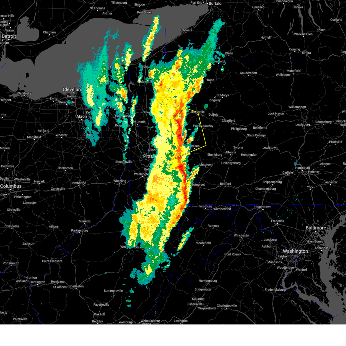
| 3/16/2025 1:36 PM EDT |
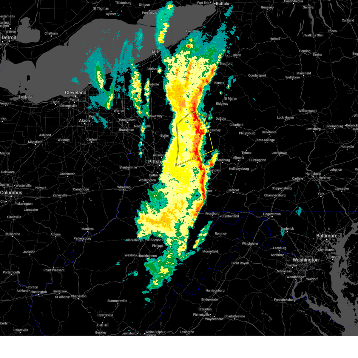 The severe thunderstorm warning that was previously in effect has been reissued for indiana, clarion, armstrong, and jefferson pa counties and is in effect until 215 pm edt. please refer to that bulletin for the latest severe weather information. a tornado watch remains in effect until 400 pm edt for portions of southwest and west central pennsylvania. The severe thunderstorm warning that was previously in effect has been reissued for indiana, clarion, armstrong, and jefferson pa counties and is in effect until 215 pm edt. please refer to that bulletin for the latest severe weather information. a tornado watch remains in effect until 400 pm edt for portions of southwest and west central pennsylvania.
|
| 3/16/2025 1:20 PM EDT |
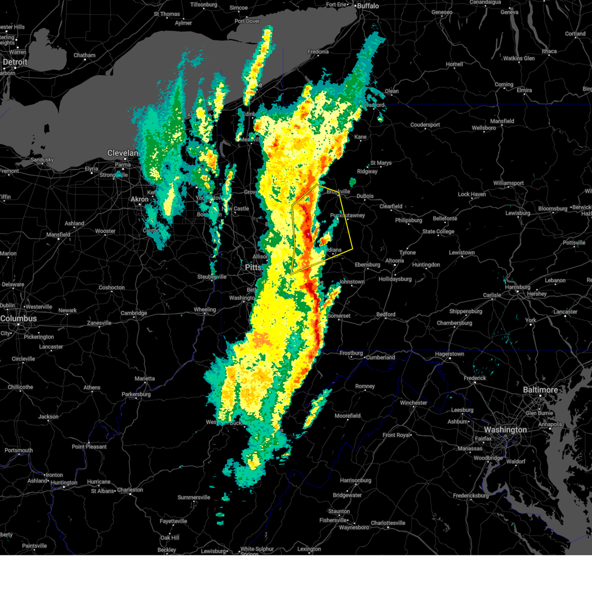 At 120 pm edt, severe thunderstorms were located along a line from near knox to 10 miles east of kittanning, moving northeast at 55 mph (trained spotters reported. at 1254pm, a national weather service employee reported golf ball sized hail in lower burrell). Hazards include 70 mph wind gusts and ping pong ball size hail. People and animals outdoors will be injured. expect hail damage to roofs, siding, windows, and vehicles. expect considerable tree damage. wind damage is also likely to mobile homes, roofs, and outbuildings. this severe thunderstorm will be near, murrysville around 1255 pm edt. leechburg, vandergrift and apollo around 100 pm edt. ford city around 105 pm edt. kittanning and west kittanning around 110 pm edt. rimersburg around 115 pm edt. clarion around 120 pm edt. new bethlehem around 125 pm edt. Other locations impacted by the severe thunderstorm include west leechburg, worthington, hyde park, oklahoma, east vandergrift, north apollo, orchard hills, north washington, east brady and west hills. At 120 pm edt, severe thunderstorms were located along a line from near knox to 10 miles east of kittanning, moving northeast at 55 mph (trained spotters reported. at 1254pm, a national weather service employee reported golf ball sized hail in lower burrell). Hazards include 70 mph wind gusts and ping pong ball size hail. People and animals outdoors will be injured. expect hail damage to roofs, siding, windows, and vehicles. expect considerable tree damage. wind damage is also likely to mobile homes, roofs, and outbuildings. this severe thunderstorm will be near, murrysville around 1255 pm edt. leechburg, vandergrift and apollo around 100 pm edt. ford city around 105 pm edt. kittanning and west kittanning around 110 pm edt. rimersburg around 115 pm edt. clarion around 120 pm edt. new bethlehem around 125 pm edt. Other locations impacted by the severe thunderstorm include west leechburg, worthington, hyde park, oklahoma, east vandergrift, north apollo, orchard hills, north washington, east brady and west hills.
|
| 3/16/2025 1:20 PM EDT |
 the severe thunderstorm warning has been cancelled and is no longer in effect the severe thunderstorm warning has been cancelled and is no longer in effect
|
| 3/16/2025 1:05 PM EDT |
 Torpbz the national weather service in pittsburgh has issued a * tornado warning for, southern armstrong county in west central pennsylvania, central indiana county in west central pennsylvania, * until 130 pm edt. * at 105 pm edt, a severe thunderstorm capable of producing a tornado was located near vandergrift, moving northeast at 50 mph (radar indicated rotation). Hazards include tornado and golf ball size hail. Flying debris will be dangerous to those caught without shelter. mobile homes will be damaged or destroyed. damage to roofs, windows and vehicles will occur. Tree damage is likely. Torpbz the national weather service in pittsburgh has issued a * tornado warning for, southern armstrong county in west central pennsylvania, central indiana county in west central pennsylvania, * until 130 pm edt. * at 105 pm edt, a severe thunderstorm capable of producing a tornado was located near vandergrift, moving northeast at 50 mph (radar indicated rotation). Hazards include tornado and golf ball size hail. Flying debris will be dangerous to those caught without shelter. mobile homes will be damaged or destroyed. damage to roofs, windows and vehicles will occur. Tree damage is likely.
|
| 3/16/2025 1:03 PM EDT |
 At 103 pm edt, severe thunderstorms were located along a line from 10 miles west of rimersburg to over vandergrift, moving northeast at 55 mph (trained spotters reported. at 1255pm, a national weather service employee reported golf ball sized hail in lower burrell). Hazards include golf ball size hail and 70 mph wind gusts. People and animals outdoors will be injured. expect hail damage to roofs, siding, windows, and vehicles. expect considerable tree damage. wind damage is also likely to mobile homes, roofs, and outbuildings. Locations impacted include, penn hills, monroeville, indiana, punxsutawney, clarion, vandergrift, kittanning, brookville, apollo, rimersburg, plum, murrysville, new kensington, lower burrell, harrison township, arnold, tarentum, natrona heights, springdale and pitcairn. At 103 pm edt, severe thunderstorms were located along a line from 10 miles west of rimersburg to over vandergrift, moving northeast at 55 mph (trained spotters reported. at 1255pm, a national weather service employee reported golf ball sized hail in lower burrell). Hazards include golf ball size hail and 70 mph wind gusts. People and animals outdoors will be injured. expect hail damage to roofs, siding, windows, and vehicles. expect considerable tree damage. wind damage is also likely to mobile homes, roofs, and outbuildings. Locations impacted include, penn hills, monroeville, indiana, punxsutawney, clarion, vandergrift, kittanning, brookville, apollo, rimersburg, plum, murrysville, new kensington, lower burrell, harrison township, arnold, tarentum, natrona heights, springdale and pitcairn.
|
| 3/16/2025 12:48 PM EDT |
 Svrpbz the national weather service in pittsburgh has issued a * severe thunderstorm warning for, northeastern allegheny county in southwestern pennsylvania, northwestern westmoreland county in southwestern pennsylvania, armstrong county in west central pennsylvania, southeastern butler county in west central pennsylvania, southern clarion county in west central pennsylvania, northern indiana county in west central pennsylvania, southwestern jefferson pa county in west central pennsylvania, * until 145 pm edt. * at 1248 pm edt, severe thunderstorms were located along a line from over shanor-northvue to over plum, or along a line from near butler to near penn hills, moving northeast at 55 mph (radar indicated). Hazards include 70 mph wind gusts and quarter size hail. Hail damage to vehicles is expected. expect considerable tree damage. Wind damage is also likely to mobile homes, roofs, and outbuildings. Svrpbz the national weather service in pittsburgh has issued a * severe thunderstorm warning for, northeastern allegheny county in southwestern pennsylvania, northwestern westmoreland county in southwestern pennsylvania, armstrong county in west central pennsylvania, southeastern butler county in west central pennsylvania, southern clarion county in west central pennsylvania, northern indiana county in west central pennsylvania, southwestern jefferson pa county in west central pennsylvania, * until 145 pm edt. * at 1248 pm edt, severe thunderstorms were located along a line from over shanor-northvue to over plum, or along a line from near butler to near penn hills, moving northeast at 55 mph (radar indicated). Hazards include 70 mph wind gusts and quarter size hail. Hail damage to vehicles is expected. expect considerable tree damage. Wind damage is also likely to mobile homes, roofs, and outbuildings.
|
| 11/20/2024 5:24 PM EST |
 At 524 pm est, severe thunderstorms were located along a line from near kittanning to over mount pleasant, or along a line from near kittanning to 9 miles north of connellsville, moving east at 40 mph (radar indicated). Hazards include 60 mph wind gusts. Expect damage to roofs, siding, and trees. Locations impacted include, greensburg, indiana, jeannette, latrobe, vandergrift, kittanning, homer city, apollo, murrysville, lower burrell, harrison township, mount pleasant, scottdale, irwin, mcchesneytown-loyalhanna, blairsville, manor, youngwood, ford city and derry. At 524 pm est, severe thunderstorms were located along a line from near kittanning to over mount pleasant, or along a line from near kittanning to 9 miles north of connellsville, moving east at 40 mph (radar indicated). Hazards include 60 mph wind gusts. Expect damage to roofs, siding, and trees. Locations impacted include, greensburg, indiana, jeannette, latrobe, vandergrift, kittanning, homer city, apollo, murrysville, lower burrell, harrison township, mount pleasant, scottdale, irwin, mcchesneytown-loyalhanna, blairsville, manor, youngwood, ford city and derry.
|
| 11/20/2024 5:24 PM EST |
 the severe thunderstorm warning has been cancelled and is no longer in effect the severe thunderstorm warning has been cancelled and is no longer in effect
|
| 11/20/2024 5:10 PM EST |
 Svrpbz the national weather service in pittsburgh has issued a * severe thunderstorm warning for, eastern allegheny county in southwestern pennsylvania, northeastern fayette county in southwestern pennsylvania, westmoreland county in southwestern pennsylvania, southern armstrong county in west central pennsylvania, southeastern butler county in west central pennsylvania, indiana county in west central pennsylvania, * until 615 pm est. * at 510 pm est, severe thunderstorms were located along a line from 10 miles north of sarver to near perryopolis, or along a line from 8 miles east of butler to 10 miles northwest of connellsville, moving east at 40 mph (radar indicated). Hazards include 60 mph wind gusts. expect damage to roofs, siding, and trees Svrpbz the national weather service in pittsburgh has issued a * severe thunderstorm warning for, eastern allegheny county in southwestern pennsylvania, northeastern fayette county in southwestern pennsylvania, westmoreland county in southwestern pennsylvania, southern armstrong county in west central pennsylvania, southeastern butler county in west central pennsylvania, indiana county in west central pennsylvania, * until 615 pm est. * at 510 pm est, severe thunderstorms were located along a line from 10 miles north of sarver to near perryopolis, or along a line from 8 miles east of butler to 10 miles northwest of connellsville, moving east at 40 mph (radar indicated). Hazards include 60 mph wind gusts. expect damage to roofs, siding, and trees
|
| 10/6/2024 8:45 PM EDT |
 the severe thunderstorm warning has been cancelled and is no longer in effect the severe thunderstorm warning has been cancelled and is no longer in effect
|
| 10/6/2024 8:33 PM EDT |
 At 833 pm edt, a severe thunderstorm was located over lower burrell, or 8 miles west of vandergrift, moving east at 40 mph (radar indicated). Hazards include 60 mph wind gusts. Expect damage to roofs, siding, and trees. Locations impacted include, penn hills, vandergrift, apollo, plum, murrysville, new kensington, lower burrell, harrison township, o'hara township, oakmont, fox chapel, arnold, tarentum, natrona heights, springdale, brackenridge, leechburg, cheswick, russellton and north apollo. At 833 pm edt, a severe thunderstorm was located over lower burrell, or 8 miles west of vandergrift, moving east at 40 mph (radar indicated). Hazards include 60 mph wind gusts. Expect damage to roofs, siding, and trees. Locations impacted include, penn hills, vandergrift, apollo, plum, murrysville, new kensington, lower burrell, harrison township, o'hara township, oakmont, fox chapel, arnold, tarentum, natrona heights, springdale, brackenridge, leechburg, cheswick, russellton and north apollo.
|
| 10/6/2024 8:23 PM EDT |
 At 823 pm edt, a severe thunderstorm was located over oakmont, or near penn hills, moving southeast at 45 mph (radar indicated). Hazards include 60 mph wind gusts and small hail. Expect damage to roofs, siding, and trees. Locations impacted include, pittsburgh, penn hills, ross township, mccandless township, monroeville, greensburg, vandergrift, apollo, shaler township, plum, murrysville, hampton township, new kensington, lower burrell, harrison township, o'hara township, wilkins township, oakmont, fox chapel and arnold. At 823 pm edt, a severe thunderstorm was located over oakmont, or near penn hills, moving southeast at 45 mph (radar indicated). Hazards include 60 mph wind gusts and small hail. Expect damage to roofs, siding, and trees. Locations impacted include, pittsburgh, penn hills, ross township, mccandless township, monroeville, greensburg, vandergrift, apollo, shaler township, plum, murrysville, hampton township, new kensington, lower burrell, harrison township, o'hara township, wilkins township, oakmont, fox chapel and arnold.
|
| 10/6/2024 8:23 PM EDT |
 the severe thunderstorm warning has been cancelled and is no longer in effect the severe thunderstorm warning has been cancelled and is no longer in effect
|
| 10/6/2024 8:10 PM EDT |
 Svrpbz the national weather service in pittsburgh has issued a * severe thunderstorm warning for, northeastern allegheny county in southwestern pennsylvania, northwestern westmoreland county in southwestern pennsylvania, south central armstrong county in west central pennsylvania, south central butler county in west central pennsylvania, southwestern indiana county in west central pennsylvania, * until 900 pm edt. * at 810 pm edt, a severe thunderstorm was located over mccandless township, moving southeast at 45 mph (radar indicated). Hazards include 60 mph wind gusts and small hail. expect damage to roofs, siding, and trees Svrpbz the national weather service in pittsburgh has issued a * severe thunderstorm warning for, northeastern allegheny county in southwestern pennsylvania, northwestern westmoreland county in southwestern pennsylvania, south central armstrong county in west central pennsylvania, south central butler county in west central pennsylvania, southwestern indiana county in west central pennsylvania, * until 900 pm edt. * at 810 pm edt, a severe thunderstorm was located over mccandless township, moving southeast at 45 mph (radar indicated). Hazards include 60 mph wind gusts and small hail. expect damage to roofs, siding, and trees
|
| 8/17/2024 4:57 PM EDT |
 The storm which prompted the warning has weakened below severe limits, and no longer poses an immediate threat to life or property. therefore, the warning will be allowed to expire. however, gusty winds and heavy rain are still possible with this thunderstorm. to report severe weather, contact your nearest law enforcement agency. they will send your report to the national weather service office. The storm which prompted the warning has weakened below severe limits, and no longer poses an immediate threat to life or property. therefore, the warning will be allowed to expire. however, gusty winds and heavy rain are still possible with this thunderstorm. to report severe weather, contact your nearest law enforcement agency. they will send your report to the national weather service office.
|
| 8/17/2024 4:44 PM EDT |
 At 444 pm edt, a severe thunderstorm was located 7 miles northeast of delmont, or 7 miles southeast of apollo, moving east at 40 mph (radar indicated). Hazards include 60 mph wind gusts and quarter size hail. Hail damage to vehicles is expected. expect wind damage to roofs, siding, and trees. Locations impacted include, penn hills, monroeville, greensburg, mckeesport, jeannette, latrobe, vandergrift, apollo, plum, west mifflin, murrysville, new kensington, lower burrell, harrison township, north versailles, white oak, forest hills, wilkins township, duquesne and turtle creek. At 444 pm edt, a severe thunderstorm was located 7 miles northeast of delmont, or 7 miles southeast of apollo, moving east at 40 mph (radar indicated). Hazards include 60 mph wind gusts and quarter size hail. Hail damage to vehicles is expected. expect wind damage to roofs, siding, and trees. Locations impacted include, penn hills, monroeville, greensburg, mckeesport, jeannette, latrobe, vandergrift, apollo, plum, west mifflin, murrysville, new kensington, lower burrell, harrison township, north versailles, white oak, forest hills, wilkins township, duquesne and turtle creek.
|
| 8/17/2024 4:29 PM EDT |
 At 429 pm edt, a severe thunderstorm was located over murrysville, or near monroeville, moving east at 40 mph (radar indicated). Hazards include 60 mph wind gusts and quarter size hail. Hail damage to vehicles is expected. expect wind damage to roofs, siding, and trees. Locations impacted include, pittsburgh, penn hills, monroeville, greensburg, mckeesport, jeannette, latrobe, vandergrift, kittanning, apollo, plum, west mifflin, murrysville, wilkinsburg, new kensington, lower burrell, munhall, harrison township, north versailles and swissvale. At 429 pm edt, a severe thunderstorm was located over murrysville, or near monroeville, moving east at 40 mph (radar indicated). Hazards include 60 mph wind gusts and quarter size hail. Hail damage to vehicles is expected. expect wind damage to roofs, siding, and trees. Locations impacted include, pittsburgh, penn hills, monroeville, greensburg, mckeesport, jeannette, latrobe, vandergrift, kittanning, apollo, plum, west mifflin, murrysville, wilkinsburg, new kensington, lower burrell, munhall, harrison township, north versailles and swissvale.
|
| 8/17/2024 4:19 PM EDT |
 Svrpbz the national weather service in pittsburgh has issued a * severe thunderstorm warning for, eastern allegheny county in southwestern pennsylvania, central westmoreland county in southwestern pennsylvania, southern armstrong county in west central pennsylvania, southeastern butler county in west central pennsylvania, southwestern indiana county in west central pennsylvania, * until 500 pm edt. * at 419 pm edt, a severe thunderstorm was located over wilkins township, or over monroeville, moving east at 40 mph (radar indicated). Hazards include 60 mph wind gusts and quarter size hail. Hail damage to vehicles is expected. Expect wind damage to roofs, siding, and trees. Svrpbz the national weather service in pittsburgh has issued a * severe thunderstorm warning for, eastern allegheny county in southwestern pennsylvania, central westmoreland county in southwestern pennsylvania, southern armstrong county in west central pennsylvania, southeastern butler county in west central pennsylvania, southwestern indiana county in west central pennsylvania, * until 500 pm edt. * at 419 pm edt, a severe thunderstorm was located over wilkins township, or over monroeville, moving east at 40 mph (radar indicated). Hazards include 60 mph wind gusts and quarter size hail. Hail damage to vehicles is expected. Expect wind damage to roofs, siding, and trees.
|
| 8/6/2024 7:20 PM EDT | At 720 pm edt, a severe thunderstorm was located over birdsboro, or 7 miles southeast of reading, moving east at 25 mph (radar indicated). Hazards include 60 mph wind gusts. Damage to roofs, siding, trees, and power lines is possible. locations impacted include, reading, pottstown, phoenixville, west norriton, wyomissing, souderton, birdsboro, collegeville, royersford, fleetwood, laureldale, trappe, east greenville, leesport, schwenksville, elverson, bally, bechtelsville, green lane, and new morgan. this includes the following highways, pennsylvania turnpike between mile markers 296 and 304. northeast extension between mile markers 30 and 38. Interstate 176 in pennsylvania between mile markers 1 and 11. |
| 8/6/2024 7:09 PM EDT |
 Svrphi the national weather service in mount holly nj has issued a * severe thunderstorm warning for, southeastern berks county in eastern pennsylvania, northwestern montgomery county in southeastern pennsylvania, northeastern chester county in southeastern pennsylvania, * until 815 pm edt. * at 708 pm edt, a severe thunderstorm was located near birdsboro, or near reading, moving east at 25 mph (radar indicated). Hazards include 60 mph wind gusts. damage to roofs, siding, trees, and power lines is possible Svrphi the national weather service in mount holly nj has issued a * severe thunderstorm warning for, southeastern berks county in eastern pennsylvania, northwestern montgomery county in southeastern pennsylvania, northeastern chester county in southeastern pennsylvania, * until 815 pm edt. * at 708 pm edt, a severe thunderstorm was located near birdsboro, or near reading, moving east at 25 mph (radar indicated). Hazards include 60 mph wind gusts. damage to roofs, siding, trees, and power lines is possible
|
| 8/6/2024 7:02 PM EDT |
 At 702 pm edt, severe thunderstorms were located along a line extending from near clarion to 9 miles southeast of ford city to near vandergrift, moving east at 35 mph (radar indicated). Hazards include 60 mph wind gusts. Expect damage to trees and power lines, resulting in some power outages. Locations impacted include, indiana, punxsutawney, vandergrift, brookville, apollo, new kensington, lower burrell, arnold, leechburg, new bethlehem, clymer, north apollo, west leechburg, avonmore, orchard hills, rural valley, saltsburg, oklahoma, west lebanon, and east vandergrift. At 702 pm edt, severe thunderstorms were located along a line extending from near clarion to 9 miles southeast of ford city to near vandergrift, moving east at 35 mph (radar indicated). Hazards include 60 mph wind gusts. Expect damage to trees and power lines, resulting in some power outages. Locations impacted include, indiana, punxsutawney, vandergrift, brookville, apollo, new kensington, lower burrell, arnold, leechburg, new bethlehem, clymer, north apollo, west leechburg, avonmore, orchard hills, rural valley, saltsburg, oklahoma, west lebanon, and east vandergrift.
|
| 8/6/2024 7:02 PM EDT |
 the severe thunderstorm warning has been cancelled and is no longer in effect the severe thunderstorm warning has been cancelled and is no longer in effect
|
| 8/6/2024 6:39 PM EDT |
 Svrpbz the national weather service in pittsburgh has issued a * severe thunderstorm warning for, southern venango county in northwestern pennsylvania, eastern butler county in west central pennsylvania, central indiana county in west central pennsylvania, northeastern allegheny county in southwestern pennsylvania, southwestern jefferson county in west central pennsylvania, northwestern westmoreland county in southwestern pennsylvania, armstrong county in west central pennsylvania, southern clarion county in west central pennsylvania, * until 745 pm edt. * at 639 pm edt, severe thunderstorms were located along a line extending from 7 miles southwest of knox to near freeport to natrona heights, moving east at 35 mph (radar indicated). Hazards include 60 mph wind gusts. expect damage to trees and power lines, resulting in some power outages Svrpbz the national weather service in pittsburgh has issued a * severe thunderstorm warning for, southern venango county in northwestern pennsylvania, eastern butler county in west central pennsylvania, central indiana county in west central pennsylvania, northeastern allegheny county in southwestern pennsylvania, southwestern jefferson county in west central pennsylvania, northwestern westmoreland county in southwestern pennsylvania, armstrong county in west central pennsylvania, southern clarion county in west central pennsylvania, * until 745 pm edt. * at 639 pm edt, severe thunderstorms were located along a line extending from 7 miles southwest of knox to near freeport to natrona heights, moving east at 35 mph (radar indicated). Hazards include 60 mph wind gusts. expect damage to trees and power lines, resulting in some power outages
|
| 8/3/2024 4:13 PM EDT |
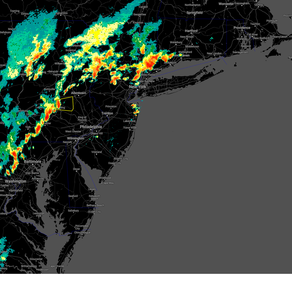 Svrphi the national weather service in mount holly nj has issued a * severe thunderstorm warning for, northeastern berks county in eastern pennsylvania, south central lehigh county in eastern pennsylvania, * until 500 pm edt. * at 413 pm edt, a severe thunderstorm was located over leesport, or near reading, moving east at 20 mph (radar indicated). Hazards include 60 mph wind gusts and quarter size hail. Minor damage to vehicles is possible. Wind damage to roofs, siding, trees, and power lines is possible. Svrphi the national weather service in mount holly nj has issued a * severe thunderstorm warning for, northeastern berks county in eastern pennsylvania, south central lehigh county in eastern pennsylvania, * until 500 pm edt. * at 413 pm edt, a severe thunderstorm was located over leesport, or near reading, moving east at 20 mph (radar indicated). Hazards include 60 mph wind gusts and quarter size hail. Minor damage to vehicles is possible. Wind damage to roofs, siding, trees, and power lines is possible.
|
| 8/2/2024 2:30 PM EDT |
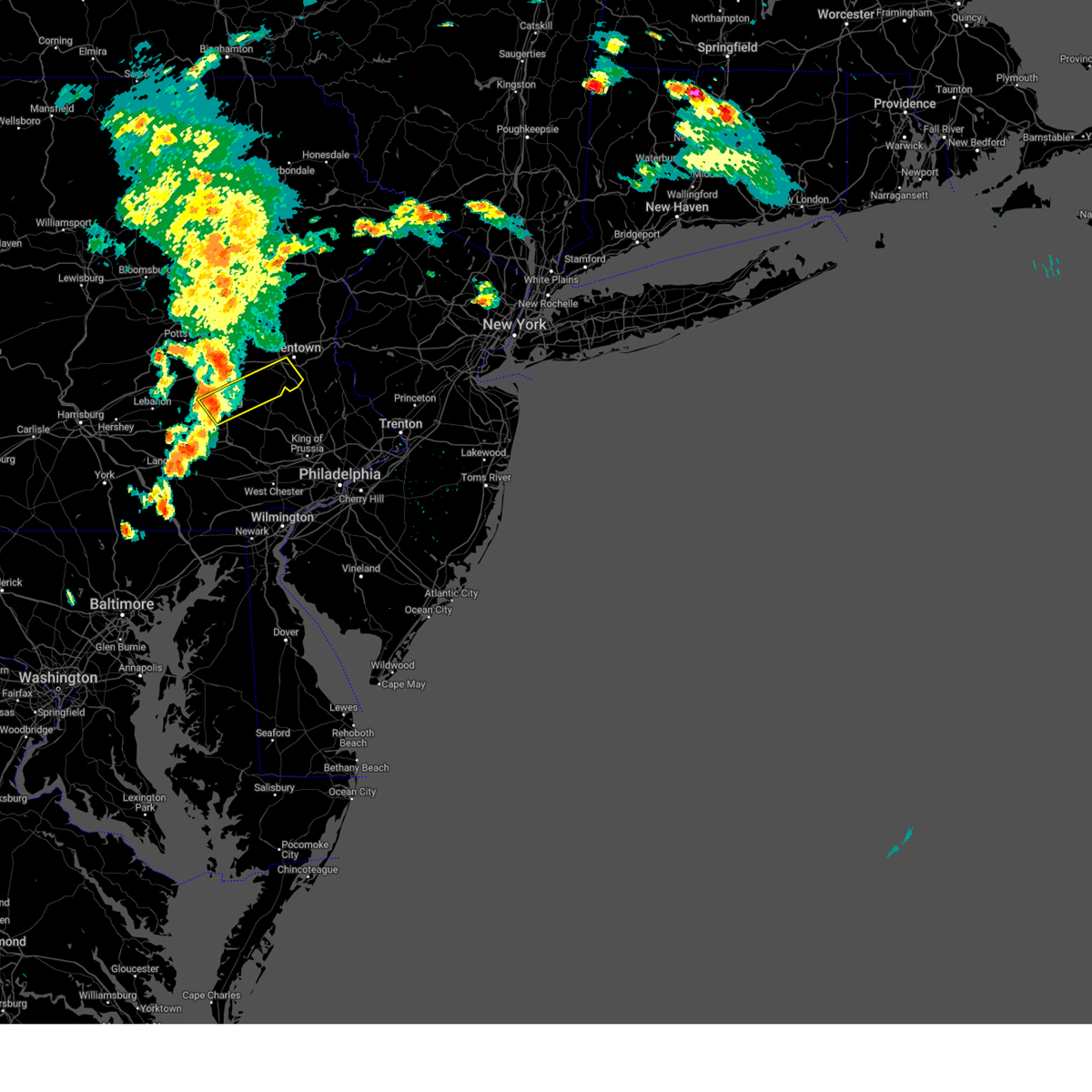 Svrphi the national weather service in mount holly nj has issued a * severe thunderstorm warning for, east central berks county in eastern pennsylvania, southeastern lehigh county in eastern pennsylvania, * until 315 pm edt. * at 230 pm edt, a severe thunderstorm was located over spring ridge, or over reading, moving northeast at 35 mph (radar indicated). Hazards include 60 mph wind gusts. damage to roofs, siding, trees, and power lines is possible Svrphi the national weather service in mount holly nj has issued a * severe thunderstorm warning for, east central berks county in eastern pennsylvania, southeastern lehigh county in eastern pennsylvania, * until 315 pm edt. * at 230 pm edt, a severe thunderstorm was located over spring ridge, or over reading, moving northeast at 35 mph (radar indicated). Hazards include 60 mph wind gusts. damage to roofs, siding, trees, and power lines is possible
|
| 7/17/2024 7:06 PM EDT |
 Svrphi the national weather service in mount holly nj has issued a * severe thunderstorm warning for, northwestern hunterdon county in northwestern new jersey, southwestern warren county in northwestern new jersey, berks county in eastern pennsylvania, lehigh county in eastern pennsylvania, northwestern montgomery county in southeastern pennsylvania, northwestern bucks county in southeastern pennsylvania, north central chester county in southeastern pennsylvania, southern northampton county in eastern pennsylvania, * until 800 pm edt. * at 706 pm edt, severe thunderstorms were located along a line extending from near claussville to near fleetwood to adamstown, moving east at 40 mph (radar indicated). Hazards include 60 mph wind gusts. damage to roofs, siding, trees, and power lines is possible Svrphi the national weather service in mount holly nj has issued a * severe thunderstorm warning for, northwestern hunterdon county in northwestern new jersey, southwestern warren county in northwestern new jersey, berks county in eastern pennsylvania, lehigh county in eastern pennsylvania, northwestern montgomery county in southeastern pennsylvania, northwestern bucks county in southeastern pennsylvania, north central chester county in southeastern pennsylvania, southern northampton county in eastern pennsylvania, * until 800 pm edt. * at 706 pm edt, severe thunderstorms were located along a line extending from near claussville to near fleetwood to adamstown, moving east at 40 mph (radar indicated). Hazards include 60 mph wind gusts. damage to roofs, siding, trees, and power lines is possible
|
| 7/16/2024 5:04 PM EDT |
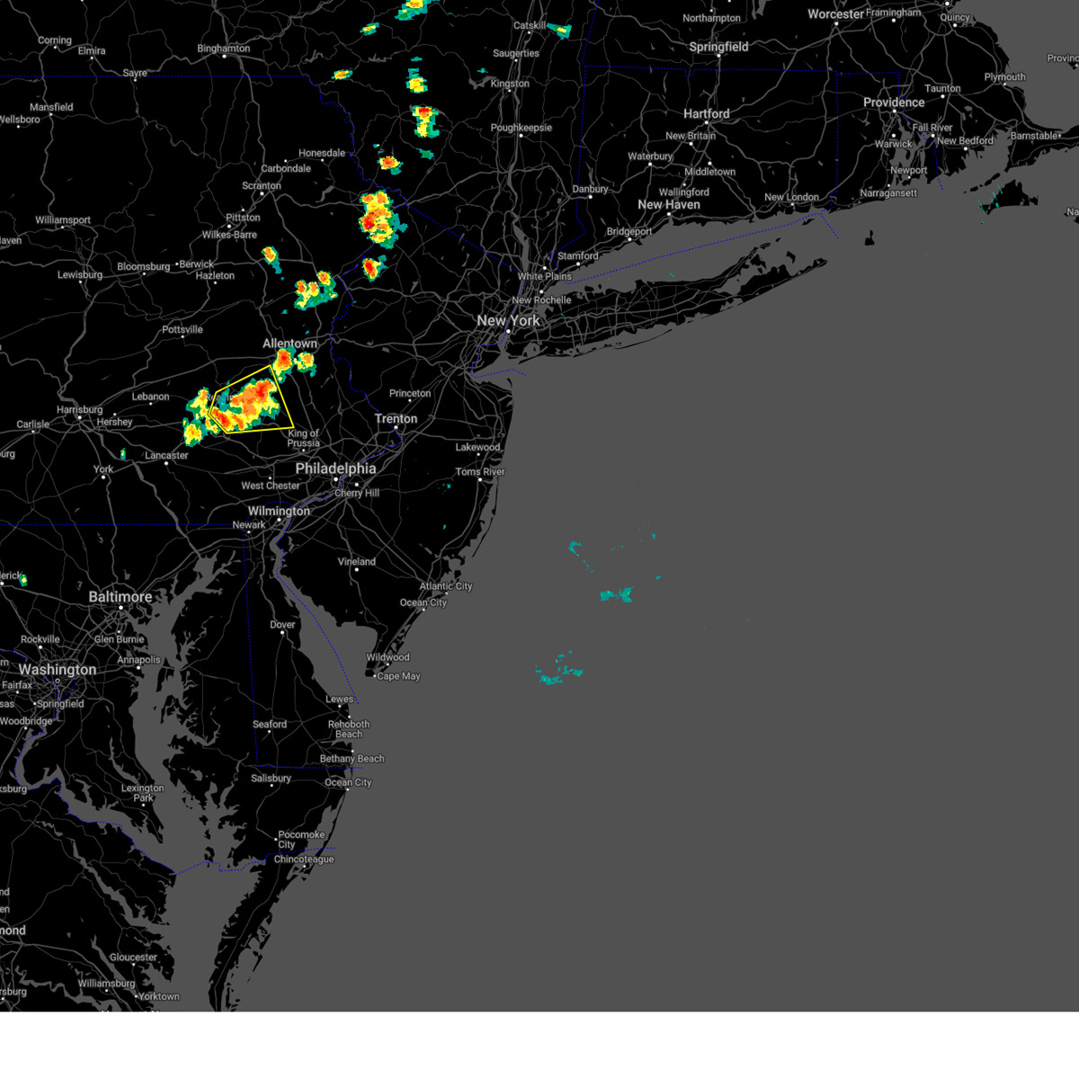 At 504 pm edt, a severe thunderstorm was located over bechtelsville, or 14 miles east of reading, moving east at 30 mph (radar indicated). Hazards include 60 mph wind gusts and penny size hail. Damage to roofs, siding, trees, and power lines is possible. locations impacted include, reading, pottstown, wyomissing, birdsboro, fleetwood, laureldale, topton, schwenksville, bally, bechtelsville, lyons, new morgan, spring ridge, gilbertsville, cedarville, stowe, shillington, west reading, boyertown, and mount penn. This includes interstate 176 in pennsylvania between mile markers 4 and 11. At 504 pm edt, a severe thunderstorm was located over bechtelsville, or 14 miles east of reading, moving east at 30 mph (radar indicated). Hazards include 60 mph wind gusts and penny size hail. Damage to roofs, siding, trees, and power lines is possible. locations impacted include, reading, pottstown, wyomissing, birdsboro, fleetwood, laureldale, topton, schwenksville, bally, bechtelsville, lyons, new morgan, spring ridge, gilbertsville, cedarville, stowe, shillington, west reading, boyertown, and mount penn. This includes interstate 176 in pennsylvania between mile markers 4 and 11.
|
| 7/16/2024 4:51 PM EDT |
 At 451 pm edt, a severe thunderstorm was located near laureldale, or near reading, moving east at 30 mph. a 50 mph wind gust was recently measured at the reading regional airport with this storm (radar indicated). Hazards include 60 mph wind gusts and penny size hail. Damage to roofs, siding, trees, and power lines is possible. locations impacted include, reading, pottstown, wyomissing, birdsboro, kutztown, fleetwood, sinking spring, laureldale, womelsdorf, wernersville, topton, robesonia, leesport, schwenksville, shoemakersville, bally, bernville, bechtelsville, lyons, and new morgan. this includes the following highways, interstate 78 in pennsylvania between mile markers 39 and 50. Interstate 176 in pennsylvania between mile markers 4 and 11. At 451 pm edt, a severe thunderstorm was located near laureldale, or near reading, moving east at 30 mph. a 50 mph wind gust was recently measured at the reading regional airport with this storm (radar indicated). Hazards include 60 mph wind gusts and penny size hail. Damage to roofs, siding, trees, and power lines is possible. locations impacted include, reading, pottstown, wyomissing, birdsboro, kutztown, fleetwood, sinking spring, laureldale, womelsdorf, wernersville, topton, robesonia, leesport, schwenksville, shoemakersville, bally, bernville, bechtelsville, lyons, and new morgan. this includes the following highways, interstate 78 in pennsylvania between mile markers 39 and 50. Interstate 176 in pennsylvania between mile markers 4 and 11.
|
| 7/16/2024 4:41 PM EDT |
 Svrphi the national weather service in mount holly nj has issued a * severe thunderstorm warning for, berks county in eastern pennsylvania, central lehigh county in eastern pennsylvania, northwestern montgomery county in southeastern pennsylvania, northern chester county in southeastern pennsylvania, * until 530 pm edt. * at 441 pm edt, a severe thunderstorm was located over wyomissing, or over reading, moving east at 30 mph (radar indicated). Hazards include 60 mph wind gusts and penny size hail. damage to roofs, siding, trees, and power lines is possible Svrphi the national weather service in mount holly nj has issued a * severe thunderstorm warning for, berks county in eastern pennsylvania, central lehigh county in eastern pennsylvania, northwestern montgomery county in southeastern pennsylvania, northern chester county in southeastern pennsylvania, * until 530 pm edt. * at 441 pm edt, a severe thunderstorm was located over wyomissing, or over reading, moving east at 30 mph (radar indicated). Hazards include 60 mph wind gusts and penny size hail. damage to roofs, siding, trees, and power lines is possible
|
| 7/16/2024 4:31 PM EDT |
 At 431 pm edt, a severe thunderstorm was located over sinking spring, or 7 miles southwest of reading, moving east at 30 mph (radar indicated). Hazards include 60 mph wind gusts and penny size hail. Damage to roofs, siding, trees, and power lines is possible. locations impacted include, reading, wyomissing, birdsboro, hamburg, fleetwood, sinking spring, laureldale, womelsdorf, wernersville, robesonia, leesport, shoemakersville, bernville, lenhartsville, spring ridge, fairview hgts, shillington, west reading, mount penn, and mohnton. this includes the following highways, interstate 78 in pennsylvania between mile markers 37 and 40. Interstate 176 in pennsylvania between mile markers 9 and 11. At 431 pm edt, a severe thunderstorm was located over sinking spring, or 7 miles southwest of reading, moving east at 30 mph (radar indicated). Hazards include 60 mph wind gusts and penny size hail. Damage to roofs, siding, trees, and power lines is possible. locations impacted include, reading, wyomissing, birdsboro, hamburg, fleetwood, sinking spring, laureldale, womelsdorf, wernersville, robesonia, leesport, shoemakersville, bernville, lenhartsville, spring ridge, fairview hgts, shillington, west reading, mount penn, and mohnton. this includes the following highways, interstate 78 in pennsylvania between mile markers 37 and 40. Interstate 176 in pennsylvania between mile markers 9 and 11.
|
| 7/16/2024 4:16 PM EDT |
 At 416 pm edt, a severe thunderstorm was located over myerstown, moving east at 30 mph (radar indicated). Hazards include 60 mph wind gusts and penny size hail. Damage to roofs, siding, trees, and power lines is possible. locations impacted include, reading, wyomissing, birdsboro, hamburg, fleetwood, sinking spring, laureldale, womelsdorf, wernersville, robesonia, leesport, shoemakersville, bernville, strausstown, lenhartsville, spring ridge, fairview hgts, shillington, west reading, and mount penn. this includes the following highways, interstate 78 in pennsylvania between mile markers 11 and 40. Interstate 176 in pennsylvania between mile markers 9 and 11. At 416 pm edt, a severe thunderstorm was located over myerstown, moving east at 30 mph (radar indicated). Hazards include 60 mph wind gusts and penny size hail. Damage to roofs, siding, trees, and power lines is possible. locations impacted include, reading, wyomissing, birdsboro, hamburg, fleetwood, sinking spring, laureldale, womelsdorf, wernersville, robesonia, leesport, shoemakersville, bernville, strausstown, lenhartsville, spring ridge, fairview hgts, shillington, west reading, and mount penn. this includes the following highways, interstate 78 in pennsylvania between mile markers 11 and 40. Interstate 176 in pennsylvania between mile markers 9 and 11.
|
| 7/16/2024 4:03 PM EDT |
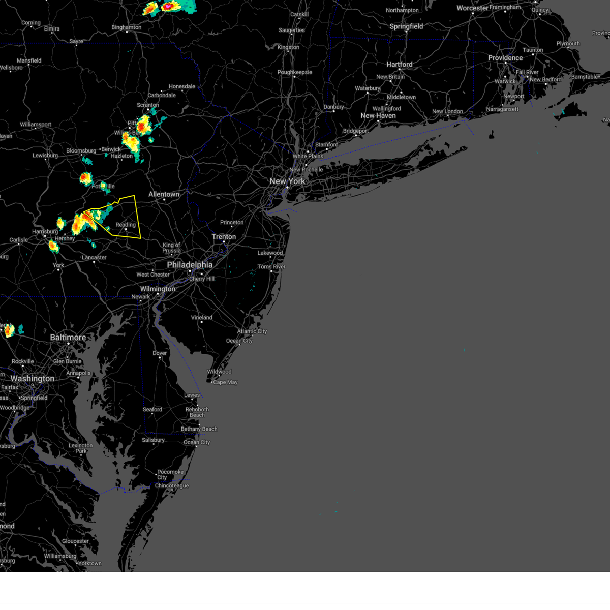 Svrphi the national weather service in mount holly nj has issued a * severe thunderstorm warning for, berks county in eastern pennsylvania, * until 445 pm edt. * at 403 pm edt, a severe thunderstorm was located near myerstown, moving east at 40 mph (radar indicated). Hazards include 60 mph wind gusts and penny size hail. damage to roofs, siding, trees, and power lines is possible Svrphi the national weather service in mount holly nj has issued a * severe thunderstorm warning for, berks county in eastern pennsylvania, * until 445 pm edt. * at 403 pm edt, a severe thunderstorm was located near myerstown, moving east at 40 mph (radar indicated). Hazards include 60 mph wind gusts and penny size hail. damage to roofs, siding, trees, and power lines is possible
|
| 6/30/2024 4:54 PM EDT |
 Svrphi the national weather service in mount holly nj has issued a * severe thunderstorm warning for, southern berks county in eastern pennsylvania, northwestern montgomery county in southeastern pennsylvania, north central chester county in southeastern pennsylvania, * until 545 pm edt. * at 454 pm edt, a severe thunderstorm was located near denver, or near ephrata, moving east at 30 mph (radar indicated). Hazards include 60 mph wind gusts and quarter size hail. Minor damage to vehicles is possible. Wind damage to roofs, siding, trees, and power lines is possible. Svrphi the national weather service in mount holly nj has issued a * severe thunderstorm warning for, southern berks county in eastern pennsylvania, northwestern montgomery county in southeastern pennsylvania, north central chester county in southeastern pennsylvania, * until 545 pm edt. * at 454 pm edt, a severe thunderstorm was located near denver, or near ephrata, moving east at 30 mph (radar indicated). Hazards include 60 mph wind gusts and quarter size hail. Minor damage to vehicles is possible. Wind damage to roofs, siding, trees, and power lines is possible.
|
| 6/30/2024 3:32 PM EDT |
 At 332 pm edt, a severe thunderstorm was located over adamstown, or 8 miles southwest of reading, moving east at 40 mph (radar indicated). Hazards include 60 mph wind gusts and quarter size hail. Minor damage to vehicles is possible. wind damage to roofs, siding, trees, and power lines is possible. locations impacted include, reading, pottstown, wyomissing, birdsboro, sinking spring, laureldale, wernersville, elverson, bally, bechtelsville, new morgan, spring ridge, pughtown, chester springs, gilbertsville, cedarville, stowe, shillington, west reading, and boyertown. this includes the following highways, pennsylvania turnpike between mile markers 296 and 306. Interstate 176 in pennsylvania between mile markers 1 and 11. At 332 pm edt, a severe thunderstorm was located over adamstown, or 8 miles southwest of reading, moving east at 40 mph (radar indicated). Hazards include 60 mph wind gusts and quarter size hail. Minor damage to vehicles is possible. wind damage to roofs, siding, trees, and power lines is possible. locations impacted include, reading, pottstown, wyomissing, birdsboro, sinking spring, laureldale, wernersville, elverson, bally, bechtelsville, new morgan, spring ridge, pughtown, chester springs, gilbertsville, cedarville, stowe, shillington, west reading, and boyertown. this includes the following highways, pennsylvania turnpike between mile markers 296 and 306. Interstate 176 in pennsylvania between mile markers 1 and 11.
|
| 6/30/2024 3:01 PM EDT |
 Svrphi the national weather service in mount holly nj has issued a * severe thunderstorm warning for, southern berks county in eastern pennsylvania, northwestern montgomery county in southeastern pennsylvania, northeastern chester county in southeastern pennsylvania, * until 400 pm edt. * at 300 pm edt, a severe thunderstorm was located near denver, or near ephrata, moving east at 50 mph (radar indicated). Hazards include 60 mph wind gusts and quarter size hail. Minor damage to vehicles is possible. Wind damage to roofs, siding, trees, and power lines is possible. Svrphi the national weather service in mount holly nj has issued a * severe thunderstorm warning for, southern berks county in eastern pennsylvania, northwestern montgomery county in southeastern pennsylvania, northeastern chester county in southeastern pennsylvania, * until 400 pm edt. * at 300 pm edt, a severe thunderstorm was located near denver, or near ephrata, moving east at 50 mph (radar indicated). Hazards include 60 mph wind gusts and quarter size hail. Minor damage to vehicles is possible. Wind damage to roofs, siding, trees, and power lines is possible.
|
| 6/29/2024 7:46 PM EDT |
 Svrphi the national weather service in mount holly nj has issued a * severe thunderstorm warning for, southeastern berks county in eastern pennsylvania, northwestern montgomery county in southeastern pennsylvania, northeastern chester county in southeastern pennsylvania, * until 830 pm edt. * at 746 pm edt, a severe thunderstorm was located near wyomissing, or near reading, moving east at 35 mph (radar indicated). Hazards include 60 mph wind gusts. damage to roofs, siding, trees, and power lines is possible Svrphi the national weather service in mount holly nj has issued a * severe thunderstorm warning for, southeastern berks county in eastern pennsylvania, northwestern montgomery county in southeastern pennsylvania, northeastern chester county in southeastern pennsylvania, * until 830 pm edt. * at 746 pm edt, a severe thunderstorm was located near wyomissing, or near reading, moving east at 35 mph (radar indicated). Hazards include 60 mph wind gusts. damage to roofs, siding, trees, and power lines is possible
|
| 6/26/2024 6:35 PM EDT |
 At 634 pm edt, severe thunderstorms were located along a line extending from near muhlenberg to new mahoning to spring ridge, moving northeast at 50 mph (emergency management). Hazards include 60 mph wind gusts. Damage to roofs, siding, trees, and power lines is possible. locations impacted include, allentown, reading, lehighton, bethlehem, emmaus, wyomissing, northampton, tobyhanna, palmerton, kutztown, jim thorpe, hamburg, slatington, fleetwood, sinking spring, laureldale, nesquehoning, bath, weatherly, and walnutport. this includes the following highways, northeast extension between mile markers 49 and 97. interstate 78 in pennsylvania between mile markers 28 and 60. interstate 80 in pennsylvania between mile markers 278 and 299. interstate 380 in pennsylvania between mile markers 0 and 13. Interstate 176 in pennsylvania near mile marker 11. At 634 pm edt, severe thunderstorms were located along a line extending from near muhlenberg to new mahoning to spring ridge, moving northeast at 50 mph (emergency management). Hazards include 60 mph wind gusts. Damage to roofs, siding, trees, and power lines is possible. locations impacted include, allentown, reading, lehighton, bethlehem, emmaus, wyomissing, northampton, tobyhanna, palmerton, kutztown, jim thorpe, hamburg, slatington, fleetwood, sinking spring, laureldale, nesquehoning, bath, weatherly, and walnutport. this includes the following highways, northeast extension between mile markers 49 and 97. interstate 78 in pennsylvania between mile markers 28 and 60. interstate 80 in pennsylvania between mile markers 278 and 299. interstate 380 in pennsylvania between mile markers 0 and 13. Interstate 176 in pennsylvania near mile marker 11.
|
| 6/26/2024 6:14 PM EDT |
 Svrphi the national weather service in mount holly nj has issued a * severe thunderstorm warning for, berks county in eastern pennsylvania, lehigh county in eastern pennsylvania, carbon county in northeastern pennsylvania, western monroe county in northeastern pennsylvania, west central northampton county in eastern pennsylvania, * until 700 pm edt. * at 613 pm edt, severe thunderstorms were located along a line extending from near rohrsburg to renningers to brickerville, moving northeast at 50 mph (radar indicated). Hazards include 60 mph wind gusts. damage to roofs, siding, trees, and power lines is possible Svrphi the national weather service in mount holly nj has issued a * severe thunderstorm warning for, berks county in eastern pennsylvania, lehigh county in eastern pennsylvania, carbon county in northeastern pennsylvania, western monroe county in northeastern pennsylvania, west central northampton county in eastern pennsylvania, * until 700 pm edt. * at 613 pm edt, severe thunderstorms were located along a line extending from near rohrsburg to renningers to brickerville, moving northeast at 50 mph (radar indicated). Hazards include 60 mph wind gusts. damage to roofs, siding, trees, and power lines is possible
|
| 6/17/2024 6:01 PM EDT |
 The storms which prompted the warning have weakened below severe limits, and have exited the warned area. therefore, the warning has been allowed to expire. however, gusty winds are still possible with these thunderstorms. to report severe weather, contact your nearest law enforcement agency. they will relay your report to the national weather service pittsburgh. The storms which prompted the warning have weakened below severe limits, and have exited the warned area. therefore, the warning has been allowed to expire. however, gusty winds are still possible with these thunderstorms. to report severe weather, contact your nearest law enforcement agency. they will relay your report to the national weather service pittsburgh.
|
| 6/17/2024 5:44 PM EDT |
 At 543 pm edt, severe thunderstorms were located along a line extending from 8 miles west of indiana to near greensburg to near avella, moving southeast at 20 mph (law enforcement and trained spotters). Hazards include 70 mph wind gusts and nickel size hail. Trees snapped and uprooted. power outages can be expected. Locations impacted include, pittsburgh, penn hills, mount lebanon, bethel park, ross township, monroeville, moon township, mcmurray, greensburg, weirton, mckeesport, jeannette, canonsburg, vandergrift, kittanning, apollo, gastonville, shaler township, plum, and west mifflin. At 543 pm edt, severe thunderstorms were located along a line extending from 8 miles west of indiana to near greensburg to near avella, moving southeast at 20 mph (law enforcement and trained spotters). Hazards include 70 mph wind gusts and nickel size hail. Trees snapped and uprooted. power outages can be expected. Locations impacted include, pittsburgh, penn hills, mount lebanon, bethel park, ross township, monroeville, moon township, mcmurray, greensburg, weirton, mckeesport, jeannette, canonsburg, vandergrift, kittanning, apollo, gastonville, shaler township, plum, and west mifflin.
|
| 6/17/2024 5:23 PM EDT |
 Svrpbz the national weather service in pittsburgh has issued a * severe thunderstorm warning for, southern beaver county in western pennsylvania, northern washington county in southwestern pennsylvania, southeastern butler county in west central pennsylvania, western indiana county in west central pennsylvania, allegheny county in southwestern pennsylvania, northwestern westmoreland county in southwestern pennsylvania, southern armstrong county in west central pennsylvania, brooke county in northern west virginia, hancock county in northern west virginia, * until 600 pm edt. * at 522 pm edt, severe thunderstorms were located along a line extending from 8 miles east of ford city to murrysville to near avella, moving southeast at 20 mph (law enforcement and trained spotters reported widespread wind damage across the warned area). Hazards include 70 mph wind gusts and nickel size hail. Trees snapped and uprooted. Power outages can be expected. Svrpbz the national weather service in pittsburgh has issued a * severe thunderstorm warning for, southern beaver county in western pennsylvania, northern washington county in southwestern pennsylvania, southeastern butler county in west central pennsylvania, western indiana county in west central pennsylvania, allegheny county in southwestern pennsylvania, northwestern westmoreland county in southwestern pennsylvania, southern armstrong county in west central pennsylvania, brooke county in northern west virginia, hancock county in northern west virginia, * until 600 pm edt. * at 522 pm edt, severe thunderstorms were located along a line extending from 8 miles east of ford city to murrysville to near avella, moving southeast at 20 mph (law enforcement and trained spotters reported widespread wind damage across the warned area). Hazards include 70 mph wind gusts and nickel size hail. Trees snapped and uprooted. Power outages can be expected.
|
| 6/17/2024 5:10 PM EDT |
 At 509 pm edt, severe thunderstorms were located along a line extending from 9 miles west of kittanning to near gibsonia to 6 miles east of weirton, moving east at 35 mph (law enforcement and the public reported widespread wind damage across the warned area). Hazards include 70 mph wind gusts and quarter size hail. Minor hail damage to vehicles is possible. trees snapped and uprooted. power outages can be expected. locations impacted include, pittsburgh, penn hills, mount lebanon, bethel park, ross township, mccandless township, cranberry, moon township, weirton, butler, franklin park, aliquippa, vandergrift, kittanning, shaler township, plum, north side pittsburgh, baldwin, upper st. Clair, and hampton township. At 509 pm edt, severe thunderstorms were located along a line extending from 9 miles west of kittanning to near gibsonia to 6 miles east of weirton, moving east at 35 mph (law enforcement and the public reported widespread wind damage across the warned area). Hazards include 70 mph wind gusts and quarter size hail. Minor hail damage to vehicles is possible. trees snapped and uprooted. power outages can be expected. locations impacted include, pittsburgh, penn hills, mount lebanon, bethel park, ross township, mccandless township, cranberry, moon township, weirton, butler, franklin park, aliquippa, vandergrift, kittanning, shaler township, plum, north side pittsburgh, baldwin, upper st. Clair, and hampton township.
|
| 6/17/2024 5:00 PM EDT |
 At 459 pm edt, severe thunderstorms were located along a line extending from near butler to gibsonia to weirton, moving east at 35 mph (law enforcement and the public are reporting widespread wind damage across the warned area). Hazards include 70 mph wind gusts and quarter size hail. Minor hail damage to vehicles is possible. trees snapped and uprooted. power outages can be expected. locations impacted include, pittsburgh, penn hills, mount lebanon, bethel park, ross township, mccandless township, cranberry, moon township, weirton, butler, franklin park, aliquippa, vandergrift, kittanning, shaler township, plum, north side pittsburgh, baldwin, upper st. Clair, and hampton township. At 459 pm edt, severe thunderstorms were located along a line extending from near butler to gibsonia to weirton, moving east at 35 mph (law enforcement and the public are reporting widespread wind damage across the warned area). Hazards include 70 mph wind gusts and quarter size hail. Minor hail damage to vehicles is possible. trees snapped and uprooted. power outages can be expected. locations impacted include, pittsburgh, penn hills, mount lebanon, bethel park, ross township, mccandless township, cranberry, moon township, weirton, butler, franklin park, aliquippa, vandergrift, kittanning, shaler township, plum, north side pittsburgh, baldwin, upper st. Clair, and hampton township.
|
| 6/17/2024 4:51 PM EDT |
 At 450 pm edt, severe thunderstorms were located along a line extending from shanor-northvue to seven fields to near toronto, moving east at 35 mph (law enforcement reported widespread trees and wires down across beaver county). Hazards include 60 mph wind gusts and quarter size hail. Minor hail damage to vehicles is possible. expect wind damage to trees and power lines, resulting in some power outages. locations impacted include, pittsburgh, penn hills, mount lebanon, bethel park, ross township, mccandless township, cranberry, moon township, weirton, butler, franklin park, aliquippa, vandergrift, kittanning, shaler township, plum, north side pittsburgh, baldwin, upper st. Clair, and hampton township. At 450 pm edt, severe thunderstorms were located along a line extending from shanor-northvue to seven fields to near toronto, moving east at 35 mph (law enforcement reported widespread trees and wires down across beaver county). Hazards include 60 mph wind gusts and quarter size hail. Minor hail damage to vehicles is possible. expect wind damage to trees and power lines, resulting in some power outages. locations impacted include, pittsburgh, penn hills, mount lebanon, bethel park, ross township, mccandless township, cranberry, moon township, weirton, butler, franklin park, aliquippa, vandergrift, kittanning, shaler township, plum, north side pittsburgh, baldwin, upper st. Clair, and hampton township.
|
| 6/17/2024 4:44 PM EDT |
 Svrpbz the national weather service in pittsburgh has issued a * severe thunderstorm warning for, east central jefferson county in east central ohio, southern beaver county in western pennsylvania, northwestern washington county in southwestern pennsylvania, southern butler county in west central pennsylvania, allegheny county in southwestern pennsylvania, northwestern westmoreland county in southwestern pennsylvania, southwestern armstrong county in west central pennsylvania, brooke county in northern west virginia, hancock county in northern west virginia, * until 530 pm edt. * at 444 pm edt, severe thunderstorms were located along a line extending from near shanor-northvue to cranberry to near wintersville, moving east at 35 mph (radar indicated). Hazards include 60 mph wind gusts and quarter size hail. Minor hail damage to vehicles is possible. Expect wind damage to trees and power lines, resulting in some power outages. Svrpbz the national weather service in pittsburgh has issued a * severe thunderstorm warning for, east central jefferson county in east central ohio, southern beaver county in western pennsylvania, northwestern washington county in southwestern pennsylvania, southern butler county in west central pennsylvania, allegheny county in southwestern pennsylvania, northwestern westmoreland county in southwestern pennsylvania, southwestern armstrong county in west central pennsylvania, brooke county in northern west virginia, hancock county in northern west virginia, * until 530 pm edt. * at 444 pm edt, severe thunderstorms were located along a line extending from near shanor-northvue to cranberry to near wintersville, moving east at 35 mph (radar indicated). Hazards include 60 mph wind gusts and quarter size hail. Minor hail damage to vehicles is possible. Expect wind damage to trees and power lines, resulting in some power outages.
|
| 5/26/2024 8:52 PM EDT |
 the severe thunderstorm warning has been cancelled and is no longer in effect the severe thunderstorm warning has been cancelled and is no longer in effect
|
| 5/26/2024 8:52 PM EDT |
 At 852 pm edt, severe thunderstorms were located along a line extending from 12 miles northeast of slippery rock to near west kittanning to near ford city to near apollo, moving northeast at 30 mph (radar indicated). Hazards include 60 mph wind gusts. Expect damage to trees and power lines, resulting in some power outages. Locations impacted include, vandergrift, kittanning, apollo, knox, rimersburg, ford city, leechburg, new bethlehem, west kittanning, north apollo, west leechburg, chicora, orchard hills, seneca, east brady, harrisville, rural valley, parker, oklahoma, and sligo. At 852 pm edt, severe thunderstorms were located along a line extending from 12 miles northeast of slippery rock to near west kittanning to near ford city to near apollo, moving northeast at 30 mph (radar indicated). Hazards include 60 mph wind gusts. Expect damage to trees and power lines, resulting in some power outages. Locations impacted include, vandergrift, kittanning, apollo, knox, rimersburg, ford city, leechburg, new bethlehem, west kittanning, north apollo, west leechburg, chicora, orchard hills, seneca, east brady, harrisville, rural valley, parker, oklahoma, and sligo.
|
| 5/26/2024 8:40 PM EDT |
 The storms which prompted the warning have moved out of portions of the area. therefore, the warning will be allowed to expire. a new severe warning is in effect for some areas. gusty winds are still possible with these thunderstorms. a severe thunderstorm watch remains in effect until 1100 pm edt for southwestern, northwestern and west central pennsylvania. The storms which prompted the warning have moved out of portions of the area. therefore, the warning will be allowed to expire. a new severe warning is in effect for some areas. gusty winds are still possible with these thunderstorms. a severe thunderstorm watch remains in effect until 1100 pm edt for southwestern, northwestern and west central pennsylvania.
|
| 5/26/2024 8:39 PM EDT |
 Svrpbz the national weather service in pittsburgh has issued a * severe thunderstorm warning for, southeastern venango county in northwestern pennsylvania, eastern butler county in west central pennsylvania, north central indiana county in west central pennsylvania, northeastern allegheny county in southwestern pennsylvania, northwestern westmoreland county in southwestern pennsylvania, armstrong county in west central pennsylvania, southwestern clarion county in west central pennsylvania, * until 930 pm edt. * at 838 pm edt, severe thunderstorms were located along a line extending from near slippery rock to near sarver to near freeport to near murrysville, moving northeast at 30 mph (radar indicated). Hazards include 60 mph wind gusts. expect damage to trees and power lines, resulting in some power outages Svrpbz the national weather service in pittsburgh has issued a * severe thunderstorm warning for, southeastern venango county in northwestern pennsylvania, eastern butler county in west central pennsylvania, north central indiana county in west central pennsylvania, northeastern allegheny county in southwestern pennsylvania, northwestern westmoreland county in southwestern pennsylvania, armstrong county in west central pennsylvania, southwestern clarion county in west central pennsylvania, * until 930 pm edt. * at 838 pm edt, severe thunderstorms were located along a line extending from near slippery rock to near sarver to near freeport to near murrysville, moving northeast at 30 mph (radar indicated). Hazards include 60 mph wind gusts. expect damage to trees and power lines, resulting in some power outages
|
| 5/26/2024 8:28 PM EDT |
 the severe thunderstorm warning has been cancelled and is no longer in effect the severe thunderstorm warning has been cancelled and is no longer in effect
|
| 5/26/2024 8:28 PM EDT |
 At 827 pm edt, severe thunderstorms were located along a line extending from 8 miles north of zelienople to manor, moving east at 30 mph (public). Hazards include 60 mph wind gusts. Expect damage to trees and power lines, resulting in some power outages. Locations impacted include, penn hills, monroeville, butler, vandergrift, kittanning, apollo, plum, murrysville, new kensington, lower burrell, harrison township, homeacre-lyndora, oakmont, arnold, shanor-northvue, tarentum, natrona heights, meridian, slippery rock, and springdale. At 827 pm edt, severe thunderstorms were located along a line extending from 8 miles north of zelienople to manor, moving east at 30 mph (public). Hazards include 60 mph wind gusts. Expect damage to trees and power lines, resulting in some power outages. Locations impacted include, penn hills, monroeville, butler, vandergrift, kittanning, apollo, plum, murrysville, new kensington, lower burrell, harrison township, homeacre-lyndora, oakmont, arnold, shanor-northvue, tarentum, natrona heights, meridian, slippery rock, and springdale.
|
| 5/26/2024 8:20 PM EDT |
 At 820 pm edt, severe thunderstorms were located along a line extending from 7 miles northeast of ellwood city to near irwin, moving east at 30 mph (public reported trees and wires down). Hazards include 60 mph wind gusts. Expect damage to trees and power lines, resulting in some power outages. Locations impacted include, pittsburgh, penn hills, mccandless township, monroeville, cranberry, butler, vandergrift, kittanning, apollo, shaler township, plum, murrysville, hampton township, wilkinsburg, new kensington, lower burrell, harrison township, north versailles, swissvale, and o'hara township. At 820 pm edt, severe thunderstorms were located along a line extending from 7 miles northeast of ellwood city to near irwin, moving east at 30 mph (public reported trees and wires down). Hazards include 60 mph wind gusts. Expect damage to trees and power lines, resulting in some power outages. Locations impacted include, pittsburgh, penn hills, mccandless township, monroeville, cranberry, butler, vandergrift, kittanning, apollo, shaler township, plum, murrysville, hampton township, wilkinsburg, new kensington, lower burrell, harrison township, north versailles, swissvale, and o'hara township.
|
| 5/26/2024 8:03 PM EDT |
 Svrpbz the national weather service in pittsburgh has issued a * severe thunderstorm warning for, northeastern beaver county in western pennsylvania, central lawrence county in western pennsylvania, butler county in west central pennsylvania, northeastern allegheny county in southwestern pennsylvania, northwestern westmoreland county in southwestern pennsylvania, western armstrong county in west central pennsylvania, * until 845 pm edt. * at 803 pm edt, severe thunderstorms were located along a line extending from near ellwood city to west mifflin, moving east at 30 mph (radar indicated). Hazards include 60 mph wind gusts. expect damage to trees and power lines, resulting in some power outages Svrpbz the national weather service in pittsburgh has issued a * severe thunderstorm warning for, northeastern beaver county in western pennsylvania, central lawrence county in western pennsylvania, butler county in west central pennsylvania, northeastern allegheny county in southwestern pennsylvania, northwestern westmoreland county in southwestern pennsylvania, western armstrong county in west central pennsylvania, * until 845 pm edt. * at 803 pm edt, severe thunderstorms were located along a line extending from near ellwood city to west mifflin, moving east at 30 mph (radar indicated). Hazards include 60 mph wind gusts. expect damage to trees and power lines, resulting in some power outages
|
| 5/25/2024 4:14 PM EDT |
 The storm which prompted the warning has weakened below severe limits, and has exited the warned area. therefore, the warning will be allowed to expire. to report severe weather, contact your nearest law enforcement agency. they will relay your report to the national weather service pittsburgh. The storm which prompted the warning has weakened below severe limits, and has exited the warned area. therefore, the warning will be allowed to expire. to report severe weather, contact your nearest law enforcement agency. they will relay your report to the national weather service pittsburgh.
|
| 5/25/2024 3:35 PM EDT |
 At 335 pm edt, a severe thunderstorm was located over sarver, or 11 miles southeast of butler, moving east at 25 mph (radar indicated). Hazards include 60 mph wind gusts. Expect damage to trees and power lines, resulting in some power outages. Locations impacted include, vandergrift, hampton township, new kensington, lower burrell, harrison township, tarentum, natrona heights, brackenridge, oak hills, leechburg, sarver, freeport, saxonburg, russellton, north apollo, west leechburg, curtisville, orchard hills, east vandergrift, and worthington. At 335 pm edt, a severe thunderstorm was located over sarver, or 11 miles southeast of butler, moving east at 25 mph (radar indicated). Hazards include 60 mph wind gusts. Expect damage to trees and power lines, resulting in some power outages. Locations impacted include, vandergrift, hampton township, new kensington, lower burrell, harrison township, tarentum, natrona heights, brackenridge, oak hills, leechburg, sarver, freeport, saxonburg, russellton, north apollo, west leechburg, curtisville, orchard hills, east vandergrift, and worthington.
|
| 5/25/2024 3:26 PM EDT |
 Svrpbz the national weather service in pittsburgh has issued a * severe thunderstorm warning for, northeastern allegheny county in southwestern pennsylvania, northwestern westmoreland county in southwestern pennsylvania, southwestern armstrong county in west central pennsylvania, * until 415 pm edt. * at 326 pm edt, a severe thunderstorm was located over fox chapel, or near mccandless township, moving east at 30 mph (radar indicated). Hazards include 60 mph wind gusts. expect damage to trees and power lines, resulting in some power outages Svrpbz the national weather service in pittsburgh has issued a * severe thunderstorm warning for, northeastern allegheny county in southwestern pennsylvania, northwestern westmoreland county in southwestern pennsylvania, southwestern armstrong county in west central pennsylvania, * until 415 pm edt. * at 326 pm edt, a severe thunderstorm was located over fox chapel, or near mccandless township, moving east at 30 mph (radar indicated). Hazards include 60 mph wind gusts. expect damage to trees and power lines, resulting in some power outages
|
| 5/25/2024 3:13 PM EDT |
 Svrpbz the national weather service in pittsburgh has issued a * severe thunderstorm warning for, southern butler county in west central pennsylvania, northeastern allegheny county in southwestern pennsylvania, north central westmoreland county in southwestern pennsylvania, southwestern armstrong county in west central pennsylvania, * until 400 pm edt. * at 312 pm edt, a severe thunderstorm was located over mars, or 7 miles east of cranberry, moving east at 25 mph (law enforcement reported wind damage across allegheny and beaver counties). Hazards include 60 mph wind gusts. expect damage to trees and power lines, resulting in some power outages Svrpbz the national weather service in pittsburgh has issued a * severe thunderstorm warning for, southern butler county in west central pennsylvania, northeastern allegheny county in southwestern pennsylvania, north central westmoreland county in southwestern pennsylvania, southwestern armstrong county in west central pennsylvania, * until 400 pm edt. * at 312 pm edt, a severe thunderstorm was located over mars, or 7 miles east of cranberry, moving east at 25 mph (law enforcement reported wind damage across allegheny and beaver counties). Hazards include 60 mph wind gusts. expect damage to trees and power lines, resulting in some power outages
|
| 4/14/2024 9:43 PM EDT |
 The storm which prompted the warning has weakened below severe limits, and no longer poses an immediate threat to life or property. therefore, the warning will be allowed to expire. a severe thunderstorm watch remains in effect until 1100 pm edt for southwestern and west central pennsylvania. The storm which prompted the warning has weakened below severe limits, and no longer poses an immediate threat to life or property. therefore, the warning will be allowed to expire. a severe thunderstorm watch remains in effect until 1100 pm edt for southwestern and west central pennsylvania.
|
| 4/14/2024 9:31 PM EDT |
 the severe thunderstorm warning has been cancelled and is no longer in effect the severe thunderstorm warning has been cancelled and is no longer in effect
|
| 4/14/2024 9:31 PM EDT |
 At 931 pm edt, a severe thunderstorm was located over freeport, or 8 miles northwest of vandergrift, moving southeast at 55 mph (radar indicated). Hazards include half dollar size hail. Minor damage to vehicles is possible. Locations impacted include, butler, vandergrift, apollo, harrison township, ford city, meadowood, oak hills, leechburg, sarver, evans city, freeport, saxonburg, nixon, north apollo, west leechburg, oklahoma, east vandergrift, hyde park, north vandergrift, and ford cliff. At 931 pm edt, a severe thunderstorm was located over freeport, or 8 miles northwest of vandergrift, moving southeast at 55 mph (radar indicated). Hazards include half dollar size hail. Minor damage to vehicles is possible. Locations impacted include, butler, vandergrift, apollo, harrison township, ford city, meadowood, oak hills, leechburg, sarver, evans city, freeport, saxonburg, nixon, north apollo, west leechburg, oklahoma, east vandergrift, hyde park, north vandergrift, and ford cliff.
|
| 4/14/2024 9:13 PM EDT |
 At 912 pm edt, a severe thunderstorm was located over oak hills, or near butler, moving southeast at 45 mph (radar indicated). Hazards include golf ball size hail. People and animals outdoors will be injured. expect damage to roofs, siding, windows, and vehicles. Locations impacted include, butler, vandergrift, apollo, harrison township, homeacre-lyndora, shanor-northvue, meridian, ford city, meadowood, oak hills, leechburg, sarver, evans city, freeport, saxonburg, nixon, north apollo, west leechburg, prospect, and harmony. At 912 pm edt, a severe thunderstorm was located over oak hills, or near butler, moving southeast at 45 mph (radar indicated). Hazards include golf ball size hail. People and animals outdoors will be injured. expect damage to roofs, siding, windows, and vehicles. Locations impacted include, butler, vandergrift, apollo, harrison township, homeacre-lyndora, shanor-northvue, meridian, ford city, meadowood, oak hills, leechburg, sarver, evans city, freeport, saxonburg, nixon, north apollo, west leechburg, prospect, and harmony.
|
| 4/14/2024 8:58 PM EDT |
 Svrpbz the national weather service in pittsburgh has issued a * severe thunderstorm warning for, northeastern beaver county in western pennsylvania, southeastern lawrence county in western pennsylvania, southern butler county in west central pennsylvania, northeastern allegheny county in southwestern pennsylvania, north central westmoreland county in southwestern pennsylvania, southwestern armstrong county in west central pennsylvania, * until 945 pm edt. * at 858 pm edt, a severe thunderstorm was located near zelienople, or 9 miles west of butler, moving southeast at 45 mph (radar indicated). Hazards include golf ball size hail. People and animals outdoors will be injured. Expect damage to roofs, siding, windows, and vehicles. Svrpbz the national weather service in pittsburgh has issued a * severe thunderstorm warning for, northeastern beaver county in western pennsylvania, southeastern lawrence county in western pennsylvania, southern butler county in west central pennsylvania, northeastern allegheny county in southwestern pennsylvania, north central westmoreland county in southwestern pennsylvania, southwestern armstrong county in west central pennsylvania, * until 945 pm edt. * at 858 pm edt, a severe thunderstorm was located near zelienople, or 9 miles west of butler, moving southeast at 45 mph (radar indicated). Hazards include golf ball size hail. People and animals outdoors will be injured. Expect damage to roofs, siding, windows, and vehicles.
|
| 4/14/2024 8:24 PM EDT |
 At 823 pm edt, severe thunderstorms producing strong wind along an outflow boundary were located along a line extending from near meridian to near freeport to near ford city to 7 miles southeast of kittanning, moving southeast at 45 mph (radar indicated). Hazards include 60 mph wind gusts and quarter size hail. Minor hail damage to vehicles is possible. expect wind damage to trees and power lines, resulting in some power outages. Locations impacted include, indiana, butler, vandergrift, kittanning, ellwood city, homeacre-lyndora, shanor-northvue, meridian, zelienople, slippery rock, ford city, meadowood, oak hills, leechburg, sarver, evans city, freeport, west kittanning, saxonburg, and nixon. At 823 pm edt, severe thunderstorms producing strong wind along an outflow boundary were located along a line extending from near meridian to near freeport to near ford city to 7 miles southeast of kittanning, moving southeast at 45 mph (radar indicated). Hazards include 60 mph wind gusts and quarter size hail. Minor hail damage to vehicles is possible. expect wind damage to trees and power lines, resulting in some power outages. Locations impacted include, indiana, butler, vandergrift, kittanning, ellwood city, homeacre-lyndora, shanor-northvue, meridian, zelienople, slippery rock, ford city, meadowood, oak hills, leechburg, sarver, evans city, freeport, west kittanning, saxonburg, and nixon.
|
| 4/14/2024 8:05 PM EDT |
 Svrpbz the national weather service in pittsburgh has issued a * severe thunderstorm warning for, southeastern mercer county in northwestern pennsylvania, northeastern beaver county in western pennsylvania, southeastern lawrence county in western pennsylvania, butler county in west central pennsylvania, west central indiana county in west central pennsylvania, southern armstrong county in west central pennsylvania, southwestern clarion county in west central pennsylvania, * until 845 pm edt. * at 805 pm edt, severe thunderstorms were located along a line extending from near ellwood city to near meadowood to near sarver to near kittanning, moving southeast at 45 mph (radar indicated). Hazards include 60 mph wind gusts and quarter size hail. Minor hail damage to vehicles is possible. Expect wind damage to trees and power lines, resulting in some power outages. Svrpbz the national weather service in pittsburgh has issued a * severe thunderstorm warning for, southeastern mercer county in northwestern pennsylvania, northeastern beaver county in western pennsylvania, southeastern lawrence county in western pennsylvania, butler county in west central pennsylvania, west central indiana county in west central pennsylvania, southern armstrong county in west central pennsylvania, southwestern clarion county in west central pennsylvania, * until 845 pm edt. * at 805 pm edt, severe thunderstorms were located along a line extending from near ellwood city to near meadowood to near sarver to near kittanning, moving southeast at 45 mph (radar indicated). Hazards include 60 mph wind gusts and quarter size hail. Minor hail damage to vehicles is possible. Expect wind damage to trees and power lines, resulting in some power outages.
|
| 9/7/2023 9:37 PM EDT |
 At 937 pm edt, a severe thunderstorm was located near wyomissing, or near reading, moving northeast at 15 mph (radar indicated). Hazards include 60 mph wind gusts and quarter size hail. Minor damage to vehicles is possible. Wind damage to roofs, siding, trees, and power lines is possible. At 937 pm edt, a severe thunderstorm was located near wyomissing, or near reading, moving northeast at 15 mph (radar indicated). Hazards include 60 mph wind gusts and quarter size hail. Minor damage to vehicles is possible. Wind damage to roofs, siding, trees, and power lines is possible.
|
| 9/7/2023 8:05 PM EDT |
 The severe thunderstorm warning for southeastern berks and chester counties will expire at 815 pm edt, the storms which prompted the warning have weakened below severe limits, and no longer pose an immediate threat to life or property. therefore, the warning will be allowed to expire. a severe thunderstorm watch remains in effect until 900 pm edt for eastern and southeastern pennsylvania. to report severe weather, contact your nearest law enforcement agency. they will relay your report to the national weather service mount holly nj. The severe thunderstorm warning for southeastern berks and chester counties will expire at 815 pm edt, the storms which prompted the warning have weakened below severe limits, and no longer pose an immediate threat to life or property. therefore, the warning will be allowed to expire. a severe thunderstorm watch remains in effect until 900 pm edt for eastern and southeastern pennsylvania. to report severe weather, contact your nearest law enforcement agency. they will relay your report to the national weather service mount holly nj.
|
| 9/7/2023 7:36 PM EDT |
 At 736 pm edt, severe thunderstorms were located along a line extending from near sinking spring to near glen roy, moving northeast at 30 mph (radar indicated). Hazards include 60 mph wind gusts and quarter size hail. Minor damage to vehicles is possible. Wind damage to roofs, siding, trees, and power lines is possible. At 736 pm edt, severe thunderstorms were located along a line extending from near sinking spring to near glen roy, moving northeast at 30 mph (radar indicated). Hazards include 60 mph wind gusts and quarter size hail. Minor damage to vehicles is possible. Wind damage to roofs, siding, trees, and power lines is possible.
|
| 9/7/2023 5:51 PM EDT |
 The severe thunderstorm warning for central berks, northwestern lehigh, carbon and west central monroe counties will expire at 600 pm edt, the storms which prompted the warning have moved out of the area. therefore, the warning will be allowed to expire. however small hail, gusty winds and heavy rain are still possible with these thunderstorms. a severe thunderstorm watch remains in effect until 900 pm edt for eastern and northeastern pennsylvania. to report severe weather, contact your nearest law enforcement agency. they will relay your report to the national weather service mount holly nj. remember, a severe thunderstorm warning still remains in effect for portions of lehigh, carbon, and monroe counties until 6:30 pm. The severe thunderstorm warning for central berks, northwestern lehigh, carbon and west central monroe counties will expire at 600 pm edt, the storms which prompted the warning have moved out of the area. therefore, the warning will be allowed to expire. however small hail, gusty winds and heavy rain are still possible with these thunderstorms. a severe thunderstorm watch remains in effect until 900 pm edt for eastern and northeastern pennsylvania. to report severe weather, contact your nearest law enforcement agency. they will relay your report to the national weather service mount holly nj. remember, a severe thunderstorm warning still remains in effect for portions of lehigh, carbon, and monroe counties until 6:30 pm.
|
| 9/7/2023 5:22 PM EDT |
 The severe thunderstorm warning for central berks, northwestern lehigh and southwestern carbon counties will expire at 530 pm edt, the storms which prompted the warning have moved out of the area. therefore, the warning will be allowed to expire. however small hail, gusty winds and heavy rain are still possible with these thunderstorms. a severe thunderstorm watch remains in effect until 900 pm edt for eastern and northeastern pennsylvania. to report severe weather, contact your nearest law enforcement agency. they will relay your report to the national weather service mount holly nj. remember, a new severe thunderstorm warning is in effect for portions of berks, lehigh, and carbon counties until 6:00 pm!. The severe thunderstorm warning for central berks, northwestern lehigh and southwestern carbon counties will expire at 530 pm edt, the storms which prompted the warning have moved out of the area. therefore, the warning will be allowed to expire. however small hail, gusty winds and heavy rain are still possible with these thunderstorms. a severe thunderstorm watch remains in effect until 900 pm edt for eastern and northeastern pennsylvania. to report severe weather, contact your nearest law enforcement agency. they will relay your report to the national weather service mount holly nj. remember, a new severe thunderstorm warning is in effect for portions of berks, lehigh, and carbon counties until 6:00 pm!.
|
| 9/7/2023 5:17 PM EDT |
 At 517 pm edt, severe thunderstorms were located along a line extending from near penobscot to near wanamakers to near adamstown, moving northeast at 20 mph (radar indicated). Hazards include 60 mph wind gusts and quarter size hail. Minor damage to vehicles is possible. Wind damage to roofs, siding, trees, and power lines is possible. At 517 pm edt, severe thunderstorms were located along a line extending from near penobscot to near wanamakers to near adamstown, moving northeast at 20 mph (radar indicated). Hazards include 60 mph wind gusts and quarter size hail. Minor damage to vehicles is possible. Wind damage to roofs, siding, trees, and power lines is possible.
|
| 9/7/2023 5:08 PM EDT |
 At 508 pm edt, severe thunderstorms were located along a line extending from near hometown to hamburg to adamstown, moving east at 20 mph (radar indicated). Hazards include 60 mph wind gusts and quarter size hail. Minor damage to vehicles is possible. wind damage to roofs, siding, trees, and power lines is possible. locations impacted include, reading, lehighton, wyomissing, palmerton, birdsboro, kutztown, jim thorpe, hamburg, fleetwood, sinking spring, laureldale, nesquehoning, wernersville, leesport, shoemakersville, lyons, lenhartsville, new morgan, new mahoning and spring ridge. this includes the following highways, pennsylvania turnpike between mile markers 295 and 296. northeast extension between mile markers 72 and 79. interstate 78 in pennsylvania between mile markers 29 and 46. interstate 176 in pennsylvania between mile markers 2 and 11. hail threat, radar indicated max hail size, 1. 00 in wind threat, radar indicated max wind gust, 60 mph. At 508 pm edt, severe thunderstorms were located along a line extending from near hometown to hamburg to adamstown, moving east at 20 mph (radar indicated). Hazards include 60 mph wind gusts and quarter size hail. Minor damage to vehicles is possible. wind damage to roofs, siding, trees, and power lines is possible. locations impacted include, reading, lehighton, wyomissing, palmerton, birdsboro, kutztown, jim thorpe, hamburg, fleetwood, sinking spring, laureldale, nesquehoning, wernersville, leesport, shoemakersville, lyons, lenhartsville, new morgan, new mahoning and spring ridge. this includes the following highways, pennsylvania turnpike between mile markers 295 and 296. northeast extension between mile markers 72 and 79. interstate 78 in pennsylvania between mile markers 29 and 46. interstate 176 in pennsylvania between mile markers 2 and 11. hail threat, radar indicated max hail size, 1. 00 in wind threat, radar indicated max wind gust, 60 mph.
|
| 9/7/2023 4:47 PM EDT |
 At 447 pm edt, severe thunderstorms were located along a line extending from locust lake state park to strausstown to brickerville, moving east at 35 mph (radar indicated). Hazards include 60 mph wind gusts and quarter size hail. Minor damage to vehicles is possible. Wind damage to roofs, siding, trees, and power lines is possible. At 447 pm edt, severe thunderstorms were located along a line extending from locust lake state park to strausstown to brickerville, moving east at 35 mph (radar indicated). Hazards include 60 mph wind gusts and quarter size hail. Minor damage to vehicles is possible. Wind damage to roofs, siding, trees, and power lines is possible.
|
| 8/25/2023 2:25 AM EDT |
 The severe thunderstorm warning for southeastern butler, indiana, northeastern allegheny, jefferson, north central westmoreland, armstrong, eastern clarion and eastern forest counties will expire at 230 am edt, the storms which prompted the warning have moved out of the area. therefore, the warning will be allowed to expire. The severe thunderstorm warning for southeastern butler, indiana, northeastern allegheny, jefferson, north central westmoreland, armstrong, eastern clarion and eastern forest counties will expire at 230 am edt, the storms which prompted the warning have moved out of the area. therefore, the warning will be allowed to expire.
|
| 8/25/2023 2:02 AM EDT |
 At 202 am edt, severe thunderstorms were located along a line extending from near portland mills to 7 miles northwest of punxsutawney to near delmont, moving east at 60 mph (radar indicated). Hazards include 60 mph wind gusts. Expect damage to trees and power lines, resulting in some power outages. locations impacted include, indiana, punxsutawney, clarion, vandergrift, kittanning, brookville, marienville, apollo, rimersburg, lower burrell, harrison township, tarentum, natrona heights, brackenridge, ford city, reynoldsville, leechburg, brockway, sarver, and freeport. hail threat, radar indicated max hail size, <. 75 in wind threat, radar indicated max wind gust, 60 mph. At 202 am edt, severe thunderstorms were located along a line extending from near portland mills to 7 miles northwest of punxsutawney to near delmont, moving east at 60 mph (radar indicated). Hazards include 60 mph wind gusts. Expect damage to trees and power lines, resulting in some power outages. locations impacted include, indiana, punxsutawney, clarion, vandergrift, kittanning, brookville, marienville, apollo, rimersburg, lower burrell, harrison township, tarentum, natrona heights, brackenridge, ford city, reynoldsville, leechburg, brockway, sarver, and freeport. hail threat, radar indicated max hail size, <. 75 in wind threat, radar indicated max wind gust, 60 mph.
|
| 8/25/2023 1:46 AM EDT |
 At 145 am edt, severe thunderstorms were located along a line extending from near james city to near rimersburg to freeport, moving east at 65 mph (radar indicated). Hazards include 60 mph wind gusts. expect damage to trees and power lines, resulting in some power outages At 145 am edt, severe thunderstorms were located along a line extending from near james city to near rimersburg to freeport, moving east at 65 mph (radar indicated). Hazards include 60 mph wind gusts. expect damage to trees and power lines, resulting in some power outages
|
| 8/13/2023 12:21 AM EDT |
 At 1221 am edt, severe thunderstorms were located along a line extending from lyons to new morgan, moving east at 45 mph (law enforcement). Hazards include 60 mph wind gusts and penny size hail. Damage to roofs, siding, trees, and power lines is possible. locations impacted include, reading, wyomissing, birdsboro, kutztown, fleetwood, sinking spring, laureldale, topton, leesport, shoemakersville, bally, bechtelsville, lyons, lenhartsville, new morgan, spring ridge, fairview hgts, gilbertsville, shillington and west reading. this includes the following highways, pennsylvania turnpike between mile markers 296 and 299. interstate 78 in pennsylvania between mile markers 34 and 44. interstate 176 in pennsylvania between mile markers 1 and 11. hail threat, radar indicated max hail size, 0. 75 in wind threat, radar indicated max wind gust, 60 mph. At 1221 am edt, severe thunderstorms were located along a line extending from lyons to new morgan, moving east at 45 mph (law enforcement). Hazards include 60 mph wind gusts and penny size hail. Damage to roofs, siding, trees, and power lines is possible. locations impacted include, reading, wyomissing, birdsboro, kutztown, fleetwood, sinking spring, laureldale, topton, leesport, shoemakersville, bally, bechtelsville, lyons, lenhartsville, new morgan, spring ridge, fairview hgts, gilbertsville, shillington and west reading. this includes the following highways, pennsylvania turnpike between mile markers 296 and 299. interstate 78 in pennsylvania between mile markers 34 and 44. interstate 176 in pennsylvania between mile markers 1 and 11. hail threat, radar indicated max hail size, 0. 75 in wind threat, radar indicated max wind gust, 60 mph.
|
| 8/13/2023 12:13 AM EDT |
 At 1213 am edt, severe thunderstorms were located along a line extending from near shoemakersville to near terre hill, moving east at 45 mph (radar indicated). Hazards include 60 mph wind gusts and penny size hail. Damage to roofs, siding, trees, and power lines is possible. locations impacted include, reading, wyomissing, birdsboro, kutztown, hamburg, fleetwood, sinking spring, laureldale, wernersville, topton, robesonia, leesport, shoemakersville, bally, bernville, bechtelsville, lyons, lenhartsville, new morgan and spring ridge. this includes the following highways, pennsylvania turnpike between mile markers 296 and 299. interstate 78 in pennsylvania between mile markers 25 and 44. interstate 176 in pennsylvania between mile markers 1 and 11. hail threat, radar indicated max hail size, 0. 75 in wind threat, radar indicated max wind gust, 60 mph. At 1213 am edt, severe thunderstorms were located along a line extending from near shoemakersville to near terre hill, moving east at 45 mph (radar indicated). Hazards include 60 mph wind gusts and penny size hail. Damage to roofs, siding, trees, and power lines is possible. locations impacted include, reading, wyomissing, birdsboro, kutztown, hamburg, fleetwood, sinking spring, laureldale, wernersville, topton, robesonia, leesport, shoemakersville, bally, bernville, bechtelsville, lyons, lenhartsville, new morgan and spring ridge. this includes the following highways, pennsylvania turnpike between mile markers 296 and 299. interstate 78 in pennsylvania between mile markers 25 and 44. interstate 176 in pennsylvania between mile markers 1 and 11. hail threat, radar indicated max hail size, 0. 75 in wind threat, radar indicated max wind gust, 60 mph.
|
| 8/12/2023 11:47 PM EDT |
 At 1147 pm edt, severe thunderstorms were located along a line extending from near strausstown to near manheim, moving east at 40 mph (radar indicated). Hazards include 60 mph wind gusts and penny size hail. damage to roofs, siding, trees, and power lines is possible At 1147 pm edt, severe thunderstorms were located along a line extending from near strausstown to near manheim, moving east at 40 mph (radar indicated). Hazards include 60 mph wind gusts and penny size hail. damage to roofs, siding, trees, and power lines is possible
|
| 8/12/2023 6:48 PM EDT |
 At 648 pm edt, a severe thunderstorm was located over apollo, moving east at 35 mph (radar indicated). Hazards include 60 mph wind gusts and quarter size hail. Minor hail damage to vehicles is possible. Expect wind damage to trees and power lines, resulting in some power outages. At 648 pm edt, a severe thunderstorm was located over apollo, moving east at 35 mph (radar indicated). Hazards include 60 mph wind gusts and quarter size hail. Minor hail damage to vehicles is possible. Expect wind damage to trees and power lines, resulting in some power outages.
|
| 8/12/2023 6:46 PM EDT |
 At 646 pm edt, a severe thunderstorm was located over vandergrift, moving east at 35 mph (radar indicated). Hazards include 60 mph wind gusts and quarter size hail. Minor hail damage to vehicles is possible. expect wind damage to trees and power lines, resulting in some power outages. locations impacted include, vandergrift, apollo, murrysville, lower burrell, leechburg, freeport, north apollo, west leechburg, avonmore, orchard hills, oklahoma, east vandergrift, hyde park, north vandergrift, crooked creek lake park, and north washington. hail threat, radar indicated max hail size, 1. 00 in wind threat, radar indicated max wind gust, 60 mph. At 646 pm edt, a severe thunderstorm was located over vandergrift, moving east at 35 mph (radar indicated). Hazards include 60 mph wind gusts and quarter size hail. Minor hail damage to vehicles is possible. expect wind damage to trees and power lines, resulting in some power outages. locations impacted include, vandergrift, apollo, murrysville, lower burrell, leechburg, freeport, north apollo, west leechburg, avonmore, orchard hills, oklahoma, east vandergrift, hyde park, north vandergrift, crooked creek lake park, and north washington. hail threat, radar indicated max hail size, 1. 00 in wind threat, radar indicated max wind gust, 60 mph.
|
| 8/12/2023 6:32 PM EDT |
 At 632 pm edt, a severe thunderstorm was located over tarentum, or 9 miles north of penn hills, moving east at 35 mph (radar indicated). Hazards include 60 mph wind gusts and quarter size hail. Minor hail damage to vehicles is possible. expect wind damage to trees and power lines, resulting in some power outages. locations impacted include, penn hills, vandergrift, apollo, plum, murrysville, new kensington, lower burrell, harrison township, oakmont, arnold, tarentum, natrona heights, springdale, brackenridge, verona, leechburg, freeport, cheswick, russellton, and north apollo. hail threat, radar indicated max hail size, 1. 00 in wind threat, radar indicated max wind gust, 60 mph. At 632 pm edt, a severe thunderstorm was located over tarentum, or 9 miles north of penn hills, moving east at 35 mph (radar indicated). Hazards include 60 mph wind gusts and quarter size hail. Minor hail damage to vehicles is possible. expect wind damage to trees and power lines, resulting in some power outages. locations impacted include, penn hills, vandergrift, apollo, plum, murrysville, new kensington, lower burrell, harrison township, oakmont, arnold, tarentum, natrona heights, springdale, brackenridge, verona, leechburg, freeport, cheswick, russellton, and north apollo. hail threat, radar indicated max hail size, 1. 00 in wind threat, radar indicated max wind gust, 60 mph.
|
| 8/12/2023 6:21 PM EDT |
 At 621 pm edt, a severe thunderstorm was located over hampton township, or near mccandless township, moving east at 35 mph (radar indicated). Hazards include 60 mph wind gusts and quarter size hail. Minor hail damage to vehicles is possible. Expect wind damage to trees and power lines, resulting in some power outages. At 621 pm edt, a severe thunderstorm was located over hampton township, or near mccandless township, moving east at 35 mph (radar indicated). Hazards include 60 mph wind gusts and quarter size hail. Minor hail damage to vehicles is possible. Expect wind damage to trees and power lines, resulting in some power outages.
|
| 8/12/2023 3:49 PM EDT |
 At 349 pm edt, a severe thunderstorm was located over reading, moving east at 30 mph (radar indicated). Hazards include 60 mph wind gusts and penny size hail. damage to roofs, siding, trees, and power lines is possible At 349 pm edt, a severe thunderstorm was located over reading, moving east at 30 mph (radar indicated). Hazards include 60 mph wind gusts and penny size hail. damage to roofs, siding, trees, and power lines is possible
|
| 8/7/2023 5:59 PM EDT |
 At 558 pm edt, severe thunderstorms were located along a line extending from near east petersburg to near blake, moving northeast at 55 mph (radar indicated). Hazards include 70 mph wind gusts and nickel size hail. Expect considerable tree damage. damage is likely to mobile homes, roofs, and outbuildings. locations impacted include, reading, west chester, pottstown, phoenixville, coatesville, westtown, wyomissing, downingtown, kennett square, birdsboro, oxford, sinking spring, laureldale, parkesburg, west grove, wernersville, honey brook, elverson, new morgan and glen roy. this includes the following highways, pennsylvania turnpike between mile markers 296 and 324. interstate 176 in pennsylvania between mile markers 1 and 11. thunderstorm damage threat, considerable hail threat, radar indicated max hail size, 0. 88 in wind threat, radar indicated max wind gust, 70 mph. At 558 pm edt, severe thunderstorms were located along a line extending from near east petersburg to near blake, moving northeast at 55 mph (radar indicated). Hazards include 70 mph wind gusts and nickel size hail. Expect considerable tree damage. damage is likely to mobile homes, roofs, and outbuildings. locations impacted include, reading, west chester, pottstown, phoenixville, coatesville, westtown, wyomissing, downingtown, kennett square, birdsboro, oxford, sinking spring, laureldale, parkesburg, west grove, wernersville, honey brook, elverson, new morgan and glen roy. this includes the following highways, pennsylvania turnpike between mile markers 296 and 324. interstate 176 in pennsylvania between mile markers 1 and 11. thunderstorm damage threat, considerable hail threat, radar indicated max hail size, 0. 88 in wind threat, radar indicated max wind gust, 70 mph.
|
| 8/7/2023 5:33 PM EDT |
 At 533 pm edt, a severe thunderstorm was located near sunnyburn, or 10 miles southeast of red lion, moving northeast at 55 mph (radar indicated). Hazards include 70 mph wind gusts and nickel size hail. Expect considerable tree damage. Damage is likely to mobile homes, roofs, and outbuildings. At 533 pm edt, a severe thunderstorm was located near sunnyburn, or 10 miles southeast of red lion, moving northeast at 55 mph (radar indicated). Hazards include 70 mph wind gusts and nickel size hail. Expect considerable tree damage. Damage is likely to mobile homes, roofs, and outbuildings.
|
| 7/21/2023 2:55 AM EDT |
 At 254 am edt, a severe thunderstorm was located near bechtelsville, or 12 miles east of reading, moving east at 30 mph (radar indicated). Hazards include 60 mph wind gusts and penny size hail. Damage to roofs, siding, trees, and power lines is possible. locations impacted include, allentown, reading, pottstown, emmaus, wyomissing, birdsboro, kutztown, fleetwood, sinking spring, laureldale, topton, leesport, shoemakersville, elverson, bally, bechtelsville, lyons, new morgan, spring ridge and zionsville. this includes the following highways, pennsylvania turnpike between mile markers 296 and 303. northeast extension between mile markers 50 and 55. interstate 78 in pennsylvania between mile markers 56 and 59. Interstate 176 in pennsylvania between mile markers 1 and 11. At 254 am edt, a severe thunderstorm was located near bechtelsville, or 12 miles east of reading, moving east at 30 mph (radar indicated). Hazards include 60 mph wind gusts and penny size hail. Damage to roofs, siding, trees, and power lines is possible. locations impacted include, allentown, reading, pottstown, emmaus, wyomissing, birdsboro, kutztown, fleetwood, sinking spring, laureldale, topton, leesport, shoemakersville, elverson, bally, bechtelsville, lyons, new morgan, spring ridge and zionsville. this includes the following highways, pennsylvania turnpike between mile markers 296 and 303. northeast extension between mile markers 50 and 55. interstate 78 in pennsylvania between mile markers 56 and 59. Interstate 176 in pennsylvania between mile markers 1 and 11.
|
| 7/21/2023 2:32 AM EDT |
 At 231 am edt, a severe thunderstorm was located over laureldale, or near reading, moving east at 25 mph (radar indicated). Hazards include 60 mph wind gusts and penny size hail. damage to roofs, siding, trees, and power lines is possible At 231 am edt, a severe thunderstorm was located over laureldale, or near reading, moving east at 25 mph (radar indicated). Hazards include 60 mph wind gusts and penny size hail. damage to roofs, siding, trees, and power lines is possible
|
| 7/20/2023 10:11 PM EDT |
 The severe thunderstorm warning for southern beaver, southern butler, allegheny, northwestern westmoreland and southern armstrong counties will expire at 1015 pm edt, the storms which prompted the warning have weakened below severe limits, and no longer pose an immediate threat to life or property. therefore, the warning will be allowed to expire. a severe thunderstorm watch remains in effect until 300 am edt for western, southwestern and west central pennsylvania. The severe thunderstorm warning for southern beaver, southern butler, allegheny, northwestern westmoreland and southern armstrong counties will expire at 1015 pm edt, the storms which prompted the warning have weakened below severe limits, and no longer pose an immediate threat to life or property. therefore, the warning will be allowed to expire. a severe thunderstorm watch remains in effect until 300 am edt for western, southwestern and west central pennsylvania.
|
| 7/20/2023 9:54 PM EDT |
 At 954 pm edt, severe thunderstorms were located along a line extending from 10 miles west of indiana to near hampton township to near shippingport, moving southeast at 30 mph (radar indicated). Hazards include 60 mph wind gusts. Expect damage to trees and power lines, resulting in some power outages. locations impacted include, pittsburgh, penn hills, mount lebanon, ross township, mccandless township, monroeville, cranberry, moon township, franklin park, aliquippa, monaca, vandergrift, kittanning, apollo, shaler township, plum, west mifflin, north side pittsburgh, baldwin, and murrysville. hail threat, radar indicated max hail size, <. 75 in wind threat, radar indicated max wind gust, 60 mph. At 954 pm edt, severe thunderstorms were located along a line extending from 10 miles west of indiana to near hampton township to near shippingport, moving southeast at 30 mph (radar indicated). Hazards include 60 mph wind gusts. Expect damage to trees and power lines, resulting in some power outages. locations impacted include, pittsburgh, penn hills, mount lebanon, ross township, mccandless township, monroeville, cranberry, moon township, franklin park, aliquippa, monaca, vandergrift, kittanning, apollo, shaler township, plum, west mifflin, north side pittsburgh, baldwin, and murrysville. hail threat, radar indicated max hail size, <. 75 in wind threat, radar indicated max wind gust, 60 mph.
|
| 7/20/2023 9:34 PM EDT |
 At 934 pm edt, severe thunderstorms were located along a line extending from near ford city to mars to ohioville, moving south at 35 mph (radar indicated). Hazards include 60 mph wind gusts. Expect damage to trees and power lines, resulting in some power outages. locations impacted include, pittsburgh, penn hills, mount lebanon, ross township, mccandless township, monroeville, cranberry, moon township, butler, franklin park, aliquippa, beaver falls, monaca, vandergrift, kittanning, apollo, shaler township, plum, west mifflin, and north side pittsburgh. hail threat, radar indicated max hail size, <. 75 in wind threat, radar indicated max wind gust, 60 mph. At 934 pm edt, severe thunderstorms were located along a line extending from near ford city to mars to ohioville, moving south at 35 mph (radar indicated). Hazards include 60 mph wind gusts. Expect damage to trees and power lines, resulting in some power outages. locations impacted include, pittsburgh, penn hills, mount lebanon, ross township, mccandless township, monroeville, cranberry, moon township, butler, franklin park, aliquippa, beaver falls, monaca, vandergrift, kittanning, apollo, shaler township, plum, west mifflin, and north side pittsburgh. hail threat, radar indicated max hail size, <. 75 in wind threat, radar indicated max wind gust, 60 mph.
|
| 7/20/2023 9:30 PM EDT |
 At 929 pm edt, severe thunderstorms were located along a line extending from kittanning to zelienople to beaver, moving southeast at 30 mph (radar indicated). Hazards include 60 mph wind gusts. Expect damage to trees and power lines, resulting in some power outages. locations impacted include, pittsburgh, penn hills, mount lebanon, ross township, mccandless township, monroeville, cranberry, moon township, new castle, butler, franklin park, aliquippa, beaver falls, monaca, vandergrift, east palestine, kittanning, apollo, shaler township, and plum. hail threat, radar indicated max hail size, <. 75 in wind threat, observed max wind gust, 60 mph. At 929 pm edt, severe thunderstorms were located along a line extending from kittanning to zelienople to beaver, moving southeast at 30 mph (radar indicated). Hazards include 60 mph wind gusts. Expect damage to trees and power lines, resulting in some power outages. locations impacted include, pittsburgh, penn hills, mount lebanon, ross township, mccandless township, monroeville, cranberry, moon township, new castle, butler, franklin park, aliquippa, beaver falls, monaca, vandergrift, east palestine, kittanning, apollo, shaler township, and plum. hail threat, radar indicated max hail size, <. 75 in wind threat, observed max wind gust, 60 mph.
|
| 7/20/2023 9:12 PM EDT |
 At 911 pm edt, severe thunderstorms were located along a line extending from 8 miles northwest of kittanning to near ellwood city to near beaver falls, moving southeast at 30 mph (radar indicated). Hazards include 60 mph wind gusts. expect damage to trees and power lines, resulting in some power outages At 911 pm edt, severe thunderstorms were located along a line extending from 8 miles northwest of kittanning to near ellwood city to near beaver falls, moving southeast at 30 mph (radar indicated). Hazards include 60 mph wind gusts. expect damage to trees and power lines, resulting in some power outages
|
| 7/13/2023 9:16 PM EDT |
 At 915 pm edt, a severe thunderstorm was located near vandergrift, moving northeast at 30 mph (radar indicated). Hazards include 60 mph wind gusts and penny size hail. Expect damage to trees and power lines, resulting in some power outages. locations impacted include, vandergrift, apollo, ford city, leechburg, north apollo, avonmore, orchard hills, oklahoma, west lebanon, east vandergrift, hyde park, north vandergrift, manorville, ford cliff, lenape heights, jacksonville, and crooked creek lake park. hail threat, radar indicated max hail size, 0. 75 in wind threat, observed max wind gust, 60 mph. At 915 pm edt, a severe thunderstorm was located near vandergrift, moving northeast at 30 mph (radar indicated). Hazards include 60 mph wind gusts and penny size hail. Expect damage to trees and power lines, resulting in some power outages. locations impacted include, vandergrift, apollo, ford city, leechburg, north apollo, avonmore, orchard hills, oklahoma, west lebanon, east vandergrift, hyde park, north vandergrift, manorville, ford cliff, lenape heights, jacksonville, and crooked creek lake park. hail threat, radar indicated max hail size, 0. 75 in wind threat, observed max wind gust, 60 mph.
|
| 7/13/2023 9:06 PM EDT |
 At 905 pm edt, a severe thunderstorm was located over vandergrift, moving northeast at 30 mph (radar indicated). Hazards include 60 mph wind gusts and penny size hail. Expect damage to trees and power lines, resulting in some power outages. locations impacted include, vandergrift, apollo, lower burrell, harrison township, ford city, leechburg, freeport, north apollo, west leechburg, avonmore, orchard hills, oklahoma, west lebanon, east vandergrift, hyde park, north vandergrift, manorville, ford cliff, lenape heights, and jacksonville. hail threat, radar indicated max hail size, 0. 75 in wind threat, observed max wind gust, 60 mph. At 905 pm edt, a severe thunderstorm was located over vandergrift, moving northeast at 30 mph (radar indicated). Hazards include 60 mph wind gusts and penny size hail. Expect damage to trees and power lines, resulting in some power outages. locations impacted include, vandergrift, apollo, lower burrell, harrison township, ford city, leechburg, freeport, north apollo, west leechburg, avonmore, orchard hills, oklahoma, west lebanon, east vandergrift, hyde park, north vandergrift, manorville, ford cliff, lenape heights, and jacksonville. hail threat, radar indicated max hail size, 0. 75 in wind threat, observed max wind gust, 60 mph.
|
| 7/13/2023 8:58 PM EDT |
 At 858 pm edt, a severe thunderstorm was located near lower burrell, or near apollo, moving northeast at 30 mph (radar indicated). Hazards include 60 mph wind gusts and penny size hail. expect damage to trees and power lines, resulting in some power outages At 858 pm edt, a severe thunderstorm was located near lower burrell, or near apollo, moving northeast at 30 mph (radar indicated). Hazards include 60 mph wind gusts and penny size hail. expect damage to trees and power lines, resulting in some power outages
|
| 6/26/2023 9:52 PM EDT |
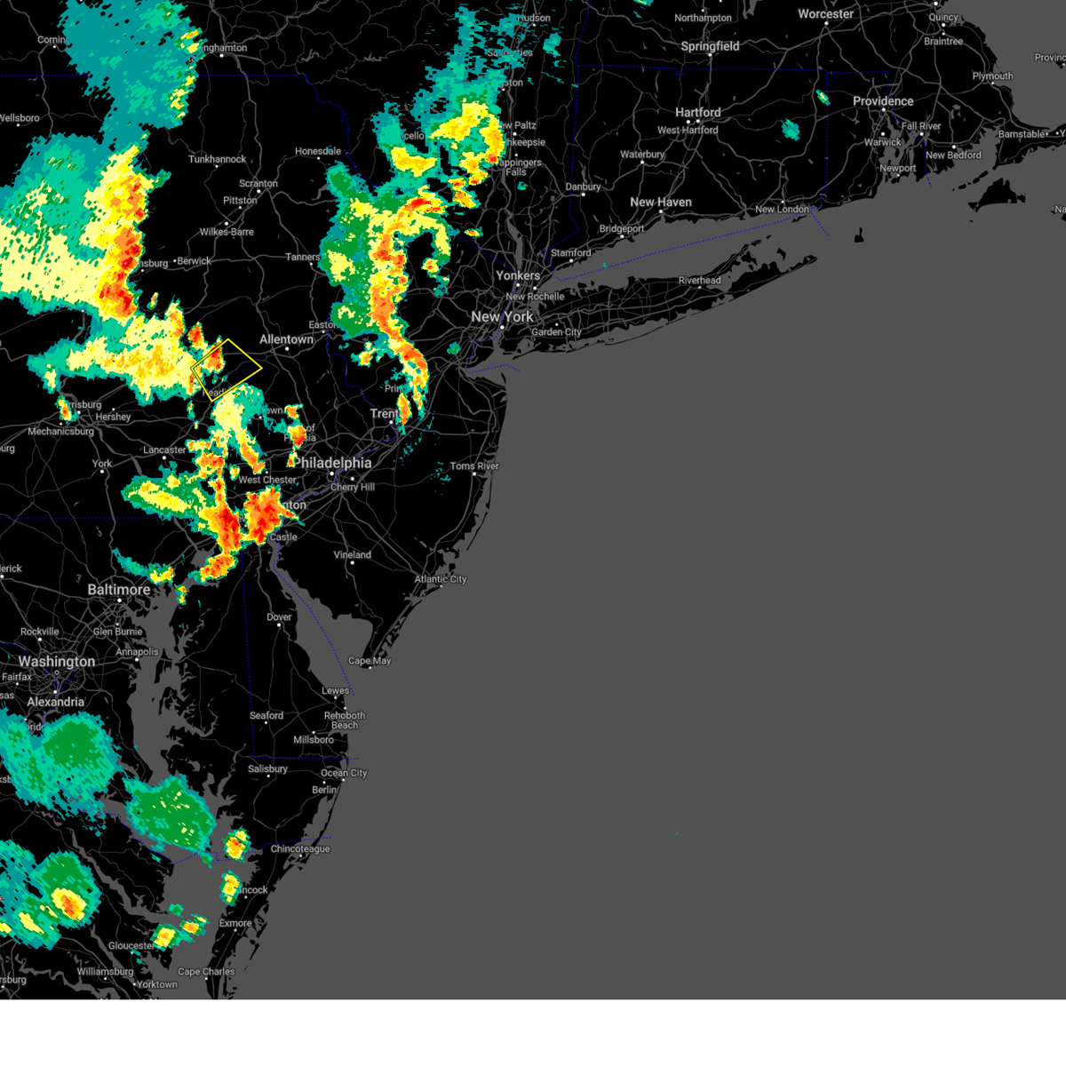 The severe thunderstorm warning for northeastern berks county will expire at 1000 pm edt, the storm which prompted the warning has weakened below severe limits, and no longer poses an immediate threat to life or property. therefore, the warning will be allowed to expire. a severe thunderstorm watch remains in effect until 1100 pm edt for eastern pennsylvania. to report severe weather, contact your nearest law enforcement agency. they will relay your report to the national weather service mount holly nj. The severe thunderstorm warning for northeastern berks county will expire at 1000 pm edt, the storm which prompted the warning has weakened below severe limits, and no longer poses an immediate threat to life or property. therefore, the warning will be allowed to expire. a severe thunderstorm watch remains in effect until 1100 pm edt for eastern pennsylvania. to report severe weather, contact your nearest law enforcement agency. they will relay your report to the national weather service mount holly nj.
|
| 6/26/2023 9:34 PM EDT |
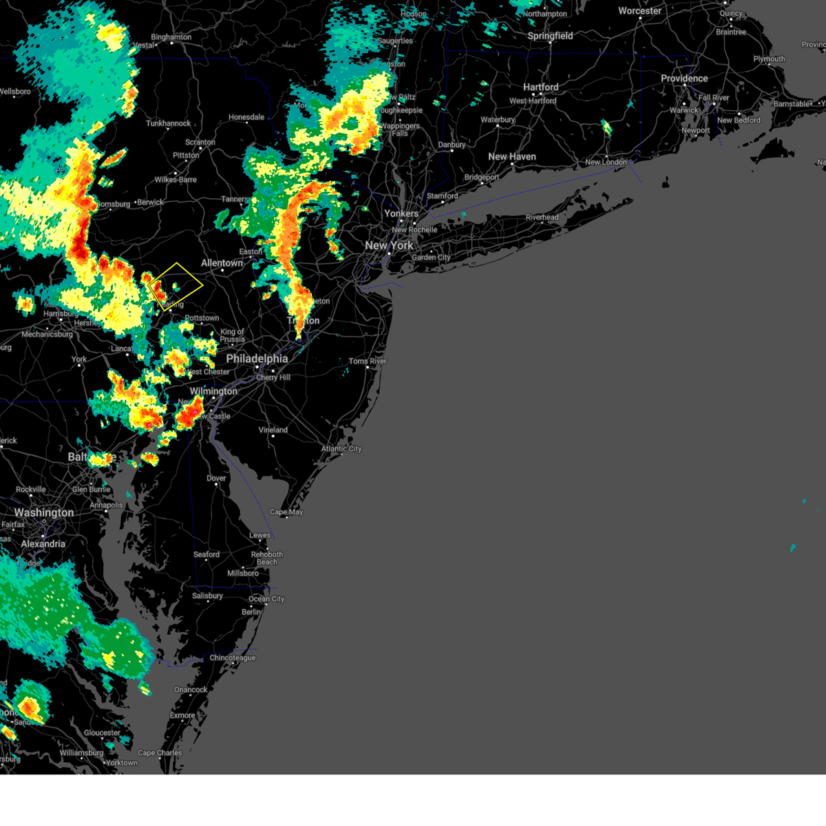 At 934 pm edt, a severe thunderstorm was located over leesport, or 8 miles north of reading, moving northeast at 25 mph (radar indicated). Hazards include 60 mph wind gusts and nickel size hail. Damage to roofs, siding, trees, and power lines is possible. locations impacted include, reading, wyomissing, kutztown, hamburg, fleetwood, laureldale, topton, leesport, shoemakersville, lyons, lenhartsville, fairview hgts, spring ridge, centerport and wyomissing hills. this includes interstate 78 in pennsylvania between mile markers 27 and 43. hail threat, radar indicated max hail size, 0. 88 in wind threat, radar indicated max wind gust, 60 mph. At 934 pm edt, a severe thunderstorm was located over leesport, or 8 miles north of reading, moving northeast at 25 mph (radar indicated). Hazards include 60 mph wind gusts and nickel size hail. Damage to roofs, siding, trees, and power lines is possible. locations impacted include, reading, wyomissing, kutztown, hamburg, fleetwood, laureldale, topton, leesport, shoemakersville, lyons, lenhartsville, fairview hgts, spring ridge, centerport and wyomissing hills. this includes interstate 78 in pennsylvania between mile markers 27 and 43. hail threat, radar indicated max hail size, 0. 88 in wind threat, radar indicated max wind gust, 60 mph.
|
| 6/26/2023 9:18 PM EDT |
 At 917 pm edt, a severe thunderstorm was located over bernville, or 8 miles northwest of reading, moving northeast at 30 mph (radar indicated). Hazards include 60 mph wind gusts and nickel size hail. damage to roofs, siding, trees, and power lines is possible At 917 pm edt, a severe thunderstorm was located over bernville, or 8 miles northwest of reading, moving northeast at 30 mph (radar indicated). Hazards include 60 mph wind gusts and nickel size hail. damage to roofs, siding, trees, and power lines is possible
|
| 6/6/2023 4:13 PM EDT |
 At 413 pm edt, a severe thunderstorm was located over reading, moving southeast at 25 mph (radar indicated). Hazards include 60 mph wind gusts and quarter size hail. Minor damage to vehicles is possible. Wind damage to roofs, siding, trees, and power lines is possible. At 413 pm edt, a severe thunderstorm was located over reading, moving southeast at 25 mph (radar indicated). Hazards include 60 mph wind gusts and quarter size hail. Minor damage to vehicles is possible. Wind damage to roofs, siding, trees, and power lines is possible.
|
| 6/3/2023 6:21 PM EDT |
 At 621 pm edt, a severe thunderstorm was located over robesonia, or 9 miles west of reading, moving southwest at 30 mph (trained weather spotters). Hazards include 60 mph wind gusts and penny size hail. Damage to roofs, siding, trees, and power lines is possible. locations impacted include, reading, wyomissing, sinking spring, laureldale, womelsdorf, wernersville, robesonia, bernville, fairview hgts, spring ridge, shillington, west reading, mohnton, kenhorst, wyomissing hills, west lawn, whitfield and west wyomissing. hail threat, radar indicated max hail size, 0. 75 in wind threat, radar indicated max wind gust, 60 mph. At 621 pm edt, a severe thunderstorm was located over robesonia, or 9 miles west of reading, moving southwest at 30 mph (trained weather spotters). Hazards include 60 mph wind gusts and penny size hail. Damage to roofs, siding, trees, and power lines is possible. locations impacted include, reading, wyomissing, sinking spring, laureldale, womelsdorf, wernersville, robesonia, bernville, fairview hgts, spring ridge, shillington, west reading, mohnton, kenhorst, wyomissing hills, west lawn, whitfield and west wyomissing. hail threat, radar indicated max hail size, 0. 75 in wind threat, radar indicated max wind gust, 60 mph.
|
| 6/3/2023 6:05 PM EDT |
 At 605 pm edt, a severe thunderstorm was located over fairview hgts, or 9 miles northwest of reading, moving southwest at 25 mph (trained weather spotters). Hazards include 60 mph wind gusts and quarter size hail. Minor damage to vehicles is possible. Wind damage to roofs, siding, trees, and power lines is possible. At 605 pm edt, a severe thunderstorm was located over fairview hgts, or 9 miles northwest of reading, moving southwest at 25 mph (trained weather spotters). Hazards include 60 mph wind gusts and quarter size hail. Minor damage to vehicles is possible. Wind damage to roofs, siding, trees, and power lines is possible.
|
| 4/22/2023 4:33 PM EDT |
 At 433 pm edt, severe thunderstorms were located along a line extending from pottsville to new morgan, moving north at 55 mph (radar indicated). Hazards include 60 mph wind gusts and nickel size hail. Damage to roofs, siding, trees, and power lines is possible. locations impacted include, reading, wyomissing, birdsboro, kutztown, hamburg, fleetwood, sinking spring, laureldale, leesport, shoemakersville, bernville, lyons, strausstown, lenhartsville, new morgan, spring ridge, fairview hgts, shillington, west reading and mount penn. this includes the following highways, pennsylvania turnpike between mile markers 299 and 300. interstate 78 in pennsylvania between mile markers 19 and 43. interstate 176 in pennsylvania between mile markers 4 and 11. hail threat, radar indicated max hail size, 0. 88 in wind threat, radar indicated max wind gust, 60 mph. At 433 pm edt, severe thunderstorms were located along a line extending from pottsville to new morgan, moving north at 55 mph (radar indicated). Hazards include 60 mph wind gusts and nickel size hail. Damage to roofs, siding, trees, and power lines is possible. locations impacted include, reading, wyomissing, birdsboro, kutztown, hamburg, fleetwood, sinking spring, laureldale, leesport, shoemakersville, bernville, lyons, strausstown, lenhartsville, new morgan, spring ridge, fairview hgts, shillington, west reading and mount penn. this includes the following highways, pennsylvania turnpike between mile markers 299 and 300. interstate 78 in pennsylvania between mile markers 19 and 43. interstate 176 in pennsylvania between mile markers 4 and 11. hail threat, radar indicated max hail size, 0. 88 in wind threat, radar indicated max wind gust, 60 mph.
|
| 4/22/2023 4:16 PM EDT |
 At 416 pm edt, severe thunderstorms were located along a line extending from near myerstown to near quarryville, moving north at 50 mph (radar indicated). Hazards include 60 mph wind gusts and nickel size hail. damage to roofs, siding, trees, and power lines is possible At 416 pm edt, severe thunderstorms were located along a line extending from near myerstown to near quarryville, moving north at 50 mph (radar indicated). Hazards include 60 mph wind gusts and nickel size hail. damage to roofs, siding, trees, and power lines is possible
|
| 4/1/2023 6:07 PM EDT |
 The severe thunderstorm warning for berks, lehigh and central northampton counties will expire at 615 pm edt, the storms which prompted the warning have moved out of the area. therefore, the warning will be allowed to expire. however gusty winds are still possible through this evening outside of any thunderstorms. a tornado watch remains in effect until 1000 pm edt for northwestern new jersey, and southeastern pennsylvania. a severe thunderstorm watch remains in effect until 800 pm edt for eastern pennsylvania. The severe thunderstorm warning for berks, lehigh and central northampton counties will expire at 615 pm edt, the storms which prompted the warning have moved out of the area. therefore, the warning will be allowed to expire. however gusty winds are still possible through this evening outside of any thunderstorms. a tornado watch remains in effect until 1000 pm edt for northwestern new jersey, and southeastern pennsylvania. a severe thunderstorm watch remains in effect until 800 pm edt for eastern pennsylvania.
|
| 4/1/2023 5:44 PM EDT |
 At 544 pm edt, severe thunderstorms were located along a line extending from allentown to near wyomissing, moving east at 45 mph (radar indicated). Hazards include 60 mph wind gusts and penny size hail. Damage to roofs, siding, trees, and power lines is possible. locations impacted include, allentown, reading, bethlehem, emmaus, wyomissing, northampton, wilson, nazareth, birdsboro, kutztown, fleetwood, sinking spring, laureldale, womelsdorf, bath, wernersville, walnutport, topton, robesonia and leesport. this includes the following highways, pennsylvania turnpike between mile markers 296 and 299. northeast extension between mile markers 49 and 67. interstate 78 in pennsylvania between mile markers 37 and 66. interstate 176 in pennsylvania between mile markers 1 and 11. hail threat, radar indicated max hail size, 0. 75 in wind threat, radar indicated max wind gust, 60 mph. At 544 pm edt, severe thunderstorms were located along a line extending from allentown to near wyomissing, moving east at 45 mph (radar indicated). Hazards include 60 mph wind gusts and penny size hail. Damage to roofs, siding, trees, and power lines is possible. locations impacted include, allentown, reading, bethlehem, emmaus, wyomissing, northampton, wilson, nazareth, birdsboro, kutztown, fleetwood, sinking spring, laureldale, womelsdorf, bath, wernersville, walnutport, topton, robesonia and leesport. this includes the following highways, pennsylvania turnpike between mile markers 296 and 299. northeast extension between mile markers 49 and 67. interstate 78 in pennsylvania between mile markers 37 and 66. interstate 176 in pennsylvania between mile markers 1 and 11. hail threat, radar indicated max hail size, 0. 75 in wind threat, radar indicated max wind gust, 60 mph.
|
| 4/1/2023 5:27 PM EDT |
 At 527 pm edt, severe thunderstorms were located along a line extending from near tuscarora to myerstown, moving east at 50 mph (radar indicated). Hazards include 60 mph wind gusts and penny size hail. damage to roofs, siding, trees, and power lines is possible At 527 pm edt, severe thunderstorms were located along a line extending from near tuscarora to myerstown, moving east at 50 mph (radar indicated). Hazards include 60 mph wind gusts and penny size hail. damage to roofs, siding, trees, and power lines is possible
|
| 4/1/2023 1:59 PM EDT |
 At 158 pm edt, severe thunderstorms were located along a line extending from oil city to plum, moving east at 65 mph (radar indicated). Hazards include 60 mph wind gusts. expect damage to trees and power lines, resulting in some power outages At 158 pm edt, severe thunderstorms were located along a line extending from oil city to plum, moving east at 65 mph (radar indicated). Hazards include 60 mph wind gusts. expect damage to trees and power lines, resulting in some power outages
|
| 8/29/2022 4:31 PM EDT |
 At 431 pm edt, a severe thunderstorm was located near leechburg, or near vandergrift, moving northeast at 35 mph (radar indicated). Hazards include 60 mph wind gusts and penny size hail. Expect damage to trees and power lines, resulting in some power outages. locations impacted include, vandergrift, apollo, murrysville, ford city, leechburg, north apollo, west leechburg, orchard hills, oklahoma, east vandergrift, hyde park, and north vandergrift. hail threat, radar indicated max hail size, 0. 75 in wind threat, radar indicated max wind gust, 60 mph. At 431 pm edt, a severe thunderstorm was located near leechburg, or near vandergrift, moving northeast at 35 mph (radar indicated). Hazards include 60 mph wind gusts and penny size hail. Expect damage to trees and power lines, resulting in some power outages. locations impacted include, vandergrift, apollo, murrysville, ford city, leechburg, north apollo, west leechburg, orchard hills, oklahoma, east vandergrift, hyde park, and north vandergrift. hail threat, radar indicated max hail size, 0. 75 in wind threat, radar indicated max wind gust, 60 mph.
|
| 8/29/2022 4:26 PM EDT |
 At 426 pm edt, a severe thunderstorm was located over leechburg, or over vandergrift, moving northeast at 25 mph (radar indicated). Hazards include 60 mph wind gusts and penny size hail. Expect damage to trees and power lines, resulting in some power outages. locations impacted include, vandergrift, apollo, plum, murrysville, new kensington, lower burrell, harrison township, arnold, tarentum, natrona heights, brackenridge, and ford city. hail threat, radar indicated max hail size, 0. 75 in wind threat, radar indicated max wind gust, 60 mph. At 426 pm edt, a severe thunderstorm was located over leechburg, or over vandergrift, moving northeast at 25 mph (radar indicated). Hazards include 60 mph wind gusts and penny size hail. Expect damage to trees and power lines, resulting in some power outages. locations impacted include, vandergrift, apollo, plum, murrysville, new kensington, lower burrell, harrison township, arnold, tarentum, natrona heights, brackenridge, and ford city. hail threat, radar indicated max hail size, 0. 75 in wind threat, radar indicated max wind gust, 60 mph.
|
| 8/29/2022 4:21 PM EDT |
 At 421 pm edt, a severe thunderstorm was located near lower burrell, or near vandergrift, moving northeast at 40 mph (radar indicated). Hazards include 60 mph wind gusts and penny size hail. Expect damage to trees and power lines, resulting in some power outages. locations impacted include, penn hills, monroeville, vandergrift, apollo, plum, murrysville, new kensington, lower burrell, harrison township, o`hara township, oakmont, and fox chapel. hail threat, radar indicated max hail size, 0. 75 in wind threat, radar indicated max wind gust, 60 mph. At 421 pm edt, a severe thunderstorm was located near lower burrell, or near vandergrift, moving northeast at 40 mph (radar indicated). Hazards include 60 mph wind gusts and penny size hail. Expect damage to trees and power lines, resulting in some power outages. locations impacted include, penn hills, monroeville, vandergrift, apollo, plum, murrysville, new kensington, lower burrell, harrison township, o`hara township, oakmont, and fox chapel. hail threat, radar indicated max hail size, 0. 75 in wind threat, radar indicated max wind gust, 60 mph.
|
| 8/29/2022 4:13 PM EDT |
 At 412 pm edt, a severe thunderstorm was located over springdale, or near penn hills, moving northeast at 35 mph (radar indicated). Hazards include 60 mph wind gusts and penny size hail. expect damage to trees and power lines, resulting in some power outages At 412 pm edt, a severe thunderstorm was located over springdale, or near penn hills, moving northeast at 35 mph (radar indicated). Hazards include 60 mph wind gusts and penny size hail. expect damage to trees and power lines, resulting in some power outages
|
| 8/4/2022 3:55 PM EDT |
 The severe thunderstorm warning for southwestern indiana, central westmoreland and southeastern armstrong counties will expire at 400 pm edt, the storm which prompted the warning has weakened below severe limits, and no longer poses an immediate threat to life or property. therefore, the warning will be allowed to expire. however gusty winds and heavy rain are still possible with this thunderstorm. The severe thunderstorm warning for southwestern indiana, central westmoreland and southeastern armstrong counties will expire at 400 pm edt, the storm which prompted the warning has weakened below severe limits, and no longer poses an immediate threat to life or property. therefore, the warning will be allowed to expire. however gusty winds and heavy rain are still possible with this thunderstorm.
|
| 8/4/2022 3:32 PM EDT |
 At 331 pm edt, a severe thunderstorm was located 8 miles southeast of apollo, moving east at 20 mph (radar indicated). Hazards include 60 mph wind gusts. Expect damage to trees and power lines, resulting in some power outages. locations impacted include, indiana, vandergrift, homer city, apollo, murrysville, blairsville, derry, delmont, leechburg, black lick, north apollo, and avonmore. hail threat, radar indicated max hail size, <. 75 in wind threat, radar indicated max wind gust, 60 mph. At 331 pm edt, a severe thunderstorm was located 8 miles southeast of apollo, moving east at 20 mph (radar indicated). Hazards include 60 mph wind gusts. Expect damage to trees and power lines, resulting in some power outages. locations impacted include, indiana, vandergrift, homer city, apollo, murrysville, blairsville, derry, delmont, leechburg, black lick, north apollo, and avonmore. hail threat, radar indicated max hail size, <. 75 in wind threat, radar indicated max wind gust, 60 mph.
|
| 8/4/2022 3:18 PM EDT |
 At 318 pm edt, a cluster of severe thunderstorms was located near plum, or near penn hills, and near saltsburg moving east at 15 mph (radar indicated). Hazards include 60 mph wind gusts and quarter size hail. Minor hail damage to vehicles is possible. Expect wind damage to trees and power lines, resulting in some power outages. At 318 pm edt, a cluster of severe thunderstorms was located near plum, or near penn hills, and near saltsburg moving east at 15 mph (radar indicated). Hazards include 60 mph wind gusts and quarter size hail. Minor hail damage to vehicles is possible. Expect wind damage to trees and power lines, resulting in some power outages.
|
| 7/25/2022 6:41 AM EDT |
 The severe thunderstorm warning for southeastern butler, northeastern allegheny, northwestern westmoreland and armstrong counties will expire at 645 am edt, the storm which prompted the warning has weakened below severe limits, and has exited the warned area. therefore, the warning will be allowed to expire. however gusty winds and heavy rain are still possible with this thunderstorm. The severe thunderstorm warning for southeastern butler, northeastern allegheny, northwestern westmoreland and armstrong counties will expire at 645 am edt, the storm which prompted the warning has weakened below severe limits, and has exited the warned area. therefore, the warning will be allowed to expire. however gusty winds and heavy rain are still possible with this thunderstorm.
|
| 7/25/2022 6:22 AM EDT |
 At 622 am edt, a severe thunderstorm was located near ford city, or near kittanning, moving east at 55 mph (radar indicated). Hazards include 60 mph wind gusts. Expect damage to trees and power lines, resulting in some power outages. locations impacted include, vandergrift, kittanning, apollo, new kensington, lower burrell, harrison township, arnold, tarentum, natrona heights, brackenridge, ford city, and leechburg. hail threat, radar indicated max hail size, <. 75 in wind threat, radar indicated max wind gust, 60 mph. At 622 am edt, a severe thunderstorm was located near ford city, or near kittanning, moving east at 55 mph (radar indicated). Hazards include 60 mph wind gusts. Expect damage to trees and power lines, resulting in some power outages. locations impacted include, vandergrift, kittanning, apollo, new kensington, lower burrell, harrison township, arnold, tarentum, natrona heights, brackenridge, ford city, and leechburg. hail threat, radar indicated max hail size, <. 75 in wind threat, radar indicated max wind gust, 60 mph.
|
| 7/25/2022 6:09 AM EDT |
 At 609 am edt, a severe thunderstorm was located near harrison township, or 10 miles northwest of vandergrift, moving east at 55 mph (radar indicated). Hazards include 60 mph wind gusts. expect damage to trees and power lines, resulting in some power outages At 609 am edt, a severe thunderstorm was located near harrison township, or 10 miles northwest of vandergrift, moving east at 55 mph (radar indicated). Hazards include 60 mph wind gusts. expect damage to trees and power lines, resulting in some power outages
|
| 7/24/2022 7:41 AM EDT |
 At 740 am edt, a severe thunderstorm was located near apollo, moving east at 45 mph (radar indicated). Hazards include 60 mph wind gusts and penny size hail. expect damage to trees and power lines, resulting in some power outages At 740 am edt, a severe thunderstorm was located near apollo, moving east at 45 mph (radar indicated). Hazards include 60 mph wind gusts and penny size hail. expect damage to trees and power lines, resulting in some power outages
|
| 7/23/2022 3:51 PM EDT |
 At 351 pm edt, a severe thunderstorm was located 8 miles west of indiana, moving east at 30 mph (radar indicated). Hazards include 60 mph wind gusts and quarter size hail. Minor hail damage to vehicles is possible. expect wind damage to trees and power lines, resulting in some power outages. locations impacted include, greensburg, indiana, latrobe, vandergrift, kittanning, homer city, apollo, mount pleasant, scottdale, mcchesneytown-loyalhanna, blairsville, and youngwood. hail threat, radar indicated max hail size, 1. 00 in wind threat, radar indicated max wind gust, 60 mph. At 351 pm edt, a severe thunderstorm was located 8 miles west of indiana, moving east at 30 mph (radar indicated). Hazards include 60 mph wind gusts and quarter size hail. Minor hail damage to vehicles is possible. expect wind damage to trees and power lines, resulting in some power outages. locations impacted include, greensburg, indiana, latrobe, vandergrift, kittanning, homer city, apollo, mount pleasant, scottdale, mcchesneytown-loyalhanna, blairsville, and youngwood. hail threat, radar indicated max hail size, 1. 00 in wind threat, radar indicated max wind gust, 60 mph.
|
| 7/23/2022 3:30 PM EDT |
 At 330 pm edt, a severe thunderstorm was located near delmont, or 8 miles north of greensburg, moving east at 40 mph (radar indicated). Hazards include 60 mph wind gusts and quarter size hail. Minor hail damage to vehicles is possible. expect wind damage to trees and power lines, resulting in some power outages. locations impacted include, pittsburgh, penn hills, monroeville, greensburg, mckeesport, uniontown, jeannette, connellsville, vandergrift, waynesburg, apollo, and plum. hail threat, radar indicated max hail size, 1. 00 in wind threat, radar indicated max wind gust, 60 mph. At 330 pm edt, a severe thunderstorm was located near delmont, or 8 miles north of greensburg, moving east at 40 mph (radar indicated). Hazards include 60 mph wind gusts and quarter size hail. Minor hail damage to vehicles is possible. expect wind damage to trees and power lines, resulting in some power outages. locations impacted include, pittsburgh, penn hills, monroeville, greensburg, mckeesport, uniontown, jeannette, connellsville, vandergrift, waynesburg, apollo, and plum. hail threat, radar indicated max hail size, 1. 00 in wind threat, radar indicated max wind gust, 60 mph.
|
| 7/23/2022 3:29 PM EDT |
 At 329 pm edt, a severe thunderstorm was located near apollo, moving east at 35 mph (radar indicated). Hazards include 60 mph wind gusts and quarter size hail. Minor hail damage to vehicles is possible. Expect wind damage to trees and power lines, resulting in some power outages. At 329 pm edt, a severe thunderstorm was located near apollo, moving east at 35 mph (radar indicated). Hazards include 60 mph wind gusts and quarter size hail. Minor hail damage to vehicles is possible. Expect wind damage to trees and power lines, resulting in some power outages.
|
| 7/23/2022 3:02 PM EDT |
 At 302 pm edt, a severe thunderstorm was located over north braddock, or near mckeesport, moving east at 40 mph (radar indicated). Hazards include 70 mph wind gusts and quarter size hail. Minor hail damage to vehicles is possible. trees snapped and uprooted. Power outages can be expected. At 302 pm edt, a severe thunderstorm was located over north braddock, or near mckeesport, moving east at 40 mph (radar indicated). Hazards include 70 mph wind gusts and quarter size hail. Minor hail damage to vehicles is possible. trees snapped and uprooted. Power outages can be expected.
|
| 7/1/2022 2:04 PM EDT |
 At 203 pm edt, a severe thunderstorm was located over sinking spring, or near reading, moving northeast at 30 mph (radar indicated). Hazards include 60 mph wind gusts and quarter size hail. Minor damage to vehicles is possible. Wind damage to roofs, siding, trees, and power lines is possible. At 203 pm edt, a severe thunderstorm was located over sinking spring, or near reading, moving northeast at 30 mph (radar indicated). Hazards include 60 mph wind gusts and quarter size hail. Minor damage to vehicles is possible. Wind damage to roofs, siding, trees, and power lines is possible.
|
| 6/22/2022 6:12 PM EDT |
 The severe thunderstorm warning for southwestern indiana, northwestern westmoreland and southern armstrong counties will expire at 615 pm edt, the storm which prompted the warning has weakened below severe limits, and no longer poses an immediate threat to life or property. therefore, the warning will be allowed to expire. however gusty winds are still possible with this thunderstorm. a severe thunderstorm watch remains in effect until 1000 pm edt for southwestern and west central pennsylvania. The severe thunderstorm warning for southwestern indiana, northwestern westmoreland and southern armstrong counties will expire at 615 pm edt, the storm which prompted the warning has weakened below severe limits, and no longer poses an immediate threat to life or property. therefore, the warning will be allowed to expire. however gusty winds are still possible with this thunderstorm. a severe thunderstorm watch remains in effect until 1000 pm edt for southwestern and west central pennsylvania.
|
| 6/22/2022 5:44 PM EDT |
 At 544 pm edt, a severe thunderstorm was located near ford city, or 7 miles northeast of vandergrift, moving southeast at 20 mph (radar indicated). Hazards include 60 mph wind gusts and quarter size hail. Minor hail damage to vehicles is possible. expect wind damage to trees and power lines, resulting in some power outages. locations impacted include, indiana, vandergrift, homer city, apollo, new kensington, lower burrell, blairsville, derry, leechburg, black lick, north apollo, and west leechburg. hail threat, radar indicated max hail size, 1. 00 in wind threat, radar indicated max wind gust, 60 mph. At 544 pm edt, a severe thunderstorm was located near ford city, or 7 miles northeast of vandergrift, moving southeast at 20 mph (radar indicated). Hazards include 60 mph wind gusts and quarter size hail. Minor hail damage to vehicles is possible. expect wind damage to trees and power lines, resulting in some power outages. locations impacted include, indiana, vandergrift, homer city, apollo, new kensington, lower burrell, blairsville, derry, leechburg, black lick, north apollo, and west leechburg. hail threat, radar indicated max hail size, 1. 00 in wind threat, radar indicated max wind gust, 60 mph.
|
| 6/22/2022 5:27 PM EDT |
 At 527 pm edt, a severe thunderstorm was located over leechburg, or over vandergrift, moving southeast at 20 mph (radar indicated). Hazards include 60 mph wind gusts and quarter size hail. Minor hail damage to vehicles is possible. Expect wind damage to trees and power lines, resulting in some power outages. At 527 pm edt, a severe thunderstorm was located over leechburg, or over vandergrift, moving southeast at 20 mph (radar indicated). Hazards include 60 mph wind gusts and quarter size hail. Minor hail damage to vehicles is possible. Expect wind damage to trees and power lines, resulting in some power outages.
|
| 6/22/2022 5:18 PM EDT |
 At 518 pm edt, a severe thunderstorm was located over brackenridge, or 8 miles west of vandergrift, moving southeast at 20 mph (radar indicated). Hazards include 60 mph wind gusts. Expect damage to trees and power lines, resulting in some power outages. locations impacted include, vandergrift, apollo, plum, murrysville, hampton township, new kensington, lower burrell, harrison township, arnold, tarentum, natrona heights, and springdale. hail threat, radar indicated max hail size, <. 75 in wind threat, radar indicated max wind gust, 60 mph. At 518 pm edt, a severe thunderstorm was located over brackenridge, or 8 miles west of vandergrift, moving southeast at 20 mph (radar indicated). Hazards include 60 mph wind gusts. Expect damage to trees and power lines, resulting in some power outages. locations impacted include, vandergrift, apollo, plum, murrysville, hampton township, new kensington, lower burrell, harrison township, arnold, tarentum, natrona heights, and springdale. hail threat, radar indicated max hail size, <. 75 in wind threat, radar indicated max wind gust, 60 mph.
|
| 6/22/2022 4:55 PM EDT |
 At 455 pm edt, a severe thunderstorm was located near tarentum, or 10 miles east of mccandless township, moving southeast at 30 mph (radar indicated). Hazards include 60 mph wind gusts and half dollar size hail. Minor hail damage to vehicles is possible. expect wind damage to trees and power lines, resulting in some power outages. locations impacted include, vandergrift, apollo, plum, murrysville, hampton township, new kensington, lower burrell, harrison township, arnold, tarentum, natrona heights, and springdale. hail threat, radar indicated max hail size, 1. 25 in wind threat, radar indicated max wind gust, 60 mph. At 455 pm edt, a severe thunderstorm was located near tarentum, or 10 miles east of mccandless township, moving southeast at 30 mph (radar indicated). Hazards include 60 mph wind gusts and half dollar size hail. Minor hail damage to vehicles is possible. expect wind damage to trees and power lines, resulting in some power outages. locations impacted include, vandergrift, apollo, plum, murrysville, hampton township, new kensington, lower burrell, harrison township, arnold, tarentum, natrona heights, and springdale. hail threat, radar indicated max hail size, 1. 25 in wind threat, radar indicated max wind gust, 60 mph.
|
| 6/22/2022 4:43 PM EDT |
 At 442 pm edt, severe thunderstorms centered near mars, or 8 miles east of cranberry, are moving southeast at 30 mph (radar indicated). Hazards include 60 mph wind gusts. expect damage to trees and power lines, resulting in some power outages At 442 pm edt, severe thunderstorms centered near mars, or 8 miles east of cranberry, are moving southeast at 30 mph (radar indicated). Hazards include 60 mph wind gusts. expect damage to trees and power lines, resulting in some power outages
|
| 5/22/2022 4:38 PM EDT |
 At 438 pm edt, a severe thunderstorm was located over leesport, or 7 miles north of reading, moving east at 40 mph (radar indicated). Hazards include 60 mph wind gusts and penny size hail. Damage to roofs, siding, trees, and power lines is possible. locations impacted include, reading, wyomissing, birdsboro, kutztown, hamburg, fleetwood, sinking spring, laureldale, womelsdorf, wernersville, robesonia, leesport, shoemakersville, elverson, bernville, lyons, lenhartsville, new morgan, spring ridge and fairview hgts. this includes the following highways, pennsylvania turnpike between mile markers 296 and 300. interstate 78 in pennsylvania between mile markers 25 and 43. interstate 176 in pennsylvania between mile markers 1 and 11. hail threat, radar indicated max hail size, 0. 75 in wind threat, radar indicated max wind gust, 60 mph. At 438 pm edt, a severe thunderstorm was located over leesport, or 7 miles north of reading, moving east at 40 mph (radar indicated). Hazards include 60 mph wind gusts and penny size hail. Damage to roofs, siding, trees, and power lines is possible. locations impacted include, reading, wyomissing, birdsboro, kutztown, hamburg, fleetwood, sinking spring, laureldale, womelsdorf, wernersville, robesonia, leesport, shoemakersville, elverson, bernville, lyons, lenhartsville, new morgan, spring ridge and fairview hgts. this includes the following highways, pennsylvania turnpike between mile markers 296 and 300. interstate 78 in pennsylvania between mile markers 25 and 43. interstate 176 in pennsylvania between mile markers 1 and 11. hail threat, radar indicated max hail size, 0. 75 in wind threat, radar indicated max wind gust, 60 mph.
|
| 5/22/2022 4:28 PM EDT |
 At 428 pm edt, a severe thunderstorm was located over bernville, or 10 miles east of myerstown, moving east at 40 mph (radar indicated). Hazards include 60 mph wind gusts and penny size hail. Damage to roofs, siding, trees, and power lines is possible. locations impacted include, reading, wyomissing, birdsboro, kutztown, hamburg, fleetwood, sinking spring, laureldale, womelsdorf, wernersville, robesonia, leesport, shoemakersville, elverson, bernville, lyons, strausstown, lenhartsville, new morgan and spring ridge. this includes the following highways, pennsylvania turnpike between mile markers 296 and 300. interstate 78 in pennsylvania between mile markers 11 and 43. interstate 176 in pennsylvania between mile markers 1 and 11. hail threat, radar indicated max hail size, 0. 75 in wind threat, radar indicated max wind gust, 60 mph. At 428 pm edt, a severe thunderstorm was located over bernville, or 10 miles east of myerstown, moving east at 40 mph (radar indicated). Hazards include 60 mph wind gusts and penny size hail. Damage to roofs, siding, trees, and power lines is possible. locations impacted include, reading, wyomissing, birdsboro, kutztown, hamburg, fleetwood, sinking spring, laureldale, womelsdorf, wernersville, robesonia, leesport, shoemakersville, elverson, bernville, lyons, strausstown, lenhartsville, new morgan and spring ridge. this includes the following highways, pennsylvania turnpike between mile markers 296 and 300. interstate 78 in pennsylvania between mile markers 11 and 43. interstate 176 in pennsylvania between mile markers 1 and 11. hail threat, radar indicated max hail size, 0. 75 in wind threat, radar indicated max wind gust, 60 mph.
|
| 5/22/2022 4:08 PM EDT |
 At 408 pm edt, severe thunderstorms were located along a line extending from near fredericksburg to near avon to mount joy, moving east at 40 mph (radar indicated). Hazards include 60 mph wind gusts and penny size hail. damage to roofs, siding, trees, and power lines is possible At 408 pm edt, severe thunderstorms were located along a line extending from near fredericksburg to near avon to mount joy, moving east at 40 mph (radar indicated). Hazards include 60 mph wind gusts and penny size hail. damage to roofs, siding, trees, and power lines is possible
|
| 5/20/2022 2:53 PM EDT |
 At 253 pm edt, a severe thunderstorm was located over laureldale, or near reading, moving east at 25 mph (radar indicated). Hazards include 60 mph wind gusts and half dollar size hail. Minor damage to vehicles is possible. Wind damage to roofs, siding, trees, and power lines is possible. At 253 pm edt, a severe thunderstorm was located over laureldale, or near reading, moving east at 25 mph (radar indicated). Hazards include 60 mph wind gusts and half dollar size hail. Minor damage to vehicles is possible. Wind damage to roofs, siding, trees, and power lines is possible.
|
| 5/20/2022 2:47 PM EDT |
 At 246 pm edt, severe thunderstorms were located along a line extending from near strausstown to bernville to kleinfeltersville, moving northeast at 50 mph. another severe thunderstorm in the warned area was located over reading moving northeast at 40 mph (radar indicated). Hazards include 60 mph wind gusts and quarter size hail. Minor damage to vehicles is possible. wind damage to roofs, siding, trees, and power lines is possible. locations impacted include, reading, wyomissing, kutztown, hamburg, fleetwood, sinking spring, laureldale, womelsdorf, wernersville, robesonia, leesport, shoemakersville, bernville, lyons, strausstown, lenhartsville, spring ridge, fairview hgts, shillington and west reading. this includes the following highways, interstate 78 in pennsylvania between mile markers 14 and 42. interstate 176 in pennsylvania near mile marker 11. hail threat, radar indicated max hail size, 1. 00 in wind threat, radar indicated max wind gust, 60 mph. At 246 pm edt, severe thunderstorms were located along a line extending from near strausstown to bernville to kleinfeltersville, moving northeast at 50 mph. another severe thunderstorm in the warned area was located over reading moving northeast at 40 mph (radar indicated). Hazards include 60 mph wind gusts and quarter size hail. Minor damage to vehicles is possible. wind damage to roofs, siding, trees, and power lines is possible. locations impacted include, reading, wyomissing, kutztown, hamburg, fleetwood, sinking spring, laureldale, womelsdorf, wernersville, robesonia, leesport, shoemakersville, bernville, lyons, strausstown, lenhartsville, spring ridge, fairview hgts, shillington and west reading. this includes the following highways, interstate 78 in pennsylvania between mile markers 14 and 42. interstate 176 in pennsylvania near mile marker 11. hail threat, radar indicated max hail size, 1. 00 in wind threat, radar indicated max wind gust, 60 mph.
|
| 5/20/2022 2:30 PM EDT |
 At 230 pm edt, severe thunderstorms were located along a line extending from near fredericksburg to myerstown to timber hills, moving northeast at 50 mph (radar indicated). Hazards include 60 mph wind gusts and quarter size hail. Minor damage to vehicles is possible. Wind damage to roofs, siding, trees, and power lines is possible. At 230 pm edt, severe thunderstorms were located along a line extending from near fredericksburg to myerstown to timber hills, moving northeast at 50 mph (radar indicated). Hazards include 60 mph wind gusts and quarter size hail. Minor damage to vehicles is possible. Wind damage to roofs, siding, trees, and power lines is possible.
|
| 5/20/2022 1:59 PM EDT |
 At 207 pm edt, severe thunderstorms were located along a line extending from near reading to elverson, moving east at 20 mph (radar indicated). Hazards include 60 mph wind gusts and nickel size hail. Damage to roofs, siding, trees, and power lines is possible. locations impacted include, reading, pottstown, wyomissing, birdsboro, elverson, bechtelsville, new morgan, pughtown, gilbertsville, cedarville, stowe, shillington, west reading, boyertown, mount penn, mohnton, kenhorst, st. lawrence, pottsgrove and lorane. this includes the following highways, pennsylvania turnpike between mile markers 296 and 302. interstate 176 in pennsylvania between mile markers 1 and 11. hail threat, radar indicated max hail size, 0. 88 in wind threat, radar indicated max wind gust, 60 mph. At 207 pm edt, severe thunderstorms were located along a line extending from near reading to elverson, moving east at 20 mph (radar indicated). Hazards include 60 mph wind gusts and nickel size hail. Damage to roofs, siding, trees, and power lines is possible. locations impacted include, reading, pottstown, wyomissing, birdsboro, elverson, bechtelsville, new morgan, pughtown, gilbertsville, cedarville, stowe, shillington, west reading, boyertown, mount penn, mohnton, kenhorst, st. lawrence, pottsgrove and lorane. this includes the following highways, pennsylvania turnpike between mile markers 296 and 302. interstate 176 in pennsylvania between mile markers 1 and 11. hail threat, radar indicated max hail size, 0. 88 in wind threat, radar indicated max wind gust, 60 mph.
|
| 5/16/2022 5:17 PM EDT |
 At 517 pm edt, a severe thunderstorm was located near new morgan, or 8 miles south of reading, moving east at 50 mph (radar indicated). Hazards include 60 mph wind gusts and quarter size hail. Minor damage to vehicles is possible. Wind damage to roofs, siding, trees, and power lines is possible. At 517 pm edt, a severe thunderstorm was located near new morgan, or 8 miles south of reading, moving east at 50 mph (radar indicated). Hazards include 60 mph wind gusts and quarter size hail. Minor damage to vehicles is possible. Wind damage to roofs, siding, trees, and power lines is possible.
|
| 3/31/2022 8:14 PM EDT |
 At 813 pm edt, severe thunderstorms were located along a line extending from near danielsville to laureldale, moving northeast at 100 mph (law enforcement reported a tree down in perry township in berks county at 7:44 pm). Hazards include 60 mph wind gusts. damage to roofs, siding, trees, and power lines is possible At 813 pm edt, severe thunderstorms were located along a line extending from near danielsville to laureldale, moving northeast at 100 mph (law enforcement reported a tree down in perry township in berks county at 7:44 pm). Hazards include 60 mph wind gusts. damage to roofs, siding, trees, and power lines is possible
|
| 3/31/2022 7:54 PM EDT |
 At 754 pm edt, a severe thunderstorm was located over ancient oaks, or 7 miles southwest of allentown, moving east at 65 mph (radar indicated). Hazards include 60 mph wind gusts. Damage to roofs, siding, trees, and power lines is possible. locations impacted include, allentown, reading, lehighton, bethlehem, emmaus, wyomissing, northampton, palmerton, birdsboro, kutztown, jim thorpe, hamburg, slatington, fleetwood, sinking spring, laureldale, nesquehoning, womelsdorf, wernersville and walnutport. this includes the following highways, pennsylvania turnpike between mile markers 296 and 299. northeast extension between mile markers 49 and 83. interstate 78 in pennsylvania between mile markers 17 and 66. interstate 176 in pennsylvania between mile markers 1 and 11. hail threat, radar indicated max hail size, <. 75 in wind threat, radar indicated max wind gust, 60 mph. At 754 pm edt, a severe thunderstorm was located over ancient oaks, or 7 miles southwest of allentown, moving east at 65 mph (radar indicated). Hazards include 60 mph wind gusts. Damage to roofs, siding, trees, and power lines is possible. locations impacted include, allentown, reading, lehighton, bethlehem, emmaus, wyomissing, northampton, palmerton, birdsboro, kutztown, jim thorpe, hamburg, slatington, fleetwood, sinking spring, laureldale, nesquehoning, womelsdorf, wernersville and walnutport. this includes the following highways, pennsylvania turnpike between mile markers 296 and 299. northeast extension between mile markers 49 and 83. interstate 78 in pennsylvania between mile markers 17 and 66. interstate 176 in pennsylvania between mile markers 1 and 11. hail threat, radar indicated max hail size, <. 75 in wind threat, radar indicated max wind gust, 60 mph.
|
| 3/31/2022 7:27 PM EDT |
 At 726 pm edt, a severe thunderstorm was located over strausstown, or 10 miles northeast of myerstown, moving east at 65 mph (radar indicated). Hazards include 60 mph wind gusts. damage to roofs, siding, trees, and power lines is possible At 726 pm edt, a severe thunderstorm was located over strausstown, or 10 miles northeast of myerstown, moving east at 65 mph (radar indicated). Hazards include 60 mph wind gusts. damage to roofs, siding, trees, and power lines is possible
|
| 3/31/2022 11:41 AM EDT |
 At 1141 am edt, severe thunderstorms were located along a line extending from ford city to near irwin, moving east at 40 mph (radar indicated). Hazards include 60 mph wind gusts. Expect damage to trees and power lines, resulting in some power outages. locations impacted include, vandergrift, kittanning, apollo, murrysville, ford city, delmont, leechburg, west kittanning, north apollo, avonmore, orchard hills, and export. hail threat, radar indicated max hail size, <. 75 in wind threat, radar indicated max wind gust, 60 mph. At 1141 am edt, severe thunderstorms were located along a line extending from ford city to near irwin, moving east at 40 mph (radar indicated). Hazards include 60 mph wind gusts. Expect damage to trees and power lines, resulting in some power outages. locations impacted include, vandergrift, kittanning, apollo, murrysville, ford city, delmont, leechburg, west kittanning, north apollo, avonmore, orchard hills, and export. hail threat, radar indicated max hail size, <. 75 in wind threat, radar indicated max wind gust, 60 mph.
|
| 3/31/2022 11:31 AM EDT |
 At 1131 am edt, severe thunderstorms were located along a line extending from near sarver to near white oak, moving east at 40 mph (radar indicated). Hazards include 60 mph wind gusts. Expect damage to trees and power lines, resulting in some power outages. locations impacted include, monroeville, vandergrift, kittanning, apollo, plum, murrysville, new kensington, lower burrell, harrison township, natrona heights, brackenridge, and trafford. hail threat, radar indicated max hail size, <. 75 in wind threat, radar indicated max wind gust, 60 mph. At 1131 am edt, severe thunderstorms were located along a line extending from near sarver to near white oak, moving east at 40 mph (radar indicated). Hazards include 60 mph wind gusts. Expect damage to trees and power lines, resulting in some power outages. locations impacted include, monroeville, vandergrift, kittanning, apollo, plum, murrysville, new kensington, lower burrell, harrison township, natrona heights, brackenridge, and trafford. hail threat, radar indicated max hail size, <. 75 in wind threat, radar indicated max wind gust, 60 mph.
|
| 3/31/2022 11:26 AM EDT |
 At 1126 am edt, severe thunderstorms were located along a line extending from near sarver to near clairton, moving east at 40 mph (radar indicated). Hazards include 60 mph wind gusts. Expect damage to trees and power lines, resulting in some power outages. locations impacted include, penn hills, monroeville, greensburg, mckeesport, jeannette, latrobe, vandergrift, kittanning, apollo, plum, west mifflin, and murrysville. hail threat, radar indicated max hail size, <. 75 in wind threat, radar indicated max wind gust, 60 mph. At 1126 am edt, severe thunderstorms were located along a line extending from near sarver to near clairton, moving east at 40 mph (radar indicated). Hazards include 60 mph wind gusts. Expect damage to trees and power lines, resulting in some power outages. locations impacted include, penn hills, monroeville, greensburg, mckeesport, jeannette, latrobe, vandergrift, kittanning, apollo, plum, west mifflin, and murrysville. hail threat, radar indicated max hail size, <. 75 in wind threat, radar indicated max wind gust, 60 mph.
|
| 3/31/2022 11:16 AM EDT |
 At 1116 am edt, severe thunderstorms were located along a line extending from near sarver to near jefferson hills, moving east at 40 mph (radar indicated). Hazards include 60 mph wind gusts. expect damage to trees and power lines, resulting in some power outages At 1116 am edt, severe thunderstorms were located along a line extending from near sarver to near jefferson hills, moving east at 40 mph (radar indicated). Hazards include 60 mph wind gusts. expect damage to trees and power lines, resulting in some power outages
|
| 3/7/2022 8:29 PM EST |
 At 826 pm est, severe showers and embedded thunderstorms were located along a line extending from near milford to alpha to near new morgan, moving east at 55 mph. this line has had a history of producing areas of wind damage (trained weather spotters. a 66 mph wind gust was measured in forks township in northampton county). Hazards include 70 mph wind gusts. Expect considerable tree damage. damage is likely to mobile homes, roofs, and outbuildings. locations impacted include, allentown, reading, easton, morristown, somerville, newton, montague, bethlehem, bridgewater, pottstown, dover, lansdale, madison, hopatcong, forks, florham park, emmaus, east hanover, lincoln park and wyomissing. this includes the following highways, pennsylvania turnpike between mile markers 295 and 303. northeast extension between mile markers 26 and 57. interstate 78 in pennsylvania between mile markers 54 and 76. interstate 78 in new jersey between mile markers 0 and 37. interstate 80 in pennsylvania between mile markers 310 and 314. interstate 80 in new jersey between mile markers 0 and 47. interstate 287 in new jersey between mile markers 16 and 54. interstate 176 in pennsylvania between mile markers 1 and 11. thunderstorm damage threat, considerable hail threat, radar indicated max hail size, <. 75 in wind threat, radar indicated max wind gust, 70 mph. At 826 pm est, severe showers and embedded thunderstorms were located along a line extending from near milford to alpha to near new morgan, moving east at 55 mph. this line has had a history of producing areas of wind damage (trained weather spotters. a 66 mph wind gust was measured in forks township in northampton county). Hazards include 70 mph wind gusts. Expect considerable tree damage. damage is likely to mobile homes, roofs, and outbuildings. locations impacted include, allentown, reading, easton, morristown, somerville, newton, montague, bethlehem, bridgewater, pottstown, dover, lansdale, madison, hopatcong, forks, florham park, emmaus, east hanover, lincoln park and wyomissing. this includes the following highways, pennsylvania turnpike between mile markers 295 and 303. northeast extension between mile markers 26 and 57. interstate 78 in pennsylvania between mile markers 54 and 76. interstate 78 in new jersey between mile markers 0 and 37. interstate 80 in pennsylvania between mile markers 310 and 314. interstate 80 in new jersey between mile markers 0 and 47. interstate 287 in new jersey between mile markers 16 and 54. interstate 176 in pennsylvania between mile markers 1 and 11. thunderstorm damage threat, considerable hail threat, radar indicated max hail size, <. 75 in wind threat, radar indicated max wind gust, 70 mph.
|
| 3/7/2022 8:11 PM EST |
 At 810 pm est, severe showers and embedded thunderstorms were located along a line extending from blooming grove to near northampton to near denver, moving east at 55 mph (public). Hazards include 60 mph wind gusts. a 59 mph wind gust was reported in lehighton pennsylvania. Damage to roofs, siding, trees, and power lines is possible. locations impacted include, allentown, reading, easton, morristown, somerville, newton, montague, bethlehem, bridgewater, pottstown, dover, lansdale, madison, hopatcong, forks, florham park, emmaus, east hanover, lincoln park and wyomissing. this includes the following highways, pennsylvania turnpike between mile markers 295 and 303. northeast extension between mile markers 26 and 57. interstate 78 in pennsylvania between mile markers 54 and 76. interstate 78 in new jersey between mile markers 0 and 37. interstate 80 in pennsylvania between mile markers 308 and 314. interstate 80 in new jersey between mile markers 0 and 47. interstate 287 in new jersey between mile markers 16 and 54. interstate 176 in pennsylvania between mile markers 1 and 11. hail threat, radar indicated max hail size, <. 75 in wind threat, radar indicated max wind gust, 60 mph. At 810 pm est, severe showers and embedded thunderstorms were located along a line extending from blooming grove to near northampton to near denver, moving east at 55 mph (public). Hazards include 60 mph wind gusts. a 59 mph wind gust was reported in lehighton pennsylvania. Damage to roofs, siding, trees, and power lines is possible. locations impacted include, allentown, reading, easton, morristown, somerville, newton, montague, bethlehem, bridgewater, pottstown, dover, lansdale, madison, hopatcong, forks, florham park, emmaus, east hanover, lincoln park and wyomissing. this includes the following highways, pennsylvania turnpike between mile markers 295 and 303. northeast extension between mile markers 26 and 57. interstate 78 in pennsylvania between mile markers 54 and 76. interstate 78 in new jersey between mile markers 0 and 37. interstate 80 in pennsylvania between mile markers 308 and 314. interstate 80 in new jersey between mile markers 0 and 47. interstate 287 in new jersey between mile markers 16 and 54. interstate 176 in pennsylvania between mile markers 1 and 11. hail threat, radar indicated max hail size, <. 75 in wind threat, radar indicated max wind gust, 60 mph.
|
| 3/7/2022 8:05 PM EST |
 At 803 pm est, severe showers and embedded thunderstorms were located along a line extending from near hawley to kunkletown to wernersville, moving east at 50 mph. this line has had a history of producing areas of wind damage (radar indicated). Hazards include 60 mph wind gusts. damage to roofs, siding, trees, and power lines is possible At 803 pm est, severe showers and embedded thunderstorms were located along a line extending from near hawley to kunkletown to wernersville, moving east at 50 mph. this line has had a history of producing areas of wind damage (radar indicated). Hazards include 60 mph wind gusts. damage to roofs, siding, trees, and power lines is possible
|
| 3/7/2022 7:52 PM EST |
 At 750 pm est, severe showers and embedded thunderstorms were located along a line extending from near prompton to near lehighton to near mount joy, moving east at 60 mph. this line has had a history of producing areas of wind damage (radar indicated). Hazards include 60 mph wind gusts. Damage to roofs, siding, trees, and power lines is possible. locations impacted include, allentown, reading, easton, lehighton, mount pocono, bethlehem, forks, emmaus, wyomissing, northampton, east stroudsburg, tobyhanna, wilson, hellertown, nazareth, palmerton, bangor, kutztown, jim thorpe and hamburg. this includes the following highways, northeast extension between mile markers 46 and 97. interstate 78 in pennsylvania near mile marker 8, and between mile markers 10 and 75. interstate 80 in pennsylvania between mile markers 278 and 314. interstate 380 in pennsylvania between mile markers 0 and 13. hail threat, radar indicated max hail size, <. 75 in wind threat, radar indicated max wind gust, 60 mph. At 750 pm est, severe showers and embedded thunderstorms were located along a line extending from near prompton to near lehighton to near mount joy, moving east at 60 mph. this line has had a history of producing areas of wind damage (radar indicated). Hazards include 60 mph wind gusts. Damage to roofs, siding, trees, and power lines is possible. locations impacted include, allentown, reading, easton, lehighton, mount pocono, bethlehem, forks, emmaus, wyomissing, northampton, east stroudsburg, tobyhanna, wilson, hellertown, nazareth, palmerton, bangor, kutztown, jim thorpe and hamburg. this includes the following highways, northeast extension between mile markers 46 and 97. interstate 78 in pennsylvania near mile marker 8, and between mile markers 10 and 75. interstate 80 in pennsylvania between mile markers 278 and 314. interstate 380 in pennsylvania between mile markers 0 and 13. hail threat, radar indicated max hail size, <. 75 in wind threat, radar indicated max wind gust, 60 mph.
|
| 3/7/2022 7:29 PM EST |
 At 727 pm est, severe showers and embedded thunderstorms were located along a line extending from near hop bottom to shenandoah to shiremanstown, moving east at 60 mph. this line has had a history of producing wind damage to the west (radar indicated). Hazards include 60 mph wind gusts. damage to roofs, siding, trees, and power lines is possible At 727 pm est, severe showers and embedded thunderstorms were located along a line extending from near hop bottom to shenandoah to shiremanstown, moving east at 60 mph. this line has had a history of producing wind damage to the west (radar indicated). Hazards include 60 mph wind gusts. damage to roofs, siding, trees, and power lines is possible
|
| 3/7/2022 4:28 PM EST |
 At 428 pm est, severe rated winds were located along a line extending from near leechburg to fredericktown-millsboro, moving east at 55 mph (radar indicated). Hazards include 60 mph wind gusts. expect damage to trees and power lines, resulting in some power outages At 428 pm est, severe rated winds were located along a line extending from near leechburg to fredericktown-millsboro, moving east at 55 mph (radar indicated). Hazards include 60 mph wind gusts. expect damage to trees and power lines, resulting in some power outages
|
| 9/15/2021 7:37 PM EDT |
 The severe thunderstorm warning for central berks county will expire at 745 pm edt, the storm which prompted the warning has weakened below severe limits, and no longer poses an immediate threat to life or property. therefore, the warning will be allowed to expire. however, gusty winds and heavy rain are still possible with this thunderstorm. a severe thunderstorm watch remains in effect until 1000 pm edt for eastern pennsylvania. to report severe weather, contact your nearest law enforcement agency. they will relay your report to the national weather service mount holly nj. The severe thunderstorm warning for central berks county will expire at 745 pm edt, the storm which prompted the warning has weakened below severe limits, and no longer poses an immediate threat to life or property. therefore, the warning will be allowed to expire. however, gusty winds and heavy rain are still possible with this thunderstorm. a severe thunderstorm watch remains in effect until 1000 pm edt for eastern pennsylvania. to report severe weather, contact your nearest law enforcement agency. they will relay your report to the national weather service mount holly nj.
|
| 9/15/2021 7:19 PM EDT |
 At 719 pm edt, a severe thunderstorm was located near wernersville, or 7 miles west of reading, moving east at 20 mph (radar indicated). Hazards include 60 mph wind gusts and nickel size hail. Damage to roofs, siding, trees, and power lines is possible. locations impacted include, reading, wyomissing, sinking spring, laureldale, wernersville, robesonia, leesport, bernville, fairview hgts, spring ridge, shillington, west reading, mount penn, mohnton, kenhorst, st. lawrence, centerport, wyomissing hills, west lawn and reiffton. this includes interstate 176 in pennsylvania between mile markers 10 and 11. hail threat, radar indicated max hail size, 0. 88 in wind threat, radar indicated max wind gust, 60 mph. At 719 pm edt, a severe thunderstorm was located near wernersville, or 7 miles west of reading, moving east at 20 mph (radar indicated). Hazards include 60 mph wind gusts and nickel size hail. Damage to roofs, siding, trees, and power lines is possible. locations impacted include, reading, wyomissing, sinking spring, laureldale, wernersville, robesonia, leesport, bernville, fairview hgts, spring ridge, shillington, west reading, mount penn, mohnton, kenhorst, st. lawrence, centerport, wyomissing hills, west lawn and reiffton. this includes interstate 176 in pennsylvania between mile markers 10 and 11. hail threat, radar indicated max hail size, 0. 88 in wind threat, radar indicated max wind gust, 60 mph.
|
| 9/15/2021 7:08 PM EDT |
 At 708 pm edt, a severe thunderstorm was located over robesonia, or 9 miles east of myerstown, moving east at 20 mph (radar indicated). Hazards include 60 mph wind gusts and nickel size hail. damage to roofs, siding, trees, and power lines is possible At 708 pm edt, a severe thunderstorm was located over robesonia, or 9 miles east of myerstown, moving east at 20 mph (radar indicated). Hazards include 60 mph wind gusts and nickel size hail. damage to roofs, siding, trees, and power lines is possible
|
| 9/8/2021 10:48 PM EDT |
 At 1048 pm edt, severe thunderstorms were located along a line extending from near wanamakers to shoemakersville, moving northeast at 40 mph (radar indicated). Hazards include 60 mph wind gusts and penny size hail. Damage to roofs, siding, trees, and power lines is possible. locations impacted include, reading, wyomissing, kutztown, hamburg, fleetwood, sinking spring, laureldale, wernersville, leesport, shoemakersville, lyons, lenhartsville, fairview hgts, spring ridge, shillington, west reading, mohnton, centerport, wyomissing hills and west lawn. This includes interstate 78 in pennsylvania between mile markers 28 and 41. At 1048 pm edt, severe thunderstorms were located along a line extending from near wanamakers to shoemakersville, moving northeast at 40 mph (radar indicated). Hazards include 60 mph wind gusts and penny size hail. Damage to roofs, siding, trees, and power lines is possible. locations impacted include, reading, wyomissing, kutztown, hamburg, fleetwood, sinking spring, laureldale, wernersville, leesport, shoemakersville, lyons, lenhartsville, fairview hgts, spring ridge, shillington, west reading, mohnton, centerport, wyomissing hills and west lawn. This includes interstate 78 in pennsylvania between mile markers 28 and 41.
|
| 9/8/2021 10:47 PM EDT |
 At 1047 pm edt, severe thunderstorms were located along a line extending from near lenhartsville to near wyomissing, moving east at 40 mph (radar indicated). Hazards include 60 mph wind gusts and penny size hail. damage to roofs, siding, trees, and power lines is possible At 1047 pm edt, severe thunderstorms were located along a line extending from near lenhartsville to near wyomissing, moving east at 40 mph (radar indicated). Hazards include 60 mph wind gusts and penny size hail. damage to roofs, siding, trees, and power lines is possible
|
| 9/8/2021 10:33 PM EDT |
 At 1033 pm edt, a severe thunderstorm capable of producing a tornado was located near fairview hgts, or 7 miles northwest of reading, moving east at 35 mph (radar indicated rotation). Hazards include tornado. Flying debris will be dangerous to those caught without shelter. mobile homes will be damaged or destroyed. damage to roofs, windows, and vehicles will occur. tree damage is likely. Locations impacted include, reading, wyomissing, sinking spring, laureldale, wernersville, robesonia, leesport, bernville, fairview hgts, spring ridge, shillington, west reading, mohnton, kenhorst, wyomissing hills, west lawn, whitfield and west wyomissing. At 1033 pm edt, a severe thunderstorm capable of producing a tornado was located near fairview hgts, or 7 miles northwest of reading, moving east at 35 mph (radar indicated rotation). Hazards include tornado. Flying debris will be dangerous to those caught without shelter. mobile homes will be damaged or destroyed. damage to roofs, windows, and vehicles will occur. tree damage is likely. Locations impacted include, reading, wyomissing, sinking spring, laureldale, wernersville, robesonia, leesport, bernville, fairview hgts, spring ridge, shillington, west reading, mohnton, kenhorst, wyomissing hills, west lawn, whitfield and west wyomissing.
|
| 9/8/2021 10:26 PM EDT |
 At 1026 pm edt, severe thunderstorms were located along a line extending from near strausstown to womelsdorf, moving northeast at 40 mph (radar indicated). Hazards include 60 mph wind gusts and quarter size hail. Minor damage to vehicles is possible. wind damage to roofs, siding, trees, and power lines is possible. locations impacted include, reading, wyomissing, kutztown, hamburg, fleetwood, sinking spring, laureldale, womelsdorf, wernersville, robesonia, leesport, shoemakersville, bernville, lyons, strausstown, lenhartsville, spring ridge, fairview hgts, shillington and west reading. This includes interstate 78 in pennsylvania between mile markers 15 and 41. At 1026 pm edt, severe thunderstorms were located along a line extending from near strausstown to womelsdorf, moving northeast at 40 mph (radar indicated). Hazards include 60 mph wind gusts and quarter size hail. Minor damage to vehicles is possible. wind damage to roofs, siding, trees, and power lines is possible. locations impacted include, reading, wyomissing, kutztown, hamburg, fleetwood, sinking spring, laureldale, womelsdorf, wernersville, robesonia, leesport, shoemakersville, bernville, lyons, strausstown, lenhartsville, spring ridge, fairview hgts, shillington and west reading. This includes interstate 78 in pennsylvania between mile markers 15 and 41.
|
| 9/8/2021 10:23 PM EDT |
 At 1022 pm edt, a severe thunderstorm capable of producing a tornado was located over womelsdorf, or near myerstown, moving east at 35 mph (radar indicated rotation). Hazards include tornado. Flying debris will be dangerous to those caught without shelter. mobile homes will be damaged or destroyed. damage to roofs, windows, and vehicles will occur. Tree damage is likely. At 1022 pm edt, a severe thunderstorm capable of producing a tornado was located over womelsdorf, or near myerstown, moving east at 35 mph (radar indicated rotation). Hazards include tornado. Flying debris will be dangerous to those caught without shelter. mobile homes will be damaged or destroyed. damage to roofs, windows, and vehicles will occur. Tree damage is likely.
|
| 9/8/2021 10:11 PM EDT |
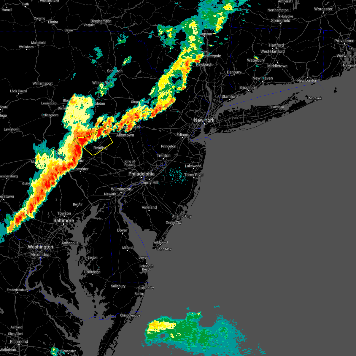 At 1010 pm edt, severe thunderstorms were located along a line extending from near strausstown to near schaefferstown, moving northeast at 40 mph (radar indicated). Hazards include 60 mph wind gusts and quarter size hail. Minor damage to vehicles is possible. Wind damage to roofs, siding, trees, and power lines is possible. At 1010 pm edt, severe thunderstorms were located along a line extending from near strausstown to near schaefferstown, moving northeast at 40 mph (radar indicated). Hazards include 60 mph wind gusts and quarter size hail. Minor damage to vehicles is possible. Wind damage to roofs, siding, trees, and power lines is possible.
|
| 8/13/2021 8:11 PM EDT |
 At 811 pm edt, a severe thunderstorm was located over leechburg, or near vandergrift, moving northeast at 40 mph (radar indicated). Hazards include 60 mph wind gusts. expect damage to trees and power lines, resulting in some power outages At 811 pm edt, a severe thunderstorm was located over leechburg, or near vandergrift, moving northeast at 40 mph (radar indicated). Hazards include 60 mph wind gusts. expect damage to trees and power lines, resulting in some power outages
|
| 8/13/2021 8:05 PM EDT |
 At 805 pm edt, a severe thunderstorm was located 9 miles east of apollo, moving northeast at 35 mph (radar indicated). Hazards include 60 mph wind gusts. Expect damage to trees and power lines, resulting in some power outages. locations impacted include, vandergrift, homer city, apollo, mcchesneytown-loyalhanna, blairsville, derry, leechburg, ligonier, black lick, north apollo, west leechburg, and avonmore. hail threat, radar indicated max hail size, <. 75 in wind threat, radar indicated max wind gust, 60 mph. At 805 pm edt, a severe thunderstorm was located 9 miles east of apollo, moving northeast at 35 mph (radar indicated). Hazards include 60 mph wind gusts. Expect damage to trees and power lines, resulting in some power outages. locations impacted include, vandergrift, homer city, apollo, mcchesneytown-loyalhanna, blairsville, derry, leechburg, ligonier, black lick, north apollo, west leechburg, and avonmore. hail threat, radar indicated max hail size, <. 75 in wind threat, radar indicated max wind gust, 60 mph.
|
| 8/13/2021 7:37 PM EDT |
 At 737 pm edt, a severe thunderstorm was located over murrysville, or near jeannette, moving northeast at 35 mph (radar indicated). Hazards include 60 mph wind gusts. expect damage to trees and power lines, resulting in some power outages At 737 pm edt, a severe thunderstorm was located over murrysville, or near jeannette, moving northeast at 35 mph (radar indicated). Hazards include 60 mph wind gusts. expect damage to trees and power lines, resulting in some power outages
|
| 8/12/2021 6:38 PM EDT |
 At 637 pm edt, severe thunderstorms were located along a line extending from near new bethlehem to near hampton township, moving east at 40 mph (radar indicated). Hazards include 60 mph wind gusts. expect damage to trees and power lines, resulting in some power outages At 637 pm edt, severe thunderstorms were located along a line extending from near new bethlehem to near hampton township, moving east at 40 mph (radar indicated). Hazards include 60 mph wind gusts. expect damage to trees and power lines, resulting in some power outages
|
| 8/12/2021 1:22 PM EDT |
 At 122 pm edt, a severe thunderstorm was located near ford city, or 7 miles northeast of vandergrift, moving southeast at 40 mph (radar indicated). Hazards include 60 mph wind gusts. Expect damage to trees and power lines, resulting in some power outages. locations impacted include, vandergrift, kittanning, apollo, harrison township, ford city, leechburg, sarver, freeport, west kittanning, north apollo, west leechburg, and orchard hills. hail threat, radar indicated max hail size, <. 75 in wind threat, radar indicated max wind gust, 60 mph. At 122 pm edt, a severe thunderstorm was located near ford city, or 7 miles northeast of vandergrift, moving southeast at 40 mph (radar indicated). Hazards include 60 mph wind gusts. Expect damage to trees and power lines, resulting in some power outages. locations impacted include, vandergrift, kittanning, apollo, harrison township, ford city, leechburg, sarver, freeport, west kittanning, north apollo, west leechburg, and orchard hills. hail threat, radar indicated max hail size, <. 75 in wind threat, radar indicated max wind gust, 60 mph.
|
| 8/12/2021 12:56 PM EDT |
 At 1256 pm edt, a severe thunderstorm was located near sarver, or 8 miles southeast of butler, moving southeast at 40 mph (radar indicated). Hazards include 60 mph wind gusts. expect damage to trees and power lines, resulting in some power outages At 1256 pm edt, a severe thunderstorm was located near sarver, or 8 miles southeast of butler, moving southeast at 40 mph (radar indicated). Hazards include 60 mph wind gusts. expect damage to trees and power lines, resulting in some power outages
|
| 8/11/2021 6:16 PM EDT |
 At 616 pm edt, severe thunderstorms were located along a line extending from near lenhartsville to near reading, moving east at 25 mph (radar indicated). Hazards include 60 mph wind gusts and penny size hail. damage to roofs, siding, trees, and power lines is possible At 616 pm edt, severe thunderstorms were located along a line extending from near lenhartsville to near reading, moving east at 25 mph (radar indicated). Hazards include 60 mph wind gusts and penny size hail. damage to roofs, siding, trees, and power lines is possible
|
| 8/11/2021 1:45 PM EDT |
 At 145 pm edt, a severe thunderstorm was located over blairsville, or 9 miles northeast of latrobe, moving southeast at 40 mph (emergency management). Hazards include 60 mph wind gusts. Expect damage to trees and power lines, resulting in some power outages. locations impacted include, penn hills, monroeville, greensburg, jeannette, vandergrift, apollo, plum, west mifflin, murrysville, north versailles, swissvale, and white oak. hail threat, radar indicated max hail size, <. 75 in wind threat, radar indicated max wind gust, 60 mph. At 145 pm edt, a severe thunderstorm was located over blairsville, or 9 miles northeast of latrobe, moving southeast at 40 mph (emergency management). Hazards include 60 mph wind gusts. Expect damage to trees and power lines, resulting in some power outages. locations impacted include, penn hills, monroeville, greensburg, jeannette, vandergrift, apollo, plum, west mifflin, murrysville, north versailles, swissvale, and white oak. hail threat, radar indicated max hail size, <. 75 in wind threat, radar indicated max wind gust, 60 mph.
|
| 8/11/2021 1:17 PM EDT |
 At 116 pm edt, a severe thunderstorm was located near apollo, moving southeast at 40 mph (emergency management). Hazards include 60 mph wind gusts. expect damage to trees and power lines, resulting in some power outages At 116 pm edt, a severe thunderstorm was located near apollo, moving southeast at 40 mph (emergency management). Hazards include 60 mph wind gusts. expect damage to trees and power lines, resulting in some power outages
|
| 8/10/2021 7:04 PM EDT |
 At 704 pm edt, a severe thunderstorm was located over adamstown, or 7 miles southwest of reading, moving east at 25 mph (automated weather station). Hazards include 60 mph wind gusts and penny size hail. Damage to roofs, siding, trees, and power lines is possible. locations impacted include, reading, wyomissing, birdsboro, kutztown, fleetwood, sinking spring, laureldale, womelsdorf, wernersville, robesonia, leesport, honey brook, shoemakersville, elverson, bernville, lyons, new morgan, spring ridge, fairview hgts and glenmoore. this includes the following highways, pennsylvania turnpike between mile markers 296 and 309. interstate 176 in pennsylvania between mile markers 1 and 11. hail threat, radar indicated max hail size, 0. 75 in wind threat, radar indicated max wind gust, 60 mph. At 704 pm edt, a severe thunderstorm was located over adamstown, or 7 miles southwest of reading, moving east at 25 mph (automated weather station). Hazards include 60 mph wind gusts and penny size hail. Damage to roofs, siding, trees, and power lines is possible. locations impacted include, reading, wyomissing, birdsboro, kutztown, fleetwood, sinking spring, laureldale, womelsdorf, wernersville, robesonia, leesport, honey brook, shoemakersville, elverson, bernville, lyons, new morgan, spring ridge, fairview hgts and glenmoore. this includes the following highways, pennsylvania turnpike between mile markers 296 and 309. interstate 176 in pennsylvania between mile markers 1 and 11. hail threat, radar indicated max hail size, 0. 75 in wind threat, radar indicated max wind gust, 60 mph.
|
| 8/10/2021 6:59 PM EDT |
 At 658 pm edt, a severe thunderstorm was located over adamstown, or 7 miles northeast of ephrata, moving east at 25 mph (radar indicated). Hazards include 60 mph wind gusts and penny size hail. Damage to roofs, siding, trees, and power lines is possible. locations impacted include, reading, wyomissing, birdsboro, kutztown, fleetwood, sinking spring, laureldale, womelsdorf, wernersville, robesonia, leesport, honey brook, shoemakersville, elverson, bernville, lyons, new morgan, spring ridge, fairview hgts and glenmoore. this includes the following highways, pennsylvania turnpike between mile markers 296 and 309. interstate 176 in pennsylvania between mile markers 1 and 11. hail threat, radar indicated max hail size, 0. 75 in wind threat, radar indicated max wind gust, 60 mph. At 658 pm edt, a severe thunderstorm was located over adamstown, or 7 miles northeast of ephrata, moving east at 25 mph (radar indicated). Hazards include 60 mph wind gusts and penny size hail. Damage to roofs, siding, trees, and power lines is possible. locations impacted include, reading, wyomissing, birdsboro, kutztown, fleetwood, sinking spring, laureldale, womelsdorf, wernersville, robesonia, leesport, honey brook, shoemakersville, elverson, bernville, lyons, new morgan, spring ridge, fairview hgts and glenmoore. this includes the following highways, pennsylvania turnpike between mile markers 296 and 309. interstate 176 in pennsylvania between mile markers 1 and 11. hail threat, radar indicated max hail size, 0. 75 in wind threat, radar indicated max wind gust, 60 mph.
|
| 8/10/2021 6:36 PM EDT |
 At 636 pm edt, a severe thunderstorm was located over brickerville, or near ephrata, moving east at 25 mph (radar indicated). Hazards include 60 mph wind gusts and penny size hail. damage to roofs, siding, trees, and power lines is possible At 636 pm edt, a severe thunderstorm was located over brickerville, or near ephrata, moving east at 25 mph (radar indicated). Hazards include 60 mph wind gusts and penny size hail. damage to roofs, siding, trees, and power lines is possible
|
| 8/10/2021 4:21 PM EDT |
 At 421 pm edt, severe thunderstorms were located along a line extending from near hometown to claussville to wyomissing, moving east at 30 mph (radar indicated). Hazards include 60 mph wind gusts. Damage to roofs, siding, trees, and power lines is possible. locations impacted include, allentown, reading, lehighton, bethlehem, pottstown, emmaus, wyomissing, northampton, palmerton, birdsboro, kutztown, jim thorpe, slatington, fleetwood, sinking spring, laureldale, nesquehoning, weatherly, wernersville and walnutport. this includes the following highways, pennsylvania turnpike between mile markers 296 and 304. northeast extension between mile markers 48 and 83. interstate 78 in pennsylvania between mile markers 38 and 65. interstate 176 in pennsylvania between mile markers 1 and 11. hail threat, radar indicated max hail size, <. 75 in wind threat, radar indicated max wind gust, 60 mph. At 421 pm edt, severe thunderstorms were located along a line extending from near hometown to claussville to wyomissing, moving east at 30 mph (radar indicated). Hazards include 60 mph wind gusts. Damage to roofs, siding, trees, and power lines is possible. locations impacted include, allentown, reading, lehighton, bethlehem, pottstown, emmaus, wyomissing, northampton, palmerton, birdsboro, kutztown, jim thorpe, slatington, fleetwood, sinking spring, laureldale, nesquehoning, weatherly, wernersville and walnutport. this includes the following highways, pennsylvania turnpike between mile markers 296 and 304. northeast extension between mile markers 48 and 83. interstate 78 in pennsylvania between mile markers 38 and 65. interstate 176 in pennsylvania between mile markers 1 and 11. hail threat, radar indicated max hail size, <. 75 in wind threat, radar indicated max wind gust, 60 mph.
|
| 8/10/2021 4:01 PM EDT |
 At 401 pm edt, severe thunderstorms were located along a line extending from delano to near lenhartsville to near wernersville, moving east at 30 mph (radar indicated). Hazards include 60 mph wind gusts. damage to roofs, siding, trees, and power lines is possible At 401 pm edt, severe thunderstorms were located along a line extending from delano to near lenhartsville to near wernersville, moving east at 30 mph (radar indicated). Hazards include 60 mph wind gusts. damage to roofs, siding, trees, and power lines is possible
|
| 7/21/2021 2:14 PM EDT |
 At 214 pm edt, a group of severe thunderstorms were located over gilbertsville, or 16 miles east of reading, moving east at 40 mph (radar indicated). Hazards include 60 mph wind gusts and quarter size hail. Minor damage to vehicles is possible. Wind damage to roofs, siding, trees, and power lines is possible. At 214 pm edt, a group of severe thunderstorms were located over gilbertsville, or 16 miles east of reading, moving east at 40 mph (radar indicated). Hazards include 60 mph wind gusts and quarter size hail. Minor damage to vehicles is possible. Wind damage to roofs, siding, trees, and power lines is possible.
|
| 7/21/2021 1:51 PM EDT |
 At 150 pm edt, a severe thunderstorm was located over laureldale, or just north of reading, moving southeast at 20 mph (radar indicated). Hazards include 60 mph wind gusts and quarter size hail. Minor damage to vehicles is possible. wind damage to roofs, siding, trees, and power lines is possible. locations impacted include, reading, wyomissing, birdsboro, fleetwood, sinking spring, laureldale, womelsdorf, wernersville, robesonia, leesport, bally, bernville, bechtelsville, strausstown, new morgan, spring ridge, fairview hgts, shillington, west reading and boyertown. this includes the following highways, interstate 78 in pennsylvania between mile markers 12 and 22. Interstate 176 in pennsylvania between mile markers 5 and 11. At 150 pm edt, a severe thunderstorm was located over laureldale, or just north of reading, moving southeast at 20 mph (radar indicated). Hazards include 60 mph wind gusts and quarter size hail. Minor damage to vehicles is possible. wind damage to roofs, siding, trees, and power lines is possible. locations impacted include, reading, wyomissing, birdsboro, fleetwood, sinking spring, laureldale, womelsdorf, wernersville, robesonia, leesport, bally, bernville, bechtelsville, strausstown, new morgan, spring ridge, fairview hgts, shillington, west reading and boyertown. this includes the following highways, interstate 78 in pennsylvania between mile markers 12 and 22. Interstate 176 in pennsylvania between mile markers 5 and 11.
|
| 7/21/2021 1:27 PM EDT |
 At 126 pm edt, a severe thunderstorm was located over fairview hgts, or 9 miles northwest of reading, moving southeast at 20 mph (radar indicated). Hazards include 60 mph wind gusts and quarter size hail. Minor damage to vehicles is possible. Wind damage to roofs, siding, trees, and power lines is possible. At 126 pm edt, a severe thunderstorm was located over fairview hgts, or 9 miles northwest of reading, moving southeast at 20 mph (radar indicated). Hazards include 60 mph wind gusts and quarter size hail. Minor damage to vehicles is possible. Wind damage to roofs, siding, trees, and power lines is possible.
|
| 7/11/2021 10:21 PM EDT |
 At 1020 pm edt, a severe thunderstorm was located over quentin, or over cornwall, moving east at 25 mph (radar indicated). Hazards include 60 mph wind gusts and penny size hail. damage to roofs, siding, trees, and power lines is possible At 1020 pm edt, a severe thunderstorm was located over quentin, or over cornwall, moving east at 25 mph (radar indicated). Hazards include 60 mph wind gusts and penny size hail. damage to roofs, siding, trees, and power lines is possible
|
| 7/7/2021 4:09 PM EDT |
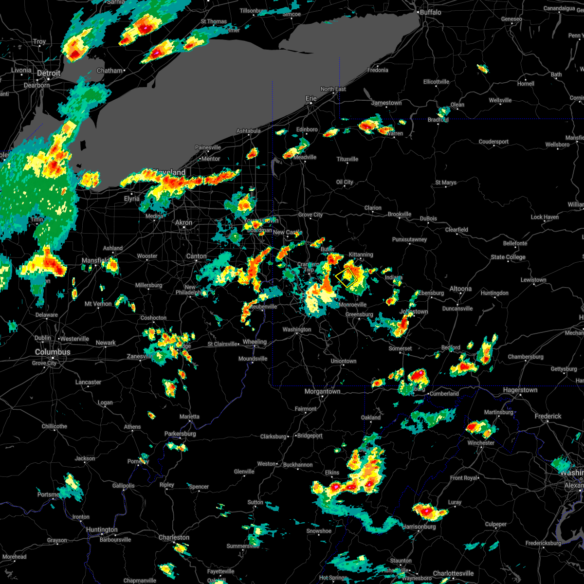 The severe thunderstorm warning for southeastern butler, northeastern allegheny, northwestern westmoreland and southwestern armstrong counties will expire at 415 pm edt, the storm which prompted the warning has weakened below severe limits, and has exited the warned area. therefore, the warning will be allowed to expire. however gusty winds and heavy rain are still possible with this thunderstorm. a severe thunderstorm watch remains in effect until 1100 pm edt for southwestern and west central pennsylvania. The severe thunderstorm warning for southeastern butler, northeastern allegheny, northwestern westmoreland and southwestern armstrong counties will expire at 415 pm edt, the storm which prompted the warning has weakened below severe limits, and has exited the warned area. therefore, the warning will be allowed to expire. however gusty winds and heavy rain are still possible with this thunderstorm. a severe thunderstorm watch remains in effect until 1100 pm edt for southwestern and west central pennsylvania.
|
| 7/7/2021 4:02 PM EDT |
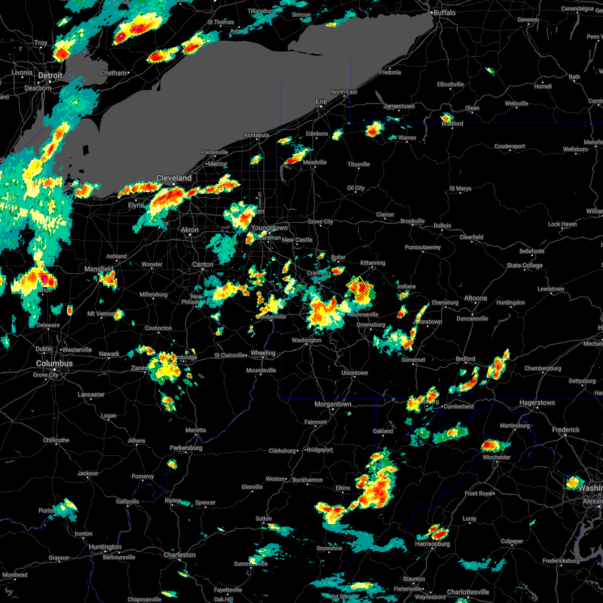 At 402 pm edt, a severe thunderstorm was located over natrona heights, or 8 miles west of vandergrift, moving northwest at 10 mph (radar). Hazards include wind gusts to 60 mph and quarter-size hail. Minor hail damage to vehicles is possible. expect wind damage to trees and power lines, resulting in some power outages. Locations impacted include, lower burrell, harrison township, natrona heights, leechburg, freeport, west leechburg, hyde park,. At 402 pm edt, a severe thunderstorm was located over natrona heights, or 8 miles west of vandergrift, moving northwest at 10 mph (radar). Hazards include wind gusts to 60 mph and quarter-size hail. Minor hail damage to vehicles is possible. expect wind damage to trees and power lines, resulting in some power outages. Locations impacted include, lower burrell, harrison township, natrona heights, leechburg, freeport, west leechburg, hyde park,.
|
| 7/7/2021 3:50 PM EDT |
 At 350 pm edt, a severe thunderstorm was located over natrona heights, or 7 miles west of vandergrift, moving northwest at 10 mph (radar). Hazards include wind gusts to 60 mph and quarter-size hail. Minor hail damage to vehicles is possible. expect wind damage to trees and power lines, resulting in some power outages. Locations impacted include, vandergrift, apollo, new kensington, lower burrell, harrison township, tarentum, natrona heights, brackenridge, leechburg, freeport, north apollo, west leechburg,. At 350 pm edt, a severe thunderstorm was located over natrona heights, or 7 miles west of vandergrift, moving northwest at 10 mph (radar). Hazards include wind gusts to 60 mph and quarter-size hail. Minor hail damage to vehicles is possible. expect wind damage to trees and power lines, resulting in some power outages. Locations impacted include, vandergrift, apollo, new kensington, lower burrell, harrison township, tarentum, natrona heights, brackenridge, leechburg, freeport, north apollo, west leechburg,.
|
| 7/7/2021 3:45 PM EDT |
 At 345 pm edt, a severe thunderstorm was located over lower burrell, or near vandergrift, moving northwest at 10 mph (radar). Hazards include wind gusts to 60 mph and quarter-size hail. Minor hail damage to vehicles is possible. Expect wind damage to trees and power lines, resulting in some power outages. At 345 pm edt, a severe thunderstorm was located over lower burrell, or near vandergrift, moving northwest at 10 mph (radar). Hazards include wind gusts to 60 mph and quarter-size hail. Minor hail damage to vehicles is possible. Expect wind damage to trees and power lines, resulting in some power outages.
|
| 6/21/2021 3:47 PM EDT |
 At 347 pm edt, severe thunderstorms were located along a line extending from near punxsutawney to near delmont, moving east at 55 mph (radar). Hazards include wind gusts to 60 mph. Expect damage to trees and power lines, resulting in some power outages. Locations impacted include, indiana, vandergrift, homer city, apollo, clymer, north apollo, avonmore, orchard hills, rural valley, saltsburg, oklahoma, west lebanon,. At 347 pm edt, severe thunderstorms were located along a line extending from near punxsutawney to near delmont, moving east at 55 mph (radar). Hazards include wind gusts to 60 mph. Expect damage to trees and power lines, resulting in some power outages. Locations impacted include, indiana, vandergrift, homer city, apollo, clymer, north apollo, avonmore, orchard hills, rural valley, saltsburg, oklahoma, west lebanon,.
|
| 6/21/2021 3:37 PM EDT |
 At 337 pm edt, severe thunderstorms were located along a line extending from 9 miles southeast of new bethlehem to near murrysville, moving east at 55 mph (radar). Hazards include wind gusts to 60 mph. expect damage to trees and power lines, resulting in some power outages At 337 pm edt, severe thunderstorms were located along a line extending from 9 miles southeast of new bethlehem to near murrysville, moving east at 55 mph (radar). Hazards include wind gusts to 60 mph. expect damage to trees and power lines, resulting in some power outages
|
| 6/21/2021 3:32 PM EDT |
 At 332 pm edt, severe thunderstorms were located along a line extending from 10 miles south of new bethlehem to murrysville, moving east at 60 mph (radar). Hazards include wind gusts to 60 mph. Expect damage to trees and power lines, resulting in some power outages. locations impacted include, pittsburgh, penn hills, monroeville, vandergrift, kittanning, apollo, plum, west mifflin, murrysville, wilkinsburg, new kensington, lower burrell, this includes the following highways, pennsylvania turnpike between mile markers 45 and 64. Interstate 376 in pennsylvania between mile markers 74 and 84. At 332 pm edt, severe thunderstorms were located along a line extending from 10 miles south of new bethlehem to murrysville, moving east at 60 mph (radar). Hazards include wind gusts to 60 mph. Expect damage to trees and power lines, resulting in some power outages. locations impacted include, pittsburgh, penn hills, monroeville, vandergrift, kittanning, apollo, plum, west mifflin, murrysville, wilkinsburg, new kensington, lower burrell, this includes the following highways, pennsylvania turnpike between mile markers 45 and 64. Interstate 376 in pennsylvania between mile markers 74 and 84.
|
| 6/21/2021 3:21 PM EDT |
 At 321 pm edt, severe thunderstorms were located along a line extending from near kittanning to penn hills, moving east at 60 mph (radar). Hazards include wind gusts to 60 mph. expect damage to trees and power lines, resulting in some power outages At 321 pm edt, severe thunderstorms were located along a line extending from near kittanning to penn hills, moving east at 60 mph (radar). Hazards include wind gusts to 60 mph. expect damage to trees and power lines, resulting in some power outages
|
| 6/4/2021 2:56 PM EDT |
 At 256 pm edt, a severe thunderstorm was located over wyomissing, or over reading, moving east at 25 mph (radar indicated). Hazards include 60 mph wind gusts. Damage to roofs, siding, trees, and power lines is possible. locations impacted include, reading, wyomissing, sinking spring, laureldale, womelsdorf, wernersville, robesonia, bernville, new morgan, fairview hgts, spring ridge, shillington, west reading, mount penn, mohnton, kenhorst, st. lawrence, wyomissing hills, west lawn and lorane. This includes interstate 176 in pennsylvania between mile markers 4 and 11. At 256 pm edt, a severe thunderstorm was located over wyomissing, or over reading, moving east at 25 mph (radar indicated). Hazards include 60 mph wind gusts. Damage to roofs, siding, trees, and power lines is possible. locations impacted include, reading, wyomissing, sinking spring, laureldale, womelsdorf, wernersville, robesonia, bernville, new morgan, fairview hgts, spring ridge, shillington, west reading, mount penn, mohnton, kenhorst, st. lawrence, wyomissing hills, west lawn and lorane. This includes interstate 176 in pennsylvania between mile markers 4 and 11.
|
| 6/4/2021 2:27 PM EDT |
 At 227 pm edt, a severe thunderstorm was located over bernville, or 10 miles northeast of myerstown, moving east at 20 mph (radar indicated). Hazards include 60 mph wind gusts and quarter size hail. Minor damage to vehicles is possible. Wind damage to roofs, siding, trees, and power lines is possible. At 227 pm edt, a severe thunderstorm was located over bernville, or 10 miles northeast of myerstown, moving east at 20 mph (radar indicated). Hazards include 60 mph wind gusts and quarter size hail. Minor damage to vehicles is possible. Wind damage to roofs, siding, trees, and power lines is possible.
|
| 5/26/2021 6:52 PM EDT |
 At 651 pm edt, a severe thunderstorm was located over bernville, or 8 miles east of myerstown, moving east at 40 mph (radar indicated). Hazards include 60 mph wind gusts and quarter size hail. Minor damage to vehicles is possible. Wind damage to roofs, siding, trees, and power lines is possible. At 651 pm edt, a severe thunderstorm was located over bernville, or 8 miles east of myerstown, moving east at 40 mph (radar indicated). Hazards include 60 mph wind gusts and quarter size hail. Minor damage to vehicles is possible. Wind damage to roofs, siding, trees, and power lines is possible.
|
| 5/26/2021 5:00 PM EDT |
 At 459 pm edt, severe thunderstorms were located along a line extending from near allentown to near birdsboro, moving east at 30 mph (radar indicated). Hazards include 70 mph wind gusts. Expect considerable tree damage. damage is likely to mobile homes, roofs, and outbuildings. locations impacted include, allentown, reading, bethlehem, emmaus, wyomissing, birdsboro, kutztown, fleetwood, sinking spring, laureldale, wernersville, topton, lyons, new morgan, spring ridge, coffeetown, ancient oaks, claussville, catasauqua and shillington. this includes the following highways, pennsylvania turnpike between mile markers 296 and 299. northeast extension between mile markers 53 and 61. interstate 78 in pennsylvania between mile markers 42 and 58. Interstate 176 in pennsylvania between mile markers 1 and 11. At 459 pm edt, severe thunderstorms were located along a line extending from near allentown to near birdsboro, moving east at 30 mph (radar indicated). Hazards include 70 mph wind gusts. Expect considerable tree damage. damage is likely to mobile homes, roofs, and outbuildings. locations impacted include, allentown, reading, bethlehem, emmaus, wyomissing, birdsboro, kutztown, fleetwood, sinking spring, laureldale, wernersville, topton, lyons, new morgan, spring ridge, coffeetown, ancient oaks, claussville, catasauqua and shillington. this includes the following highways, pennsylvania turnpike between mile markers 296 and 299. northeast extension between mile markers 53 and 61. interstate 78 in pennsylvania between mile markers 42 and 58. Interstate 176 in pennsylvania between mile markers 1 and 11.
|
| 5/26/2021 4:43 PM EDT |
 At 441 pm edt, severe thunderstorms were located along a line extending from near coffeetown to near new morgan, moving east at 45 mph (radar and trained weather spotters). Hazards include 70 mph wind gusts and penny size hail. Expect considerable tree damage. damage is likely to mobile homes, roofs, and outbuildings. locations impacted include, allentown, reading, bethlehem, emmaus, wyomissing, birdsboro, kutztown, hamburg, fleetwood, sinking spring, laureldale, womelsdorf, wernersville, topton, robesonia, leesport, shoemakersville, bernville, lyons and lenhartsville. this includes the following highways, pennsylvania turnpike between mile markers 296 and 299. northeast extension between mile markers 53 and 61. interstate 78 in pennsylvania between mile markers 24 and 58. Interstate 176 in pennsylvania between mile markers 1 and 11. At 441 pm edt, severe thunderstorms were located along a line extending from near coffeetown to near new morgan, moving east at 45 mph (radar and trained weather spotters). Hazards include 70 mph wind gusts and penny size hail. Expect considerable tree damage. damage is likely to mobile homes, roofs, and outbuildings. locations impacted include, allentown, reading, bethlehem, emmaus, wyomissing, birdsboro, kutztown, hamburg, fleetwood, sinking spring, laureldale, womelsdorf, wernersville, topton, robesonia, leesport, shoemakersville, bernville, lyons and lenhartsville. this includes the following highways, pennsylvania turnpike between mile markers 296 and 299. northeast extension between mile markers 53 and 61. interstate 78 in pennsylvania between mile markers 24 and 58. Interstate 176 in pennsylvania between mile markers 1 and 11.
|
| 5/26/2021 4:10 PM EDT |
 At 409 pm edt, severe thunderstorms were located along a line extending from hamburg to near lawn, moving east at 30 mph (radar indicated). Hazards include 60 mph wind gusts and penny size hail. damage to roofs, siding, trees, and power lines is possible At 409 pm edt, severe thunderstorms were located along a line extending from hamburg to near lawn, moving east at 30 mph (radar indicated). Hazards include 60 mph wind gusts and penny size hail. damage to roofs, siding, trees, and power lines is possible
|
| 11/15/2020 6:29 PM EST |
 At 627 pm est, intense showers and some embedded severe thunderstorms were located along a line extending from near stoddartsville to near weatherly to near shoemakersville to reamstown to near shrewsbury, moving east at 50 mph. this line may contain little or no lightning. do not wait until you hear thunder before taking cover (radar indicated). Hazards include 60 mph wind gusts. Damage to roofs, siding, trees, and power lines is possible. locations impacted include, allentown, reading, easton, lehighton, mount pocono, bethlehem, forks, emmaus, wyomissing, northampton, east stroudsburg, tobyhanna, wilson, hellertown, nazareth, palmerton, bangor, birdsboro, kutztown and jim thorpe. this includes the following highways, pennsylvania turnpike between mile markers 296 and 299. northeast extension between mile markers 46 and 97. interstate 78 in pennsylvania between mile markers 10 and 72. interstate 80 in pennsylvania between mile markers 278 and 314. interstate 380 in pennsylvania between mile markers 0 and 13. Interstate 176 in pennsylvania between mile markers 1 and 11. At 627 pm est, intense showers and some embedded severe thunderstorms were located along a line extending from near stoddartsville to near weatherly to near shoemakersville to reamstown to near shrewsbury, moving east at 50 mph. this line may contain little or no lightning. do not wait until you hear thunder before taking cover (radar indicated). Hazards include 60 mph wind gusts. Damage to roofs, siding, trees, and power lines is possible. locations impacted include, allentown, reading, easton, lehighton, mount pocono, bethlehem, forks, emmaus, wyomissing, northampton, east stroudsburg, tobyhanna, wilson, hellertown, nazareth, palmerton, bangor, birdsboro, kutztown and jim thorpe. this includes the following highways, pennsylvania turnpike between mile markers 296 and 299. northeast extension between mile markers 46 and 97. interstate 78 in pennsylvania between mile markers 10 and 72. interstate 80 in pennsylvania between mile markers 278 and 314. interstate 380 in pennsylvania between mile markers 0 and 13. Interstate 176 in pennsylvania between mile markers 1 and 11.
|
| 11/15/2020 5:57 PM EST |
 At 555 pm est, intense showers and embedded severe thunderstorms were located along a line extending from pond hill to near lickdale to near lawn to near parkville, moving east at 45 mph. this line may contain little or no lightning. do not wait until you hear thunder before taking cover (radar indicated). Hazards include 60 mph wind gusts. damage to roofs, siding, trees, and power lines is possible At 555 pm est, intense showers and embedded severe thunderstorms were located along a line extending from pond hill to near lickdale to near lawn to near parkville, moving east at 45 mph. this line may contain little or no lightning. do not wait until you hear thunder before taking cover (radar indicated). Hazards include 60 mph wind gusts. damage to roofs, siding, trees, and power lines is possible
|
| 11/15/2020 3:02 PM EST |
 At 302 pm est, severe thunderstorms were located along a line extending from near west kittanning to near uniontown, moving east at 65 mph (radar). Hazards include wind gusts to 70 mph. Trees snapped and uprooted. Power outages can be expected. At 302 pm est, severe thunderstorms were located along a line extending from near west kittanning to near uniontown, moving east at 65 mph (radar). Hazards include wind gusts to 70 mph. Trees snapped and uprooted. Power outages can be expected.
|
| 8/28/2020 3:36 PM EDT |
 At 336 pm edt, a severe thunderstorm was located near reading, moving southeast at 25 mph (radar indicated). Hazards include 60 mph wind gusts and quarter size hail. Minor damage to vehicles is possible. Wind damage to roofs, siding, trees, and power lines is possible. At 336 pm edt, a severe thunderstorm was located near reading, moving southeast at 25 mph (radar indicated). Hazards include 60 mph wind gusts and quarter size hail. Minor damage to vehicles is possible. Wind damage to roofs, siding, trees, and power lines is possible.
|
| 8/27/2020 8:26 PM EDT |
 At 826 pm edt, severe thunderstorms were located along a line extending from near beersville to near wyomissing, moving southeast at 50 mph (radar indicated. a wind gust of 58 mph was also recently reported at reading airport). Hazards include 60 mph wind gusts and quarter size hail. Minor damage to vehicles is possible. Wind damage to roofs, siding, trees, and power lines is possible. At 826 pm edt, severe thunderstorms were located along a line extending from near beersville to near wyomissing, moving southeast at 50 mph (radar indicated. a wind gust of 58 mph was also recently reported at reading airport). Hazards include 60 mph wind gusts and quarter size hail. Minor damage to vehicles is possible. Wind damage to roofs, siding, trees, and power lines is possible.
|
| 8/27/2020 8:23 PM EDT |
 The severe thunderstorm warning for central berks, lehigh, southeastern carbon and central northampton counties will expire at 830 pm edt, the storms which prompted the warning have moved out of the area. therefore, the warning will be allowed to expire. The severe thunderstorm warning for central berks, lehigh, southeastern carbon and central northampton counties will expire at 830 pm edt, the storms which prompted the warning have moved out of the area. therefore, the warning will be allowed to expire.
|
| 8/27/2020 8:17 PM EDT |
 At 817 pm edt, severe thunderstorms were located along a line extending from near berlinsville to near lenhartsville, moving east at 50 mph (radar indicated). Hazards include 60 mph wind gusts and penny size hail. Damage to roofs, siding, trees, and power lines is possible. locations impacted include, allentown, reading, lehighton, bethlehem, emmaus, wyomissing, northampton, nazareth, palmerton, kutztown, hamburg, slatington, fleetwood, laureldale, bath, walnutport, topton, leesport, belfast and shoemakersville. this includes the following highways, northeast extension between mile markers 52 and 76. Interstate 78 in pennsylvania between mile markers 30 and 60. At 817 pm edt, severe thunderstorms were located along a line extending from near berlinsville to near lenhartsville, moving east at 50 mph (radar indicated). Hazards include 60 mph wind gusts and penny size hail. Damage to roofs, siding, trees, and power lines is possible. locations impacted include, allentown, reading, lehighton, bethlehem, emmaus, wyomissing, northampton, nazareth, palmerton, kutztown, hamburg, slatington, fleetwood, laureldale, bath, walnutport, topton, leesport, belfast and shoemakersville. this includes the following highways, northeast extension between mile markers 52 and 76. Interstate 78 in pennsylvania between mile markers 30 and 60.
|
| 8/27/2020 7:51 PM EDT |
 At 751 pm edt, severe thunderstorms were located along a line extending from hometown to near friedensburg, moving east at 50 mph (radar indicated). Hazards include 60 mph wind gusts and penny size hail. damage to roofs, siding, trees, and power lines is possible At 751 pm edt, severe thunderstorms were located along a line extending from hometown to near friedensburg, moving east at 50 mph (radar indicated). Hazards include 60 mph wind gusts and penny size hail. damage to roofs, siding, trees, and power lines is possible
|
| 8/27/2020 6:01 PM EDT |
 A severe thunderstorm warning remains in effect until 630 pm edt for indiana. southeastern butler. northeastern allegheny. westmoreland and southern armstrong counties. At 601 pm edt, severe thunderstorms were located along a line extending from 10 miles south of new bethlehem to 9 miles southeast of ford city to near vandergrift to near freeport to harrison. A severe thunderstorm warning remains in effect until 630 pm edt for indiana. southeastern butler. northeastern allegheny. westmoreland and southern armstrong counties. At 601 pm edt, severe thunderstorms were located along a line extending from 10 miles south of new bethlehem to 9 miles southeast of ford city to near vandergrift to near freeport to harrison.
|
| 8/27/2020 5:43 PM EDT |
 At 542 pm edt, severe thunderstorms were located along a line extending from 6 miles southeast of rimersburg to near kittanning to 6 miles west of west kittanning to near meadowood to near oak hills to near evans city, moving southeast at 45 mph (radar). Hazards include wind gusts to 60 mph. Expect damage to trees and power lines, resulting in some power outages. locations impacted include, penn hills, monroeville, greensburg, indiana, jeannette, latrobe, vandergrift, kittanning, homer city, apollo, plum, murrysville, this includes the following highways, interstate 70 in pennsylvania near mile marker 57. pennsylvania turnpike between mile markers 40 and 69, and between mile markers 71 and 79. Interstate 376 in pennsylvania between mile markers 82 and 84. At 542 pm edt, severe thunderstorms were located along a line extending from 6 miles southeast of rimersburg to near kittanning to 6 miles west of west kittanning to near meadowood to near oak hills to near evans city, moving southeast at 45 mph (radar). Hazards include wind gusts to 60 mph. Expect damage to trees and power lines, resulting in some power outages. locations impacted include, penn hills, monroeville, greensburg, indiana, jeannette, latrobe, vandergrift, kittanning, homer city, apollo, plum, murrysville, this includes the following highways, interstate 70 in pennsylvania near mile marker 57. pennsylvania turnpike between mile markers 40 and 69, and between mile markers 71 and 79. Interstate 376 in pennsylvania between mile markers 82 and 84.
|
| 8/27/2020 5:26 PM EDT |
 At 525 pm edt, severe thunderstorms were located along a line extending from near rimersburg to 8 miles northwest of kittanning to 7 miles east of butler to shanor-northvue to meridian to 6 miles west of homeacre-lyndora to near zelienople, moving southeast at 45 mph (radar). Hazards include wind gusts to 60 mph. expect damage to trees and power lines, resulting in some power outages At 525 pm edt, severe thunderstorms were located along a line extending from near rimersburg to 8 miles northwest of kittanning to 7 miles east of butler to shanor-northvue to meridian to 6 miles west of homeacre-lyndora to near zelienople, moving southeast at 45 mph (radar). Hazards include wind gusts to 60 mph. expect damage to trees and power lines, resulting in some power outages
|
| 8/25/2020 2:56 PM EDT |
 The severe thunderstorm warning for central indiana, southeastern butler, northeastern allegheny, northwestern westmoreland and southern armstrong counties will expire at 300 pm edt, the storms which prompted the warning have moved out of the area. therefore, the warning will be allowed to expire. however gusty winds are still possible with these thunderstorms. a severe thunderstorm watch remains in effect until 900 pm edt for southwestern and west central pennsylvania. remember, a severe thunderstorm warning still remains in effect for southern armstrong, southern indiana, and westmoreland county until 3:15 pm. The severe thunderstorm warning for central indiana, southeastern butler, northeastern allegheny, northwestern westmoreland and southern armstrong counties will expire at 300 pm edt, the storms which prompted the warning have moved out of the area. therefore, the warning will be allowed to expire. however gusty winds are still possible with these thunderstorms. a severe thunderstorm watch remains in effect until 900 pm edt for southwestern and west central pennsylvania. remember, a severe thunderstorm warning still remains in effect for southern armstrong, southern indiana, and westmoreland county until 3:15 pm.
|
| 8/25/2020 2:37 PM EDT |
 At 236 pm edt, severe thunderstorms were located along a line extending from near belsano to penn hills, moving southeast at 40 mph (radar). Hazards include wind gusts to 60 mph and quarter-size hail. Minor hail damage to vehicles is possible. expect wind damage to trees and power lines, resulting in some power outages. Locations impacted include, penn hills, indiana, vandergrift, apollo, shaler township, plum, murrysville, hampton township, new kensington, lower burrell, harrison township, o`hara township, this includes pennsylvania turnpike between mile markers 40 and 52. At 236 pm edt, severe thunderstorms were located along a line extending from near belsano to penn hills, moving southeast at 40 mph (radar). Hazards include wind gusts to 60 mph and quarter-size hail. Minor hail damage to vehicles is possible. expect wind damage to trees and power lines, resulting in some power outages. Locations impacted include, penn hills, indiana, vandergrift, apollo, shaler township, plum, murrysville, hampton township, new kensington, lower burrell, harrison township, o`hara township, this includes pennsylvania turnpike between mile markers 40 and 52.
|
| 8/25/2020 2:09 PM EDT |
 At 209 pm edt, severe thunderstorms were located along a line extending from 8 miles north of indiana to mars, moving southeast at 40 mph (radar). Hazards include wind gusts to 60 mph and quarter-size hail. Minor hail damage to vehicles is possible. Expect wind damage to trees and power lines, resulting in some power outages. At 209 pm edt, severe thunderstorms were located along a line extending from 8 miles north of indiana to mars, moving southeast at 40 mph (radar). Hazards include wind gusts to 60 mph and quarter-size hail. Minor hail damage to vehicles is possible. Expect wind damage to trees and power lines, resulting in some power outages.
|
| 8/25/2020 6:55 AM EDT |
 The severe thunderstorm warning for southeastern butler, northeastern allegheny, north central westmoreland and southwestern armstrong counties will expire at 700 am edt, the storm which prompted the warning has weakened and the warning will be allowed to expire. The severe thunderstorm warning for southeastern butler, northeastern allegheny, north central westmoreland and southwestern armstrong counties will expire at 700 am edt, the storm which prompted the warning has weakened and the warning will be allowed to expire.
|
| 8/25/2020 6:50 AM EDT |
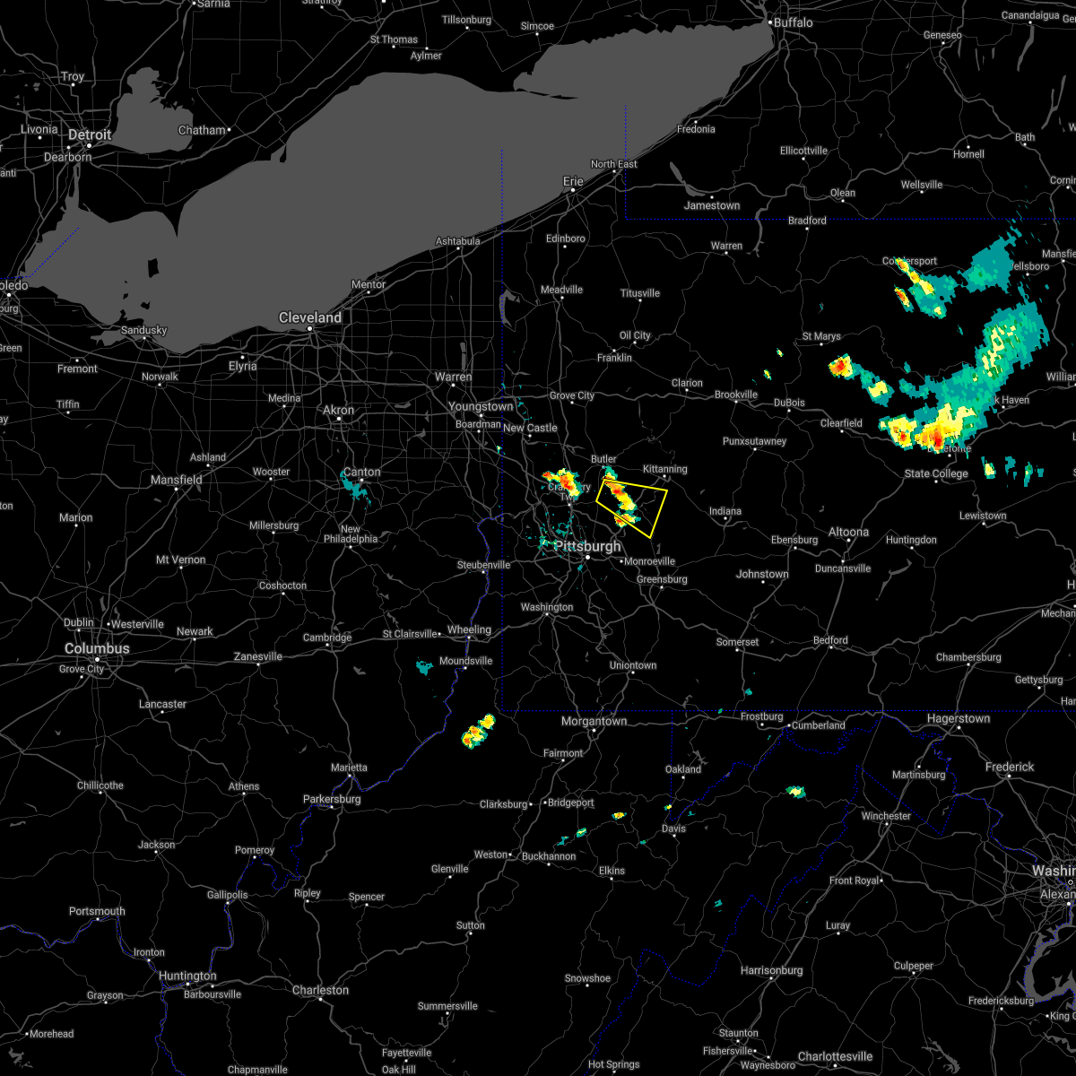 At 649 am edt, a severe thunderstorm was located near sarver, or 10 miles southeast of butler, moving east at 25 mph (radar). Hazards include quarter-size hail. Minor damage to vehicles is possible. Locations impacted include, vandergrift, lower burrell, harrison township, tarentum, natrona heights, brackenridge, leechburg, sarver, freeport, saxonburg, west leechburg, curtisville,. At 649 am edt, a severe thunderstorm was located near sarver, or 10 miles southeast of butler, moving east at 25 mph (radar). Hazards include quarter-size hail. Minor damage to vehicles is possible. Locations impacted include, vandergrift, lower burrell, harrison township, tarentum, natrona heights, brackenridge, leechburg, sarver, freeport, saxonburg, west leechburg, curtisville,.
|
| 8/25/2020 6:41 AM EDT |
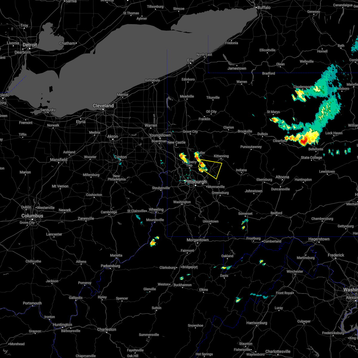 At 641 am edt, a severe thunderstorm was located near sarver, or 8 miles south of butler, moving east at 25 mph (radar). Hazards include wind gusts to 60 mph and quarter-size hail. Minor hail damage to vehicles is possible. Expect wind damage to trees and power lines, resulting in some power outages. At 641 am edt, a severe thunderstorm was located near sarver, or 8 miles south of butler, moving east at 25 mph (radar). Hazards include wind gusts to 60 mph and quarter-size hail. Minor hail damage to vehicles is possible. Expect wind damage to trees and power lines, resulting in some power outages.
|
| 8/2/2020 6:30 AM EDT |
 At 629 am edt, a severe thunderstorm was located over fleetwood, or 7 miles northeast of reading, moving northeast at 20 mph (radar indicated). Hazards include 60 mph wind gusts. damage to roofs, siding, trees, and power lines is possible At 629 am edt, a severe thunderstorm was located over fleetwood, or 7 miles northeast of reading, moving northeast at 20 mph (radar indicated). Hazards include 60 mph wind gusts. damage to roofs, siding, trees, and power lines is possible
|
| 7/30/2020 11:51 PM EDT |
 At 1151 pm edt, severe thunderstorms were located along a line extending from lebanon to near birdsboro, moving northeast at 45 mph (radar indicated). Hazards include 60 mph wind gusts. damage to roofs, siding, trees, and power lines is possible At 1151 pm edt, severe thunderstorms were located along a line extending from lebanon to near birdsboro, moving northeast at 45 mph (radar indicated). Hazards include 60 mph wind gusts. damage to roofs, siding, trees, and power lines is possible
|
| 7/22/2020 4:38 PM EDT |
 At 424 pm edt, a severe thunderstorm was located over wyomissing, or near reading, moving east at 40 mph (radar indicated). Hazards include 60 mph wind gusts and nickel size hail. damage to roofs, siding, trees, and power lines is possible At 424 pm edt, a severe thunderstorm was located over wyomissing, or near reading, moving east at 40 mph (radar indicated). Hazards include 60 mph wind gusts and nickel size hail. damage to roofs, siding, trees, and power lines is possible
|
| 7/22/2020 4:25 PM EDT |
 At 424 pm edt, a severe thunderstorm was located over wyomissing, or near reading, moving east at 40 mph (radar indicated). Hazards include 60 mph wind gusts and nickel size hail. damage to roofs, siding, trees, and power lines is possible At 424 pm edt, a severe thunderstorm was located over wyomissing, or near reading, moving east at 40 mph (radar indicated). Hazards include 60 mph wind gusts and nickel size hail. damage to roofs, siding, trees, and power lines is possible
|
| 7/16/2020 3:47 PM EDT |
 At 346 pm edt, a severe thunderstorm was located near gibsonia, or 8 miles northeast of mccandless township, moving northeast at 30 mph (radar). Hazards include wind gusts to 60 mph. expect damage to trees and power lines, resulting in some power outages At 346 pm edt, a severe thunderstorm was located near gibsonia, or 8 miles northeast of mccandless township, moving northeast at 30 mph (radar). Hazards include wind gusts to 60 mph. expect damage to trees and power lines, resulting in some power outages
|
| 7/10/2020 7:11 PM EDT |
 The severe thunderstorm warning for northeastern beaver, southeastern lawrence, southwestern indiana, butler, northeastern allegheny, westmoreland, armstrong, southwestern clarion and northeastern fayette counties will expire at 715 pm edt, the storms which prompted the warning have weakened below severe limits, and no longer pose an immediate threat to life or property. therefore, the warning will be allowed to expire. however gusty winds and heavy rain are still possible with these thunderstorms. The severe thunderstorm warning for northeastern beaver, southeastern lawrence, southwestern indiana, butler, northeastern allegheny, westmoreland, armstrong, southwestern clarion and northeastern fayette counties will expire at 715 pm edt, the storms which prompted the warning have weakened below severe limits, and no longer pose an immediate threat to life or property. therefore, the warning will be allowed to expire. however gusty winds and heavy rain are still possible with these thunderstorms.
|
| 7/10/2020 7:04 PM EDT |
 At 702 pm edt, severe thunderstorms were located along a line extending from 6 miles north of zelienople to arnold to jeannette to south connellsville, moving east at 30 mph (trained weather spotters). Hazards include wind gusts to 60 mph. Expect damage to trees and power lines, resulting in some power outages. locations impacted include, penn hills, monroeville, greensburg, butler, jeannette, latrobe, connellsville, vandergrift, kittanning, apollo, rimersburg, plum, this includes the following highways, interstate 70 in pennsylvania between mile markers 51 and 57. pennsylvania turnpike between mile markers 41 and 99. interstate 79 in pennsylvania between mile markers 89 and 104. Interstate 376 in pennsylvania between mile markers 83 and 84. At 702 pm edt, severe thunderstorms were located along a line extending from 6 miles north of zelienople to arnold to jeannette to south connellsville, moving east at 30 mph (trained weather spotters). Hazards include wind gusts to 60 mph. Expect damage to trees and power lines, resulting in some power outages. locations impacted include, penn hills, monroeville, greensburg, butler, jeannette, latrobe, connellsville, vandergrift, kittanning, apollo, rimersburg, plum, this includes the following highways, interstate 70 in pennsylvania between mile markers 51 and 57. pennsylvania turnpike between mile markers 41 and 99. interstate 79 in pennsylvania between mile markers 89 and 104. Interstate 376 in pennsylvania between mile markers 83 and 84.
|
| 7/10/2020 6:41 PM EDT |
 At 640 pm edt, severe thunderstorms were located along a line extending from near ellwood city to etna to near white oak to near uniontown, moving east at 20 mph. several trees and power lines have been reported down with this line of thunderstorms (trained weather spotters). Hazards include wind gusts to 60 mph. Expect damage to trees and power lines, resulting in some power outages. locations impacted include, pittsburgh, penn hills, mount lebanon, bethel park, ross township, mccandless township, monroeville, cranberry, greensburg, mckeesport, butler, franklin park, this includes the following highways, interstate 70 in pennsylvania between mile markers 39 and 57. pennsylvania turnpike between mile markers 21 and 99. interstate 79 in pennsylvania between mile markers 70 and 104. Interstate 376 in pennsylvania between mile markers 67 and 84. At 640 pm edt, severe thunderstorms were located along a line extending from near ellwood city to etna to near white oak to near uniontown, moving east at 20 mph. several trees and power lines have been reported down with this line of thunderstorms (trained weather spotters). Hazards include wind gusts to 60 mph. Expect damage to trees and power lines, resulting in some power outages. locations impacted include, pittsburgh, penn hills, mount lebanon, bethel park, ross township, mccandless township, monroeville, cranberry, greensburg, mckeesport, butler, franklin park, this includes the following highways, interstate 70 in pennsylvania between mile markers 39 and 57. pennsylvania turnpike between mile markers 21 and 99. interstate 79 in pennsylvania between mile markers 70 and 104. Interstate 376 in pennsylvania between mile markers 67 and 84.
|
| 7/10/2020 6:30 PM EDT |
 At 629 pm edt, severe thunderstorms were located along a line extending from near ellwood city to millvale to near liberty to near uniontown, moving east at 20 mph (radar). Hazards include wind gusts to 60 mph. expect damage to trees and power lines, resulting in some power outages At 629 pm edt, severe thunderstorms were located along a line extending from near ellwood city to millvale to near liberty to near uniontown, moving east at 20 mph (radar). Hazards include wind gusts to 60 mph. expect damage to trees and power lines, resulting in some power outages
|
| 7/6/2020 6:18 PM EDT |
 At 618 pm edt, a severe thunderstorm was located over sinking spring, or near reading, moving southeast at 25 mph (radar indicated). Hazards include 60 mph wind gusts and half dollar size hail. Minor damage to vehicles is possible. Wind damage to roofs, siding, trees, and power lines is possible. At 618 pm edt, a severe thunderstorm was located over sinking spring, or near reading, moving southeast at 25 mph (radar indicated). Hazards include 60 mph wind gusts and half dollar size hail. Minor damage to vehicles is possible. Wind damage to roofs, siding, trees, and power lines is possible.
|
| 7/3/2020 7:21 PM EDT |
 The severe thunderstorm warning for central berks county will expire at 730 pm edt, the storm which prompted the warning has weakened below severe limits, and no longer poses an immediate threat to life or property. therefore, the warning will be allowed to expire. however gusty winds are still possible with this thunderstorm. The severe thunderstorm warning for central berks county will expire at 730 pm edt, the storm which prompted the warning has weakened below severe limits, and no longer poses an immediate threat to life or property. therefore, the warning will be allowed to expire. however gusty winds are still possible with this thunderstorm.
|
| 7/3/2020 7:07 PM EDT |
 At 706 pm edt, a severe thunderstorm was located over robesonia, or 9 miles east of myerstown, moving southeast at 25 mph (radar indicated). Hazards include 60 mph wind gusts and penny size hail. Damage to roofs, siding, trees, and power lines is possible. law enforcement is reporting some trees and wires down in western berks county. locations impacted include, reading, wyomissing, sinking spring, laureldale, womelsdorf, wernersville, robesonia, bernville, strausstown, fairview hgts, spring ridge, shillington, west reading, mount penn, mohnton, kenhorst, st. lawrence, wyomissing hills, west lawn and lorane. this includes the following highways, interstate 78 in pennsylvania between mile markers 10 and 24. Interstate 176 in pennsylvania between mile markers 5 and 11. At 706 pm edt, a severe thunderstorm was located over robesonia, or 9 miles east of myerstown, moving southeast at 25 mph (radar indicated). Hazards include 60 mph wind gusts and penny size hail. Damage to roofs, siding, trees, and power lines is possible. law enforcement is reporting some trees and wires down in western berks county. locations impacted include, reading, wyomissing, sinking spring, laureldale, womelsdorf, wernersville, robesonia, bernville, strausstown, fairview hgts, spring ridge, shillington, west reading, mount penn, mohnton, kenhorst, st. lawrence, wyomissing hills, west lawn and lorane. this includes the following highways, interstate 78 in pennsylvania between mile markers 10 and 24. Interstate 176 in pennsylvania between mile markers 5 and 11.
|
| 7/3/2020 6:49 PM EDT |
 At 649 pm edt, a severe thunderstorm was located over strausstown, or 7 miles northeast of myerstown, moving southeast at 30 mph (radar indicated). Hazards include 60 mph wind gusts and penny size hail. damage to roofs, siding, trees, and power lines is possible At 649 pm edt, a severe thunderstorm was located over strausstown, or 7 miles northeast of myerstown, moving southeast at 30 mph (radar indicated). Hazards include 60 mph wind gusts and penny size hail. damage to roofs, siding, trees, and power lines is possible
|
| 6/4/2020 7:02 PM EDT |
 At 702 pm edt, a severe thunderstorm was located over lyons, or 14 miles northeast of reading, moving east at 30 mph (radar indicated). Hazards include 60 mph wind gusts. Damage to roofs, siding, trees, and power lines is possible. locations impacted include, allentown, bethlehem, emmaus, northampton, quakertown, kutztown, fleetwood, laureldale, east greenville, topton, bally, bechtelsville, lyons, lenhartsville, coffeetown, zionsville, ancient oaks, claussville, geryville and catasauqua. this includes the following highways, interstate 78 in pennsylvania between mile markers 33 and 63. Northeast extension between exits a44 and a56. At 702 pm edt, a severe thunderstorm was located over lyons, or 14 miles northeast of reading, moving east at 30 mph (radar indicated). Hazards include 60 mph wind gusts. Damage to roofs, siding, trees, and power lines is possible. locations impacted include, allentown, bethlehem, emmaus, northampton, quakertown, kutztown, fleetwood, laureldale, east greenville, topton, bally, bechtelsville, lyons, lenhartsville, coffeetown, zionsville, ancient oaks, claussville, geryville and catasauqua. this includes the following highways, interstate 78 in pennsylvania between mile markers 33 and 63. Northeast extension between exits a44 and a56.
|
| 6/4/2020 6:42 PM EDT |
 At 641 pm edt, a severe thunderstorm was located over leesport, or 7 miles north of reading, moving east at 30 mph (radar indicated). Hazards include 60 mph wind gusts and penny size hail. damage to roofs, siding, trees, and power lines is possible At 641 pm edt, a severe thunderstorm was located over leesport, or 7 miles north of reading, moving east at 30 mph (radar indicated). Hazards include 60 mph wind gusts and penny size hail. damage to roofs, siding, trees, and power lines is possible
|
| 6/4/2020 6:24 PM EDT |
 At 623 pm edt, a severe thunderstorm was located over bernville, or 11 miles northwest of reading, moving east at 30 mph (radar indicated. utility company reported downed wires near strausstown). Hazards include 60 mph wind gusts and quarter size hail. Minor damage to vehicles is possible. wind damage to roofs, siding, trees, and power lines is possible. locations impacted include, reading, wyomissing, hamburg, sinking spring, laureldale, womelsdorf, wernersville, robesonia, leesport, shoemakersville, bernville, strausstown, lenhartsville, spring ridge, fairview hgts, shillington, west reading, mount penn, mohnton and kenhorst. this includes the following highways, interstate 78 in pennsylvania between mile markers 13 and 37. Interstate 176 in pennsylvania between mile markers 7 and 11. At 623 pm edt, a severe thunderstorm was located over bernville, or 11 miles northwest of reading, moving east at 30 mph (radar indicated. utility company reported downed wires near strausstown). Hazards include 60 mph wind gusts and quarter size hail. Minor damage to vehicles is possible. wind damage to roofs, siding, trees, and power lines is possible. locations impacted include, reading, wyomissing, hamburg, sinking spring, laureldale, womelsdorf, wernersville, robesonia, leesport, shoemakersville, bernville, strausstown, lenhartsville, spring ridge, fairview hgts, shillington, west reading, mount penn, mohnton and kenhorst. this includes the following highways, interstate 78 in pennsylvania between mile markers 13 and 37. Interstate 176 in pennsylvania between mile markers 7 and 11.
|
| 6/4/2020 6:01 PM EDT |
 At 600 pm edt, a severe thunderstorm was located over myerstown, moving east at 30 mph. another potentially severe thunderstorm was located near strausstown (radar indicated). Hazards include 60 mph wind gusts and quarter size hail. Minor damage to vehicles is possible. wind damage to roofs, siding, trees, and power lines is possible. locations impacted include, reading, wyomissing, hamburg, sinking spring, laureldale, womelsdorf, wernersville, robesonia, leesport, shoemakersville, bernville, strausstown, lenhartsville, spring ridge, fairview hgts, shillington, west reading, mount penn, mohnton and kenhorst. this includes the following highways, interstate 78 in pennsylvania between mile markers 10 and 37. Interstate 176 in pennsylvania between mile markers 7 and 11. At 600 pm edt, a severe thunderstorm was located over myerstown, moving east at 30 mph. another potentially severe thunderstorm was located near strausstown (radar indicated). Hazards include 60 mph wind gusts and quarter size hail. Minor damage to vehicles is possible. wind damage to roofs, siding, trees, and power lines is possible. locations impacted include, reading, wyomissing, hamburg, sinking spring, laureldale, womelsdorf, wernersville, robesonia, leesport, shoemakersville, bernville, strausstown, lenhartsville, spring ridge, fairview hgts, shillington, west reading, mount penn, mohnton and kenhorst. this includes the following highways, interstate 78 in pennsylvania between mile markers 10 and 37. Interstate 176 in pennsylvania between mile markers 7 and 11.
|
| 6/4/2020 5:55 PM EDT |
 The severe thunderstorm warning for eastern washington, indiana, southeastern allegheny, westmoreland, southern armstrong and northeastern fayette counties will expire at 600 pm edt, the storms which prompted the warning have weakened below severe limits, and no longer pose an immediate threat to life or property. therefore, the warning will be allowed to expire. however gusty winds and heavy rain are still possible with these thunderstorms. a severe thunderstorm watch remains in effect until 800 pm edt for southwestern and west central pennsylvania. The severe thunderstorm warning for eastern washington, indiana, southeastern allegheny, westmoreland, southern armstrong and northeastern fayette counties will expire at 600 pm edt, the storms which prompted the warning have weakened below severe limits, and no longer pose an immediate threat to life or property. therefore, the warning will be allowed to expire. however gusty winds and heavy rain are still possible with these thunderstorms. a severe thunderstorm watch remains in effect until 800 pm edt for southwestern and west central pennsylvania.
|
| 6/4/2020 5:48 PM EDT |
 At 547 pm edt, severe thunderstorms were located along a line extending from near leechburg to near delmont to near perryopolis, moving east at 30 mph (radar). Hazards include wind gusts to 60 mph. Expect damage to trees and power lines, resulting in some power outages. locations impacted include, greensburg, indiana, jeannette, latrobe, connellsville, vandergrift, homer city, apollo, murrysville, monessen, donora, mount pleasant, this includes the following highways, interstate 70 in pennsylvania between mile markers 42 and 57. Pennsylvania turnpike between mile markers 62 and 99. At 547 pm edt, severe thunderstorms were located along a line extending from near leechburg to near delmont to near perryopolis, moving east at 30 mph (radar). Hazards include wind gusts to 60 mph. Expect damage to trees and power lines, resulting in some power outages. locations impacted include, greensburg, indiana, jeannette, latrobe, connellsville, vandergrift, homer city, apollo, murrysville, monessen, donora, mount pleasant, this includes the following highways, interstate 70 in pennsylvania between mile markers 42 and 57. Pennsylvania turnpike between mile markers 62 and 99.
|
| 6/4/2020 5:39 PM EDT |
 At 538 pm edt, a severe thunderstorm was located over harper tavern, or near annville, moving east at 30 mph (radar indicated). Hazards include 60 mph wind gusts and quarter size hail. Minor damage to vehicles is possible. Wind damage to roofs, siding, trees, and power lines is possible. At 538 pm edt, a severe thunderstorm was located over harper tavern, or near annville, moving east at 30 mph (radar indicated). Hazards include 60 mph wind gusts and quarter size hail. Minor damage to vehicles is possible. Wind damage to roofs, siding, trees, and power lines is possible.
|
| 6/4/2020 5:14 PM EDT |
 At 514 pm edt, severe thunderstorms were located along a line extending from near mars to etna to near east washington, moving east at 30 mph (radar). Hazards include wind gusts to 60 mph. Expect damage to trees and power lines, resulting in some power outages. locations impacted include, pittsburgh, penn hills, mount lebanon, bethel park, monroeville, mcmurray, greensburg, mckeesport, indiana, jeannette, latrobe, connellsville, this includes the following highways, interstate 70 in pennsylvania between mile markers 20 and 57. pennsylvania turnpike between mile markers 41 and 99. interstate 79 in pennsylvania between mile markers 29 and 35. Interstate 376 in pennsylvania between mile markers 73 and 84. At 514 pm edt, severe thunderstorms were located along a line extending from near mars to etna to near east washington, moving east at 30 mph (radar). Hazards include wind gusts to 60 mph. Expect damage to trees and power lines, resulting in some power outages. locations impacted include, pittsburgh, penn hills, mount lebanon, bethel park, monroeville, mcmurray, greensburg, mckeesport, indiana, jeannette, latrobe, connellsville, this includes the following highways, interstate 70 in pennsylvania between mile markers 20 and 57. pennsylvania turnpike between mile markers 41 and 99. interstate 79 in pennsylvania between mile markers 29 and 35. Interstate 376 in pennsylvania between mile markers 73 and 84.
|
| 6/4/2020 4:43 PM EDT |
 At 442 pm edt, severe thunderstorms were located along a line extending from near rochester to moon township to 6 miles west of wolfdale, moving east at 30 mph (radar). Hazards include wind gusts to 60 mph. expect damage to trees and power lines, resulting in some power outages At 442 pm edt, severe thunderstorms were located along a line extending from near rochester to moon township to 6 miles west of wolfdale, moving east at 30 mph (radar). Hazards include wind gusts to 60 mph. expect damage to trees and power lines, resulting in some power outages
|
| 6/3/2020 6:12 PM EDT |
 At 611 pm edt, a severe thunderstorm was located over womelsdorf, or near myerstown, moving southeast at 45 mph (radar indicated). Hazards include 70 mph wind gusts and quarter size hail. Minor damage to vehicles is possible. expect considerable tree damage. wind damage is also likely to mobile homes, roofs, and outbuildings. locations impacted include, reading, wyomissing, birdsboro, sinking spring, womelsdorf, wernersville, robesonia, bernville, strausstown, new morgan, spring ridge, shillington, west reading, mount penn, mohnton, kenhorst, st. lawrence, wyomissing hills, west lawn and lorane. this includes the following highways, interstate 78 in pennsylvania between mile markers 13 and 19. Interstate 176 in pennsylvania between mile markers 2 and 11. At 611 pm edt, a severe thunderstorm was located over womelsdorf, or near myerstown, moving southeast at 45 mph (radar indicated). Hazards include 70 mph wind gusts and quarter size hail. Minor damage to vehicles is possible. expect considerable tree damage. wind damage is also likely to mobile homes, roofs, and outbuildings. locations impacted include, reading, wyomissing, birdsboro, sinking spring, womelsdorf, wernersville, robesonia, bernville, strausstown, new morgan, spring ridge, shillington, west reading, mount penn, mohnton, kenhorst, st. lawrence, wyomissing hills, west lawn and lorane. this includes the following highways, interstate 78 in pennsylvania between mile markers 13 and 19. Interstate 176 in pennsylvania between mile markers 2 and 11.
|
| 6/3/2020 5:46 PM EDT |
 At 545 pm edt, a severe thunderstorm was located near fort indiantown gap, or 13 miles north of annville, moving southeast at 50 mph (radar indicated). Hazards include 70 mph wind gusts and quarter size hail. Minor damage to vehicles is possible. expect considerable tree damage. Wind damage is also likely to mobile homes, roofs, and outbuildings. At 545 pm edt, a severe thunderstorm was located near fort indiantown gap, or 13 miles north of annville, moving southeast at 50 mph (radar indicated). Hazards include 70 mph wind gusts and quarter size hail. Minor damage to vehicles is possible. expect considerable tree damage. Wind damage is also likely to mobile homes, roofs, and outbuildings.
|
| 6/3/2020 11:40 AM EDT |
 The severe thunderstorm warning for northwestern hunterdon, southwestern warren, berks, lehigh, northwestern montgomery, southern carbon, northwestern bucks and northampton counties will expire at 1145 am edt, the storms which prompted the warning have moved out of the area. therefore, the warning will be allowed to expire. a new warning has been issued for portions of the area. a severe thunderstorm watch remains in effect until 300 pm edt for northwestern new jersey, and eastern, southeastern and northeastern pennsylvania. The severe thunderstorm warning for northwestern hunterdon, southwestern warren, berks, lehigh, northwestern montgomery, southern carbon, northwestern bucks and northampton counties will expire at 1145 am edt, the storms which prompted the warning have moved out of the area. therefore, the warning will be allowed to expire. a new warning has been issued for portions of the area. a severe thunderstorm watch remains in effect until 300 pm edt for northwestern new jersey, and eastern, southeastern and northeastern pennsylvania.
|
| 6/3/2020 11:38 AM EDT |
 At 1137 am edt, severe thunderstorms were located along a line extending from ancient oaks to fleetwood to near kleinfeltersville, moving east at 75 mph. these are very dangerous storms (radar indicated). Hazards include 80 mph wind gusts and penny size hail. a wind gust of 83 mph was recently measured at reading airport. Flying debris will be dangerous to those caught without shelter. mobile homes will be heavily damaged. expect considerable damage to roofs, windows, and vehicles. Extensive tree damage and power outages are likely. At 1137 am edt, severe thunderstorms were located along a line extending from ancient oaks to fleetwood to near kleinfeltersville, moving east at 75 mph. these are very dangerous storms (radar indicated). Hazards include 80 mph wind gusts and penny size hail. a wind gust of 83 mph was recently measured at reading airport. Flying debris will be dangerous to those caught without shelter. mobile homes will be heavily damaged. expect considerable damage to roofs, windows, and vehicles. Extensive tree damage and power outages are likely.
|
| 6/3/2020 11:23 AM EDT |
 At 1122 am edt, severe thunderstorms were located along a line extending from jim thorpe to lenhartsville to near bernville, moving east at 75 mph (radar indicated). Hazards include 60 mph wind gusts and penny size hail. Damage to roofs, siding, trees, and power lines is possible. locations impacted include, allentown, reading, easton, lehighton, bethlehem, pottstown, forks, emmaus, wyomissing, northampton, quakertown, perkasie, wilson, souderton, bedminster, washington, hellertown, nazareth, palmerton and birdsboro. this includes the following highways, interstate 78 in new jersey between mile markers 0 and 12. interstate 78 in pennsylvania between mile markers 10 and 76. northeast extension between exits a44 and a56. Interstate 176 in pennsylvania between mile markers 10 and 11. At 1122 am edt, severe thunderstorms were located along a line extending from jim thorpe to lenhartsville to near bernville, moving east at 75 mph (radar indicated). Hazards include 60 mph wind gusts and penny size hail. Damage to roofs, siding, trees, and power lines is possible. locations impacted include, allentown, reading, easton, lehighton, bethlehem, pottstown, forks, emmaus, wyomissing, northampton, quakertown, perkasie, wilson, souderton, bedminster, washington, hellertown, nazareth, palmerton and birdsboro. this includes the following highways, interstate 78 in new jersey between mile markers 0 and 12. interstate 78 in pennsylvania between mile markers 10 and 76. northeast extension between exits a44 and a56. Interstate 176 in pennsylvania between mile markers 10 and 11.
|
| 6/3/2020 11:04 AM EDT |
 At 1103 am edt, severe thunderstorms were located along a line extending from nuremburg to near friedensburg to fort indiantown gap, moving east at 75 mph (radar indicated). Hazards include 60 mph wind gusts and penny size hail. damage to roofs, siding, trees, and power lines is possible At 1103 am edt, severe thunderstorms were located along a line extending from nuremburg to near friedensburg to fort indiantown gap, moving east at 75 mph (radar indicated). Hazards include 60 mph wind gusts and penny size hail. damage to roofs, siding, trees, and power lines is possible
|
| 5/29/2020 5:03 PM EDT |
 At 503 pm edt, a severe thunderstorm was located near reading, moving east at 35 mph (radar indicated). Hazards include 60 mph wind gusts and quarter size hail. Minor damage to vehicles is possible. Wind damage to roofs, siding, trees, and power lines is possible. At 503 pm edt, a severe thunderstorm was located near reading, moving east at 35 mph (radar indicated). Hazards include 60 mph wind gusts and quarter size hail. Minor damage to vehicles is possible. Wind damage to roofs, siding, trees, and power lines is possible.
|
| 5/29/2020 4:37 PM EDT |
 The severe thunderstorm warning for berks and western lehigh counties will expire at 445 pm edt, the storm which prompted the warning has weakened below severe limits, and no longer poses an immediate threat to life or property. therefore, the warning will be allowed to expire. however small hail, gusty winds and heavy rain are still possible with this thunderstorm. a severe thunderstorm watch remains in effect until 900 pm edt for eastern and southeastern pennsylvania. The severe thunderstorm warning for berks and western lehigh counties will expire at 445 pm edt, the storm which prompted the warning has weakened below severe limits, and no longer poses an immediate threat to life or property. therefore, the warning will be allowed to expire. however small hail, gusty winds and heavy rain are still possible with this thunderstorm. a severe thunderstorm watch remains in effect until 900 pm edt for eastern and southeastern pennsylvania.
|
| 5/29/2020 4:17 PM EDT |
 At 414 pm edt, a severe thunderstorm was located near shoemakersville, or 11 miles northwest of reading, moving east at 45 mph (trained weather spotter reports 60 mph wind gusts in bethel township, pennsylvania). Hazards include 60 mph wind gusts and quarter size hail. Minor damage to vehicles is possible. wind damage to roofs, siding, trees, and power lines is possible. locations impacted include, reading, wyomissing, kutztown, hamburg, fleetwood, sinking spring, laureldale, womelsdorf, wernersville, topton, robesonia, leesport, shoemakersville, bally, bernville, bechtelsville, lyons, strausstown, lenhartsville and spring ridge. this includes the following highways, interstate 78 in pennsylvania between mile markers 10 and 48. Interstate 176 in pennsylvania between mile markers 9 and 11. At 414 pm edt, a severe thunderstorm was located near shoemakersville, or 11 miles northwest of reading, moving east at 45 mph (trained weather spotter reports 60 mph wind gusts in bethel township, pennsylvania). Hazards include 60 mph wind gusts and quarter size hail. Minor damage to vehicles is possible. wind damage to roofs, siding, trees, and power lines is possible. locations impacted include, reading, wyomissing, kutztown, hamburg, fleetwood, sinking spring, laureldale, womelsdorf, wernersville, topton, robesonia, leesport, shoemakersville, bally, bernville, bechtelsville, lyons, strausstown, lenhartsville and spring ridge. this includes the following highways, interstate 78 in pennsylvania between mile markers 10 and 48. Interstate 176 in pennsylvania between mile markers 9 and 11.
|
| 5/29/2020 3:51 PM EDT |
 At 350 pm edt, a severe thunderstorm was located over myerstown, moving east at 45 mph (radar indicated). Hazards include 60 mph wind gusts and quarter size hail. Minor damage to vehicles is possible. Wind damage to roofs, siding, trees, and power lines is possible. At 350 pm edt, a severe thunderstorm was located over myerstown, moving east at 45 mph (radar indicated). Hazards include 60 mph wind gusts and quarter size hail. Minor damage to vehicles is possible. Wind damage to roofs, siding, trees, and power lines is possible.
|
| 4/9/2020 12:23 PM EDT |
 At 1222 pm edt, severe thunderstorms were located along a line extending from laureldale to near adamstown to near strasburg, moving east at 55 mph (radar indicated). Hazards include 60 mph wind gusts and penny size hail. damage to roofs, siding, trees, and power lines is possible At 1222 pm edt, severe thunderstorms were located along a line extending from laureldale to near adamstown to near strasburg, moving east at 55 mph (radar indicated). Hazards include 60 mph wind gusts and penny size hail. damage to roofs, siding, trees, and power lines is possible
|
| 4/8/2020 1:22 AM EDT |
 At 122 am edt, severe thunderstorms were located along a line extending from 6 miles south of ford city to near cecil-bishop, moving southeast at 65 mph (radar). Hazards include wind gusts to 70 mph. Trees snapped and uprooted. Power outages can be expected. At 122 am edt, severe thunderstorms were located along a line extending from 6 miles south of ford city to near cecil-bishop, moving southeast at 65 mph (radar). Hazards include wind gusts to 70 mph. Trees snapped and uprooted. Power outages can be expected.
|
| 4/8/2020 1:11 AM EDT |
 At 111 am edt, severe thunderstorms were located along a line extending from near sarver to steubenville, moving southeast at 45 mph (radar). Hazards include wind gusts to 70 mph. Trees snapped and uprooted. Power outages can be expected. At 111 am edt, severe thunderstorms were located along a line extending from near sarver to steubenville, moving southeast at 45 mph (radar). Hazards include wind gusts to 70 mph. Trees snapped and uprooted. Power outages can be expected.
|
| 3/28/2020 4:42 PM EDT |
 At 442 pm edt, a severe thunderstorm was located over new kensington, or near penn hills, moving east at 35 mph (radar). Hazards include wind gusts to 60 mph and quarter-size hail. Minor hail damage to vehicles is possible. Expect wind damage to trees and power lines, resulting in some power outages. At 442 pm edt, a severe thunderstorm was located over new kensington, or near penn hills, moving east at 35 mph (radar). Hazards include wind gusts to 60 mph and quarter-size hail. Minor hail damage to vehicles is possible. Expect wind damage to trees and power lines, resulting in some power outages.
|
| 3/28/2020 4:31 PM EDT |
 At 431 pm edt, a severe thunderstorm was located over arnold, or 7 miles northeast of penn hills, moving east at 40 mph (radar). Hazards include wind gusts to 60 mph and quarter-size hail. Minor hail damage to vehicles is possible. expect wind damage to trees and power lines, resulting in some power outages. locations impacted include, pittsburgh, penn hills, ross township, mccandless township, monroeville, franklin park, vandergrift, apollo, shaler township, plum, north side pittsburgh, murrysville, this includes the following highways, pennsylvania turnpike between mile markers 32 and 62. Interstate 376 in pennsylvania between mile markers 77 and 84. At 431 pm edt, a severe thunderstorm was located over arnold, or 7 miles northeast of penn hills, moving east at 40 mph (radar). Hazards include wind gusts to 60 mph and quarter-size hail. Minor hail damage to vehicles is possible. expect wind damage to trees and power lines, resulting in some power outages. locations impacted include, pittsburgh, penn hills, ross township, mccandless township, monroeville, franklin park, vandergrift, apollo, shaler township, plum, north side pittsburgh, murrysville, this includes the following highways, pennsylvania turnpike between mile markers 32 and 62. Interstate 376 in pennsylvania between mile markers 77 and 84.
|
| 3/28/2020 3:56 PM EDT |
 At 356 pm edt, a severe thunderstorm was located over harmony township, or over aliquippa, moving east at 40 mph (radar). Hazards include wind gusts to 60 mph and quarter-size hail. Minor hail damage to vehicles is possible. Expect wind damage to trees and power lines, resulting in some power outages. At 356 pm edt, a severe thunderstorm was located over harmony township, or over aliquippa, moving east at 40 mph (radar). Hazards include wind gusts to 60 mph and quarter-size hail. Minor hail damage to vehicles is possible. Expect wind damage to trees and power lines, resulting in some power outages.
|
| 2/7/2020 9:22 AM EST |
 At 920 am est, severe thunderstorms were located along a line extending from reading to near parkesburg to near aberdeen proving ground, moving northeast at 65 mph. numerous trees have been reported down along with numerous power outages due to high winds along and ahead of this line of storms (radar indicated). Hazards include 70 mph wind gusts and penny size hail. Expect considerable tree damage. damage is likely to mobile homes, roofs, and outbuildings. locations impacted include, reading, wilmington, newark, middletown, west chester, elkton, calvert, pottstown, phoenixville, coatesville, westtown, wyomissing, downingtown, elsmere, kennett square, birdsboro, collegeville, oxford, kutztown and royersford. this includes the following highways, interstate 78 in pennsylvania between mile markers 43 and 44. interstate 95 in maryland between mile markers 91 and 109. interstate 95 in delaware between mile markers 0 and 11. pennsylvania turnpike between exits 298 and 320. Interstate 176 in pennsylvania between mile markers 1 and 11. At 920 am est, severe thunderstorms were located along a line extending from reading to near parkesburg to near aberdeen proving ground, moving northeast at 65 mph. numerous trees have been reported down along with numerous power outages due to high winds along and ahead of this line of storms (radar indicated). Hazards include 70 mph wind gusts and penny size hail. Expect considerable tree damage. damage is likely to mobile homes, roofs, and outbuildings. locations impacted include, reading, wilmington, newark, middletown, west chester, elkton, calvert, pottstown, phoenixville, coatesville, westtown, wyomissing, downingtown, elsmere, kennett square, birdsboro, collegeville, oxford, kutztown and royersford. this includes the following highways, interstate 78 in pennsylvania between mile markers 43 and 44. interstate 95 in maryland between mile markers 91 and 109. interstate 95 in delaware between mile markers 0 and 11. pennsylvania turnpike between exits 298 and 320. Interstate 176 in pennsylvania between mile markers 1 and 11.
|
| 2/7/2020 8:52 AM EST |
 At 851 am est, severe thunderstorms were located along a line extending from mountville to delta to essex, moving northeast at 60 mph. this storm has a history of producing wind damage across portions of maryland (radar indicated). Hazards include 70 mph wind gusts and penny size hail. Expect considerable tree damage. Damage is likely to mobile homes, roofs, and outbuildings. At 851 am est, severe thunderstorms were located along a line extending from mountville to delta to essex, moving northeast at 60 mph. this storm has a history of producing wind damage across portions of maryland (radar indicated). Hazards include 70 mph wind gusts and penny size hail. Expect considerable tree damage. Damage is likely to mobile homes, roofs, and outbuildings.
|
| 10/31/2019 10:02 PM EDT |
 At 1001 pm edt, severe thunderstorms were located along a line extending from near cedarville to near bel air north, moving northeast at 50 mph (radar indicated). Hazards include 60 mph wind gusts. Damage to roofs, siding, trees, and power lines is possible. locations impacted include, reading, calvert, pottstown, coatesville, wyomissing, downingtown, birdsboro, oxford, kutztown, royersford, fleetwood, laureldale, parkesburg, east greenville, west grove, rising sun, topton, honey brook, schwenksville and elverson. This includes interstate 95 in maryland between mile markers 91 and 98. At 1001 pm edt, severe thunderstorms were located along a line extending from near cedarville to near bel air north, moving northeast at 50 mph (radar indicated). Hazards include 60 mph wind gusts. Damage to roofs, siding, trees, and power lines is possible. locations impacted include, reading, calvert, pottstown, coatesville, wyomissing, downingtown, birdsboro, oxford, kutztown, royersford, fleetwood, laureldale, parkesburg, east greenville, west grove, rising sun, topton, honey brook, schwenksville and elverson. This includes interstate 95 in maryland between mile markers 91 and 98.
|
| 10/31/2019 9:35 PM EDT |
 At 934 pm edt, severe thunderstorms were located along a line extending from new holland to towson, moving northeast at 50 mph (radar indicated). Hazards include 60 mph wind gusts. damage to roofs, siding, trees, and power lines is possible At 934 pm edt, severe thunderstorms were located along a line extending from new holland to towson, moving northeast at 50 mph (radar indicated). Hazards include 60 mph wind gusts. damage to roofs, siding, trees, and power lines is possible
|
| 10/31/2019 9:26 PM EDT |
 At 926 pm edt, severe thunderstorms were located along a line extending from near skytop to akron, moving northeast at 50 mph (radar indicated). Hazards include 60 mph wind gusts. Damage to roofs, siding, trees, and power lines is possible. locations impacted include, reading, lehighton, mount pocono, wyomissing, northampton, east stroudsburg, tobyhanna, palmerton, kutztown, jim thorpe, hamburg, slatington, fleetwood, sinking spring, laureldale, nesquehoning, womelsdorf, weatherly, wernersville and newmanstown. this includes the following highways, interstate 80 in pennsylvania between mile markers 277 and 310. Interstate 78 in pennsylvania between mile markers 10 and 53. At 926 pm edt, severe thunderstorms were located along a line extending from near skytop to akron, moving northeast at 50 mph (radar indicated). Hazards include 60 mph wind gusts. Damage to roofs, siding, trees, and power lines is possible. locations impacted include, reading, lehighton, mount pocono, wyomissing, northampton, east stroudsburg, tobyhanna, palmerton, kutztown, jim thorpe, hamburg, slatington, fleetwood, sinking spring, laureldale, nesquehoning, womelsdorf, weatherly, wernersville and newmanstown. this includes the following highways, interstate 80 in pennsylvania between mile markers 277 and 310. Interstate 78 in pennsylvania between mile markers 10 and 53.
|
| 10/31/2019 8:58 PM EDT |
 At 857 pm edt, severe thunderstorms were located along a line extending from albrightsville to windsor, moving northeast at 50 mph (radar indicated). Hazards include 60 mph wind gusts. damage to roofs, siding, trees, and power lines is possible At 857 pm edt, severe thunderstorms were located along a line extending from albrightsville to windsor, moving northeast at 50 mph (radar indicated). Hazards include 60 mph wind gusts. damage to roofs, siding, trees, and power lines is possible
|
| 9/11/2019 6:52 PM EDT |
 The severe thunderstorm warning for central berks and northwestern montgomery counties will expire at 700 pm edt, the storm which prompted the warning has weakened below severe limits, and no longer poses an immediate threat to life or property. therefore, the warning will be allowed to expire. however small hail and gusty winds are still possible with this thunderstorm. The severe thunderstorm warning for central berks and northwestern montgomery counties will expire at 700 pm edt, the storm which prompted the warning has weakened below severe limits, and no longer poses an immediate threat to life or property. therefore, the warning will be allowed to expire. however small hail and gusty winds are still possible with this thunderstorm.
|
| 9/11/2019 6:27 PM EDT |
 At 626 pm edt, a severe thunderstorm was located over wyomissing, or over reading, moving southeast at 30 mph (radar indicated). Hazards include 60 mph wind gusts and half dollar size hail. Minor damage to vehicles is possible. wind damage to roofs, siding, trees, and power lines is possible. Locations impacted include, reading, pottstown, wyomissing, birdsboro, kutztown, fleetwood, sinking spring, laureldale, wernersville, topton, leesport, elverson, bally, bechtelsville, lyons, new morgan, spring ridge, fairview hgts, gilbertsville and stowe. At 626 pm edt, a severe thunderstorm was located over wyomissing, or over reading, moving southeast at 30 mph (radar indicated). Hazards include 60 mph wind gusts and half dollar size hail. Minor damage to vehicles is possible. wind damage to roofs, siding, trees, and power lines is possible. Locations impacted include, reading, pottstown, wyomissing, birdsboro, kutztown, fleetwood, sinking spring, laureldale, wernersville, topton, leesport, elverson, bally, bechtelsville, lyons, new morgan, spring ridge, fairview hgts, gilbertsville and stowe.
|
| 9/11/2019 6:15 PM EDT |
 At 615 pm edt, a severe thunderstorm was located over fairview hgts, or 8 miles northwest of reading, moving southeast at 30 mph (radar indicated). Hazards include 60 mph wind gusts and half dollar size hail. Minor damage to vehicles is possible. Wind damage to roofs, siding, trees, and power lines is possible. At 615 pm edt, a severe thunderstorm was located over fairview hgts, or 8 miles northwest of reading, moving southeast at 30 mph (radar indicated). Hazards include 60 mph wind gusts and half dollar size hail. Minor damage to vehicles is possible. Wind damage to roofs, siding, trees, and power lines is possible.
|
| 8/18/2019 4:58 PM EDT |
 A severe thunderstorm warning remains in effect until 515 pm edt for eastern berks and northwestern montgomery counties. at 440 pm edt, trained spotters reported half dollar sized hail in spring township. this severe thunderstorm is located near laureldale, or near reading, moving northeast at 10 mph. hazard. Ping pong ball size hail and 60 mph wind gusts. A severe thunderstorm warning remains in effect until 515 pm edt for eastern berks and northwestern montgomery counties. at 440 pm edt, trained spotters reported half dollar sized hail in spring township. this severe thunderstorm is located near laureldale, or near reading, moving northeast at 10 mph. hazard. Ping pong ball size hail and 60 mph wind gusts.
|
| 8/18/2019 4:34 PM EDT |
 At 434 pm edt, a cluster of severe thunderstorms was located across southern berks county, moving northeast at 5 mph (radar indicated). Hazards include 60 mph wind gusts and quarter size hail. Minor damage to vehicles is possible. Wind damage to roofs, siding, trees, and power lines is possible. At 434 pm edt, a cluster of severe thunderstorms was located across southern berks county, moving northeast at 5 mph (radar indicated). Hazards include 60 mph wind gusts and quarter size hail. Minor damage to vehicles is possible. Wind damage to roofs, siding, trees, and power lines is possible.
|
| 8/17/2019 7:37 PM EDT |
 The severe thunderstorm warning for northeastern allegheny, northwestern westmoreland and southwestern armstrong counties will expire at 745 pm edt, the storm that prompted the warning has weakened and the warning will be allowed to expire. The severe thunderstorm warning for northeastern allegheny, northwestern westmoreland and southwestern armstrong counties will expire at 745 pm edt, the storm that prompted the warning has weakened and the warning will be allowed to expire.
|
| 8/17/2019 7:22 PM EDT |
 At 722 pm edt, a severe thunderstorm was located over penn hills, moving east at 25 mph (radar). Hazards include wind gusts to 60 mph. Expect damage to trees and power lines, resulting in some power outages. locations impacted include, pittsburgh, penn hills, monroeville, vandergrift, apollo, shaler township, plum, murrysville, hampton township, wilkinsburg, new kensington, lower burrell, this includes the following highways, pennsylvania turnpike between mile markers 43 and 55. Interstate 376 in pennsylvania between mile markers 75 and 83. At 722 pm edt, a severe thunderstorm was located over penn hills, moving east at 25 mph (radar). Hazards include wind gusts to 60 mph. Expect damage to trees and power lines, resulting in some power outages. locations impacted include, pittsburgh, penn hills, monroeville, vandergrift, apollo, shaler township, plum, murrysville, hampton township, wilkinsburg, new kensington, lower burrell, this includes the following highways, pennsylvania turnpike between mile markers 43 and 55. Interstate 376 in pennsylvania between mile markers 75 and 83.
|
| 8/17/2019 7:15 PM EDT |
 The national weather service in pittsburgh has issued a * severe thunderstorm warning for. northeastern allegheny county in southwestern pennsylvania. northwestern westmoreland county in southwestern pennsylvania. southwestern armstrong county in west central pennsylvania. Until 745 pm edt. The national weather service in pittsburgh has issued a * severe thunderstorm warning for. northeastern allegheny county in southwestern pennsylvania. northwestern westmoreland county in southwestern pennsylvania. southwestern armstrong county in west central pennsylvania. Until 745 pm edt.
|
| 7/22/2019 8:55 PM EDT |
 The severe thunderstorm warning for berks county will expire at 900 pm edt, the storm which prompted the warning has weakened below severe limits, and no longer poses an immediate threat to life or property. therefore, the warning will be allowed to expire. however, gusty winds and heavy rain are still possible with this thunderstorm. a severe thunderstorm watch remains in effect until 1000 pm edt for eastern and southeastern pennsylvania. The severe thunderstorm warning for berks county will expire at 900 pm edt, the storm which prompted the warning has weakened below severe limits, and no longer poses an immediate threat to life or property. therefore, the warning will be allowed to expire. however, gusty winds and heavy rain are still possible with this thunderstorm. a severe thunderstorm watch remains in effect until 1000 pm edt for eastern and southeastern pennsylvania.
|
| 7/22/2019 8:42 PM EDT |
 At 842 pm edt, a severe thunderstorm was located over laureldale, or near reading, moving east at 35 mph (radar indicated). Hazards include 60 mph wind gusts. Damage to roofs, siding, trees, and power lines is possible. Locations impacted include, reading, wyomissing, birdsboro, kutztown, hamburg, fleetwood, sinking spring, laureldale, womelsdorf, wernersville, topton, leesport, shoemakersville, bernville, lyons, lenhartsville, spring ridge, fairview hgts, shillington and west reading. At 842 pm edt, a severe thunderstorm was located over laureldale, or near reading, moving east at 35 mph (radar indicated). Hazards include 60 mph wind gusts. Damage to roofs, siding, trees, and power lines is possible. Locations impacted include, reading, wyomissing, birdsboro, kutztown, hamburg, fleetwood, sinking spring, laureldale, womelsdorf, wernersville, topton, leesport, shoemakersville, bernville, lyons, lenhartsville, spring ridge, fairview hgts, shillington and west reading.
|
| 7/22/2019 8:20 PM EDT |
 At 820 pm edt, a severe thunderstorm was located over womelsdorf, or near myerstown, moving east at 35 mph (radar indicated). Hazards include 60 mph wind gusts. damage to roofs, siding, trees, and power lines is possible At 820 pm edt, a severe thunderstorm was located over womelsdorf, or near myerstown, moving east at 35 mph (radar indicated). Hazards include 60 mph wind gusts. damage to roofs, siding, trees, and power lines is possible
|
| 7/22/2019 4:55 PM EDT |
 At 455 pm edt, severe thunderstorms were located along a line extending from near claussville to near laureldale, moving east at 40 mph (radar indicated). Hazards include 60 mph wind gusts and penny size hail. damage to roofs, siding, trees, and power lines is possible At 455 pm edt, severe thunderstorms were located along a line extending from near claussville to near laureldale, moving east at 40 mph (radar indicated). Hazards include 60 mph wind gusts and penny size hail. damage to roofs, siding, trees, and power lines is possible
|
| 7/21/2019 11:21 PM EDT |
 The severe thunderstorm warning for berks, northwestern montgomery and northeastern chester counties will expire at 1130 pm edt, the storms which prompted the warning are moving out of the area. therefore, the warning will be allowed to expire. to report severe weather, contact your nearest law enforcement agency. they will relay your report to the national weather service mount holly nj. The severe thunderstorm warning for berks, northwestern montgomery and northeastern chester counties will expire at 1130 pm edt, the storms which prompted the warning are moving out of the area. therefore, the warning will be allowed to expire. to report severe weather, contact your nearest law enforcement agency. they will relay your report to the national weather service mount holly nj.
|
| 7/21/2019 10:58 PM EDT |
 At 1058 pm edt, severe thunderstorms were located along a line extending from near strausstown to near laureldale to chester springs, moving northeast at 20 mph (radar indicated). Hazards include 60 mph wind gusts. Damage to roofs, siding, trees, and power lines is possible. Locations impacted include, reading, pottstown, phoenixville, wyomissing, souderton, birdsboro, collegeville, royersford, fleetwood, sinking spring, laureldale, trappe, womelsdorf, wernersville, newmanstown, robesonia, leesport, schwenksville, shoemakersville and bally. At 1058 pm edt, severe thunderstorms were located along a line extending from near strausstown to near laureldale to chester springs, moving northeast at 20 mph (radar indicated). Hazards include 60 mph wind gusts. Damage to roofs, siding, trees, and power lines is possible. Locations impacted include, reading, pottstown, phoenixville, wyomissing, souderton, birdsboro, collegeville, royersford, fleetwood, sinking spring, laureldale, trappe, womelsdorf, wernersville, newmanstown, robesonia, leesport, schwenksville, shoemakersville and bally.
|
| 7/21/2019 10:42 PM EDT |
 At 1042 pm edt, severe thunderstorms were located along a line extending from near strausstown to near lionville, moving northeast at 20 mph (radar indicated). Hazards include 60 mph wind gusts. damage to roofs, siding, trees, and power lines is possible At 1042 pm edt, severe thunderstorms were located along a line extending from near strausstown to near lionville, moving northeast at 20 mph (radar indicated). Hazards include 60 mph wind gusts. damage to roofs, siding, trees, and power lines is possible
|
| 7/17/2019 7:22 PM EDT |
 At 721 pm edt, severe thunderstorms were located along a line extending from strausstown to near elverson, moving northeast at 40 mph (radar indicated). Hazards include 60 mph wind gusts and penny size hail. Damage to roofs, siding, trees, and power lines is possible. Locations impacted include, reading, pottstown, wyomissing, birdsboro, kutztown, hamburg, fleetwood, sinking spring, laureldale, east greenville, womelsdorf, wernersville, newmanstown, topton, leesport, shoemakersville, elverson, bally, bernville and bechtelsville. At 721 pm edt, severe thunderstorms were located along a line extending from strausstown to near elverson, moving northeast at 40 mph (radar indicated). Hazards include 60 mph wind gusts and penny size hail. Damage to roofs, siding, trees, and power lines is possible. Locations impacted include, reading, pottstown, wyomissing, birdsboro, kutztown, hamburg, fleetwood, sinking spring, laureldale, east greenville, womelsdorf, wernersville, newmanstown, topton, leesport, shoemakersville, elverson, bally, bernville and bechtelsville.
|
| 7/17/2019 6:51 PM EDT |
 The national weather service in mount holly nj has issued a * severe thunderstorm warning for. berks county in eastern pennsylvania. northwestern montgomery county in southeastern pennsylvania. north central chester county in southeastern pennsylvania. Until 745 pm edt. The national weather service in mount holly nj has issued a * severe thunderstorm warning for. berks county in eastern pennsylvania. northwestern montgomery county in southeastern pennsylvania. north central chester county in southeastern pennsylvania. Until 745 pm edt.
|
| 7/6/2019 7:13 PM EDT |
 At 713 pm edt, severe thunderstorms were located along a line extending from near greendell to tatamy to adamstown, moving southeast at 25 mph (radar indicated). Hazards include 60 mph wind gusts. Damage to roofs, siding, trees, and power lines is possible. Locations impacted include, allentown, reading, easton, bethlehem, pottstown, dover, hopatcong, forks, emmaus, wyomissing, hackettstown, quakertown, wilson, wharton, washington, rockaway, blairstown, hellertown, nazareth and morris plains. At 713 pm edt, severe thunderstorms were located along a line extending from near greendell to tatamy to adamstown, moving southeast at 25 mph (radar indicated). Hazards include 60 mph wind gusts. Damage to roofs, siding, trees, and power lines is possible. Locations impacted include, allentown, reading, easton, bethlehem, pottstown, dover, hopatcong, forks, emmaus, wyomissing, hackettstown, quakertown, wilson, wharton, washington, rockaway, blairstown, hellertown, nazareth and morris plains.
|
| 7/6/2019 6:55 PM EDT |
 The severe thunderstorm warning for sussex, warren, berks, lehigh, southeastern carbon, monroe and northampton counties will expire at 700 pm edt, the storms which prompted the warning continue to move to the southeast. a new severe thunderstorm warning is in effect for these counties until 8:00 pm edt. to report severe weather, contact your nearest law enforcement agency. they will relay your report to the national weather service mount holly nj. The severe thunderstorm warning for sussex, warren, berks, lehigh, southeastern carbon, monroe and northampton counties will expire at 700 pm edt, the storms which prompted the warning continue to move to the southeast. a new severe thunderstorm warning is in effect for these counties until 8:00 pm edt. to report severe weather, contact your nearest law enforcement agency. they will relay your report to the national weather service mount holly nj.
|
| 7/6/2019 6:53 PM EDT |
 At 653 pm edt, severe thunderstorms were located along a line extending from near unionville to near nazareth to near cornwall, moving southeast at 25 mph (radar indicated). Hazards include 60 mph wind gusts. damage to roofs, siding, trees, and power lines is possible At 653 pm edt, severe thunderstorms were located along a line extending from near unionville to near nazareth to near cornwall, moving southeast at 25 mph (radar indicated). Hazards include 60 mph wind gusts. damage to roofs, siding, trees, and power lines is possible
|
| 7/6/2019 6:22 PM EDT |
 At 622 pm edt, severe thunderstorms were located along a line extending from near matamoras to beltzville state park to near palmyra, moving southeast at 30 mph (radar indicated). Hazards include 60 mph wind gusts. damage to roofs, siding, trees, and power lines is possible At 622 pm edt, severe thunderstorms were located along a line extending from near matamoras to beltzville state park to near palmyra, moving southeast at 30 mph (radar indicated). Hazards include 60 mph wind gusts. damage to roofs, siding, trees, and power lines is possible
|
| 7/2/2019 7:05 PM EDT |
 The severe thunderstorm warning for berks county will expire at 715 pm edt, the storm which prompted the warning has weakened below severe limits, and no longer poses an immediate threat to life or property. therefore, the warning will be allowed to expire. however, heavy rain is still possible with this thunderstorm. The severe thunderstorm warning for berks county will expire at 715 pm edt, the storm which prompted the warning has weakened below severe limits, and no longer poses an immediate threat to life or property. therefore, the warning will be allowed to expire. however, heavy rain is still possible with this thunderstorm.
|
| 7/2/2019 6:28 PM EDT |
 At 628 pm edt, a severe thunderstorm was located over bernville, or 10 miles east of myerstown, moving east at 20 mph (radar indicated). Hazards include 60 mph wind gusts. damage to roofs, siding, trees, and power lines is possible At 628 pm edt, a severe thunderstorm was located over bernville, or 10 miles east of myerstown, moving east at 20 mph (radar indicated). Hazards include 60 mph wind gusts. damage to roofs, siding, trees, and power lines is possible
|
| 7/2/2019 5:55 PM EDT |
 The severe thunderstorm warning for central berks county will expire at 600 pm edt, the storm which prompted the warning has weakened below severe limits, and no longer poses an immediate threat to life or property. therefore, the warning will be allowed to expire. The severe thunderstorm warning for central berks county will expire at 600 pm edt, the storm which prompted the warning has weakened below severe limits, and no longer poses an immediate threat to life or property. therefore, the warning will be allowed to expire.
|
| 7/2/2019 5:40 PM EDT |
 At 539 pm edt, a severe thunderstorm was located over fairview hgts, or 8 miles northwest of reading, moving southeast at 25 mph (radar indicated). Hazards include 60 mph wind gusts and penny size hail. Damage to roofs, siding, trees, and power lines is possible. locations impacted include, reading, wyomissing, sinking spring, laureldale, wernersville, leesport, shoemakersville, bernville, fairview hgts, spring ridge, shillington, west reading, mount penn, mohnton, kenhorst, st. Lawrence, centerport, wyomissing hills, west lawn and lorane. At 539 pm edt, a severe thunderstorm was located over fairview hgts, or 8 miles northwest of reading, moving southeast at 25 mph (radar indicated). Hazards include 60 mph wind gusts and penny size hail. Damage to roofs, siding, trees, and power lines is possible. locations impacted include, reading, wyomissing, sinking spring, laureldale, wernersville, leesport, shoemakersville, bernville, fairview hgts, spring ridge, shillington, west reading, mount penn, mohnton, kenhorst, st. Lawrence, centerport, wyomissing hills, west lawn and lorane.
|
| 7/2/2019 5:17 PM EDT |
 At 517 pm edt, a severe thunderstorm was located near strausstown, or 7 miles south of schuylkill haven, moving southeast at 25 mph (radar indicated). Hazards include 60 mph wind gusts and penny size hail. damage to roofs, siding, trees, and power lines is possible At 517 pm edt, a severe thunderstorm was located near strausstown, or 7 miles south of schuylkill haven, moving southeast at 25 mph (radar indicated). Hazards include 60 mph wind gusts and penny size hail. damage to roofs, siding, trees, and power lines is possible
|
| 6/29/2019 3:20 PM EDT |
 At 320 pm edt, severe thunderstorms were located along a line extending from near new mahoning to near kutztown to near wernersville to coatesville, moving east at 40 mph (radar indicated). Hazards include 60 mph wind gusts and quarter size hail. Minor damage to vehicles is possible. Wind damage to roofs, siding, trees, and power lines is possible. At 320 pm edt, severe thunderstorms were located along a line extending from near new mahoning to near kutztown to near wernersville to coatesville, moving east at 40 mph (radar indicated). Hazards include 60 mph wind gusts and quarter size hail. Minor damage to vehicles is possible. Wind damage to roofs, siding, trees, and power lines is possible.
|
| 6/29/2019 2:52 PM EDT |
 At 252 pm edt, severe thunderstorms were located along a line extending from grier city-park crest to orwigsburg to near bernville to schaefferstown, moving southeast at 25 mph (radar indicated). Hazards include 60 mph wind gusts and quarter size hail. Minor damage to vehicles is possible. wind damage to roofs, siding, trees, and power lines is possible. Locations impacted include, reading, wyomissing, hamburg, fleetwood, sinking spring, laureldale, womelsdorf, wernersville, newmanstown, leesport, shoemakersville, bernville, strausstown, lenhartsville, fairview hgts, spring ridge, centerport, wyomissing hills, west lawn and whitfield. At 252 pm edt, severe thunderstorms were located along a line extending from grier city-park crest to orwigsburg to near bernville to schaefferstown, moving southeast at 25 mph (radar indicated). Hazards include 60 mph wind gusts and quarter size hail. Minor damage to vehicles is possible. wind damage to roofs, siding, trees, and power lines is possible. Locations impacted include, reading, wyomissing, hamburg, fleetwood, sinking spring, laureldale, womelsdorf, wernersville, newmanstown, leesport, shoemakersville, bernville, strausstown, lenhartsville, fairview hgts, spring ridge, centerport, wyomissing hills, west lawn and whitfield.
|
| 6/29/2019 2:27 PM EDT |
 At 226 pm edt, severe thunderstorms were located along a line extending from mechanicsville to aristes to pine grove to fort indiantown gap, moving east at 30 mph (radar indicated). Hazards include 60 mph wind gusts and quarter size hail. Minor damage to vehicles is possible. Wind damage to roofs, siding, trees, and power lines is possible. At 226 pm edt, severe thunderstorms were located along a line extending from mechanicsville to aristes to pine grove to fort indiantown gap, moving east at 30 mph (radar indicated). Hazards include 60 mph wind gusts and quarter size hail. Minor damage to vehicles is possible. Wind damage to roofs, siding, trees, and power lines is possible.
|
| 5/29/2019 5:44 PM EDT |
 At 544 pm edt, severe thunderstorms were located along a line extending from near ramsey to robesonia, moving east at 55 mph (radar indicated). Hazards include 60 mph wind gusts and quarter size hail. Minor damage to vehicles is possible. wind damage to roofs, siding, trees, and power lines is possible. Locations impacted include, allentown, reading, bethlehem, pottstown, phoenixville, emmaus, wyomissing, quakertown, perkasie, souderton, bedminster, hellertown, birdsboro, collegeville, kutztown, royersford, fleetwood, sinking spring, laureldale and trappe. At 544 pm edt, severe thunderstorms were located along a line extending from near ramsey to robesonia, moving east at 55 mph (radar indicated). Hazards include 60 mph wind gusts and quarter size hail. Minor damage to vehicles is possible. wind damage to roofs, siding, trees, and power lines is possible. Locations impacted include, allentown, reading, bethlehem, pottstown, phoenixville, emmaus, wyomissing, quakertown, perkasie, souderton, bedminster, hellertown, birdsboro, collegeville, kutztown, royersford, fleetwood, sinking spring, laureldale and trappe.
|
| 5/29/2019 5:23 PM EDT |
 At 522 pm edt, severe thunderstorms were located along a line extending from near greendell to near birdsboro, moving east at 90 mph (radar indicated). Hazards include 60 mph wind gusts and quarter size hail. Minor damage to vehicles is possible. Wind damage to roofs, siding, trees, and power lines is possible. At 522 pm edt, severe thunderstorms were located along a line extending from near greendell to near birdsboro, moving east at 90 mph (radar indicated). Hazards include 60 mph wind gusts and quarter size hail. Minor damage to vehicles is possible. Wind damage to roofs, siding, trees, and power lines is possible.
|
| 5/29/2019 5:16 PM EDT |
 At 515 pm edt, severe thunderstorms were located along a line extending from allentown to near mountville, moving southeast at 55 mph (radar indicated). Hazards include 60 mph wind gusts and quarter size hail. Minor damage to vehicles is possible. wind damage to roofs, siding, trees, and power lines is possible. Locations impacted include, allentown, reading, bethlehem, pottstown, emmaus, wyomissing, northampton, birdsboro, kutztown, hamburg, slatington, fleetwood, sinking spring, laureldale, womelsdorf, wernersville, newmanstown, walnutport, topton and leesport. At 515 pm edt, severe thunderstorms were located along a line extending from allentown to near mountville, moving southeast at 55 mph (radar indicated). Hazards include 60 mph wind gusts and quarter size hail. Minor damage to vehicles is possible. wind damage to roofs, siding, trees, and power lines is possible. Locations impacted include, allentown, reading, bethlehem, pottstown, emmaus, wyomissing, northampton, birdsboro, kutztown, hamburg, slatington, fleetwood, sinking spring, laureldale, womelsdorf, wernersville, newmanstown, walnutport, topton and leesport.
|
| 5/29/2019 4:50 PM EDT |
 At 450 pm edt, severe thunderstorms were located along a line extending from near lehighton to near hummelstown, moving southeast at 50 mph (radar indicated). Hazards include 60 mph wind gusts and quarter size hail. Minor damage to vehicles is possible. Wind damage to roofs, siding, trees, and power lines is possible. At 450 pm edt, severe thunderstorms were located along a line extending from near lehighton to near hummelstown, moving southeast at 50 mph (radar indicated). Hazards include 60 mph wind gusts and quarter size hail. Minor damage to vehicles is possible. Wind damage to roofs, siding, trees, and power lines is possible.
|
| 5/29/2019 4:22 PM EDT |
 At 422 pm edt, a severe thunderstorm was located near reading, moving east at 35 mph (radar indicated). Hazards include two inch hail and 70 mph wind gusts. People and animals outdoors will be injured. expect hail damage to roofs, siding, windows, and vehicles. expect considerable tree damage. wind damage is also likely to mobile homes, roofs, and outbuildings. Locations impacted include, reading, wyomissing, birdsboro, kutztown, fleetwood, laureldale, topton, leesport, shoemakersville, lyons, lenhartsville, claussville, spring ridge, stowe, shillington, west reading, boyertown, mount penn, mohnton and kenhorst. At 422 pm edt, a severe thunderstorm was located near reading, moving east at 35 mph (radar indicated). Hazards include two inch hail and 70 mph wind gusts. People and animals outdoors will be injured. expect hail damage to roofs, siding, windows, and vehicles. expect considerable tree damage. wind damage is also likely to mobile homes, roofs, and outbuildings. Locations impacted include, reading, wyomissing, birdsboro, kutztown, fleetwood, laureldale, topton, leesport, shoemakersville, lyons, lenhartsville, claussville, spring ridge, stowe, shillington, west reading, boyertown, mount penn, mohnton and kenhorst.
|
| 5/29/2019 3:43 PM EDT |
 At 343 pm edt, a severe thunderstorm was located over richland, or over myerstown, moving east at 35 mph (radar indicated). Hazards include ping pong ball size hail and 60 mph wind gusts. People and animals outdoors will be injured. expect hail damage to roofs, siding, windows, and vehicles. Wind damage to roofs, siding, trees, and power lines is possible. At 343 pm edt, a severe thunderstorm was located over richland, or over myerstown, moving east at 35 mph (radar indicated). Hazards include ping pong ball size hail and 60 mph wind gusts. People and animals outdoors will be injured. expect hail damage to roofs, siding, windows, and vehicles. Wind damage to roofs, siding, trees, and power lines is possible.
|
| 5/29/2019 1:41 AM EDT |
 The severe thunderstorm warning for northeastern allegheny and northwestern westmoreland counties will expire at 145 am edt, the storm that prompted the warning has weakened below severe limits and no longer pose an immediate threat to life and property. therefore, the warning will be allowed to expire. however small hail, gusty winds and heavy rain are still possible with this thunderstorm. The severe thunderstorm warning for northeastern allegheny and northwestern westmoreland counties will expire at 145 am edt, the storm that prompted the warning has weakened below severe limits and no longer pose an immediate threat to life and property. therefore, the warning will be allowed to expire. however small hail, gusty winds and heavy rain are still possible with this thunderstorm.
|
| 5/29/2019 1:23 AM EDT |
 At 123 am edt, a severe thunderstorm was located over new kensington, or near penn hills, moving east at 35 mph (radar). Hazards include wind gusts to 60 mph and half dollar-size hail. Minor hail damage to vehicles is possible. expect wind damage to trees and power lines, resulting in some power outages. Locations impacted include, pittsburgh, penn hills, ross township, mccandless township, monroeville, vandergrift, apollo, shaler township, plum, murrysville, hampton township, new kensington, this includes pennsylvania turnpike between mile markers 35 and 55. At 123 am edt, a severe thunderstorm was located over new kensington, or near penn hills, moving east at 35 mph (radar). Hazards include wind gusts to 60 mph and half dollar-size hail. Minor hail damage to vehicles is possible. expect wind damage to trees and power lines, resulting in some power outages. Locations impacted include, pittsburgh, penn hills, ross township, mccandless township, monroeville, vandergrift, apollo, shaler township, plum, murrysville, hampton township, new kensington, this includes pennsylvania turnpike between mile markers 35 and 55.
|
| 5/29/2019 1:08 AM EDT |
 At 108 am edt, a severe thunderstorm was located near hampton township, or 7 miles east of mccandless township, moving east at 35 mph (radar). Hazards include wind gusts to 60 mph and half dollar-size hail. Minor hail damage to vehicles is possible. expect wind damage to trees and power lines, resulting in some power outages. Locations impacted include, pittsburgh, penn hills, ross township, mccandless township, monroeville, vandergrift, apollo, shaler township, plum, murrysville, hampton township, new kensington, this includes pennsylvania turnpike between mile markers 35 and 55. At 108 am edt, a severe thunderstorm was located near hampton township, or 7 miles east of mccandless township, moving east at 35 mph (radar). Hazards include wind gusts to 60 mph and half dollar-size hail. Minor hail damage to vehicles is possible. expect wind damage to trees and power lines, resulting in some power outages. Locations impacted include, pittsburgh, penn hills, ross township, mccandless township, monroeville, vandergrift, apollo, shaler township, plum, murrysville, hampton township, new kensington, this includes pennsylvania turnpike between mile markers 35 and 55.
|
| 5/29/2019 1:00 AM EDT |
 At 1259 am edt, a severe thunderstorm was located over gibsonia, or over mccandless township, moving east at 35 mph (radar). Hazards include wind gusts to 60 mph and half dollar-size hail. Minor hail damage to vehicles is possible. Expect wind damage to trees and power lines, resulting in some power outages. At 1259 am edt, a severe thunderstorm was located over gibsonia, or over mccandless township, moving east at 35 mph (radar). Hazards include wind gusts to 60 mph and half dollar-size hail. Minor hail damage to vehicles is possible. Expect wind damage to trees and power lines, resulting in some power outages.
|
| 5/28/2019 6:57 PM EDT |
 The severe thunderstorm warning for southern indiana, southeastern butler, northeastern allegheny, northern westmoreland and southern armstrong counties will expire at 700 pm edt, the storm that prompted the warning has weakened below severe limits and no longer poses an immediate threat to life and property. therefore, the warning will be allowed to expire. however small hail and gusty winds are still possible with this thunderstorm. a tornado watch remains in effect until 1000 pm edt for southwestern and west central pennsylvania. The severe thunderstorm warning for southern indiana, southeastern butler, northeastern allegheny, northern westmoreland and southern armstrong counties will expire at 700 pm edt, the storm that prompted the warning has weakened below severe limits and no longer poses an immediate threat to life and property. therefore, the warning will be allowed to expire. however small hail and gusty winds are still possible with this thunderstorm. a tornado watch remains in effect until 1000 pm edt for southwestern and west central pennsylvania.
|
| 5/28/2019 6:33 PM EDT |
 At 632 pm edt, a severe thunderstorm was located 7 miles northwest of blairsville, or 10 miles west of homer city, moving east at 45 mph. another severe thunderstorm was east of evans city (radar). Hazards include ping pong ball-size hail and wind gusts to 60 mph. People and animals outdoors will be injured. expect hail damage to roofs, siding, windows, and vehicles. expect wind damage to trees and power lines, resulting in some power outages. locations impacted include, penn hills, mccandless township, indiana, vandergrift, homer city, apollo, shaler township, plum, murrysville, hampton township, new kensington, lower burrell, this includes pennsylvania turnpike between mile markers 34 and 52. A tornado watch remains in effect until 1000 pm edt for southwestern and west central pennsylvania. At 632 pm edt, a severe thunderstorm was located 7 miles northwest of blairsville, or 10 miles west of homer city, moving east at 45 mph. another severe thunderstorm was east of evans city (radar). Hazards include ping pong ball-size hail and wind gusts to 60 mph. People and animals outdoors will be injured. expect hail damage to roofs, siding, windows, and vehicles. expect wind damage to trees and power lines, resulting in some power outages. locations impacted include, penn hills, mccandless township, indiana, vandergrift, homer city, apollo, shaler township, plum, murrysville, hampton township, new kensington, lower burrell, this includes pennsylvania turnpike between mile markers 34 and 52. A tornado watch remains in effect until 1000 pm edt for southwestern and west central pennsylvania.
|
| 5/28/2019 6:16 PM EDT |
 At 616 pm edt, a severe thunderstorm was located over leesport, or 7 miles north of reading, moving east at 40 mph (radar indicated). Hazards include 60 mph wind gusts and quarter size hail. Minor damage to vehicles is possible. Wind damage to roofs, siding, trees, and power lines is possible. At 616 pm edt, a severe thunderstorm was located over leesport, or 7 miles north of reading, moving east at 40 mph (radar indicated). Hazards include 60 mph wind gusts and quarter size hail. Minor damage to vehicles is possible. Wind damage to roofs, siding, trees, and power lines is possible.
|
| 5/28/2019 6:15 PM EDT |
 At 614 pm edt, a severe thunderstorm was located over apollo, moving east at 45 mph. another severe storm was near curtisville (radar). Hazards include ping-pong ball-size hail and wind gusts to 60 mph. People and animals outdoors will be injured. expect hail damage to roofs, siding, windows, and vehicles. Expect wind damage to trees and power lines, resulting in some power outages. At 614 pm edt, a severe thunderstorm was located over apollo, moving east at 45 mph. another severe storm was near curtisville (radar). Hazards include ping-pong ball-size hail and wind gusts to 60 mph. People and animals outdoors will be injured. expect hail damage to roofs, siding, windows, and vehicles. Expect wind damage to trees and power lines, resulting in some power outages.
|
| 5/28/2019 6:00 PM EDT |
 At 559 pm edt, a severe thunderstorm was located over lower burrell, or near apollo, moving east at 35 mph (radar). Hazards include wind gusts to 60 mph and quarter-size hail. Minor hail damage to vehicles is possible. expect wind damage to trees and power lines, resulting in some power outages. locations impacted include, penn hills, ross township, mccandless township, monroeville, cranberry, franklin park, vandergrift, apollo, shaler township, plum, murrysville, hampton township, this includes the following highways, pennsylvania turnpike between mile markers 28 and 55. interstate 79 in pennsylvania between mile markers 72 and 81. A tornado watch remains in effect until 1000 pm edt for western, southwestern and west central pennsylvania. At 559 pm edt, a severe thunderstorm was located over lower burrell, or near apollo, moving east at 35 mph (radar). Hazards include wind gusts to 60 mph and quarter-size hail. Minor hail damage to vehicles is possible. expect wind damage to trees and power lines, resulting in some power outages. locations impacted include, penn hills, ross township, mccandless township, monroeville, cranberry, franklin park, vandergrift, apollo, shaler township, plum, murrysville, hampton township, this includes the following highways, pennsylvania turnpike between mile markers 28 and 55. interstate 79 in pennsylvania between mile markers 72 and 81. A tornado watch remains in effect until 1000 pm edt for western, southwestern and west central pennsylvania.
|
| 5/28/2019 5:38 PM EDT |
 At 538 pm edt, a severe thunderstorm was located over gibsonia, or near mccandless township, moving east at 35 mph (trained weather spotters and weather radar). Hazards include golf ball size-hail and wind gusts to 60 mph. People and animals outdoors will be injured. expect hail damage to roofs, siding, windows, and vehicles. expect wind damage to trees and power lines, resulting in some power outages. locations impacted include, penn hills, ross township, mccandless township, monroeville, cranberry, franklin park, vandergrift, apollo, shaler township, plum, murrysville, hampton township, this includes the following highways, pennsylvania turnpike between mile markers 28 and 55. interstate 79 in pennsylvania between mile markers 72 and 81. A tornado watch remains in effect until 1000 pm edt for western, southwestern and west central pennsylvania. At 538 pm edt, a severe thunderstorm was located over gibsonia, or near mccandless township, moving east at 35 mph (trained weather spotters and weather radar). Hazards include golf ball size-hail and wind gusts to 60 mph. People and animals outdoors will be injured. expect hail damage to roofs, siding, windows, and vehicles. expect wind damage to trees and power lines, resulting in some power outages. locations impacted include, penn hills, ross township, mccandless township, monroeville, cranberry, franklin park, vandergrift, apollo, shaler township, plum, murrysville, hampton township, this includes the following highways, pennsylvania turnpike between mile markers 28 and 55. interstate 79 in pennsylvania between mile markers 72 and 81. A tornado watch remains in effect until 1000 pm edt for western, southwestern and west central pennsylvania.
|
| 5/28/2019 5:29 PM EDT |
 At 528 pm edt, a severe thunderstorm was located over seven fields, or near cranberry, moving east at 35 mph (radar). Hazards include wind gusts to 60 mph and quarter-size hail. Minor hail damage to vehicles is possible. Expect wind damage to trees and power lines, resulting in some power outages. At 528 pm edt, a severe thunderstorm was located over seven fields, or near cranberry, moving east at 35 mph (radar). Hazards include wind gusts to 60 mph and quarter-size hail. Minor hail damage to vehicles is possible. Expect wind damage to trees and power lines, resulting in some power outages.
|
| 5/28/2019 5:28 PM EDT |
 At 527 pm edt, a severe thunderstorm was located near reading, moving southeast at 30 mph (radar indicated). Hazards include 70 mph wind gusts and half dollar size hail. Minor damage to vehicles is possible. expect considerable tree damage. wind damage is also likely to mobile homes, roofs, and outbuildings. locations impacted include, reading, wyomissing, birdsboro, sinking spring, wernersville, new morgan, spring ridge, shillington, west reading, mount penn, mohnton, kenhorst, st. Lawrence, wyomissing hills, west lawn, lorane, reiffton, amity gardens, whitfield and west wyomissing. At 527 pm edt, a severe thunderstorm was located near reading, moving southeast at 30 mph (radar indicated). Hazards include 70 mph wind gusts and half dollar size hail. Minor damage to vehicles is possible. expect considerable tree damage. wind damage is also likely to mobile homes, roofs, and outbuildings. locations impacted include, reading, wyomissing, birdsboro, sinking spring, wernersville, new morgan, spring ridge, shillington, west reading, mount penn, mohnton, kenhorst, st. Lawrence, wyomissing hills, west lawn, lorane, reiffton, amity gardens, whitfield and west wyomissing.
|
| 5/28/2019 5:08 PM EDT |
 At 507 pm edt, a severe thunderstorm was located over womelsdorf, or 9 miles east of myerstown, moving southeast at 20 mph (radar indicated). Hazards include 70 mph wind gusts and half dollar size hail. Minor damage to vehicles is possible. expect considerable tree damage. Wind damage is also likely to mobile homes, roofs, and outbuildings. At 507 pm edt, a severe thunderstorm was located over womelsdorf, or 9 miles east of myerstown, moving southeast at 20 mph (radar indicated). Hazards include 70 mph wind gusts and half dollar size hail. Minor damage to vehicles is possible. expect considerable tree damage. Wind damage is also likely to mobile homes, roofs, and outbuildings.
|
| 5/28/2019 4:45 PM EDT |
 At 445 pm edt, a severe thunderstorm was located over apollo, moving east at 20 mph (radar). Hazards include wind gusts to 60 mph and quarter-size hail. Minor hail damage to vehicles is possible. Expect wind damage to trees and power lines, resulting in some power outages. At 445 pm edt, a severe thunderstorm was located over apollo, moving east at 20 mph (radar). Hazards include wind gusts to 60 mph and quarter-size hail. Minor hail damage to vehicles is possible. Expect wind damage to trees and power lines, resulting in some power outages.
|
| 5/25/2019 8:11 PM EDT |
 At 811 pm edt, a severe thunderstorm was located near apollo, moving east at 40 mph (radar). Hazards include wind gusts to 60 mph. expect damage to trees and power lines, resulting in some power outages At 811 pm edt, a severe thunderstorm was located near apollo, moving east at 40 mph (radar). Hazards include wind gusts to 60 mph. expect damage to trees and power lines, resulting in some power outages
|
| 5/25/2019 7:53 PM EDT |
 At 753 pm edt, a severe thunderstorm was located over lower burrell, or 7 miles northeast of penn hills, moving east at 40 mph (radar). Hazards include wind gusts to 60 mph and quarter-size hail. Minor hail damage to vehicles is possible. expect wind damage to trees and power lines, resulting in some power outages. locations impacted include, pittsburgh, penn hills, ross township, mccandless township, monroeville, franklin park, vandergrift, apollo, shaler township, plum, murrysville, hampton township, this includes the following highways, pennsylvania turnpike between mile markers 36 and 61. interstate 79 in pennsylvania between mile markers 69 and 70. Interstate 376 in pennsylvania between mile markers 79 and 84. At 753 pm edt, a severe thunderstorm was located over lower burrell, or 7 miles northeast of penn hills, moving east at 40 mph (radar). Hazards include wind gusts to 60 mph and quarter-size hail. Minor hail damage to vehicles is possible. expect wind damage to trees and power lines, resulting in some power outages. locations impacted include, pittsburgh, penn hills, ross township, mccandless township, monroeville, franklin park, vandergrift, apollo, shaler township, plum, murrysville, hampton township, this includes the following highways, pennsylvania turnpike between mile markers 36 and 61. interstate 79 in pennsylvania between mile markers 69 and 70. Interstate 376 in pennsylvania between mile markers 79 and 84.
|
| 5/25/2019 7:31 PM EDT |
 At 731 pm edt, a severe thunderstorm was located over gibsonia, or near mccandless township, moving southeast at 35 mph (radar). Hazards include wind gusts to 60 mph. expect damage to trees and power lines, resulting in some power outages At 731 pm edt, a severe thunderstorm was located over gibsonia, or near mccandless township, moving southeast at 35 mph (radar). Hazards include wind gusts to 60 mph. expect damage to trees and power lines, resulting in some power outages
|
| 5/19/2019 9:09 PM EDT |
 At 908 pm edt, severe thunderstorms were located along a line extending from near zionsville to near fleetwood to near terre hill, moving east at 30 mph (radar indicated). Hazards include 60 mph wind gusts and quarter size hail. Minor damage to vehicles is possible. Wind damage to roofs, siding, trees, and power lines is possible. At 908 pm edt, severe thunderstorms were located along a line extending from near zionsville to near fleetwood to near terre hill, moving east at 30 mph (radar indicated). Hazards include 60 mph wind gusts and quarter size hail. Minor damage to vehicles is possible. Wind damage to roofs, siding, trees, and power lines is possible.
|
| 5/19/2019 8:54 PM EDT |
 At 854 pm edt, severe thunderstorms were located along a line extending from near bernville to topton to bechtelsville, moving northeast at 30 mph (radar indicated). Hazards include 60 mph wind gusts and quarter size hail. Minor damage to vehicles is possible. wind damage to roofs, siding, trees, and power lines is possible. Locations impacted include, allentown, reading, emmaus, wyomissing, birdsboro, kutztown, fleetwood, sinking spring, laureldale, east greenville, womelsdorf, wernersville, newmanstown, topton, leesport, shoemakersville, bally, bernville, bechtelsville and lyons. At 854 pm edt, severe thunderstorms were located along a line extending from near bernville to topton to bechtelsville, moving northeast at 30 mph (radar indicated). Hazards include 60 mph wind gusts and quarter size hail. Minor damage to vehicles is possible. wind damage to roofs, siding, trees, and power lines is possible. Locations impacted include, allentown, reading, emmaus, wyomissing, birdsboro, kutztown, fleetwood, sinking spring, laureldale, east greenville, womelsdorf, wernersville, newmanstown, topton, leesport, shoemakersville, bally, bernville, bechtelsville and lyons.
|
| 5/19/2019 8:37 PM EDT |
 At 837 pm edt, severe thunderstorms were located along a line extending from near strausstown to near fleetwood to near reading, moving northeast at 25 mph (radar indicated). Hazards include 60 mph wind gusts and quarter size hail. Minor damage to vehicles is possible. Wind damage to roofs, siding, trees, and power lines is possible. At 837 pm edt, severe thunderstorms were located along a line extending from near strausstown to near fleetwood to near reading, moving northeast at 25 mph (radar indicated). Hazards include 60 mph wind gusts and quarter size hail. Minor damage to vehicles is possible. Wind damage to roofs, siding, trees, and power lines is possible.
|
| 5/19/2019 8:19 PM EDT |
 At 819 pm edt, severe thunderstorms were located along a line extending from near myerstown to sinking spring to near reading, moving northeast at 25 mph (radar indicated). Hazards include 60 mph wind gusts and quarter size hail. Minor damage to vehicles is possible. wind damage to roofs, siding, trees, and power lines is possible. Locations impacted include, reading, wyomissing, birdsboro, hamburg, fleetwood, sinking spring, laureldale, womelsdorf, wernersville, newmanstown, leesport, shoemakersville, bernville, spring ridge, fairview hgts, shillington, west reading, mount penn, mohnton and kenhorst. At 819 pm edt, severe thunderstorms were located along a line extending from near myerstown to sinking spring to near reading, moving northeast at 25 mph (radar indicated). Hazards include 60 mph wind gusts and quarter size hail. Minor damage to vehicles is possible. wind damage to roofs, siding, trees, and power lines is possible. Locations impacted include, reading, wyomissing, birdsboro, hamburg, fleetwood, sinking spring, laureldale, womelsdorf, wernersville, newmanstown, leesport, shoemakersville, bernville, spring ridge, fairview hgts, shillington, west reading, mount penn, mohnton and kenhorst.
|
| 5/19/2019 7:57 PM EDT |
 At 756 pm edt, a severe thunderstorm was located near denver, or near ephrata, moving northeast at 30 mph (radar indicated). Hazards include 60 mph wind gusts and quarter size hail. Minor damage to vehicles is possible. Wind damage to roofs, siding, trees, and power lines is possible. At 756 pm edt, a severe thunderstorm was located near denver, or near ephrata, moving northeast at 30 mph (radar indicated). Hazards include 60 mph wind gusts and quarter size hail. Minor damage to vehicles is possible. Wind damage to roofs, siding, trees, and power lines is possible.
|
| 4/26/2019 4:19 PM EDT |
 At 418 pm edt, a severe thunderstorm was located near gap, or near new holland, moving northeast at 45 mph (radar indicated). Hazards include 60 mph wind gusts. damage to roofs, siding, trees, and power lines is possible At 418 pm edt, a severe thunderstorm was located near gap, or near new holland, moving northeast at 45 mph (radar indicated). Hazards include 60 mph wind gusts. damage to roofs, siding, trees, and power lines is possible
|
| 9/21/2018 7:58 PM EDT |
 At 757 pm edt, severe thunderstorms were located along a line extending from 7 miles northwest of west kittanning to near ford city to tarentum to etna, moving east at 50 mph (radar). Hazards include wind gusts to 60 mph. expect damage to trees and power lines, resulting in some power outages At 757 pm edt, severe thunderstorms were located along a line extending from 7 miles northwest of west kittanning to near ford city to tarentum to etna, moving east at 50 mph (radar). Hazards include wind gusts to 60 mph. expect damage to trees and power lines, resulting in some power outages
|
| 8/17/2018 7:52 PM EDT |
 The severe thunderstorm warning for southeastern berks, northwestern montgomery, lehigh, southeastern carbon, northwestern bucks, northeastern chester, southwestern monroe and southwestern northampton counties will expire at 800 pm edt, the storms which prompted the warning have weakened below severe limits, and are exiting the warned area. therefore, the warning will be allowed to expire. however gusty winds and heavy rain are still possible with these thunderstorms. a severe thunderstorm watch remains in effect until 1100 pm edt for eastern and northeastern pennsylvania. to report severe weather, contact your nearest law enforcement agency. they will relay your report to the national weather service in mount holly nj. The severe thunderstorm warning for southeastern berks, northwestern montgomery, lehigh, southeastern carbon, northwestern bucks, northeastern chester, southwestern monroe and southwestern northampton counties will expire at 800 pm edt, the storms which prompted the warning have weakened below severe limits, and are exiting the warned area. therefore, the warning will be allowed to expire. however gusty winds and heavy rain are still possible with these thunderstorms. a severe thunderstorm watch remains in effect until 1100 pm edt for eastern and northeastern pennsylvania. to report severe weather, contact your nearest law enforcement agency. they will relay your report to the national weather service in mount holly nj.
|
| 8/17/2018 7:36 PM EDT |
 At 735 pm edt, severe thunderstorms were located along a line extending from meckesville to kunkletown to near emmaus to cedarville, moving northeast at 40 mph (public. several reports of downed trees have been received near reading during the past half hour). Hazards include 60 mph wind gusts. Damage to roofs, siding, trees, and power lines is possible. Locations impacted include, allentown, reading, bethlehem, pottstown, phoenixville, emmaus, wyomissing, northampton, quakertown, hellertown, nazareth, palmerton, birdsboro, kutztown, royersford, slatington, fleetwood, sinking spring, laureldale and trappe. At 735 pm edt, severe thunderstorms were located along a line extending from meckesville to kunkletown to near emmaus to cedarville, moving northeast at 40 mph (public. several reports of downed trees have been received near reading during the past half hour). Hazards include 60 mph wind gusts. Damage to roofs, siding, trees, and power lines is possible. Locations impacted include, allentown, reading, bethlehem, pottstown, phoenixville, emmaus, wyomissing, northampton, quakertown, hellertown, nazareth, palmerton, birdsboro, kutztown, royersford, slatington, fleetwood, sinking spring, laureldale and trappe.
|
| 8/17/2018 7:27 PM EDT |
 At 726 pm edt, severe thunderstorms were located along a line extending from near christmans to near danielsville to near ancient oaks to near new morgan, moving northeast at 35 mph (public. several reports of wind damage have been received from berks county during the past half hour). Hazards include 60 mph wind gusts. Damage to roofs, siding, trees, and power lines is possible. Locations impacted include, allentown, reading, lehighton, bethlehem, pottstown, phoenixville, emmaus, wyomissing, northampton, quakertown, hellertown, nazareth, palmerton, birdsboro, kutztown, jim thorpe, royersford, slatington, fleetwood and sinking spring. At 726 pm edt, severe thunderstorms were located along a line extending from near christmans to near danielsville to near ancient oaks to near new morgan, moving northeast at 35 mph (public. several reports of wind damage have been received from berks county during the past half hour). Hazards include 60 mph wind gusts. Damage to roofs, siding, trees, and power lines is possible. Locations impacted include, allentown, reading, lehighton, bethlehem, pottstown, phoenixville, emmaus, wyomissing, northampton, quakertown, hellertown, nazareth, palmerton, birdsboro, kutztown, jim thorpe, royersford, slatington, fleetwood and sinking spring.
|
| 8/17/2018 7:09 PM EDT |
 At 708 pm edt, severe thunderstorms were located along a line extending from lehighton to jordan valley to near fleetwood to terre hill, moving northeast at 35 mph (radar indicated). Hazards include 70 mph wind gusts. Expect considerable tree damage. Damage is likely to mobile homes, roofs, and outbuildings. At 708 pm edt, severe thunderstorms were located along a line extending from lehighton to jordan valley to near fleetwood to terre hill, moving northeast at 35 mph (radar indicated). Hazards include 70 mph wind gusts. Expect considerable tree damage. Damage is likely to mobile homes, roofs, and outbuildings.
|
| 8/17/2018 6:44 PM EDT |
 At 644 pm edt, severe thunderstorms were located along a line extending from near hamburg to near kleinfeltersville, moving northeast at 35 mph (radar indicated). Hazards include 60 mph wind gusts and quarter size hail. Minor damage to vehicles is possible. wind damage to roofs, siding, trees, and power lines is possible. these severe storms will be near, hamburg, robesonia and shoemakersville around 650 pm edt. bernville around 655 pm edt. lenhartsville around 700 pm edt. reading, wyomissing, kutztown, spring ridge and fairview hgts around 705 pm edt. laureldale, leesport and wanamakers around 710 pm edt. fleetwood, lyons, new tripoli, jordan valley, claussville and schnecksville around 715 pm edt. Other locations impacted by these severe thunderstorms include wyomissing hills, west lawn, alburtis, west reading, lorane, kenhorst, mount penn, reiffton, whitfield and centerport. At 644 pm edt, severe thunderstorms were located along a line extending from near hamburg to near kleinfeltersville, moving northeast at 35 mph (radar indicated). Hazards include 60 mph wind gusts and quarter size hail. Minor damage to vehicles is possible. wind damage to roofs, siding, trees, and power lines is possible. these severe storms will be near, hamburg, robesonia and shoemakersville around 650 pm edt. bernville around 655 pm edt. lenhartsville around 700 pm edt. reading, wyomissing, kutztown, spring ridge and fairview hgts around 705 pm edt. laureldale, leesport and wanamakers around 710 pm edt. fleetwood, lyons, new tripoli, jordan valley, claussville and schnecksville around 715 pm edt. Other locations impacted by these severe thunderstorms include wyomissing hills, west lawn, alburtis, west reading, lorane, kenhorst, mount penn, reiffton, whitfield and centerport.
|
| 8/17/2018 6:23 PM EDT |
 At 622 pm edt, severe thunderstorms were located along a line extending from strausstown to near wernersville, moving northeast at 35 mph (radar indicated). Hazards include 60 mph wind gusts. damage to roofs, siding, trees, and power lines is possible At 622 pm edt, severe thunderstorms were located along a line extending from strausstown to near wernersville, moving northeast at 35 mph (radar indicated). Hazards include 60 mph wind gusts. damage to roofs, siding, trees, and power lines is possible
|
| 7/27/2018 7:11 PM EDT |
 At 710 pm edt, severe thunderstorms were located along a line extending from near topton to near new morgan, moving east at 15 mph (radar indicated). Hazards include 60 mph wind gusts. Damage to roofs, siding, trees, and power lines is possible. locations impacted include, reading, wyomissing, birdsboro, sinking spring, laureldale, topton, bally, bechtelsville, lyons, new morgan, spring ridge, gilbertsville, shillington, west reading, boyertown, mount penn, mohnton, kenhorst, st. Lawrence and west lawn. At 710 pm edt, severe thunderstorms were located along a line extending from near topton to near new morgan, moving east at 15 mph (radar indicated). Hazards include 60 mph wind gusts. Damage to roofs, siding, trees, and power lines is possible. locations impacted include, reading, wyomissing, birdsboro, sinking spring, laureldale, topton, bally, bechtelsville, lyons, new morgan, spring ridge, gilbertsville, shillington, west reading, boyertown, mount penn, mohnton, kenhorst, st. Lawrence and west lawn.
|
| 7/27/2018 6:40 PM EDT |
 The national weather service in mount holly nj has issued a * severe thunderstorm warning for. southeastern berks county in eastern pennsylvania. until 730 pm edt. At 639 pm edt, severe thunderstorms were located along a line extending from lyons to near denver, moving east at 15 mph. The national weather service in mount holly nj has issued a * severe thunderstorm warning for. southeastern berks county in eastern pennsylvania. until 730 pm edt. At 639 pm edt, severe thunderstorms were located along a line extending from lyons to near denver, moving east at 15 mph.
|
| 6/18/2018 7:33 PM EDT |
 At 732 pm edt, severe thunderstorms were located along a line extending from near allentown to reading, moving east at 35 mph (radar indicated). Hazards include 60 mph wind gusts. Damage to roofs, siding, trees, and power lines is possible. Locations impacted include, allentown, reading, emmaus, wyomissing, birdsboro, fleetwood, sinking spring, laureldale, womelsdorf, wernersville, newmanstown, topton, leesport, bally, bernville, bechtelsville, lyons, new morgan, spring ridge and zionsville. At 732 pm edt, severe thunderstorms were located along a line extending from near allentown to reading, moving east at 35 mph (radar indicated). Hazards include 60 mph wind gusts. Damage to roofs, siding, trees, and power lines is possible. Locations impacted include, allentown, reading, emmaus, wyomissing, birdsboro, fleetwood, sinking spring, laureldale, womelsdorf, wernersville, newmanstown, topton, leesport, bally, bernville, bechtelsville, lyons, new morgan, spring ridge and zionsville.
|
| 6/18/2018 6:58 PM EDT |
 At 658 pm edt, severe thunderstorms were located along a line extending from near wanamakers to near myerstown, moving east at 35 mph (radar indicated). Hazards include 60 mph wind gusts. damage to roofs, siding, trees, and power lines is possible At 658 pm edt, severe thunderstorms were located along a line extending from near wanamakers to near myerstown, moving east at 35 mph (radar indicated). Hazards include 60 mph wind gusts. damage to roofs, siding, trees, and power lines is possible
|
| 6/5/2018 5:27 PM EDT |
 The severe thunderstorm warning for southwestern indiana, central westmoreland and southwestern armstrong counties will expire at 530 pm edt, the storm that prompted the warning has weakened; therefore, the warning will be allowed to expire. The severe thunderstorm warning for southwestern indiana, central westmoreland and southwestern armstrong counties will expire at 530 pm edt, the storm that prompted the warning has weakened; therefore, the warning will be allowed to expire.
|
| 6/5/2018 5:14 PM EDT |
 At 513 pm edt, a severe thunderstorm was located 8 miles northeast of delmont, or 9 miles southeast of apollo, moving southeast at 30 mph (radar). Hazards include wind gusts to 60 mph and quarter-size hail. Minor hail damage to vehicles is possible. expect wind damage to trees and power lines, resulting in some power outages. Locations impacted include, latrobe, vandergrift, apollo, murrysville, mcchesneytown-loyalhanna, blairsville, derry, leechburg, black lick, north apollo, west leechburg, avonmore,. At 513 pm edt, a severe thunderstorm was located 8 miles northeast of delmont, or 9 miles southeast of apollo, moving southeast at 30 mph (radar). Hazards include wind gusts to 60 mph and quarter-size hail. Minor hail damage to vehicles is possible. expect wind damage to trees and power lines, resulting in some power outages. Locations impacted include, latrobe, vandergrift, apollo, murrysville, mcchesneytown-loyalhanna, blairsville, derry, leechburg, black lick, north apollo, west leechburg, avonmore,.
|
| 6/5/2018 4:57 PM EDT |
 At 457 pm edt, a severe thunderstorm was located over apollo, moving southeast at 30 mph (radar). Hazards include wind gusts to 60 mph and quarter-size hail. Minor hail damage to vehicles is possible. Expect wind damage to trees and power lines, resulting in some power outages. At 457 pm edt, a severe thunderstorm was located over apollo, moving southeast at 30 mph (radar). Hazards include wind gusts to 60 mph and quarter-size hail. Minor hail damage to vehicles is possible. Expect wind damage to trees and power lines, resulting in some power outages.
|
| 5/15/2018 5:10 PM EDT |
 At 510 pm edt, severe thunderstorms were located along a line extending from new york to near glenmoore, moving southeast at 25 mph (radar indicated). Hazards include 70 mph wind gusts and quarter size hail. Minor damage to vehicles is possible. expect considerable tree damage. wind damage is also likely to mobile homes, roofs, and outbuildings. Locations impacted include, allentown, reading, new brunswick, perth amboy, morristown, somerville, somerset, edison, bethlehem, east brunswick, bridgewater, south brunswick, sayreville, north brunswick, ewing, norristown, carteret, pottstown, dover and phoenixville. At 510 pm edt, severe thunderstorms were located along a line extending from new york to near glenmoore, moving southeast at 25 mph (radar indicated). Hazards include 70 mph wind gusts and quarter size hail. Minor damage to vehicles is possible. expect considerable tree damage. wind damage is also likely to mobile homes, roofs, and outbuildings. Locations impacted include, allentown, reading, new brunswick, perth amboy, morristown, somerville, somerset, edison, bethlehem, east brunswick, bridgewater, south brunswick, sayreville, north brunswick, ewing, norristown, carteret, pottstown, dover and phoenixville.
|
| 5/15/2018 4:41 PM EDT |
 At 441 pm edt, severe thunderstorms were located along a line extending from near hawthorne to spring ridge, moving east at 55 mph (radar indicated). Hazards include 70 mph wind gusts and quarter size hail. Minor damage to vehicles is possible. expect considerable tree damage. Wind damage is also likely to mobile homes, roofs, and outbuildings. At 441 pm edt, severe thunderstorms were located along a line extending from near hawthorne to spring ridge, moving east at 55 mph (radar indicated). Hazards include 70 mph wind gusts and quarter size hail. Minor damage to vehicles is possible. expect considerable tree damage. Wind damage is also likely to mobile homes, roofs, and outbuildings.
|
| 5/15/2018 4:38 PM EDT |
 At 438 pm edt, a severe thunderstorm capable of producing a tornado was located over lyons, or 12 miles northeast of reading, moving east at 60 mph (radar indicated rotation). Hazards include tornado and quarter size hail. Flying debris will be dangerous to those caught without shelter. mobile homes will be damaged or destroyed. damage to roofs, windows, and vehicles will occur. tree damage is likely. this dangerous storm will be near, bechtelsville around 445 pm edt. emmaus, bally, zionsville and ancient oaks around 450 pm edt. east greenville, green lane and geryville around 455 pm edt. quakertown around 500 pm edt. Other locations impacted by this tornadic thunderstorm include harleysville, coopersburg, alburtis, boyertown, coplay, fountain hill, fullerton, hokendauqua, red hill and macungie. At 438 pm edt, a severe thunderstorm capable of producing a tornado was located over lyons, or 12 miles northeast of reading, moving east at 60 mph (radar indicated rotation). Hazards include tornado and quarter size hail. Flying debris will be dangerous to those caught without shelter. mobile homes will be damaged or destroyed. damage to roofs, windows, and vehicles will occur. tree damage is likely. this dangerous storm will be near, bechtelsville around 445 pm edt. emmaus, bally, zionsville and ancient oaks around 450 pm edt. east greenville, green lane and geryville around 455 pm edt. quakertown around 500 pm edt. Other locations impacted by this tornadic thunderstorm include harleysville, coopersburg, alburtis, boyertown, coplay, fountain hill, fullerton, hokendauqua, red hill and macungie.
|
| 5/15/2018 4:26 PM EDT |
 At 426 pm edt, a severe thunderstorm capable of producing a tornado was located over shoemakersville, or 11 miles north of reading, moving east at 60 mph (radar indicated rotation). Hazards include tornado and quarter size hail. Flying debris will be dangerous to those caught without shelter. mobile homes will be damaged or destroyed. damage to roofs, windows, and vehicles will occur. tree damage is likely. this dangerous storm will be near, reading, laureldale and lenhartsville around 430 pm edt. fleetwood around 435 pm edt. kutztown, topton and lyons around 440 pm edt. bechtelsville around 445 pm edt. bally, zionsville and ancient oaks around 450 pm edt. east greenville, green lane and geryville around 455 pm edt. quakertown around 500 pm edt. Other locations impacted by this tornadic thunderstorm include harleysville, coopersburg, alburtis, boyertown, coplay, fountain hill, fullerton, hokendauqua, red hill and macungie. At 426 pm edt, a severe thunderstorm capable of producing a tornado was located over shoemakersville, or 11 miles north of reading, moving east at 60 mph (radar indicated rotation). Hazards include tornado and quarter size hail. Flying debris will be dangerous to those caught without shelter. mobile homes will be damaged or destroyed. damage to roofs, windows, and vehicles will occur. tree damage is likely. this dangerous storm will be near, reading, laureldale and lenhartsville around 430 pm edt. fleetwood around 435 pm edt. kutztown, topton and lyons around 440 pm edt. bechtelsville around 445 pm edt. bally, zionsville and ancient oaks around 450 pm edt. east greenville, green lane and geryville around 455 pm edt. quakertown around 500 pm edt. Other locations impacted by this tornadic thunderstorm include harleysville, coopersburg, alburtis, boyertown, coplay, fountain hill, fullerton, hokendauqua, red hill and macungie.
|
| 5/15/2018 4:16 PM EDT |
 At 414 pm edt, a line of severe thunderstorms were located from near newton in sussex county new jersey southwest to near womelsdorf in berks county pennsylvania. the storms were moving east at 65 mph (radar indicated). Hazards include 70 mph wind gusts and quarter size hail. Minor damage to vehicles is possible. expect considerable tree damage. wind damage is also likely to mobile homes, roofs, and outbuildings. Locations impacted include, allentown, reading, easton, port jervis, newton, montague, bethlehem, dover, hopatcong, forks, emmaus, wyomissing, kinnelon, northampton, hackettstown, boonton, wilson, butler, wharton and washington. At 414 pm edt, a line of severe thunderstorms were located from near newton in sussex county new jersey southwest to near womelsdorf in berks county pennsylvania. the storms were moving east at 65 mph (radar indicated). Hazards include 70 mph wind gusts and quarter size hail. Minor damage to vehicles is possible. expect considerable tree damage. wind damage is also likely to mobile homes, roofs, and outbuildings. Locations impacted include, allentown, reading, easton, port jervis, newton, montague, bethlehem, dover, hopatcong, forks, emmaus, wyomissing, kinnelon, northampton, hackettstown, boonton, wilson, butler, wharton and washington.
|
| 5/15/2018 3:46 PM EDT |
 At 344 pm edt, an area of severe thunderstorms were moving east from the southern poconos and schuylkill county. th storms are moving east at around 65 mph (radar indicated). Hazards include 70 mph wind gusts and quarter size hail. Minor damage to vehicles is possible. expect considerable tree damage. Wind damage is also likely to mobile homes, roofs, and outbuildings. At 344 pm edt, an area of severe thunderstorms were moving east from the southern poconos and schuylkill county. th storms are moving east at around 65 mph (radar indicated). Hazards include 70 mph wind gusts and quarter size hail. Minor damage to vehicles is possible. expect considerable tree damage. Wind damage is also likely to mobile homes, roofs, and outbuildings.
|
| 5/4/2018 6:13 PM EDT |
 At 613 pm edt, severe thunderstorms were located along a line extending from 13 miles southeast of new bethlehem to near oakmont, moving east at 60 mph (radar). Hazards include wind gusts to 60 mph. Expect damage to trees and power lines, resulting in some power outages. locations impacted include, pittsburgh, penn hills, ross township, mccandless township, monroeville, indiana, franklin park, vandergrift, kittanning, homer city, apollo, shaler township, this includes the following highways, pennsylvania turnpike between mile markers 37 and 57. interstate 79 in pennsylvania between mile markers 38 and 41. Parkway north between mile markers 5 and 12. At 613 pm edt, severe thunderstorms were located along a line extending from 13 miles southeast of new bethlehem to near oakmont, moving east at 60 mph (radar). Hazards include wind gusts to 60 mph. Expect damage to trees and power lines, resulting in some power outages. locations impacted include, pittsburgh, penn hills, ross township, mccandless township, monroeville, indiana, franklin park, vandergrift, kittanning, homer city, apollo, shaler township, this includes the following highways, pennsylvania turnpike between mile markers 37 and 57. interstate 79 in pennsylvania between mile markers 38 and 41. Parkway north between mile markers 5 and 12.
|
| 5/4/2018 5:51 PM EDT |
 At 550 pm edt, severe thunderstorms were located along a line extending from near west kittanning to near moon township, moving east at 45 mph (radar). Hazards include wind gusts to 60 mph. expect damage to trees and power lines, resulting in some power outages At 550 pm edt, severe thunderstorms were located along a line extending from near west kittanning to near moon township, moving east at 45 mph (radar). Hazards include wind gusts to 60 mph. expect damage to trees and power lines, resulting in some power outages
|
| 11/5/2017 8:25 PM EST |
 At 825 pm est, severe thunderstorms were located along a line extending from 6 miles south of new bethlehem to 7 miles east of kittanning to near freeport, moving east at 40 mph (radar). Hazards include 60 mph wind gusts. expect damage to trees and power lines, resulting in some power outages At 825 pm est, severe thunderstorms were located along a line extending from 6 miles south of new bethlehem to 7 miles east of kittanning to near freeport, moving east at 40 mph (radar). Hazards include 60 mph wind gusts. expect damage to trees and power lines, resulting in some power outages
|
| 11/5/2017 8:17 PM EST |
 At 817 pm est, severe thunderstorms were located along a line extending from near sarver to near hampton township to shaler township, moving east at 40 mph (radar). Hazards include 60 mph wind gusts and quarter-size hail. Minor hail damage to vehicles is possible. expect wind damage to trees and power lines, resulting in some power outages. Locations impacted include, penn hills, mccandless township, franklin park, vandergrift, apollo, shaler township, plum, murrysville, hampton township, new kensington, lower burrell, harrison township, this includes pennsylvania turnpike between mile markers 34 and 51. At 817 pm est, severe thunderstorms were located along a line extending from near sarver to near hampton township to shaler township, moving east at 40 mph (radar). Hazards include 60 mph wind gusts and quarter-size hail. Minor hail damage to vehicles is possible. expect wind damage to trees and power lines, resulting in some power outages. Locations impacted include, penn hills, mccandless township, franklin park, vandergrift, apollo, shaler township, plum, murrysville, hampton township, new kensington, lower burrell, harrison township, this includes pennsylvania turnpike between mile markers 34 and 51.
|
| 11/5/2017 8:16 PM EST |
 At 816 pm est, severe thunderstorms were located along a line extending from near new bethlehem to 7 miles northeast of west kittanning to near kittanning to near ford city, moving east at 55 mph (radar). Hazards include 60 mph wind gusts. Expect damage to trees and power lines, resulting in some power outages. Locations impacted include, kittanning, ford city, sarver, freeport, west kittanning, saxonburg, west leechburg, rural valley, worthington, dayton, west hills, hyde park,. At 816 pm est, severe thunderstorms were located along a line extending from near new bethlehem to 7 miles northeast of west kittanning to near kittanning to near ford city, moving east at 55 mph (radar). Hazards include 60 mph wind gusts. Expect damage to trees and power lines, resulting in some power outages. Locations impacted include, kittanning, ford city, sarver, freeport, west kittanning, saxonburg, west leechburg, rural valley, worthington, dayton, west hills, hyde park,.
|
| 11/5/2017 7:57 PM EST |
 At 757 pm est, severe thunderstorms were located along a line extending from seven fields to near wexford to near leetsdale, moving east at 40 mph (radar). Hazards include 60 mph wind gusts and quarter-size hail. Minor hail damage to vehicles is possible. Expect wind damage to trees and power lines, resulting in some power outages. At 757 pm est, severe thunderstorms were located along a line extending from seven fields to near wexford to near leetsdale, moving east at 40 mph (radar). Hazards include 60 mph wind gusts and quarter-size hail. Minor hail damage to vehicles is possible. Expect wind damage to trees and power lines, resulting in some power outages.
|
| 11/5/2017 7:53 PM EST |
 At 753 pm est, severe thunderstorms were located along a line extending from 10 miles northeast of shanor-northvue to 6 miles east of butler to near meadowood to near mars, moving east at 55 mph (radar). Hazards include 60 mph wind gusts. Expect damage to trees and power lines, resulting in some power outages. locations impacted include, cranberry, butler, kittanning, homeacre-lyndora, shanor-northvue, meridian, zelienople, ford city, meadowood, oak hills, sarver, evans city, this includes the following highways, pennsylvania turnpike between mile markers 22 and 25. Interstate 79 in pennsylvania between mile markers 53 and 57. At 753 pm est, severe thunderstorms were located along a line extending from 10 miles northeast of shanor-northvue to 6 miles east of butler to near meadowood to near mars, moving east at 55 mph (radar). Hazards include 60 mph wind gusts. Expect damage to trees and power lines, resulting in some power outages. locations impacted include, cranberry, butler, kittanning, homeacre-lyndora, shanor-northvue, meridian, zelienople, ford city, meadowood, oak hills, sarver, evans city, this includes the following highways, pennsylvania turnpike between mile markers 22 and 25. Interstate 79 in pennsylvania between mile markers 53 and 57.
|
| 11/5/2017 7:37 PM EST |
 At 737 pm est, severe thunderstorms were located along a line extending from near slippery rock to near meridian to near zelienople to 6 miles northeast of rochester, moving east at 55 mph (radar). Hazards include 60 mph wind gusts. expect damage to trees and power lines, resulting in some power outages At 737 pm est, severe thunderstorms were located along a line extending from near slippery rock to near meridian to near zelienople to 6 miles northeast of rochester, moving east at 55 mph (radar). Hazards include 60 mph wind gusts. expect damage to trees and power lines, resulting in some power outages
|
| 9/5/2017 6:13 PM EDT |
 The severe thunderstorm warning for southern berks, central montgomery and chester counties will expire at 615 pm edt, the storms which prompted the warning have weakened below severe limits, and no longer pose an immediate threat to life or property. therefore the warning will be allowed to expire. a severe thunderstorm watch remains in effect until 900 pm edt for eastern and southeastern pennsylvania. remember, a severe thunderstorm warning still remains in effect for parts of eastern berks county and northern montgomery county until 630 pm edt. The severe thunderstorm warning for southern berks, central montgomery and chester counties will expire at 615 pm edt, the storms which prompted the warning have weakened below severe limits, and no longer pose an immediate threat to life or property. therefore the warning will be allowed to expire. a severe thunderstorm watch remains in effect until 900 pm edt for eastern and southeastern pennsylvania. remember, a severe thunderstorm warning still remains in effect for parts of eastern berks county and northern montgomery county until 630 pm edt.
|
| 9/5/2017 5:49 PM EDT |
 At 548 pm edt, severe thunderstorms were located along a line extending from near coffeetown to near fleetwood to near birdsboro, moving east-northeast at 40 mph (radar indicated). Hazards include 60 mph wind gusts and penny size hail. expect damage to trees and power lines At 548 pm edt, severe thunderstorms were located along a line extending from near coffeetown to near fleetwood to near birdsboro, moving east-northeast at 40 mph (radar indicated). Hazards include 60 mph wind gusts and penny size hail. expect damage to trees and power lines
|
| 9/5/2017 5:35 PM EDT |
 At 534 pm edt, severe thunderstorms were located along a line extending from near laureldale to churchtown to near quarryville, moving east at 40 mph (radar indicated. this storm has a history of producing large hail and damaging winds over york and lancaster counties in southern pennsylvania). Hazards include 60 mph wind gusts and quarter size hail. Minor damage to vehicles is possible. expect damage to trees and power lines. these severe storms will be near, reading, wyomissing, laureldale, leesport, honey brook, new morgan, spring ridge and fairview hgts around 540 pm edt. fleetwood and elverson around 545 pm edt. birdsboro, lyons and glenmoore around 550 pm edt. parkesburg, topton, bechtelsville, cochranville and gilbertsville around 555 pm edt. pottstown, coatesville, west grove, bally, pughtown, cedarville and chester springs around 600 pm edt. phoenixville, kennett square, royersford and east greenville around 605 pm edt. downingtown, trappe, marshallton, geryville and valley forge around 610 pm edt. west chester, norristown, west norriton, east norriton, westtown, collegeville, schwenksville and spring mount around 615 pm edt. Other locations impacted by these severe thunderstorms include harleysville, west lawn, boyertown, west reading, modena, pottsgrove, lorane, kenhorst, south pottstown and thorndale. At 534 pm edt, severe thunderstorms were located along a line extending from near laureldale to churchtown to near quarryville, moving east at 40 mph (radar indicated. this storm has a history of producing large hail and damaging winds over york and lancaster counties in southern pennsylvania). Hazards include 60 mph wind gusts and quarter size hail. Minor damage to vehicles is possible. expect damage to trees and power lines. these severe storms will be near, reading, wyomissing, laureldale, leesport, honey brook, new morgan, spring ridge and fairview hgts around 540 pm edt. fleetwood and elverson around 545 pm edt. birdsboro, lyons and glenmoore around 550 pm edt. parkesburg, topton, bechtelsville, cochranville and gilbertsville around 555 pm edt. pottstown, coatesville, west grove, bally, pughtown, cedarville and chester springs around 600 pm edt. phoenixville, kennett square, royersford and east greenville around 605 pm edt. downingtown, trappe, marshallton, geryville and valley forge around 610 pm edt. west chester, norristown, west norriton, east norriton, westtown, collegeville, schwenksville and spring mount around 615 pm edt. Other locations impacted by these severe thunderstorms include harleysville, west lawn, boyertown, west reading, modena, pottsgrove, lorane, kenhorst, south pottstown and thorndale.
|
| 9/5/2017 5:32 PM EDT |
 At 531 pm edt, severe thunderstorms were located along a line extending from sinking spring to kutztown to oxford, moving northeast at 30 mph (radar indicated). Hazards include 60 mph wind gusts and penny size hail. Expect damage to trees and power lines. Locations impacted include, allentown, reading, easton, bethlehem, forks, wyomissing, northampton, wilson, nazareth, bangor, kutztown, hamburg, fleetwood, sinking spring, laureldale, pen argyl, womelsdorf, wind gap, bath and belvidere. At 531 pm edt, severe thunderstorms were located along a line extending from sinking spring to kutztown to oxford, moving northeast at 30 mph (radar indicated). Hazards include 60 mph wind gusts and penny size hail. Expect damage to trees and power lines. Locations impacted include, allentown, reading, easton, bethlehem, forks, wyomissing, northampton, wilson, nazareth, bangor, kutztown, hamburg, fleetwood, sinking spring, laureldale, pen argyl, womelsdorf, wind gap, bath and belvidere.
|
| 9/5/2017 5:19 PM EDT |
 At 517 pm edt, severe thunderstorms were located along a line extending from claussville to near womelsdorf to near belvidere. storms are moving northeast along the line at around 30 mph (radar indicated). Hazards include 60 mph wind gusts and penny size hail. Expect damage to trees and power lines. Locations impacted include, allentown, reading, easton, lehighton, bethlehem, forks, wyomissing, northampton, wilson, nazareth, palmerton, bangor, kutztown, jim thorpe, hamburg, slatington, fleetwood, sinking spring, laureldale and pen argyl. At 517 pm edt, severe thunderstorms were located along a line extending from claussville to near womelsdorf to near belvidere. storms are moving northeast along the line at around 30 mph (radar indicated). Hazards include 60 mph wind gusts and penny size hail. Expect damage to trees and power lines. Locations impacted include, allentown, reading, easton, lehighton, bethlehem, forks, wyomissing, northampton, wilson, nazareth, palmerton, bangor, kutztown, jim thorpe, hamburg, slatington, fleetwood, sinking spring, laureldale and pen argyl.
|
| 9/5/2017 5:19 PM EDT |
 At 518 pm edt, severe thunderstorms were located along a line extending from near womelsdorf to leola to sunnyburn, moving east at 40 mph (radar and spotter indicated. this storm has a history of producing large hail and damaging winds over york and lancaster counties in southern pennsylvania). Hazards include 60 mph wind gusts and quarter size hail. Minor damage to vehicles is possible. expect damage to trees and power lines. severe thunderstorms will be near, sinking spring, wernersville and robesonia around 525 pm edt. reading, wyomissing, leesport, spring ridge and fairview hgts around 530 pm edt. laureldale and honey brook around 535 pm edt. birdsboro, fleetwood, elverson, new morgan, mount vernon and glen roy around 540 pm edt. oxford, lyons, homeville and glenmoore around 545 pm edt. cochranville around 550 pm edt. pottstown, west grove, bally, bechtelsville, pughtown, gilbertsville, chester springs, cedarville, lionville-marchwood and lionville around 555 pm edt. royersford and east greenville around 600 pm edt. Other locations impacted by these severe thunderstorms include harleysville, west lawn, boyertown, west reading, modena, pottsgrove, lorane, kenhorst, south pottstown and thorndale. At 518 pm edt, severe thunderstorms were located along a line extending from near womelsdorf to leola to sunnyburn, moving east at 40 mph (radar and spotter indicated. this storm has a history of producing large hail and damaging winds over york and lancaster counties in southern pennsylvania). Hazards include 60 mph wind gusts and quarter size hail. Minor damage to vehicles is possible. expect damage to trees and power lines. severe thunderstorms will be near, sinking spring, wernersville and robesonia around 525 pm edt. reading, wyomissing, leesport, spring ridge and fairview hgts around 530 pm edt. laureldale and honey brook around 535 pm edt. birdsboro, fleetwood, elverson, new morgan, mount vernon and glen roy around 540 pm edt. oxford, lyons, homeville and glenmoore around 545 pm edt. cochranville around 550 pm edt. pottstown, west grove, bally, bechtelsville, pughtown, gilbertsville, chester springs, cedarville, lionville-marchwood and lionville around 555 pm edt. royersford and east greenville around 600 pm edt. Other locations impacted by these severe thunderstorms include harleysville, west lawn, boyertown, west reading, modena, pottsgrove, lorane, kenhorst, south pottstown and thorndale.
|
| 9/5/2017 4:54 PM EDT |
 At 454 pm edt, severe thunderstorms were located along a line extending from near wernersville to near branchdale to near northampton, moving northeast at 30 mph (radar indicated). Hazards include 60 mph wind gusts and penny size hail. expect damage to trees and power lines At 454 pm edt, severe thunderstorms were located along a line extending from near wernersville to near branchdale to near northampton, moving northeast at 30 mph (radar indicated). Hazards include 60 mph wind gusts and penny size hail. expect damage to trees and power lines
|
| 9/5/2017 4:33 PM EDT |
 At 431 pm edt, severe thunderstorms were located along a line extending from near leesport to near claussville, moving northeast at 30 mph (radar and spotter indicated. at 405 pm, large hail to the size of quarters was reported in wernersville). Hazards include 60 mph wind gusts and penny size hail. Expect damage to trees and power lines. these severe storms will be near, claussville around 435 pm edt. ancient oaks around 440 pm edt. lenhartsville, coffeetown and schnecksville around 445 pm edt. allentown, emmaus, lyons and neffs around 450 pm edt. kutztown around 455 pm edt. bethlehem, northampton, bath, topton, steuben, beersville and lehigh university around 500 pm edt. Other locations impacted by these severe thunderstorms include wyomissing hills, chapman, west lawn, alburtis, coplay, fountain hill, fullerton, west reading, hokendauqua and bowmanstown. At 431 pm edt, severe thunderstorms were located along a line extending from near leesport to near claussville, moving northeast at 30 mph (radar and spotter indicated. at 405 pm, large hail to the size of quarters was reported in wernersville). Hazards include 60 mph wind gusts and penny size hail. Expect damage to trees and power lines. these severe storms will be near, claussville around 435 pm edt. ancient oaks around 440 pm edt. lenhartsville, coffeetown and schnecksville around 445 pm edt. allentown, emmaus, lyons and neffs around 450 pm edt. kutztown around 455 pm edt. bethlehem, northampton, bath, topton, steuben, beersville and lehigh university around 500 pm edt. Other locations impacted by these severe thunderstorms include wyomissing hills, chapman, west lawn, alburtis, coplay, fountain hill, fullerton, west reading, hokendauqua and bowmanstown.
|
| 9/5/2017 4:13 PM EDT |
 At 410 pm edt, a severe thunderstorm was located over wernersville, or 7 miles west of reading, moving northeast at 15 mph (radar indicated). Hazards include 60 mph wind gusts and nickel size hail. Expect damage to trees and power lines. this severe storm will be near, robesonia around 415 pm edt. spring ridge around 425 pm edt. wyomissing and fairview hgts around 430 pm edt. reading around 435 pm edt. laureldale and leesport around 440 pm edt. shoemakersville around 450 pm edt. kutztown, fleetwood and lyons around 500 pm edt. Other locations impacted by this severe thunderstorm include wyomissing hills, chapman, west lawn, alburtis, coplay, fountain hill, fullerton, west reading, hokendauqua and bowmanstown. At 410 pm edt, a severe thunderstorm was located over wernersville, or 7 miles west of reading, moving northeast at 15 mph (radar indicated). Hazards include 60 mph wind gusts and nickel size hail. Expect damage to trees and power lines. this severe storm will be near, robesonia around 415 pm edt. spring ridge around 425 pm edt. wyomissing and fairview hgts around 430 pm edt. reading around 435 pm edt. laureldale and leesport around 440 pm edt. shoemakersville around 450 pm edt. kutztown, fleetwood and lyons around 500 pm edt. Other locations impacted by this severe thunderstorm include wyomissing hills, chapman, west lawn, alburtis, coplay, fountain hill, fullerton, west reading, hokendauqua and bowmanstown.
|
| 9/5/2017 4:08 PM EDT |
 At 408 pm edt, a severe thunderstorm was located near wernersville, or 8 miles west of reading, moving northeast at 20 mph (radar indicated). Hazards include 60 mph wind gusts and penny size hail. expect damage to trees and power lines At 408 pm edt, a severe thunderstorm was located near wernersville, or 8 miles west of reading, moving northeast at 20 mph (radar indicated). Hazards include 60 mph wind gusts and penny size hail. expect damage to trees and power lines
|
| 8/22/2017 9:23 PM EDT |
 At 922 pm edt, a severe thunderstorm was located over adamstown, or 7 miles southwest of reading, moving east at 40 mph (radar indicated). Hazards include 60 mph wind gusts and quarter size hail. Minor damage to vehicles is possible. Expect damage to trees and power lines. At 922 pm edt, a severe thunderstorm was located over adamstown, or 7 miles southwest of reading, moving east at 40 mph (radar indicated). Hazards include 60 mph wind gusts and quarter size hail. Minor damage to vehicles is possible. Expect damage to trees and power lines.
|
| 8/22/2017 8:58 PM EDT |
 At 845 pm edt, severe thunderstorms were located along a line extending from kunkletown to near spring ridge, moving east at 55 mph (radar indicated). Hazards include golf ball size hail and 70 mph wind gusts. People and animals outdoors will be injured. expect hail damage to roofs, siding, windows, and vehicles. expect considerable tree damage. Wind damage is also likely to mobile homes, roofs, and outbuildings. At 845 pm edt, severe thunderstorms were located along a line extending from kunkletown to near spring ridge, moving east at 55 mph (radar indicated). Hazards include golf ball size hail and 70 mph wind gusts. People and animals outdoors will be injured. expect hail damage to roofs, siding, windows, and vehicles. expect considerable tree damage. Wind damage is also likely to mobile homes, roofs, and outbuildings.
|
| 8/22/2017 8:58 PM EDT |
 At 856 pm edt, severe thunderstorms were located along a line extending from pen argyl to near laureldale, moving east at 55 mph (radar indicated. a report from social media showed dime size hail in kutztown). Hazards include 70 mph wind gusts and ping pong ball size hail. People and animals outdoors will be injured. expect hail damage to roofs, siding, windows, and vehicles. expect considerable tree damage. wind damage is also likely to mobile homes, roofs, and outbuildings. Locations impacted include, allentown, reading, easton, bethlehem, norristown, pottstown, phoenixville, lansdale, west norriton, forks, east norriton, emmaus, wyomissing, northampton, quakertown, perkasie, doylestown, byram, wilson and souderton. At 856 pm edt, severe thunderstorms were located along a line extending from pen argyl to near laureldale, moving east at 55 mph (radar indicated. a report from social media showed dime size hail in kutztown). Hazards include 70 mph wind gusts and ping pong ball size hail. People and animals outdoors will be injured. expect hail damage to roofs, siding, windows, and vehicles. expect considerable tree damage. wind damage is also likely to mobile homes, roofs, and outbuildings. Locations impacted include, allentown, reading, easton, bethlehem, norristown, pottstown, phoenixville, lansdale, west norriton, forks, east norriton, emmaus, wyomissing, northampton, quakertown, perkasie, doylestown, byram, wilson and souderton.
|
| 8/22/2017 8:45 PM EDT |
 At 845 pm edt, severe thunderstorms were located along a line extending from kunkletown to near spring ridge, moving east at 55 mph (radar indicated). Hazards include golf ball size hail and 70 mph wind gusts. People and animals outdoors will be injured. expect hail damage to roofs, siding, windows, and vehicles. expect considerable tree damage. Wind damage is also likely to mobile homes, roofs, and outbuildings. At 845 pm edt, severe thunderstorms were located along a line extending from kunkletown to near spring ridge, moving east at 55 mph (radar indicated). Hazards include golf ball size hail and 70 mph wind gusts. People and animals outdoors will be injured. expect hail damage to roofs, siding, windows, and vehicles. expect considerable tree damage. Wind damage is also likely to mobile homes, roofs, and outbuildings.
|
| 8/22/2017 8:32 PM EDT |
 At 832 pm edt, severe thunderstorms were located along a line extending from near new mahoning to near bernville, moving east at 55 mph (radar indicated). Hazards include golf ball size hail and 70 mph wind gusts. People and animals outdoors will be injured. expect hail damage to roofs, siding, windows, and vehicles. expect considerable tree damage. wind damage is also likely to mobile homes, roofs, and outbuildings. Locations impacted include, allentown, reading, wyomissing, northampton, birdsboro, kutztown, hamburg, slatington, fleetwood, sinking spring, laureldale, womelsdorf, wernersville, newmanstown, walnutport, topton, leesport, shoemakersville, bernville and lyons. At 832 pm edt, severe thunderstorms were located along a line extending from near new mahoning to near bernville, moving east at 55 mph (radar indicated). Hazards include golf ball size hail and 70 mph wind gusts. People and animals outdoors will be injured. expect hail damage to roofs, siding, windows, and vehicles. expect considerable tree damage. wind damage is also likely to mobile homes, roofs, and outbuildings. Locations impacted include, allentown, reading, wyomissing, northampton, birdsboro, kutztown, hamburg, slatington, fleetwood, sinking spring, laureldale, womelsdorf, wernersville, newmanstown, walnutport, topton, leesport, shoemakersville, bernville and lyons.
|
| 8/22/2017 8:26 PM EDT |
 At 826 pm edt, severe thunderstorms were located along a line extending from near snyders to near womelsdorf, moving east at 55 mph (radar indicated. trees were also reported down in bethel). Hazards include 70 mph wind gusts and quarter size hail. Minor damage to vehicles is possible. expect considerable tree damage. wind damage is also likely to mobile homes, roofs, and outbuildings. Locations impacted include, allentown, reading, wyomissing, northampton, birdsboro, kutztown, hamburg, slatington, fleetwood, sinking spring, laureldale, womelsdorf, wernersville, newmanstown, walnutport, topton, leesport, shoemakersville, bernville and lyons. At 826 pm edt, severe thunderstorms were located along a line extending from near snyders to near womelsdorf, moving east at 55 mph (radar indicated. trees were also reported down in bethel). Hazards include 70 mph wind gusts and quarter size hail. Minor damage to vehicles is possible. expect considerable tree damage. wind damage is also likely to mobile homes, roofs, and outbuildings. Locations impacted include, allentown, reading, wyomissing, northampton, birdsboro, kutztown, hamburg, slatington, fleetwood, sinking spring, laureldale, womelsdorf, wernersville, newmanstown, walnutport, topton, leesport, shoemakersville, bernville and lyons.
|
| 8/22/2017 8:18 PM EDT |
 At 818 pm edt, severe thunderstorms were located along a line extending from near tamaqua to myerstown, moving east at 55 mph (radar indicated). Hazards include 60 mph wind gusts and quarter size hail. Minor damage to vehicles is possible. expect damage to trees and power lines. Locations impacted include, allentown, reading, wyomissing, northampton, birdsboro, kutztown, hamburg, slatington, fleetwood, sinking spring, laureldale, womelsdorf, wernersville, newmanstown, walnutport, topton, leesport, shoemakersville, bernville and lyons. At 818 pm edt, severe thunderstorms were located along a line extending from near tamaqua to myerstown, moving east at 55 mph (radar indicated). Hazards include 60 mph wind gusts and quarter size hail. Minor damage to vehicles is possible. expect damage to trees and power lines. Locations impacted include, allentown, reading, wyomissing, northampton, birdsboro, kutztown, hamburg, slatington, fleetwood, sinking spring, laureldale, womelsdorf, wernersville, newmanstown, walnutport, topton, leesport, shoemakersville, bernville and lyons.
|
| 8/22/2017 7:59 PM EDT |
 At 759 pm edt, severe thunderstorms were located along a line extending from girardville to near harper tavern, moving east at 55 mph (radar indicated). Hazards include 60 mph wind gusts and quarter size hail. Minor damage to vehicles is possible. Expect damage to trees and power lines. At 759 pm edt, severe thunderstorms were located along a line extending from girardville to near harper tavern, moving east at 55 mph (radar indicated). Hazards include 60 mph wind gusts and quarter size hail. Minor damage to vehicles is possible. Expect damage to trees and power lines.
|
| 8/19/2017 8:22 PM EDT |
 At 822 pm edt, severe thunderstorms were located along a line extending from schuylkill haven to near brickerville, moving east at 40 mph (radar indicated). Hazards include 60 mph wind gusts. Expect damage to trees and power lines. Locations impacted include, reading, wyomissing, birdsboro, kutztown, hamburg, fleetwood, sinking spring, laureldale, womelsdorf, wernersville, newmanstown, leesport, shoemakersville, elverson, bernville, lyons, strausstown, lenhartsville, new morgan and spring ridge. At 822 pm edt, severe thunderstorms were located along a line extending from schuylkill haven to near brickerville, moving east at 40 mph (radar indicated). Hazards include 60 mph wind gusts. Expect damage to trees and power lines. Locations impacted include, reading, wyomissing, birdsboro, kutztown, hamburg, fleetwood, sinking spring, laureldale, womelsdorf, wernersville, newmanstown, leesport, shoemakersville, elverson, bernville, lyons, strausstown, lenhartsville, new morgan and spring ridge.
|
| 8/19/2017 8:01 PM EDT |
 At 801 pm edt, a severe thunderstorm was located near lebanon, moving east at 40 mph (radar indicated). Hazards include 60 mph wind gusts. expect damage to trees and power lines At 801 pm edt, a severe thunderstorm was located near lebanon, moving east at 40 mph (radar indicated). Hazards include 60 mph wind gusts. expect damage to trees and power lines
|
| 8/19/2017 4:36 PM EDT |
 At 436 pm edt, a severe thunderstorm was located near vandergrift, moving east at 30 mph (radar). Hazards include 60 mph wind gusts and quarter-size hail. Minor hail damage to vehicles is possible. Expect wind damage to trees and power lines, resulting in some power outages. At 436 pm edt, a severe thunderstorm was located near vandergrift, moving east at 30 mph (radar). Hazards include 60 mph wind gusts and quarter-size hail. Minor hail damage to vehicles is possible. Expect wind damage to trees and power lines, resulting in some power outages.
|
| 8/19/2017 4:26 PM EDT |
 At 425 pm edt, a severe thunderstorm was located over lower burrell, or 7 miles northeast of penn hills, moving east at 35 mph (public). Hazards include quarter-size hail. Minor damage to vehicles is possible. locations impacted include, pittsburgh, penn hills, ross township, mccandless township, monroeville, vandergrift, shaler township, plum, murrysville, hampton township, wilkinsburg, new kensington, this includes the following highways, pennsylvania turnpike between mile markers 40 and 58. Parkway north between mile markers 4 and 9. At 425 pm edt, a severe thunderstorm was located over lower burrell, or 7 miles northeast of penn hills, moving east at 35 mph (public). Hazards include quarter-size hail. Minor damage to vehicles is possible. locations impacted include, pittsburgh, penn hills, ross township, mccandless township, monroeville, vandergrift, shaler township, plum, murrysville, hampton township, wilkinsburg, new kensington, this includes the following highways, pennsylvania turnpike between mile markers 40 and 58. Parkway north between mile markers 4 and 9.
|
| 8/19/2017 3:54 PM EDT |
 At 354 pm edt, a severe thunderstorm was located over wexford, or over franklin park, moving east at 25 mph (radar). Hazards include 60 mph wind gusts and quarter-size hail. Minor hail damage to vehicles is possible. Expect wind damage to trees and power lines, resulting in some power outages. At 354 pm edt, a severe thunderstorm was located over wexford, or over franklin park, moving east at 25 mph (radar). Hazards include 60 mph wind gusts and quarter-size hail. Minor hail damage to vehicles is possible. Expect wind damage to trees and power lines, resulting in some power outages.
|
| 8/18/2017 4:02 PM EDT |
 At 401 pm edt, severe thunderstorms were located along a line extending from near allentown to spring ridge, moving east at 25 mph (radar indicated). Hazards include 60 mph wind gusts and nickel size hail. Expect damage to trees and power lines. Locations impacted include, allentown, reading, easton, bethlehem, forks, emmaus, wyomissing, northampton, wilson, hellertown, nazareth, birdsboro, kutztown, fleetwood, sinking spring, laureldale, womelsdorf, bath, wernersville and newmanstown. At 401 pm edt, severe thunderstorms were located along a line extending from near allentown to spring ridge, moving east at 25 mph (radar indicated). Hazards include 60 mph wind gusts and nickel size hail. Expect damage to trees and power lines. Locations impacted include, allentown, reading, easton, bethlehem, forks, emmaus, wyomissing, northampton, wilson, hellertown, nazareth, birdsboro, kutztown, fleetwood, sinking spring, laureldale, womelsdorf, bath, wernersville and newmanstown.
|
| 8/18/2017 3:46 PM EDT |
 At 346 pm edt, severe thunderstorms were located along a line extending from near claussville to wernersville, moving east at 25 mph (radar indicated). Hazards include 60 mph wind gusts and quarter size hail. Minor damage to vehicles is possible. Expect damage to trees and power lines. At 346 pm edt, severe thunderstorms were located along a line extending from near claussville to wernersville, moving east at 25 mph (radar indicated). Hazards include 60 mph wind gusts and quarter size hail. Minor damage to vehicles is possible. Expect damage to trees and power lines.
|
| 8/18/2017 3:02 PM EDT |
 At 302 pm edt, a severe thunderstorm was located over shoemakersville, or 12 miles north of reading, moving east at 30 mph (radar indicated). Hazards include 60 mph wind gusts and nickel size hail. Expect damage to trees and power lines. Locations impacted include, kutztown, hamburg, fleetwood, laureldale, womelsdorf, newmanstown, topton, leesport, shoemakersville, bernville, lyons, strausstown, lenhartsville, fairview hgts, wanamakers, spring ridge and centerport. At 302 pm edt, a severe thunderstorm was located over shoemakersville, or 12 miles north of reading, moving east at 30 mph (radar indicated). Hazards include 60 mph wind gusts and nickel size hail. Expect damage to trees and power lines. Locations impacted include, kutztown, hamburg, fleetwood, laureldale, womelsdorf, newmanstown, topton, leesport, shoemakersville, bernville, lyons, strausstown, lenhartsville, fairview hgts, wanamakers, spring ridge and centerport.
|
| 8/18/2017 2:45 PM EDT |
 At 245 pm edt, a severe thunderstorm was located over bernville, or 12 miles south of schuylkill haven, moving east at 30 mph (radar indicated). Hazards include 60 mph wind gusts and quarter size hail. Minor damage to vehicles is possible. expect damage to trees and power lines. Locations impacted include, kutztown, hamburg, fleetwood, laureldale, womelsdorf, newmanstown, topton, leesport, shoemakersville, bernville, lyons, strausstown, lenhartsville, fairview hgts, wanamakers, spring ridge and centerport. At 245 pm edt, a severe thunderstorm was located over bernville, or 12 miles south of schuylkill haven, moving east at 30 mph (radar indicated). Hazards include 60 mph wind gusts and quarter size hail. Minor damage to vehicles is possible. expect damage to trees and power lines. Locations impacted include, kutztown, hamburg, fleetwood, laureldale, womelsdorf, newmanstown, topton, leesport, shoemakersville, bernville, lyons, strausstown, lenhartsville, fairview hgts, wanamakers, spring ridge and centerport.
|
| 8/18/2017 2:33 PM EDT |
 At 232 pm edt, a severe thunderstorm was located near womelsdorf, or near myerstown, moving east at 30 mph (radar indicated). Hazards include 60 mph wind gusts and penny size hail. expect damage to trees and power lines At 232 pm edt, a severe thunderstorm was located near womelsdorf, or near myerstown, moving east at 30 mph (radar indicated). Hazards include 60 mph wind gusts and penny size hail. expect damage to trees and power lines
|
| 8/12/2017 5:24 PM EDT |
 At 522 pm edt, a severe thunderstorm was located over kleinfeltersville, or near myerstown, moving east at 25 mph (radar indicated). Hazards include 60 mph wind gusts. expect damage to trees and power lines At 522 pm edt, a severe thunderstorm was located over kleinfeltersville, or near myerstown, moving east at 25 mph (radar indicated). Hazards include 60 mph wind gusts. expect damage to trees and power lines
|
| 8/5/2017 12:36 AM EDT |
 The severe thunderstorm warning for central berks county will expire at 1245 am edt, the storms which prompted the warning have weakened, and no longer pose an immediate threat to life or property. therefore the warning will be allowed to expire. however gusty winds and heavy rain are still possible with these thunderstorms. The severe thunderstorm warning for central berks county will expire at 1245 am edt, the storms which prompted the warning have weakened, and no longer pose an immediate threat to life or property. therefore the warning will be allowed to expire. however gusty winds and heavy rain are still possible with these thunderstorms.
|
| 8/5/2017 12:34 AM EDT |
 At 1234 am edt, severe thunderstorms were located along a line extending from near adamstown to near new morgan to near honey brook to gap, moving northeast at 40 mph (radar indicated). Hazards include 60 mph wind gusts. Expect damage to trees and power lines. Locations impacted include, reading, west chester, pottstown, phoenixville, coatesville, wyomissing, downingtown, kennett square, birdsboro, collegeville, royersford, sinking spring, parkesburg, trappe, east greenville, west grove, honey brook, schwenksville, elverson and bally. At 1234 am edt, severe thunderstorms were located along a line extending from near adamstown to near new morgan to near honey brook to gap, moving northeast at 40 mph (radar indicated). Hazards include 60 mph wind gusts. Expect damage to trees and power lines. Locations impacted include, reading, west chester, pottstown, phoenixville, coatesville, wyomissing, downingtown, kennett square, birdsboro, collegeville, royersford, sinking spring, parkesburg, trappe, east greenville, west grove, honey brook, schwenksville, elverson and bally.
|
| 8/5/2017 12:10 AM EDT |
 At 1209 am edt, severe thunderstorms were located along a line extending from near sinking spring to leola to near quarryville, moving northeast at 35 mph (radar indicated). Hazards include 60 mph wind gusts. expect damage to trees and power lines At 1209 am edt, severe thunderstorms were located along a line extending from near sinking spring to leola to near quarryville, moving northeast at 35 mph (radar indicated). Hazards include 60 mph wind gusts. expect damage to trees and power lines
|
| 8/5/2017 12:03 AM EDT |
 At 1202 am edt, severe thunderstorms were located along a line extending from near mckeansburg to shoemakersville to wernersville to near denver, moving northeast at 20 mph (radar indicated). Hazards include 60 mph wind gusts. Expect damage to trees and power lines. Locations impacted include, reading, wyomissing, kutztown, hamburg, fleetwood, sinking spring, laureldale, womelsdorf, wernersville, topton, leesport, shoemakersville, bernville, lyons, strausstown, lenhartsville, fairview hgts, spring ridge, west reading and centerport. At 1202 am edt, severe thunderstorms were located along a line extending from near mckeansburg to shoemakersville to wernersville to near denver, moving northeast at 20 mph (radar indicated). Hazards include 60 mph wind gusts. Expect damage to trees and power lines. Locations impacted include, reading, wyomissing, kutztown, hamburg, fleetwood, sinking spring, laureldale, womelsdorf, wernersville, topton, leesport, shoemakersville, bernville, lyons, strausstown, lenhartsville, fairview hgts, spring ridge, west reading and centerport.
|
| 8/4/2017 11:36 PM EDT |
 At 1135 pm edt, severe thunderstorms were located along a line extending from near fredericksburg to near avon to near cornwall to near manheim, moving northeast at 30 mph (radar indicated). Hazards include 60 mph wind gusts. expect damage to trees and power lines At 1135 pm edt, severe thunderstorms were located along a line extending from near fredericksburg to near avon to near cornwall to near manheim, moving northeast at 30 mph (radar indicated). Hazards include 60 mph wind gusts. expect damage to trees and power lines
|
| 8/4/2017 3:27 PM EDT |
 The severe thunderstorm warning for southwestern indiana, southeastern butler, northeastern allegheny, northwestern westmoreland and southern armstrong counties will expire at 330 pm edt, the storms that prompted the warning have weakened below severe limits and no longer pose an immediate threat to life and property. therefore, the warning will be allowed to expire. however gusty winds are still possible with these thunderstorms. a severe thunderstorm watch remains in effect until 900 pm edt for southwestern and west central pennsylvania. The severe thunderstorm warning for southwestern indiana, southeastern butler, northeastern allegheny, northwestern westmoreland and southern armstrong counties will expire at 330 pm edt, the storms that prompted the warning have weakened below severe limits and no longer pose an immediate threat to life and property. therefore, the warning will be allowed to expire. however gusty winds are still possible with these thunderstorms. a severe thunderstorm watch remains in effect until 900 pm edt for southwestern and west central pennsylvania.
|
| 8/4/2017 2:56 PM EDT |
 At 256 pm edt, severe thunderstorms were located along a line extending from near tarentum to near murrysville, moving northeast at 55 mph (trained weather spotters). Hazards include 60 mph wind gusts. damage to trees and power lines At 256 pm edt, severe thunderstorms were located along a line extending from near tarentum to near murrysville, moving northeast at 55 mph (trained weather spotters). Hazards include 60 mph wind gusts. damage to trees and power lines
|
| 7/13/2017 5:22 PM EDT |
 At 522 pm edt, a severe thunderstorm capable of producing a tornado was located over reading, moving southeast at 30 mph (radar indicated rotation). Hazards include tornado. Flying debris will be dangerous to those caught without shelter. mobile homes will be damaged or destroyed. damage to roofs, windows, and vehicles will occur. tree damage is likely. this dangerous storm will be near, birdsboro around 530 pm edt. other locations impacted by this tornadic thunderstorm include amity gardens, stowe, boyertown, west reading, lorane, st. Lawrence, mount penn, reiffton and kenhorst. At 522 pm edt, a severe thunderstorm capable of producing a tornado was located over reading, moving southeast at 30 mph (radar indicated rotation). Hazards include tornado. Flying debris will be dangerous to those caught without shelter. mobile homes will be damaged or destroyed. damage to roofs, windows, and vehicles will occur. tree damage is likely. this dangerous storm will be near, birdsboro around 530 pm edt. other locations impacted by this tornadic thunderstorm include amity gardens, stowe, boyertown, west reading, lorane, st. Lawrence, mount penn, reiffton and kenhorst.
|
| 7/13/2017 5:08 PM EDT |
 At 505 pm edt, a severe thunderstorm capable of producing a tornado was located near bernville, or 8 miles northwest of reading, moving east at 30 mph (radar indicated rotation). Hazards include tornado. Flying debris will be dangerous to those caught without shelter. mobile homes will be damaged or destroyed. damage to roofs, windows, and vehicles will occur. tree damage is likely. this dangerous storm will be near, robesonia and fairview hgts around 510 pm edt. sinking spring, leesport and spring ridge around 515 pm edt. reading, wyomissing and laureldale around 520 pm edt. birdsboro around 530 pm edt. Other locations impacted by this tornadic thunderstorm include wyomissing hills, west lawn, boyertown, west reading, lorane, kenhorst, mount penn, reiffton, amity gardens and stowe. At 505 pm edt, a severe thunderstorm capable of producing a tornado was located near bernville, or 8 miles northwest of reading, moving east at 30 mph (radar indicated rotation). Hazards include tornado. Flying debris will be dangerous to those caught without shelter. mobile homes will be damaged or destroyed. damage to roofs, windows, and vehicles will occur. tree damage is likely. this dangerous storm will be near, robesonia and fairview hgts around 510 pm edt. sinking spring, leesport and spring ridge around 515 pm edt. reading, wyomissing and laureldale around 520 pm edt. birdsboro around 530 pm edt. Other locations impacted by this tornadic thunderstorm include wyomissing hills, west lawn, boyertown, west reading, lorane, kenhorst, mount penn, reiffton, amity gardens and stowe.
|
| 7/1/2017 4:24 PM EDT |
 At 423 pm edt, severe thunderstorms were located along a line extending from near allentown to topton to near quarryville, moving east at 40 mph (radar indicated). Hazards include 60 mph wind gusts and quarter size hail. Minor damage to vehicles is possible. Expect damage to trees and power lines. At 423 pm edt, severe thunderstorms were located along a line extending from near allentown to topton to near quarryville, moving east at 40 mph (radar indicated). Hazards include 60 mph wind gusts and quarter size hail. Minor damage to vehicles is possible. Expect damage to trees and power lines.
|
| 7/1/2017 4:19 PM EDT |
 At 418 pm edt, a severe thunderstorm was located near claussville, or 10 miles west of allentown, moving east at 40 mph (radar indicated). Hazards include 60 mph wind gusts and quarter size hail. Minor damage to vehicles is possible. expect damage to trees and power lines. Locations impacted include, allentown, reading, bethlehem, emmaus, wyomissing, northampton, kutztown, hamburg, slatington, fleetwood, sinking spring, laureldale, womelsdorf, bath, wernersville, newmanstown, walnutport, topton, leesport and shoemakersville. At 418 pm edt, a severe thunderstorm was located near claussville, or 10 miles west of allentown, moving east at 40 mph (radar indicated). Hazards include 60 mph wind gusts and quarter size hail. Minor damage to vehicles is possible. expect damage to trees and power lines. Locations impacted include, allentown, reading, bethlehem, emmaus, wyomissing, northampton, kutztown, hamburg, slatington, fleetwood, sinking spring, laureldale, womelsdorf, bath, wernersville, newmanstown, walnutport, topton, leesport and shoemakersville.
|
| 7/1/2017 3:58 PM EDT |
 At 357 pm edt, a severe thunderstorm was located over shoemakersville, or 12 miles north of reading, moving northeast at 30 mph (radar indicated). Hazards include 60 mph wind gusts and quarter size hail. Minor damage to vehicles is possible. expect damage to trees and power lines. Locations impacted include, allentown, reading, bethlehem, emmaus, wyomissing, northampton, kutztown, hamburg, slatington, fleetwood, sinking spring, laureldale, womelsdorf, bath, wernersville, newmanstown, walnutport, topton, leesport and shoemakersville. At 357 pm edt, a severe thunderstorm was located over shoemakersville, or 12 miles north of reading, moving northeast at 30 mph (radar indicated). Hazards include 60 mph wind gusts and quarter size hail. Minor damage to vehicles is possible. expect damage to trees and power lines. Locations impacted include, allentown, reading, bethlehem, emmaus, wyomissing, northampton, kutztown, hamburg, slatington, fleetwood, sinking spring, laureldale, womelsdorf, bath, wernersville, newmanstown, walnutport, topton, leesport and shoemakersville.
|
| 7/1/2017 3:41 PM EDT |
 At 341 pm edt, a severe thunderstorm was located over fairview hgts, or 10 miles northwest of reading, moving east at 40 mph (radar indicated). Hazards include 60 mph wind gusts and nickel size hail. expect damage to trees and power lines At 341 pm edt, a severe thunderstorm was located over fairview hgts, or 10 miles northwest of reading, moving east at 40 mph (radar indicated). Hazards include 60 mph wind gusts and nickel size hail. expect damage to trees and power lines
|
| 6/23/2017 5:56 PM EDT |
 At 555 pm edt, a severe thunderstorm was located near topton, or 12 miles southwest of allentown, moving east at 25 mph. some rotation has been indicated by radar inside this storm. while not likely, a tornado is possible (radar indicated). Hazards include 60 mph wind gusts. Expect damage to trees and power lines. Locations impacted include, allentown, bethlehem, emmaus, quakertown, kutztown, fleetwood, laureldale, east greenville, topton, bally, lyons, zionsville, geryville, ancient oaks, catasauqua, fountain hill, macungie, coopersburg, alburtis and trumbauersville. At 555 pm edt, a severe thunderstorm was located near topton, or 12 miles southwest of allentown, moving east at 25 mph. some rotation has been indicated by radar inside this storm. while not likely, a tornado is possible (radar indicated). Hazards include 60 mph wind gusts. Expect damage to trees and power lines. Locations impacted include, allentown, bethlehem, emmaus, quakertown, kutztown, fleetwood, laureldale, east greenville, topton, bally, lyons, zionsville, geryville, ancient oaks, catasauqua, fountain hill, macungie, coopersburg, alburtis and trumbauersville.
|
| 6/23/2017 5:33 PM EDT |
 At 533 pm edt, a severe thunderstorm was located over adamstown, or near ephrata, moving east at 40 mph (radar indicated). Hazards include 60 mph wind gusts. expect damage to trees and power lines At 533 pm edt, a severe thunderstorm was located over adamstown, or near ephrata, moving east at 40 mph (radar indicated). Hazards include 60 mph wind gusts. expect damage to trees and power lines
|
| 6/23/2017 5:21 PM EDT |
 At 520 pm edt, a severe thunderstorm was located near leesport, or 9 miles north of reading, moving east at 30 mph. some rotation has been indicated by radar inside this storm. while not likely, a tornado is possible (radar indicated). Hazards include 60 mph wind gusts. expect damage to trees and power lines At 520 pm edt, a severe thunderstorm was located near leesport, or 9 miles north of reading, moving east at 30 mph. some rotation has been indicated by radar inside this storm. while not likely, a tornado is possible (radar indicated). Hazards include 60 mph wind gusts. expect damage to trees and power lines
|
| 6/19/2017 3:02 PM EDT |
 At 302 pm edt, severe thunderstorms were located along a line extending from wanamakers to near fleetwood to near leesport to reading, moving northeast at 35 mph (radar indicated). Hazards include 60 mph wind gusts. Expect damage to trees and power lines. these severe storms will be near, wanamakers around 305 pm edt. kutztown, fleetwood and new tripoli around 310 pm edt. lyons around 315 pm edt. neffs and schnecksville around 320 pm edt. topton, bechtelsville, ancient oaks and claussville around 325 pm edt. allentown, emmaus, northampton, east greenville, bally, beersville, coffeetown and zionsville around 330 pm edt. Other locations impacted by these severe thunderstorms include alburtis, coplay, fullerton, west reading, mount penn, hokendauqua, reiffton, red hill, macungie and north catasauqua. At 302 pm edt, severe thunderstorms were located along a line extending from wanamakers to near fleetwood to near leesport to reading, moving northeast at 35 mph (radar indicated). Hazards include 60 mph wind gusts. Expect damage to trees and power lines. these severe storms will be near, wanamakers around 305 pm edt. kutztown, fleetwood and new tripoli around 310 pm edt. lyons around 315 pm edt. neffs and schnecksville around 320 pm edt. topton, bechtelsville, ancient oaks and claussville around 325 pm edt. allentown, emmaus, northampton, east greenville, bally, beersville, coffeetown and zionsville around 330 pm edt. Other locations impacted by these severe thunderstorms include alburtis, coplay, fullerton, west reading, mount penn, hokendauqua, reiffton, red hill, macungie and north catasauqua.
|
| 6/19/2017 2:49 PM EDT |
 At 249 pm edt, severe thunderstorms were located along a line extending from near lenhartsville to leesport to near fairview hgts to near sinking spring, moving northeast at 35 mph (radar indicated). Hazards include 60 mph wind gusts. Expect damage to trees and power lines. severe thunderstorms will be near, lenhartsville around 255 pm edt. wanamakers around 300 pm edt. kutztown around 305 pm edt. fleetwood and new tripoli around 310 pm edt. lyons and schnecksville around 315 pm edt. topton, neffs and claussville around 320 pm edt. bechtelsville around 325 pm edt. allentown, emmaus, northampton, east greenville, bally, ancient oaks, beersville, coffeetown and zionsville around 330 pm edt. Other locations impacted by these severe thunderstorms include wyomissing hills, west lawn, alburtis, coplay, fullerton, west reading, kenhorst, mount penn, hokendauqua and reiffton. At 249 pm edt, severe thunderstorms were located along a line extending from near lenhartsville to leesport to near fairview hgts to near sinking spring, moving northeast at 35 mph (radar indicated). Hazards include 60 mph wind gusts. Expect damage to trees and power lines. severe thunderstorms will be near, lenhartsville around 255 pm edt. wanamakers around 300 pm edt. kutztown around 305 pm edt. fleetwood and new tripoli around 310 pm edt. lyons and schnecksville around 315 pm edt. topton, neffs and claussville around 320 pm edt. bechtelsville around 325 pm edt. allentown, emmaus, northampton, east greenville, bally, ancient oaks, beersville, coffeetown and zionsville around 330 pm edt. Other locations impacted by these severe thunderstorms include wyomissing hills, west lawn, alburtis, coplay, fullerton, west reading, kenhorst, mount penn, hokendauqua and reiffton.
|
| 6/15/2017 4:01 PM EDT |
 At 401 pm edt, a severe thunderstorm was located over fox chapel, or near penn hills, moving northeast at 40 mph (radar). Hazards include 60 mph wind gusts. Expect damage to trees and power lines, resulting in some power outages. Locations impacted include, penn hills, ross township, mccandless township, franklin park, vandergrift, shaler township, plum, hampton township, new kensington, lower burrell, harrison township, o`hara township, this includes pennsylvania turnpike between mile markers 36 and 51. At 401 pm edt, a severe thunderstorm was located over fox chapel, or near penn hills, moving northeast at 40 mph (radar). Hazards include 60 mph wind gusts. Expect damage to trees and power lines, resulting in some power outages. Locations impacted include, penn hills, ross township, mccandless township, franklin park, vandergrift, shaler township, plum, hampton township, new kensington, lower burrell, harrison township, o`hara township, this includes pennsylvania turnpike between mile markers 36 and 51.
|
| 6/15/2017 3:45 PM EDT |
 At 345 pm edt, a severe thunderstorm was located over carnegie, or near mount lebanon, moving northeast at 45 mph (radar). Hazards include 60 mph wind gusts. expect damage to trees and power lines, resulting in some power outages At 345 pm edt, a severe thunderstorm was located over carnegie, or near mount lebanon, moving northeast at 45 mph (radar). Hazards include 60 mph wind gusts. expect damage to trees and power lines, resulting in some power outages
|
| 5/31/2017 4:36 PM EDT |
 At 436 pm edt, severe thunderstorms were located along a line extending from near ford city to near murrysville to gastonville, moving east at 45 mph (radar). Hazards include 60 mph wind gusts. Expect damage to trees and power lines, resulting in some power outages. Locations impacted include, pittsburgh, penn hills, bethel park, monroeville, mcmurray, greensburg, mckeesport, jeannette, canonsburg, vandergrift, kittanning, apollo, this includes pennsylvania turnpike between mile markers 50 and 72. At 436 pm edt, severe thunderstorms were located along a line extending from near ford city to near murrysville to gastonville, moving east at 45 mph (radar). Hazards include 60 mph wind gusts. Expect damage to trees and power lines, resulting in some power outages. Locations impacted include, pittsburgh, penn hills, bethel park, monroeville, mcmurray, greensburg, mckeesport, jeannette, canonsburg, vandergrift, kittanning, apollo, this includes pennsylvania turnpike between mile markers 50 and 72.
|
| 5/31/2017 4:20 PM EDT |
 At 419 pm edt, severe thunderstorms were located along a line extending from near sarver to penn hills to near canonsburg, moving east at 45 mph (radar). Hazards include 60 mph wind gusts. Expect damage to trees and power lines, resulting in some power outages. locations impacted include, pittsburgh, penn hills, mount lebanon, bethel park, monroeville, mcmurray, greensburg, mckeesport, jeannette, canonsburg, vandergrift, kittanning, this includes the following highways, pennsylvania turnpike between mile markers 41 and 72. interstate 79 in pennsylvania between mile markers 22 and 30. Parkway north between mile markers 1 and 3. At 419 pm edt, severe thunderstorms were located along a line extending from near sarver to penn hills to near canonsburg, moving east at 45 mph (radar). Hazards include 60 mph wind gusts. Expect damage to trees and power lines, resulting in some power outages. locations impacted include, pittsburgh, penn hills, mount lebanon, bethel park, monroeville, mcmurray, greensburg, mckeesport, jeannette, canonsburg, vandergrift, kittanning, this includes the following highways, pennsylvania turnpike between mile markers 41 and 72. interstate 79 in pennsylvania between mile markers 22 and 30. Parkway north between mile markers 1 and 3.
|
| 5/31/2017 4:06 PM EDT |
 At 406 pm edt, severe thunderstorms were located along a line extending from near oak hills to millvale to near avella, moving east at 45 mph (radar). Hazards include 60 mph wind gusts. expect damage to trees and power lines, resulting in some power outages At 406 pm edt, severe thunderstorms were located along a line extending from near oak hills to millvale to near avella, moving east at 45 mph (radar). Hazards include 60 mph wind gusts. expect damage to trees and power lines, resulting in some power outages
|
| 5/30/2017 1:27 PM EDT |
 At 126 pm edt, a severe thunderstorm was located over leechburg, or near vandergrift, moving east at 30 mph (radar). Hazards include 60 mph wind gusts. damage to trees and power lines At 126 pm edt, a severe thunderstorm was located over leechburg, or near vandergrift, moving east at 30 mph (radar). Hazards include 60 mph wind gusts. damage to trees and power lines
|
| 5/1/2017 3:31 PM EDT |
 At 331 pm edt, severe thunderstorms were located along a line extending from 6 miles southwest of clarion to 7 miles east of kittanning to 7 miles east of vandergrift to jeannette, moving east at 40 mph (radar). Hazards include 70 mph wind gusts. Trees snapped and uprooted. power outages can be expected. locations impacted include, greensburg, jeannette, latrobe, vandergrift, kittanning, apollo, murrysville, manor, youngwood, ford city, delmont, lawson heights, this includes pennsylvania turnpike between mile markers 67 and 70. A tornado watch remains in effect until 700 pm edt for southwestern and west central pennsylvania. At 331 pm edt, severe thunderstorms were located along a line extending from 6 miles southwest of clarion to 7 miles east of kittanning to 7 miles east of vandergrift to jeannette, moving east at 40 mph (radar). Hazards include 70 mph wind gusts. Trees snapped and uprooted. power outages can be expected. locations impacted include, greensburg, jeannette, latrobe, vandergrift, kittanning, apollo, murrysville, manor, youngwood, ford city, delmont, lawson heights, this includes pennsylvania turnpike between mile markers 67 and 70. A tornado watch remains in effect until 700 pm edt for southwestern and west central pennsylvania.
|
| 5/1/2017 3:23 PM EDT |
 At 322 pm edt, severe thunderstorms were located along a line extending from near rimersburg to near kittanning to near apollo to manor, moving east at 40 mph (radar). Hazards include 70 mph wind gusts. Trees snapped and uprooted. power outages can be expected. locations impacted include, greensburg, jeannette, latrobe, vandergrift, kittanning, apollo, rimersburg, murrysville, irwin, manor, youngwood, ford city, this includes pennsylvania turnpike between mile markers 60 and 70. A tornado watch remains in effect until 700 pm edt for southwestern and west central pennsylvania. At 322 pm edt, severe thunderstorms were located along a line extending from near rimersburg to near kittanning to near apollo to manor, moving east at 40 mph (radar). Hazards include 70 mph wind gusts. Trees snapped and uprooted. power outages can be expected. locations impacted include, greensburg, jeannette, latrobe, vandergrift, kittanning, apollo, rimersburg, murrysville, irwin, manor, youngwood, ford city, this includes pennsylvania turnpike between mile markers 60 and 70. A tornado watch remains in effect until 700 pm edt for southwestern and west central pennsylvania.
|
| 5/1/2017 3:07 PM EDT |
 At 307 pm edt, severe thunderstorms were located along a line extending from 11 miles southwest of knox to 7 miles northwest of west kittanning to lower burrell to mckeesport, moving east at 40 mph (radar). Hazards include 70 mph wind gusts. Trees snapped and uprooted. power outages can be expected. locations impacted include, penn hills, monroeville, greensburg, mckeesport, jeannette, latrobe, vandergrift, kittanning, apollo, rimersburg, plum, west mifflin, this includes the following highways, pennsylvania turnpike between mile markers 47 and 71. interstate 80 in pennsylvania near mile marker 44. A tornado watch remains in effect until 700 pm edt for southwestern, northwestern and west central pennsylvania. At 307 pm edt, severe thunderstorms were located along a line extending from 11 miles southwest of knox to 7 miles northwest of west kittanning to lower burrell to mckeesport, moving east at 40 mph (radar). Hazards include 70 mph wind gusts. Trees snapped and uprooted. power outages can be expected. locations impacted include, penn hills, monroeville, greensburg, mckeesport, jeannette, latrobe, vandergrift, kittanning, apollo, rimersburg, plum, west mifflin, this includes the following highways, pennsylvania turnpike between mile markers 47 and 71. interstate 80 in pennsylvania near mile marker 44. A tornado watch remains in effect until 700 pm edt for southwestern, northwestern and west central pennsylvania.
|
| 5/1/2017 2:47 PM EDT |
 At 247 pm edt, severe thunderstorms were located along a line extending from 8 miles east of grove city to butler to near hampton township to upper st. clair, moving east at 35 mph (radar). Hazards include 70 mph wind gusts. Trees snapped and uprooted. Power outages can be expected. At 247 pm edt, severe thunderstorms were located along a line extending from 8 miles east of grove city to butler to near hampton township to upper st. clair, moving east at 35 mph (radar). Hazards include 70 mph wind gusts. Trees snapped and uprooted. Power outages can be expected.
|
| 4/20/2017 12:53 PM EDT |
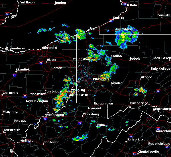 At 1253 pm edt, a severe thunderstorm was located over new kensington, or near penn hills, moving east at 20 mph (public). Hazards include 60 mph wind gusts and half dollar-size hail. Hail damage to vehicles is expected. expect wind damage to trees and power lines, resulting in some power outages. Locations impacted include, vandergrift, apollo, plum, murrysville, new kensington, lower burrell, harrison township, arnold, tarentum, natrona heights, springdale, brackenridge, this includes pennsylvania turnpike near mile marker 52. At 1253 pm edt, a severe thunderstorm was located over new kensington, or near penn hills, moving east at 20 mph (public). Hazards include 60 mph wind gusts and half dollar-size hail. Hail damage to vehicles is expected. expect wind damage to trees and power lines, resulting in some power outages. Locations impacted include, vandergrift, apollo, plum, murrysville, new kensington, lower burrell, harrison township, arnold, tarentum, natrona heights, springdale, brackenridge, this includes pennsylvania turnpike near mile marker 52.
|
| 4/20/2017 12:41 PM EDT |
 At 1241 pm edt, a severe thunderstorm was located over new kensington, or near penn hills, moving east at 20 mph (radar). Hazards include 60 mph wind gusts and quarter-size hail. Hail damage to vehicles is expected. Expect wind damage to trees and power lines, resulting in some power outages. At 1241 pm edt, a severe thunderstorm was located over new kensington, or near penn hills, moving east at 20 mph (radar). Hazards include 60 mph wind gusts and quarter-size hail. Hail damage to vehicles is expected. Expect wind damage to trees and power lines, resulting in some power outages.
|
| 3/1/2017 2:25 PM EST |
 At 225 pm est, severe thunderstorms were located along a line extending from shoemakersville to near reamstown, moving east at 60 mph (radar indicated). Hazards include 60 mph wind gusts. Expect damage to roofs, siding, and trees. these severe storms will be near, fleetwood, shoemakersville and lenhartsville around 230 pm est. kutztown, topton, elverson, lyons and new morgan around 235 pm est. birdsboro and claussville around 240 pm est. allentown, emmaus, ancient oaks, cedarville, coffeetown, zionsville and pughtown around 245 pm est. pottstown, northampton, royersford, bechtelsville and gilbertsville around 250 pm est. bethlehem, collegeville, trappe, schwenksville, bally, steuben, lehigh university and spring mount around 255 pm est. east greenville, green lane and geryville around 300 pm est. Other locations impacted by these severe thunderstorms include harleysville, west lawn, boyertown, west reading, pottsgrove, lorane, kenhorst, hokendauqua, south pottstown and thorndale. At 225 pm est, severe thunderstorms were located along a line extending from shoemakersville to near reamstown, moving east at 60 mph (radar indicated). Hazards include 60 mph wind gusts. Expect damage to roofs, siding, and trees. these severe storms will be near, fleetwood, shoemakersville and lenhartsville around 230 pm est. kutztown, topton, elverson, lyons and new morgan around 235 pm est. birdsboro and claussville around 240 pm est. allentown, emmaus, ancient oaks, cedarville, coffeetown, zionsville and pughtown around 245 pm est. pottstown, northampton, royersford, bechtelsville and gilbertsville around 250 pm est. bethlehem, collegeville, trappe, schwenksville, bally, steuben, lehigh university and spring mount around 255 pm est. east greenville, green lane and geryville around 300 pm est. Other locations impacted by these severe thunderstorms include harleysville, west lawn, boyertown, west reading, pottsgrove, lorane, kenhorst, hokendauqua, south pottstown and thorndale.
|
| 3/1/2017 2:09 PM EST |
 At 209 pm est, severe thunderstorms were located along a line extending from strausstown to columbia, moving east at 60 mph (radar indicated). Hazards include 60 mph wind gusts. expect damage to roofs, siding, and trees At 209 pm est, severe thunderstorms were located along a line extending from strausstown to columbia, moving east at 60 mph (radar indicated). Hazards include 60 mph wind gusts. expect damage to roofs, siding, and trees
|
| 2/25/2017 4:24 PM EST |
 The severe thunderstorm warning for northwestern cecil, berks and western chester counties will expire at 430 pm est, the storms which prompted the warning have moved out of the area. therefore the warning will be allowed to expire. however gusty winds are still possible with these thunderstorms. a severe thunderstorm watch remains in effect until 800 pm est for northeastern maryland, and eastern and southeastern pennsylvania. The severe thunderstorm warning for northwestern cecil, berks and western chester counties will expire at 430 pm est, the storms which prompted the warning have moved out of the area. therefore the warning will be allowed to expire. however gusty winds are still possible with these thunderstorms. a severe thunderstorm watch remains in effect until 800 pm est for northeastern maryland, and eastern and southeastern pennsylvania.
|
| 2/25/2017 3:45 PM EST |
 At 345 pm est, severe thunderstorms were located along a line extending from near myerstown to denver to near holtwood to near rock springs, moving northeast at 50 mph (radar indicated). Hazards include 60 mph wind gusts and quarter size hail. Hail damage to vehicles is expected. expect wind damage to roofs, siding, and trees. these severe storms will be near, womelsdorf, wernersville and newmanstown around 350 pm est. sinking spring and robesonia around 355 pm est. reading, wyomissing, oxford, bernville, spring ridge, mount vernon and fairview hgts around 400 pm est. laureldale, leesport and homeville around 405 pm est. shoemakersville and cochranville around 410 pm est. fleetwood, parkesburg, honey brook and lyons around 415 pm est. coatesville and kutztown around 420 pm est. elverson and new morgan around 425 pm est. Other locations impacted by these severe thunderstorms include wyomissing hills, west lawn, boyertown, west reading, south coatesville, modena, lorane, kenhorst, mount penn and south pottstown. At 345 pm est, severe thunderstorms were located along a line extending from near myerstown to denver to near holtwood to near rock springs, moving northeast at 50 mph (radar indicated). Hazards include 60 mph wind gusts and quarter size hail. Hail damage to vehicles is expected. expect wind damage to roofs, siding, and trees. these severe storms will be near, womelsdorf, wernersville and newmanstown around 350 pm est. sinking spring and robesonia around 355 pm est. reading, wyomissing, oxford, bernville, spring ridge, mount vernon and fairview hgts around 400 pm est. laureldale, leesport and homeville around 405 pm est. shoemakersville and cochranville around 410 pm est. fleetwood, parkesburg, honey brook and lyons around 415 pm est. coatesville and kutztown around 420 pm est. elverson and new morgan around 425 pm est. Other locations impacted by these severe thunderstorms include wyomissing hills, west lawn, boyertown, west reading, south coatesville, modena, lorane, kenhorst, mount penn and south pottstown.
|
| 2/25/2017 3:26 PM EST |
 At 325 pm est, severe thunderstorms were located along a line extending from lawn to near mountville to near stewartstown to jarrettsville, moving northeast at 40 mph (radar indicated). Hazards include 60 mph wind gusts and quarter size hail. Hail damage to vehicles is expected. expect wind damage to roofs, siding, and trees. severe thunderstorms will be near, newmanstown and rock springs around 350 pm est. womelsdorf and robesonia around 355 pm est. wernersville, bernville and glen roy around 400 pm est. oxford, sinking spring and mount vernon around 405 pm est. reading, wyomissing, leesport, elverson, new morgan, fairview hgts, homeville and spring ridge around 410 pm est. laureldale, parkesburg, shoemakersville and cochranville around 415 pm est. birdsboro and west grove around 420 pm est. coatesville, fleetwood, honey brook, lyons and cedarville around 425 pm est. Other locations impacted by these severe thunderstorms include wyomissing hills, west lawn, boyertown, west reading, south coatesville, modena, lorane, kenhorst, mount penn and south pottstown. At 325 pm est, severe thunderstorms were located along a line extending from lawn to near mountville to near stewartstown to jarrettsville, moving northeast at 40 mph (radar indicated). Hazards include 60 mph wind gusts and quarter size hail. Hail damage to vehicles is expected. expect wind damage to roofs, siding, and trees. severe thunderstorms will be near, newmanstown and rock springs around 350 pm est. womelsdorf and robesonia around 355 pm est. wernersville, bernville and glen roy around 400 pm est. oxford, sinking spring and mount vernon around 405 pm est. reading, wyomissing, leesport, elverson, new morgan, fairview hgts, homeville and spring ridge around 410 pm est. laureldale, parkesburg, shoemakersville and cochranville around 415 pm est. birdsboro and west grove around 420 pm est. coatesville, fleetwood, honey brook, lyons and cedarville around 425 pm est. Other locations impacted by these severe thunderstorms include wyomissing hills, west lawn, boyertown, west reading, south coatesville, modena, lorane, kenhorst, mount penn and south pottstown.
|
| 2/12/2017 7:26 PM EST |
 At 725 pm est, severe thunderstorms were located along a line extending from 7 miles northwest of west kittanning to near imperial, moving east at 50 mph (radar). Hazards include 60 mph wind gusts. Expect damage to trees and power lines, resulting in some power outages. locations impacted include, pittsburgh, penn hills, mount lebanon, bethel park, ross township, mccandless township, monroeville, cranberry, moon township, greensburg, weirton, mckeesport, this includes the following highways, pennsylvania turnpike between mile markers 27 and 69. interstate 79 in pennsylvania between mile markers 25 and 51. Parkway north between mile markers 1 and 13. At 725 pm est, severe thunderstorms were located along a line extending from 7 miles northwest of west kittanning to near imperial, moving east at 50 mph (radar). Hazards include 60 mph wind gusts. Expect damage to trees and power lines, resulting in some power outages. locations impacted include, pittsburgh, penn hills, mount lebanon, bethel park, ross township, mccandless township, monroeville, cranberry, moon township, greensburg, weirton, mckeesport, this includes the following highways, pennsylvania turnpike between mile markers 27 and 69. interstate 79 in pennsylvania between mile markers 25 and 51. Parkway north between mile markers 1 and 13.
|
| 2/12/2017 7:02 PM EST |
 At 701 pm est, severe thunderstorms were located along a line extending from near meridian to near toronto, moving east at 50 mph (radar). Hazards include 60 mph wind gusts. expect damage to trees and power lines, resulting in some power outages At 701 pm est, severe thunderstorms were located along a line extending from near meridian to near toronto, moving east at 50 mph (radar). Hazards include 60 mph wind gusts. expect damage to trees and power lines, resulting in some power outages
|
| 9/7/2016 4:15 PM EDT |
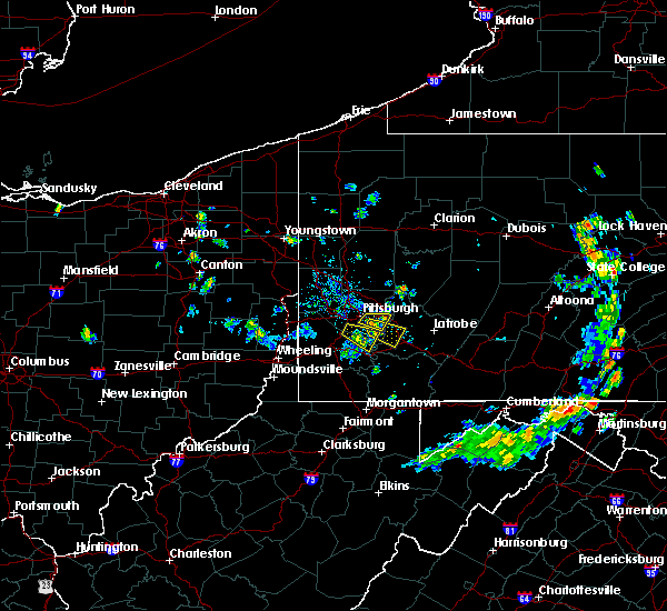 At 415 pm edt, a severe thunderstorm was located over freeport, or near vandergrift, moving east at 30 mph (radar indicated). Hazards include 60 mph wind gusts and penny size hail. Expect damage to trees and power lines. Resulting in some power outages. At 415 pm edt, a severe thunderstorm was located over freeport, or near vandergrift, moving east at 30 mph (radar indicated). Hazards include 60 mph wind gusts and penny size hail. Expect damage to trees and power lines. Resulting in some power outages.
|
| 8/25/2016 11:04 PM EDT |
 At 1103 pm edt, the leading edge of a severe thunderstorm cluster was located near ford city, or 8 miles southeast of kittanning, moving east at 45 mph (radar indicated). Hazards include 60 mph wind gusts. Expect damage to trees and power lines. resulting in some power outages. locations impacted include, kittanning, ford city, leechburg, sarver, freeport, west kittanning, saxonburg, nixon, west leechburg, orchard hills, worthington, hyde park, west hills, manorville, ford cliff, elderton, applewold, lenape heights, atwood and crooked creek lake park. Please report severe weather by calling 4 1 2, 2 6 2, 1 9 8 8, posting to the nws pittsburgh facebook page, or using twitter @nwspittsburgh. At 1103 pm edt, the leading edge of a severe thunderstorm cluster was located near ford city, or 8 miles southeast of kittanning, moving east at 45 mph (radar indicated). Hazards include 60 mph wind gusts. Expect damage to trees and power lines. resulting in some power outages. locations impacted include, kittanning, ford city, leechburg, sarver, freeport, west kittanning, saxonburg, nixon, west leechburg, orchard hills, worthington, hyde park, west hills, manorville, ford cliff, elderton, applewold, lenape heights, atwood and crooked creek lake park. Please report severe weather by calling 4 1 2, 2 6 2, 1 9 8 8, posting to the nws pittsburgh facebook page, or using twitter @nwspittsburgh.
|
| 8/25/2016 10:40 PM EDT |
 At 1040 pm edt, a severe thunderstorm was located near sarver, or 9 miles southeast of butler, moving east at 45 mph (radar indicated). Hazards include 60 mph wind gusts. Expect damage to trees and power lines. resulting in some power outages. locations impacted include, butler, kittanning, homeacre-lyndora, shanor-northvue, meridian, ford city, meadowood, oak hills, leechburg, sarver, freeport, west kittanning, saxonburg, nixon, west leechburg, orchard hills, rural valley, east butler, worthington and connoquenessing. Please report severe weather by calling 4 1 2, 2 6 2, 1 9 8 8, posting to the nws pittsburgh facebook page, or using twitter @nwspittsburgh. At 1040 pm edt, a severe thunderstorm was located near sarver, or 9 miles southeast of butler, moving east at 45 mph (radar indicated). Hazards include 60 mph wind gusts. Expect damage to trees and power lines. resulting in some power outages. locations impacted include, butler, kittanning, homeacre-lyndora, shanor-northvue, meridian, ford city, meadowood, oak hills, leechburg, sarver, freeport, west kittanning, saxonburg, nixon, west leechburg, orchard hills, rural valley, east butler, worthington and connoquenessing. Please report severe weather by calling 4 1 2, 2 6 2, 1 9 8 8, posting to the nws pittsburgh facebook page, or using twitter @nwspittsburgh.
|
| 8/25/2016 10:25 PM EDT |
 At 1025 pm edt, a severe thunderstorm was located over butler, moving east at 45 mph (radar indicated). Hazards include 60 mph wind gusts. Expect damage to trees and power lines. Resulting in some power outages. At 1025 pm edt, a severe thunderstorm was located over butler, moving east at 45 mph (radar indicated). Hazards include 60 mph wind gusts. Expect damage to trees and power lines. Resulting in some power outages.
|
| 8/16/2016 6:35 PM EDT |
 At 634 pm edt, severe thunderstorms were located along a line extending from 15 miles north of homer city to near indiana to near latrobe, moving east at 45 mph (public. trees and power lines have been reported down in several towns). Hazards include 60 mph wind gusts. Expect damage to trees and power lines. resulting in some power outages. locations impacted include, greensburg, indiana, jeannette, latrobe, vandergrift, homer city, apollo, murrysville, irwin, mcchesneytown-loyalhanna, blairsville, manor, youngwood, derry, delmont, lawson heights, new stanton, leechburg, black lick and calumet-norvelt. this includes the following highways, interstate 70 in pennsylvania between mile markers 52 and 57. pennsylvania turnpike between mile markers 61 and 79. Please report severe weather by calling 4 1 2, 2 6 2, 1 9 8 8, posting to the nws pittsburgh facebook page, or using twitter @nwspittsburgh. At 634 pm edt, severe thunderstorms were located along a line extending from 15 miles north of homer city to near indiana to near latrobe, moving east at 45 mph (public. trees and power lines have been reported down in several towns). Hazards include 60 mph wind gusts. Expect damage to trees and power lines. resulting in some power outages. locations impacted include, greensburg, indiana, jeannette, latrobe, vandergrift, homer city, apollo, murrysville, irwin, mcchesneytown-loyalhanna, blairsville, manor, youngwood, derry, delmont, lawson heights, new stanton, leechburg, black lick and calumet-norvelt. this includes the following highways, interstate 70 in pennsylvania between mile markers 52 and 57. pennsylvania turnpike between mile markers 61 and 79. Please report severe weather by calling 4 1 2, 2 6 2, 1 9 8 8, posting to the nws pittsburgh facebook page, or using twitter @nwspittsburgh.
|
| 8/16/2016 6:14 PM EDT |
 At 613 pm edt, severe thunderstorms were located along a line extending from near vandergrift to near west newton, moving east at 50 mph (public. downed trees and power lines have been reported in several towns). Hazards include 60 mph wind gusts. Expect damage to trees and power lines. Resulting in some power outages. At 613 pm edt, severe thunderstorms were located along a line extending from near vandergrift to near west newton, moving east at 50 mph (public. downed trees and power lines have been reported in several towns). Hazards include 60 mph wind gusts. Expect damage to trees and power lines. Resulting in some power outages.
|
| 8/16/2016 5:05 PM EDT |
 At 505 pm edt, severe thunderstorms were located along a line extending from hamburg to near birdsboro to new morgan to near churchtown, moving east at 45 mph (radar indicated). Hazards include 60 mph wind gusts. Expect damage to roofs. siding. and trees. Locations impacted include, reading, wyomissing, birdsboro, kutztown, hamburg, fleetwood, sinking spring, laureldale, wernersville, topton, leesport, shoemakersville, bernville, bechtelsville, lyons, strausstown, lenhartsville, new morgan, fairview hgts and spring ridge. At 505 pm edt, severe thunderstorms were located along a line extending from hamburg to near birdsboro to new morgan to near churchtown, moving east at 45 mph (radar indicated). Hazards include 60 mph wind gusts. Expect damage to roofs. siding. and trees. Locations impacted include, reading, wyomissing, birdsboro, kutztown, hamburg, fleetwood, sinking spring, laureldale, wernersville, topton, leesport, shoemakersville, bernville, bechtelsville, lyons, strausstown, lenhartsville, new morgan, fairview hgts and spring ridge.
|
| 8/16/2016 4:50 PM EDT |
 At 449 pm edt, severe thunderstorms were located along a line extending from near strausstown to near sinking spring to terre hill to leola, moving east at 40 mph (radar indicated). Hazards include 60 mph wind gusts. Expect damage to roofs. siding. and trees. Locations impacted include, reading, west chester, pottstown, phoenixville, coatesville, wyomissing, downingtown, birdsboro, kutztown, royersford, hamburg, fleetwood, sinking spring, laureldale, parkesburg, wernersville, leesport, honey brook, shoemakersville and elverson. At 449 pm edt, severe thunderstorms were located along a line extending from near strausstown to near sinking spring to terre hill to leola, moving east at 40 mph (radar indicated). Hazards include 60 mph wind gusts. Expect damage to roofs. siding. and trees. Locations impacted include, reading, west chester, pottstown, phoenixville, coatesville, wyomissing, downingtown, birdsboro, kutztown, royersford, hamburg, fleetwood, sinking spring, laureldale, parkesburg, wernersville, leesport, honey brook, shoemakersville and elverson.
|
| 8/16/2016 4:23 PM EDT |
 At 422 pm edt, severe thunderstorms were located along a line extending from near lickdale to near lancaster, moving east at 45 mph (radar indicated). Hazards include 60 mph wind gusts. Expect damage to roofs. siding. And trees. At 422 pm edt, severe thunderstorms were located along a line extending from near lickdale to near lancaster, moving east at 45 mph (radar indicated). Hazards include 60 mph wind gusts. Expect damage to roofs. siding. And trees.
|
| 8/13/2016 7:30 PM EDT |
 At 729 pm edt, severe thunderstorms were located along a line extending from jordan valley to sinking spring, moving east at 20 mph (radar indicated). Hazards include 60 mph wind gusts. Expect damage to roofs. siding. And trees. At 729 pm edt, severe thunderstorms were located along a line extending from jordan valley to sinking spring, moving east at 20 mph (radar indicated). Hazards include 60 mph wind gusts. Expect damage to roofs. siding. And trees.
|
| 8/1/2016 9:44 PM EDT |
 At 944 pm edt, a severe thunderstorm was located over bernville, or 11 miles northwest of reading, moving east at 15 mph (radar indicated). Hazards include 60 mph wind gusts and quarter size hail. Hail damage to vehicles is expected. expect wind damage to roofs, siding, and trees. Locations impacted include, reading, wyomissing, hamburg, sinking spring, laureldale, womelsdorf, wernersville, leesport, shoemakersville, bernville, strausstown, spring ridge, fairview hgts, centerport, west lawn, west wyomissing, wyomissing hills and whitfield. At 944 pm edt, a severe thunderstorm was located over bernville, or 11 miles northwest of reading, moving east at 15 mph (radar indicated). Hazards include 60 mph wind gusts and quarter size hail. Hail damage to vehicles is expected. expect wind damage to roofs, siding, and trees. Locations impacted include, reading, wyomissing, hamburg, sinking spring, laureldale, womelsdorf, wernersville, leesport, shoemakersville, bernville, strausstown, spring ridge, fairview hgts, centerport, west lawn, west wyomissing, wyomissing hills and whitfield.
|
| 8/1/2016 9:12 PM EDT |
 At 911 pm edt, a severe thunderstorm was located over strausstown, or 9 miles northeast of myerstown, moving southeast at 10 mph (radar indicated). Hazards include 60 mph wind gusts and quarter size hail. Hail damage to vehicles is expected. Expect wind damage to roofs, siding, and trees. At 911 pm edt, a severe thunderstorm was located over strausstown, or 9 miles northeast of myerstown, moving southeast at 10 mph (radar indicated). Hazards include 60 mph wind gusts and quarter size hail. Hail damage to vehicles is expected. Expect wind damage to roofs, siding, and trees.
|
| 7/28/2016 3:28 PM EDT |
 At 328 pm edt, a severe thunderstorm was located over bernville, or 11 miles northwest of reading, moving southeast at 30 mph (radar indicated). Hazards include 60 mph wind gusts. Expect damage to roofs. siding. And trees. At 328 pm edt, a severe thunderstorm was located over bernville, or 11 miles northwest of reading, moving southeast at 30 mph (radar indicated). Hazards include 60 mph wind gusts. Expect damage to roofs. siding. And trees.
|
| 7/25/2016 5:43 PM EDT |
 At 542 pm edt, a severe thunderstorm was located over claussville, or 7 miles west of allentown, moving southeast at 50 mph (radar indicated). Hazards include 60 mph wind gusts and penny size hail. frequent cloud to ground lightning is occurring. Expect damage to roofs. siding. and trees. Locations impacted include, allentown, reading, easton, lehighton, bethlehem, emmaus, northampton, hellertown, palmerton, kutztown, jim thorpe, hamburg, slatington, fleetwood, laureldale, bath, walnutport, topton, leesport and shoemakersville. At 542 pm edt, a severe thunderstorm was located over claussville, or 7 miles west of allentown, moving southeast at 50 mph (radar indicated). Hazards include 60 mph wind gusts and penny size hail. frequent cloud to ground lightning is occurring. Expect damage to roofs. siding. and trees. Locations impacted include, allentown, reading, easton, lehighton, bethlehem, emmaus, northampton, hellertown, palmerton, kutztown, jim thorpe, hamburg, slatington, fleetwood, laureldale, bath, walnutport, topton, leesport and shoemakersville.
|
| 7/25/2016 5:19 PM EDT |
 At 518 pm edt, a severe thunderstorm was located over tuscarora, or near tamaqua, moving southeast at 45 mph (radar indicated). Hazards include 60 mph wind gusts and penny size hail. frequent cloud to ground lightning is occurring. Expect damage to roofs. siding. And trees. At 518 pm edt, a severe thunderstorm was located over tuscarora, or near tamaqua, moving southeast at 45 mph (radar indicated). Hazards include 60 mph wind gusts and penny size hail. frequent cloud to ground lightning is occurring. Expect damage to roofs. siding. And trees.
|
| 7/24/2016 4:48 PM EDT |
 At 448 pm edt, severe thunderstorms were located along a line extending from near freeport to mount oliver, moving east at 30 mph (radar indicated). Hazards include 60 mph wind gusts. Expect damage to trees and power lines. resulting in some power outages. locations impacted include, pittsburgh, penn hills, mount lebanon, bethel park, monroeville, greensburg, mckeesport, indiana, jeannette, vandergrift, apollo, plum, west mifflin, baldwin, upper st. clair, murrysville, wilkinsburg, whitehall, south park township and new kensington. this includes the following highways, pennsylvania turnpike between mile markers 49 and 73. interstate 376 in pennsylvania between mile markers 73 and 84. Please report severe weather by calling 4 1 2, 2 6 2, 1 9 8 8, posting to the nws pittsburgh facebook page, or using twitter @nwspittsburgh. At 448 pm edt, severe thunderstorms were located along a line extending from near freeport to mount oliver, moving east at 30 mph (radar indicated). Hazards include 60 mph wind gusts. Expect damage to trees and power lines. resulting in some power outages. locations impacted include, pittsburgh, penn hills, mount lebanon, bethel park, monroeville, greensburg, mckeesport, indiana, jeannette, vandergrift, apollo, plum, west mifflin, baldwin, upper st. clair, murrysville, wilkinsburg, whitehall, south park township and new kensington. this includes the following highways, pennsylvania turnpike between mile markers 49 and 73. interstate 376 in pennsylvania between mile markers 73 and 84. Please report severe weather by calling 4 1 2, 2 6 2, 1 9 8 8, posting to the nws pittsburgh facebook page, or using twitter @nwspittsburgh.
|
| 7/24/2016 4:25 PM EDT |
 At 425 pm edt, severe thunderstorms were located along a line extending from near sarver to robinson township, moving east at 30 mph (radar indicated). Hazards include 60 mph wind gusts. Expect damage to trees and power lines. Resulting in some power outages. At 425 pm edt, severe thunderstorms were located along a line extending from near sarver to robinson township, moving east at 30 mph (radar indicated). Hazards include 60 mph wind gusts. Expect damage to trees and power lines. Resulting in some power outages.
|
| 6/5/2016 4:37 PM EDT |
 At 436 pm edt, severe thunderstorms were located along a line extending from rothsville to near delta to hampton, moving east at 45 mph (public). Hazards include 60 mph wind gusts. Expect damage to roofs. siding. And trees. At 436 pm edt, severe thunderstorms were located along a line extending from rothsville to near delta to hampton, moving east at 45 mph (public). Hazards include 60 mph wind gusts. Expect damage to roofs. siding. And trees.
|
| 2/24/2016 7:55 PM EST |
 At 755 pm est, doppler radar indicated a severe thunderstorm capable of producing damaging winds in excess of 60 mph. this storm was located near laureldale, or near reading, moving northeast at 65 mph. locations impacted include, reading, wyomissing, birdsboro, kutztown, fleetwood, laureldale, topton, bally, bechtelsville, lyons, west reading, mount penn, st. lawrence, amity gardens, lorane, reiffton and wyomissing hills. a tornado watch remains in effect until 1100 pm est for eastern pennsylvania. At 755 pm est, doppler radar indicated a severe thunderstorm capable of producing damaging winds in excess of 60 mph. this storm was located near laureldale, or near reading, moving northeast at 65 mph. locations impacted include, reading, wyomissing, birdsboro, kutztown, fleetwood, laureldale, topton, bally, bechtelsville, lyons, west reading, mount penn, st. lawrence, amity gardens, lorane, reiffton and wyomissing hills. a tornado watch remains in effect until 1100 pm est for eastern pennsylvania.
|
| 2/24/2016 7:39 PM EST |
 At 739 pm est, doppler radar indicated a severe thunderstorm capable of producing damaging winds in excess of 60 mph. this storm was located over churchtown, or 7 miles northeast of new holland, and moving northeast at 65 mph. At 739 pm est, doppler radar indicated a severe thunderstorm capable of producing damaging winds in excess of 60 mph. this storm was located over churchtown, or 7 miles northeast of new holland, and moving northeast at 65 mph.
|
| 9/30/2015 1:49 AM EDT |
 At 148 am edt, doppler radar indicated a severe thunderstorm capable of producing damaging winds in excess of 60 mph. this storm was located over hamburg, or 9 miles southeast of schuylkill haven, moving north at 25 mph. locations impacted include, reading, wyomissing, birdsboro, kutztown, hamburg, fleetwood, sinking spring, laureldale, womelsdorf, wernersville, topton, leesport, shoemakersville, bally, bernville, bechtelsville, lyons, strausstown, lenhartsville and new morgan. At 148 am edt, doppler radar indicated a severe thunderstorm capable of producing damaging winds in excess of 60 mph. this storm was located over hamburg, or 9 miles southeast of schuylkill haven, moving north at 25 mph. locations impacted include, reading, wyomissing, birdsboro, kutztown, hamburg, fleetwood, sinking spring, laureldale, womelsdorf, wernersville, topton, leesport, shoemakersville, bally, bernville, bechtelsville, lyons, strausstown, lenhartsville and new morgan.
|
| 9/30/2015 1:20 AM EDT |
 At 119 am edt, doppler radar indicated a severe thunderstorm capable of producing damaging winds in excess of 60 mph. this storm was located near bernville, or 9 miles northwest of reading, and moving north at 25 mph. At 119 am edt, doppler radar indicated a severe thunderstorm capable of producing damaging winds in excess of 60 mph. this storm was located near bernville, or 9 miles northwest of reading, and moving north at 25 mph.
|
| 9/9/2015 5:28 PM EDT | The severe thunderstorm warning for northeastern allegheny, southwestern armstrong and northwestern westmoreland counties will expire at 530 pm edt, the storm which prompted the warning has weakened below severe limits, and no longer poses an immediate threat to life or property. therefore the warning will be allowed to expire. however heavy rain is still possible with this thunderstorm. |
| 9/9/2015 5:17 PM EDT |
 At 516 pm edt, a severe thunderstorm was located over oakmont, or near penn hills, moving northeast at 10 mph (radar indicated). Hazards include 60 mph wind gusts and quarter size hail. Hail damage to vehicles is expected. expect wind damage to trees and some power outages. Locations impacted include, pittsburgh, penn hills, ross township, mccandless township, vandergrift, apollo, shaler township, plum, murrysville, hampton township, wilkinsburg, new kensington, lower burrell, harrison township, o`hara township, oakmont, fox chapel, arnold, tarentum and natrona heights. At 516 pm edt, a severe thunderstorm was located over oakmont, or near penn hills, moving northeast at 10 mph (radar indicated). Hazards include 60 mph wind gusts and quarter size hail. Hail damage to vehicles is expected. expect wind damage to trees and some power outages. Locations impacted include, pittsburgh, penn hills, ross township, mccandless township, vandergrift, apollo, shaler township, plum, murrysville, hampton township, wilkinsburg, new kensington, lower burrell, harrison township, o`hara township, oakmont, fox chapel, arnold, tarentum and natrona heights.
|
| 9/9/2015 4:52 PM EDT |
 At 452 pm edt, a severe thunderstorm was located near fox chapel, or near penn hills, moving northeast at 15 mph (radar indicated). Hazards include 60 mph wind gusts and quarter size hail. Hail damage to vehicles is expected. Expect wind damage to trees and some power outages. At 452 pm edt, a severe thunderstorm was located near fox chapel, or near penn hills, moving northeast at 15 mph (radar indicated). Hazards include 60 mph wind gusts and quarter size hail. Hail damage to vehicles is expected. Expect wind damage to trees and some power outages.
|
| 8/4/2015 1:31 AM EDT |
 At 131 am edt, doppler radar indicated a severe thunderstorm capable of producing quarter size hail and damaging winds in excess of 60 mph. this storm was located near pine grove, or 7 miles north of myerstown, and moving east at 20 mph. At 131 am edt, doppler radar indicated a severe thunderstorm capable of producing quarter size hail and damaging winds in excess of 60 mph. this storm was located near pine grove, or 7 miles north of myerstown, and moving east at 20 mph.
|
| 7/9/2015 6:57 PM EDT |
 At 655 pm edt, doppler radar indicated a line of severe thunderstorms capable of producing damaging winds in excess of 60 mph. these storms were located along a line extending from near fleetwood to near cedarville to near glenmoore to parkesburg to quarryville, and moving northeast at 50 mph. this line of storms has had a history of wind damage. * severe thunderstorms will be near, pottstown around 700 pm edt. bally, bechtelsville, pughtown, gilbertsville and cedarville around 705 pm edt. downingtown, royersford, east greenville and green lane around 710 pm edt. trappe, schwenksville, lionville-marchwood, lionville and geryville around 715 pm edt. quakertown, spring mount and marshallton around 720 pm edt. phoenixville, souderton, hatfield and valley forge around 725 pm edt. west norriton, perkasie, collegeville, chester springs, ottsville and fricks around 730 pm edt. east norriton, dublin, ferndale, revere, erwinna, paoli and plymouth meeting around 735 pm edt. At 655 pm edt, doppler radar indicated a line of severe thunderstorms capable of producing damaging winds in excess of 60 mph. these storms were located along a line extending from near fleetwood to near cedarville to near glenmoore to parkesburg to quarryville, and moving northeast at 50 mph. this line of storms has had a history of wind damage. * severe thunderstorms will be near, pottstown around 700 pm edt. bally, bechtelsville, pughtown, gilbertsville and cedarville around 705 pm edt. downingtown, royersford, east greenville and green lane around 710 pm edt. trappe, schwenksville, lionville-marchwood, lionville and geryville around 715 pm edt. quakertown, spring mount and marshallton around 720 pm edt. phoenixville, souderton, hatfield and valley forge around 725 pm edt. west norriton, perkasie, collegeville, chester springs, ottsville and fricks around 730 pm edt. east norriton, dublin, ferndale, revere, erwinna, paoli and plymouth meeting around 735 pm edt.
|
| 7/9/2015 6:41 PM EDT |
 At 639 pm edt, doppler radar indicated a line of severe thunderstorms capable of producing damaging winds in excess of 60 mph. these storms were located along a line extending from wernersville to near churchtown to near new holland to near holtwood, moving east at 50 mph. this line of storms has had a history of producing wind damage. these severe storms will be near, reading, wyomissing, sinking spring, honey brook, new morgan and spring ridge around 645 pm edt. birdsboro, laureldale and elverson around 650 pm edt. glenmoore, homeville and mount vernon around 655 pm edt. pottstown, parkesburg, bechtelsville, cedarville, pughtown, cochranville, chester springs, gilbertsville, lionville-marchwood and lionville around 700 pm edt. other locations impacted by these severe thunderstorms include west lawn, stowe, shillington, amity gardens, st. lawrence, south coatesville, halfway house, avondale, thorndale and lorane. At 639 pm edt, doppler radar indicated a line of severe thunderstorms capable of producing damaging winds in excess of 60 mph. these storms were located along a line extending from wernersville to near churchtown to near new holland to near holtwood, moving east at 50 mph. this line of storms has had a history of producing wind damage. these severe storms will be near, reading, wyomissing, sinking spring, honey brook, new morgan and spring ridge around 645 pm edt. birdsboro, laureldale and elverson around 650 pm edt. glenmoore, homeville and mount vernon around 655 pm edt. pottstown, parkesburg, bechtelsville, cedarville, pughtown, cochranville, chester springs, gilbertsville, lionville-marchwood and lionville around 700 pm edt. other locations impacted by these severe thunderstorms include west lawn, stowe, shillington, amity gardens, st. lawrence, south coatesville, halfway house, avondale, thorndale and lorane.
|
| 7/9/2015 6:15 PM EDT |
 At 613 pm edt, doppler radar indicated a severe thunderstorm capable of producing damaging winds in excess of 60 mph. this storm was located over east petersburg, and moving east at 45 mph. * this severe thunderstorm will be near, honey brook and new morgan around 640 pm edt. elverson around 645 pm edt. birdsboro and glenmoore around 650 pm edt. pughtown around 655 pm edt. pottstown, cedarville and chester springs around 700 pm edt. other locations impacted by this severe thunderstorm include west lawn, stowe, shillington, amity gardens, st. lawrence, south coatesville, halfway house, avondale, thorndale and lorane. At 613 pm edt, doppler radar indicated a severe thunderstorm capable of producing damaging winds in excess of 60 mph. this storm was located over east petersburg, and moving east at 45 mph. * this severe thunderstorm will be near, honey brook and new morgan around 640 pm edt. elverson around 645 pm edt. birdsboro and glenmoore around 650 pm edt. pughtown around 655 pm edt. pottstown, cedarville and chester springs around 700 pm edt. other locations impacted by this severe thunderstorm include west lawn, stowe, shillington, amity gardens, st. lawrence, south coatesville, halfway house, avondale, thorndale and lorane.
|
| 7/7/2015 8:22 PM EDT |
 At 821 pm edt, severe thunderstorms were located along a line extending from vandergrift to near ligonier, moving northeast at 45 mph (radar indicated). Hazards include 60 mph wind gusts. expect damage to trees and some power outages locations impacted include, greensburg, indiana, jeannette, latrobe, vandergrift, homer city, apollo, plum, murrysville, new kensington, lower burrell, harrison township, arnold, tarentum, mcchesneytown-loyalhanna, blairsville, springdale, brackenridge, derry and delmont At 821 pm edt, severe thunderstorms were located along a line extending from vandergrift to near ligonier, moving northeast at 45 mph (radar indicated). Hazards include 60 mph wind gusts. expect damage to trees and some power outages locations impacted include, greensburg, indiana, jeannette, latrobe, vandergrift, homer city, apollo, plum, murrysville, new kensington, lower burrell, harrison township, arnold, tarentum, mcchesneytown-loyalhanna, blairsville, springdale, brackenridge, derry and delmont
|
| 7/7/2015 8:04 PM EDT |
 At 803 pm edt, severe thunderstorms were located along a line extending from near monroeville to near connellsville, moving northeast at 45 mph (radar indicated). Hazards include 60 mph wind gusts. expect damage to trees and some power outages At 803 pm edt, severe thunderstorms were located along a line extending from near monroeville to near connellsville, moving northeast at 45 mph (radar indicated). Hazards include 60 mph wind gusts. expect damage to trees and some power outages
|
| 6/23/2015 4:11 PM EDT |
 At 410 pm edt, doppler radar indicated a line of severe thunderstorms capable of producing damaging winds in excess of 60 mph. these storms were located along a line extending from near strausstown to bernville to womelsdorf, and moving east at 35 mph. * severe thunderstorms will be near, robesonia around 415 pm edt. fairview hgts around 420 pm edt. hamburg, sinking spring, leesport and shoemakersville around 425 pm edt. reading, wyomissing and spring ridge around 430 pm edt. laureldale and lenhartsville around 435 pm edt. kutztown, fleetwood and wanamakers around 440 pm edt. lyons around 445 pm edt. topton around 450 pm edt. other locations impacted by these severe thunderstorms include west lawn, shillington, amity gardens, st. lawrence, macungie, flying hills, mount penn, centerport, lorane and alburtis. At 410 pm edt, doppler radar indicated a line of severe thunderstorms capable of producing damaging winds in excess of 60 mph. these storms were located along a line extending from near strausstown to bernville to womelsdorf, and moving east at 35 mph. * severe thunderstorms will be near, robesonia around 415 pm edt. fairview hgts around 420 pm edt. hamburg, sinking spring, leesport and shoemakersville around 425 pm edt. reading, wyomissing and spring ridge around 430 pm edt. laureldale and lenhartsville around 435 pm edt. kutztown, fleetwood and wanamakers around 440 pm edt. lyons around 445 pm edt. topton around 450 pm edt. other locations impacted by these severe thunderstorms include west lawn, shillington, amity gardens, st. lawrence, macungie, flying hills, mount penn, centerport, lorane and alburtis.
|
| 6/23/2015 2:04 PM EDT |
 At 204 pm edt, a severe thunderstorm was located near leechburg, or near vandergrift, moving east at 35 mph (radar indicated). Hazards include 60 mph wind gusts and quarter size hail. Hail damage to vehicles is expected. expect wind damage to roofs, siding and trees. Locations impacted include, vandergrift, apollo, new kensington, lower burrell, harrison township, arnold, tarentum, natrona heights, brackenridge, leechburg, freeport, russellton, north apollo, west leechburg, curtisville, avonmore, orchard hills, oklahoma, east vandergrift and hyde park. At 204 pm edt, a severe thunderstorm was located near leechburg, or near vandergrift, moving east at 35 mph (radar indicated). Hazards include 60 mph wind gusts and quarter size hail. Hail damage to vehicles is expected. expect wind damage to roofs, siding and trees. Locations impacted include, vandergrift, apollo, new kensington, lower burrell, harrison township, arnold, tarentum, natrona heights, brackenridge, leechburg, freeport, russellton, north apollo, west leechburg, curtisville, avonmore, orchard hills, oklahoma, east vandergrift and hyde park.
|
| 6/23/2015 1:37 PM EDT |
 At 137 pm edt, a severe thunderstorm was located near sarver, or 10 miles south of butler, moving east at 35 mph (radar indicated). Hazards include 60 mph wind gusts and quarter size hail. Hail damage to vehicles is expected. Expect wind damage to roofs, siding and trees. At 137 pm edt, a severe thunderstorm was located near sarver, or 10 miles south of butler, moving east at 35 mph (radar indicated). Hazards include 60 mph wind gusts and quarter size hail. Hail damage to vehicles is expected. Expect wind damage to roofs, siding and trees.
|
| 6/18/2015 9:27 PM EDT | At 925 pm edt, a severe thunderstorm was located over forest hills, or near monroeville, moving east at 35 mph (radar indicated). Hazards include 60 mph wind gusts. Expect damage to roofs. siding and trees. locations impacted include, pittsburgh, penn hills, mount lebanon, bethel park, ross township, monroeville, mcmurray, mckeesport, vandergrift, gastonville, shaler township, plum, west mifflin, north side pittsburgh, baldwin, upper st. Clair, murrysville, hampton township, scott township and wilkinsburg. |
| 6/18/2015 9:14 PM EDT | At 910 pm edt, a severe thunderstorm was located over north side pittsburgh, or over pittsburgh, moving east at 35 mph, with the line of strongest winds extending from north of mccandles township and extending south to upper st clair (radar indicated). Hazards include 60 mph wind gusts. Expect damage to roofs. siding and trees. Locations impacted include, pittsburgh, penn hills, mount lebanon, bethel park, ross township, mccandless township, monroeville, cranberry, moon township, mcmurray, mckeesport, franklin park, canonsburg, vandergrift, gastonville, shaler township, plum, west mifflin, north side pittsburgh and baldwin. |
| 6/18/2015 8:49 PM EDT | At 846 pm edt, a severe thunderstorm was located over moon township, moving southeast at 35 mph (radar indicated). Hazards include 60 mph wind gusts. Expect damage to roofs. Siding and trees. |
| 6/12/2015 6:29 PM EDT |
 At 629 pm edt, severe thunderstorms were located along a line extending from 8 miles southeast of new bethlehem to north braddock, moving east at 55 mph (radar indicated). Hazards include 60 mph wind gusts. Expect damage to roofs. siding and trees. Locations impacted include, pittsburgh, penn hills, mount lebanon, ross township, mccandless township, monroeville, greensburg, mckeesport, indiana, jeannette, latrobe, punxsutawney, vandergrift, kittanning, homer city, apollo, shaler township, plum, west mifflin and north side pittsburgh. At 629 pm edt, severe thunderstorms were located along a line extending from 8 miles southeast of new bethlehem to north braddock, moving east at 55 mph (radar indicated). Hazards include 60 mph wind gusts. Expect damage to roofs. siding and trees. Locations impacted include, pittsburgh, penn hills, mount lebanon, ross township, mccandless township, monroeville, greensburg, mckeesport, indiana, jeannette, latrobe, punxsutawney, vandergrift, kittanning, homer city, apollo, shaler township, plum, west mifflin and north side pittsburgh.
|
| 6/12/2015 6:21 PM EDT |
 At 621 pm edt, severe thunderstorms were located along a line extending from near new bethlehem to mount oliver, moving east at 55 mph (radar indicated). Hazards include 60 mph wind gusts. Expect damage to roofs. siding and trees. Locations impacted include, pittsburgh, penn hills, mount lebanon, ross township, mccandless township, monroeville, moon township, greensburg, mckeesport, indiana, franklin park, jeannette, latrobe, punxsutawney, vandergrift, kittanning, homer city, apollo, shaler township and plum. At 621 pm edt, severe thunderstorms were located along a line extending from near new bethlehem to mount oliver, moving east at 55 mph (radar indicated). Hazards include 60 mph wind gusts. Expect damage to roofs. siding and trees. Locations impacted include, pittsburgh, penn hills, mount lebanon, ross township, mccandless township, monroeville, moon township, greensburg, mckeesport, indiana, franklin park, jeannette, latrobe, punxsutawney, vandergrift, kittanning, homer city, apollo, shaler township and plum.
|
| 6/12/2015 6:10 PM EDT |
 At 610 pm edt, severe thunderstorms were located along a line extending from near rimersburg to carnegie, moving east at 45 mph (radar indicated). Hazards include 60 mph wind gusts. Expect damage to roofs. siding and trees. Locations impacted include, pittsburgh, penn hills, mount lebanon, ross township, mccandless township, monroeville, cranberry, moon township, greensburg, mckeesport, indiana, butler, franklin park, jeannette, latrobe, punxsutawney, vandergrift, kittanning, homer city and apollo. At 610 pm edt, severe thunderstorms were located along a line extending from near rimersburg to carnegie, moving east at 45 mph (radar indicated). Hazards include 60 mph wind gusts. Expect damage to roofs. siding and trees. Locations impacted include, pittsburgh, penn hills, mount lebanon, ross township, mccandless township, monroeville, cranberry, moon township, greensburg, mckeesport, indiana, butler, franklin park, jeannette, latrobe, punxsutawney, vandergrift, kittanning, homer city and apollo.
|
| 6/12/2015 5:58 PM EDT |
 At 558 pm edt, severe thunderstorms were located along a line extending from 7 miles southwest of rimersburg to near imperial, moving east at 55 mph (radar indicated). Hazards include 60 mph wind gusts. Expect damage to roofs. Siding and trees. At 558 pm edt, severe thunderstorms were located along a line extending from 7 miles southwest of rimersburg to near imperial, moving east at 55 mph (radar indicated). Hazards include 60 mph wind gusts. Expect damage to roofs. Siding and trees.
|
| 5/31/2015 7:48 PM EDT | At 748 pm edt, doppler radar indicated a severe thunderstorm capable of producing damaging winds in excess of 60 mph. this storm was located over womelsdorf, or near myerstown, and moving northeast at 30 mph. storms in the lower susquehanna valley have had a history of producing damaging winds. |
| 5/29/2015 5:22 PM EDT | At 522 pm edt, a severe thunderstorm was located over murrysville, or near monroeville, moving north at 20 mph (radar indicated). Hazards include 70 mph wind gusts and quarter size hail. Hail damage to vehicles is expected. expect considerable tree damage. Wind damage is also likely to mobile homes, roofs and outbuildings. |
| 4/9/2015 6:37 PM EDT | A severe thunderstorm warning remains in effect until 645 pm edt for northwestern fayette. northeastern greene. southwestern armstrong. southeastern butler. southeastern washington. western westmoreland and eastern allegheny counties. at 637 pm edt. Severe thunderstorms were located along a line extending from 6 miles west of west hills to saltsburg to new stanton. |
| 4/9/2015 6:17 PM EDT | The national weather service in pittsburgh has issued a * severe thunderstorm warning for. northwestern fayette county in southwestern pennsylvania. central greene county in southwestern pennsylvania. southwestern armstrong county in west central pennsylvania. Southern butler county in west central pennsylvania. |
| 5/29/2012 1:44 PM EDT | Large trees reporded down in armstrong county PA, 1.5 miles SSW of Hyde Park, PA |
Hail Maps for Hyde Park, PA
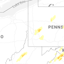


Connect with Interactive Hail Maps