

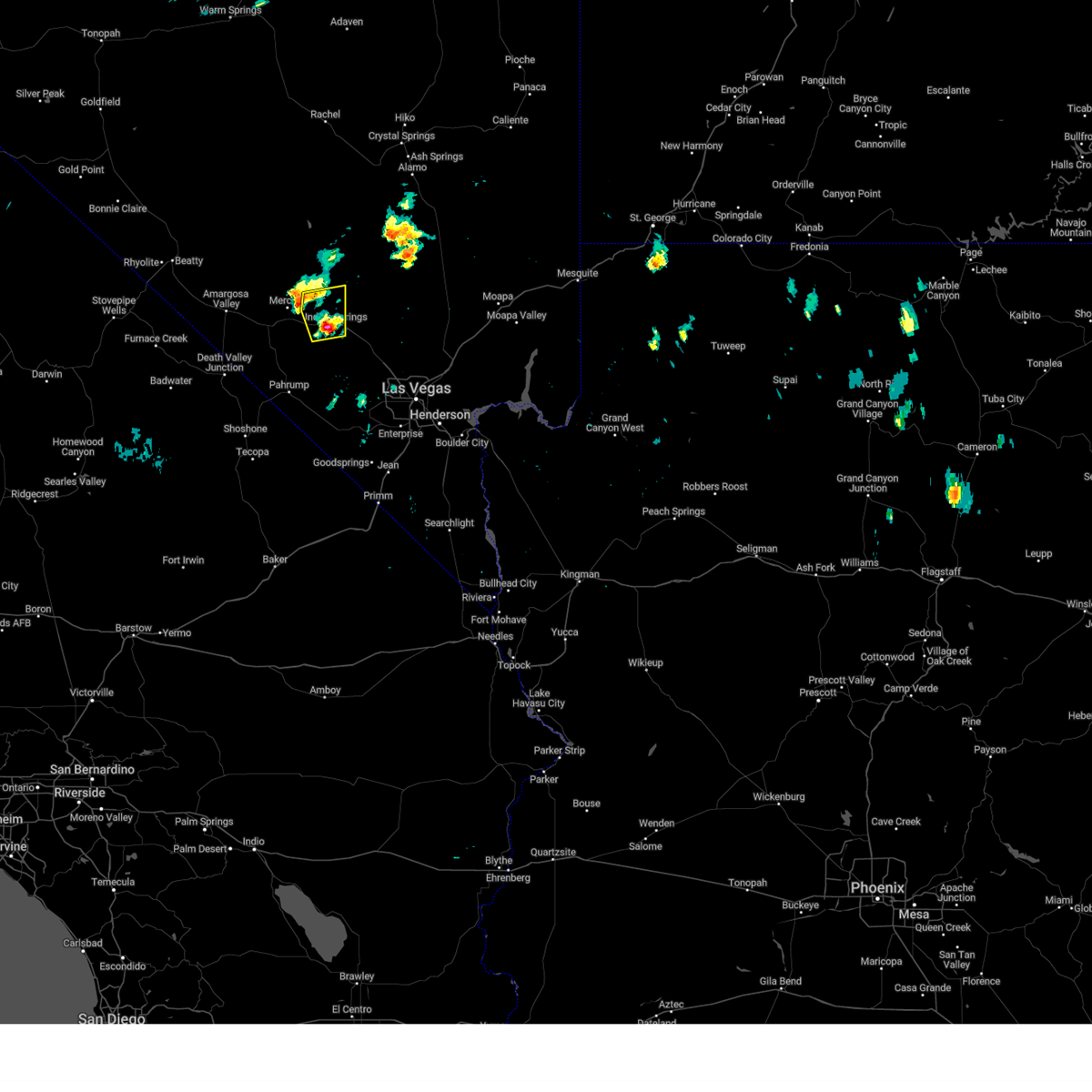
Hail Map for Indian Springs, NV
The Indian Springs, NV area has had 0 reports of on-the-ground hail by trained spotters, and has been under severe weather warnings 1 time during the past 12 months. Doppler radar has detected hail at or near Indian Springs, NV on 2 occasions.
| Name: | Indian Springs, NV |
| Where Located: | 42.3 miles NW of Las Vegas, NV |
| Map: | Google Map for Indian Springs, NV |
| Population: | 991 |
| Housing Units: | 548 |
| More Info: | Search Google for Indian Springs, NV |
5
The Top Recent Hail Date for Indian Springs, NV is Friday, August 11, 2023 (1st out of 2)

Hail and Wind Damage Spotted near Indian Springs, NV
| Date / Time | Report Details |
|---|---|
| 6/3/2025 8:53 PM PDT | Asos station kdra desert rock airpor in nye county NV, 17.7 miles ESE of Indian Springs, NV |
| 6/3/2025 7:15 PM PDT | Mesonet station a22ad 2.9 sw mercury (arl sord in nye county NV, 17.1 miles ESE of Indian Springs, NV |
| 5/17/2025 6:30 PM PDT | Mesonet station a05ab 13.2 n mercury (arl sord). thunderstorm generated gus in nye county NV, 23.3 miles SSE of Indian Springs, NV |
| 5/17/2025 5:45 PM PDT | Mesonet station a05ab 13.2 n mercury (arl sord). gust generated by thunderstor in nye county NV, 23.3 miles SSE of Indian Springs, NV |
| 4/17/2025 9:38 PM PDT |
 Svrvef the national weather service in las vegas has issued a * severe thunderstorm warning for, western clark county in southern nevada, southeastern nye county in south central nevada, * until 1030 pm pdt. * at 937 pm pdt, a severe thunderstorm was located 7 miles southeast of mercury, moving southeast at 15 mph (radar indicated). Hazards include 60 mph wind gusts and quarter size hail. Hail damage to vehicles is expected. Expect wind damage to roofs and trees. Svrvef the national weather service in las vegas has issued a * severe thunderstorm warning for, western clark county in southern nevada, southeastern nye county in south central nevada, * until 1030 pm pdt. * at 937 pm pdt, a severe thunderstorm was located 7 miles southeast of mercury, moving southeast at 15 mph (radar indicated). Hazards include 60 mph wind gusts and quarter size hail. Hail damage to vehicles is expected. Expect wind damage to roofs and trees.
|
| 4/17/2025 9:00 PM PDT | A automated observing site in mercury nv recorded a wind gust of 63 mph at 210 in nye county NV, 16.9 miles ESE of Indian Springs, NV |
| 7/13/2024 6:37 PM PDT | Measured at desert rock airpor in nye county NV, 17.7 miles ESE of Indian Springs, NV |
| 7/13/2024 12:34 PM PDT |
 The storm which prompted the warning remains strong but is no longer severe or poses an immediate threat to life or property. therefore, the warning has been allowed to expire. however, small hail and gusty winds are still possible with this thunderstorm. The storm which prompted the warning remains strong but is no longer severe or poses an immediate threat to life or property. therefore, the warning has been allowed to expire. however, small hail and gusty winds are still possible with this thunderstorm.
|
| 7/13/2024 12:16 PM PDT |
 At 1212 pm pdt, doppler radar continues to show a severe thunderstorm near willow creek campground that is drifting slowly to the northwest (radar indicated). Hazards include 60 mph wind gusts and quarter size hail. Hail damage to vehicles is expected. expect wind damage to roofs and trees. locations impacted include, willow creek campground and indian springs. this includes the following roads, highway 95 in nye county between mile markers 1 and 7. Highway 95 in clark county between mile markers 122 and 132. At 1212 pm pdt, doppler radar continues to show a severe thunderstorm near willow creek campground that is drifting slowly to the northwest (radar indicated). Hazards include 60 mph wind gusts and quarter size hail. Hail damage to vehicles is expected. expect wind damage to roofs and trees. locations impacted include, willow creek campground and indian springs. this includes the following roads, highway 95 in nye county between mile markers 1 and 7. Highway 95 in clark county between mile markers 122 and 132.
|
| 7/13/2024 11:51 AM PDT |
 Svrvef the national weather service in las vegas has issued a * severe thunderstorm warning for, western clark county in southern nevada, southeastern nye county in south central nevada, * until 1230 pm pdt. * at 1150 am pdt, a severe thunderstorm was located over willow creek campground, or 14 miles northwest of mt. charleston, and is nearly stationary (radar indicated). Hazards include 60 mph wind gusts and quarter size hail. Hail damage to vehicles is expected. Expect wind damage to roofs and trees. Svrvef the national weather service in las vegas has issued a * severe thunderstorm warning for, western clark county in southern nevada, southeastern nye county in south central nevada, * until 1230 pm pdt. * at 1150 am pdt, a severe thunderstorm was located over willow creek campground, or 14 miles northwest of mt. charleston, and is nearly stationary (radar indicated). Hazards include 60 mph wind gusts and quarter size hail. Hail damage to vehicles is expected. Expect wind damage to roofs and trees.
|
| 8/11/2023 6:00 PM PDT |
 At 559 pm pdt, a severe thunderstorm was located near indian springs, or 16 miles southeast of mercury, moving north at 10 mph (radar indicated). Hazards include quarter size hail. damage to vehicles is expected At 559 pm pdt, a severe thunderstorm was located near indian springs, or 16 miles southeast of mercury, moving north at 10 mph (radar indicated). Hazards include quarter size hail. damage to vehicles is expected
|
| 5/20/2023 4:15 PM PDT | At 1615 pdt... the arl sord sensor located at area 5 north recorded a thunderstorm wind gust of 64 mph from the nn in nye county NV, 23.3 miles SSE of Indian Springs, NV |
| 3/30/2023 1:15 PM PDT | At 1315 pdt... the area 5 north arl sord sensor recorded a gust of 60 mp in nye county NV, 23.3 miles SSE of Indian Springs, NV |
| 9/8/2022 5:22 PM PDT | The indian springs auxiliary airfield began gusting in excess of 58 mph at 522 pm. the peak gust measured was 59 mph and last occurred at 526 p in clark county NV, 2.3 miles SW of Indian Springs, NV |
| 7/25/2021 10:36 PM PDT |
 The severe thunderstorm warning for north central san bernardino, southeastern inyo, northwestern clark and southern nye counties will expire at 1045 pm pdt, the storms which prompted the warning have weakened below severe limits, and no longer pose an immediate threat to life or property. therefore, the warning will be allowed to expire. however gusty winds are still possible with these thunderstorms. The severe thunderstorm warning for north central san bernardino, southeastern inyo, northwestern clark and southern nye counties will expire at 1045 pm pdt, the storms which prompted the warning have weakened below severe limits, and no longer pose an immediate threat to life or property. therefore, the warning will be allowed to expire. however gusty winds are still possible with these thunderstorms.
|
| 7/25/2021 10:32 PM PDT |
 At 1029 pm pdt, severe thunderstorms were located along a line extending from 15 miles north of texas springs campground to near tecopa to 13 miles northwest of mountain pass, moving west at 45 mph. strongest winds have been north of desert rock where gusts to 50-57 mph were observed (radar indicated). Hazards include 60 mph wind gusts. Expect damage to roofs and trees. locations impacted include, pahrump, beatty, jean, shoshone, furnace creek, primm, mercury, spring mountains, sandy valley, goodsprings, texas springs campground, indian springs, mountain springs, mcwilliams campground, willow creek campground, death valley junction, amargosa valley, mary jane falls campground, dolomite campground and lathrop wells. this includes the following highways, interstate 15 in california near mile marker 186. Interstate 15 in nevada between mile markers 1 and 18. At 1029 pm pdt, severe thunderstorms were located along a line extending from 15 miles north of texas springs campground to near tecopa to 13 miles northwest of mountain pass, moving west at 45 mph. strongest winds have been north of desert rock where gusts to 50-57 mph were observed (radar indicated). Hazards include 60 mph wind gusts. Expect damage to roofs and trees. locations impacted include, pahrump, beatty, jean, shoshone, furnace creek, primm, mercury, spring mountains, sandy valley, goodsprings, texas springs campground, indian springs, mountain springs, mcwilliams campground, willow creek campground, death valley junction, amargosa valley, mary jane falls campground, dolomite campground and lathrop wells. this includes the following highways, interstate 15 in california near mile marker 186. Interstate 15 in nevada between mile markers 1 and 18.
|
| 7/25/2021 9:55 PM PDT |
 At 951 pm pdt, severe thunderstorms were located along a line extending from near indian springs to 7 miles west of sandy valley to 11 miles north of nipton road mile marker 3, moving west at 45 mph (radar indicated). Hazards include 70 mph wind gusts. Expect considerable tree damage. Damage is likely to mobile homes, roofs, and outbuildings. At 951 pm pdt, severe thunderstorms were located along a line extending from near indian springs to 7 miles west of sandy valley to 11 miles north of nipton road mile marker 3, moving west at 45 mph (radar indicated). Hazards include 70 mph wind gusts. Expect considerable tree damage. Damage is likely to mobile homes, roofs, and outbuildings.
|
| 7/25/2021 9:55 PM PDT |
 The national weather service in las vegas has issued a * severe thunderstorm warning for. north central san bernardino county in southern california. southeastern inyo county in south central california. northwestern clark county in southern nevada. Southern nye county in south central nevada. The national weather service in las vegas has issued a * severe thunderstorm warning for. north central san bernardino county in southern california. southeastern inyo county in south central california. northwestern clark county in southern nevada. Southern nye county in south central nevada.
|
| 7/25/2021 9:53 PM PDT |
 The severe thunderstorm warning for western mohave, western clark and southeastern nye counties will expire at 1000 pm pdt/1000 pm mst/, the storms which prompted the warning continue to move southwest through far southern clark county and southern nye county. additional, severe thunderstorm warnings will be issued. gusty winds are still possible with these thunderstorms. The severe thunderstorm warning for western mohave, western clark and southeastern nye counties will expire at 1000 pm pdt/1000 pm mst/, the storms which prompted the warning continue to move southwest through far southern clark county and southern nye county. additional, severe thunderstorm warnings will be issued. gusty winds are still possible with these thunderstorms.
|
| 7/25/2021 9:32 PM PDT | Wind gust of 68 mph reported at desert rock airpor in nye county NV, 17.7 miles ESE of Indian Springs, NV |
| 7/25/2021 9:32 PM PDT |
 At 930 pm pdt/930 pm mst/, severe thunderstorms were located along a line extending from near cottonwood cove campground to near goodsprings to 6 miles west of indian springs, moving south at 35 mph (radar indicated). Hazards include 70 mph wind gusts. Expect considerable tree damage. damage is likely to mobile homes, roofs, and outbuildings. locations impacted include, henderson, pahrump, laughlin, rainbow canyon, mountains edge, blue diamond, southern highlands, jean, mt. charleston, red rock canyon, enterprise, searchlight, primm, spring mountains, mercury, summerlin, spring valley, paradise, kyle canyon campground and fletcher view campground. This includes interstate 15 in nevada between mile markers 1 and 25. At 930 pm pdt/930 pm mst/, severe thunderstorms were located along a line extending from near cottonwood cove campground to near goodsprings to 6 miles west of indian springs, moving south at 35 mph (radar indicated). Hazards include 70 mph wind gusts. Expect considerable tree damage. damage is likely to mobile homes, roofs, and outbuildings. locations impacted include, henderson, pahrump, laughlin, rainbow canyon, mountains edge, blue diamond, southern highlands, jean, mt. charleston, red rock canyon, enterprise, searchlight, primm, spring mountains, mercury, summerlin, spring valley, paradise, kyle canyon campground and fletcher view campground. This includes interstate 15 in nevada between mile markers 1 and 25.
|
| 7/25/2021 9:12 PM PDT | Indian springs airport measured a gust of 69 mph at 2114. they also measured a gust of 63 at 2112 due to thunderstorm in clark county NV, 2.3 miles SW of Indian Springs, NV |
| 7/25/2021 8:59 PM PDT |
 At 857 pm pdt/857 pm mst/, severe thunderstorms were located along a line extending from 13 miles north of cottonwood cove campground to spring valley to 15 miles north of indian springs, moving south at 35 mph (radar indicated). Hazards include 70 mph wind gusts. Expect considerable tree damage. Damage is likely to mobile homes, roofs, and outbuildings. At 857 pm pdt/857 pm mst/, severe thunderstorms were located along a line extending from 13 miles north of cottonwood cove campground to spring valley to 15 miles north of indian springs, moving south at 35 mph (radar indicated). Hazards include 70 mph wind gusts. Expect considerable tree damage. Damage is likely to mobile homes, roofs, and outbuildings.
|
| 7/25/2021 8:23 PM PDT |
 At 821 pm pdt/821 pm mst/, severe thunderstorms were located along a line extending from 10 miles north of centennial hills to near hoover dam to near grand canyon ranch, moving southwest at 30 mph (radar indicated). Hazards include 70 mph wind gusts. Expect considerable tree damage. damage is likely to mobile homes, roofs, and outbuildings. locations impacted include, las vegas, henderson, north las vegas, boulder city, rainbow canyon, summerlin, nellis afb, the motor speedway, red rock canyon, green valley, spring mountains, paradise, lone mountain, anthem, mountains edge, the strip, blue diamond, downtown las vegas, east las vegas and sam boyd stadium. This includes interstate 15 in nevada between mile markers 16 and 70. At 821 pm pdt/821 pm mst/, severe thunderstorms were located along a line extending from 10 miles north of centennial hills to near hoover dam to near grand canyon ranch, moving southwest at 30 mph (radar indicated). Hazards include 70 mph wind gusts. Expect considerable tree damage. damage is likely to mobile homes, roofs, and outbuildings. locations impacted include, las vegas, henderson, north las vegas, boulder city, rainbow canyon, summerlin, nellis afb, the motor speedway, red rock canyon, green valley, spring mountains, paradise, lone mountain, anthem, mountains edge, the strip, blue diamond, downtown las vegas, east las vegas and sam boyd stadium. This includes interstate 15 in nevada between mile markers 16 and 70.
|
| 7/25/2021 7:57 PM PDT |
 At 757 pm pdt/757 pm mst/, severe thunderstorms were located along a line extending from 18 miles north of the motor speedway to 7 miles southwest of echo bay campground to meadview, moving south at 20 mph (radar indicated). Hazards include 60 mph wind gusts. expect damage to roofs and trees At 757 pm pdt/757 pm mst/, severe thunderstorms were located along a line extending from 18 miles north of the motor speedway to 7 miles southwest of echo bay campground to meadview, moving south at 20 mph (radar indicated). Hazards include 60 mph wind gusts. expect damage to roofs and trees
|
| 7/24/2021 8:53 PM PDT | Storm damage reported in nye county NV, 17.7 miles ESE of Indian Springs, NV |
| 7/24/2021 8:15 PM PDT | Storm damage reported in nye county NV, 17.1 miles ESE of Indian Springs, NV |
| 7/22/2021 3:10 PM PDT | Wind measured at creech air force bas in clark county NV, 2.9 miles WSW of Indian Springs, NV |
| 8/11/2018 9:36 PM PDT |
 At 837 pm pdt/837 pm mst/, severe thunderstorms were located along a line extending from the sheep mountains to willow beach, moving southwest at 30 mph (radar indicated). Hazards include 70 mph wind gusts. Expect considerable tree damage. Damage is likely to mobile homes, roofs, and outbuildings. At 837 pm pdt/837 pm mst/, severe thunderstorms were located along a line extending from the sheep mountains to willow beach, moving southwest at 30 mph (radar indicated). Hazards include 70 mph wind gusts. Expect considerable tree damage. Damage is likely to mobile homes, roofs, and outbuildings.
|
| 8/11/2018 9:36 PM PDT |
 The severe thunderstorm warning for west central mohave and northwestern clark counties will expire at 945 pm pdt/945 pm mst/, the storms which prompted the warning have weakened below severe limits, and have exited the warned area. therefore, the warning will be allowed to expire. however gusty winds will linger over the next hour or so. The severe thunderstorm warning for west central mohave and northwestern clark counties will expire at 945 pm pdt/945 pm mst/, the storms which prompted the warning have weakened below severe limits, and have exited the warned area. therefore, the warning will be allowed to expire. however gusty winds will linger over the next hour or so.
|
| 8/11/2018 8:39 PM PDT |
 At 837 pm pdt/837 pm mst/, severe thunderstorms were located along a line extending from the sheep mountains to willow beach, moving southwest at 30 mph (radar indicated). Hazards include 70 mph wind gusts. Expect considerable tree damage. Damage is likely to mobile homes, roofs, and outbuildings. At 837 pm pdt/837 pm mst/, severe thunderstorms were located along a line extending from the sheep mountains to willow beach, moving southwest at 30 mph (radar indicated). Hazards include 70 mph wind gusts. Expect considerable tree damage. Damage is likely to mobile homes, roofs, and outbuildings.
|
| 8/11/2018 8:36 PM PDT |
 At 836 pm pdt/836 pm mst/, wind gusts in excess of 70 mph are being reported in the warned area (radar indicated). Hazards include 70 mph wind gusts. Expect considerable tree damage. damage is likely to mobile homes, roofs, and outbuildings. locations impacted include, las vegas, henderson, north las vegas, boulder city, rainbow canyon, summerlin, nellis afb, red rock canyon, green valley, spring mountains, paradise, lone mountain, anthem, mountains edge, the strip, blue diamond, downtown las vegas, east las vegas, sam boyd stadium and southern highlands. This includes interstate 15 in nevada between mile markers 17 and 25. At 836 pm pdt/836 pm mst/, wind gusts in excess of 70 mph are being reported in the warned area (radar indicated). Hazards include 70 mph wind gusts. Expect considerable tree damage. damage is likely to mobile homes, roofs, and outbuildings. locations impacted include, las vegas, henderson, north las vegas, boulder city, rainbow canyon, summerlin, nellis afb, red rock canyon, green valley, spring mountains, paradise, lone mountain, anthem, mountains edge, the strip, blue diamond, downtown las vegas, east las vegas, sam boyd stadium and southern highlands. This includes interstate 15 in nevada between mile markers 17 and 25.
|
| 8/11/2018 8:07 PM PDT |
 At 806 pm pdt/806 pm mst/, severe thunderstorms were located along a line extending from 20 miles north of aliante to callville bay, moving southwest at 30 mph (radar indicated). Hazards include 60 mph wind gusts. expect damage to roofs and trees At 806 pm pdt/806 pm mst/, severe thunderstorms were located along a line extending from 20 miles north of aliante to callville bay, moving southwest at 30 mph (radar indicated). Hazards include 60 mph wind gusts. expect damage to roofs and trees
|
| 7/10/2017 5:37 PM PDT | Kins asos measured 62kt gus in clark county NV, 3.2 miles WSW of Indian Springs, NV |
| 7/6/2017 7:46 PM PDT | Storm damage reported in clark county NV, 2.3 miles SW of Indian Springs, NV |
| 7/6/2017 5:42 PM PDT | Storm damage reported in clark county NV, 2.3 miles SW of Indian Springs, NV |
| 7/1/2016 10:55 PM PDT | The severe thunderstorm warning for northwestern clark county will expire at 1100 pm pdt, the storm which prompted the warning has weakened below severe limits, and no longer poses an immediate threat to life or property. therefore the warning will be allowed to expire. |
| 7/1/2016 10:39 PM PDT |
 At 1038 pm pdt, doppler radar indicated a severe thunderstorm capable of producing quarter size hail and damaging winds in excess of 60 mph. this storm was located 8 miles east of indian springs, or 19 miles north of mt. charleston, moving northeast at 20 mph. locations impacted include, willow creek campground, indian springs and corn creek visitors center. At 1038 pm pdt, doppler radar indicated a severe thunderstorm capable of producing quarter size hail and damaging winds in excess of 60 mph. this storm was located 8 miles east of indian springs, or 19 miles north of mt. charleston, moving northeast at 20 mph. locations impacted include, willow creek campground, indian springs and corn creek visitors center.
|
| 7/1/2016 10:20 PM PDT |
 At 1019 pm pdt, doppler radar indicated a severe thunderstorm capable of producing quarter size hail and damaging winds in excess of 60 mph. this storm was located over indian springs, or 18 miles north of mt. charleston, and moving east at 20 mph. At 1019 pm pdt, doppler radar indicated a severe thunderstorm capable of producing quarter size hail and damaging winds in excess of 60 mph. this storm was located over indian springs, or 18 miles north of mt. charleston, and moving east at 20 mph.
|
| 7/1/2016 10:13 PM PDT | The severe thunderstorm warning for northwestern clark and southeastern nye counties will expire at 1015 pm pdt, the storm which prompted the warning has weakened below severe limits, and no longer poses an immediate threat to life or property. therefore the warning will be allowed to expire. |
| 7/1/2016 9:47 PM PDT |
 At 946 pm pdt, doppler radar indicated a severe thunderstorm capable of producing damaging winds in excess of 60 mph. this storm was located 9 miles west of indian springs, or 11 miles southeast of mercury, moving south at 25 mph. locations impacted include, mercury, indian springs, willow creek campground and corn creek visitors center and highway 95. At 946 pm pdt, doppler radar indicated a severe thunderstorm capable of producing damaging winds in excess of 60 mph. this storm was located 9 miles west of indian springs, or 11 miles southeast of mercury, moving south at 25 mph. locations impacted include, mercury, indian springs, willow creek campground and corn creek visitors center and highway 95.
|
| 7/1/2016 9:18 PM PDT |
 At 917 pm pdt, doppler radar indicated a severe thunderstorm capable of producing damaging winds in excess of 60 mph. this storm was located near mercury, and moving south at 25 mph. At 917 pm pdt, doppler radar indicated a severe thunderstorm capable of producing damaging winds in excess of 60 mph. this storm was located near mercury, and moving south at 25 mph.
|
| 7/1/2016 9:06 PM PDT | Asos station desert rock airport /dra in nye county NV, 17.1 miles ESE of Indian Springs, NV |
| 1/31/2016 5:22 PM PST |
 The severe thunderstorm warning for northwestern clark county will expire at 530 pm pst, the storm over the spring mountains has weakened. therefore the warning will be allowed to expire. wind gusts of 51 mph were observed in indian springs. The severe thunderstorm warning for northwestern clark county will expire at 530 pm pst, the storm over the spring mountains has weakened. therefore the warning will be allowed to expire. wind gusts of 51 mph were observed in indian springs.
|
| 1/31/2016 4:57 PM PST |
 At 455 pm pst, doppler radar indicated a severe thunderstorm capable of producing damaging winds in excess of 60 mph. this storm was located near corn creek visitors center, or 12 miles northeast of mt. charleston, moving northeast at 50 mph. locations impacted include, rainbow canyon, lone mountain, mt. charleston, red rock canyon, spring mountains, centennial hills, summerlin, blue diamond, mcwilliams campground, mary jane falls campground, willow creek campground, kyle canyon campground, red rock canyon campground, lovell canyon campground, hilltop campground, corn creek visitors center, spring mountain ranch, mahogany grove campground and floyd lamb state park. At 455 pm pst, doppler radar indicated a severe thunderstorm capable of producing damaging winds in excess of 60 mph. this storm was located near corn creek visitors center, or 12 miles northeast of mt. charleston, moving northeast at 50 mph. locations impacted include, rainbow canyon, lone mountain, mt. charleston, red rock canyon, spring mountains, centennial hills, summerlin, blue diamond, mcwilliams campground, mary jane falls campground, willow creek campground, kyle canyon campground, red rock canyon campground, lovell canyon campground, hilltop campground, corn creek visitors center, spring mountain ranch, mahogany grove campground and floyd lamb state park.
|
| 1/31/2016 4:43 PM PST |
 At 442 pm pst, doppler radar indicated a severe thunderstorm capable of producing damaging winds in excess of 60 mph. this storm was located over dolomite campground, or near mt. charleston, and moving northeast at 45 mph. At 442 pm pst, doppler radar indicated a severe thunderstorm capable of producing damaging winds in excess of 60 mph. this storm was located over dolomite campground, or near mt. charleston, and moving northeast at 45 mph.
|
| 7/30/2015 8:26 PM PDT | A thunderstorm produced a 70 mph wind gust from the southeast at 826 pm. sustained winds reached 51 mph at 828 pm and visibility was reduced to a half of a mile in blow in clark county NV, 2.9 miles WSW of Indian Springs, NV |
| 7/6/2014 8:35 PM PDT | Desert rock asos reported gusts of 58 mph between 2035 and 2052 pd in nye county NV, 17.7 miles ESE of Indian Springs, NV |
| 7/12/2012 3:12 AM PDT | Outflow from thunderstorms that dissipated to the east of indian spring in clark county NV, 2.9 miles WSW of Indian Springs, NV |
| 1/1/0001 12:00 AM | This gust came from a dissipating thunderstor in nye county NV, 21.6 miles SE of Indian Springs, NV |
| 1/1/0001 12:00 AM | Storm damage reported in nye county NV, 21.3 miles SE of Indian Springs, NV |
Hail Maps for Indian Springs, NV


Connect with Interactive Hail Maps