

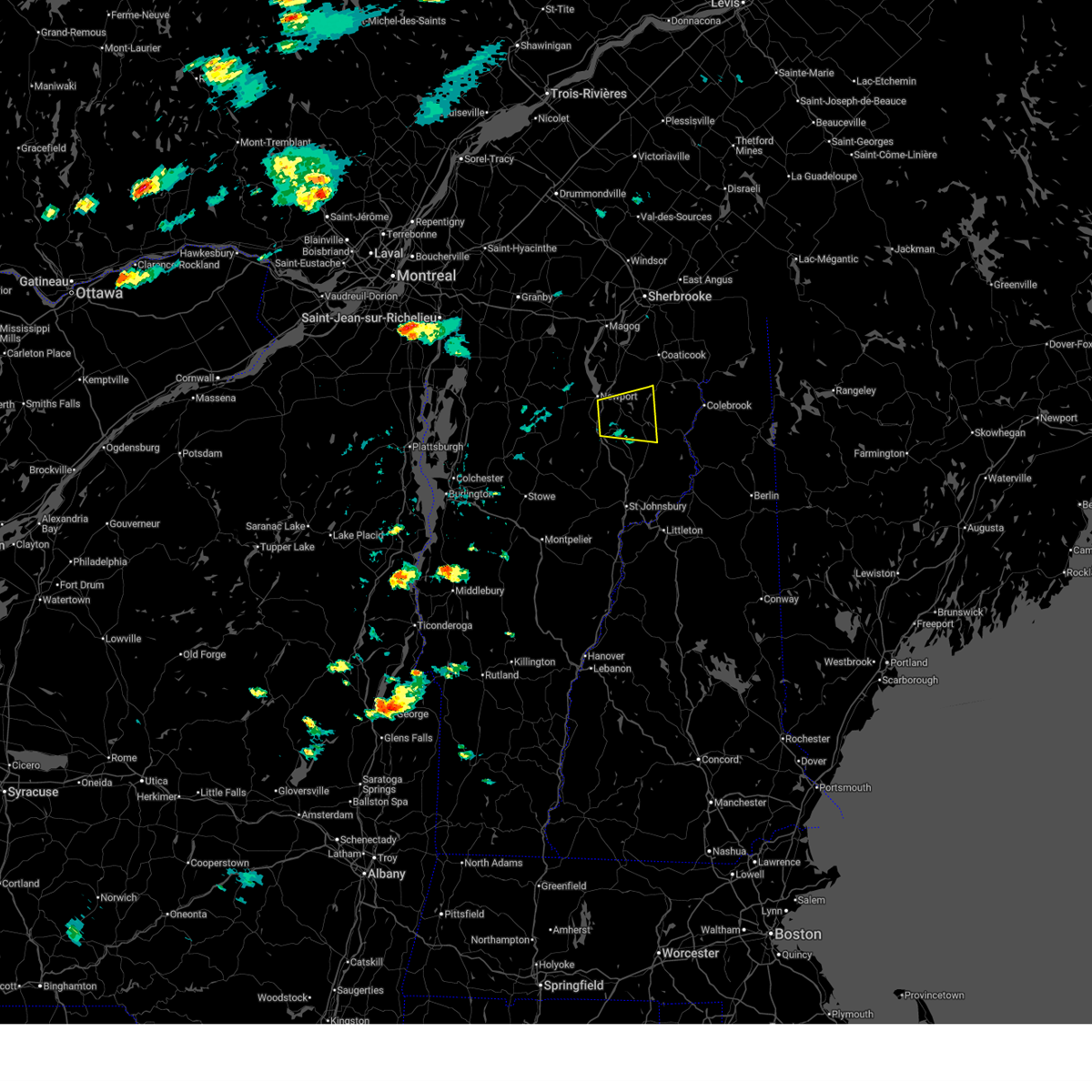
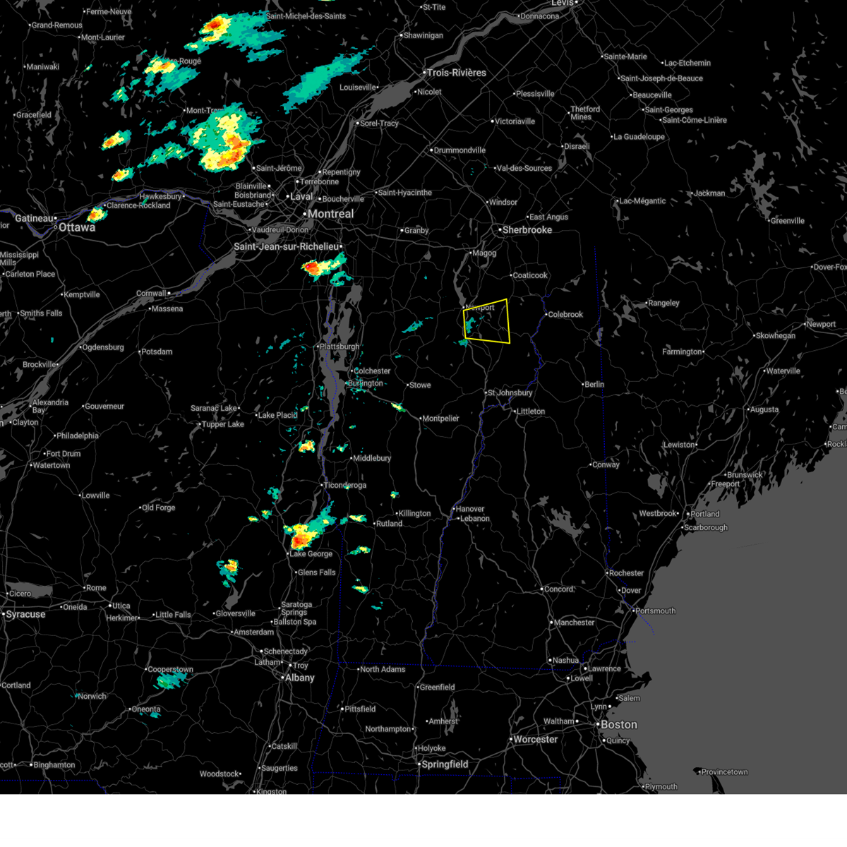
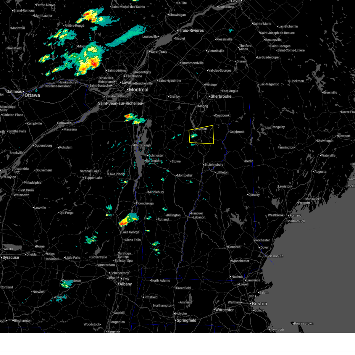
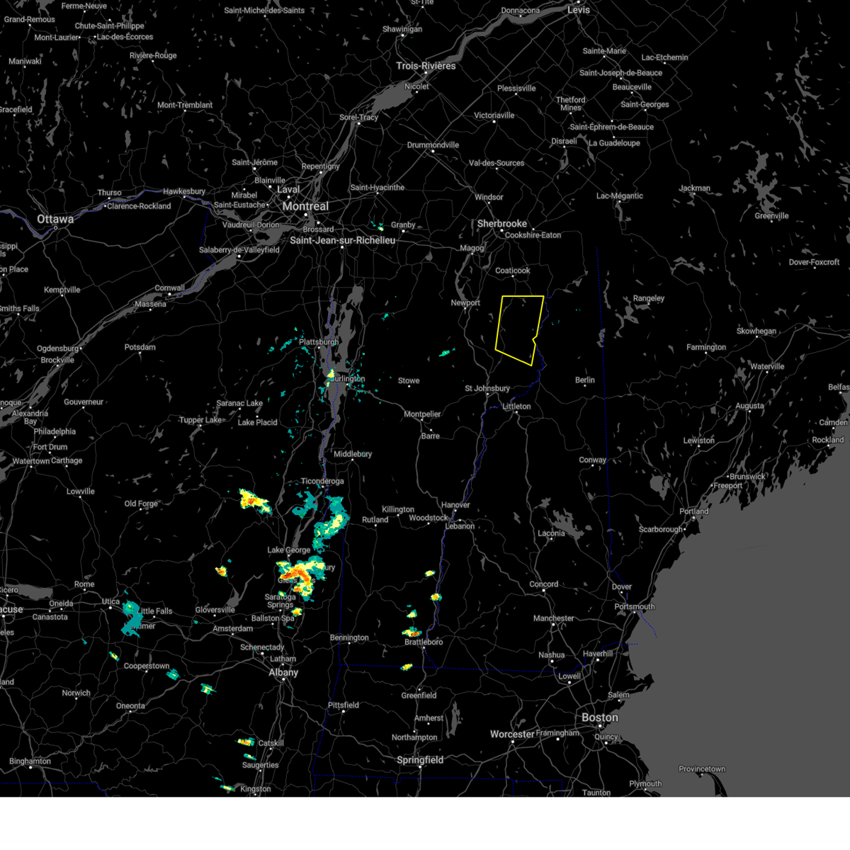
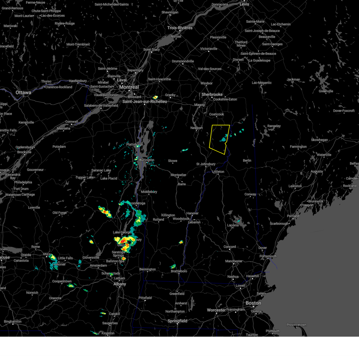
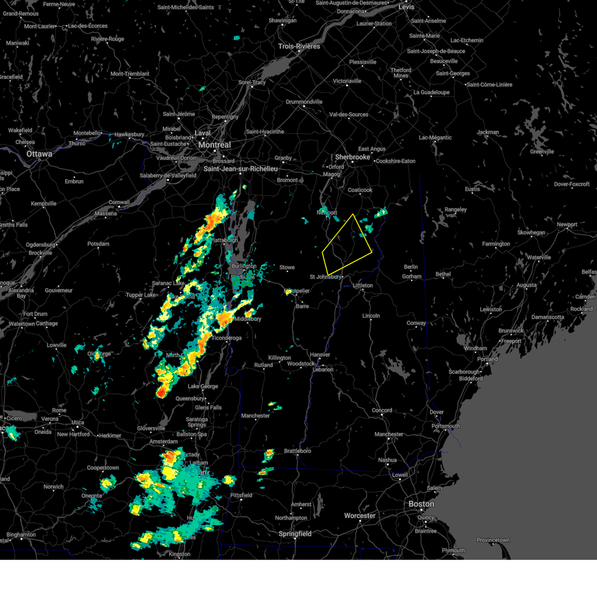
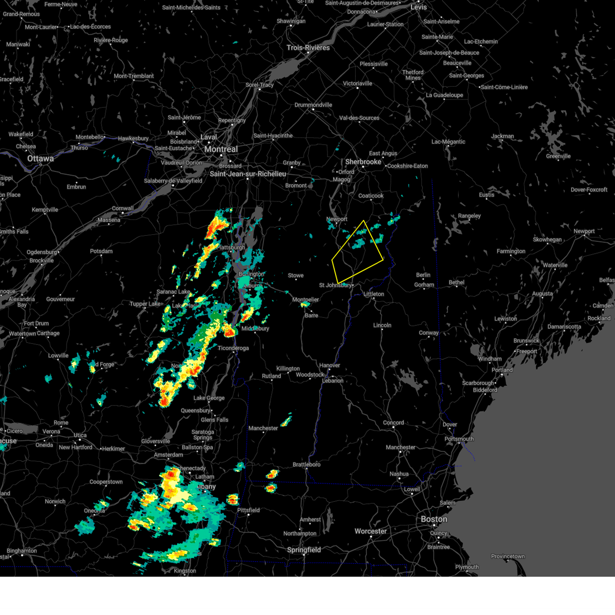
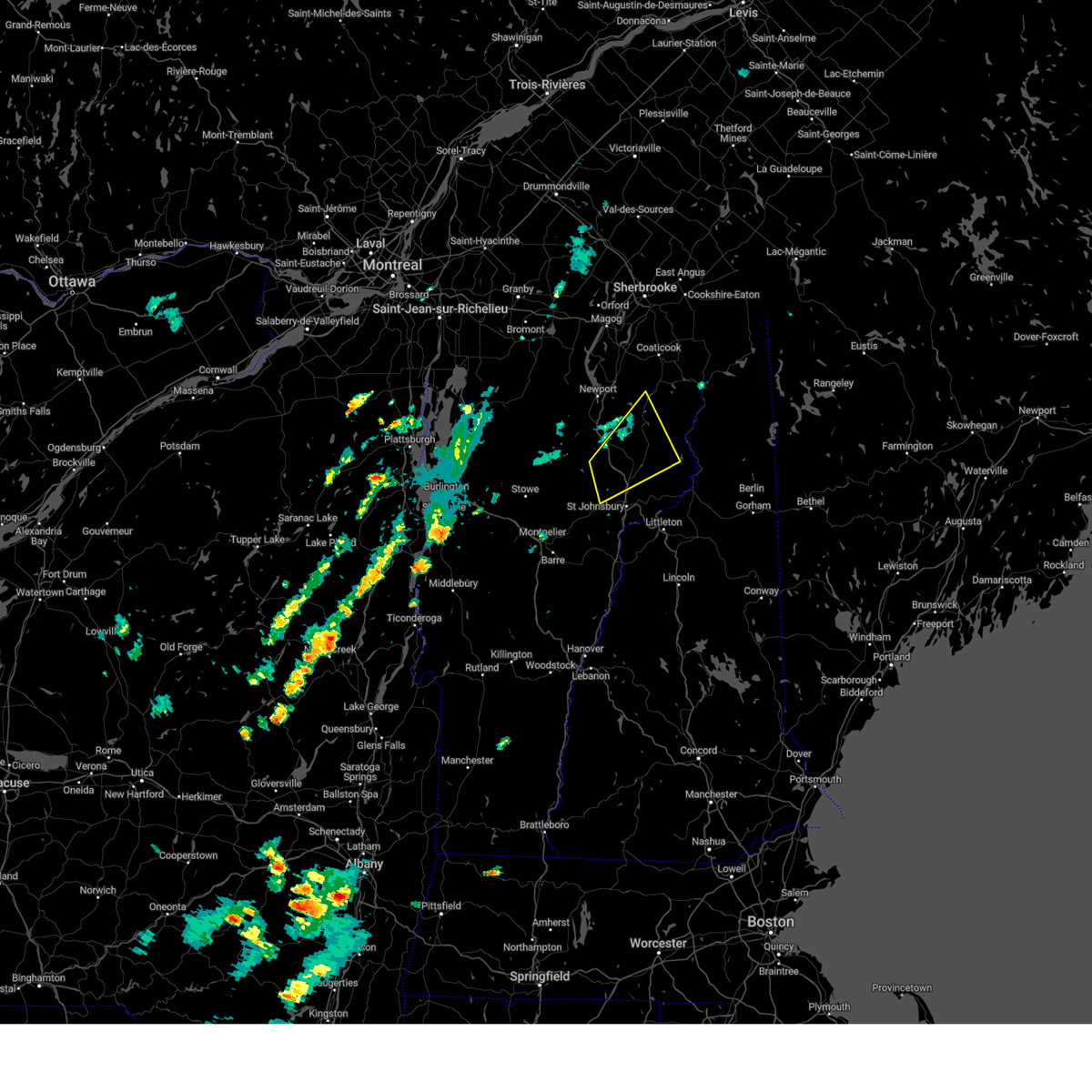
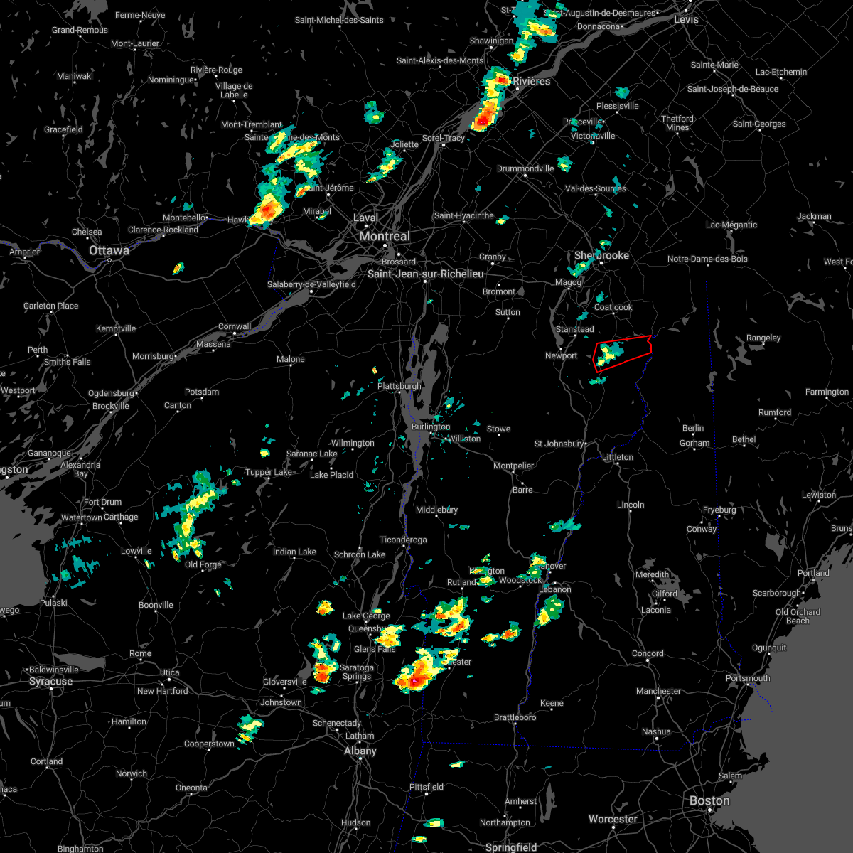
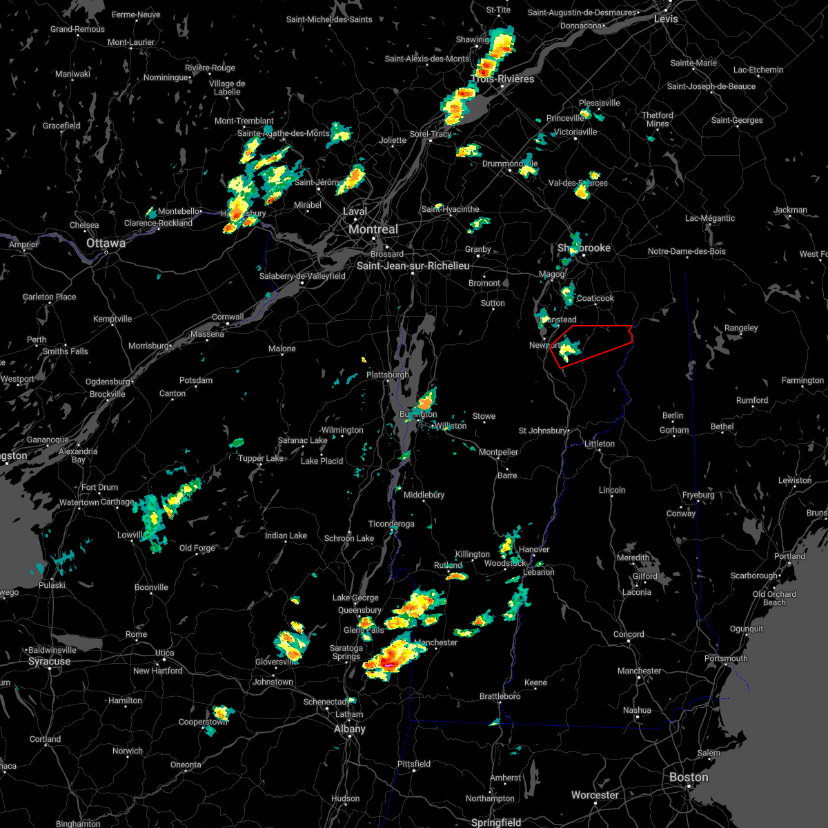
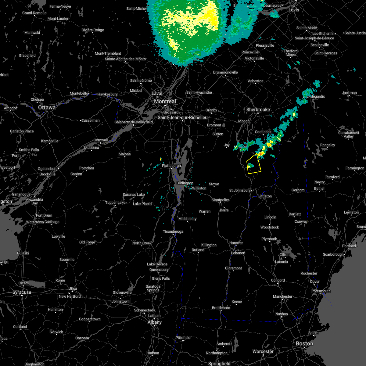
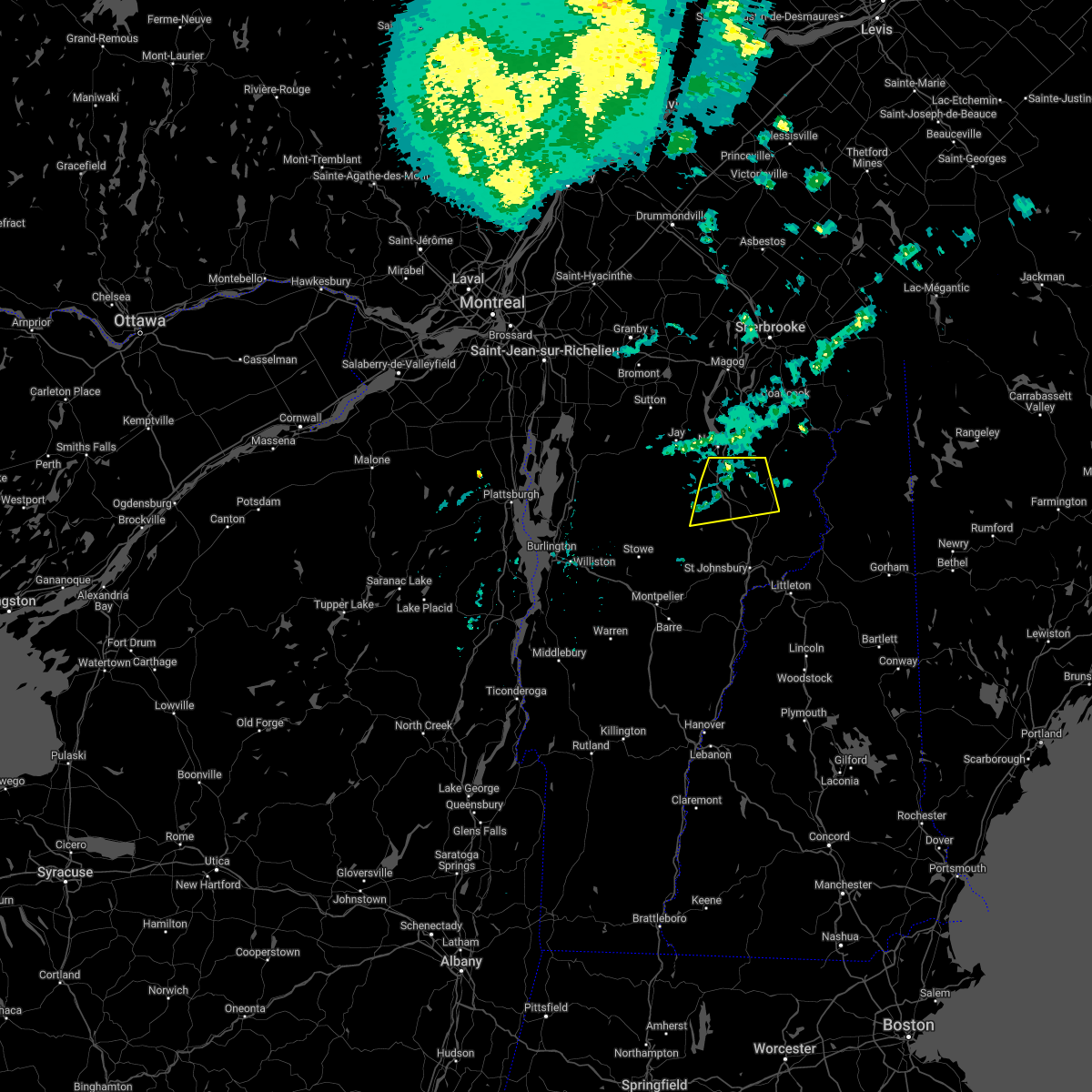
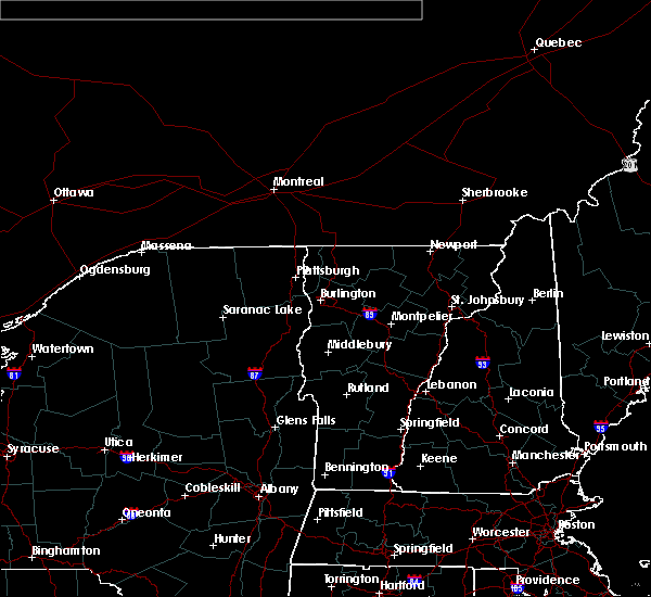
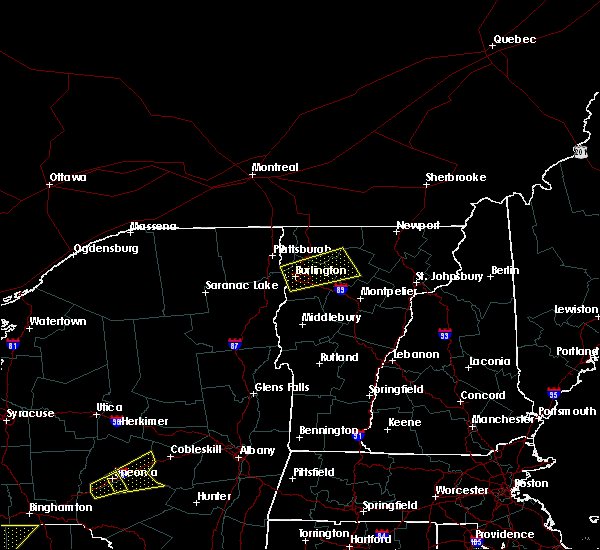
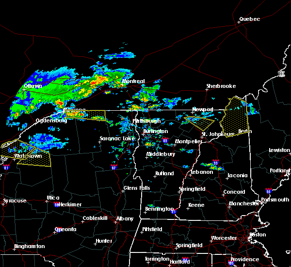
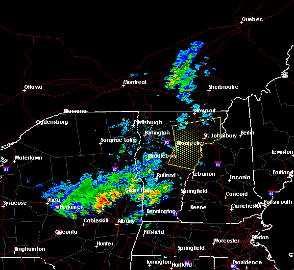
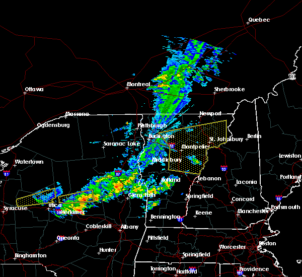
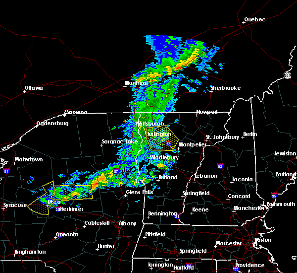
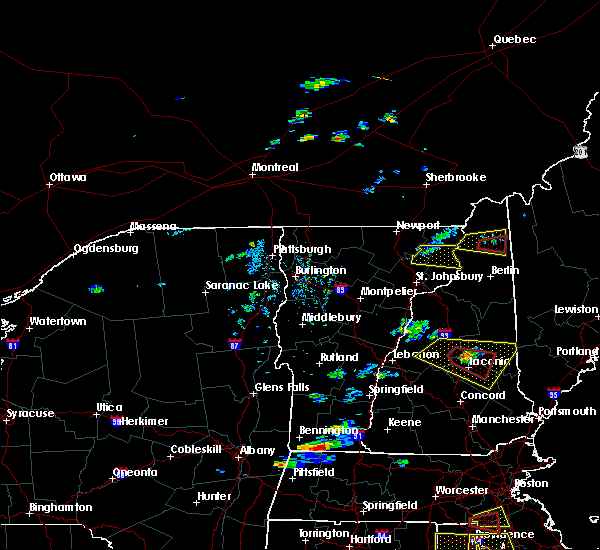
Hail Map for Island Pond, VT
The Island Pond, VT area has had 1 report of on-the-ground hail by trained spotters, and has been under severe weather warnings 3 times during the past 12 months. Doppler radar has detected hail at or near Island Pond, VT on 5 occasions.
| Name: | Island Pond, VT |
| Where Located: | 69.3 miles ENE of Burlington, VT |
| Map: | Google Map for Island Pond, VT |
| Population: | 821 |
| Housing Units: | 539 |
| More Info: | Search Google for Island Pond, VT |
5
The Top Recent Hail Date for Island Pond, VT is Thursday, May 26, 2011 (1st out of 5)

Hail and Wind Damage Spotted near Island Pond, VT
| Date / Time | Report Details |
|---|---|
| 7/10/2025 3:11 PM EDT |
 the severe thunderstorm warning has been cancelled and is no longer in effect the severe thunderstorm warning has been cancelled and is no longer in effect
|
| 7/10/2025 3:00 PM EDT |
 At 300 pm edt, a severe thunderstorm was located over brownington, moving east at 15 mph (radar indicated). Hazards include 60 mph wind gusts and quarter size hail. Minor hail damage to vehicles is possible. expect wind damage to trees and powerlines. locations impacted include, island pond, newport city, charleston, westmore, morgan, warren gore, brownington, brighton, barton, warners grant, brownington village, barton village, orleans village, holland, averys gore, derby, norton, coventry, newark, and ferdinand. This includes interstate 91 between mile markers 164 and 170. At 300 pm edt, a severe thunderstorm was located over brownington, moving east at 15 mph (radar indicated). Hazards include 60 mph wind gusts and quarter size hail. Minor hail damage to vehicles is possible. expect wind damage to trees and powerlines. locations impacted include, island pond, newport city, charleston, westmore, morgan, warren gore, brownington, brighton, barton, warners grant, brownington village, barton village, orleans village, holland, averys gore, derby, norton, coventry, newark, and ferdinand. This includes interstate 91 between mile markers 164 and 170.
|
| 7/10/2025 2:35 PM EDT |
 Svrbtv the national weather service in burlington has issued a * severe thunderstorm warning for, northeastern caledonia county in northeastern vermont, northeastern orleans county in northeastern vermont, northwestern essex county in northeastern vermont, * until 330 pm edt. * at 235 pm edt, a severe thunderstorm was located over orleans, moving east at 10 mph (radar indicated). Hazards include 60 mph wind gusts and quarter size hail. Minor hail damage to vehicles is possible. Expect wind damage to trees and powerlines. Svrbtv the national weather service in burlington has issued a * severe thunderstorm warning for, northeastern caledonia county in northeastern vermont, northeastern orleans county in northeastern vermont, northwestern essex county in northeastern vermont, * until 330 pm edt. * at 235 pm edt, a severe thunderstorm was located over orleans, moving east at 10 mph (radar indicated). Hazards include 60 mph wind gusts and quarter size hail. Minor hail damage to vehicles is possible. Expect wind damage to trees and powerlines.
|
| 6/19/2024 2:19 PM EDT | Tree down in roadway with utility lines in orleans county VT, 3 miles SSE of Island Pond, VT |
| 6/19/2024 2:06 PM EDT |
 The storm which prompted the warning has moved out of the area. therefore, the warning will be allowed to expire. The storm which prompted the warning has moved out of the area. therefore, the warning will be allowed to expire.
|
| 6/19/2024 2:00 PM EDT |
 At 159 pm edt, a severe thunderstorm was located over lemington, moving east at 15 mph (radar indicated). Hazards include 60 mph wind gusts and penny size hail. Expect damage to trees and powerlines. Locations impacted include, island pond, canaan, brunswick, bloomfield, brighton, norton, east haven, ferdinand, averill, warren gore, warners grant, lewis, averys gore, newark, newark hollow, lemington, maidstone state park, maidstone, granby, and morgan. At 159 pm edt, a severe thunderstorm was located over lemington, moving east at 15 mph (radar indicated). Hazards include 60 mph wind gusts and penny size hail. Expect damage to trees and powerlines. Locations impacted include, island pond, canaan, brunswick, bloomfield, brighton, norton, east haven, ferdinand, averill, warren gore, warners grant, lewis, averys gore, newark, newark hollow, lemington, maidstone state park, maidstone, granby, and morgan.
|
| 6/19/2024 1:34 PM EDT |
 Svrbtv the national weather service in burlington has issued a * severe thunderstorm warning for, northeastern caledonia county in northeastern vermont, northeastern orleans county in northeastern vermont, essex county in northeastern vermont, * until 215 pm edt. * at 133 pm edt, a severe thunderstorm was located over lewis, moving east at 15 mph (radar indicated). Hazards include 60 mph wind gusts and penny size hail. expect damage to trees and powerlines Svrbtv the national weather service in burlington has issued a * severe thunderstorm warning for, northeastern caledonia county in northeastern vermont, northeastern orleans county in northeastern vermont, essex county in northeastern vermont, * until 215 pm edt. * at 133 pm edt, a severe thunderstorm was located over lewis, moving east at 15 mph (radar indicated). Hazards include 60 mph wind gusts and penny size hail. expect damage to trees and powerlines
|
| 7/7/2023 1:54 PM EDT |
 The severe thunderstorm warning for northeastern caledonia, southeastern orleans and northwestern essex counties will expire at 200 pm edt, the storm which prompted the warning has weakened below severe limits, and has exited the warned area. therefore, the warning will be allowed to expire. to report severe weather, contact your nearest law enforcement agency. they will relay your report to the national weather service burlington. The severe thunderstorm warning for northeastern caledonia, southeastern orleans and northwestern essex counties will expire at 200 pm edt, the storm which prompted the warning has weakened below severe limits, and has exited the warned area. therefore, the warning will be allowed to expire. to report severe weather, contact your nearest law enforcement agency. they will relay your report to the national weather service burlington.
|
| 7/7/2023 1:34 PM EDT |
 At 134 pm edt, a severe thunderstorm was located over brighton, moving northeast at 20 mph (radar indicated). Hazards include 60 mph wind gusts and quarter size hail. Minor hail damage to vehicles is possible. expect wind damage to trees and powerlines. locations impacted include, island pond, lyndon, st. johnsbury, west burke village, lyndonville village, westmore, stannard, east haven, ferdinand, warren gore, wheelock, burke, willoughby, brighton, sutton, warners grant, sheffield, newark, newark hollow, and charleston. hail threat, radar indicated max hail size, 1. 00 in wind threat, radar indicated max wind gust, 60 mph. At 134 pm edt, a severe thunderstorm was located over brighton, moving northeast at 20 mph (radar indicated). Hazards include 60 mph wind gusts and quarter size hail. Minor hail damage to vehicles is possible. expect wind damage to trees and powerlines. locations impacted include, island pond, lyndon, st. johnsbury, west burke village, lyndonville village, westmore, stannard, east haven, ferdinand, warren gore, wheelock, burke, willoughby, brighton, sutton, warners grant, sheffield, newark, newark hollow, and charleston. hail threat, radar indicated max hail size, 1. 00 in wind threat, radar indicated max wind gust, 60 mph.
|
| 7/7/2023 1:03 PM EDT |
 At 103 pm edt, a severe thunderstorm was located over sheffield, moving northeast at 10 mph (radar indicated). Hazards include 60 mph wind gusts and quarter size hail. Minor hail damage to vehicles is possible. Expect wind damage to trees and powerlines. At 103 pm edt, a severe thunderstorm was located over sheffield, moving northeast at 10 mph (radar indicated). Hazards include 60 mph wind gusts and quarter size hail. Minor hail damage to vehicles is possible. Expect wind damage to trees and powerlines.
|
| 7/21/2022 5:55 PM EDT | 1 large tree down on lines and numerous other small limbs throughout brighton state par in essex county VT, 1.4 miles W of Island Pond, VT |
| 7/21/2022 5:46 PM EDT |
 At 546 pm edt, a severe thunderstorm was located over lewis, moving east at 40 mph (radar indicated). Hazards include 60 mph wind gusts and quarter size hail. Minor hail damage to vehicles is possible. Expect wind damage to trees and powerlines. At 546 pm edt, a severe thunderstorm was located over lewis, moving east at 40 mph (radar indicated). Hazards include 60 mph wind gusts and quarter size hail. Minor hail damage to vehicles is possible. Expect wind damage to trees and powerlines.
|
| 7/21/2022 2:45 PM EDT | Report of a snapped pine tree at a residence on eastern side of newar in caledonia county VT, 7.1 miles N of Island Pond, VT |
| 7/21/2022 1:27 PM EDT |
 At 126 pm edt, a severe thunderstorm was located over lewis, moving east at 35 mph (radar indicated). Hazards include 60 mph wind gusts and nickel size hail. expect damage to trees and powerlines At 126 pm edt, a severe thunderstorm was located over lewis, moving east at 35 mph (radar indicated). Hazards include 60 mph wind gusts and nickel size hail. expect damage to trees and powerlines
|
| 7/21/2022 1:24 PM EDT |
 At 124 pm edt, a severe thunderstorm capable of producing a tornado was located over norton, moving northeast at 35 mph (radar indicated rotation). Hazards include tornado and ping pong ball size hail. Flying debris will be dangerous to those caught without shelter. mobile homes will be damaged or destroyed. damage to roofs, windows, and vehicles will occur. tree damage is likely. this dangerous storm will be near, averill around 140 pm edt. Canaan around 150 pm edt. At 124 pm edt, a severe thunderstorm capable of producing a tornado was located over norton, moving northeast at 35 mph (radar indicated rotation). Hazards include tornado and ping pong ball size hail. Flying debris will be dangerous to those caught without shelter. mobile homes will be damaged or destroyed. damage to roofs, windows, and vehicles will occur. tree damage is likely. this dangerous storm will be near, averill around 140 pm edt. Canaan around 150 pm edt.
|
| 7/21/2022 1:11 PM EDT |
 At 111 pm edt, a severe thunderstorm capable of producing a tornado was located over morgan, moving northeast at 40 mph (radar indicated rotation). Hazards include tornado and ping pong ball size hail. Flying debris will be dangerous to those caught without shelter. mobile homes will be damaged or destroyed. damage to roofs, windows, and vehicles will occur. tree damage is likely. this dangerous storm will be near, warners grant and warren gore around 115 pm edt. averys gore around 125 pm edt. lewis around 130 pm edt. norton and averill around 135 pm edt. lemington around 140 pm edt. canaan around 145 pm edt. Other locations impacted by this tornadic thunderstorm include east brownington, west charleston, morgan center and east charleston. At 111 pm edt, a severe thunderstorm capable of producing a tornado was located over morgan, moving northeast at 40 mph (radar indicated rotation). Hazards include tornado and ping pong ball size hail. Flying debris will be dangerous to those caught without shelter. mobile homes will be damaged or destroyed. damage to roofs, windows, and vehicles will occur. tree damage is likely. this dangerous storm will be near, warners grant and warren gore around 115 pm edt. averys gore around 125 pm edt. lewis around 130 pm edt. norton and averill around 135 pm edt. lemington around 140 pm edt. canaan around 145 pm edt. Other locations impacted by this tornadic thunderstorm include east brownington, west charleston, morgan center and east charleston.
|
| 7/21/2022 1:08 PM EDT | Quarter sized hail reported 4.5 miles E of Island Pond, VT |
| 7/21/2022 12:58 PM EDT |
 At 1258 pm edt, a severe thunderstorm capable of producing a tornado was located over brownington village, moving northeast at 35 mph (radar indicated rotation). Hazards include tornado and ping pong ball size hail. Flying debris will be dangerous to those caught without shelter. mobile homes will be damaged or destroyed. damage to roofs, windows, and vehicles will occur. tree damage is likely. this dangerous storm will be near, derby center around 105 pm edt. derby center village around 110 pm edt. derby, derby line village and charleston around 115 pm edt. morgan, warners grant, warren gore and brighton around 120 pm edt. holland around 125 pm edt. averys gore and norton around 130 pm edt. Other locations impacted by this tornadic thunderstorm include east brownington, south bay in orleans county, west charleston, morgan center, derby line, brownington center, crystal lake state park, evansville and east charleston. At 1258 pm edt, a severe thunderstorm capable of producing a tornado was located over brownington village, moving northeast at 35 mph (radar indicated rotation). Hazards include tornado and ping pong ball size hail. Flying debris will be dangerous to those caught without shelter. mobile homes will be damaged or destroyed. damage to roofs, windows, and vehicles will occur. tree damage is likely. this dangerous storm will be near, derby center around 105 pm edt. derby center village around 110 pm edt. derby, derby line village and charleston around 115 pm edt. morgan, warners grant, warren gore and brighton around 120 pm edt. holland around 125 pm edt. averys gore and norton around 130 pm edt. Other locations impacted by this tornadic thunderstorm include east brownington, south bay in orleans county, west charleston, morgan center, derby line, brownington center, crystal lake state park, evansville and east charleston.
|
| 5/21/2022 6:55 PM EDT |
 At 655 pm edt, a severe thunderstorm was located over east charleston, moving east at 35 mph (radar indicated). Hazards include 60 mph wind gusts. Expect damage to trees and powerlines. locations impacted include, west burke village, sutton, westmore, newark, newark hollow, brighton, charleston, east haven, morgan, burke, brownington, barton, west burke, connor island and east charleston. hail threat, radar indicated max hail size, <. 75 in wind threat, radar indicated max wind gust, 60 mph. At 655 pm edt, a severe thunderstorm was located over east charleston, moving east at 35 mph (radar indicated). Hazards include 60 mph wind gusts. Expect damage to trees and powerlines. locations impacted include, west burke village, sutton, westmore, newark, newark hollow, brighton, charleston, east haven, morgan, burke, brownington, barton, west burke, connor island and east charleston. hail threat, radar indicated max hail size, <. 75 in wind threat, radar indicated max wind gust, 60 mph.
|
| 5/21/2022 6:42 PM EDT |
 At 641 pm edt, a severe thunderstorm was located over island pond, moving east at 40 mph (radar indicated). Hazards include 60 mph wind gusts and quarter size hail. Minor hail damage to vehicles is possible. Expect wind damage to trees and powerlines. At 641 pm edt, a severe thunderstorm was located over island pond, moving east at 40 mph (radar indicated). Hazards include 60 mph wind gusts and quarter size hail. Minor hail damage to vehicles is possible. Expect wind damage to trees and powerlines.
|
| 5/21/2022 6:39 PM EDT |
 At 639 pm edt, a severe thunderstorm was located over east brownington, moving east at 60 mph (radar indicated). Hazards include 60 mph wind gusts and quarter size hail. Minor hail damage to vehicles is possible. expect wind damage to trees and powerlines. locations impacted include, orleans, charleston, irasburg, westmore, orleans village, glover, brownington, willoughby, sutton, coventry, barton, barton village, sheffield, newark, newark hollow, brownington village, west burke village, albany, greensboro and morgan. hail threat, radar indicated max hail size, 1. 00 in wind threat, radar indicated max wind gust, 60 mph. At 639 pm edt, a severe thunderstorm was located over east brownington, moving east at 60 mph (radar indicated). Hazards include 60 mph wind gusts and quarter size hail. Minor hail damage to vehicles is possible. expect wind damage to trees and powerlines. locations impacted include, orleans, charleston, irasburg, westmore, orleans village, glover, brownington, willoughby, sutton, coventry, barton, barton village, sheffield, newark, newark hollow, brownington village, west burke village, albany, greensboro and morgan. hail threat, radar indicated max hail size, 1. 00 in wind threat, radar indicated max wind gust, 60 mph.
|
| 5/21/2022 6:17 PM EDT |
 At 617 pm edt, a severe thunderstorm was located over eden mills, moving east at 35 mph (radar indicated). Hazards include 60 mph wind gusts and quarter size hail. Minor hail damage to vehicles is possible. Expect wind damage to trees and powerlines. At 617 pm edt, a severe thunderstorm was located over eden mills, moving east at 35 mph (radar indicated). Hazards include 60 mph wind gusts and quarter size hail. Minor hail damage to vehicles is possible. Expect wind damage to trees and powerlines.
|
| 7/20/2021 8:11 PM EDT |
 At 808 pm edt, a line of severe thunderstorms over northern and central vermont was located along a line extending from near east richford to near wolcott to ainsworth state park to near pittsfield, moving east at 30 mph (radar indicated). Hazards include 60 mph wind gusts and quarter size hail. Expect wind damage to trees and powerlines. minor hail damage to vehicles is possible. these storms have a history of producing wind damage and power outages. locations impacted include, barre, montpelier, island pond, lyndon, st. Johnsbury, middlebury, newport city, vergennes, crown point, morrisville, enosburg falls, orleans, derby center, charleston, braintree hill, glover, waterbury village, montgomery center, websterville and orwell. At 808 pm edt, a line of severe thunderstorms over northern and central vermont was located along a line extending from near east richford to near wolcott to ainsworth state park to near pittsfield, moving east at 30 mph (radar indicated). Hazards include 60 mph wind gusts and quarter size hail. Expect wind damage to trees and powerlines. minor hail damage to vehicles is possible. these storms have a history of producing wind damage and power outages. locations impacted include, barre, montpelier, island pond, lyndon, st. Johnsbury, middlebury, newport city, vergennes, crown point, morrisville, enosburg falls, orleans, derby center, charleston, braintree hill, glover, waterbury village, montgomery center, websterville and orwell.
|
| 7/20/2021 7:32 PM EDT |
 At 730 pm edt, a line of severe thunderstorms over western vermont was located along a line extending from near east franklin to stowe to east warren to mossy point, moving east at 40 mph (radar indicated). Hazards include 60 mph wind gusts and quarter size hail. Expect wind damage to trees and powerlines. minor hail damage to vehicles is possible. This line of storms has a history of producing wind damage and power outages. At 730 pm edt, a line of severe thunderstorms over western vermont was located along a line extending from near east franklin to stowe to east warren to mossy point, moving east at 40 mph (radar indicated). Hazards include 60 mph wind gusts and quarter size hail. Expect wind damage to trees and powerlines. minor hail damage to vehicles is possible. This line of storms has a history of producing wind damage and power outages.
|
| 10/10/2020 5:58 PM EDT |
 The severe thunderstorm warning for northeastern caledonia, northeastern orleans and essex counties will expire at 600 pm edt, the storm which prompted the warning has weakened below severe limits, and has exited the warned area. therefore, the warning will be allowed to expire. a severe thunderstorm watch remains in effect until 900 pm edt for northeastern vermont. The severe thunderstorm warning for northeastern caledonia, northeastern orleans and essex counties will expire at 600 pm edt, the storm which prompted the warning has weakened below severe limits, and has exited the warned area. therefore, the warning will be allowed to expire. a severe thunderstorm watch remains in effect until 900 pm edt for northeastern vermont.
|
| 10/10/2020 5:50 PM EDT |
 At 549 pm edt, a severe thunderstorm was located over lewis, moving east at 70 mph (radar indicated). Hazards include 60 mph wind gusts and quarter size hail. Minor hail damage to vehicles is possible. expect wind damage to trees and powerlines. Locations impacted include, island pond, canaan, charleston, west burke village, westmore, east haven, morgan, ferdinand, warren gore, averys gore, brunswick, brighton, bloomfield, sutton, norton, averill, maidstone, warners grant, lewis and newark. At 549 pm edt, a severe thunderstorm was located over lewis, moving east at 70 mph (radar indicated). Hazards include 60 mph wind gusts and quarter size hail. Minor hail damage to vehicles is possible. expect wind damage to trees and powerlines. Locations impacted include, island pond, canaan, charleston, west burke village, westmore, east haven, morgan, ferdinand, warren gore, averys gore, brunswick, brighton, bloomfield, sutton, norton, averill, maidstone, warners grant, lewis and newark.
|
| 10/10/2020 5:36 PM EDT |
 At 536 pm edt, a severe thunderstorm was located over westmore, moving east at 70 mph (radar indicated). Hazards include 60 mph wind gusts and quarter size hail. Minor hail damage to vehicles is possible. Expect wind damage to trees and powerlines. At 536 pm edt, a severe thunderstorm was located over westmore, moving east at 70 mph (radar indicated). Hazards include 60 mph wind gusts and quarter size hail. Minor hail damage to vehicles is possible. Expect wind damage to trees and powerlines.
|
| 7/8/2020 4:17 PM EDT |
 At 416 pm edt, severe thunderstorms were located along a line extending from averys gore to morgan to orleans village, moving south at 30 mph (radar indicated). Hazards include 60 mph wind gusts and quarter size hail. Minor hail damage to vehicles is possible. expect wind damage to trees and powerlines. Locations impacted include, island pond, canaan, charleston, morgan, ferdinand, warren gore, averys gore, brunswick, brighton, bloomfield, averill, warners grant, lewis, newark, newark hollow, lemington, westmore, norton, east haven and holland. At 416 pm edt, severe thunderstorms were located along a line extending from averys gore to morgan to orleans village, moving south at 30 mph (radar indicated). Hazards include 60 mph wind gusts and quarter size hail. Minor hail damage to vehicles is possible. expect wind damage to trees and powerlines. Locations impacted include, island pond, canaan, charleston, morgan, ferdinand, warren gore, averys gore, brunswick, brighton, bloomfield, averill, warners grant, lewis, newark, newark hollow, lemington, westmore, norton, east haven and holland.
|
| 7/8/2020 3:48 PM EDT |
 At 348 pm edt, severe thunderstorms were located along a line extending from near norton to near derby line to newport center, moving south at 30 mph (radar indicated). Hazards include 60 mph wind gusts and quarter size hail. Minor hail damage to vehicles is possible. Expect wind damage to trees and powerlines. At 348 pm edt, severe thunderstorms were located along a line extending from near norton to near derby line to newport center, moving south at 30 mph (radar indicated). Hazards include 60 mph wind gusts and quarter size hail. Minor hail damage to vehicles is possible. Expect wind damage to trees and powerlines.
|
| 5/29/2020 8:53 PM EDT |
 The severe thunderstorm warning for northeastern caledonia, northeastern orleans and northern essex counties will expire at 900 pm edt, the storm which prompted the warning has weakened below severe limits, and has exited the warned area. therefore, the warning will be allowed to expire. however gusty winds and heavy rain are still possible with this thunderstorm. a severe thunderstorm watch remains in effect until 900 pm edt for northeastern vermont. The severe thunderstorm warning for northeastern caledonia, northeastern orleans and northern essex counties will expire at 900 pm edt, the storm which prompted the warning has weakened below severe limits, and has exited the warned area. therefore, the warning will be allowed to expire. however gusty winds and heavy rain are still possible with this thunderstorm. a severe thunderstorm watch remains in effect until 900 pm edt for northeastern vermont.
|
| 5/29/2020 8:25 PM EDT |
 At 825 pm edt, a severe thunderstorm was located over lewis, moving northeast at 35 mph (radar indicated). Hazards include 60 mph wind gusts and penny size hail. Expect damage to trees and powerlines. Locations impacted include, island pond, lyndon, charleston, west burke village, lyndonville village, westmore, east haven, morgan, ferdinand, warren gore, averys gore, brunswick, burke, willoughby, brighton, bloomfield, sutton, norton, warners grant and lewis. At 825 pm edt, a severe thunderstorm was located over lewis, moving northeast at 35 mph (radar indicated). Hazards include 60 mph wind gusts and penny size hail. Expect damage to trees and powerlines. Locations impacted include, island pond, lyndon, charleston, west burke village, lyndonville village, westmore, east haven, morgan, ferdinand, warren gore, averys gore, brunswick, burke, willoughby, brighton, bloomfield, sutton, norton, warners grant and lewis.
|
| 5/29/2020 8:12 PM EDT | Trees down on derby roa in essex county VT, 0.8 miles N of Island Pond, VT |
| 5/29/2020 8:08 PM EDT |
 At 808 pm edt, a severe thunderstorm was located over wheelock, moving northeast at 40 mph (radar indicated). Hazards include 60 mph wind gusts and penny size hail. expect damage to trees and powerlines At 808 pm edt, a severe thunderstorm was located over wheelock, moving northeast at 40 mph (radar indicated). Hazards include 60 mph wind gusts and penny size hail. expect damage to trees and powerlines
|
| 6/29/2019 7:20 PM EDT |
 At 720 pm edt, a severe thunderstorm was located over east brownington, moving southeast at 25 mph (radar indicated). Hazards include 60 mph wind gusts and penny size hail. Expect damage to trees and powerlines. Locations impacted include, lyndon, orleans, west burke village, irasburg, westmore, orleans village, brownington, burke, willoughby, brighton, sutton, barton, barton village, newark, newark hollow, brownington village, charleston, coventry, ferdinand and sheffield. At 720 pm edt, a severe thunderstorm was located over east brownington, moving southeast at 25 mph (radar indicated). Hazards include 60 mph wind gusts and penny size hail. Expect damage to trees and powerlines. Locations impacted include, lyndon, orleans, west burke village, irasburg, westmore, orleans village, brownington, burke, willoughby, brighton, sutton, barton, barton village, newark, newark hollow, brownington village, charleston, coventry, ferdinand and sheffield.
|
| 6/29/2019 7:10 PM EDT | Trees down in essex county VT, 1.2 miles S of Island Pond, VT |
| 6/29/2019 6:59 PM EDT |
 At 658 pm edt, a severe thunderstorm was located over coventry and east charleston, moving southeast at 25 mph (radar indicated). Hazards include 60 mph wind gusts and quarter size hail. Minor hail damage to vehicles is possible. expect wind damage to trees and powerlines. Locations impacted include, newport city, island pond, lyndon, orleans, derby center, charleston, newport town, jay in franklin county, westmore, orleans village, brownington, burke, sutton, coventry, barton, troy, newark, newark hollow, brownington village and west burke village. At 658 pm edt, a severe thunderstorm was located over coventry and east charleston, moving southeast at 25 mph (radar indicated). Hazards include 60 mph wind gusts and quarter size hail. Minor hail damage to vehicles is possible. expect wind damage to trees and powerlines. Locations impacted include, newport city, island pond, lyndon, orleans, derby center, charleston, newport town, jay in franklin county, westmore, orleans village, brownington, burke, sutton, coventry, barton, troy, newark, newark hollow, brownington village and west burke village.
|
| 6/29/2019 6:41 PM EDT |
 At 641 pm edt, a severe thunderstorm was located over newport center, moving southeast at 25 mph (radar indicated). Hazards include 60 mph wind gusts and quarter size hail. Minor hail damage to vehicles is possible. Expect wind damage to trees and powerlines. At 641 pm edt, a severe thunderstorm was located over newport center, moving southeast at 25 mph (radar indicated). Hazards include 60 mph wind gusts and quarter size hail. Minor hail damage to vehicles is possible. Expect wind damage to trees and powerlines.
|
| 8/29/2018 6:13 PM EDT |
 The severe thunderstorm warning for northeastern caledonia, east central orleans and essex counties will expire at 615 pm edt, the storm which prompted the warning has weakened below severe limits, and no longer poses an immediate threat to life or property. therefore, the warning will be allowed to expire. however gusty winds and heavy rain are still possible with this thunderstorm. a severe thunderstorm watch remains in effect until 1100 pm edt for northeastern vermont. The severe thunderstorm warning for northeastern caledonia, east central orleans and essex counties will expire at 615 pm edt, the storm which prompted the warning has weakened below severe limits, and no longer poses an immediate threat to life or property. therefore, the warning will be allowed to expire. however gusty winds and heavy rain are still possible with this thunderstorm. a severe thunderstorm watch remains in effect until 1100 pm edt for northeastern vermont.
|
| 8/29/2018 5:45 PM EDT |
 At 544 pm edt, a severe thunderstorm was located near newark, moving east at 35 mph (radar indicated). Hazards include 60 mph wind gusts. Expect damage to trees and powerlines. Locations impacted include, island pond, lyndon, canaan, west burke village, guildhall, westmore, east haven, ferdinand, granby, averys gore, victory, brunswick, burke, brighton, bloomfield, sutton, averill, maidstone, lewis and newark. At 544 pm edt, a severe thunderstorm was located near newark, moving east at 35 mph (radar indicated). Hazards include 60 mph wind gusts. Expect damage to trees and powerlines. Locations impacted include, island pond, lyndon, canaan, west burke village, guildhall, westmore, east haven, ferdinand, granby, averys gore, victory, brunswick, burke, brighton, bloomfield, sutton, averill, maidstone, lewis and newark.
|
| 8/29/2018 5:14 PM EDT |
 At 513 pm edt, a severe thunderstorm was located over east craftsbury, moving east at 35 mph (radar indicated). Hazards include 60 mph wind gusts and penny size hail. expect damage to trees and powerlines At 513 pm edt, a severe thunderstorm was located over east craftsbury, moving east at 35 mph (radar indicated). Hazards include 60 mph wind gusts and penny size hail. expect damage to trees and powerlines
|
| 8/6/2018 8:23 PM EDT | Us customs reports several trees down along highway 114 south of norto in essex county VT, 13 miles SSW of Island Pond, VT |
| 5/4/2018 8:05 PM EDT |
 The national weather service in burlington has issued a * severe thunderstorm warning for. caledonia county in northeastern vermont. northeastern orleans county in northeastern vermont. essex county in northeastern vermont. Northern washington county in central vermont. The national weather service in burlington has issued a * severe thunderstorm warning for. caledonia county in northeastern vermont. northeastern orleans county in northeastern vermont. essex county in northeastern vermont. Northern washington county in central vermont.
|
| 5/4/2018 6:54 PM EDT |
 At 654 pm edt, a severe thunderstorm was located over berkshire, moving east at 35 mph (radar indicated). Hazards include 60 mph wind gusts and quarter size hail. Minor hail damage to vehicles is possible. Expect wind damage to trees and powerlines. At 654 pm edt, a severe thunderstorm was located over berkshire, moving east at 35 mph (radar indicated). Hazards include 60 mph wind gusts and quarter size hail. Minor hail damage to vehicles is possible. Expect wind damage to trees and powerlines.
|
| 8/12/2017 7:45 PM EDT | Trees downed on powerlines in brighton in essex county VT, 3.3 miles NW of Island Pond, VT |
| 8/12/2017 7:38 PM EDT |
 At 737 pm edt, severe thunderstorms were located along a line extending from near norton to brighton to near south walden, moving east at 15 mph (radar indicated). Hazards include 60 mph wind gusts and quarter size hail. Minor hail damage to vehicles is possible. expect wind damage to trees and powerlines. locations impacted include, st. Johnsbury, island pond, lyndon, orleans, charleston, glover, albany, brunswick, burke, greensboro bend, averill, newark, brownington village, canaan, west burke village, morgan, ferdinand, gilman, granby and woodbury. At 737 pm edt, severe thunderstorms were located along a line extending from near norton to brighton to near south walden, moving east at 15 mph (radar indicated). Hazards include 60 mph wind gusts and quarter size hail. Minor hail damage to vehicles is possible. expect wind damage to trees and powerlines. locations impacted include, st. Johnsbury, island pond, lyndon, orleans, charleston, glover, albany, brunswick, burke, greensboro bend, averill, newark, brownington village, canaan, west burke village, morgan, ferdinand, gilman, granby and woodbury.
|
| 8/12/2017 7:00 PM EDT |
 At 700 pm edt, severe thunderstorms were located along a line extending from cove island to near elmore state park, moving east at 40 mph (radar indicated). Hazards include 60 mph wind gusts and quarter size hail. Minor hail damage to vehicles is possible. Expect wind damage to trees and powerlines. At 700 pm edt, severe thunderstorms were located along a line extending from cove island to near elmore state park, moving east at 40 mph (radar indicated). Hazards include 60 mph wind gusts and quarter size hail. Minor hail damage to vehicles is possible. Expect wind damage to trees and powerlines.
|
| 5/18/2017 6:42 PM EDT |
 The severe thunderstorm warning for northeastern caledonia, southeastern orleans and essex counties will expire at 645 pm edt, the storm which prompted the warning has moved out of the area. therefore the warning will be allowed to expire. a severe thunderstorm watch remains in effect until 1100 pm edt for northeastern vermont. The severe thunderstorm warning for northeastern caledonia, southeastern orleans and essex counties will expire at 645 pm edt, the storm which prompted the warning has moved out of the area. therefore the warning will be allowed to expire. a severe thunderstorm watch remains in effect until 1100 pm edt for northeastern vermont.
|
| 5/18/2017 6:02 PM EDT |
 At 541 pm edt, a severe thunderstorm was located over south wheelock, moving east at 45 mph (radar indicated). Hazards include 60 mph wind gusts and quarter size hail. Minor hail damage to vehicles is possible. Expect wind damage to trees and powerlines. At 541 pm edt, a severe thunderstorm was located over south wheelock, moving east at 45 mph (radar indicated). Hazards include 60 mph wind gusts and quarter size hail. Minor hail damage to vehicles is possible. Expect wind damage to trees and powerlines.
|
| 5/18/2017 5:50 PM EDT | Trees adn powerlines down in essex county VT, 4.2 miles WNW of Island Pond, VT |
| 5/18/2017 5:41 PM EDT |
 At 541 pm edt, a severe thunderstorm was located over south wheelock, moving east at 45 mph (radar indicated). Hazards include 60 mph wind gusts and quarter size hail. Minor hail damage to vehicles is possible. Expect wind damage to trees and powerlines. At 541 pm edt, a severe thunderstorm was located over south wheelock, moving east at 45 mph (radar indicated). Hazards include 60 mph wind gusts and quarter size hail. Minor hail damage to vehicles is possible. Expect wind damage to trees and powerlines.
|
| 7/22/2016 11:36 PM EDT |
 At 1134 pm edt, severe thunderstorms were located along a line extending from north troy to mount worcester, moving east at 35 mph (radar indicated). Hazards include 60 mph wind gusts and quarter size hail. Hail damage to vehicles is expected. expect wind damage to roofs, siding, and trees. Locations impacted include, island pond, stowe, hardwick, richford, danville, morrisville, berkshire, wolcott, troy, johnson, eden, bakersfield, concord, craftsbury, montgomery, irasburg, glover, coventry, sutton and canaan. At 1134 pm edt, severe thunderstorms were located along a line extending from north troy to mount worcester, moving east at 35 mph (radar indicated). Hazards include 60 mph wind gusts and quarter size hail. Hail damage to vehicles is expected. expect wind damage to roofs, siding, and trees. Locations impacted include, island pond, stowe, hardwick, richford, danville, morrisville, berkshire, wolcott, troy, johnson, eden, bakersfield, concord, craftsbury, montgomery, irasburg, glover, coventry, sutton and canaan.
|
| 7/22/2016 10:43 PM EDT |
 At 1041 pm edt, severe thunderstorms were located along a line extending from alburg vermont to burlington vermont, moving east at 35 to 40 mph. other strong to severe thunderstorms were located over northeast vermont moving east at 35 mph (radar indicated). Hazards include 60 mph wind gusts and quarter size hail. Hail damage to vehicles is expected. Expect wind damage to roofs, siding, and trees. At 1041 pm edt, severe thunderstorms were located along a line extending from alburg vermont to burlington vermont, moving east at 35 to 40 mph. other strong to severe thunderstorms were located over northeast vermont moving east at 35 mph (radar indicated). Hazards include 60 mph wind gusts and quarter size hail. Hail damage to vehicles is expected. Expect wind damage to roofs, siding, and trees.
|
| 7/18/2016 1:02 PM EDT |
 At 102 pm edt, a severe thunderstorm was located over colebrook, moving east at 60 mph (radar indicated). Hazards include 60 mph wind gusts and quarter size hail. Hail damage to vehicles is expected. Expect wind damage to roofs, siding, and trees. At 102 pm edt, a severe thunderstorm was located over colebrook, moving east at 60 mph (radar indicated). Hazards include 60 mph wind gusts and quarter size hail. Hail damage to vehicles is expected. Expect wind damage to roofs, siding, and trees.
|
| 7/18/2016 12:22 PM EDT |
 At 1222 pm edt, a severe thunderstorm was located over newport center, moving east at 45 mph (radar indicated). Hazards include 60 mph wind gusts and quarter size hail. Hail damage to vehicles is expected. expect wind damage to roofs, siding, and trees. locations impacted include, colebrook, island pond, troy, irasburg, coventry, canaan, orleans, morgan, barton, holland, derby center, westfield, jay, westmore, bloomfield, maidstone, norton, averill, newport center and jay in franklin county. At 1222 pm edt, a severe thunderstorm was located over newport center, moving east at 45 mph (radar indicated). Hazards include 60 mph wind gusts and quarter size hail. Hail damage to vehicles is expected. expect wind damage to roofs, siding, and trees. locations impacted include, colebrook, island pond, troy, irasburg, coventry, canaan, orleans, morgan, barton, holland, derby center, westfield, jay, westmore, bloomfield, maidstone, norton, averill, newport center and jay in franklin county.
|
| 7/18/2016 11:42 AM EDT |
 At 1141 am edt, a severe thunderstorm was located near north troy, moving east at 35 mph (radar indicated). Hazards include 60 mph wind gusts and quarter size hail. Hail damage to vehicles is expected. Expect wind damage to roofs, siding, and trees. At 1141 am edt, a severe thunderstorm was located near north troy, moving east at 35 mph (radar indicated). Hazards include 60 mph wind gusts and quarter size hail. Hail damage to vehicles is expected. Expect wind damage to roofs, siding, and trees.
|
| 7/14/2016 4:46 PM EDT |
 At 445 pm edt, severe thunderstorms were located along a line extending from island pond to groton, moving east at 35 to 40 mph (radar indicated). Hazards include 60 mph wind gusts. Expect damage to roofs. siding. And trees. At 445 pm edt, severe thunderstorms were located along a line extending from island pond to groton, moving east at 35 to 40 mph (radar indicated). Hazards include 60 mph wind gusts. Expect damage to roofs. siding. And trees.
|
| 6/21/2016 1:07 AM EDT |
 The severe thunderstorm warning for orange, eastern lamoille, southern orleans, eastern washington, central essex and caledonia counties will expire at 115 am edt, the storms which prompted the warning have weakened below severe limits, and are moving out of the area. therefore the warning will be allowed to expire. The severe thunderstorm warning for orange, eastern lamoille, southern orleans, eastern washington, central essex and caledonia counties will expire at 115 am edt, the storms which prompted the warning have weakened below severe limits, and are moving out of the area. therefore the warning will be allowed to expire.
|
| 6/21/2016 12:44 AM EDT |
 At 1243 am edt, severe thunderstorms were located along a line extending from near albany to near ricker state park to near thetford center, moving east at 55 mph (radar indicated). Hazards include 60 mph wind gusts. Expect damage to roofs. siding. and trees. locations impacted include, barre, montpelier, littleton, chelsea, island pond, orange, randolph, haverhill, williamstown, hardwick, berlin, bradford, east montpelier, danville, morrisville, barnet, wolcott, calais, corinth and eden. At 1243 am edt, severe thunderstorms were located along a line extending from near albany to near ricker state park to near thetford center, moving east at 55 mph (radar indicated). Hazards include 60 mph wind gusts. Expect damage to roofs. siding. and trees. locations impacted include, barre, montpelier, littleton, chelsea, island pond, orange, randolph, haverhill, williamstown, hardwick, berlin, bradford, east montpelier, danville, morrisville, barnet, wolcott, calais, corinth and eden.
|
| 6/21/2016 12:20 AM EDT |
 At 1220 am edt, severe thunderstorms were located along a line extending from near waterville to near montpelier to bethel, moving east at 55 mph (radar indicated). Hazards include 60 mph wind gusts. Expect damage to roofs. siding. And trees. At 1220 am edt, severe thunderstorms were located along a line extending from near waterville to near montpelier to bethel, moving east at 55 mph (radar indicated). Hazards include 60 mph wind gusts. Expect damage to roofs. siding. And trees.
|
| 7/19/2015 9:37 PM EDT |
 The severe thunderstorm warning for east central orleans, central essex and northeastern caledonia counties will expire at 945 pm edt, the storm which prompted the warning has moved out of the area. therefore the warning will be allowed to expire. to report severe weather, contact your nearest law enforcement agency. they will relay your report to the national weather service burlington. The severe thunderstorm warning for east central orleans, central essex and northeastern caledonia counties will expire at 945 pm edt, the storm which prompted the warning has moved out of the area. therefore the warning will be allowed to expire. to report severe weather, contact your nearest law enforcement agency. they will relay your report to the national weather service burlington.
|
| 7/19/2015 9:22 PM EDT |
 At 919 pm edt, doppler radar indicated a severe thunderstorm capable of producing quarter size hail and damaging winds in excess of 60 mph. this storm was located near bloomfield in essex county vermont , moving northeast at 30 mph. as this storm moved through newark vermont, hail the size of quarters was reported. locations impacted include, colebrook, island pond, sutton, westmore, bloomfield, maidstone, willoughby, newark hollow, maidstone state park, columbia, newark, west burke, east haven, ferdinand, burke hollow, east brighton, brunswick springs, brighton state park, connor island and east burke. At 919 pm edt, doppler radar indicated a severe thunderstorm capable of producing quarter size hail and damaging winds in excess of 60 mph. this storm was located near bloomfield in essex county vermont , moving northeast at 30 mph. as this storm moved through newark vermont, hail the size of quarters was reported. locations impacted include, colebrook, island pond, sutton, westmore, bloomfield, maidstone, willoughby, newark hollow, maidstone state park, columbia, newark, west burke, east haven, ferdinand, burke hollow, east brighton, brunswick springs, brighton state park, connor island and east burke.
|
| 7/19/2015 8:48 PM EDT |
 At 847 pm edt, doppler radar indicated a severe thunderstorm capable of producing quarter size hail and damaging winds in excess of 60 mph. this storm was located near newark vermont, and moving northeast at 30 mph. * locations to be impacted include, colebrook, island pond, sutton, westmore, bloomfield, maidstone, willoughby, newark hollow, maidstone state park, columbia, newark, west burke, east haven, ferdinand, burke hollow, east brighton, brunswick springs, brighton state park, connor island and east burke. At 847 pm edt, doppler radar indicated a severe thunderstorm capable of producing quarter size hail and damaging winds in excess of 60 mph. this storm was located near newark vermont, and moving northeast at 30 mph. * locations to be impacted include, colebrook, island pond, sutton, westmore, bloomfield, maidstone, willoughby, newark hollow, maidstone state park, columbia, newark, west burke, east haven, ferdinand, burke hollow, east brighton, brunswick springs, brighton state park, connor island and east burke.
|
| 6/23/2015 5:41 PM EDT |
 At 541 pm edt, doppler radar indicated a severe thunderstorm capable of producing quarter size hail and damaging winds in excess of 60 mph. this storm was located over newark hollow, and moving east at 35 mph. * locations to be impacted include, sutton, bloomfield, maidstone, newark hollow, maidstone state park, newark, west burke, east haven, ferdinand, burke hollow, east brighton, brunswick springs, brighton state park and connor island. At 541 pm edt, doppler radar indicated a severe thunderstorm capable of producing quarter size hail and damaging winds in excess of 60 mph. this storm was located over newark hollow, and moving east at 35 mph. * locations to be impacted include, sutton, bloomfield, maidstone, newark hollow, maidstone state park, newark, west burke, east haven, ferdinand, burke hollow, east brighton, brunswick springs, brighton state park and connor island.
|
| 5/28/2015 1:56 PM EDT | At 155 pm edt, doppler radar indicated a severe thunderstorm capable of producing quarter size hail and damaging winds in excess of 60 mph. this storm was located near averill, moving east at 45 mph. locations impacted include, canaan, averill and stewartstown. |
| 5/28/2015 1:24 PM EDT | At 123 pm edt, doppler radar indicated a severe thunderstorm capable of producing quarter size hail and damaging winds in excess of 60 mph. this storm was located over derby center, and moving northeast at 25 mph. * locations to be impacted include, canaan, morgan, holland, derby center, averill, west charleston, east charleston, morgan center, cove island, black island, beecher falls, bell island, stewartstown, horseneck island and derby bay. |
| 9/11/2013 6:50 PM EDT | Trees down around town. report from vt state police. time estimated from radar in essex county VT, 0.7 miles SW of Island Pond, VT |
| 1/1/0001 12:00 AM | Trees down and power outages in orleans county VT, 5.3 miles ESE of Island Pond, VT |
Hail Maps for Island Pond, VT


Connect with Interactive Hail Maps