

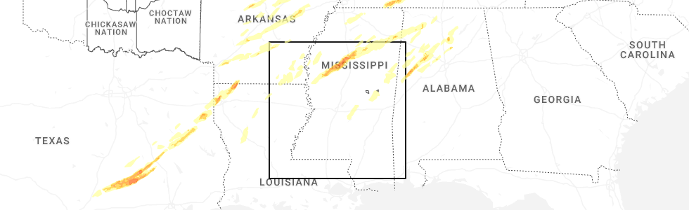
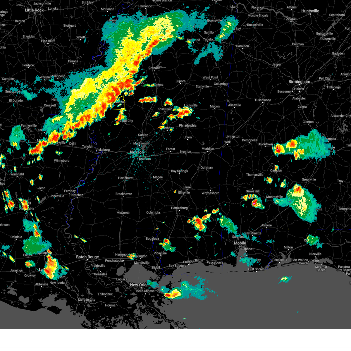
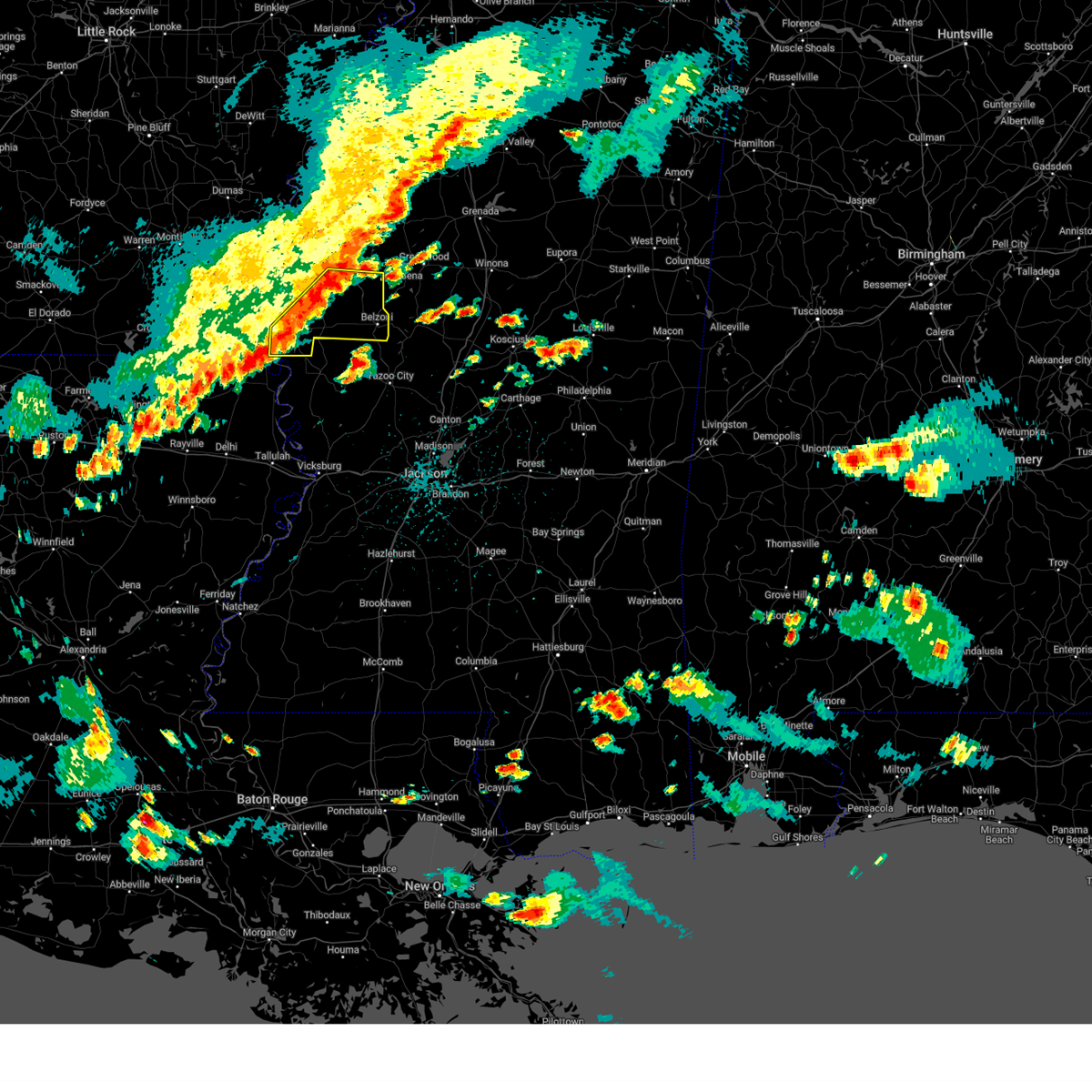
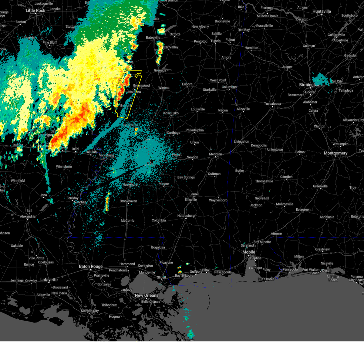
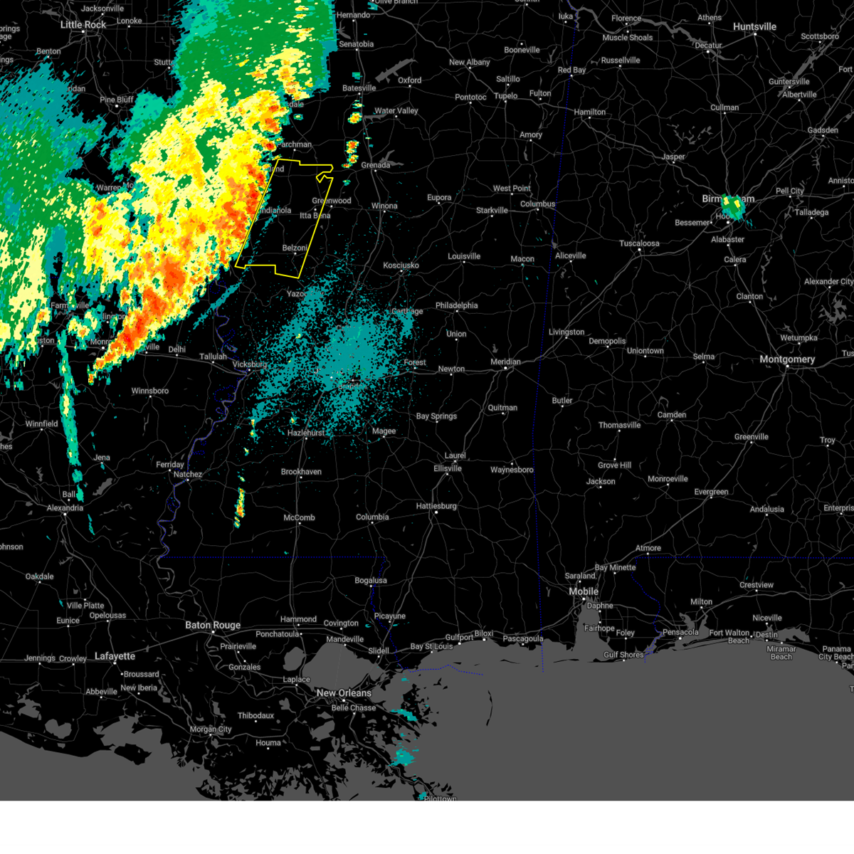
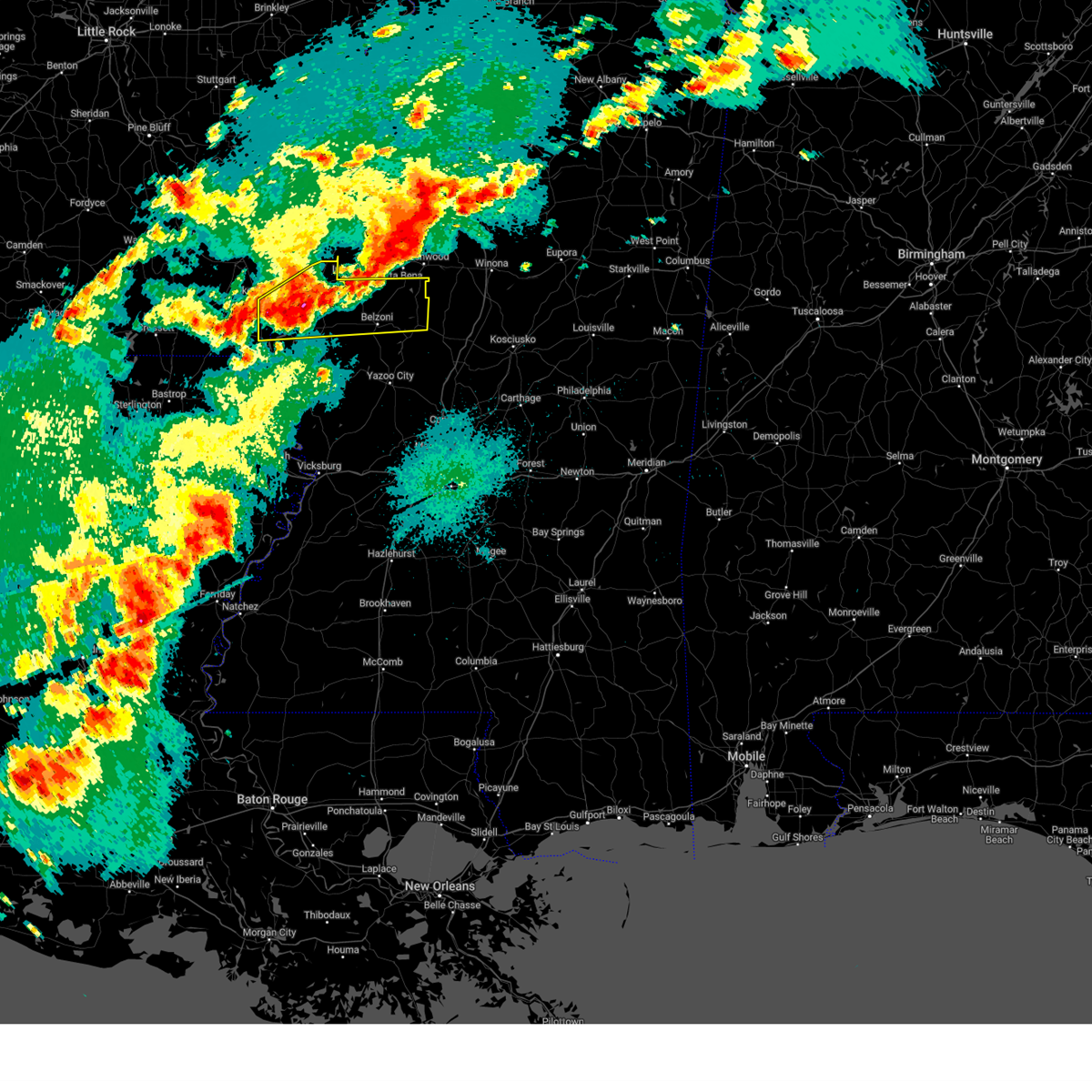
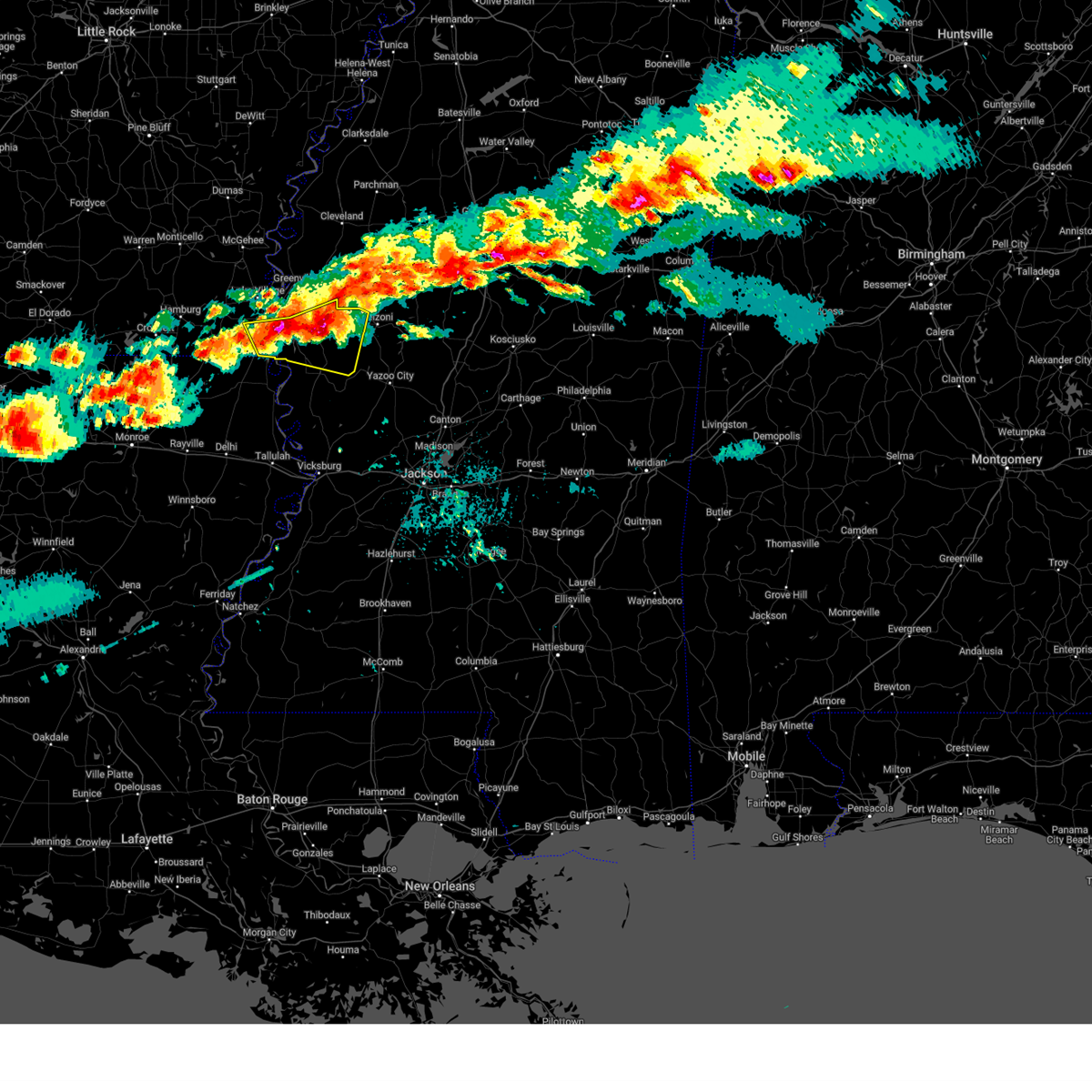
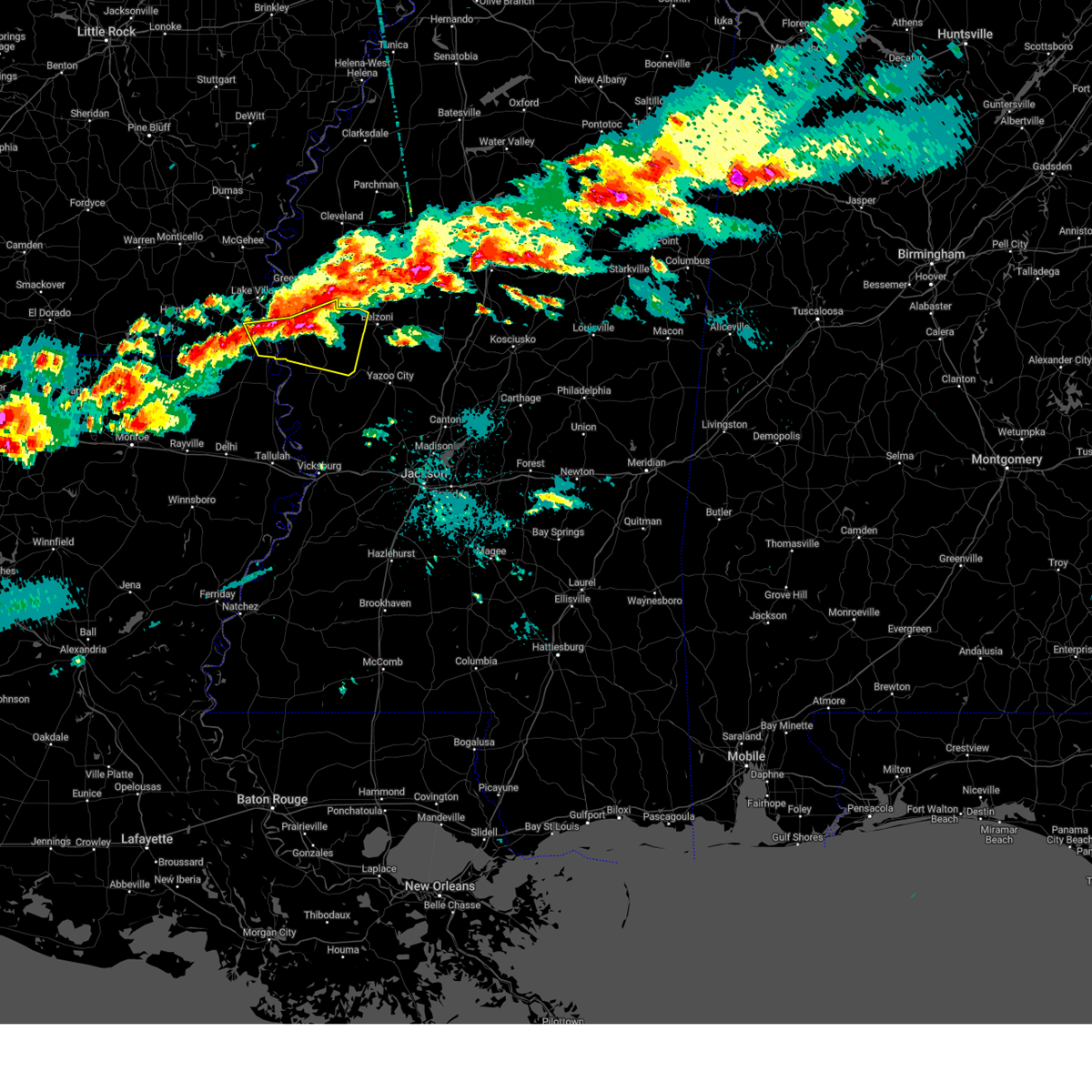
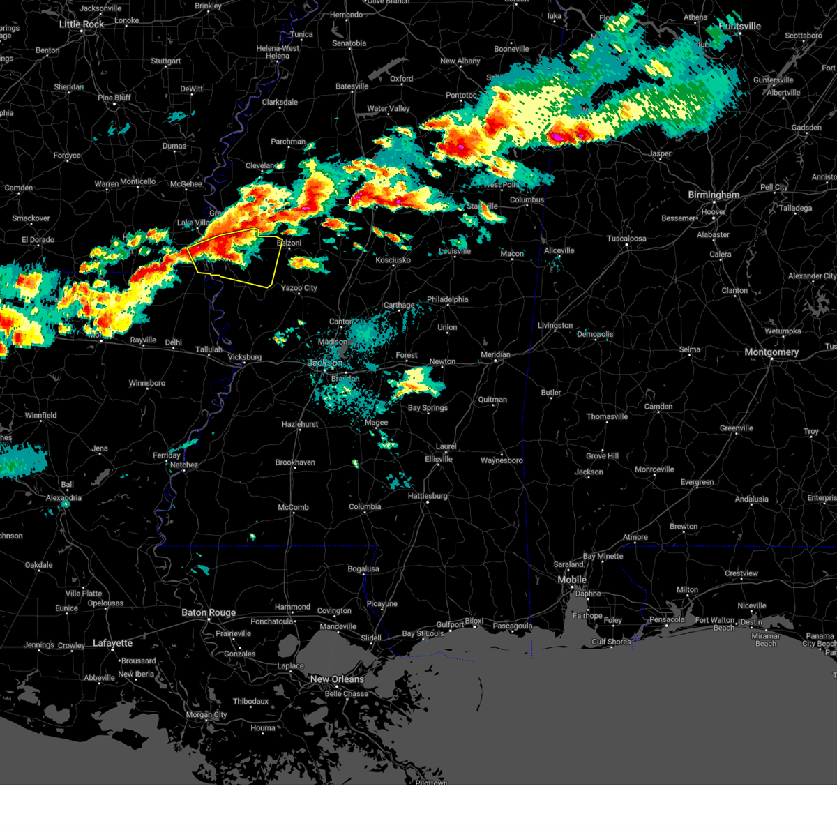
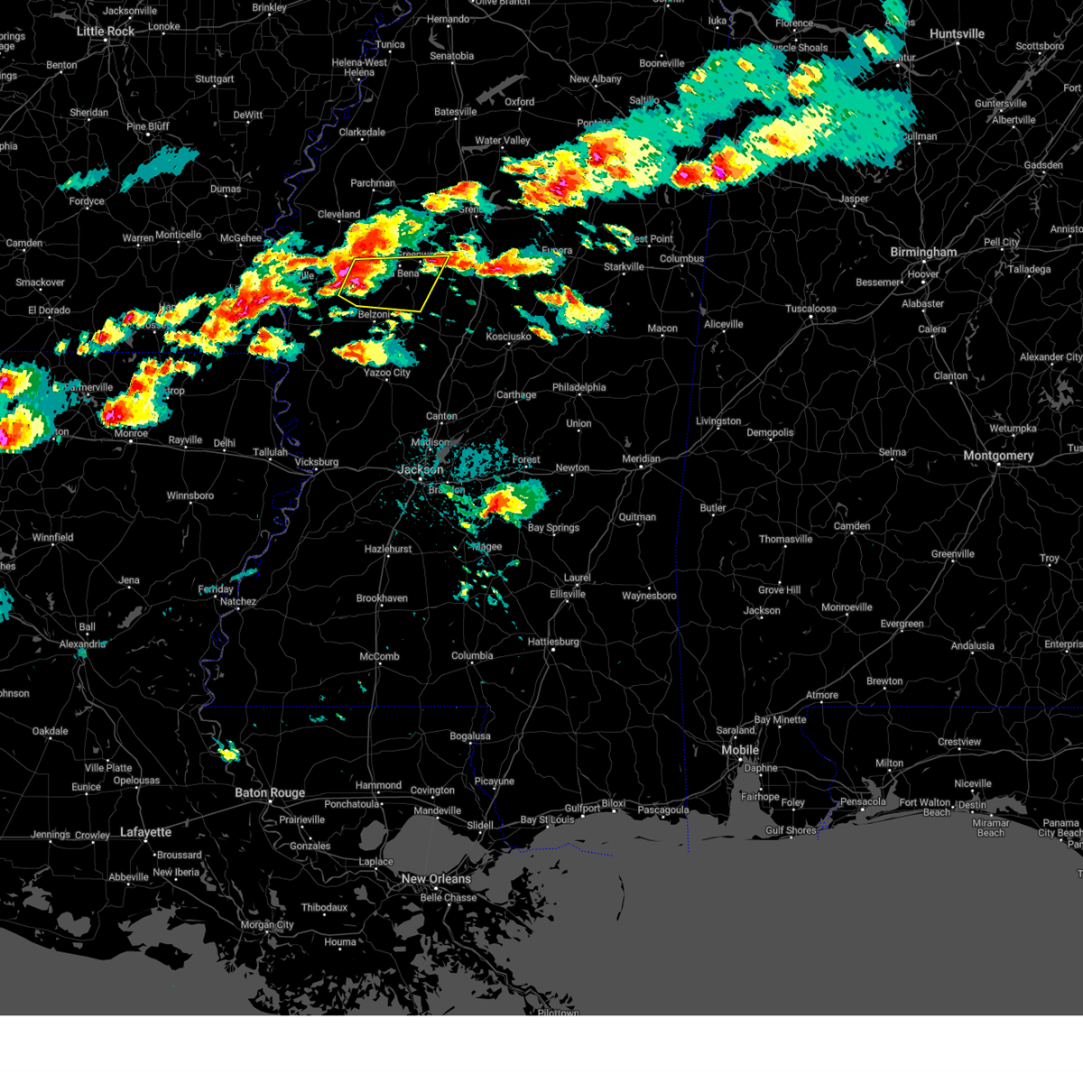
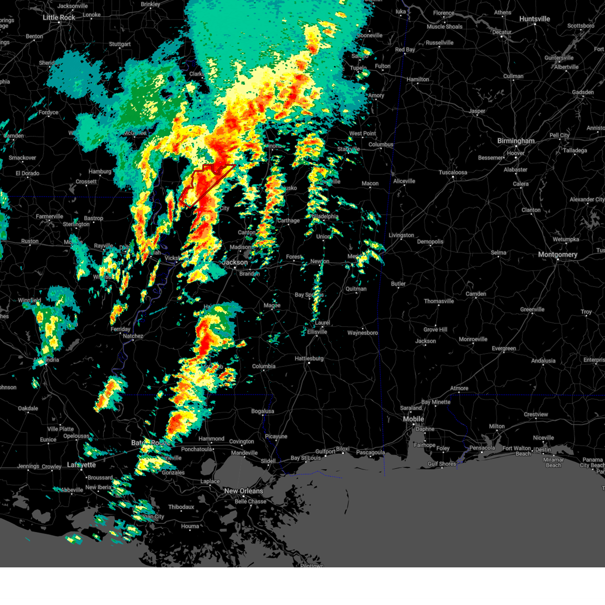
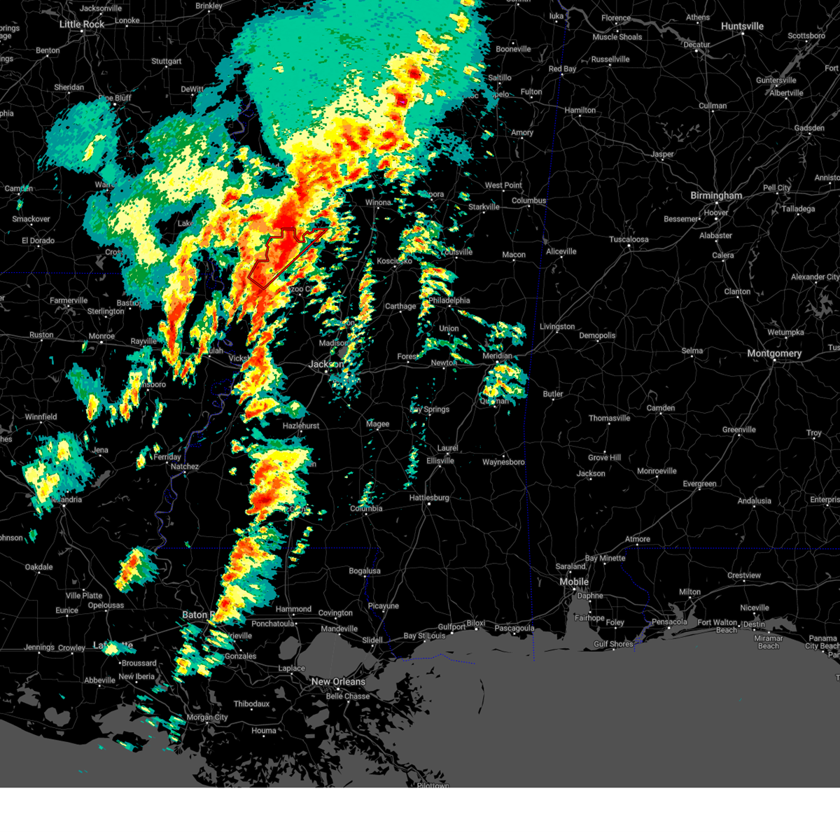
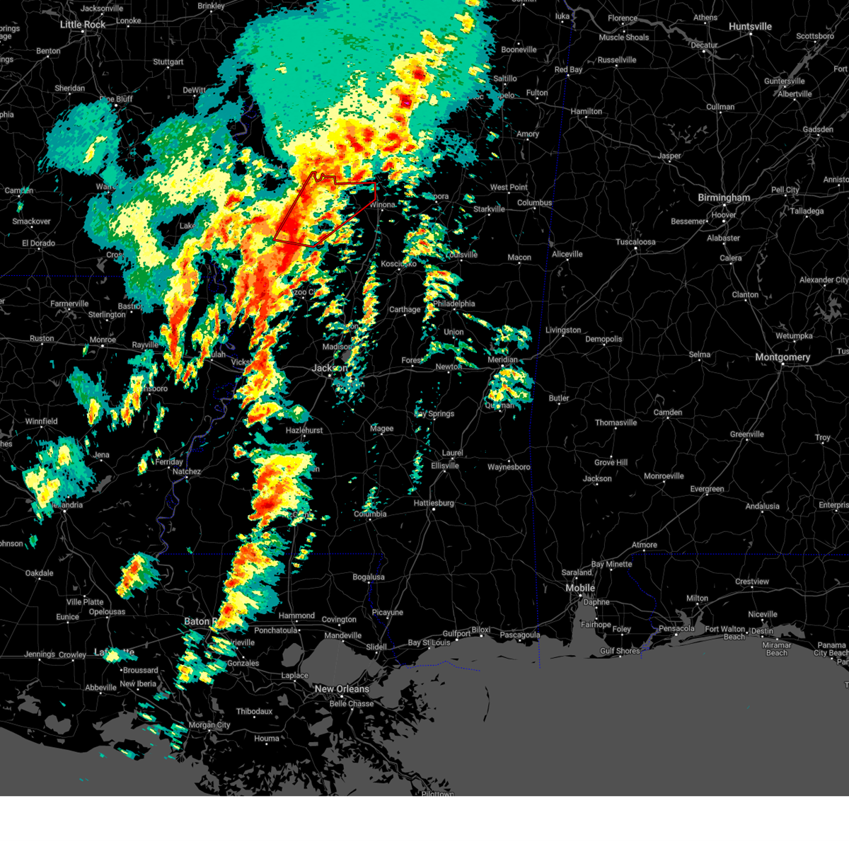
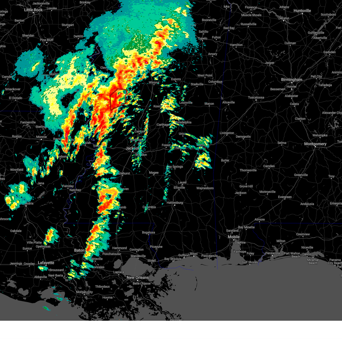
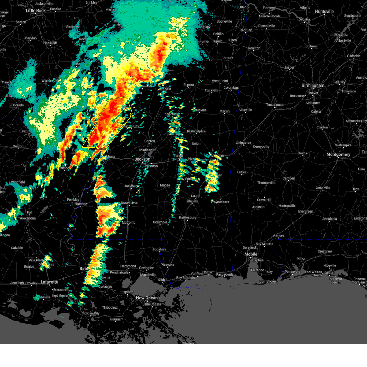
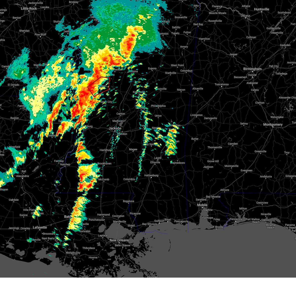
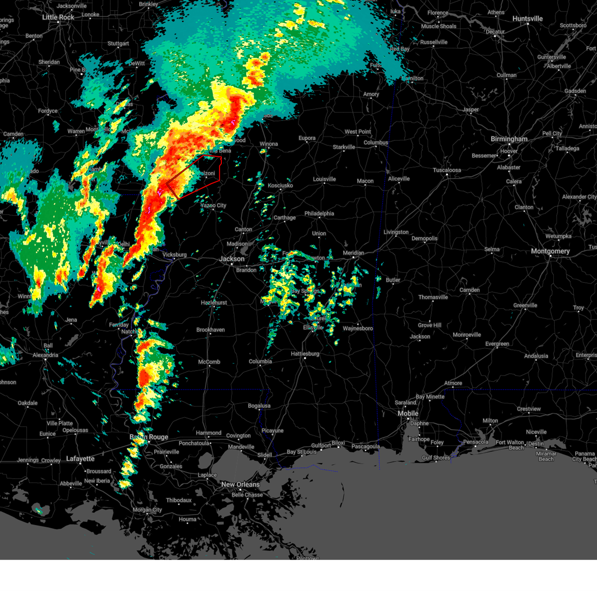
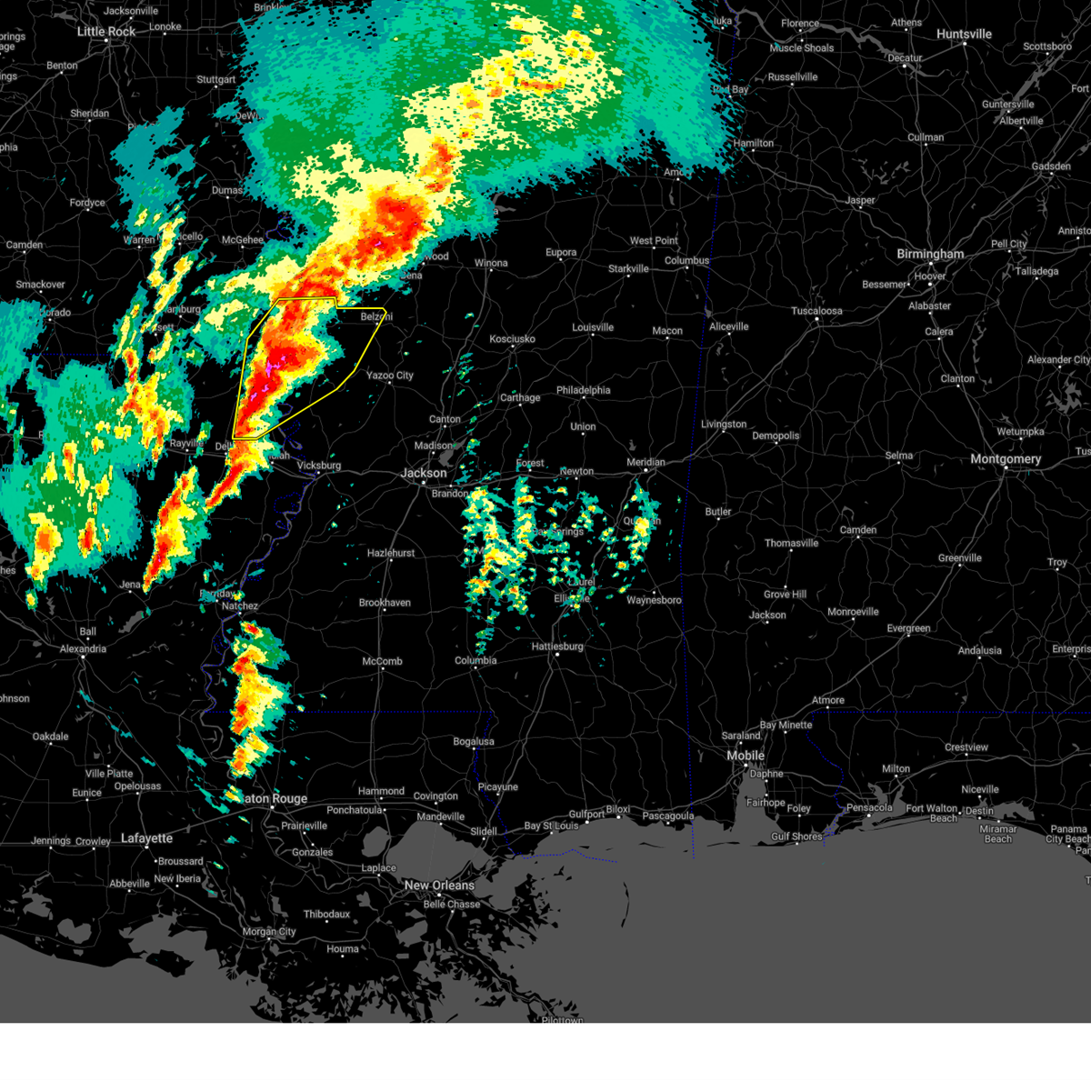
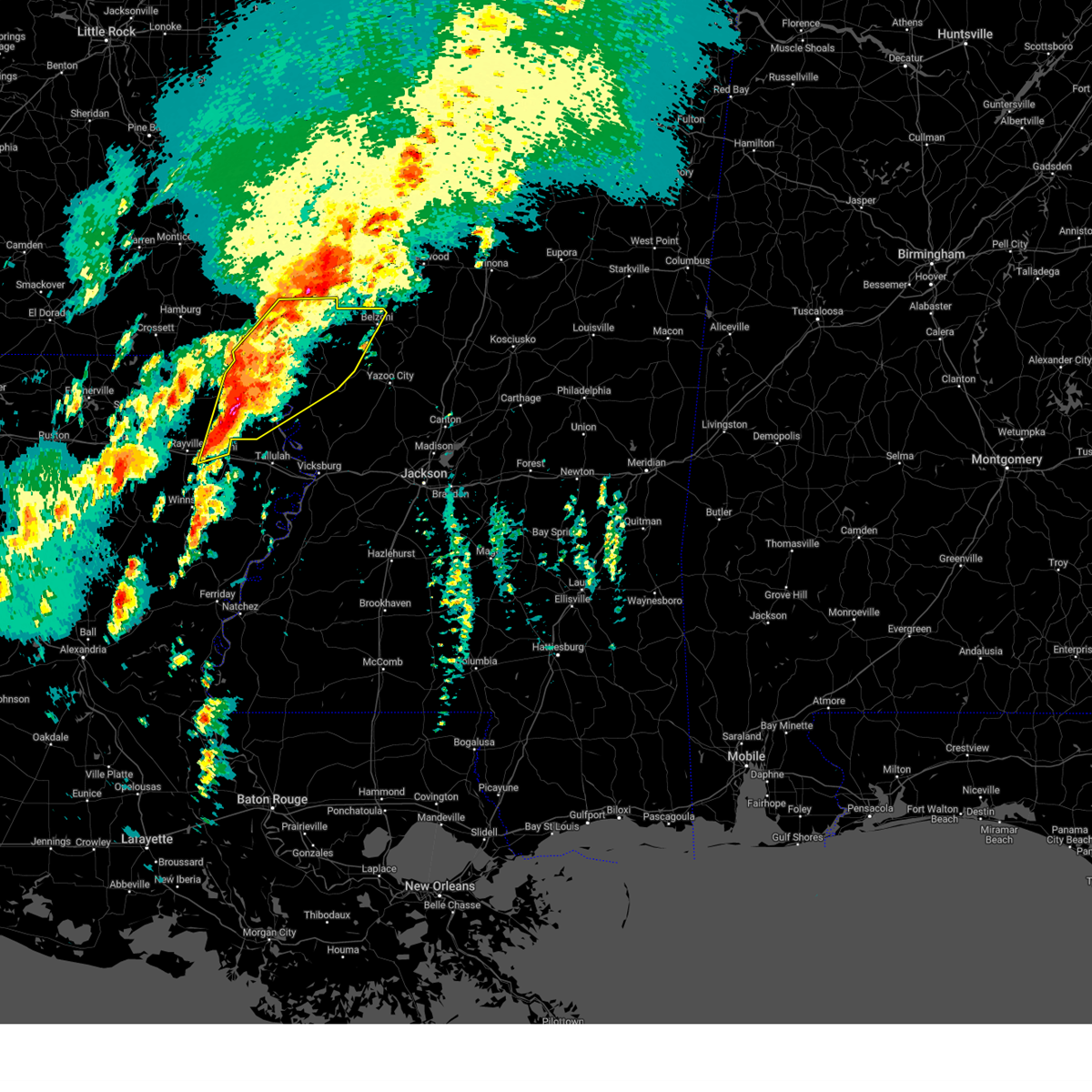
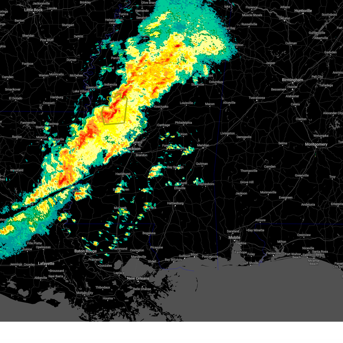
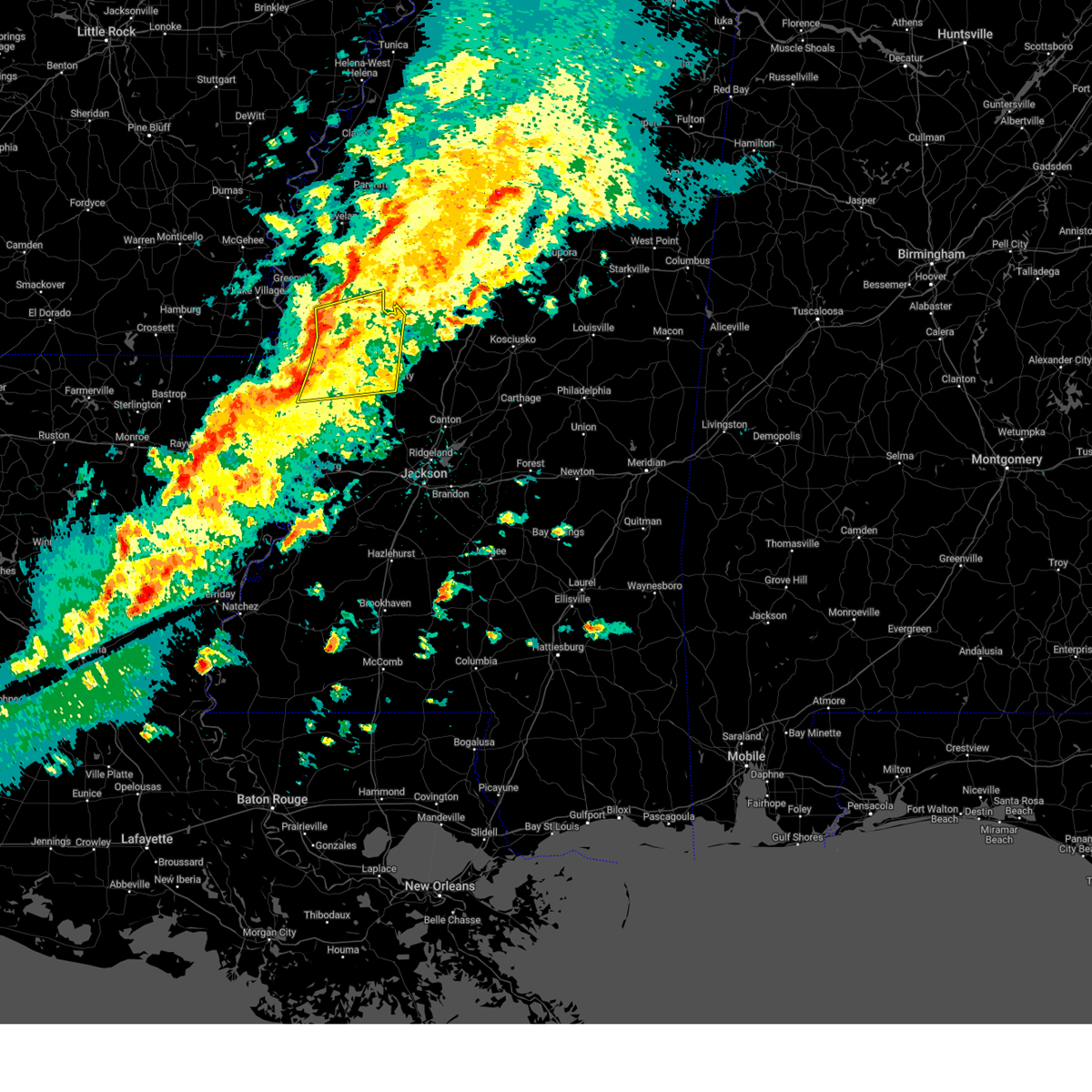
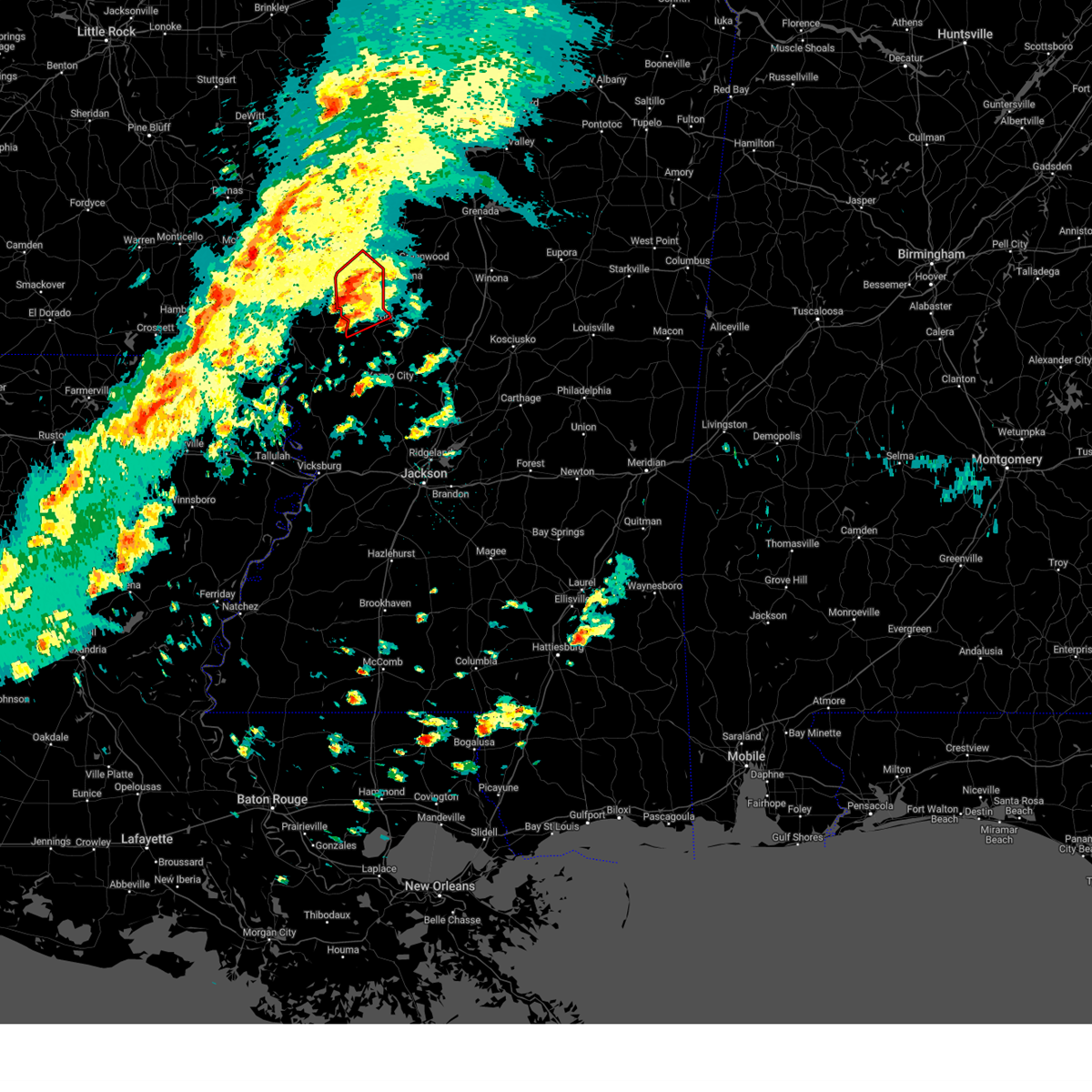
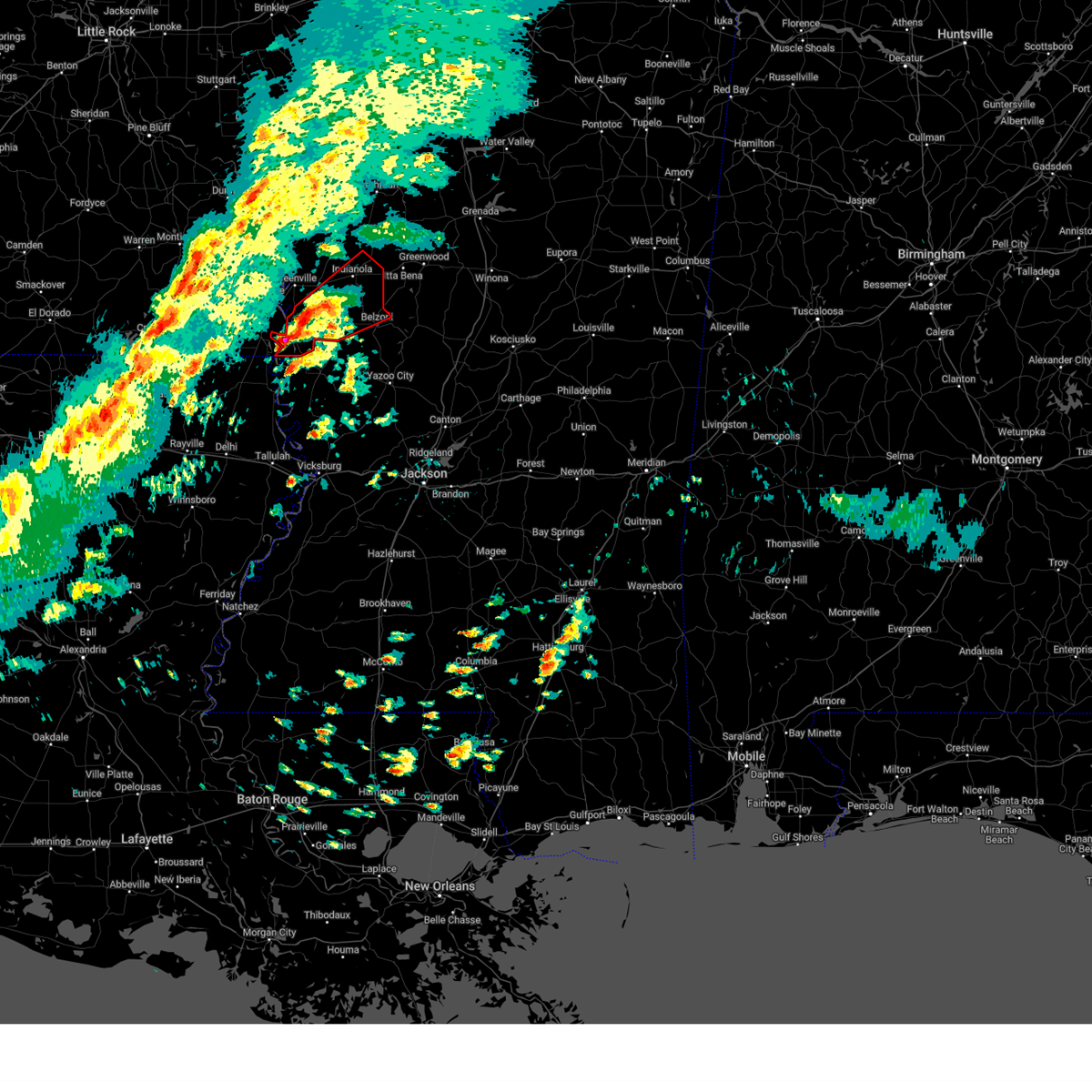
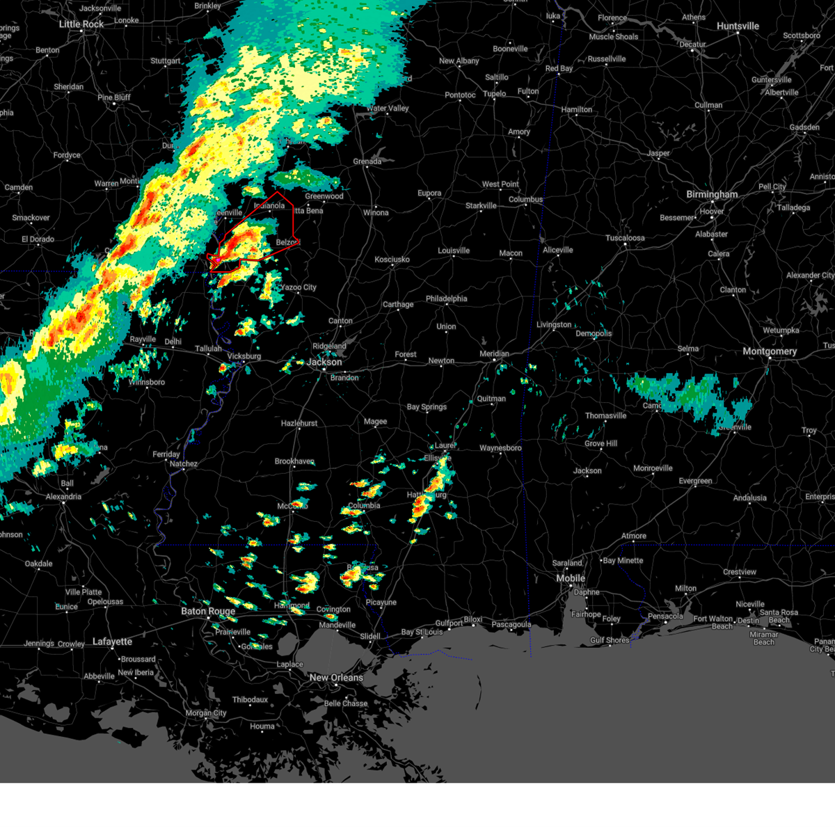
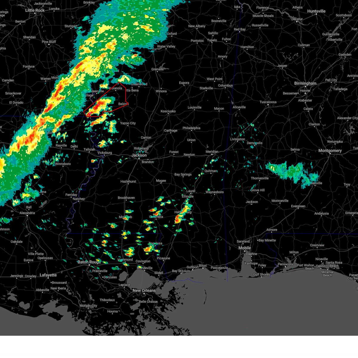
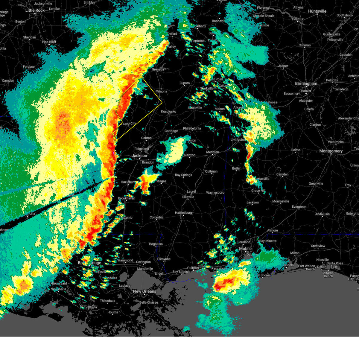
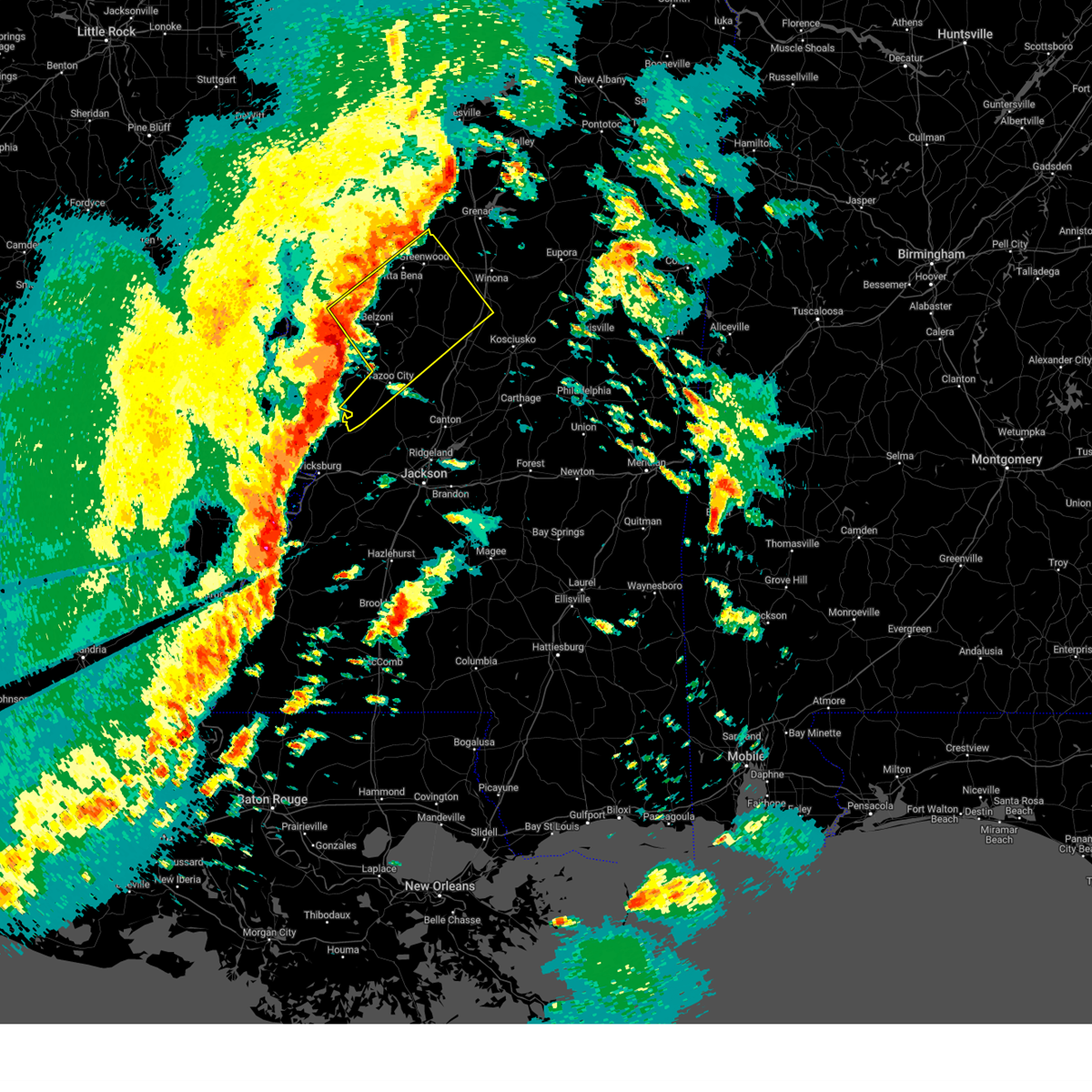
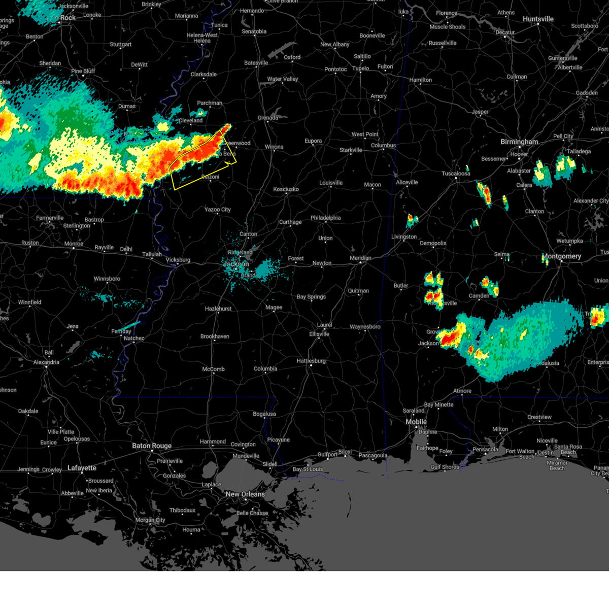
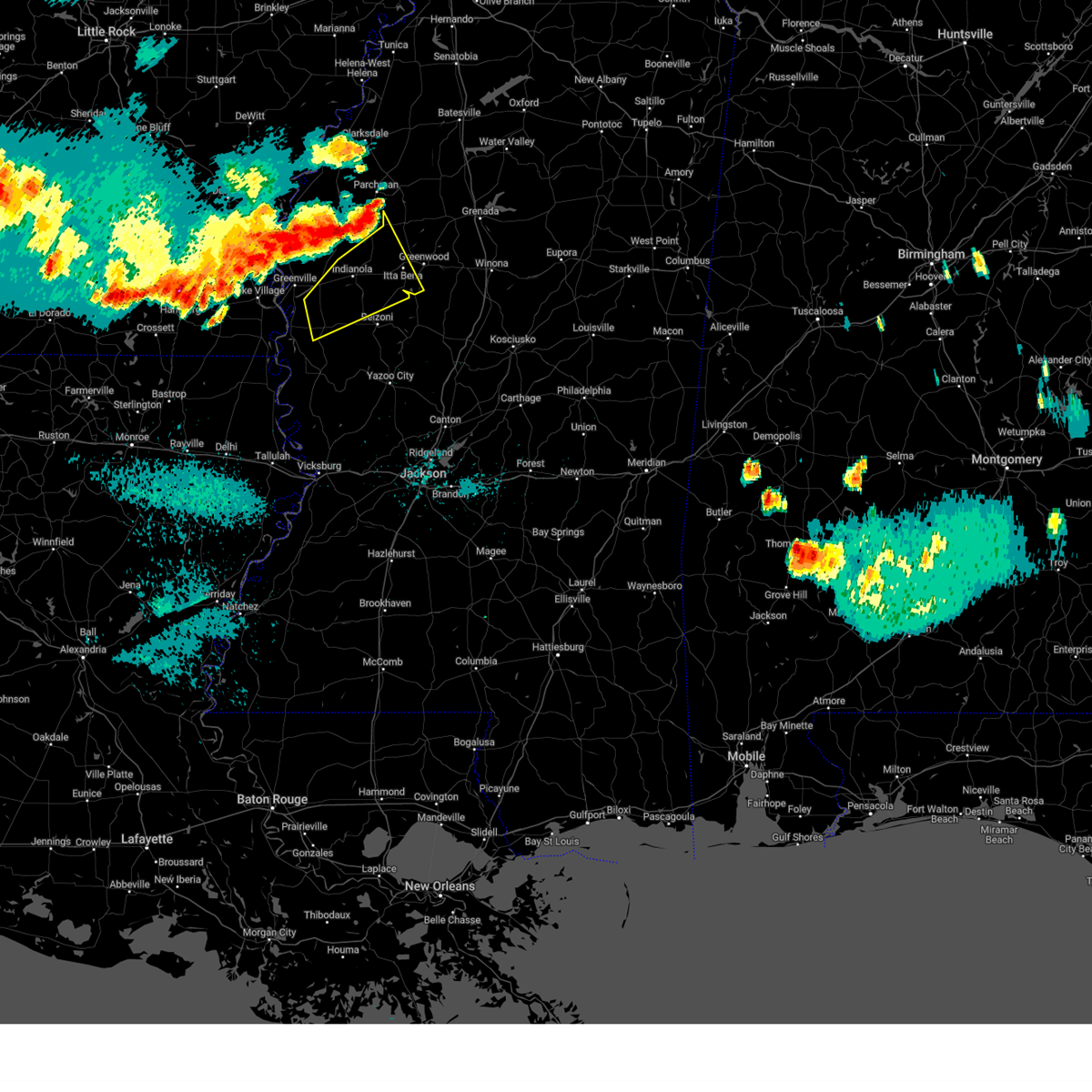
Hail Map for Isola, MS
The Isola, MS area has had 2 reports of on-the-ground hail by trained spotters, and has been under severe weather warnings 53 times during the past 12 months. Doppler radar has detected hail at or near Isola, MS on 52 occasions, including 4 occasions during the past year.
| Name: | Isola, MS |
| Where Located: | 70.7 miles NNW of Jackson, MS |
| Map: | Google Map for Isola, MS |
| Population: | 713 |
| Housing Units: | 298 |
| More Info: | Search Google for Isola, MS |
2
The Top Recent Hail Date for Isola, MS is Friday, March 14, 2025 (3rd out of 52)
Hail and Wind Damage Spotted near Isola, MS
| Date / Time | Report Details |
|---|---|
| 5/25/2025 8:12 PM CDT |
 At 811 pm cdt, severe thunderstorms were located along a line extending from near chester to near ethel to brozville, moving southeast at 50 mph (radar indicated). Hazards include 60 mph wind gusts and penny size hail. Expect damage to roofs, siding, and trees. Locations impacted include, durant, belzoni, eupora, lexington, vaiden, tchula, kilmichael, mathiston, weir, silver city, mantee, west, french camp, walthall, tolarville, poplar creek, clarkson, emory, thornton, and howard. At 811 pm cdt, severe thunderstorms were located along a line extending from near chester to near ethel to brozville, moving southeast at 50 mph (radar indicated). Hazards include 60 mph wind gusts and penny size hail. Expect damage to roofs, siding, and trees. Locations impacted include, durant, belzoni, eupora, lexington, vaiden, tchula, kilmichael, mathiston, weir, silver city, mantee, west, french camp, walthall, tolarville, poplar creek, clarkson, emory, thornton, and howard.
|
| 5/25/2025 8:12 PM CDT |
 the severe thunderstorm warning has been cancelled and is no longer in effect the severe thunderstorm warning has been cancelled and is no longer in effect
|
| 5/25/2025 7:11 PM CDT |
 Svrjan the national weather service in jackson has issued a * severe thunderstorm warning for, southern sunflower county in northwestern mississippi, choctaw county in central mississippi, holmes county in central mississippi, carroll county in north central mississippi, southeastern grenada county in north central mississippi, southern leflore county in north central mississippi, northern attala county in central mississippi, webster county in north central mississippi, montgomery county in north central mississippi, eastern humphreys county in central mississippi, * until 830 pm cdt. * at 711 pm cdt, severe thunderstorms were located along a line extending from 6 miles north of grenada to near avalon to near shaw, moving southeast at 50 mph (radar indicated). Hazards include 60 mph wind gusts and quarter size hail. Hail damage to vehicles is expected. Expect wind damage to roofs, siding, and trees. Svrjan the national weather service in jackson has issued a * severe thunderstorm warning for, southern sunflower county in northwestern mississippi, choctaw county in central mississippi, holmes county in central mississippi, carroll county in north central mississippi, southeastern grenada county in north central mississippi, southern leflore county in north central mississippi, northern attala county in central mississippi, webster county in north central mississippi, montgomery county in north central mississippi, eastern humphreys county in central mississippi, * until 830 pm cdt. * at 711 pm cdt, severe thunderstorms were located along a line extending from 6 miles north of grenada to near avalon to near shaw, moving southeast at 50 mph (radar indicated). Hazards include 60 mph wind gusts and quarter size hail. Hail damage to vehicles is expected. Expect wind damage to roofs, siding, and trees.
|
| 5/24/2025 3:29 PM CDT |
 the severe thunderstorm warning has been cancelled and is no longer in effect the severe thunderstorm warning has been cancelled and is no longer in effect
|
| 5/24/2025 3:09 PM CDT |
 At 309 pm cdt, severe thunderstorms were located along a line extending from swiftown to near anguilla, moving southeast at 40 mph (radar indicated). Hazards include 60 mph wind gusts and quarter size hail. Hail damage to vehicles is expected. expect wind damage to roofs, siding, and trees. Locations impacted include, belzoni, isola, and silver city. At 309 pm cdt, severe thunderstorms were located along a line extending from swiftown to near anguilla, moving southeast at 40 mph (radar indicated). Hazards include 60 mph wind gusts and quarter size hail. Hail damage to vehicles is expected. expect wind damage to roofs, siding, and trees. Locations impacted include, belzoni, isola, and silver city.
|
| 5/24/2025 3:09 PM CDT |
 the severe thunderstorm warning has been cancelled and is no longer in effect the severe thunderstorm warning has been cancelled and is no longer in effect
|
| 5/24/2025 2:42 PM CDT |
 Svrjan the national weather service in jackson has issued a * severe thunderstorm warning for, southeastern chicot county in southeastern arkansas, southern sunflower county in northwestern mississippi, washington county in northwestern mississippi, northern humphreys county in central mississippi, * until 345 pm cdt. * at 242 pm cdt, a severe thunderstorm was located over arcola, or 7 miles south of leland, moving east at 30 mph (radar indicated). Hazards include 60 mph wind gusts and quarter size hail. Hail damage to vehicles is expected. expect wind damage to roofs, siding, and trees. this severe thunderstorm will be near, hollandale, arcola, darlove, estill, and tribbett around 245 pm cdt. isola around 300 pm cdt. inverness around 305 pm cdt. Belzoni around 310 pm cdt. Svrjan the national weather service in jackson has issued a * severe thunderstorm warning for, southeastern chicot county in southeastern arkansas, southern sunflower county in northwestern mississippi, washington county in northwestern mississippi, northern humphreys county in central mississippi, * until 345 pm cdt. * at 242 pm cdt, a severe thunderstorm was located over arcola, or 7 miles south of leland, moving east at 30 mph (radar indicated). Hazards include 60 mph wind gusts and quarter size hail. Hail damage to vehicles is expected. expect wind damage to roofs, siding, and trees. this severe thunderstorm will be near, hollandale, arcola, darlove, estill, and tribbett around 245 pm cdt. isola around 300 pm cdt. inverness around 305 pm cdt. Belzoni around 310 pm cdt.
|
| 4/30/2025 9:48 PM CDT |
 the severe thunderstorm warning has been cancelled and is no longer in effect the severe thunderstorm warning has been cancelled and is no longer in effect
|
| 4/30/2025 9:48 PM CDT |
 At 947 pm cdt, severe thunderstorms were located along a line extending from near minter city to near murphy, moving east at 40 mph (radar indicated). Hazards include 60 mph wind gusts. Expect damage to roofs, siding, and trees. these severe storms will be near, sunnyside, belzoni, midnight, schlater, swiftown, silver city, minter city, and itta bena around 955 pm cdt. Morgan city, money, and quito around 1000 pm cdt. At 947 pm cdt, severe thunderstorms were located along a line extending from near minter city to near murphy, moving east at 40 mph (radar indicated). Hazards include 60 mph wind gusts. Expect damage to roofs, siding, and trees. these severe storms will be near, sunnyside, belzoni, midnight, schlater, swiftown, silver city, minter city, and itta bena around 955 pm cdt. Morgan city, money, and quito around 1000 pm cdt.
|
| 4/30/2025 9:13 PM CDT |
 Svrjan the national weather service in jackson has issued a * severe thunderstorm warning for, sunflower county in northwestern mississippi, leflore county in north central mississippi, eastern washington county in northwestern mississippi, humphreys county in central mississippi, southeastern bolivar county in northwestern mississippi, * until 1015 pm cdt. * at 913 pm cdt, severe thunderstorms were located along a line extending from near pace to near eudora, moving east at 40 mph (radar indicated). Hazards include 60 mph wind gusts. Expect damage to roofs, siding, and trees. severe thunderstorms will be near, arcola and estill around 930 pm cdt. hollandale, holly ridge, and tribbett around 935 pm cdt. darlove, ruleville, indianola, and drew around 940 pm cdt. doddsville around 945 pm cdt. sunflower, inverness, blaine, and murphy around 950 pm cdt. isola and moorhead around 955 pm cdt. Schlater and minter city around 1000 pm cdt. Svrjan the national weather service in jackson has issued a * severe thunderstorm warning for, sunflower county in northwestern mississippi, leflore county in north central mississippi, eastern washington county in northwestern mississippi, humphreys county in central mississippi, southeastern bolivar county in northwestern mississippi, * until 1015 pm cdt. * at 913 pm cdt, severe thunderstorms were located along a line extending from near pace to near eudora, moving east at 40 mph (radar indicated). Hazards include 60 mph wind gusts. Expect damage to roofs, siding, and trees. severe thunderstorms will be near, arcola and estill around 930 pm cdt. hollandale, holly ridge, and tribbett around 935 pm cdt. darlove, ruleville, indianola, and drew around 940 pm cdt. doddsville around 945 pm cdt. sunflower, inverness, blaine, and murphy around 950 pm cdt. isola and moorhead around 955 pm cdt. Schlater and minter city around 1000 pm cdt.
|
| 3/31/2025 3:34 AM CDT |
 Svrjan the national weather service in jackson has issued a * severe thunderstorm warning for, southeastern chicot county in southeastern arkansas, southern sunflower county in northwestern mississippi, northwestern holmes county in central mississippi, southern leflore county in north central mississippi, washington county in northwestern mississippi, northern humphreys county in central mississippi, * until 430 am cdt. * at 334 am cdt, a severe thunderstorm was located over avon, or 10 miles south of greenville, moving east at 40 mph (radar indicated). Hazards include 60 mph wind gusts and quarter size hail. Hail damage to vehicles is expected. expect wind damage to roofs, siding, and trees. this severe thunderstorm will be near, arcola, estill, hollandale, and greenville around 340 am cdt. darlove, tribbett, and leland around 345 am cdt. inverness and indianola around 400 am cdt. isola around 405 am cdt. Swiftown around 415 am cdt. Svrjan the national weather service in jackson has issued a * severe thunderstorm warning for, southeastern chicot county in southeastern arkansas, southern sunflower county in northwestern mississippi, northwestern holmes county in central mississippi, southern leflore county in north central mississippi, washington county in northwestern mississippi, northern humphreys county in central mississippi, * until 430 am cdt. * at 334 am cdt, a severe thunderstorm was located over avon, or 10 miles south of greenville, moving east at 40 mph (radar indicated). Hazards include 60 mph wind gusts and quarter size hail. Hail damage to vehicles is expected. expect wind damage to roofs, siding, and trees. this severe thunderstorm will be near, arcola, estill, hollandale, and greenville around 340 am cdt. darlove, tribbett, and leland around 345 am cdt. inverness and indianola around 400 am cdt. isola around 405 am cdt. Swiftown around 415 am cdt.
|
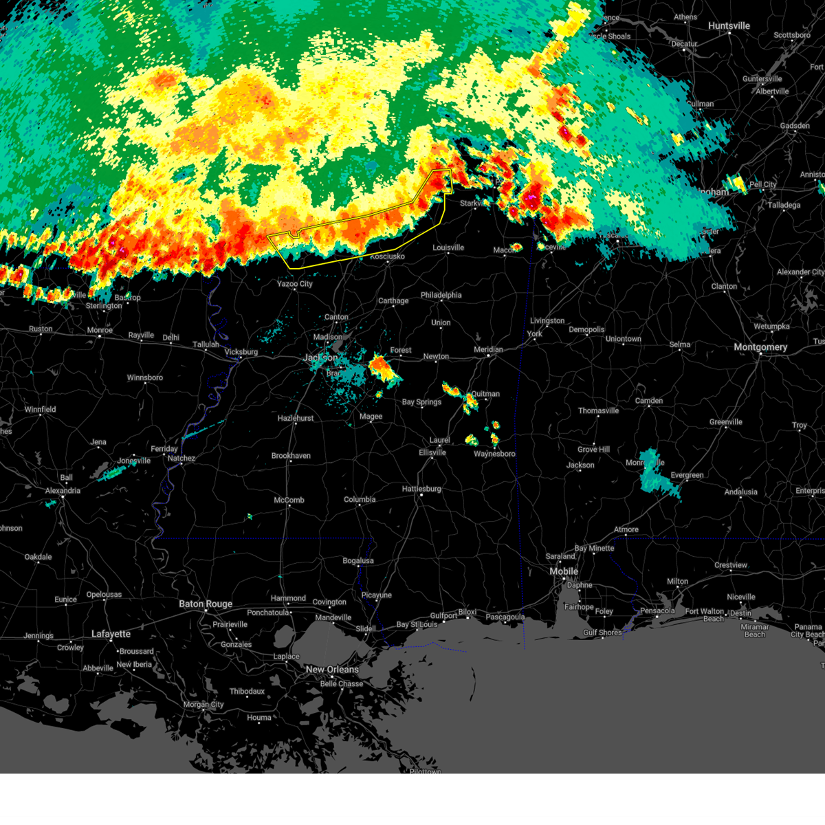
| 3/23/2025 8:52 PM CDT |
 At 851 pm cdt, a severe thunderstorm was located near panther burn, or near hollandale, moving east at 30 mph. this is a destructive storm for panther burn, hollandale, nitta yuma, delta city, and murphy (radar indicated). Hazards include 80 mph wind gusts and golf ball size hail. Flying debris will be dangerous to those caught without shelter. mobile homes will be heavily damaged. expect considerable damage to roofs, windows, and vehicles. extensive tree damage and power outages are likely. this severe storm will be near, panther burn, hollandale, nitta yuma, and delta city around 855 pm cdt. Murphy around 900 pm cdt. At 851 pm cdt, a severe thunderstorm was located near panther burn, or near hollandale, moving east at 30 mph. this is a destructive storm for panther burn, hollandale, nitta yuma, delta city, and murphy (radar indicated). Hazards include 80 mph wind gusts and golf ball size hail. Flying debris will be dangerous to those caught without shelter. mobile homes will be heavily damaged. expect considerable damage to roofs, windows, and vehicles. extensive tree damage and power outages are likely. this severe storm will be near, panther burn, hollandale, nitta yuma, and delta city around 855 pm cdt. Murphy around 900 pm cdt.
|
| 3/23/2025 8:38 PM CDT |
 At 838 pm cdt, a severe thunderstorm was located near avon, or 8 miles west of hollandale, moving east at 30 mph (radar indicated). Hazards include golf ball size hail and 70 mph wind gusts. People and animals outdoors will be injured. expect hail damage to roofs, siding, windows, and vehicles. expect considerable tree damage. wind damage is also likely to mobile homes, roofs, and outbuildings. this severe storm will be near, estill, panther burn, and hollandale around 845 pm cdt. nitta yuma and delta city around 850 pm cdt. Murphy around 900 pm cdt. At 838 pm cdt, a severe thunderstorm was located near avon, or 8 miles west of hollandale, moving east at 30 mph (radar indicated). Hazards include golf ball size hail and 70 mph wind gusts. People and animals outdoors will be injured. expect hail damage to roofs, siding, windows, and vehicles. expect considerable tree damage. wind damage is also likely to mobile homes, roofs, and outbuildings. this severe storm will be near, estill, panther burn, and hollandale around 845 pm cdt. nitta yuma and delta city around 850 pm cdt. Murphy around 900 pm cdt.
|
| 3/23/2025 8:30 PM CDT |
 Svrjan the national weather service in jackson has issued a * severe thunderstorm warning for, southern chicot county in southeastern arkansas, southern washington county in northwestern mississippi, north central issaquena county in west central mississippi, western humphreys county in central mississippi, northern sharkey county in west central mississippi, * until 930 pm cdt. * at 830 pm cdt, a severe thunderstorm was located near avon, or 12 miles west of hollandale, moving east at 30 mph (radar indicated). Hazards include 60 mph wind gusts and quarter size hail. Hail damage to vehicles is expected. expect wind damage to roofs, siding, and trees. this severe thunderstorm will be near, estill, panther burn, and hollandale around 840 pm cdt. nitta yuma and delta city around 850 pm cdt. Murphy around 900 pm cdt. Svrjan the national weather service in jackson has issued a * severe thunderstorm warning for, southern chicot county in southeastern arkansas, southern washington county in northwestern mississippi, north central issaquena county in west central mississippi, western humphreys county in central mississippi, northern sharkey county in west central mississippi, * until 930 pm cdt. * at 830 pm cdt, a severe thunderstorm was located near avon, or 12 miles west of hollandale, moving east at 30 mph (radar indicated). Hazards include 60 mph wind gusts and quarter size hail. Hail damage to vehicles is expected. expect wind damage to roofs, siding, and trees. this severe thunderstorm will be near, estill, panther burn, and hollandale around 840 pm cdt. nitta yuma and delta city around 850 pm cdt. Murphy around 900 pm cdt.
|
| 3/23/2025 8:04 PM CDT |
 Svrjan the national weather service in jackson has issued a * severe thunderstorm warning for, southeastern sunflower county in northwestern mississippi, northwestern holmes county in central mississippi, west central carroll county in north central mississippi, southern leflore county in north central mississippi, northeastern humphreys county in central mississippi, * until 900 pm cdt. * at 804 pm cdt, a severe thunderstorm was located over indianola, moving east at 35 mph (radar indicated). Hazards include 60 mph wind gusts and quarter size hail. Hail damage to vehicles is expected. expect wind damage to roofs, siding, and trees. this severe thunderstorm will be near, moorhead around 810 pm cdt. itta bena around 815 pm cdt. morgan city and quito around 820 pm cdt. Greenwood and sidon around 830 pm cdt. Svrjan the national weather service in jackson has issued a * severe thunderstorm warning for, southeastern sunflower county in northwestern mississippi, northwestern holmes county in central mississippi, west central carroll county in north central mississippi, southern leflore county in north central mississippi, northeastern humphreys county in central mississippi, * until 900 pm cdt. * at 804 pm cdt, a severe thunderstorm was located over indianola, moving east at 35 mph (radar indicated). Hazards include 60 mph wind gusts and quarter size hail. Hail damage to vehicles is expected. expect wind damage to roofs, siding, and trees. this severe thunderstorm will be near, moorhead around 810 pm cdt. itta bena around 815 pm cdt. morgan city and quito around 820 pm cdt. Greenwood and sidon around 830 pm cdt.
|
| 3/15/2025 11:40 AM CDT |
 the tornado warning has been cancelled and is no longer in effect the tornado warning has been cancelled and is no longer in effect
|
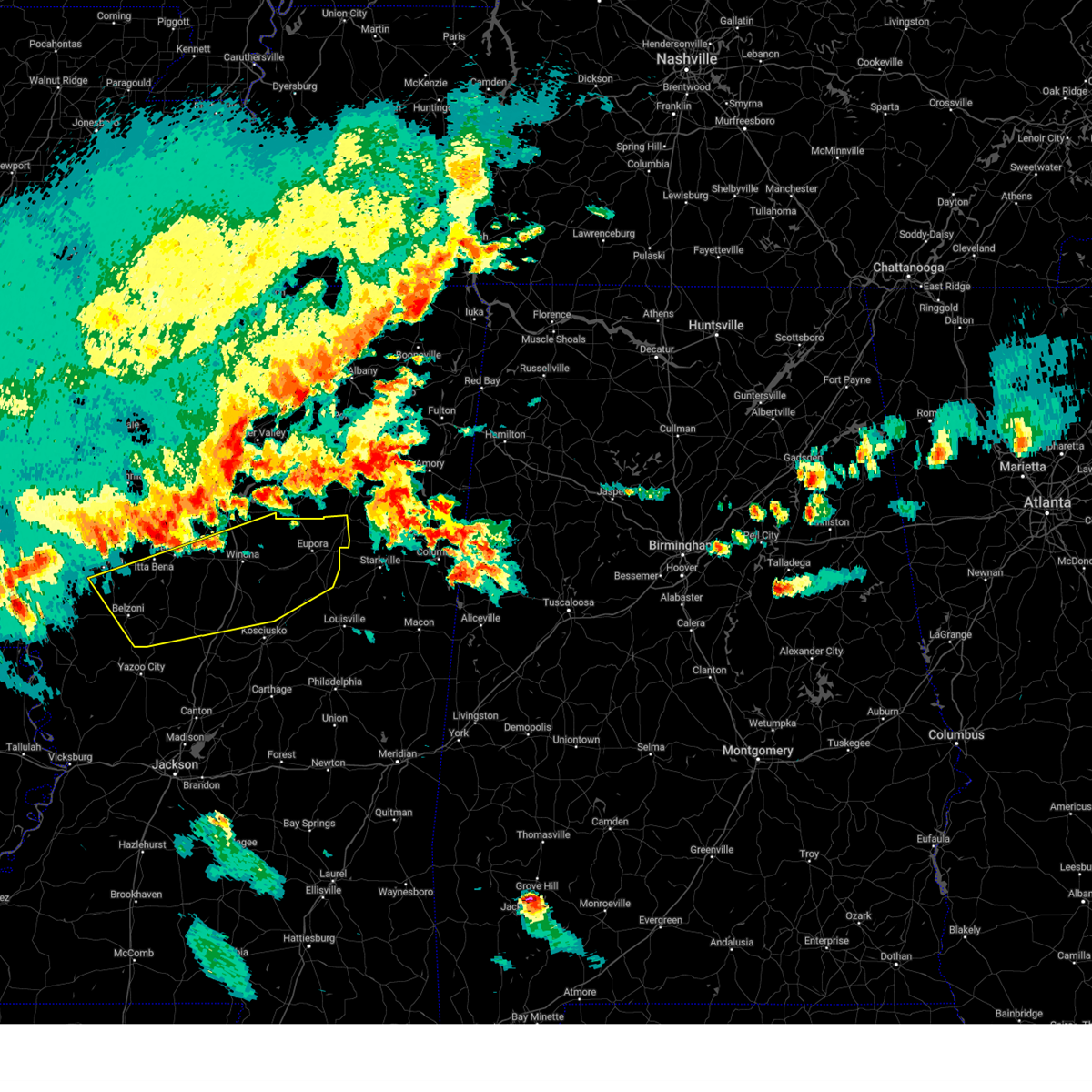
| 3/15/2025 11:20 AM CDT |
 At 1120 am cdt, a severe thunderstorm capable of producing a tornado was located over swiftown, or 8 miles northeast of belzoni, moving northeast at 45 mph (radar indicated rotation). Hazards include tornado. Flying debris will be dangerous to those caught without shelter. mobile homes will be damaged or destroyed. damage to roofs, windows, and vehicles will occur. tree damage is likely. This dangerous storm will be near, morgan city around 1125 am cdt. At 1120 am cdt, a severe thunderstorm capable of producing a tornado was located over swiftown, or 8 miles northeast of belzoni, moving northeast at 45 mph (radar indicated rotation). Hazards include tornado. Flying debris will be dangerous to those caught without shelter. mobile homes will be damaged or destroyed. damage to roofs, windows, and vehicles will occur. tree damage is likely. This dangerous storm will be near, morgan city around 1125 am cdt.
|
| 3/15/2025 11:19 AM CDT |
 the tornado warning has been cancelled and is no longer in effect the tornado warning has been cancelled and is no longer in effect
|
| 3/15/2025 11:19 AM CDT |
 At 1119 am cdt, a severe thunderstorm capable of producing a tornado was located near delta city, or 11 miles northeast of rolling fork, moving northeast at 55 mph (radar indicated rotation). Hazards include tornado. Flying debris will be dangerous to those caught without shelter. mobile homes will be damaged or destroyed. damage to roofs, windows, and vehicles will occur. tree damage is likely. this dangerous storm will be near, midnight around 1125 am cdt. Belzoni, isola, and silver city around 1130 am cdt. At 1119 am cdt, a severe thunderstorm capable of producing a tornado was located near delta city, or 11 miles northeast of rolling fork, moving northeast at 55 mph (radar indicated rotation). Hazards include tornado. Flying debris will be dangerous to those caught without shelter. mobile homes will be damaged or destroyed. damage to roofs, windows, and vehicles will occur. tree damage is likely. this dangerous storm will be near, midnight around 1125 am cdt. Belzoni, isola, and silver city around 1130 am cdt.
|
| 3/15/2025 11:18 AM CDT |
 Torjan the national weather service in jackson has issued a * tornado warning for, southeastern sunflower county in northwestern mississippi, northwestern holmes county in central mississippi, northwestern carroll county in north central mississippi, leflore county in north central mississippi, northeastern humphreys county in central mississippi, * until 1215 pm cdt. * at 1117 am cdt, a severe thunderstorm capable of producing a tornado was located over swiftown, or 8 miles north of belzoni, moving northeast at 50 mph (radar indicated rotation). Hazards include tornado. Flying debris will be dangerous to those caught without shelter. mobile homes will be damaged or destroyed. damage to roofs, windows, and vehicles will occur. tree damage is likely. this dangerous storm will be near, morgan city, cruger, and quito around 1125 am cdt. greenwood, sidon, and itta bena around 1130 am cdt. malmaison and teoc around 1145 am cdt. avalon around 1150 am cdt. north carrollton and carrollton around 1155 am cdt. Jefferson around 1200 pm cdt. Torjan the national weather service in jackson has issued a * tornado warning for, southeastern sunflower county in northwestern mississippi, northwestern holmes county in central mississippi, northwestern carroll county in north central mississippi, leflore county in north central mississippi, northeastern humphreys county in central mississippi, * until 1215 pm cdt. * at 1117 am cdt, a severe thunderstorm capable of producing a tornado was located over swiftown, or 8 miles north of belzoni, moving northeast at 50 mph (radar indicated rotation). Hazards include tornado. Flying debris will be dangerous to those caught without shelter. mobile homes will be damaged or destroyed. damage to roofs, windows, and vehicles will occur. tree damage is likely. this dangerous storm will be near, morgan city, cruger, and quito around 1125 am cdt. greenwood, sidon, and itta bena around 1130 am cdt. malmaison and teoc around 1145 am cdt. avalon around 1150 am cdt. north carrollton and carrollton around 1155 am cdt. Jefferson around 1200 pm cdt.
|
| 3/15/2025 11:11 AM CDT |
 the tornado warning has been cancelled and is no longer in effect the tornado warning has been cancelled and is no longer in effect
|
| 3/15/2025 11:11 AM CDT |
 At 1110 am cdt, a large and extremely dangerous tornado was located near isola, or near belzoni, moving northeast at 45 mph. this is a particularly dangerous situation. take cover now! (radar indicated rotation). Hazards include damaging tornado. You are in a life-threatening situation. flying debris may be deadly to those caught without shelter. mobile homes will be destroyed. considerable damage to homes, businesses, and vehicles is likely and complete destruction is possible. the tornado will be near, belzoni and swiftown around 1115 am cdt. Morgan city around 1120 am cdt. At 1110 am cdt, a large and extremely dangerous tornado was located near isola, or near belzoni, moving northeast at 45 mph. this is a particularly dangerous situation. take cover now! (radar indicated rotation). Hazards include damaging tornado. You are in a life-threatening situation. flying debris may be deadly to those caught without shelter. mobile homes will be destroyed. considerable damage to homes, businesses, and vehicles is likely and complete destruction is possible. the tornado will be near, belzoni and swiftown around 1115 am cdt. Morgan city around 1120 am cdt.
|
| 3/15/2025 11:04 AM CDT |
 Torjan the national weather service in jackson has issued a * tornado warning for, northwestern holmes county in central mississippi, southeastern washington county in northwestern mississippi, north central issaquena county in west central mississippi, humphreys county in central mississippi, northern sharkey county in west central mississippi, * until noon cdt. * at 1104 am cdt, a severe thunderstorm capable of producing a tornado was located over rolling fork, moving northeast at 55 mph (radar indicated rotation). Hazards include tornado. Flying debris will be dangerous to those caught without shelter. mobile homes will be damaged or destroyed. damage to roofs, windows, and vehicles will occur. tree damage is likely. this dangerous storm will be near, anguilla and nitta yuma around 1110 am cdt. delta city around 1115 am cdt. midnight and murphy around 1120 am cdt. belzoni, isola, and silver city around 1130 am cdt. Cruger around 1155 am cdt. Torjan the national weather service in jackson has issued a * tornado warning for, northwestern holmes county in central mississippi, southeastern washington county in northwestern mississippi, north central issaquena county in west central mississippi, humphreys county in central mississippi, northern sharkey county in west central mississippi, * until noon cdt. * at 1104 am cdt, a severe thunderstorm capable of producing a tornado was located over rolling fork, moving northeast at 55 mph (radar indicated rotation). Hazards include tornado. Flying debris will be dangerous to those caught without shelter. mobile homes will be damaged or destroyed. damage to roofs, windows, and vehicles will occur. tree damage is likely. this dangerous storm will be near, anguilla and nitta yuma around 1110 am cdt. delta city around 1115 am cdt. midnight and murphy around 1120 am cdt. belzoni, isola, and silver city around 1130 am cdt. Cruger around 1155 am cdt.
|
| 3/15/2025 10:56 AM CDT |
 Svrjan the national weather service in jackson has issued a * severe thunderstorm warning for, eastern east carroll parish in northeastern louisiana, southern sunflower county in northwestern mississippi, northwestern warren county in west central mississippi, southeastern washington county in northwestern mississippi, northwestern yazoo county in central mississippi, issaquena county in west central mississippi, humphreys county in central mississippi, sharkey county in west central mississippi, * until noon cdt. * at 1056 am cdt, a severe thunderstorm was located over cary, or 7 miles southeast of mayersville, moving northeast at 55 mph (radar indicated). Hazards include 60 mph wind gusts and quarter size hail. Hail damage to vehicles is expected. expect wind damage to roofs, siding, and trees. this severe thunderstorm will be near, rolling fork, cary, and mayersville around 1100 am cdt. anguilla and nitta yuma around 1105 am cdt. panther burn and delta city around 1115 am cdt. murphy around 1120 am cdt. midnight around 1125 am cdt. Belzoni, isola, and silver city around 1130 am cdt. Svrjan the national weather service in jackson has issued a * severe thunderstorm warning for, eastern east carroll parish in northeastern louisiana, southern sunflower county in northwestern mississippi, northwestern warren county in west central mississippi, southeastern washington county in northwestern mississippi, northwestern yazoo county in central mississippi, issaquena county in west central mississippi, humphreys county in central mississippi, sharkey county in west central mississippi, * until noon cdt. * at 1056 am cdt, a severe thunderstorm was located over cary, or 7 miles southeast of mayersville, moving northeast at 55 mph (radar indicated). Hazards include 60 mph wind gusts and quarter size hail. Hail damage to vehicles is expected. expect wind damage to roofs, siding, and trees. this severe thunderstorm will be near, rolling fork, cary, and mayersville around 1100 am cdt. anguilla and nitta yuma around 1105 am cdt. panther burn and delta city around 1115 am cdt. murphy around 1120 am cdt. midnight around 1125 am cdt. Belzoni, isola, and silver city around 1130 am cdt.
|
| 3/15/2025 10:55 AM CDT |
 At 1055 am cdt, a large and extremely dangerous tornado was located over murphy, or 9 miles east of hollandale, moving northeast at 45 mph. this is a particularly dangerous situation. take cover now! (radar indicated rotation). Hazards include damaging tornado. You are in a life-threatening situation. flying debris may be deadly to those caught without shelter. mobile homes will be destroyed. considerable damage to homes, businesses, and vehicles is likely and complete destruction is possible. the tornado will be near, belzoni and isola around 1100 am cdt. swiftown around 1110 am cdt. Morgan city around 1120 am cdt. At 1055 am cdt, a large and extremely dangerous tornado was located over murphy, or 9 miles east of hollandale, moving northeast at 45 mph. this is a particularly dangerous situation. take cover now! (radar indicated rotation). Hazards include damaging tornado. You are in a life-threatening situation. flying debris may be deadly to those caught without shelter. mobile homes will be destroyed. considerable damage to homes, businesses, and vehicles is likely and complete destruction is possible. the tornado will be near, belzoni and isola around 1100 am cdt. swiftown around 1110 am cdt. Morgan city around 1120 am cdt.
|
| 3/15/2025 10:26 AM CDT |
 Torjan the national weather service in jackson has issued a * tornado warning for, southeastern sunflower county in northwestern mississippi, southwestern leflore county in north central mississippi, southeastern washington county in northwestern mississippi, humphreys county in central mississippi, northeastern sharkey county in west central mississippi, * until 1130 am cdt. * at 1026 am cdt, a large and extremely dangerous tornado was located near grace, or near mayersville, moving northeast at 45 mph. this is a particularly dangerous situation. take cover now! (radar indicated rotation). Hazards include damaging tornado. You are in a life-threatening situation. flying debris may be deadly to those caught without shelter. mobile homes will be destroyed. considerable damage to homes, businesses, and vehicles is likely and complete destruction is possible. the tornado will be near, anguilla, panther burn, and nitta yuma around 1030 am cdt. delta city around 1035 am cdt. hollandale around 1040 am cdt. murphy around 1045 am cdt. belzoni and isola around 1100 am cdt. Swiftown around 1110 am cdt. Torjan the national weather service in jackson has issued a * tornado warning for, southeastern sunflower county in northwestern mississippi, southwestern leflore county in north central mississippi, southeastern washington county in northwestern mississippi, humphreys county in central mississippi, northeastern sharkey county in west central mississippi, * until 1130 am cdt. * at 1026 am cdt, a large and extremely dangerous tornado was located near grace, or near mayersville, moving northeast at 45 mph. this is a particularly dangerous situation. take cover now! (radar indicated rotation). Hazards include damaging tornado. You are in a life-threatening situation. flying debris may be deadly to those caught without shelter. mobile homes will be destroyed. considerable damage to homes, businesses, and vehicles is likely and complete destruction is possible. the tornado will be near, anguilla, panther burn, and nitta yuma around 1030 am cdt. delta city around 1035 am cdt. hollandale around 1040 am cdt. murphy around 1045 am cdt. belzoni and isola around 1100 am cdt. Swiftown around 1110 am cdt.
|
| 3/15/2025 10:12 AM CDT |
 the severe thunderstorm warning has been cancelled and is no longer in effect the severe thunderstorm warning has been cancelled and is no longer in effect
|
| 3/15/2025 10:12 AM CDT |
 At 1011 am cdt, a severe thunderstorm was located over millikin, or 9 miles northwest of mayersville, moving northeast at 50 mph (radar indicated). Hazards include two inch hail and 60 mph wind gusts. People and animals outdoors will be injured. expect hail damage to roofs, siding, windows, and vehicles. expect wind damage to roofs, siding, and trees. this severe storm will be near, glen allan around 1015 am cdt. grace around 1020 am cdt. panther burn, hollandale, and avon around 1030 am cdt. arcola and estill around 1035 am cdt. Darlove around 1040 am cdt. At 1011 am cdt, a severe thunderstorm was located over millikin, or 9 miles northwest of mayersville, moving northeast at 50 mph (radar indicated). Hazards include two inch hail and 60 mph wind gusts. People and animals outdoors will be injured. expect hail damage to roofs, siding, windows, and vehicles. expect wind damage to roofs, siding, and trees. this severe storm will be near, glen allan around 1015 am cdt. grace around 1020 am cdt. panther burn, hollandale, and avon around 1030 am cdt. arcola and estill around 1035 am cdt. Darlove around 1040 am cdt.
|
| 3/15/2025 9:43 AM CDT |
 Svrjan the national weather service in jackson has issued a * severe thunderstorm warning for, southern chicot county in southeastern arkansas, east carroll parish in northeastern louisiana, northeastern richland parish in northeastern louisiana, west carroll parish in northeastern louisiana, southern washington county in northwestern mississippi, northwestern issaquena county in west central mississippi, western humphreys county in central mississippi, sharkey county in west central mississippi, * until 1045 am cdt. * at 943 am cdt, severe thunderstorms were located along a line extending from near oak grove to near forest to near epps, moving northeast at 50 mph (radar indicated). Hazards include 60 mph wind gusts and quarter size hail. Hail damage to vehicles is expected. expect wind damage to roofs, siding, and trees. severe thunderstorms will be near, monticello, lake providence, millikin, shelburn, kilbourne, and darnell around 950 am cdt. gassoway around 955 am cdt. eudora around 1000 am cdt. glen allan around 1005 am cdt. mayersville around 1010 am cdt. avon and grace around 1015 am cdt. wayside around 1020 am cdt. Arcola, estill, panther burn, and hollandale around 1025 am cdt. Svrjan the national weather service in jackson has issued a * severe thunderstorm warning for, southern chicot county in southeastern arkansas, east carroll parish in northeastern louisiana, northeastern richland parish in northeastern louisiana, west carroll parish in northeastern louisiana, southern washington county in northwestern mississippi, northwestern issaquena county in west central mississippi, western humphreys county in central mississippi, sharkey county in west central mississippi, * until 1045 am cdt. * at 943 am cdt, severe thunderstorms were located along a line extending from near oak grove to near forest to near epps, moving northeast at 50 mph (radar indicated). Hazards include 60 mph wind gusts and quarter size hail. Hail damage to vehicles is expected. expect wind damage to roofs, siding, and trees. severe thunderstorms will be near, monticello, lake providence, millikin, shelburn, kilbourne, and darnell around 950 am cdt. gassoway around 955 am cdt. eudora around 1000 am cdt. glen allan around 1005 am cdt. mayersville around 1010 am cdt. avon and grace around 1015 am cdt. wayside around 1020 am cdt. Arcola, estill, panther burn, and hollandale around 1025 am cdt.
|
| 3/14/2025 11:22 PM CDT | At 1122 pm cdt, a confirmed large and extremely dangerous tornado was located near swiftown, or 10 miles north of belzoni, moving northeast at 45 mph. this is a particularly dangerous situation. take cover now! (weather spotters confirmed tornado). Hazards include damaging tornado. You are in a life-threatening situation. flying debris may be deadly to those caught without shelter. mobile homes will be destroyed. considerable damage to homes, businesses, and vehicles is likely and complete destruction is possible. the tornado will be near, morgan city, moorhead, quito, and itta bena around 1130 pm cdt. greenwood around 1140 pm cdt. Schlater around 1150 pm cdt. |
| 3/14/2025 11:20 PM CDT | At 1119 pm cdt, a confirmed tornado was located near isola, or 8 miles north of belzoni, moving northeast at 45 mph (weather spotters confirmed tornado). Hazards include damaging tornado and ping pong ball size hail. Flying debris will be dangerous to those caught without shelter. mobile homes will be damaged or destroyed. damage to roofs, windows, and vehicles will occur. tree damage is likely. this tornado will be near, morgan city, swiftown, and moorhead around 1125 pm cdt. quito and itta bena around 1130 pm cdt. greenwood around 1140 pm cdt. Schlater around 1150 pm cdt. |
| 3/14/2025 11:11 PM CDT | Torjan the national weather service in jackson has issued a * tornado warning for, southeastern sunflower county in northwestern mississippi, northwestern holmes county in central mississippi, west central carroll county in north central mississippi, leflore county in north central mississippi, northern humphreys county in central mississippi, * until 1215 am cdt. * at 1110 pm cdt, a severe thunderstorm capable of producing a tornado was located over isola, or near belzoni, moving northeast at 45 mph (radar indicated rotation). Hazards include tornado and ping pong ball size hail. Flying debris will be dangerous to those caught without shelter. mobile homes will be damaged or destroyed. damage to roofs, windows, and vehicles will occur. tree damage is likely. this dangerous storm will be near, belzoni, isola, swiftown, and inverness around 1115 pm cdt. morgan city and moorhead around 1125 pm cdt. quito around 1130 pm cdt. itta bena around 1135 pm cdt. greenwood around 1140 pm cdt. Schlater around 1155 pm cdt. |
| 3/14/2025 11:09 PM CDT | the severe thunderstorm warning has been cancelled and is no longer in effect |
| 3/14/2025 11:09 PM CDT | At 1109 pm cdt, a severe thunderstorm was located over inverness, or near indianola, moving northeast at 45 mph (radar indicated). Hazards include ping pong ball size hail and 60 mph wind gusts. People and animals outdoors will be injured. expect hail damage to roofs, siding, windows, and vehicles. expect wind damage to roofs, siding, and trees. This severe storm will be near, sunflower and moorhead around 1115 pm cdt. |
| 3/14/2025 10:52 PM CDT | At 1052 pm cdt, a severe thunderstorm was located near darlove, or 8 miles northeast of hollandale, moving northeast at 45 mph (radar indicated). Hazards include ping pong ball size hail and 60 mph wind gusts. People and animals outdoors will be injured. expect hail damage to roofs, siding, windows, and vehicles. expect wind damage to roofs, siding, and trees. this severe storm will be near, isola, inverness, and indianola around 1100 pm cdt. moorhead around 1105 pm cdt. Sunflower around 1115 pm cdt. |
| 3/14/2025 10:44 PM CDT | At 1043 pm cdt, a severe thunderstorm was located near hollandale, moving northeast at 45 mph (radar indicated). Hazards include 60 mph wind gusts and quarter size hail. Hail damage to vehicles is expected. expect wind damage to roofs, siding, and trees. this severe storm will be near, darlove and murphy around 1050 pm cdt. isola around 1055 pm cdt. inverness and indianola around 1100 pm cdt. moorhead around 1110 pm cdt. Sunflower around 1120 pm cdt. |
| 3/14/2025 10:44 PM CDT | the severe thunderstorm warning has been cancelled and is no longer in effect |
| 3/14/2025 10:28 PM CDT | Svrjan the national weather service in jackson has issued a * severe thunderstorm warning for, southern sunflower county in northwestern mississippi, southwestern leflore county in north central mississippi, southeastern washington county in northwestern mississippi, north central issaquena county in west central mississippi, northern humphreys county in central mississippi, northern sharkey county in west central mississippi, * until 1130 pm cdt. * at 1027 pm cdt, a severe thunderstorm was located over grace, or 8 miles northwest of rolling fork, moving northeast at 45 mph (radar indicated). Hazards include 60 mph wind gusts and quarter size hail. Hail damage to vehicles is expected. expect wind damage to roofs, siding, and trees. this severe thunderstorm will be near, panther burn, hollandale, nitta yuma, and delta city around 1035 pm cdt. darlove, estill, and murphy around 1040 pm cdt. isola around 1055 pm cdt. inverness around 1100 pm cdt. indianola around 1105 pm cdt. moorhead around 1110 pm cdt. Sunflower around 1120 pm cdt. |
| 1/5/2025 4:52 PM CST |
 the severe thunderstorm warning has been cancelled and is no longer in effect the severe thunderstorm warning has been cancelled and is no longer in effect
|
| 1/5/2025 4:52 PM CST |
 At 451 pm cst, severe thunderstorms were located along a line extending from near morgan city to 7 miles southeast of swiftown to near louise, moving northeast at 60 mph (radar indicated). Hazards include 60 mph wind gusts. Expect damage to roofs, siding, and trees. These severe storms will be near, silver city around 455 pm cst. At 451 pm cst, severe thunderstorms were located along a line extending from near morgan city to 7 miles southeast of swiftown to near louise, moving northeast at 60 mph (radar indicated). Hazards include 60 mph wind gusts. Expect damage to roofs, siding, and trees. These severe storms will be near, silver city around 455 pm cst.
|
| 1/5/2025 4:20 PM CST |
 Svrjan the national weather service in jackson has issued a * severe thunderstorm warning for, southern sunflower county in northwestern mississippi, west central holmes county in central mississippi, southeastern washington county in northwestern mississippi, northwestern yazoo county in central mississippi, north central issaquena county in west central mississippi, humphreys county in central mississippi, sharkey county in west central mississippi, * until 500 pm cst. * at 419 pm cst, severe thunderstorms were located along a line extending from hollandale to nitta yuma to near cary, moving northeast at 55 mph (radar indicated). Hazards include 60 mph wind gusts. Expect damage to roofs, siding, and trees. severe thunderstorms will be near, anguilla, rolling fork, darlove, cary, nitta yuma, murphy, and delta city around 425 pm cst. isola around 430 pm cst. belzoni and midnight around 435 pm cst. Louise and silver city around 440 pm cst. Svrjan the national weather service in jackson has issued a * severe thunderstorm warning for, southern sunflower county in northwestern mississippi, west central holmes county in central mississippi, southeastern washington county in northwestern mississippi, northwestern yazoo county in central mississippi, north central issaquena county in west central mississippi, humphreys county in central mississippi, sharkey county in west central mississippi, * until 500 pm cst. * at 419 pm cst, severe thunderstorms were located along a line extending from hollandale to nitta yuma to near cary, moving northeast at 55 mph (radar indicated). Hazards include 60 mph wind gusts. Expect damage to roofs, siding, and trees. severe thunderstorms will be near, anguilla, rolling fork, darlove, cary, nitta yuma, murphy, and delta city around 425 pm cst. isola around 430 pm cst. belzoni and midnight around 435 pm cst. Louise and silver city around 440 pm cst.
|
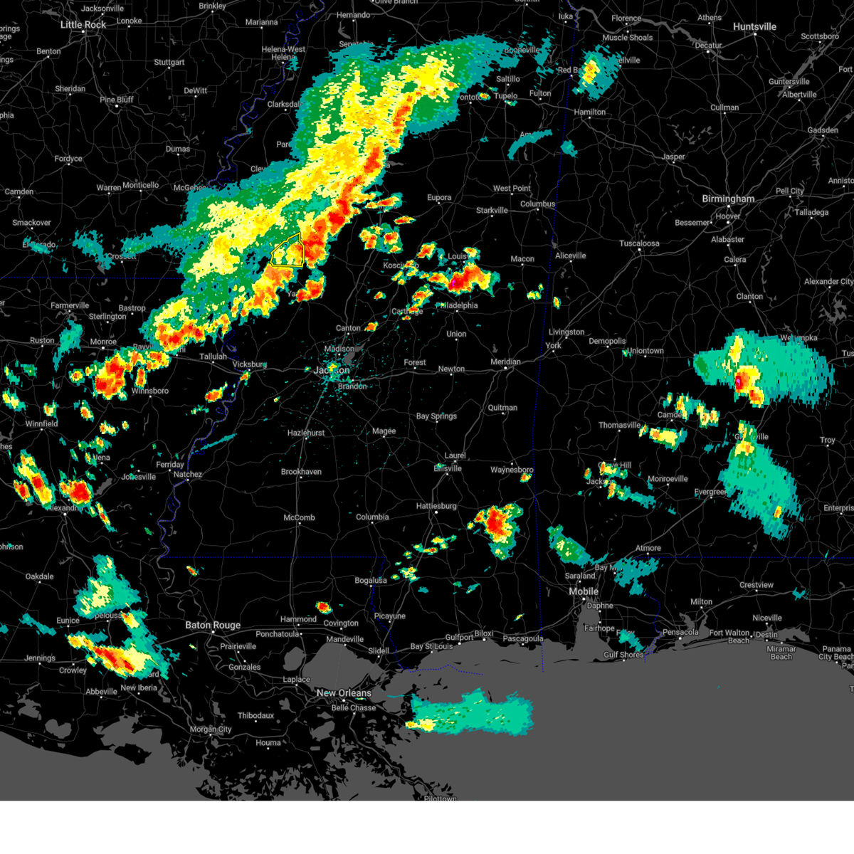
| 1/5/2025 3:09 PM CST |
 At 309 pm cst, a severe thunderstorm capable of producing a tornado was located near isola, or 9 miles south of indianola, moving northeast at 55 mph (radar indicated rotation). Hazards include tornado and quarter size hail. Flying debris will be dangerous to those caught without shelter. mobile homes will be damaged or destroyed. damage to roofs, windows, and vehicles will occur. tree damage is likely. This dangerous storm will be near, moorhead, inverness, and indianola around 315 pm cst. At 309 pm cst, a severe thunderstorm capable of producing a tornado was located near isola, or 9 miles south of indianola, moving northeast at 55 mph (radar indicated rotation). Hazards include tornado and quarter size hail. Flying debris will be dangerous to those caught without shelter. mobile homes will be damaged or destroyed. damage to roofs, windows, and vehicles will occur. tree damage is likely. This dangerous storm will be near, moorhead, inverness, and indianola around 315 pm cst.
|
| 1/5/2025 3:09 PM CST |
 the tornado warning has been cancelled and is no longer in effect the tornado warning has been cancelled and is no longer in effect
|
| 1/5/2025 2:40 PM CST |
 the tornado warning has been cancelled and is no longer in effect the tornado warning has been cancelled and is no longer in effect
|
| 1/5/2025 2:40 PM CST |
 At 239 pm cst, a severe thunderstorm capable of producing a tornado was located near glen allan, or 12 miles southwest of hollandale, moving northeast at 50 mph (radar indicated rotation). Hazards include tornado and quarter size hail. Flying debris will be dangerous to those caught without shelter. mobile homes will be damaged or destroyed. damage to roofs, windows, and vehicles will occur. tree damage is likely. this dangerous storm will be near, estill, hollandale, and avon around 245 pm cst. arcola and darlove around 250 pm cst. tribbett around 300 pm cst. isola and inverness around 305 pm cst. indianola around 310 pm cst. Moorhead around 315 pm cst. At 239 pm cst, a severe thunderstorm capable of producing a tornado was located near glen allan, or 12 miles southwest of hollandale, moving northeast at 50 mph (radar indicated rotation). Hazards include tornado and quarter size hail. Flying debris will be dangerous to those caught without shelter. mobile homes will be damaged or destroyed. damage to roofs, windows, and vehicles will occur. tree damage is likely. this dangerous storm will be near, estill, hollandale, and avon around 245 pm cst. arcola and darlove around 250 pm cst. tribbett around 300 pm cst. isola and inverness around 305 pm cst. indianola around 310 pm cst. Moorhead around 315 pm cst.
|
| 1/5/2025 2:33 PM CST |
 Torjan the national weather service in jackson has issued a * tornado warning for, southeastern chicot county in southeastern arkansas, southern sunflower county in northwestern mississippi, washington county in northwestern mississippi, northern humphreys county in central mississippi, * until 330 pm cst. * at 233 pm cst, a severe thunderstorm capable of producing a tornado was located near glen allan, or 13 miles north of mayersville, moving northeast at 55 mph (radar indicated rotation). Hazards include tornado and quarter size hail. Flying debris will be dangerous to those caught without shelter. mobile homes will be damaged or destroyed. damage to roofs, windows, and vehicles will occur. tree damage is likely. this dangerous storm will be near, estill, hollandale, and avon around 240 pm cst. arcola and darlove around 245 pm cst. tribbett around 255 pm cst. isola and inverness around 300 pm cst. indianola around 305 pm cst. Moorhead around 310 pm cst. Torjan the national weather service in jackson has issued a * tornado warning for, southeastern chicot county in southeastern arkansas, southern sunflower county in northwestern mississippi, washington county in northwestern mississippi, northern humphreys county in central mississippi, * until 330 pm cst. * at 233 pm cst, a severe thunderstorm capable of producing a tornado was located near glen allan, or 13 miles north of mayersville, moving northeast at 55 mph (radar indicated rotation). Hazards include tornado and quarter size hail. Flying debris will be dangerous to those caught without shelter. mobile homes will be damaged or destroyed. damage to roofs, windows, and vehicles will occur. tree damage is likely. this dangerous storm will be near, estill, hollandale, and avon around 240 pm cst. arcola and darlove around 245 pm cst. tribbett around 255 pm cst. isola and inverness around 300 pm cst. indianola around 305 pm cst. Moorhead around 310 pm cst.
|
| 12/28/2024 6:19 PM CST |
 the severe thunderstorm warning has been cancelled and is no longer in effect the severe thunderstorm warning has been cancelled and is no longer in effect
|
| 12/28/2024 6:19 PM CST |
 At 619 pm cst, a severe thunderstorm was located near sidon, or near greenwood, moving northeast at 60 mph (radar indicated). Hazards include 60 mph wind gusts and nickel size hail. Expect damage to roofs, siding, and trees. This severe storm will be near, malmaison, greenwood, and teoc around 625 pm cst. At 619 pm cst, a severe thunderstorm was located near sidon, or near greenwood, moving northeast at 60 mph (radar indicated). Hazards include 60 mph wind gusts and nickel size hail. Expect damage to roofs, siding, and trees. This severe storm will be near, malmaison, greenwood, and teoc around 625 pm cst.
|
| 12/28/2024 5:44 PM CST |
 Svrjan the national weather service in jackson has issued a * severe thunderstorm warning for, southern sunflower county in northwestern mississippi, holmes county in central mississippi, western carroll county in north central mississippi, leflore county in north central mississippi, east central washington county in northwestern mississippi, northwestern yazoo county in central mississippi, humphreys county in central mississippi, * until 645 pm cst. * at 543 pm cst, a severe thunderstorm was located near midnight, or 11 miles southwest of belzoni, moving northeast at 60 mph (radar indicated). Hazards include 60 mph wind gusts and quarter size hail. Hail damage to vehicles is expected. expect wind damage to roofs, siding, and trees. this severe thunderstorm will be near, belzoni and silver city around 550 pm cst. swiftown around 555 pm cst. morgan city and cruger around 605 pm cst. quito and sidon around 610 pm cst. greenwood and seven pines around 615 pm cst. Malmaison and teoc around 625 pm cst. Svrjan the national weather service in jackson has issued a * severe thunderstorm warning for, southern sunflower county in northwestern mississippi, holmes county in central mississippi, western carroll county in north central mississippi, leflore county in north central mississippi, east central washington county in northwestern mississippi, northwestern yazoo county in central mississippi, humphreys county in central mississippi, * until 645 pm cst. * at 543 pm cst, a severe thunderstorm was located near midnight, or 11 miles southwest of belzoni, moving northeast at 60 mph (radar indicated). Hazards include 60 mph wind gusts and quarter size hail. Hail damage to vehicles is expected. expect wind damage to roofs, siding, and trees. this severe thunderstorm will be near, belzoni and silver city around 550 pm cst. swiftown around 555 pm cst. morgan city and cruger around 605 pm cst. quito and sidon around 610 pm cst. greenwood and seven pines around 615 pm cst. Malmaison and teoc around 625 pm cst.
|
| 8/18/2024 8:28 PM CDT | The storms which prompted the warning have moved out of the area. therefore, the warning will be allowed to expire. a severe thunderstorm watch remains in effect until 1000 pm cdt for central, north central, northwestern and west central mississippi. to report severe weather, contact your nearest law enforcement agency. they will relay your report to the national weather service jackson. |
| 8/18/2024 8:16 PM CDT | At 816 pm cdt, severe thunderstorms were located along a line extending from near sidon to near swiftown to near delta city, moving southeast at 35 mph (law enforcement. several trees and powerlines were downed across sunflower county). Hazards include 60 mph wind gusts. Expect damage to roofs, siding, and trees. Locations impacted include, hollandale, isola, sidon, morgan city, darlove, swiftown, and quito. |
| 8/18/2024 7:56 PM CDT |
 At 756 pm cdt, severe thunderstorms were located along a line extending from near schlater to near moorhead to arcola, moving south at 40 mph (radar indicated). Hazards include 60 mph wind gusts and nickel size hail. Expect damage to roofs, siding, and trees. Locations impacted include, indianola, leland, hollandale, moorhead, itta bena, sunflower, inverness, isola, sidon, arcola, schlater, morgan city, darlove, estill, quito, tribbett, swiftown, and holly ridge. At 756 pm cdt, severe thunderstorms were located along a line extending from near schlater to near moorhead to arcola, moving south at 40 mph (radar indicated). Hazards include 60 mph wind gusts and nickel size hail. Expect damage to roofs, siding, and trees. Locations impacted include, indianola, leland, hollandale, moorhead, itta bena, sunflower, inverness, isola, sidon, arcola, schlater, morgan city, darlove, estill, quito, tribbett, swiftown, and holly ridge.
|
| 8/18/2024 7:26 PM CDT |
 Svrjan the national weather service in jackson has issued a * severe thunderstorm warning for, southern sunflower county in northwestern mississippi, southwestern leflore county in north central mississippi, eastern washington county in northwestern mississippi, northern humphreys county in central mississippi, * until 830 pm cdt. * at 726 pm cdt, severe thunderstorms were located along a line extending from near ruleville to near benoit, moving southeast at 35 mph (radar indicated). Hazards include 60 mph wind gusts and quarter size hail. Hail damage to vehicles is expected. Expect wind damage to roofs, siding, and trees. Svrjan the national weather service in jackson has issued a * severe thunderstorm warning for, southern sunflower county in northwestern mississippi, southwestern leflore county in north central mississippi, eastern washington county in northwestern mississippi, northern humphreys county in central mississippi, * until 830 pm cdt. * at 726 pm cdt, severe thunderstorms were located along a line extending from near ruleville to near benoit, moving southeast at 35 mph (radar indicated). Hazards include 60 mph wind gusts and quarter size hail. Hail damage to vehicles is expected. Expect wind damage to roofs, siding, and trees.
|
| 6/26/2024 2:55 PM CDT |
 At 254 pm cdt, severe thunderstorms were located along a line extending from 6 miles east of scobey to near itta bena, moving east at 45 mph (radar indicated). Hazards include 60 mph wind gusts. Expect damage to roofs, siding, and trees. these severe storms will be near, greenwood, grenada, jefferson, avalon, bew springs, and teoc around 300 pm cdt. Malmaison around 305 pm cdt. At 254 pm cdt, severe thunderstorms were located along a line extending from 6 miles east of scobey to near itta bena, moving east at 45 mph (radar indicated). Hazards include 60 mph wind gusts. Expect damage to roofs, siding, and trees. these severe storms will be near, greenwood, grenada, jefferson, avalon, bew springs, and teoc around 300 pm cdt. Malmaison around 305 pm cdt.
|
| 6/26/2024 2:39 PM CDT |
 Svrjan the national weather service in jackson has issued a * severe thunderstorm warning for, southern sunflower county in northwestern mississippi, northwestern carroll county in north central mississippi, grenada county in north central mississippi, leflore county in north central mississippi, * until 400 pm cdt. * at 239 pm cdt, severe thunderstorms were located along a line extending from near scobey to near moorhead, moving east at 30 mph (radar indicated). Hazards include 60 mph wind gusts. Expect damage to roofs, siding, and trees. severe thunderstorms will be near, itta bena, holcomb, avalon, money, bew springs, and leflore around 245 pm cdt. greenwood and grenada around 250 pm cdt. quito around 255 pm cdt. teoc around 300 pm cdt. jefferson around 310 pm cdt. Malmaison around 315 pm cdt. Svrjan the national weather service in jackson has issued a * severe thunderstorm warning for, southern sunflower county in northwestern mississippi, northwestern carroll county in north central mississippi, grenada county in north central mississippi, leflore county in north central mississippi, * until 400 pm cdt. * at 239 pm cdt, severe thunderstorms were located along a line extending from near scobey to near moorhead, moving east at 30 mph (radar indicated). Hazards include 60 mph wind gusts. Expect damage to roofs, siding, and trees. severe thunderstorms will be near, itta bena, holcomb, avalon, money, bew springs, and leflore around 245 pm cdt. greenwood and grenada around 250 pm cdt. quito around 255 pm cdt. teoc around 300 pm cdt. jefferson around 310 pm cdt. Malmaison around 315 pm cdt.
|
| 6/3/2024 9:55 PM CDT |
 The storms which prompted the warning have weakened below severe limits, and have exited the warned area. therefore, the warning will be allowed to expire. a severe thunderstorm watch remains in effect until midnight cdt for central, north central, northwestern and west central mississippi. The storms which prompted the warning have weakened below severe limits, and have exited the warned area. therefore, the warning will be allowed to expire. a severe thunderstorm watch remains in effect until midnight cdt for central, north central, northwestern and west central mississippi.
|
| 6/3/2024 9:34 PM CDT |
 At 934 pm cdt, severe thunderstorms were located along a line extending from near moorhead to near belzoni to 7 miles north of holly bluff, moving east at 45 mph (radar indicated). Hazards include 60 mph wind gusts and penny size hail. Expect damage to roofs, siding, and trees. These severe storms will be near, louise around 940 pm cdt. At 934 pm cdt, severe thunderstorms were located along a line extending from near moorhead to near belzoni to 7 miles north of holly bluff, moving east at 45 mph (radar indicated). Hazards include 60 mph wind gusts and penny size hail. Expect damage to roofs, siding, and trees. These severe storms will be near, louise around 940 pm cdt.
|
| 6/3/2024 9:34 PM CDT |
 the severe thunderstorm warning has been cancelled and is no longer in effect the severe thunderstorm warning has been cancelled and is no longer in effect
|
| 6/3/2024 9:10 PM CDT |
 At 910 pm cdt, severe thunderstorms were located along a line extending from near indianola to darlove to near rolling fork, moving east at 30 mph (radar indicated). Hazards include 60 mph wind gusts and penny size hail. Expect damage to roofs, siding, and trees. these severe storms will be near, indianola, rolling fork, inverness, anguilla, delta city, nitta yuma, and murphy around 915 pm cdt. moorhead and isola around 920 pm cdt. belzoni, louise, and midnight around 930 pm cdt. Silver city around 935 pm cdt. At 910 pm cdt, severe thunderstorms were located along a line extending from near indianola to darlove to near rolling fork, moving east at 30 mph (radar indicated). Hazards include 60 mph wind gusts and penny size hail. Expect damage to roofs, siding, and trees. these severe storms will be near, indianola, rolling fork, inverness, anguilla, delta city, nitta yuma, and murphy around 915 pm cdt. moorhead and isola around 920 pm cdt. belzoni, louise, and midnight around 930 pm cdt. Silver city around 935 pm cdt.
|
| 6/3/2024 8:40 PM CDT |
 Svrjan the national weather service in jackson has issued a * severe thunderstorm warning for, southern sunflower county in northwestern mississippi, washington county in northwestern mississippi, northwestern issaquena county in west central mississippi, humphreys county in central mississippi, northern sharkey county in west central mississippi, * until 1000 pm cdt. * at 839 pm cdt, severe thunderstorms were located along a line extending from near metcalfe to avon to near gassoway, moving east at 35 mph (radar indicated). Hazards include 60 mph wind gusts and penny size hail. Expect damage to roofs, siding, and trees. severe thunderstorms will be near, leland, arcola, and glen allan around 845 pm cdt. hollandale, grace, estill, holly ridge, and tribbett around 850 pm cdt. panther burn and darlove around 855 pm cdt. indianola and nitta yuma around 900 pm cdt. rolling fork, anguilla, and delta city around 905 pm cdt. moorhead, inverness, and murphy around 910 pm cdt. isola around 915 pm cdt. Belzoni, louise, and midnight around 925 pm cdt. Svrjan the national weather service in jackson has issued a * severe thunderstorm warning for, southern sunflower county in northwestern mississippi, washington county in northwestern mississippi, northwestern issaquena county in west central mississippi, humphreys county in central mississippi, northern sharkey county in west central mississippi, * until 1000 pm cdt. * at 839 pm cdt, severe thunderstorms were located along a line extending from near metcalfe to avon to near gassoway, moving east at 35 mph (radar indicated). Hazards include 60 mph wind gusts and penny size hail. Expect damage to roofs, siding, and trees. severe thunderstorms will be near, leland, arcola, and glen allan around 845 pm cdt. hollandale, grace, estill, holly ridge, and tribbett around 850 pm cdt. panther burn and darlove around 855 pm cdt. indianola and nitta yuma around 900 pm cdt. rolling fork, anguilla, and delta city around 905 pm cdt. moorhead, inverness, and murphy around 910 pm cdt. isola around 915 pm cdt. Belzoni, louise, and midnight around 925 pm cdt.
|
| 5/23/2024 11:51 AM CDT |
 the severe thunderstorm warning has been cancelled and is no longer in effect the severe thunderstorm warning has been cancelled and is no longer in effect
|
| 5/23/2024 11:42 AM CDT |
 the severe thunderstorm warning has been cancelled and is no longer in effect the severe thunderstorm warning has been cancelled and is no longer in effect
|
| 5/23/2024 11:42 AM CDT |
 At 1141 am cdt, severe thunderstorms were located along a line extending from near sunflower to near inverness to near darlove, moving east at 50 mph (radar indicated). Hazards include 60 mph wind gusts. Expect damage to roofs, siding, and trees. these severe storms will be near, moorhead, inverness, and isola around 1145 am cdt. belzoni, itta bena, and swiftown around 1150 am cdt. Morgan city and quito around 1155 am cdt. At 1141 am cdt, severe thunderstorms were located along a line extending from near sunflower to near inverness to near darlove, moving east at 50 mph (radar indicated). Hazards include 60 mph wind gusts. Expect damage to roofs, siding, and trees. these severe storms will be near, moorhead, inverness, and isola around 1145 am cdt. belzoni, itta bena, and swiftown around 1150 am cdt. Morgan city and quito around 1155 am cdt.
|
| 5/23/2024 11:20 AM CDT |
 Svrjan the national weather service in jackson has issued a * severe thunderstorm warning for, southern sunflower county in northwestern mississippi, southwestern leflore county in north central mississippi, washington county in northwestern mississippi, humphreys county in central mississippi, northern sharkey county in west central mississippi, * until 1215 pm cdt. * at 1120 am cdt, severe thunderstorms were located along a line extending from near metcalfe to near greenville to near avon, moving east at 40 mph (radar indicated). Hazards include 60 mph wind gusts and quarter size hail. Hail damage to vehicles is expected. expect wind damage to roofs, siding, and trees. severe thunderstorms will be near, leland, hollandale, arcola, estill, and tribbett around 1125 am cdt. darlove and holly ridge around 1130 am cdt. indianola, panther burn, and delta city around 1135 am cdt. murphy around 1140 am cdt. inverness and isola around 1145 am cdt. moorhead around 1150 am cdt. belzoni and midnight around 1155 am cdt. Silver city and swiftown around 1200 pm cdt. Svrjan the national weather service in jackson has issued a * severe thunderstorm warning for, southern sunflower county in northwestern mississippi, southwestern leflore county in north central mississippi, washington county in northwestern mississippi, humphreys county in central mississippi, northern sharkey county in west central mississippi, * until 1215 pm cdt. * at 1120 am cdt, severe thunderstorms were located along a line extending from near metcalfe to near greenville to near avon, moving east at 40 mph (radar indicated). Hazards include 60 mph wind gusts and quarter size hail. Hail damage to vehicles is expected. expect wind damage to roofs, siding, and trees. severe thunderstorms will be near, leland, hollandale, arcola, estill, and tribbett around 1125 am cdt. darlove and holly ridge around 1130 am cdt. indianola, panther burn, and delta city around 1135 am cdt. murphy around 1140 am cdt. inverness and isola around 1145 am cdt. moorhead around 1150 am cdt. belzoni and midnight around 1155 am cdt. Silver city and swiftown around 1200 pm cdt.
|
| 2/11/2024 12:29 PM CST |
 At 1229 pm cst, a severe thunderstorm was located near avon, or 10 miles west of hollandale, moving northeast at 45 mph (radar indicated). Hazards include 60 mph wind gusts and half dollar size hail. Hail damage to vehicles is expected. expect wind damage to roofs, siding, and trees. this severe thunderstorm will be near, hollandale, arcola, wayside, and estill around 1235 pm cst. darlove around 1240 pm cst. tribbett around 1250 pm cst. isola around 1255 pm cst. indianola and inverness around 100 pm cst. moorhead around 110 pm cst. hail threat, radar indicated max hail size, 1. 25 in wind threat, radar indicated max wind gust, 60 mph. At 1229 pm cst, a severe thunderstorm was located near avon, or 10 miles west of hollandale, moving northeast at 45 mph (radar indicated). Hazards include 60 mph wind gusts and half dollar size hail. Hail damage to vehicles is expected. expect wind damage to roofs, siding, and trees. this severe thunderstorm will be near, hollandale, arcola, wayside, and estill around 1235 pm cst. darlove around 1240 pm cst. tribbett around 1250 pm cst. isola around 1255 pm cst. indianola and inverness around 100 pm cst. moorhead around 110 pm cst. hail threat, radar indicated max hail size, 1. 25 in wind threat, radar indicated max wind gust, 60 mph.
|
| 1/12/2024 8:33 AM CST | Significant damage to fish farm structur in humphreys county MS, 5 miles NE of Isola, MS |
| 1/12/2024 7:45 AM CST | Corrects previous tstm wnd dmg report from 5 sw isola. significant damage to fish farm structur in humphreys county MS, 5 miles NE of Isola, MS |
| 1/12/2024 7:32 AM CST |
 At 732 am cst, severe thunderstorms were located along a line extending from near murphy to near alsatia, moving northeast at 90 mph (radar indicated). Hazards include 60 mph wind gusts. Expect damage to roofs, siding, and trees. these severe storms will be near, belzoni, rolling fork, anguilla, isola, cary, onward, midnight, and fitler around 735 am cst. silver city, louise, and swiftown around 740 am cst. cruger and holly bluff around 745 am cst. tchula and thornton around 750 am cst. yazoo city and howard around 755 am cst. eden and tolarville around 800 am cst. hail threat, radar indicated max hail size, <. 75 in wind threat, radar indicated max wind gust, 60 mph. At 732 am cst, severe thunderstorms were located along a line extending from near murphy to near alsatia, moving northeast at 90 mph (radar indicated). Hazards include 60 mph wind gusts. Expect damage to roofs, siding, and trees. these severe storms will be near, belzoni, rolling fork, anguilla, isola, cary, onward, midnight, and fitler around 735 am cst. silver city, louise, and swiftown around 740 am cst. cruger and holly bluff around 745 am cst. tchula and thornton around 750 am cst. yazoo city and howard around 755 am cst. eden and tolarville around 800 am cst. hail threat, radar indicated max hail size, <. 75 in wind threat, radar indicated max wind gust, 60 mph.
|
| 1/12/2024 7:16 AM CST |
 At 716 am cst, severe thunderstorms were located along a line extending from near mayersville to near delhi, moving east at 80 mph (radar indicated). Hazards include 60 mph wind gusts. Expect damage to roofs, siding, and trees. severe thunderstorms will be near, lake providence, delhi, mayersville, monticello, warden, waverly, and transylvania around 720 am cst. rolling fork, anguilla, cary, grace, fitler, alsatia, and sondheimer around 725 am cst. nitta yuma, onward, and omega around 730 am cst. louise around 735 am cst. valley park, midnight, and holly bluff around 740 am cst. silver city around 745 am cst. yazoo city and thornton around 750 am cst. tchula, eden, tolarville, and howard around 755 am cst. hail threat, radar indicated max hail size, <. 75 in wind threat, radar indicated max wind gust, 60 mph. At 716 am cst, severe thunderstorms were located along a line extending from near mayersville to near delhi, moving east at 80 mph (radar indicated). Hazards include 60 mph wind gusts. Expect damage to roofs, siding, and trees. severe thunderstorms will be near, lake providence, delhi, mayersville, monticello, warden, waverly, and transylvania around 720 am cst. rolling fork, anguilla, cary, grace, fitler, alsatia, and sondheimer around 725 am cst. nitta yuma, onward, and omega around 730 am cst. louise around 735 am cst. valley park, midnight, and holly bluff around 740 am cst. silver city around 745 am cst. yazoo city and thornton around 750 am cst. tchula, eden, tolarville, and howard around 755 am cst. hail threat, radar indicated max hail size, <. 75 in wind threat, radar indicated max wind gust, 60 mph.
|
| 1/12/2024 6:59 AM CST |
 At 658 am cst, severe thunderstorms were located along a line extending from boyle to near wayside, moving northeast at 65 mph (radar indicated). Hazards include 60 mph wind gusts. Expect damage to roofs, siding, and trees. these severe storms will be near, greenville, cleveland, leland, ruleville, shaw, boyle, and holly ridge around 705 am cst. drew, doddsville, and tribbett around 710 am cst. indianola, sunflower, and blaine around 715 am cst. moorhead around 725 am cst. hail threat, radar indicated max hail size, <. 75 in wind threat, radar indicated max wind gust, 60 mph. At 658 am cst, severe thunderstorms were located along a line extending from boyle to near wayside, moving northeast at 65 mph (radar indicated). Hazards include 60 mph wind gusts. Expect damage to roofs, siding, and trees. these severe storms will be near, greenville, cleveland, leland, ruleville, shaw, boyle, and holly ridge around 705 am cst. drew, doddsville, and tribbett around 710 am cst. indianola, sunflower, and blaine around 715 am cst. moorhead around 725 am cst. hail threat, radar indicated max hail size, <. 75 in wind threat, radar indicated max wind gust, 60 mph.
|
| 1/12/2024 6:27 AM CST |
 At 627 am cst, severe thunderstorms were located along a line extending from near arkansas city to near portland, moving east at 75 mph (radar indicated). Hazards include 60 mph wind gusts. Expect damage to roofs, siding, and trees. severe thunderstorms will be near, greenville, lake village, metcalfe, benoit, winterville, scott, and lamont around 635 am cst. cleveland, leland, shaw, and boyle around 645 am cst. ruleville, holly ridge, and tribbett around 655 am cst. indianola, drew, doddsville, and blaine around 700 am cst. sunflower around 705 am cst. moorhead around 710 am cst. other locations impacted by these severe thunderstorms include halley. hail threat, radar indicated max hail size, <. 75 in wind threat, radar indicated max wind gust, 60 mph. At 627 am cst, severe thunderstorms were located along a line extending from near arkansas city to near portland, moving east at 75 mph (radar indicated). Hazards include 60 mph wind gusts. Expect damage to roofs, siding, and trees. severe thunderstorms will be near, greenville, lake village, metcalfe, benoit, winterville, scott, and lamont around 635 am cst. cleveland, leland, shaw, and boyle around 645 am cst. ruleville, holly ridge, and tribbett around 655 am cst. indianola, drew, doddsville, and blaine around 700 am cst. sunflower around 705 am cst. moorhead around 710 am cst. other locations impacted by these severe thunderstorms include halley. hail threat, radar indicated max hail size, <. 75 in wind threat, radar indicated max wind gust, 60 mph.
|
| 1/12/2024 6:27 AM CST |
 The national weather service in jackson has issued a * severe thunderstorm warning for. chicot county in southeastern arkansas. sunflower county in northwestern mississippi. washington county in northwestern mississippi. Bolivar county in northwestern mississippi. The national weather service in jackson has issued a * severe thunderstorm warning for. chicot county in southeastern arkansas. sunflower county in northwestern mississippi. washington county in northwestern mississippi. Bolivar county in northwestern mississippi.
|
| 1/8/2024 4:53 PM CST |
 At 453 pm cst, a severe thunderstorm was located near isola, or 11 miles west of belzoni, moving northeast at 70 mph (radar indicated). Hazards include 60 mph wind gusts and quarter size hail. Hail damage to vehicles is expected. expect wind damage to roofs, siding, and trees. this severe thunderstorm will be near, indianola, moorhead, and inverness around 500 pm cst. itta bena and sunflower around 510 pm cst. schlater and blaine around 515 pm cst. hail threat, radar indicated max hail size, 1. 00 in wind threat, radar indicated max wind gust, 60 mph. At 453 pm cst, a severe thunderstorm was located near isola, or 11 miles west of belzoni, moving northeast at 70 mph (radar indicated). Hazards include 60 mph wind gusts and quarter size hail. Hail damage to vehicles is expected. expect wind damage to roofs, siding, and trees. this severe thunderstorm will be near, indianola, moorhead, and inverness around 500 pm cst. itta bena and sunflower around 510 pm cst. schlater and blaine around 515 pm cst. hail threat, radar indicated max hail size, 1. 00 in wind threat, radar indicated max wind gust, 60 mph.
|
| 9/6/2023 8:08 PM CDT |
 At 808 pm cdt, a severe thunderstorm was located near tinsley, or near yazoo city, moving southeast at 25 mph (radar indicated). Hazards include ping pong ball size hail and 60 mph wind gusts. People and animals outdoors will be injured. expect hail damage to roofs, siding, windows, and vehicles. expect wind damage to roofs, siding, and trees. this severe thunderstorm will remain over mainly rural areas of west central holmes, northwestern yazoo, north central issaquena, humphreys and sharkey counties. hail threat, radar indicated max hail size, 1. 50 in wind threat, radar indicated max wind gust, 60 mph. At 808 pm cdt, a severe thunderstorm was located near tinsley, or near yazoo city, moving southeast at 25 mph (radar indicated). Hazards include ping pong ball size hail and 60 mph wind gusts. People and animals outdoors will be injured. expect hail damage to roofs, siding, windows, and vehicles. expect wind damage to roofs, siding, and trees. this severe thunderstorm will remain over mainly rural areas of west central holmes, northwestern yazoo, north central issaquena, humphreys and sharkey counties. hail threat, radar indicated max hail size, 1. 50 in wind threat, radar indicated max wind gust, 60 mph.
|
| 9/6/2023 8:00 PM CDT |
 At 800 pm cdt, a severe thunderstorm was located 8 miles east of holly bluff, or 9 miles west of yazoo city, moving southeast at 25 mph (radar indicated). Hazards include 60 mph wind gusts and quarter size hail. Hail damage to vehicles is expected. expect wind damage to roofs, siding, and trees. this severe storm will be near, yazoo city around 805 pm cdt. hail threat, radar indicated max hail size, 1. 00 in wind threat, radar indicated max wind gust, 60 mph. At 800 pm cdt, a severe thunderstorm was located 8 miles east of holly bluff, or 9 miles west of yazoo city, moving southeast at 25 mph (radar indicated). Hazards include 60 mph wind gusts and quarter size hail. Hail damage to vehicles is expected. expect wind damage to roofs, siding, and trees. this severe storm will be near, yazoo city around 805 pm cdt. hail threat, radar indicated max hail size, 1. 00 in wind threat, radar indicated max wind gust, 60 mph.
|
| 9/6/2023 7:40 PM CDT |
 At 739 pm cdt, a severe thunderstorm was located near anguilla, or 10 miles northeast of rolling fork, moving southeast at 25 mph (radar indicated). Hazards include 60 mph wind gusts and quarter size hail. Hail damage to vehicles is expected. expect wind damage to roofs, siding, and trees. this severe thunderstorm will be near, louise around 745 pm cdt. holly bluff around 750 pm cdt. yazoo city around 800 pm cdt. hail threat, radar indicated max hail size, 1. 00 in wind threat, radar indicated max wind gust, 60 mph. At 739 pm cdt, a severe thunderstorm was located near anguilla, or 10 miles northeast of rolling fork, moving southeast at 25 mph (radar indicated). Hazards include 60 mph wind gusts and quarter size hail. Hail damage to vehicles is expected. expect wind damage to roofs, siding, and trees. this severe thunderstorm will be near, louise around 745 pm cdt. holly bluff around 750 pm cdt. yazoo city around 800 pm cdt. hail threat, radar indicated max hail size, 1. 00 in wind threat, radar indicated max wind gust, 60 mph.
|
| 6/25/2023 9:48 PM CDT |
 At 948 pm cdt, severe thunderstorms were located along a line extending from 8 miles west of noxapater to carthage to near way, moving southeast at 55 mph (radar indicated). Hazards include 60 mph wind gusts and penny size hail. Expect damage to roofs, siding, and trees. these severe thunderstorms will remain over mainly rural areas of southeastern sunflower, west central choctaw, holmes, southern leflore, attala and humphreys counties. hail threat, radar indicated max hail size, 0. 75 in wind threat, radar indicated max wind gust, 60 mph. At 948 pm cdt, severe thunderstorms were located along a line extending from 8 miles west of noxapater to carthage to near way, moving southeast at 55 mph (radar indicated). Hazards include 60 mph wind gusts and penny size hail. Expect damage to roofs, siding, and trees. these severe thunderstorms will remain over mainly rural areas of southeastern sunflower, west central choctaw, holmes, southern leflore, attala and humphreys counties. hail threat, radar indicated max hail size, 0. 75 in wind threat, radar indicated max wind gust, 60 mph.
|
| 6/25/2023 8:56 PM CDT |
 At 856 pm cdt, severe thunderstorms were located along a line extending from 6 miles southwest of sweatman to near emory to near belzoni, moving southeast at 60 mph (radar indicated). Hazards include 70 mph wind gusts and penny size hail. Expect considerable tree damage. damage is likely to mobile homes, roofs, and outbuildings. these severe storms will be near, emory around 900 pm cdt. silver city, west and bowling green around 905 pm cdt. durant, thornton and possumneck around 910 pm cdt. sallis and tolarville around 915 pm cdt. kosciusko, french camp, and newport around 920 pm cdt. mccool around 925 pm cdt. thunderstorm damage threat, considerable hail threat, radar indicated max hail size, 0. 75 in wind threat, radar indicated max wind gust, 70 mph. At 856 pm cdt, severe thunderstorms were located along a line extending from 6 miles southwest of sweatman to near emory to near belzoni, moving southeast at 60 mph (radar indicated). Hazards include 70 mph wind gusts and penny size hail. Expect considerable tree damage. damage is likely to mobile homes, roofs, and outbuildings. these severe storms will be near, emory around 900 pm cdt. silver city, west and bowling green around 905 pm cdt. durant, thornton and possumneck around 910 pm cdt. sallis and tolarville around 915 pm cdt. kosciusko, french camp, and newport around 920 pm cdt. mccool around 925 pm cdt. thunderstorm damage threat, considerable hail threat, radar indicated max hail size, 0. 75 in wind threat, radar indicated max wind gust, 70 mph.
|
| 6/25/2023 8:47 PM CDT |
 At 846 pm cdt, severe thunderstorms were located along a line extending from near elliott to near seven pines to near inverness, moving southeast at 55 mph (radar indicated). Hazards include 60 mph wind gusts and penny size hail. Expect damage to roofs, siding, and trees. severe thunderstorms will be near, swiftown around 900 pm cdt. belzoni and emory around 905 pm cdt. silver city, west and bowling green around 910 pm cdt. durant, thornton and possumneck around 915 pm cdt. french camp, sallis, mcadams, coxburg and tolarville around 925 pm cdt. kosciusko and newport around 930 pm cdt. mccool around 935 pm cdt. hail threat, radar indicated max hail size, 0. 75 in wind threat, radar indicated max wind gust, 60 mph. At 846 pm cdt, severe thunderstorms were located along a line extending from near elliott to near seven pines to near inverness, moving southeast at 55 mph (radar indicated). Hazards include 60 mph wind gusts and penny size hail. Expect damage to roofs, siding, and trees. severe thunderstorms will be near, swiftown around 900 pm cdt. belzoni and emory around 905 pm cdt. silver city, west and bowling green around 910 pm cdt. durant, thornton and possumneck around 915 pm cdt. french camp, sallis, mcadams, coxburg and tolarville around 925 pm cdt. kosciusko and newport around 930 pm cdt. mccool around 935 pm cdt. hail threat, radar indicated max hail size, 0. 75 in wind threat, radar indicated max wind gust, 60 mph.
|
| 6/15/2023 4:00 AM CDT |
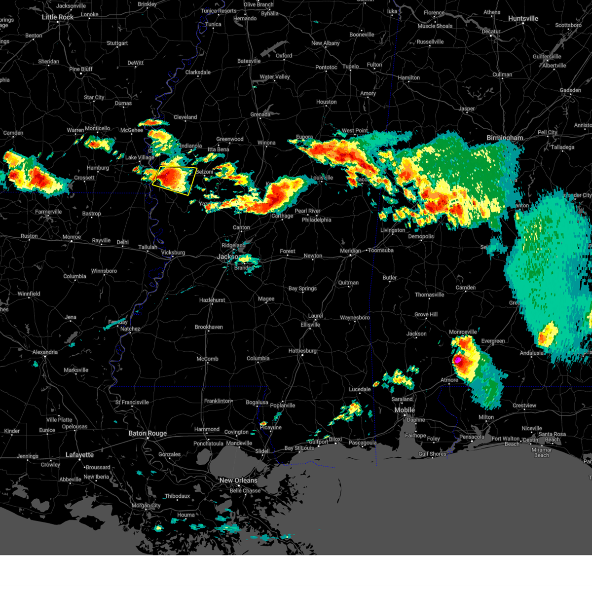 At 400 am cdt, a severe thunderstorm was located over hollandale, moving east at 35 mph (radar indicated). Hazards include two inch hail and 60 mph wind gusts. People and animals outdoors will be injured. expect hail damage to roofs, siding, windows, and vehicles. expect wind damage to roofs, siding, and trees. this severe storm will be near, delta city around 405 am cdt. murphy around 415 am cdt. thunderstorm damage threat, considerable hail threat, radar indicated max hail size, 2. 00 in wind threat, radar indicated max wind gust, 60 mph. At 400 am cdt, a severe thunderstorm was located over hollandale, moving east at 35 mph (radar indicated). Hazards include two inch hail and 60 mph wind gusts. People and animals outdoors will be injured. expect hail damage to roofs, siding, windows, and vehicles. expect wind damage to roofs, siding, and trees. this severe storm will be near, delta city around 405 am cdt. murphy around 415 am cdt. thunderstorm damage threat, considerable hail threat, radar indicated max hail size, 2. 00 in wind threat, radar indicated max wind gust, 60 mph.
|
| 6/15/2023 3:36 AM CDT |
 At 336 am cdt, a severe thunderstorm was located near avon, or 11 miles west of hollandale, moving east at 40 mph (radar indicated). Hazards include two inch hail and 60 mph wind gusts. People and animals outdoors will be injured. expect hail damage to roofs, siding, windows, and vehicles. expect wind damage to roofs, siding, and trees. this severe storm will be near, estill around 350 am cdt. hollandale and panther burn around 355 am cdt. delta city and darlove around 400 am cdt. murphy around 410 am cdt. thunderstorm damage threat, considerable hail threat, radar indicated max hail size, 2. 00 in wind threat, radar indicated max wind gust, 60 mph. At 336 am cdt, a severe thunderstorm was located near avon, or 11 miles west of hollandale, moving east at 40 mph (radar indicated). Hazards include two inch hail and 60 mph wind gusts. People and animals outdoors will be injured. expect hail damage to roofs, siding, windows, and vehicles. expect wind damage to roofs, siding, and trees. this severe storm will be near, estill around 350 am cdt. hollandale and panther burn around 355 am cdt. delta city and darlove around 400 am cdt. murphy around 410 am cdt. thunderstorm damage threat, considerable hail threat, radar indicated max hail size, 2. 00 in wind threat, radar indicated max wind gust, 60 mph.
|
| 6/15/2023 3:19 AM CDT |
 At 318 am cdt, a severe thunderstorm was located over chicot junction, or 8 miles south of lake village, moving east at 45 mph (radar indicated). Hazards include ping pong ball size hail and 60 mph wind gusts. People and animals outdoors will be injured. expect hail damage to roofs, siding, windows, and vehicles. expect wind damage to roofs, siding, and trees. this severe thunderstorm will be near, avon and wayside around 335 am cdt. estill around 345 am cdt. hollandale and panther burn around 350 am cdt. delta city and darlove around 355 am cdt. murphy around 400 am cdt. hail threat, radar indicated max hail size, 1. 50 in wind threat, radar indicated max wind gust, 60 mph. At 318 am cdt, a severe thunderstorm was located over chicot junction, or 8 miles south of lake village, moving east at 45 mph (radar indicated). Hazards include ping pong ball size hail and 60 mph wind gusts. People and animals outdoors will be injured. expect hail damage to roofs, siding, windows, and vehicles. expect wind damage to roofs, siding, and trees. this severe thunderstorm will be near, avon and wayside around 335 am cdt. estill around 345 am cdt. hollandale and panther burn around 350 am cdt. delta city and darlove around 355 am cdt. murphy around 400 am cdt. hail threat, radar indicated max hail size, 1. 50 in wind threat, radar indicated max wind gust, 60 mph.
|
| 6/15/2023 2:22 AM CDT |
 At 222 am cdt, a severe thunderstorm was located near murphy, or 9 miles east of hollandale, moving east at 45 mph (radar indicated). Hazards include golf ball size hail and 60 mph wind gusts. People and animals outdoors will be injured. expect hail damage to roofs, siding, windows, and vehicles. expect wind damage to roofs, siding, and trees. this severe storm will be near, isola around 230 am cdt. belzoni and silver city around 240 am cdt. thunderstorm damage threat, considerable hail threat, radar indicated max hail size, 1. 75 in wind threat, radar indicated max wind gust, 60 mph. At 222 am cdt, a severe thunderstorm was located near murphy, or 9 miles east of hollandale, moving east at 45 mph (radar indicated). Hazards include golf ball size hail and 60 mph wind gusts. People and animals outdoors will be injured. expect hail damage to roofs, siding, windows, and vehicles. expect wind damage to roofs, siding, and trees. this severe storm will be near, isola around 230 am cdt. belzoni and silver city around 240 am cdt. thunderstorm damage threat, considerable hail threat, radar indicated max hail size, 1. 75 in wind threat, radar indicated max wind gust, 60 mph.
|
| 6/15/2023 2:06 AM CDT |
 At 206 am cdt, a severe thunderstorm was located over darlove, or near hollandale, moving east at 40 mph (radar indicated). Hazards include 60 mph wind gusts and quarter size hail. Hail damage to vehicles is expected. expect wind damage to roofs, siding, and trees. this severe thunderstorm will be near, darlove around 210 am cdt. murphy around 220 am cdt. isola around 225 am cdt. belzoni and silver city around 235 am cdt. hail threat, radar indicated max hail size, 1. 00 in wind threat, radar indicated max wind gust, 60 mph. At 206 am cdt, a severe thunderstorm was located over darlove, or near hollandale, moving east at 40 mph (radar indicated). Hazards include 60 mph wind gusts and quarter size hail. Hail damage to vehicles is expected. expect wind damage to roofs, siding, and trees. this severe thunderstorm will be near, darlove around 210 am cdt. murphy around 220 am cdt. isola around 225 am cdt. belzoni and silver city around 235 am cdt. hail threat, radar indicated max hail size, 1. 00 in wind threat, radar indicated max wind gust, 60 mph.
|
| 6/15/2023 1:36 AM CDT |
 At 136 am cdt, a severe thunderstorm was located near isola, or 10 miles northwest of belzoni, moving east at 35 mph (radar indicated). Hazards include 60 mph wind gusts and quarter size hail. Hail damage to vehicles is expected. expect wind damage to roofs, siding, and trees. this severe storm will be near, isola around 140 am cdt. belzoni around 150 am cdt. silver city around 155 am cdt. hail threat, radar indicated max hail size, 1. 00 in wind threat, radar indicated max wind gust, 60 mph. At 136 am cdt, a severe thunderstorm was located near isola, or 10 miles northwest of belzoni, moving east at 35 mph (radar indicated). Hazards include 60 mph wind gusts and quarter size hail. Hail damage to vehicles is expected. expect wind damage to roofs, siding, and trees. this severe storm will be near, isola around 140 am cdt. belzoni around 150 am cdt. silver city around 155 am cdt. hail threat, radar indicated max hail size, 1. 00 in wind threat, radar indicated max wind gust, 60 mph.
|
| 6/15/2023 1:18 AM CDT |
 At 118 am cdt, a severe thunderstorm was located over arcola, or 7 miles north of hollandale, moving east at 35 mph (radar indicated). Hazards include ping pong ball size hail and 60 mph wind gusts. People and animals outdoors will be injured. expect hail damage to roofs, siding, windows, and vehicles. expect wind damage to roofs, siding, and trees. this severe thunderstorm will be near, darlove around 125 am cdt. murphy around 140 am cdt. isola around 145 am cdt. belzoni around 155 am cdt. silver city around 200 am cdt. hail threat, radar indicated max hail size, 1. 50 in wind threat, radar indicated max wind gust, 60 mph. At 118 am cdt, a severe thunderstorm was located over arcola, or 7 miles north of hollandale, moving east at 35 mph (radar indicated). Hazards include ping pong ball size hail and 60 mph wind gusts. People and animals outdoors will be injured. expect hail damage to roofs, siding, windows, and vehicles. expect wind damage to roofs, siding, and trees. this severe thunderstorm will be near, darlove around 125 am cdt. murphy around 140 am cdt. isola around 145 am cdt. belzoni around 155 am cdt. silver city around 200 am cdt. hail threat, radar indicated max hail size, 1. 50 in wind threat, radar indicated max wind gust, 60 mph.
|
| 6/14/2023 9:34 PM CDT |
 At 934 pm cdt, severe thunderstorms were located along a line extending from near moorhead to isola to near arcola, moving east at 40 mph (radar indicated). Hazards include two inch hail and 60 mph wind gusts. People and animals outdoors will be injured. expect hail damage to roofs, siding, windows, and vehicles. expect wind damage to roofs, siding, and trees. these severe storms will be near, moorhead and isola around 940 pm cdt. murphy around 950 pm cdt. belzoni around 1005 pm cdt. thunderstorm damage threat, considerable hail threat, radar indicated max hail size, 2. 00 in wind threat, observed max wind gust, 60 mph. At 934 pm cdt, severe thunderstorms were located along a line extending from near moorhead to isola to near arcola, moving east at 40 mph (radar indicated). Hazards include two inch hail and 60 mph wind gusts. People and animals outdoors will be injured. expect hail damage to roofs, siding, windows, and vehicles. expect wind damage to roofs, siding, and trees. these severe storms will be near, moorhead and isola around 940 pm cdt. murphy around 950 pm cdt. belzoni around 1005 pm cdt. thunderstorm damage threat, considerable hail threat, radar indicated max hail size, 2. 00 in wind threat, observed max wind gust, 60 mph.
|
| 6/14/2023 9:16 PM CDT |
 At 915 pm cdt, severe thunderstorms were located along a line extending from near holly ridge to tribbett to near wayside, moving southeast at 45 mph (radar indicated. at 832 pm, trees were downed in dermott. at 856 pm, a 48 mph wind gust was measured at the greenville airport). Hazards include golf ball size hail and 60 mph wind gusts. People and animals outdoors will be injured. expect hail damage to roofs, siding, windows, and vehicles. expect wind damage to roofs, siding, and trees. these severe storms will be near, tribbett and holly ridge around 920 pm cdt. indianola around 925 pm cdt. inverness around 930 pm cdt. hollandale, moorhead, isola and estill around 935 pm cdt. darlove around 940 pm cdt. belzoni around 945 pm cdt. murphy around 950 pm cdt. thunderstorm damage threat, considerable hail threat, radar indicated max hail size, 1. 75 in wind threat, observed max wind gust, 60 mph. At 915 pm cdt, severe thunderstorms were located along a line extending from near holly ridge to tribbett to near wayside, moving southeast at 45 mph (radar indicated. at 832 pm, trees were downed in dermott. at 856 pm, a 48 mph wind gust was measured at the greenville airport). Hazards include golf ball size hail and 60 mph wind gusts. People and animals outdoors will be injured. expect hail damage to roofs, siding, windows, and vehicles. expect wind damage to roofs, siding, and trees. these severe storms will be near, tribbett and holly ridge around 920 pm cdt. indianola around 925 pm cdt. inverness around 930 pm cdt. hollandale, moorhead, isola and estill around 935 pm cdt. darlove around 940 pm cdt. belzoni around 945 pm cdt. murphy around 950 pm cdt. thunderstorm damage threat, considerable hail threat, radar indicated max hail size, 1. 75 in wind threat, observed max wind gust, 60 mph.
|
| 6/14/2023 9:04 PM CDT |
 At 904 pm cdt, severe thunderstorms were located along a line extending from near shaw to near leland to 7 miles west of greenville, moving southeast at 45 mph (radar indicated). Hazards include golf ball size hail and 60 mph wind gusts. People and animals outdoors will be injured. expect hail damage to roofs, siding, windows, and vehicles. expect wind damage to roofs, siding, and trees. severe thunderstorms will be near, leland and shaw around 910 pm cdt. tribbett and holly ridge around 915 pm cdt. wayside around 920 pm cdt. indianola around 925 pm cdt. inverness and arcola around 930 pm cdt. hollandale, moorhead, isola and estill around 935 pm cdt. darlove around 940 pm cdt. belzoni around 945 pm cdt. thunderstorm damage threat, considerable hail threat, radar indicated max hail size, 1. 75 in wind threat, radar indicated max wind gust, 60 mph. At 904 pm cdt, severe thunderstorms were located along a line extending from near shaw to near leland to 7 miles west of greenville, moving southeast at 45 mph (radar indicated). Hazards include golf ball size hail and 60 mph wind gusts. People and animals outdoors will be injured. expect hail damage to roofs, siding, windows, and vehicles. expect wind damage to roofs, siding, and trees. severe thunderstorms will be near, leland and shaw around 910 pm cdt. tribbett and holly ridge around 915 pm cdt. wayside around 920 pm cdt. indianola around 925 pm cdt. inverness and arcola around 930 pm cdt. hollandale, moorhead, isola and estill around 935 pm cdt. darlove around 940 pm cdt. belzoni around 945 pm cdt. thunderstorm damage threat, considerable hail threat, radar indicated max hail size, 1. 75 in wind threat, radar indicated max wind gust, 60 mph.
|
| 6/14/2023 8:37 PM CDT |
 At 837 pm cdt, a severe thunderstorm was located near isola, or 10 miles east of hollandale, moving east at 50 mph (radar indicated). Hazards include tennis ball size hail and 60 mph wind gusts. People and animals outdoors will be injured. expect hail damage to roofs, siding, windows, and vehicles. expect wind damage to roofs, siding, and trees. this severe thunderstorm will be near, isola around 845 pm cdt. belzoni around 850 pm cdt. silver city around 855 pm cdt. thornton around 905 pm cdt. tchula, howard and tolarville around 910 pm cdt. lexington and brozville around 920 pm cdt. franklin around 925 pm cdt. thunderstorm damage threat, considerable hail threat, radar indicated max hail size, 2. 50 in wind threat, radar indicated max wind gust, 60 mph. At 837 pm cdt, a severe thunderstorm was located near isola, or 10 miles east of hollandale, moving east at 50 mph (radar indicated). Hazards include tennis ball size hail and 60 mph wind gusts. People and animals outdoors will be injured. expect hail damage to roofs, siding, windows, and vehicles. expect wind damage to roofs, siding, and trees. this severe thunderstorm will be near, isola around 845 pm cdt. belzoni around 850 pm cdt. silver city around 855 pm cdt. thornton around 905 pm cdt. tchula, howard and tolarville around 910 pm cdt. lexington and brozville around 920 pm cdt. franklin around 925 pm cdt. thunderstorm damage threat, considerable hail threat, radar indicated max hail size, 2. 50 in wind threat, radar indicated max wind gust, 60 mph.
|
| 6/14/2023 2:41 PM CDT |
 At 240 pm cdt, a severe thunderstorm was located near swiftown, or 10 miles northeast of belzoni, moving east at 60 mph. this is a destructive storm for tchula, silver city, and surrounding areas (radar indicated). Hazards include 80 mph wind gusts and ping pong ball size hail. Flying debris will be dangerous to those caught without shelter. mobile homes will be heavily damaged. expect considerable damage to roofs, windows, and vehicles. extensive tree damage and power outages are likely. this severe storm will be near, tchula and cruger around 245 pm cdt. Black hawk around 300 pm cdt. At 240 pm cdt, a severe thunderstorm was located near swiftown, or 10 miles northeast of belzoni, moving east at 60 mph. this is a destructive storm for tchula, silver city, and surrounding areas (radar indicated). Hazards include 80 mph wind gusts and ping pong ball size hail. Flying debris will be dangerous to those caught without shelter. mobile homes will be heavily damaged. expect considerable damage to roofs, windows, and vehicles. extensive tree damage and power outages are likely. this severe storm will be near, tchula and cruger around 245 pm cdt. Black hawk around 300 pm cdt.
|
| 6/14/2023 2:38 PM CDT |
 At 237 pm cdt, a severe thunderstorm was located near swiftown, or near belzoni, moving east at 60 mph. this is a destructive storm for belzoni, silver city, and areas in the vicinty (radar indicated). Hazards include 80 mph wind gusts and ping pong ball size hail. Flying debris will be dangerous to those caught without shelter. mobile homes will be heavily damaged. expect considerable damage to roofs, windows, and vehicles. extensive tree damage and power outages are likely. this severe storm will be near, cruger around 245 pm cdt. tchula around 250 pm cdt. black hawk around 300 pm cdt. thunderstorm damage threat, destructive hail threat, radar indicated max hail size, 1. 50 in wind threat, radar indicated max wind gust, 80 mph. At 237 pm cdt, a severe thunderstorm was located near swiftown, or near belzoni, moving east at 60 mph. this is a destructive storm for belzoni, silver city, and areas in the vicinty (radar indicated). Hazards include 80 mph wind gusts and ping pong ball size hail. Flying debris will be dangerous to those caught without shelter. mobile homes will be heavily damaged. expect considerable damage to roofs, windows, and vehicles. extensive tree damage and power outages are likely. this severe storm will be near, cruger around 245 pm cdt. tchula around 250 pm cdt. black hawk around 300 pm cdt. thunderstorm damage threat, destructive hail threat, radar indicated max hail size, 1. 50 in wind threat, radar indicated max wind gust, 80 mph.
|
| 6/14/2023 2:24 PM CDT |
 At 224 pm cdt, a severe thunderstorm was located near arcola, or near leland, moving east at 50 mph (radar indicated). Hazards include 70 mph wind gusts and half dollar size hail. Hail damage to vehicles is expected. expect considerable tree damage. wind damage is also likely to mobile homes, roofs, and outbuildings. this severe storm will be near, darlove around 230 pm cdt. thunderstorm damage threat, considerable hail threat, radar indicated max hail size, 1. 25 in wind threat, radar indicated max wind gust, 70 mph. At 224 pm cdt, a severe thunderstorm was located near arcola, or near leland, moving east at 50 mph (radar indicated). Hazards include 70 mph wind gusts and half dollar size hail. Hail damage to vehicles is expected. expect considerable tree damage. wind damage is also likely to mobile homes, roofs, and outbuildings. this severe storm will be near, darlove around 230 pm cdt. thunderstorm damage threat, considerable hail threat, radar indicated max hail size, 1. 25 in wind threat, radar indicated max wind gust, 70 mph.
|
| 6/14/2023 2:23 PM CDT |
 At 223 pm cdt, a severe thunderstorm was located near isola, or 10 miles northwest of belzoni, moving east at 60 mph (radar indicated). Hazards include 70 mph wind gusts and ping pong ball size hail. People and animals outdoors will be injured. expect hail damage to roofs, siding, windows, and vehicles. expect considerable tree damage. wind damage is also likely to mobile homes, roofs, and outbuildings. this severe thunderstorm will be near, belzoni and swiftown around 235 pm cdt. cruger around 245 pm cdt. tchula around 250 pm cdt. black hawk around 300 pm cdt. thunderstorm damage threat, considerable hail threat, radar indicated max hail size, 1. 50 in wind threat, radar indicated max wind gust, 70 mph. At 223 pm cdt, a severe thunderstorm was located near isola, or 10 miles northwest of belzoni, moving east at 60 mph (radar indicated). Hazards include 70 mph wind gusts and ping pong ball size hail. People and animals outdoors will be injured. expect hail damage to roofs, siding, windows, and vehicles. expect considerable tree damage. wind damage is also likely to mobile homes, roofs, and outbuildings. this severe thunderstorm will be near, belzoni and swiftown around 235 pm cdt. cruger around 245 pm cdt. tchula around 250 pm cdt. black hawk around 300 pm cdt. thunderstorm damage threat, considerable hail threat, radar indicated max hail size, 1. 50 in wind threat, radar indicated max wind gust, 70 mph.
|
| 6/14/2023 1:51 PM CDT |
 At 151 pm cdt, a severe thunderstorm was located over mcmillan corner, or near lake village, moving east at 50 mph (radar indicated). Hazards include 60 mph wind gusts and half dollar size hail. Hail damage to vehicles is expected. expect wind damage to roofs, siding, and trees. this severe thunderstorm will be near, lake village around 155 pm cdt. greenville, metcalfe, wayside and avon around 215 pm cdt. leland around 220 pm cdt. arcola and estill around 225 pm cdt. tribbett and darlove around 230 pm cdt. hail threat, radar indicated max hail size, 1. 25 in wind threat, radar indicated max wind gust, 60 mph. At 151 pm cdt, a severe thunderstorm was located over mcmillan corner, or near lake village, moving east at 50 mph (radar indicated). Hazards include 60 mph wind gusts and half dollar size hail. Hail damage to vehicles is expected. expect wind damage to roofs, siding, and trees. this severe thunderstorm will be near, lake village around 155 pm cdt. greenville, metcalfe, wayside and avon around 215 pm cdt. leland around 220 pm cdt. arcola and estill around 225 pm cdt. tribbett and darlove around 230 pm cdt. hail threat, radar indicated max hail size, 1. 25 in wind threat, radar indicated max wind gust, 60 mph.
|
| 6/12/2023 1:42 AM CDT |
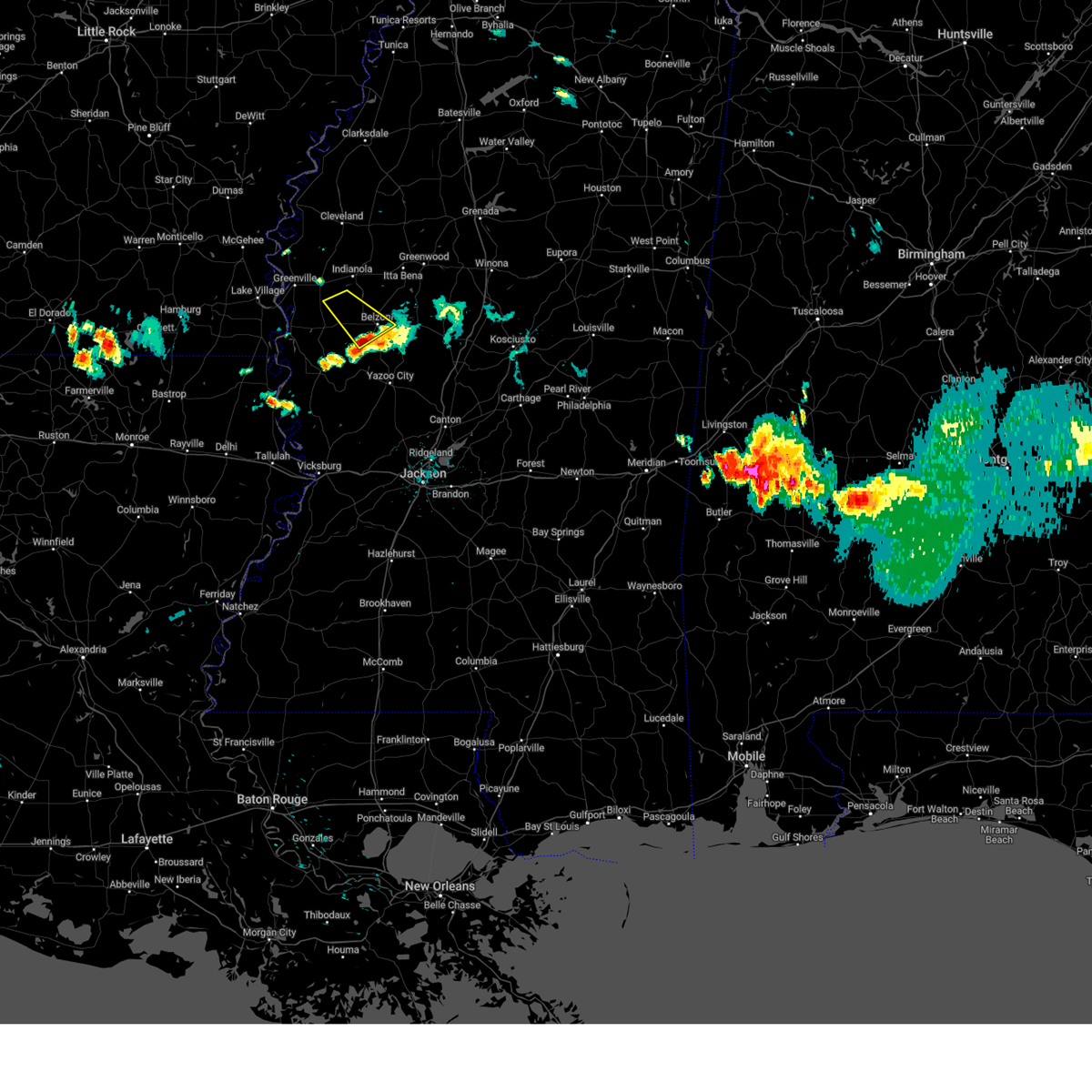 The severe thunderstorm warning for southwestern sunflower, east central washington and central humphreys counties will expire at 145 am cdt, the storm which prompted the warning has moved out of the area. therefore, the warning will be allowed to expire. a severe thunderstorm watch remains in effect until 300 am cdt for central and northwestern mississippi. to report severe weather, contact your nearest law enforcement agency. they will relay your report to the national weather service jackson. The severe thunderstorm warning for southwestern sunflower, east central washington and central humphreys counties will expire at 145 am cdt, the storm which prompted the warning has moved out of the area. therefore, the warning will be allowed to expire. a severe thunderstorm watch remains in effect until 300 am cdt for central and northwestern mississippi. to report severe weather, contact your nearest law enforcement agency. they will relay your report to the national weather service jackson.
|
| 6/12/2023 1:09 AM CDT |
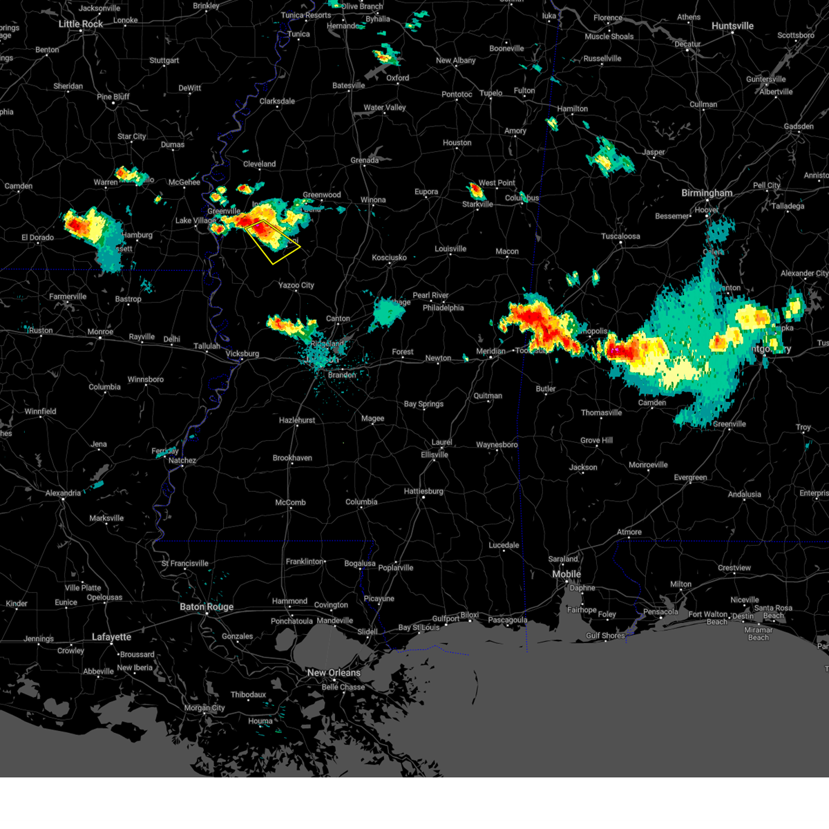 At 108 am cdt, a severe thunderstorm was located near isola, or 11 miles east of hollandale, moving southeast at 35 mph (radar indicated). Hazards include 60 mph wind gusts and quarter size hail. Hail damage to vehicles is expected. expect wind damage to roofs, siding, and trees. this severe storm will be near, belzoni around 125 am cdt. hail threat, radar indicated max hail size, 1. 00 in wind threat, radar indicated max wind gust, 60 mph. At 108 am cdt, a severe thunderstorm was located near isola, or 11 miles east of hollandale, moving southeast at 35 mph (radar indicated). Hazards include 60 mph wind gusts and quarter size hail. Hail damage to vehicles is expected. expect wind damage to roofs, siding, and trees. this severe storm will be near, belzoni around 125 am cdt. hail threat, radar indicated max hail size, 1. 00 in wind threat, radar indicated max wind gust, 60 mph.
|
| 6/12/2023 1:01 AM CDT |
 At 100 am cdt, a severe thunderstorm was located near darlove, or 9 miles northeast of hollandale, moving southeast at 35 mph (radar indicated). Hazards include 60 mph wind gusts and quarter size hail. Hail damage to vehicles is expected. expect wind damage to roofs, siding, and trees. this severe storm will be near, isola and murphy around 115 am cdt. belzoni around 125 am cdt. hail threat, radar indicated max hail size, 1. 00 in wind threat, radar indicated max wind gust, 60 mph. At 100 am cdt, a severe thunderstorm was located near darlove, or 9 miles northeast of hollandale, moving southeast at 35 mph (radar indicated). Hazards include 60 mph wind gusts and quarter size hail. Hail damage to vehicles is expected. expect wind damage to roofs, siding, and trees. this severe storm will be near, isola and murphy around 115 am cdt. belzoni around 125 am cdt. hail threat, radar indicated max hail size, 1. 00 in wind threat, radar indicated max wind gust, 60 mph.
|
| 6/12/2023 12:38 AM CDT |
 At 1238 am cdt, a severe thunderstorm was located over leland, moving southeast at 35 mph (radar indicated). Hazards include 60 mph wind gusts and quarter size hail. Hail damage to vehicles is expected. expect wind damage to roofs, siding, and trees. this severe thunderstorm will be near, arcola around 1250 am cdt. tribbett around 1255 am cdt. darlove around 100 am cdt. isola and murphy around 115 am cdt. belzoni around 130 am cdt. hail threat, radar indicated max hail size, 1. 00 in wind threat, radar indicated max wind gust, 60 mph. At 1238 am cdt, a severe thunderstorm was located over leland, moving southeast at 35 mph (radar indicated). Hazards include 60 mph wind gusts and quarter size hail. Hail damage to vehicles is expected. expect wind damage to roofs, siding, and trees. this severe thunderstorm will be near, arcola around 1250 am cdt. tribbett around 1255 am cdt. darlove around 100 am cdt. isola and murphy around 115 am cdt. belzoni around 130 am cdt. hail threat, radar indicated max hail size, 1. 00 in wind threat, radar indicated max wind gust, 60 mph.
|
| 6/11/2023 11:16 PM CDT |
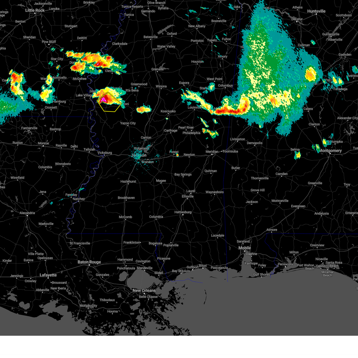 At 1116 pm cdt, a severe thunderstorm was located over arcola, or 7 miles north of hollandale, moving southeast at 30 mph (radar indicated). Hazards include two inch hail and 60 mph wind gusts. People and animals outdoors will be injured. expect hail damage to roofs, siding, windows, and vehicles. expect wind damage to roofs, siding, and trees. this severe storm will be near, hollandale and darlove around 1125 pm cdt. murphy around 1140 pm cdt. thunderstorm damage threat, considerable hail threat, radar indicated max hail size, 2. 00 in wind threat, radar indicated max wind gust, 60 mph. At 1116 pm cdt, a severe thunderstorm was located over arcola, or 7 miles north of hollandale, moving southeast at 30 mph (radar indicated). Hazards include two inch hail and 60 mph wind gusts. People and animals outdoors will be injured. expect hail damage to roofs, siding, windows, and vehicles. expect wind damage to roofs, siding, and trees. this severe storm will be near, hollandale and darlove around 1125 pm cdt. murphy around 1140 pm cdt. thunderstorm damage threat, considerable hail threat, radar indicated max hail size, 2. 00 in wind threat, radar indicated max wind gust, 60 mph.
|
| 6/11/2023 10:57 PM CDT |
 At 1057 pm cdt, a severe thunderstorm was located near leland, moving southeast at 30 mph (radar indicated). Hazards include golf ball size hail and 60 mph wind gusts. People and animals outdoors will be injured. expect hail damage to roofs, siding, windows, and vehicles. expect wind damage to roofs, siding, and trees. this severe storm will be near, arcola and tribbett around 1115 pm cdt. estill around 1120 pm cdt. hollandale and darlove around 1125 pm cdt. murphy around 1140 pm cdt. thunderstorm damage threat, considerable hail threat, radar indicated max hail size, 1. 75 in wind threat, radar indicated max wind gust, 60 mph. At 1057 pm cdt, a severe thunderstorm was located near leland, moving southeast at 30 mph (radar indicated). Hazards include golf ball size hail and 60 mph wind gusts. People and animals outdoors will be injured. expect hail damage to roofs, siding, windows, and vehicles. expect wind damage to roofs, siding, and trees. this severe storm will be near, arcola and tribbett around 1115 pm cdt. estill around 1120 pm cdt. hollandale and darlove around 1125 pm cdt. murphy around 1140 pm cdt. thunderstorm damage threat, considerable hail threat, radar indicated max hail size, 1. 75 in wind threat, radar indicated max wind gust, 60 mph.
|
| 6/11/2023 10:50 PM CDT |
 At 1049 pm cdt, a severe thunderstorm was located over metcalfe, or near greenville, moving southeast at 30 mph (radar indicated). Hazards include 60 mph wind gusts and quarter size hail. Hail damage to vehicles is expected. expect wind damage to roofs, siding, and trees. this severe thunderstorm will be near, leland around 1100 pm cdt. arcola and tribbett around 1115 pm cdt. estill around 1120 pm cdt. hollandale and darlove around 1125 pm cdt. murphy around 1145 pm cdt. hail threat, radar indicated max hail size, 1. 00 in wind threat, radar indicated max wind gust, 60 mph. At 1049 pm cdt, a severe thunderstorm was located over metcalfe, or near greenville, moving southeast at 30 mph (radar indicated). Hazards include 60 mph wind gusts and quarter size hail. Hail damage to vehicles is expected. expect wind damage to roofs, siding, and trees. this severe thunderstorm will be near, leland around 1100 pm cdt. arcola and tribbett around 1115 pm cdt. estill around 1120 pm cdt. hollandale and darlove around 1125 pm cdt. murphy around 1145 pm cdt. hail threat, radar indicated max hail size, 1. 00 in wind threat, radar indicated max wind gust, 60 mph.
|
| 6/11/2023 10:07 PM CDT |
 At 1007 pm cdt, a severe thunderstorm was located over indianola, moving southeast at 50 mph (radar indicated). Hazards include 60 mph wind gusts and quarter size hail. Hail damage to vehicles is expected. expect wind damage to roofs, siding, and trees. this severe thunderstorm will be near, moorhead and inverness around 1015 pm cdt. morgan city around 1025 pm cdt. swiftown around 1030 pm cdt. belzoni around 1035 pm cdt. tchula around 1045 pm cdt. hail threat, radar indicated max hail size, 1. 00 in wind threat, radar indicated max wind gust, 60 mph. At 1007 pm cdt, a severe thunderstorm was located over indianola, moving southeast at 50 mph (radar indicated). Hazards include 60 mph wind gusts and quarter size hail. Hail damage to vehicles is expected. expect wind damage to roofs, siding, and trees. this severe thunderstorm will be near, moorhead and inverness around 1015 pm cdt. morgan city around 1025 pm cdt. swiftown around 1030 pm cdt. belzoni around 1035 pm cdt. tchula around 1045 pm cdt. hail threat, radar indicated max hail size, 1. 00 in wind threat, radar indicated max wind gust, 60 mph.
|
| 3/12/2023 2:04 AM CDT |
 At 104 am cst, severe thunderstorms were located along a line extending from indianola to near hollandale to 6 miles east of jones, moving southeast at 40 mph (radar indicated). Hazards include 60 mph wind gusts and quarter size hail. Hail damage to vehicles is expected. expect wind damage to roofs, siding, and trees. severe thunderstorms will be near, hollandale, delta city, panther burn and nitta yuma around 110 am cst. murphy around 115 am cst. swiftown and midnight around 130 am cst. shelburn around 135 am cst. lake providence around 140 am cst. tchula around 150 am cst. yazoo city around 155 am cst. benton, lexington, fitler, onward and howard around 300 am cdt. other locations impacted by these severe thunderstorms include mayersville, silver city, west, eden, kilbourne, cary, louise and cruger. hail threat, radar indicated max hail size, 1. 00 in wind threat, radar indicated max wind gust, 60 mph. At 104 am cst, severe thunderstorms were located along a line extending from indianola to near hollandale to 6 miles east of jones, moving southeast at 40 mph (radar indicated). Hazards include 60 mph wind gusts and quarter size hail. Hail damage to vehicles is expected. expect wind damage to roofs, siding, and trees. severe thunderstorms will be near, hollandale, delta city, panther burn and nitta yuma around 110 am cst. murphy around 115 am cst. swiftown and midnight around 130 am cst. shelburn around 135 am cst. lake providence around 140 am cst. tchula around 150 am cst. yazoo city around 155 am cst. benton, lexington, fitler, onward and howard around 300 am cdt. other locations impacted by these severe thunderstorms include mayersville, silver city, west, eden, kilbourne, cary, louise and cruger. hail threat, radar indicated max hail size, 1. 00 in wind threat, radar indicated max wind gust, 60 mph.
|
| 3/12/2023 1:39 AM CDT |
 At 1239 am cst, severe thunderstorms were located along a line extending from near metcalfe to near wayside to near chicot junction, moving east at 55 mph (radar indicated). Hazards include 60 mph wind gusts and quarter size hail. Hail damage to vehicles is expected. expect wind damage to roofs, siding, and trees. severe thunderstorms will be near, leland around 1245 am cst. holly ridge and wayside around 1255 am cst. indianola and tribbett around 100 am cst. estill around 105 am cst. hollandale around 110 am cst. inverness and darlove around 115 am cst. other locations impacted by these severe thunderstorms include arcola. hail threat, radar indicated max hail size, 1. 00 in wind threat, radar indicated max wind gust, 60 mph. At 1239 am cst, severe thunderstorms were located along a line extending from near metcalfe to near wayside to near chicot junction, moving east at 55 mph (radar indicated). Hazards include 60 mph wind gusts and quarter size hail. Hail damage to vehicles is expected. expect wind damage to roofs, siding, and trees. severe thunderstorms will be near, leland around 1245 am cst. holly ridge and wayside around 1255 am cst. indianola and tribbett around 100 am cst. estill around 105 am cst. hollandale around 110 am cst. inverness and darlove around 115 am cst. other locations impacted by these severe thunderstorms include arcola. hail threat, radar indicated max hail size, 1. 00 in wind threat, radar indicated max wind gust, 60 mph.
|
| 12/13/2022 9:42 PM CST |
 At 942 pm cst, a severe thunderstorm was located over shaw, moving northeast at 40 mph (radar indicated). Hazards include 60 mph wind gusts. Expect damage to roofs, siding, and trees. this severe thunderstorm will be near, shaw around 945 pm cst. cleveland and boyle around 955 pm cst. ruleville around 1005 pm cst. drew around 1015 pm cst. Other locations impacted by this severe thunderstorm include doddsville. At 942 pm cst, a severe thunderstorm was located over shaw, moving northeast at 40 mph (radar indicated). Hazards include 60 mph wind gusts. Expect damage to roofs, siding, and trees. this severe thunderstorm will be near, shaw around 945 pm cst. cleveland and boyle around 955 pm cst. ruleville around 1005 pm cst. drew around 1015 pm cst. Other locations impacted by this severe thunderstorm include doddsville.
|
| 11/29/2022 3:33 PM CST |
 At 332 pm cst, a severe thunderstorm was located near swiftown, or 7 miles southeast of moorhead, moving northeast at 60 mph (radar indicated). Hazards include 60 mph wind gusts and quarter size hail. Hail damage to vehicles is expected. expect wind damage to roofs, siding, and trees. this severe thunderstorm will remain over mainly rural areas of southeastern sunflower, northwestern holmes, southwestern leflore and humphreys counties, including the following locations, morgan city. hail threat, radar indicated max hail size, 1. 00 in wind threat, radar indicated max wind gust, 60 mph. At 332 pm cst, a severe thunderstorm was located near swiftown, or 7 miles southeast of moorhead, moving northeast at 60 mph (radar indicated). Hazards include 60 mph wind gusts and quarter size hail. Hail damage to vehicles is expected. expect wind damage to roofs, siding, and trees. this severe thunderstorm will remain over mainly rural areas of southeastern sunflower, northwestern holmes, southwestern leflore and humphreys counties, including the following locations, morgan city. hail threat, radar indicated max hail size, 1. 00 in wind threat, radar indicated max wind gust, 60 mph.
|
| 11/29/2022 3:02 PM CST |
 At 302 pm cst, a severe thunderstorm was located over panther burn, or near hollandale, moving northeast at 60 mph (radar indicated). Hazards include 60 mph wind gusts and half dollar size hail. Hail damage to vehicles is expected. expect wind damage to roofs, siding, and trees. this severe thunderstorm will be near, hollandale and delta city around 305 pm cst. murphy and darlove around 310 pm cst. isola around 320 pm cst. belzoni and inverness around 325 pm cst. swiftown around 330 pm cst. other locations impacted by this severe thunderstorm include silver city and morgan city. hail threat, radar indicated max hail size, 1. 25 in wind threat, radar indicated max wind gust, 60 mph. At 302 pm cst, a severe thunderstorm was located over panther burn, or near hollandale, moving northeast at 60 mph (radar indicated). Hazards include 60 mph wind gusts and half dollar size hail. Hail damage to vehicles is expected. expect wind damage to roofs, siding, and trees. this severe thunderstorm will be near, hollandale and delta city around 305 pm cst. murphy and darlove around 310 pm cst. isola around 320 pm cst. belzoni and inverness around 325 pm cst. swiftown around 330 pm cst. other locations impacted by this severe thunderstorm include silver city and morgan city. hail threat, radar indicated max hail size, 1. 25 in wind threat, radar indicated max wind gust, 60 mph.
|
| 7/21/2022 7:51 PM CDT |
 At 750 pm cdt, a severe thunderstorm was located near isola, or 9 miles south of indianola, moving east at 10 mph (radar indicated). Hazards include 60 mph wind gusts and quarter size hail. Hail damage to vehicles is expected. expect wind damage to roofs, siding, and trees. this severe storm will be near, inverness around 815 pm cdt. isola around 820 pm cdt. belzoni around 845 pm cdt. hail threat, radar indicated max hail size, 1. 00 in wind threat, radar indicated max wind gust, 60 mph. At 750 pm cdt, a severe thunderstorm was located near isola, or 9 miles south of indianola, moving east at 10 mph (radar indicated). Hazards include 60 mph wind gusts and quarter size hail. Hail damage to vehicles is expected. expect wind damage to roofs, siding, and trees. this severe storm will be near, inverness around 815 pm cdt. isola around 820 pm cdt. belzoni around 845 pm cdt. hail threat, radar indicated max hail size, 1. 00 in wind threat, radar indicated max wind gust, 60 mph.
|
| 7/21/2022 7:39 PM CDT |
 At 739 pm cdt, a severe thunderstorm was located near tribbett, or 10 miles south of indianola, moving east at 10 mph (radar indicated). Hazards include 60 mph wind gusts and quarter size hail. Hail damage to vehicles is expected. expect wind damage to roofs, siding, and trees. this severe thunderstorm will be near, inverness and isola around 820 pm cdt. belzoni around 830 pm cdt. hail threat, radar indicated max hail size, 1. 00 in wind threat, radar indicated max wind gust, 60 mph. At 739 pm cdt, a severe thunderstorm was located near tribbett, or 10 miles south of indianola, moving east at 10 mph (radar indicated). Hazards include 60 mph wind gusts and quarter size hail. Hail damage to vehicles is expected. expect wind damage to roofs, siding, and trees. this severe thunderstorm will be near, inverness and isola around 820 pm cdt. belzoni around 830 pm cdt. hail threat, radar indicated max hail size, 1. 00 in wind threat, radar indicated max wind gust, 60 mph.
|
| 7/9/2022 6:54 PM CDT |
 At 654 pm cdt, a severe thunderstorm was located near swiftown, or 7 miles southeast of moorhead, moving east at 30 mph (radar indicated). Hazards include 60 mph wind gusts and quarter size hail. Hail damage to vehicles is expected. expect wind damage to roofs, siding, and trees. this severe storm will be near, quito around 705 pm cdt. other locations impacted by this severe thunderstorm include schlater and morgan city. hail threat, radar indicated max hail size, 1. 00 in wind threat, radar indicated max wind gust, 60 mph. At 654 pm cdt, a severe thunderstorm was located near swiftown, or 7 miles southeast of moorhead, moving east at 30 mph (radar indicated). Hazards include 60 mph wind gusts and quarter size hail. Hail damage to vehicles is expected. expect wind damage to roofs, siding, and trees. this severe storm will be near, quito around 705 pm cdt. other locations impacted by this severe thunderstorm include schlater and morgan city. hail threat, radar indicated max hail size, 1. 00 in wind threat, radar indicated max wind gust, 60 mph.
|
| 7/9/2022 6:13 PM CDT |
 At 613 pm cdt, a severe thunderstorm was located over holly ridge, or 7 miles west of indianola, moving east at 30 mph (radar indicated). Hazards include 60 mph wind gusts and quarter size hail. Hail damage to vehicles is expected. expect wind damage to roofs, siding, and trees. this severe thunderstorm will be near, indianola around 625 pm cdt. inverness around 635 pm cdt. moorhead around 640 pm cdt. swiftown around 655 pm cdt. quito around 705 pm cdt. other locations impacted by this severe thunderstorm include schlater, doddsville and morgan city. hail threat, radar indicated max hail size, 1. 00 in wind threat, radar indicated max wind gust, 60 mph. At 613 pm cdt, a severe thunderstorm was located over holly ridge, or 7 miles west of indianola, moving east at 30 mph (radar indicated). Hazards include 60 mph wind gusts and quarter size hail. Hail damage to vehicles is expected. expect wind damage to roofs, siding, and trees. this severe thunderstorm will be near, indianola around 625 pm cdt. inverness around 635 pm cdt. moorhead around 640 pm cdt. swiftown around 655 pm cdt. quito around 705 pm cdt. other locations impacted by this severe thunderstorm include schlater, doddsville and morgan city. hail threat, radar indicated max hail size, 1. 00 in wind threat, radar indicated max wind gust, 60 mph.
|
| 6/10/2022 10:28 AM CDT |
 At 1027 am cdt, severe thunderstorms were located along a line extending from near holly ridge to near isola to near fitler, moving east at 50 mph (radar indicated). Hazards include 60 mph wind gusts. Expect damage to roofs, siding, and trees. severe thunderstorms will be near, isola around 1035 am cdt. indianola, belzoni and inverness around 1040 am cdt. swiftown around 1045 am cdt. moorhead around 1050 am cdt. itta bena and tchula around 1100 am cdt. quito, phoenix and howard around 1105 am cdt. sidon and tinsley around 1110 am cdt. other locations impacted by these severe thunderstorms include silver city, eden, satartia, cary, louise, morgan city and cruger. hail threat, radar indicated max hail size, <. 75 in wind threat, radar indicated max wind gust, 60 mph. At 1027 am cdt, severe thunderstorms were located along a line extending from near holly ridge to near isola to near fitler, moving east at 50 mph (radar indicated). Hazards include 60 mph wind gusts. Expect damage to roofs, siding, and trees. severe thunderstorms will be near, isola around 1035 am cdt. indianola, belzoni and inverness around 1040 am cdt. swiftown around 1045 am cdt. moorhead around 1050 am cdt. itta bena and tchula around 1100 am cdt. quito, phoenix and howard around 1105 am cdt. sidon and tinsley around 1110 am cdt. other locations impacted by these severe thunderstorms include silver city, eden, satartia, cary, louise, morgan city and cruger. hail threat, radar indicated max hail size, <. 75 in wind threat, radar indicated max wind gust, 60 mph.
|
| 6/8/2022 4:39 PM CDT |
 At 439 pm cdt, severe thunderstorms were located along a line extending from near itta bena to near swiftown to near delta city, moving east at 60 mph (radar indicated). Hazards include 60 mph wind gusts and penny size hail. Expect damage to roofs, siding, and trees. locations impacted include, greenwood, moorhead, belzoni, itta bena, inverness, isola, sidon, quito, swiftown, midnight, silver city, morgan city and louise. hail threat, radar indicated max hail size, 0. 75 in wind threat, radar indicated max wind gust, 60 mph. At 439 pm cdt, severe thunderstorms were located along a line extending from near itta bena to near swiftown to near delta city, moving east at 60 mph (radar indicated). Hazards include 60 mph wind gusts and penny size hail. Expect damage to roofs, siding, and trees. locations impacted include, greenwood, moorhead, belzoni, itta bena, inverness, isola, sidon, quito, swiftown, midnight, silver city, morgan city and louise. hail threat, radar indicated max hail size, 0. 75 in wind threat, radar indicated max wind gust, 60 mph.
|
| 6/8/2022 4:28 PM CDT |
 At 427 pm cdt, severe thunderstorms were located along a line extending from near blaine to inverness to near panther burn, moving southeast at 60 mph (radar indicated. at 4 pm, a 52 mph was reported near winterville). Hazards include 60 mph wind gusts and penny size hail. Expect damage to roofs, siding, and trees. these severe storms will be near, belzoni and swiftown around 435 pm cdt. itta bena around 440 pm cdt. quito and midnight around 445 pm cdt. greenwood and sidon around 450 pm cdt. other locations impacted by these severe thunderstorms include silver city, louise, doddsville, schlater and morgan city. hail threat, radar indicated max hail size, 0. 75 in wind threat, radar indicated max wind gust, 60 mph. At 427 pm cdt, severe thunderstorms were located along a line extending from near blaine to inverness to near panther burn, moving southeast at 60 mph (radar indicated. at 4 pm, a 52 mph was reported near winterville). Hazards include 60 mph wind gusts and penny size hail. Expect damage to roofs, siding, and trees. these severe storms will be near, belzoni and swiftown around 435 pm cdt. itta bena around 440 pm cdt. quito and midnight around 445 pm cdt. greenwood and sidon around 450 pm cdt. other locations impacted by these severe thunderstorms include silver city, louise, doddsville, schlater and morgan city. hail threat, radar indicated max hail size, 0. 75 in wind threat, radar indicated max wind gust, 60 mph.
|
| 6/8/2022 4:09 PM CDT |
 At 409 pm cdt, severe thunderstorms were located along a line extending from near cleveland to near holly ridge to 6 miles west of eudora, moving east at 60 mph (radar indicated). Hazards include 60 mph wind gusts and penny size hail. Expect damage to roofs, siding, and trees. severe thunderstorms will be near, cleveland, boyle, holly ridge and tribbett around 415 pm cdt. indianola and ruleville around 420 pm cdt. moorhead, inverness and blaine around 425 pm cdt. glen allan around 430 pm cdt. itta bena and swiftown around 435 pm cdt. nitta yuma, money, panther burn, delta city and quito around 440 pm cdt. greenwood, anguilla and sidon around 445 pm cdt. other locations impacted by these severe thunderstorms include silver city, arcola, louise, doddsville, schlater and morgan city. hail threat, radar indicated max hail size, 0. 75 in wind threat, radar indicated max wind gust, 60 mph. At 409 pm cdt, severe thunderstorms were located along a line extending from near cleveland to near holly ridge to 6 miles west of eudora, moving east at 60 mph (radar indicated). Hazards include 60 mph wind gusts and penny size hail. Expect damage to roofs, siding, and trees. severe thunderstorms will be near, cleveland, boyle, holly ridge and tribbett around 415 pm cdt. indianola and ruleville around 420 pm cdt. moorhead, inverness and blaine around 425 pm cdt. glen allan around 430 pm cdt. itta bena and swiftown around 435 pm cdt. nitta yuma, money, panther burn, delta city and quito around 440 pm cdt. greenwood, anguilla and sidon around 445 pm cdt. other locations impacted by these severe thunderstorms include silver city, arcola, louise, doddsville, schlater and morgan city. hail threat, radar indicated max hail size, 0. 75 in wind threat, radar indicated max wind gust, 60 mph.
|
| 5/15/2022 7:14 PM CDT |
 At 714 pm cdt, severe thunderstorms were located along a line extending from near bew springs to near itta bena to near avon, moving southeast at 45 mph (radar indicated). Hazards include 60 mph wind gusts and quarter size hail. Hail damage to vehicles is expected. expect wind damage to roofs, siding, and trees. severe thunderstorms will be near, grenada and bew springs around 720 pm cdt. elliott around 725 pm cdt. duck hill and gore springs around 730 pm cdt. misterton and murphy around 735 pm cdt. sweatman and seven pines around 740 pm cdt. black hawk, lodi and coila around 745 pm cdt. midnight around 750 pm cdt. emory around 755 pm cdt. other locations impacted by these severe thunderstorms include silver city, louise, carrollton and cruger. hail threat, radar indicated max hail size, 1. 00 in wind threat, radar indicated max wind gust, 60 mph. At 714 pm cdt, severe thunderstorms were located along a line extending from near bew springs to near itta bena to near avon, moving southeast at 45 mph (radar indicated). Hazards include 60 mph wind gusts and quarter size hail. Hail damage to vehicles is expected. expect wind damage to roofs, siding, and trees. severe thunderstorms will be near, grenada and bew springs around 720 pm cdt. elliott around 725 pm cdt. duck hill and gore springs around 730 pm cdt. misterton and murphy around 735 pm cdt. sweatman and seven pines around 740 pm cdt. black hawk, lodi and coila around 745 pm cdt. midnight around 750 pm cdt. emory around 755 pm cdt. other locations impacted by these severe thunderstorms include silver city, louise, carrollton and cruger. hail threat, radar indicated max hail size, 1. 00 in wind threat, radar indicated max wind gust, 60 mph.
|
| 5/15/2022 6:43 PM CDT |
 At 643 pm cdt, severe thunderstorms were located along a line extending from near parchman to near boyle to lamont, moving southeast at 40 mph (radar indicated). Hazards include 60 mph wind gusts and quarter size hail. Hail damage to vehicles is expected. expect wind damage to roofs, siding, and trees. severe thunderstorms will be near, indianola, sunflower and blaine around 700 pm cdt. minter city around 705 pm cdt. moorhead, sunnyside and holly ridge around 710 pm cdt. itta bena and money around 715 pm cdt. quito and swiftown around 725 pm cdt. sidon around 730 pm cdt. other locations impacted by these severe thunderstorms include schlater, doddsville and morgan city. hail threat, radar indicated max hail size, 1. 00 in wind threat, radar indicated max wind gust, 60 mph. At 643 pm cdt, severe thunderstorms were located along a line extending from near parchman to near boyle to lamont, moving southeast at 40 mph (radar indicated). Hazards include 60 mph wind gusts and quarter size hail. Hail damage to vehicles is expected. expect wind damage to roofs, siding, and trees. severe thunderstorms will be near, indianola, sunflower and blaine around 700 pm cdt. minter city around 705 pm cdt. moorhead, sunnyside and holly ridge around 710 pm cdt. itta bena and money around 715 pm cdt. quito and swiftown around 725 pm cdt. sidon around 730 pm cdt. other locations impacted by these severe thunderstorms include schlater, doddsville and morgan city. hail threat, radar indicated max hail size, 1. 00 in wind threat, radar indicated max wind gust, 60 mph.
|
| 4/13/2022 6:42 PM CDT |
 At 642 pm cdt, severe thunderstorms were located along a line extending from near sunnyside to 6 miles northwest of isola, moving east at 40 mph (radar indicated). Hazards include 60 mph wind gusts and nickel size hail. Expect damage to roofs, siding, and trees. these severe storms will be near, sunnyside and minter city around 650 pm cdt. money around 655 pm cdt. moorhead and swiftown around 705 pm cdt. quito around 720 pm cdt. other locations impacted by these severe thunderstorms include schlater and morgan city. hail threat, radar indicated max hail size, 0. 88 in wind threat, radar indicated max wind gust, 60 mph. At 642 pm cdt, severe thunderstorms were located along a line extending from near sunnyside to 6 miles northwest of isola, moving east at 40 mph (radar indicated). Hazards include 60 mph wind gusts and nickel size hail. Expect damage to roofs, siding, and trees. these severe storms will be near, sunnyside and minter city around 650 pm cdt. money around 655 pm cdt. moorhead and swiftown around 705 pm cdt. quito around 720 pm cdt. other locations impacted by these severe thunderstorms include schlater and morgan city. hail threat, radar indicated max hail size, 0. 88 in wind threat, radar indicated max wind gust, 60 mph.
|
| 4/13/2022 6:21 PM CDT |
 At 621 pm cdt, severe thunderstorms were located along a line extending from near minter city to near avon, moving east at 35 mph (radar indicated). Hazards include 60 mph wind gusts and nickel size hail. Expect damage to roofs, siding, and trees. these severe storms will be near, minter city around 625 pm cdt. isola around 705 pm cdt. belzoni around 715 pm cdt. other locations impacted by these severe thunderstorms include schlater, doddsville and morgan city. hail threat, radar indicated max hail size, 0. 88 in wind threat, radar indicated max wind gust, 60 mph. At 621 pm cdt, severe thunderstorms were located along a line extending from near minter city to near avon, moving east at 35 mph (radar indicated). Hazards include 60 mph wind gusts and nickel size hail. Expect damage to roofs, siding, and trees. these severe storms will be near, minter city around 625 pm cdt. isola around 705 pm cdt. belzoni around 715 pm cdt. other locations impacted by these severe thunderstorms include schlater, doddsville and morgan city. hail threat, radar indicated max hail size, 0. 88 in wind threat, radar indicated max wind gust, 60 mph.
|
| 4/13/2022 6:03 PM CDT |
 At 603 pm cdt, severe thunderstorms were located along a line extending from 6 miles northwest of minter city to near eudora, moving east at 50 mph (radar indicated). Hazards include 60 mph wind gusts and nickel size hail. Expect damage to roofs, siding, and trees. severe thunderstorms will be near, minter city around 610 pm cdt. belzoni around 655 pm cdt. other locations impacted by these severe thunderstorms include schlater, doddsville and morgan city. hail threat, radar indicated max hail size, 0. 88 in wind threat, radar indicated max wind gust, 60 mph. At 603 pm cdt, severe thunderstorms were located along a line extending from 6 miles northwest of minter city to near eudora, moving east at 50 mph (radar indicated). Hazards include 60 mph wind gusts and nickel size hail. Expect damage to roofs, siding, and trees. severe thunderstorms will be near, minter city around 610 pm cdt. belzoni around 655 pm cdt. other locations impacted by these severe thunderstorms include schlater, doddsville and morgan city. hail threat, radar indicated max hail size, 0. 88 in wind threat, radar indicated max wind gust, 60 mph.
|
| 3/30/2022 3:48 PM CDT |
 At 348 pm cdt, severe thunderstorms capable of producing tornadoes were located along a line extending from sunflower to near belzoni to 6 miles northwest of yazoo city, moving northeast at 50 mph (radar indicated rotation). Hazards include tornado. Flying debris will be dangerous to those caught without shelter. mobile homes will be damaged or destroyed. damage to roofs, windows, and vehicles will occur. tree damage is likely. These tornadic storms will remain over mainly rural areas of southeastern sunflower, northwestern yazoo and humphreys counties, including the following locations, eden, silver city and louise. At 348 pm cdt, severe thunderstorms capable of producing tornadoes were located along a line extending from sunflower to near belzoni to 6 miles northwest of yazoo city, moving northeast at 50 mph (radar indicated rotation). Hazards include tornado. Flying debris will be dangerous to those caught without shelter. mobile homes will be damaged or destroyed. damage to roofs, windows, and vehicles will occur. tree damage is likely. These tornadic storms will remain over mainly rural areas of southeastern sunflower, northwestern yazoo and humphreys counties, including the following locations, eden, silver city and louise.
|
| 3/30/2022 3:23 PM CDT |
 At 323 pm cdt, severe thunderstorms capable of producing tornadoes were located along a line extending from near holly ridge to near murphy to 6 miles southwest of holly bluff, moving northeast at 50 mph (radar indicated rotation). Hazards include tornado. Flying debris will be dangerous to those caught without shelter. mobile homes will be damaged or destroyed. damage to roofs, windows, and vehicles will occur. tree damage is likely. these dangerous storms will be near, indianola around 335 pm cdt. belzoni and isola around 340 pm cdt. inverness around 345 pm cdt. midnight around 350 pm cdt. Other locations impacted by these tornadic storms include eden, silver city, arcola and louise. At 323 pm cdt, severe thunderstorms capable of producing tornadoes were located along a line extending from near holly ridge to near murphy to 6 miles southwest of holly bluff, moving northeast at 50 mph (radar indicated rotation). Hazards include tornado. Flying debris will be dangerous to those caught without shelter. mobile homes will be damaged or destroyed. damage to roofs, windows, and vehicles will occur. tree damage is likely. these dangerous storms will be near, indianola around 335 pm cdt. belzoni and isola around 340 pm cdt. inverness around 345 pm cdt. midnight around 350 pm cdt. Other locations impacted by these tornadic storms include eden, silver city, arcola and louise.
|
| 3/30/2022 2:59 PM CDT |
 At 259 pm cdt, severe thunderstorms capable of producing a tornado were located along a line extending from near wayside to near grace to 7 miles northwest of eagle bend, moving northeast at 55 mph (radar indicated rotation). Hazards include tornado. Flying debris will be dangerous to those caught without shelter. mobile homes will be damaged or destroyed. damage to roofs, windows, and vehicles will occur. tree damage is likely. these dangerous storms will be near, rolling fork, avon, grace and wayside around 305 pm cdt. anguilla and nitta yuma around 310 pm cdt. delta city, panther burn and tribbett around 315 pm cdt. hollandale around 320 pm cdt. murphy, holly bluff and darlove around 325 pm cdt. indianola around 330 pm cdt. isola around 335 pm cdt. belzoni and inverness around 340 pm cdt. Other locations impacted by these tornadic storms include eden, silver city, arcola, cary and louise. At 259 pm cdt, severe thunderstorms capable of producing a tornado were located along a line extending from near wayside to near grace to 7 miles northwest of eagle bend, moving northeast at 55 mph (radar indicated rotation). Hazards include tornado. Flying debris will be dangerous to those caught without shelter. mobile homes will be damaged or destroyed. damage to roofs, windows, and vehicles will occur. tree damage is likely. these dangerous storms will be near, rolling fork, avon, grace and wayside around 305 pm cdt. anguilla and nitta yuma around 310 pm cdt. delta city, panther burn and tribbett around 315 pm cdt. hollandale around 320 pm cdt. murphy, holly bluff and darlove around 325 pm cdt. indianola around 330 pm cdt. isola around 335 pm cdt. belzoni and inverness around 340 pm cdt. Other locations impacted by these tornadic storms include eden, silver city, arcola, cary and louise.
|
| 3/22/2022 11:02 AM CDT |
 At 1102 am cdt, severe thunderstorms were located along a line extending from estill to delta city to near holly bluff, moving east at 40 mph (radar indicated). Hazards include 60 mph wind gusts and quarter size hail. Hail damage to vehicles is expected. expect wind damage to roofs, siding, and trees. severe thunderstorms will be near, midnight around 1120 am cdt. isola around 1125 am cdt. belzoni and inverness around 1130 am cdt. swiftown around 1140 am cdt. thornton around 1145 am cdt. tchula, tolarville and howard around 1150 am cdt. quito around 1155 am cdt. other locations impacted by these severe thunderstorms include silver city, louise, morgan city and cruger. hail threat, radar indicated max hail size, 1. 00 in wind threat, radar indicated max wind gust, 60 mph. At 1102 am cdt, severe thunderstorms were located along a line extending from estill to delta city to near holly bluff, moving east at 40 mph (radar indicated). Hazards include 60 mph wind gusts and quarter size hail. Hail damage to vehicles is expected. expect wind damage to roofs, siding, and trees. severe thunderstorms will be near, midnight around 1120 am cdt. isola around 1125 am cdt. belzoni and inverness around 1130 am cdt. swiftown around 1140 am cdt. thornton around 1145 am cdt. tchula, tolarville and howard around 1150 am cdt. quito around 1155 am cdt. other locations impacted by these severe thunderstorms include silver city, louise, morgan city and cruger. hail threat, radar indicated max hail size, 1. 00 in wind threat, radar indicated max wind gust, 60 mph.
|
| 6/13/2021 4:21 PM CDT |
 The severe thunderstorm warning for southwestern sunflower, northeastern washington and southeastern bolivar counties will expire at 430 pm cdt, the storm which prompted the warning has weakened below severe limits, and no longer poses an immediate threat to life or property. therefore, the warning will be allowed to expire. a severe thunderstorm watch remains in effect until 700 pm cdt for central mississippi. The severe thunderstorm warning for southwestern sunflower, northeastern washington and southeastern bolivar counties will expire at 430 pm cdt, the storm which prompted the warning has weakened below severe limits, and no longer poses an immediate threat to life or property. therefore, the warning will be allowed to expire. a severe thunderstorm watch remains in effect until 700 pm cdt for central mississippi.
|
| 6/13/2021 4:01 PM CDT |
 At 400 pm cdt, a severe thunderstorm was located near holly ridge, or near shaw, moving south at 30 mph (radar indicated). Hazards include 60 mph wind gusts and quarter size hail. Hail damage to vehicles is expected. expect wind damage to roofs, siding, and trees. this severe thunderstorm will be near, indianola and holly ridge around 410 pm cdt. tribbett around 425 pm cdt. Other locations impacted by this severe thunderstorm include arcola. At 400 pm cdt, a severe thunderstorm was located near holly ridge, or near shaw, moving south at 30 mph (radar indicated). Hazards include 60 mph wind gusts and quarter size hail. Hail damage to vehicles is expected. expect wind damage to roofs, siding, and trees. this severe thunderstorm will be near, indianola and holly ridge around 410 pm cdt. tribbett around 425 pm cdt. Other locations impacted by this severe thunderstorm include arcola.
|
| 5/4/2021 1:51 PM CDT |
 At 151 pm cdt, a severe thunderstorm was located 8 miles southwest of midnight, or 12 miles northeast of rolling fork, moving east at 45 mph. this is a very dangerous storm (radar indicated). Hazards include 80 mph wind gusts and quarter size hail. Flying debris will be dangerous to those caught without shelter. mobile homes will be heavily damaged. expect considerable damage to roofs, windows, and vehicles. extensive tree damage and power outages are likely. this severe storm will be near, midnight around 200 pm cdt. thornton around 220 pm cdt. tchula around 230 pm cdt. other locations impacted by this severe thunderstorm include eden, silver city, cary, louise and cruger. a tornado watch remains in effect until 400 pm cdt for central and north central mississippi. A tornado watch also remains in effect until 600 pm cdt for central, north central, northwestern and west central mississippi. At 151 pm cdt, a severe thunderstorm was located 8 miles southwest of midnight, or 12 miles northeast of rolling fork, moving east at 45 mph. this is a very dangerous storm (radar indicated). Hazards include 80 mph wind gusts and quarter size hail. Flying debris will be dangerous to those caught without shelter. mobile homes will be heavily damaged. expect considerable damage to roofs, windows, and vehicles. extensive tree damage and power outages are likely. this severe storm will be near, midnight around 200 pm cdt. thornton around 220 pm cdt. tchula around 230 pm cdt. other locations impacted by this severe thunderstorm include eden, silver city, cary, louise and cruger. a tornado watch remains in effect until 400 pm cdt for central and north central mississippi. A tornado watch also remains in effect until 600 pm cdt for central, north central, northwestern and west central mississippi.
|
| 5/4/2021 1:39 PM CDT |
 At 139 pm cdt, a severe thunderstorm was located near sunflower, or near itta bena, moving east at 40 mph (radar indicated). Hazards include 70 mph wind gusts. Expect considerable tree damage. damage is likely to mobile homes, roofs, and outbuildings. this severe storm will be near, itta bena around 145 pm cdt. money around 200 pm cdt. greenwood around 205 pm cdt. other locations impacted by this severe thunderstorm include schlater and morgan city. a tornado watch remains in effect until 400 pm cdt for central and north central mississippi. A tornado watch also remains in effect until 600 pm cdt for central, north central and northwestern mississippi. At 139 pm cdt, a severe thunderstorm was located near sunflower, or near itta bena, moving east at 40 mph (radar indicated). Hazards include 70 mph wind gusts. Expect considerable tree damage. damage is likely to mobile homes, roofs, and outbuildings. this severe storm will be near, itta bena around 145 pm cdt. money around 200 pm cdt. greenwood around 205 pm cdt. other locations impacted by this severe thunderstorm include schlater and morgan city. a tornado watch remains in effect until 400 pm cdt for central and north central mississippi. A tornado watch also remains in effect until 600 pm cdt for central, north central and northwestern mississippi.
|
| 5/4/2021 1:36 PM CDT |
 At 136 pm cdt, a severe thunderstorm was located over rolling fork, moving east at 45 mph. this is a very dangerous storm (radar indicated). Hazards include 80 mph wind gusts and quarter size hail. Flying debris will be dangerous to those caught without shelter. mobile homes will be heavily damaged. expect considerable damage to roofs, windows, and vehicles. extensive tree damage and power outages are likely. this severe storm will be near, anguilla and nitta yuma around 140 pm cdt. midnight around 205 pm cdt. thornton around 225 pm cdt. tchula around 235 pm cdt. other locations impacted by this severe thunderstorm include eden, silver city, cary, louise and cruger. a tornado watch remains in effect until 400 pm cdt for central and north central mississippi. A tornado watch also remains in effect until 600 pm cdt for central, north central, northwestern and west central mississippi. At 136 pm cdt, a severe thunderstorm was located over rolling fork, moving east at 45 mph. this is a very dangerous storm (radar indicated). Hazards include 80 mph wind gusts and quarter size hail. Flying debris will be dangerous to those caught without shelter. mobile homes will be heavily damaged. expect considerable damage to roofs, windows, and vehicles. extensive tree damage and power outages are likely. this severe storm will be near, anguilla and nitta yuma around 140 pm cdt. midnight around 205 pm cdt. thornton around 225 pm cdt. tchula around 235 pm cdt. other locations impacted by this severe thunderstorm include eden, silver city, cary, louise and cruger. a tornado watch remains in effect until 400 pm cdt for central and north central mississippi. A tornado watch also remains in effect until 600 pm cdt for central, north central, northwestern and west central mississippi.
|
| 5/4/2021 1:22 PM CDT |
 At 122 pm cdt, a severe thunderstorm was located 7 miles west of rolling fork, moving east at 45 mph (radar indicated). Hazards include 70 mph wind gusts and quarter size hail. Hail damage to vehicles is expected. expect considerable tree damage. wind damage is also likely to mobile homes, roofs, and outbuildings. this severe thunderstorm will be near, rolling fork around 130 pm cdt. anguilla and nitta yuma around 140 pm cdt. delta city around 145 pm cdt. midnight around 200 pm cdt. thornton around 220 pm cdt. tchula around 230 pm cdt. other locations impacted by this severe thunderstorm include eden, silver city, arcola, cary, louise and cruger. a tornado watch remains in effect until 400 pm cdt for central and north central mississippi. A tornado watch also remains in effect until 600 pm cdt for northeastern louisiana, and central, north central, northwestern and west central mississippi. At 122 pm cdt, a severe thunderstorm was located 7 miles west of rolling fork, moving east at 45 mph (radar indicated). Hazards include 70 mph wind gusts and quarter size hail. Hail damage to vehicles is expected. expect considerable tree damage. wind damage is also likely to mobile homes, roofs, and outbuildings. this severe thunderstorm will be near, rolling fork around 130 pm cdt. anguilla and nitta yuma around 140 pm cdt. delta city around 145 pm cdt. midnight around 200 pm cdt. thornton around 220 pm cdt. tchula around 230 pm cdt. other locations impacted by this severe thunderstorm include eden, silver city, arcola, cary, louise and cruger. a tornado watch remains in effect until 400 pm cdt for central and north central mississippi. A tornado watch also remains in effect until 600 pm cdt for northeastern louisiana, and central, north central, northwestern and west central mississippi.
|
| 5/4/2021 1:19 PM CDT |
 At 119 pm cdt, a severe thunderstorm was located near indianola, moving east at 40 mph (radar indicated). Hazards include 60 mph wind gusts and quarter size hail. Hail damage to vehicles is expected. expect wind damage to roofs, siding, and trees. this severe thunderstorm will be near, moorhead and sunflower around 130 pm cdt. blaine around 135 pm cdt. itta bena around 145 pm cdt. quito around 150 pm cdt. money around 200 pm cdt. greenwood around 205 pm cdt. other locations impacted by this severe thunderstorm include schlater, doddsville and morgan city. a tornado watch remains in effect until 400 pm cdt for central and north central mississippi. A tornado watch also remains in effect until 600 pm cdt for central, north central and northwestern mississippi. At 119 pm cdt, a severe thunderstorm was located near indianola, moving east at 40 mph (radar indicated). Hazards include 60 mph wind gusts and quarter size hail. Hail damage to vehicles is expected. expect wind damage to roofs, siding, and trees. this severe thunderstorm will be near, moorhead and sunflower around 130 pm cdt. blaine around 135 pm cdt. itta bena around 145 pm cdt. quito around 150 pm cdt. money around 200 pm cdt. greenwood around 205 pm cdt. other locations impacted by this severe thunderstorm include schlater, doddsville and morgan city. a tornado watch remains in effect until 400 pm cdt for central and north central mississippi. A tornado watch also remains in effect until 600 pm cdt for central, north central and northwestern mississippi.
|
| 4/7/2021 9:15 PM CDT |
 At 915 pm cdt, a severe thunderstorm capable of producing a tornado was located near tribbett, or 9 miles southwest of indianola, moving northeast at 45 mph (radar indicated rotation). Hazards include tornado. Flying debris will be dangerous to those caught without shelter. mobile homes will be damaged or destroyed. damage to roofs, windows, and vehicles will occur. tree damage is likely. this dangerous storm will be near, isola around 920 pm cdt. indianola and inverness around 925 pm cdt. Moorhead around 935 pm cdt. At 915 pm cdt, a severe thunderstorm capable of producing a tornado was located near tribbett, or 9 miles southwest of indianola, moving northeast at 45 mph (radar indicated rotation). Hazards include tornado. Flying debris will be dangerous to those caught without shelter. mobile homes will be damaged or destroyed. damage to roofs, windows, and vehicles will occur. tree damage is likely. this dangerous storm will be near, isola around 920 pm cdt. indianola and inverness around 925 pm cdt. Moorhead around 935 pm cdt.
|
| 4/7/2021 9:07 PM CDT |
 At 907 pm cdt, a severe thunderstorm capable of producing a tornado was located near darlove, or 7 miles north of hollandale, moving northeast at 45 mph (radar indicated rotation). Hazards include tornado. Flying debris will be dangerous to those caught without shelter. mobile homes will be damaged or destroyed. damage to roofs, windows, and vehicles will occur. tree damage is likely. this dangerous storm will be near, isola around 920 pm cdt. indianola and inverness around 925 pm cdt. Moorhead around 935 pm cdt. At 907 pm cdt, a severe thunderstorm capable of producing a tornado was located near darlove, or 7 miles north of hollandale, moving northeast at 45 mph (radar indicated rotation). Hazards include tornado. Flying debris will be dangerous to those caught without shelter. mobile homes will be damaged or destroyed. damage to roofs, windows, and vehicles will occur. tree damage is likely. this dangerous storm will be near, isola around 920 pm cdt. indianola and inverness around 925 pm cdt. Moorhead around 935 pm cdt.
|
| 4/7/2021 8:49 PM CDT |
 At 848 pm cdt, a severe thunderstorm capable of producing a tornado was located over avon, moving northeast at 45 mph (radar indicated rotation). Hazards include tornado. Flying debris will be dangerous to those caught without shelter. mobile homes will be damaged or destroyed. damage to roofs, windows, and vehicles will occur. tree damage is likely. this dangerous storm will be near, hollandale and estill around 900 pm cdt. darlove and tribbett around 910 pm cdt. isola around 920 pm cdt. indianola and inverness around 925 pm cdt. moorhead around 935 pm cdt. Other locations impacted by this tornadic thunderstorm include arcola. At 848 pm cdt, a severe thunderstorm capable of producing a tornado was located over avon, moving northeast at 45 mph (radar indicated rotation). Hazards include tornado. Flying debris will be dangerous to those caught without shelter. mobile homes will be damaged or destroyed. damage to roofs, windows, and vehicles will occur. tree damage is likely. this dangerous storm will be near, hollandale and estill around 900 pm cdt. darlove and tribbett around 910 pm cdt. isola around 920 pm cdt. indianola and inverness around 925 pm cdt. moorhead around 935 pm cdt. Other locations impacted by this tornadic thunderstorm include arcola.
|
| 7/31/2020 3:37 PM CDT |
 At 337 pm cdt, a severe thunderstorm was located near belzoni, moving east at 55 mph (radar indicated). Hazards include 60 mph wind gusts. Expect damage to roofs, siding, and trees. this severe storm will be near, tchula around 345 pm cdt. Other locations impacted by this severe thunderstorm include silver city, morgan city and cruger. At 337 pm cdt, a severe thunderstorm was located near belzoni, moving east at 55 mph (radar indicated). Hazards include 60 mph wind gusts. Expect damage to roofs, siding, and trees. this severe storm will be near, tchula around 345 pm cdt. Other locations impacted by this severe thunderstorm include silver city, morgan city and cruger.
|
| 7/31/2020 3:29 PM CDT |
 At 328 pm cdt, a severe thunderstorm was located over belzoni, moving east at 50 mph (radar indicated). Hazards include 60 mph wind gusts. Expect damage to roofs, siding, and trees. this severe storm will be near, thornton around 340 pm cdt. tchula around 350 pm cdt. Other locations impacted by this severe thunderstorm include silver city, louise, morgan city and cruger. At 328 pm cdt, a severe thunderstorm was located over belzoni, moving east at 50 mph (radar indicated). Hazards include 60 mph wind gusts. Expect damage to roofs, siding, and trees. this severe storm will be near, thornton around 340 pm cdt. tchula around 350 pm cdt. Other locations impacted by this severe thunderstorm include silver city, louise, morgan city and cruger.
|
| 7/31/2020 3:15 PM CDT |
 At 315 pm cdt, a severe thunderstorm was located near murphy, or 9 miles east of hollandale, moving east at 50 mph (radar indicated). Hazards include 70 mph wind gusts. Expect considerable tree damage. damage is likely to mobile homes, roofs, and outbuildings. this severe storm will be near, isola around 325 pm cdt. belzoni around 330 pm cdt. swiftown around 335 pm cdt. tchula around 350 pm cdt. Other locations impacted by this severe thunderstorm include silver city, louise, morgan city and cruger. At 315 pm cdt, a severe thunderstorm was located near murphy, or 9 miles east of hollandale, moving east at 50 mph (radar indicated). Hazards include 70 mph wind gusts. Expect considerable tree damage. damage is likely to mobile homes, roofs, and outbuildings. this severe storm will be near, isola around 325 pm cdt. belzoni around 330 pm cdt. swiftown around 335 pm cdt. tchula around 350 pm cdt. Other locations impacted by this severe thunderstorm include silver city, louise, morgan city and cruger.
|
| 7/31/2020 3:00 PM CDT |
 At 300 pm cdt, a severe thunderstorm was located over hollandale, moving east at 45 mph (radar indicated). Hazards include 70 mph wind gusts. Expect considerable tree damage. damage is likely to mobile homes, roofs, and outbuildings. this severe storm will be near, darlove around 310 pm cdt. inverness and isola around 325 pm cdt. belzoni around 330 pm cdt. swiftown around 340 pm cdt. quito around 350 pm cdt. Other locations impacted by this severe thunderstorm include silver city, arcola, louise, morgan city and cruger. At 300 pm cdt, a severe thunderstorm was located over hollandale, moving east at 45 mph (radar indicated). Hazards include 70 mph wind gusts. Expect considerable tree damage. damage is likely to mobile homes, roofs, and outbuildings. this severe storm will be near, darlove around 310 pm cdt. inverness and isola around 325 pm cdt. belzoni around 330 pm cdt. swiftown around 340 pm cdt. quito around 350 pm cdt. Other locations impacted by this severe thunderstorm include silver city, arcola, louise, morgan city and cruger.
|
| 7/31/2020 2:47 PM CDT |
 At 246 pm cdt, a severe thunderstorm was located near avon, moving east at 55 mph (radar indicated). Hazards include 70 mph wind gusts. Expect considerable tree damage. damage is likely to mobile homes, roofs, and outbuildings. this severe thunderstorm will be near, hollandale and estill around 300 pm cdt. darlove around 305 pm cdt. inverness and isola around 320 pm cdt. belzoni around 325 pm cdt. swiftown around 330 pm cdt. Other locations impacted by this severe thunderstorm include silver city, arcola, louise, morgan city and cruger. At 246 pm cdt, a severe thunderstorm was located near avon, moving east at 55 mph (radar indicated). Hazards include 70 mph wind gusts. Expect considerable tree damage. damage is likely to mobile homes, roofs, and outbuildings. this severe thunderstorm will be near, hollandale and estill around 300 pm cdt. darlove around 305 pm cdt. inverness and isola around 320 pm cdt. belzoni around 325 pm cdt. swiftown around 330 pm cdt. Other locations impacted by this severe thunderstorm include silver city, arcola, louise, morgan city and cruger.
|
| 7/2/2020 3:42 PM CDT |
 At 342 pm cdt, a severe thunderstorm was located near tribbett, or near indianola, moving south at 20 mph (radar indicated). Hazards include 60 mph wind gusts and nickel size hail. Expect damage to roofs, siding, and trees. this severe thunderstorm will be near, tribbett around 350 pm cdt. darlove around 410 pm cdt. estill around 420 pm cdt. hollandale around 425 pm cdt. murphy around 430 pm cdt. Other locations impacted by this severe thunderstorm include arcola. At 342 pm cdt, a severe thunderstorm was located near tribbett, or near indianola, moving south at 20 mph (radar indicated). Hazards include 60 mph wind gusts and nickel size hail. Expect damage to roofs, siding, and trees. this severe thunderstorm will be near, tribbett around 350 pm cdt. darlove around 410 pm cdt. estill around 420 pm cdt. hollandale around 425 pm cdt. murphy around 430 pm cdt. Other locations impacted by this severe thunderstorm include arcola.
|
| 6/5/2020 5:20 PM CDT |
 At 520 pm cdt, severe thunderstorms were located along a line extending from near metcalfe to near isola, moving south at 40 mph (radar indicated). Hazards include 60 mph wind gusts and penny size hail. Expect damage to roofs, siding, and trees. severe thunderstorms will be near, belzoni around 525 pm cdt. wayside and murphy around 535 pm cdt. avon and midnight around 540 pm cdt. glen allan around 600 pm cdt. Other locations impacted by these severe thunderstorms include mayersville, silver city, arcola, cary and louise. At 520 pm cdt, severe thunderstorms were located along a line extending from near metcalfe to near isola, moving south at 40 mph (radar indicated). Hazards include 60 mph wind gusts and penny size hail. Expect damage to roofs, siding, and trees. severe thunderstorms will be near, belzoni around 525 pm cdt. wayside and murphy around 535 pm cdt. avon and midnight around 540 pm cdt. glen allan around 600 pm cdt. Other locations impacted by these severe thunderstorms include mayersville, silver city, arcola, cary and louise.
|
| 6/5/2020 4:59 PM CDT |
 At 434 pm cdt, severe thunderstorms were located along a line extending from benoit to swiftown, moving southwest at 45 mph (radar indicated). Hazards include 60 mph wind gusts and quarter size hail. Hail damage to vehicles is expected. expect wind damage to roofs, siding, and trees. severe thunderstorms will be near, belzoni, lamont and winterville around 445 pm cdt. greenville and metcalfe around 450 pm cdt. Other locations impacted by these severe thunderstorms include beulah, silver city and arcola. At 434 pm cdt, severe thunderstorms were located along a line extending from benoit to swiftown, moving southwest at 45 mph (radar indicated). Hazards include 60 mph wind gusts and quarter size hail. Hail damage to vehicles is expected. expect wind damage to roofs, siding, and trees. severe thunderstorms will be near, belzoni, lamont and winterville around 445 pm cdt. greenville and metcalfe around 450 pm cdt. Other locations impacted by these severe thunderstorms include beulah, silver city and arcola.
|
| 6/5/2020 4:34 PM CDT |
 At 434 pm cdt, severe thunderstorms were located along a line extending from benoit to swiftown, moving southwest at 45 mph (radar indicated). Hazards include 60 mph wind gusts and quarter size hail. Hail damage to vehicles is expected. expect wind damage to roofs, siding, and trees. severe thunderstorms will be near, belzoni, lamont and winterville around 445 pm cdt. greenville and metcalfe around 450 pm cdt. Other locations impacted by these severe thunderstorms include beulah, silver city and arcola. At 434 pm cdt, severe thunderstorms were located along a line extending from benoit to swiftown, moving southwest at 45 mph (radar indicated). Hazards include 60 mph wind gusts and quarter size hail. Hail damage to vehicles is expected. expect wind damage to roofs, siding, and trees. severe thunderstorms will be near, belzoni, lamont and winterville around 445 pm cdt. greenville and metcalfe around 450 pm cdt. Other locations impacted by these severe thunderstorms include beulah, silver city and arcola.
|
| 6/3/2020 6:34 PM CDT |
 At 634 pm cdt, a severe thunderstorm was located near sidon, or 11 miles west of black hawk, moving southeast at 5 mph (radar indicated). Hazards include golf ball size hail and 60 mph wind gusts. People and animals outdoors will be injured. expect hail damage to roofs, siding, windows, and vehicles. expect wind damage to roofs, siding, and trees. Locations impacted include, belzoni, black hawk, tchula, isola, seven pines, swiftown, cruger and morgan city. At 634 pm cdt, a severe thunderstorm was located near sidon, or 11 miles west of black hawk, moving southeast at 5 mph (radar indicated). Hazards include golf ball size hail and 60 mph wind gusts. People and animals outdoors will be injured. expect hail damage to roofs, siding, windows, and vehicles. expect wind damage to roofs, siding, and trees. Locations impacted include, belzoni, black hawk, tchula, isola, seven pines, swiftown, cruger and morgan city.
|
| 6/3/2020 6:23 PM CDT |
 At 623 pm cdt, a severe thunderstorm was located near seven pines, or 9 miles west of black hawk, moving southeast at 5 mph (radar indicated). Hazards include ping pong ball size hail and 60 mph wind gusts. People and animals outdoors will be injured. expect hail damage to roofs, siding, windows, and vehicles. Expect wind damage to roofs, siding, and trees. At 623 pm cdt, a severe thunderstorm was located near seven pines, or 9 miles west of black hawk, moving southeast at 5 mph (radar indicated). Hazards include ping pong ball size hail and 60 mph wind gusts. People and animals outdoors will be injured. expect hail damage to roofs, siding, windows, and vehicles. Expect wind damage to roofs, siding, and trees.
|
| 4/12/2020 10:06 PM CDT |
 The severe thunderstorm warning for sunflower county will expire at 1015 pm cdt, the storms which prompted the warning have moved out of the area. therefore, the warning will be allowed to expire. however gusty winds are still possible with these thunderstorms. a severe thunderstorm watch remains in effect until 100 am cdt for central, north central and northwestern mississippi. The severe thunderstorm warning for sunflower county will expire at 1015 pm cdt, the storms which prompted the warning have moved out of the area. therefore, the warning will be allowed to expire. however gusty winds are still possible with these thunderstorms. a severe thunderstorm watch remains in effect until 100 am cdt for central, north central and northwestern mississippi.
|
| 4/12/2020 9:44 PM CDT |
 At 944 pm cdt, severe thunderstorms were located along a line extending from near isola to near midnight to near valley park, moving east at 55 mph (radar indicated). Hazards include 60 mph wind gusts. Expect damage to roofs, siding, and trees. severe thunderstorms will be near, belzoni and midnight around 950 pm cdt. yazoo city around 955 pm cdt. thornton around 1000 pm cdt. tchula, phoenix and tolarville around 1005 pm cdt. coxburg around 1010 pm cdt. ebenezer and brozville around 1015 pm cdt. franklin and emory around 1020 pm cdt. goodman, pickens and bowling green around 1025 pm cdt. Other locations impacted by these severe thunderstorms include silver city, west, eden, satartia, louise, bentonia and cruger. At 944 pm cdt, severe thunderstorms were located along a line extending from near isola to near midnight to near valley park, moving east at 55 mph (radar indicated). Hazards include 60 mph wind gusts. Expect damage to roofs, siding, and trees. severe thunderstorms will be near, belzoni and midnight around 950 pm cdt. yazoo city around 955 pm cdt. thornton around 1000 pm cdt. tchula, phoenix and tolarville around 1005 pm cdt. coxburg around 1010 pm cdt. ebenezer and brozville around 1015 pm cdt. franklin and emory around 1020 pm cdt. goodman, pickens and bowling green around 1025 pm cdt. Other locations impacted by these severe thunderstorms include silver city, west, eden, satartia, louise, bentonia and cruger.
|
| 4/12/2020 9:31 PM CDT |
 At 931 pm cdt, severe thunderstorms were located along a line extending from near dublin to near ruleville to leland, moving east at 70 mph (radar indicated). Hazards include 70 mph wind gusts. Expect considerable tree damage. damage is likely to mobile homes, roofs, and outbuildings. these severe storms will be near, ruleville, drew and blaine around 935 pm cdt. indianola and inverness around 945 pm cdt. moorhead around 950 pm cdt. Other locations impacted by these severe thunderstorms include doddsville. At 931 pm cdt, severe thunderstorms were located along a line extending from near dublin to near ruleville to leland, moving east at 70 mph (radar indicated). Hazards include 70 mph wind gusts. Expect considerable tree damage. damage is likely to mobile homes, roofs, and outbuildings. these severe storms will be near, ruleville, drew and blaine around 935 pm cdt. indianola and inverness around 945 pm cdt. moorhead around 950 pm cdt. Other locations impacted by these severe thunderstorms include doddsville.
|
| 4/12/2020 9:22 PM CDT |
 At 922 pm cdt, severe thunderstorms were located along a line extending from 6 miles northeast of deeson to near cleveland to near greenville, moving east at 55 mph (radar indicated). Hazards include 60 mph wind gusts. Expect damage to roofs, siding, and trees. severe thunderstorms will be near, ruleville and drew around 940 pm cdt. holly ridge around 945 pm cdt. indianola and inverness around 950 pm cdt. moorhead around 1000 pm cdt. Other locations impacted by these severe thunderstorms include doddsville. At 922 pm cdt, severe thunderstorms were located along a line extending from 6 miles northeast of deeson to near cleveland to near greenville, moving east at 55 mph (radar indicated). Hazards include 60 mph wind gusts. Expect damage to roofs, siding, and trees. severe thunderstorms will be near, ruleville and drew around 940 pm cdt. holly ridge around 945 pm cdt. indianola and inverness around 950 pm cdt. moorhead around 1000 pm cdt. Other locations impacted by these severe thunderstorms include doddsville.
|
| 4/12/2020 5:50 PM CDT |
 At 550 pm cdt, a severe thunderstorm was located near isola, or 8 miles north of belzoni, moving northeast at 70 mph (radar indicated). Hazards include 70 mph wind gusts. Expect considerable tree damage. damage is likely to mobile homes, roofs, and outbuildings. this severe storm will be near, moorhead around 555 pm cdt. other locations impacted by this severe thunderstorm include silver city. A tornado watch remains in effect until 800 pm cdt for central, north central, northwestern and west central mississippi. At 550 pm cdt, a severe thunderstorm was located near isola, or 8 miles north of belzoni, moving northeast at 70 mph (radar indicated). Hazards include 70 mph wind gusts. Expect considerable tree damage. damage is likely to mobile homes, roofs, and outbuildings. this severe storm will be near, moorhead around 555 pm cdt. other locations impacted by this severe thunderstorm include silver city. A tornado watch remains in effect until 800 pm cdt for central, north central, northwestern and west central mississippi.
|
| 4/12/2020 5:34 PM CDT |
 At 534 pm cdt, a severe thunderstorm was located over delta city, or near hollandale, moving northeast at 70 mph (radar indicated). Hazards include 70 mph wind gusts and quarter size hail. Hail damage to vehicles is expected. expect considerable tree damage. wind damage is also likely to mobile homes, roofs, and outbuildings. this severe storm will be near, isola around 545 pm cdt. belzoni and inverness around 550 pm cdt. moorhead around 555 pm cdt. other locations impacted by this severe thunderstorm include silver city. A tornado watch remains in effect until 800 pm cdt for central, north central, northwestern and west central mississippi. At 534 pm cdt, a severe thunderstorm was located over delta city, or near hollandale, moving northeast at 70 mph (radar indicated). Hazards include 70 mph wind gusts and quarter size hail. Hail damage to vehicles is expected. expect considerable tree damage. wind damage is also likely to mobile homes, roofs, and outbuildings. this severe storm will be near, isola around 545 pm cdt. belzoni and inverness around 550 pm cdt. moorhead around 555 pm cdt. other locations impacted by this severe thunderstorm include silver city. A tornado watch remains in effect until 800 pm cdt for central, north central, northwestern and west central mississippi.
|
| 4/12/2020 5:19 PM CDT |
 At 519 pm cdt, a severe thunderstorm was located near glen allan, or 9 miles west of rolling fork, moving northeast at 70 mph (radar indicated). Hazards include 70 mph wind gusts and quarter size hail. Hail damage to vehicles is expected. expect considerable tree damage. wind damage is also likely to mobile homes, roofs, and outbuildings. this severe thunderstorm will be near, anguilla, panther burn and nitta yuma around 530 pm cdt. hollandale and delta city around 535 pm cdt. murphy and darlove around 540 pm cdt. belzoni, inverness and isola around 550 pm cdt. other locations impacted by this severe thunderstorm include mayersville and silver city. A tornado watch remains in effect until 800 pm cdt for northeastern louisiana, and central, north central, northwestern and west central mississippi. At 519 pm cdt, a severe thunderstorm was located near glen allan, or 9 miles west of rolling fork, moving northeast at 70 mph (radar indicated). Hazards include 70 mph wind gusts and quarter size hail. Hail damage to vehicles is expected. expect considerable tree damage. wind damage is also likely to mobile homes, roofs, and outbuildings. this severe thunderstorm will be near, anguilla, panther burn and nitta yuma around 530 pm cdt. hollandale and delta city around 535 pm cdt. murphy and darlove around 540 pm cdt. belzoni, inverness and isola around 550 pm cdt. other locations impacted by this severe thunderstorm include mayersville and silver city. A tornado watch remains in effect until 800 pm cdt for northeastern louisiana, and central, north central, northwestern and west central mississippi.
|
| 4/8/2020 3:08 PM CDT |
 At 308 pm cdt, a severe thunderstorm was located near murphy, or 9 miles west of belzoni, moving east at 45 mph (radar indicated). Hazards include 60 mph wind gusts and quarter size hail. Hail damage to vehicles is expected. expect wind damage to roofs, siding, and trees. this severe thunderstorm will be near, belzoni around 320 pm cdt. thornton around 335 pm cdt. tchula around 340 pm cdt. howard and tolarville around 345 pm cdt. brozville around 350 pm cdt. lexington around 355 pm cdt. franklin around 400 pm cdt. bowling green around 405 pm cdt. Other locations impacted by this severe thunderstorm include silver city. At 308 pm cdt, a severe thunderstorm was located near murphy, or 9 miles west of belzoni, moving east at 45 mph (radar indicated). Hazards include 60 mph wind gusts and quarter size hail. Hail damage to vehicles is expected. expect wind damage to roofs, siding, and trees. this severe thunderstorm will be near, belzoni around 320 pm cdt. thornton around 335 pm cdt. tchula around 340 pm cdt. howard and tolarville around 345 pm cdt. brozville around 350 pm cdt. lexington around 355 pm cdt. franklin around 400 pm cdt. bowling green around 405 pm cdt. Other locations impacted by this severe thunderstorm include silver city.
|
| 3/28/2020 10:23 PM CDT |
 At 1023 pm cdt, a severe thunderstorm was located near indianola, moving northeast at 75 mph (radar indicated). Hazards include 60 mph wind gusts. Expect damage to roofs, siding, and trees. this severe storm will be near, moorhead around 1030 pm cdt. sunflower and blaine around 1035 pm cdt. itta bena around 1040 pm cdt. sunnyside around 1045 pm cdt. money around 1050 pm cdt. other locations impacted by this severe thunderstorm include schlater and morgan city. a tornado watch remains in effect until 200 am cdt for north central and northwestern mississippi. A tornado watch also remains in effect until 400 am cdt for central and north central mississippi. At 1023 pm cdt, a severe thunderstorm was located near indianola, moving northeast at 75 mph (radar indicated). Hazards include 60 mph wind gusts. Expect damage to roofs, siding, and trees. this severe storm will be near, moorhead around 1030 pm cdt. sunflower and blaine around 1035 pm cdt. itta bena around 1040 pm cdt. sunnyside around 1045 pm cdt. money around 1050 pm cdt. other locations impacted by this severe thunderstorm include schlater and morgan city. a tornado watch remains in effect until 200 am cdt for north central and northwestern mississippi. A tornado watch also remains in effect until 400 am cdt for central and north central mississippi.
|
| 3/28/2020 10:08 PM CDT |
 At 1008 pm cdt, a severe thunderstorm was located near estill, or near avon, moving northeast at 75 mph (radar indicated). Hazards include 60 mph wind gusts. Expect damage to roofs, siding, and trees. this severe thunderstorm will be near, darlove around 1015 pm cdt. tribbett around 1020 pm cdt. inverness and holly ridge around 1025 pm cdt. indianola and moorhead around 1030 pm cdt. sunflower around 1035 pm cdt. itta bena around 1040 pm cdt. money and sunnyside around 1050 pm cdt. other locations impacted by this severe thunderstorm include arcola, schlater and morgan city. a tornado watch remains in effect until 200 am cdt for southeastern arkansas, and north central and northwestern mississippi. A tornado watch also remains in effect until 400 am cdt for central, north central and west central mississippi. At 1008 pm cdt, a severe thunderstorm was located near estill, or near avon, moving northeast at 75 mph (radar indicated). Hazards include 60 mph wind gusts. Expect damage to roofs, siding, and trees. this severe thunderstorm will be near, darlove around 1015 pm cdt. tribbett around 1020 pm cdt. inverness and holly ridge around 1025 pm cdt. indianola and moorhead around 1030 pm cdt. sunflower around 1035 pm cdt. itta bena around 1040 pm cdt. money and sunnyside around 1050 pm cdt. other locations impacted by this severe thunderstorm include arcola, schlater and morgan city. a tornado watch remains in effect until 200 am cdt for southeastern arkansas, and north central and northwestern mississippi. A tornado watch also remains in effect until 400 am cdt for central, north central and west central mississippi.
|
| 2/10/2020 1:02 AM CST |
 At 102 am cst, a severe thunderstorm was located near belzoni, moving northeast at 50 mph (radar indicated). Hazards include quarter size hail. Damage to vehicles is expected. this severe thunderstorm will be near, belzoni around 105 am cst. swiftown around 115 am cst. quito around 130 am cst. sidon around 135 am cst. greenwood and seven pines around 140 am cst. Other locations impacted by this severe thunderstorm include morgan city and cruger. At 102 am cst, a severe thunderstorm was located near belzoni, moving northeast at 50 mph (radar indicated). Hazards include quarter size hail. Damage to vehicles is expected. this severe thunderstorm will be near, belzoni around 105 am cst. swiftown around 115 am cst. quito around 130 am cst. sidon around 135 am cst. greenwood and seven pines around 140 am cst. Other locations impacted by this severe thunderstorm include morgan city and cruger.
|
| 1/11/2020 5:01 AM CST |
 At 501 am cst, severe thunderstorms were located along a line extending from estill to near fitler, moving northeast at 50 mph (radar indicated). Hazards include 60 mph wind gusts and quarter size hail. Hail damage to vehicles is expected. expect wind damage to roofs, siding, and trees. these severe storms will be near, hollandale and estill around 505 am cst. darlove around 510 am cst. rolling fork around 515 am cst. isola around 520 am cst. holly bluff around 525 am cst. other locations impacted by these severe thunderstorms include mayersville, silver city, cary, louise, pioneer and epps. a tornado watch remains in effect until 700 am cst for southeastern arkansas, and north central and northwestern mississippi. A tornado watch also remains in effect until 900 am cst for northeastern louisiana, and central and west central mississippi. At 501 am cst, severe thunderstorms were located along a line extending from estill to near fitler, moving northeast at 50 mph (radar indicated). Hazards include 60 mph wind gusts and quarter size hail. Hail damage to vehicles is expected. expect wind damage to roofs, siding, and trees. these severe storms will be near, hollandale and estill around 505 am cst. darlove around 510 am cst. rolling fork around 515 am cst. isola around 520 am cst. holly bluff around 525 am cst. other locations impacted by these severe thunderstorms include mayersville, silver city, cary, louise, pioneer and epps. a tornado watch remains in effect until 700 am cst for southeastern arkansas, and north central and northwestern mississippi. A tornado watch also remains in effect until 900 am cst for northeastern louisiana, and central and west central mississippi.
|
| 1/11/2020 4:30 AM CST |
 At 430 am cst, severe thunderstorms were located along a line extending from near eudora to monticello, moving northeast at 50 mph (radar indicated). Hazards include 60 mph wind gusts and quarter size hail. Hail damage to vehicles is expected. expect wind damage to roofs, siding, and trees. severe thunderstorms will be near, gassoway around 435 am cst. sondheimer around 440 am cst. transylvania around 445 am cst. avon around 450 am cst. fitler around 455 am cst. hollandale and estill around 500 am cst. onward and darlove around 505 am cst. isola and holly bluff around 520 am cst. other locations impacted by these severe thunderstorms include mayersville, silver city, pioneer, kilbourne, forest, cary, louise and epps. a tornado watch remains in effect until 700 am cst for southeastern arkansas, and north central and northwestern mississippi. A tornado watch also remains in effect until 900 am cst for northeastern louisiana, and central and west central mississippi. At 430 am cst, severe thunderstorms were located along a line extending from near eudora to monticello, moving northeast at 50 mph (radar indicated). Hazards include 60 mph wind gusts and quarter size hail. Hail damage to vehicles is expected. expect wind damage to roofs, siding, and trees. severe thunderstorms will be near, gassoway around 435 am cst. sondheimer around 440 am cst. transylvania around 445 am cst. avon around 450 am cst. fitler around 455 am cst. hollandale and estill around 500 am cst. onward and darlove around 505 am cst. isola and holly bluff around 520 am cst. other locations impacted by these severe thunderstorms include mayersville, silver city, pioneer, kilbourne, forest, cary, louise and epps. a tornado watch remains in effect until 700 am cst for southeastern arkansas, and north central and northwestern mississippi. A tornado watch also remains in effect until 900 am cst for northeastern louisiana, and central and west central mississippi.
|
| 12/16/2019 3:39 PM CST |
 At 339 pm cst, a severe thunderstorm was located over belzoni, moving northeast at 55 mph (radar indicated). Hazards include 60 mph wind gusts. Expect damage to roofs, siding, and trees. this severe storm will be near, swiftown around 350 pm cst. sidon around 405 pm cst. other locations impacted by this severe thunderstorm include silver city, west, morgan city and cruger. A tornado watch remains in effect until 600 pm cst for central, north central, northwestern and west central mississippi. At 339 pm cst, a severe thunderstorm was located over belzoni, moving northeast at 55 mph (radar indicated). Hazards include 60 mph wind gusts. Expect damage to roofs, siding, and trees. this severe storm will be near, swiftown around 350 pm cst. sidon around 405 pm cst. other locations impacted by this severe thunderstorm include silver city, west, morgan city and cruger. A tornado watch remains in effect until 600 pm cst for central, north central, northwestern and west central mississippi.
|
| 12/16/2019 3:25 PM CST |
 At 325 pm cst, a severe thunderstorm was located over murphy, or 8 miles southeast of hollandale, moving northeast at 55 mph (radar indicated). Hazards include 60 mph wind gusts. Expect damage to roofs, siding, and trees. this severe thunderstorm will be near, midnight around 335 pm cst. isola around 340 pm cst. belzoni around 345 pm cst. swiftown around 350 pm cst. tchula around 355 pm cst. sidon around 405 pm cst. other locations impacted by this severe thunderstorm include silver city, louise, west, morgan city and cruger. A tornado watch remains in effect until 600 pm cst for central, north central, northwestern and west central mississippi. At 325 pm cst, a severe thunderstorm was located over murphy, or 8 miles southeast of hollandale, moving northeast at 55 mph (radar indicated). Hazards include 60 mph wind gusts. Expect damage to roofs, siding, and trees. this severe thunderstorm will be near, midnight around 335 pm cst. isola around 340 pm cst. belzoni around 345 pm cst. swiftown around 350 pm cst. tchula around 355 pm cst. sidon around 405 pm cst. other locations impacted by this severe thunderstorm include silver city, louise, west, morgan city and cruger. A tornado watch remains in effect until 600 pm cst for central, north central, northwestern and west central mississippi.
|
| 10/21/2019 8:29 AM CDT |
 At 829 am cdt, severe thunderstorms were located along a line extending from near money to near quito to near midnight, moving east at 70 mph (radar indicated). Hazards include 60 mph wind gusts. Expect damage to roofs, siding, and trees. these severe storms will be near, sidon and quito around 835 am cdt. greenwood around 840 am cdt. Other locations impacted by these severe thunderstorms include silver city, louise and morgan city. At 829 am cdt, severe thunderstorms were located along a line extending from near money to near quito to near midnight, moving east at 70 mph (radar indicated). Hazards include 60 mph wind gusts. Expect damage to roofs, siding, and trees. these severe storms will be near, sidon and quito around 835 am cdt. greenwood around 840 am cdt. Other locations impacted by these severe thunderstorms include silver city, louise and morgan city.
|
| 10/21/2019 8:15 AM CDT |
 At 814 am cdt, a severe thunderstorm capable of producing a tornado was located near murphy, or 7 miles west of belzoni, moving east at 45 mph (radar indicated rotation). Hazards include tornado. Flying debris will be dangerous to those caught without shelter. mobile homes will be damaged or destroyed. damage to roofs, windows, and vehicles will occur. tree damage is likely. this dangerous storm will be near, belzoni around 825 am cdt. thornton around 835 am cdt. tchula and howard around 845 am cdt. Other locations impacted by this tornadic thunderstorm include silver city and cruger. At 814 am cdt, a severe thunderstorm capable of producing a tornado was located near murphy, or 7 miles west of belzoni, moving east at 45 mph (radar indicated rotation). Hazards include tornado. Flying debris will be dangerous to those caught without shelter. mobile homes will be damaged or destroyed. damage to roofs, windows, and vehicles will occur. tree damage is likely. this dangerous storm will be near, belzoni around 825 am cdt. thornton around 835 am cdt. tchula and howard around 845 am cdt. Other locations impacted by this tornadic thunderstorm include silver city and cruger.
|
| 10/21/2019 8:12 AM CDT |
 At 812 am cdt, severe thunderstorms were located along a line extending from 7 miles east of blaine to near isola to near anguilla, moving east at 70 mph (radar indicated). Hazards include 60 mph wind gusts. Expect damage to roofs, siding, and trees. these severe storms will be near, belzoni and itta bena around 815 am cdt. money and swiftown around 820 am cdt. midnight around 825 am cdt. sidon and quito around 830 am cdt. greenwood around 835 am cdt. Other locations impacted by these severe thunderstorms include silver city, louise and morgan city. At 812 am cdt, severe thunderstorms were located along a line extending from 7 miles east of blaine to near isola to near anguilla, moving east at 70 mph (radar indicated). Hazards include 60 mph wind gusts. Expect damage to roofs, siding, and trees. these severe storms will be near, belzoni and itta bena around 815 am cdt. money and swiftown around 820 am cdt. midnight around 825 am cdt. sidon and quito around 830 am cdt. greenwood around 835 am cdt. Other locations impacted by these severe thunderstorms include silver city, louise and morgan city.
|
| 10/21/2019 7:57 AM CDT |
 At 757 am cdt, severe thunderstorms were located along a line extending from near sunflower to darlove to 7 miles north of fitler, moving northeast at 70 mph (radar indicated). Hazards include 60 mph wind gusts. Expect damage to roofs, siding, and trees. these severe storms will be near, indianola, sunflower and darlove around 800 am cdt. isola and blaine around 805 am cdt. inverness, anguilla and nitta yuma around 810 am cdt. moorhead and swiftown around 815 am cdt. money around 820 am cdt. itta bena, quito and midnight around 825 am cdt. sidon around 830 am cdt. greenwood around 835 am cdt. Other locations impacted by these severe thunderstorms include mayersville, silver city, arcola, louise and morgan city. At 757 am cdt, severe thunderstorms were located along a line extending from near sunflower to darlove to 7 miles north of fitler, moving northeast at 70 mph (radar indicated). Hazards include 60 mph wind gusts. Expect damage to roofs, siding, and trees. these severe storms will be near, indianola, sunflower and darlove around 800 am cdt. isola and blaine around 805 am cdt. inverness, anguilla and nitta yuma around 810 am cdt. moorhead and swiftown around 815 am cdt. money around 820 am cdt. itta bena, quito and midnight around 825 am cdt. sidon around 830 am cdt. greenwood around 835 am cdt. Other locations impacted by these severe thunderstorms include mayersville, silver city, arcola, louise and morgan city.
|
| 10/21/2019 7:40 AM CDT |
 At 739 am cdt, severe thunderstorms were located along a line extending from near leland to near avon to near lake providence, moving east at 70 mph (radar indicated). Hazards include 60 mph wind gusts. Expect damage to roofs, siding, and trees. severe thunderstorms will be near, hollandale, estill and holly ridge around 745 am cdt. indianola, darlove and tribbett around 750 am cdt. sunflower around 755 am cdt. rolling fork, inverness, isola, blaine and grace around 800 am cdt. anguilla and nitta yuma around 805 am cdt. moorhead and swiftown around 810 am cdt. itta bena, money and quito around 815 am cdt. sidon and midnight around 820 am cdt. Other locations impacted by these severe thunderstorms include mayersville, silver city, arcola, louise and morgan city. At 739 am cdt, severe thunderstorms were located along a line extending from near leland to near avon to near lake providence, moving east at 70 mph (radar indicated). Hazards include 60 mph wind gusts. Expect damage to roofs, siding, and trees. severe thunderstorms will be near, hollandale, estill and holly ridge around 745 am cdt. indianola, darlove and tribbett around 750 am cdt. sunflower around 755 am cdt. rolling fork, inverness, isola, blaine and grace around 800 am cdt. anguilla and nitta yuma around 805 am cdt. moorhead and swiftown around 810 am cdt. itta bena, money and quito around 815 am cdt. sidon and midnight around 820 am cdt. Other locations impacted by these severe thunderstorms include mayersville, silver city, arcola, louise and morgan city.
|
| 6/19/2019 11:20 PM CDT |
 At 1029 pm cdt, severe thunderstorms were located along a line extending from near greenville to near eudora to 6 miles southeast of wilmot, moving east at 50 mph (radar indicated). Hazards include 60 mph wind gusts and quarter size hail. Hail damage to vehicles is expected. expect wind damage to roofs, siding, and trees. severe thunderstorms will be near, wayside around 1035 pm cdt. millikin, glen allan and gassoway around 1045 pm cdt. shelburn, grace and estill around 1050 pm cdt. panther burn, nitta yuma and darlove around 1055 pm cdt. anguilla and delta city around 1100 pm cdt. isola and murphy around 1105 pm cdt. rolling fork around 1110 pm cdt. belzoni and midnight around 1115 pm cdt. Other locations impacted by these severe thunderstorms include mayersville, silver city, kilbourne, arcola, louise and bonita. At 1029 pm cdt, severe thunderstorms were located along a line extending from near greenville to near eudora to 6 miles southeast of wilmot, moving east at 50 mph (radar indicated). Hazards include 60 mph wind gusts and quarter size hail. Hail damage to vehicles is expected. expect wind damage to roofs, siding, and trees. severe thunderstorms will be near, wayside around 1035 pm cdt. millikin, glen allan and gassoway around 1045 pm cdt. shelburn, grace and estill around 1050 pm cdt. panther burn, nitta yuma and darlove around 1055 pm cdt. anguilla and delta city around 1100 pm cdt. isola and murphy around 1105 pm cdt. rolling fork around 1110 pm cdt. belzoni and midnight around 1115 pm cdt. Other locations impacted by these severe thunderstorms include mayersville, silver city, kilbourne, arcola, louise and bonita.
|
| 6/19/2019 10:29 PM CDT |
 At 1029 pm cdt, severe thunderstorms were located along a line extending from near greenville to near eudora to 6 miles southeast of wilmot, moving east at 50 mph (radar indicated). Hazards include 60 mph wind gusts and quarter size hail. Hail damage to vehicles is expected. expect wind damage to roofs, siding, and trees. severe thunderstorms will be near, wayside around 1035 pm cdt. millikin, glen allan and gassoway around 1045 pm cdt. shelburn, grace and estill around 1050 pm cdt. panther burn, nitta yuma and darlove around 1055 pm cdt. anguilla and delta city around 1100 pm cdt. isola and murphy around 1105 pm cdt. rolling fork around 1110 pm cdt. belzoni and midnight around 1115 pm cdt. Other locations impacted by these severe thunderstorms include mayersville, silver city, kilbourne, arcola, louise and bonita. At 1029 pm cdt, severe thunderstorms were located along a line extending from near greenville to near eudora to 6 miles southeast of wilmot, moving east at 50 mph (radar indicated). Hazards include 60 mph wind gusts and quarter size hail. Hail damage to vehicles is expected. expect wind damage to roofs, siding, and trees. severe thunderstorms will be near, wayside around 1035 pm cdt. millikin, glen allan and gassoway around 1045 pm cdt. shelburn, grace and estill around 1050 pm cdt. panther burn, nitta yuma and darlove around 1055 pm cdt. anguilla and delta city around 1100 pm cdt. isola and murphy around 1105 pm cdt. rolling fork around 1110 pm cdt. belzoni and midnight around 1115 pm cdt. Other locations impacted by these severe thunderstorms include mayersville, silver city, kilbourne, arcola, louise and bonita.
|
| 5/8/2019 8:38 PM CDT |
 At 838 pm cdt, severe thunderstorms were located along a line extending from near ruleville to near quito to near midnight, moving northeast at 45 mph (radar indicated). Hazards include 60 mph wind gusts. Expect damage to roofs, siding, and trees. these severe storms will be near, ruleville, itta bena and quito around 845 pm cdt. sidon around 850 pm cdt. greenwood, minter city and sunnyside around 855 pm cdt. thornton around 900 pm cdt. tolarville and coxburg around 905 pm cdt. tchula and howard around 910 pm cdt. other locations impacted by these severe thunderstorms include silver city, louise, doddsville, schlater, morgan city and cruger. A tornado watch remains in effect until midnight cdt for central, north central, northwestern and west central mississippi. At 838 pm cdt, severe thunderstorms were located along a line extending from near ruleville to near quito to near midnight, moving northeast at 45 mph (radar indicated). Hazards include 60 mph wind gusts. Expect damage to roofs, siding, and trees. these severe storms will be near, ruleville, itta bena and quito around 845 pm cdt. sidon around 850 pm cdt. greenwood, minter city and sunnyside around 855 pm cdt. thornton around 900 pm cdt. tolarville and coxburg around 905 pm cdt. tchula and howard around 910 pm cdt. other locations impacted by these severe thunderstorms include silver city, louise, doddsville, schlater, morgan city and cruger. A tornado watch remains in effect until midnight cdt for central, north central, northwestern and west central mississippi.
|
| 5/8/2019 8:11 PM CDT |
 At 810 pm cdt, severe thunderstorms were located along a line extending from shaw to darlove to rolling fork, moving east at 45 mph (radar indicated). Hazards include 60 mph wind gusts. Expect damage to roofs, siding, and trees. severe thunderstorms will be near, inverness and isola around 825 pm cdt. ruleville and blaine around 830 pm cdt. moorhead and midnight around 835 pm cdt. minter city and sunnyside around 850 pm cdt. thornton and money around 855 pm cdt. greenwood and coxburg around 900 pm cdt. tchula and howard around 905 pm cdt. A tornado watch remains in effect until midnight cdt for central, north central, northwestern and west central mississippi. At 810 pm cdt, severe thunderstorms were located along a line extending from shaw to darlove to rolling fork, moving east at 45 mph (radar indicated). Hazards include 60 mph wind gusts. Expect damage to roofs, siding, and trees. severe thunderstorms will be near, inverness and isola around 825 pm cdt. ruleville and blaine around 830 pm cdt. moorhead and midnight around 835 pm cdt. minter city and sunnyside around 850 pm cdt. thornton and money around 855 pm cdt. greenwood and coxburg around 900 pm cdt. tchula and howard around 905 pm cdt. A tornado watch remains in effect until midnight cdt for central, north central, northwestern and west central mississippi.
|
| 4/25/2019 4:33 AM CDT |
 At 433 am cdt, a severe thunderstorm was located over belzoni, moving northeast at 50 mph (radar indicated). Hazards include 60 mph wind gusts and penny size hail. Expect damage to roofs, siding, and trees. this severe thunderstorm will be near, swiftown around 440 am cdt. tchula around 450 am cdt. sidon around 500 am cdt. black hawk and seven pines around 505 am cdt. coila around 510 am cdt. Other locations impacted by this severe thunderstorm include silver city, west, morgan city and cruger. At 433 am cdt, a severe thunderstorm was located over belzoni, moving northeast at 50 mph (radar indicated). Hazards include 60 mph wind gusts and penny size hail. Expect damage to roofs, siding, and trees. this severe thunderstorm will be near, swiftown around 440 am cdt. tchula around 450 am cdt. sidon around 500 am cdt. black hawk and seven pines around 505 am cdt. coila around 510 am cdt. Other locations impacted by this severe thunderstorm include silver city, west, morgan city and cruger.
|
| 4/13/2019 5:35 PM CDT |
 At 535 pm cdt, a severe thunderstorm capable of producing a tornado was located near isola, or 8 miles northwest of belzoni, moving northeast at 40 mph (radar indicated rotation). Hazards include tornado. Flying debris will be dangerous to those caught without shelter. mobile homes will be damaged or destroyed. damage to roofs, windows, and vehicles will occur. tree damage is likely. This dangerous storm will be near, moorhead around 550 pm cdt. At 535 pm cdt, a severe thunderstorm capable of producing a tornado was located near isola, or 8 miles northwest of belzoni, moving northeast at 40 mph (radar indicated rotation). Hazards include tornado. Flying debris will be dangerous to those caught without shelter. mobile homes will be damaged or destroyed. damage to roofs, windows, and vehicles will occur. tree damage is likely. This dangerous storm will be near, moorhead around 550 pm cdt.
|
| 4/13/2019 5:23 PM CDT |
 At 523 pm cdt, a severe thunderstorm capable of producing a tornado was located near isola, or near belzoni, moving northeast at 45 mph (radar indicated rotation). Hazards include tornado and quarter size hail. Flying debris will be dangerous to those caught without shelter. mobile homes will be damaged or destroyed. damage to roofs, windows, and vehicles will occur. tree damage is likely. this dangerous storm will be near, inverness around 535 pm cdt. Moorhead around 545 pm cdt. At 523 pm cdt, a severe thunderstorm capable of producing a tornado was located near isola, or near belzoni, moving northeast at 45 mph (radar indicated rotation). Hazards include tornado and quarter size hail. Flying debris will be dangerous to those caught without shelter. mobile homes will be damaged or destroyed. damage to roofs, windows, and vehicles will occur. tree damage is likely. this dangerous storm will be near, inverness around 535 pm cdt. Moorhead around 545 pm cdt.
|
| 4/13/2019 5:19 PM CDT |
 At 518 pm cdt, a severe thunderstorm was located near murphy, or 9 miles west of belzoni, moving northeast at 40 mph (radar indicated). Hazards include 70 mph wind gusts and quarter size hail. Hail damage to vehicles is expected. expect considerable tree damage. wind damage is also likely to mobile homes, roofs, and outbuildings. this severe storm will be near, isola around 530 pm cdt. belzoni around 535 pm cdt. A tornado watch remains in effect until 900 pm cdt for central, north central, northwestern and west central mississippi. At 518 pm cdt, a severe thunderstorm was located near murphy, or 9 miles west of belzoni, moving northeast at 40 mph (radar indicated). Hazards include 70 mph wind gusts and quarter size hail. Hail damage to vehicles is expected. expect considerable tree damage. wind damage is also likely to mobile homes, roofs, and outbuildings. this severe storm will be near, isola around 530 pm cdt. belzoni around 535 pm cdt. A tornado watch remains in effect until 900 pm cdt for central, north central, northwestern and west central mississippi.
|
| 4/13/2019 4:55 PM CDT |
 At 454 pm cdt, severe thunderstorms were located along a line extending from near avon to near rolling fork, moving northeast at 45 mph (radar indicated). Hazards include 70 mph wind gusts and quarter size hail. Hail damage to vehicles is expected. expect considerable tree damage. wind damage is also likely to mobile homes, roofs, and outbuildings. severe thunderstorms will be near, hollandale and estill around 500 pm cdt. delta city around 505 pm cdt. darlove around 510 pm cdt. tribbett and murphy around 515 pm cdt. midnight around 520 pm cdt. inverness around 525 pm cdt. indianola around 530 pm cdt. moorhead and belzoni around 535 pm cdt. other locations impacted by these severe thunderstorms include silver city and arcola. A tornado watch remains in effect until 900 pm cdt for central, north central, northwestern and west central mississippi. At 454 pm cdt, severe thunderstorms were located along a line extending from near avon to near rolling fork, moving northeast at 45 mph (radar indicated). Hazards include 70 mph wind gusts and quarter size hail. Hail damage to vehicles is expected. expect considerable tree damage. wind damage is also likely to mobile homes, roofs, and outbuildings. severe thunderstorms will be near, hollandale and estill around 500 pm cdt. delta city around 505 pm cdt. darlove around 510 pm cdt. tribbett and murphy around 515 pm cdt. midnight around 520 pm cdt. inverness around 525 pm cdt. indianola around 530 pm cdt. moorhead and belzoni around 535 pm cdt. other locations impacted by these severe thunderstorms include silver city and arcola. A tornado watch remains in effect until 900 pm cdt for central, north central, northwestern and west central mississippi.
|
| 4/6/2019 9:29 PM CDT |
 At 929 pm cdt, a severe thunderstorm was located near belzoni, moving north at 55 mph (radar indicated). Hazards include 60 mph wind gusts and quarter size hail. Hail damage to vehicles is expected. expect wind damage to roofs, siding, and trees. this severe thunderstorm will be near, isola around 935 pm cdt. swiftown around 945 pm cdt. moorhead around 950 pm cdt. quito around 955 pm cdt. itta bena around 1000 pm cdt. Other locations impacted by this severe thunderstorm include silver city, schlater, morgan city and cruger. At 929 pm cdt, a severe thunderstorm was located near belzoni, moving north at 55 mph (radar indicated). Hazards include 60 mph wind gusts and quarter size hail. Hail damage to vehicles is expected. expect wind damage to roofs, siding, and trees. this severe thunderstorm will be near, isola around 935 pm cdt. swiftown around 945 pm cdt. moorhead around 950 pm cdt. quito around 955 pm cdt. itta bena around 1000 pm cdt. Other locations impacted by this severe thunderstorm include silver city, schlater, morgan city and cruger.
|
| 3/9/2019 3:50 PM CST |
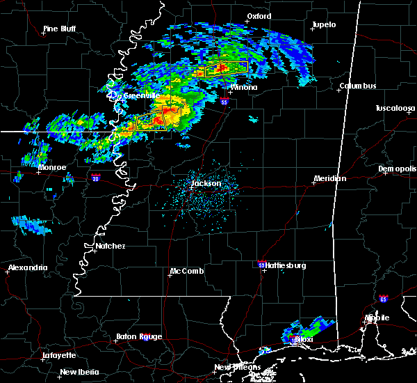 At 350 pm cst, a severe thunderstorm was located near murphy, or 9 miles west of belzoni, moving east at 45 mph (radar indicated). Hazards include 60 mph wind gusts. Expect damage to roofs, siding, and trees. this severe thunderstorm will remain over mainly rural areas of northwestern humphreys county. A tornado watch remains in effect until 900 pm cst for central and northwestern mississippi. At 350 pm cst, a severe thunderstorm was located near murphy, or 9 miles west of belzoni, moving east at 45 mph (radar indicated). Hazards include 60 mph wind gusts. Expect damage to roofs, siding, and trees. this severe thunderstorm will remain over mainly rural areas of northwestern humphreys county. A tornado watch remains in effect until 900 pm cst for central and northwestern mississippi.
|
| 3/9/2019 3:34 PM CST |
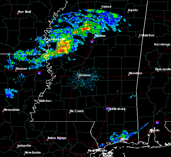 At 333 pm cst, a severe thunderstorm was located over delta city, or 7 miles southeast of hollandale, moving east at 50 mph (radar indicated). Hazards include 60 mph wind gusts and quarter size hail. Hail damage to vehicles is expected. expect wind damage to roofs, siding, and trees. locations impacted include, hollandale, isola, midnight, murphy, panther burn and delta city. A tornado watch remains in effect until 900 pm cst for central, northwestern and west central mississippi. At 333 pm cst, a severe thunderstorm was located over delta city, or 7 miles southeast of hollandale, moving east at 50 mph (radar indicated). Hazards include 60 mph wind gusts and quarter size hail. Hail damage to vehicles is expected. expect wind damage to roofs, siding, and trees. locations impacted include, hollandale, isola, midnight, murphy, panther burn and delta city. A tornado watch remains in effect until 900 pm cst for central, northwestern and west central mississippi.
|
| 3/9/2019 3:25 PM CST |
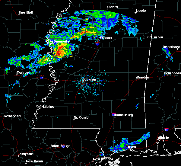 At 325 pm cst, a severe thunderstorm was located over panther burn, or 7 miles southwest of hollandale, moving east at 55 mph (radar indicated). Hazards include 60 mph wind gusts and quarter size hail. Hail damage to vehicles is expected. expect wind damage to roofs, siding, and trees. locations impacted include, hollandale, isola, darlove, panther burn, nitta yuma, midnight, murphy and delta city. A tornado watch remains in effect until 900 pm cst for central, northwestern and west central mississippi. At 325 pm cst, a severe thunderstorm was located over panther burn, or 7 miles southwest of hollandale, moving east at 55 mph (radar indicated). Hazards include 60 mph wind gusts and quarter size hail. Hail damage to vehicles is expected. expect wind damage to roofs, siding, and trees. locations impacted include, hollandale, isola, darlove, panther burn, nitta yuma, midnight, murphy and delta city. A tornado watch remains in effect until 900 pm cst for central, northwestern and west central mississippi.
|
| 3/9/2019 3:06 PM CST |
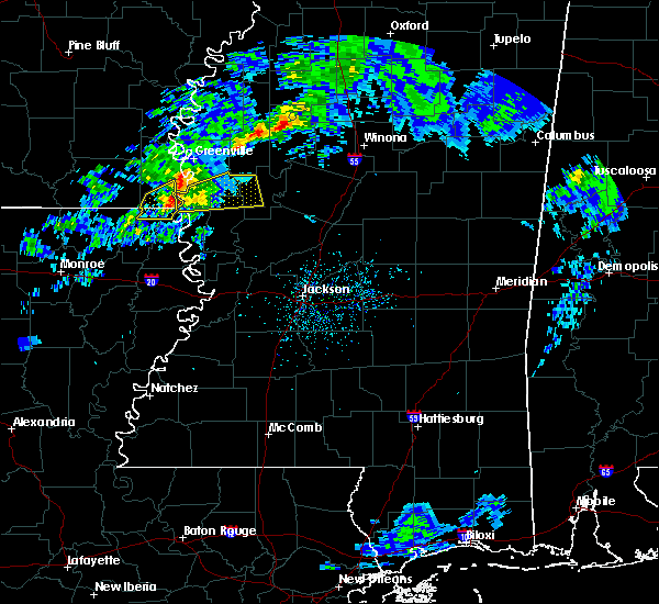 At 305 pm cst, a severe thunderstorm was located near gassoway, or near eudora, moving east at 45 mph (radar indicated). Hazards include 60 mph wind gusts and penny size hail. expect damage to roofs, siding, and trees At 305 pm cst, a severe thunderstorm was located near gassoway, or near eudora, moving east at 45 mph (radar indicated). Hazards include 60 mph wind gusts and penny size hail. expect damage to roofs, siding, and trees
|
| 11/1/2018 2:28 AM CDT |
 At 228 am cdt, severe thunderstorms were located along a line extending from near ruleville to near midnight, moving northeast at 35 mph (radar indicated). Hazards include 60 mph wind gusts. Expect damage to roofs, siding, and trees. these severe thunderstorms will remain over mainly rural areas of southeastern sunflower and north central humphreys counties. A tornado watch remains in effect until 700 am cdt for central, north central and northwestern mississippi. At 228 am cdt, severe thunderstorms were located along a line extending from near ruleville to near midnight, moving northeast at 35 mph (radar indicated). Hazards include 60 mph wind gusts. Expect damage to roofs, siding, and trees. these severe thunderstorms will remain over mainly rural areas of southeastern sunflower and north central humphreys counties. A tornado watch remains in effect until 700 am cdt for central, north central and northwestern mississippi.
|
| 11/1/2018 2:14 AM CDT |
 At 214 am cdt, severe thunderstorms were located along a line extending from near boyle to near midnight, moving northeast at 35 mph (radar indicated). Hazards include 60 mph wind gusts. Expect damage to roofs, siding, and trees. these severe storms will be near, blaine around 225 am cdt. ruleville around 230 am cdt. other locations impacted by these severe thunderstorms include doddsville. A tornado watch remains in effect until 700 am cdt for central, north central, northwestern and west central mississippi. At 214 am cdt, severe thunderstorms were located along a line extending from near boyle to near midnight, moving northeast at 35 mph (radar indicated). Hazards include 60 mph wind gusts. Expect damage to roofs, siding, and trees. these severe storms will be near, blaine around 225 am cdt. ruleville around 230 am cdt. other locations impacted by these severe thunderstorms include doddsville. A tornado watch remains in effect until 700 am cdt for central, north central, northwestern and west central mississippi.
|
| 11/1/2018 2:04 AM CDT |
 At 203 am cdt, severe thunderstorms were located along a line extending from shaw to near anguilla, moving northeast at 35 mph (radar indicated). Hazards include 60 mph wind gusts. Expect damage to roofs, siding, and trees. these severe storms will be near, shaw around 210 am cdt. blaine around 225 am cdt. ruleville around 230 am cdt. other locations impacted by these severe thunderstorms include doddsville. A tornado watch remains in effect until 700 am cdt for central, north central, northwestern and west central mississippi. At 203 am cdt, severe thunderstorms were located along a line extending from shaw to near anguilla, moving northeast at 35 mph (radar indicated). Hazards include 60 mph wind gusts. Expect damage to roofs, siding, and trees. these severe storms will be near, shaw around 210 am cdt. blaine around 225 am cdt. ruleville around 230 am cdt. other locations impacted by these severe thunderstorms include doddsville. A tornado watch remains in effect until 700 am cdt for central, north central, northwestern and west central mississippi.
|
| 11/1/2018 1:46 AM CDT |
 At 145 am cdt, severe thunderstorms were located along a line extending from 8 miles southwest of shaw to rolling fork, moving northeast at 35 mph (radar indicated). Hazards include 60 mph wind gusts. Expect damage to roofs, siding, and trees. severe thunderstorms will be near, panther burn around 155 am cdt. shaw around 200 am cdt. delta city around 205 am cdt. murphy around 215 am cdt. blaine around 225 am cdt. ruleville around 230 am cdt. other locations impacted by these severe thunderstorms include arcola and doddsville. A tornado watch remains in effect until 700 am cdt for central, north central, northwestern and west central mississippi. At 145 am cdt, severe thunderstorms were located along a line extending from 8 miles southwest of shaw to rolling fork, moving northeast at 35 mph (radar indicated). Hazards include 60 mph wind gusts. Expect damage to roofs, siding, and trees. severe thunderstorms will be near, panther burn around 155 am cdt. shaw around 200 am cdt. delta city around 205 am cdt. murphy around 215 am cdt. blaine around 225 am cdt. ruleville around 230 am cdt. other locations impacted by these severe thunderstorms include arcola and doddsville. A tornado watch remains in effect until 700 am cdt for central, north central, northwestern and west central mississippi.
|
| 8/20/2018 7:26 PM CDT |
 The severe thunderstorm warning for southwestern sunflower, eastern washington, northwestern humphreys and northern sharkey counties will expire at 730 pm cdt, the storms which prompted the warning have moved out of the area. therefore, the warning will be allowed to expire. The severe thunderstorm warning for southwestern sunflower, eastern washington, northwestern humphreys and northern sharkey counties will expire at 730 pm cdt, the storms which prompted the warning have moved out of the area. therefore, the warning will be allowed to expire.
|
| 8/20/2018 7:18 PM CDT |
 The national weather service in jackson has issued a * severe thunderstorm warning for. holmes county in central mississippi. southern sunflower county in northwestern mississippi. western carroll county in north central mississippi. Leflore county in north central mississippi. The national weather service in jackson has issued a * severe thunderstorm warning for. holmes county in central mississippi. southern sunflower county in northwestern mississippi. western carroll county in north central mississippi. Leflore county in north central mississippi.
|
| 8/20/2018 7:08 PM CDT |
 At 707 pm cdt, severe thunderstorms were located along a line extending from 6 miles northwest of holly ridge to near darlove to near nitta yuma, moving east at 30 mph (radar indicated). Hazards include 60 mph wind gusts and nickel size hail. Expect damage to roofs, siding, and trees. these severe storms will be near, isola around 725 pm cdt. indianola and murphy around 730 pm cdt. Other locations impacted by these severe thunderstorms include arcola. At 707 pm cdt, severe thunderstorms were located along a line extending from 6 miles northwest of holly ridge to near darlove to near nitta yuma, moving east at 30 mph (radar indicated). Hazards include 60 mph wind gusts and nickel size hail. Expect damage to roofs, siding, and trees. these severe storms will be near, isola around 725 pm cdt. indianola and murphy around 730 pm cdt. Other locations impacted by these severe thunderstorms include arcola.
|
| 8/20/2018 6:27 PM CDT |
 At 627 pm cdt, severe thunderstorms were located along a line extending from 7 miles west of lamont to near avon to near gassoway, moving east at 30 mph (radar indicated). Hazards include 60 mph wind gusts and nickel size hail. Expect damage to roofs, siding, and trees. severe thunderstorms will be near, avon and wayside around 635 pm cdt. winterville and lamont around 640 pm cdt. greenville around 645 pm cdt. metcalfe and glen allan around 650 pm cdt. leland, hollandale and estill around 655 pm cdt. tribbett around 700 pm cdt. darlove around 705 pm cdt. nitta yuma and panther burn around 710 pm cdt. Other locations impacted by these severe thunderstorms include arcola. At 627 pm cdt, severe thunderstorms were located along a line extending from 7 miles west of lamont to near avon to near gassoway, moving east at 30 mph (radar indicated). Hazards include 60 mph wind gusts and nickel size hail. Expect damage to roofs, siding, and trees. severe thunderstorms will be near, avon and wayside around 635 pm cdt. winterville and lamont around 640 pm cdt. greenville around 645 pm cdt. metcalfe and glen allan around 650 pm cdt. leland, hollandale and estill around 655 pm cdt. tribbett around 700 pm cdt. darlove around 705 pm cdt. nitta yuma and panther burn around 710 pm cdt. Other locations impacted by these severe thunderstorms include arcola.
|
| 8/17/2018 2:22 PM CDT |
 At 222 pm cdt, a severe thunderstorm was located near darlove, or 11 miles south of indianola, moving east at 20 mph (radar indicated). Hazards include 60 mph wind gusts and quarter size hail. Hail damage to vehicles is expected. expect wind damage to roofs, siding, and trees. this severe thunderstorm will be near, isola around 240 pm cdt. Inverness around 245 pm cdt. At 222 pm cdt, a severe thunderstorm was located near darlove, or 11 miles south of indianola, moving east at 20 mph (radar indicated). Hazards include 60 mph wind gusts and quarter size hail. Hail damage to vehicles is expected. expect wind damage to roofs, siding, and trees. this severe thunderstorm will be near, isola around 240 pm cdt. Inverness around 245 pm cdt.
|
| 7/21/2018 5:19 AM CDT |
 At 519 am cdt, severe thunderstorms were located along a line extending from near tchula to 6 miles south of belzoni, moving southeast at 65 mph (radar indicated). Hazards include 60 mph wind gusts. Expect damage to roofs, siding, and trees. these severe storms will be near, lexington around 525 am cdt. franklin and brozville around 530 am cdt. ebenezer around 535 am cdt. goodman and pickens around 540 am cdt. Other locations impacted by these severe thunderstorms include silver city, west and cruger. At 519 am cdt, severe thunderstorms were located along a line extending from near tchula to 6 miles south of belzoni, moving southeast at 65 mph (radar indicated). Hazards include 60 mph wind gusts. Expect damage to roofs, siding, and trees. these severe storms will be near, lexington around 525 am cdt. franklin and brozville around 530 am cdt. ebenezer around 535 am cdt. goodman and pickens around 540 am cdt. Other locations impacted by these severe thunderstorms include silver city, west and cruger.
|
| 7/21/2018 5:11 AM CDT |
 At 511 am cdt, severe thunderstorms were located along a line extending from near swiftown to darlove, moving south at 55 mph (radar indicated). Hazards include 60 mph wind gusts. Expect damage to roofs, siding, and trees. Locations impacted include, greenville, leland, hollandale, avon, inverness, darlove, tribbett, wayside, estill, murphy and arcola. At 511 am cdt, severe thunderstorms were located along a line extending from near swiftown to darlove, moving south at 55 mph (radar indicated). Hazards include 60 mph wind gusts. Expect damage to roofs, siding, and trees. Locations impacted include, greenville, leland, hollandale, avon, inverness, darlove, tribbett, wayside, estill, murphy and arcola.
|
| 7/21/2018 5:07 AM CDT |
 At 507 am cdt, severe thunderstorms were located along a line extending from sidon to near swiftown, moving southeast at 55 mph (radar indicated). Hazards include 60 mph wind gusts. Expect damage to roofs, siding, and trees. these severe storms will be near, belzoni around 515 am cdt. black hawk around 520 am cdt. thornton and emory around 525 am cdt. lexington around 530 am cdt. coxburg, bowling green and tolarville around 535 am cdt. durant and franklin around 540 am cdt. goodman around 545 am cdt. Other locations impacted by these severe thunderstorms include silver city, west and cruger. At 507 am cdt, severe thunderstorms were located along a line extending from sidon to near swiftown, moving southeast at 55 mph (radar indicated). Hazards include 60 mph wind gusts. Expect damage to roofs, siding, and trees. these severe storms will be near, belzoni around 515 am cdt. black hawk around 520 am cdt. thornton and emory around 525 am cdt. lexington around 530 am cdt. coxburg, bowling green and tolarville around 535 am cdt. durant and franklin around 540 am cdt. goodman around 545 am cdt. Other locations impacted by these severe thunderstorms include silver city, west and cruger.
|
| 7/21/2018 5:02 AM CDT |
 At 501 am cdt, severe thunderstorms were located along a line extending from near swiftown to near tribbett, moving south at 55 mph (radar indicated). Hazards include 60 mph wind gusts. Expect damage to roofs, siding, and trees. these severe storms will be near, hollandale, darlove and estill around 510 am cdt. murphy around 520 am cdt. Other locations impacted by these severe thunderstorms include arcola. At 501 am cdt, severe thunderstorms were located along a line extending from near swiftown to near tribbett, moving south at 55 mph (radar indicated). Hazards include 60 mph wind gusts. Expect damage to roofs, siding, and trees. these severe storms will be near, hollandale, darlove and estill around 510 am cdt. murphy around 520 am cdt. Other locations impacted by these severe thunderstorms include arcola.
|
| 7/21/2018 4:56 AM CDT |
 At 455 am cdt, severe thunderstorms were located along a line extending from greenwood to near inverness, moving southeast at 60 mph (radar indicated). Hazards include 60 mph wind gusts. Expect damage to roofs, siding, and trees. severe thunderstorms will be near, belzoni around 510 am cdt. black hawk around 515 am cdt. emory around 520 am cdt. thornton, lexington, bowling green and howard around 525 am cdt. coxburg and tolarville around 530 am cdt. durant, goodman and ebenezer around 535 am cdt. Other locations impacted by these severe thunderstorms include silver city, west and cruger. At 455 am cdt, severe thunderstorms were located along a line extending from greenwood to near inverness, moving southeast at 60 mph (radar indicated). Hazards include 60 mph wind gusts. Expect damage to roofs, siding, and trees. severe thunderstorms will be near, belzoni around 510 am cdt. black hawk around 515 am cdt. emory around 520 am cdt. thornton, lexington, bowling green and howard around 525 am cdt. coxburg and tolarville around 530 am cdt. durant, goodman and ebenezer around 535 am cdt. Other locations impacted by these severe thunderstorms include silver city, west and cruger.
|
| 7/21/2018 4:46 AM CDT |
 At 446 am cdt, severe thunderstorms were located along a line extending from near sunflower to 7 miles northeast of metcalfe, moving south at 50 mph (radar indicated). Hazards include 60 mph wind gusts. Expect damage to roofs, siding, and trees. these severe storms will be near, greenville and sunflower around 450 am cdt. indianola, leland, moorhead and holly ridge around 455 am cdt. inverness and tribbett around 500 am cdt. darlove and estill around 510 am cdt. hollandale around 515 am cdt. murphy around 520 am cdt. Other locations impacted by these severe thunderstorms include arcola and doddsville. At 446 am cdt, severe thunderstorms were located along a line extending from near sunflower to 7 miles northeast of metcalfe, moving south at 50 mph (radar indicated). Hazards include 60 mph wind gusts. Expect damage to roofs, siding, and trees. these severe storms will be near, greenville and sunflower around 450 am cdt. indianola, leland, moorhead and holly ridge around 455 am cdt. inverness and tribbett around 500 am cdt. darlove and estill around 510 am cdt. hollandale around 515 am cdt. murphy around 520 am cdt. Other locations impacted by these severe thunderstorms include arcola and doddsville.
|
| 7/21/2018 4:37 AM CDT |
 At 437 am cdt, severe thunderstorms were located along a line extending from near boyle to benoit, moving south at 50 mph (radar indicated). Hazards include 60 mph wind gusts. Expect damage to roofs, siding, and trees. these severe storms will be near, blaine around 445 am cdt. greenville, sunflower and metcalfe around 450 am cdt. indianola and leland around 455 am cdt. moorhead around 500 am cdt. inverness and tribbett around 505 am cdt. hollandale, estill and darlove around 515 am cdt. murphy around 525 am cdt. Other locations impacted by these severe thunderstorms include arcola and doddsville. At 437 am cdt, severe thunderstorms were located along a line extending from near boyle to benoit, moving south at 50 mph (radar indicated). Hazards include 60 mph wind gusts. Expect damage to roofs, siding, and trees. these severe storms will be near, blaine around 445 am cdt. greenville, sunflower and metcalfe around 450 am cdt. indianola and leland around 455 am cdt. moorhead around 500 am cdt. inverness and tribbett around 505 am cdt. hollandale, estill and darlove around 515 am cdt. murphy around 525 am cdt. Other locations impacted by these severe thunderstorms include arcola and doddsville.
|
| 7/21/2018 4:25 AM CDT |
 The national weather service in jackson has issued a * severe thunderstorm warning for. chicot county in southeastern arkansas. sunflower county in northwestern mississippi. washington county in northwestern mississippi. Southern bolivar county in northwestern mississippi. The national weather service in jackson has issued a * severe thunderstorm warning for. chicot county in southeastern arkansas. sunflower county in northwestern mississippi. washington county in northwestern mississippi. Southern bolivar county in northwestern mississippi.
|
| 7/20/2018 12:51 PM CDT |
 At 1250 pm cdt, a severe thunderstorm was located over ruleville, moving southeast at 35 mph (radar indicated). Hazards include 60 mph wind gusts and quarter size hail. Hail damage to vehicles is expected. expect wind damage to roofs, siding, and trees. this severe thunderstorm will be near, blaine around 105 pm cdt. itta bena around 125 pm cdt. quito around 135 pm cdt. sidon around 140 pm cdt. Other locations impacted by this severe thunderstorm include schlater, doddsville and morgan city. At 1250 pm cdt, a severe thunderstorm was located over ruleville, moving southeast at 35 mph (radar indicated). Hazards include 60 mph wind gusts and quarter size hail. Hail damage to vehicles is expected. expect wind damage to roofs, siding, and trees. this severe thunderstorm will be near, blaine around 105 pm cdt. itta bena around 125 pm cdt. quito around 135 pm cdt. sidon around 140 pm cdt. Other locations impacted by this severe thunderstorm include schlater, doddsville and morgan city.
|
| 7/19/2018 11:39 PM CDT |
 At 1139 pm cdt, a severe thunderstorm was located near greenville, moving south at 25 mph (radar indicated). Hazards include 70 mph wind gusts and quarter size hail. Hail damage to vehicles is expected. expect considerable tree damage. wind damage is also likely to mobile homes, roofs, and outbuildings. this severe thunderstorm will be near, wayside around 1155 pm cdt. avon and estill around 1205 am cdt. hollandale around 1215 am cdt. panther burn around 1230 am cdt. glen allan and nitta yuma around 1235 am cdt. Other locations impacted by this severe thunderstorm include silver city and cruger. At 1139 pm cdt, a severe thunderstorm was located near greenville, moving south at 25 mph (radar indicated). Hazards include 70 mph wind gusts and quarter size hail. Hail damage to vehicles is expected. expect considerable tree damage. wind damage is also likely to mobile homes, roofs, and outbuildings. this severe thunderstorm will be near, wayside around 1155 pm cdt. avon and estill around 1205 am cdt. hollandale around 1215 am cdt. panther burn around 1230 am cdt. glen allan and nitta yuma around 1235 am cdt. Other locations impacted by this severe thunderstorm include silver city and cruger.
|
| 7/19/2018 11:30 PM CDT |
 At 1130 pm cdt, severe thunderstorms were located along a line extending from leland to near tribbett to near holly ridge to near inverness to near moorhead, moving south at 25 mph (radar indicated). Hazards include 70 mph wind gusts and quarter size hail. Hail damage to vehicles is expected. expect considerable tree damage. wind damage is also likely to mobile homes, roofs, and outbuildings. these severe storms will be near, inverness around 1135 pm cdt. Other locations impacted by these severe thunderstorms include arcola. At 1130 pm cdt, severe thunderstorms were located along a line extending from leland to near tribbett to near holly ridge to near inverness to near moorhead, moving south at 25 mph (radar indicated). Hazards include 70 mph wind gusts and quarter size hail. Hail damage to vehicles is expected. expect considerable tree damage. wind damage is also likely to mobile homes, roofs, and outbuildings. these severe storms will be near, inverness around 1135 pm cdt. Other locations impacted by these severe thunderstorms include arcola.
|
| 7/19/2018 11:07 PM CDT |
 At 1106 pm cdt, severe thunderstorms were located along a line extending from near winterville to 9 miles northwest of holly ridge to near shaw to near indianola to sunflower, moving south at 25 mph (radar indicated). Hazards include 60 mph wind gusts and quarter size hail. Hail damage to vehicles is expected. expect wind damage to roofs, siding, and trees. these severe storms will be near, sunflower around 1110 pm cdt. indianola around 1115 pm cdt. moorhead around 1120 pm cdt. holly ridge around 1125 pm cdt. leland and inverness around 1130 pm cdt. tribbett around 1140 pm cdt. Other locations impacted by these severe thunderstorms include arcola. At 1106 pm cdt, severe thunderstorms were located along a line extending from near winterville to 9 miles northwest of holly ridge to near shaw to near indianola to sunflower, moving south at 25 mph (radar indicated). Hazards include 60 mph wind gusts and quarter size hail. Hail damage to vehicles is expected. expect wind damage to roofs, siding, and trees. these severe storms will be near, sunflower around 1110 pm cdt. indianola around 1115 pm cdt. moorhead around 1120 pm cdt. holly ridge around 1125 pm cdt. leland and inverness around 1130 pm cdt. tribbett around 1140 pm cdt. Other locations impacted by these severe thunderstorms include arcola.
|
| 7/19/2018 10:47 PM CDT |
 At 1047 pm cdt, severe thunderstorms were located along a line extending from 6 miles east of benoit to near boyle to near shaw to near blaine, moving south at 25 mph (radar indicated). Hazards include 60 mph wind gusts and quarter size hail. Hail damage to vehicles is expected. expect wind damage to roofs, siding, and trees. severe thunderstorms will be near, blaine around 1050 pm cdt. shaw and sunflower around 1100 pm cdt. indianola around 1110 pm cdt. moorhead around 1120 pm cdt. holly ridge around 1125 pm cdt. leland and inverness around 1130 pm cdt. tribbett around 1140 pm cdt. Other locations impacted by these severe thunderstorms include arcola. At 1047 pm cdt, severe thunderstorms were located along a line extending from 6 miles east of benoit to near boyle to near shaw to near blaine, moving south at 25 mph (radar indicated). Hazards include 60 mph wind gusts and quarter size hail. Hail damage to vehicles is expected. expect wind damage to roofs, siding, and trees. severe thunderstorms will be near, blaine around 1050 pm cdt. shaw and sunflower around 1100 pm cdt. indianola around 1110 pm cdt. moorhead around 1120 pm cdt. holly ridge around 1125 pm cdt. leland and inverness around 1130 pm cdt. tribbett around 1140 pm cdt. Other locations impacted by these severe thunderstorms include arcola.
|
| 7/6/2018 3:40 PM CDT |
 At 340 pm cdt, a severe thunderstorm was located over inverness, or near indianola, moving west at 20 mph (radar indicated). Hazards include 60 mph wind gusts. Expect damage to roofs, siding, and trees. this severe storm will be near, indianola around 345 pm cdt. Holly ridge around 405 pm cdt. At 340 pm cdt, a severe thunderstorm was located over inverness, or near indianola, moving west at 20 mph (radar indicated). Hazards include 60 mph wind gusts. Expect damage to roofs, siding, and trees. this severe storm will be near, indianola around 345 pm cdt. Holly ridge around 405 pm cdt.
|
| 7/6/2018 3:28 PM CDT |
 At 328 pm cdt, a severe thunderstorm was located near inverness, or near moorhead, moving west at 20 mph (radar indicated). Hazards include 60 mph wind gusts. Expect damage to roofs, siding, and trees. this severe storm will be near, inverness around 335 pm cdt. indianola around 340 pm cdt. Holly ridge around 400 pm cdt. At 328 pm cdt, a severe thunderstorm was located near inverness, or near moorhead, moving west at 20 mph (radar indicated). Hazards include 60 mph wind gusts. Expect damage to roofs, siding, and trees. this severe storm will be near, inverness around 335 pm cdt. indianola around 340 pm cdt. Holly ridge around 400 pm cdt.
|
| 7/6/2018 3:19 PM CDT |
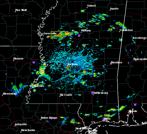 At 318 pm cdt, a severe thunderstorm was located near moorhead, moving west at 20 mph (radar indicated). Hazards include 60 mph wind gusts and quarter size hail. Hail damage to vehicles is expected. expect wind damage to roofs, siding, and trees. this severe thunderstorm will be near, inverness around 335 pm cdt. indianola around 345 pm cdt. holly ridge around 400 pm cdt. Other locations impacted by this severe thunderstorm include morgan city. At 318 pm cdt, a severe thunderstorm was located near moorhead, moving west at 20 mph (radar indicated). Hazards include 60 mph wind gusts and quarter size hail. Hail damage to vehicles is expected. expect wind damage to roofs, siding, and trees. this severe thunderstorm will be near, inverness around 335 pm cdt. indianola around 345 pm cdt. holly ridge around 400 pm cdt. Other locations impacted by this severe thunderstorm include morgan city.
|
| 6/3/2018 2:36 AM CDT |
 At 235 am cdt, a severe thunderstorm was located over holly ridge, or near indianola, moving south at 35 mph (radar indicated). Hazards include 60 mph wind gusts and quarter size hail. Hail damage to vehicles is expected. expect wind damage to roofs, siding, and trees. this severe storm will be near, tribbett around 245 am cdt. inverness around 250 am cdt. Other locations impacted by this severe thunderstorm include arcola. At 235 am cdt, a severe thunderstorm was located over holly ridge, or near indianola, moving south at 35 mph (radar indicated). Hazards include 60 mph wind gusts and quarter size hail. Hail damage to vehicles is expected. expect wind damage to roofs, siding, and trees. this severe storm will be near, tribbett around 245 am cdt. inverness around 250 am cdt. Other locations impacted by this severe thunderstorm include arcola.
|
| 6/3/2018 2:12 AM CDT |
 At 212 am cdt, a severe thunderstorm was located near shaw, moving south at 35 mph (radar indicated). Hazards include ping pong ball size hail and 60 mph wind gusts. People and animals outdoors will be injured. expect hail damage to roofs, siding, windows, and vehicles. expect wind damage to roofs, siding, and trees. this severe thunderstorm will be near, shaw around 215 am cdt. indianola and holly ridge around 235 am cdt. tribbett around 245 am cdt. Other locations impacted by this severe thunderstorm include arcola and doddsville. At 212 am cdt, a severe thunderstorm was located near shaw, moving south at 35 mph (radar indicated). Hazards include ping pong ball size hail and 60 mph wind gusts. People and animals outdoors will be injured. expect hail damage to roofs, siding, windows, and vehicles. expect wind damage to roofs, siding, and trees. this severe thunderstorm will be near, shaw around 215 am cdt. indianola and holly ridge around 235 am cdt. tribbett around 245 am cdt. Other locations impacted by this severe thunderstorm include arcola and doddsville.
|
| 4/14/2018 4:49 AM CDT |
 At 449 am cdt, a severe thunderstorm capable of producing a tornado was located over isola, or 10 miles northwest of belzoni, moving northeast at 55 mph (radar indicated rotation). Hazards include tornado. Flying debris will be dangerous to those caught without shelter. mobile homes will be damaged or destroyed. damage to roofs, windows, and vehicles will occur. tree damage is likely. this dangerous storm will be near, inverness around 455 am cdt. moorhead and swiftown around 505 am cdt. itta bena and quito around 515 am cdt. sidon around 520 am cdt. greenwood around 525 am cdt. Other locations impacted by this tornadic thunderstorm include morgan city. At 449 am cdt, a severe thunderstorm capable of producing a tornado was located over isola, or 10 miles northwest of belzoni, moving northeast at 55 mph (radar indicated rotation). Hazards include tornado. Flying debris will be dangerous to those caught without shelter. mobile homes will be damaged or destroyed. damage to roofs, windows, and vehicles will occur. tree damage is likely. this dangerous storm will be near, inverness around 455 am cdt. moorhead and swiftown around 505 am cdt. itta bena and quito around 515 am cdt. sidon around 520 am cdt. greenwood around 525 am cdt. Other locations impacted by this tornadic thunderstorm include morgan city.
|
| 4/3/2018 7:41 PM CDT |
 At 741 pm cdt, severe thunderstorms were located along a line extending from near minter city to near belzoni, moving east at 50 mph (radar indicated). Hazards include 70 mph wind gusts. Expect considerable tree damage. damage is likely to mobile homes, roofs, and outbuildings. Locations impacted include, greenwood, moorhead, itta bena, sunflower, inverness, sidon, minter city, quito, money, swiftown, sunnyside, blaine, schlater, morgan city and doddsville. At 741 pm cdt, severe thunderstorms were located along a line extending from near minter city to near belzoni, moving east at 50 mph (radar indicated). Hazards include 70 mph wind gusts. Expect considerable tree damage. damage is likely to mobile homes, roofs, and outbuildings. Locations impacted include, greenwood, moorhead, itta bena, sunflower, inverness, sidon, minter city, quito, money, swiftown, sunnyside, blaine, schlater, morgan city and doddsville.
|
| 4/3/2018 7:20 PM CDT |
 At 720 pm cdt, severe thunderstorms were located along a line extending from near indianola to near valley park, moving east at 50 mph (radar indicated). Hazards include 70 mph wind gusts. Expect considerable tree damage. Damage is likely to mobile homes, roofs, and outbuildings. At 720 pm cdt, severe thunderstorms were located along a line extending from near indianola to near valley park, moving east at 50 mph (radar indicated). Hazards include 70 mph wind gusts. Expect considerable tree damage. Damage is likely to mobile homes, roofs, and outbuildings.
|
| 4/3/2018 7:07 PM CDT |
 At 706 pm cdt, severe thunderstorms were located along a line extending from near clarksdale to near glen allan, moving east at 50 mph (radar indicated. a 69 mph wind gust was recorded at the greenville airport). Hazards include 70 mph wind gusts. Expect considerable tree damage. Damage is likely to mobile homes, roofs, and outbuildings. At 706 pm cdt, severe thunderstorms were located along a line extending from near clarksdale to near glen allan, moving east at 50 mph (radar indicated. a 69 mph wind gust was recorded at the greenville airport). Hazards include 70 mph wind gusts. Expect considerable tree damage. Damage is likely to mobile homes, roofs, and outbuildings.
|
| 3/11/2018 12:00 AM CDT | Hen Egg sized hail reported 1.7 miles NNE of Isola, MS, egg size hail reported via social media near isola. |
| 3/10/2018 11:47 PM CDT |
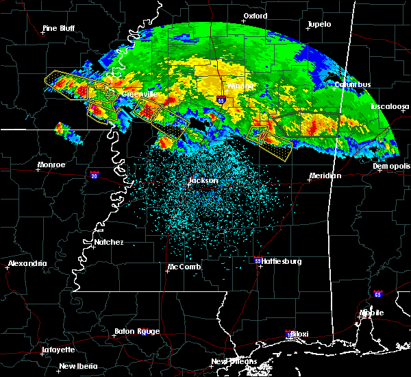 At 1047 pm cst, a severe thunderstorm was located near isola, or 9 miles west of belzoni, moving southeast at 35 mph (trained weather spotters). Hazards include tennis ball size hail and 60 mph wind gusts. People and animals outdoors will be injured. expect hail damage to roofs, siding, windows, and vehicles. expect wind damage to roofs, siding, and trees. This severe thunderstorm will remain over mainly rural areas of southwestern sunflower, east central washington and northwestern humphreys counties. At 1047 pm cst, a severe thunderstorm was located near isola, or 9 miles west of belzoni, moving southeast at 35 mph (trained weather spotters). Hazards include tennis ball size hail and 60 mph wind gusts. People and animals outdoors will be injured. expect hail damage to roofs, siding, windows, and vehicles. expect wind damage to roofs, siding, and trees. This severe thunderstorm will remain over mainly rural areas of southwestern sunflower, east central washington and northwestern humphreys counties.
|
| 3/10/2018 11:46 PM CDT |
 At 1046 pm cst, a severe thunderstorm was located near murphy, or 10 miles east of hollandale, moving southeast at 30 mph (radar indicated). Hazards include tennis ball size hail and 60 mph wind gusts. People and animals outdoors will be injured. expect hail damage to roofs, siding, windows, and vehicles. expect wind damage to roofs, siding, and trees. this severe thunderstorm will be near, belzoni around 1100 pm cst. midnight around 1105 pm cst. thornton around 1125 pm cst. tolarville around 1140 pm cst. Other locations impacted by this severe thunderstorm include eden and silver city. At 1046 pm cst, a severe thunderstorm was located near murphy, or 10 miles east of hollandale, moving southeast at 30 mph (radar indicated). Hazards include tennis ball size hail and 60 mph wind gusts. People and animals outdoors will be injured. expect hail damage to roofs, siding, windows, and vehicles. expect wind damage to roofs, siding, and trees. this severe thunderstorm will be near, belzoni around 1100 pm cst. midnight around 1105 pm cst. thornton around 1125 pm cst. tolarville around 1140 pm cst. Other locations impacted by this severe thunderstorm include eden and silver city.
|
| 3/10/2018 11:36 PM CDT |
 At 1036 pm cst, a severe thunderstorm was located over darlove, or 8 miles northeast of hollandale, moving southeast at 30 mph (trained weather spotters). Hazards include tennis ball size hail and 60 mph wind gusts. People and animals outdoors will be injured. expect hail damage to roofs, siding, windows, and vehicles. expect wind damage to roofs, siding, and trees. This severe storm will be near, isola and murphy around 1050 pm cst. At 1036 pm cst, a severe thunderstorm was located over darlove, or 8 miles northeast of hollandale, moving southeast at 30 mph (trained weather spotters). Hazards include tennis ball size hail and 60 mph wind gusts. People and animals outdoors will be injured. expect hail damage to roofs, siding, windows, and vehicles. expect wind damage to roofs, siding, and trees. This severe storm will be near, isola and murphy around 1050 pm cst.
|
| 3/10/2018 11:25 PM CDT |
 At 1025 pm cst, a severe thunderstorm was located near tribbett, or 8 miles southeast of leland, moving southeast at 35 mph (trained weather spotters). Hazards include golf ball size hail and 60 mph wind gusts. People and animals outdoors will be injured. expect hail damage to roofs, siding, windows, and vehicles. expect wind damage to roofs, siding, and trees. this severe storm will be near, darlove around 1035 pm cst. isola and murphy around 1045 pm cst. Other locations impacted by this severe thunderstorm include arcola. At 1025 pm cst, a severe thunderstorm was located near tribbett, or 8 miles southeast of leland, moving southeast at 35 mph (trained weather spotters). Hazards include golf ball size hail and 60 mph wind gusts. People and animals outdoors will be injured. expect hail damage to roofs, siding, windows, and vehicles. expect wind damage to roofs, siding, and trees. this severe storm will be near, darlove around 1035 pm cst. isola and murphy around 1045 pm cst. Other locations impacted by this severe thunderstorm include arcola.
|
| 3/10/2018 11:11 PM CDT |
 At 1011 pm cst, a severe thunderstorm was located near leland, moving southeast at 35 mph (trained weather spotters). Hazards include golf ball size hail and 60 mph wind gusts. People and animals outdoors will be injured. expect hail damage to roofs, siding, windows, and vehicles. expect wind damage to roofs, siding, and trees. this severe storm will be near, tribbett and estill around 1025 pm cst. darlove around 1035 pm cst. isola and murphy around 1045 pm cst. Other locations impacted by this severe thunderstorm include arcola. At 1011 pm cst, a severe thunderstorm was located near leland, moving southeast at 35 mph (trained weather spotters). Hazards include golf ball size hail and 60 mph wind gusts. People and animals outdoors will be injured. expect hail damage to roofs, siding, windows, and vehicles. expect wind damage to roofs, siding, and trees. this severe storm will be near, tribbett and estill around 1025 pm cst. darlove around 1035 pm cst. isola and murphy around 1045 pm cst. Other locations impacted by this severe thunderstorm include arcola.
|
| 3/10/2018 11:08 PM CDT |
 The national weather service in jackson has issued a * severe thunderstorm warning for. southwestern sunflower county in northwestern mississippi. northeastern washington county in northwestern mississippi. northwestern humphreys county in central mississippi. Until 1100 pm cst. The national weather service in jackson has issued a * severe thunderstorm warning for. southwestern sunflower county in northwestern mississippi. northeastern washington county in northwestern mississippi. northwestern humphreys county in central mississippi. Until 1100 pm cst.
|
| 7/8/2017 9:42 AM CDT |
 The severe thunderstorm warning for southern sunflower, southeastern washington, humphreys and northeastern sharkey counties will expire at 945 am cdt, the storm which prompted the warning has weakened below severe limits, and no longer poses an immediate threat to life or property. therefore the warning will be allowed to expire. however small hail, gusty winds and heavy rain are still possible with this thunderstorm. The severe thunderstorm warning for southern sunflower, southeastern washington, humphreys and northeastern sharkey counties will expire at 945 am cdt, the storm which prompted the warning has weakened below severe limits, and no longer poses an immediate threat to life or property. therefore the warning will be allowed to expire. however small hail, gusty winds and heavy rain are still possible with this thunderstorm.
|
| 7/8/2017 9:22 AM CDT |
 At 922 am cdt, a severe thunderstorm was located near murphy, or 10 miles west of belzoni, moving southeast at 25 mph (radar indicated). Hazards include 60 mph wind gusts and quarter size hail. Hail damage to vehicles is expected. expect wind damage to roofs, siding, and trees. This severe thunderstorm will remain over mainly rural areas of southern sunflower, southeastern washington, humphreys and northeastern sharkey counties, including the following locations: silver city and arcola. At 922 am cdt, a severe thunderstorm was located near murphy, or 10 miles west of belzoni, moving southeast at 25 mph (radar indicated). Hazards include 60 mph wind gusts and quarter size hail. Hail damage to vehicles is expected. expect wind damage to roofs, siding, and trees. This severe thunderstorm will remain over mainly rural areas of southern sunflower, southeastern washington, humphreys and northeastern sharkey counties, including the following locations: silver city and arcola.
|
| 7/8/2017 8:54 AM CDT |
 At 854 am cdt, a severe thunderstorm was located near tribbett, or 8 miles north of hollandale, moving southeast at 25 mph (radar indicated). Hazards include 60 mph wind gusts and quarter size hail. Hail damage to vehicles is expected. expect wind damage to roofs, siding, and trees. this severe thunderstorm will be near, hollandale and darlove around 905 am cdt. isola around 920 am cdt. murphy around 925 am cdt. Other locations impacted by this severe thunderstorm include silver city and arcola. At 854 am cdt, a severe thunderstorm was located near tribbett, or 8 miles north of hollandale, moving southeast at 25 mph (radar indicated). Hazards include 60 mph wind gusts and quarter size hail. Hail damage to vehicles is expected. expect wind damage to roofs, siding, and trees. this severe thunderstorm will be near, hollandale and darlove around 905 am cdt. isola around 920 am cdt. murphy around 925 am cdt. Other locations impacted by this severe thunderstorm include silver city and arcola.
|
| 6/22/2017 4:41 PM CDT |
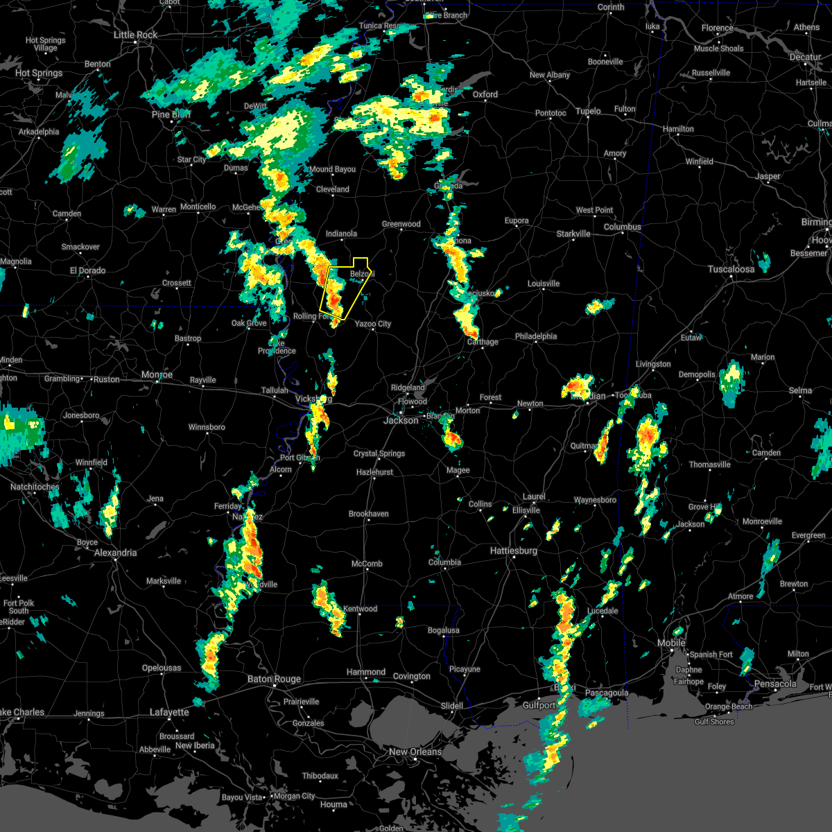 At 440 pm cdt, a severe thunderstorm was located near murphy, or 12 miles southeast of hollandale, moving north at 45 mph (radar indicated). Hazards include 60 mph wind gusts. Expect damage to roofs, siding, and trees. this severe thunderstorm will be near, murphy around 445 pm cdt. isola around 500 pm cdt. other locations impacted by this severe thunderstorm include louise. A tornado watch remains in effect until 1000 pm cdt for central, north central, northwestern and west central mississippi. At 440 pm cdt, a severe thunderstorm was located near murphy, or 12 miles southeast of hollandale, moving north at 45 mph (radar indicated). Hazards include 60 mph wind gusts. Expect damage to roofs, siding, and trees. this severe thunderstorm will be near, murphy around 445 pm cdt. isola around 500 pm cdt. other locations impacted by this severe thunderstorm include louise. A tornado watch remains in effect until 1000 pm cdt for central, north central, northwestern and west central mississippi.
|
| 6/22/2017 2:55 PM CDT |
 At 255 pm cdt, a severe thunderstorm was located near belzoni, moving north at 45 mph (radar indicated). Hazards include 60 mph wind gusts. Expect damage to roofs, siding, and trees. this severe thunderstorm will be near, swiftown around 310 pm cdt. quito around 325 pm cdt. itta bena around 330 pm cdt. money around 345 pm cdt. sunnyside around 350 pm cdt. minter city around 355 pm cdt. other locations impacted by this severe thunderstorm include silver city, doddsville, schlater, morgan city and cruger. A tornado watch remains in effect until 1000 pm cdt for central, north central and northwestern mississippi. At 255 pm cdt, a severe thunderstorm was located near belzoni, moving north at 45 mph (radar indicated). Hazards include 60 mph wind gusts. Expect damage to roofs, siding, and trees. this severe thunderstorm will be near, swiftown around 310 pm cdt. quito around 325 pm cdt. itta bena around 330 pm cdt. money around 345 pm cdt. sunnyside around 350 pm cdt. minter city around 355 pm cdt. other locations impacted by this severe thunderstorm include silver city, doddsville, schlater, morgan city and cruger. A tornado watch remains in effect until 1000 pm cdt for central, north central and northwestern mississippi.
|
| 6/16/2017 6:47 PM CDT |
 At 647 pm cdt, severe thunderstorms were located along a line extending from 8 miles east of dermott to near belzoni, moving south at 25 mph (radar indicated). Hazards include 60 mph wind gusts and penny size hail. Expect damage to roofs, siding, and trees. severe thunderstorms will be near, isola around 650 pm cdt. belzoni around 655 pm cdt. lake village and midnight around 720 pm cdt. chicot junction around 740 pm cdt. eudora around 755 pm cdt. Other locations impacted by these severe thunderstorms include arcola and louise. At 647 pm cdt, severe thunderstorms were located along a line extending from 8 miles east of dermott to near belzoni, moving south at 25 mph (radar indicated). Hazards include 60 mph wind gusts and penny size hail. Expect damage to roofs, siding, and trees. severe thunderstorms will be near, isola around 650 pm cdt. belzoni around 655 pm cdt. lake village and midnight around 720 pm cdt. chicot junction around 740 pm cdt. eudora around 755 pm cdt. Other locations impacted by these severe thunderstorms include arcola and louise.
|
| 6/16/2017 5:28 PM CDT |
 At 527 pm cdt, a severe thunderstorm was located over estill, or near hollandale, moving east at 25 mph (radar indicated). Hazards include 70 mph wind gusts and quarter size hail. Hail damage to vehicles is expected. expect considerable tree damage. wind damage is also likely to mobile homes, roofs, and outbuildings. this severe thunderstorm will be near, murphy around 550 pm cdt. isola around 600 pm cdt. midnight around 615 pm cdt. Belzoni around 620 pm cdt. At 527 pm cdt, a severe thunderstorm was located over estill, or near hollandale, moving east at 25 mph (radar indicated). Hazards include 70 mph wind gusts and quarter size hail. Hail damage to vehicles is expected. expect considerable tree damage. wind damage is also likely to mobile homes, roofs, and outbuildings. this severe thunderstorm will be near, murphy around 550 pm cdt. isola around 600 pm cdt. midnight around 615 pm cdt. Belzoni around 620 pm cdt.
|
| 4/26/2017 7:58 PM CDT |
 At 758 pm cdt, a severe thunderstorm was located over murphy, or 7 miles east of hollandale, moving northeast at 55 mph (radar indicated). Hazards include 60 mph wind gusts and quarter size hail. Hail damage to vehicles is expected. expect wind damage to roofs, siding, and trees. this severe thunderstorm will be near, isola around 810 pm cdt. belzoni and inverness around 815 pm cdt. swiftown around 820 pm cdt. quito around 835 pm cdt. sidon around 840 pm cdt. greenwood around 845 pm cdt. other locations impacted by this severe thunderstorm include silver city, doddsville, schlater, morgan city, cruger and louise. A tornado watch remains in effect until 1100 pm cdt for central, north central, northwestern and west central mississippi. At 758 pm cdt, a severe thunderstorm was located over murphy, or 7 miles east of hollandale, moving northeast at 55 mph (radar indicated). Hazards include 60 mph wind gusts and quarter size hail. Hail damage to vehicles is expected. expect wind damage to roofs, siding, and trees. this severe thunderstorm will be near, isola around 810 pm cdt. belzoni and inverness around 815 pm cdt. swiftown around 820 pm cdt. quito around 835 pm cdt. sidon around 840 pm cdt. greenwood around 845 pm cdt. other locations impacted by this severe thunderstorm include silver city, doddsville, schlater, morgan city, cruger and louise. A tornado watch remains in effect until 1100 pm cdt for central, north central, northwestern and west central mississippi.
|
| 4/2/2017 6:29 PM CDT |
 At 628 pm cdt, severe thunderstorms were located along a line extending from near murphy to near eagle bend, moving east at 35 mph (radar indicated). Hazards include 60 mph wind gusts. Expect damage to roofs, siding, and trees. severe thunderstorms will be near, murphy around 635 pm cdt. isola around 640 pm cdt. belzoni around 650 pm cdt. phoenix around 710 pm cdt. other locations impacted by these severe thunderstorms include satartia, silver city and louise. a tornado watch remains in effect until 900 pm cdt for central, north central, northwestern and west central mississippi. A tornado watch also remains in effect until 200 am cdt for central mississippi. At 628 pm cdt, severe thunderstorms were located along a line extending from near murphy to near eagle bend, moving east at 35 mph (radar indicated). Hazards include 60 mph wind gusts. Expect damage to roofs, siding, and trees. severe thunderstorms will be near, murphy around 635 pm cdt. isola around 640 pm cdt. belzoni around 650 pm cdt. phoenix around 710 pm cdt. other locations impacted by these severe thunderstorms include satartia, silver city and louise. a tornado watch remains in effect until 900 pm cdt for central, north central, northwestern and west central mississippi. A tornado watch also remains in effect until 200 am cdt for central mississippi.
|
| 3/25/2017 3:26 AM CDT |
 The severe thunderstorm warning for sunflower county will expire at 330 am cdt, the storms which prompted the warning are moving out of the area. therefore the warning will be allowed to expire. however gusty winds are still possible with these thunderstorms. a severe thunderstorm watch remains in effect until 600 am cdt for central, north central and northwestern mississippi. The severe thunderstorm warning for sunflower county will expire at 330 am cdt, the storms which prompted the warning are moving out of the area. therefore the warning will be allowed to expire. however gusty winds are still possible with these thunderstorms. a severe thunderstorm watch remains in effect until 600 am cdt for central, north central and northwestern mississippi.
|
| 3/25/2017 3:19 AM CDT |
 At 319 am cdt, severe thunderstorms were located along a line extending from 6 miles south of sherard to near blaine to near indianola, moving northeast at 50 mph (radar indicated). Hazards include 60 mph wind gusts and nickel size hail. Expect damage to roofs, siding, and trees. These severe thunderstorms will remain over mainly rural areas of sunflower county, including the following locations: doddsville. At 319 am cdt, severe thunderstorms were located along a line extending from 6 miles south of sherard to near blaine to near indianola, moving northeast at 50 mph (radar indicated). Hazards include 60 mph wind gusts and nickel size hail. Expect damage to roofs, siding, and trees. These severe thunderstorms will remain over mainly rural areas of sunflower county, including the following locations: doddsville.
|
| 3/25/2017 2:41 AM CDT |
 At 241 am cdt, severe thunderstorms were located along a line extending from near rosedale to near leland to near avon, moving northeast at 50 mph (radar indicated). Hazards include 60 mph wind gusts and quarter size hail. Hail damage to vehicles is expected. expect wind damage to roofs, siding, and trees. severe thunderstorms will be near, rosedale around 245 am cdt. holly ridge and darlove around 250 am cdt. shaw around 300 am cdt. shelby around 305 am cdt. indianola around 310 am cdt. ruleville and sunflower around 320 am cdt. drew and blaine around 325 am cdt. Other locations impacted by these severe thunderstorms include arcola, doddsville, winstonville, beulah, pace and merigold. At 241 am cdt, severe thunderstorms were located along a line extending from near rosedale to near leland to near avon, moving northeast at 50 mph (radar indicated). Hazards include 60 mph wind gusts and quarter size hail. Hail damage to vehicles is expected. expect wind damage to roofs, siding, and trees. severe thunderstorms will be near, rosedale around 245 am cdt. holly ridge and darlove around 250 am cdt. shaw around 300 am cdt. shelby around 305 am cdt. indianola around 310 am cdt. ruleville and sunflower around 320 am cdt. drew and blaine around 325 am cdt. Other locations impacted by these severe thunderstorms include arcola, doddsville, winstonville, beulah, pace and merigold.
|
| 1/21/2017 10:45 PM CST |
 At 1044 pm cst, severe thunderstorms were located along a line extending from near murphy to near rolling fork, moving east at 50 mph (radar indicated). Hazards include 60 mph wind gusts. Expect damage to roofs, siding, and trees. these severe storms will be near, midnight around 1050 pm cst. belzoni around 1055 pm cst. yazoo city around 1115 pm cst. other locations impacted by these severe thunderstorms include eden, silver city and louise. A tornado watch remains in effect until 300 am cst for north central, west central, northwestern and central mississippi. At 1044 pm cst, severe thunderstorms were located along a line extending from near murphy to near rolling fork, moving east at 50 mph (radar indicated). Hazards include 60 mph wind gusts. Expect damage to roofs, siding, and trees. these severe storms will be near, midnight around 1050 pm cst. belzoni around 1055 pm cst. yazoo city around 1115 pm cst. other locations impacted by these severe thunderstorms include eden, silver city and louise. A tornado watch remains in effect until 300 am cst for north central, west central, northwestern and central mississippi.
|
| 1/21/2017 10:28 PM CST |
 At 1028 pm cst, severe thunderstorms were located along a line extending from near hollandale to 7 miles east of lake providence, moving east at 50 mph (radar indicated). Hazards include 60 mph wind gusts. Expect damage to roofs, siding, and trees. severe thunderstorms will be near, hollandale, delta city, panther burn, darlove and estill around 1035 pm cst. rolling fork and murphy around 1040 pm cst. holly bluff and midnight around 1050 pm cst. belzoni around 1055 pm cst. yazoo city around 1115 pm cst. other locations impacted by these severe thunderstorms include mayersville, eden, silver city, cary and louise. A tornado watch remains in effect until 300 am cst for north central, west central, northwestern and central mississippi. At 1028 pm cst, severe thunderstorms were located along a line extending from near hollandale to 7 miles east of lake providence, moving east at 50 mph (radar indicated). Hazards include 60 mph wind gusts. Expect damage to roofs, siding, and trees. severe thunderstorms will be near, hollandale, delta city, panther burn, darlove and estill around 1035 pm cst. rolling fork and murphy around 1040 pm cst. holly bluff and midnight around 1050 pm cst. belzoni around 1055 pm cst. yazoo city around 1115 pm cst. other locations impacted by these severe thunderstorms include mayersville, eden, silver city, cary and louise. A tornado watch remains in effect until 300 am cst for north central, west central, northwestern and central mississippi.
|
| 11/28/2016 2:20 PM CST |
 At 219 pm cst, severe thunderstorms were located along a line extending from near moorhead to near panther burn, moving east at 65 mph (radar indicated). Hazards include 60 mph wind gusts. Expect damage to roofs. siding. and trees. severe thunderstorms will be near, itta bena and quito around 225 pm cst. greenwood and isola around 235 pm cst. belzoni and teoc around 240 pm cst. malmaison and swiftown around 245 pm cst. jefferson and north carrollton around 250 pm cst. tchula around 255 pm cst. seven pines around 305 pm cst. black hawk and coila around 310 pm cst. Other locations impacted by these severe thunderstorms include silver city, cruger, carrollton and morgan city. At 219 pm cst, severe thunderstorms were located along a line extending from near moorhead to near panther burn, moving east at 65 mph (radar indicated). Hazards include 60 mph wind gusts. Expect damage to roofs. siding. and trees. severe thunderstorms will be near, itta bena and quito around 225 pm cst. greenwood and isola around 235 pm cst. belzoni and teoc around 240 pm cst. malmaison and swiftown around 245 pm cst. jefferson and north carrollton around 250 pm cst. tchula around 255 pm cst. seven pines around 305 pm cst. black hawk and coila around 310 pm cst. Other locations impacted by these severe thunderstorms include silver city, cruger, carrollton and morgan city.
|
| 7/14/2016 9:19 PM CDT |
 At 919 pm cdt, severe thunderstorms were located along a line extending from near parchman to near swiftown to 6 miles southwest of midnight, moving southeast at 55 mph (radar indicated). Hazards include 70 mph wind gusts. Expect considerable tree damage. damage is likely to mobile homes, roofs, and outbuildings. These severe thunderstorms will remain over mainly rural areas of east central washington, east central bolivar, sunflower and humphreys counties, including the following locations: doddsville and silver city. At 919 pm cdt, severe thunderstorms were located along a line extending from near parchman to near swiftown to 6 miles southwest of midnight, moving southeast at 55 mph (radar indicated). Hazards include 70 mph wind gusts. Expect considerable tree damage. damage is likely to mobile homes, roofs, and outbuildings. These severe thunderstorms will remain over mainly rural areas of east central washington, east central bolivar, sunflower and humphreys counties, including the following locations: doddsville and silver city.
|
| 7/14/2016 8:42 PM CDT |
 At 842 pm cdt, severe thunderstorms were located along a line extending from near deeson to 6 miles northeast of glen allan, moving east at 30 mph (radar indicated). Hazards include 70 mph wind gusts and quarter size hail. Hail damage to vehicles is expected. expect considerable tree damage. wind damage is also likely to mobile homes, roofs, and outbuildings. severe thunderstorms will be near, gunnison and deeson around 845 pm cdt. shelby around 855 pm cdt. estill around 900 pm cdt. darlove around 910 pm cdt. murphy around 915 pm cdt. isola around 930 pm cdt. belzoni around 940 pm cdt. Other locations impacted by these severe thunderstorms include pace, duncan, alligator, winstonville, louise, arcola, merigold, doddsville, beulah and silver city. At 842 pm cdt, severe thunderstorms were located along a line extending from near deeson to 6 miles northeast of glen allan, moving east at 30 mph (radar indicated). Hazards include 70 mph wind gusts and quarter size hail. Hail damage to vehicles is expected. expect considerable tree damage. wind damage is also likely to mobile homes, roofs, and outbuildings. severe thunderstorms will be near, gunnison and deeson around 845 pm cdt. shelby around 855 pm cdt. estill around 900 pm cdt. darlove around 910 pm cdt. murphy around 915 pm cdt. isola around 930 pm cdt. belzoni around 940 pm cdt. Other locations impacted by these severe thunderstorms include pace, duncan, alligator, winstonville, louise, arcola, merigold, doddsville, beulah and silver city.
|
| 6/17/2016 7:21 PM CDT |
 At 721 pm cdt, severe thunderstorms were located along a line extending from near winterville to near tribbett to near belzoni, moving south at 35 mph (radar indicated). Hazards include 60 mph wind gusts and quarter size hail. Hail damage to vehicles is expected. expect wind damage to roofs, siding, and trees. these severe storms will be near, belzoni around 725 pm cdt. darlove around 730 pm cdt. isola around 735 pm cdt. avon, murphy and wayside around 745 pm cdt. Other locations impacted by these severe thunderstorms include arcola. At 721 pm cdt, severe thunderstorms were located along a line extending from near winterville to near tribbett to near belzoni, moving south at 35 mph (radar indicated). Hazards include 60 mph wind gusts and quarter size hail. Hail damage to vehicles is expected. expect wind damage to roofs, siding, and trees. these severe storms will be near, belzoni around 725 pm cdt. darlove around 730 pm cdt. isola around 735 pm cdt. avon, murphy and wayside around 745 pm cdt. Other locations impacted by these severe thunderstorms include arcola.
|
| 6/17/2016 6:59 PM CDT |
 At 659 pm cdt, severe thunderstorms were located along a line extending from near scott to near holly ridge to near swiftown, moving southeast at 35 mph (radar indicated). Hazards include 60 mph wind gusts and quarter size hail. Hail damage to vehicles is expected. expect wind damage to roofs, siding, and trees. these severe storms will be near, tribbett around 710 pm cdt. belzoni around 715 pm cdt. inverness and darlove around 720 pm cdt. greenville and metcalfe around 725 pm cdt. leland and isola around 730 pm cdt. murphy and wayside around 740 pm cdt. estill around 745 pm cdt. Other locations impacted by these severe thunderstorms include arcola. At 659 pm cdt, severe thunderstorms were located along a line extending from near scott to near holly ridge to near swiftown, moving southeast at 35 mph (radar indicated). Hazards include 60 mph wind gusts and quarter size hail. Hail damage to vehicles is expected. expect wind damage to roofs, siding, and trees. these severe storms will be near, tribbett around 710 pm cdt. belzoni around 715 pm cdt. inverness and darlove around 720 pm cdt. greenville and metcalfe around 725 pm cdt. leland and isola around 730 pm cdt. murphy and wayside around 740 pm cdt. estill around 745 pm cdt. Other locations impacted by these severe thunderstorms include arcola.
|
| 6/17/2016 6:31 PM CDT |
 At 630 pm cdt, severe thunderstorms were located along a line extending from scott to 8 miles northeast of metcalfe to near shaw to near sunflower, moving south at 35 mph (radar indicated). Hazards include 60 mph wind gusts and quarter size hail. Hail damage to vehicles is expected. expect wind damage to roofs, siding, and trees. severe thunderstorms will be near, indianola and moorhead around 640 pm cdt. leland and holly ridge around 645 pm cdt. greenville and metcalfe around 650 pm cdt. inverness and tribbett around 655 pm cdt. isola around 705 pm cdt. belzoni, estill, wayside and darlove around 710 pm cdt. hollandale and avon around 715 pm cdt. murphy around 720 pm cdt. Other locations impacted by these severe thunderstorms include doddsville and arcola. At 630 pm cdt, severe thunderstorms were located along a line extending from scott to 8 miles northeast of metcalfe to near shaw to near sunflower, moving south at 35 mph (radar indicated). Hazards include 60 mph wind gusts and quarter size hail. Hail damage to vehicles is expected. expect wind damage to roofs, siding, and trees. severe thunderstorms will be near, indianola and moorhead around 640 pm cdt. leland and holly ridge around 645 pm cdt. greenville and metcalfe around 650 pm cdt. inverness and tribbett around 655 pm cdt. isola around 705 pm cdt. belzoni, estill, wayside and darlove around 710 pm cdt. hollandale and avon around 715 pm cdt. murphy around 720 pm cdt. Other locations impacted by these severe thunderstorms include doddsville and arcola.
|
| 4/11/2016 3:50 PM CDT |
 At 349 pm cdt, a severe thunderstorm was located over belzoni, moving east at 60 mph (radar indicated). Hazards include 60 mph wind gusts and quarter size hail. Hail damage to vehicles is expected. expect wind damage to roofs, siding, and trees. this severe thunderstorm will be near, tchula and howard around 405 pm cdt. Other locations impacted by this severe thunderstorm include silver city and cruger. At 349 pm cdt, a severe thunderstorm was located over belzoni, moving east at 60 mph (radar indicated). Hazards include 60 mph wind gusts and quarter size hail. Hail damage to vehicles is expected. expect wind damage to roofs, siding, and trees. this severe thunderstorm will be near, tchula and howard around 405 pm cdt. Other locations impacted by this severe thunderstorm include silver city and cruger.
|
| 2/23/2016 8:33 PM CST |
 At 833 pm cst, a severe thunderstorm was located over nitta yuma, or 8 miles north of rolling fork, moving northeast at 40 mph (radar indicated). Hazards include 60 mph wind gusts and quarter size hail. Hail damage to vehicles is expected. expect wind damage to roofs, siding and trees. this severe storm will be near, murphy around 850 pm cst. midnight around 855 pm cst. belzoni and isola around 905 pm cst. Other locations impacted by this severe thunderstorm include silver city. At 833 pm cst, a severe thunderstorm was located over nitta yuma, or 8 miles north of rolling fork, moving northeast at 40 mph (radar indicated). Hazards include 60 mph wind gusts and quarter size hail. Hail damage to vehicles is expected. expect wind damage to roofs, siding and trees. this severe storm will be near, murphy around 850 pm cst. midnight around 855 pm cst. belzoni and isola around 905 pm cst. Other locations impacted by this severe thunderstorm include silver city.
|
| 2/23/2016 8:19 PM CST |
 At 819 pm cst, a severe thunderstorm was located near grace, or near rolling fork, moving northeast at 40 mph (radar indicated). Hazards include 60 mph wind gusts and quarter size hail. Hail damage to vehicles is expected. expect wind damage to roofs, siding and trees. this severe thunderstorm will be near, anguilla and nitta yuma around 830 pm cst. panther burn around 835 pm cst. delta city around 840 pm cst. murphy around 845 pm cst. midnight around 855 pm cst. belzoni and isola around 905 pm cst. Other locations impacted by this severe thunderstorm include silver city and louise. At 819 pm cst, a severe thunderstorm was located near grace, or near rolling fork, moving northeast at 40 mph (radar indicated). Hazards include 60 mph wind gusts and quarter size hail. Hail damage to vehicles is expected. expect wind damage to roofs, siding and trees. this severe thunderstorm will be near, anguilla and nitta yuma around 830 pm cst. panther burn around 835 pm cst. delta city around 840 pm cst. murphy around 845 pm cst. midnight around 855 pm cst. belzoni and isola around 905 pm cst. Other locations impacted by this severe thunderstorm include silver city and louise.
|
| 2/23/2016 4:41 PM CST | The severe thunderstorm warning for humphreys county will expire at 445 pm cst, the storm which prompted the warning has moved out of the area. therefore the warning will be allowed to expire. a tornado watch remains in effect until 1000 pm cst for central mississippi. |
| 2/23/2016 3:59 PM CST |
 At 359 pm cst, a severe thunderstorm was located near belzoni, moving northeast at 25 mph (radar indicated). Hazards include 60 mph wind gusts. Expect damage to roofs. siding and trees. this severe thunderstorm will be near, belzoni and isola around 415 pm cst. other locations impacted by this severe thunderstorm include silver city and louise. A tornado watch remains in effect until 1000 pm cst for central mississippi. At 359 pm cst, a severe thunderstorm was located near belzoni, moving northeast at 25 mph (radar indicated). Hazards include 60 mph wind gusts. Expect damage to roofs. siding and trees. this severe thunderstorm will be near, belzoni and isola around 415 pm cst. other locations impacted by this severe thunderstorm include silver city and louise. A tornado watch remains in effect until 1000 pm cst for central mississippi.
|
| 6/24/2015 4:59 PM CDT |
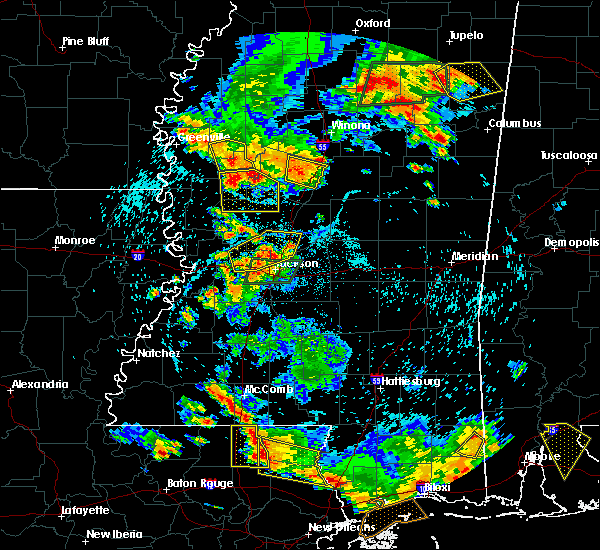 At 458 pm cdt, a severe thunderstorm was located near isola, or near belzoni, moving southeast at 20 mph (radar indicated). Hazards include 60 mph wind gusts. Expect damage to roofs. siding and trees. Locations impacted include, belzoni and isola. At 458 pm cdt, a severe thunderstorm was located near isola, or near belzoni, moving southeast at 20 mph (radar indicated). Hazards include 60 mph wind gusts. Expect damage to roofs. siding and trees. Locations impacted include, belzoni and isola.
|
| 6/24/2015 4:40 PM CDT | Trees down in isol in humphreys county MS, 0.3 miles NNW of Isola, MS |
| 6/24/2015 4:28 PM CDT |
 The national weather service in jackson has issued a * severe thunderstorm warning for. southern sunflower county in northwestern mississippi. northern humphreys county in central mississippi. until 530 pm cdt * at 428 pm cdt. A severe thunderstorm was located near inverness. The national weather service in jackson has issued a * severe thunderstorm warning for. southern sunflower county in northwestern mississippi. northern humphreys county in central mississippi. until 530 pm cdt * at 428 pm cdt. A severe thunderstorm was located near inverness.
|
| 6/13/2015 5:51 PM CDT |
 The severe thunderstorm warning for northwestern humphreys county will expire at 600 pm cdt, the storm which prompted the warning has moved out of the area. therefore the warning will be allowed to expire. The severe thunderstorm warning for northwestern humphreys county will expire at 600 pm cdt, the storm which prompted the warning has moved out of the area. therefore the warning will be allowed to expire.
|
| 6/13/2015 5:40 PM CDT |
 At 539 pm cdt, a severe thunderstorm was located over isola, or 9 miles northwest of belzoni, moving north at 35 mph (radar indicated). Hazards include 60 mph wind gusts. Expect damage to roofs. Siding and trees. At 539 pm cdt, a severe thunderstorm was located over isola, or 9 miles northwest of belzoni, moving north at 35 mph (radar indicated). Hazards include 60 mph wind gusts. Expect damage to roofs. Siding and trees.
|
| 6/13/2015 5:38 PM CDT |
 The national weather service in jackson has issued a * severe thunderstorm warning for. sunflower county in northwestern mississippi. northwestern humphreys county in central mississippi. until 630 pm cdt * at 538 pm cdt. A severe thunderstorm was located over inverness. The national weather service in jackson has issued a * severe thunderstorm warning for. sunflower county in northwestern mississippi. northwestern humphreys county in central mississippi. until 630 pm cdt * at 538 pm cdt. A severe thunderstorm was located over inverness.
|
| 6/13/2015 5:38 PM CDT |
 At 538 pm cdt, a severe thunderstorm was located over inverness, or 9 miles southeast of indianola, moving north at 35 mph (radar indicated). Hazards include 60 mph wind gusts. Expect damage to roofs. siding and trees. this severe thunderstorm will be near, moorhead around 550 pm cdt. indianola around 555 pm cdt. sunflower around 605 pm cdt. blaine around 610 pm cdt. Other locations impacted by this severe thunderstorm include doddsville. At 538 pm cdt, a severe thunderstorm was located over inverness, or 9 miles southeast of indianola, moving north at 35 mph (radar indicated). Hazards include 60 mph wind gusts. Expect damage to roofs. siding and trees. this severe thunderstorm will be near, moorhead around 550 pm cdt. indianola around 555 pm cdt. sunflower around 605 pm cdt. blaine around 610 pm cdt. Other locations impacted by this severe thunderstorm include doddsville.
|
| 6/13/2015 5:33 PM CDT |
 At 533 pm cdt, a severe thunderstorm was located near isola, or near belzoni, moving northwest at 25 mph (radar indicated). Hazards include 60 mph wind gusts. Expect damage to roofs. siding and trees. This severe storm will be near, isola around 540 pm cdt. At 533 pm cdt, a severe thunderstorm was located near isola, or near belzoni, moving northwest at 25 mph (radar indicated). Hazards include 60 mph wind gusts. Expect damage to roofs. siding and trees. This severe storm will be near, isola around 540 pm cdt.
|
| 6/13/2015 5:23 PM CDT |
 At 522 pm cdt, a severe thunderstorm was located near silver city, moving northwest at 30 mph (radar indicated). Hazards include 60 mph wind gusts. Expect damage to roofs. siding and trees. this severe storm will be near, isola around 540 pm cdt. Other locations impacted by this severe thunderstorm include gooden lake and louise. At 522 pm cdt, a severe thunderstorm was located near silver city, moving northwest at 30 mph (radar indicated). Hazards include 60 mph wind gusts. Expect damage to roofs. siding and trees. this severe storm will be near, isola around 540 pm cdt. Other locations impacted by this severe thunderstorm include gooden lake and louise.
|
| 6/13/2015 5:07 PM CDT |
 At 507 pm cdt, a severe thunderstorm was located near louise, or 13 miles northwest of yazoo city, moving northwest at 30 mph (radar indicated). Hazards include 60 mph wind gusts. Expect damage to roofs. siding and trees. this severe thunderstorm will be near, murphy around 530 pm cdt. darlove and estill around 550 pm cdt. Other locations impacted by this severe thunderstorm include silver city and louise. At 507 pm cdt, a severe thunderstorm was located near louise, or 13 miles northwest of yazoo city, moving northwest at 30 mph (radar indicated). Hazards include 60 mph wind gusts. Expect damage to roofs. siding and trees. this severe thunderstorm will be near, murphy around 530 pm cdt. darlove and estill around 550 pm cdt. Other locations impacted by this severe thunderstorm include silver city and louise.
|
| 5/24/2015 5:03 PM CDT | At 502 pm cdt, severe thunderstorms were located along a line extending from 6 miles west of lake village to near avon to near anguilla, moving northeast at 40 mph (radar indicated). Hazards include 60 mph wind gusts. Expect damage to roofs. siding and trees. severe thunderstorms will be near, wayside and estill around 510 pm cdt. mcmillan corner around 515 pm cdt. greenville, murphy and tribbett around 525 pm cdt. leland, metcalfe, holly ridge and darlove around 530 pm cdt. other locations impacted by these severe thunderstorms include arcola. A tornado watch remains in effect until 800 pm cdt for southeastern arkansas and northwestern mississippi. |
| 5/24/2015 5:03 PM CDT | At 502 pm cdt, severe thunderstorms were located along a line extending from 6 miles west of lake village to near avon to near anguilla, moving northeast at 40 mph (radar indicated). Hazards include 60 mph wind gusts. Expect damage to roofs. siding and trees. severe thunderstorms will be near, wayside and estill around 510 pm cdt. mcmillan corner around 515 pm cdt. greenville, murphy and tribbett around 525 pm cdt. leland, metcalfe, holly ridge and darlove around 530 pm cdt. other locations impacted by these severe thunderstorms include arcola. A tornado watch remains in effect until 800 pm cdt for southeastern arkansas and northwestern mississippi. |
| 4/19/2015 10:12 PM CDT | At 1012 pm cdt, a severe thunderstorm was located over glen allan, or 12 miles northwest of rolling fork, moving northeast at 55 mph (radar indicated). Hazards include 60 mph wind gusts and quarter size hail. Hail damage to vehicles is expected. expect wind damage to roofs, siding and trees. this severe storm will be near, panther burn around 1025 pm cdt. hollandale, delta city, darlove and estill around 1030 pm cdt. a tornado watch remains in effect until 100 am cdt for southeastern arkansas and northeastern louisiana. a tornado watch also remains in effect until 300 am cdt for northwestern mississippi. 1. 00in. |
| 4/19/2015 10:07 PM CDT | At 1007 pm cdt, a severe thunderstorm was located near belzoni, moving northeast at 70 mph (radar indicated). Hazards include ping pong ball size hail and 60 mph wind gusts. People and animals outdoors will be injured. expect hail damage to roofs, siding, windows and vehicles. expect wind damage to roofs, siding and trees. this severe storm will be near, belzoni around 1010 pm cdt. swiftown around 1015 pm cdt. other locations impacted by this severe thunderstorm include morgan city, cruger and silver city. a tornado watch remains in effect until 300 am cdt for northwestern mississippi. 1. 50in. |
| 4/19/2015 9:50 PM CDT | At 950 pm cdt, a severe thunderstorm was located over nitta yuma, or 8 miles south of hollandale, moving northeast at 75 mph (radar indicated). Hazards include ping pong ball size hail and 60 mph wind gusts. People and animals outdoors will be injured. expect hail damage to roofs, siding, windows and vehicles. expect wind damage to roofs, siding and trees. this severe thunderstorm will be near, murphy and midnight around 1000 pm cdt. isola around 1005 pm cdt. belzoni around 1010 pm cdt. swiftown around 1015 pm cdt. other locations impacted by this severe thunderstorm include morgan city, silver city and cruger. a tornado watch remains in effect until 300 am cdt for northwestern mississippi. 1. 50in. |
| 4/19/2015 9:44 PM CDT | At 944 pm cdt, a severe thunderstorm was located over hollandale, moving northeast at 55 mph (radar indicated). Hazards include 60 mph wind gusts and half dollar size hail. Hail damage to vehicles is expected. expect wind damage to roofs, siding and trees. locations impacted include, hollandale, inverness, isola, estill, panther burn, grace, glen allan, delta city and darlove. a tornado watch remains in effect until 100 am cdt for southeastern arkansas and northeastern louisiana. a tornado watch also remains in effect until 300 am cdt for northwestern mississippi. 1. 25in. |
| 4/19/2015 9:28 PM CDT | At 927 pm cdt, a severe thunderstorm was located 7 miles west of hollandale, moving northeast at 30 mph (radar indicated). Hazards include 60 mph wind gusts and half dollar size hail. Hail damage to vehicles is expected. expect wind damage to roofs, siding and trees. this severe thunderstorm will be near, panther burn around 935 pm cdt. hollandale and estill around 940 pm cdt. darlove around 950 pm cdt. isola around 1015 pm cdt. inverness around 1020 pm cdt. other locations impacted by this severe thunderstorm include arcola. a tornado watch remains in effect until 100 am cdt for southeastern arkansas and northeastern louisiana. a tornado watch also remains in effect until 300 am cdt for northwestern mississippi. 1. 25in. |
| 3/31/2015 4:50 PM CST | Partial canopy collapse over the gas pumps at the double quick in isola. reported by emergency management in humphreys county MS, 0.3 miles NNW of Isola, MS |
| 3/31/2015 5:47 PM CDT | A severe thunderstorm warning remains in effect until 630 pm cdt for humphreys and west central holmes counties. at 547 pm cdt. a severe thunderstorm was located near belzoni. moving southeast at 35 mph. hazard. golf ball size hail and 60 mph wind gusts. source. Radar indicated. |
| 3/31/2015 5:36 PM CDT | A severe thunderstorm warning remains in effect until 545 pm cdt for southern sunflower. northern humphreys. eastern washington and southwestern leflore counties. at 535 pm cdt. a severe thunderstorm was located over isola. or 10 miles northwest of belzoni. moving southeast at 35 mph. hazard. Golf ball size hail and 60 mph wind gusts. |
| 3/31/2015 5:34 PM CDT | The national weather service in jackson has issued a * severe thunderstorm warning for. humphreys county in central mississippi. northwestern holmes county in central mississippi. until 630 pm cdt * at 533 pm cdt. a severe thunderstorm was located near isola. Or. |
| 3/31/2015 5:25 PM CDT | A severe thunderstorm warning remains in effect until 545 pm cdt for southern sunflower. northern humphreys. east central washington and southwestern leflore counties. at 525 pm cdt. a severe thunderstorm was located near tribbett. or 11 miles northeast of hollandale. moving southeast at 35 mph. This is a very dangerous storm. |
| 3/31/2015 5:17 PM CDT | A severe thunderstorm warning remains in effect until 545 pm cdt for southern sunflower. northern humphreys. northeastern washington and southwestern leflore counties. at 516 pm cdt. a severe thunderstorm was located over tribbett. or 7 miles southeast of leland. moving southeast at 30 mph. This is a very dangerous storm. |
| 3/31/2015 5:08 PM CDT | A severe thunderstorm warning remains in effect until 545 pm cdt for southern sunflower. northern humphreys. northeastern washington and southwestern leflore counties. at 508 pm cdt. a severe thunderstorm was located near tribbett. or near leland. moving southeast at 35 mph. This is a very dangerous storm. |
| 3/31/2015 4:56 PM CDT | A severe thunderstorm warning remains in effect until 545 pm cdt for southern sunflower. northern humphreys. northeastern washington and southwestern leflore counties. at 456 pm cdt. a severe thunderstorm was located over leland. moving southeast at 35 mph. This is a very dangerous storm. |
| 3/31/2015 4:48 PM CDT | The national weather service in jackson has issued a * severe thunderstorm warning for. southern sunflower county in northwestern mississippi. northern humphreys county in central mississippi. northeastern washington county in northwestern mississippi. Southwestern leflore county in north central mississippi. |
| 3/30/2015 3:30 AM CDT | The national weather service in jackson has issued a * severe thunderstorm warning for. humphreys county in central mississippi. until 400 am cdt * at 329 am cdt. a severe thunderstorm was located near isola. or 9 miles west of belzoni. Moving east at 50 mph. |
| 6/11/2012 7:02 PM CDT | Measured on a private weather station. numerous trees down in the area in humphreys county MS, 0.3 miles NNW of Isola, MS |
| 1/1/0001 12:00 AM | Roof off of a house on old highway 49. powerlines down at town water pumping statio in humphreys county MS, 0.9 miles N of Isola, MS |
| 1/1/0001 12:00 AM | Power lines down across hwy 12 near the washington/humphreys co line in humphreys county MS, 7.3 miles NNE of Isola, MS |
| 1/1/0001 12:00 AM | Quarter sized hail reported 2.6 miles SW of Isola, MS, report 2 miles north of county line and 1 mile east of highway 49w |
Hail Maps for Isola, MS

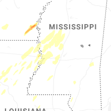


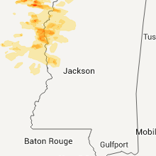


Connect with Interactive Hail Maps