

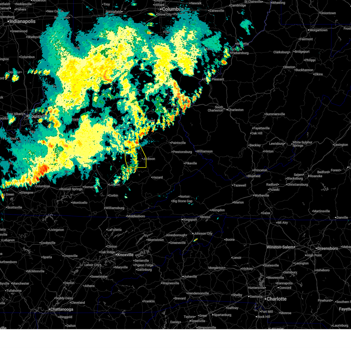
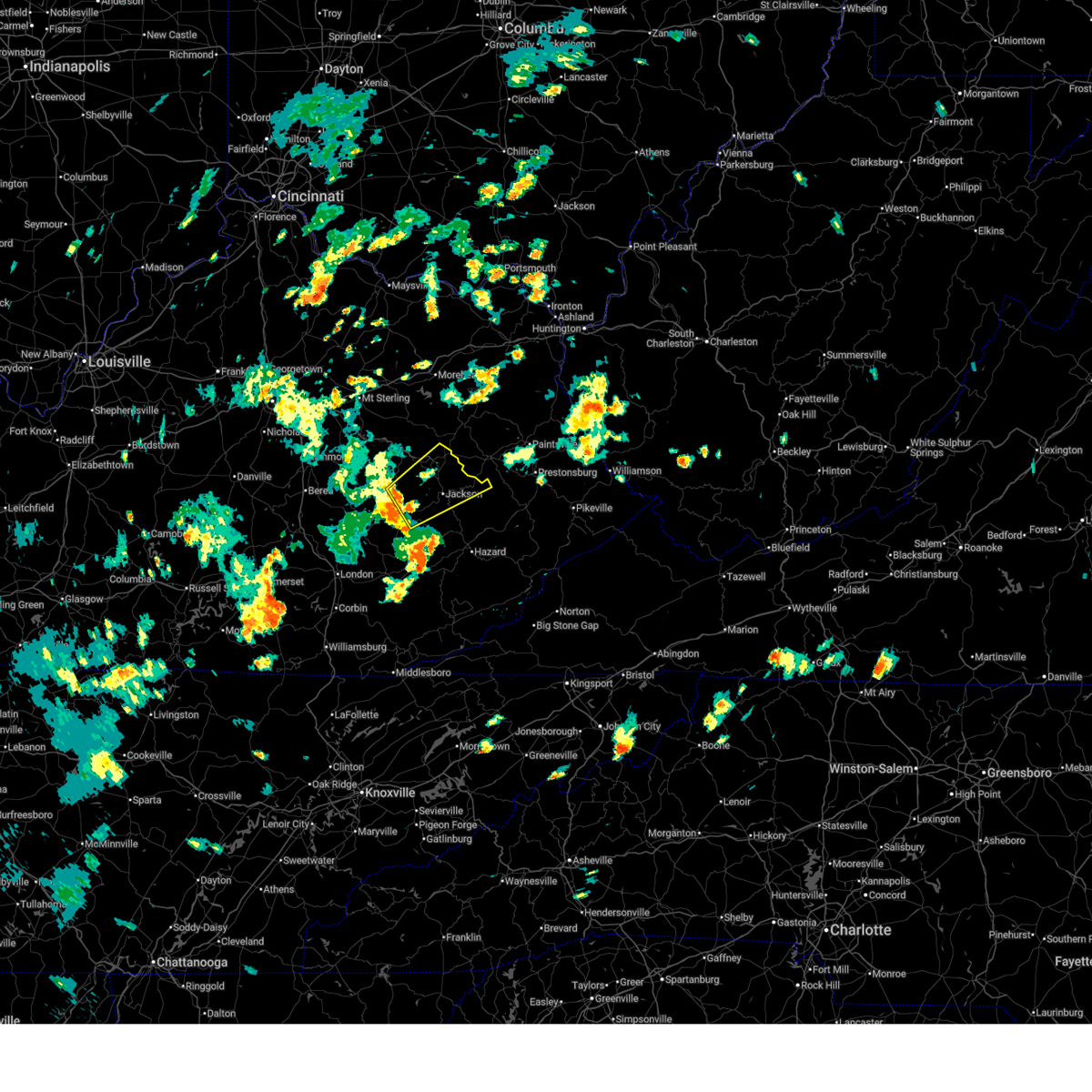
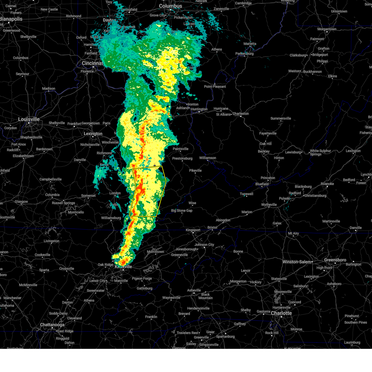
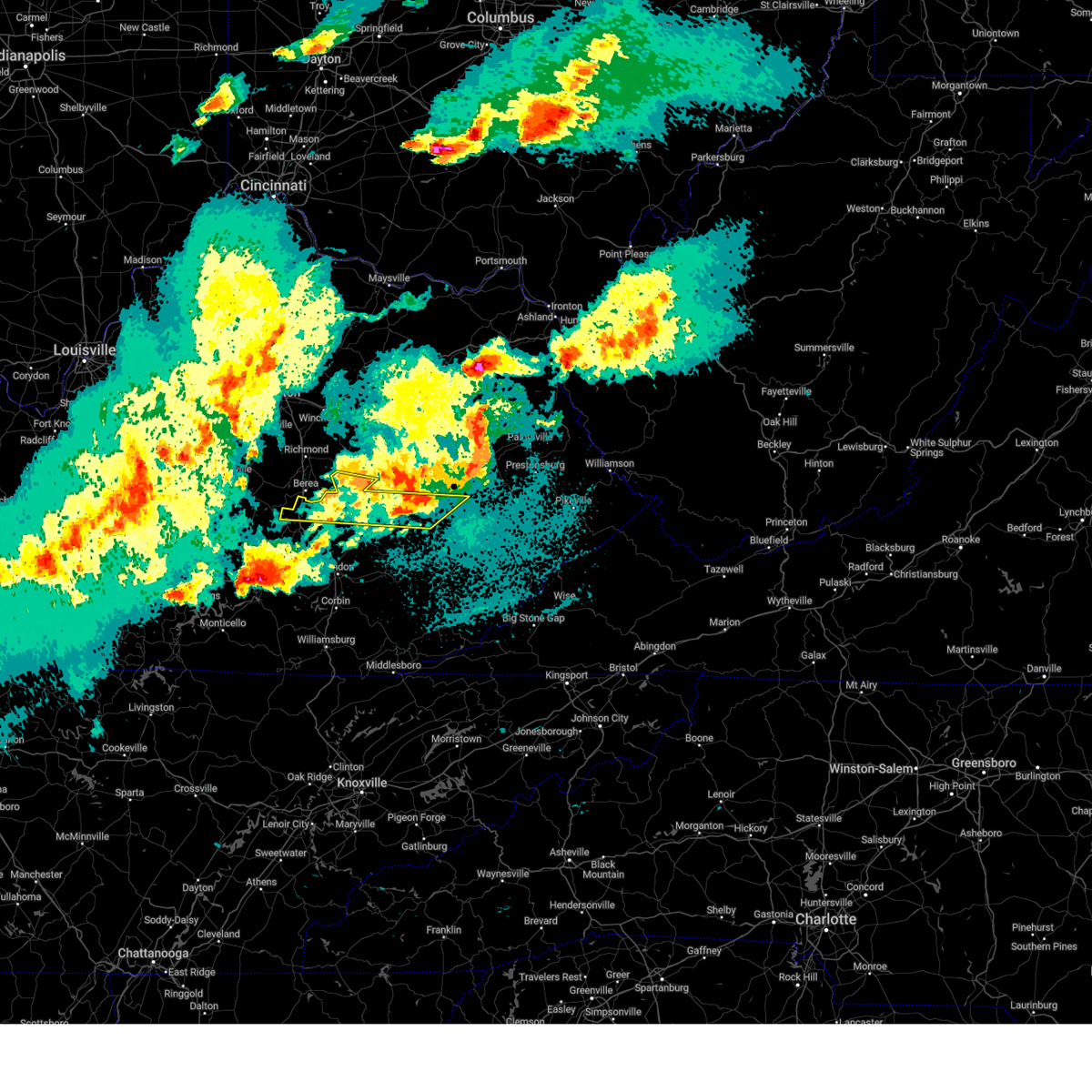
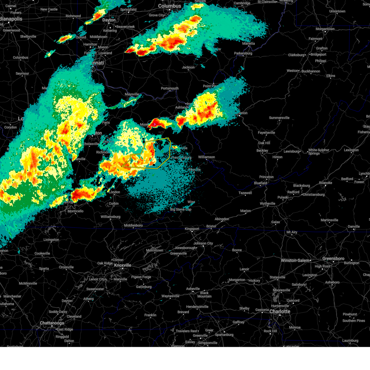
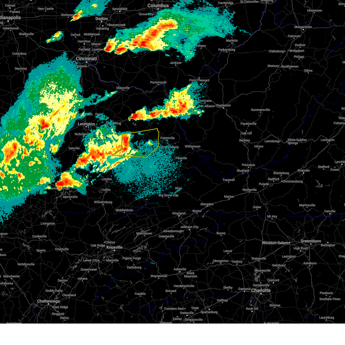
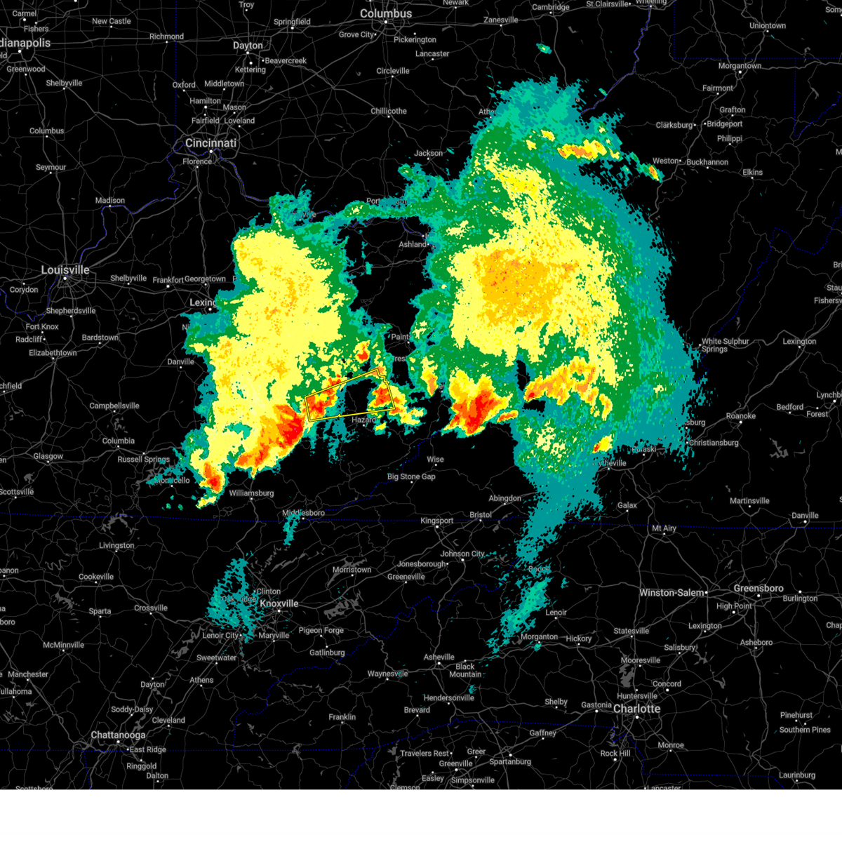
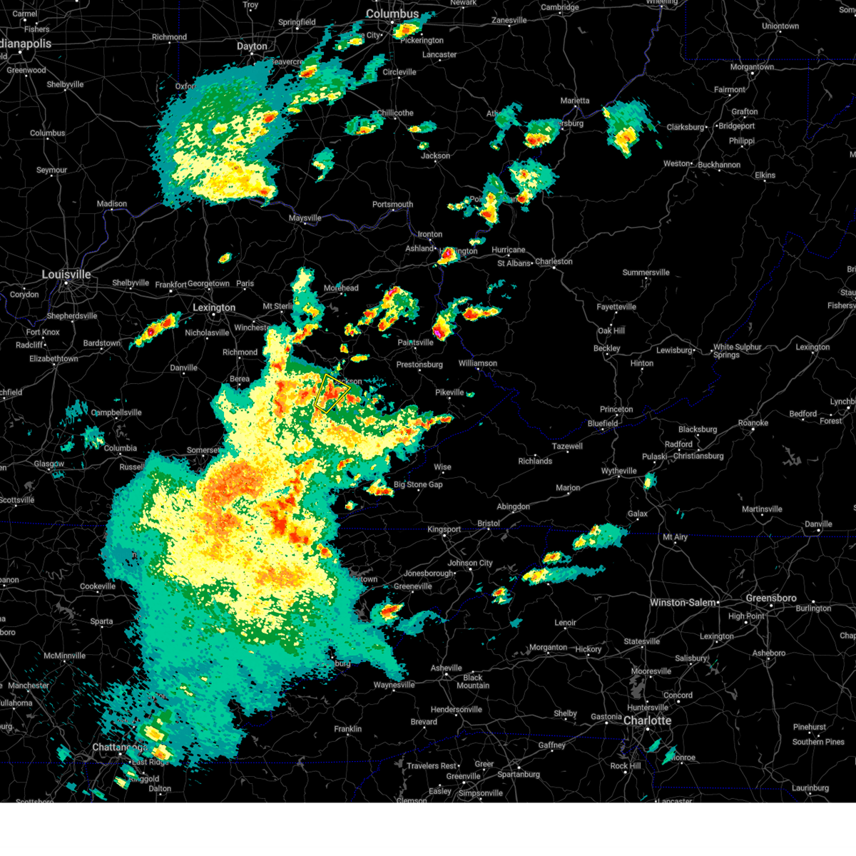
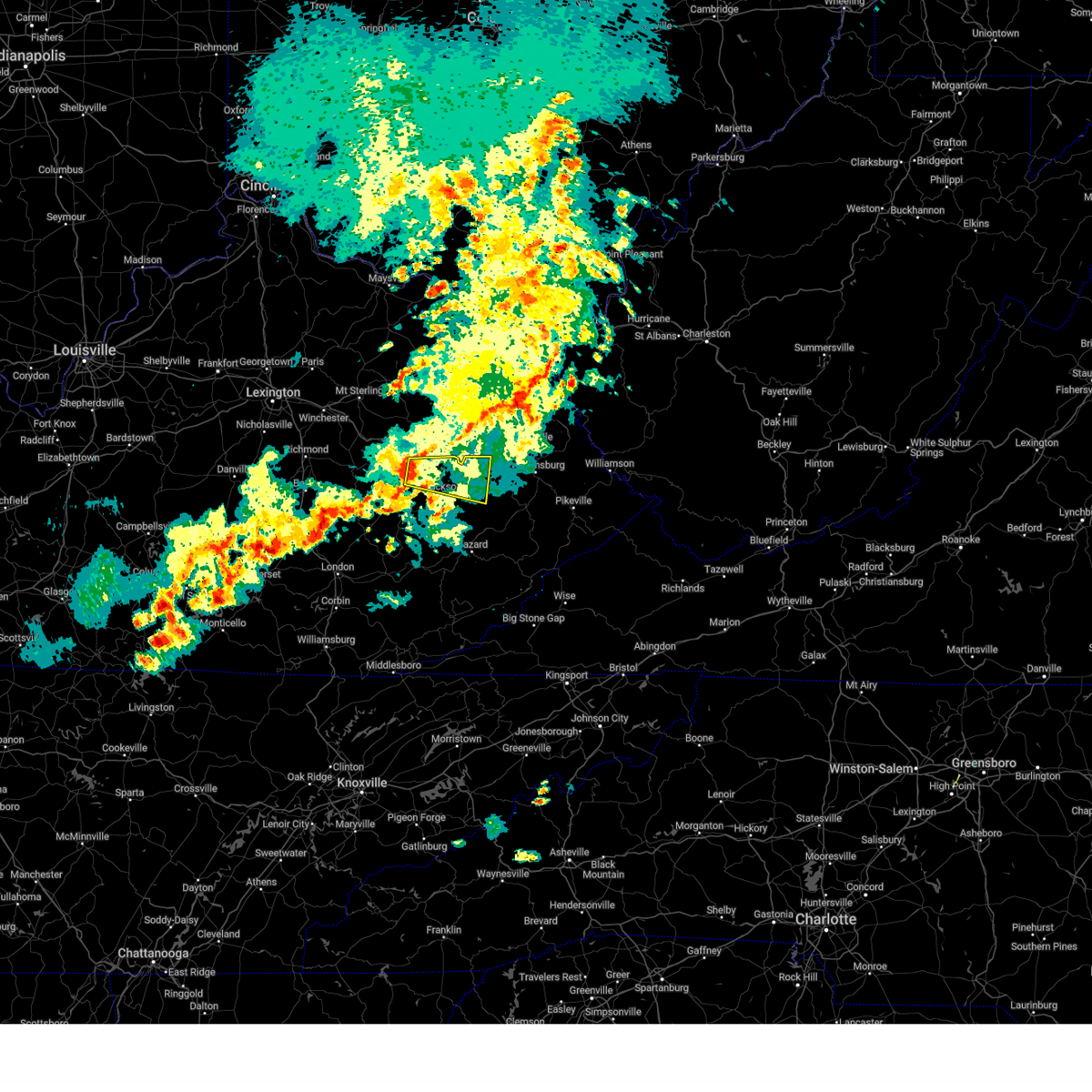
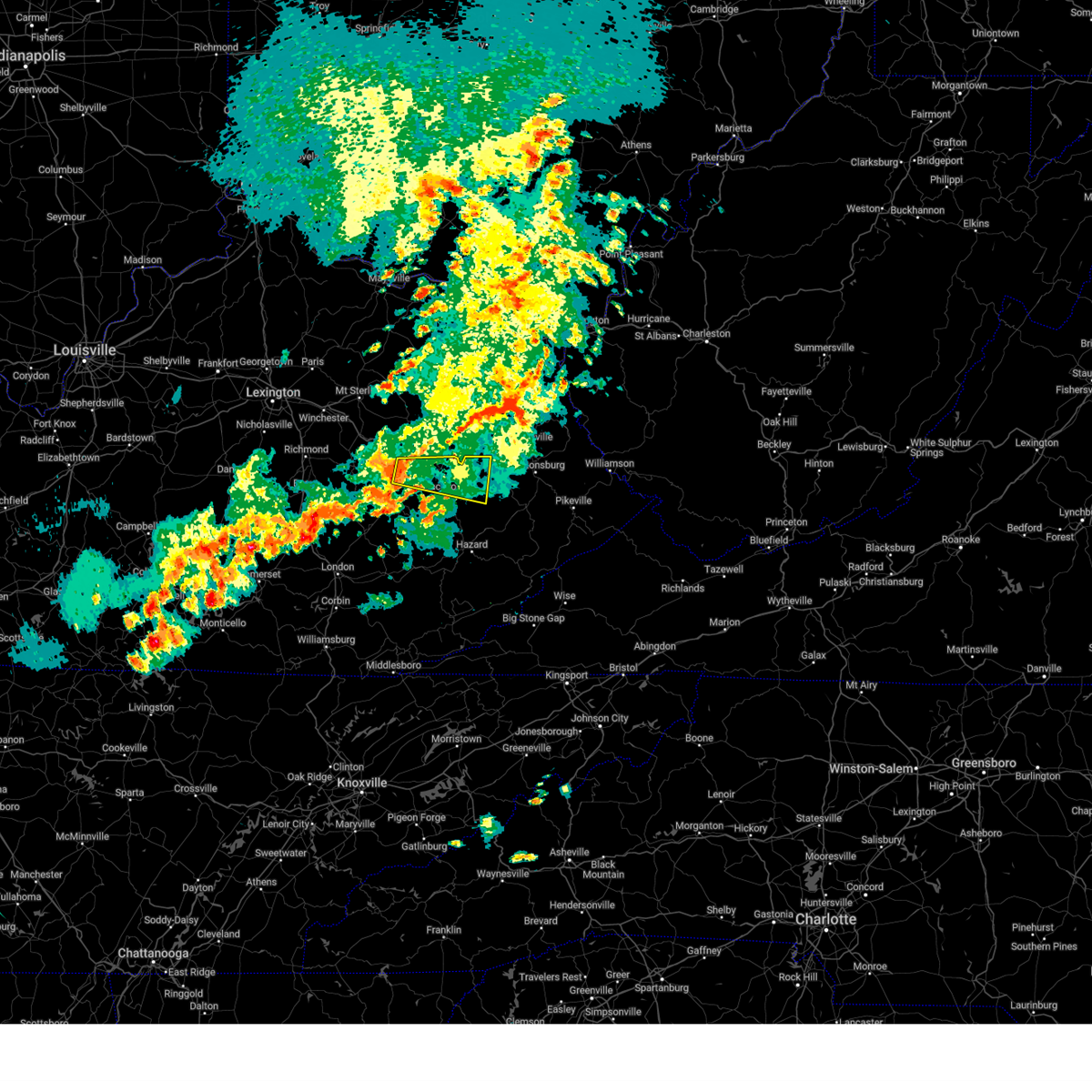
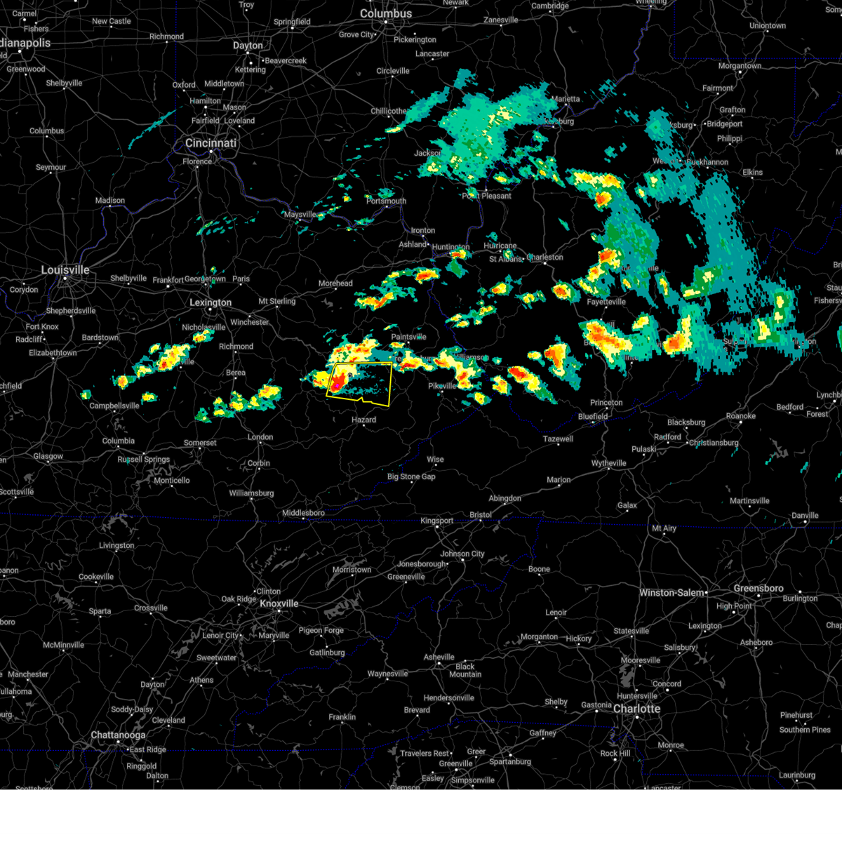
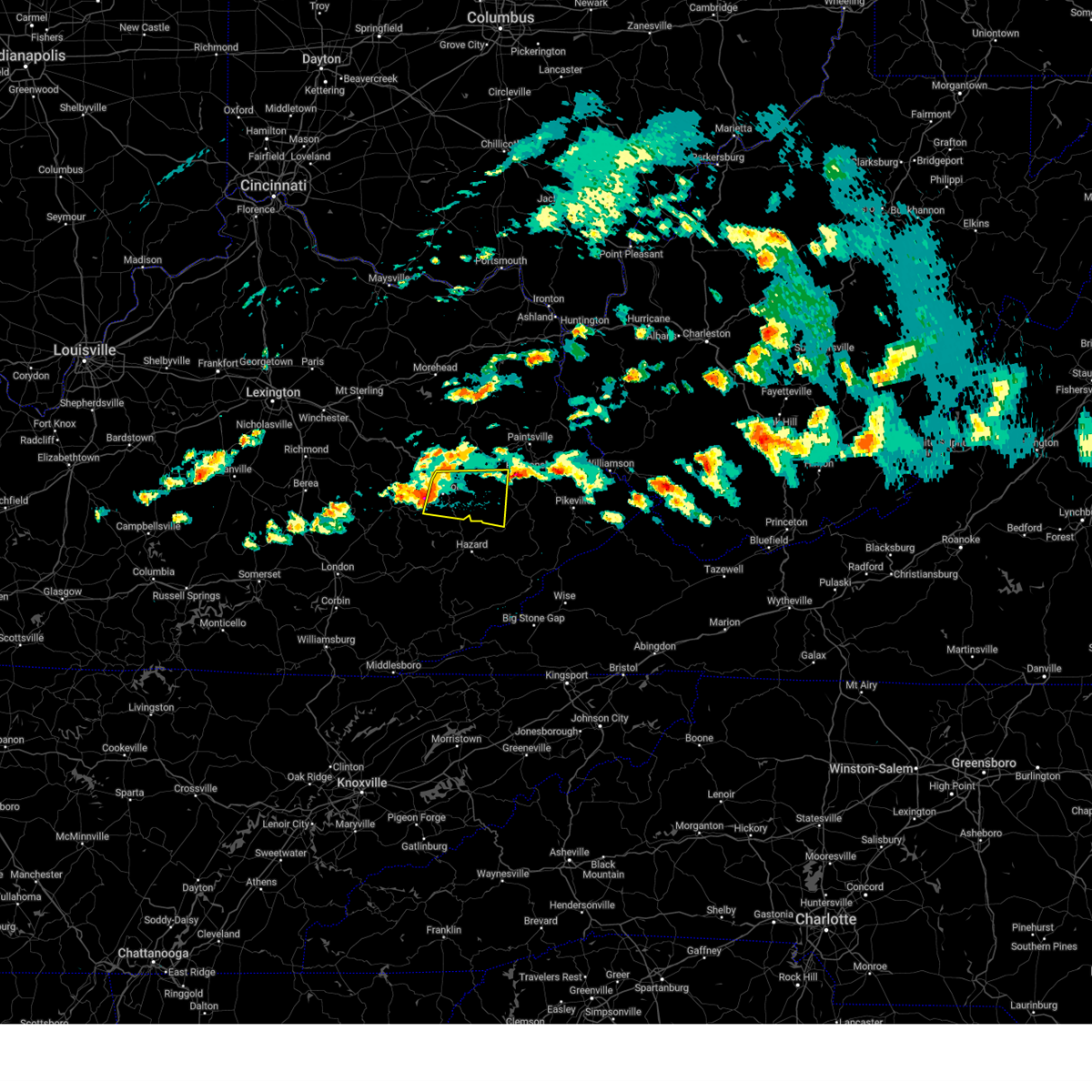
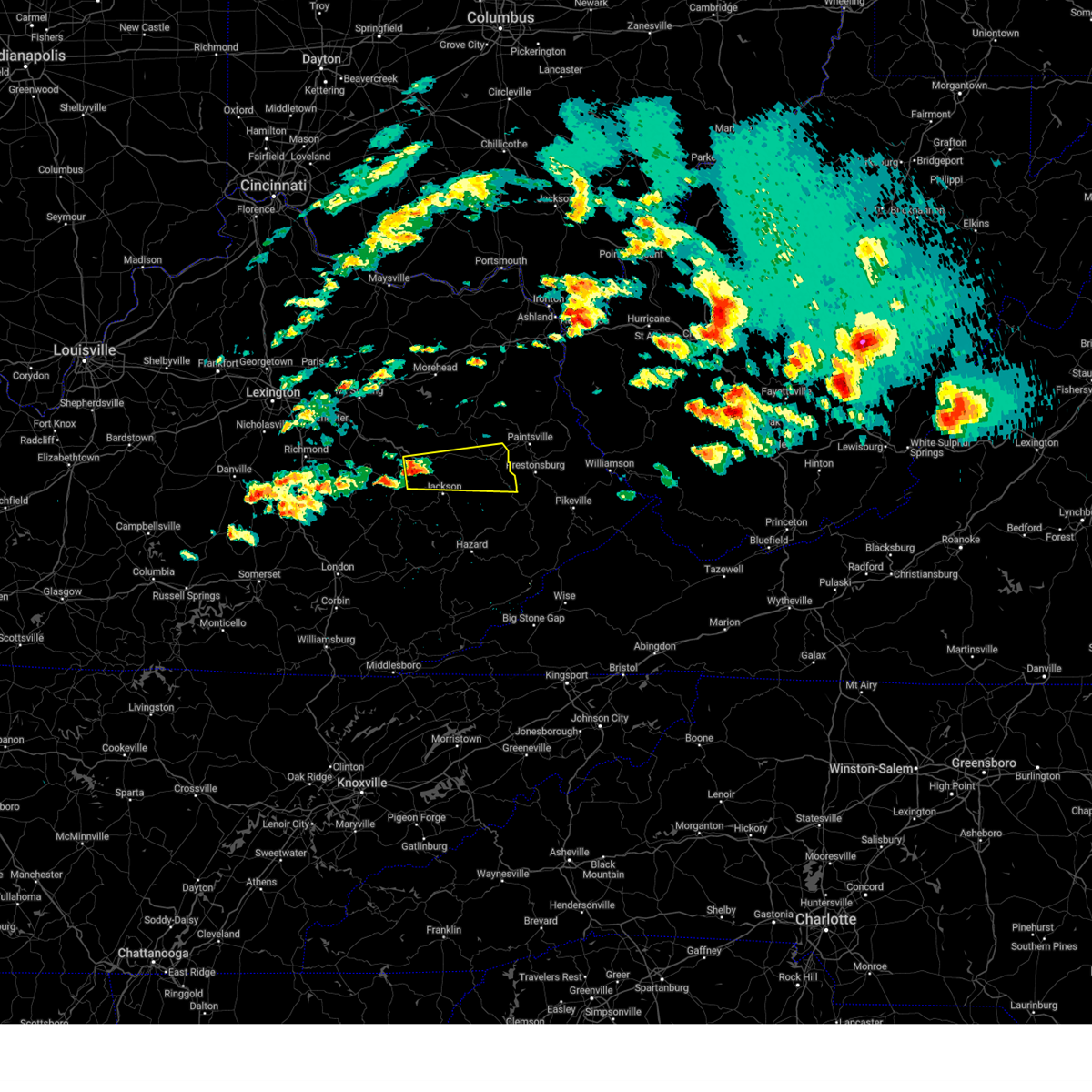
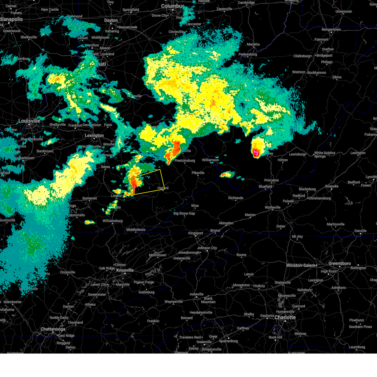
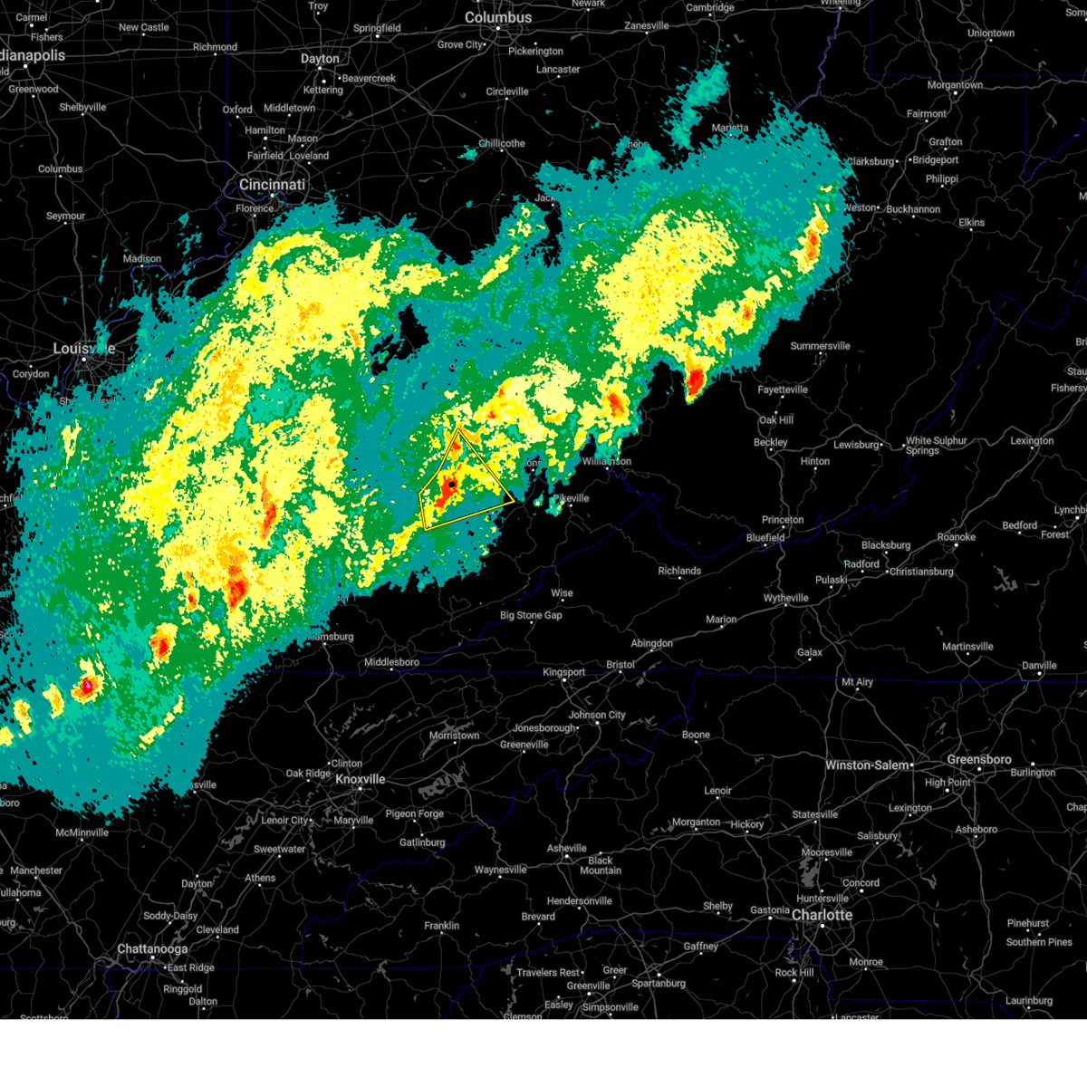
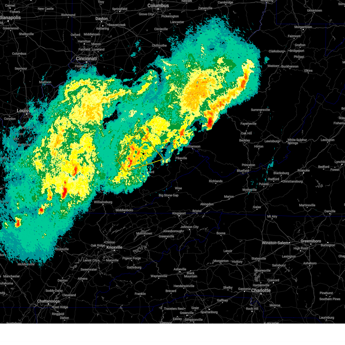
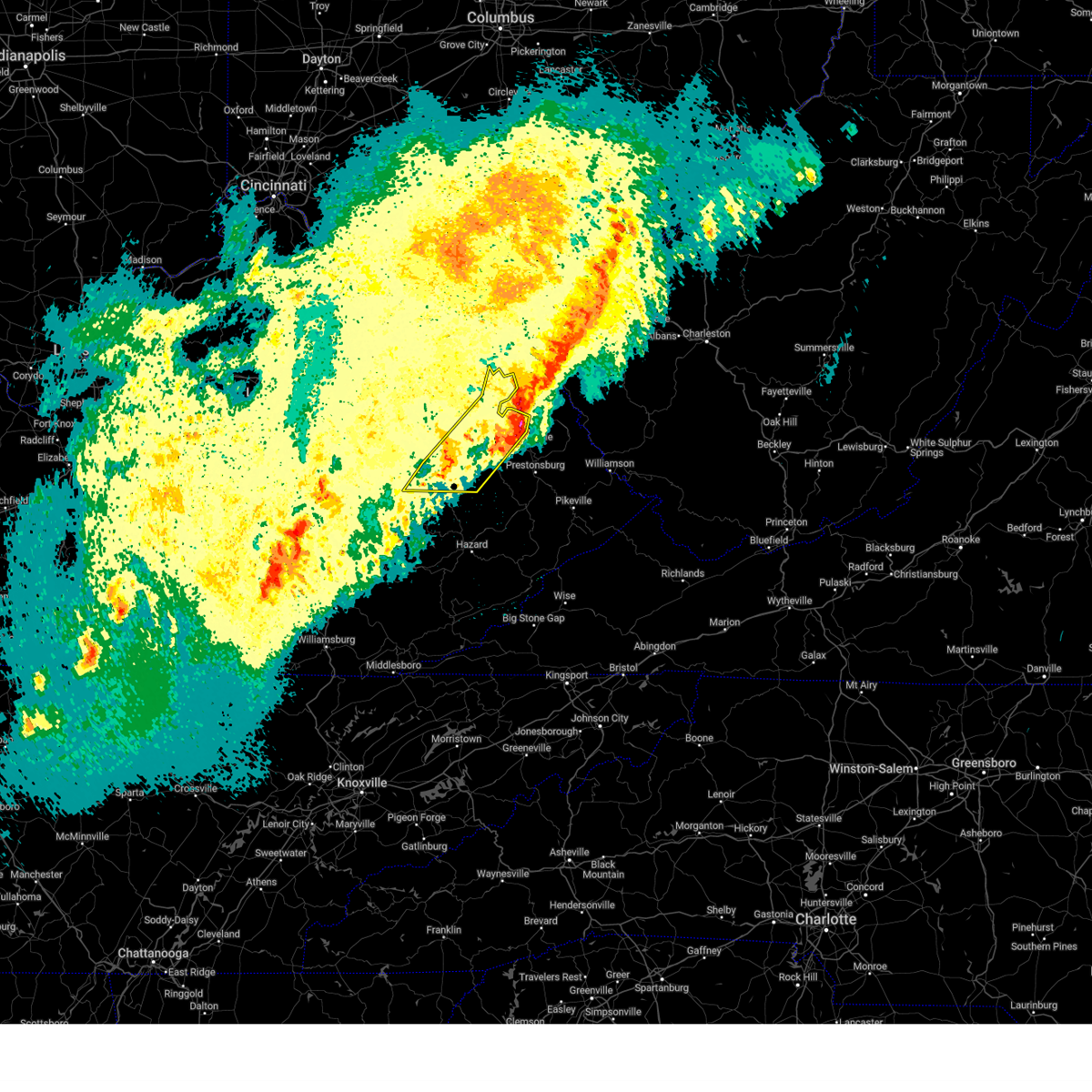
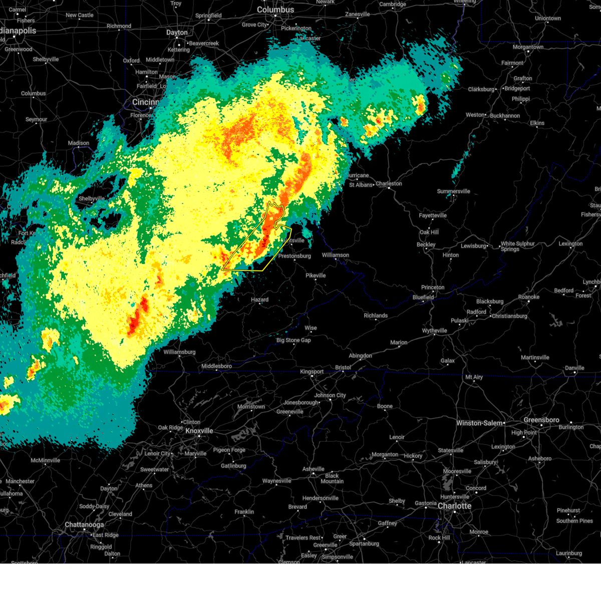
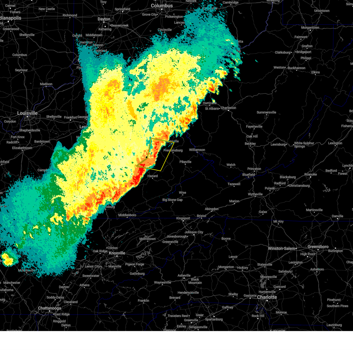
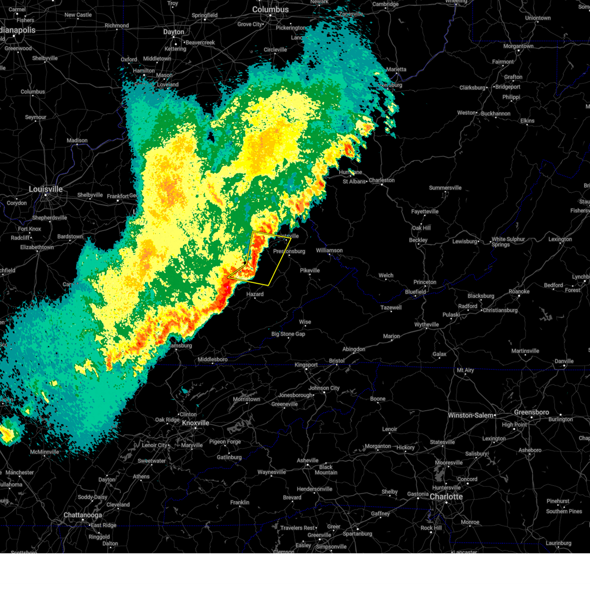
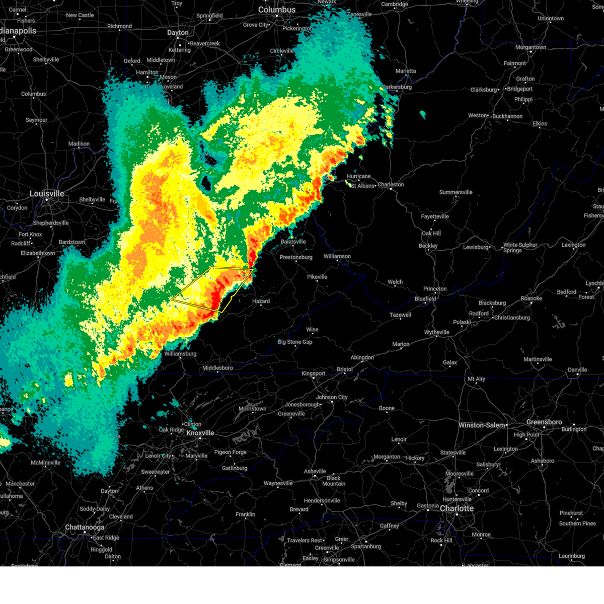
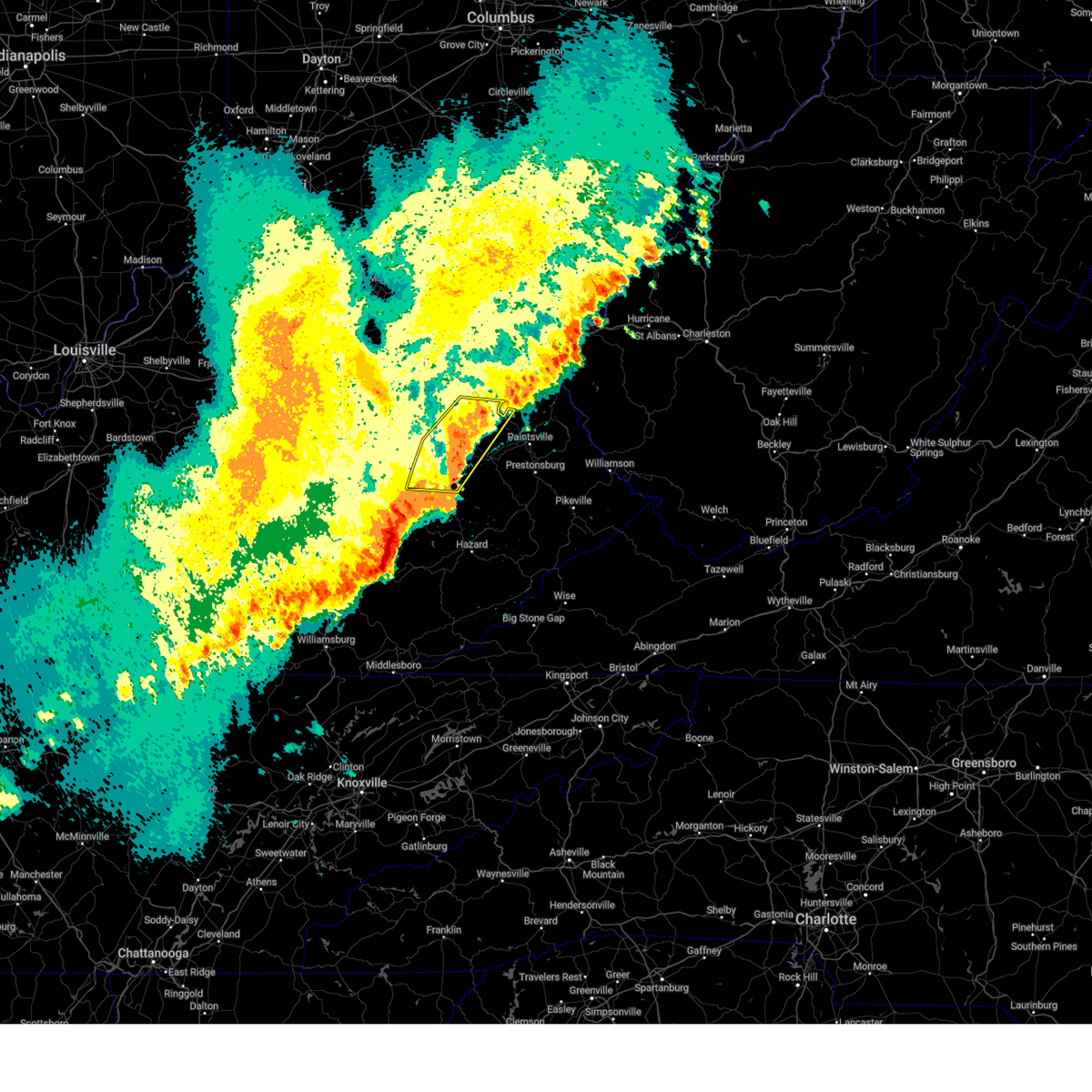
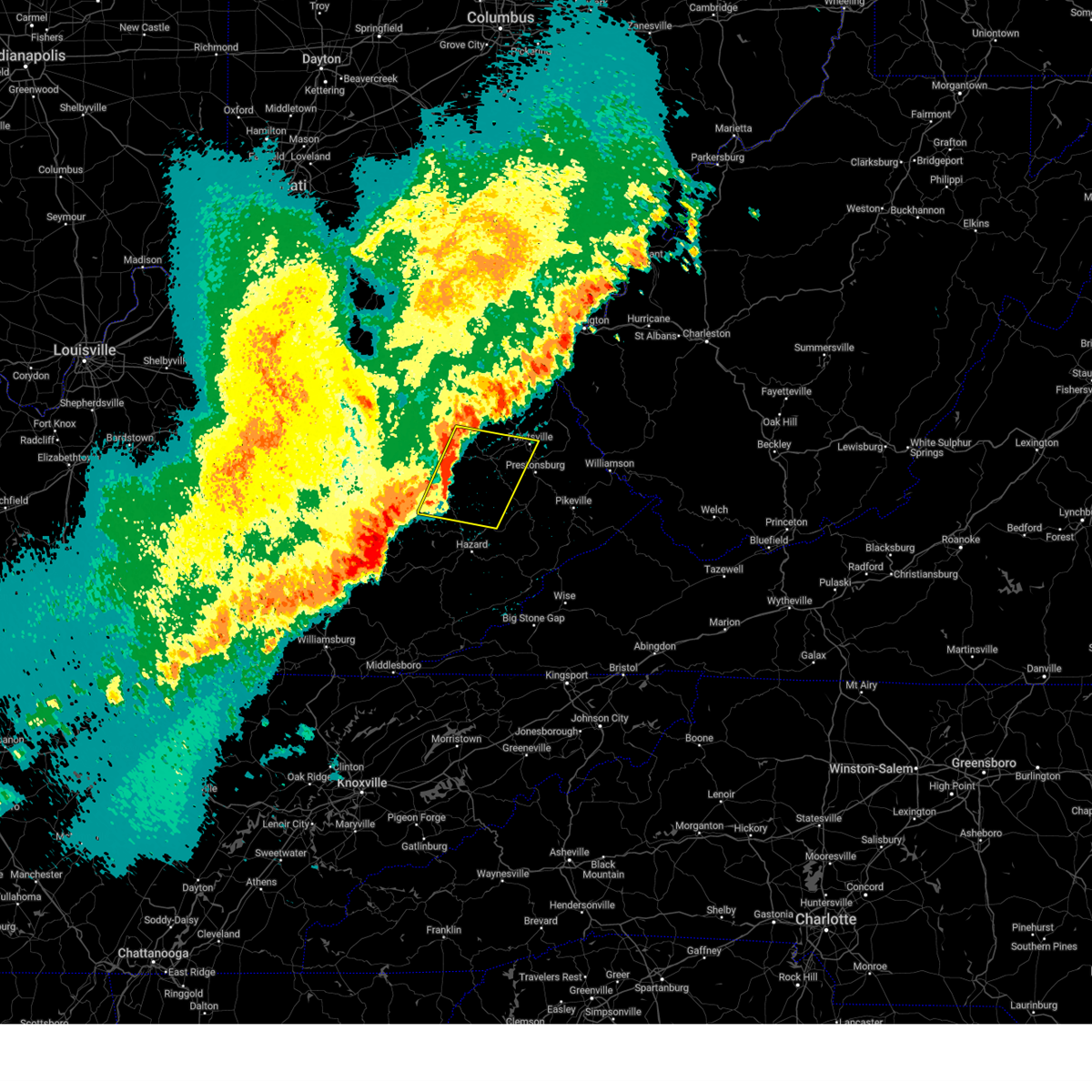
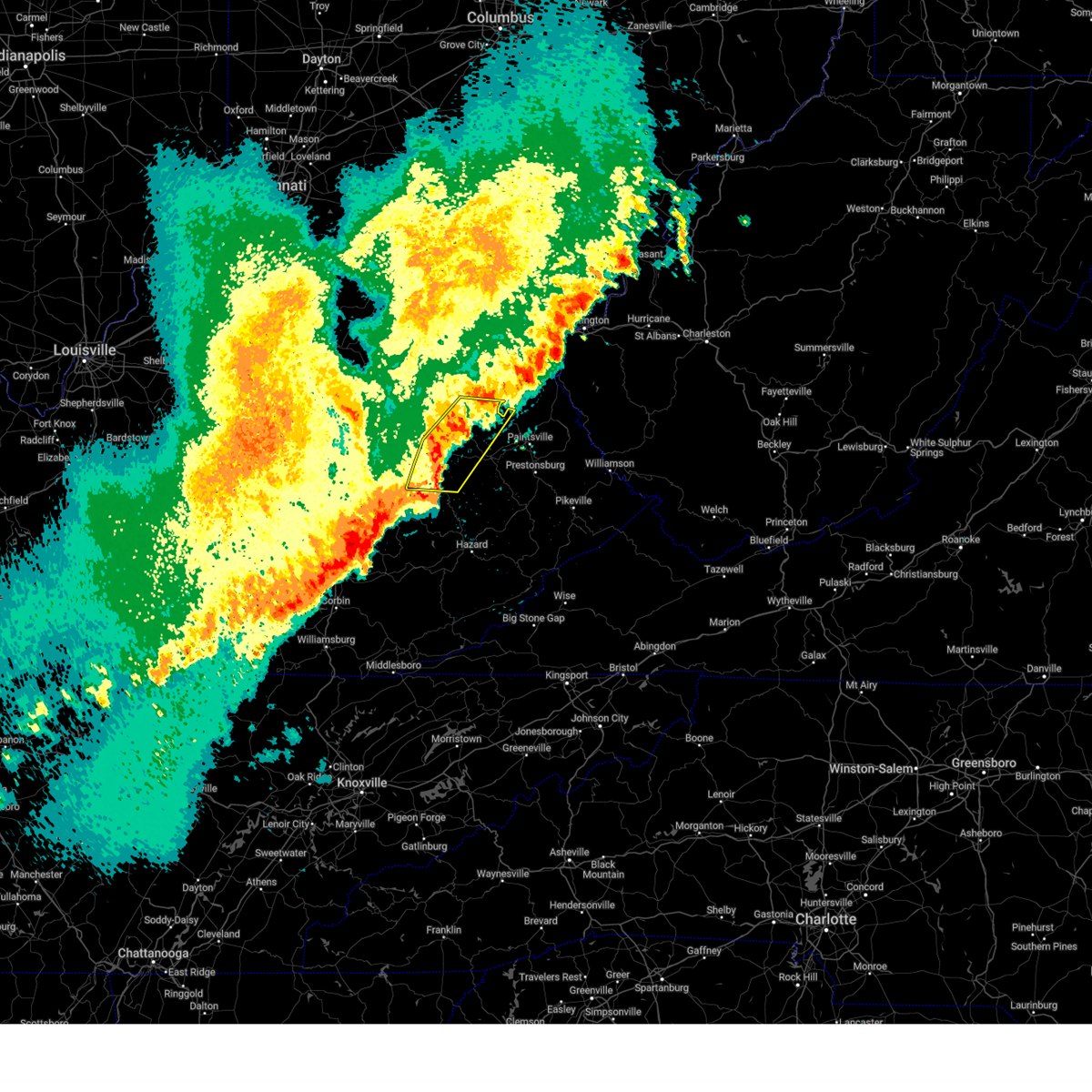
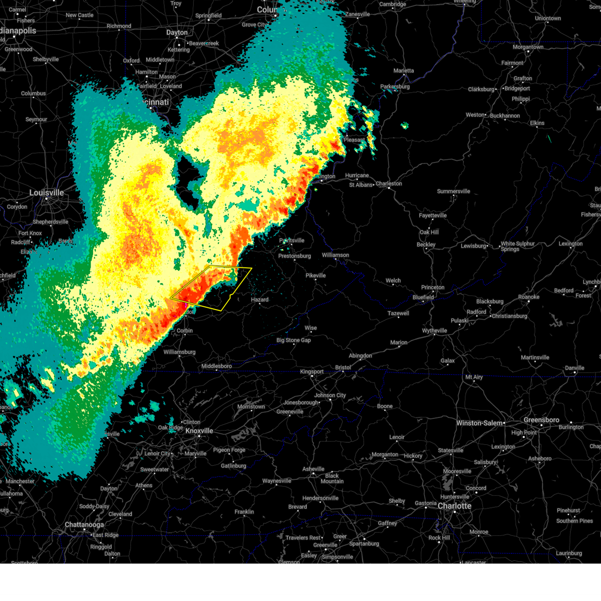
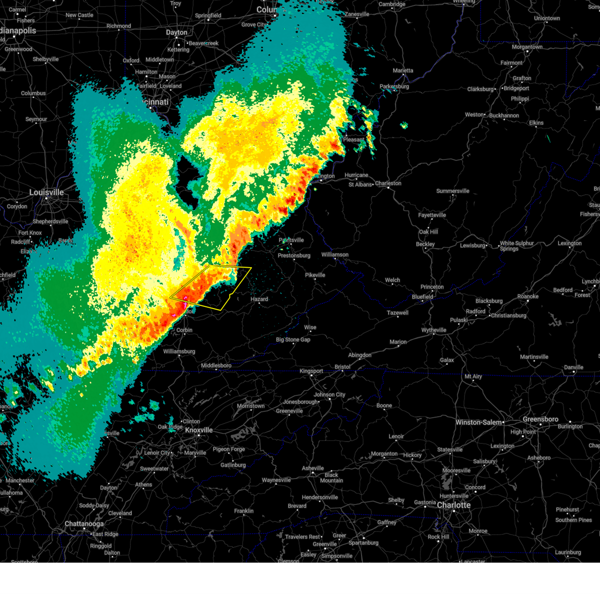
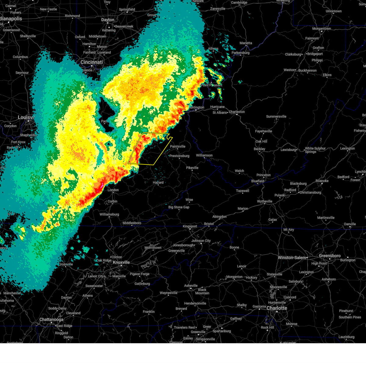
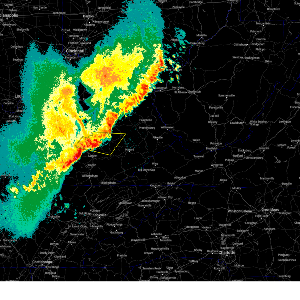
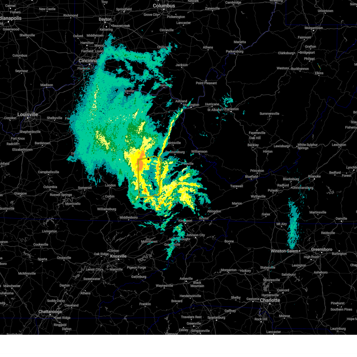
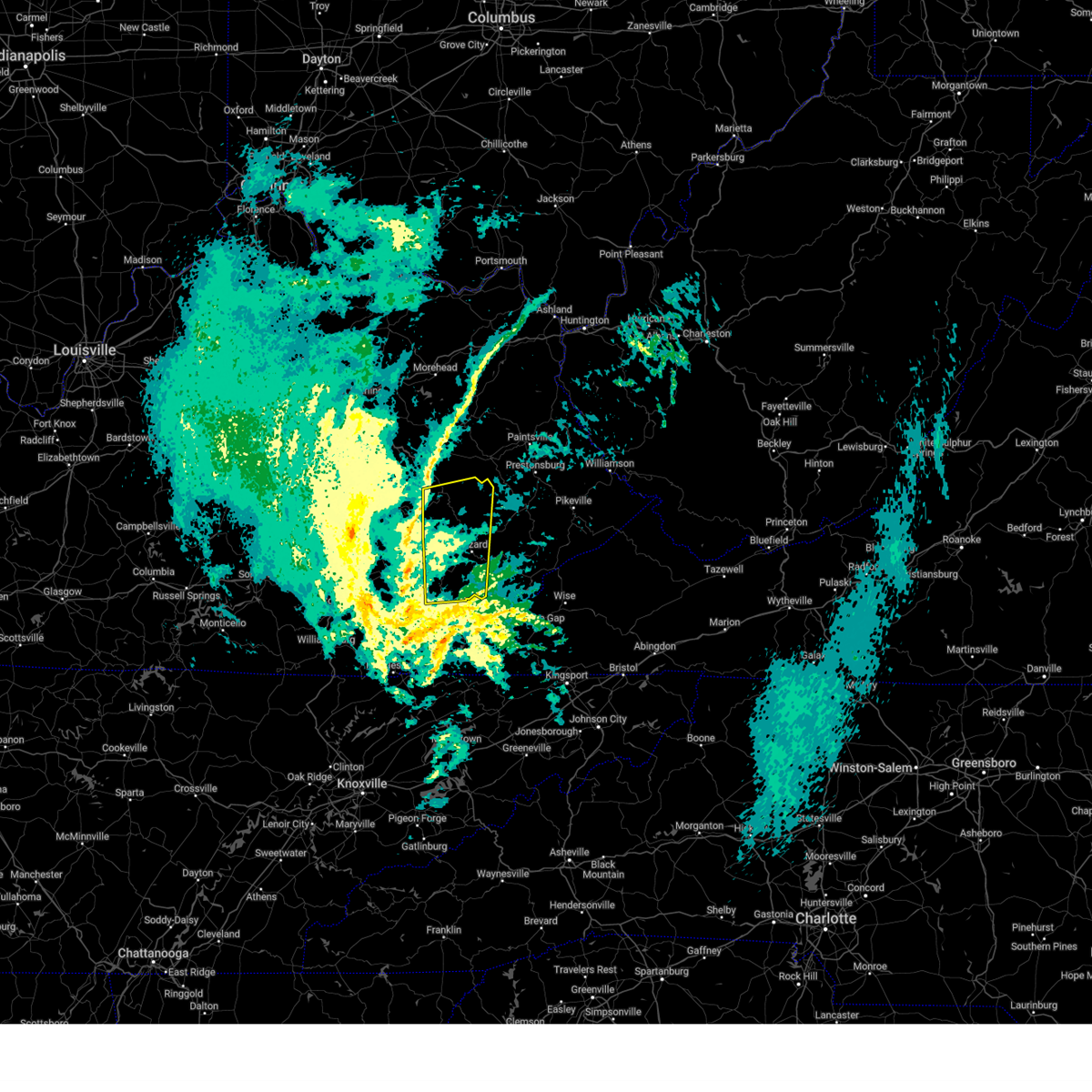
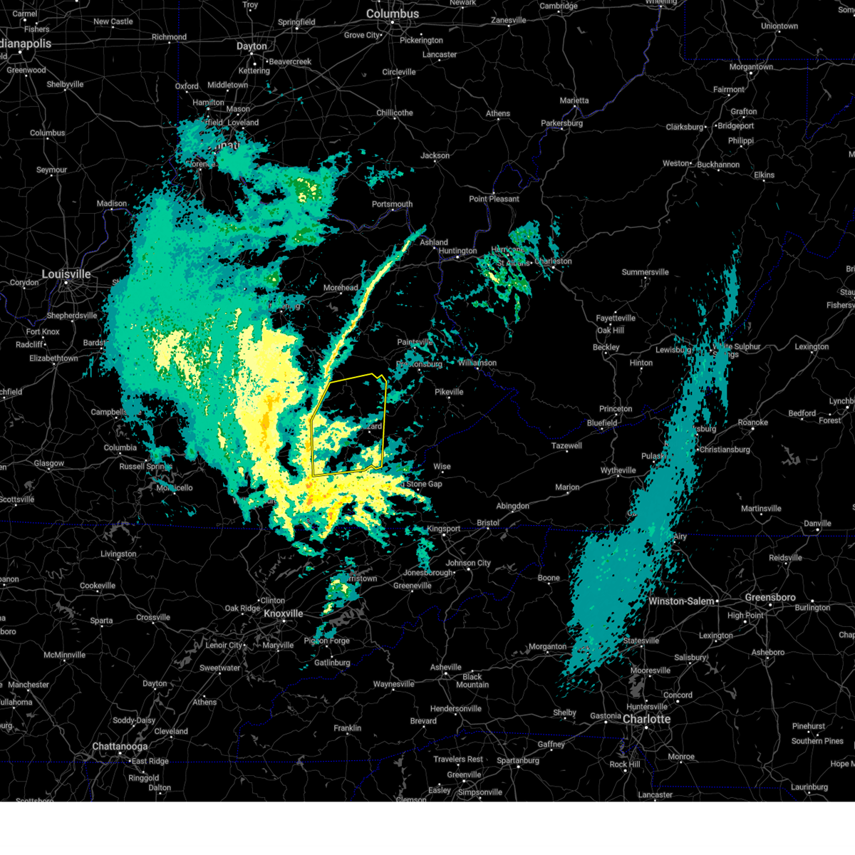
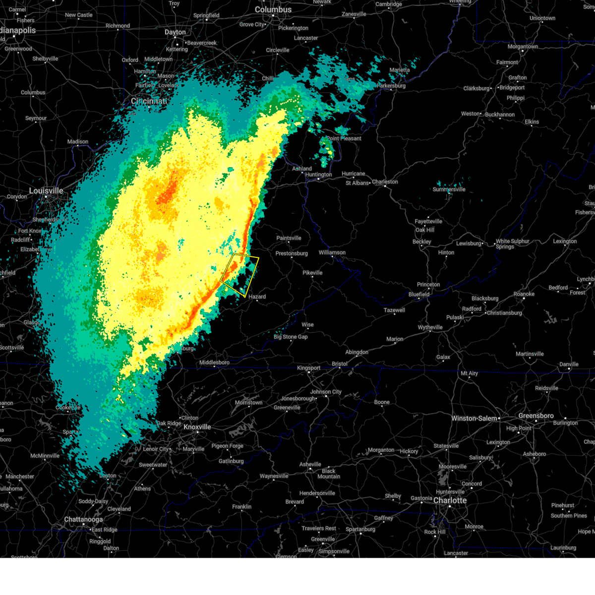
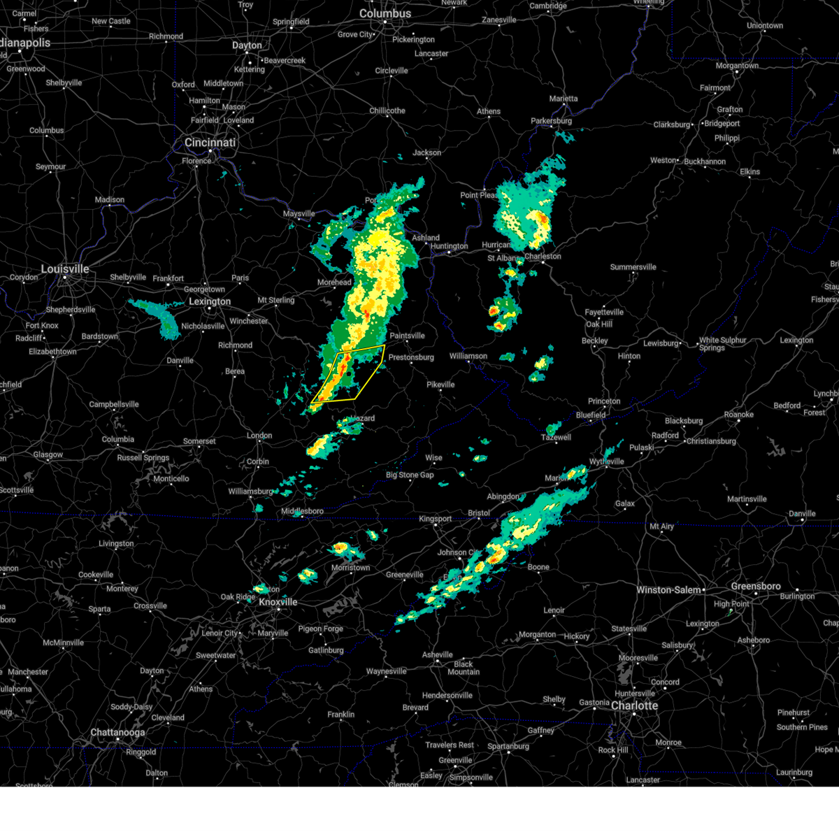
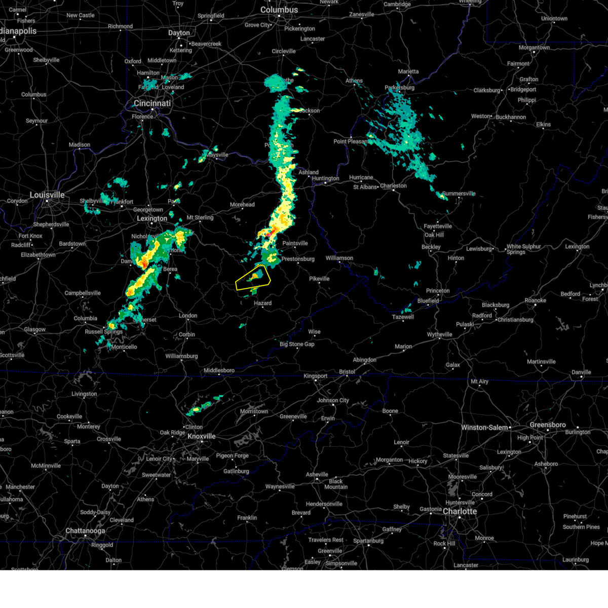
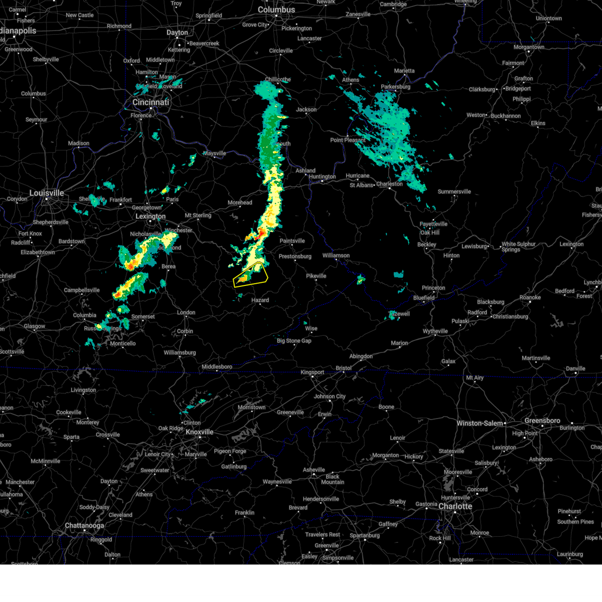
Hail Map for Jackson, KY
The Jackson, KY area has had 22 reports of on-the-ground hail by trained spotters, and has been under severe weather warnings 108 times during the past 12 months. Doppler radar has detected hail at or near Jackson, KY on 42 occasions, including 3 occasions during the past year.
| Name: | Jackson, KY |
| Where Located: | 33.7 miles ESE of Irvine, KY |
| Map: | Google Map for Jackson, KY |
| Population: | 2231 |
| Housing Units: | 1084 |
| More Info: | Search Google for Jackson, KY |
3
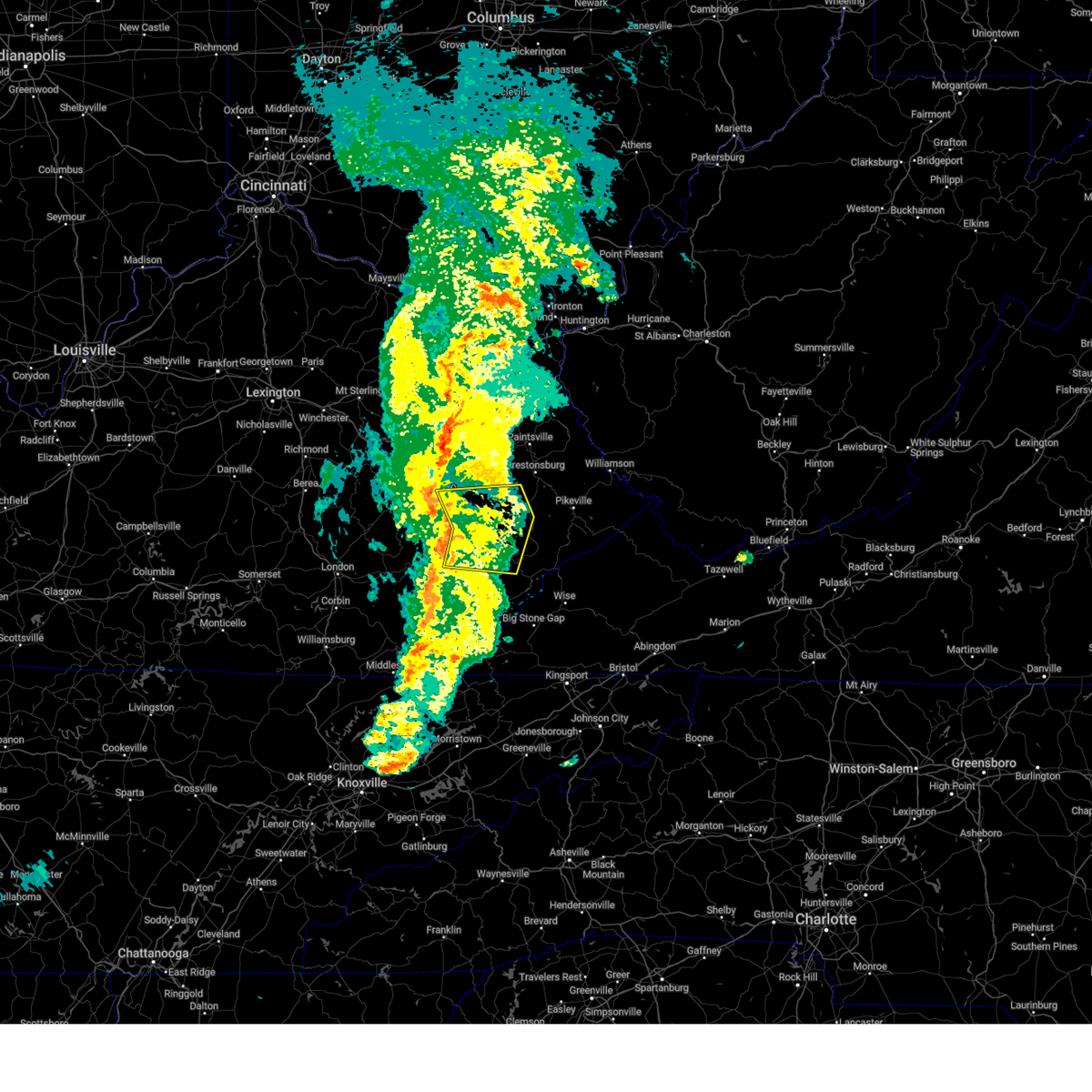
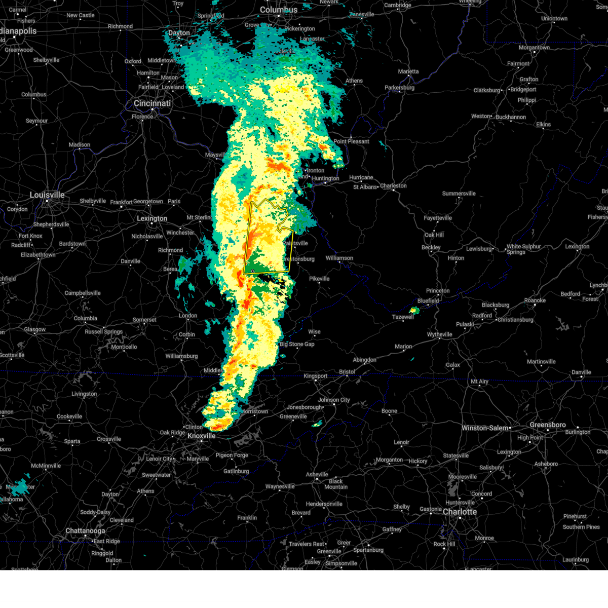
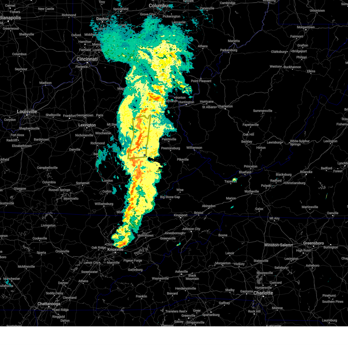
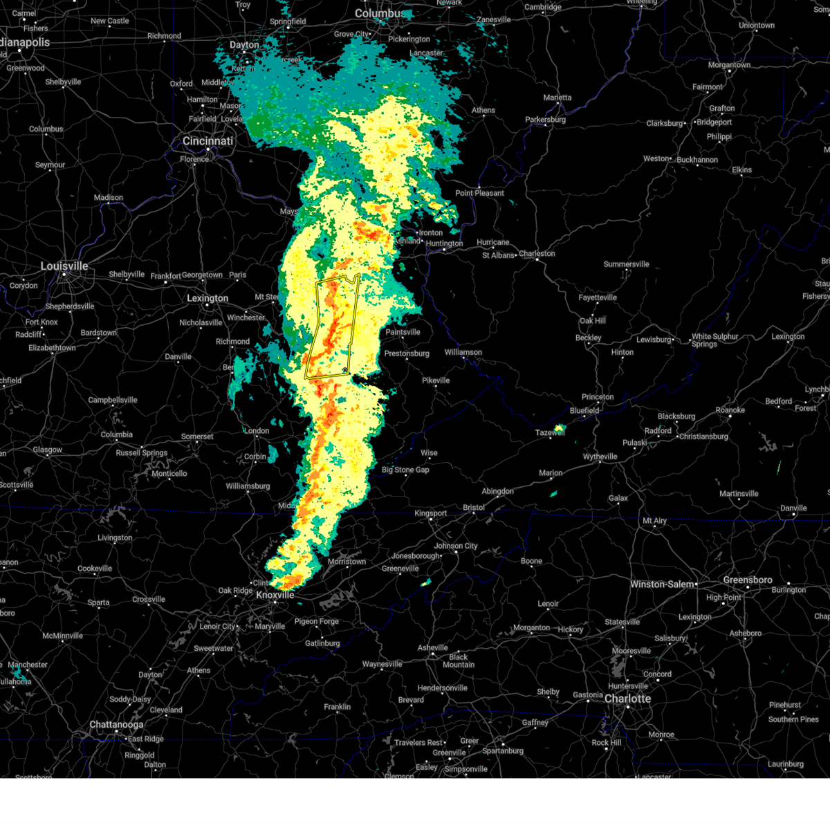
The Top Recent Hail Date for Jackson, KY is Monday, April 14, 2025 (5th out of 42)

Hail and Wind Damage Spotted near Jackson, KY
| Date / Time | Report Details |
|---|---|
| 6/19/2025 12:09 AM EDT |
 The storm which prompted the warning has weakened below severe limits, and no longer poses an immediate threat to life or property. therefore, the warning will be allowed to expire. however, gusty winds are still possible with these thunderstorms. a severe thunderstorm watch remains in effect until 100 am edt for southeastern kentucky. to report severe weather, contact your nearest law enforcement agency. they will relay your report to the national weather service jackson ky. The storm which prompted the warning has weakened below severe limits, and no longer poses an immediate threat to life or property. therefore, the warning will be allowed to expire. however, gusty winds are still possible with these thunderstorms. a severe thunderstorm watch remains in effect until 100 am edt for southeastern kentucky. to report severe weather, contact your nearest law enforcement agency. they will relay your report to the national weather service jackson ky.
|
| 6/19/2025 12:02 AM EDT |
 the severe thunderstorm warning has been cancelled and is no longer in effect the severe thunderstorm warning has been cancelled and is no longer in effect
|
| 6/19/2025 12:02 AM EDT |
 At 1201 am edt, severe thunderstorms were located along a line extending from grannie to oakdale to houston, moving east at 50 mph (radar indicated). Hazards include 60 mph wind gusts. Expect damage to roofs, siding, and trees. Locations impacted include, jackson, beattyville, campton, booneville, simpson, fincastle, turin, white ash, southfork, fillmore, cowcreek, and grass. At 1201 am edt, severe thunderstorms were located along a line extending from grannie to oakdale to houston, moving east at 50 mph (radar indicated). Hazards include 60 mph wind gusts. Expect damage to roofs, siding, and trees. Locations impacted include, jackson, beattyville, campton, booneville, simpson, fincastle, turin, white ash, southfork, fillmore, cowcreek, and grass.
|
| 6/18/2025 11:47 PM EDT |
 Svrjkl the national weather service in jackson ky has issued a * severe thunderstorm warning for, northern owsley county in southeastern kentucky, southeastern estill county in east central kentucky, northeastern jackson county in southeastern kentucky, western breathitt county in southeastern kentucky, lee county in southeastern kentucky, southwestern wolfe county in southeastern kentucky, * until 1215 am edt. * at 1147 pm edt, severe thunderstorms were located along a line extending from crystal to pebworth to major, moving east at 50 mph (radar indicated). Hazards include 60 mph wind gusts. Expect damage to roofs, siding, and trees. severe thunderstorms will be near, beattyville around 1150 pm edt. vada around 1155 pm edt. jackson around 1200 am edt. copland around 1205 am edt. Other locations in the path of these severe thunderstorms include simpson. Svrjkl the national weather service in jackson ky has issued a * severe thunderstorm warning for, northern owsley county in southeastern kentucky, southeastern estill county in east central kentucky, northeastern jackson county in southeastern kentucky, western breathitt county in southeastern kentucky, lee county in southeastern kentucky, southwestern wolfe county in southeastern kentucky, * until 1215 am edt. * at 1147 pm edt, severe thunderstorms were located along a line extending from crystal to pebworth to major, moving east at 50 mph (radar indicated). Hazards include 60 mph wind gusts. Expect damage to roofs, siding, and trees. severe thunderstorms will be near, beattyville around 1150 pm edt. vada around 1155 pm edt. jackson around 1200 am edt. copland around 1205 am edt. Other locations in the path of these severe thunderstorms include simpson.
|
| 6/17/2025 4:59 PM EDT |
 The storm which prompted the warning has weakened below severe limits, and no longer poses an immediate threat to life or property. therefore, the warning will be allowed to expire. however, gusty winds and heavy rain are still possible with this thunderstorm. to report severe weather, contact your nearest law enforcement agency. they will relay your report to the national weather service jackson ky. The storm which prompted the warning has weakened below severe limits, and no longer poses an immediate threat to life or property. therefore, the warning will be allowed to expire. however, gusty winds and heavy rain are still possible with this thunderstorm. to report severe weather, contact your nearest law enforcement agency. they will relay your report to the national weather service jackson ky.
|
| 6/17/2025 4:47 PM EDT | the severe thunderstorm warning has been cancelled and is no longer in effect |
| 6/17/2025 4:47 PM EDT | At 446 pm edt, a severe thunderstorm was located over fivemile, or near jackson, moving northeast at 40 mph (radar indicated). Hazards include 60 mph wind gusts. Expect damage to roofs, siding, and trees. this severe storm will be near, jackson around 450 pm edt. Other locations in the path of this severe thunderstorm include mountain valley and belknap. |
| 6/17/2025 4:30 PM EDT |
 Svrjkl the national weather service in jackson ky has issued a * severe thunderstorm warning for, northeastern owsley county in southeastern kentucky, breathitt county in southeastern kentucky, eastern lee county in southeastern kentucky, central wolfe county in southeastern kentucky, * until 500 pm edt. * at 430 pm edt, a severe thunderstorm was located over lone, or near booneville, moving northeast at 40 mph (radar indicated). Hazards include 60 mph wind gusts. Expect damage to roofs, siding, and trees. this severe thunderstorm will be near, athol around 435 pm edt. jackson around 440 pm edt. simpson around 445 pm edt. rosefork around 450 pm edt. Other locations in the path of this severe thunderstorm include mountain valley and lee city. Svrjkl the national weather service in jackson ky has issued a * severe thunderstorm warning for, northeastern owsley county in southeastern kentucky, breathitt county in southeastern kentucky, eastern lee county in southeastern kentucky, central wolfe county in southeastern kentucky, * until 500 pm edt. * at 430 pm edt, a severe thunderstorm was located over lone, or near booneville, moving northeast at 40 mph (radar indicated). Hazards include 60 mph wind gusts. Expect damage to roofs, siding, and trees. this severe thunderstorm will be near, athol around 435 pm edt. jackson around 440 pm edt. simpson around 445 pm edt. rosefork around 450 pm edt. Other locations in the path of this severe thunderstorm include mountain valley and lee city.
|
| 5/20/2025 10:31 PM EDT |
 The storms which prompted the warning have moved out of the area. therefore, the warning has been allowed to expire. however, heavy rain is still possible with these thunderstorms. a tornado watch remains in effect until 200 am edt for southeastern and east central kentucky. The storms which prompted the warning have moved out of the area. therefore, the warning has been allowed to expire. however, heavy rain is still possible with these thunderstorms. a tornado watch remains in effect until 200 am edt for southeastern and east central kentucky.
|
| 5/20/2025 10:20 PM EDT | Svrjkl the national weather service in jackson ky has issued a * severe thunderstorm warning for, martin county in northeastern kentucky, morgan county in southeastern kentucky, johnson county in northeastern kentucky, northern perry county in southeastern kentucky, northern knott county in southeastern kentucky, floyd county in southeastern kentucky, breathitt county in southeastern kentucky, northwestern pike county in southeastern kentucky, magoffin county in southeastern kentucky, northeastern wolfe county in southeastern kentucky, * until 1115 pm edt. * at 1020 pm edt, severe thunderstorms were located along a line extending from pekin to lee city to haginsville to little, moving east at 45 mph (radar indicated). Hazards include 60 mph wind gusts. Expect damage to roofs, siding, and trees. severe thunderstorms will be near, west liberty around 1025 pm edt. salyersville around 1030 pm edt. mason around 1035 pm edt. crockett around 1040 pm edt. Other locations in the path of these severe thunderstorms include elna and paintsville. |
| 5/20/2025 10:03 PM EDT |
 At 1002 pm edt, severe thunderstorms were located along a line extending from near cat creek to bowen to nada to pine ridge to grannie to canyon falls to cowcreek, moving east at 45 mph (radar indicated). Hazards include 60 mph wind gusts and penny size hail. Expect damage to roofs, siding, and trees. Locations impacted include, jackson, wellington, payton and henry. At 1002 pm edt, severe thunderstorms were located along a line extending from near cat creek to bowen to nada to pine ridge to grannie to canyon falls to cowcreek, moving east at 45 mph (radar indicated). Hazards include 60 mph wind gusts and penny size hail. Expect damage to roofs, siding, and trees. Locations impacted include, jackson, wellington, payton and henry.
|
| 5/20/2025 10:03 PM EDT |
 the severe thunderstorm warning has been cancelled and is no longer in effect the severe thunderstorm warning has been cancelled and is no longer in effect
|
| 5/20/2025 9:34 PM EDT |
 Svrjkl the national weather service in jackson ky has issued a * severe thunderstorm warning for, powell county in east central kentucky, southwestern morgan county in southeastern kentucky, northern owsley county in southeastern kentucky, estill county in east central kentucky, northern jackson county in southeastern kentucky, menifee county in east central kentucky, northwestern breathitt county in southeastern kentucky, west central magoffin county in southeastern kentucky, lee county in southeastern kentucky, wolfe county in southeastern kentucky, * until 1030 pm edt. * at 934 pm edt, severe thunderstorms were located along a line extending from near palmer to harris ferry to fox to north irvine to wagersville to wind cave to hurley, moving east at 40 mph (radar indicated). Hazards include 60 mph wind gusts and penny size hail. Expect damage to roofs, siding, and trees. severe thunderstorms will be near, irvine around 940 pm edt. stanton around 945 pm edt. booneville around 950 pm edt. Other locations in the path of these severe thunderstorms include fincastle, campton and fagan. Svrjkl the national weather service in jackson ky has issued a * severe thunderstorm warning for, powell county in east central kentucky, southwestern morgan county in southeastern kentucky, northern owsley county in southeastern kentucky, estill county in east central kentucky, northern jackson county in southeastern kentucky, menifee county in east central kentucky, northwestern breathitt county in southeastern kentucky, west central magoffin county in southeastern kentucky, lee county in southeastern kentucky, wolfe county in southeastern kentucky, * until 1030 pm edt. * at 934 pm edt, severe thunderstorms were located along a line extending from near palmer to harris ferry to fox to north irvine to wagersville to wind cave to hurley, moving east at 40 mph (radar indicated). Hazards include 60 mph wind gusts and penny size hail. Expect damage to roofs, siding, and trees. severe thunderstorms will be near, irvine around 940 pm edt. stanton around 945 pm edt. booneville around 950 pm edt. Other locations in the path of these severe thunderstorms include fincastle, campton and fagan.
|
| 5/20/2025 4:12 PM EDT | The storms which prompted the warning have moved out of the area. therefore, the warning will be allowed to expire. a tornado watch remains in effect until 800 pm edt for southeastern kentucky. to report severe weather, contact your nearest law enforcement agency. they will relay your report to the national weather service jackson ky. |
| 5/20/2025 4:10 PM EDT |
 The storms which prompted the warning have moved out of the area. therefore, the warning will be allowed to expire. a tornado watch remains in effect until 800 pm edt for southeastern and east central kentucky. to report severe weather, contact your nearest law enforcement agency. they will relay your report to the national weather service jackson ky. The storms which prompted the warning have moved out of the area. therefore, the warning will be allowed to expire. a tornado watch remains in effect until 800 pm edt for southeastern and east central kentucky. to report severe weather, contact your nearest law enforcement agency. they will relay your report to the national weather service jackson ky.
|
| 5/20/2025 4:07 PM EDT |
 Svrjkl the national weather service in jackson ky has issued a * severe thunderstorm warning for, northeastern leslie county in southeastern kentucky, northwestern letcher county in southeastern kentucky, perry county in southeastern kentucky, knott county in southeastern kentucky, west central floyd county in southeastern kentucky, central breathitt county in southeastern kentucky, southeastern magoffin county in southeastern kentucky, * until 445 pm edt. * at 407 pm edt, severe thunderstorms were located along a line extending from haginsville to ary to frew, moving east at 45 mph (radar indicated). Hazards include 60 mph wind gusts and quarter size hail. Hail damage to vehicles is expected. expect wind damage to roofs, siding, and trees. severe thunderstorms will be near, hazard around 415 pm edt. arminta around 420 pm edt. bath around 425 pm edt. Other locations in the path of these severe thunderstorms include estill. Svrjkl the national weather service in jackson ky has issued a * severe thunderstorm warning for, northeastern leslie county in southeastern kentucky, northwestern letcher county in southeastern kentucky, perry county in southeastern kentucky, knott county in southeastern kentucky, west central floyd county in southeastern kentucky, central breathitt county in southeastern kentucky, southeastern magoffin county in southeastern kentucky, * until 445 pm edt. * at 407 pm edt, severe thunderstorms were located along a line extending from haginsville to ary to frew, moving east at 45 mph (radar indicated). Hazards include 60 mph wind gusts and quarter size hail. Hail damage to vehicles is expected. expect wind damage to roofs, siding, and trees. severe thunderstorms will be near, hazard around 415 pm edt. arminta around 420 pm edt. bath around 425 pm edt. Other locations in the path of these severe thunderstorms include estill.
|
| 5/20/2025 4:01 PM EDT |
 At 400 pm edt, severe thunderstorms were located along a line extending from noctor to near dice to wallins creek, moving east at 55 mph (radar indicated). Hazards include 60 mph wind gusts and quarter size hail. Hail damage to vehicles is expected. expect wind damage to roofs, siding, and trees. Locations impacted include, hazard. At 400 pm edt, severe thunderstorms were located along a line extending from noctor to near dice to wallins creek, moving east at 55 mph (radar indicated). Hazards include 60 mph wind gusts and quarter size hail. Hail damage to vehicles is expected. expect wind damage to roofs, siding, and trees. Locations impacted include, hazard.
|
| 5/20/2025 4:01 PM EDT |
 the severe thunderstorm warning has been cancelled and is no longer in effect the severe thunderstorm warning has been cancelled and is no longer in effect
|
| 5/20/2025 4:00 PM EDT |
 Svrjkl the national weather service in jackson ky has issued a * severe thunderstorm warning for, morgan county in southeastern kentucky, western johnson county in northeastern kentucky, northwestern floyd county in southeastern kentucky, northeastern breathitt county in southeastern kentucky, magoffin county in southeastern kentucky, southeastern rowan county in east central kentucky, east central wolfe county in southeastern kentucky, elliott county in east central kentucky, * until 445 pm edt. * at 400 pm edt, severe thunderstorms were located along a line extending from vale to near keck, moving east at 30 mph (radar indicated). Hazards include 60 mph wind gusts and penny size hail. Expect damage to roofs, siding, and trees. severe thunderstorms will be near, west liberty around 405 pm edt. hendricks around 410 pm edt. salyersville around 415 pm edt. mason around 420 pm edt. Other locations in the path of these severe thunderstorms include elna and gapville. Svrjkl the national weather service in jackson ky has issued a * severe thunderstorm warning for, morgan county in southeastern kentucky, western johnson county in northeastern kentucky, northwestern floyd county in southeastern kentucky, northeastern breathitt county in southeastern kentucky, magoffin county in southeastern kentucky, southeastern rowan county in east central kentucky, east central wolfe county in southeastern kentucky, elliott county in east central kentucky, * until 445 pm edt. * at 400 pm edt, severe thunderstorms were located along a line extending from vale to near keck, moving east at 30 mph (radar indicated). Hazards include 60 mph wind gusts and penny size hail. Expect damage to roofs, siding, and trees. severe thunderstorms will be near, west liberty around 405 pm edt. hendricks around 410 pm edt. salyersville around 415 pm edt. mason around 420 pm edt. Other locations in the path of these severe thunderstorms include elna and gapville.
|
| 5/20/2025 3:56 PM EDT | Tree was reportedly blown down onto power lines along ky-541 near the mount carmel schoo in breathitt county KY, 5 miles SE of Jackson, KY |
| 5/20/2025 3:49 PM EDT | Tree reportedly blown along bowlings creek road about 1.5 miles from the mouth of the holler. event time estimated from rada in breathitt county KY, 13.2 miles N of Jackson, KY |
| 5/20/2025 3:48 PM EDT |
 the severe thunderstorm warning has been cancelled and is no longer in effect the severe thunderstorm warning has been cancelled and is no longer in effect
|
| 5/20/2025 3:48 PM EDT |
 At 347 pm edt, severe thunderstorms were located along a line extending from cranston to omer to landsaw to oakdale, moving east at 40 mph (radar indicated). Hazards include 60 mph wind gusts and penny size hail. Expect damage to roofs, siding, and trees. these severe storms will be near, west liberty around 355 pm edt. haginsville around 400 pm edt. Other locations impacted by these severe thunderstorms include lakeview heights. At 347 pm edt, severe thunderstorms were located along a line extending from cranston to omer to landsaw to oakdale, moving east at 40 mph (radar indicated). Hazards include 60 mph wind gusts and penny size hail. Expect damage to roofs, siding, and trees. these severe storms will be near, west liberty around 355 pm edt. haginsville around 400 pm edt. Other locations impacted by these severe thunderstorms include lakeview heights.
|
| 5/20/2025 3:37 PM EDT |
 Svrjkl the national weather service in jackson ky has issued a * severe thunderstorm warning for, northwestern harlan county in southeastern kentucky, northeastern bell county in southeastern kentucky, northeastern knox county in southeastern kentucky, leslie county in southeastern kentucky, owsley county in southeastern kentucky, perry county in southeastern kentucky, west central knott county in southeastern kentucky, breathitt county in southeastern kentucky, southeastern lee county in southeastern kentucky, eastern clay county in southeastern kentucky, * until 415 pm edt. * at 337 pm edt, severe thunderstorms were located along a line extending from near st. helens to whoopflarea to blanche, moving east at 40 mph (radar indicated). Hazards include 60 mph wind gusts and quarter size hail. Hail damage to vehicles is expected. expect wind damage to roofs, siding, and trees. severe thunderstorms will be near, buckhorn around 340 pm edt. jackson around 345 pm edt. hyden around 350 pm edt. wallins creek around 355 pm edt. Other locations in the path of these severe thunderstorms include hazard and noble. Svrjkl the national weather service in jackson ky has issued a * severe thunderstorm warning for, northwestern harlan county in southeastern kentucky, northeastern bell county in southeastern kentucky, northeastern knox county in southeastern kentucky, leslie county in southeastern kentucky, owsley county in southeastern kentucky, perry county in southeastern kentucky, west central knott county in southeastern kentucky, breathitt county in southeastern kentucky, southeastern lee county in southeastern kentucky, eastern clay county in southeastern kentucky, * until 415 pm edt. * at 337 pm edt, severe thunderstorms were located along a line extending from near st. helens to whoopflarea to blanche, moving east at 40 mph (radar indicated). Hazards include 60 mph wind gusts and quarter size hail. Hail damage to vehicles is expected. expect wind damage to roofs, siding, and trees. severe thunderstorms will be near, buckhorn around 340 pm edt. jackson around 345 pm edt. hyden around 350 pm edt. wallins creek around 355 pm edt. Other locations in the path of these severe thunderstorms include hazard and noble.
|
| 5/20/2025 3:24 PM EDT | Svrjkl the national weather service in jackson ky has issued a * severe thunderstorm warning for, eastern powell county in east central kentucky, southeastern bath county in east central kentucky, morgan county in southeastern kentucky, east central estill county in east central kentucky, menifee county in east central kentucky, northwestern breathitt county in southeastern kentucky, lee county in southeastern kentucky, southern rowan county in east central kentucky, wolfe county in southeastern kentucky, northwestern elliott county in east central kentucky, * until 415 pm edt. * at 323 pm edt, severe thunderstorms were located along a line extending from polksville to white ash, moving east at 35 mph (radar indicated). Hazards include 60 mph wind gusts and penny size hail. Expect damage to roofs, siding, and trees. severe thunderstorms will be near, morehead around 330 pm edt. wellington around 335 pm edt. murphyfork around 340 pm edt. craney around 345 pm edt. simpson around 350 pm edt. west liberty around 355 pm edt. Other locations impacted by these severe thunderstorms include lakeview heights. |
| 5/17/2025 12:00 AM EDT | At 1200 am edt, severe thunderstorms were located along a line extending from rosslyn to mill springs, moving east at 35 mph (radar indicated). Hazards include 60 mph wind gusts and penny size hail. Expect damage to roofs, siding, and trees. Locations impacted include, somerset, lakes, mckee, new zion, beattyville and london. |
| 5/16/2025 11:35 PM EDT | Svrjkl the national weather service in jackson ky has issued a * severe thunderstorm warning for, powell county in east central kentucky, laurel county in south central kentucky, owsley county in southeastern kentucky, estill county in east central kentucky, pulaski county in south central kentucky, jackson county in southeastern kentucky, rockcastle county in south central kentucky, northwestern breathitt county in southeastern kentucky, lee county in southeastern kentucky, wolfe county in southeastern kentucky, northwestern clay county in southeastern kentucky, * until 1215 am edt. * at 1135 pm edt, severe thunderstorms were located along a line extending from palmer to near jamestown, moving east at 35 mph (radar indicated). Hazards include 60 mph wind gusts and penny size hail. Expect damage to roofs, siding, and trees. severe thunderstorms will be near, mount vernon around 1140 pm edt. somerset around 1145 pm edt. ravenna around 1150 pm edt. burnside around 1155 pm edt. Other locations in the path of these severe thunderstorms include jep hill and grade. |
| 5/16/2025 11:00 PM EDT |
 The storms which prompted the warning have moved out of the area. therefore, the warning has been allowed to expire. a tornado watch remains in effect until 300 am edt for south central, southeastern and east central kentucky. The storms which prompted the warning have moved out of the area. therefore, the warning has been allowed to expire. a tornado watch remains in effect until 300 am edt for south central, southeastern and east central kentucky.
|
| 5/16/2025 10:54 PM EDT |
 The storms which prompted the warning have moved out of the area. therefore, the warning will be allowed to expire. a new warning was issued. a tornado watch remains in effect until 300 am edt for southeastern, northeastern and east central kentucky. The storms which prompted the warning have moved out of the area. therefore, the warning will be allowed to expire. a new warning was issued. a tornado watch remains in effect until 300 am edt for southeastern, northeastern and east central kentucky.
|
| 5/16/2025 10:40 PM EDT |
 At 1040 pm edt, severe thunderstorms were located along a line extending from licking river to shockey to canyon falls, moving east at 70 mph (radar indicated). Hazards include 70 mph wind gusts and quarter size hail. Hail damage to vehicles is expected. expect considerable tree damage. wind damage is also likely to mobile homes, roofs, and outbuildings. these severe storms will be near, west liberty around 1045 pm edt. Other locations in the path of these severe thunderstorms include salyersville and sikes. At 1040 pm edt, severe thunderstorms were located along a line extending from licking river to shockey to canyon falls, moving east at 70 mph (radar indicated). Hazards include 70 mph wind gusts and quarter size hail. Hail damage to vehicles is expected. expect considerable tree damage. wind damage is also likely to mobile homes, roofs, and outbuildings. these severe storms will be near, west liberty around 1045 pm edt. Other locations in the path of these severe thunderstorms include salyersville and sikes.
|
| 5/16/2025 10:33 PM EDT | Svrjkl the national weather service in jackson ky has issued a * severe thunderstorm warning for, owsley county in southeastern kentucky, southwestern estill county in east central kentucky, northern jackson county in southeastern kentucky, northern rockcastle county in south central kentucky, southwestern breathitt county in southeastern kentucky, southern lee county in southeastern kentucky, * until 1100 pm edt. * at 1033 pm edt, severe thunderstorms were located along a line extending from maloney to bradshaw to indian lakes park, moving east at 80 mph (radar indicated). Hazards include 60 mph wind gusts. Expect damage to roofs, siding, and trees. severe thunderstorms will be near, jackson around 1040 pm edt. morris fork around 1045 pm edt. Little around 1050 pm edt. |
| 5/16/2025 10:25 PM EDT |
 Svrjkl the national weather service in jackson ky has issued a * severe thunderstorm warning for, eastern powell county in east central kentucky, morgan county in southeastern kentucky, southeastern estill county in east central kentucky, southern menifee county in east central kentucky, northwestern breathitt county in southeastern kentucky, magoffin county in southeastern kentucky, lee county in southeastern kentucky, wolfe county in southeastern kentucky, * until 1100 pm edt. * at 1025 pm edt, severe thunderstorms were located along a line extending from mariba to booth to near yellow rock, moving east at 70 mph (radar indicated). Hazards include 70 mph wind gusts and quarter size hail. Hail damage to vehicles is expected. expect considerable tree damage. wind damage is also likely to mobile homes, roofs, and outbuildings. severe thunderstorms will be near, beattyville around 1030 pm edt. west liberty around 1035 pm edt. jackson around 1040 pm edt. salyersville around 1045 pm edt. Other locations in the path of these severe thunderstorms include cyrus. Svrjkl the national weather service in jackson ky has issued a * severe thunderstorm warning for, eastern powell county in east central kentucky, morgan county in southeastern kentucky, southeastern estill county in east central kentucky, southern menifee county in east central kentucky, northwestern breathitt county in southeastern kentucky, magoffin county in southeastern kentucky, lee county in southeastern kentucky, wolfe county in southeastern kentucky, * until 1100 pm edt. * at 1025 pm edt, severe thunderstorms were located along a line extending from mariba to booth to near yellow rock, moving east at 70 mph (radar indicated). Hazards include 70 mph wind gusts and quarter size hail. Hail damage to vehicles is expected. expect considerable tree damage. wind damage is also likely to mobile homes, roofs, and outbuildings. severe thunderstorms will be near, beattyville around 1030 pm edt. west liberty around 1035 pm edt. jackson around 1040 pm edt. salyersville around 1045 pm edt. Other locations in the path of these severe thunderstorms include cyrus.
|
| 5/16/2025 1:23 PM EDT |
 Svrjkl the national weather service in jackson ky has issued a * severe thunderstorm warning for, southeastern owsley county in southeastern kentucky, northern perry county in southeastern kentucky, northwestern knott county in southeastern kentucky, breathitt county in southeastern kentucky, northeastern clay county in southeastern kentucky, * until 200 pm edt. * at 122 pm edt, a severe thunderstorm was located over morris fork, or 10 miles southeast of booneville, moving east at 55 mph (radar indicated). Hazards include 60 mph wind gusts and quarter size hail. Hail damage to vehicles is expected. expect wind damage to roofs, siding, and trees. this severe thunderstorm will be near, copland around 130 pm edt. watts around 135 pm edt. noble around 140 pm edt. Other locations in the path of this severe thunderstorm include buck, decoy and vail. Svrjkl the national weather service in jackson ky has issued a * severe thunderstorm warning for, southeastern owsley county in southeastern kentucky, northern perry county in southeastern kentucky, northwestern knott county in southeastern kentucky, breathitt county in southeastern kentucky, northeastern clay county in southeastern kentucky, * until 200 pm edt. * at 122 pm edt, a severe thunderstorm was located over morris fork, or 10 miles southeast of booneville, moving east at 55 mph (radar indicated). Hazards include 60 mph wind gusts and quarter size hail. Hail damage to vehicles is expected. expect wind damage to roofs, siding, and trees. this severe thunderstorm will be near, copland around 130 pm edt. watts around 135 pm edt. noble around 140 pm edt. Other locations in the path of this severe thunderstorm include buck, decoy and vail.
|
| 5/16/2025 1:03 PM EDT | Baseball sized hail reported 6.2 miles NNW of Jackson, KY, photos of two hailstones with diameter greater than 2 inches. largest stone appears to be 2.75 inches or larger. |
| 5/16/2025 11:00 AM EDT | Hen Egg sized hail reported 12.1 miles NNW of Jackson, KY, photo via social media of 2.00 to 2.50-inch diameter hail. time estimated from radar. |
| 5/16/2025 10:58 AM EDT | Hen Egg sized hail reported 11.5 miles NNW of Jackson, KY, photo shared via social media of multiple hail stones of at least 2 inch diameter. |
| 5/16/2025 10:45 AM EDT |
 The storm which prompted the warning has weakened below severe limits, and no longer poses an immediate threat to life or property. therefore, the warning will be allowed to expire. a new severe thunderstorm warning has been issued for portions of southeast owsley, northern perry, and southern breathitt county for a new developing storm. to report severe weather, contact your nearest law enforcement agency. they will relay your report to the national weather service jackson ky. The storm which prompted the warning has weakened below severe limits, and no longer poses an immediate threat to life or property. therefore, the warning will be allowed to expire. a new severe thunderstorm warning has been issued for portions of southeast owsley, northern perry, and southern breathitt county for a new developing storm. to report severe weather, contact your nearest law enforcement agency. they will relay your report to the national weather service jackson ky.
|
| 5/16/2025 10:32 AM EDT |
 the severe thunderstorm warning has been cancelled and is no longer in effect the severe thunderstorm warning has been cancelled and is no longer in effect
|
| 5/16/2025 10:32 AM EDT |
 At 1031 am edt, a severe thunderstorm was located over jetts creek, or near booneville, moving east at 50 mph. Hazards include 60 mph wind gusts and quarter size hail. **! source, radar indicated. Hail damage to vehicles is expected. expect wind damage to roofs, siding, and trees. this severe storm will be near, jackson around 1035 am edt. Other locations in the path of this severe thunderstorm include dumont and smith branch. At 1031 am edt, a severe thunderstorm was located over jetts creek, or near booneville, moving east at 50 mph. Hazards include 60 mph wind gusts and quarter size hail. **! source, radar indicated. Hail damage to vehicles is expected. expect wind damage to roofs, siding, and trees. this severe storm will be near, jackson around 1035 am edt. Other locations in the path of this severe thunderstorm include dumont and smith branch.
|
| 5/16/2025 10:15 AM EDT |
 Svrjkl the national weather service in jackson ky has issued a * severe thunderstorm warning for, owsley county in southeastern kentucky, southeastern jackson county in southeastern kentucky, western breathitt county in southeastern kentucky, southeastern lee county in southeastern kentucky, * until 1045 am edt. * at 1014 am edt, a severe thunderstorm was located over green hall, or 8 miles southwest of booneville, moving east at 50 mph (radar indicated). Hazards include 60 mph wind gusts and quarter size hail. Hail damage to vehicles is expected. expect wind damage to roofs, siding, and trees. this severe thunderstorm will be near, booneville around 1020 am edt. grass around 1025 am edt. turkey around 1030 am edt. Other locations in the path of this severe thunderstorm include chenowee, jackson and frozen creek. Svrjkl the national weather service in jackson ky has issued a * severe thunderstorm warning for, owsley county in southeastern kentucky, southeastern jackson county in southeastern kentucky, western breathitt county in southeastern kentucky, southeastern lee county in southeastern kentucky, * until 1045 am edt. * at 1014 am edt, a severe thunderstorm was located over green hall, or 8 miles southwest of booneville, moving east at 50 mph (radar indicated). Hazards include 60 mph wind gusts and quarter size hail. Hail damage to vehicles is expected. expect wind damage to roofs, siding, and trees. this severe thunderstorm will be near, booneville around 1020 am edt. grass around 1025 am edt. turkey around 1030 am edt. Other locations in the path of this severe thunderstorm include chenowee, jackson and frozen creek.
|
| 1/1/0001 12:00 AM | Social media report of a tree down blocking the westbound lane of ky 476 between flintville and clayhole. time estimated via rada in breathitt county KY, 7.6 miles NW of Jackson, KY |
| 5/2/2025 6:29 PM EDT |
 The storm which prompted the warning has weakened below severe limits, and no longer poses an immediate threat to life or property. therefore, the warning will be allowed to expire. however, small hail and gusty winds are still possible with this thunderstorm. a severe thunderstorm watch remains in effect until 900 pm edt for southeastern kentucky. The storm which prompted the warning has weakened below severe limits, and no longer poses an immediate threat to life or property. therefore, the warning will be allowed to expire. however, small hail and gusty winds are still possible with this thunderstorm. a severe thunderstorm watch remains in effect until 900 pm edt for southeastern kentucky.
|
| 5/2/2025 6:17 PM EDT | At 617 pm edt, a severe thunderstorm was located over cowcreek, or near booneville, moving northeast at 20 mph (radar indicated). Hazards include 60 mph wind gusts and quarter size hail. Hail damage to vehicles is expected. expect wind damage to roofs, siding, and trees. Locations impacted include, houston, athol, tallega, canyon falls and elkatawa. |
| 5/2/2025 5:57 PM EDT | Svrjkl the national weather service in jackson ky has issued a * severe thunderstorm warning for, owsley county in southeastern kentucky, west central breathitt county in southeastern kentucky, eastern lee county in southeastern kentucky, * until 630 pm edt. * at 556 pm edt, a severe thunderstorm was located over taff, or 7 miles south of booneville, moving northeast at 20 mph (radar indicated). Hazards include 60 mph wind gusts and quarter size hail. Hail damage to vehicles is expected. expect wind damage to roofs, siding, and trees. this severe thunderstorm will be near, eversole around 600 pm edt. booneville around 605 pm edt. lerose around 610 pm edt. stay around 615 pm edt. Other locations in the path of this severe thunderstorm include grass. |
| 4/29/2025 8:47 PM EDT | Social media report of a tree down on privett lane in the wolverine area of breathitt count. time estimated via rada in breathitt county KY, 2 miles SE of Jackson, KY |
| 4/29/2025 8:42 PM EDT |
 At 842 pm edt, a severe thunderstorm was located over bethany, or 7 miles southeast of campton, moving east at 55 mph (radar indicated). Hazards include 70 mph wind gusts and penny size hail. Expect considerable tree damage. damage is likely to mobile homes, roofs, and outbuildings. this severe storm will be near, vancleve around 845 pm edt. mountain valley around 850 pm edt. eugene around 855 pm edt. Other locations in the path of this severe thunderstorm include fritz. At 842 pm edt, a severe thunderstorm was located over bethany, or 7 miles southeast of campton, moving east at 55 mph (radar indicated). Hazards include 70 mph wind gusts and penny size hail. Expect considerable tree damage. damage is likely to mobile homes, roofs, and outbuildings. this severe storm will be near, vancleve around 845 pm edt. mountain valley around 850 pm edt. eugene around 855 pm edt. Other locations in the path of this severe thunderstorm include fritz.
|
| 4/29/2025 8:37 PM EDT |
 Svrjkl the national weather service in jackson ky has issued a * severe thunderstorm warning for, northern breathitt county in southeastern kentucky, west central magoffin county in southeastern kentucky, northeastern lee county in southeastern kentucky, southern wolfe county in southeastern kentucky, * until 900 pm edt. * at 837 pm edt, a severe thunderstorm was located over flat, or near campton, moving east at 55 mph (radar indicated). Hazards include 60 mph wind gusts and penny size hail. Expect damage to roofs, siding, and trees. this severe thunderstorm will be near, vancleve around 840 pm edt. simpson around 845 pm edt. mountain valley around 850 pm edt. eugene around 855 pm edt. Other locations in the path of this severe thunderstorm include foraker. Svrjkl the national weather service in jackson ky has issued a * severe thunderstorm warning for, northern breathitt county in southeastern kentucky, west central magoffin county in southeastern kentucky, northeastern lee county in southeastern kentucky, southern wolfe county in southeastern kentucky, * until 900 pm edt. * at 837 pm edt, a severe thunderstorm was located over flat, or near campton, moving east at 55 mph (radar indicated). Hazards include 60 mph wind gusts and penny size hail. Expect damage to roofs, siding, and trees. this severe thunderstorm will be near, vancleve around 840 pm edt. simpson around 845 pm edt. mountain valley around 850 pm edt. eugene around 855 pm edt. Other locations in the path of this severe thunderstorm include foraker.
|
| 4/14/2025 8:43 PM EDT | Ping Pong Ball sized hail reported 16.7 miles WNW of Jackson, KY, corrects previous hail report from decoy. social media pictures of large... approximately ping pong ball sized hail in decoy... ky. time estimated via radar. |
| 4/14/2025 8:32 PM EDT | Several trees were reported to be down along ky 476 about 3 miles from ky 15 with power ou in breathitt county KY, 7.7 miles NW of Jackson, KY |
| 4/14/2025 8:32 PM EDT | Quarter sized hail reported 7.7 miles NW of Jackson, KY, quarter sized hail was reported about 3 miles on ky 476 from ky 15. |
| 4/14/2025 8:30 PM EDT | An outbuilding... a fence... and trees were knocked down and damaged as large hail around a quarter in size was also reported off of smith branch road between ruby dr a in breathitt county KY, 4.9 miles WNW of Jackson, KY |
| 4/14/2025 8:29 PM EDT |
 At 828 pm edt, a severe thunderstorm was located over sikes, or 8 miles east of jackson, moving east at 60 mph (radar indicated). Hazards include ping pong ball size hail and 60 mph wind gusts. People and animals outdoors will be injured. expect hail damage to roofs, siding, windows, and vehicles. expect wind damage to roofs, siding, and trees. this severe storm will be near, evanston around 835 pm edt. Vail around 840 pm edt. At 828 pm edt, a severe thunderstorm was located over sikes, or 8 miles east of jackson, moving east at 60 mph (radar indicated). Hazards include ping pong ball size hail and 60 mph wind gusts. People and animals outdoors will be injured. expect hail damage to roofs, siding, windows, and vehicles. expect wind damage to roofs, siding, and trees. this severe storm will be near, evanston around 835 pm edt. Vail around 840 pm edt.
|
| 4/14/2025 8:25 PM EDT |
 the severe thunderstorm warning has been cancelled and is no longer in effect the severe thunderstorm warning has been cancelled and is no longer in effect
|
| 4/14/2025 8:25 PM EDT |
 At 824 pm edt, a severe thunderstorm was located over portsmouth, or near jackson, moving east at 60 mph (radar indicated). Hazards include 60 mph wind gusts and quarter size hail. Hail damage to vehicles is expected. expect wind damage to roofs, siding, and trees. this severe storm will be near, stevenson around 830 pm edt. evanston around 835 pm edt. Other locations in the path of this severe thunderstorm include vail. At 824 pm edt, a severe thunderstorm was located over portsmouth, or near jackson, moving east at 60 mph (radar indicated). Hazards include 60 mph wind gusts and quarter size hail. Hail damage to vehicles is expected. expect wind damage to roofs, siding, and trees. this severe storm will be near, stevenson around 830 pm edt. evanston around 835 pm edt. Other locations in the path of this severe thunderstorm include vail.
|
| 4/14/2025 8:20 PM EDT | A tree was reported to have been blown down onto ky route 30 near the shoulderblade community. the event time is radar estimate in breathitt county KY, 6.1 miles NE of Jackson, KY |
| 4/14/2025 8:15 PM EDT |
 Svrjkl the national weather service in jackson ky has issued a * severe thunderstorm warning for, northeastern owsley county in southeastern kentucky, northwestern knott county in southeastern kentucky, breathitt county in southeastern kentucky, southern magoffin county in southeastern kentucky, eastern lee county in southeastern kentucky, southeastern wolfe county in southeastern kentucky, * until 845 pm edt. * at 815 pm edt, a severe thunderstorm was located over chenowee, or near jackson, moving east at 60 mph (radar indicated). Hazards include 60 mph wind gusts and quarter size hail. Hail damage to vehicles is expected. expect wind damage to roofs, siding, and trees. this severe thunderstorm will be near, smith branch around 820 pm edt. flintville around 825 pm edt. lunah around 830 pm edt. decoy around 835 pm edt. Other locations in the path of this severe thunderstorm include evanston. Svrjkl the national weather service in jackson ky has issued a * severe thunderstorm warning for, northeastern owsley county in southeastern kentucky, northwestern knott county in southeastern kentucky, breathitt county in southeastern kentucky, southern magoffin county in southeastern kentucky, eastern lee county in southeastern kentucky, southeastern wolfe county in southeastern kentucky, * until 845 pm edt. * at 815 pm edt, a severe thunderstorm was located over chenowee, or near jackson, moving east at 60 mph (radar indicated). Hazards include 60 mph wind gusts and quarter size hail. Hail damage to vehicles is expected. expect wind damage to roofs, siding, and trees. this severe thunderstorm will be near, smith branch around 820 pm edt. flintville around 825 pm edt. lunah around 830 pm edt. decoy around 835 pm edt. Other locations in the path of this severe thunderstorm include evanston.
|
| 4/14/2025 7:57 PM EDT |
 The storm which prompted the warning has weakened below severe limits, and no longer poses an immediate threat to life or property. therefore, the warning will be allowed to expire. however, small hail and gusty winds are still possible with this thunderstorm. a severe thunderstorm watch remains in effect until 1100 pm edt for southeastern and northeastern kentucky. The storm which prompted the warning has weakened below severe limits, and no longer poses an immediate threat to life or property. therefore, the warning will be allowed to expire. however, small hail and gusty winds are still possible with this thunderstorm. a severe thunderstorm watch remains in effect until 1100 pm edt for southeastern and northeastern kentucky.
|
| 4/14/2025 7:46 PM EDT |
 At 746 pm edt, a severe thunderstorm was located over hendricks, or near salyersville, moving east at 55 mph (radar indicated). Hazards include 60 mph wind gusts and quarter size hail. Hail damage to vehicles is expected. expect wind damage to roofs, siding, and trees. Locations impacted include, lakesville and mashfork. At 746 pm edt, a severe thunderstorm was located over hendricks, or near salyersville, moving east at 55 mph (radar indicated). Hazards include 60 mph wind gusts and quarter size hail. Hail damage to vehicles is expected. expect wind damage to roofs, siding, and trees. Locations impacted include, lakesville and mashfork.
|
| 4/14/2025 7:46 PM EDT |
 the severe thunderstorm warning has been cancelled and is no longer in effect the severe thunderstorm warning has been cancelled and is no longer in effect
|
| 4/14/2025 7:32 PM EDT | Half Dollar sized hail reported 5.1 miles SSE of Jackson, KY, a public report of half dollar sized hail with picture was received. the event time is radar estimated. |
| 4/14/2025 7:24 PM EDT |
 Svrjkl the national weather service in jackson ky has issued a * severe thunderstorm warning for, southern morgan county in southeastern kentucky, northern breathitt county in southeastern kentucky, magoffin county in southeastern kentucky, northeastern lee county in southeastern kentucky, wolfe county in southeastern kentucky, * until 800 pm edt. * at 724 pm edt, a severe thunderstorm was located over mary, or near campton, moving east at 55 mph (radar indicated). Hazards include 60 mph wind gusts and quarter size hail. Hail damage to vehicles is expected. expect wind damage to roofs, siding, and trees. this severe thunderstorm will be near, rosefork around 730 pm edt. mountain valley around 735 pm edt. eugene around 740 pm edt. Other locations in the path of this severe thunderstorm include hendricks, carver and conley. Svrjkl the national weather service in jackson ky has issued a * severe thunderstorm warning for, southern morgan county in southeastern kentucky, northern breathitt county in southeastern kentucky, magoffin county in southeastern kentucky, northeastern lee county in southeastern kentucky, wolfe county in southeastern kentucky, * until 800 pm edt. * at 724 pm edt, a severe thunderstorm was located over mary, or near campton, moving east at 55 mph (radar indicated). Hazards include 60 mph wind gusts and quarter size hail. Hail damage to vehicles is expected. expect wind damage to roofs, siding, and trees. this severe thunderstorm will be near, rosefork around 730 pm edt. mountain valley around 735 pm edt. eugene around 740 pm edt. Other locations in the path of this severe thunderstorm include hendricks, carver and conley.
|
| 4/3/2025 5:45 PM EDT | The severe thunderstorm which prompted the warning has moved out of the warned area. therefore, the warning has been allowed to expire. however, small hail, gusty winds and heavy rain are still possible with this thunderstorm. a tornado watch remains in effect until 1100 pm edt for southeastern kentucky. |
| 4/3/2025 5:27 PM EDT | At 527 pm edt, a severe thunderstorm was located over dalesburg, or 12 miles southeast of booneville, moving east at 45 mph (radar indicated). Hazards include 60 mph wind gusts and quarter size hail. Hail damage to vehicles is expected. expect wind damage to roofs, siding, and trees. Locations impacted include, wolf coal, copland, hardshell and rowdy. |
| 4/3/2025 5:27 PM EDT | the severe thunderstorm warning has been cancelled and is no longer in effect |
| 4/3/2025 5:09 PM EDT |
 Svrjkl the national weather service in jackson ky has issued a * severe thunderstorm warning for, northwestern leslie county in southeastern kentucky, owsley county in southeastern kentucky, northwestern perry county in southeastern kentucky, east central jackson county in southeastern kentucky, southwestern breathitt county in southeastern kentucky, northeastern clay county in southeastern kentucky, * until 545 pm edt. * at 509 pm edt, a severe thunderstorm was located over thomas, or 10 miles south of booneville, moving east at 45 mph (radar indicated). Hazards include 60 mph wind gusts and quarter size hail. Hail damage to vehicles is expected. expect wind damage to roofs, siding, and trees. this severe thunderstorm will be near, mistletoe around 515 pm edt. morris fork around 520 pm edt. sebastian's branch around 525 pm edt. Other locations in the path of this severe thunderstorm include wolf coal, copland and clayhole. Svrjkl the national weather service in jackson ky has issued a * severe thunderstorm warning for, northwestern leslie county in southeastern kentucky, owsley county in southeastern kentucky, northwestern perry county in southeastern kentucky, east central jackson county in southeastern kentucky, southwestern breathitt county in southeastern kentucky, northeastern clay county in southeastern kentucky, * until 545 pm edt. * at 509 pm edt, a severe thunderstorm was located over thomas, or 10 miles south of booneville, moving east at 45 mph (radar indicated). Hazards include 60 mph wind gusts and quarter size hail. Hail damage to vehicles is expected. expect wind damage to roofs, siding, and trees. this severe thunderstorm will be near, mistletoe around 515 pm edt. morris fork around 520 pm edt. sebastian's branch around 525 pm edt. Other locations in the path of this severe thunderstorm include wolf coal, copland and clayhole.
|
| 4/3/2025 6:06 AM EDT |
 The storm which prompted the warning has moved out of the area. therefore, the warning will be allowed to expire. however, gusty winds are still possible with this thunderstorm. a tornado watch remains in effect until 700 am edt for southeastern kentucky. The storm which prompted the warning has moved out of the area. therefore, the warning will be allowed to expire. however, gusty winds are still possible with this thunderstorm. a tornado watch remains in effect until 700 am edt for southeastern kentucky.
|
| 4/3/2025 6:01 AM EDT |
 At 601 am edt, a severe thunderstorm was located over cornelia, or 9 miles southwest of salyersville, moving northeast at 65 mph (radar indicated). Hazards include 60 mph wind gusts. Expect damage to roofs, siding, and trees. Locations impacted include, hendricks. At 601 am edt, a severe thunderstorm was located over cornelia, or 9 miles southwest of salyersville, moving northeast at 65 mph (radar indicated). Hazards include 60 mph wind gusts. Expect damage to roofs, siding, and trees. Locations impacted include, hendricks.
|
| 4/3/2025 6:01 AM EDT |
 the severe thunderstorm warning has been cancelled and is no longer in effect the severe thunderstorm warning has been cancelled and is no longer in effect
|
| 4/3/2025 5:39 AM EDT |
 Svrjkl the national weather service in jackson ky has issued a * severe thunderstorm warning for, southwestern morgan county in southeastern kentucky, owsley county in southeastern kentucky, northwestern perry county in southeastern kentucky, northwestern knott county in southeastern kentucky, southeastern menifee county in east central kentucky, breathitt county in southeastern kentucky, southern magoffin county in southeastern kentucky, lee county in southeastern kentucky, wolfe county in southeastern kentucky, north central clay county in southeastern kentucky, * until 615 am edt. * at 539 am edt, a severe thunderstorm was located over jetts creek, or near booneville, moving northeast at 65 mph (radar indicated). Hazards include 60 mph wind gusts. Expect damage to roofs, siding, and trees. this severe thunderstorm will be near, chenowee around 545 am edt. dumont around 550 am edt. mountain valley around 555 am edt. Other locations in the path of this severe thunderstorm include hendricks and ova. Svrjkl the national weather service in jackson ky has issued a * severe thunderstorm warning for, southwestern morgan county in southeastern kentucky, owsley county in southeastern kentucky, northwestern perry county in southeastern kentucky, northwestern knott county in southeastern kentucky, southeastern menifee county in east central kentucky, breathitt county in southeastern kentucky, southern magoffin county in southeastern kentucky, lee county in southeastern kentucky, wolfe county in southeastern kentucky, north central clay county in southeastern kentucky, * until 615 am edt. * at 539 am edt, a severe thunderstorm was located over jetts creek, or near booneville, moving northeast at 65 mph (radar indicated). Hazards include 60 mph wind gusts. Expect damage to roofs, siding, and trees. this severe thunderstorm will be near, chenowee around 545 am edt. dumont around 550 am edt. mountain valley around 555 am edt. Other locations in the path of this severe thunderstorm include hendricks and ova.
|
| 4/3/2025 4:47 AM EDT |
 The storms which prompted the warning have moved out of the area. therefore, the warning has been allowed to expire. however, gusty winds and heavy rain are still possible with these thunderstorms. a tornado watch remains in effect until 700 am edt for southeastern, northeastern and east central kentucky. to report severe weather, contact your nearest law enforcement agency. they will relay your report to the national weather service jackson ky. The storms which prompted the warning have moved out of the area. therefore, the warning has been allowed to expire. however, gusty winds and heavy rain are still possible with these thunderstorms. a tornado watch remains in effect until 700 am edt for southeastern, northeastern and east central kentucky. to report severe weather, contact your nearest law enforcement agency. they will relay your report to the national weather service jackson ky.
|
| 4/3/2025 4:35 AM EDT |
 At 434 am edt, severe thunderstorms were located along a line extending from near webbville to wheelersburg to rousseau, moving east at 65 mph (radar indicated). Hazards include 60 mph wind gusts and nickel size hail. Expect damage to roofs, siding, and trees. Locations impacted include, win and skaggs. At 434 am edt, severe thunderstorms were located along a line extending from near webbville to wheelersburg to rousseau, moving east at 65 mph (radar indicated). Hazards include 60 mph wind gusts and nickel size hail. Expect damage to roofs, siding, and trees. Locations impacted include, win and skaggs.
|
| 4/3/2025 4:35 AM EDT |
 the severe thunderstorm warning has been cancelled and is no longer in effect the severe thunderstorm warning has been cancelled and is no longer in effect
|
| 4/3/2025 4:12 AM EDT | Svrjkl the national weather service in jackson ky has issued a * severe thunderstorm warning for, morgan county in southeastern kentucky, northern owsley county in southeastern kentucky, northwestern johnson county in northeastern kentucky, southeastern menifee county in east central kentucky, northwestern breathitt county in southeastern kentucky, magoffin county in southeastern kentucky, eastern lee county in southeastern kentucky, southeastern rowan county in east central kentucky, wolfe county in southeastern kentucky, elliott county in east central kentucky, * until 445 am edt. * at 412 am edt, severe thunderstorms were located along a line extending from blairs mills to lexie to stay, moving east at 65 mph (radar indicated). Hazards include 60 mph wind gusts. Expect damage to roofs, siding, and trees. severe thunderstorms will be near, tallega around 415 am edt. harper around 420 am edt. mima around 425 am edt. win around 430 am edt. Other locations in the path of these severe thunderstorms include sip. |
| 3/31/2025 1:42 AM EDT |
 The storms which prompted the warning have moved out of the area. therefore, the warning will be allowed to expire. however, small hail and gusty winds are still possible with these thunderstorms. a severe thunderstorm watch remains in effect until 600 am edt for southeastern and northeastern kentucky. The storms which prompted the warning have moved out of the area. therefore, the warning will be allowed to expire. however, small hail and gusty winds are still possible with these thunderstorms. a severe thunderstorm watch remains in effect until 600 am edt for southeastern and northeastern kentucky.
|
| 3/31/2025 1:35 AM EDT |
 At 135 am edt, severe thunderstorms were located along a line extending from ophir to near foraker to noble, moving east at 30 mph (radar indicated). Hazards include 60 mph wind gusts and penny size hail. Expect damage to roofs, siding, and trees. these severe storms will be near, buck around 140 am edt. Other locations in the path of these severe thunderstorms include gapville. At 135 am edt, severe thunderstorms were located along a line extending from ophir to near foraker to noble, moving east at 30 mph (radar indicated). Hazards include 60 mph wind gusts and penny size hail. Expect damage to roofs, siding, and trees. these severe storms will be near, buck around 140 am edt. Other locations in the path of these severe thunderstorms include gapville.
|
| 3/31/2025 1:24 AM EDT |
 The storms which prompted the warning have moved out of the area. therefore, the warning will be allowed to expire. however, small hail and gusty winds are still possible with these thunderstorms. a severe thunderstorm watch remains in effect until 600 am edt for south central and southeastern kentucky. The storms which prompted the warning have moved out of the area. therefore, the warning will be allowed to expire. however, small hail and gusty winds are still possible with these thunderstorms. a severe thunderstorm watch remains in effect until 600 am edt for south central and southeastern kentucky.
|
| 3/31/2025 1:23 AM EDT |
 The storms which prompted the warning have moved out of the area. therefore, the warning will be allowed to expire. however, small hail and gusty winds are still possible with these thunderstorms. a severe thunderstorm watch remains in effect until 600 am edt for southeastern, northeastern and east central kentucky. The storms which prompted the warning have moved out of the area. therefore, the warning will be allowed to expire. however, small hail and gusty winds are still possible with these thunderstorms. a severe thunderstorm watch remains in effect until 600 am edt for southeastern, northeastern and east central kentucky.
|
| 3/31/2025 1:22 AM EDT |
 Svrjkl the national weather service in jackson ky has issued a * severe thunderstorm warning for, southeastern morgan county in southeastern kentucky, southwestern johnson county in northeastern kentucky, north central perry county in southeastern kentucky, northwestern knott county in southeastern kentucky, northwestern floyd county in southeastern kentucky, breathitt county in southeastern kentucky, magoffin county in southeastern kentucky, southeastern wolfe county in southeastern kentucky, * until 145 am edt. * at 122 am edt, severe thunderstorms were located along a line extending from bloomington to whick, moving east at 40 mph (radar indicated). Hazards include 60 mph wind gusts and penny size hail. Expect damage to roofs, siding, and trees. severe thunderstorms will be near, hendricks around 125 am edt. noble around 130 am edt. Buck around 135 am edt. Svrjkl the national weather service in jackson ky has issued a * severe thunderstorm warning for, southeastern morgan county in southeastern kentucky, southwestern johnson county in northeastern kentucky, north central perry county in southeastern kentucky, northwestern knott county in southeastern kentucky, northwestern floyd county in southeastern kentucky, breathitt county in southeastern kentucky, magoffin county in southeastern kentucky, southeastern wolfe county in southeastern kentucky, * until 145 am edt. * at 122 am edt, severe thunderstorms were located along a line extending from bloomington to whick, moving east at 40 mph (radar indicated). Hazards include 60 mph wind gusts and penny size hail. Expect damage to roofs, siding, and trees. severe thunderstorms will be near, hendricks around 125 am edt. noble around 130 am edt. Buck around 135 am edt.
|
| 3/31/2025 1:14 AM EDT |
 the severe thunderstorm warning has been cancelled and is no longer in effect the severe thunderstorm warning has been cancelled and is no longer in effect
|
| 3/31/2025 1:14 AM EDT |
 At 114 am edt, severe thunderstorms were located along a line extending from near isonville to licking river to lexie to elkatawa, moving east at 35 mph (radar indicated). Hazards include 60 mph wind gusts. Expect damage to roofs, siding, and trees. Locations impacted include, payton, harper and kernie. At 114 am edt, severe thunderstorms were located along a line extending from near isonville to licking river to lexie to elkatawa, moving east at 35 mph (radar indicated). Hazards include 60 mph wind gusts. Expect damage to roofs, siding, and trees. Locations impacted include, payton, harper and kernie.
|
| 3/31/2025 1:12 AM EDT |
 At 111 am edt, severe thunderstorms were located along a line extending from ida may to royrader, moving east at 35 mph (radar indicated). Hazards include 60 mph wind gusts and penny size hail. Expect damage to roofs, siding, and trees. these severe storms will be near, sturgeon around 115 am edt. Other locations in the path of these severe thunderstorms include tallega, athol, mistletoe and canoe. At 111 am edt, severe thunderstorms were located along a line extending from ida may to royrader, moving east at 35 mph (radar indicated). Hazards include 60 mph wind gusts and penny size hail. Expect damage to roofs, siding, and trees. these severe storms will be near, sturgeon around 115 am edt. Other locations in the path of these severe thunderstorms include tallega, athol, mistletoe and canoe.
|
| 3/31/2025 1:12 AM EDT |
 the severe thunderstorm warning has been cancelled and is no longer in effect the severe thunderstorm warning has been cancelled and is no longer in effect
|
| 3/31/2025 12:58 AM EDT |
 Svrjkl the national weather service in jackson ky has issued a * severe thunderstorm warning for, southeastern powell county in east central kentucky, morgan county in southeastern kentucky, northwestern johnson county in northeastern kentucky, eastern menifee county in east central kentucky, northwestern breathitt county in southeastern kentucky, northwestern magoffin county in southeastern kentucky, central lee county in southeastern kentucky, south central rowan county in east central kentucky, wolfe county in southeastern kentucky, southwestern elliott county in east central kentucky, * until 130 am edt. * at 1257 am edt, severe thunderstorms were located along a line extending from big woods to belle point, moving east at 35 mph (radar indicated). Hazards include 60 mph wind gusts. Expect damage to roofs, siding, and trees. severe thunderstorms will be near, stillwater around 105 am edt. daysboro around 110 am edt. Payton around 115 am edt. Svrjkl the national weather service in jackson ky has issued a * severe thunderstorm warning for, southeastern powell county in east central kentucky, morgan county in southeastern kentucky, northwestern johnson county in northeastern kentucky, eastern menifee county in east central kentucky, northwestern breathitt county in southeastern kentucky, northwestern magoffin county in southeastern kentucky, central lee county in southeastern kentucky, south central rowan county in east central kentucky, wolfe county in southeastern kentucky, southwestern elliott county in east central kentucky, * until 130 am edt. * at 1257 am edt, severe thunderstorms were located along a line extending from big woods to belle point, moving east at 35 mph (radar indicated). Hazards include 60 mph wind gusts. Expect damage to roofs, siding, and trees. severe thunderstorms will be near, stillwater around 105 am edt. daysboro around 110 am edt. Payton around 115 am edt.
|
| 3/31/2025 12:55 AM EDT |
 Svrjkl the national weather service in jackson ky has issued a * severe thunderstorm warning for, northeastern laurel county in south central kentucky, owsley county in southeastern kentucky, southwestern estill county in east central kentucky, jackson county in southeastern kentucky, rockcastle county in south central kentucky, southwestern breathitt county in southeastern kentucky, southern lee county in southeastern kentucky, northern clay county in southeastern kentucky, * until 130 am edt. * at 1255 am edt, severe thunderstorms were located along a line extending from old orchard to eberle, moving east at 35 mph (radar indicated). Hazards include 60 mph wind gusts. Expect damage to roofs, siding, and trees. severe thunderstorms will be near, new zion around 100 am edt. sturgeon around 105 am edt. sextons creek around 110 am edt. taff around 115 am edt. Other locations in the path of these severe thunderstorms include tallega. Svrjkl the national weather service in jackson ky has issued a * severe thunderstorm warning for, northeastern laurel county in south central kentucky, owsley county in southeastern kentucky, southwestern estill county in east central kentucky, jackson county in southeastern kentucky, rockcastle county in south central kentucky, southwestern breathitt county in southeastern kentucky, southern lee county in southeastern kentucky, northern clay county in southeastern kentucky, * until 130 am edt. * at 1255 am edt, severe thunderstorms were located along a line extending from old orchard to eberle, moving east at 35 mph (radar indicated). Hazards include 60 mph wind gusts. Expect damage to roofs, siding, and trees. severe thunderstorms will be near, new zion around 100 am edt. sturgeon around 105 am edt. sextons creek around 110 am edt. taff around 115 am edt. Other locations in the path of these severe thunderstorms include tallega.
|
| 2/16/2025 9:33 AM EST |
 The storms which prompted the warning have moved out of the area. therefore, the warning has been allowed to expire. however, gusty winds are still possible with these thunderstorms. The storms which prompted the warning have moved out of the area. therefore, the warning has been allowed to expire. however, gusty winds are still possible with these thunderstorms.
|
| 2/16/2025 9:10 AM EST |
 the severe thunderstorm warning has been cancelled and is no longer in effect the severe thunderstorm warning has been cancelled and is no longer in effect
|
| 2/16/2025 9:10 AM EST |
 At 909 am est, severe thunderstorms were located along a line extending from keck to gays creek to mozelle, moving east at 55 mph (radar indicated). Hazards include 60 mph wind gusts. Expect damage to roofs, siding, and trees. Locations impacted include, hazard, buck and emmalena. At 909 am est, severe thunderstorms were located along a line extending from keck to gays creek to mozelle, moving east at 55 mph (radar indicated). Hazards include 60 mph wind gusts. Expect damage to roofs, siding, and trees. Locations impacted include, hazard, buck and emmalena.
|
| 2/16/2025 8:53 AM EST |
 Svrjkl the national weather service in jackson ky has issued a * severe thunderstorm warning for, northeastern knox county in southeastern kentucky, southeastern owsley county in southeastern kentucky, leslie county in southeastern kentucky, perry county in southeastern kentucky, northwestern knott county in southeastern kentucky, breathitt county in southeastern kentucky, eastern clay county in southeastern kentucky, * until 930 am est. * at 853 am est, severe thunderstorms were located along a line extending from oakdale to teges to ice cliff, moving east to northeast at 55 mph (radar indicated). Hazards include 60 mph wind gusts. Expect damage to roofs, siding, and trees. severe thunderstorms will be near, jackson around 900 am est. hyden around 905 am est. toulouse around 910 am est. Other locations in the path of these severe thunderstorms include hazard and noble. Svrjkl the national weather service in jackson ky has issued a * severe thunderstorm warning for, northeastern knox county in southeastern kentucky, southeastern owsley county in southeastern kentucky, leslie county in southeastern kentucky, perry county in southeastern kentucky, northwestern knott county in southeastern kentucky, breathitt county in southeastern kentucky, eastern clay county in southeastern kentucky, * until 930 am est. * at 853 am est, severe thunderstorms were located along a line extending from oakdale to teges to ice cliff, moving east to northeast at 55 mph (radar indicated). Hazards include 60 mph wind gusts. Expect damage to roofs, siding, and trees. severe thunderstorms will be near, jackson around 900 am est. hyden around 905 am est. toulouse around 910 am est. Other locations in the path of these severe thunderstorms include hazard and noble.
|
| 2/16/2025 2:35 AM EST | The storm which prompted the warning has weakened below severe limits, and no longer poses an immediate threat to life or property. therefore, the warning will be allowed to expire. however, gusty winds are still possible with this thunderstorm. |
| 2/16/2025 2:28 AM EST |
 the severe thunderstorm warning has been cancelled and is no longer in effect the severe thunderstorm warning has been cancelled and is no longer in effect
|
| 2/16/2025 2:28 AM EST |
 At 227 am est, a severe thunderstorm was located over noctor, or over jackson, moving east at 50 mph (radar indicated). Hazards include 60 mph wind gusts. Expect damage to roofs, siding, and trees. Locations impacted include, sikes. At 227 am est, a severe thunderstorm was located over noctor, or over jackson, moving east at 50 mph (radar indicated). Hazards include 60 mph wind gusts. Expect damage to roofs, siding, and trees. Locations impacted include, sikes.
|
| 2/16/2025 2:13 AM EST | Svrjkl the national weather service in jackson ky has issued a * severe thunderstorm warning for, northeastern owsley county in southeastern kentucky, north central leslie county in southeastern kentucky, northwestern perry county in southeastern kentucky, breathitt county in southeastern kentucky, west central magoffin county in southeastern kentucky, eastern lee county in southeastern kentucky, southern wolfe county in southeastern kentucky, * until 245 am est. * at 213 am est, a severe thunderstorm was located over tallega, or near beattyville, moving east at 45 mph (radar indicated). Hazards include 60 mph wind gusts. Expect damage to roofs, siding, and trees. this severe thunderstorm will be near, jackson around 220 am est. howard creek around 225 am est. copland around 230 am est. Other locations in the path of this severe thunderstorm include wilstacy. |
| 12/31/2024 12:01 PM EST |
 the severe thunderstorm warning has been cancelled and is no longer in effect the severe thunderstorm warning has been cancelled and is no longer in effect
|
| 12/31/2024 11:53 AM EST |
 the severe thunderstorm warning has been cancelled and is no longer in effect the severe thunderstorm warning has been cancelled and is no longer in effect
|
| 12/31/2024 11:53 AM EST |
 At 1153 am est, severe thunderstorms were located along a line extending from gilmore to shockey to fivemile to chenowee to lucky fork, moving east at 45 mph (radar indicated). Hazards include 60 mph wind gusts and penny size hail. Expect damage to roofs, siding, and trees. Locations impacted include, jackson, salyersville, mason and falcon. At 1153 am est, severe thunderstorms were located along a line extending from gilmore to shockey to fivemile to chenowee to lucky fork, moving east at 45 mph (radar indicated). Hazards include 60 mph wind gusts and penny size hail. Expect damage to roofs, siding, and trees. Locations impacted include, jackson, salyersville, mason and falcon.
|
| 12/31/2024 11:36 AM EST |
 Svrjkl the national weather service in jackson ky has issued a * severe thunderstorm warning for, southern morgan county in southeastern kentucky, northern owsley county in southeastern kentucky, breathitt county in southeastern kentucky, west central magoffin county in southeastern kentucky, eastern lee county in southeastern kentucky, southern wolfe county in southeastern kentucky, * until 1215 pm est. * at 1136 am est, severe thunderstorms were located along a line extending from grannie to vada to near grass to booneville to blake, moving east at 50 mph (radar indicated). Hazards include 60 mph wind gusts and penny size hail. Expect damage to roofs, siding, and trees. severe thunderstorms will be near, booneville around 1140 am est. jackson around 1145 am est. mountain valley around 1150 am est. copland around 1155 am est. Other locations in the path of these severe thunderstorms include hendricks and salyersville. Svrjkl the national weather service in jackson ky has issued a * severe thunderstorm warning for, southern morgan county in southeastern kentucky, northern owsley county in southeastern kentucky, breathitt county in southeastern kentucky, west central magoffin county in southeastern kentucky, eastern lee county in southeastern kentucky, southern wolfe county in southeastern kentucky, * until 1215 pm est. * at 1136 am est, severe thunderstorms were located along a line extending from grannie to vada to near grass to booneville to blake, moving east at 50 mph (radar indicated). Hazards include 60 mph wind gusts and penny size hail. Expect damage to roofs, siding, and trees. severe thunderstorms will be near, booneville around 1140 am est. jackson around 1145 am est. mountain valley around 1150 am est. copland around 1155 am est. Other locations in the path of these severe thunderstorms include hendricks and salyersville.
|
| 12/31/2024 10:05 AM EST |
 The storm which prompted the warning has weakened below severe limits, and no longer poses an immediate threat to life or property. therefore, the warning will be allowed to expire. however, gusty winds are still possible with this thunderstorm. The storm which prompted the warning has weakened below severe limits, and no longer poses an immediate threat to life or property. therefore, the warning will be allowed to expire. however, gusty winds are still possible with this thunderstorm.
|
| 12/31/2024 9:52 AM EST |
 At 951 am est, a severe thunderstorm was located over sebastian's branch, or 9 miles southwest of jackson, moving northeast at 40 mph (radar indicated). Hazards include 60 mph wind gusts and penny size hail. Expect damage to roofs, siding, and trees. this severe storm will be near, jackson around 955 am est. flintville around 1000 am est. Other locations in the path of this severe thunderstorm include wilstacy, stevenson and guage. At 951 am est, a severe thunderstorm was located over sebastian's branch, or 9 miles southwest of jackson, moving northeast at 40 mph (radar indicated). Hazards include 60 mph wind gusts and penny size hail. Expect damage to roofs, siding, and trees. this severe storm will be near, jackson around 955 am est. flintville around 1000 am est. Other locations in the path of this severe thunderstorm include wilstacy, stevenson and guage.
|
| 12/31/2024 9:52 AM EST |
 the severe thunderstorm warning has been cancelled and is no longer in effect the severe thunderstorm warning has been cancelled and is no longer in effect
|
| 12/31/2024 9:41 AM EST |
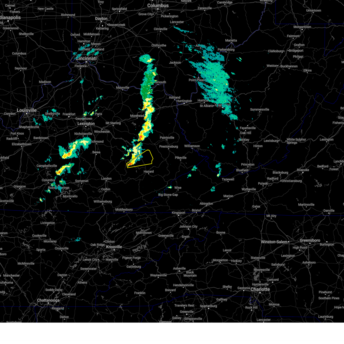 Svrjkl the national weather service in jackson ky has issued a * severe thunderstorm warning for, east central owsley county in southeastern kentucky, northwestern perry county in southeastern kentucky, central breathitt county in southeastern kentucky, * until 1015 am est. * at 940 am est, a severe thunderstorm was located over arnett, or 7 miles southeast of booneville, moving northeast at 45 mph (radar indicated). Hazards include 60 mph wind gusts and penny size hail. Expect damage to roofs, siding, and trees. this severe thunderstorm will be near, morris fork around 945 am est. copland around 950 am est. little around 955 am est. flintville around 1000 am est. Other locations in the path of this severe thunderstorm include hardshell and camp lewis. Svrjkl the national weather service in jackson ky has issued a * severe thunderstorm warning for, east central owsley county in southeastern kentucky, northwestern perry county in southeastern kentucky, central breathitt county in southeastern kentucky, * until 1015 am est. * at 940 am est, a severe thunderstorm was located over arnett, or 7 miles southeast of booneville, moving northeast at 45 mph (radar indicated). Hazards include 60 mph wind gusts and penny size hail. Expect damage to roofs, siding, and trees. this severe thunderstorm will be near, morris fork around 945 am est. copland around 950 am est. little around 955 am est. flintville around 1000 am est. Other locations in the path of this severe thunderstorm include hardshell and camp lewis.
|
| 9/24/2024 6:58 PM EDT |
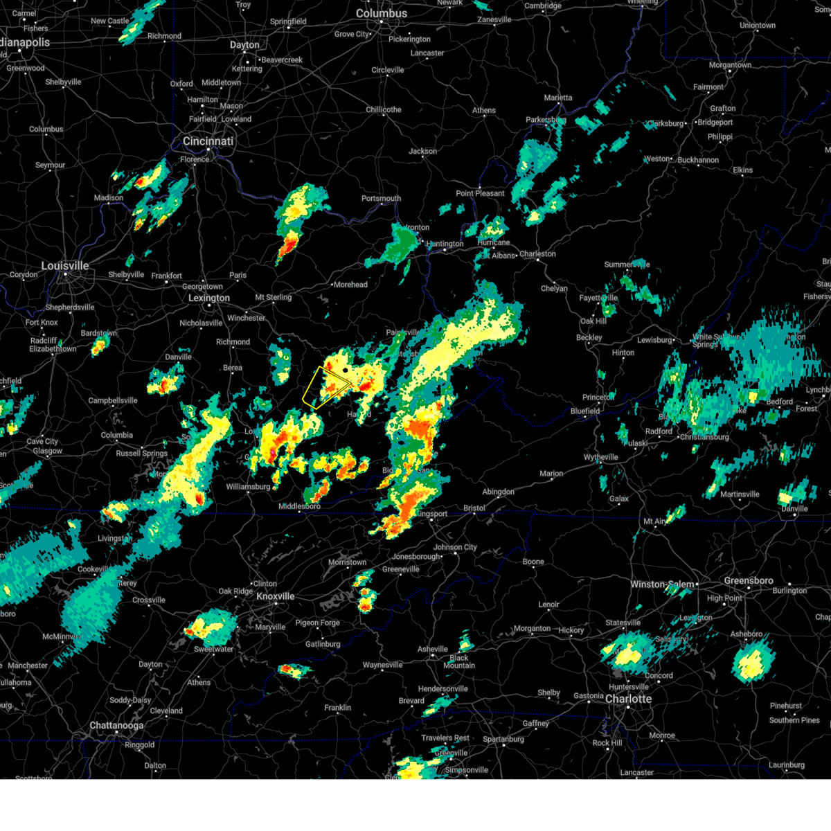 The storm which prompted the warning has weakened below severe limits, and no longer poses an immediate threat to life or property. therefore, the warning will be allowed to expire. a severe thunderstorm watch remains in effect until 800 pm edt for southeastern kentucky. The storm which prompted the warning has weakened below severe limits, and no longer poses an immediate threat to life or property. therefore, the warning will be allowed to expire. a severe thunderstorm watch remains in effect until 800 pm edt for southeastern kentucky.
|
| 9/24/2024 6:41 PM EDT |
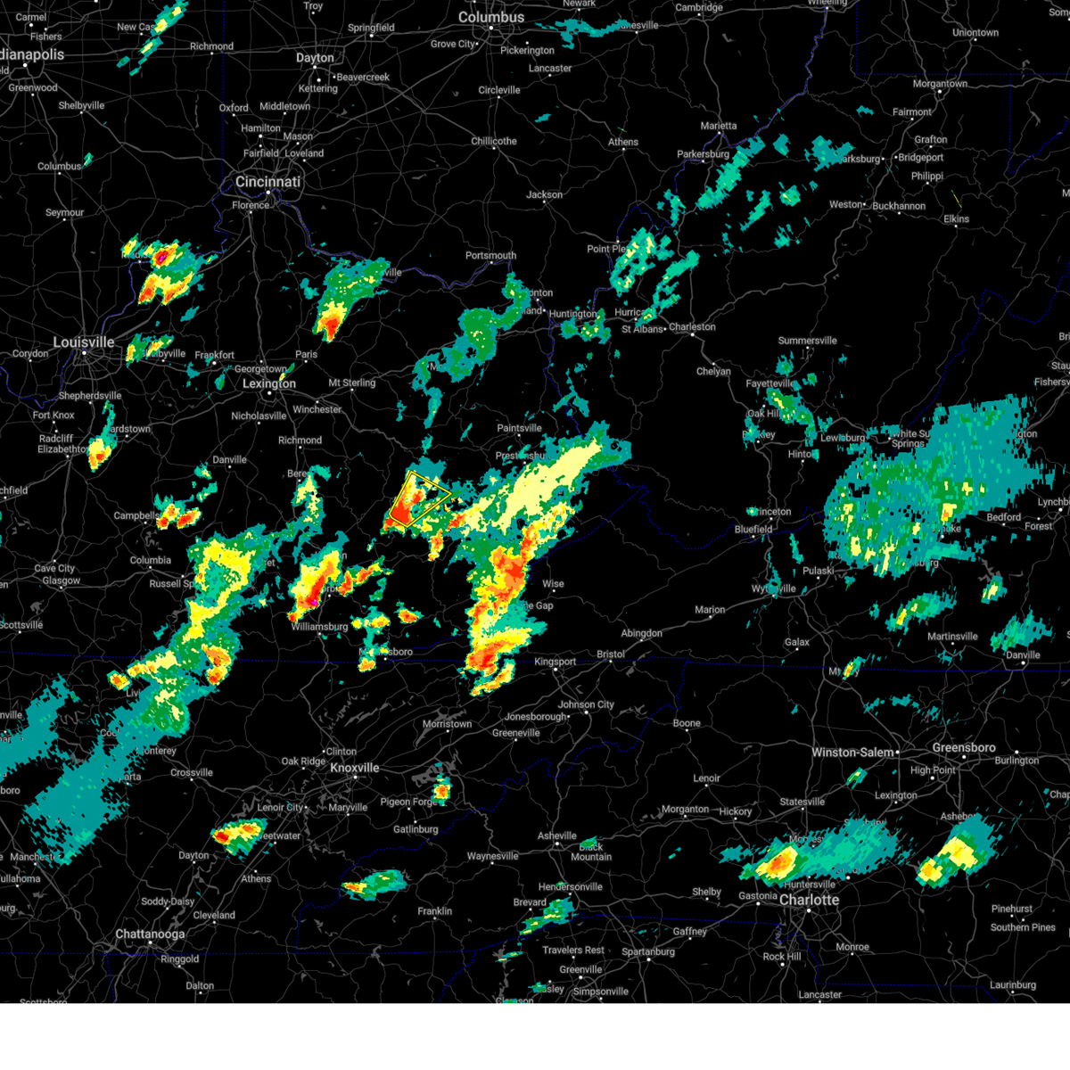 the severe thunderstorm warning has been cancelled and is no longer in effect the severe thunderstorm warning has been cancelled and is no longer in effect
|
| 9/24/2024 6:41 PM EDT |
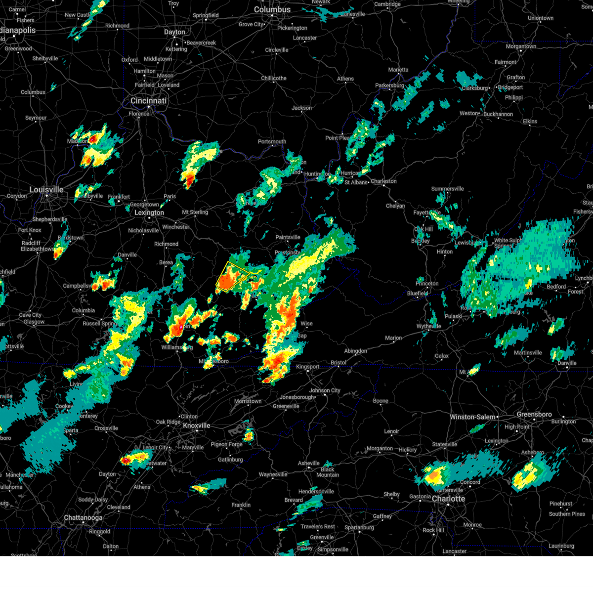 At 641 pm edt, a severe thunderstorm was located over cowcreek, or near booneville, moving northeast at 40 mph (radar indicated). Hazards include 60 mph wind gusts and quarter size hail. Hail damage to vehicles is expected. expect wind damage to roofs, siding, and trees. this severe storm will be near, athol around 645 pm edt. Other locations in the path of this severe thunderstorm include chenowee and elkatawa. At 641 pm edt, a severe thunderstorm was located over cowcreek, or near booneville, moving northeast at 40 mph (radar indicated). Hazards include 60 mph wind gusts and quarter size hail. Hail damage to vehicles is expected. expect wind damage to roofs, siding, and trees. this severe storm will be near, athol around 645 pm edt. Other locations in the path of this severe thunderstorm include chenowee and elkatawa.
|
| 9/24/2024 6:26 PM EDT |
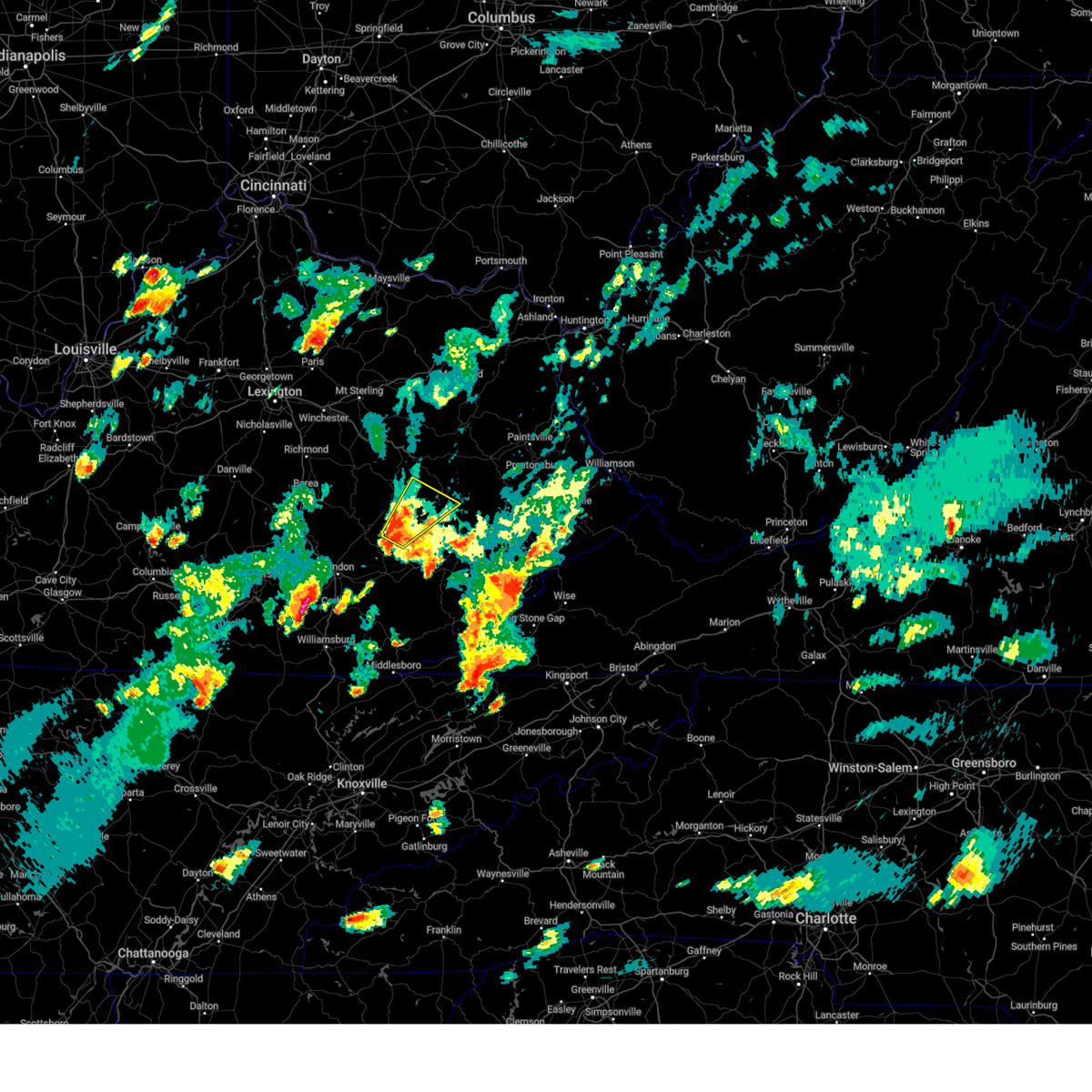 Svrjkl the national weather service in jackson ky has issued a * severe thunderstorm warning for, owsley county in southeastern kentucky, southwestern breathitt county in southeastern kentucky, southeastern lee county in southeastern kentucky, north central clay county in southeastern kentucky, * until 700 pm edt. * at 626 pm edt, a severe thunderstorm was located over thomas, or 10 miles south of booneville, moving northeast at 40 mph (radar indicated). Hazards include 60 mph wind gusts and half dollar size hail. Hail damage to vehicles is expected. expect wind damage to roofs, siding, and trees. this severe thunderstorm will be near, taff around 630 pm edt. chestnut gap around 635 pm edt. houston around 640 pm edt. athol around 645 pm edt. Other locations in the path of this severe thunderstorm include chenowee and elkatawa. Svrjkl the national weather service in jackson ky has issued a * severe thunderstorm warning for, owsley county in southeastern kentucky, southwestern breathitt county in southeastern kentucky, southeastern lee county in southeastern kentucky, north central clay county in southeastern kentucky, * until 700 pm edt. * at 626 pm edt, a severe thunderstorm was located over thomas, or 10 miles south of booneville, moving northeast at 40 mph (radar indicated). Hazards include 60 mph wind gusts and half dollar size hail. Hail damage to vehicles is expected. expect wind damage to roofs, siding, and trees. this severe thunderstorm will be near, taff around 630 pm edt. chestnut gap around 635 pm edt. houston around 640 pm edt. athol around 645 pm edt. Other locations in the path of this severe thunderstorm include chenowee and elkatawa.
|
| 8/17/2024 6:31 PM EDT |
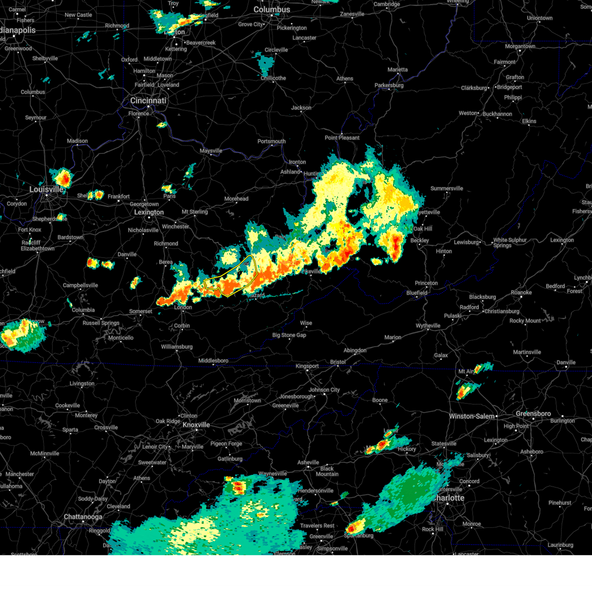 The storms which prompted the warning have weakened below severe limits, and no longer pose an immediate threat to life or property. therefore, the warning has been allowed to expire. The storms which prompted the warning have weakened below severe limits, and no longer pose an immediate threat to life or property. therefore, the warning has been allowed to expire.
|
| 8/17/2024 6:13 PM EDT | At 612 pm edt, severe thunderstorms were located along a line extending from camp lewis to wilstacy to copland to crockettsville to lucky fork, moving east at 40 mph (radar indicated). Hazards include 60 mph wind gusts and penny size hail. Expect damage to roofs, siding, and trees. Locations impacted include, buckhorn. |
| 8/17/2024 6:13 PM EDT |
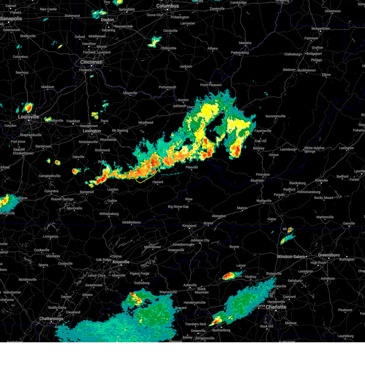 the severe thunderstorm warning has been cancelled and is no longer in effect the severe thunderstorm warning has been cancelled and is no longer in effect
|
| 8/17/2024 5:45 PM EDT |
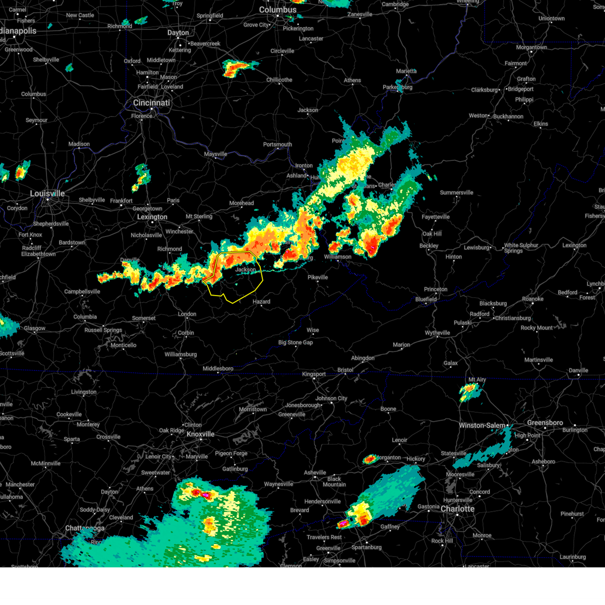 Svrjkl the national weather service in jackson ky has issued a * severe thunderstorm warning for, owsley county in southeastern kentucky, northwestern perry county in southeastern kentucky, breathitt county in southeastern kentucky, lee county in southeastern kentucky, wolfe county in southeastern kentucky, * until 630 pm edt. * at 545 pm edt, severe thunderstorms were located along a line extending from whisman to st. helens to lower buffalo to travellers rest to near green hall, moving east at 40 mph (radar indicated). Hazards include 60 mph wind gusts and quarter size hail. Hail damage to vehicles is expected. expect wind damage to roofs, siding, and trees. severe thunderstorms will be near, campton around 550 pm edt. jackson around 555 pm edt. simpson around 600 pm edt. copland around 605 pm edt. Other locations in the path of these severe thunderstorms include buckhorn and gays creek. Svrjkl the national weather service in jackson ky has issued a * severe thunderstorm warning for, owsley county in southeastern kentucky, northwestern perry county in southeastern kentucky, breathitt county in southeastern kentucky, lee county in southeastern kentucky, wolfe county in southeastern kentucky, * until 630 pm edt. * at 545 pm edt, severe thunderstorms were located along a line extending from whisman to st. helens to lower buffalo to travellers rest to near green hall, moving east at 40 mph (radar indicated). Hazards include 60 mph wind gusts and quarter size hail. Hail damage to vehicles is expected. expect wind damage to roofs, siding, and trees. severe thunderstorms will be near, campton around 550 pm edt. jackson around 555 pm edt. simpson around 600 pm edt. copland around 605 pm edt. Other locations in the path of these severe thunderstorms include buckhorn and gays creek.
|
| 8/17/2024 5:34 PM EDT |
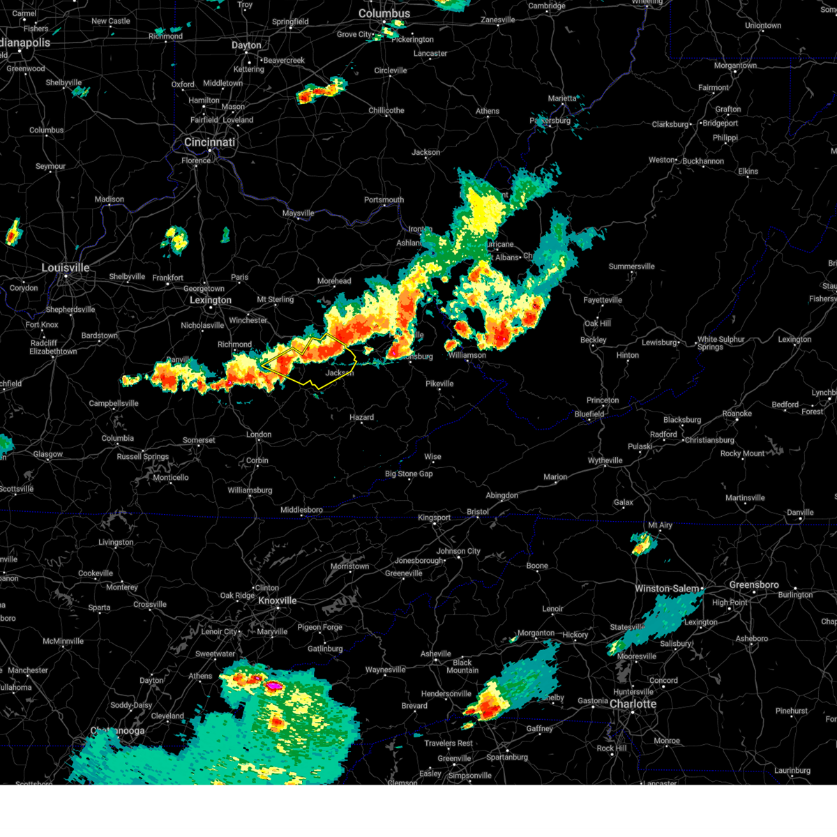 At 534 pm edt, severe thunderstorms were located along a line extending from lower gilmore to hollonville to primrose, moving east at 35 mph (radar indicated). Hazards include 60 mph wind gusts and quarter size hail. Hail damage to vehicles is expected. expect wind damage to roofs, siding, and trees. Locations impacted include, jackson and jetts creek. At 534 pm edt, severe thunderstorms were located along a line extending from lower gilmore to hollonville to primrose, moving east at 35 mph (radar indicated). Hazards include 60 mph wind gusts and quarter size hail. Hail damage to vehicles is expected. expect wind damage to roofs, siding, and trees. Locations impacted include, jackson and jetts creek.
|
| 8/17/2024 5:06 PM EDT |
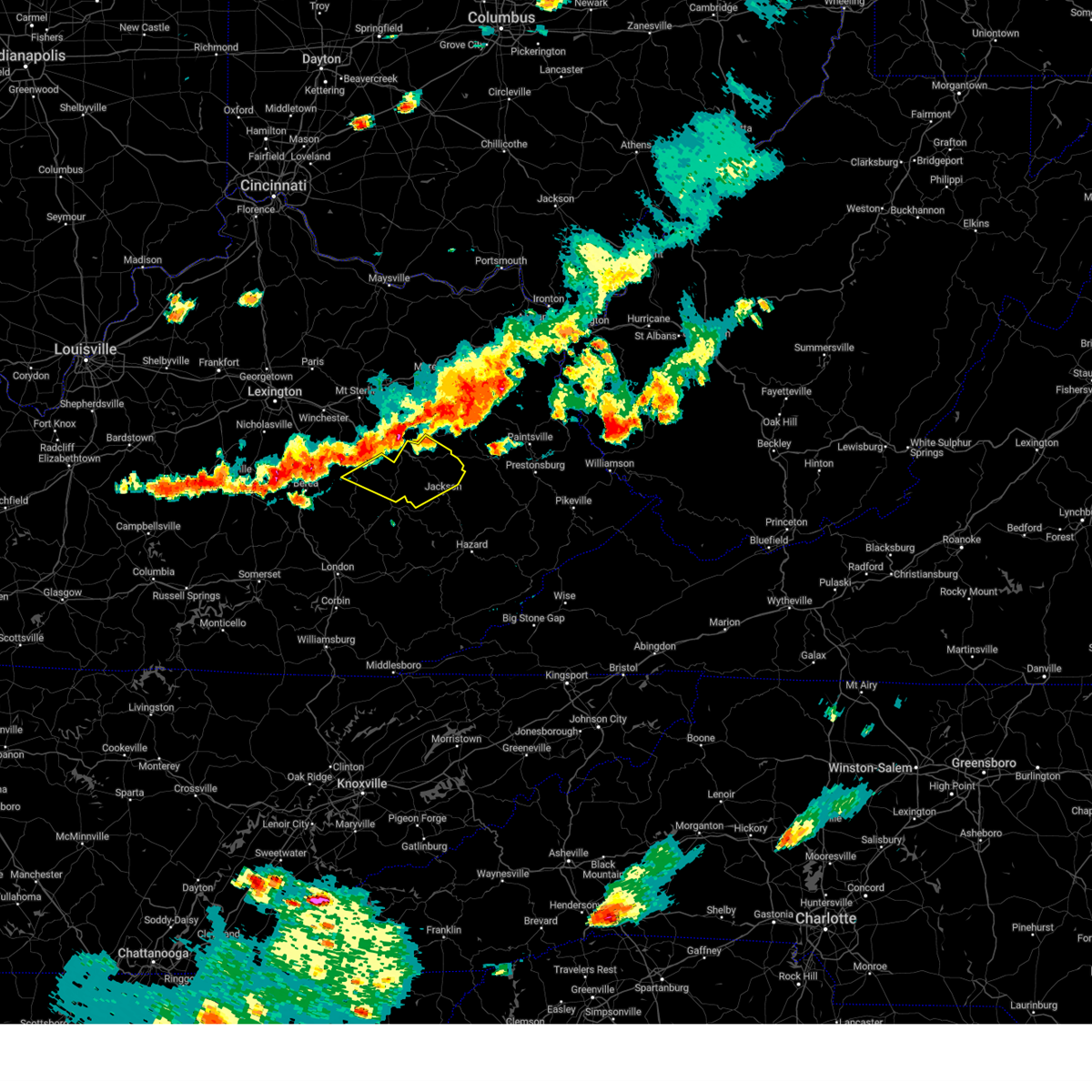 Svrjkl the national weather service in jackson ky has issued a * severe thunderstorm warning for, central estill county in east central kentucky, northwestern breathitt county in southeastern kentucky, lee county in southeastern kentucky, wolfe county in southeastern kentucky, * until 545 pm edt. * at 505 pm edt, severe thunderstorms were located along a line extending from red river gorge to see to pryse, moving east at 35 mph (radar indicated). Hazards include 60 mph wind gusts and quarter size hail. Hail damage to vehicles is expected. expect wind damage to roofs, siding, and trees. severe thunderstorms will be near, campton around 510 pm edt. beattyville around 515 pm edt. white ash around 520 pm edt. daysboro around 525 pm edt. Other locations in the path of these severe thunderstorms include simpson and rosefork. Svrjkl the national weather service in jackson ky has issued a * severe thunderstorm warning for, central estill county in east central kentucky, northwestern breathitt county in southeastern kentucky, lee county in southeastern kentucky, wolfe county in southeastern kentucky, * until 545 pm edt. * at 505 pm edt, severe thunderstorms were located along a line extending from red river gorge to see to pryse, moving east at 35 mph (radar indicated). Hazards include 60 mph wind gusts and quarter size hail. Hail damage to vehicles is expected. expect wind damage to roofs, siding, and trees. severe thunderstorms will be near, campton around 510 pm edt. beattyville around 515 pm edt. white ash around 520 pm edt. daysboro around 525 pm edt. Other locations in the path of these severe thunderstorms include simpson and rosefork.
|
| 8/1/2024 9:05 PM EDT |
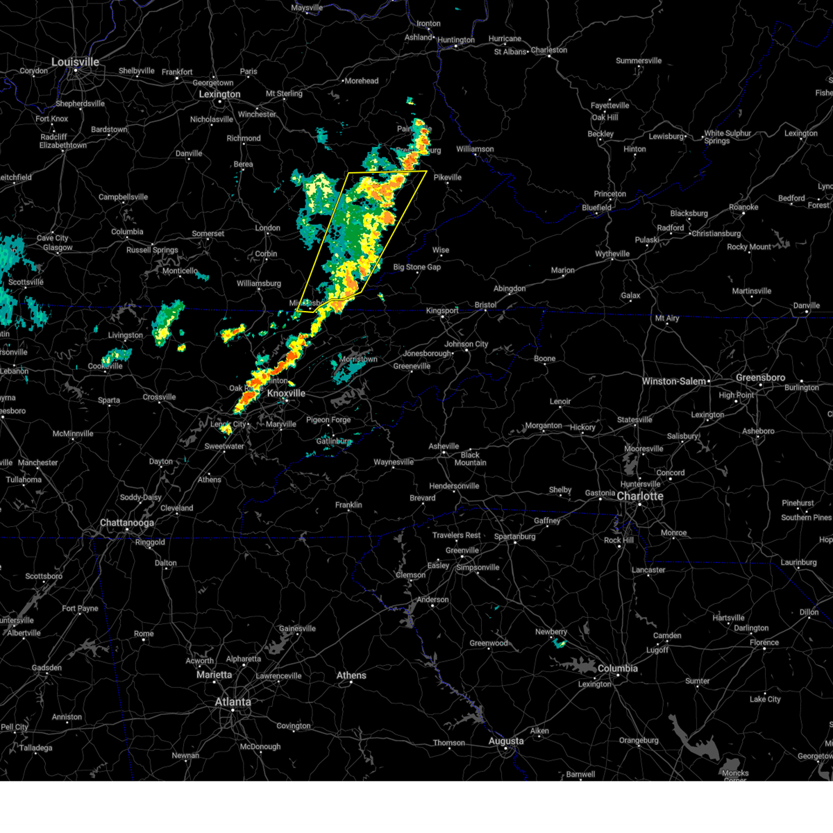 The storms which prompted the warning have weakened below severe limits, and have exited the warned area. therefore, the warning will be allowed to expire. however, gusty winds are still possible with these thunderstorms. a severe thunderstorm watch remains in effect until midnight edt for southeastern kentucky. The storms which prompted the warning have weakened below severe limits, and have exited the warned area. therefore, the warning will be allowed to expire. however, gusty winds are still possible with these thunderstorms. a severe thunderstorm watch remains in effect until midnight edt for southeastern kentucky.
|
| 8/1/2024 8:54 PM EDT |
 the severe thunderstorm warning has been cancelled and is no longer in effect the severe thunderstorm warning has been cancelled and is no longer in effect
|
| 8/1/2024 8:54 PM EDT |
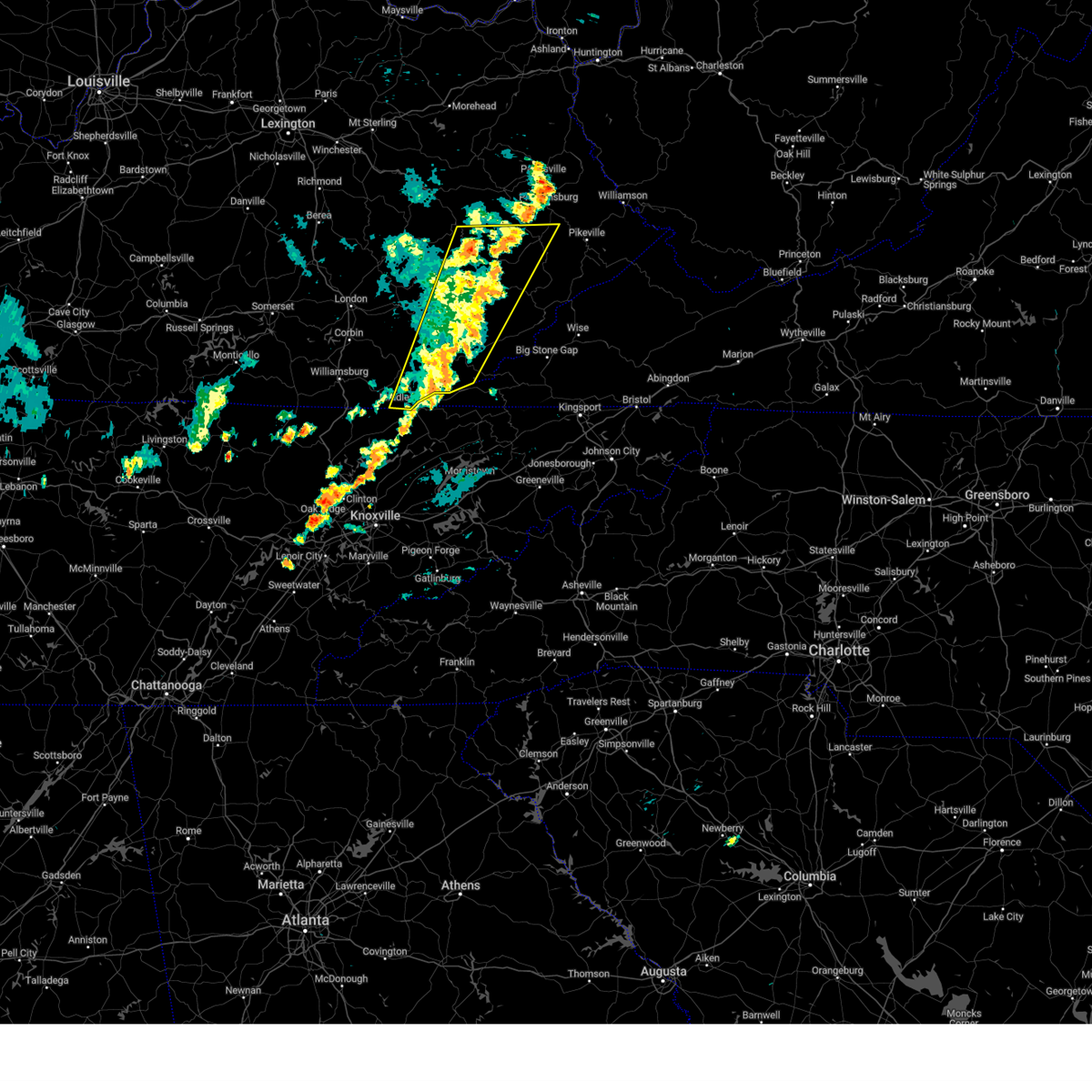 At 854 pm edt, severe thunderstorms were located along a line extending from pyramid to harrogate, moving east at 25 mph (radar indicated). Hazards include 60 mph wind gusts. Expect damage to roofs, siding, and trees. Locations impacted include, hazard, jackson, harlan, pineville, hindman, hyden, middlesboro, estill, loyall, evarts, pippa passes, and wayland. At 854 pm edt, severe thunderstorms were located along a line extending from pyramid to harrogate, moving east at 25 mph (radar indicated). Hazards include 60 mph wind gusts. Expect damage to roofs, siding, and trees. Locations impacted include, hazard, jackson, harlan, pineville, hindman, hyden, middlesboro, estill, loyall, evarts, pippa passes, and wayland.
|
| 8/1/2024 8:42 PM EDT |
 the severe thunderstorm warning has been cancelled and is no longer in effect the severe thunderstorm warning has been cancelled and is no longer in effect
|
| 8/1/2024 8:42 PM EDT |
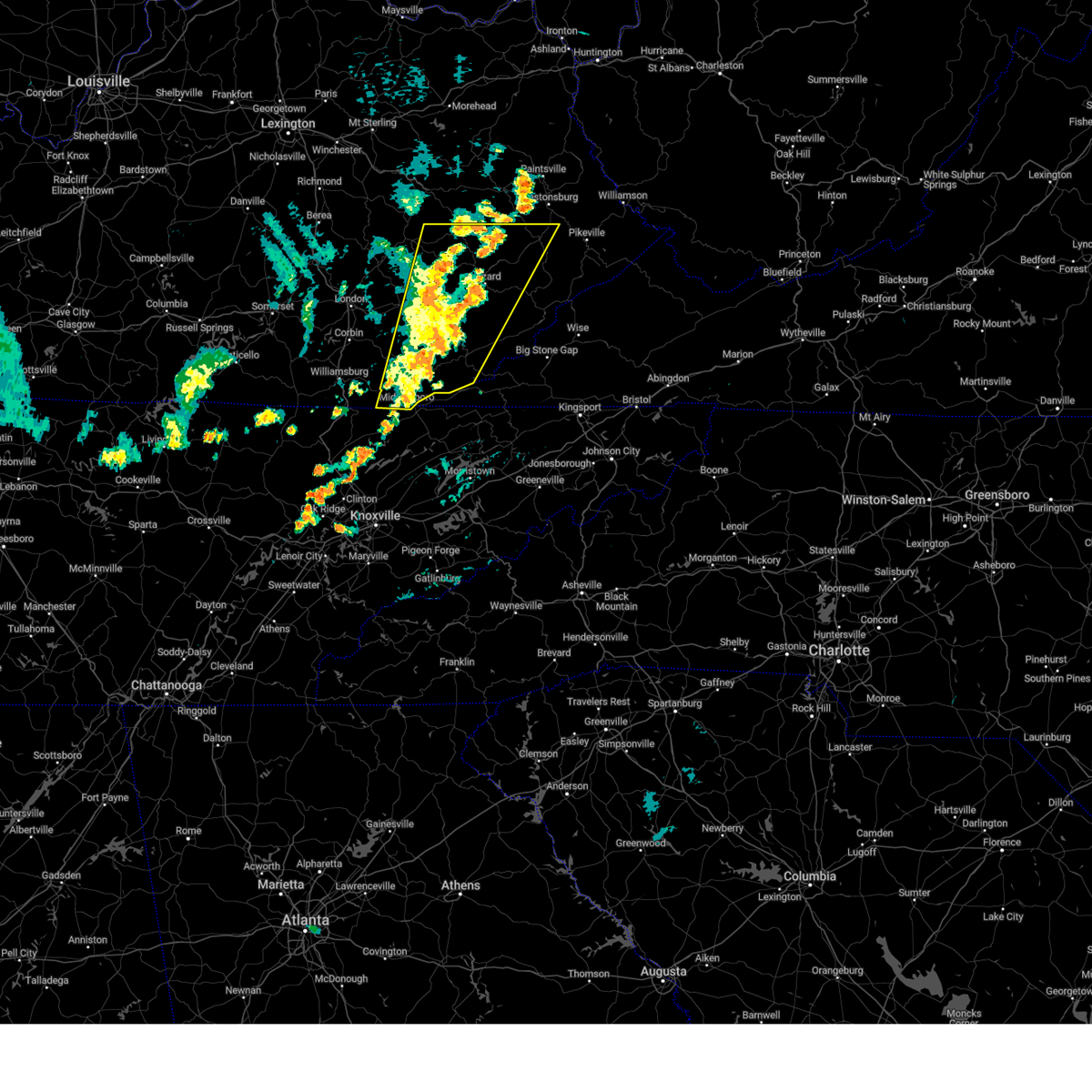 At 841 pm edt, severe thunderstorms were located along a line extending from waldo to near middlesboro, moving east at 25 mph (radar indicated). Hazards include 60 mph wind gusts. Expect damage to roofs, siding, and trees. Locations impacted include, hazard, harlan, garret, estill, evarts and blackey. At 841 pm edt, severe thunderstorms were located along a line extending from waldo to near middlesboro, moving east at 25 mph (radar indicated). Hazards include 60 mph wind gusts. Expect damage to roofs, siding, and trees. Locations impacted include, hazard, harlan, garret, estill, evarts and blackey.
|
| 8/1/2024 8:38 PM EDT |
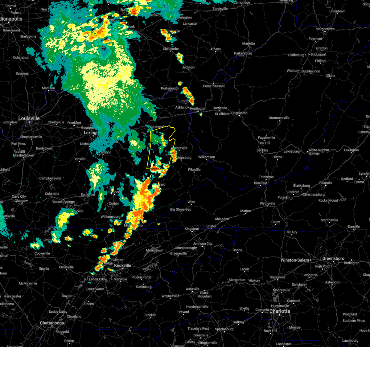 The storms which prompted the warning have weakened below severe limits, and have exited the warned area. therefore, the warning will be allowed to expire. a severe thunderstorm watch remains in effect until midnight edt for southeastern, northeastern and east central kentucky. The storms which prompted the warning have weakened below severe limits, and have exited the warned area. therefore, the warning will be allowed to expire. a severe thunderstorm watch remains in effect until midnight edt for southeastern, northeastern and east central kentucky.
|
| 8/1/2024 8:26 PM EDT |
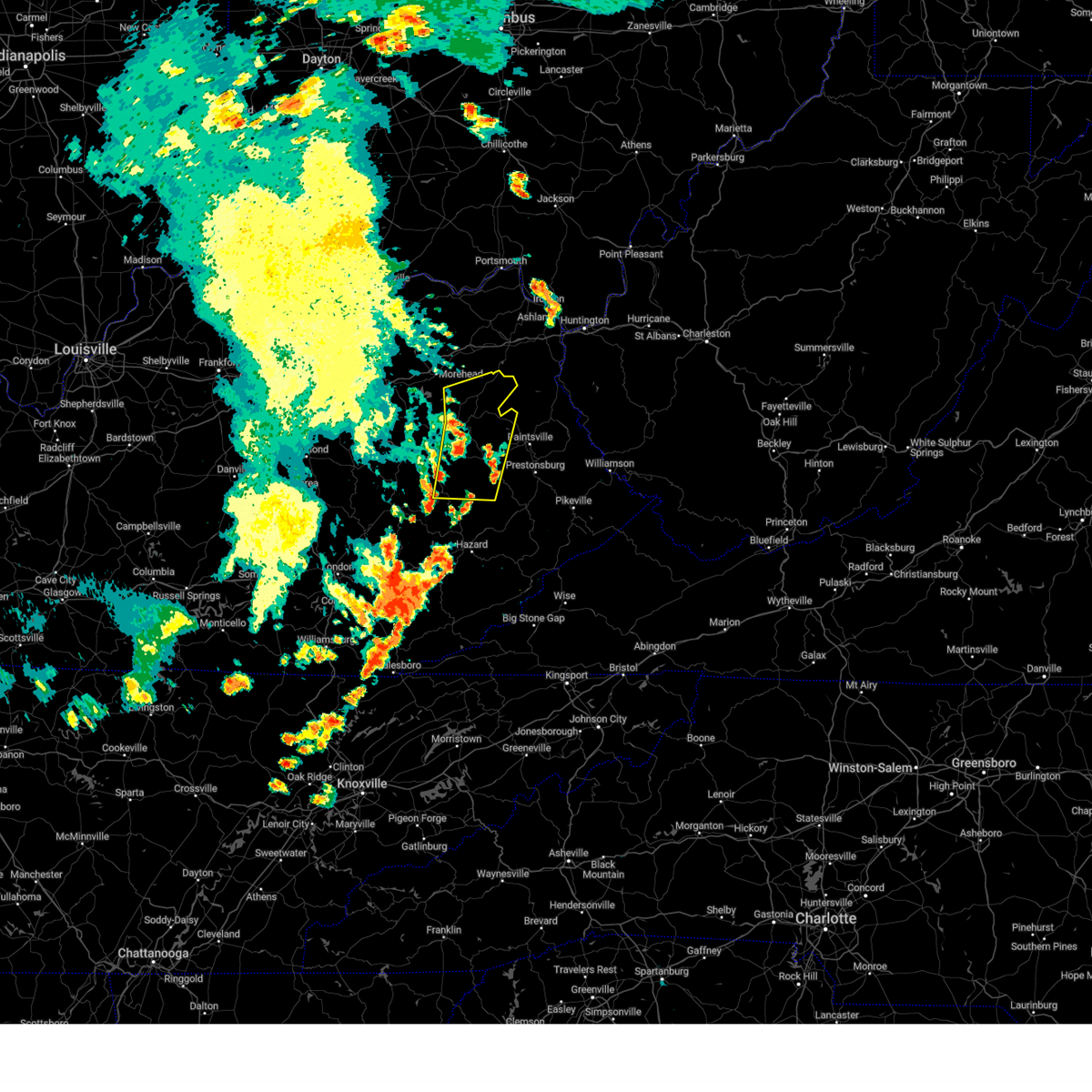 At 826 pm edt, severe thunderstorms were located along a line extending from near stark to elkfork to haginsville, moving east at 35 mph (radar indicated). Hazards include 60 mph wind gusts. Expect damage to roofs, siding, and trees. Locations impacted include, salyersville, mason, duco and ivyton. At 826 pm edt, severe thunderstorms were located along a line extending from near stark to elkfork to haginsville, moving east at 35 mph (radar indicated). Hazards include 60 mph wind gusts. Expect damage to roofs, siding, and trees. Locations impacted include, salyersville, mason, duco and ivyton.
|
| 8/1/2024 8:26 PM EDT |
 the severe thunderstorm warning has been cancelled and is no longer in effect the severe thunderstorm warning has been cancelled and is no longer in effect
|
| 8/1/2024 8:22 PM EDT |
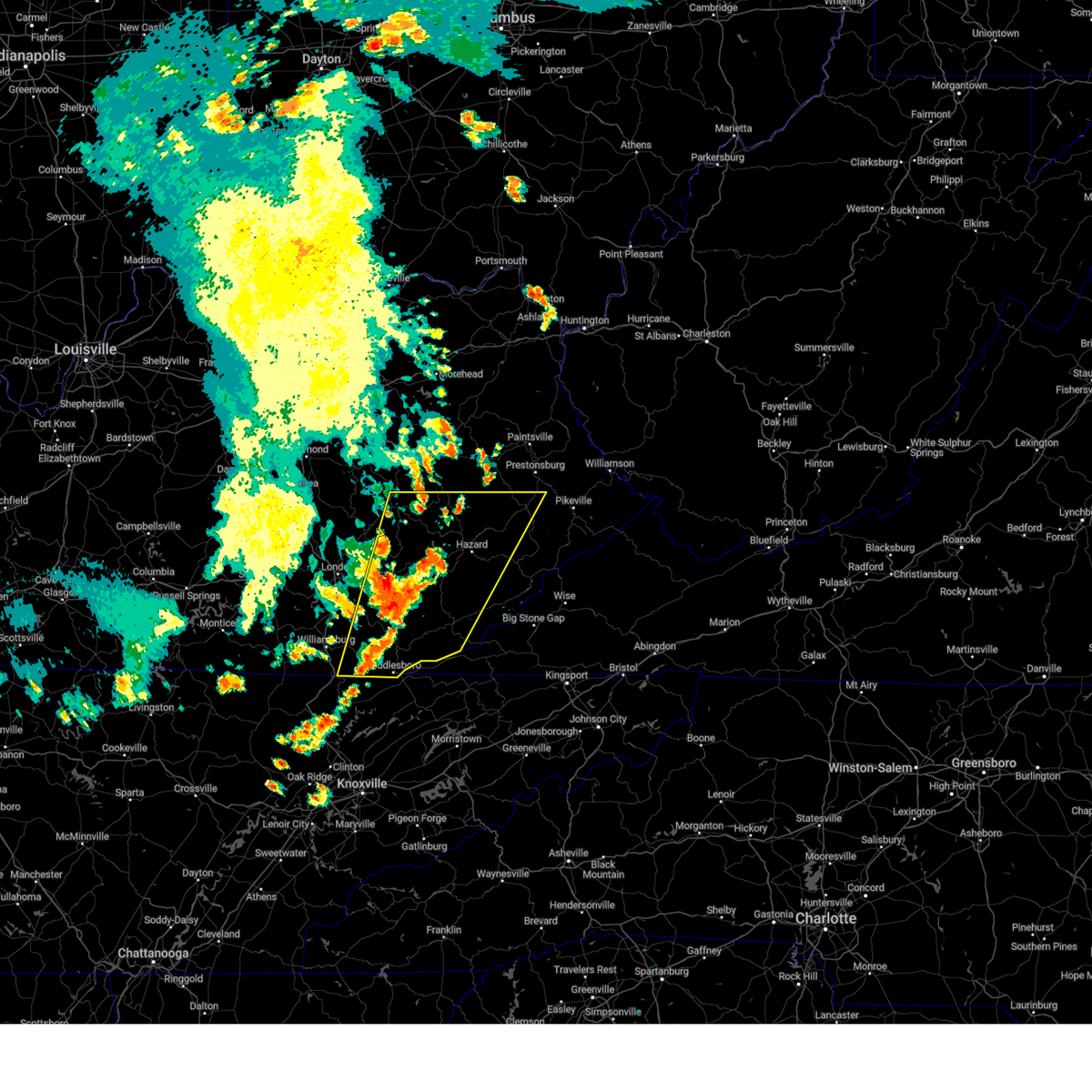 Svrjkl the national weather service in jackson ky has issued a * severe thunderstorm warning for, harlan county in southeastern kentucky, knox county in southeastern kentucky, owsley county in southeastern kentucky, knott county in southeastern kentucky, west central floyd county in southeastern kentucky, southeastern whitley county in south central kentucky, southeastern lee county in southeastern kentucky, southeastern laurel county in south central kentucky, bell county in southeastern kentucky, leslie county in southeastern kentucky, southwestern letcher county in southeastern kentucky, perry county in southeastern kentucky, breathitt county in southeastern kentucky, southeastern magoffin county in southeastern kentucky, clay county in southeastern kentucky, * until 915 pm edt. * at 822 pm edt, severe thunderstorms were located along a line extending from daisydell to near fonde, moving east at 25 mph (radar indicated). Hazards include 60 mph wind gusts. Expect damage to roofs, siding, and trees. severe thunderstorms will be near, hazard around 830 pm edt. wallins creek around 835 pm edt. mid around 840 pm edt. Other locations in the path of these severe thunderstorms include harlan, garret and estill. Svrjkl the national weather service in jackson ky has issued a * severe thunderstorm warning for, harlan county in southeastern kentucky, knox county in southeastern kentucky, owsley county in southeastern kentucky, knott county in southeastern kentucky, west central floyd county in southeastern kentucky, southeastern whitley county in south central kentucky, southeastern lee county in southeastern kentucky, southeastern laurel county in south central kentucky, bell county in southeastern kentucky, leslie county in southeastern kentucky, southwestern letcher county in southeastern kentucky, perry county in southeastern kentucky, breathitt county in southeastern kentucky, southeastern magoffin county in southeastern kentucky, clay county in southeastern kentucky, * until 915 pm edt. * at 822 pm edt, severe thunderstorms were located along a line extending from daisydell to near fonde, moving east at 25 mph (radar indicated). Hazards include 60 mph wind gusts. Expect damage to roofs, siding, and trees. severe thunderstorms will be near, hazard around 830 pm edt. wallins creek around 835 pm edt. mid around 840 pm edt. Other locations in the path of these severe thunderstorms include harlan, garret and estill.
|
| 8/1/2024 8:20 PM EDT | County dispatch reported a tree blown down in the 5900 block of canoe road. event time estimated from rada in breathitt county KY, 8.3 miles NNE of Jackson, KY |
| 8/1/2024 8:07 PM EDT |
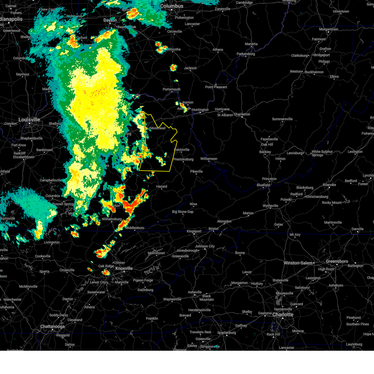 Svrjkl the national weather service in jackson ky has issued a * severe thunderstorm warning for, morgan county in southeastern kentucky, southeastern bath county in east central kentucky, northwestern johnson county in northeastern kentucky, eastern menifee county in east central kentucky, northern breathitt county in southeastern kentucky, magoffin county in southeastern kentucky, southeastern lee county in southeastern kentucky, east central fleming county in east central kentucky, rowan county in east central kentucky, wolfe county in southeastern kentucky, elliott county in east central kentucky, * until 845 pm edt. * at 807 pm edt, severe thunderstorms were located along a line extending from near waltz to dehart to athol, moving east at 35 mph (radar indicated). Hazards include 60 mph wind gusts. Expect damage to roofs, siding, and trees. severe thunderstorms will be near, west liberty around 810 pm edt. lewis around 815 pm edt. sandy hook around 820 pm edt. crockett around 825 pm edt. Other locations in the path of these severe thunderstorms include moon and hendricks. Svrjkl the national weather service in jackson ky has issued a * severe thunderstorm warning for, morgan county in southeastern kentucky, southeastern bath county in east central kentucky, northwestern johnson county in northeastern kentucky, eastern menifee county in east central kentucky, northern breathitt county in southeastern kentucky, magoffin county in southeastern kentucky, southeastern lee county in southeastern kentucky, east central fleming county in east central kentucky, rowan county in east central kentucky, wolfe county in southeastern kentucky, elliott county in east central kentucky, * until 845 pm edt. * at 807 pm edt, severe thunderstorms were located along a line extending from near waltz to dehart to athol, moving east at 35 mph (radar indicated). Hazards include 60 mph wind gusts. Expect damage to roofs, siding, and trees. severe thunderstorms will be near, west liberty around 810 pm edt. lewis around 815 pm edt. sandy hook around 820 pm edt. crockett around 825 pm edt. Other locations in the path of these severe thunderstorms include moon and hendricks.
|
| 7/31/2024 7:13 PM EDT | A tree was reported to have been blown down along ky 15. the event time is radar estimate in breathitt county KY, 7.7 miles NNW of Jackson, KY |
| 7/31/2024 7:05 PM EDT |
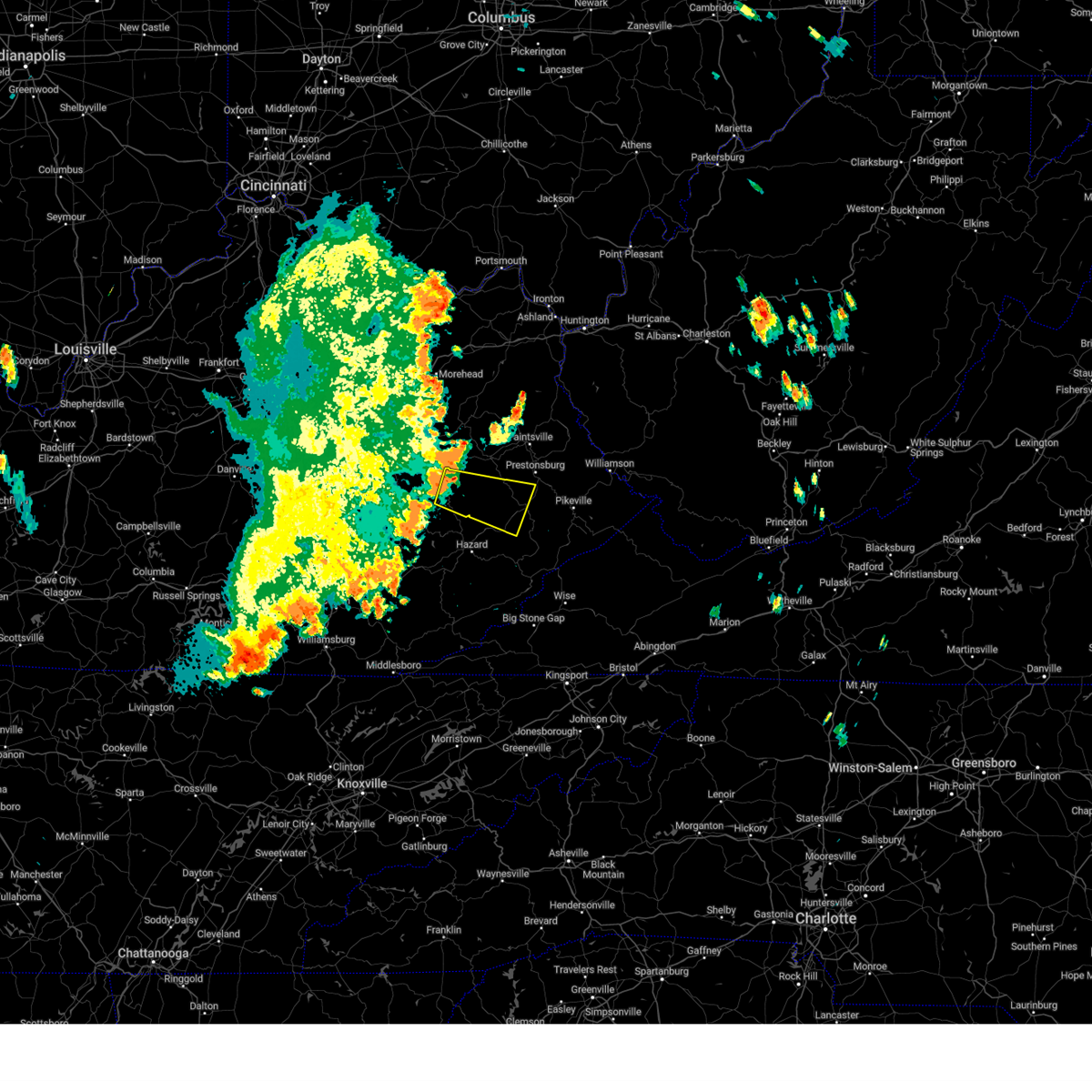 Svrjkl the national weather service in jackson ky has issued a * severe thunderstorm warning for, northwestern knott county in southeastern kentucky, west central floyd county in southeastern kentucky, central breathitt county in southeastern kentucky, southern magoffin county in southeastern kentucky, * until 730 pm edt. * at 705 pm edt, a severe thunderstorm was located over stevenson, or near jackson, moving east at 50 mph (radar indicated). Hazards include 60 mph wind gusts. Expect damage to roofs, siding, and trees. this severe thunderstorm will be near, guage around 710 pm edt. evanston around 715 pm edt. vail around 720 pm edt. Mid around 725 pm edt. Svrjkl the national weather service in jackson ky has issued a * severe thunderstorm warning for, northwestern knott county in southeastern kentucky, west central floyd county in southeastern kentucky, central breathitt county in southeastern kentucky, southern magoffin county in southeastern kentucky, * until 730 pm edt. * at 705 pm edt, a severe thunderstorm was located over stevenson, or near jackson, moving east at 50 mph (radar indicated). Hazards include 60 mph wind gusts. Expect damage to roofs, siding, and trees. this severe thunderstorm will be near, guage around 710 pm edt. evanston around 715 pm edt. vail around 720 pm edt. Mid around 725 pm edt.
|
| 7/5/2024 1:31 PM EDT |
 The storms which prompted the warning have moved out morgan, perry, and wolfe counties. therefore, the warning will be allowed to expire. a new downstream severe thunderstorm warning has been issued for portions of knott, breathitt, and magoffin counties. a severe thunderstorm watch remains in effect until 700 pm edt for southeastern and northeastern kentucky. remember, a severe thunderstorm warning still remains in effect for north central knott county, northeastern breathitt county and southern magoffin county until 215 pm edt. The storms which prompted the warning have moved out morgan, perry, and wolfe counties. therefore, the warning will be allowed to expire. a new downstream severe thunderstorm warning has been issued for portions of knott, breathitt, and magoffin counties. a severe thunderstorm watch remains in effect until 700 pm edt for southeastern and northeastern kentucky. remember, a severe thunderstorm warning still remains in effect for north central knott county, northeastern breathitt county and southern magoffin county until 215 pm edt.
|
| 7/5/2024 1:16 PM EDT |
 At 116 pm edt, severe thunderstorms were located along a line extending from taulbee to guage to daisydell to near buck, moving northeast at 40 mph (radar indicated). Hazards include 60 mph wind gusts. Expect damage to roofs, siding, and trees. these severe storms will be near, hendricks around 120 pm edt. Other locations in the path of these severe thunderstorms include salyersville, harper and cyrus. At 116 pm edt, severe thunderstorms were located along a line extending from taulbee to guage to daisydell to near buck, moving northeast at 40 mph (radar indicated). Hazards include 60 mph wind gusts. Expect damage to roofs, siding, and trees. these severe storms will be near, hendricks around 120 pm edt. Other locations in the path of these severe thunderstorms include salyersville, harper and cyrus.
|
| 7/5/2024 1:03 PM EDT |
 At 103 pm edt, severe thunderstorms were located along a line extending from paxton to hardshell to near dice, moving east at 35 mph (radar indicated). Hazards include 60 mph wind gusts. Expect damage to roofs, siding, and trees. Locations impacted include, jackson, salyersville, mason, simpson, lewis, buck, burkhart, vail, falcon, wonnie, burning fork, and noctor. At 103 pm edt, severe thunderstorms were located along a line extending from paxton to hardshell to near dice, moving east at 35 mph (radar indicated). Hazards include 60 mph wind gusts. Expect damage to roofs, siding, and trees. Locations impacted include, jackson, salyersville, mason, simpson, lewis, buck, burkhart, vail, falcon, wonnie, burning fork, and noctor.
|
| 7/5/2024 1:02 PM EDT | A public report via social media of utility poles broken and trees down on lick branch road in the noctor community. the time of the event is radar estimate in breathitt county KY, 4.4 miles WSW of Jackson, KY |
| 7/5/2024 12:57 PM EDT | A tree was downed on riley branch blocking the roadway. this was a social media report with pictur in breathitt county KY, 7.6 miles NW of Jackson, KY |
| 7/5/2024 12:54 PM EDT |
 Svrjkl the national weather service in jackson ky has issued a * severe thunderstorm warning for, southeastern morgan county in southeastern kentucky, north central perry county in southeastern kentucky, northwestern knott county in southeastern kentucky, breathitt county in southeastern kentucky, magoffin county in southeastern kentucky, southeastern wolfe county in southeastern kentucky, * until 130 pm edt. * at 1253 pm edt, severe thunderstorms were located along a line extending from lane to little to krypton, moving northeast at 35 mph (radar indicated). Hazards include 60 mph wind gusts. expect damage to roofs, siding, and trees Svrjkl the national weather service in jackson ky has issued a * severe thunderstorm warning for, southeastern morgan county in southeastern kentucky, north central perry county in southeastern kentucky, northwestern knott county in southeastern kentucky, breathitt county in southeastern kentucky, magoffin county in southeastern kentucky, southeastern wolfe county in southeastern kentucky, * until 130 pm edt. * at 1253 pm edt, severe thunderstorms were located along a line extending from lane to little to krypton, moving northeast at 35 mph (radar indicated). Hazards include 60 mph wind gusts. expect damage to roofs, siding, and trees
|
| 7/5/2024 12:47 PM EDT |
 At 1247 pm edt, severe thunderstorms were located along a line extending from mary to fillmore to near curt to krypton to toulouse, moving east at 30 mph (radar indicated). Hazards include 60 mph wind gusts. Expect damage to roofs, siding, and trees. Locations impacted include, jackson, simpson, buckhorn, lexie, shoal, fillmore, pence, copebranch, noctor, vancleve, beech, and moct. At 1247 pm edt, severe thunderstorms were located along a line extending from mary to fillmore to near curt to krypton to toulouse, moving east at 30 mph (radar indicated). Hazards include 60 mph wind gusts. Expect damage to roofs, siding, and trees. Locations impacted include, jackson, simpson, buckhorn, lexie, shoal, fillmore, pence, copebranch, noctor, vancleve, beech, and moct.
|
| 7/5/2024 12:47 PM EDT |
 the severe thunderstorm warning has been cancelled and is no longer in effect the severe thunderstorm warning has been cancelled and is no longer in effect
|
| 7/5/2024 12:42 PM EDT |
 At 1241 pm edt, severe thunderstorms were located along a line extending from high falls to canyon falls to near turkey to near confluence to hosea, moving east at 35 mph (radar indicated). Hazards include 60 mph wind gusts. Expect damage to roofs, siding, and trees. Locations impacted include, jackson, flintville, simpson and taulbee. At 1241 pm edt, severe thunderstorms were located along a line extending from high falls to canyon falls to near turkey to near confluence to hosea, moving east at 35 mph (radar indicated). Hazards include 60 mph wind gusts. Expect damage to roofs, siding, and trees. Locations impacted include, jackson, flintville, simpson and taulbee.
|
| 7/5/2024 12:22 PM EDT |
 Svrjkl the national weather service in jackson ky has issued a * severe thunderstorm warning for, owsley county in southeastern kentucky, northwestern leslie county in southeastern kentucky, northwestern perry county in southeastern kentucky, breathitt county in southeastern kentucky, lee county in southeastern kentucky, wolfe county in southeastern kentucky, northeastern clay county in southeastern kentucky, * until 100 pm edt. * at 1221 pm edt, severe thunderstorms were located along a line extending from greeley to mistletoe to botto, moving northeast at 35 mph (radar indicated). Hazards include 60 mph wind gusts. Expect damage to roofs, siding, and trees. severe thunderstorms will be near, beattyville around 1225 pm edt. oakdale around 1230 pm edt. campton around 1235 pm edt. jackson around 1240 pm edt. Other locations in the path of these severe thunderstorms include hyden and simpson. Svrjkl the national weather service in jackson ky has issued a * severe thunderstorm warning for, owsley county in southeastern kentucky, northwestern leslie county in southeastern kentucky, northwestern perry county in southeastern kentucky, breathitt county in southeastern kentucky, lee county in southeastern kentucky, wolfe county in southeastern kentucky, northeastern clay county in southeastern kentucky, * until 100 pm edt. * at 1221 pm edt, severe thunderstorms were located along a line extending from greeley to mistletoe to botto, moving northeast at 35 mph (radar indicated). Hazards include 60 mph wind gusts. Expect damage to roofs, siding, and trees. severe thunderstorms will be near, beattyville around 1225 pm edt. oakdale around 1230 pm edt. campton around 1235 pm edt. jackson around 1240 pm edt. Other locations in the path of these severe thunderstorms include hyden and simpson.
|
| 6/17/2024 7:00 PM EDT | Breathitt county dispatch reported a couple of trees blown down about 7 miles up ky-37 in breathitt county KY, 7.6 miles SSW of Jackson, KY |
| 5/27/2024 2:31 AM EDT |
 The storms which prompted the warning have weakened below severe limits, and no longer pose an immediate threat to life or property. therefore, the warning has been allowed to expire. however, small hail and gusty winds are still possible with these thunderstorms. a tornado watch remains in effect until 600 am edt for southeastern, northeastern and east central kentucky. The storms which prompted the warning have weakened below severe limits, and no longer pose an immediate threat to life or property. therefore, the warning has been allowed to expire. however, small hail and gusty winds are still possible with these thunderstorms. a tornado watch remains in effect until 600 am edt for southeastern, northeastern and east central kentucky.
|
| 5/27/2024 2:17 AM EDT | A tree was reported to have been blown down via social media. the event time is radar estimate in breathitt county KY, 4.9 miles ENE of Jackson, KY |
| 5/27/2024 2:15 AM EDT |
 the severe thunderstorm warning has been cancelled and is no longer in effect the severe thunderstorm warning has been cancelled and is no longer in effect
|
| 5/27/2024 2:15 AM EDT |
 At 215 am edt, severe thunderstorms were located along a line extending from yocum to rosefork to curt, moving east at 55 mph (radar indicated). Hazards include 60 mph wind gusts. Expect damage to roofs, siding, and trees. Locations impacted include, west liberty, salyersville, isonville and gapville. At 215 am edt, severe thunderstorms were located along a line extending from yocum to rosefork to curt, moving east at 55 mph (radar indicated). Hazards include 60 mph wind gusts. Expect damage to roofs, siding, and trees. Locations impacted include, west liberty, salyersville, isonville and gapville.
|
| 5/27/2024 1:55 AM EDT |
 Svrjkl the national weather service in jackson ky has issued a * severe thunderstorm warning for, northern owsley county in southeastern kentucky, northeastern jackson county in southeastern kentucky, menifee county in east central kentucky, lee county in southeastern kentucky, southeastern rowan county in east central kentucky, wolfe county in southeastern kentucky, eastern powell county in east central kentucky, morgan county in southeastern kentucky, southeastern bath county in east central kentucky, southeastern estill county in east central kentucky, breathitt county in southeastern kentucky, magoffin county in southeastern kentucky, elliott county in east central kentucky, * until 230 am edt. * at 155 am edt, severe thunderstorms were located along a line extending from near rothwell to whisman to levi, moving east at 55 mph (radar indicated). Hazards include 60 mph wind gusts. Expect damage to roofs, siding, and trees. severe thunderstorms will be near, frenchburg around 200 am edt. jackson around 205 am edt. west liberty around 210 am edt. lewis around 215 am edt. Other locations in the path of these severe thunderstorms include steele and jeptha. Svrjkl the national weather service in jackson ky has issued a * severe thunderstorm warning for, northern owsley county in southeastern kentucky, northeastern jackson county in southeastern kentucky, menifee county in east central kentucky, lee county in southeastern kentucky, southeastern rowan county in east central kentucky, wolfe county in southeastern kentucky, eastern powell county in east central kentucky, morgan county in southeastern kentucky, southeastern bath county in east central kentucky, southeastern estill county in east central kentucky, breathitt county in southeastern kentucky, magoffin county in southeastern kentucky, elliott county in east central kentucky, * until 230 am edt. * at 155 am edt, severe thunderstorms were located along a line extending from near rothwell to whisman to levi, moving east at 55 mph (radar indicated). Hazards include 60 mph wind gusts. Expect damage to roofs, siding, and trees. severe thunderstorms will be near, frenchburg around 200 am edt. jackson around 205 am edt. west liberty around 210 am edt. lewis around 215 am edt. Other locations in the path of these severe thunderstorms include steele and jeptha.
|
| 5/26/2024 2:41 PM EDT |
 At 241 pm edt, severe thunderstorms were located along a line extending from holliday to keck to near krypton to daley, moving east at 55 mph (radar indicated). Hazards include 70 mph wind gusts and nickel size hail. Expect considerable tree damage. damage is likely to mobile homes, roofs, and outbuildings. Locations impacted include, hazard, mason, hindman, paintsville, estill and prestonsburg. At 241 pm edt, severe thunderstorms were located along a line extending from holliday to keck to near krypton to daley, moving east at 55 mph (radar indicated). Hazards include 70 mph wind gusts and nickel size hail. Expect considerable tree damage. damage is likely to mobile homes, roofs, and outbuildings. Locations impacted include, hazard, mason, hindman, paintsville, estill and prestonsburg.
|
| 5/26/2024 2:41 PM EDT |
 the severe thunderstorm warning has been cancelled and is no longer in effect the severe thunderstorm warning has been cancelled and is no longer in effect
|
| 5/26/2024 2:27 PM EDT |
 The storms which prompted the warning have weakened below severe limits, and no longer pose an immediate threat to life or property. therefore, the warning will be allowed to expire. a tornado watch remains in effect until 400 pm edt for southeastern kentucky. a severe thunderstorm watch remains in effect until 800 pm edt for southeastern kentucky. a severe thunderstorm watch also remains in effect until 900 pm edt for southeastern kentucky. The storms which prompted the warning have weakened below severe limits, and no longer pose an immediate threat to life or property. therefore, the warning will be allowed to expire. a tornado watch remains in effect until 400 pm edt for southeastern kentucky. a severe thunderstorm watch remains in effect until 800 pm edt for southeastern kentucky. a severe thunderstorm watch also remains in effect until 900 pm edt for southeastern kentucky.
|
| 5/26/2024 2:19 PM EDT |
 the severe thunderstorm warning has been cancelled and is no longer in effect the severe thunderstorm warning has been cancelled and is no longer in effect
|
| 5/26/2024 2:19 PM EDT |
 At 219 pm edt, severe thunderstorms were located along a line extending from grannie to wild cat to spruce pine, moving east at 60 mph (radar indicated). Hazards include 60 mph wind gusts and nickel size hail. Expect damage to roofs, siding, and trees. Locations impacted include, jackson, manchester, hyden, booneville, simpson, buckhorn, turin, hoskinston, travellers rest, blake, brightshade, and southfork. At 219 pm edt, severe thunderstorms were located along a line extending from grannie to wild cat to spruce pine, moving east at 60 mph (radar indicated). Hazards include 60 mph wind gusts and nickel size hail. Expect damage to roofs, siding, and trees. Locations impacted include, jackson, manchester, hyden, booneville, simpson, buckhorn, turin, hoskinston, travellers rest, blake, brightshade, and southfork.
|
| 5/26/2024 2:13 PM EDT |
 Svrjkl the national weather service in jackson ky has issued a * severe thunderstorm warning for, southwestern morgan county in southeastern kentucky, eastern owsley county in southeastern kentucky, southern johnson county in northeastern kentucky, northern leslie county in southeastern kentucky, perry county in southeastern kentucky, knott county in southeastern kentucky, floyd county in southeastern kentucky, breathitt county in southeastern kentucky, magoffin county in southeastern kentucky, eastern lee county in southeastern kentucky, wolfe county in southeastern kentucky, northeastern clay county in southeastern kentucky, * until 315 pm edt. * at 213 pm edt, severe thunderstorms were located along a line extending from stillwater to morris fork, moving east at 40 mph (radar indicated). Hazards include 70 mph wind gusts and nickel size hail. Expect considerable tree damage. damage is likely to mobile homes, roofs, and outbuildings. severe thunderstorms will be near, jackson around 220 pm edt. payton around 225 pm edt. caney around 230 pm edt. Other locations in the path of these severe thunderstorms include harper, salyersville and mason. Svrjkl the national weather service in jackson ky has issued a * severe thunderstorm warning for, southwestern morgan county in southeastern kentucky, eastern owsley county in southeastern kentucky, southern johnson county in northeastern kentucky, northern leslie county in southeastern kentucky, perry county in southeastern kentucky, knott county in southeastern kentucky, floyd county in southeastern kentucky, breathitt county in southeastern kentucky, magoffin county in southeastern kentucky, eastern lee county in southeastern kentucky, wolfe county in southeastern kentucky, northeastern clay county in southeastern kentucky, * until 315 pm edt. * at 213 pm edt, severe thunderstorms were located along a line extending from stillwater to morris fork, moving east at 40 mph (radar indicated). Hazards include 70 mph wind gusts and nickel size hail. Expect considerable tree damage. damage is likely to mobile homes, roofs, and outbuildings. severe thunderstorms will be near, jackson around 220 pm edt. payton around 225 pm edt. caney around 230 pm edt. Other locations in the path of these severe thunderstorms include harper, salyersville and mason.
|
| 5/26/2024 2:08 PM EDT |
 At 208 pm edt, severe thunderstorms were located along a line extending from belle point to grace to ogle, moving east at 45 mph (radar indicated). Hazards include 60 mph wind gusts and nickel size hail. Expect damage to roofs, siding, and trees. Locations impacted include, manchester, mistletoe, jackson, hyden and copland. At 208 pm edt, severe thunderstorms were located along a line extending from belle point to grace to ogle, moving east at 45 mph (radar indicated). Hazards include 60 mph wind gusts and nickel size hail. Expect damage to roofs, siding, and trees. Locations impacted include, manchester, mistletoe, jackson, hyden and copland.
|
| 5/26/2024 2:08 PM EDT |
 the severe thunderstorm warning has been cancelled and is no longer in effect the severe thunderstorm warning has been cancelled and is no longer in effect
|
| 5/26/2024 1:39 PM EDT |
 Svrjkl the national weather service in jackson ky has issued a * severe thunderstorm warning for, laurel county in south central kentucky, owsley county in southeastern kentucky, western leslie county in southeastern kentucky, northwestern perry county in southeastern kentucky, jackson county in southeastern kentucky, eastern rockcastle county in south central kentucky, western breathitt county in southeastern kentucky, clay county in southeastern kentucky, * until 230 pm edt. * at 139 pm edt, severe thunderstorms were located along a line extending from hisel to hightop, moving east at 40 mph (radar indicated). Hazards include 60 mph wind gusts and nickel size hail. Expect damage to roofs, siding, and trees. severe thunderstorms will be near, london around 145 pm edt. new zion around 150 pm edt. blackwater around 155 pm edt. Other locations in the path of these severe thunderstorms include sturgeon, manchester and taff. Svrjkl the national weather service in jackson ky has issued a * severe thunderstorm warning for, laurel county in south central kentucky, owsley county in southeastern kentucky, western leslie county in southeastern kentucky, northwestern perry county in southeastern kentucky, jackson county in southeastern kentucky, eastern rockcastle county in south central kentucky, western breathitt county in southeastern kentucky, clay county in southeastern kentucky, * until 230 pm edt. * at 139 pm edt, severe thunderstorms were located along a line extending from hisel to hightop, moving east at 40 mph (radar indicated). Hazards include 60 mph wind gusts and nickel size hail. Expect damage to roofs, siding, and trees. severe thunderstorms will be near, london around 145 pm edt. new zion around 150 pm edt. blackwater around 155 pm edt. Other locations in the path of these severe thunderstorms include sturgeon, manchester and taff.
|
| 3/6/2024 10:07 AM EST |
 Torjkl the national weather service in jackson ky has issued a * this is a test message. tornado warning for, montgomery county in east central kentucky, mccreary county in south central kentucky, rowan county in east central kentucky, morgan county in southeastern kentucky, bath county in east central kentucky, leslie county in southeastern kentucky, estill county in east central kentucky, pulaski county in south central kentucky, rockcastle county in south central kentucky, clay county in southeastern kentucky, elliott county in east central kentucky, wayne county in south central kentucky, harlan county in southeastern kentucky, knox county in southeastern kentucky, owsley county in southeastern kentucky, jackson county in southeastern kentucky, knott county in southeastern kentucky, floyd county in southeastern kentucky, whitley county in south central kentucky, menifee county in east central kentucky, lee county in southeastern kentucky, fleming county in east central kentucky, wolfe county in southeastern kentucky, powell county in east central kentucky, laurel county in south central kentucky, martin county in northeastern kentucky, bell county in southeastern kentucky, johnson county in northeastern kentucky, letcher county in southeastern kentucky, perry county in southeastern kentucky, breathitt county in southeastern kentucky, pike county in southeastern kentucky, magoffin county in southeastern kentucky, * this is a test message. until 1030 am est. * this is a test message. repeat, this is a test tornado warning message. there is no severe weather occuring at this time. this test warning message is part of the annual kentucky tornado drill. if this were an actual severe weather event, you would be given information about the hazard. the national weather service, kentucky emergency management angency, and the kentucky weather preparedness committee, encourges the use of this time to activate and review your severe weather safety plans. repeating, this has been a test tornado warning message for the 2024 kentucky tornado drill. this concludes the test. * this is a test message. Torjkl the national weather service in jackson ky has issued a * this is a test message. tornado warning for, montgomery county in east central kentucky, mccreary county in south central kentucky, rowan county in east central kentucky, morgan county in southeastern kentucky, bath county in east central kentucky, leslie county in southeastern kentucky, estill county in east central kentucky, pulaski county in south central kentucky, rockcastle county in south central kentucky, clay county in southeastern kentucky, elliott county in east central kentucky, wayne county in south central kentucky, harlan county in southeastern kentucky, knox county in southeastern kentucky, owsley county in southeastern kentucky, jackson county in southeastern kentucky, knott county in southeastern kentucky, floyd county in southeastern kentucky, whitley county in south central kentucky, menifee county in east central kentucky, lee county in southeastern kentucky, fleming county in east central kentucky, wolfe county in southeastern kentucky, powell county in east central kentucky, laurel county in south central kentucky, martin county in northeastern kentucky, bell county in southeastern kentucky, johnson county in northeastern kentucky, letcher county in southeastern kentucky, perry county in southeastern kentucky, breathitt county in southeastern kentucky, pike county in southeastern kentucky, magoffin county in southeastern kentucky, * this is a test message. until 1030 am est. * this is a test message. repeat, this is a test tornado warning message. there is no severe weather occuring at this time. this test warning message is part of the annual kentucky tornado drill. if this were an actual severe weather event, you would be given information about the hazard. the national weather service, kentucky emergency management angency, and the kentucky weather preparedness committee, encourges the use of this time to activate and review your severe weather safety plans. repeating, this has been a test tornado warning message for the 2024 kentucky tornado drill. this concludes the test. * this is a test message.
|
| 8/26/2023 6:00 PM EDT | Tree blown down along route 476 approximately 3.5 mi. from route 1 in breathitt county KY, 8.1 miles NW of Jackson, KY |
| 8/26/2023 5:48 PM EDT |
 At 548 pm edt, a severe thunderstorm was located over smith branch, or near jackson, moving south at 20 mph (radar indicated). Hazards include 60 mph wind gusts. Expect damage to roofs, siding, and trees. this severe thunderstorm will be near, clayhole around 600 pm edt. watts around 605 pm edt. other locations in the path of this severe thunderstorm include ned. hail threat, radar indicated max hail size, <. 75 in wind threat, radar indicated max wind gust, 60 mph. At 548 pm edt, a severe thunderstorm was located over smith branch, or near jackson, moving south at 20 mph (radar indicated). Hazards include 60 mph wind gusts. Expect damage to roofs, siding, and trees. this severe thunderstorm will be near, clayhole around 600 pm edt. watts around 605 pm edt. other locations in the path of this severe thunderstorm include ned. hail threat, radar indicated max hail size, <. 75 in wind threat, radar indicated max wind gust, 60 mph.
|
| 8/26/2023 5:41 PM EDT | Tree blown down along route 1812 approximately 2.5 mi. from route 15... near top of panbowl hil in breathitt county KY, 2.5 miles SW of Jackson, KY |
| 7/29/2023 2:48 PM EDT |
 At 248 pm edt, a severe thunderstorm was located over houston, or 10 miles east of booneville, moving southeast at 25 mph (radar indicated). Hazards include 60 mph wind gusts. Expect damage to roofs, siding, and trees. this severe storm will be near, beech around 300 pm edt. other locations in the path of this severe thunderstorm include altro and barwick. hail threat, radar indicated max hail size, <. 75 in wind threat, radar indicated max wind gust, 60 mph. At 248 pm edt, a severe thunderstorm was located over houston, or 10 miles east of booneville, moving southeast at 25 mph (radar indicated). Hazards include 60 mph wind gusts. Expect damage to roofs, siding, and trees. this severe storm will be near, beech around 300 pm edt. other locations in the path of this severe thunderstorm include altro and barwick. hail threat, radar indicated max hail size, <. 75 in wind threat, radar indicated max wind gust, 60 mph.
|
| 7/29/2023 2:41 PM EDT |
 At 241 pm edt, a severe thunderstorm was located over houston, or 7 miles east of booneville, moving southeast at 25 mph (radar indicated). Hazards include 60 mph wind gusts. Expect damage to roofs, siding, and trees. this severe thunderstorm will be near, houston around 245 pm edt. sebastian`s branch around 250 pm edt. talbert around 255 pm edt. beech around 300 pm edt. other locations in the path of this severe thunderstorm include bush branch and barwick. hail threat, radar indicated max hail size, <. 75 in wind threat, radar indicated max wind gust, 60 mph. At 241 pm edt, a severe thunderstorm was located over houston, or 7 miles east of booneville, moving southeast at 25 mph (radar indicated). Hazards include 60 mph wind gusts. Expect damage to roofs, siding, and trees. this severe thunderstorm will be near, houston around 245 pm edt. sebastian`s branch around 250 pm edt. talbert around 255 pm edt. beech around 300 pm edt. other locations in the path of this severe thunderstorm include bush branch and barwick. hail threat, radar indicated max hail size, <. 75 in wind threat, radar indicated max wind gust, 60 mph.
|
| 7/29/2023 8:25 AM EDT |
 The severe thunderstorm warning for northwestern breathitt, southeastern lee and south central wolfe counties will expire at 830 am edt, the storm which prompted the warning has weakened below severe limits, and no longer poses an immediate threat to life or property. therefore, the warning will be allowed to expire. however gusty winds and heavy rain are still possible with this thunderstorm. The severe thunderstorm warning for northwestern breathitt, southeastern lee and south central wolfe counties will expire at 830 am edt, the storm which prompted the warning has weakened below severe limits, and no longer poses an immediate threat to life or property. therefore, the warning will be allowed to expire. however gusty winds and heavy rain are still possible with this thunderstorm.
|
| 7/29/2023 8:19 AM EDT |
 At 819 am edt, a severe thunderstorm was located over gentry, or near jackson, moving east at 40 mph (radar indicated). Hazards include 60 mph wind gusts and penny size hail. Expect damage to roofs, siding, and trees. this severe storm will be near, jackson around 825 am edt. noctor around 830 am edt. hail threat, radar indicated max hail size, 0. 75 in wind threat, radar indicated max wind gust, 60 mph. At 819 am edt, a severe thunderstorm was located over gentry, or near jackson, moving east at 40 mph (radar indicated). Hazards include 60 mph wind gusts and penny size hail. Expect damage to roofs, siding, and trees. this severe storm will be near, jackson around 825 am edt. noctor around 830 am edt. hail threat, radar indicated max hail size, 0. 75 in wind threat, radar indicated max wind gust, 60 mph.
|
| 7/29/2023 8:12 AM EDT |
 At 811 am edt, a severe thunderstorm was located over monica, or near beattyville, moving east at 30 mph (radar indicated). Hazards include 60 mph wind gusts and penny size hail. Expect damage to roofs, siding, and trees. this severe storm will be near, fillmore around 815 am edt. other locations in the path of this severe thunderstorm include oakdale, gentry, elkatawa, jackson and noctor. hail threat, radar indicated max hail size, 0. 75 in wind threat, radar indicated max wind gust, 60 mph. At 811 am edt, a severe thunderstorm was located over monica, or near beattyville, moving east at 30 mph (radar indicated). Hazards include 60 mph wind gusts and penny size hail. Expect damage to roofs, siding, and trees. this severe storm will be near, fillmore around 815 am edt. other locations in the path of this severe thunderstorm include oakdale, gentry, elkatawa, jackson and noctor. hail threat, radar indicated max hail size, 0. 75 in wind threat, radar indicated max wind gust, 60 mph.
|
| 7/29/2023 7:56 AM EDT |
 At 756 am edt, a severe thunderstorm was located over mount olive, or over beattyville, moving east at 30 mph (radar indicated). Hazards include 60 mph wind gusts and penny size hail. Expect damage to roofs, siding, and trees. this severe thunderstorm will be near, beattyville around 800 am edt. maloney around 805 am edt. st. helens around 810 am edt. tallega around 815 am edt. other locations in the path of this severe thunderstorm include widecreek and chenowee. hail threat, radar indicated max hail size, 0. 75 in wind threat, radar indicated max wind gust, 60 mph. At 756 am edt, a severe thunderstorm was located over mount olive, or over beattyville, moving east at 30 mph (radar indicated). Hazards include 60 mph wind gusts and penny size hail. Expect damage to roofs, siding, and trees. this severe thunderstorm will be near, beattyville around 800 am edt. maloney around 805 am edt. st. helens around 810 am edt. tallega around 815 am edt. other locations in the path of this severe thunderstorm include widecreek and chenowee. hail threat, radar indicated max hail size, 0. 75 in wind threat, radar indicated max wind gust, 60 mph.
|
| 7/18/2023 9:43 PM EDT |
 At 942 pm edt, a severe thunderstorm was located over foraker, or 9 miles southwest of salyersville, moving east at 50 mph (radar indicated). Hazards include 60 mph wind gusts. Expect damage to roofs, siding, and trees. locations impacted include, carver and gapville. hail threat, radar indicated max hail size, <. 75 in wind threat, radar indicated max wind gust, 60 mph. At 942 pm edt, a severe thunderstorm was located over foraker, or 9 miles southwest of salyersville, moving east at 50 mph (radar indicated). Hazards include 60 mph wind gusts. Expect damage to roofs, siding, and trees. locations impacted include, carver and gapville. hail threat, radar indicated max hail size, <. 75 in wind threat, radar indicated max wind gust, 60 mph.
|
| 7/18/2023 9:26 PM EDT |
 At 926 pm edt, a severe thunderstorm was located over fivemile, or over jackson, moving east at 50 mph (radar indicated). Hazards include 60 mph wind gusts. Expect damage to roofs, siding, and trees. this severe thunderstorm will be near, noctor around 930 pm edt. stevenson around 935 pm edt. cornelia around 940 pm edt. foraker around 945 pm edt. other locations in the path of this severe thunderstorm include mason and marshallville. hail threat, radar indicated max hail size, <. 75 in wind threat, radar indicated max wind gust, 60 mph. At 926 pm edt, a severe thunderstorm was located over fivemile, or over jackson, moving east at 50 mph (radar indicated). Hazards include 60 mph wind gusts. Expect damage to roofs, siding, and trees. this severe thunderstorm will be near, noctor around 930 pm edt. stevenson around 935 pm edt. cornelia around 940 pm edt. foraker around 945 pm edt. other locations in the path of this severe thunderstorm include mason and marshallville. hail threat, radar indicated max hail size, <. 75 in wind threat, radar indicated max wind gust, 60 mph.
|
| 7/18/2023 9:14 PM EDT |
 At 914 pm edt, severe thunderstorms were located along a line extending from lane to lerose to thomas to near tanksley, moving east at 35 mph (radar indicated). Hazards include 70 mph wind gusts. Expect considerable tree damage. damage is likely to mobile homes, roofs, and outbuildings. these severe storms will be near, hollonville around 920 pm edt. other locations in the path of these severe thunderstorms include simpson, lucky fork, morris fork, jackson and noctor. thunderstorm damage threat, considerable hail threat, radar indicated max hail size, <. 75 in wind threat, radar indicated max wind gust, 70 mph. At 914 pm edt, severe thunderstorms were located along a line extending from lane to lerose to thomas to near tanksley, moving east at 35 mph (radar indicated). Hazards include 70 mph wind gusts. Expect considerable tree damage. damage is likely to mobile homes, roofs, and outbuildings. these severe storms will be near, hollonville around 920 pm edt. other locations in the path of these severe thunderstorms include simpson, lucky fork, morris fork, jackson and noctor. thunderstorm damage threat, considerable hail threat, radar indicated max hail size, <. 75 in wind threat, radar indicated max wind gust, 70 mph.
|
| 7/18/2023 9:00 PM EDT |
 At 900 pm edt, severe thunderstorms were located along a line extending from vada to endee to malcomb to herron, moving east at 35 mph (radar indicated). Hazards include 70 mph wind gusts. Expect considerable tree damage. damage is likely to mobile homes, roofs, and outbuildings. severe thunderstorms will be near, booneville around 905 pm edt. mary around 910 pm edt. hollonville around 915 pm edt. jetts creek around 920 pm edt. other locations in the path of these severe thunderstorms include simpson and morris fork. thunderstorm damage threat, considerable hail threat, radar indicated max hail size, <. 75 in wind threat, radar indicated max wind gust, 70 mph. At 900 pm edt, severe thunderstorms were located along a line extending from vada to endee to malcomb to herron, moving east at 35 mph (radar indicated). Hazards include 70 mph wind gusts. Expect considerable tree damage. damage is likely to mobile homes, roofs, and outbuildings. severe thunderstorms will be near, booneville around 905 pm edt. mary around 910 pm edt. hollonville around 915 pm edt. jetts creek around 920 pm edt. other locations in the path of these severe thunderstorms include simpson and morris fork. thunderstorm damage threat, considerable hail threat, radar indicated max hail size, <. 75 in wind threat, radar indicated max wind gust, 70 mph.
|
| 7/18/2023 5:10 PM EDT |
 At 509 pm edt, a severe thunderstorm was located over carver, or near salyersville, moving east at 40 mph (observed). Hazards include 70 mph wind gusts. Expect considerable tree damage. damage is likely to mobile homes, roofs, and outbuildings. this severe storm will be near, marshallville around 515 pm edt. gypsy around 520 pm edt. thunderstorm damage threat, considerable hail threat, radar indicated max hail size, <. 75 in wind threat, observed max wind gust, 70 mph. At 509 pm edt, a severe thunderstorm was located over carver, or near salyersville, moving east at 40 mph (observed). Hazards include 70 mph wind gusts. Expect considerable tree damage. damage is likely to mobile homes, roofs, and outbuildings. this severe storm will be near, marshallville around 515 pm edt. gypsy around 520 pm edt. thunderstorm damage threat, considerable hail threat, radar indicated max hail size, <. 75 in wind threat, observed max wind gust, 70 mph.
|
| 7/18/2023 5:08 PM EDT | Mesonet station jcak2 jackson raw in breathitt county KY, 4.2 miles WSW of Jackson, KY |
| 7/18/2023 5:03 PM EDT | Nws employees estimated wind gusts to between 60-70 mph at times... which lasted about 5 minutes from 5:03 pm until about 5:08 p in breathitt county KY, 4.2 miles WSW of Jackson, KY |
| 7/18/2023 5:00 PM EDT | Trees down on highway 1812 on frozen hill. time estimated from rada in breathitt county KY, 2.5 miles SW of Jackson, KY |
| 7/18/2023 4:48 PM EDT |
 At 447 pm edt, a severe thunderstorm was located over keck, or near jackson, moving east at 45 mph (radar indicated). Hazards include 70 mph wind gusts. Expect considerable tree damage. damage is likely to mobile homes, roofs, and outbuildings. this severe thunderstorm will be near, bays around 455 pm edt. cornelia around 500 pm edt. foraker around 505 pm edt. other locations in the path of this severe thunderstorm include mason and marshallville. thunderstorm damage threat, considerable hail threat, radar indicated max hail size, <. 75 in wind threat, radar indicated max wind gust, 70 mph. At 447 pm edt, a severe thunderstorm was located over keck, or near jackson, moving east at 45 mph (radar indicated). Hazards include 70 mph wind gusts. Expect considerable tree damage. damage is likely to mobile homes, roofs, and outbuildings. this severe thunderstorm will be near, bays around 455 pm edt. cornelia around 500 pm edt. foraker around 505 pm edt. other locations in the path of this severe thunderstorm include mason and marshallville. thunderstorm damage threat, considerable hail threat, radar indicated max hail size, <. 75 in wind threat, radar indicated max wind gust, 70 mph.
|
| 7/18/2023 4:43 PM EDT |
 At 442 pm edt, a severe thunderstorm was located over vancleve, or near jackson, moving east at 50 mph (radar indicated). Hazards include 70 mph wind gusts. Expect considerable tree damage. damage is likely to mobile homes, roofs, and outbuildings. this severe thunderstorm will remain over mainly rural areas of northeastern owsley, northwestern breathitt, eastern lee and southeastern wolfe counties. thunderstorm damage threat, considerable hail threat, radar indicated max hail size, <. 75 in wind threat, radar indicated max wind gust, 70 mph. At 442 pm edt, a severe thunderstorm was located over vancleve, or near jackson, moving east at 50 mph (radar indicated). Hazards include 70 mph wind gusts. Expect considerable tree damage. damage is likely to mobile homes, roofs, and outbuildings. this severe thunderstorm will remain over mainly rural areas of northeastern owsley, northwestern breathitt, eastern lee and southeastern wolfe counties. thunderstorm damage threat, considerable hail threat, radar indicated max hail size, <. 75 in wind threat, radar indicated max wind gust, 70 mph.
|
| 7/18/2023 4:37 PM EDT |
 The severe thunderstorm warning for southeastern powell, northern owsley, east central estill, northwestern breathitt, lee and wolfe counties will expire at 445 pm edt, the storms which prompted the warning have weakened or moved out of the warned area. therefore, the warning will be allowed to expire. however gusty winds are still possible with these thunderstorms. remember, a severe thunderstorm warning still remains in effect for portions of lee, breatthit, and wolfe counties. The severe thunderstorm warning for southeastern powell, northern owsley, east central estill, northwestern breathitt, lee and wolfe counties will expire at 445 pm edt, the storms which prompted the warning have weakened or moved out of the warned area. therefore, the warning will be allowed to expire. however gusty winds are still possible with these thunderstorms. remember, a severe thunderstorm warning still remains in effect for portions of lee, breatthit, and wolfe counties.
|
| 7/18/2023 4:32 PM EDT |
 At 431 pm edt, a severe thunderstorm was located over maloney, or over beattyville, moving east at 30 mph (radar indicated). Hazards include 70 mph wind gusts. Expect considerable tree damage. damage is likely to mobile homes, roofs, and outbuildings. this severe thunderstorm will be near, airedale around 435 pm edt. monica around 440 pm edt. fillmore around 445 pm edt. war creek around 450 pm edt. other locations in the path of this severe thunderstorm include lawson and sewell. thunderstorm damage threat, considerable hail threat, radar indicated max hail size, <. 75 in wind threat, radar indicated max wind gust, 70 mph. At 431 pm edt, a severe thunderstorm was located over maloney, or over beattyville, moving east at 30 mph (radar indicated). Hazards include 70 mph wind gusts. Expect considerable tree damage. damage is likely to mobile homes, roofs, and outbuildings. this severe thunderstorm will be near, airedale around 435 pm edt. monica around 440 pm edt. fillmore around 445 pm edt. war creek around 450 pm edt. other locations in the path of this severe thunderstorm include lawson and sewell. thunderstorm damage threat, considerable hail threat, radar indicated max hail size, <. 75 in wind threat, radar indicated max wind gust, 70 mph.
|
| 7/18/2023 4:26 PM EDT |
 At 424 pm edt, severe thunderstorms were located along a line extending from near pilot to zoe to pebworth, moving east at 50 mph (radar indicated). Hazards include 70 mph wind gusts. Expect considerable tree damage. damage is likely to mobile homes, roofs, and outbuildings. these severe storms will be near, koomer ridge campground around 430 pm edt. campton around 435 pm edt. other locations in the path of these severe thunderstorms include gosneyville, hazel green and jackson. thunderstorm damage threat, considerable hail threat, radar indicated max hail size, <. 75 in wind threat, radar indicated max wind gust, 70 mph. At 424 pm edt, severe thunderstorms were located along a line extending from near pilot to zoe to pebworth, moving east at 50 mph (radar indicated). Hazards include 70 mph wind gusts. Expect considerable tree damage. damage is likely to mobile homes, roofs, and outbuildings. these severe storms will be near, koomer ridge campground around 430 pm edt. campton around 435 pm edt. other locations in the path of these severe thunderstorms include gosneyville, hazel green and jackson. thunderstorm damage threat, considerable hail threat, radar indicated max hail size, <. 75 in wind threat, radar indicated max wind gust, 70 mph.
|
| 7/18/2023 4:18 PM EDT |
 At 416 pm edt, severe thunderstorms were located along a line extending from vaughns mill to furnace to whynot to vincent, moving east at 45 mph (radar indicated). Hazards include 60 mph wind gusts. Expect damage to roofs, siding, and trees. these severe storms will be near, rogers chapel around 420 pm edt. other locations in the path of these severe thunderstorms include booneville, lone, campton, baptist and fivemile. hail threat, radar indicated max hail size, <. 75 in wind threat, radar indicated max wind gust, 60 mph. At 416 pm edt, severe thunderstorms were located along a line extending from vaughns mill to furnace to whynot to vincent, moving east at 45 mph (radar indicated). Hazards include 60 mph wind gusts. Expect damage to roofs, siding, and trees. these severe storms will be near, rogers chapel around 420 pm edt. other locations in the path of these severe thunderstorms include booneville, lone, campton, baptist and fivemile. hail threat, radar indicated max hail size, <. 75 in wind threat, radar indicated max wind gust, 60 mph.
|
| 7/18/2023 4:03 PM EDT |
 At 403 pm edt, severe thunderstorms were located along a line extending from near fox to weedon to wagersville to turkey foot, moving northeast at 45 mph (radar indicated). Hazards include 60 mph wind gusts. Expect damage to roofs, siding, and trees. severe thunderstorms will be near, pryse around 410 pm edt. ida may around 415 pm edt. stanton around 420 pm edt. other locations in the path of these severe thunderstorms include lombard, campsites in the indian creek area of the daniel boone national forrest and campton. hail threat, radar indicated max hail size, <. 75 in wind threat, radar indicated max wind gust, 60 mph. At 403 pm edt, severe thunderstorms were located along a line extending from near fox to weedon to wagersville to turkey foot, moving northeast at 45 mph (radar indicated). Hazards include 60 mph wind gusts. Expect damage to roofs, siding, and trees. severe thunderstorms will be near, pryse around 410 pm edt. ida may around 415 pm edt. stanton around 420 pm edt. other locations in the path of these severe thunderstorms include lombard, campsites in the indian creek area of the daniel boone national forrest and campton. hail threat, radar indicated max hail size, <. 75 in wind threat, radar indicated max wind gust, 60 mph.
|
| 7/2/2023 10:10 PM EDT |
 The severe thunderstorm warning for northern leslie, perry, northwestern knott, central breathitt and east central clay counties will expire at 1015 pm edt, the storms which prompted the warning have moved out of the area. therefore, the warning will be allowed to expire. a new warning has been issued. a severe thunderstorm watch remains in effect until midnight edt for southeastern kentucky. The severe thunderstorm warning for northern leslie, perry, northwestern knott, central breathitt and east central clay counties will expire at 1015 pm edt, the storms which prompted the warning have moved out of the area. therefore, the warning will be allowed to expire. a new warning has been issued. a severe thunderstorm watch remains in effect until midnight edt for southeastern kentucky.
|
| 7/2/2023 9:58 PM EDT |
 At 957 pm edt, severe thunderstorms were located along a line extending from carver to evanston to noble to dice to near avawam, moving east at 45 mph (radar indicated). Hazards include 60 mph wind gusts and penny size hail. Expect damage to roofs, siding, and trees. locations impacted include, evanston, elmrock and vail. hail threat, radar indicated max hail size, 0. 75 in wind threat, radar indicated max wind gust, 60 mph. At 957 pm edt, severe thunderstorms were located along a line extending from carver to evanston to noble to dice to near avawam, moving east at 45 mph (radar indicated). Hazards include 60 mph wind gusts and penny size hail. Expect damage to roofs, siding, and trees. locations impacted include, evanston, elmrock and vail. hail threat, radar indicated max hail size, 0. 75 in wind threat, radar indicated max wind gust, 60 mph.
|
| 7/2/2023 9:42 PM EDT | A tree was reported to have been down on ky 1098 about 2 miles from ky 1 in breathitt county KY, 3.6 miles WNW of Jackson, KY |
| 7/2/2023 9:41 PM EDT |
 The severe thunderstorm warning for eastern owsley, northwestern leslie, west central perry, southwestern breathitt, southeastern lee and northeastern clay counties will expire at 945 pm edt, the storms which prompted the warning have moved out of the area. therefore, the warning will be allowed to expire. a new warning was issued for portions of owsley, leslie, perry, breathitt and clay counties. a severe thunderstorm watch remains in effect until midnight edt for southeastern kentucky. The severe thunderstorm warning for eastern owsley, northwestern leslie, west central perry, southwestern breathitt, southeastern lee and northeastern clay counties will expire at 945 pm edt, the storms which prompted the warning have moved out of the area. therefore, the warning will be allowed to expire. a new warning was issued for portions of owsley, leslie, perry, breathitt and clay counties. a severe thunderstorm watch remains in effect until midnight edt for southeastern kentucky.
|
| 7/2/2023 9:39 PM EDT |
 At 939 pm edt, severe thunderstorms were located along a line extending from bays to smith branch to canoe to buckhorn to sizerock, moving east at 45 mph (radar indicated). Hazards include 60 mph wind gusts and penny size hail. Expect damage to roofs, siding, and trees. severe thunderstorms will be near, sikes around 945 pm edt. toulouse around 950 pm edt. dice around 955 pm edt. other locations in the path of these severe thunderstorms include hazard, talcum and bearville. hail threat, radar indicated max hail size, 0. 75 in wind threat, radar indicated max wind gust, 60 mph. At 939 pm edt, severe thunderstorms were located along a line extending from bays to smith branch to canoe to buckhorn to sizerock, moving east at 45 mph (radar indicated). Hazards include 60 mph wind gusts and penny size hail. Expect damage to roofs, siding, and trees. severe thunderstorms will be near, sikes around 945 pm edt. toulouse around 950 pm edt. dice around 955 pm edt. other locations in the path of these severe thunderstorms include hazard, talcum and bearville. hail threat, radar indicated max hail size, 0. 75 in wind threat, radar indicated max wind gust, 60 mph.
|
| 7/2/2023 9:36 PM EDT |
 At 935 pm edt, severe thunderstorms were located along a line extending from elkatawa to near guerrant to turkey to near whoopflarea, moving east at 45 mph (radar indicated). Hazards include 60 mph wind gusts and penny size hail. Expect damage to roofs, siding, and trees. these severe storms will be near, jackson around 940 pm edt. hail threat, radar indicated max hail size, 0. 75 in wind threat, radar indicated max wind gust, 60 mph. At 935 pm edt, severe thunderstorms were located along a line extending from elkatawa to near guerrant to turkey to near whoopflarea, moving east at 45 mph (radar indicated). Hazards include 60 mph wind gusts and penny size hail. Expect damage to roofs, siding, and trees. these severe storms will be near, jackson around 940 pm edt. hail threat, radar indicated max hail size, 0. 75 in wind threat, radar indicated max wind gust, 60 mph.
|
| 7/2/2023 9:20 PM EDT |
 At 920 pm edt, severe thunderstorms were located along a line extending from grass to turin to scoville to near felty, moving east at 45 mph (radar indicated). Hazards include 60 mph wind gusts and penny size hail. Expect damage to roofs, siding, and trees. severe thunderstorms will be near, lerose around 925 pm edt. chenowee around 930 pm edt. elkatawa around 935 pm edt. jackson around 940 pm edt. hail threat, radar indicated max hail size, 0. 75 in wind threat, radar indicated max wind gust, 60 mph. At 920 pm edt, severe thunderstorms were located along a line extending from grass to turin to scoville to near felty, moving east at 45 mph (radar indicated). Hazards include 60 mph wind gusts and penny size hail. Expect damage to roofs, siding, and trees. severe thunderstorms will be near, lerose around 925 pm edt. chenowee around 930 pm edt. elkatawa around 935 pm edt. jackson around 940 pm edt. hail threat, radar indicated max hail size, 0. 75 in wind threat, radar indicated max wind gust, 60 mph.
|
| 7/2/2023 8:32 PM EDT |
 At 831 pm edt, severe thunderstorms were located along a line extending from near rothwell to standing rock to shade, moving east at 40 mph (radar indicated). Hazards include 60 mph wind gusts. Expect damage to roofs, siding, and trees. severe thunderstorms will be near, frenchburg around 835 pm edt. ratlitt around 840 pm edt. campton around 845 pm edt. fincastle around 850 pm edt. other locations in the path of these severe thunderstorms include kellacey and simpson. hail threat, radar indicated max hail size, <. 75 in wind threat, radar indicated max wind gust, 60 mph. At 831 pm edt, severe thunderstorms were located along a line extending from near rothwell to standing rock to shade, moving east at 40 mph (radar indicated). Hazards include 60 mph wind gusts. Expect damage to roofs, siding, and trees. severe thunderstorms will be near, frenchburg around 835 pm edt. ratlitt around 840 pm edt. campton around 845 pm edt. fincastle around 850 pm edt. other locations in the path of these severe thunderstorms include kellacey and simpson. hail threat, radar indicated max hail size, <. 75 in wind threat, radar indicated max wind gust, 60 mph.
|
| 7/2/2023 6:28 PM EDT |
 At 627 pm edt, severe thunderstorms were located along a line extending from near crockett to mima to burning fork to guage to quicksand, moving east at 40 mph (radar indicated). Hazards include 60 mph wind gusts and penny size hail. Expect damage to roofs, siding, and trees. locations impacted include, riceville, dobson, waldo, paintsville and hueysville. hail threat, radar indicated max hail size, 0. 75 in wind threat, radar indicated max wind gust, 60 mph. At 627 pm edt, severe thunderstorms were located along a line extending from near crockett to mima to burning fork to guage to quicksand, moving east at 40 mph (radar indicated). Hazards include 60 mph wind gusts and penny size hail. Expect damage to roofs, siding, and trees. locations impacted include, riceville, dobson, waldo, paintsville and hueysville. hail threat, radar indicated max hail size, 0. 75 in wind threat, radar indicated max wind gust, 60 mph.
|
| 7/2/2023 6:11 PM EDT |
 At 610 pm edt, severe thunderstorms were located along a line extending from near blairs mills to lenox to lykins to moct to oakdale, moving east at 40 mph (radar indicated). Hazards include 60 mph wind gusts and nickel size hail. Expect damage to roofs, siding, and trees. severe thunderstorms will be near, elamton around 615 pm edt. jackson around 620 pm edt. mason around 625 pm edt. press around 630 pm edt. other locations in the path of these severe thunderstorms include keaton and waldo. hail threat, radar indicated max hail size, 0. 88 in wind threat, radar indicated max wind gust, 60 mph. At 610 pm edt, severe thunderstorms were located along a line extending from near blairs mills to lenox to lykins to moct to oakdale, moving east at 40 mph (radar indicated). Hazards include 60 mph wind gusts and nickel size hail. Expect damage to roofs, siding, and trees. severe thunderstorms will be near, elamton around 615 pm edt. jackson around 620 pm edt. mason around 625 pm edt. press around 630 pm edt. other locations in the path of these severe thunderstorms include keaton and waldo. hail threat, radar indicated max hail size, 0. 88 in wind threat, radar indicated max wind gust, 60 mph.
|
| 6/26/2023 12:10 AM EDT | Two trees were reported to have been blown down near the mouth of bowling creek. the event time is radar estimate in breathitt county KY, 12.5 miles NNE of Jackson, KY |
| 6/25/2023 11:51 PM EDT |
 At 1151 pm edt, severe thunderstorms were located along a line extending from war creek to mistletoe to hooker, moving southeast at 45 mph (radar indicated). Hazards include 60 mph wind gusts and quarter size hail. Hail damage to vehicles is expected. expect wind damage to roofs, siding, and trees. severe thunderstorms will be near, whoopflarea around 1155 pm edt. jackson around 1200 am edt. dumont around 1205 am edt. hyden around 1210 am edt. hardshell around 1215 am edt. other locations impacted by these severe thunderstorms include garrard. hail threat, radar indicated max hail size, 1. 00 in wind threat, radar indicated max wind gust, 60 mph. At 1151 pm edt, severe thunderstorms were located along a line extending from war creek to mistletoe to hooker, moving southeast at 45 mph (radar indicated). Hazards include 60 mph wind gusts and quarter size hail. Hail damage to vehicles is expected. expect wind damage to roofs, siding, and trees. severe thunderstorms will be near, whoopflarea around 1155 pm edt. jackson around 1200 am edt. dumont around 1205 am edt. hyden around 1210 am edt. hardshell around 1215 am edt. other locations impacted by these severe thunderstorms include garrard. hail threat, radar indicated max hail size, 1. 00 in wind threat, radar indicated max wind gust, 60 mph.
|
| 6/25/2023 11:50 PM EDT |
 At 1149 pm edt, severe thunderstorms were located along a line extending from war creek to mistletoe to hooker, moving southeast at 45 mph (radar indicated). Hazards include 60 mph wind gusts and quarter size hail. Hail damage to vehicles is expected. expect wind damage to roofs, siding, and trees. severe thunderstorms will be near, saul around 1155 pm edt. jackson around 1200 am edt. haddix around 1205 am edt. hyden around 1210 am edt. hardshell around 1215 am edt. other locations impacted by these severe thunderstorms include garrard. hail threat, radar indicated max hail size, 1. 00 in wind threat, radar indicated max wind gust, 60 mph. At 1149 pm edt, severe thunderstorms were located along a line extending from war creek to mistletoe to hooker, moving southeast at 45 mph (radar indicated). Hazards include 60 mph wind gusts and quarter size hail. Hail damage to vehicles is expected. expect wind damage to roofs, siding, and trees. severe thunderstorms will be near, saul around 1155 pm edt. jackson around 1200 am edt. haddix around 1205 am edt. hyden around 1210 am edt. hardshell around 1215 am edt. other locations impacted by these severe thunderstorms include garrard. hail threat, radar indicated max hail size, 1. 00 in wind threat, radar indicated max wind gust, 60 mph.
|
| 5/16/2023 3:49 PM EDT | 2 trees down along highway 30. time estimated from rada in breathitt county KY, 12.6 miles WSW of Jackson, KY |
| 5/16/2023 3:45 PM EDT | Tree down along highway 30. time estimated from rada in breathitt county KY, 11.5 miles W of Jackson, KY |
| 3/3/2023 4:21 PM EST |
 The severe thunderstorm warning for southwestern morgan, owsley, northwestern breathitt, eastern lee and wolfe counties will expire at 430 pm est, the storms which prompted the warning have moved out of the area. therefore, the warning will be allowed to expire. however gusty winds are still possible with these thunderstorms. a tornado watch remains in effect until 500 pm est for southeastern kentucky. a tornado watch also remains in effect until 700 pm est for southeastern kentucky. The severe thunderstorm warning for southwestern morgan, owsley, northwestern breathitt, eastern lee and wolfe counties will expire at 430 pm est, the storms which prompted the warning have moved out of the area. therefore, the warning will be allowed to expire. however gusty winds are still possible with these thunderstorms. a tornado watch remains in effect until 500 pm est for southeastern kentucky. a tornado watch also remains in effect until 700 pm est for southeastern kentucky.
|
| 3/3/2023 4:05 PM EST |
 At 404 pm est, severe thunderstorms were located along a line extending from big woods to lane to island city, moving northeast at 80 mph (radar indicated). Hazards include 70 mph wind gusts. Expect considerable tree damage. damage is likely to mobile homes, roofs, and outbuildings. locations impacted include, malaga, sellars, fillmore, hollonville, upper gilmore and payton. thunderstorm damage threat, considerable hail threat, radar indicated max hail size, <. 75 in wind threat, radar indicated max wind gust, 70 mph. At 404 pm est, severe thunderstorms were located along a line extending from big woods to lane to island city, moving northeast at 80 mph (radar indicated). Hazards include 70 mph wind gusts. Expect considerable tree damage. damage is likely to mobile homes, roofs, and outbuildings. locations impacted include, malaga, sellars, fillmore, hollonville, upper gilmore and payton. thunderstorm damage threat, considerable hail threat, radar indicated max hail size, <. 75 in wind threat, radar indicated max wind gust, 70 mph.
|
| 3/3/2023 3:46 PM EST |
 At 346 pm est, severe thunderstorms were located along a line extending from pilot to elian to sublimity city, moving northeast at 50 mph (radar indicated). Hazards include 70 mph wind gusts. Expect considerable tree damage. damage is likely to mobile homes, roofs, and outbuildings. severe thunderstorms will be near, sturgeon around 350 pm est. scoville around 355 pm est. booneville around 400 pm est. lone around 405 pm est. other locations in the path of these severe thunderstorms include canyon falls and sextons creek. thunderstorm damage threat, considerable hail threat, radar indicated max hail size, <. 75 in wind threat, radar indicated max wind gust, 70 mph. At 346 pm est, severe thunderstorms were located along a line extending from pilot to elian to sublimity city, moving northeast at 50 mph (radar indicated). Hazards include 70 mph wind gusts. Expect considerable tree damage. damage is likely to mobile homes, roofs, and outbuildings. severe thunderstorms will be near, sturgeon around 350 pm est. scoville around 355 pm est. booneville around 400 pm est. lone around 405 pm est. other locations in the path of these severe thunderstorms include canyon falls and sextons creek. thunderstorm damage threat, considerable hail threat, radar indicated max hail size, <. 75 in wind threat, radar indicated max wind gust, 70 mph.
|
| 2/16/2023 5:40 PM EST |
 The severe thunderstorm warning for southern morgan, southeastern owsley, north central leslie, northwestern perry, breathitt, northwestern magoffin, southeastern wolfe and northeastern clay counties will expire at 545 pm est, the storms which prompted the warning have weakened below severe limits, and no longer pose an immediate threat to life or property. therefore, the warning will be allowed to expire. however heavy rain is still possible with these thunderstorms. The severe thunderstorm warning for southern morgan, southeastern owsley, north central leslie, northwestern perry, breathitt, northwestern magoffin, southeastern wolfe and northeastern clay counties will expire at 545 pm est, the storms which prompted the warning have weakened below severe limits, and no longer pose an immediate threat to life or property. therefore, the warning will be allowed to expire. however heavy rain is still possible with these thunderstorms.
|
| 2/16/2023 5:33 PM EST |
 At 533 pm est, severe thunderstorms were located along a line extending from paxton to near guerrant to valjean, moving east at 50 mph (radar indicated). Hazards include 60 mph wind gusts and penny size hail. Expect damage to roofs, siding, and trees. locations impacted include, simpson, press, fritz, daisydell and salyersville. hail threat, radar indicated max hail size, 0. 75 in wind threat, radar indicated max wind gust, 60 mph. At 533 pm est, severe thunderstorms were located along a line extending from paxton to near guerrant to valjean, moving east at 50 mph (radar indicated). Hazards include 60 mph wind gusts and penny size hail. Expect damage to roofs, siding, and trees. locations impacted include, simpson, press, fritz, daisydell and salyersville. hail threat, radar indicated max hail size, 0. 75 in wind threat, radar indicated max wind gust, 60 mph.
|
| 2/16/2023 5:13 PM EST |
 At 513 pm est, severe thunderstorms were located along a line extending from mount olive to scoville to sourwood, moving east at 50 mph (radar indicated). Hazards include 60 mph wind gusts and penny size hail. Expect damage to roofs, siding, and trees. severe thunderstorms will be near, fincastle around 520 pm est. flat around 525 pm est. hollonville around 530 pm est. other locations in the path of these severe thunderstorms include simpson, beech and dale. hail threat, radar indicated max hail size, 0. 75 in wind threat, radar indicated max wind gust, 60 mph. At 513 pm est, severe thunderstorms were located along a line extending from mount olive to scoville to sourwood, moving east at 50 mph (radar indicated). Hazards include 60 mph wind gusts and penny size hail. Expect damage to roofs, siding, and trees. severe thunderstorms will be near, fincastle around 520 pm est. flat around 525 pm est. hollonville around 530 pm est. other locations in the path of these severe thunderstorms include simpson, beech and dale. hail threat, radar indicated max hail size, 0. 75 in wind threat, radar indicated max wind gust, 60 mph.
|
| 9/11/2022 3:18 PM EDT |
 At 318 pm edt, a severe thunderstorm was located over howard creek, or near jackson, moving northeast at 30 mph (radar indicated). Hazards include 60 mph wind gusts and quarter size hail. Hail damage to vehicles is expected. expect wind damage to roofs, siding, and trees. this severe storm will be near, flintville around 325 pm edt. other locations in the path of this severe thunderstorm include wilstacy and sikes. hail threat, radar indicated max hail size, 1. 00 in wind threat, radar indicated max wind gust, 60 mph. At 318 pm edt, a severe thunderstorm was located over howard creek, or near jackson, moving northeast at 30 mph (radar indicated). Hazards include 60 mph wind gusts and quarter size hail. Hail damage to vehicles is expected. expect wind damage to roofs, siding, and trees. this severe storm will be near, flintville around 325 pm edt. other locations in the path of this severe thunderstorm include wilstacy and sikes. hail threat, radar indicated max hail size, 1. 00 in wind threat, radar indicated max wind gust, 60 mph.
|
| 9/11/2022 3:05 PM EDT |
 At 304 pm edt, a severe thunderstorm was located over canoe, or 7 miles southwest of jackson, moving northeast at 30 mph (radar indicated). Hazards include 60 mph wind gusts and quarter size hail. Hail damage to vehicles is expected. expect wind damage to roofs, siding, and trees. this severe storm will be near, curt around 310 pm edt. other locations in the path of this severe thunderstorm include haddix, smith branch, wilstacy and sikes. hail threat, radar indicated max hail size, 1. 00 in wind threat, radar indicated max wind gust, 60 mph. At 304 pm edt, a severe thunderstorm was located over canoe, or 7 miles southwest of jackson, moving northeast at 30 mph (radar indicated). Hazards include 60 mph wind gusts and quarter size hail. Hail damage to vehicles is expected. expect wind damage to roofs, siding, and trees. this severe storm will be near, curt around 310 pm edt. other locations in the path of this severe thunderstorm include haddix, smith branch, wilstacy and sikes. hail threat, radar indicated max hail size, 1. 00 in wind threat, radar indicated max wind gust, 60 mph.
|
| 9/11/2022 2:54 PM EDT |
 At 254 pm edt, a severe thunderstorm was located over houston, or 9 miles east of booneville, moving northeast at 25 mph (radar indicated). Hazards include 60 mph wind gusts and quarter size hail. Hail damage to vehicles is expected. expect wind damage to roofs, siding, and trees. this severe thunderstorm will be near, canoe around 300 pm edt. curt around 310 pm edt. other locations in the path of this severe thunderstorm include dumont, jackson, haginsville and stevenson. hail threat, radar indicated max hail size, 1. 00 in wind threat, radar indicated max wind gust, 60 mph. At 254 pm edt, a severe thunderstorm was located over houston, or 9 miles east of booneville, moving northeast at 25 mph (radar indicated). Hazards include 60 mph wind gusts and quarter size hail. Hail damage to vehicles is expected. expect wind damage to roofs, siding, and trees. this severe thunderstorm will be near, canoe around 300 pm edt. curt around 310 pm edt. other locations in the path of this severe thunderstorm include dumont, jackson, haginsville and stevenson. hail threat, radar indicated max hail size, 1. 00 in wind threat, radar indicated max wind gust, 60 mph.
|
| 7/21/2022 1:07 AM EDT |
 At 106 am edt, a severe thunderstorm was located over canoe, or 8 miles southwest of jackson, moving east at 40 mph (radar indicated). Hazards include 60 mph wind gusts and quarter size hail. Hail damage to vehicles is expected. expect wind damage to roofs, siding, and trees. locations impacted include, saldee, haddix, clayhole, hardshell and noble. hail threat, radar indicated max hail size, 1. 00 in wind threat, radar indicated max wind gust, 60 mph. At 106 am edt, a severe thunderstorm was located over canoe, or 8 miles southwest of jackson, moving east at 40 mph (radar indicated). Hazards include 60 mph wind gusts and quarter size hail. Hail damage to vehicles is expected. expect wind damage to roofs, siding, and trees. locations impacted include, saldee, haddix, clayhole, hardshell and noble. hail threat, radar indicated max hail size, 1. 00 in wind threat, radar indicated max wind gust, 60 mph.
|
| 7/21/2022 12:48 AM EDT |
 At 1248 am edt, a severe thunderstorm was located over southfork, or near booneville, moving east at 40 mph (radar indicated). Hazards include 60 mph wind gusts and quarter size hail. Hail damage to vehicles is expected. expect wind damage to roofs, siding, and trees. this severe thunderstorm will be near, arnett around 1255 am edt. houston around 100 am edt. sebastian`s branch around 105 am edt. other locations in the path of this severe thunderstorm include saldee and copland. hail threat, radar indicated max hail size, 1. 00 in wind threat, radar indicated max wind gust, 60 mph. At 1248 am edt, a severe thunderstorm was located over southfork, or near booneville, moving east at 40 mph (radar indicated). Hazards include 60 mph wind gusts and quarter size hail. Hail damage to vehicles is expected. expect wind damage to roofs, siding, and trees. this severe thunderstorm will be near, arnett around 1255 am edt. houston around 100 am edt. sebastian`s branch around 105 am edt. other locations in the path of this severe thunderstorm include saldee and copland. hail threat, radar indicated max hail size, 1. 00 in wind threat, radar indicated max wind gust, 60 mph.
|
| 7/21/2022 12:43 AM EDT |
 At 1243 am edt, a severe thunderstorm was located over wilstacy, or near jackson, moving east at 35 mph (radar indicated). Hazards include 60 mph wind gusts. Expect damage to roofs, siding, and trees. locations impacted include, lunah and daisydell. hail threat, radar indicated max hail size, <. 75 in wind threat, radar indicated max wind gust, 60 mph. At 1243 am edt, a severe thunderstorm was located over wilstacy, or near jackson, moving east at 35 mph (radar indicated). Hazards include 60 mph wind gusts. Expect damage to roofs, siding, and trees. locations impacted include, lunah and daisydell. hail threat, radar indicated max hail size, <. 75 in wind threat, radar indicated max wind gust, 60 mph.
|
| 7/21/2022 12:40 AM EDT | Large limbs blown down on highway 30. time estimated from rada in breathitt county KY, 3.7 miles WSW of Jackson, KY |
| 7/21/2022 12:34 AM EDT |
 At 1233 am edt, a severe thunderstorm was located over elkatawa, or over jackson, moving east at 30 mph (radar indicated). Hazards include 60 mph wind gusts. Expect damage to roofs, siding, and trees. this severe storm will be near, quicksand around 1240 am edt. portsmouth around 1245 am edt. other locations in the path of this severe thunderstorm include press, lunah and daisydell. hail threat, radar indicated max hail size, <. 75 in wind threat, radar indicated max wind gust, 60 mph. At 1233 am edt, a severe thunderstorm was located over elkatawa, or over jackson, moving east at 30 mph (radar indicated). Hazards include 60 mph wind gusts. Expect damage to roofs, siding, and trees. this severe storm will be near, quicksand around 1240 am edt. portsmouth around 1245 am edt. other locations in the path of this severe thunderstorm include press, lunah and daisydell. hail threat, radar indicated max hail size, <. 75 in wind threat, radar indicated max wind gust, 60 mph.
|
| 7/21/2022 12:26 AM EDT |
 At 1226 am edt, a severe thunderstorm was located over chenowee, or near jackson, moving east at 30 mph (radar indicated). Hazards include 60 mph wind gusts. Expect damage to roofs, siding, and trees. this severe thunderstorm will be near, gentry around 1230 am edt. curt around 1235 am edt. jackson around 1240 am edt. smith branch around 1245 am edt. other locations in the path of this severe thunderstorm include press and lunah. hail threat, radar indicated max hail size, <. 75 in wind threat, radar indicated max wind gust, 60 mph. At 1226 am edt, a severe thunderstorm was located over chenowee, or near jackson, moving east at 30 mph (radar indicated). Hazards include 60 mph wind gusts. Expect damage to roofs, siding, and trees. this severe thunderstorm will be near, gentry around 1230 am edt. curt around 1235 am edt. jackson around 1240 am edt. smith branch around 1245 am edt. other locations in the path of this severe thunderstorm include press and lunah. hail threat, radar indicated max hail size, <. 75 in wind threat, radar indicated max wind gust, 60 mph.
|
| 7/12/2022 4:53 PM EDT |
 At 453 pm edt, a severe thunderstorm was located over press, or near jackson, moving east at 25 mph (radar indicated). Hazards include 60 mph wind gusts and quarter size hail. Hail damage to vehicles is expected. expect wind damage to roofs, siding, and trees. locations impacted include, noble, daisydell and decoy. hail threat, radar indicated max hail size, 1. 00 in wind threat, radar indicated max wind gust, 60 mph. At 453 pm edt, a severe thunderstorm was located over press, or near jackson, moving east at 25 mph (radar indicated). Hazards include 60 mph wind gusts and quarter size hail. Hail damage to vehicles is expected. expect wind damage to roofs, siding, and trees. locations impacted include, noble, daisydell and decoy. hail threat, radar indicated max hail size, 1. 00 in wind threat, radar indicated max wind gust, 60 mph.
|
| 7/12/2022 4:43 PM EDT |
 At 443 pm edt, a severe thunderstorm was located over quicksand, or over jackson, moving east at 25 mph (radar indicated). Hazards include 60 mph wind gusts and quarter size hail. Hail damage to vehicles is expected. expect wind damage to roofs, siding, and trees. this severe thunderstorm will be near, wilstacy around 450 pm edt. sikes around 455 pm edt. other locations in the path of this severe thunderstorm include noble, daisydell and buck. hail threat, radar indicated max hail size, 1. 00 in wind threat, radar indicated max wind gust, 60 mph. At 443 pm edt, a severe thunderstorm was located over quicksand, or over jackson, moving east at 25 mph (radar indicated). Hazards include 60 mph wind gusts and quarter size hail. Hail damage to vehicles is expected. expect wind damage to roofs, siding, and trees. this severe thunderstorm will be near, wilstacy around 450 pm edt. sikes around 455 pm edt. other locations in the path of this severe thunderstorm include noble, daisydell and buck. hail threat, radar indicated max hail size, 1. 00 in wind threat, radar indicated max wind gust, 60 mph.
|
| 7/3/2022 7:26 AM EDT |
 The severe thunderstorm warning for northeastern owsley, northwestern perry, southwestern breathitt and southeastern lee counties will expire at 730 am edt, the storm which prompted the warning has weakened below severe limits, and no longer poses an immediate threat to life or property. therefore, the warning will be allowed to expire. The severe thunderstorm warning for northeastern owsley, northwestern perry, southwestern breathitt and southeastern lee counties will expire at 730 am edt, the storm which prompted the warning has weakened below severe limits, and no longer poses an immediate threat to life or property. therefore, the warning will be allowed to expire.
|
| 7/3/2022 7:16 AM EDT |
 At 715 am edt, a severe thunderstorm was located over canoe, or 8 miles south of jackson, moving southeast at 25 mph (radar indicated). Hazards include 60 mph wind gusts and quarter size hail. Hail damage to vehicles is expected. expect wind damage to roofs, siding, and trees. locations impacted include, saldee and whick. hail threat, radar indicated max hail size, 1. 00 in wind threat, radar indicated max wind gust, 60 mph. At 715 am edt, a severe thunderstorm was located over canoe, or 8 miles south of jackson, moving southeast at 25 mph (radar indicated). Hazards include 60 mph wind gusts and quarter size hail. Hail damage to vehicles is expected. expect wind damage to roofs, siding, and trees. locations impacted include, saldee and whick. hail threat, radar indicated max hail size, 1. 00 in wind threat, radar indicated max wind gust, 60 mph.
|
| 7/3/2022 6:53 AM EDT |
 At 653 am edt, a severe thunderstorm was located over lone, or near booneville, moving southeast at 25 mph (radar indicated). Hazards include 60 mph wind gusts and quarter size hail. Hail damage to vehicles is expected. expect wind damage to roofs, siding, and trees. this severe thunderstorm will be near, jetts creek around 700 am edt. turkey around 705 am edt. houston around 710 am edt. other locations in the path of this severe thunderstorm include canoe, talbert and whick. hail threat, radar indicated max hail size, 1. 00 in wind threat, radar indicated max wind gust, 60 mph. At 653 am edt, a severe thunderstorm was located over lone, or near booneville, moving southeast at 25 mph (radar indicated). Hazards include 60 mph wind gusts and quarter size hail. Hail damage to vehicles is expected. expect wind damage to roofs, siding, and trees. this severe thunderstorm will be near, jetts creek around 700 am edt. turkey around 705 am edt. houston around 710 am edt. other locations in the path of this severe thunderstorm include canoe, talbert and whick. hail threat, radar indicated max hail size, 1. 00 in wind threat, radar indicated max wind gust, 60 mph.
|
| 7/2/2022 5:09 PM EDT |
 At 509 pm edt, a severe thunderstorm was located over flintville, or near jackson, moving east at 30 mph (radar indicated). Hazards include 60 mph wind gusts and penny size hail. Expect damage to roofs, siding, and trees. this severe storm will be near, hardshell around 515 pm edt. other locations in the path of this severe thunderstorm include noble and decoy. hail threat, radar indicated max hail size, 0. 75 in wind threat, radar indicated max wind gust, 60 mph. At 509 pm edt, a severe thunderstorm was located over flintville, or near jackson, moving east at 30 mph (radar indicated). Hazards include 60 mph wind gusts and penny size hail. Expect damage to roofs, siding, and trees. this severe storm will be near, hardshell around 515 pm edt. other locations in the path of this severe thunderstorm include noble and decoy. hail threat, radar indicated max hail size, 0. 75 in wind threat, radar indicated max wind gust, 60 mph.
|
| 7/2/2022 5:01 PM EDT |
 At 500 pm edt, a severe thunderstorm was located over curt, or near jackson, moving east at 30 mph (radar indicated). Hazards include 60 mph wind gusts and penny size hail. Expect damage to roofs, siding, and trees. this severe storm will be near, copland around 505 pm edt. other locations in the path of this severe thunderstorm include watts, clayhole, hardshell, rowdy and ary. hail threat, radar indicated max hail size, 0. 75 in wind threat, radar indicated max wind gust, 60 mph. At 500 pm edt, a severe thunderstorm was located over curt, or near jackson, moving east at 30 mph (radar indicated). Hazards include 60 mph wind gusts and penny size hail. Expect damage to roofs, siding, and trees. this severe storm will be near, copland around 505 pm edt. other locations in the path of this severe thunderstorm include watts, clayhole, hardshell, rowdy and ary. hail threat, radar indicated max hail size, 0. 75 in wind threat, radar indicated max wind gust, 60 mph.
|
| 7/2/2022 4:57 PM EDT | Large tree limbs down in the road on washington avenue. time estimated from rada in breathitt county KY, 0.7 miles NNW of Jackson, KY |
| 7/2/2022 4:49 PM EDT |
 At 449 pm edt, a severe thunderstorm was located over guerrant, or 8 miles southwest of jackson, moving east at 30 mph (radar indicated). Hazards include 60 mph wind gusts and penny size hail. Expect damage to roofs, siding, and trees. this severe thunderstorm will be near, sebastian`s branch around 455 pm edt. curt around 500 pm edt. howard creek around 505 pm edt. other locations in the path of this severe thunderstorm include lost creek, watts and hardshell. hail threat, radar indicated max hail size, 0. 75 in wind threat, radar indicated max wind gust, 60 mph. At 449 pm edt, a severe thunderstorm was located over guerrant, or 8 miles southwest of jackson, moving east at 30 mph (radar indicated). Hazards include 60 mph wind gusts and penny size hail. Expect damage to roofs, siding, and trees. this severe thunderstorm will be near, sebastian`s branch around 455 pm edt. curt around 500 pm edt. howard creek around 505 pm edt. other locations in the path of this severe thunderstorm include lost creek, watts and hardshell. hail threat, radar indicated max hail size, 0. 75 in wind threat, radar indicated max wind gust, 60 mph.
|
| 6/26/2022 2:38 PM EDT |
 At 237 pm edt, severe thunderstorms were located along a line extending from burkhart to lost creek to houston, moving east at 20 mph (radar indicated). Hazards include 60 mph wind gusts. Expect damage to roofs, siding, and trees. locations impacted include, clayhole, hardshell, beech, whick, little and watts. hail threat, radar indicated max hail size, <. 75 in wind threat, radar indicated max wind gust, 60 mph. At 237 pm edt, severe thunderstorms were located along a line extending from burkhart to lost creek to houston, moving east at 20 mph (radar indicated). Hazards include 60 mph wind gusts. Expect damage to roofs, siding, and trees. locations impacted include, clayhole, hardshell, beech, whick, little and watts. hail threat, radar indicated max hail size, <. 75 in wind threat, radar indicated max wind gust, 60 mph.
|
| 6/26/2022 2:23 PM EDT | A 3 inch diameter tree limb was blown down along oakwood driv in breathitt county KY, 1.5 miles ESE of Jackson, KY |
| 6/26/2022 2:23 PM EDT |
 At 222 pm edt, severe thunderstorms were located along a line extending from lee city to curt to near cowcreek, moving southeast at 20 mph (radar indicated). Hazards include 60 mph wind gusts. Expect damage to roofs, siding, and trees. severe thunderstorms will be near, haddix around 230 pm edt. lost creek around 235 pm edt. watts around 240 pm edt. other locations in the path of these severe thunderstorms include dalesburg, buckhorn and rowdy. hail threat, radar indicated max hail size, <. 75 in wind threat, radar indicated max wind gust, 60 mph. At 222 pm edt, severe thunderstorms were located along a line extending from lee city to curt to near cowcreek, moving southeast at 20 mph (radar indicated). Hazards include 60 mph wind gusts. Expect damage to roofs, siding, and trees. severe thunderstorms will be near, haddix around 230 pm edt. lost creek around 235 pm edt. watts around 240 pm edt. other locations in the path of these severe thunderstorms include dalesburg, buckhorn and rowdy. hail threat, radar indicated max hail size, <. 75 in wind threat, radar indicated max wind gust, 60 mph.
|
| 6/17/2022 2:07 PM EDT |
 The severe thunderstorm warning for martin, johnson, north central perry, knott, floyd, central breathitt, northwestern pike and southeastern magoffin counties will expire at 215 pm edt, the storms which prompted the warning have moved out of the area. therefore, the warning will be allowed to expire. a severe thunderstorm watch remains in effect until 300 pm edt for southeastern and northeastern kentucky. remember, a severe thunderstorm warning still remains in effect for portions of letcher, floyd, martin and pike counties. The severe thunderstorm warning for martin, johnson, north central perry, knott, floyd, central breathitt, northwestern pike and southeastern magoffin counties will expire at 215 pm edt, the storms which prompted the warning have moved out of the area. therefore, the warning will be allowed to expire. a severe thunderstorm watch remains in effect until 300 pm edt for southeastern and northeastern kentucky. remember, a severe thunderstorm warning still remains in effect for portions of letcher, floyd, martin and pike counties.
|
| 6/17/2022 1:29 PM EDT |
 At 129 pm edt, severe thunderstorms were located along a line extending from near chandlerville to brainard to haddix, moving east at 35 mph (radar indicated). Hazards include 60 mph wind gusts and penny size hail. Expect damage to roofs, siding, and trees. severe thunderstorms will be near, dotson around 135 pm edt. dock around 140 pm edt. allen around 145 pm edt. other locations in the path of these severe thunderstorms include alvin, job and elmrock. hail threat, radar indicated max hail size, 0. 75 in wind threat, radar indicated max wind gust, 60 mph. At 129 pm edt, severe thunderstorms were located along a line extending from near chandlerville to brainard to haddix, moving east at 35 mph (radar indicated). Hazards include 60 mph wind gusts and penny size hail. Expect damage to roofs, siding, and trees. severe thunderstorms will be near, dotson around 135 pm edt. dock around 140 pm edt. allen around 145 pm edt. other locations in the path of these severe thunderstorms include alvin, job and elmrock. hail threat, radar indicated max hail size, 0. 75 in wind threat, radar indicated max wind gust, 60 mph.
|
| 6/17/2022 1:18 PM EDT | Tree down on highway 30 west of rousseau. time estimated from rada in breathitt county KY, 6.4 miles W of Jackson, KY |
| 6/17/2022 1:18 PM EDT | Tree down across highway 30 east of jackson. time estimated from rada in breathitt county KY, 2.6 miles WNW of Jackson, KY |
| 6/17/2022 1:16 PM EDT | Large limb down on highway 30 near roussea in breathitt county KY, 9.4 miles WSW of Jackson, KY |
| 6/17/2022 1:08 PM EDT |
 At 108 pm edt, severe thunderstorms were located along a line extending from steele to portsmouth, moving southeast at 25 mph (radar indicated). Hazards include 60 mph wind gusts and penny size hail. Expect damage to roofs, siding, and trees. severe thunderstorms will be near, press around 115 pm edt. moon around 125 pm edt. other locations in the path of these severe thunderstorms include mima, buck, win and elmrock. hail threat, radar indicated max hail size, 0. 75 in wind threat, radar indicated max wind gust, 60 mph. At 108 pm edt, severe thunderstorms were located along a line extending from steele to portsmouth, moving southeast at 25 mph (radar indicated). Hazards include 60 mph wind gusts and penny size hail. Expect damage to roofs, siding, and trees. severe thunderstorms will be near, press around 115 pm edt. moon around 125 pm edt. other locations in the path of these severe thunderstorms include mima, buck, win and elmrock. hail threat, radar indicated max hail size, 0. 75 in wind threat, radar indicated max wind gust, 60 mph.
|
| 5/19/2022 7:53 PM EDT |
 At 753 pm edt, a severe thunderstorm was located over portsmouth, or near jackson, moving east at 35 mph (radar indicated). Hazards include 60 mph wind gusts and half dollar size hail. Hail damage to vehicles is expected. expect wind damage to roofs, siding, and trees. this severe thunderstorm will be near, rousseau around 800 pm edt. lunah around 805 pm edt. daisydell around 810 pm edt. other locations in the path of this severe thunderstorm include decoy, evanston and waldo. hail threat, radar indicated max hail size, 1. 25 in wind threat, radar indicated max wind gust, 60 mph. At 753 pm edt, a severe thunderstorm was located over portsmouth, or near jackson, moving east at 35 mph (radar indicated). Hazards include 60 mph wind gusts and half dollar size hail. Hail damage to vehicles is expected. expect wind damage to roofs, siding, and trees. this severe thunderstorm will be near, rousseau around 800 pm edt. lunah around 805 pm edt. daisydell around 810 pm edt. other locations in the path of this severe thunderstorm include decoy, evanston and waldo. hail threat, radar indicated max hail size, 1. 25 in wind threat, radar indicated max wind gust, 60 mph.
|
| 5/19/2022 7:48 PM EDT |
 At 748 pm edt, a severe thunderstorm was located over sewell, or near jackson, moving northeast at 20 mph (trained weather spotters. nws employees report half dollar size hail). Hazards include 60 mph wind gusts and half dollar size hail. Hail damage to vehicles is expected. expect wind damage to roofs, siding, and trees. Locations impacted include, taulbee, rock lick, mountain valley and wheel rim. At 748 pm edt, a severe thunderstorm was located over sewell, or near jackson, moving northeast at 20 mph (trained weather spotters. nws employees report half dollar size hail). Hazards include 60 mph wind gusts and half dollar size hail. Hail damage to vehicles is expected. expect wind damage to roofs, siding, and trees. Locations impacted include, taulbee, rock lick, mountain valley and wheel rim.
|
| 5/19/2022 7:43 PM EDT | Half Dollar sized hail reported 2.4 miles NW of Jackson, KY, half dollar sized hail near the happy church off of quicksand rd. |
| 5/19/2022 7:23 PM EDT |
 At 722 pm edt, a severe thunderstorm was located over fillmore, or 8 miles west of jackson, moving east at 20 mph (radar indicated). Hazards include 60 mph wind gusts and quarter size hail. Hail damage to vehicles is expected. expect wind damage to roofs, siding, and trees. this severe thunderstorm will be near, war creek around 730 pm edt. lawson around 735 pm edt. vancleve around 740 pm edt. Other locations in the path of this severe thunderstorm include sewell, simpson and moct. At 722 pm edt, a severe thunderstorm was located over fillmore, or 8 miles west of jackson, moving east at 20 mph (radar indicated). Hazards include 60 mph wind gusts and quarter size hail. Hail damage to vehicles is expected. expect wind damage to roofs, siding, and trees. this severe thunderstorm will be near, war creek around 730 pm edt. lawson around 735 pm edt. vancleve around 740 pm edt. Other locations in the path of this severe thunderstorm include sewell, simpson and moct.
|
| 5/6/2022 4:13 PM EDT |
 At 413 pm edt, a severe thunderstorm was located over noctor, or near jackson, moving northeast at 30 mph (radar indicated). Hazards include 60 mph wind gusts. Expect damage to roofs, siding, and trees. Locations impacted include, rousseau. At 413 pm edt, a severe thunderstorm was located over noctor, or near jackson, moving northeast at 30 mph (radar indicated). Hazards include 60 mph wind gusts. Expect damage to roofs, siding, and trees. Locations impacted include, rousseau.
|
| 5/6/2022 4:08 PM EDT |
 The tornado warning for west central breathitt county will expire at 415 pm edt, the storm which prompted the warning has weakened, and no longer appears capable of producing a tornado. therefore, the warning will be allowed to expire. a tornado watch remains in effect until 800 pm edt for southeastern kentucky. remember, a severe thunderstorm warning still remains in effect for breathitt county. The tornado warning for west central breathitt county will expire at 415 pm edt, the storm which prompted the warning has weakened, and no longer appears capable of producing a tornado. therefore, the warning will be allowed to expire. a tornado watch remains in effect until 800 pm edt for southeastern kentucky. remember, a severe thunderstorm warning still remains in effect for breathitt county.
|
| 5/6/2022 4:07 PM EDT |
 At 406 pm edt, a severe thunderstorm was located over lost creek, or near jackson, moving northeast at 35 mph (radar indicated). Hazards include 60 mph wind gusts. Expect damage to roofs, siding, and trees. this severe thunderstorm will be near, wilstacy around 410 pm edt. sikes around 415 pm edt. lunah around 420 pm edt. Lambric around 425 pm edt. At 406 pm edt, a severe thunderstorm was located over lost creek, or near jackson, moving northeast at 35 mph (radar indicated). Hazards include 60 mph wind gusts. Expect damage to roofs, siding, and trees. this severe thunderstorm will be near, wilstacy around 410 pm edt. sikes around 415 pm edt. lunah around 420 pm edt. Lambric around 425 pm edt.
|
| 5/6/2022 3:59 PM EDT |
 At 358 pm edt, a severe thunderstorm capable of producing a tornado was located over howard creek, or near jackson, moving northeast at 35 mph (radar indicated rotation). Hazards include tornado. Flying debris will be dangerous to those caught without shelter. mobile homes will be damaged or destroyed. damage to roofs, windows, and vehicles will occur. tree damage is likely. this dangerous storm will be near, lost creek around 405 pm edt. Clayhole around 410 pm edt. At 358 pm edt, a severe thunderstorm capable of producing a tornado was located over howard creek, or near jackson, moving northeast at 35 mph (radar indicated rotation). Hazards include tornado. Flying debris will be dangerous to those caught without shelter. mobile homes will be damaged or destroyed. damage to roofs, windows, and vehicles will occur. tree damage is likely. this dangerous storm will be near, lost creek around 405 pm edt. Clayhole around 410 pm edt.
|
| 5/6/2022 3:55 PM EDT |
 At 355 pm edt, a severe thunderstorm was located over chenowee, or near jackson, moving northeast at 30 mph (radar indicated). Hazards include 60 mph wind gusts. Expect damage to roofs, siding, and trees. this severe thunderstorm will be near, elkatawa around 400 pm edt. fivemile around 405 pm edt. jackson around 410 pm edt. haginsville around 415 pm edt. Other locations in the path of this severe thunderstorm include rousseau. At 355 pm edt, a severe thunderstorm was located over chenowee, or near jackson, moving northeast at 30 mph (radar indicated). Hazards include 60 mph wind gusts. Expect damage to roofs, siding, and trees. this severe thunderstorm will be near, elkatawa around 400 pm edt. fivemile around 405 pm edt. jackson around 410 pm edt. haginsville around 415 pm edt. Other locations in the path of this severe thunderstorm include rousseau.
|
| 5/6/2022 3:52 PM EDT |
 At 351 pm edt, a severe thunderstorm capable of producing a tornado was located over houston, or 9 miles east of booneville, moving northeast at 30 mph (radar indicated rotation). Hazards include tornado. Flying debris will be dangerous to those caught without shelter. mobile homes will be damaged or destroyed. damage to roofs, windows, and vehicles will occur. tree damage is likely. this dangerous storm will be near, canoe around 355 pm edt. curt around 405 pm edt. Other locations in the path of this tornadic thunderstorm include haddix and clayhole. At 351 pm edt, a severe thunderstorm capable of producing a tornado was located over houston, or 9 miles east of booneville, moving northeast at 30 mph (radar indicated rotation). Hazards include tornado. Flying debris will be dangerous to those caught without shelter. mobile homes will be damaged or destroyed. damage to roofs, windows, and vehicles will occur. tree damage is likely. this dangerous storm will be near, canoe around 355 pm edt. curt around 405 pm edt. Other locations in the path of this tornadic thunderstorm include haddix and clayhole.
|
| 5/6/2022 3:45 PM EDT |
 At 345 pm edt, a severe thunderstorm capable of producing a tornado was located over arnett, or 7 miles southeast of booneville, moving northeast at 30 mph (radar indicated rotation). Hazards include tornado. Flying debris will be dangerous to those caught without shelter. mobile homes will be damaged or destroyed. damage to roofs, windows, and vehicles will occur. tree damage is likely. this dangerous storm will be near, houston around 350 pm edt. sebastian`s branch around 355 pm edt. curt around 405 pm edt. Other locations in the path of this tornadic thunderstorm include haddix. At 345 pm edt, a severe thunderstorm capable of producing a tornado was located over arnett, or 7 miles southeast of booneville, moving northeast at 30 mph (radar indicated rotation). Hazards include tornado. Flying debris will be dangerous to those caught without shelter. mobile homes will be damaged or destroyed. damage to roofs, windows, and vehicles will occur. tree damage is likely. this dangerous storm will be near, houston around 350 pm edt. sebastian`s branch around 355 pm edt. curt around 405 pm edt. Other locations in the path of this tornadic thunderstorm include haddix.
|
| 4/6/2022 5:52 PM EDT |
 At 552 pm edt, severe thunderstorms were located along a line extending from jetts creek to sebastian`s branch to whoopflarea, moving east at 45 mph (radar indicated). Hazards include 60 mph wind gusts. Expect damage to roofs, siding, and trees. locations impacted include, jackson, booneville, buckhorn, turin, southfork, cowcreek, noctor, lerose, war creek, elkatawa, tallega and valjean. hail threat, radar indicated max hail size, <. 75 in wind threat, radar indicated max wind gust, 60 mph. At 552 pm edt, severe thunderstorms were located along a line extending from jetts creek to sebastian`s branch to whoopflarea, moving east at 45 mph (radar indicated). Hazards include 60 mph wind gusts. Expect damage to roofs, siding, and trees. locations impacted include, jackson, booneville, buckhorn, turin, southfork, cowcreek, noctor, lerose, war creek, elkatawa, tallega and valjean. hail threat, radar indicated max hail size, <. 75 in wind threat, radar indicated max wind gust, 60 mph.
|
| 4/6/2022 5:43 PM EDT |
 At 543 pm edt, severe thunderstorms were located along a line extending from scoville to gobbard to teges, moving east at 55 mph (radar indicated). Hazards include 60 mph wind gusts and penny size hail. Expect damage to roofs, siding, and trees. locations impacted include, valjean, buckhorn, saldee, jackson and haginsville. hail threat, radar indicated max hail size, 0. 75 in wind threat, radar indicated max wind gust, 60 mph. At 543 pm edt, severe thunderstorms were located along a line extending from scoville to gobbard to teges, moving east at 55 mph (radar indicated). Hazards include 60 mph wind gusts and penny size hail. Expect damage to roofs, siding, and trees. locations impacted include, valjean, buckhorn, saldee, jackson and haginsville. hail threat, radar indicated max hail size, 0. 75 in wind threat, radar indicated max wind gust, 60 mph.
|
| 4/6/2022 5:27 PM EDT | At 527 pm edt, severe thunderstorms were located along a line extending from gray hawk to egypt to benge, moving east at 55 mph (radar indicated). Hazards include 60 mph wind gusts and penny size hail. Expect damage to roofs, siding, and trees. severe thunderstorms will be near, maulden around 530 pm edt. sacker gap around 535 pm edt. conkling around 540 pm edt. booneville around 545 pm edt. other locations in the path of these severe thunderstorms include lerose and buckhorn. hail threat, radar indicated max hail size, 0. 75 in wind threat, radar indicated max wind gust, 60 mph. |
| 3/23/2022 3:18 PM EDT |
 At 317 pm edt, a severe thunderstorm was located over keck, or over jackson, moving northeast at 45 mph (radar indicated). Hazards include 60 mph wind gusts and quarter size hail. Hail damage to vehicles is expected. expect wind damage to roofs, siding, and trees. this severe thunderstorm will be near, mountain valley around 325 pm edt. dale around 330 pm edt. ova around 335 pm edt. Other locations in the path of this severe thunderstorm include gifford, salyersville and flat fork. At 317 pm edt, a severe thunderstorm was located over keck, or over jackson, moving northeast at 45 mph (radar indicated). Hazards include 60 mph wind gusts and quarter size hail. Hail damage to vehicles is expected. expect wind damage to roofs, siding, and trees. this severe thunderstorm will be near, mountain valley around 325 pm edt. dale around 330 pm edt. ova around 335 pm edt. Other locations in the path of this severe thunderstorm include gifford, salyersville and flat fork.
|
| 3/23/2022 3:04 PM EDT |
 At 303 pm edt, a severe thunderstorm was located over turkey, or 8 miles east of booneville, moving northeast at 60 mph (radar indicated). Hazards include 60 mph wind gusts and quarter size hail. Hail damage to vehicles is expected. expect wind damage to roofs, siding, and trees. Locations impacted include, yeadon, jackson, simpson and upper gilmore. At 303 pm edt, a severe thunderstorm was located over turkey, or 8 miles east of booneville, moving northeast at 60 mph (radar indicated). Hazards include 60 mph wind gusts and quarter size hail. Hail damage to vehicles is expected. expect wind damage to roofs, siding, and trees. Locations impacted include, yeadon, jackson, simpson and upper gilmore.
|
| 3/23/2022 2:47 PM EDT |
 At 247 pm edt, a severe thunderstorm was located over ammie, or 9 miles north of manchester, moving northeast at 60 mph (radar indicated). Hazards include 60 mph wind gusts and quarter size hail. Hail damage to vehicles is expected. expect wind damage to roofs, siding, and trees. this severe thunderstorm will be near, trixie around 250 pm edt. sebastian around 255 pm edt. arnett around 300 pm edt. turkey around 305 pm edt. Other locations in the path of this severe thunderstorm include yeadon and jackson. At 247 pm edt, a severe thunderstorm was located over ammie, or 9 miles north of manchester, moving northeast at 60 mph (radar indicated). Hazards include 60 mph wind gusts and quarter size hail. Hail damage to vehicles is expected. expect wind damage to roofs, siding, and trees. this severe thunderstorm will be near, trixie around 250 pm edt. sebastian around 255 pm edt. arnett around 300 pm edt. turkey around 305 pm edt. Other locations in the path of this severe thunderstorm include yeadon and jackson.
|
| 3/23/2022 2:22 PM EDT |
 At 221 pm edt, a severe thunderstorm was located over chenowee, or near jackson, moving northeast at 45 mph (radar indicated). Hazards include 60 mph wind gusts and half dollar size hail. Hail damage to vehicles is expected. expect wind damage to roofs, siding, and trees. this severe thunderstorm will be near, lawson around 225 pm edt. vancleve around 230 pm edt. simpson around 235 pm edt. rosefork around 240 pm edt. Other locations in the path of this severe thunderstorm include adele and lewis. At 221 pm edt, a severe thunderstorm was located over chenowee, or near jackson, moving northeast at 45 mph (radar indicated). Hazards include 60 mph wind gusts and half dollar size hail. Hail damage to vehicles is expected. expect wind damage to roofs, siding, and trees. this severe thunderstorm will be near, lawson around 225 pm edt. vancleve around 230 pm edt. simpson around 235 pm edt. rosefork around 240 pm edt. Other locations in the path of this severe thunderstorm include adele and lewis.
|
| 3/23/2022 2:12 PM EDT |
 At 211 pm edt, a severe thunderstorm was located over jetts creek, or near booneville, moving northeast at 50 mph (radar indicated). Hazards include 60 mph wind gusts and quarter size hail. Hail damage to vehicles is expected. expect wind damage to roofs, siding, and trees. this severe storm will be near, copebranch around 215 pm edt. Other locations in the path of this severe thunderstorm include yeadon, jackson and simpson. At 211 pm edt, a severe thunderstorm was located over jetts creek, or near booneville, moving northeast at 50 mph (radar indicated). Hazards include 60 mph wind gusts and quarter size hail. Hail damage to vehicles is expected. expect wind damage to roofs, siding, and trees. this severe storm will be near, copebranch around 215 pm edt. Other locations in the path of this severe thunderstorm include yeadon, jackson and simpson.
|
| 3/23/2022 1:58 PM EDT |
 At 158 pm edt, a severe thunderstorm was located over conkling, or near booneville, moving northeast at 60 mph (radar indicated). Hazards include 60 mph wind gusts and quarter size hail. Hail damage to vehicles is expected. expect wind damage to roofs, siding, and trees. this severe thunderstorm will be near, lerose around 205 pm edt. jetts creek around 210 pm edt. chenowee around 215 pm edt. Other locations in the path of this severe thunderstorm include frozen creek and simpson. At 158 pm edt, a severe thunderstorm was located over conkling, or near booneville, moving northeast at 60 mph (radar indicated). Hazards include 60 mph wind gusts and quarter size hail. Hail damage to vehicles is expected. expect wind damage to roofs, siding, and trees. this severe thunderstorm will be near, lerose around 205 pm edt. jetts creek around 210 pm edt. chenowee around 215 pm edt. Other locations in the path of this severe thunderstorm include frozen creek and simpson.
|
| 9/22/2021 9:32 AM EDT | Breathitt county 911 call center reported tree over ky-1098 near mp 12. time estimated from rada in breathitt county KY, 10.7 miles WNW of Jackson, KY |
| 7/30/2021 1:22 AM EDT | Breathitt and perry county dispatch reported that a tree was blown down on to ky-15 near the county line community church... blocking one of the lane in perry county KY, 12.7 miles NNW of Jackson, KY |
| 7/30/2021 12:36 AM EDT |
 At 1236 am edt, a severe thunderstorm was located over wilstacy, or near jackson, moving southeast at 35 mph (radar indicated). Hazards include 60 mph wind gusts. Expect damage to roofs, siding, and trees. this severe thunderstorm will be near, hardshell around 1245 am edt. noble around 1250 am edt. buck around 1255 am edt. Other locations in the path of this severe thunderstorm include talcum, bearville and ritchie. At 1236 am edt, a severe thunderstorm was located over wilstacy, or near jackson, moving southeast at 35 mph (radar indicated). Hazards include 60 mph wind gusts. Expect damage to roofs, siding, and trees. this severe thunderstorm will be near, hardshell around 1245 am edt. noble around 1250 am edt. buck around 1255 am edt. Other locations in the path of this severe thunderstorm include talcum, bearville and ritchie.
|
| 7/30/2021 12:35 AM EDT | Breathitt county dispatch reported that a tree had been blown down onto ky-30 at round bottom and was blocking both lane in breathitt county KY, 3.1 miles W of Jackson, KY |
| 7/11/2021 7:47 PM EDT |
 At 746 pm edt, a severe thunderstorm was located over guerrant, moving northeast at 35 mph (radar indicated). Hazards include 60 mph wind gusts. Expect damage to roofs, siding, and trees. Locations impacted include, curt and haddix. At 746 pm edt, a severe thunderstorm was located over guerrant, moving northeast at 35 mph (radar indicated). Hazards include 60 mph wind gusts. Expect damage to roofs, siding, and trees. Locations impacted include, curt and haddix.
|
| 7/11/2021 7:29 PM EDT |
 At 728 pm edt, a severe thunderstorm was located over cowcreek, or near booneville, moving northeast at 35 mph (radar indicated). Hazards include 60 mph wind gusts. Expect damage to roofs, siding, and trees. this severe thunderstorm will be near, turkey around 740 pm edt. canoe around 745 pm edt. Other locations in the path of this severe thunderstorm include curt, haddix and jackson. At 728 pm edt, a severe thunderstorm was located over cowcreek, or near booneville, moving northeast at 35 mph (radar indicated). Hazards include 60 mph wind gusts. Expect damage to roofs, siding, and trees. this severe thunderstorm will be near, turkey around 740 pm edt. canoe around 745 pm edt. Other locations in the path of this severe thunderstorm include curt, haddix and jackson.
|
| 6/21/2021 3:58 PM EDT |
 At 357 pm edt, a severe thunderstorm was located over chenowee, or near jackson, moving east at 40 mph (radar indicated). Hazards include 60 mph wind gusts. Expect damage to roofs, siding, and trees. Locations impacted include, jackson and keck. At 357 pm edt, a severe thunderstorm was located over chenowee, or near jackson, moving east at 40 mph (radar indicated). Hazards include 60 mph wind gusts. Expect damage to roofs, siding, and trees. Locations impacted include, jackson and keck.
|
| 6/21/2021 3:41 PM EDT |
 At 341 pm edt, a severe thunderstorm was located over booneville, moving east at 40 mph (radar indicated). Hazards include 60 mph wind gusts. Expect damage to roofs, siding, and trees. this severe thunderstorm will be near, lerose around 345 pm edt. athol around 350 pm edt. oakdale around 355 pm edt. gentry around 400 pm edt. Other locations in the path of this severe thunderstorm include jackson and keck. At 341 pm edt, a severe thunderstorm was located over booneville, moving east at 40 mph (radar indicated). Hazards include 60 mph wind gusts. Expect damage to roofs, siding, and trees. this severe thunderstorm will be near, lerose around 345 pm edt. athol around 350 pm edt. oakdale around 355 pm edt. gentry around 400 pm edt. Other locations in the path of this severe thunderstorm include jackson and keck.
|
| 8/16/2020 4:27 PM EDT |
 The severe thunderstorm warning for western breathitt county will expire at 430 pm edt, the storm which prompted the warning has weakened below severe limits, and no longer poses an immediate threat to life or property. therefore, the warning will be allowed to expire. however gusty winds are still possible with this thunderstorm. to report severe weather, contact your nearest law enforcement agency. they will relay your report to the national weather service jackson ky. The severe thunderstorm warning for western breathitt county will expire at 430 pm edt, the storm which prompted the warning has weakened below severe limits, and no longer poses an immediate threat to life or property. therefore, the warning will be allowed to expire. however gusty winds are still possible with this thunderstorm. to report severe weather, contact your nearest law enforcement agency. they will relay your report to the national weather service jackson ky.
|
| 8/16/2020 4:16 PM EDT |
 At 416 pm edt, a severe thunderstorm was located over elkatawa, or over jackson, moving southeast at 20 mph (radar indicated). Hazards include 60 mph wind gusts and quarter size hail. Hail damage to vehicles is expected. expect wind damage to roofs, siding, and trees. Locations impacted include, jackson, altro, bush branch, keck, copland, oakdale, copebranch, noctor, wolf coal, vancleve, wilstacy and frozen creek. At 416 pm edt, a severe thunderstorm was located over elkatawa, or over jackson, moving southeast at 20 mph (radar indicated). Hazards include 60 mph wind gusts and quarter size hail. Hail damage to vehicles is expected. expect wind damage to roofs, siding, and trees. Locations impacted include, jackson, altro, bush branch, keck, copland, oakdale, copebranch, noctor, wolf coal, vancleve, wilstacy and frozen creek.
|
| 8/16/2020 4:00 PM EDT |
 At 400 pm edt, a severe thunderstorm was located over war creek, or near jackson, moving southeast at 20 mph (radar indicated). Hazards include 60 mph wind gusts and quarter size hail. Hail damage to vehicles is expected. Expect wind damage to roofs, siding, and trees. At 400 pm edt, a severe thunderstorm was located over war creek, or near jackson, moving southeast at 20 mph (radar indicated). Hazards include 60 mph wind gusts and quarter size hail. Hail damage to vehicles is expected. Expect wind damage to roofs, siding, and trees.
|
| 7/10/2020 1:56 PM EDT |
 The severe thunderstorm warning for western knott, central breathitt and southwestern magoffin counties will expire at 200 pm edt, the storm which prompted the warning has weakened below severe limits, and no longer poses an immediate threat to life or property. therefore, the warning will be allowed to expire. however gusty winds are still possible with this thunderstorm. The severe thunderstorm warning for western knott, central breathitt and southwestern magoffin counties will expire at 200 pm edt, the storm which prompted the warning has weakened below severe limits, and no longer poses an immediate threat to life or property. therefore, the warning will be allowed to expire. however gusty winds are still possible with this thunderstorm.
|
| 7/10/2020 1:43 PM EDT |
 At 142 pm edt, a severe thunderstorm was located over portsmouth, or near jackson, moving east at 25 mph (radar indicated). Hazards include 60 mph wind gusts and penny size hail. Expect damage to roofs, siding, and trees. Locations impacted include, jackson, keck, buck, hardshell, copland, cornelia, daisydell, noctor, foraker, camp lewis, rock lick and vancleve. At 142 pm edt, a severe thunderstorm was located over portsmouth, or near jackson, moving east at 25 mph (radar indicated). Hazards include 60 mph wind gusts and penny size hail. Expect damage to roofs, siding, and trees. Locations impacted include, jackson, keck, buck, hardshell, copland, cornelia, daisydell, noctor, foraker, camp lewis, rock lick and vancleve.
|
| 7/10/2020 1:27 PM EDT |
 The severe thunderstorm warning for northeastern owsley, breathitt, southwestern magoffin, southeastern lee and southeastern wolfe counties will expire at 130 pm edt, the storm which prompted the warning remains severe and new warning has been issued for parts of the wraned area. however, this storm has moved out of lee and owsley county. The severe thunderstorm warning for northeastern owsley, breathitt, southwestern magoffin, southeastern lee and southeastern wolfe counties will expire at 130 pm edt, the storm which prompted the warning remains severe and new warning has been issued for parts of the wraned area. however, this storm has moved out of lee and owsley county.
|
| 7/10/2020 1:23 PM EDT |
 At 122 pm edt, a severe thunderstorm was located over chenowee, or near jackson, moving east at 25 mph (radar indicated). Hazards include 60 mph wind gusts and penny size hail. expect damage to roofs, siding, and trees At 122 pm edt, a severe thunderstorm was located over chenowee, or near jackson, moving east at 25 mph (radar indicated). Hazards include 60 mph wind gusts and penny size hail. expect damage to roofs, siding, and trees
|
| 7/10/2020 1:06 PM EDT |
 At 106 pm edt, a severe thunderstorm was located over enoch, or near beattyville, moving east at 30 mph (radar indicated). Hazards include 60 mph wind gusts and penny size hail. expect damage to roofs, siding, and trees At 106 pm edt, a severe thunderstorm was located over enoch, or near beattyville, moving east at 30 mph (radar indicated). Hazards include 60 mph wind gusts and penny size hail. expect damage to roofs, siding, and trees
|
| 6/10/2020 7:28 PM EDT |
 The severe thunderstorm warning for northern owsley, western breathitt, eastern lee and wolfe counties will expire at 730 pm edt, the storms which prompted the warning have weakened below severe limits, and no longer pose an immediate threat to life or property. therefore, the warning will be allowed to expire. however gusty winds are still possible with these thunderstorms. a severe thunderstorm watch remains in effect until 1000 pm edt for southeastern and east central kentucky. The severe thunderstorm warning for northern owsley, western breathitt, eastern lee and wolfe counties will expire at 730 pm edt, the storms which prompted the warning have weakened below severe limits, and no longer pose an immediate threat to life or property. therefore, the warning will be allowed to expire. however gusty winds are still possible with these thunderstorms. a severe thunderstorm watch remains in effect until 1000 pm edt for southeastern and east central kentucky.
|
| 6/10/2020 7:12 PM EDT |
 At 712 pm edt, severe thunderstorms were located along a line extending from high falls to cowcreek, moving east at 35 mph (radar indicated). Hazards include 60 mph wind gusts and penny size hail. Expect damage to roofs, siding, and trees. Locations impacted include, jackson, beattyville, campton, booneville, simpson, fincastle, turin, travellers rest, lexie, leeco, southfork and fillmore. At 712 pm edt, severe thunderstorms were located along a line extending from high falls to cowcreek, moving east at 35 mph (radar indicated). Hazards include 60 mph wind gusts and penny size hail. Expect damage to roofs, siding, and trees. Locations impacted include, jackson, beattyville, campton, booneville, simpson, fincastle, turin, travellers rest, lexie, leeco, southfork and fillmore.
|
| 6/10/2020 7:00 PM EDT |
 At 659 pm edt, severe thunderstorms were located along a line extending from glencairn to endee, moving east at 35 mph (radar indicated). Hazards include 60 mph wind gusts and penny size hail. expect damage to roofs, siding, and trees At 659 pm edt, severe thunderstorms were located along a line extending from glencairn to endee, moving east at 35 mph (radar indicated). Hazards include 60 mph wind gusts and penny size hail. expect damage to roofs, siding, and trees
|
| 5/23/2020 6:50 PM EDT | Tree down on wolverine road near jackson. time estimated by rada in breathitt county KY, 1.3 miles E of Jackson, KY |
| 5/3/2020 7:50 PM EDT |
 The severe thunderstorm warning for southeastern powell, northeastern owsley, northwestern breathitt, lee and wolfe counties will expire at 800 pm edt, the storm which prompted the warning has weakened below severe limits, and no longer poses an immediate threat to life or property. therefore, the warning will be allowed to expire. a severe thunderstorm watch remains in effect until 1100 pm edt for southeastern and east central kentucky. The severe thunderstorm warning for southeastern powell, northeastern owsley, northwestern breathitt, lee and wolfe counties will expire at 800 pm edt, the storm which prompted the warning has weakened below severe limits, and no longer poses an immediate threat to life or property. therefore, the warning will be allowed to expire. a severe thunderstorm watch remains in effect until 1100 pm edt for southeastern and east central kentucky.
|
| 5/3/2020 7:43 PM EDT |
 At 743 pm edt, a severe thunderstorm was located over pilot, or 8 miles southeast of stanton, moving east at 40 mph (radar indicated). Hazards include 60 mph wind gusts and penny size hail. Expect damage to roofs, siding, and trees. Locations impacted include, jackson, beattyville, campton, simpson, fincastle, torrent, white ash, lexie, leeco, fillmore, grass and pence. At 743 pm edt, a severe thunderstorm was located over pilot, or 8 miles southeast of stanton, moving east at 40 mph (radar indicated). Hazards include 60 mph wind gusts and penny size hail. Expect damage to roofs, siding, and trees. Locations impacted include, jackson, beattyville, campton, simpson, fincastle, torrent, white ash, lexie, leeco, fillmore, grass and pence.
|
| 5/3/2020 7:30 PM EDT |
 At 730 pm edt, a severe thunderstorm was located over cottage furnace, or near irvine, moving east at 40 mph (radar indicated). Hazards include 60 mph wind gusts and penny size hail. Expect damage to roofs, siding, and trees. Locations impacted include, jackson, beattyville, campton, simpson, fincastle, pilot, white ash, lexie, leeco, fillmore, pine ridge and patsey. At 730 pm edt, a severe thunderstorm was located over cottage furnace, or near irvine, moving east at 40 mph (radar indicated). Hazards include 60 mph wind gusts and penny size hail. Expect damage to roofs, siding, and trees. Locations impacted include, jackson, beattyville, campton, simpson, fincastle, pilot, white ash, lexie, leeco, fillmore, pine ridge and patsey.
|
| 5/3/2020 7:11 PM EDT |
 At 711 pm edt, a severe thunderstorm was located near harris ferry, or near richmond, moving east at 40 mph (radar indicated). Hazards include 60 mph wind gusts and penny size hail. expect damage to roofs, siding, and trees At 711 pm edt, a severe thunderstorm was located near harris ferry, or near richmond, moving east at 40 mph (radar indicated). Hazards include 60 mph wind gusts and penny size hail. expect damage to roofs, siding, and trees
|
| 4/9/2020 1:21 AM EDT |
 At 121 am edt, severe thunderstorms were located along a line extending from lane to bernice, moving east at 60 mph (public). Hazards include 60 mph wind gusts and quarter size hail. Hail damage to vehicles is expected. expect wind damage to roofs, siding, and trees. Locations impacted include, jackson, beattyville, manchester, booneville, fincastle, turin, travellers rest, white ash, blake, southfork, fillmore and cowcreek. At 121 am edt, severe thunderstorms were located along a line extending from lane to bernice, moving east at 60 mph (public). Hazards include 60 mph wind gusts and quarter size hail. Hail damage to vehicles is expected. expect wind damage to roofs, siding, and trees. Locations impacted include, jackson, beattyville, manchester, booneville, fincastle, turin, travellers rest, white ash, blake, southfork, fillmore and cowcreek.
|
| 4/9/2020 1:18 AM EDT |
 At 118 am edt, severe thunderstorms were located along a line extending from near oppy to dotson to lunah to canoe, moving southeast at 45 mph (radar indicated). Hazards include 60 mph wind gusts and penny size hail. expect damage to roofs, siding, and trees At 118 am edt, severe thunderstorms were located along a line extending from near oppy to dotson to lunah to canoe, moving southeast at 45 mph (radar indicated). Hazards include 60 mph wind gusts and penny size hail. expect damage to roofs, siding, and trees
|
| 4/9/2020 12:56 AM EDT |
 At 1255 am edt, severe thunderstorms were located along a line extending from ravenna to camp wildcat, moving east at 60 mph (public reported quarter size hail in mt. vernon). Hazards include 60 mph wind gusts and quarter size hail. Hail damage to vehicles is expected. Expect wind damage to roofs, siding, and trees. At 1255 am edt, severe thunderstorms were located along a line extending from ravenna to camp wildcat, moving east at 60 mph (public reported quarter size hail in mt. vernon). Hazards include 60 mph wind gusts and quarter size hail. Hail damage to vehicles is expected. Expect wind damage to roofs, siding, and trees.
|
| 4/8/2020 4:30 PM EDT | Tree down in jackso in breathitt county KY, 0.7 miles NNW of Jackson, KY |
| 4/8/2020 4:12 PM EDT |
 At 412 pm edt, severe thunderstorms were located along a line extending from mountain valley to paxton to grannie, moving southeast at 30 mph (radar indicated). Hazards include 70 mph wind gusts and quarter size hail. Hail damage to vehicles is expected. expect considerable tree damage. Wind damage is also likely to mobile homes, roofs, and outbuildings. At 412 pm edt, severe thunderstorms were located along a line extending from mountain valley to paxton to grannie, moving southeast at 30 mph (radar indicated). Hazards include 70 mph wind gusts and quarter size hail. Hail damage to vehicles is expected. expect considerable tree damage. Wind damage is also likely to mobile homes, roofs, and outbuildings.
|
| 3/20/2020 7:09 PM EDT |
 At 708 pm edt, a severe thunderstorm was located over curt, or near jackson, moving east at 30 mph (radar indicated). Hazards include 60 mph wind gusts. expect damage to roofs, siding, and trees At 708 pm edt, a severe thunderstorm was located over curt, or near jackson, moving east at 30 mph (radar indicated). Hazards include 60 mph wind gusts. expect damage to roofs, siding, and trees
|
| 7/11/2019 4:45 PM EDT | Tree down on airport rd near the nws office... blocking the roa in breathitt county KY, 4.7 miles WSW of Jackson, KY |
| 7/3/2019 3:21 PM EDT |
 At 321 pm edt, a severe thunderstorm was located over bays, or 7 miles northeast of jackson, moving northeast at 15 mph (radar indicated). Hazards include 60 mph wind gusts and penny size hail. Expect damage to roofs, siding, and trees. Locations impacted include, jackson, keck, noctor, camp lewis, rock lick, wilstacy, moct, frozen creek, quicksand, gentry, elkatawa and sikes. At 321 pm edt, a severe thunderstorm was located over bays, or 7 miles northeast of jackson, moving northeast at 15 mph (radar indicated). Hazards include 60 mph wind gusts and penny size hail. Expect damage to roofs, siding, and trees. Locations impacted include, jackson, keck, noctor, camp lewis, rock lick, wilstacy, moct, frozen creek, quicksand, gentry, elkatawa and sikes.
|
| 7/3/2019 2:50 PM EDT |
 At 249 pm edt, a severe thunderstorm was located over inverness, or over jackson, moving northeast at 15 mph (radar indicated). Hazards include 60 mph wind gusts and nickel size hail. expect damage to roofs, siding, and trees At 249 pm edt, a severe thunderstorm was located over inverness, or over jackson, moving northeast at 15 mph (radar indicated). Hazards include 60 mph wind gusts and nickel size hail. expect damage to roofs, siding, and trees
|
| 6/24/2019 5:07 PM EDT |
 A severe thunderstorm warning remains in effect until 530 pm edt for central breathitt. magoffin and east central wolfe counties. at 506 pm edt, severe thunderstorms were located along a line extending from cannel city to near hardshell, moving northeast at 45 mph. hazard. 60 mph wind gusts. A severe thunderstorm warning remains in effect until 530 pm edt for central breathitt. magoffin and east central wolfe counties. at 506 pm edt, severe thunderstorms were located along a line extending from cannel city to near hardshell, moving northeast at 45 mph. hazard. 60 mph wind gusts.
|
| 6/24/2019 5:04 PM EDT | Trees down on hwy 30 eas in breathitt county KY, 8.8 miles WSW of Jackson, KY |
| 6/24/2019 4:57 PM EDT | Storm damage reported in breathitt county KY, 0.3 miles WSW of Jackson, KY |
| 6/24/2019 4:49 PM EDT |
 At 444 pm edt, severe thunderstorms were located along a line extending from mary to morris fork, moving northeast at 45 mph (radar indicated). Hazards include 60 mph wind gusts. expect damage to roofs, siding, and trees At 444 pm edt, severe thunderstorms were located along a line extending from mary to morris fork, moving northeast at 45 mph (radar indicated). Hazards include 60 mph wind gusts. expect damage to roofs, siding, and trees
|
| 6/24/2019 4:45 PM EDT |
 At 444 pm edt, severe thunderstorms were located along a line extending from mary to morris fork, moving northeast at 45 mph (radar indicated). Hazards include 60 mph wind gusts. expect damage to roofs, siding, and trees At 444 pm edt, severe thunderstorms were located along a line extending from mary to morris fork, moving northeast at 45 mph (radar indicated). Hazards include 60 mph wind gusts. expect damage to roofs, siding, and trees
|
| 6/23/2019 8:52 PM EDT |
 At 851 pm edt, a severe thunderstorm was located over noble, or 11 miles southeast of jackson, moving east at 35 mph (radar indicated). Hazards include 60 mph wind gusts. Expect damage to roofs, siding, and trees. Locations impacted include, buck, vail, hippo, handshoe, gunlock, bearville, daisydell, orchard, decoy, bolyn, inverness and evanston. At 851 pm edt, a severe thunderstorm was located over noble, or 11 miles southeast of jackson, moving east at 35 mph (radar indicated). Hazards include 60 mph wind gusts. Expect damage to roofs, siding, and trees. Locations impacted include, buck, vail, hippo, handshoe, gunlock, bearville, daisydell, orchard, decoy, bolyn, inverness and evanston.
|
| 6/23/2019 8:49 PM EDT |
 At 847 pm edt, a severe thunderstorm was located over bays, or 9 miles northeast of jackson, moving east at 40 mph (radar indicated). Hazards include 60 mph wind gusts. Expect damage to roofs, siding, and trees. Locations impacted include, jackson, salyersville, mason, fredville, puncheon, ordway, fritz, carver, cornelia, noctor, foraker and swampton. At 847 pm edt, a severe thunderstorm was located over bays, or 9 miles northeast of jackson, moving east at 40 mph (radar indicated). Hazards include 60 mph wind gusts. Expect damage to roofs, siding, and trees. Locations impacted include, jackson, salyersville, mason, fredville, puncheon, ordway, fritz, carver, cornelia, noctor, foraker and swampton.
|
| 6/23/2019 8:33 PM EDT |
 At 833 pm edt, a severe thunderstorm was located over beech, or 11 miles south of jackson, moving east at 30 mph (radar indicated). Hazards include 60 mph wind gusts. expect damage to roofs, siding, and trees At 833 pm edt, a severe thunderstorm was located over beech, or 11 miles south of jackson, moving east at 30 mph (radar indicated). Hazards include 60 mph wind gusts. expect damage to roofs, siding, and trees
|
| 6/23/2019 8:30 PM EDT |
 At 830 pm edt, a severe thunderstorm was located over frozen creek, or near jackson, moving east at 35 mph (radar indicated). Hazards include 60 mph wind gusts. expect damage to roofs, siding, and trees At 830 pm edt, a severe thunderstorm was located over frozen creek, or near jackson, moving east at 35 mph (radar indicated). Hazards include 60 mph wind gusts. expect damage to roofs, siding, and trees
|
| 6/5/2019 10:33 PM EDT |
 At 1033 pm edt, a severe thunderstorm was located over vortex, or near campton, moving southeast at 35 mph (radar indicated). Hazards include 60 mph wind gusts and quarter size hail. Hail damage to vehicles is expected. expect wind damage to roofs, siding, and trees. Locations impacted include, jackson, simpson, lower gilmore, canyon falls, rosefork, keck, burkhart, lexie, baptist, fillmore, oakdale and pence. At 1033 pm edt, a severe thunderstorm was located over vortex, or near campton, moving southeast at 35 mph (radar indicated). Hazards include 60 mph wind gusts and quarter size hail. Hail damage to vehicles is expected. expect wind damage to roofs, siding, and trees. Locations impacted include, jackson, simpson, lower gilmore, canyon falls, rosefork, keck, burkhart, lexie, baptist, fillmore, oakdale and pence.
|
| 6/5/2019 10:21 PM EDT |
 At 1021 pm edt, a severe thunderstorm was located over rogers, or near campton, moving east at 30 mph (radar indicated). Hazards include 70 mph wind gusts and half dollar size hail. Hail damage to vehicles is expected. expect considerable tree damage. wind damage is also likely to mobile homes, roofs, and outbuildings. Locations impacted include, jackson, campton, simpson, fincastle, torrent, burkhart, lexie, leeco, fillmore, pence, pine ridge and rock lick. At 1021 pm edt, a severe thunderstorm was located over rogers, or near campton, moving east at 30 mph (radar indicated). Hazards include 70 mph wind gusts and half dollar size hail. Hail damage to vehicles is expected. expect considerable tree damage. wind damage is also likely to mobile homes, roofs, and outbuildings. Locations impacted include, jackson, campton, simpson, fincastle, torrent, burkhart, lexie, leeco, fillmore, pence, pine ridge and rock lick.
|
| 6/5/2019 10:17 PM EDT |
 At 1017 pm edt, a severe thunderstorm was located over torrent, or near campton, moving east at 30 mph (radar indicated). Hazards include 60 mph wind gusts and quarter size hail. Hail damage to vehicles is expected. Expect wind damage to roofs, siding, and trees. At 1017 pm edt, a severe thunderstorm was located over torrent, or near campton, moving east at 30 mph (radar indicated). Hazards include 60 mph wind gusts and quarter size hail. Hail damage to vehicles is expected. Expect wind damage to roofs, siding, and trees.
|
| 6/5/2019 8:10 PM EDT |
 The severe thunderstorm warning for northeastern owsley and southwestern breathitt counties will expire at 815 pm edt, the storm which prompted the warning has moved out of the area. therefore, the warning will be allowed to expire. a severe thunderstorm watch remains in effect until 100 am edt for southeastern kentucky. remember, a severe thunderstorm warning still remains in effect for portions of breathitt and perry counties. The severe thunderstorm warning for northeastern owsley and southwestern breathitt counties will expire at 815 pm edt, the storm which prompted the warning has moved out of the area. therefore, the warning will be allowed to expire. a severe thunderstorm watch remains in effect until 100 am edt for southeastern kentucky. remember, a severe thunderstorm warning still remains in effect for portions of breathitt and perry counties.
|
| 6/5/2019 7:48 PM EDT |
 At 747 pm edt, a severe thunderstorm was located over jetts creek, or 8 miles east of booneville, moving east at 25 mph (radar indicated). Hazards include 60 mph wind gusts and quarter size hail. Hail damage to vehicles is expected. expect wind damage to roofs, siding, and trees. Locations impacted include, jackson, gentry, elkatawa, inverness, chenowee, copland, oakdale, saldee, copebranch, guerrant, noctor and yeadon. At 747 pm edt, a severe thunderstorm was located over jetts creek, or 8 miles east of booneville, moving east at 25 mph (radar indicated). Hazards include 60 mph wind gusts and quarter size hail. Hail damage to vehicles is expected. expect wind damage to roofs, siding, and trees. Locations impacted include, jackson, gentry, elkatawa, inverness, chenowee, copland, oakdale, saldee, copebranch, guerrant, noctor and yeadon.
|
| 6/5/2019 7:31 PM EDT |
 At 730 pm edt, a severe thunderstorm was located over lone, or near booneville, moving east at 20 mph (radar indicated). Hazards include half dollar size hail. damage to vehicles is expected At 730 pm edt, a severe thunderstorm was located over lone, or near booneville, moving east at 20 mph (radar indicated). Hazards include half dollar size hail. damage to vehicles is expected
|
| 5/29/2019 2:00 PM EDT |
 At 200 pm edt, severe thunderstorms were located along a line extending from near hargis to hendricks to saldee, moving southeast at 40 mph (radar indicated). Hazards include 60 mph wind gusts and quarter size hail. Hail damage to vehicles is expected. Expect wind damage to roofs, siding, and trees. At 200 pm edt, severe thunderstorms were located along a line extending from near hargis to hendricks to saldee, moving southeast at 40 mph (radar indicated). Hazards include 60 mph wind gusts and quarter size hail. Hail damage to vehicles is expected. Expect wind damage to roofs, siding, and trees.
|
| 5/29/2019 1:46 PM EDT |
 At 145 pm edt, severe thunderstorms were located along a line extending from orient to rock lick to chenowee, moving southeast at 30 mph (radar indicated). Hazards include 60 mph wind gusts and quarter size hail. Hail damage to vehicles is expected. expect wind damage to roofs, siding, and trees. Locations impacted include, paintsville, west liberty, jackson, salyersville, mason, simpson, lewis, oaklawn estates, florress, lick branch, falcon and noctor. At 145 pm edt, severe thunderstorms were located along a line extending from orient to rock lick to chenowee, moving southeast at 30 mph (radar indicated). Hazards include 60 mph wind gusts and quarter size hail. Hail damage to vehicles is expected. expect wind damage to roofs, siding, and trees. Locations impacted include, paintsville, west liberty, jackson, salyersville, mason, simpson, lewis, oaklawn estates, florress, lick branch, falcon and noctor.
|
| 5/29/2019 1:34 PM EDT |
 At 133 pm edt, severe thunderstorms were located along a line extending from florress to simpson to canyon falls, moving southeast at 30 mph (radar indicated). Hazards include 60 mph wind gusts and quarter size hail. Hail damage to vehicles is expected. Expect wind damage to roofs, siding, and trees. At 133 pm edt, severe thunderstorms were located along a line extending from florress to simpson to canyon falls, moving southeast at 30 mph (radar indicated). Hazards include 60 mph wind gusts and quarter size hail. Hail damage to vehicles is expected. Expect wind damage to roofs, siding, and trees.
|
| 5/26/2019 7:40 PM EDT |
 The severe thunderstorm warning for west central letcher, north central leslie, perry, knott, west central floyd, breathitt and southeastern magoffin counties will expire at 745 pm edt, the storm which prompted the warning will move into a new warning area. therefore, the warning will be allowed to expire. however severe wind gusts are still possible with this thunderstorm. a severe thunderstorm watch remains in effect until 900 pm edt for southeastern kentucky. The severe thunderstorm warning for west central letcher, north central leslie, perry, knott, west central floyd, breathitt and southeastern magoffin counties will expire at 745 pm edt, the storm which prompted the warning will move into a new warning area. therefore, the warning will be allowed to expire. however severe wind gusts are still possible with this thunderstorm. a severe thunderstorm watch remains in effect until 900 pm edt for southeastern kentucky.
|
| 5/26/2019 7:19 PM EDT |
 A severe thunderstorm warning remains in effect until 745 pm edt for west central letcher. north central leslie. perry. knott. west central floyd. breathitt and southeastern magoffin counties. at 718 pm edt, a severe thunderstorm was located over ary, or 9 miles northwest of hindman, moving east at 55 mph. hazard. 60 mph wind gusts. A severe thunderstorm warning remains in effect until 745 pm edt for west central letcher. north central leslie. perry. knott. west central floyd. breathitt and southeastern magoffin counties. at 718 pm edt, a severe thunderstorm was located over ary, or 9 miles northwest of hindman, moving east at 55 mph. hazard. 60 mph wind gusts.
|
| 5/26/2019 7:13 PM EDT | Tree down along hwy 476. time estimated from rada in breathitt county KY, 9.7 miles NW of Jackson, KY |
| 5/26/2019 6:56 PM EDT |
 At 656 pm edt, a severe thunderstorm was located over turkey, or 8 miles southwest of jackson, moving east at 55 mph (radar indicated). Hazards include 60 mph wind gusts. expect damage to roofs, siding, and trees At 656 pm edt, a severe thunderstorm was located over turkey, or 8 miles southwest of jackson, moving east at 55 mph (radar indicated). Hazards include 60 mph wind gusts. expect damage to roofs, siding, and trees
|
| 5/26/2019 6:46 PM EDT |
 At 643 pm edt, a severe thunderstorm was located over lone, or near booneville, moving east at 55 mph (radar indicated). Hazards include 60 mph wind gusts. Expect damage to roofs, siding, and trees. Locations impacted include, jackson, beattyville, mckee, booneville, simpson, fincastle, buckhorn, turin, travellers rest, white ash, blake and leeco. At 643 pm edt, a severe thunderstorm was located over lone, or near booneville, moving east at 55 mph (radar indicated). Hazards include 60 mph wind gusts. Expect damage to roofs, siding, and trees. Locations impacted include, jackson, beattyville, mckee, booneville, simpson, fincastle, buckhorn, turin, travellers rest, white ash, blake and leeco.
|
| 5/26/2019 6:20 PM EDT |
 At 620 pm edt, a severe thunderstorm was located over sand springs, or 7 miles north of mckee, moving east at 50 mph (radar indicated). Hazards include 60 mph wind gusts. expect damage to roofs, siding, and trees At 620 pm edt, a severe thunderstorm was located over sand springs, or 7 miles north of mckee, moving east at 50 mph (radar indicated). Hazards include 60 mph wind gusts. expect damage to roofs, siding, and trees
|
| 5/2/2019 5:53 PM EDT |
 At 553 pm edt, a severe thunderstorm was located over chenowee, or near jackson, moving east at 15 mph (radar indicated). Hazards include 60 mph wind gusts and penny size hail. Expect damage to roofs, siding, and trees. Locations impacted include, jackson, keck, oakdale, copebranch, noctor, frozen creek, quicksand, war creek, gentry, elkatawa, inverness and chenowee. At 553 pm edt, a severe thunderstorm was located over chenowee, or near jackson, moving east at 15 mph (radar indicated). Hazards include 60 mph wind gusts and penny size hail. Expect damage to roofs, siding, and trees. Locations impacted include, jackson, keck, oakdale, copebranch, noctor, frozen creek, quicksand, war creek, gentry, elkatawa, inverness and chenowee.
|
| 5/2/2019 5:38 PM EDT |
 At 538 pm edt, a severe thunderstorm was located over athol, or 8 miles northeast of booneville, moving east at 15 mph (radar indicated). Hazards include 60 mph wind gusts and quarter size hail. Hail damage to vehicles is expected. Expect wind damage to roofs, siding, and trees. At 538 pm edt, a severe thunderstorm was located over athol, or 8 miles northeast of booneville, moving east at 15 mph (radar indicated). Hazards include 60 mph wind gusts and quarter size hail. Hail damage to vehicles is expected. Expect wind damage to roofs, siding, and trees.
|
| 7/4/2018 9:01 PM EDT |
 At 901 pm edt, a severe thunderstorm was located over mountain valley, or 10 miles northeast of jackson, moving west at 15 mph (radar indicated). Hazards include 60 mph wind gusts. Expect damage to roofs, siding, and trees. Locations impacted include, jackson, simpson, lower gilmore, rosefork, keck, burkhart, lexie, puncheon, cornelia, noctor, gilmore and rock lick. At 901 pm edt, a severe thunderstorm was located over mountain valley, or 10 miles northeast of jackson, moving west at 15 mph (radar indicated). Hazards include 60 mph wind gusts. Expect damage to roofs, siding, and trees. Locations impacted include, jackson, simpson, lower gilmore, rosefork, keck, burkhart, lexie, puncheon, cornelia, noctor, gilmore and rock lick.
|
| 7/4/2018 8:46 PM EDT | Tree down on airport road coming up to the jackson weather office. time estimated by rada in breathitt county KY, 4.2 miles WSW of Jackson, KY |
| 7/4/2018 8:44 PM EDT |
 At 843 pm edt, a severe thunderstorm was located over puncheon, or 7 miles southwest of salyersville, moving west at 15 mph (radar indicated). Hazards include 60 mph wind gusts. expect damage to roofs, siding, and trees At 843 pm edt, a severe thunderstorm was located over puncheon, or 7 miles southwest of salyersville, moving west at 15 mph (radar indicated). Hazards include 60 mph wind gusts. expect damage to roofs, siding, and trees
|
| 6/22/2018 4:22 PM EDT | Several trees down along ky-30e. time estimated from rada in breathitt county KY, 3.7 miles WSW of Jackson, KY |
| 6/22/2018 4:20 PM EDT | Shed was damaged from winds near the jackson in in breathitt county KY, 0.3 miles WSW of Jackson, KY |
| 6/22/2018 4:20 PM EDT |
 At 419 pm edt, severe thunderstorms were located along a line extending from lexie to moct to inverness, moving northeast at 40 mph (radar indicated). Hazards include 60 mph wind gusts. Expect damage to roofs, siding, and trees. Locations impacted include, jackson, campton, simpson, lewis, burkhart, lexie, noctor, panama, war creek, elkatawa, high falls and lane. At 419 pm edt, severe thunderstorms were located along a line extending from lexie to moct to inverness, moving northeast at 40 mph (radar indicated). Hazards include 60 mph wind gusts. Expect damage to roofs, siding, and trees. Locations impacted include, jackson, campton, simpson, lewis, burkhart, lexie, noctor, panama, war creek, elkatawa, high falls and lane.
|
| 6/22/2018 4:00 PM EDT |
 The national weather service in jackson ky has issued a * severe thunderstorm warning for. southwestern morgan county in southeastern kentucky. northeastern owsley county in southeastern kentucky. breathitt county in southeastern kentucky. West central magoffin county in southeastern kentucky. The national weather service in jackson ky has issued a * severe thunderstorm warning for. southwestern morgan county in southeastern kentucky. northeastern owsley county in southeastern kentucky. breathitt county in southeastern kentucky. West central magoffin county in southeastern kentucky.
|
| 4/3/2018 11:44 PM EDT |
 At 1144 pm edt, a severe thunderstorm was located over rock lick, or 7 miles northeast of jackson, moving east at 45 mph (radar indicated). Hazards include 60 mph wind gusts. expect damage to roofs, siding, and trees At 1144 pm edt, a severe thunderstorm was located over rock lick, or 7 miles northeast of jackson, moving east at 45 mph (radar indicated). Hazards include 60 mph wind gusts. expect damage to roofs, siding, and trees
|
| 4/3/2018 11:31 PM EDT |
 At 1131 pm edt, a severe thunderstorm was located over taulbee, or near jackson, moving east at 55 mph (radar indicated). Hazards include 60 mph wind gusts. Expect damage to roofs, siding, and trees. Locations impacted include, jackson, salyersville, mason, simpson, buck, burkhart, lexie, fillmore, cowcreek, burning fork, noctor, kernie, west royalton station, lerose, war creek, elkatawa, tallega, lane, sewell and haddix. At 1131 pm edt, a severe thunderstorm was located over taulbee, or near jackson, moving east at 55 mph (radar indicated). Hazards include 60 mph wind gusts. Expect damage to roofs, siding, and trees. Locations impacted include, jackson, salyersville, mason, simpson, buck, burkhart, lexie, fillmore, cowcreek, burning fork, noctor, kernie, west royalton station, lerose, war creek, elkatawa, tallega, lane, sewell and haddix.
|
| 4/3/2018 11:06 PM EDT |
 At 1106 pm edt, a severe thunderstorm was located over pebworth, or near beattyville, moving east at 50 mph (radar indicated). Hazards include 60 mph wind gusts. expect damage to roofs, siding, and trees At 1106 pm edt, a severe thunderstorm was located over pebworth, or near beattyville, moving east at 50 mph (radar indicated). Hazards include 60 mph wind gusts. expect damage to roofs, siding, and trees
|
| 6/23/2017 9:26 PM EDT | Tree down along dube road just south of lost creek in breathitt county KY, 6.8 miles NNW of Jackson, KY |
| 6/23/2017 9:25 PM EDT |
 At 925 pm edt, a severe thunderstorm was located over guage, or 9 miles northeast of jackson, moving southeast at 35 mph (radar indicated). Hazards include 60 mph wind gusts. expect damage to roofs, siding, and trees At 925 pm edt, a severe thunderstorm was located over guage, or 9 miles northeast of jackson, moving southeast at 35 mph (radar indicated). Hazards include 60 mph wind gusts. expect damage to roofs, siding, and trees
|
| 6/23/2017 9:18 PM EDT | Trees down blocking hwy 3 in breathitt county KY, 2.5 miles W of Jackson, KY |
| 6/23/2017 9:15 PM EDT |
 At 915 pm edt, a severe thunderstorm was located over keck, or near jackson, moving southeast at 40 mph (radar indicated). Hazards include 60 mph wind gusts. Expect damage to roofs, siding, and trees. locations impacted include, jackson, salyersville, simpson, lewis, burkhart, bethanna, gifford, copebranch, wonnie, noctor, kernie, rock lick, vancleve, moct, wilhurst, elkatawa, inverness, bays, sewell and haddix. A tornado watch remains in effect until 1000 pm edt for southeastern kentucky. At 915 pm edt, a severe thunderstorm was located over keck, or near jackson, moving southeast at 40 mph (radar indicated). Hazards include 60 mph wind gusts. Expect damage to roofs, siding, and trees. locations impacted include, jackson, salyersville, simpson, lewis, burkhart, bethanna, gifford, copebranch, wonnie, noctor, kernie, rock lick, vancleve, moct, wilhurst, elkatawa, inverness, bays, sewell and haddix. A tornado watch remains in effect until 1000 pm edt for southeastern kentucky.
|
| 6/23/2017 9:08 PM EDT |
 At 908 pm edt, a severe thunderstorm was located over wilhurst, or near jackson, moving southeast at 35 mph (radar indicated). Hazards include 60 mph wind gusts. Expect damage to roofs, siding, and trees. locations impacted include, jackson, salyersville, simpson, lewis, burkhart, lexie, fillmore, wonnie, noctor, kernie, panama, war creek, elkatawa, tallega, lane, sewell, haddix, malaga, guage and lizzielane. A tornado watch remains in effect until 1000 pm edt for southeastern kentucky. At 908 pm edt, a severe thunderstorm was located over wilhurst, or near jackson, moving southeast at 35 mph (radar indicated). Hazards include 60 mph wind gusts. Expect damage to roofs, siding, and trees. locations impacted include, jackson, salyersville, simpson, lewis, burkhart, lexie, fillmore, wonnie, noctor, kernie, panama, war creek, elkatawa, tallega, lane, sewell, haddix, malaga, guage and lizzielane. A tornado watch remains in effect until 1000 pm edt for southeastern kentucky.
|
| 6/23/2017 8:51 PM EDT |
 At 851 pm edt, a severe thunderstorm was located over grannie, or near campton, moving southeast at 30 mph (radar indicated). Hazards include 60 mph wind gusts. expect damage to roofs, siding, and trees At 851 pm edt, a severe thunderstorm was located over grannie, or near campton, moving southeast at 30 mph (radar indicated). Hazards include 60 mph wind gusts. expect damage to roofs, siding, and trees
|
| 5/31/2017 3:45 PM EDT |
 At 344 pm edt, a severe thunderstorm was located over athol, or 7 miles northeast of booneville, moving east at 10 mph (radar indicated). Hazards include 60 mph wind gusts and quarter size hail. Hail damage to vehicles is expected. Expect wind damage to roofs, siding, and trees. At 344 pm edt, a severe thunderstorm was located over athol, or 7 miles northeast of booneville, moving east at 10 mph (radar indicated). Hazards include 60 mph wind gusts and quarter size hail. Hail damage to vehicles is expected. Expect wind damage to roofs, siding, and trees.
|
| 5/27/2017 5:54 PM EDT |
 The severe thunderstorm warning for south central morgan, northwestern knott, central breathitt, magoffin and southeastern wolfe counties will expire at 600 pm edt, the storm which prompted the warning has weakened below severe limits, and no longer poses an immediate threat to life or property. therefore the warning will be allowed to expire. however gusty winds and heavy rain are still possible with this thunderstorm. a severe thunderstorm watch remains in effect until 1000 pm edt for southeastern and northeastern kentucky. to report severe weather, contact your nearest law enforcement agency. they will relay your report to the national weather service jackson ky. The severe thunderstorm warning for south central morgan, northwestern knott, central breathitt, magoffin and southeastern wolfe counties will expire at 600 pm edt, the storm which prompted the warning has weakened below severe limits, and no longer poses an immediate threat to life or property. therefore the warning will be allowed to expire. however gusty winds and heavy rain are still possible with this thunderstorm. a severe thunderstorm watch remains in effect until 1000 pm edt for southeastern and northeastern kentucky. to report severe weather, contact your nearest law enforcement agency. they will relay your report to the national weather service jackson ky.
|
| 5/27/2017 5:48 PM EDT |
 At 547 pm edt, a severe thunderstorm was located over foraker, or 9 miles southwest of salyersville, moving east at 30 mph (radar indicated). Hazards include 60 mph wind gusts and quarter size hail. Hail damage to vehicles is expected. expect wind damage to roofs, siding, and trees. Locations impacted include, jackson, salyersville, mason, simpson, burkhart, lexie, vail, handshoe, falcon, wonnie, burning fork, noctor, kernie, west royalton station, gapville, perlie, evanston, mid, sewell and haddix. At 547 pm edt, a severe thunderstorm was located over foraker, or 9 miles southwest of salyersville, moving east at 30 mph (radar indicated). Hazards include 60 mph wind gusts and quarter size hail. Hail damage to vehicles is expected. expect wind damage to roofs, siding, and trees. Locations impacted include, jackson, salyersville, mason, simpson, burkhart, lexie, vail, handshoe, falcon, wonnie, burning fork, noctor, kernie, west royalton station, gapville, perlie, evanston, mid, sewell and haddix.
|
| 5/27/2017 5:27 PM EDT | Quarter sized hail reported 2.4 miles NW of Jackson, KY, report via social media and time of the event estimated from radar data. |
| 5/27/2017 5:27 PM EDT |
 At 527 pm edt, a severe thunderstorm was located over haginsville, or near jackson, moving east at 30 mph (radar indicated). Hazards include 60 mph wind gusts and quarter size hail. Hail damage to vehicles is expected. Expect wind damage to roofs, siding, and trees. At 527 pm edt, a severe thunderstorm was located over haginsville, or near jackson, moving east at 30 mph (radar indicated). Hazards include 60 mph wind gusts and quarter size hail. Hail damage to vehicles is expected. Expect wind damage to roofs, siding, and trees.
|
| 5/27/2017 5:25 PM EDT | A large limb was blown dow in breathitt county KY, 2.2 miles NNW of Jackson, KY |
| 5/27/2017 5:18 PM EDT |
 At 518 pm edt, a severe thunderstorm was located over inverness, or over jackson, moving east at 25 mph (radar indicated). Hazards include 60 mph wind gusts and quarter size hail. Hail damage to vehicles is expected. expect wind damage to roofs, siding, and trees. Locations impacted include, jackson, simpson, keck, oakdale, noctor, rock lick, vancleve, wilstacy, moct, frozen creek, quicksand, wilhurst, war creek, gentry, elkatawa, sikes, inverness, chenowee, widecreek and sewell. At 518 pm edt, a severe thunderstorm was located over inverness, or over jackson, moving east at 25 mph (radar indicated). Hazards include 60 mph wind gusts and quarter size hail. Hail damage to vehicles is expected. expect wind damage to roofs, siding, and trees. Locations impacted include, jackson, simpson, keck, oakdale, noctor, rock lick, vancleve, wilstacy, moct, frozen creek, quicksand, wilhurst, war creek, gentry, elkatawa, sikes, inverness, chenowee, widecreek and sewell.
|
| 5/27/2017 5:00 PM EDT |
 At 500 pm edt, a severe thunderstorm was located over guerrant, or 7 miles west of jackson, moving east at 25 mph (radar indicated). Hazards include 60 mph wind gusts and quarter size hail. Hail damage to vehicles is expected. Expect wind damage to roofs, siding, and trees. At 500 pm edt, a severe thunderstorm was located over guerrant, or 7 miles west of jackson, moving east at 25 mph (radar indicated). Hazards include 60 mph wind gusts and quarter size hail. Hail damage to vehicles is expected. Expect wind damage to roofs, siding, and trees.
|
| 5/19/2017 10:58 PM EDT |
 At 1056 pm edt, severe thunderstorms were located along a line extending from inverness to island city, moving southeast at 25 mph (radar indicated). Hazards include 60 mph wind gusts. Expect damage to roofs, siding, and trees. Locations impacted include, jackson, booneville, buckhorn, turin, travellers rest, blake, southfork, fillmore, cowcreek, lerose, war creek, elkatawa, tallega, levi, valjean, taff, haddix, arnett, conkling and turkey. At 1056 pm edt, severe thunderstorms were located along a line extending from inverness to island city, moving southeast at 25 mph (radar indicated). Hazards include 60 mph wind gusts. Expect damage to roofs, siding, and trees. Locations impacted include, jackson, booneville, buckhorn, turin, travellers rest, blake, southfork, fillmore, cowcreek, lerose, war creek, elkatawa, tallega, levi, valjean, taff, haddix, arnett, conkling and turkey.
|
| 5/19/2017 10:52 PM EDT |
 At 1051 pm edt, severe thunderstorms were located along a line extending from bradbury to corn fork hollow to blue river to sikes, moving east at 25 mph (radar indicated). Hazards include 60 mph wind gusts. Expect damage to roofs, siding, and trees. Locations impacted include, pikeville, prestonsburg, jackson, inez, estill, coal run village, martin, wayland, warfield, allen, meta, pilgrim, buck, bammer, vail, handshoe, davella, glo, lancer and bearville. At 1051 pm edt, severe thunderstorms were located along a line extending from bradbury to corn fork hollow to blue river to sikes, moving east at 25 mph (radar indicated). Hazards include 60 mph wind gusts. Expect damage to roofs, siding, and trees. Locations impacted include, pikeville, prestonsburg, jackson, inez, estill, coal run village, martin, wayland, warfield, allen, meta, pilgrim, buck, bammer, vail, handshoe, davella, glo, lancer and bearville.
|
| 5/19/2017 10:42 PM EDT | A tree was reported to have been downe in breathitt county KY, 4 miles SSE of Jackson, KY |
| 5/19/2017 10:39 PM EDT | Tree down near mile marker 23 on highway 3 in breathitt county KY, 6.4 miles W of Jackson, KY |
| 5/19/2017 10:34 PM EDT |
 At 1033 pm edt, severe thunderstorms were located along a line extending from war creek to near privett, moving southeast at 25 mph (radar indicated). Hazards include 60 mph wind gusts and quarter size hail. Hail damage to vehicles is expected. Expect wind damage to roofs, siding, and trees. At 1033 pm edt, severe thunderstorms were located along a line extending from war creek to near privett, moving southeast at 25 mph (radar indicated). Hazards include 60 mph wind gusts and quarter size hail. Hail damage to vehicles is expected. Expect wind damage to roofs, siding, and trees.
|
| 5/19/2017 10:31 PM EDT |
 At 1030 pm edt, severe thunderstorms were located along a line extending from hammond to bonanza to swampton to jackson, moving east at 25 mph (radar indicated). Hazards include 60 mph wind gusts and quarter size hail. Hail damage to vehicles is expected. Expect wind damage to roofs, siding, and trees. At 1030 pm edt, severe thunderstorms were located along a line extending from hammond to bonanza to swampton to jackson, moving east at 25 mph (radar indicated). Hazards include 60 mph wind gusts and quarter size hail. Hail damage to vehicles is expected. Expect wind damage to roofs, siding, and trees.
|
| 5/19/2017 10:20 PM EDT |
 At 1020 pm edt, a severe thunderstorm was located over stevenson, or near jackson, moving southeast at 20 mph (radar indicated). Hazards include 60 mph wind gusts and quarter size hail. Hail damage to vehicles is expected. expect wind damage to roofs, siding, and trees. Locations impacted include, jackson, simpson, burkhart, lexie, pence, daisydell, noctor, rock lick, vancleve, moct, wilhurst, war creek, elkatawa, inverness, bays, lane, lunah, tiptop, sewell and haddix. At 1020 pm edt, a severe thunderstorm was located over stevenson, or near jackson, moving southeast at 20 mph (radar indicated). Hazards include 60 mph wind gusts and quarter size hail. Hail damage to vehicles is expected. expect wind damage to roofs, siding, and trees. Locations impacted include, jackson, simpson, burkhart, lexie, pence, daisydell, noctor, rock lick, vancleve, moct, wilhurst, war creek, elkatawa, inverness, bays, lane, lunah, tiptop, sewell and haddix.
|
| 5/19/2017 9:58 PM EDT |
 At 958 pm edt, a severe thunderstorm was located over simpson, or 9 miles north of jackson, moving southeast at 20 mph (radar indicated). Hazards include 60 mph wind gusts and quarter size hail. Hail damage to vehicles is expected. Expect wind damage to roofs, siding, and trees. At 958 pm edt, a severe thunderstorm was located over simpson, or 9 miles north of jackson, moving southeast at 20 mph (radar indicated). Hazards include 60 mph wind gusts and quarter size hail. Hail damage to vehicles is expected. Expect wind damage to roofs, siding, and trees.
|
| 5/19/2017 9:42 PM EDT | A tree was reported to have been downe in breathitt county KY, 4 miles SSE of Jackson, KY |
| 3/27/2017 9:13 PM EDT |
 The severe thunderstorm warning for northwestern perry and western breathitt counties will expire at 915 pm edt. the storms which prompted the warning have moved out of the area. therefore the warning will be allowed to expire. however heavy rain is still possible with these thunderstorms. A severe thunderstorm watch remains in effect until 1100 pm edt for. The severe thunderstorm warning for northwestern perry and western breathitt counties will expire at 915 pm edt. the storms which prompted the warning have moved out of the area. therefore the warning will be allowed to expire. however heavy rain is still possible with these thunderstorms. A severe thunderstorm watch remains in effect until 1100 pm edt for.
|
| 3/27/2017 9:04 PM EDT |
 At 904 pm edt, severe thunderstorms were located along a line extending from lawson to canoe to buckhorn, moving northeast at 45 mph (radar indicated). Hazards include 60 mph wind gusts. Expect damage to roofs, siding, and trees. Locations impacted include, jackson, buckhorn, oakdale, vancleve, beech, frozen creek, dalesburg, canoe, wilhurst, war creek, gentry, elkatawa, chenowee, morris fork, crockettsville, lawson, guerrant, yeadon, turkey and talbert. At 904 pm edt, severe thunderstorms were located along a line extending from lawson to canoe to buckhorn, moving northeast at 45 mph (radar indicated). Hazards include 60 mph wind gusts. Expect damage to roofs, siding, and trees. Locations impacted include, jackson, buckhorn, oakdale, vancleve, beech, frozen creek, dalesburg, canoe, wilhurst, war creek, gentry, elkatawa, chenowee, morris fork, crockettsville, lawson, guerrant, yeadon, turkey and talbert.
|
| 3/27/2017 8:54 PM EDT |
 At 854 pm edt, a severe thunderstorm was located over watts, or 8 miles southeast of jackson, moving east at 30 mph (radar indicated). Hazards include 60 mph wind gusts and quarter size hail. Hail damage to vehicles is expected. expect wind damage to roofs, siding, and trees. Locations impacted include, buckhorn, altro, bush branch, hardshell, copland, lamont, wolf coal, wilstacy, beech, dalesburg, quicksand, chavies, canoe, sikes, noble, morris fork, dice, valjean, haddix and crockettsville. At 854 pm edt, a severe thunderstorm was located over watts, or 8 miles southeast of jackson, moving east at 30 mph (radar indicated). Hazards include 60 mph wind gusts and quarter size hail. Hail damage to vehicles is expected. expect wind damage to roofs, siding, and trees. Locations impacted include, buckhorn, altro, bush branch, hardshell, copland, lamont, wolf coal, wilstacy, beech, dalesburg, quicksand, chavies, canoe, sikes, noble, morris fork, dice, valjean, haddix and crockettsville.
|
| 3/27/2017 8:47 PM EDT |
 At 847 pm edt, severe thunderstorms were located along a line extending from mary to near houston to mistletoe, moving east at 45 mph (radar indicated). Hazards include 60 mph wind gusts. Expect damage to roofs, siding, and trees. Locations impacted include, jackson, buckhorn, southfork, fillmore, cowcreek, grass, pence, chestnut gap, copebranch, vancleve, beech, wilhurst, lerose, war creek, vada, elkatawa, tallega, morris fork, valjean and lane. At 847 pm edt, severe thunderstorms were located along a line extending from mary to near houston to mistletoe, moving east at 45 mph (radar indicated). Hazards include 60 mph wind gusts. Expect damage to roofs, siding, and trees. Locations impacted include, jackson, buckhorn, southfork, fillmore, cowcreek, grass, pence, chestnut gap, copebranch, vancleve, beech, wilhurst, lerose, war creek, vada, elkatawa, tallega, morris fork, valjean and lane.
|
| 3/27/2017 8:36 PM EDT |
 At 835 pm edt, severe thunderstorms were located along a line extending from blackburn to shop branch to mershons, moving east at 50 mph (radar indicated). Hazards include 60 mph wind gusts. Expect damage to roofs, siding, and trees. Locations impacted include, jackson, beattyville, campton, booneville, fincastle, buckhorn, turin, travellers rest, white ash, blake, leeco, southfork, fillmore, cowcreek, ida may, shepherdtown, lerose, war creek, elkatawa and tallega. At 835 pm edt, severe thunderstorms were located along a line extending from blackburn to shop branch to mershons, moving east at 50 mph (radar indicated). Hazards include 60 mph wind gusts. Expect damage to roofs, siding, and trees. Locations impacted include, jackson, beattyville, campton, booneville, fincastle, buckhorn, turin, travellers rest, white ash, blake, leeco, southfork, fillmore, cowcreek, ida may, shepherdtown, lerose, war creek, elkatawa and tallega.
|
| 3/27/2017 8:29 PM EDT |
 At 828 pm edt, a severe thunderstorm was located over morris fork, or 11 miles southeast of booneville, moving east at 30 mph (radar indicated). Hazards include 60 mph wind gusts and quarter size hail. Hail damage to vehicles is expected. Expect wind damage to roofs, siding, and trees. At 828 pm edt, a severe thunderstorm was located over morris fork, or 11 miles southeast of booneville, moving east at 30 mph (radar indicated). Hazards include 60 mph wind gusts and quarter size hail. Hail damage to vehicles is expected. Expect wind damage to roofs, siding, and trees.
|
| 3/27/2017 8:23 PM EDT |
 At 823 pm edt, severe thunderstorms were located along a line extending from 6 miles northwest of shirley to robinet to luner, moving east at 50 mph (radar indicated). Hazards include 60 mph wind gusts. expect damage to roofs, siding, and trees At 823 pm edt, severe thunderstorms were located along a line extending from 6 miles northwest of shirley to robinet to luner, moving east at 50 mph (radar indicated). Hazards include 60 mph wind gusts. expect damage to roofs, siding, and trees
|
| 3/1/2017 9:40 AM EST |
 The severe thunderstorm warning for east central morgan, northwestern johnson, southeastern owsley, central breathitt, central magoffin and northern clay counties will expire at 945 am est, the storms which prompted the warning have moved out of the warned area. therefore, the warning will be allowed to expire. a severe thunderstorm watch remains in effect until 100 pm est for southeastern and northeastern kentucky. The severe thunderstorm warning for east central morgan, northwestern johnson, southeastern owsley, central breathitt, central magoffin and northern clay counties will expire at 945 am est, the storms which prompted the warning have moved out of the warned area. therefore, the warning will be allowed to expire. a severe thunderstorm watch remains in effect until 100 pm est for southeastern and northeastern kentucky.
|
| 3/1/2017 9:26 AM EST |
 At 925 am est, severe thunderstorms were located along a line extending from minefork to lunah to teges, moving east at 60 mph. these are very dangerous storms (radar indicated). Hazards include 90 mph wind gusts. You are in a life-threatening situation. flying debris may be deadly to those caught without shelter. mobile homes will be heavily damaged or destroyed. homes and businesses will have substantial roof and window damage. expect extensive tree damage and power outages. Locations impacted include, jackson, salyersville, mason, falcon, burning fork, noctor, kernie, west royalton station, ever, perlie, niles, sacker gap, plutarch, valjean, minefork, taff, haddix, arnett, guage and seiltz. At 925 am est, severe thunderstorms were located along a line extending from minefork to lunah to teges, moving east at 60 mph. these are very dangerous storms (radar indicated). Hazards include 90 mph wind gusts. You are in a life-threatening situation. flying debris may be deadly to those caught without shelter. mobile homes will be heavily damaged or destroyed. homes and businesses will have substantial roof and window damage. expect extensive tree damage and power outages. Locations impacted include, jackson, salyersville, mason, falcon, burning fork, noctor, kernie, west royalton station, ever, perlie, niles, sacker gap, plutarch, valjean, minefork, taff, haddix, arnett, guage and seiltz.
|
| 3/1/2017 9:20 AM EST | Two trees and large limbs were blown down. the time is estimated from rada in breathitt county KY, 12.6 miles WSW of Jackson, KY |
| 3/1/2017 9:15 AM EST | Roof of a metal building was blown into roadway blocking the road near mile marker 26.a large tree between mile markers 27 and 2 in breathitt county KY, 8.8 miles WSW of Jackson, KY |
| 3/1/2017 9:15 AM EST | Trees snapped and uprooted. numerous large trees dow in breathitt county KY, 4.3 miles S of Jackson, KY |
| 3/1/2017 9:10 AM EST | Damage to the marathon station by mcdonalds in jackson. gas pumps overturne in breathitt county KY, 0.3 miles WSW of Jackson, KY |
| 3/1/2017 9:10 AM EST | Mobile home overturned in millers trailer cour in breathitt county KY, 3.2 miles NW of Jackson, KY |
| 3/1/2017 9:10 AM EST | 62 mph winds reported by raws at the julian carroll airpor in breathitt county KY, 4.2 miles WSW of Jackson, KY |
| 3/1/2017 9:07 AM EST |
 At 907 am est, severe thunderstorms were located along a line extending from liberty road to gentry to olin, moving east at 55 mph. these are very dangerous storms (radar indicated). Hazards include 90 mph wind gusts. You are in a life-threatening situation. flying debris may be deadly to those caught without shelter. mobile homes will be heavily damaged or destroyed. homes and businesses will have substantial roof and window damage. expect extensive tree damage and power outages. Locations impacted include, west liberty, jackson, salyersville, beattyville, mckee, campton, booneville, mason, simpson, henry, lewis, fincastle, turin, zag, travellers rest, florress, southfork, lick branch, cowcreek and shop branch. At 907 am est, severe thunderstorms were located along a line extending from liberty road to gentry to olin, moving east at 55 mph. these are very dangerous storms (radar indicated). Hazards include 90 mph wind gusts. You are in a life-threatening situation. flying debris may be deadly to those caught without shelter. mobile homes will be heavily damaged or destroyed. homes and businesses will have substantial roof and window damage. expect extensive tree damage and power outages. Locations impacted include, west liberty, jackson, salyersville, beattyville, mckee, campton, booneville, mason, simpson, henry, lewis, fincastle, turin, zag, travellers rest, florress, southfork, lick branch, cowcreek and shop branch.
|
| 3/1/2017 9:07 AM EST |
 At 907 am est, a severe thunderstorm capable of producing a tornado was located over sewell, or near jackson, moving east at 65 mph (radar indicated rotation). Hazards include tornado. Flying debris will be dangerous to those caught without shelter. mobile homes will be damaged or destroyed. damage to roofs, windows, and vehicles will occur. tree damage is likely. this dangerous storm will be near, rousseau, sikes and cornelia around 915 am est. camp lewis, lambric, lunah, guage, daisydell, foraker and eugene around 920 am est. tiptop, duco, carver station, evanston, carver, swampton, conley station and royalton around 925 am est. Waldo, ordway, fredville, gapville, vail and gypsy around 930 am est. At 907 am est, a severe thunderstorm capable of producing a tornado was located over sewell, or near jackson, moving east at 65 mph (radar indicated rotation). Hazards include tornado. Flying debris will be dangerous to those caught without shelter. mobile homes will be damaged or destroyed. damage to roofs, windows, and vehicles will occur. tree damage is likely. this dangerous storm will be near, rousseau, sikes and cornelia around 915 am est. camp lewis, lambric, lunah, guage, daisydell, foraker and eugene around 920 am est. tiptop, duco, carver station, evanston, carver, swampton, conley station and royalton around 925 am est. Waldo, ordway, fredville, gapville, vail and gypsy around 930 am est.
|
| 3/1/2017 9:02 AM EST | 50 foot pine tree knocked ove in breathitt county KY, 5 miles SE of Jackson, KY |
| 3/1/2017 8:54 AM EST |
 At 854 am est, severe thunderstorms were located along a line extending from dan to mount olive to dudley station, moving east at 60 mph (radar indicated). Hazards include 60 mph wind gusts. expect damage to roofs, siding, and trees At 854 am est, severe thunderstorms were located along a line extending from dan to mount olive to dudley station, moving east at 60 mph (radar indicated). Hazards include 60 mph wind gusts. expect damage to roofs, siding, and trees
|
| 7/4/2016 5:54 PM EDT | A tree was blown dow in breathitt county KY, 0.9 miles SSW of Jackson, KY |
| 6/23/2016 7:11 PM EDT |
 The severe thunderstorm warning for northwestern knott, northwestern perry, southeastern wolfe, southern magoffin, breathitt and southeastern lee counties will expire at 715 pm edt, the storm which prompted the warning has moved out of the area. therefore the warning will be allowed to expire. however heavy rain is still possible with this thunderstorm. a tornado watch remains in effect until 1000 pm edt for southeastern kentucky. The severe thunderstorm warning for northwestern knott, northwestern perry, southeastern wolfe, southern magoffin, breathitt and southeastern lee counties will expire at 715 pm edt, the storm which prompted the warning has moved out of the area. therefore the warning will be allowed to expire. however heavy rain is still possible with this thunderstorm. a tornado watch remains in effect until 1000 pm edt for southeastern kentucky.
|
| 6/23/2016 7:00 PM EDT | Tree down in creek and large limbs in roadway on hwy 30 eas in breathitt county KY, 2.5 miles W of Jackson, KY |
| 6/23/2016 6:59 PM EDT |
 At 658 pm edt, a severe thunderstorm was located over sikes, or 8 miles east of jackson, moving southeast at 55 mph (radar indicated). Hazards include 70 mph wind gusts. Expect considerable tree damage. damage is likely to mobile homes, roofs, and outbuildings. locations impacted include, jackson, simpson, cornelia, sewell, lane, portsmouth, vada, ned, evanston, copland, vancleve, noble, howard creek, airedale, oakdale, haginsville, bays, lone, talbert and turkey. this includes the following highways, bert t. combs mountain parkway between mile markers 49 and 58. hal rogers parkway between mile markers 52 and 54. A tornado watch remains in effect until 1000 pm edt for southeastern kentucky. At 658 pm edt, a severe thunderstorm was located over sikes, or 8 miles east of jackson, moving southeast at 55 mph (radar indicated). Hazards include 70 mph wind gusts. Expect considerable tree damage. damage is likely to mobile homes, roofs, and outbuildings. locations impacted include, jackson, simpson, cornelia, sewell, lane, portsmouth, vada, ned, evanston, copland, vancleve, noble, howard creek, airedale, oakdale, haginsville, bays, lone, talbert and turkey. this includes the following highways, bert t. combs mountain parkway between mile markers 49 and 58. hal rogers parkway between mile markers 52 and 54. A tornado watch remains in effect until 1000 pm edt for southeastern kentucky.
|
| 6/23/2016 6:43 PM EDT |
 At 642 pm edt, a severe thunderstorm was located over paxton, or 7 miles southeast of campton, moving southeast at 55 mph (radar indicated). Hazards include 70 mph wind gusts. Expect considerable tree damage. Damage is likely to mobile homes, roofs, and outbuildings. At 642 pm edt, a severe thunderstorm was located over paxton, or 7 miles southeast of campton, moving southeast at 55 mph (radar indicated). Hazards include 70 mph wind gusts. Expect considerable tree damage. Damage is likely to mobile homes, roofs, and outbuildings.
|
| 6/21/2016 3:47 PM EDT |
 At 346 pm edt, a severe thunderstorm was located over belle point, or near beattyville, moving southeast at 35 mph (radar indicated). Hazards include 60 mph wind gusts and penny size hail. Expect damage to roofs. siding. and trees. locations impacted include, jackson, beattyville, booneville, fincastle, sewell, willow shoals, cressmont, vada, lerose, ida may, banford, st. Helens, patsey, fixer, vancleve, drip rock, airedale, yeadon, oakdale and gobbard. At 346 pm edt, a severe thunderstorm was located over belle point, or near beattyville, moving southeast at 35 mph (radar indicated). Hazards include 60 mph wind gusts and penny size hail. Expect damage to roofs. siding. and trees. locations impacted include, jackson, beattyville, booneville, fincastle, sewell, willow shoals, cressmont, vada, lerose, ida may, banford, st. Helens, patsey, fixer, vancleve, drip rock, airedale, yeadon, oakdale and gobbard.
|
| 6/21/2016 3:25 PM EDT |
 At 324 pm edt, a severe thunderstorm was located over crystal, or 8 miles east of irvine, moving southeast at 40 mph (radar indicated). Hazards include 60 mph wind gusts and penny size hail. Expect damage to roofs. siding. And trees. At 324 pm edt, a severe thunderstorm was located over crystal, or 8 miles east of irvine, moving southeast at 40 mph (radar indicated). Hazards include 60 mph wind gusts and penny size hail. Expect damage to roofs. siding. And trees.
|
| 6/4/2016 6:24 PM EDT | Multiple trees down across wolf creek road near the rosseau are in breathitt county KY, 10.6 miles WSW of Jackson, KY |
| 6/4/2016 3:25 PM EDT | Multiple trees down across wolf creek road near the rosseau are in breathitt county KY, 10.6 miles WSW of Jackson, KY |
| 5/12/2016 12:23 AM EDT |
 At 1223 am edt, a severe thunderstorm was located over canoe, or 7 miles southwest of jackson, moving east at 25 mph (radar indicated). Hazards include 60 mph wind gusts. Expect damage to roofs. siding. and trees. locations impacted include, jackson, buckhorn, crockettsville, sewell, quicksand, lerose, buckhorn lake s. p,. st. Helens, lost creek, krypton, canoe, copland, vancleve, howard creek, valjean, yeadon, whick, oakdale, wolf coal and lamont. At 1223 am edt, a severe thunderstorm was located over canoe, or 7 miles southwest of jackson, moving east at 25 mph (radar indicated). Hazards include 60 mph wind gusts. Expect damage to roofs. siding. and trees. locations impacted include, jackson, buckhorn, crockettsville, sewell, quicksand, lerose, buckhorn lake s. p,. st. Helens, lost creek, krypton, canoe, copland, vancleve, howard creek, valjean, yeadon, whick, oakdale, wolf coal and lamont.
|
| 5/11/2016 11:58 PM EDT |
 At 1158 pm edt, a severe thunderstorm was located over eversole, or near booneville, moving east at 25 mph (radar indicated). Hazards include 60 mph wind gusts and quarter size hail. Hail damage to vehicles is expected. Expect wind damage to roofs, siding, and trees. At 1158 pm edt, a severe thunderstorm was located over eversole, or near booneville, moving east at 25 mph (radar indicated). Hazards include 60 mph wind gusts and quarter size hail. Hail damage to vehicles is expected. Expect wind damage to roofs, siding, and trees.
|
| 5/10/2016 8:45 PM EDT |
 At 844 pm edt, a severe thunderstorm was located over athol, or near booneville, moving east at 40 mph (radar indicated). Hazards include 60 mph wind gusts and penny size hail. Expect damage to roofs. siding. and trees. Locations impacted include, jackson, simpson, press, cornelia, sewell, lane, quicksand, portsmouth, puncheon, seiltz, lost creek, canoe, copland, vancleve, noble, guage, howard creek, yeadon, whick and oakdale. At 844 pm edt, a severe thunderstorm was located over athol, or near booneville, moving east at 40 mph (radar indicated). Hazards include 60 mph wind gusts and penny size hail. Expect damage to roofs. siding. and trees. Locations impacted include, jackson, simpson, press, cornelia, sewell, lane, quicksand, portsmouth, puncheon, seiltz, lost creek, canoe, copland, vancleve, noble, guage, howard creek, yeadon, whick and oakdale.
|
| 5/10/2016 8:42 PM EDT | Quarter sized hail reported 7.7 miles NW of Jackson, KY, report via social media |
| 5/10/2016 8:37 PM EDT | Half Dollar sized hail reported 16.7 miles WNW of Jackson, KY, report via social media |
| 5/10/2016 8:14 PM EDT |
 At 814 pm edt, a severe thunderstorm was located over lakes, or near mckee, moving east at 40 mph (radar indicated). Hazards include 60 mph wind gusts and quarter size hail. Hail damage to vehicles is expected. Expect wind damage to roofs, siding, and trees. At 814 pm edt, a severe thunderstorm was located over lakes, or near mckee, moving east at 40 mph (radar indicated). Hazards include 60 mph wind gusts and quarter size hail. Hail damage to vehicles is expected. Expect wind damage to roofs, siding, and trees.
|
| 5/10/2016 8:10 PM EDT |
 At 809 pm edt, a severe thunderstorm was located over beech, or 12 miles south of jackson, moving northeast at 30 mph (radar indicated). Hazards include 60 mph wind gusts and quarter size hail. Hail damage to vehicles is expected. Expect wind damage to roofs, siding, and trees. At 809 pm edt, a severe thunderstorm was located over beech, or 12 miles south of jackson, moving northeast at 30 mph (radar indicated). Hazards include 60 mph wind gusts and quarter size hail. Hail damage to vehicles is expected. Expect wind damage to roofs, siding, and trees.
|
| 5/2/2016 2:58 PM EDT | Quarter sized hail reported 6.2 miles NNW of Jackson, KY, information via social media site. |
| 5/2/2016 2:50 PM EDT | Golf Ball sized hail reported 12.1 miles NNW of Jackson, KY |
| 5/2/2016 2:47 PM EDT |
 At 246 pm edt, a severe thunderstorm was located over ned, or 10 miles southeast of jackson, moving east at 40 mph (radar indicated). Hazards include 60 mph wind gusts and quarter size hail. Hail damage to vehicles is expected. expect wind damage to roofs, siding, and trees. Locations impacted include, press, barwick, quicksand, portsmouth, saldee, lost creek, krypton, ned, copland, altro, dumont, bulan, noble, howard creek, whick, watts, wolf coal, lamont, curt and haddix. At 246 pm edt, a severe thunderstorm was located over ned, or 10 miles southeast of jackson, moving east at 40 mph (radar indicated). Hazards include 60 mph wind gusts and quarter size hail. Hail damage to vehicles is expected. expect wind damage to roofs, siding, and trees. Locations impacted include, press, barwick, quicksand, portsmouth, saldee, lost creek, krypton, ned, copland, altro, dumont, bulan, noble, howard creek, whick, watts, wolf coal, lamont, curt and haddix.
|
| 5/2/2016 2:30 PM EDT |
 At 229 pm edt, a severe thunderstorm was located over dalesburg, or 12 miles southeast of booneville, moving east at 40 mph (radar indicated). Hazards include golf ball size hail and 60 mph wind gusts. People and animals outdoors will be injured. expect hail damage to roofs, siding, windows, and vehicles. Expect wind damage to roofs, siding, and trees. At 229 pm edt, a severe thunderstorm was located over dalesburg, or 12 miles southeast of booneville, moving east at 40 mph (radar indicated). Hazards include golf ball size hail and 60 mph wind gusts. People and animals outdoors will be injured. expect hail damage to roofs, siding, windows, and vehicles. Expect wind damage to roofs, siding, and trees.
|
| 8/19/2015 1:10 PM EDT | Tree fell on highway 30 between mile markers 7 and in breathitt county KY, 3.7 miles ENE of Jackson, KY |
| 8/19/2015 1:10 PM EDT |
 At 110 pm edt, severe thunderstorms were located along a line extending from grannie to watts, moving northeast at 35 mph (radar indicated). Hazards include 60 mph wind gusts. Expect damage to roofs. siding and trees. locations impacted include, jackson, campton, simpson, fincastle, press, malaga, sewell, lane, quicksand, portsmouth, vada, st. Helens, lost creek, canoe, copland, vancleve, howard creek, rogers, airedale and yeadon. At 110 pm edt, severe thunderstorms were located along a line extending from grannie to watts, moving northeast at 35 mph (radar indicated). Hazards include 60 mph wind gusts. Expect damage to roofs. siding and trees. locations impacted include, jackson, campton, simpson, fincastle, press, malaga, sewell, lane, quicksand, portsmouth, vada, st. Helens, lost creek, canoe, copland, vancleve, howard creek, rogers, airedale and yeadon.
|
| 8/19/2015 12:58 PM EDT |
 At 1256 pm edt, severe thunderstorms were located along a line extending from near mount olive to beech, moving northeast at 30 mph (radar indicated). Hazards include 60 mph wind gusts. Expect damage to roofs. siding and trees. locations impacted include, jackson, beattyville, campton, simpson, fincastle, buckhorn, sewell, lane, portsmouth, vada, lerose, st. Helens, zachariah, ned, copland, vancleve, koomer ridge campground, howard creek, rogers and airedale. At 1256 pm edt, severe thunderstorms were located along a line extending from near mount olive to beech, moving northeast at 30 mph (radar indicated). Hazards include 60 mph wind gusts. Expect damage to roofs. siding and trees. locations impacted include, jackson, beattyville, campton, simpson, fincastle, buckhorn, sewell, lane, portsmouth, vada, lerose, st. Helens, zachariah, ned, copland, vancleve, koomer ridge campground, howard creek, rogers and airedale.
|
| 8/19/2015 12:46 PM EDT |
 At 1246 pm edt, severe thunderstorms were located along a line extending from belle point to buckhorn, moving northeast at 30 mph (radar indicated). Hazards include 60 mph wind gusts. Expect damage to roofs. Siding and trees. At 1246 pm edt, severe thunderstorms were located along a line extending from belle point to buckhorn, moving northeast at 30 mph (radar indicated). Hazards include 60 mph wind gusts. Expect damage to roofs. Siding and trees.
|
| 8/4/2015 5:03 PM EDT |
 At 502 pm edt, a severe thunderstorm was located over whick, or 8 miles south of jackson, moving east at 30 mph (radar indicated). Hazards include quarter size hail and 60 mph wind gusts. Hail damage to vehicles is expected. expect wind damage to roofs, siding and trees. Locations impacted include, booneville, buckhorn, crockettsville, barwick, saldee, lerose, lost creek, krypton, ned, canoe, copland, beech, guerrant, sebastian`s branch, altro, howard creek, cowcreek, whick, watts and wolf coal. At 502 pm edt, a severe thunderstorm was located over whick, or 8 miles south of jackson, moving east at 30 mph (radar indicated). Hazards include quarter size hail and 60 mph wind gusts. Hail damage to vehicles is expected. expect wind damage to roofs, siding and trees. Locations impacted include, booneville, buckhorn, crockettsville, barwick, saldee, lerose, lost creek, krypton, ned, canoe, copland, beech, guerrant, sebastian`s branch, altro, howard creek, cowcreek, whick, watts and wolf coal.
|
| 8/4/2015 4:50 PM EDT |
 At 450 pm edt, a severe thunderstorm was located over houston, or 9 miles southwest of jackson, moving east at 30 mph (radar indicated). Hazards include quarter size hail and 60 mph wind gusts. Hail damage to vehicles is expected. Expect wind damage to roofs, siding and trees. At 450 pm edt, a severe thunderstorm was located over houston, or 9 miles southwest of jackson, moving east at 30 mph (radar indicated). Hazards include quarter size hail and 60 mph wind gusts. Hail damage to vehicles is expected. Expect wind damage to roofs, siding and trees.
|
| 7/14/2015 7:53 PM EDT | A tree was blown down onto riley br r in breathitt county KY, 7.2 miles NW of Jackson, KY |
| 7/14/2015 7:40 PM EDT | A tree was blown dow in perry county KY, 12.5 miles NW of Jackson, KY |
| 7/14/2015 7:40 PM EDT |
 At 740 pm edt, severe thunderstorms were located along a line extending from tiptop to decoy to hardshell to pence, moving southeast at 45 mph (radar indicated). Hazards include half dollar size hail and 60 mph wind gusts. Hail damage to vehicles is expected. expect wind damage to roofs, siding and trees. Locations impacted include,. At 740 pm edt, severe thunderstorms were located along a line extending from tiptop to decoy to hardshell to pence, moving southeast at 45 mph (radar indicated). Hazards include half dollar size hail and 60 mph wind gusts. Hail damage to vehicles is expected. expect wind damage to roofs, siding and trees. Locations impacted include,.
|
| 7/14/2015 7:35 PM EDT | A tree was blown down on curt roa in breathitt county KY, 4 miles N of Jackson, KY |
| 7/14/2015 7:25 PM EDT | Trees were blown down on ky highway 47 in breathitt county KY, 6.2 miles NNW of Jackson, KY |
| 7/14/2015 7:20 PM EDT | Trees were blown dow in breathitt county KY, 5.1 miles SSE of Jackson, KY |
| 7/14/2015 7:10 PM EDT | Trees were blown dow in breathitt county KY, 8.8 miles WSW of Jackson, KY |
| 7/14/2015 7:08 PM EDT |
 At 708 pm edt, severe thunderstorms were located along a line extending from mize to trent to high falls to near cat creek, moving southeast at 45 mph (radar indicated). Hazards include half dollar size hail and 60 mph wind gusts. Hail damage to vehicles is expected. Expect wind damage to roofs, siding and trees. At 708 pm edt, severe thunderstorms were located along a line extending from mize to trent to high falls to near cat creek, moving southeast at 45 mph (radar indicated). Hazards include half dollar size hail and 60 mph wind gusts. Hail damage to vehicles is expected. Expect wind damage to roofs, siding and trees.
|
| 7/14/2015 6:05 AM EDT |
 At 605 am edt, radar indicated severe thunderstorms located along a line extending from near winston to near liberty, moving southeast at 60 mph. storm hazards include, damaging winds to 70 mph, quarter size hail,. At 605 am edt, radar indicated severe thunderstorms located along a line extending from near winston to near liberty, moving southeast at 60 mph. storm hazards include, damaging winds to 70 mph, quarter size hail,.
|
| 7/13/2015 4:47 PM EDT |
 At 446 pm edt, severe thunderstorms were located along a line extending from hueysville to mousie to talcum to kaliopi to high knob, moving southeast at 40 mph (radar indicated). Hazards include 60 mph wind gusts and penny size hail. Expect damage to roofs. siding and trees. Locations impacted include,. At 446 pm edt, severe thunderstorms were located along a line extending from hueysville to mousie to talcum to kaliopi to high knob, moving southeast at 40 mph (radar indicated). Hazards include 60 mph wind gusts and penny size hail. Expect damage to roofs. siding and trees. Locations impacted include,.
|
| 7/13/2015 4:25 PM EDT | Large limbs down at the happy churc in breathitt county KY, 3.2 miles NW of Jackson, KY |
| 7/13/2015 4:24 PM EDT |
 At 424 pm edt, severe thunderstorms were located along a line extending from ivyton to evanston to wilstacy to lucky fork to atkinstown, moving southeast at 40 mph (radar indicated). Hazards include half dollar size hail and 60 mph wind gusts. Hail damage to vehicles is expected. Expect wind damage to roofs, siding and trees. At 424 pm edt, severe thunderstorms were located along a line extending from ivyton to evanston to wilstacy to lucky fork to atkinstown, moving southeast at 40 mph (radar indicated). Hazards include half dollar size hail and 60 mph wind gusts. Hail damage to vehicles is expected. Expect wind damage to roofs, siding and trees.
|
| 7/13/2015 4:23 PM EDT | Tree down on house in the picnic hill subdivisio in breathitt county KY, 0.3 miles WSW of Jackson, KY |
| 7/13/2015 4:20 PM EDT | Trees down near home off highway 30w. trees were 15 to 25 feet tall and estimated at around 6 inches in diamete in breathitt county KY, 2.4 miles E of Jackson, KY |
| 7/13/2015 4:20 PM EDT | Numerous trees down on hwy 30 eas in breathitt county KY, 3.6 miles W of Jackson, KY |
| 7/13/2015 4:16 PM EDT | A tree was blown down near the vancleve fire dep in breathitt county KY, 3.8 miles SSE of Jackson, KY |
| 7/13/2015 4:15 PM EDT | Trees were reported to have been blown dow in breathitt county KY, 7 miles SSE of Jackson, KY |
| 7/13/2015 4:01 PM EDT |
 At 400 pm edt, severe thunderstorms were located along a line extending from hendricks to fillmore to near shirley, moving southeast at 60 mph (radar indicated). Hazards include quarter size hail and 70 mph wind gusts. Hail damage to vehicles is expected. Expect wind damage to roofs, siding and trees. At 400 pm edt, severe thunderstorms were located along a line extending from hendricks to fillmore to near shirley, moving southeast at 60 mph (radar indicated). Hazards include quarter size hail and 70 mph wind gusts. Hail damage to vehicles is expected. Expect wind damage to roofs, siding and trees.
|
| 7/9/2015 3:27 PM EDT | Multiple trees down as well as power lines on rt. 3 in breathitt county KY, 8.8 miles WSW of Jackson, KY |
| 7/9/2015 3:15 PM EDT |
 At 315 pm edt, a severe thunderstorm was located over jackson, moving northeast at 45 mph (radar indicated). Hazards include 60 mph wind gusts. Expect damage to roofs. siding and trees. locations impacted include, jackson, buckhorn, crockettsville, press, quicksand, portsmouth, buckhorn lake s. p,. Lost creek, krypton, ned, canoe, copland, noble, guage, howard creek, valjean, yeadon, whick, oakdale and haginsville. At 315 pm edt, a severe thunderstorm was located over jackson, moving northeast at 45 mph (radar indicated). Hazards include 60 mph wind gusts. Expect damage to roofs. siding and trees. locations impacted include, jackson, buckhorn, crockettsville, press, quicksand, portsmouth, buckhorn lake s. p,. Lost creek, krypton, ned, canoe, copland, noble, guage, howard creek, valjean, yeadon, whick, oakdale and haginsville.
|
| 7/9/2015 3:08 PM EDT | Trees down blocking highway 52 at chenowee hil in breathitt county KY, 5.3 miles ENE of Jackson, KY |
| 7/9/2015 2:53 PM EDT |
 At 252 pm edt, a severe thunderstorm was located over booneville, moving east at 60 mph (radar indicated). Hazards include 60 mph wind gusts. Expect damage to roofs. Siding and trees. At 252 pm edt, a severe thunderstorm was located over booneville, moving east at 60 mph (radar indicated). Hazards include 60 mph wind gusts. Expect damage to roofs. Siding and trees.
|
| 7/9/2015 12:52 PM EDT |
 At 1252 pm edt, a severe thunderstorm was located near rousseau, or near jackson, moving east at 30 mph (radar indicated). Hazards include 60 mph wind gusts. Expect damage to roofs. siding and trees. Locations impacted include, fritz, press, cornelia, camp lewis, daisydell, portsmouth, rousseau, seiltz, foraker, sikes, smith branch, noble, lunah, guage, hendricks, stevenson, lambric, wilstacy, haginsville and eugene. At 1252 pm edt, a severe thunderstorm was located near rousseau, or near jackson, moving east at 30 mph (radar indicated). Hazards include 60 mph wind gusts. Expect damage to roofs. siding and trees. Locations impacted include, fritz, press, cornelia, camp lewis, daisydell, portsmouth, rousseau, seiltz, foraker, sikes, smith branch, noble, lunah, guage, hendricks, stevenson, lambric, wilstacy, haginsville and eugene.
|
| 7/9/2015 12:48 PM EDT |
 At 1248 pm edt, a severe thunderstorm was located over noctor, or near jackson, moving east at 30 mph (radar indicated). Hazards include 60 mph wind gusts. Expect damage to roofs. siding and trees. Locations impacted include, jackson, simpson, press, cornelia, sewell, quicksand, daisydell, portsmouth, seiltz, lost creek, vancleve, noble, guage, lambric, yeadon, haginsville, dale, bays, elkatawa and fivemile. At 1248 pm edt, a severe thunderstorm was located over noctor, or near jackson, moving east at 30 mph (radar indicated). Hazards include 60 mph wind gusts. Expect damage to roofs. siding and trees. Locations impacted include, jackson, simpson, press, cornelia, sewell, quicksand, daisydell, portsmouth, seiltz, lost creek, vancleve, noble, guage, lambric, yeadon, haginsville, dale, bays, elkatawa and fivemile.
|
| 7/9/2015 12:37 PM EDT |
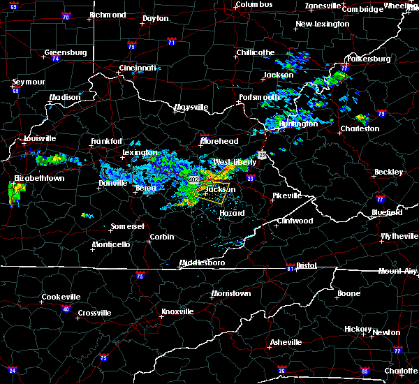 At 1237 pm edt, a severe thunderstorm was located near jackson, moving east at 30 mph (radar indicated). Hazards include 60 mph wind gusts. Expect damage to roofs. Siding and trees. At 1237 pm edt, a severe thunderstorm was located near jackson, moving east at 30 mph (radar indicated). Hazards include 60 mph wind gusts. Expect damage to roofs. Siding and trees.
|
| 6/29/2015 7:45 PM EDT | Large tree fell barely missing home on cardinal branc in breathitt county KY, 5.1 miles SSE of Jackson, KY |
| 6/29/2015 7:42 PM EDT | The severe thunderstorm warning for northwestern breathitt county will expire at 745 pm edt, the storm which prompted the warning has weakened below severe limits, and no longer pose an immediate threat to life or property. therefore the warning will be allowed to expire. however gusty winds are still possible with this thunderstorm. a tornado watch remains in effect until 900 pm edt for southeastern kentucky. |
| 6/29/2015 7:37 PM EDT |
 At 737 pm edt, a severe thunderstorm was located over foraker, or near salyersville, and is nearly stationary (radar indicated). Hazards include 60 mph wind gusts and penny size hail. Expect damage to roofs. siding and trees. locations impacted include, jackson, simpson, sewell, gentry, rock lick, elkatawa, camp lewis, fivemile, lawson, rousseau, sikes, vancleve, noctor, wilhurst, lunah, guage, frozen creek, paxton, stevenson and keck. A tornado watch remains in effect until 900 pm edt for southeastern kentucky. At 737 pm edt, a severe thunderstorm was located over foraker, or near salyersville, and is nearly stationary (radar indicated). Hazards include 60 mph wind gusts and penny size hail. Expect damage to roofs. siding and trees. locations impacted include, jackson, simpson, sewell, gentry, rock lick, elkatawa, camp lewis, fivemile, lawson, rousseau, sikes, vancleve, noctor, wilhurst, lunah, guage, frozen creek, paxton, stevenson and keck. A tornado watch remains in effect until 900 pm edt for southeastern kentucky.
|
| 6/29/2015 7:10 PM EDT |
 At 710 pm edt, a severe thunderstorm was located over wilhurst, or near jackson, moving east at 35 mph (radar indicated). Hazards include quarter size hail and 60 mph wind gusts. Hail damage to vehicles is expected. expect wind damage to roofs, siding and trees. locations impacted include, jackson, simpson, sewell, lawson, rousseau, vancleve, war creek, noctor, guage, paxton, yeadon, oakdale, haginsville, moct, taulbee, bays, gentry, rock lick, elkatawa and camp lewis. A tornado watch remains in effect until 900 pm edt for southeastern kentucky. At 710 pm edt, a severe thunderstorm was located over wilhurst, or near jackson, moving east at 35 mph (radar indicated). Hazards include quarter size hail and 60 mph wind gusts. Hail damage to vehicles is expected. expect wind damage to roofs, siding and trees. locations impacted include, jackson, simpson, sewell, lawson, rousseau, vancleve, war creek, noctor, guage, paxton, yeadon, oakdale, haginsville, moct, taulbee, bays, gentry, rock lick, elkatawa and camp lewis. A tornado watch remains in effect until 900 pm edt for southeastern kentucky.
|
| 6/29/2015 7:05 PM EDT | Tree down onto power lines. numerous large limbs were also blown dow in wolfe county KY, 7.8 miles SE of Jackson, KY |
| 6/29/2015 6:53 PM EDT |
 At 653 pm edt, a severe thunderstorm was located over vada, or 7 miles south of campton, moving east at 35 mph (radar indicated). Hazards include quarter size hail and 70 mph wind gusts. Hail damage to vehicles is expected. expect considerable tree damage. Wind damage is also likely to mobile homes, roofs and outbuildings. At 653 pm edt, a severe thunderstorm was located over vada, or 7 miles south of campton, moving east at 35 mph (radar indicated). Hazards include quarter size hail and 70 mph wind gusts. Hail damage to vehicles is expected. expect considerable tree damage. Wind damage is also likely to mobile homes, roofs and outbuildings.
|
| 6/25/2015 7:46 PM EDT |
 At 745 pm edt, a severe thunderstorm was located over jetts creek, or 7 miles east of booneville, moving southeast at 25 mph (radar indicated). Hazards include quarter size hail and 60 mph wind gusts. Hail damage to vehicles is expected. expect wind damage to roofs, siding and trees. Locations impacted include, jackson, crockettsville, quicksand, portsmouth, saldee, lerose, lost creek, canoe, copland, war creek, beech, noctor, guerrant, sebastian`s branch, altro, dumont, howard creek, yeadon, whick and oakdale. At 745 pm edt, a severe thunderstorm was located over jetts creek, or 7 miles east of booneville, moving southeast at 25 mph (radar indicated). Hazards include quarter size hail and 60 mph wind gusts. Hail damage to vehicles is expected. expect wind damage to roofs, siding and trees. Locations impacted include, jackson, crockettsville, quicksand, portsmouth, saldee, lerose, lost creek, canoe, copland, war creek, beech, noctor, guerrant, sebastian`s branch, altro, dumont, howard creek, yeadon, whick and oakdale.
|
| 6/25/2015 7:25 PM EDT | Quarter sized hail reported 6.1 miles ESE of Jackson, KY, quarter sized hail observed along hwy 541. |
| 6/25/2015 7:24 PM EDT |
 The national weather service in jackson ky has issued a * severe thunderstorm warning for. northeastern owsley county in southeastern kentucky. eastern lee county in southeastern kentucky. southwestern breathitt county in southeastern kentucky. Until 815 pm edt. The national weather service in jackson ky has issued a * severe thunderstorm warning for. northeastern owsley county in southeastern kentucky. eastern lee county in southeastern kentucky. southwestern breathitt county in southeastern kentucky. Until 815 pm edt.
|
| 6/25/2015 7:16 PM EDT |
 At 716 pm edt, a severe thunderstorm was located near jackson, moving southeast at 25 mph (radar indicated). Hazards include quarter size hail and 60 mph wind gusts. Hail damage to vehicles is expected. expect wind damage to roofs, siding and trees. Locations impacted include, jackson, sewell, quicksand, portsmouth, lawson, lost creek, vancleve, war creek, noctor, dumont, fillmore, williba, yeadon, watts, oakdale, haginsville, taulbee, curt, gentry and haddix. At 716 pm edt, a severe thunderstorm was located near jackson, moving southeast at 25 mph (radar indicated). Hazards include quarter size hail and 60 mph wind gusts. Hail damage to vehicles is expected. expect wind damage to roofs, siding and trees. Locations impacted include, jackson, sewell, quicksand, portsmouth, lawson, lost creek, vancleve, war creek, noctor, dumont, fillmore, williba, yeadon, watts, oakdale, haginsville, taulbee, curt, gentry and haddix.
|
| 6/25/2015 6:46 PM EDT |
 At 645 pm edt, a severe thunderstorm was located over widecreek, or 7 miles northwest of jackson, moving east at 20 mph (radar indicated). Hazards include quarter size hail and 60 mph wind gusts. Hail damage to vehicles is expected. Expect wind damage to roofs, siding and trees. At 645 pm edt, a severe thunderstorm was located over widecreek, or 7 miles northwest of jackson, moving east at 20 mph (radar indicated). Hazards include quarter size hail and 60 mph wind gusts. Hail damage to vehicles is expected. Expect wind damage to roofs, siding and trees.
|
| 6/18/2015 1:36 PM EDT | Half a dozen shingles blown off of weather office roo in breathitt county KY, 3.2 miles SSW of Jackson, KY |
| 6/8/2015 6:17 PM EDT | At 616 pm edt, a severe thunderstorm was located over vancleve, or near jackson, moving east at 30 mph (radar indicated). Hazards include 60 mph wind gusts and penny size hail. Expect damage to roofs. siding and trees. Locations impacted include, jackson, simpson, press, sewell, bethany, lane, quicksand, athol, portsmouth, hollonville, lawson, rousseau, vancleve, war creek, noctor, dumont, fillmore, paxton, shockey and yeadon. |
| 6/8/2015 6:13 PM EDT | At 612 pm edt, a severe thunderstorm was located over keck, or near jackson, moving east at 30 mph (radar indicated). Hazards include 60 mph wind gusts. Expect damage to roofs. siding and trees. Locations impacted include, jackson, simpson, press, sewell, quicksand, portsmouth, vancleve, yeadon, oakdale, haginsville, burkhart, bays, jetts creek, curt, elkatawa, lone, fivemile, widecreek, wilhurst and monica. |
| 6/8/2015 5:56 PM EDT | At 555 pm edt, a severe thunderstorm was located over airedale, or near beattyville, moving east at 35 mph (radar indicated). Hazards include 60 mph wind gusts and penny size hail. Expect damage to roofs. Siding and trees. |
| 5/11/2015 3:17 PM EDT | At 316 pm edt, a severe thunderstorm was located over war creek, or 7 miles northwest of jackson, moving northeast at 35 mph (radar indicated). Hazards include 60 mph wind gusts and penny size hail. Expect damage to roofs. siding and trees. locations impacted include, jackson, beattyville, campton, simpson, malaga, sewell, lane, vada, st. helens, vancleve, gilmore, airedale, yeadon, oakdale, burkhart, baptist, bays, jetts creek, elkatawa and lone. this includes bert t. combs mountain parkway between mile markers 46 and 58. 0. 75in. |
| 5/11/2015 3:06 PM EDT | At 305 pm edt, a severe thunderstorm was located over monica, or near beattyville, moving northeast at 40 mph (radar indicated). Hazards include 60 mph wind gusts and penny size hail. Expect damage to roofs. Siding and trees. |
| 4/25/2015 9:28 PM EDT | The severe thunderstorm warning for northern owsley, north central perry, lee, breathitt and southeastern wolfe counties will expire at 930 pm edt, the storm which prompted the warning has weakened below severe limits and exited the warned area. therefore the warning will be allowed to expire. however small hail is still possible with this thunderstorm. |
| 4/25/2015 8:31 PM EDT | At 830 pm edt, a severe thunderstorm was located over yellow rock, or near beattyville, moving east at 35 mph (radar indicated). Hazards include half dollar size hail and 60 mph wind gusts. Hail damage to vehicles is expected. Expect wind damage to roofs, siding and trees. |
| 4/10/2015 7:11 AM EDT | A severe thunderstorm warning remains in effect until 730 am edt for southeastern owsley. perry. southwestern breathitt and central leslie counties. at 710 am edt. a severe thunderstorm was located over krypton. or 8 miles west of hazard. moving northeast at 60 mph. hazard. 60 mph wind gusts. |
| 4/10/2015 6:57 AM EDT | A severe thunderstorm warning remains in effect until 730 am edt for southeastern owsley. perry. eastern clay. southwestern breathitt. northeastern knox and leslie counties. at 657 am edt. a severe thunderstorm was located over bear branch. or 9 miles west of hyden. moving east at 50 mph. hazard. 60 mph wind gusts. |
| 4/10/2015 6:45 AM EDT | The national weather service in jackson ky has issued a * severe thunderstorm warning for. southeastern laurel county in south central kentucky. southeastern owsley county in southeastern kentucky. perry county in southeastern kentucky. Clay county in southeastern kentucky. |
| 4/7/2015 8:41 PM EDT | A tornado warning remains in effect until 915 pm edt for northern breathitt. southeastern wolfe and west central magoffin counties. at 840 pm edt. a severe thunderstorm capable of producing a tornado was located over wilhurst. or near jackson. moving east at 30 mph. hazard. tornado. source. Radar indicated rotation. |
| 4/7/2015 8:28 PM EDT | The national weather service in jackson ky has issued a * tornado warning for. northeastern lee county in southeastern kentucky. northern breathitt county in southeastern kentucky. southern wolfe county in southeastern kentucky. West central magoffin county in southeastern kentucky. |
| 4/7/2015 8:25 PM EDT | A tornado warning remains in effect until 830 pm edt for northeastern lee. northwestern breathitt and southwestern wolfe counties. at 824 pm edt. a severe thunderstorm capable of producing a tornado was located over flat. or near campton. moving east at 30 mph. hazard. Tornado. |
| 4/7/2015 7:55 PM EDT | The national weather service in jackson ky has issued a * tornado warning for. lee county in southeastern kentucky. northwestern breathitt county in southeastern kentucky. southwestern wolfe county in southeastern kentucky. Southeastern estill county in east central kentucky. |
| 9/6/2014 3:51 PM EDT | Trees down near mount carmel schoo in breathitt county KY, 5 miles SE of Jackson, KY |
| 9/6/2014 2:34 PM EDT | Trees down near mount carmel schoo in breathitt county KY, 5 miles SE of Jackson, KY |
| 9/6/2014 2:30 PM EDT | One tree down on cave branch roa in wolfe county KY, 7.8 miles SE of Jackson, KY |
| 9/2/2014 6:05 PM EDT | Power lines down near pizza hut. report from faceboo in breathitt county KY, 0.3 miles WSW of Jackson, KY |
| 8/21/2014 4:15 PM EDT | Tree across hwy 47 in breathitt county KY, 7.7 miles NW of Jackson, KY |
| 6/10/2014 7:13 PM EDT | Large tree limbs blown down on highway 3 in breathitt county KY, 1.4 miles W of Jackson, KY |
| 6/10/2014 7:03 PM EDT | Several trees dow in breathitt county KY, 2.9 miles SE of Jackson, KY |
| 6/10/2014 7:00 PM EDT | Large tree limbs blown down on highway 3 in breathitt county KY, 1.4 miles W of Jackson, KY |
| 6/10/2014 6:55 PM EDT | Tree down on kentucky av in breathitt county KY, 0.3 miles WSW of Jackson, KY |
| 6/10/2014 6:55 PM EDT | Half a roof blown off a trailer on quicksand roa in breathitt county KY, 2 miles N of Jackson, KY |
| 6/4/2014 8:15 PM EDT | Quarter sized hail reported 10.4 miles NNE of Jackson, KY, nickel to quarter size hail. |
| 5/21/2014 10:14 PM EDT | Walnut tree blown down just off of highway 30 wes in breathitt county KY, 8.7 miles NE of Jackson, KY |
| 4/3/2014 4:29 PM EDT | 3 trees down on highway 1261 in wolfe county KY, 7.8 miles SE of Jackson, KY |
| 12/22/2013 1:40 AM EST | Tree reported down due to high winds on town hill road at highway 30 in breathitt county KY, 0.8 miles E of Jackson, KY |
| 12/22/2013 1:40 AM EST | Tree reported down due to high wind in breathitt county KY, 0.8 miles E of Jackson, KY |
| 11/1/2013 3:00 AM EDT | Entire in breathitt county KY, 5.1 miles NNW of Jackson, KY |
| 9/12/2013 4:15 PM EDT | Large limb down on highway 542. also...another large limb down nearby on highway 30 between mile markers 33 and 34. time estimated off of rada in breathitt county KY, 10.8 miles W of Jackson, KY |
| 7/2/2013 2:30 PM EDT | Several large limbs knocked out of trees and onto the road on hwy 30 in the shoulder blade community. report via social medi in breathitt county KY, 3.6 miles NE of Jackson, KY |
| 7/1/2013 5:47 PM EDT | Trees were blown down along route 20 in breathitt county KY, 7.7 miles S of Jackson, KY |
| 6/13/2013 12:15 PM EDT | Tree across road on hwy 52 near the intersection of hwy 52 and hwy 3 in breathitt county KY, 2.4 miles E of Jackson, KY |
| 5/21/2013 6:28 PM EDT | Large tree limbs were downe in breathitt county KY, 11.1 miles WSW of Jackson, KY |
| 5/21/2013 6:08 PM EDT | Tree down 1 mile north of highway 30 on airport roa in breathitt county KY, 3.3 miles SW of Jackson, KY |
| 1/30/2013 8:06 AM EST | Trees down on highway 30 at guag in breathitt county KY, 10.6 miles WSW of Jackson, KY |
| 1/30/2013 7:50 AM EST | Trees down on highway 141 in breathitt county KY, 8.5 miles S of Jackson, KY |
| 6/29/2012 7:43 PM EDT | Trees downed on hwy 5 in breathitt county KY, 5.3 miles ENE of Jackson, KY |
| 6/29/2012 7:43 PM EDT | Trees downed 2.3 miles north of hwy 5 in breathitt county KY, 5.3 miles ENE of Jackson, KY |
| 4/26/2012 5:01 PM EDT | Half Dollar sized hail reported 6.2 miles NNW of Jackson, KY, quarter to half dollar size hail falling. |
| 3/15/2012 2:45 PM EDT | Quarter sized hail reported 6.2 miles ENE of Jackson, KY, quarter sized hail was reported by a trained spotter. |
| 3/15/2012 2:15 PM EDT | Quarter sized hail reported 9.4 miles ENE of Jackson, KY |
| 1/1/0001 12:00 AM | Large limbs were blown down. time of event is estimated from rada in breathitt county KY, 10.9 miles W of Jackson, KY |
| 1/1/0001 12:00 AM | Roof partially blown off home. porch damaged. occurred on robinson branch roa in breathitt county KY, 2 miles N of Jackson, KY |
| 1/1/0001 12:00 AM | 12 inch diameter pine tree snapped about 6 feet up from its base along armory d in breathitt county KY, 0.3 miles WSW of Jackson, KY |
| 1/1/0001 12:00 AM | A couple of trees down on highland avenu in breathitt county KY, 0.3 miles WSW of Jackson, KY |
| 1/1/0001 12:00 AM | Multiple trees down in the city of jackso in breathitt county KY, 0.3 miles WSW of Jackson, KY |
| 1/1/0001 12:00 AM | One tree down on highway 3 in breathitt county KY, 2.5 miles W of Jackson, KY |
| 1/1/0001 12:00 AM | Tree down from a 48 mph wind gust measured by asos at nws jackso in breathitt county KY, 4.2 miles SW of Jackson, KY |
| 1/1/0001 12:00 AM | Tree down on along hwy 1 in breathitt county KY, 5.1 miles SSE of Jackson, KY |
| 1/1/0001 12:00 AM | 1 tree down on highway 1098 between mile marker 1 and 2 at south for in breathitt county KY, 3.6 miles WNW of Jackson, KY |
| 1/1/0001 12:00 AM | 6-7 trees down on highway 1812 between mile marker 6 and in breathitt county KY, 3.8 miles SSW of Jackson, KY |
| 1/1/0001 12:00 AM | Tree down on hwy 30 es in breathitt county KY, 8.8 miles WSW of Jackson, KY |
| 1/1/0001 12:00 AM | Tree down near south for in breathitt county KY, 3.2 miles NW of Jackson, KY |
| 1/1/0001 12:00 AM | Golf Ball sized hail reported 1.9 miles E of Jackson, KY |
| 1/1/0001 12:00 AM | Quarter sized hail reported 7.7 miles NW of Jackson, KY |
| 1/1/0001 12:00 AM | Golf Ball sized hail reported 0.3 miles WSW of Jackson, KY |
| 1/1/0001 12:00 AM | Golf Ball sized hail reported 0.3 miles WSW of Jackson, KY, golf ball sized hail at lakeside. |
| 1/1/0001 12:00 AM | The top half of a large healthy pine tree was snapped off by thunderstorm wind gust in breathitt county KY, 0.3 miles WSW of Jackson, KY |
| 1/1/0001 12:00 AM | Large pine tree was snapped off by thunderstorm wind causing damage to a hous in breathitt county KY, 2.2 miles S of Jackson, KY |
| 1/1/0001 12:00 AM | Quarter sized hail reported 2.2 miles S of Jackson, KY |
| 1/1/0001 12:00 AM | Numerous reports of trees down around the county including talbert and jackso in breathitt county KY, 0.3 miles WSW of Jackson, KY |
| 1/1/0001 12:00 AM | Numerous reports of trees down around the county including talbert and jackso in breathitt county KY, 0.3 miles WSW of Jackson, KY |
Hail Maps for Jackson, KY


Connect with Interactive Hail Maps