

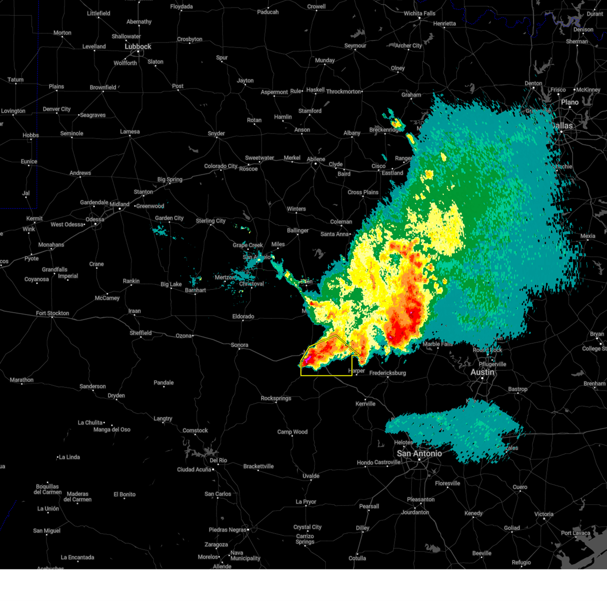
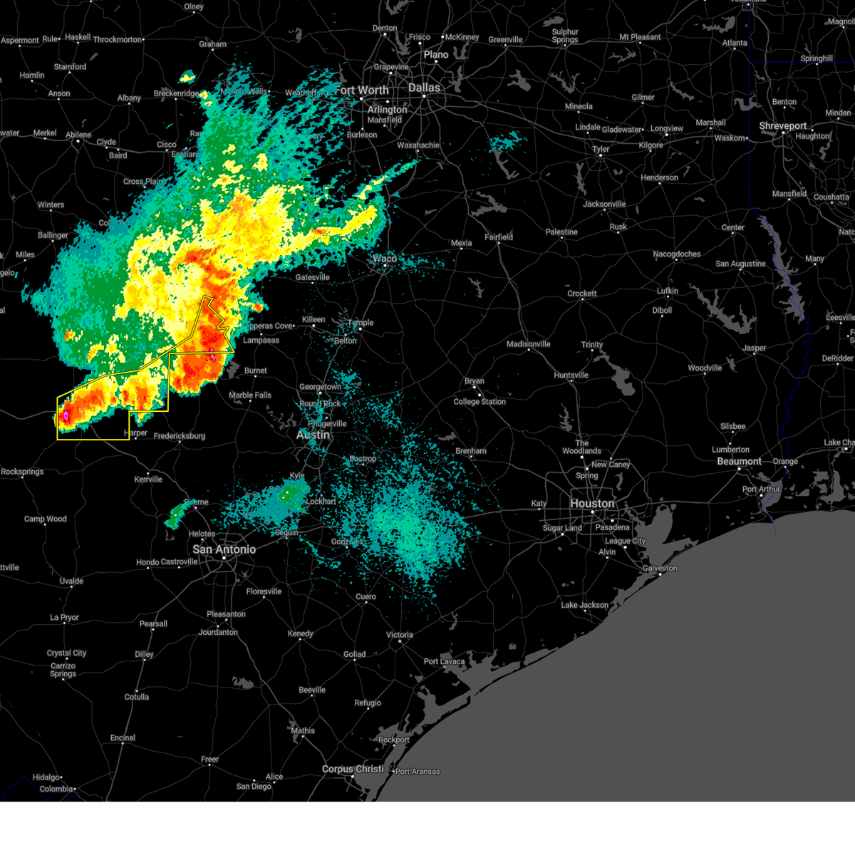
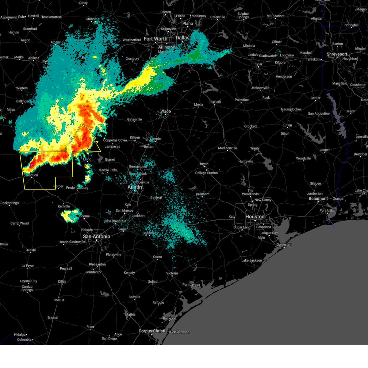
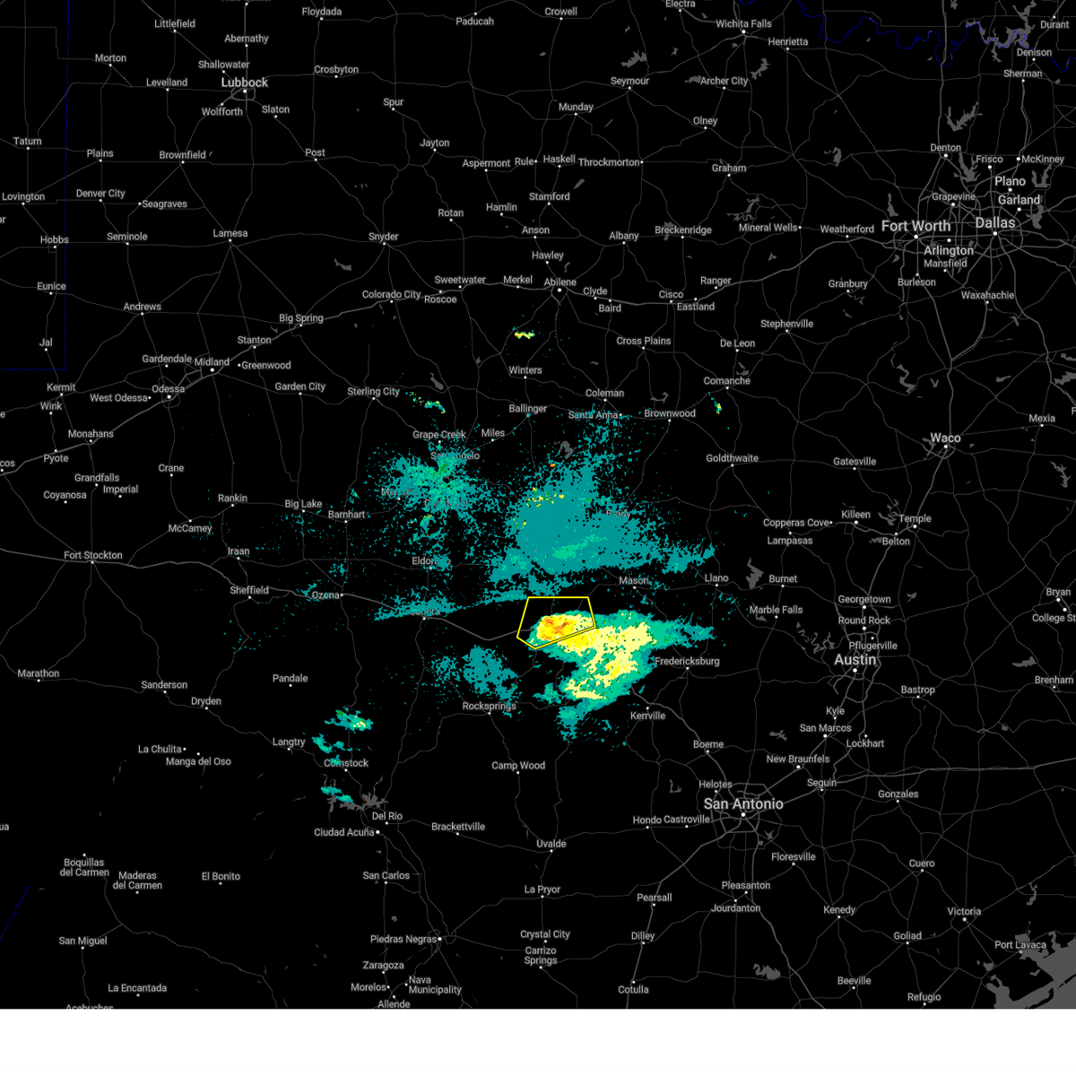
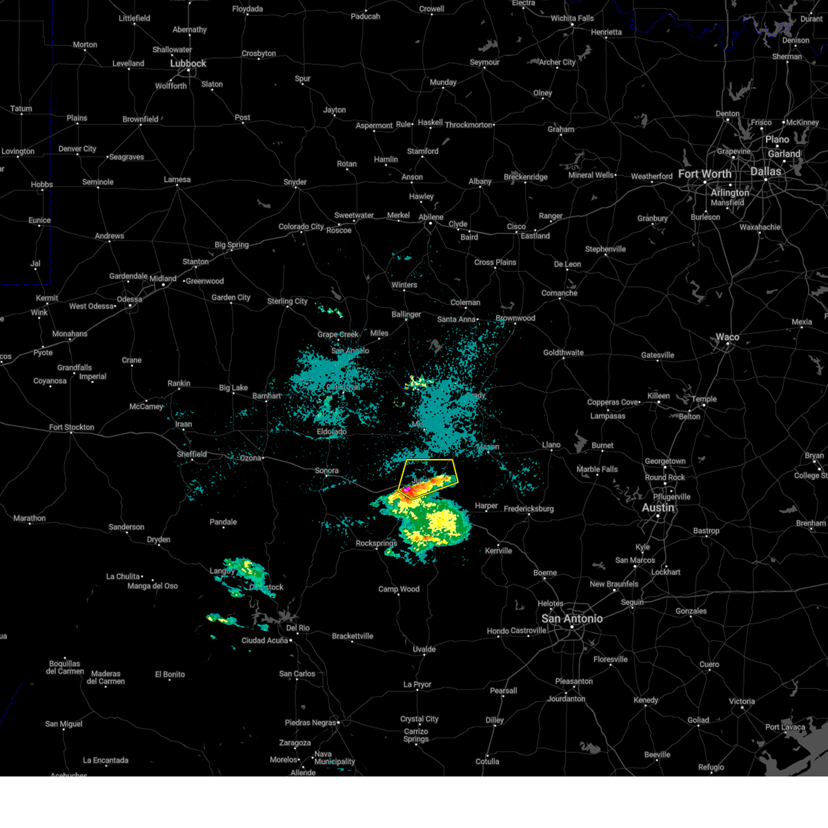
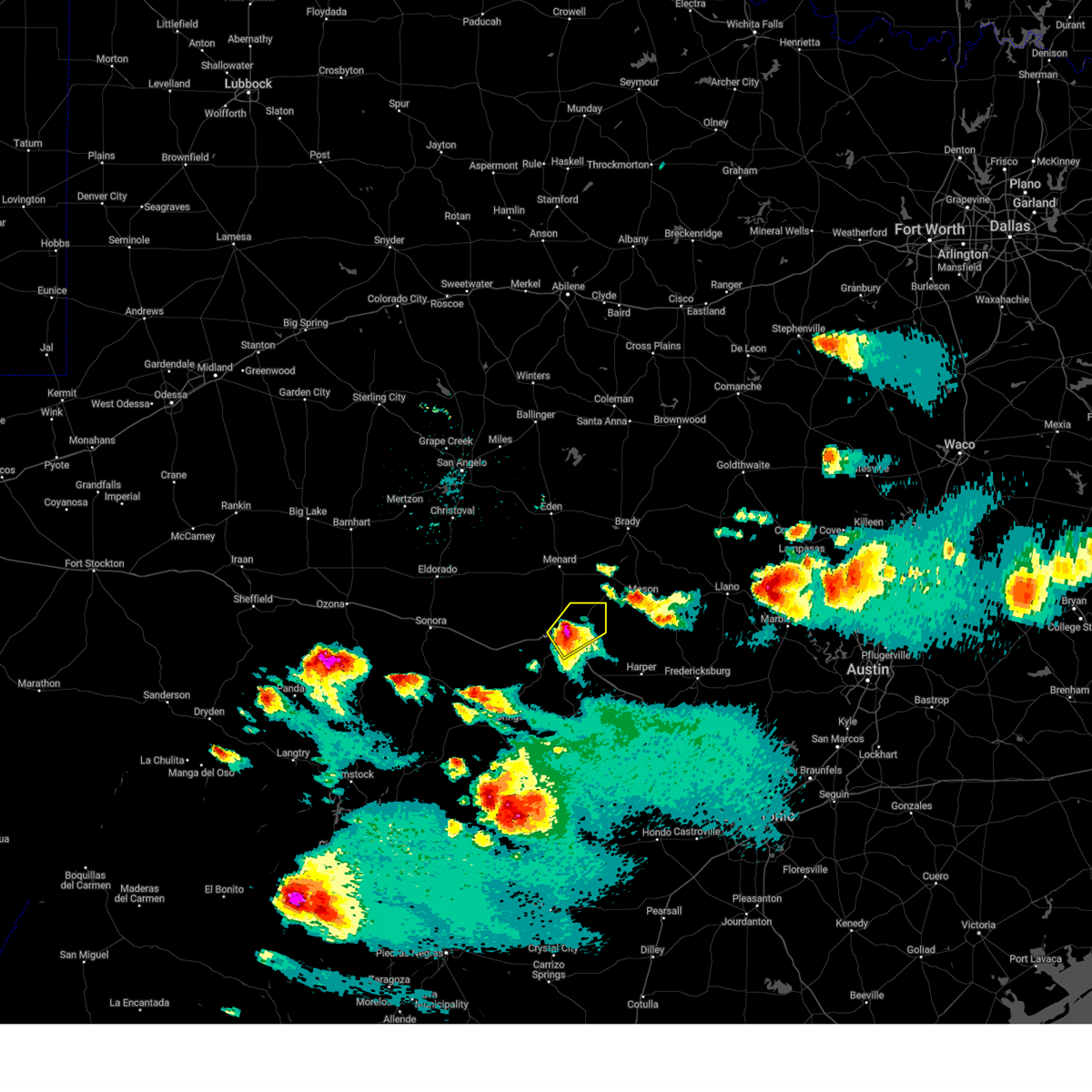
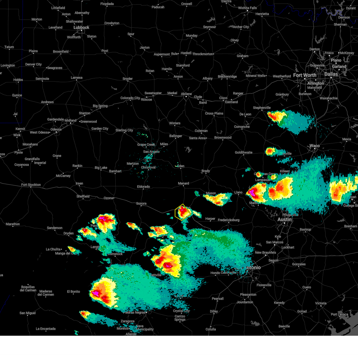
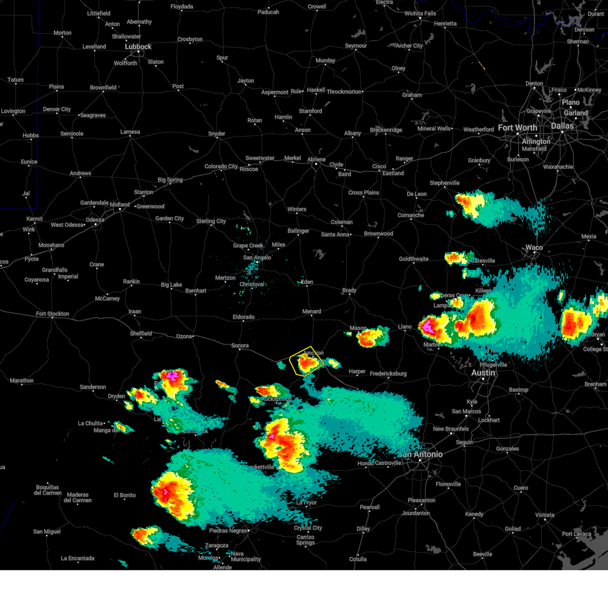
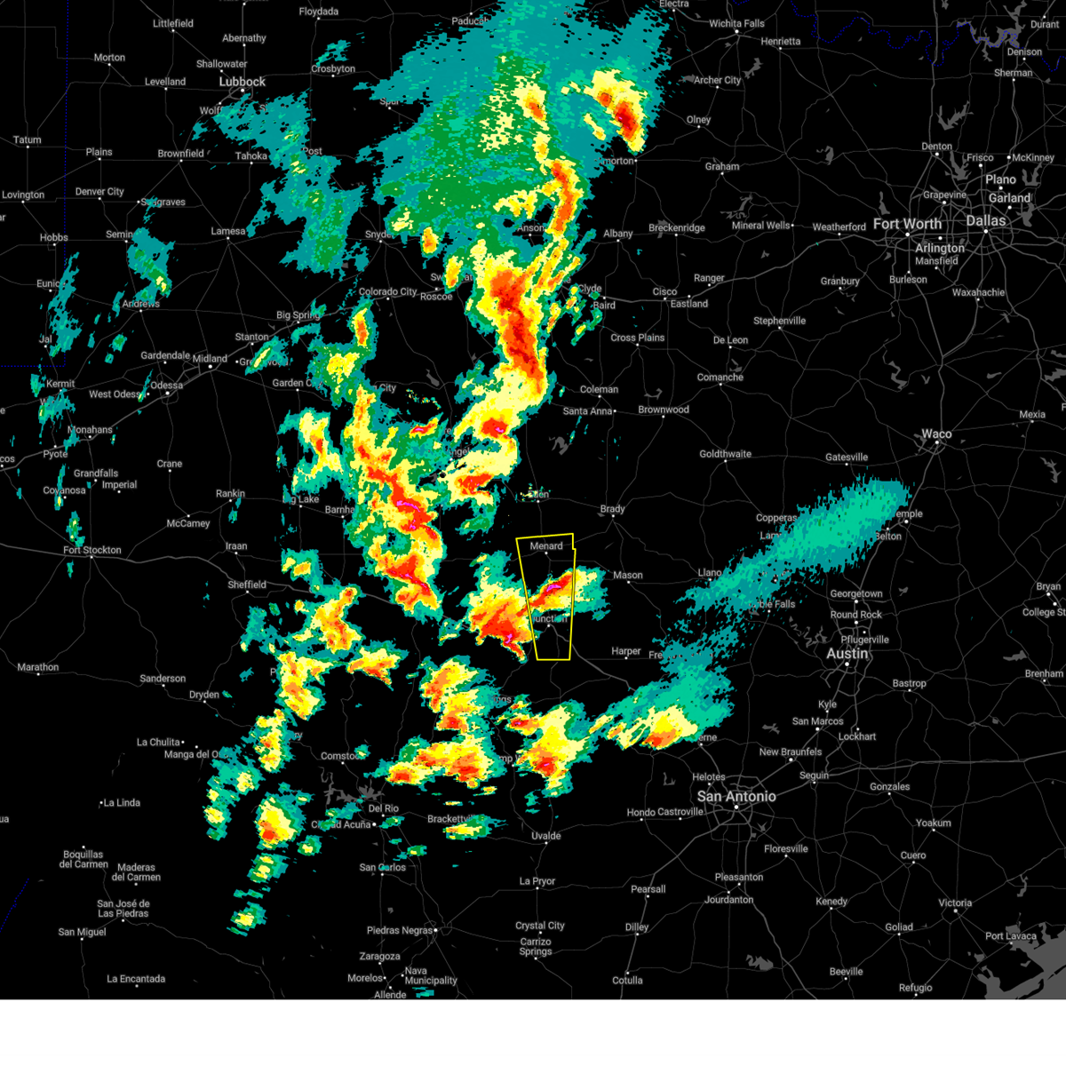
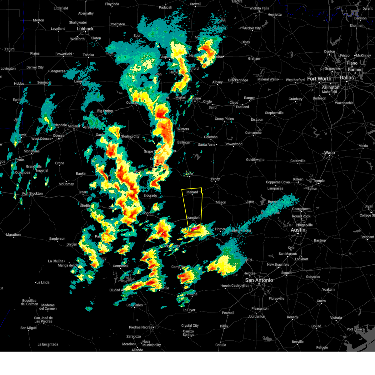
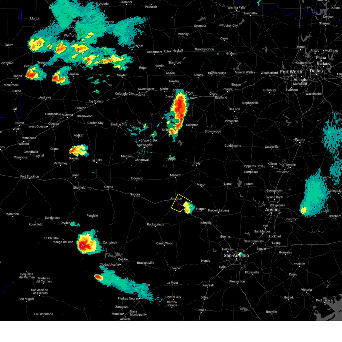
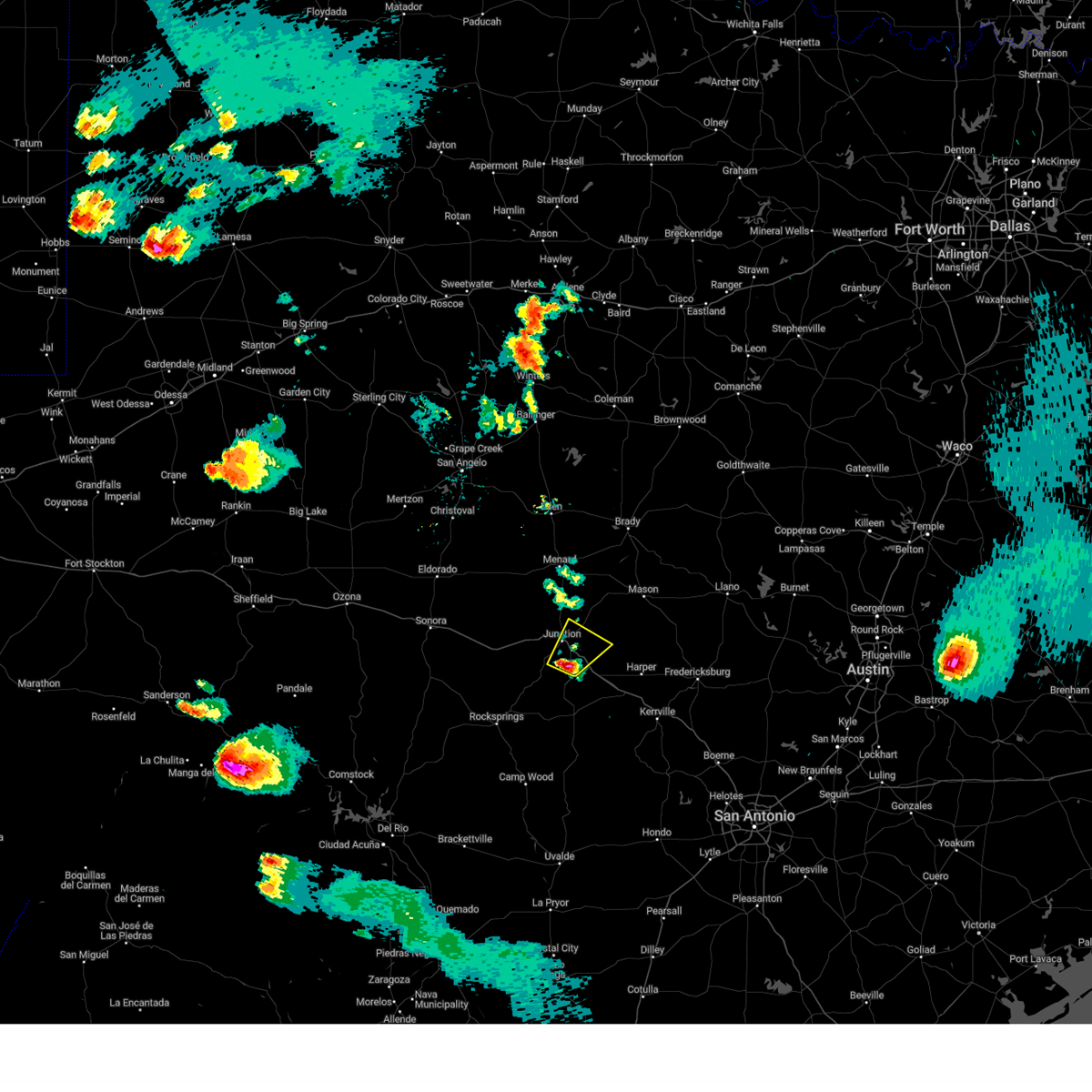
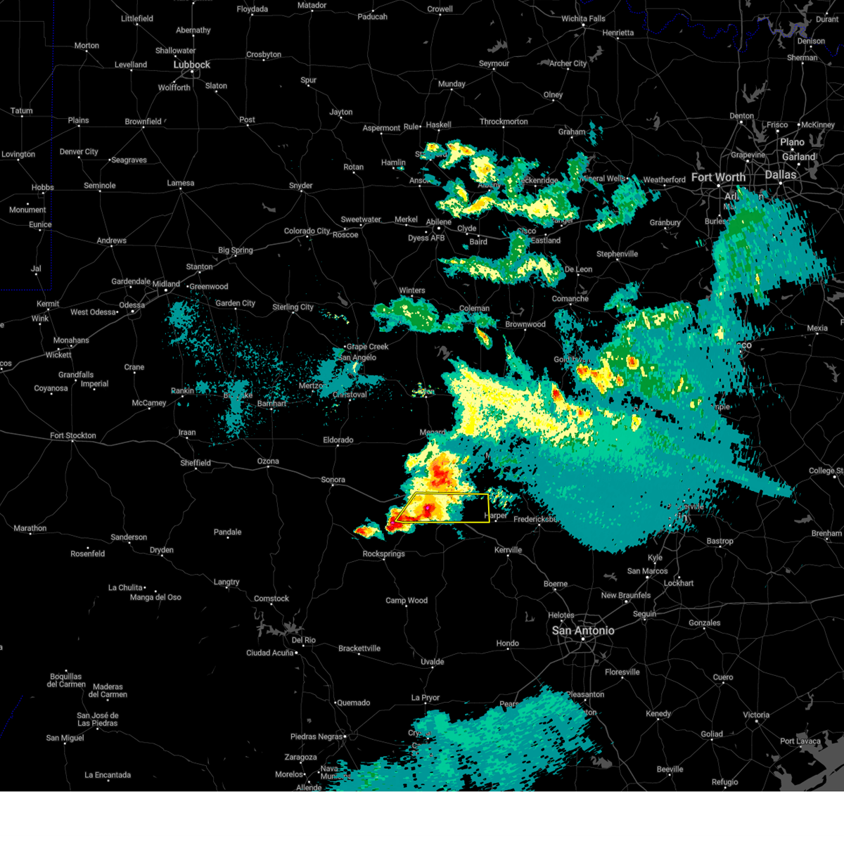
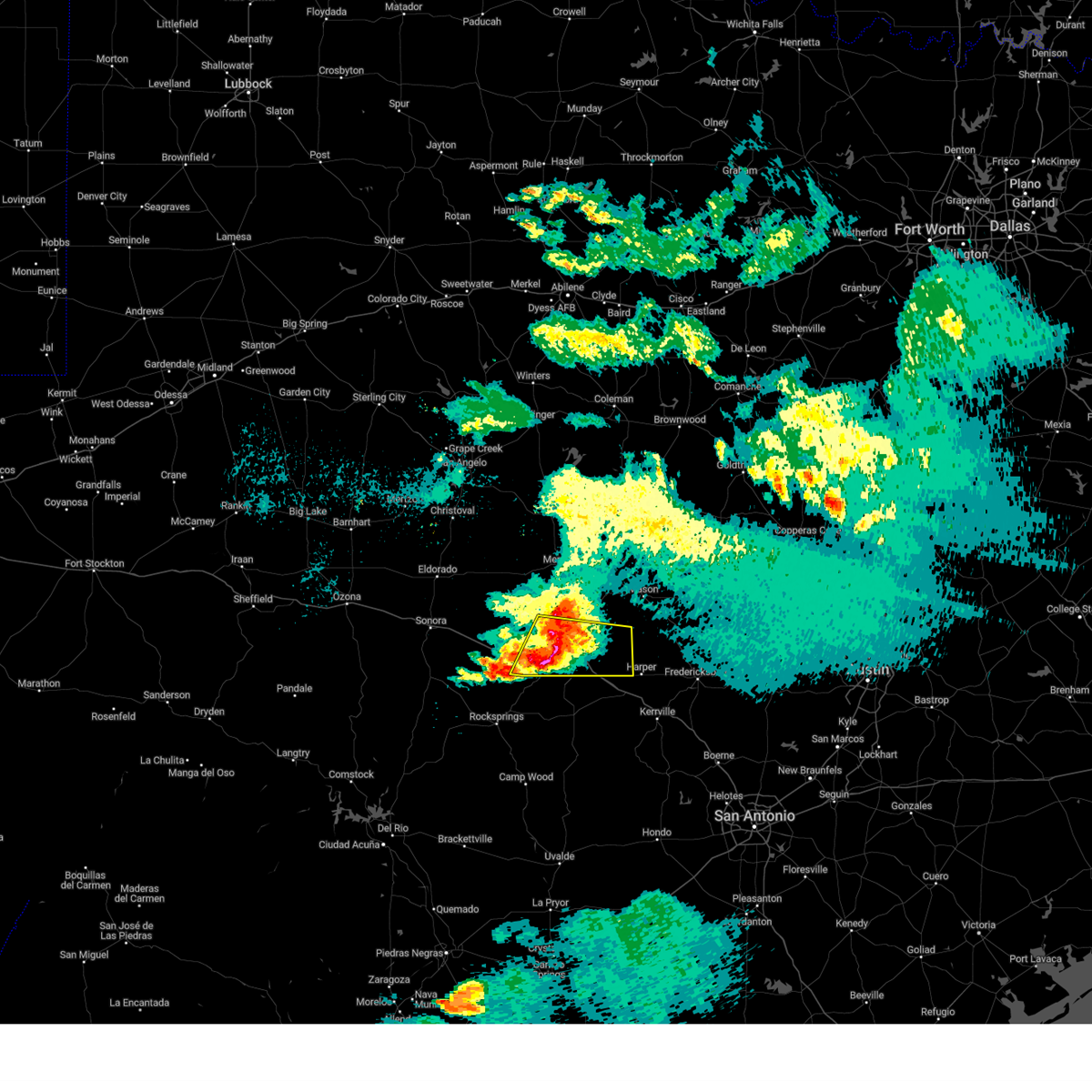
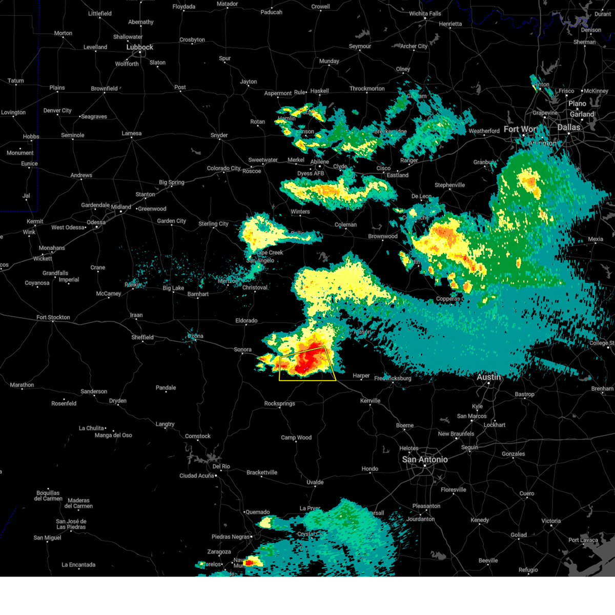
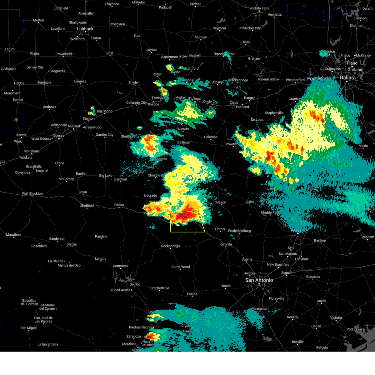
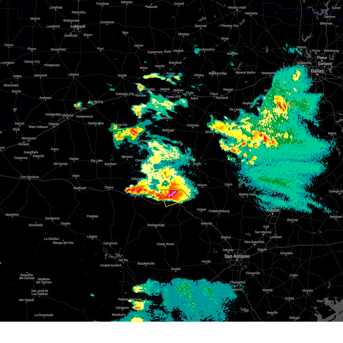
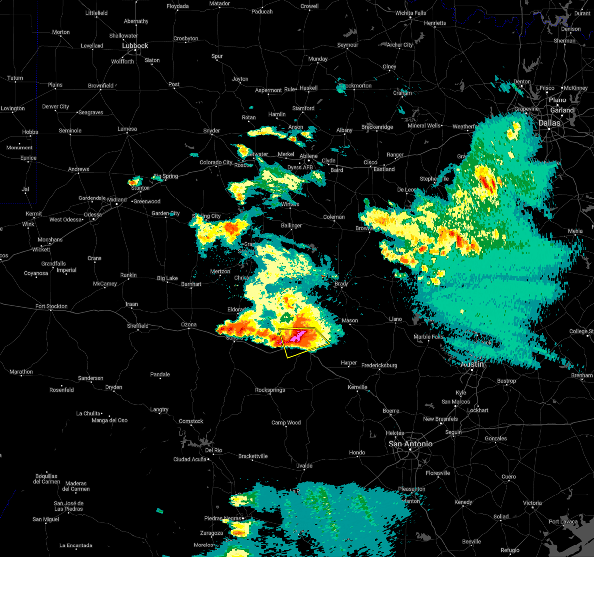
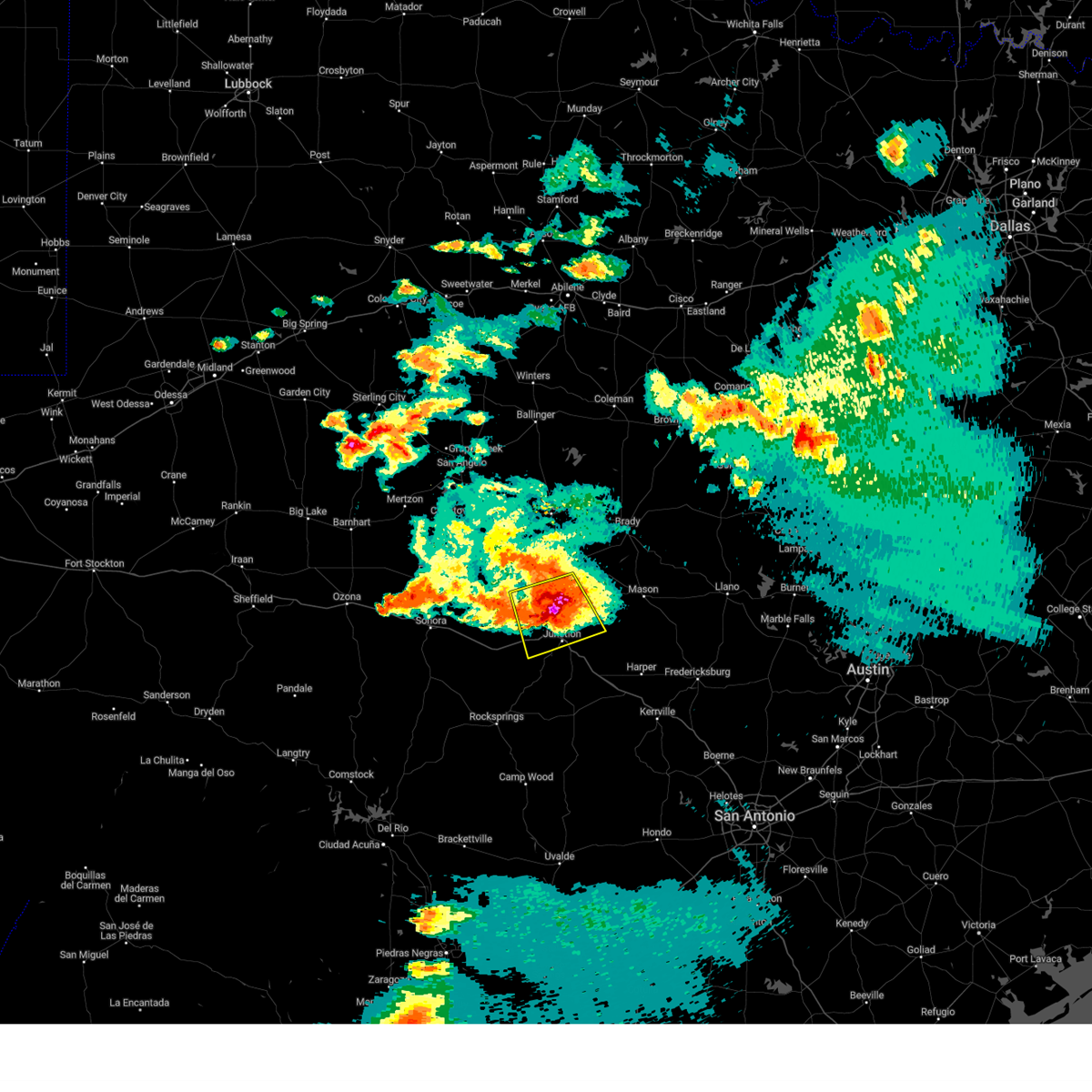
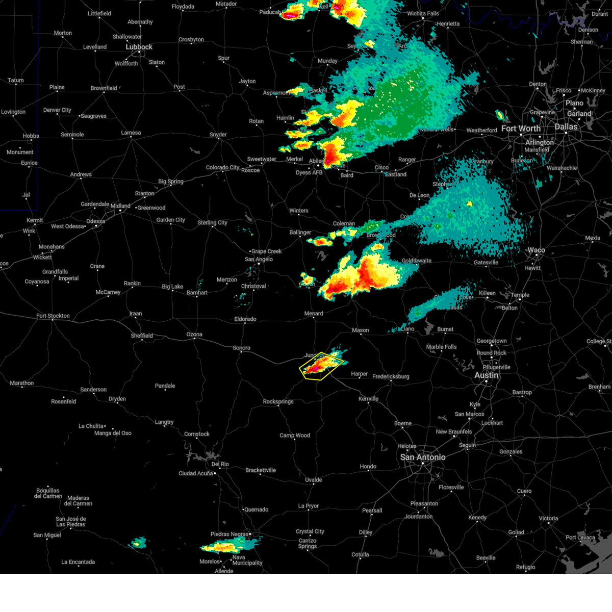
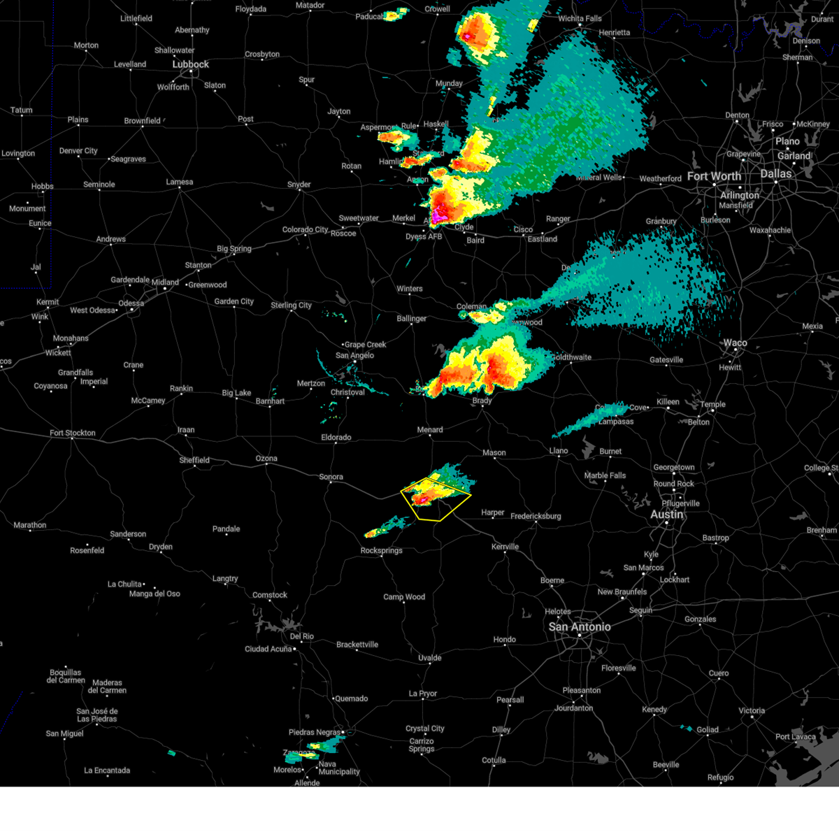
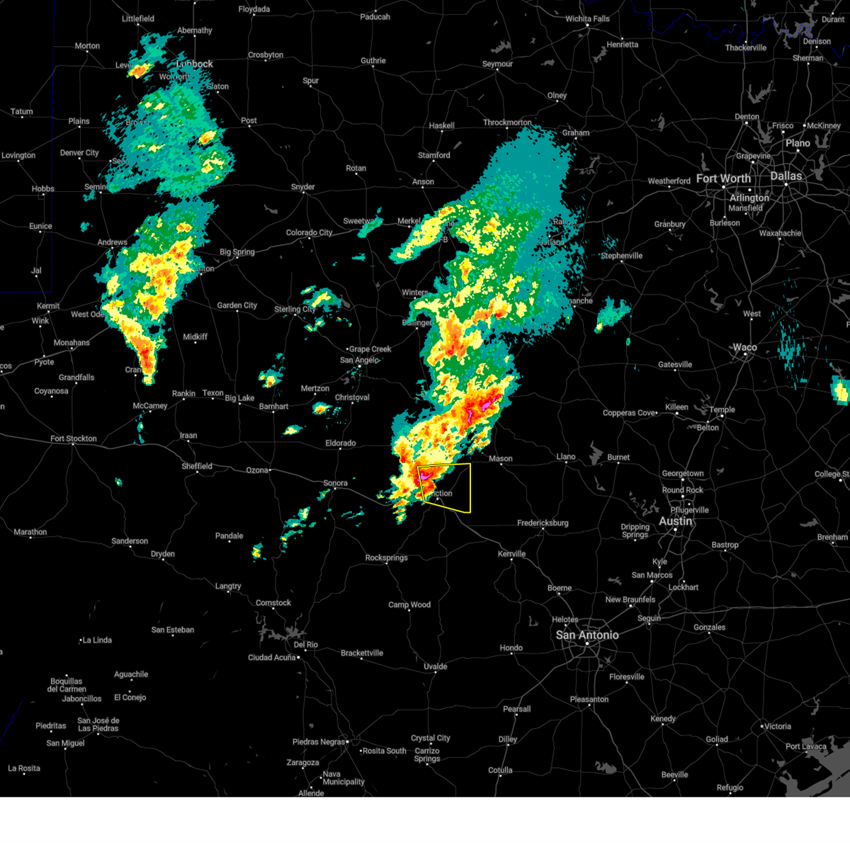
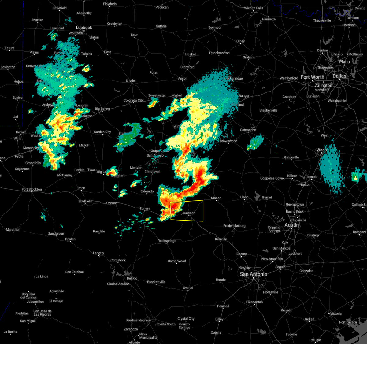
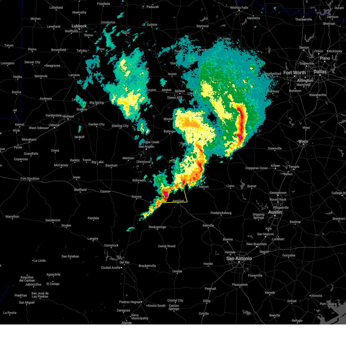
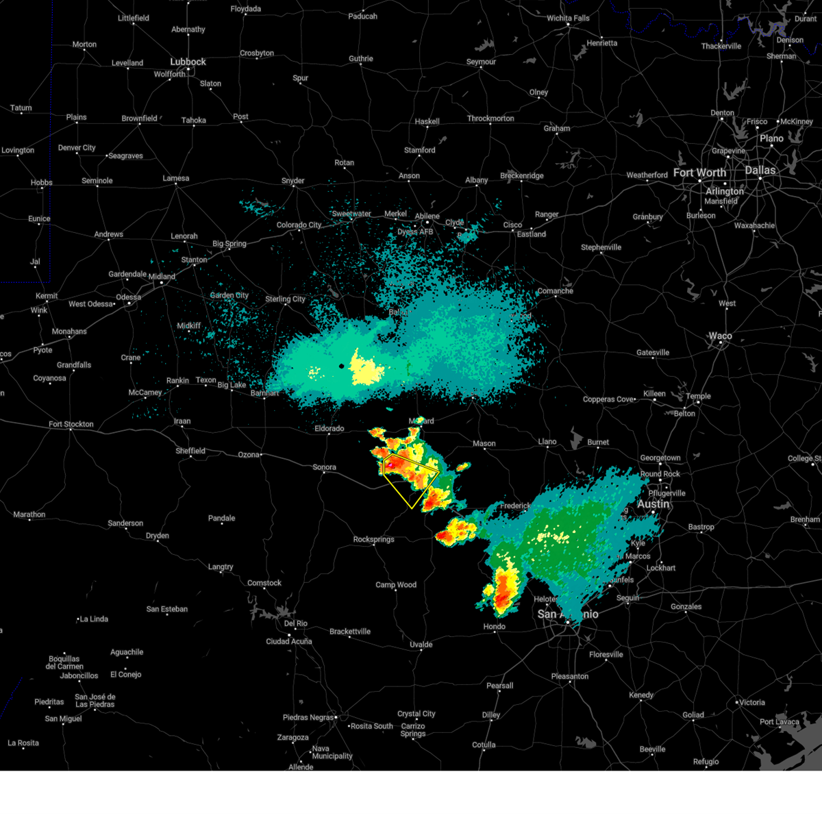
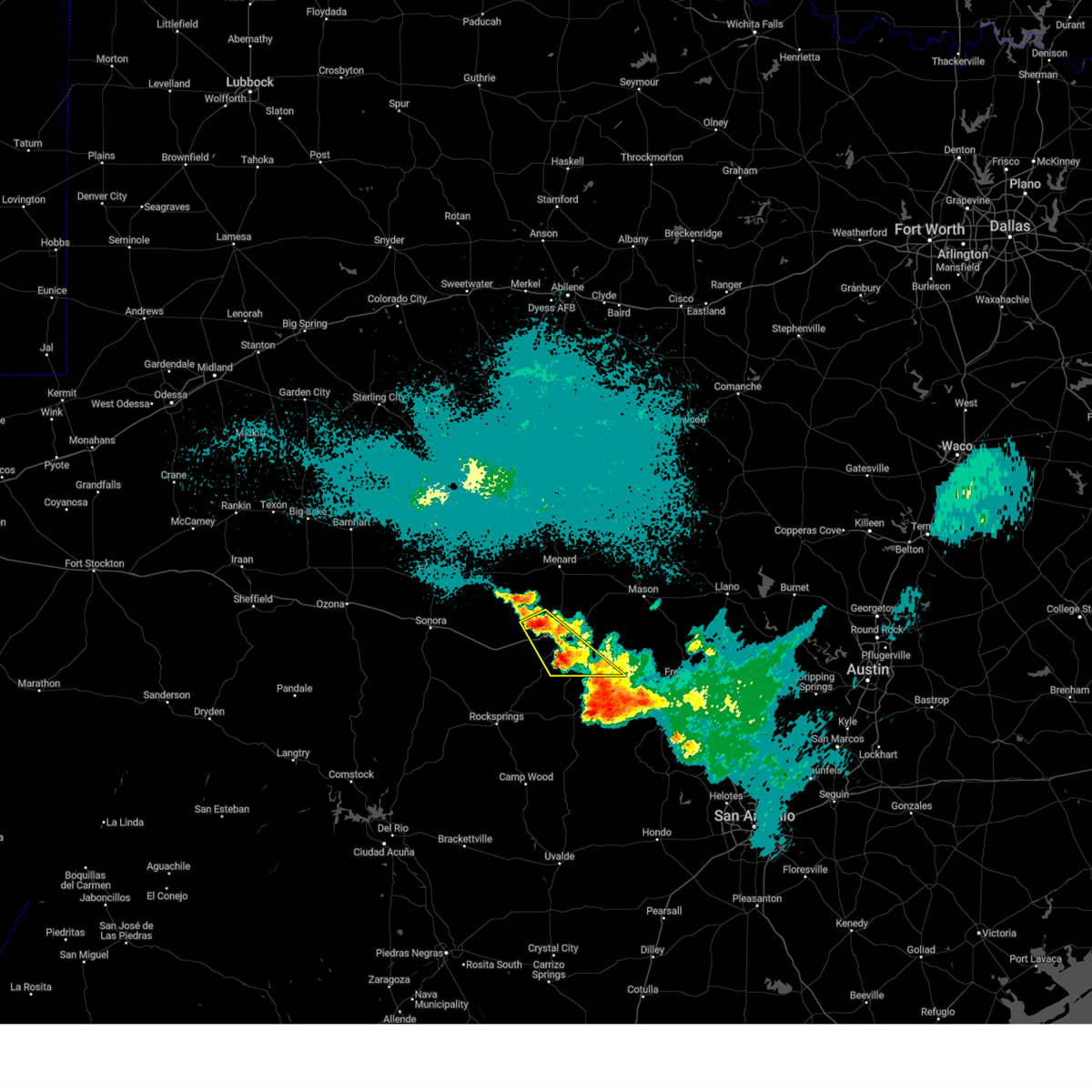
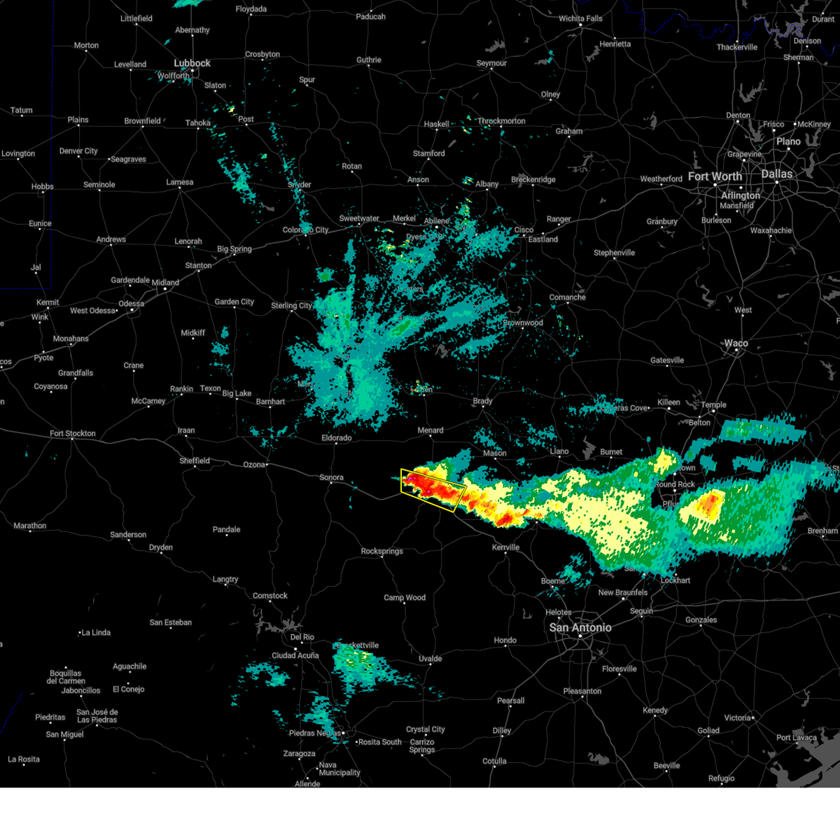
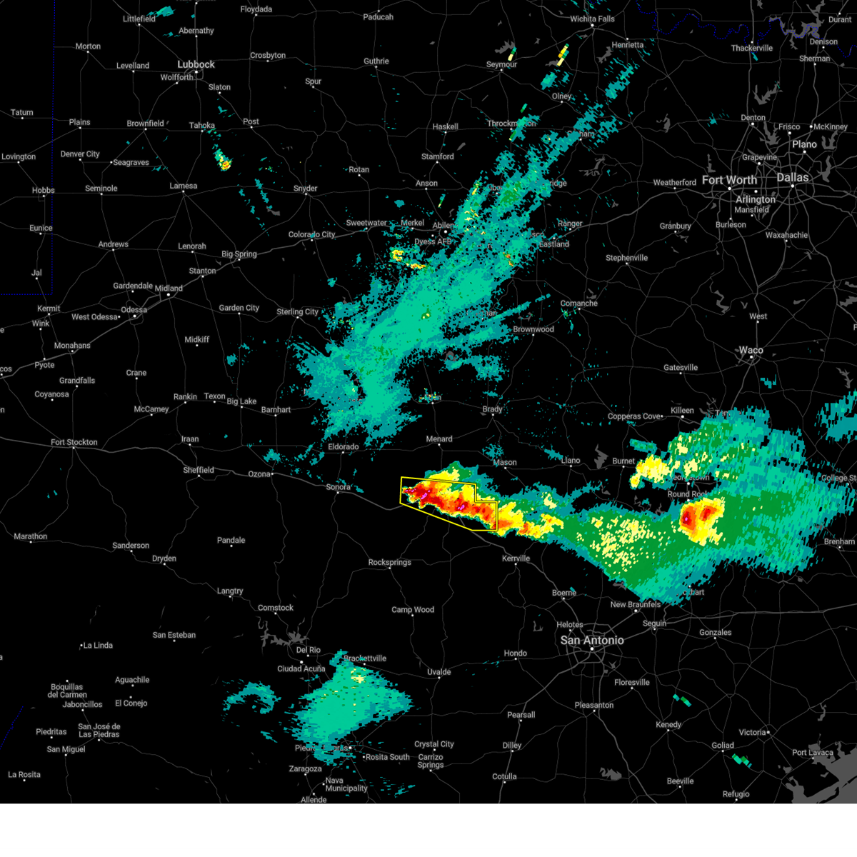
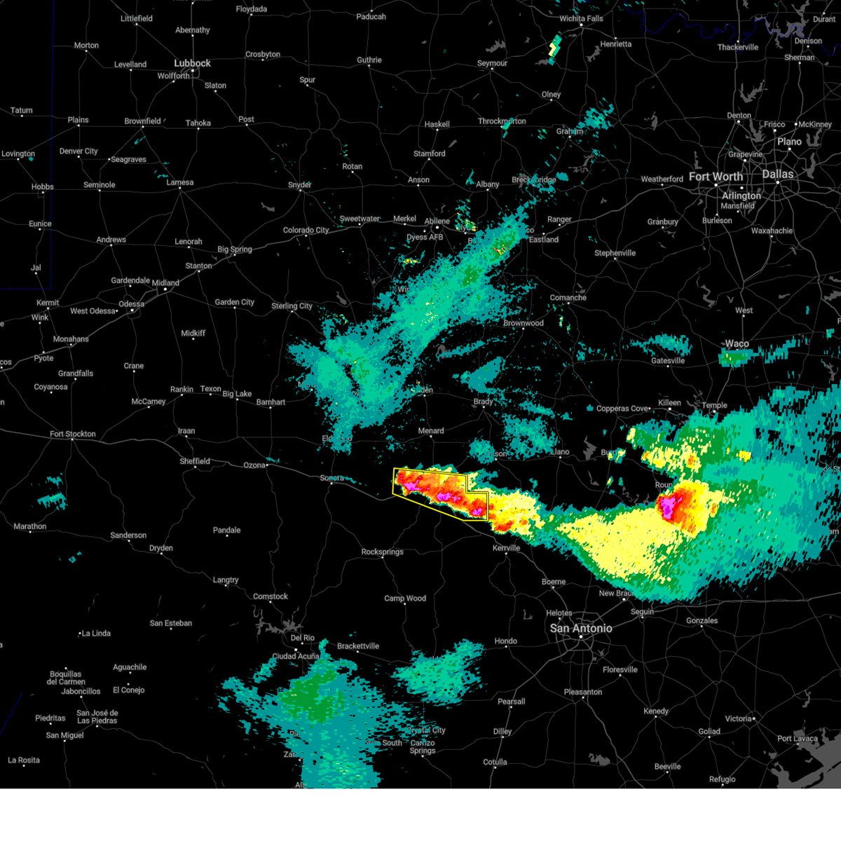
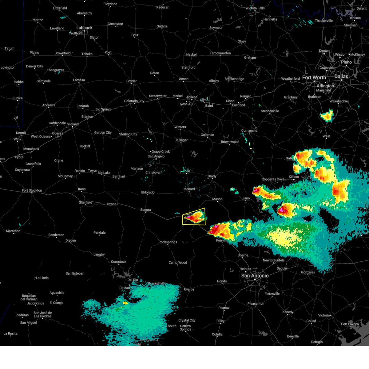
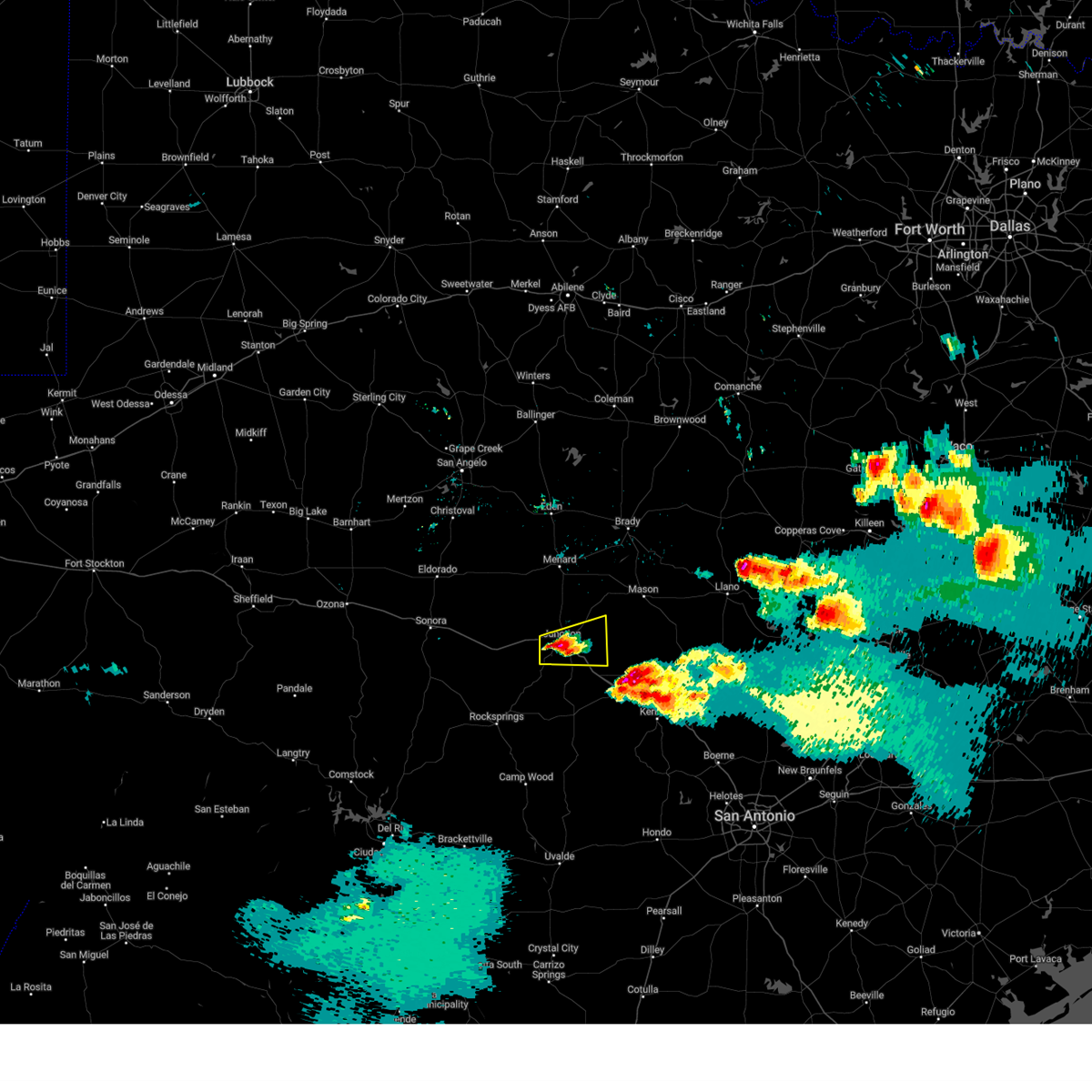
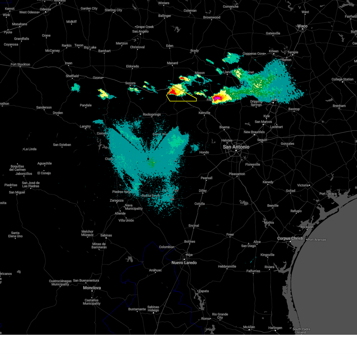
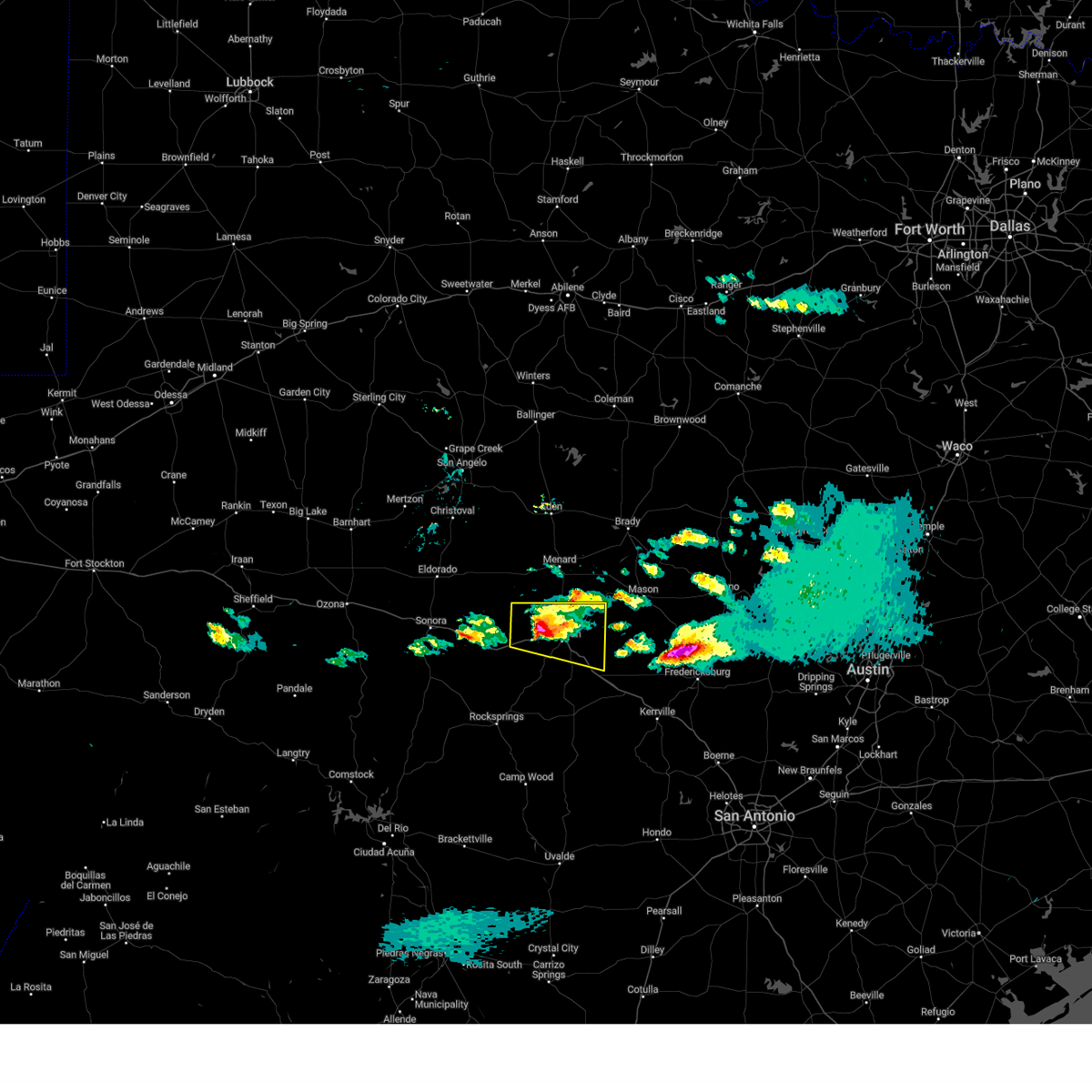
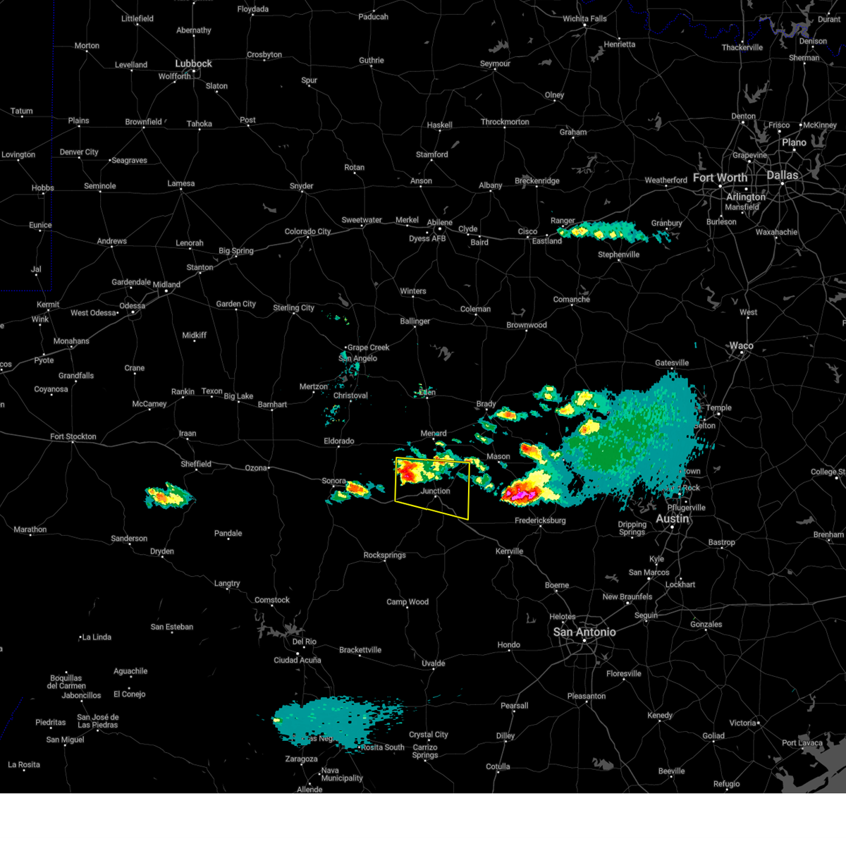
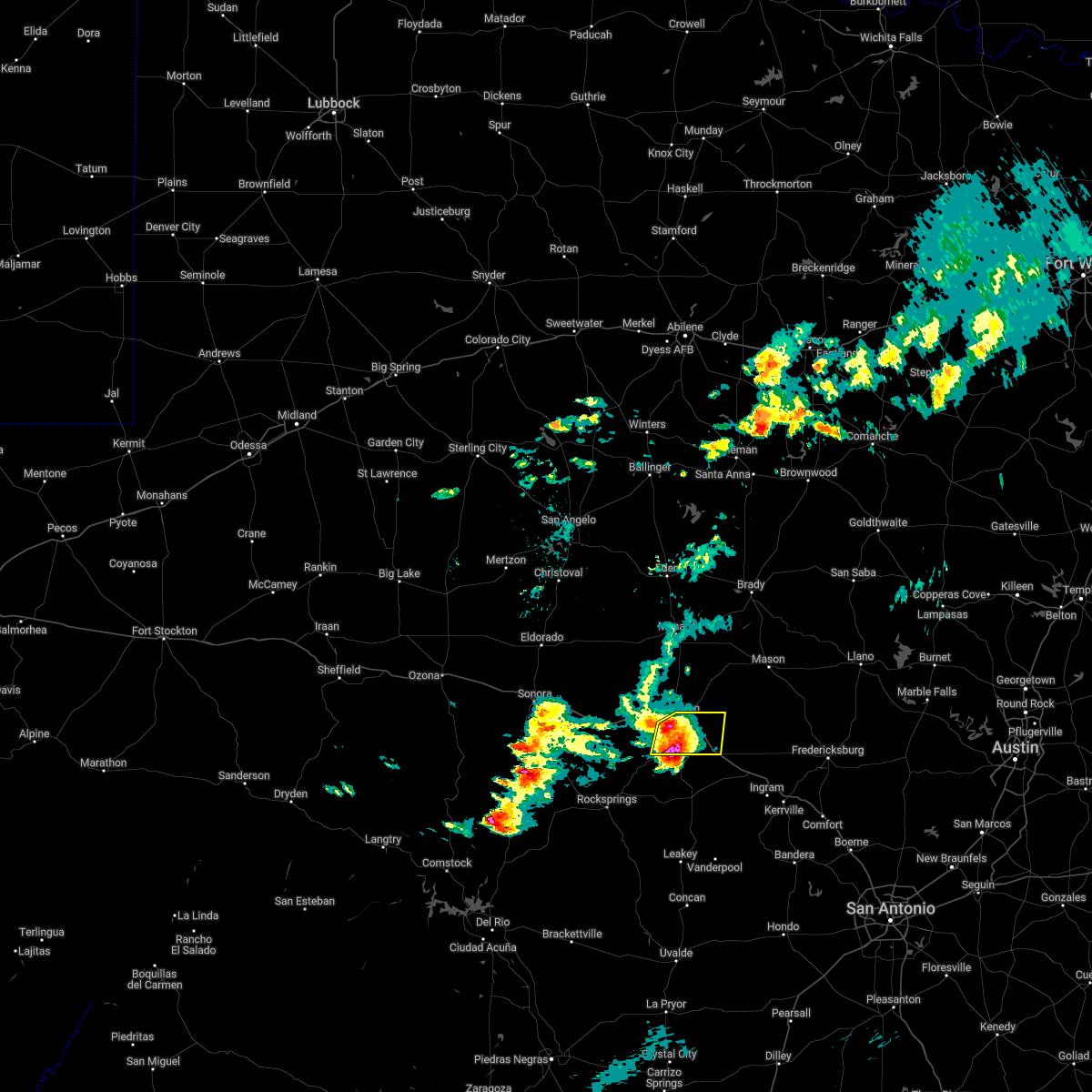
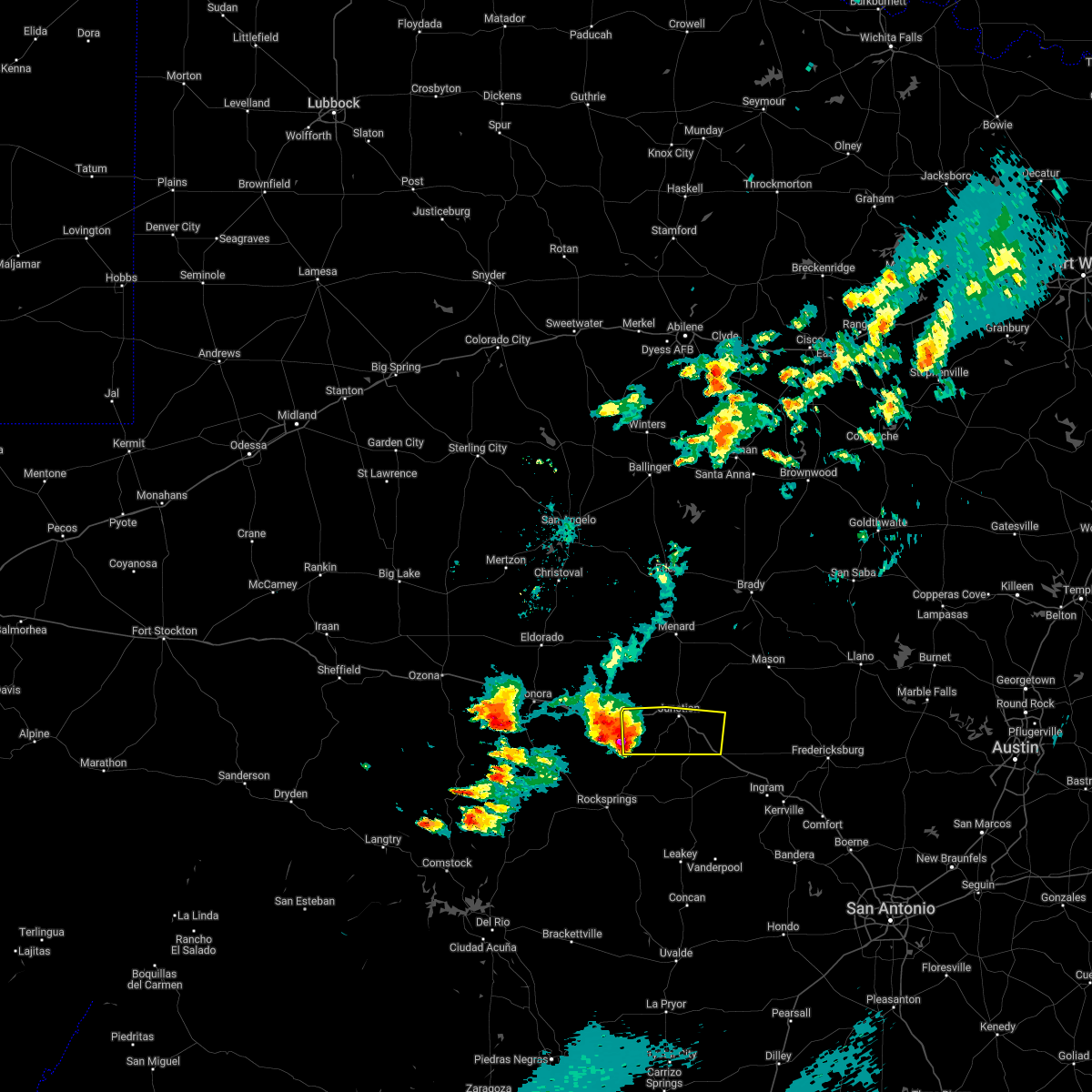
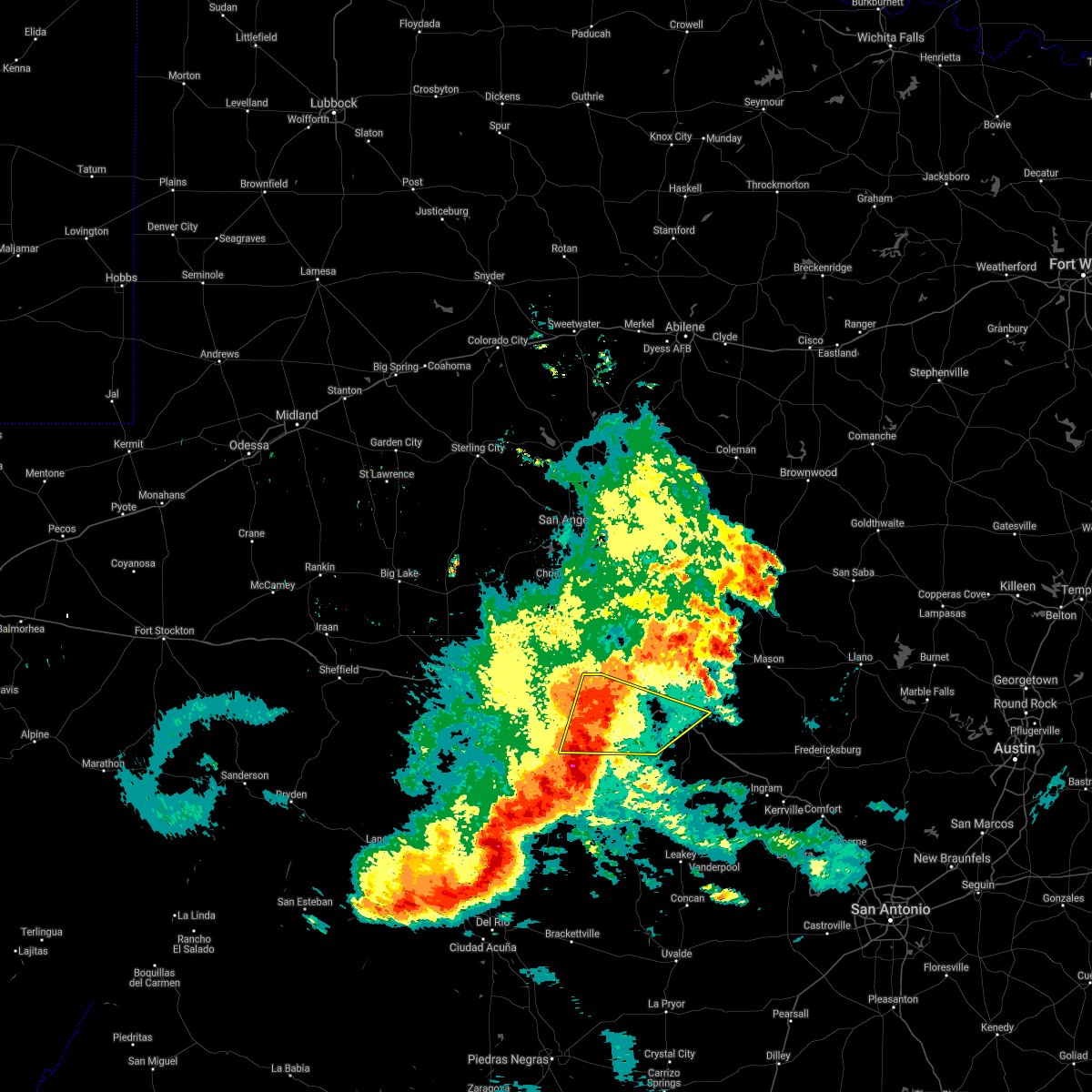
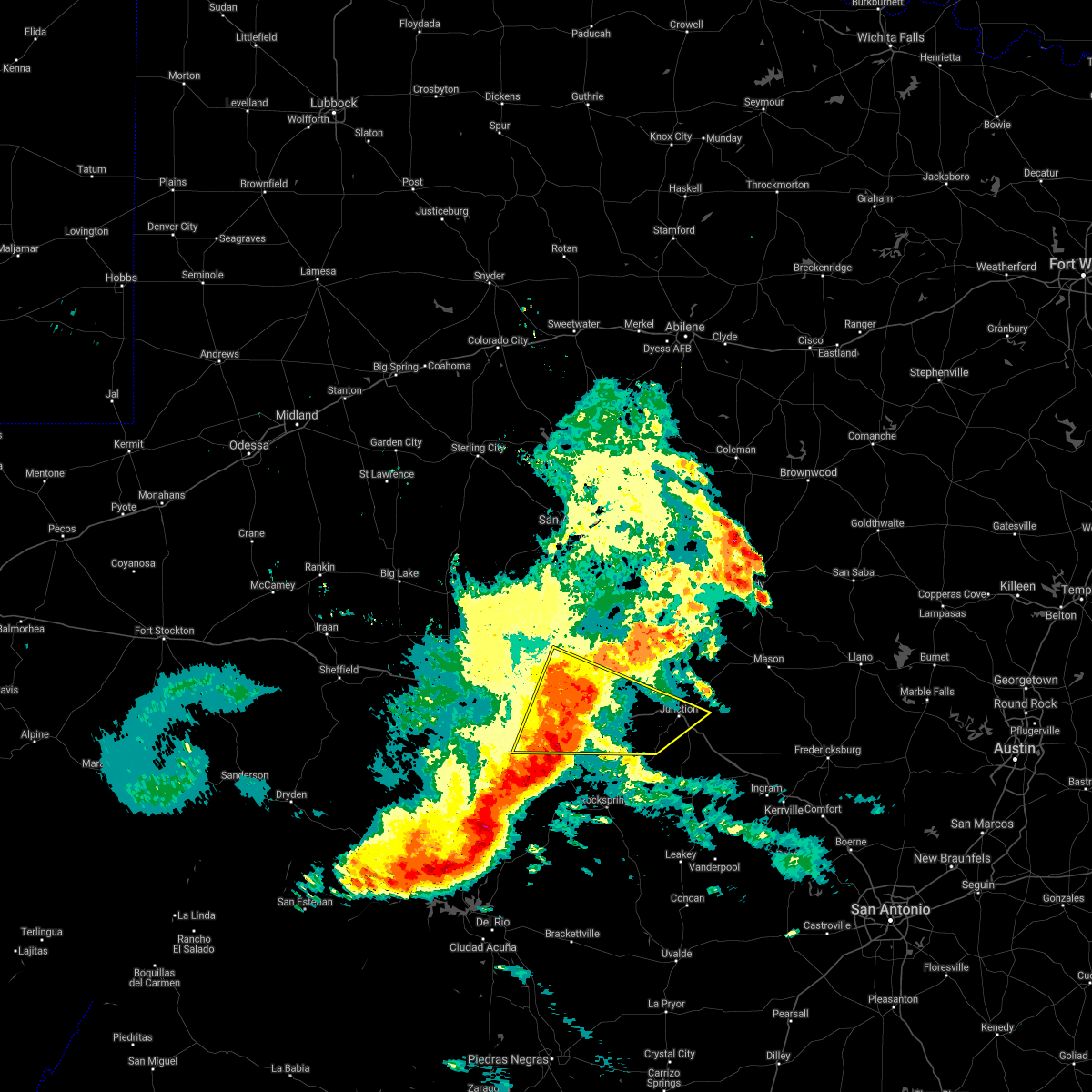
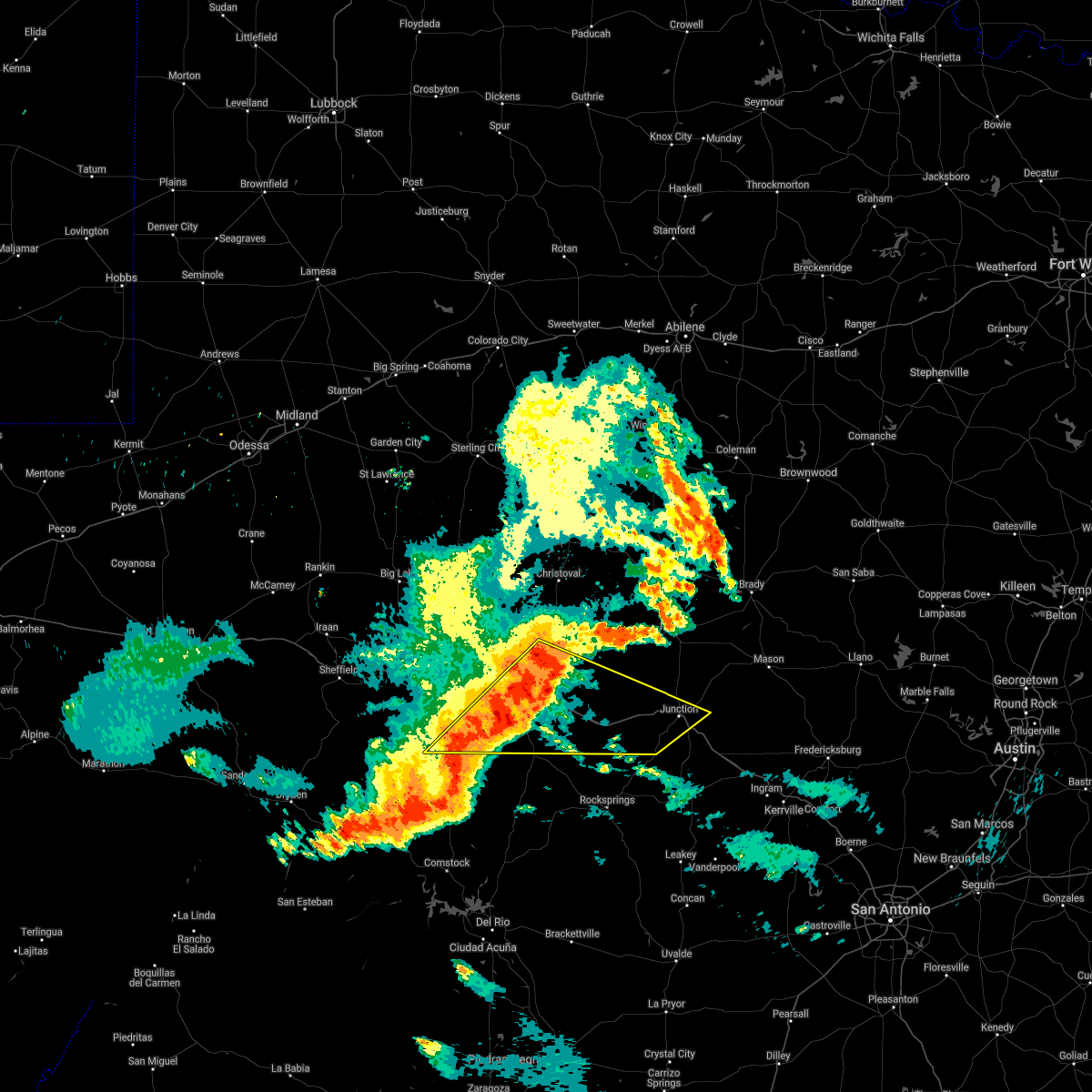
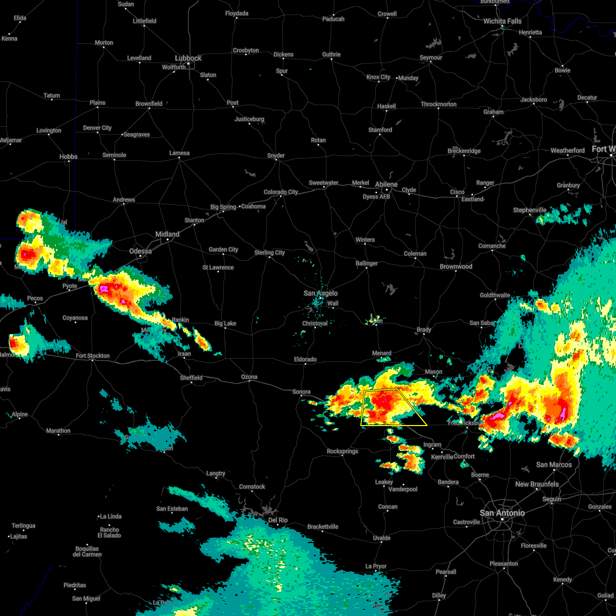
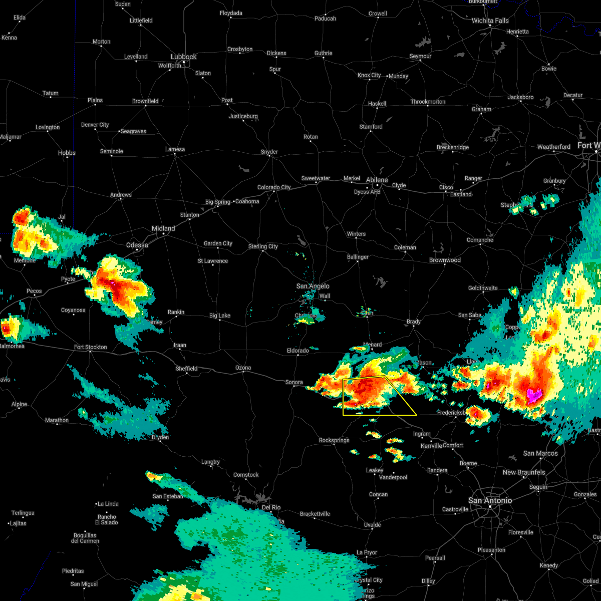
Hail Map for Junction, TX
The Junction, TX area has had 55 reports of on-the-ground hail by trained spotters, and has been under severe weather warnings 16 times during the past 12 months. Doppler radar has detected hail at or near Junction, TX on 57 occasions, including 4 occasions during the past year.
| Name: | Junction, TX |
| Where Located: | 103.1 miles NE of Del Rio, TX |
| Map: | Google Map for Junction, TX |
| Population: | 2574 |
| Housing Units: | 1270 |
| More Info: | Search Google for Junction, TX |
0
The Top Recent Hail Date for Junction, TX is Monday, May 26, 2025 (23rd out of 57)
Hail and Wind Damage Spotted near Junction, TX
| Date / Time | Report Details |
|---|---|
| 5/23/2025 12:28 AM CDT |
 Svrsjt the national weather service in san angelo has issued a * severe thunderstorm warning for, eastern kimble county in west central texas, southwestern mason county in west central texas, * until 115 am cdt. * at 1226 am cdt, a severe thunderstorm was located near segovia, moving southeast at 20 mph (radar indicated). Hazards include 60 mph wind gusts and quarter size hail. Hail damage to vehicles is expected. expect wind damage to roofs, siding, and trees. this severe thunderstorm will be near, segovia around 1230 am cdt. other locations impacted by this severe thunderstorm include us- 377 near the kimble-edwards county line, us-83 near the kerr- kimble county line, i-10 near the kimble- kerr county line, and the intersection of i-10 and us 290. This includes interstate 10 between mile markers 451 and 477. Svrsjt the national weather service in san angelo has issued a * severe thunderstorm warning for, eastern kimble county in west central texas, southwestern mason county in west central texas, * until 115 am cdt. * at 1226 am cdt, a severe thunderstorm was located near segovia, moving southeast at 20 mph (radar indicated). Hazards include 60 mph wind gusts and quarter size hail. Hail damage to vehicles is expected. expect wind damage to roofs, siding, and trees. this severe thunderstorm will be near, segovia around 1230 am cdt. other locations impacted by this severe thunderstorm include us- 377 near the kimble-edwards county line, us-83 near the kerr- kimble county line, i-10 near the kimble- kerr county line, and the intersection of i-10 and us 290. This includes interstate 10 between mile markers 451 and 477.
|
| 5/23/2025 12:21 AM CDT |
 At 1219 am cdt, severe thunderstorms were located along a line extending from near sunnylane to gainesville to 11 miles north of i-10 near the kimble-kerr county line, moving southeast at 35 mph (radar indicated). Hazards include 60 mph wind gusts and quarter size hail. Hail damage to vehicles is expected. expect wind damage to roofs, siding, and trees. these severe storms will be near, hilda and loyal valley around 1225 am cdt. other locations impacted by these severe thunderstorms include erna, cleo, us-377 near the kimble-edwards county line, us- 87 near the mason-gillespie county line, us-377 near the kimble- menard county line, koockville, us-83 near the kerr- kimble county line, i-10 near the kimble- kerr county line, the intersection of i-10 and us 290, and us- 190 near the san saba-lampasas county line. This includes interstate 10 between mile markers 447 and 477. At 1219 am cdt, severe thunderstorms were located along a line extending from near sunnylane to gainesville to 11 miles north of i-10 near the kimble-kerr county line, moving southeast at 35 mph (radar indicated). Hazards include 60 mph wind gusts and quarter size hail. Hail damage to vehicles is expected. expect wind damage to roofs, siding, and trees. these severe storms will be near, hilda and loyal valley around 1225 am cdt. other locations impacted by these severe thunderstorms include erna, cleo, us-377 near the kimble-edwards county line, us- 87 near the mason-gillespie county line, us-377 near the kimble- menard county line, koockville, us-83 near the kerr- kimble county line, i-10 near the kimble- kerr county line, the intersection of i-10 and us 290, and us- 190 near the san saba-lampasas county line. This includes interstate 10 between mile markers 447 and 477.
|
| 5/22/2025 11:43 PM CDT |
 Svrsjt the national weather service in san angelo has issued a * severe thunderstorm warning for, kimble county in west central texas, southern menard county in west central texas, mason county in west central texas, san saba county in west central texas, * until 1230 am cdt. * at 1140 pm cdt, severe thunderstorms were located along a line extending from near bend to valley spring to near cleo, moving southeast at 35 mph (radar indicated). Hazards include 60 mph wind gusts and quarter size hail. Hail damage to vehicles is expected. expect wind damage to roofs, siding, and trees. severe thunderstorms will be near, junction, mason, yates crossing, art, hilda, hedwigs hill, loyal valley, segovia, london, and colorado bend state park around 1145 pm cdt. other locations impacted by these severe thunderstorms include the intersection of us-83 and ranch road 1773, erna, us- 377 near the kimble-edwards county line, us-377 near the kimble- menard county line, the intersection of highway 29 and ranch road 1222, harkeyville, cleo, us-83 near the kimble- menard county line, us-87 near the mason- gillespie county line, and spring creek. This includes interstate 10 between mile markers 445 and 477. Svrsjt the national weather service in san angelo has issued a * severe thunderstorm warning for, kimble county in west central texas, southern menard county in west central texas, mason county in west central texas, san saba county in west central texas, * until 1230 am cdt. * at 1140 pm cdt, severe thunderstorms were located along a line extending from near bend to valley spring to near cleo, moving southeast at 35 mph (radar indicated). Hazards include 60 mph wind gusts and quarter size hail. Hail damage to vehicles is expected. expect wind damage to roofs, siding, and trees. severe thunderstorms will be near, junction, mason, yates crossing, art, hilda, hedwigs hill, loyal valley, segovia, london, and colorado bend state park around 1145 pm cdt. other locations impacted by these severe thunderstorms include the intersection of us-83 and ranch road 1773, erna, us- 377 near the kimble-edwards county line, us-377 near the kimble- menard county line, the intersection of highway 29 and ranch road 1222, harkeyville, cleo, us-83 near the kimble- menard county line, us-87 near the mason- gillespie county line, and spring creek. This includes interstate 10 between mile markers 445 and 477.
|
| 5/8/2025 12:12 AM CDT |
 the severe thunderstorm warning has been cancelled and is no longer in effect the severe thunderstorm warning has been cancelled and is no longer in effect
|
| 5/7/2025 11:38 PM CDT |
 Svrsjt the national weather service in san angelo has issued a * severe thunderstorm warning for, central kimble county in west central texas, * until 1230 am cdt. * at 1138 pm cdt, a severe thunderstorm was located 7 miles northwest of south llano river state park, moving northeast at 30 mph (radar indicated). Hazards include half dollar size hail. Damage to vehicles is expected. this severe thunderstorm will be near, south llano river state park and junction around 1145 pm cdt. london around 1215 am cdt. other locations impacted by this severe thunderstorm include cleo. This includes interstate 10 between mile markers 441 and 460. Svrsjt the national weather service in san angelo has issued a * severe thunderstorm warning for, central kimble county in west central texas, * until 1230 am cdt. * at 1138 pm cdt, a severe thunderstorm was located 7 miles northwest of south llano river state park, moving northeast at 30 mph (radar indicated). Hazards include half dollar size hail. Damage to vehicles is expected. this severe thunderstorm will be near, south llano river state park and junction around 1145 pm cdt. london around 1215 am cdt. other locations impacted by this severe thunderstorm include cleo. This includes interstate 10 between mile markers 441 and 460.
|
| 5/2/2025 3:58 PM CDT | Baseball sized hail reported 12 miles SW of Junction, TX, baseball size hail reported by storm chaser. |
| 5/2/2025 3:55 PM CDT | Baseball sized hail reported 12 miles SW of Junction, TX, reported damage to tree limbs and broken car windows from large hail. reported mostly golf ball sized hail with some baseball sized hailstones. |
| 5/2/2025 3:24 PM CDT | At 323 pm cdt, a severe thunderstorm was located near cleo, or 8 miles north of junction, moving southeast at 25 mph (radar indicated). Hazards include ping pong ball size hail and 60 mph wind gusts. People and animals outdoors will be injured. expect hail damage to roofs, siding, windows, and vehicles. expect wind damage to roofs, siding, and trees. this severe storm will be near, yates crossing and junction around 330 pm cdt. other locations impacted by this severe thunderstorm include us- 83 near the kimble-menard county line and cleo. This includes interstate 10 between mile markers 450 and 467. |
| 5/2/2025 3:10 PM CDT | Svrsjt the national weather service in san angelo has issued a * severe thunderstorm warning for, western kimble county in west central texas, south central menard county in west central texas, * until 400 pm cdt. * at 309 pm cdt, a severe thunderstorm was located near cleo, or 10 miles north of junction, moving southeast at 30 mph (radar indicated). Hazards include 60 mph wind gusts and quarter size hail. Hail damage to vehicles is expected. expect wind damage to roofs, siding, and trees. this severe thunderstorm will be near, junction around 315 pm cdt. yates crossing around 320 pm cdt. other locations impacted by this severe thunderstorm include us- 83 near the kimble-menard county line and cleo. This includes interstate 10 between mile markers 449 and 467. |
| 5/1/2025 6:05 PM CDT | Quarter sized hail reported 0.3 miles NE of Junction, TX, sheriffs office reported lots of dime sized hail with some quarters mixed in. |
| 5/1/2025 6:04 PM CDT |
 Svrsjt the national weather service in san angelo has issued a * severe thunderstorm warning for, northeastern kimble county in west central texas, * until 630 pm cdt. * at 603 pm cdt, a severe thunderstorm was located near junction, moving northeast at 30 mph (radar indicated). Hazards include 60 mph wind gusts and quarter size hail. Hail damage to vehicles is expected. expect wind damage to roofs, siding, and trees. this severe thunderstorm will be near, yates crossing around 610 pm cdt. This includes interstate 10 between mile markers 450 and 463. Svrsjt the national weather service in san angelo has issued a * severe thunderstorm warning for, northeastern kimble county in west central texas, * until 630 pm cdt. * at 603 pm cdt, a severe thunderstorm was located near junction, moving northeast at 30 mph (radar indicated). Hazards include 60 mph wind gusts and quarter size hail. Hail damage to vehicles is expected. expect wind damage to roofs, siding, and trees. this severe thunderstorm will be near, yates crossing around 610 pm cdt. This includes interstate 10 between mile markers 450 and 463.
|
| 5/1/2025 6:00 PM CDT | Half Dollar sized hail reported 0.3 miles NE of Junction, TX, numerous quarter to half dollar sized hailstones. |
| 5/1/2025 5:55 PM CDT |
 At 555 pm cdt, a severe thunderstorm was moving into junction, moving northeast at 25 mph (radar indicated). Hazards include 60 mph wind gusts and quarter size hail. Hail damage to vehicles is expected. expect wind damage to roofs, siding, and trees. this severe storm will be near, junction around 600 pm cdt. This includes interstate 10 between mile markers 444 and 465. At 555 pm cdt, a severe thunderstorm was moving into junction, moving northeast at 25 mph (radar indicated). Hazards include 60 mph wind gusts and quarter size hail. Hail damage to vehicles is expected. expect wind damage to roofs, siding, and trees. this severe storm will be near, junction around 600 pm cdt. This includes interstate 10 between mile markers 444 and 465.
|
| 5/1/2025 5:46 PM CDT |
 At 546 pm cdt, a severe thunderstorm was located near south llano river state park, moving northeast at 20 mph (radar indicated). Hazards include 60 mph wind gusts and quarter size hail. Hail damage to vehicles is expected. expect wind damage to roofs, siding, and trees. this severe storm will be near, south llano river state park and junction around 550 pm cdt. This includes interstate 10 between mile markers 439 and 465. At 546 pm cdt, a severe thunderstorm was located near south llano river state park, moving northeast at 20 mph (radar indicated). Hazards include 60 mph wind gusts and quarter size hail. Hail damage to vehicles is expected. expect wind damage to roofs, siding, and trees. this severe storm will be near, south llano river state park and junction around 550 pm cdt. This includes interstate 10 between mile markers 439 and 465.
|
| 5/1/2025 5:35 PM CDT |
 At 535 pm cdt, a severe thunderstorm was located near telegraph, moving northeast at 25 mph (radar indicated). Hazards include 60 mph wind gusts and half dollar size hail. Hail damage to vehicles is expected. expect wind damage to roofs, siding, and trees. this severe storm will be near, south llano river state park and junction around 540 pm cdt. other locations impacted by this severe thunderstorm include us- 377 near the kimble-edwards county line. This includes interstate 10 between mile markers 439 and 465. At 535 pm cdt, a severe thunderstorm was located near telegraph, moving northeast at 25 mph (radar indicated). Hazards include 60 mph wind gusts and half dollar size hail. Hail damage to vehicles is expected. expect wind damage to roofs, siding, and trees. this severe storm will be near, south llano river state park and junction around 540 pm cdt. other locations impacted by this severe thunderstorm include us- 377 near the kimble-edwards county line. This includes interstate 10 between mile markers 439 and 465.
|
| 5/1/2025 5:35 PM CDT |
 the severe thunderstorm warning has been cancelled and is no longer in effect the severe thunderstorm warning has been cancelled and is no longer in effect
|
| 5/1/2025 5:23 PM CDT |
 At 523 pm cdt, a severe thunderstorm was located near telegraph, moving northeast at 25 mph (radar indicated). Hazards include ping pong ball size hail and 60 mph wind gusts. People and animals outdoors will be injured. expect hail damage to roofs, siding, windows, and vehicles. expect wind damage to roofs, siding, and trees. this severe storm will be near, telegraph around 530 pm cdt. south llano river state park around 535 pm cdt. junction around 540 pm cdt. other locations impacted by this severe thunderstorm include i- 10 near the sutton-kimble county line and us-377 near the kimble- edwards county line. This includes interstate 10 between mile markers 433 and 465. At 523 pm cdt, a severe thunderstorm was located near telegraph, moving northeast at 25 mph (radar indicated). Hazards include ping pong ball size hail and 60 mph wind gusts. People and animals outdoors will be injured. expect hail damage to roofs, siding, windows, and vehicles. expect wind damage to roofs, siding, and trees. this severe storm will be near, telegraph around 530 pm cdt. south llano river state park around 535 pm cdt. junction around 540 pm cdt. other locations impacted by this severe thunderstorm include i- 10 near the sutton-kimble county line and us-377 near the kimble- edwards county line. This includes interstate 10 between mile markers 433 and 465.
|
| 5/1/2025 5:11 PM CDT |
 Svrsjt the national weather service in san angelo has issued a * severe thunderstorm warning for, southwestern kimble county in west central texas, southeastern sutton county in west central texas, * until 615 pm cdt. * at 511 pm cdt, a severe thunderstorm was located 9 miles west of us-377 near the kimble-edwards county line, or 9 miles west of telegraph, moving northeast at 25 mph (radar indicated). Hazards include 60 mph wind gusts and quarter size hail. Hail damage to vehicles is expected. expect wind damage to roofs, siding, and trees. this severe thunderstorm will be near, telegraph around 520 pm cdt. roosevelt around 525 pm cdt. south llano river state park around 545 pm cdt. junction around 550 pm cdt. other locations impacted by this severe thunderstorm include i- 10 near the sutton-kimble county line and us-377 near the kimble- edwards county line. This includes interstate 10 between mile markers 433 and 465. Svrsjt the national weather service in san angelo has issued a * severe thunderstorm warning for, southwestern kimble county in west central texas, southeastern sutton county in west central texas, * until 615 pm cdt. * at 511 pm cdt, a severe thunderstorm was located 9 miles west of us-377 near the kimble-edwards county line, or 9 miles west of telegraph, moving northeast at 25 mph (radar indicated). Hazards include 60 mph wind gusts and quarter size hail. Hail damage to vehicles is expected. expect wind damage to roofs, siding, and trees. this severe thunderstorm will be near, telegraph around 520 pm cdt. roosevelt around 525 pm cdt. south llano river state park around 545 pm cdt. junction around 550 pm cdt. other locations impacted by this severe thunderstorm include i- 10 near the sutton-kimble county line and us-377 near the kimble- edwards county line. This includes interstate 10 between mile markers 433 and 465.
|
| 4/5/2025 12:49 AM CDT |
 At 1248 am cdt, a severe thunderstorm was located over us-83 near the kimble-menard county line, or 11 miles northwest of london, moving north at 60 mph (radar indicated). Hazards include 60 mph wind gusts and half dollar size hail. Hail damage to vehicles is expected. expect wind damage to roofs, siding, and trees. this severe storm will be near, menard around 1255 am cdt. other locations impacted by this severe thunderstorm include the intersection of us- 83 and ranch road 1773, cleo, the intersection of us- 83 and highway 29, us-83 near the kimble-menard county line, and us- 83 near the kerr-kimble county line. This includes interstate 10 between mile markers 448 and 467. At 1248 am cdt, a severe thunderstorm was located over us-83 near the kimble-menard county line, or 11 miles northwest of london, moving north at 60 mph (radar indicated). Hazards include 60 mph wind gusts and half dollar size hail. Hail damage to vehicles is expected. expect wind damage to roofs, siding, and trees. this severe storm will be near, menard around 1255 am cdt. other locations impacted by this severe thunderstorm include the intersection of us- 83 and ranch road 1773, cleo, the intersection of us- 83 and highway 29, us-83 near the kimble-menard county line, and us- 83 near the kerr-kimble county line. This includes interstate 10 between mile markers 448 and 467.
|
| 4/5/2025 12:25 AM CDT |
 Svrsjt the national weather service in san angelo has issued a * severe thunderstorm warning for, central kimble county in west central texas, central menard county in west central texas, * until 115 am cdt. * at 1225 am cdt, a severe thunderstorm was located near south llano river state park, moving north at 60 mph (radar indicated). Hazards include 60 mph wind gusts and half dollar size hail. Hail damage to vehicles is expected. expect wind damage to roofs, siding, and trees. this severe thunderstorm will be near, south llano river state park and junction around 1230 am cdt. menard around 1255 am cdt. other locations impacted by this severe thunderstorm include the intersection of us- 83 and ranch road 1773, cleo, the intersection of us- 83 and highway 29, us-83 near the kimble-menard county line, and us- 83 near the kerr-kimble county line. This includes interstate 10 between mile markers 448 and 467. Svrsjt the national weather service in san angelo has issued a * severe thunderstorm warning for, central kimble county in west central texas, central menard county in west central texas, * until 115 am cdt. * at 1225 am cdt, a severe thunderstorm was located near south llano river state park, moving north at 60 mph (radar indicated). Hazards include 60 mph wind gusts and half dollar size hail. Hail damage to vehicles is expected. expect wind damage to roofs, siding, and trees. this severe thunderstorm will be near, south llano river state park and junction around 1230 am cdt. menard around 1255 am cdt. other locations impacted by this severe thunderstorm include the intersection of us- 83 and ranch road 1773, cleo, the intersection of us- 83 and highway 29, us-83 near the kimble-menard county line, and us- 83 near the kerr-kimble county line. This includes interstate 10 between mile markers 448 and 467.
|
| 5/30/2024 8:15 PM CDT |
 the severe thunderstorm warning has been cancelled and is no longer in effect the severe thunderstorm warning has been cancelled and is no longer in effect
|
| 5/30/2024 7:46 PM CDT |
 Svrsjt the national weather service in san angelo has issued a * severe thunderstorm warning for, southeastern kimble county in west central texas, * until 830 pm cdt. * at 745 pm cdt, a severe thunderstorm was located near segovia, moving northeast at 20 mph (radar indicated). Hazards include 60 mph wind gusts and quarter size hail. Hail damage to vehicles is expected. expect wind damage to roofs, siding, and trees. this severe thunderstorm will be near, junction, south llano river state park, and segovia around 750 pm cdt. This includes interstate 10 between mile markers 455 and 471. Svrsjt the national weather service in san angelo has issued a * severe thunderstorm warning for, southeastern kimble county in west central texas, * until 830 pm cdt. * at 745 pm cdt, a severe thunderstorm was located near segovia, moving northeast at 20 mph (radar indicated). Hazards include 60 mph wind gusts and quarter size hail. Hail damage to vehicles is expected. expect wind damage to roofs, siding, and trees. this severe thunderstorm will be near, junction, south llano river state park, and segovia around 750 pm cdt. This includes interstate 10 between mile markers 455 and 471.
|
| 5/3/2024 10:29 PM CDT |
 the severe thunderstorm warning has been cancelled and is no longer in effect the severe thunderstorm warning has been cancelled and is no longer in effect
|
| 5/3/2024 10:29 PM CDT |
 At 1028 pm cdt, a severe thunderstorm was located near south llano river state park, moving east at 15 mph (radar indicated). Hazards include 60 mph wind gusts and quarter size hail. Hail damage to vehicles is expected. expect wind damage to roofs, siding, and trees. this severe storm will be near, junction and segovia around 1035 pm cdt. other locations impacted by this severe thunderstorm include us- 377 near the kimble-edwards county line, i-10 near the kimble- kerr county line, the intersection of i-10 and us 290, and us- 83 near the kerr-kimble county line. This includes interstate 10 between mile markers 445 and 446, and between mile markers 456 and 477. At 1028 pm cdt, a severe thunderstorm was located near south llano river state park, moving east at 15 mph (radar indicated). Hazards include 60 mph wind gusts and quarter size hail. Hail damage to vehicles is expected. expect wind damage to roofs, siding, and trees. this severe storm will be near, junction and segovia around 1035 pm cdt. other locations impacted by this severe thunderstorm include us- 377 near the kimble-edwards county line, i-10 near the kimble- kerr county line, the intersection of i-10 and us 290, and us- 83 near the kerr-kimble county line. This includes interstate 10 between mile markers 445 and 446, and between mile markers 456 and 477.
|
| 5/3/2024 10:10 PM CDT |
 Svrsjt the national weather service in san angelo has issued a * severe thunderstorm warning for, kimble county in west central texas, southwestern mason county in west central texas, * until 1115 pm cdt. * at 1010 pm cdt, a severe thunderstorm was located over south llano river state park, moving east at 30 mph (radar indicated). Hazards include 70 mph wind gusts and quarter size hail. Hail damage to vehicles is expected. expect considerable tree damage. wind damage is also likely to mobile homes, roofs, and outbuildings. this severe thunderstorm will be near, segovia around 1015 pm cdt. other locations impacted by this severe thunderstorm include cleo, us-377 near the kimble-edwards county line, i-10 near the kimble- kerr county line, the intersection of i-10 and us 290, and us- 83 near the kerr-kimble county line. This includes interstate 10 between mile markers 441 and 477. Svrsjt the national weather service in san angelo has issued a * severe thunderstorm warning for, kimble county in west central texas, southwestern mason county in west central texas, * until 1115 pm cdt. * at 1010 pm cdt, a severe thunderstorm was located over south llano river state park, moving east at 30 mph (radar indicated). Hazards include 70 mph wind gusts and quarter size hail. Hail damage to vehicles is expected. expect considerable tree damage. wind damage is also likely to mobile homes, roofs, and outbuildings. this severe thunderstorm will be near, segovia around 1015 pm cdt. other locations impacted by this severe thunderstorm include cleo, us-377 near the kimble-edwards county line, i-10 near the kimble- kerr county line, the intersection of i-10 and us 290, and us- 83 near the kerr-kimble county line. This includes interstate 10 between mile markers 441 and 477.
|
| 5/3/2024 9:56 PM CDT |
 At 955 pm cdt, a severe thunderstorm was located near telegraph, moving southeast at 20 mph (radar indicated). Hazards include ping pong ball size hail and 60 mph wind gusts. People and animals outdoors will be injured. expect hail damage to roofs, siding, windows, and vehicles. expect wind damage to roofs, siding, and trees. this severe storm will be near, telegraph around 1000 pm cdt. other locations impacted by this severe thunderstorm include i-10 near the sutton-kimble county line, us-83 near the kerr-kimble county line, and us-377 near the kimble-edwards county line. This includes interstate 10 between mile markers 429 and 476. At 955 pm cdt, a severe thunderstorm was located near telegraph, moving southeast at 20 mph (radar indicated). Hazards include ping pong ball size hail and 60 mph wind gusts. People and animals outdoors will be injured. expect hail damage to roofs, siding, windows, and vehicles. expect wind damage to roofs, siding, and trees. this severe storm will be near, telegraph around 1000 pm cdt. other locations impacted by this severe thunderstorm include i-10 near the sutton-kimble county line, us-83 near the kerr-kimble county line, and us-377 near the kimble-edwards county line. This includes interstate 10 between mile markers 429 and 476.
|
| 5/3/2024 9:40 PM CDT | Quarter sized hail reported 6.2 miles E of Junction, TX, social media report. |
| 5/3/2024 9:23 PM CDT |
 Svrsjt the national weather service in san angelo has issued a * severe thunderstorm warning for, western kimble county in west central texas, southeastern sutton county in west central texas, * until 1015 pm cdt. * at 922 pm cdt, a severe thunderstorm was located near cleo, or 8 miles northeast of roosevelt, moving south at 15 mph (radar indicated). Hazards include tennis ball size hail and 60 mph wind gusts. People and animals outdoors will be injured. expect hail damage to roofs, siding, windows, and vehicles. expect wind damage to roofs, siding, and trees. this severe thunderstorm will be near, roosevelt around 925 pm cdt. junction and south llano river state park around 940 pm cdt. other locations impacted by this severe thunderstorm include cleo, i- 10 near the sutton-kimble county line, us-83 near the kerr- kimble county line, and us-377 near the kimble-edwards county line. This includes interstate 10 between mile markers 429 and 476. Svrsjt the national weather service in san angelo has issued a * severe thunderstorm warning for, western kimble county in west central texas, southeastern sutton county in west central texas, * until 1015 pm cdt. * at 922 pm cdt, a severe thunderstorm was located near cleo, or 8 miles northeast of roosevelt, moving south at 15 mph (radar indicated). Hazards include tennis ball size hail and 60 mph wind gusts. People and animals outdoors will be injured. expect hail damage to roofs, siding, windows, and vehicles. expect wind damage to roofs, siding, and trees. this severe thunderstorm will be near, roosevelt around 925 pm cdt. junction and south llano river state park around 940 pm cdt. other locations impacted by this severe thunderstorm include cleo, i- 10 near the sutton-kimble county line, us-83 near the kerr- kimble county line, and us-377 near the kimble-edwards county line. This includes interstate 10 between mile markers 429 and 476.
|
| 5/3/2024 9:09 PM CDT |
 the severe thunderstorm warning has been cancelled and is no longer in effect the severe thunderstorm warning has been cancelled and is no longer in effect
|
| 5/3/2024 9:09 PM CDT |
 At 908 pm cdt, a severe thunderstorm was located near cleo, or near junction, moving southeast at 20 mph (radar indicated). Hazards include two inch hail and 60 mph wind gusts. People and animals outdoors will be injured. expect hail damage to roofs, siding, windows, and vehicles. expect wind damage to roofs, siding, and trees. locations impacted include, junction, yates crossing, and cleo. This includes interstate 10 between mile markers 439 and 458. At 908 pm cdt, a severe thunderstorm was located near cleo, or near junction, moving southeast at 20 mph (radar indicated). Hazards include two inch hail and 60 mph wind gusts. People and animals outdoors will be injured. expect hail damage to roofs, siding, windows, and vehicles. expect wind damage to roofs, siding, and trees. locations impacted include, junction, yates crossing, and cleo. This includes interstate 10 between mile markers 439 and 458.
|
| 5/3/2024 9:03 PM CDT | Tennis Ball sized hail reported 9.6 miles SE of Junction, TX, social media report of golf ball to tennis ball sized hail just south of cleo. |
| 5/3/2024 8:52 PM CDT |
 At 851 pm cdt, a severe thunderstorm was located near cleo, or 11 miles north of junction, moving southeast at 30 mph (radar indicated). Hazards include tennis ball size hail and 60 mph wind gusts. People and animals outdoors will be injured. expect hail damage to roofs, siding, windows, and vehicles. expect wind damage to roofs, siding, and trees. locations impacted include, junction, london, yates crossing, the intersection of us- 83 and ranch road 1773, cleo, and us-83 near the kimble- menard county line. This includes interstate 10 between mile markers 440 and 458. At 851 pm cdt, a severe thunderstorm was located near cleo, or 11 miles north of junction, moving southeast at 30 mph (radar indicated). Hazards include tennis ball size hail and 60 mph wind gusts. People and animals outdoors will be injured. expect hail damage to roofs, siding, windows, and vehicles. expect wind damage to roofs, siding, and trees. locations impacted include, junction, london, yates crossing, the intersection of us- 83 and ranch road 1773, cleo, and us-83 near the kimble- menard county line. This includes interstate 10 between mile markers 440 and 458.
|
| 5/3/2024 8:23 PM CDT |
 Svrsjt the national weather service in san angelo has issued a * severe thunderstorm warning for, northern kimble county in west central texas, western menard county in west central texas, * until 930 pm cdt. * at 822 pm cdt, a severe thunderstorm was located 8 miles east of camp sol mayer, or 10 miles southwest of menard, moving south at 15 mph (radar indicated). Hazards include two inch hail and 60 mph wind gusts. People and animals outdoors will be injured. expect hail damage to roofs, siding, windows, and vehicles. expect wind damage to roofs, siding, and trees. this severe thunderstorm will remain over mainly rural areas of northern kimble and western menard counties, including the following locations, the intersection of us-83 and ranch road 1773, camp sol mayer, cleo, the intersection of us-83 and highway 29, and us-83 near the kimble-menard county line. This includes interstate 10 between mile markers 439 and 458. Svrsjt the national weather service in san angelo has issued a * severe thunderstorm warning for, northern kimble county in west central texas, western menard county in west central texas, * until 930 pm cdt. * at 822 pm cdt, a severe thunderstorm was located 8 miles east of camp sol mayer, or 10 miles southwest of menard, moving south at 15 mph (radar indicated). Hazards include two inch hail and 60 mph wind gusts. People and animals outdoors will be injured. expect hail damage to roofs, siding, windows, and vehicles. expect wind damage to roofs, siding, and trees. this severe thunderstorm will remain over mainly rural areas of northern kimble and western menard counties, including the following locations, the intersection of us-83 and ranch road 1773, camp sol mayer, cleo, the intersection of us-83 and highway 29, and us-83 near the kimble-menard county line. This includes interstate 10 between mile markers 439 and 458.
|
| 5/2/2024 8:49 PM CDT |
 At 849 pm cdt, a severe thunderstorm was located near south llano river state park, moving southeast at 15 mph (radar indicated). Hazards include 60 mph wind gusts and quarter size hail. Hail damage to vehicles is expected. expect wind damage to roofs, siding, and trees. this severe storm will be near, segovia around 855 pm cdt. other locations impacted by this severe thunderstorm include us- 83 near the kerr-kimble county line. This includes interstate 10 between mile markers 455 and 471. At 849 pm cdt, a severe thunderstorm was located near south llano river state park, moving southeast at 15 mph (radar indicated). Hazards include 60 mph wind gusts and quarter size hail. Hail damage to vehicles is expected. expect wind damage to roofs, siding, and trees. this severe storm will be near, segovia around 855 pm cdt. other locations impacted by this severe thunderstorm include us- 83 near the kerr-kimble county line. This includes interstate 10 between mile markers 455 and 471.
|
| 5/2/2024 8:23 PM CDT |
 Svrsjt the national weather service in san angelo has issued a * severe thunderstorm warning for, southern kimble county in west central texas, * until 915 pm cdt. * at 823 pm cdt, a severe thunderstorm was located near south llano river state park, moving southeast at 15 mph (radar indicated). Hazards include 60 mph wind gusts and quarter size hail. Hail damage to vehicles is expected. expect wind damage to roofs, siding, and trees. this severe thunderstorm will be near, junction and south llano river state park around 830 pm cdt. segovia around 835 pm cdt. other locations impacted by this severe thunderstorm include us- 83 near the kerr-kimble county line. This includes interstate 10 between mile markers 440 and 471. Svrsjt the national weather service in san angelo has issued a * severe thunderstorm warning for, southern kimble county in west central texas, * until 915 pm cdt. * at 823 pm cdt, a severe thunderstorm was located near south llano river state park, moving southeast at 15 mph (radar indicated). Hazards include 60 mph wind gusts and quarter size hail. Hail damage to vehicles is expected. expect wind damage to roofs, siding, and trees. this severe thunderstorm will be near, junction and south llano river state park around 830 pm cdt. segovia around 835 pm cdt. other locations impacted by this severe thunderstorm include us- 83 near the kerr-kimble county line. This includes interstate 10 between mile markers 440 and 471.
|
| 3/15/2024 9:05 AM CDT |
 At 904 am cdt, a severe thunderstorm was located near junction, moving east at 30 mph (radar indicated). Hazards include ping pong ball size hail and 60 mph wind gusts. People and animals outdoors will be injured. expect hail damage to roofs, siding, windows, and vehicles. expect wind damage to roofs, siding, and trees. this severe storm will be near, yates crossing around 910 am cdt. london around 915 am cdt. other locations impacted by this severe thunderstorm include us- 377 near the kimble-menard county line, cleo, and us- 83 near the kimble-menard county line. This includes interstate 10 between mile markers 448 and 464. At 904 am cdt, a severe thunderstorm was located near junction, moving east at 30 mph (radar indicated). Hazards include ping pong ball size hail and 60 mph wind gusts. People and animals outdoors will be injured. expect hail damage to roofs, siding, windows, and vehicles. expect wind damage to roofs, siding, and trees. this severe storm will be near, yates crossing around 910 am cdt. london around 915 am cdt. other locations impacted by this severe thunderstorm include us- 377 near the kimble-menard county line, cleo, and us- 83 near the kimble-menard county line. This includes interstate 10 between mile markers 448 and 464.
|
| 3/15/2024 9:01 AM CDT | Ping Pong Ball sized hail reported 10.1 miles SSE of Junction, TX |
| 3/15/2024 8:52 AM CDT |
 At 851 am cdt, a severe thunderstorm was located over cleo, or 7 miles northwest of junction, moving east at 30 mph (radar indicated). Hazards include ping pong ball size hail and 60 mph wind gusts. People and animals outdoors will be injured. expect hail damage to roofs, siding, windows, and vehicles. expect wind damage to roofs, siding, and trees. this severe storm will be near, junction around 855 am cdt. yates crossing around 905 am cdt. london around 915 am cdt. other locations impacted by this severe thunderstorm include us- 377 near the kimble-menard county line, cleo, and us- 83 near the kimble-menard county line. This includes interstate 10 between mile markers 441 and 467. At 851 am cdt, a severe thunderstorm was located over cleo, or 7 miles northwest of junction, moving east at 30 mph (radar indicated). Hazards include ping pong ball size hail and 60 mph wind gusts. People and animals outdoors will be injured. expect hail damage to roofs, siding, windows, and vehicles. expect wind damage to roofs, siding, and trees. this severe storm will be near, junction around 855 am cdt. yates crossing around 905 am cdt. london around 915 am cdt. other locations impacted by this severe thunderstorm include us- 377 near the kimble-menard county line, cleo, and us- 83 near the kimble-menard county line. This includes interstate 10 between mile markers 441 and 467.
|
| 3/15/2024 8:52 AM CDT |
 the severe thunderstorm warning has been cancelled and is no longer in effect the severe thunderstorm warning has been cancelled and is no longer in effect
|
| 3/15/2024 8:33 AM CDT |
 Svrsjt the national weather service in san angelo has issued a * severe thunderstorm warning for, kimble county in west central texas, southeastern menard county in west central texas, northeastern sutton county in west central texas, * until 930 am cdt. * at 832 am cdt, a severe thunderstorm was located near roosevelt, moving east at 30 mph (radar indicated). Hazards include ping pong ball size hail and 60 mph wind gusts. People and animals outdoors will be injured. expect hail damage to roofs, siding, windows, and vehicles. expect wind damage to roofs, siding, and trees. this severe thunderstorm will be near, junction around 850 am cdt. yates crossing around 910 am cdt. london around 920 am cdt. other locations impacted by this severe thunderstorm include cleo, i- 10 near the sutton-kimble county line, us-377 near the kimble- menard county line, and us-83 near the kimble-menard county line. This includes interstate 10 between mile markers 433 and 467. Svrsjt the national weather service in san angelo has issued a * severe thunderstorm warning for, kimble county in west central texas, southeastern menard county in west central texas, northeastern sutton county in west central texas, * until 930 am cdt. * at 832 am cdt, a severe thunderstorm was located near roosevelt, moving east at 30 mph (radar indicated). Hazards include ping pong ball size hail and 60 mph wind gusts. People and animals outdoors will be injured. expect hail damage to roofs, siding, windows, and vehicles. expect wind damage to roofs, siding, and trees. this severe thunderstorm will be near, junction around 850 am cdt. yates crossing around 910 am cdt. london around 920 am cdt. other locations impacted by this severe thunderstorm include cleo, i- 10 near the sutton-kimble county line, us-377 near the kimble- menard county line, and us-83 near the kimble-menard county line. This includes interstate 10 between mile markers 433 and 467.
|
| 2/11/2024 2:52 AM CST |
 At 251 am cst, a severe thunderstorm was located near cleo, or 11 miles northeast of roosevelt, moving east at 50 mph (radar indicated). Hazards include 60 mph wind gusts and quarter size hail. Hail damage to vehicles is expected. expect wind damage to roofs, siding, and trees. this severe thunderstorm will remain over mainly rural areas of northwestern kimble and south central menard counties, including the following locations, the intersection of us-83 and ranch road 1773, cleo, and us-83 near the kimble-menard county line. this includes interstate 10 between mile markers 446 and 455. hail threat, radar indicated max hail size, 1. 00 in wind threat, radar indicated max wind gust, 60 mph. At 251 am cst, a severe thunderstorm was located near cleo, or 11 miles northeast of roosevelt, moving east at 50 mph (radar indicated). Hazards include 60 mph wind gusts and quarter size hail. Hail damage to vehicles is expected. expect wind damage to roofs, siding, and trees. this severe thunderstorm will remain over mainly rural areas of northwestern kimble and south central menard counties, including the following locations, the intersection of us-83 and ranch road 1773, cleo, and us-83 near the kimble-menard county line. this includes interstate 10 between mile markers 446 and 455. hail threat, radar indicated max hail size, 1. 00 in wind threat, radar indicated max wind gust, 60 mph.
|
| 9/25/2023 3:36 AM CDT |
 At 335 am cdt, a severe thunderstorm was located 8 miles north of roosevelt, moving southeast at 15 mph (radar indicated). Hazards include 60 mph wind gusts and quarter size hail. Hail damage to vehicles is expected. expect wind damage to roofs, siding, and trees. this severe thunderstorm will be near, roosevelt around 340 am cdt junction around 425 am cdt other locations impacted by this severe thunderstorm include cleo. this includes interstate 10 between mile markers 438 and 459. hail threat, radar indicated max hail size, 1. 00 in wind threat, radar indicated max wind gust, 60 mph. At 335 am cdt, a severe thunderstorm was located 8 miles north of roosevelt, moving southeast at 15 mph (radar indicated). Hazards include 60 mph wind gusts and quarter size hail. Hail damage to vehicles is expected. expect wind damage to roofs, siding, and trees. this severe thunderstorm will be near, roosevelt around 340 am cdt junction around 425 am cdt other locations impacted by this severe thunderstorm include cleo. this includes interstate 10 between mile markers 438 and 459. hail threat, radar indicated max hail size, 1. 00 in wind threat, radar indicated max wind gust, 60 mph.
|
| 9/25/2023 2:24 AM CDT |
 At 222 am cdt, a severe thunderstorm was located near cleo, or 9 miles northeast of roosevelt, moving southeast at 20 mph. another severe thunderstorm was located near segovia, moving southeast at 20 mph (radar indicated). Hazards include 60 mph wind gusts and quarter size hail. Hail damage to vehicles is expected. Expect wind damage to roofs, siding, and trees. At 222 am cdt, a severe thunderstorm was located near cleo, or 9 miles northeast of roosevelt, moving southeast at 20 mph. another severe thunderstorm was located near segovia, moving southeast at 20 mph (radar indicated). Hazards include 60 mph wind gusts and quarter size hail. Hail damage to vehicles is expected. Expect wind damage to roofs, siding, and trees.
|
| 6/21/2023 4:11 PM CDT | Kjct asos measured a 54 kt gust at 2111 in kimble county TX, 1.2 miles SSW of Junction, TX |
| 6/19/2023 6:30 PM CDT | Ping Pong Ball sized hail reported 16.6 miles SW of Junction, TX |
| 6/19/2023 5:47 PM CDT |
 At 546 pm cdt, a severe thunderstorm was located near us- 83 near the kimble- menard county line, or 7 miles west of london, moving east at 20 mph (radar indicated). Hazards include 60 mph wind gusts and half dollar size hail. Hail damage to vehicles is expected. expect wind damage to roofs, siding, and trees. this severe storm will be near, yates crossing around 555 pm cdt. london around 605 pm cdt. mason, saline, long mountain, hext, streeter, grit, camp air, katemcy and camp san saba around 615 pm cdt. other locations impacted by this severe thunderstorm include the intersection of highway 29 and ranch road 1222, the intersection of us-83 and ranch road 1773, erna, us-377 near the kimble- menard county line, koockville and us-83 near the kimble- menard county line. this includes interstate 10 between mile markers 453 and 459. hail threat, radar indicated max hail size, 1. 25 in wind threat, radar indicated max wind gust, 60 mph. At 546 pm cdt, a severe thunderstorm was located near us- 83 near the kimble- menard county line, or 7 miles west of london, moving east at 20 mph (radar indicated). Hazards include 60 mph wind gusts and half dollar size hail. Hail damage to vehicles is expected. expect wind damage to roofs, siding, and trees. this severe storm will be near, yates crossing around 555 pm cdt. london around 605 pm cdt. mason, saline, long mountain, hext, streeter, grit, camp air, katemcy and camp san saba around 615 pm cdt. other locations impacted by this severe thunderstorm include the intersection of highway 29 and ranch road 1222, the intersection of us-83 and ranch road 1773, erna, us-377 near the kimble- menard county line, koockville and us-83 near the kimble- menard county line. this includes interstate 10 between mile markers 453 and 459. hail threat, radar indicated max hail size, 1. 25 in wind threat, radar indicated max wind gust, 60 mph.
|
| 6/19/2023 5:32 PM CDT |
 At 531 pm cdt, a severe thunderstorm was located near us- 83 near the kimble- menard county line, or near london, moving east at 30 mph (radar indicated). Hazards include tennis ball size hail and 60 mph wind gusts. People and animals outdoors will be injured. expect hail damage to roofs, siding, windows, and vehicles. expect wind damage to roofs, siding, and trees. this severe storm will be near, yates crossing around 540 pm cdt. london around 545 pm cdt. saline around 550 pm cdt. hext around 555 pm cdt. long mountain around 600 pm cdt. mason, streeter, grit, camp air, katemcy, art, hedwigs hill, hilda, camp san saba and voca around 615 pm cdt. other locations impacted by this severe thunderstorm include the intersection of highway 29 and ranch road 1222, the intersection of us-83 and ranch road 1773, erna, cleo, us-83 near the kimble- menard county line, us-377 near the kimble- menard county line, koockville, us-83 near the kerr- kimble county line, i-10 near the kimble- kerr county line and the intersection of i-10 and us 290. this includes interstate 10 between mile markers 445 and 477. thunderstorm damage threat, considerable hail threat, radar indicated max hail size, 2. 50 in wind threat, radar indicated max wind gust, 60 mph. At 531 pm cdt, a severe thunderstorm was located near us- 83 near the kimble- menard county line, or near london, moving east at 30 mph (radar indicated). Hazards include tennis ball size hail and 60 mph wind gusts. People and animals outdoors will be injured. expect hail damage to roofs, siding, windows, and vehicles. expect wind damage to roofs, siding, and trees. this severe storm will be near, yates crossing around 540 pm cdt. london around 545 pm cdt. saline around 550 pm cdt. hext around 555 pm cdt. long mountain around 600 pm cdt. mason, streeter, grit, camp air, katemcy, art, hedwigs hill, hilda, camp san saba and voca around 615 pm cdt. other locations impacted by this severe thunderstorm include the intersection of highway 29 and ranch road 1222, the intersection of us-83 and ranch road 1773, erna, cleo, us-83 near the kimble- menard county line, us-377 near the kimble- menard county line, koockville, us-83 near the kerr- kimble county line, i-10 near the kimble- kerr county line and the intersection of i-10 and us 290. this includes interstate 10 between mile markers 445 and 477. thunderstorm damage threat, considerable hail threat, radar indicated max hail size, 2. 50 in wind threat, radar indicated max wind gust, 60 mph.
|
| 6/19/2023 5:23 PM CDT |
 At 521 pm cdt, a severe thunderstorm was located over us- 83 near the kimble- menard county line, or 11 miles west of london, moving east at 25 mph. other strong to severe storms were located across southeast menard into mason counties (radar indicated). Hazards include two inch hail and 60 mph wind gusts. People and animals outdoors will be injured. expect hail damage to roofs, siding, windows, and vehicles. expect wind damage to roofs, siding, and trees. this severe storm will be near, yates crossing around 540 pm cdt. london around 550 pm cdt. saline around 555 pm cdt. long mountain and hext around 605 pm cdt. mason, streeter, grit, camp air, katemcy, art, camp san saba, hedwigs hill, hilda and voca around 615 pm cdt. other locations impacted by this severe thunderstorm include the intersection of highway 29 and ranch road 1222, the intersection of us-83 and ranch road 1773, erna, cleo, us-83 near the kimble- menard county line, us-377 near the kimble- menard county line, koockville, us-83 near the kerr- kimble county line, i-10 near the kimble- kerr county line and the intersection of i-10 and us 290. this includes interstate 10 between mile markers 445 and 477. thunderstorm damage threat, considerable hail threat, radar indicated max hail size, 2. 00 in wind threat, radar indicated max wind gust, 60 mph. At 521 pm cdt, a severe thunderstorm was located over us- 83 near the kimble- menard county line, or 11 miles west of london, moving east at 25 mph. other strong to severe storms were located across southeast menard into mason counties (radar indicated). Hazards include two inch hail and 60 mph wind gusts. People and animals outdoors will be injured. expect hail damage to roofs, siding, windows, and vehicles. expect wind damage to roofs, siding, and trees. this severe storm will be near, yates crossing around 540 pm cdt. london around 550 pm cdt. saline around 555 pm cdt. long mountain and hext around 605 pm cdt. mason, streeter, grit, camp air, katemcy, art, camp san saba, hedwigs hill, hilda and voca around 615 pm cdt. other locations impacted by this severe thunderstorm include the intersection of highway 29 and ranch road 1222, the intersection of us-83 and ranch road 1773, erna, cleo, us-83 near the kimble- menard county line, us-377 near the kimble- menard county line, koockville, us-83 near the kerr- kimble county line, i-10 near the kimble- kerr county line and the intersection of i-10 and us 290. this includes interstate 10 between mile markers 445 and 477. thunderstorm damage threat, considerable hail threat, radar indicated max hail size, 2. 00 in wind threat, radar indicated max wind gust, 60 mph.
|
| 6/19/2023 5:04 PM CDT |
 At 503 pm cdt, a cluster of severe thunderstorms was located from northwest of junction to near mason. moving east-southeast at 20 mph (radar indicated). Hazards include ping pong ball size hail and 60 mph wind gusts. People and animals outdoors will be injured. expect hail damage to roofs, siding, windows, and vehicles. expect wind damage to roofs, siding, and trees. this severe thunderstorm will be near, streeter around 520 pm cdt. grit around 535 pm cdt. mason around 550 pm cdt. camp air around 555 pm cdt. katemcy, camp san saba, art, voca, hedwigs hill, hilda and loyal valley around 600 pm cdt. other locations impacted by this severe thunderstorm include the intersection of highway 29 and ranch road 1222, the intersection of us-83 and ranch road 1773, erna, cleo, us-83 near the kimble- menard county line, us-377 near the kimble- menard county line, koockville, us-83 near the kerr- kimble county line, i-10 near the kimble- kerr county line and the intersection of i-10 and us 290. this includes interstate 10 between mile markers 445 and 477. hail threat, radar indicated max hail size, 1. 50 in wind threat, radar indicated max wind gust, 60 mph. At 503 pm cdt, a cluster of severe thunderstorms was located from northwest of junction to near mason. moving east-southeast at 20 mph (radar indicated). Hazards include ping pong ball size hail and 60 mph wind gusts. People and animals outdoors will be injured. expect hail damage to roofs, siding, windows, and vehicles. expect wind damage to roofs, siding, and trees. this severe thunderstorm will be near, streeter around 520 pm cdt. grit around 535 pm cdt. mason around 550 pm cdt. camp air around 555 pm cdt. katemcy, camp san saba, art, voca, hedwigs hill, hilda and loyal valley around 600 pm cdt. other locations impacted by this severe thunderstorm include the intersection of highway 29 and ranch road 1222, the intersection of us-83 and ranch road 1773, erna, cleo, us-83 near the kimble- menard county line, us-377 near the kimble- menard county line, koockville, us-83 near the kerr- kimble county line, i-10 near the kimble- kerr county line and the intersection of i-10 and us 290. this includes interstate 10 between mile markers 445 and 477. hail threat, radar indicated max hail size, 1. 50 in wind threat, radar indicated max wind gust, 60 mph.
|
| 6/16/2023 10:45 PM CDT | Golf Ball sized hail reported 0.3 miles NE of Junction, TX |
| 6/16/2023 10:37 PM CDT |
 At 1036 pm cdt, a severe thunderstorm was located 5 miles northwest of junction, moving southeast at 25 mph (radar indicated). Hazards include ping pong ball size hail and 60 mph wind gusts. People and animals outdoors will be injured. expect hail damage to roofs, siding, windows, and vehicles. expect wind damage to roofs, siding, and trees. this severe storm will be near, junction by 1040 pm cdt, segovia around 1100 pm cdt. This includes interstate 10 between mile markers 440 and 471. At 1036 pm cdt, a severe thunderstorm was located 5 miles northwest of junction, moving southeast at 25 mph (radar indicated). Hazards include ping pong ball size hail and 60 mph wind gusts. People and animals outdoors will be injured. expect hail damage to roofs, siding, windows, and vehicles. expect wind damage to roofs, siding, and trees. this severe storm will be near, junction by 1040 pm cdt, segovia around 1100 pm cdt. This includes interstate 10 between mile markers 440 and 471.
|
| 6/16/2023 10:19 PM CDT |
 At 1017 pm cdt, a severe thunderstorm was located 8 miles northwest of junction, moving east at 15 mph (radar indicated). Hazards include ping pong ball size hail and 60 mph wind gusts. People and animals outdoors will be injured. expect hail damage to roofs, siding, windows, and vehicles. expect wind damage to roofs, siding, and trees. locations impacted include, junction, roosevelt, and cleo. this includes interstate 10 between mile markers 436 and 475. hail threat, radar indicated max hail size, 1. 50 in wind threat, radar indicated max wind gust, 60 mph. At 1017 pm cdt, a severe thunderstorm was located 8 miles northwest of junction, moving east at 15 mph (radar indicated). Hazards include ping pong ball size hail and 60 mph wind gusts. People and animals outdoors will be injured. expect hail damage to roofs, siding, windows, and vehicles. expect wind damage to roofs, siding, and trees. locations impacted include, junction, roosevelt, and cleo. this includes interstate 10 between mile markers 436 and 475. hail threat, radar indicated max hail size, 1. 50 in wind threat, radar indicated max wind gust, 60 mph.
|
| 6/16/2023 9:59 PM CDT |
 At 957 pm cdt, a line of severe thunderstorms was located along and north of interstate 10 from roosevelt to harper, moving east at 20 mph (public reported quarter size hail). Hazards include 60 mph wind gusts and quarter size hail. Hail damage to vehicles is expected. expect wind damage to roofs, siding, and trees. these severe thunderstorms will be near, roosevelt, junction, and segovia through at least 11pm. this includes interstate 10 between mile markers 436 and 475. hail threat, observed max hail size, 1. 00 in wind threat, radar indicated max wind gust, 60 mph. At 957 pm cdt, a line of severe thunderstorms was located along and north of interstate 10 from roosevelt to harper, moving east at 20 mph (public reported quarter size hail). Hazards include 60 mph wind gusts and quarter size hail. Hail damage to vehicles is expected. expect wind damage to roofs, siding, and trees. these severe thunderstorms will be near, roosevelt, junction, and segovia through at least 11pm. this includes interstate 10 between mile markers 436 and 475. hail threat, observed max hail size, 1. 00 in wind threat, radar indicated max wind gust, 60 mph.
|
| 6/16/2023 9:56 PM CDT |
 At 956 pm cdt, a severe thunderstorm was located near segovia, moving east at 20 mph (public reported quarter size hail in junction). Hazards include 60 mph wind gusts and quarter size hail. Hail damage to vehicles is expected. expect wind damage to roofs, siding, and trees. this severe thunderstorm will be near, yates crossing around 1015 pm cdt. other locations impacted by this severe thunderstorm include cleo. this includes interstate 10 between mile markers 436 and 475. hail threat, observed max hail size, 1. 00 in wind threat, radar indicated max wind gust, 60 mph. At 956 pm cdt, a severe thunderstorm was located near segovia, moving east at 20 mph (public reported quarter size hail in junction). Hazards include 60 mph wind gusts and quarter size hail. Hail damage to vehicles is expected. expect wind damage to roofs, siding, and trees. this severe thunderstorm will be near, yates crossing around 1015 pm cdt. other locations impacted by this severe thunderstorm include cleo. this includes interstate 10 between mile markers 436 and 475. hail threat, observed max hail size, 1. 00 in wind threat, radar indicated max wind gust, 60 mph.
|
| 6/16/2023 9:42 PM CDT | Quarter sized hail reported 0.5 miles SSE of Junction, TX, public reported quarter size hail near i-10 in the city of junction. |
| 6/16/2023 9:10 PM CDT |
 At 909 pm cdt, a severe thunderstorm was located over junction, moving east at 5 mph (radar indicated). Hazards include golf ball size hail and 60 mph wind gusts. People and animals outdoors will be injured. expect hail damage to roofs, siding, windows, and vehicles. expect wind damage to roofs, siding, and trees. locations impacted include, junction, segovia, south llano river state park and yates crossing. this includes interstate 10 between mile markers 446 and 471. thunderstorm damage threat, considerable hail threat, radar indicated max hail size, 1. 75 in wind threat, radar indicated max wind gust, 60 mph. At 909 pm cdt, a severe thunderstorm was located over junction, moving east at 5 mph (radar indicated). Hazards include golf ball size hail and 60 mph wind gusts. People and animals outdoors will be injured. expect hail damage to roofs, siding, windows, and vehicles. expect wind damage to roofs, siding, and trees. locations impacted include, junction, segovia, south llano river state park and yates crossing. this includes interstate 10 between mile markers 446 and 471. thunderstorm damage threat, considerable hail threat, radar indicated max hail size, 1. 75 in wind threat, radar indicated max wind gust, 60 mph.
|
| 6/16/2023 8:57 PM CDT |
 At 856 pm cdt, a severe thunderstorm was located over junction, moving east at 5 mph (radar indicated). Hazards include 60 mph wind gusts and quarter size hail. Hail damage to vehicles is expected. Expect wind damage to roofs, siding, and trees. At 856 pm cdt, a severe thunderstorm was located over junction, moving east at 5 mph (radar indicated). Hazards include 60 mph wind gusts and quarter size hail. Hail damage to vehicles is expected. Expect wind damage to roofs, siding, and trees.
|
| 4/22/2023 10:09 PM CDT |
 At 1009 pm cdt, a severe thunderstorm was located over south llano river state park, moving southeast at 25 mph (radar indicated). Hazards include ping pong ball size hail and 60 mph wind gusts. People and animals outdoors will be injured. expect hail damage to roofs, siding, windows, and vehicles. expect wind damage to roofs, siding, and trees. this severe thunderstorm will be near, segovia around 1020 pm cdt. other locations impacted by this severe thunderstorm include us- 83 near the kerr-kimble county line, i-10 near the kimble- kerr county line and the intersection of i-10 and us 290. this includes interstate 10 between mile markers 453 and 477. hail threat, radar indicated max hail size, 1. 50 in wind threat, radar indicated max wind gust, 60 mph. At 1009 pm cdt, a severe thunderstorm was located over south llano river state park, moving southeast at 25 mph (radar indicated). Hazards include ping pong ball size hail and 60 mph wind gusts. People and animals outdoors will be injured. expect hail damage to roofs, siding, windows, and vehicles. expect wind damage to roofs, siding, and trees. this severe thunderstorm will be near, segovia around 1020 pm cdt. other locations impacted by this severe thunderstorm include us- 83 near the kerr-kimble county line, i-10 near the kimble- kerr county line and the intersection of i-10 and us 290. this includes interstate 10 between mile markers 453 and 477. hail threat, radar indicated max hail size, 1. 50 in wind threat, radar indicated max wind gust, 60 mph.
|
| 4/22/2023 9:50 PM CDT |
 At 950 pm cdt, a severe thunderstorm was located near south llano river state park, moving southeast at 25 mph (radar indicated). Hazards include 60 mph wind gusts and half dollar size hail. Hail damage to vehicles is expected. expect wind damage to roofs, siding, and trees. this severe storm will be near, junction around 1000 pm cdt. south llano river state park around 1005 pm cdt. segovia around 1020 pm cdt. other locations impacted by this severe thunderstorm include us- 83 near the kimble-menard county line, cleo and i-10 near the sutton- kkmble county line. This includes interstate 10 between mile markers 434 and 472. At 950 pm cdt, a severe thunderstorm was located near south llano river state park, moving southeast at 25 mph (radar indicated). Hazards include 60 mph wind gusts and half dollar size hail. Hail damage to vehicles is expected. expect wind damage to roofs, siding, and trees. this severe storm will be near, junction around 1000 pm cdt. south llano river state park around 1005 pm cdt. segovia around 1020 pm cdt. other locations impacted by this severe thunderstorm include us- 83 near the kimble-menard county line, cleo and i-10 near the sutton- kkmble county line. This includes interstate 10 between mile markers 434 and 472.
|
| 4/22/2023 9:45 PM CDT | Ping Pong Ball sized hail reported 5 miles E of Junction, TX |
| 4/22/2023 9:27 PM CDT |
 At 926 pm cdt, a severe thunderstorm was located 8 miles northwest of cleo, or 11 miles north of roosevelt, moving southeast at 20 mph (radar indicated). Hazards include 60 mph wind gusts and quarter size hail. Hail damage to vehicles is expected. expect wind damage to roofs, siding, and trees. this severe thunderstorm will be near, junction around 1010 pm cdt. yates crossing and segovia around 1030 pm cdt. other locations impacted by this severe thunderstorm include cleo, us-377 near the kimble-menard county line, us-83 near the kimble- menard county line and i-10 near the sutton-kkmble county line. this includes interstate 10 between mile markers 434 and 472. hail threat, radar indicated max hail size, 1. 00 in wind threat, radar indicated max wind gust, 60 mph. At 926 pm cdt, a severe thunderstorm was located 8 miles northwest of cleo, or 11 miles north of roosevelt, moving southeast at 20 mph (radar indicated). Hazards include 60 mph wind gusts and quarter size hail. Hail damage to vehicles is expected. expect wind damage to roofs, siding, and trees. this severe thunderstorm will be near, junction around 1010 pm cdt. yates crossing and segovia around 1030 pm cdt. other locations impacted by this severe thunderstorm include cleo, us-377 near the kimble-menard county line, us-83 near the kimble- menard county line and i-10 near the sutton-kkmble county line. this includes interstate 10 between mile markers 434 and 472. hail threat, radar indicated max hail size, 1. 00 in wind threat, radar indicated max wind gust, 60 mph.
|
| 3/2/2023 4:51 PM CST | Kjct asos rat the kimble county airport reported a 64 mph wind gus in kimble county TX, 1.2 miles S of Junction, TX |
| 4/25/2022 1:22 AM CDT |
 At 122 am cdt, a severe thunderstorm was located 7 miles east of telegraph, moving east at 30 mph (radar indicated). Hazards include golf ball size hail and 60 mph wind gusts. People and animals outdoors will be injured. expect hail damage to roofs, siding, windows, and vehicles. expect wind damage to roofs, siding, and trees. this severe thunderstorm will remain over mainly rural areas of southeastern kimble county, including the following locations, i- 10 near the kimble-kerr county line, the intersection of i- 10 and us 290, us-377 near the kimble-edwards county line and us- 83 near the kerr-kimble county line. this includes interstate 10 between mile markers 455 and 477. thunderstorm damage threat, considerable hail threat, radar indicated max hail size, 1. 75 in wind threat, radar indicated max wind gust, 60 mph. At 122 am cdt, a severe thunderstorm was located 7 miles east of telegraph, moving east at 30 mph (radar indicated). Hazards include golf ball size hail and 60 mph wind gusts. People and animals outdoors will be injured. expect hail damage to roofs, siding, windows, and vehicles. expect wind damage to roofs, siding, and trees. this severe thunderstorm will remain over mainly rural areas of southeastern kimble county, including the following locations, i- 10 near the kimble-kerr county line, the intersection of i- 10 and us 290, us-377 near the kimble-edwards county line and us- 83 near the kerr-kimble county line. this includes interstate 10 between mile markers 455 and 477. thunderstorm damage threat, considerable hail threat, radar indicated max hail size, 1. 75 in wind threat, radar indicated max wind gust, 60 mph.
|
| 4/25/2022 12:39 AM CDT |
 At 1239 am cdt, a severe thunderstorm was located 8 miles south of roosevelt, moving east at 30 mph (radar indicated). Hazards include golf ball size hail and 60 mph wind gusts. People and animals outdoors will be injured. expect hail damage to roofs, siding, windows, and vehicles. expect wind damage to roofs, siding, and trees. this severe thunderstorm will be near, telegraph around 105 am cdt. south llano river state park around 110 am cdt. segovia around 130 am cdt. other locations impacted by this severe thunderstorm include i- 10 near the kimble-kerr county line, the intersection of i- 10 and us 290, us-83 near the kerr-kimble county line and us- 377 near the kimble-edwards county line. this includes interstate 10 between mile markers 434 and 477. thunderstorm damage threat, considerable hail threat, radar indicated max hail size, 1. 75 in wind threat, radar indicated max wind gust, 60 mph. At 1239 am cdt, a severe thunderstorm was located 8 miles south of roosevelt, moving east at 30 mph (radar indicated). Hazards include golf ball size hail and 60 mph wind gusts. People and animals outdoors will be injured. expect hail damage to roofs, siding, windows, and vehicles. expect wind damage to roofs, siding, and trees. this severe thunderstorm will be near, telegraph around 105 am cdt. south llano river state park around 110 am cdt. segovia around 130 am cdt. other locations impacted by this severe thunderstorm include i- 10 near the kimble-kerr county line, the intersection of i- 10 and us 290, us-83 near the kerr-kimble county line and us- 377 near the kimble-edwards county line. this includes interstate 10 between mile markers 434 and 477. thunderstorm damage threat, considerable hail threat, radar indicated max hail size, 1. 75 in wind threat, radar indicated max wind gust, 60 mph.
|
| 5/29/2021 3:43 AM CDT |
 At 342 am cdt, severe thunderstorms were located along a line extending from 7 miles north of roosevelt to 17 miles northwest of rocksprings, moving east at 40 mph (radar indicated). Hazards include 60 mph wind gusts and penny size hail. Expect damage to roofs, siding, and trees. these severe storms will be near, roosevelt around 350 am cdt. junction and south llano river state park around 415 am cdt. other locations impacted by these severe thunderstorms include i- 10 near the sutton-kkmble county line, us-377 near the kimble- edwards county line and the intersection of ranch road 2596 and ranch road 864. This includes interstate 10 between mile markers 415 and 462. At 342 am cdt, severe thunderstorms were located along a line extending from 7 miles north of roosevelt to 17 miles northwest of rocksprings, moving east at 40 mph (radar indicated). Hazards include 60 mph wind gusts and penny size hail. Expect damage to roofs, siding, and trees. these severe storms will be near, roosevelt around 350 am cdt. junction and south llano river state park around 415 am cdt. other locations impacted by these severe thunderstorms include i- 10 near the sutton-kkmble county line, us-377 near the kimble- edwards county line and the intersection of ranch road 2596 and ranch road 864. This includes interstate 10 between mile markers 415 and 462.
|
| 5/29/2021 3:24 AM CDT |
 At 324 am cdt, severe thunderstorms were located along a line extending from 15 miles southwest of fort mckavett to 19 miles southeast of sonora, moving east at 35 mph (radar indicated). Hazards include 60 mph wind gusts and nickel size hail. Expect damage to roofs, siding, and trees. these severe storms will be near, roosevelt around 350 am cdt. junction and south llano river state park around 415 am cdt. other locations impacted by these severe thunderstorms include cleo, the intersection of us-277 and ranch road 189, i-10 near the sutton- kkmble county line, us-377 near the kimble- edwards county line and the intersection of ranch road 2596 and ranch road 864. This includes interstate 10 between mile markers 400 and 462. At 324 am cdt, severe thunderstorms were located along a line extending from 15 miles southwest of fort mckavett to 19 miles southeast of sonora, moving east at 35 mph (radar indicated). Hazards include 60 mph wind gusts and nickel size hail. Expect damage to roofs, siding, and trees. these severe storms will be near, roosevelt around 350 am cdt. junction and south llano river state park around 415 am cdt. other locations impacted by these severe thunderstorms include cleo, the intersection of us-277 and ranch road 189, i-10 near the sutton- kkmble county line, us-377 near the kimble- edwards county line and the intersection of ranch road 2596 and ranch road 864. This includes interstate 10 between mile markers 400 and 462.
|
| 5/29/2021 2:58 AM CDT |
 At 257 am cdt, severe thunderstorms were located along a line extending from 11 miles southeast of eldorado to 14 miles north of juno, moving east at 40 mph (radar indicated). Hazards include 70 mph wind gusts and quarter size hail. Hail damage to vehicles is expected. expect considerable tree damage. wind damage is also likely to mobile homes, roofs, and outbuildings. severe thunderstorms will be near, junction around 400 am cdt. other locations impacted by these severe thunderstorms include cleo, us-377 near the kimble-edwards county line, us-277 near the sutton- schleicher county line, the intersection of ranch road 2596 and ranch road 864, the intersection of us- 277 and ranch road 189, the intersection of i- 10 and ranch road 1989 and i-10 near the sutton-kimble county line. This includes interstate 10 between mile markers 384 and 462. At 257 am cdt, severe thunderstorms were located along a line extending from 11 miles southeast of eldorado to 14 miles north of juno, moving east at 40 mph (radar indicated). Hazards include 70 mph wind gusts and quarter size hail. Hail damage to vehicles is expected. expect considerable tree damage. wind damage is also likely to mobile homes, roofs, and outbuildings. severe thunderstorms will be near, junction around 400 am cdt. other locations impacted by these severe thunderstorms include cleo, us-377 near the kimble-edwards county line, us-277 near the sutton- schleicher county line, the intersection of ranch road 2596 and ranch road 864, the intersection of us- 277 and ranch road 189, the intersection of i- 10 and ranch road 1989 and i-10 near the sutton-kimble county line. This includes interstate 10 between mile markers 384 and 462.
|
| 5/28/2021 7:09 PM CDT | West texas mesonet site at segovia 7 ssw measured a wind gust of 65 mp in kimble county TX, 11.8 miles NNW of Junction, TX |
| 5/28/2021 6:43 PM CDT |
 At 642 pm cdt, a severe thunderstorm was located near south llano river state park, moving southeast at 30 mph (radar indicated). Hazards include 60 mph wind gusts and quarter size hail. Hail damage to vehicles is expected. expect wind damage to roofs, siding, and trees. this severe storm will be near, segovia around 650 pm cdt. other locations impacted by this severe thunderstorm include cleo, yates crossing, us-377 near the kimble-edwards county line, i- 10 near the kimble-kerr county line, the intersection of i- 10 and us 290 and us-83 near the kerr-kimble county line. This includes interstate 10 between mile markers 442 and 477. At 642 pm cdt, a severe thunderstorm was located near south llano river state park, moving southeast at 30 mph (radar indicated). Hazards include 60 mph wind gusts and quarter size hail. Hail damage to vehicles is expected. expect wind damage to roofs, siding, and trees. this severe storm will be near, segovia around 650 pm cdt. other locations impacted by this severe thunderstorm include cleo, yates crossing, us-377 near the kimble-edwards county line, i- 10 near the kimble-kerr county line, the intersection of i- 10 and us 290 and us-83 near the kerr-kimble county line. This includes interstate 10 between mile markers 442 and 477.
|
| 5/28/2021 6:35 PM CDT | Quarter sized hail reported 5.9 miles ESE of Junction, TX |
| 5/28/2021 6:29 PM CDT |
 At 628 pm cdt, a severe thunderstorm was located near south llano river state park, moving southeast at 30 mph (radar indicated). Hazards include 70 mph wind gusts and quarter size hail. Hail damage to vehicles is expected. expect considerable tree damage. wind damage is also likely to mobile homes, roofs, and outbuildings. this severe storm will be near, junction around 635 pm cdt. segovia around 650 pm cdt. other locations impacted by this severe thunderstorm include cleo, yates crossing, us-377 near the kimble-edwards county line, i- 10 near the kimble-kerr county line, the intersection of i- 10 and us 290 and us-83 near the kerr-kimble county line. This includes interstate 10 between mile markers 435 and 477. At 628 pm cdt, a severe thunderstorm was located near south llano river state park, moving southeast at 30 mph (radar indicated). Hazards include 70 mph wind gusts and quarter size hail. Hail damage to vehicles is expected. expect considerable tree damage. wind damage is also likely to mobile homes, roofs, and outbuildings. this severe storm will be near, junction around 635 pm cdt. segovia around 650 pm cdt. other locations impacted by this severe thunderstorm include cleo, yates crossing, us-377 near the kimble-edwards county line, i- 10 near the kimble-kerr county line, the intersection of i- 10 and us 290 and us-83 near the kerr-kimble county line. This includes interstate 10 between mile markers 435 and 477.
|
| 5/28/2021 6:12 PM CDT |
 At 612 pm cdt, a severe thunderstorm was located near roosevelt, moving southeast at 30 mph (radar indicated). Hazards include 70 mph wind gusts and quarter size hail. Hail damage to vehicles is expected. expect considerable tree damage. wind damage is also likely to mobile homes, roofs, and outbuildings. this severe thunderstorm will be near, junction and south llano river state park around 635 pm cdt. segovia around 650 pm cdt. other locations impacted by this severe thunderstorm include cleo, yates crossing, us-377 near the kimble-edwards county line, i- 10 near the kimble-kerr county line, the intersection of i- 10 and us 290 and us-83 near the kerr-kimble county line. This includes interstate 10 between mile markers 435 and 477. At 612 pm cdt, a severe thunderstorm was located near roosevelt, moving southeast at 30 mph (radar indicated). Hazards include 70 mph wind gusts and quarter size hail. Hail damage to vehicles is expected. expect considerable tree damage. wind damage is also likely to mobile homes, roofs, and outbuildings. this severe thunderstorm will be near, junction and south llano river state park around 635 pm cdt. segovia around 650 pm cdt. other locations impacted by this severe thunderstorm include cleo, yates crossing, us-377 near the kimble-edwards county line, i- 10 near the kimble-kerr county line, the intersection of i- 10 and us 290 and us-83 near the kerr-kimble county line. This includes interstate 10 between mile markers 435 and 477.
|
| 5/10/2021 5:30 PM CDT | Grapefruit sized hail reported 14.9 miles S of Junction, TX, hail baseball to softball size. |
| 5/10/2021 5:25 PM CDT | Baseball sized hail reported 8.8 miles S of Junction, TX, at least baseball size hail broke several windows along us-83 north of junction. |
| 5/10/2021 5:20 PM CDT | Baseball sized hail reported 9.8 miles SE of Junction, TX, golf ball to baseball size hail reported in cleo in northern kimble county. |
| 5/10/2021 5:07 PM CDT | Golf Ball sized hail reported 7.6 miles ESE of Junction, TX, hail up to golf ball size along mile marker 445 on i-10 west of junction. |
| 5/10/2021 4:57 PM CDT |
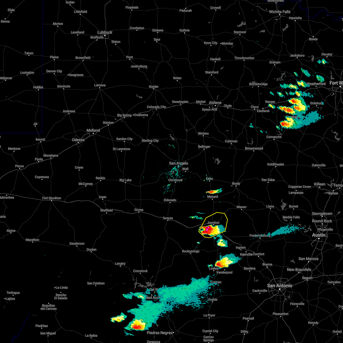 At 445 pm cdt, a severe thunderstorm was located near telegraph, moving northeast at 25 mph (radar indicated). Hazards include quarter size hail. Damage to vehicles is expected. this severe thunderstorm will be near, south llano river state park around 510 pm cdt. junction and segovia around 520 pm cdt. yates crossing and london around 545 pm cdt. other locations impacted by this severe thunderstorm include us- 377 near the kimble-edwards county line and cleo. This includes interstate 10 between mile markers 443 and 470. At 445 pm cdt, a severe thunderstorm was located near telegraph, moving northeast at 25 mph (radar indicated). Hazards include quarter size hail. Damage to vehicles is expected. this severe thunderstorm will be near, south llano river state park around 510 pm cdt. junction and segovia around 520 pm cdt. yates crossing and london around 545 pm cdt. other locations impacted by this severe thunderstorm include us- 377 near the kimble-edwards county line and cleo. This includes interstate 10 between mile markers 443 and 470.
|
| 5/10/2021 4:46 PM CDT |
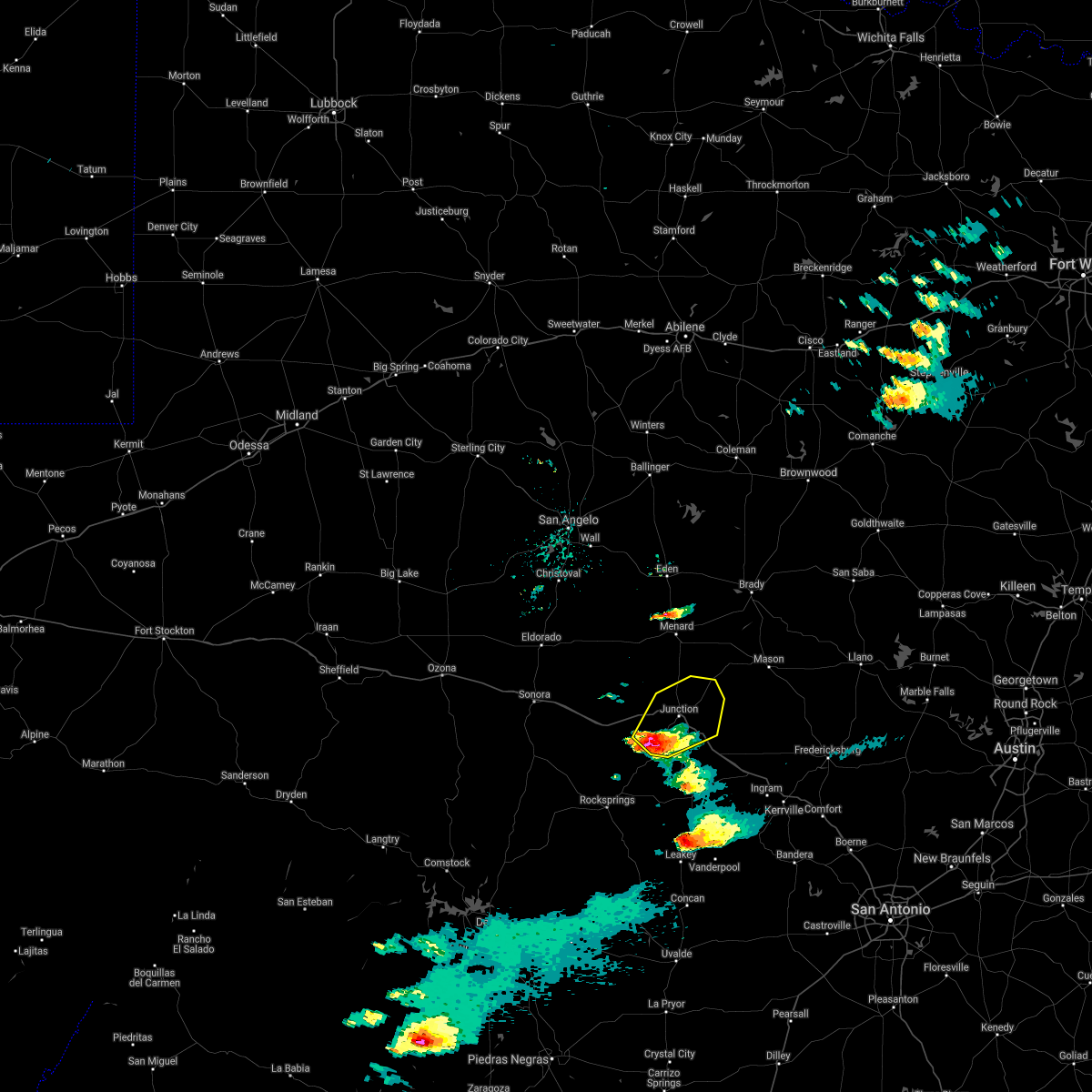 At 445 pm cdt, a severe thunderstorm was located near telegraph, moving northeast at 25 mph (radar indicated). Hazards include quarter size hail. Damage to vehicles is expected. this severe thunderstorm will be near, south llano river state park around 510 pm cdt. junction and segovia around 520 pm cdt. yates crossing and london around 545 pm cdt. other locations impacted by this severe thunderstorm include us- 377 near the kimble-edwards county line and cleo. This includes interstate 10 between mile markers 443 and 470. At 445 pm cdt, a severe thunderstorm was located near telegraph, moving northeast at 25 mph (radar indicated). Hazards include quarter size hail. Damage to vehicles is expected. this severe thunderstorm will be near, south llano river state park around 510 pm cdt. junction and segovia around 520 pm cdt. yates crossing and london around 545 pm cdt. other locations impacted by this severe thunderstorm include us- 377 near the kimble-edwards county line and cleo. This includes interstate 10 between mile markers 443 and 470.
|
| 4/15/2021 10:35 AM CDT | Quarter sized hail reported 16.9 miles E of Junction, TX |
| 4/15/2021 10:34 AM CDT |
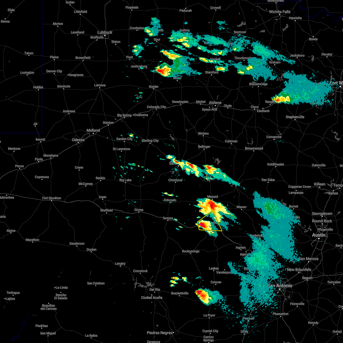 At 1034 am cdt, a severe thunderstorm was located near roosevelt, or 12 miles west of junction, moving east at 25 mph (radar indicated). Hazards include half dollar size hail. Damage to vehicles is expected. this severe thunderstorm will be near, south llano river state park around 1055 am cdt. junction around 1100 am cdt. other locations impacted by this severe thunderstorm include cleo and us-83 near the kimble-menard county line. This includes interstate 10 between mile markers 437 and 468. At 1034 am cdt, a severe thunderstorm was located near roosevelt, or 12 miles west of junction, moving east at 25 mph (radar indicated). Hazards include half dollar size hail. Damage to vehicles is expected. this severe thunderstorm will be near, south llano river state park around 1055 am cdt. junction around 1100 am cdt. other locations impacted by this severe thunderstorm include cleo and us-83 near the kimble-menard county line. This includes interstate 10 between mile markers 437 and 468.
|
| 4/15/2021 10:20 AM CDT | Half Dollar sized hail reported 16.9 miles E of Junction, TX |
| 3/24/2021 10:40 PM CDT | Baseball sized hail reported 4 miles NE of Junction, TX, golf ball to baseball size hail reported near south llano state park. |
| 3/24/2021 10:40 PM CDT | Golf Ball sized hail reported 0.3 miles NE of Junction, TX, hail up to golf ball size in junction. |
| 3/24/2021 10:40 PM CDT | Tea Cup sized hail reported 0.3 miles NE of Junction, TX, hail up to 3 inch in diameter posted to social media from junction. |
| 3/24/2021 10:40 PM CDT |
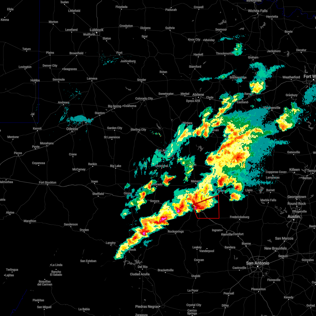 At 1038 pm cdt, a severe thunderstorm capable of producing a tornado and damaging winds was located over junction and near segovia moving east at 35 mph (radar indicated rotation). Hazards include tornado and hail up to two inches in diameter. Flying debris will be dangerous to those caught without shelter. mobile homes will be damaged or destroyed. damage to roofs, windows, and vehicles will occur. tree damage is likely. this tornadic thunderstorm will remain over mainly rural areas of eastern kimble and southwestern mason counties, including the following locations, us-83 near the kerr-kimble county line, i-10 near the kimble-kerr county line and the intersection of i-10 and us 290. This includes interstate 10 between mile markers 450 and 477. At 1038 pm cdt, a severe thunderstorm capable of producing a tornado and damaging winds was located over junction and near segovia moving east at 35 mph (radar indicated rotation). Hazards include tornado and hail up to two inches in diameter. Flying debris will be dangerous to those caught without shelter. mobile homes will be damaged or destroyed. damage to roofs, windows, and vehicles will occur. tree damage is likely. this tornadic thunderstorm will remain over mainly rural areas of eastern kimble and southwestern mason counties, including the following locations, us-83 near the kerr-kimble county line, i-10 near the kimble-kerr county line and the intersection of i-10 and us 290. This includes interstate 10 between mile markers 450 and 477.
|
| 3/24/2021 10:34 PM CDT | Baseball sized hail reported 5.1 miles ESE of Junction, TX, golf ball to baseball size hail at mile marker 451 along i-10. |
| 3/24/2021 10:20 PM CDT |
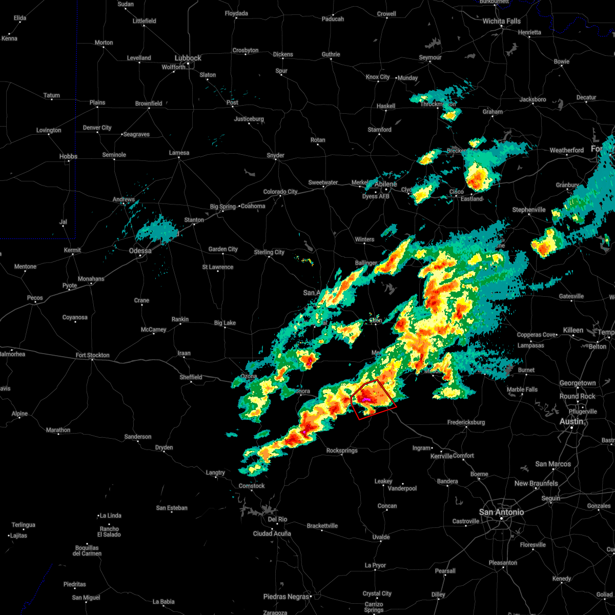 At 1018 pm cdt, a severe thunderstorm capable of producing a tornado and damaging winds was located near roosevelt, or 12 miles west of junction, moving northeast at 30 mph (radar indicated rotation). Hazards include tornado and tennis ball size hail. Flying debris will be dangerous to those caught without shelter. mobile homes will be damaged or destroyed. damage to roofs, windows, and vehicles will occur. tree damage is likely. locations impacted include, junction, south llano river state park, roosevelt and cleo. This includes interstate 10 between mile markers 435 and 461. At 1018 pm cdt, a severe thunderstorm capable of producing a tornado and damaging winds was located near roosevelt, or 12 miles west of junction, moving northeast at 30 mph (radar indicated rotation). Hazards include tornado and tennis ball size hail. Flying debris will be dangerous to those caught without shelter. mobile homes will be damaged or destroyed. damage to roofs, windows, and vehicles will occur. tree damage is likely. locations impacted include, junction, south llano river state park, roosevelt and cleo. This includes interstate 10 between mile markers 435 and 461.
|
| 3/24/2021 10:08 PM CDT |
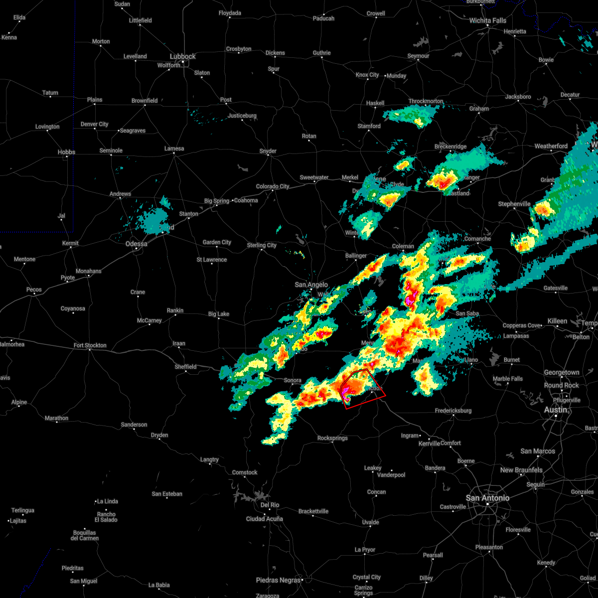 At 1007 pm cdt, a severe thunderstorm capable of producing a tornado was located near roosevelt, or 18 miles west of junction, moving northeast at 30 mph (radar indicated rotation). Hazards include tornado and ping pong ball size hail. Flying debris will be dangerous to those caught without shelter. mobile homes will be damaged or destroyed. damage to roofs, windows, and vehicles will occur. tree damage is likely. this tornadic thunderstorm will remain over mainly rural areas of western kimble county, including the following locations, cleo. This includes interstate 10 between mile markers 434 and 461. At 1007 pm cdt, a severe thunderstorm capable of producing a tornado was located near roosevelt, or 18 miles west of junction, moving northeast at 30 mph (radar indicated rotation). Hazards include tornado and ping pong ball size hail. Flying debris will be dangerous to those caught without shelter. mobile homes will be damaged or destroyed. damage to roofs, windows, and vehicles will occur. tree damage is likely. this tornadic thunderstorm will remain over mainly rural areas of western kimble county, including the following locations, cleo. This includes interstate 10 between mile markers 434 and 461.
|
| 5/28/2020 3:08 PM CDT |
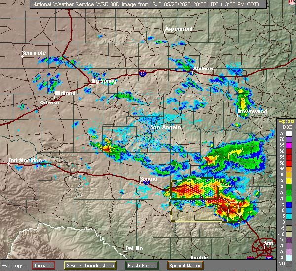 At 305 pm cdt, a large severe thunderstorm was located from roosevelt to junction to telegraph and segovia, moving south at 25 mph (radar indicated). Hazards include 70 mph wind gusts and half dollar size hail. Hail damage to vehicles is expected. expect considerable tree damage. wind damage is also likely to mobile homes, roofs, and outbuildings. this severe storm will be near, telegraph around 320 pm cdt. other locations impacted by this severe thunderstorm include cleo, us-377 near the kimble-edwards county line, i-10 near the kimble- kerr county line, the intersection of i-10 and us 290 and us- 83 near the kerr-kimble county line. This includes interstate 10 between mile markers 435 and 477. At 305 pm cdt, a large severe thunderstorm was located from roosevelt to junction to telegraph and segovia, moving south at 25 mph (radar indicated). Hazards include 70 mph wind gusts and half dollar size hail. Hail damage to vehicles is expected. expect considerable tree damage. wind damage is also likely to mobile homes, roofs, and outbuildings. this severe storm will be near, telegraph around 320 pm cdt. other locations impacted by this severe thunderstorm include cleo, us-377 near the kimble-edwards county line, i-10 near the kimble- kerr county line, the intersection of i-10 and us 290 and us- 83 near the kerr-kimble county line. This includes interstate 10 between mile markers 435 and 477.
|
| 5/28/2020 2:55 PM CDT |
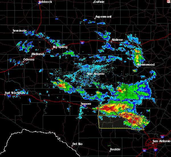 At 253 pm cdt, a severe thunderstorm was located near south llano river state park, or 7 miles west of junction, moving south at 25 mph. the asos in junction reported a 70 mph wind gust at 243 pm (radar indicated). Hazards include golf ball size hail and 70 mph wind gusts. People and animals outdoors will be injured. expect hail damage to roofs, siding, windows, and vehicles. expect considerable tree damage. wind damage is also likely to mobile homes, roofs, and outbuildings. this severe storm will be near, south llano river state park around 300 pm cdt. telegraph around 320 pm cdt. other locations impacted by this severe thunderstorm include cleo, us-377 near the kimble-edwards county line, i-10 near the kimble- kerr county line, the intersection of i-10 and us 290 and us- 83 near the kerr-kimble county line. This includes interstate 10 between mile markers 435 and 477. At 253 pm cdt, a severe thunderstorm was located near south llano river state park, or 7 miles west of junction, moving south at 25 mph. the asos in junction reported a 70 mph wind gust at 243 pm (radar indicated). Hazards include golf ball size hail and 70 mph wind gusts. People and animals outdoors will be injured. expect hail damage to roofs, siding, windows, and vehicles. expect considerable tree damage. wind damage is also likely to mobile homes, roofs, and outbuildings. this severe storm will be near, south llano river state park around 300 pm cdt. telegraph around 320 pm cdt. other locations impacted by this severe thunderstorm include cleo, us-377 near the kimble-edwards county line, i-10 near the kimble- kerr county line, the intersection of i-10 and us 290 and us- 83 near the kerr-kimble county line. This includes interstate 10 between mile markers 435 and 477.
|
| 5/28/2020 2:49 PM CDT |
 At 249 pm cdt, a severe thunderstorm was located near south llano river state park, or 7 miles west of junction, moving southeast at 20 mph (radar indicated). Hazards include golf ball size hail and 60 mph wind gusts. People and animals outdoors will be injured. expect hail damage to roofs, siding, windows, and vehicles. expect wind damage to roofs, siding, and trees. this severe storm will be near, junction around 300 pm cdt. south llano river state park around 310 pm cdt. telegraph around 320 pm cdt. other locations impacted by this severe thunderstorm include cleo, us-377 near the kimble-edwards county line, i-10 near the kimble- kerr county line, the intersection of i-10 and us 290 and us- 83 near the kerr-kimble county line. This includes interstate 10 between mile markers 435 and 477. At 249 pm cdt, a severe thunderstorm was located near south llano river state park, or 7 miles west of junction, moving southeast at 20 mph (radar indicated). Hazards include golf ball size hail and 60 mph wind gusts. People and animals outdoors will be injured. expect hail damage to roofs, siding, windows, and vehicles. expect wind damage to roofs, siding, and trees. this severe storm will be near, junction around 300 pm cdt. south llano river state park around 310 pm cdt. telegraph around 320 pm cdt. other locations impacted by this severe thunderstorm include cleo, us-377 near the kimble-edwards county line, i-10 near the kimble- kerr county line, the intersection of i-10 and us 290 and us- 83 near the kerr-kimble county line. This includes interstate 10 between mile markers 435 and 477.
|
| 5/28/2020 2:45 PM CDT |
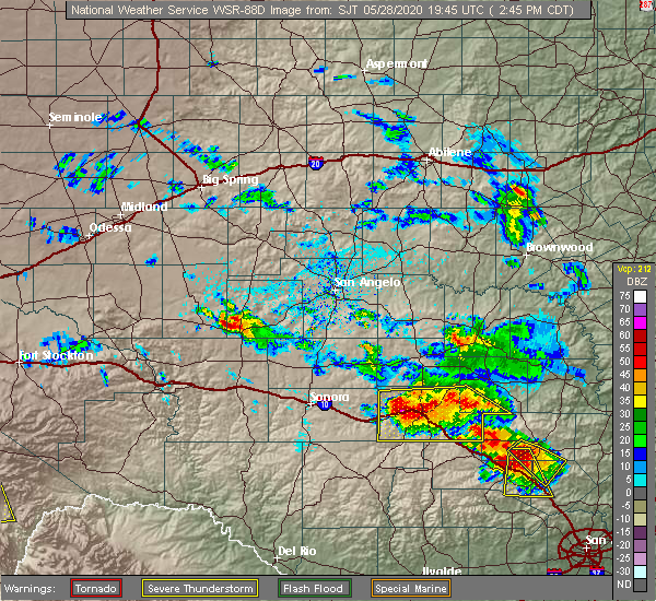 At 243 pm cdt, a severe thunderstorm was located over junction, moving south at 20 mph (radar indicated). Hazards include ping pong ball size hail and 60 mph wind gusts. People and animals outdoors will be injured. expect hail damage to roofs, siding, windows, and vehicles. expect wind damage to roofs, siding, and trees. this severe storm will be near, south llano river state park around 255 pm cdt. telegraph around 320 pm cdt. other locations impacted by this severe thunderstorm include cleo, us-377 near the kimble-edwards county line, i-10 near the kimble- kerr county line, the intersection of i-10 and us 290 and us- 83 near the kerr-kimble county line. This includes interstate 10 between mile markers 435 and 477. At 243 pm cdt, a severe thunderstorm was located over junction, moving south at 20 mph (radar indicated). Hazards include ping pong ball size hail and 60 mph wind gusts. People and animals outdoors will be injured. expect hail damage to roofs, siding, windows, and vehicles. expect wind damage to roofs, siding, and trees. this severe storm will be near, south llano river state park around 255 pm cdt. telegraph around 320 pm cdt. other locations impacted by this severe thunderstorm include cleo, us-377 near the kimble-edwards county line, i-10 near the kimble- kerr county line, the intersection of i-10 and us 290 and us- 83 near the kerr-kimble county line. This includes interstate 10 between mile markers 435 and 477.
|
| 5/28/2020 2:43 PM CDT | Storm damage reported in kimble county TX, 0.3 miles NE of Junction, TX |
| 5/28/2020 2:32 PM CDT |
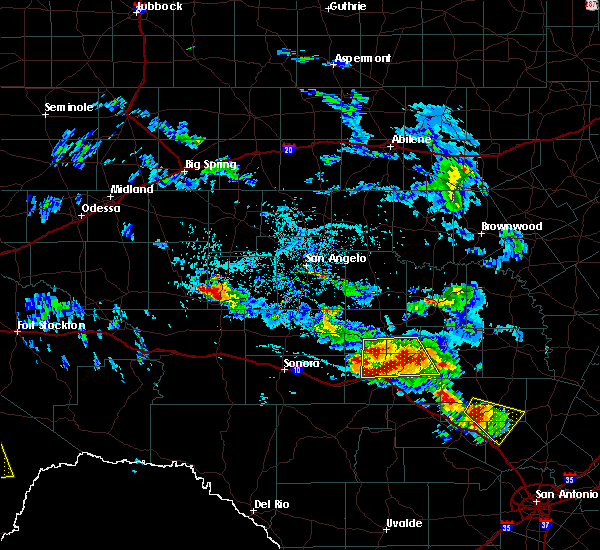 At 232 pm cdt, a severe thunderstorm was located near junction, moving south at 20 mph (radar indicated). Hazards include ping pong ball size hail and 60 mph wind gusts. People and animals outdoors will be injured. expect hail damage to roofs, siding, windows, and vehicles. expect wind damage to roofs, siding, and trees. this severe thunderstorm will be near, junction around 240 pm cdt. south llano river state park around 255 pm cdt. telegraph around 315 pm cdt. other locations impacted by this severe thunderstorm include cleo, us-83 near the kimble-menard county line, us-377 near the kimble- menard county line, us-377 near the kimble-edwards county line, i- 10 near the kimble-kerr county line, the intersection of i- 10 and us 290 and us-83 near the kerr-kimble county line. This includes interstate 10 between mile markers 435 and 477. At 232 pm cdt, a severe thunderstorm was located near junction, moving south at 20 mph (radar indicated). Hazards include ping pong ball size hail and 60 mph wind gusts. People and animals outdoors will be injured. expect hail damage to roofs, siding, windows, and vehicles. expect wind damage to roofs, siding, and trees. this severe thunderstorm will be near, junction around 240 pm cdt. south llano river state park around 255 pm cdt. telegraph around 315 pm cdt. other locations impacted by this severe thunderstorm include cleo, us-83 near the kimble-menard county line, us-377 near the kimble- menard county line, us-377 near the kimble-edwards county line, i- 10 near the kimble-kerr county line, the intersection of i- 10 and us 290 and us-83 near the kerr-kimble county line. This includes interstate 10 between mile markers 435 and 477.
|
| 5/27/2020 7:34 PM CDT |
 At 733 pm cdt, severe thunderstorms were located near junction, moving southeast at 35 mph (radar indicated). Hazards include 60 mph wind gusts and quarter size hail. Hail damage to vehicles is expected. expect wind damage to roofs, siding, and trees. these severe storm will be near, junction and segovia around 745 pm cdt. other locations impacted by this severe thunderstorm include i- 10 near the kimble-kerr county line, the intersection of i- 10 and us 290 and us-83 near the kerr-kimble county line. This includes interstate 10 between mile markers 452 and 478. At 733 pm cdt, severe thunderstorms were located near junction, moving southeast at 35 mph (radar indicated). Hazards include 60 mph wind gusts and quarter size hail. Hail damage to vehicles is expected. expect wind damage to roofs, siding, and trees. these severe storm will be near, junction and segovia around 745 pm cdt. other locations impacted by this severe thunderstorm include i- 10 near the kimble-kerr county line, the intersection of i- 10 and us 290 and us-83 near the kerr-kimble county line. This includes interstate 10 between mile markers 452 and 478.
|
| 5/27/2020 6:53 PM CDT |
 At 652 pm cdt, a severe thunderstorm was located 15 miles south of menard, moving southeast at 20 mph (radar indicated). Hazards include 60 mph wind gusts and quarter size hail. Hail damage to vehicles is expected. expect wind damage to roofs, siding, and trees. this severe thunderstorm will be near, junction around 730 pm cdt. segovia around 745 pm cdt. other locations impacted by this severe thunderstorm include the intersection of us-83 and ranch road 1773, us-83 near the kerr- kimble county line, cleo, i-10 near the kimble- kerr county line, the intersection of i-10 and us 290 and us- 83 near the kimble-menard county line. This includes interstate 10 between mile markers 448 and 478. At 652 pm cdt, a severe thunderstorm was located 15 miles south of menard, moving southeast at 20 mph (radar indicated). Hazards include 60 mph wind gusts and quarter size hail. Hail damage to vehicles is expected. expect wind damage to roofs, siding, and trees. this severe thunderstorm will be near, junction around 730 pm cdt. segovia around 745 pm cdt. other locations impacted by this severe thunderstorm include the intersection of us-83 and ranch road 1773, us-83 near the kerr- kimble county line, cleo, i-10 near the kimble- kerr county line, the intersection of i-10 and us 290 and us- 83 near the kimble-menard county line. This includes interstate 10 between mile markers 448 and 478.
|
| 5/15/2020 8:23 PM CDT |
 At 821 pm cdt, a severe thunderstorm was located 8 miles south of segovia, or 14 miles south of junction, moving east at 20 mph (radar indicated). Hazards include 60 mph wind gusts. Expect damage to roofs, siding, and trees. locations impacted include, junction, telegraph, yates crossing, segovia, london, south llano river state park, roosevelt, i-10 near the sutton- kimble county line, cleo, us-83 near the kimble- menard county line, i-10 near the kimble- kerr county line, the intersection of i-10 and us 290, us- 377 near the kimble-edwards county line and us-83 near the kerr- kimble county line. This includes interstate 10 between mile markers 427 and 477. At 821 pm cdt, a severe thunderstorm was located 8 miles south of segovia, or 14 miles south of junction, moving east at 20 mph (radar indicated). Hazards include 60 mph wind gusts. Expect damage to roofs, siding, and trees. locations impacted include, junction, telegraph, yates crossing, segovia, london, south llano river state park, roosevelt, i-10 near the sutton- kimble county line, cleo, us-83 near the kimble- menard county line, i-10 near the kimble- kerr county line, the intersection of i-10 and us 290, us- 377 near the kimble-edwards county line and us-83 near the kerr- kimble county line. This includes interstate 10 between mile markers 427 and 477.
|
| 5/15/2020 8:02 PM CDT |
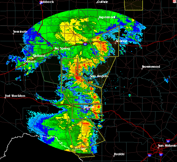 At 800 pm cdt, a severe thunderstorm was located over telegraph, or 12 miles southwest of junction, moving east at 20 mph (radar indicated). Hazards include 60 mph wind gusts. Expect damage to roofs, siding, and trees. this severe thunderstorm will remain over mainly rural areas of kimble, southwestern mason and eastern sutton counties, including the following locations, cleo, us-83 near the kimble-menard county line, i-10 near the sutton-kimble county line, i-10 near the kimble-kerr county line, the intersection of i-10 and us 290, us-377 near the kimble-edwards county line and us-83 near the kerr- kimble county line. This includes interstate 10 between mile markers 427 and 477. At 800 pm cdt, a severe thunderstorm was located over telegraph, or 12 miles southwest of junction, moving east at 20 mph (radar indicated). Hazards include 60 mph wind gusts. Expect damage to roofs, siding, and trees. this severe thunderstorm will remain over mainly rural areas of kimble, southwestern mason and eastern sutton counties, including the following locations, cleo, us-83 near the kimble-menard county line, i-10 near the sutton-kimble county line, i-10 near the kimble-kerr county line, the intersection of i-10 and us 290, us-377 near the kimble-edwards county line and us-83 near the kerr- kimble county line. This includes interstate 10 between mile markers 427 and 477.
|
| 10/21/2019 1:06 AM CDT |
 At 106 am cdt, a severe thunderstorm was located 8 miles south of streeter, or 13 miles southwest of mason, moving east at 30 mph (radar indicated). Hazards include 60 mph wind gusts. Expect damage to roofs, siding, and trees. locations impacted include, yates crossing. This includes interstate 10 near mile marker 455. At 106 am cdt, a severe thunderstorm was located 8 miles south of streeter, or 13 miles southwest of mason, moving east at 30 mph (radar indicated). Hazards include 60 mph wind gusts. Expect damage to roofs, siding, and trees. locations impacted include, yates crossing. This includes interstate 10 near mile marker 455.
|
| 10/21/2019 1:04 AM CDT |
 At 103 am cdt, a severe thunderstorm was located near south llano river state park, or 7 miles southwest of junction, moving southeast at 35 mph (radar indicated). Hazards include 60 mph wind gusts. Expect damage to roofs, siding, and trees. this severe storm will be near, segovia around 120 am cdt. This includes interstate 10 between mile markers 440 and 446, and between mile markers 456 and 474. At 103 am cdt, a severe thunderstorm was located near south llano river state park, or 7 miles southwest of junction, moving southeast at 35 mph (radar indicated). Hazards include 60 mph wind gusts. Expect damage to roofs, siding, and trees. this severe storm will be near, segovia around 120 am cdt. This includes interstate 10 between mile markers 440 and 446, and between mile markers 456 and 474.
|
| 10/21/2019 12:45 AM CDT |
 At 1244 am cdt, a severe thunderstorm was located over london, or 14 miles northeast of junction, moving east at 30 mph (radar indicated). Hazards include 60 mph wind gusts. Expect damage to roofs, siding, and trees. this severe thunderstorm will remain over mainly rural areas of northeastern kimble and southwestern mason counties. This includes interstate 10 near mile marker 455. At 1244 am cdt, a severe thunderstorm was located over london, or 14 miles northeast of junction, moving east at 30 mph (radar indicated). Hazards include 60 mph wind gusts. Expect damage to roofs, siding, and trees. this severe thunderstorm will remain over mainly rural areas of northeastern kimble and southwestern mason counties. This includes interstate 10 near mile marker 455.
|
| 10/21/2019 12:35 AM CDT |
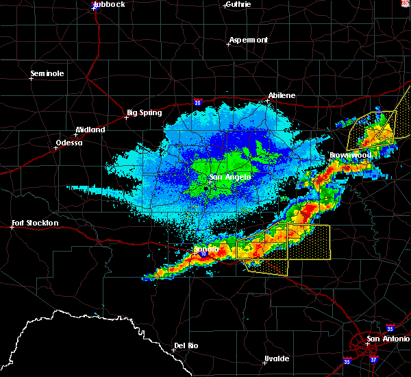 At 1234 am cdt, a severe thunderstorm was located near yates crossing, or 10 miles northeast of junction, moving east at 30 mph (radar indicated). Hazards include 60 mph wind gusts. Expect damage to roofs, siding, and trees. locations impacted include, junction, london, yates crossing, cleo and us-83 near the kimble- menard county line. This includes interstate 10 between mile markers 447 and 455. At 1234 am cdt, a severe thunderstorm was located near yates crossing, or 10 miles northeast of junction, moving east at 30 mph (radar indicated). Hazards include 60 mph wind gusts. Expect damage to roofs, siding, and trees. locations impacted include, junction, london, yates crossing, cleo and us-83 near the kimble- menard county line. This includes interstate 10 between mile markers 447 and 455.
|
| 10/21/2019 12:23 AM CDT |
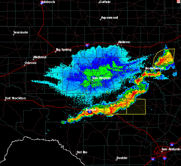 At 1223 am cdt, a severe thunderstorm was located near junction, moving southeast at 30 mph (radar indicated). Hazards include 60 mph wind gusts. Expect damage to roofs, siding, and trees. this severe thunderstorm will be near, junction and south llano river state park around 1235 am cdt. segovia around 1250 am cdt. This includes interstate 10 between mile markers 440 and 446, and between mile markers 456 and 474. At 1223 am cdt, a severe thunderstorm was located near junction, moving southeast at 30 mph (radar indicated). Hazards include 60 mph wind gusts. Expect damage to roofs, siding, and trees. this severe thunderstorm will be near, junction and south llano river state park around 1235 am cdt. segovia around 1250 am cdt. This includes interstate 10 between mile markers 440 and 446, and between mile markers 456 and 474.
|
| 10/21/2019 12:09 AM CDT |
 At 1146 pm cdt, a severe thunderstorm was located 9 miles east of fort mckavett, or 12 miles southwest of menard, moving southeast at 35 mph (radar indicated). Hazards include 70 mph wind gusts. Expect considerable tree damage. damage is likely to mobile homes, roofs, and outbuildings. this severe thunderstorm will be near, london, saline and yates crossing around 1225 am cdt. other locations impacted by this severe thunderstorm include the intersection of us-83 and ranch road 1773, camp sol mayer, cleo, us- 377 near the kimble-menard county line, the intersection of us- 83 and highway 29 and us-83 near the kimble-menard county line. This includes interstate 10 between mile markers 447 and 455. At 1146 pm cdt, a severe thunderstorm was located 9 miles east of fort mckavett, or 12 miles southwest of menard, moving southeast at 35 mph (radar indicated). Hazards include 70 mph wind gusts. Expect considerable tree damage. damage is likely to mobile homes, roofs, and outbuildings. this severe thunderstorm will be near, london, saline and yates crossing around 1225 am cdt. other locations impacted by this severe thunderstorm include the intersection of us-83 and ranch road 1773, camp sol mayer, cleo, us- 377 near the kimble-menard county line, the intersection of us- 83 and highway 29 and us-83 near the kimble-menard county line. This includes interstate 10 between mile markers 447 and 455.
|
| 10/20/2019 11:47 PM CDT |
 At 1146 pm cdt, a severe thunderstorm was located 9 miles east of fort mckavett, or 12 miles southwest of menard, moving southeast at 35 mph (radar indicated). Hazards include 70 mph wind gusts. Expect considerable tree damage. damage is likely to mobile homes, roofs, and outbuildings. this severe thunderstorm will be near, london, saline and yates crossing around 1225 am cdt. other locations impacted by this severe thunderstorm include the intersection of us-83 and ranch road 1773, camp sol mayer, cleo, us- 377 near the kimble-menard county line, the intersection of us- 83 and highway 29 and us-83 near the kimble-menard county line. This includes interstate 10 between mile markers 447 and 455. At 1146 pm cdt, a severe thunderstorm was located 9 miles east of fort mckavett, or 12 miles southwest of menard, moving southeast at 35 mph (radar indicated). Hazards include 70 mph wind gusts. Expect considerable tree damage. damage is likely to mobile homes, roofs, and outbuildings. this severe thunderstorm will be near, london, saline and yates crossing around 1225 am cdt. other locations impacted by this severe thunderstorm include the intersection of us-83 and ranch road 1773, camp sol mayer, cleo, us- 377 near the kimble-menard county line, the intersection of us- 83 and highway 29 and us-83 near the kimble-menard county line. This includes interstate 10 between mile markers 447 and 455.
|
| 3/13/2019 3:16 AM CDT |
 At 315 am cdt, a severe thunderstorm was located near london, or 14 miles northeast of junction, moving northeast at 65 mph (radar indicated). Hazards include 60 mph wind gusts. Expect damage to roofs, siding, and trees. this severe thunderstorm will be near, saline around 320 am cdt. long mountain and hext around 325 am cdt. streeter and grit around 330 am cdt. camp air around 335 am cdt. katemcy and camp san saba around 340 am cdt. fredonia and voca around 345 am cdt. other locations impacted by this severe thunderstorm include the intersection of highway 29 and ranch road 1222, the intersection of us-83 and ranch road 1773, erna, us-190 near the menard- mcculloch county line, the intersection of us- 190 and ranch road 1311, us-83 near the kimble- menard county line, us-377 near the kimble- menard county line, koockville and the intersection of us- 83 and highway 29. This includes interstate 10 between mile markers 453 and 463. At 315 am cdt, a severe thunderstorm was located near london, or 14 miles northeast of junction, moving northeast at 65 mph (radar indicated). Hazards include 60 mph wind gusts. Expect damage to roofs, siding, and trees. this severe thunderstorm will be near, saline around 320 am cdt. long mountain and hext around 325 am cdt. streeter and grit around 330 am cdt. camp air around 335 am cdt. katemcy and camp san saba around 340 am cdt. fredonia and voca around 345 am cdt. other locations impacted by this severe thunderstorm include the intersection of highway 29 and ranch road 1222, the intersection of us-83 and ranch road 1773, erna, us-190 near the menard- mcculloch county line, the intersection of us- 190 and ranch road 1311, us-83 near the kimble- menard county line, us-377 near the kimble- menard county line, koockville and the intersection of us- 83 and highway 29. This includes interstate 10 between mile markers 453 and 463.
|
| 3/13/2019 3:07 AM CDT | Law enforcement reported power poles down... roof damage... and windows blown in throughout the city of junctio in kimble county TX, 0.3 miles NE of Junction, TX |
| 5/15/2018 8:27 PM CDT |
 At 826 pm cdt, a severe thunderstorm was located near junction, moving southeast at 50 mph (radar indicated). Hazards include 60 mph wind gusts and quarter size hail. Hail damage to vehicles is expected. expect wind damage to roofs, siding, and trees. this severe thunderstorm will be near, junction around 830 pm cdt. south llano river state park around 835 pm cdt. segovia around 845 pm cdt. other locations impacted by this severe thunderstorm include us- 83 near the kimble-menard county line and cleo. This includes interstate 10 between mile markers 444 and 476. At 826 pm cdt, a severe thunderstorm was located near junction, moving southeast at 50 mph (radar indicated). Hazards include 60 mph wind gusts and quarter size hail. Hail damage to vehicles is expected. expect wind damage to roofs, siding, and trees. this severe thunderstorm will be near, junction around 830 pm cdt. south llano river state park around 835 pm cdt. segovia around 845 pm cdt. other locations impacted by this severe thunderstorm include us- 83 near the kimble-menard county line and cleo. This includes interstate 10 between mile markers 444 and 476.
|
| 5/20/2017 1:36 AM CDT |
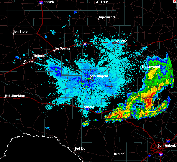 At 136 am cdt, a severe thunderstorm was located 7 miles southeast of segovia, or 15 miles southeast of junction, moving east at 35 mph (radar indicated). Hazards include 60 mph wind gusts and quarter size hail. Hail damage to vehicles is expected. expect wind damage to roofs, siding, and trees. this severe thunderstorm will remain over mainly rural areas of southern kimble county, including the following locations: south llano river state park, and highways 83, 377, and interstate 10 south of junction. A tornado watch remains in effect until 300 am cdt for west central texas. At 136 am cdt, a severe thunderstorm was located 7 miles southeast of segovia, or 15 miles southeast of junction, moving east at 35 mph (radar indicated). Hazards include 60 mph wind gusts and quarter size hail. Hail damage to vehicles is expected. expect wind damage to roofs, siding, and trees. this severe thunderstorm will remain over mainly rural areas of southern kimble county, including the following locations: south llano river state park, and highways 83, 377, and interstate 10 south of junction. A tornado watch remains in effect until 300 am cdt for west central texas.
|
| 5/20/2017 12:55 AM CDT |
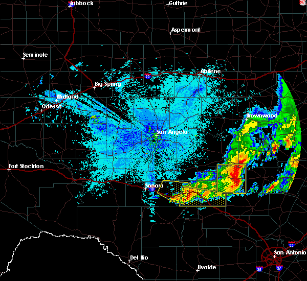 At 1255 am cdt, a severe thunderstorm was located near roosevelt, or 10 miles west of junction, moving east at 35 mph (radar indicated). Hazards include 60 mph wind gusts and quarter size hail. Hail damage to vehicles is expected. expect wind damage to roofs, siding, and trees. this severe thunderstorm will be near, junction around 110 am cdt. segovia around 125 am cdt. other locations impacted by this severe thunderstorm include south llano river state park, the intersection of i-10 and u. s 83, us- 377 near the kimble-edwards county line, i-10 near the kimble- kerr county line, the intersection of i-10 and u. s 290 and us- 83 near the kerr-kimble county line. this includes interstate 10 between mile markers 439 and 477. A tornado watch remains in effect until 300 am cdt for west central texas. At 1255 am cdt, a severe thunderstorm was located near roosevelt, or 10 miles west of junction, moving east at 35 mph (radar indicated). Hazards include 60 mph wind gusts and quarter size hail. Hail damage to vehicles is expected. expect wind damage to roofs, siding, and trees. this severe thunderstorm will be near, junction around 110 am cdt. segovia around 125 am cdt. other locations impacted by this severe thunderstorm include south llano river state park, the intersection of i-10 and u. s 83, us- 377 near the kimble-edwards county line, i-10 near the kimble- kerr county line, the intersection of i-10 and u. s 290 and us- 83 near the kerr-kimble county line. this includes interstate 10 between mile markers 439 and 477. A tornado watch remains in effect until 300 am cdt for west central texas.
|
| 3/28/2017 11:26 PM CDT |
 At 1126 pm cdt, a severe thunderstorm was located 10 miles northwest of london, or 13 miles south of menard, moving northeast at 55 mph (radar indicated). Hazards include 60 mph wind gusts and quarter size hail. Hail damage to vehicles is expected. expect wind damage to roofs, siding, and trees. Locations impacted include, junction, the intersection of ranch road 1773 and ranch road 1221, the intersection of us-83 and highway 29, the intersection of us- 83 and ranch road 1773, cleo and us-83 near the kimble- menard county line. At 1126 pm cdt, a severe thunderstorm was located 10 miles northwest of london, or 13 miles south of menard, moving northeast at 55 mph (radar indicated). Hazards include 60 mph wind gusts and quarter size hail. Hail damage to vehicles is expected. expect wind damage to roofs, siding, and trees. Locations impacted include, junction, the intersection of ranch road 1773 and ranch road 1221, the intersection of us-83 and highway 29, the intersection of us- 83 and ranch road 1773, cleo and us-83 near the kimble- menard county line.
|
| 3/28/2017 11:25 PM CDT | Storm damage reported in kimble county TX, 14.4 miles NW of Junction, TX |
| 3/28/2017 11:09 PM CDT |
 At 1109 pm cdt, a severe thunderstorm was located near junction, moving northeast at 50 mph (radar indicated). Hazards include 60 mph wind gusts and half dollar size hail. Hail damage to vehicles is expected. expect wind damage to roofs, siding, and trees. this severe thunderstorm will remain over mainly rural areas of western kimble and southeastern menard counties, including the following locations: the intersection of ranch road 1773 and ranch road 1221, the intersection of us-83 and highway 29, the intersection of us-83 and ranch road 1773, south llano river state park, cleo and us-83 near the kimble-menard county line. This includes interstate 10 between mile markers 439 and 458. At 1109 pm cdt, a severe thunderstorm was located near junction, moving northeast at 50 mph (radar indicated). Hazards include 60 mph wind gusts and half dollar size hail. Hail damage to vehicles is expected. expect wind damage to roofs, siding, and trees. this severe thunderstorm will remain over mainly rural areas of western kimble and southeastern menard counties, including the following locations: the intersection of ranch road 1773 and ranch road 1221, the intersection of us-83 and highway 29, the intersection of us-83 and ranch road 1773, south llano river state park, cleo and us-83 near the kimble-menard county line. This includes interstate 10 between mile markers 439 and 458.
|
| 5/31/2016 2:36 PM CDT |
 At 235 pm cdt, a severe thunderstorm was located near junction, moving east at 20 mph (radar indicated). Hazards include 60 mph wind gusts and quarter size hail. Hail damage to vehicles is expected. expect wind damage to roofs, siding, and trees. this severe thunderstorm will remain over mainly rural areas of central kimble county, including the following locations: the intersection of ranch road 385 and ranch road 1871, the intersection of i-10 and u. s 83, and the intersection of i-10 and u. s 290. This includes interstate 10 between mile markers 454 and 477. At 235 pm cdt, a severe thunderstorm was located near junction, moving east at 20 mph (radar indicated). Hazards include 60 mph wind gusts and quarter size hail. Hail damage to vehicles is expected. expect wind damage to roofs, siding, and trees. this severe thunderstorm will remain over mainly rural areas of central kimble county, including the following locations: the intersection of ranch road 385 and ranch road 1871, the intersection of i-10 and u. s 83, and the intersection of i-10 and u. s 290. This includes interstate 10 between mile markers 454 and 477.
|
| 5/31/2016 2:09 PM CDT |
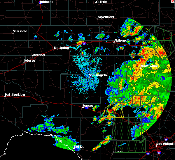 At 209 pm cdt, a severe thunderstorm was located near junction, moving east at 20 mph (radar indicated). Hazards include 60 mph wind gusts and quarter size hail. Hail damage to vehicles is expected. expect wind damage to roofs, siding, and trees. this severe thunderstorm will be near, junction around 225 pm cdt. segovia around 240 pm cdt. other locations impacted by this severe thunderstorm include the intersection of ranch road 385 and ranch road 1871, cleo, south llano river state park, the intersection of i-10 and u. s 83, the intersection of us-377 and ranch road 385, i-10 near the kimble- kerr county line, the intersection of i-10 and u. s 290, us-377 near the kimble-edwards county line and us-83 near the kerr-kimble county line. This includes interstate 10 between mile markers 442 and 477. At 209 pm cdt, a severe thunderstorm was located near junction, moving east at 20 mph (radar indicated). Hazards include 60 mph wind gusts and quarter size hail. Hail damage to vehicles is expected. expect wind damage to roofs, siding, and trees. this severe thunderstorm will be near, junction around 225 pm cdt. segovia around 240 pm cdt. other locations impacted by this severe thunderstorm include the intersection of ranch road 385 and ranch road 1871, cleo, south llano river state park, the intersection of i-10 and u. s 83, the intersection of us-377 and ranch road 385, i-10 near the kimble- kerr county line, the intersection of i-10 and u. s 290, us-377 near the kimble-edwards county line and us-83 near the kerr-kimble county line. This includes interstate 10 between mile markers 442 and 477.
|
| 5/28/2016 8:17 PM CDT | Quarter sized hail reported 14.4 miles NW of Junction, TX, quarter size hail reported along interstate 10. |
| 5/28/2016 7:22 PM CDT | Half Dollar sized hail reported 11.1 miles SW of Junction, TX |
| 5/28/2016 7:22 PM CDT | Quarter sized hail reported 11.1 miles WSW of Junction, TX, hail was ongoing |
| 5/28/2016 6:56 PM CDT | Golf Ball sized hail reported 14.6 miles SW of Junction, TX |
| 5/28/2016 5:45 PM CDT | Golf Ball sized hail reported 8.1 miles S of Junction, TX, ping pong ball to golf ball size hail found on the ground along highway 83. |
| 5/17/2016 8:44 PM CDT |
 At 844 pm cdt, a severe thunderstorm was located 7 miles south of segovia, or 14 miles southeast of junction, moving east at 25 mph (radar indicated). Hazards include ping pong ball size hail and 60 mph wind gusts. People and animals outdoors will be injured. expect hail damage to roofs, siding, windows, and vehicles. expect wind damage to roofs, siding, and trees. locations impacted include, junction, segovia, telegraph, london, roosevelt, the intersection of us- 377 and ranch road 385, the intersection of ranch road 385 and ranch road 1871, cleo, south llano river state park, the intersection of i- 10 and u. s 83, us-377 near the kimble-edwards county line, i- 10 near the kimble-kerr county line, the intersection of i- 10 and u. s 290 and us-83 near the kerr-kimble county line. This includes interstate 10 between mile markers 435 and 477. At 844 pm cdt, a severe thunderstorm was located 7 miles south of segovia, or 14 miles southeast of junction, moving east at 25 mph (radar indicated). Hazards include ping pong ball size hail and 60 mph wind gusts. People and animals outdoors will be injured. expect hail damage to roofs, siding, windows, and vehicles. expect wind damage to roofs, siding, and trees. locations impacted include, junction, segovia, telegraph, london, roosevelt, the intersection of us- 377 and ranch road 385, the intersection of ranch road 385 and ranch road 1871, cleo, south llano river state park, the intersection of i- 10 and u. s 83, us-377 near the kimble-edwards county line, i- 10 near the kimble-kerr county line, the intersection of i- 10 and u. s 290 and us-83 near the kerr-kimble county line. This includes interstate 10 between mile markers 435 and 477.
|
| 5/17/2016 8:37 PM CDT |
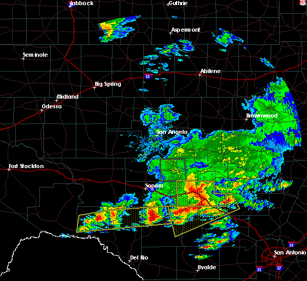 At 836 pm cdt, a severe thunderstorm was located near harper, or 24 miles north of kerrville, moving northeast at 20 mph (radar indicated). Hazards include golf ball size hail and 60 mph wind gusts. People and animals outdoors will be injured. expect hail damage to roofs, siding, windows, and vehicles. expect wind damage to roofs, siding, and trees. this severe thunderstorm will remain over mainly rural areas of kimble county, including the following locations: the intersection of ranch road 385 and ranch road 1871, cleo, south llano river state park, the intersection of i-10 and u. s 83, the intersection of us-377 and ranch road 385, us-377 near the kimble-edwards county line, i-10 near the kimble-kerr county line, the intersection of i-10 and u. s 290 and us-83 near the kerr-kimble county line. This includes interstate 10 between mile markers 435 and 477. At 836 pm cdt, a severe thunderstorm was located near harper, or 24 miles north of kerrville, moving northeast at 20 mph (radar indicated). Hazards include golf ball size hail and 60 mph wind gusts. People and animals outdoors will be injured. expect hail damage to roofs, siding, windows, and vehicles. expect wind damage to roofs, siding, and trees. this severe thunderstorm will remain over mainly rural areas of kimble county, including the following locations: the intersection of ranch road 385 and ranch road 1871, cleo, south llano river state park, the intersection of i-10 and u. s 83, the intersection of us-377 and ranch road 385, us-377 near the kimble-edwards county line, i-10 near the kimble-kerr county line, the intersection of i-10 and u. s 290 and us-83 near the kerr-kimble county line. This includes interstate 10 between mile markers 435 and 477.
|
| 5/17/2016 8:11 PM CDT |
 At 810 pm cdt, a severe thunderstorm was located near telegraph, or 7 miles south of junction, moving east at 35 mph (radar indicated). Hazards include golf ball size hail and 70 mph wind gusts. People and animals outdoors will be injured. expect hail damage to roofs, siding, windows, and vehicles. expect considerable tree damage. wind damage is also likely to mobile homes, roofs, and outbuildings. this severe thunderstorm will be near, segovia around 820 pm cdt. other locations impacted by this severe thunderstorm include south llano river state park. This includes interstate 10 between mile markers 435 and 477. At 810 pm cdt, a severe thunderstorm was located near telegraph, or 7 miles south of junction, moving east at 35 mph (radar indicated). Hazards include golf ball size hail and 70 mph wind gusts. People and animals outdoors will be injured. expect hail damage to roofs, siding, windows, and vehicles. expect considerable tree damage. wind damage is also likely to mobile homes, roofs, and outbuildings. this severe thunderstorm will be near, segovia around 820 pm cdt. other locations impacted by this severe thunderstorm include south llano river state park. This includes interstate 10 between mile markers 435 and 477.
|
| 5/17/2016 8:06 PM CDT | Hen Egg sized hail reported 8 miles NE of Junction, TX, uss 377 and fox hollow road |
| 5/17/2016 8:00 PM CDT |
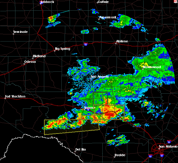 At 758 pm cdt, a severe thunderstorm was located near telegraph, or 10 miles southwest of junction, moving southeast at 40 mph (radar indicated). Hazards include golf ball size hail and 70 mph wind gusts. People and animals outdoors will be injured. expect hail damage to roofs, siding, windows, and vehicles. expect considerable tree damage. wind damage is also likely to mobile homes, roofs, and outbuildings. this severe thunderstorm will remain over mainly rural areas of kimble county, including the following locations: south llano river state park. This includes interstate 10 between mile markers 435 and 477. At 758 pm cdt, a severe thunderstorm was located near telegraph, or 10 miles southwest of junction, moving southeast at 40 mph (radar indicated). Hazards include golf ball size hail and 70 mph wind gusts. People and animals outdoors will be injured. expect hail damage to roofs, siding, windows, and vehicles. expect considerable tree damage. wind damage is also likely to mobile homes, roofs, and outbuildings. this severe thunderstorm will remain over mainly rural areas of kimble county, including the following locations: south llano river state park. This includes interstate 10 between mile markers 435 and 477.
|
| 5/17/2016 7:45 PM CDT |
 At 744 pm cdt, a severe thunderstorm was located near roosevelt, or 13 miles west of junction, moving southeast at 30 mph (radar indicated). Hazards include ping pong ball size hail and 60 mph wind gusts. People and animals outdoors will be injured. expect hail damage to roofs, siding, windows, and vehicles. expect wind damage to roofs, siding, and trees. this severe storm will be near, telegraph around 805 pm cdt. This includes interstate 10 between mile markers 420 and 477. At 744 pm cdt, a severe thunderstorm was located near roosevelt, or 13 miles west of junction, moving southeast at 30 mph (radar indicated). Hazards include ping pong ball size hail and 60 mph wind gusts. People and animals outdoors will be injured. expect hail damage to roofs, siding, windows, and vehicles. expect wind damage to roofs, siding, and trees. this severe storm will be near, telegraph around 805 pm cdt. This includes interstate 10 between mile markers 420 and 477.
|
| 5/17/2016 7:14 PM CDT |
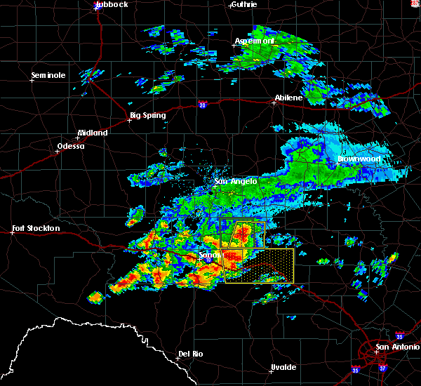 At 714 pm cdt, a severe thunderstorm was located 9 miles northwest of roosevelt, or 25 miles west of junction, moving southeast at 35 mph (radar indicated). Hazards include golf ball size hail and 70 mph wind gusts. People and animals outdoors will be injured. expect hail damage to roofs, siding, windows, and vehicles. expect considerable tree damage. wind damage is also likely to mobile homes, roofs, and outbuildings. this severe thunderstorm will be near, roosevelt around 730 pm cdt. junction and telegraph around 755 pm cdt. segovia around 810 pm cdt. other locations impacted by this severe thunderstorm include the intersection of ranch road 385 and ranch road 1871, cleo, i- 10 near the sutton- kimble county line, south llano river state park, the intersection of i-10 and u. s 83, the intersection of us-377 and ranch road 385, i- 10 near the kimble-kerr county line, the intersection of i- 10 and u. s 290, us-83 near the kerr-kimble county line and us- 377 near the kimble-edwards county line. This includes interstate 10 between mile markers 420 and 477. At 714 pm cdt, a severe thunderstorm was located 9 miles northwest of roosevelt, or 25 miles west of junction, moving southeast at 35 mph (radar indicated). Hazards include golf ball size hail and 70 mph wind gusts. People and animals outdoors will be injured. expect hail damage to roofs, siding, windows, and vehicles. expect considerable tree damage. wind damage is also likely to mobile homes, roofs, and outbuildings. this severe thunderstorm will be near, roosevelt around 730 pm cdt. junction and telegraph around 755 pm cdt. segovia around 810 pm cdt. other locations impacted by this severe thunderstorm include the intersection of ranch road 385 and ranch road 1871, cleo, i- 10 near the sutton- kimble county line, south llano river state park, the intersection of i-10 and u. s 83, the intersection of us-377 and ranch road 385, i- 10 near the kimble-kerr county line, the intersection of i- 10 and u. s 290, us-83 near the kerr-kimble county line and us- 377 near the kimble-edwards county line. This includes interstate 10 between mile markers 420 and 477.
|
| 4/27/2016 12:27 AM CDT | Ping Pong Ball sized hail reported 0.3 miles NE of Junction, TX |
| 4/27/2016 12:24 AM CDT |
 At 1224 am cdt, a severe thunderstorm was located near junction, moving east at 45 mph (radar indicated). Hazards include ping pong ball size hail and 60 mph wind gusts. People and animals outdoors will be injured. expect hail damage to roofs, siding, windows, and vehicles. expect wind damage to roofs, siding, and trees. this severe thunderstorm will remain over mainly rural areas of southeastern menard, mason and kimble counties. This includes interstate 10 between mile markers 435 and 477. At 1224 am cdt, a severe thunderstorm was located near junction, moving east at 45 mph (radar indicated). Hazards include ping pong ball size hail and 60 mph wind gusts. People and animals outdoors will be injured. expect hail damage to roofs, siding, windows, and vehicles. expect wind damage to roofs, siding, and trees. this severe thunderstorm will remain over mainly rural areas of southeastern menard, mason and kimble counties. This includes interstate 10 between mile markers 435 and 477.
|
| 4/27/2016 12:13 AM CDT |
 At 1213 am cdt, a severe thunderstorm was located near junction, moving east at 45 mph (radar indicated). Hazards include ping pong ball size hail and 60 mph wind gusts. People and animals outdoors will be injured. expect hail damage to roofs, siding, windows, and vehicles. expect wind damage to roofs, siding, and trees. this severe thunderstorm will be near, segovia around 1230 am cdt. other locations impacted by this severe thunderstorm include us- 87 near the mason- gillespie county line, koockville, the intersection of us- 87 and ranch road 783, the intersection of us- 377 and ranch road 1222, the intersection of us- 377 and ranch road 385, erna, the intersection of us- 83 and ranch road 1773, the intersection of ranch road 1773 and ranch road 1221, the intersection of us- 83 and highway 29 and the intersection of highway 29 and ranch road 1222. This includes interstate 10 between mile markers 435 and 477. At 1213 am cdt, a severe thunderstorm was located near junction, moving east at 45 mph (radar indicated). Hazards include ping pong ball size hail and 60 mph wind gusts. People and animals outdoors will be injured. expect hail damage to roofs, siding, windows, and vehicles. expect wind damage to roofs, siding, and trees. this severe thunderstorm will be near, segovia around 1230 am cdt. other locations impacted by this severe thunderstorm include us- 87 near the mason- gillespie county line, koockville, the intersection of us- 87 and ranch road 783, the intersection of us- 377 and ranch road 1222, the intersection of us- 377 and ranch road 385, erna, the intersection of us- 83 and ranch road 1773, the intersection of ranch road 1773 and ranch road 1221, the intersection of us- 83 and highway 29 and the intersection of highway 29 and ranch road 1222. This includes interstate 10 between mile markers 435 and 477.
|
| 4/20/2016 8:21 PM CDT | Golf Ball sized hail reported 17 miles SW of Junction, TX, golfball size hail |
| 3/8/2016 5:02 AM CST |
 At 502 am cst, a severe thunderstorm was located near hext, or 9 miles east of menard, moving northeast at 45 mph (radar indicated). Hazards include golf ball size hail and 60 mph wind gusts. People and animals outdoors will be injured. expect hail damage to roofs, siding, windows, and vehicles. expect wind damage to roofs, siding, and trees. this severe storm will be near, hext around 505 am cst. brady lake around 530 am cst. brady around 540 am cst. other locations impacted by this severe thunderstorm include koockville, us-190 near the menard- mcculloch county line, the intersection of us- 377 and ranch road 1222, the intersection of us- 377 and ranch road 385, erna, the intersection of us- 83 and ranch road 1773, the intersection of ranch road 1773 and ranch road 1221, the intersection of us- 83 and highway 29, the intersection of us- 87 and ranch road 2134 and the intersection of highway 29 and ranch road 1222. This includes interstate 10 between mile markers 447 and 477. At 502 am cst, a severe thunderstorm was located near hext, or 9 miles east of menard, moving northeast at 45 mph (radar indicated). Hazards include golf ball size hail and 60 mph wind gusts. People and animals outdoors will be injured. expect hail damage to roofs, siding, windows, and vehicles. expect wind damage to roofs, siding, and trees. this severe storm will be near, hext around 505 am cst. brady lake around 530 am cst. brady around 540 am cst. other locations impacted by this severe thunderstorm include koockville, us-190 near the menard- mcculloch county line, the intersection of us- 377 and ranch road 1222, the intersection of us- 377 and ranch road 385, erna, the intersection of us- 83 and ranch road 1773, the intersection of ranch road 1773 and ranch road 1221, the intersection of us- 83 and highway 29, the intersection of us- 87 and ranch road 2134 and the intersection of highway 29 and ranch road 1222. This includes interstate 10 between mile markers 447 and 477.
|
| 3/8/2016 4:44 AM CST |
 At 443 am cst, a severe thunderstorm was located 9 miles south of menard, moving northeast at 45 mph (radar indicated). Hazards include golf ball size hail and 60 mph wind gusts. People and animals outdoors will be injured. expect hail damage to roofs, siding, windows, and vehicles. expect wind damage to roofs, siding, and trees. this severe thunderstorm will be near, menard around 455 am cst. hext around 505 am cst. brady lake around 530 am cst. brady around 540 am cst. other locations impacted by this severe thunderstorm include koockville, us-190 near the menard- mcculloch county line, the intersection of us- 377 and ranch road 1222, the intersection of us- 377 and ranch road 385, erna, the intersection of us- 83 and ranch road 1773, the intersection of ranch road 1773 and ranch road 1221, the intersection of us- 83 and highway 29, the intersection of us- 87 and ranch road 2134 and the intersection of highway 29 and ranch road 1222. This includes interstate 10 between mile markers 436 and 477. At 443 am cst, a severe thunderstorm was located 9 miles south of menard, moving northeast at 45 mph (radar indicated). Hazards include golf ball size hail and 60 mph wind gusts. People and animals outdoors will be injured. expect hail damage to roofs, siding, windows, and vehicles. expect wind damage to roofs, siding, and trees. this severe thunderstorm will be near, menard around 455 am cst. hext around 505 am cst. brady lake around 530 am cst. brady around 540 am cst. other locations impacted by this severe thunderstorm include koockville, us-190 near the menard- mcculloch county line, the intersection of us- 377 and ranch road 1222, the intersection of us- 377 and ranch road 385, erna, the intersection of us- 83 and ranch road 1773, the intersection of ranch road 1773 and ranch road 1221, the intersection of us- 83 and highway 29, the intersection of us- 87 and ranch road 2134 and the intersection of highway 29 and ranch road 1222. This includes interstate 10 between mile markers 436 and 477.
|
| 5/28/2015 10:23 PM CDT | At 1022 pm cdt, severe thunderstorms were located along a line extending from fredonia to 5 miles east of telegraph, moving east at 25 mph (radar indicated). Hazards include 60 mph wind gusts. Expect damage to roofs. siding and trees. severe thunderstorms will be near, segovia around 1030 pm cdt. mason around 1035 pm cdt. pontotoc around 1045 pm cdt. art around 1055 pm cdt. hedwigs hill around 1110 pm cdt. hilda around 1115 pm cdt. other locations in the warning include koockville. This also includes interstate 10 between mile markers 450 and 477. |
| 5/28/2015 9:47 PM CDT | At 944 pm cdt, severe thunderstorms were located along a line extending from camp air to 10 miles south of roosevelt, and moving southeast at 50 mph (radar indicated). Hazards include 60 mph wind gusts and quarter size hail. Hail damage to vehicles is expected. expect wind damage to roofs, siding and trees. severe thunderstorms will be near, telegraph around 955 pm cdt. segovia and mason around 1000 pm cdt. art around 1005 pm cdt. hedwigs hill around 1010 pm cdt. hilda around 1015 pm cdt. loyal valley around 1020 pm cdt. other locations in the warning include us-377 near the kimble-edwards county line, koockville, us-83 near the kerr-kimble county line, i-10 near the kimble-kerr county line, the intersection of i-10 and us 290 and us-87 near the mason-gillespie county line. This includes interstate 10 between mile markers 430 and 478. |
| 5/28/2015 9:31 PM CDT | At 930 pm cdt, severe thunderstorms were located along a line extending from 5 miles southeast of calf creek to 6 miles southwest of roosevelt, moving southeast at 50 mph (radar indicated). Hazards include 60 mph wind gusts and quarter size hail. Hail damage to vehicles is expected. expect wind damage to roofs, siding and trees. severe thunderstorms will be near, yates and south llano river state park around 940 pm cdt. grit and telegraph around 945 pm cdt. mason and segovia around 950 pm cdt. hilda around 1005 pm cdt. other locations in the warning include us-377 near the kimble-edwards county line, koockville, us-83 near the kerr-kimble county line, i-10 near the kimble-kerr county line and the intersection of i-10 and us 290. This also includes interstate 10 between mile markers 429 and 478. |
| 5/25/2015 8:34 AM CDT | Damage to a new roo in kimble county TX, 13.5 miles NW of Junction, TX |
| 5/10/2015 10:37 AM CDT | At 1034 am cdt, a severe thunderstorm was located 5 miles north of junction, moving northeast at 35 mph (radar indicated). Hazards include ping pong ball size hail and 60 mph wind gusts. People and pets outdoors will be injured. expect hail damage to roofs, siding, windows and vehicles. expect wind damage to roofs, siding and trees. the severe thunderstorm will be near, london around 1045 am cdt. saline around 1050 am cdt. long mountain around 1100 am cdt. streeter around 1105 am cdt. grit around 1110 am cdt. other locations in the warning include us-377 near the kimble-menard county line, erna and the intersection of highway 29 and ranch road 1222. this also includes interstate 10 between mile markers 446 and 457. 1. 50in. |
| 5/10/2015 10:20 AM CDT | At 1018 am cdt, a severe thunderstorm was located 8 miles northwest of junction, and moving east at 35 mph (radar indicated). Hazards include hen egg size hail and 70 mph wind gusts. People and pets outdoors will be injured. expect hail damage to roofs, siding, windows and vehicles. expect considerable tree damage. wind damage is also likely to mobile homes, roofs and outbuildings. the severe thunderstorm will be near, junction around 1030 am cdt. london around 1045 am cdt. this includes interstate 10 between mile markers 433 and 470. 2. 00in. |
| 5/10/2015 9:59 AM CDT | At 957 am cdt, a severe thunderstorm was located near roosevelt, moving east at 35 mph (radar indicated). Hazards include hen egg size hail and 70 mph wind gusts. People and pets outdoors will be injured. expect hail damage to roofs, siding, windows and vehicles. expect considerable tree damage. wind damage is also likely to mobile homes, roofs and outbuildings. the severe thunderstorm will be near, junction around 1030 am cdt. london around 1045 am cdt. other locations in the warning include cleo. this also includes interstate 10 between mile markers 422 and 470. 2. 00in. |
| 4/26/2015 10:43 PM CDT | At 1042 pm cdt, severe thunderstorms were located along a line extending from brady to 8 miles east of yates to 9 miles south of segovia, and moving east at 30 mph (radar indicated). Hazards include 60 mph wind gusts and quarter size hail. Hail damage to vehicles is expected. expect wind damage to roofs, siding and trees. severe thunderstorms will be near, camp san saba around 1050 pm cdt. rochelle and camp air around 1055 pm cdt. voca around 1100 pm cdt. mason around 1110 pm cdt. fredonia around 1115 pm cdt. richland springs and hedwigs hill around 1125 pm cdt. other locations in the warning include koockville and us-190 near the mcculloch-san saba county line. this includes interstate 10 between mile markers 445 and 477. Possible. |
| 4/26/2015 10:28 PM CDT | At 1026 pm cdt, severe thunderstorms were located along a line extending from brady lake to yates to 10 miles south of roosevelt, moving east at 30 mph (radar indicated). Hazards include 60 mph wind gusts and quarter size hail. Hail damage to vehicles is expected. expect wind damage to roofs, siding and trees. severe thunderstorms will be near, saline and london around 1035 pm cdt. brady and long mountain around 1040 pm cdt. yates and telegraph around 1050 pm cdt. streeter around 1055 pm cdt. rochelle and camp san saba around 1100 pm cdt. grit and south llano river state park around 1105 pm cdt. other locations in the warning include us-377 near the kimble-menard county line, erna, the intersection of highway 29 and ranch road 1222, us-190 near the mcculloch-san saba county line, koockville and hall. this also includes interstate 10 between mile markers 426 and 478. Possible. |
| 4/26/2015 10:22 PM CDT | At 1021 pm cdt, a severe thunderstorm capable of producing a tornado was located 8 miles north of junction, and moving northeast at 30 mph (radar indicated rotation). Hazards include tornado and quarter size hail. Flying debris will be dangerous to those caught without shelter. mobile homes will be damaged or destroyed. damage to roofs, windows and vehicles will occur. tree damage is likely. this dangerous storm will be near, yates around 1040 pm cdt. london around 1045 pm cdt. saline around 1050 pm cdt. other locations in the warning include us-377 near the kimble-menard county line. this includes interstate 10 between mile markers 448 and 454. Radar indicated. |
| 4/26/2015 10:06 PM CDT | At 1003 pm cdt, severe thunderstorms were located along a line extending from 6 miles west of placid to 6 miles southwest of hext to 6 miles south of roosevelt, and moving east at 50 mph (radar indicated). Hazards include 60 mph wind gusts and quarter size hail. Hail damage to vehicles is expected. expect wind damage to roofs, siding and trees. severe thunderstorms will be near, south llano river state park and telegraph around 1015 pm cdt. yates around 1020 pm cdt. segovia around 1025 pm cdt. other locations in the warning include us-377 near the kimble-menard county line. this includes interstate 10 between mile markers 411 and 470. 1. 00in. |
| 4/26/2015 9:38 PM CDT | At 936 pm cdt, severe thunderstorms were located along a line extending from salt gap to 7 miles east of fort mckavett to 17 miles southeast of sonora, moving east at 50 mph (radar indicated). Hazards include 60 mph wind gusts and quarter size hail. Hail damage to vehicles is expected. expect wind damage to roofs, siding and trees. severe thunderstorms will be near, menard and melvin around 945 pm cdt. pear valley around 950 pm cdt. lohn and roosevelt around 955 pm cdt. brady lake around 1000 pm cdt. calf creek and hext around 1005 pm cdt. placid and rochelle around 1010 pm cdt. other locations in the warning include the intersection of us-83 and highway 29, us-190 near the menard-mcculloch county line, i-10 near the sutton-kimble county line, the intersection of us-83 and ranch road 1773, us-83 near the kimble-menard county line, cleo, the intersection of us-190 and ranch road 1311, us-377 near the kimble-menard county line and erna. this also includes interstate 10 between mile markers 397 and 470. 1. 00in. |
| 4/16/2015 3:03 PM CDT | Quarter sized hail reported 17.5 miles E of Junction, TX |
| 4/16/2015 2:57 PM CDT | Quarter sized hail reported 17.5 miles E of Junction, TX |
| 6/12/2014 7:50 PM CDT | Baseball sized hail reported 12.8 miles SW of Junction, TX |
| 6/12/2014 7:23 PM CDT | Baseball sized hail reported 12.6 miles WSW of Junction, TX |
| 6/12/2014 5:00 PM CDT | Half Dollar sized hail reported 11.6 miles NNE of Junction, TX |
| 5/25/2014 4:56 AM CDT | Storm damage reported in kimble county TX, 0.5 miles SSE of Junction, TX |
| 5/12/2014 5:09 PM CDT | Quarter sized hail reported 14.9 miles S of Junction, TX |
| 8/10/2013 10:25 PM CDT | A few oak trees 12 to 15 feet in length were uprooted. numerous large limbs were also dow in kimble county TX, 11.3 miles N of Junction, TX |
| 6/1/2013 9:52 PM CDT | Quarter sized hail reported 5.1 miles N of Junction, TX, quarter size hail reported at llano state park. |
| 6/1/2013 9:50 PM CDT | Quarter sized hail reported 0.3 miles NE of Junction, TX |
| 6/1/2013 9:47 PM CDT | Quarter sized hail reported 1.4 miles E of Junction, TX |
| 6/1/2013 9:30 PM CDT | Quarter sized hail reported 1.6 miles WSW of Junction, TX, dime size to quarter size hail reported at the days inn. |
| 3/31/2013 1:40 PM CDT | Quarter sized hail reported 16 miles ESE of Junction, TX, one inch hail at rr1674 and interstate 10 |
| 3/9/2013 9:30 PM CDT | Golf Ball sized hail reported 0.3 miles NE of Junction, TX |
| 3/9/2013 8:30 PM CDT | Quarter sized hail reported 14.6 miles SW of Junction, TX |
| 5/7/2012 4:37 PM CDT | Gust front moved through junction in kimble county TX, 0.5 miles SSE of Junction, TX |
| 5/6/2012 11:07 PM CDT | Golf Ball sized hail reported 17 miles SW of Junction, TX |
| 3/19/2012 5:16 PM CDT | Quarter sized hail reported 15.3 miles WSW of Junction, TX |
| 3/19/2012 5:10 PM CDT | Four wooden high tension power poles snapped off at the base along us 37 in kimble county TX, 9.2 miles SW of Junction, TX |
| 3/19/2012 5:10 PM CDT | Power poles snapped off at the base along us 37 in kimble county TX, 9.2 miles SW of Junction, TX |
| 3/19/2012 4:48 PM CDT | Golf Ball sized hail reported 4 miles ESE of Junction, TX, one vehicle was dented by this hail. |
| 1/1/0001 12:00 AM | Quarter sized hail reported 19.7 miles NNW of Junction, TX |
| 1/1/0001 12:00 AM | Hen Egg sized hail reported 17.5 miles E of Junction, TX, hail measured at billiard ball size |
| 1/1/0001 12:00 AM | Ping Pong Ball sized hail reported 17.5 miles E of Junction, TX, hail 1.5 inches in diameter. |
| 1/1/0001 12:00 AM | Quarter sized hail reported 17.5 miles E of Junction, TX |
| 1/1/0001 12:00 AM | Softball sized hail reported 5.6 miles E of Junction, TX, softball size hail damaging vehicles along i-10...just west of junction. |
| 1/1/0001 12:00 AM | Quarter sized hail reported 7.4 miles E of Junction, TX, quarter size hail along i-10 west of junction |
| 1/1/0001 12:00 AM | Quarter sized hail reported 9.6 miles SE of Junction, TX |
| 1/1/0001 12:00 AM | Quarter sized hail reported 9.6 miles SE of Junction, TX, quarter size hail falling in cleo. still falling as of 516 pm. |
| 1/1/0001 12:00 AM | Quarter sized hail reported 12.4 miles SSE of Junction, TX, quarter size hail falling in cleo. |
Hail Maps for Junction, TX


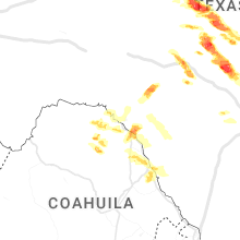


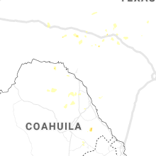


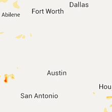

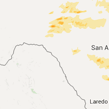
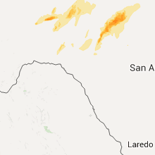
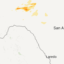


Connect with Interactive Hail Maps