

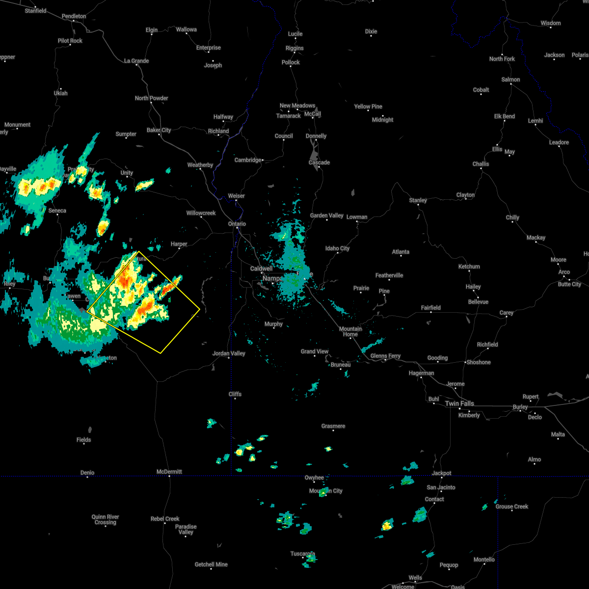
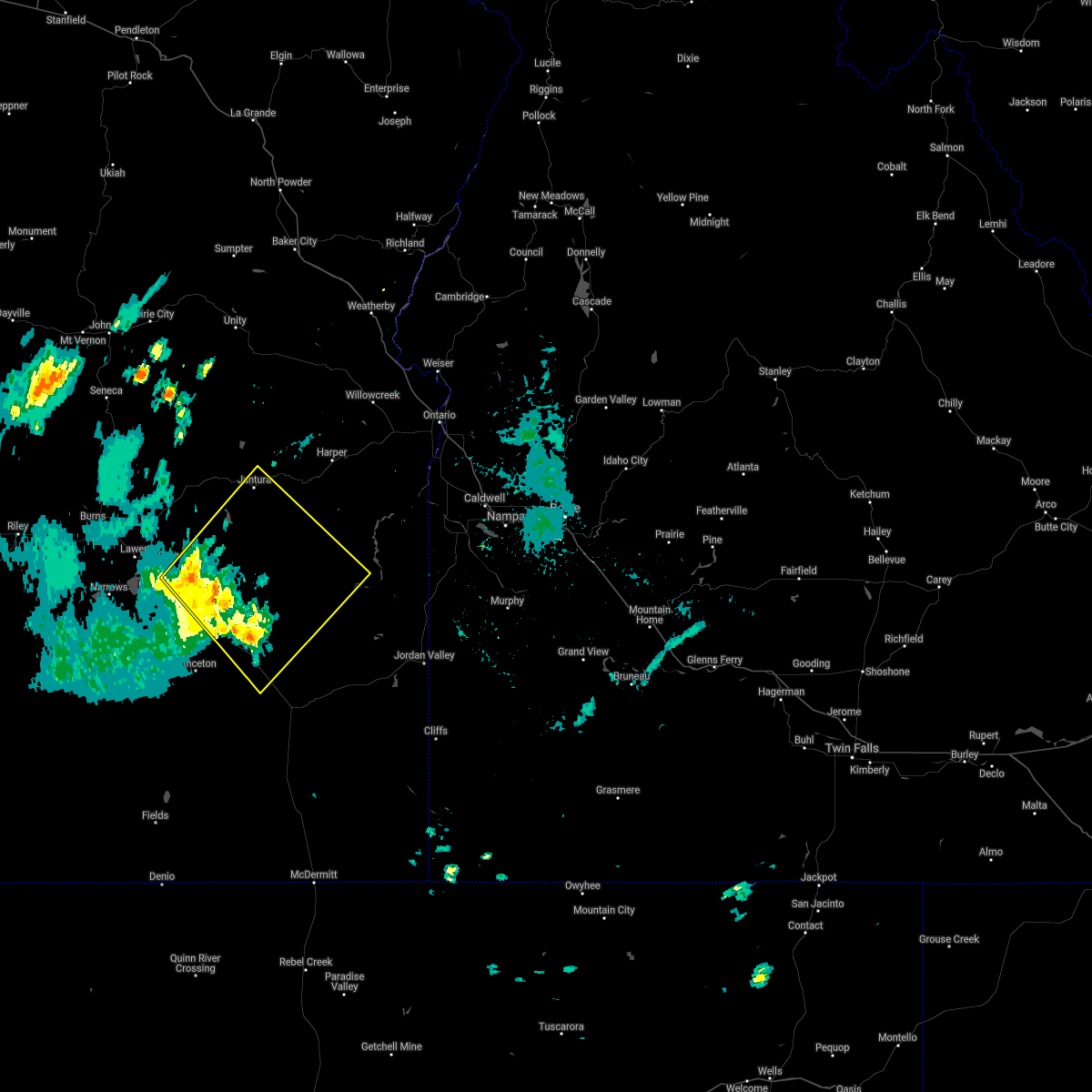
Hail Map for Juntura, OR
The Juntura, OR area has had 0 reports of on-the-ground hail by trained spotters, and has been under severe weather warnings 0 times during the past 12 months. Doppler radar has detected hail at or near Juntura, OR on 3 occasions.
| Name: | Juntura, OR |
| Where Located: | 50 miles ENE of Burns, OR |
| Map: | Google Map for Juntura, OR |
| Population: | 57 |
| Housing Units: | 44 |
| More Info: | Search Google for Juntura, OR |
5
The Top Recent Hail Date for Juntura, OR is Wednesday, September 4, 2013 (1st out of 3)

Hail and Wind Damage Spotted near Juntura, OR
| Date / Time | Report Details |
|---|---|
| 5/28/2024 4:26 PM PDT |
 the severe thunderstorm warning has been cancelled and is no longer in effect the severe thunderstorm warning has been cancelled and is no longer in effect
|
| 5/28/2024 3:55 PM PDT |
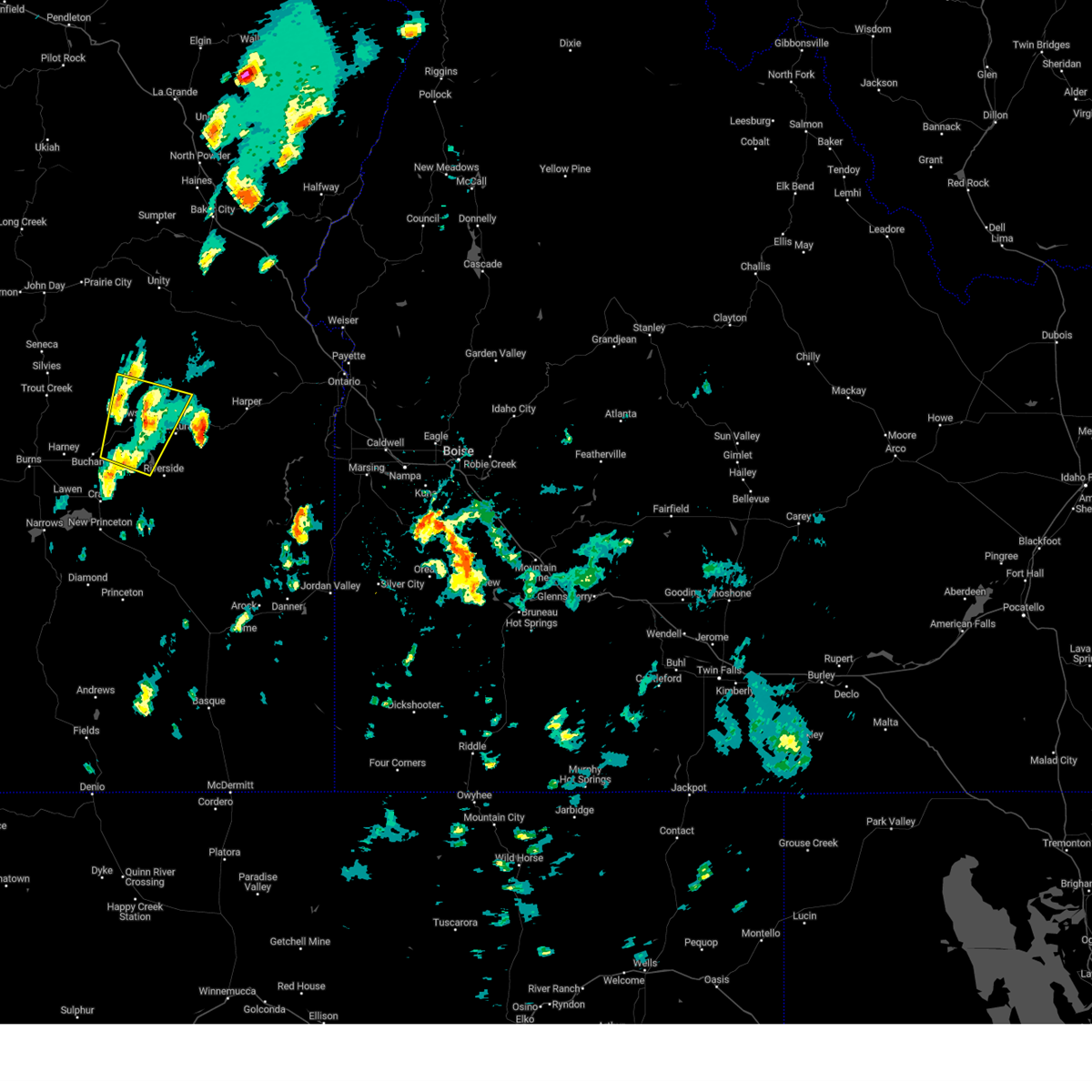
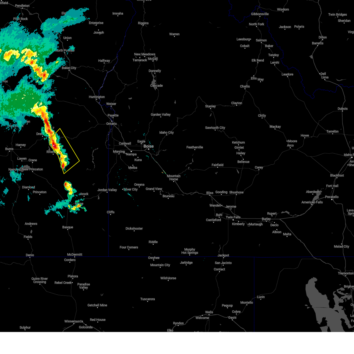
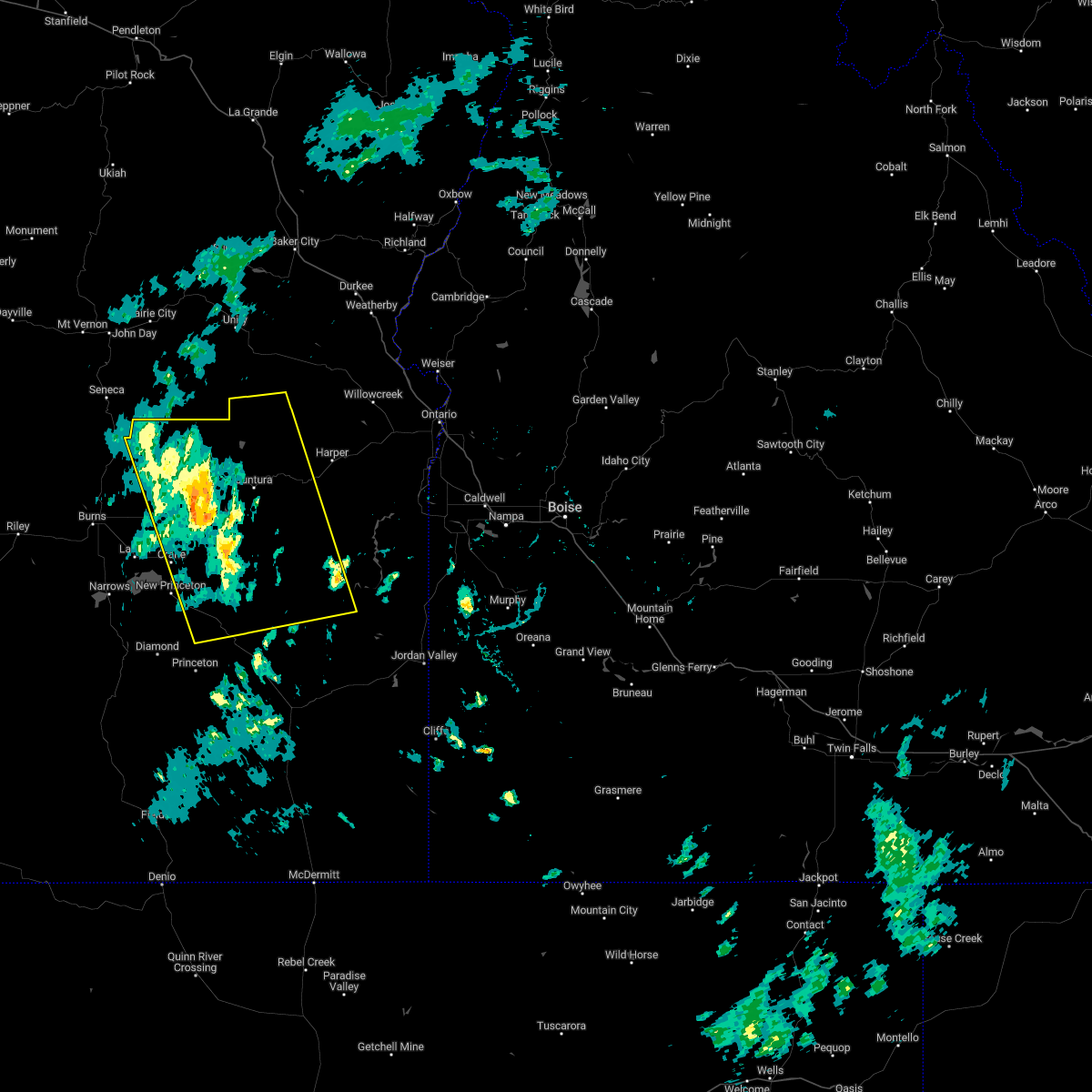
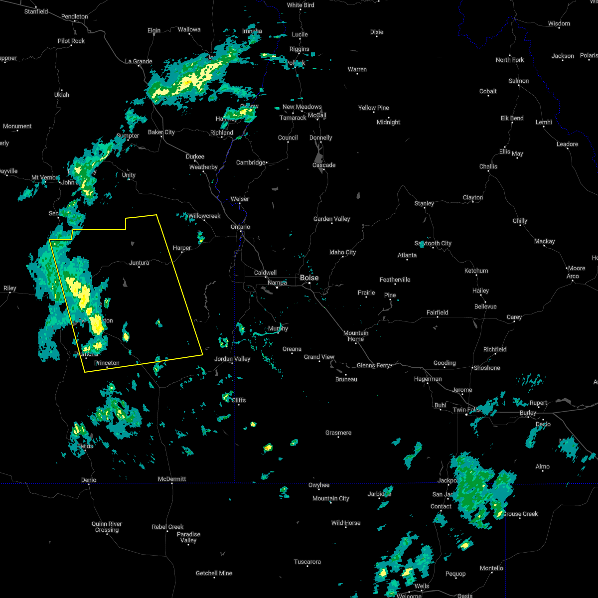
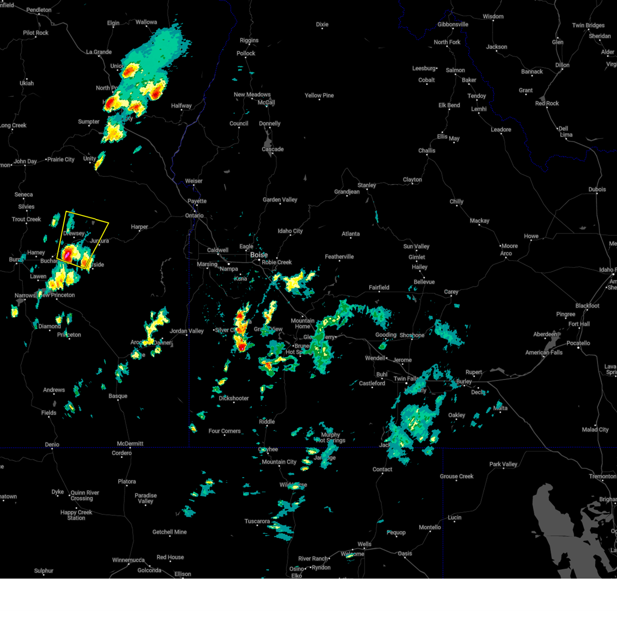 Svrboi the national weather service in boise has issued a * severe thunderstorm warning for, northeastern harney county in southeastern oregon, west central malheur county in southeastern oregon, * until 445 pm pdt.. * at 354 pm pdt, a severe thunderstorm was located near bartlett mountain just south of us highway 20, or 31 miles east of burns, moving northeast at 25 mph (radar indicated). Hazards include 60 mph wind gusts and quarter size hail. Hail damage to vehicles is expected. expect wind damage to roofs, siding, and trees. this severe thunderstorm will be near, drewsey around 410 pm pdt. drinkwater pass around 420 pm pdt. Cottonwood creek reservoir around 430 pm pdt. Svrboi the national weather service in boise has issued a * severe thunderstorm warning for, northeastern harney county in southeastern oregon, west central malheur county in southeastern oregon, * until 445 pm pdt.. * at 354 pm pdt, a severe thunderstorm was located near bartlett mountain just south of us highway 20, or 31 miles east of burns, moving northeast at 25 mph (radar indicated). Hazards include 60 mph wind gusts and quarter size hail. Hail damage to vehicles is expected. expect wind damage to roofs, siding, and trees. this severe thunderstorm will be near, drewsey around 410 pm pdt. drinkwater pass around 420 pm pdt. Cottonwood creek reservoir around 430 pm pdt.
|
| 5/20/2023 8:22 PM MDT |
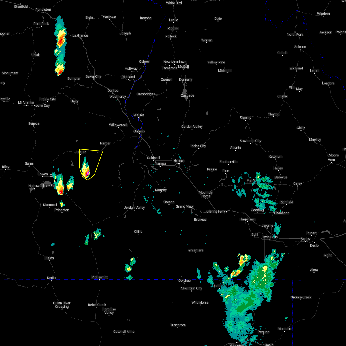
 At 722 pm pdt, a severe thunderstorm was located over juntura, or 49 miles east of burns, moving northeast at 35 mph (radar indicated). Hazards include 60 mph wind gusts and quarter size hail. Hail damage to vehicles is expected. expect wind damage to roofs, siding, and trees. this severe thunderstorm will be near, monument peak around 830 pm mdt. jonesboro around 840 pm mdt. hail threat, radar indicated max hail size, 1. 00 in wind threat, radar indicated max wind gust, 60 mph. At 722 pm pdt, a severe thunderstorm was located over juntura, or 49 miles east of burns, moving northeast at 35 mph (radar indicated). Hazards include 60 mph wind gusts and quarter size hail. Hail damage to vehicles is expected. expect wind damage to roofs, siding, and trees. this severe thunderstorm will be near, monument peak around 830 pm mdt. jonesboro around 840 pm mdt. hail threat, radar indicated max hail size, 1. 00 in wind threat, radar indicated max wind gust, 60 mph.
|
| 5/1/2023 6:08 PM PDT | A trained spotter near drewsey... or reported a blown down willow tree and small hai in harney county OR, 15.5 miles ESE of Juntura, OR |
| 5/1/2023 5:41 PM PDT | Mesonet station od129 2.5 se drewsey (odot in harney county OR, 13.1 miles E of Juntura, OR |
| 9/7/2022 5:29 PM MDT |
 At 428 pm pdt, severe thunderstorms were located along a line extending from near castle rock to near crowley, moving east at 45 mph (radar indicated). Hazards include 70 mph wind gusts. Expect considerable tree damage. damage is likely to mobile homes, roofs, and outbuildings. severe thunderstorms will be near, monument peak around 530 pm mdt. westfall butte, copeland butte, jonesboro and red butte around 540 pm mdt. westfall, knottingham butte and brushy hollow around 550 pm mdt. harper, buckbrush poison butte, pelican point and freezeout mountain around 600 pm mdt. brogan, sugarloaf butte, board corral mountain and jamieson around 610 pm mdt. thunderstorm damage threat, considerable hail threat, radar indicated max hail size, <. 75 in wind threat, observed max wind gust, 70 mph. At 428 pm pdt, severe thunderstorms were located along a line extending from near castle rock to near crowley, moving east at 45 mph (radar indicated). Hazards include 70 mph wind gusts. Expect considerable tree damage. damage is likely to mobile homes, roofs, and outbuildings. severe thunderstorms will be near, monument peak around 530 pm mdt. westfall butte, copeland butte, jonesboro and red butte around 540 pm mdt. westfall, knottingham butte and brushy hollow around 550 pm mdt. harper, buckbrush poison butte, pelican point and freezeout mountain around 600 pm mdt. brogan, sugarloaf butte, board corral mountain and jamieson around 610 pm mdt. thunderstorm damage threat, considerable hail threat, radar indicated max hail size, <. 75 in wind threat, observed max wind gust, 70 mph.
|
| 9/7/2022 4:13 PM PDT |
 At 412 pm pdt, severe thunderstorms were located along a line extending from near cottonwood creek reservoir to near dowell butte, moving northeast at 60 mph (radar indicated). Hazards include 60 mph wind gusts. Expect damage to roofs, siding, and trees. these severe storms will be near, juntura around 520 pm mdt. copeland butte, sheep rock, cedar mountain and westfall butte around 530 pm mdt. brushy hollow, knottingham butte, rufino butte and red butte around 540 pm mdt. hail threat, radar indicated max hail size, <. 75 in wind threat, observed max wind gust, 60 mph. At 412 pm pdt, severe thunderstorms were located along a line extending from near cottonwood creek reservoir to near dowell butte, moving northeast at 60 mph (radar indicated). Hazards include 60 mph wind gusts. Expect damage to roofs, siding, and trees. these severe storms will be near, juntura around 520 pm mdt. copeland butte, sheep rock, cedar mountain and westfall butte around 530 pm mdt. brushy hollow, knottingham butte, rufino butte and red butte around 540 pm mdt. hail threat, radar indicated max hail size, <. 75 in wind threat, observed max wind gust, 60 mph.
|
| 9/7/2022 3:46 PM PDT |
 At 344 pm pdt, severe thunderstorms were located along a line extending from near calamity butte to 6 miles southeast of riddle mountain, moving east at 55 mph. burns airport reported a wind gust of 60 mph (radar indicated). Hazards include 60 mph wind gusts. Expect damage to roofs, siding, and trees. severe thunderstorms will be near, battle mountain around 400 pm pdt. drewsey around 410 pm pdt. saddle butte around 510 pm mdt. juntura around 520 pm mdt. birch creek campground around 530 pm mdt. hail threat, radar indicated max hail size, <. 75 in wind threat, observed max wind gust, 60 mph. At 344 pm pdt, severe thunderstorms were located along a line extending from near calamity butte to 6 miles southeast of riddle mountain, moving east at 55 mph. burns airport reported a wind gust of 60 mph (radar indicated). Hazards include 60 mph wind gusts. Expect damage to roofs, siding, and trees. severe thunderstorms will be near, battle mountain around 400 pm pdt. drewsey around 410 pm pdt. saddle butte around 510 pm mdt. juntura around 520 pm mdt. birch creek campground around 530 pm mdt. hail threat, radar indicated max hail size, <. 75 in wind threat, observed max wind gust, 60 mph.
|
| 8/10/2022 2:30 PM MDT |
 At 229 pm mdt, a severe thunderstorm was located near monumental rock, or 48 miles north of rome, moving northeast at 25 mph (radar indicated). Hazards include 60 mph wind gusts and quarter size hail. Hail damage to vehicles is expected. Expect wind damage to roofs, siding, and trees. At 229 pm mdt, a severe thunderstorm was located near monumental rock, or 48 miles north of rome, moving northeast at 25 mph (radar indicated). Hazards include 60 mph wind gusts and quarter size hail. Hail damage to vehicles is expected. Expect wind damage to roofs, siding, and trees.
|
| 9/10/2021 5:53 PM MDT |
 At 552 pm mdt/452 pm pdt/, severe thunderstorms were located along a line extending from 6 miles northwest of jonesboro to near duck creek butte, moving east at 30 mph (radar indicated). Hazards include 60 mph wind gusts and quarter size hail. Hail damage to vehicles is expected. expect wind damage to roofs, siding, and trees. severe thunderstorms will be near, jonesboro and monument peak around 600 pm mdt. saddle butte and rufino butte around 610 pm mdt. crowley and monumental rock around 620 pm mdt. westfall, sacramento butte, turnbull mountain and freezeout mountain around 630 pm mdt. harper, cedar mountain, iron point and copeland butte around 640 pm mdt. hail threat, radar indicated max hail size, 1. 00 in wind threat, radar indicated max wind gust, 60 mph. At 552 pm mdt/452 pm pdt/, severe thunderstorms were located along a line extending from 6 miles northwest of jonesboro to near duck creek butte, moving east at 30 mph (radar indicated). Hazards include 60 mph wind gusts and quarter size hail. Hail damage to vehicles is expected. expect wind damage to roofs, siding, and trees. severe thunderstorms will be near, jonesboro and monument peak around 600 pm mdt. saddle butte and rufino butte around 610 pm mdt. crowley and monumental rock around 620 pm mdt. westfall, sacramento butte, turnbull mountain and freezeout mountain around 630 pm mdt. harper, cedar mountain, iron point and copeland butte around 640 pm mdt. hail threat, radar indicated max hail size, 1. 00 in wind threat, radar indicated max wind gust, 60 mph.
|
| 8/17/2020 3:55 PM MDT |
 At 354 pm mdt/254 pm pdt/, a severe thunderstorm was located near monumental rock, or 47 miles northwest of rome, moving northeast at 35 mph (radar indicated). Hazards include 60 mph wind gusts. expect damage to roofs, siding, and trees At 354 pm mdt/254 pm pdt/, a severe thunderstorm was located near monumental rock, or 47 miles northwest of rome, moving northeast at 35 mph (radar indicated). Hazards include 60 mph wind gusts. expect damage to roofs, siding, and trees
|
| 8/17/2020 3:28 PM MDT |
 At 328 pm mdt/228 pm pdt/, a severe thunderstorm was located over hat butte, or 42 miles northwest of rome, moving northeast at 35 mph (radar indicated). Hazards include 70 mph wind gusts. Expect damage to roofs, siding, and trees. this severe thunderstorm will be near, dowell butte around 330 pm mdt. swamp creek buttes, dunnean, coleman mountain and sacramento butte around 340 pm mdt. turnbull mountain, crowley and cedar mountain around 350 pm mdt. monumental rock, riverside and warm springs reservoir around 400 pm mdt. Juntura, red butte, monument peak and mosquito mountain around 410 pm mdt. At 328 pm mdt/228 pm pdt/, a severe thunderstorm was located over hat butte, or 42 miles northwest of rome, moving northeast at 35 mph (radar indicated). Hazards include 70 mph wind gusts. Expect damage to roofs, siding, and trees. this severe thunderstorm will be near, dowell butte around 330 pm mdt. swamp creek buttes, dunnean, coleman mountain and sacramento butte around 340 pm mdt. turnbull mountain, crowley and cedar mountain around 350 pm mdt. monumental rock, riverside and warm springs reservoir around 400 pm mdt. Juntura, red butte, monument peak and mosquito mountain around 410 pm mdt.
|
| 6/26/2017 4:42 PM MDT |
 At 441 pm mdt, severe thunderstorms were located along a line extending from near warm springs reservoir to near dowell butte, moving northeast at 30 mph (radar indicated). Hazards include 60 mph wind gusts and penny size hail. Expect damage to roofs, siding, and trees. these severe storms will be near, juntura and mosquito mountain around 450 pm mdt. Turnbull mountain, jonesboro, monument peak and monumental rock around 500 pm mdt. At 441 pm mdt, severe thunderstorms were located along a line extending from near warm springs reservoir to near dowell butte, moving northeast at 30 mph (radar indicated). Hazards include 60 mph wind gusts and penny size hail. Expect damage to roofs, siding, and trees. these severe storms will be near, juntura and mosquito mountain around 450 pm mdt. Turnbull mountain, jonesboro, monument peak and monumental rock around 500 pm mdt.
|
| 6/26/2017 4:17 PM MDT |
 At 416 pm mdt /316 pm pdt/, severe thunderstorms were located along a line extending from near coleman mountain to near follyfarm flat, moving northeast at 30 mph (radar indicated). Hazards include 60 mph wind gusts and quarter size hail. Hail damage to vehicles is expected. expect wind damage to roofs, siding, and trees. severe thunderstorms will be near, coleman mountain and dunnean around 320 pm pdt. warm springs reservoir and riverside around 430 pm mdt. dowell butte, mosquito mountain and hat butte around 440 pm mdt. juntura around 450 pm mdt. Crowley, turnbull mountain, jonesboro and monument peak around 500 pm mdt. At 416 pm mdt /316 pm pdt/, severe thunderstorms were located along a line extending from near coleman mountain to near follyfarm flat, moving northeast at 30 mph (radar indicated). Hazards include 60 mph wind gusts and quarter size hail. Hail damage to vehicles is expected. expect wind damage to roofs, siding, and trees. severe thunderstorms will be near, coleman mountain and dunnean around 320 pm pdt. warm springs reservoir and riverside around 430 pm mdt. dowell butte, mosquito mountain and hat butte around 440 pm mdt. juntura around 450 pm mdt. Crowley, turnbull mountain, jonesboro and monument peak around 500 pm mdt.
|
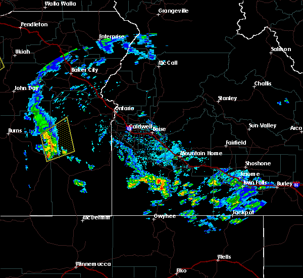
Hail Maps for Juntura, OR


Connect with Interactive Hail Maps