

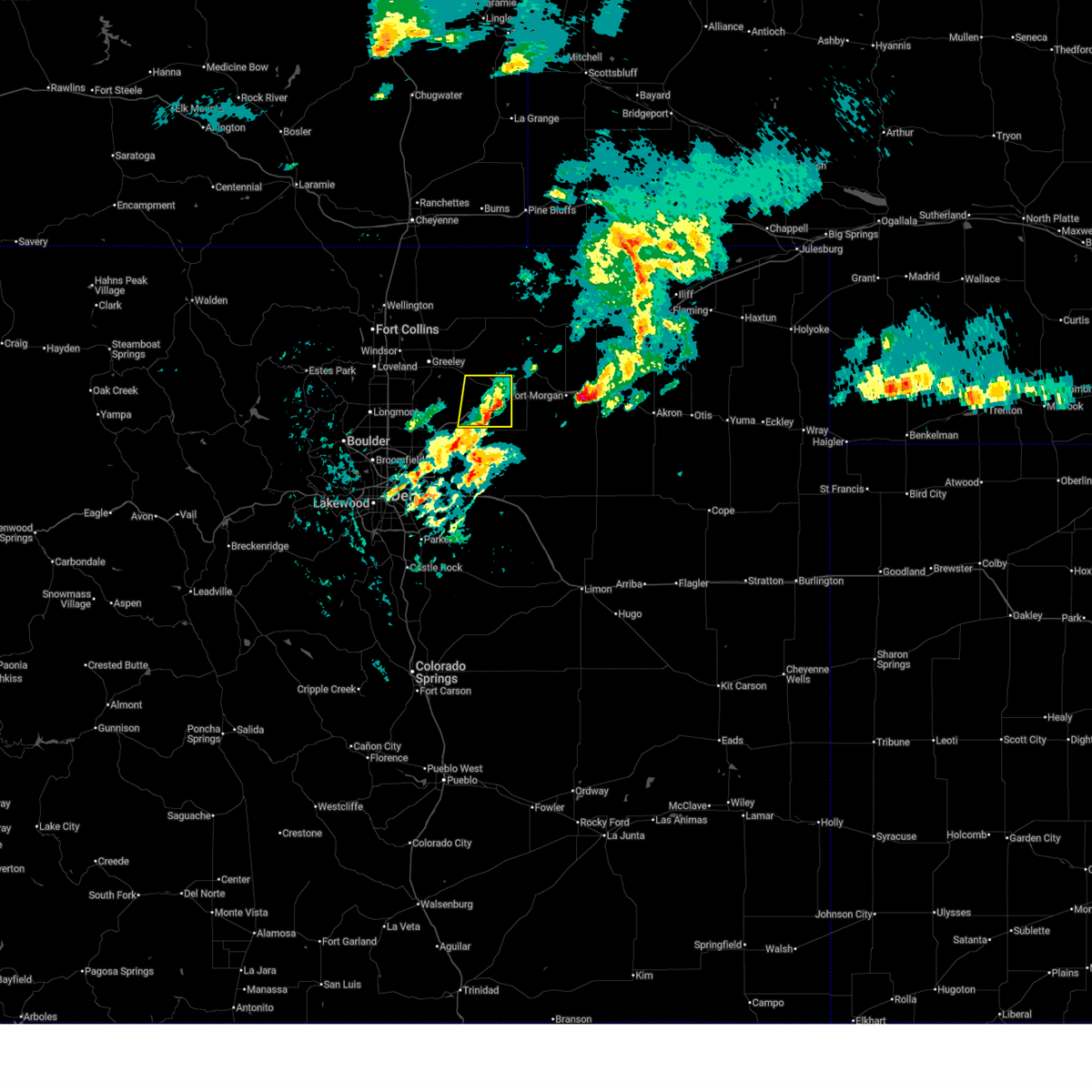
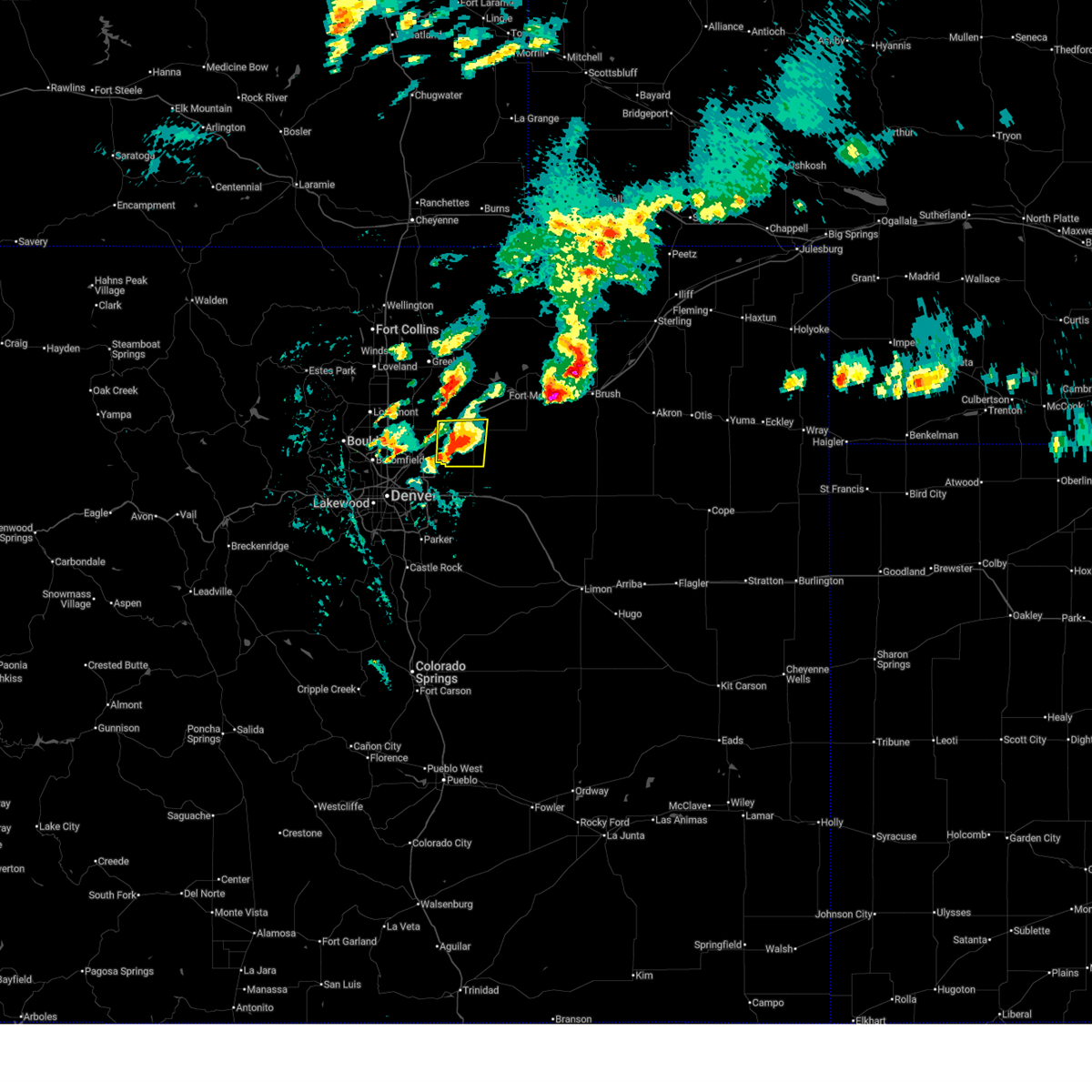
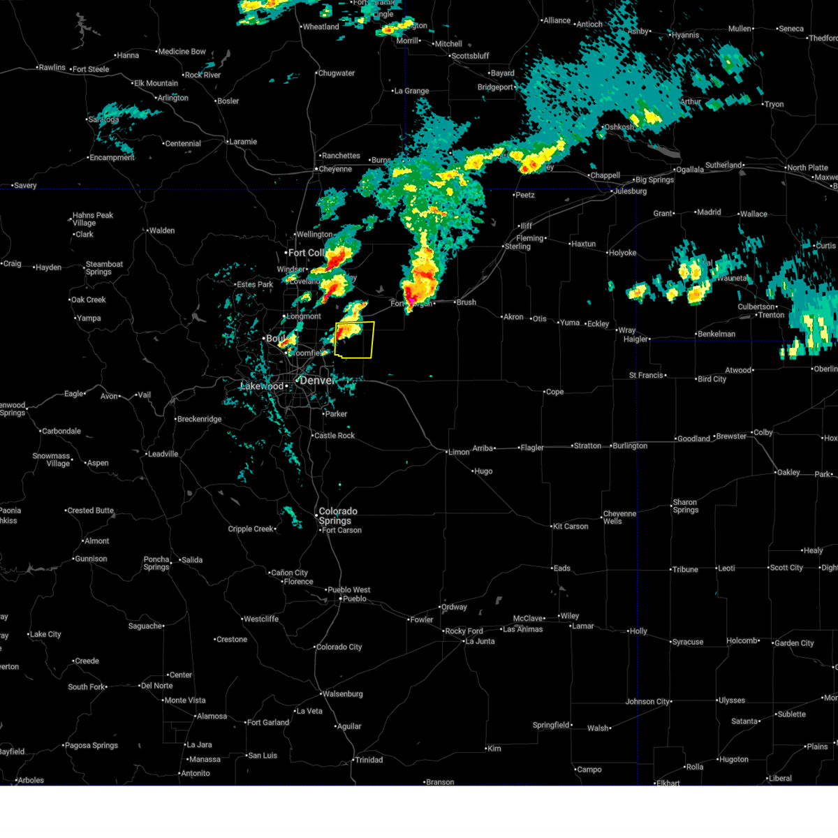
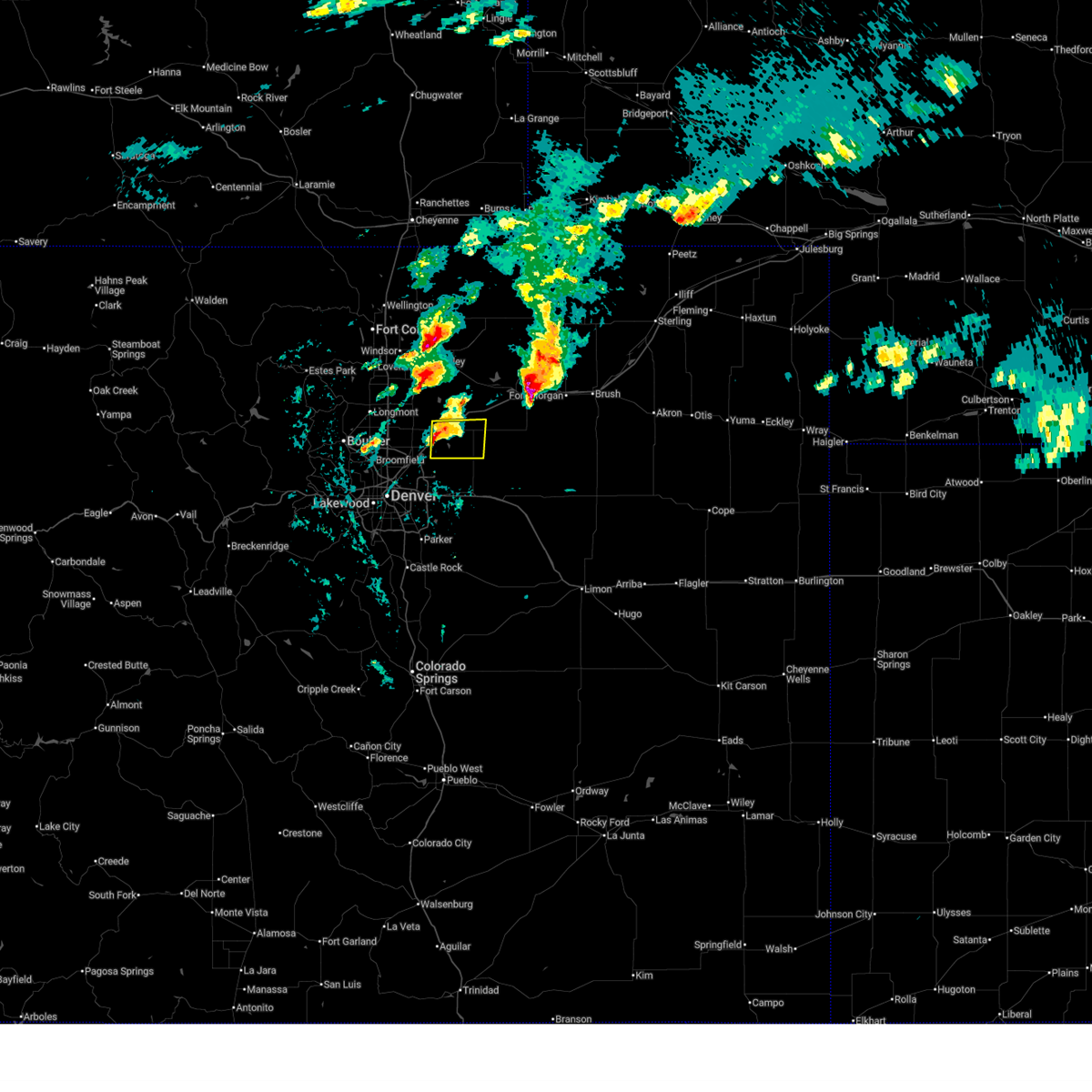
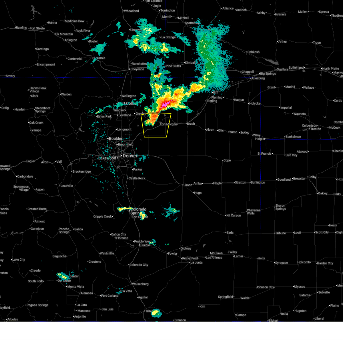
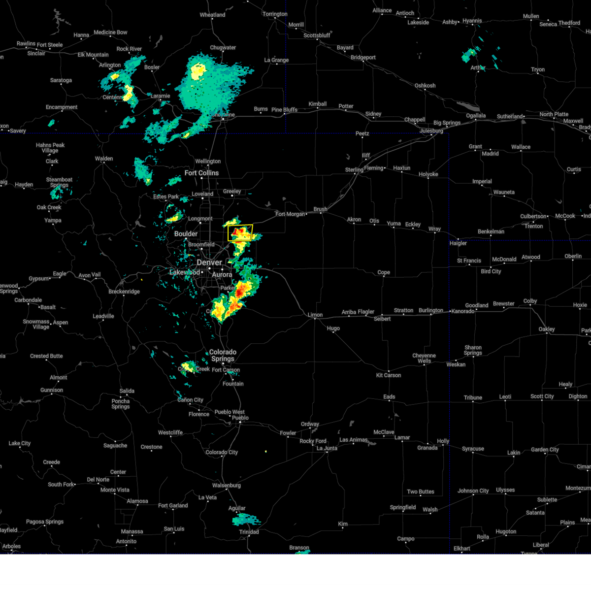
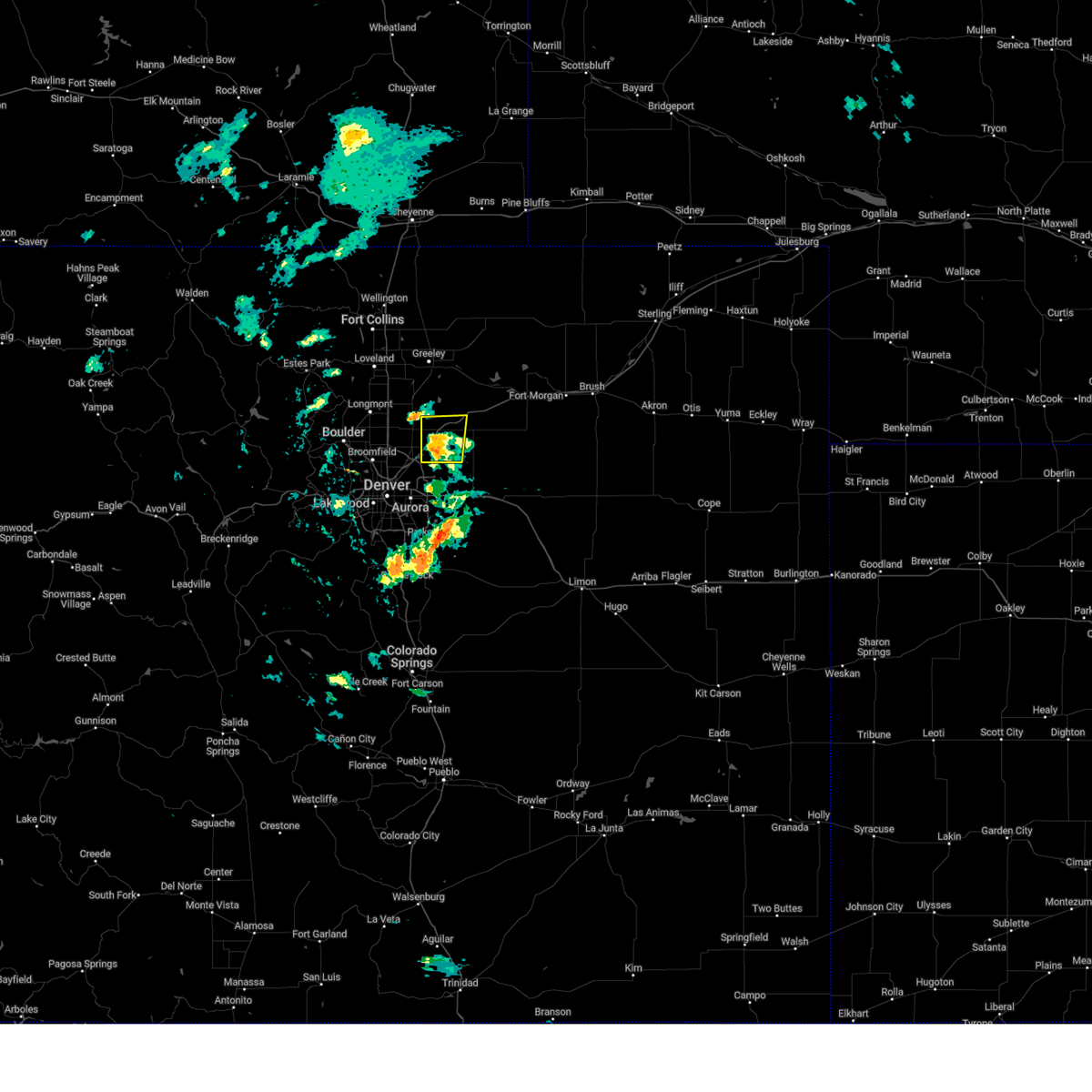
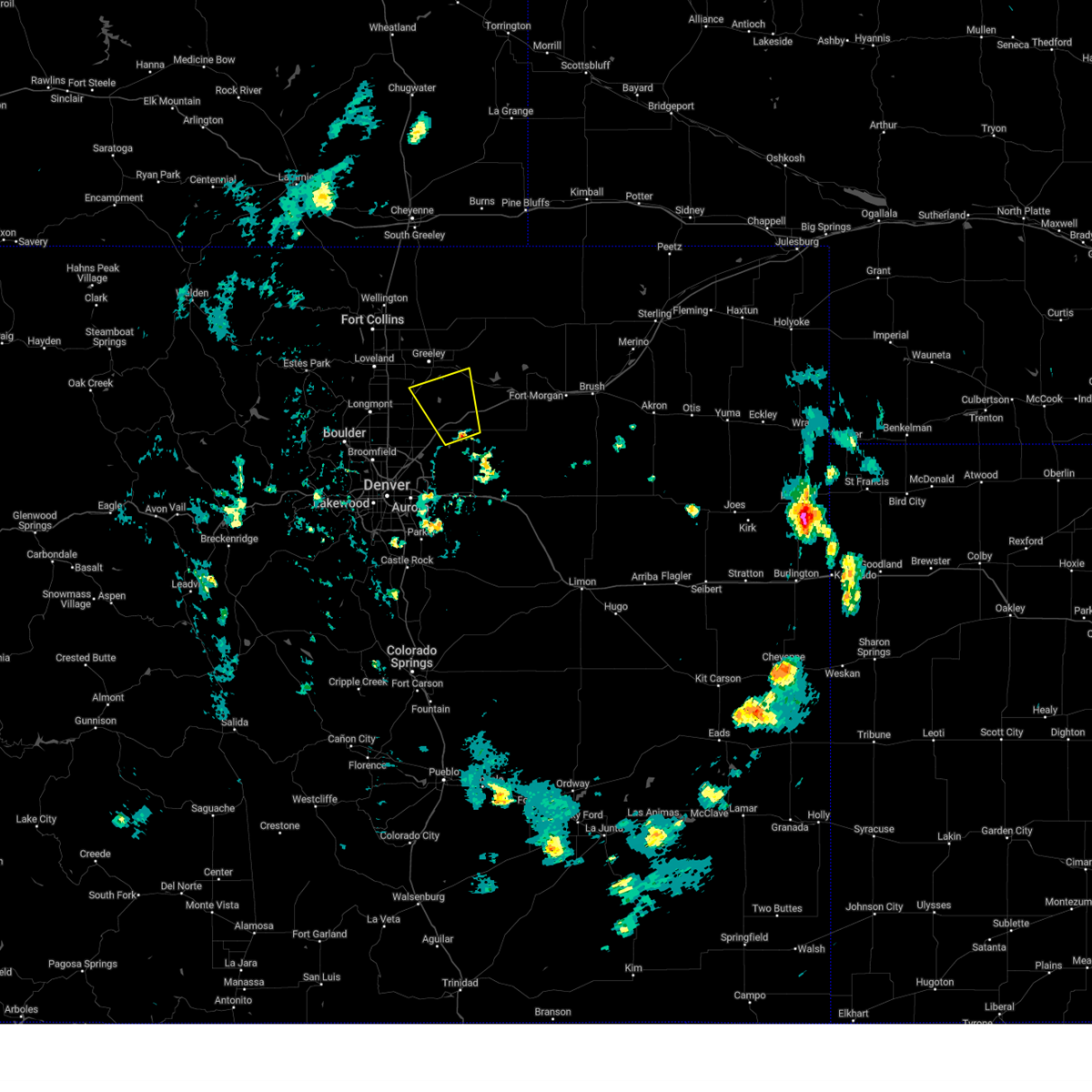
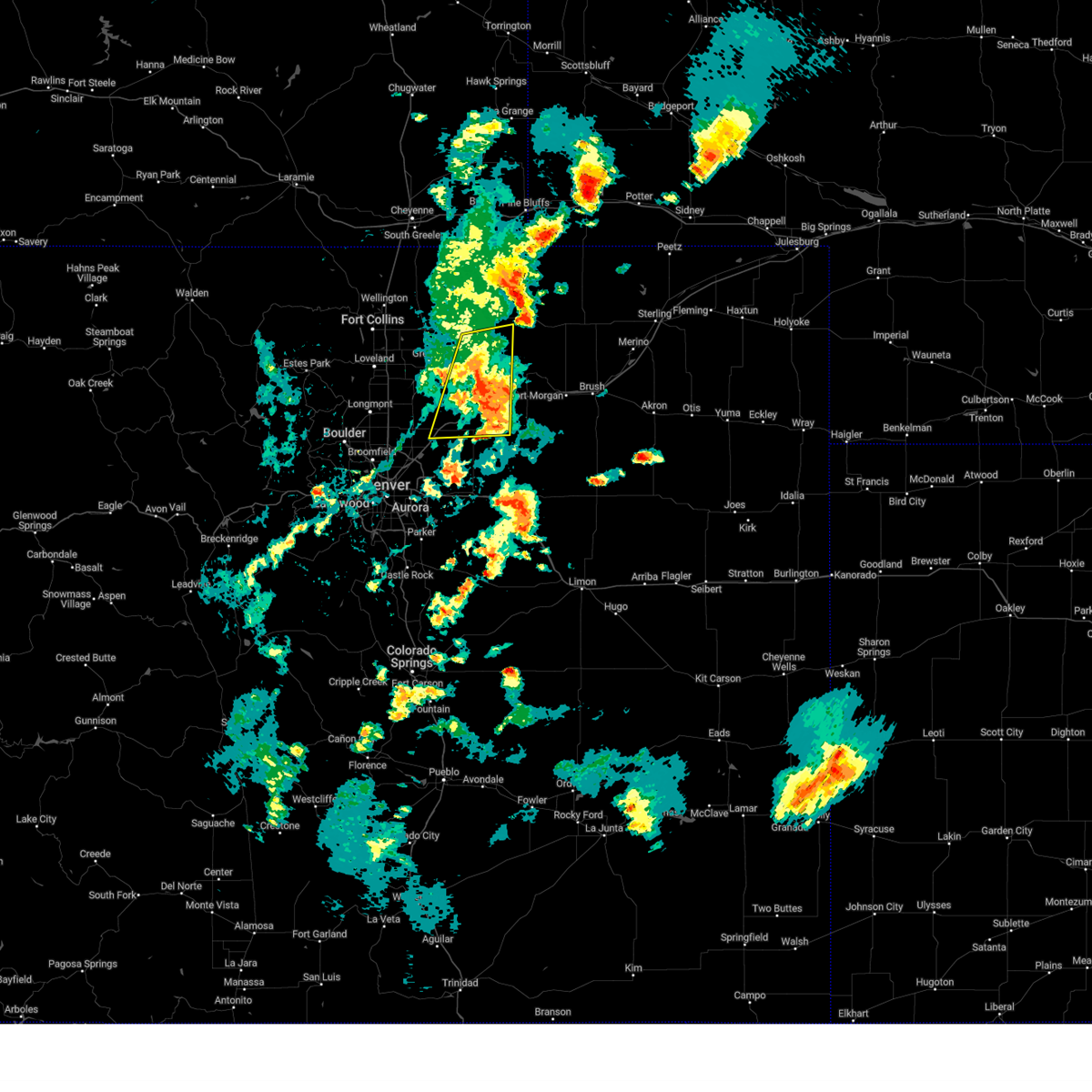
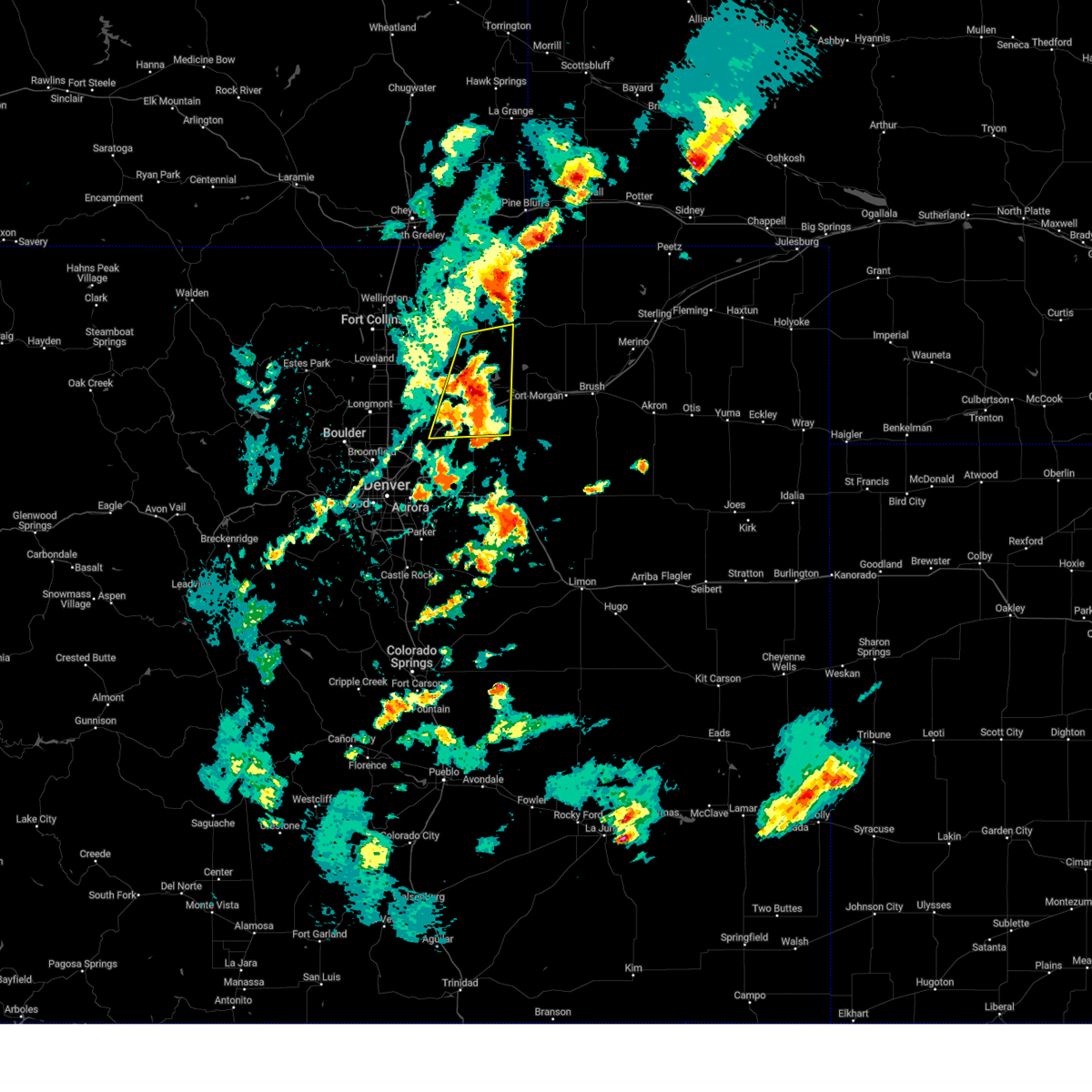
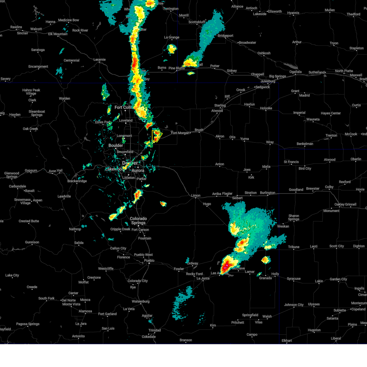
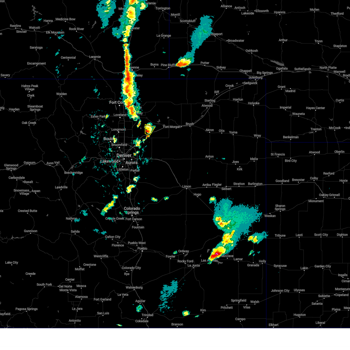
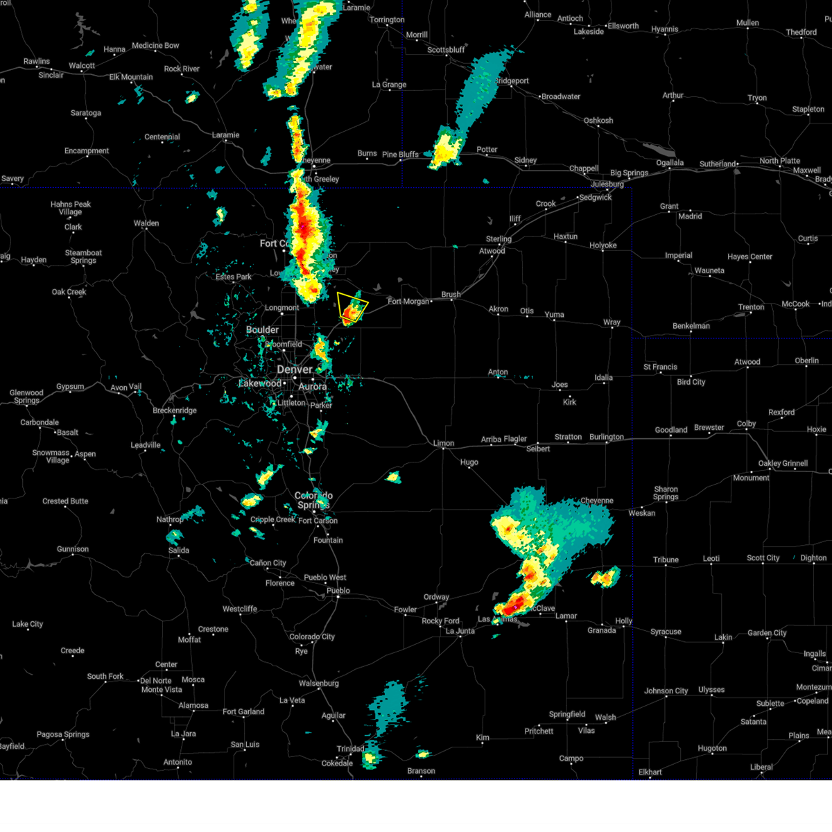
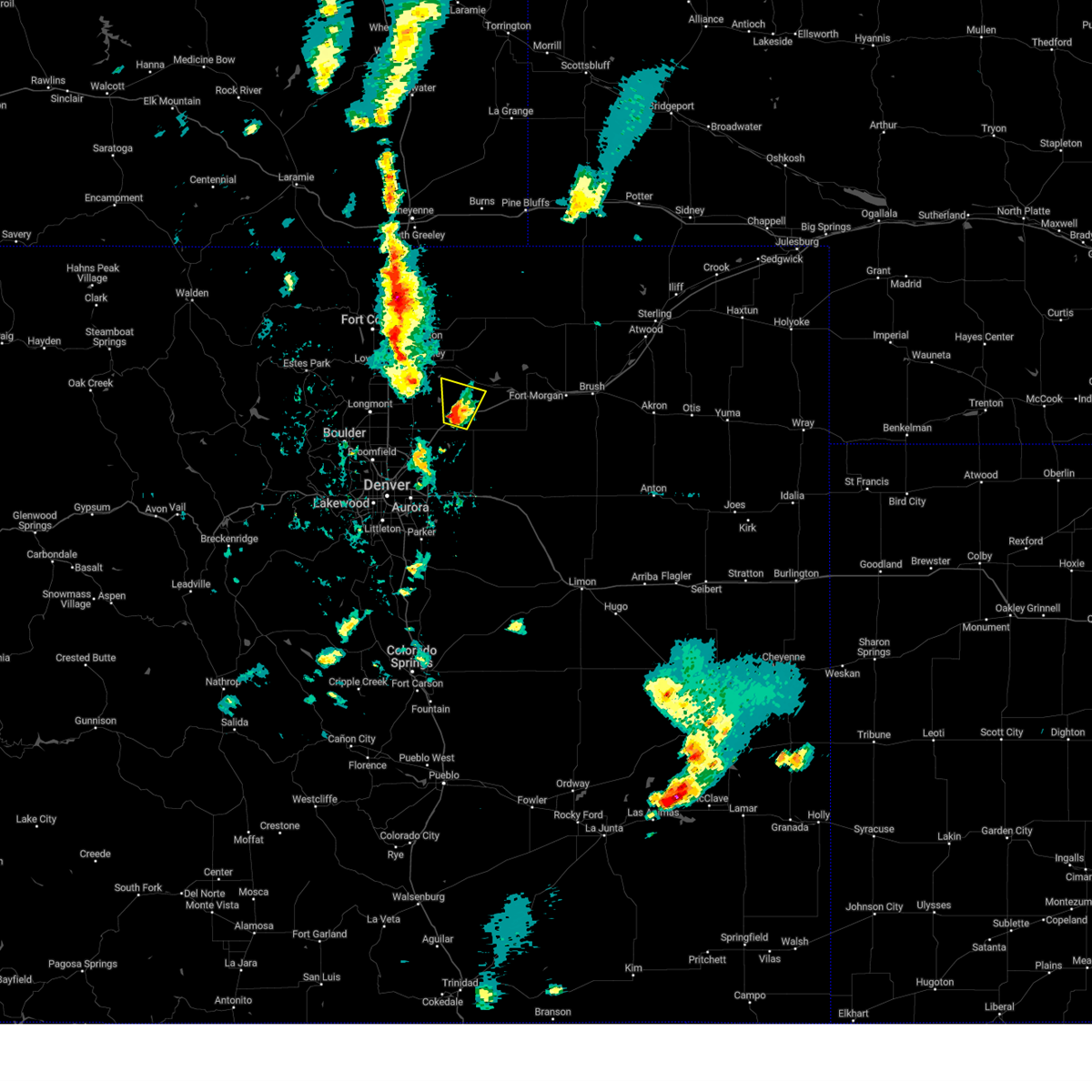
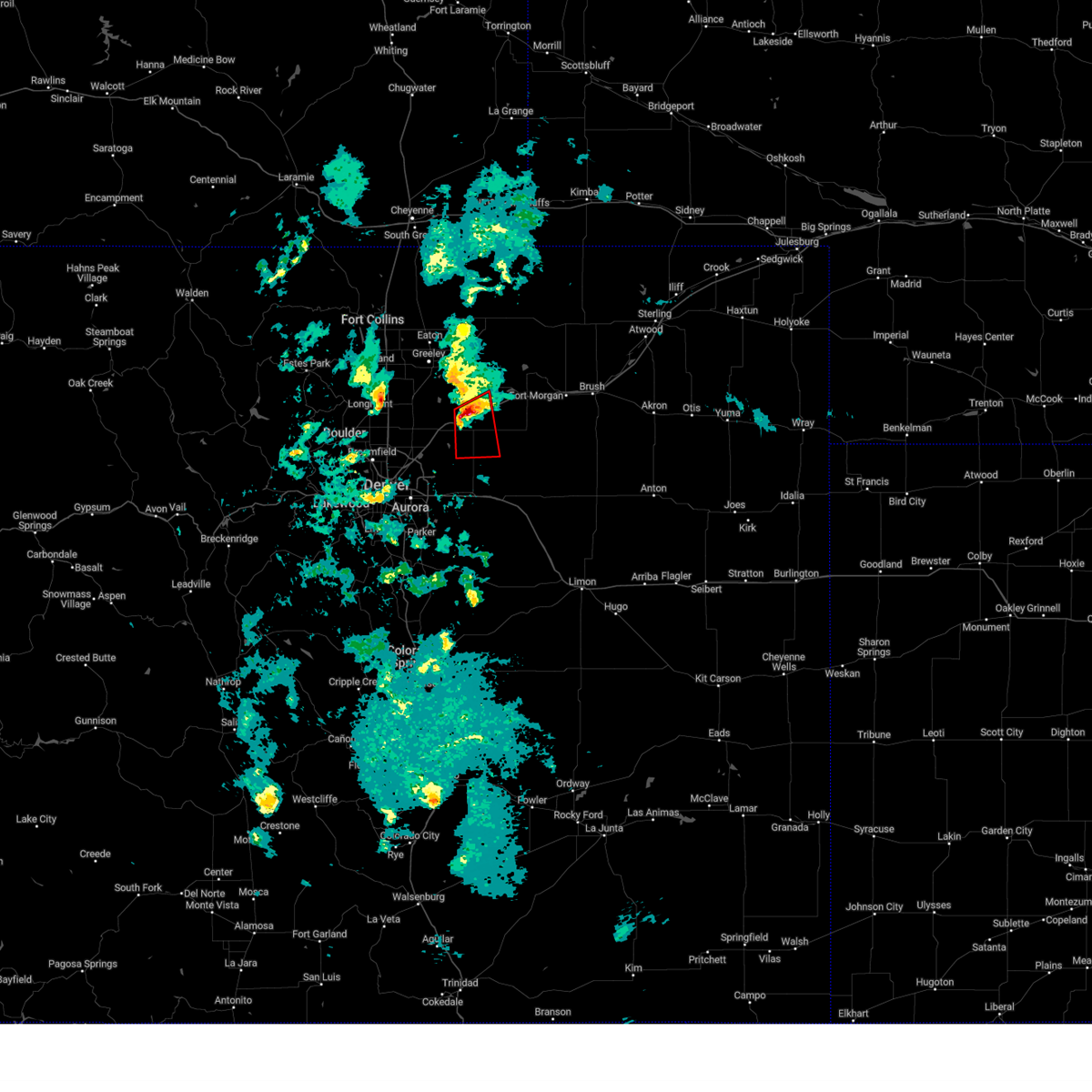
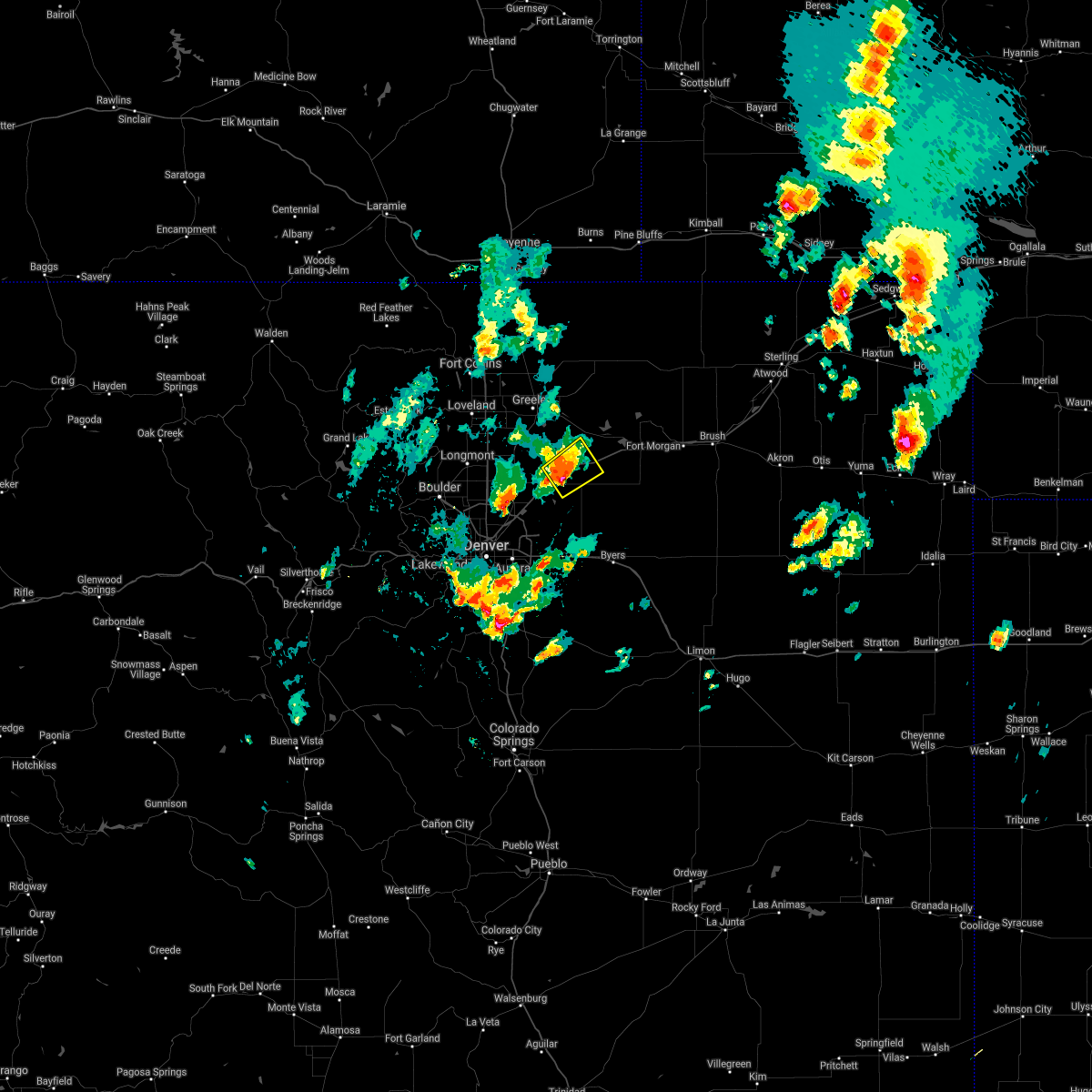
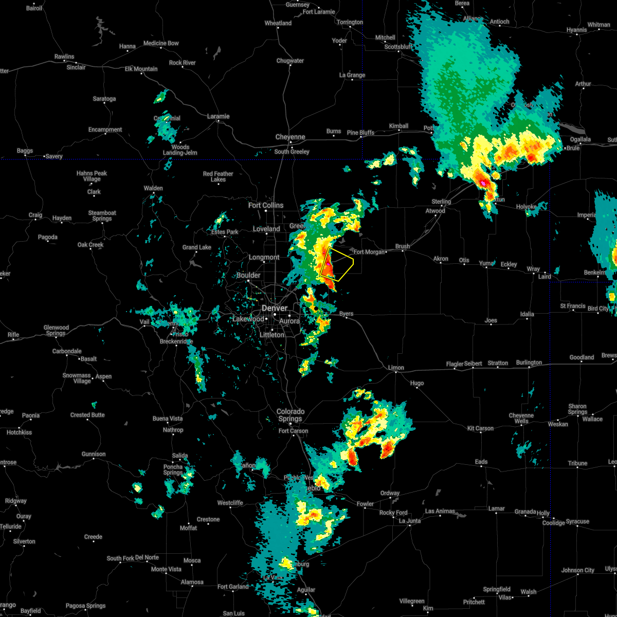
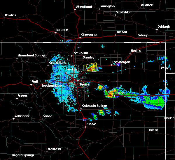
Hail Map for Keenesburg, CO
The Keenesburg, CO area has had 22 reports of on-the-ground hail by trained spotters, and has been under severe weather warnings 26 times during the past 12 months. Doppler radar has detected hail at or near Keenesburg, CO on 81 occasions, including 6 occasions during the past year.
| Name: | Keenesburg, CO |
| Where Located: | 36.4 miles NE of Denver, CO |
| Map: | Google Map for Keenesburg, CO |
| Population: | 1127 |
| Housing Units: | 463 |
| More Info: | Search Google for Keenesburg, CO |
1
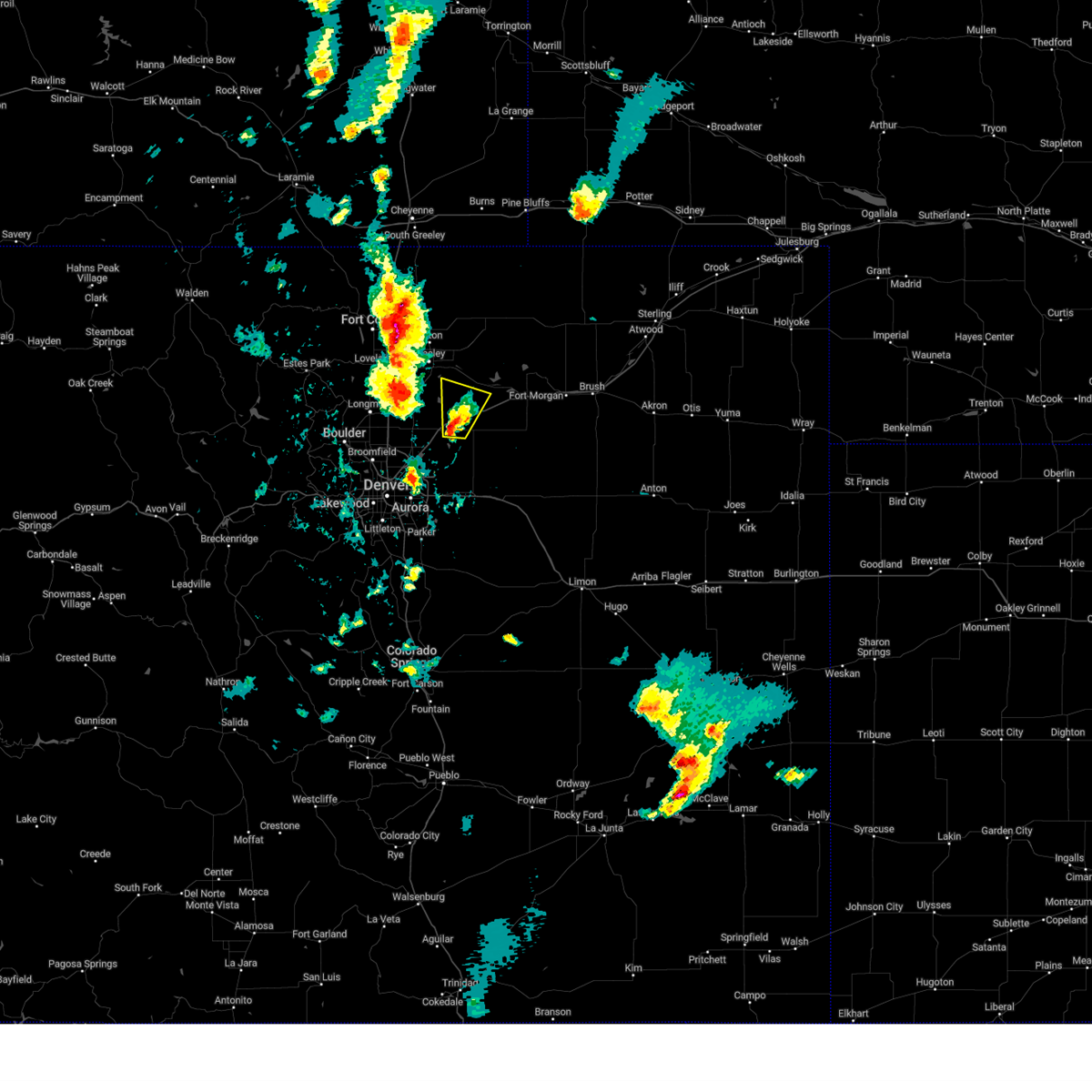
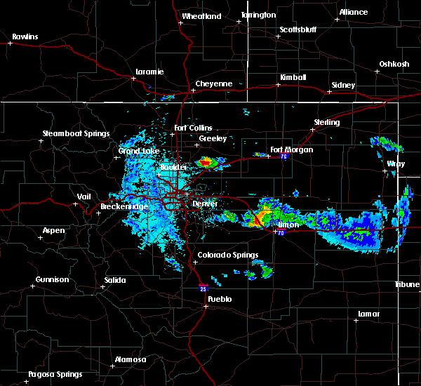
The Top Recent Hail Date for Keenesburg, CO is Sunday, September 15, 2024 (15th out of 81)

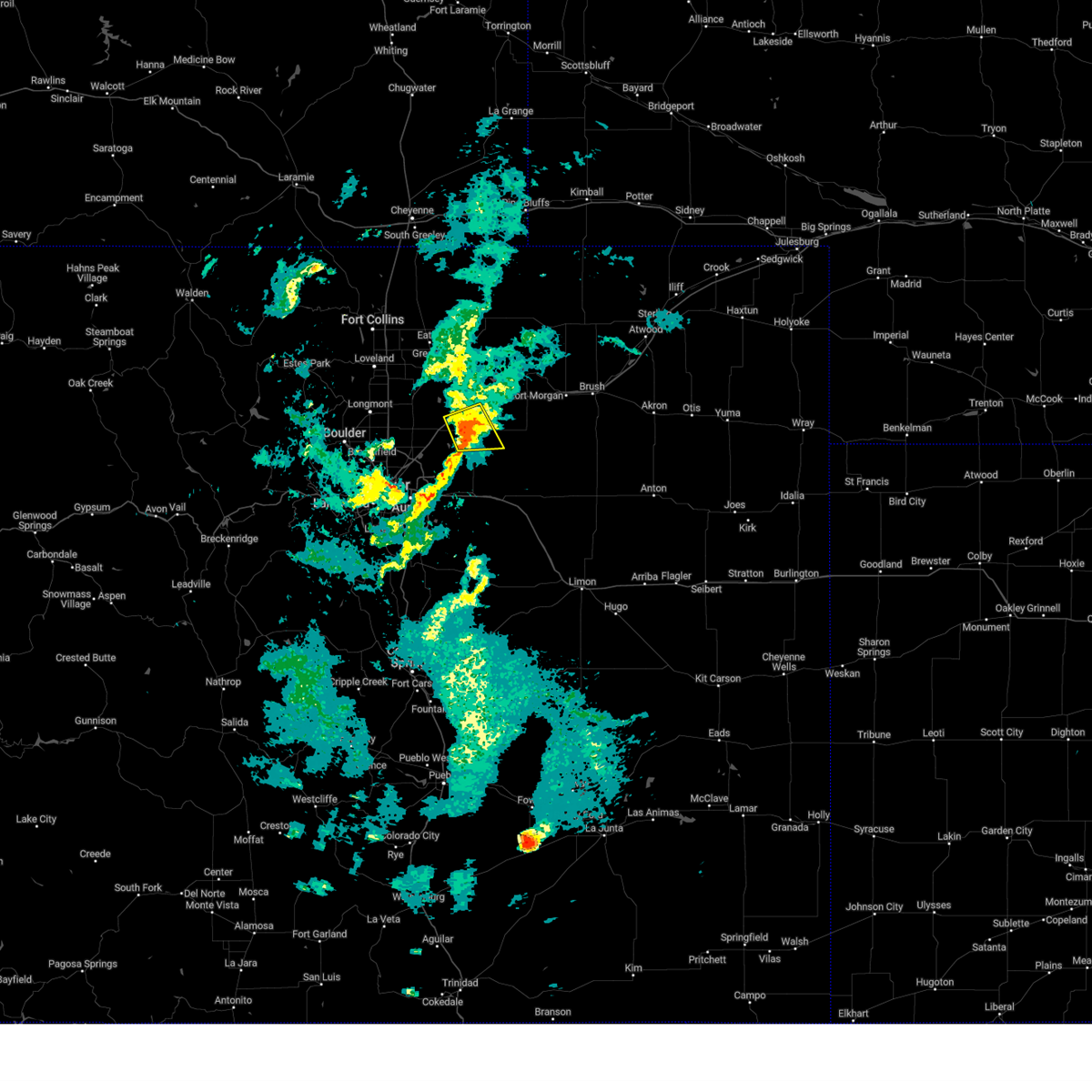
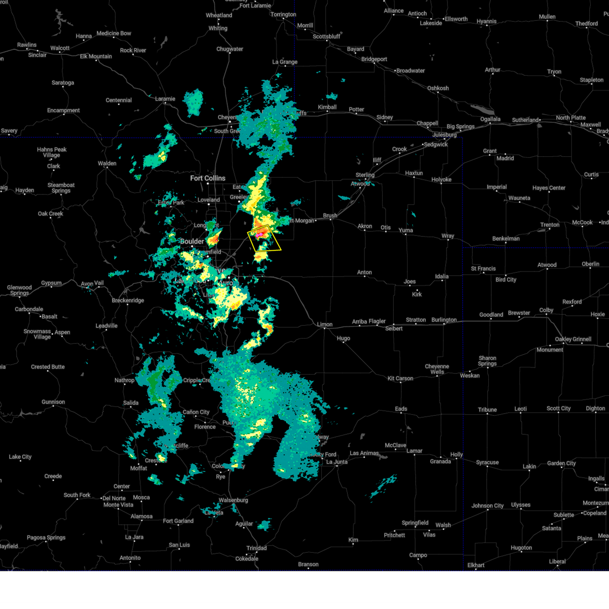
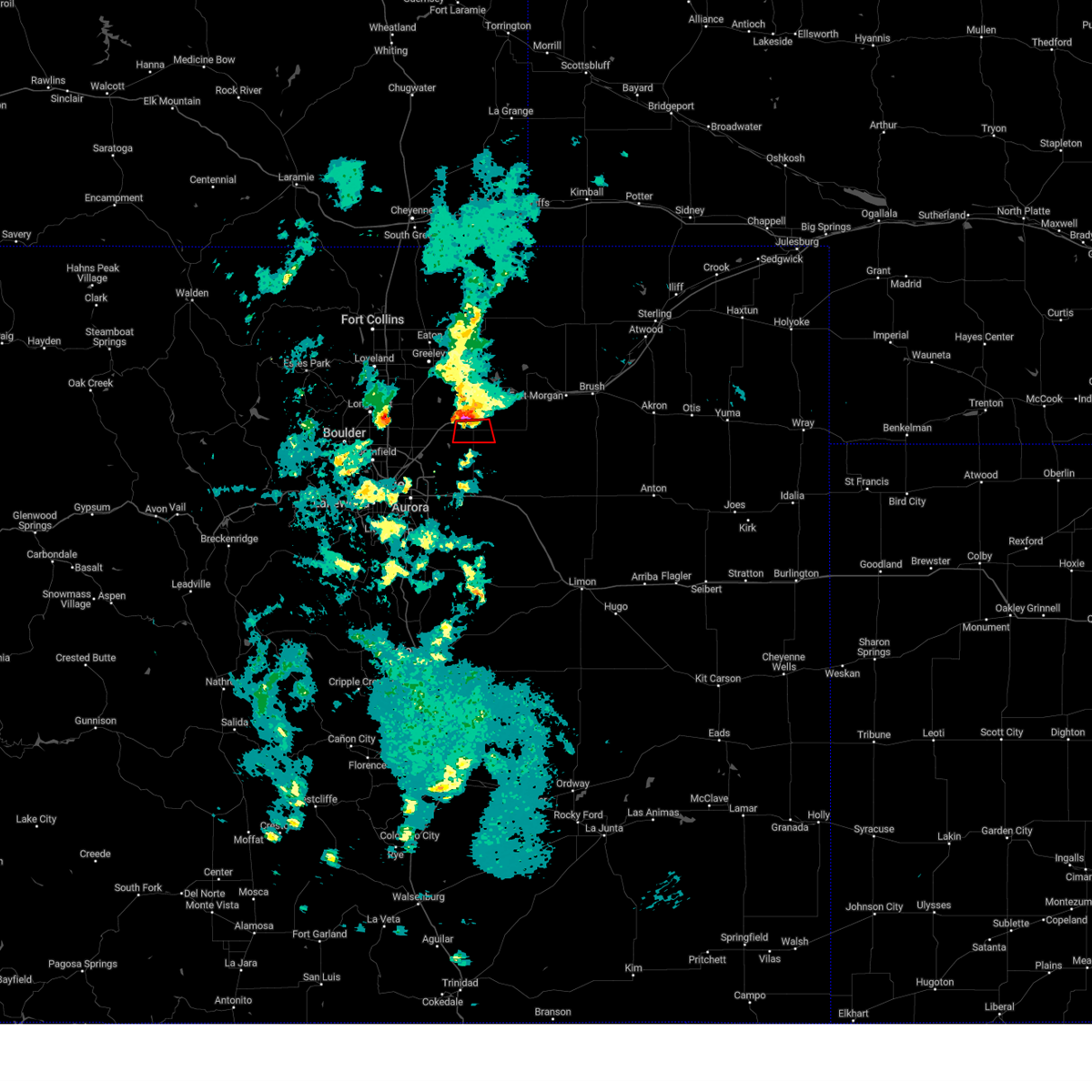
Hail and Wind Damage Spotted near Keenesburg, CO
| Date / Time | Report Details |
|---|---|
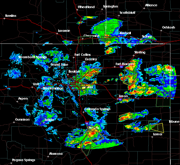
| 6/17/2025 2:41 PM MDT | The storms which prompted the warning have weakened below severe limits, and no longer pose an immediate threat to life or property. therefore, the warning will be allowed to expire. however, small hail and gusty winds are still possible with these thunderstorms. a severe thunderstorm watch remains in effect until 500 pm mdt tuesday for a portion of northeast colorado. |
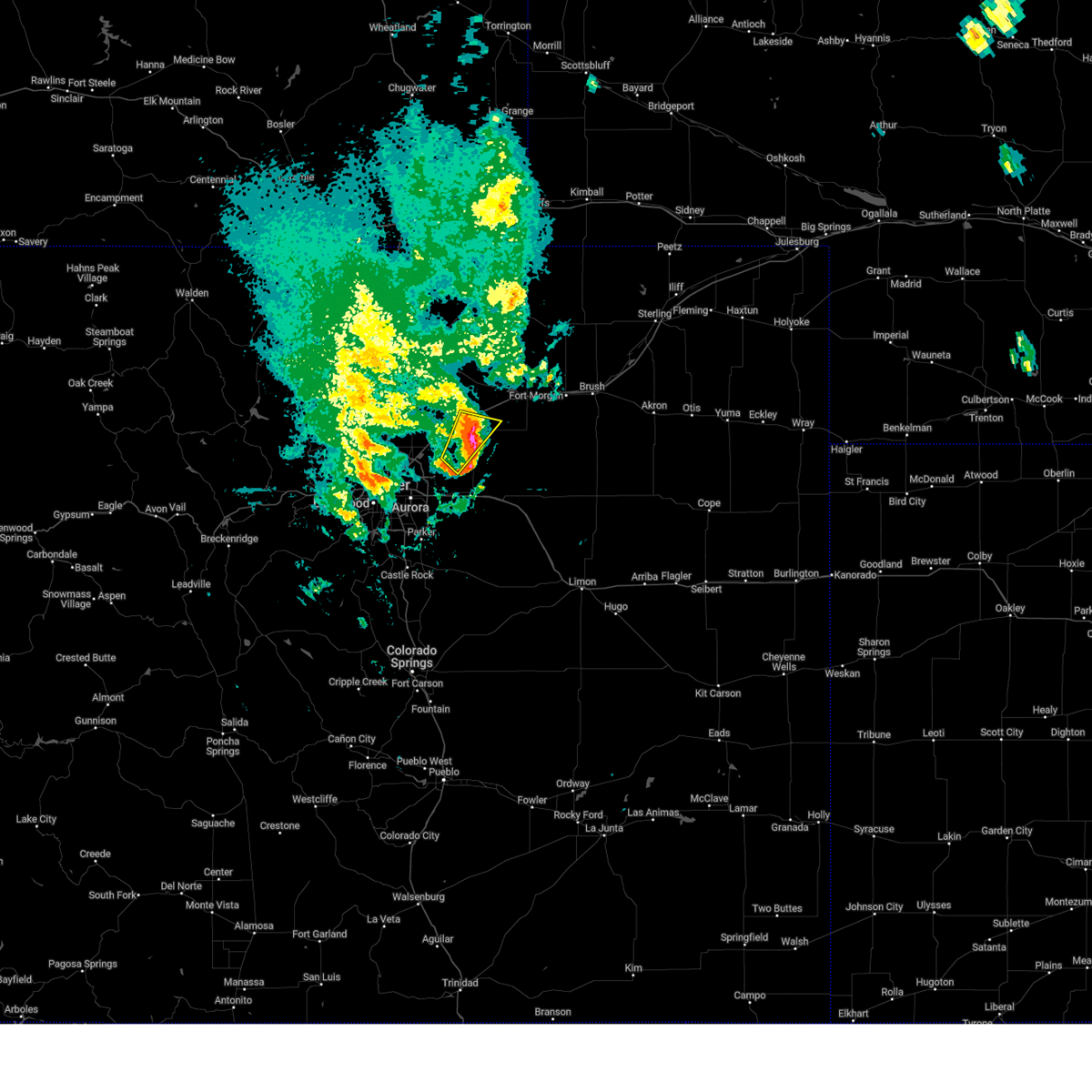
| 6/17/2025 2:25 PM MDT | At 225 pm mdt, severe thunderstorms were located along a line from near milton reservoir to near barr lake, or along a line from 14 miles southeast of greeley to 15 miles northeast of denver, moving east at 30 mph (trained spotters reported). Hazards include 60 mph wind gusts and quarter size hail. Hail damage to vehicles is expected. expect wind damage to roofs, siding, and trees. locations impacted include, eastern thornton, northeastern commerce city, brighton, denver international airport, d. i. A terminal and concourses, fort lupton, lochbuie, hudson, keenesburg, milton reservoir, barr lake, todd creek, wattenburg and henderson. |
| 6/17/2025 2:05 PM MDT | Svrbou the national weather service in denver has issued a * severe thunderstorm warning for, northwestern adams county in northeastern colorado, northeastern denver county in northeastern colorado, southwestern weld county in northeastern colorado, * until 245 pm mdt. * at 205 pm mdt, severe thunderstorms were located along a line from over gilcrest to over thornton, or along a line from 8 miles south of greeley to 14 miles north of denver, moving east at 30 mph (radar indicated). Hazards include quarter size hail. damage to vehicles is expected |
| 6/17/2025 5:00 AM MDT |
 the severe thunderstorm warning has been cancelled and is no longer in effect the severe thunderstorm warning has been cancelled and is no longer in effect
|
| 6/17/2025 4:50 AM MDT |
 At 450 am mdt, a severe thunderstorm was located over roggen, or 27 miles southeast of greeley, moving southeast at 20 mph (radar indicated). Hazards include half dollar size hail. Damage to vehicles is expected. Locations impacted include, keenesburg, roggen, riverside reservoir and masters. At 450 am mdt, a severe thunderstorm was located over roggen, or 27 miles southeast of greeley, moving southeast at 20 mph (radar indicated). Hazards include half dollar size hail. Damage to vehicles is expected. Locations impacted include, keenesburg, roggen, riverside reservoir and masters.
|
| 6/17/2025 4:37 AM MDT |
 The storm which prompted the warning has moved out of the area. therefore, the warning has been allowed to expire. however, small hail and heavy rain are still possible with this thunderstorm. a severe thunderstorm watch remains in effect until 800 am mdt for a portion of northeast colorado. The storm which prompted the warning has moved out of the area. therefore, the warning has been allowed to expire. however, small hail and heavy rain are still possible with this thunderstorm. a severe thunderstorm watch remains in effect until 800 am mdt for a portion of northeast colorado.
|
| 6/17/2025 4:37 AM MDT |
 The storm which prompted the warning has moved out of the area. therefore, the warning has been allowed to expire. a severe thunderstorm watch remains in effect until 800 am mdt for a portion of northeast colorado. The storm which prompted the warning has moved out of the area. therefore, the warning has been allowed to expire. a severe thunderstorm watch remains in effect until 800 am mdt for a portion of northeast colorado.
|
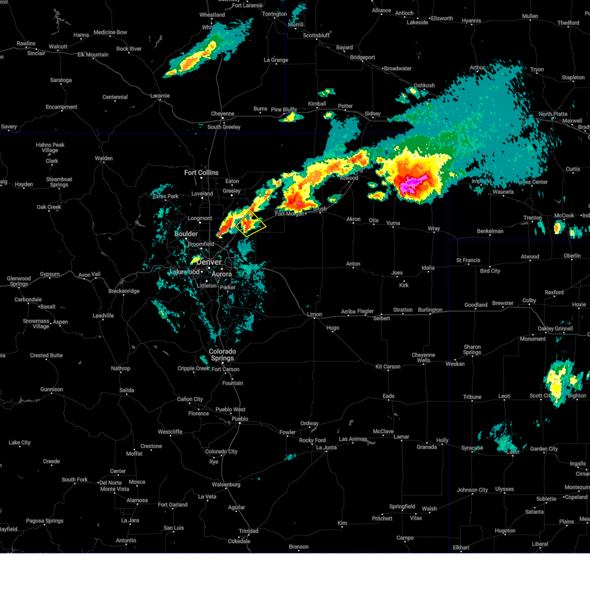
| 6/17/2025 4:36 AM MDT |
 Svrbou the national weather service in denver has issued a * severe thunderstorm warning for, south central weld county in northeastern colorado, * until 515 am mdt. * at 436 am mdt, a severe thunderstorm was located near roggen, or 22 miles southeast of greeley, moving east at 20 mph (radar indicated). Hazards include half dollar size hail. damage to vehicles is expected Svrbou the national weather service in denver has issued a * severe thunderstorm warning for, south central weld county in northeastern colorado, * until 515 am mdt. * at 436 am mdt, a severe thunderstorm was located near roggen, or 22 miles southeast of greeley, moving east at 20 mph (radar indicated). Hazards include half dollar size hail. damage to vehicles is expected
|
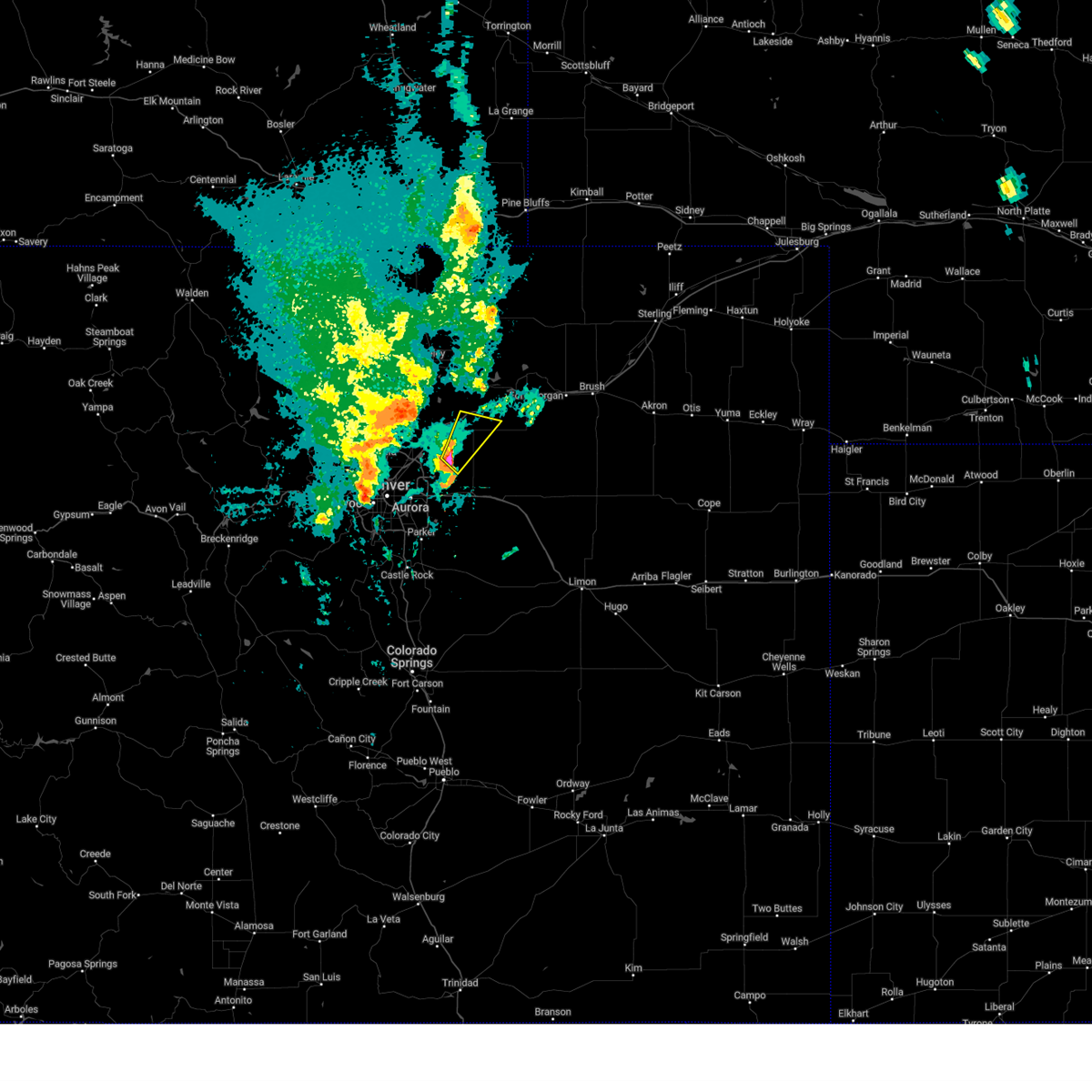
| 6/17/2025 4:12 AM MDT |
 At 412 am mdt, a severe thunderstorm was located 7 miles south of keenesburg, or 30 miles northeast of denver, moving east at 15 mph (radar indicated). Hazards include two inch hail. People and animals outdoors will be injured. expect damage to roofs, siding, windows, and vehicles. Locations impacted include, hudson, keenesburg and prospect valley. At 412 am mdt, a severe thunderstorm was located 7 miles south of keenesburg, or 30 miles northeast of denver, moving east at 15 mph (radar indicated). Hazards include two inch hail. People and animals outdoors will be injured. expect damage to roofs, siding, windows, and vehicles. Locations impacted include, hudson, keenesburg and prospect valley.
|
| 6/17/2025 4:02 AM MDT |
 Svrbou the national weather service in denver has issued a * severe thunderstorm warning for, north central adams county in northeastern colorado, southern weld county in northeastern colorado, * until 430 am mdt. * at 402 am mdt, a severe thunderstorm was located 7 miles southeast of hudson, or 28 miles northeast of denver, moving east at 15 mph. this is a destructive storm for hudson, keenesburg and prospect valley (radar indicated). Hazards include baseball size hail. People and animals outdoors will be severely injured. Expect shattered windows, extensive damage to roofs, siding, and vehicles. Svrbou the national weather service in denver has issued a * severe thunderstorm warning for, north central adams county in northeastern colorado, southern weld county in northeastern colorado, * until 430 am mdt. * at 402 am mdt, a severe thunderstorm was located 7 miles southeast of hudson, or 28 miles northeast of denver, moving east at 15 mph. this is a destructive storm for hudson, keenesburg and prospect valley (radar indicated). Hazards include baseball size hail. People and animals outdoors will be severely injured. Expect shattered windows, extensive damage to roofs, siding, and vehicles.
|
| 6/17/2025 3:54 AM MDT |
 Svrbou the national weather service in denver has issued a * severe thunderstorm warning for, north central adams county in northeastern colorado, south central weld county in northeastern colorado, * until 430 am mdt. * at 354 am mdt, a severe thunderstorm was located near hudson, or 27 miles northeast of denver, moving east at 20 mph (radar indicated). Hazards include ping pong ball size hail. People and animals outdoors will be injured. Expect damage to roofs, siding, windows, and vehicles. Svrbou the national weather service in denver has issued a * severe thunderstorm warning for, north central adams county in northeastern colorado, south central weld county in northeastern colorado, * until 430 am mdt. * at 354 am mdt, a severe thunderstorm was located near hudson, or 27 miles northeast of denver, moving east at 20 mph (radar indicated). Hazards include ping pong ball size hail. People and animals outdoors will be injured. Expect damage to roofs, siding, windows, and vehicles.
|
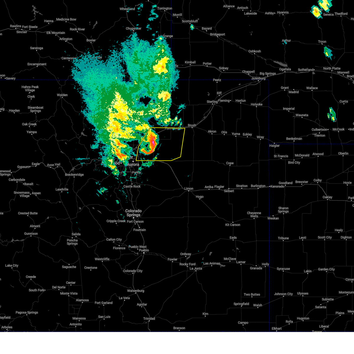
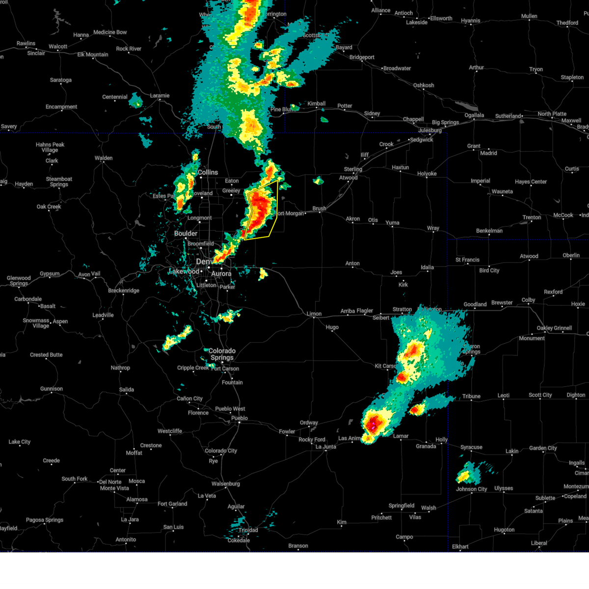
| 6/14/2025 7:14 PM MDT |
 Svrbou the national weather service in denver has issued a * severe thunderstorm warning for, western morgan county in northeastern colorado, south central weld county in northeastern colorado, * until 800 pm mdt. * at 714 pm mdt, severe thunderstorms were located along a line from near jackson reservoir to over keenesburg, or along a line from 20 miles northwest of fort morgan to 24 miles southeast of greeley, moving southeast at 25 mph (radar indicated). Hazards include 60 mph wind gusts and small hail. expect damage to roofs, siding, and trees Svrbou the national weather service in denver has issued a * severe thunderstorm warning for, western morgan county in northeastern colorado, south central weld county in northeastern colorado, * until 800 pm mdt. * at 714 pm mdt, severe thunderstorms were located along a line from near jackson reservoir to over keenesburg, or along a line from 20 miles northwest of fort morgan to 24 miles southeast of greeley, moving southeast at 25 mph (radar indicated). Hazards include 60 mph wind gusts and small hail. expect damage to roofs, siding, and trees
|
| 5/14/2025 4:18 PM MDT | Weatherlink statio in weld county CO, 10.5 miles WNW of Keenesburg, CO |
| 5/14/2025 4:16 PM MDT |
 the severe thunderstorm warning has been cancelled and is no longer in effect the severe thunderstorm warning has been cancelled and is no longer in effect
|
| 5/14/2025 4:14 PM MDT |
 Svrbou the national weather service in denver has issued a * severe thunderstorm warning for, adams county in northeastern colorado, northeastern denver county in northeastern colorado, southwestern morgan county in northeastern colorado, south central weld county in northeastern colorado, * until 500 pm mdt. * at 414 pm mdt, severe thunderstorms were located along a line from near wiggins to near watkins, or along a line from 18 miles west of fort morgan to 15 miles east of denver, moving east at 30 mph (radar indicated). Hazards include 60 mph wind gusts and small hail. expect damage to roofs, siding, and trees Svrbou the national weather service in denver has issued a * severe thunderstorm warning for, adams county in northeastern colorado, northeastern denver county in northeastern colorado, southwestern morgan county in northeastern colorado, south central weld county in northeastern colorado, * until 500 pm mdt. * at 414 pm mdt, severe thunderstorms were located along a line from near wiggins to near watkins, or along a line from 18 miles west of fort morgan to 15 miles east of denver, moving east at 30 mph (radar indicated). Hazards include 60 mph wind gusts and small hail. expect damage to roofs, siding, and trees
|
| 5/14/2025 3:53 PM MDT |
 Svrbou the national weather service in denver has issued a * severe thunderstorm warning for, north central adams county in northeastern colorado, south central weld county in northeastern colorado, * until 445 pm mdt. * at 353 pm mdt, a severe thunderstorm was located 9 miles northeast of d.i.a terminal and concourses, or 26 miles northeast of denver, moving northeast at 25 mph (radar indicated). Hazards include 60 mph wind gusts and quarter size hail. Hail damage to vehicles is expected. Expect wind damage to roofs, siding, and trees. Svrbou the national weather service in denver has issued a * severe thunderstorm warning for, north central adams county in northeastern colorado, south central weld county in northeastern colorado, * until 445 pm mdt. * at 353 pm mdt, a severe thunderstorm was located 9 miles northeast of d.i.a terminal and concourses, or 26 miles northeast of denver, moving northeast at 25 mph (radar indicated). Hazards include 60 mph wind gusts and quarter size hail. Hail damage to vehicles is expected. Expect wind damage to roofs, siding, and trees.
|
| 4/24/2025 3:25 PM MDT |
 The storm which prompted the warning has weakened below severe limits, and has exited the warned area. therefore, the warning will be allowed to expire. The storm which prompted the warning has weakened below severe limits, and has exited the warned area. therefore, the warning will be allowed to expire.
|
| 4/24/2025 3:02 PM MDT |
 At 302 pm mdt, a severe thunderstorm was located over hudson, or 27 miles south of greeley, moving north at 10 mph (radar indicated). Hazards include half dollar size hail. Damage to vehicles is expected. Locations impacted include, brighton, fort lupton, lochbuie, hudson and keenesburg. At 302 pm mdt, a severe thunderstorm was located over hudson, or 27 miles south of greeley, moving north at 10 mph (radar indicated). Hazards include half dollar size hail. Damage to vehicles is expected. Locations impacted include, brighton, fort lupton, lochbuie, hudson and keenesburg.
|
| 4/24/2025 3:02 PM MDT |
 the severe thunderstorm warning has been cancelled and is no longer in effect the severe thunderstorm warning has been cancelled and is no longer in effect
|
| 4/24/2025 2:51 PM MDT |
 Svrbou the national weather service in denver has issued a * severe thunderstorm warning for, northwestern adams county in northeastern colorado, south central weld county in northeastern colorado, * until 330 pm mdt. * at 251 pm mdt, a severe thunderstorm was located over lochbuie, or 25 miles northeast of denver, moving north at 10 mph (radar indicated). Hazards include half dollar size hail. damage to vehicles is expected Svrbou the national weather service in denver has issued a * severe thunderstorm warning for, northwestern adams county in northeastern colorado, south central weld county in northeastern colorado, * until 330 pm mdt. * at 251 pm mdt, a severe thunderstorm was located over lochbuie, or 25 miles northeast of denver, moving north at 10 mph (radar indicated). Hazards include half dollar size hail. damage to vehicles is expected
|
| 9/15/2024 3:02 PM MDT |
 Svrbou the national weather service in denver colorado has issued a * severe thunderstorm warning for, southwestern weld county in northeastern colorado, * until 330 pm mdt. * at 302 pm mdt, a severe thunderstorm was located over keenesburg, or 24 miles southeast of greeley, moving north at 30 mph (radar indicated). Hazards include 60 mph wind gusts and quarter size hail. Expect damage to roofs, siding, and trees. Hail damage to vehicles is expected. Svrbou the national weather service in denver colorado has issued a * severe thunderstorm warning for, southwestern weld county in northeastern colorado, * until 330 pm mdt. * at 302 pm mdt, a severe thunderstorm was located over keenesburg, or 24 miles southeast of greeley, moving north at 30 mph (radar indicated). Hazards include 60 mph wind gusts and quarter size hail. Expect damage to roofs, siding, and trees. Hail damage to vehicles is expected.
|
| 8/13/2024 5:02 PM MDT |
 the severe thunderstorm warning has been cancelled and is no longer in effect the severe thunderstorm warning has been cancelled and is no longer in effect
|
| 8/13/2024 4:44 PM MDT |
 At 444 pm mdt, a severe thunderstorm was located 5 miles east of kersey, or 15 miles east of greeley, moving northeast at 20 mph (radar indicated). Hazards include 60 mph wind gusts and quarter size hail. Expect damage to roofs, siding, and trees. hail damage to vehicles is expected. Locations impacted include, lochbuie, hudson, kersey, keenesburg, gill, prospect valley, riverside reservoir, barnesville, and roggen. At 444 pm mdt, a severe thunderstorm was located 5 miles east of kersey, or 15 miles east of greeley, moving northeast at 20 mph (radar indicated). Hazards include 60 mph wind gusts and quarter size hail. Expect damage to roofs, siding, and trees. hail damage to vehicles is expected. Locations impacted include, lochbuie, hudson, kersey, keenesburg, gill, prospect valley, riverside reservoir, barnesville, and roggen.
|
| 8/13/2024 4:25 PM MDT |
 Svrbou the national weather service in denver colorado has issued a * severe thunderstorm warning for, south central weld county in northeastern colorado, * until 515 pm mdt. * at 424 pm mdt, a severe thunderstorm was located 6 miles south of kersey, or 14 miles southeast of greeley, moving northeast at 25 mph. additional storms over southeast weld county may produce 60 mph wind gusts as well (radar indicated). Hazards include 60 mph wind gusts and quarter size hail. Expect damage to roofs, siding, and trees. Hail damage to vehicles is expected. Svrbou the national weather service in denver colorado has issued a * severe thunderstorm warning for, south central weld county in northeastern colorado, * until 515 pm mdt. * at 424 pm mdt, a severe thunderstorm was located 6 miles south of kersey, or 14 miles southeast of greeley, moving northeast at 25 mph. additional storms over southeast weld county may produce 60 mph wind gusts as well (radar indicated). Hazards include 60 mph wind gusts and quarter size hail. Expect damage to roofs, siding, and trees. Hail damage to vehicles is expected.
|
| 8/11/2024 6:12 PM MDT |
 the severe thunderstorm warning has been cancelled and is no longer in effect the severe thunderstorm warning has been cancelled and is no longer in effect
|
| 8/11/2024 5:41 PM MDT |
 Svrbou the national weather service in denver colorado has issued a * severe thunderstorm warning for, south central weld county in northeastern colorado, north central adams county in northeastern colorado, * until 630 pm mdt. * at 541 pm mdt, a severe thunderstorm was located 5 miles southeast of milton reservoir, or 18 miles southeast of greeley, moving southeast at 40 mph (radar indicated). Hazards include 60 mph wind gusts. expect damage to roofs, siding, and trees Svrbou the national weather service in denver colorado has issued a * severe thunderstorm warning for, south central weld county in northeastern colorado, north central adams county in northeastern colorado, * until 630 pm mdt. * at 541 pm mdt, a severe thunderstorm was located 5 miles southeast of milton reservoir, or 18 miles southeast of greeley, moving southeast at 40 mph (radar indicated). Hazards include 60 mph wind gusts. expect damage to roofs, siding, and trees
|
| 8/7/2024 4:27 PM MDT | Storm damage reported in weld county CO, 13 miles WNW of Keenesburg, CO |
| 8/7/2024 4:13 PM MDT |
 Svrbou the national weather service in denver colorado has issued a * severe thunderstorm warning for, south central weld county in northeastern colorado, north central adams county in northeastern colorado, * until 445 pm mdt. * at 413 pm mdt, a severe thunderstorm was located near roggen, or 28 miles southeast of greeley, moving south at 25 mph (radar indicated). Hazards include ping pong ball size hail and 60 mph wind gusts. Expect damage to roofs, siding, and trees. people and animals outdoors will be injured. Expect hail damage to roofs, siding, windows, and vehicles. Svrbou the national weather service in denver colorado has issued a * severe thunderstorm warning for, south central weld county in northeastern colorado, north central adams county in northeastern colorado, * until 445 pm mdt. * at 413 pm mdt, a severe thunderstorm was located near roggen, or 28 miles southeast of greeley, moving south at 25 mph (radar indicated). Hazards include ping pong ball size hail and 60 mph wind gusts. Expect damage to roofs, siding, and trees. people and animals outdoors will be injured. Expect hail damage to roofs, siding, windows, and vehicles.
|
| 5/30/2024 8:57 PM MDT |
 Svrbou the national weather service in denver colorado has issued a * severe thunderstorm warning for, south central weld county in northeastern colorado, north central adams county in northeastern colorado, * until 945 pm mdt. * at 857 pm mdt, a severe thunderstorm was located near hudson, or 23 miles south of greeley, moving southeast at 10 mph (radar indicated). Hazards include quarter size hail. Damage to vehicles is expected. This severe thunderstorm will be near, lochbuie and hudson around 900 pm mdt. Svrbou the national weather service in denver colorado has issued a * severe thunderstorm warning for, south central weld county in northeastern colorado, north central adams county in northeastern colorado, * until 945 pm mdt. * at 857 pm mdt, a severe thunderstorm was located near hudson, or 23 miles south of greeley, moving southeast at 10 mph (radar indicated). Hazards include quarter size hail. Damage to vehicles is expected. This severe thunderstorm will be near, lochbuie and hudson around 900 pm mdt.
|
| 8/2/2023 8:56 PM MDT |
 At 855 pm mdt, severe thunderstorms were located along a line extending from westminster to aurora to near ponderosa park, or along a line extending from 9 miles northwest of denver to 61 miles southwest of fort morgan to 37 miles north of colorado springs, moving northeast at 35 mph (radar indicated). Hazards include 60 mph wind gusts. Expect damage to roofs, siding, and trees. severe thunderstorms will be near, watkins around 905 pm mdt. d. i. a terminal and concourses and manila village around 910 pm mdt. brighton around 915 pm mdt. other locations in the path of these severe thunderstorms include northeastern commerce city, denver international airport, todd creek, barr lake, lochbuie, hudson, strasburg, byers and prospect valley. hail threat, radar indicated max hail size, <. 75 in wind threat, radar indicated max wind gust, 60 mph. At 855 pm mdt, severe thunderstorms were located along a line extending from westminster to aurora to near ponderosa park, or along a line extending from 9 miles northwest of denver to 61 miles southwest of fort morgan to 37 miles north of colorado springs, moving northeast at 35 mph (radar indicated). Hazards include 60 mph wind gusts. Expect damage to roofs, siding, and trees. severe thunderstorms will be near, watkins around 905 pm mdt. d. i. a terminal and concourses and manila village around 910 pm mdt. brighton around 915 pm mdt. other locations in the path of these severe thunderstorms include northeastern commerce city, denver international airport, todd creek, barr lake, lochbuie, hudson, strasburg, byers and prospect valley. hail threat, radar indicated max hail size, <. 75 in wind threat, radar indicated max wind gust, 60 mph.
|
| 7/8/2023 2:40 PM MDT |
 At 238 pm mdt, a severe thunderstorm was located over hudson, or 24 miles south of greeley, moving southeast at 20 mph (radar indicated. a funnel cloud was reported just east of the fort lupton area. landspout tornadoes are possible with this storm). Hazards include half dollar size hail. Damage to vehicles is expected. locations impacted include, lochbuie, hudson, keenesburg and prospect valley. hail threat, radar indicated max hail size, 1. 25 in wind threat, radar indicated max wind gust, <50 mph. At 238 pm mdt, a severe thunderstorm was located over hudson, or 24 miles south of greeley, moving southeast at 20 mph (radar indicated. a funnel cloud was reported just east of the fort lupton area. landspout tornadoes are possible with this storm). Hazards include half dollar size hail. Damage to vehicles is expected. locations impacted include, lochbuie, hudson, keenesburg and prospect valley. hail threat, radar indicated max hail size, 1. 25 in wind threat, radar indicated max wind gust, <50 mph.
|
| 7/8/2023 2:15 PM MDT |
 At 214 pm mdt, a severe thunderstorm was located 5 miles northeast of fort lupton, or 18 miles south of greeley, moving southeast at 20 mph (radar indicated). Hazards include 60 mph wind gusts and half dollar size hail. brief landspouts are also possible. Expect damage to roofs, siding, and trees. Hail damage to vehicles is expected. At 214 pm mdt, a severe thunderstorm was located 5 miles northeast of fort lupton, or 18 miles south of greeley, moving southeast at 20 mph (radar indicated). Hazards include 60 mph wind gusts and half dollar size hail. brief landspouts are also possible. Expect damage to roofs, siding, and trees. Hail damage to vehicles is expected.
|
| 7/4/2023 6:55 PM MDT |
 The severe thunderstorm warning for southwestern weld county will expire at 700 pm mdt, the storm which prompted the warning has weakened below severe limits, and no longer poses an immediate threat to life or property. therefore, the warning will be allowed to expire. a severe thunderstorm watch remains in effect until 1100 pm mdt for northeastern colorado. The severe thunderstorm warning for southwestern weld county will expire at 700 pm mdt, the storm which prompted the warning has weakened below severe limits, and no longer poses an immediate threat to life or property. therefore, the warning will be allowed to expire. a severe thunderstorm watch remains in effect until 1100 pm mdt for northeastern colorado.
|
| 7/4/2023 6:40 PM MDT |
 At 640 pm mdt, a severe thunderstorm was located over milton reservoir, or 13 miles south of greeley, moving east at 30 mph (radar indicated). Hazards include 60 mph wind gusts and quarter size hail. Expect damage to roofs, siding, and trees. hail damage to vehicles is expected. locations impacted include, keenesburg. hail threat, radar indicated max hail size, 1. 00 in wind threat, radar indicated max wind gust, 60 mph. At 640 pm mdt, a severe thunderstorm was located over milton reservoir, or 13 miles south of greeley, moving east at 30 mph (radar indicated). Hazards include 60 mph wind gusts and quarter size hail. Expect damage to roofs, siding, and trees. hail damage to vehicles is expected. locations impacted include, keenesburg. hail threat, radar indicated max hail size, 1. 00 in wind threat, radar indicated max wind gust, 60 mph.
|
| 7/4/2023 6:26 PM MDT |
 At 626 pm mdt, a severe thunderstorm was located over platteville, or 13 miles south of greeley, moving east at 30 mph (radar indicated). Hazards include golf ball size hail and 60 mph wind gusts. Expect damage to roofs, siding, and trees. people and animals outdoors will be injured. expect hail damage to roofs, siding, windows, and vehicles. this severe thunderstorm will be near, milton reservoir around 645 pm mdt. other locations in the path of this severe thunderstorm include keenesburg. thunderstorm damage threat, considerable hail threat, radar indicated max hail size, 1. 75 in wind threat, radar indicated max wind gust, 60 mph. At 626 pm mdt, a severe thunderstorm was located over platteville, or 13 miles south of greeley, moving east at 30 mph (radar indicated). Hazards include golf ball size hail and 60 mph wind gusts. Expect damage to roofs, siding, and trees. people and animals outdoors will be injured. expect hail damage to roofs, siding, windows, and vehicles. this severe thunderstorm will be near, milton reservoir around 645 pm mdt. other locations in the path of this severe thunderstorm include keenesburg. thunderstorm damage threat, considerable hail threat, radar indicated max hail size, 1. 75 in wind threat, radar indicated max wind gust, 60 mph.
|
| 6/28/2023 11:00 PM MDT | Quarter sized hail reported 8.2 miles WSW of Keenesburg, CO, time estimate based on radar. |
| 6/28/2023 10:26 PM MDT |
 At 1026 pm mdt, a severe thunderstorm was located over keenesburg, or 23 miles southeast of greeley, moving northeast at 20 mph (radar indicated). Hazards include half dollar size hail. damage to vehicles is expected At 1026 pm mdt, a severe thunderstorm was located over keenesburg, or 23 miles southeast of greeley, moving northeast at 20 mph (radar indicated). Hazards include half dollar size hail. damage to vehicles is expected
|
| 6/21/2023 6:47 PM MDT |
 At 647 pm mdt, a severe thunderstorm was located over hudson, or 23 miles south of greeley, moving northeast at 10 mph (radar indicated). Hazards include half dollar size hail. damage to vehicles is expected At 647 pm mdt, a severe thunderstorm was located over hudson, or 23 miles south of greeley, moving northeast at 10 mph (radar indicated). Hazards include half dollar size hail. damage to vehicles is expected
|
| 5/27/2023 5:24 PM MDT |
 At 523 pm mdt, severe thunderstorms were located along a line extending from 7 miles southeast of barnesville to 4 miles northeast of roggen to 3 miles south of keenesburg, or along a line extending from 20 miles east of greeley to 27 miles west of fort morgan to 32 miles northeast of denver, moving east at 10 mph (radar indicated). Hazards include quarter size hail. Damage to vehicles is expected. locations impacted include, keenesburg, prospect valley, riverside reservoir and roggen. hail threat, radar indicated max hail size, 1. 00 in wind threat, radar indicated max wind gust, <50 mph. At 523 pm mdt, severe thunderstorms were located along a line extending from 7 miles southeast of barnesville to 4 miles northeast of roggen to 3 miles south of keenesburg, or along a line extending from 20 miles east of greeley to 27 miles west of fort morgan to 32 miles northeast of denver, moving east at 10 mph (radar indicated). Hazards include quarter size hail. Damage to vehicles is expected. locations impacted include, keenesburg, prospect valley, riverside reservoir and roggen. hail threat, radar indicated max hail size, 1. 00 in wind threat, radar indicated max wind gust, <50 mph.
|
| 5/27/2023 5:02 PM MDT |
 At 502 pm mdt, severe thunderstorms were located along a line extending from 4 miles southeast of barnesville to near roggen to 10 miles southwest of prospect valley, or along a line extending from 16 miles east of greeley to 30 miles west of fort morgan to 27 miles northeast of denver, moving east at 15 mph (radar indicated). Hazards include quarter size hail. Damage to vehicles is expected. severe thunderstorms will be near, roggen around 505 pm mdt. other locations in the path of these severe thunderstorms include riverside reservoir. hail threat, radar indicated max hail size, 1. 00 in wind threat, radar indicated max wind gust, <50 mph. At 502 pm mdt, severe thunderstorms were located along a line extending from 4 miles southeast of barnesville to near roggen to 10 miles southwest of prospect valley, or along a line extending from 16 miles east of greeley to 30 miles west of fort morgan to 27 miles northeast of denver, moving east at 15 mph (radar indicated). Hazards include quarter size hail. Damage to vehicles is expected. severe thunderstorms will be near, roggen around 505 pm mdt. other locations in the path of these severe thunderstorms include riverside reservoir. hail threat, radar indicated max hail size, 1. 00 in wind threat, radar indicated max wind gust, <50 mph.
|
| 5/27/2023 4:25 PM MDT |
 The severe thunderstorm warning for south central weld county will expire at 430 pm mdt, the storm which prompted the warning has weakened below severe limits, and no longer poses an immediate threat to life or property. therefore, the warning will be allowed to expire. however small hail is still possible with this thunderstorm. a severe thunderstorm watch remains in effect until 900 pm mdt for northeastern colorado. The severe thunderstorm warning for south central weld county will expire at 430 pm mdt, the storm which prompted the warning has weakened below severe limits, and no longer poses an immediate threat to life or property. therefore, the warning will be allowed to expire. however small hail is still possible with this thunderstorm. a severe thunderstorm watch remains in effect until 900 pm mdt for northeastern colorado.
|
| 5/27/2023 4:15 PM MDT |
 At 415 pm mdt, a severe thunderstorm was located 5 miles east of milton reservoir, or 16 miles southeast of greeley, moving north at 20 mph (radar indicated). Hazards include quarter size hail. Damage to vehicles is expected. This severe thunderstorm will remain over mainly rural areas of south central weld county. At 415 pm mdt, a severe thunderstorm was located 5 miles east of milton reservoir, or 16 miles southeast of greeley, moving north at 20 mph (radar indicated). Hazards include quarter size hail. Damage to vehicles is expected. This severe thunderstorm will remain over mainly rural areas of south central weld county.
|
| 5/27/2023 4:05 PM MDT |
 At 405 pm mdt, a severe thunderstorm was located 5 miles east of milton reservoir, or 18 miles southeast of greeley, moving north at 20 mph (radar indicated). Hazards include 60 mph wind gusts and quarter size hail. Expect damage to roofs, siding, and trees. hail damage to vehicles is expected. This severe thunderstorm will remain over mainly rural areas of south central weld county. At 405 pm mdt, a severe thunderstorm was located 5 miles east of milton reservoir, or 18 miles southeast of greeley, moving north at 20 mph (radar indicated). Hazards include 60 mph wind gusts and quarter size hail. Expect damage to roofs, siding, and trees. hail damage to vehicles is expected. This severe thunderstorm will remain over mainly rural areas of south central weld county.
|
| 5/27/2023 3:55 PM MDT |
 At 355 pm mdt, a severe thunderstorm was located near keenesburg, or 20 miles southeast of greeley, moving north at 20 mph (radar indicated). Hazards include 60 mph wind gusts and quarter size hail. Expect damage to roofs, siding, and trees. hail damage to vehicles is expected. Locations impacted include, keenesburg. At 355 pm mdt, a severe thunderstorm was located near keenesburg, or 20 miles southeast of greeley, moving north at 20 mph (radar indicated). Hazards include 60 mph wind gusts and quarter size hail. Expect damage to roofs, siding, and trees. hail damage to vehicles is expected. Locations impacted include, keenesburg.
|
| 5/27/2023 3:46 PM MDT |
 At 346 pm mdt, a severe thunderstorm was located over keenesburg, or 23 miles southeast of greeley, moving north at 20 mph (radar indicated). Hazards include 60 mph wind gusts and quarter size hail. Expect damage to roofs, siding, and trees. hail damage to vehicles is expected. This severe thunderstorm will remain over mainly rural areas of south central weld county. At 346 pm mdt, a severe thunderstorm was located over keenesburg, or 23 miles southeast of greeley, moving north at 20 mph (radar indicated). Hazards include 60 mph wind gusts and quarter size hail. Expect damage to roofs, siding, and trees. hail damage to vehicles is expected. This severe thunderstorm will remain over mainly rural areas of south central weld county.
|
| 5/10/2023 1:04 AM MDT |
 At 104 am mdt, severe thunderstorms were located along a line extending from near galeton to near hudson, or along a line extending from 9 miles northeast of greeley to 27 miles northeast of denver, moving east at 20 mph (radar indicated). Hazards include 60 mph wind gusts and quarter size hail. Expect damage to roofs, siding, and trees. hail damage to vehicles is expected. locations impacted include, kersey, gill, barnesville and keenesburg. hail threat, radar indicated max hail size, 1. 00 in wind threat, radar indicated max wind gust, 60 mph. At 104 am mdt, severe thunderstorms were located along a line extending from near galeton to near hudson, or along a line extending from 9 miles northeast of greeley to 27 miles northeast of denver, moving east at 20 mph (radar indicated). Hazards include 60 mph wind gusts and quarter size hail. Expect damage to roofs, siding, and trees. hail damage to vehicles is expected. locations impacted include, kersey, gill, barnesville and keenesburg. hail threat, radar indicated max hail size, 1. 00 in wind threat, radar indicated max wind gust, 60 mph.
|
| 5/10/2023 12:42 AM MDT |
 The severe thunderstorm warning for southwestern weld county will expire at 1245 am mdt, the storms which prompted the warning have moved out of the area. therefore, the warning will be allowed to expire. however small hail is still possible with these thunderstorms. remember, a severe thunderstorm warning still remains in effect for southern and central weld county. The severe thunderstorm warning for southwestern weld county will expire at 1245 am mdt, the storms which prompted the warning have moved out of the area. therefore, the warning will be allowed to expire. however small hail is still possible with these thunderstorms. remember, a severe thunderstorm warning still remains in effect for southern and central weld county.
|
| 5/10/2023 12:41 AM MDT |
 At 1239 am mdt, severe thunderstorms were located along a line extending from near lucerne to near fort lupton, or along a line extending from 4 miles north of greeley to 23 miles north of denver, moving east at 20 mph (radar indicated). Hazards include 60 mph wind gusts and quarter size hail. Expect damage to roofs, siding, and trees. hail damage to vehicles is expected. severe thunderstorms will be near, greeley, evans and lucerne around 1245 am mdt. other locations in the path of these severe thunderstorms include kersey, galeton, gill, hudson, barnesville and keenesburg. hail threat, radar indicated max hail size, 1. 00 in wind threat, radar indicated max wind gust, 60 mph. At 1239 am mdt, severe thunderstorms were located along a line extending from near lucerne to near fort lupton, or along a line extending from 4 miles north of greeley to 23 miles north of denver, moving east at 20 mph (radar indicated). Hazards include 60 mph wind gusts and quarter size hail. Expect damage to roofs, siding, and trees. hail damage to vehicles is expected. severe thunderstorms will be near, greeley, evans and lucerne around 1245 am mdt. other locations in the path of these severe thunderstorms include kersey, galeton, gill, hudson, barnesville and keenesburg. hail threat, radar indicated max hail size, 1. 00 in wind threat, radar indicated max wind gust, 60 mph.
|
| 5/10/2023 12:27 AM MDT |
 At 1227 am mdt, severe thunderstorms were located along a line extending from 3 miles northeast of lucerne to near hudson, or along a line extending from 7 miles northeast of greeley to 27 miles northeast of denver, moving east at 25 mph (trained weather spotters). Hazards include 60 mph wind gusts and half dollar size hail. Expect damage to roofs, siding, and trees. hail damage to vehicles is expected. hail may accumulate on roadways causing hazardous travel. locations impacted include, galeton, gill, keenesburg, barnesville, prospect valley and roggen. hail threat, observed max hail size, 1. 25 in wind threat, radar indicated max wind gust, 60 mph. At 1227 am mdt, severe thunderstorms were located along a line extending from 3 miles northeast of lucerne to near hudson, or along a line extending from 7 miles northeast of greeley to 27 miles northeast of denver, moving east at 25 mph (trained weather spotters). Hazards include 60 mph wind gusts and half dollar size hail. Expect damage to roofs, siding, and trees. hail damage to vehicles is expected. hail may accumulate on roadways causing hazardous travel. locations impacted include, galeton, gill, keenesburg, barnesville, prospect valley and roggen. hail threat, observed max hail size, 1. 25 in wind threat, radar indicated max wind gust, 60 mph.
|
| 5/9/2023 11:52 PM MDT |
 At 1150 pm mdt, severe thunderstorms were located along a line extending from near windsor to near todd creek, or along a line extending from 9 miles west of greeley to 19 miles north of denver, moving east at 25 mph (trained weather spotters). Hazards include 60 mph wind gusts and half dollar size hail. Expect damage to roofs, siding, and trees. hail damage to vehicles is expected. hail may accumulate on roadways causing hazardous travel. severe thunderstorms will be near, windsor and milliken around 1155 pm mdt. brighton around 1200 am mdt. greeley and severance around 1210 am mdt. other locations in the path of these severe thunderstorms include evans, fort lupton, lochbuie, eaton, lucerne, hudson, galeton, gill, keenesburg, barnesville and prospect valley. hail threat, observed max hail size, 1. 25 in wind threat, radar indicated max wind gust, 60 mph. At 1150 pm mdt, severe thunderstorms were located along a line extending from near windsor to near todd creek, or along a line extending from 9 miles west of greeley to 19 miles north of denver, moving east at 25 mph (trained weather spotters). Hazards include 60 mph wind gusts and half dollar size hail. Expect damage to roofs, siding, and trees. hail damage to vehicles is expected. hail may accumulate on roadways causing hazardous travel. severe thunderstorms will be near, windsor and milliken around 1155 pm mdt. brighton around 1200 am mdt. greeley and severance around 1210 am mdt. other locations in the path of these severe thunderstorms include evans, fort lupton, lochbuie, eaton, lucerne, hudson, galeton, gill, keenesburg, barnesville and prospect valley. hail threat, observed max hail size, 1. 25 in wind threat, radar indicated max wind gust, 60 mph.
|
| 4/25/2023 3:41 PM MDT |
 The severe thunderstorm warning for south central weld and north central adams counties will expire at 345 pm mdt, the storm which prompted the warning has weakened below severe limits, and no longer poses an immediate threat to life or property. therefore, the warning will be allowed to expire. however small hail is still possible with this line of thunderstorms. The severe thunderstorm warning for south central weld and north central adams counties will expire at 345 pm mdt, the storm which prompted the warning has weakened below severe limits, and no longer poses an immediate threat to life or property. therefore, the warning will be allowed to expire. however small hail is still possible with this line of thunderstorms.
|
| 4/25/2023 3:11 PM MDT |
 At 309 pm mdt, a severe thunderstorm was located near prospect valley, or 27 miles southeast of greeley, moving south at 15 mph (radar indicated). Hazards include quarter size hail. Damage to vehicles is expected. This severe thunderstorm will be near, prospect valley around 315 pm mdt. At 309 pm mdt, a severe thunderstorm was located near prospect valley, or 27 miles southeast of greeley, moving south at 15 mph (radar indicated). Hazards include quarter size hail. Damage to vehicles is expected. This severe thunderstorm will be near, prospect valley around 315 pm mdt.
|
| 4/25/2023 2:54 PM MDT |
 At 254 pm mdt, a confirmed tornado was located 4 miles southwest of prospect valley, or 30 miles southeast of greeley, moving south at 20 mph (weather spotters confirmed tornado). Hazards include tornado. Expect damage to mobile homes, roofs, and vehicles. This tornadic thunderstorm will remain over mainly rural areas of south central weld county. At 254 pm mdt, a confirmed tornado was located 4 miles southwest of prospect valley, or 30 miles southeast of greeley, moving south at 20 mph (weather spotters confirmed tornado). Hazards include tornado. Expect damage to mobile homes, roofs, and vehicles. This tornadic thunderstorm will remain over mainly rural areas of south central weld county.
|
| 4/25/2023 2:42 PM MDT |
 At 242 pm mdt, a confirmed tornado was located near keenesburg, or 27 miles southeast of greeley, moving south at 20 mph (weather spotters confirmed tornado). Hazards include damaging tornado. Flying debris will be dangerous to those caught without shelter. mobile homes will be damaged or destroyed. damage to roofs, windows, and vehicles will occur. tree damage is likely. The tornado will be near, prospect valley around 245 pm mdt. At 242 pm mdt, a confirmed tornado was located near keenesburg, or 27 miles southeast of greeley, moving south at 20 mph (weather spotters confirmed tornado). Hazards include damaging tornado. Flying debris will be dangerous to those caught without shelter. mobile homes will be damaged or destroyed. damage to roofs, windows, and vehicles will occur. tree damage is likely. The tornado will be near, prospect valley around 245 pm mdt.
|
| 4/25/2023 2:32 PM MDT |
 At 232 pm mdt, a severe thunderstorm capable of producing a tornado was located near keenesburg, or 24 miles southeast of greeley, moving south at 15 mph (radar indicated rotation). Hazards include tornado. Flying debris will be dangerous to those caught without shelter. mobile homes will be damaged or destroyed. damage to roofs, windows, and vehicles will occur. tree damage is likely. this dangerous storm will be near, keenesburg around 235 pm mdt. Prospect valley around 245 pm mdt. At 232 pm mdt, a severe thunderstorm capable of producing a tornado was located near keenesburg, or 24 miles southeast of greeley, moving south at 15 mph (radar indicated rotation). Hazards include tornado. Flying debris will be dangerous to those caught without shelter. mobile homes will be damaged or destroyed. damage to roofs, windows, and vehicles will occur. tree damage is likely. this dangerous storm will be near, keenesburg around 235 pm mdt. Prospect valley around 245 pm mdt.
|
| 8/19/2021 3:30 PM MDT | Ping Pong Ball sized hail reported 8.2 miles WSW of Keenesburg, CO |
| 8/19/2021 3:26 PM MDT |
 At 325 pm mdt, a severe thunderstorm was located 4 miles southwest of roggen, or 24 miles southeast of greeley, moving northeast at 20 mph (radar indicated). Hazards include tennis ball size hail and 60 mph wind gusts. Expect damage to roofs, siding, and trees. people and animals outdoors will be injured. expect hail damage to roofs, siding, windows, and vehicles. locations impacted include, roggen. thunderstorm damage threat, considerable hail threat, radar indicated max hail size, 2. 50 in wind threat, radar indicated max wind gust, 60 mph. At 325 pm mdt, a severe thunderstorm was located 4 miles southwest of roggen, or 24 miles southeast of greeley, moving northeast at 20 mph (radar indicated). Hazards include tennis ball size hail and 60 mph wind gusts. Expect damage to roofs, siding, and trees. people and animals outdoors will be injured. expect hail damage to roofs, siding, windows, and vehicles. locations impacted include, roggen. thunderstorm damage threat, considerable hail threat, radar indicated max hail size, 2. 50 in wind threat, radar indicated max wind gust, 60 mph.
|
| 8/19/2021 3:14 PM MDT |
 At 314 pm mdt, a severe thunderstorm was located over keenesburg, or 25 miles southeast of greeley, moving northeast at 20 mph (radar indicated). Hazards include 60 mph wind gusts and half dollar size hail. Expect damage to roofs, siding, and trees. hail damage to vehicles is expected. this severe thunderstorm will be near, prospect valley around 320 pm mdt. other locations in the path of this severe thunderstorm include roggen. hail threat, radar indicated max hail size, 1. 25 in wind threat, radar indicated max wind gust, 60 mph. At 314 pm mdt, a severe thunderstorm was located over keenesburg, or 25 miles southeast of greeley, moving northeast at 20 mph (radar indicated). Hazards include 60 mph wind gusts and half dollar size hail. Expect damage to roofs, siding, and trees. hail damage to vehicles is expected. this severe thunderstorm will be near, prospect valley around 320 pm mdt. other locations in the path of this severe thunderstorm include roggen. hail threat, radar indicated max hail size, 1. 25 in wind threat, radar indicated max wind gust, 60 mph.
|
| 8/19/2021 2:46 PM MDT |
 At 246 pm mdt, a severe thunderstorm was located near hudson, or 24 miles south of greeley, moving northeast at 25 mph (radar indicated). Hazards include 60 mph wind gusts and quarter size hail. Expect damage to roofs, siding, and trees. hail damage to vehicles is expected. this severe thunderstorm will be near, hudson around 255 pm mdt. keenesburg around 305 pm mdt. hail threat, radar indicated max hail size, 1. 00 in wind threat, radar indicated max wind gust, 60 mph. At 246 pm mdt, a severe thunderstorm was located near hudson, or 24 miles south of greeley, moving northeast at 25 mph (radar indicated). Hazards include 60 mph wind gusts and quarter size hail. Expect damage to roofs, siding, and trees. hail damage to vehicles is expected. this severe thunderstorm will be near, hudson around 255 pm mdt. keenesburg around 305 pm mdt. hail threat, radar indicated max hail size, 1. 00 in wind threat, radar indicated max wind gust, 60 mph.
|
| 6/6/2021 4:41 PM MDT |
 At 408 pm mdt, a severe thunderstorm was located 4 miles northeast of keenesburg, or 24 miles southeast of greeley, moving southeast at 5 mph (radar indicated). Hazards include 60 mph wind gusts and quarter size hail. Expect damage to roofs, siding, and trees. Hail damage to vehicles is expected. At 408 pm mdt, a severe thunderstorm was located 4 miles northeast of keenesburg, or 24 miles southeast of greeley, moving southeast at 5 mph (radar indicated). Hazards include 60 mph wind gusts and quarter size hail. Expect damage to roofs, siding, and trees. Hail damage to vehicles is expected.
|
| 6/6/2021 4:08 PM MDT |
 At 408 pm mdt, a severe thunderstorm was located 4 miles northeast of keenesburg, or 24 miles southeast of greeley, moving southeast at 5 mph (radar indicated). Hazards include 60 mph wind gusts and quarter size hail. Expect damage to roofs, siding, and trees. Hail damage to vehicles is expected. At 408 pm mdt, a severe thunderstorm was located 4 miles northeast of keenesburg, or 24 miles southeast of greeley, moving southeast at 5 mph (radar indicated). Hazards include 60 mph wind gusts and quarter size hail. Expect damage to roofs, siding, and trees. Hail damage to vehicles is expected.
|
| 5/22/2021 3:25 PM MDT |
 At 325 pm mdt, a severe thunderstorm was located near prospect valley, or 30 miles southeast of greeley, moving northeast at 20 mph (radar indicated). Hazards include quarter size hail. damage to vehicles is expected At 325 pm mdt, a severe thunderstorm was located near prospect valley, or 30 miles southeast of greeley, moving northeast at 20 mph (radar indicated). Hazards include quarter size hail. damage to vehicles is expected
|
| 8/17/2020 1:55 AM MDT |
 The national weather service in denver colorado has issued a * severe thunderstorm warning for. south central weld county in northeastern colorado. until 230 am mdt. At 155 am mdt, a severe thunderstorm was located near milton reservoir, or 15 miles southeast of greeley, moving south at 15. The national weather service in denver colorado has issued a * severe thunderstorm warning for. south central weld county in northeastern colorado. until 230 am mdt. At 155 am mdt, a severe thunderstorm was located near milton reservoir, or 15 miles southeast of greeley, moving south at 15.
|
| 8/4/2020 3:47 PM MDT |
 At 346 pm mdt, a severe thunderstorm was located near kersey, or 10 miles east of greeley, moving southeast at 30 mph. another severe storm was near pierce, moving southeast at 20 mph (radar indicated). Hazards include ping pong ball size hail and 60 mph wind gusts. Expect damage to roofs, siding, and trees. people and animals outdoors will be injured. expect hail damage to roofs, siding, windows, and vehicles. Hail may accumulate on roadways causing hazardous travel. At 346 pm mdt, a severe thunderstorm was located near kersey, or 10 miles east of greeley, moving southeast at 30 mph. another severe storm was near pierce, moving southeast at 20 mph (radar indicated). Hazards include ping pong ball size hail and 60 mph wind gusts. Expect damage to roofs, siding, and trees. people and animals outdoors will be injured. expect hail damage to roofs, siding, windows, and vehicles. Hail may accumulate on roadways causing hazardous travel.
|
| 7/10/2020 12:04 AM MDT |
 At 1203 am mdt, a severe thunderstorm was located near keenesburg, or 25 miles southeast of greeley, moving southeast at 25 mph (radar indicated). Hazards include golf ball size hail and 60 mph wind gusts. Expect damage to roofs, siding, and trees. people and animals outdoors will be injured. Expect hail damage to roofs, siding, windows, and vehicles. At 1203 am mdt, a severe thunderstorm was located near keenesburg, or 25 miles southeast of greeley, moving southeast at 25 mph (radar indicated). Hazards include golf ball size hail and 60 mph wind gusts. Expect damage to roofs, siding, and trees. people and animals outdoors will be injured. Expect hail damage to roofs, siding, windows, and vehicles.
|
| 7/9/2020 11:40 PM MDT |
 At 1140 pm mdt, a severe thunderstorm was located near milton reservoir, or 17 miles southeast of greeley, moving east at 20 mph (radar indicated). Hazards include 60 mph wind gusts and quarter size hail. Expect damage to roofs, siding, and trees. Hail damage to vehicles is expected. At 1140 pm mdt, a severe thunderstorm was located near milton reservoir, or 17 miles southeast of greeley, moving east at 20 mph (radar indicated). Hazards include 60 mph wind gusts and quarter size hail. Expect damage to roofs, siding, and trees. Hail damage to vehicles is expected.
|
| 7/9/2020 8:26 PM MDT |
 At 826 pm mdt, a severe thunderstorm was located over todd creek, or 17 miles north of denver, moving northeast at 15 mph (radar indicated). Hazards include 60 mph wind gusts and quarter size hail. Expect damage to roofs, siding, and trees. Hail damage to vehicles is expected. At 826 pm mdt, a severe thunderstorm was located over todd creek, or 17 miles north of denver, moving northeast at 15 mph (radar indicated). Hazards include 60 mph wind gusts and quarter size hail. Expect damage to roofs, siding, and trees. Hail damage to vehicles is expected.
|
| 7/9/2020 8:26 PM MDT |
 At 825 pm mdt, a severe thunderstorm was located near todd creek, or 16 miles north of denver, moving east at 20 mph (radar indicated). Hazards include 60 mph wind gusts and quarter size hail. Expect damage to roofs, siding, and trees. Hail damage to vehicles is expected. At 825 pm mdt, a severe thunderstorm was located near todd creek, or 16 miles north of denver, moving east at 20 mph (radar indicated). Hazards include 60 mph wind gusts and quarter size hail. Expect damage to roofs, siding, and trees. Hail damage to vehicles is expected.
|
| 6/6/2020 4:44 PM MDT |
 At 444 pm mdt, severe thunderstorms were located along a line extending from 8 miles south of grover to near orchard to 5 miles southwest of leader to 3 miles east of elbert, or along a line extending from 40 miles southeast of cheyenne to 20 miles west of fort morgan to 43 miles east of denver to 27 miles northeast of colorado springs, moving east at 35 mph. these are very dangerous storms (radar indicated). Hazards include 80 mph wind gusts. Flying debris will be dangerous to those caught without shelter. mobile homes will be heavily damaged. expect considerable damage to roofs, windows, and vehicles. extensive tree damage and power outages are likely. locations impacted include, eastern denver, southeastern greeley, aurora, eastern centennial, southeastern highlands ranch, castle rock, eastern commerce city, parker, elbert, greenwood village, lone tree, denver international airport, d. i. A terminal and concourses, lochbuie, hudson, bennett, kersey, elizabeth, keenesburg and kiowa. At 444 pm mdt, severe thunderstorms were located along a line extending from 8 miles south of grover to near orchard to 5 miles southwest of leader to 3 miles east of elbert, or along a line extending from 40 miles southeast of cheyenne to 20 miles west of fort morgan to 43 miles east of denver to 27 miles northeast of colorado springs, moving east at 35 mph. these are very dangerous storms (radar indicated). Hazards include 80 mph wind gusts. Flying debris will be dangerous to those caught without shelter. mobile homes will be heavily damaged. expect considerable damage to roofs, windows, and vehicles. extensive tree damage and power outages are likely. locations impacted include, eastern denver, southeastern greeley, aurora, eastern centennial, southeastern highlands ranch, castle rock, eastern commerce city, parker, elbert, greenwood village, lone tree, denver international airport, d. i. A terminal and concourses, lochbuie, hudson, bennett, kersey, elizabeth, keenesburg and kiowa.
|
| 6/6/2020 4:36 PM MDT |
 At 433 pm mdt, severe thunderstorms were located along a line extending from 4 miles northwest of briggsdale to near bennett, or along a line extending from 25 miles northeast of greeley to 26 miles east of denver, moving northeast at 60 mph (radar indicated). Hazards include 80 mph wind gusts. Expect considerable tree damage. Damage is likely to mobile homes, roofs, and outbuildings. At 433 pm mdt, severe thunderstorms were located along a line extending from 4 miles northwest of briggsdale to near bennett, or along a line extending from 25 miles northeast of greeley to 26 miles east of denver, moving northeast at 60 mph (radar indicated). Hazards include 80 mph wind gusts. Expect considerable tree damage. Damage is likely to mobile homes, roofs, and outbuildings.
|
| 6/6/2020 4:22 PM MDT | Mesonet station co038 076e037 keenesbur in weld county CO, 3.5 miles E of Keenesburg, CO |
| 6/6/2020 4:09 PM MDT | Storm damage reported in weld county CO, 5.7 miles NNE of Keenesburg, CO |
| 6/6/2020 3:56 PM MDT |
 At 355 pm mdt, severe thunderstorms were located along a line extending from 6 miles south of carr to 3 miles east of dacono to aurora to 5 miles east of greenland, or along a line extending from 21 miles northeast of fort collins to 24 miles south of greeley to 10 miles east of denver to 22 miles north of colorado springs, moving northeast at 60 mph. these are very dangerous storms (radar indicated). Hazards include 80 mph wind gusts. Flying debris will be dangerous to those caught without shelter. mobile homes will be heavily damaged. expect considerable damage to roofs, windows, and vehicles. Extensive tree damage and power outages are likely. At 355 pm mdt, severe thunderstorms were located along a line extending from 6 miles south of carr to 3 miles east of dacono to aurora to 5 miles east of greenland, or along a line extending from 21 miles northeast of fort collins to 24 miles south of greeley to 10 miles east of denver to 22 miles north of colorado springs, moving northeast at 60 mph. these are very dangerous storms (radar indicated). Hazards include 80 mph wind gusts. Flying debris will be dangerous to those caught without shelter. mobile homes will be heavily damaged. expect considerable damage to roofs, windows, and vehicles. Extensive tree damage and power outages are likely.
|
| 6/6/2020 3:46 PM MDT |
 At 342 pm mdt, severe thunderstorms were located along a line extending from 3 miles north of drake to near aspen springs to 7 miles west of elevenmile canyon reservoir, or along a line extending from 15 miles west of fort collins to 28 miles west of denver to 39 miles north of hayden pass burn scar, the storms are moving northeast at 60 mph. these are very dangerous storms (an automated weather station in lakewood recorded a peak wind gust to 70 mph at bear creek golf club in southwest lakewood). Hazards include 75 mph wind gusts. Flying debris will be dangerous to those caught without shelter. mobile homes will be heavily damaged. expect considerable damage to roofs, windows, and vehicles. extensive tree damage and power outages are likely. Locations impacted include, denver, fort collins, greeley, aurora, lakewood, thornton, arvada, westminster, centennial, boulder, longmont, loveland, broomfield, highlands ranch, castle rock, commerce city, parker, littleton, northglenn and brighton. At 342 pm mdt, severe thunderstorms were located along a line extending from 3 miles north of drake to near aspen springs to 7 miles west of elevenmile canyon reservoir, or along a line extending from 15 miles west of fort collins to 28 miles west of denver to 39 miles north of hayden pass burn scar, the storms are moving northeast at 60 mph. these are very dangerous storms (an automated weather station in lakewood recorded a peak wind gust to 70 mph at bear creek golf club in southwest lakewood). Hazards include 75 mph wind gusts. Flying debris will be dangerous to those caught without shelter. mobile homes will be heavily damaged. expect considerable damage to roofs, windows, and vehicles. extensive tree damage and power outages are likely. Locations impacted include, denver, fort collins, greeley, aurora, lakewood, thornton, arvada, westminster, centennial, boulder, longmont, loveland, broomfield, highlands ranch, castle rock, commerce city, parker, littleton, northglenn and brighton.
|
| 6/6/2020 3:03 PM MDT |
 At 303 pm mdt, severe thunderstorms were located along a line extending from 3 miles north of drake to near aspen springs to 8 miles west of elevenmile canyon reservoir, or along a line extending from 15 miles west of fort collins to 28 miles west of denver to 39 miles north of hayden pass burn scar, moving northeast at 65 mph. these are very dangerous storms (radar indicated). Hazards include 80 mph wind gusts. Flying debris will be dangerous to those caught without shelter. mobile homes will be heavily damaged. expect considerable damage to roofs, windows, and vehicles. Extensive tree damage and power outages are likely. At 303 pm mdt, severe thunderstorms were located along a line extending from 3 miles north of drake to near aspen springs to 8 miles west of elevenmile canyon reservoir, or along a line extending from 15 miles west of fort collins to 28 miles west of denver to 39 miles north of hayden pass burn scar, moving northeast at 65 mph. these are very dangerous storms (radar indicated). Hazards include 80 mph wind gusts. Flying debris will be dangerous to those caught without shelter. mobile homes will be heavily damaged. expect considerable damage to roofs, windows, and vehicles. Extensive tree damage and power outages are likely.
|
| 5/15/2020 7:25 PM MDT |
 At 724 pm mdt, a severe thunderstorm was located over prospect valley, or 30 miles southeast of greeley, moving east at 25 mph (radar indicated). Hazards include half dollar size hail. Damage to vehicles is expected. Hail may accumulate on roadways causing hazardous travel. At 724 pm mdt, a severe thunderstorm was located over prospect valley, or 30 miles southeast of greeley, moving east at 25 mph (radar indicated). Hazards include half dollar size hail. Damage to vehicles is expected. Hail may accumulate on roadways causing hazardous travel.
|
| 9/8/2019 6:22 PM MDT |
 At 621 pm mdt, severe thunderstorms were located along a line extending from 4 miles west of roggen to 5 miles southeast of byers, or along a line extending from 22 miles southeast of greeley to 36 miles northwest of limon, moving northeast at 20 mph (radar indicated. automated wind sensors reported a 60 mph wind gust with this storm near hudson). Hazards include 60 mph wind gusts and quarter size hail. Expect damage to roofs, siding, and trees. hail damage to vehicles is expected. Locations impacted include, hudson, bennett, keenesburg, byers, prospect valley, strasburg and roggen. At 621 pm mdt, severe thunderstorms were located along a line extending from 4 miles west of roggen to 5 miles southeast of byers, or along a line extending from 22 miles southeast of greeley to 36 miles northwest of limon, moving northeast at 20 mph (radar indicated. automated wind sensors reported a 60 mph wind gust with this storm near hudson). Hazards include 60 mph wind gusts and quarter size hail. Expect damage to roofs, siding, and trees. hail damage to vehicles is expected. Locations impacted include, hudson, bennett, keenesburg, byers, prospect valley, strasburg and roggen.
|
| 9/8/2019 6:11 PM MDT | Storm damage reported in weld county CO, 4.5 miles NNE of Keenesburg, CO |
| 9/8/2019 6:05 PM MDT |
 At 604 pm mdt, severe thunderstorms were located along a line extending from 4 miles northwest of keenesburg to 8 miles southwest of byers, or along a line extending from 20 miles southeast of greeley to 40 miles northwest of limon, moving northeast at 15 mph (radar indicated). Hazards include 60 mph wind gusts and quarter size hail. brief weak landspouts are also possible with this line of storms. Expect damage to roofs, siding, and trees. Hail damage to vehicles is expected. At 604 pm mdt, severe thunderstorms were located along a line extending from 4 miles northwest of keenesburg to 8 miles southwest of byers, or along a line extending from 20 miles southeast of greeley to 40 miles northwest of limon, moving northeast at 15 mph (radar indicated). Hazards include 60 mph wind gusts and quarter size hail. brief weak landspouts are also possible with this line of storms. Expect damage to roofs, siding, and trees. Hail damage to vehicles is expected.
|
| 8/20/2019 6:12 PM MDT |
 At 611 pm mdt, a severe thunderstorm was located near roggen, or 23 miles southeast of greeley, moving north at 15 mph. another severe thunderstorm was located 17 miles northeast of denver international airport, moving southeast at 15 mph (radar indicated). Hazards include ping pong ball size hail and 60 mph wind gusts. Expect damage to roofs, siding, and trees. people and animals outdoors will be injured. expect hail damage to roofs, siding, windows, and vehicles. Locations impacted include, keenesburg, prospect valley and roggen. At 611 pm mdt, a severe thunderstorm was located near roggen, or 23 miles southeast of greeley, moving north at 15 mph. another severe thunderstorm was located 17 miles northeast of denver international airport, moving southeast at 15 mph (radar indicated). Hazards include ping pong ball size hail and 60 mph wind gusts. Expect damage to roofs, siding, and trees. people and animals outdoors will be injured. expect hail damage to roofs, siding, windows, and vehicles. Locations impacted include, keenesburg, prospect valley and roggen.
|
| 8/20/2019 6:04 PM MDT | Ping Pong Ball sized hail reported 6.4 miles SW of Keenesburg, CO |
| 8/20/2019 6:04 PM MDT | Ping Pong Ball sized hail reported 4.8 miles SW of Keenesburg, CO, report from mping: ping pong ball (1.50 in.). |
| 8/20/2019 5:54 PM MDT |
 At 632 pm mdt, a severe thunderstorm was located 11 miles northeast of bennett, or 36 miles east of denver, moving south at 40 mph (radar indicated). Hazards include ping pong ball size hail and 60 mph wind gusts. Expect damage to roofs, siding, and trees. people and animals outdoors will be injured. expect hail damage to roofs, siding, windows, and vehicles. This severe thunderstorm will remain over mainly rural areas of north central adams county. At 632 pm mdt, a severe thunderstorm was located 11 miles northeast of bennett, or 36 miles east of denver, moving south at 40 mph (radar indicated). Hazards include ping pong ball size hail and 60 mph wind gusts. Expect damage to roofs, siding, and trees. people and animals outdoors will be injured. expect hail damage to roofs, siding, windows, and vehicles. This severe thunderstorm will remain over mainly rural areas of north central adams county.
|
| 8/20/2019 5:54 PM MDT |
 At 553 pm mdt, a severe thunderstorm was located near prospect valley, or 28 miles southeast of greeley, moving northwest at 10 mph. this warning replaces the previous warning for south central weld county that was in effect until 615 pm (radar indicated). Hazards include golf ball size hail and 60 mph wind gusts. Expect damage to roofs, siding, and trees. people and animals outdoors will be injured. Expect hail damage to roofs, siding, windows, and vehicles. At 553 pm mdt, a severe thunderstorm was located near prospect valley, or 28 miles southeast of greeley, moving northwest at 10 mph. this warning replaces the previous warning for south central weld county that was in effect until 615 pm (radar indicated). Hazards include golf ball size hail and 60 mph wind gusts. Expect damage to roofs, siding, and trees. people and animals outdoors will be injured. Expect hail damage to roofs, siding, windows, and vehicles.
|
| 8/20/2019 5:43 PM MDT | Quarter sized hail reported 7.1 miles W of Keenesburg, CO |
| 7/22/2019 5:52 PM MDT | Quarter sized hail reported 6.4 miles NNW of Keenesburg, CO |
| 6/30/2019 7:40 PM MDT |
 The severe thunderstorm warning for south central weld county will expire at 745 pm mdt, the storm which prompted the warning has moved out of the area. therefore, the warning will be allowed to expire. strong outflow winds from the thunderstorms over weld county have moved northward into the central part of the county where a severe thunderstorm warning remains in effect 815 pm mdt. to report severe weather, contact your nearest law enforcement agency. they will relay your report to the national weather service denver colorado. The severe thunderstorm warning for south central weld county will expire at 745 pm mdt, the storm which prompted the warning has moved out of the area. therefore, the warning will be allowed to expire. strong outflow winds from the thunderstorms over weld county have moved northward into the central part of the county where a severe thunderstorm warning remains in effect 815 pm mdt. to report severe weather, contact your nearest law enforcement agency. they will relay your report to the national weather service denver colorado.
|
| 6/30/2019 7:24 PM MDT |
 At 722 pm mdt, a severe thunderstorm was located 4 miles northwest of roggen, or 21 miles southeast of greeley, moving north at 15 mph (radar indicated. strong winds with this thunderstorm produced damage near prospect valley shortly after 7 pm mdt). Hazards include 70 mph wind gusts and penny size hail. Expect considerable tree damage. damage is likely to mobile homes, roofs, and outbuildings. Locations impacted include, keenesburg, prospect valley, riverside reservoir and roggen. At 722 pm mdt, a severe thunderstorm was located 4 miles northwest of roggen, or 21 miles southeast of greeley, moving north at 15 mph (radar indicated. strong winds with this thunderstorm produced damage near prospect valley shortly after 7 pm mdt). Hazards include 70 mph wind gusts and penny size hail. Expect considerable tree damage. damage is likely to mobile homes, roofs, and outbuildings. Locations impacted include, keenesburg, prospect valley, riverside reservoir and roggen.
|
| 6/30/2019 7:02 PM MDT | Fencing structure destroyed along with branches down. wind gusts estimated at 70 to 80 mp in weld county CO, 6.6 miles W of Keenesburg, CO |
| 6/30/2019 6:57 PM MDT |
 At 656 pm mdt, a severe thunderstorm was located near roggen, or 27 miles southeast of greeley, moving north at 15 mph (radar indicated). Hazards include 70 mph wind gusts and penny size hail. Expect considerable tree damage. Damage is likely to mobile homes, roofs, and outbuildings. At 656 pm mdt, a severe thunderstorm was located near roggen, or 27 miles southeast of greeley, moving north at 15 mph (radar indicated). Hazards include 70 mph wind gusts and penny size hail. Expect considerable tree damage. Damage is likely to mobile homes, roofs, and outbuildings.
|
| 6/17/2019 4:38 PM MDT |
 The severe thunderstorm warning for south central weld county will expire at 445 pm mdt, the storm which prompted the warning has weakened below severe limits, and no longer poses an immediate threat to life or property. therefore, the warning will be allowed to expire. The severe thunderstorm warning for south central weld county will expire at 445 pm mdt, the storm which prompted the warning has weakened below severe limits, and no longer poses an immediate threat to life or property. therefore, the warning will be allowed to expire.
|
| 6/17/2019 4:17 PM MDT |
 At 416 pm mdt, a severe thunderstorm was located over keenesburg, or 24 miles southeast of greeley, moving east at 15 mph (radar indicated). Hazards include half dollar size hail. damage to vehicles is expected At 416 pm mdt, a severe thunderstorm was located over keenesburg, or 24 miles southeast of greeley, moving east at 15 mph (radar indicated). Hazards include half dollar size hail. damage to vehicles is expected
|
| 6/8/2019 5:22 PM MDT |
 At 522 pm mdt, a severe thunderstorm was located 4 miles south of keenesburg, or 28 miles south of greeley, moving east at 35 mph (radar indicated). Hazards include half dollar size hail. damage to vehicles is expected At 522 pm mdt, a severe thunderstorm was located 4 miles south of keenesburg, or 28 miles south of greeley, moving east at 35 mph (radar indicated). Hazards include half dollar size hail. damage to vehicles is expected
|
| 5/26/2019 4:32 PM MDT | Storm damage reported in weld county CO, 3.5 miles E of Keenesburg, CO |
| 5/26/2019 4:27 PM MDT | Ping Pong Ball sized hail reported 6.5 miles SE of Keenesburg, CO |
| 5/26/2019 4:27 PM MDT |
 At 427 pm mdt, a severe thunderstorm capable of producing a tornado was located 5 miles southeast of milton reservoir, or 18 miles southeast of greeley, moving northeast at 25 mph (radar indicated rotation). Hazards include tornado and half dollar size hail. Flying debris will be dangerous to those caught without shelter. mobile homes will be damaged or destroyed. damage to roofs, windows, and vehicles will occur. tree damage is likely. This tornadic thunderstorm will remain over mainly rural areas of south central weld county, including the following locations, lower latham reservoir and hardin. At 427 pm mdt, a severe thunderstorm capable of producing a tornado was located 5 miles southeast of milton reservoir, or 18 miles southeast of greeley, moving northeast at 25 mph (radar indicated rotation). Hazards include tornado and half dollar size hail. Flying debris will be dangerous to those caught without shelter. mobile homes will be damaged or destroyed. damage to roofs, windows, and vehicles will occur. tree damage is likely. This tornadic thunderstorm will remain over mainly rural areas of south central weld county, including the following locations, lower latham reservoir and hardin.
|
| 5/26/2019 4:17 PM MDT |
 At 417 pm mdt, a severe thunderstorm capable of producing a tornado was located 5 miles northwest of keenesburg, or 20 miles south of greeley, moving north at 35 mph (radar indicated rotation). Hazards include tornado and ping pong ball size hail. Flying debris will be dangerous to those caught without shelter. mobile homes will be damaged or destroyed. damage to roofs, windows, and vehicles will occur. tree damage is likely. this dangerous storm will be near, milton reservoir around 425 pm mdt. kersey around 445 pm mdt. Other locations impacted by this tornadic thunderstorm include lower latham reservoir and hardin. At 417 pm mdt, a severe thunderstorm capable of producing a tornado was located 5 miles northwest of keenesburg, or 20 miles south of greeley, moving north at 35 mph (radar indicated rotation). Hazards include tornado and ping pong ball size hail. Flying debris will be dangerous to those caught without shelter. mobile homes will be damaged or destroyed. damage to roofs, windows, and vehicles will occur. tree damage is likely. this dangerous storm will be near, milton reservoir around 425 pm mdt. kersey around 445 pm mdt. Other locations impacted by this tornadic thunderstorm include lower latham reservoir and hardin.
|
| 5/26/2019 3:59 PM MDT |
 A severe thunderstorm warning remains in effect until 430 pm mdt for southwestern weld county. at 358 pm mdt, a severe thunderstorm was located near fort lupton, or 24 miles northeast of denver, moving northeast at 30 mph. hazard. tennis ball size hail and 60 mph wind gusts. source. Radar indicated. A severe thunderstorm warning remains in effect until 430 pm mdt for southwestern weld county. at 358 pm mdt, a severe thunderstorm was located near fort lupton, or 24 miles northeast of denver, moving northeast at 30 mph. hazard. tennis ball size hail and 60 mph wind gusts. source. Radar indicated.
|
| 5/26/2019 3:51 PM MDT |
 At 351 pm mdt, a severe thunderstorm was located over brighton, or 20 miles northeast of denver, moving northeast at 30 mph (radar indicated). Hazards include 60 mph wind gusts and quarter size hail. Expect damage to roofs, siding, and trees. Hail damage to vehicles is expected. At 351 pm mdt, a severe thunderstorm was located over brighton, or 20 miles northeast of denver, moving northeast at 30 mph (radar indicated). Hazards include 60 mph wind gusts and quarter size hail. Expect damage to roofs, siding, and trees. Hail damage to vehicles is expected.
|
| 7/29/2018 7:45 PM MDT |
 At 744 pm mdt, a severe thunderstorm was located 4 miles north of keenesburg, or 21 miles southeast of greeley, moving southeast at 45 mph (radar indicated). Hazards include two inch hail and 60 mph wind gusts. Expect damage to roofs, siding, and trees. people and animals outdoors will be injured. expect hail damage to roofs, siding, windows, and vehicles. locations impacted include, hudson, keenesburg, prospect valley and roggen. A tornado watch remains in effect until 900 pm mdt for northeastern colorado. At 744 pm mdt, a severe thunderstorm was located 4 miles north of keenesburg, or 21 miles southeast of greeley, moving southeast at 45 mph (radar indicated). Hazards include two inch hail and 60 mph wind gusts. Expect damage to roofs, siding, and trees. people and animals outdoors will be injured. expect hail damage to roofs, siding, windows, and vehicles. locations impacted include, hudson, keenesburg, prospect valley and roggen. A tornado watch remains in effect until 900 pm mdt for northeastern colorado.
|
| 7/29/2018 7:28 PM MDT |
 At 728 pm mdt, a severe thunderstorm was located near la salle, or 8 miles southeast of greeley, moving southeast at 50 mph (radar indicated). Hazards include two inch hail and 60 mph wind gusts. Expect damage to roofs, siding, and trees. people and animals outdoors will be injured. Expect hail damage to roofs, siding, windows, and vehicles. At 728 pm mdt, a severe thunderstorm was located near la salle, or 8 miles southeast of greeley, moving southeast at 50 mph (radar indicated). Hazards include two inch hail and 60 mph wind gusts. Expect damage to roofs, siding, and trees. people and animals outdoors will be injured. Expect hail damage to roofs, siding, windows, and vehicles.
|
| 7/4/2018 8:26 PM MDT |
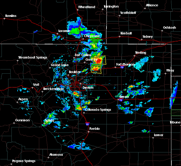 At 826 pm mdt, a severe thunderstorm was located over roggen, or 24 miles southeast of greeley, moving east at 15 mph (radar indicated). Hazards include 60 mph wind gusts and quarter size hail. Expect damage to roofs, siding, and trees. hail damage to vehicles is expected. Locations impacted include, roggen and riverside reservoir. At 826 pm mdt, a severe thunderstorm was located over roggen, or 24 miles southeast of greeley, moving east at 15 mph (radar indicated). Hazards include 60 mph wind gusts and quarter size hail. Expect damage to roofs, siding, and trees. hail damage to vehicles is expected. Locations impacted include, roggen and riverside reservoir.
|
| 7/4/2018 7:58 PM MDT |
 At 757 pm mdt, a severe thunderstorm was located 6 miles east of milton reservoir, or 18 miles southeast of greeley, moving east at 10 mph (radar indicated). Hazards include 60 mph wind gusts and quarter size hail. Expect damage to roofs, siding, and trees. Hail damage to vehicles is expected. At 757 pm mdt, a severe thunderstorm was located 6 miles east of milton reservoir, or 18 miles southeast of greeley, moving east at 10 mph (radar indicated). Hazards include 60 mph wind gusts and quarter size hail. Expect damage to roofs, siding, and trees. Hail damage to vehicles is expected.
|
| 7/4/2018 4:16 PM MDT |
 At 416 pm mdt, a severe thunderstorm was located near lochbuie, or 25 miles northeast of denver, moving northeast at 35 mph (trained weather spotters). Hazards include 60 mph wind gusts and quarter size hail. Expect damage to roofs, siding, and trees. Hail damage to vehicles is expected. At 416 pm mdt, a severe thunderstorm was located near lochbuie, or 25 miles northeast of denver, moving northeast at 35 mph (trained weather spotters). Hazards include 60 mph wind gusts and quarter size hail. Expect damage to roofs, siding, and trees. Hail damage to vehicles is expected.
|
| 6/27/2018 5:10 PM MDT |
 The severe thunderstorm warning for strong outflow winds for south central weld and north central adams counties will expire at 515 pm mdt, the outflow winds from a storm which prompted the warning have weakened below severe limits, and no longer poses an immediate threat to life or property. therefore, the warning will be allowed to expire. however gusty winds up to 40 mph are still possible in this area. The severe thunderstorm warning for strong outflow winds for south central weld and north central adams counties will expire at 515 pm mdt, the outflow winds from a storm which prompted the warning have weakened below severe limits, and no longer poses an immediate threat to life or property. therefore, the warning will be allowed to expire. however gusty winds up to 40 mph are still possible in this area.
|
| 6/27/2018 5:03 PM MDT |
 At 501 pm mdt, strong outflow from thunderstorm was located 5 miles south of hudson, or 26 miles northeast of denver, moving north at 30 mph (radar indicated). Hazards include 60 mph wind gusts. Expect damage to roofs, siding, and trees. Locations impacted include, brighton, northern denver international airport, fort lupton, lochbuie, hudson, keenesburg and prospect valley. At 501 pm mdt, strong outflow from thunderstorm was located 5 miles south of hudson, or 26 miles northeast of denver, moving north at 30 mph (radar indicated). Hazards include 60 mph wind gusts. Expect damage to roofs, siding, and trees. Locations impacted include, brighton, northern denver international airport, fort lupton, lochbuie, hudson, keenesburg and prospect valley.
|
| 6/27/2018 4:49 PM MDT |
 At 449 pm mdt, a thunderstorm creating strong outflow was located 4 miles northeast of d.i.a terminal and concourses, or 22 miles northeast of denver, moving north at 30 mph (radar indicated). Hazards include 60 mph wind gusts. expect damage to roofs, siding, and trees At 449 pm mdt, a thunderstorm creating strong outflow was located 4 miles northeast of d.i.a terminal and concourses, or 22 miles northeast of denver, moving north at 30 mph (radar indicated). Hazards include 60 mph wind gusts. expect damage to roofs, siding, and trees
|
| 6/19/2018 2:13 PM MDT |
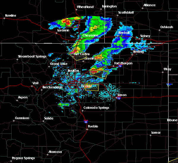 At 213 pm mdt, a severe thunderstorm was located 4 miles southeast of prospect valley, or 33 miles southwest of fort morgan, moving east at 25 mph (radar indicated). Hazards include golf ball size hail. People and animals outdoors will be injured. Expect damage to roofs, siding, windows, and vehicles. At 213 pm mdt, a severe thunderstorm was located 4 miles southeast of prospect valley, or 33 miles southwest of fort morgan, moving east at 25 mph (radar indicated). Hazards include golf ball size hail. People and animals outdoors will be injured. Expect damage to roofs, siding, windows, and vehicles.
|
| 6/19/2018 2:02 PM MDT |
 At 201 pm mdt, a severe thunderstorm capable of producing a tornado was located near prospect valley, or 29 miles southeast of greeley, moving east at 25 mph. a rotating wall cloud was spotted 3 miles west of prospect valley (radar indicated rotation). Hazards include tornado and golf ball size hail. Flying debris will be dangerous to those caught without shelter. mobile homes will be damaged or destroyed. damage to roofs, windows, and vehicles will occur. tree damage is likely. Locations impacted include, keenesburg and prospect valley. At 201 pm mdt, a severe thunderstorm capable of producing a tornado was located near prospect valley, or 29 miles southeast of greeley, moving east at 25 mph. a rotating wall cloud was spotted 3 miles west of prospect valley (radar indicated rotation). Hazards include tornado and golf ball size hail. Flying debris will be dangerous to those caught without shelter. mobile homes will be damaged or destroyed. damage to roofs, windows, and vehicles will occur. tree damage is likely. Locations impacted include, keenesburg and prospect valley.
|
| 6/19/2018 1:52 PM MDT |
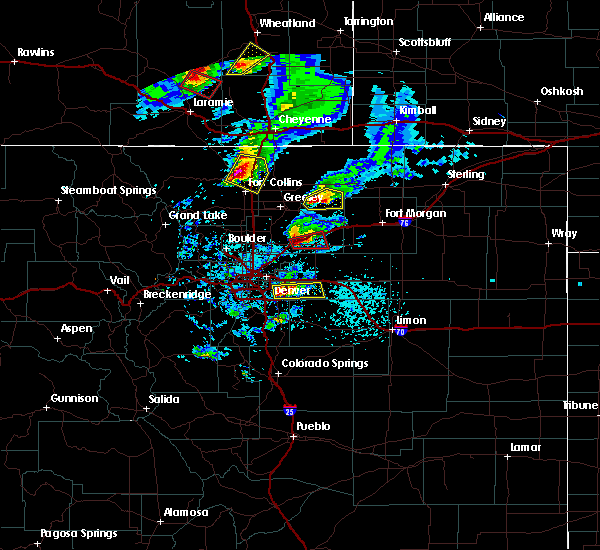 At 151 pm mdt, a severe thunderstorm capable of producing a tornado was located over keenesburg, or 25 miles southeast of greeley, moving east at 25 mph. the strongest rotation is located 2 miles southwest of keenesburg (radar indicated rotation). Hazards include tornado and golf ball size hail. Flying debris will be dangerous to those caught without shelter. mobile homes will be damaged or destroyed. damage to roofs, windows, and vehicles will occur. tree damage is likely. Locations impacted include, keenesburg, prospect valley and roggen. At 151 pm mdt, a severe thunderstorm capable of producing a tornado was located over keenesburg, or 25 miles southeast of greeley, moving east at 25 mph. the strongest rotation is located 2 miles southwest of keenesburg (radar indicated rotation). Hazards include tornado and golf ball size hail. Flying debris will be dangerous to those caught without shelter. mobile homes will be damaged or destroyed. damage to roofs, windows, and vehicles will occur. tree damage is likely. Locations impacted include, keenesburg, prospect valley and roggen.
|
| 6/19/2018 1:40 PM MDT |
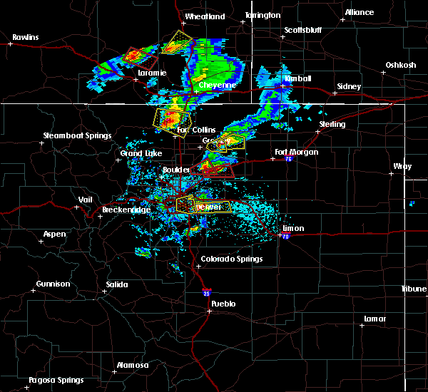 At 140 pm mdt, a severe thunderstorm capable of producing a tornado was located near hudson, or 24 miles south of greeley, moving east at 25 mph (weather spotters reported funnel cloud). Hazards include tornado and hail up to two inches in diameter. Flying debris will be dangerous to those caught without shelter. mobile homes will be damaged or destroyed. damage to roofs, windows, and vehicles will occur. Tree damage is likely. At 140 pm mdt, a severe thunderstorm capable of producing a tornado was located near hudson, or 24 miles south of greeley, moving east at 25 mph (weather spotters reported funnel cloud). Hazards include tornado and hail up to two inches in diameter. Flying debris will be dangerous to those caught without shelter. mobile homes will be damaged or destroyed. damage to roofs, windows, and vehicles will occur. Tree damage is likely.
|
| 6/19/2018 1:23 PM MDT |
 At 123 pm mdt, a severe thunderstorm capable of producing a tornado was located 1 mile east of fort lupton, or 22 miles south of greeley, moving east at 25 mph (radar indicated rotation). Hazards include tornado and golf ball size hail. Flying debris will be dangerous to those caught without shelter. mobile homes will be damaged or destroyed. damage to roofs, windows, and vehicles will occur. tree damage is likely. Locations impacted include, fort lupton, hudson, keenesburg and milton reservoir. At 123 pm mdt, a severe thunderstorm capable of producing a tornado was located 1 mile east of fort lupton, or 22 miles south of greeley, moving east at 25 mph (radar indicated rotation). Hazards include tornado and golf ball size hail. Flying debris will be dangerous to those caught without shelter. mobile homes will be damaged or destroyed. damage to roofs, windows, and vehicles will occur. tree damage is likely. Locations impacted include, fort lupton, hudson, keenesburg and milton reservoir.
|
| 6/19/2018 1:14 PM MDT |
 The national weather service in denver colorado has issued a * tornado warning for. southwestern weld county in northeastern colorado. until 145 pm mdt. At 113 pm mdt, a severe thunderstorm capable of producing a tornado was located near fort lupton, or 21 miles south of greeley, moving. The national weather service in denver colorado has issued a * tornado warning for. southwestern weld county in northeastern colorado. until 145 pm mdt. At 113 pm mdt, a severe thunderstorm capable of producing a tornado was located near fort lupton, or 21 miles south of greeley, moving.
|
| 6/18/2018 10:49 PM MDT |
 At 1048 pm mdt, a severe thunderstorm was located 5 miles north of roggen, or 24 miles southeast of greeley, moving northeast at 25 mph. another severe thunderstorm was located near keenesburg, also moving northeast at 25 mph (radar indicated). Hazards include golf ball size hail. People and animals outdoors will be injured. Expect damage to roofs, siding, windows, and vehicles. At 1048 pm mdt, a severe thunderstorm was located 5 miles north of roggen, or 24 miles southeast of greeley, moving northeast at 25 mph. another severe thunderstorm was located near keenesburg, also moving northeast at 25 mph (radar indicated). Hazards include golf ball size hail. People and animals outdoors will be injured. Expect damage to roofs, siding, windows, and vehicles.
|
| 6/18/2018 9:41 PM MDT |
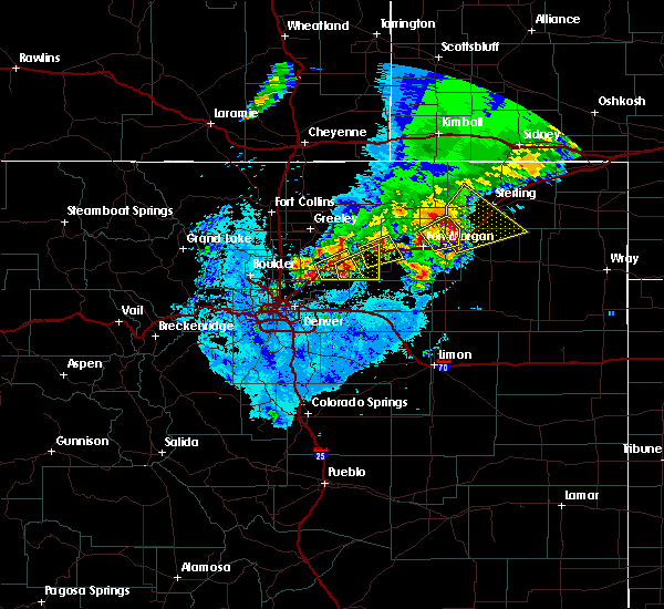 At 940 pm mdt, a severe thunderstorm was located over prospect valley, or 29 miles southeast of greeley, moving northeast at 20 mph (trained weather spotters). Hazards include golf ball size hail. People and animals outdoors will be injured. Expect damage to roofs, siding, windows, and vehicles. At 940 pm mdt, a severe thunderstorm was located over prospect valley, or 29 miles southeast of greeley, moving northeast at 20 mph (trained weather spotters). Hazards include golf ball size hail. People and animals outdoors will be injured. Expect damage to roofs, siding, windows, and vehicles.
|
| 6/18/2018 9:19 PM MDT |
 At 919 pm mdt, a severe thunderstorm was located near hudson, or 26 miles northeast of denver, moving northeast at 25 mph. this is a very dangerous storm (radar indicated). Hazards include baseball size hail. People and animals outdoors will be severely injured. Expect shattered windows, extensive damage to roofs, siding, and vehicles. At 919 pm mdt, a severe thunderstorm was located near hudson, or 26 miles northeast of denver, moving northeast at 25 mph. this is a very dangerous storm (radar indicated). Hazards include baseball size hail. People and animals outdoors will be severely injured. Expect shattered windows, extensive damage to roofs, siding, and vehicles.
|
| 6/18/2018 9:02 PM MDT |
 At 902 pm mdt, a severe thunderstorm was located over roggen, or 26 miles southeast of greeley, moving east at 25 mph (trained weather spotters). Hazards include golf ball size hail. People and animals outdoors will be injured. expect damage to roofs, siding, windows, and vehicles. Locations impacted include, keenesburg, prospect valley and roggen. At 902 pm mdt, a severe thunderstorm was located over roggen, or 26 miles southeast of greeley, moving east at 25 mph (trained weather spotters). Hazards include golf ball size hail. People and animals outdoors will be injured. expect damage to roofs, siding, windows, and vehicles. Locations impacted include, keenesburg, prospect valley and roggen.
|
| 6/18/2018 8:40 PM MDT |
 At 839 pm mdt, a severe thunderstorm was located near keenesburg, or 25 miles southeast of greeley, moving east at 25 mph (radar indicated). Hazards include golf ball size hail. People and animals outdoors will be injured. Expect damage to roofs, siding, windows, and vehicles. At 839 pm mdt, a severe thunderstorm was located near keenesburg, or 25 miles southeast of greeley, moving east at 25 mph (radar indicated). Hazards include golf ball size hail. People and animals outdoors will be injured. Expect damage to roofs, siding, windows, and vehicles.
|
| 6/18/2018 7:15 PM MDT |
 At 714 pm mdt, a severe thunderstorm was located 6 miles southeast of platteville, or 17 miles south of greeley, moving northeast at 25 mph. this storm is capable of golfball size hail. another servere thunderstorm was located 4 miles southwest of platteville, capable of quarter size hail (trained weather spotters). Hazards include golf ball size hail. People and animals outdoors will be injured. expect damage to roofs, siding, windows, and vehicles. Locations impacted include, eastern longmont, firestone, frederick, fort lupton, dacono, mead, platteville, hudson and keenesburg. At 714 pm mdt, a severe thunderstorm was located 6 miles southeast of platteville, or 17 miles south of greeley, moving northeast at 25 mph. this storm is capable of golfball size hail. another servere thunderstorm was located 4 miles southwest of platteville, capable of quarter size hail (trained weather spotters). Hazards include golf ball size hail. People and animals outdoors will be injured. expect damage to roofs, siding, windows, and vehicles. Locations impacted include, eastern longmont, firestone, frederick, fort lupton, dacono, mead, platteville, hudson and keenesburg.
|
| 6/18/2018 6:59 PM MDT |
 The national weather service in denver colorado has issued a * severe thunderstorm warning for. southwestern weld county in northeastern colorado. until 730 pm mdt. At 658 pm mdt, a severe thunderstorm was located 4 miles east of firestone, or 20 miles south of greeley, moving east at 25 mph. The national weather service in denver colorado has issued a * severe thunderstorm warning for. southwestern weld county in northeastern colorado. until 730 pm mdt. At 658 pm mdt, a severe thunderstorm was located 4 miles east of firestone, or 20 miles south of greeley, moving east at 25 mph.
|
| 6/18/2018 6:33 PM MDT |
 At 632 pm mdt, a severe thunderstorm was located 4 miles north of erie, or 25 miles north of denver, moving east at 30 mph. a second severe thunderstorm was located 2 miles north of platteville, moving east at 30 mph. trained weather spotters reported quarter size hail just north of platteville (trained weather spotters). Hazards include quarter size hail. Damage to vehicles is expected. Locations impacted include, southwestern greeley, northeastern boulder, longmont, lafayette, windsor, erie, firestone, johnstown, frederick, fort lupton, milliken, berthoud, dacono, mead, platteville, hudson, keenesburg, gilcrest and niwot. At 632 pm mdt, a severe thunderstorm was located 4 miles north of erie, or 25 miles north of denver, moving east at 30 mph. a second severe thunderstorm was located 2 miles north of platteville, moving east at 30 mph. trained weather spotters reported quarter size hail just north of platteville (trained weather spotters). Hazards include quarter size hail. Damage to vehicles is expected. Locations impacted include, southwestern greeley, northeastern boulder, longmont, lafayette, windsor, erie, firestone, johnstown, frederick, fort lupton, milliken, berthoud, dacono, mead, platteville, hudson, keenesburg, gilcrest and niwot.
|
| 6/18/2018 6:12 PM MDT |
 At 611 pm mdt, a severe thunderstorm was located near boulder, or 24 miles northwest of denver, moving east at 30 mph. another servere thunderstorm was located over mead, moving east at 30 mph (trained weather spotters). Hazards include half dollar size hail. damage to vehicles is expected At 611 pm mdt, a severe thunderstorm was located near boulder, or 24 miles northwest of denver, moving east at 30 mph. another servere thunderstorm was located over mead, moving east at 30 mph (trained weather spotters). Hazards include half dollar size hail. damage to vehicles is expected
|
| 5/27/2018 1:56 PM MDT |
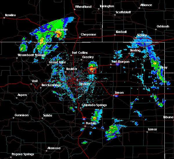 At 156 pm mdt, a severe thunderstorm capable of producing a tornado was located over prospect valley, or 30 miles southeast of greeley, moving north at 20 mph (radar indicated rotation). Hazards include tornado. Expect damage to mobile homes, roofs, and vehicles. Locations impacted include, keenesburg, prospect valley and roggen. At 156 pm mdt, a severe thunderstorm capable of producing a tornado was located over prospect valley, or 30 miles southeast of greeley, moving north at 20 mph (radar indicated rotation). Hazards include tornado. Expect damage to mobile homes, roofs, and vehicles. Locations impacted include, keenesburg, prospect valley and roggen.
|
| 5/27/2018 1:45 PM MDT |
 At 145 pm mdt, a severe thunderstorm capable of producing a tornado was located 4 miles south of prospect valley, or 33 miles southeast of greeley, moving north at 20 mph (radar indicated rotation). Hazards include tornado. expect damage to mobile homes, roofs, and vehicles At 145 pm mdt, a severe thunderstorm capable of producing a tornado was located 4 miles south of prospect valley, or 33 miles southeast of greeley, moving north at 20 mph (radar indicated rotation). Hazards include tornado. expect damage to mobile homes, roofs, and vehicles
|
| 8/10/2017 4:19 PM MDT | People pulling over on i-76 due to limited visibilit in weld county CO, 0.8 miles E of Keenesburg, CO |
| 8/10/2017 4:13 PM MDT |
 At 413 pm mdt, a severe thunderstorm was located 4 miles northeast of keenesburg, or 23 miles southeast of greeley, moving southeast at 45 mph (radar indicated). Hazards include 70 mph wind gusts and ping pong ball size hail. People and animals outdoors will be injured. expect hail damage to roofs, siding, windows, and vehicles. expect considerable tree damage. Wind damage is also likely to mobile homes, roofs, and outbuildings. At 413 pm mdt, a severe thunderstorm was located 4 miles northeast of keenesburg, or 23 miles southeast of greeley, moving southeast at 45 mph (radar indicated). Hazards include 70 mph wind gusts and ping pong ball size hail. People and animals outdoors will be injured. expect hail damage to roofs, siding, windows, and vehicles. expect considerable tree damage. Wind damage is also likely to mobile homes, roofs, and outbuildings.
|
| 5/26/2017 2:21 PM MDT |
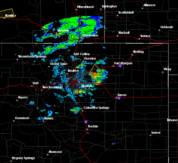 At 220 pm mdt, a severe thunderstorm was located near prospect valley, or 30 miles southeast of greeley, moving northeast at 30 mph (radar indicated). Hazards include quarter size hail. damage to vehicles is expected At 220 pm mdt, a severe thunderstorm was located near prospect valley, or 30 miles southeast of greeley, moving northeast at 30 mph (radar indicated). Hazards include quarter size hail. damage to vehicles is expected
|
| 8/19/2016 4:06 PM MDT |
 At 405 pm mdt, strong outflow from severe thunderstorms were located along a line extending from 3 miles southwest of milton reservoir to lochbuie, or along a line extending from 16 miles south of greeley to 22 miles northeast of denver, moving south at 65 mph (radar indicated). Hazards include 60 mph wind gusts. Expect damage to roofs. siding. And trees. At 405 pm mdt, strong outflow from severe thunderstorms were located along a line extending from 3 miles southwest of milton reservoir to lochbuie, or along a line extending from 16 miles south of greeley to 22 miles northeast of denver, moving south at 65 mph (radar indicated). Hazards include 60 mph wind gusts. Expect damage to roofs. siding. And trees.
|
| 8/19/2016 3:45 PM MDT |
 At 345 pm mdt, a severe thunderstorm was located near kersey, or 12 miles east of greeley, moving southeast at 25 mph (radar indicated). Hazards include 70 mph wind gusts and quarter size hail. Hail damage to vehicles is expected. expect considerable tree damage. Wind damage is also likely to mobile homes, roofs, and outbuildings. At 345 pm mdt, a severe thunderstorm was located near kersey, or 12 miles east of greeley, moving southeast at 25 mph (radar indicated). Hazards include 70 mph wind gusts and quarter size hail. Hail damage to vehicles is expected. expect considerable tree damage. Wind damage is also likely to mobile homes, roofs, and outbuildings.
|
| 7/30/2016 12:23 AM MDT | Half Dollar sized hail reported 8.2 miles WSW of Keenesburg, CO |
| 7/29/2016 7:55 PM MDT |
 At 754 pm mdt, a severe thunderstorm was located near keenesburg, or 24 miles southeast of greeley, moving southeast at 30 mph. this is a very dangerous storm. this storm will impact travel on i-76 between roggen and keenesburg with damage to vehicles likely. avoid this region through 815 pm (trained weather spotters). Hazards include baseball size hail and 60 mph wind gusts. People and animals outdoors will be severely injured. expect shattered windows, extensive damage to roofs, siding, and vehicles. Locations impacted include, keenesburg, prospect valley and roggen. At 754 pm mdt, a severe thunderstorm was located near keenesburg, or 24 miles southeast of greeley, moving southeast at 30 mph. this is a very dangerous storm. this storm will impact travel on i-76 between roggen and keenesburg with damage to vehicles likely. avoid this region through 815 pm (trained weather spotters). Hazards include baseball size hail and 60 mph wind gusts. People and animals outdoors will be severely injured. expect shattered windows, extensive damage to roofs, siding, and vehicles. Locations impacted include, keenesburg, prospect valley and roggen.
|
| 7/29/2016 7:28 PM MDT |
 At 727 pm mdt, a severe thunderstorm was located 5 miles northeast of milton reservoir, or 12 miles southeast of greeley, moving south at 35 mph. this is a very dangerous storm (trained weather spotters). Hazards include baseball size hail and 60 mph wind gusts. People and animals outdoors will be severely injured. expect shattered windows, extensive damage to roofs, siding, and vehicles. Locations impacted include, hudson, kersey, keenesburg, prospect valley, roggen and milton reservoir. At 727 pm mdt, a severe thunderstorm was located 5 miles northeast of milton reservoir, or 12 miles southeast of greeley, moving south at 35 mph. this is a very dangerous storm (trained weather spotters). Hazards include baseball size hail and 60 mph wind gusts. People and animals outdoors will be severely injured. expect shattered windows, extensive damage to roofs, siding, and vehicles. Locations impacted include, hudson, kersey, keenesburg, prospect valley, roggen and milton reservoir.
|
| 7/29/2016 7:18 PM MDT |
 At 717 pm mdt, a severe thunderstorm was located near kersey, or 6 miles east of greeley, moving southeast at 25 mph (trained weather spotters). Hazards include two inch hail and 60 mph wind gusts. People and animals outdoors will be injured. expect hail damage to roofs, siding, windows, and vehicles. Expect wind damage to roofs, siding, and trees. At 717 pm mdt, a severe thunderstorm was located near kersey, or 6 miles east of greeley, moving southeast at 25 mph (trained weather spotters). Hazards include two inch hail and 60 mph wind gusts. People and animals outdoors will be injured. expect hail damage to roofs, siding, windows, and vehicles. Expect wind damage to roofs, siding, and trees.
|
| 7/27/2016 6:21 PM MDT |
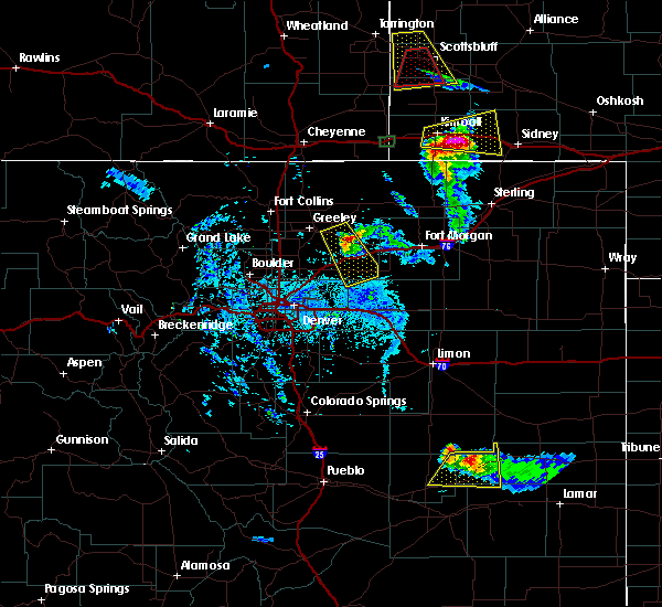 At 621 pm mdt, a severe thunderstorm was located 8 miles northwest of roggen, or 18 miles southeast of greeley, moving southeast at 30 mph (trained weather spotters). Hazards include tennis ball size hail and 60 mph wind gusts. People and animals outdoors will be injured. expect hail damage to roofs, siding, windows, and vehicles. expect wind damage to roofs, siding, and trees. Locations impacted include, kersey, prospect valley and roggen. At 621 pm mdt, a severe thunderstorm was located 8 miles northwest of roggen, or 18 miles southeast of greeley, moving southeast at 30 mph (trained weather spotters). Hazards include tennis ball size hail and 60 mph wind gusts. People and animals outdoors will be injured. expect hail damage to roofs, siding, windows, and vehicles. expect wind damage to roofs, siding, and trees. Locations impacted include, kersey, prospect valley and roggen.
|
| 7/27/2016 6:07 PM MDT |
 At 607 pm mdt, a severe thunderstorm was located near kersey, or 13 miles east of greeley, moving southeast at 30 mph (trained weather spotters). Hazards include golf ball size hail and 60 mph wind gusts. People and animals outdoors will be injured. expect hail damage to roofs, siding, windows, and vehicles. Expect wind damage to roofs, siding, and trees. At 607 pm mdt, a severe thunderstorm was located near kersey, or 13 miles east of greeley, moving southeast at 30 mph (trained weather spotters). Hazards include golf ball size hail and 60 mph wind gusts. People and animals outdoors will be injured. expect hail damage to roofs, siding, windows, and vehicles. Expect wind damage to roofs, siding, and trees.
|
| 7/24/2016 5:20 PM MDT |
 At 514 pm mdt, a severe thunderstorm was located near hudson, or 28 miles south of greeley, moving southeast at 20 mph (radar indicated). Hazards include 60 mph wind gusts and quarter size hail. Hail damage to vehicles is expected. expect wind damage to roofs, siding, and trees. Locations impacted include, hudson, keenesburg, prospect valley and roggen. At 514 pm mdt, a severe thunderstorm was located near hudson, or 28 miles south of greeley, moving southeast at 20 mph (radar indicated). Hazards include 60 mph wind gusts and quarter size hail. Hail damage to vehicles is expected. expect wind damage to roofs, siding, and trees. Locations impacted include, hudson, keenesburg, prospect valley and roggen.
|
| 7/24/2016 5:00 PM MDT | Storm damage reported in weld county CO, 4.3 miles NE of Keenesburg, CO |
| 7/24/2016 4:41 PM MDT |
 At 440 pm mdt, a severe thunderstorm was located near fort lupton, or 21 miles south of greeley, moving southeast at 20 mph (radar indicated). Hazards include 60 mph wind gusts and half dollar size hail. Hail damage to vehicles is expected. Expect wind damage to roofs, siding, and trees. At 440 pm mdt, a severe thunderstorm was located near fort lupton, or 21 miles south of greeley, moving southeast at 20 mph (radar indicated). Hazards include 60 mph wind gusts and half dollar size hail. Hail damage to vehicles is expected. Expect wind damage to roofs, siding, and trees.
|
| 7/24/2016 4:38 PM MDT |
 At 436 pm mdt, a severe thunderstorm was located over milton reservoir, or 13 miles southeast of greeley, moving east at 20 mph (radar indicated). Hazards include 60 mph wind gusts and half dollar size hail. Hail damage to vehicles is expected. expect wind damage to roofs, siding, and trees. Locations impacted include, fort lupton, milliken, lochbuie, platteville, hudson, keenesburg, gilcrest and milton reservoir. At 436 pm mdt, a severe thunderstorm was located over milton reservoir, or 13 miles southeast of greeley, moving east at 20 mph (radar indicated). Hazards include 60 mph wind gusts and half dollar size hail. Hail damage to vehicles is expected. expect wind damage to roofs, siding, and trees. Locations impacted include, fort lupton, milliken, lochbuie, platteville, hudson, keenesburg, gilcrest and milton reservoir.
|
| 7/24/2016 4:06 PM MDT |
 At 404 pm mdt, a severe thunderstorm was located near platteville, or 12 miles south of greeley, moving east at 20 mph (radar indicated). Hazards include golf ball size hail and 70 mph wind gusts. People and animals outdoors will be injured. expect hail damage to roofs, siding, windows, and vehicles. expect considerable tree damage. Wind damage is also likely to mobile homes, roofs, and outbuildings. At 404 pm mdt, a severe thunderstorm was located near platteville, or 12 miles south of greeley, moving east at 20 mph (radar indicated). Hazards include golf ball size hail and 70 mph wind gusts. People and animals outdoors will be injured. expect hail damage to roofs, siding, windows, and vehicles. expect considerable tree damage. Wind damage is also likely to mobile homes, roofs, and outbuildings.
|
| 7/18/2016 4:06 PM MDT |
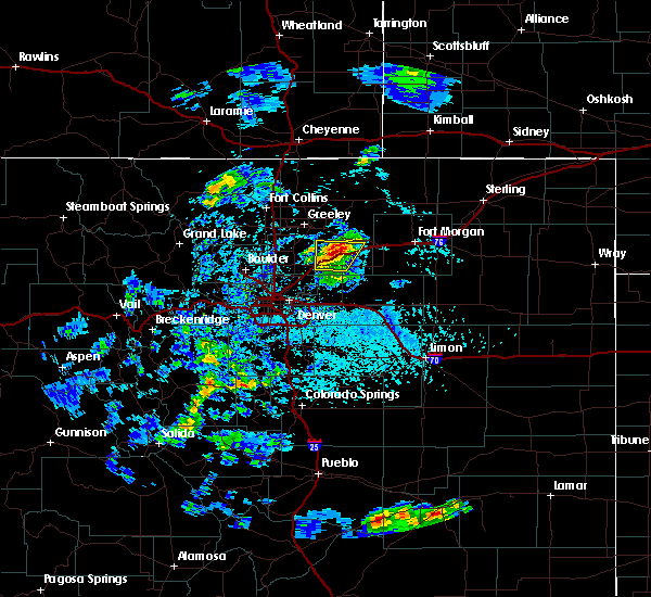 At 405 pm mdt, a severe thunderstorm was located near roggen, or 22 miles southeast of greeley, moving northeast at 20 mph (radar indicated). Hazards include golf ball size hail and 60 mph wind gusts. People and animals outdoors will be injured. expect hail damage to roofs, siding, windows, and vehicles. expect wind damage to roofs, siding, and trees. Locations impacted include, hudson, keenesburg, prospect valley and roggen. At 405 pm mdt, a severe thunderstorm was located near roggen, or 22 miles southeast of greeley, moving northeast at 20 mph (radar indicated). Hazards include golf ball size hail and 60 mph wind gusts. People and animals outdoors will be injured. expect hail damage to roofs, siding, windows, and vehicles. expect wind damage to roofs, siding, and trees. Locations impacted include, hudson, keenesburg, prospect valley and roggen.
|
| 7/18/2016 3:33 PM MDT |
 At 333 pm mdt, a severe thunderstorm was located 4 miles southeast of hudson, or 28 miles south of greeley, moving northeast at 25 mph (radar indicated). Hazards include quarter size hail. damage to vehicles is expected At 333 pm mdt, a severe thunderstorm was located 4 miles southeast of hudson, or 28 miles south of greeley, moving northeast at 25 mph (radar indicated). Hazards include quarter size hail. damage to vehicles is expected
|
| 7/17/2016 10:44 PM MDT |
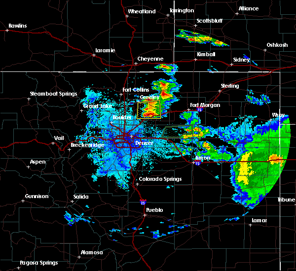 At 1044 pm mdt, a severe thunderstorm was located 5 miles south of milton reservoir, or 19 miles south of greeley, moving east at 20 mph (radar indicated). Hazards include golf ball size hail and 60 mph wind gusts. People and animals outdoors will be injured. expect hail damage to roofs, siding, windows, and vehicles. Expect wind damage to roofs, siding, and trees. At 1044 pm mdt, a severe thunderstorm was located 5 miles south of milton reservoir, or 19 miles south of greeley, moving east at 20 mph (radar indicated). Hazards include golf ball size hail and 60 mph wind gusts. People and animals outdoors will be injured. expect hail damage to roofs, siding, windows, and vehicles. Expect wind damage to roofs, siding, and trees.
|
| 7/17/2016 10:24 PM MDT |
 At 1024 pm mdt, a severe thunderstorm was located 4 miles south of milton reservoir, or 17 miles south of greeley, moving east at 15 mph (radar indicated). Hazards include quarter size hail. Damage to vehicles is expected. Locations impacted include, southeastern greeley, evans, la salle, kersey, keenesburg, roggen and milton reservoir. At 1024 pm mdt, a severe thunderstorm was located 4 miles south of milton reservoir, or 17 miles south of greeley, moving east at 15 mph (radar indicated). Hazards include quarter size hail. Damage to vehicles is expected. Locations impacted include, southeastern greeley, evans, la salle, kersey, keenesburg, roggen and milton reservoir.
|
| 7/17/2016 10:04 PM MDT |
 At 1004 pm mdt, a severe thunderstorm was located 4 miles south of milton reservoir, or 17 miles south of greeley, moving east at 15 mph (radar indicated). Hazards include ping pong ball size hail. People and animals outdoors will be injured. Expect damage to roofs, siding, windows, and vehicles. At 1004 pm mdt, a severe thunderstorm was located 4 miles south of milton reservoir, or 17 miles south of greeley, moving east at 15 mph (radar indicated). Hazards include ping pong ball size hail. People and animals outdoors will be injured. Expect damage to roofs, siding, windows, and vehicles.
|
| 6/25/2015 4:35 PM MDT | Tennis Ball sized hail reported 8.4 miles N of Keenesburg, CO |
| 6/25/2015 4:20 PM MDT | Ping Pong Ball sized hail reported 3.4 miles NNW of Keenesburg, CO |
| 6/25/2015 4:15 PM MDT | Tennis Ball sized hail reported 8.4 miles N of Keenesburg, CO |
| 6/25/2015 4:15 PM MDT | Hen Egg sized hail reported 4.5 miles NE of Keenesburg, CO |
| 6/25/2015 4:14 PM MDT |
 At 412 pm mdt, a severe thunderstorm was located near keenesburg, or 27 miles southeast of greeley, moving southeast at 35 mph (radar indicated). Hazards include tennis ball size hail and 70 mph wind gusts. People and animals outdoors will be injured. expect hail damage to roofs, siding, windows and vehicles. expect considerable tree damage. Wind damage is also likely to mobile homes, roofs and outbuildings. At 412 pm mdt, a severe thunderstorm was located near keenesburg, or 27 miles southeast of greeley, moving southeast at 35 mph (radar indicated). Hazards include tennis ball size hail and 70 mph wind gusts. People and animals outdoors will be injured. expect hail damage to roofs, siding, windows and vehicles. expect considerable tree damage. Wind damage is also likely to mobile homes, roofs and outbuildings.
|
| 6/25/2015 4:04 PM MDT |
 At 403 pm mdt, a severe thunderstorm was located over keenesburg, or 23 miles southeast of greeley, moving southeast at 35 mph (radar indicated). Hazards include tennis ball size hail and 60 mph wind gusts. People and animals outdoors will be injured. expect hail damage to roofs, siding, windows and vehicles. expect wind damage to roofs, siding and trees. Locations impacted include, keenesburg and prospect valley. At 403 pm mdt, a severe thunderstorm was located over keenesburg, or 23 miles southeast of greeley, moving southeast at 35 mph (radar indicated). Hazards include tennis ball size hail and 60 mph wind gusts. People and animals outdoors will be injured. expect hail damage to roofs, siding, windows and vehicles. expect wind damage to roofs, siding and trees. Locations impacted include, keenesburg and prospect valley.
|
| 6/25/2015 4:00 PM MDT | Half Dollar sized hail reported 6.5 miles SE of Keenesburg, CO |
| 6/25/2015 3:59 PM MDT | Ping Pong Ball sized hail reported 0.8 miles E of Keenesburg, CO |
| 6/25/2015 3:42 PM MDT |
 At 342 pm mdt, a severe thunderstorm was located 4 miles southeast of gilcrest, or 11 miles south of greeley, moving southeast at 35 mph (radar indicated). Hazards include golf ball size hail and 60 mph wind gusts. People and animals outdoors will be injured. expect hail damage to roofs, siding, windows and vehicles. Expect wind damage to roofs, siding and trees. At 342 pm mdt, a severe thunderstorm was located 4 miles southeast of gilcrest, or 11 miles south of greeley, moving southeast at 35 mph (radar indicated). Hazards include golf ball size hail and 60 mph wind gusts. People and animals outdoors will be injured. expect hail damage to roofs, siding, windows and vehicles. Expect wind damage to roofs, siding and trees.
|
| 5/15/2015 2:10 PM MDT | At 209 pm mdt, a severe thunderstorm capable of producing a tornado was located 4 miles north of fort lupton, or 18 miles south of greeley, moving northeast at 25 mph (public reported funnel cloud). Hazards include tornado and quarter size hail. Flying debris will be dangerous to those caught without shelter. mobile homes will be damaged or destroyed. damage to roofs, windows and vehicles will occur. Tree damage is likely. |
| 6/18/2013 3:03 PM MDT | Quarter sized hail reported 3 miles NNE of Keenesburg, CO |
| 5/5/2012 9:15 PM MDT | Quarter sized hail reported 0.3 miles WNW of Keenesburg, CO |
| 1/1/0001 12:00 AM | Storm damage reported in weld county CO, 8.2 miles WSW of Keenesburg, CO |
| 1/1/0001 12:00 AM | Quarter sized hail reported 5.1 miles W of Keenesburg, CO |
| 1/1/0001 12:00 AM | Half Dollar sized hail reported 0.8 miles E of Keenesburg, CO |
| 1/1/0001 12:00 AM | Half Dollar sized hail reported 0.3 miles WNW of Keenesburg, CO, broken car windows and shredded leaves |
| 1/1/0001 12:00 AM | Hen Egg sized hail reported 7.1 miles W of Keenesburg, CO |
| 1/1/0001 12:00 AM | Golf Ball sized hail reported 4.9 miles NW of Keenesburg, CO |
| 1/1/0001 12:00 AM | Hen Egg sized hail reported 5.8 miles WNW of Keenesburg, CO |
Hail Maps for Keenesburg, CO
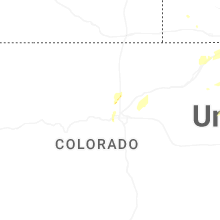


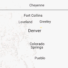


Connect with Interactive Hail Maps