

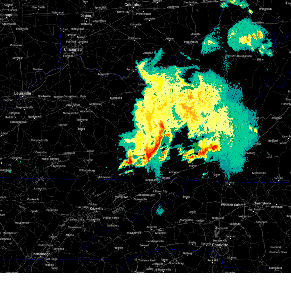
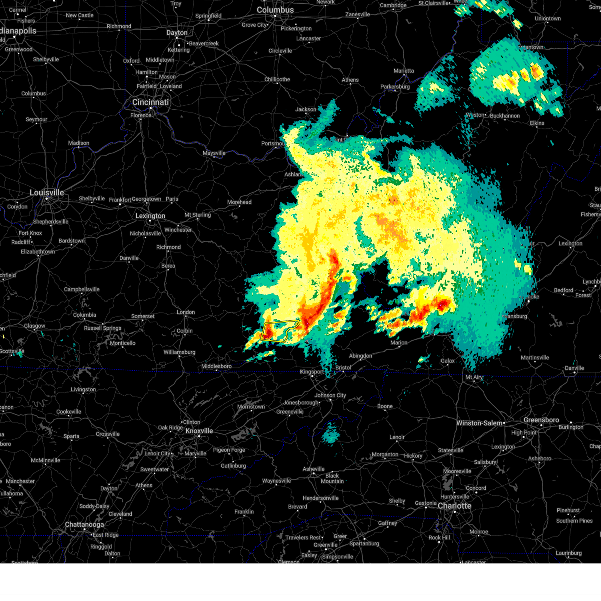
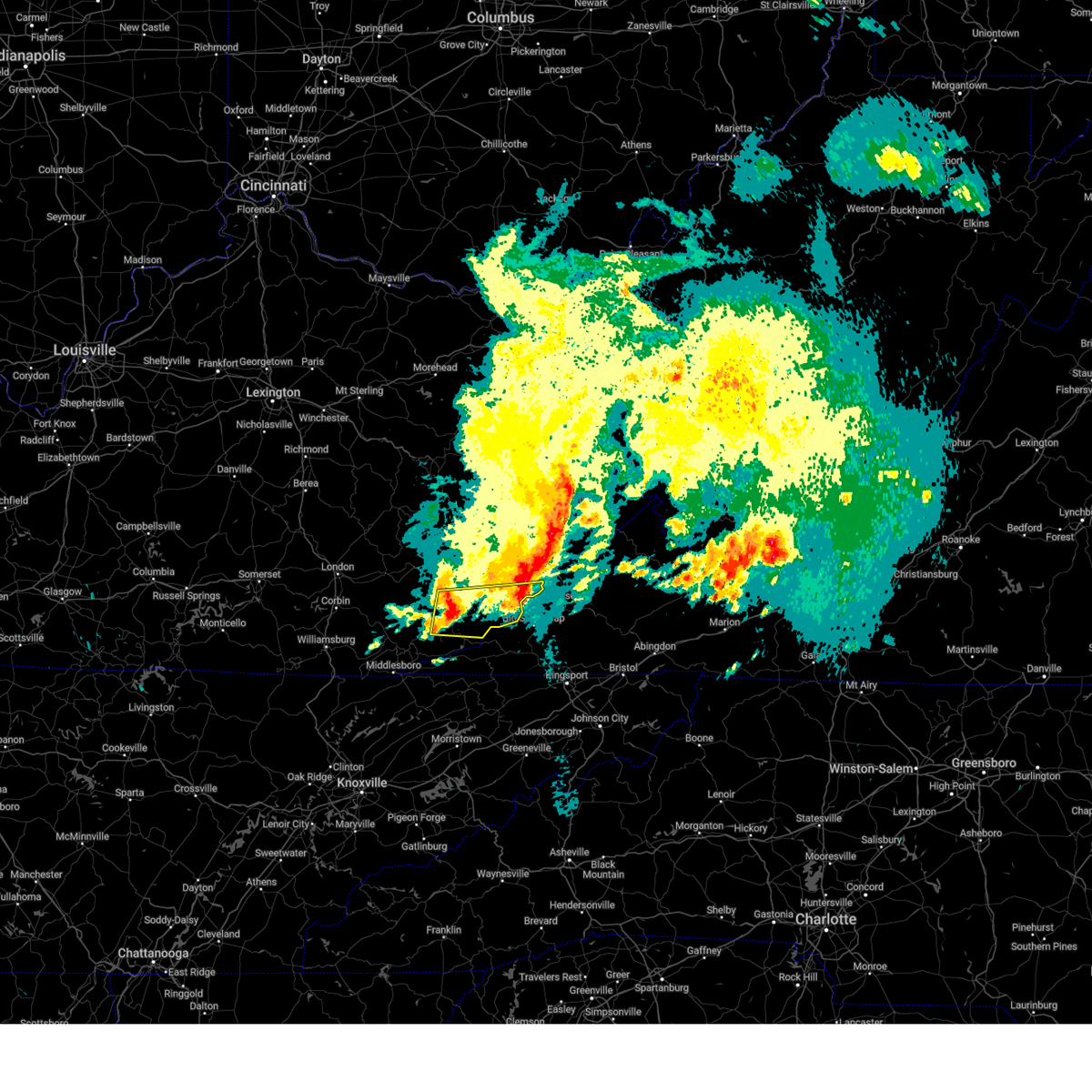
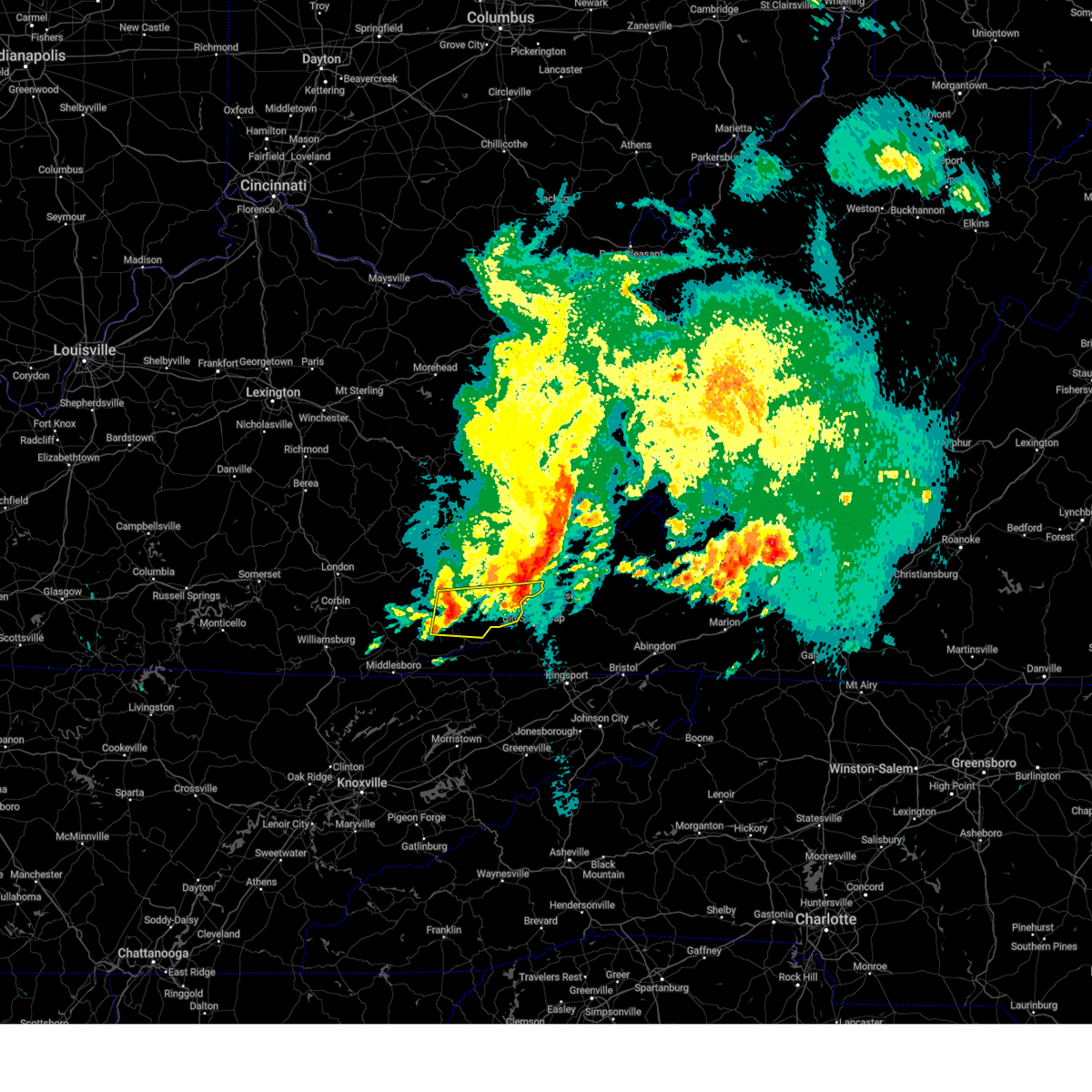
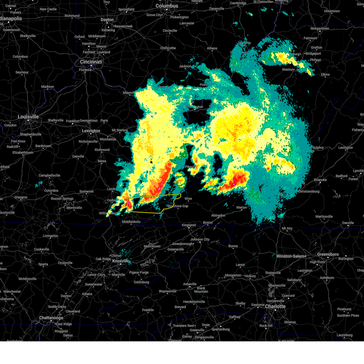
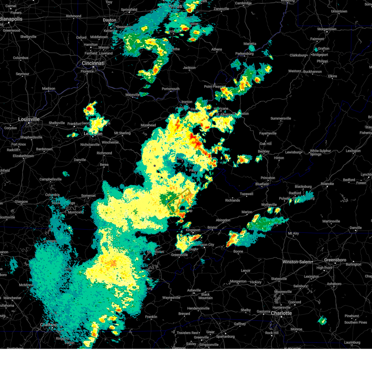
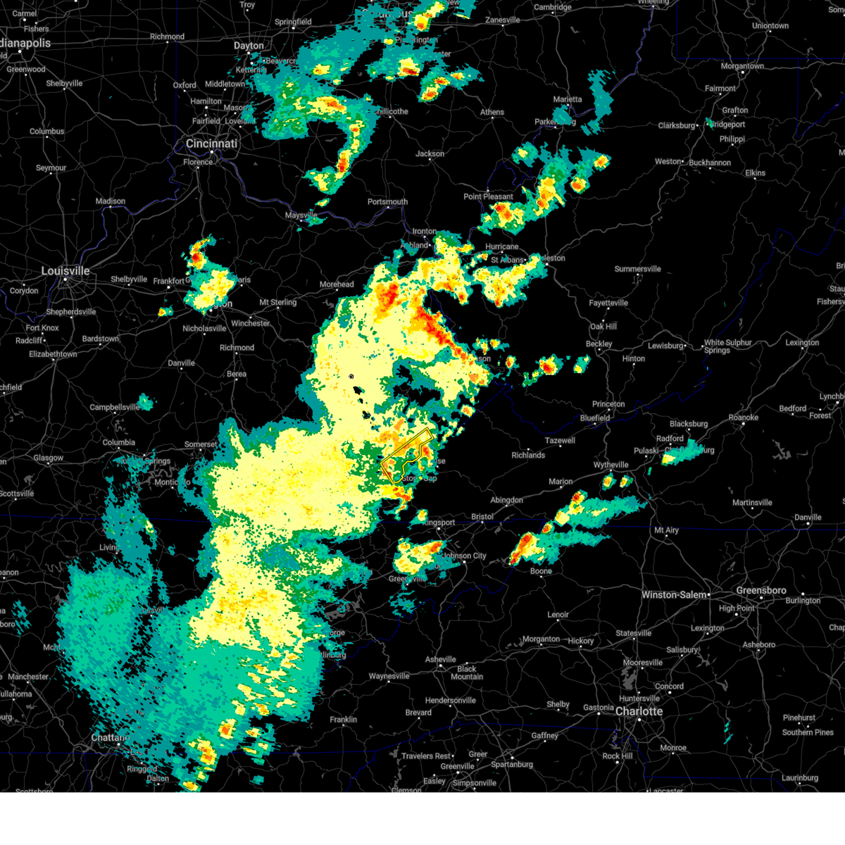
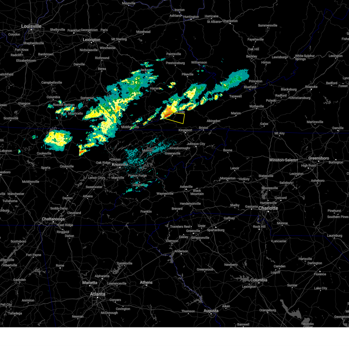
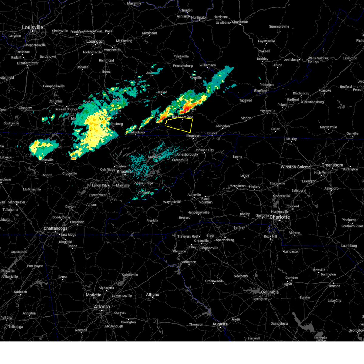
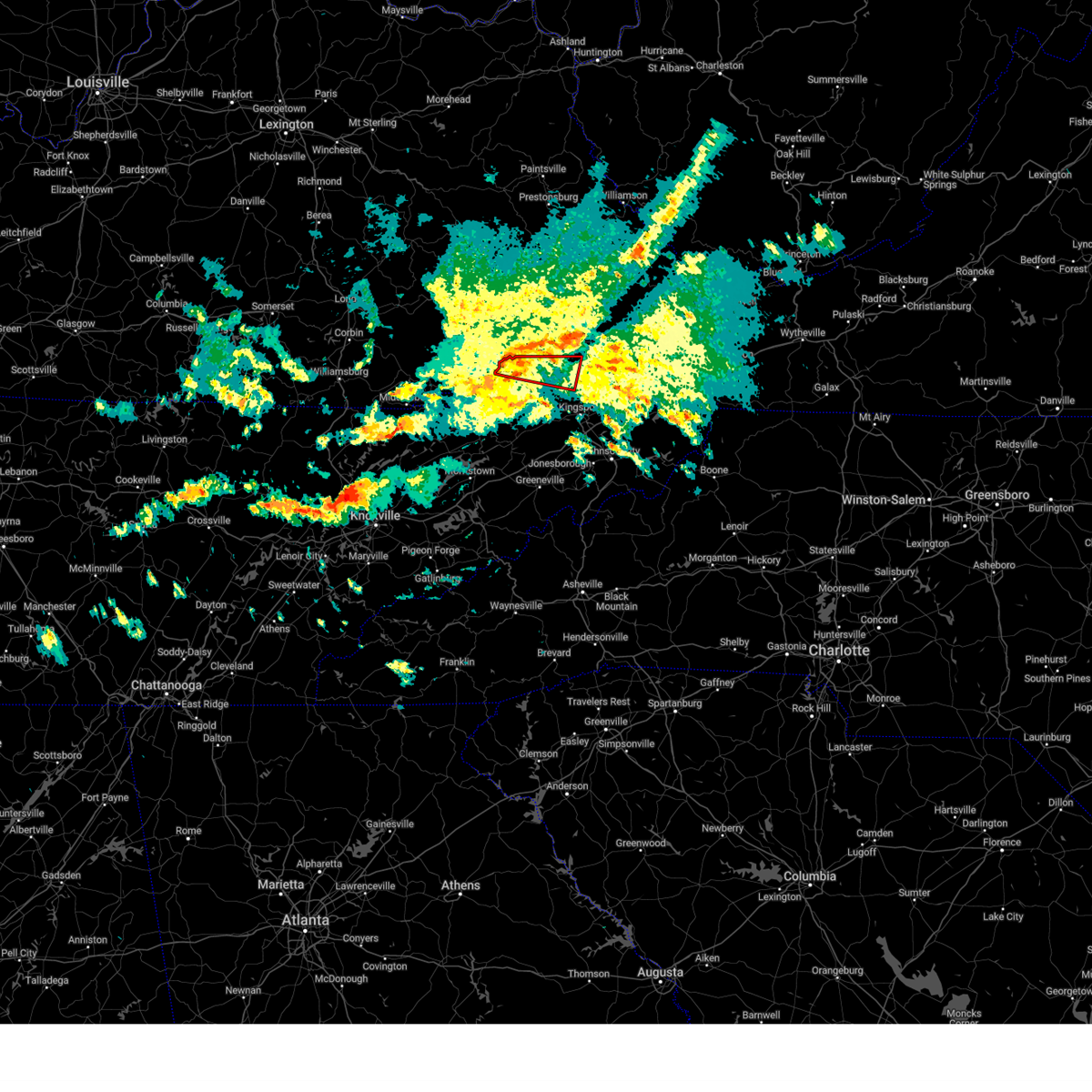
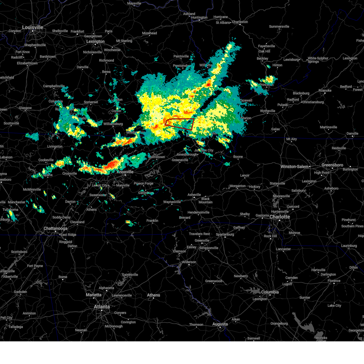
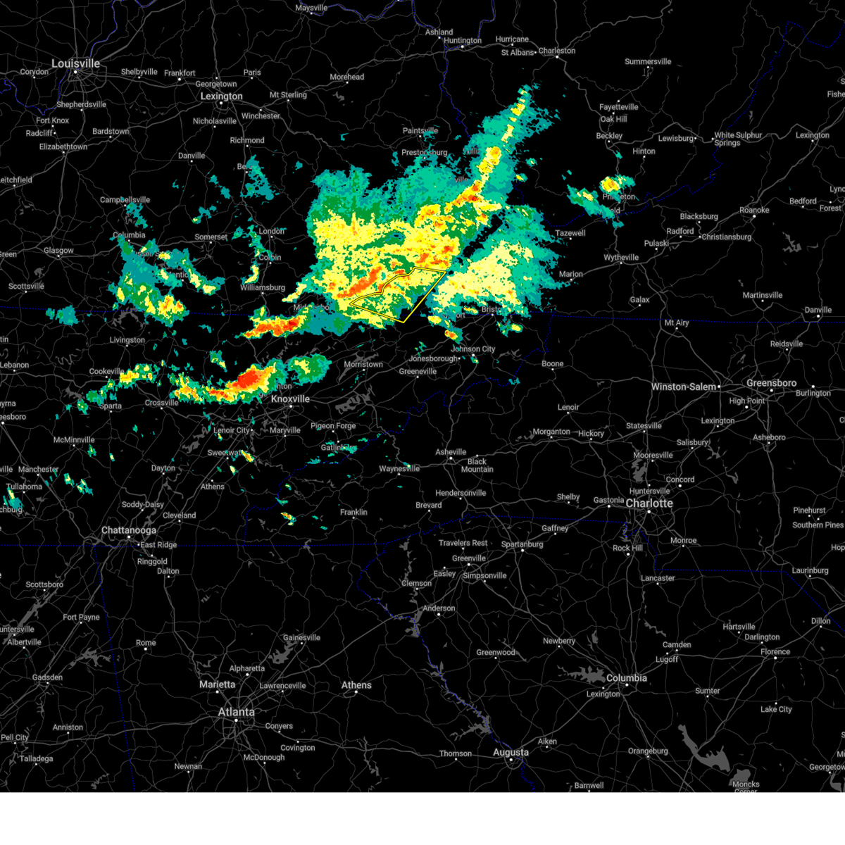
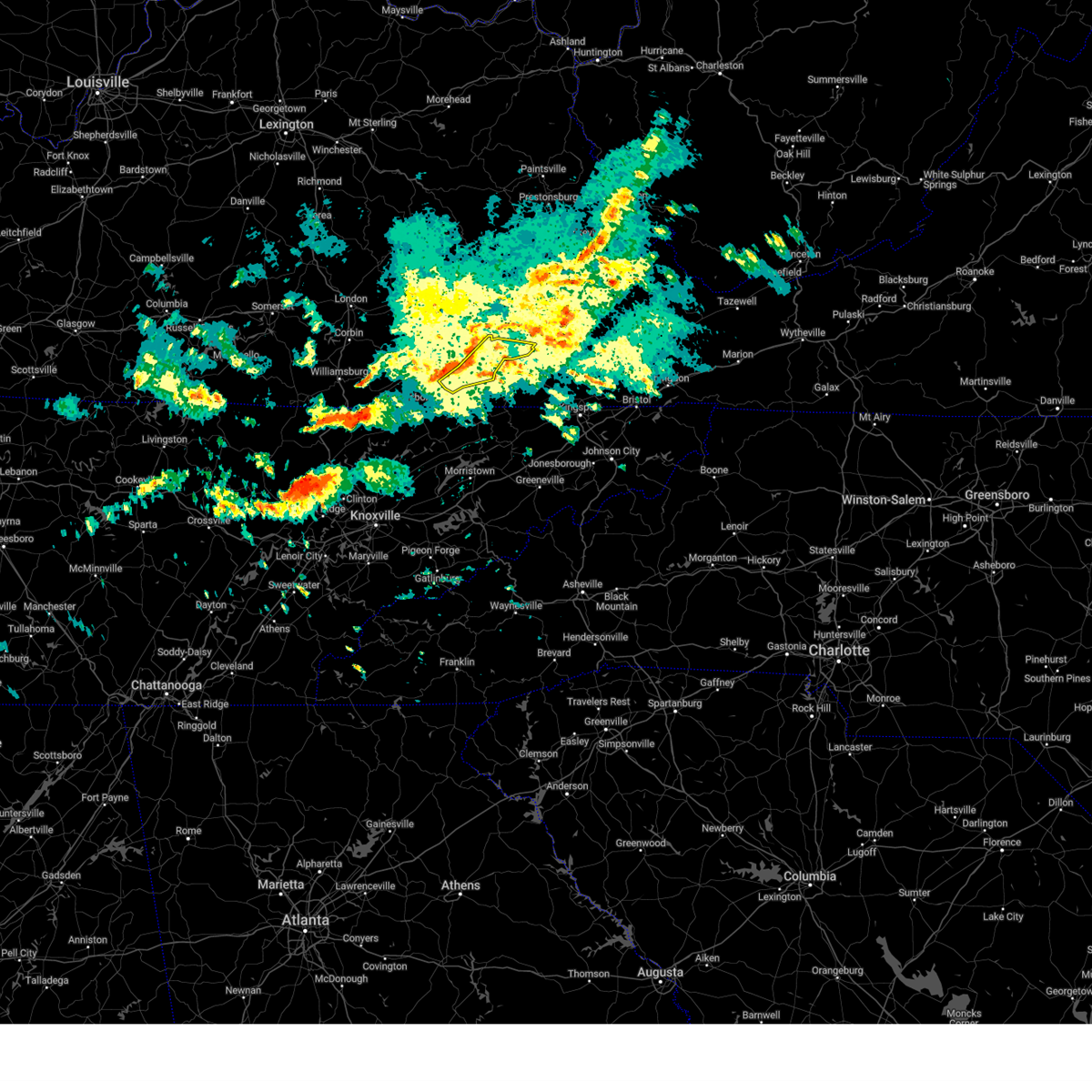
Hail Map for Keokee, VA
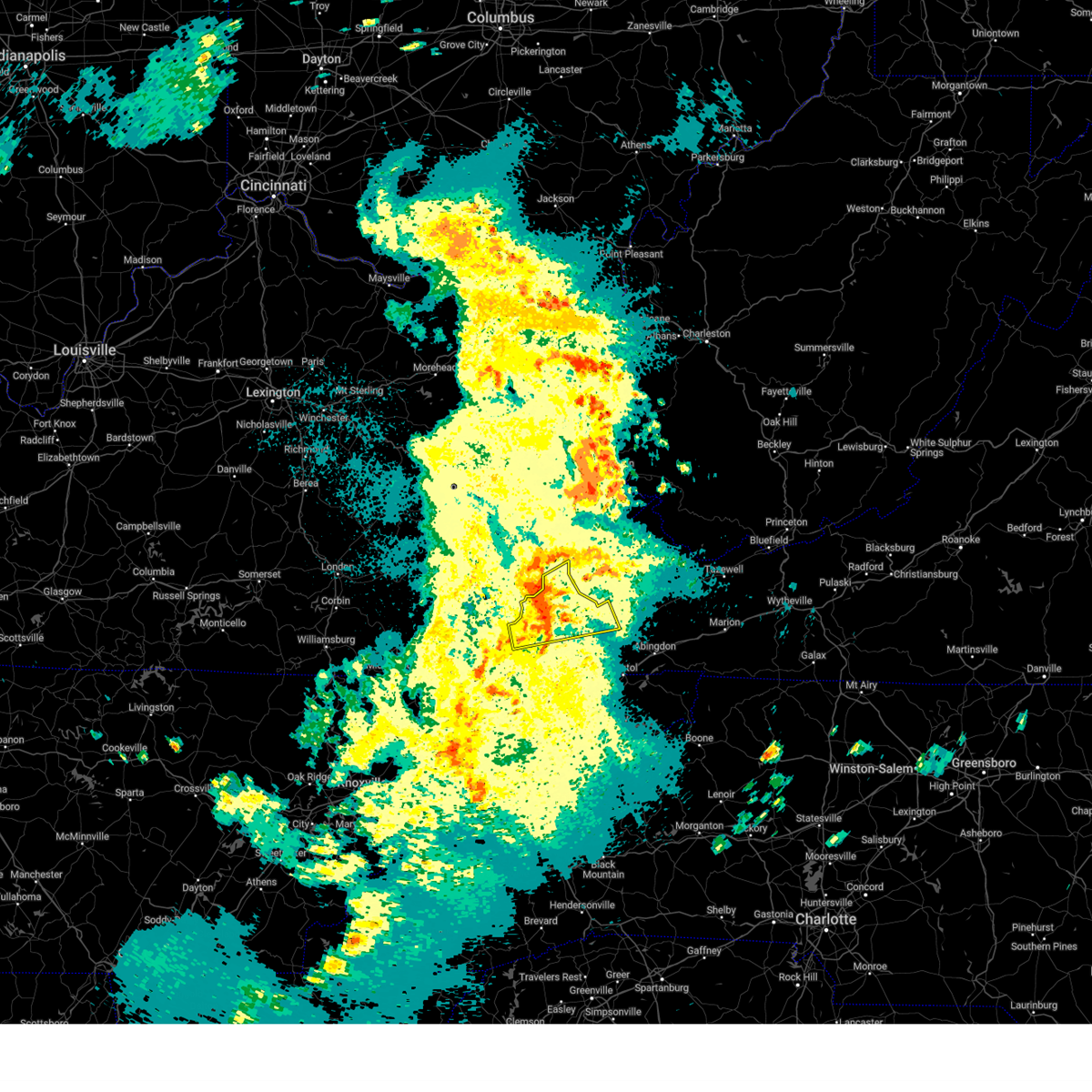
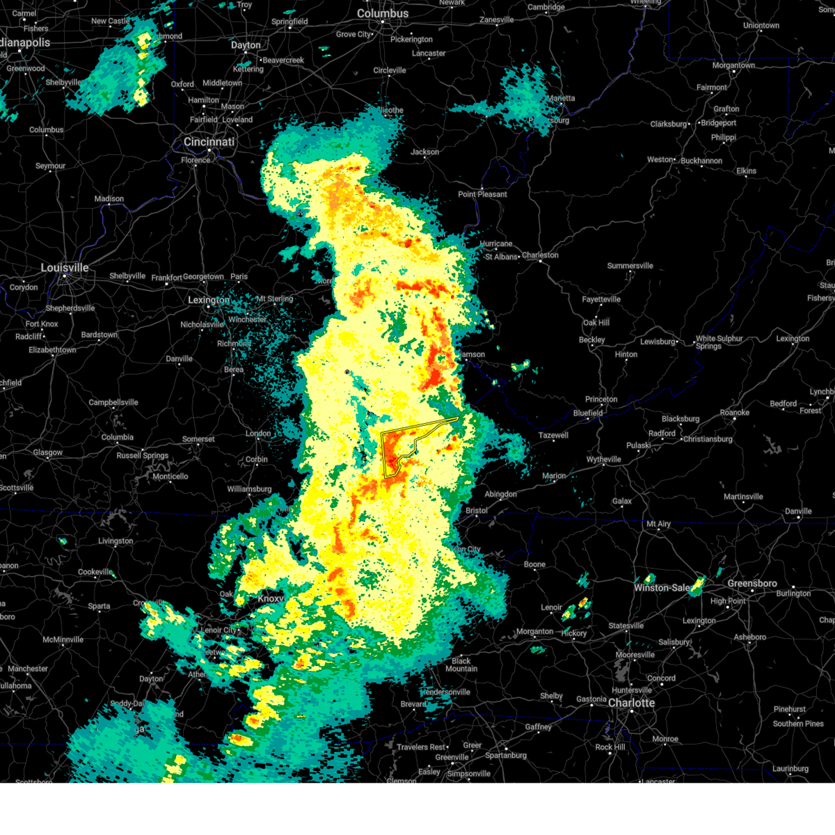
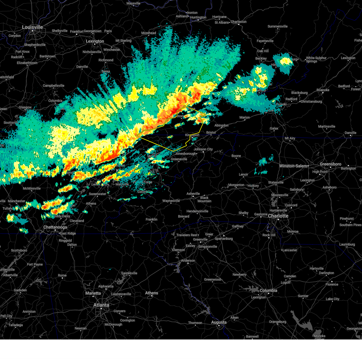
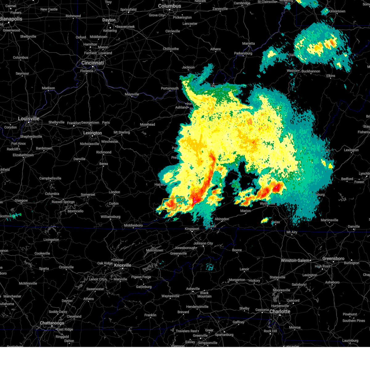
The Keokee, VA area has had 1 report of on-the-ground hail by trained spotters, and has been under severe weather warnings 36 times during the past 12 months. Doppler radar has detected hail at or near Keokee, VA on 30 occasions, including 2 occasions during the past year.
| Name: | Keokee, VA |
| Where Located: | 42.6 miles WNW of Bristol, TN |
| Map: | Google Map for Keokee, VA |
| Population: | 416 |
| Housing Units: | 188 |
| More Info: | Search Google for Keokee, VA |
0
The Top Recent Hail Date for Keokee, VA is Thursday, February 6, 2025 (28th out of 30)

Hail and Wind Damage Spotted near Keokee, VA
| Date / Time | Report Details |
|---|---|
| 5/20/2025 11:28 PM EDT |
 Svrmrx the national weather service in morristown has issued a * severe thunderstorm warning for, west central russell county in southwestern virginia, northeastern lee county in southwestern virginia, the city of norton in southwestern virginia, northeastern scott county in southwestern virginia, wise county in southwestern virginia, * until 1215 am edt. * at 1127 pm edt, a severe thunderstorm was located near norton, moving northeast at 45 mph (trained weather spotters). Hazards include 60 mph wind gusts. expect damage to roofs, siding, and trees Svrmrx the national weather service in morristown has issued a * severe thunderstorm warning for, west central russell county in southwestern virginia, northeastern lee county in southwestern virginia, the city of norton in southwestern virginia, northeastern scott county in southwestern virginia, wise county in southwestern virginia, * until 1215 am edt. * at 1127 pm edt, a severe thunderstorm was located near norton, moving northeast at 45 mph (trained weather spotters). Hazards include 60 mph wind gusts. expect damage to roofs, siding, and trees
|
| 5/20/2025 11:13 PM EDT |
 Svrjkl the national weather service in jackson ky has issued a * severe thunderstorm warning for, northeastern harlan county in southeastern kentucky, letcher county in southeastern kentucky, south central pike county in southeastern kentucky, * until midnight edt. * at 1113 pm edt, severe thunderstorms were located along a line extending from jeremiah to big black mountain, moving east at 50 mph (radar indicated). Hazards include 60 mph wind gusts and penny size hail. Expect damage to roofs, siding, and trees. severe thunderstorms will be near, whitesburg around 1120 pm edt. jenkins around 1125 pm edt. gaskill around 1130 pm edt. Ashcamp around 1140 pm edt. Svrjkl the national weather service in jackson ky has issued a * severe thunderstorm warning for, northeastern harlan county in southeastern kentucky, letcher county in southeastern kentucky, south central pike county in southeastern kentucky, * until midnight edt. * at 1113 pm edt, severe thunderstorms were located along a line extending from jeremiah to big black mountain, moving east at 50 mph (radar indicated). Hazards include 60 mph wind gusts and penny size hail. Expect damage to roofs, siding, and trees. severe thunderstorms will be near, whitesburg around 1120 pm edt. jenkins around 1125 pm edt. gaskill around 1130 pm edt. Ashcamp around 1140 pm edt.
|
| 5/17/2025 2:03 AM EDT |
 At 203 am edt, severe thunderstorms were located along a line extending from near pennington gap to near sneedville to near tazewell, moving east at 50 mph (radar indicated). Hazards include 70 mph wind gusts and nickel size hail. Expect considerable tree damage. damage is likely to mobile homes, roofs, and outbuildings. Locations impacted include, coeburn, weber city, dungannon, pennington gap, rose hill, mccloud, surgoinsville, ewing, appalachia, and okolona. At 203 am edt, severe thunderstorms were located along a line extending from near pennington gap to near sneedville to near tazewell, moving east at 50 mph (radar indicated). Hazards include 70 mph wind gusts and nickel size hail. Expect considerable tree damage. damage is likely to mobile homes, roofs, and outbuildings. Locations impacted include, coeburn, weber city, dungannon, pennington gap, rose hill, mccloud, surgoinsville, ewing, appalachia, and okolona.
|
| 5/17/2025 1:41 AM EDT | Svrmrx the national weather service in morristown has issued a * severe thunderstorm warning for, northeastern claiborne county in east tennessee, hawkins county in east tennessee, hancock county in east tennessee, lee county in southwestern virginia, the city of norton in southwestern virginia, scott county in southwestern virginia, wise county in southwestern virginia, * until 245 am edt. * at 141 am edt, severe thunderstorms were located along a line extending from ages to near cubage to near noetown, moving east at 50 mph (radar indicated). Hazards include 60 mph wind gusts and nickel size hail. expect damage to roofs, siding, and trees |
| 5/16/2025 2:39 PM EDT |
 The storm which prompted the warning has weakened below severe limits, and no longer poses an immediate threat to life or property. therefore, the warning will be allowed to expire. a severe thunderstorm watch remains in effect until 600 pm edt for southeastern kentucky. to report severe weather, contact your nearest law enforcement agency. they will relay your report to the national weather service jackson ky. The storm which prompted the warning has weakened below severe limits, and no longer poses an immediate threat to life or property. therefore, the warning will be allowed to expire. a severe thunderstorm watch remains in effect until 600 pm edt for southeastern kentucky. to report severe weather, contact your nearest law enforcement agency. they will relay your report to the national weather service jackson ky.
|
| 5/16/2025 2:31 PM EDT |
 the severe thunderstorm warning has been cancelled and is no longer in effect the severe thunderstorm warning has been cancelled and is no longer in effect
|
| 5/16/2025 2:31 PM EDT |
 At 231 pm edt, a severe thunderstorm was located over benham, or 12 miles southwest of whitesburg, moving east at 75 mph (radar indicated). Hazards include 60 mph wind gusts and quarter size hail. Hail damage to vehicles is expected. expect wind damage to roofs, siding, and trees. locations impacted include, cumberland, lynch, benham, flint, oven fork, totz, black bottom, louellen, lewis creek, defeated creek, kingdom come s. p. And gilley. At 231 pm edt, a severe thunderstorm was located over benham, or 12 miles southwest of whitesburg, moving east at 75 mph (radar indicated). Hazards include 60 mph wind gusts and quarter size hail. Hail damage to vehicles is expected. expect wind damage to roofs, siding, and trees. locations impacted include, cumberland, lynch, benham, flint, oven fork, totz, black bottom, louellen, lewis creek, defeated creek, kingdom come s. p. And gilley.
|
| 5/16/2025 2:17 PM EDT |
 the severe thunderstorm warning has been cancelled and is no longer in effect the severe thunderstorm warning has been cancelled and is no longer in effect
|
| 5/16/2025 2:17 PM EDT |
 At 216 pm edt, a severe thunderstorm was located near napier, or 7 miles north of harlan, moving east at 70 mph (radar indicated). Hazards include 60 mph wind gusts and quarter size hail. Hail damage to vehicles is expected. expect wind damage to roofs, siding, and trees. Locations impacted include, big laurel, cumberland, lynch and partridge. At 216 pm edt, a severe thunderstorm was located near napier, or 7 miles north of harlan, moving east at 70 mph (radar indicated). Hazards include 60 mph wind gusts and quarter size hail. Hail damage to vehicles is expected. expect wind damage to roofs, siding, and trees. Locations impacted include, big laurel, cumberland, lynch and partridge.
|
| 5/16/2025 1:58 PM EDT |
 Svrjkl the national weather service in jackson ky has issued a * severe thunderstorm warning for, harlan county in southeastern kentucky, northeastern bell county in southeastern kentucky, northeastern knox county in southeastern kentucky, southern leslie county in southeastern kentucky, southwestern letcher county in southeastern kentucky, southeastern perry county in southeastern kentucky, southeastern clay county in southeastern kentucky, * until 245 pm edt. * at 157 pm edt, a severe thunderstorm was located over scalf, or 10 miles north of pineville, moving east at 75 mph (radar indicated). Hazards include 60 mph wind gusts and quarter size hail. Hail damage to vehicles is expected. expect wind damage to roofs, siding, and trees. this severe thunderstorm will be near, mills around 200 pm edt. spruce pine around 205 pm edt. bledsoe around 210 pm edt. napier around 215 pm edt. Other locations in the path of this severe thunderstorm include colts, harlan, and cumberland. Svrjkl the national weather service in jackson ky has issued a * severe thunderstorm warning for, harlan county in southeastern kentucky, northeastern bell county in southeastern kentucky, northeastern knox county in southeastern kentucky, southern leslie county in southeastern kentucky, southwestern letcher county in southeastern kentucky, southeastern perry county in southeastern kentucky, southeastern clay county in southeastern kentucky, * until 245 pm edt. * at 157 pm edt, a severe thunderstorm was located over scalf, or 10 miles north of pineville, moving east at 75 mph (radar indicated). Hazards include 60 mph wind gusts and quarter size hail. Hail damage to vehicles is expected. expect wind damage to roofs, siding, and trees. this severe thunderstorm will be near, mills around 200 pm edt. spruce pine around 205 pm edt. bledsoe around 210 pm edt. napier around 215 pm edt. Other locations in the path of this severe thunderstorm include colts, harlan, and cumberland.
|
| 5/2/2025 7:57 PM EDT |
 The storm which prompted the warning has moved out of the area. therefore, the warning will be allowed to expire. however, small hail and gusty winds are still possible with this thunderstorm. a severe thunderstorm watch remains in effect until 900 pm edt for southeastern kentucky. The storm which prompted the warning has moved out of the area. therefore, the warning will be allowed to expire. however, small hail and gusty winds are still possible with this thunderstorm. a severe thunderstorm watch remains in effect until 900 pm edt for southeastern kentucky.
|
| 5/2/2025 7:49 PM EDT |
 At 749 pm edt, a severe thunderstorm was located over maggard, or near whitesburg, moving northeast at 55 mph (radar indicated). Hazards include 60 mph wind gusts. Expect damage to roofs, siding, and trees. this severe storm will be near, whitesburg around 755 pm edt. Other locations in the path of this severe thunderstorm include fishpond lake and jenkins. At 749 pm edt, a severe thunderstorm was located over maggard, or near whitesburg, moving northeast at 55 mph (radar indicated). Hazards include 60 mph wind gusts. Expect damage to roofs, siding, and trees. this severe storm will be near, whitesburg around 755 pm edt. Other locations in the path of this severe thunderstorm include fishpond lake and jenkins.
|
| 5/2/2025 7:37 PM EDT | Svrjkl the national weather service in jackson ky has issued a * severe thunderstorm warning for, northeastern harlan county in southeastern kentucky, central letcher county in southeastern kentucky, * until 800 pm edt. * at 736 pm edt, a severe thunderstorm was located over closplint, or 16 miles east of harlan, moving northeast at 55 mph (law enforcement reported instances of numerous trees down and a tractor trailer blown over). Hazards include 60 mph wind gusts. Expect damage to roofs, siding, and trees. this severe thunderstorm will be near, benham around 740 pm edt. partridge around 745 pm edt. Day around 750 pm edt. |
| 4/15/2025 1:14 AM EDT |
 At 114 am edt, a severe thunderstorm was located near clover fork, or 14 miles northeast of jonesville, moving east at 45 mph (radar indicated). Hazards include 60 mph wind gusts and quarter size hail. Hail damage to vehicles is expected. expect wind damage to roofs, siding, and trees. Locations impacted include, big stone gap, jasper, and dryden. At 114 am edt, a severe thunderstorm was located near clover fork, or 14 miles northeast of jonesville, moving east at 45 mph (radar indicated). Hazards include 60 mph wind gusts and quarter size hail. Hail damage to vehicles is expected. expect wind damage to roofs, siding, and trees. Locations impacted include, big stone gap, jasper, and dryden.
|
| 4/15/2025 12:55 AM EDT |
 Svrmrx the national weather service in morristown has issued a * severe thunderstorm warning for, northeastern lee county in southwestern virginia, central scott county in southwestern virginia, southwestern wise county in southwestern virginia, * until 145 am edt. * at 1254 am edt, a severe thunderstorm was located over black mountain, or 9 miles east of harlan, moving east at 45 mph (radar indicated). Hazards include 60 mph wind gusts and quarter size hail. Hail damage to vehicles is expected. Expect wind damage to roofs, siding, and trees. Svrmrx the national weather service in morristown has issued a * severe thunderstorm warning for, northeastern lee county in southwestern virginia, central scott county in southwestern virginia, southwestern wise county in southwestern virginia, * until 145 am edt. * at 1254 am edt, a severe thunderstorm was located over black mountain, or 9 miles east of harlan, moving east at 45 mph (radar indicated). Hazards include 60 mph wind gusts and quarter size hail. Hail damage to vehicles is expected. Expect wind damage to roofs, siding, and trees.
|
| 2/6/2025 9:08 PM EST |
 the tornado warning has been cancelled and is no longer in effect the tornado warning has been cancelled and is no longer in effect
|
| 2/6/2025 8:59 PM EST |
 The storms which prompted the warning have moved out of the area. therefore, the warning will be allowed to expire. a severe thunderstorm watch remains in effect until midnight est for southeastern kentucky. to report severe weather, contact your nearest law enforcement agency. they will relay your report to the national weather service in jackson ky. The storms which prompted the warning have moved out of the area. therefore, the warning will be allowed to expire. a severe thunderstorm watch remains in effect until midnight est for southeastern kentucky. to report severe weather, contact your nearest law enforcement agency. they will relay your report to the national weather service in jackson ky.
|
| 2/6/2025 8:56 PM EST |
 Tormrx the national weather service in morristown has issued a * tornado warning for, northeastern lee county in southwestern virginia, central scott county in southwestern virginia, southwestern wise county in southwestern virginia, * until 945 pm est. * at 856 pm est, a severe thunderstorm capable of producing a tornado was located over dizney, or 8 miles north of jonesville, moving east at 40 mph (radar indicated rotation). Hazards include tornado. Flying debris will be dangerous to those caught without shelter. mobile homes will be damaged or destroyed. damage to roofs, windows, and vehicles will occur. tree damage is likely. this dangerous storm will be near, pennington gap around 900 pm est. big stone gap around 915 pm est. other locations impacted by this tornadic thunderstorm include duffield, fort blackmore, jasper, dryden, and st. Charles. Tormrx the national weather service in morristown has issued a * tornado warning for, northeastern lee county in southwestern virginia, central scott county in southwestern virginia, southwestern wise county in southwestern virginia, * until 945 pm est. * at 856 pm est, a severe thunderstorm capable of producing a tornado was located over dizney, or 8 miles north of jonesville, moving east at 40 mph (radar indicated rotation). Hazards include tornado. Flying debris will be dangerous to those caught without shelter. mobile homes will be damaged or destroyed. damage to roofs, windows, and vehicles will occur. tree damage is likely. this dangerous storm will be near, pennington gap around 900 pm est. big stone gap around 915 pm est. other locations impacted by this tornadic thunderstorm include duffield, fort blackmore, jasper, dryden, and st. Charles.
|
| 2/6/2025 8:51 PM EST |
 At 851 pm est, severe thunderstorms were located along a line extending from near clover to near cranks to near hensley store, moving east at 45 mph (radar indicated). Hazards include 60 mph wind gusts and penny size hail. Expect damage to roofs, siding, and trees. These severe storms will be near, clover around 855 pm est. At 851 pm est, severe thunderstorms were located along a line extending from near clover to near cranks to near hensley store, moving east at 45 mph (radar indicated). Hazards include 60 mph wind gusts and penny size hail. Expect damage to roofs, siding, and trees. These severe storms will be near, clover around 855 pm est.
|
| 2/6/2025 8:43 PM EST |
 Svrmrx the national weather service in morristown has issued a * severe thunderstorm warning for, northeastern hancock county in east tennessee, lee county in southwestern virginia, western scott county in southwestern virginia, southwestern wise county in southwestern virginia, * until 930 pm est. * at 842 pm est, a severe thunderstorm was located over bobs creek, or near harlan, moving east at 40 mph (radar indicated). Hazards include 60 mph wind gusts and penny size hail. expect damage to roofs, siding, and trees Svrmrx the national weather service in morristown has issued a * severe thunderstorm warning for, northeastern hancock county in east tennessee, lee county in southwestern virginia, western scott county in southwestern virginia, southwestern wise county in southwestern virginia, * until 930 pm est. * at 842 pm est, a severe thunderstorm was located over bobs creek, or near harlan, moving east at 40 mph (radar indicated). Hazards include 60 mph wind gusts and penny size hail. expect damage to roofs, siding, and trees
|
| 2/6/2025 8:37 PM EST |
 Svrjkl the national weather service in jackson ky has issued a * severe thunderstorm warning for, harlan county in southeastern kentucky, * until 900 pm est. * at 836 pm est, severe thunderstorms were located along a line extending from pine mountain to grays knob to cubage, moving east at 45 mph (radar indicated). Hazards include 60 mph wind gusts and penny size hail. Expect damage to roofs, siding, and trees. severe thunderstorms will be near, harlan around 840 pm est. clover around 845 pm est. Big black mountain around 850 pm est. Svrjkl the national weather service in jackson ky has issued a * severe thunderstorm warning for, harlan county in southeastern kentucky, * until 900 pm est. * at 836 pm est, severe thunderstorms were located along a line extending from pine mountain to grays knob to cubage, moving east at 45 mph (radar indicated). Hazards include 60 mph wind gusts and penny size hail. Expect damage to roofs, siding, and trees. severe thunderstorms will be near, harlan around 840 pm est. clover around 845 pm est. Big black mountain around 850 pm est.
|
| 9/24/2024 6:05 PM EDT |
 At 605 pm edt, a severe thunderstorm was located near jonesville, moving northeast at 45 mph (radar indicated). Hazards include 60 mph wind gusts and half dollar size hail. Hail damage to vehicles is expected. expect wind damage to roofs, siding, and trees. locations impacted include, sneedville, jonesville, pennington gap, st. Charles, duffield, clinchport, howard quarter, evanston, dryden, and rose hill. At 605 pm edt, a severe thunderstorm was located near jonesville, moving northeast at 45 mph (radar indicated). Hazards include 60 mph wind gusts and half dollar size hail. Hail damage to vehicles is expected. expect wind damage to roofs, siding, and trees. locations impacted include, sneedville, jonesville, pennington gap, st. Charles, duffield, clinchport, howard quarter, evanston, dryden, and rose hill.
|
| 9/24/2024 5:56 PM EDT |
 At 556 pm edt, a severe thunderstorm was located near hensley store, or 8 miles northwest of sneedville, moving northeast at 45 mph (radar indicated). Hazards include 60 mph wind gusts and quarter size hail. Hail damage to vehicles is expected. expect wind damage to roofs, siding, and trees. locations impacted include, sneedville, jonesville, pennington gap, st. Charles, duffield, clinchport, howard quarter, evanston, dryden, and rose hill. At 556 pm edt, a severe thunderstorm was located near hensley store, or 8 miles northwest of sneedville, moving northeast at 45 mph (radar indicated). Hazards include 60 mph wind gusts and quarter size hail. Hail damage to vehicles is expected. expect wind damage to roofs, siding, and trees. locations impacted include, sneedville, jonesville, pennington gap, st. Charles, duffield, clinchport, howard quarter, evanston, dryden, and rose hill.
|
| 9/24/2024 5:43 PM EDT |
 Svrmrx the national weather service in morristown has issued a * severe thunderstorm warning for, northeastern claiborne county in east tennessee, northwestern hancock county in east tennessee, lee county in southwestern virginia, southwestern scott county in southwestern virginia, * until 645 pm edt. * at 542 pm edt, a severe thunderstorm was located 8 miles northeast of tazewell, or 14 miles east of middlesboro, moving northeast at 45 mph (radar indicated). Hazards include 60 mph wind gusts and quarter size hail. Hail damage to vehicles is expected. Expect wind damage to roofs, siding, and trees. Svrmrx the national weather service in morristown has issued a * severe thunderstorm warning for, northeastern claiborne county in east tennessee, northwestern hancock county in east tennessee, lee county in southwestern virginia, southwestern scott county in southwestern virginia, * until 645 pm edt. * at 542 pm edt, a severe thunderstorm was located 8 miles northeast of tazewell, or 14 miles east of middlesboro, moving northeast at 45 mph (radar indicated). Hazards include 60 mph wind gusts and quarter size hail. Hail damage to vehicles is expected. Expect wind damage to roofs, siding, and trees.
|
| 8/2/2024 4:54 PM EDT |
 the severe thunderstorm warning has been cancelled and is no longer in effect the severe thunderstorm warning has been cancelled and is no longer in effect
|
| 8/2/2024 4:41 PM EDT |
 At 440 pm edt, a severe thunderstorm was located 8 miles southeast of pennington gap, or 12 miles east of jonesville, moving east at 30 mph (local dispatch reported nearly one dozen calls of trees downed across the jonesville area). Hazards include 60 mph wind gusts. Expect damage to roofs, siding, and trees. Locations impacted include, norton, gate city, big stone gap, mount carmel, appalachia, duffield, clinchport, jasper, fort blackmore, and dryden. At 440 pm edt, a severe thunderstorm was located 8 miles southeast of pennington gap, or 12 miles east of jonesville, moving east at 30 mph (local dispatch reported nearly one dozen calls of trees downed across the jonesville area). Hazards include 60 mph wind gusts. Expect damage to roofs, siding, and trees. Locations impacted include, norton, gate city, big stone gap, mount carmel, appalachia, duffield, clinchport, jasper, fort blackmore, and dryden.
|
| 8/2/2024 4:16 PM EDT |
 Svrmrx the national weather service in morristown has issued a * severe thunderstorm warning for, northeastern hawkins county in east tennessee, lee county in southwestern virginia, the south central city of norton in southwestern virginia, western scott county in southwestern virginia, southwestern wise county in southwestern virginia, * until 515 pm edt. * at 415 pm edt, a severe thunderstorm was located over jonesville, moving east at 30 mph (radar indicated). Hazards include 60 mph wind gusts and penny size hail. expect damage to roofs, siding, and trees Svrmrx the national weather service in morristown has issued a * severe thunderstorm warning for, northeastern hawkins county in east tennessee, lee county in southwestern virginia, the south central city of norton in southwestern virginia, western scott county in southwestern virginia, southwestern wise county in southwestern virginia, * until 515 pm edt. * at 415 pm edt, a severe thunderstorm was located over jonesville, moving east at 30 mph (radar indicated). Hazards include 60 mph wind gusts and penny size hail. expect damage to roofs, siding, and trees
|
| 8/2/2024 12:10 PM EDT |
 The storm which prompted the warning has weakened below severe limits, and no longer poses an immediate threat to life or property. therefore, the warning will be allowed to expire. however, gusty winds are still possible with this thunderstorm. The storm which prompted the warning has weakened below severe limits, and no longer poses an immediate threat to life or property. therefore, the warning will be allowed to expire. however, gusty winds are still possible with this thunderstorm.
|
| 8/2/2024 12:01 PM EDT |
 The storm which prompted the warning has moving out of the warned area. therefore, the warning has been allowed to expire. however, gusty winds are still possible with this thunderstorm. The storm which prompted the warning has moving out of the warned area. therefore, the warning has been allowed to expire. however, gusty winds are still possible with this thunderstorm.
|
| 8/2/2024 11:51 AM EDT |
 At 1150 am edt, a severe thunderstorm was located near big black mountain, or 10 miles west of norton, moving east at 30 mph (radar indicated). Hazards include 60 mph wind gusts. Expect damage to roofs, siding, and trees. This severe thunderstorm will remain over mainly rural areas of northeastern harlan and southwestern letcher counties. At 1150 am edt, a severe thunderstorm was located near big black mountain, or 10 miles west of norton, moving east at 30 mph (radar indicated). Hazards include 60 mph wind gusts. Expect damage to roofs, siding, and trees. This severe thunderstorm will remain over mainly rural areas of northeastern harlan and southwestern letcher counties.
|
| 8/2/2024 11:49 AM EDT |
 At 1149 am edt, a severe thunderstorm was located over big stone gap, or 11 miles west of norton, moving east at 35 mph (radar indicated). Hazards include 60 mph wind gusts. Expect damage to roofs, siding, and trees. locations impacted include, norton, wise, big stone gap, pennington gap, coeburn, appalachia, nickelsville, dungannon, st. Charles, and duffield. At 1149 am edt, a severe thunderstorm was located over big stone gap, or 11 miles west of norton, moving east at 35 mph (radar indicated). Hazards include 60 mph wind gusts. Expect damage to roofs, siding, and trees. locations impacted include, norton, wise, big stone gap, pennington gap, coeburn, appalachia, nickelsville, dungannon, st. Charles, and duffield.
|
| 8/2/2024 11:37 AM EDT |
 Svrjkl the national weather service in jackson ky has issued a * severe thunderstorm warning for, northeastern harlan county in southeastern kentucky, southwestern letcher county in southeastern kentucky, * until noon edt. * at 1137 am edt, a severe thunderstorm was located over rock house, or 15 miles southwest of whitesburg, moving east at 30 mph (radar indicated). Hazards include 60 mph wind gusts. Expect damage to roofs, siding, and trees. This severe thunderstorm will be near, lynch around 1140 am edt. Svrjkl the national weather service in jackson ky has issued a * severe thunderstorm warning for, northeastern harlan county in southeastern kentucky, southwestern letcher county in southeastern kentucky, * until noon edt. * at 1137 am edt, a severe thunderstorm was located over rock house, or 15 miles southwest of whitesburg, moving east at 30 mph (radar indicated). Hazards include 60 mph wind gusts. Expect damage to roofs, siding, and trees. This severe thunderstorm will be near, lynch around 1140 am edt.
|
| 8/2/2024 11:32 AM EDT |
 Svrmrx the national weather service in morristown has issued a * severe thunderstorm warning for, northeastern lee county in southwestern virginia, the city of norton in southwestern virginia, scott county in southwestern virginia, wise county in southwestern virginia, * until 1215 pm edt. * at 1131 am edt, a severe thunderstorm was located over clover fork, or 14 miles northeast of jonesville, moving east at 45 mph (radar indicated). Hazards include 60 mph wind gusts and penny size hail. expect damage to roofs, siding, and trees Svrmrx the national weather service in morristown has issued a * severe thunderstorm warning for, northeastern lee county in southwestern virginia, the city of norton in southwestern virginia, scott county in southwestern virginia, wise county in southwestern virginia, * until 1215 pm edt. * at 1131 am edt, a severe thunderstorm was located over clover fork, or 14 miles northeast of jonesville, moving east at 45 mph (radar indicated). Hazards include 60 mph wind gusts and penny size hail. expect damage to roofs, siding, and trees
|
| 8/1/2024 9:47 PM EDT |
 At 945 pm edt, severe thunderstorms were located along a line extending from pennington gap to near rutledge, moving east at 25 mph (county dispatch reported numerous trees down in the maynardville area). Hazards include 60 mph wind gusts. Expect damage to roofs, siding, and trees. Locations impacted include, sneedville, rutledge, jonesville, big stone gap, bean station, pennington gap, new market, blaine, thorn hill, and evanston. At 945 pm edt, severe thunderstorms were located along a line extending from pennington gap to near rutledge, moving east at 25 mph (county dispatch reported numerous trees down in the maynardville area). Hazards include 60 mph wind gusts. Expect damage to roofs, siding, and trees. Locations impacted include, sneedville, rutledge, jonesville, big stone gap, bean station, pennington gap, new market, blaine, thorn hill, and evanston.
|
| 8/1/2024 9:47 PM EDT |
 the severe thunderstorm warning has been cancelled and is no longer in effect the severe thunderstorm warning has been cancelled and is no longer in effect
|
| 8/1/2024 9:08 PM EDT |
 Svrmrx the national weather service in morristown has issued a * severe thunderstorm warning for, eastern claiborne county in east tennessee, hancock county in east tennessee, north central jefferson county in east tennessee, southeastern union county in east tennessee, grainger county in east tennessee, lee county in southwestern virginia, southwestern wise county in southwestern virginia, * until 1000 pm edt. * at 908 pm edt, severe thunderstorms were located along a line extending from three point to maynardville, moving east at 25 mph (radar indicated). Hazards include 60 mph wind gusts. expect damage to roofs, siding, and trees Svrmrx the national weather service in morristown has issued a * severe thunderstorm warning for, eastern claiborne county in east tennessee, hancock county in east tennessee, north central jefferson county in east tennessee, southeastern union county in east tennessee, grainger county in east tennessee, lee county in southwestern virginia, southwestern wise county in southwestern virginia, * until 1000 pm edt. * at 908 pm edt, severe thunderstorms were located along a line extending from three point to maynardville, moving east at 25 mph (radar indicated). Hazards include 60 mph wind gusts. expect damage to roofs, siding, and trees
|
| 5/27/2024 3:30 AM EDT |
 The storms which prompted the warning have weakened below severe limits, and no longer pose an immediate threat to life or property. therefore, the warning has been allowed to expire. however, gusty winds are still possible with these thunderstorms. a tornado watch remains in effect until 600 am edt for southeastern kentucky. The storms which prompted the warning have weakened below severe limits, and no longer pose an immediate threat to life or property. therefore, the warning has been allowed to expire. however, gusty winds are still possible with these thunderstorms. a tornado watch remains in effect until 600 am edt for southeastern kentucky.
|
| 5/27/2024 3:20 AM EDT |
 the severe thunderstorm warning has been cancelled and is no longer in effect the severe thunderstorm warning has been cancelled and is no longer in effect
|
| 5/27/2024 3:20 AM EDT |
 At 320 am edt, severe thunderstorms were located along a line extending from drew to flint to highsplint to 7 miles west of sneedville, moving east at 45 mph (radar indicated). Hazards include 60 mph wind gusts. Expect damage to roofs, siding, and trees. Locations impacted include, whitesburg, harlan, letcher, bath, cumberland, loyall, evarts, fleming-neon, lynch, benham, vicco, and wallins creek. At 320 am edt, severe thunderstorms were located along a line extending from drew to flint to highsplint to 7 miles west of sneedville, moving east at 45 mph (radar indicated). Hazards include 60 mph wind gusts. Expect damage to roofs, siding, and trees. Locations impacted include, whitesburg, harlan, letcher, bath, cumberland, loyall, evarts, fleming-neon, lynch, benham, vicco, and wallins creek.
|
| 5/27/2024 3:04 AM EDT |
 the severe thunderstorm warning has been cancelled and is no longer in effect the severe thunderstorm warning has been cancelled and is no longer in effect
|
| 5/27/2024 3:04 AM EDT |
 At 303 am edt, severe thunderstorms were located along a line extending from elic to leatherwood to near rosspoint to near harrogate, moving east at 45 mph (radar indicated). Hazards include 60 mph wind gusts. Expect damage to roofs, siding, and trees. Locations impacted include, harlan, whitesburg, lynch and fleming-neon. At 303 am edt, severe thunderstorms were located along a line extending from elic to leatherwood to near rosspoint to near harrogate, moving east at 45 mph (radar indicated). Hazards include 60 mph wind gusts. Expect damage to roofs, siding, and trees. Locations impacted include, harlan, whitesburg, lynch and fleming-neon.
|
| 5/27/2024 2:43 AM EDT |
 Svrjkl the national weather service in jackson ky has issued a * severe thunderstorm warning for, harlan county in southeastern kentucky, bell county in southeastern kentucky, eastern knox county in southeastern kentucky, southeastern owsley county in southeastern kentucky, leslie county in southeastern kentucky, letcher county in southeastern kentucky, perry county in southeastern kentucky, southern knott county in southeastern kentucky, southeastern clay county in southeastern kentucky, * until 330 am edt. * at 242 am edt, severe thunderstorms were located along a line extending from mosley bend to asher to stony fork junction to near fonde, moving east at 45 mph (radar indicated). Hazards include 60 mph wind gusts and penny size hail. Expect damage to roofs, siding, and trees. severe thunderstorms will be near, hazard around 250 am edt. vicco around 255 am edt. evarts around 300 am edt. Other locations in the path of these severe thunderstorms include letcher, bath and whitesburg. Svrjkl the national weather service in jackson ky has issued a * severe thunderstorm warning for, harlan county in southeastern kentucky, bell county in southeastern kentucky, eastern knox county in southeastern kentucky, southeastern owsley county in southeastern kentucky, leslie county in southeastern kentucky, letcher county in southeastern kentucky, perry county in southeastern kentucky, southern knott county in southeastern kentucky, southeastern clay county in southeastern kentucky, * until 330 am edt. * at 242 am edt, severe thunderstorms were located along a line extending from mosley bend to asher to stony fork junction to near fonde, moving east at 45 mph (radar indicated). Hazards include 60 mph wind gusts and penny size hail. Expect damage to roofs, siding, and trees. severe thunderstorms will be near, hazard around 250 am edt. vicco around 255 am edt. evarts around 300 am edt. Other locations in the path of these severe thunderstorms include letcher, bath and whitesburg.
|
| 5/26/2024 3:20 PM EDT |
 the severe thunderstorm warning has been cancelled and is no longer in effect the severe thunderstorm warning has been cancelled and is no longer in effect
|
| 5/26/2024 3:07 PM EDT |
 At 307 pm edt, severe thunderstorms were located along a line extending from near eolia to near jonesville, moving east at 45 mph (radar indicated). Hazards include 60 mph wind gusts and penny size hail. Expect damage to roofs, siding, and trees. locations impacted include, jonesville, big stone gap, pennington gap, appalachia, pound, st. Charles, jasper, dryden, pardee, and pattonsville. At 307 pm edt, severe thunderstorms were located along a line extending from near eolia to near jonesville, moving east at 45 mph (radar indicated). Hazards include 60 mph wind gusts and penny size hail. Expect damage to roofs, siding, and trees. locations impacted include, jonesville, big stone gap, pennington gap, appalachia, pound, st. Charles, jasper, dryden, pardee, and pattonsville.
|
| 5/26/2024 3:03 PM EDT |
 At 303 pm edt, severe thunderstorms were located along a line extending from maggard to big black mountain to clover fork to near pennington gap, moving east at 50 mph (radar indicated). Hazards include 70 mph wind gusts and nickel size hail. Expect considerable tree damage. damage is likely to mobile homes, roofs, and outbuildings. These severe thunderstorms will remain over mainly rural areas of eastern harlan and south central letcher counties. At 303 pm edt, severe thunderstorms were located along a line extending from maggard to big black mountain to clover fork to near pennington gap, moving east at 50 mph (radar indicated). Hazards include 70 mph wind gusts and nickel size hail. Expect considerable tree damage. damage is likely to mobile homes, roofs, and outbuildings. These severe thunderstorms will remain over mainly rural areas of eastern harlan and south central letcher counties.
|
| 5/26/2024 2:41 PM EDT |
 Svrmrx the national weather service in morristown has issued a * severe thunderstorm warning for, lee county in southwestern virginia, southwestern scott county in southwestern virginia, western wise county in southwestern virginia, * until 330 pm edt. * at 241 pm edt, severe thunderstorms were located along a line extending from arthur to 7 miles south of hensley store, moving east at 45 mph (radar indicated). Hazards include 60 mph wind gusts and penny size hail. expect damage to roofs, siding, and trees Svrmrx the national weather service in morristown has issued a * severe thunderstorm warning for, lee county in southwestern virginia, southwestern scott county in southwestern virginia, western wise county in southwestern virginia, * until 330 pm edt. * at 241 pm edt, severe thunderstorms were located along a line extending from arthur to 7 miles south of hensley store, moving east at 45 mph (radar indicated). Hazards include 60 mph wind gusts and penny size hail. expect damage to roofs, siding, and trees
|
| 5/26/2024 2:39 PM EDT |
 Svrjkl the national weather service in jackson ky has issued a * severe thunderstorm warning for, harlan county in southeastern kentucky, south central letcher county in southeastern kentucky, * until 330 pm edt. * at 239 pm edt, a severe thunderstorm was located over mary alice, or near harlan, moving east at 45 mph (radar indicated). Hazards include 70 mph wind gusts and nickel size hail. Expect considerable tree damage. damage is likely to mobile homes, roofs, and outbuildings. this severe thunderstorm will be near, harlan around 245 pm edt. colts around 250 pm edt. highsplint around 255 pm edt. Other locations in the path of this severe thunderstorm include black bottom, clover and big black mountain. Svrjkl the national weather service in jackson ky has issued a * severe thunderstorm warning for, harlan county in southeastern kentucky, south central letcher county in southeastern kentucky, * until 330 pm edt. * at 239 pm edt, a severe thunderstorm was located over mary alice, or near harlan, moving east at 45 mph (radar indicated). Hazards include 70 mph wind gusts and nickel size hail. Expect considerable tree damage. damage is likely to mobile homes, roofs, and outbuildings. this severe thunderstorm will be near, harlan around 245 pm edt. colts around 250 pm edt. highsplint around 255 pm edt. Other locations in the path of this severe thunderstorm include black bottom, clover and big black mountain.
|
| 5/26/2024 2:05 PM EDT |
 Svrjkl the national weather service in jackson ky has issued a * severe thunderstorm warning for, harlan county in southeastern kentucky, bell county in southeastern kentucky, eastern knox county in southeastern kentucky, leslie county in southeastern kentucky, letcher county in southeastern kentucky, southeastern perry county in southeastern kentucky, southeastern clay county in southeastern kentucky, * until 300 pm edt. * at 205 pm edt, severe thunderstorms were located along a line extending from lipps to near new tazewell, moving east at 60 mph (radar indicated). Hazards include 60 mph wind gusts and nickel size hail. Expect damage to roofs, siding, and trees. severe thunderstorms will be near, wallins creek around 210 pm edt. harlan around 215 pm edt. napier around 220 pm edt. evarts around 225 pm edt. Other locations in the path of these severe thunderstorms include totz and letcher. Svrjkl the national weather service in jackson ky has issued a * severe thunderstorm warning for, harlan county in southeastern kentucky, bell county in southeastern kentucky, eastern knox county in southeastern kentucky, leslie county in southeastern kentucky, letcher county in southeastern kentucky, southeastern perry county in southeastern kentucky, southeastern clay county in southeastern kentucky, * until 300 pm edt. * at 205 pm edt, severe thunderstorms were located along a line extending from lipps to near new tazewell, moving east at 60 mph (radar indicated). Hazards include 60 mph wind gusts and nickel size hail. Expect damage to roofs, siding, and trees. severe thunderstorms will be near, wallins creek around 210 pm edt. harlan around 215 pm edt. napier around 220 pm edt. evarts around 225 pm edt. Other locations in the path of these severe thunderstorms include totz and letcher.
|
| 2/12/2024 9:53 PM EST |
 At 953 pm est, a severe thunderstorm was located over big stone gap, or 11 miles southwest of norton, moving northeast at 55 mph (radar indicated). Hazards include 60 mph wind gusts. expect damage to roofs, siding, and trees At 953 pm est, a severe thunderstorm was located over big stone gap, or 11 miles southwest of norton, moving northeast at 55 mph (radar indicated). Hazards include 60 mph wind gusts. expect damage to roofs, siding, and trees
|
| 9/9/2023 6:55 PM EDT |
 The severe thunderstorm warning for eastern lee county will expire at 700 pm edt, the storm which prompted the warning has weakened below severe limits, and no longer poses an immediate threat to life or property. therefore, the warning will be allowed to expire. however, gusty winds, heavy rain and small hail are still possible with this thunderstorm. The severe thunderstorm warning for eastern lee county will expire at 700 pm edt, the storm which prompted the warning has weakened below severe limits, and no longer poses an immediate threat to life or property. therefore, the warning will be allowed to expire. however, gusty winds, heavy rain and small hail are still possible with this thunderstorm.
|
| 9/9/2023 6:34 PM EDT |
 At 633 pm edt, a severe thunderstorm was located over pennington gap, or near jonesville, moving south at 5 mph. another strong storm was southeast of rose hill (radar indicated). Hazards include 60 mph wind gusts and quarter size hail. Hail damage to vehicles is expected. expect wind damage to roofs, siding, and trees. locations impacted include, jonesville, pennington gap, st. charles, and dryden. hail threat, radar indicated max hail size, 1. 00 in wind threat, radar indicated max wind gust, 60 mph. At 633 pm edt, a severe thunderstorm was located over pennington gap, or near jonesville, moving south at 5 mph. another strong storm was southeast of rose hill (radar indicated). Hazards include 60 mph wind gusts and quarter size hail. Hail damage to vehicles is expected. expect wind damage to roofs, siding, and trees. locations impacted include, jonesville, pennington gap, st. charles, and dryden. hail threat, radar indicated max hail size, 1. 00 in wind threat, radar indicated max wind gust, 60 mph.
|
| 9/9/2023 6:19 PM EDT |
 At 618 pm edt, a severe thunderstorm was located over pennington gap, or 7 miles north of jonesville, moving south at 10 mph (radar indicated). Hazards include 60 mph wind gusts and quarter size hail. Hail damage to vehicles is expected. Expect wind damage to roofs, siding, and trees. At 618 pm edt, a severe thunderstorm was located over pennington gap, or 7 miles north of jonesville, moving south at 10 mph (radar indicated). Hazards include 60 mph wind gusts and quarter size hail. Hail damage to vehicles is expected. Expect wind damage to roofs, siding, and trees.
|
| 7/29/2023 4:28 PM EDT |
 The severe thunderstorm warning for northeastern harlan, letcher and southeastern perry counties will expire at 430 pm edt, the storm which prompted the warning has weakened below severe limits, and no longer poses an immediate threat to life or property. therefore, the warning will be allowed to expire. however gusty winds are still possible with this thunderstorm. a severe thunderstorm watch remains in effect until 1000 pm edt for southeastern kentucky. The severe thunderstorm warning for northeastern harlan, letcher and southeastern perry counties will expire at 430 pm edt, the storm which prompted the warning has weakened below severe limits, and no longer poses an immediate threat to life or property. therefore, the warning will be allowed to expire. however gusty winds are still possible with this thunderstorm. a severe thunderstorm watch remains in effect until 1000 pm edt for southeastern kentucky.
|
| 7/29/2023 4:21 PM EDT |
 At 421 pm edt, a severe thunderstorm was located over maggard, or 7 miles south of whitesburg, moving southeast at 30 mph (radar indicated). Hazards include 60 mph wind gusts. Expect damage to roofs, siding, and trees. locations impacted include, whitesburg, cumberland, jenkins, fleming-neon, lynch, benham, winters, horn, oscaloosa, arthur, colly and louellen. hail threat, radar indicated max hail size, <. 75 in wind threat, radar indicated max wind gust, 60 mph. At 421 pm edt, a severe thunderstorm was located over maggard, or 7 miles south of whitesburg, moving southeast at 30 mph (radar indicated). Hazards include 60 mph wind gusts. Expect damage to roofs, siding, and trees. locations impacted include, whitesburg, cumberland, jenkins, fleming-neon, lynch, benham, winters, horn, oscaloosa, arthur, colly and louellen. hail threat, radar indicated max hail size, <. 75 in wind threat, radar indicated max wind gust, 60 mph.
|
| 7/29/2023 4:16 PM EDT |
 At 416 pm edt, a severe thunderstorm was located over maggard, or 7 miles southwest of whitesburg, moving southeast at 25 mph (radar indicated). Hazards include 60 mph wind gusts. Expect damage to roofs, siding, and trees. this severe thunderstorm will remain over mainly rural areas of northeastern harlan, letcher, east central leslie and southeastern perry counties. hail threat, radar indicated max hail size, <. 75 in wind threat, radar indicated max wind gust, 60 mph. At 416 pm edt, a severe thunderstorm was located over maggard, or 7 miles southwest of whitesburg, moving southeast at 25 mph (radar indicated). Hazards include 60 mph wind gusts. Expect damage to roofs, siding, and trees. this severe thunderstorm will remain over mainly rural areas of northeastern harlan, letcher, east central leslie and southeastern perry counties. hail threat, radar indicated max hail size, <. 75 in wind threat, radar indicated max wind gust, 60 mph.
|
| 7/29/2023 4:07 PM EDT |
 At 407 pm edt, a severe thunderstorm was located over kings creek, or 7 miles southwest of whitesburg, moving southeast at 30 mph (radar indicated). Hazards include 60 mph wind gusts. Expect damage to roofs, siding, and trees. this severe storm will be near, maggard around 410 pm edt. hail threat, radar indicated max hail size, <. 75 in wind threat, radar indicated max wind gust, 60 mph. At 407 pm edt, a severe thunderstorm was located over kings creek, or 7 miles southwest of whitesburg, moving southeast at 30 mph (radar indicated). Hazards include 60 mph wind gusts. Expect damage to roofs, siding, and trees. this severe storm will be near, maggard around 410 pm edt. hail threat, radar indicated max hail size, <. 75 in wind threat, radar indicated max wind gust, 60 mph.
|
| 7/29/2023 4:06 PM EDT |
 At 406 pm edt, a severe thunderstorm was located over mayking, or near whitesburg, moving southeast at 35 mph (radar indicated). Hazards include 60 mph wind gusts and quarter size hail. Hail damage to vehicles is expected. Expect wind damage to roofs, siding, and trees. At 406 pm edt, a severe thunderstorm was located over mayking, or near whitesburg, moving southeast at 35 mph (radar indicated). Hazards include 60 mph wind gusts and quarter size hail. Hail damage to vehicles is expected. Expect wind damage to roofs, siding, and trees.
|
| 7/29/2023 3:59 PM EDT |
 At 359 pm edt, a severe thunderstorm was located over skyline, or 7 miles west of whitesburg, moving southeast at 30 mph (radar indicated). Hazards include 60 mph wind gusts. Expect damage to roofs, siding, and trees. this severe thunderstorm will be near, kings creek around 405 pm edt. maggard around 410 pm edt. hail threat, radar indicated max hail size, <. 75 in wind threat, radar indicated max wind gust, 60 mph. At 359 pm edt, a severe thunderstorm was located over skyline, or 7 miles west of whitesburg, moving southeast at 30 mph (radar indicated). Hazards include 60 mph wind gusts. Expect damage to roofs, siding, and trees. this severe thunderstorm will be near, kings creek around 405 pm edt. maggard around 410 pm edt. hail threat, radar indicated max hail size, <. 75 in wind threat, radar indicated max wind gust, 60 mph.
|
| 7/29/2023 3:47 PM EDT |
 At 347 pm edt, a severe thunderstorm was located over roxana, or near whitesburg, moving southeast at 25 mph (radar indicated). Hazards include 60 mph wind gusts. Expect damage to roofs, siding, and trees. locations impacted include, premium, oscaloosa, whitesburg, day and eolia. hail threat, radar indicated max hail size, <. 75 in wind threat, radar indicated max wind gust, 60 mph. At 347 pm edt, a severe thunderstorm was located over roxana, or near whitesburg, moving southeast at 25 mph (radar indicated). Hazards include 60 mph wind gusts. Expect damage to roofs, siding, and trees. locations impacted include, premium, oscaloosa, whitesburg, day and eolia. hail threat, radar indicated max hail size, <. 75 in wind threat, radar indicated max wind gust, 60 mph.
|
| 7/29/2023 3:20 PM EDT |
 At 319 pm edt, a severe thunderstorm was located over jeff, or near hazard, moving southeast at 25 mph (radar indicated). Hazards include 60 mph wind gusts. Expect damage to roofs, siding, and trees. this severe thunderstorm will be near, vicco around 325 pm edt. cornettsville around 330 pm edt. red star around 335 pm edt. other locations in the path of this severe thunderstorm include blackey, letcher and roxana. hail threat, radar indicated max hail size, <. 75 in wind threat, radar indicated max wind gust, 60 mph. At 319 pm edt, a severe thunderstorm was located over jeff, or near hazard, moving southeast at 25 mph (radar indicated). Hazards include 60 mph wind gusts. Expect damage to roofs, siding, and trees. this severe thunderstorm will be near, vicco around 325 pm edt. cornettsville around 330 pm edt. red star around 335 pm edt. other locations in the path of this severe thunderstorm include blackey, letcher and roxana. hail threat, radar indicated max hail size, <. 75 in wind threat, radar indicated max wind gust, 60 mph.
|
| 6/11/2023 9:25 PM EDT |
 At 925 pm edt, a severe thunderstorm capable of producing a tornado was located near pennington gap, or 12 miles northeast of jonesville, moving east at 25 mph (radar indicated rotation). Hazards include tornado and quarter size hail. Flying debris will be dangerous to those caught without shelter. mobile homes will be damaged or destroyed. damage to roofs, windows, and vehicles will occur. tree damage is likely. this dangerous storm will be near, big stone gap around 950 pm edt. norton around 1015 pm edt. Other locations impacted by this tornadic thunderstorm include duffield, fort blackmore, jasper, dryden and appalachia. At 925 pm edt, a severe thunderstorm capable of producing a tornado was located near pennington gap, or 12 miles northeast of jonesville, moving east at 25 mph (radar indicated rotation). Hazards include tornado and quarter size hail. Flying debris will be dangerous to those caught without shelter. mobile homes will be damaged or destroyed. damage to roofs, windows, and vehicles will occur. tree damage is likely. this dangerous storm will be near, big stone gap around 950 pm edt. norton around 1015 pm edt. Other locations impacted by this tornadic thunderstorm include duffield, fort blackmore, jasper, dryden and appalachia.
|
| 6/11/2023 9:20 PM EDT |
 At 920 pm edt, a severe thunderstorm was located near pennington gap, or 10 miles northeast of jonesville, moving east at 30 mph (radar indicated). Hazards include 60 mph wind gusts and quarter size hail. Hail damage to vehicles is expected. Expect wind damage to roofs, siding, and trees. At 920 pm edt, a severe thunderstorm was located near pennington gap, or 10 miles northeast of jonesville, moving east at 30 mph (radar indicated). Hazards include 60 mph wind gusts and quarter size hail. Hail damage to vehicles is expected. Expect wind damage to roofs, siding, and trees.
|
| 5/16/2023 5:09 PM EDT |
 At 509 pm edt, a severe thunderstorm was located over cranks, or near jonesville, moving east at 55 mph (radar indicated). Hazards include 60 mph wind gusts and quarter size hail. Hail damage to vehicles is expected. Expect wind damage to roofs, siding, and trees. At 509 pm edt, a severe thunderstorm was located over cranks, or near jonesville, moving east at 55 mph (radar indicated). Hazards include 60 mph wind gusts and quarter size hail. Hail damage to vehicles is expected. Expect wind damage to roofs, siding, and trees.
|
| 8/5/2022 5:40 PM EDT |
 At 540 pm edt, a severe thunderstorm was located over lewis creek, or 9 miles south of whitesburg, moving northeast at 40 mph (radar indicated). Hazards include 60 mph wind gusts and penny size hail. Expect damage to roofs, siding, and trees. this severe thunderstorm will be near, eolia around 550 pm edt. whitesburg around 555 pm edt. mayking around 600 pm edt. other locations in the path of this severe thunderstorm include whitaker and jenkins. hail threat, radar indicated max hail size, 0. 75 in wind threat, radar indicated max wind gust, 60 mph. At 540 pm edt, a severe thunderstorm was located over lewis creek, or 9 miles south of whitesburg, moving northeast at 40 mph (radar indicated). Hazards include 60 mph wind gusts and penny size hail. Expect damage to roofs, siding, and trees. this severe thunderstorm will be near, eolia around 550 pm edt. whitesburg around 555 pm edt. mayking around 600 pm edt. other locations in the path of this severe thunderstorm include whitaker and jenkins. hail threat, radar indicated max hail size, 0. 75 in wind threat, radar indicated max wind gust, 60 mph.
|
| 8/5/2022 5:16 PM EDT |
 At 516 pm edt, severe thunderstorms were located along a line extending from near holmes mill to near surgoinsville, moving northeast at 25 mph (radar indicated). Hazards include 60 mph wind gusts and nickel size hail. expect damage to roofs, siding, and trees At 516 pm edt, severe thunderstorms were located along a line extending from near holmes mill to near surgoinsville, moving northeast at 25 mph (radar indicated). Hazards include 60 mph wind gusts and nickel size hail. expect damage to roofs, siding, and trees
|
| 6/22/2022 9:27 PM EDT |
 The severe thunderstorm warning for northeastern harlan, southwestern letcher and southeastern perry counties will expire at 930 pm edt, the storm which prompted the warning has weakened below severe limits, and has exited the warned area. therefore, the warning will be allowed to expire. a severe thunderstorm watch remains in effect until midnight edt for southeastern kentucky. The severe thunderstorm warning for northeastern harlan, southwestern letcher and southeastern perry counties will expire at 930 pm edt, the storm which prompted the warning has weakened below severe limits, and has exited the warned area. therefore, the warning will be allowed to expire. a severe thunderstorm watch remains in effect until midnight edt for southeastern kentucky.
|
| 6/22/2022 9:09 PM EDT |
 At 909 pm edt, a severe thunderstorm was located over gordon, or 14 miles southwest of whitesburg, moving southeast at 30 mph (radar indicated). Hazards include 60 mph wind gusts. Expect damage to roofs, siding, and trees. locations impacted include, benham, lynch, rock house and big black mountain. hail threat, radar indicated max hail size, <. 75 in wind threat, radar indicated max wind gust, 60 mph. At 909 pm edt, a severe thunderstorm was located over gordon, or 14 miles southwest of whitesburg, moving southeast at 30 mph (radar indicated). Hazards include 60 mph wind gusts. Expect damage to roofs, siding, and trees. locations impacted include, benham, lynch, rock house and big black mountain. hail threat, radar indicated max hail size, <. 75 in wind threat, radar indicated max wind gust, 60 mph.
|
| 6/22/2022 8:47 PM EDT |
 At 846 pm edt, a severe thunderstorm was located over slemp, or 11 miles south of hazard, moving southeast at 30 mph (radar indicated). Hazards include 60 mph wind gusts. Expect damage to roofs, siding, and trees. this severe thunderstorm will be near, daisy around 850 pm edt. slemp around 855 pm edt. delphia around 900 pm edt. other locations in the path of this severe thunderstorm include gordon, cumberland and lynch. hail threat, radar indicated max hail size, <. 75 in wind threat, radar indicated max wind gust, 60 mph. At 846 pm edt, a severe thunderstorm was located over slemp, or 11 miles south of hazard, moving southeast at 30 mph (radar indicated). Hazards include 60 mph wind gusts. Expect damage to roofs, siding, and trees. this severe thunderstorm will be near, daisy around 850 pm edt. slemp around 855 pm edt. delphia around 900 pm edt. other locations in the path of this severe thunderstorm include gordon, cumberland and lynch. hail threat, radar indicated max hail size, <. 75 in wind threat, radar indicated max wind gust, 60 mph.
|
| 6/17/2022 2:18 PM EDT |
 At 218 pm edt, a severe thunderstorm was located over lewis creek, or 9 miles south of whitesburg, moving east at 40 mph (radar indicated). Hazards include 60 mph wind gusts and penny size hail. Expect damage to roofs, siding, and trees. locations impacted include, cumberland, evarts, lynch, benham, flint, totz, black bottom, dizney, louellen, clover fork, lewis creek and defeated creek. hail threat, radar indicated max hail size, 0. 75 in wind threat, radar indicated max wind gust, 60 mph. At 218 pm edt, a severe thunderstorm was located over lewis creek, or 9 miles south of whitesburg, moving east at 40 mph (radar indicated). Hazards include 60 mph wind gusts and penny size hail. Expect damage to roofs, siding, and trees. locations impacted include, cumberland, evarts, lynch, benham, flint, totz, black bottom, dizney, louellen, clover fork, lewis creek and defeated creek. hail threat, radar indicated max hail size, 0. 75 in wind threat, radar indicated max wind gust, 60 mph.
|
| 6/17/2022 2:03 PM EDT |
 At 203 pm edt, a severe thunderstorm was located over gordon, or 14 miles southwest of whitesburg, moving east at 45 mph (radar indicated). Hazards include 60 mph wind gusts and penny size hail. expect damage to roofs, siding, and trees At 203 pm edt, a severe thunderstorm was located over gordon, or 14 miles southwest of whitesburg, moving east at 45 mph (radar indicated). Hazards include 60 mph wind gusts and penny size hail. expect damage to roofs, siding, and trees
|
| 5/19/2022 6:00 PM EDT |
 At 600 pm edt, a severe thunderstorm was located over dizney, or 10 miles north of jonesville, moving northeast at 40 mph (radar indicated). Hazards include 60 mph wind gusts and quarter size hail. Hail damage to vehicles is expected. expect wind damage to roofs, siding, and trees. Locations impacted include, holmes mill and rock house. At 600 pm edt, a severe thunderstorm was located over dizney, or 10 miles north of jonesville, moving northeast at 40 mph (radar indicated). Hazards include 60 mph wind gusts and quarter size hail. Hail damage to vehicles is expected. expect wind damage to roofs, siding, and trees. Locations impacted include, holmes mill and rock house.
|
| 5/19/2022 5:43 PM EDT |
 At 542 pm edt, a severe thunderstorm was located over three point, or near harlan, moving northeast at 35 mph (radar indicated). Hazards include 60 mph wind gusts and quarter size hail. Hail damage to vehicles is expected. expect wind damage to roofs, siding, and trees. this severe thunderstorm will be near, cranks around 550 pm edt. evarts around 555 pm edt. dizney around 600 pm edt. Other locations in the path of this severe thunderstorm include clover-darby, holmes mill and rock house. At 542 pm edt, a severe thunderstorm was located over three point, or near harlan, moving northeast at 35 mph (radar indicated). Hazards include 60 mph wind gusts and quarter size hail. Hail damage to vehicles is expected. expect wind damage to roofs, siding, and trees. this severe thunderstorm will be near, cranks around 550 pm edt. evarts around 555 pm edt. dizney around 600 pm edt. Other locations in the path of this severe thunderstorm include clover-darby, holmes mill and rock house.
|
| 5/19/2022 5:19 PM EDT |
 At 518 pm edt, a severe thunderstorm was located over liggett, or near harlan, moving northeast at 40 mph (radar indicated). Hazards include 60 mph wind gusts and quarter size hail. Hail damage to vehicles is expected. expect wind damage to roofs, siding, and trees. this severe thunderstorm will be near, grays knob around 525 pm edt. harlan around 530 pm edt. verda around 535 pm edt. Other locations in the path of this severe thunderstorm include evarts and shields. At 518 pm edt, a severe thunderstorm was located over liggett, or near harlan, moving northeast at 40 mph (radar indicated). Hazards include 60 mph wind gusts and quarter size hail. Hail damage to vehicles is expected. expect wind damage to roofs, siding, and trees. this severe thunderstorm will be near, grays knob around 525 pm edt. harlan around 530 pm edt. verda around 535 pm edt. Other locations in the path of this severe thunderstorm include evarts and shields.
|
| 5/6/2022 6:14 PM EDT |
 At 613 pm edt, severe thunderstorms were located along a line extending from near jonesville to 8 miles southwest of gate city to gray, moving northeast at 45 mph. this line of storm has a history of producing damaging winds (radar indicated). Hazards include 60 mph wind gusts and quarter size hail. Hail damage to vehicles is expected. Expect wind damage to roofs, siding, and trees. At 613 pm edt, severe thunderstorms were located along a line extending from near jonesville to 8 miles southwest of gate city to gray, moving northeast at 45 mph. this line of storm has a history of producing damaging winds (radar indicated). Hazards include 60 mph wind gusts and quarter size hail. Hail damage to vehicles is expected. Expect wind damage to roofs, siding, and trees.
|
| 8/14/2021 9:56 PM EDT |
 At 956 pm edt, a severe thunderstorm was located near big stone gap, or 13 miles southwest of norton, moving northwest at 10 mph (radar indicated). Hazards include 60 mph wind gusts and penny size hail. Expect damage to roofs, siding, and trees. locations impacted include, big stone gap and appalachia. hail threat, radar indicated max hail size, 0. 75 in wind threat, radar indicated max wind gust, 60 mph. At 956 pm edt, a severe thunderstorm was located near big stone gap, or 13 miles southwest of norton, moving northwest at 10 mph (radar indicated). Hazards include 60 mph wind gusts and penny size hail. Expect damage to roofs, siding, and trees. locations impacted include, big stone gap and appalachia. hail threat, radar indicated max hail size, 0. 75 in wind threat, radar indicated max wind gust, 60 mph.
|
| 8/14/2021 9:31 PM EDT |
 At 931 pm edt, a severe thunderstorm was located near big stone gap, or 14 miles southwest of norton, moving northwest at 10 mph (radar indicated). Hazards include 60 mph wind gusts and penny size hail. expect damage to roofs, siding, and trees At 931 pm edt, a severe thunderstorm was located near big stone gap, or 14 miles southwest of norton, moving northwest at 10 mph (radar indicated). Hazards include 60 mph wind gusts and penny size hail. expect damage to roofs, siding, and trees
|
| 6/21/2021 7:06 PM EDT |
 The severe thunderstorm warning for northeastern harlan and southeastern letcher counties will expire at 715 pm edt, the storm which prompted the warning has moved out of the area. therefore, the warning will be allowed to expire. however gusty winds are still possible with this thunderstorm. a severe thunderstorm watch remains in effect until 900 pm edt for southeastern kentucky. The severe thunderstorm warning for northeastern harlan and southeastern letcher counties will expire at 715 pm edt, the storm which prompted the warning has moved out of the area. therefore, the warning will be allowed to expire. however gusty winds are still possible with this thunderstorm. a severe thunderstorm watch remains in effect until 900 pm edt for southeastern kentucky.
|
| 6/21/2021 6:49 PM EDT |
 At 649 pm edt, a severe thunderstorm was located near big stone gap, or 8 miles west of norton, moving east at 55 mph (radar indicated). Hazards include 60 mph wind gusts. Expect damage to roofs, siding, and trees. This severe thunderstorm will remain over mainly rural areas of northeastern harlan and southeastern letcher counties. At 649 pm edt, a severe thunderstorm was located near big stone gap, or 8 miles west of norton, moving east at 55 mph (radar indicated). Hazards include 60 mph wind gusts. Expect damage to roofs, siding, and trees. This severe thunderstorm will remain over mainly rural areas of northeastern harlan and southeastern letcher counties.
|
| 6/21/2021 6:34 PM EDT |
 At 634 pm edt, a severe thunderstorm was located over closplint, or 16 miles north of jonesville, moving east at 55 mph (radar indicated). Hazards include 60 mph wind gusts. Expect damage to roofs, siding, and trees. This severe thunderstorm will be near, lynch around 640 pm edt. At 634 pm edt, a severe thunderstorm was located over closplint, or 16 miles north of jonesville, moving east at 55 mph (radar indicated). Hazards include 60 mph wind gusts. Expect damage to roofs, siding, and trees. This severe thunderstorm will be near, lynch around 640 pm edt.
|
| 3/27/2021 11:30 AM EDT |
 At 1130 am edt, a severe thunderstorm was located 8 miles northeast of tazewell, or 12 miles west of sneedville, moving northeast at 65 mph (radar indicated). Hazards include 60 mph wind gusts and quarter size hail. Hail damage to vehicles is expected. Expect wind damage to roofs, siding, and trees. At 1130 am edt, a severe thunderstorm was located 8 miles northeast of tazewell, or 12 miles west of sneedville, moving northeast at 65 mph (radar indicated). Hazards include 60 mph wind gusts and quarter size hail. Hail damage to vehicles is expected. Expect wind damage to roofs, siding, and trees.
|
| 7/24/2020 6:38 PM EDT |
 At 638 pm edt, severe thunderstorms were located along a line extending from bristol va to 6 miles east of weber city to near clover fork, moving south at 20 mph (radar indicated). Hazards include 60 mph wind gusts. Expect damage to roofs, siding, and trees. locations impacted include, kingsport, bristol tn, bristol va, gate city, weber city, walnut hill, church hill, mount carmel, duffield and clinchport. this includes the following highways, interstate 26 in tennessee near mile marker 1. interstate 81 in tennessee between mile markers 66 and 75. Interstate 81 in virginia between mile markers 1 and 10. At 638 pm edt, severe thunderstorms were located along a line extending from bristol va to 6 miles east of weber city to near clover fork, moving south at 20 mph (radar indicated). Hazards include 60 mph wind gusts. Expect damage to roofs, siding, and trees. locations impacted include, kingsport, bristol tn, bristol va, gate city, weber city, walnut hill, church hill, mount carmel, duffield and clinchport. this includes the following highways, interstate 26 in tennessee near mile marker 1. interstate 81 in tennessee between mile markers 66 and 75. Interstate 81 in virginia between mile markers 1 and 10.
|
| 7/24/2020 6:12 PM EDT |
 At 612 pm edt, severe thunderstorms were located along a line extending from 6 miles north of bristol va to 6 miles south of big stone gap, moving south at 5 mph (radar indicated). Hazards include 60 mph wind gusts. expect damage to roofs, siding, and trees At 612 pm edt, severe thunderstorms were located along a line extending from 6 miles north of bristol va to 6 miles south of big stone gap, moving south at 5 mph (radar indicated). Hazards include 60 mph wind gusts. expect damage to roofs, siding, and trees
|
| 6/10/2020 5:56 PM EDT |
 At 556 pm edt, a severe thunderstorm capable of producing a tornado was located near clover fork, or 15 miles northeast of jonesville, moving northeast at 30 mph (radar indicated rotation). Hazards include tornado. Flying debris will be dangerous to those caught without shelter. mobile homes will be damaged or destroyed. damage to roofs, windows, and vehicles will occur. tree damage is likely. Locations impacted include, jasper and dryden. At 556 pm edt, a severe thunderstorm capable of producing a tornado was located near clover fork, or 15 miles northeast of jonesville, moving northeast at 30 mph (radar indicated rotation). Hazards include tornado. Flying debris will be dangerous to those caught without shelter. mobile homes will be damaged or destroyed. damage to roofs, windows, and vehicles will occur. tree damage is likely. Locations impacted include, jasper and dryden.
|
| 6/10/2020 5:39 PM EDT |
 At 539 pm edt, a severe thunderstorm capable of producing a tornado was located over pennington gap, or 7 miles northeast of jonesville, moving northeast at 30 mph (radar indicated rotation). Hazards include tornado. Flying debris will be dangerous to those caught without shelter. mobile homes will be damaged or destroyed. damage to roofs, windows, and vehicles will occur. tree damage is likely. This tornadic thunderstorm will remain over mainly rural areas of northeastern lee county, including the following locations, jasper and dryden. At 539 pm edt, a severe thunderstorm capable of producing a tornado was located over pennington gap, or 7 miles northeast of jonesville, moving northeast at 30 mph (radar indicated rotation). Hazards include tornado. Flying debris will be dangerous to those caught without shelter. mobile homes will be damaged or destroyed. damage to roofs, windows, and vehicles will occur. tree damage is likely. This tornadic thunderstorm will remain over mainly rural areas of northeastern lee county, including the following locations, jasper and dryden.
|
| 4/9/2020 2:50 AM EDT |
 The severe thunderstorm warning for central russell, northeastern lee, northeastern scott and wise counties and the city of norton will expire at 300 am edt, the storms which prompted the warning have weakened below severe limits, and no longer pose an immediate threat to life or property. therefore, the warning will be allowed to expire. however gusty winds are still possible with these thunderstorms. a severe thunderstorm watch remains in effect until 600 am edt for southwestern virginia. The severe thunderstorm warning for central russell, northeastern lee, northeastern scott and wise counties and the city of norton will expire at 300 am edt, the storms which prompted the warning have weakened below severe limits, and no longer pose an immediate threat to life or property. therefore, the warning will be allowed to expire. however gusty winds are still possible with these thunderstorms. a severe thunderstorm watch remains in effect until 600 am edt for southwestern virginia.
|
| 4/9/2020 2:28 AM EDT |
 The severe thunderstorm warning for northeastern harlan, letcher and southeastern perry counties will expire at 230 am edt, the storms which prompted the warning have weakened below severe limits, and have exited the warned area. therefore, the warning will be allowed to expire. The severe thunderstorm warning for northeastern harlan, letcher and southeastern perry counties will expire at 230 am edt, the storms which prompted the warning have weakened below severe limits, and have exited the warned area. therefore, the warning will be allowed to expire.
|
| 4/9/2020 2:28 AM EDT |
 At 228 am edt, severe thunderstorms were located along a line extending from breaks interstate to near clintwood to holmes mill, moving southeast at 45 mph (radar indicated). Hazards include 60 mph wind gusts and penny size hail. Expect damage to roofs, siding, and trees. locations impacted include, norton, wise, big stone gap, cleveland va, coeburn, appalachia, honaker, pound, st. Paul and dungannon. At 228 am edt, severe thunderstorms were located along a line extending from breaks interstate to near clintwood to holmes mill, moving southeast at 45 mph (radar indicated). Hazards include 60 mph wind gusts and penny size hail. Expect damage to roofs, siding, and trees. locations impacted include, norton, wise, big stone gap, cleveland va, coeburn, appalachia, honaker, pound, st. Paul and dungannon.
|
| 4/9/2020 2:14 AM EDT |
 At 213 am edt, severe thunderstorms were located along a line extending from tillie to hiram, moving east at 50 mph (radar indicated). Hazards include 60 mph wind gusts and penny size hail. expect damage to roofs, siding, and trees At 213 am edt, severe thunderstorms were located along a line extending from tillie to hiram, moving east at 50 mph (radar indicated). Hazards include 60 mph wind gusts and penny size hail. expect damage to roofs, siding, and trees
|
| 4/9/2020 2:11 AM EDT |
 At 210 am edt, severe thunderstorms were located along a line extending from paw paw to dunham to arthur, moving southeast at 45 mph (radar indicated). Hazards include 60 mph wind gusts and penny size hail. expect damage to roofs, siding, and trees At 210 am edt, severe thunderstorms were located along a line extending from paw paw to dunham to arthur, moving southeast at 45 mph (radar indicated). Hazards include 60 mph wind gusts and penny size hail. expect damage to roofs, siding, and trees
|
| 1/11/2020 6:42 PM EST |
 At 642 pm est, a severe thunderstorm was located near clover fork, or 13 miles northeast of jonesville, moving northeast at 55 mph (radar indicated). Hazards include 60 mph wind gusts. Expect damage to roofs, siding, and trees. locations impacted include, gate city, jonesville, big stone gap, pennington gap, weber city, mount carmel, appalachia, st. Charles, duffield and clinchport. At 642 pm est, a severe thunderstorm was located near clover fork, or 13 miles northeast of jonesville, moving northeast at 55 mph (radar indicated). Hazards include 60 mph wind gusts. Expect damage to roofs, siding, and trees. locations impacted include, gate city, jonesville, big stone gap, pennington gap, weber city, mount carmel, appalachia, st. Charles, duffield and clinchport.
|
| 1/11/2020 6:20 PM EST |
 At 620 pm est, a severe thunderstorm was located near sneedville, moving northeast at 55 mph (radar indicated). Hazards include 60 mph wind gusts. expect damage to roofs, siding, and trees At 620 pm est, a severe thunderstorm was located near sneedville, moving northeast at 55 mph (radar indicated). Hazards include 60 mph wind gusts. expect damage to roofs, siding, and trees
|
| 10/31/2019 1:08 PM EDT |
 The severe thunderstorm warning for eastern lee, northwestern scott and wise counties and the city of norton will expire at 115 pm edt, the storms which prompted the warning have moved out of the area. therefore, the warning will be allowed to expire. however gusty winds are still possible as a strong cold front crosses the area. a tornado watch remains in effect until 700 pm edt for southwestern virginia. The severe thunderstorm warning for eastern lee, northwestern scott and wise counties and the city of norton will expire at 115 pm edt, the storms which prompted the warning have moved out of the area. therefore, the warning will be allowed to expire. however gusty winds are still possible as a strong cold front crosses the area. a tornado watch remains in effect until 700 pm edt for southwestern virginia.
|
| 10/31/2019 12:26 PM EDT |
 At 1226 pm edt, severe thunderstorms were located along a line extending from lewis creek to 9 miles southeast of jonesville, moving northeast at 60 mph (radar indicated). Hazards include 60 mph wind gusts. expect damage to roofs, siding, and trees At 1226 pm edt, severe thunderstorms were located along a line extending from lewis creek to 9 miles southeast of jonesville, moving northeast at 60 mph (radar indicated). Hazards include 60 mph wind gusts. expect damage to roofs, siding, and trees
|
| 10/31/2019 12:13 PM EDT |
 At 1212 pm edt, a severe thunderstorm capable of producing a tornado was located near jonesville, moving northeast at 60 mph (radar indicated rotation). Hazards include tornado. Flying debris will be dangerous to those caught without shelter. mobile homes will be damaged or destroyed. damage to roofs, windows, and vehicles will occur. tree damage is likely. locations impacted include, sneedville, jonesville, pennington gap, st. Charles, duffield, jasper, dryden and pattonsville. At 1212 pm edt, a severe thunderstorm capable of producing a tornado was located near jonesville, moving northeast at 60 mph (radar indicated rotation). Hazards include tornado. Flying debris will be dangerous to those caught without shelter. mobile homes will be damaged or destroyed. damage to roofs, windows, and vehicles will occur. tree damage is likely. locations impacted include, sneedville, jonesville, pennington gap, st. Charles, duffield, jasper, dryden and pattonsville.
|
| 10/31/2019 12:02 PM EDT |
 At 1200 pm edt, a severe thunderstorm capable of producing a tornado was located near jonesville, or 13 miles east of middlesboro, moving northeast at 60 mph (radar indicated rotation). Hazards include tornado. Flying debris will be dangerous to those caught without shelter. mobile homes will be damaged or destroyed. damage to roofs, windows, and vehicles will occur. tree damage is likely. this tornadic thunderstorm will remain over mainly rural areas of northwestern hancock, lee and west central scott counties, including the following locations, duffield, jasper, evanston, ewing, st. charles, dryden, rose hill and pattonsville. Time, mot, loc 1600z 059deg 153kt 3653 8350. At 1200 pm edt, a severe thunderstorm capable of producing a tornado was located near jonesville, or 13 miles east of middlesboro, moving northeast at 60 mph (radar indicated rotation). Hazards include tornado. Flying debris will be dangerous to those caught without shelter. mobile homes will be damaged or destroyed. damage to roofs, windows, and vehicles will occur. tree damage is likely. this tornadic thunderstorm will remain over mainly rural areas of northwestern hancock, lee and west central scott counties, including the following locations, duffield, jasper, evanston, ewing, st. charles, dryden, rose hill and pattonsville. Time, mot, loc 1600z 059deg 153kt 3653 8350.
|
| 10/31/2019 11:50 AM EDT |
 At 1150 am edt, a severe thunderstorm capable of producing a tornado was located over tazewell, or 13 miles southeast of middlesboro, moving northeast at 65 mph (radar indicated rotation). Hazards include tornado. Flying debris will be dangerous to those caught without shelter. mobile homes will be damaged or destroyed. damage to roofs, windows, and vehicles will occur. tree damage is likely. this dangerous storm will be near, jonesville around 1220 pm edt. pennington gap around 1225 pm edt. other locations impacted by this tornadic thunderstorm include duffield, lone mountain, howard quarter, jasper, ewing, st. Charles, powell river preserve, dryden, rose hill and pattonsville. At 1150 am edt, a severe thunderstorm capable of producing a tornado was located over tazewell, or 13 miles southeast of middlesboro, moving northeast at 65 mph (radar indicated rotation). Hazards include tornado. Flying debris will be dangerous to those caught without shelter. mobile homes will be damaged or destroyed. damage to roofs, windows, and vehicles will occur. tree damage is likely. this dangerous storm will be near, jonesville around 1220 pm edt. pennington gap around 1225 pm edt. other locations impacted by this tornadic thunderstorm include duffield, lone mountain, howard quarter, jasper, ewing, st. Charles, powell river preserve, dryden, rose hill and pattonsville.
|
| 6/28/2019 6:32 PM EDT |
 At 632 pm edt, severe thunderstorms were located along a line extending from clover-darby to dizney to near cranks, moving west at 10 mph (radar indicated). Hazards include 60 mph wind gusts and quarter size hail. Hail damage to vehicles is expected. Expect wind damage to roofs, siding, and trees. At 632 pm edt, severe thunderstorms were located along a line extending from clover-darby to dizney to near cranks, moving west at 10 mph (radar indicated). Hazards include 60 mph wind gusts and quarter size hail. Hail damage to vehicles is expected. Expect wind damage to roofs, siding, and trees.
|
| 6/28/2019 6:23 PM EDT |
 At 623 pm edt, a severe thunderstorm was located near holmes mill, or 11 miles northeast of jonesville, moving west at 10 mph (radar indicated). Hazards include 60 mph wind gusts and quarter size hail. Hail damage to vehicles is expected. Expect wind damage to roofs, siding, and trees. At 623 pm edt, a severe thunderstorm was located near holmes mill, or 11 miles northeast of jonesville, moving west at 10 mph (radar indicated). Hazards include 60 mph wind gusts and quarter size hail. Hail damage to vehicles is expected. Expect wind damage to roofs, siding, and trees.
|
| 6/22/2019 12:29 AM EDT |
 At 1228 am edt, severe thunderstorms were located along a line extending from near holmes mill to near rogersville to smoky mountains-big creek, moving east at 50 mph (radar indicated). Hazards include 60 mph wind gusts. Expect damage to roofs, siding, and trees. locations impacted include, newport, rogersville, gatlinburg, jonesville, surgoinsville, pennington gap, parrottsville, smoky mountains-newfound gap, clover fork, smoky mountains-big creek, smoky mountains-fontana area, mosheim, bulls gap, pittman center, st. charles, duffield, mccloud, cosby, st. Clair and elkmont. At 1228 am edt, severe thunderstorms were located along a line extending from near holmes mill to near rogersville to smoky mountains-big creek, moving east at 50 mph (radar indicated). Hazards include 60 mph wind gusts. Expect damage to roofs, siding, and trees. locations impacted include, newport, rogersville, gatlinburg, jonesville, surgoinsville, pennington gap, parrottsville, smoky mountains-newfound gap, clover fork, smoky mountains-big creek, smoky mountains-fontana area, mosheim, bulls gap, pittman center, st. charles, duffield, mccloud, cosby, st. Clair and elkmont.
|
| 6/22/2019 12:17 AM EDT |
 A severe thunderstorm warning remains in effect until 1230 am edt for harlan. letcher. southeastern leslie and southeastern perry counties. at 1215 am edt, severe thunderstorms were located along a line extending from chappell to near jonesville, moving east at 45 mph. hazard. 60 mph wind gusts and penny size hail. A severe thunderstorm warning remains in effect until 1230 am edt for harlan. letcher. southeastern leslie and southeastern perry counties. at 1215 am edt, severe thunderstorms were located along a line extending from chappell to near jonesville, moving east at 45 mph. hazard. 60 mph wind gusts and penny size hail.
|
| 6/22/2019 12:14 AM EDT |
 A severe thunderstorm warning remains in effect until 1230 am edt for harlan. letcher. southern leslie. southeastern perry and south central knott counties. at 1213 am edt, severe thunderstorms were located along a line extending from chappell to near sneedville, moving east at 45 mph. hazard. 60 mph wind gusts and penny size hail. A severe thunderstorm warning remains in effect until 1230 am edt for harlan. letcher. southern leslie. southeastern perry and south central knott counties. at 1213 am edt, severe thunderstorms were located along a line extending from chappell to near sneedville, moving east at 45 mph. hazard. 60 mph wind gusts and penny size hail.
|
| 6/22/2019 12:11 AM EDT |
 At 1211 am edt, severe thunderstorms were located along a line extending from near jonesville to gatlinburg, moving east at 45 mph (radar indicated). Hazards include 60 mph wind gusts. Expect damage to roofs, siding, and trees. Locations impacted include, morristown, sevierville, newport, rogersville, gatlinburg, dandridge, sneedville, jonesville, pigeon forge, bean station, white pine, surgoinsville, pennington gap, baneberry, parrottsville, smoky mountains-newfound gap, russellville, smoky mountains-big creek, smoky mountains-fontana area and smoky mountains-balsam mountain. At 1211 am edt, severe thunderstorms were located along a line extending from near jonesville to gatlinburg, moving east at 45 mph (radar indicated). Hazards include 60 mph wind gusts. Expect damage to roofs, siding, and trees. Locations impacted include, morristown, sevierville, newport, rogersville, gatlinburg, dandridge, sneedville, jonesville, pigeon forge, bean station, white pine, surgoinsville, pennington gap, baneberry, parrottsville, smoky mountains-newfound gap, russellville, smoky mountains-big creek, smoky mountains-fontana area and smoky mountains-balsam mountain.
|
| 6/22/2019 12:11 AM EDT |
 At 1155 pm edt, severe thunderstorms were located along a line extending from 7 miles south of hensley store to near pigeon forge, moving east at 50 mph (radar indicated). Hazards include 60 mph wind gusts. expect damage to roofs, siding, and trees At 1155 pm edt, severe thunderstorms were located along a line extending from 7 miles south of hensley store to near pigeon forge, moving east at 50 mph (radar indicated). Hazards include 60 mph wind gusts. expect damage to roofs, siding, and trees
|
| 6/21/2019 11:55 PM EDT |
 At 1155 pm edt, severe thunderstorms were located along a line extending from 7 miles south of hensley store to near pigeon forge, moving east at 50 mph (radar indicated). Hazards include 60 mph wind gusts. expect damage to roofs, siding, and trees At 1155 pm edt, severe thunderstorms were located along a line extending from 7 miles south of hensley store to near pigeon forge, moving east at 50 mph (radar indicated). Hazards include 60 mph wind gusts. expect damage to roofs, siding, and trees
|
| 6/21/2019 11:51 PM EDT |
 The national weather service in jackson ky has issued a * severe thunderstorm warning for. harlan county in southeastern kentucky. northeastern bell county in southeastern kentucky. letcher county in southeastern kentucky. Leslie county in southeastern kentucky. The national weather service in jackson ky has issued a * severe thunderstorm warning for. harlan county in southeastern kentucky. northeastern bell county in southeastern kentucky. letcher county in southeastern kentucky. Leslie county in southeastern kentucky.
|
| 6/21/2019 11:51 PM EDT |
 At 1150 pm edt, severe thunderstorms were located along a line extending from ice cliff to 7 miles south of cubage, moving east at 45 mph (radar indicated). Hazards include 60 mph wind gusts and penny size hail. expect damage to roofs, siding, and trees At 1150 pm edt, severe thunderstorms were located along a line extending from ice cliff to 7 miles south of cubage, moving east at 45 mph (radar indicated). Hazards include 60 mph wind gusts and penny size hail. expect damage to roofs, siding, and trees
|
| 7/20/2018 9:37 PM EDT |
 At 937 pm edt, severe thunderstorms were located along a line extending from near clover fork to near pennington gap to near jonesville, moving east at 25 mph (radar indicated). Hazards include 60 mph wind gusts and penny size hail. Expect damage to roofs, siding, and trees. locations impacted include, jonesville, pennington gap, st. charles, jasper, dryden and pattonsville. A tornado watch remains in effect until 400 am edt for east tennessee, and southwestern virginia. At 937 pm edt, severe thunderstorms were located along a line extending from near clover fork to near pennington gap to near jonesville, moving east at 25 mph (radar indicated). Hazards include 60 mph wind gusts and penny size hail. Expect damage to roofs, siding, and trees. locations impacted include, jonesville, pennington gap, st. charles, jasper, dryden and pattonsville. A tornado watch remains in effect until 400 am edt for east tennessee, and southwestern virginia.
|
| 7/20/2018 9:23 PM EDT |
 At 923 pm edt, severe thunderstorms were located along a line extending from holmes mill to near pennington gap to near smith, moving southeast at 25 mph (radar indicated). Hazards include 60 mph wind gusts and penny size hail. expect damage to roofs, siding, and trees At 923 pm edt, severe thunderstorms were located along a line extending from holmes mill to near pennington gap to near smith, moving southeast at 25 mph (radar indicated). Hazards include 60 mph wind gusts and penny size hail. expect damage to roofs, siding, and trees
|
| 6/3/2018 3:24 PM EDT |
 The severe thunderstorm warning for northeastern harlan and southwestern letcher counties will expire at 330 pm edt, the storm which prompted the warning has weakened below severe limits, and is exiting the warned area. therefore, the warning will be allowed to expire. The severe thunderstorm warning for northeastern harlan and southwestern letcher counties will expire at 330 pm edt, the storm which prompted the warning has weakened below severe limits, and is exiting the warned area. therefore, the warning will be allowed to expire.
|
| 6/3/2018 3:05 PM EDT |
 At 304 pm edt, a severe thunderstorm was located over totz, or 12 miles northeast of harlan, moving southeast at 20 mph (radar indicated). Hazards include 60 mph wind gusts. Expect damage to roofs, siding, and trees. locations impacted include, cumberland, lynch, benham, totz, black bottom, louellen, clover fork, lewis creek, kingdom come s. p. Gilley, highsplint, clutts, big black mountain, partridge, nolansburg, shields, gordon, rock house, holmes mill, and clover. At 304 pm edt, a severe thunderstorm was located over totz, or 12 miles northeast of harlan, moving southeast at 20 mph (radar indicated). Hazards include 60 mph wind gusts. Expect damage to roofs, siding, and trees. locations impacted include, cumberland, lynch, benham, totz, black bottom, louellen, clover fork, lewis creek, kingdom come s. p. Gilley, highsplint, clutts, big black mountain, partridge, nolansburg, shields, gordon, rock house, holmes mill, and clover.
|
| 6/3/2018 2:41 PM EDT |
 The national weather service in jackson ky has issued a * severe thunderstorm warning for. northeastern harlan county in southeastern kentucky. southwestern letcher county in southeastern kentucky. east central leslie county in southeastern kentucky. Southeastern perry county in southeastern kentucky. The national weather service in jackson ky has issued a * severe thunderstorm warning for. northeastern harlan county in southeastern kentucky. southwestern letcher county in southeastern kentucky. east central leslie county in southeastern kentucky. Southeastern perry county in southeastern kentucky.
|
| 5/7/2018 7:12 PM EDT |
 The severe thunderstorm warning for northeastern harlan county will expire at 715 pm edt, the storm which prompted the warning has weakened below severe limits, and no longer poses an immediate threat to life or property. therefore the warning will be allowed to expire. The severe thunderstorm warning for northeastern harlan county will expire at 715 pm edt, the storm which prompted the warning has weakened below severe limits, and no longer poses an immediate threat to life or property. therefore the warning will be allowed to expire.
|
| 5/7/2018 6:45 PM EDT |
 At 644 pm edt, a severe thunderstorm was located over holmes mill, or 13 miles northeast of jonesville, moving southeast at 10 mph (radar indicated). Hazards include quarter size hail. Damage to vehicles is expected. Locations impacted include, rock house, closplint, holmes mill, black bottom, lejunior, clover, louellen, clover fork and clover-darby. At 644 pm edt, a severe thunderstorm was located over holmes mill, or 13 miles northeast of jonesville, moving southeast at 10 mph (radar indicated). Hazards include quarter size hail. Damage to vehicles is expected. Locations impacted include, rock house, closplint, holmes mill, black bottom, lejunior, clover, louellen, clover fork and clover-darby.
|
| 5/7/2018 6:29 PM EDT |
 At 628 pm edt, a severe thunderstorm was located over clover-darby, or 15 miles north of jonesville, moving southeast at 10 mph (radar indicated). Hazards include quarter size hail. damage to vehicles is expected At 628 pm edt, a severe thunderstorm was located over clover-darby, or 15 miles north of jonesville, moving southeast at 10 mph (radar indicated). Hazards include quarter size hail. damage to vehicles is expected
|
| 5/5/2018 6:36 PM EDT |
 At 636 pm edt, a severe thunderstorm was located over diane, or 15 miles northeast of harlan, moving north at 45 mph (radar indicated). Hazards include 60 mph wind gusts and quarter size hail. Hail damage to vehicles is expected. expect wind damage to roofs, siding, and trees. locations impacted include, sneedville, jonesville, pennington gap, st. Charles, dryden, kyles ford and klondike. At 636 pm edt, a severe thunderstorm was located over diane, or 15 miles northeast of harlan, moving north at 45 mph (radar indicated). Hazards include 60 mph wind gusts and quarter size hail. Hail damage to vehicles is expected. expect wind damage to roofs, siding, and trees. locations impacted include, sneedville, jonesville, pennington gap, st. Charles, dryden, kyles ford and klondike.
|
| 5/5/2018 6:07 PM EDT |
 The national weather service in morristown has issued a * severe thunderstorm warning for. northwestern hawkins county in east tennessee. central hancock county in east tennessee. lee county in southwestern virginia. Until 645 pm edt. The national weather service in morristown has issued a * severe thunderstorm warning for. northwestern hawkins county in east tennessee. central hancock county in east tennessee. lee county in southwestern virginia. Until 645 pm edt.
|
| 5/5/2018 6:07 PM EDT |
 At 607 pm edt, a severe thunderstorm was located over jonesville, moving north at 35 mph (radar indicated). Hazards include 60 mph wind gusts and quarter size hail. Hail damage to vehicles is expected. Expect wind damage to roofs, siding, and trees. At 607 pm edt, a severe thunderstorm was located over jonesville, moving north at 35 mph (radar indicated). Hazards include 60 mph wind gusts and quarter size hail. Hail damage to vehicles is expected. Expect wind damage to roofs, siding, and trees.
|
| 4/4/2018 2:26 AM EDT |
 The severe thunderstorm warning for southwestern russell, northeastern lee, central scott and wise counties and the city of norton will expire at 230 am edt, the storms which prompted the warning have moved out of the area. therefore the warning will be allowed to expire. a severe thunderstorm watch remains in effect until 300 am edt for southwestern virginia. The severe thunderstorm warning for southwestern russell, northeastern lee, central scott and wise counties and the city of norton will expire at 230 am edt, the storms which prompted the warning have moved out of the area. therefore the warning will be allowed to expire. a severe thunderstorm watch remains in effect until 300 am edt for southwestern virginia.
|
| 4/4/2018 1:47 AM EDT |
 At 146 am edt, severe thunderstorms were located along a line extending from near clover fork to 8 miles southeast of jonesville, moving northeast at 65 mph (radar indicated). Hazards include 60 mph wind gusts. expect damage to roofs, siding, and trees At 146 am edt, severe thunderstorms were located along a line extending from near clover fork to 8 miles southeast of jonesville, moving northeast at 65 mph (radar indicated). Hazards include 60 mph wind gusts. expect damage to roofs, siding, and trees
|
| 4/4/2018 1:40 AM EDT |
 At 140 am edt, severe thunderstorms were located along a line extending from near dizney to near sneedville, moving east at 65 mph (radar indicated). Hazards include 60 mph wind gusts. Expect damage to roofs, siding, and trees. locations impacted include, sneedville, jonesville, pennington gap, st. Charles, dryden, kyles ford and pattonsville. At 140 am edt, severe thunderstorms were located along a line extending from near dizney to near sneedville, moving east at 65 mph (radar indicated). Hazards include 60 mph wind gusts. Expect damage to roofs, siding, and trees. locations impacted include, sneedville, jonesville, pennington gap, st. Charles, dryden, kyles ford and pattonsville.
|
| 4/4/2018 1:38 AM EDT |
 At 137 am edt, severe thunderstorms were located along a line extending from tillie to near pennington gap, moving east at 60 mph (radar indicated). Hazards include 60 mph wind gusts. Expect damage to roofs, siding, and trees. Locations impacted include, whitesburg, letcher, cumberland, jenkins, elkhorn city, evarts, fleming-neon, lynch, benham, blackey, bobs creek, van, dizney, colly, louellen, premium, sergent, gilley, clutts and shields. At 137 am edt, severe thunderstorms were located along a line extending from tillie to near pennington gap, moving east at 60 mph (radar indicated). Hazards include 60 mph wind gusts. Expect damage to roofs, siding, and trees. Locations impacted include, whitesburg, letcher, cumberland, jenkins, elkhorn city, evarts, fleming-neon, lynch, benham, blackey, bobs creek, van, dizney, colly, louellen, premium, sergent, gilley, clutts and shields.
|
| 4/4/2018 1:28 AM EDT |
 At 126 am edt, severe thunderstorms were located along a line extending from ulvah to martins fork lake, moving east at 60 mph (62 mph gust reported at harlan awos). Hazards include 60 mph wind gusts. Expect damage to roofs, siding, and trees. Locations impacted include, whitesburg, harlan, letcher, cumberland, jenkins, loyall, elkhorn city, evarts, fleming-neon, lynch, benham, blackey, big fork, bobs creek, leatherwood, van, dizney, colly, louellen and premium. At 126 am edt, severe thunderstorms were located along a line extending from ulvah to martins fork lake, moving east at 60 mph (62 mph gust reported at harlan awos). Hazards include 60 mph wind gusts. Expect damage to roofs, siding, and trees. Locations impacted include, whitesburg, harlan, letcher, cumberland, jenkins, loyall, elkhorn city, evarts, fleming-neon, lynch, benham, blackey, big fork, bobs creek, leatherwood, van, dizney, colly, louellen and premium.
|
| 4/4/2018 1:17 AM EDT |
 At 117 am edt, severe thunderstorms were located along a line extending from near hensley store to near new tazewell, moving east at 60 mph (radar indicated). Hazards include 60 mph wind gusts. expect damage to roofs, siding, and trees At 117 am edt, severe thunderstorms were located along a line extending from near hensley store to near new tazewell, moving east at 60 mph (radar indicated). Hazards include 60 mph wind gusts. expect damage to roofs, siding, and trees
|
| 4/4/2018 1:14 AM EDT |
 At 114 am edt, severe thunderstorms were located along a line extending from cutshin to near hensley store, moving east at 60 mph (radar indicated). Hazards include 60 mph wind gusts. expect damage to roofs, siding, and trees At 114 am edt, severe thunderstorms were located along a line extending from cutshin to near hensley store, moving east at 60 mph (radar indicated). Hazards include 60 mph wind gusts. expect damage to roofs, siding, and trees
|
| 7/6/2017 7:19 PM EDT |
 At 718 pm edt, severe thunderstorms were located along a line extending from jeremiah to near holmes mill to near harrogate, moving east at 45 mph (radar indicated). Hazards include 60 mph wind gusts. expect damage to roofs, siding, and trees At 718 pm edt, severe thunderstorms were located along a line extending from jeremiah to near holmes mill to near harrogate, moving east at 45 mph (radar indicated). Hazards include 60 mph wind gusts. expect damage to roofs, siding, and trees
|
| 5/24/2017 1:31 PM EDT |
 At 131 pm edt, severe thunderstorms were located along a line extending from near big stone gap to weber city to spurgeon to near erwin, moving northeast at 40 mph (radar indicated). Hazards include 60 mph wind gusts and quarter size hail. Hail damage to vehicles is expected. expect wind damage to roofs, siding, and trees. locations impacted include, johnson city, kingsport, bristol tn, elizabethton, norton, wise, gate city, big stone gap, jonesborough, weber city, central, midway, pine crest, colonial heights, gray, oak grove, spurgeon, walnut hill, church hill and mount carmel. A tornado watch remains in effect until 800 pm edt for eastern tennessee, and southwestern virginia. At 131 pm edt, severe thunderstorms were located along a line extending from near big stone gap to weber city to spurgeon to near erwin, moving northeast at 40 mph (radar indicated). Hazards include 60 mph wind gusts and quarter size hail. Hail damage to vehicles is expected. expect wind damage to roofs, siding, and trees. locations impacted include, johnson city, kingsport, bristol tn, elizabethton, norton, wise, gate city, big stone gap, jonesborough, weber city, central, midway, pine crest, colonial heights, gray, oak grove, spurgeon, walnut hill, church hill and mount carmel. A tornado watch remains in effect until 800 pm edt for eastern tennessee, and southwestern virginia.
|
| 5/24/2017 1:01 PM EDT |
 At 100 pm edt, severe thunderstorms were located along a line extending from near pennington gap to 6 miles southeast of surgoinsville to 6 miles northeast of tusculum to 10 miles northeast of hot springs, moving east at 40 mph (radar indicated). Hazards include 60 mph wind gusts and quarter size hail. Hail damage to vehicles is expected. Expect wind damage to roofs, siding, and trees. At 100 pm edt, severe thunderstorms were located along a line extending from near pennington gap to 6 miles southeast of surgoinsville to 6 miles northeast of tusculum to 10 miles northeast of hot springs, moving east at 40 mph (radar indicated). Hazards include 60 mph wind gusts and quarter size hail. Hail damage to vehicles is expected. Expect wind damage to roofs, siding, and trees.
|
| 5/24/2017 1:01 PM EDT |
 The national weather service in morristown has issued a * severe thunderstorm warning for. sullivan county in eastern tennessee. northeastern hawkins county in eastern tennessee. washington county in eastern tennessee. Northeastern hancock county in eastern tennessee. The national weather service in morristown has issued a * severe thunderstorm warning for. sullivan county in eastern tennessee. northeastern hawkins county in eastern tennessee. washington county in eastern tennessee. Northeastern hancock county in eastern tennessee.
|
| 5/24/2017 12:39 PM EDT |
 At 1238 pm edt, a severe thunderstorm was located over lenarve, or near harlan, moving northeast at 30 mph (radar indicated). Hazards include 60 mph wind gusts and quarter size hail. Hail damage to vehicles is expected. Expect wind damage to roofs, siding, and trees. At 1238 pm edt, a severe thunderstorm was located over lenarve, or near harlan, moving northeast at 30 mph (radar indicated). Hazards include 60 mph wind gusts and quarter size hail. Hail damage to vehicles is expected. Expect wind damage to roofs, siding, and trees.
|
| 5/20/2017 9:37 PM EDT |
 The severe thunderstorm warning for northeastern lee and southwestern wise counties will expire at 945 pm edt, the storm which prompted the warning has weakened below severe limits, and no longer poses an immediate threat to life or property. therefore the warning will be allowed to expire. however gusty winds and heavy rain are still possible with this thunderstorm. The severe thunderstorm warning for northeastern lee and southwestern wise counties will expire at 945 pm edt, the storm which prompted the warning has weakened below severe limits, and no longer poses an immediate threat to life or property. therefore the warning will be allowed to expire. however gusty winds and heavy rain are still possible with this thunderstorm.
|
| 5/20/2017 9:23 PM EDT |
 At 922 pm edt, a severe thunderstorm was located near big stone gap, or 13 miles southwest of norton, moving northeast at 15 mph (radar indicated). Hazards include 60 mph wind gusts and nickel size hail. Expect damage to roofs, siding, and trees. Locations impacted include, big stone gap, appalachia, jasper and dryden. At 922 pm edt, a severe thunderstorm was located near big stone gap, or 13 miles southwest of norton, moving northeast at 15 mph (radar indicated). Hazards include 60 mph wind gusts and nickel size hail. Expect damage to roofs, siding, and trees. Locations impacted include, big stone gap, appalachia, jasper and dryden.
|
| 5/20/2017 9:08 PM EDT |
 At 908 pm edt, a severe thunderstorm was located near clover fork, or 15 miles northeast of jonesville, moving north at 15 mph (radar indicated). Hazards include 60 mph wind gusts and quarter size hail. Hail damage to vehicles is expected. Expect wind damage to roofs, siding, and trees. At 908 pm edt, a severe thunderstorm was located near clover fork, or 15 miles northeast of jonesville, moving north at 15 mph (radar indicated). Hazards include 60 mph wind gusts and quarter size hail. Hail damage to vehicles is expected. Expect wind damage to roofs, siding, and trees.
|
| 5/5/2017 12:02 AM EDT |
 At 1202 am edt, severe thunderstorms were located along a line extending from near jonesville to near surgoinsville, moving northeast at 55 mph (radar indicated). Hazards include 60 mph wind gusts. Expect damage to roofs, siding, and trees. locations impacted include, kingsport, rogersville, jonesville, surgoinsville, pennington gap, church hill, mount carmel, st. charles, duffield, clinchport, dryden, jasper, okolona, kepler, kyles ford, pattonsville, bays mountain s. p. Jearoldstown and sullivan gardens. At 1202 am edt, severe thunderstorms were located along a line extending from near jonesville to near surgoinsville, moving northeast at 55 mph (radar indicated). Hazards include 60 mph wind gusts. Expect damage to roofs, siding, and trees. locations impacted include, kingsport, rogersville, jonesville, surgoinsville, pennington gap, church hill, mount carmel, st. charles, duffield, clinchport, dryden, jasper, okolona, kepler, kyles ford, pattonsville, bays mountain s. p. Jearoldstown and sullivan gardens.
|
| 5/4/2017 11:56 PM EDT |
 At 1155 pm edt, severe thunderstorms were located along a line extending from near smith to near rogersville, moving northeast at 55 mph (radar indicated). Hazards include 60 mph wind gusts and quarter size hail. Hail damage to vehicles is expected. expect wind damage to roofs, siding, and trees. locations impacted include, kingsport, rogersville, sneedville, jonesville, surgoinsville, pennington gap, church hill, mount carmel, st. Charles, duffield, clinchport, dryden, rose hill, mccloud, jasper, okolona, kepler, kyles ford, pattonsville and klondike. At 1155 pm edt, severe thunderstorms were located along a line extending from near smith to near rogersville, moving northeast at 55 mph (radar indicated). Hazards include 60 mph wind gusts and quarter size hail. Hail damage to vehicles is expected. expect wind damage to roofs, siding, and trees. locations impacted include, kingsport, rogersville, sneedville, jonesville, surgoinsville, pennington gap, church hill, mount carmel, st. Charles, duffield, clinchport, dryden, rose hill, mccloud, jasper, okolona, kepler, kyles ford, pattonsville and klondike.
|
| 5/4/2017 11:27 PM EDT |
 At 1126 pm edt, severe thunderstorms were located along a line extending from near harrogate to near morristown, moving northeast at 55 mph (radar indicated). Hazards include 60 mph wind gusts and quarter size hail. Hail damage to vehicles is expected. Expect wind damage to roofs, siding, and trees. At 1126 pm edt, severe thunderstorms were located along a line extending from near harrogate to near morristown, moving northeast at 55 mph (radar indicated). Hazards include 60 mph wind gusts and quarter size hail. Hail damage to vehicles is expected. Expect wind damage to roofs, siding, and trees.
|
| 3/1/2017 10:40 AM EST |
 The severe thunderstorm warning for harlan, bell and southern leslie counties will expire at 1045 am est, the storms which prompted the warning have weakened below severe limits, and no longer pose an immediate threat to life or property. therefore the warning will be allowed to expire. a severe thunderstorm watch remains in effect until 100 pm est for south central and southeastern kentucky. The severe thunderstorm warning for harlan, bell and southern leslie counties will expire at 1045 am est, the storms which prompted the warning have weakened below severe limits, and no longer pose an immediate threat to life or property. therefore the warning will be allowed to expire. a severe thunderstorm watch remains in effect until 100 pm est for south central and southeastern kentucky.
|
| 3/1/2017 10:15 AM EST |
 At 1015 am est, severe thunderstorms were located along a line extending from dongola to near tremont to polly camp, moving southeast at 40 mph (radar indicated). Hazards include 60 mph wind gusts. Expect damage to roofs, siding, and trees. Locations impacted include, harlan, pineville, middlesboro, cumberland, loyall, evarts, wallins creek, bobs creek, sandy fork, bledsoe, dizney, varilla, louellen, coldiron, ponza, black snake, blanche, napier, cubage and rella. At 1015 am est, severe thunderstorms were located along a line extending from dongola to near tremont to polly camp, moving southeast at 40 mph (radar indicated). Hazards include 60 mph wind gusts. Expect damage to roofs, siding, and trees. Locations impacted include, harlan, pineville, middlesboro, cumberland, loyall, evarts, wallins creek, bobs creek, sandy fork, bledsoe, dizney, varilla, louellen, coldiron, ponza, black snake, blanche, napier, cubage and rella.
|
| 3/1/2017 9:52 AM EST |
 At 951 am est, severe thunderstorms were located along a line extending from wiscoal to ice cliff to krupp, moving southeast at 40 mph (radar indicated). Hazards include 60 mph wind gusts. expect damage to roofs, siding, and trees At 951 am est, severe thunderstorms were located along a line extending from wiscoal to ice cliff to krupp, moving southeast at 40 mph (radar indicated). Hazards include 60 mph wind gusts. expect damage to roofs, siding, and trees
|
| 8/15/2016 3:35 PM EDT |
 At 334 pm edt, severe thunderstorms were located along a line extending from near lynch to lewis creek to blair to diane, moving north at 40 mph (radar indicated). Hazards include 60 mph wind gusts. Expect damage to roofs. siding. and trees. locations impacted include, letcher, cumberland, lynch, benham, blackey, delphia, partridge, clover fork, arthur, maggard, gilley, shields, roxana, highsplint, defeated creek, diane, ice, holmes mill, kingdom come s. p. And big black mountain. At 334 pm edt, severe thunderstorms were located along a line extending from near lynch to lewis creek to blair to diane, moving north at 40 mph (radar indicated). Hazards include 60 mph wind gusts. Expect damage to roofs. siding. and trees. locations impacted include, letcher, cumberland, lynch, benham, blackey, delphia, partridge, clover fork, arthur, maggard, gilley, shields, roxana, highsplint, defeated creek, diane, ice, holmes mill, kingdom come s. p. And big black mountain.
|
| 8/15/2016 3:23 PM EDT |
 At 323 pm edt, severe thunderstorms were located along a line extending from holmes mill to 6 miles south of walnut hill, moving northeast at 25 mph (radar indicated). Hazards include 60 mph wind gusts and nickel size hail. Expect damage to roofs. siding. And trees. At 323 pm edt, severe thunderstorms were located along a line extending from holmes mill to 6 miles south of walnut hill, moving northeast at 25 mph (radar indicated). Hazards include 60 mph wind gusts and nickel size hail. Expect damage to roofs. siding. And trees.
|
| 8/15/2016 3:13 PM EDT |
 At 312 pm edt, severe thunderstorms were located along a line extending from 8 miles southwest of big stone gap to 6 miles south of clover fork to near pennington gap, moving north at 35 mph (radar indicated). Hazards include 60 mph wind gusts. Expect damage to roofs. siding. And trees. At 312 pm edt, severe thunderstorms were located along a line extending from 8 miles southwest of big stone gap to 6 miles south of clover fork to near pennington gap, moving north at 35 mph (radar indicated). Hazards include 60 mph wind gusts. Expect damage to roofs. siding. And trees.
|
| 8/15/2016 3:10 PM EDT |
 At 309 pm edt, severe thunderstorms were located along a line extending from pennington gap to near spurgeon, moving northeast at 25 mph (radar indicated). Hazards include 60 mph wind gusts and quarter size hail. Hail damage to vehicles is expected. expect wind damage to roofs, siding, and trees. locations impacted include, johnson city, kingsport, bristol tn, bristol va, gate city, jonesville, pennington gap, weber city, colonial heights, walnut hill, spurgeon, oak grove, church hill, mount carmel, bluff city, st. Charles, duffield, clinchport, pattonsville and south holston dam. At 309 pm edt, severe thunderstorms were located along a line extending from pennington gap to near spurgeon, moving northeast at 25 mph (radar indicated). Hazards include 60 mph wind gusts and quarter size hail. Hail damage to vehicles is expected. expect wind damage to roofs, siding, and trees. locations impacted include, johnson city, kingsport, bristol tn, bristol va, gate city, jonesville, pennington gap, weber city, colonial heights, walnut hill, spurgeon, oak grove, church hill, mount carmel, bluff city, st. Charles, duffield, clinchport, pattonsville and south holston dam.
|
| 8/15/2016 2:49 PM EDT |
 At 249 pm edt, severe thunderstorms were located along a line extending from near jonesville to 6 miles southwest of gray, moving northeast at 20 mph (radar indicated). Hazards include 60 mph wind gusts and quarter size hail. Hail damage to vehicles is expected. Expect wind damage to roofs, siding, and trees. At 249 pm edt, severe thunderstorms were located along a line extending from near jonesville to 6 miles southwest of gray, moving northeast at 20 mph (radar indicated). Hazards include 60 mph wind gusts and quarter size hail. Hail damage to vehicles is expected. Expect wind damage to roofs, siding, and trees.
|
| 6/23/2016 9:07 PM EDT |
 At 906 pm edt, severe thunderstorms were located along a line extending from clutts to near meldrum, moving southeast at 30 mph (radar indicated). Hazards include 60 mph wind gusts and quarter size hail. Hail damage to vehicles is expected. Expect wind damage to roofs, siding, and trees. At 906 pm edt, severe thunderstorms were located along a line extending from clutts to near meldrum, moving southeast at 30 mph (radar indicated). Hazards include 60 mph wind gusts and quarter size hail. Hail damage to vehicles is expected. Expect wind damage to roofs, siding, and trees.
|
| 5/7/2016 8:35 PM EDT |
 At 834 pm edt, severe thunderstorms were located along a line extending from 10 miles west of big stone gap to pennington gap to near jonesville to near sneedville to 9 miles east of tazewell, moving southeast at 60 mph (radar indicated). Hazards include 60 mph wind gusts. Expect damage to roofs. siding. and trees. locations impacted include, sneedville, jonesville, new tazewell, tazewell, pennington gap, harrogate-shawanee, st. Charles, dryden, kyles ford, evanston, springdale, pattonsville, howard quarter, ewing, lone mountain, rose hill, jasper, sandlick and arthur. At 834 pm edt, severe thunderstorms were located along a line extending from 10 miles west of big stone gap to pennington gap to near jonesville to near sneedville to 9 miles east of tazewell, moving southeast at 60 mph (radar indicated). Hazards include 60 mph wind gusts. Expect damage to roofs. siding. and trees. locations impacted include, sneedville, jonesville, new tazewell, tazewell, pennington gap, harrogate-shawanee, st. Charles, dryden, kyles ford, evanston, springdale, pattonsville, howard quarter, ewing, lone mountain, rose hill, jasper, sandlick and arthur.
|
| 5/7/2016 8:21 PM EDT |
 At 820 pm edt, severe thunderstorms were located along a line extending from 8 miles northwest of pennington gap to 21 miles west of big stone gap to near jonesville to 9 miles northwest of sneedville to near harrogate-shawanee, moving southeast at 55 mph (radar indicated). Hazards include 60 mph wind gusts. Expect damage to roofs. siding. and trees. locations impacted include, sneedville, jonesville, new tazewell, tazewell, pennington gap, harrogate-shawanee, st. Charles, dryden, kyles ford, evanston, springdale, pattonsville, howard quarter, ewing, lone mountain, rose hill, jasper, sandlick and arthur. At 820 pm edt, severe thunderstorms were located along a line extending from 8 miles northwest of pennington gap to 21 miles west of big stone gap to near jonesville to 9 miles northwest of sneedville to near harrogate-shawanee, moving southeast at 55 mph (radar indicated). Hazards include 60 mph wind gusts. Expect damage to roofs. siding. and trees. locations impacted include, sneedville, jonesville, new tazewell, tazewell, pennington gap, harrogate-shawanee, st. Charles, dryden, kyles ford, evanston, springdale, pattonsville, howard quarter, ewing, lone mountain, rose hill, jasper, sandlick and arthur.
|
| 5/7/2016 8:17 PM EDT |
 At 815 pm edt, severe thunderstorms were located along a line extending from crummies to 8 miles south of hensley store to near harrogate, moving southeast at 55 mph (law enforcement). Hazards include 60 mph wind gusts. Expect damage to roofs. siding. and trees. locations impacted include, harlan, pineville, middlesboro, cumberland, loyall, evarts, wallins creek, sunshine, rosspoint, smith, calvin, liggett, clover fork, golden ash, arthur, stony fork junction, big laurel, ponza, tway and shields. this includes u. s. Highway 25 east in bell county between mile markers 1 and 12. At 815 pm edt, severe thunderstorms were located along a line extending from crummies to 8 miles south of hensley store to near harrogate, moving southeast at 55 mph (law enforcement). Hazards include 60 mph wind gusts. Expect damage to roofs. siding. and trees. locations impacted include, harlan, pineville, middlesboro, cumberland, loyall, evarts, wallins creek, sunshine, rosspoint, smith, calvin, liggett, clover fork, golden ash, arthur, stony fork junction, big laurel, ponza, tway and shields. this includes u. s. Highway 25 east in bell county between mile markers 1 and 12.
|
| 5/7/2016 8:03 PM EDT |
 At 802 pm edt, severe thunderstorms were located along a line extending from 21 miles northwest of pennington gap to 18 miles northwest of jonesville to 18 miles north of tazewell to 8 miles northwest of harrogate-shawanee, moving southeast at 60 mph (radar indicated). Hazards include 60 mph wind gusts. Expect damage to roofs. siding. And trees. At 802 pm edt, severe thunderstorms were located along a line extending from 21 miles northwest of pennington gap to 18 miles northwest of jonesville to 18 miles north of tazewell to 8 miles northwest of harrogate-shawanee, moving southeast at 60 mph (radar indicated). Hazards include 60 mph wind gusts. Expect damage to roofs. siding. And trees.
|
| 5/7/2016 7:56 PM EDT |
 At 756 pm edt, severe thunderstorms were located along a line extending from spruce pine to miracle to near chenoa, moving southeast at 55 mph (law enforcement). Hazards include 60 mph wind gusts. Expect damage to roofs. siding. And trees. At 756 pm edt, severe thunderstorms were located along a line extending from spruce pine to miracle to near chenoa, moving southeast at 55 mph (law enforcement). Hazards include 60 mph wind gusts. Expect damage to roofs. siding. And trees.
|
| 3/14/2016 3:10 PM EDT |
 At 309 pm edt, a severe thunderstorm was located near big stone gap, or 13 miles southwest of norton, moving northeast at 25 mph (radar indicated). Hazards include 60 mph wind gusts and quarter size hail. Hail damage to vehicles is expected. Expect wind damage to roofs, siding, and trees. At 309 pm edt, a severe thunderstorm was located near big stone gap, or 13 miles southwest of norton, moving northeast at 25 mph (radar indicated). Hazards include 60 mph wind gusts and quarter size hail. Hail damage to vehicles is expected. Expect wind damage to roofs, siding, and trees.
|
| 7/14/2015 9:02 PM EDT |
 At 901 pm edt, severe thunderstorms were located along a line extending from day to delphia to near hosea, moving southeast at 35 mph (radar indicated). Hazards include 60 mph wind gusts and penny size hail. Expect damage to roofs. siding and trees. Locations impacted include, harlan, hyden, cumberland, evarts, lynch, benham, daley, wendover, shields, mozelle, kenvir, hoskinston, ages, rex, blackjoe, rhea, leonard, redbud, ten spot and clovertown. At 901 pm edt, severe thunderstorms were located along a line extending from day to delphia to near hosea, moving southeast at 35 mph (radar indicated). Hazards include 60 mph wind gusts and penny size hail. Expect damage to roofs. siding and trees. Locations impacted include, harlan, hyden, cumberland, evarts, lynch, benham, daley, wendover, shields, mozelle, kenvir, hoskinston, ages, rex, blackjoe, rhea, leonard, redbud, ten spot and clovertown.
|
| 7/14/2015 8:54 PM EDT |
 At 853 pm edt, severe thunderstorms were located along a line extending from near partridge to gatun to hinkle to near mchargue, moving southeast at 30 mph (radar indicated). Hazards include 60 mph wind gusts and penny size hail. Expect damage to roofs. Siding and trees. At 853 pm edt, severe thunderstorms were located along a line extending from near partridge to gatun to hinkle to near mchargue, moving southeast at 30 mph (radar indicated). Hazards include 60 mph wind gusts and penny size hail. Expect damage to roofs. Siding and trees.
|
| 7/14/2015 8:46 PM EDT |
 At 846 pm edt, severe thunderstorms were located along a line extending from 7 miles east of wise to near big stone gap to 13 miles north of pennington gap, moving southeast at 40 mph (radar indicated). Hazards include 60 mph wind gusts and nickel size hail. Expect damage to roofs. siding and trees. Locations impacted include, norton, wise, big stone gap, coeburn, appalachia, dungannon, fort blackmore and pardee. At 846 pm edt, severe thunderstorms were located along a line extending from 7 miles east of wise to near big stone gap to 13 miles north of pennington gap, moving southeast at 40 mph (radar indicated). Hazards include 60 mph wind gusts and nickel size hail. Expect damage to roofs. siding and trees. Locations impacted include, norton, wise, big stone gap, coeburn, appalachia, dungannon, fort blackmore and pardee.
|
| 7/14/2015 8:45 PM EDT |
 At 844 pm edt, severe thunderstorms were located along a line extending from elko to daley to enline, moving southeast at 35 mph (radar indicated). Hazards include 60 mph wind gusts and penny size hail. Expect damage to roofs. siding and trees. locations impacted include, harlan, hyden, cumberland, evarts, lynch, benham, daley, wendover, shields, mozelle, kenvir, hoskinston, ages, rex, blackjoe, rhea, panco, leonard, frew and enline. This includes hal rogers parkway between mile markers 32 and 51. At 844 pm edt, severe thunderstorms were located along a line extending from elko to daley to enline, moving southeast at 35 mph (radar indicated). Hazards include 60 mph wind gusts and penny size hail. Expect damage to roofs. siding and trees. locations impacted include, harlan, hyden, cumberland, evarts, lynch, benham, daley, wendover, shields, mozelle, kenvir, hoskinston, ages, rex, blackjoe, rhea, panco, leonard, frew and enline. This includes hal rogers parkway between mile markers 32 and 51.
|
| 7/14/2015 8:24 PM EDT |
 At 824 pm edt, severe thunderstorms were located along a line extending from diablock to kaliopi to thomas, moving southeast at 35 mph (radar indicated). Hazards include 60 mph wind gusts. Expect damage to roofs. Siding and trees. At 824 pm edt, severe thunderstorms were located along a line extending from diablock to kaliopi to thomas, moving southeast at 35 mph (radar indicated). Hazards include 60 mph wind gusts. Expect damage to roofs. Siding and trees.
|
| 7/14/2015 8:16 PM EDT |
 At 816 pm edt, severe thunderstorms were located along a line extending from 15 miles north of wise to 18 miles north of big stone gap to 30 miles north of pennington gap, moving southeast at 35 mph (radar indicated). Hazards include 60 mph wind gusts and nickel size hail. Expect damage to roofs. Siding and trees. At 816 pm edt, severe thunderstorms were located along a line extending from 15 miles north of wise to 18 miles north of big stone gap to 30 miles north of pennington gap, moving southeast at 35 mph (radar indicated). Hazards include 60 mph wind gusts and nickel size hail. Expect damage to roofs. Siding and trees.
|
| 7/13/2015 6:05 PM EDT |
 At 517 pm edt, severe thunderstorms were located along a line extending from 19 miles north of wise to 21 miles northwest of jonesville, moving southeast at 45 mph (radar indicated). Hazards include 60 mph wind gusts and quarter size hail. Hail damage to vehicles is possible. Expect wind damage to roofs, siding and trees. At 517 pm edt, severe thunderstorms were located along a line extending from 19 miles north of wise to 21 miles northwest of jonesville, moving southeast at 45 mph (radar indicated). Hazards include 60 mph wind gusts and quarter size hail. Hail damage to vehicles is possible. Expect wind damage to roofs, siding and trees.
|
| 7/13/2015 5:39 PM EDT |
 At 539 pm edt, severe thunderstorms were located along a line extending from 13 miles northwest of cleveland to 7 miles north of jonesville, moving southeast at 45 mph (radar indicated). Hazards include 60 mph wind gusts and quarter size hail. Hail damage to vehicles is expected. expect wind damage to roofs, siding and trees. locations impacted include, norton, lebanon, wise, gate city, jonesville, big stone gap, pennington gap, weber city, cleveland, coeburn, appalachia, honaker, pound, st. paul, nickelsville, dungannon, st. Charles, duffield, clinchport and dryden. At 539 pm edt, severe thunderstorms were located along a line extending from 13 miles northwest of cleveland to 7 miles north of jonesville, moving southeast at 45 mph (radar indicated). Hazards include 60 mph wind gusts and quarter size hail. Hail damage to vehicles is expected. expect wind damage to roofs, siding and trees. locations impacted include, norton, lebanon, wise, gate city, jonesville, big stone gap, pennington gap, weber city, cleveland, coeburn, appalachia, honaker, pound, st. paul, nickelsville, dungannon, st. Charles, duffield, clinchport and dryden.
|
| 7/13/2015 5:19 PM EDT |
 At 517 pm edt, severe thunderstorms were located along a line extending from 19 miles north of wise to 21 miles northwest of jonesville, moving southeast at 45 mph (radar indicated). Hazards include 60 mph wind gusts and quarter size hail. Hail damage to vehicles is possible. Expect wind damage to roofs, siding and trees. At 517 pm edt, severe thunderstorms were located along a line extending from 19 miles north of wise to 21 miles northwest of jonesville, moving southeast at 45 mph (radar indicated). Hazards include 60 mph wind gusts and quarter size hail. Hail damage to vehicles is possible. Expect wind damage to roofs, siding and trees.
|
| 6/21/2015 4:34 PM EDT |
 At 433 pm edt, a severe thunderstorm was located over kingdom come s.p, .or 11 miles southwest of whitesburg, moving southeast at 25 mph (radar indicated). Hazards include 60 mph wind gusts and quarter size hail. Hail damage to vehicles is expected. Expect wind damage to roofs, siding and trees. At 433 pm edt, a severe thunderstorm was located over kingdom come s.p, .or 11 miles southwest of whitesburg, moving southeast at 25 mph (radar indicated). Hazards include 60 mph wind gusts and quarter size hail. Hail damage to vehicles is expected. Expect wind damage to roofs, siding and trees.
|
| 6/21/2015 4:17 PM EDT |
 At 417 pm edt, severe thunderstorms were located along a line extending from near partridge to near callaway, moving southeast at 35 mph (radar indicated). Hazards include 60 mph wind gusts. Expect damage to roofs. siding and trees. locations impacted include, whitesburg, harlan, cumberland, jenkins, loyall, evarts, fleming-neon, lynch, benham, vicco, wallins creek, blackey, sunshine, smith, carbon glow, gander, south wallins, ehkhorn mine, wendover and tway. this includes the following highways, u. s. highway 23 in letcher county between mile markers 1 and 7. u. s. Highway 23 in pike county between mile markers 0 and 6. At 417 pm edt, severe thunderstorms were located along a line extending from near partridge to near callaway, moving southeast at 35 mph (radar indicated). Hazards include 60 mph wind gusts. Expect damage to roofs. siding and trees. locations impacted include, whitesburg, harlan, cumberland, jenkins, loyall, evarts, fleming-neon, lynch, benham, vicco, wallins creek, blackey, sunshine, smith, carbon glow, gander, south wallins, ehkhorn mine, wendover and tway. this includes the following highways, u. s. highway 23 in letcher county between mile markers 1 and 7. u. s. Highway 23 in pike county between mile markers 0 and 6.
|
| 6/21/2015 4:02 PM EDT |
 At 401 pm edt, severe thunderstorms were located along a line extending from premium to mills, moving southeast at 35 mph (radar indicated). Hazards include quarter size hail and 60 mph wind gusts. Hail damage to vehicles is expected. Expect wind damage to roofs, siding and trees. At 401 pm edt, severe thunderstorms were located along a line extending from premium to mills, moving southeast at 35 mph (radar indicated). Hazards include quarter size hail and 60 mph wind gusts. Hail damage to vehicles is expected. Expect wind damage to roofs, siding and trees.
|
| 4/25/2015 11:55 PM EDT | The severe thunderstorm warning for harlan county will expire at 1200 am edt, the line of storms which prompted the warning have weakened below severe limits, and no longer pose an immediate threat to life or property. therefore the warning will be allowed to expire. however gusty winds are still possible with these thunderstorms. a severe thunderstorm watch remains in effect until midnight edt for southeastern kentucky. |
| 4/25/2015 11:47 PM EDT | At 1146 pm edt, severe thunderstorms were located along a line extending from slemp to bailey creek to pathfork, moving east at 65 mph (radar indicated). Hazards include 60 mph wind gusts and penny size hail. Expect damage to roofs. siding and trees. locations impacted include, harlan, loyall, evarts, wallins creek, sunshine, smith, south wallins, tway, shields, grays knob, peepace store, kenvir, ages, rex, blackjoe, rhea, leonard, coldiron, redbud and ten spot. 0. 75in. |
| 4/25/2015 11:35 PM EDT | At 1134 pm edt, severe thunderstorms were located along a line extending from near causey to keith to near varilla, moving east at 65 mph (radar indicated). Hazards include 60 mph wind gusts and penny size hail. Expect damage to roofs. siding and trees. locations impacted include, harlan, middlesboro, loyall, evarts, wallins creek, sunshine, smith, calvin, south wallins, ponza, tway, shields, grays knob, hutch, peepace store, kenvir, ages, rex, blackjoe and rhea. this includes u. s. highway 25 east in bell county between mile markers 3 and 8. Possible. |
| 4/25/2015 11:24 PM EDT | At 1123 pm edt, severe thunderstorms were located along a line extending from spring creek to near field to kayjay, moving east at 65 mph (radar indicated). Hazards include 60 mph wind gusts and penny size hail. Expect damage to roofs. siding and trees. locations impacted include, harlan, pineville, middlesboro, loyall, evarts, wallins creek, sunshine, smith, calvin, south wallins, stony fork junction, ponza, tway, shields, spruce pine, grays knob, hutch, peepace store, kenvir and ages. this includes the following highways, u. s. highway 25 east in bell county between mile markers 3 and 18. u. s. highway 25 east in knox county near mile marker 1. Possible. |
| 4/25/2015 11:01 PM EDT | At 1100 pm edt, severe thunderstorms were located along a line extending from tuttle to near indian creek to bounty, moving east at 65 mph (radar indicated). Hazards include 60 mph wind gusts. Expect damage to roofs. siding and trees. locations impacted include, williamsburg, barbourville, harlan, pineville, middlesboro, liberty, loyall, evarts, wallins creek, sunshine, smith, clate, girdler, south wallins, bertha station, suttons mill, stony fork junction, king, brush creek and tway. this includes the following highways, interstate 75 in east central kentucky between mile markers 6 and 15. u. s. highway 25 east in bell county between mile markers 3 and 18. u. s. highway 25 east in knox county between mile markers 1 and 17. Possible. |
| 4/25/2015 10:42 PM EDT | At 1042 pm edt, severe thunderstorms were located along a line extending from hightop to near cumberland falls s.p. to near whitley city, moving east at 65 mph (radar indicated). Hazards include 60 mph wind gusts. Expect damage to roofs. Siding and trees. |
| 4/19/2015 10:30 PM EDT | At 1028 pm edt, severe thunderstorms were located along a line extending from 14 miles north of pennington gap to 10 miles south of big stone gap to 6 miles north of surgoinsville, moving east at 50 mph (radar indicated). Hazards include 60 mph wind gusts. Expect damage to roofs. Siding and trees. |
| 7/27/2014 4:11 PM EDT | Quarter sized hail reported 3.2 miles SSE of Keokee, VA |
Hail Maps for Keokee, VA


Connect with Interactive Hail Maps