

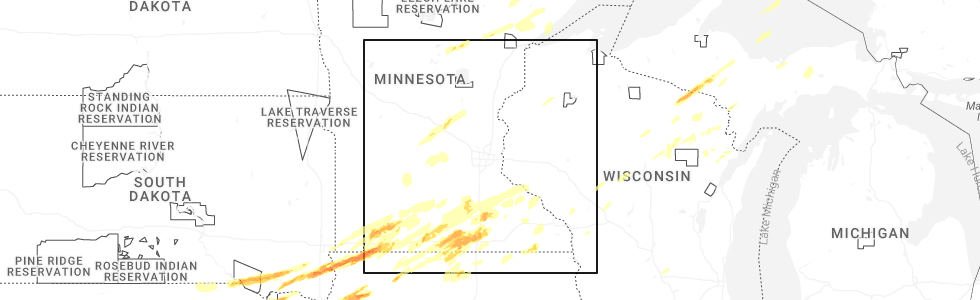
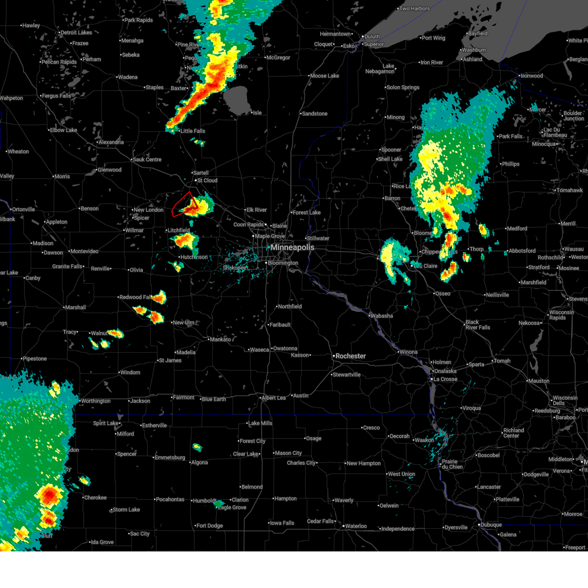
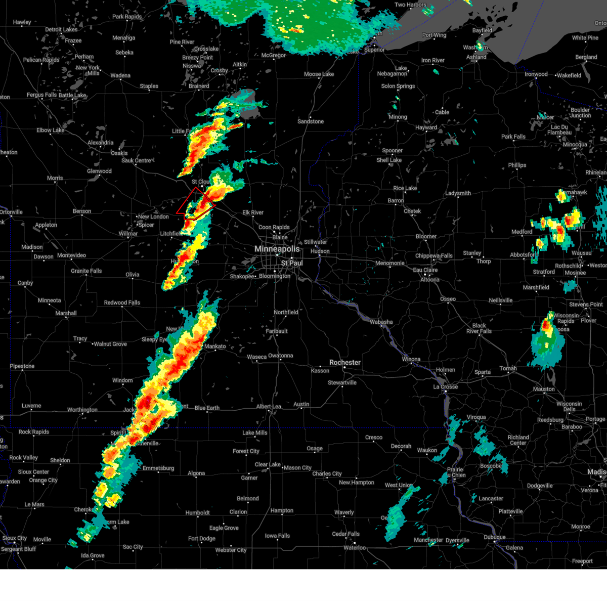
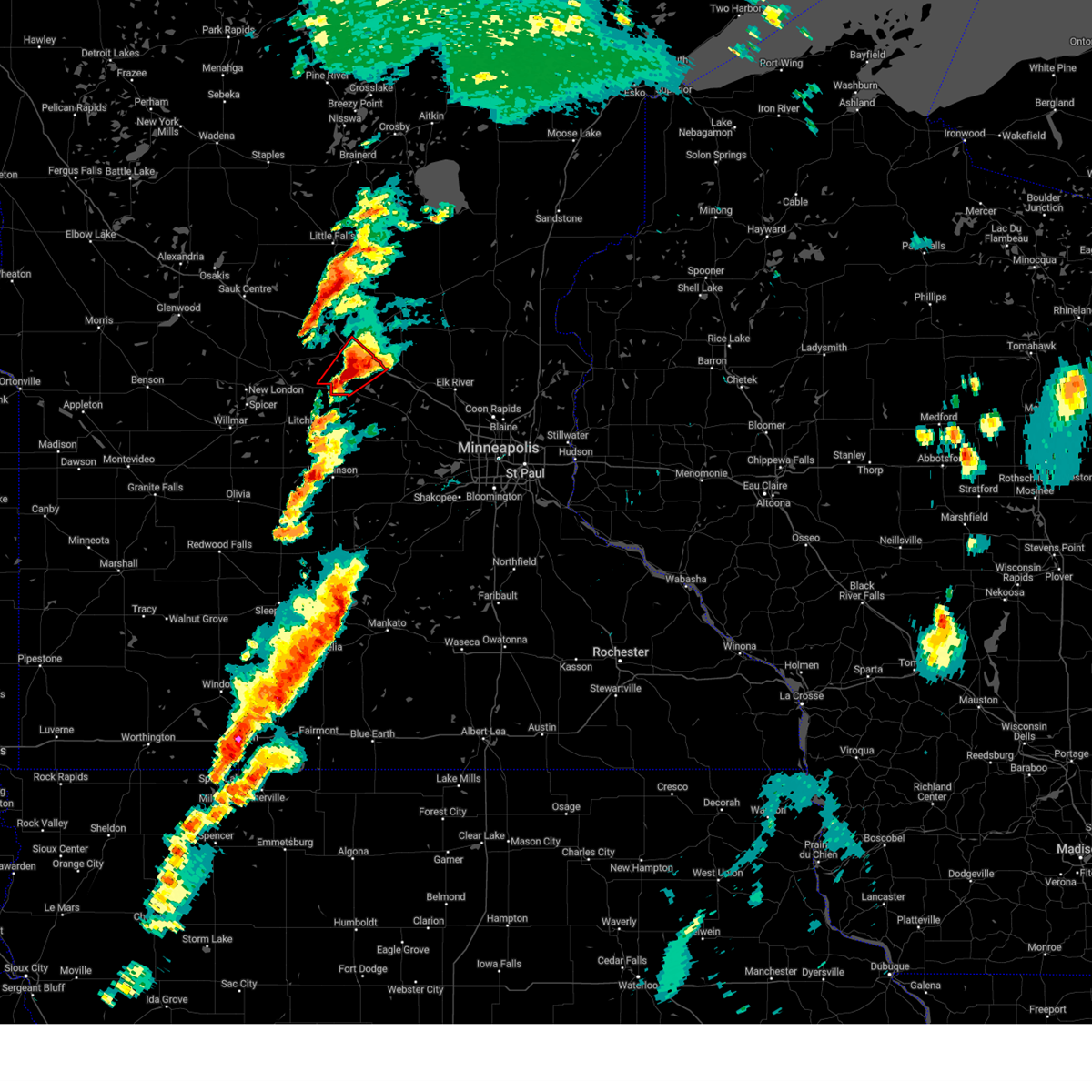
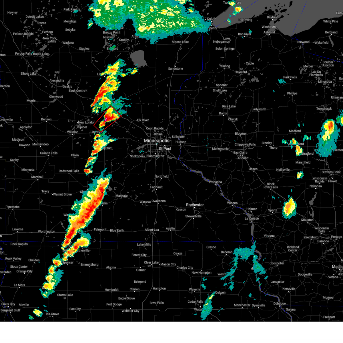
Hail Map for Kimball, MN
The Kimball, MN area has had 4 reports of on-the-ground hail by trained spotters, and has been under severe weather warnings 14 times during the past 12 months. Doppler radar has detected hail at or near Kimball, MN on 52 occasions, including 6 occasions during the past year.
| Name: | Kimball, MN |
| Where Located: | 55.7 miles WNW of Minneapolis, MN |
| Map: | Google Map for Kimball, MN |
| Population: | 762 |
| Housing Units: | 336 |
| More Info: | Search Google for Kimball, MN |
1
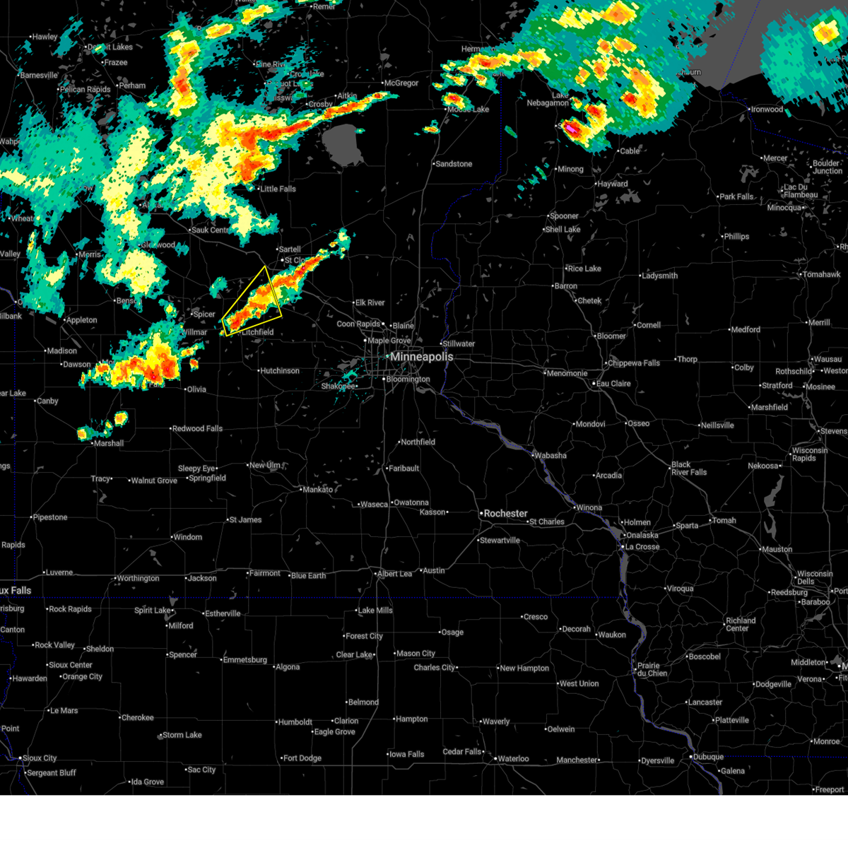
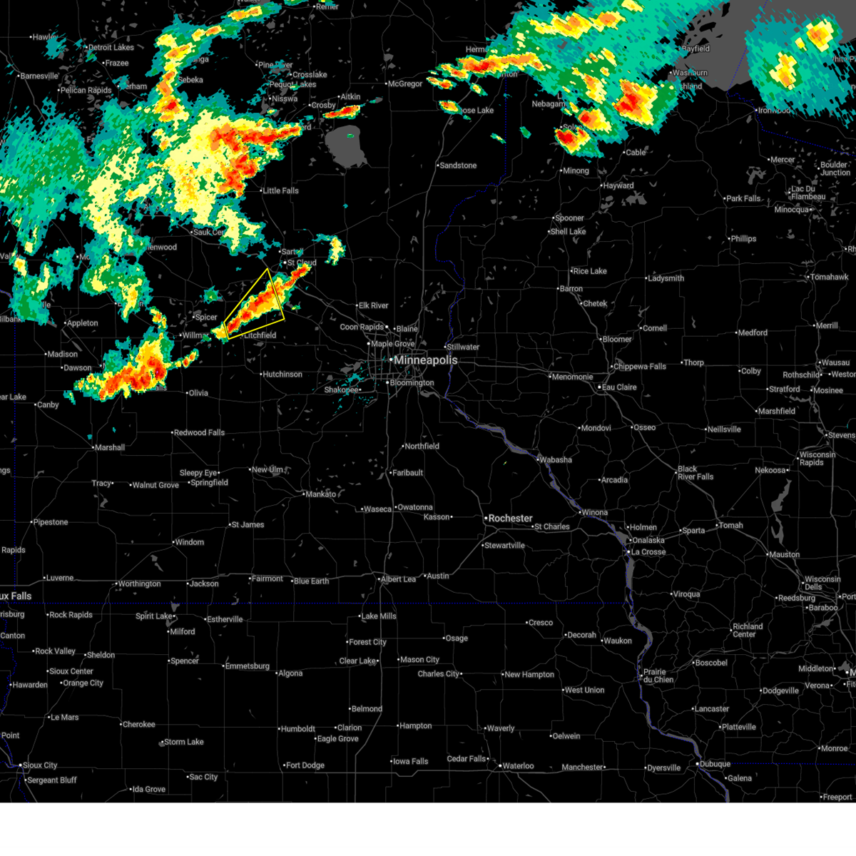
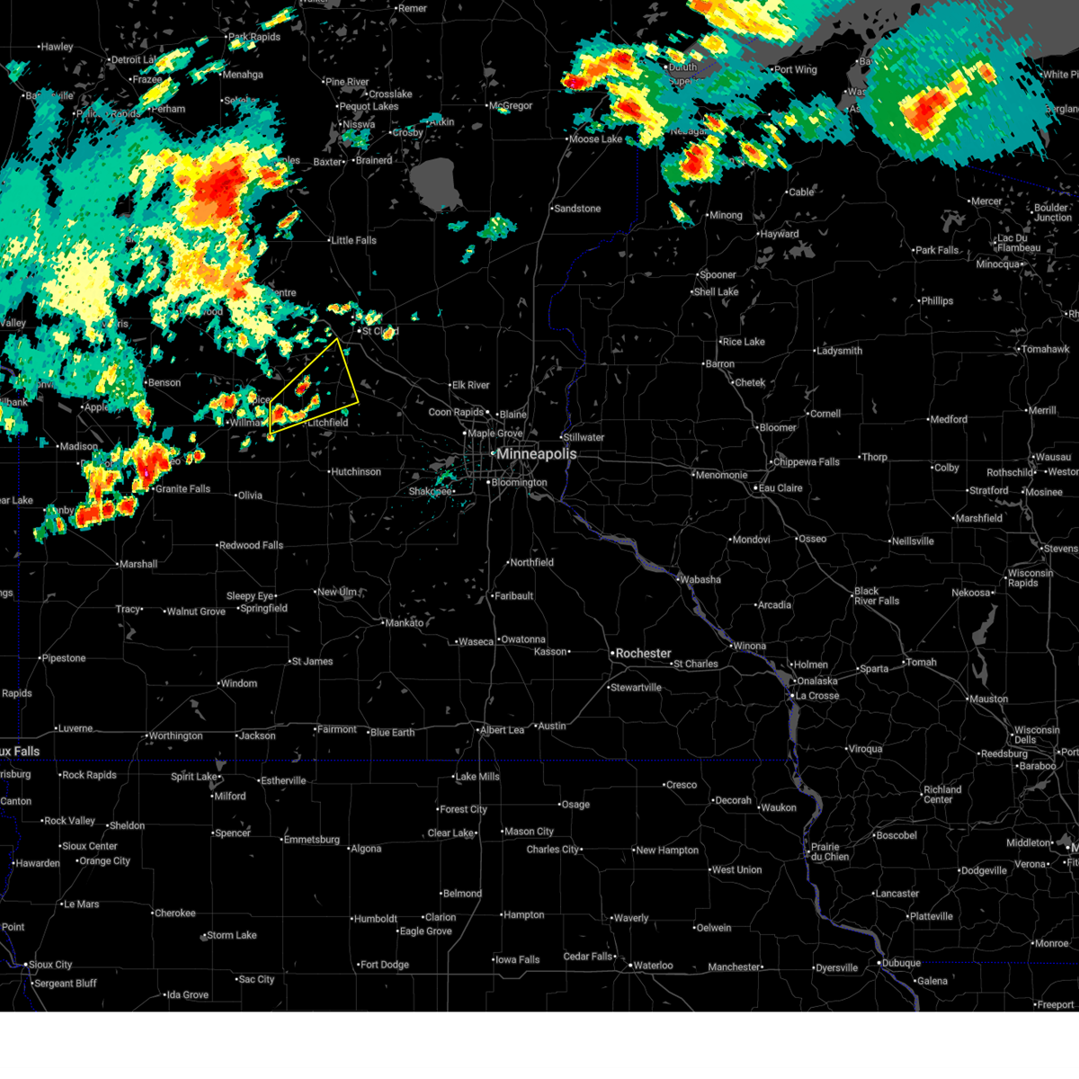
The Top Recent Hail Date for Kimball, MN is Monday, April 28, 2025 (13th out of 52)
Hail and Wind Damage Spotted near Kimball, MN
| Date / Time | Report Details |
|---|---|
| 7/15/2025 4:24 PM CDT |
 The storms which prompted the warning have weakened below severe limits, and no longer pose an immediate threat to life or property. therefore, the warning will be allowed to expire. however, small hail is still possible with these thunderstorms. to report severe weather, contact your nearest law enforcement agency. they will send your report to the national weather service office. a severe thunderstorm watch remains in effect until 1000 pm cdt tuesday for a portion of central minnesota. The storms which prompted the warning have weakened below severe limits, and no longer pose an immediate threat to life or property. therefore, the warning will be allowed to expire. however, small hail is still possible with these thunderstorms. to report severe weather, contact your nearest law enforcement agency. they will send your report to the national weather service office. a severe thunderstorm watch remains in effect until 1000 pm cdt tuesday for a portion of central minnesota.
|
| 7/15/2025 4:07 PM CDT |
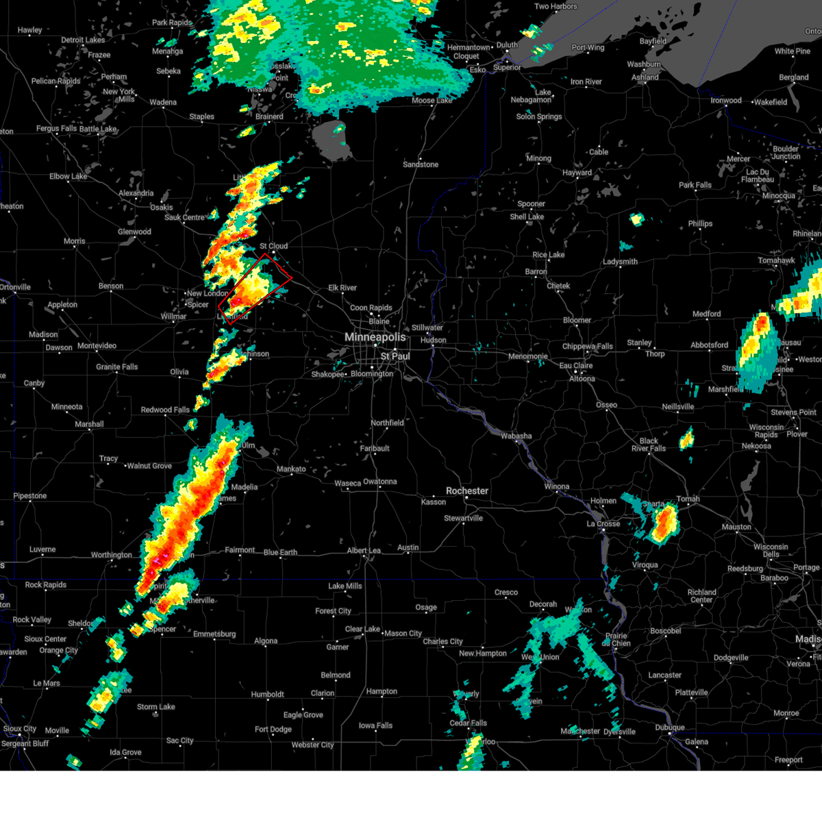
 At 407 pm cdt, severe thunderstorms were located along a line from 5 miles northeast of kimball to 6 miles north of litchfield, or along a line from 11 miles south of st. cloud to 24 miles north of hutchinson, moving northeast at 25 mph (radar indicated). Hazards include 60 mph wind gusts and quarter size hail. Hail damage to vehicles is expected. expect wind damage to roofs, siding, and trees. Locations impacted include, litchfield, rockville, watkins, kimball, forest city, south haven, st nicholas and litchfield airport. At 407 pm cdt, severe thunderstorms were located along a line from 5 miles northeast of kimball to 6 miles north of litchfield, or along a line from 11 miles south of st. cloud to 24 miles north of hutchinson, moving northeast at 25 mph (radar indicated). Hazards include 60 mph wind gusts and quarter size hail. Hail damage to vehicles is expected. expect wind damage to roofs, siding, and trees. Locations impacted include, litchfield, rockville, watkins, kimball, forest city, south haven, st nicholas and litchfield airport.
|
| 7/15/2025 3:37 PM CDT |
 Svrmpx the national weather service in the twin cities has issued a * severe thunderstorm warning for, northern meeker county in central minnesota, southeastern stearns county in central minnesota, northwestern wright county in central minnesota, * until 430 pm cdt. * at 337 pm cdt, severe thunderstorms were located along a line from over watkins to over grove city, or along a line from 20 miles southwest of st. cloud to 15 miles east of willmar, moving northeast at 20 mph (radar indicated). Hazards include 60 mph wind gusts and quarter size hail. Hail damage to vehicles is expected. Expect wind damage to roofs, siding, and trees. Svrmpx the national weather service in the twin cities has issued a * severe thunderstorm warning for, northern meeker county in central minnesota, southeastern stearns county in central minnesota, northwestern wright county in central minnesota, * until 430 pm cdt. * at 337 pm cdt, severe thunderstorms were located along a line from over watkins to over grove city, or along a line from 20 miles southwest of st. cloud to 15 miles east of willmar, moving northeast at 20 mph (radar indicated). Hazards include 60 mph wind gusts and quarter size hail. Hail damage to vehicles is expected. Expect wind damage to roofs, siding, and trees.
|
| 6/16/2025 5:28 PM CDT | The storm which prompted the warning has moved out of the area. therefore, the warning will be allowed to expire. a tornado watch remains in effect until 900 pm cdt monday for a portion of central minnesota. |
| 6/16/2025 5:21 PM CDT |
 At 521 pm cdt, a severe thunderstorm capable of producing a tornado was located near kimball, or 15 miles south of st. cloud, moving east at 30 mph (radar indicated rotation). Hazards include tornado. Flying debris will be dangerous to those caught without shelter. mobile homes will be damaged or destroyed. damage to roofs, windows and vehicles will occur. tree damage is likely. this tornado will be near, kimball around 525 pm cdt. Other locations impacted by the tornado include fairhaven. At 521 pm cdt, a severe thunderstorm capable of producing a tornado was located near kimball, or 15 miles south of st. cloud, moving east at 30 mph (radar indicated rotation). Hazards include tornado. Flying debris will be dangerous to those caught without shelter. mobile homes will be damaged or destroyed. damage to roofs, windows and vehicles will occur. tree damage is likely. this tornado will be near, kimball around 525 pm cdt. Other locations impacted by the tornado include fairhaven.
|
| 6/16/2025 4:54 PM CDT | Tormpx the national weather service in the twin cities has issued a * tornado warning for, northeastern meeker county in central minnesota, southeastern stearns county in central minnesota, * until 530 pm cdt. * at 454 pm cdt, a severe thunderstorm capable of producing a tornado was located near watkins, or 22 miles southwest of st. cloud, moving northeast at 25 mph (radar indicated rotation). Hazards include tornado. Flying debris will be dangerous to those caught without shelter. mobile homes will be damaged or destroyed. damage to roofs, windows and vehicles will occur. tree damage is likely. this tornado will be near, watkins around 500 pm cdt. kimball around 515 pm cdt. Other locations impacted by the tornado include st nicholas and fairhaven. |
| 4/28/2025 4:15 PM CDT |
 The tornado warning that was previously in effect has been reissued for stearns and wright counties and is in effect until 445 pm cdt. please refer to that bulletin for the latest severe weather information. however, small hail, gusty winds, and heavy rain are still possible with this thunderstorm. to report severe weather, contact your nearest law enforcement agency. they will send your report to the national weather service office. a tornado watch remains in effect until 1100 pm cdt monday for a portion of central minnesota. The tornado warning that was previously in effect has been reissued for stearns and wright counties and is in effect until 445 pm cdt. please refer to that bulletin for the latest severe weather information. however, small hail, gusty winds, and heavy rain are still possible with this thunderstorm. to report severe weather, contact your nearest law enforcement agency. they will send your report to the national weather service office. a tornado watch remains in effect until 1100 pm cdt monday for a portion of central minnesota.
|
| 4/28/2025 4:03 PM CDT |
 At 403 pm cdt, a severe thunderstorm capable of producing a tornado was located over kimball, or 15 miles south of st. cloud, moving northeast at 45 mph (radar indicated rotation). Hazards include tornado and ping pong ball size hail. Flying debris will be dangerous to those caught without shelter. mobile homes will be damaged or destroyed. damage to roofs, windows and vehicles will occur. tree damage is likely. locations impacted include, st. Cloud, waite park, clearwater, kimball, luxemburg, south haven, st augusta, fairhaven and pleasant lake. At 403 pm cdt, a severe thunderstorm capable of producing a tornado was located over kimball, or 15 miles south of st. cloud, moving northeast at 45 mph (radar indicated rotation). Hazards include tornado and ping pong ball size hail. Flying debris will be dangerous to those caught without shelter. mobile homes will be damaged or destroyed. damage to roofs, windows and vehicles will occur. tree damage is likely. locations impacted include, st. Cloud, waite park, clearwater, kimball, luxemburg, south haven, st augusta, fairhaven and pleasant lake.
|
| 4/28/2025 4:03 PM CDT |
 the tornado warning has been cancelled and is no longer in effect the tornado warning has been cancelled and is no longer in effect
|
| 4/28/2025 3:51 PM CDT |
 At 351 pm cdt, a severe thunderstorm capable of producing a tornado was located over watkins, or 20 miles southwest of st. cloud, moving northeast at 45 mph (radar indicated rotation). Hazards include tornado and golf ball size hail. Flying debris will be dangerous to those caught without shelter. mobile homes will be damaged or destroyed. damage to roofs, windows and vehicles will occur. tree damage is likely. locations impacted include, st. Cloud, waite park, rockville, clearwater, watkins, kimball, forest city, luxemburg, south haven, fairhaven, st nicholas, st augusta and pleasant lake. At 351 pm cdt, a severe thunderstorm capable of producing a tornado was located over watkins, or 20 miles southwest of st. cloud, moving northeast at 45 mph (radar indicated rotation). Hazards include tornado and golf ball size hail. Flying debris will be dangerous to those caught without shelter. mobile homes will be damaged or destroyed. damage to roofs, windows and vehicles will occur. tree damage is likely. locations impacted include, st. Cloud, waite park, rockville, clearwater, watkins, kimball, forest city, luxemburg, south haven, fairhaven, st nicholas, st augusta and pleasant lake.
|
| 4/28/2025 3:39 PM CDT |
 Tormpx the national weather service in the twin cities has issued a * tornado warning for, northeastern meeker county in central minnesota, southeastern stearns county in central minnesota, northwestern wright county in central minnesota, * until 415 pm cdt. * at 339 pm cdt, a severe thunderstorm capable of producing a tornado was located 6 miles north of litchfield, or 24 miles north of hutchinson, moving northeast at 50 mph (radar indicated rotation). Hazards include tornado and half dollar size hail. Flying debris will be dangerous to those caught without shelter. mobile homes will be damaged or destroyed. damage to roofs, windows and vehicles will occur. Tree damage is likely. Tormpx the national weather service in the twin cities has issued a * tornado warning for, northeastern meeker county in central minnesota, southeastern stearns county in central minnesota, northwestern wright county in central minnesota, * until 415 pm cdt. * at 339 pm cdt, a severe thunderstorm capable of producing a tornado was located 6 miles north of litchfield, or 24 miles north of hutchinson, moving northeast at 50 mph (radar indicated rotation). Hazards include tornado and half dollar size hail. Flying debris will be dangerous to those caught without shelter. mobile homes will be damaged or destroyed. damage to roofs, windows and vehicles will occur. Tree damage is likely.
|
| 8/29/2024 3:20 PM CDT |
 At 320 pm cdt, severe thunderstorms were located along a line extending from 6 miles east of camp ripley to 5 miles north of collegeville to near st. cloud, moving northeast at 50 mph (radar indicated). Hazards include 60 mph wind gusts and quarter size hail. Hail damage to vehicles is expected. expect wind damage to roofs, siding, and trees. locations impacted include, st. cloud, little falls, sartell, sauk rapids, waite park, st. Joseph, cold spring, collegeville, rockville, clearwater, richmond, and avon. At 320 pm cdt, severe thunderstorms were located along a line extending from 6 miles east of camp ripley to 5 miles north of collegeville to near st. cloud, moving northeast at 50 mph (radar indicated). Hazards include 60 mph wind gusts and quarter size hail. Hail damage to vehicles is expected. expect wind damage to roofs, siding, and trees. locations impacted include, st. cloud, little falls, sartell, sauk rapids, waite park, st. Joseph, cold spring, collegeville, rockville, clearwater, richmond, and avon.
|
| 8/29/2024 2:54 PM CDT |
 Svrmpx the national weather service in the twin cities has issued a * severe thunderstorm warning for, northern meeker county in central minnesota, western benton county in central minnesota, northwestern sherburne county in central minnesota, eastern stearns county in central minnesota, morrison county in central minnesota, * until 345 pm cdt. * at 253 pm cdt, severe thunderstorms were located along a line extending from near flensburg to near richmond to near watkins, moving northeast at 50 mph (radar indicated). Hazards include 60 mph wind gusts and quarter size hail. Hail damage to vehicles is expected. Expect wind damage to roofs, siding, and trees. Svrmpx the national weather service in the twin cities has issued a * severe thunderstorm warning for, northern meeker county in central minnesota, western benton county in central minnesota, northwestern sherburne county in central minnesota, eastern stearns county in central minnesota, morrison county in central minnesota, * until 345 pm cdt. * at 253 pm cdt, severe thunderstorms were located along a line extending from near flensburg to near richmond to near watkins, moving northeast at 50 mph (radar indicated). Hazards include 60 mph wind gusts and quarter size hail. Hail damage to vehicles is expected. Expect wind damage to roofs, siding, and trees.
|
| 8/3/2024 8:48 PM CDT |
 Svrmpx the national weather service in the twin cities has issued a * severe thunderstorm warning for, meeker county in central minnesota, southwestern stearns county in central minnesota, northeastern kandiyohi county in central minnesota, * until 945 pm cdt. * at 848 pm cdt, a severe thunderstorm was located near paynesville, or 25 miles northeast of willmar, moving south at 30 mph (radar indicated). Hazards include golf ball size hail and 60 mph wind gusts. People and animals outdoors will be injured. expect hail damage to roofs, siding, windows, and vehicles. Expect wind damage to roofs, siding, and trees. Svrmpx the national weather service in the twin cities has issued a * severe thunderstorm warning for, meeker county in central minnesota, southwestern stearns county in central minnesota, northeastern kandiyohi county in central minnesota, * until 945 pm cdt. * at 848 pm cdt, a severe thunderstorm was located near paynesville, or 25 miles northeast of willmar, moving south at 30 mph (radar indicated). Hazards include golf ball size hail and 60 mph wind gusts. People and animals outdoors will be injured. expect hail damage to roofs, siding, windows, and vehicles. Expect wind damage to roofs, siding, and trees.
|
| 7/25/2023 11:50 PM CDT |
 At 1149 pm cdt, a severe thunderstorm was located near annandale, or 17 miles west of buffalo, moving east at 45 mph (radar indicated). Hazards include 70 mph wind gusts. Expect considerable tree damage. damage is likely to mobile homes, roofs, and outbuildings. This severe thunderstorm will remain over mainly rural areas of northern meeker and southeastern stearns counties, including the following locations, darwin, forest city, st nicholas and litchfield airport. At 1149 pm cdt, a severe thunderstorm was located near annandale, or 17 miles west of buffalo, moving east at 45 mph (radar indicated). Hazards include 70 mph wind gusts. Expect considerable tree damage. damage is likely to mobile homes, roofs, and outbuildings. This severe thunderstorm will remain over mainly rural areas of northern meeker and southeastern stearns counties, including the following locations, darwin, forest city, st nicholas and litchfield airport.
|
| 7/25/2023 11:36 PM CDT |
 At 1136 pm cdt, a severe thunderstorm was located near watkins, or 23 miles southwest of st. cloud, moving east at 55 mph. this is a destructive storm (law enforcement). Hazards include 80 mph wind gusts and quarter size hail. Flying debris will be dangerous to those caught without shelter. mobile homes will be heavily damaged. expect considerable damage to roofs, windows, and vehicles. extensive tree damage and power outages are likely. locations impacted include, kimball. thunderstorm damage threat, destructive hail threat, radar indicated max hail size, 1. 00 in wind threat, radar indicated max wind gust, 80 mph. At 1136 pm cdt, a severe thunderstorm was located near watkins, or 23 miles southwest of st. cloud, moving east at 55 mph. this is a destructive storm (law enforcement). Hazards include 80 mph wind gusts and quarter size hail. Flying debris will be dangerous to those caught without shelter. mobile homes will be heavily damaged. expect considerable damage to roofs, windows, and vehicles. extensive tree damage and power outages are likely. locations impacted include, kimball. thunderstorm damage threat, destructive hail threat, radar indicated max hail size, 1. 00 in wind threat, radar indicated max wind gust, 80 mph.
|
| 7/25/2023 11:20 PM CDT |
 At 1120 pm cdt, a severe thunderstorm was located 6 miles south of paynesville, or 18 miles northeast of willmar, moving east at 55 mph. this is a destructive storm for (law enforcement). Hazards include 80 mph wind gusts. Flying debris will be dangerous to those caught without shelter. mobile homes will be heavily damaged. expect considerable damage to roofs, windows, and vehicles. extensive tree damage and power outages are likely. this severe thunderstorm will be near, watkins around 1140 pm cdt. other locations in the path of this severe thunderstorm include kimball. thunderstorm damage threat, destructive hail threat, radar indicated max hail size, <. 75 in wind threat, radar indicated max wind gust, 80 mph. At 1120 pm cdt, a severe thunderstorm was located 6 miles south of paynesville, or 18 miles northeast of willmar, moving east at 55 mph. this is a destructive storm for (law enforcement). Hazards include 80 mph wind gusts. Flying debris will be dangerous to those caught without shelter. mobile homes will be heavily damaged. expect considerable damage to roofs, windows, and vehicles. extensive tree damage and power outages are likely. this severe thunderstorm will be near, watkins around 1140 pm cdt. other locations in the path of this severe thunderstorm include kimball. thunderstorm damage threat, destructive hail threat, radar indicated max hail size, <. 75 in wind threat, radar indicated max wind gust, 80 mph.
|
| 7/25/2023 11:05 PM CDT |
 At 1104 pm cdt, a severe thunderstorm was located near new london, or 14 miles northeast of willmar, moving east at 50 mph (radar indicated). Hazards include 60 mph wind gusts. Expect damage to roofs, siding, and trees. this severe thunderstorm will be near, paynesville around 1115 pm cdt. other locations in the path of this severe thunderstorm include watkins and kimball. hail threat, radar indicated max hail size, <. 75 in wind threat, radar indicated max wind gust, 60 mph. At 1104 pm cdt, a severe thunderstorm was located near new london, or 14 miles northeast of willmar, moving east at 50 mph (radar indicated). Hazards include 60 mph wind gusts. Expect damage to roofs, siding, and trees. this severe thunderstorm will be near, paynesville around 1115 pm cdt. other locations in the path of this severe thunderstorm include watkins and kimball. hail threat, radar indicated max hail size, <. 75 in wind threat, radar indicated max wind gust, 60 mph.
|
| 7/24/2023 3:58 PM CDT |
 At 358 pm cdt, a severe thunderstorm was located near cold spring, or 14 miles west of st. cloud, moving south at 15 mph (radar indicated). Hazards include 60 mph wind gusts and quarter size hail. Hail damage to vehicles is expected. expect wind damage to roofs, siding, and trees. this severe thunderstorm will be near, cold spring around 410 pm cdt. rockville around 415 pm cdt. watkins around 445 pm cdt. kimball around 450 pm cdt. other locations impacted by this severe thunderstorm include fairhaven, st nicholas and pleasant lake. hail threat, radar indicated max hail size, 1. 00 in wind threat, radar indicated max wind gust, 60 mph. At 358 pm cdt, a severe thunderstorm was located near cold spring, or 14 miles west of st. cloud, moving south at 15 mph (radar indicated). Hazards include 60 mph wind gusts and quarter size hail. Hail damage to vehicles is expected. expect wind damage to roofs, siding, and trees. this severe thunderstorm will be near, cold spring around 410 pm cdt. rockville around 415 pm cdt. watkins around 445 pm cdt. kimball around 450 pm cdt. other locations impacted by this severe thunderstorm include fairhaven, st nicholas and pleasant lake. hail threat, radar indicated max hail size, 1. 00 in wind threat, radar indicated max wind gust, 60 mph.
|
| 7/19/2023 5:30 PM CDT |
 At 529 pm cdt, a severe thunderstorm was located over watkins, or 18 miles southwest of st. cloud, moving southeast at 45 mph (trained weather spotters reported 74 mph gust near richmond). Hazards include 70 mph wind gusts and quarter size hail. Hail damage to vehicles is expected. expect considerable tree damage. wind damage is also likely to mobile homes, roofs, and outbuildings. this severe thunderstorm will be near, annandale around 545 pm cdt. other locations in the path of this severe thunderstorm include maple lake, buffalo and montrose. thunderstorm damage threat, considerable hail threat, radar indicated max hail size, 1. 00 in wind threat, observed max wind gust, 70 mph. At 529 pm cdt, a severe thunderstorm was located over watkins, or 18 miles southwest of st. cloud, moving southeast at 45 mph (trained weather spotters reported 74 mph gust near richmond). Hazards include 70 mph wind gusts and quarter size hail. Hail damage to vehicles is expected. expect considerable tree damage. wind damage is also likely to mobile homes, roofs, and outbuildings. this severe thunderstorm will be near, annandale around 545 pm cdt. other locations in the path of this severe thunderstorm include maple lake, buffalo and montrose. thunderstorm damage threat, considerable hail threat, radar indicated max hail size, 1. 00 in wind threat, observed max wind gust, 70 mph.
|
| 7/19/2023 5:17 PM CDT |
 At 516 pm cdt, a severe thunderstorm was located near rockville, or 10 miles west of st. cloud, moving east at 40 mph (trained weather spotters measured 74 mph wind gust near richmond at 515 pm cdt). Hazards include 70 mph wind gusts and half dollar size hail. Hail damage to vehicles is expected. expect considerable tree damage. wind damage is also likely to mobile homes, roofs, and outbuildings. this severe storm will be near, st. joseph and rockville around 520 pm cdt. other locations in the path of this severe thunderstorm include waite park and st. Cloud. At 516 pm cdt, a severe thunderstorm was located near rockville, or 10 miles west of st. cloud, moving east at 40 mph (trained weather spotters measured 74 mph wind gust near richmond at 515 pm cdt). Hazards include 70 mph wind gusts and half dollar size hail. Hail damage to vehicles is expected. expect considerable tree damage. wind damage is also likely to mobile homes, roofs, and outbuildings. this severe storm will be near, st. joseph and rockville around 520 pm cdt. other locations in the path of this severe thunderstorm include waite park and st. Cloud.
|
| 7/19/2023 5:01 PM CDT |
 At 501 pm cdt, a severe thunderstorm was located 7 miles northwest of richmond, or 21 miles west of st. cloud, moving east at 40 mph (radar indicated). Hazards include 60 mph wind gusts and half dollar size hail. Hail damage to vehicles is expected. expect wind damage to roofs, siding, and trees. this severe storm will be near, richmond around 510 pm cdt. cold spring around 515 pm cdt. other locations in the path of this severe thunderstorm include st. Joseph, rockville and waite park. At 501 pm cdt, a severe thunderstorm was located 7 miles northwest of richmond, or 21 miles west of st. cloud, moving east at 40 mph (radar indicated). Hazards include 60 mph wind gusts and half dollar size hail. Hail damage to vehicles is expected. expect wind damage to roofs, siding, and trees. this severe storm will be near, richmond around 510 pm cdt. cold spring around 515 pm cdt. other locations in the path of this severe thunderstorm include st. Joseph, rockville and waite park.
|
| 7/19/2023 4:55 PM CDT |
 At 455 pm cdt, a severe thunderstorm was located 8 miles south of freeport, or 25 miles west of st. cloud, moving east at 40 mph (radar indicated). Hazards include 60 mph wind gusts and half dollar size hail. Hail damage to vehicles is expected. expect wind damage to roofs, siding, and trees. this severe thunderstorm will be near, richmond around 510 pm cdt. cold spring around 515 pm cdt. other locations in the path of this severe thunderstorm include st. joseph, rockville and waite park. hail threat, radar indicated max hail size, 1. 25 in wind threat, radar indicated max wind gust, 60 mph. At 455 pm cdt, a severe thunderstorm was located 8 miles south of freeport, or 25 miles west of st. cloud, moving east at 40 mph (radar indicated). Hazards include 60 mph wind gusts and half dollar size hail. Hail damage to vehicles is expected. expect wind damage to roofs, siding, and trees. this severe thunderstorm will be near, richmond around 510 pm cdt. cold spring around 515 pm cdt. other locations in the path of this severe thunderstorm include st. joseph, rockville and waite park. hail threat, radar indicated max hail size, 1. 25 in wind threat, radar indicated max wind gust, 60 mph.
|
| 7/13/2023 8:32 PM CDT |
 At 832 pm cdt, a severe thunderstorm was located 7 miles south of watkins, or 22 miles north of hutchinson, moving southeast at 50 mph (radar indicated). Hazards include 60 mph wind gusts and quarter size hail. Hail damage to vehicles is expected. expect wind damage to roofs, siding, and trees. locations impacted include, dassel. hail threat, radar indicated max hail size, 1. 00 in wind threat, radar indicated max wind gust, 60 mph. At 832 pm cdt, a severe thunderstorm was located 7 miles south of watkins, or 22 miles north of hutchinson, moving southeast at 50 mph (radar indicated). Hazards include 60 mph wind gusts and quarter size hail. Hail damage to vehicles is expected. expect wind damage to roofs, siding, and trees. locations impacted include, dassel. hail threat, radar indicated max hail size, 1. 00 in wind threat, radar indicated max wind gust, 60 mph.
|
| 7/13/2023 8:13 PM CDT |
 At 813 pm cdt, a severe thunderstorm was located near paynesville, or 20 miles northeast of willmar, moving southeast at 55 mph (radar indicated). Hazards include 60 mph wind gusts and quarter size hail. Hail damage to vehicles is expected. expect wind damage to roofs, siding, and trees. this severe thunderstorm will be near, watkins around 825 pm cdt. litchfield around 830 pm cdt. other locations in the path of this severe thunderstorm include dassel. hail threat, radar indicated max hail size, 1. 00 in wind threat, radar indicated max wind gust, 60 mph. At 813 pm cdt, a severe thunderstorm was located near paynesville, or 20 miles northeast of willmar, moving southeast at 55 mph (radar indicated). Hazards include 60 mph wind gusts and quarter size hail. Hail damage to vehicles is expected. expect wind damage to roofs, siding, and trees. this severe thunderstorm will be near, watkins around 825 pm cdt. litchfield around 830 pm cdt. other locations in the path of this severe thunderstorm include dassel. hail threat, radar indicated max hail size, 1. 00 in wind threat, radar indicated max wind gust, 60 mph.
|
| 8/28/2022 9:38 PM CDT | At 938 pm cdt, severe thunderstorms were located along a line extending from 6 miles south of st. cloud to 5 miles north of kimball to watkins, moving east at 30 mph (radar indicated). Hazards include 60 mph wind gusts and half dollar size hail. Hail damage to vehicles is expected. expect wind damage to roofs, siding, and trees. severe thunderstorms will be near, st. cloud around 955 pm cdt. Other locations in the path of these severe thunderstorms include clear lake, annandale, clearwater and becker. |
| 8/28/2022 9:33 PM CDT | At 933 pm cdt, a severe thunderstorm capable of producing a tornado was located near kimball, or 14 miles southwest of st. cloud, moving east at 30 mph (radar indicated rotation). Hazards include tornado and two inch hail. Flying debris will be dangerous to those caught without shelter. mobile homes will be damaged or destroyed. damage to roofs, windows, and vehicles will occur. tree damage is likely. This tornadic thunderstorm will remain over mainly rural areas of southeastern stearns county, including the following locations, fairhaven. |
| 8/28/2022 9:25 PM CDT | At 925 pm cdt, a severe thunderstorm capable of producing a tornado was located near watkins, or 16 miles southwest of st. cloud, moving east at 20 mph (radar indicated rotation). Hazards include tornado and two inch hail. Flying debris will be dangerous to those caught without shelter. mobile homes will be damaged or destroyed. damage to roofs, windows, and vehicles will occur. tree damage is likely. Locations impacted include, kimball. |
| 8/28/2022 9:14 PM CDT | At 914 pm cdt, a severe thunderstorm capable of producing a tornado was located near richmond, or 18 miles southwest of st. cloud, moving east at 25 mph (radar indicated rotation). Hazards include tornado and quarter size hail. Flying debris will be dangerous to those caught without shelter. mobile homes will be damaged or destroyed. damage to roofs, windows, and vehicles will occur. tree damage is likely. this dangerous storm will be near, watkins around 925 pm cdt. Other locations in the path of this tornadic thunderstorm include kimball. |
| 5/30/2022 4:33 AM CDT |
 At 433 am cdt, severe thunderstorms were located along a line extending from 6 miles west of sauk centre to annandale, moving east at 65 mph (radar indicated). Hazards include 70 mph wind gusts. Expect considerable tree damage. damage is likely to mobile homes, roofs, and outbuildings. locations impacted include, annandale, freeport, st. anthony, albany, avon, holdingford, collegeville, sartell and rice. thunderstorm damage threat, considerable hail threat, radar indicated max hail size, <. 75 in wind threat, radar indicated max wind gust, 70 mph. At 433 am cdt, severe thunderstorms were located along a line extending from 6 miles west of sauk centre to annandale, moving east at 65 mph (radar indicated). Hazards include 70 mph wind gusts. Expect considerable tree damage. damage is likely to mobile homes, roofs, and outbuildings. locations impacted include, annandale, freeport, st. anthony, albany, avon, holdingford, collegeville, sartell and rice. thunderstorm damage threat, considerable hail threat, radar indicated max hail size, <. 75 in wind threat, radar indicated max wind gust, 70 mph.
|
| 5/30/2022 4:14 AM CDT |
 At 414 am cdt, severe thunderstorms were located along a line extending from 8 miles west of brooten to near dassel, moving northeast at 65 mph (radar indicated). Hazards include 70 mph wind gusts. Expect considerable tree damage. damage is likely to mobile homes, roofs, and outbuildings. severe thunderstorms will be near, cokato and dassel around 420 am cdt. annandale around 430 am cdt. other locations in the path of these severe thunderstorms include sauk centre, clearwater, becker and clear lake. thunderstorm damage threat, considerable hail threat, radar indicated max hail size, <. 75 in wind threat, radar indicated max wind gust, 70 mph. At 414 am cdt, severe thunderstorms were located along a line extending from 8 miles west of brooten to near dassel, moving northeast at 65 mph (radar indicated). Hazards include 70 mph wind gusts. Expect considerable tree damage. damage is likely to mobile homes, roofs, and outbuildings. severe thunderstorms will be near, cokato and dassel around 420 am cdt. annandale around 430 am cdt. other locations in the path of these severe thunderstorms include sauk centre, clearwater, becker and clear lake. thunderstorm damage threat, considerable hail threat, radar indicated max hail size, <. 75 in wind threat, radar indicated max wind gust, 70 mph.
|
| 5/30/2022 3:52 AM CDT |
 At 351 am cdt, severe thunderstorms were located along a line extending from 8 miles north of watson to near hector, moving northeast at 70 mph (radar indicated). Hazards include 70 mph wind gusts. Expect considerable tree damage. damage is likely to mobile homes, roofs, and outbuildings. severe thunderstorms will be near, hector around 355 am cdt. cosmos around 400 am cdt. other locations in the path of these severe thunderstorms include litchfield. thunderstorm damage threat, considerable hail threat, radar indicated max hail size, <. 75 in wind threat, radar indicated max wind gust, 70 mph. At 351 am cdt, severe thunderstorms were located along a line extending from 8 miles north of watson to near hector, moving northeast at 70 mph (radar indicated). Hazards include 70 mph wind gusts. Expect considerable tree damage. damage is likely to mobile homes, roofs, and outbuildings. severe thunderstorms will be near, hector around 355 am cdt. cosmos around 400 am cdt. other locations in the path of these severe thunderstorms include litchfield. thunderstorm damage threat, considerable hail threat, radar indicated max hail size, <. 75 in wind threat, radar indicated max wind gust, 70 mph.
|
| 5/12/2022 7:54 PM CDT |
 At 753 pm cdt, severe thunderstorms were located along a line extending from 9 miles south of motley to near camp ripley to 5 miles east of royalton to 5 miles south of clearwater, moving northeast at 65 mph (radar indicated). Hazards include 70 mph wind gusts. Expect considerable tree damage. damage is likely to mobile homes, roofs, and outbuildings. these severe thunderstorms will remain over mainly rural areas of western wright, eastern meeker, western benton, northwestern sherburne, southern todd, eastern stearns and southwestern morrison counties, including the following locations, mayhew, sobieski, st augusta, opole, burtrum, pleasant lake, smith lake, clotho, darwin and little falls airport. thunderstorm damage threat, considerable hail threat, radar indicated max hail size, <. 75 in wind threat, radar indicated max wind gust, 70 mph. At 753 pm cdt, severe thunderstorms were located along a line extending from 9 miles south of motley to near camp ripley to 5 miles east of royalton to 5 miles south of clearwater, moving northeast at 65 mph (radar indicated). Hazards include 70 mph wind gusts. Expect considerable tree damage. damage is likely to mobile homes, roofs, and outbuildings. these severe thunderstorms will remain over mainly rural areas of western wright, eastern meeker, western benton, northwestern sherburne, southern todd, eastern stearns and southwestern morrison counties, including the following locations, mayhew, sobieski, st augusta, opole, burtrum, pleasant lake, smith lake, clotho, darwin and little falls airport. thunderstorm damage threat, considerable hail threat, radar indicated max hail size, <. 75 in wind threat, radar indicated max wind gust, 70 mph.
|
| 5/12/2022 7:25 PM CDT |
 At 724 pm cdt, severe thunderstorms were located along a line extending from near long prairie to near upsala to near avon to dassel, moving northeast at 75 mph (radar indicated). Hazards include 70 mph wind gusts. Expect considerable tree damage. damage is likely to mobile homes, roofs, and outbuildings. these severe storms will be near, waite park, st. joseph, collegeville, holdingford and upsala around 730 pm cdt. sartell, annandale, browerville and flensburg around 735 pm cdt. little falls, maple lake, royalton and rice around 740 pm cdt. thunderstorm damage threat, considerable hail threat, radar indicated max hail size, <. 75 in wind threat, radar indicated max wind gust, 70 mph. At 724 pm cdt, severe thunderstorms were located along a line extending from near long prairie to near upsala to near avon to dassel, moving northeast at 75 mph (radar indicated). Hazards include 70 mph wind gusts. Expect considerable tree damage. damage is likely to mobile homes, roofs, and outbuildings. these severe storms will be near, waite park, st. joseph, collegeville, holdingford and upsala around 730 pm cdt. sartell, annandale, browerville and flensburg around 735 pm cdt. little falls, maple lake, royalton and rice around 740 pm cdt. thunderstorm damage threat, considerable hail threat, radar indicated max hail size, <. 75 in wind threat, radar indicated max wind gust, 70 mph.
|
| 5/12/2022 7:08 PM CDT |
 At 707 pm cdt, severe thunderstorms were located along a line extending from 8 miles northeast of glenwood to 8 miles northeast of belgrade to near paynesville to 6 miles south of grove city, moving northeast at 70 mph (radar indicated). Hazards include 70 mph wind gusts. Expect considerable tree damage. damage is likely to mobile homes, roofs, and outbuildings. severe thunderstorms will be near, melrose around 715 pm cdt. st. anthony, freeport and lake osakis around 720 pm cdt. collegeville, albany, avon, watkins and grey eagle around 725 pm cdt. long prairie, kimball, holdingford, upsala and swanville around 730 pm cdt. rockville, browerville, clarissa, bowlus and flensburg around 735 pm cdt. thunderstorm damage threat, considerable hail threat, radar indicated max hail size, <. 75 in wind threat, radar indicated max wind gust, 70 mph. At 707 pm cdt, severe thunderstorms were located along a line extending from 8 miles northeast of glenwood to 8 miles northeast of belgrade to near paynesville to 6 miles south of grove city, moving northeast at 70 mph (radar indicated). Hazards include 70 mph wind gusts. Expect considerable tree damage. damage is likely to mobile homes, roofs, and outbuildings. severe thunderstorms will be near, melrose around 715 pm cdt. st. anthony, freeport and lake osakis around 720 pm cdt. collegeville, albany, avon, watkins and grey eagle around 725 pm cdt. long prairie, kimball, holdingford, upsala and swanville around 730 pm cdt. rockville, browerville, clarissa, bowlus and flensburg around 735 pm cdt. thunderstorm damage threat, considerable hail threat, radar indicated max hail size, <. 75 in wind threat, radar indicated max wind gust, 70 mph.
|
| 5/11/2022 8:26 PM CDT |
 The severe thunderstorm warning for western wright, northeastern meeker and southeastern stearns counties will expire at 830 pm cdt, the storm which prompted the warning has moved out of the area. therefore, the warning will be allowed to expire. a tornado watch remains in effect until midnight cdt for central minnesota. The severe thunderstorm warning for western wright, northeastern meeker and southeastern stearns counties will expire at 830 pm cdt, the storm which prompted the warning has moved out of the area. therefore, the warning will be allowed to expire. a tornado watch remains in effect until midnight cdt for central minnesota.
|
| 5/11/2022 7:46 PM CDT |
 At 746 pm cdt, a severe thunderstorm was located near annandale, or 18 miles west of buffalo, moving northwest at 35 mph (radar indicated). Hazards include 60 mph wind gusts and quarter size hail. Hail damage to vehicles is expected. expect wind damage to roofs, siding, and trees. this severe thunderstorm will be near, kimball around 755 pm cdt. watkins around 800 pm cdt. other locations in the path of this severe thunderstorm include cold spring, rockville, waite park, richmond, st. joseph and collegeville. hail threat, radar indicated max hail size, 1. 00 in wind threat, radar indicated max wind gust, 60 mph. At 746 pm cdt, a severe thunderstorm was located near annandale, or 18 miles west of buffalo, moving northwest at 35 mph (radar indicated). Hazards include 60 mph wind gusts and quarter size hail. Hail damage to vehicles is expected. expect wind damage to roofs, siding, and trees. this severe thunderstorm will be near, kimball around 755 pm cdt. watkins around 800 pm cdt. other locations in the path of this severe thunderstorm include cold spring, rockville, waite park, richmond, st. joseph and collegeville. hail threat, radar indicated max hail size, 1. 00 in wind threat, radar indicated max wind gust, 60 mph.
|
| 5/11/2022 7:40 PM CDT |
 At 740 pm cdt, a severe thunderstorm was located near watkins, or 17 miles southwest of st. cloud, moving north at 35 mph (radar indicated). Hazards include 60 mph wind gusts and half dollar size hail. Hail damage to vehicles is expected. expect wind damage to roofs, siding, and trees. locations impacted include, cold spring, rockville, richmond, watkins, kimball, roscoe and st nicholas. hail threat, radar indicated max hail size, 1. 25 in wind threat, radar indicated max wind gust, 60 mph. At 740 pm cdt, a severe thunderstorm was located near watkins, or 17 miles southwest of st. cloud, moving north at 35 mph (radar indicated). Hazards include 60 mph wind gusts and half dollar size hail. Hail damage to vehicles is expected. expect wind damage to roofs, siding, and trees. locations impacted include, cold spring, rockville, richmond, watkins, kimball, roscoe and st nicholas. hail threat, radar indicated max hail size, 1. 25 in wind threat, radar indicated max wind gust, 60 mph.
|
| 5/11/2022 7:30 PM CDT |
 At 729 pm cdt, a severe thunderstorm was located over watkins, or 21 miles southwest of st. cloud, moving north at 35 mph (radar indicated). Hazards include 60 mph wind gusts and half dollar size hail. Hail damage to vehicles is expected. expect wind damage to roofs, siding, and trees. locations impacted include, rockville, cold spring and richmond. hail threat, radar indicated max hail size, 1. 25 in wind threat, radar indicated max wind gust, 60 mph. At 729 pm cdt, a severe thunderstorm was located over watkins, or 21 miles southwest of st. cloud, moving north at 35 mph (radar indicated). Hazards include 60 mph wind gusts and half dollar size hail. Hail damage to vehicles is expected. expect wind damage to roofs, siding, and trees. locations impacted include, rockville, cold spring and richmond. hail threat, radar indicated max hail size, 1. 25 in wind threat, radar indicated max wind gust, 60 mph.
|
| 5/11/2022 7:20 PM CDT |
 At 720 pm cdt, a severe thunderstorm was located 7 miles south of kimball, or 22 miles north of hutchinson, moving north at 35 mph (radar indicated). Hazards include golf ball size hail and 60 mph wind gusts. People and animals outdoors will be injured. expect hail damage to roofs, siding, windows, and vehicles. expect wind damage to roofs, siding, and trees. this severe thunderstorm will be near, watkins and kimball around 730 pm cdt. other locations in the path of this severe thunderstorm include cold spring, rockville and richmond. thunderstorm damage threat, considerable hail threat, radar indicated max hail size, 1. 75 in wind threat, radar indicated max wind gust, 60 mph. At 720 pm cdt, a severe thunderstorm was located 7 miles south of kimball, or 22 miles north of hutchinson, moving north at 35 mph (radar indicated). Hazards include golf ball size hail and 60 mph wind gusts. People and animals outdoors will be injured. expect hail damage to roofs, siding, windows, and vehicles. expect wind damage to roofs, siding, and trees. this severe thunderstorm will be near, watkins and kimball around 730 pm cdt. other locations in the path of this severe thunderstorm include cold spring, rockville and richmond. thunderstorm damage threat, considerable hail threat, radar indicated max hail size, 1. 75 in wind threat, radar indicated max wind gust, 60 mph.
|
| 5/11/2022 3:26 PM CDT |
 At 326 pm cdt, a severe thunderstorm was located near kimball, or 14 miles south of st. cloud, moving northeast at 40 mph (radar indicated). Hazards include 60 mph wind gusts and quarter size hail. Hail damage to vehicles is expected. expect wind damage to roofs, siding, and trees. locations impacted include, clearwater and st. cloud. hail threat, radar indicated max hail size, 1. 00 in wind threat, radar indicated max wind gust, 60 mph. At 326 pm cdt, a severe thunderstorm was located near kimball, or 14 miles south of st. cloud, moving northeast at 40 mph (radar indicated). Hazards include 60 mph wind gusts and quarter size hail. Hail damage to vehicles is expected. expect wind damage to roofs, siding, and trees. locations impacted include, clearwater and st. cloud. hail threat, radar indicated max hail size, 1. 00 in wind threat, radar indicated max wind gust, 60 mph.
|
| 5/11/2022 3:03 PM CDT |
 At 303 pm cdt, a severe thunderstorm was located 6 miles northeast of litchfield, or 22 miles north of hutchinson, moving northeast at 40 mph (radar indicated). Hazards include 60 mph wind gusts and quarter size hail. Hail damage to vehicles is expected. expect wind damage to roofs, siding, and trees. this severe thunderstorm will be near, watkins around 310 pm cdt. annandale and kimball around 320 pm cdt. other locations in the path of this severe thunderstorm include clearwater and st. cloud. hail threat, radar indicated max hail size, 1. 00 in wind threat, radar indicated max wind gust, 60 mph. At 303 pm cdt, a severe thunderstorm was located 6 miles northeast of litchfield, or 22 miles north of hutchinson, moving northeast at 40 mph (radar indicated). Hazards include 60 mph wind gusts and quarter size hail. Hail damage to vehicles is expected. expect wind damage to roofs, siding, and trees. this severe thunderstorm will be near, watkins around 310 pm cdt. annandale and kimball around 320 pm cdt. other locations in the path of this severe thunderstorm include clearwater and st. cloud. hail threat, radar indicated max hail size, 1. 00 in wind threat, radar indicated max wind gust, 60 mph.
|
| 5/9/2022 8:50 AM CDT |
 At 849 am cdt, a severe thunderstorm was located 6 miles northeast of kimball, or 13 miles south of st. cloud, moving northeast at 70 mph (law enforcement reported golf ball size hail in kimball at 843 am cdt). Hazards include golf ball size hail and 60 mph wind gusts. People and animals outdoors will be injured. expect hail damage to roofs, siding, windows, and vehicles. expect wind damage to roofs, siding, and trees. this severe thunderstorm will be near, clearwater around 855 am cdt. st. cloud and clear lake around 900 am cdt. becker around 905 am cdt. other locations in the path of this severe thunderstorm include princeton and foreston. thunderstorm damage threat, considerable hail threat, observed max hail size, 1. 75 in wind threat, radar indicated max wind gust, 60 mph. At 849 am cdt, a severe thunderstorm was located 6 miles northeast of kimball, or 13 miles south of st. cloud, moving northeast at 70 mph (law enforcement reported golf ball size hail in kimball at 843 am cdt). Hazards include golf ball size hail and 60 mph wind gusts. People and animals outdoors will be injured. expect hail damage to roofs, siding, windows, and vehicles. expect wind damage to roofs, siding, and trees. this severe thunderstorm will be near, clearwater around 855 am cdt. st. cloud and clear lake around 900 am cdt. becker around 905 am cdt. other locations in the path of this severe thunderstorm include princeton and foreston. thunderstorm damage threat, considerable hail threat, observed max hail size, 1. 75 in wind threat, radar indicated max wind gust, 60 mph.
|
| 5/9/2022 8:42 AM CDT | Golf Ball sized hail reported 1.9 miles S of Kimball, MN |
| 5/9/2022 8:15 AM CDT |
 At 815 am cdt, severe thunderstorms were located along a line extending from 6 miles southeast of belgrade to 5 miles northwest of atwater to 5 miles southwest of dassel, moving northeast at 55 mph (radar indicated). Hazards include half dollar size hail. Damage to vehicles is expected. severe thunderstorms will be near, dassel around 820 am cdt. cokato and paynesville around 825 am cdt. annandale around 835 am cdt. albany, richmond and watkins around 840 am cdt. cold spring and avon around 845 am cdt. st. joseph, collegeville, rockville and holdingford around 850 am cdt. waite park around 855 am cdt. st. cloud around 900 am cdt. other locations impacted by these severe thunderstorms include paynesville airport, fairhaven, litchfield airport, spring hill, strout, south haven, st augusta, pleasant lake, st nicholas and smith lake. hail threat, radar indicated max hail size, 1. 25 in wind threat, radar indicated max wind gust, <50 mph. At 815 am cdt, severe thunderstorms were located along a line extending from 6 miles southeast of belgrade to 5 miles northwest of atwater to 5 miles southwest of dassel, moving northeast at 55 mph (radar indicated). Hazards include half dollar size hail. Damage to vehicles is expected. severe thunderstorms will be near, dassel around 820 am cdt. cokato and paynesville around 825 am cdt. annandale around 835 am cdt. albany, richmond and watkins around 840 am cdt. cold spring and avon around 845 am cdt. st. joseph, collegeville, rockville and holdingford around 850 am cdt. waite park around 855 am cdt. st. cloud around 900 am cdt. other locations impacted by these severe thunderstorms include paynesville airport, fairhaven, litchfield airport, spring hill, strout, south haven, st augusta, pleasant lake, st nicholas and smith lake. hail threat, radar indicated max hail size, 1. 25 in wind threat, radar indicated max wind gust, <50 mph.
|
| 8/24/2021 5:29 AM CDT | At 529 am cdt, a severe thunderstorm was located 6 miles southeast of rockville, or 9 miles south of st. cloud, moving southeast at 45 mph (radar indicated). Hazards include 60 mph wind gusts and quarter size hail. Hail damage to vehicles is expected. expect wind damage to roofs, siding, and trees. this severe thunderstorm will be near, clearwater around 540 am cdt. clear lake around 545 am cdt. other locations in the path of this severe thunderstorm include becker, monticello, maple lake and big lake. hail threat, radar indicated max hail size, 1. 00 in wind threat, radar indicated max wind gust, 60 mph. |
| 8/24/2021 4:44 AM CDT |
 At 443 am cdt, a severe thunderstorm was located near new london, or 13 miles northeast of willmar, moving east at 55 mph (radar indicated). Hazards include 70 mph wind gusts and quarter size hail. Hail damage to vehicles is expected. expect considerable tree damage. wind damage is also likely to mobile homes, roofs, and outbuildings. this severe thunderstorm will be near, paynesville around 450 am cdt. grove city around 455 am cdt. other locations in the path of this severe thunderstorm include watkins and kimball. thunderstorm damage threat, considerable hail threat, radar indicated max hail size, 1. 00 in wind threat, observed max wind gust, 70 mph. At 443 am cdt, a severe thunderstorm was located near new london, or 13 miles northeast of willmar, moving east at 55 mph (radar indicated). Hazards include 70 mph wind gusts and quarter size hail. Hail damage to vehicles is expected. expect considerable tree damage. wind damage is also likely to mobile homes, roofs, and outbuildings. this severe thunderstorm will be near, paynesville around 450 am cdt. grove city around 455 am cdt. other locations in the path of this severe thunderstorm include watkins and kimball. thunderstorm damage threat, considerable hail threat, radar indicated max hail size, 1. 00 in wind threat, observed max wind gust, 70 mph.
|
| 7/18/2020 1:51 AM CDT |
 The severe thunderstorm warning for northern meeker and southeastern stearns counties will expire at 200 am cdt, the storms which prompted the warning have weakened below severe limits, and no longer pose an immediate threat to life or property. therefore, the warning will be allowed to expire. however gusty winds are still possible with these thunderstorms. a severe thunderstorm watch remains in effect until 200 am cdt for central minnesota. to report severe weather, contact your nearest law enforcement agency. they will relay your report to the national weather service the twin cities. The severe thunderstorm warning for northern meeker and southeastern stearns counties will expire at 200 am cdt, the storms which prompted the warning have weakened below severe limits, and no longer pose an immediate threat to life or property. therefore, the warning will be allowed to expire. however gusty winds are still possible with these thunderstorms. a severe thunderstorm watch remains in effect until 200 am cdt for central minnesota. to report severe weather, contact your nearest law enforcement agency. they will relay your report to the national weather service the twin cities.
|
| 7/18/2020 1:28 AM CDT |
 At 128 am cdt, severe thunderstorms were located along a line extending from near cold spring to near richmond to near grove city, moving east at 45 mph (radar indicated). Hazards include 60 mph wind gusts. Expect damage to roofs, siding, and trees. these severe storms will be near, st. joseph, rockville and watkins around 135 am cdt. waite park around 140 am cdt. kimball around 145 am cdt. Clearwater around 155 am cdt. At 128 am cdt, severe thunderstorms were located along a line extending from near cold spring to near richmond to near grove city, moving east at 45 mph (radar indicated). Hazards include 60 mph wind gusts. Expect damage to roofs, siding, and trees. these severe storms will be near, st. joseph, rockville and watkins around 135 am cdt. waite park around 140 am cdt. kimball around 145 am cdt. Clearwater around 155 am cdt.
|
| 7/18/2020 1:16 AM CDT |
 At 116 am cdt, severe thunderstorms were located along a line extending from 8 miles south of freeport to near paynesville to near new london, moving east at 45 mph (radar indicated). Hazards include 60 mph wind gusts. Expect damage to roofs, siding, and trees. severe thunderstorms will be near, richmond around 125 am cdt. avon around 130 am cdt. cold spring and watkins around 135 am cdt. st. joseph and rockville around 140 am cdt. waite park and kimball around 145 am cdt. Clearwater around 200 am cdt. At 116 am cdt, severe thunderstorms were located along a line extending from 8 miles south of freeport to near paynesville to near new london, moving east at 45 mph (radar indicated). Hazards include 60 mph wind gusts. Expect damage to roofs, siding, and trees. severe thunderstorms will be near, richmond around 125 am cdt. avon around 130 am cdt. cold spring and watkins around 135 am cdt. st. joseph and rockville around 140 am cdt. waite park and kimball around 145 am cdt. Clearwater around 200 am cdt.
|
| 7/18/2020 12:26 AM CDT |
 At 1226 am cdt, severe thunderstorms were located along a line extending from 9 miles north of foley to near st. cloud to near paynesville, moving southeast at 50 mph (radar indicated). Hazards include 60 mph wind gusts. Expect damage to roofs, siding, and trees. severe thunderstorms will be near, st. cloud, milaca and foreston around 1240 am cdt. clearwater, clear lake and bock around 1245 am cdt. watkins around 1250 am cdt. princeton, becker and kimball around 1255 am cdt. elk river, big lake, zimmerman and annandale around 105 am cdt. st. francis around 110 am cdt. Cambridge and maple lake around 115 am cdt. At 1226 am cdt, severe thunderstorms were located along a line extending from 9 miles north of foley to near st. cloud to near paynesville, moving southeast at 50 mph (radar indicated). Hazards include 60 mph wind gusts. Expect damage to roofs, siding, and trees. severe thunderstorms will be near, st. cloud, milaca and foreston around 1240 am cdt. clearwater, clear lake and bock around 1245 am cdt. watkins around 1250 am cdt. princeton, becker and kimball around 1255 am cdt. elk river, big lake, zimmerman and annandale around 105 am cdt. st. francis around 110 am cdt. Cambridge and maple lake around 115 am cdt.
|
| 9/2/2019 9:40 PM CDT |
 At 940 pm cdt, severe thunderstorms were located along a line extending from 6 miles south of milaca to near hutchinson, moving east at 60 mph (radar indicated). Hazards include 60 mph wind gusts and half dollar size hail. Hail damage to vehicles is expected. expect wind damage to roofs, siding, and trees. locations impacted include, st. Cloud, hutchinson, litchfield, becker, annandale, cokato, maple lake, clearwater, dassel, kimball, clear lake and cosmos. At 940 pm cdt, severe thunderstorms were located along a line extending from 6 miles south of milaca to near hutchinson, moving east at 60 mph (radar indicated). Hazards include 60 mph wind gusts and half dollar size hail. Hail damage to vehicles is expected. expect wind damage to roofs, siding, and trees. locations impacted include, st. Cloud, hutchinson, litchfield, becker, annandale, cokato, maple lake, clearwater, dassel, kimball, clear lake and cosmos.
|
| 9/2/2019 9:08 PM CDT |
 At 908 pm cdt, severe thunderstorms were located along a line extending from near rice to 11 miles east of prinsburg, moving east at 60 mph (radar indicated). Hazards include 60 mph wind gusts and half dollar size hail. Hail damage to vehicles is expected. Expect wind damage to roofs, siding, and trees. At 908 pm cdt, severe thunderstorms were located along a line extending from near rice to 11 miles east of prinsburg, moving east at 60 mph (radar indicated). Hazards include 60 mph wind gusts and half dollar size hail. Hail damage to vehicles is expected. Expect wind damage to roofs, siding, and trees.
|
| 6/30/2019 11:25 AM CDT |
 At 1125 am cdt, a severe thunderstorm was located near kimball, or 16 miles south of st. cloud, moving southeast at 45 mph (trained weather spotters). Hazards include 60 mph wind gusts and penny size hail. expect damage to roofs, siding, and trees At 1125 am cdt, a severe thunderstorm was located near kimball, or 16 miles south of st. cloud, moving southeast at 45 mph (trained weather spotters). Hazards include 60 mph wind gusts and penny size hail. expect damage to roofs, siding, and trees
|
| 6/4/2019 2:10 PM CDT | Time estimated from rada in stearns county MN, 2.4 miles SW of Kimball, MN |
| 6/4/2019 2:05 PM CDT |
 At 205 pm cdt, a severe thunderstorm was located near cold spring, or 14 miles southwest of st. cloud, moving southeast at 25 mph (radar indicated). Hazards include 60 mph wind gusts and penny size hail. Expect damage to roofs, siding, and trees. locations impacted include, st. Cloud, waite park, rockville, paynesville, watkins, kimball, luxemburg, manannah, paynesville airport, st augusta, lake koronis regional park and st nicholas. At 205 pm cdt, a severe thunderstorm was located near cold spring, or 14 miles southwest of st. cloud, moving southeast at 25 mph (radar indicated). Hazards include 60 mph wind gusts and penny size hail. Expect damage to roofs, siding, and trees. locations impacted include, st. Cloud, waite park, rockville, paynesville, watkins, kimball, luxemburg, manannah, paynesville airport, st augusta, lake koronis regional park and st nicholas.
|
| 6/4/2019 1:52 PM CDT | Small limbs down across yar in stearns county MN, 5.9 miles SSW of Kimball, MN |
| 6/4/2019 1:44 PM CDT |
 At 144 pm cdt, a severe thunderstorm was located over richmond, or 18 miles southwest of st. cloud, moving southeast at 25 mph (radar indicated). Hazards include 60 mph wind gusts and nickel size hail. expect damage to roofs, siding, and trees At 144 pm cdt, a severe thunderstorm was located over richmond, or 18 miles southwest of st. cloud, moving southeast at 25 mph (radar indicated). Hazards include 60 mph wind gusts and nickel size hail. expect damage to roofs, siding, and trees
|
| 8/3/2018 7:17 PM CDT |
 At 717 pm cdt, severe thunderstorms were located along a line extending from fairhaven to annandale to smith lake, moving east at 50 mph (radar indicated). Hazards include 60 mph wind gusts. Expect damage to roofs, siding, and trees. these severe storms will be near, maple lake around 725 pm cdt. montrose and clearwater around 730 pm cdt. buffalo, monticello and delano around 735 pm cdt. Rockford around 740 pm cdt. At 717 pm cdt, severe thunderstorms were located along a line extending from fairhaven to annandale to smith lake, moving east at 50 mph (radar indicated). Hazards include 60 mph wind gusts. Expect damage to roofs, siding, and trees. these severe storms will be near, maple lake around 725 pm cdt. montrose and clearwater around 730 pm cdt. buffalo, monticello and delano around 735 pm cdt. Rockford around 740 pm cdt.
|
| 8/3/2018 7:02 PM CDT |
 The national weather service in the twin cities has issued a * severe thunderstorm warning for. wright county in central minnesota. southeastern stearns county in central minnesota. until 745 pm cdt. At 702 pm cdt, severe thunderstorms were located along a line. The national weather service in the twin cities has issued a * severe thunderstorm warning for. wright county in central minnesota. southeastern stearns county in central minnesota. until 745 pm cdt. At 702 pm cdt, severe thunderstorms were located along a line.
|
| 6/6/2018 3:42 AM CDT |
 At 341 am cdt, severe thunderstorms were located along a line extending from albany to near paynesville to near kandiyohi, moving east at 65 mph (radar indicated). Hazards include 60 mph wind gusts and penny size hail. Expect damage to roofs, siding, and trees. These severe thunderstorms will remain over mainly rural areas of northern meeker and southeastern stearns counties, including the following locations: fairhaven, st augusta, pleasant lake, st nicholas, luxemburg, manannah, lake koronis regional park and forest city. At 341 am cdt, severe thunderstorms were located along a line extending from albany to near paynesville to near kandiyohi, moving east at 65 mph (radar indicated). Hazards include 60 mph wind gusts and penny size hail. Expect damage to roofs, siding, and trees. These severe thunderstorms will remain over mainly rural areas of northern meeker and southeastern stearns counties, including the following locations: fairhaven, st augusta, pleasant lake, st nicholas, luxemburg, manannah, lake koronis regional park and forest city.
|
| 9/20/2017 1:37 AM CDT |
 At 137 am cdt, severe thunderstorms were located along a line extending from near rockville to near forest city to near lakeside, moving northeast at 55 mph (radar indicated). Hazards include 60 mph wind gusts and nickel size hail. Expect damage to roofs, siding, and trees. severe thunderstorms will be near, dassel around 140 am cdt. kimball around 150 am cdt. st. cloud and annandale around 155 am cdt. cokato and maple lake around 200 am cdt. winsted, howard lake, clearwater and clear lake around 205 am cdt. Other locations impacted by these severe thunderstorms include enfield, silver creek, fairhaven, south haven, st augusta, smith lake, greenleaf, darwin, santiago and french lake. At 137 am cdt, severe thunderstorms were located along a line extending from near rockville to near forest city to near lakeside, moving northeast at 55 mph (radar indicated). Hazards include 60 mph wind gusts and nickel size hail. Expect damage to roofs, siding, and trees. severe thunderstorms will be near, dassel around 140 am cdt. kimball around 150 am cdt. st. cloud and annandale around 155 am cdt. cokato and maple lake around 200 am cdt. winsted, howard lake, clearwater and clear lake around 205 am cdt. Other locations impacted by these severe thunderstorms include enfield, silver creek, fairhaven, south haven, st augusta, smith lake, greenleaf, darwin, santiago and french lake.
|
| 6/11/2017 8:05 AM CDT | Power ou in stearns county MN, 0.2 miles NNW of Kimball, MN |
| 6/11/2017 7:55 AM CDT |
 At 755 am cdt, severe thunderstorms were located along a line extending from collegeville to near french lake, moving northeast at 60 mph (radar indicated). Hazards include 60 mph wind gusts and quarter size hail. Hail damage to vehicles is expected. expect wind damage to roofs, siding, and trees. these severe storms will be near, waite park around 800 am cdt. clearwater around 810 am cdt. Other locations impacted by these severe thunderstorms include luxemburg, fairhaven, south haven, st augusta, hasty, pleasant lake and st nicholas. At 755 am cdt, severe thunderstorms were located along a line extending from collegeville to near french lake, moving northeast at 60 mph (radar indicated). Hazards include 60 mph wind gusts and quarter size hail. Hail damage to vehicles is expected. expect wind damage to roofs, siding, and trees. these severe storms will be near, waite park around 800 am cdt. clearwater around 810 am cdt. Other locations impacted by these severe thunderstorms include luxemburg, fairhaven, south haven, st augusta, hasty, pleasant lake and st nicholas.
|
| 6/11/2017 7:52 AM CDT | 3 sheds damaged and 1 destroyed along with several trees down along highway 15 north of kingsto in meeker county MN, 7.1 miles N of Kimball, MN |
| 6/11/2017 7:38 AM CDT |
 At 737 am cdt, severe thunderstorms were located along a line extending from st. martin to litchfield, moving northeast at 60 mph (radar indicated). Hazards include 70 mph wind gusts and quarter size hail. Hail damage to vehicles is expected. expect considerable tree damage. wind damage is also likely to mobile homes, roofs, and outbuildings. severe thunderstorms will be near, waite park, st. joseph and kimball around 755 am cdt. clearwater around 810 am cdt. other locations impacted by these severe thunderstorms include luxemburg, paynesville airport, fairhaven, south haven, st augusta, hasty, pleasant lake, st nicholas and roscoe. This includes interstate 94 in minnesota between mile markers 160 and 184. At 737 am cdt, severe thunderstorms were located along a line extending from st. martin to litchfield, moving northeast at 60 mph (radar indicated). Hazards include 70 mph wind gusts and quarter size hail. Hail damage to vehicles is expected. expect considerable tree damage. wind damage is also likely to mobile homes, roofs, and outbuildings. severe thunderstorms will be near, waite park, st. joseph and kimball around 755 am cdt. clearwater around 810 am cdt. other locations impacted by these severe thunderstorms include luxemburg, paynesville airport, fairhaven, south haven, st augusta, hasty, pleasant lake, st nicholas and roscoe. This includes interstate 94 in minnesota between mile markers 160 and 184.
|
| 7/11/2016 6:07 PM CDT |
 The tornado warning for southeastern stearns and northeastern meeker counties will expire at 615 pm cdt, the storm which prompted the warning has moved out meeker county. therefore the warning will be allowed to expire. a tornado watch remains in effect until 1000 pm cdt for central minnesota. remember, a tornado warning still remains in effect for stearns county until 630 pm. The tornado warning for southeastern stearns and northeastern meeker counties will expire at 615 pm cdt, the storm which prompted the warning has moved out meeker county. therefore the warning will be allowed to expire. a tornado watch remains in effect until 1000 pm cdt for central minnesota. remember, a tornado warning still remains in effect for stearns county until 630 pm.
|
| 7/11/2016 5:56 PM CDT |
 At 555 pm cdt, a confirmed large and extremely dangerous tornado was located over watkins, or 21 miles southwest of st. cloud, moving northeast at 30 mph. this is a particularly dangerous situation. take cover now! (weather spotters confirmed tornado). Hazards include damaging tornado. You are in a life-threatening situation. flying debris may be deadly to those caught without shelter. mobile homes will be destroyed. considerable damage to homes, businesses, and vehicles is likely and complete destruction is possible. the tornado will be near, kimball around 605 pm cdt. rockville around 620 pm cdt. Other locations impacted by this tornadic thunderstorm include st nicholas and luxemburg. At 555 pm cdt, a confirmed large and extremely dangerous tornado was located over watkins, or 21 miles southwest of st. cloud, moving northeast at 30 mph. this is a particularly dangerous situation. take cover now! (weather spotters confirmed tornado). Hazards include damaging tornado. You are in a life-threatening situation. flying debris may be deadly to those caught without shelter. mobile homes will be destroyed. considerable damage to homes, businesses, and vehicles is likely and complete destruction is possible. the tornado will be near, kimball around 605 pm cdt. rockville around 620 pm cdt. Other locations impacted by this tornadic thunderstorm include st nicholas and luxemburg.
|
| 7/11/2016 5:51 PM CDT |
 At 550 pm cdt, a confirmed tornado was located near watkins, or 23 miles southwest of st. cloud, moving northeast at 30 mph (weather spotters confirmed tornado). Hazards include damaging tornado and quarter size hail. Flying debris will be dangerous to those caught without shelter. mobile homes will be damaged or destroyed. damage to roofs, windows, and vehicles will occur. tree damage is likely. this tornado will be near, watkins around 555 pm cdt. kimball around 605 pm cdt. Other locations impacted by this tornadic thunderstorm include st nicholas and fairhaven. At 550 pm cdt, a confirmed tornado was located near watkins, or 23 miles southwest of st. cloud, moving northeast at 30 mph (weather spotters confirmed tornado). Hazards include damaging tornado and quarter size hail. Flying debris will be dangerous to those caught without shelter. mobile homes will be damaged or destroyed. damage to roofs, windows, and vehicles will occur. tree damage is likely. this tornado will be near, watkins around 555 pm cdt. kimball around 605 pm cdt. Other locations impacted by this tornadic thunderstorm include st nicholas and fairhaven.
|
| 7/11/2016 5:40 PM CDT |
 At 540 pm cdt, a confirmed tornado was located over forest city, or 23 miles north of hutchinson, moving northeast at 30 mph (weather spotters confirmed tornado). Hazards include damaging tornado and quarter size hail. Flying debris will be dangerous to those caught without shelter. mobile homes will be damaged or destroyed. damage to roofs, windows, and vehicles will occur. tree damage is likely. the tornado will be near, watkins around 555 pm cdt. kimball around 600 pm cdt. Other locations impacted by this tornadic thunderstorm include st nicholas, fairhaven and forest city. At 540 pm cdt, a confirmed tornado was located over forest city, or 23 miles north of hutchinson, moving northeast at 30 mph (weather spotters confirmed tornado). Hazards include damaging tornado and quarter size hail. Flying debris will be dangerous to those caught without shelter. mobile homes will be damaged or destroyed. damage to roofs, windows, and vehicles will occur. tree damage is likely. the tornado will be near, watkins around 555 pm cdt. kimball around 600 pm cdt. Other locations impacted by this tornadic thunderstorm include st nicholas, fairhaven and forest city.
|
| 7/5/2016 4:53 PM CDT |
 The severe thunderstorm warning for southeastern stearns and northeastern meeker counties will expire at 500 pm cdt, the storm which prompted the warning has moved out of the area. therefore the warning will be allowed to expire. however gusty winds are still possible with this thunderstorm. a tornado watch remains in effect until 900 pm cdt for central minnesota. The severe thunderstorm warning for southeastern stearns and northeastern meeker counties will expire at 500 pm cdt, the storm which prompted the warning has moved out of the area. therefore the warning will be allowed to expire. however gusty winds are still possible with this thunderstorm. a tornado watch remains in effect until 900 pm cdt for central minnesota.
|
| 7/5/2016 4:50 PM CDT | Multiple trees down up to 2 ft diameter between cold spring and kimbal in stearns county MN, 6.4 miles SSE of Kimball, MN |
| 7/5/2016 4:39 PM CDT |
 At 438 pm cdt, a severe thunderstorm was located near french lake, or 18 miles west of buffalo, moving east at 35 mph. this is a very dangerous storm (public). Hazards include 80 mph wind gusts and golf ball size hail. Flying debris will be dangerous to those caught without shelter. mobile homes will be heavily damaged. expect considerable damage to roofs, windows, and vehicles. extensive tree damage and power outages are likely. this severe thunderstorm will remain over mainly rural areas of southeastern stearns and northeastern meeker counties, including the following locations: darwin, fairhaven and forest city. A tornado watch remains in effect until 900 pm cdt for central minnesota. At 438 pm cdt, a severe thunderstorm was located near french lake, or 18 miles west of buffalo, moving east at 35 mph. this is a very dangerous storm (public). Hazards include 80 mph wind gusts and golf ball size hail. Flying debris will be dangerous to those caught without shelter. mobile homes will be heavily damaged. expect considerable damage to roofs, windows, and vehicles. extensive tree damage and power outages are likely. this severe thunderstorm will remain over mainly rural areas of southeastern stearns and northeastern meeker counties, including the following locations: darwin, fairhaven and forest city. A tornado watch remains in effect until 900 pm cdt for central minnesota.
|
| 7/5/2016 4:32 PM CDT | Storm damage reported in stearns county MN, 0.2 miles NNW of Kimball, MN |
| 7/5/2016 4:16 PM CDT |
 At 416 pm cdt, a severe thunderstorm was located near watkins, or 25 miles southwest of st. cloud, moving east at 35 mph (public). Hazards include 70 mph wind gusts and half dollar size hail. Hail damage to vehicles is expected. expect considerable tree damage. wind damage is also likely to mobile homes, roofs, and outbuildings. this severe storm will be near, watkins around 425 pm cdt. kimball around 435 pm cdt. other locations impacted by this severe thunderstorm include darwin, fairhaven, st nicholas, forest city and litchfield airport. A tornado watch remains in effect until 900 pm cdt for central minnesota. At 416 pm cdt, a severe thunderstorm was located near watkins, or 25 miles southwest of st. cloud, moving east at 35 mph (public). Hazards include 70 mph wind gusts and half dollar size hail. Hail damage to vehicles is expected. expect considerable tree damage. wind damage is also likely to mobile homes, roofs, and outbuildings. this severe storm will be near, watkins around 425 pm cdt. kimball around 435 pm cdt. other locations impacted by this severe thunderstorm include darwin, fairhaven, st nicholas, forest city and litchfield airport. A tornado watch remains in effect until 900 pm cdt for central minnesota.
|
| 7/5/2016 4:05 PM CDT |
 At 404 pm cdt, a severe thunderstorm was located over manannah, or 22 miles northeast of willmar, moving east at 35 mph (radar indicated). Hazards include 70 mph wind gusts and half dollar size hail. Hail damage to vehicles is expected. expect considerable tree damage. wind damage is also likely to mobile homes, roofs, and outbuildings. this severe thunderstorm will be near, watkins around 425 pm cdt. kimball around 435 pm cdt. other locations impacted by this severe thunderstorm include darwin, fairhaven, st nicholas, forest city and litchfield airport. this includes u. s. highway 12 between mile markers 95 and 114. A tornado watch remains in effect until 900 pm cdt for central minnesota. At 404 pm cdt, a severe thunderstorm was located over manannah, or 22 miles northeast of willmar, moving east at 35 mph (radar indicated). Hazards include 70 mph wind gusts and half dollar size hail. Hail damage to vehicles is expected. expect considerable tree damage. wind damage is also likely to mobile homes, roofs, and outbuildings. this severe thunderstorm will be near, watkins around 425 pm cdt. kimball around 435 pm cdt. other locations impacted by this severe thunderstorm include darwin, fairhaven, st nicholas, forest city and litchfield airport. this includes u. s. highway 12 between mile markers 95 and 114. A tornado watch remains in effect until 900 pm cdt for central minnesota.
|
| 6/17/2016 2:32 PM CDT |
 A severe thunderstorm warning remains in effect until 300 pm cdt for southeastern stearns county. at 231 pm cdt. a severe thunderstorm was located over kimball. or 18 miles southwest of st. cloud. moving southeast at 20 mph. hazard. 60 mph wind gusts and nickel size hail. source. Radar indicated. A severe thunderstorm warning remains in effect until 300 pm cdt for southeastern stearns county. at 231 pm cdt. a severe thunderstorm was located over kimball. or 18 miles southwest of st. cloud. moving southeast at 20 mph. hazard. 60 mph wind gusts and nickel size hail. source. Radar indicated.
|
| 6/17/2016 2:09 PM CDT |
 At 209 pm cdt, a severe thunderstorm was located over cold spring, or 15 miles southwest of st. cloud, moving southeast at 20 mph (radar indicated). Hazards include 60 mph wind gusts and half dollar size hail. Hail damage to vehicles is expected. expect wind damage to roofs, siding, and trees. this severe thunderstorm will be near, watkins around 230 pm cdt. kimball around 240 pm cdt. Other locations impacted by this severe thunderstorm include st nicholas and fairhaven. At 209 pm cdt, a severe thunderstorm was located over cold spring, or 15 miles southwest of st. cloud, moving southeast at 20 mph (radar indicated). Hazards include 60 mph wind gusts and half dollar size hail. Hail damage to vehicles is expected. expect wind damage to roofs, siding, and trees. this severe thunderstorm will be near, watkins around 230 pm cdt. kimball around 240 pm cdt. Other locations impacted by this severe thunderstorm include st nicholas and fairhaven.
|
| 7/17/2015 11:31 PM CDT |
 At 1131 pm cdt, severe thunderstorms were located along a line extending from st nicholas to near kimball to near lakeside, moving east at 35 mph (radar indicated). Hazards include 60 mph wind gusts. Expect damage to roofs. siding and trees. these severe storms will be near, hutchinson, annandale and kimball around 1145 pm cdt. silver lake around 1155 pm cdt. maple lake, clearwater and lester prairie around 1200 am cdt. other locations impacted by these severe thunderstorms include greenleaf, fairhaven, forest city, waverly, darwin, st augusta, rassat, smith lake, luxemburg and south haven. this includes the following highways, interstate 94 in minnesota between mile markers 173 and 182. u. s. Highway 12 between mile markers 96 and 129. At 1131 pm cdt, severe thunderstorms were located along a line extending from st nicholas to near kimball to near lakeside, moving east at 35 mph (radar indicated). Hazards include 60 mph wind gusts. Expect damage to roofs. siding and trees. these severe storms will be near, hutchinson, annandale and kimball around 1145 pm cdt. silver lake around 1155 pm cdt. maple lake, clearwater and lester prairie around 1200 am cdt. other locations impacted by these severe thunderstorms include greenleaf, fairhaven, forest city, waverly, darwin, st augusta, rassat, smith lake, luxemburg and south haven. this includes the following highways, interstate 94 in minnesota between mile markers 173 and 182. u. s. Highway 12 between mile markers 96 and 129.
|
| 7/17/2015 11:09 PM CDT |
 At 1108 pm cdt, severe thunderstorms were located along a line extending from near roscoe to near eden valley to near cosmos, moving east at 40 mph (radar indicated). Hazards include 60 mph wind gusts. Expect damage to roofs. siding and trees. severe thunderstorms will be near, eden valley around 1115 pm cdt. richmond and watkins around 1120 pm cdt. cold spring and kimball around 1130 pm cdt. rockville around 1135 pm cdt. hutchinson and annandale around 1140 pm cdt. silver lake around 1150 pm cdt. maple lake around 1155 pm cdt. clearwater and lester prairie around 1200 am cdt. other locations impacted by these severe thunderstorms include greenleaf, fairhaven, forest city, waverly, darwin, st augusta, rassat, smith lake, luxemburg and south haven. this includes the following highways, interstate 94 in minnesota between mile markers 173 and 182. u. s. Highway 12 between mile markers 93 and 129. At 1108 pm cdt, severe thunderstorms were located along a line extending from near roscoe to near eden valley to near cosmos, moving east at 40 mph (radar indicated). Hazards include 60 mph wind gusts. Expect damage to roofs. siding and trees. severe thunderstorms will be near, eden valley around 1115 pm cdt. richmond and watkins around 1120 pm cdt. cold spring and kimball around 1130 pm cdt. rockville around 1135 pm cdt. hutchinson and annandale around 1140 pm cdt. silver lake around 1150 pm cdt. maple lake around 1155 pm cdt. clearwater and lester prairie around 1200 am cdt. other locations impacted by these severe thunderstorms include greenleaf, fairhaven, forest city, waverly, darwin, st augusta, rassat, smith lake, luxemburg and south haven. this includes the following highways, interstate 94 in minnesota between mile markers 173 and 182. u. s. Highway 12 between mile markers 93 and 129.
|
| 7/17/2015 10:58 PM CDT |
 At 1058 pm cdt, severe thunderstorms were located along a line extending from lake henry to near grove city to near lake lillian, moving east at 40 mph (radar indicated). Hazards include 60 mph wind gusts. Expect damage to roofs. siding and trees. these severe storms will be near, grove city around 1105 pm cdt. litchfield, cold spring, richmond, eden valley and cosmos around 1115 pm cdt. other locations impacted by these severe thunderstorms include lake henry, forest city, georgeville, kandiyohi, svea, hawick, lake koronis regional park, lake lillian, luxemburg and manannah. this includes the following highways, u. s. highway 12 between mile markers 73 and 105. u. s. highway 8 in minnesota near mile marker 6. u. s. Highway 71 between mile markers 108 and 147. At 1058 pm cdt, severe thunderstorms were located along a line extending from lake henry to near grove city to near lake lillian, moving east at 40 mph (radar indicated). Hazards include 60 mph wind gusts. Expect damage to roofs. siding and trees. these severe storms will be near, grove city around 1105 pm cdt. litchfield, cold spring, richmond, eden valley and cosmos around 1115 pm cdt. other locations impacted by these severe thunderstorms include lake henry, forest city, georgeville, kandiyohi, svea, hawick, lake koronis regional park, lake lillian, luxemburg and manannah. this includes the following highways, u. s. highway 12 between mile markers 73 and 105. u. s. highway 8 in minnesota near mile marker 6. u. s. Highway 71 between mile markers 108 and 147.
|
| 7/17/2015 10:30 PM CDT |
 At 1030 pm cdt, severe thunderstorms were located along a line extending from belgrade to near pennock to gluek, moving east at 45 mph (radar indicated). Hazards include 70 mph wind gusts and quarter size hail. Hail damage to vehicles is expected. expect considerable tree damage. wind damage is also likely to mobile homes, roofs and outbuildings. severe thunderstorms will be near, willmar and belgrade around 1035 pm cdt. new london and spicer around 1045 pm cdt. paynesville, raymond and prinsburg around 1050 pm cdt. atwater around 1055 pm cdt. richmond and grove city around 1100 pm cdt. litchfield and cold spring around 1110 pm cdt. rockville and cosmos around 1115 pm cdt. other locations impacted by these severe thunderstorms include lake henry, forest city, georgeville, kandiyohi, svea, hawick, lake koronis regional park, norway lake, willmar airport and lake lillian. this includes the following highways, u. s. highway 12 between mile markers 69 and 105. u. s. highway 8 in minnesota near mile marker 6. u. s. Highway 71 between mile markers 108 and 147. At 1030 pm cdt, severe thunderstorms were located along a line extending from belgrade to near pennock to gluek, moving east at 45 mph (radar indicated). Hazards include 70 mph wind gusts and quarter size hail. Hail damage to vehicles is expected. expect considerable tree damage. wind damage is also likely to mobile homes, roofs and outbuildings. severe thunderstorms will be near, willmar and belgrade around 1035 pm cdt. new london and spicer around 1045 pm cdt. paynesville, raymond and prinsburg around 1050 pm cdt. atwater around 1055 pm cdt. richmond and grove city around 1100 pm cdt. litchfield and cold spring around 1110 pm cdt. rockville and cosmos around 1115 pm cdt. other locations impacted by these severe thunderstorms include lake henry, forest city, georgeville, kandiyohi, svea, hawick, lake koronis regional park, norway lake, willmar airport and lake lillian. this includes the following highways, u. s. highway 12 between mile markers 69 and 105. u. s. highway 8 in minnesota near mile marker 6. u. s. Highway 71 between mile markers 108 and 147.
|
| 7/12/2015 10:32 PM CDT |
 At 1032 pm cdt, a severe thunderstorm was located near watkins, or 23 miles south of st. cloud, moving east at 35 mph (radar indicated). Hazards include 60 mph wind gusts and quarter size hail. Hail damage to vehicles is expected. expect wind damage to roofs, siding and trees. this severe thunderstorm will be near, kimball around 1040 pm cdt. annandale around 1050 pm cdt. maple lake around 1105 pm cdt. other locations impacted by this severe thunderstorm include fairhaven, rassat, south haven, french lake and hasty. This includes interstate 94 in minnesota near mile marker 184. At 1032 pm cdt, a severe thunderstorm was located near watkins, or 23 miles south of st. cloud, moving east at 35 mph (radar indicated). Hazards include 60 mph wind gusts and quarter size hail. Hail damage to vehicles is expected. expect wind damage to roofs, siding and trees. this severe thunderstorm will be near, kimball around 1040 pm cdt. annandale around 1050 pm cdt. maple lake around 1105 pm cdt. other locations impacted by this severe thunderstorm include fairhaven, rassat, south haven, french lake and hasty. This includes interstate 94 in minnesota near mile marker 184.
|
| 7/12/2015 9:20 PM CDT |
 At 919 pm cdt, severe thunderstorms were located along a line extending from enfield to near st nicholas, moving southeast at 25 mph (trained weather spotters reported a measured 69 mph wind gust with this line of storms). Hazards include 70 mph wind gusts and half dollar size hail. Hail damage to vehicles is expected. expect considerable tree damage. wind damage is also likely to mobile homes, roofs and outbuildings. these severe storms will be near, monticello around 925 pm cdt. big lake around 935 pm cdt. albertville around 950 pm cdt. annandale around 955 pm cdt. st. michael and otsego around 1000 pm cdt. independence and maple lake around 1010 pm cdt. buffalo, montrose and howard lake around 1015 pm cdt. other locations impacted by these severe thunderstorms include buffalo airport, pleasant lake, darwin, rassat, luxemburg, south haven, enfield, roscoe, st. martin and french lake. this includes interstate 94 in minnesota between mile markers 158 and 205. A tornado watch remains in effect until 100 am cdt for east central minnesota. At 919 pm cdt, severe thunderstorms were located along a line extending from enfield to near st nicholas, moving southeast at 25 mph (trained weather spotters reported a measured 69 mph wind gust with this line of storms). Hazards include 70 mph wind gusts and half dollar size hail. Hail damage to vehicles is expected. expect considerable tree damage. wind damage is also likely to mobile homes, roofs and outbuildings. these severe storms will be near, monticello around 925 pm cdt. big lake around 935 pm cdt. albertville around 950 pm cdt. annandale around 955 pm cdt. st. michael and otsego around 1000 pm cdt. independence and maple lake around 1010 pm cdt. buffalo, montrose and howard lake around 1015 pm cdt. other locations impacted by these severe thunderstorms include buffalo airport, pleasant lake, darwin, rassat, luxemburg, south haven, enfield, roscoe, st. martin and french lake. this includes interstate 94 in minnesota between mile markers 158 and 205. A tornado watch remains in effect until 100 am cdt for east central minnesota.
|
| 7/12/2015 9:00 PM CDT | 5 inch diameter tree limbs down in stearns county MN, 0.2 miles NNW of Kimball, MN |
| 7/12/2015 8:54 PM CDT |
 At 853 pm cdt, severe thunderstorms were located along a line extending from clear lake to near richmond, moving southeast at 35 mph (trained weather spotters). Hazards include 70 mph wind gusts and half dollar size hail. Hail damage to vehicles is expected. expect considerable tree damage. wind damage is also likely to mobile homes, roofs and outbuildings. severe thunderstorms will be near, clearwater around 900 pm cdt. monticello and watkins around 915 pm cdt. big lake around 920 pm cdt. kimball around 925 pm cdt. albertville and annandale around 935 pm cdt. st. michael and otsego around 945 pm cdt. maple lake around 950 pm cdt. buffalo around 1000 pm cdt. other locations impacted by these severe thunderstorms include greenleaf, buffalo airport, pleasant lake, darwin, rassat, luxemburg, south haven, enfield, roscoe and st. martin. this includes interstate 94 in minnesota between mile markers 158 and 205. A tornado watch remains in effect until 100 am cdt for east central minnesota. At 853 pm cdt, severe thunderstorms were located along a line extending from clear lake to near richmond, moving southeast at 35 mph (trained weather spotters). Hazards include 70 mph wind gusts and half dollar size hail. Hail damage to vehicles is expected. expect considerable tree damage. wind damage is also likely to mobile homes, roofs and outbuildings. severe thunderstorms will be near, clearwater around 900 pm cdt. monticello and watkins around 915 pm cdt. big lake around 920 pm cdt. kimball around 925 pm cdt. albertville and annandale around 935 pm cdt. st. michael and otsego around 945 pm cdt. maple lake around 950 pm cdt. buffalo around 1000 pm cdt. other locations impacted by these severe thunderstorms include greenleaf, buffalo airport, pleasant lake, darwin, rassat, luxemburg, south haven, enfield, roscoe and st. martin. this includes interstate 94 in minnesota between mile markers 158 and 205. A tornado watch remains in effect until 100 am cdt for east central minnesota.
|
| 7/12/2015 8:41 PM CDT |
 At 841 pm cdt, severe thunderstorms were located along a line extending from near mayhew to manannah, moving southeast at 35 mph (radar indicated). Hazards include 70 mph wind gusts and half dollar size hail. Hail damage to vehicles is expected. expect considerable tree damage. wind damage is also likely to mobile homes, roofs and outbuildings. these severe storms will be near, watkins around 900 pm cdt. other locations impacted by these severe thunderstorms include fairhaven, lake henry, georgeville, st wendel, pleasant lake, elrosa, greenwald, st augusta, farming and new munich. this includes interstate 94 in minnesota between mile markers 128 and 178. A tornado watch remains in effect until 100 am cdt for west central minnesota. At 841 pm cdt, severe thunderstorms were located along a line extending from near mayhew to manannah, moving southeast at 35 mph (radar indicated). Hazards include 70 mph wind gusts and half dollar size hail. Hail damage to vehicles is expected. expect considerable tree damage. wind damage is also likely to mobile homes, roofs and outbuildings. these severe storms will be near, watkins around 900 pm cdt. other locations impacted by these severe thunderstorms include fairhaven, lake henry, georgeville, st wendel, pleasant lake, elrosa, greenwald, st augusta, farming and new munich. this includes interstate 94 in minnesota between mile markers 128 and 178. A tornado watch remains in effect until 100 am cdt for west central minnesota.
|
| 7/12/2015 8:16 PM CDT |
 At 815 pm cdt, severe thunderstorms were located along a line extending from royalton to near regal, moving southeast at 35 mph (radar indicated). Hazards include 70 mph wind gusts and half dollar size hail. Hail damage to vehicles is expected. expect considerable tree damage. wind damage is also likely to mobile homes, roofs and outbuildings. severe thunderstorms will be near, rice around 825 pm cdt. eden valley around 845 pm cdt. watkins around 855 pm cdt. other locations impacted by these severe thunderstorms include fairhaven, lake henry, georgeville, st wendel, pleasant lake, elrosa, greenwald, st augusta, farming and new munich. this includes interstate 94 in minnesota between mile markers 125 and 178. A tornado watch remains in effect until 100 am cdt for west central minnesota. At 815 pm cdt, severe thunderstorms were located along a line extending from royalton to near regal, moving southeast at 35 mph (radar indicated). Hazards include 70 mph wind gusts and half dollar size hail. Hail damage to vehicles is expected. expect considerable tree damage. wind damage is also likely to mobile homes, roofs and outbuildings. severe thunderstorms will be near, rice around 825 pm cdt. eden valley around 845 pm cdt. watkins around 855 pm cdt. other locations impacted by these severe thunderstorms include fairhaven, lake henry, georgeville, st wendel, pleasant lake, elrosa, greenwald, st augusta, farming and new munich. this includes interstate 94 in minnesota between mile markers 125 and 178. A tornado watch remains in effect until 100 am cdt for west central minnesota.
|
| 6/9/2015 6:45 PM CDT |
 At 645 pm cdt, a severe thunderstorm was located over rockville, or 10 miles southwest of st. cloud, moving east at 40 mph (radar indicated). Hazards include 60 mph wind gusts and quarter size hail. Hail damage to vehicles is expected. expect wind damage to roofs, siding and trees. this severe thunderstorm will be near, waite park around 650 pm cdt. clearwater around 705 pm cdt. clear lake around 710 pm cdt. monticello and becker around 720 pm cdt. other locations impacted by this severe thunderstorm include fairhaven, luxemburg, silver creek, enfield, pleasant lake, st augusta and hasty. This includes interstate 94 in minnesota between mile markers 165 and 191. At 645 pm cdt, a severe thunderstorm was located over rockville, or 10 miles southwest of st. cloud, moving east at 40 mph (radar indicated). Hazards include 60 mph wind gusts and quarter size hail. Hail damage to vehicles is expected. expect wind damage to roofs, siding and trees. this severe thunderstorm will be near, waite park around 650 pm cdt. clearwater around 705 pm cdt. clear lake around 710 pm cdt. monticello and becker around 720 pm cdt. other locations impacted by this severe thunderstorm include fairhaven, luxemburg, silver creek, enfield, pleasant lake, st augusta and hasty. This includes interstate 94 in minnesota between mile markers 165 and 191.
|
| 5/16/2015 8:51 PM CDT | The tornado warning for southeastern stearns county will expire at 900 pm cdt, the storm which prompted the warning has weakened below severe limits and exited the warned area. therefore the warning will be allowed to expire. a tornado watch remains in effect until 1000 pm cdt for central minnesota. |
| 5/16/2015 8:34 PM CDT | At 833 pm cdt, a severe thunderstorm capable of producing a tornado was located over kimball, or 17 miles south of st. cloud, moving north at 30 mph (radar indicated rotation). Hazards include tornado. Flying debris will be dangerous to those caught without shelter. mobile homes will be damaged or destroyed. damage to roofs, windows and vehicles will occur. tree damage is likely. this dangerous storm will be near, rockville around 850 pm cdt. other locations impacted by this tornadic thunderstorm include st augusta, fairhaven and luxemburg. Radar indicated. |
| 5/16/2015 8:25 PM CDT | At 825 pm cdt, a severe thunderstorm capable of producing a tornado was located near kimball, or 21 miles south of st. cloud, moving north at 30 mph (radar indicated rotation). Hazards include tornado. Flying debris will be dangerous to those caught without shelter. mobile homes will be damaged or destroyed. damage to roofs, windows and vehicles will occur. tree damage is likely. this dangerous storm will be near, kimball around 830 pm cdt. rockville around 850 pm cdt. other locations impacted by this tornadic thunderstorm include st augusta, fairhaven and luxemburg. Radar indicated. |
| 5/19/2014 10:46 AM CDT | Quarter sized hail reported 0.2 miles NNW of Kimball, MN, hail of mainly lesser size...covering the ground. |
| 8/6/2013 7:30 PM CDT | Quarter sized hail reported 0.2 miles NNW of Kimball, MN |
| 8/6/2013 7:30 PM CDT | Quarter sized hail reported 3.3 miles S of Kimball, MN |
Hail Maps for Kimball, MN


Connect with Interactive Hail Maps