

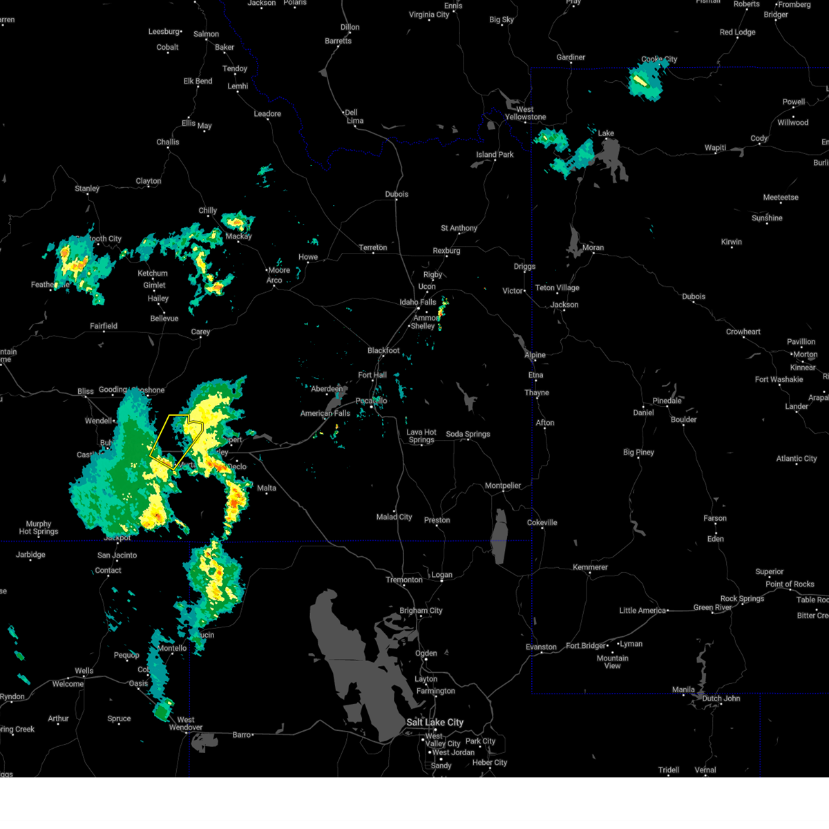
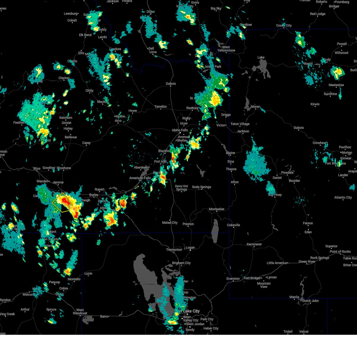
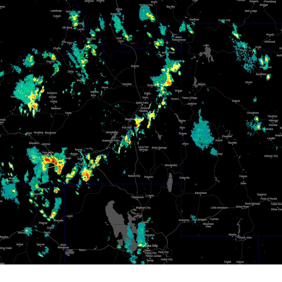
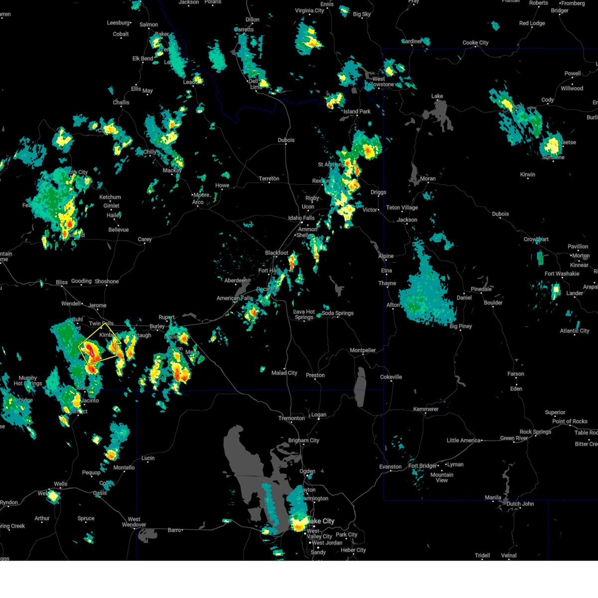
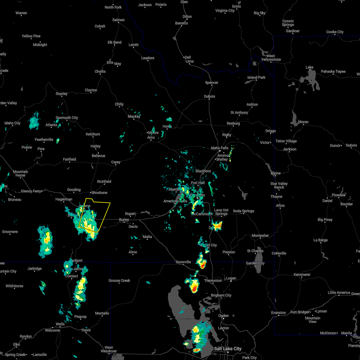
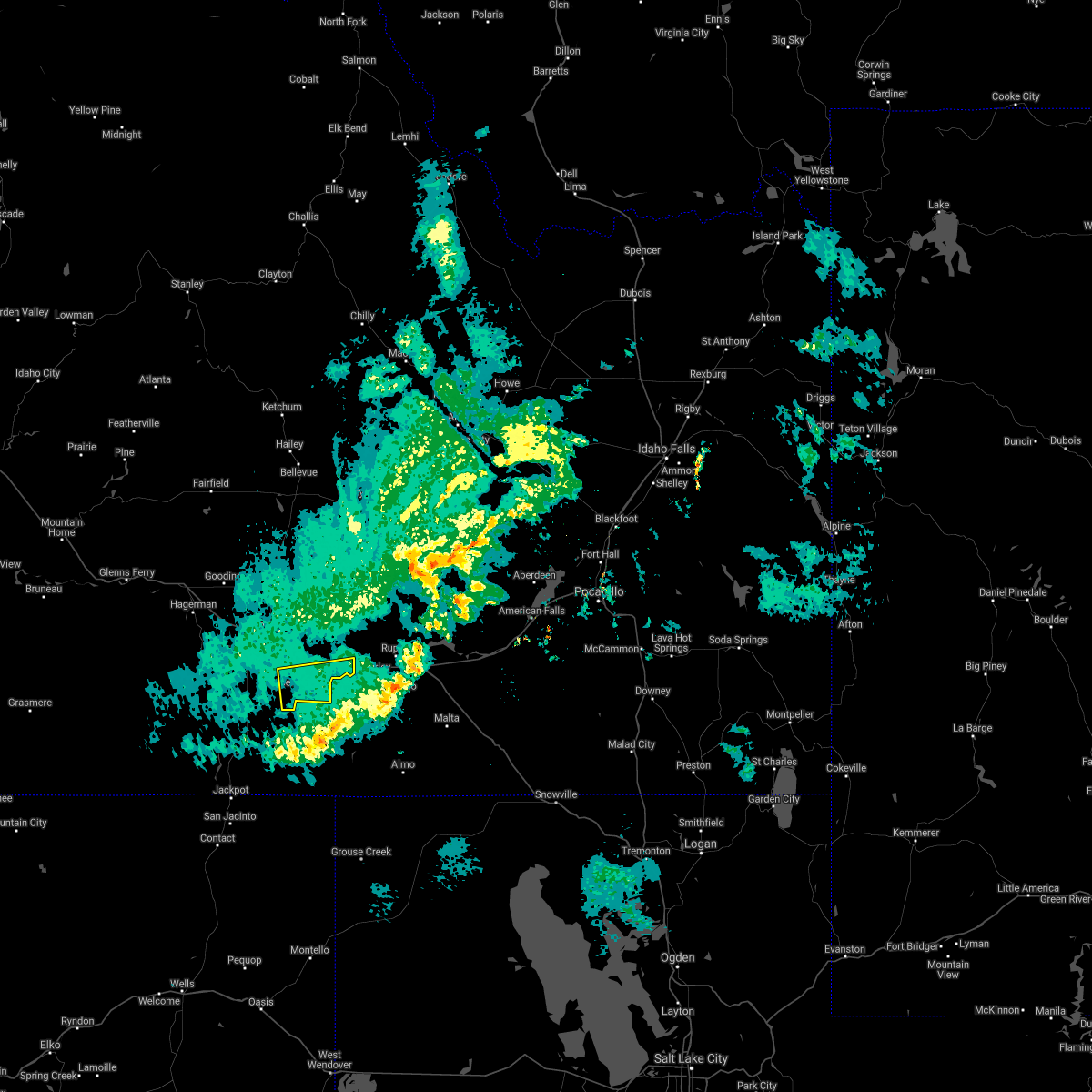
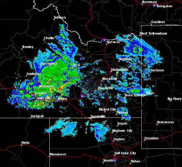
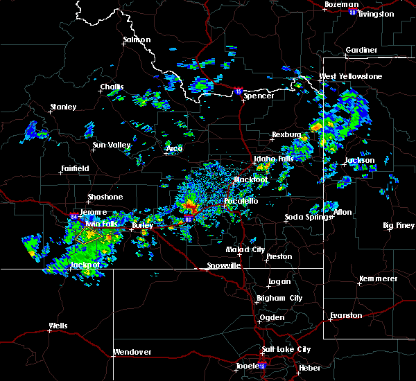
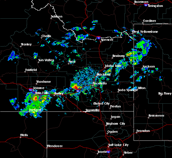
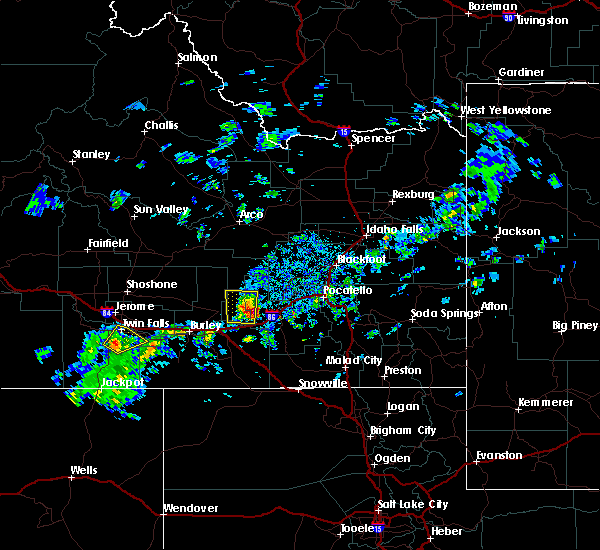
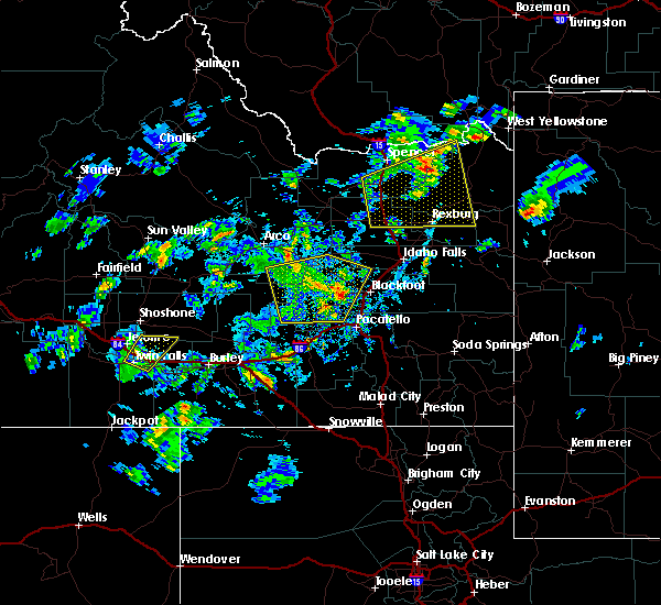
Hail Map for Kimberly, ID
The Kimberly, ID area has had 3 reports of on-the-ground hail by trained spotters, and has been under severe weather warnings 0 times during the past 12 months. Doppler radar has detected hail at or near Kimberly, ID on 9 occasions, including 1 occasion during the past year.
| Name: | Kimberly, ID |
| Where Located: | 5.3 miles ESE of Twin Falls, ID |
| Map: | Google Map for Kimberly, ID |
| Population: | 3264 |
| Housing Units: | 1190 |
| More Info: | Search Google for Kimberly, ID |
0
The Top Recent Hail Date for Kimberly, ID is Thursday, July 25, 2024 (7th out of 9)

Hail and Wind Damage Spotted near Kimberly, ID
| Date / Time | Report Details |
|---|---|
| 9/1/2023 8:20 PM MDT |
 At 818 pm mdt, a severe thunderstorm was located over eden, or 11 miles east of twin falls, moving northeast at 30 mph (radar and surface observation indicated). Hazards include 60 mph wind gusts. Expect damage to roofs, siding, and trees. this severe thunderstorm will be near, hazelton and eden around 820 pm mdt. hail threat, radar indicated max hail size, <. 75 in wind threat, radar indicated max wind gust, 60 mph. At 818 pm mdt, a severe thunderstorm was located over eden, or 11 miles east of twin falls, moving northeast at 30 mph (radar and surface observation indicated). Hazards include 60 mph wind gusts. Expect damage to roofs, siding, and trees. this severe thunderstorm will be near, hazelton and eden around 820 pm mdt. hail threat, radar indicated max hail size, <. 75 in wind threat, radar indicated max wind gust, 60 mph.
|
| 5/26/2023 2:50 PM MDT |
 The severe thunderstorm warning for central twin falls county will expire at 300 pm mdt, the storm which prompted the warning has weakened below severe limits, and no longer poses an immediate threat to life or property. therefore, the warning will be allowed to expire. however small hail, gusty winds and heavy rain are still possible with this thunderstorm. when safe to do so, please relay storm reports to the national weather service in boise via local law enforcement, or national weather service boise facebook and twitter accounts. The severe thunderstorm warning for central twin falls county will expire at 300 pm mdt, the storm which prompted the warning has weakened below severe limits, and no longer poses an immediate threat to life or property. therefore, the warning will be allowed to expire. however small hail, gusty winds and heavy rain are still possible with this thunderstorm. when safe to do so, please relay storm reports to the national weather service in boise via local law enforcement, or national weather service boise facebook and twitter accounts.
|
| 5/26/2023 2:37 PM MDT |
 At 237 pm mdt, a severe thunderstorm was located near magic valley regional airport, or 7 miles south of twin falls, moving northeast at 25 mph (trained weather spotters). Hazards include 60 mph wind gusts and half dollar size hail. Hail damage to vehicles is expected. expect wind damage to roofs, siding, and trees. this severe storm will be near, rock creek around 240 pm mdt. twin falls and kimberly around 250 pm mdt. hail threat, observed max hail size, 1. 25 in wind threat, radar indicated max wind gust, 60 mph. At 237 pm mdt, a severe thunderstorm was located near magic valley regional airport, or 7 miles south of twin falls, moving northeast at 25 mph (trained weather spotters). Hazards include 60 mph wind gusts and half dollar size hail. Hail damage to vehicles is expected. expect wind damage to roofs, siding, and trees. this severe storm will be near, rock creek around 240 pm mdt. twin falls and kimberly around 250 pm mdt. hail threat, observed max hail size, 1. 25 in wind threat, radar indicated max wind gust, 60 mph.
|
| 5/26/2023 2:16 PM MDT |
 At 216 pm mdt, a severe thunderstorm was located over hollister, or 15 miles southwest of twin falls, moving northeast at 20 mph (radar indicated). Hazards include 60 mph wind gusts and half dollar size hail. Hail damage to vehicles is expected. expect wind damage to roofs, siding, and trees. this severe thunderstorm will be near, magic valley regional airport around 240 pm mdt. twin falls, kimberly and rock creek around 300 pm mdt. hail threat, radar indicated max hail size, 1. 25 in wind threat, radar indicated max wind gust, 60 mph. At 216 pm mdt, a severe thunderstorm was located over hollister, or 15 miles southwest of twin falls, moving northeast at 20 mph (radar indicated). Hazards include 60 mph wind gusts and half dollar size hail. Hail damage to vehicles is expected. expect wind damage to roofs, siding, and trees. this severe thunderstorm will be near, magic valley regional airport around 240 pm mdt. twin falls, kimberly and rock creek around 300 pm mdt. hail threat, radar indicated max hail size, 1. 25 in wind threat, radar indicated max wind gust, 60 mph.
|
| 9/21/2022 12:22 PM MDT |
 At 1221 pm mdt, a severe thunderstorm was located over kimberly, or near twin falls, moving northeast at 60 mph (61 mph gust measured at twin falls airport). Hazards include 65 mph wind gusts. Expect damage to roofs, siding, and trees. this severe thunderstorm will be near, jerome, eden and minidoka national monument around 1230 pm mdt. hail threat, radar indicated max hail size, <. 75 in wind threat, observed max wind gust, 60 mph. At 1221 pm mdt, a severe thunderstorm was located over kimberly, or near twin falls, moving northeast at 60 mph (61 mph gust measured at twin falls airport). Hazards include 65 mph wind gusts. Expect damage to roofs, siding, and trees. this severe thunderstorm will be near, jerome, eden and minidoka national monument around 1230 pm mdt. hail threat, radar indicated max hail size, <. 75 in wind threat, observed max wind gust, 60 mph.
|
| 10/19/2019 2:57 PM MDT |
 The severe thunderstorm warning for east central twin falls and southeastern jerome counties will expire at 300 pm mdt, the storm which prompted the warning has moved out of the area. therefore, the warning will be allowed to expire. winds will continue to be gusty. when safe to do so, please relay storm reports to the national weather service in boise via local law enforcement, or national weather service boise facebook and twitter accounts. The severe thunderstorm warning for east central twin falls and southeastern jerome counties will expire at 300 pm mdt, the storm which prompted the warning has moved out of the area. therefore, the warning will be allowed to expire. winds will continue to be gusty. when safe to do so, please relay storm reports to the national weather service in boise via local law enforcement, or national weather service boise facebook and twitter accounts.
|
| 10/19/2019 2:30 PM MDT | Several reports of large downed trees and powerlines in the magic valley. power outages. 67mph peak measuremen in twin falls county ID, 2 miles SSE of Kimberly, ID |
| 10/19/2019 2:28 PM MDT |
 At 227 pm mdt, a severe thunderstorm was located near hansen, or 11 miles southeast of twin falls, moving east at 65 mph (ground observations). Hazards include 65 mph wind gusts. Expect damage to roofs, siding, and trees. this severe thunderstorm will be near, murtaugh around 230 pm mdt. Milner dam around 240 pm mdt. At 227 pm mdt, a severe thunderstorm was located near hansen, or 11 miles southeast of twin falls, moving east at 65 mph (ground observations). Hazards include 65 mph wind gusts. Expect damage to roofs, siding, and trees. this severe thunderstorm will be near, murtaugh around 230 pm mdt. Milner dam around 240 pm mdt.
|
| 9/9/2019 7:25 PM MDT | Ping Pong Ball sized hail reported 2.1 miles W of Kimberly, ID, hail picture in the kimberly/hansen area on twitter. |
| 9/9/2019 6:53 PM MDT |
 At 653 pm mdt, a severe thunderstorm was located near magic valley regional airport, or 8 miles southwest of twin falls, moving northeast at 30 mph (radar indicated). Hazards include quarter size hail. Damage to vehicles is expected. this severe thunderstorm will be near, magic valley regional airport around 700 pm mdt. twin falls around 710 pm mdt. kimberly and hansen around 720 pm mdt. Eden, hazelton and minidoka national monument around 740 pm mdt. At 653 pm mdt, a severe thunderstorm was located near magic valley regional airport, or 8 miles southwest of twin falls, moving northeast at 30 mph (radar indicated). Hazards include quarter size hail. Damage to vehicles is expected. this severe thunderstorm will be near, magic valley regional airport around 700 pm mdt. twin falls around 710 pm mdt. kimberly and hansen around 720 pm mdt. Eden, hazelton and minidoka national monument around 740 pm mdt.
|
| 9/6/2019 2:07 PM MDT |
 The severe thunderstorm warning for central twin falls, western jerome and southeastern gooding counties will expire at 215 pm mdt, the storm which prompted the warning has weakened below severe limits, and no longer poses an immediate threat to life or property. therefore, the warning will be allowed to expire. however small hail and heavy rain are still possible with this thunderstorm. when safe to do so, please relay storm reports to the national weather service in boise via local law enforcement, or national weather service boise facebook and twitter accounts. The severe thunderstorm warning for central twin falls, western jerome and southeastern gooding counties will expire at 215 pm mdt, the storm which prompted the warning has weakened below severe limits, and no longer poses an immediate threat to life or property. therefore, the warning will be allowed to expire. however small hail and heavy rain are still possible with this thunderstorm. when safe to do so, please relay storm reports to the national weather service in boise via local law enforcement, or national weather service boise facebook and twitter accounts.
|
| 9/6/2019 1:26 PM MDT |
 At 126 pm mdt, a severe thunderstorm was located near castleford, or 18 miles west of twin falls, moving east at 25 mph (radar indicated). Hazards include 60 mph wind gusts and quarter size hail. Hail damage to vehicles is expected. expect wind damage to roofs, siding, and trees. this severe thunderstorm will be near, buhl around 130 pm mdt. filer around 150 pm mdt. twin falls and magic valley regional airport around 200 pm mdt. Jerome, kimberly, hansen and rock creek around 210 pm mdt. At 126 pm mdt, a severe thunderstorm was located near castleford, or 18 miles west of twin falls, moving east at 25 mph (radar indicated). Hazards include 60 mph wind gusts and quarter size hail. Hail damage to vehicles is expected. expect wind damage to roofs, siding, and trees. this severe thunderstorm will be near, buhl around 130 pm mdt. filer around 150 pm mdt. twin falls and magic valley regional airport around 200 pm mdt. Jerome, kimberly, hansen and rock creek around 210 pm mdt.
|
| 5/31/2018 1:50 PM MDT |
 At 150 pm mdt, a severe thunderstorm was located over kimberly, or near twin falls, moving northeast at 25 mph (radar indicated). Hazards include 60 mph wind gusts and quarter size hail. Hail damage to vehicles is expected. expect wind damage to roofs, siding, and trees. this severe storm will be near, eden around 200 pm mdt. Hazelton, minidoka national monument and milner dam around 210 pm mdt. At 150 pm mdt, a severe thunderstorm was located over kimberly, or near twin falls, moving northeast at 25 mph (radar indicated). Hazards include 60 mph wind gusts and quarter size hail. Hail damage to vehicles is expected. expect wind damage to roofs, siding, and trees. this severe storm will be near, eden around 200 pm mdt. Hazelton, minidoka national monument and milner dam around 210 pm mdt.
|
| 5/31/2018 1:27 PM MDT |
 At 126 pm mdt, a severe thunderstorm was located near magic valley regional airport, or 8 miles south of twin falls, moving northeast at 25 mph (radar indicated). Hazards include 60 mph wind gusts and quarter size hail. Hail damage to vehicles is expected. expect wind damage to roofs, siding, and trees. this severe thunderstorm will be near, rock creek around 140 pm mdt. twin falls, kimberly, hansen and murtaugh around 150 pm mdt. eden around 200 pm mdt. Hazelton, minidoka national monument and milner dam around 210 pm mdt. At 126 pm mdt, a severe thunderstorm was located near magic valley regional airport, or 8 miles south of twin falls, moving northeast at 25 mph (radar indicated). Hazards include 60 mph wind gusts and quarter size hail. Hail damage to vehicles is expected. expect wind damage to roofs, siding, and trees. this severe thunderstorm will be near, rock creek around 140 pm mdt. twin falls, kimberly, hansen and murtaugh around 150 pm mdt. eden around 200 pm mdt. Hazelton, minidoka national monument and milner dam around 210 pm mdt.
|
| 5/16/2018 3:10 PM MDT |
 The severe thunderstorm warning for central twin falls county will expire at 315 pm mdt, the storm which prompted the warning has weakened below severe limits, and no longer poses an immediate threat to life or property. therefore the warning will be allowed to expire. when safe to do so, please relay storm reports to the national weather service in boise via local law enforcement, or national weather service boise facebook and twitter accounts. The severe thunderstorm warning for central twin falls county will expire at 315 pm mdt, the storm which prompted the warning has weakened below severe limits, and no longer poses an immediate threat to life or property. therefore the warning will be allowed to expire. when safe to do so, please relay storm reports to the national weather service in boise via local law enforcement, or national weather service boise facebook and twitter accounts.
|
| 5/16/2018 2:57 PM MDT |
 At 256 pm mdt, a severe thunderstorm was located near magic valley regional airport, or near twin falls, moving northeast at 15 mph (radar indicated). Hazards include 45 mph wind gusts and quarter size hail. Hail damage to vehicles is expected. expect wind damage to roofs, siding, and trees. this severe storm will be near, rock creek around 300 pm mdt. Twin falls, kimberly and hansen around 310 pm mdt. At 256 pm mdt, a severe thunderstorm was located near magic valley regional airport, or near twin falls, moving northeast at 15 mph (radar indicated). Hazards include 45 mph wind gusts and quarter size hail. Hail damage to vehicles is expected. expect wind damage to roofs, siding, and trees. this severe storm will be near, rock creek around 300 pm mdt. Twin falls, kimberly and hansen around 310 pm mdt.
|
| 5/16/2018 2:40 PM MDT |
 At 239 pm mdt, a severe thunderstorm was located near magic valley regional airport, or 9 miles south of twin falls, moving northeast at 15 mph (radar indicated). Hazards include 45 mph wind gusts and quarter size hail. Hail damage to vehicles is expected. expect wind damage to roofs, siding, and trees. this severe thunderstorm will be near, magic valley regional airport around 250 pm mdt. rock creek around 300 pm mdt. Twin falls, kimberly and hansen around 310 pm mdt. At 239 pm mdt, a severe thunderstorm was located near magic valley regional airport, or 9 miles south of twin falls, moving northeast at 15 mph (radar indicated). Hazards include 45 mph wind gusts and quarter size hail. Hail damage to vehicles is expected. expect wind damage to roofs, siding, and trees. this severe thunderstorm will be near, magic valley regional airport around 250 pm mdt. rock creek around 300 pm mdt. Twin falls, kimberly and hansen around 310 pm mdt.
|
| 6/4/2017 8:25 PM MDT |
 The severe thunderstorm warning for northern twin falls, jerome and southeastern gooding counties will expire at 830 pm mdt, the storm which prompted the warning has moved out of the area. therefore the warning will be allowed to expire. when safe to do so, please relay storm reports to the national weather service in boise via local law enforcement, or national weather service boise facebook and twitter accounts. The severe thunderstorm warning for northern twin falls, jerome and southeastern gooding counties will expire at 830 pm mdt, the storm which prompted the warning has moved out of the area. therefore the warning will be allowed to expire. when safe to do so, please relay storm reports to the national weather service in boise via local law enforcement, or national weather service boise facebook and twitter accounts.
|
| 6/4/2017 7:46 PM MDT |
 At 744 pm mdt, thunderstorm outflow winds associated with a cold front were located near wendell, or 12 miles south of gooding, moving east at 65 mph (radar indicated). Hazards include 60 to 70 mph wind gusts. Expect damage to roofs, siding, and trees. this severe thunderstorm will be near, jerome and filer around 750 pm mdt. twin falls, kimberly, hansen and minidoka national monument around 815 pm mdt. Hazelton, eden, milner dam and murtaugh around 825 pm mdt. At 744 pm mdt, thunderstorm outflow winds associated with a cold front were located near wendell, or 12 miles south of gooding, moving east at 65 mph (radar indicated). Hazards include 60 to 70 mph wind gusts. Expect damage to roofs, siding, and trees. this severe thunderstorm will be near, jerome and filer around 750 pm mdt. twin falls, kimberly, hansen and minidoka national monument around 815 pm mdt. Hazelton, eden, milner dam and murtaugh around 825 pm mdt.
|
| 8/14/2015 6:08 PM MDT |
 At 607 pm mdt, doppler radar indicated a severe thunderstorm capable of producing damaging winds in excess of 60 mph. this storm was located near kimberly, or near twin falls, and moving northeast at 40 mph. * this severe thunderstorm will be near, eden around 610 pm mdt. minidoka national monument around 620 pm mdt. At 607 pm mdt, doppler radar indicated a severe thunderstorm capable of producing damaging winds in excess of 60 mph. this storm was located near kimberly, or near twin falls, and moving northeast at 40 mph. * this severe thunderstorm will be near, eden around 610 pm mdt. minidoka national monument around 620 pm mdt.
|
| 6/1/2015 1:08 PM MDT | At 107 pm mdt, doppler radar indicated a line of severe thunderstorms capable of producing quarter size hail and damaging winds in excess of 60 mph. these storms were located along a line extending from near buhl to near china mountain, and moving northeast at 40 mph. * severe thunderstorms will be near, buhl around 110 pm mdt. filer around 120 pm mdt. jerome, twin falls, rogerson and winter spring around 130 pm mdt. kimberly, hansen and timber butte around 140 pm mdt. eden, magic mountain ski area and minidoka national monument around 150 pm mdt. |
| 5/31/2015 6:22 PM MDT | The severe thunderstorm warning for southeastern jerome and east central twin falls counties will expire at 630 pm mdt, the storm which prompted the warning has weakened below severe limits, and no longer poses an immediate threat to life or property. therefore the warning will be allowed to expire. however small hail is still possible with this thunderstorm. when safe to do so, please relay storm reports to the national weather service in boise idaho via local law enforcement, or national weather service boise facebook and twitter accounts. |
| 5/31/2015 6:08 PM MDT | At 606 pm mdt, doppler radar indicated a severe thunderstorm capable of producing quarter size hail. this storm was located over eden, or 13 miles east of twin falls. this storm was moving east at 25 mph. this severe storm will be near, hazelton and milner dam around 620 pm mdt. |
| 5/31/2015 5:51 PM MDT | At 550 pm mdt, doppler radar indicated a severe thunderstorm capable of producing quarter size hail. this storm was located over hansen, or 8 miles east of twin falls, and moving northeast at 25 mph. * this severe thunderstorm will be near, murtaugh around 600 pm mdt. eden around 610 pm mdt. hazelton and milner dam around 620 pm mdt. |
| 5/31/2015 5:50 PM MDT | Quarter sized hail reported 3.4 miles NNE of Kimberly, ID, a spotter reported a severe thunderstorm with 1 inch hail and very heavy rain. |
| 8/13/2014 3:55 PM MDT | News media reports trees down on east-ridge road in kimberly in twin falls county ID, 0.6 miles WNW of Kimberly, ID |
| 7/21/2014 4:57 PM MDT | Quarter sized hail reported 5.9 miles N of Kimberly, ID |
| 10/16/2012 12:00 PM MDT | Kmvt report highway 30 was closed due to downed tree and powerline in twin falls county ID, 0.6 miles WNW of Kimberly, ID |
| 10/16/2012 12:00 PM MDT | Two new commodity buildings received damag in twin falls county ID, 0.6 miles WNW of Kimberly, ID |
Hail Maps for Kimberly, ID


Connect with Interactive Hail Maps