

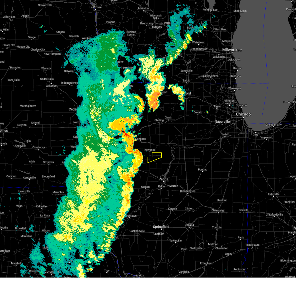
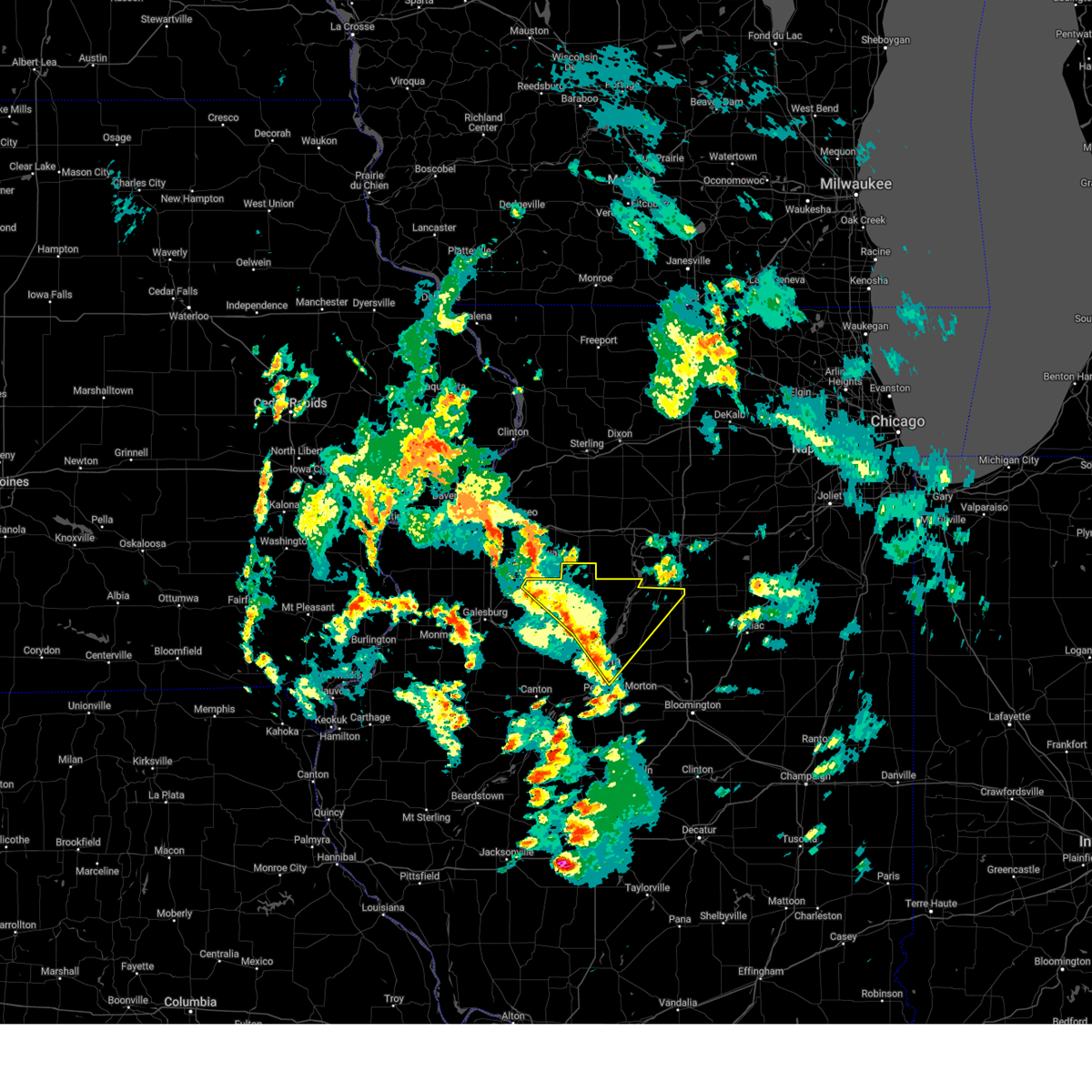
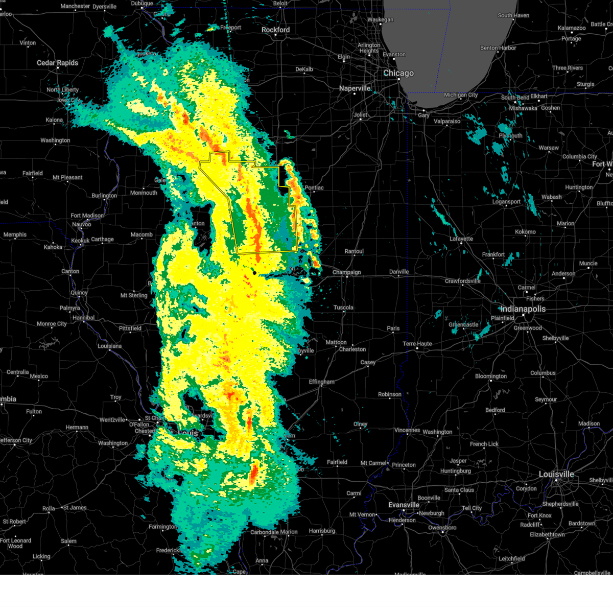
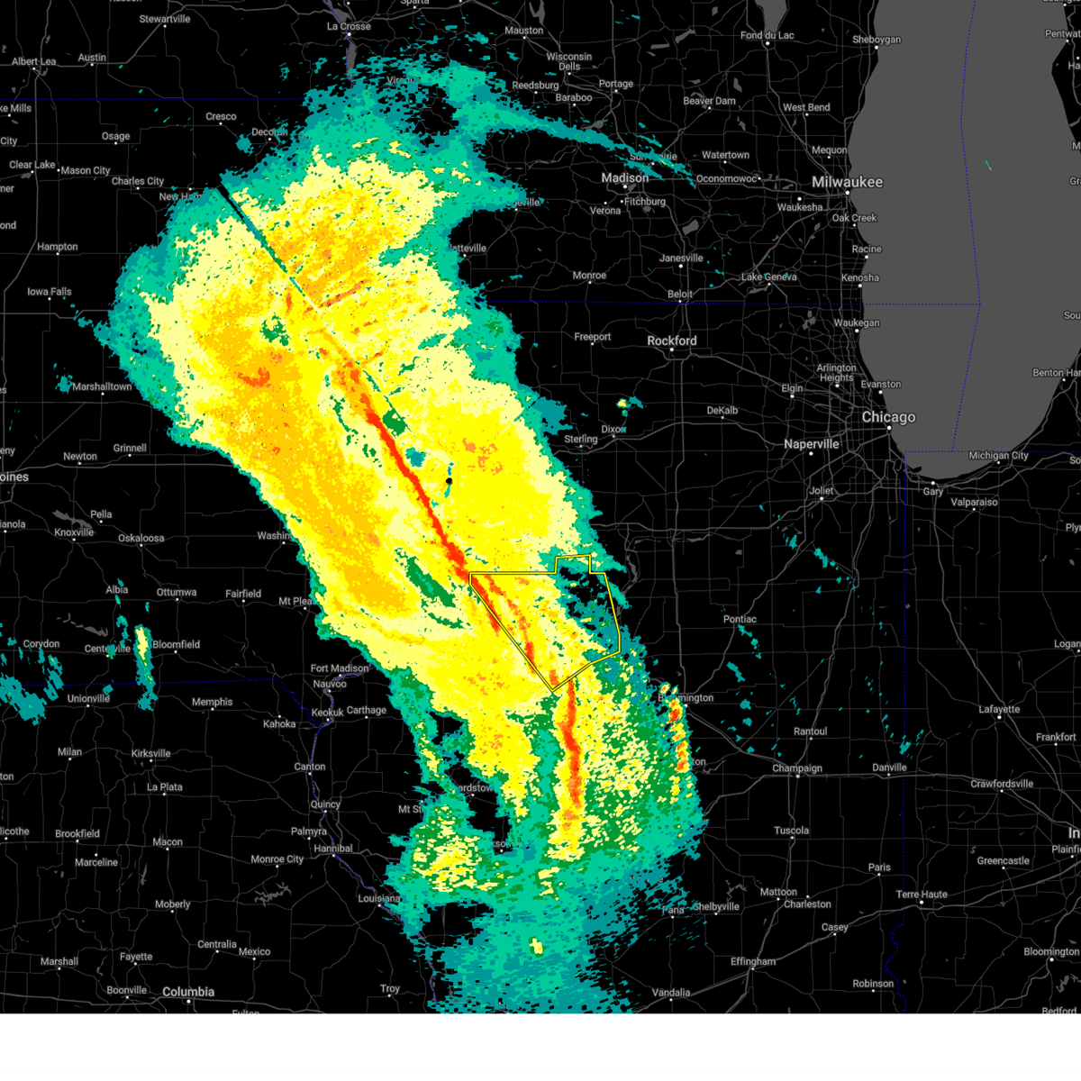
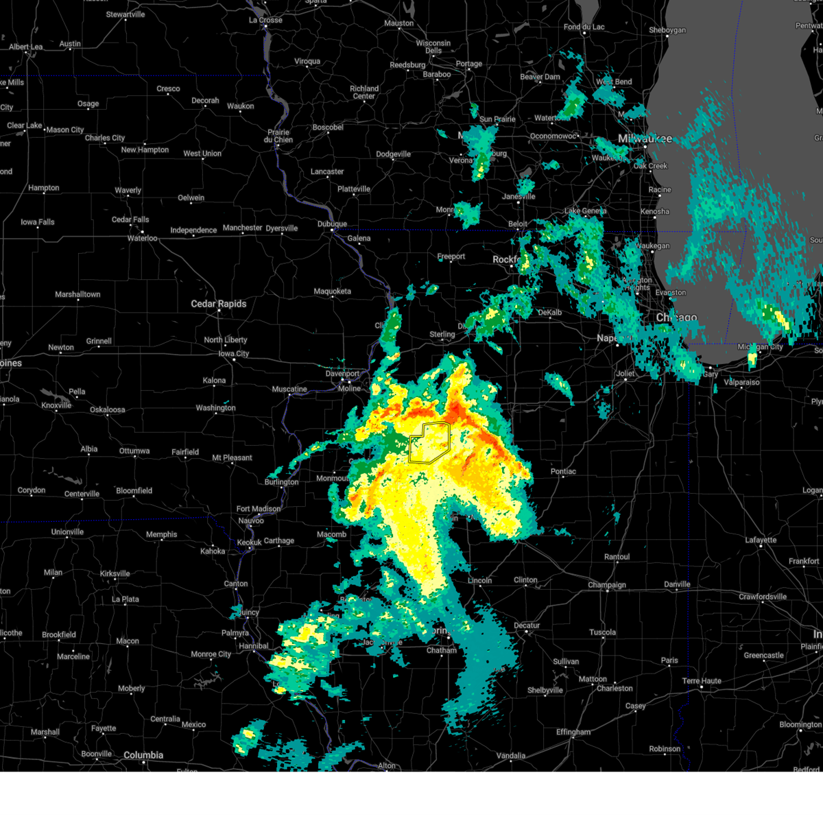
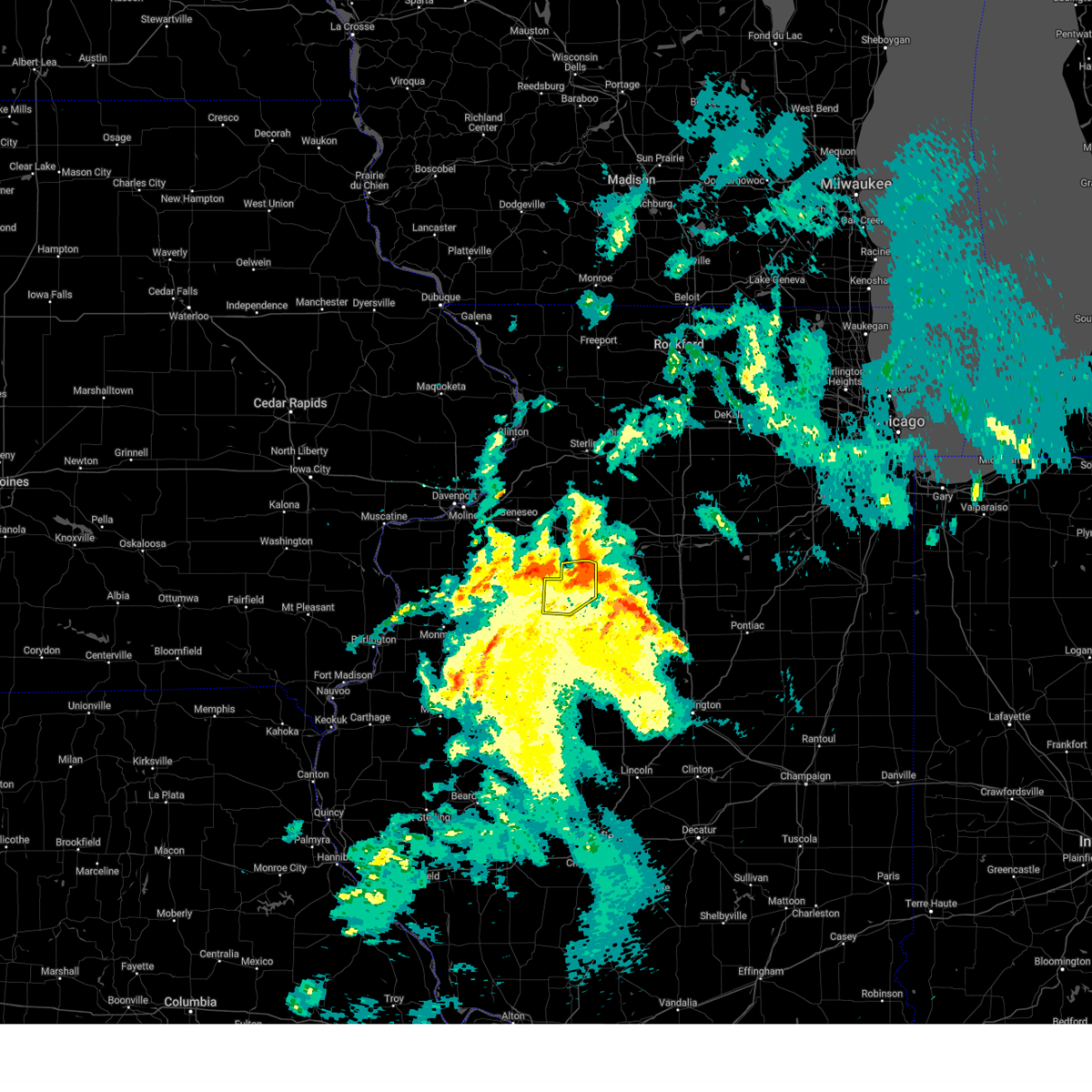
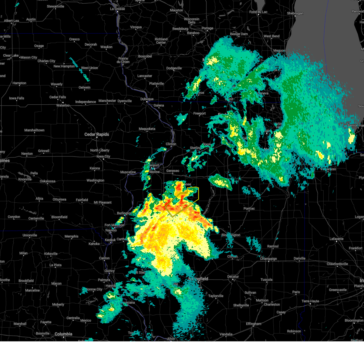
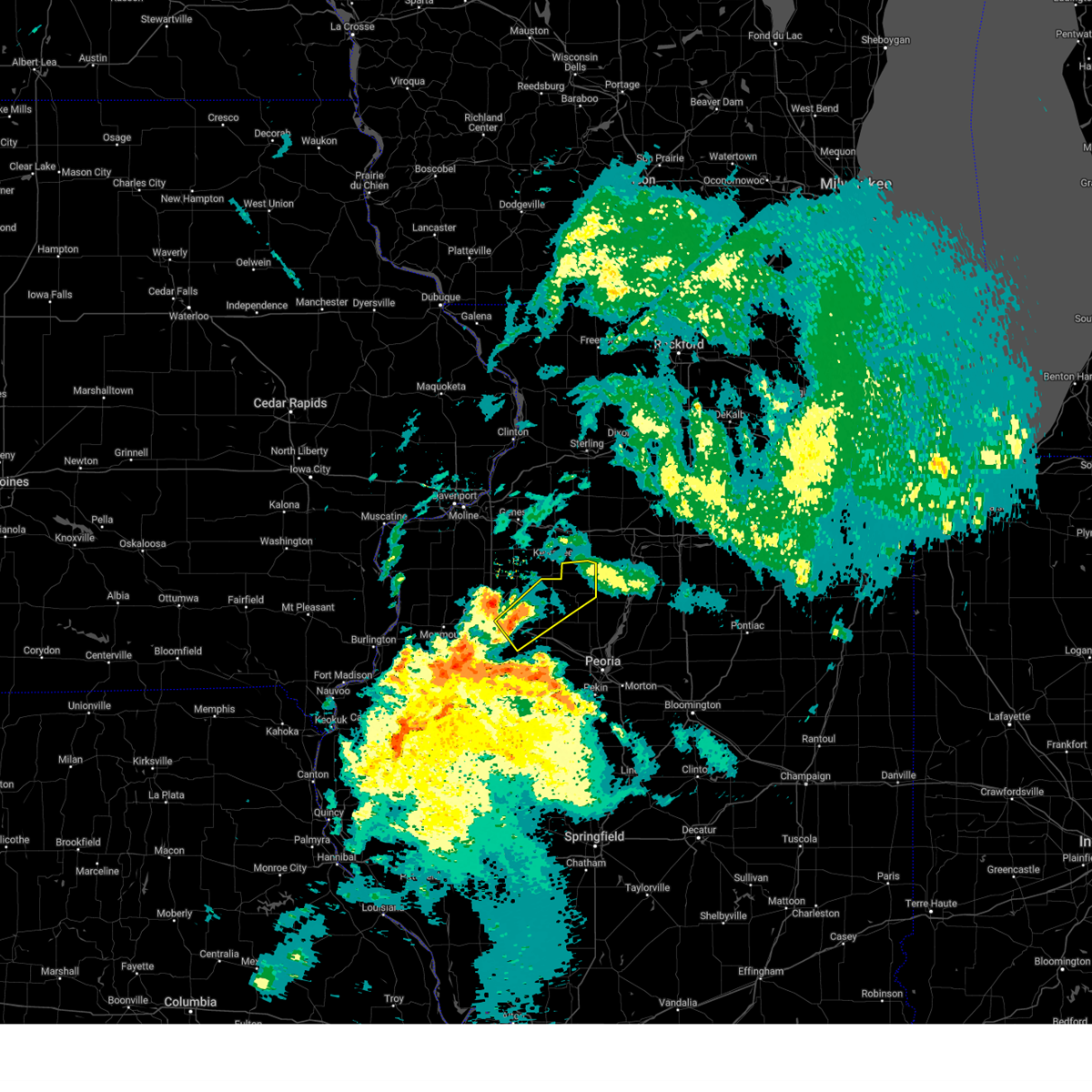
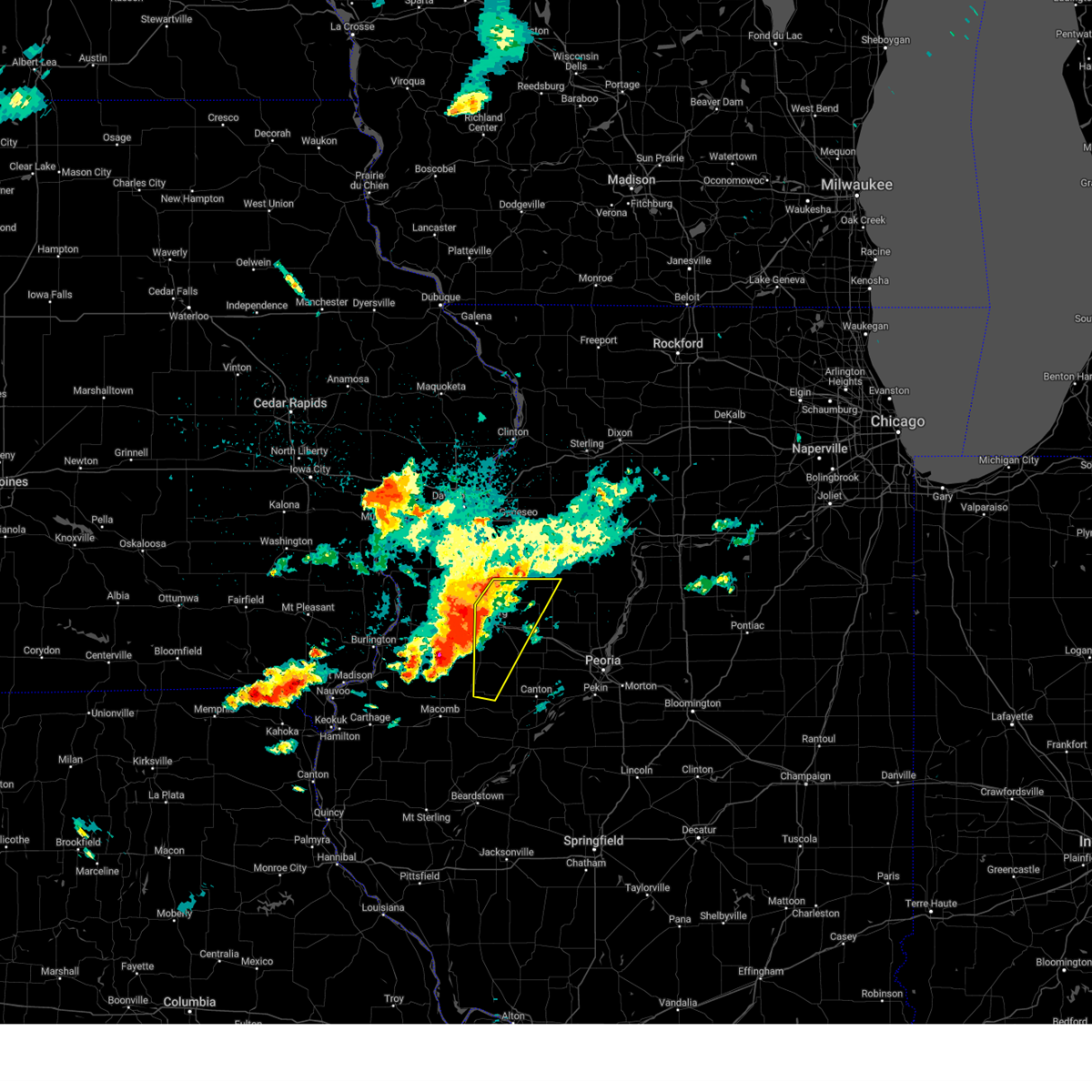
Hail Map for La Fayette, IL
The La Fayette, IL area has had 1 report of on-the-ground hail by trained spotters, and has been under severe weather warnings 33 times during the past 12 months. Doppler radar has detected hail at or near La Fayette, IL on 43 occasions, including 2 occasions during the past year.
| Name: | La Fayette, IL |
| Where Located: | 35.2 miles NW of Peoria, IL |
| Map: | Google Map for La Fayette, IL |
| Population: | 223 |
| Housing Units: | 92 |
| More Info: | Search Google for La Fayette, IL |
3
The Top Recent Hail Date for La Fayette, IL is Tuesday, August 27, 2024 (11th out of 43)

Hail and Wind Damage Spotted near La Fayette, IL
| Date / Time | Report Details |
|---|---|
| 6/3/2025 7:38 PM CDT | At 737 pm cdt, severe thunderstorms were located along a line extending from near kewanee to near la fayette, moving northeast at 55 mph (radar indicated). Hazards include 70 mph wind gusts. Expect considerable tree damage. damage is likely to mobile homes, roofs, and outbuildings. Locations impacted include, elmira, osceola, toulon, bradford, and la fayette. |
| 6/3/2025 7:30 PM CDT |
 Svrilx the national weather service in lincoln has issued a * severe thunderstorm warning for, northern stark county in north central illinois, * until 815 pm cdt. * at 729 pm cdt, severe thunderstorms were located along a line extending from near cambridge to near victoria, moving northeast at 55 mph (radar indicated). Hazards include 60 mph wind gusts. expect damage to roofs, siding, and trees Svrilx the national weather service in lincoln has issued a * severe thunderstorm warning for, northern stark county in north central illinois, * until 815 pm cdt. * at 729 pm cdt, severe thunderstorms were located along a line extending from near cambridge to near victoria, moving northeast at 55 mph (radar indicated). Hazards include 60 mph wind gusts. expect damage to roofs, siding, and trees
|
| 5/20/2025 2:30 PM CDT |
 Svrilx the national weather service in lincoln has issued a * severe thunderstorm warning for, marshall county in central illinois, northwestern woodford county in central illinois, stark county in north central illinois, northeastern knox county in west central illinois, north central tazewell county in central illinois, northeastern peoria county in central illinois, * until 315 pm cdt. * at 229 pm cdt, severe thunderstorms were located along a line extending from near la fayette to near edelstein to near east peoria, moving northeast at 30 mph (radar indicated). Hazards include 60 mph wind gusts. Expect damage to roofs, siding, and trees. severe thunderstorms will be near, chillicothe, wyoming, germantown hills, rome, spring bay, elmira, castleton, camp grove, and edelstein around 235 pm cdt. osceola around 240 pm cdt. metamora and bradford around 245 pm cdt. other locations in the path of these severe thunderstorms include sparland, lacon, washburn and henry. this includes the following highways, interstate 39 between mile markers 38 and 40. interstate 474 near mile marker 13. Interstate 74 between mile markers 87 and 98. Svrilx the national weather service in lincoln has issued a * severe thunderstorm warning for, marshall county in central illinois, northwestern woodford county in central illinois, stark county in north central illinois, northeastern knox county in west central illinois, north central tazewell county in central illinois, northeastern peoria county in central illinois, * until 315 pm cdt. * at 229 pm cdt, severe thunderstorms were located along a line extending from near la fayette to near edelstein to near east peoria, moving northeast at 30 mph (radar indicated). Hazards include 60 mph wind gusts. Expect damage to roofs, siding, and trees. severe thunderstorms will be near, chillicothe, wyoming, germantown hills, rome, spring bay, elmira, castleton, camp grove, and edelstein around 235 pm cdt. osceola around 240 pm cdt. metamora and bradford around 245 pm cdt. other locations in the path of these severe thunderstorms include sparland, lacon, washburn and henry. this includes the following highways, interstate 39 between mile markers 38 and 40. interstate 474 near mile marker 13. Interstate 74 between mile markers 87 and 98.
|
| 4/20/2025 9:11 PM CDT |
 the severe thunderstorm warning has been cancelled and is no longer in effect the severe thunderstorm warning has been cancelled and is no longer in effect
|
| 4/20/2025 8:56 PM CDT | Svrilx the national weather service in lincoln has issued a * severe thunderstorm warning for, marshall county in central illinois, woodford county in central illinois, stark county in north central illinois, tazewell county in central illinois, western mclean county in central illinois, northeastern peoria county in central illinois, * until 930 pm cdt. * at 855 pm cdt, severe thunderstorms were located along a line extending from near galva to washington to near armington, moving east at 50 mph (radar indicated). Hazards include 60 mph wind gusts. Expect damage to roofs, siding, and trees. severe thunderstorms will be near, peoria, rome, mackinaw, minier, spring bay, dunlap, chillicothe, armington, princeville, and germantown hills around 900 pm cdt. congerville, castleton, elmira, stanford, and danvers around 905 pm cdt. roanoke, camp grove, secor, osceola, and carlock around 910 pm cdt. bradford, sparland, washburn, el paso, lacon, normal, and bloomington around 915 pm cdt. other locations in the path of these severe thunderstorms include benson, downs, hudson and towanda. this includes the following highways, interstate 155 between mile markers 12 and 31. interstate 39 between mile markers 0 and 40. interstate 474 between mile markers 10 and 14. interstate 55 between mile markers 147 and 174. Interstate 74 between mile markers 89 and 145. |
| 4/20/2025 8:28 PM CDT |
 Svrilx the national weather service in lincoln has issued a * severe thunderstorm warning for, western marshall county in central illinois, northwestern woodford county in central illinois, northeastern fulton county in west central illinois, stark county in north central illinois, knox county in west central illinois, northern tazewell county in central illinois, peoria county in central illinois, * until 900 pm cdt. * at 828 pm cdt, severe thunderstorms were located along a line extending from near rio to near glasford, moving north at 75 mph (radar indicated). Hazards include 60 mph wind gusts. Expect damage to roofs, siding, and trees. severe thunderstorms will be near, victoria, laura, bellevue, elmwood, williamsfield, trivoli, elmore, brimfield, peoria international airport, and oneida around 835 pm cdt. west peoria, peoria, and la fayette around 840 pm cdt. dunlap, princeville, wyoming, and toulon around 845 pm cdt. other locations in the path of these severe thunderstorms include elmira and edelstein. this includes the following highways, interstate 474 between mile markers 0 and 5. Interstate 74 between mile markers 34 and 45, and between mile markers 53 and 92. Svrilx the national weather service in lincoln has issued a * severe thunderstorm warning for, western marshall county in central illinois, northwestern woodford county in central illinois, northeastern fulton county in west central illinois, stark county in north central illinois, knox county in west central illinois, northern tazewell county in central illinois, peoria county in central illinois, * until 900 pm cdt. * at 828 pm cdt, severe thunderstorms were located along a line extending from near rio to near glasford, moving north at 75 mph (radar indicated). Hazards include 60 mph wind gusts. Expect damage to roofs, siding, and trees. severe thunderstorms will be near, victoria, laura, bellevue, elmwood, williamsfield, trivoli, elmore, brimfield, peoria international airport, and oneida around 835 pm cdt. west peoria, peoria, and la fayette around 840 pm cdt. dunlap, princeville, wyoming, and toulon around 845 pm cdt. other locations in the path of these severe thunderstorms include elmira and edelstein. this includes the following highways, interstate 474 between mile markers 0 and 5. Interstate 74 between mile markers 34 and 45, and between mile markers 53 and 92.
|
| 4/2/2025 12:33 PM CDT |
 The severe thunderstorm which prompted the warning has moved out of the warned area. therefore, the warning has been allowed to expire. The severe thunderstorm which prompted the warning has moved out of the warned area. therefore, the warning has been allowed to expire.
|
| 4/2/2025 12:22 PM CDT |
 the severe thunderstorm warning has been cancelled and is no longer in effect the severe thunderstorm warning has been cancelled and is no longer in effect
|
| 4/2/2025 12:22 PM CDT |
 At 1222 pm cdt, a severe thunderstorm was located near castleton, or near wyoming, moving northeast at 60 mph (radar indicated). Hazards include 60 mph wind gusts and penny size hail. Expect damage to roofs, siding, and trees. Locations impacted include, castleton, elmira, osceola, bradford, wyoming, la fayette, west jersey, toulon, and duncan. At 1222 pm cdt, a severe thunderstorm was located near castleton, or near wyoming, moving northeast at 60 mph (radar indicated). Hazards include 60 mph wind gusts and penny size hail. Expect damage to roofs, siding, and trees. Locations impacted include, castleton, elmira, osceola, bradford, wyoming, la fayette, west jersey, toulon, and duncan.
|
| 4/2/2025 12:11 PM CDT |
 At 1211 pm cdt, a severe thunderstorm was located near toulon, moving northeast at 60 mph (radar indicated). Hazards include 60 mph wind gusts and penny size hail. Expect damage to roofs, siding, and trees. locations impacted include, castleton, bradford, wyoming, victoria, maquon, la fayette, west jersey, gilson, elmira, osceola, laura, dahinda, williamsfield, toulon, duncan, elmore, east galesburg, and knoxville. This includes interstate 74 between mile markers 52 and 66. At 1211 pm cdt, a severe thunderstorm was located near toulon, moving northeast at 60 mph (radar indicated). Hazards include 60 mph wind gusts and penny size hail. Expect damage to roofs, siding, and trees. locations impacted include, castleton, bradford, wyoming, victoria, maquon, la fayette, west jersey, gilson, elmira, osceola, laura, dahinda, williamsfield, toulon, duncan, elmore, east galesburg, and knoxville. This includes interstate 74 between mile markers 52 and 66.
|
| 4/2/2025 11:57 AM CDT |
 Svrilx the national weather service in lincoln has issued a * severe thunderstorm warning for, stark county in north central illinois, eastern knox county in west central illinois, northwestern peoria county in central illinois, * until 1230 pm cdt. * at 1157 am cdt, a severe thunderstorm was located near williamsfield, or 12 miles east of galesburg, moving northeast at 60 mph (radar indicated). Hazards include 60 mph wind gusts and penny size hail. Expect damage to roofs, siding, and trees. this severe thunderstorm will be near, williamsfield around 1200 pm cdt. elmore around 1205 pm cdt. toulon around 1210 pm cdt. wyoming around 1215 pm cdt. other locations in the path of this severe thunderstorm include castleton, elmira, bradford and osceola. This includes interstate 74 between mile markers 52 and 66. Svrilx the national weather service in lincoln has issued a * severe thunderstorm warning for, stark county in north central illinois, eastern knox county in west central illinois, northwestern peoria county in central illinois, * until 1230 pm cdt. * at 1157 am cdt, a severe thunderstorm was located near williamsfield, or 12 miles east of galesburg, moving northeast at 60 mph (radar indicated). Hazards include 60 mph wind gusts and penny size hail. Expect damage to roofs, siding, and trees. this severe thunderstorm will be near, williamsfield around 1200 pm cdt. elmore around 1205 pm cdt. toulon around 1210 pm cdt. wyoming around 1215 pm cdt. other locations in the path of this severe thunderstorm include castleton, elmira, bradford and osceola. This includes interstate 74 between mile markers 52 and 66.
|
| 3/14/2025 9:46 PM CDT | Svrilx the national weather service in lincoln has issued a * severe thunderstorm warning for, western marshall county in central illinois, northwestern woodford county in central illinois, northeastern fulton county in west central illinois, stark county in north central illinois, western tazewell county in central illinois, northeastern mason county in central illinois, peoria county in central illinois, * until 1045 pm cdt. * at 946 pm cdt, severe thunderstorms were located along a line extending from near galva to yates city to near havana, moving northeast at 65 mph (radar indicated). Hazards include 70 mph wind gusts. Expect considerable tree damage. damage is likely to mobile homes, roofs, and outbuildings. severe thunderstorms will be near, laura, elmwood, trivoli, elmore, brimfield, farmington, la fayette, canton, and toulon around 950 pm cdt. elmira around 955 pm cdt. glasford, princeville, hanna city, osceola, and wyoming around 1000 pm cdt. castleton and bradford around 1005 pm cdt. other locations in the path of these severe thunderstorms include peoria, camp grove, dunlap and edelstein. this includes the following highways, interstate 474 between mile markers 0 and 13. Interstate 74 between mile markers 69 and 98. |
| 8/27/2024 9:05 PM CDT |
 the severe thunderstorm warning has been cancelled and is no longer in effect the severe thunderstorm warning has been cancelled and is no longer in effect
|
| 8/27/2024 8:26 PM CDT |
 Svrilx the national weather service in lincoln has issued a * severe thunderstorm warning for, northwestern marshall county in central illinois, stark county in north central illinois, northern knox county in west central illinois, * until 930 pm cdt. * at 826 pm cdt, a severe thunderstorm was located near la fayette, or 7 miles west of toulon, moving east at 15 mph (radar indicated). Hazards include 60 mph wind gusts and quarter size hail. Hail damage to vehicles is expected. expect wind damage to roofs, siding, and trees. this severe thunderstorm will be near, la fayette around 830 pm cdt. toulon around 835 pm cdt. other locations in the path of this severe thunderstorm include wyoming. This includes interstate 74 between mile markers 34 and 47. Svrilx the national weather service in lincoln has issued a * severe thunderstorm warning for, northwestern marshall county in central illinois, stark county in north central illinois, northern knox county in west central illinois, * until 930 pm cdt. * at 826 pm cdt, a severe thunderstorm was located near la fayette, or 7 miles west of toulon, moving east at 15 mph (radar indicated). Hazards include 60 mph wind gusts and quarter size hail. Hail damage to vehicles is expected. expect wind damage to roofs, siding, and trees. this severe thunderstorm will be near, la fayette around 830 pm cdt. toulon around 835 pm cdt. other locations in the path of this severe thunderstorm include wyoming. This includes interstate 74 between mile markers 34 and 47.
|
| 8/27/2024 8:14 PM CDT |
 The storm which prompted the warning has weakened below severe limits, and no longer poses an immediate threat to life or property. therefore, the warning will be allowed to expire. The storm which prompted the warning has weakened below severe limits, and no longer poses an immediate threat to life or property. therefore, the warning will be allowed to expire.
|
| 8/27/2024 7:40 PM CDT |
 Svrilx the national weather service in lincoln has issued a * severe thunderstorm warning for, southwestern stark county in north central illinois, northeastern knox county in west central illinois, * until 815 pm cdt. * at 739 pm cdt, a severe thunderstorm was located over toulon, moving southeast at 10 mph (radar indicated). Hazards include 60 mph wind gusts and quarter size hail. Hail damage to vehicles is expected. expect wind damage to roofs, siding, and trees. This severe thunderstorm will remain over mainly rural areas of southwestern stark and northeastern knox counties, including the following locations, west jersey. Svrilx the national weather service in lincoln has issued a * severe thunderstorm warning for, southwestern stark county in north central illinois, northeastern knox county in west central illinois, * until 815 pm cdt. * at 739 pm cdt, a severe thunderstorm was located over toulon, moving southeast at 10 mph (radar indicated). Hazards include 60 mph wind gusts and quarter size hail. Hail damage to vehicles is expected. expect wind damage to roofs, siding, and trees. This severe thunderstorm will remain over mainly rural areas of southwestern stark and northeastern knox counties, including the following locations, west jersey.
|
| 8/15/2024 11:17 PM CDT |
 the severe thunderstorm warning has been cancelled and is no longer in effect the severe thunderstorm warning has been cancelled and is no longer in effect
|
| 8/15/2024 11:16 PM CDT |
 At 1116 pm cdt, severe thunderstorms were located along a line extending from castleton to near hanna city to near farmington, moving east at 55 mph (radar indicated). Hazards include 70 mph wind gusts and quarter size hail. Hail damage to vehicles is expected. expect considerable tree damage. wind damage is also likely to mobile homes, roofs, and outbuildings. these severe storms will be near, dunlap, hanna city, and trivoli around 1120 pm cdt. other locations impacted by these severe thunderstorms include kickapoo, west jersey, jubilee college state park, duncan, smithville, and monica. This includes interstate 74 between mile markers 69 and 85. At 1116 pm cdt, severe thunderstorms were located along a line extending from castleton to near hanna city to near farmington, moving east at 55 mph (radar indicated). Hazards include 70 mph wind gusts and quarter size hail. Hail damage to vehicles is expected. expect considerable tree damage. wind damage is also likely to mobile homes, roofs, and outbuildings. these severe storms will be near, dunlap, hanna city, and trivoli around 1120 pm cdt. other locations impacted by these severe thunderstorms include kickapoo, west jersey, jubilee college state park, duncan, smithville, and monica. This includes interstate 74 between mile markers 69 and 85.
|
| 8/15/2024 11:16 PM CDT |
 the severe thunderstorm warning has been cancelled and is no longer in effect the severe thunderstorm warning has been cancelled and is no longer in effect
|
| 8/15/2024 11:03 PM CDT |
 At 1103 pm cdt, severe thunderstorms were located along a line extending from near galva to near knoxville to avon, moving east at 40 mph (radar indicated). Hazards include 70 mph wind gusts and ping pong ball size hail. People and animals outdoors will be injured. expect hail damage to roofs, siding, windows, and vehicles. expect considerable tree damage. wind damage is also likely to mobile homes, roofs, and outbuildings. these severe storms will be near, london mills, maquon, and la fayette around 1110 pm cdt. other locations impacted by these severe thunderstorms include dahinda, ellisville, and gilson. This includes interstate 74 between mile markers 56 and 63. At 1103 pm cdt, severe thunderstorms were located along a line extending from near galva to near knoxville to avon, moving east at 40 mph (radar indicated). Hazards include 70 mph wind gusts and ping pong ball size hail. People and animals outdoors will be injured. expect hail damage to roofs, siding, windows, and vehicles. expect considerable tree damage. wind damage is also likely to mobile homes, roofs, and outbuildings. these severe storms will be near, london mills, maquon, and la fayette around 1110 pm cdt. other locations impacted by these severe thunderstorms include dahinda, ellisville, and gilson. This includes interstate 74 between mile markers 56 and 63.
|
| 8/15/2024 10:59 PM CDT |
 Svrilx the national weather service in lincoln has issued a * severe thunderstorm warning for, northern fulton county in west central illinois, stark county in north central illinois, eastern knox county in west central illinois, western peoria county in central illinois, * until 1145 pm cdt. * at 1059 pm cdt, severe thunderstorms were located along a line extending from near altona to near maquon to avon, moving east at 35 mph (radar indicated). Hazards include 70 mph wind gusts and ping pong ball size hail. People and animals outdoors will be injured. expect hail damage to roofs, siding, windows, and vehicles. expect considerable tree damage. wind damage is also likely to mobile homes, roofs, and outbuildings. severe thunderstorms will be near, williamsfield, london mills, maquon, la fayette, and elmore around 1105 pm cdt. toulon, elmwood, yates city, fairview, and laura around 1110 pm cdt. farmington around 1115 pm cdt. other locations in the path of these severe thunderstorms include wyoming, brimfield, princeville, trivoli, castleton, canton and hanna city. This includes interstate 74 between mile markers 56 and 85. Svrilx the national weather service in lincoln has issued a * severe thunderstorm warning for, northern fulton county in west central illinois, stark county in north central illinois, eastern knox county in west central illinois, western peoria county in central illinois, * until 1145 pm cdt. * at 1059 pm cdt, severe thunderstorms were located along a line extending from near altona to near maquon to avon, moving east at 35 mph (radar indicated). Hazards include 70 mph wind gusts and ping pong ball size hail. People and animals outdoors will be injured. expect hail damage to roofs, siding, windows, and vehicles. expect considerable tree damage. wind damage is also likely to mobile homes, roofs, and outbuildings. severe thunderstorms will be near, williamsfield, london mills, maquon, la fayette, and elmore around 1105 pm cdt. toulon, elmwood, yates city, fairview, and laura around 1110 pm cdt. farmington around 1115 pm cdt. other locations in the path of these severe thunderstorms include wyoming, brimfield, princeville, trivoli, castleton, canton and hanna city. This includes interstate 74 between mile markers 56 and 85.
|
| 8/15/2024 10:52 PM CDT |
 At 1052 pm cdt, severe thunderstorms were located along a line extending from near galva to near little swan lake, moving east at 35 mph (radar indicated). Hazards include ping pong ball size hail and 60 mph wind gusts. People and animals outdoors will be injured. expect hail damage to roofs, siding, windows, and vehicles. expect wind damage to roofs, siding, and trees. these severe storms will be near, abingdon, knoxville, victoria, la fayette, and st. augustine around 1100 pm cdt. london mills around 1105 pm cdt. maquon around 1110 pm cdt. other locations impacted by these severe thunderstorms include gilson, dahinda, ellisville, delong, and east galesburg. This includes interstate 74 between mile markers 45 and 63. At 1052 pm cdt, severe thunderstorms were located along a line extending from near galva to near little swan lake, moving east at 35 mph (radar indicated). Hazards include ping pong ball size hail and 60 mph wind gusts. People and animals outdoors will be injured. expect hail damage to roofs, siding, windows, and vehicles. expect wind damage to roofs, siding, and trees. these severe storms will be near, abingdon, knoxville, victoria, la fayette, and st. augustine around 1100 pm cdt. london mills around 1105 pm cdt. maquon around 1110 pm cdt. other locations impacted by these severe thunderstorms include gilson, dahinda, ellisville, delong, and east galesburg. This includes interstate 74 between mile markers 45 and 63.
|
| 8/15/2024 10:40 PM CDT |
 Svrilx the national weather service in lincoln has issued a * severe thunderstorm warning for, northwestern fulton county in west central illinois, west central stark county in north central illinois, knox county in west central illinois, * until 1130 pm cdt. * at 1039 pm cdt, severe thunderstorms were located along a line extending from near woodhull to near roseville, moving east at 35 mph (radar indicated). Hazards include 60 mph wind gusts and quarter size hail. Hail damage to vehicles is expected. expect wind damage to roofs, siding, and trees. severe thunderstorms will be near, galesburg, abingdon, knoxville, wataga, oneida, altona, and henderson around 1045 pm cdt. st. augustine around 1050 pm cdt. avon and victoria around 1055 pm cdt. other locations in the path of these severe thunderstorms include la fayette, london mills and maquon. This includes interstate 74 between mile markers 36 and 63. Svrilx the national weather service in lincoln has issued a * severe thunderstorm warning for, northwestern fulton county in west central illinois, west central stark county in north central illinois, knox county in west central illinois, * until 1130 pm cdt. * at 1039 pm cdt, severe thunderstorms were located along a line extending from near woodhull to near roseville, moving east at 35 mph (radar indicated). Hazards include 60 mph wind gusts and quarter size hail. Hail damage to vehicles is expected. expect wind damage to roofs, siding, and trees. severe thunderstorms will be near, galesburg, abingdon, knoxville, wataga, oneida, altona, and henderson around 1045 pm cdt. st. augustine around 1050 pm cdt. avon and victoria around 1055 pm cdt. other locations in the path of these severe thunderstorms include la fayette, london mills and maquon. This includes interstate 74 between mile markers 36 and 63.
|
| 7/15/2024 8:30 PM CDT | The storms which prompted the warning have weakened below severe limits, and have exited the warned area. therefore, the warning will be allowed to expire. however, gusty winds are still possible with these thunderstorms. a tornado watch remains in effect until 100 am cdt for central, north central and west central illinois. |
| 7/15/2024 8:16 PM CDT |
 The storms which prompted the warning have moved out of the warned area. therefore, the warning has been allowed to expire. however, gusty winds and heavy rain are still possible with these thunderstorms. a tornado watch remains in effect until 100 am cdt for north central and west central illinois. The storms which prompted the warning have moved out of the warned area. therefore, the warning has been allowed to expire. however, gusty winds and heavy rain are still possible with these thunderstorms. a tornado watch remains in effect until 100 am cdt for north central and west central illinois.
|
| 7/15/2024 8:14 PM CDT | At 813 pm cdt, tornado producing storms were located along a line extending from near elmira to near fairview, moving southeast at 65 mph (emergency management confirmed tornado west of farmington). Hazards include damaging tornado. Flying debris will be dangerous to those caught without shelter. mobile homes will be damaged or destroyed. damage to roofs, windows, and vehicles will occur. tree damage is likely. these tornadic storms will be near, canton, farmington, elmwood, princeville, trivoli, brimfield, camp grove, and edelstein around 820 pm cdt. peoria, dunlap, hanna city, and glasford around 825 pm cdt. other locations impacted by these tornadic storms include norris, jubilee college state park, banner, smithville, alta, west jersey, monica, kickapoo, lawn ridge, and dahinda. this includes the following highways, interstate 474 near mile marker 0. Interstate 74 between mile markers 60 and 86. |
| 7/15/2024 8:00 PM CDT |
 At 759 pm cdt, severe thunderstorms were located along a line extending from near altona to near little swan lake, moving southeast at 70 mph (radar indicated). Hazards include 70 mph wind gusts and nickel size hail. Expect considerable tree damage. damage is likely to mobile homes, roofs, and outbuildings. these severe storms will be near, avon and victoria around 805 pm cdt. other locations impacted by these severe thunderstorms include gilson, galesburg municipal airport, delong, east galesburg, and dahinda. This includes interstate 74 between mile markers 34 and 59. At 759 pm cdt, severe thunderstorms were located along a line extending from near altona to near little swan lake, moving southeast at 70 mph (radar indicated). Hazards include 70 mph wind gusts and nickel size hail. Expect considerable tree damage. damage is likely to mobile homes, roofs, and outbuildings. these severe storms will be near, avon and victoria around 805 pm cdt. other locations impacted by these severe thunderstorms include gilson, galesburg municipal airport, delong, east galesburg, and dahinda. This includes interstate 74 between mile markers 34 and 59.
|
| 7/15/2024 7:55 PM CDT | Torilx the national weather service in lincoln has issued a * tornado warning for, northwestern marshall county in central illinois, northeastern fulton county in west central illinois, stark county in north central illinois, knox county in west central illinois, peoria county in central illinois, * until 830 pm cdt. * at 754 pm cdt, severe thunderstorms capable of producing both tornadoes and extensive straight line wind damage were located along a line extending from near atkinson to near knoxville, moving southeast at 65 mph (radar indicated rotation). Hazards include tornado. Flying debris will be dangerous to those caught without shelter. mobile homes will be damaged or destroyed. damage to roofs, windows, and vehicles will occur. tree damage is likely. these dangerous storms will be near, williamsfield, victoria, maquon, and la fayette around 800 pm cdt. toulon, farmington, elmwood, yates city, elmira, laura, and elmore around 805 pm cdt. wyoming, osceola, and brimfield around 810 pm cdt. other locations in the path of these tornadic storms include princeville, trivoli, bradford, castleton, peoria, dunlap, hanna city, glasford, camp grove and edelstein. this includes the following highways, interstate 474 near mile marker 0. Interstate 74 between mile markers 45 and 86. |
| 7/15/2024 7:37 PM CDT |
 Svrilx the national weather service in lincoln has issued a * severe thunderstorm warning for, northwestern fulton county in west central illinois, west central stark county in north central illinois, knox county in west central illinois, * until 815 pm cdt. * at 735 pm cdt, severe thunderstorms were located along a line extending from near new windsor to near oquawka, moving southeast at 65 mph (radar indicated). Hazards include 70 mph wind gusts and nickel size hail. Expect considerable tree damage. damage is likely to mobile homes, roofs, and outbuildings. severe thunderstorms will be near, rio around 740 pm cdt. henderson around 745 pm cdt. galesburg, wataga, and oneida around 750 pm cdt. abingdon and knoxville around 755 pm cdt. other locations in the path of these severe thunderstorms include avon and st. augustine. This includes interstate 74 between mile markers 34 and 59. Svrilx the national weather service in lincoln has issued a * severe thunderstorm warning for, northwestern fulton county in west central illinois, west central stark county in north central illinois, knox county in west central illinois, * until 815 pm cdt. * at 735 pm cdt, severe thunderstorms were located along a line extending from near new windsor to near oquawka, moving southeast at 65 mph (radar indicated). Hazards include 70 mph wind gusts and nickel size hail. Expect considerable tree damage. damage is likely to mobile homes, roofs, and outbuildings. severe thunderstorms will be near, rio around 740 pm cdt. henderson around 745 pm cdt. galesburg, wataga, and oneida around 750 pm cdt. abingdon and knoxville around 755 pm cdt. other locations in the path of these severe thunderstorms include avon and st. augustine. This includes interstate 74 between mile markers 34 and 59.
|
| 7/15/2024 12:46 AM CDT |
 The storm which prompted the warning has weakened below severe limits, and no longer poses an immediate threat to life or property. therefore, the warning has been allowed to expire. however, gusty winds and heavy rain are still possible with this thunderstorm. a severe thunderstorm watch remains in effect until 100 am cdt for central, north central and west central illinois. The storm which prompted the warning has weakened below severe limits, and no longer poses an immediate threat to life or property. therefore, the warning has been allowed to expire. however, gusty winds and heavy rain are still possible with this thunderstorm. a severe thunderstorm watch remains in effect until 100 am cdt for central, north central and west central illinois.
|
| 7/15/2024 12:27 AM CDT |
 At 1227 am cdt, a severe thunderstorm was located over laura, or 12 miles south of toulon, moving southeast at 40 mph (radar indicated). Hazards include 60 mph wind gusts and quarter size hail. Hail damage to vehicles is expected. expect wind damage to roofs, siding, and trees. this severe storm will be near, brimfield around 1230 am cdt. other locations impacted by this severe thunderstorm include west jersey, dahinda, duncan, and monica. This includes interstate 74 between mile markers 61 and 73. At 1227 am cdt, a severe thunderstorm was located over laura, or 12 miles south of toulon, moving southeast at 40 mph (radar indicated). Hazards include 60 mph wind gusts and quarter size hail. Hail damage to vehicles is expected. expect wind damage to roofs, siding, and trees. this severe storm will be near, brimfield around 1230 am cdt. other locations impacted by this severe thunderstorm include west jersey, dahinda, duncan, and monica. This includes interstate 74 between mile markers 61 and 73.
|
| 7/15/2024 12:03 AM CDT |
 Svrilx the national weather service in lincoln has issued a * severe thunderstorm warning for, southern stark county in north central illinois, northeastern knox county in west central illinois, northwestern peoria county in central illinois, * until 1245 am cdt. * at 1203 am cdt, a severe thunderstorm was located over altona, or 14 miles west of toulon, moving southeast at 35 mph (radar indicated). Hazards include 60 mph wind gusts and quarter size hail. Hail damage to vehicles is expected. expect wind damage to roofs, siding, and trees. this severe thunderstorm will be near, victoria around 1210 am cdt. elmore around 1220 am cdt. other locations in the path of this severe thunderstorm include laura. This includes interstate 74 between mile markers 60 and 73. Svrilx the national weather service in lincoln has issued a * severe thunderstorm warning for, southern stark county in north central illinois, northeastern knox county in west central illinois, northwestern peoria county in central illinois, * until 1245 am cdt. * at 1203 am cdt, a severe thunderstorm was located over altona, or 14 miles west of toulon, moving southeast at 35 mph (radar indicated). Hazards include 60 mph wind gusts and quarter size hail. Hail damage to vehicles is expected. expect wind damage to roofs, siding, and trees. this severe thunderstorm will be near, victoria around 1210 am cdt. elmore around 1220 am cdt. other locations in the path of this severe thunderstorm include laura. This includes interstate 74 between mile markers 60 and 73.
|
| 7/14/2024 11:10 PM CDT |
 Svrilx the national weather service in lincoln has issued a * severe thunderstorm warning for, marshall county in central illinois, stark county in north central illinois, northeastern knox county in west central illinois, * until midnight cdt. * at 1109 pm cdt, severe thunderstorms were located along a line extending from 6 miles southeast of hooppole to near annawan to near cambridge, moving southeast at 60 mph (radar indicated). Hazards include 60 mph wind gusts. Expect damage to roofs, siding, and trees. severe thunderstorms will be near, osceola and elmira around 1115 pm cdt. toulon, bradford, and la fayette around 1120 pm cdt. wyoming and castleton around 1125 pm cdt. Other locations in the path of these severe thunderstorms include camp grove, lacon, henry, sparland and varna. Svrilx the national weather service in lincoln has issued a * severe thunderstorm warning for, marshall county in central illinois, stark county in north central illinois, northeastern knox county in west central illinois, * until midnight cdt. * at 1109 pm cdt, severe thunderstorms were located along a line extending from 6 miles southeast of hooppole to near annawan to near cambridge, moving southeast at 60 mph (radar indicated). Hazards include 60 mph wind gusts. Expect damage to roofs, siding, and trees. severe thunderstorms will be near, osceola and elmira around 1115 pm cdt. toulon, bradford, and la fayette around 1120 pm cdt. wyoming and castleton around 1125 pm cdt. Other locations in the path of these severe thunderstorms include camp grove, lacon, henry, sparland and varna.
|
| 7/2/2024 8:26 PM CDT | At 826 pm cdt, a severe thunderstorm was located near galva, or 11 miles southwest of kewanee, moving east at 45 mph (radar indicated). Hazards include 60 mph wind gusts. Expect damage to roofs, siding, and trees. this severe storm will be near, la fayette around 830 pm cdt. toulon around 835 pm cdt. elmira around 840 pm cdt. castleton around 845 pm cdt. Bradford around 850 pm cdt. |
| 7/2/2024 8:03 PM CDT |
 Svrilx the national weather service in lincoln has issued a * severe thunderstorm warning for, stark county in north central illinois, northern knox county in west central illinois, * until 900 pm cdt. * at 803 pm cdt, a severe thunderstorm was located over north henderson, or 10 miles north of galesburg, moving east at 50 mph (radar indicated). Hazards include 60 mph wind gusts. Expect damage to roofs, siding, and trees. this severe thunderstorm will be near, oneida and altona around 815 pm cdt. other locations in the path of this severe thunderstorm include la fayette, toulon, elmira, castleton and bradford. This includes interstate 74 between mile markers 34 and 39. Svrilx the national weather service in lincoln has issued a * severe thunderstorm warning for, stark county in north central illinois, northern knox county in west central illinois, * until 900 pm cdt. * at 803 pm cdt, a severe thunderstorm was located over north henderson, or 10 miles north of galesburg, moving east at 50 mph (radar indicated). Hazards include 60 mph wind gusts. Expect damage to roofs, siding, and trees. this severe thunderstorm will be near, oneida and altona around 815 pm cdt. other locations in the path of this severe thunderstorm include la fayette, toulon, elmira, castleton and bradford. This includes interstate 74 between mile markers 34 and 39.
|
| 6/25/2024 8:14 PM CDT |
 At 814 pm cdt, severe thunderstorms were located along a line extending from castleton to near victoria, moving south at 15 mph (radar indicated). Hazards include 70 mph wind gusts and quarter size hail. Hail damage to vehicles is expected. expect considerable tree damage. wind damage is also likely to mobile homes, roofs, and outbuildings. these severe storms will be near, wyoming and victoria around 820 pm cdt. elmore around 825 pm cdt. williamsfield around 830 pm cdt. Other locations impacted by these severe thunderstorms include west jersey, lawn ridge, duncan, and monica. At 814 pm cdt, severe thunderstorms were located along a line extending from castleton to near victoria, moving south at 15 mph (radar indicated). Hazards include 70 mph wind gusts and quarter size hail. Hail damage to vehicles is expected. expect considerable tree damage. wind damage is also likely to mobile homes, roofs, and outbuildings. these severe storms will be near, wyoming and victoria around 820 pm cdt. elmore around 825 pm cdt. williamsfield around 830 pm cdt. Other locations impacted by these severe thunderstorms include west jersey, lawn ridge, duncan, and monica.
|
| 6/25/2024 7:53 PM CDT |
 Svrilx the national weather service in lincoln has issued a * severe thunderstorm warning for, stark county in north central illinois, northeastern knox county in west central illinois, northern peoria county in central illinois, * until 830 pm cdt. * at 752 pm cdt, severe thunderstorms were located along a line extending from near bradford to altona, moving south at 15 mph (radar indicated). Hazards include 60 mph wind gusts and quarter size hail. Hail damage to vehicles is expected. expect wind damage to roofs, siding, and trees. Severe thunderstorms will be near, wyoming, toulon, bradford, victoria, la fayette, and castleton around 800 pm cdt. Svrilx the national weather service in lincoln has issued a * severe thunderstorm warning for, stark county in north central illinois, northeastern knox county in west central illinois, northern peoria county in central illinois, * until 830 pm cdt. * at 752 pm cdt, severe thunderstorms were located along a line extending from near bradford to altona, moving south at 15 mph (radar indicated). Hazards include 60 mph wind gusts and quarter size hail. Hail damage to vehicles is expected. expect wind damage to roofs, siding, and trees. Severe thunderstorms will be near, wyoming, toulon, bradford, victoria, la fayette, and castleton around 800 pm cdt.
|
| 5/24/2024 9:09 AM CDT |
 At 908 am cdt, a severe thunderstorm was located over toulon, moving east at 30 mph (radar indicated). Hazards include 60 mph wind gusts. Expect damage to roofs, siding, and trees. this severe storm will be near, wyoming around 915 am cdt. castleton around 920 am cdt. bradford and camp grove around 930 am cdt. henry around 955 am cdt. Other locations impacted by this severe thunderstorm include west jersey, lawn ridge, marshall-putnam county fairgrounds, duncan, hopewell, and marshall county airport. At 908 am cdt, a severe thunderstorm was located over toulon, moving east at 30 mph (radar indicated). Hazards include 60 mph wind gusts. Expect damage to roofs, siding, and trees. this severe storm will be near, wyoming around 915 am cdt. castleton around 920 am cdt. bradford and camp grove around 930 am cdt. henry around 955 am cdt. Other locations impacted by this severe thunderstorm include west jersey, lawn ridge, marshall-putnam county fairgrounds, duncan, hopewell, and marshall county airport.
|
| 5/24/2024 9:09 AM CDT |
 the severe thunderstorm warning has been cancelled and is no longer in effect the severe thunderstorm warning has been cancelled and is no longer in effect
|
| 5/24/2024 8:40 AM CDT |
 Svrilx the national weather service in lincoln has issued a * severe thunderstorm warning for, western marshall county in central illinois, stark county in north central illinois, northern knox county in west central illinois, northern peoria county in central illinois, * until 945 am cdt. * at 840 am cdt, a severe thunderstorm was located over oneida, or 13 miles northeast of galesburg, moving east at 45 mph (radar indicated). Hazards include 60 mph wind gusts and penny size hail. Expect damage to roofs, siding, and trees. this severe thunderstorm will be near, victoria around 845 am cdt. la fayette around 850 am cdt. toulon around 855 am cdt. other locations in the path of this severe thunderstorm include wyoming, castleton, camp grove, sparland and lacon. This includes interstate 74 between mile markers 49 and 67. Svrilx the national weather service in lincoln has issued a * severe thunderstorm warning for, western marshall county in central illinois, stark county in north central illinois, northern knox county in west central illinois, northern peoria county in central illinois, * until 945 am cdt. * at 840 am cdt, a severe thunderstorm was located over oneida, or 13 miles northeast of galesburg, moving east at 45 mph (radar indicated). Hazards include 60 mph wind gusts and penny size hail. Expect damage to roofs, siding, and trees. this severe thunderstorm will be near, victoria around 845 am cdt. la fayette around 850 am cdt. toulon around 855 am cdt. other locations in the path of this severe thunderstorm include wyoming, castleton, camp grove, sparland and lacon. This includes interstate 74 between mile markers 49 and 67.
|
| 3/4/2024 8:44 PM CST |
 Svrilx the national weather service in lincoln has issued a * severe thunderstorm warning for, stark county in north central illinois, east central knox county in west central illinois, * until 915 pm cst. * at 844 pm cst, a severe thunderstorm was located over elmira, or near toulon, moving northeast at 40 mph (radar indicated). Hazards include 60 mph wind gusts and nickel size hail. Expect damage to roofs, siding, and trees. This severe thunderstorm will be near, osceola and bradford around 850 pm cst. Svrilx the national weather service in lincoln has issued a * severe thunderstorm warning for, stark county in north central illinois, east central knox county in west central illinois, * until 915 pm cst. * at 844 pm cst, a severe thunderstorm was located over elmira, or near toulon, moving northeast at 40 mph (radar indicated). Hazards include 60 mph wind gusts and nickel size hail. Expect damage to roofs, siding, and trees. This severe thunderstorm will be near, osceola and bradford around 850 pm cst.
|
| 3/4/2024 8:33 PM CST |
 At 832 pm cst, a severe thunderstorm was located near la fayette, or near toulon, moving east at 35 mph (radar indicated). Hazards include 60 mph wind gusts and nickel size hail. Expect damage to roofs, siding, and trees. This severe storm will be near, osceola and elmira around 840 pm cst. At 832 pm cst, a severe thunderstorm was located near la fayette, or near toulon, moving east at 35 mph (radar indicated). Hazards include 60 mph wind gusts and nickel size hail. Expect damage to roofs, siding, and trees. This severe storm will be near, osceola and elmira around 840 pm cst.
|
| 3/4/2024 8:23 PM CST |
 At 822 pm cst, a severe thunderstorm was located over galva, or near kewanee, moving northeast at 30 mph (radar indicated). Hazards include 60 mph wind gusts and nickel size hail. Expect damage to roofs, siding, and trees. this severe storm will be near, elmira around 835 pm cst. Osceola around 840 pm cst. At 822 pm cst, a severe thunderstorm was located over galva, or near kewanee, moving northeast at 30 mph (radar indicated). Hazards include 60 mph wind gusts and nickel size hail. Expect damage to roofs, siding, and trees. this severe storm will be near, elmira around 835 pm cst. Osceola around 840 pm cst.
|
| 3/4/2024 8:15 PM CST |
 Svrilx the national weather service in lincoln has issued a * severe thunderstorm warning for, central stark county in north central illinois, northeastern knox county in west central illinois, * until 845 pm cst. * at 814 pm cst, a severe thunderstorm was located near galva, or 10 miles southwest of kewanee, moving northeast at 30 mph (radar indicated). Hazards include 60 mph wind gusts. Expect damage to roofs, siding, and trees. this severe thunderstorm will be near, la fayette around 820 pm cst. Other locations in the path of this severe thunderstorm include elmira. Svrilx the national weather service in lincoln has issued a * severe thunderstorm warning for, central stark county in north central illinois, northeastern knox county in west central illinois, * until 845 pm cst. * at 814 pm cst, a severe thunderstorm was located near galva, or 10 miles southwest of kewanee, moving northeast at 30 mph (radar indicated). Hazards include 60 mph wind gusts. Expect damage to roofs, siding, and trees. this severe thunderstorm will be near, la fayette around 820 pm cst. Other locations in the path of this severe thunderstorm include elmira.
|
| 8/17/2023 6:34 AM CDT |
 At 634 am cdt, a severe thunderstorm was located near altona, or 11 miles south of cambridge, moving east at 55 mph (radar indicated). Hazards include quarter size hail. Damage to vehicles is expected. this severe storm will be near, victoria around 640 am cdt. other locations in the path of this severe thunderstorm include west jersey, la fayette and toulon. this includes interstate 74 between mile markers 34 and 38. hail threat, radar indicated max hail size, 1. 00 in wind threat, radar indicated max wind gust, <50 mph. At 634 am cdt, a severe thunderstorm was located near altona, or 11 miles south of cambridge, moving east at 55 mph (radar indicated). Hazards include quarter size hail. Damage to vehicles is expected. this severe storm will be near, victoria around 640 am cdt. other locations in the path of this severe thunderstorm include west jersey, la fayette and toulon. this includes interstate 74 between mile markers 34 and 38. hail threat, radar indicated max hail size, 1. 00 in wind threat, radar indicated max wind gust, <50 mph.
|
| 8/17/2023 6:21 AM CDT |
 At 621 am cdt, a severe thunderstorm was located over new windsor, or 15 miles east of aledo, moving east at 60 mph (radar indicated). Hazards include 60 mph wind gusts and quarter size hail. Hail damage to vehicles is expected. expect wind damage to roofs, siding, and trees. this severe thunderstorm will be near, wataga around 630 am cdt. oneida and altona around 635 am cdt. victoria around 640 am cdt. other locations in the path of this severe thunderstorm include la fayette, toulon and west jersey. this includes interstate 74 between mile markers 34 and 44. hail threat, radar indicated max hail size, 1. 00 in wind threat, radar indicated max wind gust, 60 mph. At 621 am cdt, a severe thunderstorm was located over new windsor, or 15 miles east of aledo, moving east at 60 mph (radar indicated). Hazards include 60 mph wind gusts and quarter size hail. Hail damage to vehicles is expected. expect wind damage to roofs, siding, and trees. this severe thunderstorm will be near, wataga around 630 am cdt. oneida and altona around 635 am cdt. victoria around 640 am cdt. other locations in the path of this severe thunderstorm include la fayette, toulon and west jersey. this includes interstate 74 between mile markers 34 and 44. hail threat, radar indicated max hail size, 1. 00 in wind threat, radar indicated max wind gust, 60 mph.
|
| 8/11/2023 6:37 AM CDT |
 At 636 am cdt, severe thunderstorms were located along a line extending from near altona to near lake warren, moving southeast at 45 mph (radar indicated). Hazards include 60 mph wind gusts and penny size hail. Expect damage to roofs, siding, and trees. locations impacted include, altona, victoria, galesburg, la fayette, abingdon, knoxville, toulon, west jersey, gilson, london mills and maquon. This includes interstate 74 between mile markers 34 and 63. At 636 am cdt, severe thunderstorms were located along a line extending from near altona to near lake warren, moving southeast at 45 mph (radar indicated). Hazards include 60 mph wind gusts and penny size hail. Expect damage to roofs, siding, and trees. locations impacted include, altona, victoria, galesburg, la fayette, abingdon, knoxville, toulon, west jersey, gilson, london mills and maquon. This includes interstate 74 between mile markers 34 and 63.
|
| 8/11/2023 6:19 AM CDT |
 At 619 am cdt, severe thunderstorms were located along a line extending from near andover to near little york, moving southeast at 45 mph (radar indicated). Hazards include 60 mph wind gusts. Expect damage to roofs, siding, and trees. severe thunderstorms will be near, oneida and altona around 635 am cdt. other locations in the path of these severe thunderstorms include victoria, la fayette, galesburg, toulon, abingdon, knoxville, west jersey, london mills, maquon and gilson. This includes interstate 74 between mile markers 34 and 63. At 619 am cdt, severe thunderstorms were located along a line extending from near andover to near little york, moving southeast at 45 mph (radar indicated). Hazards include 60 mph wind gusts. Expect damage to roofs, siding, and trees. severe thunderstorms will be near, oneida and altona around 635 am cdt. other locations in the path of these severe thunderstorms include victoria, la fayette, galesburg, toulon, abingdon, knoxville, west jersey, london mills, maquon and gilson. This includes interstate 74 between mile markers 34 and 63.
|
| 5/7/2023 7:34 PM CDT |
 At 733 pm cdt, severe thunderstorms were located along a line extending from near osceola to near little york, moving southeast at 25 mph (radar indicated). Hazards include 60 mph wind gusts and quarter size hail. Hail damage to vehicles is expected. expect wind damage to roofs, siding, and trees. locations impacted include, galesburg, abingdon, knoxville, henry, wyoming, toulon, osceola, wataga, bradford, oneida, williamsfield, altona, sparland, elmira, victoria, west jersey, la fayette, rio, castleton and gilson. this includes interstate 74 between mile markers 34 and 64. hail threat, radar indicated max hail size, 1. 00 in wind threat, radar indicated max wind gust, 60 mph. At 733 pm cdt, severe thunderstorms were located along a line extending from near osceola to near little york, moving southeast at 25 mph (radar indicated). Hazards include 60 mph wind gusts and quarter size hail. Hail damage to vehicles is expected. expect wind damage to roofs, siding, and trees. locations impacted include, galesburg, abingdon, knoxville, henry, wyoming, toulon, osceola, wataga, bradford, oneida, williamsfield, altona, sparland, elmira, victoria, west jersey, la fayette, rio, castleton and gilson. this includes interstate 74 between mile markers 34 and 64. hail threat, radar indicated max hail size, 1. 00 in wind threat, radar indicated max wind gust, 60 mph.
|
| 5/7/2023 7:11 PM CDT |
 At 710 pm cdt, severe thunderstorms were located along a line extending from annawan to near seaton, moving southeast at 25 mph (radar indicated). Hazards include 60 mph wind gusts and quarter size hail. Hail damage to vehicles is expected. Expect wind damage to roofs, siding, and trees. At 710 pm cdt, severe thunderstorms were located along a line extending from annawan to near seaton, moving southeast at 25 mph (radar indicated). Hazards include 60 mph wind gusts and quarter size hail. Hail damage to vehicles is expected. Expect wind damage to roofs, siding, and trees.
|
| 4/20/2023 4:09 PM CDT |
 At 409 pm cdt, severe thunderstorms were located along a line extending from galva to victoria, moving east at 40 mph (radar indicated). Hazards include 60 mph wind gusts and quarter size hail. Hail damage to vehicles is expected. expect wind damage to roofs, siding, and trees. locations impacted include, la fayette, elmira, toulon, osceola, wyoming, castleton and bradford. hail threat, radar indicated max hail size, 1. 00 in wind threat, radar indicated max wind gust, 60 mph. At 409 pm cdt, severe thunderstorms were located along a line extending from galva to victoria, moving east at 40 mph (radar indicated). Hazards include 60 mph wind gusts and quarter size hail. Hail damage to vehicles is expected. expect wind damage to roofs, siding, and trees. locations impacted include, la fayette, elmira, toulon, osceola, wyoming, castleton and bradford. hail threat, radar indicated max hail size, 1. 00 in wind threat, radar indicated max wind gust, 60 mph.
|
| 4/20/2023 3:56 PM CDT |
 At 356 pm cdt, severe thunderstorms were located along a line extending from near altona to near wataga, moving northeast at 45 mph (radar indicated). Hazards include 60 mph wind gusts and quarter size hail. Hail damage to vehicles is expected. expect wind damage to roofs, siding, and trees. severe thunderstorms will be near, altona and victoria around 405 pm cdt. la fayette around 415 pm cdt. Other locations in the path of these severe thunderstorms include toulon, elmira, osceola, castleton and bradford. At 356 pm cdt, severe thunderstorms were located along a line extending from near altona to near wataga, moving northeast at 45 mph (radar indicated). Hazards include 60 mph wind gusts and quarter size hail. Hail damage to vehicles is expected. expect wind damage to roofs, siding, and trees. severe thunderstorms will be near, altona and victoria around 405 pm cdt. la fayette around 415 pm cdt. Other locations in the path of these severe thunderstorms include toulon, elmira, osceola, castleton and bradford.
|
| 4/15/2023 8:35 PM CDT |
 At 834 pm cdt, a severe thunderstorm was located over sparland, or over lacon, moving northeast at 45 mph (trained weather spotters). Hazards include 70 mph wind gusts and quarter size hail. Hail damage to vehicles is expected. expect considerable tree damage. wind damage is also likely to mobile homes, roofs, and outbuildings. locations impacted include, henry. this includes interstate 39 between mile markers 25 and 40. thunderstorm damage threat, considerable hail threat, observed max hail size, 1. 00 in wind threat, observed max wind gust, 70 mph. At 834 pm cdt, a severe thunderstorm was located over sparland, or over lacon, moving northeast at 45 mph (trained weather spotters). Hazards include 70 mph wind gusts and quarter size hail. Hail damage to vehicles is expected. expect considerable tree damage. wind damage is also likely to mobile homes, roofs, and outbuildings. locations impacted include, henry. this includes interstate 39 between mile markers 25 and 40. thunderstorm damage threat, considerable hail threat, observed max hail size, 1. 00 in wind threat, observed max wind gust, 70 mph.
|
| 4/15/2023 8:19 PM CDT |
 At 818 pm cdt, a severe thunderstorm was located near rome, or 10 miles north of peoria, moving northeast at 45 mph (trained weather spotters). Hazards include 70 mph wind gusts and quarter size hail. Hail damage to vehicles is expected. expect considerable tree damage. wind damage is also likely to mobile homes, roofs, and outbuildings. this severe thunderstorm will be near, lacon and sparland around 835 pm cdt. other locations in the path of this severe thunderstorm include henry and varna. this includes the following highways, interstate 39 between mile markers 25 and 40. interstate 474 between mile markers 0 and 1. interstate 74 between mile markers 83 and 94. thunderstorm damage threat, considerable hail threat, observed max hail size, 1. 00 in wind threat, observed max wind gust, 70 mph. At 818 pm cdt, a severe thunderstorm was located near rome, or 10 miles north of peoria, moving northeast at 45 mph (trained weather spotters). Hazards include 70 mph wind gusts and quarter size hail. Hail damage to vehicles is expected. expect considerable tree damage. wind damage is also likely to mobile homes, roofs, and outbuildings. this severe thunderstorm will be near, lacon and sparland around 835 pm cdt. other locations in the path of this severe thunderstorm include henry and varna. this includes the following highways, interstate 39 between mile markers 25 and 40. interstate 474 between mile markers 0 and 1. interstate 74 between mile markers 83 and 94. thunderstorm damage threat, considerable hail threat, observed max hail size, 1. 00 in wind threat, observed max wind gust, 70 mph.
|
| 8/1/2022 3:22 AM CDT |
 The severe thunderstorm warning for stark, northeastern knox and northwestern peoria counties will expire at 330 am cdt, the storm which prompted the warning has moved out of the area. therefore, the warning will be allowed to expire. remember, a severe thunderstorm warning still remains in effect for northeastern peoria county until 345 am cdt. The severe thunderstorm warning for stark, northeastern knox and northwestern peoria counties will expire at 330 am cdt, the storm which prompted the warning has moved out of the area. therefore, the warning will be allowed to expire. remember, a severe thunderstorm warning still remains in effect for northeastern peoria county until 345 am cdt.
|
| 8/1/2022 3:10 AM CDT |
 At 310 am cdt, a severe thunderstorm was located near princeville, or 18 miles northwest of peoria, moving southeast at 50 mph (radar indicated). Hazards include 60 mph wind gusts and penny size hail. Expect damage to roofs, siding, and trees. locations impacted include, elmwood, princeville, wyoming, dunlap, toulon, brimfield, bradford, williamsfield, elmira, west jersey, la fayette, castleton, laura, elmore, duncan and monica. this includes interstate 74 between mile markers 67 and 76. hail threat, radar indicated max hail size, 0. 75 in wind threat, radar indicated max wind gust, 60 mph. At 310 am cdt, a severe thunderstorm was located near princeville, or 18 miles northwest of peoria, moving southeast at 50 mph (radar indicated). Hazards include 60 mph wind gusts and penny size hail. Expect damage to roofs, siding, and trees. locations impacted include, elmwood, princeville, wyoming, dunlap, toulon, brimfield, bradford, williamsfield, elmira, west jersey, la fayette, castleton, laura, elmore, duncan and monica. this includes interstate 74 between mile markers 67 and 76. hail threat, radar indicated max hail size, 0. 75 in wind threat, radar indicated max wind gust, 60 mph.
|
| 8/1/2022 2:54 AM CDT |
 At 254 am cdt, a severe thunderstorm was located over la fayette, or 11 miles south of kewanee, moving southeast at 45 mph (radar indicated). Hazards include 60 mph wind gusts and penny size hail. expect damage to roofs, siding, and trees At 254 am cdt, a severe thunderstorm was located over la fayette, or 11 miles south of kewanee, moving southeast at 45 mph (radar indicated). Hazards include 60 mph wind gusts and penny size hail. expect damage to roofs, siding, and trees
|
| 3/5/2022 9:40 PM CST |
 At 939 pm cst, a severe thunderstorm was located near victoria, or 17 miles east of galesburg, moving northeast at 65 mph (radar indicated). Hazards include 60 mph wind gusts. Expect damage to roofs, siding, and trees. this severe thunderstorm will be near, west jersey and la fayette around 945 pm cst. toulon around 950 pm cst. wyoming and elmira around 955 pm cst. other locations in the path of this severe thunderstorm include osceola, bradford, castleton and camp grove. hail threat, radar indicated max hail size, <. 75 in wind threat, radar indicated max wind gust, 60 mph. At 939 pm cst, a severe thunderstorm was located near victoria, or 17 miles east of galesburg, moving northeast at 65 mph (radar indicated). Hazards include 60 mph wind gusts. Expect damage to roofs, siding, and trees. this severe thunderstorm will be near, west jersey and la fayette around 945 pm cst. toulon around 950 pm cst. wyoming and elmira around 955 pm cst. other locations in the path of this severe thunderstorm include osceola, bradford, castleton and camp grove. hail threat, radar indicated max hail size, <. 75 in wind threat, radar indicated max wind gust, 60 mph.
|
| 8/25/2021 4:59 PM CDT |
 At 459 pm cdt, severe thunderstorms were located along a line extending from osceola to near toulon to near la fayette, moving east at 20 mph (radar indicated). Hazards include 60 mph wind gusts. Expect damage to roofs, siding, and trees. locations impacted include, osceola, elmira, toulon, bradford, wyoming and castleton. hail threat, radar indicated max hail size, <. 75 in wind threat, radar indicated max wind gust, 60 mph. At 459 pm cdt, severe thunderstorms were located along a line extending from osceola to near toulon to near la fayette, moving east at 20 mph (radar indicated). Hazards include 60 mph wind gusts. Expect damage to roofs, siding, and trees. locations impacted include, osceola, elmira, toulon, bradford, wyoming and castleton. hail threat, radar indicated max hail size, <. 75 in wind threat, radar indicated max wind gust, 60 mph.
|
| 8/25/2021 4:42 PM CDT |
 At 442 pm cdt, severe thunderstorms were located along a line extending from near kewanee to near la fayette to near altona, moving east at 20 mph (radar indicated). Hazards include 60 mph wind gusts and quarter size hail. Hail damage to vehicles is expected. expect wind damage to roofs, siding, and trees. severe thunderstorms will be near, elmira around 450 pm cdt. osceola around 455 pm cdt. other locations in the path of these severe thunderstorms include west jersey, wyoming, toulon, bradford and castleton. hail threat, radar indicated max hail size, 1. 00 in wind threat, radar indicated max wind gust, 60 mph. At 442 pm cdt, severe thunderstorms were located along a line extending from near kewanee to near la fayette to near altona, moving east at 20 mph (radar indicated). Hazards include 60 mph wind gusts and quarter size hail. Hail damage to vehicles is expected. expect wind damage to roofs, siding, and trees. severe thunderstorms will be near, elmira around 450 pm cdt. osceola around 455 pm cdt. other locations in the path of these severe thunderstorms include west jersey, wyoming, toulon, bradford and castleton. hail threat, radar indicated max hail size, 1. 00 in wind threat, radar indicated max wind gust, 60 mph.
|
| 11/10/2020 3:08 PM CST |
 At 308 pm cst, severe thunderstorms were located along a line extending from near sheffield to near bath, moving east at 30 mph (radar indicated). Hazards include 60 mph wind gusts and penny size hail. Expect damage to roofs, siding, and trees. locations impacted include, canton, havana, lewistown, farmington, elmwood, princeville, manito, wyoming, cuba, toulon, hanna city, astoria, glasford, trivoli, osceola, brimfield, bradford, yates city, st. david and williamsfield. This includes interstate 74 between mile markers 63 and 84. At 308 pm cst, severe thunderstorms were located along a line extending from near sheffield to near bath, moving east at 30 mph (radar indicated). Hazards include 60 mph wind gusts and penny size hail. Expect damage to roofs, siding, and trees. locations impacted include, canton, havana, lewistown, farmington, elmwood, princeville, manito, wyoming, cuba, toulon, hanna city, astoria, glasford, trivoli, osceola, brimfield, bradford, yates city, st. david and williamsfield. This includes interstate 74 between mile markers 63 and 84.
|
| 11/10/2020 2:41 PM CST |
 At 241 pm cst, severe thunderstorms were located along a line extending from 7 miles northwest of kewanee to near rushville, moving east at 45 mph (radar indicated). Hazards include 60 mph wind gusts and penny size hail. expect damage to roofs, siding, and trees At 241 pm cst, severe thunderstorms were located along a line extending from 7 miles northwest of kewanee to near rushville, moving east at 45 mph (radar indicated). Hazards include 60 mph wind gusts and penny size hail. expect damage to roofs, siding, and trees
|
| 9/6/2020 6:02 AM CDT |
 At 602 am cdt, a severe thunderstorm was located near la fayette, or 7 miles south of kewanee, moving southeast at 30 mph (law enforcement). Hazards include 60 mph wind gusts and quarter size hail. Hail damage to vehicles is expected. expect wind damage to roofs, siding, and trees. Locations impacted include, wyoming, toulon, osceola, bradford, oneida, altona, elmira, victoria, west jersey, la fayette, castleton, camp grove, duncan, snake den hollow and lawn ridge. At 602 am cdt, a severe thunderstorm was located near la fayette, or 7 miles south of kewanee, moving southeast at 30 mph (law enforcement). Hazards include 60 mph wind gusts and quarter size hail. Hail damage to vehicles is expected. expect wind damage to roofs, siding, and trees. Locations impacted include, wyoming, toulon, osceola, bradford, oneida, altona, elmira, victoria, west jersey, la fayette, castleton, camp grove, duncan, snake den hollow and lawn ridge.
|
| 9/6/2020 5:41 AM CDT |
 At 541 am cdt, a severe thunderstorm was located near galva, or near kewanee, moving southeast at 25 mph (law enforcement). Hazards include 60 mph wind gusts and quarter size hail. Hail damage to vehicles is expected. Expect wind damage to roofs, siding, and trees. At 541 am cdt, a severe thunderstorm was located near galva, or near kewanee, moving southeast at 25 mph (law enforcement). Hazards include 60 mph wind gusts and quarter size hail. Hail damage to vehicles is expected. Expect wind damage to roofs, siding, and trees.
|
| 8/10/2020 2:05 PM CDT |
 At 202 pm cdt, severe thunderstorms were located along a line extending from 6 miles northeast of kewanee to near victoria to bushnell, moving east at 70 mph (radar indicated. at 155 pm gusts to 54 mph was reported at galesburg airport). Hazards include 70 mph wind gusts. Expect considerable tree damage. damage is likely to mobile homes, roofs, and outbuildings. strong winds will continue for an extended period behind the initial gusts. these severe storms will be near, osceola, williamsfield, west jersey, la fayette and elmore around 205 pm cdt. toulon and laura around 210 pm cdt. wyoming around 215 pm cdt. other locations impacted by these severe thunderstorms include snake den hollow, galesburg airport, ellisville, monica, smithfield, marietta, fiatt, dahinda, delong and east galesburg. This includes interstate 74 between mile markers 34 and 75. At 202 pm cdt, severe thunderstorms were located along a line extending from 6 miles northeast of kewanee to near victoria to bushnell, moving east at 70 mph (radar indicated. at 155 pm gusts to 54 mph was reported at galesburg airport). Hazards include 70 mph wind gusts. Expect considerable tree damage. damage is likely to mobile homes, roofs, and outbuildings. strong winds will continue for an extended period behind the initial gusts. these severe storms will be near, osceola, williamsfield, west jersey, la fayette and elmore around 205 pm cdt. toulon and laura around 210 pm cdt. wyoming around 215 pm cdt. other locations impacted by these severe thunderstorms include snake den hollow, galesburg airport, ellisville, monica, smithfield, marietta, fiatt, dahinda, delong and east galesburg. This includes interstate 74 between mile markers 34 and 75.
|
| 8/10/2020 1:33 PM CDT |
 At 131 pm cdt, severe thunderstorms were located along a line extending from near coal valley to near burgess to dallas city, moving east at 70 mph (radar indicated). Hazards include 70 mph wind gusts. Expect considerable tree damage. damage is likely to mobile homes, roofs, and outbuildings. severe thunderstorms will be near, rio and galesburg around 145 pm cdt. wataga and oneida around 150 pm cdt. altona around 155 pm cdt. victoria around 200 pm cdt. toulon, osceola, williamsfield, west jersey, la fayette, elmore and laura around 205 pm cdt. wyoming around 210 pm cdt. other locations impacted by these severe thunderstorms include snake den hollow, galesburg airport, ellisville, monica, smithfield, marietta, fiatt, dahinda, delong and east galesburg. This includes interstate 74 between mile markers 34 and 75. At 131 pm cdt, severe thunderstorms were located along a line extending from near coal valley to near burgess to dallas city, moving east at 70 mph (radar indicated). Hazards include 70 mph wind gusts. Expect considerable tree damage. damage is likely to mobile homes, roofs, and outbuildings. severe thunderstorms will be near, rio and galesburg around 145 pm cdt. wataga and oneida around 150 pm cdt. altona around 155 pm cdt. victoria around 200 pm cdt. toulon, osceola, williamsfield, west jersey, la fayette, elmore and laura around 205 pm cdt. wyoming around 210 pm cdt. other locations impacted by these severe thunderstorms include snake den hollow, galesburg airport, ellisville, monica, smithfield, marietta, fiatt, dahinda, delong and east galesburg. This includes interstate 74 between mile markers 34 and 75.
|
| 7/19/2020 9:53 AM CDT |
 At 953 am cdt, severe thunderstorms were located along a line extending from near tiskilwa to near lacon, moving east at 65 mph (radar indicated). Hazards include 60 mph wind gusts and quarter size hail. Hail damage to vehicles is expected. expect wind damage to roofs, siding, and trees. Locations impacted include, lacon, henry, wyoming, toulon, osceola, bradford, sparland, elmira, west jersey, la fayette, castleton, camp grove, hopewell, lake wildwood, marshall-putnam county fairgrounds and marshall county airport. At 953 am cdt, severe thunderstorms were located along a line extending from near tiskilwa to near lacon, moving east at 65 mph (radar indicated). Hazards include 60 mph wind gusts and quarter size hail. Hail damage to vehicles is expected. expect wind damage to roofs, siding, and trees. Locations impacted include, lacon, henry, wyoming, toulon, osceola, bradford, sparland, elmira, west jersey, la fayette, castleton, camp grove, hopewell, lake wildwood, marshall-putnam county fairgrounds and marshall county airport.
|
| 7/19/2020 9:33 AM CDT |
 At 933 am cdt, severe thunderstorms were located along a line extending from near galva to oneida, moving east at 60 mph (radar indicated). Hazards include 60 mph wind gusts and quarter size hail. Hail damage to vehicles is expected. Expect wind damage to roofs, siding, and trees. At 933 am cdt, severe thunderstorms were located along a line extending from near galva to oneida, moving east at 60 mph (radar indicated). Hazards include 60 mph wind gusts and quarter size hail. Hail damage to vehicles is expected. Expect wind damage to roofs, siding, and trees.
|
| 7/11/2020 8:12 PM CDT |
 The severe thunderstorm warning for stark, knox and northwestern peoria counties will expire at 815 pm cdt, the storms which prompted the warning have moved out of the area. therefore, the warning will be allowed to expire. however gusty winds are still likely. a severe thunderstorm watch remains in effect until midnight cdt for central, north central and west central illinois. The severe thunderstorm warning for stark, knox and northwestern peoria counties will expire at 815 pm cdt, the storms which prompted the warning have moved out of the area. therefore, the warning will be allowed to expire. however gusty winds are still likely. a severe thunderstorm watch remains in effect until midnight cdt for central, north central and west central illinois.
|
| 7/11/2020 7:38 PM CDT |
 At 737 pm cdt, severe thunderstorms were located along a line extending from near atkinson to near rio to near little york, moving southeast at 55 mph. these are very dangerous storms (radar indicated). Hazards include 80 mph wind gusts. Flying debris will be dangerous to those caught without shelter. mobile homes will be heavily damaged. expect considerable damage to roofs, windows, and vehicles. Extensive tree damage and power outages are likely. At 737 pm cdt, severe thunderstorms were located along a line extending from near atkinson to near rio to near little york, moving southeast at 55 mph. these are very dangerous storms (radar indicated). Hazards include 80 mph wind gusts. Flying debris will be dangerous to those caught without shelter. mobile homes will be heavily damaged. expect considerable damage to roofs, windows, and vehicles. Extensive tree damage and power outages are likely.
|
| 7/9/2020 7:38 PM CDT |
 At 738 pm cdt, severe thunderstorms were located along a line extending from altona to near prairie city, moving northeast at 40 mph (radar indicated). Hazards include 60 mph wind gusts. expect damage to roofs, siding, and trees At 738 pm cdt, severe thunderstorms were located along a line extending from altona to near prairie city, moving northeast at 40 mph (radar indicated). Hazards include 60 mph wind gusts. expect damage to roofs, siding, and trees
|
| 5/14/2020 11:01 PM CDT |
 At 1100 pm cdt, a severe thunderstorm was located over toulon, or 10 miles south of kewanee, moving east at 45 mph (radar indicated). Hazards include 60 mph wind gusts. Expect damage to roofs, siding, and trees. Locations impacted include, wyoming, toulon, osceola, bradford, elmira, west jersey, la fayette and castleton. At 1100 pm cdt, a severe thunderstorm was located over toulon, or 10 miles south of kewanee, moving east at 45 mph (radar indicated). Hazards include 60 mph wind gusts. Expect damage to roofs, siding, and trees. Locations impacted include, wyoming, toulon, osceola, bradford, elmira, west jersey, la fayette and castleton.
|
| 5/14/2020 10:39 PM CDT |
 At 1038 pm cdt, a severe thunderstorm was located near victoria, or 11 miles northeast of galesburg, moving northeast at 45 mph (radar indicated). Hazards include 60 mph wind gusts and quarter size hail. Hail damage to vehicles is expected. Expect wind damage to roofs, siding, and trees. At 1038 pm cdt, a severe thunderstorm was located near victoria, or 11 miles northeast of galesburg, moving northeast at 45 mph (radar indicated). Hazards include 60 mph wind gusts and quarter size hail. Hail damage to vehicles is expected. Expect wind damage to roofs, siding, and trees.
|
| 9/27/2019 7:55 PM CDT |
 The severe thunderstorm warning for southwestern stark and northeastern knox counties will expire at 800 pm cdt, the storm which prompted the warning has weakened below severe limits, and no longer poses an immediate threat to life or property. therefore, the warning will be allowed to expire. however small hail, gusty winds and heavy rain are still possible with this thunderstorm. a tornado watch remains in effect until 1100 pm cdt for north central and west central illinois. The severe thunderstorm warning for southwestern stark and northeastern knox counties will expire at 800 pm cdt, the storm which prompted the warning has weakened below severe limits, and no longer poses an immediate threat to life or property. therefore, the warning will be allowed to expire. however small hail, gusty winds and heavy rain are still possible with this thunderstorm. a tornado watch remains in effect until 1100 pm cdt for north central and west central illinois.
|
| 9/27/2019 7:43 PM CDT |
 At 743 pm cdt, a severe thunderstorm was located near la fayette, or 11 miles south of kewanee, moving east at 45 mph (radar indicated). Hazards include 60 mph wind gusts and quarter size hail. Hail damage to vehicles is expected. expect wind damage to roofs, siding, and trees. Locations impacted include, toulon, victoria, west jersey, la fayette and snake den hollow. At 743 pm cdt, a severe thunderstorm was located near la fayette, or 11 miles south of kewanee, moving east at 45 mph (radar indicated). Hazards include 60 mph wind gusts and quarter size hail. Hail damage to vehicles is expected. expect wind damage to roofs, siding, and trees. Locations impacted include, toulon, victoria, west jersey, la fayette and snake den hollow.
|
| 9/27/2019 7:21 PM CDT |
 At 720 pm cdt, a severe thunderstorm was located over wataga, or 9 miles northeast of galesburg, moving east at 45 mph (radar indicated). Hazards include 60 mph wind gusts and quarter size hail. Hail damage to vehicles is expected. expect wind damage to roofs, siding, and trees. locations impacted include, galesburg, toulon, wataga, oneida, altona, victoria, west jersey, la fayette, east galesburg, henderson and snake den hollow. This includes interstate 74 between mile markers 37 and 48. At 720 pm cdt, a severe thunderstorm was located over wataga, or 9 miles northeast of galesburg, moving east at 45 mph (radar indicated). Hazards include 60 mph wind gusts and quarter size hail. Hail damage to vehicles is expected. expect wind damage to roofs, siding, and trees. locations impacted include, galesburg, toulon, wataga, oneida, altona, victoria, west jersey, la fayette, east galesburg, henderson and snake den hollow. This includes interstate 74 between mile markers 37 and 48.
|
| 9/27/2019 7:09 PM CDT |
 At 709 pm cdt, a severe thunderstorm was located near wataga, or near galesburg, moving east at 45 mph (radar indicated). Hazards include 60 mph wind gusts and quarter size hail. Hail damage to vehicles is expected. Expect wind damage to roofs, siding, and trees. At 709 pm cdt, a severe thunderstorm was located near wataga, or near galesburg, moving east at 45 mph (radar indicated). Hazards include 60 mph wind gusts and quarter size hail. Hail damage to vehicles is expected. Expect wind damage to roofs, siding, and trees.
|
| 8/20/2019 8:46 AM CDT |
 A severe thunderstorm warning remains in effect until 930 am cdt for fulton. stark. knox. schuyler and peoria counties. at 846 am cdt, severe thunderstorms were located along a line extending from andover to near abingdon to near bowen, moving east at 55 mph. hazard. 60 mph wind gusts and quarter size hail. A severe thunderstorm warning remains in effect until 930 am cdt for fulton. stark. knox. schuyler and peoria counties. at 846 am cdt, severe thunderstorms were located along a line extending from andover to near abingdon to near bowen, moving east at 55 mph. hazard. 60 mph wind gusts and quarter size hail.
|
| 8/20/2019 8:20 AM CDT |
 At 819 am cdt, severe thunderstorms were located along a line extending from andalusia to kirkwood to near warsaw, moving east at 55 mph (radar indicated). Hazards include 60 mph wind gusts and quarter size hail. Hail damage to vehicles is expected. Expect wind damage to roofs, siding, and trees. At 819 am cdt, severe thunderstorms were located along a line extending from andalusia to kirkwood to near warsaw, moving east at 55 mph (radar indicated). Hazards include 60 mph wind gusts and quarter size hail. Hail damage to vehicles is expected. Expect wind damage to roofs, siding, and trees.
|
| 6/30/2019 7:35 PM CDT |
 At 735 pm cdt, severe thunderstorms were located along a line extending from near buda to 7 miles south of north henderson, moving southeast at 55 mph (radar indicated). Hazards include 60 mph wind gusts. expect damage to roofs, siding, and trees At 735 pm cdt, severe thunderstorms were located along a line extending from near buda to 7 miles south of north henderson, moving southeast at 55 mph (radar indicated). Hazards include 60 mph wind gusts. expect damage to roofs, siding, and trees
|
| 6/26/2019 6:21 PM CDT |
 At 621 pm cdt, a severe thunderstorm was located over la fayette, or 8 miles south of kewanee, moving east at 10 mph (radar indicated). Hazards include ping pong ball size hail and 60 mph wind gusts. People and animals outdoors will be injured. expect hail damage to roofs, siding, windows, and vehicles. expect wind damage to roofs, siding, and trees. Locations impacted include, wyoming, toulon, west jersey and la fayette. At 621 pm cdt, a severe thunderstorm was located over la fayette, or 8 miles south of kewanee, moving east at 10 mph (radar indicated). Hazards include ping pong ball size hail and 60 mph wind gusts. People and animals outdoors will be injured. expect hail damage to roofs, siding, windows, and vehicles. expect wind damage to roofs, siding, and trees. Locations impacted include, wyoming, toulon, west jersey and la fayette.
|
| 6/26/2019 5:58 PM CDT |
 At 558 pm cdt, a severe thunderstorm was located over la fayette, or 9 miles southwest of kewanee, moving east at 10 mph (radar indicated). Hazards include 60 mph wind gusts and quarter size hail. Hail damage to vehicles is expected. Expect wind damage to roofs, siding, and trees. At 558 pm cdt, a severe thunderstorm was located over la fayette, or 9 miles southwest of kewanee, moving east at 10 mph (radar indicated). Hazards include 60 mph wind gusts and quarter size hail. Hail damage to vehicles is expected. Expect wind damage to roofs, siding, and trees.
|
| 5/28/2019 8:41 PM CDT |
 At 840 pm cdt, severe thunderstorms were located along a line extending from near kewanee to st. david, moving east at 40 mph (trained weather spotters). Hazards include 70 mph wind gusts and half dollar size hail. Hail damage to vehicles is expected. expect considerable tree damage. wind damage is also likely to mobile homes, roofs, and outbuildings. locations impacted include, peoria, canton, lewistown, bartonville, west peoria, farmington, elmwood, bellevue, princeville, wyoming, dunlap, cuba, toulon, hanna city, glasford, trivoli, osceola, brimfield, bradford and yates city. this includes the following highways, interstate 474 between mile markers 0 and 8. Interstate 74 between mile markers 57 and 88. At 840 pm cdt, severe thunderstorms were located along a line extending from near kewanee to st. david, moving east at 40 mph (trained weather spotters). Hazards include 70 mph wind gusts and half dollar size hail. Hail damage to vehicles is expected. expect considerable tree damage. wind damage is also likely to mobile homes, roofs, and outbuildings. locations impacted include, peoria, canton, lewistown, bartonville, west peoria, farmington, elmwood, bellevue, princeville, wyoming, dunlap, cuba, toulon, hanna city, glasford, trivoli, osceola, brimfield, bradford and yates city. this includes the following highways, interstate 474 between mile markers 0 and 8. Interstate 74 between mile markers 57 and 88.
|
| 5/28/2019 8:22 PM CDT |
 At 822 pm cdt, severe thunderstorms were located along a line extending from near altona to lewistown, moving northeast at 40 mph (trained weather spotters). Hazards include 70 mph wind gusts and half dollar size hail. Hail damage to vehicles is expected. expect considerable tree damage. Wind damage is also likely to mobile homes, roofs, and outbuildings. At 822 pm cdt, severe thunderstorms were located along a line extending from near altona to lewistown, moving northeast at 40 mph (trained weather spotters). Hazards include 70 mph wind gusts and half dollar size hail. Hail damage to vehicles is expected. expect considerable tree damage. Wind damage is also likely to mobile homes, roofs, and outbuildings.
|
| 5/16/2019 11:52 PM CDT |
 The severe thunderstorm warning for stark and northeastern knox counties will expire at midnight cdt, the storm which prompted the warning has weakened below severe limits, and has exited the warned area. therefore, the warning will be allowed to expire. a severe thunderstorm watch remains in effect until 300 am cdt for north central and west central illinois. to report severe weather, contact your nearest law enforcement agency. they will relay your report to the national weather service lincoln. The severe thunderstorm warning for stark and northeastern knox counties will expire at midnight cdt, the storm which prompted the warning has weakened below severe limits, and has exited the warned area. therefore, the warning will be allowed to expire. a severe thunderstorm watch remains in effect until 300 am cdt for north central and west central illinois. to report severe weather, contact your nearest law enforcement agency. they will relay your report to the national weather service lincoln.
|
| 5/16/2019 11:18 PM CDT |
 At 1117 pm cdt, a severe thunderstorm was located over altona, or 14 miles northeast of galesburg, moving east at 40 mph (radar indicated). Hazards include 60 mph wind gusts and quarter size hail. Hail damage to vehicles is expected. Expect wind damage to roofs, siding, and trees. At 1117 pm cdt, a severe thunderstorm was located over altona, or 14 miles northeast of galesburg, moving east at 40 mph (radar indicated). Hazards include 60 mph wind gusts and quarter size hail. Hail damage to vehicles is expected. Expect wind damage to roofs, siding, and trees.
|
| 5/16/2019 10:49 PM CDT |
 At 1048 pm cdt, a severe thunderstorm was located over andover, or near cambridge, moving southeast at 45 mph (radar indicated). Hazards include 60 mph wind gusts and quarter size hail. Hail damage to vehicles is expected. Expect wind damage to roofs, siding, and trees. At 1048 pm cdt, a severe thunderstorm was located over andover, or near cambridge, moving southeast at 45 mph (radar indicated). Hazards include 60 mph wind gusts and quarter size hail. Hail damage to vehicles is expected. Expect wind damage to roofs, siding, and trees.
|
| 2/23/2019 6:37 PM CST |
 The severe thunderstorm warning for southwestern stark county will expire at 645 pm cst, the storm which prompted the warning has moved out of the area. therefore, the warning will be allowed to expire. The severe thunderstorm warning for southwestern stark county will expire at 645 pm cst, the storm which prompted the warning has moved out of the area. therefore, the warning will be allowed to expire.
|
| 2/23/2019 6:18 PM CST |
 At 618 pm cst, a severe thunderstorm was located near williamsfield, or 15 miles east of galesburg, moving northeast at 55 mph (radar indicated). Hazards include quarter size hail. damage to vehicles is expected At 618 pm cst, a severe thunderstorm was located near williamsfield, or 15 miles east of galesburg, moving northeast at 55 mph (radar indicated). Hazards include quarter size hail. damage to vehicles is expected
|
| 9/25/2018 4:16 PM CDT |
 At 415 pm cdt, a severe thunderstorm was located over osceola, or 7 miles east of kewanee, moving northeast at 55 mph (radar indicated). Hazards include 60 mph wind gusts. Expect damage to roofs, siding, and trees. Locations impacted include, toulon, osceola, bradford, elmira and la fayette. At 415 pm cdt, a severe thunderstorm was located over osceola, or 7 miles east of kewanee, moving northeast at 55 mph (radar indicated). Hazards include 60 mph wind gusts. Expect damage to roofs, siding, and trees. Locations impacted include, toulon, osceola, bradford, elmira and la fayette.
|
| 9/25/2018 4:03 PM CDT |
 At 402 pm cdt, a severe thunderstorm was located over galva, or near kewanee, moving northeast at 55 mph (radar indicated). Hazards include 60 mph wind gusts. expect damage to roofs, siding, and trees At 402 pm cdt, a severe thunderstorm was located over galva, or near kewanee, moving northeast at 55 mph (radar indicated). Hazards include 60 mph wind gusts. expect damage to roofs, siding, and trees
|
| 8/28/2018 9:46 PM CDT |
 At 945 pm cdt, severe thunderstorms were located along a line extending from oneida to near london mills to near adair, moving east at 50 mph (radar indicated). Hazards include 60 mph wind gusts and penny size hail. Expect damage to roofs, siding, and trees. locations impacted include, galesburg, canton, lewistown, abingdon, knoxville, farmington, elmwood, cuba, toulon, brimfield, wataga, avon, oneida, yates city, vermont, st. david, williamsfield, altona, fairview and ipava. This includes interstate 74 between mile markers 34 and 75. At 945 pm cdt, severe thunderstorms were located along a line extending from oneida to near london mills to near adair, moving east at 50 mph (radar indicated). Hazards include 60 mph wind gusts and penny size hail. Expect damage to roofs, siding, and trees. locations impacted include, galesburg, canton, lewistown, abingdon, knoxville, farmington, elmwood, cuba, toulon, brimfield, wataga, avon, oneida, yates city, vermont, st. david, williamsfield, altona, fairview and ipava. This includes interstate 74 between mile markers 34 and 75.
|
| 8/28/2018 9:20 PM CDT |
 At 919 pm cdt, severe thunderstorms were located along a line extending from 6 miles east of little york to roseville to near tennessee, moving east at 50 mph (radar indicated). Hazards include 60 mph wind gusts and penny size hail. expect damage to roofs, siding, and trees At 919 pm cdt, severe thunderstorms were located along a line extending from 6 miles east of little york to roseville to near tennessee, moving east at 50 mph (radar indicated). Hazards include 60 mph wind gusts and penny size hail. expect damage to roofs, siding, and trees
|
| 6/19/2018 3:14 PM CDT |
 At 313 pm cdt, a severe thunderstorm capable of producing a tornado was located near elmore, or 17 miles south of kewanee, moving east at 20 mph (radar indicated rotation). Hazards include tornado. Flying debris will be dangerous to those caught without shelter. mobile homes will be damaged or destroyed. damage to roofs, windows, and vehicles will occur. tree damage is likely. this dangerous storm will be near, la fayette around 325 pm cdt. west jersey around 330 pm cdt. toulon around 340 pm cdt. wyoming around 345 pm cdt. Other locations impacted by this tornadic thunderstorm include duncan. At 313 pm cdt, a severe thunderstorm capable of producing a tornado was located near elmore, or 17 miles south of kewanee, moving east at 20 mph (radar indicated rotation). Hazards include tornado. Flying debris will be dangerous to those caught without shelter. mobile homes will be damaged or destroyed. damage to roofs, windows, and vehicles will occur. tree damage is likely. this dangerous storm will be near, la fayette around 325 pm cdt. west jersey around 330 pm cdt. toulon around 340 pm cdt. wyoming around 345 pm cdt. Other locations impacted by this tornadic thunderstorm include duncan.
|
| 5/12/2018 11:21 PM CDT |
 The severe thunderstorm warning for northwestern stark county will expire at 1130 pm cdt, the storm which prompted the warning has weakened below severe limits, and no longer poses an immediate threat to life or property. therefore the warning will be allowed to expire. The severe thunderstorm warning for northwestern stark county will expire at 1130 pm cdt, the storm which prompted the warning has weakened below severe limits, and no longer poses an immediate threat to life or property. therefore the warning will be allowed to expire.
|
| 5/12/2018 11:07 PM CDT |
 At 1107 pm cdt, a severe thunderstorm was located over la fayette, or near kewanee, moving east at 25 mph (radar indicated). Hazards include quarter size hail. Damage to vehicles is expected. Locations impacted include, toulon, elmira and la fayette. At 1107 pm cdt, a severe thunderstorm was located over la fayette, or near kewanee, moving east at 25 mph (radar indicated). Hazards include quarter size hail. Damage to vehicles is expected. Locations impacted include, toulon, elmira and la fayette.
|
| 5/12/2018 10:59 PM CDT |
 At 1058 pm cdt, a severe thunderstorm was located over galva, or 8 miles southwest of kewanee, moving east at 25 mph (radar indicated). Hazards include quarter size hail. damage to vehicles is expected At 1058 pm cdt, a severe thunderstorm was located over galva, or 8 miles southwest of kewanee, moving east at 25 mph (radar indicated). Hazards include quarter size hail. damage to vehicles is expected
|
| 10/14/2017 6:41 PM CDT |
 At 641 pm cdt, severe thunderstorms were located along a line extending from near west jersey to near london mills, moving east at 50 mph (radar indicated). Hazards include 60 mph wind gusts and quarter size hail. Hail damage to vehicles is expected. expect wind damage to roofs, siding, and trees. locations impacted include, peoria, abingdon, knoxville, elmwood, princeville, wyoming, dunlap, toulon, osceola, brimfield, bradford, yates city, williamsfield, elmira, victoria, maquon, west jersey, la fayette, castleton and gilson. this includes interstate 74 between mile markers 51 and 85. A tornado watch remains in effect until 100 am cdt for central, north central and west central illinois. At 641 pm cdt, severe thunderstorms were located along a line extending from near west jersey to near london mills, moving east at 50 mph (radar indicated). Hazards include 60 mph wind gusts and quarter size hail. Hail damage to vehicles is expected. expect wind damage to roofs, siding, and trees. locations impacted include, peoria, abingdon, knoxville, elmwood, princeville, wyoming, dunlap, toulon, osceola, brimfield, bradford, yates city, williamsfield, elmira, victoria, maquon, west jersey, la fayette, castleton and gilson. this includes interstate 74 between mile markers 51 and 85. A tornado watch remains in effect until 100 am cdt for central, north central and west central illinois.
|
| 10/14/2017 6:28 PM CDT |
 At 627 pm cdt, a severe thunderstorm was located over williamsfield, or 18 miles east of galesburg, moving east at 55 mph (radar indicated). Hazards include 60 mph wind gusts and quarter size hail. Hail damage to vehicles is expected. Expect wind damage to roofs, siding, and trees. At 627 pm cdt, a severe thunderstorm was located over williamsfield, or 18 miles east of galesburg, moving east at 55 mph (radar indicated). Hazards include 60 mph wind gusts and quarter size hail. Hail damage to vehicles is expected. Expect wind damage to roofs, siding, and trees.
|
| 6/17/2017 7:37 PM CDT |
 The national weather service in lincoln has issued a * severe thunderstorm warning for. western marshall county in central illinois. stark county in north central illinois. Until 830 pm cdt * at 737 pm cdt, a severe thunderstorm was located over toulon, or 10. The national weather service in lincoln has issued a * severe thunderstorm warning for. western marshall county in central illinois. stark county in north central illinois. Until 830 pm cdt * at 737 pm cdt, a severe thunderstorm was located over toulon, or 10.
|
| 6/14/2017 3:04 PM CDT |
 At 304 pm cdt, a severe thunderstorm was located over yates city, or 16 miles north of canton, moving east at 40 mph (radar indicated). Hazards include 60 mph wind gusts and quarter size hail. Hail damage to vehicles is expected. Expect wind damage to roofs, siding, and trees. At 304 pm cdt, a severe thunderstorm was located over yates city, or 16 miles north of canton, moving east at 40 mph (radar indicated). Hazards include 60 mph wind gusts and quarter size hail. Hail damage to vehicles is expected. Expect wind damage to roofs, siding, and trees.
|
| 5/17/2017 10:21 PM CDT |
 The severe thunderstorm warning for northwestern marshall and stark counties will expire at 1030 pm cdt, the storm which prompted the warning has moved out of the area. therefore the warning will be allowed to expire. a tornado watch remains in effect until 1100 pm cdt for central, north central and west central illinois. The severe thunderstorm warning for northwestern marshall and stark counties will expire at 1030 pm cdt, the storm which prompted the warning has moved out of the area. therefore the warning will be allowed to expire. a tornado watch remains in effect until 1100 pm cdt for central, north central and west central illinois.
|
| 5/17/2017 10:05 PM CDT |
 At 1005 pm cdt, a severe thunderstorm was located over bradford, or 14 miles southwest of princeton, moving northeast at 55 mph (radar indicated). Hazards include 60 mph wind gusts and quarter size hail. Hail damage to vehicles is expected. expect wind damage to roofs, siding, and trees. locations impacted include, wyoming, toulon, osceola, bradford, elmira, west jersey, la fayette and castleton. A tornado watch remains in effect until 1100 pm cdt for central, north central and west central illinois. At 1005 pm cdt, a severe thunderstorm was located over bradford, or 14 miles southwest of princeton, moving northeast at 55 mph (radar indicated). Hazards include 60 mph wind gusts and quarter size hail. Hail damage to vehicles is expected. expect wind damage to roofs, siding, and trees. locations impacted include, wyoming, toulon, osceola, bradford, elmira, west jersey, la fayette and castleton. A tornado watch remains in effect until 1100 pm cdt for central, north central and west central illinois.
|
| 5/17/2017 9:52 PM CDT |
 At 951 pm cdt, a severe thunderstorm was located over toulon, or 10 miles southeast of kewanee, moving northeast at 55 mph (radar indicated). Hazards include 60 mph wind gusts and quarter size hail. Hail damage to vehicles is expected. Expect wind damage to roofs, siding, and trees. At 951 pm cdt, a severe thunderstorm was located over toulon, or 10 miles southeast of kewanee, moving northeast at 55 mph (radar indicated). Hazards include 60 mph wind gusts and quarter size hail. Hail damage to vehicles is expected. Expect wind damage to roofs, siding, and trees.
|
| 3/6/2017 11:36 PM CST |
 At 1135 pm cst, severe thunderstorms were located along a line extending from near elmira to near arenzville, moving northeast at 60 mph (radar indicated). Hazards include 70 mph wind gusts and quarter size hail. Hail damage to vehicles is expected. expect considerable tree damage. wind damage is also likely to mobile homes, roofs, and outbuildings. locations impacted include, canton, lewistown, farmington, elmwood, princeville, wyoming, cuba, toulon, hanna city, astoria, trivoli, osceola, brimfield, bradford, yates city, st. david, williamsfield, altona, fairview and ipava. this includes interstate 74 between mile markers 54 and 82. A tornado watch remains in effect until 400 am cst for central, north central and west central illinois. At 1135 pm cst, severe thunderstorms were located along a line extending from near elmira to near arenzville, moving northeast at 60 mph (radar indicated). Hazards include 70 mph wind gusts and quarter size hail. Hail damage to vehicles is expected. expect considerable tree damage. wind damage is also likely to mobile homes, roofs, and outbuildings. locations impacted include, canton, lewistown, farmington, elmwood, princeville, wyoming, cuba, toulon, hanna city, astoria, trivoli, osceola, brimfield, bradford, yates city, st. david, williamsfield, altona, fairview and ipava. this includes interstate 74 between mile markers 54 and 82. A tornado watch remains in effect until 400 am cst for central, north central and west central illinois.
|
| 3/6/2017 11:25 PM CST |
 A severe thunderstorm warning remains in effect until midnight cst for fulton, stark, knox, schuyler and western peoria counties, , a tornado warning remains in effect for portions of knox and northern fulton county. at 1124 pm cst, severe thunderstorms were located along a line extending from near galva to near meredosia, moving northeast at 70 mph (radar indicated). Hazards include 70 mph wind gusts and quarter size hail. Hail damage to vehicles is expected. expect considerable tree damage. wind damage is also likely to mobile homes, roofs, and outbuildings. locations impacted include, galesburg, canton, beardstown, rushville, lewistown, abingdon, knoxville, farmington, elmwood, princeville, wyoming, cuba, toulon, hanna city, astoria, trivoli, osceola, brimfield, wataga and avon. this includes interstate 74 between mile markers 35 and 82. A tornado watch remains in effect until 400 am cst for central, north central and west central illinois. A severe thunderstorm warning remains in effect until midnight cst for fulton, stark, knox, schuyler and western peoria counties, , a tornado warning remains in effect for portions of knox and northern fulton county. at 1124 pm cst, severe thunderstorms were located along a line extending from near galva to near meredosia, moving northeast at 70 mph (radar indicated). Hazards include 70 mph wind gusts and quarter size hail. Hail damage to vehicles is expected. expect considerable tree damage. wind damage is also likely to mobile homes, roofs, and outbuildings. locations impacted include, galesburg, canton, beardstown, rushville, lewistown, abingdon, knoxville, farmington, elmwood, princeville, wyoming, cuba, toulon, hanna city, astoria, trivoli, osceola, brimfield, wataga and avon. this includes interstate 74 between mile markers 35 and 82. A tornado watch remains in effect until 400 am cst for central, north central and west central illinois.
|
| 3/6/2017 11:12 PM CST |
 At 1109 pm cst, severe thunderstorms were located along a line extending from abingdon to 7 miles west of griggsville, moving east at 60 mph (radar indicated). Hazards include 70 mph wind gusts and quarter size hail. Hail damage to vehicles is expected. expect considerable tree damage. wind damage is also likely to mobile homes, roofs, and outbuildings. locations impacted include, galesburg, canton, beardstown, rushville, lewistown, abingdon, knoxville, farmington, elmwood, princeville, wyoming, cuba, toulon, hanna city, astoria, trivoli, osceola, brimfield, wataga and avon. this includes interstate 74 between mile markers 35 and 82. A tornado watch remains in effect until 400 am cst for central, north central and west central illinois. At 1109 pm cst, severe thunderstorms were located along a line extending from abingdon to 7 miles west of griggsville, moving east at 60 mph (radar indicated). Hazards include 70 mph wind gusts and quarter size hail. Hail damage to vehicles is expected. expect considerable tree damage. wind damage is also likely to mobile homes, roofs, and outbuildings. locations impacted include, galesburg, canton, beardstown, rushville, lewistown, abingdon, knoxville, farmington, elmwood, princeville, wyoming, cuba, toulon, hanna city, astoria, trivoli, osceola, brimfield, wataga and avon. this includes interstate 74 between mile markers 35 and 82. A tornado watch remains in effect until 400 am cst for central, north central and west central illinois.
|
| 3/6/2017 10:58 PM CST |
 At 1058 pm cst, severe thunderstorms were located along a line extending from north henderson to near clayton, moving northeast at 60 mph (radar indicated). Hazards include 70 mph wind gusts and quarter size hail. Hail damage to vehicles is expected. expect considerable tree damage. Wind damage is also likely to mobile homes, roofs, and outbuildings. At 1058 pm cst, severe thunderstorms were located along a line extending from north henderson to near clayton, moving northeast at 60 mph (radar indicated). Hazards include 70 mph wind gusts and quarter size hail. Hail damage to vehicles is expected. expect considerable tree damage. Wind damage is also likely to mobile homes, roofs, and outbuildings.
|
| 3/6/2017 10:49 PM CST |
 At 1049 pm cst, severe thunderstorms were located along a line extending from near kirkwood to near beverly, moving northeast at 60 mph (radar indicated). Hazards include 70 mph wind gusts and quarter size hail. Hail damage to vehicles is expected. expect considerable tree damage. wind damage is also likely to mobile homes, roofs, and outbuildings. locations impacted include, galesburg, canton, rushville, lewistown, abingdon, knoxville, farmington, elmwood, princeville, wyoming, cuba, toulon, hanna city, astoria, trivoli, osceola, brimfield, wataga, avon and bradford. this includes interstate 74 between mile markers 34 and 82. A tornado watch remains in effect until 400 am cst for central, north central and west central illinois. At 1049 pm cst, severe thunderstorms were located along a line extending from near kirkwood to near beverly, moving northeast at 60 mph (radar indicated). Hazards include 70 mph wind gusts and quarter size hail. Hail damage to vehicles is expected. expect considerable tree damage. wind damage is also likely to mobile homes, roofs, and outbuildings. locations impacted include, galesburg, canton, rushville, lewistown, abingdon, knoxville, farmington, elmwood, princeville, wyoming, cuba, toulon, hanna city, astoria, trivoli, osceola, brimfield, wataga, avon and bradford. this includes interstate 74 between mile markers 34 and 82. A tornado watch remains in effect until 400 am cst for central, north central and west central illinois.
|
| 3/6/2017 10:32 PM CST |
 At 1031 pm cst, severe thunderstorms were located along a line extending from near rock island to near stronghurst to near palmyra, moving northeast at 65 mph (radar indicated). Hazards include 70 mph wind gusts and quarter size hail. Hail damage to vehicles is expected. expect considerable tree damage. Wind damage is also likely to mobile homes, roofs, and outbuildings. At 1031 pm cst, severe thunderstorms were located along a line extending from near rock island to near stronghurst to near palmyra, moving northeast at 65 mph (radar indicated). Hazards include 70 mph wind gusts and quarter size hail. Hail damage to vehicles is expected. expect considerable tree damage. Wind damage is also likely to mobile homes, roofs, and outbuildings.
|
| 7/13/2016 4:32 PM CDT |
 At 432 pm cdt, severe thunderstorms were located along a line extending from castleton to near wyoming to princeville, moving east at 50 mph (radar indicated). Hazards include 60 mph wind gusts. Expect damage to roofs. siding. and trees. locations impacted include, princeville, wyoming, toulon, osceola, bradford, elmira, west jersey, la fayette, laura, elmore, camp grove, castleton, duncan, monica and lawn ridge. This includes interstate 74 between mile markers 69 and 70. At 432 pm cdt, severe thunderstorms were located along a line extending from castleton to near wyoming to princeville, moving east at 50 mph (radar indicated). Hazards include 60 mph wind gusts. Expect damage to roofs. siding. and trees. locations impacted include, princeville, wyoming, toulon, osceola, bradford, elmira, west jersey, la fayette, laura, elmore, camp grove, castleton, duncan, monica and lawn ridge. This includes interstate 74 between mile markers 69 and 70.
|
| 7/13/2016 4:17 PM CDT |
 At 417 pm cdt, severe thunderstorms were located along a line extending from kewanee to west jersey to near yates city, moving northeast at 55 mph (radar indicated). Hazards include 60 mph wind gusts. Expect damage to roofs. siding. And trees. At 417 pm cdt, severe thunderstorms were located along a line extending from kewanee to west jersey to near yates city, moving northeast at 55 mph (radar indicated). Hazards include 60 mph wind gusts. Expect damage to roofs. siding. And trees.
|
| 7/6/2016 4:30 AM CDT |
 At 430 am cdt, a severe thunderstorm was located over victoria, or 15 miles east of galesburg, moving southeast at 50 mph (radar indicated). Hazards include 60 mph wind gusts. Expect damage to roofs. siding. and trees. locations impacted include, galesburg, knoxville, toulon, osceola, wataga, bradford, oneida, williamsfield, altona, elmira, victoria, west jersey, la fayette, rio, gilson, elmore, east galesburg, henderson, dahinda and snake den hollow. This includes interstate 74 between mile markers 34 and 63. At 430 am cdt, a severe thunderstorm was located over victoria, or 15 miles east of galesburg, moving southeast at 50 mph (radar indicated). Hazards include 60 mph wind gusts. Expect damage to roofs. siding. and trees. locations impacted include, galesburg, knoxville, toulon, osceola, wataga, bradford, oneida, williamsfield, altona, elmira, victoria, west jersey, la fayette, rio, gilson, elmore, east galesburg, henderson, dahinda and snake den hollow. This includes interstate 74 between mile markers 34 and 63.
|
| 7/6/2016 4:12 AM CDT |
 At 412 am cdt, a severe thunderstorm was located over woodhull, or 8 miles southwest of cambridge, moving southeast at 30 mph (radar indicated). Hazards include 60 mph wind gusts. Expect damage to roofs. siding. And trees. At 412 am cdt, a severe thunderstorm was located over woodhull, or 8 miles southwest of cambridge, moving southeast at 30 mph (radar indicated). Hazards include 60 mph wind gusts. Expect damage to roofs. siding. And trees.
|
| 6/14/2016 6:50 PM CDT |
 At 649 pm cdt, a severe thunderstorm was located near toulon, or 7 miles south of kewanee, moving northeast at 15 mph (radar indicated). Hazards include 60 mph wind gusts and penny size hail. Expect damage to roofs. siding. And trees. At 649 pm cdt, a severe thunderstorm was located near toulon, or 7 miles south of kewanee, moving northeast at 15 mph (radar indicated). Hazards include 60 mph wind gusts and penny size hail. Expect damage to roofs. siding. And trees.
|
| 11/11/2015 6:54 PM CST |
 At 654 pm cst, severe thunderstorms were located along a line extending from near galva to 4 miles southeast of maquon to astoria, moving northeast at 60 mph (radar indicated). Hazards include 70 mph wind gusts. Expect considerable tree damage. Damage is likely to mobile homes, roofs and outbuildings. At 654 pm cst, severe thunderstorms were located along a line extending from near galva to 4 miles southeast of maquon to astoria, moving northeast at 60 mph (radar indicated). Hazards include 70 mph wind gusts. Expect considerable tree damage. Damage is likely to mobile homes, roofs and outbuildings.
|
| 11/11/2015 6:25 PM CST |
 At 624 pm cst, severe thunderstorms were located along a line extending from near warner to prairie city, moving northeast at 55 mph (radar indicated). Hazards include 70 mph wind gusts. Expect considerable tree damage. damage is likely to mobile homes, roofs and outbuildings. locations impacted include, peoria, galesburg, canton, bartonville, abingdon, knoxville, farmington, elmwood, bellevue, princeville, wyoming, dunlap, cuba, toulon, hanna city, glasford, trivoli, osceola, brimfield and wataga. this includes the following highways, interstate 474 between mile markers 0 and 6. interstate 74 between mile markers 34 and 87. A tornado watch remains in effect until 900 pm cst for northwestern illinois. At 624 pm cst, severe thunderstorms were located along a line extending from near warner to prairie city, moving northeast at 55 mph (radar indicated). Hazards include 70 mph wind gusts. Expect considerable tree damage. damage is likely to mobile homes, roofs and outbuildings. locations impacted include, peoria, galesburg, canton, bartonville, abingdon, knoxville, farmington, elmwood, bellevue, princeville, wyoming, dunlap, cuba, toulon, hanna city, glasford, trivoli, osceola, brimfield and wataga. this includes the following highways, interstate 474 between mile markers 0 and 6. interstate 74 between mile markers 34 and 87. A tornado watch remains in effect until 900 pm cst for northwestern illinois.
|
| 11/11/2015 6:01 PM CST |
 At 600 pm cst, severe thunderstorms were located along a line extending from near shale city to fandon, moving northeast at 70 mph (radar indicated). Hazards include 70 mph wind gusts. Expect considerable tree damage. Damage is likely to mobile homes, roofs and outbuildings. At 600 pm cst, severe thunderstorms were located along a line extending from near shale city to fandon, moving northeast at 70 mph (radar indicated). Hazards include 70 mph wind gusts. Expect considerable tree damage. Damage is likely to mobile homes, roofs and outbuildings.
|
| 6/20/2015 8:53 PM CDT |
 At 853 pm cdt, severe thunderstorms were located along a line extending from 4 miles northeast of altona to 4 miles north of canton to near astoria, moving east at 50 mph (radar indicated). Hazards include 60 mph wind gusts. Expect damage to roofs. Siding and trees. At 853 pm cdt, severe thunderstorms were located along a line extending from 4 miles northeast of altona to 4 miles north of canton to near astoria, moving east at 50 mph (radar indicated). Hazards include 60 mph wind gusts. Expect damage to roofs. Siding and trees.
|
| 8/4/2014 5:36 PM CDT | Quarter sized hail reported 3.6 miles NE of La Fayette, IL |
| 1/1/0001 12:00 AM | Trees blown down blocking both lanes to access of lake calhoun golf cours in knox county IL, 2.9 miles E of La Fayette, IL |
Hail Maps for La Fayette, IL


Connect with Interactive Hail Maps