

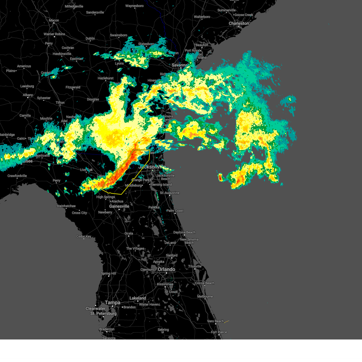
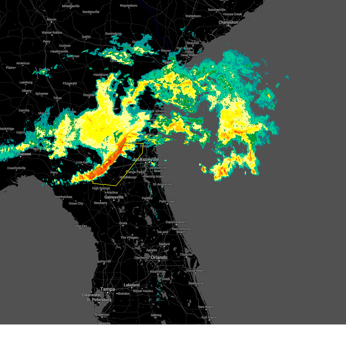
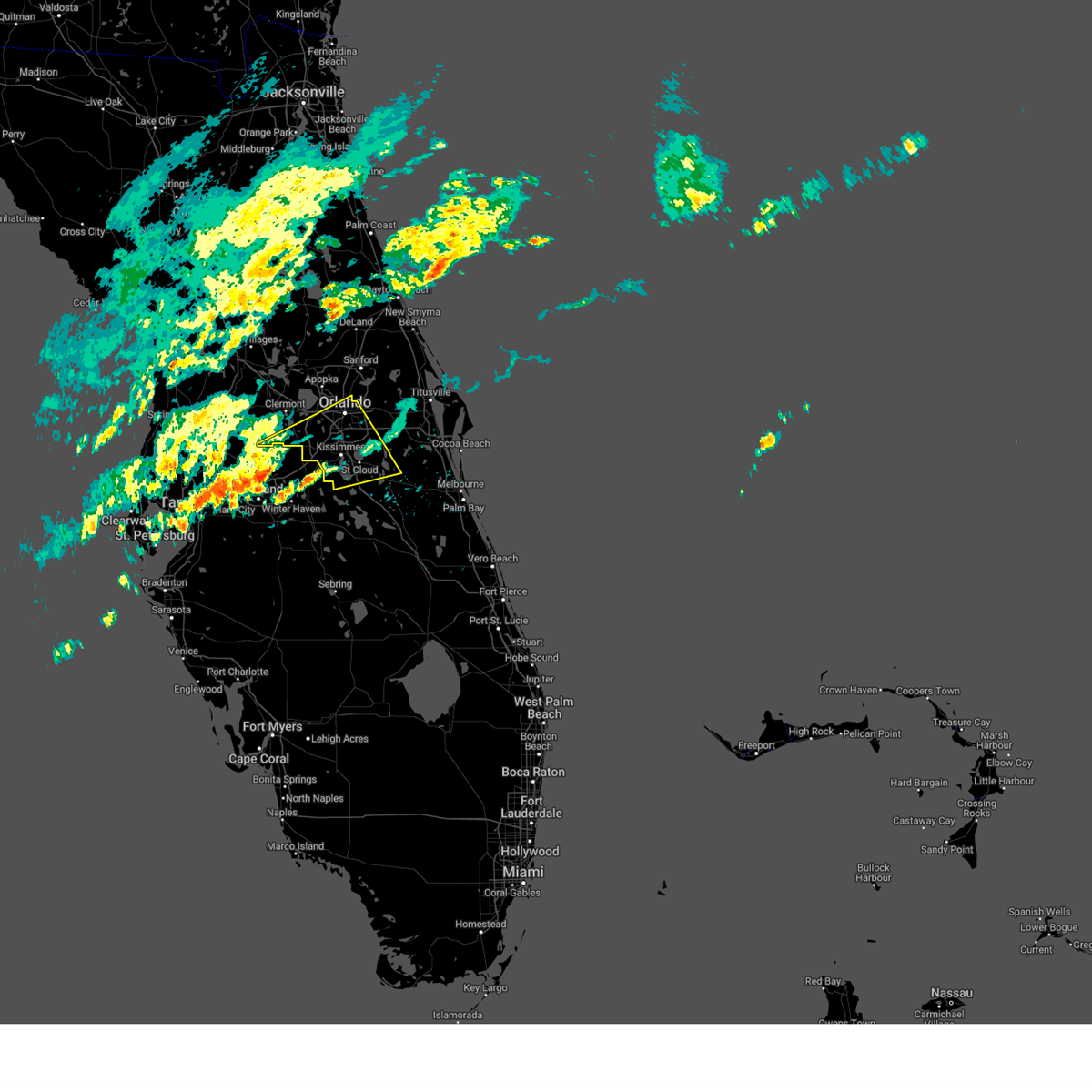
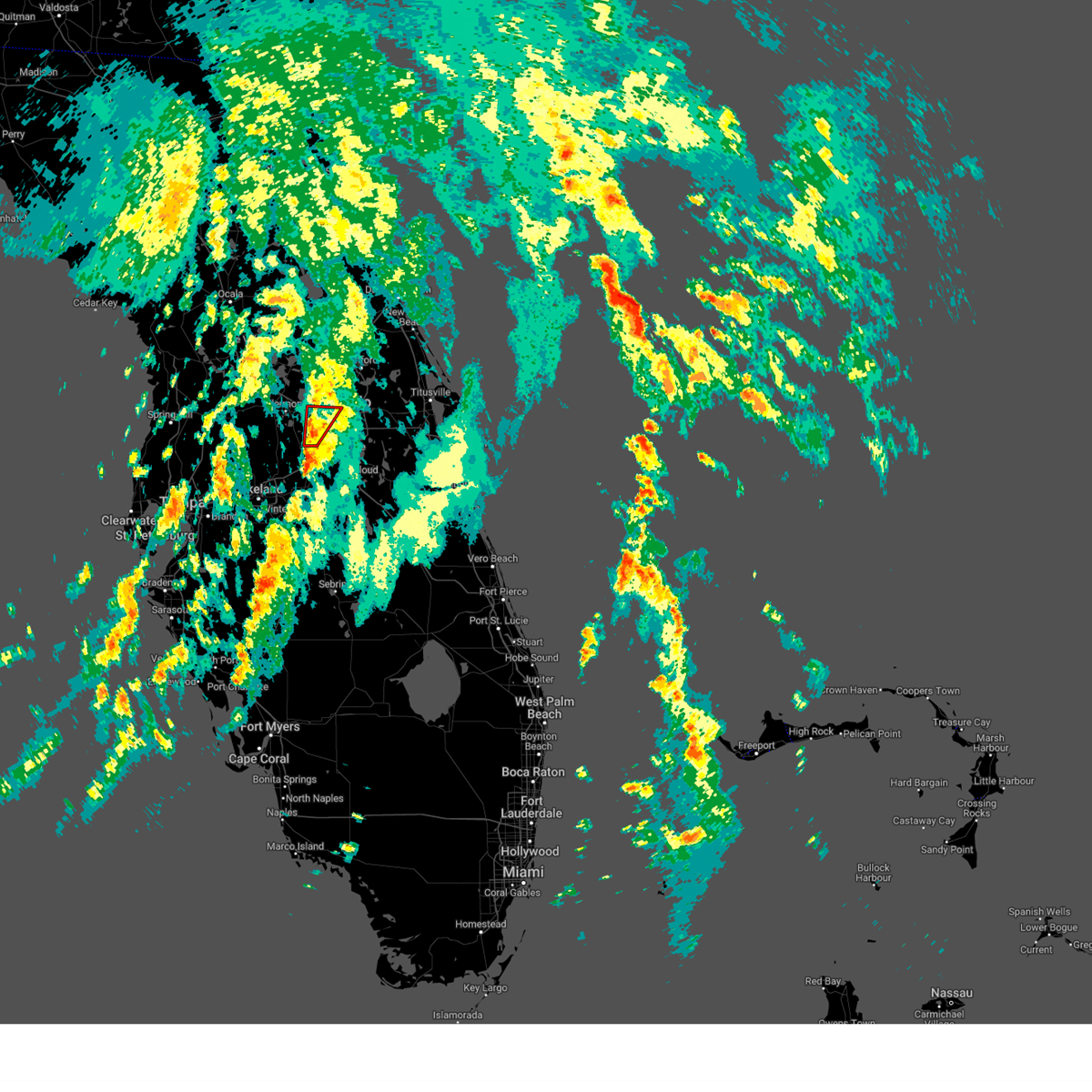
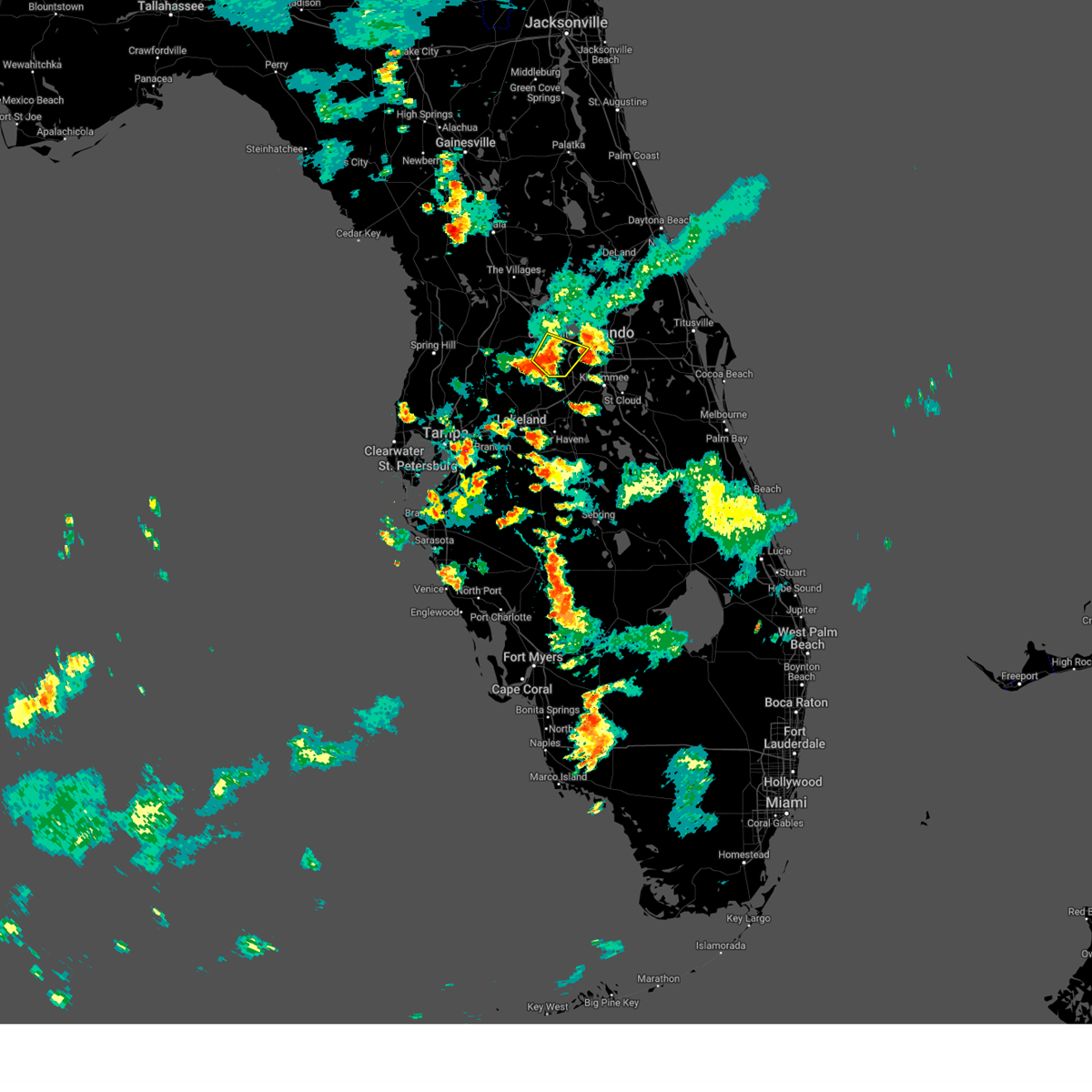
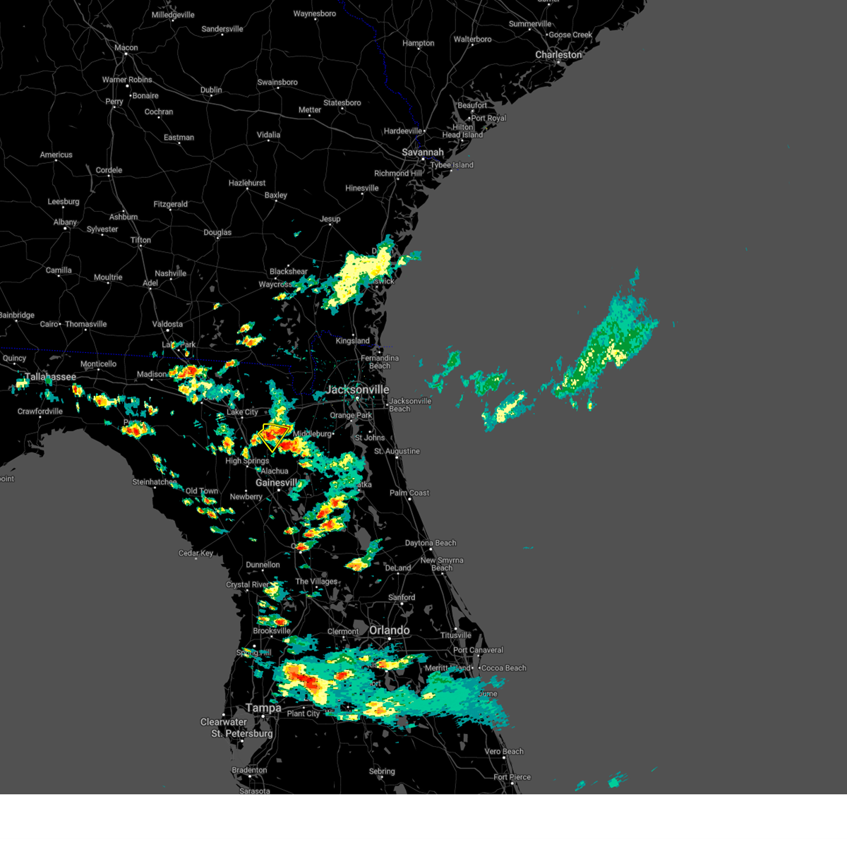
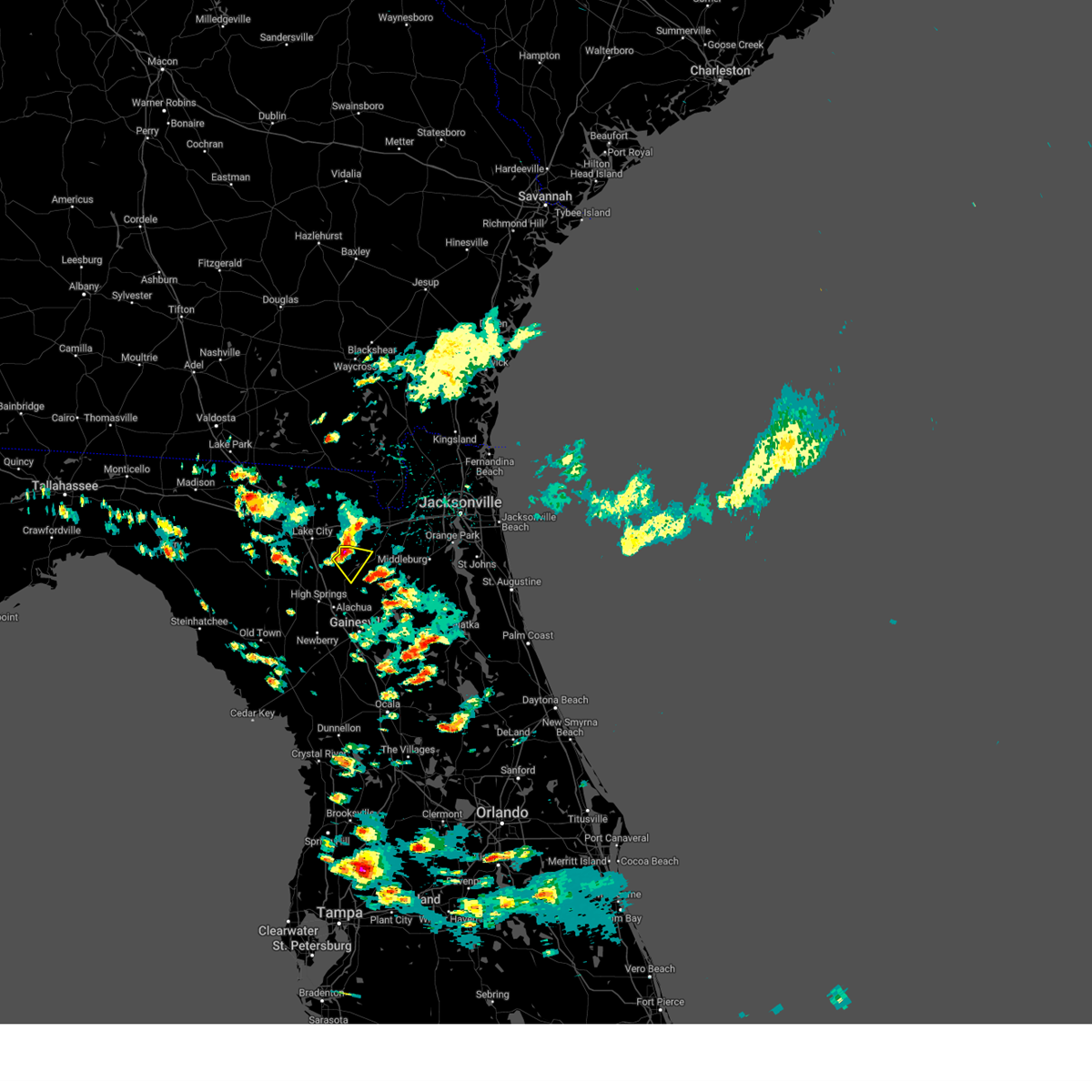
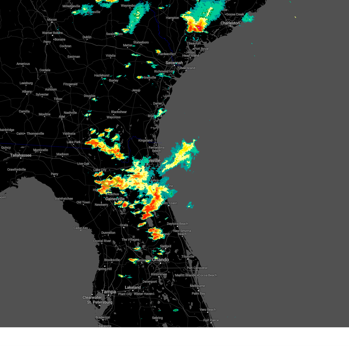
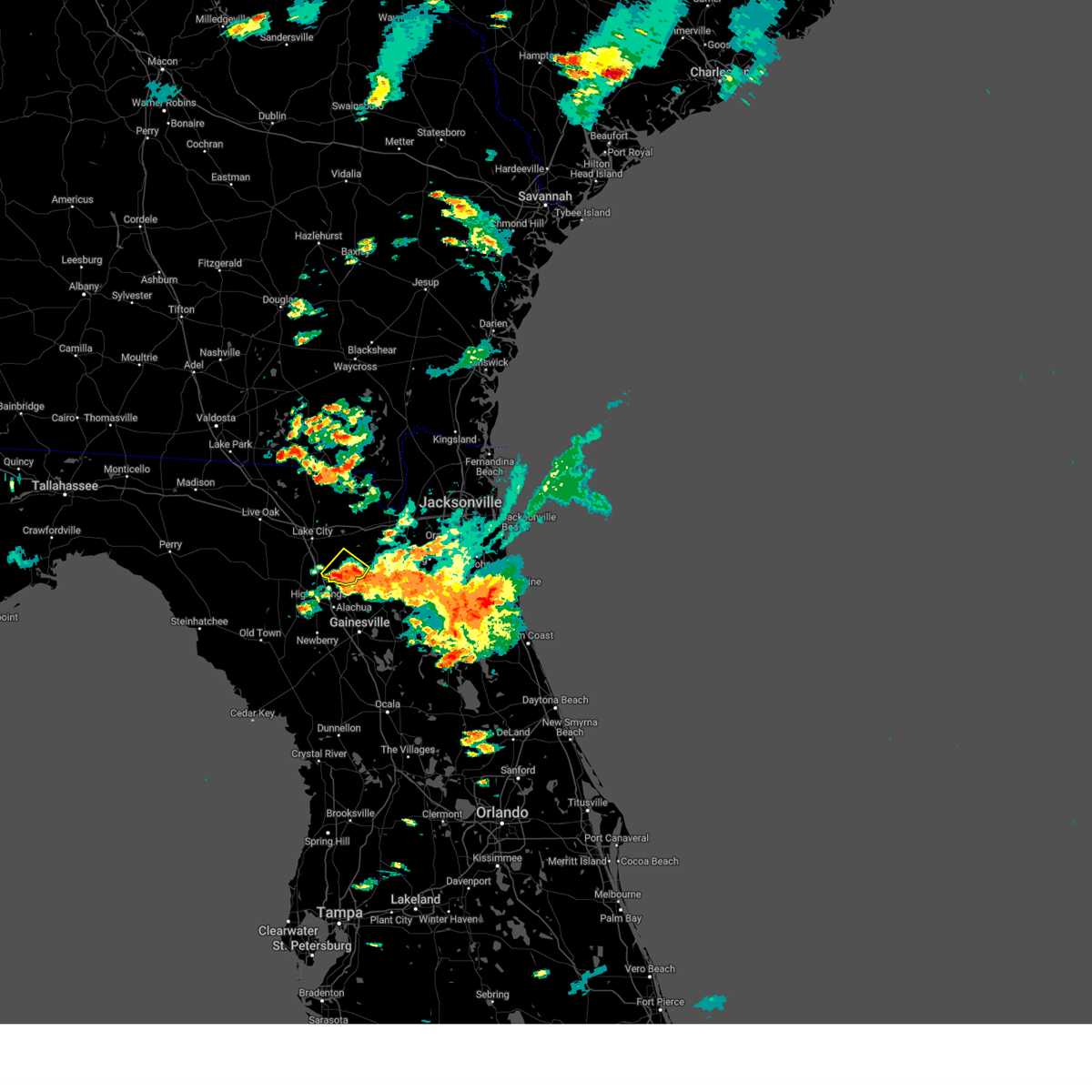
Hail Map for Lake Butler, FL
The Lake Butler, FL area has had 3 reports of on-the-ground hail by trained spotters, and has been under severe weather warnings 15 times during the past 12 months. Doppler radar has detected hail at or near Lake Butler, FL on 140 occasions, including 6 occasions during the past year.
| Name: | Lake Butler, FL |
| Where Located: | 10.4 miles WSW of Orlando, FL |
| Map: | Google Map for Lake Butler, FL |
| Population: | 15400 |
| Housing Units: | 5875 |
| More Info: | Search Google for Lake Butler, FL |
1
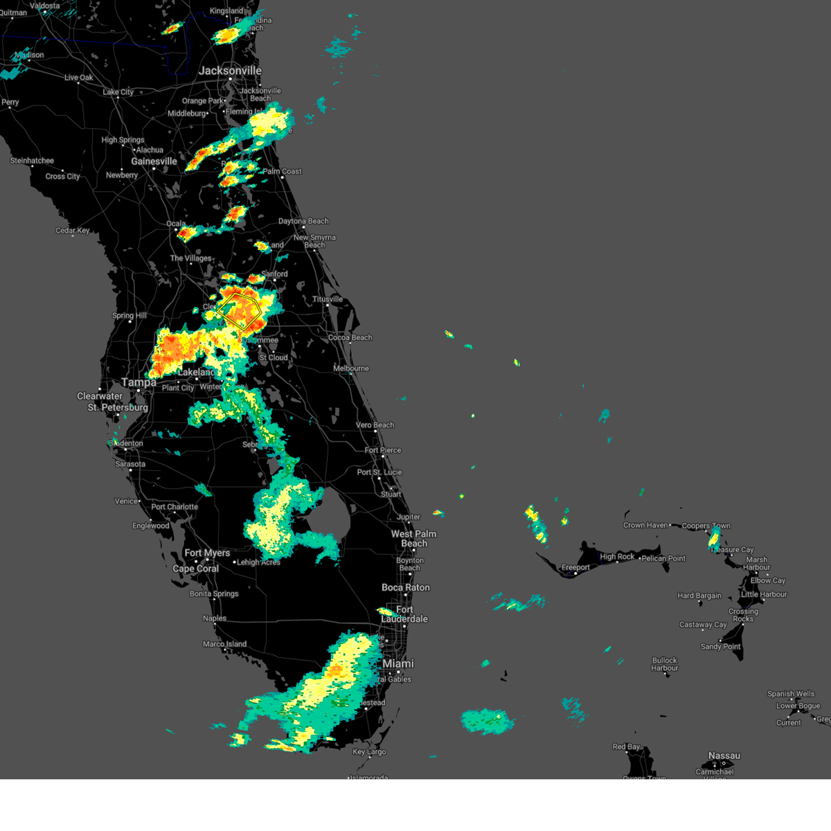
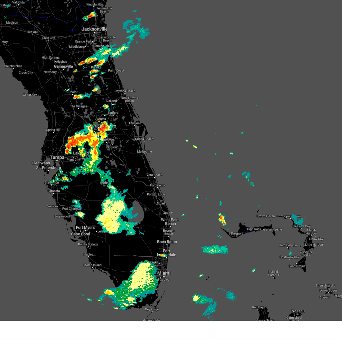
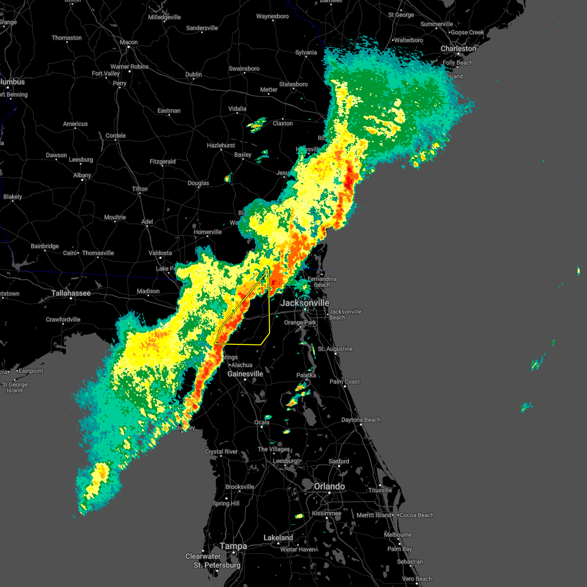
The Top Recent Hail Date for Lake Butler, FL is Tuesday, June 10, 2025 (33rd out of 140)

Hail and Wind Damage Spotted near Lake Butler, FL
| Date / Time | Report Details |
|---|---|
| 6/10/2025 7:21 PM EDT |
 The storm which prompted the warning has weakened below severe limits, and no longer poses an immediate threat to life or property. therefore, the warning will be allowed to expire. however gusty winds and heavy rain leading to localized flooding are still possible with this thunderstorm. The storm which prompted the warning has weakened below severe limits, and no longer poses an immediate threat to life or property. therefore, the warning will be allowed to expire. however gusty winds and heavy rain leading to localized flooding are still possible with this thunderstorm.
|
| 6/10/2025 7:03 PM EDT |
 Svrmlb the national weather service in melbourne has issued a * severe thunderstorm warning for, southern lake county in east central florida, west central orange county in east central florida, * until 730 pm edt. * at 703 pm edt, a severe thunderstorm was located over winter garden, moving northwest at 20 mph (radar indicated). Hazards include 60 mph wind gusts and penny size hail. expect damage to roofs, siding, and trees Svrmlb the national weather service in melbourne has issued a * severe thunderstorm warning for, southern lake county in east central florida, west central orange county in east central florida, * until 730 pm edt. * at 703 pm edt, a severe thunderstorm was located over winter garden, moving northwest at 20 mph (radar indicated). Hazards include 60 mph wind gusts and penny size hail. expect damage to roofs, siding, and trees
|
| 6/10/2025 6:43 PM EDT |
 Svrmlb the national weather service in melbourne has issued a * severe thunderstorm warning for, southwestern orange county in east central florida, * until 715 pm edt. * at 643 pm edt, a severe thunderstorm was located over orlovista, or over windermere, moving southwest at 5 mph (radar indicated). Hazards include 60 mph wind gusts and penny size hail. a funnel cloud also cannot be ruled out. expect damage to roofs, siding, and trees Svrmlb the national weather service in melbourne has issued a * severe thunderstorm warning for, southwestern orange county in east central florida, * until 715 pm edt. * at 643 pm edt, a severe thunderstorm was located over orlovista, or over windermere, moving southwest at 5 mph (radar indicated). Hazards include 60 mph wind gusts and penny size hail. a funnel cloud also cannot be ruled out. expect damage to roofs, siding, and trees
|
| 5/10/2025 6:19 PM EDT |
 Svrjax the national weather service in jacksonville has issued a * severe thunderstorm warning for, bradford county in northern florida, northeastern alachua county in northern florida, southern baker county in northeastern florida, northwestern putnam county in northeastern florida, union county in northern florida, western clay county in northeastern florida, east central columbia county in northern florida, * until 645 pm edt. * at 619 pm edt, severe thunderstorms were located along a line extending from lake geneva to groves, moving north at 20 mph (radar indicated). Hazards include 60 mph wind gusts and penny size hail. expect damage to roofs, siding, and trees Svrjax the national weather service in jacksonville has issued a * severe thunderstorm warning for, bradford county in northern florida, northeastern alachua county in northern florida, southern baker county in northeastern florida, northwestern putnam county in northeastern florida, union county in northern florida, western clay county in northeastern florida, east central columbia county in northern florida, * until 645 pm edt. * at 619 pm edt, severe thunderstorms were located along a line extending from lake geneva to groves, moving north at 20 mph (radar indicated). Hazards include 60 mph wind gusts and penny size hail. expect damage to roofs, siding, and trees
|
| 3/9/2025 10:13 AM EDT |
 The storms which prompted the warning have weakened below severe limits, and no longer pose an immediate threat to life or property. therefore, the warning will be allowed to expire. however, small hail and strong gusty winds are still possible with these thunderstorms. The storms which prompted the warning have weakened below severe limits, and no longer pose an immediate threat to life or property. therefore, the warning will be allowed to expire. however, small hail and strong gusty winds are still possible with these thunderstorms.
|
| 3/9/2025 10:01 AM EDT |
 At 1000 am edt, severe thunderstorms were located along a line extending from 6 miles northeast of st. george to near olustee, moving east at 60 mph (radar indicated). Hazards include 60 mph wind gusts and nickel size hail. Expect damage to roofs, siding, and trees. locations impacted include, palestine community, groves, callahan, worthington spring, st. George, johnstown, raiford, new river, macclenny, and lake butler. At 1000 am edt, severe thunderstorms were located along a line extending from 6 miles northeast of st. george to near olustee, moving east at 60 mph (radar indicated). Hazards include 60 mph wind gusts and nickel size hail. Expect damage to roofs, siding, and trees. locations impacted include, palestine community, groves, callahan, worthington spring, st. George, johnstown, raiford, new river, macclenny, and lake butler.
|
| 3/9/2025 9:44 AM EDT |
 Svrjax the national weather service in jacksonville has issued a * severe thunderstorm warning for, southwestern nassau county in northeastern florida, northwestern bradford county in northern florida, baker county in northeastern florida, union county in northern florida, central columbia county in northern florida, northwestern duval county in northeastern florida, southeastern charlton county in southeastern georgia, * until 1015 am edt. * at 944 am edt, severe thunderstorms were located along a line extending from 8 miles northeast of taylor to near lake city, moving east at 60 mph (radar indicated). Hazards include 60 mph wind gusts and quarter size hail. Hail damage to vehicles is expected. Expect wind damage to roofs, siding, and trees. Svrjax the national weather service in jacksonville has issued a * severe thunderstorm warning for, southwestern nassau county in northeastern florida, northwestern bradford county in northern florida, baker county in northeastern florida, union county in northern florida, central columbia county in northern florida, northwestern duval county in northeastern florida, southeastern charlton county in southeastern georgia, * until 1015 am edt. * at 944 am edt, severe thunderstorms were located along a line extending from 8 miles northeast of taylor to near lake city, moving east at 60 mph (radar indicated). Hazards include 60 mph wind gusts and quarter size hail. Hail damage to vehicles is expected. Expect wind damage to roofs, siding, and trees.
|
| 1/19/2025 12:01 PM EST |
 Svrmlb the national weather service in melbourne has issued a * severe thunderstorm warning for, southwestern lake county in east central florida, southwestern orange county in east central florida, northern osceola county in east central florida, * until 1245 pm est. * at 1201 pm est, a severe thunderstorm was located 7 miles north of auburndale, moving northeast at 45 mph (radar indicated). Hazards include 60 mph wind gusts and penny size hail. expect damage to roofs, siding, and trees Svrmlb the national weather service in melbourne has issued a * severe thunderstorm warning for, southwestern lake county in east central florida, southwestern orange county in east central florida, northern osceola county in east central florida, * until 1245 pm est. * at 1201 pm est, a severe thunderstorm was located 7 miles north of auburndale, moving northeast at 45 mph (radar indicated). Hazards include 60 mph wind gusts and penny size hail. expect damage to roofs, siding, and trees
|
| 8/5/2024 9:08 AM EDT |
 The storm which prompted the warning has weakened below severe limits, and no longer appears capable of producing a tornado. therefore, the warning will be allowed to expire. a tornado watch remains in effect until 400 pm edt for east central florida. The storm which prompted the warning has weakened below severe limits, and no longer appears capable of producing a tornado. therefore, the warning will be allowed to expire. a tornado watch remains in effect until 400 pm edt for east central florida.
|
| 8/5/2024 8:55 AM EDT |
 Tormlb the national weather service in melbourne has issued a * tornado warning for, southwestern orange county in east central florida, * until 915 am edt. * at 855 am edt, a severe thunderstorm capable of producing a tornado was located over bay lake, moving north at 35 mph (radar indicated rotation). Hazards include tornado. Flying debris will be dangerous to those caught without shelter. mobile homes will be damaged or destroyed. damage to roofs, windows, and vehicles will occur. tree damage is likely. this dangerous storm will be near, orlando, ocoee, and winter garden around 900 am edt. pine hills and orlovista around 910 am edt. Other locations impacted by this tornadic thunderstorm include lake butler. Tormlb the national weather service in melbourne has issued a * tornado warning for, southwestern orange county in east central florida, * until 915 am edt. * at 855 am edt, a severe thunderstorm capable of producing a tornado was located over bay lake, moving north at 35 mph (radar indicated rotation). Hazards include tornado. Flying debris will be dangerous to those caught without shelter. mobile homes will be damaged or destroyed. damage to roofs, windows, and vehicles will occur. tree damage is likely. this dangerous storm will be near, orlando, ocoee, and winter garden around 900 am edt. pine hills and orlovista around 910 am edt. Other locations impacted by this tornadic thunderstorm include lake butler.
|
| 7/30/2024 6:19 PM EDT |
 the severe thunderstorm warning has been cancelled and is no longer in effect the severe thunderstorm warning has been cancelled and is no longer in effect
|
| 7/30/2024 6:06 PM EDT | Svrmlb the national weather service in melbourne has issued a * severe thunderstorm warning for, south central lake county in east central florida, west central orange county in east central florida, * until 630 pm edt. * at 605 pm edt, a severe thunderstorm was located over lake louisa, or 8 miles southeast of groveland, moving southeast at 10 mph (radar indicated). Hazards include 60 mph wind gusts and quarter size hail. Hail damage to vehicles is expected. Expect wind damage to roofs, siding, and trees. |
| 7/14/2024 5:54 PM EDT |
 The storm which prompted the warning has weakened below severe limits, and no longer poses an immediate threat to life or property. therefore, the warning will be allowed to expire. however gusty winds are still possible with this thunderstorm. The storm which prompted the warning has weakened below severe limits, and no longer poses an immediate threat to life or property. therefore, the warning will be allowed to expire. however gusty winds are still possible with this thunderstorm.
|
| 7/14/2024 5:47 PM EDT |
 At 547 pm edt, a severe thunderstorm was located over universal studios, or near windermere, moving northwest at 10 mph (radar indicated). Hazards include 60 mph wind gusts and penny size hail. Expect damage to roofs, siding, and trees. Locations impacted include, orlando, windermere, bay lake, and bay hill. At 547 pm edt, a severe thunderstorm was located over universal studios, or near windermere, moving northwest at 10 mph (radar indicated). Hazards include 60 mph wind gusts and penny size hail. Expect damage to roofs, siding, and trees. Locations impacted include, orlando, windermere, bay lake, and bay hill.
|
| 7/14/2024 5:27 PM EDT |
 Svrmlb the national weather service in melbourne has issued a * severe thunderstorm warning for, southwestern orange county in east central florida, * until 600 pm edt. * at 527 pm edt, a severe thunderstorm was located over wet n wild water park, or over oak ridge, moving northwest at 10 mph (radar indicated). Hazards include 60 mph wind gusts and penny size hail. expect damage to roofs, siding, and trees Svrmlb the national weather service in melbourne has issued a * severe thunderstorm warning for, southwestern orange county in east central florida, * until 600 pm edt. * at 527 pm edt, a severe thunderstorm was located over wet n wild water park, or over oak ridge, moving northwest at 10 mph (radar indicated). Hazards include 60 mph wind gusts and penny size hail. expect damage to roofs, siding, and trees
|
| 5/14/2024 12:36 PM EDT |
 At 1236 pm edt, severe thunderstorms were located along a line extending from lake mary to windermere to near bay lake to 6 miles north of auburndale, moving east at 35 mph (radar indicated). Hazards include 60 mph wind gusts and penny size hail. Expect damage to roofs, siding, and trees. Locations impacted include, orlando, sanford, apopka, altamonte springs, and ocoee. At 1236 pm edt, severe thunderstorms were located along a line extending from lake mary to windermere to near bay lake to 6 miles north of auburndale, moving east at 35 mph (radar indicated). Hazards include 60 mph wind gusts and penny size hail. Expect damage to roofs, siding, and trees. Locations impacted include, orlando, sanford, apopka, altamonte springs, and ocoee.
|
| 5/14/2024 12:12 PM EDT |
 Svrmlb the national weather service in melbourne has issued a * severe thunderstorm warning for, southwestern seminole county in east central florida, southwestern lake county in east central florida, western orange county in east central florida, northwestern osceola county in east central florida, * until 1245 pm edt. * at 1211 pm edt, severe thunderstorms were located along a line extending from near zellwood to near groveland to 12 miles southwest of lake louisa to 8 miles southeast of zephyrhills south, moving east at 35 mph (radar indicated). Hazards include 60 mph wind gusts and penny size hail. expect damage to roofs, siding, and trees Svrmlb the national weather service in melbourne has issued a * severe thunderstorm warning for, southwestern seminole county in east central florida, southwestern lake county in east central florida, western orange county in east central florida, northwestern osceola county in east central florida, * until 1245 pm edt. * at 1211 pm edt, severe thunderstorms were located along a line extending from near zellwood to near groveland to 12 miles southwest of lake louisa to 8 miles southeast of zephyrhills south, moving east at 35 mph (radar indicated). Hazards include 60 mph wind gusts and penny size hail. expect damage to roofs, siding, and trees
|
| 5/11/2024 2:32 AM EDT |
 At 231 am edt, a severe thunderstorm was located over orlando international airport, moving southeast at 40 mph (radar indicated). Hazards include 60 mph wind gusts. Expect damage to roofs, siding, and trees. Locations impacted include, orlando, kissimmee, saint cloud, winter park, and casselberry. At 231 am edt, a severe thunderstorm was located over orlando international airport, moving southeast at 40 mph (radar indicated). Hazards include 60 mph wind gusts. Expect damage to roofs, siding, and trees. Locations impacted include, orlando, kissimmee, saint cloud, winter park, and casselberry.
|
| 5/11/2024 2:20 AM EDT |
 At 219 am edt, a severe thunderstorm was located near oak ridge, moving southeast at 35 mph (radar indicated. orlando executive airport reported a wind gust to 56 mph). Hazards include 60 mph wind gusts. Expect damage to roofs, siding, and trees. Locations impacted include, orlando, kissimmee, altamonte springs, ocoee, and winter garden. At 219 am edt, a severe thunderstorm was located near oak ridge, moving southeast at 35 mph (radar indicated. orlando executive airport reported a wind gust to 56 mph). Hazards include 60 mph wind gusts. Expect damage to roofs, siding, and trees. Locations impacted include, orlando, kissimmee, altamonte springs, ocoee, and winter garden.
|
| 5/11/2024 2:08 AM EDT |
 Svrmlb the national weather service in melbourne has issued a * severe thunderstorm warning for, southwestern seminole county in east central florida, orange county in east central florida, north central osceola county in east central florida, * until 245 am edt. * at 207 am edt, a severe thunderstorm was located over orlovista, or over pine hills, moving southeast at 40 mph (radar indicated). Hazards include 60 mph wind gusts. expect damage to roofs, siding, and trees Svrmlb the national weather service in melbourne has issued a * severe thunderstorm warning for, southwestern seminole county in east central florida, orange county in east central florida, north central osceola county in east central florida, * until 245 am edt. * at 207 am edt, a severe thunderstorm was located over orlovista, or over pine hills, moving southeast at 40 mph (radar indicated). Hazards include 60 mph wind gusts. expect damage to roofs, siding, and trees
|
| 5/10/2024 8:55 AM EDT | Reports of trees down on property. no structural damage. time est off rada in bradford county FL, 4.9 miles WNW of Lake Butler, FL |
| 5/10/2024 8:44 AM EDT |
 Svrjax the national weather service in jacksonville has issued a * severe thunderstorm warning for, nassau county in northeastern florida, bradford county in northern florida, alachua county in northern florida, north central marion county in northern florida, baker county in northeastern florida, northwestern putnam county in northeastern florida, union county in northern florida, western clay county in northeastern florida, western duval county in northeastern florida, southwestern camden county in southeastern georgia, southeastern ware county in southeastern georgia, charlton county in southeastern georgia, * until 915 am edt. * at 843 am edt, severe thunderstorms were located along a line extending from 9 miles south of argyle to near lulu to 7 miles southeast of cross city, moving east at 70 mph. these are destructive storms for lake butler, starke, gainesville, macclenny, baldwin, and hilliard. (radar indicated). Hazards include 80 mph wind gusts and quarter size hail. Flying debris will be dangerous to those caught without shelter. mobile homes will be heavily damaged. expect considerable damage to roofs, windows, and vehicles. Extensive tree damage and power outages are likely. Svrjax the national weather service in jacksonville has issued a * severe thunderstorm warning for, nassau county in northeastern florida, bradford county in northern florida, alachua county in northern florida, north central marion county in northern florida, baker county in northeastern florida, northwestern putnam county in northeastern florida, union county in northern florida, western clay county in northeastern florida, western duval county in northeastern florida, southwestern camden county in southeastern georgia, southeastern ware county in southeastern georgia, charlton county in southeastern georgia, * until 915 am edt. * at 843 am edt, severe thunderstorms were located along a line extending from 9 miles south of argyle to near lulu to 7 miles southeast of cross city, moving east at 70 mph. these are destructive storms for lake butler, starke, gainesville, macclenny, baldwin, and hilliard. (radar indicated). Hazards include 80 mph wind gusts and quarter size hail. Flying debris will be dangerous to those caught without shelter. mobile homes will be heavily damaged. expect considerable damage to roofs, windows, and vehicles. Extensive tree damage and power outages are likely.
|
| 5/10/2024 8:18 AM EDT |
 Svrjax the national weather service in jacksonville has issued a * severe thunderstorm warning for, gilchrist county in northern florida, western alachua county in northern florida, baker county in northeastern florida, union county in northern florida, southeastern suwannee county in northern florida, columbia county in northern florida, eastern hamilton county in northern florida, southeastern echols county in southeastern georgia, southern ware county in southeastern georgia, southeastern clinch county in southeastern georgia, central charlton county in southeastern georgia, * until 900 am edt. * at 818 am edt, severe thunderstorms were located along a line extending from 6 miles south of homerville to near white springs to near cross city, moving east at 60 mph (radar indicated). Hazards include 70 mph wind gusts and quarter size hail. Hail damage to vehicles is expected. expect considerable tree damage. Wind damage is also likely to mobile homes, roofs, and outbuildings. Svrjax the national weather service in jacksonville has issued a * severe thunderstorm warning for, gilchrist county in northern florida, western alachua county in northern florida, baker county in northeastern florida, union county in northern florida, southeastern suwannee county in northern florida, columbia county in northern florida, eastern hamilton county in northern florida, southeastern echols county in southeastern georgia, southern ware county in southeastern georgia, southeastern clinch county in southeastern georgia, central charlton county in southeastern georgia, * until 900 am edt. * at 818 am edt, severe thunderstorms were located along a line extending from 6 miles south of homerville to near white springs to near cross city, moving east at 60 mph (radar indicated). Hazards include 70 mph wind gusts and quarter size hail. Hail damage to vehicles is expected. expect considerable tree damage. Wind damage is also likely to mobile homes, roofs, and outbuildings.
|
| 4/3/2024 10:59 AM EDT |
 At 1059 am edt, severe thunderstorms were located along a line extending from near glen st. mary to near high springs, moving east at 50 mph (radar indicated). Hazards include 60 mph wind gusts and penny size hail. Expect damage to roofs, siding, and trees. Locations impacted include, lake butler, raiford, worthington spring, alachua, macclenny, high springs, worthington springs, groves, beasley, and new river. At 1059 am edt, severe thunderstorms were located along a line extending from near glen st. mary to near high springs, moving east at 50 mph (radar indicated). Hazards include 60 mph wind gusts and penny size hail. Expect damage to roofs, siding, and trees. Locations impacted include, lake butler, raiford, worthington spring, alachua, macclenny, high springs, worthington springs, groves, beasley, and new river.
|
| 4/3/2024 10:59 AM EDT |
 the severe thunderstorm warning has been cancelled and is no longer in effect the severe thunderstorm warning has been cancelled and is no longer in effect
|
| 4/3/2024 10:47 AM EDT |
 At 1047 am edt, severe thunderstorms were located along a line extending from near sanderson to near high springs, moving east at 50 mph (radar indicated). Hazards include 60 mph wind gusts and penny size hail. Expect damage to roofs, siding, and trees. locations impacted include, lake butler, bell, raiford, worthington spring, alachua, macclenny, high springs, glen st. Mary, worthington springs, and palestine community. At 1047 am edt, severe thunderstorms were located along a line extending from near sanderson to near high springs, moving east at 50 mph (radar indicated). Hazards include 60 mph wind gusts and penny size hail. Expect damage to roofs, siding, and trees. locations impacted include, lake butler, bell, raiford, worthington spring, alachua, macclenny, high springs, glen st. Mary, worthington springs, and palestine community.
|
| 4/3/2024 10:40 AM EDT | Tree down near sw 44th ave and sr 238. time estimated by rada in union county FL, 12.6 miles E of Lake Butler, FL |
| 4/3/2024 10:36 AM EDT | Tree down on powerline near sw 31st ln and w sr 238. time is estimated by rada in union county FL, 13.8 miles E of Lake Butler, FL |
| 4/3/2024 10:31 AM EDT |
 the severe thunderstorm warning has been cancelled and is no longer in effect the severe thunderstorm warning has been cancelled and is no longer in effect
|
| 4/3/2024 10:31 AM EDT |
 At 1030 am edt, severe thunderstorms were located along a line extending from near watertown to near bell, moving east at 40 mph (radar indicated). Hazards include 60 mph wind gusts and penny size hail. Expect damage to roofs, siding, and trees. Locations impacted include, lake city, lake butler, bell, raiford, worthington spring, columbia, alachua, macclenny, high springs, and fort white. At 1030 am edt, severe thunderstorms were located along a line extending from near watertown to near bell, moving east at 40 mph (radar indicated). Hazards include 60 mph wind gusts and penny size hail. Expect damage to roofs, siding, and trees. Locations impacted include, lake city, lake butler, bell, raiford, worthington spring, columbia, alachua, macclenny, high springs, and fort white.
|
| 4/3/2024 10:24 AM EDT | Tree down near nw cr 241 and nw 49th ln. time estimated by rada in union county FL, 12 miles E of Lake Butler, FL |
| 4/3/2024 10:12 AM EDT |
 Svrjax the national weather service in jacksonville has issued a * severe thunderstorm warning for, central gilchrist county in northern florida, central bradford county in northern florida, northwestern alachua county in northern florida, southern baker county in northeastern florida, union county in northern florida, southeastern suwannee county in northern florida, southern columbia county in northern florida, * until 1115 am edt. * at 1012 am edt, severe thunderstorms were located along a line extending from near wellborn to 6 miles north of bell, moving east at 35 mph (radar indicated). Hazards include 60 mph wind gusts and penny size hail. expect damage to roofs, siding, and trees Svrjax the national weather service in jacksonville has issued a * severe thunderstorm warning for, central gilchrist county in northern florida, central bradford county in northern florida, northwestern alachua county in northern florida, southern baker county in northeastern florida, union county in northern florida, southeastern suwannee county in northern florida, southern columbia county in northern florida, * until 1115 am edt. * at 1012 am edt, severe thunderstorms were located along a line extending from near wellborn to 6 miles north of bell, moving east at 35 mph (radar indicated). Hazards include 60 mph wind gusts and penny size hail. expect damage to roofs, siding, and trees
|
| 3/3/2024 3:08 PM EST |
 The storm which prompted the warning has weakened below severe limits, and no longer poses an immediate threat to life or property. therefore, the warning will be allowed to expire. however, small hail is still possible with this thunderstorm. The storm which prompted the warning has weakened below severe limits, and no longer poses an immediate threat to life or property. therefore, the warning will be allowed to expire. however, small hail is still possible with this thunderstorm.
|
| 3/3/2024 2:48 PM EST |
 Svrjax the national weather service in jacksonville has issued a * severe thunderstorm warning for, central union county in northern florida, * until 315 pm est. * at 248 pm est, a severe thunderstorm was located over palestine community, or 7 miles northwest of lake butler, moving southeast at 5 mph (radar indicated). Hazards include quarter size hail. damage to vehicles is expected Svrjax the national weather service in jacksonville has issued a * severe thunderstorm warning for, central union county in northern florida, * until 315 pm est. * at 248 pm est, a severe thunderstorm was located over palestine community, or 7 miles northwest of lake butler, moving southeast at 5 mph (radar indicated). Hazards include quarter size hail. damage to vehicles is expected
|
| 2/4/2024 7:24 PM EST |
 At 723 pm est, a severe thunderstorm was located over ocoee, moving northeast at 30 mph (radar indicated). Hazards include 60 mph wind gusts and quarter size hail. Hail damage to vehicles is expected. Expect wind damage to roofs, siding, and trees. At 723 pm est, a severe thunderstorm was located over ocoee, moving northeast at 30 mph (radar indicated). Hazards include 60 mph wind gusts and quarter size hail. Hail damage to vehicles is expected. Expect wind damage to roofs, siding, and trees.
|
| 1/9/2024 5:55 PM EST |
 The national weather service in melbourne has issued a * severe thunderstorm warning for. seminole county in east central florida. orange county in east central florida. central volusia county in east central florida. northwestern osceola county in east central florida. Until 645 pm est. The national weather service in melbourne has issued a * severe thunderstorm warning for. seminole county in east central florida. orange county in east central florida. central volusia county in east central florida. northwestern osceola county in east central florida. Until 645 pm est.
|
| 1/9/2024 5:48 PM EST |
 At 547 pm est, a severe thunderstorm capable of producing a tornado was located over sea world, or near oak ridge, moving east at 40 mph (radar indicated rotation). Hazards include tornado. Flying debris will be dangerous to those caught without shelter. mobile homes will be damaged or destroyed. damage to roofs, windows, and vehicles will occur. tree damage is likely. this dangerous storm will be near, orlando, orlando international airport, and conway around 550 pm est. azalea park, lake hart, and lake nona around 600 pm est. Other locations impacted by this tornadic thunderstorm include meadow woods. At 547 pm est, a severe thunderstorm capable of producing a tornado was located over sea world, or near oak ridge, moving east at 40 mph (radar indicated rotation). Hazards include tornado. Flying debris will be dangerous to those caught without shelter. mobile homes will be damaged or destroyed. damage to roofs, windows, and vehicles will occur. tree damage is likely. this dangerous storm will be near, orlando, orlando international airport, and conway around 550 pm est. azalea park, lake hart, and lake nona around 600 pm est. Other locations impacted by this tornadic thunderstorm include meadow woods.
|
| 1/9/2024 5:44 PM EST |
 At 543 pm est, severe thunderstorms were located along a line extending from near flagler beach to orange city to ocoee, moving northeast at 70 mph (radar indicated). Hazards include 60 mph wind gusts. Expect damage to roofs, siding, and trees. Locations impacted include, orlando, deltona, daytona beach, kissimmee, and port orange. At 543 pm est, severe thunderstorms were located along a line extending from near flagler beach to orange city to ocoee, moving northeast at 70 mph (radar indicated). Hazards include 60 mph wind gusts. Expect damage to roofs, siding, and trees. Locations impacted include, orlando, deltona, daytona beach, kissimmee, and port orange.
|
| 1/9/2024 5:21 PM EST |
 The national weather service in melbourne has issued a * severe thunderstorm warning for. seminole county in east central florida. central lake county in east central florida. orange county in east central florida. Volusia county in east central florida. The national weather service in melbourne has issued a * severe thunderstorm warning for. seminole county in east central florida. central lake county in east central florida. orange county in east central florida. Volusia county in east central florida.
|
| 1/9/2024 5:07 PM EST |
 At 506 pm est, severe thunderstorms were located along a line extending from near pierson to mid florida lakes to 12 miles southwest of lake louisa, moving northeast at 70 mph (radar indicated). Hazards include 60 mph wind gusts. Expect damage to roofs, siding, and trees. Locations impacted include, apopka, ocoee, winter garden, leesburg, and eustis. At 506 pm est, severe thunderstorms were located along a line extending from near pierson to mid florida lakes to 12 miles southwest of lake louisa, moving northeast at 70 mph (radar indicated). Hazards include 60 mph wind gusts. Expect damage to roofs, siding, and trees. Locations impacted include, apopka, ocoee, winter garden, leesburg, and eustis.
|
| 1/9/2024 4:46 PM EST |
 At 446 pm est, severe thunderstorms were located along a line extending from lake george to near leesburg to 6 miles east of dade city, moving northeast at 65 mph (radar indicated). Hazards include 60 mph wind gusts. expect damage to roofs, siding, and trees At 446 pm est, severe thunderstorms were located along a line extending from lake george to near leesburg to 6 miles east of dade city, moving northeast at 65 mph (radar indicated). Hazards include 60 mph wind gusts. expect damage to roofs, siding, and trees
|
| 1/9/2024 2:44 PM EST |
 At 244 pm est, severe thunderstorms were located along a line extending from 11 miles northwest of st. george to near alachua, moving east at 35 mph (radar indicated). Hazards include 60 mph wind gusts. expect damage to roofs, siding, and trees At 244 pm est, severe thunderstorms were located along a line extending from 11 miles northwest of st. george to near alachua, moving east at 35 mph (radar indicated). Hazards include 60 mph wind gusts. expect damage to roofs, siding, and trees
|
| 1/9/2024 2:02 PM EST |
 At 201 pm est, severe thunderstorms were located along a line extending from 7 miles north of taylor to near high springs, moving east at 40 mph (radar indicated). Hazards include 60 mph wind gusts. expect damage to roofs, siding, and trees At 201 pm est, severe thunderstorms were located along a line extending from 7 miles north of taylor to near high springs, moving east at 40 mph (radar indicated). Hazards include 60 mph wind gusts. expect damage to roofs, siding, and trees
|
| 10/12/2023 9:45 AM EDT | Tree down across sw sr 121 near the intersection of sw 85th trl. large tree was across both lanes of the state road. time estimated by rada in union county FL, 2.1 miles ENE of Lake Butler, FL |
| 10/12/2023 9:40 AM EDT | Tree on powerline / transformer near the intersection of sw cr 245 and sw 44th ave. time estimated by rada in union county FL, 12.2 miles ENE of Lake Butler, FL |
| 9/11/2023 8:22 PM EDT |
 At 822 pm edt, a severe thunderstorm was located over pine hills, moving south at 10 mph (radar indicated). Hazards include 60 mph wind gusts and nickel size hail. expect damage to roofs, siding, and trees At 822 pm edt, a severe thunderstorm was located over pine hills, moving south at 10 mph (radar indicated). Hazards include 60 mph wind gusts and nickel size hail. expect damage to roofs, siding, and trees
|
| 9/11/2023 6:52 PM EDT |
 The severe thunderstorm warning for union county will expire at 700 pm edt, the storm which prompted the warning has weakened below severe limits, and no longer poses an immediate threat to life or property. therefore, the warning will be allowed to expire. however, gusty winds are still possible with this thunderstorm. The severe thunderstorm warning for union county will expire at 700 pm edt, the storm which prompted the warning has weakened below severe limits, and no longer poses an immediate threat to life or property. therefore, the warning will be allowed to expire. however, gusty winds are still possible with this thunderstorm.
|
| 9/11/2023 6:25 PM EDT |
 At 625 pm edt, a severe thunderstorm was located over groves, or near worthington spring, moving northeast at 10 mph (radar indicated). Hazards include 60 mph wind gusts. Expect damage to roofs, siding, and trees. locations impacted include, lake butler, worthington spring, worthington springs, palestine community, upland pines, groves, providence, beasley, and dukes. hail threat, radar indicated max hail size, <. 75 in wind threat, radar indicated max wind gust, 60 mph. At 625 pm edt, a severe thunderstorm was located over groves, or near worthington spring, moving northeast at 10 mph (radar indicated). Hazards include 60 mph wind gusts. Expect damage to roofs, siding, and trees. locations impacted include, lake butler, worthington spring, worthington springs, palestine community, upland pines, groves, providence, beasley, and dukes. hail threat, radar indicated max hail size, <. 75 in wind threat, radar indicated max wind gust, 60 mph.
|
| 9/11/2023 6:08 PM EDT |
 At 608 pm edt, a severe thunderstorm was located over upland pines, or near worthington spring, moving northeast at 10 mph (radar indicated). Hazards include 60 mph wind gusts and penny size hail. expect damage to roofs, siding, and trees At 608 pm edt, a severe thunderstorm was located over upland pines, or near worthington spring, moving northeast at 10 mph (radar indicated). Hazards include 60 mph wind gusts and penny size hail. expect damage to roofs, siding, and trees
|
| 8/15/2023 1:10 PM EDT | Report of tree down caused by thunderstorm wind in union county FL, 9.5 miles ENE of Lake Butler, FL |
| 7/30/2023 9:21 PM EDT |
 The severe thunderstorm warning for bradford, alachua, northeastern marion, western putnam, union and southwestern clay counties will expire at 930 pm edt, the storms which prompted the warning have weakened below severe limits, and no longer pose an immediate threat to life or property. therefore, the warning will be allowed to expire. however gusty winds and heavy rain are still possible with these thunderstorms. The severe thunderstorm warning for bradford, alachua, northeastern marion, western putnam, union and southwestern clay counties will expire at 930 pm edt, the storms which prompted the warning have weakened below severe limits, and no longer pose an immediate threat to life or property. therefore, the warning will be allowed to expire. however gusty winds and heavy rain are still possible with these thunderstorms.
|
| 7/30/2023 8:55 PM EDT |
 At 855 pm edt, severe thunderstorms were located along a line extending from near worthington spring to near lake delancy, moving southwest at 20 mph (radar indicated). Hazards include 60 mph wind gusts. expect damage to roofs, siding, and trees At 855 pm edt, severe thunderstorms were located along a line extending from near worthington spring to near lake delancy, moving southwest at 20 mph (radar indicated). Hazards include 60 mph wind gusts. expect damage to roofs, siding, and trees
|
| 7/30/2023 8:28 PM EDT |
 At 828 pm edt, severe thunderstorms were located along a line extending from near raiford to near florahome, moving southwest at 10 mph (radar indicated). Hazards include 60 mph wind gusts. expect damage to roofs, siding, and trees At 828 pm edt, severe thunderstorms were located along a line extending from near raiford to near florahome, moving southwest at 10 mph (radar indicated). Hazards include 60 mph wind gusts. expect damage to roofs, siding, and trees
|
| 7/5/2023 3:11 PM EDT |
 At 310 pm edt, a severe thunderstorm was located over hunters creek, or near kissimmee, moving north at 5 mph (radar indicated). Hazards include 60 mph wind gusts and penny size hail. Expect damage to roofs, siding, and trees. locations impacted include, orlando, kissimmee, winter park, windermere and bay lake. hail threat, radar indicated max hail size, 0. 75 in wind threat, radar indicated max wind gust, 60 mph. At 310 pm edt, a severe thunderstorm was located over hunters creek, or near kissimmee, moving north at 5 mph (radar indicated). Hazards include 60 mph wind gusts and penny size hail. Expect damage to roofs, siding, and trees. locations impacted include, orlando, kissimmee, winter park, windermere and bay lake. hail threat, radar indicated max hail size, 0. 75 in wind threat, radar indicated max wind gust, 60 mph.
|
| 7/5/2023 3:01 PM EDT |
 At 301 pm edt, a severe thunderstorm was located over sea world, or near oak ridge, moving north at 15 mph (radar indicated). Hazards include 60 mph wind gusts and penny size hail. expect damage to roofs, siding, and trees At 301 pm edt, a severe thunderstorm was located over sea world, or near oak ridge, moving north at 15 mph (radar indicated). Hazards include 60 mph wind gusts and penny size hail. expect damage to roofs, siding, and trees
|
| 6/27/2023 7:10 PM EDT | Report of power lines and trees dow in union county FL, 5.7 miles SSW of Lake Butler, FL |
| 6/27/2023 6:48 PM EDT |
 At 648 pm edt, a severe thunderstorm was located near sanderson, or 8 miles northwest of raiford, moving east at 25 mph (radar indicated). Hazards include ping pong ball size hail and 60 mph wind gusts. People and animals outdoors will be injured. expect hail damage to roofs, siding, windows, and vehicles. expect wind damage to roofs, siding, and trees. locations impacted include, lake butler, raiford, macclenny, glen st. mary, palestine community, olustee, sanderson, ellerbee and johnstown. hail threat, radar indicated max hail size, 1. 50 in wind threat, radar indicated max wind gust, 60 mph. At 648 pm edt, a severe thunderstorm was located near sanderson, or 8 miles northwest of raiford, moving east at 25 mph (radar indicated). Hazards include ping pong ball size hail and 60 mph wind gusts. People and animals outdoors will be injured. expect hail damage to roofs, siding, windows, and vehicles. expect wind damage to roofs, siding, and trees. locations impacted include, lake butler, raiford, macclenny, glen st. mary, palestine community, olustee, sanderson, ellerbee and johnstown. hail threat, radar indicated max hail size, 1. 50 in wind threat, radar indicated max wind gust, 60 mph.
|
| 6/27/2023 6:33 PM EDT |
 At 633 pm edt, a severe thunderstorm was located over olustee, or 13 miles east of lake city, moving east at 20 mph (radar indicated). Hazards include 60 mph wind gusts and quarter size hail. Hail damage to vehicles is expected. Expect wind damage to roofs, siding, and trees. At 633 pm edt, a severe thunderstorm was located over olustee, or 13 miles east of lake city, moving east at 20 mph (radar indicated). Hazards include 60 mph wind gusts and quarter size hail. Hail damage to vehicles is expected. Expect wind damage to roofs, siding, and trees.
|
| 6/17/2023 11:13 AM EDT |
 At 1112 am edt, a strong to severe thunderstorm was located over ferndale, to near clermont moving southeast at 30 mph (radar indicated). Hazards include 60 mph wind gusts and penny size hail. Expect damage to roofs, siding, and trees. locations impacted include, apopka, ocoee, winter garden, eustis and tavares. hail threat, radar indicated max hail size, 0. 75 in wind threat, radar indicated max wind gust, 60 mph. At 1112 am edt, a strong to severe thunderstorm was located over ferndale, to near clermont moving southeast at 30 mph (radar indicated). Hazards include 60 mph wind gusts and penny size hail. Expect damage to roofs, siding, and trees. locations impacted include, apopka, ocoee, winter garden, eustis and tavares. hail threat, radar indicated max hail size, 0. 75 in wind threat, radar indicated max wind gust, 60 mph.
|
| 6/17/2023 11:02 AM EDT |
 At 1102 am edt, a severe thunderstorm was located near howey-in-the-hills, moving southeast at 30 mph (radar indicated). Hazards include 60 mph wind gusts and penny size hail. expect damage to roofs, siding, and trees At 1102 am edt, a severe thunderstorm was located near howey-in-the-hills, moving southeast at 30 mph (radar indicated). Hazards include 60 mph wind gusts and penny size hail. expect damage to roofs, siding, and trees
|
| 6/14/2023 10:55 PM EDT |
 At 1054 pm edt, severe thunderstorms were located along a line extending from near watertown to 6 miles southwest of high springs to 8 miles south of cross city, moving southeast at 40 mph (radar indicated). Hazards include 60 mph wind gusts. expect damage to roofs, siding, and trees At 1054 pm edt, severe thunderstorms were located along a line extending from near watertown to 6 miles southwest of high springs to 8 miles south of cross city, moving southeast at 40 mph (radar indicated). Hazards include 60 mph wind gusts. expect damage to roofs, siding, and trees
|
| 5/11/2023 5:53 PM EDT |
 The severe thunderstorm warning for southwestern orange county will expire at 600 pm edt, the storm which prompted the warning has weakened below severe limits, and no longer poses an immediate threat to life or property. therefore, the warning will be allowed to expire. however small hail is still possible with this thunderstorm. remember, a severe thunderstorm warning still remains in effect for southwestern orange county until 6 pm. The severe thunderstorm warning for southwestern orange county will expire at 600 pm edt, the storm which prompted the warning has weakened below severe limits, and no longer poses an immediate threat to life or property. therefore, the warning will be allowed to expire. however small hail is still possible with this thunderstorm. remember, a severe thunderstorm warning still remains in effect for southwestern orange county until 6 pm.
|
| 5/11/2023 5:38 PM EDT |
 At 536 pm edt, a severe thunderstorm was located over winter garden nearly stationary (trained weather spotters). Hazards include quarter size hail. Damage to vehicles is expected. locations impacted include, ocoee, winter garden, windermere and bay lake. hail threat, observed max hail size, 1. 00 in wind threat, radar indicated max wind gust, <50 mph. At 536 pm edt, a severe thunderstorm was located over winter garden nearly stationary (trained weather spotters). Hazards include quarter size hail. Damage to vehicles is expected. locations impacted include, ocoee, winter garden, windermere and bay lake. hail threat, observed max hail size, 1. 00 in wind threat, radar indicated max wind gust, <50 mph.
|
| 5/11/2023 5:17 PM EDT |
 At 517 pm edt, a severe thunderstorm was located over horizon west, or near winter garden, moving south at 10 mph (radar indicated). Hazards include quarter size hail. damage to vehicles is expected At 517 pm edt, a severe thunderstorm was located over horizon west, or near winter garden, moving south at 10 mph (radar indicated). Hazards include quarter size hail. damage to vehicles is expected
|
| 4/22/2023 4:57 PM EDT |
 The severe thunderstorm warning for north central bradford, south central baker and eastern union counties will expire at 500 pm edt, the storm which prompted the warning has weakened below severe limits, and no longer poses an immediate threat to life or property. therefore, the warning will be allowed to expire. however small hail and gusty winds are still possible with this thunderstorm. The severe thunderstorm warning for north central bradford, south central baker and eastern union counties will expire at 500 pm edt, the storm which prompted the warning has weakened below severe limits, and no longer poses an immediate threat to life or property. therefore, the warning will be allowed to expire. however small hail and gusty winds are still possible with this thunderstorm.
|
| 4/22/2023 4:45 PM EDT | Tree down over sr-100w near county lin in union county FL, 3.8 miles WNW of Lake Butler, FL |
| 4/22/2023 4:42 PM EDT |
 At 442 pm edt, a severe thunderstorm was located near lake butler, moving east at 30 mph (radar indicated). Hazards include 60 mph wind gusts and penny size hail. Expect damage to roofs, siding, and trees. locations impacted include, lake butler, raiford, beasley, new river, johnstown and ellerbee. hail threat, radar indicated max hail size, 0. 75 in wind threat, radar indicated max wind gust, 60 mph. At 442 pm edt, a severe thunderstorm was located near lake butler, moving east at 30 mph (radar indicated). Hazards include 60 mph wind gusts and penny size hail. Expect damage to roofs, siding, and trees. locations impacted include, lake butler, raiford, beasley, new river, johnstown and ellerbee. hail threat, radar indicated max hail size, 0. 75 in wind threat, radar indicated max wind gust, 60 mph.
|
| 4/22/2023 4:28 PM EDT |
 At 428 pm edt, a severe thunderstorm was located over palestine community, or 7 miles northwest of lake butler, moving east at 30 mph (radar indicated). Hazards include 60 mph wind gusts and quarter size hail. Hail damage to vehicles is expected. Expect wind damage to roofs, siding, and trees. At 428 pm edt, a severe thunderstorm was located over palestine community, or 7 miles northwest of lake butler, moving east at 30 mph (radar indicated). Hazards include 60 mph wind gusts and quarter size hail. Hail damage to vehicles is expected. Expect wind damage to roofs, siding, and trees.
|
| 3/10/2023 7:22 PM EST |
 At 721 pm est, a severe thunderstorm was located over worthington springs, or over worthington spring, moving southeast at 30 mph (radar indicated). Hazards include 60 mph wind gusts and penny size hail. Expect damage to roofs, siding, and trees. locations impacted include, lake butler, worthington spring, worthington springs, upland pines, groves, beasley, la crosse, brooker and dukes. hail threat, radar indicated max hail size, 0. 75 in wind threat, radar indicated max wind gust, 60 mph. At 721 pm est, a severe thunderstorm was located over worthington springs, or over worthington spring, moving southeast at 30 mph (radar indicated). Hazards include 60 mph wind gusts and penny size hail. Expect damage to roofs, siding, and trees. locations impacted include, lake butler, worthington spring, worthington springs, upland pines, groves, beasley, la crosse, brooker and dukes. hail threat, radar indicated max hail size, 0. 75 in wind threat, radar indicated max wind gust, 60 mph.
|
| 3/10/2023 7:15 PM EST | Em reports a tree was uprooted at the intersection of sw county road 796 and sw 126th avenue. time estimated by rada in union county FL, 4.9 miles ENE of Lake Butler, FL |
| 3/10/2023 7:12 PM EST |
 At 711 pm est, a severe thunderstorm was located over providence, or 7 miles northwest of worthington spring, moving southeast at 35 mph (radar indicated). Hazards include 60 mph wind gusts and penny size hail. Expect damage to roofs, siding, and trees. locations impacted include, lake butler, worthington spring, worthington springs, upland pines, groves, providence, beasley, la crosse, brooker and dukes. hail threat, radar indicated max hail size, 0. 75 in wind threat, radar indicated max wind gust, 60 mph. At 711 pm est, a severe thunderstorm was located over providence, or 7 miles northwest of worthington spring, moving southeast at 35 mph (radar indicated). Hazards include 60 mph wind gusts and penny size hail. Expect damage to roofs, siding, and trees. locations impacted include, lake butler, worthington spring, worthington springs, upland pines, groves, providence, beasley, la crosse, brooker and dukes. hail threat, radar indicated max hail size, 0. 75 in wind threat, radar indicated max wind gust, 60 mph.
|
| 3/10/2023 6:56 PM EST |
 At 656 pm est, a severe thunderstorm was located near columbia, or 8 miles northeast of ichetucknee spring, moving southeast at 30 mph (radar indicated). Hazards include 60 mph wind gusts. expect damage to roofs, siding, and trees At 656 pm est, a severe thunderstorm was located near columbia, or 8 miles northeast of ichetucknee spring, moving southeast at 30 mph (radar indicated). Hazards include 60 mph wind gusts. expect damage to roofs, siding, and trees
|
| 1/4/2023 3:11 PM EST |
 At 310 pm est, a severe thunderstorm was located near lake butler, moving northeast at 50 mph (radar indicated). Hazards include 70 mph wind gusts and quarter size hail. possible tornado. Hail damage to vehicles is expected. expect considerable tree damage. Wind damage is also likely to mobile homes, roofs, and outbuildings. At 310 pm est, a severe thunderstorm was located near lake butler, moving northeast at 50 mph (radar indicated). Hazards include 70 mph wind gusts and quarter size hail. possible tornado. Hail damage to vehicles is expected. expect considerable tree damage. Wind damage is also likely to mobile homes, roofs, and outbuildings.
|
| 1/4/2023 2:50 PM EST |
 At 249 pm est, severe thunderstorms were located along a line extending from 7 miles west of st. george to near upland pines to near high springs, moving east at 40 mph (radar indicated). Hazards include 60 mph wind gusts and penny size hail. expect damage to roofs, siding, and trees At 249 pm est, severe thunderstorms were located along a line extending from 7 miles west of st. george to near upland pines to near high springs, moving east at 40 mph (radar indicated). Hazards include 60 mph wind gusts and penny size hail. expect damage to roofs, siding, and trees
|
| 1/4/2023 2:17 PM EST |
 At 217 pm est, severe thunderstorms were located along a line extending from 11 miles northwest of taylor to 6 miles west of ichetucknee spring, moving east at 25 mph (radar indicated). Hazards include 60 mph wind gusts and penny size hail. expect damage to roofs, siding, and trees At 217 pm est, severe thunderstorms were located along a line extending from 11 miles northwest of taylor to 6 miles west of ichetucknee spring, moving east at 25 mph (radar indicated). Hazards include 60 mph wind gusts and penny size hail. expect damage to roofs, siding, and trees
|
| 9/12/2022 5:56 PM EDT |
 At 555 pm edt, a severe thunderstorm was located 6 miles south of lake louisa, moving east at 15 mph (radar indicated). Hazards include 60 mph wind gusts. expect damage to roofs, siding, and trees At 555 pm edt, a severe thunderstorm was located 6 miles south of lake louisa, moving east at 15 mph (radar indicated). Hazards include 60 mph wind gusts. expect damage to roofs, siding, and trees
|
| 8/20/2022 9:32 PM EDT |
 At 932 pm edt, a severe thunderstorm was located near beasley, or near worthington spring, moving northwest at 10 mph (radar indicated). Hazards include 60 mph wind gusts and penny size hail. Expect damage to roofs, siding, and trees. locations impacted include, lake butler, raiford, worthington spring, worthington springs, groves, beasley, new river, johnstown and dukes. hail threat, radar indicated max hail size, 0. 75 in wind threat, radar indicated max wind gust, 60 mph. At 932 pm edt, a severe thunderstorm was located near beasley, or near worthington spring, moving northwest at 10 mph (radar indicated). Hazards include 60 mph wind gusts and penny size hail. Expect damage to roofs, siding, and trees. locations impacted include, lake butler, raiford, worthington spring, worthington springs, groves, beasley, new river, johnstown and dukes. hail threat, radar indicated max hail size, 0. 75 in wind threat, radar indicated max wind gust, 60 mph.
|
| 8/20/2022 9:20 PM EDT |
 At 920 pm edt, a severe thunderstorm was located near new river, or 7 miles south of lake butler, moving north at 15 mph (radar indicated). Hazards include 60 mph wind gusts and penny size hail. expect damage to roofs, siding, and trees At 920 pm edt, a severe thunderstorm was located near new river, or 7 miles south of lake butler, moving north at 15 mph (radar indicated). Hazards include 60 mph wind gusts and penny size hail. expect damage to roofs, siding, and trees
|
| 8/20/2022 6:42 PM EDT |
 The severe thunderstorm warning for southwestern orange county will expire at 645 pm edt, the storm which prompted the warning has weakened below severe limits, and no longer poses an immediate threat to life or property. therefore, the warning will be allowed to expire. however small hail and gusty winds are still possible with this thunderstorm. to report severe weather, contact your nearest law enforcement agency. they will relay your report to the national weather service melbourne. The severe thunderstorm warning for southwestern orange county will expire at 645 pm edt, the storm which prompted the warning has weakened below severe limits, and no longer poses an immediate threat to life or property. therefore, the warning will be allowed to expire. however small hail and gusty winds are still possible with this thunderstorm. to report severe weather, contact your nearest law enforcement agency. they will relay your report to the national weather service melbourne.
|
| 8/20/2022 6:29 PM EDT |
 At 628 pm edt, a severe thunderstorm was located over horizon west, or near bay lake, moving southwest at 15 mph (radar indicated). Hazards include 60 mph wind gusts and penny size hail. Expect damage to roofs, siding, and trees. locations impacted include, ocoee, winter garden, windermere, bay lake and oakland. hail threat, radar indicated max hail size, 0. 75 in wind threat, radar indicated max wind gust, 60 mph. At 628 pm edt, a severe thunderstorm was located over horizon west, or near bay lake, moving southwest at 15 mph (radar indicated). Hazards include 60 mph wind gusts and penny size hail. Expect damage to roofs, siding, and trees. locations impacted include, ocoee, winter garden, windermere, bay lake and oakland. hail threat, radar indicated max hail size, 0. 75 in wind threat, radar indicated max wind gust, 60 mph.
|
| 8/20/2022 6:18 PM EDT |
 At 618 pm edt, a severe thunderstorm was located over windermere, moving southwest at 10 mph (radar indicated). Hazards include 60 mph wind gusts and penny size hail. expect damage to roofs, siding, and trees At 618 pm edt, a severe thunderstorm was located over windermere, moving southwest at 10 mph (radar indicated). Hazards include 60 mph wind gusts and penny size hail. expect damage to roofs, siding, and trees
|
| 8/2/2022 7:07 PM EDT |
 The severe thunderstorm warning for southwestern orange and northwestern osceola counties will expire at 715 pm edt, the severe thunderstorm which prompted the warning has weakened. therefore, the warning will be allowed to expire. however, excessive lightning, heavy rain, and gusty winds are still possible with this thunderstorm. The severe thunderstorm warning for southwestern orange and northwestern osceola counties will expire at 715 pm edt, the severe thunderstorm which prompted the warning has weakened. therefore, the warning will be allowed to expire. however, excessive lightning, heavy rain, and gusty winds are still possible with this thunderstorm.
|
| 8/2/2022 6:54 PM EDT |
 At 653 pm edt, a severe thunderstorm was located over bay lake, moving north at 5 mph (radar indicated. at 639 pm, broadcast media relayed report of dime sized hail near four corners). Hazards include 60 mph wind gusts and quarter size hail. Hail damage to vehicles is expected. expect wind damage to roofs, siding, and trees. locations impacted include, bay lake, celebration, intercession city, four corners and doctor phillips. hail threat, observed max hail size, 1. 00 in wind threat, radar indicated max wind gust, 60 mph. At 653 pm edt, a severe thunderstorm was located over bay lake, moving north at 5 mph (radar indicated. at 639 pm, broadcast media relayed report of dime sized hail near four corners). Hazards include 60 mph wind gusts and quarter size hail. Hail damage to vehicles is expected. expect wind damage to roofs, siding, and trees. locations impacted include, bay lake, celebration, intercession city, four corners and doctor phillips. hail threat, observed max hail size, 1. 00 in wind threat, radar indicated max wind gust, 60 mph.
|
| 8/2/2022 6:31 PM EDT |
 At 630 pm edt, a severe thunderstorm was located near bay lake, moving northeast at 10 mph (radar indicated). Hazards include 60 mph wind gusts and quarter size hail. Hail damage to vehicles is expected. Expect wind damage to roofs, siding, and trees. At 630 pm edt, a severe thunderstorm was located near bay lake, moving northeast at 10 mph (radar indicated). Hazards include 60 mph wind gusts and quarter size hail. Hail damage to vehicles is expected. Expect wind damage to roofs, siding, and trees.
|
| 8/1/2022 9:12 PM EDT |
 At 911 pm edt, a severe thunderstorm was located near horizon west, or near bay lake, and is nearly stationary (radar indicated). Hazards include 60 mph wind gusts and quarter size hail. Hail damage to vehicles is expected. expect wind damage to roofs, siding, and trees. locations impacted include, windermere, bay lake, horizon west, bay hill and lake buena vista. hail threat, radar indicated max hail size, 1. 00 in wind threat, radar indicated max wind gust, 60 mph. At 911 pm edt, a severe thunderstorm was located near horizon west, or near bay lake, and is nearly stationary (radar indicated). Hazards include 60 mph wind gusts and quarter size hail. Hail damage to vehicles is expected. expect wind damage to roofs, siding, and trees. locations impacted include, windermere, bay lake, horizon west, bay hill and lake buena vista. hail threat, radar indicated max hail size, 1. 00 in wind threat, radar indicated max wind gust, 60 mph.
|
| 8/1/2022 8:59 PM EDT |
 At 858 pm edt, a severe thunderstorm was located over horizon west, or near bay lake, and is nearly stationary (radar indicated). Hazards include 60 mph wind gusts and quarter size hail. Hail damage to vehicles is expected. expect wind damage to roofs, siding, and trees. locations impacted include, winter garden, windermere, bay lake, horizon west and bay hill. hail threat, radar indicated max hail size, 1. 00 in wind threat, radar indicated max wind gust, 60 mph. At 858 pm edt, a severe thunderstorm was located over horizon west, or near bay lake, and is nearly stationary (radar indicated). Hazards include 60 mph wind gusts and quarter size hail. Hail damage to vehicles is expected. expect wind damage to roofs, siding, and trees. locations impacted include, winter garden, windermere, bay lake, horizon west and bay hill. hail threat, radar indicated max hail size, 1. 00 in wind threat, radar indicated max wind gust, 60 mph.
|
| 8/1/2022 8:52 PM EDT |
 At 852 pm edt, a severe thunderstorm was located over horizon west, or near bay lake, and is nearly stationary (radar indicated). Hazards include 60 mph wind gusts and nickel size hail. expect damage to roofs, siding, and trees At 852 pm edt, a severe thunderstorm was located over horizon west, or near bay lake, and is nearly stationary (radar indicated). Hazards include 60 mph wind gusts and nickel size hail. expect damage to roofs, siding, and trees
|
| 7/14/2022 6:34 PM EDT |
 At 634 pm edt, a severe thunderstorm was located over horizon west, or near bay lake, moving northwest at 15 mph (radar indicated). Hazards include 60 mph wind gusts and penny size hail. Expect damage to roofs, siding, and trees. locations impacted include, orlando, apopka, ocoee, winter garden and windermere. hail threat, radar indicated max hail size, 0. 75 in wind threat, radar indicated max wind gust, 60 mph. At 634 pm edt, a severe thunderstorm was located over horizon west, or near bay lake, moving northwest at 15 mph (radar indicated). Hazards include 60 mph wind gusts and penny size hail. Expect damage to roofs, siding, and trees. locations impacted include, orlando, apopka, ocoee, winter garden and windermere. hail threat, radar indicated max hail size, 0. 75 in wind threat, radar indicated max wind gust, 60 mph.
|
| 7/14/2022 6:20 PM EDT |
 At 620 pm edt, a severe thunderstorm was located over bay lake, moving northwest at 10 mph (radar indicated). Hazards include 60 mph wind gusts and quarter size hail. Hail damage to vehicles is expected. Expect wind damage to roofs, siding, and trees. At 620 pm edt, a severe thunderstorm was located over bay lake, moving northwest at 10 mph (radar indicated). Hazards include 60 mph wind gusts and quarter size hail. Hail damage to vehicles is expected. Expect wind damage to roofs, siding, and trees.
|
| 6/28/2022 6:52 PM EDT |
 At 652 pm edt, a severe thunderstorm was located near lake butler, moving northwest at 5 mph (radar indicated). Hazards include 60 mph wind gusts. expect damage to roofs, siding, and trees At 652 pm edt, a severe thunderstorm was located near lake butler, moving northwest at 5 mph (radar indicated). Hazards include 60 mph wind gusts. expect damage to roofs, siding, and trees
|
| 6/28/2022 6:22 PM EDT | A tree fell onto a power line which caused the power line to fall onto a residence at 4555 west state road 238. fire rescue responded and there were no injuries or stru in union county FL, 12.6 miles E of Lake Butler, FL |
| 6/24/2022 5:27 PM EDT |
 The severe thunderstorm warning for western baker, union and central columbia counties will expire at 530 pm edt, the storm which prompted the warning has weakened below severe limits, and no longer poses an immediate threat to life or property. therefore, the warning will be allowed to expire. however gusty winds and heavy rain are still possible with this thunderstorm. The severe thunderstorm warning for western baker, union and central columbia counties will expire at 530 pm edt, the storm which prompted the warning has weakened below severe limits, and no longer poses an immediate threat to life or property. therefore, the warning will be allowed to expire. however gusty winds and heavy rain are still possible with this thunderstorm.
|
| 6/24/2022 5:23 PM EDT |
 At 523 pm edt, a severe thunderstorm was located over olustee, or 11 miles northwest of lake butler, moving east at 20 mph (radar indicated). Hazards include 60 mph wind gusts and quarter size hail. Hail damage to vehicles is expected. expect wind damage to roofs, siding, and trees. locations impacted include, lake city, lake butler, worthington spring, worthington springs, palestine community, groves, providence, winfield, olustee and suwannee valley. hail threat, radar indicated max hail size, 1. 00 in wind threat, radar indicated max wind gust, 60 mph. At 523 pm edt, a severe thunderstorm was located over olustee, or 11 miles northwest of lake butler, moving east at 20 mph (radar indicated). Hazards include 60 mph wind gusts and quarter size hail. Hail damage to vehicles is expected. expect wind damage to roofs, siding, and trees. locations impacted include, lake city, lake butler, worthington spring, worthington springs, palestine community, groves, providence, winfield, olustee and suwannee valley. hail threat, radar indicated max hail size, 1. 00 in wind threat, radar indicated max wind gust, 60 mph.
|
| 6/24/2022 5:02 PM EDT |
 At 502 pm edt, a severe thunderstorm was located near watertown, or near lake city, moving east at 20 mph (radar indicated). Hazards include 60 mph wind gusts and quarter size hail. Hail damage to vehicles is expected. Expect wind damage to roofs, siding, and trees. At 502 pm edt, a severe thunderstorm was located near watertown, or near lake city, moving east at 20 mph (radar indicated). Hazards include 60 mph wind gusts and quarter size hail. Hail damage to vehicles is expected. Expect wind damage to roofs, siding, and trees.
|
| 6/24/2022 3:17 PM EDT |
 At 316 pm edt, a severe thunderstorm was located near worthington spring, moving west at 15 mph (radar indicated). Hazards include 60 mph wind gusts and quarter size hail. Hail damage to vehicles is expected. expect wind damage to roofs, siding, and trees. locations impacted include, lake butler, worthington spring, alachua, worthington springs, beasley, new river, sampson, la crosse, brooker and dukes. hail threat, radar indicated max hail size, 1. 00 in wind threat, radar indicated max wind gust, 60 mph. At 316 pm edt, a severe thunderstorm was located near worthington spring, moving west at 15 mph (radar indicated). Hazards include 60 mph wind gusts and quarter size hail. Hail damage to vehicles is expected. expect wind damage to roofs, siding, and trees. locations impacted include, lake butler, worthington spring, alachua, worthington springs, beasley, new river, sampson, la crosse, brooker and dukes. hail threat, radar indicated max hail size, 1. 00 in wind threat, radar indicated max wind gust, 60 mph.
|
| 6/24/2022 3:11 PM EDT |
 At 311 pm edt, a severe thunderstorm was located 7 miles southeast of worthington spring, moving west at 15 mph (radar indicated). Hazards include 60 mph wind gusts and quarter size hail. Hail damage to vehicles is expected. expect wind damage to roofs, siding, and trees. locations impacted include, lake butler, worthington spring, alachua, worthington springs, beasley, new river, sampson, waldo, la crosse and brooker. hail threat, radar indicated max hail size, 1. 00 in wind threat, radar indicated max wind gust, 60 mph. At 311 pm edt, a severe thunderstorm was located 7 miles southeast of worthington spring, moving west at 15 mph (radar indicated). Hazards include 60 mph wind gusts and quarter size hail. Hail damage to vehicles is expected. expect wind damage to roofs, siding, and trees. locations impacted include, lake butler, worthington spring, alachua, worthington springs, beasley, new river, sampson, waldo, la crosse and brooker. hail threat, radar indicated max hail size, 1. 00 in wind threat, radar indicated max wind gust, 60 mph.
|
| 6/24/2022 3:04 PM EDT |
 At 304 pm edt, a severe thunderstorm was located 8 miles southeast of worthington spring, moving west at 15 mph (radar indicated). Hazards include 60 mph wind gusts and quarter size hail. Hail damage to vehicles is expected. Expect wind damage to roofs, siding, and trees. At 304 pm edt, a severe thunderstorm was located 8 miles southeast of worthington spring, moving west at 15 mph (radar indicated). Hazards include 60 mph wind gusts and quarter size hail. Hail damage to vehicles is expected. Expect wind damage to roofs, siding, and trees.
|
| 6/18/2022 2:07 PM EDT |
 At 207 pm edt, a severe thunderstorm was located near horizon west, or near winter garden, moving southeast at 15 mph (radar indicated). Hazards include 60 mph wind gusts and penny size hail. expect damage to roofs, siding, and trees At 207 pm edt, a severe thunderstorm was located near horizon west, or near winter garden, moving southeast at 15 mph (radar indicated). Hazards include 60 mph wind gusts and penny size hail. expect damage to roofs, siding, and trees
|
| 5/29/2022 6:40 PM EDT |
 At 639 pm edt, a severe thunderstorm was located over sea world, or near oak ridge, moving southwest at 15 mph (radar indicated). Hazards include 60 mph wind gusts and quarter size hail. Hail damage to vehicles is expected. Expect wind damage to roofs, siding, and trees. At 639 pm edt, a severe thunderstorm was located over sea world, or near oak ridge, moving southwest at 15 mph (radar indicated). Hazards include 60 mph wind gusts and quarter size hail. Hail damage to vehicles is expected. Expect wind damage to roofs, siding, and trees.
|
| 5/20/2022 8:52 AM EDT |
 At 851 am edt, a severe thunderstorm was located near osceola heritage park, or near saint cloud, moving north at 30 mph (radar indicated). Hazards include 60 mph wind gusts. Expect damage to roofs, siding, and trees. locations impacted include, orlando, kissimmee, ocoee, saint cloud and wedgefield. hail threat, radar indicated max hail size, <. 75 in wind threat, radar indicated max wind gust, 60 mph. At 851 am edt, a severe thunderstorm was located near osceola heritage park, or near saint cloud, moving north at 30 mph (radar indicated). Hazards include 60 mph wind gusts. Expect damage to roofs, siding, and trees. locations impacted include, orlando, kissimmee, ocoee, saint cloud and wedgefield. hail threat, radar indicated max hail size, <. 75 in wind threat, radar indicated max wind gust, 60 mph.
|
| 5/20/2022 8:29 AM EDT |
 At 828 am edt, a severe thunderstorm was located 7 miles southeast of west lake toho, moving north at 30 mph (radar indicated). Hazards include 60 mph wind gusts. expect damage to roofs, siding, and trees At 828 am edt, a severe thunderstorm was located 7 miles southeast of west lake toho, moving north at 30 mph (radar indicated). Hazards include 60 mph wind gusts. expect damage to roofs, siding, and trees
|
| 5/7/2022 8:52 AM EDT | Tree down across sw 92nd street caused by thunderstorm wind in union county FL, 1.8 miles ENE of Lake Butler, FL |
| 5/6/2022 9:40 PM EDT |
 At 940 pm edt, a severe thunderstorm was located near sampson, or 9 miles southwest of starke, moving east at 40 mph (radar indicated). Hazards include 60 mph wind gusts and penny size hail. expect damage to roofs, siding, and trees At 940 pm edt, a severe thunderstorm was located near sampson, or 9 miles southwest of starke, moving east at 40 mph (radar indicated). Hazards include 60 mph wind gusts and penny size hail. expect damage to roofs, siding, and trees
|
| 5/6/2022 9:21 PM EDT |
 The severe thunderstorm warning for southeastern baker, northwestern union and south central charlton counties will expire at 930 pm edt, the storms which prompted the warning have weakened below severe limits, and have exited the warned area. therefore, the warning will be allowed to expire. a severe thunderstorm watch remains in effect until 1000 pm edt for northern and northeastern florida. The severe thunderstorm warning for southeastern baker, northwestern union and south central charlton counties will expire at 930 pm edt, the storms which prompted the warning have weakened below severe limits, and have exited the warned area. therefore, the warning will be allowed to expire. a severe thunderstorm watch remains in effect until 1000 pm edt for northern and northeastern florida.
|
| 5/6/2022 9:21 PM EDT |
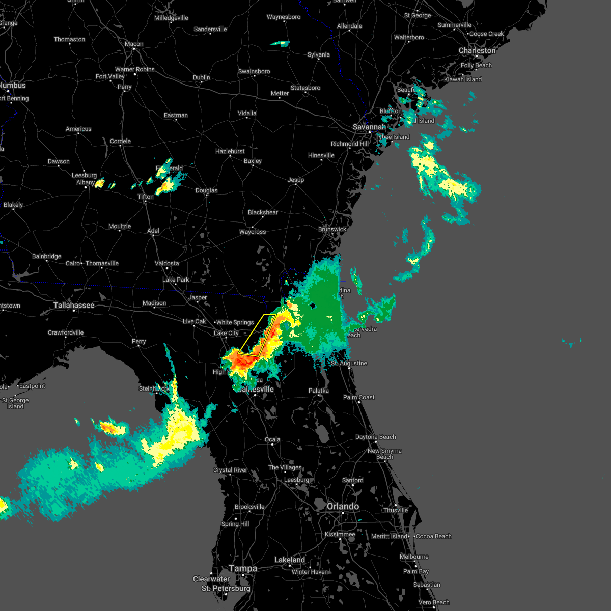 The severe thunderstorm warning for southeastern baker, northwestern union and south central charlton counties will expire at 930 pm edt, the storms which prompted the warning have weakened below severe limits, and have exited the warned area. therefore, the warning will be allowed to expire. a severe thunderstorm watch remains in effect until 1000 pm edt for northern and northeastern florida. The severe thunderstorm warning for southeastern baker, northwestern union and south central charlton counties will expire at 930 pm edt, the storms which prompted the warning have weakened below severe limits, and have exited the warned area. therefore, the warning will be allowed to expire. a severe thunderstorm watch remains in effect until 1000 pm edt for northern and northeastern florida.
|
| 5/6/2022 9:09 PM EDT |
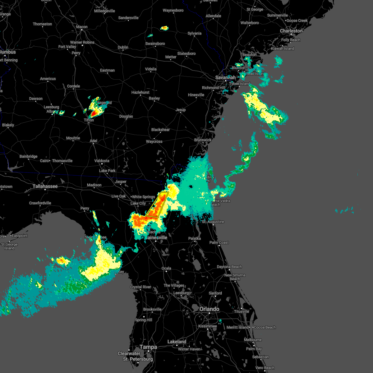 At 908 pm edt, severe thunderstorms were located along a line extending from 6 miles southeast of taylor to near lake butler, moving east at 25 mph (radar indicated). Hazards include 60 mph wind gusts and penny size hail. Expect damage to roofs, siding, and trees. locations impacted include, lake butler, glen st. mary, palestine community and sanderson. hail threat, radar indicated max hail size, 0. 75 in wind threat, radar indicated max wind gust, 60 mph. At 908 pm edt, severe thunderstorms were located along a line extending from 6 miles southeast of taylor to near lake butler, moving east at 25 mph (radar indicated). Hazards include 60 mph wind gusts and penny size hail. Expect damage to roofs, siding, and trees. locations impacted include, lake butler, glen st. mary, palestine community and sanderson. hail threat, radar indicated max hail size, 0. 75 in wind threat, radar indicated max wind gust, 60 mph.
|
| 5/6/2022 8:57 PM EDT |
 At 856 pm edt, severe thunderstorms were located along a line extending from near taylor to palestine community, moving east at 25 mph (radar indicated). Hazards include 60 mph wind gusts and penny size hail. Expect damage to roofs, siding, and trees. locations impacted include, lake butler, glen st. mary, palestine community, lulu, olustee, sanderson and johnstown. hail threat, radar indicated max hail size, 0. 75 in wind threat, radar indicated max wind gust, 60 mph. At 856 pm edt, severe thunderstorms were located along a line extending from near taylor to palestine community, moving east at 25 mph (radar indicated). Hazards include 60 mph wind gusts and penny size hail. Expect damage to roofs, siding, and trees. locations impacted include, lake butler, glen st. mary, palestine community, lulu, olustee, sanderson and johnstown. hail threat, radar indicated max hail size, 0. 75 in wind threat, radar indicated max wind gust, 60 mph.
|
| 5/6/2022 8:57 PM EDT |
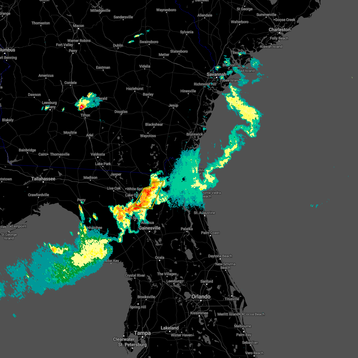 At 856 pm edt, severe thunderstorms were located along a line extending from near taylor to palestine community, moving east at 25 mph (radar indicated). Hazards include 60 mph wind gusts and penny size hail. Expect damage to roofs, siding, and trees. locations impacted include, lake butler, glen st. mary, palestine community, lulu, olustee, sanderson and johnstown. hail threat, radar indicated max hail size, 0. 75 in wind threat, radar indicated max wind gust, 60 mph. At 856 pm edt, severe thunderstorms were located along a line extending from near taylor to palestine community, moving east at 25 mph (radar indicated). Hazards include 60 mph wind gusts and penny size hail. Expect damage to roofs, siding, and trees. locations impacted include, lake butler, glen st. mary, palestine community, lulu, olustee, sanderson and johnstown. hail threat, radar indicated max hail size, 0. 75 in wind threat, radar indicated max wind gust, 60 mph.
|
| 5/6/2022 8:46 PM EDT |
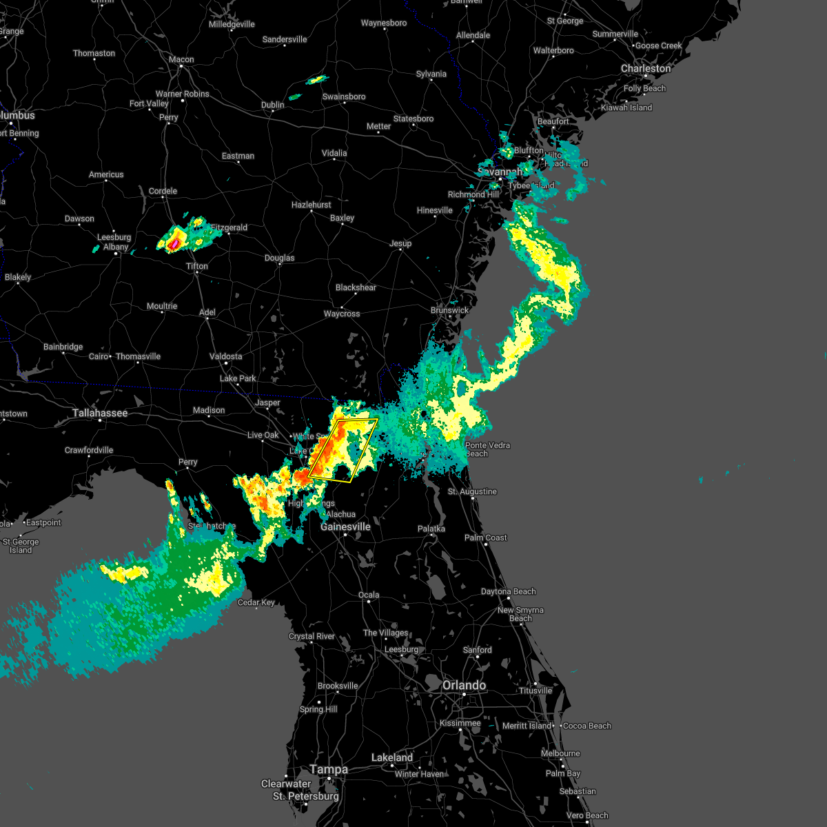 At 845 pm edt, severe thunderstorms were located along a line extending from near taylor to near lulu, moving east at 25 mph (radar indicated). Hazards include 60 mph wind gusts and penny size hail. expect damage to roofs, siding, and trees At 845 pm edt, severe thunderstorms were located along a line extending from near taylor to near lulu, moving east at 25 mph (radar indicated). Hazards include 60 mph wind gusts and penny size hail. expect damage to roofs, siding, and trees
|
| 4/7/2022 12:42 PM EDT |
 The severe thunderstorm warning for seminole, western orange and northwestern osceola counties will expire at 1245 pm edt, the storms which prompted the warning have weakened below severe limits, and no longer pose an immediate threat to life or property. therefore, the warning will be allowed to expire. however gusty winds are still possible with these thunderstorms. The severe thunderstorm warning for seminole, western orange and northwestern osceola counties will expire at 1245 pm edt, the storms which prompted the warning have weakened below severe limits, and no longer pose an immediate threat to life or property. therefore, the warning will be allowed to expire. however gusty winds are still possible with these thunderstorms.
|
| 4/7/2022 12:30 PM EDT |
 At 1230 pm edt, severe thunderstorms were located along a line extending from apopka to lockhart to orlovista to near bay lake to 9 miles north of auburndale, moving east at 45 mph (radar indicated). Hazards include 60 mph wind gusts and penny size hail. Expect damage to roofs, siding, and trees. locations impacted include, orlando, kissimmee, sanford, apopka and altamonte springs. hail threat, radar indicated max hail size, 0. 75 in wind threat, radar indicated max wind gust, 60 mph. At 1230 pm edt, severe thunderstorms were located along a line extending from apopka to lockhart to orlovista to near bay lake to 9 miles north of auburndale, moving east at 45 mph (radar indicated). Hazards include 60 mph wind gusts and penny size hail. Expect damage to roofs, siding, and trees. locations impacted include, orlando, kissimmee, sanford, apopka and altamonte springs. hail threat, radar indicated max hail size, 0. 75 in wind threat, radar indicated max wind gust, 60 mph.
|
| 4/7/2022 12:22 PM EDT |
 At 1222 pm edt, severe thunderstorms were located along a line extending from near zellwood to near winter garden to ocoee to near bay lake to 9 miles north of combee settlement, moving east at 45 mph (radar indicated). Hazards include 60 mph wind gusts and penny size hail. Expect damage to roofs, siding, and trees. locations impacted include, orlando, kissimmee, sanford, apopka and altamonte springs. hail threat, radar indicated max hail size, 0. 75 in wind threat, radar indicated max wind gust, 60 mph. At 1222 pm edt, severe thunderstorms were located along a line extending from near zellwood to near winter garden to ocoee to near bay lake to 9 miles north of combee settlement, moving east at 45 mph (radar indicated). Hazards include 60 mph wind gusts and penny size hail. Expect damage to roofs, siding, and trees. locations impacted include, orlando, kissimmee, sanford, apopka and altamonte springs. hail threat, radar indicated max hail size, 0. 75 in wind threat, radar indicated max wind gust, 60 mph.
|
| 4/7/2022 12:13 PM EDT |
 At 1212 pm edt, severe thunderstorms were located along a line extending from near ferndale to near lake apopka to near oakland to near four corners to 9 miles northwest of combee settlement, moving east at 45 mph (radar indicated). Hazards include 60 mph wind gusts and penny size hail. expect damage to roofs, siding, and trees At 1212 pm edt, severe thunderstorms were located along a line extending from near ferndale to near lake apopka to near oakland to near four corners to 9 miles northwest of combee settlement, moving east at 45 mph (radar indicated). Hazards include 60 mph wind gusts and penny size hail. expect damage to roofs, siding, and trees
|
| 4/7/2022 12:08 PM EDT |
 At 1208 pm edt, severe thunderstorms were located along a line extending from near ferndale to near lake apopka to near oakland to 9 miles northwest of lakeland, moving east at 45 mph (radar indicated). Hazards include 60 mph wind gusts and penny size hail. Expect damage to roofs, siding, and trees. locations impacted include, apopka, ocoee, winter garden, groveland and mascotte. hail threat, radar indicated max hail size, 0. 75 in wind threat, radar indicated max wind gust, 60 mph. At 1208 pm edt, severe thunderstorms were located along a line extending from near ferndale to near lake apopka to near oakland to 9 miles northwest of lakeland, moving east at 45 mph (radar indicated). Hazards include 60 mph wind gusts and penny size hail. Expect damage to roofs, siding, and trees. locations impacted include, apopka, ocoee, winter garden, groveland and mascotte. hail threat, radar indicated max hail size, 0. 75 in wind threat, radar indicated max wind gust, 60 mph.
|
| 4/7/2022 11:57 AM EDT |
 At 1152 am edt, severe thunderstorms were located along a line extending from near mascotte to groveland to hillsborough river state park, moving east at 45 mph (radar indicated). Hazards include 60 mph wind gusts and penny size hail. expect damage to roofs, siding, and trees At 1152 am edt, severe thunderstorms were located along a line extending from near mascotte to groveland to hillsborough river state park, moving east at 45 mph (radar indicated). Hazards include 60 mph wind gusts and penny size hail. expect damage to roofs, siding, and trees
|
| 4/2/2022 3:18 PM EDT |
 At 317 pm edt, a severe thunderstorm was located over casselberry, moving east at 30 mph (radar indicated). Hazards include ping pong ball size hail and 60 mph wind gusts. People and animals outdoors will be injured. expect hail damage to roofs, siding, windows, and vehicles. expect wind damage to roofs, siding, and trees. locations impacted include, orlando, apopka, altamonte springs, ocoee and winter springs. hail threat, radar indicated max hail size, 1. 50 in wind threat, radar indicated max wind gust, 60 mph. At 317 pm edt, a severe thunderstorm was located over casselberry, moving east at 30 mph (radar indicated). Hazards include ping pong ball size hail and 60 mph wind gusts. People and animals outdoors will be injured. expect hail damage to roofs, siding, windows, and vehicles. expect wind damage to roofs, siding, and trees. locations impacted include, orlando, apopka, altamonte springs, ocoee and winter springs. hail threat, radar indicated max hail size, 1. 50 in wind threat, radar indicated max wind gust, 60 mph.
|
| 4/2/2022 2:51 PM EDT |
 At 251 pm edt, a severe thunderstorm was located near lockhart, moving east at 30 mph (radar indicated). Hazards include ping pong ball size hail and 60 mph wind gusts. People and animals outdoors will be injured. expect hail damage to roofs, siding, windows, and vehicles. Expect wind damage to roofs, siding, and trees. At 251 pm edt, a severe thunderstorm was located near lockhart, moving east at 30 mph (radar indicated). Hazards include ping pong ball size hail and 60 mph wind gusts. People and animals outdoors will be injured. expect hail damage to roofs, siding, windows, and vehicles. Expect wind damage to roofs, siding, and trees.
|
| 3/16/2022 6:00 PM EDT |
 At 559 pm edt, a severe thunderstorm was located over apopka, moving northeast at 40 mph (radar indicated). Hazards include 60 mph wind gusts and quarter size hail. Hail damage to vehicles is expected. Expect wind damage to roofs, siding, and trees. At 559 pm edt, a severe thunderstorm was located over apopka, moving northeast at 40 mph (radar indicated). Hazards include 60 mph wind gusts and quarter size hail. Hail damage to vehicles is expected. Expect wind damage to roofs, siding, and trees.
|
| 3/12/2022 10:15 AM EST |
 At 1015 am est, severe thunderstorms were located along a line extending from near bethune beach to maytown to near champions gate, moving east at 60 mph (radar indicated). Hazards include 60 mph wind gusts and penny size hail. expect damage to roofs, siding, and trees At 1015 am est, severe thunderstorms were located along a line extending from near bethune beach to maytown to near champions gate, moving east at 60 mph (radar indicated). Hazards include 60 mph wind gusts and penny size hail. expect damage to roofs, siding, and trees
|
| 3/12/2022 9:49 AM EST |
 At 948 am est, severe thunderstorms were located along a line extending from near ormond beach to altamonte springs to near lake louisa, moving east at 35 mph (radar indicated). Hazards include 60 mph wind gusts and penny size hail. Expect damage to roofs, siding, and trees. Locations impacted include, orlando, deltona, daytona beach, port orange and sanford. At 948 am est, severe thunderstorms were located along a line extending from near ormond beach to altamonte springs to near lake louisa, moving east at 35 mph (radar indicated). Hazards include 60 mph wind gusts and penny size hail. Expect damage to roofs, siding, and trees. Locations impacted include, orlando, deltona, daytona beach, port orange and sanford.
|
| 3/12/2022 9:30 AM EST |
 At 930 am est, severe thunderstorms were located along a line extending from 6 miles northeast of ormond-by-the-sea to near ocoee to 9 miles southwest of lake louisa, moving east at 60 mph (radar indicated). Hazards include 60 mph wind gusts and penny size hail. expect damage to roofs, siding, and trees At 930 am est, severe thunderstorms were located along a line extending from 6 miles northeast of ormond-by-the-sea to near ocoee to 9 miles southwest of lake louisa, moving east at 60 mph (radar indicated). Hazards include 60 mph wind gusts and penny size hail. expect damage to roofs, siding, and trees
|
| 3/12/2022 8:43 AM EST |
 At 842 am est, severe thunderstorms were located along a line extending from near lake george to near lady lake and into sumter county, moving east at 55 mph (radar indicated). Hazards include 60 mph wind gusts and penny size hail. expect damage to roofs, siding, and trees At 842 am est, severe thunderstorms were located along a line extending from near lake george to near lady lake and into sumter county, moving east at 55 mph (radar indicated). Hazards include 60 mph wind gusts and penny size hail. expect damage to roofs, siding, and trees
|
| 1/16/2022 8:22 AM EST |
 The tornado warning for west central orange county will expire at 830 am est, the storm which prompted the warning has weakened below severe limits, and no longer appears capable of producing a tornado. therefore, the warning will be allowed to expire. however gusty winds and heavy rain are still possible with this thunderstorm. to report severe weather, contact your nearest law enforcement agency. they will relay your report to the national weather service melbourne. The tornado warning for west central orange county will expire at 830 am est, the storm which prompted the warning has weakened below severe limits, and no longer appears capable of producing a tornado. therefore, the warning will be allowed to expire. however gusty winds and heavy rain are still possible with this thunderstorm. to report severe weather, contact your nearest law enforcement agency. they will relay your report to the national weather service melbourne.
|
| 1/16/2022 8:14 AM EST |
 At 814 am est, a severe thunderstorm capable of producing a tornado was located over winter garden, moving northeast at 45 mph (radar indicated rotation). Hazards include tornado. Flying debris will be dangerous to those caught without shelter. mobile homes will be damaged or destroyed. damage to roofs, windows, and vehicles will occur. tree damage is likely. this dangerous storm will be near, apopka and orlovista around 820 am est. lockhart and pine hills around 830 am est. Other locations impacted by this tornadic thunderstorm include lake butler. At 814 am est, a severe thunderstorm capable of producing a tornado was located over winter garden, moving northeast at 45 mph (radar indicated rotation). Hazards include tornado. Flying debris will be dangerous to those caught without shelter. mobile homes will be damaged or destroyed. damage to roofs, windows, and vehicles will occur. tree damage is likely. this dangerous storm will be near, apopka and orlovista around 820 am est. lockhart and pine hills around 830 am est. Other locations impacted by this tornadic thunderstorm include lake butler.
|
| 1/16/2022 8:01 AM EST |
 At 801 am est, a severe thunderstorm capable of producing a tornado was located over lake louisa, or 8 miles southwest of winter garden, moving northeast at 40 mph (radar indicated rotation). Hazards include tornado. Flying debris will be dangerous to those caught without shelter. mobile homes will be damaged or destroyed. damage to roofs, windows, and vehicles will occur. tree damage is likely. this dangerous storm will be near, winter garden and windermere around 810 am est. apopka, ocoee and orlovista around 820 am est. lockhart and pine hills around 830 am est. Other locations impacted by this tornadic thunderstorm include lake butler. At 801 am est, a severe thunderstorm capable of producing a tornado was located over lake louisa, or 8 miles southwest of winter garden, moving northeast at 40 mph (radar indicated rotation). Hazards include tornado. Flying debris will be dangerous to those caught without shelter. mobile homes will be damaged or destroyed. damage to roofs, windows, and vehicles will occur. tree damage is likely. this dangerous storm will be near, winter garden and windermere around 810 am est. apopka, ocoee and orlovista around 820 am est. lockhart and pine hills around 830 am est. Other locations impacted by this tornadic thunderstorm include lake butler.
|
| 10/28/2021 2:52 PM EDT |
 At 252 pm edt, a severe thunderstorm was located over oakland, or over winter garden, moving northeast at 35 mph (radar indicated). Hazards include 60 mph wind gusts. Expect damage to roofs, siding, and trees. Locations impacted include, orlando, sanford, apopka, altamonte springs and ocoee. At 252 pm edt, a severe thunderstorm was located over oakland, or over winter garden, moving northeast at 35 mph (radar indicated). Hazards include 60 mph wind gusts. Expect damage to roofs, siding, and trees. Locations impacted include, orlando, sanford, apopka, altamonte springs and ocoee.
|
| 10/28/2021 2:40 PM EDT |
 At 239 pm edt, a severe thunderstorm was located over clermont, or near ferndale, moving northeast at 40 mph (radar indicated). Hazards include 60 mph wind gusts. Expect damage to roofs, siding, and trees. Locations impacted include, orlando, sanford, apopka, altamonte springs and ocoee. At 239 pm edt, a severe thunderstorm was located over clermont, or near ferndale, moving northeast at 40 mph (radar indicated). Hazards include 60 mph wind gusts. Expect damage to roofs, siding, and trees. Locations impacted include, orlando, sanford, apopka, altamonte springs and ocoee.
|
| 10/28/2021 2:19 PM EDT |
 At 218 pm edt, a severe thunderstorm was located 9 miles south of groveland, moving northeast at 40 mph (radar indicated). Hazards include 60 mph wind gusts. expect damage to roofs, siding, and trees At 218 pm edt, a severe thunderstorm was located 9 miles south of groveland, moving northeast at 40 mph (radar indicated). Hazards include 60 mph wind gusts. expect damage to roofs, siding, and trees
|
| 10/28/2021 1:38 PM EDT |
 At 137 pm edt, a severe thunderstorm was located 7 miles southeast of bushnell, moving northeast at 60 mph (radar indicated). Hazards include 60 mph wind gusts. expect damage to roofs, siding, and trees At 137 pm edt, a severe thunderstorm was located 7 miles southeast of bushnell, moving northeast at 60 mph (radar indicated). Hazards include 60 mph wind gusts. expect damage to roofs, siding, and trees
|
| 7/8/2021 1:26 PM EDT |
 The severe thunderstorm warning for southwestern orange county will expire at 130 pm edt, the storm which prompted the warning has weakened below severe limits, and no longer poses an immediate threat to life or property. therefore, the warning will be allowed to expire. however gusty winds, cloud to ground lightning and heavy rain are still possible with this thunderstorm. The severe thunderstorm warning for southwestern orange county will expire at 130 pm edt, the storm which prompted the warning has weakened below severe limits, and no longer poses an immediate threat to life or property. therefore, the warning will be allowed to expire. however gusty winds, cloud to ground lightning and heavy rain are still possible with this thunderstorm.
|
| 7/8/2021 1:22 PM EDT |
 At 120 pm edt, a severe thunderstorm was located over bay lake, moving east at 25 mph (radar indicated). Hazards include 60 mph wind gusts. Expect damage to roofs, siding, and trees. Locations impacted include, bay lake, lake buena vista, orlando, and windermere. At 120 pm edt, a severe thunderstorm was located over bay lake, moving east at 25 mph (radar indicated). Hazards include 60 mph wind gusts. Expect damage to roofs, siding, and trees. Locations impacted include, bay lake, lake buena vista, orlando, and windermere.
|
| 7/8/2021 1:04 PM EDT |
 At 102 pm edt, a severe thunderstorm was located near lake louisa, or 7 miles west of bay lake, moving east at 25 mph (radar indicated). Hazards include 60 mph wind gusts. expect damage to roofs, siding, and trees At 102 pm edt, a severe thunderstorm was located near lake louisa, or 7 miles west of bay lake, moving east at 25 mph (radar indicated). Hazards include 60 mph wind gusts. expect damage to roofs, siding, and trees
|
| 6/22/2021 12:52 PM EDT |
 The severe thunderstorm warning for northern bradford, southeastern baker and eastern union counties will expire at 100 pm edt, the storm which prompted the warning has weakened below severe limits, and no longer poses an immediate threat to life or property. therefore, the warning will be allowed to expire. however gusty winds and heavy rain are still possible with this thunderstorm. The severe thunderstorm warning for northern bradford, southeastern baker and eastern union counties will expire at 100 pm edt, the storm which prompted the warning has weakened below severe limits, and no longer poses an immediate threat to life or property. therefore, the warning will be allowed to expire. however gusty winds and heavy rain are still possible with this thunderstorm.
|
| 6/22/2021 12:47 PM EDT |
 At 1247 pm edt, a severe thunderstorm was located over raiford, moving east at 20 mph (radar indicated). Hazards include 60 mph wind gusts. Expect damage to roofs, siding, and trees. Locations impacted include, starke, lake butler, raiford, beasley, new river, lawtey, ellerbee and johnstown. At 1247 pm edt, a severe thunderstorm was located over raiford, moving east at 20 mph (radar indicated). Hazards include 60 mph wind gusts. Expect damage to roofs, siding, and trees. Locations impacted include, starke, lake butler, raiford, beasley, new river, lawtey, ellerbee and johnstown.
|
| 6/22/2021 12:22 PM EDT |
 At 1222 pm edt, a severe thunderstorm was located over lake butler, moving east at 20 mph (radar indicated). Hazards include 60 mph wind gusts. expect damage to roofs, siding, and trees At 1222 pm edt, a severe thunderstorm was located over lake butler, moving east at 20 mph (radar indicated). Hazards include 60 mph wind gusts. expect damage to roofs, siding, and trees
|
| 6/15/2021 4:34 PM EDT |
 At 434 pm edt, severe thunderstorms were located along a line extending from raiford to 7 miles southeast of worthington spring, moving east at 20 mph (radar indicated). Hazards include 60 mph wind gusts and quarter size hail. Hail damage to vehicles is expected. expect wind damage to roofs, siding, and trees. Locations impacted include, starke, lake butler, raiford, beasley, new river, sampson, hampton, la crosse, brooker and johnstown. At 434 pm edt, severe thunderstorms were located along a line extending from raiford to 7 miles southeast of worthington spring, moving east at 20 mph (radar indicated). Hazards include 60 mph wind gusts and quarter size hail. Hail damage to vehicles is expected. expect wind damage to roofs, siding, and trees. Locations impacted include, starke, lake butler, raiford, beasley, new river, sampson, hampton, la crosse, brooker and johnstown.
|
| 6/15/2021 4:19 PM EDT |
 At 419 pm edt, severe thunderstorms were located along a line extending from near raiford to 6 miles south of worthington spring, moving east at 20 mph (radar indicated). Hazards include 60 mph wind gusts and quarter size hail. Hail damage to vehicles is expected. Expect wind damage to roofs, siding, and trees. At 419 pm edt, severe thunderstorms were located along a line extending from near raiford to 6 miles south of worthington spring, moving east at 20 mph (radar indicated). Hazards include 60 mph wind gusts and quarter size hail. Hail damage to vehicles is expected. Expect wind damage to roofs, siding, and trees.
|
| 6/15/2021 4:00 PM EDT |
 At 400 pm edt, a severe thunderstorm was located over raiford, moving east at 25 mph (radar indicated). Hazards include 60 mph wind gusts and quarter size hail. Hail damage to vehicles is expected. expect wind damage to roofs, siding, and trees. Locations impacted include, lake butler, raiford, beasley, new river, johnstown and ellerbee. At 400 pm edt, a severe thunderstorm was located over raiford, moving east at 25 mph (radar indicated). Hazards include 60 mph wind gusts and quarter size hail. Hail damage to vehicles is expected. expect wind damage to roofs, siding, and trees. Locations impacted include, lake butler, raiford, beasley, new river, johnstown and ellerbee.
|
| 6/15/2021 3:49 PM EDT |
 At 349 pm edt, a severe thunderstorm was located over palestine community, or near lake butler, moving east at 15 mph (radar indicated). Hazards include 60 mph wind gusts and quarter size hail. Hail damage to vehicles is expected. Expect wind damage to roofs, siding, and trees. At 349 pm edt, a severe thunderstorm was located over palestine community, or near lake butler, moving east at 15 mph (radar indicated). Hazards include 60 mph wind gusts and quarter size hail. Hail damage to vehicles is expected. Expect wind damage to roofs, siding, and trees.
|
| 4/11/2021 1:05 PM EDT |
 The severe thunderstorm warning for southwestern orange and northwestern osceola counties will expire at 115 pm edt, the storm which prompted the warning has weakened below severe limits, and has exited the warned area. therefore, the warning will be allowed to expire. a severe thunderstorm watch remains in effect until 400 pm edt for east central florida. to report severe weather, contact your nearest law enforcement agency. they will relay your report to the national weather service melbourne. The severe thunderstorm warning for southwestern orange and northwestern osceola counties will expire at 115 pm edt, the storm which prompted the warning has weakened below severe limits, and has exited the warned area. therefore, the warning will be allowed to expire. a severe thunderstorm watch remains in effect until 400 pm edt for east central florida. to report severe weather, contact your nearest law enforcement agency. they will relay your report to the national weather service melbourne.
|
| 4/11/2021 12:45 PM EDT |
 At 1244 pm edt, a severe thunderstorm was located near orlando international airport, moving east at 60 mph (radar indicated). Hazards include 70 mph wind gusts and penny size hail. Expect considerable tree damage. damage is likely to mobile homes, roofs, and outbuildings. Locations impacted include, orlando, kissimmee, ocoee, winter garden and saint cloud. At 1244 pm edt, a severe thunderstorm was located near orlando international airport, moving east at 60 mph (radar indicated). Hazards include 70 mph wind gusts and penny size hail. Expect considerable tree damage. damage is likely to mobile homes, roofs, and outbuildings. Locations impacted include, orlando, kissimmee, ocoee, winter garden and saint cloud.
|
| 4/11/2021 12:23 PM EDT |
 At 1223 pm edt, a severe thunderstorm was located over four corners, or near celebration, moving east at 60 mph (radar indicated). Hazards include 70 mph wind gusts and penny size hail. Expect considerable tree damage. Damage is likely to mobile homes, roofs, and outbuildings. At 1223 pm edt, a severe thunderstorm was located over four corners, or near celebration, moving east at 60 mph (radar indicated). Hazards include 70 mph wind gusts and penny size hail. Expect considerable tree damage. Damage is likely to mobile homes, roofs, and outbuildings.
|
| 3/18/2021 3:43 PM EDT |
 The severe thunderstorm warning for central bradford and southeastern union counties will expire at 345 pm edt, the storm which prompted the warning has moved out of the area. therefore, the warning will be allowed to expire. however heavy rain is still possible with this thunderstorm. a tornado watch remains in effect until 600 pm edt for northern florida. to report severe weather, contact your nearest law enforcement agency. they will relay your report to the national weather service jacksonville. The severe thunderstorm warning for central bradford and southeastern union counties will expire at 345 pm edt, the storm which prompted the warning has moved out of the area. therefore, the warning will be allowed to expire. however heavy rain is still possible with this thunderstorm. a tornado watch remains in effect until 600 pm edt for northern florida. to report severe weather, contact your nearest law enforcement agency. they will relay your report to the national weather service jacksonville.
|
| 3/18/2021 3:32 PM EDT |
 At 332 pm edt, a severe thunderstorm was located over new river, or 8 miles southeast of lake butler, moving northeast at 40 mph (radar indicated). Hazards include 60 mph wind gusts. Expect damage to roofs, siding, and trees. Locations impacted include, lake butler, raiford, worthington spring, worthington springs, new river, beasley, sampson, hampton, brooker and johnstown. At 332 pm edt, a severe thunderstorm was located over new river, or 8 miles southeast of lake butler, moving northeast at 40 mph (radar indicated). Hazards include 60 mph wind gusts. Expect damage to roofs, siding, and trees. Locations impacted include, lake butler, raiford, worthington spring, worthington springs, new river, beasley, sampson, hampton, brooker and johnstown.
|
| 3/18/2021 3:17 PM EDT |
 At 316 pm edt, a severe thunderstorm capable of producing a tornado was located near worthington spring, moving east at 40 mph (radar indicated rotation). Hazards include tornado. Flying debris will be dangerous to those caught without shelter. mobile homes will be damaged or destroyed. damage to roofs, windows, and vehicles will occur. tree damage is likely. this dangerous storm will be near, new river and beasley around 330 pm edt. sampson around 335 pm edt. Other locations impacted by this tornadic thunderstorm include brooker, la crosse and hampton. At 316 pm edt, a severe thunderstorm capable of producing a tornado was located near worthington spring, moving east at 40 mph (radar indicated rotation). Hazards include tornado. Flying debris will be dangerous to those caught without shelter. mobile homes will be damaged or destroyed. damage to roofs, windows, and vehicles will occur. tree damage is likely. this dangerous storm will be near, new river and beasley around 330 pm edt. sampson around 335 pm edt. Other locations impacted by this tornadic thunderstorm include brooker, la crosse and hampton.
|
| 3/18/2021 2:58 PM EDT |
 At 258 pm edt, a severe thunderstorm was located over high springs, or 15 miles southwest of worthington spring, moving northeast at 40 mph (radar indicated). Hazards include 60 mph wind gusts. expect damage to roofs, siding, and trees At 258 pm edt, a severe thunderstorm was located over high springs, or 15 miles southwest of worthington spring, moving northeast at 40 mph (radar indicated). Hazards include 60 mph wind gusts. expect damage to roofs, siding, and trees
|
| 2/6/2021 5:43 PM EST |
 The severe thunderstorm warning for bradford, northern alachua and southern union counties will expire at 545 pm est, the storm which prompted the warning has weakened below severe limits, and no longer poses an immediate threat to life or property. therefore, the warning will be allowed to expire. however small hail and heavy rain are still possible with this thunderstorm. a tornado watch remains in effect until midnight est for northern florida. to report severe weather, contact your nearest law enforcement agency. they will relay your report to the national weather service jacksonville. The severe thunderstorm warning for bradford, northern alachua and southern union counties will expire at 545 pm est, the storm which prompted the warning has weakened below severe limits, and no longer poses an immediate threat to life or property. therefore, the warning will be allowed to expire. however small hail and heavy rain are still possible with this thunderstorm. a tornado watch remains in effect until midnight est for northern florida. to report severe weather, contact your nearest law enforcement agency. they will relay your report to the national weather service jacksonville.
|
| 2/6/2021 5:23 PM EST |
 At 523 pm est, a severe thunderstorm was located near worthington spring, moving northeast at 50 mph (radar indicated). Hazards include quarter size hail. Damage to vehicles is expected. Locations impacted include, starke, lake butler, raiford, worthington spring, alachua, high springs, worthington springs, groves, new river and beasley. At 523 pm est, a severe thunderstorm was located near worthington spring, moving northeast at 50 mph (radar indicated). Hazards include quarter size hail. Damage to vehicles is expected. Locations impacted include, starke, lake butler, raiford, worthington spring, alachua, high springs, worthington springs, groves, new river and beasley.
|
| 2/6/2021 5:08 PM EST |
 At 508 pm est, a severe thunderstorm was located near high springs, or 11 miles southwest of worthington spring, moving northeast at 55 mph (radar indicated). Hazards include quarter size hail. Damage to vehicles is expected. Locations impacted include, starke, trenton, lake butler, bell, raiford, worthington spring, alachua, high springs, worthington springs and groves. At 508 pm est, a severe thunderstorm was located near high springs, or 11 miles southwest of worthington spring, moving northeast at 55 mph (radar indicated). Hazards include quarter size hail. Damage to vehicles is expected. Locations impacted include, starke, trenton, lake butler, bell, raiford, worthington spring, alachua, high springs, worthington springs and groves.
|
| 2/6/2021 4:59 PM EST |
 At 459 pm est, a severe thunderstorm was located near high springs, or 13 miles east of bell, moving northeast at 55 mph (radar indicated). Hazards include 60 mph wind gusts and quarter size hail. Hail damage to vehicles is expected. Expect wind damage to roofs, siding, and trees. At 459 pm est, a severe thunderstorm was located near high springs, or 13 miles east of bell, moving northeast at 55 mph (radar indicated). Hazards include 60 mph wind gusts and quarter size hail. Hail damage to vehicles is expected. Expect wind damage to roofs, siding, and trees.
|
| 12/24/2020 6:03 PM EST |
 At 602 pm est, severe thunderstorms were located along a line extending from 10 miles southeast of stephen foster state park to near sanderson to alachua, moving east at 60 mph (radar indicated). Hazards include 60 mph wind gusts. Expect damage to roofs, siding, and trees. Locations impacted include, starke, hilliard, lake butler, keystone heights, callahan, raiford, worthington spring, taylor, alachua and macclenny. At 602 pm est, severe thunderstorms were located along a line extending from 10 miles southeast of stephen foster state park to near sanderson to alachua, moving east at 60 mph (radar indicated). Hazards include 60 mph wind gusts. Expect damage to roofs, siding, and trees. Locations impacted include, starke, hilliard, lake butler, keystone heights, callahan, raiford, worthington spring, taylor, alachua and macclenny.
|
| 12/24/2020 5:56 PM EST | Tree branch breached wall of home due to strong winds in the area of lake butler. no injuries reporte in union county FL, 0.3 miles S of Lake Butler, FL |
| 12/24/2020 5:42 PM EST |
 At 542 pm est, severe thunderstorms were located along a line extending from 6 miles southeast of fargo to near watertown to 6 miles northeast of trenton, moving east at 55 mph (radar indicated). Hazards include 60 mph wind gusts. expect damage to roofs, siding, and trees At 542 pm est, severe thunderstorms were located along a line extending from 6 miles southeast of fargo to near watertown to 6 miles northeast of trenton, moving east at 55 mph (radar indicated). Hazards include 60 mph wind gusts. expect damage to roofs, siding, and trees
|
| 8/17/2020 2:42 PM EDT |
 The severe thunderstorm warning for western orange county will expire at 245 pm edt, the storm which prompted the warning has weakened below severe limits, and no longer poses an immediate threat to life or property. therefore, the warning will be allowed to expire. however gusty winds and heavy rain are still possible with this thunderstorm. The severe thunderstorm warning for western orange county will expire at 245 pm edt, the storm which prompted the warning has weakened below severe limits, and no longer poses an immediate threat to life or property. therefore, the warning will be allowed to expire. however gusty winds and heavy rain are still possible with this thunderstorm.
|
| 8/17/2020 2:23 PM EDT |
 At 222 pm edt, a severe thunderstorm was located over orlovista, or near orlando, moving east at 20 mph (radar indicated). Hazards include 60 mph wind gusts and penny size hail. Expect damage to roofs, siding, and trees. Locations impacted include, orlando, ocoee, winter park, maitland and windermere. At 222 pm edt, a severe thunderstorm was located over orlovista, or near orlando, moving east at 20 mph (radar indicated). Hazards include 60 mph wind gusts and penny size hail. Expect damage to roofs, siding, and trees. Locations impacted include, orlando, ocoee, winter park, maitland and windermere.
|
| 8/17/2020 2:06 PM EDT |
 At 206 pm edt, a severe thunderstorm was located over ocoee, moving east at 20 mph (radar indicated). Hazards include 60 mph wind gusts and penny size hail. expect damage to roofs, siding, and trees At 206 pm edt, a severe thunderstorm was located over ocoee, moving east at 20 mph (radar indicated). Hazards include 60 mph wind gusts and penny size hail. expect damage to roofs, siding, and trees
|
| 8/9/2020 5:29 PM EDT |
 At 528 pm edt, a severe thunderstorm was located over forest city, or over lockhart, moving south at 5 mph (radar indicated). Hazards include 60 mph wind gusts and quarter size hail. Hail damage to vehicles is expected. expect wind damage to roofs, siding, and trees. Locations impacted include, orlando, apopka, altamonte springs, ocoee and winter garden. At 528 pm edt, a severe thunderstorm was located over forest city, or over lockhart, moving south at 5 mph (radar indicated). Hazards include 60 mph wind gusts and quarter size hail. Hail damage to vehicles is expected. expect wind damage to roofs, siding, and trees. Locations impacted include, orlando, apopka, altamonte springs, ocoee and winter garden.
|
| 8/9/2020 4:57 PM EDT |
 At 457 pm edt, a severe thunderstorm was located over wekiva springs, or near altamonte springs, moving south at 5 mph (radar indicated). Hazards include 60 mph wind gusts and quarter size hail. Hail damage to vehicles is expected. Expect wind damage to roofs, siding, and trees. At 457 pm edt, a severe thunderstorm was located over wekiva springs, or near altamonte springs, moving south at 5 mph (radar indicated). Hazards include 60 mph wind gusts and quarter size hail. Hail damage to vehicles is expected. Expect wind damage to roofs, siding, and trees.
|
| 6/24/2020 7:54 PM EDT |
 At 753 pm edt, a severe thunderstorm was located over four corners, moving northeast at 15 mph (radar indicated). Hazards include 60 mph wind gusts and quarter size hail. Hail damage to vehicles is expected. Expect wind damage to roofs, siding, and trees. At 753 pm edt, a severe thunderstorm was located over four corners, moving northeast at 15 mph (radar indicated). Hazards include 60 mph wind gusts and quarter size hail. Hail damage to vehicles is expected. Expect wind damage to roofs, siding, and trees.
|
| 6/7/2020 4:42 PM EDT |
 At 442 pm edt, a severe thunderstorm capable of producing a tornado was located over beasley, or near raiford, moving northeast at 15 mph (radar indicated rotation). Hazards include tornado. Flying debris will be dangerous to those caught without shelter. mobile homes will be damaged or destroyed. damage to roofs, windows, and vehicles will occur. tree damage is likely. this dangerous storm will be near, raiford around 455 pm edt. Other locations impacted by this tornadic thunderstorm include johnstown and ellerbee. At 442 pm edt, a severe thunderstorm capable of producing a tornado was located over beasley, or near raiford, moving northeast at 15 mph (radar indicated rotation). Hazards include tornado. Flying debris will be dangerous to those caught without shelter. mobile homes will be damaged or destroyed. damage to roofs, windows, and vehicles will occur. tree damage is likely. this dangerous storm will be near, raiford around 455 pm edt. Other locations impacted by this tornadic thunderstorm include johnstown and ellerbee.
|
| 6/7/2020 4:32 PM EDT |
 At 432 pm edt, a severe thunderstorm capable of producing a tornado was located over lake butler, moving northeast at 15 mph (radar indicated rotation). Hazards include tornado. Flying debris will be dangerous to those caught without shelter. mobile homes will be damaged or destroyed. damage to roofs, windows, and vehicles will occur. tree damage is likely. this dangerous storm will be near, beasley around 435 pm edt. lake butler around 440 pm edt. raiford around 500 pm edt. Other locations impacted by this tornadic thunderstorm include johnstown. At 432 pm edt, a severe thunderstorm capable of producing a tornado was located over lake butler, moving northeast at 15 mph (radar indicated rotation). Hazards include tornado. Flying debris will be dangerous to those caught without shelter. mobile homes will be damaged or destroyed. damage to roofs, windows, and vehicles will occur. tree damage is likely. this dangerous storm will be near, beasley around 435 pm edt. lake butler around 440 pm edt. raiford around 500 pm edt. Other locations impacted by this tornadic thunderstorm include johnstown.
|
| 6/7/2020 4:13 PM EDT |
 At 413 pm edt, a severe thunderstorm capable of producing a tornado was located over worthington springs, moving northeast at 10 mph (radar indicated rotation). Hazards include tornado. Flying debris will be dangerous to those caught without shelter. mobile homes will be damaged or destroyed. damage to roofs, windows, and vehicles will occur. tree damage is likely. this dangerous storm will be near, beasley around 440 pm edt. lake butler around 445 pm edt. raiford around 500 pm edt. Other locations impacted by this tornadic thunderstorm include johnstown and dukes. At 413 pm edt, a severe thunderstorm capable of producing a tornado was located over worthington springs, moving northeast at 10 mph (radar indicated rotation). Hazards include tornado. Flying debris will be dangerous to those caught without shelter. mobile homes will be damaged or destroyed. damage to roofs, windows, and vehicles will occur. tree damage is likely. this dangerous storm will be near, beasley around 440 pm edt. lake butler around 445 pm edt. raiford around 500 pm edt. Other locations impacted by this tornadic thunderstorm include johnstown and dukes.
|
| 6/7/2020 4:04 PM EDT |
 At 404 pm edt, a severe thunderstorm capable of producing a tornado was located over worthington springs, or over worthington spring, moving north at 10 mph (radar indicated rotation). Hazards include tornado. Flying debris will be dangerous to those caught without shelter. mobile homes will be damaged or destroyed. damage to roofs, windows, and vehicles will occur. tree damage is likely. this dangerous storm will be near, groves around 420 pm edt. beasley around 435 pm edt. lake butler and palestine community around 445 pm edt. Other locations impacted by this tornadic thunderstorm include johnstown and dukes. At 404 pm edt, a severe thunderstorm capable of producing a tornado was located over worthington springs, or over worthington spring, moving north at 10 mph (radar indicated rotation). Hazards include tornado. Flying debris will be dangerous to those caught without shelter. mobile homes will be damaged or destroyed. damage to roofs, windows, and vehicles will occur. tree damage is likely. this dangerous storm will be near, groves around 420 pm edt. beasley around 435 pm edt. lake butler and palestine community around 445 pm edt. Other locations impacted by this tornadic thunderstorm include johnstown and dukes.
|
| 6/7/2020 4:00 PM EDT | Tree down near sw county road 18a. radar estimated tim in union county FL, 6.3 miles NE of Lake Butler, FL |
| 6/6/2020 9:04 PM EDT |
 At 902 pm edt, a confirmed tornado was located near orlovista, moving northeast at 40 mph. a tornado was reported near conroy road and millenia. additional circulations are evident in the severe line of storms approaching lockhart and pine hills (weather spotters confirmed tornado). Hazards include damaging tornado. Flying debris will be dangerous to those caught without shelter. mobile homes will be damaged or destroyed. damage to roofs, windows, and vehicles will occur. tree damage is likely. Locations impacted include, orlando, sanford, apopka, altamonte springs and ocoee. At 902 pm edt, a confirmed tornado was located near orlovista, moving northeast at 40 mph. a tornado was reported near conroy road and millenia. additional circulations are evident in the severe line of storms approaching lockhart and pine hills (weather spotters confirmed tornado). Hazards include damaging tornado. Flying debris will be dangerous to those caught without shelter. mobile homes will be damaged or destroyed. damage to roofs, windows, and vehicles will occur. tree damage is likely. Locations impacted include, orlando, sanford, apopka, altamonte springs and ocoee.
|
| 6/6/2020 8:59 PM EDT |
 At 858 pm edt, a confirmed tornado was located over orlovista, or near pine hills, moving northeast at 40 mph. a tornado was reported near universal studios (weather spotters confirmed tornado). Hazards include damaging tornado. Flying debris will be dangerous to those caught without shelter. mobile homes will be damaged or destroyed. damage to roofs, windows, and vehicles will occur. tree damage is likely. the tornado will be near, winter park, maitland and lockhart around 910 pm edt. Altamonte springs, casselberry and longwood around 920 pm edt. At 858 pm edt, a confirmed tornado was located over orlovista, or near pine hills, moving northeast at 40 mph. a tornado was reported near universal studios (weather spotters confirmed tornado). Hazards include damaging tornado. Flying debris will be dangerous to those caught without shelter. mobile homes will be damaged or destroyed. damage to roofs, windows, and vehicles will occur. tree damage is likely. the tornado will be near, winter park, maitland and lockhart around 910 pm edt. Altamonte springs, casselberry and longwood around 920 pm edt.
|
| 6/6/2020 8:50 PM EDT |
 At 850 pm edt, a severe squall line capable of producing both tornadoes and extensive straight line wind damage was located over windermere, moving northeast at 45 mph (radar indicated rotation). Hazards include tornado. Flying debris will be dangerous to those caught without shelter. mobile homes will be damaged or destroyed. damage to roofs, windows, and vehicles will occur. tree damage is likely. Locations impacted include, orlando, ocoee, winter garden, windermere and bay lake. At 850 pm edt, a severe squall line capable of producing both tornadoes and extensive straight line wind damage was located over windermere, moving northeast at 45 mph (radar indicated rotation). Hazards include tornado. Flying debris will be dangerous to those caught without shelter. mobile homes will be damaged or destroyed. damage to roofs, windows, and vehicles will occur. tree damage is likely. Locations impacted include, orlando, ocoee, winter garden, windermere and bay lake.
|
| 6/6/2020 8:43 PM EDT |
 At 842 pm edt, severe thunderstorms capable of producing both tornadoes and extensive straight line wind damage were located over horizon west, or over bay lake, moving northeast at 40 mph (radar indicated rotation). Hazards include tornado. Flying debris will be dangerous to those caught without shelter. mobile homes will be damaged or destroyed. damage to roofs, windows, and vehicles will occur. Tree damage is likely. At 842 pm edt, severe thunderstorms capable of producing both tornadoes and extensive straight line wind damage were located over horizon west, or over bay lake, moving northeast at 40 mph (radar indicated rotation). Hazards include tornado. Flying debris will be dangerous to those caught without shelter. mobile homes will be damaged or destroyed. damage to roofs, windows, and vehicles will occur. Tree damage is likely.
|
| 6/6/2020 6:05 PM EDT |
 At 604 pm edt, a severe thunderstorm capable of producing a tornado was located over universal studios, or over oak ridge, moving north at 20 mph (radar indicated rotation). Hazards include tornado. Flying debris will be dangerous to those caught without shelter. mobile homes will be damaged or destroyed. damage to roofs, windows, and vehicles will occur. tree damage is likely. this dangerous storm will be near, orlovista and fairview shores around 620 pm edt. maitland, lockhart and pine hills around 630 pm edt. Other locations impacted by this tornadic thunderstorm include eatonville. At 604 pm edt, a severe thunderstorm capable of producing a tornado was located over universal studios, or over oak ridge, moving north at 20 mph (radar indicated rotation). Hazards include tornado. Flying debris will be dangerous to those caught without shelter. mobile homes will be damaged or destroyed. damage to roofs, windows, and vehicles will occur. tree damage is likely. this dangerous storm will be near, orlovista and fairview shores around 620 pm edt. maitland, lockhart and pine hills around 630 pm edt. Other locations impacted by this tornadic thunderstorm include eatonville.
|
| 6/6/2020 5:58 PM EDT |
 At 557 pm edt, a severe thunderstorm capable of producing a tornado was located over oak ridge, moving north at 20 mph (the public reported a funnel cloud earlier near celebration). Hazards include tornado. Flying debris will be dangerous to those caught without shelter. mobile homes will be damaged or destroyed. damage to roofs, windows, and vehicles will occur. tree damage is likely. Locations impacted include, orlando, windermere, oak ridge, doctor phillips and sea world. At 557 pm edt, a severe thunderstorm capable of producing a tornado was located over oak ridge, moving north at 20 mph (the public reported a funnel cloud earlier near celebration). Hazards include tornado. Flying debris will be dangerous to those caught without shelter. mobile homes will be damaged or destroyed. damage to roofs, windows, and vehicles will occur. tree damage is likely. Locations impacted include, orlando, windermere, oak ridge, doctor phillips and sea world.
|
| 6/6/2020 5:48 PM EDT |
 At 548 pm edt, a severe thunderstorm capable of producing a tornado was located over sea world, or near oak ridge, moving north at 20 mph (radar indicated rotation). Hazards include tornado. Flying debris will be dangerous to those caught without shelter. mobile homes will be damaged or destroyed. damage to roofs, windows, and vehicles will occur. tree damage is likely. Locations impacted include, orlando, windermere, oak ridge, bay hill and universal studios. At 548 pm edt, a severe thunderstorm capable of producing a tornado was located over sea world, or near oak ridge, moving north at 20 mph (radar indicated rotation). Hazards include tornado. Flying debris will be dangerous to those caught without shelter. mobile homes will be damaged or destroyed. damage to roofs, windows, and vehicles will occur. tree damage is likely. Locations impacted include, orlando, windermere, oak ridge, bay hill and universal studios.
|
| 6/6/2020 5:39 PM EDT |
 At 539 pm edt, a severe thunderstorm capable of producing a tornado was located over sea world, or near celebration, moving north at 20 mph (radar indicated rotation). Hazards include tornado. Flying debris will be dangerous to those caught without shelter. mobile homes will be damaged or destroyed. damage to roofs, windows, and vehicles will occur. tree damage is likely. this dangerous storm will be near, sea world around 550 pm edt. doctor phillips, universal studios and bay hill around 600 pm edt. windermere around 610 pm edt. Other locations impacted by this tornadic thunderstorm include lake butler. At 539 pm edt, a severe thunderstorm capable of producing a tornado was located over sea world, or near celebration, moving north at 20 mph (radar indicated rotation). Hazards include tornado. Flying debris will be dangerous to those caught without shelter. mobile homes will be damaged or destroyed. damage to roofs, windows, and vehicles will occur. tree damage is likely. this dangerous storm will be near, sea world around 550 pm edt. doctor phillips, universal studios and bay hill around 600 pm edt. windermere around 610 pm edt. Other locations impacted by this tornadic thunderstorm include lake butler.
|
| 5/22/2020 5:38 PM EDT |
 At 537 pm edt, severe thunderstorms were located along a line extending from near sorrento to bay hill, moving northwest at less than 10 mph (radar indicated). Hazards include 60 mph wind gusts and quarter size hail. Hail damage to vehicles is expected. Expect wind damage to roofs, siding, and trees. At 537 pm edt, severe thunderstorms were located along a line extending from near sorrento to bay hill, moving northwest at less than 10 mph (radar indicated). Hazards include 60 mph wind gusts and quarter size hail. Hail damage to vehicles is expected. Expect wind damage to roofs, siding, and trees.
|
| 4/23/2020 10:12 PM EDT |
 The tornado warning for northern bradford, north central alachua, south central baker and union counties will expire at 1015 pm edt, the tornado threat has diminished and the tornado warning has been cancelled. however, hail and damaging winds remain likely and a severe thunderstorm warning remains in effect for the area. a tornado watch remains in effect until midnight edt for northern and northeastern florida. remember, a severe thunderstorm warning still remains in effect. The tornado warning for northern bradford, north central alachua, south central baker and union counties will expire at 1015 pm edt, the tornado threat has diminished and the tornado warning has been cancelled. however, hail and damaging winds remain likely and a severe thunderstorm warning remains in effect for the area. a tornado watch remains in effect until midnight edt for northern and northeastern florida. remember, a severe thunderstorm warning still remains in effect.
|
| 4/23/2020 9:58 PM EDT |
 At 958 pm edt, a severe thunderstorm capable of producing a tornado was located near lake butler, moving east at 40 mph (radar indicated rotation). Hazards include tornado. Flying debris will be dangerous to those caught without shelter. mobile homes will be damaged or destroyed. damage to roofs, windows, and vehicles will occur. tree damage is likely. this dangerous storm will be near, raiford around 1005 pm edt. Other locations impacted by this tornadic thunderstorm include johnstown, dukes and ellerbee. At 958 pm edt, a severe thunderstorm capable of producing a tornado was located near lake butler, moving east at 40 mph (radar indicated rotation). Hazards include tornado. Flying debris will be dangerous to those caught without shelter. mobile homes will be damaged or destroyed. damage to roofs, windows, and vehicles will occur. tree damage is likely. this dangerous storm will be near, raiford around 1005 pm edt. Other locations impacted by this tornadic thunderstorm include johnstown, dukes and ellerbee.
|
| 4/23/2020 9:37 PM EDT |
 At 937 pm edt, a severe thunderstorm capable of producing a tornado was located over providence, or 9 miles northwest of worthington spring, moving east at 40 mph (radar indicated rotation). Hazards include tornado. Flying debris will be dangerous to those caught without shelter. mobile homes will be damaged or destroyed. damage to roofs, windows, and vehicles will occur. tree damage is likely. this dangerous storm will be near, palestine community, lulu and groves around 945 pm edt. lake butler around 955 pm edt. beasley around 1000 pm edt. raiford around 1005 pm edt. Other locations impacted by this tornadic thunderstorm include johnstown, dukes and ellerbee. At 937 pm edt, a severe thunderstorm capable of producing a tornado was located over providence, or 9 miles northwest of worthington spring, moving east at 40 mph (radar indicated rotation). Hazards include tornado. Flying debris will be dangerous to those caught without shelter. mobile homes will be damaged or destroyed. damage to roofs, windows, and vehicles will occur. tree damage is likely. this dangerous storm will be near, palestine community, lulu and groves around 945 pm edt. lake butler around 955 pm edt. beasley around 1000 pm edt. raiford around 1005 pm edt. Other locations impacted by this tornadic thunderstorm include johnstown, dukes and ellerbee.
|
| 4/23/2020 9:23 PM EDT |
 At 922 pm edt, a severe thunderstorm capable of producing a tornado was located near ichetucknee spring, moving east at 40 mph (radar indicated rotation). Hazards include tornado. Flying debris will be dangerous to those caught without shelter. mobile homes will be damaged or destroyed. damage to roofs, windows, and vehicles will occur. tree damage is likely. this dangerous storm will be near, providence around 935 pm edt. upland pines around 940 pm edt. lulu around 945 pm edt. palestine community and groves around 950 pm edt. lake butler and beasley around 1000 pm edt. raiford around 1010 pm edt. Other locations impacted by this tornadic thunderstorm include johnstown, dukes and ellerbee. At 922 pm edt, a severe thunderstorm capable of producing a tornado was located near ichetucknee spring, moving east at 40 mph (radar indicated rotation). Hazards include tornado. Flying debris will be dangerous to those caught without shelter. mobile homes will be damaged or destroyed. damage to roofs, windows, and vehicles will occur. tree damage is likely. this dangerous storm will be near, providence around 935 pm edt. upland pines around 940 pm edt. lulu around 945 pm edt. palestine community and groves around 950 pm edt. lake butler and beasley around 1000 pm edt. raiford around 1010 pm edt. Other locations impacted by this tornadic thunderstorm include johnstown, dukes and ellerbee.
|
| 4/20/2020 7:19 AM EDT |
 At 719 am edt, a severe thunderstorm was located near providence, or 10 miles south of lake city, moving east at 55 mph (radar indicated). Hazards include 60 mph wind gusts and penny size hail. Expect damage to roofs, siding, and trees. Locations impacted include, lake butler, palestine community, groves, providence, lulu, olustee and dukes. At 719 am edt, a severe thunderstorm was located near providence, or 10 miles south of lake city, moving east at 55 mph (radar indicated). Hazards include 60 mph wind gusts and penny size hail. Expect damage to roofs, siding, and trees. Locations impacted include, lake butler, palestine community, groves, providence, lulu, olustee and dukes.
|
| 4/20/2020 7:10 AM EDT |
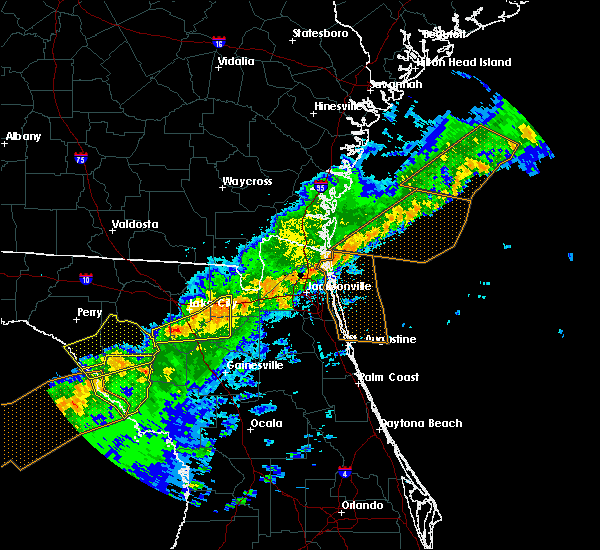 At 709 am edt, a severe thunderstorm was located near columbia, or near ichetucknee spring, moving east at 60 mph (radar indicated). Hazards include 60 mph wind gusts and penny size hail. Expect damage to roofs, siding, and trees. Locations impacted include, lake butler, ichetucknee spring, columbia, palestine community, groves, providence, lulu, olustee and dukes. At 709 am edt, a severe thunderstorm was located near columbia, or near ichetucknee spring, moving east at 60 mph (radar indicated). Hazards include 60 mph wind gusts and penny size hail. Expect damage to roofs, siding, and trees. Locations impacted include, lake butler, ichetucknee spring, columbia, palestine community, groves, providence, lulu, olustee and dukes.
|
| 4/20/2020 7:02 AM EDT |
 At 701 am edt, a severe thunderstorm was located near ichetucknee spring, moving east at 60 mph (radar indicated). Hazards include 60 mph wind gusts and penny size hail. Expect damage to roofs, siding, and trees. Locations impacted include, lake butler, ichetucknee spring, columbia, palestine community, upland pines, groves, providence, lulu, olustee and branford. At 701 am edt, a severe thunderstorm was located near ichetucknee spring, moving east at 60 mph (radar indicated). Hazards include 60 mph wind gusts and penny size hail. Expect damage to roofs, siding, and trees. Locations impacted include, lake butler, ichetucknee spring, columbia, palestine community, upland pines, groves, providence, lulu, olustee and branford.
|
| 4/20/2020 6:54 AM EDT |
 At 653 am edt, a severe thunderstorm was located near obrien, or 8 miles northwest of ichetucknee spring, moving east at 60 mph (radar indicated). Hazards include 60 mph wind gusts and penny size hail. expect damage to roofs, siding, and trees At 653 am edt, a severe thunderstorm was located near obrien, or 8 miles northwest of ichetucknee spring, moving east at 60 mph (radar indicated). Hazards include 60 mph wind gusts and penny size hail. expect damage to roofs, siding, and trees
|
| 2/7/2020 12:00 AM EST |
 At 1157 pm est, severe thunderstorms were located along a line extending from 9 miles northeast of deleon springs to near debary to near lake apopka to near four corners, moving east at 55 mph. severe storms will cross the attractions area shortly, and are expected to produce damaging wind gusts!! take shelter in a sturdy building now!! (radar indicated). Hazards include 70 mph wind gusts. Expect considerable tree damage. damage is likely to mobile homes, roofs, and outbuildings. Locations impacted include, orlando, deltona, daytona beach, sanford and apopka. At 1157 pm est, severe thunderstorms were located along a line extending from 9 miles northeast of deleon springs to near debary to near lake apopka to near four corners, moving east at 55 mph. severe storms will cross the attractions area shortly, and are expected to produce damaging wind gusts!! take shelter in a sturdy building now!! (radar indicated). Hazards include 70 mph wind gusts. Expect considerable tree damage. damage is likely to mobile homes, roofs, and outbuildings. Locations impacted include, orlando, deltona, daytona beach, sanford and apopka.
|
| 2/6/2020 11:46 PM EST |
 At 1146 pm est, severe thunderstorms were located along a line extending from 6 miles northeast of barberville to 10 miles southwest of lake louisa, moving east at 50 mph (radar indicated). Hazards include 70 mph wind gusts. Expect considerable tree damage. damage is likely to mobile homes, roofs, and outbuildings. Locations impacted include, orlando, deltona, daytona beach, sanford and apopka. At 1146 pm est, severe thunderstorms were located along a line extending from 6 miles northeast of barberville to 10 miles southwest of lake louisa, moving east at 50 mph (radar indicated). Hazards include 70 mph wind gusts. Expect considerable tree damage. damage is likely to mobile homes, roofs, and outbuildings. Locations impacted include, orlando, deltona, daytona beach, sanford and apopka.
|
| 2/6/2020 11:18 PM EST |
 At 1117 pm est, severe thunderstorms were located along a line extending from near pierson to 9 miles west of four corners, moving east at 50 mph (radar indicated). Hazards include 70 mph wind gusts. Expect considerable tree damage. Damage is likely to mobile homes, roofs, and outbuildings. At 1117 pm est, severe thunderstorms were located along a line extending from near pierson to 9 miles west of four corners, moving east at 50 mph (radar indicated). Hazards include 70 mph wind gusts. Expect considerable tree damage. Damage is likely to mobile homes, roofs, and outbuildings.
|
| 2/6/2020 9:44 PM EST |
 At 944 pm est, severe thunderstorms were located along a line extending from near st. george to 6 miles northeast of archer, moving east at 35 mph. some storms could potentially produce brief tornadoes (radar indicated). Hazards include 70 mph wind gusts. Expect considerable tree damage. damage is likely to mobile homes, roofs, and outbuildings. Locations impacted include, gainesville, starke, lake butler, keystone heights, callahan, raiford, melrose, worthington spring, taylor and alachua. At 944 pm est, severe thunderstorms were located along a line extending from near st. george to 6 miles northeast of archer, moving east at 35 mph. some storms could potentially produce brief tornadoes (radar indicated). Hazards include 70 mph wind gusts. Expect considerable tree damage. damage is likely to mobile homes, roofs, and outbuildings. Locations impacted include, gainesville, starke, lake butler, keystone heights, callahan, raiford, melrose, worthington spring, taylor and alachua.
|
| 2/6/2020 9:30 PM EST | Union county 911/dispatch reports numerous trees and powerlines down county-wid in union county FL, 7.9 miles SE of Lake Butler, FL |
| 2/6/2020 9:22 PM EST |
 At 920 pm est, severe thunderstorms were located along a line extending from 10 miles northwest of taylor to near high springs, moving east at 45 mph. some storms could potentially produce brief tornadoes (radar indicated). Hazards include 70 mph wind gusts. Expect considerable tree damage. Damage is likely to mobile homes, roofs, and outbuildings. At 920 pm est, severe thunderstorms were located along a line extending from 10 miles northwest of taylor to near high springs, moving east at 45 mph. some storms could potentially produce brief tornadoes (radar indicated). Hazards include 70 mph wind gusts. Expect considerable tree damage. Damage is likely to mobile homes, roofs, and outbuildings.
|
| 12/17/2019 3:47 PM EST |
 At 347 pm est, a severe thunderstorm was located over altamonte springs, moving northeast at 25 mph (radar indicated). Hazards include 60 mph wind gusts and penny size hail. expect damage to roofs, siding, and trees At 347 pm est, a severe thunderstorm was located over altamonte springs, moving northeast at 25 mph (radar indicated). Hazards include 60 mph wind gusts and penny size hail. expect damage to roofs, siding, and trees
|
| 7/19/2019 6:37 PM EDT |
 The severe thunderstorm warning for south central lake and west central orange counties will expire at 645 pm edt, the storm which prompted the warning has weakened below severe limits, and no longer poses an immediate threat to life or property. therefore, the warning will be allowed to expire. however gusty winds, frequent lightning, and heavy rain are still possible with this thunderstorm. The severe thunderstorm warning for south central lake and west central orange counties will expire at 645 pm edt, the storm which prompted the warning has weakened below severe limits, and no longer poses an immediate threat to life or property. therefore, the warning will be allowed to expire. however gusty winds, frequent lightning, and heavy rain are still possible with this thunderstorm.
|
| 7/19/2019 6:22 PM EDT |
 At 621 pm edt, a severe thunderstorm was located over oakland, or over winter garden, moving southwest at 10 mph. several reports have come in around the winter garden area of quarter to half dollar size hail (trained weather spotters). Hazards include 60 mph wind gusts and half dollar size hail. Hail damage to vehicles is expected. expect wind damage to roofs, siding, and trees. Locations impacted include, ocoee, winter garden, windermere, bay lake and clermont. At 621 pm edt, a severe thunderstorm was located over oakland, or over winter garden, moving southwest at 10 mph. several reports have come in around the winter garden area of quarter to half dollar size hail (trained weather spotters). Hazards include 60 mph wind gusts and half dollar size hail. Hail damage to vehicles is expected. expect wind damage to roofs, siding, and trees. Locations impacted include, ocoee, winter garden, windermere, bay lake and clermont.
|
| 7/19/2019 6:06 PM EDT |
 At 606 pm edt, a severe thunderstorm was located over winter garden, moving southwest at 5 mph (radar indicated). Hazards include 60 mph wind gusts and quarter size hail. Hail damage to vehicles is expected. Expect wind damage to roofs, siding, and trees. At 606 pm edt, a severe thunderstorm was located over winter garden, moving southwest at 5 mph (radar indicated). Hazards include 60 mph wind gusts and quarter size hail. Hail damage to vehicles is expected. Expect wind damage to roofs, siding, and trees.
|
| 7/18/2019 4:27 PM EDT |
 The severe thunderstorm warning for south central lake and southwestern orange counties will expire at 430 pm edt, the storm which prompted the warning has weakened below severe limits, and no longer poses an immediate threat to life or property. therefore, the warning will be allowed to expire. however gusty winds, lightning, and heavy rain are still possible with this thunderstorm. The severe thunderstorm warning for south central lake and southwestern orange counties will expire at 430 pm edt, the storm which prompted the warning has weakened below severe limits, and no longer poses an immediate threat to life or property. therefore, the warning will be allowed to expire. however gusty winds, lightning, and heavy rain are still possible with this thunderstorm.
|
| 7/18/2019 4:01 PM EDT |
 The national weather service in melbourne has issued a * severe thunderstorm warning for. south central lake county in east central florida. southwestern orange county in east central florida. until 430 pm edt. At 400 pm edt, a severe thunderstorm was located over horizon west,. The national weather service in melbourne has issued a * severe thunderstorm warning for. south central lake county in east central florida. southwestern orange county in east central florida. until 430 pm edt. At 400 pm edt, a severe thunderstorm was located over horizon west,.
|
| 6/25/2019 7:06 PM EDT |
 At 706 pm edt, a severe thunderstorm was located over bay lake, moving southeast at 25 mph (radar indicated). Hazards include 60 mph wind gusts. expect damage to roofs, siding, and trees At 706 pm edt, a severe thunderstorm was located over bay lake, moving southeast at 25 mph (radar indicated). Hazards include 60 mph wind gusts. expect damage to roofs, siding, and trees
|
| 6/19/2019 5:55 PM EDT |
 The severe thunderstorm warning for southwestern orange and northwestern osceola counties will expire at 600 pm edt, the storm which prompted the warning has weakened below severe limits, and is exiting the warned area. therefore, the warning will be allowed to expire. however strong gusty winds and heavy rain are still possible with this thunderstorm. The severe thunderstorm warning for southwestern orange and northwestern osceola counties will expire at 600 pm edt, the storm which prompted the warning has weakened below severe limits, and is exiting the warned area. therefore, the warning will be allowed to expire. however strong gusty winds and heavy rain are still possible with this thunderstorm.
|
| 6/19/2019 5:37 PM EDT |
 The tornado warning for southwestern orange county will expire at 545 pm edt, the tornado threat has diminished and the tornado warning has been cancelled. however, large hail and damaging winds remain likely and a severe thunderstorm warning remains in effect for the area. The tornado warning for southwestern orange county will expire at 545 pm edt, the tornado threat has diminished and the tornado warning has been cancelled. however, large hail and damaging winds remain likely and a severe thunderstorm warning remains in effect for the area.
|
| 6/19/2019 5:29 PM EDT |
 A tornado warning remains in effect until 545 pm edt for southwestern orange county. at 529 pm edt, a severe thunderstorm capable of producing a tornado was located over sea world, or near oak ridge, moving east at 35 mph. hazard. tornado. source. Radar indicated rotation. A tornado warning remains in effect until 545 pm edt for southwestern orange county. at 529 pm edt, a severe thunderstorm capable of producing a tornado was located over sea world, or near oak ridge, moving east at 35 mph. hazard. tornado. source. Radar indicated rotation.
|
| 6/19/2019 5:18 PM EDT |
 At 518 pm edt, a severe thunderstorm capable of producing a tornado was located over bay lake, moving east at 40 mph (radar indicated rotation). Hazards include tornado. Flying debris will be dangerous to those caught without shelter. mobile homes will be damaged or destroyed. damage to roofs, windows, and vehicles will occur. tree damage is likely. this dangerous storm will be near, sea world, hunters creek and wet n wild water park around 530 pm edt. orlando around 540 pm edt. Other locations impacted by this tornadic thunderstorm include magic kingdom. At 518 pm edt, a severe thunderstorm capable of producing a tornado was located over bay lake, moving east at 40 mph (radar indicated rotation). Hazards include tornado. Flying debris will be dangerous to those caught without shelter. mobile homes will be damaged or destroyed. damage to roofs, windows, and vehicles will occur. tree damage is likely. this dangerous storm will be near, sea world, hunters creek and wet n wild water park around 530 pm edt. orlando around 540 pm edt. Other locations impacted by this tornadic thunderstorm include magic kingdom.
|
| 6/19/2019 5:13 PM EDT |
 At 513 pm edt, a severe thunderstorm was located over four corners, or near bay lake, moving east at 40 mph (radar indicated). Hazards include 60 mph wind gusts. expect damage to roofs, siding, and trees At 513 pm edt, a severe thunderstorm was located over four corners, or near bay lake, moving east at 40 mph (radar indicated). Hazards include 60 mph wind gusts. expect damage to roofs, siding, and trees
|
| 6/12/2019 1:51 PM EDT |
 The severe thunderstorm warning for southwestern orange and north central osceola counties will expire at 200 pm edt, the storm which prompted the warning has weakened below severe limits, and has exited the warned area. therefore, the warning will be allowed to expire. however gusty winds are still possible with this thunderstorm. The severe thunderstorm warning for southwestern orange and north central osceola counties will expire at 200 pm edt, the storm which prompted the warning has weakened below severe limits, and has exited the warned area. therefore, the warning will be allowed to expire. however gusty winds are still possible with this thunderstorm.
|
| 6/12/2019 1:42 PM EDT |
 At 139 pm edt, a severe thunderstorm was located near the orlando international airport, moving northeast at 30 mph (radar indicated. the orlando international airport reported a wind gust to 67 mph as the storm passed). Hazards include 70 mph wind gusts. Expect considerable tree damage. damage is likely to mobile homes, roofs, and outbuildings. Locations impacted include, orlando, kissimmee, winter park, maitland and bay lake. At 139 pm edt, a severe thunderstorm was located near the orlando international airport, moving northeast at 30 mph (radar indicated. the orlando international airport reported a wind gust to 67 mph as the storm passed). Hazards include 70 mph wind gusts. Expect considerable tree damage. damage is likely to mobile homes, roofs, and outbuildings. Locations impacted include, orlando, kissimmee, winter park, maitland and bay lake.
|
| 6/12/2019 1:27 PM EDT |
 At 127 pm edt, severe thunderstorms were located over vineland and over kissimme, moving northeast at 25 mph (radar indicated). Hazards include 60 mph wind gusts. Expect damage to roofs, siding, and trees. Locations impacted include, orlando, dr phillips, kissimmee, buena ventura lakes and bay hill. At 127 pm edt, severe thunderstorms were located over vineland and over kissimme, moving northeast at 25 mph (radar indicated). Hazards include 60 mph wind gusts. Expect damage to roofs, siding, and trees. Locations impacted include, orlando, dr phillips, kissimmee, buena ventura lakes and bay hill.
|
| 6/12/2019 1:06 PM EDT |
 At 105 pm edt, a severe thunderstorm was located over intercession city, moving northeast at 30 mph (radar indicated). Hazards include 60 mph wind gusts. expect damage to roofs, siding, and trees At 105 pm edt, a severe thunderstorm was located over intercession city, moving northeast at 30 mph (radar indicated). Hazards include 60 mph wind gusts. expect damage to roofs, siding, and trees
|
| 5/14/2019 12:56 PM EDT |
 At 1255 pm edt, a severe thunderstorm was located over doctor phillips, or near bay lake, moving northeast at 35 mph (radar indicated). Hazards include 60 mph wind gusts and penny size hail. Expect damage to roofs, siding, and trees. Locations impacted include, orlando, windermere, bay lake, oak ridge and belle isle. At 1255 pm edt, a severe thunderstorm was located over doctor phillips, or near bay lake, moving northeast at 35 mph (radar indicated). Hazards include 60 mph wind gusts and penny size hail. Expect damage to roofs, siding, and trees. Locations impacted include, orlando, windermere, bay lake, oak ridge and belle isle.
|
| 5/14/2019 12:39 PM EDT |
 At 1238 pm edt, a severe thunderstorm was located over four corners, or near bay lake, moving east at 25 mph (radar indicated). Hazards include 60 mph wind gusts and penny size hail. expect damage to roofs, siding, and trees At 1238 pm edt, a severe thunderstorm was located over four corners, or near bay lake, moving east at 25 mph (radar indicated). Hazards include 60 mph wind gusts and penny size hail. expect damage to roofs, siding, and trees
|
| 5/5/2019 2:14 PM EDT |
 At 213 pm edt, severe thunderstorms were located along a line extending from near zellwood to near winter haven, moving east at 50 mph (radar indicated). Hazards include 60 mph wind gusts and nickel size hail. expect damage to roofs, siding, and trees At 213 pm edt, severe thunderstorms were located along a line extending from near zellwood to near winter haven, moving east at 50 mph (radar indicated). Hazards include 60 mph wind gusts and nickel size hail. expect damage to roofs, siding, and trees
|
| 5/5/2019 2:05 PM EDT |
 At 205 pm edt, a severe thunderstorm was located over college park, moving northeast at 30 mph (radar indicated). Hazards include 60 mph wind gusts and nickel size hail. Expect damage to roofs, siding, and trees. Locations impacted include, orlando, sanford, apopka, altamonte springs and ocoee. At 205 pm edt, a severe thunderstorm was located over college park, moving northeast at 30 mph (radar indicated). Hazards include 60 mph wind gusts and nickel size hail. Expect damage to roofs, siding, and trees. Locations impacted include, orlando, sanford, apopka, altamonte springs and ocoee.
|
| 5/5/2019 2:00 PM EDT |
 At 200 pm edt, a severe thunderstorm was located over orlovista, or near orlando, moving northeast at 30 mph (radar indicated). Hazards include 60 mph wind gusts and nickel size hail. expect damage to roofs, siding, and trees At 200 pm edt, a severe thunderstorm was located over orlovista, or near orlando, moving northeast at 30 mph (radar indicated). Hazards include 60 mph wind gusts and nickel size hail. expect damage to roofs, siding, and trees
|
| 5/5/2019 10:56 AM EDT | Several customers at that came in through the circle k gas station reported numerous trees dow in union county FL, 0.3 miles S of Lake Butler, FL |
| 5/5/2019 10:53 AM EDT |
 At 1053 am edt, a severe thunderstorm was located over beasley, or near lake butler, moving northeast at 40 mph (radar indicated). Hazards include 60 mph wind gusts. expect damage to roofs, siding, and trees At 1053 am edt, a severe thunderstorm was located over beasley, or near lake butler, moving northeast at 40 mph (radar indicated). Hazards include 60 mph wind gusts. expect damage to roofs, siding, and trees
|
| 5/5/2019 10:50 AM EDT | Spotter reported a tree on a power line on northwest 93rd place causing power outage in bradford county FL, 7.6 miles WNW of Lake Butler, FL |
| 4/19/2019 1:51 PM EDT |
 At 149 pm edt, severe thunderstorms were located along a line extending from lake george to eustis to near mascotte, moving northeast at 60 mph (radar indicated). Hazards include 60 mph wind gusts. Expect damage to roofs, siding, and trees. Locations impacted include, apopka, ocoee, winter garden, leesburg and eustis. At 149 pm edt, severe thunderstorms were located along a line extending from lake george to eustis to near mascotte, moving northeast at 60 mph (radar indicated). Hazards include 60 mph wind gusts. Expect damage to roofs, siding, and trees. Locations impacted include, apopka, ocoee, winter garden, leesburg and eustis.
|
| 4/19/2019 1:30 PM EDT |
 At 128 pm edt, severe thunderstorms were located along a line extending from ocala south to tarrytown in southern sumter county, moving northeast at 60 mph (radar indicated). Hazards include 60 mph wind gusts. expect damage to roofs, siding, and trees At 128 pm edt, severe thunderstorms were located along a line extending from ocala south to tarrytown in southern sumter county, moving northeast at 60 mph (radar indicated). Hazards include 60 mph wind gusts. expect damage to roofs, siding, and trees
|
| 4/19/2019 11:29 AM EDT |
 At 1129 am edt, severe thunderstorms were located along a line extending from near raybon to near raiford, moving northeast at 55 mph (radar indicated). Hazards include 70 mph wind gusts. Expect considerable tree damage. damage is likely to mobile homes, roofs, and outbuildings. Locations impacted include, gainesville, starke, folkston, lake butler, raiford, worthington spring, stephen foster state park, taylor, alachua and macclenny. At 1129 am edt, severe thunderstorms were located along a line extending from near raybon to near raiford, moving northeast at 55 mph (radar indicated). Hazards include 70 mph wind gusts. Expect considerable tree damage. damage is likely to mobile homes, roofs, and outbuildings. Locations impacted include, gainesville, starke, folkston, lake butler, raiford, worthington spring, stephen foster state park, taylor, alachua and macclenny.
|
| 4/19/2019 11:15 AM EDT |
 At 1114 am edt, severe thunderstorms were located along a line extending from near braganza to near alachua, moving northeast at 55 mph (radar indicated). Hazards include 70 mph wind gusts. Expect considerable tree damage. damage is likely to mobile homes, roofs, and outbuildings. Locations impacted include, gainesville, starke, folkston, lake butler, raiford, worthington spring, stephen foster state park, taylor, alachua and macclenny. At 1114 am edt, severe thunderstorms were located along a line extending from near braganza to near alachua, moving northeast at 55 mph (radar indicated). Hazards include 70 mph wind gusts. Expect considerable tree damage. damage is likely to mobile homes, roofs, and outbuildings. Locations impacted include, gainesville, starke, folkston, lake butler, raiford, worthington spring, stephen foster state park, taylor, alachua and macclenny.
|
| 4/19/2019 11:00 AM EDT |
 At 1100 am edt, severe thunderstorms were located along a line extending from 8 miles west of stephen foster state park to 7 miles north of bronson, moving northeast at 55 mph (radar indicated). Hazards include 70 mph wind gusts. Expect considerable tree damage. Damage is likely to mobile homes, roofs, and outbuildings. At 1100 am edt, severe thunderstorms were located along a line extending from 8 miles west of stephen foster state park to 7 miles north of bronson, moving northeast at 55 mph (radar indicated). Hazards include 70 mph wind gusts. Expect considerable tree damage. Damage is likely to mobile homes, roofs, and outbuildings.
|
| 1/24/2019 5:34 AM EST |
 At 533 am est, severe thunderstorms were located along a line extending from near altoona to fruitland park to near mascotte to 9 miles east of dade city, moving east-northeast at 55 mph (radar indicated). Hazards include 60 mph wind gusts. expect damage to roofs, siding, and trees At 533 am est, severe thunderstorms were located along a line extending from near altoona to fruitland park to near mascotte to 9 miles east of dade city, moving east-northeast at 55 mph (radar indicated). Hazards include 60 mph wind gusts. expect damage to roofs, siding, and trees
|
| 12/20/2018 12:57 PM EST |
 At 1256 pm est, severe thunderstorms were located along a line extending from sea world to near lake wales, moving northeast at 50 mph (radar indicated). Hazards include 70 mph wind gusts. Expect considerable tree damage. Damage is likely to mobile homes, roofs, and outbuildings. At 1256 pm est, severe thunderstorms were located along a line extending from sea world to near lake wales, moving northeast at 50 mph (radar indicated). Hazards include 70 mph wind gusts. Expect considerable tree damage. Damage is likely to mobile homes, roofs, and outbuildings.
|
| 12/20/2018 9:36 AM EST |
 A tornado warning remains in effect until 1000 am est for southwestern orange county. at 935 am est, a severe squall line capable of producing both tornadoes and straight line wind damage was located over doctor phillips, or near windermere, moving northeast at 45 to 50 mph. hazard. Tornado. A tornado warning remains in effect until 1000 am est for southwestern orange county. at 935 am est, a severe squall line capable of producing both tornadoes and straight line wind damage was located over doctor phillips, or near windermere, moving northeast at 45 to 50 mph. hazard. Tornado.
|
| 12/20/2018 9:25 AM EST |
 At 924 am est, severe thunderstorms capable of producing both tornadoes and straight line wind damage were located over celebration, moving northeast at 50 mph (radar indicated rotation). Hazards include tornado. Flying debris will be dangerous to those caught without shelter. mobile homes will be damaged or destroyed. damage to roofs, windows, and vehicles will occur. tree damage is likely. these dangerous storms will be near, sea world around 930 am est. oak ridge, universal studios and wet n wild water park around 940 am est. college park, conway and belle isle around 950 am est. winter park around 1000 am est. Other locations impacted by this tornadic thunderstorm include edgewood. At 924 am est, severe thunderstorms capable of producing both tornadoes and straight line wind damage were located over celebration, moving northeast at 50 mph (radar indicated rotation). Hazards include tornado. Flying debris will be dangerous to those caught without shelter. mobile homes will be damaged or destroyed. damage to roofs, windows, and vehicles will occur. tree damage is likely. these dangerous storms will be near, sea world around 930 am est. oak ridge, universal studios and wet n wild water park around 940 am est. college park, conway and belle isle around 950 am est. winter park around 1000 am est. Other locations impacted by this tornadic thunderstorm include edgewood.
|
| 12/9/2018 11:09 AM EST |
 At 1108 am est, a severe thunderstorm was located over four corners, moving northeast at 30 mph (radar indicated). Hazards include 60 mph wind gusts. expect damage to roofs, siding, and trees At 1108 am est, a severe thunderstorm was located over four corners, moving northeast at 30 mph (radar indicated). Hazards include 60 mph wind gusts. expect damage to roofs, siding, and trees
|
| 11/2/2018 4:50 PM EDT |
 At 449 pm edt, a severe thunderstorm capable of producing a tornado was located 4 miles west of windermere, moving east at 45 mph (radar indicated rotation). Hazards include tornado. Flying debris will be dangerous to those caught without shelter. mobile homes will be damaged or destroyed. damage to roofs, windows, and vehicles will occur. tree damage is likely. this dangerous storm will be near, ocoee, winter garden and windermere around 455 pm edt. oak ridge, orlovista and universal studios around 500 pm edt. Other locations impacted by this tornadic thunderstorm include minneola. At 449 pm edt, a severe thunderstorm capable of producing a tornado was located 4 miles west of windermere, moving east at 45 mph (radar indicated rotation). Hazards include tornado. Flying debris will be dangerous to those caught without shelter. mobile homes will be damaged or destroyed. damage to roofs, windows, and vehicles will occur. tree damage is likely. this dangerous storm will be near, ocoee, winter garden and windermere around 455 pm edt. oak ridge, orlovista and universal studios around 500 pm edt. Other locations impacted by this tornadic thunderstorm include minneola.
|
| 11/2/2018 4:45 PM EDT |
 At 443 pm edt, severe thunderstorms capable of producing both tornadoes and extensive straight line wind damage were located near 8 miles west of horizon west moving east at 45 mph. an additional tornado was developing near little lake harris (radar indicated rotation). Hazards include tornado. Flying debris will be dangerous to those caught without shelter. mobile homes will be damaged or destroyed. damage to roofs, windows, and vehicles will occur. tree damage is likely. these dangerous storms will be near, ocoee, winter garden and windermere around 450 pm edt. oak ridge, orlovista and universal studios around 500 pm edt. Other locations impacted by this tornadic thunderstorm include minneola. At 443 pm edt, severe thunderstorms capable of producing both tornadoes and extensive straight line wind damage were located near 8 miles west of horizon west moving east at 45 mph. an additional tornado was developing near little lake harris (radar indicated rotation). Hazards include tornado. Flying debris will be dangerous to those caught without shelter. mobile homes will be damaged or destroyed. damage to roofs, windows, and vehicles will occur. tree damage is likely. these dangerous storms will be near, ocoee, winter garden and windermere around 450 pm edt. oak ridge, orlovista and universal studios around 500 pm edt. Other locations impacted by this tornadic thunderstorm include minneola.
|
| 8/28/2018 3:35 PM EDT |
 The severe thunderstorm warning for southwestern orange county will expire at 345 pm edt, the storm which prompted the warning has weakened below severe limits, and no longer poses an immediate threat to life or property. therefore, the warning will be allowed to expire. however gusty winds and heavy rain are still possible with this thunderstorm. The severe thunderstorm warning for southwestern orange county will expire at 345 pm edt, the storm which prompted the warning has weakened below severe limits, and no longer poses an immediate threat to life or property. therefore, the warning will be allowed to expire. however gusty winds and heavy rain are still possible with this thunderstorm.
|
| 8/28/2018 3:22 PM EDT |
 At 322 pm edt, a severe thunderstorm was located over bay lake, moving west at 15 mph (radar indicated). Hazards include 60 mph wind gusts. expect damage to roofs, siding, and trees At 322 pm edt, a severe thunderstorm was located over bay lake, moving west at 15 mph (radar indicated). Hazards include 60 mph wind gusts. expect damage to roofs, siding, and trees
|
| 7/26/2018 1:34 PM EDT |
 At 134 pm edt, a severe thunderstorm was located over beasley, or near lake butler, moving northeast at 10 mph (radar indicated). Hazards include 60 mph wind gusts. Expect damage to roofs, siding, and trees. Locations impacted include, starke, lake butler, raiford, new river, beasley, sampson, brooker, ellerbee and johnstown. At 134 pm edt, a severe thunderstorm was located over beasley, or near lake butler, moving northeast at 10 mph (radar indicated). Hazards include 60 mph wind gusts. Expect damage to roofs, siding, and trees. Locations impacted include, starke, lake butler, raiford, new river, beasley, sampson, brooker, ellerbee and johnstown.
|
| 7/26/2018 1:25 PM EDT |
 At 124 pm edt, a severe thunderstorm was located near beasley, or near lake butler, moving northeast at 10 mph (radar indicated). Hazards include 60 mph wind gusts and penny size hail. expect damage to roofs, siding, and trees At 124 pm edt, a severe thunderstorm was located near beasley, or near lake butler, moving northeast at 10 mph (radar indicated). Hazards include 60 mph wind gusts and penny size hail. expect damage to roofs, siding, and trees
|
| 7/22/2018 2:44 PM EDT |
 At 244 pm edt, a severe thunderstorm was located over palestine community, or near lake butler, moving east at 25 mph (radar indicated). Hazards include 60 mph wind gusts and quarter size hail. Hail damage to vehicles is expected. expect wind damage to roofs, siding, and trees. Locations impacted include, lake butler, raiford, palestine community, lulu and johnstown. At 244 pm edt, a severe thunderstorm was located over palestine community, or near lake butler, moving east at 25 mph (radar indicated). Hazards include 60 mph wind gusts and quarter size hail. Hail damage to vehicles is expected. expect wind damage to roofs, siding, and trees. Locations impacted include, lake butler, raiford, palestine community, lulu and johnstown.
|
| 7/22/2018 2:32 PM EDT |
 At 232 pm edt, a severe thunderstorm was located over lulu, or 10 miles northwest of lake butler, moving east at 25 mph (radar indicated). Hazards include 60 mph wind gusts and quarter size hail. Hail damage to vehicles is expected. Expect wind damage to roofs, siding, and trees. At 232 pm edt, a severe thunderstorm was located over lulu, or 10 miles northwest of lake butler, moving east at 25 mph (radar indicated). Hazards include 60 mph wind gusts and quarter size hail. Hail damage to vehicles is expected. Expect wind damage to roofs, siding, and trees.
|
| 7/22/2018 2:04 PM EDT |
 At 203 pm edt, a severe thunderstorm was located near fort white, or near ichetucknee spring, moving southeast at 25 mph (radar indicated). Hazards include 60 mph wind gusts and quarter size hail. Hail damage to vehicles is expected. expect wind damage to roofs, siding, and trees. Locations impacted include, lake butler, worthington spring, ichetucknee spring, columbia, alachua, high springs, fort white, worthington springs, groves and providence. At 203 pm edt, a severe thunderstorm was located near fort white, or near ichetucknee spring, moving southeast at 25 mph (radar indicated). Hazards include 60 mph wind gusts and quarter size hail. Hail damage to vehicles is expected. expect wind damage to roofs, siding, and trees. Locations impacted include, lake butler, worthington spring, ichetucknee spring, columbia, alachua, high springs, fort white, worthington springs, groves and providence.
|
| 7/22/2018 1:38 PM EDT |
 At 138 pm edt, a severe thunderstorm was located near ichetucknee spring, moving southeast at 25 mph (radar indicated). Hazards include 60 mph wind gusts and quarter size hail. Hail damage to vehicles is expected. Expect wind damage to roofs, siding, and trees. At 138 pm edt, a severe thunderstorm was located near ichetucknee spring, moving southeast at 25 mph (radar indicated). Hazards include 60 mph wind gusts and quarter size hail. Hail damage to vehicles is expected. Expect wind damage to roofs, siding, and trees.
|
| 7/22/2018 12:45 PM EDT |
 At 1245 pm edt, a severe thunderstorm was located over lake butler, moving east at 25 mph (radar indicated). Hazards include 70 mph wind gusts and quarter size hail. Hail damage to vehicles is expected. expect considerable tree damage. wind damage is also likely to mobile homes, roofs, and outbuildings. Locations impacted include, lake butler, worthington spring, ichetucknee spring, columbia, worthington springs, palestine community, groves, providence, beasley and upland pines. At 1245 pm edt, a severe thunderstorm was located over lake butler, moving east at 25 mph (radar indicated). Hazards include 70 mph wind gusts and quarter size hail. Hail damage to vehicles is expected. expect considerable tree damage. wind damage is also likely to mobile homes, roofs, and outbuildings. Locations impacted include, lake butler, worthington spring, ichetucknee spring, columbia, worthington springs, palestine community, groves, providence, beasley and upland pines.
|
| 7/22/2018 12:35 PM EDT |
 At 1235 pm edt, a severe thunderstorm was located over palestine community, or near lake butler, moving east at 25 mph (radar indicated). Hazards include 70 mph wind gusts and quarter size hail. Hail damage to vehicles is expected. expect considerable tree damage. wind damage is also likely to mobile homes, roofs, and outbuildings. Locations impacted include, lake butler, worthington spring, ichetucknee spring, columbia, worthington springs, palestine community, groves, providence, beasley and upland pines. At 1235 pm edt, a severe thunderstorm was located over palestine community, or near lake butler, moving east at 25 mph (radar indicated). Hazards include 70 mph wind gusts and quarter size hail. Hail damage to vehicles is expected. expect considerable tree damage. wind damage is also likely to mobile homes, roofs, and outbuildings. Locations impacted include, lake butler, worthington spring, ichetucknee spring, columbia, worthington springs, palestine community, groves, providence, beasley and upland pines.
|
| 7/22/2018 12:25 PM EDT |
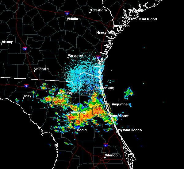 At 1225 pm edt, a severe thunderstorm was located near providence, or 9 miles northwest of worthington spring, moving east at 25 mph (radar indicated). Hazards include 70 mph wind gusts and quarter size hail. Hail damage to vehicles is expected. expect considerable tree damage. wind damage is also likely to mobile homes, roofs, and outbuildings. Locations impacted include, lake butler, worthington spring, ichetucknee spring, columbia, worthington springs, palestine community, groves, providence, beasley and upland pines. At 1225 pm edt, a severe thunderstorm was located near providence, or 9 miles northwest of worthington spring, moving east at 25 mph (radar indicated). Hazards include 70 mph wind gusts and quarter size hail. Hail damage to vehicles is expected. expect considerable tree damage. wind damage is also likely to mobile homes, roofs, and outbuildings. Locations impacted include, lake butler, worthington spring, ichetucknee spring, columbia, worthington springs, palestine community, groves, providence, beasley and upland pines.
|
| 7/22/2018 12:20 PM EDT |
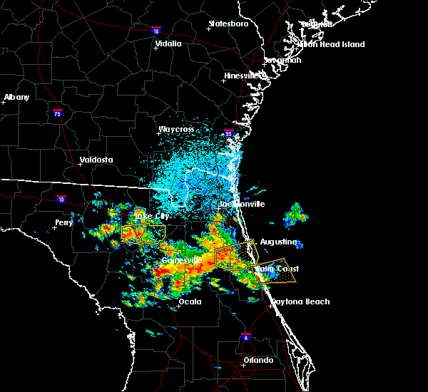 At 1220 pm edt, a severe thunderstorm was located over providence, or 11 miles northwest of worthington spring, moving east at 25 mph (radar indicated). Hazards include 70 mph wind gusts and quarter size hail. Hail damage to vehicles is expected. expect considerable tree damage. wind damage is also likely to mobile homes, roofs, and outbuildings. Locations impacted include, lake butler, worthington spring, ichetucknee spring, columbia, worthington springs, palestine community, groves, providence, beasley and upland pines. At 1220 pm edt, a severe thunderstorm was located over providence, or 11 miles northwest of worthington spring, moving east at 25 mph (radar indicated). Hazards include 70 mph wind gusts and quarter size hail. Hail damage to vehicles is expected. expect considerable tree damage. wind damage is also likely to mobile homes, roofs, and outbuildings. Locations impacted include, lake butler, worthington spring, ichetucknee spring, columbia, worthington springs, palestine community, groves, providence, beasley and upland pines.
|
| 7/22/2018 12:12 PM EDT |
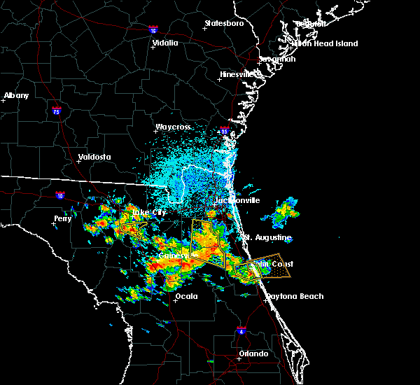 At 1212 pm edt, a severe thunderstorm was located near providence, or 10 miles south of lake city, moving east at 25 mph (radar indicated). Hazards include 70 mph wind gusts and nickel size hail. Expect considerable tree damage. Damage is likely to mobile homes, roofs, and outbuildings. At 1212 pm edt, a severe thunderstorm was located near providence, or 10 miles south of lake city, moving east at 25 mph (radar indicated). Hazards include 70 mph wind gusts and nickel size hail. Expect considerable tree damage. Damage is likely to mobile homes, roofs, and outbuildings.
|
| 6/17/2018 5:29 PM EDT |
 At 527 pm edt, a severe thunderstorm was located over windermere and lake butler, moving south at 10 to 15 mph (radar indicated). Hazards include 60 mph wind gusts and quarter size hail. Hail damage to vehicles is expected. expect wind damage to roofs, siding, and trees. Locations impacted include, bay hill, bay lake, and magic kingdom. At 527 pm edt, a severe thunderstorm was located over windermere and lake butler, moving south at 10 to 15 mph (radar indicated). Hazards include 60 mph wind gusts and quarter size hail. Hail damage to vehicles is expected. expect wind damage to roofs, siding, and trees. Locations impacted include, bay hill, bay lake, and magic kingdom.
|
| 6/17/2018 5:12 PM EDT |
 At 511 pm edt, a severe thunderstorm was located over ocoee, moving south at 10 mph (radar indicated). Hazards include 60 mph wind gusts and quarter size hail. Hail damage to vehicles is expected. Expect wind damage to roofs, siding, and trees. At 511 pm edt, a severe thunderstorm was located over ocoee, moving south at 10 mph (radar indicated). Hazards include 60 mph wind gusts and quarter size hail. Hail damage to vehicles is expected. Expect wind damage to roofs, siding, and trees.
|
| 6/8/2018 4:24 PM EDT |
 The severe thunderstorm warning for south central lake and southwestern orange counties will expire at 430 pm edt, the storm which prompted the warning has weakened below severe limits, and no longer poses an immediate threat to life or property. therefore, the warning will be allowed to expire. however gusty winds and heavy rain are still possible with this thunderstorm. The severe thunderstorm warning for south central lake and southwestern orange counties will expire at 430 pm edt, the storm which prompted the warning has weakened below severe limits, and no longer poses an immediate threat to life or property. therefore, the warning will be allowed to expire. however gusty winds and heavy rain are still possible with this thunderstorm.
|
| 6/8/2018 4:07 PM EDT |
 At 407 pm edt, a severe thunderstorm was located over lake louisa, or 9 miles northwest of bay lake, moving east at 25 mph (radar indicated). Hazards include 60 mph wind gusts and penny size hail. Expect damage to roofs, siding, and trees. Locations impacted include, ocoee, winter garden, windermere, bay lake and clermont. At 407 pm edt, a severe thunderstorm was located over lake louisa, or 9 miles northwest of bay lake, moving east at 25 mph (radar indicated). Hazards include 60 mph wind gusts and penny size hail. Expect damage to roofs, siding, and trees. Locations impacted include, ocoee, winter garden, windermere, bay lake and clermont.
|
| 6/8/2018 3:56 PM EDT |
 At 356 pm edt, a severe thunderstorm was located near lake louisa, or 8 miles southeast of groveland, moving east at 25 mph (radar indicated). Hazards include 60 mph wind gusts and quarter size hail. Hail damage to vehicles is expected. Expect wind damage to roofs, siding, and trees. At 356 pm edt, a severe thunderstorm was located near lake louisa, or 8 miles southeast of groveland, moving east at 25 mph (radar indicated). Hazards include 60 mph wind gusts and quarter size hail. Hail damage to vehicles is expected. Expect wind damage to roofs, siding, and trees.
|
| 4/10/2018 11:35 AM EDT |
 At 1134 am edt, a severe thunderstorm was located over lake nona, or near orlando international airport, moving east at 20 mph. there was another potentially severe thunderstorm near kissimmee and doctor phillips (radar indicated). Hazards include 60 mph wind gusts and quarter size hail. Hail damage to vehicles is expected. Expect wind damage to roofs, siding, and trees. At 1134 am edt, a severe thunderstorm was located over lake nona, or near orlando international airport, moving east at 20 mph. there was another potentially severe thunderstorm near kissimmee and doctor phillips (radar indicated). Hazards include 60 mph wind gusts and quarter size hail. Hail damage to vehicles is expected. Expect wind damage to roofs, siding, and trees.
|
| 4/10/2018 11:31 AM EDT |
 At 1130 am edt, a severe thunderstorm was located near sea world, or near bay lake, moving east at 20 mph (radar indicated). Hazards include 60 mph wind gusts and quarter size hail. Hail damage to vehicles is expected. expect wind damage to roofs, siding, and trees. Locations impacted include, orlando, kissimmee, bay lake, celebration and intercession city. At 1130 am edt, a severe thunderstorm was located near sea world, or near bay lake, moving east at 20 mph (radar indicated). Hazards include 60 mph wind gusts and quarter size hail. Hail damage to vehicles is expected. expect wind damage to roofs, siding, and trees. Locations impacted include, orlando, kissimmee, bay lake, celebration and intercession city.
|
| 4/10/2018 11:16 AM EDT |
 At 1115 am edt, a severe thunderstorm was located over bay lake, moving east at 20 mph (radar indicated). Hazards include 60 mph wind gusts and quarter size hail. Hail damage to vehicles is expected. Expect wind damage to roofs, siding, and trees. At 1115 am edt, a severe thunderstorm was located over bay lake, moving east at 20 mph (radar indicated). Hazards include 60 mph wind gusts and quarter size hail. Hail damage to vehicles is expected. Expect wind damage to roofs, siding, and trees.
|
| 3/20/2018 3:11 PM EDT |
 The severe thunderstorm warning for gilchrist, northern alachua, bradford, southern baker, union and southern columbia counties will expire at 315 pm edt, the storms which prompted the warning have weakened below severe limits, and have exited the warned area. therefore the warning will be allowed to expire. however small hail, gusty winds and heavy rain are still possible with these thunderstorms. a tornado watch remains in effect until 700 pm edt for northern and northeastern florida. The severe thunderstorm warning for gilchrist, northern alachua, bradford, southern baker, union and southern columbia counties will expire at 315 pm edt, the storms which prompted the warning have weakened below severe limits, and have exited the warned area. therefore the warning will be allowed to expire. however small hail, gusty winds and heavy rain are still possible with these thunderstorms. a tornado watch remains in effect until 700 pm edt for northern and northeastern florida.
|
| 3/20/2018 3:03 PM EDT |
 At 302 pm edt, a severe thunderstorm was located over bay hill, or near windermere, moving northeast at 50 mph (radar indicated). Hazards include 60 mph wind gusts and half dollar size hail. Hail damage to vehicles is expected. Expect wind damage to roofs, siding, and trees. At 302 pm edt, a severe thunderstorm was located over bay hill, or near windermere, moving northeast at 50 mph (radar indicated). Hazards include 60 mph wind gusts and half dollar size hail. Hail damage to vehicles is expected. Expect wind damage to roofs, siding, and trees.
|
| 3/20/2018 2:44 PM EDT |
 At 243 pm edt, severe thunderstorms were located along a line extending from 6 miles southeast of columbia to 9 miles northeast of trenton, moving northeast at 55 mph (radar indicated). Hazards include ping pong ball size hail and 60 mph wind gusts. People and animals outdoors will be injured. expect hail damage to roofs, siding, windows, and vehicles. expect wind damage to roofs, siding, and trees. locations impacted include, gainesville, starke, trenton, lake butler, bell, raiford, worthington spring, ichetucknee spring, columbia and alachua. A tornado watch remains in effect until 700 pm edt for northern and northeastern florida. At 243 pm edt, severe thunderstorms were located along a line extending from 6 miles southeast of columbia to 9 miles northeast of trenton, moving northeast at 55 mph (radar indicated). Hazards include ping pong ball size hail and 60 mph wind gusts. People and animals outdoors will be injured. expect hail damage to roofs, siding, windows, and vehicles. expect wind damage to roofs, siding, and trees. locations impacted include, gainesville, starke, trenton, lake butler, bell, raiford, worthington spring, ichetucknee spring, columbia and alachua. A tornado watch remains in effect until 700 pm edt for northern and northeastern florida.
|
| 3/20/2018 2:26 PM EDT |
 At 224 pm edt, a severe thunderstorm capable of producing a tornado was located over windermere, moving east northeast at 40 mph (radar indicated rotation). Hazards include tornado and ping pong ball size hail. Flying debris will be dangerous to those caught without shelter. mobile homes will be damaged or destroyed. damage to roofs, windows, and vehicles will occur. Tree damage is likely. At 224 pm edt, a severe thunderstorm capable of producing a tornado was located over windermere, moving east northeast at 40 mph (radar indicated rotation). Hazards include tornado and ping pong ball size hail. Flying debris will be dangerous to those caught without shelter. mobile homes will be damaged or destroyed. damage to roofs, windows, and vehicles will occur. Tree damage is likely.
|
| 3/20/2018 2:23 PM EDT |
 At 223 pm edt, severe thunderstorms were located along a line extending from 8 miles north of bell to near manattee road, moving northeast at 55 mph (radar indicated). Hazards include ping pong ball size hail and 60 mph wind gusts. People and animals outdoors will be injured. expect hail damage to roofs, siding, windows, and vehicles. Expect wind damage to roofs, siding, and trees. At 223 pm edt, severe thunderstorms were located along a line extending from 8 miles north of bell to near manattee road, moving northeast at 55 mph (radar indicated). Hazards include ping pong ball size hail and 60 mph wind gusts. People and animals outdoors will be injured. expect hail damage to roofs, siding, windows, and vehicles. Expect wind damage to roofs, siding, and trees.
|
| 3/20/2018 2:09 PM EDT |
 At 208 pm edt, a severe thunderstorm capable of producing a tornado was located over lake louisa state park, or 7 miles southeast of groveland, moving east at 40 mph (radar indicated rotation). Hazards include tornado and quarter size hail. Flying debris will be dangerous to those caught without shelter. mobile homes will be damaged or destroyed. damage to roofs, windows, and vehicles will occur. tree damage is likely. Locations impacted include, apopka, ocoee, winter garden, windermere and clermont. At 208 pm edt, a severe thunderstorm capable of producing a tornado was located over lake louisa state park, or 7 miles southeast of groveland, moving east at 40 mph (radar indicated rotation). Hazards include tornado and quarter size hail. Flying debris will be dangerous to those caught without shelter. mobile homes will be damaged or destroyed. damage to roofs, windows, and vehicles will occur. tree damage is likely. Locations impacted include, apopka, ocoee, winter garden, windermere and clermont.
|
| 3/20/2018 1:57 PM EDT |
 The national weather service in melbourne has issued a * tornado warning for. southwestern lake county in east central florida. southwestern orange county in east central florida. Until 230 pm edt * at 156 pm edt, a severe thunderstorm capable of producing a tornado. The national weather service in melbourne has issued a * tornado warning for. southwestern lake county in east central florida. southwestern orange county in east central florida. Until 230 pm edt * at 156 pm edt, a severe thunderstorm capable of producing a tornado.
|
| 9/10/2017 6:39 PM EDT |
 At 638 pm edt, a severe thunderstorm capable of producing a tornado was located over lake nona, or near orlando international airport, moving west at 55 mph (radar indicated rotation). Hazards include tornado. Flying debris will be dangerous to those caught without shelter. mobile homes will be damaged or destroyed. damage to roofs, windows, and vehicles will occur. Tree damage is likely. At 638 pm edt, a severe thunderstorm capable of producing a tornado was located over lake nona, or near orlando international airport, moving west at 55 mph (radar indicated rotation). Hazards include tornado. Flying debris will be dangerous to those caught without shelter. mobile homes will be damaged or destroyed. damage to roofs, windows, and vehicles will occur. Tree damage is likely.
|
| 9/1/2017 12:55 PM EDT |
 The severe thunderstorm warning for bradford and southeastern union counties will expire at 100 pm edt, the storm which prompted the warning has weakened below severe limits, and no longer poses an immediate threat to life or property. therefore the warning will be allowed to expire. however small hail, gusty winds and heavy rain are still possible with this thunderstorm. The severe thunderstorm warning for bradford and southeastern union counties will expire at 100 pm edt, the storm which prompted the warning has weakened below severe limits, and no longer poses an immediate threat to life or property. therefore the warning will be allowed to expire. however small hail, gusty winds and heavy rain are still possible with this thunderstorm.
|
| 9/1/2017 12:38 PM EDT |
 At 1237 pm edt, a severe thunderstorm was located over new river, or near lake butler, moving east at 20 mph (radar indicated). Hazards include 60 mph wind gusts and penny size hail. Expect damage to roofs, siding, and trees. Locations impacted include, starke, lake butler, raiford, new river, beasley, sampson, hampton, brooker and johnstown. At 1237 pm edt, a severe thunderstorm was located over new river, or near lake butler, moving east at 20 mph (radar indicated). Hazards include 60 mph wind gusts and penny size hail. Expect damage to roofs, siding, and trees. Locations impacted include, starke, lake butler, raiford, new river, beasley, sampson, hampton, brooker and johnstown.
|
| 9/1/2017 12:25 PM EDT |
 At 1225 pm edt, a severe thunderstorm was located near worthington springs, or near worthington spring, moving east at 20 mph (radar indicated). Hazards include 60 mph wind gusts and penny size hail. expect damage to roofs, siding, and trees At 1225 pm edt, a severe thunderstorm was located near worthington springs, or near worthington spring, moving east at 20 mph (radar indicated). Hazards include 60 mph wind gusts and penny size hail. expect damage to roofs, siding, and trees
|
| 8/9/2017 4:42 PM EDT |
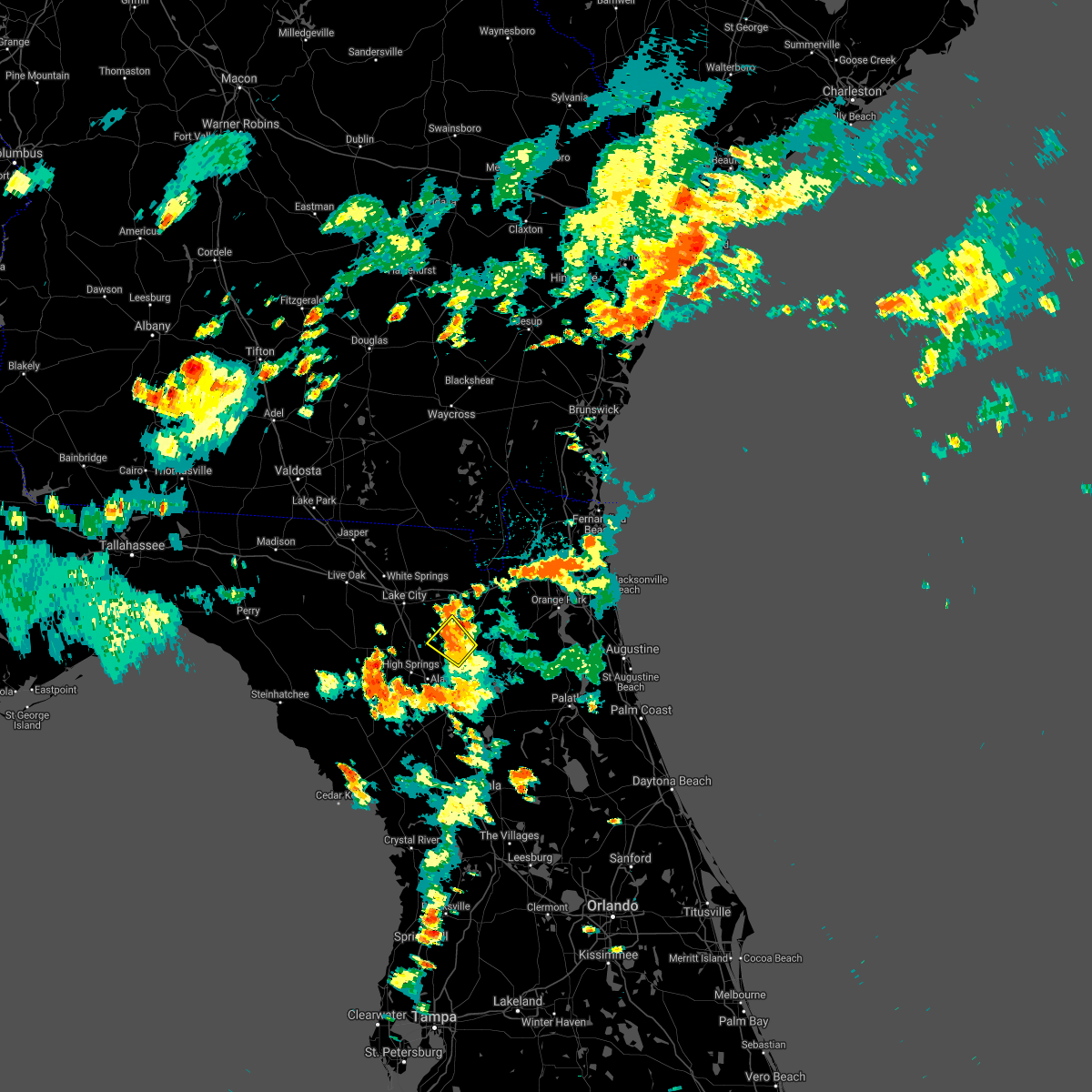 The severe thunderstorm warning for west central bradford and central union counties will expire at 445 pm edt, the storms which prompted the warning have weakened below severe limits, and no longer pose an immediate threat to life or property. therefore the warning will be allowed to expire. however heavy rain is still possible with these thunderstorms. The severe thunderstorm warning for west central bradford and central union counties will expire at 445 pm edt, the storms which prompted the warning have weakened below severe limits, and no longer pose an immediate threat to life or property. therefore the warning will be allowed to expire. however heavy rain is still possible with these thunderstorms.
|
| 8/9/2017 4:30 PM EDT | Central dispatch reported a tree down on a powerline on south county road 231 near sw 69th trai in union county FL, 2.7 miles NNE of Lake Butler, FL |
| 8/9/2017 4:29 PM EDT |
 At 429 pm edt, severe thunderstorms were located along a line extending from near lake butler to near new river, moving north at 15 mph (radar indicated). Hazards include 60 mph wind gusts. Expect damage to roofs, siding, and trees. Locations impacted include, lake butler, worthington springs, groves, new river, beasley, brooker and dukes. At 429 pm edt, severe thunderstorms were located along a line extending from near lake butler to near new river, moving north at 15 mph (radar indicated). Hazards include 60 mph wind gusts. Expect damage to roofs, siding, and trees. Locations impacted include, lake butler, worthington springs, groves, new river, beasley, brooker and dukes.
|
| 8/9/2017 4:09 PM EDT |
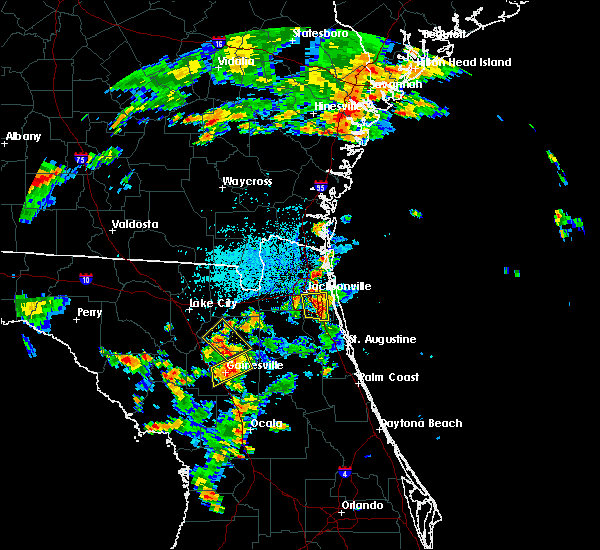 At 409 pm edt, severe thunderstorms were located along a line extending from near worthington springs to near sampson, moving northeast at 15 mph (radar indicated). Hazards include 60 mph wind gusts. expect damage to roofs, siding, and trees At 409 pm edt, severe thunderstorms were located along a line extending from near worthington springs to near sampson, moving northeast at 15 mph (radar indicated). Hazards include 60 mph wind gusts. expect damage to roofs, siding, and trees
|
| 7/21/2017 2:25 PM EDT |
 At 225 pm edt, a severe thunderstorm was located over intercession city, moving northeast at 10 mph (radar indicated). Hazards include 60 mph wind gusts and quarter size hail. Hail damage to vehicles is expected. expect wind damage to roofs, siding, and trees. Locations impacted include, kissimmee, bay lake, celebration, intercession city and buena ventura lakes. At 225 pm edt, a severe thunderstorm was located over intercession city, moving northeast at 10 mph (radar indicated). Hazards include 60 mph wind gusts and quarter size hail. Hail damage to vehicles is expected. expect wind damage to roofs, siding, and trees. Locations impacted include, kissimmee, bay lake, celebration, intercession city and buena ventura lakes.
|
| 7/21/2017 2:12 PM EDT |
 At 212 pm edt, a severe thunderstorm was located near champions gate, or near intercession city, moving northeast at 15 mph (radar indicated). Hazards include 60 mph wind gusts and quarter size hail. Hail damage to vehicles is expected. Expect wind damage to roofs, siding, and trees. At 212 pm edt, a severe thunderstorm was located near champions gate, or near intercession city, moving northeast at 15 mph (radar indicated). Hazards include 60 mph wind gusts and quarter size hail. Hail damage to vehicles is expected. Expect wind damage to roofs, siding, and trees.
|
| 7/20/2017 8:35 PM EDT |
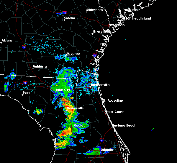 At 834 pm edt, a severe thunderstorm was located near new river, or 7 miles southeast of lake butler, and is nearly stationary (radar indicated). Hazards include 60 mph wind gusts and quarter size hail. Hail damage to vehicles is expected. Expect wind damage to roofs, siding, and trees. At 834 pm edt, a severe thunderstorm was located near new river, or 7 miles southeast of lake butler, and is nearly stationary (radar indicated). Hazards include 60 mph wind gusts and quarter size hail. Hail damage to vehicles is expected. Expect wind damage to roofs, siding, and trees.
|
| 7/16/2017 4:52 PM EDT |
 The severe thunderstorm warning for west central bradford, southwestern baker, union and east central columbia counties will expire at 500 pm edt, the storm which prompted the warning has weakened below severe limits, and no longer poses an immediate threat to life or property. therefore the warning will be allowed to expire. however gusty winds and heavy rain are still possible with this thunderstorm. The severe thunderstorm warning for west central bradford, southwestern baker, union and east central columbia counties will expire at 500 pm edt, the storm which prompted the warning has weakened below severe limits, and no longer poses an immediate threat to life or property. therefore the warning will be allowed to expire. however gusty winds and heavy rain are still possible with this thunderstorm.
|
| 7/16/2017 4:30 PM EDT |
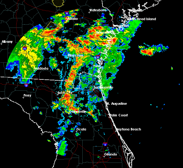 At 429 pm edt, a severe thunderstorm was located near groves, or near lake butler, moving northeast at 15 mph (radar indicated). Hazards include 60 mph wind gusts and penny size hail. Expect damage to roofs, siding, and trees. Locations impacted include, lake butler, raiford, worthington springs, palestine community, groves, olustee, new river, beasley, lulu and brooker. At 429 pm edt, a severe thunderstorm was located near groves, or near lake butler, moving northeast at 15 mph (radar indicated). Hazards include 60 mph wind gusts and penny size hail. Expect damage to roofs, siding, and trees. Locations impacted include, lake butler, raiford, worthington springs, palestine community, groves, olustee, new river, beasley, lulu and brooker.
|
| 7/16/2017 4:17 PM EDT |
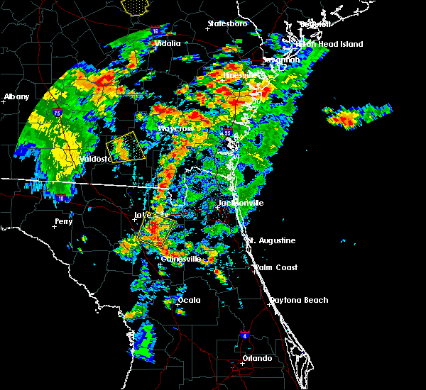 At 417 pm edt, a severe thunderstorm was located over groves, or near worthington spring, moving northeast at 15 mph (radar indicated). Hazards include 60 mph wind gusts and penny size hail. expect damage to roofs, siding, and trees At 417 pm edt, a severe thunderstorm was located over groves, or near worthington spring, moving northeast at 15 mph (radar indicated). Hazards include 60 mph wind gusts and penny size hail. expect damage to roofs, siding, and trees
|
| 6/30/2017 5:43 PM EDT |
 At 542 pm edt, a severe thunderstorm was located over bay lake, moving northwest at 5 mph (radar indicated). Hazards include 60 mph wind gusts and quarter size hail. Hail damage to vehicles is expected. expect wind damage to roofs, siding, and trees. Locations impacted include, winter garden, windermere, bay lake, oakland and bay hill. At 542 pm edt, a severe thunderstorm was located over bay lake, moving northwest at 5 mph (radar indicated). Hazards include 60 mph wind gusts and quarter size hail. Hail damage to vehicles is expected. expect wind damage to roofs, siding, and trees. Locations impacted include, winter garden, windermere, bay lake, oakland and bay hill.
|
| 6/30/2017 5:21 PM EDT |
 At 521 pm edt, a severe thunderstorm was located over celebration, moving northwest at 5 mph (radar indicated). Hazards include 60 mph wind gusts and quarter size hail. Hail damage to vehicles is expected. Expect wind damage to roofs, siding, and trees. At 521 pm edt, a severe thunderstorm was located over celebration, moving northwest at 5 mph (radar indicated). Hazards include 60 mph wind gusts and quarter size hail. Hail damage to vehicles is expected. Expect wind damage to roofs, siding, and trees.
|
| 5/24/2017 3:48 PM EDT |
 At 347 pm edt, severe thunderstorms were located along a line extending from near lake apopka to near oak ridge to near west lake toho, moving northeast at 45 mph (radar indicated). Hazards include 60 mph wind gusts. expect damage to roofs, siding, and trees At 347 pm edt, severe thunderstorms were located along a line extending from near lake apopka to near oak ridge to near west lake toho, moving northeast at 45 mph (radar indicated). Hazards include 60 mph wind gusts. expect damage to roofs, siding, and trees
|
| 5/24/2017 3:28 PM EDT |
 At 328 pm edt, a severe thunderstorm was located over four corners, or near celebration, moving northeast at 55 mph (radar indicated). Hazards include 60 mph wind gusts. expect damage to roofs, siding, and trees At 328 pm edt, a severe thunderstorm was located over four corners, or near celebration, moving northeast at 55 mph (radar indicated). Hazards include 60 mph wind gusts. expect damage to roofs, siding, and trees
|
| 4/4/2017 2:07 AM EDT |
 The severe thunderstorm warning for west central bradford, union and southern columbia counties will expire at 215 am edt, the storm which prompted the warning has weakened below severe limits, and no longer poses an immediate threat to life or property. therefore the warning will be allowed to expire. however small hail is still possible with this thunderstorm. to report severe weather, contact your nearest law enforcement agency. they will relay your report to the national weather service jacksonville. The severe thunderstorm warning for west central bradford, union and southern columbia counties will expire at 215 am edt, the storm which prompted the warning has weakened below severe limits, and no longer poses an immediate threat to life or property. therefore the warning will be allowed to expire. however small hail is still possible with this thunderstorm. to report severe weather, contact your nearest law enforcement agency. they will relay your report to the national weather service jacksonville.
|
| 4/4/2017 1:34 AM EDT |
 At 134 am edt, a severe thunderstorm was located near columbia, or 8 miles south of lake city, moving east at 25 mph (radar indicated). Hazards include 60 mph wind gusts and quarter size hail. Hail damage to vehicles is expected. Expect wind damage to roofs, siding, and trees. At 134 am edt, a severe thunderstorm was located near columbia, or 8 miles south of lake city, moving east at 25 mph (radar indicated). Hazards include 60 mph wind gusts and quarter size hail. Hail damage to vehicles is expected. Expect wind damage to roofs, siding, and trees.
|
| 2/7/2017 9:52 PM EST |
 The severe thunderstorm warning for southeastern columbia, union, western alachua, west central bradford, southwestern baker and southern gilchrist counties will expire at 1000 pm est, the storm which prompted the warning has exited the warned area. therefore the warning will be allowed to expire. however gusty winds are still possible with this thunderstorm. a severe thunderstorm watch remains in effect until midnight est for northeastern and northern florida. to report severe weather, contact your nearest law enforcement agency. they will relay your report to the national weather service jacksonville. The severe thunderstorm warning for southeastern columbia, union, western alachua, west central bradford, southwestern baker and southern gilchrist counties will expire at 1000 pm est, the storm which prompted the warning has exited the warned area. therefore the warning will be allowed to expire. however gusty winds are still possible with this thunderstorm. a severe thunderstorm watch remains in effect until midnight est for northeastern and northern florida. to report severe weather, contact your nearest law enforcement agency. they will relay your report to the national weather service jacksonville.
|
| 2/7/2017 9:39 PM EST |
 At 938 pm est, a severe thunderstorm was located near obrien, or 9 miles northwest of ichetucknee spring, moving east at 55 mph (radar indicated). Hazards include 60 mph wind gusts and nickel size hail. Expect damage to roofs, siding, and trees. Locations impacted include, trenton, lake butler, worthington spring, alachua, high springs, archer, worthington springs, groves, sanderson and upland pines. At 938 pm est, a severe thunderstorm was located near obrien, or 9 miles northwest of ichetucknee spring, moving east at 55 mph (radar indicated). Hazards include 60 mph wind gusts and nickel size hail. Expect damage to roofs, siding, and trees. Locations impacted include, trenton, lake butler, worthington spring, alachua, high springs, archer, worthington springs, groves, sanderson and upland pines.
|
| 2/7/2017 9:38 PM EST | Multiple trees and power lines were blown down. damage to powerlines and some structure in union county FL, 0.3 miles S of Lake Butler, FL |
| 2/7/2017 9:19 PM EST |
 At 918 pm est, a severe thunderstorm was located near columbia, or near lake city, moving east at 45 mph (radar indicated). Hazards include 60 mph wind gusts and quarter size hail. Hail damage to vehicles is expected. Expect wind damage to roofs, siding, and trees. At 918 pm est, a severe thunderstorm was located near columbia, or near lake city, moving east at 45 mph (radar indicated). Hazards include 60 mph wind gusts and quarter size hail. Hail damage to vehicles is expected. Expect wind damage to roofs, siding, and trees.
|
| 1/22/2017 7:00 PM EST |
 At 658 pm est, severe thunderstorms were located over bay hill, near bay lake, and near maitland, moving east at 55 mph (radar indicated). Hazards include 70 mph wind gusts and quarter size hail. Hail damage to vehicles is expected. expect considerable tree damage. Wind damage is also likely to mobile homes, roofs, and outbuildings. At 658 pm est, severe thunderstorms were located over bay hill, near bay lake, and near maitland, moving east at 55 mph (radar indicated). Hazards include 70 mph wind gusts and quarter size hail. Hail damage to vehicles is expected. expect considerable tree damage. Wind damage is also likely to mobile homes, roofs, and outbuildings.
|
| 1/22/2017 6:32 PM EST |
 At 631 pm est, severe thunderstorms were located along a line extending from 6 miles west of ratliff to cross creek, moving northeast at 70 mph (radar indicated). Hazards include 60 mph wind gusts and quarter size hail. Hail damage to vehicles is expected. expect wind damage to roofs, siding, and trees. locations impacted include, jacksonville, gainesville, saint augustine, fernandina beach, palatka, orange park, green cove springs, starke, lake butler and interlachen. A tornado watch remains in effect until 800 pm est for northeastern and northern florida, and southeastern georgia. At 631 pm est, severe thunderstorms were located along a line extending from 6 miles west of ratliff to cross creek, moving northeast at 70 mph (radar indicated). Hazards include 60 mph wind gusts and quarter size hail. Hail damage to vehicles is expected. expect wind damage to roofs, siding, and trees. locations impacted include, jacksonville, gainesville, saint augustine, fernandina beach, palatka, orange park, green cove springs, starke, lake butler and interlachen. A tornado watch remains in effect until 800 pm est for northeastern and northern florida, and southeastern georgia.
|
| 1/22/2017 6:17 PM EST |
 At 617 pm est, severe thunderstorms were located along a line extending from 8 miles north of macclenny to near williston, moving northeast at 70 mph (radar indicated). Hazards include 60 mph wind gusts and quarter size hail. Hail damage to vehicles is expected. expect wind damage to roofs, siding, and trees. locations impacted include, jacksonville, gainesville, saint augustine, fernandina beach, palatka, orange park, green cove springs, starke, lake butler and interlachen. A tornado watch remains in effect until 800 pm est for northeastern and northern florida, and southeastern georgia. At 617 pm est, severe thunderstorms were located along a line extending from 8 miles north of macclenny to near williston, moving northeast at 70 mph (radar indicated). Hazards include 60 mph wind gusts and quarter size hail. Hail damage to vehicles is expected. expect wind damage to roofs, siding, and trees. locations impacted include, jacksonville, gainesville, saint augustine, fernandina beach, palatka, orange park, green cove springs, starke, lake butler and interlachen. A tornado watch remains in effect until 800 pm est for northeastern and northern florida, and southeastern georgia.
|
| 1/22/2017 6:06 PM EST |
 At 605 pm est, severe thunderstorms were located along a line extending from near sanderson to near williston highlands, moving northeast at 70 mph (radar indicated). Hazards include 60 mph wind gusts and quarter size hail. Hail damage to vehicles is expected. Expect wind damage to roofs, siding, and trees. At 605 pm est, severe thunderstorms were located along a line extending from near sanderson to near williston highlands, moving northeast at 70 mph (radar indicated). Hazards include 60 mph wind gusts and quarter size hail. Hail damage to vehicles is expected. Expect wind damage to roofs, siding, and trees.
|
| 1/3/2017 9:02 AM EST |
 At 902 am est, a severe thunderstorm was located over beasley, or near lake butler, moving east at 35 mph (radar indicated). Hazards include 60 mph wind gusts. Expect damage to roofs, siding, and trees. Locations impacted include, starke, lake butler, raiford, new river, sampson, beasley, brooker, johnstown and dukes. At 902 am est, a severe thunderstorm was located over beasley, or near lake butler, moving east at 35 mph (radar indicated). Hazards include 60 mph wind gusts. Expect damage to roofs, siding, and trees. Locations impacted include, starke, lake butler, raiford, new river, sampson, beasley, brooker, johnstown and dukes.
|
| 1/3/2017 8:52 AM EST |
 At 852 am est, a severe thunderstorm was located over worthington springs, or near worthington spring, moving east at 35 mph (radar indicated). Hazards include 60 mph wind gusts. Expect damage to roofs, siding, and trees. Locations impacted include, starke, lake butler, raiford, worthington spring, worthington springs, groves, beasley, new river, sampson and la crosse. At 852 am est, a severe thunderstorm was located over worthington springs, or near worthington spring, moving east at 35 mph (radar indicated). Hazards include 60 mph wind gusts. Expect damage to roofs, siding, and trees. Locations impacted include, starke, lake butler, raiford, worthington spring, worthington springs, groves, beasley, new river, sampson and la crosse.
|
| 1/3/2017 8:43 AM EST |
 At 843 am est, a severe thunderstorm was located over worthington springs, or over worthington spring, moving east at 30 mph (radar indicated). Hazards include 60 mph wind gusts. expect damage to roofs, siding, and trees At 843 am est, a severe thunderstorm was located over worthington springs, or over worthington spring, moving east at 30 mph (radar indicated). Hazards include 60 mph wind gusts. expect damage to roofs, siding, and trees
|
| 9/1/2016 9:25 PM EDT |
 At 922 pm edt, a severe thunderstorm capable of producing a tornado was located over wekiwa springs state park, or over apopka, moving north at 45 to 50 mph (radar indicated rotation). Hazards include tornado. Flying debris will be dangerous to those caught without shelter. mobile homes will be damaged or destroyed. damage to roofs, windows, and vehicles will occur. tree damage is likely. this tornadic thunderstorm will remain over areas of western orange and southwestern seminole counties, including the following locations: eatonville. another circulation was forming near doctor phillips and was moving north. A new warning may be needed. At 922 pm edt, a severe thunderstorm capable of producing a tornado was located over wekiwa springs state park, or over apopka, moving north at 45 to 50 mph (radar indicated rotation). Hazards include tornado. Flying debris will be dangerous to those caught without shelter. mobile homes will be damaged or destroyed. damage to roofs, windows, and vehicles will occur. tree damage is likely. this tornadic thunderstorm will remain over areas of western orange and southwestern seminole counties, including the following locations: eatonville. another circulation was forming near doctor phillips and was moving north. A new warning may be needed.
|
| 9/1/2016 9:02 PM EDT |
 At 902 pm edt, a severe thunderstorm capable of producing a tornado was located over windermere, moving north at 35 mph (radar indicated rotation). Hazards include tornado. Flying debris will be dangerous to those caught without shelter. mobile homes will be damaged or destroyed. damage to roofs, windows, and vehicles will occur. tree damage is likely. this dangerous storm will be near, ocoee and winter garden around 910 pm edt. apopka, zellwood and wekiwa springs state park around 930 pm edt. Other locations impacted by this tornadic thunderstorm include eatonville. At 902 pm edt, a severe thunderstorm capable of producing a tornado was located over windermere, moving north at 35 mph (radar indicated rotation). Hazards include tornado. Flying debris will be dangerous to those caught without shelter. mobile homes will be damaged or destroyed. damage to roofs, windows, and vehicles will occur. tree damage is likely. this dangerous storm will be near, ocoee and winter garden around 910 pm edt. apopka, zellwood and wekiwa springs state park around 930 pm edt. Other locations impacted by this tornadic thunderstorm include eatonville.
|
| 9/1/2016 8:44 PM EDT |
 At 843 pm edt, a severe thunderstorm capable of producing a tornado was located over oakland, approaching winter garden, moving north at 30 mph to 35 mph (radar indicated strengthening rotation). Hazards include tornado. Flying debris will be dangerous to those caught without shelter. mobile homes will be damaged or destroyed. damage to roofs, windows, and vehicles will occur. tree damage is likely. this dangerous storm will be near, ocoee and winter garden around 850 pm edt. lake apopka around 900 pm edt. Other locations impacted by this tornadic thunderstorm include montverde. At 843 pm edt, a severe thunderstorm capable of producing a tornado was located over oakland, approaching winter garden, moving north at 30 mph to 35 mph (radar indicated strengthening rotation). Hazards include tornado. Flying debris will be dangerous to those caught without shelter. mobile homes will be damaged or destroyed. damage to roofs, windows, and vehicles will occur. tree damage is likely. this dangerous storm will be near, ocoee and winter garden around 850 pm edt. lake apopka around 900 pm edt. Other locations impacted by this tornadic thunderstorm include montverde.
|
| 9/1/2016 8:34 PM EDT |
 At 833 pm edt, a severe thunderstorm capable of producing a tornado was located near horizon west, or 7 miles northwest of bay lake, moving north at 30 mph (radar indicated rotation). Hazards include tornado. Flying debris will be dangerous to those caught without shelter. mobile homes will be damaged or destroyed. damage to roofs, windows, and vehicles will occur. tree damage is likely. this dangerous storm will be near, clermont and oakland around 850 pm edt. ferndale and lake apopka around 900 pm edt. Other locations impacted by this tornadic thunderstorm include astatula. At 833 pm edt, a severe thunderstorm capable of producing a tornado was located near horizon west, or 7 miles northwest of bay lake, moving north at 30 mph (radar indicated rotation). Hazards include tornado. Flying debris will be dangerous to those caught without shelter. mobile homes will be damaged or destroyed. damage to roofs, windows, and vehicles will occur. tree damage is likely. this dangerous storm will be near, clermont and oakland around 850 pm edt. ferndale and lake apopka around 900 pm edt. Other locations impacted by this tornadic thunderstorm include astatula.
|
| 9/1/2016 3:25 PM EDT |
 The severe thunderstorm warning for southwestern orange and south central lake counties will expire at 330 pm edt, the storm which prompted the warning has weakened below severe limits, and no longer pose an immediate threat to life or property. therefore, the warning will be allowed to expire. a tornado watch remains in effect until 1100 pm edt for east central florida. The severe thunderstorm warning for southwestern orange and south central lake counties will expire at 330 pm edt, the storm which prompted the warning has weakened below severe limits, and no longer pose an immediate threat to life or property. therefore, the warning will be allowed to expire. a tornado watch remains in effect until 1100 pm edt for east central florida.
|
| 9/1/2016 3:05 PM EDT |
 At 305 pm edt, a severe thunderstorm was located over bay lake, moving north at 45 mph (radar indicated). Hazards include 60 mph wind gusts. Expect damage to roofs. siding. And trees. At 305 pm edt, a severe thunderstorm was located over bay lake, moving north at 45 mph (radar indicated). Hazards include 60 mph wind gusts. Expect damage to roofs. siding. And trees.
|
| 7/31/2016 7:05 PM EDT |
 The severe thunderstorm warning for northeastern union and southwestern baker counties will expire at 715 pm edt, the storm which prompted the warning has weakened below severe limits, and no longer pose an immediate threat to life or property. therefore, the warning will be allowed to expire. however gusty winds and heavy rain are still possible with this thunderstorm. to report severe weather, contact your nearest law enforcement agency. they will relay your report to the national weather service jacksonville. The severe thunderstorm warning for northeastern union and southwestern baker counties will expire at 715 pm edt, the storm which prompted the warning has weakened below severe limits, and no longer pose an immediate threat to life or property. therefore, the warning will be allowed to expire. however gusty winds and heavy rain are still possible with this thunderstorm. to report severe weather, contact your nearest law enforcement agency. they will relay your report to the national weather service jacksonville.
|
| 7/31/2016 6:48 PM EDT |
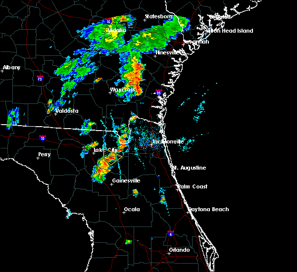 At 647 pm edt, a severe thunderstorm was located near olustee, or 9 miles north of lake butler, moving northeast at 15 mph (radar indicated). Hazards include 60 mph wind gusts. Expect damage to roofs. siding. and trees. Locations impacted include, lake butler, olustee and ellerbee. At 647 pm edt, a severe thunderstorm was located near olustee, or 9 miles north of lake butler, moving northeast at 15 mph (radar indicated). Hazards include 60 mph wind gusts. Expect damage to roofs. siding. and trees. Locations impacted include, lake butler, olustee and ellerbee.
|
| 7/31/2016 6:38 PM EDT |
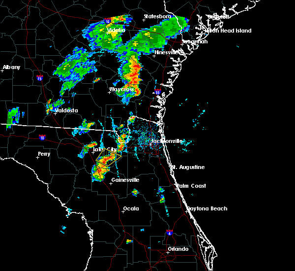 At 638 pm edt, a severe thunderstorm was located near olustee, or 9 miles northwest of lake butler, moving northeast at 20 mph (radar indicated). Hazards include 60 mph wind gusts. Expect damage to roofs. siding. and trees. Locations impacted include, lake butler, palestine community, lulu, groves, olustee and ellerbee. At 638 pm edt, a severe thunderstorm was located near olustee, or 9 miles northwest of lake butler, moving northeast at 20 mph (radar indicated). Hazards include 60 mph wind gusts. Expect damage to roofs. siding. and trees. Locations impacted include, lake butler, palestine community, lulu, groves, olustee and ellerbee.
|
| 7/31/2016 6:26 PM EDT |
 At 626 pm edt, a severe thunderstorm was located over palestine community, or near lake butler, moving northeast at 15 mph (radar indicated). Hazards include 60 mph wind gusts and penny size hail. Expect damage to roofs. siding. And trees. At 626 pm edt, a severe thunderstorm was located over palestine community, or near lake butler, moving northeast at 15 mph (radar indicated). Hazards include 60 mph wind gusts and penny size hail. Expect damage to roofs. siding. And trees.
|
| 7/29/2016 3:02 PM EDT |
 At 301 pm edt, a severe thunderstorm was located near lake louisa, or 8 miles west of bay lake, moving northeast at 5 mph (radar indicated). Hazards include 60 mph wind gusts and penny size hail. Expect damage to roofs. siding. And trees. At 301 pm edt, a severe thunderstorm was located near lake louisa, or 8 miles west of bay lake, moving northeast at 5 mph (radar indicated). Hazards include 60 mph wind gusts and penny size hail. Expect damage to roofs. siding. And trees.
|
| 7/18/2016 4:33 PM EDT |
 At 433 pm edt, a severe thunderstorm was located near orlando international airport, moving west at 20 mph (trained weather spotters). Hazards include 60 mph wind gusts. Expect damage to roofs. siding. And trees. At 433 pm edt, a severe thunderstorm was located near orlando international airport, moving west at 20 mph (trained weather spotters). Hazards include 60 mph wind gusts. Expect damage to roofs. siding. And trees.
|
| 7/16/2016 4:41 PM EDT |
 The severe thunderstorm warning for southeastern columbia and western union counties will expire at 445 pm edt, the storm which prompted the warning has moved out of the area. therefore, the warning will be allowed to expire. however heavy rain is still possible with this thunderstorm. The severe thunderstorm warning for southeastern columbia and western union counties will expire at 445 pm edt, the storm which prompted the warning has moved out of the area. therefore, the warning will be allowed to expire. however heavy rain is still possible with this thunderstorm.
|
| 7/16/2016 4:18 PM EDT | Dispatch reported powerlines down on sw 8th stree in union county FL, 0.3 miles S of Lake Butler, FL |
| 7/16/2016 4:11 PM EDT | Spotter reported tree and powerlines downed off of nw 107th trail. timing estimated by rada in union county FL, 3.1 miles ESE of Lake Butler, FL |
| 7/16/2016 4:11 PM EDT |
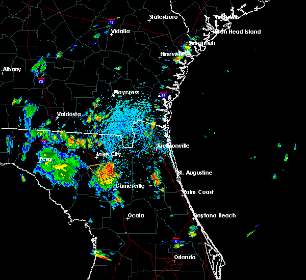 At 410 pm edt, a severe thunderstorm was located over groves, or near lake butler, moving north at 15 mph (radar indicated). Hazards include 60 mph wind gusts and nickel size hail. Expect damage to roofs. siding. and trees. Locations impacted include, lake butler, worthington spring, worthington springs, palestine community, groves, upland pines, providence, lulu and dukes. At 410 pm edt, a severe thunderstorm was located over groves, or near lake butler, moving north at 15 mph (radar indicated). Hazards include 60 mph wind gusts and nickel size hail. Expect damage to roofs. siding. and trees. Locations impacted include, lake butler, worthington spring, worthington springs, palestine community, groves, upland pines, providence, lulu and dukes.
|
| 7/16/2016 4:06 PM EDT | Dispatch reported a tree and powerlines downed on north county road 23 in union county FL, 3.3 miles NNE of Lake Butler, FL |
| 7/16/2016 4:00 PM EDT | Dispatch reported a tree down off of sw 102nd av in union county FL, 8.8 miles NE of Lake Butler, FL |
| 7/16/2016 3:57 PM EDT |
 At 357 pm edt, a severe thunderstorm was located over upland pines, or near worthington spring, moving north at 15 mph (radar indicated). Hazards include 60 mph wind gusts and nickel size hail. Expect damage to roofs. siding. And trees. At 357 pm edt, a severe thunderstorm was located over upland pines, or near worthington spring, moving north at 15 mph (radar indicated). Hazards include 60 mph wind gusts and nickel size hail. Expect damage to roofs. siding. And trees.
|
| 7/15/2016 4:00 PM EDT |
 At 400 pm edt, a severe thunderstorm was located over sampson, or near starke, moving northwest at 5 mph (radar indicated). Hazards include 70 mph wind gusts and penny size hail. Expect considerable tree damage. damage is likely to mobile homes, roofs, and outbuildings. Locations impacted include, starke, lake butler, raiford, new river, sampson, beasley, lawtey, hampton, johnstown and ellerbee. At 400 pm edt, a severe thunderstorm was located over sampson, or near starke, moving northwest at 5 mph (radar indicated). Hazards include 70 mph wind gusts and penny size hail. Expect considerable tree damage. damage is likely to mobile homes, roofs, and outbuildings. Locations impacted include, starke, lake butler, raiford, new river, sampson, beasley, lawtey, hampton, johnstown and ellerbee.
|
| 7/15/2016 3:48 PM EDT |
 At 348 pm edt, a severe thunderstorm was located over sampson, or near starke, moving north at 10 mph (radar indicated). Hazards include 60 mph wind gusts and penny size hail. Expect damage to roofs. siding. And trees. At 348 pm edt, a severe thunderstorm was located over sampson, or near starke, moving north at 10 mph (radar indicated). Hazards include 60 mph wind gusts and penny size hail. Expect damage to roofs. siding. And trees.
|
| 7/13/2016 7:50 PM EDT | The emergency manager reported trees and powerlines down near county road 231 south of lake butler. the time given was based on rada in union county FL, 4.7 miles NNE of Lake Butler, FL |
| 7/12/2016 4:53 PM EDT |
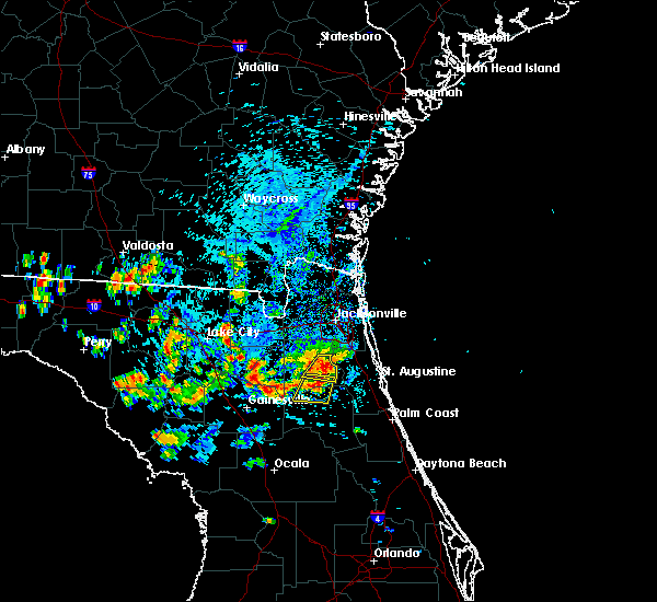 At 453 pm edt, a severe thunderstorm was located over sampson, or 8 miles southeast of lake butler, moving northeast at 10 mph (radar indicated). Hazards include 60 mph wind gusts and quarter size hail. Hail damage to vehicles is expected. Expect wind damage to roofs, siding, and trees. At 453 pm edt, a severe thunderstorm was located over sampson, or 8 miles southeast of lake butler, moving northeast at 10 mph (radar indicated). Hazards include 60 mph wind gusts and quarter size hail. Hail damage to vehicles is expected. Expect wind damage to roofs, siding, and trees.
|
| 6/1/2016 8:21 PM EDT |
 The severe thunderstorm warning for southwestern orange and northwestern osceola counties will expire at 830 pm edt, the storm which prompted the warning has weakened below severe limits, and no longer pose an immediate threat to life or property. therefore the warning will be allowed to expire. The severe thunderstorm warning for southwestern orange and northwestern osceola counties will expire at 830 pm edt, the storm which prompted the warning has weakened below severe limits, and no longer pose an immediate threat to life or property. therefore the warning will be allowed to expire.
|
| 6/1/2016 8:12 PM EDT |
 At 810 pm edt, a severe thunderstorm was located over intercession city, moving southwest at 10 mph (public reported wind damage at 5820 irlo bronson memorial highway in celebration). Hazards include 60 mph wind gusts and quarter size hail. Hail damage to vehicles is expected. expect wind damage to roofs, siding, and trees. Locations impacted include, orlando, kissimmee, bay lake, buena ventura lakes and intercession city. At 810 pm edt, a severe thunderstorm was located over intercession city, moving southwest at 10 mph (public reported wind damage at 5820 irlo bronson memorial highway in celebration). Hazards include 60 mph wind gusts and quarter size hail. Hail damage to vehicles is expected. expect wind damage to roofs, siding, and trees. Locations impacted include, orlando, kissimmee, bay lake, buena ventura lakes and intercession city.
|
| 6/1/2016 7:52 PM EDT |
 At 750 pm edt, a severe thunderstorm was located over hunters creek, or near kissimmee, moving southwest at 10 mph (public reported nickle size hail in the vicinity of sea world). Hazards include 60 mph wind gusts and quarter size hail. Hail damage to vehicles is expected. expect wind damage to roofs, siding, and trees. Locations impacted include, orlando, kissimmee, bay lake, buena ventura lakes and intercession city. At 750 pm edt, a severe thunderstorm was located over hunters creek, or near kissimmee, moving southwest at 10 mph (public reported nickle size hail in the vicinity of sea world). Hazards include 60 mph wind gusts and quarter size hail. Hail damage to vehicles is expected. expect wind damage to roofs, siding, and trees. Locations impacted include, orlando, kissimmee, bay lake, buena ventura lakes and intercession city.
|
| 6/1/2016 7:27 PM EDT |
 At 727 pm edt, a severe thunderstorm was located over hunters creek, or near oak ridge, moving southwest at 10 mph (radar indicated). Hazards include 60 mph wind gusts and quarter size hail. Hail damage to vehicles is expected. Expect wind damage to roofs, siding, and trees. At 727 pm edt, a severe thunderstorm was located over hunters creek, or near oak ridge, moving southwest at 10 mph (radar indicated). Hazards include 60 mph wind gusts and quarter size hail. Hail damage to vehicles is expected. Expect wind damage to roofs, siding, and trees.
|
| 5/20/2016 11:25 AM EDT | 911 call center reports large tree down near county road 241 and state road 238. time estimate in union county FL, 10.2 miles E of Lake Butler, FL |
| 5/4/2016 6:22 AM EDT |
 At 622 am edt, a severe thunderstorm was located over universal studios, or near windermere, moving east at 30 mph (radar indicated). Hazards include 60 mph wind gusts and quarter size hail. Hail damage to vehicles is expected. expect wind damage to roofs, siding, and trees. Locations impacted include, orlando, ocoee, winter park, windermere and orlando international airport. At 622 am edt, a severe thunderstorm was located over universal studios, or near windermere, moving east at 30 mph (radar indicated). Hazards include 60 mph wind gusts and quarter size hail. Hail damage to vehicles is expected. expect wind damage to roofs, siding, and trees. Locations impacted include, orlando, ocoee, winter park, windermere and orlando international airport.
|
| 5/4/2016 6:11 AM EDT |
 At 610 am edt, a severe thunderstorm was located over horizon west, or near windermere, moving east at 25 mph (radar indicated). Hazards include 60 mph wind gusts and quarter size hail. Hail damage to vehicles is expected. expect wind damage to roofs, siding, and trees. Locations impacted include, orlando, ocoee, winter garden, winter park and windermere. At 610 am edt, a severe thunderstorm was located over horizon west, or near windermere, moving east at 25 mph (radar indicated). Hazards include 60 mph wind gusts and quarter size hail. Hail damage to vehicles is expected. expect wind damage to roofs, siding, and trees. Locations impacted include, orlando, ocoee, winter garden, winter park and windermere.
|
| 5/4/2016 5:52 AM EDT |
 At 552 am edt, a severe thunderstorm was located near lake louisa, or 7 miles southwest of winter garden, moving east at 30 mph (radar indicated). Hazards include 60 mph wind gusts and quarter size hail. Hail damage to vehicles is expected. Expect wind damage to roofs, siding, and trees. At 552 am edt, a severe thunderstorm was located near lake louisa, or 7 miles southwest of winter garden, moving east at 30 mph (radar indicated). Hazards include 60 mph wind gusts and quarter size hail. Hail damage to vehicles is expected. Expect wind damage to roofs, siding, and trees.
|
| 4/2/2016 9:21 AM EDT |
 At 921 am edt, a severe thunderstorm was located over new river, or near raiford, moving east at 65 mph (radar indicated). Hazards include 60 mph wind gusts and quarter size hail. Hail damage to vehicles is expected. Expect wind damage to roofs, siding, and trees. At 921 am edt, a severe thunderstorm was located over new river, or near raiford, moving east at 65 mph (radar indicated). Hazards include 60 mph wind gusts and quarter size hail. Hail damage to vehicles is expected. Expect wind damage to roofs, siding, and trees.
|
| 2/24/2016 7:09 AM EST |
 At 709 am est, a severe thunderstorm was located near worthington spring, moving northeast at 55 mph (radar indicated). Hazards include 60 mph wind gusts. Expect damage to roofs. Siding and trees. At 709 am est, a severe thunderstorm was located near worthington spring, moving northeast at 55 mph (radar indicated). Hazards include 60 mph wind gusts. Expect damage to roofs. Siding and trees.
|
| 1/15/2016 11:52 AM EST |
 The severe thunderstorm warning for orange, seminole and northwestern osceola counties will expire at 1200 pm est, the storm which prompted the warning has moved out of the area. therefore the warning will be allowed to expire. however gusty winds are still possible this afternoon. to report severe weather, contact your nearest law enforcement agency. they will relay your report to the national weather service melbourne. The severe thunderstorm warning for orange, seminole and northwestern osceola counties will expire at 1200 pm est, the storm which prompted the warning has moved out of the area. therefore the warning will be allowed to expire. however gusty winds are still possible this afternoon. to report severe weather, contact your nearest law enforcement agency. they will relay your report to the national weather service melbourne.
|
| 1/15/2016 10:54 AM EST |
 At 1053 am est, a severe thunderstorm was located near horizon west, moving east at 30 mph (radar indicated). Hazards include 60 mph wind gusts. Expect damage to roofs. Siding and trees. At 1053 am est, a severe thunderstorm was located near horizon west, moving east at 30 mph (radar indicated). Hazards include 60 mph wind gusts. Expect damage to roofs. Siding and trees.
|
| 8/17/2015 4:17 PM EDT |
 At 417 pm edt, doppler radar indicated a severe thunderstorm capable of producing damaging winds in excess of 60 mph. this storm was located over palestine community, or 7 miles northwest of lake butler, and moving north at 10 mph. At 417 pm edt, doppler radar indicated a severe thunderstorm capable of producing damaging winds in excess of 60 mph. this storm was located over palestine community, or 7 miles northwest of lake butler, and moving north at 10 mph.
|
| 8/7/2015 8:09 PM EDT |
 The severe thunderstorm warning for union, southeastern hamilton, northeastern suwannee and central columbia counties will expire at 815 pm edt, the storm which prompted the warning has weakened below severe limits, and no longer poses an immediate threat to life or property. therefore the warning will be allowed to expire. however gusty winds are still possible with this thunderstorm. The severe thunderstorm warning for union, southeastern hamilton, northeastern suwannee and central columbia counties will expire at 815 pm edt, the storm which prompted the warning has weakened below severe limits, and no longer poses an immediate threat to life or property. therefore the warning will be allowed to expire. however gusty winds are still possible with this thunderstorm.
|
| 8/7/2015 7:47 PM EDT |
 At 747 pm edt, doppler radar indicated a severe thunderstorm capable of producing damaging winds in excess of 60 mph. this storm was located near live oak, and moving southeast at 40 mph. At 747 pm edt, doppler radar indicated a severe thunderstorm capable of producing damaging winds in excess of 60 mph. this storm was located near live oak, and moving southeast at 40 mph.
|
| 8/7/2015 6:01 PM EDT |
 At 600 pm edt, doppler radar indicated a line of severe thunderstorms capable of producing damaging winds in excess of 60 mph. these storms were located along a line extending from near maxville to near alachua, moving southeast at 30 mph. locations impacted include, gainesville, starke, lake butler, keystone heights, raiford, middleburg, worthington spring, melrose, alachua, high springs, hawthorne, worthington springs, george`s lake, groves, lake geneva, upland pines, kingsley, university of florida, camp blanding and orange heights. At 600 pm edt, doppler radar indicated a line of severe thunderstorms capable of producing damaging winds in excess of 60 mph. these storms were located along a line extending from near maxville to near alachua, moving southeast at 30 mph. locations impacted include, gainesville, starke, lake butler, keystone heights, raiford, middleburg, worthington spring, melrose, alachua, high springs, hawthorne, worthington springs, george`s lake, groves, lake geneva, upland pines, kingsley, university of florida, camp blanding and orange heights.
|
| 8/7/2015 5:56 PM EDT | The severe thunderstorm warning for union, northern bradford, southern baker and central columbia counties will expire at 600 pm edt, the storms which prompted the warning have moved out of the area. therefore the warning will be allowed to expire. however gusty winds are still possible with these thunderstorms. remember, a severe thunderstorm warning still remains in effect for portions of union and bradford counties. |
| 8/7/2015 5:55 PM EDT | Trees were blown down along sw 73rd way. the time of damage was based on rada in union county FL, 2.5 miles NNE of Lake Butler, FL |
| 8/7/2015 5:55 PM EDT | Trees were blown down along sw 73ed way. the time of damage was based on rada in union county FL, 2.5 miles NNE of Lake Butler, FL |
| 8/7/2015 5:42 PM EDT |
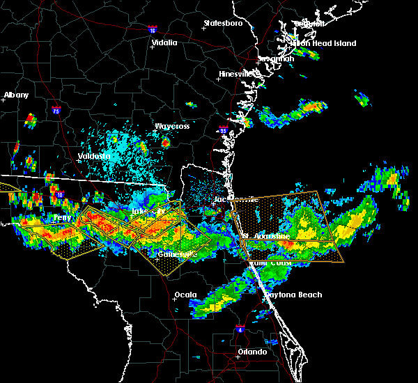 At 541 pm edt, doppler radar indicated a line of severe thunderstorms capable of producing damaging winds in excess of 60 mph. these storms were located along a line extending from near st. george to near macclenny to sanderson, moving east at 35 mph. locations impacted include, lake butler, raiford, columbia, macclenny, glen st. mary, sanderson, groves, beasley, palestine community, lulu, olustee, johnstown, ellerbee and dukes. At 541 pm edt, doppler radar indicated a line of severe thunderstorms capable of producing damaging winds in excess of 60 mph. these storms were located along a line extending from near st. george to near macclenny to sanderson, moving east at 35 mph. locations impacted include, lake butler, raiford, columbia, macclenny, glen st. mary, sanderson, groves, beasley, palestine community, lulu, olustee, johnstown, ellerbee and dukes.
|
| 8/7/2015 5:39 PM EDT |
 At 539 pm edt, doppler radar indicated a line of severe thunderstorms capable of producing damaging winds in excess of 60 mph. these storms were located along a line extending from near glen st. mary to near upland pines, and moving southeast at 30 mph. At 539 pm edt, doppler radar indicated a line of severe thunderstorms capable of producing damaging winds in excess of 60 mph. these storms were located along a line extending from near glen st. mary to near upland pines, and moving southeast at 30 mph.
|
| 8/7/2015 5:34 PM EDT |
 At 533 pm edt, doppler radar indicated a line of severe thunderstorms capable of producing damaging winds in excess of 60 mph. these storms were located along a line extending from 9 miles northwest of st. george to 6 miles north of macclenny to near sanderson, moving east at 35 mph. locations impacted include, lake city, lake butler, raiford, columbia, taylor, macclenny, glen st. mary, sanderson, groves, beasley, palestine community, st. george, watertown, lulu, olustee, johnstown, ellerbee and dukes. At 533 pm edt, doppler radar indicated a line of severe thunderstorms capable of producing damaging winds in excess of 60 mph. these storms were located along a line extending from 9 miles northwest of st. george to 6 miles north of macclenny to near sanderson, moving east at 35 mph. locations impacted include, lake city, lake butler, raiford, columbia, taylor, macclenny, glen st. mary, sanderson, groves, beasley, palestine community, st. george, watertown, lulu, olustee, johnstown, ellerbee and dukes.
|
| 8/7/2015 5:04 PM EDT |
 At 504 pm edt, doppler radar indicated a line of severe thunderstorms capable of producing damaging winds in excess of 60 mph. these storms were located along a line extending from 8 miles southeast of fargo to 8 miles west of taylor to near winfield, and moving east at 35 mph. At 504 pm edt, doppler radar indicated a line of severe thunderstorms capable of producing damaging winds in excess of 60 mph. these storms were located along a line extending from 8 miles southeast of fargo to 8 miles west of taylor to near winfield, and moving east at 35 mph.
|
| 8/7/2015 3:43 PM EDT |
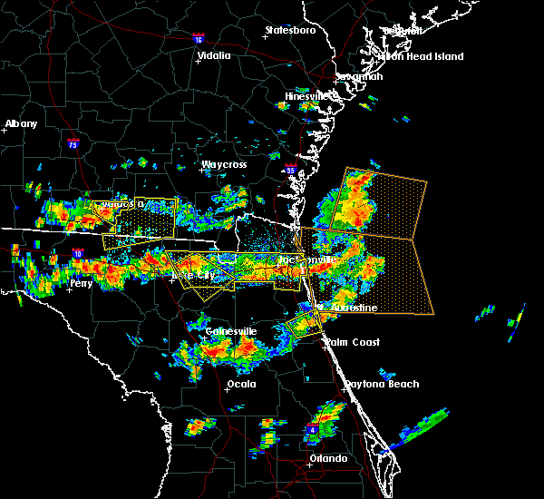 At 343 pm edt, doppler radar indicated a severe thunderstorm capable of producing damaging winds in excess of 60 mph. this storm was located near olustee, or 14 miles east of lake city, and moving southeast at 45 mph. nickel size hail may also accompany the damaging winds. At 343 pm edt, doppler radar indicated a severe thunderstorm capable of producing damaging winds in excess of 60 mph. this storm was located near olustee, or 14 miles east of lake city, and moving southeast at 45 mph. nickel size hail may also accompany the damaging winds.
|
| 8/7/2015 3:14 PM EDT |
 At 314 pm edt, doppler radar indicated a line of severe thunderstorms capable of producing damaging winds in excess of 60 mph. these storms were located along a line extending from near neptune beach to 6 miles northeast of macclenny to near glen st. mary, and moving southeast at 35 mph. At 314 pm edt, doppler radar indicated a line of severe thunderstorms capable of producing damaging winds in excess of 60 mph. these storms were located along a line extending from near neptune beach to 6 miles northeast of macclenny to near glen st. mary, and moving southeast at 35 mph.
|
| 7/5/2015 5:47 PM EDT |
 At 543 pm edt, doppler radar continued to indicate strong to severe thunderstorms capable of producing quarter size hail and damaging winds in excess of 60 mph. these storms were located near ocoee and windermere, moving east at 10 mph. penny-sized hail was reported by the public around 535 pm edt in vicinity of ocoee. other locations impacted include, apopka, winter garden, bay lake, and places near the attractions area. At 543 pm edt, doppler radar continued to indicate strong to severe thunderstorms capable of producing quarter size hail and damaging winds in excess of 60 mph. these storms were located near ocoee and windermere, moving east at 10 mph. penny-sized hail was reported by the public around 535 pm edt in vicinity of ocoee. other locations impacted include, apopka, winter garden, bay lake, and places near the attractions area.
|
| 7/5/2015 5:24 PM EDT |
 At 522 pm edt, doppler radar indicated severe thunderstorms capable of producing quarter size hail and damaging winds in excess of 60 mph. these storms were located near apopka and zellwood, and moving east at 10 mph. * other locations impacted include, ocoee, winter garden, windermere, bay lake, .and places near the attractions area. At 522 pm edt, doppler radar indicated severe thunderstorms capable of producing quarter size hail and damaging winds in excess of 60 mph. these storms were located near apopka and zellwood, and moving east at 10 mph. * other locations impacted include, ocoee, winter garden, windermere, bay lake, .and places near the attractions area.
|
| 7/3/2015 7:34 PM EDT |
 At 732 pm edt, doppler radar indicated a severe thunderstorm capable of producing quarter size hail and damaging winds in excess of 60 mph. this cluster of storms was located near lake louisa, clermont and minneola. storm movement is erratic due to merge of various cells. there does appear to be growth of this activity from near clermont northward. locations impacted include, winter garden, windermere, bay lake, clermont and oakland. At 732 pm edt, doppler radar indicated a severe thunderstorm capable of producing quarter size hail and damaging winds in excess of 60 mph. this cluster of storms was located near lake louisa, clermont and minneola. storm movement is erratic due to merge of various cells. there does appear to be growth of this activity from near clermont northward. locations impacted include, winter garden, windermere, bay lake, clermont and oakland.
|
| 7/3/2015 7:10 PM EDT |
 At 710 pm edt, doppler radar indicated a severe thunderstorm capable of producing damaging winds in excess of 60 mph. this storm was located near horizon west, or near winter garden, and moving west at 5 mph. nickel size hail may also accompany the damaging winds. At 710 pm edt, doppler radar indicated a severe thunderstorm capable of producing damaging winds in excess of 60 mph. this storm was located near horizon west, or near winter garden, and moving west at 5 mph. nickel size hail may also accompany the damaging winds.
|
| 6/12/2015 3:02 PM EDT |
 At 302 pm edt, doppler radar indicated a severe thunderstorm capable of producing damaging winds in excess of 60 mph. this storm was located near sea world, or near oak ridge, and moving northwest at 15 mph. At 302 pm edt, doppler radar indicated a severe thunderstorm capable of producing damaging winds in excess of 60 mph. this storm was located near sea world, or near oak ridge, and moving northwest at 15 mph.
|
| 6/1/2015 6:38 PM EDT | The severe thunderstorm warning for southern lake, southwestern orange and northwestern osceola counties will expire at 645 pm edt, the storm which prompted the warning has weakened below severe limits, and no longer poses an immediate threat to life or property. therefore the warning will be allowed to expire. however gusty winds and heavy rain are still possible with this thunderstorm. |
| 6/1/2015 6:08 PM EDT | At 607 pm edt, doppler radar indicated a severe thunderstorm capable of producing quarter size hail and damaging winds in excess of 60 mph. this storm was located over horizon west, or near windermere, and moving southeast at 20 mph. |
| 6/1/2015 5:49 PM EDT | At 548 pm edt, doppler radar indicated a severe thunderstorm capable of producing large hail up to ping pong ball size and damaging winds in excess of 60 mph. this storm was located over oakland, or near winter garden, moving south at 10 mph. quarter sized hail was reported with this storm in oakland around 540 pm. locations impacted include, oakland, clermont, winter garden, windermere and bay lake. |
| 6/1/2015 5:36 PM EDT | At 536 pm edt, doppler radar indicated a severe thunderstorm capable of producing quarter size hail and damaging winds in excess of 60 mph. this storm was located near worthington spring, moving northeast at 10 mph. locations impacted include, lake butler, worthington spring, worthington springs, la crosse, brooker and dukes. |
| 6/1/2015 5:32 PM EDT | At 531 pm edt, doppler radar indicated a severe thunderstorm capable of producing quarter size hail and damaging winds in excess of 60 mph. this storm was located over oakland, or near winter garden, and moving southeast at 10 mph. |
| 6/1/2015 5:16 PM EDT | At 516 pm edt, doppler radar indicated a severe thunderstorm capable of producing quarter size hail and damaging winds in excess of 60 mph. this storm was located near alachua, or near worthington spring, and moving northeast at 10 mph. |
| 6/1/2015 4:42 PM EDT | At 441 pm edt, doppler radar indicated a severe thunderstorm capable of producing quarter size hail and damaging winds in excess of 60 mph. this storm was located over lockhart, moving southwest at 15 mph. quarter sized was reported with this storm in wekiva springs at 420 pm. locations impacted include, orlando, apopka, clarcona, altamonte springs, plymouth, ocoee and winter garden. |
| 6/1/2015 4:16 PM EDT | At 415 pm edt, doppler radar indicated a severe thunderstorm capable of producing quarter size hail and damaging winds in excess of 60 mph. this storm was located near longwood. this storm was drifting southwest. |
| 4/20/2015 3:30 PM EDT | At 309 pm edt, doppler radar indicated a severe thunderstorm capable of producing quarter size hail and damaging winds in excess of 60 mph. this storm was located over clermont, or near groveland, and moving northeast at 45 mph. |
| 4/20/2015 3:10 PM EDT | At 309 pm edt, doppler radar indicated a severe thunderstorm capable of producing quarter size hail and damaging winds in excess of 60 mph. this storm was located over clermont, or near groveland, and moving northeast at 45 mph. |
| 5/25/2014 6:10 PM EDT | Quarter sized hail reported 5.2 miles NE of Lake Butler, FL, state watch office reported quarter size hail. |
| 7/31/2013 4:10 PM EDT | A few tree limbs reported down relayed through ema offic in union county FL, 8.7 miles ESE of Lake Butler, FL |
| 7/16/2012 7:00 PM EDT | Roof torn off large outbuilding. trampoline carried deep into adjacemt wooded area. trees down within one quarter mile of outbuildin in union county FL, 4.9 miles ENE of Lake Butler, FL |
| 1/1/0001 12:00 AM | Central dispatch reported a large tree down and blocking both lanes of se county road 23 in union county FL, 3.2 miles WNW of Lake Butler, FL |
| 1/1/0001 12:00 AM | Central dispatch reported a tree down at nw 2nd street in lake butle in union county FL, 0.3 miles S of Lake Butler, FL |
| 1/1/0001 12:00 AM | A tree and powerline reported down by the highway patrol. time of event based on rada in union county FL, 9.3 miles ESE of Lake Butler, FL |
| 1/1/0001 12:00 AM | Golf Ball sized hail reported 7.6 miles NE of Lake Butler, FL |
| 1/1/0001 12:00 AM | Golf Ball sized hail reported 5.7 miles ENE of Lake Butler, FL |
Hail Maps for Lake Butler, FL
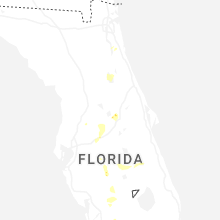
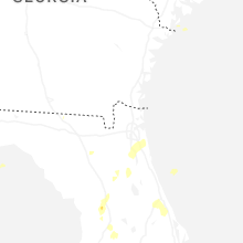


Connect with Interactive Hail Maps