

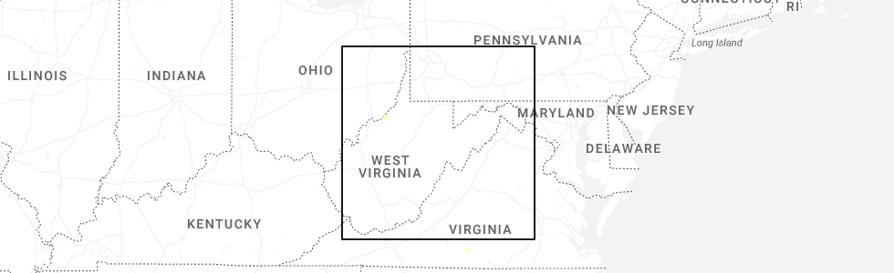
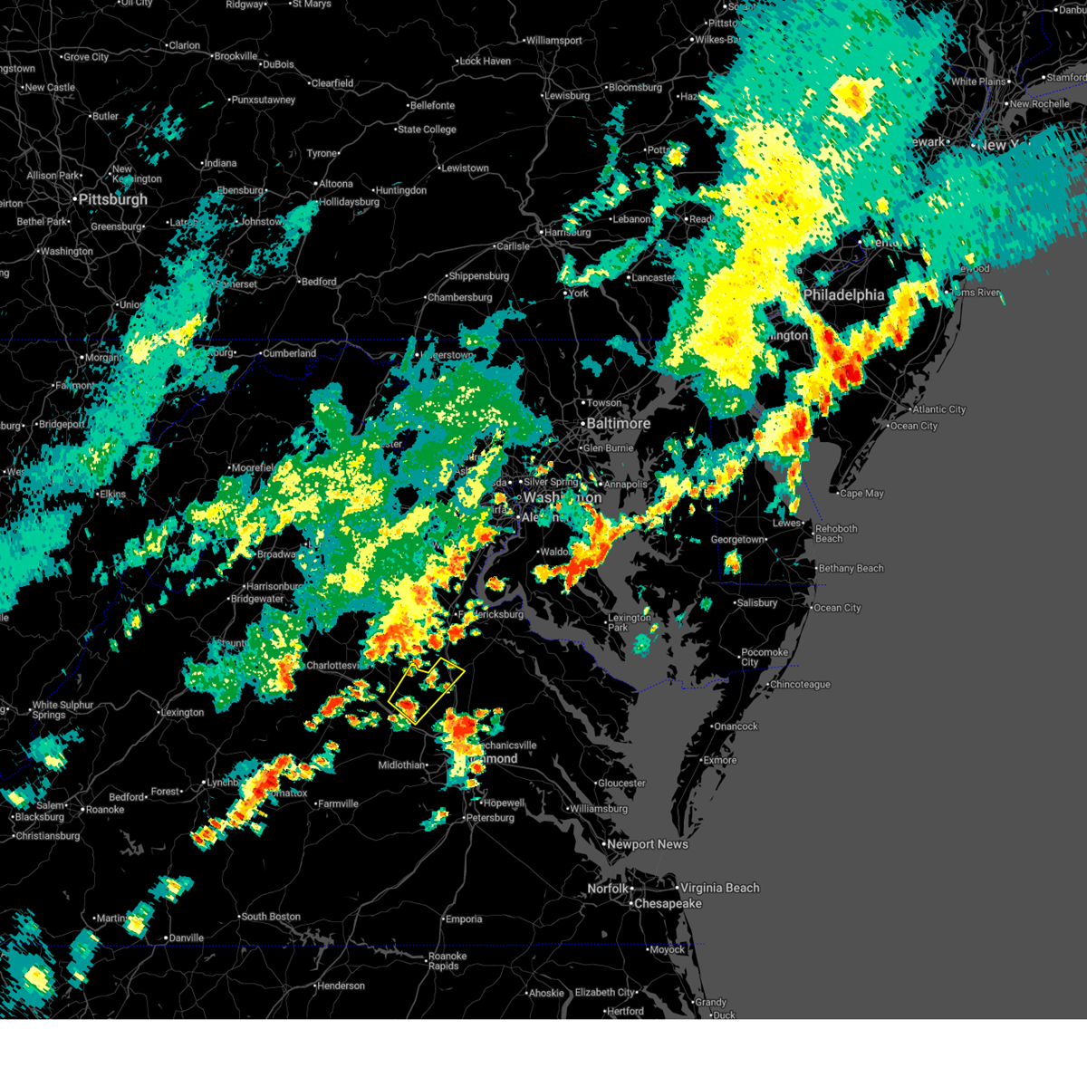
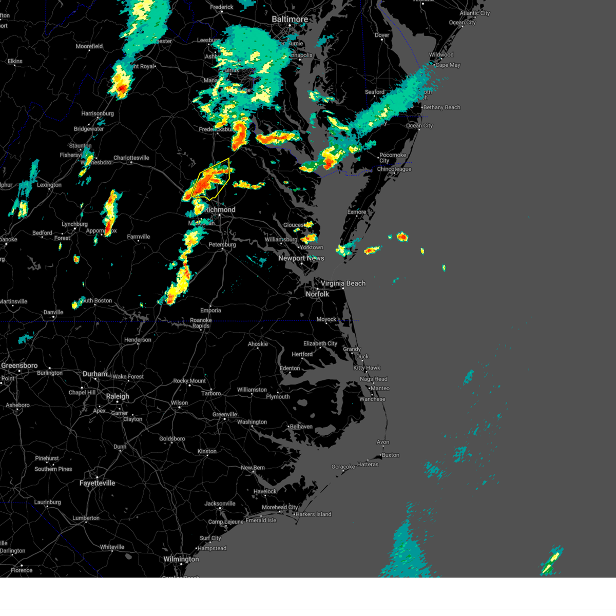
Hail Map for Lake Caroline, VA
The Lake Caroline, VA area has had 0 reports of on-the-ground hail by trained spotters, and has been under severe weather warnings 22 times during the past 12 months. Doppler radar has detected hail at or near Lake Caroline, VA on 39 occasions, including 1 occasion during the past year.
| Name: | Lake Caroline, VA |
| Where Located: | 33.9 miles NNE of Richmond, VA |
| Map: | Google Map for Lake Caroline, VA |
| Population: | 2260 |
| Housing Units: | 1035 |
| More Info: | Search Google for Lake Caroline, VA |
0
The Top Recent Hail Date for Lake Caroline, VA is Saturday, June 14, 2025 (34th out of 39)
Hail and Wind Damage Spotted near Lake Caroline, VA
| Date / Time | Report Details |
|---|---|
| 7/1/2025 8:23 PM EDT |
 At 823 pm edt, severe thunderstorms were located along a line extending from near milford to glen allen to moseley, moving east at 25 mph (radar indicated). Hazards include 60 mph wind gusts. Expect damage to trees and powerlines. these severe storms will be near, richmond, university of richmond, mechanicsville, tuckahoe, bon air, hanover, laurel, lakeside, east highland park, and dawn around 830 pm edt. virginia union university, downtown richmond, and virginia commonwealth university around 835 pm edt. beulahville and studley around 840 pm edt. highland springs and newtown around 845 pm edt. bensley around 850 pm edt. manquin and bellwood around 855 pm edt. Other locations impacted by these severe thunderstorms include gum tree, etna mills, montrose, chamberlayne, fine creek mills, atlee, ashcake, holly hills, duane fork, and genito. At 823 pm edt, severe thunderstorms were located along a line extending from near milford to glen allen to moseley, moving east at 25 mph (radar indicated). Hazards include 60 mph wind gusts. Expect damage to trees and powerlines. these severe storms will be near, richmond, university of richmond, mechanicsville, tuckahoe, bon air, hanover, laurel, lakeside, east highland park, and dawn around 830 pm edt. virginia union university, downtown richmond, and virginia commonwealth university around 835 pm edt. beulahville and studley around 840 pm edt. highland springs and newtown around 845 pm edt. bensley around 850 pm edt. manquin and bellwood around 855 pm edt. Other locations impacted by these severe thunderstorms include gum tree, etna mills, montrose, chamberlayne, fine creek mills, atlee, ashcake, holly hills, duane fork, and genito.
|
| 7/1/2025 7:59 PM EDT |
 Svrakq the national weather service in wakefield has issued a * severe thunderstorm warning for, the city of richmond in central virginia, northwestern chesterfield county in central virginia, northwestern king and queen county in east central virginia, southeastern goochland county in central virginia, henrico county in central virginia, southern caroline county in north central virginia, hanover county in central virginia, northwestern king william county in east central virginia, northwestern amelia county in central virginia, powhatan county in central virginia, northwestern essex county in east central virginia, * until 845 pm edt. * at 758 pm edt, severe thunderstorms were located along a line extending from near ladysmith to near manakin to near chula, moving east at 25 mph (radar indicated). Hazards include 60 mph wind gusts. Expect damage to trees and powerlines. severe thunderstorms will be near, ashland, tuckahoe, wyndham, and manakin around 805 pm edt. moseley, randolph macon college, laurel, kings dominion, and glen allen around 810 pm edt. richmond, bon air, and lakeside around 815 pm edt. university of richmond, hanover, and dawn around 820 pm edt. mechanicsville around 825 pm edt. east highland park and mangohick around 830 pm edt. Other locations impacted by these severe thunderstorms include gum tree, etna mills, montrose, chamberlayne, fine creek mills, atlee, ashcake, holly hills, duane fork, and genito. Svrakq the national weather service in wakefield has issued a * severe thunderstorm warning for, the city of richmond in central virginia, northwestern chesterfield county in central virginia, northwestern king and queen county in east central virginia, southeastern goochland county in central virginia, henrico county in central virginia, southern caroline county in north central virginia, hanover county in central virginia, northwestern king william county in east central virginia, northwestern amelia county in central virginia, powhatan county in central virginia, northwestern essex county in east central virginia, * until 845 pm edt. * at 758 pm edt, severe thunderstorms were located along a line extending from near ladysmith to near manakin to near chula, moving east at 25 mph (radar indicated). Hazards include 60 mph wind gusts. Expect damage to trees and powerlines. severe thunderstorms will be near, ashland, tuckahoe, wyndham, and manakin around 805 pm edt. moseley, randolph macon college, laurel, kings dominion, and glen allen around 810 pm edt. richmond, bon air, and lakeside around 815 pm edt. university of richmond, hanover, and dawn around 820 pm edt. mechanicsville around 825 pm edt. east highland park and mangohick around 830 pm edt. Other locations impacted by these severe thunderstorms include gum tree, etna mills, montrose, chamberlayne, fine creek mills, atlee, ashcake, holly hills, duane fork, and genito.
|
| 7/1/2025 7:14 PM EDT |
 The storm which prompted the warning has weakened below severe limits, and no longer poses an immediate threat to life or property. therefore, the warning will be allowed to expire. however, gusty winds are still possible with this thunderstorm. a severe thunderstorm watch remains in effect until 900 pm edt for central and north central virginia. The storm which prompted the warning has weakened below severe limits, and no longer poses an immediate threat to life or property. therefore, the warning will be allowed to expire. however, gusty winds are still possible with this thunderstorm. a severe thunderstorm watch remains in effect until 900 pm edt for central and north central virginia.
|
| 7/1/2025 7:07 PM EDT | At 707 pm edt, a severe thunderstorm was located 7 miles north of gum spring, or 8 miles northeast of hadensville, moving east at 35 mph (radar indicated). Hazards include 60 mph wind gusts. Expect damage to trees and powerlines. Locations impacted include, bumpass, chilesburg, beaverdam, cedar fork, coatesville, hewlett, ruther glen, locust creek, noel, mabelton, and orchid. |
| 7/1/2025 6:37 PM EDT | At 637 pm edt, a severe thunderstorm was located near montpelier, or 13 miles northwest of randolph macon college, moving northeast at 30 mph (radar indicated). Hazards include 60 mph wind gusts. Expect damage to trees and powerlines. This severe thunderstorm will remain over mainly rural areas of southeastern louisa, west central caroline and northwestern hanover counties, including the following locations, chilesburg, golansville, vontay, coatesville, hewlett, mabelton, noel, dabneys, beaverdam, and cedar fork. |
| 7/1/2025 6:27 PM EDT |
 Svrakq the national weather service in wakefield has issued a * severe thunderstorm warning for, southeastern louisa county in central virginia, west central caroline county in north central virginia, northwestern hanover county in central virginia, * until 715 pm edt. * at 627 pm edt, a severe thunderstorm was located near montpelier, or 12 miles east of hadensville, moving northeast at 30 mph (radar indicated). Hazards include 60 mph wind gusts. Expect damage to trees and powerlines. this severe thunderstorm will be near, bumpass around 640 pm edt. ladysmith around 700 pm edt. Other locations impacted by this severe thunderstorm include chilesburg, golansville, vontay, coatesville, hewlett, mabelton, noel, beaverdam, cedar fork, and ruther glen. Svrakq the national weather service in wakefield has issued a * severe thunderstorm warning for, southeastern louisa county in central virginia, west central caroline county in north central virginia, northwestern hanover county in central virginia, * until 715 pm edt. * at 627 pm edt, a severe thunderstorm was located near montpelier, or 12 miles east of hadensville, moving northeast at 30 mph (radar indicated). Hazards include 60 mph wind gusts. Expect damage to trees and powerlines. this severe thunderstorm will be near, bumpass around 640 pm edt. ladysmith around 700 pm edt. Other locations impacted by this severe thunderstorm include chilesburg, golansville, vontay, coatesville, hewlett, mabelton, noel, beaverdam, cedar fork, and ruther glen.
|
| 6/15/2025 5:37 PM EDT | Large limb down blocking a portion of telegraph road. time estimated from rada in caroline county VA, 4 miles NW of Lake Caroline, VA |
| 6/14/2025 11:41 PM EDT |
 Svrakq the national weather service in wakefield has issued a * severe thunderstorm warning for, central caroline county in north central virginia, northwestern essex county in east central virginia, * until 1230 am edt. * at 1140 pm edt, severe thunderstorms were located along a line extending from fort walker to bowling green to near ladysmith, moving east at 15 mph (radar indicated). Hazards include 60 mph wind gusts and quarter size hail. Minor damage to vehicles is possible. Expect wind damage to trees and powerlines. Svrakq the national weather service in wakefield has issued a * severe thunderstorm warning for, central caroline county in north central virginia, northwestern essex county in east central virginia, * until 1230 am edt. * at 1140 pm edt, severe thunderstorms were located along a line extending from fort walker to bowling green to near ladysmith, moving east at 15 mph (radar indicated). Hazards include 60 mph wind gusts and quarter size hail. Minor damage to vehicles is possible. Expect wind damage to trees and powerlines.
|
| 6/14/2025 11:13 PM EDT |
 At 1112 pm edt, severe thunderstorms were located along a line extending from near massaponax to 6 miles north of ladysmith to 6 miles north of bumpass, moving east at 15 mph (radar indicated). Hazards include 60 mph wind gusts. Expect damage to trees and powerlines. Locations impacted include, bowling green, milford, port royal, fort walker, ladysmith, rappahannock academy, golansville, villboro, guinea, corbin, penola, nancy wrights corner, ruther glen, woodford, and cedon. At 1112 pm edt, severe thunderstorms were located along a line extending from near massaponax to 6 miles north of ladysmith to 6 miles north of bumpass, moving east at 15 mph (radar indicated). Hazards include 60 mph wind gusts. Expect damage to trees and powerlines. Locations impacted include, bowling green, milford, port royal, fort walker, ladysmith, rappahannock academy, golansville, villboro, guinea, corbin, penola, nancy wrights corner, ruther glen, woodford, and cedon.
|
| 6/14/2025 10:58 PM EDT |
 Svrakq the national weather service in wakefield has issued a * severe thunderstorm warning for, caroline county in north central virginia, * until 1145 pm edt. * at 1057 pm edt, severe thunderstorms were located along a line extending from fredericksburg to massaponax to 9 miles northeast of mineral, moving southeast at 15 mph (radar indicated). Hazards include 60 mph wind gusts and penny size hail. expect damage to trees and powerlines Svrakq the national weather service in wakefield has issued a * severe thunderstorm warning for, caroline county in north central virginia, * until 1145 pm edt. * at 1057 pm edt, severe thunderstorms were located along a line extending from fredericksburg to massaponax to 9 miles northeast of mineral, moving southeast at 15 mph (radar indicated). Hazards include 60 mph wind gusts and penny size hail. expect damage to trees and powerlines
|
| 6/8/2025 8:08 PM EDT | Tree blocking roadway. radar estimated tim in hanover county VA, 10.1 miles NE of Lake Caroline, VA |
| 6/8/2025 7:55 PM EDT |
 Svrakq the national weather service in wakefield has issued a * severe thunderstorm warning for, southwestern caroline county in north central virginia, northwestern hanover county in central virginia, * until 830 pm edt. * at 755 pm edt, severe thunderstorms were located along a line extending from 7 miles south of ladysmith to near montpelier, moving east at 25 mph (radar indicated). Hazards include 60 mph wind gusts and penny size hail. expect damage to trees and powerlines Svrakq the national weather service in wakefield has issued a * severe thunderstorm warning for, southwestern caroline county in north central virginia, northwestern hanover county in central virginia, * until 830 pm edt. * at 755 pm edt, severe thunderstorms were located along a line extending from 7 miles south of ladysmith to near montpelier, moving east at 25 mph (radar indicated). Hazards include 60 mph wind gusts and penny size hail. expect damage to trees and powerlines
|
| 5/5/2025 9:58 AM EDT |
 The storm which prompted the warning has weakened below severe limits, and has exited the warned area. therefore, the warning will be allowed to expire. The storm which prompted the warning has weakened below severe limits, and has exited the warned area. therefore, the warning will be allowed to expire.
|
| 5/5/2025 9:37 AM EDT |
 At 937 am edt, a severe thunderstorm was located 7 miles northeast of montpelier, or 9 miles northwest of randolph macon college, moving northwest at 25 mph (radar indicated). Hazards include 60 mph wind gusts and quarter size hail. Minor damage to vehicles is possible. expect wind damage to trees and powerlines. Locations impacted include, gilman, beaverdam, oliver, cedar fork, coatesville, hewlett, doswell, ruther glen, and noel. At 937 am edt, a severe thunderstorm was located 7 miles northeast of montpelier, or 9 miles northwest of randolph macon college, moving northwest at 25 mph (radar indicated). Hazards include 60 mph wind gusts and quarter size hail. Minor damage to vehicles is possible. expect wind damage to trees and powerlines. Locations impacted include, gilman, beaverdam, oliver, cedar fork, coatesville, hewlett, doswell, ruther glen, and noel.
|
| 5/5/2025 9:21 AM EDT |
 At 920 am edt, a severe thunderstorm was located over randolph macon college, moving northwest at 25 mph (radar indicated). Hazards include 60 mph wind gusts and quarter size hail. Minor damage to vehicles is possible. expect wind damage to trees and powerlines. This severe thunderstorm will remain over mainly rural areas of southwestern caroline and northwestern hanover counties, including the following locations, golansville, gilman, beaverdam, oliver, gum tree, cedar fork, coatesville, hewlett, doswell, and ruther glen. At 920 am edt, a severe thunderstorm was located over randolph macon college, moving northwest at 25 mph (radar indicated). Hazards include 60 mph wind gusts and quarter size hail. Minor damage to vehicles is possible. expect wind damage to trees and powerlines. This severe thunderstorm will remain over mainly rural areas of southwestern caroline and northwestern hanover counties, including the following locations, golansville, gilman, beaverdam, oliver, gum tree, cedar fork, coatesville, hewlett, doswell, and ruther glen.
|
| 5/5/2025 9:21 AM EDT |
 the severe thunderstorm warning has been cancelled and is no longer in effect the severe thunderstorm warning has been cancelled and is no longer in effect
|
| 5/5/2025 9:08 AM EDT |
 Svrakq the national weather service in wakefield has issued a * severe thunderstorm warning for, northwestern henrico county in central virginia, southwestern caroline county in north central virginia, central hanover county in central virginia, northwestern king william county in east central virginia, * until 1000 am edt. * at 908 am edt, a severe thunderstorm was located over hanover, or near ashland, moving northwest at 25 mph (radar indicated). Hazards include 60 mph wind gusts and quarter size hail. Minor damage to vehicles is possible. expect wind damage to trees and powerlines. this severe thunderstorm will be near, ashland, randolph macon college, and kings dominion around 915 am edt. Other locations impacted by this severe thunderstorm include golansville, oliver, hanover airport, gum tree, coatesville, hewlett, doswell, elmont, noel, and gilman. Svrakq the national weather service in wakefield has issued a * severe thunderstorm warning for, northwestern henrico county in central virginia, southwestern caroline county in north central virginia, central hanover county in central virginia, northwestern king william county in east central virginia, * until 1000 am edt. * at 908 am edt, a severe thunderstorm was located over hanover, or near ashland, moving northwest at 25 mph (radar indicated). Hazards include 60 mph wind gusts and quarter size hail. Minor damage to vehicles is possible. expect wind damage to trees and powerlines. this severe thunderstorm will be near, ashland, randolph macon college, and kings dominion around 915 am edt. Other locations impacted by this severe thunderstorm include golansville, oliver, hanover airport, gum tree, coatesville, hewlett, doswell, elmont, noel, and gilman.
|
| 2/16/2025 10:20 AM EST | Down tree along rt 207 westboun in caroline county VA, 5 miles WNW of Lake Caroline, VA |
| 2/16/2025 10:18 AM EST |
 Svrakq the national weather service in wakefield has issued a * severe thunderstorm warning for, northwestern king and queen county in east central virginia, northwestern northumberland county in eastern virginia, northwestern richmond county in east central virginia, caroline county in north central virginia, westmoreland county in east central virginia, north central hanover county in central virginia, northwestern essex county in east central virginia, * until 1100 am est. * at 1017 am est, severe thunderstorms were located along a line extending from near massaponax to near ladysmith to near kings dominion, moving east at 60 mph (radar indicated). Hazards include 60 mph wind gusts. Expect damage to trees and powerlines. severe thunderstorms will be near, bowling green, port royal, and fort walker around 1025 am est. newtown and loretto around 1035 am est. champlain, leedstown, and colonial beach around 1040 am est. newland around 1045 am est. montross around 1050 am est. Other locations impacted by these severe thunderstorms include beazley, golansville, currioman landing, threeway, hustle, potomac beach, guinea, corbin, elevon, and supply. Svrakq the national weather service in wakefield has issued a * severe thunderstorm warning for, northwestern king and queen county in east central virginia, northwestern northumberland county in eastern virginia, northwestern richmond county in east central virginia, caroline county in north central virginia, westmoreland county in east central virginia, north central hanover county in central virginia, northwestern essex county in east central virginia, * until 1100 am est. * at 1017 am est, severe thunderstorms were located along a line extending from near massaponax to near ladysmith to near kings dominion, moving east at 60 mph (radar indicated). Hazards include 60 mph wind gusts. Expect damage to trees and powerlines. severe thunderstorms will be near, bowling green, port royal, and fort walker around 1025 am est. newtown and loretto around 1035 am est. champlain, leedstown, and colonial beach around 1040 am est. newland around 1045 am est. montross around 1050 am est. Other locations impacted by these severe thunderstorms include beazley, golansville, currioman landing, threeway, hustle, potomac beach, guinea, corbin, elevon, and supply.
|
| 8/29/2024 11:22 PM EDT |
 The storms which prompted the warning have weakened below severe limits, and no longer pose an immediate threat to life or property. therefore, the warning will be allowed to expire. however, gusty winds are still possible with these thunderstorms. The storms which prompted the warning have weakened below severe limits, and no longer pose an immediate threat to life or property. therefore, the warning will be allowed to expire. however, gusty winds are still possible with these thunderstorms.
|
| 8/29/2024 11:04 PM EDT |
 At 1104 pm edt, severe thunderstorms were located along a line extending from near ladysmith to near glen allen to powhatan, moving east at 15 mph (radar indicated). Hazards include 60 mph wind gusts. Expect damage to trees and powerlines. these severe storms will be near, ashland, randolph macon college, tuckahoe, laurel, lakeside, kings dominion, wyndham, manakin, sabot, and glen allen around 1110 pm edt. mechanicsville, hanover, and dawn around 1115 pm edt. Other locations impacted by these severe thunderstorms include chilesburg, golansville, crozier, gum tree, johnsons springs, elmont, penola, gilman, solomons store, and fine creek mills. At 1104 pm edt, severe thunderstorms were located along a line extending from near ladysmith to near glen allen to powhatan, moving east at 15 mph (radar indicated). Hazards include 60 mph wind gusts. Expect damage to trees and powerlines. these severe storms will be near, ashland, randolph macon college, tuckahoe, laurel, lakeside, kings dominion, wyndham, manakin, sabot, and glen allen around 1110 pm edt. mechanicsville, hanover, and dawn around 1115 pm edt. Other locations impacted by these severe thunderstorms include chilesburg, golansville, crozier, gum tree, johnsons springs, elmont, penola, gilman, solomons store, and fine creek mills.
|
| 8/29/2024 10:47 PM EDT |
 Svrakq the national weather service in wakefield has issued a * severe thunderstorm warning for, southeastern goochland county in central virginia, southwestern caroline county in north central virginia, northwestern henrico county in central virginia, hanover county in central virginia, powhatan county in central virginia, * until 1130 pm edt. * at 1046 pm edt, severe thunderstorms were located along a line extending from near ladysmith to near wyndham to near trenholm, moving east at 15 mph (radar indicated). Hazards include 60 mph wind gusts. Expect damage to trees and powerlines. severe thunderstorms will be near, powhatan, ashland, randolph macon college, tuckahoe, ladysmith, wyndham, sabot, and glen allen around 1050 pm edt. kings dominion and manakin around 1055 pm edt. laurel around 1100 pm edt. hanover, lakeside, and dawn around 1110 pm edt. mechanicsville around 1115 pm edt. Other locations impacted by these severe thunderstorms include chilesburg, golansville, crozier, rock castle, maidens, gum tree, johnsons springs, elmont, penola, and gilman. Svrakq the national weather service in wakefield has issued a * severe thunderstorm warning for, southeastern goochland county in central virginia, southwestern caroline county in north central virginia, northwestern henrico county in central virginia, hanover county in central virginia, powhatan county in central virginia, * until 1130 pm edt. * at 1046 pm edt, severe thunderstorms were located along a line extending from near ladysmith to near wyndham to near trenholm, moving east at 15 mph (radar indicated). Hazards include 60 mph wind gusts. Expect damage to trees and powerlines. severe thunderstorms will be near, powhatan, ashland, randolph macon college, tuckahoe, ladysmith, wyndham, sabot, and glen allen around 1050 pm edt. kings dominion and manakin around 1055 pm edt. laurel around 1100 pm edt. hanover, lakeside, and dawn around 1110 pm edt. mechanicsville around 1115 pm edt. Other locations impacted by these severe thunderstorms include chilesburg, golansville, crozier, rock castle, maidens, gum tree, johnsons springs, elmont, penola, and gilman.
|
| 8/8/2024 7:09 PM EDT |
 the tornado warning has been cancelled and is no longer in effect the tornado warning has been cancelled and is no longer in effect
|
| 8/8/2024 6:54 PM EDT |
 At 654 pm edt, a severe thunderstorm capable of producing a tornado was located near ladysmith, or 10 miles southwest of milford, moving northwest at 35 mph (radar indicated rotation). Hazards include tornado. Flying debris will be dangerous to those caught without shelter. mobile homes will be damaged or destroyed. damage to roofs, windows, and vehicles will occur. tree damage is likely. this dangerous storm will be near, ladysmith around 700 pm edt. Other locations impacted by this tornadic thunderstorm include chilesburg, golansville, beaverdam, nancy wrights corner, cedar fork, hewlett, ruther glen, and cedon. At 654 pm edt, a severe thunderstorm capable of producing a tornado was located near ladysmith, or 10 miles southwest of milford, moving northwest at 35 mph (radar indicated rotation). Hazards include tornado. Flying debris will be dangerous to those caught without shelter. mobile homes will be damaged or destroyed. damage to roofs, windows, and vehicles will occur. tree damage is likely. this dangerous storm will be near, ladysmith around 700 pm edt. Other locations impacted by this tornadic thunderstorm include chilesburg, golansville, beaverdam, nancy wrights corner, cedar fork, hewlett, ruther glen, and cedon.
|
| 8/8/2024 6:50 PM EDT | Dispatch reports several homes damaged and multiple trees down in the lake caroline subdivision and on cedar fork rd. possible tornad in caroline county VA, 0.8 miles ESE of Lake Caroline, VA |
| 8/8/2024 6:46 PM EDT |
 Torakq the national weather service in wakefield has issued a * tornado warning for, southwestern caroline county in north central virginia, north central hanover county in central virginia, * until 730 pm edt. * at 646 pm edt, a severe thunderstorm capable of producing a tornado was located near kings dominion, or 9 miles north of randolph macon college, moving northwest at 35 mph (radar indicated rotation). Hazards include tornado. Flying debris will be dangerous to those caught without shelter. mobile homes will be damaged or destroyed. damage to roofs, windows, and vehicles will occur. tree damage is likely. this dangerous storm will be near, ladysmith around 655 pm edt. Other locations impacted by this tornadic thunderstorm include chilesburg, golansville, beaverdam, oliver, burruss corner, nancy wrights corner, cedar fork, hewlett, doswell, and ruther glen. Torakq the national weather service in wakefield has issued a * tornado warning for, southwestern caroline county in north central virginia, north central hanover county in central virginia, * until 730 pm edt. * at 646 pm edt, a severe thunderstorm capable of producing a tornado was located near kings dominion, or 9 miles north of randolph macon college, moving northwest at 35 mph (radar indicated rotation). Hazards include tornado. Flying debris will be dangerous to those caught without shelter. mobile homes will be damaged or destroyed. damage to roofs, windows, and vehicles will occur. tree damage is likely. this dangerous storm will be near, ladysmith around 655 pm edt. Other locations impacted by this tornadic thunderstorm include chilesburg, golansville, beaverdam, oliver, burruss corner, nancy wrights corner, cedar fork, hewlett, doswell, and ruther glen.
|
| 6/30/2024 7:20 PM EDT | Trees down on route 1 near the border with hanover count in caroline county VA, 6.6 miles NNW of Lake Caroline, VA |
| 6/30/2024 7:01 PM EDT |
 The storm which prompted the warning has moved out of the warned area. therefore, the warning has been allowed to expire. remember, another severe thunderstorm warning still remains in effect for southeastern caroline county, northwestern king and queen county and northwestern king william county until 730 pm edt. a severe thunderstorm watch remains in effect until 1100 pm edt for north central virginia. The storm which prompted the warning has moved out of the warned area. therefore, the warning has been allowed to expire. remember, another severe thunderstorm warning still remains in effect for southeastern caroline county, northwestern king and queen county and northwestern king william county until 730 pm edt. a severe thunderstorm watch remains in effect until 1100 pm edt for north central virginia.
|
| 6/30/2024 6:42 PM EDT | Trees down on golansville road in caroline county. time estimate in caroline county VA, 3.7 miles WSW of Lake Caroline, VA |
| 6/30/2024 6:39 PM EDT |
 At 639 pm edt, a severe thunderstorm was located near milford, moving southeast at 20 mph (radar indicated). Hazards include 70 mph wind gusts and quarter size hail. Minor damage to vehicles is possible. expect considerable tree damage. wind damage is also likely to mobile homes, roofs, and outbuildings. this severe storm will be near, bowling green and milford around 645 pm edt. Other locations impacted by this severe thunderstorm include rappahannock academy, golansville, villboro, nancy wrights corner, guinea, corbin, ruther glen, woodford, penola, and cedon. At 639 pm edt, a severe thunderstorm was located near milford, moving southeast at 20 mph (radar indicated). Hazards include 70 mph wind gusts and quarter size hail. Minor damage to vehicles is possible. expect considerable tree damage. wind damage is also likely to mobile homes, roofs, and outbuildings. this severe storm will be near, bowling green and milford around 645 pm edt. Other locations impacted by this severe thunderstorm include rappahannock academy, golansville, villboro, nancy wrights corner, guinea, corbin, ruther glen, woodford, penola, and cedon.
|
| 6/30/2024 6:36 PM EDT |
 At 635 pm edt, a severe thunderstorm was located near milford, moving southeast at 20 mph (radar indicated). Hazards include 60 mph wind gusts and quarter size hail. Minor damage to vehicles is possible. expect wind damage to trees and powerlines. this severe storm will be near, bowling green and milford around 640 pm edt. Other locations impacted by this severe thunderstorm include rappahannock academy, golansville, villboro, nancy wrights corner, guinea, corbin, ruther glen, woodford, penola, and cedon. At 635 pm edt, a severe thunderstorm was located near milford, moving southeast at 20 mph (radar indicated). Hazards include 60 mph wind gusts and quarter size hail. Minor damage to vehicles is possible. expect wind damage to trees and powerlines. this severe storm will be near, bowling green and milford around 640 pm edt. Other locations impacted by this severe thunderstorm include rappahannock academy, golansville, villboro, nancy wrights corner, guinea, corbin, ruther glen, woodford, penola, and cedon.
|
| 6/30/2024 6:23 PM EDT |
 At 623 pm edt, a severe thunderstorm was located near massaponax, or 9 miles northwest of milford, moving southeast at 20 mph (radar indicated). Hazards include 60 mph wind gusts and penny size hail. Expect damage to trees and powerlines. this severe storm will be near, bowling green around 635 pm edt. milford around 640 pm edt. Other locations impacted by this severe thunderstorm include rappahannock academy, golansville, villboro, nancy wrights corner, guinea, corbin, ruther glen, woodford, penola, and cedon. At 623 pm edt, a severe thunderstorm was located near massaponax, or 9 miles northwest of milford, moving southeast at 20 mph (radar indicated). Hazards include 60 mph wind gusts and penny size hail. Expect damage to trees and powerlines. this severe storm will be near, bowling green around 635 pm edt. milford around 640 pm edt. Other locations impacted by this severe thunderstorm include rappahannock academy, golansville, villboro, nancy wrights corner, guinea, corbin, ruther glen, woodford, penola, and cedon.
|
| 6/30/2024 6:10 PM EDT |
 Svrakq the national weather service in wakefield has issued a * severe thunderstorm warning for, central caroline county in north central virginia, * until 700 pm edt. * at 610 pm edt, a severe thunderstorm was located near spotsylvania, or 11 miles southwest of fredericksburg, moving southeast at 20 mph (radar indicated). Hazards include 60 mph wind gusts. Expect damage to trees and powerlines. this severe thunderstorm will be near, bowling green around 635 pm edt. milford around 640 pm edt. Other locations impacted by this severe thunderstorm include rappahannock academy, golansville, villboro, nancy wrights corner, guinea, corbin, ruther glen, woodford, penola, and cedon. Svrakq the national weather service in wakefield has issued a * severe thunderstorm warning for, central caroline county in north central virginia, * until 700 pm edt. * at 610 pm edt, a severe thunderstorm was located near spotsylvania, or 11 miles southwest of fredericksburg, moving southeast at 20 mph (radar indicated). Hazards include 60 mph wind gusts. Expect damage to trees and powerlines. this severe thunderstorm will be near, bowling green around 635 pm edt. milford around 640 pm edt. Other locations impacted by this severe thunderstorm include rappahannock academy, golansville, villboro, nancy wrights corner, guinea, corbin, ruther glen, woodford, penola, and cedon.
|
| 5/26/2024 10:09 PM EDT |
 The storms which prompted the warning have weakened below severe limits, and no longer pose an immediate threat to life or property. therefore, the warning will be allowed to expire. however, gusty winds are still possible with these thunderstorms. a severe thunderstorm watch remains in effect until midnight edt for central and north central virginia. The storms which prompted the warning have weakened below severe limits, and no longer pose an immediate threat to life or property. therefore, the warning will be allowed to expire. however, gusty winds are still possible with these thunderstorms. a severe thunderstorm watch remains in effect until midnight edt for central and north central virginia.
|
| 5/26/2024 9:45 PM EDT |
 the severe thunderstorm warning has been cancelled and is no longer in effect the severe thunderstorm warning has been cancelled and is no longer in effect
|
| 5/26/2024 9:45 PM EDT |
 At 944 pm edt, severe thunderstorms were located along a line extending from 7 miles east of culpeper to near bumpass to near wyndham, moving northeast at 35 mph (radar indicated). Hazards include 60 mph wind gusts. Expect damage to trees and powerlines. these severe storms will be near, ladysmith around 950 pm edt. ashland and randolph macon college around 955 pm edt. kings dominion around 1000 pm edt. Other locations impacted by these severe thunderstorms include chilesburg, golansville, oliver, guinea, vontay, gum tree, coatesville, hewlett, goodall, and doswell. At 944 pm edt, severe thunderstorms were located along a line extending from 7 miles east of culpeper to near bumpass to near wyndham, moving northeast at 35 mph (radar indicated). Hazards include 60 mph wind gusts. Expect damage to trees and powerlines. these severe storms will be near, ladysmith around 950 pm edt. ashland and randolph macon college around 955 pm edt. kings dominion around 1000 pm edt. Other locations impacted by these severe thunderstorms include chilesburg, golansville, oliver, guinea, vontay, gum tree, coatesville, hewlett, goodall, and doswell.
|
| 5/26/2024 9:07 PM EDT |
 Svrakq the national weather service in wakefield has issued a * severe thunderstorm warning for, eastern louisa county in central virginia, central goochland county in central virginia, western caroline county in north central virginia, northwestern hanover county in central virginia, * until 1015 pm edt. * at 906 pm edt, severe thunderstorms were located along a line extending from near madison to near hadensville to near cartersville, moving northeast at 35 mph (radar indicated). Hazards include 60 mph wind gusts. Expect damage to trees and powerlines. severe thunderstorms will be near, goochland, mineral, and gum spring around 915 pm edt. oilville around 925 pm edt. bumpass around 930 pm edt. montpelier around 935 pm edt. ladysmith around 950 pm edt. ashland around 955 pm edt. kings dominion around 1000 pm edt. Other locations impacted by these severe thunderstorms include chilesburg, orchid, golansville, guinea, vontay, maidens, gum tree, irwin, johnsons springs, and gilman. Svrakq the national weather service in wakefield has issued a * severe thunderstorm warning for, eastern louisa county in central virginia, central goochland county in central virginia, western caroline county in north central virginia, northwestern hanover county in central virginia, * until 1015 pm edt. * at 906 pm edt, severe thunderstorms were located along a line extending from near madison to near hadensville to near cartersville, moving northeast at 35 mph (radar indicated). Hazards include 60 mph wind gusts. Expect damage to trees and powerlines. severe thunderstorms will be near, goochland, mineral, and gum spring around 915 pm edt. oilville around 925 pm edt. bumpass around 930 pm edt. montpelier around 935 pm edt. ladysmith around 950 pm edt. ashland around 955 pm edt. kings dominion around 1000 pm edt. Other locations impacted by these severe thunderstorms include chilesburg, orchid, golansville, guinea, vontay, maidens, gum tree, irwin, johnsons springs, and gilman.
|
| 4/12/2024 1:15 AM EDT |
 the severe thunderstorm warning has been cancelled and is no longer in effect the severe thunderstorm warning has been cancelled and is no longer in effect
|
| 4/12/2024 12:45 AM EDT |
 Svrakq the national weather service in wakefield has issued a * severe thunderstorm warning for, northwestern king and queen county in east central virginia, caroline county in north central virginia, central hanover county in central virginia, northwestern king william county in east central virginia, * until 130 am edt. * at 1245 am edt, severe thunderstorms were located along a line extending from 6 miles northwest of ladysmith to hanover to near highland springs, moving northeast at 25 mph (radar indicated). Hazards include 60 mph wind gusts. Expect damage to trees and powerlines. severe thunderstorms will be near, mechanicsville, hanover, ladysmith, dawn, mangohick, and studley around 1250 am edt. milford around 1255 am edt. bowling green around 100 am edt. manquin and beulahville around 105 am edt. aylett around 110 am edt. newtown and fort a. p. hill around 115 am edt. Other locations impacted by these severe thunderstorms include chilesburg, beazley, enfield, golansville, guinea, corbin, gum tree, elevon, etna mills, and penola. Svrakq the national weather service in wakefield has issued a * severe thunderstorm warning for, northwestern king and queen county in east central virginia, caroline county in north central virginia, central hanover county in central virginia, northwestern king william county in east central virginia, * until 130 am edt. * at 1245 am edt, severe thunderstorms were located along a line extending from 6 miles northwest of ladysmith to hanover to near highland springs, moving northeast at 25 mph (radar indicated). Hazards include 60 mph wind gusts. Expect damage to trees and powerlines. severe thunderstorms will be near, mechanicsville, hanover, ladysmith, dawn, mangohick, and studley around 1250 am edt. milford around 1255 am edt. bowling green around 100 am edt. manquin and beulahville around 105 am edt. aylett around 110 am edt. newtown and fort a. p. hill around 115 am edt. Other locations impacted by these severe thunderstorms include chilesburg, beazley, enfield, golansville, guinea, corbin, gum tree, elevon, etna mills, and penola.
|
| 4/12/2024 12:01 AM EDT | Svrakq the national weather service in wakefield has issued a * severe thunderstorm warning for, louisa county in central virginia, the city of richmond in central virginia, chesterfield county in central virginia, southeastern goochland county in central virginia, southwestern caroline county in north central virginia, henrico county in central virginia, hanover county in central virginia, eastern amelia county in central virginia, eastern powhatan county in central virginia, * until 1245 am edt. * at 1201 am edt, severe thunderstorms were located along a line extending from near louisa to near oilville to 6 miles northeast of mannboro, moving east at 45 mph (radar indicated). Hazards include 60 mph wind gusts. expect damage to roofs, siding, and trees |
| 1/9/2024 5:22 PM EST |
 At 522 pm est, severe thunderstorms were located along a line extending from near bowling green to near randolph macon college to near bon air, moving northeast at 60 mph (radar indicated). Hazards include 60 mph wind gusts. Expect damage to trees and powerlines. these severe storms will be near, richmond, ashland, bowling green, randolph macon college, university of richmond, milford, tuckahoe, bon air, hanover, and laurel around 525 pm est. mechanicsville and fort walker around 530 pm est. port royal, east highland park, and mangohick around 535 pm est. beulahville around 545 pm est. other locations impacted by these severe thunderstorms include chilesburg, maidens, gum tree, etna mills, pocahontas state park, skinquarter, beach, chamberlayne, fine creek mills, and michaux. hail threat, radar indicated max hail size, <. 75 in wind threat, radar indicated max wind gust, 60 mph. At 522 pm est, severe thunderstorms were located along a line extending from near bowling green to near randolph macon college to near bon air, moving northeast at 60 mph (radar indicated). Hazards include 60 mph wind gusts. Expect damage to trees and powerlines. these severe storms will be near, richmond, ashland, bowling green, randolph macon college, university of richmond, milford, tuckahoe, bon air, hanover, and laurel around 525 pm est. mechanicsville and fort walker around 530 pm est. port royal, east highland park, and mangohick around 535 pm est. beulahville around 545 pm est. other locations impacted by these severe thunderstorms include chilesburg, maidens, gum tree, etna mills, pocahontas state park, skinquarter, beach, chamberlayne, fine creek mills, and michaux. hail threat, radar indicated max hail size, <. 75 in wind threat, radar indicated max wind gust, 60 mph.
|
| 1/9/2024 5:01 PM EST |
 At 501 pm est, severe thunderstorms were located along a line extending from near bumpass to near sabot to scotts fork, moving northeast at 70 mph (radar indicated). Hazards include 60 mph wind gusts. Expect damage to trees and powerlines. these severe storms will be near, moseley, tuckahoe, montpelier, chula, wyndham, manakin, and sabot around 505 pm est. ashland and ladysmith around 510 pm est. randolph macon college and kings dominion around 515 pm est. bowling green, milford, laurel, and glen allen around 520 pm est. dawn and fort walker around 530 pm est. hanover and port royal around 535 pm est. Other locations impacted by these severe thunderstorms include chilesburg, maidens, gum tree, etna mills, pocahontas state park, skinquarter, beach, chamberlayne, fine creek mills, and michaux. At 501 pm est, severe thunderstorms were located along a line extending from near bumpass to near sabot to scotts fork, moving northeast at 70 mph (radar indicated). Hazards include 60 mph wind gusts. Expect damage to trees and powerlines. these severe storms will be near, moseley, tuckahoe, montpelier, chula, wyndham, manakin, and sabot around 505 pm est. ashland and ladysmith around 510 pm est. randolph macon college and kings dominion around 515 pm est. bowling green, milford, laurel, and glen allen around 520 pm est. dawn and fort walker around 530 pm est. hanover and port royal around 535 pm est. Other locations impacted by these severe thunderstorms include chilesburg, maidens, gum tree, etna mills, pocahontas state park, skinquarter, beach, chamberlayne, fine creek mills, and michaux.
|
| 1/9/2024 4:40 PM EST |
 At 439 pm est, severe thunderstorms were located along a line extending from near goochland to near amelia courthouse to near crewe, moving northeast at 60 mph (radar indicated). Hazards include 60 mph wind gusts. Expect damage to trees and powerlines. severe thunderstorms will be near, powhatan, goochland, crewe, amelia courthouse, scotts fork, chula, and macon around 445 pm est. oilville and sabot around 450 pm est. moseley, montpelier, and manakin around 455 pm est. tuckahoe and wyndham around 500 pm est. richmond and bon air around 505 pm est. ashland, randolph macon college, laurel, ladysmith, lakeside, and glen allen around 510 pm est. university of richmond and kings dominion around 515 pm est. bowling green, virginia union university, mechanicsville, milford, downtown richmond, hanover, and dawn around 520 pm est. other locations impacted by these severe thunderstorms include chilesburg, maidens, gum tree, etna mills, pocahontas state park, skinquarter, beach, chamberlayne, fine creek mills, and michaux. hail threat, radar indicated max hail size, <. 75 in wind threat, radar indicated max wind gust, 60 mph. At 439 pm est, severe thunderstorms were located along a line extending from near goochland to near amelia courthouse to near crewe, moving northeast at 60 mph (radar indicated). Hazards include 60 mph wind gusts. Expect damage to trees and powerlines. severe thunderstorms will be near, powhatan, goochland, crewe, amelia courthouse, scotts fork, chula, and macon around 445 pm est. oilville and sabot around 450 pm est. moseley, montpelier, and manakin around 455 pm est. tuckahoe and wyndham around 500 pm est. richmond and bon air around 505 pm est. ashland, randolph macon college, laurel, ladysmith, lakeside, and glen allen around 510 pm est. university of richmond and kings dominion around 515 pm est. bowling green, virginia union university, mechanicsville, milford, downtown richmond, hanover, and dawn around 520 pm est. other locations impacted by these severe thunderstorms include chilesburg, maidens, gum tree, etna mills, pocahontas state park, skinquarter, beach, chamberlayne, fine creek mills, and michaux. hail threat, radar indicated max hail size, <. 75 in wind threat, radar indicated max wind gust, 60 mph.
|
| 8/7/2023 6:47 PM EDT |
 At 647 pm edt, a severe thunderstorm capable of producing a tornado was located near ladysmith, or near milford, moving east at 30 mph (radar indicated rotation). Hazards include tornado and half dollar size hail. Flying debris will be dangerous to those caught without shelter. mobile homes will be damaged or destroyed. damage to roofs, windows, and vehicles will occur. tree damage is likely. this dangerous storm will be near, bowling green and milford around 655 pm edt. Other locations impacted by this tornadic thunderstorm include villboro, nancy wrights corner, guinea, ruther glen, woodford, penola, and cedon. At 647 pm edt, a severe thunderstorm capable of producing a tornado was located near ladysmith, or near milford, moving east at 30 mph (radar indicated rotation). Hazards include tornado and half dollar size hail. Flying debris will be dangerous to those caught without shelter. mobile homes will be damaged or destroyed. damage to roofs, windows, and vehicles will occur. tree damage is likely. this dangerous storm will be near, bowling green and milford around 655 pm edt. Other locations impacted by this tornadic thunderstorm include villboro, nancy wrights corner, guinea, ruther glen, woodford, penola, and cedon.
|
| 8/7/2023 6:35 PM EDT |
 At 635 pm edt, a severe thunderstorm capable of producing a tornado was located near ladysmith, or 12 miles west of milford, moving east at 35 mph (radar indicated rotation). Hazards include tornado and ping pong ball size hail. Flying debris will be dangerous to those caught without shelter. mobile homes will be damaged or destroyed. damage to roofs, windows, and vehicles will occur. tree damage is likely. this dangerous storm will be near, ladysmith around 640 pm edt. bowling green and milford around 650 pm edt. Other locations impacted by this tornadic thunderstorm include villboro, nancy wrights corner, guinea, ruther glen, woodford, penola, and cedon. At 635 pm edt, a severe thunderstorm capable of producing a tornado was located near ladysmith, or 12 miles west of milford, moving east at 35 mph (radar indicated rotation). Hazards include tornado and ping pong ball size hail. Flying debris will be dangerous to those caught without shelter. mobile homes will be damaged or destroyed. damage to roofs, windows, and vehicles will occur. tree damage is likely. this dangerous storm will be near, ladysmith around 640 pm edt. bowling green and milford around 650 pm edt. Other locations impacted by this tornadic thunderstorm include villboro, nancy wrights corner, guinea, ruther glen, woodford, penola, and cedon.
|
| 7/3/2023 4:35 PM EDT |
 At 434 pm edt, severe thunderstorms were located along a line extending from 8 miles northeast of louisa to mineral to near hadensville, moving east to northeast at 35 mph (radar indicated). Hazards include 60 mph wind gusts and quarter size hail. Minor damage to vehicles is possible. expect wind damage to trees and powerlines. severe thunderstorms will be near, bumpass around 500 pm edt. ladysmith around 515 pm edt. other locations impacted by these severe thunderstorms include chilesburg, rappahannock academy, golansville, pendleton, villboro, louisa airport, guinea, corbin, hewlett and cuckoo. hail threat, radar indicated max hail size, 1. 00 in wind threat, radar indicated max wind gust, 60 mph. At 434 pm edt, severe thunderstorms were located along a line extending from 8 miles northeast of louisa to mineral to near hadensville, moving east to northeast at 35 mph (radar indicated). Hazards include 60 mph wind gusts and quarter size hail. Minor damage to vehicles is possible. expect wind damage to trees and powerlines. severe thunderstorms will be near, bumpass around 500 pm edt. ladysmith around 515 pm edt. other locations impacted by these severe thunderstorms include chilesburg, rappahannock academy, golansville, pendleton, villboro, louisa airport, guinea, corbin, hewlett and cuckoo. hail threat, radar indicated max hail size, 1. 00 in wind threat, radar indicated max wind gust, 60 mph.
|
| 6/26/2023 7:04 PM EDT |
 At 703 pm edt, severe thunderstorms were located along a line extending from 6 miles southwest of ladysmith to near montpelier to near goochland, moving east at 30 mph (radar indicated). Hazards include 70 mph wind gusts and penny size hail. Expect considerable tree damage. damage is likely to mobile homes, roofs, and outbuildings. these severe storms will be near, ashland, randolph macon college and oilville around 720 pm edt. sabot and kings dominion around 725 pm edt. manakin around 730 pm edt. wyndham around 735 pm edt. other locations impacted by these severe thunderstorms include chilesburg, golansville, crozier, rock castle, vontay, maidens, gum tree, three square, irwin and johnsons springs. thunderstorm damage threat, considerable hail threat, radar indicated max hail size, 0. 75 in wind threat, radar indicated max wind gust, 70 mph. At 703 pm edt, severe thunderstorms were located along a line extending from 6 miles southwest of ladysmith to near montpelier to near goochland, moving east at 30 mph (radar indicated). Hazards include 70 mph wind gusts and penny size hail. Expect considerable tree damage. damage is likely to mobile homes, roofs, and outbuildings. these severe storms will be near, ashland, randolph macon college and oilville around 720 pm edt. sabot and kings dominion around 725 pm edt. manakin around 730 pm edt. wyndham around 735 pm edt. other locations impacted by these severe thunderstorms include chilesburg, golansville, crozier, rock castle, vontay, maidens, gum tree, three square, irwin and johnsons springs. thunderstorm damage threat, considerable hail threat, radar indicated max hail size, 0. 75 in wind threat, radar indicated max wind gust, 70 mph.
|
| 6/26/2023 6:53 PM EDT | Trees down across beaver da in hanover county VA, 12 miles NE of Lake Caroline, VA |
| 6/26/2023 6:53 PM EDT |
 At 653 pm edt, severe thunderstorms were located along a line extending from near bumpass to near montpelier to near goochland, moving east at 30 mph (radar indicated). Hazards include 70 mph wind gusts and quarter size hail. Minor damage to vehicles is possible. expect considerable tree damage. wind damage is also likely to mobile homes, roofs, and outbuildings. these severe storms will be near, montpelier and bumpass around 700 pm edt. randolph macon college and sabot around 720 pm edt. ashland, kings dominion and manakin around 725 pm edt. wyndham around 730 pm edt. other locations impacted by these severe thunderstorms include chilesburg, orchid, golansville, crozier, rock castle, vontay, maidens, gum tree, three square and irwin. thunderstorm damage threat, considerable hail threat, radar indicated max hail size, 1. 00 in wind threat, radar indicated max wind gust, 70 mph. At 653 pm edt, severe thunderstorms were located along a line extending from near bumpass to near montpelier to near goochland, moving east at 30 mph (radar indicated). Hazards include 70 mph wind gusts and quarter size hail. Minor damage to vehicles is possible. expect considerable tree damage. wind damage is also likely to mobile homes, roofs, and outbuildings. these severe storms will be near, montpelier and bumpass around 700 pm edt. randolph macon college and sabot around 720 pm edt. ashland, kings dominion and manakin around 725 pm edt. wyndham around 730 pm edt. other locations impacted by these severe thunderstorms include chilesburg, orchid, golansville, crozier, rock castle, vontay, maidens, gum tree, three square and irwin. thunderstorm damage threat, considerable hail threat, radar indicated max hail size, 1. 00 in wind threat, radar indicated max wind gust, 70 mph.
|
| 6/26/2023 6:29 PM EDT |
 At 629 pm edt, severe thunderstorms were located along a line extending from near mineral to near hadensville to lakeside village, moving east at 30 mph (radar indicated). Hazards include 70 mph wind gusts and quarter size hail. Minor damage to vehicles is possible. expect considerable tree damage. wind damage is also likely to mobile homes, roofs, and outbuildings. severe thunderstorms will be near, gum spring around 635 pm edt. bumpass around 645 pm edt. montpelier around 655 pm edt. goochland around 700 pm edt. oilville around 715 pm edt. ashland, randolph macon college and sabot around 720 pm edt. kings dominion and manakin around 725 pm edt. wyndham around 730 pm edt. other locations impacted by these severe thunderstorms include chilesburg, orchid, golansville, crozier, rock castle, vontay, maidens, gum tree, three square and irwin. thunderstorm damage threat, considerable hail threat, radar indicated max hail size, 1. 00 in wind threat, radar indicated max wind gust, 70 mph. At 629 pm edt, severe thunderstorms were located along a line extending from near mineral to near hadensville to lakeside village, moving east at 30 mph (radar indicated). Hazards include 70 mph wind gusts and quarter size hail. Minor damage to vehicles is possible. expect considerable tree damage. wind damage is also likely to mobile homes, roofs, and outbuildings. severe thunderstorms will be near, gum spring around 635 pm edt. bumpass around 645 pm edt. montpelier around 655 pm edt. goochland around 700 pm edt. oilville around 715 pm edt. ashland, randolph macon college and sabot around 720 pm edt. kings dominion and manakin around 725 pm edt. wyndham around 730 pm edt. other locations impacted by these severe thunderstorms include chilesburg, orchid, golansville, crozier, rock castle, vontay, maidens, gum tree, three square and irwin. thunderstorm damage threat, considerable hail threat, radar indicated max hail size, 1. 00 in wind threat, radar indicated max wind gust, 70 mph.
|
| 8/10/2022 4:51 PM EDT |
 At 451 pm edt, severe thunderstorms were located along a line extending from 8 miles southwest of spotsylvania to near montpelier to gum spring, moving east at 25 mph (radar indicated). Hazards include 60 mph wind gusts and penny size hail. Expect damage to trees and powerlines. severe thunderstorms will be near, ladysmith around 515 pm edt. montpelier around 520 pm edt. ashland and randolph macon college around 525 pm edt. bowling green, milford, kings dominion, dawn, wyndham and fort a. p. hill around 530 pm edt. other locations impacted by these severe thunderstorms include chilesburg, golansville, guinea, vontay, gum tree, elmont, penola, gilman, nancy wrights corner and cedar fork. hail threat, radar indicated max hail size, 0. 75 in wind threat, radar indicated max wind gust, 60 mph. At 451 pm edt, severe thunderstorms were located along a line extending from 8 miles southwest of spotsylvania to near montpelier to gum spring, moving east at 25 mph (radar indicated). Hazards include 60 mph wind gusts and penny size hail. Expect damage to trees and powerlines. severe thunderstorms will be near, ladysmith around 515 pm edt. montpelier around 520 pm edt. ashland and randolph macon college around 525 pm edt. bowling green, milford, kings dominion, dawn, wyndham and fort a. p. hill around 530 pm edt. other locations impacted by these severe thunderstorms include chilesburg, golansville, guinea, vontay, gum tree, elmont, penola, gilman, nancy wrights corner and cedar fork. hail threat, radar indicated max hail size, 0. 75 in wind threat, radar indicated max wind gust, 60 mph.
|
| 7/25/2022 5:34 PM EDT |
 At 534 pm edt, severe thunderstorms were located along a line extending from near fort a.p. hill to near beulahville to near mangohick, moving east at 40 mph (radar indicated). Hazards include 60 mph wind gusts. Expect damage to trees and powerlines. locations impacted include, ashland, bowling green, randolph macon college, milford, hanover, beulahville, ladysmith, dawn, aylett, kings dominion, mangohick, fort a. p. hill, golansville, guinea, corbin, gum tree, etna mills, penola, epworth and nancy wrights corner. hail threat, radar indicated max hail size, <. 75 in wind threat, radar indicated max wind gust, 60 mph. At 534 pm edt, severe thunderstorms were located along a line extending from near fort a.p. hill to near beulahville to near mangohick, moving east at 40 mph (radar indicated). Hazards include 60 mph wind gusts. Expect damage to trees and powerlines. locations impacted include, ashland, bowling green, randolph macon college, milford, hanover, beulahville, ladysmith, dawn, aylett, kings dominion, mangohick, fort a. p. hill, golansville, guinea, corbin, gum tree, etna mills, penola, epworth and nancy wrights corner. hail threat, radar indicated max hail size, <. 75 in wind threat, radar indicated max wind gust, 60 mph.
|
| 7/25/2022 5:20 PM EDT |
 At 519 pm edt, severe thunderstorms were located along a line extending from ladysmith to near kings dominion to hanover, moving east at 25 mph (radar indicated). Hazards include 60 mph wind gusts. expect damage to trees and powerlines At 519 pm edt, severe thunderstorms were located along a line extending from ladysmith to near kings dominion to hanover, moving east at 25 mph (radar indicated). Hazards include 60 mph wind gusts. expect damage to trees and powerlines
|
| 7/16/2022 3:52 PM EDT | Hundreds of power outages just east of ruther glen likely caused by stor in caroline county VA, 5.6 miles NW of Lake Caroline, VA |
| 7/16/2022 3:30 PM EDT | Trees and power lines down causing hundreds of power outages southeast of beaverdam. time estimate in hanover county VA, 7.2 miles NE of Lake Caroline, VA |
| 7/16/2022 3:30 PM EDT |
 At 329 pm edt, a severe thunderstorm was located 7 miles south of ladysmith, or 11 miles north of randolph macon college, moving northeast at 25 mph (radar indicated). Hazards include 60 mph wind gusts. Expect damage to trees and powerlines. this severe storm will be near, ladysmith around 340 pm edt. other locations impacted by this severe thunderstorm include chilesburg, golansville, oliver, gum tree, coatesville, hewlett, doswell, penola, noel and gilman. hail threat, radar indicated max hail size, <. 75 in wind threat, radar indicated max wind gust, 60 mph. At 329 pm edt, a severe thunderstorm was located 7 miles south of ladysmith, or 11 miles north of randolph macon college, moving northeast at 25 mph (radar indicated). Hazards include 60 mph wind gusts. Expect damage to trees and powerlines. this severe storm will be near, ladysmith around 340 pm edt. other locations impacted by this severe thunderstorm include chilesburg, golansville, oliver, gum tree, coatesville, hewlett, doswell, penola, noel and gilman. hail threat, radar indicated max hail size, <. 75 in wind threat, radar indicated max wind gust, 60 mph.
|
| 7/16/2022 3:14 PM EDT |
 At 314 pm edt, a severe thunderstorm was located over montpelier, or 11 miles northwest of randolph macon college, moving northeast at 25 mph (radar indicated). Hazards include 60 mph wind gusts and quarter size hail. Minor damage to vehicles is possible. expect wind damage to trees and powerlines. this severe thunderstorm will be near, ladysmith around 345 pm edt. other locations impacted by this severe thunderstorm include chilesburg, golansville, oliver, gum tree, coatesville, hewlett, goodall, doswell, mabelton and penola. hail threat, radar indicated max hail size, 1. 00 in wind threat, radar indicated max wind gust, 60 mph. At 314 pm edt, a severe thunderstorm was located over montpelier, or 11 miles northwest of randolph macon college, moving northeast at 25 mph (radar indicated). Hazards include 60 mph wind gusts and quarter size hail. Minor damage to vehicles is possible. expect wind damage to trees and powerlines. this severe thunderstorm will be near, ladysmith around 345 pm edt. other locations impacted by this severe thunderstorm include chilesburg, golansville, oliver, gum tree, coatesville, hewlett, goodall, doswell, mabelton and penola. hail threat, radar indicated max hail size, 1. 00 in wind threat, radar indicated max wind gust, 60 mph.
|
| 6/22/2022 3:04 PM EDT | Downed tree blocking jefferson davis highway near hillcrest driv in caroline county VA, 1.8 miles NW of Lake Caroline, VA |
| 6/22/2022 2:58 PM EDT |
 At 257 pm edt, severe thunderstorms were located along a line extending from port royal to near bowling green to near bumpass, moving south at 45 mph (radar indicated). Hazards include 70 mph wind gusts and quarter size hail. Minor damage to vehicles is possible. expect considerable tree damage. wind damage is also likely to mobile homes, roofs, and outbuildings. these severe storms will be near, montpelier around 315 pm edt. dawn and kings dominion around 320 pm edt. ashland and newtown around 325 pm edt. randolph macon college, hanover and beulahville around 330 pm edt. mangohick around 335 pm edt. other locations impacted by these severe thunderstorms include chilesburg, beazley, golansville, hustle, gum tree, elevon, supply, elmont, penola and gilman. thunderstorm damage threat, considerable hail threat, radar indicated max hail size, 1. 00 in wind threat, radar indicated max wind gust, 70 mph. At 257 pm edt, severe thunderstorms were located along a line extending from port royal to near bowling green to near bumpass, moving south at 45 mph (radar indicated). Hazards include 70 mph wind gusts and quarter size hail. Minor damage to vehicles is possible. expect considerable tree damage. wind damage is also likely to mobile homes, roofs, and outbuildings. these severe storms will be near, montpelier around 315 pm edt. dawn and kings dominion around 320 pm edt. ashland and newtown around 325 pm edt. randolph macon college, hanover and beulahville around 330 pm edt. mangohick around 335 pm edt. other locations impacted by these severe thunderstorms include chilesburg, beazley, golansville, hustle, gum tree, elevon, supply, elmont, penola and gilman. thunderstorm damage threat, considerable hail threat, radar indicated max hail size, 1. 00 in wind threat, radar indicated max wind gust, 70 mph.
|
| 6/22/2022 2:31 PM EDT |
 At 231 pm edt, severe thunderstorms were located along a line extending from near nanjemoy creek to near potomac creek to near spotsylvania, moving south at 45 mph (radar indicated). Hazards include 70 mph wind gusts and quarter size hail. Minor damage to vehicles is possible. expect considerable tree damage. wind damage is also likely to mobile homes, roofs, and outbuildings. these severe storms will be near, bowling green, port royal and ladysmith around 255 pm edt. milford around 300 pm edt. fort a. p. hill and loretto around 305 pm edt. ashland, montpelier, dawn, kings dominion and newtown around 315 pm edt. other locations impacted by these severe thunderstorms include chilesburg, beazley, golansville, hustle, guinea, corbin, vontay, gum tree, elevon and supply. thunderstorm damage threat, considerable hail threat, radar indicated max hail size, 1. 00 in wind threat, radar indicated max wind gust, 70 mph. At 231 pm edt, severe thunderstorms were located along a line extending from near nanjemoy creek to near potomac creek to near spotsylvania, moving south at 45 mph (radar indicated). Hazards include 70 mph wind gusts and quarter size hail. Minor damage to vehicles is possible. expect considerable tree damage. wind damage is also likely to mobile homes, roofs, and outbuildings. these severe storms will be near, bowling green, port royal and ladysmith around 255 pm edt. milford around 300 pm edt. fort a. p. hill and loretto around 305 pm edt. ashland, montpelier, dawn, kings dominion and newtown around 315 pm edt. other locations impacted by these severe thunderstorms include chilesburg, beazley, golansville, hustle, guinea, corbin, vontay, gum tree, elevon and supply. thunderstorm damage threat, considerable hail threat, radar indicated max hail size, 1. 00 in wind threat, radar indicated max wind gust, 70 mph.
|
| 6/22/2022 2:24 PM EDT |
 At 224 pm edt, severe thunderstorms were located along a line extending from near nanjemoy creek to near potomac creek to near spotsylvania, moving south at 45 mph (radar indicated). Hazards include 60 mph wind gusts and quarter size hail. Minor damage to vehicles is possible. expect wind damage to trees and powerlines. severe thunderstorms will be near, bowling green and port royal around 250 pm edt. milford, fort a. p. hill, ladysmith and loretto around 255 pm edt. montpelier around 305 pm edt. dawn and kings dominion around 310 pm edt. ashland, randolph macon college, hanover, beulahville, newtown and mangohick around 315 pm edt. other locations impacted by these severe thunderstorms include chilesburg, beazley, golansville, hustle, guinea, corbin, vontay, gum tree, elevon and supply. please report severe weather by calling 757-899-2415, posting to the nws wakefield facebook page, or using twitter @nwswakefieldva. hail threat, radar indicated max hail size, 1. 00 in wind threat, radar indicated max wind gust, 60 mph. At 224 pm edt, severe thunderstorms were located along a line extending from near nanjemoy creek to near potomac creek to near spotsylvania, moving south at 45 mph (radar indicated). Hazards include 60 mph wind gusts and quarter size hail. Minor damage to vehicles is possible. expect wind damage to trees and powerlines. severe thunderstorms will be near, bowling green and port royal around 250 pm edt. milford, fort a. p. hill, ladysmith and loretto around 255 pm edt. montpelier around 305 pm edt. dawn and kings dominion around 310 pm edt. ashland, randolph macon college, hanover, beulahville, newtown and mangohick around 315 pm edt. other locations impacted by these severe thunderstorms include chilesburg, beazley, golansville, hustle, guinea, corbin, vontay, gum tree, elevon and supply. please report severe weather by calling 757-899-2415, posting to the nws wakefield facebook page, or using twitter @nwswakefieldva. hail threat, radar indicated max hail size, 1. 00 in wind threat, radar indicated max wind gust, 60 mph.
|
| 6/17/2022 6:02 PM EDT |
 At 602 pm edt, severe thunderstorms were located along a line extending from near loretto to near hanover to 6 miles east of gum spring, moving southeast at 45 mph (radar indicated). Hazards include 70 mph wind gusts and quarter size hail. Minor damage to vehicles is possible. expect considerable tree damage. wind damage is also likely to mobile homes, roofs, and outbuildings. these severe storms will be near, hanover, mangohick and dawn around 605 pm edt. studley around 610 pm edt. wyndham and aylett around 615 pm edt. tuckahoe around 620 pm edt. randolph macon college, laurel and glen allen around 625 pm edt. richmond and lakeside around 630 pm edt. mechanicsville and east highland park around 635 pm edt. other locations impacted by these severe thunderstorms include chilesburg, orchid, gum tree, etna mills, chamberlayne, atlee, ashcake, nancy wrights corner, ruther glen and duane fork. thunderstorm damage threat, considerable hail threat, radar indicated max hail size, 1. 00 in wind threat, radar indicated max wind gust, 70 mph. At 602 pm edt, severe thunderstorms were located along a line extending from near loretto to near hanover to 6 miles east of gum spring, moving southeast at 45 mph (radar indicated). Hazards include 70 mph wind gusts and quarter size hail. Minor damage to vehicles is possible. expect considerable tree damage. wind damage is also likely to mobile homes, roofs, and outbuildings. these severe storms will be near, hanover, mangohick and dawn around 605 pm edt. studley around 610 pm edt. wyndham and aylett around 615 pm edt. tuckahoe around 620 pm edt. randolph macon college, laurel and glen allen around 625 pm edt. richmond and lakeside around 630 pm edt. mechanicsville and east highland park around 635 pm edt. other locations impacted by these severe thunderstorms include chilesburg, orchid, gum tree, etna mills, chamberlayne, atlee, ashcake, nancy wrights corner, ruther glen and duane fork. thunderstorm damage threat, considerable hail threat, radar indicated max hail size, 1. 00 in wind threat, radar indicated max wind gust, 70 mph.
|
| 6/17/2022 5:44 PM EDT | Reports of multiple large trees uprooted in the ladysmith area near route 1. also damage to outbuilding from fallen tree in caroline county VA, 1.9 miles SSW of Lake Caroline, VA |
| 6/17/2022 5:38 PM EDT |
 At 538 pm edt, severe thunderstorms were located along a line extending from 6 miles east of massaponax to 8 miles southeast of bumpass to near ferncliff, moving southeast at 30 mph (radar indicated). Hazards include 60 mph wind gusts and quarter size hail. Minor damage to vehicles is possible. expect wind damage to trees and powerlines. severe thunderstorms will be near, montpelier around 545 pm edt. bowling green, milford and fort a. p. hill around 550 pm edt. ashland and kings dominion around 555 pm edt. randolph macon college, gum spring and dawn around 600 pm edt. hanover, glen allen and laurel around 605 pm edt. goochland, mechanicsville, oilville and lakeside around 610 pm edt. richmond, newtown, studley, beulahville and east highland park around 615 pm edt. sabot around 620 pm edt. other locations impacted by these severe thunderstorms include chilesburg, orchid, gum tree, etna mills, chamberlayne, atlee, ashcake, nancy wrights corner, ruther glen and duane fork. hail threat, radar indicated max hail size, 1. 00 in wind threat, radar indicated max wind gust, 60 mph. At 538 pm edt, severe thunderstorms were located along a line extending from 6 miles east of massaponax to 8 miles southeast of bumpass to near ferncliff, moving southeast at 30 mph (radar indicated). Hazards include 60 mph wind gusts and quarter size hail. Minor damage to vehicles is possible. expect wind damage to trees and powerlines. severe thunderstorms will be near, montpelier around 545 pm edt. bowling green, milford and fort a. p. hill around 550 pm edt. ashland and kings dominion around 555 pm edt. randolph macon college, gum spring and dawn around 600 pm edt. hanover, glen allen and laurel around 605 pm edt. goochland, mechanicsville, oilville and lakeside around 610 pm edt. richmond, newtown, studley, beulahville and east highland park around 615 pm edt. sabot around 620 pm edt. other locations impacted by these severe thunderstorms include chilesburg, orchid, gum tree, etna mills, chamberlayne, atlee, ashcake, nancy wrights corner, ruther glen and duane fork. hail threat, radar indicated max hail size, 1. 00 in wind threat, radar indicated max wind gust, 60 mph.
|
| 6/2/2022 5:53 PM EDT |
 At 553 pm edt, severe thunderstorms were located along a line extending from 6 miles southwest of fairview beach to near bowling green to hanover, moving east at 45 mph (radar indicated). Hazards include 60 mph wind gusts and penny size hail. Expect damage to trees and powerlines. these severe storms will be near, port royal around 600 pm edt. beulahville around 610 pm edt. other locations impacted by these severe thunderstorms include rappahannock academy, enfield, sparta, golansville, villboro, oliver, guinea, corbin, gum tree and doswell. hail threat, radar indicated max hail size, 0. 75 in wind threat, radar indicated max wind gust, 60 mph. At 553 pm edt, severe thunderstorms were located along a line extending from 6 miles southwest of fairview beach to near bowling green to hanover, moving east at 45 mph (radar indicated). Hazards include 60 mph wind gusts and penny size hail. Expect damage to trees and powerlines. these severe storms will be near, port royal around 600 pm edt. beulahville around 610 pm edt. other locations impacted by these severe thunderstorms include rappahannock academy, enfield, sparta, golansville, villboro, oliver, guinea, corbin, gum tree and doswell. hail threat, radar indicated max hail size, 0. 75 in wind threat, radar indicated max wind gust, 60 mph.
|
| 6/2/2022 5:35 PM EDT | Numerous reports of trees down in and around montpelier and beaverdam. time estimate in hanover county VA, 10.8 miles NE of Lake Caroline, VA |
| 6/2/2022 5:30 PM EDT |
 At 530 pm edt, severe thunderstorms were located along a line extending from near spotsylvania to 6 miles west of ladysmith to near montpelier, moving east at 35 mph (radar indicated). Hazards include 60 mph wind gusts and penny size hail. Expect damage to trees and powerlines. severe thunderstorms will be near, ladysmith around 540 pm edt. ashland and randolph macon college around 550 pm edt. milford and kings dominion around 555 pm edt. bowling green, hanover and dawn around 600 pm edt. fort a. p. hill around 605 pm edt. mangohick around 610 pm edt. port royal and beulahville around 615 pm edt. other locations impacted by these severe thunderstorms include chilesburg, enfield, golansville, guinea, corbin, gum tree, etna mills, penola, epworth and gilman. hail threat, radar indicated max hail size, 0. 75 in wind threat, radar indicated max wind gust, 60 mph. At 530 pm edt, severe thunderstorms were located along a line extending from near spotsylvania to 6 miles west of ladysmith to near montpelier, moving east at 35 mph (radar indicated). Hazards include 60 mph wind gusts and penny size hail. Expect damage to trees and powerlines. severe thunderstorms will be near, ladysmith around 540 pm edt. ashland and randolph macon college around 550 pm edt. milford and kings dominion around 555 pm edt. bowling green, hanover and dawn around 600 pm edt. fort a. p. hill around 605 pm edt. mangohick around 610 pm edt. port royal and beulahville around 615 pm edt. other locations impacted by these severe thunderstorms include chilesburg, enfield, golansville, guinea, corbin, gum tree, etna mills, penola, epworth and gilman. hail threat, radar indicated max hail size, 0. 75 in wind threat, radar indicated max wind gust, 60 mph.
|
| 5/27/2022 7:13 PM EDT |
 The severe thunderstorm warning for west central caroline county will expire at 715 pm edt, the storm which prompted the warning has moved out of the area. therefore, the warning will be allowed to expire. a severe thunderstorm watch remains in effect until 1000 pm edt for central and north central virginia. The severe thunderstorm warning for west central caroline county will expire at 715 pm edt, the storm which prompted the warning has moved out of the area. therefore, the warning will be allowed to expire. a severe thunderstorm watch remains in effect until 1000 pm edt for central and north central virginia.
|
| 5/27/2022 7:03 PM EDT |
 At 702 pm edt, a severe thunderstorm was located over ladysmith, or 7 miles west of milford, moving northeast at 25 mph (radar indicated). Hazards include 60 mph wind gusts and quarter size hail. Minor damage to vehicles is possible. expect wind damage to trees and powerlines. this severe storm will be near, milford around 720 pm edt. Other locations impacted by this severe thunderstorm include chilesburg, golansville, nancy wrights corner, cedar fork, ruther glen, penola and cedon. At 702 pm edt, a severe thunderstorm was located over ladysmith, or 7 miles west of milford, moving northeast at 25 mph (radar indicated). Hazards include 60 mph wind gusts and quarter size hail. Minor damage to vehicles is possible. expect wind damage to trees and powerlines. this severe storm will be near, milford around 720 pm edt. Other locations impacted by this severe thunderstorm include chilesburg, golansville, nancy wrights corner, cedar fork, ruther glen, penola and cedon.
|
| 5/27/2022 7:02 PM EDT |
 At 702 pm edt, a severe thunderstorm capable of producing a tornado was located over ladysmith, or 7 miles southwest of milford, moving northeast at 25 mph. this storm has a history of producing a tornado near beaverdam in hanover county (radar indicated rotation). Hazards include tornado and quarter size hail. Flying debris will be dangerous to those caught without shelter. mobile homes will be damaged or destroyed. damage to roofs, windows, and vehicles will occur. tree damage is likely. This tornadic thunderstorm will remain over mainly rural areas of west central caroline county, including the following locations, chilesburg, golansville, nancy wrights corner, cedar fork, ruther glen, penola and cedon. At 702 pm edt, a severe thunderstorm capable of producing a tornado was located over ladysmith, or 7 miles southwest of milford, moving northeast at 25 mph. this storm has a history of producing a tornado near beaverdam in hanover county (radar indicated rotation). Hazards include tornado and quarter size hail. Flying debris will be dangerous to those caught without shelter. mobile homes will be damaged or destroyed. damage to roofs, windows, and vehicles will occur. tree damage is likely. This tornadic thunderstorm will remain over mainly rural areas of west central caroline county, including the following locations, chilesburg, golansville, nancy wrights corner, cedar fork, ruther glen, penola and cedon.
|
| 5/27/2022 6:51 PM EDT |
 At 651 pm edt, a confirmed tornado was located near ladysmith, or 11 miles southwest of milford, moving northeast at 25 mph (law enforcement confirmed tornado). Hazards include damaging tornado. Flying debris will be dangerous to those caught without shelter. mobile homes will be damaged or destroyed. damage to roofs, windows, and vehicles will occur. tree damage is likely. this tornado will be near, ladysmith around 700 pm edt. Other locations impacted by this tornadic thunderstorm include chilesburg, golansville, nancy wrights corner, cedar fork, hewlett, ruther glen, penola, noel and cedon. At 651 pm edt, a confirmed tornado was located near ladysmith, or 11 miles southwest of milford, moving northeast at 25 mph (law enforcement confirmed tornado). Hazards include damaging tornado. Flying debris will be dangerous to those caught without shelter. mobile homes will be damaged or destroyed. damage to roofs, windows, and vehicles will occur. tree damage is likely. this tornado will be near, ladysmith around 700 pm edt. Other locations impacted by this tornadic thunderstorm include chilesburg, golansville, nancy wrights corner, cedar fork, hewlett, ruther glen, penola, noel and cedon.
|
| 5/27/2022 6:45 PM EDT |
 At 644 pm edt, a confirmed tornado was located near beaverdam, or 13 miles northwest of randolph macon college, moving northeast at 25 mph (law enforcement confirmed tornado). Hazards include damaging tornado. Flying debris will be dangerous to those caught without shelter. mobile homes will be damaged or destroyed. damage to roofs, windows, and vehicles will occur. tree damage is likely. this tornado will be near, ladysmith around 705 pm edt. Other locations impacted by this tornadic thunderstorm include chilesburg, golansville, beaverdam, nancy wrights corner, cedar fork, coatesville, hewlett, ruther glen, penola and noel. At 644 pm edt, a confirmed tornado was located near beaverdam, or 13 miles northwest of randolph macon college, moving northeast at 25 mph (law enforcement confirmed tornado). Hazards include damaging tornado. Flying debris will be dangerous to those caught without shelter. mobile homes will be damaged or destroyed. damage to roofs, windows, and vehicles will occur. tree damage is likely. this tornado will be near, ladysmith around 705 pm edt. Other locations impacted by this tornadic thunderstorm include chilesburg, golansville, beaverdam, nancy wrights corner, cedar fork, coatesville, hewlett, ruther glen, penola and noel.
|
| 5/27/2022 6:44 PM EDT |
 At 643 pm edt, a severe thunderstorm was located near bumpass, or 13 miles northwest of randolph macon college, moving northeast at 25 mph (radar indicated). Hazards include 60 mph wind gusts. Expect damage to trees and powerlines. this severe storm will be near, ladysmith around 705 pm edt. milford around 720 pm edt. Other locations impacted by this severe thunderstorm include chilesburg, golansville, coatesville, hewlett, mabelton, penola, noel, beaverdam, burruss corner and nancy wrights corner. At 643 pm edt, a severe thunderstorm was located near bumpass, or 13 miles northwest of randolph macon college, moving northeast at 25 mph (radar indicated). Hazards include 60 mph wind gusts. Expect damage to trees and powerlines. this severe storm will be near, ladysmith around 705 pm edt. milford around 720 pm edt. Other locations impacted by this severe thunderstorm include chilesburg, golansville, coatesville, hewlett, mabelton, penola, noel, beaverdam, burruss corner and nancy wrights corner.
|
| 5/27/2022 6:41 PM EDT |
 At 641 pm edt, a severe thunderstorm capable of producing a tornado was located near bumpass, or 13 miles northwest of randolph macon college, moving northeast at 25 mph (radar indicated rotation). Hazards include tornado. Flying debris will be dangerous to those caught without shelter. mobile homes will be damaged or destroyed. damage to roofs, windows, and vehicles will occur. tree damage is likely. this dangerous storm will be near, ladysmith around 705 pm edt. Other locations impacted by this tornadic thunderstorm include chilesburg, golansville, beaverdam, nancy wrights corner, cedar fork, coatesville, hewlett, ruther glen, penola and noel. At 641 pm edt, a severe thunderstorm capable of producing a tornado was located near bumpass, or 13 miles northwest of randolph macon college, moving northeast at 25 mph (radar indicated rotation). Hazards include tornado. Flying debris will be dangerous to those caught without shelter. mobile homes will be damaged or destroyed. damage to roofs, windows, and vehicles will occur. tree damage is likely. this dangerous storm will be near, ladysmith around 705 pm edt. Other locations impacted by this tornadic thunderstorm include chilesburg, golansville, beaverdam, nancy wrights corner, cedar fork, coatesville, hewlett, ruther glen, penola and noel.
|
| 5/27/2022 6:29 PM EDT |
 At 628 pm edt, a severe thunderstorm was located near montpelier, or 12 miles southeast of mineral, moving northeast at 25 mph. in addition, a possible funnel cloud has been spotted with this storm and a tornado warning may be needed if the storm strengthens further (radar indicated). Hazards include 60 mph wind gusts. Expect damage to trees and powerlines. this severe thunderstorm will be near, bumpass around 640 pm edt. ladysmith around 705 pm edt. milford around 715 pm edt. Other locations impacted by this severe thunderstorm include chilesburg, golansville, oliver, coatesville, hewlett, mabelton, penola, noel, beaverdam and burruss corner. At 628 pm edt, a severe thunderstorm was located near montpelier, or 12 miles southeast of mineral, moving northeast at 25 mph. in addition, a possible funnel cloud has been spotted with this storm and a tornado warning may be needed if the storm strengthens further (radar indicated). Hazards include 60 mph wind gusts. Expect damage to trees and powerlines. this severe thunderstorm will be near, bumpass around 640 pm edt. ladysmith around 705 pm edt. milford around 715 pm edt. Other locations impacted by this severe thunderstorm include chilesburg, golansville, oliver, coatesville, hewlett, mabelton, penola, noel, beaverdam and burruss corner.
|
| 9/1/2021 1:05 PM EDT | Large tree limbs downed along va-207 rogers clark blv in caroline county VA, 5.8 miles W of Lake Caroline, VA |
| 8/14/2021 4:40 PM EDT |
 The severe thunderstorm warning for southern caroline and north central hanover counties will expire at 445 pm edt, the storm which prompted the warning has weakened below severe limits, and no longer poses an immediate threat to life or property. therefore, the warning will be allowed to expire. to report severe weather, contact your nearest law enforcement agency. they will relay your report to the national weather service wakefield. The severe thunderstorm warning for southern caroline and north central hanover counties will expire at 445 pm edt, the storm which prompted the warning has weakened below severe limits, and no longer poses an immediate threat to life or property. therefore, the warning will be allowed to expire. to report severe weather, contact your nearest law enforcement agency. they will relay your report to the national weather service wakefield.
|
| 8/14/2021 4:20 PM EDT |
 At 420 pm edt, a severe thunderstorm was located near kings dominion, or 8 miles south of milford, moving southeast at 10 mph (law enforcement). Hazards include 60 mph wind gusts. Expect damage to trees and powerlines. locations impacted include, dawn, kings dominion, golansville, gether, beaverdam, oliver, burruss corner, cedar fork, hewlett, doswell, penola and noel. hail threat, radar indicated max hail size, <. 75 in wind threat, observed max wind gust, 60 mph. At 420 pm edt, a severe thunderstorm was located near kings dominion, or 8 miles south of milford, moving southeast at 10 mph (law enforcement). Hazards include 60 mph wind gusts. Expect damage to trees and powerlines. locations impacted include, dawn, kings dominion, golansville, gether, beaverdam, oliver, burruss corner, cedar fork, hewlett, doswell, penola and noel. hail threat, radar indicated max hail size, <. 75 in wind threat, observed max wind gust, 60 mph.
|
| 8/14/2021 4:15 PM EDT | Tree knocked down along us- in caroline county VA, 1.4 miles WNW of Lake Caroline, VA |
| 8/14/2021 4:05 PM EDT |
 At 405 pm edt, a severe thunderstorm was located near kings dominion, or 8 miles southwest of milford, moving southeast at 10 mph (radar indicated). Hazards include 60 mph wind gusts. expect damage to trees and powerlines At 405 pm edt, a severe thunderstorm was located near kings dominion, or 8 miles southwest of milford, moving southeast at 10 mph (radar indicated). Hazards include 60 mph wind gusts. expect damage to trees and powerlines
|
| 8/11/2021 5:56 PM EDT |
 At 556 pm edt, severe thunderstorms were located along a line extending from near ladysmith to near kings dominion to wyndham, moving east at 30 mph (radar indicated). Hazards include 60 mph wind gusts. expect damage to trees and powerlines At 556 pm edt, severe thunderstorms were located along a line extending from near ladysmith to near kings dominion to wyndham, moving east at 30 mph (radar indicated). Hazards include 60 mph wind gusts. expect damage to trees and powerlines
|
| 8/11/2021 5:44 PM EDT |
 At 544 pm edt, severe thunderstorms were located along a line extending from near ladysmith to near wyndham, moving southeast at 25 mph (law enforcement). Hazards include 60 mph wind gusts. Expect damage to trees and powerlines. locations impacted include, ashland, randolph macon college, ladysmith, montpelier, chilesburg, golansville, oliver, vontay, gum tree, coatesville, hewlett, goodall, doswell, mabelton, noel, rockville, gilman, beaverdam, cedar fork and ruther glen. hail threat, radar indicated max hail size, <. 75 in wind threat, observed max wind gust, 60 mph. At 544 pm edt, severe thunderstorms were located along a line extending from near ladysmith to near wyndham, moving southeast at 25 mph (law enforcement). Hazards include 60 mph wind gusts. Expect damage to trees and powerlines. locations impacted include, ashland, randolph macon college, ladysmith, montpelier, chilesburg, golansville, oliver, vontay, gum tree, coatesville, hewlett, goodall, doswell, mabelton, noel, rockville, gilman, beaverdam, cedar fork and ruther glen. hail threat, radar indicated max hail size, <. 75 in wind threat, observed max wind gust, 60 mph.
|
| 8/11/2021 5:17 PM EDT |
 At 517 pm edt, severe thunderstorms were located along a line extending from 6 miles north of bumpass to near gum spring, moving southeast at 25 mph (law enforcement). Hazards include 60 mph wind gusts. expect damage to trees and powerlines At 517 pm edt, severe thunderstorms were located along a line extending from 6 miles north of bumpass to near gum spring, moving southeast at 25 mph (law enforcement). Hazards include 60 mph wind gusts. expect damage to trees and powerlines
|
| 7/26/2021 9:16 PM EDT |
 At 916 pm edt, a severe thunderstorm was located over fredericksburg, moving southeast at 25 mph (radar indicated). Hazards include 60 mph wind gusts and nickel size hail. Expect damage to trees and powerlines. this severe thunderstorm will be near, bowling green, milford and fort a. p. hill around 950 pm edt. Other locations impacted by this severe thunderstorm include rappahannock academy, sparta, golansville, villboro, hustle, guinea, corbin, supply, central point and penola. At 916 pm edt, a severe thunderstorm was located over fredericksburg, moving southeast at 25 mph (radar indicated). Hazards include 60 mph wind gusts and nickel size hail. Expect damage to trees and powerlines. this severe thunderstorm will be near, bowling green, milford and fort a. p. hill around 950 pm edt. Other locations impacted by this severe thunderstorm include rappahannock academy, sparta, golansville, villboro, hustle, guinea, corbin, supply, central point and penola.
|
| 7/14/2021 6:15 PM EDT |
 At 614 pm edt, a severe thunderstorm was located near gum spring, or near hadensville, moving northeast at 25 mph (radar indicated). Hazards include 60 mph wind gusts and quarter size hail. Minor damage to vehicles is possible. expect wind damage to trees and powerlines. this severe thunderstorm will be near, montpelier around 640 pm edt. bumpass around 645 pm edt. Other locations impacted by this severe thunderstorm include chilesburg, orchid, beaverdam, coatesville, hewlett, goodall, ruther glen, locust creek, mabelton and apple grove. At 614 pm edt, a severe thunderstorm was located near gum spring, or near hadensville, moving northeast at 25 mph (radar indicated). Hazards include 60 mph wind gusts and quarter size hail. Minor damage to vehicles is possible. expect wind damage to trees and powerlines. this severe thunderstorm will be near, montpelier around 640 pm edt. bumpass around 645 pm edt. Other locations impacted by this severe thunderstorm include chilesburg, orchid, beaverdam, coatesville, hewlett, goodall, ruther glen, locust creek, mabelton and apple grove.
|
| 5/28/2021 5:22 PM EDT |
 The severe thunderstorm warning for caroline county will expire at 530 pm edt, the storm which prompted the warning has weakened below severe limits, and no longer poses an immediate threat to life or property. therefore, the warning will be allowed to expire. however, gusty winds and heavy rain are still possible with this thunderstorm. to report severe weather, contact your nearest law enforcement agency. they will relay your report to the national weather service wakefield. The severe thunderstorm warning for caroline county will expire at 530 pm edt, the storm which prompted the warning has weakened below severe limits, and no longer poses an immediate threat to life or property. therefore, the warning will be allowed to expire. however, gusty winds and heavy rain are still possible with this thunderstorm. to report severe weather, contact your nearest law enforcement agency. they will relay your report to the national weather service wakefield.
|
| 5/28/2021 5:14 PM EDT |
 At 513 pm edt, a severe thunderstorm was located over fort a.p. hill, or 7 miles northeast of bowling green, moving northeast at 35 mph (radar indicated). Hazards include 60 mph wind gusts and penny size hail. Expect damage to trees and powerlines. This severe thunderstorm will remain over mainly rural areas of caroline county, including the following locations, chilesburg, rappahannock academy, golansville, villboro, nancy wrights corner, guinea, corbin, cedar fork, ruther glen and woodford. At 513 pm edt, a severe thunderstorm was located over fort a.p. hill, or 7 miles northeast of bowling green, moving northeast at 35 mph (radar indicated). Hazards include 60 mph wind gusts and penny size hail. Expect damage to trees and powerlines. This severe thunderstorm will remain over mainly rural areas of caroline county, including the following locations, chilesburg, rappahannock academy, golansville, villboro, nancy wrights corner, guinea, corbin, cedar fork, ruther glen and woodford.
|
| 5/28/2021 4:47 PM EDT |
 At 447 pm edt, a severe thunderstorm was located over ladysmith, or 9 miles west of milford, moving northeast at 35 mph (radar indicated). Hazards include 60 mph wind gusts and quarter size hail. Minor damage to vehicles is possible. expect wind damage to trees and powerlines. this severe thunderstorm will be near, milford around 500 pm edt. bowling green around 505 pm edt. fort a. p. hill around 510 pm edt. port royal around 520 pm edt. Other locations impacted by this severe thunderstorm include chilesburg, rappahannock academy, golansville, villboro, oliver, guinea, corbin, coatesville, hewlett and penola. At 447 pm edt, a severe thunderstorm was located over ladysmith, or 9 miles west of milford, moving northeast at 35 mph (radar indicated). Hazards include 60 mph wind gusts and quarter size hail. Minor damage to vehicles is possible. expect wind damage to trees and powerlines. this severe thunderstorm will be near, milford around 500 pm edt. bowling green around 505 pm edt. fort a. p. hill around 510 pm edt. port royal around 520 pm edt. Other locations impacted by this severe thunderstorm include chilesburg, rappahannock academy, golansville, villboro, oliver, guinea, corbin, coatesville, hewlett and penola.
|
| 5/4/2021 5:18 PM EDT |
 At 518 pm edt, severe thunderstorms were located along a line extending from spotsylvania to ladysmith to near oilville, moving northeast at 50 mph (radar indicated). Hazards include 60 mph wind gusts and penny size hail. Expect damage to trees and powerlines. these severe storms will be near, milford around 525 pm edt. bowling green around 530 pm edt. ashland and fort a. p. hill around 535 pm edt. hanover, port royal, kings dominion and dawn around 540 pm edt. Other locations impacted by these severe thunderstorms include chilesburg, golansville, crozier, rock castle, guinea, corbin, vontay, maidens, gum tree and three square. At 518 pm edt, severe thunderstorms were located along a line extending from spotsylvania to ladysmith to near oilville, moving northeast at 50 mph (radar indicated). Hazards include 60 mph wind gusts and penny size hail. Expect damage to trees and powerlines. these severe storms will be near, milford around 525 pm edt. bowling green around 530 pm edt. ashland and fort a. p. hill around 535 pm edt. hanover, port royal, kings dominion and dawn around 540 pm edt. Other locations impacted by these severe thunderstorms include chilesburg, golansville, crozier, rock castle, guinea, corbin, vontay, maidens, gum tree and three square.
|
| 5/4/2021 4:52 PM EDT |
 At 451 pm edt, severe thunderstorms were located along a line extending from 6 miles northeast of louisa to near bumpass to trenholm, moving east at 60 mph (radar indicated). Hazards include 60 mph wind gusts and penny size hail. Expect damage to trees and powerlines. severe thunderstorms will be near, bumpass around 500 pm edt. gum spring around 505 pm edt. ladysmith, oilville and sabot around 510 pm edt. tuckahoe, wyndham and montpelier around 515 pm edt. bowling green and milford around 520 pm edt. ashland, randolph macon college, fort a. p. hill, glen allen and laurel around 525 pm edt. hanover, port royal, kings dominion and dawn around 530 pm edt. Other locations impacted by these severe thunderstorms include chilesburg, orchid, maidens, gum tree, three square, fine creek mills, michaux, atlee, west view and ashcake. At 451 pm edt, severe thunderstorms were located along a line extending from 6 miles northeast of louisa to near bumpass to trenholm, moving east at 60 mph (radar indicated). Hazards include 60 mph wind gusts and penny size hail. Expect damage to trees and powerlines. severe thunderstorms will be near, bumpass around 500 pm edt. gum spring around 505 pm edt. ladysmith, oilville and sabot around 510 pm edt. tuckahoe, wyndham and montpelier around 515 pm edt. bowling green and milford around 520 pm edt. ashland, randolph macon college, fort a. p. hill, glen allen and laurel around 525 pm edt. hanover, port royal, kings dominion and dawn around 530 pm edt. Other locations impacted by these severe thunderstorms include chilesburg, orchid, maidens, gum tree, three square, fine creek mills, michaux, atlee, west view and ashcake.
|
| 7/28/2020 7:11 PM EDT |
 The severe thunderstorm warning for western caroline and northwestern hanover counties will expire at 715 pm edt, the storm which prompted the warning has moved out of the area. therefore, the warning will be allowed to expire. The severe thunderstorm warning for western caroline and northwestern hanover counties will expire at 715 pm edt, the storm which prompted the warning has moved out of the area. therefore, the warning will be allowed to expire.
|
| 7/28/2020 6:54 PM EDT |
 At 654 pm edt, a severe thunderstorm was located near ladysmith, or 10 miles southwest of milford, moving east at 40 mph (radar indicated). Hazards include 60 mph wind gusts. Expect damage to trees and powerlines. This severe thunderstorm will remain over mainly rural areas of western caroline and northwestern hanover counties, including the following locations, chilesburg, golansville, beaverdam, oliver, nancy wrights corner, cedar fork, coatesville, hewlett, doswell and ruther glen. At 654 pm edt, a severe thunderstorm was located near ladysmith, or 10 miles southwest of milford, moving east at 40 mph (radar indicated). Hazards include 60 mph wind gusts. Expect damage to trees and powerlines. This severe thunderstorm will remain over mainly rural areas of western caroline and northwestern hanover counties, including the following locations, chilesburg, golansville, beaverdam, oliver, nancy wrights corner, cedar fork, coatesville, hewlett, doswell and ruther glen.
|
| 7/28/2020 6:35 PM EDT |
 At 635 pm edt, a severe thunderstorm was located near bumpass, or near mineral, moving east at 30 mph (radar indicated). Hazards include 60 mph wind gusts. Expect damage to trees and powerlines. this severe thunderstorm will be near, bumpass around 645 pm edt. ladysmith around 710 pm edt. Other locations impacted by this severe thunderstorm include chilesburg, golansville, oliver, coatesville, hewlett, doswell, noel, beaverdam, fredericks hall and nancy wrights corner. At 635 pm edt, a severe thunderstorm was located near bumpass, or near mineral, moving east at 30 mph (radar indicated). Hazards include 60 mph wind gusts. Expect damage to trees and powerlines. this severe thunderstorm will be near, bumpass around 645 pm edt. ladysmith around 710 pm edt. Other locations impacted by this severe thunderstorm include chilesburg, golansville, oliver, coatesville, hewlett, doswell, noel, beaverdam, fredericks hall and nancy wrights corner.
|
| 6/25/2020 8:00 PM EDT |
 At 759 pm edt, a severe thunderstorm was located near ladysmith, or 10 miles west of milford, moving southeast at 25 mph (radar indicated). Hazards include 60 mph wind gusts and quarter size hail. Minor damage to vehicles is possible. expect wind damage to trees and powerlines. this severe thunderstorm will be near, kings dominion around 825 pm edt. ashland and dawn around 830 pm edt. randolph macon college around 835 pm edt. Other locations impacted by this severe thunderstorm include golansville, oliver, burruss corner, gum tree, cedar fork, coatesville, hewlett, doswell, penola and noel. At 759 pm edt, a severe thunderstorm was located near ladysmith, or 10 miles west of milford, moving southeast at 25 mph (radar indicated). Hazards include 60 mph wind gusts and quarter size hail. Minor damage to vehicles is possible. expect wind damage to trees and powerlines. this severe thunderstorm will be near, kings dominion around 825 pm edt. ashland and dawn around 830 pm edt. randolph macon college around 835 pm edt. Other locations impacted by this severe thunderstorm include golansville, oliver, burruss corner, gum tree, cedar fork, coatesville, hewlett, doswell, penola and noel.
|
| 6/25/2020 7:53 PM EDT |
 At 735 pm edt, a severe thunderstorm was located 7 miles north of bumpass, or 11 miles northeast of mineral, moving southeast at 25 mph (radar indicated). Hazards include 60 mph wind gusts and quarter size hail. Minor damage to vehicles is possible. expect wind damage to trees and powerlines. this severe thunderstorm will be near, bumpass around 750 pm edt. ladysmith around 755 pm edt. Other locations impacted by this severe thunderstorm include chilesburg, golansville, pendleton, coatesville, hewlett, noel, beaverdam, fredericks hall, nancy wrights corner and cedar fork. At 735 pm edt, a severe thunderstorm was located 7 miles north of bumpass, or 11 miles northeast of mineral, moving southeast at 25 mph (radar indicated). Hazards include 60 mph wind gusts and quarter size hail. Minor damage to vehicles is possible. expect wind damage to trees and powerlines. this severe thunderstorm will be near, bumpass around 750 pm edt. ladysmith around 755 pm edt. Other locations impacted by this severe thunderstorm include chilesburg, golansville, pendleton, coatesville, hewlett, noel, beaverdam, fredericks hall, nancy wrights corner and cedar fork.
|
| 6/25/2020 7:36 PM EDT |
 At 735 pm edt, a severe thunderstorm was located 7 miles north of bumpass, or 11 miles northeast of mineral, moving southeast at 25 mph (radar indicated). Hazards include 60 mph wind gusts and quarter size hail. Minor damage to vehicles is possible. expect wind damage to trees and powerlines. this severe thunderstorm will be near, bumpass around 750 pm edt. ladysmith around 755 pm edt. Other locations impacted by this severe thunderstorm include chilesburg, golansville, pendleton, coatesville, hewlett, noel, beaverdam, fredericks hall, nancy wrights corner and cedar fork. At 735 pm edt, a severe thunderstorm was located 7 miles north of bumpass, or 11 miles northeast of mineral, moving southeast at 25 mph (radar indicated). Hazards include 60 mph wind gusts and quarter size hail. Minor damage to vehicles is possible. expect wind damage to trees and powerlines. this severe thunderstorm will be near, bumpass around 750 pm edt. ladysmith around 755 pm edt. Other locations impacted by this severe thunderstorm include chilesburg, golansville, pendleton, coatesville, hewlett, noel, beaverdam, fredericks hall, nancy wrights corner and cedar fork.
|
| 4/13/2020 7:47 AM EDT |
 At 747 am edt, severe thunderstorms were located along a line extending from near port tobacco river to near bowling green, moving northeast at 60 mph (radar indicated). Hazards include 60 mph wind gusts. Expect damage to trees and powerlines. These severe thunderstorms will remain over mainly rural areas of caroline county, including the following locations, chilesburg, rappahannock academy, golansville, villboro, nancy wrights corner, guinea, corbin, cedar fork, ruther glen and woodford. At 747 am edt, severe thunderstorms were located along a line extending from near port tobacco river to near bowling green, moving northeast at 60 mph (radar indicated). Hazards include 60 mph wind gusts. Expect damage to trees and powerlines. These severe thunderstorms will remain over mainly rural areas of caroline county, including the following locations, chilesburg, rappahannock academy, golansville, villboro, nancy wrights corner, guinea, corbin, cedar fork, ruther glen and woodford.
|
| 4/13/2020 7:24 AM EDT |
 At 723 am edt, severe thunderstorms were located along a line extending from fredericksburg to near montpelier, moving northeast at 60 mph (radar indicated). Hazards include 60 mph wind gusts. Expect damage to trees and powerlines. severe thunderstorms will be near, bowling green and milford around 745 am edt. fort a. p. hill around 750 am edt. port royal around 755 am edt. Other locations impacted by these severe thunderstorms include chilesburg, rappahannock academy, golansville, villboro, nancy wrights corner, guinea, corbin, cedar fork, ruther glen and woodford. At 723 am edt, severe thunderstorms were located along a line extending from fredericksburg to near montpelier, moving northeast at 60 mph (radar indicated). Hazards include 60 mph wind gusts. Expect damage to trees and powerlines. severe thunderstorms will be near, bowling green and milford around 745 am edt. fort a. p. hill around 750 am edt. port royal around 755 am edt. Other locations impacted by these severe thunderstorms include chilesburg, rappahannock academy, golansville, villboro, nancy wrights corner, guinea, corbin, cedar fork, ruther glen and woodford.
|
| 8/22/2019 6:36 PM EDT |
 The severe thunderstorm warning for northwestern king and queen, southern caroline, northwestern king william, central hanover and northwestern essex counties will expire at 645 pm edt, the storm which prompted the warning has weakened below severe limits, and no longer poses an immediate threat to life or property. therefore, the warning will be allowed to expire. however gusty winds are still possible with this thunderstorm. The severe thunderstorm warning for northwestern king and queen, southern caroline, northwestern king william, central hanover and northwestern essex counties will expire at 645 pm edt, the storm which prompted the warning has weakened below severe limits, and no longer poses an immediate threat to life or property. therefore, the warning will be allowed to expire. however gusty winds are still possible with this thunderstorm.
|
| 8/22/2019 6:18 PM EDT | Trees down on oxford road near us route in caroline county VA, 7.2 miles NNW of Lake Caroline, VA |
| 8/22/2019 6:13 PM EDT |
 At 613 pm edt, a severe thunderstorm was located near kings dominion, or 9 miles northeast of ashland, moving east at 40 mph (radar indicated). Hazards include 60 mph wind gusts and penny size hail. Expect damage to trees and powerlines. this severe storm will be near, mangohick around 625 pm edt. beulahville around 630 pm edt. newtown around 635 pm edt. Other locations impacted by this severe thunderstorm include sparta, golansville, owenton, gum tree, upshaw, central point, doswell, etna mills, penola and epworth. At 613 pm edt, a severe thunderstorm was located near kings dominion, or 9 miles northeast of ashland, moving east at 40 mph (radar indicated). Hazards include 60 mph wind gusts and penny size hail. Expect damage to trees and powerlines. this severe storm will be near, mangohick around 625 pm edt. beulahville around 630 pm edt. newtown around 635 pm edt. Other locations impacted by this severe thunderstorm include sparta, golansville, owenton, gum tree, upshaw, central point, doswell, etna mills, penola and epworth.
|
| 8/22/2019 5:49 PM EDT |
 At 548 pm edt, a severe thunderstorm was located over montpelier, or 11 miles northwest of randolph macon college, moving east at 40 mph (radar indicated). Hazards include 60 mph wind gusts and penny size hail. This storm has produced numerous reports of downed trees over southeast louisa county. expect damage to trees and powerlines. this severe thunderstorm will be near, randolph macon college around 600 pm edt. ashland and kings dominion around 605 pm edt. dawn around 610 pm edt. mangohick around 620 pm edt. beulahville around 625 pm edt. newtown around 630 pm edt. Other locations impacted by this severe thunderstorm include golansville, vontay, gum tree, etna mills, penola, epworth, gilman, globe, cedar fork and duane fork. At 548 pm edt, a severe thunderstorm was located over montpelier, or 11 miles northwest of randolph macon college, moving east at 40 mph (radar indicated). Hazards include 60 mph wind gusts and penny size hail. This storm has produced numerous reports of downed trees over southeast louisa county. expect damage to trees and powerlines. this severe thunderstorm will be near, randolph macon college around 600 pm edt. ashland and kings dominion around 605 pm edt. dawn around 610 pm edt. mangohick around 620 pm edt. beulahville around 625 pm edt. newtown around 630 pm edt. Other locations impacted by this severe thunderstorm include golansville, vontay, gum tree, etna mills, penola, epworth, gilman, globe, cedar fork and duane fork.
|
| 8/22/2019 5:49 PM EDT |
 At 548 pm edt, severe thunderstorms were located along a line extending from 6 miles north of bumpass to 7 miles northwest of montpelier, moving northeast at 35 mph (radar indicated). Hazards include 60 mph wind gusts and penny size hail. Expect damage to trees and powerlines. These severe thunderstorms will remain over mainly rural areas of southeastern louisa, west central caroline and northwestern hanover counties, including the following locations, chilesburg, orchid, pendleton, coatesville, hewlett, mabelton, noel, beaverdam, fredericks hall and cedar fork. At 548 pm edt, severe thunderstorms were located along a line extending from 6 miles north of bumpass to 7 miles northwest of montpelier, moving northeast at 35 mph (radar indicated). Hazards include 60 mph wind gusts and penny size hail. Expect damage to trees and powerlines. These severe thunderstorms will remain over mainly rural areas of southeastern louisa, west central caroline and northwestern hanover counties, including the following locations, chilesburg, orchid, pendleton, coatesville, hewlett, mabelton, noel, beaverdam, fredericks hall and cedar fork.
|
| 8/22/2019 5:27 PM EDT |
 At 527 pm edt, severe thunderstorms were located along a line extending from near mineral to near gum spring, moving northeast at 25 mph (radar indicated). Hazards include 60 mph wind gusts and penny size hail. Expect damage to trees and powerlines. these severe storms will be near, mineral around 530 pm edt. bumpass around 545 pm edt. montpelier around 600 pm edt. Other locations impacted by these severe thunderstorms include chilesburg, orchid, pendleton, coatesville, hewlett, mabelton, noel, cuckoo, yanceyville and beaverdam. At 527 pm edt, severe thunderstorms were located along a line extending from near mineral to near gum spring, moving northeast at 25 mph (radar indicated). Hazards include 60 mph wind gusts and penny size hail. Expect damage to trees and powerlines. these severe storms will be near, mineral around 530 pm edt. bumpass around 545 pm edt. montpelier around 600 pm edt. Other locations impacted by these severe thunderstorms include chilesburg, orchid, pendleton, coatesville, hewlett, mabelton, noel, cuckoo, yanceyville and beaverdam.
|
| 8/22/2019 5:14 PM EDT |
 At 514 pm edt, severe thunderstorms were located along a line extending from near louisa to fife, moving northeast at 35 mph (radar indicated). Hazards include 60 mph wind gusts and penny size hail. Expect damage to trees and powerlines. severe thunderstorms will be near, mineral and gum spring around 525 pm edt. bumpass around 550 pm edt. Other locations impacted by these severe thunderstorms include chilesburg, orchid, pendleton, coatesville, hewlett, mabelton, noel, cuckoo, yanceyville and beaverdam. At 514 pm edt, severe thunderstorms were located along a line extending from near louisa to fife, moving northeast at 35 mph (radar indicated). Hazards include 60 mph wind gusts and penny size hail. Expect damage to trees and powerlines. severe thunderstorms will be near, mineral and gum spring around 525 pm edt. bumpass around 550 pm edt. Other locations impacted by these severe thunderstorms include chilesburg, orchid, pendleton, coatesville, hewlett, mabelton, noel, cuckoo, yanceyville and beaverdam.
|
| 6/18/2019 6:08 PM EDT |
 The severe thunderstorm warning for central caroline county will expire at 615 pm edt, the storm which prompted the warning has weakened below severe limits, and no longer poses an immediate threat to life or property. therefore, the warning will be allowed to expire. a severe thunderstorm watch remains in effect until 1000 pm edt for north central virginia. The severe thunderstorm warning for central caroline county will expire at 615 pm edt, the storm which prompted the warning has weakened below severe limits, and no longer poses an immediate threat to life or property. therefore, the warning will be allowed to expire. a severe thunderstorm watch remains in effect until 1000 pm edt for north central virginia.
|
| 6/18/2019 5:50 PM EDT |
 At 549 pm edt, a severe thunderstorm was located near ladysmith, or 8 miles west of milford, moving east at 30 mph (radar indicated). Hazards include ping pong ball size hail and 60 mph wind gusts. People and animals outdoors will be injured. expect hail damage to roofs, siding, windows, and vehicles. expect wind damage to trees and powerlines. this severe storm will be near, milford around 605 pm edt. bowling green around 610 pm edt. fort a. p. hill around 615 pm edt. Other locations impacted by this severe thunderstorm include rappahannock academy, sparta, villboro, nancy wrights corner, guinea, ruther glen, woodford, cedon and golansville. At 549 pm edt, a severe thunderstorm was located near ladysmith, or 8 miles west of milford, moving east at 30 mph (radar indicated). Hazards include ping pong ball size hail and 60 mph wind gusts. People and animals outdoors will be injured. expect hail damage to roofs, siding, windows, and vehicles. expect wind damage to trees and powerlines. this severe storm will be near, milford around 605 pm edt. bowling green around 610 pm edt. fort a. p. hill around 615 pm edt. Other locations impacted by this severe thunderstorm include rappahannock academy, sparta, villboro, nancy wrights corner, guinea, ruther glen, woodford, cedon and golansville.
|
| 6/18/2019 5:27 PM EDT |
 At 526 pm edt, a severe thunderstorm was located 7 miles north of bumpass, or 11 miles northeast of mineral, moving east at 30 mph (radar indicated). Hazards include 60 mph wind gusts and quarter size hail. Minor damage to vehicles is possible. expect wind damage to trees and powerlines. this severe thunderstorm will be near, ladysmith around 550 pm edt. milford around 605 pm edt. bowling green around 610 pm edt. fort a. p. hill around 615 pm edt. Other locations impacted by this severe thunderstorm include chilesburg, rappahannock academy, sparta, golansville, villboro, nancy wrights corner, guinea, ruther glen, woodford and penola. At 526 pm edt, a severe thunderstorm was located 7 miles north of bumpass, or 11 miles northeast of mineral, moving east at 30 mph (radar indicated). Hazards include 60 mph wind gusts and quarter size hail. Minor damage to vehicles is possible. expect wind damage to trees and powerlines. this severe thunderstorm will be near, ladysmith around 550 pm edt. milford around 605 pm edt. bowling green around 610 pm edt. fort a. p. hill around 615 pm edt. Other locations impacted by this severe thunderstorm include chilesburg, rappahannock academy, sparta, golansville, villboro, nancy wrights corner, guinea, ruther glen, woodford and penola.
|
| 6/17/2019 6:37 PM EDT |
 At 636 pm edt, a severe thunderstorm was located near bumpass, or 13 miles northwest of randolph macon college, moving east at 20 mph (radar indicated). Hazards include 60 mph wind gusts and quarter size hail. Minor damage to vehicles is possible. expect wind damage to trees and powerlines. this severe storm will be near, ladysmith around 700 pm edt. Other locations impacted by this severe thunderstorm include chilesburg, golansville, oliver, gum tree, coatesville, hewlett, doswell, noel, beaverdam and nancy wrights corner. At 636 pm edt, a severe thunderstorm was located near bumpass, or 13 miles northwest of randolph macon college, moving east at 20 mph (radar indicated). Hazards include 60 mph wind gusts and quarter size hail. Minor damage to vehicles is possible. expect wind damage to trees and powerlines. this severe storm will be near, ladysmith around 700 pm edt. Other locations impacted by this severe thunderstorm include chilesburg, golansville, oliver, gum tree, coatesville, hewlett, doswell, noel, beaverdam and nancy wrights corner.
|
| 6/17/2019 6:20 PM EDT |
 At 620 pm edt, a severe thunderstorm was located near bumpass, or 11 miles southeast of mineral, moving east at 20 mph (radar indicated). Hazards include 60 mph wind gusts and quarter size hail. Minor damage to vehicles is possible. expect wind damage to trees and powerlines. this severe thunderstorm will be near, ladysmith around 700 pm edt. Other locations impacted by this severe thunderstorm include chilesburg, golansville, oliver, gum tree, coatesville, hewlett, doswell, mabelton, noel and beaverdam. At 620 pm edt, a severe thunderstorm was located near bumpass, or 11 miles southeast of mineral, moving east at 20 mph (radar indicated). Hazards include 60 mph wind gusts and quarter size hail. Minor damage to vehicles is possible. expect wind damage to trees and powerlines. this severe thunderstorm will be near, ladysmith around 700 pm edt. Other locations impacted by this severe thunderstorm include chilesburg, golansville, oliver, gum tree, coatesville, hewlett, doswell, mabelton, noel and beaverdam.
|
| 5/26/2019 4:22 PM EDT |
 The severe thunderstorm warning for caroline and north central hanover counties will expire at 430 pm edt, the severe thunderstorm which prompted the warning has weakened over the past ten minutes. therefore, the warning will be allowed to expire. The severe thunderstorm warning for caroline and north central hanover counties will expire at 430 pm edt, the severe thunderstorm which prompted the warning has weakened over the past ten minutes. therefore, the warning will be allowed to expire.
|
| 5/26/2019 4:01 PM EDT |
 At 401 pm edt, a severe thunderstorm was located over ladysmith, or near milford, moving southeast at 25 mph (radar indicated). Hazards include 60 mph wind gusts and quarter size hail. Minor damage to vehicles is possible. expect wind damage to trees and powerlines. locations impacted include, bowling green, milford, ladysmith, dawn, fort a. p. Hill, kings dominion, chilesburg, rappahannock academy, sparta, golansville, villboro, guinea, corbin, hewlett, doswell, penola, noel, burruss corner, nancy wrights corner and cedar fork. At 401 pm edt, a severe thunderstorm was located over ladysmith, or near milford, moving southeast at 25 mph (radar indicated). Hazards include 60 mph wind gusts and quarter size hail. Minor damage to vehicles is possible. expect wind damage to trees and powerlines. locations impacted include, bowling green, milford, ladysmith, dawn, fort a. p. Hill, kings dominion, chilesburg, rappahannock academy, sparta, golansville, villboro, guinea, corbin, hewlett, doswell, penola, noel, burruss corner, nancy wrights corner and cedar fork.
|
| 5/26/2019 3:38 PM EDT |
 At 337 pm edt, a severe thunderstorm was located near ladysmith, or 13 miles west of milford, moving southeast at 25 mph (radar indicated). Hazards include 60 mph wind gusts and quarter size hail. Minor damage to vehicles is possible. Expect wind damage to trees and powerlines. At 337 pm edt, a severe thunderstorm was located near ladysmith, or 13 miles west of milford, moving southeast at 25 mph (radar indicated). Hazards include 60 mph wind gusts and quarter size hail. Minor damage to vehicles is possible. Expect wind damage to trees and powerlines.
|
| 4/19/2019 1:55 PM EDT |
 At 154 pm edt, a severe thunderstorm was located over bowling green, moving north at 60 mph (radar indicated). Hazards include 60 mph wind gusts. Expect damage to trees and powerlines. this severe storm will be near, port royal around 200 pm edt. other locations impacted by this severe thunderstorm include rappahannock academy, beazley, sparta, golansville, villboro, hustle, potomac beach, guinea, corbin and elevon. A tornado watch remains in effect until midnight edt for north central and east central virginia. At 154 pm edt, a severe thunderstorm was located over bowling green, moving north at 60 mph (radar indicated). Hazards include 60 mph wind gusts. Expect damage to trees and powerlines. this severe storm will be near, port royal around 200 pm edt. other locations impacted by this severe thunderstorm include rappahannock academy, beazley, sparta, golansville, villboro, hustle, potomac beach, guinea, corbin and elevon. A tornado watch remains in effect until midnight edt for north central and east central virginia.
|
| 4/19/2019 1:35 PM EDT |
 At 134 pm edt, a severe thunderstorm was located over kings dominion, or near ashland, moving north at 55 mph (radar indicated). Hazards include 60 mph wind gusts. Expect damage to trees and powerlines. this severe thunderstorm will be near, milford around 150 pm edt. bowling green around 155 pm edt. fort a. p. hill around 200 pm edt. port royal around 205 pm edt. other locations impacted by this severe thunderstorm include beazley, golansville, hustle, potomac beach, guinea, corbin, elevon, supply, penola and nancy wrights corner. A tornado watch remains in effect until midnight edt for central, north central and east central virginia. At 134 pm edt, a severe thunderstorm was located over kings dominion, or near ashland, moving north at 55 mph (radar indicated). Hazards include 60 mph wind gusts. Expect damage to trees and powerlines. this severe thunderstorm will be near, milford around 150 pm edt. bowling green around 155 pm edt. fort a. p. hill around 200 pm edt. port royal around 205 pm edt. other locations impacted by this severe thunderstorm include beazley, golansville, hustle, potomac beach, guinea, corbin, elevon, supply, penola and nancy wrights corner. A tornado watch remains in effect until midnight edt for central, north central and east central virginia.
|
| 6/24/2018 4:20 PM EDT |
 At 420 pm edt, severe thunderstorms were located along a line extending from near massaponax to near milford to near ladysmith to near montpelier, moving east at 40 mph (radar indicated). Hazards include 60 mph wind gusts and quarter size hail. Minor damage to vehicles is possible. expect wind damage to trees and powerlines. these severe storms will be near, milford around 425 pm edt. bowling green around 430 pm edt. fort a. p. hill around 435 pm edt. ashland, randolph macon college, port royal and kings dominion around 440 pm edt. hanover and dawn around 445 pm edt. Other locations impacted by these severe thunderstorms include rappahannock academy, chilesburg, sparta, golansville, villboro, oliver, guinea, corbin, gum tree and coatesville. At 420 pm edt, severe thunderstorms were located along a line extending from near massaponax to near milford to near ladysmith to near montpelier, moving east at 40 mph (radar indicated). Hazards include 60 mph wind gusts and quarter size hail. Minor damage to vehicles is possible. expect wind damage to trees and powerlines. these severe storms will be near, milford around 425 pm edt. bowling green around 430 pm edt. fort a. p. hill around 435 pm edt. ashland, randolph macon college, port royal and kings dominion around 440 pm edt. hanover and dawn around 445 pm edt. Other locations impacted by these severe thunderstorms include rappahannock academy, chilesburg, sparta, golansville, villboro, oliver, guinea, corbin, gum tree and coatesville.
|
| 6/24/2018 4:05 PM EDT |
 At 405 pm edt, severe thunderstorms were located along a line extending from near spotsylvania to near ladysmith to near bumpass to 6 miles northeast of hadensville, moving east at 35 mph (radar indicated). Hazards include 60 mph wind gusts and quarter size hail. Minor damage to vehicles is possible. expect wind damage to trees and powerlines. severe thunderstorms will be near, ladysmith around 415 pm edt. milford and montpelier around 425 pm edt. bowling green and fort a. p. hill around 430 pm edt. port royal around 435 pm edt. ashland and randolph macon college around 440 pm edt. hanover, kings dominion and dawn around 445 pm edt. Other locations impacted by these severe thunderstorms include chilesburg, golansville, guinea, corbin, gum tree, penola, gilman, nancy wrights corner, cedar fork and ruther glen. At 405 pm edt, severe thunderstorms were located along a line extending from near spotsylvania to near ladysmith to near bumpass to 6 miles northeast of hadensville, moving east at 35 mph (radar indicated). Hazards include 60 mph wind gusts and quarter size hail. Minor damage to vehicles is possible. expect wind damage to trees and powerlines. severe thunderstorms will be near, ladysmith around 415 pm edt. milford and montpelier around 425 pm edt. bowling green and fort a. p. hill around 430 pm edt. port royal around 435 pm edt. ashland and randolph macon college around 440 pm edt. hanover, kings dominion and dawn around 445 pm edt. Other locations impacted by these severe thunderstorms include chilesburg, golansville, guinea, corbin, gum tree, penola, gilman, nancy wrights corner, cedar fork and ruther glen.
|
| 5/14/2018 7:17 PM EDT |
 At 717 pm edt, severe thunderstorms were located along a line extending from nanjemoy creek to near ladysmith to new canton, moving east at 50 mph (radar indicated). Hazards include 60 mph wind gusts and quarter size hail. Minor damage to vehicles is possible. expect wind damage to trees and powerlines. these severe storms will be near, ladysmith around 720 pm edt. milford and kings dominion around 725 pm edt. fife and dawn around 730 pm edt. oilville around 745 pm edt. Other locations impacted by these severe thunderstorms include chilesburg, orchid, gum tree, three square, central plains, bremo bluff, west view, nancy wrights corner, ruther glen and wilmington. At 717 pm edt, severe thunderstorms were located along a line extending from nanjemoy creek to near ladysmith to new canton, moving east at 50 mph (radar indicated). Hazards include 60 mph wind gusts and quarter size hail. Minor damage to vehicles is possible. expect wind damage to trees and powerlines. these severe storms will be near, ladysmith around 720 pm edt. milford and kings dominion around 725 pm edt. fife and dawn around 730 pm edt. oilville around 745 pm edt. Other locations impacted by these severe thunderstorms include chilesburg, orchid, gum tree, three square, central plains, bremo bluff, west view, nancy wrights corner, ruther glen and wilmington.
|
| 5/14/2018 7:02 PM EDT |
 At 702 pm edt, severe thunderstorms were located along a line extending from near aquia creek to near bumpass to near centenary, moving east at 50 mph (radar indicated). Hazards include 60 mph wind gusts and penny size hail. Expect damage to trees and powerlines. severe thunderstorms will be near, bumpass around 705 pm edt. fork union and ladysmith around 715 pm edt. milford around 720 pm edt. columbia, dawn and kings dominion around 725 pm edt. fife around 730 pm edt. oilville around 745 pm edt. Other locations impacted by these severe thunderstorms include chilesburg, orchid, gum tree, three square, central plains, bremo bluff, west view, nancy wrights corner, wares crossroads and ruther glen. At 702 pm edt, severe thunderstorms were located along a line extending from near aquia creek to near bumpass to near centenary, moving east at 50 mph (radar indicated). Hazards include 60 mph wind gusts and penny size hail. Expect damage to trees and powerlines. severe thunderstorms will be near, bumpass around 705 pm edt. fork union and ladysmith around 715 pm edt. milford around 720 pm edt. columbia, dawn and kings dominion around 725 pm edt. fife around 730 pm edt. oilville around 745 pm edt. Other locations impacted by these severe thunderstorms include chilesburg, orchid, gum tree, three square, central plains, bremo bluff, west view, nancy wrights corner, wares crossroads and ruther glen.
|
| 5/10/2018 4:01 PM EDT |
 At 400 pm edt, a severe thunderstorm was located near montpelier, or 11 miles northwest of randolph macon college, moving east at 45 mph. additional strong to severe storms were located near cedar fork, moving east at 40 mph (radar indicated). Hazards include 60 mph wind gusts and quarter size hail. Minor damage to vehicles is possible. expect wind damage to trees and powerlines. Locations impacted include, ladysmith, kings dominion, chilesburg, golansville, oliver, gum tree, coatesville, hewlett, doswell, noel, beaverdam, burruss corner, cedar fork and ruther glen. At 400 pm edt, a severe thunderstorm was located near montpelier, or 11 miles northwest of randolph macon college, moving east at 45 mph. additional strong to severe storms were located near cedar fork, moving east at 40 mph (radar indicated). Hazards include 60 mph wind gusts and quarter size hail. Minor damage to vehicles is possible. expect wind damage to trees and powerlines. Locations impacted include, ladysmith, kings dominion, chilesburg, golansville, oliver, gum tree, coatesville, hewlett, doswell, noel, beaverdam, burruss corner, cedar fork and ruther glen.
|
| 5/10/2018 3:30 PM EDT |
 At 330 pm edt, a severe thunderstorm was located over bumpass, or 7 miles east of mineral, moving east at 30 mph (radar indicated). Hazards include 60 mph wind gusts and quarter size hail. Minor damage to vehicles is possible. expect wind damage to trees and powerlines. this severe thunderstorm will be near, ladysmith around 400 pm edt. kings dominion around 415 pm edt. Other locations impacted by this severe thunderstorm include chilesburg, golansville, oliver, gum tree, coatesville, hewlett, doswell, noel, beaverdam and burruss corner. At 330 pm edt, a severe thunderstorm was located over bumpass, or 7 miles east of mineral, moving east at 30 mph (radar indicated). Hazards include 60 mph wind gusts and quarter size hail. Minor damage to vehicles is possible. expect wind damage to trees and powerlines. this severe thunderstorm will be near, ladysmith around 400 pm edt. kings dominion around 415 pm edt. Other locations impacted by this severe thunderstorm include chilesburg, golansville, oliver, gum tree, coatesville, hewlett, doswell, noel, beaverdam and burruss corner.
|
| 8/18/2017 7:13 PM EDT |
 At 713 pm edt, a severe thunderstorm was located near milford, moving east at 50 mph (radar indicated). Hazards include 60 mph wind gusts. Expect damage to trees and powerlines. this severe thunderstorm will be near, fort a. p. hill around 725 pm edt. port royal around 730 pm edt. champlain, leedstown and loretto around 740 pm edt. montross and newland around 750 pm edt. Other locations impacted by this severe thunderstorm include beazley, golansville, hustle, elevon, supply, penola, stratford hall, cedon, lerty and sparta. At 713 pm edt, a severe thunderstorm was located near milford, moving east at 50 mph (radar indicated). Hazards include 60 mph wind gusts. Expect damage to trees and powerlines. this severe thunderstorm will be near, fort a. p. hill around 725 pm edt. port royal around 730 pm edt. champlain, leedstown and loretto around 740 pm edt. montross and newland around 750 pm edt. Other locations impacted by this severe thunderstorm include beazley, golansville, hustle, elevon, supply, penola, stratford hall, cedon, lerty and sparta.
|
| 6/19/2017 6:25 PM EDT |
 At 624 pm edt, severe thunderstorms were located along a line extending from near gum spring to near powhatan, moving east at 45 mph (radar indicated). Hazards include 60 mph wind gusts and quarter size hail. Minor damage to vehicles is possible. expect wind damage to trees and powerlines. severe thunderstorms will be near, manakin, sabot and montpelier around 635 pm edt. tuckahoe around 640 pm edt. wyndham around 645 pm edt. ashland around 650 pm edt. randolph macon college, lakeside, laurel, glen allen and kings dominion around 655 pm edt. mechanicsville, east highland park and dawn around 700 pm edt. milford and hanover around 705 pm edt. Other locations impacted by these severe thunderstorms include golansville, vontay, gum tree, johnsons springs, elmont, penola, gilman, solomons store, chamberlayne and atlee. At 624 pm edt, severe thunderstorms were located along a line extending from near gum spring to near powhatan, moving east at 45 mph (radar indicated). Hazards include 60 mph wind gusts and quarter size hail. Minor damage to vehicles is possible. expect wind damage to trees and powerlines. severe thunderstorms will be near, manakin, sabot and montpelier around 635 pm edt. tuckahoe around 640 pm edt. wyndham around 645 pm edt. ashland around 650 pm edt. randolph macon college, lakeside, laurel, glen allen and kings dominion around 655 pm edt. mechanicsville, east highland park and dawn around 700 pm edt. milford and hanover around 705 pm edt. Other locations impacted by these severe thunderstorms include golansville, vontay, gum tree, johnsons springs, elmont, penola, gilman, solomons store, chamberlayne and atlee.
|
| 5/27/2017 6:25 PM EDT | Trees and power lines down near coatsvill in hanover county VA, 8.6 miles NNE of Lake Caroline, VA |
| 5/27/2017 6:17 PM EDT |
 At 617 pm edt, a severe thunderstorm was located 8 miles northeast of montpelier, or 11 miles northwest of randolph macon college, moving southeast at 30 mph (radar indicated). Hazards include 60 mph wind gusts and quarter size hail. Minor damage to vehicles is possible. expect wind damage to trees and powerlines. This severe thunderstorm will remain over mainly rural areas of east central louisa, southwestern caroline and northwestern hanover counties, including the following locations: chilesburg, golansville, oliver, gum tree, coatesville, hewlett, goodall, doswell, penola and noel. At 617 pm edt, a severe thunderstorm was located 8 miles northeast of montpelier, or 11 miles northwest of randolph macon college, moving southeast at 30 mph (radar indicated). Hazards include 60 mph wind gusts and quarter size hail. Minor damage to vehicles is possible. expect wind damage to trees and powerlines. This severe thunderstorm will remain over mainly rural areas of east central louisa, southwestern caroline and northwestern hanover counties, including the following locations: chilesburg, golansville, oliver, gum tree, coatesville, hewlett, goodall, doswell, penola and noel.
|
| 5/27/2017 5:48 PM EDT |
 At 547 pm edt, a severe thunderstorm was located near mineral, moving southeast at 30 mph (radar indicated). Hazards include 60 mph wind gusts and quarter size hail. Minor damage to vehicles is possible. expect wind damage to trees and powerlines. this severe thunderstorm will be near, bumpass around 600 pm edt. montpelier around 620 pm edt. Other locations impacted by this severe thunderstorm include chilesburg, golansville, pendleton, oliver, gum tree, coatesville, hewlett, goodall, doswell and penola. At 547 pm edt, a severe thunderstorm was located near mineral, moving southeast at 30 mph (radar indicated). Hazards include 60 mph wind gusts and quarter size hail. Minor damage to vehicles is possible. expect wind damage to trees and powerlines. this severe thunderstorm will be near, bumpass around 600 pm edt. montpelier around 620 pm edt. Other locations impacted by this severe thunderstorm include chilesburg, golansville, pendleton, oliver, gum tree, coatesville, hewlett, goodall, doswell and penola.
|
| 5/5/2017 6:27 PM EDT |
 At 627 pm edt, a severe thunderstorm was located near ladysmith, or 11 miles west of milford, moving northeast at 30 mph (radar indicated). Hazards include 60 mph wind gusts and quarter size hail. Minor damage to vehicles is possible. expect wind damage to trees and powerlines. this severe thunderstorm will be near, ladysmith around 635 pm edt. bowling green around 655 pm edt. Other locations impacted by this severe thunderstorm include rappahannock academy, chilesburg, golansville, villboro, nancy wrights corner, guinea, corbin, cedar fork, ruther glen and woodford. At 627 pm edt, a severe thunderstorm was located near ladysmith, or 11 miles west of milford, moving northeast at 30 mph (radar indicated). Hazards include 60 mph wind gusts and quarter size hail. Minor damage to vehicles is possible. expect wind damage to trees and powerlines. this severe thunderstorm will be near, ladysmith around 635 pm edt. bowling green around 655 pm edt. Other locations impacted by this severe thunderstorm include rappahannock academy, chilesburg, golansville, villboro, nancy wrights corner, guinea, corbin, cedar fork, ruther glen and woodford.
|
| 5/5/2017 6:03 PM EDT |
 At 602 pm edt, a severe thunderstorm was located near bumpass, or 14 miles northwest of randolph macon college, moving northeast at 35 mph (radar indicated). Hazards include 60 mph wind gusts and quarter size hail. Minor damage to vehicles is possible. expect wind damage to trees and powerlines. this severe thunderstorm will be near, ladysmith around 625 pm edt. bowling green and milford around 630 pm edt. Other locations impacted by this severe thunderstorm include chilesburg, golansville, beaverdam, nancy wrights corner, cedar fork, coatesville, hewlett, ruther glen, penola and noel. At 602 pm edt, a severe thunderstorm was located near bumpass, or 14 miles northwest of randolph macon college, moving northeast at 35 mph (radar indicated). Hazards include 60 mph wind gusts and quarter size hail. Minor damage to vehicles is possible. expect wind damage to trees and powerlines. this severe thunderstorm will be near, ladysmith around 625 pm edt. bowling green and milford around 630 pm edt. Other locations impacted by this severe thunderstorm include chilesburg, golansville, beaverdam, nancy wrights corner, cedar fork, coatesville, hewlett, ruther glen, penola and noel.
|
| 2/25/2017 2:50 PM EST |
 At 250 pm est, a severe thunderstorm was located 7 miles northwest of kings dominion, or 10 miles northwest of randolph macon college, moving northeast at 45 mph (radar indicated). Hazards include 60 mph wind gusts and half dollar size hail. Hail damage to vehicles is expected. expect wind damage to roofs, siding, and trees. this severe thunderstorm will be near, bowling green and milford around 310 pm est. fort a. p. hill around 320 pm est. port royal around 325 pm est. champlain and loretto around 330 pm est. Other locations impacted by this severe thunderstorm include rappahannock academy, sparta, golansville, hustle, oliver, elevon, supply, coatesville, central point and hewlett. At 250 pm est, a severe thunderstorm was located 7 miles northwest of kings dominion, or 10 miles northwest of randolph macon college, moving northeast at 45 mph (radar indicated). Hazards include 60 mph wind gusts and half dollar size hail. Hail damage to vehicles is expected. expect wind damage to roofs, siding, and trees. this severe thunderstorm will be near, bowling green and milford around 310 pm est. fort a. p. hill around 320 pm est. port royal around 325 pm est. champlain and loretto around 330 pm est. Other locations impacted by this severe thunderstorm include rappahannock academy, sparta, golansville, hustle, oliver, elevon, supply, coatesville, central point and hewlett.
|
| 7/19/2016 3:37 PM EDT |
 At 337 pm edt, a severe thunderstorm was located over ladysmith, or 8 miles west of milford, moving southeast at 25 mph (radar indicated). Hazards include 70 mph wind gusts and ping pong ball size hail. People and animals outdoors will be injured. expect hail damage to roofs, siding, windows, and vehicles. expect considerable tree damage. wind damage is also likely to mobile homes, roofs, and outbuildings. this severe storm will be near, milford around 350 pm edt. kings dominion around 400 pm edt. other locations impacted by this severe thunderstorm include cedar fork, woodford, golansville, sparta, burruss corner, gum tree, cedon, hewlett, guinea and noel. precautionary/preparedness actions, for your protection move to an interior room on the lowest floor of a building. please send your reports of hail and or wind damage, including trees or large limbs downed, by calling noaa`s national weather service in wakefield at , 7 5 7, 8 9 9, 2 4 1 5. At 337 pm edt, a severe thunderstorm was located over ladysmith, or 8 miles west of milford, moving southeast at 25 mph (radar indicated). Hazards include 70 mph wind gusts and ping pong ball size hail. People and animals outdoors will be injured. expect hail damage to roofs, siding, windows, and vehicles. expect considerable tree damage. wind damage is also likely to mobile homes, roofs, and outbuildings. this severe storm will be near, milford around 350 pm edt. kings dominion around 400 pm edt. other locations impacted by this severe thunderstorm include cedar fork, woodford, golansville, sparta, burruss corner, gum tree, cedon, hewlett, guinea and noel. precautionary/preparedness actions, for your protection move to an interior room on the lowest floor of a building. please send your reports of hail and or wind damage, including trees or large limbs downed, by calling noaa`s national weather service in wakefield at , 7 5 7, 8 9 9, 2 4 1 5.
|
| 7/19/2016 3:16 PM EDT |
 At 315 pm edt, a severe thunderstorm was located near spotsylvania, or 12 miles northwest of milford, moving southeast at 35 mph (radar indicated). Hazards include 60 mph wind gusts and quarter size hail. Hail damage to vehicles is expected. expect wind damage to roofs, siding, and trees. this severe thunderstorm will be near, ladysmith around 325 pm edt. bowling green and milford around 335 pm edt. Other locations impacted by this severe thunderstorm include cedar fork, woodford, golansville, sparta, burruss corner, gum tree, cedon, hewlett, guinea and noel. At 315 pm edt, a severe thunderstorm was located near spotsylvania, or 12 miles northwest of milford, moving southeast at 35 mph (radar indicated). Hazards include 60 mph wind gusts and quarter size hail. Hail damage to vehicles is expected. expect wind damage to roofs, siding, and trees. this severe thunderstorm will be near, ladysmith around 325 pm edt. bowling green and milford around 335 pm edt. Other locations impacted by this severe thunderstorm include cedar fork, woodford, golansville, sparta, burruss corner, gum tree, cedon, hewlett, guinea and noel.
|
| 7/1/2016 7:00 PM EDT |
 At 700 pm edt, a severe thunderstorm was located near ladysmith, or 7 miles southwest of milford, moving southeast at 30 mph (radar indicated). Hazards include 60 mph wind gusts and quarter size hail. Hail damage to vehicles is expected. expect wind damage to roofs, siding, and trees. this severe thunderstorm will be near, kings dominion around 710 pm edt. dawn around 715 pm edt. hanover and mangohick around 725 pm edt. beulahville around 730 pm edt. saint stephens church and aylett around 745 pm edt. Other locations impacted by this severe thunderstorm include upshaw, cedar fork, doswell, pollards corner, duane fork, turpin, golansville, epworth, globe and burruss corner. At 700 pm edt, a severe thunderstorm was located near ladysmith, or 7 miles southwest of milford, moving southeast at 30 mph (radar indicated). Hazards include 60 mph wind gusts and quarter size hail. Hail damage to vehicles is expected. expect wind damage to roofs, siding, and trees. this severe thunderstorm will be near, kings dominion around 710 pm edt. dawn around 715 pm edt. hanover and mangohick around 725 pm edt. beulahville around 730 pm edt. saint stephens church and aylett around 745 pm edt. Other locations impacted by this severe thunderstorm include upshaw, cedar fork, doswell, pollards corner, duane fork, turpin, golansville, epworth, globe and burruss corner.
|
| 7/1/2016 6:55 PM EDT |
 At 654 pm edt, a severe thunderstorm was located near ladysmith, or 11 miles west of milford, moving southeast at 15 mph (radar indicated). Hazards include 60 mph wind gusts and quarter size hail. Hail damage to vehicles is expected. expect wind damage to roofs, siding, and trees. this severe thunderstorm will remain over mainly rural areas of west central caroline and northwestern hanover counties, including the following locations: cedon, coatesville, cedar fork, beaverdam, hewlett, chilesburg, golansville, noel, nancy wrights corner and ruther glen. precautionary/preparedness actions, for your protection move to an interior room on the lowest floor of a building. please send your reports of hail and or wind damage, including trees or large limbs downed, by calling noaa`s national weather service in wakefield at , 7 5 7, 8 9 9, 2 4 1 5. At 654 pm edt, a severe thunderstorm was located near ladysmith, or 11 miles west of milford, moving southeast at 15 mph (radar indicated). Hazards include 60 mph wind gusts and quarter size hail. Hail damage to vehicles is expected. expect wind damage to roofs, siding, and trees. this severe thunderstorm will remain over mainly rural areas of west central caroline and northwestern hanover counties, including the following locations: cedon, coatesville, cedar fork, beaverdam, hewlett, chilesburg, golansville, noel, nancy wrights corner and ruther glen. precautionary/preparedness actions, for your protection move to an interior room on the lowest floor of a building. please send your reports of hail and or wind damage, including trees or large limbs downed, by calling noaa`s national weather service in wakefield at , 7 5 7, 8 9 9, 2 4 1 5.
|
| 7/1/2016 6:37 PM EDT |
 At 636 pm edt, a severe thunderstorm was located near ladysmith, or 14 miles west of milford, moving southeast at 15 mph (radar indicated). Hazards include 60 mph wind gusts and penny size hail. Expect damage to roofs. siding. and trees. this severe thunderstorm will be near, ladysmith around 700 pm edt. Other locations impacted by this severe thunderstorm include penola, cedon, coatesville, cedar fork, beaverdam, hewlett, chilesburg, golansville, noel and nancy wrights corner. At 636 pm edt, a severe thunderstorm was located near ladysmith, or 14 miles west of milford, moving southeast at 15 mph (radar indicated). Hazards include 60 mph wind gusts and penny size hail. Expect damage to roofs. siding. and trees. this severe thunderstorm will be near, ladysmith around 700 pm edt. Other locations impacted by this severe thunderstorm include penola, cedon, coatesville, cedar fork, beaverdam, hewlett, chilesburg, golansville, noel and nancy wrights corner.
|
| 6/16/2016 9:11 PM EDT |
 At 911 pm edt, a severe thunderstorm capable of producing a tornado was located 7 miles northwest of kings dominion, or 9 miles north of randolph macon college, moving southeast at 15 mph (radar indicated rotation). Hazards include tornado and two inch hail. Flying debris will be dangerous to those caught without shelter. mobile homes will be damaged or destroyed. damage to roofs, windows, and vehicles will occur. tree damage is likely. this dangerous storm will be near, ashland, randolph macon college and kings dominion around 930 pm edt. other locations impacted by this tornadic thunderstorm include gum tree, oliver, penola, coatesville, cedar fork, hewlett, doswell, golansville, noel and ruther glen. precautionary/preparedness actions, take cover now! move to a basement or an interior room on the lowest floor of a sturdy building. avoid windows. if you are outdoors, in a mobile home, or in a vehicle, move to the closest substantial shelter and protect yourself from flying debris. please send your reports of hail and or wind damage, including trees or large limbs downed, by calling noaa`s national weather service in wakefield at , 7 5 7, 8 9 9, 2 4 1 5. At 911 pm edt, a severe thunderstorm capable of producing a tornado was located 7 miles northwest of kings dominion, or 9 miles north of randolph macon college, moving southeast at 15 mph (radar indicated rotation). Hazards include tornado and two inch hail. Flying debris will be dangerous to those caught without shelter. mobile homes will be damaged or destroyed. damage to roofs, windows, and vehicles will occur. tree damage is likely. this dangerous storm will be near, ashland, randolph macon college and kings dominion around 930 pm edt. other locations impacted by this tornadic thunderstorm include gum tree, oliver, penola, coatesville, cedar fork, hewlett, doswell, golansville, noel and ruther glen. precautionary/preparedness actions, take cover now! move to a basement or an interior room on the lowest floor of a sturdy building. avoid windows. if you are outdoors, in a mobile home, or in a vehicle, move to the closest substantial shelter and protect yourself from flying debris. please send your reports of hail and or wind damage, including trees or large limbs downed, by calling noaa`s national weather service in wakefield at , 7 5 7, 8 9 9, 2 4 1 5.
|
| 6/16/2016 9:00 PM EDT | Numerous trees down in hewlet in hanover county VA, 5.4 miles NNE of Lake Caroline, VA |
| 6/16/2016 8:57 PM EDT |
 At 857 pm edt, a severe thunderstorm capable of producing a tornado was located 7 miles southwest of ladysmith, or 12 miles northwest of randolph macon college, moving southeast at 20 mph (radar indicated rotation). Hazards include tornado and hail up to two inches in diameter. Flying debris will be dangerous to those caught without shelter. mobile homes will be damaged or destroyed. damage to roofs, windows, and vehicles will occur. tree damage is likely. this dangerous storm will be near, ashland, randolph macon college and kings dominion around 925 pm edt. Other locations impacted by this tornadic thunderstorm include gum tree, oliver, penola, coatesville, cedar fork, beaverdam, hewlett, doswell, chilesburg and golansville. At 857 pm edt, a severe thunderstorm capable of producing a tornado was located 7 miles southwest of ladysmith, or 12 miles northwest of randolph macon college, moving southeast at 20 mph (radar indicated rotation). Hazards include tornado and hail up to two inches in diameter. Flying debris will be dangerous to those caught without shelter. mobile homes will be damaged or destroyed. damage to roofs, windows, and vehicles will occur. tree damage is likely. this dangerous storm will be near, ashland, randolph macon college and kings dominion around 925 pm edt. Other locations impacted by this tornadic thunderstorm include gum tree, oliver, penola, coatesville, cedar fork, beaverdam, hewlett, doswell, chilesburg and golansville.
|
| 6/16/2016 8:55 PM EDT |
 At 854 pm edt, severe thunderstorms were located along a line extending from near quantico to near kents store, moving east at 40 mph (radar indicated). Hazards include 60 mph wind gusts and quarter size hail. Hail damage to vehicles is expected. expect wind damage to roofs, siding, and trees. severe thunderstorms will be near, montpelier around 925 pm edt. wyndham around 930 pm edt. ashland and randolph macon college around 935 pm edt. glen allen around 940 pm edt. hanover around 945 pm edt. Other locations impacted by these severe thunderstorms include supply, elevon, hustle, woodford, pendleton, sparta, burruss corner, cedon, hewlett and guinea. At 854 pm edt, severe thunderstorms were located along a line extending from near quantico to near kents store, moving east at 40 mph (radar indicated). Hazards include 60 mph wind gusts and quarter size hail. Hail damage to vehicles is expected. expect wind damage to roofs, siding, and trees. severe thunderstorms will be near, montpelier around 925 pm edt. wyndham around 930 pm edt. ashland and randolph macon college around 935 pm edt. glen allen around 940 pm edt. hanover around 945 pm edt. Other locations impacted by these severe thunderstorms include supply, elevon, hustle, woodford, pendleton, sparta, burruss corner, cedon, hewlett and guinea.
|
| 6/16/2016 8:53 PM EDT |
 At 853 pm edt, a severe thunderstorm was located near ladysmith, or 12 miles southwest of milford, moving southeast at 25 mph (radar indicated). Hazards include two inch hail and 70 mph wind gusts. People and animals outdoors will be injured. expect hail damage to roofs, siding, windows, and vehicles. expect considerable tree damage. wind damage is also likely to mobile homes, roofs, and outbuildings. locations impacted include, bowling green, milford, ladysmith, oliver, cedar fork, beaverdam, doswell, chilesburg, golansville, gilman, penola, cedon, coatesville, hewlett, noel, nancy wrights corner and ruther glen. precautionary/preparedness actions, this thunderstorm is capable of producing all types of severe weather including extremely large hail, destructive straight line winds and tornadoes. move quickly to a safe shelter, such as an interior room, a bathroom or closet or basement. torrential rainfall is occurring with this storm, and may lead to flash flooding. do not drive your vehicle through flooded roadways. please send your reports of hail and or wind damage, including trees or large limbs downed, by calling noaa`s national weather service in wakefield at , 7 5 7, 8 9 9, 2 4 1 5. At 853 pm edt, a severe thunderstorm was located near ladysmith, or 12 miles southwest of milford, moving southeast at 25 mph (radar indicated). Hazards include two inch hail and 70 mph wind gusts. People and animals outdoors will be injured. expect hail damage to roofs, siding, windows, and vehicles. expect considerable tree damage. wind damage is also likely to mobile homes, roofs, and outbuildings. locations impacted include, bowling green, milford, ladysmith, oliver, cedar fork, beaverdam, doswell, chilesburg, golansville, gilman, penola, cedon, coatesville, hewlett, noel, nancy wrights corner and ruther glen. precautionary/preparedness actions, this thunderstorm is capable of producing all types of severe weather including extremely large hail, destructive straight line winds and tornadoes. move quickly to a safe shelter, such as an interior room, a bathroom or closet or basement. torrential rainfall is occurring with this storm, and may lead to flash flooding. do not drive your vehicle through flooded roadways. please send your reports of hail and or wind damage, including trees or large limbs downed, by calling noaa`s national weather service in wakefield at , 7 5 7, 8 9 9, 2 4 1 5.
|
| 6/16/2016 8:27 PM EDT |
 At 827 pm edt, a severe thunderstorm was located over bumpass, or 9 miles east of mineral, moving southeast at 30 mph (radar indicated). Hazards include two inch hail and 70 mph wind gusts. People and animals outdoors will be injured. expect hail damage to roofs, siding, windows, and vehicles. expect considerable tree damage. wind damage is also likely to mobile homes, roofs, and outbuildings. This severe thunderstorm will remain over mainly rural areas of southwestern caroline and northwestern hanover counties, including the following locations: oliver, cedar fork, beaverdam, doswell, chilesburg, golansville, gilman, penola, cedon and coatesville. At 827 pm edt, a severe thunderstorm was located over bumpass, or 9 miles east of mineral, moving southeast at 30 mph (radar indicated). Hazards include two inch hail and 70 mph wind gusts. People and animals outdoors will be injured. expect hail damage to roofs, siding, windows, and vehicles. expect considerable tree damage. wind damage is also likely to mobile homes, roofs, and outbuildings. This severe thunderstorm will remain over mainly rural areas of southwestern caroline and northwestern hanover counties, including the following locations: oliver, cedar fork, beaverdam, doswell, chilesburg, golansville, gilman, penola, cedon and coatesville.
|
| 6/16/2016 5:56 PM EDT |
 At 556 pm edt, a severe thunderstorm was located near massaponax, or 8 miles northwest of bowling green, moving south at 20 mph (radar indicated). Hazards include 60 mph wind gusts and quarter size hail. Hail damage to vehicles is expected. expect wind damage to roofs, siding, and trees. this severe storm will be near, bowling green, milford and ladysmith around 615 pm edt. Other locations impacted by this severe thunderstorm include golansville, cedon, nancy wrights corner, guinea and woodford. At 556 pm edt, a severe thunderstorm was located near massaponax, or 8 miles northwest of bowling green, moving south at 20 mph (radar indicated). Hazards include 60 mph wind gusts and quarter size hail. Hail damage to vehicles is expected. expect wind damage to roofs, siding, and trees. this severe storm will be near, bowling green, milford and ladysmith around 615 pm edt. Other locations impacted by this severe thunderstorm include golansville, cedon, nancy wrights corner, guinea and woodford.
|
| 6/16/2016 5:41 PM EDT |
 At 541 pm edt, a severe thunderstorm was located near massaponax, or 10 miles northwest of bowling green, moving south at 30 mph (trained weather spotters). Hazards include 60 mph wind gusts and quarter size hail. Hail damage to vehicles is expected. expect wind damage to roofs, siding, and trees. this severe storm will be near, bowling green and ladysmith around 555 pm edt. milford around 600 pm edt. Other locations impacted by this severe thunderstorm include corbin, cedon, guinea, woodford, golansville, nancy wrights corner and villboro. At 541 pm edt, a severe thunderstorm was located near massaponax, or 10 miles northwest of bowling green, moving south at 30 mph (trained weather spotters). Hazards include 60 mph wind gusts and quarter size hail. Hail damage to vehicles is expected. expect wind damage to roofs, siding, and trees. this severe storm will be near, bowling green and ladysmith around 555 pm edt. milford around 600 pm edt. Other locations impacted by this severe thunderstorm include corbin, cedon, guinea, woodford, golansville, nancy wrights corner and villboro.
|
| 6/16/2016 5:25 PM EDT |
 At 525 pm edt, a severe thunderstorm was located near spotsylvania, or near fredericksburg, moving south at 30 mph (trained weather spotters). Hazards include 60 mph wind gusts and half dollar size hail. Hail damage to vehicles is expected. expect wind damage to roofs, siding, and trees. this severe thunderstorm will be near, bowling green and ladysmith around 555 pm edt. milford around 600 pm edt. Other locations impacted by this severe thunderstorm include corbin, cedon, cedar fork, chilesburg, guinea, woodford, golansville, nancy wrights corner, ruther glen and villboro. At 525 pm edt, a severe thunderstorm was located near spotsylvania, or near fredericksburg, moving south at 30 mph (trained weather spotters). Hazards include 60 mph wind gusts and half dollar size hail. Hail damage to vehicles is expected. expect wind damage to roofs, siding, and trees. this severe thunderstorm will be near, bowling green and ladysmith around 555 pm edt. milford around 600 pm edt. Other locations impacted by this severe thunderstorm include corbin, cedon, cedar fork, chilesburg, guinea, woodford, golansville, nancy wrights corner, ruther glen and villboro.
|
| 2/24/2016 6:01 PM EST |
 At 601 pm est, doppler radar indicated a severe thunderstorm capable of producing a tornado. this dangerous storm was located over spotsylvania, or 10 miles south of fredericksburg, moving northeast at 60 mph. locations impacted include, bowling green, milford, ladysmith, oliver, cedar fork, chilesburg, woodford, golansville, penola, cedon, coatesville, hewlett, guinea, noel, nancy wrights corner, ruther glen and villboro. At 601 pm est, doppler radar indicated a severe thunderstorm capable of producing a tornado. this dangerous storm was located over spotsylvania, or 10 miles south of fredericksburg, moving northeast at 60 mph. locations impacted include, bowling green, milford, ladysmith, oliver, cedar fork, chilesburg, woodford, golansville, penola, cedon, coatesville, hewlett, guinea, noel, nancy wrights corner, ruther glen and villboro.
|
| 2/24/2016 5:58 PM EST |
 At 558 pm est, doppler radar indicated a line of severe thunderstorms capable of producing a tornado. these dangerous storms were located along a line extending from near ladysmith to near montpelier, and moving northeast at 75 mph. * these dangerous storms will be near, ladysmith around 610 pm est. milford around 615 pm est. bowling green and fort a.p. hill around 620 pm est. port royal around 625 pm est. other locations impacted by these tornadic storms include oliver, cedar fork, beaverdam, doswell, rappahannock academy, chilesburg, woodford, golansville, burruss corner and corbin. At 558 pm est, doppler radar indicated a line of severe thunderstorms capable of producing a tornado. these dangerous storms were located along a line extending from near ladysmith to near montpelier, and moving northeast at 75 mph. * these dangerous storms will be near, ladysmith around 610 pm est. milford around 615 pm est. bowling green and fort a.p. hill around 620 pm est. port royal around 625 pm est. other locations impacted by these tornadic storms include oliver, cedar fork, beaverdam, doswell, rappahannock academy, chilesburg, woodford, golansville, burruss corner and corbin.
|
| 2/24/2016 5:55 PM EST | Trees down across the west end of hanover county in hanover county VA, 6.9 miles NE of Lake Caroline, VA |
| 2/24/2016 5:55 PM EST |
 At 555 pm est, doppler radar indicated a severe thunderstorm capable of producing a tornado. this dangerous storm was located 7 miles south of spotsylvania, or 14 miles west of milford, moving northeast at 60 mph. this tornadic thunderstorm will remain over mainly rural areas of northwestern hanover, east central louisa and northwestern caroline counties, including the following locations: oliver, cedar fork, beaverdam, chilesburg, woodford, golansville, penola, cedon, coatesville and hewlett. At 555 pm est, doppler radar indicated a severe thunderstorm capable of producing a tornado. this dangerous storm was located 7 miles south of spotsylvania, or 14 miles west of milford, moving northeast at 60 mph. this tornadic thunderstorm will remain over mainly rural areas of northwestern hanover, east central louisa and northwestern caroline counties, including the following locations: oliver, cedar fork, beaverdam, chilesburg, woodford, golansville, penola, cedon, coatesville and hewlett.
|
| 2/24/2016 5:39 PM EST |
 At 538 pm est, doppler radar indicated a tornado. this dangerous storm was located near bumpass, or 9 miles southeast of mineral, and moving northeast at 55 mph. * this dangerous storm will be near, bumpass around 545 pm est. ladysmith around 555 pm est. other locations impacted by this tornadic thunderstorm include oliver, cedar fork, beaverdam, chilesburg, woodford, golansville, fredericks hall, apple grove, maidens and penola. At 538 pm est, doppler radar indicated a tornado. this dangerous storm was located near bumpass, or 9 miles southeast of mineral, and moving northeast at 55 mph. * this dangerous storm will be near, bumpass around 545 pm est. ladysmith around 555 pm est. other locations impacted by this tornadic thunderstorm include oliver, cedar fork, beaverdam, chilesburg, woodford, golansville, fredericks hall, apple grove, maidens and penola.
|
| 2/24/2016 5:34 PM EST |
 At 534 pm est, doppler radar indicated a severe thunderstorm capable of producing a tornado. this dangerous storm was located near gum spring, or 8 miles east of hadensville, moving northeast at 55 mph. this dangerous storm will be near, bumpass around 545 pm est. other locations impacted by this tornadic thunderstorm include oliver, cedar fork, beaverdam, chilesburg, golansville, fredericks hall, apple grove, maidens, irwin and coatesville. At 534 pm est, doppler radar indicated a severe thunderstorm capable of producing a tornado. this dangerous storm was located near gum spring, or 8 miles east of hadensville, moving northeast at 55 mph. this dangerous storm will be near, bumpass around 545 pm est. other locations impacted by this tornadic thunderstorm include oliver, cedar fork, beaverdam, chilesburg, golansville, fredericks hall, apple grove, maidens, irwin and coatesville.
|
| 2/24/2016 5:22 PM EST |
 At 522 pm est, doppler radar indicated a tornado. this dangerous storm was located near fife, or near goochland, and moving northeast at 55 mph. * this dangerous storm will be near, gum spring around 530 pm est. bumpass around 545 pm est. other locations impacted by this tornadic thunderstorm include cedar fork, golansville, apple grove, maidens, irwin, provost, hewlett, sandy hook, noel and mabelton. At 522 pm est, doppler radar indicated a tornado. this dangerous storm was located near fife, or near goochland, and moving northeast at 55 mph. * this dangerous storm will be near, gum spring around 530 pm est. bumpass around 545 pm est. other locations impacted by this tornadic thunderstorm include cedar fork, golansville, apple grove, maidens, irwin, provost, hewlett, sandy hook, noel and mabelton.
|
| 8/11/2015 5:11 PM EDT | The severe thunderstorm warning for southwestern caroline and north central hanover counties will expire at 515 pm edt, the severe thunderstorm which prompted the warning has weakened. therefore the warning will be allowed to expire. |
| 8/11/2015 5:03 PM EDT |
 At 502 pm edt, doppler radar indicated a severe thunderstorm capable of producing quarter size hail and damaging winds in excess of 60 mph. this storm was located near ladysmith, or 7 miles southwest of milford, moving east at 30 mph. this severe thunderstorm will remain over mainly rural areas of southwestern caroline and north central hanover counties, including the following locations, golansville, oliver, penola, noel, doswell and burruss corner. At 502 pm edt, doppler radar indicated a severe thunderstorm capable of producing quarter size hail and damaging winds in excess of 60 mph. this storm was located near ladysmith, or 7 miles southwest of milford, moving east at 30 mph. this severe thunderstorm will remain over mainly rural areas of southwestern caroline and north central hanover counties, including the following locations, golansville, oliver, penola, noel, doswell and burruss corner.
|
| 8/11/2015 4:50 PM EDT | Trees down along jericho roa in caroline county VA, 2.2 miles NE of Lake Caroline, VA |
| 8/11/2015 4:41 PM EDT |
 At 441 pm edt, doppler radar indicated a severe thunderstorm capable of producing quarter size hail and damaging winds in excess of 60 mph. this storm was located near bumpass, or 14 miles east of mineral, and moving east at 30 mph. * this severe thunderstorm will be near, ladysmith around 455 pm edt. kings dominion around 505 pm edt. other locations impacted by this severe thunderstorm include oliver, penola, coatesville, cedar fork, beaverdam, hewlett, doswell, chilesburg, golansville and noel. At 441 pm edt, doppler radar indicated a severe thunderstorm capable of producing quarter size hail and damaging winds in excess of 60 mph. this storm was located near bumpass, or 14 miles east of mineral, and moving east at 30 mph. * this severe thunderstorm will be near, ladysmith around 455 pm edt. kings dominion around 505 pm edt. other locations impacted by this severe thunderstorm include oliver, penola, coatesville, cedar fork, beaverdam, hewlett, doswell, chilesburg, golansville and noel.
|
| 6/27/2015 3:40 PM EDT |
 At 339 pm edt, doppler radar indicated a tornado. this dangerous storm was located near ladysmith, or 8 miles southwest of milford, and moving northeast at 35 mph. * this dangerous storm will be near, milford around 355 pm edt. bowling green around 400 pm edt. fort a.p. hill around 405 pm edt. other locations impacted by this tornadic thunderstorm include golansville, penola, cedar fork, guinea, villboro and woodford. At 339 pm edt, doppler radar indicated a tornado. this dangerous storm was located near ladysmith, or 8 miles southwest of milford, and moving northeast at 35 mph. * this dangerous storm will be near, milford around 355 pm edt. bowling green around 400 pm edt. fort a.p. hill around 405 pm edt. other locations impacted by this tornadic thunderstorm include golansville, penola, cedar fork, guinea, villboro and woodford.
|
| 6/25/2015 9:07 PM EDT |
 At 907 pm edt, doppler radar indicated a line of severe thunderstorms capable of producing quarter size hail and damaging winds in excess of 60 mph. these storms were located along a line extending from near kings dominion to near goochland, moving east at 30 mph. these severe storms will be near, ashland, randolph macon college and kings dominion around 910 pm edt. dawn around 920 pm edt. wyndham around 930 pm edt. other locations impacted by these severe thunderstorms include crozier, jefferson, michaux, maidens, burruss corner, irwin, lake powhatan, provost, hewlett and whiteville. At 907 pm edt, doppler radar indicated a line of severe thunderstorms capable of producing quarter size hail and damaging winds in excess of 60 mph. these storms were located along a line extending from near kings dominion to near goochland, moving east at 30 mph. these severe storms will be near, ashland, randolph macon college and kings dominion around 910 pm edt. dawn around 920 pm edt. wyndham around 930 pm edt. other locations impacted by these severe thunderstorms include crozier, jefferson, michaux, maidens, burruss corner, irwin, lake powhatan, provost, hewlett and whiteville.
|
| 6/25/2015 8:38 PM EDT |
 At 837 pm edt, doppler radar indicated a line of severe thunderstorms capable of producing quarter size hail and damaging winds in excess of 60 mph. these storms were located along a line extending from near montpelier to lakeside village, and moving east at 30 mph. * severe thunderstorms will be near, montpelier around 845 pm edt. powhatan and goochland around 905 pm edt. ashland and randolph macon college around 910 pm edt. kings dominion and oilville around 915 pm edt. dawn and sabot around 920 pm edt. wyndham around 930 pm edt. other locations impacted by these severe thunderstorms include crozier, jefferson, michaux, maidens, burruss corner, irwin, lake powhatan, provost, hewlett and whiteville. At 837 pm edt, doppler radar indicated a line of severe thunderstorms capable of producing quarter size hail and damaging winds in excess of 60 mph. these storms were located along a line extending from near montpelier to lakeside village, and moving east at 30 mph. * severe thunderstorms will be near, montpelier around 845 pm edt. powhatan and goochland around 905 pm edt. ashland and randolph macon college around 910 pm edt. kings dominion and oilville around 915 pm edt. dawn and sabot around 920 pm edt. wyndham around 930 pm edt. other locations impacted by these severe thunderstorms include crozier, jefferson, michaux, maidens, burruss corner, irwin, lake powhatan, provost, hewlett and whiteville.
|
| 6/20/2015 8:45 PM EDT |
 At 844 pm edt, doppler radar indicated a line of severe thunderstorms capable of producing damaging winds in excess of 60 mph. these storms were located along a line extending from 8 miles northwest of stafford to near fort a.p. hill to near bottoms bridge, moving northeast at 50 mph. these severe storms will be near, port royal around 850 pm edt. other locations impacted by these severe thunderstorms include supply, upshaw, cedar fork, elevon, pollards corner, duane fork, rumford, hustle, turpin and orapax farms. At 844 pm edt, doppler radar indicated a line of severe thunderstorms capable of producing damaging winds in excess of 60 mph. these storms were located along a line extending from 8 miles northwest of stafford to near fort a.p. hill to near bottoms bridge, moving northeast at 50 mph. these severe storms will be near, port royal around 850 pm edt. other locations impacted by these severe thunderstorms include supply, upshaw, cedar fork, elevon, pollards corner, duane fork, rumford, hustle, turpin and orapax farms.
|
| 6/20/2015 8:24 PM EDT |
 At 823 pm edt, doppler radar indicated a line of severe thunderstorms capable of producing damaging winds in excess of 60 mph. these storms were located along a line extending from 14 miles northwest of spotsylvania to 6 miles southeast of ladysmith to near chesterfield court house, moving northeast at 50 mph. these severe storms will be near, bowling green and milford around 835 pm edt. highland springs and fort a.p. hill around 840 pm edt. bottoms bridge around 845 pm edt. talleysville, port royal and loretto around 850 pm edt. tunstall around 855 pm edt. other locations impacted by these severe thunderstorms include supply, chesterfield, elevon, hustle, turpin, orapax farms, woodford, epworth, sparta and burruss corner. At 823 pm edt, doppler radar indicated a line of severe thunderstorms capable of producing damaging winds in excess of 60 mph. these storms were located along a line extending from 14 miles northwest of spotsylvania to 6 miles southeast of ladysmith to near chesterfield court house, moving northeast at 50 mph. these severe storms will be near, bowling green and milford around 835 pm edt. highland springs and fort a.p. hill around 840 pm edt. bottoms bridge around 845 pm edt. talleysville, port royal and loretto around 850 pm edt. tunstall around 855 pm edt. other locations impacted by these severe thunderstorms include supply, chesterfield, elevon, hustle, turpin, orapax farms, woodford, epworth, sparta and burruss corner.
|
| 6/20/2015 8:09 PM EDT |
 At 808 pm edt, doppler radar indicated a line of severe thunderstorms capable of producing damaging winds in excess of 60 mph. these storms were located along a line extending from 8 miles east of orange to near montpelier to 7 miles northwest of sutherland, and moving northeast at 50 mph. * severe thunderstorms will be near, ashland around 815 pm edt. kings dominion around 820 pm edt. chester and ladysmith around 825 pm edt. milford, bellwood and bensley around 830 pm edt. bowling green around 835 pm edt. highland springs and fort a.p. hill around 840 pm edt. bottoms bridge around 845 pm edt. talleysville, port royal, tunstall and loretto around 850 pm edt. other locations impacted by these severe thunderstorms include supply, elevon, hustle, orapax farms, epworth, sparta, maidens, burruss corner, irwin and roslyn hills. At 808 pm edt, doppler radar indicated a line of severe thunderstorms capable of producing damaging winds in excess of 60 mph. these storms were located along a line extending from 8 miles east of orange to near montpelier to 7 miles northwest of sutherland, and moving northeast at 50 mph. * severe thunderstorms will be near, ashland around 815 pm edt. kings dominion around 820 pm edt. chester and ladysmith around 825 pm edt. milford, bellwood and bensley around 830 pm edt. bowling green around 835 pm edt. highland springs and fort a.p. hill around 840 pm edt. bottoms bridge around 845 pm edt. talleysville, port royal, tunstall and loretto around 850 pm edt. other locations impacted by these severe thunderstorms include supply, elevon, hustle, orapax farms, epworth, sparta, maidens, burruss corner, irwin and roslyn hills.
|
| 6/20/2015 7:51 PM EDT |
 The severe thunderstorm warning for west central caroline county will expire at 800 pm edt, the storm which prompted the warning has moved out of the area. therefore the warning will be allowed to expire. remember, a severe thunderstorm warning still remains in effect for northern caroline county until 845 pm edt. The severe thunderstorm warning for west central caroline county will expire at 800 pm edt, the storm which prompted the warning has moved out of the area. therefore the warning will be allowed to expire. remember, a severe thunderstorm warning still remains in effect for northern caroline county until 845 pm edt.
|
| 6/20/2015 7:42 PM EDT |
 At 742 pm edt, doppler radar indicated a severe thunderstorm capable of producing quarter size hail and destructive winds in excess of 70 mph. this storm was located near ladysmith, or 10 miles southwest of milford, moving northeast at 25 mph. this severe storm will be near, ladysmith around 750 pm edt. other locations impacted by this severe thunderstorm include golansville, ruther glen and cedar fork. At 742 pm edt, doppler radar indicated a severe thunderstorm capable of producing quarter size hail and destructive winds in excess of 70 mph. this storm was located near ladysmith, or 10 miles southwest of milford, moving northeast at 25 mph. this severe storm will be near, ladysmith around 750 pm edt. other locations impacted by this severe thunderstorm include golansville, ruther glen and cedar fork.
|
| 6/20/2015 7:27 PM EDT |
 At 727 pm edt, doppler radar indicated a severe thunderstorm capable of producing quarter size hail and destructive winds in excess of 70 mph. this storm was located near montpelier, or 12 miles northwest of randolph macon college, moving northeast at 30 mph. this severe storm will be near, ladysmith around 745 pm edt. other locations impacted by this severe thunderstorm include coatesville, cedar fork, beaverdam, hewlett, chilesburg, golansville, noel and ruther glen. At 727 pm edt, doppler radar indicated a severe thunderstorm capable of producing quarter size hail and destructive winds in excess of 70 mph. this storm was located near montpelier, or 12 miles northwest of randolph macon college, moving northeast at 30 mph. this severe storm will be near, ladysmith around 745 pm edt. other locations impacted by this severe thunderstorm include coatesville, cedar fork, beaverdam, hewlett, chilesburg, golansville, noel and ruther glen.
|
| 6/20/2015 7:12 PM EDT |
 At 711 pm edt, doppler radar indicated a severe thunderstorm capable of producing large hail up to ping pong ball size and destructive winds in excess of 70 mph. this storm was located near montpelier, or 11 miles northeast of goochland, and moving northeast at 25 mph. * this severe thunderstorm will be near, montpelier around 720 pm edt. ladysmith around 755 pm edt. other locations impacted by this severe thunderstorm include oliver, cedar fork, beaverdam, chilesburg, golansville, burruss corner, penola, coatesville, hewlett and vontay. At 711 pm edt, doppler radar indicated a severe thunderstorm capable of producing large hail up to ping pong ball size and destructive winds in excess of 70 mph. this storm was located near montpelier, or 11 miles northeast of goochland, and moving northeast at 25 mph. * this severe thunderstorm will be near, montpelier around 720 pm edt. ladysmith around 755 pm edt. other locations impacted by this severe thunderstorm include oliver, cedar fork, beaverdam, chilesburg, golansville, burruss corner, penola, coatesville, hewlett and vontay.
|
| 6/13/2013 2:59 PM EDT | Tree down on goshen road in hanover county VA, 8.2 miles NE of Lake Caroline, VA |
| 1/1/0001 12:00 AM | Multiple trees down along us route 1 from the caroline/hanover county line northward toward ladysmith in caroline county VA, 6.9 miles NNW of Lake Caroline, VA |
Hail Maps for Lake Caroline, VA
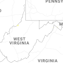


Connect with Interactive Hail Maps