

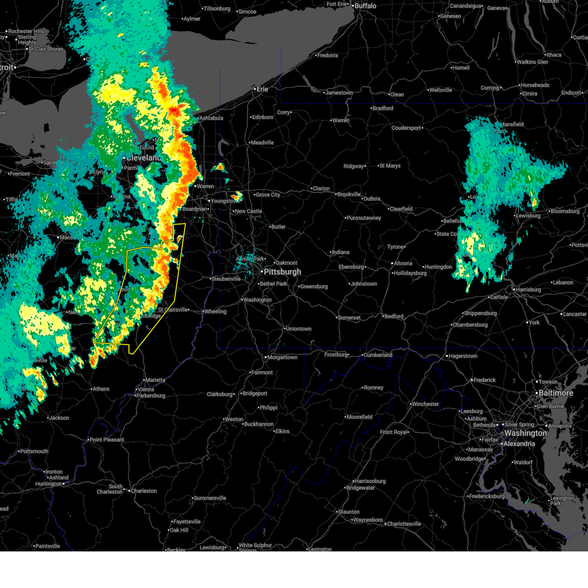
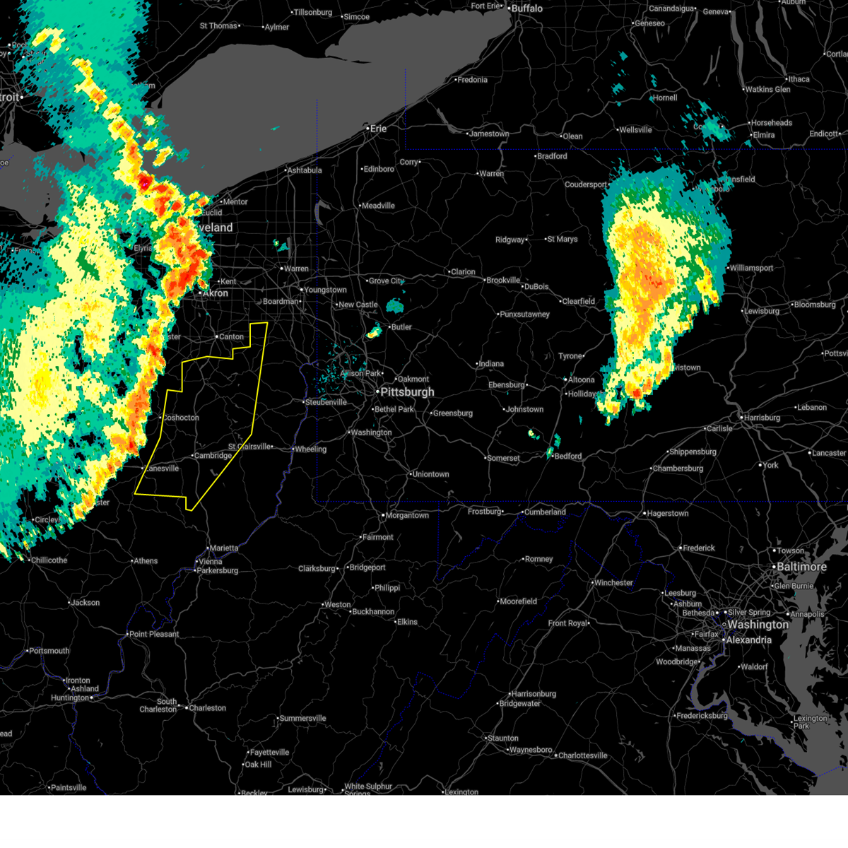
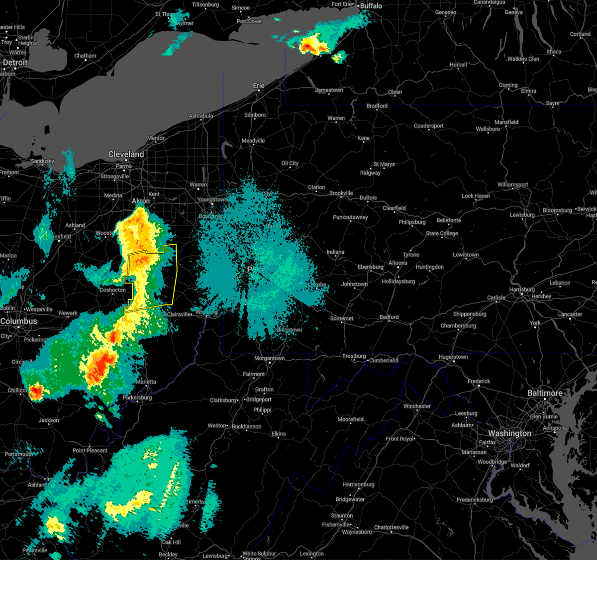
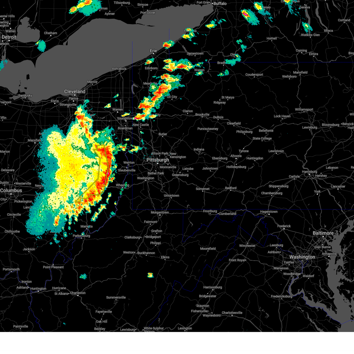
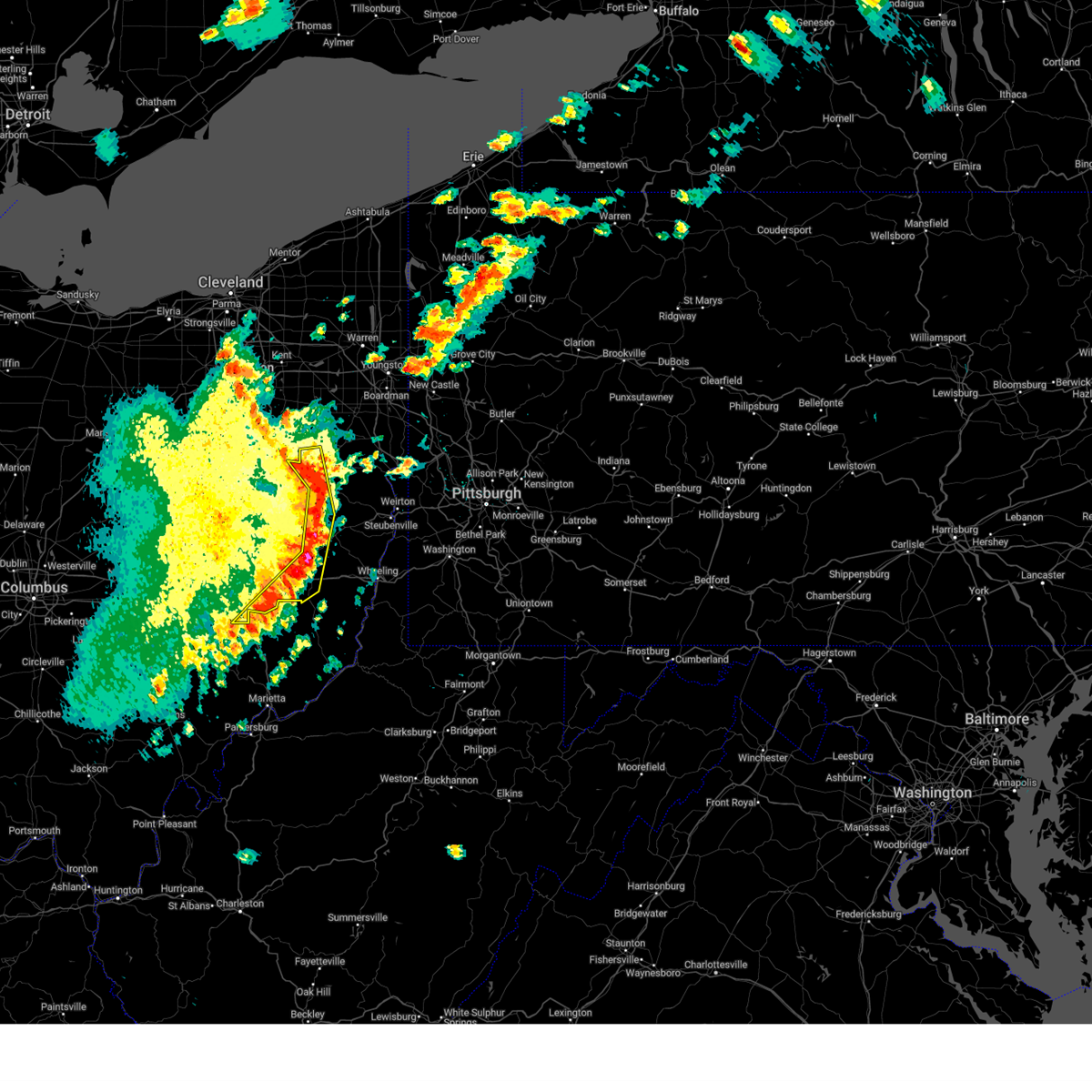
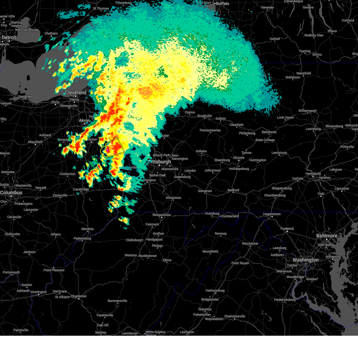
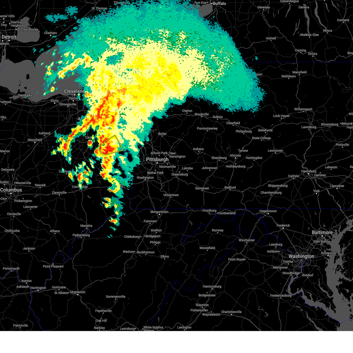
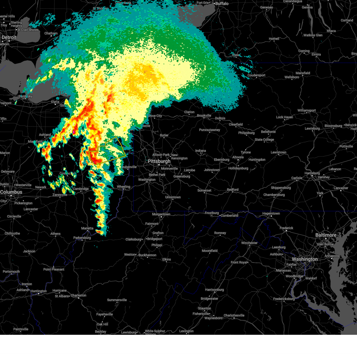
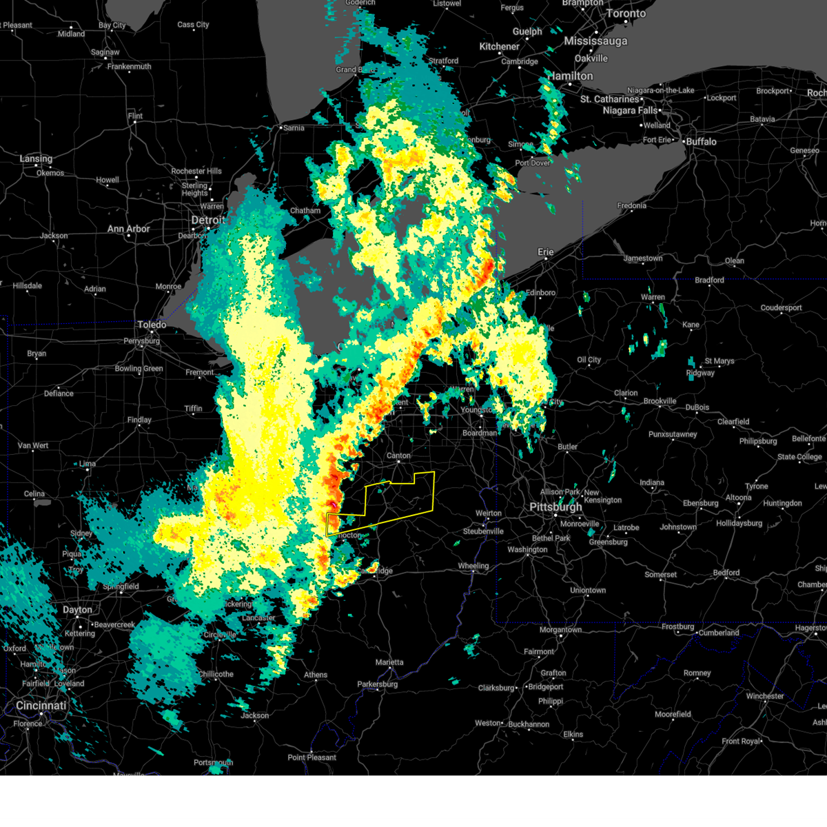
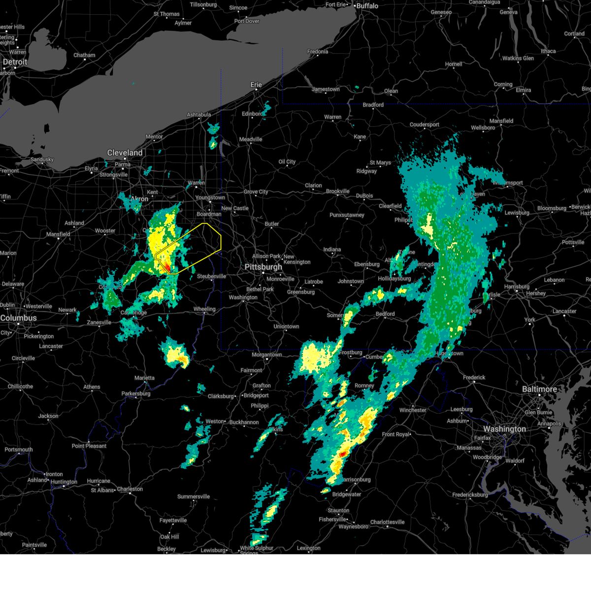
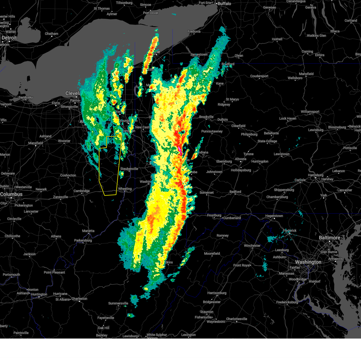
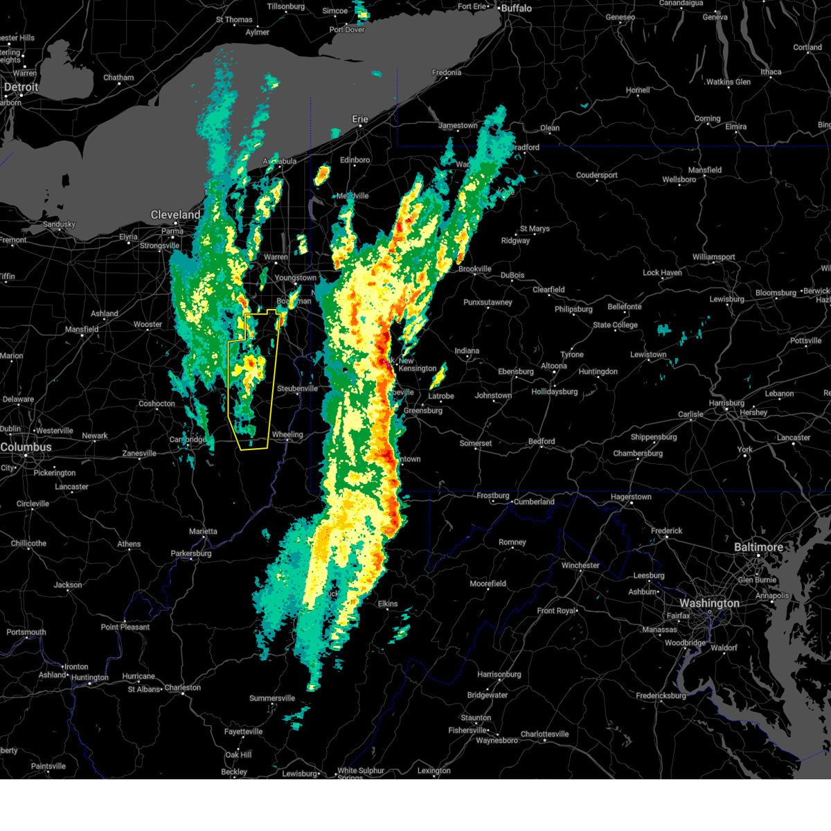
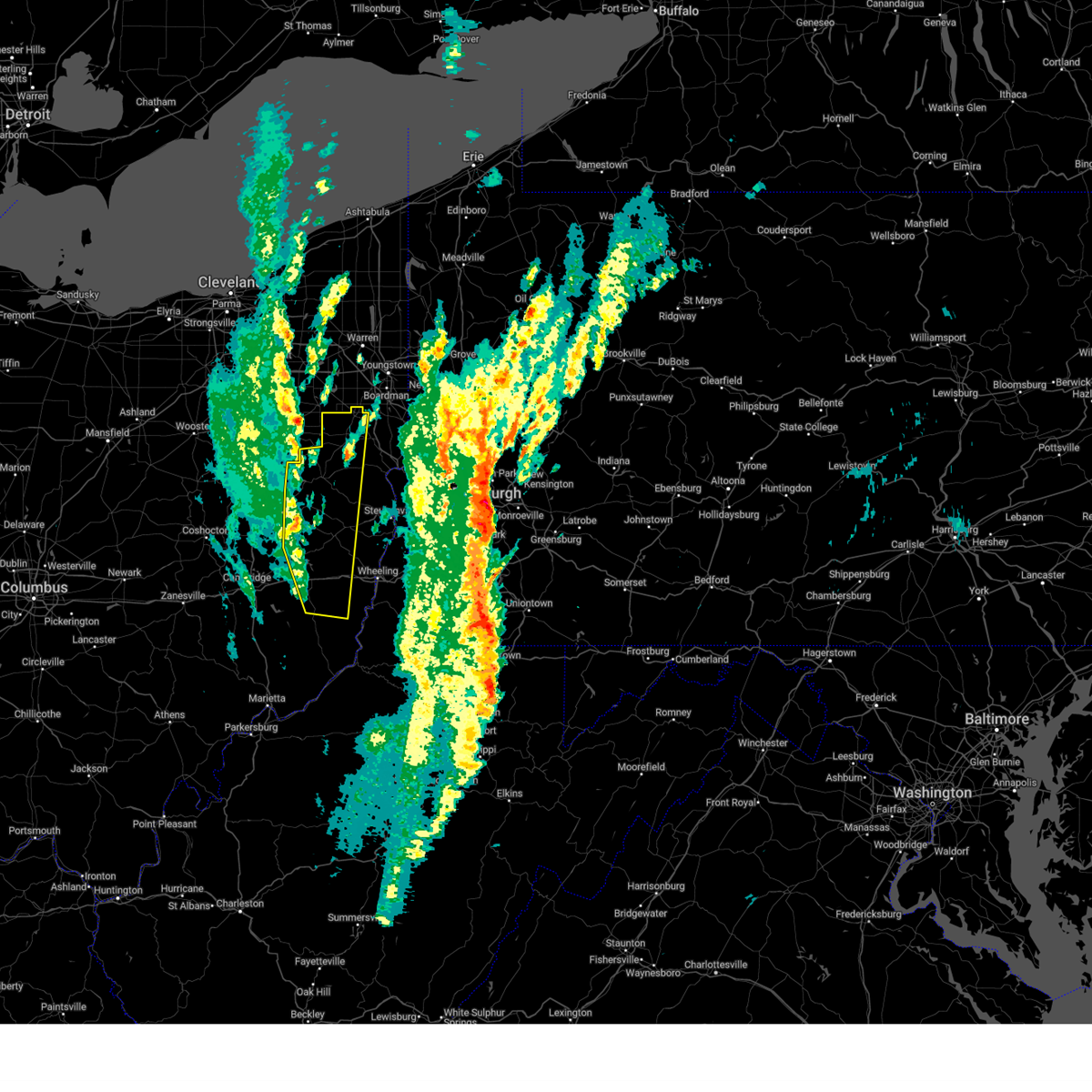
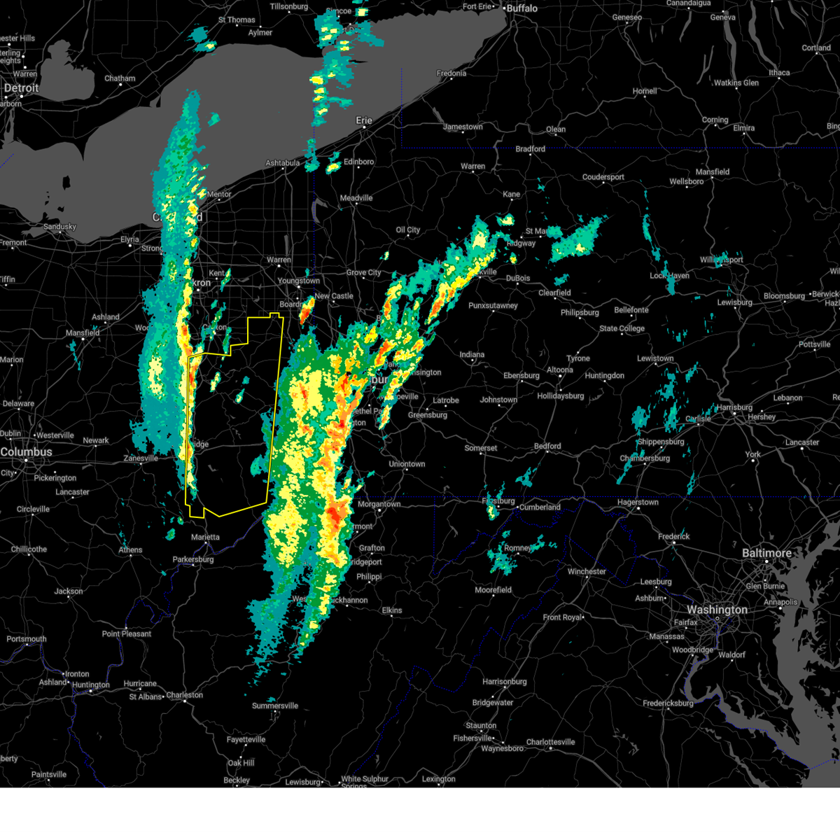
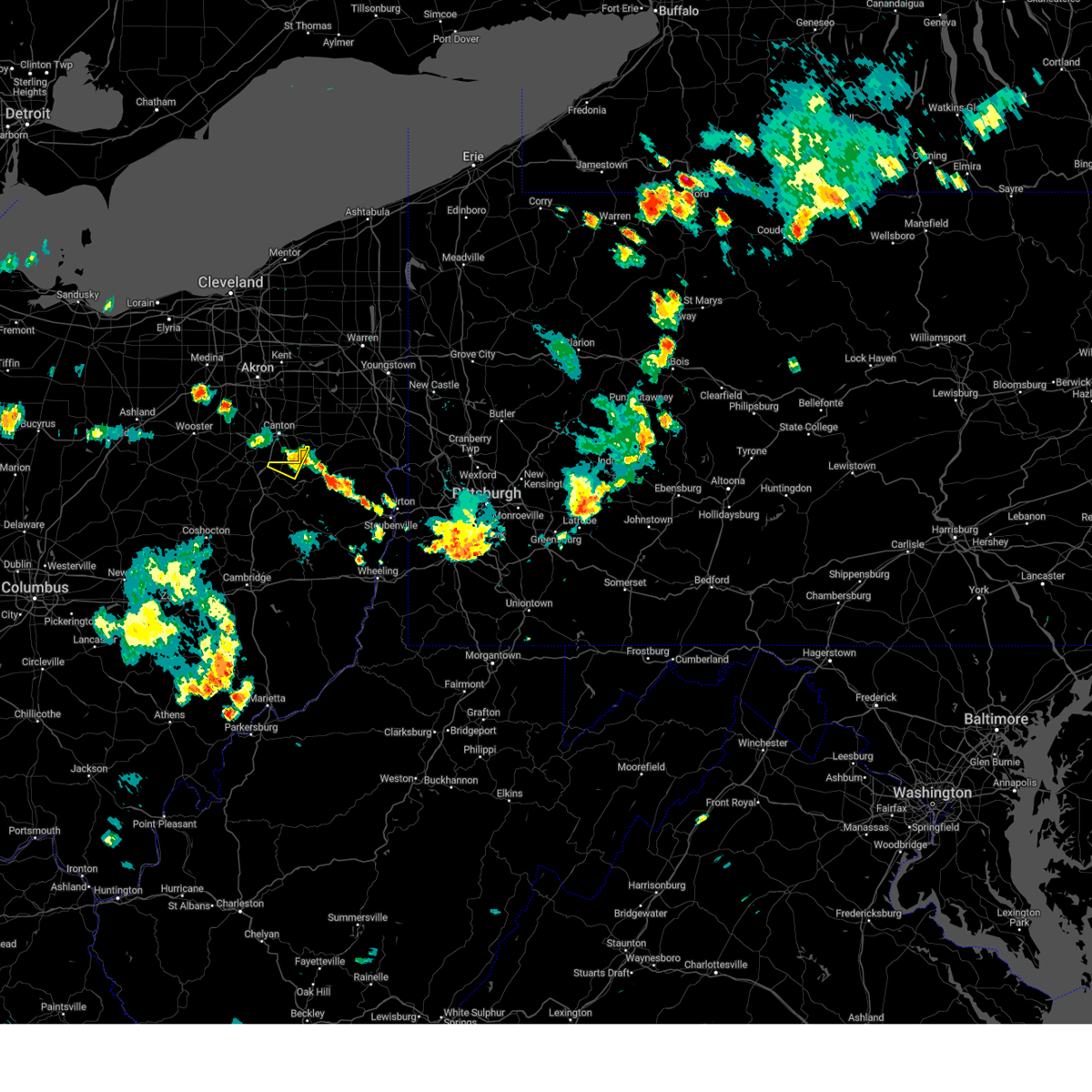
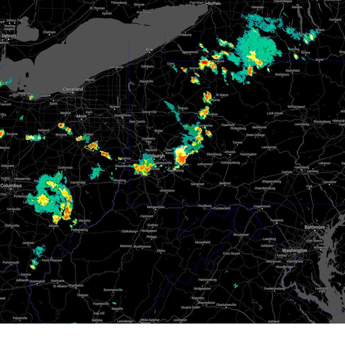
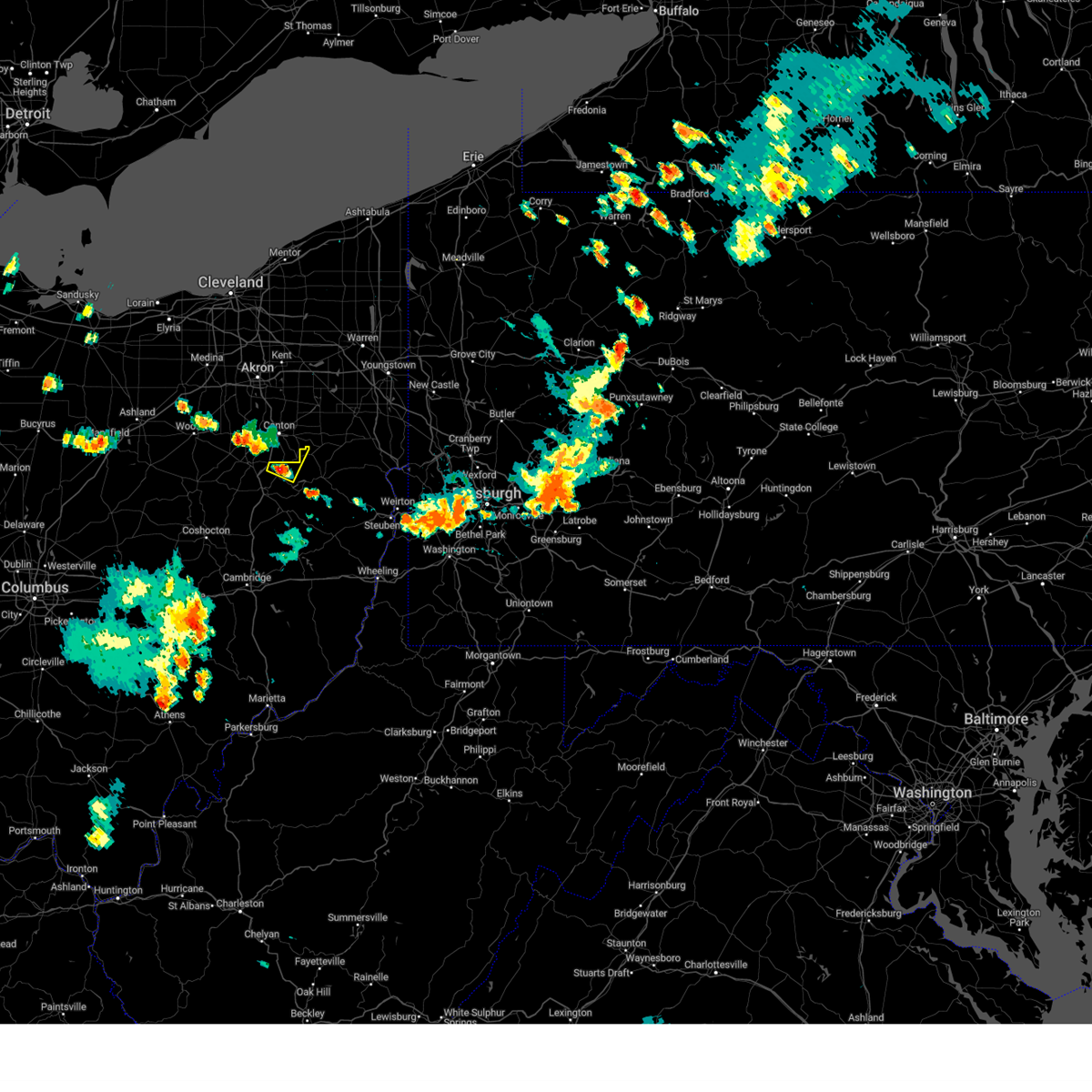
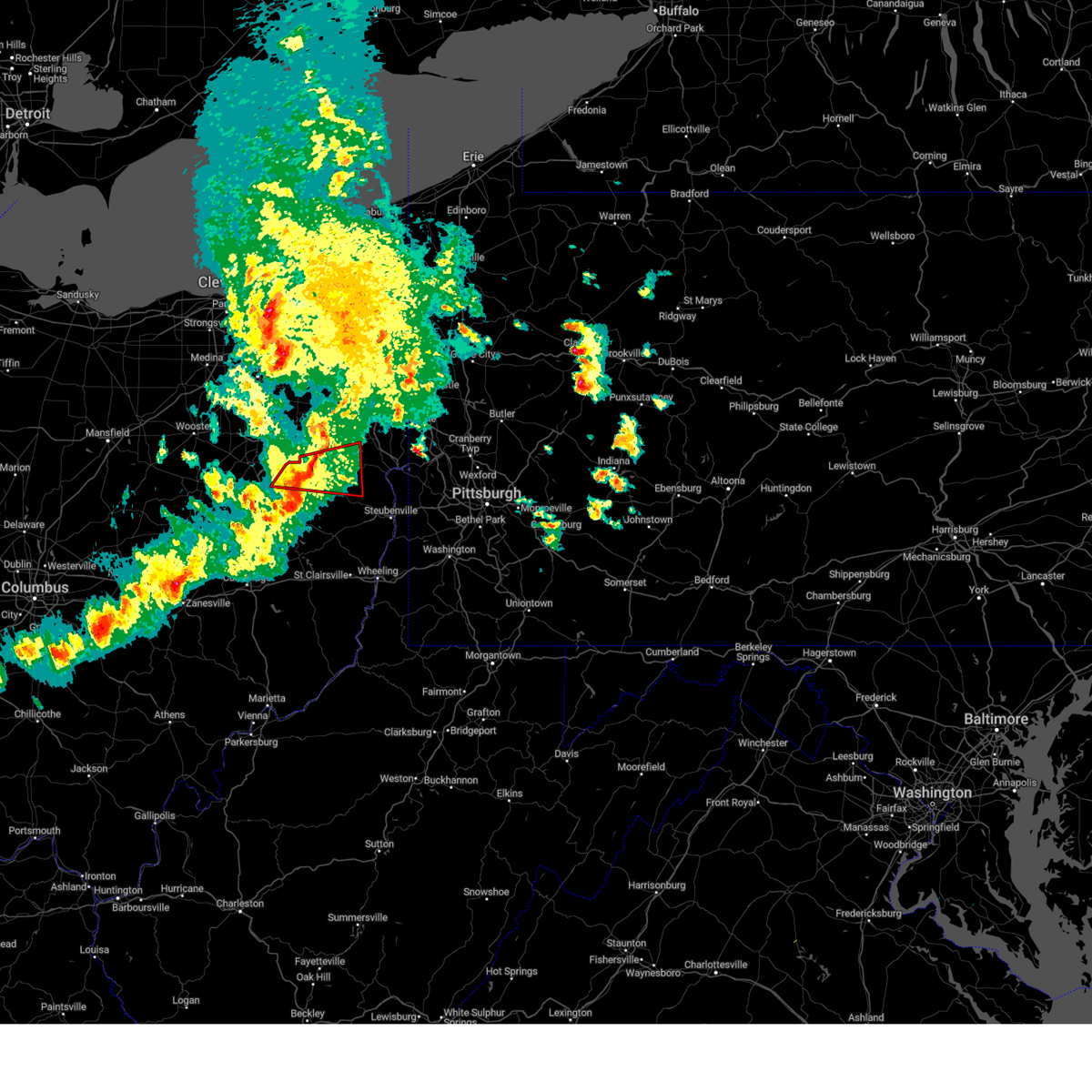
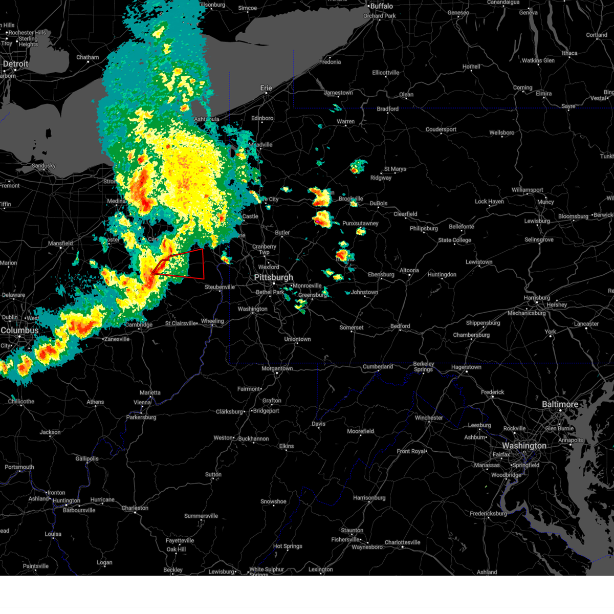
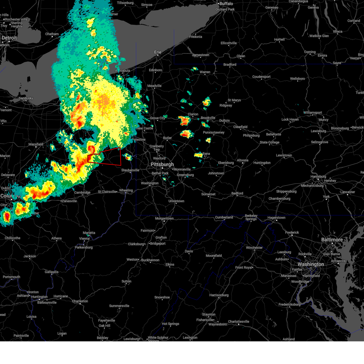
Hail Map for Lake Mohawk, OH
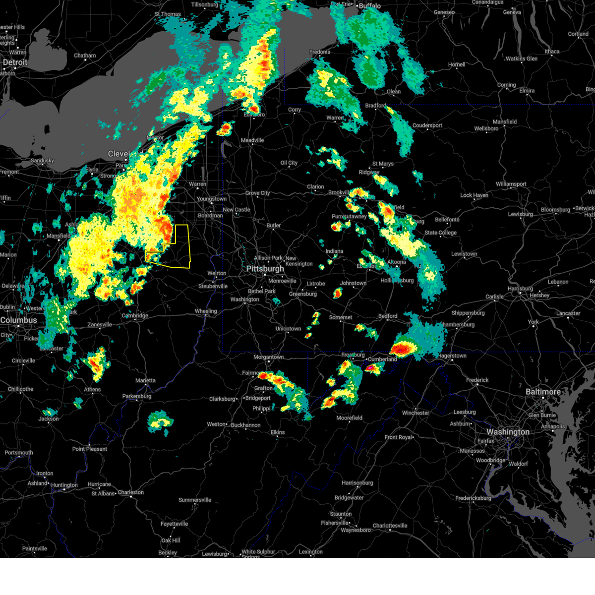
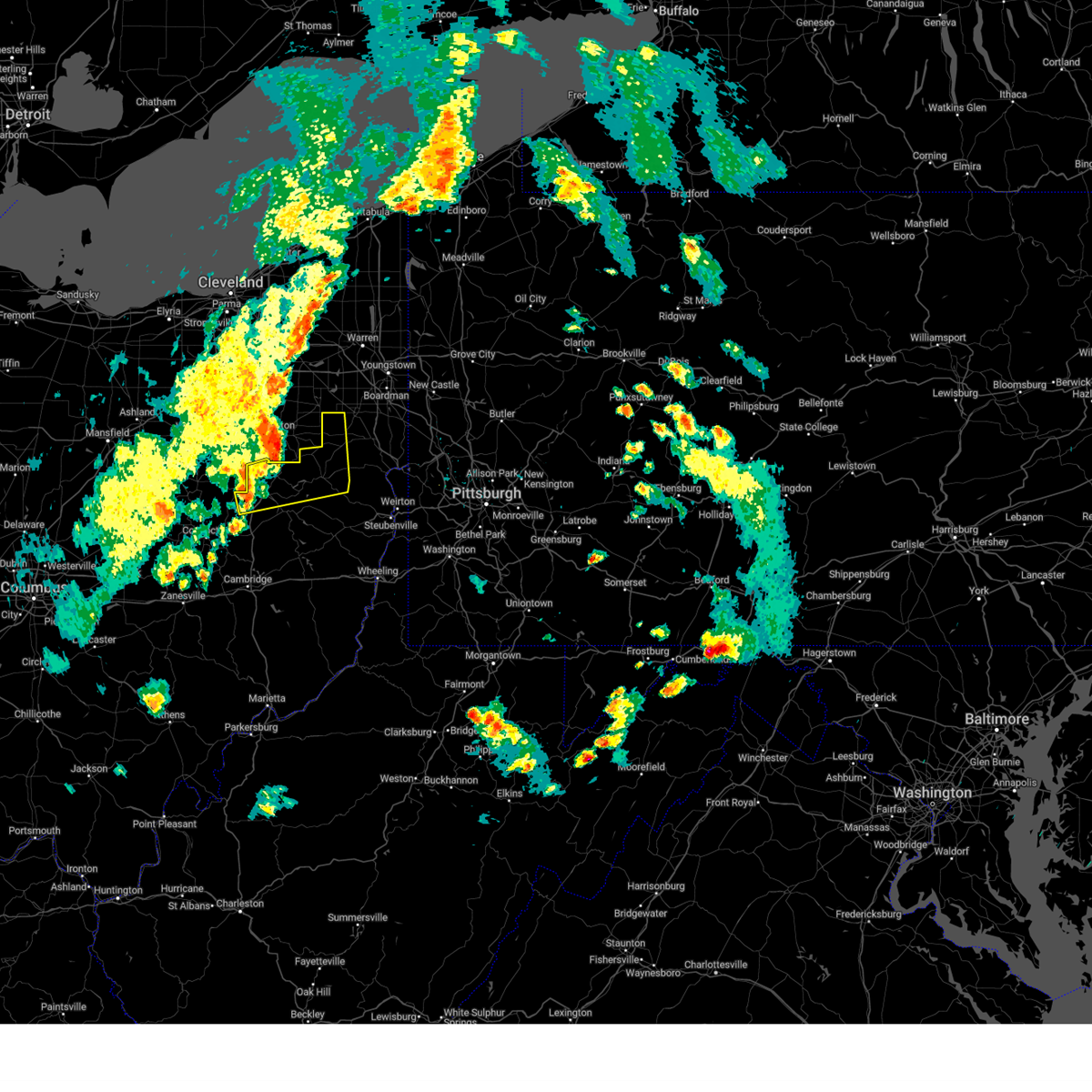
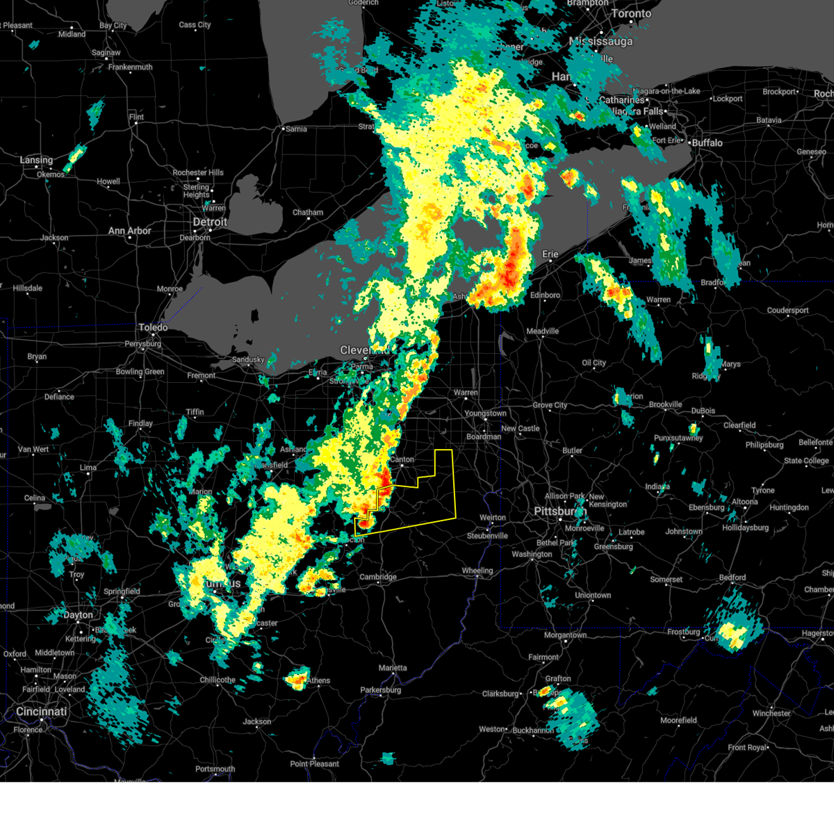
The Lake Mohawk, OH area has had 0 reports of on-the-ground hail by trained spotters, and has been under severe weather warnings 52 times during the past 12 months. Doppler radar has detected hail at or near Lake Mohawk, OH on 29 occasions, including 3 occasions during the past year.
| Name: | Lake Mohawk, OH |
| Where Located: | 63.4 miles SSE of Cleveland, OH |
| Map: | Google Map for Lake Mohawk, OH |
| Population: | 1652 |
| Housing Units: | 984 |
| More Info: | Search Google for Lake Mohawk, OH |
0
The Top Recent Hail Date for Lake Mohawk, OH is Wednesday, April 2, 2025 (11th out of 29)

Hail and Wind Damage Spotted near Lake Mohawk, OH
| Date / Time | Report Details |
|---|---|
| 6/18/2025 10:15 PM EDT |
 At 1015 pm edt, severe thunderstorms were located along a line from 23 miles northwest of sharpsville to near freeport, moving east at 45 mph (radar indicated). Hazards include 70 mph wind gusts. Expect considerable tree damage. damage is likely to mobile homes, roofs, and outbuildings. Locations impacted include, new castle, weirton, steubenville, hermitage, sharon, salem, east liverpool, beaver falls, columbiana, east palestine, sharpsville, wellsville, cadiz, carrollton, wellsburg, avella, freeport, ellwood city, new brighton and greenville. At 1015 pm edt, severe thunderstorms were located along a line from 23 miles northwest of sharpsville to near freeport, moving east at 45 mph (radar indicated). Hazards include 70 mph wind gusts. Expect considerable tree damage. damage is likely to mobile homes, roofs, and outbuildings. Locations impacted include, new castle, weirton, steubenville, hermitage, sharon, salem, east liverpool, beaver falls, columbiana, east palestine, sharpsville, wellsville, cadiz, carrollton, wellsburg, avella, freeport, ellwood city, new brighton and greenville.
|
| 6/18/2025 10:13 PM EDT |
 The storms which prompted the warning were moving out of the warned area. therefore, the warning will be allowed to expire. however, a severe thunderstorm warning has been issued for portions of the area to the east. a severe thunderstorm watch remains in effect until 300 am edt thursday for a portion of east central ohio. The storms which prompted the warning were moving out of the warned area. therefore, the warning will be allowed to expire. however, a severe thunderstorm warning has been issued for portions of the area to the east. a severe thunderstorm watch remains in effect until 300 am edt thursday for a portion of east central ohio.
|
| 6/18/2025 10:01 PM EDT |
 Svrpbz the national weather service in pittsburgh has issued a * severe thunderstorm warning for, northwestern belmont county in east central ohio, carroll county in east central ohio, columbiana county in east central ohio, northeastern guernsey county in east central ohio, harrison county in east central ohio, jefferson oh county in east central ohio, eastern tuscarawas county in east central ohio, western mercer county in northwestern pennsylvania, northwestern washington county in southwestern pennsylvania, western beaver county in western pennsylvania, lawrence county in western pennsylvania, brooke county in northern west virginia, hancock county in northern west virginia, * until 1100 pm edt. * at 1001 pm edt, severe thunderstorms were located along a line from 30 miles northwest of sharon to 8 miles west of freeport, or along a line from 29 miles northwest of sharpsville to 8 miles west of freeport, moving east at 45 mph (radar indicated). Hazards include 70 mph wind gusts. Expect considerable tree damage. Damage is likely to mobile homes, roofs, and outbuildings. Svrpbz the national weather service in pittsburgh has issued a * severe thunderstorm warning for, northwestern belmont county in east central ohio, carroll county in east central ohio, columbiana county in east central ohio, northeastern guernsey county in east central ohio, harrison county in east central ohio, jefferson oh county in east central ohio, eastern tuscarawas county in east central ohio, western mercer county in northwestern pennsylvania, northwestern washington county in southwestern pennsylvania, western beaver county in western pennsylvania, lawrence county in western pennsylvania, brooke county in northern west virginia, hancock county in northern west virginia, * until 1100 pm edt. * at 1001 pm edt, severe thunderstorms were located along a line from 30 miles northwest of sharon to 8 miles west of freeport, or along a line from 29 miles northwest of sharpsville to 8 miles west of freeport, moving east at 45 mph (radar indicated). Hazards include 70 mph wind gusts. Expect considerable tree damage. Damage is likely to mobile homes, roofs, and outbuildings.
|
| 6/18/2025 9:53 PM EDT |
 At 953 pm edt, severe thunderstorms were located along a line from 15 miles northeast of strasburg to 12 miles south of south zanesville, or along a line from 16 miles northwest of carrollton to 16 miles south of zanesville, moving east at 40 mph (radar indicated). Hazards include 60 mph wind gusts. Expect damage to roofs, siding, and trees. Locations impacted include, new philadelphia, dover, cambridge, uhrichsville, carrollton, caldwell, freeport, newcomerstown, dennison, strasburg, new concord, byesville, sugarcreek, augusta, gnadenhutten, antrim, malvern, tuscarawas, bolivar and scio. At 953 pm edt, severe thunderstorms were located along a line from 15 miles northeast of strasburg to 12 miles south of south zanesville, or along a line from 16 miles northwest of carrollton to 16 miles south of zanesville, moving east at 40 mph (radar indicated). Hazards include 60 mph wind gusts. Expect damage to roofs, siding, and trees. Locations impacted include, new philadelphia, dover, cambridge, uhrichsville, carrollton, caldwell, freeport, newcomerstown, dennison, strasburg, new concord, byesville, sugarcreek, augusta, gnadenhutten, antrim, malvern, tuscarawas, bolivar and scio.
|
| 6/18/2025 9:46 PM EDT |
 At 946 pm edt, severe thunderstorms were located along a line from 11 miles northeast of strasburg to 13 miles southwest of south zanesville, or along a line from 15 miles north of dover to 17 miles south of zanesville, moving east at 40 mph (radar indicated). Hazards include 60 mph wind gusts. Expect damage to roofs, siding, and trees. locations impacted include, zanesville, new philadelphia, dover, coshocton, cambridge, uhrichsville, carrollton, caldwell, freeport, newcomerstown, dennison, strasburg, new concord, byesville, west lafayette, sugarcreek, augusta, gnadenhutten, antrim and malvern. These storms have had a history of producing wind damage across central ohio. At 946 pm edt, severe thunderstorms were located along a line from 11 miles northeast of strasburg to 13 miles southwest of south zanesville, or along a line from 15 miles north of dover to 17 miles south of zanesville, moving east at 40 mph (radar indicated). Hazards include 60 mph wind gusts. Expect damage to roofs, siding, and trees. locations impacted include, zanesville, new philadelphia, dover, coshocton, cambridge, uhrichsville, carrollton, caldwell, freeport, newcomerstown, dennison, strasburg, new concord, byesville, west lafayette, sugarcreek, augusta, gnadenhutten, antrim and malvern. These storms have had a history of producing wind damage across central ohio.
|
| 6/18/2025 9:34 PM EDT |
 At 934 pm edt, severe thunderstorms were located along a line from 10 miles north of strasburg to 18 miles southwest of south zanesville, or along a line from 15 miles north of dover to 21 miles southwest of zanesville, moving east at 40 mph (radar indicated). Hazards include 60 mph wind gusts. Expect damage to roofs, siding, and trees. locations impacted include, zanesville, new philadelphia, dover, coshocton, cambridge, uhrichsville, carrollton, caldwell, freeport, newcomerstown, dennison, strasburg, new concord, byesville, west lafayette, sugarcreek, augusta, gnadenhutten, antrim and malvern. These storms have had a history of producing wind damage across central ohio. At 934 pm edt, severe thunderstorms were located along a line from 10 miles north of strasburg to 18 miles southwest of south zanesville, or along a line from 15 miles north of dover to 21 miles southwest of zanesville, moving east at 40 mph (radar indicated). Hazards include 60 mph wind gusts. Expect damage to roofs, siding, and trees. locations impacted include, zanesville, new philadelphia, dover, coshocton, cambridge, uhrichsville, carrollton, caldwell, freeport, newcomerstown, dennison, strasburg, new concord, byesville, west lafayette, sugarcreek, augusta, gnadenhutten, antrim and malvern. These storms have had a history of producing wind damage across central ohio.
|
| 6/18/2025 9:17 PM EDT |
 Svrpbz the national weather service in pittsburgh has issued a * severe thunderstorm warning for, northwestern belmont county in east central ohio, carroll county in east central ohio, northwestern columbiana county in east central ohio, eastern coshocton county in east central ohio, guernsey county in east central ohio, western harrison county in east central ohio, eastern muskingum county in east central ohio, western noble county in east central ohio, tuscarawas county in east central ohio, * until 1015 pm edt. * at 917 pm edt, severe thunderstorms were located along a line from 18 miles northwest of sugarcreek to 28 miles southwest of south zanesville, or along a line from 22 miles northwest of dover to 30 miles southwest of zanesville, moving east at 40 mph (radar indicated). Hazards include 60 mph wind gusts. expect damage to roofs, siding, and trees Svrpbz the national weather service in pittsburgh has issued a * severe thunderstorm warning for, northwestern belmont county in east central ohio, carroll county in east central ohio, northwestern columbiana county in east central ohio, eastern coshocton county in east central ohio, guernsey county in east central ohio, western harrison county in east central ohio, eastern muskingum county in east central ohio, western noble county in east central ohio, tuscarawas county in east central ohio, * until 1015 pm edt. * at 917 pm edt, severe thunderstorms were located along a line from 18 miles northwest of sugarcreek to 28 miles southwest of south zanesville, or along a line from 22 miles northwest of dover to 30 miles southwest of zanesville, moving east at 40 mph (radar indicated). Hazards include 60 mph wind gusts. expect damage to roofs, siding, and trees
|
| 6/5/2025 5:23 PM EDT |
 At 523 pm edt, a severe thunderstorm was located near carrollton, moving east at 10 mph (radar indicated). Hazards include 60 mph wind gusts. Expect damage to roofs, siding, and trees. Locations impacted include, carrollton, augusta, salineville, malvern, irondale, summitville and mechanicstown. At 523 pm edt, a severe thunderstorm was located near carrollton, moving east at 10 mph (radar indicated). Hazards include 60 mph wind gusts. Expect damage to roofs, siding, and trees. Locations impacted include, carrollton, augusta, salineville, malvern, irondale, summitville and mechanicstown.
|
| 6/5/2025 5:08 PM EDT | The severe thunderstorm warning that was previously in effect has been reissued for carroll county and is in effect until 545 pm edt. please refer to that bulletin for the latest severe weather information. to report severe weather, contact your nearest law enforcement agency. they will send your report to the national weather service office. |
| 6/5/2025 5:07 PM EDT | Svrpbz the national weather service in pittsburgh has issued a * severe thunderstorm warning for, northern carroll county in east central ohio, southwestern columbiana county in east central ohio, north central jefferson oh county in east central ohio, * until 545 pm edt. * at 507 pm edt, a severe thunderstorm was located 9 miles northeast of carrollton, moving east at 20 mph (radar indicated). Hazards include 60 mph wind gusts. expect damage to roofs, siding, and trees |
| 6/5/2025 4:55 PM EDT | At 455 pm edt, a severe thunderstorm was located 11 miles northwest of carrollton, moving east at 25 mph (radar indicated). Hazards include 60 mph wind gusts. Expect damage to roofs, siding, and trees. Locations impacted include, malvern. |
| 6/5/2025 4:40 PM EDT |
 Svrpbz the national weather service in pittsburgh has issued a * severe thunderstorm warning for, northwestern carroll county in east central ohio, * until 515 pm edt. * at 440 pm edt, a severe thunderstorm was located 12 miles northeast of strasburg, or 14 miles northeast of dover, moving east at 25 mph (radar indicated). Hazards include 60 mph wind gusts. expect damage to roofs, siding, and trees Svrpbz the national weather service in pittsburgh has issued a * severe thunderstorm warning for, northwestern carroll county in east central ohio, * until 515 pm edt. * at 440 pm edt, a severe thunderstorm was located 12 miles northeast of strasburg, or 14 miles northeast of dover, moving east at 25 mph (radar indicated). Hazards include 60 mph wind gusts. expect damage to roofs, siding, and trees
|
| 5/16/2025 11:52 PM EDT | The storms which prompted the warning have moved out of the area. therefore, the warning will be allowed to expire. to report severe weather, contact your nearest law enforcement agency. they will send your report to the national weather service office. a severe thunderstorm watch remains in effect until 400 am edt saturday for a portion of east central ohio. |
| 5/16/2025 11:43 PM EDT |
 Svrpbz the national weather service in pittsburgh has issued a * severe thunderstorm warning for, carroll county in east central ohio, columbiana county in east central ohio, harrison county in east central ohio, jefferson oh county in east central ohio, brooke county in northern west virginia, hancock county in northern west virginia, * until 1230 am edt. * at 1143 pm edt, severe thunderstorms were located along a line from 11 miles northwest of salem to 10 miles southwest of cadiz, or along a line from 11 miles northwest of salem to 10 miles west of st. clairsville, moving east at 40 mph (radar indicated). Hazards include 60 mph wind gusts. expect damage to roofs, siding, and trees Svrpbz the national weather service in pittsburgh has issued a * severe thunderstorm warning for, carroll county in east central ohio, columbiana county in east central ohio, harrison county in east central ohio, jefferson oh county in east central ohio, brooke county in northern west virginia, hancock county in northern west virginia, * until 1230 am edt. * at 1143 pm edt, severe thunderstorms were located along a line from 11 miles northwest of salem to 10 miles southwest of cadiz, or along a line from 11 miles northwest of salem to 10 miles west of st. clairsville, moving east at 40 mph (radar indicated). Hazards include 60 mph wind gusts. expect damage to roofs, siding, and trees
|
| 5/16/2025 11:33 PM EDT |
 At 1133 pm edt, severe thunderstorms were located along a line from 10 miles northeast of strasburg to 9 miles northeast of cambridge, or along a line from 14 miles north of dover to 9 miles northeast of cambridge, moving east at 40 mph (radar indicated). Hazards include 60 mph wind gusts. Expect damage to roofs, siding, and trees. Locations impacted include, new philadelphia, dover, uhrichsville, carrollton, freeport, newcomerstown, dennison, strasburg, sugarcreek, gnadenhutten, malvern, tuscarawas, bolivar, baltic, midvale, mineral city, port washington, bowerston, barnhill and dellroy. At 1133 pm edt, severe thunderstorms were located along a line from 10 miles northeast of strasburg to 9 miles northeast of cambridge, or along a line from 14 miles north of dover to 9 miles northeast of cambridge, moving east at 40 mph (radar indicated). Hazards include 60 mph wind gusts. Expect damage to roofs, siding, and trees. Locations impacted include, new philadelphia, dover, uhrichsville, carrollton, freeport, newcomerstown, dennison, strasburg, sugarcreek, gnadenhutten, malvern, tuscarawas, bolivar, baltic, midvale, mineral city, port washington, bowerston, barnhill and dellroy.
|
| 5/16/2025 11:33 PM EDT |
 the severe thunderstorm warning has been cancelled and is no longer in effect the severe thunderstorm warning has been cancelled and is no longer in effect
|
| 5/16/2025 11:17 PM EDT | Svrpbz the national weather service in pittsburgh has issued a * severe thunderstorm warning for, western carroll county in east central ohio, eastern coshocton county in east central ohio, northern guernsey county in east central ohio, western harrison county in east central ohio, northeastern muskingum county in east central ohio, tuscarawas county in east central ohio, * until midnight edt. * at 1117 pm edt, severe thunderstorms were located along a line from 8 miles northwest of strasburg to 7 miles north of new concord, or along a line from 13 miles northwest of dover to 9 miles northwest of cambridge, moving east at 40 mph (radar indicated). Hazards include 60 mph wind gusts. expect damage to roofs, siding, and trees |
| 5/1/2025 5:24 PM EDT |
 At 524 pm edt, severe thunderstorms were located along a line from 16 miles west of salem to 8 miles west of carrollton, moving east at 35 mph (radar indicated). Hazards include 60 mph wind gusts. Expect damage to roofs, siding, and trees. Locations impacted include, carrollton, augusta, malvern, bolivar, mineral city, hanoverton, dellroy, zoar, mechanicstown, east rochester, atwood lake, harlem springs, homeworth, north georgetown and new garden. At 524 pm edt, severe thunderstorms were located along a line from 16 miles west of salem to 8 miles west of carrollton, moving east at 35 mph (radar indicated). Hazards include 60 mph wind gusts. Expect damage to roofs, siding, and trees. Locations impacted include, carrollton, augusta, malvern, bolivar, mineral city, hanoverton, dellroy, zoar, mechanicstown, east rochester, atwood lake, harlem springs, homeworth, north georgetown and new garden.
|
| 5/1/2025 5:07 PM EDT |
 the severe thunderstorm warning has been cancelled and is no longer in effect the severe thunderstorm warning has been cancelled and is no longer in effect
|
| 5/1/2025 5:07 PM EDT |
 At 507 pm edt, severe thunderstorms were located along a line from 18 miles northeast of strasburg to near new philadelphia, or along a line from 22 miles north of dover to over new philadelphia, moving east at 30 mph (radar indicated). Hazards include 60 mph wind gusts. Expect damage to roofs, siding, and trees. Locations impacted include, new philadelphia, dover, carrollton, strasburg, sugarcreek, augusta, malvern, bolivar, midvale, mineral city, hanoverton, barnhill, dellroy, sherrodsville, roswell, parral, stone creek, zoar, leesville and mechanicstown. At 507 pm edt, severe thunderstorms were located along a line from 18 miles northeast of strasburg to near new philadelphia, or along a line from 22 miles north of dover to over new philadelphia, moving east at 30 mph (radar indicated). Hazards include 60 mph wind gusts. Expect damage to roofs, siding, and trees. Locations impacted include, new philadelphia, dover, carrollton, strasburg, sugarcreek, augusta, malvern, bolivar, midvale, mineral city, hanoverton, barnhill, dellroy, sherrodsville, roswell, parral, stone creek, zoar, leesville and mechanicstown.
|
| 5/1/2025 4:55 PM EDT |
 Svrpbz the national weather service in pittsburgh has issued a * severe thunderstorm warning for, carroll county in east central ohio, northwestern columbiana county in east central ohio, northeastern coshocton county in east central ohio, north central harrison county in east central ohio, northwestern jefferson oh county in east central ohio, tuscarawas county in east central ohio, * until 600 pm edt. * at 455 pm edt, severe thunderstorms were located along a line from 11 miles north of strasburg to 8 miles north of newcomerstown, or along a line from 16 miles north of dover to 11 miles southwest of new philadelphia, moving east at 30 mph (radar indicated). Hazards include 60 mph wind gusts. expect damage to roofs, siding, and trees Svrpbz the national weather service in pittsburgh has issued a * severe thunderstorm warning for, carroll county in east central ohio, northwestern columbiana county in east central ohio, northeastern coshocton county in east central ohio, north central harrison county in east central ohio, northwestern jefferson oh county in east central ohio, tuscarawas county in east central ohio, * until 600 pm edt. * at 455 pm edt, severe thunderstorms were located along a line from 11 miles north of strasburg to 8 miles north of newcomerstown, or along a line from 16 miles north of dover to 11 miles southwest of new philadelphia, moving east at 30 mph (radar indicated). Hazards include 60 mph wind gusts. expect damage to roofs, siding, and trees
|
| 4/29/2025 4:28 PM EDT |
 The storms which prompted the warning have moved out of the area. therefore, the warning will be allowed to expire. however, gusty winds are still possible with these thunderstorms. a severe thunderstorm watch remains in effect until 700 pm edt for east central ohio. remember, a severe thunderstorm warning still remains in effect for carrol, harrison, and belmont counties. The storms which prompted the warning have moved out of the area. therefore, the warning will be allowed to expire. however, gusty winds are still possible with these thunderstorms. a severe thunderstorm watch remains in effect until 700 pm edt for east central ohio. remember, a severe thunderstorm warning still remains in effect for carrol, harrison, and belmont counties.
|
| 4/29/2025 4:25 PM EDT |
 At 424 pm edt, severe thunderstorms were located along a line extending from minerva to 6 miles east of carrollton to cadiz to near barnesville, moving east at 70 mph. these are destructive storms for jefferson county (radar indicated). Hazards include 80 mph wind gusts. Extensive tree damage and widespread power outages. mobile homes will be heavily damaged. expect considerable damage to roofs, windows and vehicles. locations impacted include, wheeling, weirton, steubenville, salem, east liverpool, aliquippa, beaver falls, martins ferry, columbiana, monaca, st. Clairsville, east palestine, bellaire, barnesville, wellsville, cadiz, carrollton, warwood, wellsburg, and bethlehem. At 424 pm edt, severe thunderstorms were located along a line extending from minerva to 6 miles east of carrollton to cadiz to near barnesville, moving east at 70 mph. these are destructive storms for jefferson county (radar indicated). Hazards include 80 mph wind gusts. Extensive tree damage and widespread power outages. mobile homes will be heavily damaged. expect considerable damage to roofs, windows and vehicles. locations impacted include, wheeling, weirton, steubenville, salem, east liverpool, aliquippa, beaver falls, martins ferry, columbiana, monaca, st. Clairsville, east palestine, bellaire, barnesville, wellsville, cadiz, carrollton, warwood, wellsburg, and bethlehem.
|
| 4/29/2025 4:25 PM EDT |
 the severe thunderstorm warning has been cancelled and is no longer in effect the severe thunderstorm warning has been cancelled and is no longer in effect
|
| 4/29/2025 4:20 PM EDT |
 At 419 pm edt, severe thunderstorms were located along a line extending from waynesburg to 6 miles north of freeport to 8 miles northwest of barnesville, moving northeast at 55 mph. these are destructive storms for harrison and carrol counties (radar indicated). Hazards include 80 mph wind gusts. Extensive tree damage and widespread power outages. mobile homes will be heavily damaged. expect considerable damage to roofs, windows and vehicles. Locations impacted include, barnesville, carrollton, minerva, malvern, flushing, scio, quaker city, senecaville, pleasant city, bowerston, cumberland, dellroy, holloway, lore city, old washington, salesville, piedmont, fairview, deersville, and seneca lake park. At 419 pm edt, severe thunderstorms were located along a line extending from waynesburg to 6 miles north of freeport to 8 miles northwest of barnesville, moving northeast at 55 mph. these are destructive storms for harrison and carrol counties (radar indicated). Hazards include 80 mph wind gusts. Extensive tree damage and widespread power outages. mobile homes will be heavily damaged. expect considerable damage to roofs, windows and vehicles. Locations impacted include, barnesville, carrollton, minerva, malvern, flushing, scio, quaker city, senecaville, pleasant city, bowerston, cumberland, dellroy, holloway, lore city, old washington, salesville, piedmont, fairview, deersville, and seneca lake park.
|
| 4/29/2025 4:20 PM EDT |
 the severe thunderstorm warning has been cancelled and is no longer in effect the severe thunderstorm warning has been cancelled and is no longer in effect
|
| 4/29/2025 4:16 PM EDT | Svrpbz the national weather service in pittsburgh has issued a * severe thunderstorm warning for, east central guernsey county in east central ohio, carroll county in east central ohio, northeastern tuscarawas county in east central ohio, northeastern noble county in east central ohio, harrison county in east central ohio, jefferson county in east central ohio, columbiana county in east central ohio, belmont county in east central ohio, beaver county in western pennsylvania, west central allegheny county in southwestern pennsylvania, western washington county in southwestern pennsylvania, southwestern lawrence county in western pennsylvania, ohio county in northern west virginia, marshall county in northern west virginia, brooke county in northern west virginia, hancock county in northern west virginia, * until 500 pm edt. * at 416 pm edt, severe thunderstorms were located along a line extending from waynesburg to near carrollton to 6 miles east of freeport to near barnesville, moving east at 75 mph. these are destructive storms for jefferson county (radar indicated). Hazards include 80 mph wind gusts. Extensive tree damage and widespread power outages. mobile homes will be heavily damaged. Expect considerable damage to roofs, windows and vehicles. |
| 4/29/2025 4:10 PM EDT | At 409 pm edt, severe thunderstorms were located along a line extending from near east sparta to 6 miles northwest of freeport to near byesville, moving east at 60 mph. these are destructive storms for southern tuscarawas and harrison counties (radar indicated). Hazards include 80 mph wind gusts. Extensive tree damage and widespread power outages. mobile homes will be heavily damaged. expect considerable damage to roofs, windows and vehicles. Locations impacted include, new philadelphia, dover, cambridge, uhrichsville, barnesville, carrollton, freeport, minerva, dennison, strasburg, byesville, gnadenhutten, antrim, malvern, tuscarawas, bolivar, flushing, scio, midvale, and mineral city. |
| 4/29/2025 4:10 PM EDT | the severe thunderstorm warning has been cancelled and is no longer in effect |
| 4/29/2025 3:44 PM EDT | Svrpbz the national weather service in pittsburgh has issued a * severe thunderstorm warning for, harrison county in east central ohio, guernsey county in east central ohio, eastern coshocton county in east central ohio, eastern muskingum county in east central ohio, western carroll county in east central ohio, northwestern belmont county in east central ohio, tuscarawas county in east central ohio, * until 430 pm edt. * at 343 pm edt, severe thunderstorms were located along a line extending from near berlin to 9 miles south of coshocton to 7 miles east of south zanesville, moving east at 55 mph. these are destructive storms for cambridge and new philadelphia (radar indicated). Hazards include 80 mph wind gusts. Extensive tree damage and widespread power outages. mobile homes will be heavily damaged. Expect considerable damage to roofs, windows and vehicles. |
| 4/3/2025 3:23 AM EDT | the severe thunderstorm warning has been cancelled and is no longer in effect |
| 4/3/2025 3:23 AM EDT | At 323 am edt, severe thunderstorms were located along a line from 12 miles northwest of carrollton to 6 miles northwest of caldwell, moving east at 50 mph (radar indicated). Hazards include 60 mph wind gusts. Expect damage to roofs, siding, and trees. locations impacted include, new philadelphia, salem, columbiana, uhrichsville, st. Clairsville, barnesville, cadiz, carrollton, woodsfield, caldwell, freeport, lisbon, dennison, leetonia, new waterford, augusta, dudley, salineville, gnadenhutten and bethesda. |
| 4/3/2025 3:13 AM EDT | Svrpbz the national weather service in pittsburgh has issued a * severe thunderstorm warning for, belmont county in east central ohio, carroll county in east central ohio, columbiana county in east central ohio, southeastern coshocton county in east central ohio, guernsey county in east central ohio, harrison county in east central ohio, western jefferson oh county in east central ohio, monroe county in east central ohio, eastern muskingum county in east central ohio, noble county in east central ohio, tuscarawas county in east central ohio, * until 415 am edt. * at 313 am edt, severe thunderstorms were located along a line from 9 miles northeast of strasburg to 13 miles south of new concord, or along a line from 12 miles north of dover to 12 miles west of caldwell, moving east at 50 mph (radar indicated). Hazards include 60 mph wind gusts. expect damage to roofs, siding, and trees |
| 4/3/2025 2:23 AM EDT | Svrpbz the national weather service in pittsburgh has issued a * severe thunderstorm warning for, western guernsey county in east central ohio, coshocton county in east central ohio, muskingum county in east central ohio, northwestern carroll county in east central ohio, tuscarawas county in east central ohio, northwestern noble county in east central ohio, * until 315 am edt. * at 221 am edt, severe thunderstorms were located along a line extending from 8 miles northeast of hayesville to 10 miles south of lancaster, moving east at 60 mph (radar indicated). Hazards include 60 mph wind gusts. expect damage to trees and power lines, resulting in some power outages |
| 4/2/2025 1:10 PM EDT |
 The severe thunderstorm warning that was previously in effect has been reissued for carroll and columbiana counties and is in effect until 145 pm edt. please refer to that bulletin for the latest severe weather information. The severe thunderstorm warning that was previously in effect has been reissued for carroll and columbiana counties and is in effect until 145 pm edt. please refer to that bulletin for the latest severe weather information.
|
| 4/2/2025 1:03 PM EDT |
 At 103 pm edt, severe thunderstorms were located along a line from 11 miles north of carrollton to 5 miles northeast of carrollton, moving northeast at 60 mph (radar indicated). Hazards include half dollar size hail. Damage to vehicles is expected. Locations impacted include, carrollton, augusta, salineville, malvern, hanoverton, summitville, mechanicstown, east rochester, new garden, guilford lake state park and winona. At 103 pm edt, severe thunderstorms were located along a line from 11 miles north of carrollton to 5 miles northeast of carrollton, moving northeast at 60 mph (radar indicated). Hazards include half dollar size hail. Damage to vehicles is expected. Locations impacted include, carrollton, augusta, salineville, malvern, hanoverton, summitville, mechanicstown, east rochester, new garden, guilford lake state park and winona.
|
| 4/2/2025 1:03 PM EDT |
 the severe thunderstorm warning has been cancelled and is no longer in effect the severe thunderstorm warning has been cancelled and is no longer in effect
|
| 4/2/2025 12:55 PM EDT |
 At 1255 pm edt, severe thunderstorms were located along a line from 13 miles southwest of salem to 7 miles east of carrollton, moving northeast at 65 mph (radar indicated). Hazards include quarter size hail. Damage to vehicles is expected. Locations impacted include, carrollton, augusta, salineville, malvern, hanoverton, irondale, dellroy, summitville, mechanicstown, east rochester, new garden, guilford lake state park, winona and atwood lake. At 1255 pm edt, severe thunderstorms were located along a line from 13 miles southwest of salem to 7 miles east of carrollton, moving northeast at 65 mph (radar indicated). Hazards include quarter size hail. Damage to vehicles is expected. Locations impacted include, carrollton, augusta, salineville, malvern, hanoverton, irondale, dellroy, summitville, mechanicstown, east rochester, new garden, guilford lake state park, winona and atwood lake.
|
| 4/2/2025 12:55 PM EDT |
 the severe thunderstorm warning has been cancelled and is no longer in effect the severe thunderstorm warning has been cancelled and is no longer in effect
|
| 4/2/2025 12:39 PM EDT |
 Svrpbz the national weather service in pittsburgh has issued a * severe thunderstorm warning for, carroll county in east central ohio, western columbiana county in east central ohio, northwestern jefferson oh county in east central ohio, northeastern tuscarawas county in east central ohio, * until 115 pm edt. * at 1239 pm edt, severe thunderstorms were located along a line from 11 miles northeast of strasburg to 7 miles northeast of dennison, or along a line from 13 miles northeast of dover to 8 miles northeast of uhrichsville, moving northeast at 65 mph (radar indicated). Hazards include quarter size hail. damage to vehicles is expected Svrpbz the national weather service in pittsburgh has issued a * severe thunderstorm warning for, carroll county in east central ohio, western columbiana county in east central ohio, northwestern jefferson oh county in east central ohio, northeastern tuscarawas county in east central ohio, * until 115 pm edt. * at 1239 pm edt, severe thunderstorms were located along a line from 11 miles northeast of strasburg to 7 miles northeast of dennison, or along a line from 13 miles northeast of dover to 8 miles northeast of uhrichsville, moving northeast at 65 mph (radar indicated). Hazards include quarter size hail. damage to vehicles is expected
|
| 3/30/2025 11:53 PM EDT |
 The storms which prompted the warning have moved out of the area. therefore, the warning will be allowed to expire. a severe thunderstorm watch remains in effect until 300 am edt for a portion of east central ohio. The storms which prompted the warning have moved out of the area. therefore, the warning will be allowed to expire. a severe thunderstorm watch remains in effect until 300 am edt for a portion of east central ohio.
|
| 3/30/2025 11:44 PM EDT |
 At 1144 pm edt, severe thunderstorms were located along a line from 23 miles northeast of strasburg to near new philadelphia, or along a line from 26 miles west of salem to near new philadelphia, moving northeast at 55 mph (radar indicated). Hazards include 60 mph wind gusts and small hail. Expect damage to roofs, siding, and trees. Locations impacted include, new philadelphia, dover, carrollton, malvern, bolivar, mineral city, dellroy, zoar and atwood lake. At 1144 pm edt, severe thunderstorms were located along a line from 23 miles northeast of strasburg to near new philadelphia, or along a line from 26 miles west of salem to near new philadelphia, moving northeast at 55 mph (radar indicated). Hazards include 60 mph wind gusts and small hail. Expect damage to roofs, siding, and trees. Locations impacted include, new philadelphia, dover, carrollton, malvern, bolivar, mineral city, dellroy, zoar and atwood lake.
|
| 3/30/2025 11:34 PM EDT |
 the severe thunderstorm warning has been cancelled and is no longer in effect the severe thunderstorm warning has been cancelled and is no longer in effect
|
| 3/30/2025 11:34 PM EDT |
 At 1134 pm edt, severe thunderstorms were located along a line from 17 miles north of strasburg to near sugarcreek, or along a line from 22 miles north of dover to 8 miles southwest of dover, moving northeast at 60 mph (radar indicated). Hazards include 60 mph wind gusts and small hail. Expect damage to roofs, siding, and trees. Locations impacted include, new philadelphia, dover, uhrichsville, carrollton, strasburg, sugarcreek, malvern, bolivar, baltic, midvale, mineral city, barnhill, dellroy, sherrodsville, roswell, parral, stone creek, zoar, leesville and atwood lake. At 1134 pm edt, severe thunderstorms were located along a line from 17 miles north of strasburg to near sugarcreek, or along a line from 22 miles north of dover to 8 miles southwest of dover, moving northeast at 60 mph (radar indicated). Hazards include 60 mph wind gusts and small hail. Expect damage to roofs, siding, and trees. Locations impacted include, new philadelphia, dover, uhrichsville, carrollton, strasburg, sugarcreek, malvern, bolivar, baltic, midvale, mineral city, barnhill, dellroy, sherrodsville, roswell, parral, stone creek, zoar, leesville and atwood lake.
|
| 3/30/2025 11:18 PM EDT |
 Svrpbz the national weather service in pittsburgh has issued a * severe thunderstorm warning for, western carroll county in east central ohio, northeastern coshocton county in east central ohio, tuscarawas county in east central ohio, * until midnight edt. * at 1118 pm edt, severe thunderstorms were located along a line from 18 miles northwest of sugarcreek to 7 miles north of coshocton, or along a line from 22 miles northwest of dover to 7 miles north of coshocton, moving northeast at 60 mph (radar indicated). Hazards include 70 mph wind gusts and quarter size hail. Hail damage to vehicles is expected. expect considerable tree damage. Wind damage is also likely to mobile homes, roofs, and outbuildings. Svrpbz the national weather service in pittsburgh has issued a * severe thunderstorm warning for, western carroll county in east central ohio, northeastern coshocton county in east central ohio, tuscarawas county in east central ohio, * until midnight edt. * at 1118 pm edt, severe thunderstorms were located along a line from 18 miles northwest of sugarcreek to 7 miles north of coshocton, or along a line from 22 miles northwest of dover to 7 miles north of coshocton, moving northeast at 60 mph (radar indicated). Hazards include 70 mph wind gusts and quarter size hail. Hail damage to vehicles is expected. expect considerable tree damage. Wind damage is also likely to mobile homes, roofs, and outbuildings.
|
| 3/16/2025 5:56 PM EDT |
 Svrpbz the national weather service in pittsburgh has issued a * severe thunderstorm warning for, carroll county in east central ohio, columbiana county in east central ohio, northwestern jefferson oh county in east central ohio, * until 645 pm edt. * at 556 pm edt, a severe thunderstorm was located 6 miles southwest of carrollton, moving northeast at 50 mph (radar indicated). Hazards include 60 mph wind gusts and small hail. expect damage to roofs, siding, and trees Svrpbz the national weather service in pittsburgh has issued a * severe thunderstorm warning for, carroll county in east central ohio, columbiana county in east central ohio, northwestern jefferson oh county in east central ohio, * until 645 pm edt. * at 556 pm edt, a severe thunderstorm was located 6 miles southwest of carrollton, moving northeast at 50 mph (radar indicated). Hazards include 60 mph wind gusts and small hail. expect damage to roofs, siding, and trees
|
| 3/16/2025 1:05 PM EDT |
 The storms which prompted the warning have moved out of the area. therefore, the warning will be allowed to expire. The storms which prompted the warning have moved out of the area. therefore, the warning will be allowed to expire.
|
| 3/16/2025 12:47 PM EDT |
 At 1247 pm edt, severe thunderstorms were located along a line from 27 miles northwest of salem to 7 miles south of cadiz, moving northeast at 65 mph (law enforcement reported. widespread downed trees and powerlines have been reported from coshocton and muskingum counties where the line previously passed). Hazards include 70 mph wind gusts. Expect considerable tree damage. damage is likely to mobile homes, roofs, and outbuildings. locations impacted include, salem, st. Clairsville, cadiz, carrollton, augusta, salineville, bethesda, malvern, hopedale, flushing, scio, adena, jewett, bergholz, amsterdam, belmont, hanoverton, bowerston, dellroy and holloway. At 1247 pm edt, severe thunderstorms were located along a line from 27 miles northwest of salem to 7 miles south of cadiz, moving northeast at 65 mph (law enforcement reported. widespread downed trees and powerlines have been reported from coshocton and muskingum counties where the line previously passed). Hazards include 70 mph wind gusts. Expect considerable tree damage. damage is likely to mobile homes, roofs, and outbuildings. locations impacted include, salem, st. Clairsville, cadiz, carrollton, augusta, salineville, bethesda, malvern, hopedale, flushing, scio, adena, jewett, bergholz, amsterdam, belmont, hanoverton, bowerston, dellroy and holloway.
|
| 3/16/2025 12:47 PM EDT |
 the severe thunderstorm warning has been cancelled and is no longer in effect the severe thunderstorm warning has been cancelled and is no longer in effect
|
| 3/16/2025 12:39 PM EDT |
 the severe thunderstorm warning has been cancelled and is no longer in effect the severe thunderstorm warning has been cancelled and is no longer in effect
|
| 3/16/2025 12:39 PM EDT |
 At 1239 pm edt, severe thunderstorms were located along a line from 25 miles northwest of salem to near barnesville, moving northeast at 65 mph (law enforcement reported. widespread downed trees and powerlines have been reported from coshocton and muskingum counties where the line previously passed). Hazards include 70 mph wind gusts. Expect considerable tree damage. damage is likely to mobile homes, roofs, and outbuildings. locations impacted include, salem, uhrichsville, st. Clairsville, barnesville, cadiz, carrollton, freeport, dennison, augusta, salineville, bethesda, malvern, hopedale, flushing, scio, adena, jewett, bergholz, amsterdam and belmont. At 1239 pm edt, severe thunderstorms were located along a line from 25 miles northwest of salem to near barnesville, moving northeast at 65 mph (law enforcement reported. widespread downed trees and powerlines have been reported from coshocton and muskingum counties where the line previously passed). Hazards include 70 mph wind gusts. Expect considerable tree damage. damage is likely to mobile homes, roofs, and outbuildings. locations impacted include, salem, uhrichsville, st. Clairsville, barnesville, cadiz, carrollton, freeport, dennison, augusta, salineville, bethesda, malvern, hopedale, flushing, scio, adena, jewett, bergholz, amsterdam and belmont.
|
| 3/16/2025 12:17 PM EDT |
 Svrpbz the national weather service in pittsburgh has issued a * severe thunderstorm warning for, belmont county in east central ohio, carroll county in east central ohio, western columbiana county in east central ohio, guernsey county in east central ohio, harrison county in east central ohio, western jefferson oh county in east central ohio, monroe county in east central ohio, noble county in east central ohio, tuscarawas county in east central ohio, * until 115 pm edt. * at 1217 pm edt, severe thunderstorms were located along a line from 19 miles north of strasburg to near caldwell, or along a line from 24 miles north of dover to near caldwell, moving northeast at 55 mph. these are destructive storms for tuscarawas and guernsey counties into locations east of interstate 70 (law enforcement reported. widespread downed trees and powerlines have been reported from coshocton and muskingum counties where the line previously passed). Hazards include 80 mph wind gusts. Flying debris will be dangerous to those caught without shelter. mobile homes will be heavily damaged. expect considerable damage to roofs, windows, and vehicles. Extensive tree damage and power outages are likely. Svrpbz the national weather service in pittsburgh has issued a * severe thunderstorm warning for, belmont county in east central ohio, carroll county in east central ohio, western columbiana county in east central ohio, guernsey county in east central ohio, harrison county in east central ohio, western jefferson oh county in east central ohio, monroe county in east central ohio, noble county in east central ohio, tuscarawas county in east central ohio, * until 115 pm edt. * at 1217 pm edt, severe thunderstorms were located along a line from 19 miles north of strasburg to near caldwell, or along a line from 24 miles north of dover to near caldwell, moving northeast at 55 mph. these are destructive storms for tuscarawas and guernsey counties into locations east of interstate 70 (law enforcement reported. widespread downed trees and powerlines have been reported from coshocton and muskingum counties where the line previously passed). Hazards include 80 mph wind gusts. Flying debris will be dangerous to those caught without shelter. mobile homes will be heavily damaged. expect considerable damage to roofs, windows, and vehicles. Extensive tree damage and power outages are likely.
|
| 6/26/2024 5:59 PM EDT |
 At 559 pm edt, a severe thunderstorm was located 7 miles north of carrollton, moving east at 40 mph (radar indicated). Hazards include 60 mph wind gusts. Expect damage to roofs, siding, and trees. Locations impacted include, malvern, lisbon, augusta, salineville, hanoverton, summitville and east rochester. At 559 pm edt, a severe thunderstorm was located 7 miles north of carrollton, moving east at 40 mph (radar indicated). Hazards include 60 mph wind gusts. Expect damage to roofs, siding, and trees. Locations impacted include, malvern, lisbon, augusta, salineville, hanoverton, summitville and east rochester.
|
| 6/26/2024 5:45 PM EDT |
 Svrpbz the national weather service in pittsburgh has issued a * severe thunderstorm warning for, northern carroll county in east central ohio, southwestern columbiana county in east central ohio, * until 630 pm edt. * at 545 pm edt, a severe thunderstorm was located 11 miles northwest of carrollton, moving east at 45 mph (radar indicated). Hazards include 60 mph wind gusts. expect damage to roofs, siding, and trees Svrpbz the national weather service in pittsburgh has issued a * severe thunderstorm warning for, northern carroll county in east central ohio, southwestern columbiana county in east central ohio, * until 630 pm edt. * at 545 pm edt, a severe thunderstorm was located 11 miles northwest of carrollton, moving east at 45 mph (radar indicated). Hazards include 60 mph wind gusts. expect damage to roofs, siding, and trees
|
| 6/17/2024 6:28 PM EDT |
 The storm which prompted the warning has weakened below severe limits, and no longer poses an immediate threat to life or property. therefore, the warning will be allowed to expire. to report severe weather, contact your nearest law enforcement agency. they will relay your report to the national weather service pittsburgh. The storm which prompted the warning has weakened below severe limits, and no longer poses an immediate threat to life or property. therefore, the warning will be allowed to expire. to report severe weather, contact your nearest law enforcement agency. they will relay your report to the national weather service pittsburgh.
|
| 6/17/2024 6:13 PM EDT |
 At 613 pm edt, a severe thunderstorm was located over east sparta, or 10 miles south of canton, moving northeast at 15 mph (radar indicated). Hazards include 60 mph wind gusts and nickel size hail. Expect damage to trees and power lines, resulting in some power outages. Locations impacted include, mineral city. At 613 pm edt, a severe thunderstorm was located over east sparta, or 10 miles south of canton, moving northeast at 15 mph (radar indicated). Hazards include 60 mph wind gusts and nickel size hail. Expect damage to trees and power lines, resulting in some power outages. Locations impacted include, mineral city.
|
| 6/17/2024 5:57 PM EDT |
 Svrpbz the national weather service in pittsburgh has issued a * severe thunderstorm warning for, northwestern carroll county in east central ohio, northeastern tuscarawas county in east central ohio, * until 630 pm edt. * at 557 pm edt, a severe thunderstorm was located over east sparta, or 9 miles northeast of dover, moving northeast at 15 mph (radar indicated). Hazards include 60 mph wind gusts and nickel size hail. expect damage to trees and power lines, resulting in some power outages Svrpbz the national weather service in pittsburgh has issued a * severe thunderstorm warning for, northwestern carroll county in east central ohio, northeastern tuscarawas county in east central ohio, * until 630 pm edt. * at 557 pm edt, a severe thunderstorm was located over east sparta, or 9 miles northeast of dover, moving northeast at 15 mph (radar indicated). Hazards include 60 mph wind gusts and nickel size hail. expect damage to trees and power lines, resulting in some power outages
|
| 6/17/2024 3:02 PM EDT |
 Svrpbz the national weather service in pittsburgh has issued a * severe thunderstorm warning for, northwestern jefferson county in east central ohio, columbiana county in east central ohio, northern carroll county in east central ohio, * until 345 pm edt. * at 302 pm edt, a severe thunderstorm was located over minerva, or 10 miles north of carrollton, moving east at 30 mph (radar indicated). Hazards include 60 mph wind gusts and quarter size hail. Minor hail damage to vehicles is possible. Expect wind damage to trees and power lines, resulting in some power outages. Svrpbz the national weather service in pittsburgh has issued a * severe thunderstorm warning for, northwestern jefferson county in east central ohio, columbiana county in east central ohio, northern carroll county in east central ohio, * until 345 pm edt. * at 302 pm edt, a severe thunderstorm was located over minerva, or 10 miles north of carrollton, moving east at 30 mph (radar indicated). Hazards include 60 mph wind gusts and quarter size hail. Minor hail damage to vehicles is possible. Expect wind damage to trees and power lines, resulting in some power outages.
|
| 5/26/2024 6:37 PM EDT |
 the severe thunderstorm warning has been cancelled and is no longer in effect the severe thunderstorm warning has been cancelled and is no longer in effect
|
| 5/26/2024 6:37 PM EDT |
 At 636 pm edt, severe thunderstorms were located along a line extending from near waynesburg to near carrollton to near cadiz, moving northeast at 40 mph (law enforcement). Hazards include 60 mph wind gusts. Expect damage to trees and power lines, resulting in some power outages. Locations impacted include, steubenville, cadiz, carrollton, wintersville, minerva, lisbon, augusta, salineville, malvern, hopedale, smithfield, scio, adena, jewett, dillonvale, bergholz, amsterdam, richmond, mount pleasant, and hanoverton. At 636 pm edt, severe thunderstorms were located along a line extending from near waynesburg to near carrollton to near cadiz, moving northeast at 40 mph (law enforcement). Hazards include 60 mph wind gusts. Expect damage to trees and power lines, resulting in some power outages. Locations impacted include, steubenville, cadiz, carrollton, wintersville, minerva, lisbon, augusta, salineville, malvern, hopedale, smithfield, scio, adena, jewett, dillonvale, bergholz, amsterdam, richmond, mount pleasant, and hanoverton.
|
| 5/26/2024 6:15 PM EDT |
 The storms which prompted the warning have moved out of portions of the warned area. a severe thunderstorm warning remains in effect for other portions on the area. gusty winds are still a threat. a severe thunderstorm watch remains in effect until 1100 pm edt for east central ohio. The storms which prompted the warning have moved out of portions of the warned area. a severe thunderstorm warning remains in effect for other portions on the area. gusty winds are still a threat. a severe thunderstorm watch remains in effect until 1100 pm edt for east central ohio.
|
| 5/26/2024 6:10 PM EDT |
 Svrpbz the national weather service in pittsburgh has issued a * severe thunderstorm warning for, harrison county in east central ohio, jefferson county in east central ohio, western columbiana county in east central ohio, carroll county in east central ohio, northwestern belmont county in east central ohio, northeastern tuscarawas county in east central ohio, * until 715 pm edt. * at 610 pm edt, severe thunderstorms were located along a line extending from new philadelphia to 6 miles north of freeport to near barnesville, moving northeast at 40 mph (law enforcement reported trees down). Hazards include 60 mph wind gusts. expect damage to trees and power lines, resulting in some power outages Svrpbz the national weather service in pittsburgh has issued a * severe thunderstorm warning for, harrison county in east central ohio, jefferson county in east central ohio, western columbiana county in east central ohio, carroll county in east central ohio, northwestern belmont county in east central ohio, northeastern tuscarawas county in east central ohio, * until 715 pm edt. * at 610 pm edt, severe thunderstorms were located along a line extending from new philadelphia to 6 miles north of freeport to near barnesville, moving northeast at 40 mph (law enforcement reported trees down). Hazards include 60 mph wind gusts. expect damage to trees and power lines, resulting in some power outages
|
| 5/26/2024 6:06 PM EDT |
 At 605 pm edt, severe thunderstorms were located along a line extending from new philadelphia to dennison to 6 miles northeast of freeport to 8 miles north of barnesville, moving northeast at 45 mph (law enforcement reported trees down). Hazards include 60 mph wind gusts. Expect damage to trees and power lines, resulting in some power outages. Locations impacted include, new philadelphia, dover, uhrichsville, barnesville, cadiz, carrollton, freeport, minerva, dennison, gnadenhutten, bethesda, malvern, tuscarawas, hopedale, flushing, scio, adena, midvale, mineral city, and jewett. At 605 pm edt, severe thunderstorms were located along a line extending from new philadelphia to dennison to 6 miles northeast of freeport to 8 miles north of barnesville, moving northeast at 45 mph (law enforcement reported trees down). Hazards include 60 mph wind gusts. Expect damage to trees and power lines, resulting in some power outages. Locations impacted include, new philadelphia, dover, uhrichsville, barnesville, cadiz, carrollton, freeport, minerva, dennison, gnadenhutten, bethesda, malvern, tuscarawas, hopedale, flushing, scio, adena, midvale, mineral city, and jewett.
|
| 5/26/2024 6:06 PM EDT |
 the severe thunderstorm warning has been cancelled and is no longer in effect the severe thunderstorm warning has been cancelled and is no longer in effect
|
| 5/26/2024 5:52 PM EDT |
 At 551 pm edt, severe thunderstorm located along a line extending from near newcomerstown to 8 miles southwest of uhrichsville to near freeport to near barnesville, moving northeast at 45 mph (police have reported tress down within these storms). Hazards include 60 mph wind gusts. Expect damage to trees and power lines, resulting in some power outages. Locations impacted include, new philadelphia, dover, uhrichsville, barnesville, cadiz, carrollton, freeport, minerva, dennison, gnadenhutten, bethesda, antrim, malvern, tuscarawas, hopedale, flushing, scio, adena, midvale, and mineral city. At 551 pm edt, severe thunderstorm located along a line extending from near newcomerstown to 8 miles southwest of uhrichsville to near freeport to near barnesville, moving northeast at 45 mph (police have reported tress down within these storms). Hazards include 60 mph wind gusts. Expect damage to trees and power lines, resulting in some power outages. Locations impacted include, new philadelphia, dover, uhrichsville, barnesville, cadiz, carrollton, freeport, minerva, dennison, gnadenhutten, bethesda, antrim, malvern, tuscarawas, hopedale, flushing, scio, adena, midvale, and mineral city.
|
| 5/26/2024 5:35 PM EDT |
 Svrpbz the national weather service in pittsburgh has issued a * severe thunderstorm warning for, harrison county in east central ohio, western columbiana county in east central ohio, guernsey county in east central ohio, southeastern coshocton county in east central ohio, carroll county in east central ohio, northwestern belmont county in east central ohio, tuscarawas county in east central ohio, northeastern noble county in east central ohio, * until 615 pm edt. * at 534 pm edt, severe thunderstorms were located along a line extending from near west lafayette to near newcomerstown to 6 miles northeast of byesville to 8 miles northeast of caldwell, moving northeast at 45 mph (police reported trees down in this line). Hazards include 60 mph wind gusts. expect damage to trees and power lines, resulting in some power outages Svrpbz the national weather service in pittsburgh has issued a * severe thunderstorm warning for, harrison county in east central ohio, western columbiana county in east central ohio, guernsey county in east central ohio, southeastern coshocton county in east central ohio, carroll county in east central ohio, northwestern belmont county in east central ohio, tuscarawas county in east central ohio, northeastern noble county in east central ohio, * until 615 pm edt. * at 534 pm edt, severe thunderstorms were located along a line extending from near west lafayette to near newcomerstown to 6 miles northeast of byesville to 8 miles northeast of caldwell, moving northeast at 45 mph (police reported trees down in this line). Hazards include 60 mph wind gusts. expect damage to trees and power lines, resulting in some power outages
|
| 4/17/2024 6:25 PM EDT |
 At 625 pm edt, severe thunderstorms were located along a line extending from minerva to 6 miles north of dennison to near uhrichsville, moving east at 40 mph (radar indicated). Hazards include 70 mph wind gusts and quarter size hail. Minor hail damage to vehicles is possible. trees snapped and uprooted. power outages can be expected. Locations impacted include, new philadelphia, east liverpool, uhrichsville, east palestine, wellsville, cadiz, carrollton, calcutta, minerva, lisbon, dennison, new waterford, big beaver, augusta, new beaver, salineville, gnadenhutten, malvern, tuscarawas, and hopedale. At 625 pm edt, severe thunderstorms were located along a line extending from minerva to 6 miles north of dennison to near uhrichsville, moving east at 40 mph (radar indicated). Hazards include 70 mph wind gusts and quarter size hail. Minor hail damage to vehicles is possible. trees snapped and uprooted. power outages can be expected. Locations impacted include, new philadelphia, east liverpool, uhrichsville, east palestine, wellsville, cadiz, carrollton, calcutta, minerva, lisbon, dennison, new waterford, big beaver, augusta, new beaver, salineville, gnadenhutten, malvern, tuscarawas, and hopedale.
|
| 4/17/2024 6:25 PM EDT |
 the severe thunderstorm warning has been cancelled and is no longer in effect the severe thunderstorm warning has been cancelled and is no longer in effect
|
| 4/17/2024 6:23 PM EDT |
 the tornado warning has been cancelled and is no longer in effect the tornado warning has been cancelled and is no longer in effect
|
| 4/17/2024 6:16 PM EDT |
 At 615 pm edt, a severe thunderstorm capable of producing a tornado was located near waynesburg, or 7 miles west of carrollton, moving east at 45 mph (radar indicated rotation). Hazards include tornado and quarter size hail. Flying debris will be dangerous to those caught without shelter. mobile homes will be damaged or destroyed. damage to roofs, windows, and vehicles will occur. tree damage is likely. this dangerous storm will be near, carrollton around 620 pm edt. Other locations impacted by this tornadic thunderstorm include augusta, atwood lake, bergholz, mineral city, harlem springs, salineville, malvern, dellroy, summitville, and mechanicstown. At 615 pm edt, a severe thunderstorm capable of producing a tornado was located near waynesburg, or 7 miles west of carrollton, moving east at 45 mph (radar indicated rotation). Hazards include tornado and quarter size hail. Flying debris will be dangerous to those caught without shelter. mobile homes will be damaged or destroyed. damage to roofs, windows, and vehicles will occur. tree damage is likely. this dangerous storm will be near, carrollton around 620 pm edt. Other locations impacted by this tornadic thunderstorm include augusta, atwood lake, bergholz, mineral city, harlem springs, salineville, malvern, dellroy, summitville, and mechanicstown.
|
| 4/17/2024 6:14 PM EDT |
 At 614 pm edt, severe thunderstorms were located along a line extending from near waynesburg to new philadelphia to near newcomerstown, moving east at 40 mph (radar indicated). Hazards include 70 mph wind gusts and quarter size hail. Minor hail damage to vehicles is possible. trees snapped and uprooted. power outages can be expected. Locations impacted include, new philadelphia, dover, east liverpool, uhrichsville, east palestine, wellsville, cadiz, carrollton, calcutta, newcomerstown, minerva, lisbon, dennison, strasburg, new waterford, big beaver, augusta, new beaver, salineville, and gnadenhutten. At 614 pm edt, severe thunderstorms were located along a line extending from near waynesburg to new philadelphia to near newcomerstown, moving east at 40 mph (radar indicated). Hazards include 70 mph wind gusts and quarter size hail. Minor hail damage to vehicles is possible. trees snapped and uprooted. power outages can be expected. Locations impacted include, new philadelphia, dover, east liverpool, uhrichsville, east palestine, wellsville, cadiz, carrollton, calcutta, newcomerstown, minerva, lisbon, dennison, strasburg, new waterford, big beaver, augusta, new beaver, salineville, and gnadenhutten.
|
| 4/17/2024 6:06 PM EDT |
 Torpbz the national weather service in pittsburgh has issued a * tornado warning for, northwestern jefferson county in east central ohio, southwestern columbiana county in east central ohio, carroll county in east central ohio, northeastern tuscarawas county in east central ohio, * until 645 pm edt. * at 605 pm edt, a severe thunderstorm capable of producing a tornado was located near east sparta, or near dover, moving east at 45 mph (radar indicated rotation). Hazards include tornado and quarter size hail. Flying debris will be dangerous to those caught without shelter. mobile homes will be damaged or destroyed. damage to roofs, windows, and vehicles will occur. tree damage is likely. this dangerous storm will be near, carrollton around 620 pm edt. Other locations impacted by this tornadic thunderstorm include augusta, atwood lake, bergholz, mineral city, harlem springs, salineville, zoar, malvern, dellroy, and summitville. Torpbz the national weather service in pittsburgh has issued a * tornado warning for, northwestern jefferson county in east central ohio, southwestern columbiana county in east central ohio, carroll county in east central ohio, northeastern tuscarawas county in east central ohio, * until 645 pm edt. * at 605 pm edt, a severe thunderstorm capable of producing a tornado was located near east sparta, or near dover, moving east at 45 mph (radar indicated rotation). Hazards include tornado and quarter size hail. Flying debris will be dangerous to those caught without shelter. mobile homes will be damaged or destroyed. damage to roofs, windows, and vehicles will occur. tree damage is likely. this dangerous storm will be near, carrollton around 620 pm edt. Other locations impacted by this tornadic thunderstorm include augusta, atwood lake, bergholz, mineral city, harlem springs, salineville, zoar, malvern, dellroy, and summitville.
|
| 4/17/2024 6:00 PM EDT |
 Svrpbz the national weather service in pittsburgh has issued a * severe thunderstorm warning for, northern harrison county in east central ohio, northern jefferson county in east central ohio, columbiana county in east central ohio, northeastern coshocton county in east central ohio, carroll county in east central ohio, tuscarawas county in east central ohio, south central lawrence county in western pennsylvania, hancock county in northern west virginia, * until 700 pm edt. * at 600 pm edt, severe thunderstorms were located along a line extending from near east sparta to near sugarcreek to near west lafayette, moving east at 40 mph (radar indicated). Hazards include 70 mph wind gusts and quarter size hail. Minor hail damage to vehicles is possible. trees snapped and uprooted. Power outages can be expected. Svrpbz the national weather service in pittsburgh has issued a * severe thunderstorm warning for, northern harrison county in east central ohio, northern jefferson county in east central ohio, columbiana county in east central ohio, northeastern coshocton county in east central ohio, carroll county in east central ohio, tuscarawas county in east central ohio, south central lawrence county in western pennsylvania, hancock county in northern west virginia, * until 700 pm edt. * at 600 pm edt, severe thunderstorms were located along a line extending from near east sparta to near sugarcreek to near west lafayette, moving east at 40 mph (radar indicated). Hazards include 70 mph wind gusts and quarter size hail. Minor hail damage to vehicles is possible. trees snapped and uprooted. Power outages can be expected.
|
| 3/14/2024 9:35 PM EDT |
 Svrpbz the national weather service in pittsburgh has issued a * severe thunderstorm warning for, southeastern columbiana county in east central ohio, central carroll county in east central ohio, * until 1000 pm edt. * at 935 pm edt, a severe thunderstorm was located near carrollton, moving east at 75 mph (radar indicated). Hazards include quarter size hail. minor damage to vehicles is possible Svrpbz the national weather service in pittsburgh has issued a * severe thunderstorm warning for, southeastern columbiana county in east central ohio, central carroll county in east central ohio, * until 1000 pm edt. * at 935 pm edt, a severe thunderstorm was located near carrollton, moving east at 75 mph (radar indicated). Hazards include quarter size hail. minor damage to vehicles is possible
|
| 8/25/2023 1:07 AM EDT |
 At 107 am edt, severe thunderstorms were located along a line extending from 6 miles northeast of east palestine to 6 miles southwest of lisbon to near waynesburg, moving southeast at 55 mph (radar indicated). Hazards include 60 mph wind gusts. Expect damage to trees and power lines, resulting in some power outages. locations impacted include, ross township, mccandless township, cranberry, moon township, new castle, weirton, steubenville, franklin park, east liverpool, aliquippa, beaver falls, columbiana, monaca, east palestine, wellsville, carrollton, hampton township, robinson township, economy, and ellwood city. hail threat, radar indicated max hail size, <. 75 in wind threat, radar indicated max wind gust, 60 mph. At 107 am edt, severe thunderstorms were located along a line extending from 6 miles northeast of east palestine to 6 miles southwest of lisbon to near waynesburg, moving southeast at 55 mph (radar indicated). Hazards include 60 mph wind gusts. Expect damage to trees and power lines, resulting in some power outages. locations impacted include, ross township, mccandless township, cranberry, moon township, new castle, weirton, steubenville, franklin park, east liverpool, aliquippa, beaver falls, columbiana, monaca, east palestine, wellsville, carrollton, hampton township, robinson township, economy, and ellwood city. hail threat, radar indicated max hail size, <. 75 in wind threat, radar indicated max wind gust, 60 mph.
|
| 8/25/2023 12:52 AM EDT |
 At 1251 am edt, severe thunderstorms were located along a line extending from boardman to 6 miles north of minerva to massillon, moving southeast at 55 mph (radar indicated). Hazards include 60 mph wind gusts. expect damage to trees and power lines, resulting in some power outages At 1251 am edt, severe thunderstorms were located along a line extending from boardman to 6 miles north of minerva to massillon, moving southeast at 55 mph (radar indicated). Hazards include 60 mph wind gusts. expect damage to trees and power lines, resulting in some power outages
|
| 8/12/2023 7:00 PM EDT |
 At 700 pm edt, severe thunderstorms were located along a line extending from 7 miles northeast of minerva to near carrollton to 7 miles southeast of farmerstown, moving east at 45 mph (radar indicated). Hazards include 60 mph wind gusts and quarter size hail. Minor hail damage to vehicles is possible. Expect wind damage to trees and power lines, resulting in some power outages. At 700 pm edt, severe thunderstorms were located along a line extending from 7 miles northeast of minerva to near carrollton to 7 miles southeast of farmerstown, moving east at 45 mph (radar indicated). Hazards include 60 mph wind gusts and quarter size hail. Minor hail damage to vehicles is possible. Expect wind damage to trees and power lines, resulting in some power outages.
|
| 8/12/2023 5:51 PM EDT |
 At 551 pm edt, a severe thunderstorm was located near minerva, or 11 miles northwest of carrollton, moving east at 30 mph (radar indicated). Hazards include 60 mph wind gusts and quarter size hail. Minor hail damage to vehicles is possible. Expect wind damage to trees and power lines, resulting in some power outages. At 551 pm edt, a severe thunderstorm was located near minerva, or 11 miles northwest of carrollton, moving east at 30 mph (radar indicated). Hazards include 60 mph wind gusts and quarter size hail. Minor hail damage to vehicles is possible. Expect wind damage to trees and power lines, resulting in some power outages.
|
| 7/20/2023 9:24 PM EDT |
 At 924 pm edt, severe thunderstorms were located along a line extending from near holmesville to near ohioville, moving east at 20 mph (radar indicated). Hazards include 60 mph wind gusts. Expect damage to trees and power lines, resulting in some power outages. locations impacted include, salem, columbiana, east palestine, carrollton, calcutta, minerva, ohioville, lisbon, leetonia, industry, new waterford, augusta, malvern, hanoverton, rogers, summitville, mechanicstown, guilford lake state park, winona, and glenmoor. hail threat, radar indicated max hail size, <. 75 in wind threat, radar indicated max wind gust, 60 mph. At 924 pm edt, severe thunderstorms were located along a line extending from near holmesville to near ohioville, moving east at 20 mph (radar indicated). Hazards include 60 mph wind gusts. Expect damage to trees and power lines, resulting in some power outages. locations impacted include, salem, columbiana, east palestine, carrollton, calcutta, minerva, ohioville, lisbon, leetonia, industry, new waterford, augusta, malvern, hanoverton, rogers, summitville, mechanicstown, guilford lake state park, winona, and glenmoor. hail threat, radar indicated max hail size, <. 75 in wind threat, radar indicated max wind gust, 60 mph.
|
| 7/20/2023 8:59 PM EDT |
 At 858 pm edt, severe thunderstorms were located along a line extending from near wooster to 6 miles east of east palestine, moving south at 30 mph (radar indicated). Hazards include 70 mph wind gusts. Trees snapped and uprooted. power outages can be expected. locations impacted include, dover, salem, columbiana, east palestine, carrollton, calcutta, minerva, ohioville, lisbon, strasburg, leetonia, industry, new waterford, augusta, malvern, bolivar, mineral city, hanoverton, rogers, and parral. thunderstorm damage threat, considerable hail threat, radar indicated max hail size, <. 75 in wind threat, radar indicated max wind gust, 70 mph. At 858 pm edt, severe thunderstorms were located along a line extending from near wooster to 6 miles east of east palestine, moving south at 30 mph (radar indicated). Hazards include 70 mph wind gusts. Trees snapped and uprooted. power outages can be expected. locations impacted include, dover, salem, columbiana, east palestine, carrollton, calcutta, minerva, ohioville, lisbon, strasburg, leetonia, industry, new waterford, augusta, malvern, bolivar, mineral city, hanoverton, rogers, and parral. thunderstorm damage threat, considerable hail threat, radar indicated max hail size, <. 75 in wind threat, radar indicated max wind gust, 70 mph.
|
| 7/20/2023 8:39 PM EDT |
 At 839 pm edt, severe thunderstorms were located along a line extending from 6 miles southeast of west salem to 8 miles north of east palestine, moving south at 20 mph (radar indicated). Hazards include 60 mph wind gusts. expect damage to trees and power lines, resulting in some power outages At 839 pm edt, severe thunderstorms were located along a line extending from 6 miles southeast of west salem to 8 miles north of east palestine, moving south at 20 mph (radar indicated). Hazards include 60 mph wind gusts. expect damage to trees and power lines, resulting in some power outages
|
| 6/15/2023 10:42 PM EDT |
 At 1041 pm edt, severe thunderstorms were located along a line extending from 6 miles south of waynesburg to near dennison to 8 miles southwest of uhrichsville to near newcomerstown, moving east at 50 mph (radar indicated). Hazards include 60 mph wind gusts and half dollar size hail. Minor hail damage to vehicles is possible. Expect wind damage to trees and power lines, resulting in some power outages. At 1041 pm edt, severe thunderstorms were located along a line extending from 6 miles south of waynesburg to near dennison to 8 miles southwest of uhrichsville to near newcomerstown, moving east at 50 mph (radar indicated). Hazards include 60 mph wind gusts and half dollar size hail. Minor hail damage to vehicles is possible. Expect wind damage to trees and power lines, resulting in some power outages.
|
| 4/5/2023 7:10 PM EDT |
 At 710 pm edt, a severe thunderstorm was located 9 miles southwest of wellsville, moving northeast at 65 mph (radar indicated). Hazards include 60 mph wind gusts. Expect damage to trees and power lines, resulting in some power outages. locations impacted include, weirton, steubenville, salem, east liverpool, columbiana, east palestine, wellsville, cadiz, carrollton, freeport, toronto, and calcutta. hail threat, radar indicated max hail size, <. 75 in wind threat, observed max wind gust, 60 mph. At 710 pm edt, a severe thunderstorm was located 9 miles southwest of wellsville, moving northeast at 65 mph (radar indicated). Hazards include 60 mph wind gusts. Expect damage to trees and power lines, resulting in some power outages. locations impacted include, weirton, steubenville, salem, east liverpool, columbiana, east palestine, wellsville, cadiz, carrollton, freeport, toronto, and calcutta. hail threat, radar indicated max hail size, <. 75 in wind threat, observed max wind gust, 60 mph.
|
| 4/5/2023 7:04 PM EDT |
 At 704 pm edt, a severe thunderstorm was located 10 miles southeast of carrollton, moving northeast at 65 mph (radar indicated). Hazards include 60 mph wind gusts. Expect damage to trees and power lines, resulting in some power outages. locations impacted include, weirton, steubenville, new philadelphia, salem, east liverpool, columbiana, uhrichsville, east palestine, wellsville, cadiz, carrollton, and freeport. hail threat, radar indicated max hail size, <. 75 in wind threat, observed max wind gust, 60 mph. At 704 pm edt, a severe thunderstorm was located 10 miles southeast of carrollton, moving northeast at 65 mph (radar indicated). Hazards include 60 mph wind gusts. Expect damage to trees and power lines, resulting in some power outages. locations impacted include, weirton, steubenville, new philadelphia, salem, east liverpool, columbiana, uhrichsville, east palestine, wellsville, cadiz, carrollton, and freeport. hail threat, radar indicated max hail size, <. 75 in wind threat, observed max wind gust, 60 mph.
|
| 4/5/2023 6:54 PM EDT |
 At 654 pm edt, a severe thunderstorm was located near waynesburg, or 8 miles northwest of carrollton, moving northeast at 55 mph (radar indicated). Hazards include 60 mph wind gusts and nickel size hail. Expect damage to trees and power lines, resulting in some power outages. locations impacted include, new philadelphia, dover, uhrichsville, carrollton, freeport, dennison, strasburg, gnadenhutten, malvern, tuscarawas, bolivar, and scio. hail threat, radar indicated max hail size, 0. 88 in wind threat, radar indicated max wind gust, 60 mph. At 654 pm edt, a severe thunderstorm was located near waynesburg, or 8 miles northwest of carrollton, moving northeast at 55 mph (radar indicated). Hazards include 60 mph wind gusts and nickel size hail. Expect damage to trees and power lines, resulting in some power outages. locations impacted include, new philadelphia, dover, uhrichsville, carrollton, freeport, dennison, strasburg, gnadenhutten, malvern, tuscarawas, bolivar, and scio. hail threat, radar indicated max hail size, 0. 88 in wind threat, radar indicated max wind gust, 60 mph.
|
| 4/5/2023 6:54 PM EDT |
 At 653 pm edt, a severe thunderstorm was located 9 miles east of dennison, or 10 miles east of uhrichsville, moving northeast at 65 mph (radar indicated). Hazards include 60 mph wind gusts. expect damage to trees and power lines, resulting in some power outages At 653 pm edt, a severe thunderstorm was located 9 miles east of dennison, or 10 miles east of uhrichsville, moving northeast at 65 mph (radar indicated). Hazards include 60 mph wind gusts. expect damage to trees and power lines, resulting in some power outages
|
| 4/5/2023 6:47 PM EDT |
 At 647 pm edt, a severe thunderstorm was located near east sparta, or 10 miles northeast of dover, moving northeast at 55 mph (radar indicated). Hazards include 60 mph wind gusts and nickel size hail. Expect damage to trees and power lines, resulting in some power outages. locations impacted include, new philadelphia, dover, uhrichsville, carrollton, freeport, dennison, strasburg, sugarcreek, gnadenhutten, malvern, tuscarawas, and bolivar. hail threat, radar indicated max hail size, 0. 88 in wind threat, radar indicated max wind gust, 60 mph. At 647 pm edt, a severe thunderstorm was located near east sparta, or 10 miles northeast of dover, moving northeast at 55 mph (radar indicated). Hazards include 60 mph wind gusts and nickel size hail. Expect damage to trees and power lines, resulting in some power outages. locations impacted include, new philadelphia, dover, uhrichsville, carrollton, freeport, dennison, strasburg, sugarcreek, gnadenhutten, malvern, tuscarawas, and bolivar. hail threat, radar indicated max hail size, 0. 88 in wind threat, radar indicated max wind gust, 60 mph.
|
| 4/5/2023 6:41 PM EDT |
 At 641 pm edt, a severe thunderstorm was located near dover, moving northeast at 55 mph (radar indicated). Hazards include 60 mph wind gusts and nickel size hail. Expect damage to trees and power lines, resulting in some power outages. locations impacted include, new philadelphia, dover, uhrichsville, carrollton, freeport, dennison, strasburg, sugarcreek, gnadenhutten, malvern, tuscarawas, and bolivar. hail threat, radar indicated max hail size, 0. 88 in wind threat, radar indicated max wind gust, 60 mph. At 641 pm edt, a severe thunderstorm was located near dover, moving northeast at 55 mph (radar indicated). Hazards include 60 mph wind gusts and nickel size hail. Expect damage to trees and power lines, resulting in some power outages. locations impacted include, new philadelphia, dover, uhrichsville, carrollton, freeport, dennison, strasburg, sugarcreek, gnadenhutten, malvern, tuscarawas, and bolivar. hail threat, radar indicated max hail size, 0. 88 in wind threat, radar indicated max wind gust, 60 mph.
|
| 4/5/2023 6:30 PM EDT |
 At 630 pm edt, a severe thunderstorm was located over sugarcreek, or near dover, moving northeast at 55 mph (radar indicated). Hazards include 60 mph wind gusts and nickel size hail. Expect damage to trees and power lines, resulting in some power outages. locations impacted include, new philadelphia, dover, uhrichsville, carrollton, freeport, dennison, strasburg, sugarcreek, gnadenhutten, malvern, tuscarawas, and bolivar. hail threat, radar indicated max hail size, 0. 88 in wind threat, radar indicated max wind gust, 60 mph. At 630 pm edt, a severe thunderstorm was located over sugarcreek, or near dover, moving northeast at 55 mph (radar indicated). Hazards include 60 mph wind gusts and nickel size hail. Expect damage to trees and power lines, resulting in some power outages. locations impacted include, new philadelphia, dover, uhrichsville, carrollton, freeport, dennison, strasburg, sugarcreek, gnadenhutten, malvern, tuscarawas, and bolivar. hail threat, radar indicated max hail size, 0. 88 in wind threat, radar indicated max wind gust, 60 mph.
|
| 4/5/2023 6:21 PM EDT |
 At 620 pm edt, a severe thunderstorm was located near farmerstown, or 12 miles southeast of millersburg, moving northeast at 55 mph (radar indicated). Hazards include 60 mph wind gusts and nickel size hail. expect damage to trees and power lines, resulting in some power outages At 620 pm edt, a severe thunderstorm was located near farmerstown, or 12 miles southeast of millersburg, moving northeast at 55 mph (radar indicated). Hazards include 60 mph wind gusts and nickel size hail. expect damage to trees and power lines, resulting in some power outages
|
| 4/1/2023 12:57 PM EDT |
 At 1256 pm edt, severe thunderstorms were located along a line extending from 6 miles south of burton to 6 miles west of cadiz, moving northeast at 65 mph (radar indicated). Hazards include 60 mph wind gusts. expect damage to trees and power lines, resulting in some power outages At 1256 pm edt, severe thunderstorms were located along a line extending from 6 miles south of burton to 6 miles west of cadiz, moving northeast at 65 mph (radar indicated). Hazards include 60 mph wind gusts. expect damage to trees and power lines, resulting in some power outages
|
| 4/1/2023 12:33 PM EDT |
 At 1232 pm edt, severe thunderstorms were located along a line extending from near barberton to near newcomerstown, moving northeast at 60 mph (radar indicated). Hazards include 60 mph wind gusts. Expect damage to trees and power lines, resulting in some power outages. locations impacted include, new philadelphia, dover, cambridge, uhrichsville, st. clairsville, barnesville, cadiz, carrollton, freeport, newcomerstown, minerva, and dennison. hail threat, radar indicated max hail size, <. 75 in wind threat, radar indicated max wind gust, 60 mph. At 1232 pm edt, severe thunderstorms were located along a line extending from near barberton to near newcomerstown, moving northeast at 60 mph (radar indicated). Hazards include 60 mph wind gusts. Expect damage to trees and power lines, resulting in some power outages. locations impacted include, new philadelphia, dover, cambridge, uhrichsville, st. clairsville, barnesville, cadiz, carrollton, freeport, newcomerstown, minerva, and dennison. hail threat, radar indicated max hail size, <. 75 in wind threat, radar indicated max wind gust, 60 mph.
|
| 4/1/2023 12:13 PM EDT |
 At 1212 pm edt, severe thunderstorms were located along a line extending from near creston to near dresden, moving east at 90 mph (radar indicated). Hazards include 60 mph wind gusts. expect damage to trees and power lines, resulting in some power outages At 1212 pm edt, severe thunderstorms were located along a line extending from near creston to near dresden, moving east at 90 mph (radar indicated). Hazards include 60 mph wind gusts. expect damage to trees and power lines, resulting in some power outages
|
| 8/20/2022 9:05 PM EDT |
 At 905 pm edt, a severe thunderstorm was located 8 miles southwest of carrollton, moving east at 30 mph (radar indicated). Hazards include 60 mph wind gusts. Expect damage to trees and power lines, resulting in some power outages. locations impacted include, new philadelphia, dover, uhrichsville, carrollton, dennison, strasburg, sugarcreek, gnadenhutten, malvern, tuscarawas, scio, and midvale. hail threat, radar indicated max hail size, <. 75 in wind threat, radar indicated max wind gust, 60 mph. At 905 pm edt, a severe thunderstorm was located 8 miles southwest of carrollton, moving east at 30 mph (radar indicated). Hazards include 60 mph wind gusts. Expect damage to trees and power lines, resulting in some power outages. locations impacted include, new philadelphia, dover, uhrichsville, carrollton, dennison, strasburg, sugarcreek, gnadenhutten, malvern, tuscarawas, scio, and midvale. hail threat, radar indicated max hail size, <. 75 in wind threat, radar indicated max wind gust, 60 mph.
|
| 8/20/2022 8:40 PM EDT |
 At 840 pm edt, a severe thunderstorm was located over new philadelphia, moving east at 30 mph (radar indicated). Hazards include 60 mph wind gusts. expect damage to trees and power lines, resulting in some power outages At 840 pm edt, a severe thunderstorm was located over new philadelphia, moving east at 30 mph (radar indicated). Hazards include 60 mph wind gusts. expect damage to trees and power lines, resulting in some power outages
|
| 7/25/2022 2:57 AM EDT |
 The severe thunderstorm warning for columbiana, northeastern carroll, southwestern mercer, western beaver, western lawrence and hancock counties will expire at 300 am edt, the storm which prompted the warning has weakened below severe limits, and no longer poses an immediate threat to life or property. therefore, the warning will be allowed to expire. however heavy rain is still possible with this thunderstorm. a tornado watch remains in effect until 700 am edt for east central ohio, and western and northwestern pennsylvania. The severe thunderstorm warning for columbiana, northeastern carroll, southwestern mercer, western beaver, western lawrence and hancock counties will expire at 300 am edt, the storm which prompted the warning has weakened below severe limits, and no longer poses an immediate threat to life or property. therefore, the warning will be allowed to expire. however heavy rain is still possible with this thunderstorm. a tornado watch remains in effect until 700 am edt for east central ohio, and western and northwestern pennsylvania.
|
| 7/25/2022 1:58 AM EDT |
 At 157 am edt, a severe thunderstorm was located over alliance, or 12 miles west of salem, moving east at 50 mph (radar indicated). Hazards include 60 mph wind gusts. expect damage to trees and power lines, resulting in some power outages At 157 am edt, a severe thunderstorm was located over alliance, or 12 miles west of salem, moving east at 50 mph (radar indicated). Hazards include 60 mph wind gusts. expect damage to trees and power lines, resulting in some power outages
|
| 7/23/2022 1:33 PM EDT |
 At 133 pm edt, a severe thunderstorm was located 7 miles southwest of carrollton, moving east at 25 mph (radar indicated). Hazards include 60 mph wind gusts. Expect damage to trees and power lines, resulting in some power outages. locations impacted include, uhrichsville, carrollton, scio, midvale, bowerston, dellroy, sherrodsville, roswell, leesville, atwood lake, kilgore, and leesville lake park. hail threat, radar indicated max hail size, <. 75 in wind threat, radar indicated max wind gust, 60 mph. At 133 pm edt, a severe thunderstorm was located 7 miles southwest of carrollton, moving east at 25 mph (radar indicated). Hazards include 60 mph wind gusts. Expect damage to trees and power lines, resulting in some power outages. locations impacted include, uhrichsville, carrollton, scio, midvale, bowerston, dellroy, sherrodsville, roswell, leesville, atwood lake, kilgore, and leesville lake park. hail threat, radar indicated max hail size, <. 75 in wind threat, radar indicated max wind gust, 60 mph.
|
| 7/23/2022 1:11 PM EDT |
 At 110 pm edt, a severe thunderstorm was located near new philadelphia, moving east at 40 mph (radar indicated). Hazards include 60 mph wind gusts. expect damage to trees and power lines, resulting in some power outages At 110 pm edt, a severe thunderstorm was located near new philadelphia, moving east at 40 mph (radar indicated). Hazards include 60 mph wind gusts. expect damage to trees and power lines, resulting in some power outages
|
| 7/20/2022 9:54 PM EDT |
 At 954 pm edt, severe thunderstorms were located along a line extending from 6 miles south of waynesburg to near farmerstown to near danville, moving east at 40 mph (radar indicated). Hazards include 60 mph wind gusts and quarter size hail. Minor hail damage to vehicles is possible. Expect wind damage to trees and power lines, resulting in some power outages. At 954 pm edt, severe thunderstorms were located along a line extending from 6 miles south of waynesburg to near farmerstown to near danville, moving east at 40 mph (radar indicated). Hazards include 60 mph wind gusts and quarter size hail. Minor hail damage to vehicles is possible. Expect wind damage to trees and power lines, resulting in some power outages.
|
| 7/20/2022 9:34 PM EDT |
 At 933 pm edt, a severe thunderstorm was centered near sugarcreek, or 8 miles west of dover, moving east at 35 mph (radar indicated). Hazards include 60 mph wind gusts and quarter size hail. Minor hail damage to vehicles is possible. expect wind damage to trees and power lines, resulting in some power outages. locations impacted include, new philadelphia, dover, uhrichsville, dennison, strasburg, sugarcreek, gnadenhutten, tuscarawas, bolivar, baltic, midvale, and mineral city. hail threat, radar indicated max hail size, 1. 00 in wind threat, radar indicated max wind gust, 60 mph. At 933 pm edt, a severe thunderstorm was centered near sugarcreek, or 8 miles west of dover, moving east at 35 mph (radar indicated). Hazards include 60 mph wind gusts and quarter size hail. Minor hail damage to vehicles is possible. expect wind damage to trees and power lines, resulting in some power outages. locations impacted include, new philadelphia, dover, uhrichsville, dennison, strasburg, sugarcreek, gnadenhutten, tuscarawas, bolivar, baltic, midvale, and mineral city. hail threat, radar indicated max hail size, 1. 00 in wind threat, radar indicated max wind gust, 60 mph.
|
| 7/20/2022 9:17 PM EDT |
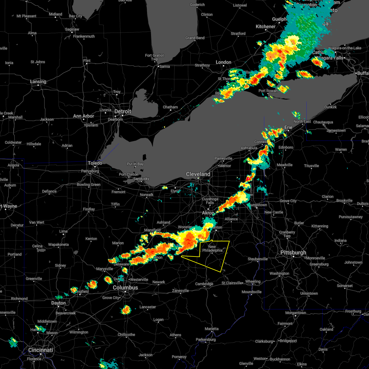 At 917 pm edt, a severe thunderstorm was located over berlin, or near millersburg, moving east at 40 mph (radar indicated). Hazards include 60 mph wind gusts and quarter size hail. Minor hail damage to vehicles is possible. Expect wind damage to trees and power lines, resulting in some power outages. At 917 pm edt, a severe thunderstorm was located over berlin, or near millersburg, moving east at 40 mph (radar indicated). Hazards include 60 mph wind gusts and quarter size hail. Minor hail damage to vehicles is possible. Expect wind damage to trees and power lines, resulting in some power outages.
|
| 6/16/2022 3:25 PM EDT |
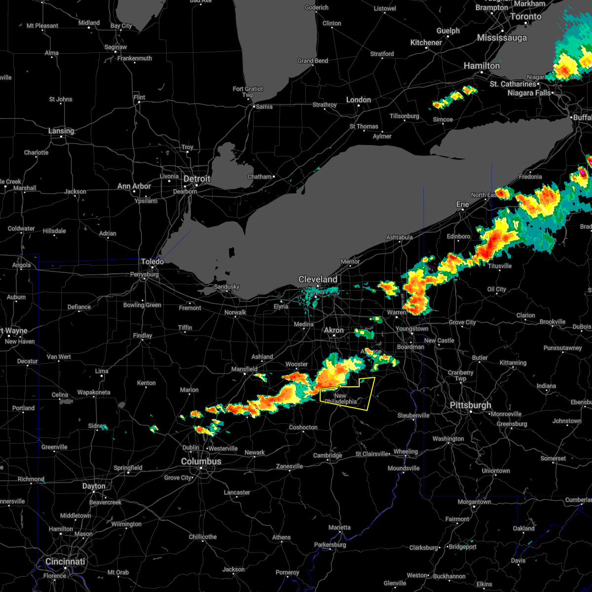 At 325 pm edt, a severe thunderstorm was located near brewster, or 10 miles northwest of dover, moving east at 40 mph (radar indicated). Hazards include two inch hail and 60 mph wind gusts. People and animals outdoors will be injured. expect hail damage to roofs, siding, windows, and vehicles. expect wind damage to trees and power lines, resulting in some power outages. locations impacted include, new philadelphia, dover, strasburg, malvern, bolivar, mineral city, dellroy, sherrodsville, parral, zoar, atwood lake, and leesville lake park. thunderstorm damage threat, considerable hail threat, radar indicated max hail size, 2. 00 in wind threat, radar indicated max wind gust, 60 mph. At 325 pm edt, a severe thunderstorm was located near brewster, or 10 miles northwest of dover, moving east at 40 mph (radar indicated). Hazards include two inch hail and 60 mph wind gusts. People and animals outdoors will be injured. expect hail damage to roofs, siding, windows, and vehicles. expect wind damage to trees and power lines, resulting in some power outages. locations impacted include, new philadelphia, dover, strasburg, malvern, bolivar, mineral city, dellroy, sherrodsville, parral, zoar, atwood lake, and leesville lake park. thunderstorm damage threat, considerable hail threat, radar indicated max hail size, 2. 00 in wind threat, radar indicated max wind gust, 60 mph.
|
| 6/16/2022 3:15 PM EDT |
 At 315 pm edt, a severe thunderstorm was located over mount eaton, or 15 miles northeast of millersburg, moving east at 40 mph (radar indicated). Hazards include 60 mph wind gusts and half dollar size hail. Minor hail damage to vehicles is possible. expect wind damage to trees and power lines, resulting in some power outages. locations impacted include, new philadelphia, dover, strasburg, malvern, bolivar, mineral city, dellroy, sherrodsville, parral, zoar, atwood lake, and leesville lake park. hail threat, radar indicated max hail size, 1. 25 in wind threat, radar indicated max wind gust, 60 mph. At 315 pm edt, a severe thunderstorm was located over mount eaton, or 15 miles northeast of millersburg, moving east at 40 mph (radar indicated). Hazards include 60 mph wind gusts and half dollar size hail. Minor hail damage to vehicles is possible. expect wind damage to trees and power lines, resulting in some power outages. locations impacted include, new philadelphia, dover, strasburg, malvern, bolivar, mineral city, dellroy, sherrodsville, parral, zoar, atwood lake, and leesville lake park. hail threat, radar indicated max hail size, 1. 25 in wind threat, radar indicated max wind gust, 60 mph.
|
| 6/16/2022 3:07 PM EDT |
 At 307 pm edt, a severe thunderstorm was located near mount eaton, or 10 miles southeast of wooster, moving east at 40 mph (radar indicated). Hazards include 60 mph wind gusts and quarter size hail. Minor hail damage to vehicles is possible. Expect wind damage to trees and power lines, resulting in some power outages. At 307 pm edt, a severe thunderstorm was located near mount eaton, or 10 miles southeast of wooster, moving east at 40 mph (radar indicated). Hazards include 60 mph wind gusts and quarter size hail. Minor hail damage to vehicles is possible. Expect wind damage to trees and power lines, resulting in some power outages.
|
| 6/14/2022 12:53 AM EDT |
 At 1253 am edt, a severe thunderstorm was located near carrollton, moving east at 65 mph (radar indicated). Hazards include 70 mph wind gusts and quarter size hail. Minor hail damage to vehicles is possible. trees snapped and uprooted. Power outages can be expected. At 1253 am edt, a severe thunderstorm was located near carrollton, moving east at 65 mph (radar indicated). Hazards include 70 mph wind gusts and quarter size hail. Minor hail damage to vehicles is possible. trees snapped and uprooted. Power outages can be expected.
|
| 6/14/2022 12:24 AM EDT |
 At 1223 am edt, severe thunderstorms were located along a line extending from massillon to near west lafayette to 8 miles west of south zanesville, moving southeast at 50 mph (radar indicated). Hazards include 70 mph wind gusts and quarter size hail. Minor hail damage to vehicles is possible. trees snapped and uprooted. power outages can be expected. Locations impacted include, zanesville, new philadelphia, dover, coshocton, cambridge, uhrichsville, newcomerstown, minerva, dennison, strasburg, new concord, and byesville. At 1223 am edt, severe thunderstorms were located along a line extending from massillon to near west lafayette to 8 miles west of south zanesville, moving southeast at 50 mph (radar indicated). Hazards include 70 mph wind gusts and quarter size hail. Minor hail damage to vehicles is possible. trees snapped and uprooted. power outages can be expected. Locations impacted include, zanesville, new philadelphia, dover, coshocton, cambridge, uhrichsville, newcomerstown, minerva, dennison, strasburg, new concord, and byesville.
|
| 6/13/2022 11:43 PM EDT |
 At 1143 pm edt, severe thunderstorms were located along a line extending from lodi to 6 miles south of loudonville to near johnstown, moving southeast at 50 mph (radar indicated). Hazards include 70 mph wind gusts and nickel size hail. Trees snapped and uprooted. Power outages can be expected. At 1143 pm edt, severe thunderstorms were located along a line extending from lodi to 6 miles south of loudonville to near johnstown, moving southeast at 50 mph (radar indicated). Hazards include 70 mph wind gusts and nickel size hail. Trees snapped and uprooted. Power outages can be expected.
|
| 6/1/2022 7:04 PM EDT |
 At 704 pm edt, severe thunderstorms were located along a line extending from near new wilmington to near minerva, moving southeast at 35 mph (radar indicated). Hazards include 60 mph wind gusts and quarter size hail. Minor hail damage to vehicles is possible. expect wind damage to trees and power lines, resulting in some power outages. locations impacted include, new castle, hermitage, sharon, salem, east liverpool, beaver falls, columbiana, east palestine, wellsville, carrollton, ellwood city, and farrell. hail threat, radar indicated max hail size, 1. 00 in wind threat, radar indicated max wind gust, 60 mph. At 704 pm edt, severe thunderstorms were located along a line extending from near new wilmington to near minerva, moving southeast at 35 mph (radar indicated). Hazards include 60 mph wind gusts and quarter size hail. Minor hail damage to vehicles is possible. expect wind damage to trees and power lines, resulting in some power outages. locations impacted include, new castle, hermitage, sharon, salem, east liverpool, beaver falls, columbiana, east palestine, wellsville, carrollton, ellwood city, and farrell. hail threat, radar indicated max hail size, 1. 00 in wind threat, radar indicated max wind gust, 60 mph.
|
| 6/1/2022 6:43 PM EDT |
 At 642 pm edt, severe thunderstorms were located along a line extending from near hubbard to near waynesburg, moving southeast at 35 mph (radar indicated). Hazards include 60 mph wind gusts and quarter size hail. Minor hail damage to vehicles is possible. Expect wind damage to trees and power lines, resulting in some power outages. At 642 pm edt, severe thunderstorms were located along a line extending from near hubbard to near waynesburg, moving southeast at 35 mph (radar indicated). Hazards include 60 mph wind gusts and quarter size hail. Minor hail damage to vehicles is possible. Expect wind damage to trees and power lines, resulting in some power outages.
|
| 3/23/2022 8:09 PM EDT |
 The severe thunderstorm warning for west central columbiana, northwestern carroll and northeastern tuscarawas counties will expire at 815 pm edt, the storm which prompted the warning has weakened below severe limits, and has exited the warned area. therefore, the warning will be allowed to expire. however heavy rain is still possible with this thunderstorm. a tornado watch remains in effect until 1000 pm edt for east central ohio. The severe thunderstorm warning for west central columbiana, northwestern carroll and northeastern tuscarawas counties will expire at 815 pm edt, the storm which prompted the warning has weakened below severe limits, and has exited the warned area. therefore, the warning will be allowed to expire. however heavy rain is still possible with this thunderstorm. a tornado watch remains in effect until 1000 pm edt for east central ohio.
|
| 3/23/2022 8:04 PM EDT |
 At 804 pm edt, a severe thunderstorm was located near waynesburg, or near canton, moving northeast at 55 mph (radar indicated). Hazards include 60 mph wind gusts and quarter size hail. Minor hail damage to vehicles is possible. expect wind damage to trees and power lines, resulting in some power outages. locations impacted include, new philadelphia, dover, minerva, malvern, bolivar, mineral city, zoar, and east rochester. hail threat, radar indicated max hail size, 1. 00 in wind threat, radar indicated max wind gust, 60 mph. At 804 pm edt, a severe thunderstorm was located near waynesburg, or near canton, moving northeast at 55 mph (radar indicated). Hazards include 60 mph wind gusts and quarter size hail. Minor hail damage to vehicles is possible. expect wind damage to trees and power lines, resulting in some power outages. locations impacted include, new philadelphia, dover, minerva, malvern, bolivar, mineral city, zoar, and east rochester. hail threat, radar indicated max hail size, 1. 00 in wind threat, radar indicated max wind gust, 60 mph.
|
| 3/23/2022 7:56 PM EDT |
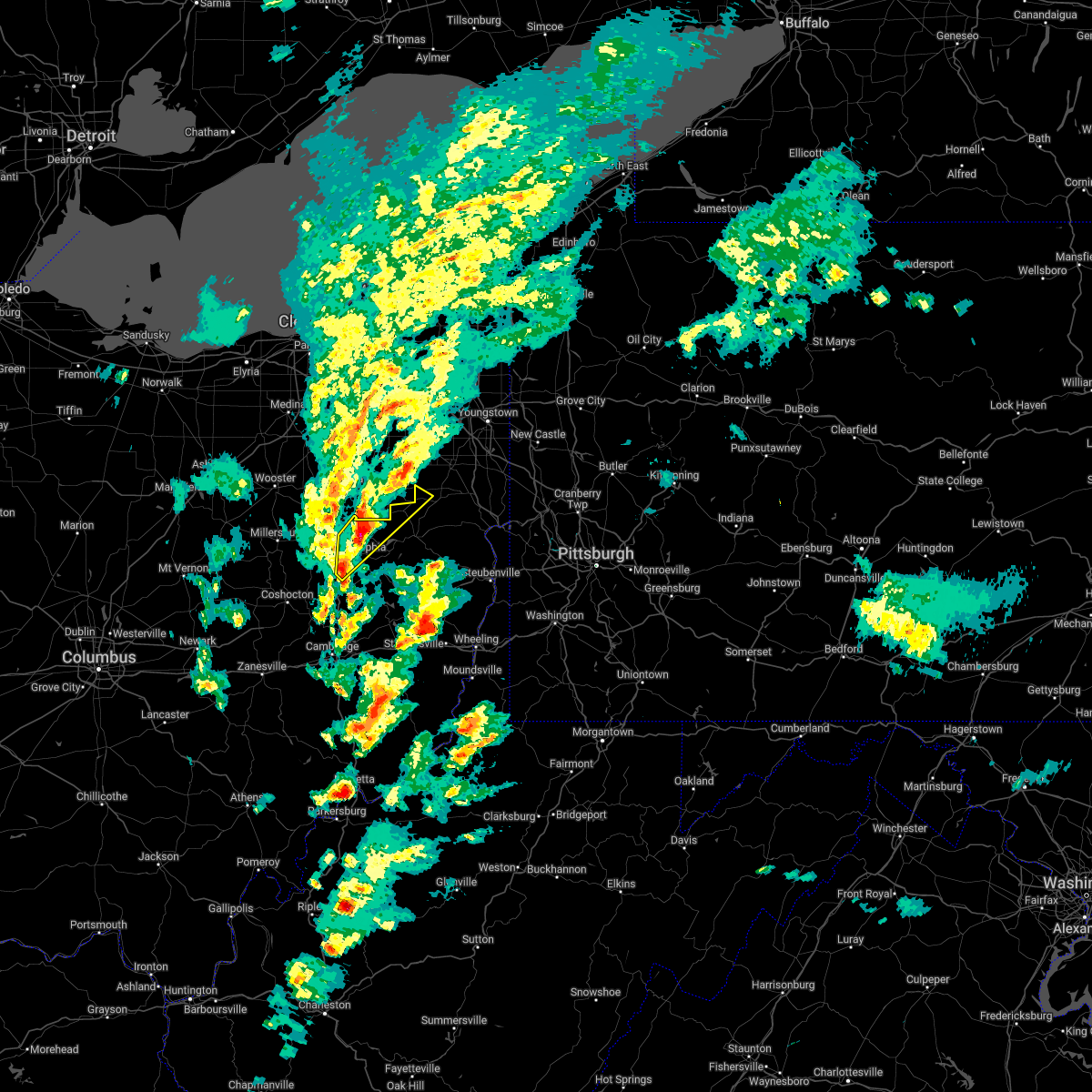 At 756 pm edt, a severe thunderstorm was located over east sparta, or 10 miles northeast of dover, moving northeast at 55 mph (radar indicated). Hazards include 60 mph wind gusts and quarter size hail. Minor hail damage to vehicles is possible. expect wind damage to trees and power lines, resulting in some power outages. locations impacted include, new philadelphia, dover, minerva, strasburg, malvern, bolivar, mineral city, parral, stone creek, zoar, and east rochester. hail threat, radar indicated max hail size, 1. 00 in wind threat, radar indicated max wind gust, 60 mph. At 756 pm edt, a severe thunderstorm was located over east sparta, or 10 miles northeast of dover, moving northeast at 55 mph (radar indicated). Hazards include 60 mph wind gusts and quarter size hail. Minor hail damage to vehicles is possible. expect wind damage to trees and power lines, resulting in some power outages. locations impacted include, new philadelphia, dover, minerva, strasburg, malvern, bolivar, mineral city, parral, stone creek, zoar, and east rochester. hail threat, radar indicated max hail size, 1. 00 in wind threat, radar indicated max wind gust, 60 mph.
|
| 3/23/2022 7:42 PM EDT |
 At 741 pm edt, a severe thunderstorm was located near dover, moving northeast at 55 mph (radar indicated). Hazards include 60 mph wind gusts and nickel size hail. expect damage to trees and power lines, resulting in some power outages At 741 pm edt, a severe thunderstorm was located near dover, moving northeast at 55 mph (radar indicated). Hazards include 60 mph wind gusts and nickel size hail. expect damage to trees and power lines, resulting in some power outages
|
| 8/12/2021 9:00 PM EDT |
 At 900 pm edt, a severe thunderstorm was located near dennison, or near uhrichsville, moving east at 20 mph (radar indicated). Hazards include 60 mph wind gusts. expect damage to trees and power lines, resulting in some power outages At 900 pm edt, a severe thunderstorm was located near dennison, or near uhrichsville, moving east at 20 mph (radar indicated). Hazards include 60 mph wind gusts. expect damage to trees and power lines, resulting in some power outages
|
| 8/10/2021 12:37 PM EDT |
 The severe thunderstorm warning for northwestern harrison, northwestern jefferson, southeastern columbiana, northeastern coshocton, carroll and central tuscarawas counties will expire at 1245 pm edt, the storms which prompted the warning have weakened below severe limits, and have exited the warned area. therefore, the warning will be allowed to expire. however gusty winds are still possible with these thunderstorms. The severe thunderstorm warning for northwestern harrison, northwestern jefferson, southeastern columbiana, northeastern coshocton, carroll and central tuscarawas counties will expire at 1245 pm edt, the storms which prompted the warning have weakened below severe limits, and have exited the warned area. therefore, the warning will be allowed to expire. however gusty winds are still possible with these thunderstorms.
|
| 8/10/2021 12:16 PM EDT |
 At 1216 pm edt, severe thunderstorms were located along a line extending from near carrollton to near uhrichsville, moving east at 30 mph (radar indicated). Hazards include 60 mph wind gusts. Expect damage to trees and power lines, resulting in some power outages. locations impacted include, new philadelphia, uhrichsville, carrollton, calcutta, dennison, salineville, gnadenhutten, tuscarawas, scio, midvale, bergholz, and amsterdam. hail threat, radar indicated max hail size, <. 75 in wind threat, radar indicated max wind gust, 60 mph. At 1216 pm edt, severe thunderstorms were located along a line extending from near carrollton to near uhrichsville, moving east at 30 mph (radar indicated). Hazards include 60 mph wind gusts. Expect damage to trees and power lines, resulting in some power outages. locations impacted include, new philadelphia, uhrichsville, carrollton, calcutta, dennison, salineville, gnadenhutten, tuscarawas, scio, midvale, bergholz, and amsterdam. hail threat, radar indicated max hail size, <. 75 in wind threat, radar indicated max wind gust, 60 mph.
|
| 8/10/2021 12:00 PM EDT |
 At 1159 am edt, severe thunderstorms were located along a line extending from near carrollton to 6 miles southwest of new philadelphia, moving east at 25 mph (radar indicated). Hazards include 60 mph wind gusts and quarter size hail. Minor hail damage to vehicles is possible. Expect wind damage to trees and power lines, resulting in some power outages. At 1159 am edt, severe thunderstorms were located along a line extending from near carrollton to 6 miles southwest of new philadelphia, moving east at 25 mph (radar indicated). Hazards include 60 mph wind gusts and quarter size hail. Minor hail damage to vehicles is possible. Expect wind damage to trees and power lines, resulting in some power outages.
|
| 8/10/2021 11:40 AM EDT |
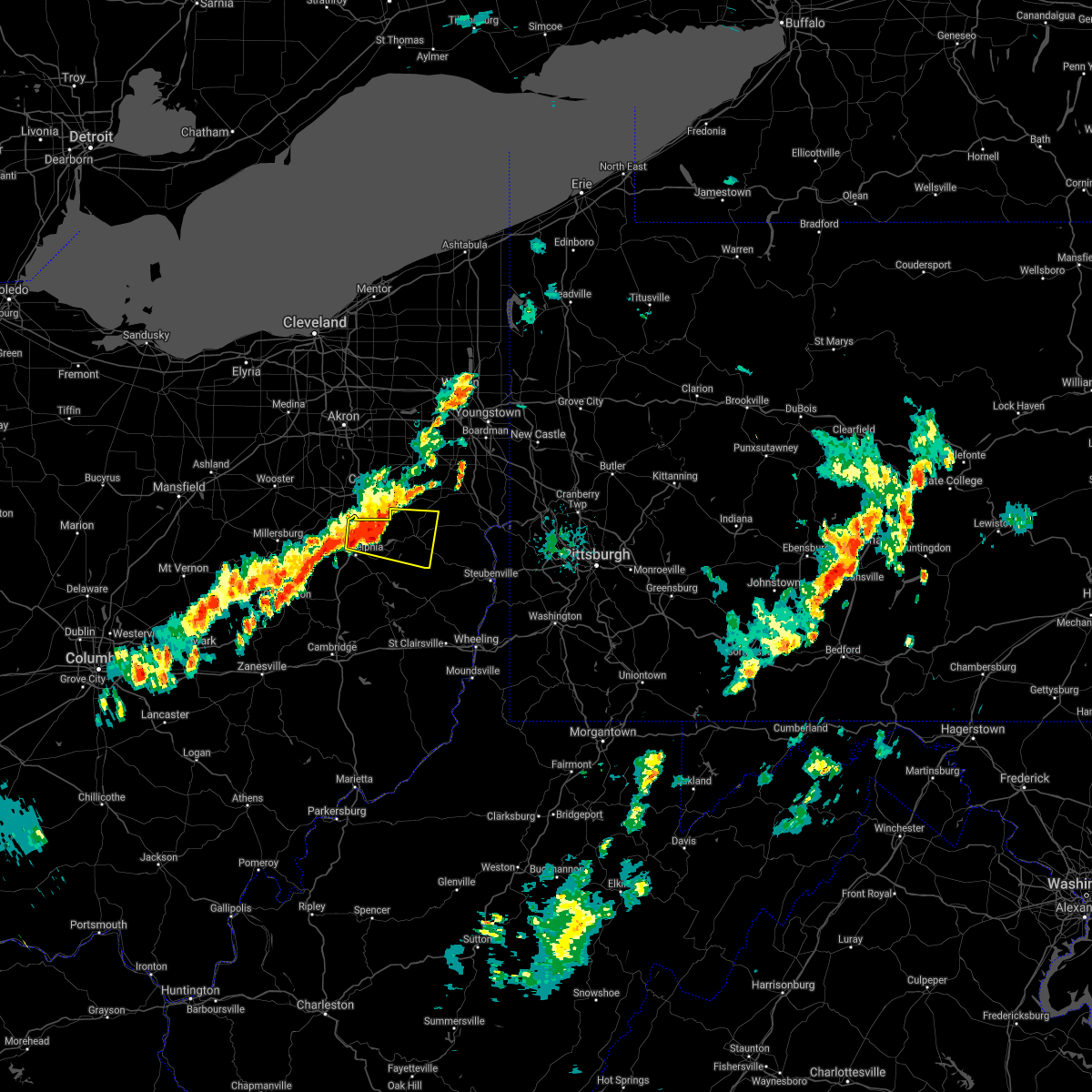 At 1140 am edt, a severe thunderstorm was located over dover, moving east at 20 mph (radar). Hazards include wind gusts to 60 mph and quarter-size hail. Minor hail damage to vehicles is possible. expect wind damage to trees and power lines, resulting in some power outages. Locations impacted include, new philadelphia, dover, carrollton, augusta, malvern, bolivar, mineral city, dellroy, sherrodsville, parral, zoar, atwood lake, this includes interstate 77 in ohio between mile markers 83 and 85, and between mile markers 90 and 94. At 1140 am edt, a severe thunderstorm was located over dover, moving east at 20 mph (radar). Hazards include wind gusts to 60 mph and quarter-size hail. Minor hail damage to vehicles is possible. expect wind damage to trees and power lines, resulting in some power outages. Locations impacted include, new philadelphia, dover, carrollton, augusta, malvern, bolivar, mineral city, dellroy, sherrodsville, parral, zoar, atwood lake, this includes interstate 77 in ohio between mile markers 83 and 85, and between mile markers 90 and 94.
|
| 8/10/2021 11:28 AM EDT |
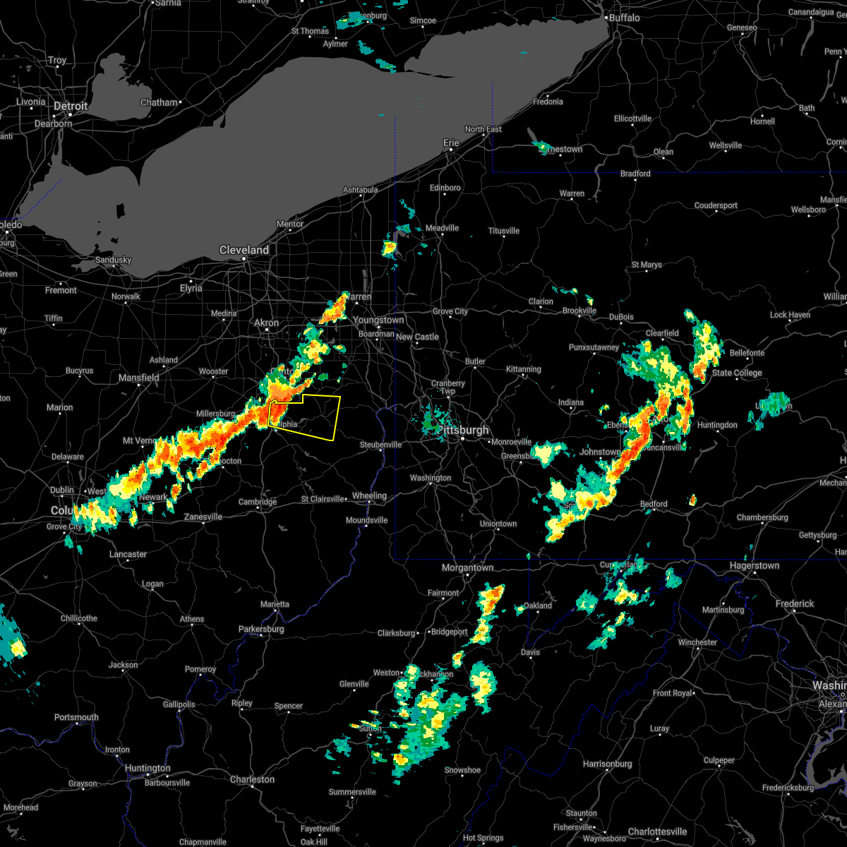 At 1128 am edt, a severe thunderstorm was located near east sparta, or near dover, moving east at 30 mph (radar indicated). Hazards include 60 mph wind gusts. expect damage to trees and power lines, resulting in some power outages At 1128 am edt, a severe thunderstorm was located near east sparta, or near dover, moving east at 30 mph (radar indicated). Hazards include 60 mph wind gusts. expect damage to trees and power lines, resulting in some power outages
|
| 6/21/2021 1:49 PM EDT |
 At 149 pm edt, a severe thunderstorm was located near minerva, or 10 miles northeast of carrollton, moving east at 40 mph (radar). Hazards include wind gusts to 60 mph and quarter-size hail. Minor hail damage to vehicles is possible. expect wind damage to trees and power lines, resulting in some power outages. Locations impacted include, minerva, augusta, malvern, hanoverton, summitville, mechanicstown, new garden, east rochester, north georgetown, winona, homeworth, guilford lake state park,. At 149 pm edt, a severe thunderstorm was located near minerva, or 10 miles northeast of carrollton, moving east at 40 mph (radar). Hazards include wind gusts to 60 mph and quarter-size hail. Minor hail damage to vehicles is possible. expect wind damage to trees and power lines, resulting in some power outages. Locations impacted include, minerva, augusta, malvern, hanoverton, summitville, mechanicstown, new garden, east rochester, north georgetown, winona, homeworth, guilford lake state park,.
|
| 6/21/2021 1:33 PM EDT |
 At 132 pm edt, a severe thunderstorm was located near waynesburg, or 10 miles southeast of canton, moving east at 40 mph (radar). Hazards include wind gusts to 60 mph. expect damage to trees and power lines, resulting in some power outages At 132 pm edt, a severe thunderstorm was located near waynesburg, or 10 miles southeast of canton, moving east at 40 mph (radar). Hazards include wind gusts to 60 mph. expect damage to trees and power lines, resulting in some power outages
|
| 11/15/2020 1:56 PM EST |
 At 155 pm est, severe thunderstorms were located along a line extending from near minerva to 8 miles southeast of byesville, and are nearly stationary (radar). Hazards include wind gusts to 60 mph. Expect damage to trees and power lines, resulting in some power outages. locations impacted include, steubenville, salem, columbiana, st. Clairsville, bellaire, barnesville, wellsville, cadiz, carrollton, woodsfield, freeport, wintersville, this includes interstate 70 in ohio between mile markers 191 and 225. At 155 pm est, severe thunderstorms were located along a line extending from near minerva to 8 miles southeast of byesville, and are nearly stationary (radar). Hazards include wind gusts to 60 mph. Expect damage to trees and power lines, resulting in some power outages. locations impacted include, steubenville, salem, columbiana, st. Clairsville, bellaire, barnesville, wellsville, cadiz, carrollton, woodsfield, freeport, wintersville, this includes interstate 70 in ohio between mile markers 191 and 225.
|
| 11/15/2020 1:41 PM EST |
 At 140 pm est, severe thunderstorms were located along a line extending from near minerva to 8 miles southeast of byesville, moving east at 55 mph (radar). Hazards include wind gusts to 60 mph. expect damage to trees and power lines, resulting in some power outages At 140 pm est, severe thunderstorms were located along a line extending from near minerva to 8 miles southeast of byesville, moving east at 55 mph (radar). Hazards include wind gusts to 60 mph. expect damage to trees and power lines, resulting in some power outages
|
| 11/15/2020 1:23 PM EST |
 At 122 pm est, severe thunderstorms were located along a line extending from mount eaton to 9 miles southeast of south zanesville, and are nearly stationary (radar). Hazards include wind gusts to 60 mph. Expect damage to trees and power lines, resulting in some power outages. locations impacted include, new philadelphia, dover, cambridge, uhrichsville, caldwell, freeport, newcomerstown, dennison, strasburg, new concord, byesville, west lafayette, this includes the following highways, interstate 70 in ohio between mile markers 166 and 196. Interstate 77 in ohio between mile markers 18 and 95. At 122 pm est, severe thunderstorms were located along a line extending from mount eaton to 9 miles southeast of south zanesville, and are nearly stationary (radar). Hazards include wind gusts to 60 mph. Expect damage to trees and power lines, resulting in some power outages. locations impacted include, new philadelphia, dover, cambridge, uhrichsville, caldwell, freeport, newcomerstown, dennison, strasburg, new concord, byesville, west lafayette, this includes the following highways, interstate 70 in ohio between mile markers 166 and 196. Interstate 77 in ohio between mile markers 18 and 95.
|
| 11/15/2020 1:07 PM EST |
 At 107 pm est, severe thunderstorms were located along a line extending from mount eaton to 9 miles southeast of south zanesville, moving east at 45 mph (radar). Hazards include wind gusts to 70 mph. Trees snapped and uprooted. Power outages can be expected. At 107 pm est, severe thunderstorms were located along a line extending from mount eaton to 9 miles southeast of south zanesville, moving east at 45 mph (radar). Hazards include wind gusts to 70 mph. Trees snapped and uprooted. Power outages can be expected.
|
| 8/27/2020 7:04 PM EDT |
 At 704 pm edt, a severe thunderstorm was located near waynesburg, or 9 miles west of carrollton, moving southeast at 50 mph (radar). Hazards include wind gusts to 60 mph. expect damage to trees and power lines, resulting in some power outages At 704 pm edt, a severe thunderstorm was located near waynesburg, or 9 miles west of carrollton, moving southeast at 50 mph (radar). Hazards include wind gusts to 60 mph. expect damage to trees and power lines, resulting in some power outages
|
| 8/27/2020 6:57 PM EDT |
 The severe thunderstorm warning for northeastern harrison, northern jefferson, southwestern columbiana, central carroll, northwestern washington, southwestern beaver, northeastern brooke and southern hancock counties will expire at 700 pm edt, the storms which prompted the warning have weakened below severe limits, and no longer pose an immediate threat to life or property. therefore, the warning will be allowed to expire. however gusty winds and heavy rain are still possible with these thunderstorms. a severe thunderstorm watch remains in effect until midnight edt for western and southwestern pennsylvania. The severe thunderstorm warning for northeastern harrison, northern jefferson, southwestern columbiana, central carroll, northwestern washington, southwestern beaver, northeastern brooke and southern hancock counties will expire at 700 pm edt, the storms which prompted the warning have weakened below severe limits, and no longer pose an immediate threat to life or property. therefore, the warning will be allowed to expire. however gusty winds and heavy rain are still possible with these thunderstorms. a severe thunderstorm watch remains in effect until midnight edt for western and southwestern pennsylvania.
|
| 8/27/2020 6:52 PM EDT |
 At 651 pm edt, severe thunderstorms were located along a line extending from near toronto to weirton to near wintersville, moving southeast at 40 mph (radar). Hazards include wind gusts to 60 mph. Expect damage to trees and power lines, resulting in some power outages. Locations impacted include, weirton, steubenville, carrollton, toronto, wintersville, mingo junction, follansbee, hooverson heights, new cumberland, augusta, burgettstown, malvern,. At 651 pm edt, severe thunderstorms were located along a line extending from near toronto to weirton to near wintersville, moving southeast at 40 mph (radar). Hazards include wind gusts to 60 mph. Expect damage to trees and power lines, resulting in some power outages. Locations impacted include, weirton, steubenville, carrollton, toronto, wintersville, mingo junction, follansbee, hooverson heights, new cumberland, augusta, burgettstown, malvern,.
|
| 8/27/2020 6:11 PM EDT |
 At 610 pm edt, severe thunderstorms were located along a line extending from 8 miles southwest of lisbon to 8 miles northeast of carrollton to near minerva, moving southeast at 40 mph (radar). Hazards include wind gusts to 60 mph. expect damage to trees and power lines, resulting in some power outages At 610 pm edt, severe thunderstorms were located along a line extending from 8 miles southwest of lisbon to 8 miles northeast of carrollton to near minerva, moving southeast at 40 mph (radar). Hazards include wind gusts to 60 mph. expect damage to trees and power lines, resulting in some power outages
|
| 7/10/2020 4:38 PM EDT |
 At 438 pm edt, a severe thunderstorm was located over waynesburg, or 8 miles northwest of carrollton, moving northeast at 15 mph (radar). Hazards include wind gusts to 60 mph and quarter-size hail. Minor hail damage to vehicles is possible. expect wind damage to trees and power lines, resulting in some power outages. Locations impacted include, carrollton, minerva, augusta, malvern, mineral city, dellroy, sherrodsville, zoar, mechanicstown, atwood lake,. At 438 pm edt, a severe thunderstorm was located over waynesburg, or 8 miles northwest of carrollton, moving northeast at 15 mph (radar). Hazards include wind gusts to 60 mph and quarter-size hail. Minor hail damage to vehicles is possible. expect wind damage to trees and power lines, resulting in some power outages. Locations impacted include, carrollton, minerva, augusta, malvern, mineral city, dellroy, sherrodsville, zoar, mechanicstown, atwood lake,.
|
| 7/10/2020 4:26 PM EDT |
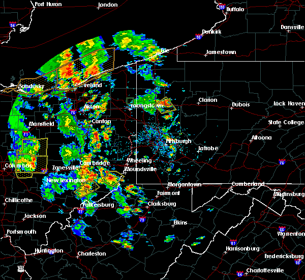 At 425 pm edt, a severe thunderstorm was located near waynesburg, or 9 miles west of carrollton, moving northeast at 15 mph (radar). Hazards include wind gusts to 60 mph. expect damage to trees and power lines, resulting in some power outages At 425 pm edt, a severe thunderstorm was located near waynesburg, or 9 miles west of carrollton, moving northeast at 15 mph (radar). Hazards include wind gusts to 60 mph. expect damage to trees and power lines, resulting in some power outages
|
| 6/10/2020 9:02 PM EDT |
 At 902 pm edt, severe thunderstorms were located along a line extending from 7 miles north of sebring to near st. clairsville, moving northeast at 65 mph (radar). Hazards include wind gusts to 60 mph and quarter-size hail. Minor hail damage to vehicles is possible. expect wind damage to trees and power lines, resulting in some power outages. Locations impacted include, carrollton, minerva, augusta, malvern, jewett, bergholz, amsterdam, hanoverton, mechanicstown, north georgetown, kilgore, homeworth,. At 902 pm edt, severe thunderstorms were located along a line extending from 7 miles north of sebring to near st. clairsville, moving northeast at 65 mph (radar). Hazards include wind gusts to 60 mph and quarter-size hail. Minor hail damage to vehicles is possible. expect wind damage to trees and power lines, resulting in some power outages. Locations impacted include, carrollton, minerva, augusta, malvern, jewett, bergholz, amsterdam, hanoverton, mechanicstown, north georgetown, kilgore, homeworth,.
|
| 6/10/2020 8:24 PM EDT |
 At 823 pm edt, severe thunderstorms were located along a line extending from near wilmot to near caldwell, moving northeast at 65 mph (radar). Hazards include wind gusts to 60 mph and quarter-size hail. Minor hail damage to vehicles is possible. Expect wind damage to trees and power lines, resulting in some power outages. At 823 pm edt, severe thunderstorms were located along a line extending from near wilmot to near caldwell, moving northeast at 65 mph (radar). Hazards include wind gusts to 60 mph and quarter-size hail. Minor hail damage to vehicles is possible. Expect wind damage to trees and power lines, resulting in some power outages.
|
| 6/5/2020 7:50 PM EDT |
 At 750 pm edt, a severe thunderstorm was located near waynesburg, or 10 miles northeast of new philadelphia, moving southeast at 20 mph (radar). Hazards include wind gusts to 60 mph. expect damage to trees and power lines, resulting in some power outages At 750 pm edt, a severe thunderstorm was located near waynesburg, or 10 miles northeast of new philadelphia, moving southeast at 20 mph (radar). Hazards include wind gusts to 60 mph. expect damage to trees and power lines, resulting in some power outages
|
| 6/4/2020 3:06 PM EDT |
 At 306 pm edt, severe thunderstorms were located along a line extending from near canton to near uhrichsville, moving east at 35 mph (radar). Hazards include wind gusts to 60 mph. Expect damage to trees and power lines, resulting in some power outages. Locations impacted include, new philadelphia, uhrichsville, carrollton, minerva, dennison, gnadenhutten, malvern, tuscarawas, scio, midvale, mineral city, bowerston,. At 306 pm edt, severe thunderstorms were located along a line extending from near canton to near uhrichsville, moving east at 35 mph (radar). Hazards include wind gusts to 60 mph. Expect damage to trees and power lines, resulting in some power outages. Locations impacted include, new philadelphia, uhrichsville, carrollton, minerva, dennison, gnadenhutten, malvern, tuscarawas, scio, midvale, mineral city, bowerston,.
|
| 6/4/2020 2:57 PM EDT |
 At 256 pm edt, severe thunderstorms were located along a line extending from near navarre to near new philadelphia, moving east at 35 mph (radar). Hazards include wind gusts to 60 mph and quarter-size hail. Minor hail damage to vehicles is possible. expect wind damage to trees and power lines, resulting in some power outages. Locations impacted include, new philadelphia, dover, uhrichsville, carrollton, minerva, dennison, gnadenhutten, malvern, tuscarawas, bolivar, scio, midvale, this includes interstate 77 in ohio between mile markers 93 and 94. At 256 pm edt, severe thunderstorms were located along a line extending from near navarre to near new philadelphia, moving east at 35 mph (radar). Hazards include wind gusts to 60 mph and quarter-size hail. Minor hail damage to vehicles is possible. expect wind damage to trees and power lines, resulting in some power outages. Locations impacted include, new philadelphia, dover, uhrichsville, carrollton, minerva, dennison, gnadenhutten, malvern, tuscarawas, bolivar, scio, midvale, this includes interstate 77 in ohio between mile markers 93 and 94.
|
| 6/4/2020 2:46 PM EDT |
 At 245 pm edt, severe thunderstorms were located along a line extending from navarre to 6 miles southwest of new philadelphia, moving east at 35 mph (radar). Hazards include wind gusts to 60 mph and quarter-size hail. Minor hail damage to vehicles is possible. expect wind damage to trees and power lines, resulting in some power outages. Locations impacted include, new philadelphia, dover, uhrichsville, carrollton, minerva, dennison, strasburg, gnadenhutten, malvern, tuscarawas, bolivar, scio, this includes interstate 77 in ohio between mile markers 69 and 94. At 245 pm edt, severe thunderstorms were located along a line extending from navarre to 6 miles southwest of new philadelphia, moving east at 35 mph (radar). Hazards include wind gusts to 60 mph and quarter-size hail. Minor hail damage to vehicles is possible. expect wind damage to trees and power lines, resulting in some power outages. Locations impacted include, new philadelphia, dover, uhrichsville, carrollton, minerva, dennison, strasburg, gnadenhutten, malvern, tuscarawas, bolivar, scio, this includes interstate 77 in ohio between mile markers 69 and 94.
|
| 6/4/2020 2:18 PM EDT |
 At 217 pm edt, severe thunderstorms were located along a line extending from near holmesville to 7 miles north of coshocton, moving east at 35 mph (radar). Hazards include wind gusts to 60 mph. expect damage to trees and power lines, resulting in some power outages At 217 pm edt, severe thunderstorms were located along a line extending from near holmesville to 7 miles north of coshocton, moving east at 35 mph (radar). Hazards include wind gusts to 60 mph. expect damage to trees and power lines, resulting in some power outages
|
| 5/29/2020 3:20 PM EDT |
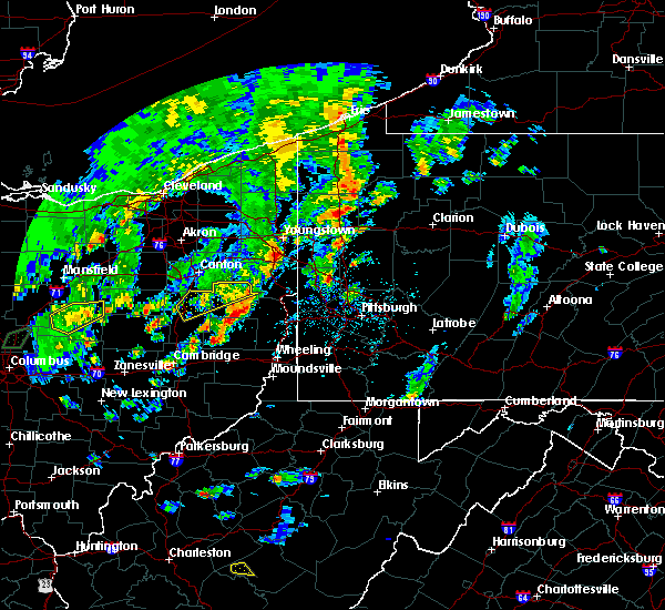 The severe thunderstorm warning for northern carroll and northeastern tuscarawas counties will expire at 330 pm edt, the storm which prompted the warning has weakened below severe limits, and has exited the warned area. therefore, the warning will be allowed to expire. however gusty winds are still possible with this thunderstorm. The severe thunderstorm warning for northern carroll and northeastern tuscarawas counties will expire at 330 pm edt, the storm which prompted the warning has weakened below severe limits, and has exited the warned area. therefore, the warning will be allowed to expire. however gusty winds are still possible with this thunderstorm.
|
| 5/29/2020 3:07 PM EDT |
 At 307 pm edt, a severe thunderstorm was located near waynesburg, or 10 miles northeast of dover, moving northeast at 35 mph (radar). Hazards include wind gusts to 60 mph. Expect damage to trees and power lines, resulting in some power outages. Locations impacted include, new philadelphia, dover, carrollton, minerva, augusta, malvern, bolivar, midvale, mineral city, barnhill, dellroy, sherrodsville, this includes interstate 77 in ohio between mile markers 77 and 86, and between mile markers 91 and 93. At 307 pm edt, a severe thunderstorm was located near waynesburg, or 10 miles northeast of dover, moving northeast at 35 mph (radar). Hazards include wind gusts to 60 mph. Expect damage to trees and power lines, resulting in some power outages. Locations impacted include, new philadelphia, dover, carrollton, minerva, augusta, malvern, bolivar, midvale, mineral city, barnhill, dellroy, sherrodsville, this includes interstate 77 in ohio between mile markers 77 and 86, and between mile markers 91 and 93.
|
| 5/29/2020 2:49 PM EDT |
 At 249 pm edt, a severe thunderstorm was located over dover, moving northeast at 35 mph (radar). Hazards include wind gusts to 60 mph. expect damage to trees and power lines, resulting in some power outages At 249 pm edt, a severe thunderstorm was located over dover, moving northeast at 35 mph (radar). Hazards include wind gusts to 60 mph. expect damage to trees and power lines, resulting in some power outages
|
| 4/8/2020 12:57 AM EDT |
 At 1257 am edt, severe thunderstorms were located along a line extending from near carrollton to near ellwood city, moving southeast at 55 mph (radar). Hazards include wind gusts to 60 mph and quarter-size hail. Minor hail damage to vehicles is possible. expect wind damage to trees and power lines, resulting in some power outages. locations impacted include, east liverpool, beaver falls, monaca, wellsville, carrollton, ellwood city, new brighton, beaver, calcutta, zelienople, rochester, ohioville, this includes the following highways, pennsylvania turnpike between mile markers 9 and 24. interstate 77 in ohio between mile markers 89 and 93. interstate 79 in pennsylvania between mile markers 83 and 88. Interstate 376 in pennsylvania between mile markers 31 and 40. At 1257 am edt, severe thunderstorms were located along a line extending from near carrollton to near ellwood city, moving southeast at 55 mph (radar). Hazards include wind gusts to 60 mph and quarter-size hail. Minor hail damage to vehicles is possible. expect wind damage to trees and power lines, resulting in some power outages. locations impacted include, east liverpool, beaver falls, monaca, wellsville, carrollton, ellwood city, new brighton, beaver, calcutta, zelienople, rochester, ohioville, this includes the following highways, pennsylvania turnpike between mile markers 9 and 24. interstate 77 in ohio between mile markers 89 and 93. interstate 79 in pennsylvania between mile markers 83 and 88. Interstate 376 in pennsylvania between mile markers 31 and 40.
|
| 4/8/2020 12:23 AM EDT |
 At 1223 am edt, severe thunderstorms were located along a line extending from near navarre to near boardman, moving southeast at 55 mph (radar). Hazards include wind gusts to 60 mph and quarter-size hail. Minor hail damage to vehicles is possible. Expect wind damage to trees and power lines, resulting in some power outages. At 1223 am edt, severe thunderstorms were located along a line extending from near navarre to near boardman, moving southeast at 55 mph (radar). Hazards include wind gusts to 60 mph and quarter-size hail. Minor hail damage to vehicles is possible. Expect wind damage to trees and power lines, resulting in some power outages.
|
| 3/28/2020 9:53 AM EDT |
 At 952 am edt, a severe thunderstorm was located near minerva, or 10 miles east of canton, moving east at 50 mph (radar). Hazards include wind gusts to 50 mph and quarter-size hail. Minor hail damage to vehicles is possible. Expect wind damage to trees and power lines, resulting in some power outages. At 952 am edt, a severe thunderstorm was located near minerva, or 10 miles east of canton, moving east at 50 mph (radar). Hazards include wind gusts to 50 mph and quarter-size hail. Minor hail damage to vehicles is possible. Expect wind damage to trees and power lines, resulting in some power outages.
|
| 3/20/2020 1:57 PM EDT |
 The severe thunderstorm warning for west central jefferson, carroll and northeastern tuscarawas counties will expire at 200 pm edt, the storm that prompted the warning has weakened below severe limits and no longer pose an immediate threat to life and property. therefore, the warning will be allowed to expire. however gusty winds are still possible with this thunderstorm. The severe thunderstorm warning for west central jefferson, carroll and northeastern tuscarawas counties will expire at 200 pm edt, the storm that prompted the warning has weakened below severe limits and no longer pose an immediate threat to life and property. therefore, the warning will be allowed to expire. however gusty winds are still possible with this thunderstorm.
|
| 3/20/2020 1:45 PM EDT |
 At 145 pm edt, a severe thunderstorm was located near carrollton, moving east at 55 mph (radar). Hazards include wind gusts to 60 mph. Expect damage to trees and power lines, resulting in some power outages. Locations impacted include, new philadelphia, dover, carrollton, bolivar, mineral city, dellroy, sherrodsville, roswell, parral, zoar, leesville, mechanicstown, this includes interstate 77 in ohio between mile markers 80 and 84, and between mile markers 90 and 94. At 145 pm edt, a severe thunderstorm was located near carrollton, moving east at 55 mph (radar). Hazards include wind gusts to 60 mph. Expect damage to trees and power lines, resulting in some power outages. Locations impacted include, new philadelphia, dover, carrollton, bolivar, mineral city, dellroy, sherrodsville, roswell, parral, zoar, leesville, mechanicstown, this includes interstate 77 in ohio between mile markers 80 and 84, and between mile markers 90 and 94.
|
| 3/20/2020 1:29 PM EDT |
 At 128 pm edt, a severe thunderstorm was located over dover, moving east at 55 mph (radar). Hazards include wind gusts to 60 mph. expect damage to trees and power lines, resulting in some power outages At 128 pm edt, a severe thunderstorm was located over dover, moving east at 55 mph (radar). Hazards include wind gusts to 60 mph. expect damage to trees and power lines, resulting in some power outages
|
| 7/16/2019 10:43 PM EDT |
 At 1043 pm edt, a severe thunderstorm was located near waynesburg, or 9 miles west of carrollton, moving east at 30 mph (radar). Hazards include wind gusts to 60 mph. Expect damage to trees and power lines, resulting in some power outages. Locations impacted include, new philadelphia, dover, salem, carrollton, minerva, strasburg, sugarcreek, leetonia, augusta, malvern, bolivar, mineral city, this includes interstate 77 in ohio between mile markers 80 and 94. At 1043 pm edt, a severe thunderstorm was located near waynesburg, or 9 miles west of carrollton, moving east at 30 mph (radar). Hazards include wind gusts to 60 mph. Expect damage to trees and power lines, resulting in some power outages. Locations impacted include, new philadelphia, dover, salem, carrollton, minerva, strasburg, sugarcreek, leetonia, augusta, malvern, bolivar, mineral city, this includes interstate 77 in ohio between mile markers 80 and 94.
|
| 7/16/2019 10:14 PM EDT |
 At 1014 pm edt, a severe thunderstorm was located over strasburg, or near dover, moving east at 35 mph (radar). Hazards include wind gusts to 60 mph. expect damage to trees and power lines, resulting in some power outages At 1014 pm edt, a severe thunderstorm was located over strasburg, or near dover, moving east at 35 mph (radar). Hazards include wind gusts to 60 mph. expect damage to trees and power lines, resulting in some power outages
|
| 7/16/2019 9:42 PM EDT |
 At 942 pm edt, a severe thunderstorm was located near waynesburg, or 8 miles southeast of canton, moving east at 30 mph (radar). Hazards include wind gusts to 60 mph. expect damage to trees and power lines, resulting in some power outages At 942 pm edt, a severe thunderstorm was located near waynesburg, or 8 miles southeast of canton, moving east at 30 mph (radar). Hazards include wind gusts to 60 mph. expect damage to trees and power lines, resulting in some power outages
|
| 7/11/2019 3:52 PM EDT |
 At 351 pm edt, a severe thunderstorm was located near carrollton, moving east at 40 mph (radar). Hazards include wind gusts to 60 mph and quarter-size hail. Minor hail damage to vehicles is possible. expect wind damage to trees and power lines, resulting in some power outages. Locations impacted include, new philadelphia, dover, uhrichsville, carrollton, dennison, gnadenhutten, tuscarawas, midvale, mineral city, barnhill, dellroy, sherrodsville,. At 351 pm edt, a severe thunderstorm was located near carrollton, moving east at 40 mph (radar). Hazards include wind gusts to 60 mph and quarter-size hail. Minor hail damage to vehicles is possible. expect wind damage to trees and power lines, resulting in some power outages. Locations impacted include, new philadelphia, dover, uhrichsville, carrollton, dennison, gnadenhutten, tuscarawas, midvale, mineral city, barnhill, dellroy, sherrodsville,.
|
| 7/11/2019 3:29 PM EDT |
 At 329 pm edt, a severe thunderstorm was located near strasburg, or near dover, moving southeast at 30 mph (radar). Hazards include wind gusts to 60 mph and quarter-size hail. Minor hail damage to vehicles is possible. expect wind damage to trees and power lines, resulting in some power outages. Locations impacted include, new philadelphia, dover, uhrichsville, carrollton, dennison, strasburg, gnadenhutten, tuscarawas, bolivar, midvale, mineral city, barnhill, this includes interstate 77 in ohio between mile markers 77 and 94. At 329 pm edt, a severe thunderstorm was located near strasburg, or near dover, moving southeast at 30 mph (radar). Hazards include wind gusts to 60 mph and quarter-size hail. Minor hail damage to vehicles is possible. expect wind damage to trees and power lines, resulting in some power outages. Locations impacted include, new philadelphia, dover, uhrichsville, carrollton, dennison, strasburg, gnadenhutten, tuscarawas, bolivar, midvale, mineral city, barnhill, this includes interstate 77 in ohio between mile markers 77 and 94.
|
| 7/11/2019 3:23 PM EDT |
 The severe thunderstorm warning for northern columbiana and northeastern carroll counties will expire at 330 pm edt. the storms that prompted the warning have moved out of the area. therefore, the warning will be allowed to expire. However heavy rain is still possible with these thunderstorms. The severe thunderstorm warning for northern columbiana and northeastern carroll counties will expire at 330 pm edt. the storms that prompted the warning have moved out of the area. therefore, the warning will be allowed to expire. However heavy rain is still possible with these thunderstorms.
|
| 7/11/2019 3:19 PM EDT |
 At 318 pm edt, a severe thunderstorm was located over waynesburg, or 9 miles southeast of canton, moving east at 45 mph (radar). Hazards include wind gusts to 60 mph and half dollar-size hail. Minor hail damage to vehicles is possible. Expect wind damage to trees and power lines, resulting in some power outages. At 318 pm edt, a severe thunderstorm was located over waynesburg, or 9 miles southeast of canton, moving east at 45 mph (radar). Hazards include wind gusts to 60 mph and half dollar-size hail. Minor hail damage to vehicles is possible. Expect wind damage to trees and power lines, resulting in some power outages.
|
| 7/11/2019 2:46 PM EDT |
 At 246 pm edt, severe thunderstorms were located along a line extending from near salem to minerva, moving east at 25 mph (radar). Hazards include wind gusts to 60 mph and quarter-size hail. Minor hail damage to vehicles is possible. expect wind damage to trees and power lines, resulting in some power outages. Locations impacted include, salem, columbiana, minerva, lisbon, leetonia, new waterford, augusta, malvern, hanoverton, north georgetown, homeworth, guilford lake state park,. At 246 pm edt, severe thunderstorms were located along a line extending from near salem to minerva, moving east at 25 mph (radar). Hazards include wind gusts to 60 mph and quarter-size hail. Minor hail damage to vehicles is possible. expect wind damage to trees and power lines, resulting in some power outages. Locations impacted include, salem, columbiana, minerva, lisbon, leetonia, new waterford, augusta, malvern, hanoverton, north georgetown, homeworth, guilford lake state park,.
|
| 7/11/2019 2:38 PM EDT |
 The national weather service in pittsburgh has issued a * severe thunderstorm warning for. northern columbiana county in east central ohio. northeastern carroll county in east central ohio. until 330 pm edt. At 238 pm edt, severe thunderstorms were located along a line. The national weather service in pittsburgh has issued a * severe thunderstorm warning for. northern columbiana county in east central ohio. northeastern carroll county in east central ohio. until 330 pm edt. At 238 pm edt, severe thunderstorms were located along a line.
|
| 7/2/2019 6:28 PM EDT |
 At 628 pm edt, severe thunderstorms were located along a line extending from near minerva to near waynesburg to near dover, moving southeast at 20 mph (radar). Hazards include wind gusts to 60 mph and quarter-size hail. Minor hail damage to vehicles is possible. expect wind damage to trees and power lines, resulting in some power outages. Locations impacted include, new philadelphia, dover, uhrichsville, carrollton, minerva, lisbon, dennison, strasburg, sugarcreek, augusta, salineville, gnadenhutten,. At 628 pm edt, severe thunderstorms were located along a line extending from near minerva to near waynesburg to near dover, moving southeast at 20 mph (radar). Hazards include wind gusts to 60 mph and quarter-size hail. Minor hail damage to vehicles is possible. expect wind damage to trees and power lines, resulting in some power outages. Locations impacted include, new philadelphia, dover, uhrichsville, carrollton, minerva, lisbon, dennison, strasburg, sugarcreek, augusta, salineville, gnadenhutten,.
|
| 7/2/2019 6:20 PM EDT |
 At 619 pm edt, a cluster of severe thunderstorms was located along a line extending from near minerva to waynesburg to near dover, moving southeast at 20 mph (radar). Hazards include wind gusts to 60 mph and quarter-size hail. Minor hail damage to vehicles is possible. Expect wind damage to trees and power lines, resulting in some power outages. At 619 pm edt, a cluster of severe thunderstorms was located along a line extending from near minerva to waynesburg to near dover, moving southeast at 20 mph (radar). Hazards include wind gusts to 60 mph and quarter-size hail. Minor hail damage to vehicles is possible. Expect wind damage to trees and power lines, resulting in some power outages.
|
| 6/24/2019 5:51 PM EDT |
 At 551 pm edt, severe thunderstorms were located along a line extending from near waynesburg to near powhatan point, moving northeast at 45 mph (radar). Hazards include wind gusts to 60 mph. expect damage to trees and power lines, resulting in some power outages At 551 pm edt, severe thunderstorms were located along a line extending from near waynesburg to near powhatan point, moving northeast at 45 mph (radar). Hazards include wind gusts to 60 mph. expect damage to trees and power lines, resulting in some power outages
|
| 6/24/2019 5:45 PM EDT |
 At 544 pm edt, a severe thunderstorm was located near dennison, or 7 miles north of uhrichsville, moving northeast at 40 mph (radar). Hazards include wind gusts to 60 mph. expect damage to trees and power lines, resulting in some power outages At 544 pm edt, a severe thunderstorm was located near dennison, or 7 miles north of uhrichsville, moving northeast at 40 mph (radar). Hazards include wind gusts to 60 mph. expect damage to trees and power lines, resulting in some power outages
|
| 5/28/2019 6:23 PM EDT |
 The severe thunderstorm warning for western carroll and northeastern tuscarawas counties will expire at 630 pm edt, the storm that prompted the warning has weakened below severe limits and has exited the warned area. therefore, the warning will be allowed to expire. however gusty winds and heavy rain are still possible with this thunderstorm. a tornado watch remains in effect until 1000 pm edt for east central ohio. The severe thunderstorm warning for western carroll and northeastern tuscarawas counties will expire at 630 pm edt, the storm that prompted the warning has weakened below severe limits and has exited the warned area. therefore, the warning will be allowed to expire. however gusty winds and heavy rain are still possible with this thunderstorm. a tornado watch remains in effect until 1000 pm edt for east central ohio.
|
| 5/28/2019 6:10 PM EDT |
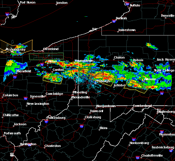 At 610 pm edt, a severe thunderstorm was located 7 miles south of east sparta, or 7 miles northeast of new philadelphia, moving east at 35 mph (radar). Hazards include wind gusts to 60 mph. Expect damage to trees and power lines, resulting in some power outages. locations impacted include, dover, carrollton, strasburg, bolivar, mineral city, dellroy, sherrodsville, parral, zoar, atwood lake, leesville lake park, this includes interstate 77 in ohio between mile markers 87 and 94. A tornado watch remains in effect until 1000 pm edt for east central ohio. At 610 pm edt, a severe thunderstorm was located 7 miles south of east sparta, or 7 miles northeast of new philadelphia, moving east at 35 mph (radar). Hazards include wind gusts to 60 mph. Expect damage to trees and power lines, resulting in some power outages. locations impacted include, dover, carrollton, strasburg, bolivar, mineral city, dellroy, sherrodsville, parral, zoar, atwood lake, leesville lake park, this includes interstate 77 in ohio between mile markers 87 and 94. A tornado watch remains in effect until 1000 pm edt for east central ohio.
|
| 5/28/2019 5:39 PM EDT |
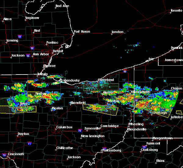 At 539 pm edt, a severe thunderstorm was located over winesburg, or 12 miles northwest of dover, moving east at 35 mph (radar). Hazards include wind gusts to 60 mph and quarter-size hail. Minor hail damage to vehicles is possible. Expect wind damage to trees and power lines, resulting in some power outages. At 539 pm edt, a severe thunderstorm was located over winesburg, or 12 miles northwest of dover, moving east at 35 mph (radar). Hazards include wind gusts to 60 mph and quarter-size hail. Minor hail damage to vehicles is possible. Expect wind damage to trees and power lines, resulting in some power outages.
|
| 5/25/2019 6:41 PM EDT |
 At 641 pm edt, severe thunderstorms were located along a line extending from 6 miles west of lisbon to near dennison, moving east at 50 mph (radar). Hazards include wind gusts to 60 mph. Expect damage to trees and power lines, resulting in some power outages. locations impacted include, new philadelphia, dover, east liverpool, uhrichsville, east palestine, wellsville, carrollton, calcutta, minerva, ohioville, lisbon, dennison, this includes the following highways, pennsylvania turnpike between mile markers 10 and 13. interstate 77 in ohio between mile markers 75 and 85. Interstate 376 in pennsylvania near mile marker 31. At 641 pm edt, severe thunderstorms were located along a line extending from 6 miles west of lisbon to near dennison, moving east at 50 mph (radar). Hazards include wind gusts to 60 mph. Expect damage to trees and power lines, resulting in some power outages. locations impacted include, new philadelphia, dover, east liverpool, uhrichsville, east palestine, wellsville, carrollton, calcutta, minerva, ohioville, lisbon, dennison, this includes the following highways, pennsylvania turnpike between mile markers 10 and 13. interstate 77 in ohio between mile markers 75 and 85. Interstate 376 in pennsylvania near mile marker 31.
|
| 5/25/2019 6:24 PM EDT |
 At 623 pm edt, severe thunderstorms were located along a line extending from near minerva to near sugarcreek, moving east at 50 mph (radar). Hazards include wind gusts to 60 mph. expect damage to trees and power lines, resulting in some power outages At 623 pm edt, severe thunderstorms were located along a line extending from near minerva to near sugarcreek, moving east at 50 mph (radar). Hazards include wind gusts to 60 mph. expect damage to trees and power lines, resulting in some power outages
|
| 4/14/2019 6:26 PM EDT |
 At 625 pm edt, a severe thunderstorm was located near louisville, or 11 miles east of canton, moving northeast at 50 mph (radar). Hazards include ping pong ball-size hail and wind gusts to 60 mph. People and animals outdoors will be injured. expect hail damage to roofs, siding, windows, and vehicles. expect wind damage to trees and power lines, resulting in some power outages. Locations impacted include, salem, columbiana, minerva, lisbon, leetonia, augusta, salineville, malvern, hanoverton, summitville, mechanicstown, north georgetown, a tornado watch remains in effect until 900 pm edt for east central ohio. At 625 pm edt, a severe thunderstorm was located near louisville, or 11 miles east of canton, moving northeast at 50 mph (radar). Hazards include ping pong ball-size hail and wind gusts to 60 mph. People and animals outdoors will be injured. expect hail damage to roofs, siding, windows, and vehicles. expect wind damage to trees and power lines, resulting in some power outages. Locations impacted include, salem, columbiana, minerva, lisbon, leetonia, augusta, salineville, malvern, hanoverton, summitville, mechanicstown, north georgetown, a tornado watch remains in effect until 900 pm edt for east central ohio.
|
| 4/14/2019 6:24 PM EDT |
 At 624 pm edt, severe thunderstorms were located along a line extending from 6 miles southeast of waynesburg to near carrollton to 10 miles northeast of dennison, moving northeast at 55 mph (radar). Hazards include wind gusts to 60 mph and quarter-size hail. Minor hail damage to vehicles is possible. expect wind damage to trees and power lines, resulting in some power outages. Locations impacted include, carrollton, minerva, augusta, salineville, malvern, bergholz, amsterdam, richmond, dellroy, mechanicstown, kilgore, harlem springs, a tornado watch remains in effect until 900 pm edt for east central ohio. At 624 pm edt, severe thunderstorms were located along a line extending from 6 miles southeast of waynesburg to near carrollton to 10 miles northeast of dennison, moving northeast at 55 mph (radar). Hazards include wind gusts to 60 mph and quarter-size hail. Minor hail damage to vehicles is possible. expect wind damage to trees and power lines, resulting in some power outages. Locations impacted include, carrollton, minerva, augusta, salineville, malvern, bergholz, amsterdam, richmond, dellroy, mechanicstown, kilgore, harlem springs, a tornado watch remains in effect until 900 pm edt for east central ohio.
|
| 4/14/2019 6:18 PM EDT |
 At 618 pm edt, severe thunderstorms were located along a line extending from 7 miles south of waynesburg to 8 miles southwest of carrollton to 6 miles east of dennison, moving east at 60 mph (radar). Hazards include wind gusts to 60 mph and half dollar-size hail. Minor hail damage to vehicles is possible. expect wind damage to trees and power lines, resulting in some power outages. Locations impacted include, new philadelphia, uhrichsville, carrollton, freeport, minerva, dennison, augusta, salineville, malvern, tuscarawas, scio, midvale, a tornado watch remains in effect until 900 pm edt for east central ohio. At 618 pm edt, severe thunderstorms were located along a line extending from 7 miles south of waynesburg to 8 miles southwest of carrollton to 6 miles east of dennison, moving east at 60 mph (radar). Hazards include wind gusts to 60 mph and half dollar-size hail. Minor hail damage to vehicles is possible. expect wind damage to trees and power lines, resulting in some power outages. Locations impacted include, new philadelphia, uhrichsville, carrollton, freeport, minerva, dennison, augusta, salineville, malvern, tuscarawas, scio, midvale, a tornado watch remains in effect until 900 pm edt for east central ohio.
|
| 4/14/2019 6:13 PM EDT |
 At 613 pm edt, a severe thunderstorm was located over waynesburg, or 9 miles southeast of canton, moving northeast at 50 mph (radar). Hazards include ping-pong ball-size hail and wind gusts to 60 mph. People and animals outdoors will be injured. expect hail damage to roofs, siding, windows, and vehicles. Expect wind damage to trees and power lines, resulting in some power outages. At 613 pm edt, a severe thunderstorm was located over waynesburg, or 9 miles southeast of canton, moving northeast at 50 mph (radar). Hazards include ping-pong ball-size hail and wind gusts to 60 mph. People and animals outdoors will be injured. expect hail damage to roofs, siding, windows, and vehicles. Expect wind damage to trees and power lines, resulting in some power outages.
|
| 4/14/2019 6:05 PM EDT |
 At 604 pm edt, severe thunderstorms were located along a line extending from near salem to 10 miles west of wellsville, moving east at 60 mph (radar). Hazards include wind gusts to 60 mph and quarter-size hail. Minor hail damage to vehicles is possible. expect wind damage to trees and power lines, resulting in some power outages. locations impacted include, new philadelphia, dover, salem, carrollton, minerva, leetonia, augusta, salineville, malvern, bolivar, mineral city, hanoverton, this includes interstate 77 in ohio between mile markers 80 and 82, and between mile markers 91 and 94. A tornado watch remains in effect until 900 pm edt for east central ohio. At 604 pm edt, severe thunderstorms were located along a line extending from near salem to 10 miles west of wellsville, moving east at 60 mph (radar). Hazards include wind gusts to 60 mph and quarter-size hail. Minor hail damage to vehicles is possible. expect wind damage to trees and power lines, resulting in some power outages. locations impacted include, new philadelphia, dover, salem, carrollton, minerva, leetonia, augusta, salineville, malvern, bolivar, mineral city, hanoverton, this includes interstate 77 in ohio between mile markers 80 and 82, and between mile markers 91 and 94. A tornado watch remains in effect until 900 pm edt for east central ohio.
|
| 4/14/2019 5:58 PM EDT |
 At 558 pm edt, severe thunderstorms were located along a line extending from near newcomerstown to 11 miles southwest of uhrichsville to 10 miles north of cambridge, moving northeast at 55 mph (radar). Hazards include wind gusts to 60 mph and quarter-size hail. Minor hail damage to vehicles is possible. Expect wind damage to trees and power lines, resulting in some power outages. At 558 pm edt, severe thunderstorms were located along a line extending from near newcomerstown to 11 miles southwest of uhrichsville to 10 miles north of cambridge, moving northeast at 55 mph (radar). Hazards include wind gusts to 60 mph and quarter-size hail. Minor hail damage to vehicles is possible. Expect wind damage to trees and power lines, resulting in some power outages.
|
| 4/14/2019 5:57 PM EDT |
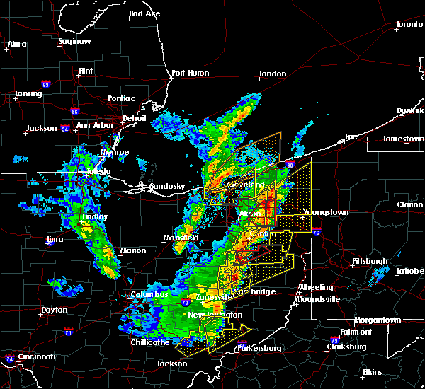 At 556 pm edt, a severe thunderstorm capable of producing a tornado was located over dover, moving northeast at 35 mph (radar indicated rotation). Hazards include tornado and quarter-size hail. Flying debris will be dangerous to those caught without shelter. mobile homes will be damaged or destroyed. damage to roofs, windows, and vehicles will occur. tree damage is likely. this tornadic thunderstorm will remain over mainly rural areas of northwestern carroll and northeastern tuscarawas counties, including the following locations, mineral city, zoar, parral, bolivar and malvern. This includes interstate 77 in ohio between mile markers 82 and 94. At 556 pm edt, a severe thunderstorm capable of producing a tornado was located over dover, moving northeast at 35 mph (radar indicated rotation). Hazards include tornado and quarter-size hail. Flying debris will be dangerous to those caught without shelter. mobile homes will be damaged or destroyed. damage to roofs, windows, and vehicles will occur. tree damage is likely. this tornadic thunderstorm will remain over mainly rural areas of northwestern carroll and northeastern tuscarawas counties, including the following locations, mineral city, zoar, parral, bolivar and malvern. This includes interstate 77 in ohio between mile markers 82 and 94.
|
| 4/14/2019 5:54 PM EDT |
 At 554 pm edt, severe thunderstorms were located along a line extending from near sebring to near carrollton, moving east at 60 mph (radar). Hazards include wind gusts to 60 mph and quarter-size hail. Minor hail damage to vehicles is possible. expect wind damage to trees and power lines, resulting in some power outages. locations impacted include, new philadelphia, dover, salem, carrollton, minerva, strasburg, leetonia, augusta, salineville, malvern, bolivar, mineral city, this includes interstate 77 in ohio between mile markers 79 and 94. A tornado watch remains in effect until 900 pm edt for east central ohio. At 554 pm edt, severe thunderstorms were located along a line extending from near sebring to near carrollton, moving east at 60 mph (radar). Hazards include wind gusts to 60 mph and quarter-size hail. Minor hail damage to vehicles is possible. expect wind damage to trees and power lines, resulting in some power outages. locations impacted include, new philadelphia, dover, salem, carrollton, minerva, strasburg, leetonia, augusta, salineville, malvern, bolivar, mineral city, this includes interstate 77 in ohio between mile markers 79 and 94. A tornado watch remains in effect until 900 pm edt for east central ohio.
|
| 4/14/2019 5:49 PM EDT |
 At 549 pm edt, a severe thunderstorm capable of producing a tornado was located near sugarcreek, or near dover, moving northeast at 35 mph (radar indicated rotation). Hazards include tornado and quarter size hail. Flying debris will be dangerous to those caught without shelter. mobile homes will be damaged or destroyed. damage to roofs, windows, and vehicles will occur. tree damage is likely. this dangerous storm will be near, new philadelphia, dover and strasburg around 600 pm edt. other locations impacted by this tornadic thunderstorm include mineral city, zoar, parral, bolivar and malvern. this includes interstate 77 in ohio between mile markers 79 and 94. Please report severe weather by calling 412-262-1988, posting to the nws pittsburgh facebook page, or using twitter @nwspittsburgh. At 549 pm edt, a severe thunderstorm capable of producing a tornado was located near sugarcreek, or near dover, moving northeast at 35 mph (radar indicated rotation). Hazards include tornado and quarter size hail. Flying debris will be dangerous to those caught without shelter. mobile homes will be damaged or destroyed. damage to roofs, windows, and vehicles will occur. tree damage is likely. this dangerous storm will be near, new philadelphia, dover and strasburg around 600 pm edt. other locations impacted by this tornadic thunderstorm include mineral city, zoar, parral, bolivar and malvern. this includes interstate 77 in ohio between mile markers 79 and 94. Please report severe weather by calling 412-262-1988, posting to the nws pittsburgh facebook page, or using twitter @nwspittsburgh.
|
| 4/14/2019 5:29 PM EDT |
 At 529 pm edt, severe thunderstorms were located along a line extending from near north canton to dover, moving east at 60 mph (radar). Hazards include wind gusts to 60 mph and quarter-size hail. Minor hail damage to vehicles is possible. Expect wind damage to trees and power lines, resulting in some power outages. At 529 pm edt, severe thunderstorms were located along a line extending from near north canton to dover, moving east at 60 mph (radar). Hazards include wind gusts to 60 mph and quarter-size hail. Minor hail damage to vehicles is possible. Expect wind damage to trees and power lines, resulting in some power outages.
|
| 3/14/2019 8:26 PM EDT |
 At 825 pm edt, a severe thunderstorm was located over waynesburg, or 12 miles northwest of carrollton, moving east at 60 mph (radar). Hazards include wind gusts to 60 mph and half dollar-size hail. Minor hail damage to vehicles is possible. expect wind damage to trees and power lines, resulting in some power outages. Locations impacted include, salem, columbiana, east palestine, minerva, lisbon, leetonia, new waterford, augusta, malvern, hanoverton, rogers, summitville,. At 825 pm edt, a severe thunderstorm was located over waynesburg, or 12 miles northwest of carrollton, moving east at 60 mph (radar). Hazards include wind gusts to 60 mph and half dollar-size hail. Minor hail damage to vehicles is possible. expect wind damage to trees and power lines, resulting in some power outages. Locations impacted include, salem, columbiana, east palestine, minerva, lisbon, leetonia, new waterford, augusta, malvern, hanoverton, rogers, summitville,.
|
| 3/14/2019 8:15 PM EDT |
 At 815 pm edt, a severe thunderstorm was located near strasburg, or 7 miles north of dover, moving northeast at 60 mph (radar). Hazards include wind gusts to 60 mph and quarter-size hail. Minor hail damage to vehicles is possible. Expect wind damage to trees and power lines, resulting in some power outages. At 815 pm edt, a severe thunderstorm was located near strasburg, or 7 miles north of dover, moving northeast at 60 mph (radar). Hazards include wind gusts to 60 mph and quarter-size hail. Minor hail damage to vehicles is possible. Expect wind damage to trees and power lines, resulting in some power outages.
|
| 9/21/2018 7:00 PM EDT |
 A severe thunderstorm warning remains in effect until 715 pm edt for northwestern harrison. southwestern carroll and southeastern tuscarawas counties. at 700 pm edt, a severe thunderstorm was located near carrollton, moving east at 50 mph. hazard. Wind gusts to 60 mph. A severe thunderstorm warning remains in effect until 715 pm edt for northwestern harrison. southwestern carroll and southeastern tuscarawas counties. at 700 pm edt, a severe thunderstorm was located near carrollton, moving east at 50 mph. hazard. Wind gusts to 60 mph.
|
| 9/21/2018 6:41 PM EDT |
 At 641 pm edt, a line of severe thunderstorms was located near calcutta, or near east palestine, moving east at 55 mph (radar). Hazards include wind gusts to 60 mph. Expect damage to trees and power lines, resulting in some power outages. Locations impacted include, salem, columbiana, carrollton, lisbon, leetonia, augusta, salineville, amsterdam, hanoverton, dellroy, sherrodsville, leesville,. At 641 pm edt, a line of severe thunderstorms was located near calcutta, or near east palestine, moving east at 55 mph (radar). Hazards include wind gusts to 60 mph. Expect damage to trees and power lines, resulting in some power outages. Locations impacted include, salem, columbiana, carrollton, lisbon, leetonia, augusta, salineville, amsterdam, hanoverton, dellroy, sherrodsville, leesville,.
|
| 9/21/2018 6:33 PM EDT |
 The national weather service in pittsburgh has issued a * severe thunderstorm warning for. northwestern harrison county in east central ohio. east central coshocton county in east central ohio. southwestern carroll county in east central ohio. Tuscarawas county in east central ohio. The national weather service in pittsburgh has issued a * severe thunderstorm warning for. northwestern harrison county in east central ohio. east central coshocton county in east central ohio. southwestern carroll county in east central ohio. Tuscarawas county in east central ohio.
|
| 9/21/2018 6:08 PM EDT |
 At 608 pm edt, a severe thunderstorm was located over minerva, or 13 miles north of carrollton, moving east at 55 mph (radar). Hazards include wind gusts to 60 mph. expect damage to trees and power lines, resulting in some power outages At 608 pm edt, a severe thunderstorm was located over minerva, or 13 miles north of carrollton, moving east at 55 mph (radar). Hazards include wind gusts to 60 mph. expect damage to trees and power lines, resulting in some power outages
|
| 9/21/2018 5:45 PM EDT |
 At 545 pm edt, a severe thunderstorm was located over navarre, or 11 miles southwest of canton, moving east at 45 mph (radar). Hazards include wind gusts to 60 mph. expect damage to trees and power lines, resulting in some power outages At 545 pm edt, a severe thunderstorm was located over navarre, or 11 miles southwest of canton, moving east at 45 mph (radar). Hazards include wind gusts to 60 mph. expect damage to trees and power lines, resulting in some power outages
|
| 7/2/2018 3:59 PM EDT |
 At 349 pm edt, a severe thunderstorm was located near east sparta, or 9 miles northeast of dover, moving east at 10 mph (radar). Hazards include wind gusts to 60 mph. expect damage to trees and power lines, resulting in some power outages At 349 pm edt, a severe thunderstorm was located near east sparta, or 9 miles northeast of dover, moving east at 10 mph (radar). Hazards include wind gusts to 60 mph. expect damage to trees and power lines, resulting in some power outages
|
| 7/2/2018 3:49 PM EDT |
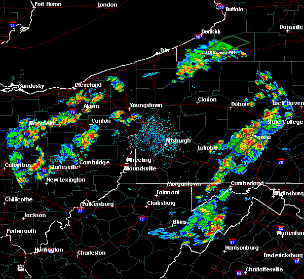 At 349 pm edt, a severe thunderstorm was located near east sparta, or 9 miles northeast of dover, moving east at 10 mph (radar). Hazards include wind gusts to 60 mph. expect damage to trees and power lines, resulting in some power outages At 349 pm edt, a severe thunderstorm was located near east sparta, or 9 miles northeast of dover, moving east at 10 mph (radar). Hazards include wind gusts to 60 mph. expect damage to trees and power lines, resulting in some power outages
|
| 5/4/2018 4:59 PM EDT |
 At 459 pm edt, a severe thunderstorm was located near lisbon, or 11 miles south of salem, moving northeast at 65 mph (radar). Hazards include wind gusts 60 to 70 mph. Trees snapped and uprooted. power outages can be expected. Locations impacted include, salem, east liverpool, carrollton, calcutta, minerva, lisbon, leetonia, augusta, salineville, malvern, hanoverton, dellroy,. At 459 pm edt, a severe thunderstorm was located near lisbon, or 11 miles south of salem, moving northeast at 65 mph (radar). Hazards include wind gusts 60 to 70 mph. Trees snapped and uprooted. power outages can be expected. Locations impacted include, salem, east liverpool, carrollton, calcutta, minerva, lisbon, leetonia, augusta, salineville, malvern, hanoverton, dellroy,.
|
| 5/4/2018 4:43 PM EDT |
 At 442 pm edt, a severe thunderstorm was located near carrollton, moving northeast at 45 mph (radar). Hazards include wind gusts to 60 mph. expect damage to trees and power lines, resulting in some power outages At 442 pm edt, a severe thunderstorm was located near carrollton, moving northeast at 45 mph (radar). Hazards include wind gusts to 60 mph. expect damage to trees and power lines, resulting in some power outages
|
| 11/5/2017 8:57 PM EST |
 At 856 pm est, severe thunderstorms were located along a line extending from near carrollton to near cadiz to near barnesville, moving east at 45 mph (radar). Hazards include 60 mph wind gusts. Expect damage to trees and power lines, resulting in some power outages. locations impacted include, wheeling, weirton, steubenville, martins ferry, st. clairsville, bellaire, barnesville, cadiz, carrollton, wellsburg, freeport, toronto, this includes the following highways, interstate 70 in ohio between mile markers 186 and 225. Interstate 70 in west virginia near mile marker 0. At 856 pm est, severe thunderstorms were located along a line extending from near carrollton to near cadiz to near barnesville, moving east at 45 mph (radar). Hazards include 60 mph wind gusts. Expect damage to trees and power lines, resulting in some power outages. locations impacted include, wheeling, weirton, steubenville, martins ferry, st. clairsville, bellaire, barnesville, cadiz, carrollton, wellsburg, freeport, toronto, this includes the following highways, interstate 70 in ohio between mile markers 186 and 225. Interstate 70 in west virginia near mile marker 0.
|
| 11/5/2017 8:28 PM EST |
 At 828 pm est, severe thunderstorms were located along a line extending from near strasburg to 7 miles west of uhrichsville to near cambridge, moving east at 45 mph (radar). Hazards include 60 mph wind gusts. expect damage to trees and power lines, resulting in some power outages At 828 pm est, severe thunderstorms were located along a line extending from near strasburg to 7 miles west of uhrichsville to near cambridge, moving east at 45 mph (radar). Hazards include 60 mph wind gusts. expect damage to trees and power lines, resulting in some power outages
|
| 11/5/2017 7:41 PM EDT |
 At 641 pm est, severe thunderstorms were located along a line extending from 7 miles south of newton falls to near sebring to near waynesburg, moving east at 50 mph (radar). Hazards include 60 mph wind gusts. Expect damage to trees and power lines, resulting in some power outages. Locations impacted include, salem, carrollton, minerva, lisbon, leetonia, augusta, salineville, malvern, hanoverton, dellroy, summitville, mechanicstown,. At 641 pm est, severe thunderstorms were located along a line extending from 7 miles south of newton falls to near sebring to near waynesburg, moving east at 50 mph (radar). Hazards include 60 mph wind gusts. Expect damage to trees and power lines, resulting in some power outages. Locations impacted include, salem, carrollton, minerva, lisbon, leetonia, augusta, salineville, malvern, hanoverton, dellroy, summitville, mechanicstown,.
|
| 11/5/2017 7:05 PM EDT |
 At 604 pm est, severe thunderstorms were located along a line extending from barberton to near dalton to near berlin, moving east at 50 mph (radar). Hazards include 60 mph wind gusts. expect damage to trees and power lines, resulting in some power outages At 604 pm est, severe thunderstorms were located along a line extending from barberton to near dalton to near berlin, moving east at 50 mph (radar). Hazards include 60 mph wind gusts. expect damage to trees and power lines, resulting in some power outages
|
| 8/22/2017 12:43 PM EDT |
 At 1243 pm edt, severe thunderstorms were located along a line extending from near minerva to near carrollton, moving east at 40 mph (radar). Hazards include 60 mph wind gusts. damage to trees and power lines At 1243 pm edt, severe thunderstorms were located along a line extending from near minerva to near carrollton, moving east at 40 mph (radar). Hazards include 60 mph wind gusts. damage to trees and power lines
|
| 8/19/2017 4:08 PM EDT |
 At 408 pm edt, a severe thunderstorm was located near waynesburg, or 7 miles northwest of carrollton, moving east at 25 mph (radar). Hazards include 60 mph wind gusts and quarter-size hail. Minor hail damage to vehicles is possible. Expect wind damage to trees and power lines, resulting in some power outages. At 408 pm edt, a severe thunderstorm was located near waynesburg, or 7 miles northwest of carrollton, moving east at 25 mph (radar). Hazards include 60 mph wind gusts and quarter-size hail. Minor hail damage to vehicles is possible. Expect wind damage to trees and power lines, resulting in some power outages.
|
| 8/19/2017 3:51 PM EDT |
 The severe thunderstorm warning for northwestern jefferson, south central columbiana, carroll and northeastern tuscarawas counties will expire at 400 pm edt, the storm that prompted the warning has weakened below severe limits and no longer pose an immediate threat to life and property. therefore, the warning will be allowed to expire. a severe thunderstorm watch remains in effect until 900 pm edt for east central ohio. The severe thunderstorm warning for northwestern jefferson, south central columbiana, carroll and northeastern tuscarawas counties will expire at 400 pm edt, the storm that prompted the warning has weakened below severe limits and no longer pose an immediate threat to life and property. therefore, the warning will be allowed to expire. a severe thunderstorm watch remains in effect until 900 pm edt for east central ohio.
|
| 8/19/2017 3:10 PM EDT |
 At 310 pm edt, a severe thunderstorm was located over waynesburg, or 10 miles northwest of carrollton, moving east at 25 mph (radar). Hazards include 60 mph wind gusts and quarter-size hail. Minor hail damage to vehicles is possible. Expect wind damage to trees and power lines, resulting in some power outages. At 310 pm edt, a severe thunderstorm was located over waynesburg, or 10 miles northwest of carrollton, moving east at 25 mph (radar). Hazards include 60 mph wind gusts and quarter-size hail. Minor hail damage to vehicles is possible. Expect wind damage to trees and power lines, resulting in some power outages.
|
| 8/19/2017 2:59 PM EDT |
 At 259 pm edt, a severe thunderstorm was located near lisbon, or 11 miles south of salem, moving northeast at 40 mph (radar). Hazards include 60 mph wind gusts and quarter-size hail. Minor hail damage to vehicles is possible. expect wind damage to trees and power lines, resulting in some power outages. Locations impacted include, columbiana, carrollton, calcutta, minerva, lisbon, leetonia, new waterford, augusta, salineville, malvern, hanoverton, rogers,. At 259 pm edt, a severe thunderstorm was located near lisbon, or 11 miles south of salem, moving northeast at 40 mph (radar). Hazards include 60 mph wind gusts and quarter-size hail. Minor hail damage to vehicles is possible. expect wind damage to trees and power lines, resulting in some power outages. Locations impacted include, columbiana, carrollton, calcutta, minerva, lisbon, leetonia, new waterford, augusta, salineville, malvern, hanoverton, rogers,.
|
| 8/19/2017 2:28 PM EDT |
 At 228 pm edt, a severe thunderstorm was located near waynesburg, or near carrollton, moving northeast at 40 mph (radar). Hazards include 60 mph wind gusts and quarter-size hail. Minor hail damage to vehicles is possible. Expect wind damage to trees and power lines, resulting in some power outages. At 228 pm edt, a severe thunderstorm was located near waynesburg, or near carrollton, moving northeast at 40 mph (radar). Hazards include 60 mph wind gusts and quarter-size hail. Minor hail damage to vehicles is possible. Expect wind damage to trees and power lines, resulting in some power outages.
|
| 8/4/2017 4:25 PM EDT |
 At 425 pm edt, a severe thunderstorm was located near carrollton, moving northeast at 30 mph (radar). Hazards include 60 mph wind gusts and quarter-size hail. Hail damage to vehicles. Damage to trees and power lines. At 425 pm edt, a severe thunderstorm was located near carrollton, moving northeast at 30 mph (radar). Hazards include 60 mph wind gusts and quarter-size hail. Hail damage to vehicles. Damage to trees and power lines.
|
| 8/4/2017 4:17 PM EDT |
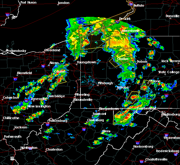 At 416 pm edt, a severe thunderstorm was located near waynesburg, or near carrollton, moving northeast at 30 mph (radar). Hazards include 60 mph wind gusts and quarter-size hail. Hail damage to vehicles. damage to trees and power lines. Locations impacted include, carrollton, malvern, dellroy, sherrodsville, atwood lake,. At 416 pm edt, a severe thunderstorm was located near waynesburg, or near carrollton, moving northeast at 30 mph (radar). Hazards include 60 mph wind gusts and quarter-size hail. Hail damage to vehicles. damage to trees and power lines. Locations impacted include, carrollton, malvern, dellroy, sherrodsville, atwood lake,.
|
| 8/4/2017 4:10 PM EDT |
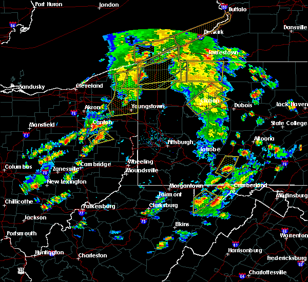 At 410 pm edt, a severe thunderstorm was located near waynesburg, or 8 miles west of carrollton, moving northeast at 30 mph (radar). Hazards include 60 mph wind gusts and quarter-size hail. Hail damage to vehicles. damage to trees and power lines. Locations impacted include, carrollton, malvern, mineral city, dellroy, sherrodsville, roswell, atwood lake,. At 410 pm edt, a severe thunderstorm was located near waynesburg, or 8 miles west of carrollton, moving northeast at 30 mph (radar). Hazards include 60 mph wind gusts and quarter-size hail. Hail damage to vehicles. damage to trees and power lines. Locations impacted include, carrollton, malvern, mineral city, dellroy, sherrodsville, roswell, atwood lake,.
|
| 8/4/2017 4:02 PM EDT |
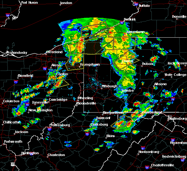 At 401 pm edt, a severe thunderstorm was located 7 miles east of new philadelphia, moving northeast at 30 mph (radar). Hazards include 60 mph wind gusts. damage to trees and power lines At 401 pm edt, a severe thunderstorm was located 7 miles east of new philadelphia, moving northeast at 30 mph (radar). Hazards include 60 mph wind gusts. damage to trees and power lines
|
| 6/29/2017 6:46 PM EDT |
 At 1046 pm edt, a severe thunderstorm was located near carrollton, moving east at 35 mph (radar). Hazards include 60 mph wind gusts and quarter-size hail. Minor hail damage to vehicles is possible. expect wind damage to trees and power lines, resulting in some power outages. Locations impacted include, carrollton, augusta, salineville, malvern, bergholz, amsterdam, irondale, dellroy, sherrodsville, roswell, summitville, hammondsville,. At 1046 pm edt, a severe thunderstorm was located near carrollton, moving east at 35 mph (radar). Hazards include 60 mph wind gusts and quarter-size hail. Minor hail damage to vehicles is possible. expect wind damage to trees and power lines, resulting in some power outages. Locations impacted include, carrollton, augusta, salineville, malvern, bergholz, amsterdam, irondale, dellroy, sherrodsville, roswell, summitville, hammondsville,.
|
| 6/29/2017 6:31 PM EDT |
 At 1030 pm edt, a severe thunderstorm was located near waynesburg, or near carrollton, moving east at 35 mph (radar). Hazards include 60 mph wind gusts. expect damage to trees and power lines, resulting in some power outages At 1030 pm edt, a severe thunderstorm was located near waynesburg, or near carrollton, moving east at 35 mph (radar). Hazards include 60 mph wind gusts. expect damage to trees and power lines, resulting in some power outages
|
| 6/29/2017 6:08 PM EDT |
 At 1008 pm edt, a severe thunderstorm was located near salem, moving east at 40 mph (radar). Hazards include 60 mph wind gusts. Expect damage to trees and power lines, resulting in some power outages. Locations impacted include, salem, columbiana, minerva, lisbon, leetonia, augusta, malvern, hanoverton, summitville, north georgetown, homeworth, guilford lake state park,. At 1008 pm edt, a severe thunderstorm was located near salem, moving east at 40 mph (radar). Hazards include 60 mph wind gusts. Expect damage to trees and power lines, resulting in some power outages. Locations impacted include, salem, columbiana, minerva, lisbon, leetonia, augusta, malvern, hanoverton, summitville, north georgetown, homeworth, guilford lake state park,.
|
| 6/29/2017 5:47 PM EDT |
 At 947 pm edt, a severe thunderstorm was located near minerva, or 13 miles east of canton, moving east at 40 mph (radar). Hazards include 60 mph wind gusts. expect damage to trees and power lines, resulting in some power outages At 947 pm edt, a severe thunderstorm was located near minerva, or 13 miles east of canton, moving east at 40 mph (radar). Hazards include 60 mph wind gusts. expect damage to trees and power lines, resulting in some power outages
|
| 6/13/2017 3:37 PM EDT |
 The severe thunderstorm warning for columbiana and northern carroll counties will expire at 345 pm edt, the storm that prompted the warning has weakened below severe limits and no longer pose an immediate threat to life and property. therefore, the warning will be allowed to expire. The severe thunderstorm warning for columbiana and northern carroll counties will expire at 345 pm edt, the storm that prompted the warning has weakened below severe limits and no longer pose an immediate threat to life and property. therefore, the warning will be allowed to expire.
|
| 6/13/2017 3:05 PM EDT |
 At 304 pm edt, a severe thunderstorm was located over waynesburg, or 9 miles southeast of canton, moving southeast at 15 mph (radar). Hazards include 60 mph wind gusts and quarter-size hail. Minor hail damage to vehicles is possible. Expect wind damage to trees and power lines, resulting in some power outages. At 304 pm edt, a severe thunderstorm was located over waynesburg, or 9 miles southeast of canton, moving southeast at 15 mph (radar). Hazards include 60 mph wind gusts and quarter-size hail. Minor hail damage to vehicles is possible. Expect wind damage to trees and power lines, resulting in some power outages.
|
| 5/1/2017 1:22 PM EDT |
 At 121 pm edt, severe thunderstorms were located along a line extending from near louisville to near carrollton, moving northeast at 45 mph (radar). Hazards include 70 mph wind gusts. Trees snapped and uprooted. power outages can be expected. Locations impacted include, carrollton, minerva, augusta, salineville, malvern, scio, hanoverton, bowerston, dellroy, sherrodsville, leesville, summitville, a tornado watch remains in effect until 700 pm edt for east central ohio. At 121 pm edt, severe thunderstorms were located along a line extending from near louisville to near carrollton, moving northeast at 45 mph (radar). Hazards include 70 mph wind gusts. Trees snapped and uprooted. power outages can be expected. Locations impacted include, carrollton, minerva, augusta, salineville, malvern, scio, hanoverton, bowerston, dellroy, sherrodsville, leesville, summitville, a tornado watch remains in effect until 700 pm edt for east central ohio.
|
| 5/1/2017 1:08 PM EDT |
 At 108 pm edt, severe thunderstorms were located along a line extending from near canton to near dennison, moving northeast at 45 mph (radar). Hazards include 60 mph wind gusts. Expect damage to trees and power lines, resulting in some power outages. locations impacted include, new philadelphia, dover, uhrichsville, carrollton, minerva, dennison, strasburg, augusta, salineville, gnadenhutten, malvern, tuscarawas, this includes interstate 77 in ohio between mile markers 76 and 94. A tornado watch remains in effect until 700 pm edt for east central ohio. At 108 pm edt, severe thunderstorms were located along a line extending from near canton to near dennison, moving northeast at 45 mph (radar). Hazards include 60 mph wind gusts. Expect damage to trees and power lines, resulting in some power outages. locations impacted include, new philadelphia, dover, uhrichsville, carrollton, minerva, dennison, strasburg, augusta, salineville, gnadenhutten, malvern, tuscarawas, this includes interstate 77 in ohio between mile markers 76 and 94. A tornado watch remains in effect until 700 pm edt for east central ohio.
|
| 5/1/2017 12:42 PM EDT |
 At 1242 pm edt, severe thunderstorms were located along a line extending from near wilmot to near newcomerstown, moving northeast at 45 mph (radar). Hazards include 60 mph wind gusts. expect damage to trees and power lines, resulting in some power outages At 1242 pm edt, severe thunderstorms were located along a line extending from near wilmot to near newcomerstown, moving northeast at 45 mph (radar). Hazards include 60 mph wind gusts. expect damage to trees and power lines, resulting in some power outages
|
| 1/12/2017 2:29 PM EST |
 At 229 pm est, a severe thunderstorm was located near waynesburg, or near carrollton, moving east at 60 mph (radar indicated). Hazards include 60 mph wind gusts. Expect damage to trees and power lines, resulting in some power outages. locations impacted include, east liverpool, wellsville, carrollton, toronto, calcutta, chester, new cumberland, augusta, salineville, malvern, newell and mineral city. Please report severe weather by calling 412-262- 1988, posting to the nws pittsburgh facebook page, or using twitter @nwspittsburgh. At 229 pm est, a severe thunderstorm was located near waynesburg, or near carrollton, moving east at 60 mph (radar indicated). Hazards include 60 mph wind gusts. Expect damage to trees and power lines, resulting in some power outages. locations impacted include, east liverpool, wellsville, carrollton, toronto, calcutta, chester, new cumberland, augusta, salineville, malvern, newell and mineral city. Please report severe weather by calling 412-262- 1988, posting to the nws pittsburgh facebook page, or using twitter @nwspittsburgh.
|
| 1/12/2017 2:14 PM EST |
 At 213 pm est, a severe thunderstorm was located over strasburg, or near dover, moving east at 55 mph (radar indicated). Hazards include 60 mph wind gusts. expect damage to trees and power lines, resulting in some power outages At 213 pm est, a severe thunderstorm was located over strasburg, or near dover, moving east at 55 mph (radar indicated). Hazards include 60 mph wind gusts. expect damage to trees and power lines, resulting in some power outages
|
| 1/12/2017 1:34 PM EST |
 At 133 pm est, a severe thunderstorm was located over louisville, or near canton, moving east at 75 mph (radar indicated). Hazards include 60 mph wind gusts. expect damage to trees and power lines, resulting in some power outages At 133 pm est, a severe thunderstorm was located over louisville, or near canton, moving east at 75 mph (radar indicated). Hazards include 60 mph wind gusts. expect damage to trees and power lines, resulting in some power outages
|
| 6/16/2016 3:03 PM EDT |
 At 302 pm edt, severe thunderstorms were located along a line extending from salem to near east sparta, moving east at 25 mph (radar indicated). Hazards include 60 mph wind gusts and penny size hail. Expect damage to trees and power lines. resulting in some power outages. locations impacted include, salem, columbiana, carrollton, lisbon, leetonia, new waterford, augusta, malvern, hanoverton, summitville, winona, new garden, north georgetown, guilford lake state park, homeworth and east rochester. Please report severe weather by calling 4 1 2, 2 6 2, 1 9 8 8, posting to the nws pittsburgh facebook page, or using twitter @nwspittsburgh. At 302 pm edt, severe thunderstorms were located along a line extending from salem to near east sparta, moving east at 25 mph (radar indicated). Hazards include 60 mph wind gusts and penny size hail. Expect damage to trees and power lines. resulting in some power outages. locations impacted include, salem, columbiana, carrollton, lisbon, leetonia, new waterford, augusta, malvern, hanoverton, summitville, winona, new garden, north georgetown, guilford lake state park, homeworth and east rochester. Please report severe weather by calling 4 1 2, 2 6 2, 1 9 8 8, posting to the nws pittsburgh facebook page, or using twitter @nwspittsburgh.
|
| 6/16/2016 2:23 PM EDT |
 At 223 pm edt, severe thunderstorms were located along a line extending from 6 miles north of alliance to near dalton, moving east at 25 mph (radar indicated). Hazards include 60 mph wind gusts and penny size hail. Expect damage to trees and power lines. Resulting in some power outages. At 223 pm edt, severe thunderstorms were located along a line extending from 6 miles north of alliance to near dalton, moving east at 25 mph (radar indicated). Hazards include 60 mph wind gusts and penny size hail. Expect damage to trees and power lines. Resulting in some power outages.
|
| 6/16/2016 8:40 AM EDT |
 At 840 am edt, severe thunderstorms were located along a line extending from near louisville to near waynesburg to near east sparta, moving east at 40 mph (radar indicated). Hazards include 60 mph wind gusts and nickel size hail. Expect damage to trees and power lines. Resulting in some power outages. At 840 am edt, severe thunderstorms were located along a line extending from near louisville to near waynesburg to near east sparta, moving east at 40 mph (radar indicated). Hazards include 60 mph wind gusts and nickel size hail. Expect damage to trees and power lines. Resulting in some power outages.
|
| 5/2/2016 2:31 AM EDT |
 At 231 am edt, a severe thunderstorm was located near east sparta, or 9 miles northeast of dover, moving east at 40 mph (radar indicated). Hazards include 60 mph wind gusts and half dollar size hail. Hail damage to vehicles is expected. expect wind damage to trees and power lines, resulting in some power outages. locations impacted include, new philadelphia, dover, carrollton, minerva, malvern, mineral city, dellroy, sherrodsville, zoar and atwood lake. Please report severe weather by calling 4 1 2, 2 6 2, 1 9 8 8, posting to the nws pittsburgh facebook page, or using twitter @nwspittsburgh. At 231 am edt, a severe thunderstorm was located near east sparta, or 9 miles northeast of dover, moving east at 40 mph (radar indicated). Hazards include 60 mph wind gusts and half dollar size hail. Hail damage to vehicles is expected. expect wind damage to trees and power lines, resulting in some power outages. locations impacted include, new philadelphia, dover, carrollton, minerva, malvern, mineral city, dellroy, sherrodsville, zoar and atwood lake. Please report severe weather by calling 4 1 2, 2 6 2, 1 9 8 8, posting to the nws pittsburgh facebook page, or using twitter @nwspittsburgh.
|
| 5/2/2016 2:14 AM EDT |
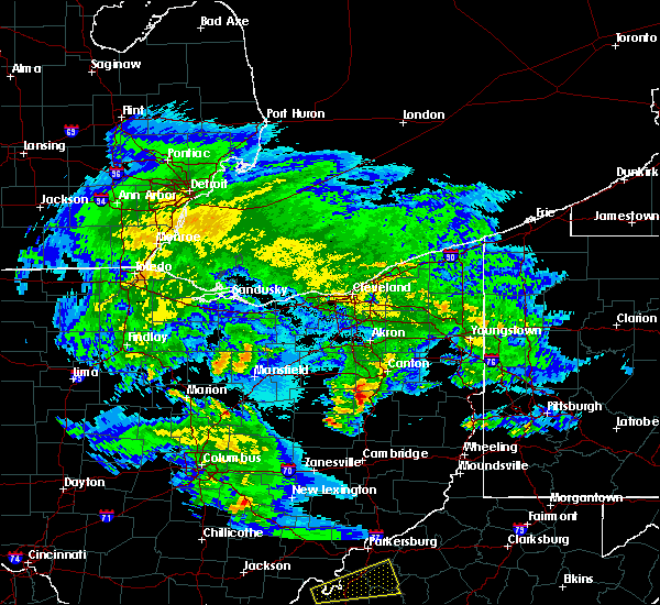 At 214 am edt, a severe thunderstorm was located over strasburg, or near dover, moving east at 40 mph (radar indicated). Hazards include 60 mph wind gusts and half dollar size hail. Hail damage to vehicles is expected. Expect wind damage to trees and power lines, resulting in some power outages. At 214 am edt, a severe thunderstorm was located over strasburg, or near dover, moving east at 40 mph (radar indicated). Hazards include 60 mph wind gusts and half dollar size hail. Hail damage to vehicles is expected. Expect wind damage to trees and power lines, resulting in some power outages.
|
| 6/18/2015 9:21 PM EDT | At 920 pm edt, severe thunderstorms were located along a line extending from louisville to 6 miles southwest of carrollton to near freeport, moving east at 45 mph (radar indicated). Hazards include 60 mph wind gusts. Expect damage to roofs. Siding and trees. |
| 6/18/2015 9:21 PM EDT | At 920 pm edt, severe thunderstorms were located along a line extending from louisville to 6 miles southwest of carrollton to near freeport, moving east at 45 mph (radar indicated). Hazards include 60 mph wind gusts. Expect damage to roofs. Siding and trees. |
| 6/18/2015 9:21 PM EDT | At 920 pm edt, severe thunderstorms were located along a line extending from louisville to 6 miles southwest of carrollton to near freeport, moving east at 45 mph (radar indicated). Hazards include 60 mph wind gusts. Expect damage to roofs. Siding and trees. |
| 6/18/2015 8:03 PM EDT | At 802 pm edt, a severe thunderstorm was located over new cumberland, or near wellsville, moving southeast at 40 mph (trained weather spotters). Hazards include 70 mph wind gusts. Expect considerable tree damage. damage is likely to mobile homes, roofs and outbuildings. Locations impacted include, salem, east liverpool, wellsville, carrollton, calcutta, minerva, lisbon, chester, leetonia, new cumberland, augusta, salineville, malvern, newell, bergholz, amsterdam, hanoverton, irondale, dellroy and new manchester. |
| 6/18/2015 8:03 PM EDT | At 802 pm edt, a severe thunderstorm was located over new cumberland, or near wellsville, moving southeast at 40 mph (trained weather spotters). Hazards include 70 mph wind gusts. Expect considerable tree damage. damage is likely to mobile homes, roofs and outbuildings. Locations impacted include, salem, east liverpool, wellsville, carrollton, calcutta, minerva, lisbon, chester, leetonia, new cumberland, augusta, salineville, malvern, newell, bergholz, amsterdam, hanoverton, irondale, dellroy and new manchester. |
| 6/18/2015 7:52 PM EDT | At 751 pm edt, a severe thunderstorm was located 8 miles southwest of lisbon, or 12 miles west of wellsville, moving southeast at 40 mph (radar indicated). Hazards include 70 mph wind gusts. Expect considerable tree damage. damage is likely to mobile homes, roofs and outbuildings. Locations impacted include, salem, east liverpool, wellsville, carrollton, toronto, calcutta, wintersville, minerva, lisbon, chester, leetonia, new cumberland, augusta, salineville, malvern, hopedale, newell, jewett, bergholz and amsterdam. |
| 6/18/2015 7:52 PM EDT | At 751 pm edt, a severe thunderstorm was located 8 miles southwest of lisbon, or 12 miles west of wellsville, moving southeast at 40 mph (radar indicated). Hazards include 70 mph wind gusts. Expect considerable tree damage. damage is likely to mobile homes, roofs and outbuildings. Locations impacted include, salem, east liverpool, wellsville, carrollton, toronto, calcutta, wintersville, minerva, lisbon, chester, leetonia, new cumberland, augusta, salineville, malvern, hopedale, newell, jewett, bergholz and amsterdam. |
| 6/18/2015 7:26 PM EDT | At 726 pm edt, a severe thunderstorm was located near louisville, or 10 miles east of canton, moving southeast at 50 mph (radar indicated). Hazards include 70 mph wind gusts. Expect considerable tree damage. Damage is likely to mobile homes, roofs and outbuildings. |
| 6/18/2015 7:26 PM EDT | At 726 pm edt, a severe thunderstorm was located near louisville, or 10 miles east of canton, moving southeast at 50 mph (radar indicated). Hazards include 70 mph wind gusts. Expect considerable tree damage. Damage is likely to mobile homes, roofs and outbuildings. |
| 6/14/2015 6:08 PM EDT |
 The severe thunderstorm warning for northwestern jefferson, southwestern columbiana and northern carroll counties will expire at 615 pm edt, the storm which prompted the warning has weakened below severe limits, and no longer poses an immediate threat to life or property. therefore the warning will be allowed to expire. however heavy rain is still possible with this thunderstorm. The severe thunderstorm warning for northwestern jefferson, southwestern columbiana and northern carroll counties will expire at 615 pm edt, the storm which prompted the warning has weakened below severe limits, and no longer poses an immediate threat to life or property. therefore the warning will be allowed to expire. however heavy rain is still possible with this thunderstorm.
|
| 6/14/2015 5:52 PM EDT |
 At 552 pm edt, a severe thunderstorm was located 8 miles east of minerva, or 11 miles northeast of carrollton, moving east at 30 mph (radar indicated). Hazards include 60 mph wind gusts and quarter size hail. Hail damage to vehicles is expected. expect wind damage to roofs, siding and trees. Locations impacted include, carrollton, minerva, augusta, salineville, malvern, hanoverton, summitville, mechanicstown, east rochester and atwood lake. At 552 pm edt, a severe thunderstorm was located 8 miles east of minerva, or 11 miles northeast of carrollton, moving east at 30 mph (radar indicated). Hazards include 60 mph wind gusts and quarter size hail. Hail damage to vehicles is expected. expect wind damage to roofs, siding and trees. Locations impacted include, carrollton, minerva, augusta, salineville, malvern, hanoverton, summitville, mechanicstown, east rochester and atwood lake.
|
| 6/14/2015 5:37 PM EDT |
 At 537 pm edt, a severe thunderstorm was located near carrollton, moving east at 35 mph (radar indicated). Hazards include 60 mph wind gusts and quarter size hail. Hail damage to vehicles is expected. Expect wind damage to roofs, siding and trees. At 537 pm edt, a severe thunderstorm was located near carrollton, moving east at 35 mph (radar indicated). Hazards include 60 mph wind gusts and quarter size hail. Hail damage to vehicles is expected. Expect wind damage to roofs, siding and trees.
|
| 6/12/2015 4:59 PM EDT |
 At 458 pm edt, severe thunderstorms were located along a line extending from salem to near carrollton, moving east at 45 mph (radar indicated). Hazards include 60 mph wind gusts and penny size hail. Expect damage to roofs. Siding and trees. At 458 pm edt, severe thunderstorms were located along a line extending from salem to near carrollton, moving east at 45 mph (radar indicated). Hazards include 60 mph wind gusts and penny size hail. Expect damage to roofs. Siding and trees.
|
| 6/12/2015 4:42 PM EDT |
 At 442 pm edt, severe thunderstorms were located along a line extending from near alliance to near waynesburg to near east sparta, moving east at 45 mph (radar indicated). Hazards include 60 mph wind gusts and nickel size hail. Expect damage to roofs. siding and trees. Locations impacted include, dover, salem, columbiana, carrollton, minerva, lisbon, strasburg, leetonia, augusta, salineville, malvern, bolivar, mineral city, hanoverton, dellroy, parral, zoar, summitville, mechanicstown and winona. At 442 pm edt, severe thunderstorms were located along a line extending from near alliance to near waynesburg to near east sparta, moving east at 45 mph (radar indicated). Hazards include 60 mph wind gusts and nickel size hail. Expect damage to roofs. siding and trees. Locations impacted include, dover, salem, columbiana, carrollton, minerva, lisbon, strasburg, leetonia, augusta, salineville, malvern, bolivar, mineral city, hanoverton, dellroy, parral, zoar, summitville, mechanicstown and winona.
|
| 6/12/2015 4:32 PM EDT |
 At 432 pm edt, severe thunderstorms were located along a line extending from near louisville to near east sparta to near strasburg, moving east at 45 mph (radar indicated). Hazards include 60 mph wind gusts and nickel size hail. Expect damage to roofs. Siding and trees. At 432 pm edt, severe thunderstorms were located along a line extending from near louisville to near east sparta to near strasburg, moving east at 45 mph (radar indicated). Hazards include 60 mph wind gusts and nickel size hail. Expect damage to roofs. Siding and trees.
|
| 5/11/2015 7:18 PM EDT | At 717 pm edt, a severe thunderstorm was located near carrollton, moving northeast at 45 mph (radar indicated). Hazards include 60 mph wind gusts and quarter size hail. Hail damage to vehicles is expected. expect wind damage to roofs, siding and trees. locations impacted include, carrollton, minerva, augusta, salineville, malvern, bergholz, hanoverton, irondale, dellroy, sherrodsville, summitville, mechanicstown, hammondsville, harlem springs, winona, new garden, guilford lake state park, atwood lake, east rochester and leesville lake park. 1. 00in. |
| 5/11/2015 7:13 PM EDT | Trees down on bronze road in carroll county OH, 3.2 miles WNW of Lake Mohawk, OH |
| 5/11/2015 7:10 PM EDT | Numerous trees down around malvern in carroll county OH, 1.8 miles SW of Lake Mohawk, OH |
| 5/11/2015 7:05 PM EDT | At 704 pm edt, a severe thunderstorm was located near dennison, or near uhrichsville, moving northeast at 45 mph (radar indicated). Hazards include 60 mph wind gusts and quarter size hail. Hail damage to vehicles is expected. Expect wind damage to roofs, siding and trees. |
| 4/9/2015 4:48 PM EDT | The national weather service in pittsburgh has issued a * severe thunderstorm warning for. noble county in east central ohio. western jefferson county in east central ohio. northeastern coshocton county in east central ohio. Guernsey county in east central ohio. |
| 1/1/0001 12:00 AM | Large trees blown down on sr 171 in carroll county OH, 4.1 miles NW of Lake Mohawk, OH |
Hail Maps for Lake Mohawk, OH


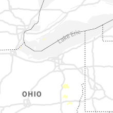


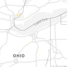


Connect with Interactive Hail Maps