

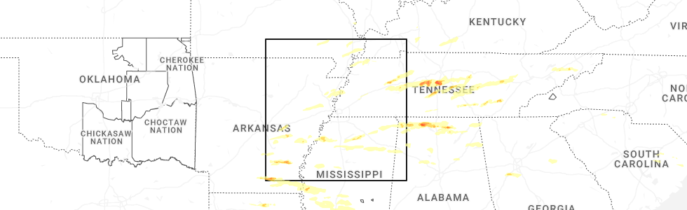
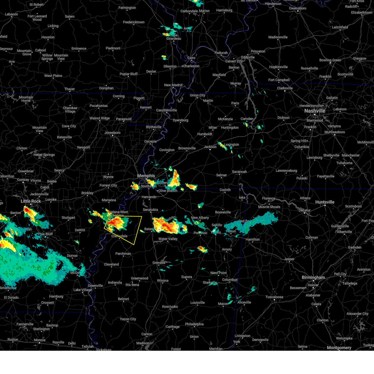
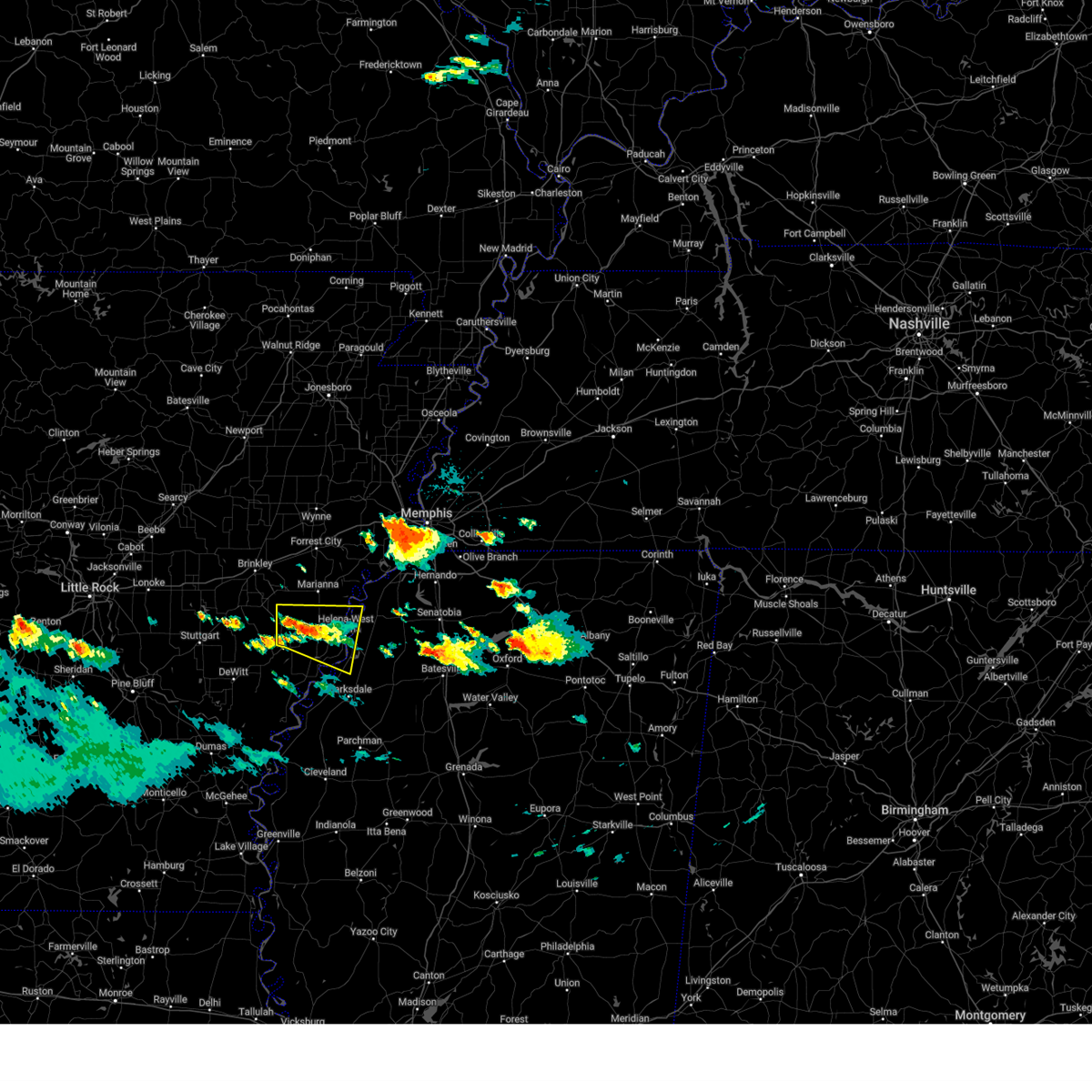
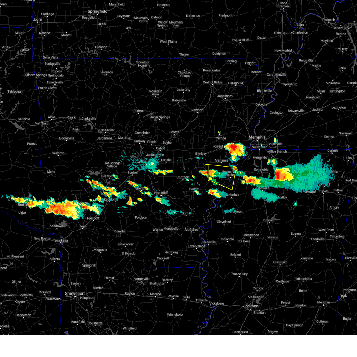
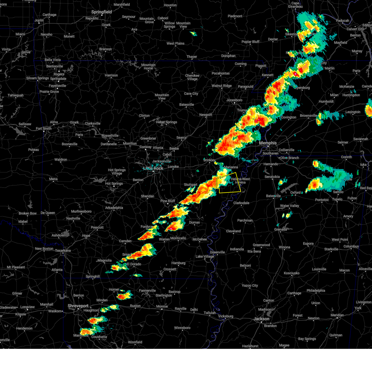
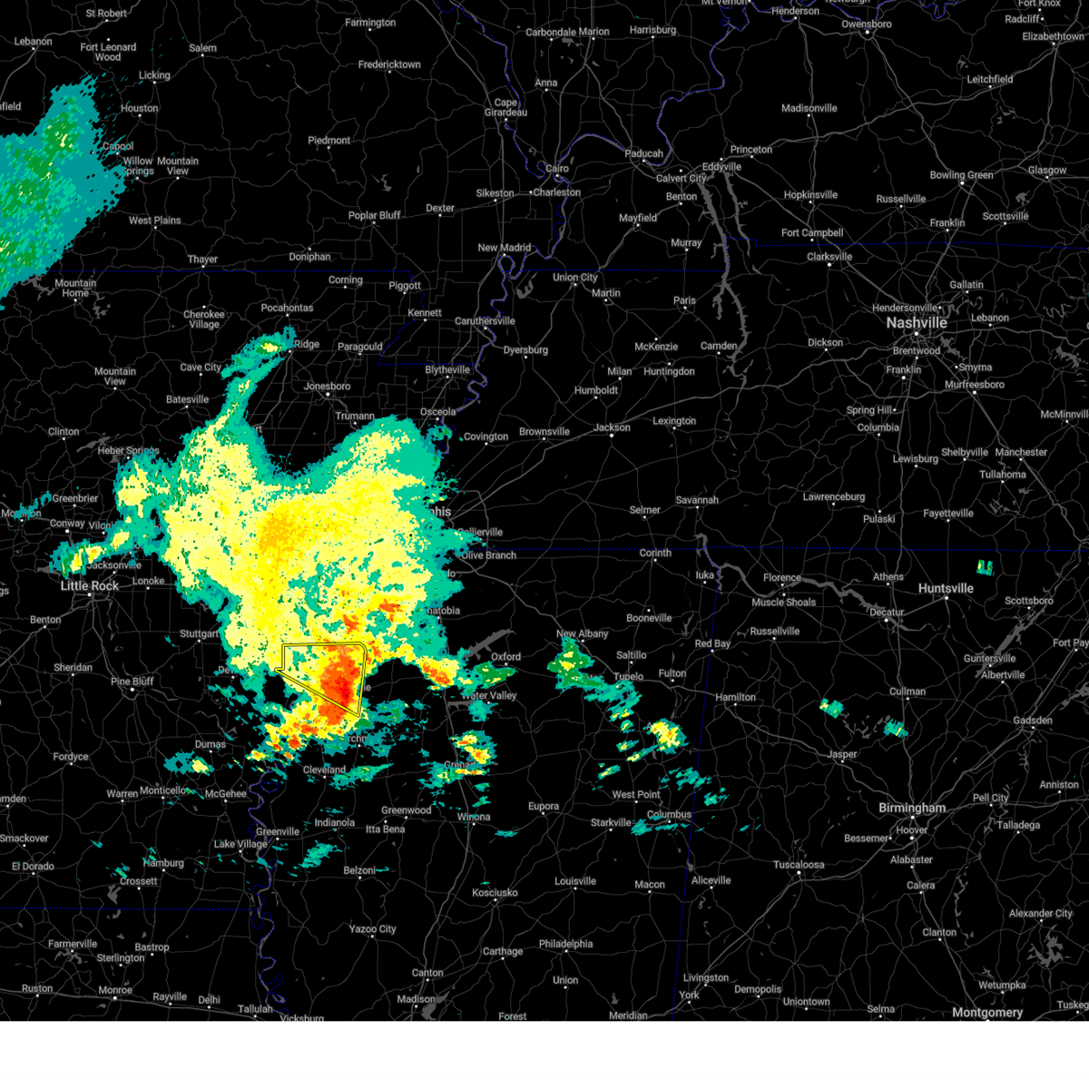
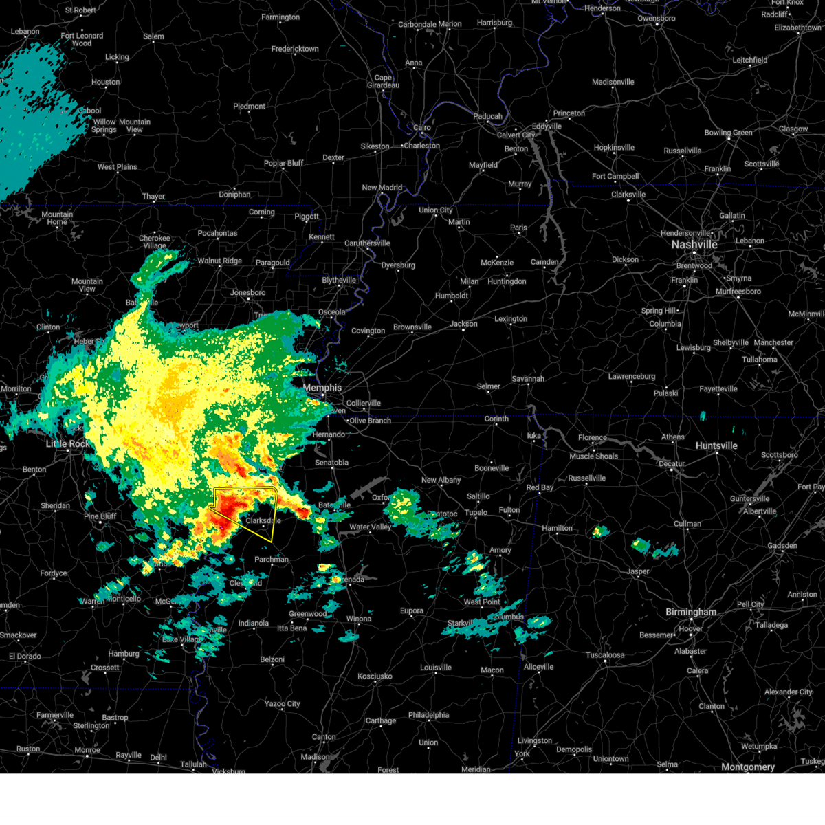
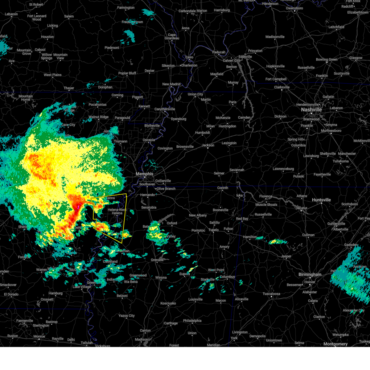
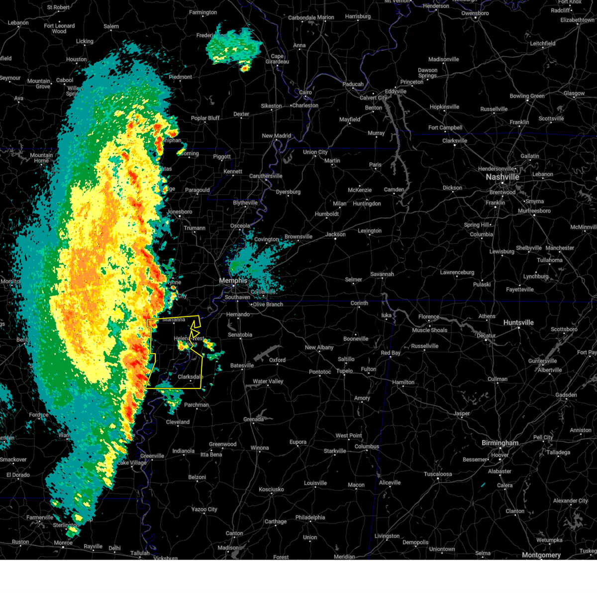
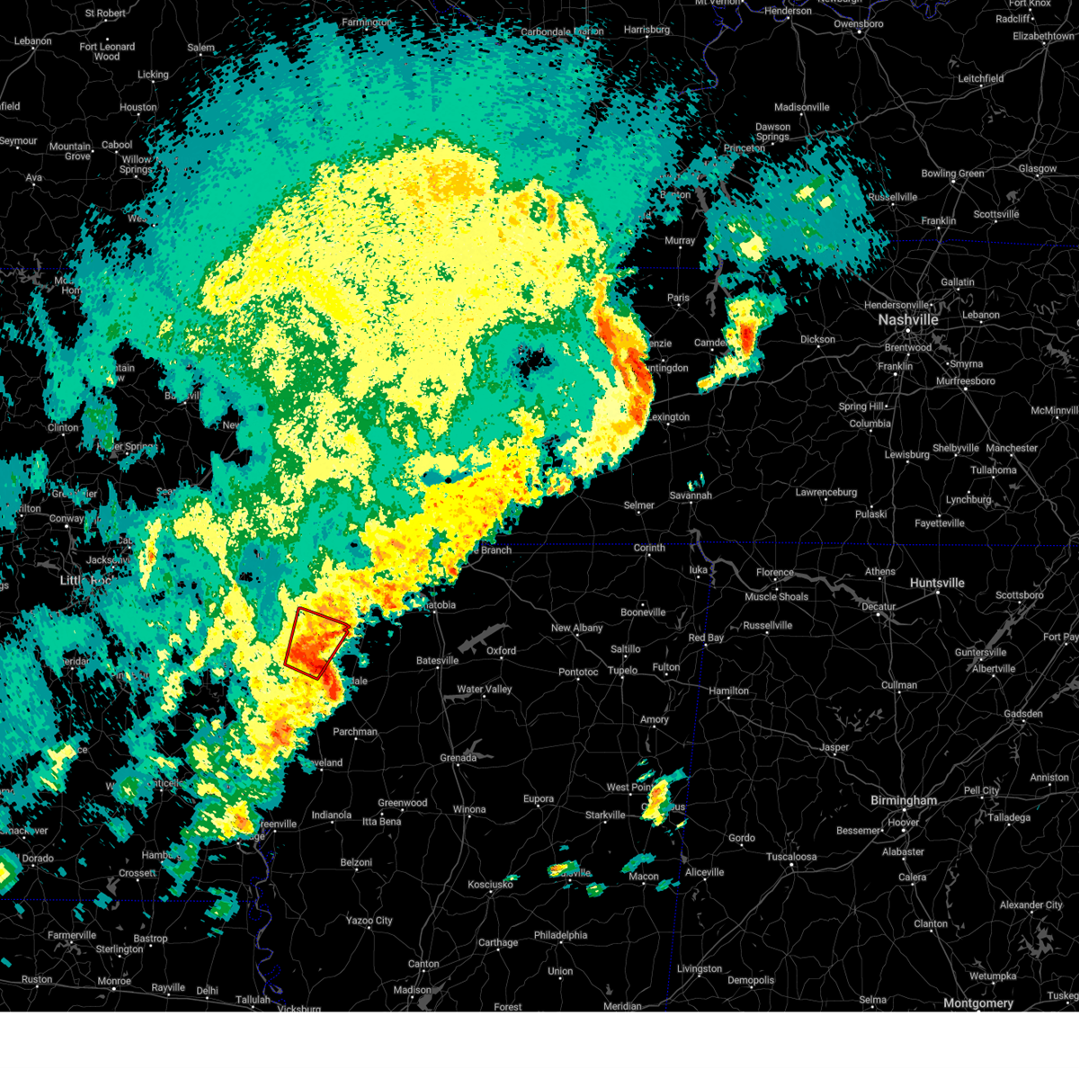
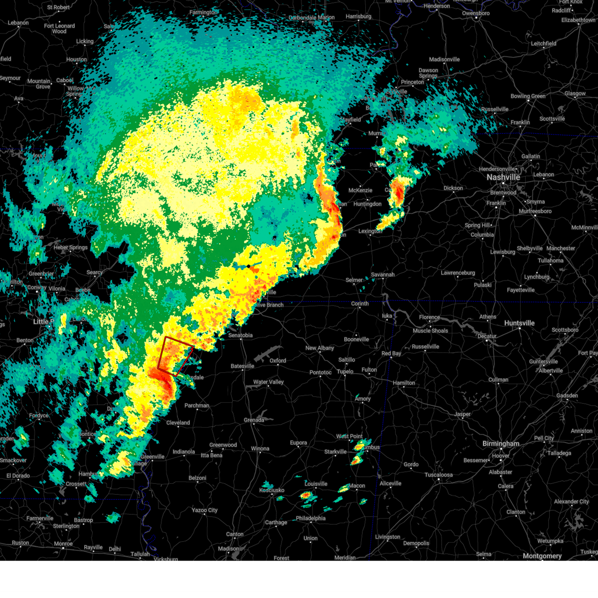
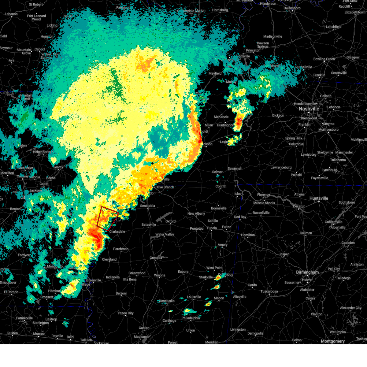
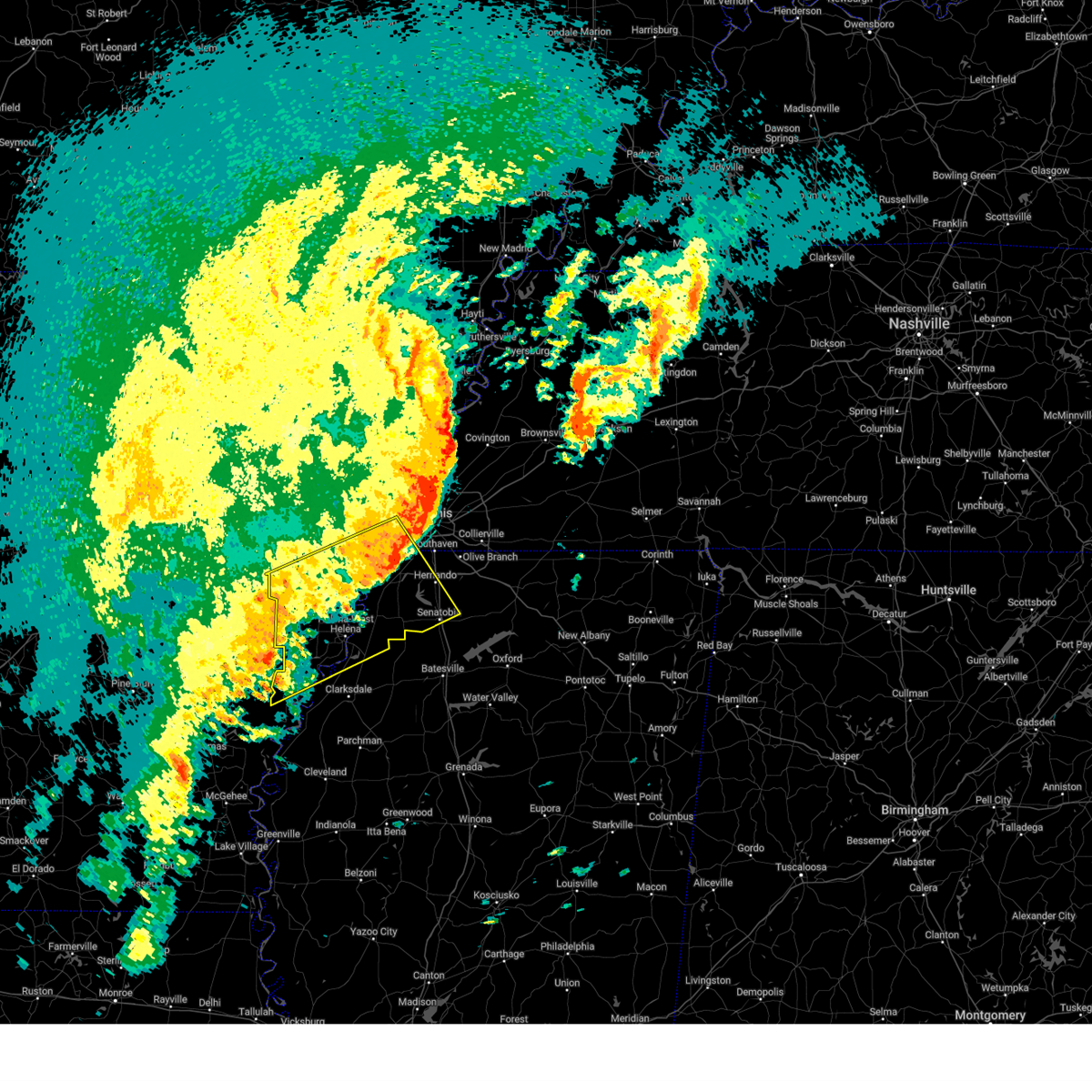
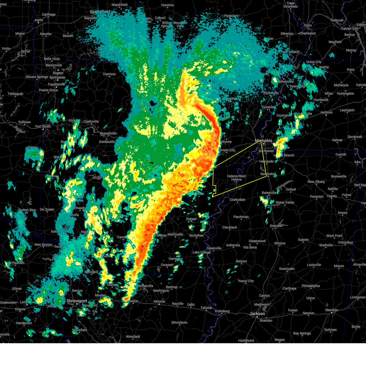
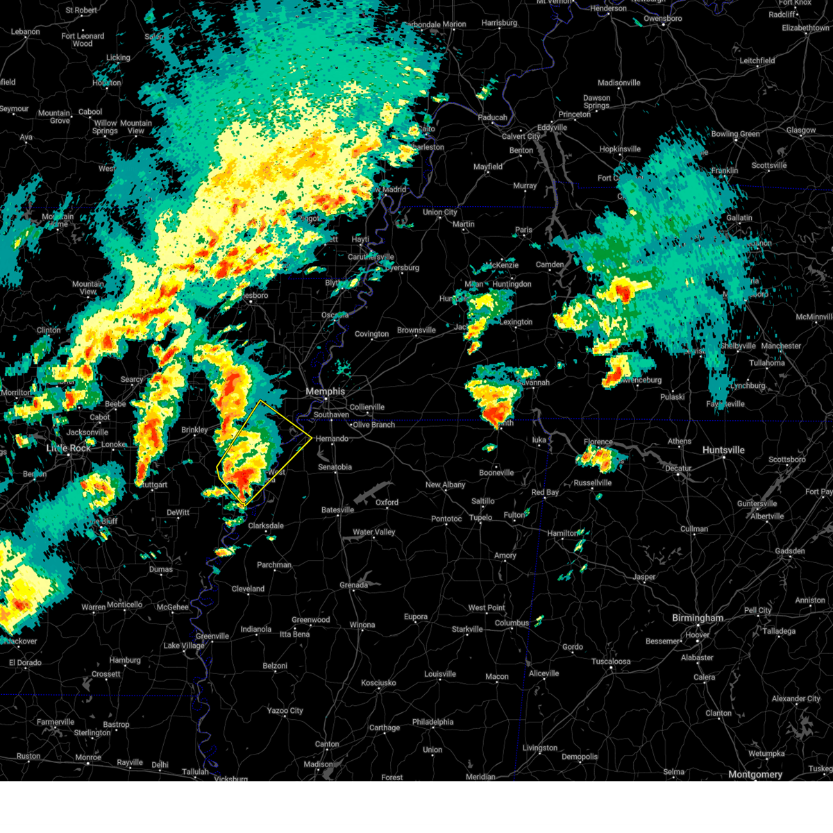
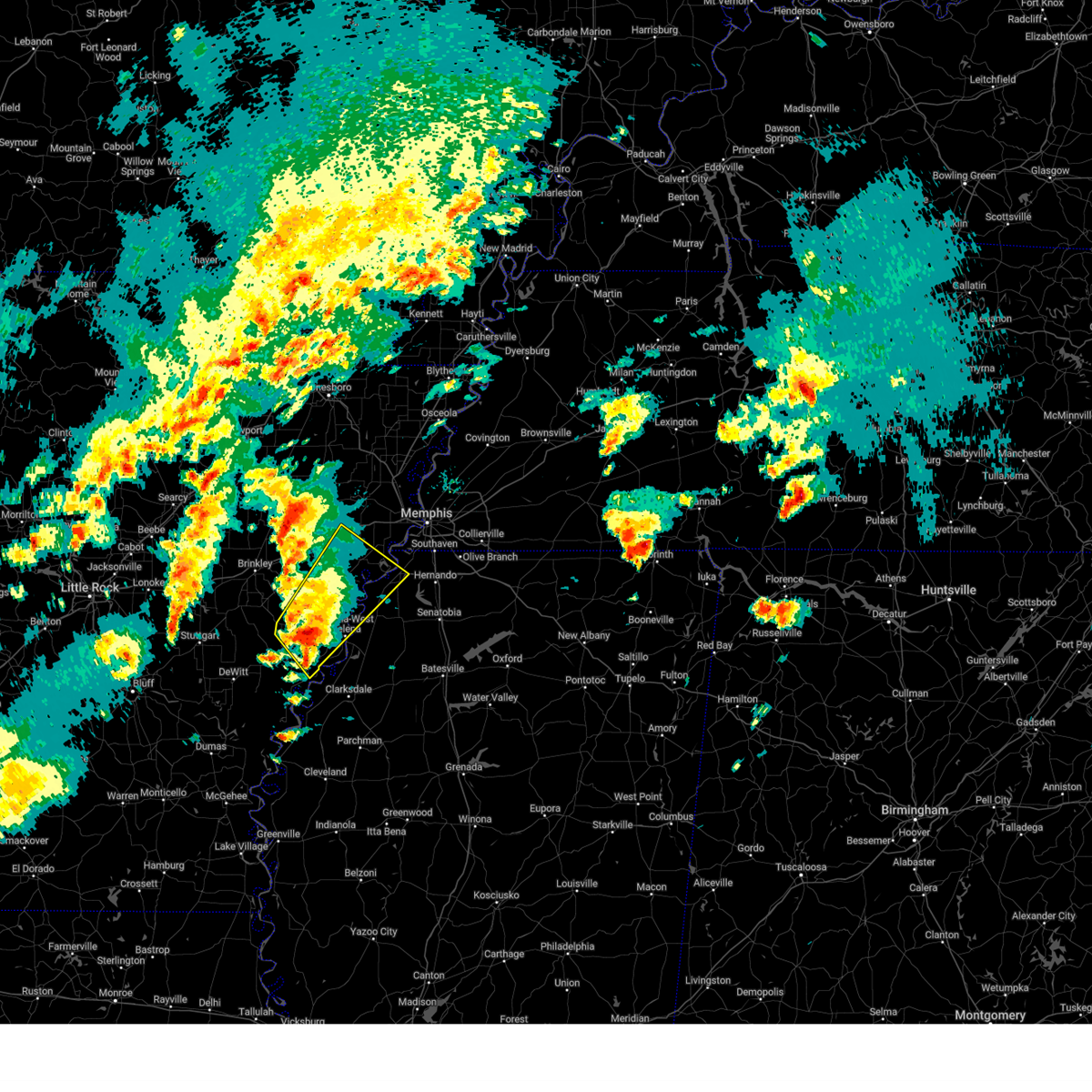
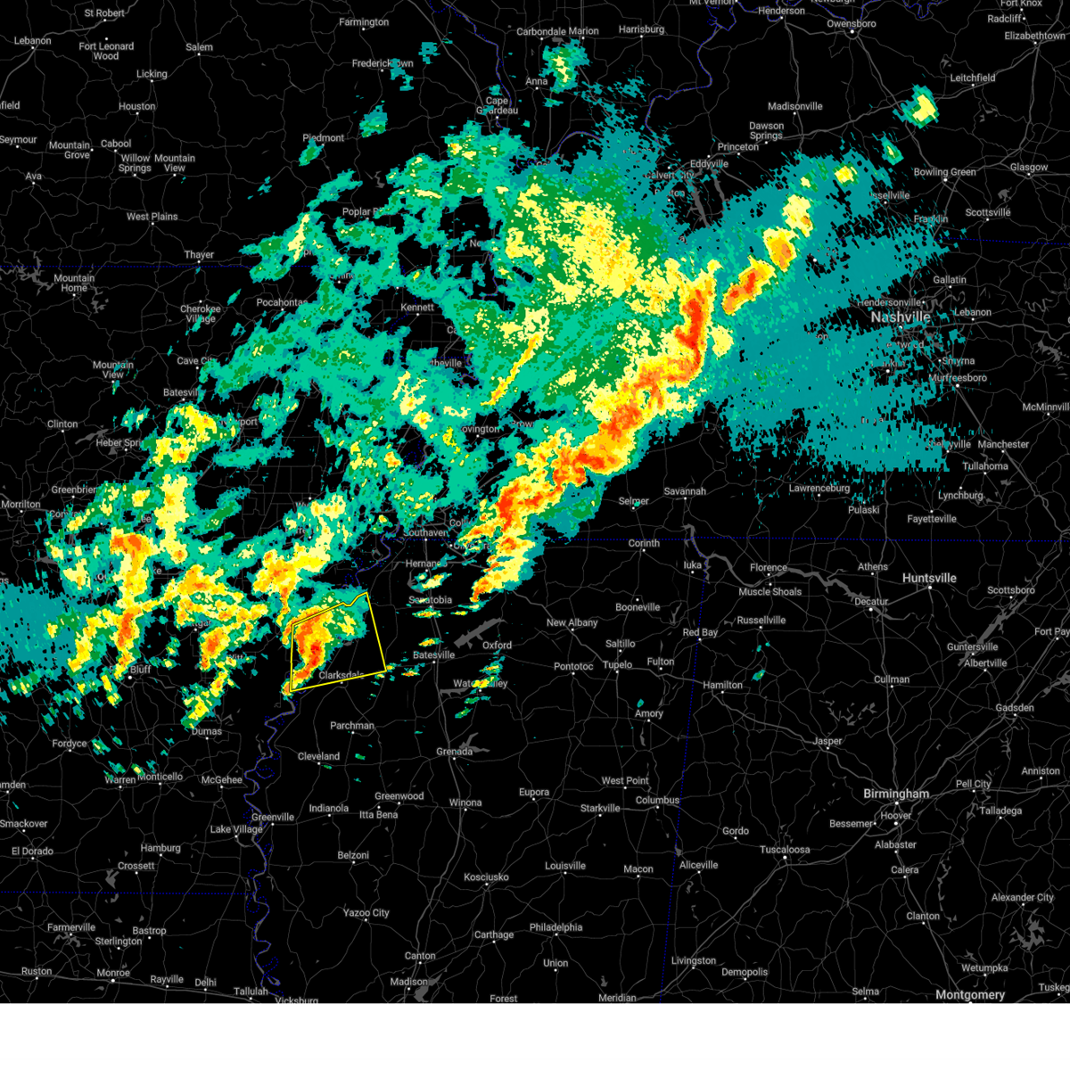
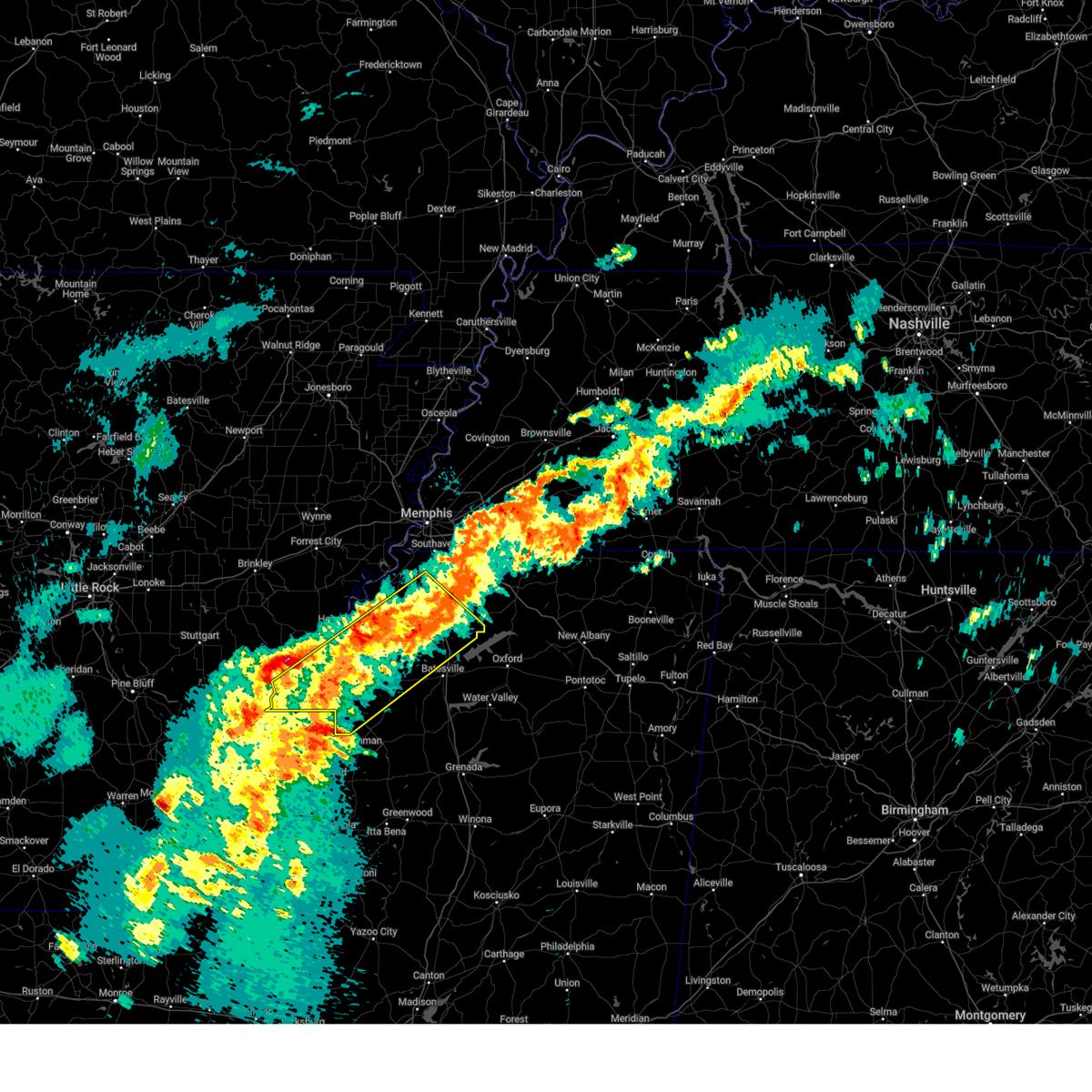
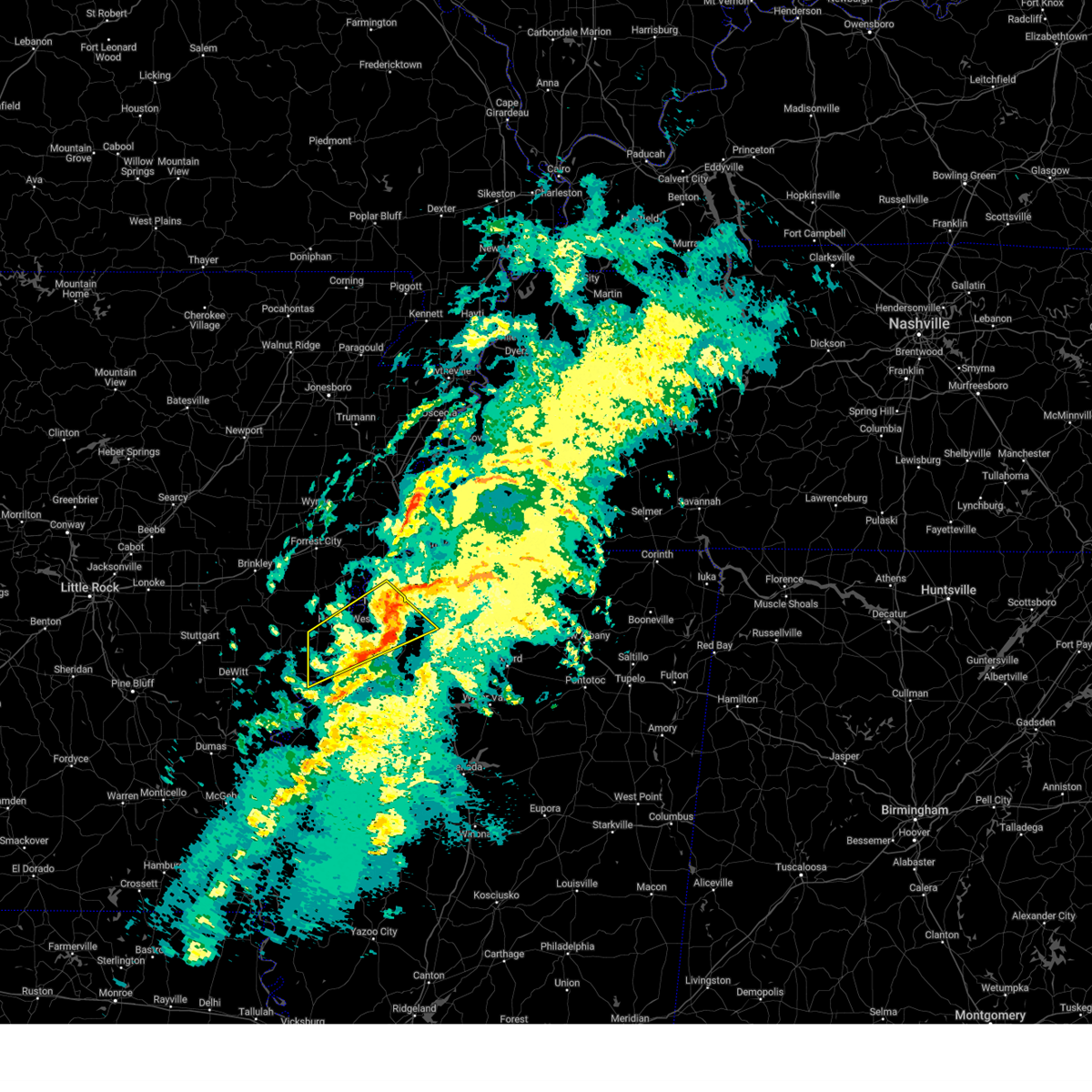
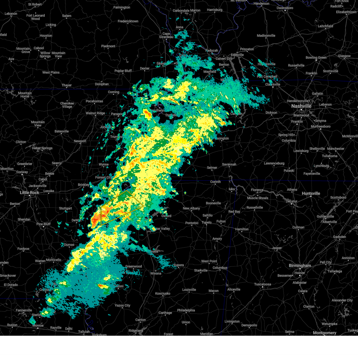
Hail Map for Lake View, AR
The Lake View, AR area has had 0 reports of on-the-ground hail by trained spotters, and has been under severe weather warnings 54 times during the past 12 months. Doppler radar has detected hail at or near Lake View, AR on 43 occasions, including 6 occasions during the past year.
| Name: | Lake View, AR |
| Where Located: | 66.6 miles SW of Memphis, TN |
| Map: | Google Map for Lake View, AR |
| Population: | 443 |
| Housing Units: | 187 |
| More Info: | Search Google for Lake View, AR |
0
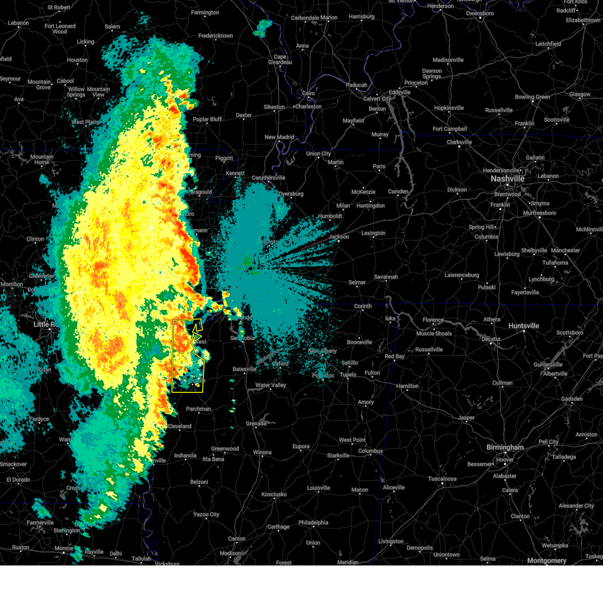
The Top Recent Hail Date for Lake View, AR is Tuesday, May 20, 2025 (21st out of 43)
Hail and Wind Damage Spotted near Lake View, AR
| Date / Time | Report Details |
|---|---|
| 6/7/2025 10:20 PM CDT |
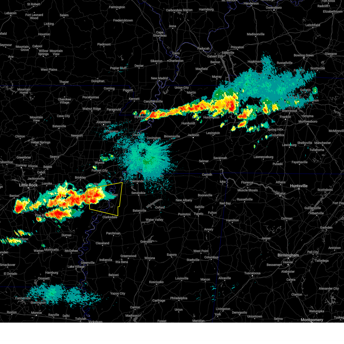
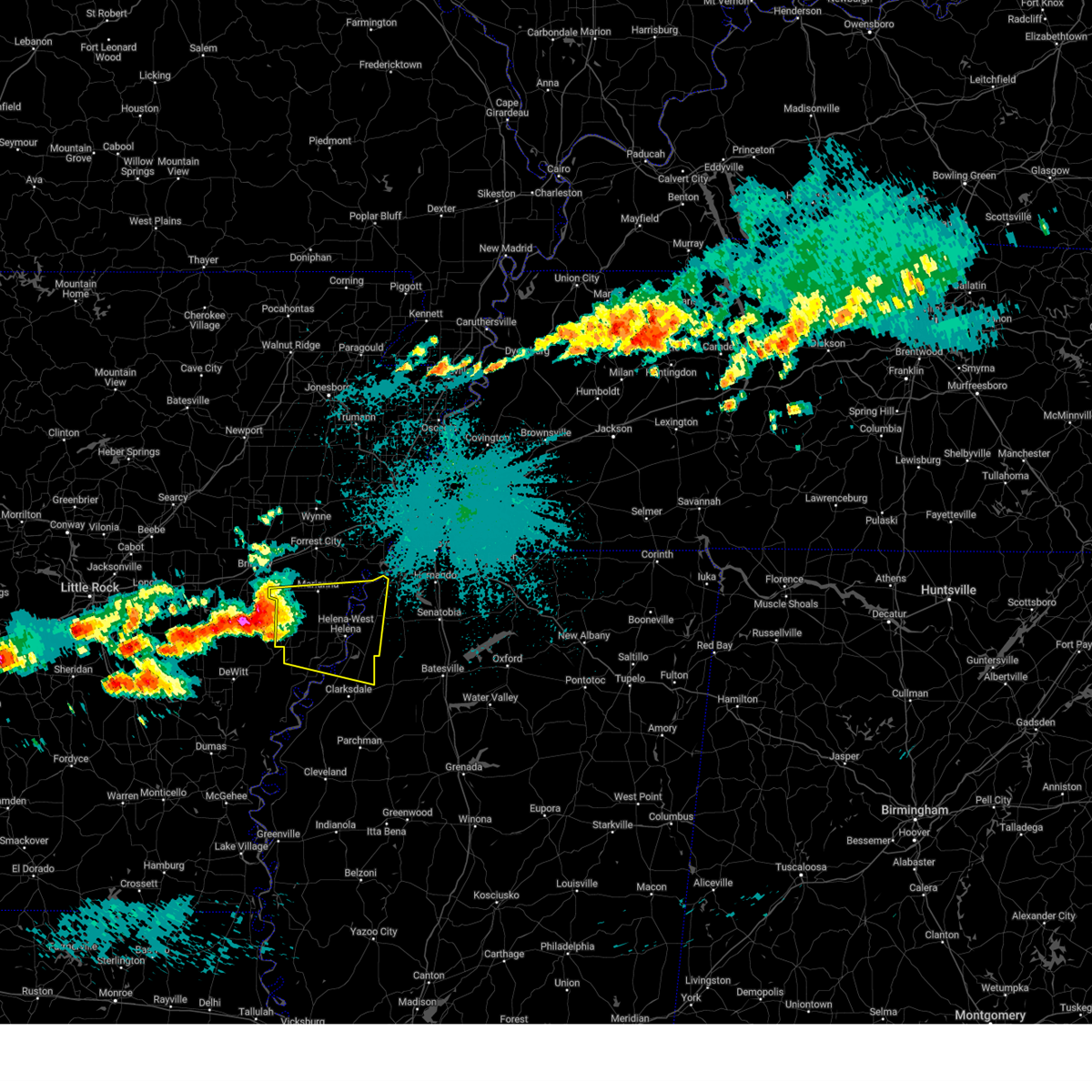
 Svrmeg the national weather service in memphis has issued a * severe thunderstorm warning for, northeastern phillips county in eastern arkansas, northeastern coahoma county in northwestern mississippi, southern tunica county in northwestern mississippi, quitman county in northwestern mississippi, northwestern panola county in northwestern mississippi, * until 1100 pm cdt. * at 1020 pm cdt, a severe thunderstorm was located near friars point, or 7 miles southwest of helena-west helena, moving east at 30 mph (radar indicated). Hazards include 60 mph wind gusts and quarter size hail. Hail damage to vehicles is expected. Expect wind damage to roofs, siding, and trees. Svrmeg the national weather service in memphis has issued a * severe thunderstorm warning for, northeastern phillips county in eastern arkansas, northeastern coahoma county in northwestern mississippi, southern tunica county in northwestern mississippi, quitman county in northwestern mississippi, northwestern panola county in northwestern mississippi, * until 1100 pm cdt. * at 1020 pm cdt, a severe thunderstorm was located near friars point, or 7 miles southwest of helena-west helena, moving east at 30 mph (radar indicated). Hazards include 60 mph wind gusts and quarter size hail. Hail damage to vehicles is expected. Expect wind damage to roofs, siding, and trees.
|
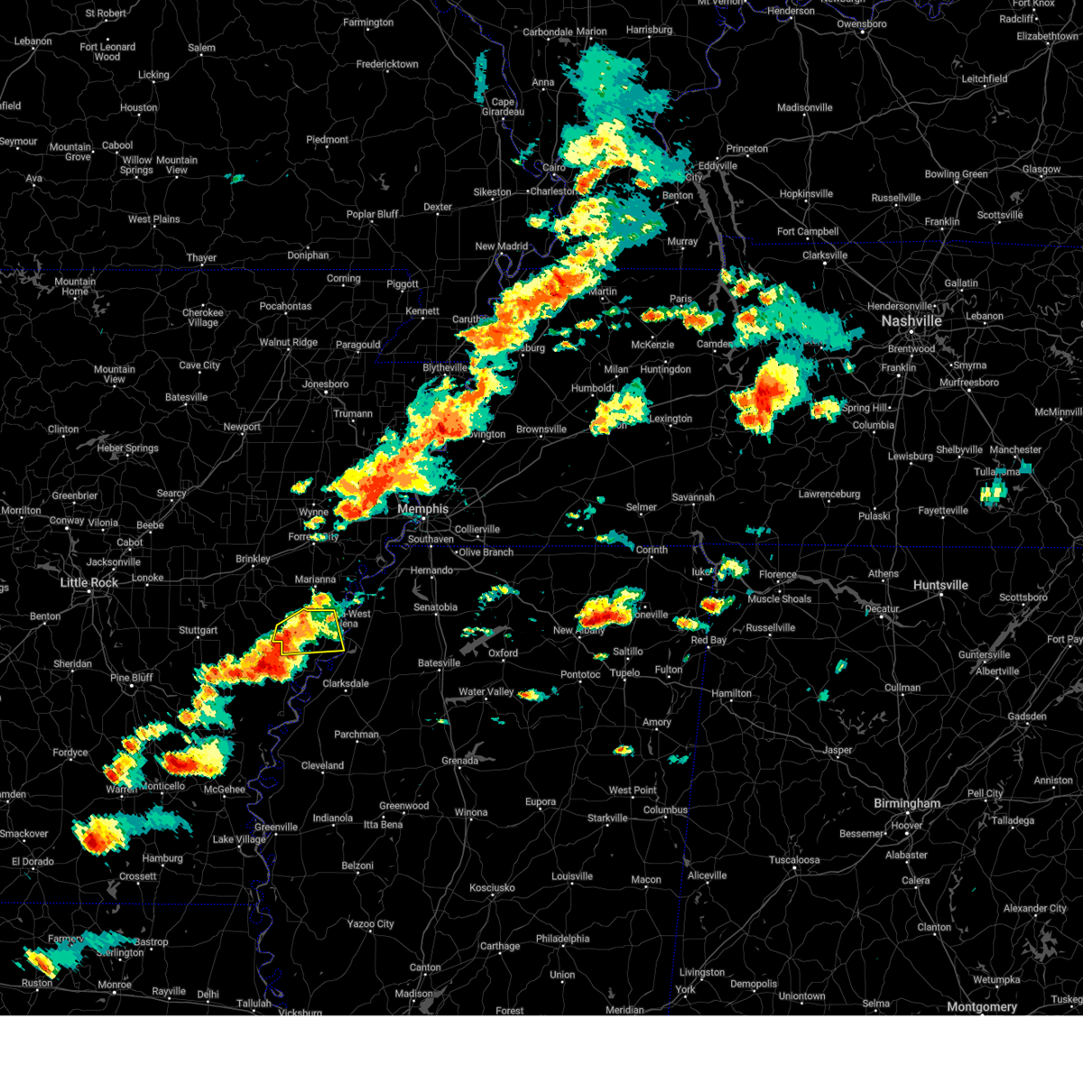
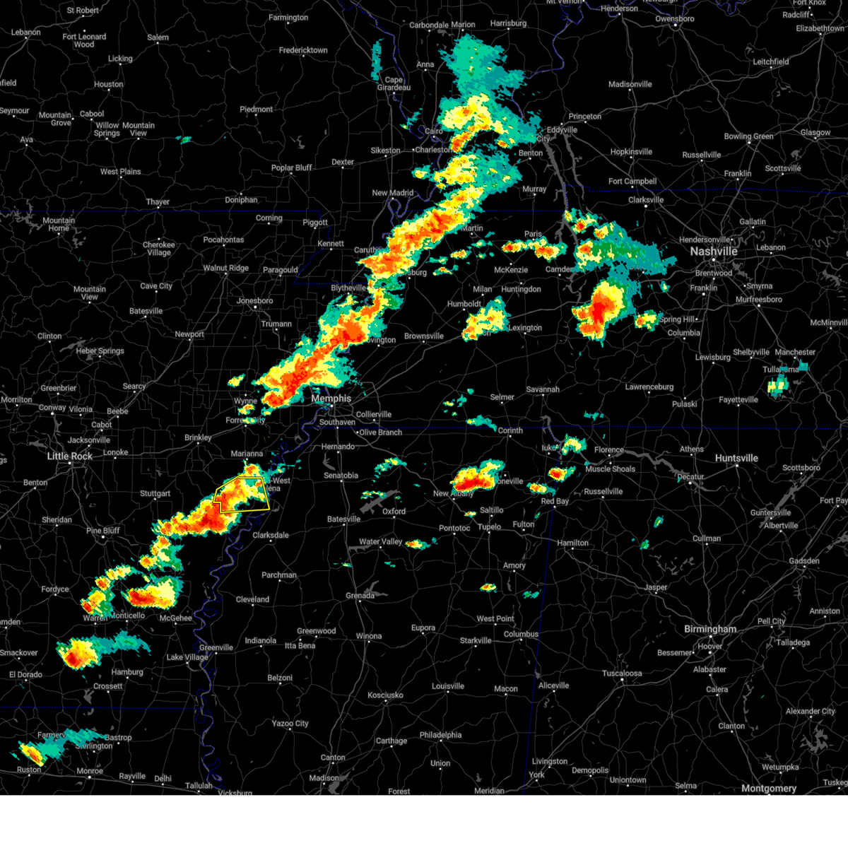
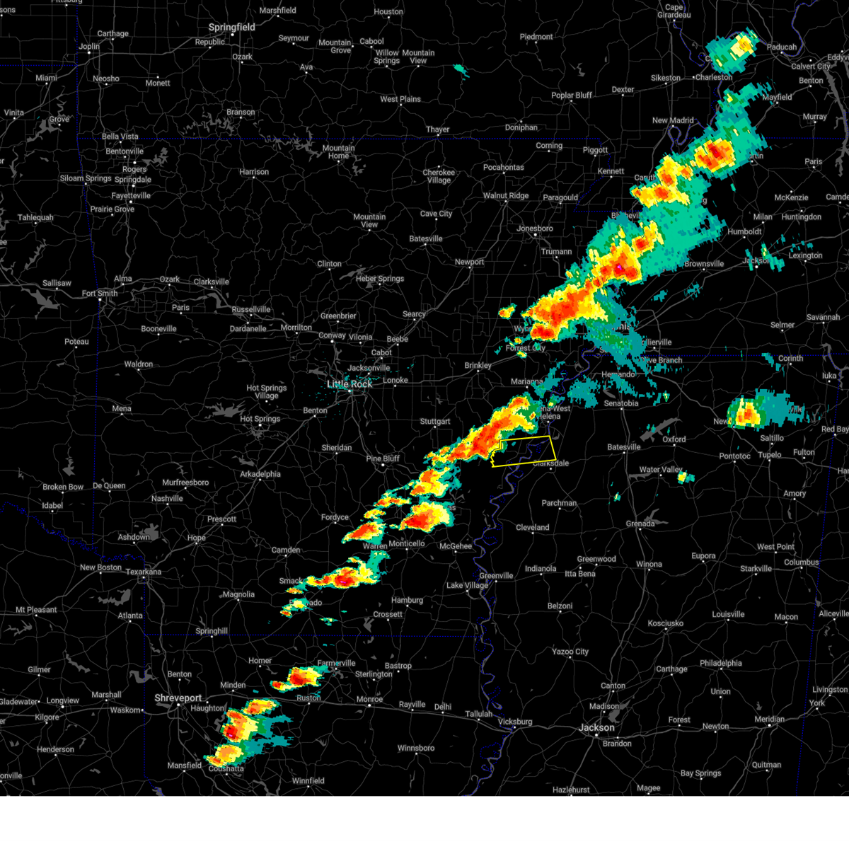
| 6/7/2025 9:32 PM CDT |
 At 932 pm cdt, a severe thunderstorm was located near marvell, moving east at 30 mph (radar indicated). Hazards include 60 mph wind gusts and quarter size hail. Hail damage to vehicles is expected. expect wind damage to roofs, siding, and trees. Locations impacted include, marvell, helena-west helena, st francis national park, friars point, lexa, rondo, watkins corner, lake view, lagrange, preston place, quarles, westover, jeffries, wycamp, latour, turkey scratch, vineyard, helena crossing, cypress corner, and poplar grove. At 932 pm cdt, a severe thunderstorm was located near marvell, moving east at 30 mph (radar indicated). Hazards include 60 mph wind gusts and quarter size hail. Hail damage to vehicles is expected. expect wind damage to roofs, siding, and trees. Locations impacted include, marvell, helena-west helena, st francis national park, friars point, lexa, rondo, watkins corner, lake view, lagrange, preston place, quarles, westover, jeffries, wycamp, latour, turkey scratch, vineyard, helena crossing, cypress corner, and poplar grove.
|
| 6/7/2025 9:07 PM CDT |
 Svrmeg the national weather service in memphis has issued a * severe thunderstorm warning for, southern lee county in eastern arkansas, northern phillips county in eastern arkansas, north central coahoma county in northwestern mississippi, southwestern tunica county in northwestern mississippi, * until 945 pm cdt. * at 907 pm cdt, a severe thunderstorm was located over palmer, or 9 miles west of marvell, moving east at 30 mph (radar indicated). Hazards include 60 mph wind gusts and quarter size hail. Hail damage to vehicles is expected. Expect wind damage to roofs, siding, and trees. Svrmeg the national weather service in memphis has issued a * severe thunderstorm warning for, southern lee county in eastern arkansas, northern phillips county in eastern arkansas, north central coahoma county in northwestern mississippi, southwestern tunica county in northwestern mississippi, * until 945 pm cdt. * at 907 pm cdt, a severe thunderstorm was located over palmer, or 9 miles west of marvell, moving east at 30 mph (radar indicated). Hazards include 60 mph wind gusts and quarter size hail. Hail damage to vehicles is expected. Expect wind damage to roofs, siding, and trees.
|
| 5/25/2025 5:55 PM CDT |
 Svrmeg the national weather service in memphis has issued a * severe thunderstorm warning for, phillips county in eastern arkansas, coahoma county in northwestern mississippi, tunica county in northwestern mississippi, southern tate county in northwestern mississippi, northwestern tallahatchie county in northwestern mississippi, quitman county in northwestern mississippi, panola county in northwestern mississippi, * until 645 pm cdt. * at 554 pm cdt, severe thunderstorms were located along a line extending from near tunica to near friars point to near crumrod, moving east at 50 mph (radar indicated). Hazards include 60 mph wind gusts and quarter size hail. Hail damage to vehicles is expected. Expect wind damage to roofs, siding, and trees. Svrmeg the national weather service in memphis has issued a * severe thunderstorm warning for, phillips county in eastern arkansas, coahoma county in northwestern mississippi, tunica county in northwestern mississippi, southern tate county in northwestern mississippi, northwestern tallahatchie county in northwestern mississippi, quitman county in northwestern mississippi, panola county in northwestern mississippi, * until 645 pm cdt. * at 554 pm cdt, severe thunderstorms were located along a line extending from near tunica to near friars point to near crumrod, moving east at 50 mph (radar indicated). Hazards include 60 mph wind gusts and quarter size hail. Hail damage to vehicles is expected. Expect wind damage to roofs, siding, and trees.
|
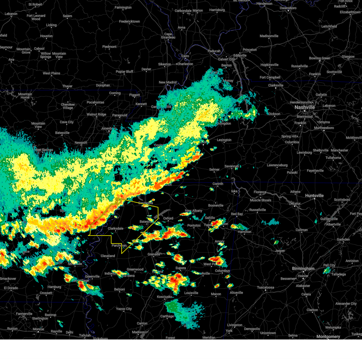
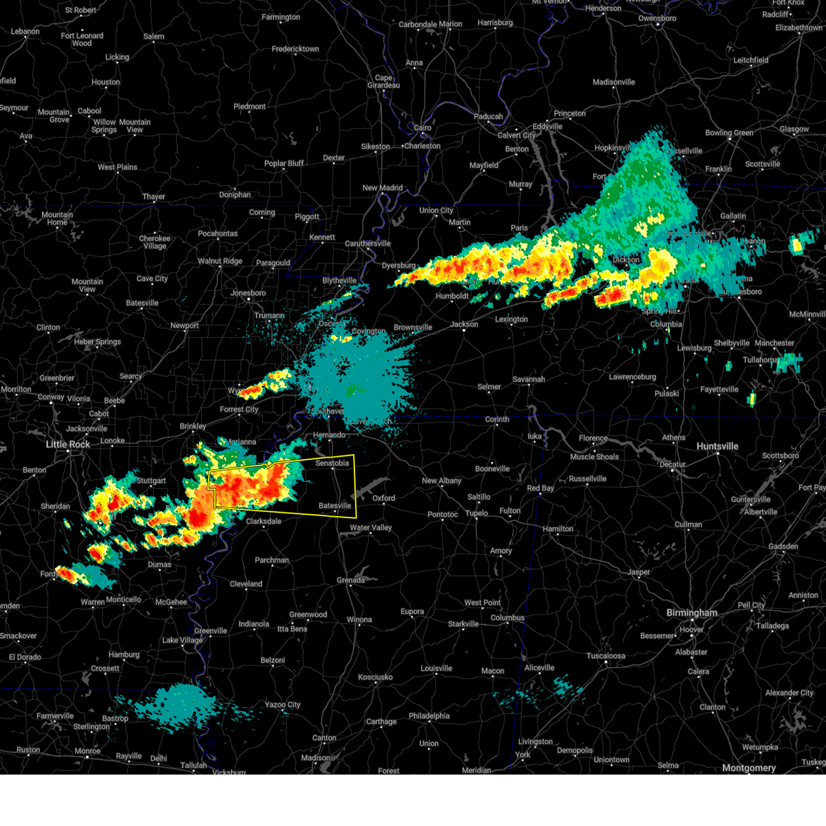
| 5/20/2025 3:44 PM CDT | Svrmeg the national weather service in memphis has issued a * severe thunderstorm warning for, northeastern phillips county in eastern arkansas, northeastern coahoma county in northwestern mississippi, tunica county in northwestern mississippi, western tate county in northwestern mississippi, northern quitman county in northwestern mississippi, northwestern panola county in northwestern mississippi, * until 430 pm cdt. * at 344 pm cdt, severe thunderstorms were located along a line extending from st francis national park to near friars point to near elaine, moving east at 45 mph (radar indicated). Hazards include 60 mph wind gusts and quarter size hail. Hail damage to vehicles is expected. Expect wind damage to roofs, siding, and trees. |
| 5/20/2025 3:27 PM CDT |
 the severe thunderstorm warning has been cancelled and is no longer in effect the severe thunderstorm warning has been cancelled and is no longer in effect
|
| 5/20/2025 3:27 PM CDT |
 At 326 pm cdt, a severe thunderstorm was located over marvell, moving east at 40 mph (radar indicated). Hazards include 60 mph wind gusts and quarter size hail. Hail damage to vehicles is expected. expect wind damage to roofs, siding, and trees. Locations impacted include, poplar grove, huma, delta heritage trails state park, lexa, helena-west helena, preston place, quarles, oneida, barton, wycamp, marvell, latour, kindall, kingtown, lake view, gobell, spring creek, trenton, helena crossing, and watkins corner. At 326 pm cdt, a severe thunderstorm was located over marvell, moving east at 40 mph (radar indicated). Hazards include 60 mph wind gusts and quarter size hail. Hail damage to vehicles is expected. expect wind damage to roofs, siding, and trees. Locations impacted include, poplar grove, huma, delta heritage trails state park, lexa, helena-west helena, preston place, quarles, oneida, barton, wycamp, marvell, latour, kindall, kingtown, lake view, gobell, spring creek, trenton, helena crossing, and watkins corner.
|
| 5/20/2025 3:16 PM CDT |
 Svrmeg the national weather service in memphis has issued a * severe thunderstorm warning for, central phillips county in eastern arkansas, central coahoma county in northwestern mississippi, * until 400 pm cdt. * at 316 pm cdt, a severe thunderstorm was located over st. charles, or 11 miles north of white river national wildlife refuge, moving east at 40 mph (radar indicated). Hazards include 60 mph wind gusts and quarter size hail. Hail damage to vehicles is expected. Expect wind damage to roofs, siding, and trees. Svrmeg the national weather service in memphis has issued a * severe thunderstorm warning for, central phillips county in eastern arkansas, central coahoma county in northwestern mississippi, * until 400 pm cdt. * at 316 pm cdt, a severe thunderstorm was located over st. charles, or 11 miles north of white river national wildlife refuge, moving east at 40 mph (radar indicated). Hazards include 60 mph wind gusts and quarter size hail. Hail damage to vehicles is expected. Expect wind damage to roofs, siding, and trees.
|
| 5/20/2025 3:00 PM CDT |
 Svrmeg the national weather service in memphis has issued a * severe thunderstorm warning for, south central lee county in eastern arkansas, northern phillips county in eastern arkansas, * until 345 pm cdt. * at 300 pm cdt, a severe thunderstorm was located 7 miles south of holly grove, or 14 miles west of marvell, moving east at 40 mph (radar indicated). Hazards include 60 mph wind gusts and quarter size hail. Hail damage to vehicles is expected. Expect wind damage to roofs, siding, and trees. Svrmeg the national weather service in memphis has issued a * severe thunderstorm warning for, south central lee county in eastern arkansas, northern phillips county in eastern arkansas, * until 345 pm cdt. * at 300 pm cdt, a severe thunderstorm was located 7 miles south of holly grove, or 14 miles west of marvell, moving east at 40 mph (radar indicated). Hazards include 60 mph wind gusts and quarter size hail. Hail damage to vehicles is expected. Expect wind damage to roofs, siding, and trees.
|
| 5/18/2025 8:58 AM CDT |
 The storm which prompted the warning has weakened below severe limits, and no longer poses an immediate threat to life or property. therefore, the warning will be allowed to expire. however, small hail and gusty winds are still possible with this thunderstorm. The storm which prompted the warning has weakened below severe limits, and no longer poses an immediate threat to life or property. therefore, the warning will be allowed to expire. however, small hail and gusty winds are still possible with this thunderstorm.
|
| 5/18/2025 8:36 AM CDT |
 At 835 am cdt, a severe thunderstorm was located over lexa, or 7 miles northeast of marvell, moving east at 45 mph (radar indicated). Hazards include 60 mph wind gusts and quarter size hail. Hail damage to vehicles is expected. expect wind damage to roofs, siding, and trees. Locations impacted include, mattson, coahoma, wabash, rudyard, moon, modoc, preston place, dublin, hoop spur, westover, kings, beverly, sherard, clarksdale, clover hill, lurand, ewal, farrell, hopson, and lyon. At 835 am cdt, a severe thunderstorm was located over lexa, or 7 miles northeast of marvell, moving east at 45 mph (radar indicated). Hazards include 60 mph wind gusts and quarter size hail. Hail damage to vehicles is expected. expect wind damage to roofs, siding, and trees. Locations impacted include, mattson, coahoma, wabash, rudyard, moon, modoc, preston place, dublin, hoop spur, westover, kings, beverly, sherard, clarksdale, clover hill, lurand, ewal, farrell, hopson, and lyon.
|
| 5/18/2025 8:36 AM CDT |
 the severe thunderstorm warning has been cancelled and is no longer in effect the severe thunderstorm warning has been cancelled and is no longer in effect
|
| 5/18/2025 8:00 AM CDT |
 Svrmeg the national weather service in memphis has issued a * severe thunderstorm warning for, lee county in eastern arkansas, phillips county in eastern arkansas, central coahoma county in northwestern mississippi, western tunica county in northwestern mississippi, * until 900 am cdt. * at 759 am cdt, a severe thunderstorm was located near holly grove, or 8 miles south of clarendon, moving east at 45 mph (radar indicated). Hazards include 60 mph wind gusts and quarter size hail. Hail damage to vehicles is expected. Expect wind damage to roofs, siding, and trees. Svrmeg the national weather service in memphis has issued a * severe thunderstorm warning for, lee county in eastern arkansas, phillips county in eastern arkansas, central coahoma county in northwestern mississippi, western tunica county in northwestern mississippi, * until 900 am cdt. * at 759 am cdt, a severe thunderstorm was located near holly grove, or 8 miles south of clarendon, moving east at 45 mph (radar indicated). Hazards include 60 mph wind gusts and quarter size hail. Hail damage to vehicles is expected. Expect wind damage to roofs, siding, and trees.
|
| 5/17/2025 12:15 AM CDT | At 1215 am cdt, a severe thunderstorm was located over sledge, or 16 miles northwest of batesville, moving east at 50 mph (radar indicated). Hazards include 60 mph wind gusts and quarter size hail. Hail damage to vehicles is expected. expect wind damage to roofs, siding, and trees. Locations impacted include, askew, coahoma, gerlach mill, rudyard, moon, buxton, helena-west helena, savage, preston place, quarles, crossroad, senatobia, hoop spur, westover, falcon, como, strayhorn, pleasant grove, jonestown, and dubbs. |
| 5/16/2025 11:54 PM CDT |
 Svrmeg the national weather service in memphis has issued a * severe thunderstorm warning for, phillips county in eastern arkansas, northeastern coahoma county in northwestern mississippi, southern tunica county in northwestern mississippi, tate county in northwestern mississippi, northern quitman county in northwestern mississippi, panola county in northwestern mississippi, * until 100 am cdt. * at 1154 pm cdt, a severe thunderstorm was located near dundee, or 7 miles southeast of helena-west helena, moving east at 40 mph (radar indicated). Hazards include 60 mph wind gusts and quarter size hail. Hail damage to vehicles is expected. Expect wind damage to roofs, siding, and trees. Svrmeg the national weather service in memphis has issued a * severe thunderstorm warning for, phillips county in eastern arkansas, northeastern coahoma county in northwestern mississippi, southern tunica county in northwestern mississippi, tate county in northwestern mississippi, northern quitman county in northwestern mississippi, panola county in northwestern mississippi, * until 100 am cdt. * at 1154 pm cdt, a severe thunderstorm was located near dundee, or 7 miles southeast of helena-west helena, moving east at 40 mph (radar indicated). Hazards include 60 mph wind gusts and quarter size hail. Hail damage to vehicles is expected. Expect wind damage to roofs, siding, and trees.
|
| 5/16/2025 11:19 PM CDT |
 At 1119 pm cdt, a severe thunderstorm was located near marvell, moving east at 35 mph (radar indicated). Hazards include ping pong ball size hail and 60 mph wind gusts. People and animals outdoors will be injured. expect hail damage to roofs, siding, windows, and vehicles. expect wind damage to roofs, siding, and trees. Locations impacted include, tunica, coahoma, rudyard, moon, helena-west helena, preston place, haleside, quarles, commerce, austin, westover, vineyard, jonestown, dubbs, matagorda, whitehall, poplar grove, huma, mississippi river state park, and north tunica. At 1119 pm cdt, a severe thunderstorm was located near marvell, moving east at 35 mph (radar indicated). Hazards include ping pong ball size hail and 60 mph wind gusts. People and animals outdoors will be injured. expect hail damage to roofs, siding, windows, and vehicles. expect wind damage to roofs, siding, and trees. Locations impacted include, tunica, coahoma, rudyard, moon, helena-west helena, preston place, haleside, quarles, commerce, austin, westover, vineyard, jonestown, dubbs, matagorda, whitehall, poplar grove, huma, mississippi river state park, and north tunica.
|
| 5/16/2025 10:57 PM CDT |
 Svrmeg the national weather service in memphis has issued a * severe thunderstorm warning for, southern lee county in eastern arkansas, phillips county in eastern arkansas, northeastern coahoma county in northwestern mississippi, central tunica county in northwestern mississippi, * until midnight cdt. * at 1057 pm cdt, a severe thunderstorm was located near holly grove, or 10 miles southeast of clarendon, moving east at 50 mph (radar indicated). Hazards include ping pong ball size hail and 60 mph wind gusts. People and animals outdoors will be injured. expect hail damage to roofs, siding, windows, and vehicles. Expect wind damage to roofs, siding, and trees. Svrmeg the national weather service in memphis has issued a * severe thunderstorm warning for, southern lee county in eastern arkansas, phillips county in eastern arkansas, northeastern coahoma county in northwestern mississippi, central tunica county in northwestern mississippi, * until midnight cdt. * at 1057 pm cdt, a severe thunderstorm was located near holly grove, or 10 miles southeast of clarendon, moving east at 50 mph (radar indicated). Hazards include ping pong ball size hail and 60 mph wind gusts. People and animals outdoors will be injured. expect hail damage to roofs, siding, windows, and vehicles. Expect wind damage to roofs, siding, and trees.
|
| 5/2/2025 12:51 PM CDT | Svrmeg the national weather service in memphis has issued a * severe thunderstorm warning for, east central phillips county in eastern arkansas, northeastern coahoma county in northwestern mississippi, southern tunica county in northwestern mississippi, northern quitman county in northwestern mississippi, * until 130 pm cdt. * at 1250 pm cdt, a severe thunderstorm was located near friars point, or 10 miles northeast of elaine, moving east at 25 mph (radar indicated). Hazards include 60 mph wind gusts and quarter size hail. Hail damage to vehicles is expected. Expect wind damage to roofs, siding, and trees. |
| 5/2/2025 10:30 AM CDT |
 Svrmeg the national weather service in memphis has issued a * severe thunderstorm warning for, lee county in eastern arkansas, eastern st. francis county in eastern arkansas, phillips county in eastern arkansas, coahoma county in northwestern mississippi, tunica county in northwestern mississippi, quitman county in northwestern mississippi, * until 1130 am cdt. * at 1030 am cdt, severe thunderstorms were located along a line extending from garret grove to near watkins corner to near crumrod, moving northeast at 30 mph (radar indicated). Hazards include 60 mph wind gusts and quarter size hail. Hail damage to vehicles is expected. Expect wind damage to roofs, siding, and trees. Svrmeg the national weather service in memphis has issued a * severe thunderstorm warning for, lee county in eastern arkansas, eastern st. francis county in eastern arkansas, phillips county in eastern arkansas, coahoma county in northwestern mississippi, tunica county in northwestern mississippi, quitman county in northwestern mississippi, * until 1130 am cdt. * at 1030 am cdt, severe thunderstorms were located along a line extending from garret grove to near watkins corner to near crumrod, moving northeast at 30 mph (radar indicated). Hazards include 60 mph wind gusts and quarter size hail. Hail damage to vehicles is expected. Expect wind damage to roofs, siding, and trees.
|
| 4/30/2025 8:54 PM CDT |
 The storms which prompted the warning have weakened below severe limits, and have exited the warned area. therefore, the warning will be allowed to expire. a severe thunderstorm watch remains in effect until 1100 pm cdt for eastern arkansas, and northwestern mississippi. The storms which prompted the warning have weakened below severe limits, and have exited the warned area. therefore, the warning will be allowed to expire. a severe thunderstorm watch remains in effect until 1100 pm cdt for eastern arkansas, and northwestern mississippi.
|
| 4/30/2025 8:43 PM CDT | At 842 pm cdt, severe thunderstorms were located along a line extending from near haynes to near sherard, moving east at 40 mph (radar indicated). Hazards include 60 mph wind gusts and penny size hail. Expect damage to roofs, siding, and trees. Locations impacted include, rena lara, coahoma, rudyard, moon, helena-west helena, preston place, haleside, quarles, westover, soudan, beverly, clarksdale, jonestown, lurand, matagorda, farrell, whitehall, raggio, huma, and mississippi river state park. |
| 4/30/2025 8:12 PM CDT |
 Svrmeg the national weather service in memphis has issued a * severe thunderstorm warning for, lee county in eastern arkansas, phillips county in eastern arkansas, coahoma county in northwestern mississippi, * until 900 pm cdt. * at 812 pm cdt, severe thunderstorms were located along a line extending from near garret grove to near crumrod, moving east at 40 mph (radar indicated). Hazards include 60 mph wind gusts and penny size hail. expect damage to roofs, siding, and trees Svrmeg the national weather service in memphis has issued a * severe thunderstorm warning for, lee county in eastern arkansas, phillips county in eastern arkansas, coahoma county in northwestern mississippi, * until 900 pm cdt. * at 812 pm cdt, severe thunderstorms were located along a line extending from near garret grove to near crumrod, moving east at 40 mph (radar indicated). Hazards include 60 mph wind gusts and penny size hail. expect damage to roofs, siding, and trees
|
| 4/5/2025 3:26 PM CDT |
 The storm which prompted the warning has moved out of the area. therefore, the warning will be allowed to expire. a tornado watch remains in effect until 700 pm cdt for eastern arkansas, and northwestern mississippi. remember, a tornado warning still remains in effect for portions of phillips county, ar and coahoma county, ms until 4 pm cdt. The storm which prompted the warning has moved out of the area. therefore, the warning will be allowed to expire. a tornado watch remains in effect until 700 pm cdt for eastern arkansas, and northwestern mississippi. remember, a tornado warning still remains in effect for portions of phillips county, ar and coahoma county, ms until 4 pm cdt.
|
| 4/5/2025 3:16 PM CDT |
 At 316 pm cdt, a severe thunderstorm capable of producing a tornado was located 8 miles northwest of friars point, or 10 miles northeast of elaine, moving northeast at 50 mph (radar indicated rotation). Hazards include tornado and quarter size hail. Flying debris will be dangerous to those caught without shelter. mobile homes will be damaged or destroyed. damage to roofs, windows, and vehicles will occur. tree damage is likely. Locations impacted include, delta heritage trails state park, wabash, helena-west helena, modoc, preston place, quarles, hoop spur, westover, wycamp, latour, helena crossing, ewal, poplar grove, huma, lexa, oneida, barton, kindall, lambrook, and kingtown. At 316 pm cdt, a severe thunderstorm capable of producing a tornado was located 8 miles northwest of friars point, or 10 miles northeast of elaine, moving northeast at 50 mph (radar indicated rotation). Hazards include tornado and quarter size hail. Flying debris will be dangerous to those caught without shelter. mobile homes will be damaged or destroyed. damage to roofs, windows, and vehicles will occur. tree damage is likely. Locations impacted include, delta heritage trails state park, wabash, helena-west helena, modoc, preston place, quarles, hoop spur, westover, wycamp, latour, helena crossing, ewal, poplar grove, huma, lexa, oneida, barton, kindall, lambrook, and kingtown.
|
| 4/5/2025 3:05 PM CDT |
 Tormeg the national weather service in memphis has issued a * tornado warning for, central phillips county in eastern arkansas, north central coahoma county in northwestern mississippi, * until 330 pm cdt. * at 305 pm cdt, a severe thunderstorm capable of producing a tornado was located near elaine, moving northeast at 50 mph (radar indicated rotation). Hazards include tornado and quarter size hail. Flying debris will be dangerous to those caught without shelter. mobile homes will be damaged or destroyed. damage to roofs, windows, and vehicles will occur. Tree damage is likely. Tormeg the national weather service in memphis has issued a * tornado warning for, central phillips county in eastern arkansas, north central coahoma county in northwestern mississippi, * until 330 pm cdt. * at 305 pm cdt, a severe thunderstorm capable of producing a tornado was located near elaine, moving northeast at 50 mph (radar indicated rotation). Hazards include tornado and quarter size hail. Flying debris will be dangerous to those caught without shelter. mobile homes will be damaged or destroyed. damage to roofs, windows, and vehicles will occur. Tree damage is likely.
|
| 4/5/2025 2:52 PM CDT |
 At 251 pm cdt, a severe thunderstorm was located 7 miles east of crumrod, or 8 miles south of elaine, moving northeast at 55 mph (radar indicated). Hazards include 60 mph wind gusts and quarter size hail. Hail damage to vehicles is expected. expect wind damage to roofs, siding, and trees. Locations impacted include, mattson, tunica, rena lara, coahoma, gerlach mill, mosby spur, ferguson, belen, rudyard, moon, helena-west helena, preston place, dublin, quarles, denton, austin, hoop spur, westover, beverly, and clarksdale. At 251 pm cdt, a severe thunderstorm was located 7 miles east of crumrod, or 8 miles south of elaine, moving northeast at 55 mph (radar indicated). Hazards include 60 mph wind gusts and quarter size hail. Hail damage to vehicles is expected. expect wind damage to roofs, siding, and trees. Locations impacted include, mattson, tunica, rena lara, coahoma, gerlach mill, mosby spur, ferguson, belen, rudyard, moon, helena-west helena, preston place, dublin, quarles, denton, austin, hoop spur, westover, beverly, and clarksdale.
|
| 4/5/2025 2:49 PM CDT |
 At 249 pm cdt, a severe thunderstorm was located near crumrod, or 10 miles east of white river national wildlife refuge, moving northeast at 55 mph (radar indicated). Hazards include 60 mph wind gusts and quarter size hail. Hail damage to vehicles is expected. expect wind damage to roofs, siding, and trees. Locations impacted include, mattson, tunica, rena lara, coahoma, gerlach mill, mosby spur, ferguson, belen, rudyard, moon, helena-west helena, preston place, dublin, quarles, denton, austin, hoop spur, westover, beverly, and clarksdale. At 249 pm cdt, a severe thunderstorm was located near crumrod, or 10 miles east of white river national wildlife refuge, moving northeast at 55 mph (radar indicated). Hazards include 60 mph wind gusts and quarter size hail. Hail damage to vehicles is expected. expect wind damage to roofs, siding, and trees. Locations impacted include, mattson, tunica, rena lara, coahoma, gerlach mill, mosby spur, ferguson, belen, rudyard, moon, helena-west helena, preston place, dublin, quarles, denton, austin, hoop spur, westover, beverly, and clarksdale.
|
| 4/5/2025 2:43 PM CDT |
 The storm which prompted the warning has moved out of the area. therefore, the warning will be allowed to expire. a tornado watch remains in effect until 700 pm cdt for eastern arkansas, northwestern mississippi, and west tennessee. remember, a severe thunderstorm warning still remains in effect for phillips, coahoma, and tunica counties. The storm which prompted the warning has moved out of the area. therefore, the warning will be allowed to expire. a tornado watch remains in effect until 700 pm cdt for eastern arkansas, northwestern mississippi, and west tennessee. remember, a severe thunderstorm warning still remains in effect for phillips, coahoma, and tunica counties.
|
| 4/5/2025 2:33 PM CDT | the severe thunderstorm warning has been cancelled and is no longer in effect |
| 4/5/2025 2:33 PM CDT | At 233 pm cdt, a severe thunderstorm was located near watkins corner, or 8 miles northwest of elaine, moving east at 40 mph (radar indicated). Hazards include 60 mph wind gusts and quarter size hail. Hail damage to vehicles is expected. expect wind damage to roofs, siding, and trees. Locations impacted include, tunica, gerlach mill, trinity, lake cormorant, moon, helena-west helena, savage, preston place, quarles, senatobia, austin, hoop spur, westover, strayhorn, prichard, eudora, dubbs, glover, coldwater, and bluff. |
| 4/5/2025 2:26 PM CDT | Svrmeg the national weather service in memphis has issued a * severe thunderstorm warning for, phillips county in eastern arkansas, coahoma county in northwestern mississippi, southwestern tunica county in northwestern mississippi, northwestern tallahatchie county in northwestern mississippi, quitman county in northwestern mississippi, * until 330 pm cdt. * at 226 pm cdt, a severe thunderstorm was located over trusten holder wma, or 9 miles northeast of pea ridge, moving northeast at 55 mph (radar indicated). Hazards include 60 mph wind gusts and quarter size hail. Hail damage to vehicles is expected. Expect wind damage to roofs, siding, and trees. |
| 4/5/2025 2:07 PM CDT |
 the severe thunderstorm warning has been cancelled and is no longer in effect the severe thunderstorm warning has been cancelled and is no longer in effect
|
| 4/5/2025 2:07 PM CDT |
 At 207 pm cdt, a severe thunderstorm was located over rondo, or 8 miles northeast of marvell, moving east at 50 mph (radar indicated). Hazards include 60 mph wind gusts and quarter size hail. Hail damage to vehicles is expected. expect wind damage to roofs, siding, and trees. Locations impacted include, lake cormorant, moon, savage, haleside, commerce, senatobia, austin, hoop spur, westover, strayhorn, prichard, dubbs, glover, whitehall, poplar grove, dooley, north tunica, clayton, hollywood, and lost lake. At 207 pm cdt, a severe thunderstorm was located over rondo, or 8 miles northeast of marvell, moving east at 50 mph (radar indicated). Hazards include 60 mph wind gusts and quarter size hail. Hail damage to vehicles is expected. expect wind damage to roofs, siding, and trees. Locations impacted include, lake cormorant, moon, savage, haleside, commerce, senatobia, austin, hoop spur, westover, strayhorn, prichard, dubbs, glover, whitehall, poplar grove, dooley, north tunica, clayton, hollywood, and lost lake.
|
| 4/5/2025 1:52 PM CDT |
 Svrmeg the national weather service in memphis has issued a * severe thunderstorm warning for, lee county in eastern arkansas, southeastern st. francis county in eastern arkansas, phillips county in eastern arkansas, southwestern crittenden county in eastern arkansas, western desoto county in northwestern mississippi, northern coahoma county in northwestern mississippi, tunica county in northwestern mississippi, western tate county in northwestern mississippi, southwestern shelby county in west tennessee, * until 245 pm cdt. * at 152 pm cdt, a severe thunderstorm was located near palmer, or near marvell, moving northeast at 60 mph (radar indicated). Hazards include 60 mph wind gusts and quarter size hail. Hail damage to vehicles is expected. Expect wind damage to roofs, siding, and trees. Svrmeg the national weather service in memphis has issued a * severe thunderstorm warning for, lee county in eastern arkansas, southeastern st. francis county in eastern arkansas, phillips county in eastern arkansas, southwestern crittenden county in eastern arkansas, western desoto county in northwestern mississippi, northern coahoma county in northwestern mississippi, tunica county in northwestern mississippi, western tate county in northwestern mississippi, southwestern shelby county in west tennessee, * until 245 pm cdt. * at 152 pm cdt, a severe thunderstorm was located near palmer, or near marvell, moving northeast at 60 mph (radar indicated). Hazards include 60 mph wind gusts and quarter size hail. Hail damage to vehicles is expected. Expect wind damage to roofs, siding, and trees.
|
| 4/5/2025 12:36 PM CDT |
 Svrmeg the national weather service in memphis has issued a * severe thunderstorm warning for, lee county in eastern arkansas, southeastern st. francis county in eastern arkansas, phillips county in eastern arkansas, southern crittenden county in eastern arkansas, western desoto county in northwestern mississippi, northern coahoma county in northwestern mississippi, tunica county in northwestern mississippi, western tate county in northwestern mississippi, southwestern shelby county in west tennessee, * until 130 pm cdt. * at 1236 pm cdt, a severe thunderstorm was located over palmer, or 9 miles northwest of marvell, moving northeast at 80 mph (radar indicated). Hazards include 60 mph wind gusts and quarter size hail. Hail damage to vehicles is expected. Expect wind damage to roofs, siding, and trees. Svrmeg the national weather service in memphis has issued a * severe thunderstorm warning for, lee county in eastern arkansas, southeastern st. francis county in eastern arkansas, phillips county in eastern arkansas, southern crittenden county in eastern arkansas, western desoto county in northwestern mississippi, northern coahoma county in northwestern mississippi, tunica county in northwestern mississippi, western tate county in northwestern mississippi, southwestern shelby county in west tennessee, * until 130 pm cdt. * at 1236 pm cdt, a severe thunderstorm was located over palmer, or 9 miles northwest of marvell, moving northeast at 80 mph (radar indicated). Hazards include 60 mph wind gusts and quarter size hail. Hail damage to vehicles is expected. Expect wind damage to roofs, siding, and trees.
|
| 4/3/2025 6:02 PM CDT |
 At 602 pm cdt, a severe thunderstorm was located near rondo, or 7 miles south of marianna, moving northeast at 50 mph (radar indicated). Hazards include golf ball size hail and 60 mph wind gusts. People and animals outdoors will be injured. expect hail damage to roofs, siding, windows, and vehicles. expect wind damage to roofs, siding, and trees. Locations impacted include, cody, hughes, clack, cottonwood corner, helena-west helena, preston place, haleside, quarles, commerce, austin, soudan, round pond, vineyard, beck, brickeys, ball point, whitehall, tongin, raggio, and poplar grove. At 602 pm cdt, a severe thunderstorm was located near rondo, or 7 miles south of marianna, moving northeast at 50 mph (radar indicated). Hazards include golf ball size hail and 60 mph wind gusts. People and animals outdoors will be injured. expect hail damage to roofs, siding, windows, and vehicles. expect wind damage to roofs, siding, and trees. Locations impacted include, cody, hughes, clack, cottonwood corner, helena-west helena, preston place, haleside, quarles, commerce, austin, soudan, round pond, vineyard, beck, brickeys, ball point, whitehall, tongin, raggio, and poplar grove.
|
| 4/3/2025 5:52 PM CDT |
 Svrmeg the national weather service in memphis has issued a * severe thunderstorm warning for, lee county in eastern arkansas, eastern st. francis county in eastern arkansas, northern phillips county in eastern arkansas, southwestern crittenden county in eastern arkansas, west central desoto county in northwestern mississippi, northern tunica county in northwestern mississippi, * until 630 pm cdt. * at 552 pm cdt, a severe thunderstorm was located near marvell, moving northeast at 50 mph (radar indicated). Hazards include 60 mph wind gusts and half dollar size hail. Hail damage to vehicles is expected. Expect wind damage to roofs, siding, and trees. Svrmeg the national weather service in memphis has issued a * severe thunderstorm warning for, lee county in eastern arkansas, eastern st. francis county in eastern arkansas, northern phillips county in eastern arkansas, southwestern crittenden county in eastern arkansas, west central desoto county in northwestern mississippi, northern tunica county in northwestern mississippi, * until 630 pm cdt. * at 552 pm cdt, a severe thunderstorm was located near marvell, moving northeast at 50 mph (radar indicated). Hazards include 60 mph wind gusts and half dollar size hail. Hail damage to vehicles is expected. Expect wind damage to roofs, siding, and trees.
|
| 4/2/2025 11:49 PM CDT | the severe thunderstorm warning has been cancelled and is no longer in effect |
| 4/2/2025 11:24 PM CDT |
 Svrmeg the national weather service in memphis has issued a * severe thunderstorm warning for, central phillips county in eastern arkansas, central coahoma county in northwestern mississippi, southwestern tunica county in northwestern mississippi, northwestern quitman county in northwestern mississippi, * until 1215 am cdt. * at 1123 pm cdt, a severe thunderstorm was located near friars point, or 7 miles east of elaine, moving northeast at 55 mph (radar indicated). Hazards include 60 mph wind gusts and quarter size hail. Hail damage to vehicles is expected. Expect wind damage to roofs, siding, and trees. Svrmeg the national weather service in memphis has issued a * severe thunderstorm warning for, central phillips county in eastern arkansas, central coahoma county in northwestern mississippi, southwestern tunica county in northwestern mississippi, northwestern quitman county in northwestern mississippi, * until 1215 am cdt. * at 1123 pm cdt, a severe thunderstorm was located near friars point, or 7 miles east of elaine, moving northeast at 55 mph (radar indicated). Hazards include 60 mph wind gusts and quarter size hail. Hail damage to vehicles is expected. Expect wind damage to roofs, siding, and trees.
|
| 4/2/2025 9:53 PM CDT | The storm which prompted the warning has weakened below severe limits, and no longer poses an immediate threat to life or property. therefore, the warning will be allowed to expire. a tornado watch remains in effect until midnight cdt for eastern arkansas, and northwestern mississippi. |
| 4/2/2025 9:18 PM CDT | the severe thunderstorm warning has been cancelled and is no longer in effect |
| 4/2/2025 9:18 PM CDT | At 918 pm cdt, a severe thunderstorm was located near brickeys, or near hughes, moving east at 45 mph (radar indicated). Hazards include 60 mph wind gusts and quarter size hail. Hail damage to vehicles is expected. expect wind damage to roofs, siding, and trees. Locations impacted include, garret grove, cody, helena-west helena, haleside, quarles, commerce, wheatley, soudan, vineyard, beck, brickeys, ball point, whitehall, tongin, raggio, poplar grove, gill, huma, mississippi river state park, and oneida. |
| 4/2/2025 8:54 PM CDT | Svrmeg the national weather service in memphis has issued a * severe thunderstorm warning for, lee county in eastern arkansas, southern st. francis county in eastern arkansas, phillips county in eastern arkansas, south central crittenden county in eastern arkansas, west central desoto county in northwestern mississippi, central tunica county in northwestern mississippi, * until 1000 pm cdt. * at 854 pm cdt, a severe thunderstorms were located near marianna, arkansas moving northeast at 45 mph (radar indicated). Hazards include 60 mph wind gusts and quarter size hail. Hail damage to vehicles is expected. Expect wind damage to roofs, siding, and trees. |
| 4/2/2025 3:02 PM CDT |
 Svrmeg the national weather service in memphis has issued a * severe thunderstorm warning for, eastern lee county in eastern arkansas, northeastern phillips county in eastern arkansas, southwestern crittenden county in eastern arkansas, western desoto county in northwestern mississippi, northeastern coahoma county in northwestern mississippi, tunica county in northwestern mississippi, * until 400 pm cdt. * at 302 pm cdt, a severe thunderstorm was located near friars point, or 10 miles southwest of helena-west helena, moving northeast at 45 mph (radar indicated). Hazards include 60 mph wind gusts and quarter size hail. Hail damage to vehicles is expected. Expect wind damage to roofs, siding, and trees. Svrmeg the national weather service in memphis has issued a * severe thunderstorm warning for, eastern lee county in eastern arkansas, northeastern phillips county in eastern arkansas, southwestern crittenden county in eastern arkansas, western desoto county in northwestern mississippi, northeastern coahoma county in northwestern mississippi, tunica county in northwestern mississippi, * until 400 pm cdt. * at 302 pm cdt, a severe thunderstorm was located near friars point, or 10 miles southwest of helena-west helena, moving northeast at 45 mph (radar indicated). Hazards include 60 mph wind gusts and quarter size hail. Hail damage to vehicles is expected. Expect wind damage to roofs, siding, and trees.
|
| 3/15/2025 8:39 AM CDT |
 The storm which prompted the warning has moved out of the area. therefore, the warning will be allowed to expire. a tornado watch remains in effect until 100 pm cdt for northwestern mississippi. The storm which prompted the warning has moved out of the area. therefore, the warning will be allowed to expire. a tornado watch remains in effect until 100 pm cdt for northwestern mississippi.
|
| 3/15/2025 8:35 AM CDT |
 Svrmeg the national weather service in memphis has issued a * severe thunderstorm warning for, southern lee county in eastern arkansas, phillips county in eastern arkansas, desoto county in northwestern mississippi, coahoma county in northwestern mississippi, west central marshall county in northwestern mississippi, tunica county in northwestern mississippi, tate county in northwestern mississippi, northern quitman county in northwestern mississippi, northwestern panola county in northwestern mississippi, south central shelby county in west tennessee, * until 915 am cdt. * at 835 am cdt, a severe thunderstorm was located over dubbs, or 13 miles east of st francis national park, moving northeast at 40 mph (radar indicated). Hazards include 60 mph wind gusts and quarter size hail. Hail damage to vehicles is expected. Expect wind damage to roofs, siding, and trees. Svrmeg the national weather service in memphis has issued a * severe thunderstorm warning for, southern lee county in eastern arkansas, phillips county in eastern arkansas, desoto county in northwestern mississippi, coahoma county in northwestern mississippi, west central marshall county in northwestern mississippi, tunica county in northwestern mississippi, tate county in northwestern mississippi, northern quitman county in northwestern mississippi, northwestern panola county in northwestern mississippi, south central shelby county in west tennessee, * until 915 am cdt. * at 835 am cdt, a severe thunderstorm was located over dubbs, or 13 miles east of st francis national park, moving northeast at 40 mph (radar indicated). Hazards include 60 mph wind gusts and quarter size hail. Hail damage to vehicles is expected. Expect wind damage to roofs, siding, and trees.
|
| 3/15/2025 8:12 AM CDT |
 At 812 am cdt, a cluster of severe thunderstorms was located over marvell, moving north at 45 mph (radar indicated). Hazards include 60 mph wind gusts and half dollar size hail. Hail damage to vehicles is expected. expect wind damage to roofs, siding, and trees. Locations impacted include, rena lara, askew, belen, rudyard, moon, savage, haleside, commerce, senatobia, austin, hoop spur, westover, falcon, como, clarksdale, strayhorn, prichard, jonestown, dubbs, and lundell. At 812 am cdt, a cluster of severe thunderstorms was located over marvell, moving north at 45 mph (radar indicated). Hazards include 60 mph wind gusts and half dollar size hail. Hail damage to vehicles is expected. expect wind damage to roofs, siding, and trees. Locations impacted include, rena lara, askew, belen, rudyard, moon, savage, haleside, commerce, senatobia, austin, hoop spur, westover, falcon, como, clarksdale, strayhorn, prichard, jonestown, dubbs, and lundell.
|
| 3/15/2025 7:52 AM CDT |
 The storm which prompted the warning has moved out of the area. therefore, the warning will be allowed to expire. a tornado watch remains in effect until 100 pm cdt for northwestern mississippi. The storm which prompted the warning has moved out of the area. therefore, the warning will be allowed to expire. a tornado watch remains in effect until 100 pm cdt for northwestern mississippi.
|
| 3/15/2025 7:51 AM CDT |
 Svrmeg the national weather service in memphis has issued a * severe thunderstorm warning for, southern lee county in eastern arkansas, phillips county in eastern arkansas, central desoto county in northwestern mississippi, coahoma county in northwestern mississippi, tunica county in northwestern mississippi, tate county in northwestern mississippi, northern quitman county in northwestern mississippi, northwestern panola county in northwestern mississippi, * until 845 am cdt. * at 751 am cdt, a severe thunderstorm was located near dubbs, or 18 miles east of st francis national park, moving northeast at 45 mph (radar indicated). Hazards include 60 mph wind gusts and quarter size hail. Hail damage to vehicles is expected. Expect wind damage to roofs, siding, and trees. Svrmeg the national weather service in memphis has issued a * severe thunderstorm warning for, southern lee county in eastern arkansas, phillips county in eastern arkansas, central desoto county in northwestern mississippi, coahoma county in northwestern mississippi, tunica county in northwestern mississippi, tate county in northwestern mississippi, northern quitman county in northwestern mississippi, northwestern panola county in northwestern mississippi, * until 845 am cdt. * at 751 am cdt, a severe thunderstorm was located near dubbs, or 18 miles east of st francis national park, moving northeast at 45 mph (radar indicated). Hazards include 60 mph wind gusts and quarter size hail. Hail damage to vehicles is expected. Expect wind damage to roofs, siding, and trees.
|
| 3/15/2025 7:40 AM CDT |
 At 740 am cdt, a severe thunderstorm was located near coldwater, or near senatobia, moving northeast at 50 mph (radar indicated). Hazards include 60 mph wind gusts and quarter size hail. Hail damage to vehicles is expected. expect wind damage to roofs, siding, and trees. Locations impacted include, rena lara, askew, belen, rudyard, moon, savage, senatobia, austin, hoop spur, westover, falcon, como, clarksdale, strayhorn, prichard, jonestown, dubbs, lurand, lundell, and dooley. At 740 am cdt, a severe thunderstorm was located near coldwater, or near senatobia, moving northeast at 50 mph (radar indicated). Hazards include 60 mph wind gusts and quarter size hail. Hail damage to vehicles is expected. expect wind damage to roofs, siding, and trees. Locations impacted include, rena lara, askew, belen, rudyard, moon, savage, senatobia, austin, hoop spur, westover, falcon, como, clarksdale, strayhorn, prichard, jonestown, dubbs, lurand, lundell, and dooley.
|
| 3/15/2025 7:40 AM CDT |
 the severe thunderstorm warning has been cancelled and is no longer in effect the severe thunderstorm warning has been cancelled and is no longer in effect
|
| 3/15/2025 7:11 AM CDT |
 Svrmeg the national weather service in memphis has issued a * severe thunderstorm warning for, central phillips county in eastern arkansas, northwestern lafayette county in northwestern mississippi, southwestern desoto county in northwestern mississippi, coahoma county in northwestern mississippi, tunica county in northwestern mississippi, tate county in northwestern mississippi, northwestern tallahatchie county in northwestern mississippi, quitman county in northwestern mississippi, panola county in northwestern mississippi, * until 800 am cdt. * at 710 am cdt, a cluster of severe thunderstorms was located 7 miles northwest of darling, or 16 miles southeast of helena-west helena, moving northeast at 50 mph (radar indicated). Hazards include 60 mph wind gusts and quarter size hail. Hail damage to vehicles is expected. Expect wind damage to roofs, siding, and trees. Svrmeg the national weather service in memphis has issued a * severe thunderstorm warning for, central phillips county in eastern arkansas, northwestern lafayette county in northwestern mississippi, southwestern desoto county in northwestern mississippi, coahoma county in northwestern mississippi, tunica county in northwestern mississippi, tate county in northwestern mississippi, northwestern tallahatchie county in northwestern mississippi, quitman county in northwestern mississippi, panola county in northwestern mississippi, * until 800 am cdt. * at 710 am cdt, a cluster of severe thunderstorms was located 7 miles northwest of darling, or 16 miles southeast of helena-west helena, moving northeast at 50 mph (radar indicated). Hazards include 60 mph wind gusts and quarter size hail. Hail damage to vehicles is expected. Expect wind damage to roofs, siding, and trees.
|
| 1/5/2025 3:33 PM CST |
 the severe thunderstorm warning has been cancelled and is no longer in effect the severe thunderstorm warning has been cancelled and is no longer in effect
|
| 1/5/2025 3:08 PM CST |
 Svrmeg the national weather service in memphis has issued a * severe thunderstorm warning for, southeastern lee county in eastern arkansas, northeastern phillips county in eastern arkansas, northeastern coahoma county in northwestern mississippi, tunica county in northwestern mississippi, southwestern tate county in northwestern mississippi, northwestern quitman county in northwestern mississippi, northwestern panola county in northwestern mississippi, * until 400 pm cst. * at 308 pm cst, a severe thunderstorm was located near friars point, or 8 miles southwest of helena-west helena, moving northeast at 55 mph (radar indicated). Hazards include 60 mph wind gusts. expect damage to roofs, siding, and trees Svrmeg the national weather service in memphis has issued a * severe thunderstorm warning for, southeastern lee county in eastern arkansas, northeastern phillips county in eastern arkansas, northeastern coahoma county in northwestern mississippi, tunica county in northwestern mississippi, southwestern tate county in northwestern mississippi, northwestern quitman county in northwestern mississippi, northwestern panola county in northwestern mississippi, * until 400 pm cst. * at 308 pm cst, a severe thunderstorm was located near friars point, or 8 miles southwest of helena-west helena, moving northeast at 55 mph (radar indicated). Hazards include 60 mph wind gusts. expect damage to roofs, siding, and trees
|
| 5/24/2024 8:44 PM CDT |
 At 844 pm cdt, a severe thunderstorm was located over crumrod, or 7 miles southeast of white river national wildlife refuge, moving southeast at 40 mph (radar indicated). Hazards include two inch hail and 60 mph wind gusts. People and animals outdoors will be injured. expect hail damage to roofs, siding, windows, and vehicles. expect wind damage to roofs, siding, and trees. Locations impacted include, elaine, white river national wildlife refuge, crumrod, sherard, lake view, mellwood, rena lara, mosby spur, ferguson, wabash, modoc, green grove, hillhouse, hoop spur, lambrook, catron, ratio, lundell, ewal, and farrell. At 844 pm cdt, a severe thunderstorm was located over crumrod, or 7 miles southeast of white river national wildlife refuge, moving southeast at 40 mph (radar indicated). Hazards include two inch hail and 60 mph wind gusts. People and animals outdoors will be injured. expect hail damage to roofs, siding, windows, and vehicles. expect wind damage to roofs, siding, and trees. Locations impacted include, elaine, white river national wildlife refuge, crumrod, sherard, lake view, mellwood, rena lara, mosby spur, ferguson, wabash, modoc, green grove, hillhouse, hoop spur, lambrook, catron, ratio, lundell, ewal, and farrell.
|
| 5/24/2024 8:22 PM CDT |
 Svrmeg the national weather service in memphis has issued a * severe thunderstorm warning for, southern phillips county in eastern arkansas, central coahoma county in northwestern mississippi, * until 915 pm cdt. * at 822 pm cdt, a severe thunderstorm was located near st. charles, or 8 miles northwest of white river national wildlife refuge, moving southeast at 40 mph (radar indicated). Hazards include two inch hail and 60 mph wind gusts. People and animals outdoors will be injured. expect hail damage to roofs, siding, windows, and vehicles. Expect wind damage to roofs, siding, and trees. Svrmeg the national weather service in memphis has issued a * severe thunderstorm warning for, southern phillips county in eastern arkansas, central coahoma county in northwestern mississippi, * until 915 pm cdt. * at 822 pm cdt, a severe thunderstorm was located near st. charles, or 8 miles northwest of white river national wildlife refuge, moving southeast at 40 mph (radar indicated). Hazards include two inch hail and 60 mph wind gusts. People and animals outdoors will be injured. expect hail damage to roofs, siding, windows, and vehicles. Expect wind damage to roofs, siding, and trees.
|
| 5/24/2024 5:56 PM CDT |
 the severe thunderstorm warning has been cancelled and is no longer in effect the severe thunderstorm warning has been cancelled and is no longer in effect
|
| 5/24/2024 5:56 PM CDT |
 At 556 pm cdt, a severe thunderstorm was located near helena-west helena, moving southeast at 15 mph (radar indicated). Hazards include 60 mph wind gusts and half dollar size hail. Hail damage to vehicles is expected. expect wind damage to roofs, siding, and trees. Locations impacted include, clarksdale, helena-west helena, st francis national park, jonestown, friars point, lexa, kings, dundee, dubbs, lake view, coahoma, lyon, lula, gerlach mill, rudyard, moon, preston place, quarles, westover, and jeffries. At 556 pm cdt, a severe thunderstorm was located near helena-west helena, moving southeast at 15 mph (radar indicated). Hazards include 60 mph wind gusts and half dollar size hail. Hail damage to vehicles is expected. expect wind damage to roofs, siding, and trees. Locations impacted include, clarksdale, helena-west helena, st francis national park, jonestown, friars point, lexa, kings, dundee, dubbs, lake view, coahoma, lyon, lula, gerlach mill, rudyard, moon, preston place, quarles, westover, and jeffries.
|
| 5/24/2024 5:37 PM CDT |
 Svrmeg the national weather service in memphis has issued a * severe thunderstorm warning for, south central lee county in eastern arkansas, northeastern phillips county in eastern arkansas, northeastern coahoma county in northwestern mississippi, southern tunica county in northwestern mississippi, northwestern quitman county in northwestern mississippi, * until 615 pm cdt. * at 536 pm cdt, a severe thunderstorm was located over lexa, or near helena-west helena, moving southeast at 20 mph (radar indicated). Hazards include ping pong ball size hail and 60 mph wind gusts. People and animals outdoors will be injured. expect hail damage to roofs, siding, windows, and vehicles. Expect wind damage to roofs, siding, and trees. Svrmeg the national weather service in memphis has issued a * severe thunderstorm warning for, south central lee county in eastern arkansas, northeastern phillips county in eastern arkansas, northeastern coahoma county in northwestern mississippi, southern tunica county in northwestern mississippi, northwestern quitman county in northwestern mississippi, * until 615 pm cdt. * at 536 pm cdt, a severe thunderstorm was located over lexa, or near helena-west helena, moving southeast at 20 mph (radar indicated). Hazards include ping pong ball size hail and 60 mph wind gusts. People and animals outdoors will be injured. expect hail damage to roofs, siding, windows, and vehicles. Expect wind damage to roofs, siding, and trees.
|
| 3/15/2024 12:20 AM CDT |
 The storm which prompted the warning has weakened below severe limits, and no longer poses an immediate threat to life or property. therefore, the warning will be allowed to expire. The storm which prompted the warning has weakened below severe limits, and no longer poses an immediate threat to life or property. therefore, the warning will be allowed to expire.
|
| 3/15/2024 12:08 AM CDT |
 At 1208 am cdt, a severe thunderstorm was located near elaine, moving northeast at 50 mph (radar indicated). Hazards include 60 mph wind gusts and quarter size hail. Hail damage to vehicles is expected. expect wind damage to roofs, siding, and trees. Locations impacted include, elaine, helena-west helena, friars point, lake view, coahoma, lula, wabash, moon, modoc, preston place, quarles, hoop spur, westover, jeffries, wycamp, rich, ratio, helena crossing, ewal, and farrell. At 1208 am cdt, a severe thunderstorm was located near elaine, moving northeast at 50 mph (radar indicated). Hazards include 60 mph wind gusts and quarter size hail. Hail damage to vehicles is expected. expect wind damage to roofs, siding, and trees. Locations impacted include, elaine, helena-west helena, friars point, lake view, coahoma, lula, wabash, moon, modoc, preston place, quarles, hoop spur, westover, jeffries, wycamp, rich, ratio, helena crossing, ewal, and farrell.
|
| 3/14/2024 11:49 PM CDT |
 Svrmeg the national weather service in memphis has issued a * severe thunderstorm warning for, central phillips county in eastern arkansas, central coahoma county in northwestern mississippi, * until 1230 am cdt. * at 1149 pm cdt, a severe thunderstorm was located near crumrod, or near white river national wildlife refuge, moving northeast at 50 mph (radar indicated). Hazards include 60 mph wind gusts and quarter size hail. Hail damage to vehicles is expected. Expect wind damage to roofs, siding, and trees. Svrmeg the national weather service in memphis has issued a * severe thunderstorm warning for, central phillips county in eastern arkansas, central coahoma county in northwestern mississippi, * until 1230 am cdt. * at 1149 pm cdt, a severe thunderstorm was located near crumrod, or near white river national wildlife refuge, moving northeast at 50 mph (radar indicated). Hazards include 60 mph wind gusts and quarter size hail. Hail damage to vehicles is expected. Expect wind damage to roofs, siding, and trees.
|
| 1/12/2024 6:53 AM CST |
 The severe thunderstorm warning for southern phillips, coahoma, southern tunica and western quitman counties will expire at 700 am cst, the storm which prompted the warning has moved out of the area. therefore, the warning will be allowed to expire. a tornado watch remains in effect until 1100 am cst for eastern arkansas, and northwestern mississippi. The severe thunderstorm warning for southern phillips, coahoma, southern tunica and western quitman counties will expire at 700 am cst, the storm which prompted the warning has moved out of the area. therefore, the warning will be allowed to expire. a tornado watch remains in effect until 1100 am cst for eastern arkansas, and northwestern mississippi.
|
| 1/12/2024 6:37 AM CST |
 At 622 am cst, a severe thunderstorm was located over marvell, moving east at 50 mph (radar indicated). Hazards include 70 mph wind gusts. Expect considerable tree damage. damage is likely to mobile homes, roofs, and outbuildings. Locations impacted include, marianna, hughes, marvell, helena-west helena, st francis national park, tunica, lexa, rondo, aubrey, dubbs, brickeys, north tunica, dundee, watkins corner, little texas, lake view, lagrange, cody, preston place, and haleside. At 622 am cst, a severe thunderstorm was located over marvell, moving east at 50 mph (radar indicated). Hazards include 70 mph wind gusts. Expect considerable tree damage. damage is likely to mobile homes, roofs, and outbuildings. Locations impacted include, marianna, hughes, marvell, helena-west helena, st francis national park, tunica, lexa, rondo, aubrey, dubbs, brickeys, north tunica, dundee, watkins corner, little texas, lake view, lagrange, cody, preston place, and haleside.
|
| 1/12/2024 6:37 AM CST |
 At 636 am cst, severe thunderstorms were located along a line extending from marianna to near watkins corner, moving northeast at 60 mph (radar indicated). Hazards include 70 mph wind gusts. Expect considerable tree damage. damage is likely to mobile homes, roofs, and outbuildings. locations impacted include, marianna, hughes, marvell, helena-west helena, st francis national park, tunica, lexa, rondo, dubbs, brickeys, north tunica, dundee, lake view, lagrange, cody, preston place, haleside, quarles, austin, and soudan. thunderstorm damage threat, considerable hail threat, radar indicated max hail size, <. 75 in wind threat, radar indicated max wind gust, 70 mph. At 636 am cst, severe thunderstorms were located along a line extending from marianna to near watkins corner, moving northeast at 60 mph (radar indicated). Hazards include 70 mph wind gusts. Expect considerable tree damage. damage is likely to mobile homes, roofs, and outbuildings. locations impacted include, marianna, hughes, marvell, helena-west helena, st francis national park, tunica, lexa, rondo, dubbs, brickeys, north tunica, dundee, lake view, lagrange, cody, preston place, haleside, quarles, austin, and soudan. thunderstorm damage threat, considerable hail threat, radar indicated max hail size, <. 75 in wind threat, radar indicated max wind gust, 70 mph.
|
| 1/12/2024 6:24 AM CST |
 At 624 am cst, a severe thunderstorm was located near elaine, moving east at 80 mph (radar indicated). Hazards include 70 mph wind gusts. Expect considerable tree damage. damage is likely to mobile homes, roofs, and outbuildings. Locations impacted include, clarksdale, elaine, white river national wildlife refuge, helena-west helena, jonestown, friars point, belen, dublin, kings, sherard, crumrod, lake view, coahoma, lyon, lula, mattson, rena lara, gerlach mill, mosby spur, and ferguson. At 624 am cst, a severe thunderstorm was located near elaine, moving east at 80 mph (radar indicated). Hazards include 70 mph wind gusts. Expect considerable tree damage. damage is likely to mobile homes, roofs, and outbuildings. Locations impacted include, clarksdale, elaine, white river national wildlife refuge, helena-west helena, jonestown, friars point, belen, dublin, kings, sherard, crumrod, lake view, coahoma, lyon, lula, mattson, rena lara, gerlach mill, mosby spur, and ferguson.
|
| 1/12/2024 6:24 AM CST |
 At 617 am cst, severe thunderstorms were located along a line extending from st. charles to near trusten holder wma, moving east at 45 mph (radar indicated). Hazards include 60 mph wind gusts and penny size hail. expect damage to roofs, siding, and trees At 617 am cst, severe thunderstorms were located along a line extending from st. charles to near trusten holder wma, moving east at 45 mph (radar indicated). Hazards include 60 mph wind gusts and penny size hail. expect damage to roofs, siding, and trees
|
| 1/12/2024 6:22 AM CST |
 At 622 am cst, a severe thunderstorm was located over marvell, moving east at 50 mph (radar indicated). Hazards include 70 mph wind gusts. Expect considerable tree damage. damage is likely to mobile homes, roofs, and outbuildings. Locations impacted include, marianna, hughes, marvell, helena-west helena, st francis national park, tunica, lexa, rondo, aubrey, dubbs, brickeys, north tunica, dundee, watkins corner, little texas, lake view, lagrange, cody, preston place, and haleside. At 622 am cst, a severe thunderstorm was located over marvell, moving east at 50 mph (radar indicated). Hazards include 70 mph wind gusts. Expect considerable tree damage. damage is likely to mobile homes, roofs, and outbuildings. Locations impacted include, marianna, hughes, marvell, helena-west helena, st francis national park, tunica, lexa, rondo, aubrey, dubbs, brickeys, north tunica, dundee, watkins corner, little texas, lake view, lagrange, cody, preston place, and haleside.
|
| 1/12/2024 6:18 AM CST |
 At 617 am cst, severe thunderstorms were located along a line extending from st. charles to near trusten holder wma, moving east at 45 mph (radar indicated). Hazards include 60 mph wind gusts and penny size hail. expect damage to roofs, siding, and trees At 617 am cst, severe thunderstorms were located along a line extending from st. charles to near trusten holder wma, moving east at 45 mph (radar indicated). Hazards include 60 mph wind gusts and penny size hail. expect damage to roofs, siding, and trees
|
| 1/12/2024 6:18 AM CST |
 The national weather service in memphis has issued a * severe thunderstorm warning for. southern phillips county in eastern arkansas. coahoma county in northwestern mississippi. southern tunica county in northwestern mississippi. Western quitman county in northwestern mississippi. The national weather service in memphis has issued a * severe thunderstorm warning for. southern phillips county in eastern arkansas. coahoma county in northwestern mississippi. southern tunica county in northwestern mississippi. Western quitman county in northwestern mississippi.
|
| 1/12/2024 6:11 AM CST |
 At 611 am cst, a severe thunderstorm was located near palmer, or 10 miles west of marvell, moving northeast at 65 mph (radar indicated). Hazards include 60 mph wind gusts and nickel size hail. expect damage to roofs, siding, and trees At 611 am cst, a severe thunderstorm was located near palmer, or 10 miles west of marvell, moving northeast at 65 mph (radar indicated). Hazards include 60 mph wind gusts and nickel size hail. expect damage to roofs, siding, and trees
|
| 12/9/2023 2:52 PM CST |
 The severe thunderstorm warning for central phillips, coahoma and west central quitman counties will expire at 300 pm cst, the storm which prompted the warning has moved out of the area. therefore, the warning will be allowed to expire. a tornado watch remains in effect until 700 pm cst for eastern arkansas, and northwestern mississippi. remember, a severe thunderstorm warning still remains in effect for northeast coahoma county. The severe thunderstorm warning for central phillips, coahoma and west central quitman counties will expire at 300 pm cst, the storm which prompted the warning has moved out of the area. therefore, the warning will be allowed to expire. a tornado watch remains in effect until 700 pm cst for eastern arkansas, and northwestern mississippi. remember, a severe thunderstorm warning still remains in effect for northeast coahoma county.
|
| 12/9/2023 2:16 PM CST |
 At 215 pm cst, a severe thunderstorm was located near crumrod, or near white river national wildlife refuge, moving east at 55 mph (radar indicated). Hazards include 60 mph wind gusts and quarter size hail. Hail damage to vehicles is expected. Expect wind damage to roofs, siding, and trees. At 215 pm cst, a severe thunderstorm was located near crumrod, or near white river national wildlife refuge, moving east at 55 mph (radar indicated). Hazards include 60 mph wind gusts and quarter size hail. Hail damage to vehicles is expected. Expect wind damage to roofs, siding, and trees.
|
| 6/25/2023 7:49 PM CDT |
 At 749 pm cdt, severe thunderstorms were located along a line extending from near friars point to near alligator to near winstonville, moving southeast at 50 mph (radar indicated). Hazards include 60 mph wind gusts and quarter size hail. Hail damage to vehicles is expected. expect wind damage to roofs, siding, and trees. locations impacted include, clarksdale, elaine, white river national wildlife refuge, helena-west helena, friars point, dublin, watkins corner, kings, sherard, crumrod, lake view, coahoma, lyon, lula, mattson, rena lara, mosby spur, ferguson, rudyard and moon. hail threat, radar indicated max hail size, 1. 00 in wind threat, radar indicated max wind gust, 60 mph. At 749 pm cdt, severe thunderstorms were located along a line extending from near friars point to near alligator to near winstonville, moving southeast at 50 mph (radar indicated). Hazards include 60 mph wind gusts and quarter size hail. Hail damage to vehicles is expected. expect wind damage to roofs, siding, and trees. locations impacted include, clarksdale, elaine, white river national wildlife refuge, helena-west helena, friars point, dublin, watkins corner, kings, sherard, crumrod, lake view, coahoma, lyon, lula, mattson, rena lara, mosby spur, ferguson, rudyard and moon. hail threat, radar indicated max hail size, 1. 00 in wind threat, radar indicated max wind gust, 60 mph.
|
| 6/25/2023 7:18 PM CDT |
 At 718 pm cdt, severe thunderstorms were located along a line extending from marvell to near white river national wildlife refuge to near trusten holder wma, moving southeast at 50 mph (radar indicated). Hazards include 70 mph wind gusts and quarter size hail. Hail damage to vehicles is expected. expect considerable tree damage. wind damage is also likely to mobile homes, roofs, and outbuildings. locations impacted include, clarksdale, marvell, elaine, helena-west helena, white river national wildlife refuge, st francis national park, friars point, lexa, rondo, dublin, dundee, watkins corner, kings, sherard, crumrod, lake view, coahoma, lyon, lula and lagrange. thunderstorm damage threat, considerable hail threat, radar indicated max hail size, 1. 00 in wind threat, radar indicated max wind gust, 70 mph. At 718 pm cdt, severe thunderstorms were located along a line extending from marvell to near white river national wildlife refuge to near trusten holder wma, moving southeast at 50 mph (radar indicated). Hazards include 70 mph wind gusts and quarter size hail. Hail damage to vehicles is expected. expect considerable tree damage. wind damage is also likely to mobile homes, roofs, and outbuildings. locations impacted include, clarksdale, marvell, elaine, helena-west helena, white river national wildlife refuge, st francis national park, friars point, lexa, rondo, dublin, dundee, watkins corner, kings, sherard, crumrod, lake view, coahoma, lyon, lula and lagrange. thunderstorm damage threat, considerable hail threat, radar indicated max hail size, 1. 00 in wind threat, radar indicated max wind gust, 70 mph.
|
| 6/25/2023 7:09 PM CDT |
 At 709 pm cdt, severe thunderstorms were located along a line extending from near palmer to 6 miles north of white river national wildlife refuge to gillett, moving southeast at 50 mph (radar indicated). Hazards include 70 mph wind gusts and quarter size hail. Hail damage to vehicles is expected. expect considerable tree damage. Wind damage is also likely to mobile homes, roofs, and outbuildings. At 709 pm cdt, severe thunderstorms were located along a line extending from near palmer to 6 miles north of white river national wildlife refuge to gillett, moving southeast at 50 mph (radar indicated). Hazards include 70 mph wind gusts and quarter size hail. Hail damage to vehicles is expected. expect considerable tree damage. Wind damage is also likely to mobile homes, roofs, and outbuildings.
|
| 6/14/2023 9:20 AM CDT |
 The severe thunderstorm warning for phillips, central coahoma and southwestern tunica counties will expire at 930 am cdt, the storm which prompted the warning has moved out of the area. therefore, the warning will be allowed to expire. a severe thunderstorm watch remains in effect until 200 pm cdt for eastern arkansas, and northwestern mississippi. The severe thunderstorm warning for phillips, central coahoma and southwestern tunica counties will expire at 930 am cdt, the storm which prompted the warning has moved out of the area. therefore, the warning will be allowed to expire. a severe thunderstorm watch remains in effect until 200 pm cdt for eastern arkansas, and northwestern mississippi.
|
| 6/14/2023 8:51 AM CDT |
 At 851 am cdt, a severe thunderstorm was located near st. charles, or 9 miles north of white river national wildlife refuge, moving southeast at 45 mph (radar indicated). Hazards include 60 mph wind gusts and quarter size hail. Hail damage to vehicles is expected. expect wind damage to roofs, siding, and trees. locations impacted include, marvell, elaine, helena-west helena, white river national wildlife refuge, friars point, kings, sherard, crumrod, watkins corner, lake view, rena lara, mosby spur, ferguson, wabash, modoc, preston place, quarles, hoop spur, westover and jeffries. hail threat, radar indicated max hail size, 1. 00 in wind threat, radar indicated max wind gust, 60 mph. At 851 am cdt, a severe thunderstorm was located near st. charles, or 9 miles north of white river national wildlife refuge, moving southeast at 45 mph (radar indicated). Hazards include 60 mph wind gusts and quarter size hail. Hail damage to vehicles is expected. expect wind damage to roofs, siding, and trees. locations impacted include, marvell, elaine, helena-west helena, white river national wildlife refuge, friars point, kings, sherard, crumrod, watkins corner, lake view, rena lara, mosby spur, ferguson, wabash, modoc, preston place, quarles, hoop spur, westover and jeffries. hail threat, radar indicated max hail size, 1. 00 in wind threat, radar indicated max wind gust, 60 mph.
|
| 6/14/2023 8:41 AM CDT |
 At 841 am cdt, a severe thunderstorm was located near st. charles, or 15 miles north of white river national wildlife refuge, moving southeast at 45 mph (radar indicated). Hazards include 60 mph wind gusts and penny size hail. expect damage to roofs, siding, and trees At 841 am cdt, a severe thunderstorm was located near st. charles, or 15 miles north of white river national wildlife refuge, moving southeast at 45 mph (radar indicated). Hazards include 60 mph wind gusts and penny size hail. expect damage to roofs, siding, and trees
|
| 6/14/2023 8:14 AM CDT |
 At 814 am cdt, severe thunderstorms were located along a line extending from near moro to near palmer to near holly grove, moving southeast at 65 mph (radar indicated). Hazards include 60 mph wind gusts and quarter size hail. Hail damage to vehicles is expected. Expect wind damage to roofs, siding, and trees. At 814 am cdt, severe thunderstorms were located along a line extending from near moro to near palmer to near holly grove, moving southeast at 65 mph (radar indicated). Hazards include 60 mph wind gusts and quarter size hail. Hail damage to vehicles is expected. Expect wind damage to roofs, siding, and trees.
|
| 6/11/2023 6:46 PM CDT |
 At 645 pm cdt, a severe thunderstorm was located over watkins corner, or near marvell, moving east at 45 mph (radar indicated). Hazards include 60 mph wind gusts and quarter size hail. Hail damage to vehicles is expected. Expect wind damage to roofs, siding, and trees. At 645 pm cdt, a severe thunderstorm was located over watkins corner, or near marvell, moving east at 45 mph (radar indicated). Hazards include 60 mph wind gusts and quarter size hail. Hail damage to vehicles is expected. Expect wind damage to roofs, siding, and trees.
|
| 4/27/2023 7:41 PM CDT |
 The severe thunderstorm warning for northwestern phillips county will expire at 745 pm cdt, the storm which prompted the warning has weakened below severe limits, and has exited the warned area. therefore, the warning will be allowed to expire. a severe thunderstorm watch remains in effect until 1100 pm cdt for eastern arkansas. The severe thunderstorm warning for northwestern phillips county will expire at 745 pm cdt, the storm which prompted the warning has weakened below severe limits, and has exited the warned area. therefore, the warning will be allowed to expire. a severe thunderstorm watch remains in effect until 1100 pm cdt for eastern arkansas.
|
| 4/27/2023 7:04 PM CDT |
 At 704 pm cdt, a severe thunderstorm was located near holly grove, or 13 miles southeast of clarendon, moving east at 20 mph (radar indicated). Hazards include quarter size hail. damage to vehicles is expected At 704 pm cdt, a severe thunderstorm was located near holly grove, or 13 miles southeast of clarendon, moving east at 20 mph (radar indicated). Hazards include quarter size hail. damage to vehicles is expected
|
| 3/1/2023 8:55 PM CST |
 The severe thunderstorm warning for southern lee and northeastern phillips counties will expire at 900 pm cst, the storm which prompted the warning has moved out of the area. therefore, the warning will be allowed to expire. a tornado watch remains in effect until 1000 pm cst for eastern arkansas, and northwestern mississippi. The severe thunderstorm warning for southern lee and northeastern phillips counties will expire at 900 pm cst, the storm which prompted the warning has moved out of the area. therefore, the warning will be allowed to expire. a tornado watch remains in effect until 1000 pm cst for eastern arkansas, and northwestern mississippi.
|
| 3/1/2023 8:37 PM CST |
 At 836 pm cst, a severe thunderstorm was located over lexa, or near st francis national park, moving east at 65 mph (radar indicated). Hazards include 60 mph wind gusts and quarter size hail. Hail damage to vehicles is expected. expect wind damage to roofs, siding, and trees. locations impacted include, marianna, marvell, helena-west helena, st francis national park, lexa, rondo, aubrey, lake view, lagrange, jeffersonville, preston place, haleside, quarles, wycamp, latour, vineyard, helena crossing, whitehall, cypress corner and poplar grove. hail threat, radar indicated max hail size, 1. 00 in wind threat, radar indicated max wind gust, 60 mph. At 836 pm cst, a severe thunderstorm was located over lexa, or near st francis national park, moving east at 65 mph (radar indicated). Hazards include 60 mph wind gusts and quarter size hail. Hail damage to vehicles is expected. expect wind damage to roofs, siding, and trees. locations impacted include, marianna, marvell, helena-west helena, st francis national park, lexa, rondo, aubrey, lake view, lagrange, jeffersonville, preston place, haleside, quarles, wycamp, latour, vineyard, helena crossing, whitehall, cypress corner and poplar grove. hail threat, radar indicated max hail size, 1. 00 in wind threat, radar indicated max wind gust, 60 mph.
|
| 3/1/2023 8:14 PM CST |
 At 813 pm cst, a severe thunderstorm was located over holly grove, or 11 miles southeast of clarendon, moving east at 65 mph (radar indicated). Hazards include 60 mph wind gusts and quarter size hail. Hail damage to vehicles is expected. Expect wind damage to roofs, siding, and trees. At 813 pm cst, a severe thunderstorm was located over holly grove, or 11 miles southeast of clarendon, moving east at 65 mph (radar indicated). Hazards include 60 mph wind gusts and quarter size hail. Hail damage to vehicles is expected. Expect wind damage to roofs, siding, and trees.
|
| 1/2/2023 10:49 PM CST |
 At 1049 pm cst, severe thunderstorms were located along a line extending from near palmer to 6 miles north of crumrod to near deeson, moving northeast at 45 mph (radar indicated). Hazards include 60 mph wind gusts. Expect damage to roofs, siding, and trees. Locations impacted include, clarksdale, marvell, elaine, white river national wildlife refuge, friars point, sherard, crumrod, watkins corner, lake view, rena lara, mosby spur, ferguson, counts, wabash, modoc, hoop spur, westover, beverly, turkey scratch and ratio. At 1049 pm cst, severe thunderstorms were located along a line extending from near palmer to 6 miles north of crumrod to near deeson, moving northeast at 45 mph (radar indicated). Hazards include 60 mph wind gusts. Expect damage to roofs, siding, and trees. Locations impacted include, clarksdale, marvell, elaine, white river national wildlife refuge, friars point, sherard, crumrod, watkins corner, lake view, rena lara, mosby spur, ferguson, counts, wabash, modoc, hoop spur, westover, beverly, turkey scratch and ratio.
|
| 1/2/2023 10:20 PM CST |
 At 1020 pm cst, severe thunderstorms were located along a line extending from 7 miles west of de witt to near merrisach lake to near lucca landing, moving northeast at 60 mph (radar indicated). Hazards include 60 mph wind gusts. expect damage to roofs, siding, and trees At 1020 pm cst, severe thunderstorms were located along a line extending from 7 miles west of de witt to near merrisach lake to near lucca landing, moving northeast at 60 mph (radar indicated). Hazards include 60 mph wind gusts. expect damage to roofs, siding, and trees
|
| 11/29/2022 7:57 PM CST |
 The severe thunderstorm warning for south central lee and northern phillips counties will expire at 800 pm cst, the storm which prompted the warning has weakened below severe limits, and has exited the warned area. therefore, the warning will be allowed to expire. however small hail and gusty winds are still possible with this thunderstorm. to report severe weather, contact your nearest law enforcement agency. they will relay your report to the national weather service memphis. The severe thunderstorm warning for south central lee and northern phillips counties will expire at 800 pm cst, the storm which prompted the warning has weakened below severe limits, and has exited the warned area. therefore, the warning will be allowed to expire. however small hail and gusty winds are still possible with this thunderstorm. to report severe weather, contact your nearest law enforcement agency. they will relay your report to the national weather service memphis.
|
| 11/29/2022 7:39 PM CST |
 At 739 pm cst, a severe thunderstorm was located near marvell, moving northeast at 50 mph (radar indicated). Hazards include 60 mph wind gusts and quarter size hail. Hail damage to vehicles is expected. expect wind damage to roofs, siding, and trees. locations impacted include, marianna, marvell, helena-west helena, st francis national park, lexa, rondo, watkins corner, lake view, lagrange, quarles, wycamp, latour, turkey scratch, vineyard, cypress corner, poplar grove, huma, big creek corner, oneida and barton. hail threat, radar indicated max hail size, 1. 00 in wind threat, radar indicated max wind gust, 60 mph. At 739 pm cst, a severe thunderstorm was located near marvell, moving northeast at 50 mph (radar indicated). Hazards include 60 mph wind gusts and quarter size hail. Hail damage to vehicles is expected. expect wind damage to roofs, siding, and trees. locations impacted include, marianna, marvell, helena-west helena, st francis national park, lexa, rondo, watkins corner, lake view, lagrange, quarles, wycamp, latour, turkey scratch, vineyard, cypress corner, poplar grove, huma, big creek corner, oneida and barton. hail threat, radar indicated max hail size, 1. 00 in wind threat, radar indicated max wind gust, 60 mph.
|
| 11/29/2022 7:16 PM CST |
 At 715 pm cst, a severe thunderstorm was located over st. charles, or 10 miles north of white river national wildlife refuge, moving northeast at 50 mph (radar indicated). Hazards include 60 mph wind gusts and quarter size hail. Hail damage to vehicles is expected. Expect wind damage to roofs, siding, and trees. At 715 pm cst, a severe thunderstorm was located over st. charles, or 10 miles north of white river national wildlife refuge, moving northeast at 50 mph (radar indicated). Hazards include 60 mph wind gusts and quarter size hail. Hail damage to vehicles is expected. Expect wind damage to roofs, siding, and trees.
|
| 11/29/2022 6:50 PM CST |
 At 649 pm cst, a severe thunderstorm was located near helena-west helena, moving northeast at 50 mph (radar indicated). Hazards include 60 mph wind gusts and quarter size hail. Hail damage to vehicles is expected. Expect wind damage to roofs, siding, and trees. At 649 pm cst, a severe thunderstorm was located near helena-west helena, moving northeast at 50 mph (radar indicated). Hazards include 60 mph wind gusts and quarter size hail. Hail damage to vehicles is expected. Expect wind damage to roofs, siding, and trees.
|
| 5/15/2022 5:59 PM CDT |
 At 558 pm cdt, severe thunderstorms were located along a line extending from near helena-west helena to near kings to near crumrod, moving southeast at 50 mph (radar indicated). Hazards include 60 mph wind gusts and quarter size hail. Hail damage to vehicles is expected. expect wind damage to roofs, siding, and trees. locations impacted include, clarksdale, marvell, elaine, helena-west helena, white river national wildlife refuge, st francis national park, tutwiler, marks, lambert, jonestown, friars point, webb, sledge, sumner, lexa, belen, dublin, dubbs, dundee and watkins corner. hail threat, radar indicated max hail size, 1. 00 in wind threat, radar indicated max wind gust, 60 mph. At 558 pm cdt, severe thunderstorms were located along a line extending from near helena-west helena to near kings to near crumrod, moving southeast at 50 mph (radar indicated). Hazards include 60 mph wind gusts and quarter size hail. Hail damage to vehicles is expected. expect wind damage to roofs, siding, and trees. locations impacted include, clarksdale, marvell, elaine, helena-west helena, white river national wildlife refuge, st francis national park, tutwiler, marks, lambert, jonestown, friars point, webb, sledge, sumner, lexa, belen, dublin, dubbs, dundee and watkins corner. hail threat, radar indicated max hail size, 1. 00 in wind threat, radar indicated max wind gust, 60 mph.
|
| 5/15/2022 5:44 PM CDT |
 At 544 pm cdt, severe thunderstorms were located along a line extending from near st francis national park to 6 miles southwest of elaine, moving southeast at 45 mph (radar indicated). Hazards include 60 mph wind gusts and quarter size hail. Hail damage to vehicles is expected. Expect wind damage to roofs, siding, and trees. At 544 pm cdt, severe thunderstorms were located along a line extending from near st francis national park to 6 miles southwest of elaine, moving southeast at 45 mph (radar indicated). Hazards include 60 mph wind gusts and quarter size hail. Hail damage to vehicles is expected. Expect wind damage to roofs, siding, and trees.
|
| 5/15/2022 5:05 PM CDT |
 At 504 pm cdt, a severe thunderstorm was located near holly grove, or 8 miles east of clarendon, moving southeast at 30 mph (radar indicated). Hazards include 60 mph wind gusts and penny size hail. expect damage to roofs, siding, and trees At 504 pm cdt, a severe thunderstorm was located near holly grove, or 8 miles east of clarendon, moving southeast at 30 mph (radar indicated). Hazards include 60 mph wind gusts and penny size hail. expect damage to roofs, siding, and trees
|
| 5/13/2022 12:33 PM CDT |
 At 1232 pm cdt, a severe thunderstorm was located near marvell, and is nearly stationary (radar indicated). Hazards include 60 mph wind gusts and quarter size hail. Hail damage to vehicles is expected. Expect wind damage to roofs, siding, and trees. At 1232 pm cdt, a severe thunderstorm was located near marvell, and is nearly stationary (radar indicated). Hazards include 60 mph wind gusts and quarter size hail. Hail damage to vehicles is expected. Expect wind damage to roofs, siding, and trees.
|
| 5/5/2022 2:12 PM CDT |
 At 212 pm cdt, a severe thunderstorm was located 7 miles east of watkins corner, or 7 miles southeast of marvell, moving east at 40 mph (radar indicated). Hazards include 60 mph wind gusts and half dollar size hail. Hail damage to vehicles is expected. expect wind damage to roofs, siding, and trees. locations impacted include, marvell, helena-west helena, lexa, watkins corner, lake view, poplar grove, huma, wabash, preston place, quarles, oneida, westover, barton, wycamp, latour, kindall, kingtown, gobell, spring creek and trenton. hail threat, radar indicated max hail size, 1. 25 in wind threat, radar indicated max wind gust, 60 mph. At 212 pm cdt, a severe thunderstorm was located 7 miles east of watkins corner, or 7 miles southeast of marvell, moving east at 40 mph (radar indicated). Hazards include 60 mph wind gusts and half dollar size hail. Hail damage to vehicles is expected. expect wind damage to roofs, siding, and trees. locations impacted include, marvell, helena-west helena, lexa, watkins corner, lake view, poplar grove, huma, wabash, preston place, quarles, oneida, westover, barton, wycamp, latour, kindall, kingtown, gobell, spring creek and trenton. hail threat, radar indicated max hail size, 1. 25 in wind threat, radar indicated max wind gust, 60 mph.
|
| 5/5/2022 2:00 PM CDT |
 At 200 pm cdt, a severe thunderstorm was located over watkins corner, or 8 miles south of marvell, moving east at 40 mph (radar indicated). Hazards include ping pong ball size hail and 60 mph wind gusts. People and animals outdoors will be injured. expect hail damage to roofs, siding, windows, and vehicles. expect wind damage to roofs, siding, and trees. locations impacted include, marvell, elaine, helena-west helena, friars point, lexa, watkins corner, kings, lake view, wabash, modoc, preston place, quarles, hoop spur, westover, wycamp, latour, ewal, poplar grove, huma and oneida. hail threat, radar indicated max hail size, 1. 50 in wind threat, radar indicated max wind gust, 60 mph. At 200 pm cdt, a severe thunderstorm was located over watkins corner, or 8 miles south of marvell, moving east at 40 mph (radar indicated). Hazards include ping pong ball size hail and 60 mph wind gusts. People and animals outdoors will be injured. expect hail damage to roofs, siding, windows, and vehicles. expect wind damage to roofs, siding, and trees. locations impacted include, marvell, elaine, helena-west helena, friars point, lexa, watkins corner, kings, lake view, wabash, modoc, preston place, quarles, hoop spur, westover, wycamp, latour, ewal, poplar grove, huma and oneida. hail threat, radar indicated max hail size, 1. 50 in wind threat, radar indicated max wind gust, 60 mph.
|
| 5/5/2022 1:42 PM CDT |
 At 141 pm cdt, a severe thunderstorm was located over st. charles, or 12 miles northwest of white river national wildlife refuge, moving east at 40 mph (radar indicated). Hazards include ping pong ball size hail and 60 mph wind gusts. People and animals outdoors will be injured. expect hail damage to roofs, siding, windows, and vehicles. Expect wind damage to roofs, siding, and trees. At 141 pm cdt, a severe thunderstorm was located over st. charles, or 12 miles northwest of white river national wildlife refuge, moving east at 40 mph (radar indicated). Hazards include ping pong ball size hail and 60 mph wind gusts. People and animals outdoors will be injured. expect hail damage to roofs, siding, windows, and vehicles. Expect wind damage to roofs, siding, and trees.
|
| 4/13/2022 5:02 PM CDT |
 At 502 pm cdt, severe thunderstorms were located along a line extending from near haynes to 6 miles west of helena-west helena to 7 miles northeast of crumrod, moving east at 60 mph (radar indicated). Hazards include 70 mph wind gusts. Expect considerable tree damage. damage is likely to mobile homes, roofs, and outbuildings. Locations impacted include, elaine, helena-west helena, st francis national park, friars point, sherard, brickeys, crumrod, lake view, jeffersonville, rena lara, mosby spur, ferguson, wabash, modoc, preston place, haleside, quarles, hoop spur, westover and wycamp. At 502 pm cdt, severe thunderstorms were located along a line extending from near haynes to 6 miles west of helena-west helena to 7 miles northeast of crumrod, moving east at 60 mph (radar indicated). Hazards include 70 mph wind gusts. Expect considerable tree damage. damage is likely to mobile homes, roofs, and outbuildings. Locations impacted include, elaine, helena-west helena, st francis national park, friars point, sherard, brickeys, crumrod, lake view, jeffersonville, rena lara, mosby spur, ferguson, wabash, modoc, preston place, haleside, quarles, hoop spur, westover and wycamp.
|
| 4/13/2022 4:58 PM CDT |
 At 458 pm cdt, severe thunderstorms were located along a line extending from near hughes to near helena-west helena to elaine, moving east at 50 mph (radar indicated). Hazards include 70 mph wind gusts. Expect considerable tree damage. Damage is likely to mobile homes, roofs, and outbuildings. At 458 pm cdt, severe thunderstorms were located along a line extending from near hughes to near helena-west helena to elaine, moving east at 50 mph (radar indicated). Hazards include 70 mph wind gusts. Expect considerable tree damage. Damage is likely to mobile homes, roofs, and outbuildings.
|
| 4/13/2022 4:54 PM CDT |
 At 454 pm cdt, severe thunderstorms were located along a line extending from near haynes to 6 miles east of watkins corner to crumrod, moving east at 65 mph (radar indicated). Hazards include 70 mph wind gusts. Expect considerable tree damage. damage is likely to mobile homes, roofs, and outbuildings. Locations impacted include, marianna, marvell, elaine, helena-west helena, white river national wildlife refuge, st francis national park, friars point, lexa, rondo, aubrey, haynes, brickeys, sherard, crumrod, lake view, lagrange, cody, rena lara, mosby spur and ferguson. At 454 pm cdt, severe thunderstorms were located along a line extending from near haynes to 6 miles east of watkins corner to crumrod, moving east at 65 mph (radar indicated). Hazards include 70 mph wind gusts. Expect considerable tree damage. damage is likely to mobile homes, roofs, and outbuildings. Locations impacted include, marianna, marvell, elaine, helena-west helena, white river national wildlife refuge, st francis national park, friars point, lexa, rondo, aubrey, haynes, brickeys, sherard, crumrod, lake view, lagrange, cody, rena lara, mosby spur and ferguson.
|
| 4/13/2022 4:34 PM CDT |
 At 433 pm cdt, severe thunderstorms were located along a line extending from allendale to 6 miles northwest of st. charles to near gillett, moving east at 60 mph (radar indicated). Hazards include 70 mph wind gusts. Expect considerable tree damage. Damage is likely to mobile homes, roofs, and outbuildings. At 433 pm cdt, severe thunderstorms were located along a line extending from allendale to 6 miles northwest of st. charles to near gillett, moving east at 60 mph (radar indicated). Hazards include 70 mph wind gusts. Expect considerable tree damage. Damage is likely to mobile homes, roofs, and outbuildings.
|
| 3/30/2022 3:43 PM CDT |
 At 343 pm cdt, severe thunderstorms were located along a line extending from near friars point to near clarksdale to near rome, moving northeast at 55 mph (radar indicated). Hazards include 70 mph wind gusts. Expect considerable tree damage. damage is likely to mobile homes, roofs, and outbuildings. Locations impacted include, clarksdale, elaine, helena-west helena, st francis national park, marks, lambert, jonestown, friars point, tunica, sledge, belen, dublin, dubbs, north tunica, dundee, darling, kings, sherard, lake view and coahoma. At 343 pm cdt, severe thunderstorms were located along a line extending from near friars point to near clarksdale to near rome, moving northeast at 55 mph (radar indicated). Hazards include 70 mph wind gusts. Expect considerable tree damage. damage is likely to mobile homes, roofs, and outbuildings. Locations impacted include, clarksdale, elaine, helena-west helena, st francis national park, marks, lambert, jonestown, friars point, tunica, sledge, belen, dublin, dubbs, north tunica, dundee, darling, kings, sherard, lake view and coahoma.
|
| 3/30/2022 3:39 PM CDT |
 At 338 pm cdt, severe thunderstorms were located along a line extending from near friars point to clarksdale to 6 miles west of rome, moving northeast at 55 mph (radar indicated). Hazards include 70 mph wind gusts. Expect considerable tree damage. damage is likely to mobile homes, roofs, and outbuildings. locations impacted include, clarksdale, elaine, helena-west helena, st francis national park, marks, lambert, jonestown, friars point, tunica, sledge, belen, dublin, dubbs, north tunica, dundee, darling, kings, sherard, lake view and coahoma. thunderstorm damage threat, considerable hail threat, radar indicated max hail size, <. 75 in wind threat, radar indicated max wind gust, 70 mph. At 338 pm cdt, severe thunderstorms were located along a line extending from near friars point to clarksdale to 6 miles west of rome, moving northeast at 55 mph (radar indicated). Hazards include 70 mph wind gusts. Expect considerable tree damage. damage is likely to mobile homes, roofs, and outbuildings. locations impacted include, clarksdale, elaine, helena-west helena, st francis national park, marks, lambert, jonestown, friars point, tunica, sledge, belen, dublin, dubbs, north tunica, dundee, darling, kings, sherard, lake view and coahoma. thunderstorm damage threat, considerable hail threat, radar indicated max hail size, <. 75 in wind threat, radar indicated max wind gust, 70 mph.
|
| 3/30/2022 3:26 PM CDT |
 At 326 pm cdt, severe thunderstorms were located along a line extending from near elaine to 6 miles south of sherard to mound bayou, moving northeast at 55 mph (radar indicated). Hazards include 60 mph wind gusts. expect damage to roofs, siding, and trees At 326 pm cdt, severe thunderstorms were located along a line extending from near elaine to 6 miles south of sherard to mound bayou, moving northeast at 55 mph (radar indicated). Hazards include 60 mph wind gusts. expect damage to roofs, siding, and trees
|
| 3/30/2022 3:06 PM CDT |
 At 306 pm cdt, a severe thunderstorm was located over moro, or 10 miles west of marianna, moving northeast at 60 mph (radar indicated). Hazards include 60 mph wind gusts. expect damage to roofs, siding, and trees At 306 pm cdt, a severe thunderstorm was located over moro, or 10 miles west of marianna, moving northeast at 60 mph (radar indicated). Hazards include 60 mph wind gusts. expect damage to roofs, siding, and trees
|
| 3/7/2022 2:53 AM CST |
 At 253 am cst, a severe thunderstorm producing a tornado was located 7 miles east of watkins corner, or 8 miles southeast of marvell, moving northeast at 50 mph (radar indicated rotation). Hazards include tornado, quarter size hail, and 60 mph wind gusts. Flying debris will be dangerous to those caught without shelter. mobile homes will be damaged or destroyed. damage to roofs, windows, and vehicles will occur. tree damage is likely. Locations impacted include, helena-west helena, st francis national park, lexa, lake view, huma, preston place, quarles, oneida, barton, wycamp, latour, kindall, kingtown, spring creek, trenton, helena crossing and delta heritage trails state park. At 253 am cst, a severe thunderstorm producing a tornado was located 7 miles east of watkins corner, or 8 miles southeast of marvell, moving northeast at 50 mph (radar indicated rotation). Hazards include tornado, quarter size hail, and 60 mph wind gusts. Flying debris will be dangerous to those caught without shelter. mobile homes will be damaged or destroyed. damage to roofs, windows, and vehicles will occur. tree damage is likely. Locations impacted include, helena-west helena, st francis national park, lexa, lake view, huma, preston place, quarles, oneida, barton, wycamp, latour, kindall, kingtown, spring creek, trenton, helena crossing and delta heritage trails state park.
|
| 3/7/2022 2:38 AM CST |
 At 238 am cst, a severe thunderstorm producing a tornado was located near watkins corner, or 9 miles northwest of elaine, moving northeast at 60 mph (radar indicated rotation). Hazards include tornado and quarter size hail. Flying debris will be dangerous to those caught without shelter. mobile homes will be damaged or destroyed. damage to roofs, windows, and vehicles will occur. Tree damage is likely. At 238 am cst, a severe thunderstorm producing a tornado was located near watkins corner, or 9 miles northwest of elaine, moving northeast at 60 mph (radar indicated rotation). Hazards include tornado and quarter size hail. Flying debris will be dangerous to those caught without shelter. mobile homes will be damaged or destroyed. damage to roofs, windows, and vehicles will occur. Tree damage is likely.
|
| 6/7/2021 7:21 PM CDT |
 At 721 pm cdt, severe thunderstorms were located along a line extending from near marvell to near dubbs to 6 miles northwest of batesville, moving north at 50 mph (radar indicated). Hazards include 60 mph wind gusts. Expect damage to roofs, siding, and trees. Locations impacted include, marvell, helena-west helena, st francis national park, marks, lambert, lexa, rondo, belen, dundee, watkins corner, darling, lake view, coahoma, lula, falcon, lagrange, moon, preston place, quarles and vineyard. At 721 pm cdt, severe thunderstorms were located along a line extending from near marvell to near dubbs to 6 miles northwest of batesville, moving north at 50 mph (radar indicated). Hazards include 60 mph wind gusts. Expect damage to roofs, siding, and trees. Locations impacted include, marvell, helena-west helena, st francis national park, marks, lambert, lexa, rondo, belen, dundee, watkins corner, darling, lake view, coahoma, lula, falcon, lagrange, moon, preston place, quarles and vineyard.
|
| 6/7/2021 7:09 PM CDT |
 At 709 pm cdt, severe thunderstorms were located along a line extending from near watkins corner to 6 miles southeast of dundee to near crowder, moving north at 50 mph (radar indicated). Hazards include 60 mph wind gusts. expect damage to roofs, siding, and trees At 709 pm cdt, severe thunderstorms were located along a line extending from near watkins corner to 6 miles southeast of dundee to near crowder, moving north at 50 mph (radar indicated). Hazards include 60 mph wind gusts. expect damage to roofs, siding, and trees
|
| 6/7/2021 7:04 PM CDT |
 At 704 pm cdt, severe thunderstorms were located along a line extending from near watkins corner to near dundee to near crowder, moving north at 60 mph (radar indicated). Hazards include 60 mph wind gusts. Expect damage to roofs, siding, and trees. Locations impacted include, clarksdale, marvell, elaine, helena-west helena, white river national wildlife refuge, st francis national park, marks, lambert, jonestown, friars point, crowder, lexa, rondo, belen, dundee, watkins corner, vance, darling, kings and lake view. At 704 pm cdt, severe thunderstorms were located along a line extending from near watkins corner to near dundee to near crowder, moving north at 60 mph (radar indicated). Hazards include 60 mph wind gusts. Expect damage to roofs, siding, and trees. Locations impacted include, clarksdale, marvell, elaine, helena-west helena, white river national wildlife refuge, st francis national park, marks, lambert, jonestown, friars point, crowder, lexa, rondo, belen, dundee, watkins corner, vance, darling, kings and lake view.
|
| 6/7/2021 6:56 PM CDT |
 At 656 pm cdt, severe thunderstorms were located along a line extending from 6 miles east of st. charles to jonestown to near crowder, moving northeast at 60 mph (radar indicated). Hazards include 60 mph wind gusts. Expect damage to roofs, siding, and trees. Locations impacted include, clarksdale, marvell, elaine, st francis national park, helena-west helena, white river national wildlife refuge, tutwiler, marks, lambert, jonestown, friars point, crowder, webb, sumner, lexa, rondo, belen, vance, crumrod and dublin. At 656 pm cdt, severe thunderstorms were located along a line extending from 6 miles east of st. charles to jonestown to near crowder, moving northeast at 60 mph (radar indicated). Hazards include 60 mph wind gusts. Expect damage to roofs, siding, and trees. Locations impacted include, clarksdale, marvell, elaine, st francis national park, helena-west helena, white river national wildlife refuge, tutwiler, marks, lambert, jonestown, friars point, crowder, webb, sumner, lexa, rondo, belen, vance, crumrod and dublin.
|
| 6/7/2021 6:26 PM CDT |
 At 625 pm cdt, severe thunderstorms were located along a line extending from near merrisach lake to near shelby to near drew, moving north at 60 mph. the asos at greenville reported 59 kts when the line went through (radar indicated). Hazards include 70 mph wind gusts. Expect considerable tree damage. Damage is likely to mobile homes, roofs, and outbuildings. At 625 pm cdt, severe thunderstorms were located along a line extending from near merrisach lake to near shelby to near drew, moving north at 60 mph. the asos at greenville reported 59 kts when the line went through (radar indicated). Hazards include 70 mph wind gusts. Expect considerable tree damage. Damage is likely to mobile homes, roofs, and outbuildings.
|
| 4/9/2021 6:14 PM CDT |
 At 614 pm cdt, severe thunderstorms were located along a line extending from near elaine to 9 miles west of dublin to near renova, moving northeast at 45 mph (radar indicated). Hazards include 60 mph wind gusts. Expect damage to roofs, siding, and trees. Locations impacted include, clarksdale, elaine, white river national wildlife refuge, tutwiler, friars point, webb, sumner, dublin, vance, kings, sherard, crumrod, lake view, lyon, mattson, rena lara, mosby spur, ferguson, counts and wabash. At 614 pm cdt, severe thunderstorms were located along a line extending from near elaine to 9 miles west of dublin to near renova, moving northeast at 45 mph (radar indicated). Hazards include 60 mph wind gusts. Expect damage to roofs, siding, and trees. Locations impacted include, clarksdale, elaine, white river national wildlife refuge, tutwiler, friars point, webb, sumner, dublin, vance, kings, sherard, crumrod, lake view, lyon, mattson, rena lara, mosby spur, ferguson, counts and wabash.
|
| 4/9/2021 5:50 PM CDT |
 At 550 pm cdt, severe thunderstorms were located along a line extending from crumrod to near shelby to 6 miles northeast of benoit, moving northeast at 50 mph (radar indicated). Hazards include 60 mph wind gusts and quarter size hail. Hail damage to vehicles is expected. Expect wind damage to roofs, siding, and trees. At 550 pm cdt, severe thunderstorms were located along a line extending from crumrod to near shelby to 6 miles northeast of benoit, moving northeast at 50 mph (radar indicated). Hazards include 60 mph wind gusts and quarter size hail. Hail damage to vehicles is expected. Expect wind damage to roofs, siding, and trees.
|
| 3/27/2021 9:37 PM CDT |
 At 937 pm cdt, doppler radar indicated a severe thunderstorm producing a tornado was located near elaine, moving east at 40 mph (radar indicated rotation). Hazards include tornado and quarter size hail. Flying debris will be dangerous to those caught without shelter. mobile homes will be damaged or destroyed. damage to roofs, windows, and vehicles will occur. Tree damage is likely. At 937 pm cdt, doppler radar indicated a severe thunderstorm producing a tornado was located near elaine, moving east at 40 mph (radar indicated rotation). Hazards include tornado and quarter size hail. Flying debris will be dangerous to those caught without shelter. mobile homes will be damaged or destroyed. damage to roofs, windows, and vehicles will occur. Tree damage is likely.
|
| 3/27/2021 9:31 PM CDT |
 At 930 pm cdt, a severe thunderstorm was located near elaine, moving east at 40 mph (radar indicated). Hazards include 60 mph wind gusts and quarter size hail. Hail damage to vehicles is expected. expect wind damage to roofs, siding, and trees. Locations impacted include, clarksdale, elaine, white river national wildlife refuge, jonestown, friars point, kings, sherard, lake view, coahoma, lyon, lula, mosby spur, wabash, rudyard, moon, modoc, preston place, hoop spur, westover and beverly. At 930 pm cdt, a severe thunderstorm was located near elaine, moving east at 40 mph (radar indicated). Hazards include 60 mph wind gusts and quarter size hail. Hail damage to vehicles is expected. expect wind damage to roofs, siding, and trees. Locations impacted include, clarksdale, elaine, white river national wildlife refuge, jonestown, friars point, kings, sherard, lake view, coahoma, lyon, lula, mosby spur, wabash, rudyard, moon, modoc, preston place, hoop spur, westover and beverly.
|
| 3/27/2021 9:12 PM CDT |
 At 911 pm cdt, a severe thunderstorm was located 7 miles northeast of white river national wildlife refuge, moving east at 50 mph (radar indicated). Hazards include 60 mph wind gusts and quarter size hail. Hail damage to vehicles is expected. Expect wind damage to roofs, siding, and trees. At 911 pm cdt, a severe thunderstorm was located 7 miles northeast of white river national wildlife refuge, moving east at 50 mph (radar indicated). Hazards include 60 mph wind gusts and quarter size hail. Hail damage to vehicles is expected. Expect wind damage to roofs, siding, and trees.
|
| 3/17/2021 6:35 AM CDT |
 At 635 am cdt, a severe thunderstorm was located near clarksdale, moving east at 50 mph (radar indicated). Hazards include 60 mph wind gusts and quarter size hail. Hail damage to vehicles is expected. Expect wind damage to roofs, siding, and trees. At 635 am cdt, a severe thunderstorm was located near clarksdale, moving east at 50 mph (radar indicated). Hazards include 60 mph wind gusts and quarter size hail. Hail damage to vehicles is expected. Expect wind damage to roofs, siding, and trees.
|
| 9/1/2020 6:26 PM CDT |
 At 626 pm cdt, a severe thunderstorm was located near st francis national park, moving northeast at 50 mph (radar indicated). Hazards include 60 mph wind gusts. Expect damage to roofs, siding, and trees. Locations impacted include, helena-west helena, st francis national park, friars point, lexa, dundee, lake view, coahoma, lula, moon, modoc, preston place, quarles, austin, westover, jeffries, wycamp, latour, rich, helena crossing and whitehall. At 626 pm cdt, a severe thunderstorm was located near st francis national park, moving northeast at 50 mph (radar indicated). Hazards include 60 mph wind gusts. Expect damage to roofs, siding, and trees. Locations impacted include, helena-west helena, st francis national park, friars point, lexa, dundee, lake view, coahoma, lula, moon, modoc, preston place, quarles, austin, westover, jeffries, wycamp, latour, rich, helena crossing and whitehall.
|
| 9/1/2020 6:05 PM CDT |
 At 605 pm cdt, a severe thunderstorm was located 7 miles north of elaine, moving northeast at 40 mph (radar indicated). Hazards include 60 mph wind gusts. expect damage to roofs, siding, and trees At 605 pm cdt, a severe thunderstorm was located 7 miles north of elaine, moving northeast at 40 mph (radar indicated). Hazards include 60 mph wind gusts. expect damage to roofs, siding, and trees
|
| 8/27/2020 5:45 PM CDT |
 At 544 pm cdt, doppler radar indicated a severe thunderstorm producing a tornado was located 8 miles northwest of friars point, or 9 miles southwest of helena-west helena, moving north at 30 mph (radar indicated rotation). Hazards include tornado. Flying debris will be dangerous to those caught without shelter. mobile homes will be damaged or destroyed. damage to roofs, windows, and vehicles will occur. tree damage is likely. Locations impacted include, marvell, helena-west helena, lexa, rondo, lake view, lagrange, poplar grove, preston place, oneida, barton, wycamp, latour, kindall, turkey scratch, spring creek, trenton, cypress corner and delta heritage trails state park. At 544 pm cdt, doppler radar indicated a severe thunderstorm producing a tornado was located 8 miles northwest of friars point, or 9 miles southwest of helena-west helena, moving north at 30 mph (radar indicated rotation). Hazards include tornado. Flying debris will be dangerous to those caught without shelter. mobile homes will be damaged or destroyed. damage to roofs, windows, and vehicles will occur. tree damage is likely. Locations impacted include, marvell, helena-west helena, lexa, rondo, lake view, lagrange, poplar grove, preston place, oneida, barton, wycamp, latour, kindall, turkey scratch, spring creek, trenton, cypress corner and delta heritage trails state park.
|
| 8/27/2020 5:38 PM CDT |
 At 538 pm cdt, doppler radar indicated a severe thunderstorm producing a tornado was located near friars point, or 9 miles northeast of elaine, moving north at 30 mph (radar indicated rotation). Hazards include tornado. Flying debris will be dangerous to those caught without shelter. mobile homes will be damaged or destroyed. damage to roofs, windows, and vehicles will occur. Tree damage is likely. At 538 pm cdt, doppler radar indicated a severe thunderstorm producing a tornado was located near friars point, or 9 miles northeast of elaine, moving north at 30 mph (radar indicated rotation). Hazards include tornado. Flying debris will be dangerous to those caught without shelter. mobile homes will be damaged or destroyed. damage to roofs, windows, and vehicles will occur. Tree damage is likely.
|
| 8/27/2020 5:37 PM CDT |
 The tornado warning for south central lee, northwestern phillips and northwestern coahoma counties will expire at 545 pm cdt, the tornado warning that was previously in effect has been reissued for phillips county. please refer to that bulletin for the latest severe weather information. a tornado watch remains in effect until 900 pm cdt for eastern arkansas, and northwestern mississippi. The tornado warning for south central lee, northwestern phillips and northwestern coahoma counties will expire at 545 pm cdt, the tornado warning that was previously in effect has been reissued for phillips county. please refer to that bulletin for the latest severe weather information. a tornado watch remains in effect until 900 pm cdt for eastern arkansas, and northwestern mississippi.
|
| 8/27/2020 5:20 PM CDT |
 At 520 pm cdt, doppler radar indicated a severe thunderstorm producing a tornado was located near elaine, moving north at 30 mph (radar indicated rotation). Hazards include tornado. Flying debris will be dangerous to those caught without shelter. mobile homes will be damaged or destroyed. damage to roofs, windows, and vehicles will occur. Tree damage is likely. At 520 pm cdt, doppler radar indicated a severe thunderstorm producing a tornado was located near elaine, moving north at 30 mph (radar indicated rotation). Hazards include tornado. Flying debris will be dangerous to those caught without shelter. mobile homes will be damaged or destroyed. damage to roofs, windows, and vehicles will occur. Tree damage is likely.
|
| 6/21/2020 5:23 PM CDT |
 The severe thunderstorm warning for southern phillips and west central coahoma counties will expire at 530 pm cdt, the storms which prompted the warning have weakened below severe limits, and have exited the warned area. therefore, the warning will be allowed to expire. The severe thunderstorm warning for southern phillips and west central coahoma counties will expire at 530 pm cdt, the storms which prompted the warning have weakened below severe limits, and have exited the warned area. therefore, the warning will be allowed to expire.
|
| 6/21/2020 5:11 PM CDT |
 At 510 pm cdt, severe thunderstorms were located along a line extending from near white river national wildlife refuge to near dublin, moving northeast at 15 mph (radar indicated). Hazards include 60 mph wind gusts and quarter size hail. Hail damage to vehicles is expected. expect wind damage to roofs, siding, and trees. Locations impacted include, elaine, white river national wildlife refuge, crumrod, sherard, mellwood, rena lara, mosby spur, ferguson, wabash, modoc, green grove, hillhouse, hoop spur, lambrook, catron, ratio, lundell, ewal and farrell. At 510 pm cdt, severe thunderstorms were located along a line extending from near white river national wildlife refuge to near dublin, moving northeast at 15 mph (radar indicated). Hazards include 60 mph wind gusts and quarter size hail. Hail damage to vehicles is expected. expect wind damage to roofs, siding, and trees. Locations impacted include, elaine, white river national wildlife refuge, crumrod, sherard, mellwood, rena lara, mosby spur, ferguson, wabash, modoc, green grove, hillhouse, hoop spur, lambrook, catron, ratio, lundell, ewal and farrell.
|
| 6/21/2020 4:43 PM CDT |
 At 443 pm cdt, severe thunderstorms were located along a line extending from 7 miles west of white river national wildlife refuge to 8 miles southwest of dublin, moving northeast at 15 mph (radar indicated). Hazards include 60 mph wind gusts and quarter size hail. Hail damage to vehicles is expected. Expect wind damage to roofs, siding, and trees. At 443 pm cdt, severe thunderstorms were located along a line extending from 7 miles west of white river national wildlife refuge to 8 miles southwest of dublin, moving northeast at 15 mph (radar indicated). Hazards include 60 mph wind gusts and quarter size hail. Hail damage to vehicles is expected. Expect wind damage to roofs, siding, and trees.
|
| 4/12/2020 9:47 PM CDT |
 At 947 pm cdt, severe thunderstorms were located along a line extending from near madison to near dundee to near dublin, moving northeast at 65 mph (radar indicated). Hazards include 70 mph wind gusts. Expect considerable tree damage. damage is likely to mobile homes, roofs, and outbuildings. Locations impacted include, clarksdale, marianna, elaine, st francis national park, helena-west helena, tutwiler, marks, lambert, jonestown, friars point, tunica, crenshaw, crowder, webb, sledge, sumner, lexa, rondo, haynes and belen. At 947 pm cdt, severe thunderstorms were located along a line extending from near madison to near dundee to near dublin, moving northeast at 65 mph (radar indicated). Hazards include 70 mph wind gusts. Expect considerable tree damage. damage is likely to mobile homes, roofs, and outbuildings. Locations impacted include, clarksdale, marianna, elaine, st francis national park, helena-west helena, tutwiler, marks, lambert, jonestown, friars point, tunica, crenshaw, crowder, webb, sledge, sumner, lexa, rondo, haynes and belen.
|
| 4/12/2020 9:36 PM CDT |
 At 935 pm cdt, severe thunderstorms were located along a line extending from near moro to near friars point to near renova, moving east at 70 mph (radar indicated). Hazards include 70 mph wind gusts. Expect considerable tree damage. damage is likely to mobile homes, roofs, and outbuildings. Locations impacted include, clarksdale, marianna, marvell, elaine, helena-west helena, st francis national park, friars point, lexa, moro, rondo, aubrey, haynes, garret grove, watkins corner, kings, sherard, new salem, lake view, coahoma and lyon. At 935 pm cdt, severe thunderstorms were located along a line extending from near moro to near friars point to near renova, moving east at 70 mph (radar indicated). Hazards include 70 mph wind gusts. Expect considerable tree damage. damage is likely to mobile homes, roofs, and outbuildings. Locations impacted include, clarksdale, marianna, marvell, elaine, helena-west helena, st francis national park, friars point, lexa, moro, rondo, aubrey, haynes, garret grove, watkins corner, kings, sherard, new salem, lake view, coahoma and lyon.
|
| 4/12/2020 9:31 PM CDT |
 At 931 pm cdt, severe thunderstorms were located along a line extending from near wheatley to near marvell to 6 miles south of sherard, moving northeast at 65 mph (radar indicated). Hazards include 70 mph wind gusts. Expect considerable tree damage. Damage is likely to mobile homes, roofs, and outbuildings. At 931 pm cdt, severe thunderstorms were located along a line extending from near wheatley to near marvell to 6 miles south of sherard, moving northeast at 65 mph (radar indicated). Hazards include 70 mph wind gusts. Expect considerable tree damage. Damage is likely to mobile homes, roofs, and outbuildings.
|
| 4/12/2020 9:13 PM CDT |
 At 913 pm cdt, severe thunderstorms were located along a line extending from peppers landing to near white river national wildlife refuge to near jersey point, moving east at 65 mph (radar indicated). Hazards include 70 mph wind gusts. Expect considerable tree damage. damage is likely to mobile homes, roofs, and outbuildings. Locations impacted include, clarksdale, marianna, marvell, elaine, helena-west helena, st francis national park, friars point, lexa, moro, rondo, aubrey, haynes, garret grove, watkins corner, kings, sherard, new salem, crumrod, lake view and coahoma. At 913 pm cdt, severe thunderstorms were located along a line extending from peppers landing to near white river national wildlife refuge to near jersey point, moving east at 65 mph (radar indicated). Hazards include 70 mph wind gusts. Expect considerable tree damage. damage is likely to mobile homes, roofs, and outbuildings. Locations impacted include, clarksdale, marianna, marvell, elaine, helena-west helena, st francis national park, friars point, lexa, moro, rondo, aubrey, haynes, garret grove, watkins corner, kings, sherard, new salem, crumrod, lake view and coahoma.
|
| 4/12/2020 8:58 PM CDT |
 At 858 pm cdt, severe thunderstorms were located along a line extending from near parkers corner to near de witt to near mcgehee, moving east at 50 mph (radar indicated). Hazards include 70 mph wind gusts. Expect considerable tree damage. damage is likely to mobile homes, roofs, and outbuildings. Locations impacted include, clarksdale, marianna, marvell, elaine, helena-west helena, st francis national park, friars point, lexa, moro, rondo, aubrey, haynes, garret grove, watkins corner, kings, sherard, new salem, crumrod, lake view and coahoma. At 858 pm cdt, severe thunderstorms were located along a line extending from near parkers corner to near de witt to near mcgehee, moving east at 50 mph (radar indicated). Hazards include 70 mph wind gusts. Expect considerable tree damage. damage is likely to mobile homes, roofs, and outbuildings. Locations impacted include, clarksdale, marianna, marvell, elaine, helena-west helena, st francis national park, friars point, lexa, moro, rondo, aubrey, haynes, garret grove, watkins corner, kings, sherard, new salem, crumrod, lake view and coahoma.
|
| 4/12/2020 8:51 PM CDT |
 At 851 pm cdt, severe thunderstorms were located along a line extending from near parkers corner to 7 miles northeast of langford to 6 miles southwest of tillar, moving east at 50 mph (radar indicated). Hazards include 70 mph wind gusts. Expect considerable tree damage. Damage is likely to mobile homes, roofs, and outbuildings. At 851 pm cdt, severe thunderstorms were located along a line extending from near parkers corner to 7 miles northeast of langford to 6 miles southwest of tillar, moving east at 50 mph (radar indicated). Hazards include 70 mph wind gusts. Expect considerable tree damage. Damage is likely to mobile homes, roofs, and outbuildings.
|
| 3/28/2020 6:51 PM CDT |
 At 651 pm cdt, a severe thunderstorm was located near friars point, or 9 miles south of helena-west helena, moving northeast at 50 mph (radar indicated). Hazards include 60 mph wind gusts and quarter size hail. Hail damage to vehicles is expected. expect wind damage to roofs, siding, and trees. Locations impacted include, elaine, helena-west helena, st francis national park, friars point, lexa, crumrod, lake view, mosby spur, ferguson, wabash, modoc, preston place, quarles, hoop spur, westover, wycamp, latour, ratio, helena crossing and lundell. At 651 pm cdt, a severe thunderstorm was located near friars point, or 9 miles south of helena-west helena, moving northeast at 50 mph (radar indicated). Hazards include 60 mph wind gusts and quarter size hail. Hail damage to vehicles is expected. expect wind damage to roofs, siding, and trees. Locations impacted include, elaine, helena-west helena, st francis national park, friars point, lexa, crumrod, lake view, mosby spur, ferguson, wabash, modoc, preston place, quarles, hoop spur, westover, wycamp, latour, ratio, helena crossing and lundell.
|
| 3/28/2020 6:32 PM CDT |
 At 630 pm cdt, a severe thunderstorm was located near white river national wildlife refuge, moving northeast at 40 mph (radar indicated). Hazards include ping pong ball size hail and 60 mph wind gusts. People and animals outdoors will be injured. expect hail damage to roofs, siding, windows, and vehicles. expect wind damage to roofs, siding, and trees. Locations impacted include, marvell, elaine, helena-west helena, st francis national park, white river national wildlife refuge, friars point, lexa, crumrod, watkins corner, lake view, mosby spur, ferguson, wabash, modoc, preston place, quarles, hoop spur, westover, wycamp and latour. At 630 pm cdt, a severe thunderstorm was located near white river national wildlife refuge, moving northeast at 40 mph (radar indicated). Hazards include ping pong ball size hail and 60 mph wind gusts. People and animals outdoors will be injured. expect hail damage to roofs, siding, windows, and vehicles. expect wind damage to roofs, siding, and trees. Locations impacted include, marvell, elaine, helena-west helena, st francis national park, white river national wildlife refuge, friars point, lexa, crumrod, watkins corner, lake view, mosby spur, ferguson, wabash, modoc, preston place, quarles, hoop spur, westover, wycamp and latour.
|
| 3/28/2020 6:26 PM CDT |
 At 626 pm cdt, a severe thunderstorm was located near white river national wildlife refuge, moving northeast at 40 mph (radar indicated). Hazards include 60 mph wind gusts and quarter size hail. Hail damage to vehicles is expected. Expect wind damage to roofs, siding, and trees. At 626 pm cdt, a severe thunderstorm was located near white river national wildlife refuge, moving northeast at 40 mph (radar indicated). Hazards include 60 mph wind gusts and quarter size hail. Hail damage to vehicles is expected. Expect wind damage to roofs, siding, and trees.
|
| 1/11/2020 3:37 AM CST |
 At 337 am cst, a severe thunderstorm was located 8 miles north of st francis national park, moving northeast at 50 mph (radar indicated). Hazards include 60 mph wind gusts. Expect damage to roofs, siding, and trees. Locations impacted include, marianna, hughes, marvell, helena-west helena, st francis national park, tunica, lexa, rondo, brickeys, north tunica, little texas, lake view, lagrange, cody, preston place, haleside, quarles, commerce, austin and soudan. At 337 am cst, a severe thunderstorm was located 8 miles north of st francis national park, moving northeast at 50 mph (radar indicated). Hazards include 60 mph wind gusts. Expect damage to roofs, siding, and trees. Locations impacted include, marianna, hughes, marvell, helena-west helena, st francis national park, tunica, lexa, rondo, brickeys, north tunica, little texas, lake view, lagrange, cody, preston place, haleside, quarles, commerce, austin and soudan.
|
| 1/11/2020 3:16 AM CST |
 At 316 am cst, a severe thunderstorm was located over marvell, moving northeast at 65 mph (radar indicated). Hazards include 60 mph wind gusts. expect damage to roofs, siding, and trees At 316 am cst, a severe thunderstorm was located over marvell, moving northeast at 65 mph (radar indicated). Hazards include 60 mph wind gusts. expect damage to roofs, siding, and trees
|
| 3/13/2019 7:39 PM CDT |
 At 738 pm cdt, severe thunderstorms were located along a line extending from near rondo to near helena-west helena, moving northeast at 45 mph (radar indicated). Hazards include 70 mph wind gusts. Expect considerable tree damage. damage is likely to mobile homes, roofs, and outbuildings. Locations impacted include, helena-west helena, friars point, lexa, rondo, lake view, lagrange, poplar grove, huma, modoc, preston place, quarles, oneida, westover, barton, wycamp, latour, kindall, spring creek, cypress corner and delta heritage trails state park. At 738 pm cdt, severe thunderstorms were located along a line extending from near rondo to near helena-west helena, moving northeast at 45 mph (radar indicated). Hazards include 70 mph wind gusts. Expect considerable tree damage. damage is likely to mobile homes, roofs, and outbuildings. Locations impacted include, helena-west helena, friars point, lexa, rondo, lake view, lagrange, poplar grove, huma, modoc, preston place, quarles, oneida, westover, barton, wycamp, latour, kindall, spring creek, cypress corner and delta heritage trails state park.
|
| 3/13/2019 7:14 PM CDT |
 At 713 pm cdt, severe thunderstorms were located along a line extending from near st. charles to 6 miles north of crumrod, moving northeast at 50 mph (radar indicated). Hazards include 70 mph wind gusts. Expect considerable tree damage. Damage is likely to mobile homes, roofs, and outbuildings. At 713 pm cdt, severe thunderstorms were located along a line extending from near st. charles to 6 miles north of crumrod, moving northeast at 50 mph (radar indicated). Hazards include 70 mph wind gusts. Expect considerable tree damage. Damage is likely to mobile homes, roofs, and outbuildings.
|
| 3/9/2019 12:29 PM CST |
 At 1228 pm cst, severe thunderstorms were located along a line extending from near brickeys to near st francis national park to near elaine, moving east at 45 mph (radar indicated). Hazards include 60 mph wind gusts. expect damage to roofs, siding, and trees At 1228 pm cst, severe thunderstorms were located along a line extending from near brickeys to near st francis national park to near elaine, moving east at 45 mph (radar indicated). Hazards include 60 mph wind gusts. expect damage to roofs, siding, and trees
|
| 3/9/2019 12:15 PM CST |
 At 1214 pm cst, severe thunderstorms were located along a line extending from near marianna to near lexa to 7 miles northwest of elaine, moving east at 45 mph (radar indicated). Hazards include 60 mph wind gusts and quarter size hail. Hail damage to vehicles is expected. expect wind damage to roofs, siding, and trees. locations impacted include, marianna, marvell, elaine, helena-west helena, white river national wildlife refuge, st francis national park, lexa, moro, rondo, aubrey, garret grove, watkins corner, crumrod, lake view, lagrange, mosby spur, ferguson, haleside, quarles and hoop spur. A tornado watch remains in effect until 500 pm cst for eastern arkansas, and northwestern mississippi. At 1214 pm cst, severe thunderstorms were located along a line extending from near marianna to near lexa to 7 miles northwest of elaine, moving east at 45 mph (radar indicated). Hazards include 60 mph wind gusts and quarter size hail. Hail damage to vehicles is expected. expect wind damage to roofs, siding, and trees. locations impacted include, marianna, marvell, elaine, helena-west helena, white river national wildlife refuge, st francis national park, lexa, moro, rondo, aubrey, garret grove, watkins corner, crumrod, lake view, lagrange, mosby spur, ferguson, haleside, quarles and hoop spur. A tornado watch remains in effect until 500 pm cst for eastern arkansas, and northwestern mississippi.
|
| 3/9/2019 11:48 AM CST |
 At 1148 am cst, severe thunderstorms were located along a line extending from near aubrey to near palmer to de witt, moving east at 50 mph (radar indicated). Hazards include 60 mph wind gusts and quarter size hail. Hail damage to vehicles is expected. Expect wind damage to roofs, siding, and trees. At 1148 am cst, severe thunderstorms were located along a line extending from near aubrey to near palmer to de witt, moving east at 50 mph (radar indicated). Hazards include 60 mph wind gusts and quarter size hail. Hail damage to vehicles is expected. Expect wind damage to roofs, siding, and trees.
|
| 12/1/2018 6:36 AM CST |
 At 636 am cst, a severe thunderstorm was located near trusten holder wma, or 11 miles southwest of white river national wildlife refuge, moving northeast at 65 mph (radar indicated). Hazards include 70 mph wind gusts and ping pong ball size hail. People and animals outdoors will be injured. expect hail damage to roofs, siding, windows, and vehicles. expect considerable tree damage. Wind damage is also likely to mobile homes, roofs, and outbuildings. At 636 am cst, a severe thunderstorm was located near trusten holder wma, or 11 miles southwest of white river national wildlife refuge, moving northeast at 65 mph (radar indicated). Hazards include 70 mph wind gusts and ping pong ball size hail. People and animals outdoors will be injured. expect hail damage to roofs, siding, windows, and vehicles. expect considerable tree damage. Wind damage is also likely to mobile homes, roofs, and outbuildings.
|
| 7/20/2018 10:06 PM CDT |
 At 1006 pm cdt, a severe thunderstorm was located near west helena, moving southeast at 35 mph (radar indicated). Hazards include 60 mph wind gusts and quarter size hail. Hail damage to vehicles is expected. Expect wind damage to roofs, siding, and trees. At 1006 pm cdt, a severe thunderstorm was located near west helena, moving southeast at 35 mph (radar indicated). Hazards include 60 mph wind gusts and quarter size hail. Hail damage to vehicles is expected. Expect wind damage to roofs, siding, and trees.
|
| 7/20/2018 9:54 PM CDT |
 At 954 pm cdt, severe thunderstorms were located along a line extending from near palmer to near lexa, moving southeast at 45 mph (radar indicated). Hazards include 60 mph wind gusts and half dollar size hail. Hail damage to vehicles is expected. expect wind damage to roofs, siding, and trees. locations impacted include, marvell, st francis national park, helena, west helena, friars point, lexa, moro, rondo, aubrey, garret grove, dundee, watkins corner, lake view, lula, lagrange, wabash, moon, preston place, quarles and hoop spur. A tornado watch remains in effect until 200 am cdt for eastern arkansas, and northwestern mississippi. At 954 pm cdt, severe thunderstorms were located along a line extending from near palmer to near lexa, moving southeast at 45 mph (radar indicated). Hazards include 60 mph wind gusts and half dollar size hail. Hail damage to vehicles is expected. expect wind damage to roofs, siding, and trees. locations impacted include, marvell, st francis national park, helena, west helena, friars point, lexa, moro, rondo, aubrey, garret grove, dundee, watkins corner, lake view, lula, lagrange, wabash, moon, preston place, quarles and hoop spur. A tornado watch remains in effect until 200 am cdt for eastern arkansas, and northwestern mississippi.
|
| 7/20/2018 9:37 PM CDT |
 At 937 pm cdt, severe thunderstorms were located along a line extending from near holly grove to near marvell, moving southeast at 45 mph (radar indicated). Hazards include 60 mph wind gusts and half dollar size hail. Hail damage to vehicles is expected. Expect wind damage to roofs, siding, and trees. At 937 pm cdt, severe thunderstorms were located along a line extending from near holly grove to near marvell, moving southeast at 45 mph (radar indicated). Hazards include 60 mph wind gusts and half dollar size hail. Hail damage to vehicles is expected. Expect wind damage to roofs, siding, and trees.
|
| 7/20/2018 9:26 PM CDT |
 At 926 pm cdt, severe thunderstorms were located along a line extending from near roe to 6 miles north of palmer, moving southeast at 30 mph (radar indicated). Hazards include 60 mph wind gusts and quarter size hail. Hail damage to vehicles is expected. expect wind damage to roofs, siding, and trees. locations impacted include, marvell, watkins corner, lake view, poplar grove, wabash, oneida, hoop spur, westover, kindall, lambrook, turkey scratch, kingtown, gobell, trenton, ewal and cypert. A tornado watch remains in effect until 200 am cdt for eastern arkansas, and northwestern mississippi. At 926 pm cdt, severe thunderstorms were located along a line extending from near roe to 6 miles north of palmer, moving southeast at 30 mph (radar indicated). Hazards include 60 mph wind gusts and quarter size hail. Hail damage to vehicles is expected. expect wind damage to roofs, siding, and trees. locations impacted include, marvell, watkins corner, lake view, poplar grove, wabash, oneida, hoop spur, westover, kindall, lambrook, turkey scratch, kingtown, gobell, trenton, ewal and cypert. A tornado watch remains in effect until 200 am cdt for eastern arkansas, and northwestern mississippi.
|
| 7/20/2018 9:07 PM CDT |
 At 906 pm cdt, severe thunderstorms were located along a line extending from near hazen to 6 miles south of alfrey, moving southeast at 35 mph (radar indicated). Hazards include 60 mph wind gusts and quarter size hail. Hail damage to vehicles is expected. Expect wind damage to roofs, siding, and trees. At 906 pm cdt, severe thunderstorms were located along a line extending from near hazen to 6 miles south of alfrey, moving southeast at 35 mph (radar indicated). Hazards include 60 mph wind gusts and quarter size hail. Hail damage to vehicles is expected. Expect wind damage to roofs, siding, and trees.
|
| 6/23/2018 7:25 AM CDT |
 At 704 am cdt, severe thunderstorms were located along a line extending from near palestine to near rondo to 8 miles east of watkins corner, moving east at 45 mph (radar indicated). Hazards include 60 mph wind gusts. Expect damage to roofs, siding, and trees. Locations impacted include, marianna, marvell, palestine, west helena, helena, wheatley, lexa, moro, rondo, aubrey, haynes, garret grove, watkins corner, new salem, lake view, lagrange, preston place, haleside, quarles and hoop spur. At 704 am cdt, severe thunderstorms were located along a line extending from near palestine to near rondo to 8 miles east of watkins corner, moving east at 45 mph (radar indicated). Hazards include 60 mph wind gusts. Expect damage to roofs, siding, and trees. Locations impacted include, marianna, marvell, palestine, west helena, helena, wheatley, lexa, moro, rondo, aubrey, haynes, garret grove, watkins corner, new salem, lake view, lagrange, preston place, haleside, quarles and hoop spur.
|
| 6/23/2018 7:20 AM CDT |
 At 719 am cdt, a severe thunderstorm was located near helena, moving east at 50 mph (radar indicated). Hazards include 60 mph wind gusts. expect damage to roofs, siding, and trees At 719 am cdt, a severe thunderstorm was located near helena, moving east at 50 mph (radar indicated). Hazards include 60 mph wind gusts. expect damage to roofs, siding, and trees
|
| 6/23/2018 7:05 AM CDT |
 At 704 am cdt, severe thunderstorms were located along a line extending from near palestine to near rondo to 8 miles east of watkins corner, moving east at 45 mph (radar indicated). Hazards include 60 mph wind gusts. Expect damage to roofs, siding, and trees. Locations impacted include, marianna, marvell, palestine, west helena, helena, wheatley, lexa, moro, rondo, aubrey, haynes, garret grove, watkins corner, new salem, lake view, lagrange, preston place, haleside, quarles and hoop spur. At 704 am cdt, severe thunderstorms were located along a line extending from near palestine to near rondo to 8 miles east of watkins corner, moving east at 45 mph (radar indicated). Hazards include 60 mph wind gusts. Expect damage to roofs, siding, and trees. Locations impacted include, marianna, marvell, palestine, west helena, helena, wheatley, lexa, moro, rondo, aubrey, haynes, garret grove, watkins corner, new salem, lake view, lagrange, preston place, haleside, quarles and hoop spur.
|
| 6/23/2018 6:38 AM CDT |
 At 638 am cdt, severe thunderstorms were located along a line extending from near brinkley to near st. charles, moving east at 40 mph (radar indicated). Hazards include 60 mph wind gusts. expect damage to roofs, siding, and trees At 638 am cdt, severe thunderstorms were located along a line extending from near brinkley to near st. charles, moving east at 40 mph (radar indicated). Hazards include 60 mph wind gusts. expect damage to roofs, siding, and trees
|
| 6/3/2018 12:49 AM CDT |
 At 1248 am cdt, a severe thunderstorm was located near clarksdale, moving southeast at 60 mph (radar indicated). Hazards include 60 mph wind gusts and quarter size hail. Hail damage to vehicles is expected. expect wind damage to roofs, siding, and trees. Locations impacted include, clarksdale, batesville, charleston, elaine, tutwiler, marks, lambert, jonestown, friars point, crowder, webb, sumner, pope, belen, enid, paynes, dublin, curtis station, vance and darling. At 1248 am cdt, a severe thunderstorm was located near clarksdale, moving southeast at 60 mph (radar indicated). Hazards include 60 mph wind gusts and quarter size hail. Hail damage to vehicles is expected. expect wind damage to roofs, siding, and trees. Locations impacted include, clarksdale, batesville, charleston, elaine, tutwiler, marks, lambert, jonestown, friars point, crowder, webb, sumner, pope, belen, enid, paynes, dublin, curtis station, vance and darling.
|
| 6/3/2018 12:38 AM CDT |
 At 1237 am cdt, a severe thunderstorm was located near kings, or 9 miles northwest of clarksdale, moving southeast at 60 mph (radar indicated). Hazards include 60 mph wind gusts and quarter size hail. Hail damage to vehicles is expected. Expect wind damage to roofs, siding, and trees. At 1237 am cdt, a severe thunderstorm was located near kings, or 9 miles northwest of clarksdale, moving southeast at 60 mph (radar indicated). Hazards include 60 mph wind gusts and quarter size hail. Hail damage to vehicles is expected. Expect wind damage to roofs, siding, and trees.
|
| 11/3/2017 6:40 PM CDT |
 The severe thunderstorm warning for northeastern phillips and north central coahoma counties will expire at 645 pm cdt, the storm which prompted the warning has weakened below severe limits, and has exited the warned area. therefore, the warning will be allowed to expire. a severe thunderstorm watch remains in effect until 1000 pm cdt for eastern arkansas, and northwestern mississippi. The severe thunderstorm warning for northeastern phillips and north central coahoma counties will expire at 645 pm cdt, the storm which prompted the warning has weakened below severe limits, and has exited the warned area. therefore, the warning will be allowed to expire. a severe thunderstorm watch remains in effect until 1000 pm cdt for eastern arkansas, and northwestern mississippi.
|
| 11/3/2017 5:54 PM CDT |
 At 554 pm cdt, a severe thunderstorm was located near watkins corner, or near marvell, moving east at 15 mph (radar indicated). Hazards include 60 mph wind gusts. expect damage to roofs, siding, and trees At 554 pm cdt, a severe thunderstorm was located near watkins corner, or near marvell, moving east at 15 mph (radar indicated). Hazards include 60 mph wind gusts. expect damage to roofs, siding, and trees
|
| 5/10/2016 1:19 AM CDT |
 At 118 am cdt, severe thunderstorms were located along a line extending from near moro to 6 miles southwest of palmer to near de witt, moving northeast at 35 mph (radar indicated). Hazards include 60 mph wind gusts and quarter size hail. Hail damage to vehicles is expected. Expect wind damage to roofs, siding, and trees. At 118 am cdt, severe thunderstorms were located along a line extending from near moro to 6 miles southwest of palmer to near de witt, moving northeast at 35 mph (radar indicated). Hazards include 60 mph wind gusts and quarter size hail. Hail damage to vehicles is expected. Expect wind damage to roofs, siding, and trees.
|
| 3/31/2016 5:26 PM CDT | The severe thunderstorm warning for central phillips and west central coahoma counties will expire at 530 pm cdt, the storm which prompted the warning has weakened below severe limits and exited the warned area. therefore the warning will be allowed to expire. a tornado watch remains in effect until 1000 pm cdt for eastern arkansas and northwestern mississippi. |
| 3/31/2016 5:26 PM CDT | The severe thunderstorm warning for central phillips and west central coahoma counties will expire at 530 pm cdt, the storm which prompted the warning has weakened below severe limits and exited the warned area. therefore the warning will be allowed to expire. a tornado watch remains in effect until 1000 pm cdt for eastern arkansas and northwestern mississippi. |
| 3/31/2016 4:49 PM CDT |
 At 449 pm cdt, a severe thunderstorm was located near st. charles, or 7 miles northwest of white river national wildlife refuge, moving east at 50 mph (radar indicated). Hazards include 60 mph wind gusts and quarter size hail. Hail damage to vehicles is expected. Expect wind damage to roofs, siding, and trees. At 449 pm cdt, a severe thunderstorm was located near st. charles, or 7 miles northwest of white river national wildlife refuge, moving east at 50 mph (radar indicated). Hazards include 60 mph wind gusts and quarter size hail. Hail damage to vehicles is expected. Expect wind damage to roofs, siding, and trees.
|
| 12/28/2015 4:59 AM CST |
 At 459 am cst, severe thunderstorms were located along a line extending from 6 miles northwest of st francis national park to near friars point to 6 miles west of dublin, moving east at 60 mph (radar indicated). Hazards include 60 mph wind gusts and penny size hail. Expect damage to roofs. Siding and trees. At 459 am cst, severe thunderstorms were located along a line extending from 6 miles northwest of st francis national park to near friars point to 6 miles west of dublin, moving east at 60 mph (radar indicated). Hazards include 60 mph wind gusts and penny size hail. Expect damage to roofs. Siding and trees.
|
| 12/28/2015 4:09 AM CST |
 At 408 am cst, a severe thunderstorm was located over white river national wildlife refuge, moving northeast at 55 mph (radar indicated). Hazards include 60 mph wind gusts. Expect damage to roofs. Siding and trees. At 408 am cst, a severe thunderstorm was located over white river national wildlife refuge, moving northeast at 55 mph (radar indicated). Hazards include 60 mph wind gusts. Expect damage to roofs. Siding and trees.
|
| 11/17/2015 5:26 PM CST |
 The severe thunderstorm warning for central lee. phillips and west central coahoma counties will expire at 530 pm cst. the storms which prompted the warning have weakened below severe limits. and exited the warned area. therefore the warning will be allowed to expire. A tornado watch remains in effect until 900 pm cst for eastern. The severe thunderstorm warning for central lee. phillips and west central coahoma counties will expire at 530 pm cst. the storms which prompted the warning have weakened below severe limits. and exited the warned area. therefore the warning will be allowed to expire. A tornado watch remains in effect until 900 pm cst for eastern.
|
| 11/17/2015 5:26 PM CST |
 The severe thunderstorm warning for central lee, phillips and west central coahoma counties will expire at 530 pm cst, the storms which prompted the warning have weakened below severe limits, and exited the warned area. therefore the warning will be allowed to expire. a tornado watch remains in effect until 900 pm cst for eastern arkansas and northwestern mississippi. The severe thunderstorm warning for central lee, phillips and west central coahoma counties will expire at 530 pm cst, the storms which prompted the warning have weakened below severe limits, and exited the warned area. therefore the warning will be allowed to expire. a tornado watch remains in effect until 900 pm cst for eastern arkansas and northwestern mississippi.
|
| 11/17/2015 5:10 PM CST |
 At 509 pm cst, a severe thunderstorm producing a tornado was located 9 miles northwest of friars point, or 9 miles southwest of west helena, moving northeast at 45 mph (radar indicated rotation). Hazards include tornado. Flying debris will be dangerous to those caught without shelter. mobile homes will be damaged or destroyed. damage to roofs, windows and vehicles will occur. tree damage is likely. this dangerous storm will be near, west helena around 520 pm cst. helena and lexa around 525 pm cst. Other locations impacted by this tornadic thunderstorm include quarles, hoop spur, spring creek, huma, kindall, wycamp, oneida, kingtown, poplar grove and lake view. At 509 pm cst, a severe thunderstorm producing a tornado was located 9 miles northwest of friars point, or 9 miles southwest of west helena, moving northeast at 45 mph (radar indicated rotation). Hazards include tornado. Flying debris will be dangerous to those caught without shelter. mobile homes will be damaged or destroyed. damage to roofs, windows and vehicles will occur. tree damage is likely. this dangerous storm will be near, west helena around 520 pm cst. helena and lexa around 525 pm cst. Other locations impacted by this tornadic thunderstorm include quarles, hoop spur, spring creek, huma, kindall, wycamp, oneida, kingtown, poplar grove and lake view.
|
| 11/17/2015 5:02 PM CST |
 At 501 pm cst, a severe thunderstorm producing a tornado was located near elaine, moving northeast at 45 mph (radar indicated rotation). Hazards include tornado. Flying debris will be dangerous to those caught without shelter. mobile homes will be damaged or destroyed. damage to roofs, windows and vehicles will occur. tree damage is likely. this dangerous storm will be near, west helena around 520 pm cst. helena and lexa around 525 pm cst. Other locations impacted by this tornadic thunderstorm include modoc, quarles, hoop spur, spring creek, huma, kindall, preston place, wycamp, oneida and helena crossing. At 501 pm cst, a severe thunderstorm producing a tornado was located near elaine, moving northeast at 45 mph (radar indicated rotation). Hazards include tornado. Flying debris will be dangerous to those caught without shelter. mobile homes will be damaged or destroyed. damage to roofs, windows and vehicles will occur. tree damage is likely. this dangerous storm will be near, west helena around 520 pm cst. helena and lexa around 525 pm cst. Other locations impacted by this tornadic thunderstorm include modoc, quarles, hoop spur, spring creek, huma, kindall, preston place, wycamp, oneida and helena crossing.
|
| 11/17/2015 4:53 PM CST |
 At 453 pm cst, severe thunderstorms were located along a line extending from near watkins corner to near crumrod, moving northeast at 45 mph (radar indicated). Hazards include 60 mph wind gusts. Expect damage to roofs. Siding and trees. At 453 pm cst, severe thunderstorms were located along a line extending from near watkins corner to near crumrod, moving northeast at 45 mph (radar indicated). Hazards include 60 mph wind gusts. Expect damage to roofs. Siding and trees.
|
| 7/15/2015 5:20 PM CDT |
 At 519 pm cdt, a severe thunderstorm was located over friars point, or 9 miles south of helena, moving south at 5 mph (radar indicated). Hazards include 60 mph wind gusts and penny size hail. Expect damage to roofs. siding and trees. Locations impacted include, clarksdale, friars point, kings, dublin, sherard, lake view, coahoma, lyon, modoc, delta, preston place, oneida, lurand, bobo, powell, hopson, westover, clover hill, mattson and rudyard. At 519 pm cdt, a severe thunderstorm was located over friars point, or 9 miles south of helena, moving south at 5 mph (radar indicated). Hazards include 60 mph wind gusts and penny size hail. Expect damage to roofs. siding and trees. Locations impacted include, clarksdale, friars point, kings, dublin, sherard, lake view, coahoma, lyon, modoc, delta, preston place, oneida, lurand, bobo, powell, hopson, westover, clover hill, mattson and rudyard.
|
| 7/15/2015 4:58 PM CDT |
 At 457 pm cdt, a severe thunderstorm was located near clarksdale, moving south at 5 mph (radar indicated). Hazards include 60 mph wind gusts and penny size hail. Expect damage to roofs. Siding and trees. At 457 pm cdt, a severe thunderstorm was located near clarksdale, moving south at 5 mph (radar indicated). Hazards include 60 mph wind gusts and penny size hail. Expect damage to roofs. Siding and trees.
|
| 6/30/2015 1:38 AM CDT |
 At 138 am cdt, a severe thunderstorm was located 8 miles south of lexa, or 9 miles southwest of west helena, moving southeast at 30 mph (radar indicated). Hazards include 60 mph wind gusts and quarter size hail. Hail damage to vehicles is expected. expect wind damage to roofs, siding and trees. Locations impacted include, marvell, lexa, watkins corner, lake view, gobell, spring creek, kindall, wycamp, oneida, kingtown, poplar grove, cypert, turkey scratch, barton, trenton and latour. At 138 am cdt, a severe thunderstorm was located 8 miles south of lexa, or 9 miles southwest of west helena, moving southeast at 30 mph (radar indicated). Hazards include 60 mph wind gusts and quarter size hail. Hail damage to vehicles is expected. expect wind damage to roofs, siding and trees. Locations impacted include, marvell, lexa, watkins corner, lake view, gobell, spring creek, kindall, wycamp, oneida, kingtown, poplar grove, cypert, turkey scratch, barton, trenton and latour.
|
| 6/30/2015 1:14 AM CDT |
 At 114 am cdt, a severe thunderstorm was located near marvell, moving east at 45 mph (radar indicated). Hazards include 60 mph wind gusts and quarter size hail. Hail damage to vehicles is expected. Expect wind damage to roofs, siding and trees. At 114 am cdt, a severe thunderstorm was located near marvell, moving east at 45 mph (radar indicated). Hazards include 60 mph wind gusts and quarter size hail. Hail damage to vehicles is expected. Expect wind damage to roofs, siding and trees.
|
| 4/19/2015 9:00 PM CDT | At 859 pm cdt, a severe thunderstorm was located over helena, moving northeast at 45 mph (radar indicated). Hazards include 60 mph wind gusts and quarter size hail. Hail damage to vehicles is expected. expect wind damage to roofs, siding and trees. locations impacted include, elaine, west helena, st francis national park, helena, lake view, modoc, quarles, hoop spur, huma, preston place, westover, helena crossing and ewal. a tornado watch remains in effect until 100 am cdt for eastern arkansas. a tornado watch also remains in effect until 300 am cdt for northwestern mississippi. 1. 00in. |
| 4/19/2015 8:24 PM CDT | At 824 pm cdt, a severe thunderstorm was located 9 miles north of white river national wildlife refuge, moving northeast at 45 mph (radar indicated). Hazards include 60 mph wind gusts and quarter size hail. Hail damage to vehicles is expected. Expect wind damage to roofs, siding and trees. |
| 3/31/2015 3:38 PM CDT | A severe thunderstorm warning remains in effect until 400 pm cdt for southern phillips and coahoma counties. at 337 pm cdt. trained weather spotters reported a severe thunderstorm producing large damaging hail up to golf ball size. this storm was located over elaine. moving east at 35 mph. Locations impacted include. |
| 3/31/2015 3:38 PM CDT | A severe thunderstorm warning remains in effect until 400 pm cdt for southern phillips and coahoma counties. at 337 pm cdt. trained weather spotters reported a severe thunderstorm producing large damaging hail up to golf ball size. this storm was located over elaine. moving east at 35 mph. Locations impacted include. |
| 3/31/2015 3:17 PM CDT | The national weather service in memphis has issued a * severe thunderstorm warning for. phillips county in eastern arkansas. coahoma county in northwestern mississippi. until 400 pm cdt * at 316 pm cdt. Doppler radar indicated a severe thunderstorm. |
| 3/31/2015 3:17 PM CDT | The national weather service in memphis has issued a * severe thunderstorm warning for. phillips county in eastern arkansas. coahoma county in northwestern mississippi. until 400 pm cdt * at 316 pm cdt. Doppler radar indicated a severe thunderstorm. |
Hail Maps for Lake View, AR
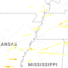


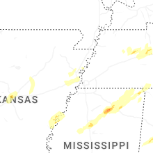

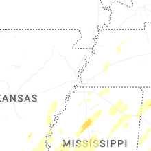


Connect with Interactive Hail Maps