

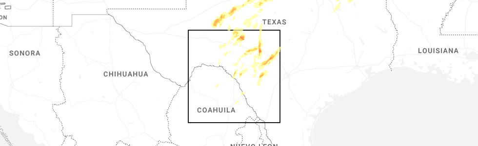
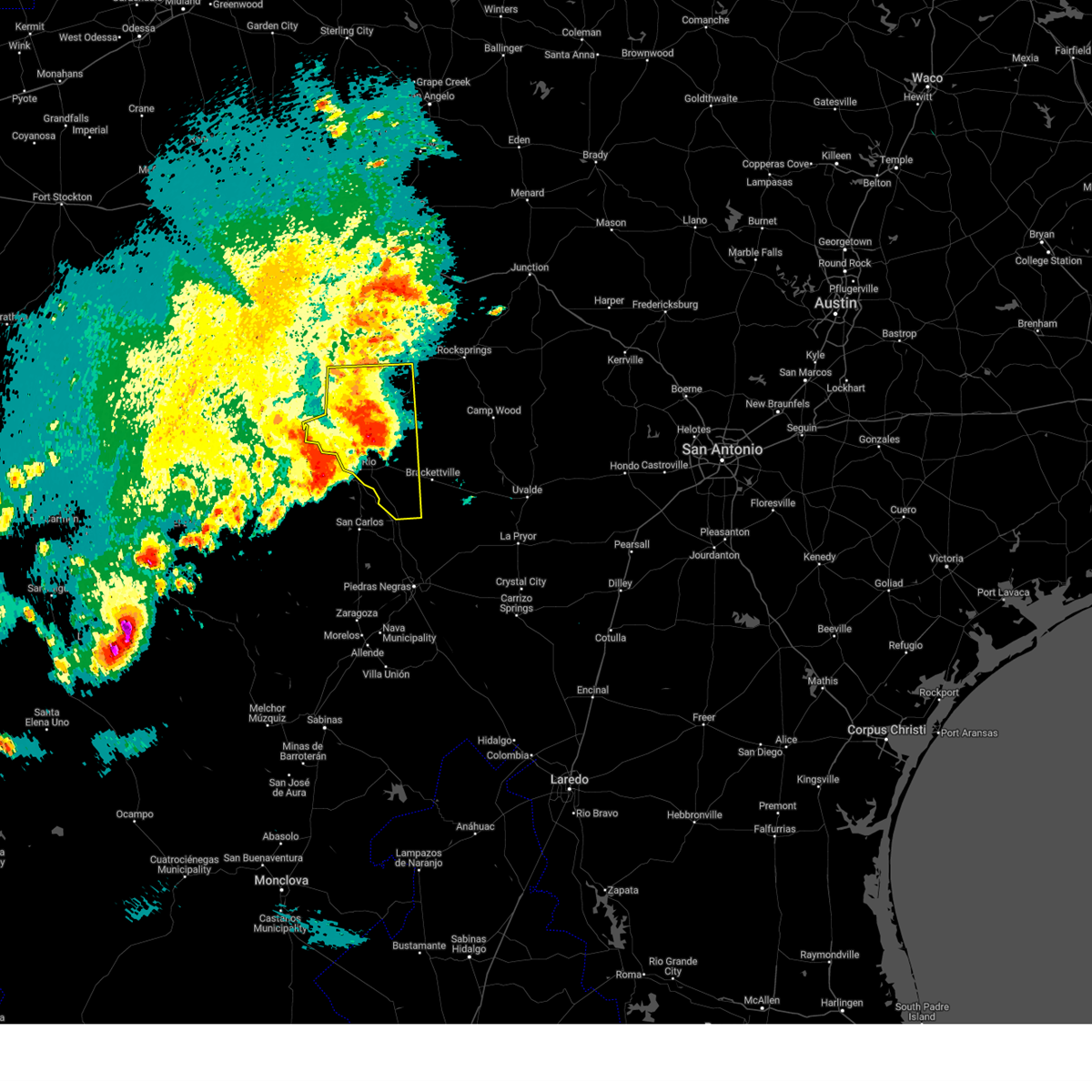
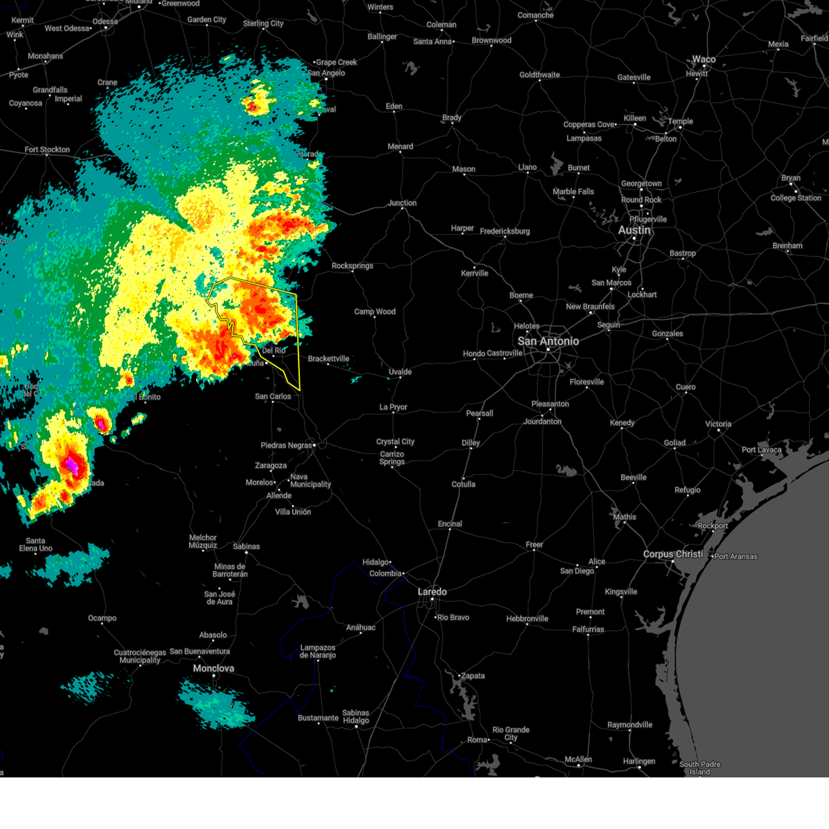
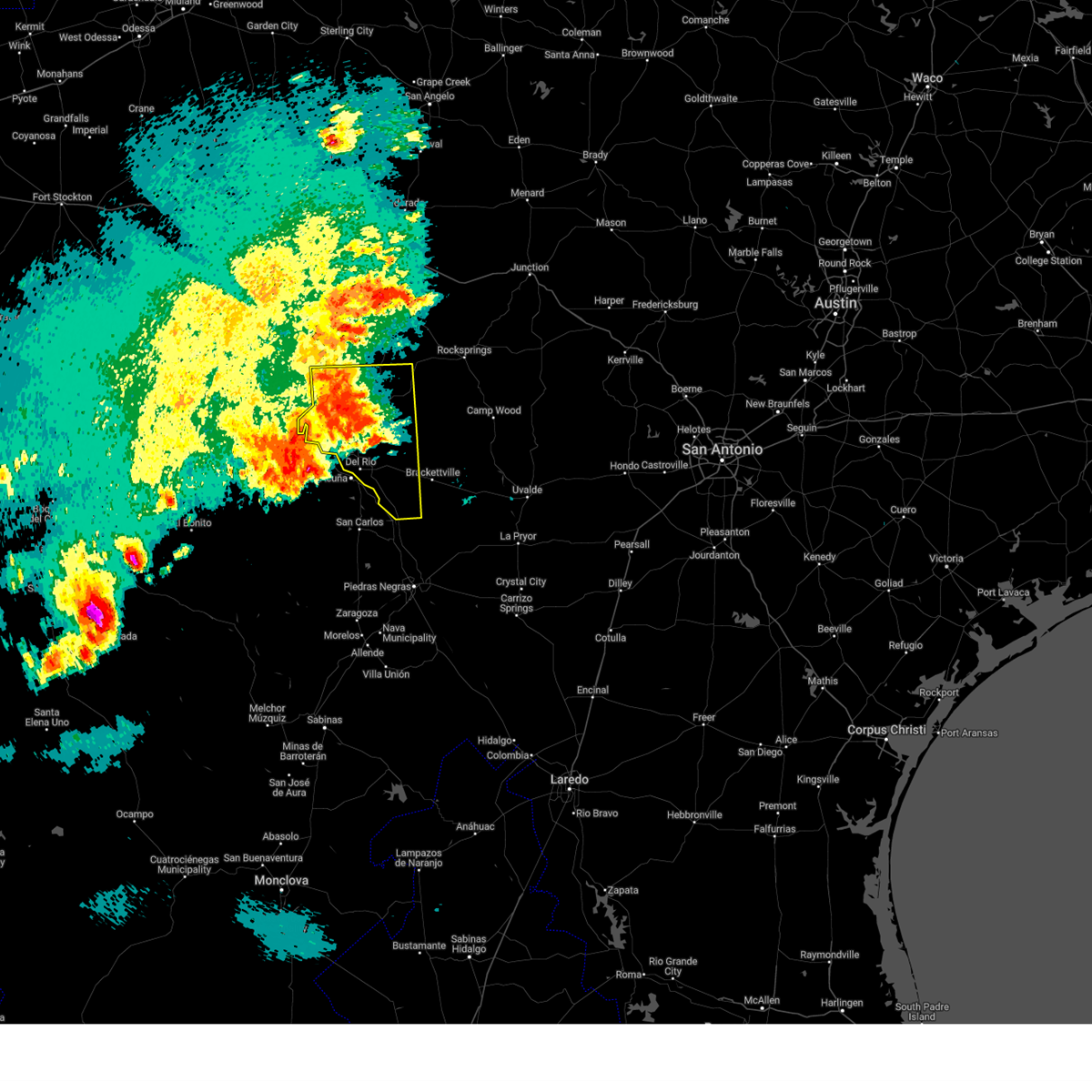
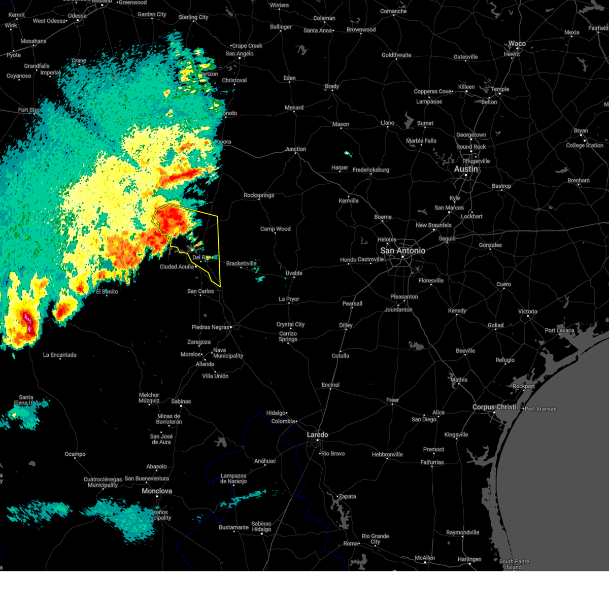
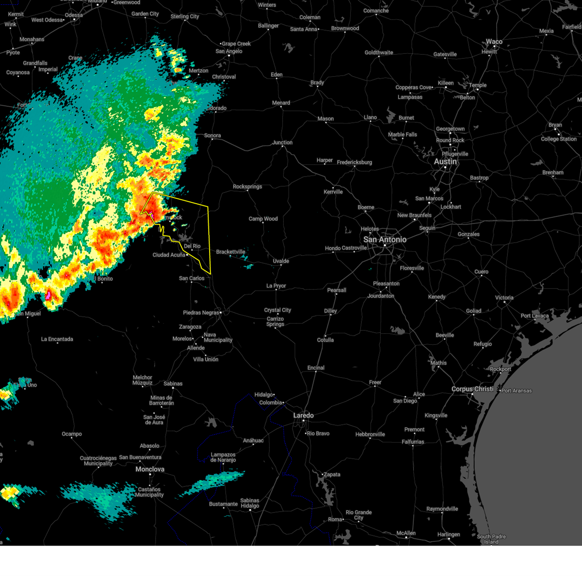
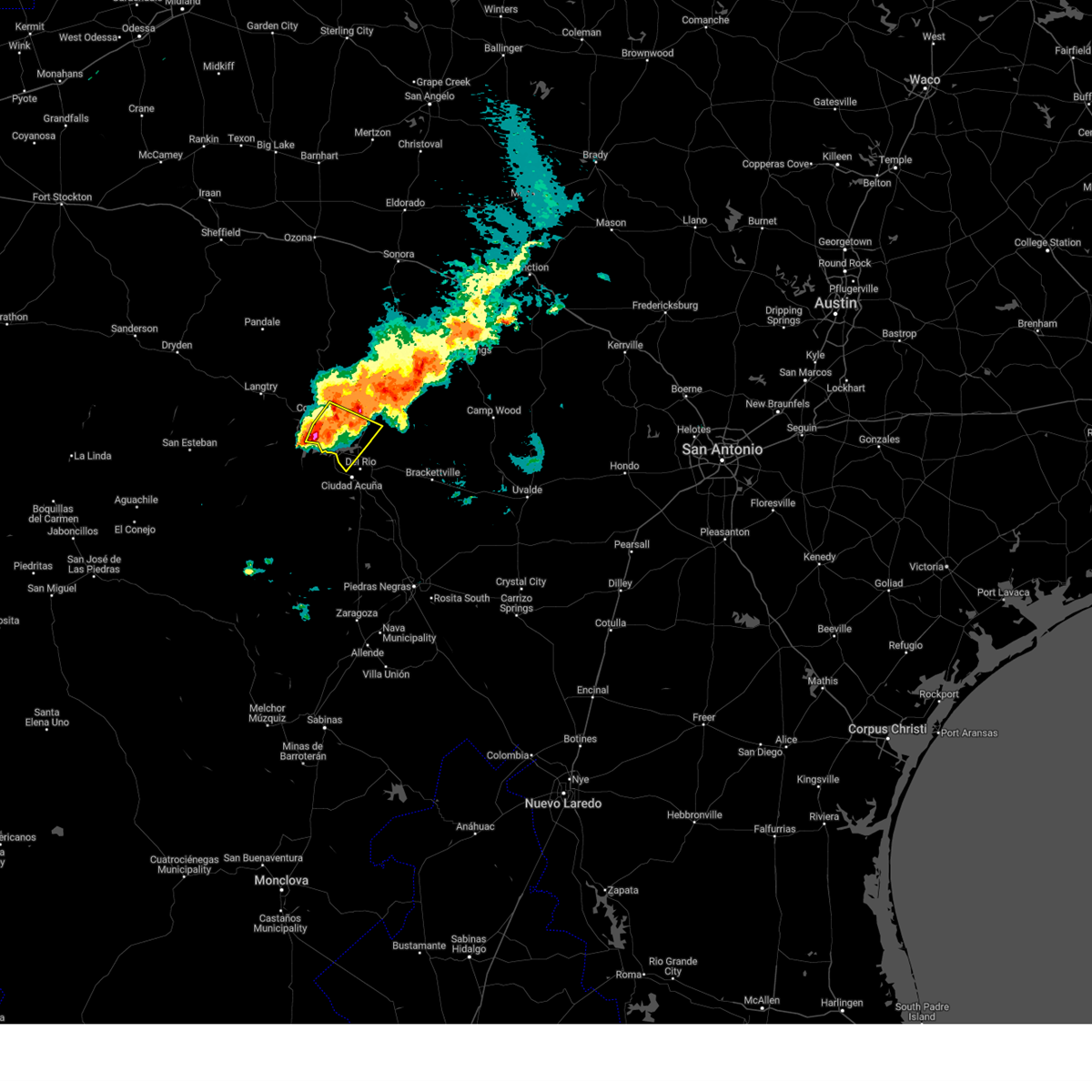
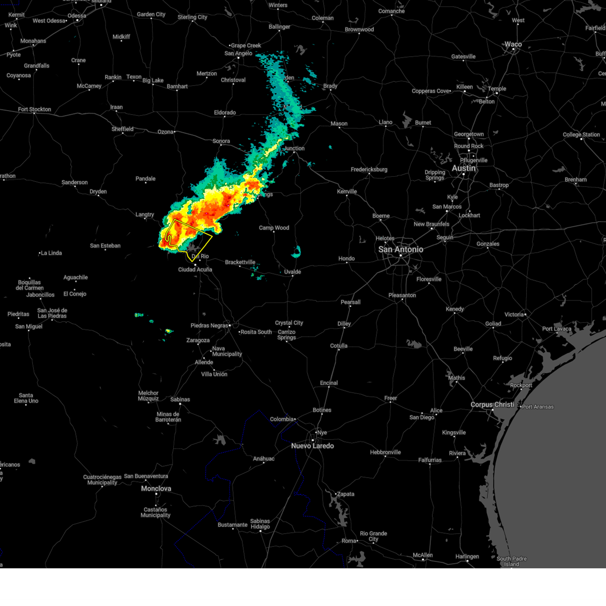
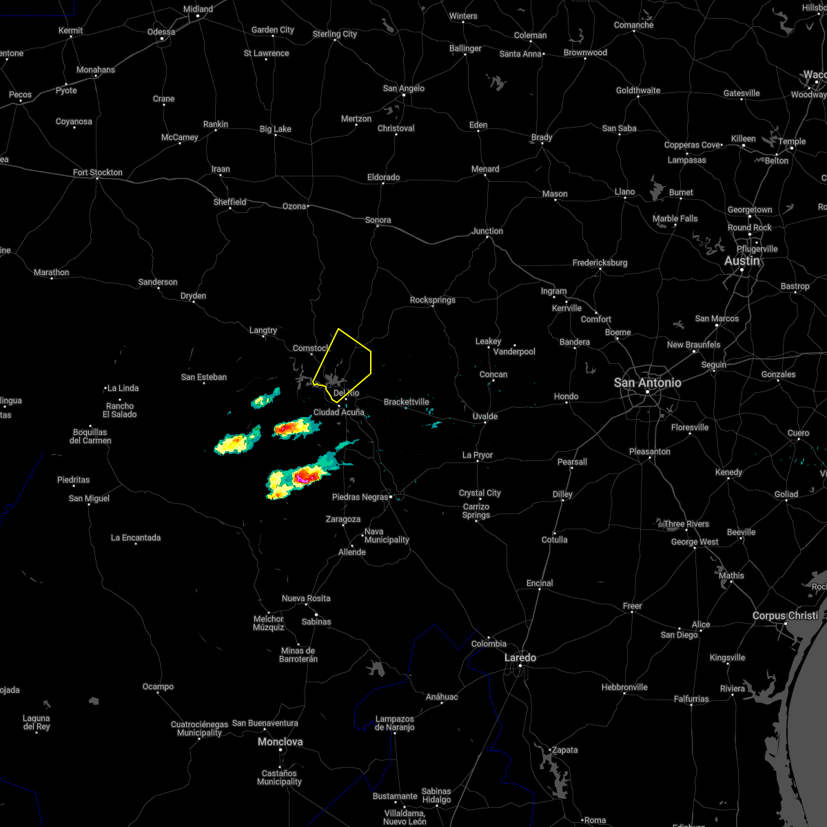
Hail Map for Lake View, TX
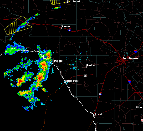
The Lake View, TX area has had 2 reports of on-the-ground hail by trained spotters, and has been under severe weather warnings 7 times during the past 12 months. Doppler radar has detected hail at or near Lake View, TX on 45 occasions, including 1 occasion during the past year.
| Name: | Lake View, TX |
| Where Located: | 7.4 miles NNW of Del Rio, TX |
| Map: | Google Map for Lake View, TX |
| Population: | 199 |
| Housing Units: | 143 |
| More Info: | Search Google for Lake View, TX |
0
The Top Recent Hail Date for Lake View, TX is Friday, April 4, 2025 (23rd out of 45)
Hail and Wind Damage Spotted near Lake View, TX
| Date / Time | Report Details |
|---|---|
| 6/10/2025 8:06 PM CDT |
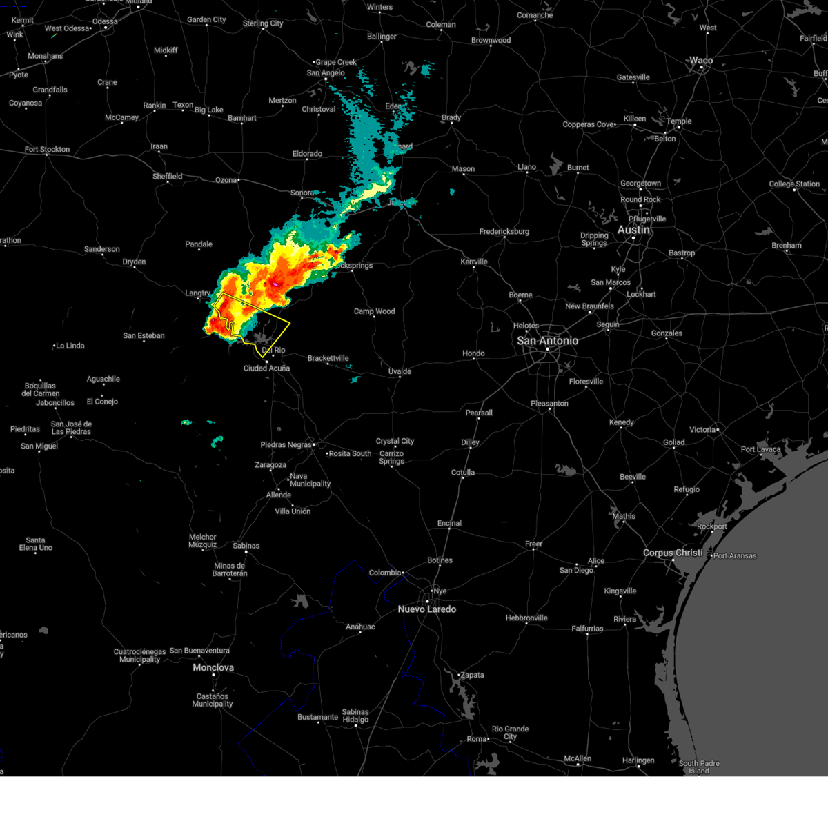
 At 806 pm cdt, a severe thunderstorm was located near long point, or 11 miles north of del rio, moving southeast at 30 mph (radar indicated). Hazards include two inch hail and 70 mph wind gusts. People and animals outdoors will be injured. expect hail damage to roofs, siding, windows, and vehicles. expect considerable tree damage. wind damage is also likely to mobile homes, roofs, and outbuildings. Locations impacted include, del rio, loma alta, lake view, amistad acres, laughlin afb, carta valley, cienegas terrace, amistad village, black brush point, amanda, box canyon, val verde park, standart, diablo east, governors landing, long point, 277 south boat ramp, 277 north campground, rough canyon recreation area, and spur 406 campground. At 806 pm cdt, a severe thunderstorm was located near long point, or 11 miles north of del rio, moving southeast at 30 mph (radar indicated). Hazards include two inch hail and 70 mph wind gusts. People and animals outdoors will be injured. expect hail damage to roofs, siding, windows, and vehicles. expect considerable tree damage. wind damage is also likely to mobile homes, roofs, and outbuildings. Locations impacted include, del rio, loma alta, lake view, amistad acres, laughlin afb, carta valley, cienegas terrace, amistad village, black brush point, amanda, box canyon, val verde park, standart, diablo east, governors landing, long point, 277 south boat ramp, 277 north campground, rough canyon recreation area, and spur 406 campground.
|
| 6/10/2025 7:44 PM CDT |
 The storm which prompted the warning has moved out of the area. therefore, the warning will be allowed to expire. a severe thunderstorm watch remains in effect until 200 am cdt for south central texas. remember, a severe thunderstorm warning still remains in effect for val verde through 845 pm cdt. The storm which prompted the warning has moved out of the area. therefore, the warning will be allowed to expire. a severe thunderstorm watch remains in effect until 200 am cdt for south central texas. remember, a severe thunderstorm warning still remains in effect for val verde through 845 pm cdt.
|
| 6/10/2025 7:43 PM CDT |
 Svrewx the national weather service in austin san antonio has issued a * severe thunderstorm warning for, western kinney county in south central texas, southwestern edwards county in south central texas, southeastern val verde county in south central texas, * until 845 pm cdt. * at 742 pm cdt, a severe thunderstorm was located 10 miles east of comstock, moving southeast at 30 mph (radar indicated). Hazards include 70 mph wind gusts and ping pong ball size hail. People and animals outdoors will be injured. expect hail damage to roofs, siding, windows, and vehicles. expect considerable tree damage. Wind damage is also likely to mobile homes, roofs, and outbuildings. Svrewx the national weather service in austin san antonio has issued a * severe thunderstorm warning for, western kinney county in south central texas, southwestern edwards county in south central texas, southeastern val verde county in south central texas, * until 845 pm cdt. * at 742 pm cdt, a severe thunderstorm was located 10 miles east of comstock, moving southeast at 30 mph (radar indicated). Hazards include 70 mph wind gusts and ping pong ball size hail. People and animals outdoors will be injured. expect hail damage to roofs, siding, windows, and vehicles. expect considerable tree damage. Wind damage is also likely to mobile homes, roofs, and outbuildings.
|
| 6/10/2025 7:12 PM CDT |
 At 712 pm cdt, a severe thunderstorm was located near comstock, moving east at 40 mph (radar indicated). Hazards include two inch hail and 70 mph wind gusts. People and animals outdoors will be injured. expect hail damage to roofs, siding, windows, and vehicles. expect considerable tree damage. wind damage is also likely to mobile homes, roofs, and outbuildings. Locations impacted include, del rio, comstock, lake view, amistad acres, laughlin afb, shumla, cienegas terrace, amistad village, black brush point, seminole canyon state park, box canyon, val verde park, diablo east, governors landing, long point, pecos river boat ramp, 277 south boat ramp, 277 north campground, rough canyon recreation area, and spur 406 campground. At 712 pm cdt, a severe thunderstorm was located near comstock, moving east at 40 mph (radar indicated). Hazards include two inch hail and 70 mph wind gusts. People and animals outdoors will be injured. expect hail damage to roofs, siding, windows, and vehicles. expect considerable tree damage. wind damage is also likely to mobile homes, roofs, and outbuildings. Locations impacted include, del rio, comstock, lake view, amistad acres, laughlin afb, shumla, cienegas terrace, amistad village, black brush point, seminole canyon state park, box canyon, val verde park, diablo east, governors landing, long point, pecos river boat ramp, 277 south boat ramp, 277 north campground, rough canyon recreation area, and spur 406 campground.
|
| 6/10/2025 6:52 PM CDT |
 Svrewx the national weather service in austin san antonio has issued a * severe thunderstorm warning for, western kinney county in south central texas, southern val verde county in south central texas, * until 745 pm cdt. * at 651 pm cdt, a severe thunderstorm was located over seminole canyon state park, or 10 miles west of comstock, moving east at 40 mph (radar indicated). Hazards include two inch hail and 70 mph wind gusts. People and animals outdoors will be injured. expect hail damage to roofs, siding, windows, and vehicles. expect considerable tree damage. Wind damage is also likely to mobile homes, roofs, and outbuildings. Svrewx the national weather service in austin san antonio has issued a * severe thunderstorm warning for, western kinney county in south central texas, southern val verde county in south central texas, * until 745 pm cdt. * at 651 pm cdt, a severe thunderstorm was located over seminole canyon state park, or 10 miles west of comstock, moving east at 40 mph (radar indicated). Hazards include two inch hail and 70 mph wind gusts. People and animals outdoors will be injured. expect hail damage to roofs, siding, windows, and vehicles. expect considerable tree damage. Wind damage is also likely to mobile homes, roofs, and outbuildings.
|
| 4/5/2025 12:54 AM CDT | the severe thunderstorm warning has been cancelled and is no longer in effect |
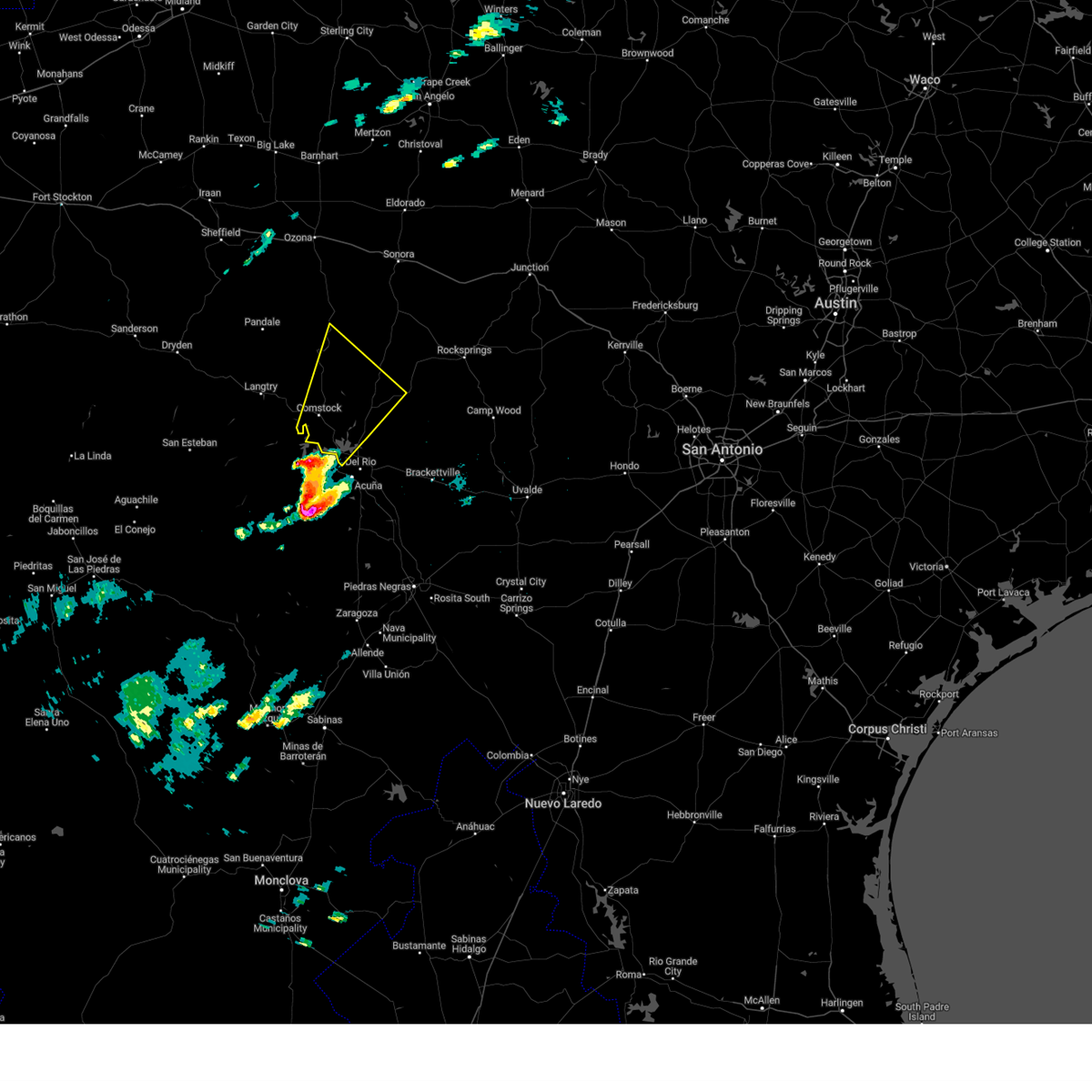
| 4/5/2025 12:40 AM CDT | Svrewx the national weather service in austin san antonio has issued a * severe thunderstorm warning for, northwestern kinney county in south central texas, western edwards county in south central texas, eastern val verde county in south central texas, * until 115 am cdt. * at 1240 am cdt, a severe thunderstorm was located 7 miles east of long point, or 11 miles north of del rio, moving north at 45 mph (radar indicated). Hazards include quarter size hail. damage to vehicles is expected |
| 6/2/2023 9:37 PM CDT |
 At 937 pm cdt, a severe thunderstorm was located near governors landing, or 13 miles southeast of comstock, moving east at 30 mph (radar indicated). Hazards include ping pong ball size hail and 60 mph wind gusts. People and animals outdoors will be injured. expect hail damage to roofs, siding, windows, and vehicles. expect wind damage to roofs, siding, and trees. this severe thunderstorm will be near, lake view around 945 pm cdt. long point around 950 pm cdt. other locations impacted by this severe thunderstorm include devils shores, san pedro canyon, 277 north campground, pafford crossing, rough canyon recreation area, spur 406 campground, rock quarry campground, salem point, escondido estates and devils river state nat area big satan. hail threat, radar indicated max hail size, 1. 50 in wind threat, radar indicated max wind gust, 60 mph. At 937 pm cdt, a severe thunderstorm was located near governors landing, or 13 miles southeast of comstock, moving east at 30 mph (radar indicated). Hazards include ping pong ball size hail and 60 mph wind gusts. People and animals outdoors will be injured. expect hail damage to roofs, siding, windows, and vehicles. expect wind damage to roofs, siding, and trees. this severe thunderstorm will be near, lake view around 945 pm cdt. long point around 950 pm cdt. other locations impacted by this severe thunderstorm include devils shores, san pedro canyon, 277 north campground, pafford crossing, rough canyon recreation area, spur 406 campground, rock quarry campground, salem point, escondido estates and devils river state nat area big satan. hail threat, radar indicated max hail size, 1. 50 in wind threat, radar indicated max wind gust, 60 mph.
|
| 6/2/2023 9:19 PM CDT |
 At 918 pm cdt, a severe thunderstorm was located over box canyon, or 9 miles south of comstock, moving east at 25 mph (radar indicated). Hazards include ping pong ball size hail and 60 mph wind gusts. People and animals outdoors will be injured. expect hail damage to roofs, siding, windows, and vehicles. expect wind damage to roofs, siding, and trees. this severe storm will be near, governors landing and amistad village around 940 pm cdt. black brush point and diablo east around 945 pm cdt. lake view and long point around 950 pm cdt. other locations impacted by this severe thunderstorm include devils shores, san pedro canyon, 277 north campground, pafford crossing, rough canyon recreation area, spur 406 campground, rock quarry campground, salem point, 277 south boat ramp and lake ridge ranch. hail threat, radar indicated max hail size, 1. 50 in wind threat, radar indicated max wind gust, 60 mph. At 918 pm cdt, a severe thunderstorm was located over box canyon, or 9 miles south of comstock, moving east at 25 mph (radar indicated). Hazards include ping pong ball size hail and 60 mph wind gusts. People and animals outdoors will be injured. expect hail damage to roofs, siding, windows, and vehicles. expect wind damage to roofs, siding, and trees. this severe storm will be near, governors landing and amistad village around 940 pm cdt. black brush point and diablo east around 945 pm cdt. lake view and long point around 950 pm cdt. other locations impacted by this severe thunderstorm include devils shores, san pedro canyon, 277 north campground, pafford crossing, rough canyon recreation area, spur 406 campground, rock quarry campground, salem point, 277 south boat ramp and lake ridge ranch. hail threat, radar indicated max hail size, 1. 50 in wind threat, radar indicated max wind gust, 60 mph.
|
| 6/2/2023 9:09 PM CDT |
 At 909 pm cdt, a severe thunderstorm was located near comstock, moving southeast at 30 mph (radar indicated). Hazards include 60 mph wind gusts and half dollar size hail. Hail damage to vehicles is expected. expect wind damage to roofs, siding, and trees. this severe storm will be near, box canyon around 915 pm cdt. amistad acres around 920 pm cdt. governors landing, diablo east and amistad village around 935 pm cdt. long point and black brush point around 940 pm cdt. lake view around 945 pm cdt. other locations impacted by this severe thunderstorm include devils shores, san pedro canyon, 277 north campground, pafford crossing, rough canyon recreation area, spur 406 campground, rock quarry campground, salem point, 277 south boat ramp and lake ridge ranch. hail threat, radar indicated max hail size, 1. 25 in wind threat, radar indicated max wind gust, 60 mph. At 909 pm cdt, a severe thunderstorm was located near comstock, moving southeast at 30 mph (radar indicated). Hazards include 60 mph wind gusts and half dollar size hail. Hail damage to vehicles is expected. expect wind damage to roofs, siding, and trees. this severe storm will be near, box canyon around 915 pm cdt. amistad acres around 920 pm cdt. governors landing, diablo east and amistad village around 935 pm cdt. long point and black brush point around 940 pm cdt. lake view around 945 pm cdt. other locations impacted by this severe thunderstorm include devils shores, san pedro canyon, 277 north campground, pafford crossing, rough canyon recreation area, spur 406 campground, rock quarry campground, salem point, 277 south boat ramp and lake ridge ranch. hail threat, radar indicated max hail size, 1. 25 in wind threat, radar indicated max wind gust, 60 mph.
|
| 6/2/2023 8:50 PM CDT |
 At 850 pm cdt, a severe thunderstorm was located over seminole canyon state park, or 8 miles west of comstock, moving southeast at 30 mph (radar indicated). Hazards include 60 mph wind gusts and half dollar size hail. Hail damage to vehicles is expected. expect wind damage to roofs, siding, and trees. this severe thunderstorm will be near, comstock around 905 pm cdt. box canyon around 915 pm cdt. amistad acres around 920 pm cdt. governors landing, diablo east and amistad village around 935 pm cdt. long point and black brush point around 940 pm cdt. lake view around 945 pm cdt. other locations impacted by this severe thunderstorm include devils shores, san pedro canyon, 277 north campground, pafford crossing, rough canyon recreation area, spur 406 campground, pecos river boat ramp, rock quarry campground, salem point and 277 south boat ramp. hail threat, radar indicated max hail size, 1. 25 in wind threat, radar indicated max wind gust, 60 mph. At 850 pm cdt, a severe thunderstorm was located over seminole canyon state park, or 8 miles west of comstock, moving southeast at 30 mph (radar indicated). Hazards include 60 mph wind gusts and half dollar size hail. Hail damage to vehicles is expected. expect wind damage to roofs, siding, and trees. this severe thunderstorm will be near, comstock around 905 pm cdt. box canyon around 915 pm cdt. amistad acres around 920 pm cdt. governors landing, diablo east and amistad village around 935 pm cdt. long point and black brush point around 940 pm cdt. lake view around 945 pm cdt. other locations impacted by this severe thunderstorm include devils shores, san pedro canyon, 277 north campground, pafford crossing, rough canyon recreation area, spur 406 campground, pecos river boat ramp, rock quarry campground, salem point and 277 south boat ramp. hail threat, radar indicated max hail size, 1. 25 in wind threat, radar indicated max wind gust, 60 mph.
|
| 5/12/2023 6:53 PM CDT |
 At 652 pm cdt, severe thunderstorms were located along a line extending from 13 miles southeast of pandale to 11 miles east of comstock to 7 miles south of del rio, moving northeast at 30 mph (nws observation. at 6:28 pm a 62 mph gust was measured at del rio international airport). Hazards include 60 mph wind gusts and penny size hail. expect damage to roofs, siding, and trees At 652 pm cdt, severe thunderstorms were located along a line extending from 13 miles southeast of pandale to 11 miles east of comstock to 7 miles south of del rio, moving northeast at 30 mph (nws observation. at 6:28 pm a 62 mph gust was measured at del rio international airport). Hazards include 60 mph wind gusts and penny size hail. expect damage to roofs, siding, and trees
|
| 5/12/2023 6:34 PM CDT |
 At 633 pm cdt, severe thunderstorms were located along a line extending from seminole canyon state park to 6 miles southeast of comstock to near del rio, moving northeast at 20 mph (public. at 6:21, a 62 mph wind gust was measured near lake view). Hazards include 60 mph wind gusts and penny size hail. Expect damage to roofs, siding, and trees. Locations impacted include, del rio, comstock, lake view, amistad acres, shumla, amistad village, black brush point, seminole canyon state park, box canyon, diablo east, governors landing, long point, cienegas terrace, pecos river boat ramp, 277 south boat ramp, 277 north campground, rough canyon recreation area, spur 406 campground, rock quarry campground and salem point. At 633 pm cdt, severe thunderstorms were located along a line extending from seminole canyon state park to 6 miles southeast of comstock to near del rio, moving northeast at 20 mph (public. at 6:21, a 62 mph wind gust was measured near lake view). Hazards include 60 mph wind gusts and penny size hail. Expect damage to roofs, siding, and trees. Locations impacted include, del rio, comstock, lake view, amistad acres, shumla, amistad village, black brush point, seminole canyon state park, box canyon, diablo east, governors landing, long point, cienegas terrace, pecos river boat ramp, 277 south boat ramp, 277 north campground, rough canyon recreation area, spur 406 campground, rock quarry campground and salem point.
|
| 5/12/2023 6:07 PM CDT |
 At 607 pm cdt, severe thunderstorms were located along a line extending from 6 miles southwest of seminole canyon state park to near box canyon to 9 miles southwest of cienegas terrace, moving northeast at 15 mph (radar indicated). Hazards include 60 mph wind gusts and nickel size hail. expect damage to roofs, siding, and trees At 607 pm cdt, severe thunderstorms were located along a line extending from 6 miles southwest of seminole canyon state park to near box canyon to 9 miles southwest of cienegas terrace, moving northeast at 15 mph (radar indicated). Hazards include 60 mph wind gusts and nickel size hail. expect damage to roofs, siding, and trees
|
| 5/4/2023 5:04 PM CDT |
 At 503 pm cdt, a severe thunderstorm was located near amistad acres, or 15 miles south of comstock, moving northeast at 35 mph (radar indicated). Hazards include 60 mph wind gusts and half dollar size hail. Hail damage to vehicles is expected. Expect wind damage to roofs, siding, and trees. At 503 pm cdt, a severe thunderstorm was located near amistad acres, or 15 miles south of comstock, moving northeast at 35 mph (radar indicated). Hazards include 60 mph wind gusts and half dollar size hail. Hail damage to vehicles is expected. Expect wind damage to roofs, siding, and trees.
|
| 4/23/2023 3:36 AM CDT |
 The severe thunderstorm warning for northwestern kinney and southeastern val verde counties will expire at 345 am cdt, the storms which prompted the warning have weakened below severe limits, and no longer pose an immediate threat to life or property. therefore, the warning will be allowed to expire. however small hail, gusty winds and heavy rain are still possible with these thunderstorms. a severe thunderstorm watch remains in effect until 500 am cdt for south central texas. The severe thunderstorm warning for northwestern kinney and southeastern val verde counties will expire at 345 am cdt, the storms which prompted the warning have weakened below severe limits, and no longer pose an immediate threat to life or property. therefore, the warning will be allowed to expire. however small hail, gusty winds and heavy rain are still possible with these thunderstorms. a severe thunderstorm watch remains in effect until 500 am cdt for south central texas.
|
| 4/23/2023 3:28 AM CDT |
 At 328 am cdt, severe thunderstorms were located along a line extending from long point to near amanda, moving north at 30 mph (radar indicated). Hazards include ping pong ball size hail and 60 mph wind gusts. People and animals outdoors will be injured. expect hail damage to roofs, siding, windows, and vehicles. expect wind damage to roofs, siding, and trees. these severe thunderstorms will remain over mainly rural areas of northwestern kinney and southeastern val verde counties, including the following locations, devils shores, san pedro canyon, 277 north campground, rough canyon recreation area, escondido estates, 277 south boat ramp, lake ridge ranch and devils river state nat area big satan. hail threat, radar indicated max hail size, 1. 50 in wind threat, radar indicated max wind gust, 60 mph. At 328 am cdt, severe thunderstorms were located along a line extending from long point to near amanda, moving north at 30 mph (radar indicated). Hazards include ping pong ball size hail and 60 mph wind gusts. People and animals outdoors will be injured. expect hail damage to roofs, siding, windows, and vehicles. expect wind damage to roofs, siding, and trees. these severe thunderstorms will remain over mainly rural areas of northwestern kinney and southeastern val verde counties, including the following locations, devils shores, san pedro canyon, 277 north campground, rough canyon recreation area, escondido estates, 277 south boat ramp, lake ridge ranch and devils river state nat area big satan. hail threat, radar indicated max hail size, 1. 50 in wind threat, radar indicated max wind gust, 60 mph.
|
| 4/23/2023 3:14 AM CDT |
 At 313 am cdt, severe thunderstorms were located along a line extending from near cienegas terrace to 6 miles southeast of laughlin afb, moving north at 30 mph (trained weather spotters reported golf ball size hail with this storm 5 miles south of del rio at 3:12am). Hazards include two inch hail and 60 mph wind gusts. People and animals outdoors will be injured. expect hail damage to roofs, siding, windows, and vehicles. expect wind damage to roofs, siding, and trees. these severe storms will be near, lake view and diablo east around 320 am cdt. amanda and black brush point around 325 am cdt. long point around 330 am cdt. other locations impacted by these severe thunderstorms include devils shores, san pedro canyon, 277 north campground, rough canyon recreation area, escondido estates, 277 south boat ramp, lake ridge ranch and devils river state nat area big satan. thunderstorm damage threat, considerable hail threat, radar indicated max hail size, 2. 00 in wind threat, radar indicated max wind gust, 60 mph. At 313 am cdt, severe thunderstorms were located along a line extending from near cienegas terrace to 6 miles southeast of laughlin afb, moving north at 30 mph (trained weather spotters reported golf ball size hail with this storm 5 miles south of del rio at 3:12am). Hazards include two inch hail and 60 mph wind gusts. People and animals outdoors will be injured. expect hail damage to roofs, siding, windows, and vehicles. expect wind damage to roofs, siding, and trees. these severe storms will be near, lake view and diablo east around 320 am cdt. amanda and black brush point around 325 am cdt. long point around 330 am cdt. other locations impacted by these severe thunderstorms include devils shores, san pedro canyon, 277 north campground, rough canyon recreation area, escondido estates, 277 south boat ramp, lake ridge ranch and devils river state nat area big satan. thunderstorm damage threat, considerable hail threat, radar indicated max hail size, 2. 00 in wind threat, radar indicated max wind gust, 60 mph.
|
| 4/23/2023 3:02 AM CDT |
 At 301 am cdt, severe thunderstorms were located along a line extending from near cienegas terrace to 10 miles south of laughlin afb, moving north at 30 mph (radar indicated). Hazards include 60 mph wind gusts and half dollar size hail. Hail damage to vehicles is expected. expect wind damage to roofs, siding, and trees. severe thunderstorms will be near, cienegas terrace around 310 am cdt. del rio and val verde park around 315 am cdt. lake view, diablo east and laughlin afb around 320 am cdt. amanda and black brush point around 325 am cdt. long point around 330 am cdt. other locations impacted by these severe thunderstorms include devils shores, san pedro canyon, 277 north campground, rough canyon recreation area, escondido estates, 277 south boat ramp, lake ridge ranch and devils river state nat area big satan. hail threat, radar indicated max hail size, 1. 25 in wind threat, radar indicated max wind gust, 60 mph. At 301 am cdt, severe thunderstorms were located along a line extending from near cienegas terrace to 10 miles south of laughlin afb, moving north at 30 mph (radar indicated). Hazards include 60 mph wind gusts and half dollar size hail. Hail damage to vehicles is expected. expect wind damage to roofs, siding, and trees. severe thunderstorms will be near, cienegas terrace around 310 am cdt. del rio and val verde park around 315 am cdt. lake view, diablo east and laughlin afb around 320 am cdt. amanda and black brush point around 325 am cdt. long point around 330 am cdt. other locations impacted by these severe thunderstorms include devils shores, san pedro canyon, 277 north campground, rough canyon recreation area, escondido estates, 277 south boat ramp, lake ridge ranch and devils river state nat area big satan. hail threat, radar indicated max hail size, 1. 25 in wind threat, radar indicated max wind gust, 60 mph.
|
| 5/11/2022 12:38 AM CDT |
 The severe thunderstorm warning for western kinney and southeastern val verde counties will expire at 1245 am cdt, the storm which prompted the warning has weakened below severe limits, and has exited the warned area. therefore, the warning will be allowed to expire. however small hail and gusty winds are still possible with these thunderstorms in northwest kinney county. a flood advisory remains in effect for portions of the area until 330 am cdt. The severe thunderstorm warning for western kinney and southeastern val verde counties will expire at 1245 am cdt, the storm which prompted the warning has weakened below severe limits, and has exited the warned area. therefore, the warning will be allowed to expire. however small hail and gusty winds are still possible with these thunderstorms in northwest kinney county. a flood advisory remains in effect for portions of the area until 330 am cdt.
|
| 5/11/2022 12:20 AM CDT |
 At 1219 am cdt, a severe thunderstorm was located over laughlin afb, or 7 miles east of del rio, moving northwest at 30 mph. a 62 mph wind gust was measured at laughlin afb (automated weather observing system). Hazards include 60 mph wind gusts and quarter size hail. Hail damage to vehicles is expected. expect wind damage to roofs, siding, and trees. locations impacted include, del rio, lake view, val verde park, standart, cienegas terrace, amanda, laughlin afb, escondido estates and lake ridge ranch. hail threat, radar indicated max hail size, 1. 00 in wind threat, observed max wind gust, 60 mph. At 1219 am cdt, a severe thunderstorm was located over laughlin afb, or 7 miles east of del rio, moving northwest at 30 mph. a 62 mph wind gust was measured at laughlin afb (automated weather observing system). Hazards include 60 mph wind gusts and quarter size hail. Hail damage to vehicles is expected. expect wind damage to roofs, siding, and trees. locations impacted include, del rio, lake view, val verde park, standart, cienegas terrace, amanda, laughlin afb, escondido estates and lake ridge ranch. hail threat, radar indicated max hail size, 1. 00 in wind threat, observed max wind gust, 60 mph.
|
| 5/11/2022 12:05 AM CDT |
 At 1204 am cdt, a severe thunderstorm was located near laughlin afb, or 11 miles southeast of del rio, moving north at 45 mph (radar indicated). Hazards include 60 mph wind gusts and quarter size hail. Hail damage to vehicles is expected. expect wind damage to roofs, siding, and trees. locations impacted include, del rio, lake view, val verde park, standart, cienegas terrace, amanda, laughlin afb, escondido estates and lake ridge ranch. hail threat, radar indicated max hail size, 1. 00 in wind threat, radar indicated max wind gust, 60 mph. At 1204 am cdt, a severe thunderstorm was located near laughlin afb, or 11 miles southeast of del rio, moving north at 45 mph (radar indicated). Hazards include 60 mph wind gusts and quarter size hail. Hail damage to vehicles is expected. expect wind damage to roofs, siding, and trees. locations impacted include, del rio, lake view, val verde park, standart, cienegas terrace, amanda, laughlin afb, escondido estates and lake ridge ranch. hail threat, radar indicated max hail size, 1. 00 in wind threat, radar indicated max wind gust, 60 mph.
|
| 5/10/2022 11:42 PM CDT |
 At 1141 pm cdt, a severe thunderstorm was located near quemado, moving northwest at 30 mph (radar indicated). Hazards include 60 mph wind gusts and quarter size hail. Hail damage to vehicles is expected. Expect wind damage to roofs, siding, and trees. At 1141 pm cdt, a severe thunderstorm was located near quemado, moving northwest at 30 mph (radar indicated). Hazards include 60 mph wind gusts and quarter size hail. Hail damage to vehicles is expected. Expect wind damage to roofs, siding, and trees.
|
| 5/2/2022 1:49 AM CDT |
 At 149 am cdt, a severe thunderstorm was located over val verde park, or over del rio, moving east at 20 mph (radar indicated). Hazards include 60 mph wind gusts and quarter size hail. Hail damage to vehicles is expected. Expect wind damage to roofs, siding, and trees. At 149 am cdt, a severe thunderstorm was located over val verde park, or over del rio, moving east at 20 mph (radar indicated). Hazards include 60 mph wind gusts and quarter size hail. Hail damage to vehicles is expected. Expect wind damage to roofs, siding, and trees.
|
| 4/19/2022 1:50 PM CDT |
 At 150 pm cdt, a severe thunderstorm was located over lake view, or 7 miles north of del rio, moving east at 35 mph (radar indicated). Hazards include 60 mph wind gusts and quarter size hail. Hail damage to vehicles is expected. expect wind damage to roofs, siding, and trees. locations impacted include, del rio, lake view, black brush point, val verde park, laughlin afb, long point, diablo east, san pedro canyon, 277 north campground, lake ridge ranch, 277 south boat ramp and escondido estates. hail threat, radar indicated max hail size, 1. 00 in wind threat, radar indicated max wind gust, 60 mph. At 150 pm cdt, a severe thunderstorm was located over lake view, or 7 miles north of del rio, moving east at 35 mph (radar indicated). Hazards include 60 mph wind gusts and quarter size hail. Hail damage to vehicles is expected. expect wind damage to roofs, siding, and trees. locations impacted include, del rio, lake view, black brush point, val verde park, laughlin afb, long point, diablo east, san pedro canyon, 277 north campground, lake ridge ranch, 277 south boat ramp and escondido estates. hail threat, radar indicated max hail size, 1. 00 in wind threat, radar indicated max wind gust, 60 mph.
|
| 4/19/2022 1:30 PM CDT |
 At 129 pm cdt, a severe thunderstorm was located over box canyon, or 9 miles south of comstock, moving east at 30 mph (radar indicated). Hazards include quarter size hail. damage to vehicles is expected At 129 pm cdt, a severe thunderstorm was located over box canyon, or 9 miles south of comstock, moving east at 30 mph (radar indicated). Hazards include quarter size hail. damage to vehicles is expected
|
| 4/4/2022 6:58 PM CDT |
 At 658 pm cdt, a severe thunderstorm was located over long point, or 8 miles northwest of del rio, moving northeast at 35 mph (radar indicated). Hazards include tennis ball size hail and 60 mph wind gusts. People and animals outdoors will be injured. expect hail damage to roofs, siding, windows, and vehicles. expect wind damage to roofs, siding, and trees. locations impacted include, del rio, lake view, amistad village, black brush point, diablo east, governors landing, long point, cienegas terrace, amistad acres, devils shores, pafford crossing, 277 south boat ramp, 277 north campground, san pedro canyon, rough canyon recreation area, spur 406 campground, rock quarry campground, salem point, devils river state nat area big satan and lake ridge ranch. thunderstorm damage threat, considerable hail threat, radar indicated max hail size, 2. 50 in wind threat, radar indicated max wind gust, 60 mph. At 658 pm cdt, a severe thunderstorm was located over long point, or 8 miles northwest of del rio, moving northeast at 35 mph (radar indicated). Hazards include tennis ball size hail and 60 mph wind gusts. People and animals outdoors will be injured. expect hail damage to roofs, siding, windows, and vehicles. expect wind damage to roofs, siding, and trees. locations impacted include, del rio, lake view, amistad village, black brush point, diablo east, governors landing, long point, cienegas terrace, amistad acres, devils shores, pafford crossing, 277 south boat ramp, 277 north campground, san pedro canyon, rough canyon recreation area, spur 406 campground, rock quarry campground, salem point, devils river state nat area big satan and lake ridge ranch. thunderstorm damage threat, considerable hail threat, radar indicated max hail size, 2. 50 in wind threat, radar indicated max wind gust, 60 mph.
|
| 4/4/2022 6:54 PM CDT |
 At 653 pm cdt, a severe thunderstorm was located over black brush point, or 8 miles northwest of del rio, moving northeast at 35 mph (radar indicated). Hazards include golf ball size hail and 60 mph wind gusts. People and animals outdoors will be injured. expect hail damage to roofs, siding, windows, and vehicles. expect wind damage to roofs, siding, and trees. locations impacted include, del rio, lake view, amistad village, black brush point, diablo east, governors landing, long point, cienegas terrace, amistad acres, devils shores, pafford crossing, 277 south boat ramp, 277 north campground, san pedro canyon, rough canyon recreation area, spur 406 campground, rock quarry campground, salem point, devils river state nat area big satan and lake ridge ranch. thunderstorm damage threat, considerable hail threat, radar indicated max hail size, 1. 75 in wind threat, radar indicated max wind gust, 60 mph. At 653 pm cdt, a severe thunderstorm was located over black brush point, or 8 miles northwest of del rio, moving northeast at 35 mph (radar indicated). Hazards include golf ball size hail and 60 mph wind gusts. People and animals outdoors will be injured. expect hail damage to roofs, siding, windows, and vehicles. expect wind damage to roofs, siding, and trees. locations impacted include, del rio, lake view, amistad village, black brush point, diablo east, governors landing, long point, cienegas terrace, amistad acres, devils shores, pafford crossing, 277 south boat ramp, 277 north campground, san pedro canyon, rough canyon recreation area, spur 406 campground, rock quarry campground, salem point, devils river state nat area big satan and lake ridge ranch. thunderstorm damage threat, considerable hail threat, radar indicated max hail size, 1. 75 in wind threat, radar indicated max wind gust, 60 mph.
|
| 4/4/2022 6:39 PM CDT |
 At 639 pm cdt, a severe thunderstorm was located near amistad village, or 11 miles west of del rio, moving northeast at 35 mph (radar indicated). Hazards include 60 mph wind gusts and half dollar size hail. Hail damage to vehicles is expected. Expect wind damage to roofs, siding, and trees. At 639 pm cdt, a severe thunderstorm was located near amistad village, or 11 miles west of del rio, moving northeast at 35 mph (radar indicated). Hazards include 60 mph wind gusts and half dollar size hail. Hail damage to vehicles is expected. Expect wind damage to roofs, siding, and trees.
|
| 5/31/2021 9:56 PM CDT |
 At 956 pm cdt, a severe thunderstorm was located near lake view, or near del rio, moving east at 5 mph (radar indicated). Hazards include 60 mph wind gusts and quarter size hail. Hail damage to vehicles is expected. expect wind damage to roofs, siding, and trees. Locations impacted include, del rio, lake view, amistad village, black brush point, laughlin afb, val verde park, diablo east, cienegas terrace, governors landing, long point, 277 south boat ramp, 277 north campground, san pedro canyon, spur 406 campground, escondido estates and lake ridge ranch. At 956 pm cdt, a severe thunderstorm was located near lake view, or near del rio, moving east at 5 mph (radar indicated). Hazards include 60 mph wind gusts and quarter size hail. Hail damage to vehicles is expected. expect wind damage to roofs, siding, and trees. Locations impacted include, del rio, lake view, amistad village, black brush point, laughlin afb, val verde park, diablo east, cienegas terrace, governors landing, long point, 277 south boat ramp, 277 north campground, san pedro canyon, spur 406 campground, escondido estates and lake ridge ranch.
|
| 5/31/2021 9:23 PM CDT |
 At 923 pm cdt, a severe thunderstorm was located over lake view, or 8 miles northwest of del rio, moving east at 10 mph (radar indicated). Hazards include 60 mph wind gusts and quarter size hail. Hail damage to vehicles is expected. Expect wind damage to roofs, siding, and trees. At 923 pm cdt, a severe thunderstorm was located over lake view, or 8 miles northwest of del rio, moving east at 10 mph (radar indicated). Hazards include 60 mph wind gusts and quarter size hail. Hail damage to vehicles is expected. Expect wind damage to roofs, siding, and trees.
|
| 5/29/2021 4:06 AM CDT |
 At 406 am cdt, severe thunderstorms were located along a line extending from 7 miles south of carta valley to 6 miles northeast of val verde park to 8 miles southwest of cienegas terrace, moving southeast at 35 mph (radar indicated). Hazards include 60 mph wind gusts and quarter size hail. Hail damage to vehicles is expected. expect wind damage to roofs, siding, and trees. Locations impacted include, del rio, brackettville, lake view, laughlin afb, alamo village, carta valley, cienegas terrace, amistad village, black brush point, amanda, val verde park, standart, diablo east, governors landing, long point, kickapoo cavern state park, 277 south boat ramp, 277 north campground, rough canyon recreation area and escondido estates. At 406 am cdt, severe thunderstorms were located along a line extending from 7 miles south of carta valley to 6 miles northeast of val verde park to 8 miles southwest of cienegas terrace, moving southeast at 35 mph (radar indicated). Hazards include 60 mph wind gusts and quarter size hail. Hail damage to vehicles is expected. expect wind damage to roofs, siding, and trees. Locations impacted include, del rio, brackettville, lake view, laughlin afb, alamo village, carta valley, cienegas terrace, amistad village, black brush point, amanda, val verde park, standart, diablo east, governors landing, long point, kickapoo cavern state park, 277 south boat ramp, 277 north campground, rough canyon recreation area and escondido estates.
|
| 5/29/2021 3:44 AM CDT |
 At 344 am cdt, severe thunderstorms were located along a line extending from near loma alta to 9 miles northeast of long point to near box canyon, moving southeast at 35 mph (radar indicated). Hazards include ping pong ball size hail and 60 mph wind gusts. People and animals outdoors will be injured. expect hail damage to roofs, siding, windows, and vehicles. expect wind damage to roofs, siding, and trees. Locations impacted include, del rio, brackettville, comstock, loma alta, lake view, amistad acres, laughlin afb, alamo village, carta valley, cienegas terrace, amistad village, black brush point, amanda, box canyon, val verde park, standart, diablo east, governors landing, long point and kickapoo cavern state park. At 344 am cdt, severe thunderstorms were located along a line extending from near loma alta to 9 miles northeast of long point to near box canyon, moving southeast at 35 mph (radar indicated). Hazards include ping pong ball size hail and 60 mph wind gusts. People and animals outdoors will be injured. expect hail damage to roofs, siding, windows, and vehicles. expect wind damage to roofs, siding, and trees. Locations impacted include, del rio, brackettville, comstock, loma alta, lake view, amistad acres, laughlin afb, alamo village, carta valley, cienegas terrace, amistad village, black brush point, amanda, box canyon, val verde park, standart, diablo east, governors landing, long point and kickapoo cavern state park.
|
| 5/29/2021 3:27 AM CDT |
 At 327 am cdt, severe thunderstorms were located along a line extending from near loma alta to 13 miles east of comstock to near seminole canyon state park, moving southeast at 35 mph (radar indicated). Hazards include ping pong ball size hail and 60 mph wind gusts. People and animals outdoors will be injured. expect hail damage to roofs, siding, windows, and vehicles. expect wind damage to roofs, siding, and trees. Locations impacted include, del rio, brackettville, comstock, loma alta, lake view, amistad acres, laughlin afb, alamo village, carta valley, cienegas terrace, amistad village, black brush point, seminole canyon state park, amanda, box canyon, val verde park, standart, diablo east, governors landing and long point. At 327 am cdt, severe thunderstorms were located along a line extending from near loma alta to 13 miles east of comstock to near seminole canyon state park, moving southeast at 35 mph (radar indicated). Hazards include ping pong ball size hail and 60 mph wind gusts. People and animals outdoors will be injured. expect hail damage to roofs, siding, windows, and vehicles. expect wind damage to roofs, siding, and trees. Locations impacted include, del rio, brackettville, comstock, loma alta, lake view, amistad acres, laughlin afb, alamo village, carta valley, cienegas terrace, amistad village, black brush point, seminole canyon state park, amanda, box canyon, val verde park, standart, diablo east, governors landing and long point.
|
| 5/29/2021 3:16 AM CDT |
 At 315 am cdt, severe thunderstorms were located along a line extending from 10 miles northwest of loma alta to 13 miles northeast of comstock to near seminole canyon state park, moving southeast at 35 mph (radar indicated). Hazards include 60 mph wind gusts and quarter size hail. Hail damage to vehicles is expected. Expect wind damage to roofs, siding, and trees. At 315 am cdt, severe thunderstorms were located along a line extending from 10 miles northwest of loma alta to 13 miles northeast of comstock to near seminole canyon state park, moving southeast at 35 mph (radar indicated). Hazards include 60 mph wind gusts and quarter size hail. Hail damage to vehicles is expected. Expect wind damage to roofs, siding, and trees.
|
| 5/29/2021 2:39 AM CDT |
 At 238 am cdt, severe thunderstorms were located along a line extending from 9 miles northwest of sonora to 11 miles southwest of juno to 7 miles west of pumpville, moving south at 60 mph (radar indicated). Hazards include 60 mph wind gusts and quarter size hail. Hail damage to vehicles is expected. expect wind damage to roofs, siding, and trees. Locations impacted include, del rio, comstock, juno, loma alta, langtry, lake view, pandale, amistad acres, shumla, carta valley, amistad village, black brush point, pumpville, seminole canyon state park, box canyon, diablo east, governors landing, long point, cienegas terrace and pecos river boat ramp. At 238 am cdt, severe thunderstorms were located along a line extending from 9 miles northwest of sonora to 11 miles southwest of juno to 7 miles west of pumpville, moving south at 60 mph (radar indicated). Hazards include 60 mph wind gusts and quarter size hail. Hail damage to vehicles is expected. expect wind damage to roofs, siding, and trees. Locations impacted include, del rio, comstock, juno, loma alta, langtry, lake view, pandale, amistad acres, shumla, carta valley, amistad village, black brush point, pumpville, seminole canyon state park, box canyon, diablo east, governors landing, long point, cienegas terrace and pecos river boat ramp.
|
| 5/29/2021 2:21 AM CDT |
 At 221 am cdt, severe thunderstorms were located along a line extending from 17 miles northeast of ozona to 17 miles northwest of juno to 8 miles west of pandale, moving south at 60 mph (radar indicated). Hazards include 60 mph wind gusts and quarter size hail. Hail damage to vehicles is expected. Expect wind damage to roofs, siding, and trees. At 221 am cdt, severe thunderstorms were located along a line extending from 17 miles northeast of ozona to 17 miles northwest of juno to 8 miles west of pandale, moving south at 60 mph (radar indicated). Hazards include 60 mph wind gusts and quarter size hail. Hail damage to vehicles is expected. Expect wind damage to roofs, siding, and trees.
|
| 4/28/2021 6:47 PM CDT |
 At 646 pm cdt, a severe thunderstorm was located 11 miles south of del rio, moving northeast at 40 mph (radar indicated). Hazards include ping pong ball size hail and 60 mph wind gusts. People and animals outdoors will be injured. expect hail damage to roofs, siding, windows, and vehicles. Expect wind damage to roofs, siding, and trees. At 646 pm cdt, a severe thunderstorm was located 11 miles south of del rio, moving northeast at 40 mph (radar indicated). Hazards include ping pong ball size hail and 60 mph wind gusts. People and animals outdoors will be injured. expect hail damage to roofs, siding, windows, and vehicles. Expect wind damage to roofs, siding, and trees.
|
| 4/28/2021 4:53 PM CDT |
 At 453 pm cdt, a severe thunderstorm was located near amanda, or 9 miles east of del rio, moving east at 35 mph. this is a very dangerous storm (public). Hazards include three inch hail and 60 mph wind gusts. People and animals outdoors will be severely injured. expect shattered windows, extensive damage to roofs, siding, and vehicles. Locations impacted include, del rio, brackettville, spofford, lake view, amanda, laughlin afb, val verde park, anacacho, standart, alamo village, cienegas terrace, kickapoo cavern state park, escondido estates, fort clark springs and lake ridge ranch. At 453 pm cdt, a severe thunderstorm was located near amanda, or 9 miles east of del rio, moving east at 35 mph. this is a very dangerous storm (public). Hazards include three inch hail and 60 mph wind gusts. People and animals outdoors will be severely injured. expect shattered windows, extensive damage to roofs, siding, and vehicles. Locations impacted include, del rio, brackettville, spofford, lake view, amanda, laughlin afb, val verde park, anacacho, standart, alamo village, cienegas terrace, kickapoo cavern state park, escondido estates, fort clark springs and lake ridge ranch.
|
| 4/28/2021 4:43 PM CDT |
 At 443 pm cdt, a severe thunderstorm was located over val verde park, or near del rio, moving east at 35 mph (radar indicated). Hazards include tennis ball size hail and 60 mph wind gusts. People and animals outdoors will be injured. expect hail damage to roofs, siding, windows, and vehicles. expect wind damage to roofs, siding, and trees. Locations impacted include, del rio, brackettville, spofford, lake view, amanda, laughlin afb, val verde park, anacacho, standart, alamo village, cienegas terrace, kickapoo cavern state park, escondido estates, fort clark springs and lake ridge ranch. At 443 pm cdt, a severe thunderstorm was located over val verde park, or near del rio, moving east at 35 mph (radar indicated). Hazards include tennis ball size hail and 60 mph wind gusts. People and animals outdoors will be injured. expect hail damage to roofs, siding, windows, and vehicles. expect wind damage to roofs, siding, and trees. Locations impacted include, del rio, brackettville, spofford, lake view, amanda, laughlin afb, val verde park, anacacho, standart, alamo village, cienegas terrace, kickapoo cavern state park, escondido estates, fort clark springs and lake ridge ranch.
|
| 4/28/2021 4:29 PM CDT |
 At 429 pm cdt, a severe thunderstorm was located near cienegas terrace, or 7 miles southwest of del rio, moving east at 35 mph (radar indicated). Hazards include golf ball size hail and 60 mph wind gusts. People and animals outdoors will be injured. expect hail damage to roofs, siding, windows, and vehicles. Expect wind damage to roofs, siding, and trees. At 429 pm cdt, a severe thunderstorm was located near cienegas terrace, or 7 miles southwest of del rio, moving east at 35 mph (radar indicated). Hazards include golf ball size hail and 60 mph wind gusts. People and animals outdoors will be injured. expect hail damage to roofs, siding, windows, and vehicles. Expect wind damage to roofs, siding, and trees.
|
| 3/25/2021 12:12 AM CDT |
 At 1212 am cdt, a severe thunderstorm was located 17 miles north of alamo village, or 24 miles north of brackettville, moving east at 25 mph (radar indicated). Hazards include 60 mph wind gusts and quarter size hail. Hail damage to vehicles is expected. expect wind damage to roofs, siding, and trees. Locations impacted include, del rio, brackettville, spofford, lake view, barksdale, amanda, laughlin afb, val verde park, anacacho, standart, alamo village, cienegas terrace, kickapoo cavern state park, 277 south boat ramp, 277 north campground, san pedro canyon, turkey mountain, escondido estates, fort clark springs and lake ridge ranch. At 1212 am cdt, a severe thunderstorm was located 17 miles north of alamo village, or 24 miles north of brackettville, moving east at 25 mph (radar indicated). Hazards include 60 mph wind gusts and quarter size hail. Hail damage to vehicles is expected. expect wind damage to roofs, siding, and trees. Locations impacted include, del rio, brackettville, spofford, lake view, barksdale, amanda, laughlin afb, val verde park, anacacho, standart, alamo village, cienegas terrace, kickapoo cavern state park, 277 south boat ramp, 277 north campground, san pedro canyon, turkey mountain, escondido estates, fort clark springs and lake ridge ranch.
|
| 3/24/2021 11:51 PM CDT |
 At 1150 pm cdt, a severe thunderstorm was located 11 miles southeast of carta valley, or 21 miles southeast of loma alta, moving east at 30 mph (radar indicated). Hazards include 60 mph wind gusts and quarter size hail. Hail damage to vehicles is expected. Expect wind damage to roofs, siding, and trees. At 1150 pm cdt, a severe thunderstorm was located 11 miles southeast of carta valley, or 21 miles southeast of loma alta, moving east at 30 mph (radar indicated). Hazards include 60 mph wind gusts and quarter size hail. Hail damage to vehicles is expected. Expect wind damage to roofs, siding, and trees.
|
| 5/20/2020 6:41 PM CDT |
 At 639 pm cdt, a severe thunderstorm was located near long point, or 13 miles north of del rio, moving east at 20 mph (radar indicated). Hazards include 60 mph wind gusts and quarter size hail. Hail damage to vehicles is expected. expect wind damage to roofs, siding, and trees. Locations impacted include, lake view, amistad village, governors landing, devils shores, pafford crossing, 277 south boat ramp, 277 north campground, san pedro canyon, rough canyon recreation area, spur 406 campground, rock quarry campground, salem point and devils river state nat area big satan. At 639 pm cdt, a severe thunderstorm was located near long point, or 13 miles north of del rio, moving east at 20 mph (radar indicated). Hazards include 60 mph wind gusts and quarter size hail. Hail damage to vehicles is expected. expect wind damage to roofs, siding, and trees. Locations impacted include, lake view, amistad village, governors landing, devils shores, pafford crossing, 277 south boat ramp, 277 north campground, san pedro canyon, rough canyon recreation area, spur 406 campground, rock quarry campground, salem point and devils river state nat area big satan.
|
| 5/20/2020 6:22 PM CDT |
 At 621 pm cdt, a severe thunderstorm was located near governors landing, or 11 miles southeast of comstock, moving east at 20 mph (radar indicated). Hazards include 60 mph wind gusts and quarter size hail. Hail damage to vehicles is expected. Expect wind damage to roofs, siding, and trees. At 621 pm cdt, a severe thunderstorm was located near governors landing, or 11 miles southeast of comstock, moving east at 20 mph (radar indicated). Hazards include 60 mph wind gusts and quarter size hail. Hail damage to vehicles is expected. Expect wind damage to roofs, siding, and trees.
|
| 5/15/2020 7:41 PM CDT |
 At 738 pm cdt, a severe thunderstorm was located over del rio, moving east at 35 mph (radar indicated. at 7:29 pm, a wind gust of 61 mph was reported at del rio). Hazards include 60 mph wind gusts and quarter size hail. Hail damage to vehicles is expected. expect wind damage to roofs, siding, and trees. Locations impacted include, del rio, brackettville, lake view, val verde park, standart, amanda, cienegas terrace, laughlin afb, fort clark springs, escondido estates, and lake ridge ranch. At 738 pm cdt, a severe thunderstorm was located over del rio, moving east at 35 mph (radar indicated. at 7:29 pm, a wind gust of 61 mph was reported at del rio). Hazards include 60 mph wind gusts and quarter size hail. Hail damage to vehicles is expected. expect wind damage to roofs, siding, and trees. Locations impacted include, del rio, brackettville, lake view, val verde park, standart, amanda, cienegas terrace, laughlin afb, fort clark springs, escondido estates, and lake ridge ranch.
|
| 5/15/2020 7:23 PM CDT |
 At 722 pm cdt, a severe thunderstorm was located 7 miles southwest of cienegas terrace, or 10 miles southwest of del rio, moving east at 35 mph (radar indicated). Hazards include 60 mph wind gusts and quarter size hail. Hail damage to vehicles is expected. Expect wind damage to roofs, siding, and trees. At 722 pm cdt, a severe thunderstorm was located 7 miles southwest of cienegas terrace, or 10 miles southwest of del rio, moving east at 35 mph (radar indicated). Hazards include 60 mph wind gusts and quarter size hail. Hail damage to vehicles is expected. Expect wind damage to roofs, siding, and trees.
|
| 4/27/2020 9:27 PM CDT |
 The severe thunderstorm warning for northwestern kinney, southwestern edwards and southeastern val verde counties will expire at 930 pm cdt, the storm which prompted the warning has moved out of the val verde and northwest kinney county. therefore, the warning will be allowed to expire. however damaging winds will remain possible from kickapoo caverns to brackettville to spofford where a severe thunderstorm warning remains in effect through 10 pm cdt. The severe thunderstorm warning for northwestern kinney, southwestern edwards and southeastern val verde counties will expire at 930 pm cdt, the storm which prompted the warning has moved out of the val verde and northwest kinney county. therefore, the warning will be allowed to expire. however damaging winds will remain possible from kickapoo caverns to brackettville to spofford where a severe thunderstorm warning remains in effect through 10 pm cdt.
|
| 4/27/2020 8:49 PM CDT |
 At 849 pm cdt, a severe thunderstorm was located 10 miles north of amanda, or 17 miles northeast of del rio, moving east at 40 mph (radar indicated). Hazards include 70 mph wind gusts and quarter size hail. Hail damage to vehicles is expected. expect considerable tree damage. wind damage is also likely to mobile homes, roofs, and outbuildings. Locations impacted include, del rio, lake view, black brush point, amanda, laughlin afb, val verde park, standart, cienegas terrace, long point, diablo east, kickapoo cavern state park, 277 south boat ramp, 277 north campground, san pedro canyon, escondido estates and lake ridge ranch. At 849 pm cdt, a severe thunderstorm was located 10 miles north of amanda, or 17 miles northeast of del rio, moving east at 40 mph (radar indicated). Hazards include 70 mph wind gusts and quarter size hail. Hail damage to vehicles is expected. expect considerable tree damage. wind damage is also likely to mobile homes, roofs, and outbuildings. Locations impacted include, del rio, lake view, black brush point, amanda, laughlin afb, val verde park, standart, cienegas terrace, long point, diablo east, kickapoo cavern state park, 277 south boat ramp, 277 north campground, san pedro canyon, escondido estates and lake ridge ranch.
|
| 4/27/2020 8:36 PM CDT |
 At 835 pm cdt, a severe thunderstorm was located over black brush point, or 9 miles northwest of del rio, moving southeast at 35 mph (radar indicated). Hazards include 70 mph wind gusts and quarter size hail. Hail damage to vehicles is expected. expect considerable tree damage. Wind damage is also likely to mobile homes, roofs, and outbuildings. At 835 pm cdt, a severe thunderstorm was located over black brush point, or 9 miles northwest of del rio, moving southeast at 35 mph (radar indicated). Hazards include 70 mph wind gusts and quarter size hail. Hail damage to vehicles is expected. expect considerable tree damage. Wind damage is also likely to mobile homes, roofs, and outbuildings.
|
| 4/11/2020 8:26 PM CDT |
 At 825 pm cdt, a severe thunderstorm was located near laughlin afb, or 9 miles east of del rio, moving northeast at 30 mph. this is a very dangerous storm (trained weather spotters). Hazards include baseball size hail and 60 mph wind gusts. People and animals outdoors will be severely injured. expect shattered windows, extensive damage to roofs, siding, and vehicles. Locations impacted include, del rio, lake view, amistad village, black brush point, laughlin afb, val verde park, diablo east, cienegas terrace, governors landing, long point, 277 south boat ramp, 277 north campground, san pedro canyon, escondido estates and lake ridge ranch. At 825 pm cdt, a severe thunderstorm was located near laughlin afb, or 9 miles east of del rio, moving northeast at 30 mph. this is a very dangerous storm (trained weather spotters). Hazards include baseball size hail and 60 mph wind gusts. People and animals outdoors will be severely injured. expect shattered windows, extensive damage to roofs, siding, and vehicles. Locations impacted include, del rio, lake view, amistad village, black brush point, laughlin afb, val verde park, diablo east, cienegas terrace, governors landing, long point, 277 south boat ramp, 277 north campground, san pedro canyon, escondido estates and lake ridge ranch.
|
| 4/11/2020 8:19 PM CDT |
 At 819 pm cdt, a severe thunderstorm was located over val verde park, or near del rio, moving east at 25 mph (radar indicated). Hazards include two inch hail and 60 mph wind gusts. People and animals outdoors will be injured. expect hail damage to roofs, siding, windows, and vehicles. expect wind damage to roofs, siding, and trees. Locations impacted include, del rio, lake view, amistad village, black brush point, laughlin afb, val verde park, diablo east, cienegas terrace, governors landing, long point, 277 south boat ramp, 277 north campground, san pedro canyon, escondido estates and lake ridge ranch. At 819 pm cdt, a severe thunderstorm was located over val verde park, or near del rio, moving east at 25 mph (radar indicated). Hazards include two inch hail and 60 mph wind gusts. People and animals outdoors will be injured. expect hail damage to roofs, siding, windows, and vehicles. expect wind damage to roofs, siding, and trees. Locations impacted include, del rio, lake view, amistad village, black brush point, laughlin afb, val verde park, diablo east, cienegas terrace, governors landing, long point, 277 south boat ramp, 277 north campground, san pedro canyon, escondido estates and lake ridge ranch.
|
| 4/11/2020 8:06 PM CDT |
 At 805 pm cdt, a severe thunderstorm was located near del rio, moving east at 30 mph (trained weather spotters). Hazards include golf ball size hail and 60 mph wind gusts. People and animals outdoors will be injured. expect hail damage to roofs, siding, windows, and vehicles. expect wind damage to roofs, siding, and trees. Locations impacted include, del rio, lake view, amistad village, black brush point, laughlin afb, val verde park, diablo east, cienegas terrace, governors landing, long point, amistad acres, box canyon, devils shores, 277 south boat ramp, 277 north campground, san pedro canyon, rough canyon recreation area, spur 406 campground, rock quarry campground and escondido estates. At 805 pm cdt, a severe thunderstorm was located near del rio, moving east at 30 mph (trained weather spotters). Hazards include golf ball size hail and 60 mph wind gusts. People and animals outdoors will be injured. expect hail damage to roofs, siding, windows, and vehicles. expect wind damage to roofs, siding, and trees. Locations impacted include, del rio, lake view, amistad village, black brush point, laughlin afb, val verde park, diablo east, cienegas terrace, governors landing, long point, amistad acres, box canyon, devils shores, 277 south boat ramp, 277 north campground, san pedro canyon, rough canyon recreation area, spur 406 campground, rock quarry campground and escondido estates.
|
| 4/11/2020 7:57 PM CDT |
 At 756 pm cdt, a severe thunderstorm was located over amistad village, or 9 miles northwest of del rio, moving northeast at 30 mph (radar indicated). Hazards include 60 mph wind gusts and half dollar size hail. Hail damage to vehicles is expected. Expect wind damage to roofs, siding, and trees. At 756 pm cdt, a severe thunderstorm was located over amistad village, or 9 miles northwest of del rio, moving northeast at 30 mph (radar indicated). Hazards include 60 mph wind gusts and half dollar size hail. Hail damage to vehicles is expected. Expect wind damage to roofs, siding, and trees.
|
| 4/3/2020 1:00 PM CDT | Half Dollar sized hail reported 8.2 miles S of Lake View, TX |
| 3/19/2020 2:32 AM CDT |
 At 231 am cdt, a severe thunderstorm was located near long point, or 13 miles north of del rio, moving northeast at 45 mph (radar indicated). Hazards include tennis ball size hail and 60 mph wind gusts. People and animals outdoors will be injured. expect hail damage to roofs, siding, windows, and vehicles. Expect wind damage to roofs, siding, and trees. At 231 am cdt, a severe thunderstorm was located near long point, or 13 miles north of del rio, moving northeast at 45 mph (radar indicated). Hazards include tennis ball size hail and 60 mph wind gusts. People and animals outdoors will be injured. expect hail damage to roofs, siding, windows, and vehicles. Expect wind damage to roofs, siding, and trees.
|
| 3/19/2020 2:23 AM CDT |
 At 222 am cdt, a severe thunderstorm was located over long point, or 10 miles northwest of del rio, moving northeast at 45 mph (radar indicated). Hazards include tennis ball size hail and 60 mph wind gusts. People and animals outdoors will be injured. expect hail damage to roofs, siding, windows, and vehicles. expect wind damage to roofs, siding, and trees. Locations impacted include, lake view, amistad village, black brush point, amistad acres, box canyon, diablo east, cienegas terrace, governors landing, long point, devils shores, 277 south boat ramp, 277 north campground, san pedro canyon, rough canyon recreation area, spur 406 campground, rock quarry campground, salem point, lake ridge ranch and devils river state nat area big satan. At 222 am cdt, a severe thunderstorm was located over long point, or 10 miles northwest of del rio, moving northeast at 45 mph (radar indicated). Hazards include tennis ball size hail and 60 mph wind gusts. People and animals outdoors will be injured. expect hail damage to roofs, siding, windows, and vehicles. expect wind damage to roofs, siding, and trees. Locations impacted include, lake view, amistad village, black brush point, amistad acres, box canyon, diablo east, cienegas terrace, governors landing, long point, devils shores, 277 south boat ramp, 277 north campground, san pedro canyon, rough canyon recreation area, spur 406 campground, rock quarry campground, salem point, lake ridge ranch and devils river state nat area big satan.
|
| 3/19/2020 2:01 AM CDT |
 At 200 am cdt, a severe thunderstorm was located 13 miles southwest of amistad acres, or 21 miles west of del rio, moving northeast at 35 mph (radar indicated). Hazards include two inch hail and 60 mph wind gusts. People and animals outdoors will be injured. expect hail damage to roofs, siding, windows, and vehicles. Expect wind damage to roofs, siding, and trees. At 200 am cdt, a severe thunderstorm was located 13 miles southwest of amistad acres, or 21 miles west of del rio, moving northeast at 35 mph (radar indicated). Hazards include two inch hail and 60 mph wind gusts. People and animals outdoors will be injured. expect hail damage to roofs, siding, windows, and vehicles. Expect wind damage to roofs, siding, and trees.
|
| 6/21/2019 9:45 PM CDT |
 At 944 pm cdt, severe thunderstorms were located along a line extending from near amistad recreation area - long point to laughlin afb to 9 miles southwest of standart to 8 miles north of quemado, moving northeast at 20 mph (a 70 mph wind gust was measured at laughlin air force base at 9:34 pm). Hazards include 70 mph wind gusts and nickel size hail. Expect considerable tree damage. damage is likely to mobile homes, roofs, and outbuildings. Locations impacted include, del rio, quemado, lake view, amistad village, amistad recreation area - governors landing, amistad recreation area - diablo east, amistad recreation area - black brush point, amanda, laughlin afb, amistad recreation area - long point, val verde park, standart, cienegas terrace, devils shores, amistad recreation area - rock quarry campground, amistad recreation area - san pedro canyon, amistad recreation area - rough canyon, amistad recreation area - 277 north campground, amistad recreation area - 277 south boat ramp and amistad recreation area - spur 406 campground. At 944 pm cdt, severe thunderstorms were located along a line extending from near amistad recreation area - long point to laughlin afb to 9 miles southwest of standart to 8 miles north of quemado, moving northeast at 20 mph (a 70 mph wind gust was measured at laughlin air force base at 9:34 pm). Hazards include 70 mph wind gusts and nickel size hail. Expect considerable tree damage. damage is likely to mobile homes, roofs, and outbuildings. Locations impacted include, del rio, quemado, lake view, amistad village, amistad recreation area - governors landing, amistad recreation area - diablo east, amistad recreation area - black brush point, amanda, laughlin afb, amistad recreation area - long point, val verde park, standart, cienegas terrace, devils shores, amistad recreation area - rock quarry campground, amistad recreation area - san pedro canyon, amistad recreation area - rough canyon, amistad recreation area - 277 north campground, amistad recreation area - 277 south boat ramp and amistad recreation area - spur 406 campground.
|
| 6/21/2019 9:34 PM CDT |
 At 933 pm cdt, severe thunderstorms were located along a line extending from near amistad recreation area - long point to near laughlin afb to 12 miles southwest of standart to 6 miles north of quemado, moving northeast at 20 mph (a 64 mph wind gust was recorded at del rio international airport at 9:24 pm). Hazards include 60 mph wind gusts and quarter size hail. Hail damage to vehicles is expected. expect wind damage to roofs, siding, and trees. Locations impacted include, del rio, quemado, lake view, amistad village, amistad recreation area - governors landing, amistad recreation area - diablo east, amistad recreation area - black brush point, amanda, laughlin afb, amistad recreation area - long point, val verde park, standart, cienegas terrace, devils shores, amistad recreation area - rock quarry campground, amistad recreation area - san pedro canyon, amistad recreation area - rough canyon, amistad recreation area - 277 north campground, amistad recreation area - 277 south boat ramp and amistad recreation area - spur 406 campground. At 933 pm cdt, severe thunderstorms were located along a line extending from near amistad recreation area - long point to near laughlin afb to 12 miles southwest of standart to 6 miles north of quemado, moving northeast at 20 mph (a 64 mph wind gust was recorded at del rio international airport at 9:24 pm). Hazards include 60 mph wind gusts and quarter size hail. Hail damage to vehicles is expected. expect wind damage to roofs, siding, and trees. Locations impacted include, del rio, quemado, lake view, amistad village, amistad recreation area - governors landing, amistad recreation area - diablo east, amistad recreation area - black brush point, amanda, laughlin afb, amistad recreation area - long point, val verde park, standart, cienegas terrace, devils shores, amistad recreation area - rock quarry campground, amistad recreation area - san pedro canyon, amistad recreation area - rough canyon, amistad recreation area - 277 north campground, amistad recreation area - 277 south boat ramp and amistad recreation area - spur 406 campground.
|
| 6/21/2019 9:18 PM CDT |
 At 918 pm cdt, severe thunderstorms were located along a line extending from amistad village to 7 miles south of del rio to 15 miles south of laughlin afb to near quemado, moving northeast at 20 mph (radar indicated). Hazards include 60 mph wind gusts and quarter size hail. Hail damage to vehicles is expected. Expect wind damage to roofs, siding, and trees. At 918 pm cdt, severe thunderstorms were located along a line extending from amistad village to 7 miles south of del rio to 15 miles south of laughlin afb to near quemado, moving northeast at 20 mph (radar indicated). Hazards include 60 mph wind gusts and quarter size hail. Hail damage to vehicles is expected. Expect wind damage to roofs, siding, and trees.
|
| 5/9/2019 4:38 PM CDT |
 At 437 pm cdt, a severe thunderstorm was located 8 miles west of box canyon, or 13 miles southwest of comstock, moving east at 10 mph (radar indicated). Hazards include 60 mph wind gusts and quarter size hail. Hail damage to vehicles is expected. Expect wind damage to roofs, siding, and trees. At 437 pm cdt, a severe thunderstorm was located 8 miles west of box canyon, or 13 miles southwest of comstock, moving east at 10 mph (radar indicated). Hazards include 60 mph wind gusts and quarter size hail. Hail damage to vehicles is expected. Expect wind damage to roofs, siding, and trees.
|
| 5/2/2019 10:56 PM CDT |
 At 1056 pm cdt, a severe thunderstorm was located near lake view, or near del rio, moving southeast at 25 mph (radar indicated). Hazards include golf ball size hail and 60 mph wind gusts. People and animals outdoors will be injured. expect hail damage to roofs, siding, windows, and vehicles. Expect wind damage to roofs, siding, and trees. At 1056 pm cdt, a severe thunderstorm was located near lake view, or near del rio, moving southeast at 25 mph (radar indicated). Hazards include golf ball size hail and 60 mph wind gusts. People and animals outdoors will be injured. expect hail damage to roofs, siding, windows, and vehicles. Expect wind damage to roofs, siding, and trees.
|
| 5/2/2019 10:44 PM CDT |
 At 1043 pm cdt, a severe thunderstorm was located over lake view, or 7 miles north of del rio, moving southeast at 30 mph (radar indicated). Hazards include golf ball size hail and 60 mph wind gusts. People and animals outdoors will be injured. expect hail damage to roofs, siding, windows, and vehicles. expect wind damage to roofs, siding, and trees. Locations impacted include, del rio, lake view, amistad village, amistad recreation area - governors landing, amistad recreation area - diablo east, amistad recreation area - black brush point, laughlin afb, amistad recreation area - long point, val verde park, cienegas terrace, devils shores, amistad recreation area - rock quarry campground, amistad recreation area - san pedro canyon, amistad recreation area - rough canyon, amistad recreation area - spur 406 campground, salem point, amistad recreation area - 277 north campground and amistad recreation area - 277 south boat ramp. At 1043 pm cdt, a severe thunderstorm was located over lake view, or 7 miles north of del rio, moving southeast at 30 mph (radar indicated). Hazards include golf ball size hail and 60 mph wind gusts. People and animals outdoors will be injured. expect hail damage to roofs, siding, windows, and vehicles. expect wind damage to roofs, siding, and trees. Locations impacted include, del rio, lake view, amistad village, amistad recreation area - governors landing, amistad recreation area - diablo east, amistad recreation area - black brush point, laughlin afb, amistad recreation area - long point, val verde park, cienegas terrace, devils shores, amistad recreation area - rock quarry campground, amistad recreation area - san pedro canyon, amistad recreation area - rough canyon, amistad recreation area - spur 406 campground, salem point, amistad recreation area - 277 north campground and amistad recreation area - 277 south boat ramp.
|
| 5/2/2019 10:20 PM CDT |
 At 1020 pm cdt, a severe thunderstorm was located near amistad recreation area - long point, or 13 miles southeast of comstock, moving southeast at 15 mph. this is a very dangerous storm (radar indicated). Hazards include three inch hail and 60 mph wind gusts. People and animals outdoors will be severely injured. expect shattered windows, extensive damage to roofs, siding, and vehicles. Locations impacted include, del rio, lake view, amistad village, amistad recreation area - governors landing, amistad recreation area - diablo east, amistad recreation area - black brush point, laughlin afb, amistad recreation area - long point, val verde park, cienegas terrace, devils shores, amistad recreation area - rock quarry campground, amistad recreation area - san pedro canyon, amistad recreation area - rough canyon, amistad recreation area - spur 406 campground, salem point, amistad recreation area - 277 north campground and amistad recreation area - 277 south boat ramp. At 1020 pm cdt, a severe thunderstorm was located near amistad recreation area - long point, or 13 miles southeast of comstock, moving southeast at 15 mph. this is a very dangerous storm (radar indicated). Hazards include three inch hail and 60 mph wind gusts. People and animals outdoors will be severely injured. expect shattered windows, extensive damage to roofs, siding, and vehicles. Locations impacted include, del rio, lake view, amistad village, amistad recreation area - governors landing, amistad recreation area - diablo east, amistad recreation area - black brush point, laughlin afb, amistad recreation area - long point, val verde park, cienegas terrace, devils shores, amistad recreation area - rock quarry campground, amistad recreation area - san pedro canyon, amistad recreation area - rough canyon, amistad recreation area - spur 406 campground, salem point, amistad recreation area - 277 north campground and amistad recreation area - 277 south boat ramp.
|
| 5/2/2019 9:58 PM CDT |
 At 957 pm cdt, a severe thunderstorm was located 9 miles east of comstock, moving southeast at 25 mph. this is a very dangerous storm (radar indicated). Hazards include baseball size hail and 70 mph wind gusts. People and animals outdoors will be severely injured. Expect shattered windows, extensive damage to roofs, siding, and vehicles. At 957 pm cdt, a severe thunderstorm was located 9 miles east of comstock, moving southeast at 25 mph. this is a very dangerous storm (radar indicated). Hazards include baseball size hail and 70 mph wind gusts. People and animals outdoors will be severely injured. Expect shattered windows, extensive damage to roofs, siding, and vehicles.
|
| 5/2/2019 9:51 PM CDT |
 At 951 pm cdt, a severe thunderstorm was located 7 miles east of comstock, moving southeast at 25 mph. this is a very dangerous storm (radar indicated). Hazards include three inch hail and 70 mph wind gusts. People and animals outdoors will be severely injured. expect shattered windows, extensive damage to roofs, siding, and vehicles. Locations impacted include, del rio, comstock, lake view, amistad village, amistad recreation area - governors landing, amistad recreation area - diablo east, amistad recreation area - black brush point, amistad acres, laughlin afb, box canyon, amistad recreation area - long point, val verde park, cienegas terrace, devils shores, amistad recreation area - rock quarry campground, amistad recreation area - san pedro canyon, amistad recreation area - rough canyon, amistad recreation area - spur 406 campground, salem point and amistad recreation area - 277 north campground. At 951 pm cdt, a severe thunderstorm was located 7 miles east of comstock, moving southeast at 25 mph. this is a very dangerous storm (radar indicated). Hazards include three inch hail and 70 mph wind gusts. People and animals outdoors will be severely injured. expect shattered windows, extensive damage to roofs, siding, and vehicles. Locations impacted include, del rio, comstock, lake view, amistad village, amistad recreation area - governors landing, amistad recreation area - diablo east, amistad recreation area - black brush point, amistad acres, laughlin afb, box canyon, amistad recreation area - long point, val verde park, cienegas terrace, devils shores, amistad recreation area - rock quarry campground, amistad recreation area - san pedro canyon, amistad recreation area - rough canyon, amistad recreation area - spur 406 campground, salem point and amistad recreation area - 277 north campground.
|
| 5/2/2019 9:34 PM CDT |
 At 934 pm cdt, a severe thunderstorm was located 8 miles northeast of comstock, moving southeast at 15 mph (radar indicated). Hazards include golf ball size hail and 70 mph wind gusts. People and animals outdoors will be injured. expect hail damage to roofs, siding, windows, and vehicles. expect considerable tree damage. Wind damage is also likely to mobile homes, roofs, and outbuildings. At 934 pm cdt, a severe thunderstorm was located 8 miles northeast of comstock, moving southeast at 15 mph (radar indicated). Hazards include golf ball size hail and 70 mph wind gusts. People and animals outdoors will be injured. expect hail damage to roofs, siding, windows, and vehicles. expect considerable tree damage. Wind damage is also likely to mobile homes, roofs, and outbuildings.
|
| 4/17/2019 9:10 PM CDT | Golf Ball sized hail reported 4.9 miles SW of Lake View, TX, report via social media reports golfball size hail. |
| 4/17/2019 9:08 PM CDT |
 At 906 pm cdt, a severe thunderstorm was located 8 miles northeast of amistad recreation area - long point, or 13 miles north of del rio, moving east at 40 mph (radar indicated). Hazards include two inch hail and 60 mph wind gusts. People and animals outdoors will be injured. expect hail damage to roofs, siding, windows, and vehicles. expect wind damage to roofs, siding, and trees. Locations impacted include, del rio, lake view, amistad village, amistad recreation area - governors landing, amistad recreation area - diablo east, amistad recreation area - black brush point, amistad recreation area - long point, devils shores, pafford crossing, amistad recreation area - rock quarry campground, devils river sna - big satan, amistad recreation area - san pedro canyon, amistad recreation area - rough canyon, amistad recreation area - spur 406 campground, amistad recreation area - 277 north campground and amistad recreation area - 277 south boat ramp. At 906 pm cdt, a severe thunderstorm was located 8 miles northeast of amistad recreation area - long point, or 13 miles north of del rio, moving east at 40 mph (radar indicated). Hazards include two inch hail and 60 mph wind gusts. People and animals outdoors will be injured. expect hail damage to roofs, siding, windows, and vehicles. expect wind damage to roofs, siding, and trees. Locations impacted include, del rio, lake view, amistad village, amistad recreation area - governors landing, amistad recreation area - diablo east, amistad recreation area - black brush point, amistad recreation area - long point, devils shores, pafford crossing, amistad recreation area - rock quarry campground, devils river sna - big satan, amistad recreation area - san pedro canyon, amistad recreation area - rough canyon, amistad recreation area - spur 406 campground, amistad recreation area - 277 north campground and amistad recreation area - 277 south boat ramp.
|
| 4/17/2019 8:34 PM CDT |
 At 833 pm cdt, severe thunderstorms were located along a line extending from 23 miles northwest of rocksprings to 10 miles southeast of carta valley to 7 miles northeast of box canyon to 9 miles west of amistad acres, moving east at 35 mph (radar indicated). Hazards include two inch hail and 60 mph wind gusts. People and animals outdoors will be injured. expect hail damage to roofs, siding, windows, and vehicles. expect wind damage to roofs, siding, and trees. Locations impacted include, del rio, comstock, loma alta, lake view, amistad recreation area - diablo east, amistad acres, laughlin afb, amistad recreation area - long point, carta valley, cienegas terrace, amistad village, amistad recreation area - governors landing, amistad recreation area - black brush point, seminole canyon state park, box canyon, val verde park, amistad recreation area - san pedro canyon, amistad recreation area - rough canyon, amistad recreation area - spur 406 campground and salem point. At 833 pm cdt, severe thunderstorms were located along a line extending from 23 miles northwest of rocksprings to 10 miles southeast of carta valley to 7 miles northeast of box canyon to 9 miles west of amistad acres, moving east at 35 mph (radar indicated). Hazards include two inch hail and 60 mph wind gusts. People and animals outdoors will be injured. expect hail damage to roofs, siding, windows, and vehicles. expect wind damage to roofs, siding, and trees. Locations impacted include, del rio, comstock, loma alta, lake view, amistad recreation area - diablo east, amistad acres, laughlin afb, amistad recreation area - long point, carta valley, cienegas terrace, amistad village, amistad recreation area - governors landing, amistad recreation area - black brush point, seminole canyon state park, box canyon, val verde park, amistad recreation area - san pedro canyon, amistad recreation area - rough canyon, amistad recreation area - spur 406 campground and salem point.
|
| 4/17/2019 8:21 PM CDT |
 At 820 pm cdt, severe thunderstorms were located along a line extending from 20 miles south of sonora to 9 miles southwest of carta valley to near box canyon to 34 miles southwest of amistad acres, moving east at 45 mph. the storm near lake amistad will have the largest hail (radar indicated). Hazards include two inch hail and 60 mph wind gusts. People and animals outdoors will be injured. expect hail damage to roofs, siding, windows, and vehicles. expect wind damage to roofs, siding, and trees. Locations impacted include, del rio, comstock, juno, loma alta, lake view, amistad recreation area - diablo east, amistad acres, laughlin afb, amistad recreation area - long point, carta valley, cienegas terrace, amistad village, amistad recreation area - governors landing, amistad recreation area - black brush point, seminole canyon state park, box canyon, val verde park, amistad recreation area - san pedro canyon, amistad recreation area - rough canyon and amistad recreation area - spur 406 campground. At 820 pm cdt, severe thunderstorms were located along a line extending from 20 miles south of sonora to 9 miles southwest of carta valley to near box canyon to 34 miles southwest of amistad acres, moving east at 45 mph. the storm near lake amistad will have the largest hail (radar indicated). Hazards include two inch hail and 60 mph wind gusts. People and animals outdoors will be injured. expect hail damage to roofs, siding, windows, and vehicles. expect wind damage to roofs, siding, and trees. Locations impacted include, del rio, comstock, juno, loma alta, lake view, amistad recreation area - diablo east, amistad acres, laughlin afb, amistad recreation area - long point, carta valley, cienegas terrace, amistad village, amistad recreation area - governors landing, amistad recreation area - black brush point, seminole canyon state park, box canyon, val verde park, amistad recreation area - san pedro canyon, amistad recreation area - rough canyon and amistad recreation area - spur 406 campground.
|
| 4/17/2019 8:11 PM CDT |
 At 810 pm cdt, severe thunderstorms were located along a line extending from 14 miles northeast of juno to 10 miles northeast of amistad recreation area - long point to near box canyon to 40 miles south of langtry, moving east at 35 mph (radar indicated). Hazards include 60 mph wind gusts and half dollar size hail. Hail damage to vehicles is expected. Expect wind damage to roofs, siding, and trees. At 810 pm cdt, severe thunderstorms were located along a line extending from 14 miles northeast of juno to 10 miles northeast of amistad recreation area - long point to near box canyon to 40 miles south of langtry, moving east at 35 mph (radar indicated). Hazards include 60 mph wind gusts and half dollar size hail. Hail damage to vehicles is expected. Expect wind damage to roofs, siding, and trees.
|
| 12/26/2018 7:58 PM CST |
 The severe thunderstorm warning for northwestern kinney, southwestern edwards and southeastern val verde counties will expire at 800 pm cst, the storm which prompted the warning has weakened below severe limits, and has exited the warned area. therefore, the warning will be allowed to expire. a tornado watch remains in effect until 200 am cst for south central texas. The severe thunderstorm warning for northwestern kinney, southwestern edwards and southeastern val verde counties will expire at 800 pm cst, the storm which prompted the warning has weakened below severe limits, and has exited the warned area. therefore, the warning will be allowed to expire. a tornado watch remains in effect until 200 am cst for south central texas.
|
| 12/26/2018 7:32 PM CST |
 At 732 pm cst, a severe thunderstorm was located 12 miles southeast of carta valley, or 22 miles southeast of loma alta, moving northeast at 40 mph (radar indicated). Hazards include 60 mph wind gusts and quarter size hail. Hail damage to vehicles is expected. expect wind damage to roofs, siding, and trees. locations impacted include, del rio, lake view, amistad village, amistad recreation area - diablo east, amistad recreation area - black brush point, amanda, laughlin afb, amistad recreation area - long point, val verde park, standart, carta valley, cienegas terrace, amistad recreation area - san pedro canyon, kickapoo cavern state park, amistad recreation area - 277 north campground and amistad recreation area - 277 south boat ramp. A tornado watch remains in effect until 200 am cst for south central texas. At 732 pm cst, a severe thunderstorm was located 12 miles southeast of carta valley, or 22 miles southeast of loma alta, moving northeast at 40 mph (radar indicated). Hazards include 60 mph wind gusts and quarter size hail. Hail damage to vehicles is expected. expect wind damage to roofs, siding, and trees. locations impacted include, del rio, lake view, amistad village, amistad recreation area - diablo east, amistad recreation area - black brush point, amanda, laughlin afb, amistad recreation area - long point, val verde park, standart, carta valley, cienegas terrace, amistad recreation area - san pedro canyon, kickapoo cavern state park, amistad recreation area - 277 north campground and amistad recreation area - 277 south boat ramp. A tornado watch remains in effect until 200 am cst for south central texas.
|
| 12/26/2018 7:06 PM CST |
 At 706 pm cst, a severe thunderstorm was located near lake view, or 7 miles north of del rio, moving northeast at 30 mph (radar indicated). Hazards include 60 mph wind gusts and quarter size hail. Hail damage to vehicles is expected. Expect wind damage to roofs, siding, and trees. At 706 pm cst, a severe thunderstorm was located near lake view, or 7 miles north of del rio, moving northeast at 30 mph (radar indicated). Hazards include 60 mph wind gusts and quarter size hail. Hail damage to vehicles is expected. Expect wind damage to roofs, siding, and trees.
|
| 5/3/2018 9:11 PM CDT |
 At 911 pm cdt, a severe thunderstorm was located over del rio, moving north at 25 mph (radar indicated). Hazards include 60 mph wind gusts and nickel size hail. Expect damage to roofs, siding, and trees. Locations impacted include, del rio, lake view, amistad village, amistad recreation area - governors landing, amistad recreation area - diablo east, amistad recreation area - black brush point, amanda, laughlin afb, amistad recreation area - long point, val verde park, cienegas terrace, amistad recreation area - rock quarry campground, amistad recreation area - san pedro canyon, amistad recreation area - rough canyon, amistad recreation area - spur 406 campground, amistad recreation area - 277 north campground and amistad recreation area - 277 south boat ramp. At 911 pm cdt, a severe thunderstorm was located over del rio, moving north at 25 mph (radar indicated). Hazards include 60 mph wind gusts and nickel size hail. Expect damage to roofs, siding, and trees. Locations impacted include, del rio, lake view, amistad village, amistad recreation area - governors landing, amistad recreation area - diablo east, amistad recreation area - black brush point, amanda, laughlin afb, amistad recreation area - long point, val verde park, cienegas terrace, amistad recreation area - rock quarry campground, amistad recreation area - san pedro canyon, amistad recreation area - rough canyon, amistad recreation area - spur 406 campground, amistad recreation area - 277 north campground and amistad recreation area - 277 south boat ramp.
|
| 5/3/2018 8:43 PM CDT |
 At 843 pm cdt, a severe thunderstorm was located 9 miles south of cienegas terrace, or 9 miles southwest of del rio, moving north at 25 mph (radar indicated). Hazards include 60 mph wind gusts and half dollar size hail. Hail damage to vehicles is expected. Expect wind damage to roofs, siding, and trees. At 843 pm cdt, a severe thunderstorm was located 9 miles south of cienegas terrace, or 9 miles southwest of del rio, moving north at 25 mph (radar indicated). Hazards include 60 mph wind gusts and half dollar size hail. Hail damage to vehicles is expected. Expect wind damage to roofs, siding, and trees.
|
| 8/5/2017 7:22 PM CDT |
 At 720 pm cdt, a severe thunderstorm was located 7 miles northeast of lake view, or 10 miles north of del rio, moving northeast at 25 mph. this storm has a history of producing damaging winds, resulting in trees down in the city of del rio (emergency manager). Hazards include 60 mph wind gusts and penny size hail. Expect damage to roofs, siding, and trees. Locations impacted include, del rio, lake view, cienegas terrace, laughlin afb and val verde park. At 720 pm cdt, a severe thunderstorm was located 7 miles northeast of lake view, or 10 miles north of del rio, moving northeast at 25 mph. this storm has a history of producing damaging winds, resulting in trees down in the city of del rio (emergency manager). Hazards include 60 mph wind gusts and penny size hail. Expect damage to roofs, siding, and trees. Locations impacted include, del rio, lake view, cienegas terrace, laughlin afb and val verde park.
|
| 8/5/2017 7:05 PM CDT |
 At 704 pm cdt, a severe thunderstorm was located near lake view, or near del rio, moving northeast at 20 mph. the val verde county emergency manager reported trees down in the city of del rio along with small hail (emergency manager). Hazards include 60 mph wind gusts and penny size hail. Expect damage to roofs, siding, and trees. Locations impacted include, del rio, amistad village, lake view, val verde park, cienegas terrace, laughlin afb, devils shores and rough canyon rec area. At 704 pm cdt, a severe thunderstorm was located near lake view, or near del rio, moving northeast at 20 mph. the val verde county emergency manager reported trees down in the city of del rio along with small hail (emergency manager). Hazards include 60 mph wind gusts and penny size hail. Expect damage to roofs, siding, and trees. Locations impacted include, del rio, amistad village, lake view, val verde park, cienegas terrace, laughlin afb, devils shores and rough canyon rec area.
|
| 8/5/2017 6:56 PM CDT |
 At 655 pm cdt, a severe thunderstorm was located over del rio, moving northeast at 20 mph. the del rio airport observation reported a wind gust to 54 mph with this storm. wind gusts over 60 mph will continue to be possible (radar indicated). Hazards include 60 mph wind gusts and quarter size hail. Hail damage to vehicles is expected. expect wind damage to roofs, siding, and trees. Locations impacted include, del rio, amistad village, lake view, val verde park, cienegas terrace, laughlin afb, devils shores and rough canyon rec area. At 655 pm cdt, a severe thunderstorm was located over del rio, moving northeast at 20 mph. the del rio airport observation reported a wind gust to 54 mph with this storm. wind gusts over 60 mph will continue to be possible (radar indicated). Hazards include 60 mph wind gusts and quarter size hail. Hail damage to vehicles is expected. expect wind damage to roofs, siding, and trees. Locations impacted include, del rio, amistad village, lake view, val verde park, cienegas terrace, laughlin afb, devils shores and rough canyon rec area.
|
| 8/5/2017 6:38 PM CDT |
 At 637 pm cdt, a severe thunderstorm was located over cienegas terrace, or over del rio, moving northeast at 25 mph (radar indicated). Hazards include 60 mph wind gusts and quarter size hail. Hail damage to vehicles is expected. Expect wind damage to roofs, siding, and trees. At 637 pm cdt, a severe thunderstorm was located over cienegas terrace, or over del rio, moving northeast at 25 mph (radar indicated). Hazards include 60 mph wind gusts and quarter size hail. Hail damage to vehicles is expected. Expect wind damage to roofs, siding, and trees.
|
| 6/24/2017 12:27 AM CDT |
 At 1226 am cdt, a severe thunderstorm was located near lake view, or 7 miles north of del rio, moving south at 10 mph (radar indicated). Hazards include 60 mph wind gusts and quarter size hail. Hail damage to vehicles is expected. Expect wind damage to roofs, siding, and trees. At 1226 am cdt, a severe thunderstorm was located near lake view, or 7 miles north of del rio, moving south at 10 mph (radar indicated). Hazards include 60 mph wind gusts and quarter size hail. Hail damage to vehicles is expected. Expect wind damage to roofs, siding, and trees.
|
| 6/3/2017 2:12 AM CDT |
 At 212 am cdt, severe thunderstorms were located along a line extending from 6 miles southwest of carta valley to near lake view to near amistad village, moving southeast at 35 mph (radar indicated). Hazards include 70 mph wind gusts and penny size hail. Expect considerable tree damage. Damage is likely to mobile homes, roofs, and outbuildings. At 212 am cdt, severe thunderstorms were located along a line extending from 6 miles southwest of carta valley to near lake view to near amistad village, moving southeast at 35 mph (radar indicated). Hazards include 70 mph wind gusts and penny size hail. Expect considerable tree damage. Damage is likely to mobile homes, roofs, and outbuildings.
|
| 6/3/2017 1:55 AM CDT |
 At 154 am cdt, severe thunderstorms were located along a line extending from 12 miles east of comstock to 12 miles north of lake view to 8 miles north of amistad village, moving southeast at 40 mph (radar indicated). Hazards include 70 mph wind gusts and penny size hail. Expect considerable tree damage. damage is likely to mobile homes, roofs, and outbuildings. Locations impacted include, comstock, lake view, val verde park, laughlin afb, amistad village, box canyon-amistad, devils shores, pafford crossing, and rough canyon recreation area. At 154 am cdt, severe thunderstorms were located along a line extending from 12 miles east of comstock to 12 miles north of lake view to 8 miles north of amistad village, moving southeast at 40 mph (radar indicated). Hazards include 70 mph wind gusts and penny size hail. Expect considerable tree damage. damage is likely to mobile homes, roofs, and outbuildings. Locations impacted include, comstock, lake view, val verde park, laughlin afb, amistad village, box canyon-amistad, devils shores, pafford crossing, and rough canyon recreation area.
|
| 6/3/2017 1:32 AM CDT |
 At 131 am cdt, severe thunderstorms were located along a line extending from 12 miles east of shumla to near comstock to 6 miles southeast of seminole canyon state park, moving southeast at 40 mph (radar indicated). Hazards include 70 mph wind gusts and penny size hail. Expect considerable tree damage. Damage is likely to mobile homes, roofs, and outbuildings. At 131 am cdt, severe thunderstorms were located along a line extending from 12 miles east of shumla to near comstock to 6 miles southeast of seminole canyon state park, moving southeast at 40 mph (radar indicated). Hazards include 70 mph wind gusts and penny size hail. Expect considerable tree damage. Damage is likely to mobile homes, roofs, and outbuildings.
|
| 5/28/2017 3:13 PM CDT |
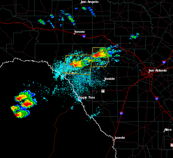 At 313 pm cdt, a severe thunderstorm was located 12 miles southeast of carta valley, or 21 miles southeast of loma alta, moving east at 5 mph (radar indicated). Hazards include 60 mph wind gusts and quarter size hail. Hail damage to vehicles is expected. Expect wind damage to roofs, siding, and trees. At 313 pm cdt, a severe thunderstorm was located 12 miles southeast of carta valley, or 21 miles southeast of loma alta, moving east at 5 mph (radar indicated). Hazards include 60 mph wind gusts and quarter size hail. Hail damage to vehicles is expected. Expect wind damage to roofs, siding, and trees.
|
| 5/10/2017 10:48 PM CDT |
 At 1048 pm cdt, a severe thunderstorm capable of producing a tornado was located over del rio, moving northeast at 25 mph (radar indicated rotation). Hazards include tornado and golf ball size hail. Flying debris will be dangerous to those caught without shelter. mobile homes will be damaged or destroyed. damage to roofs, windows, and vehicles will occur. tree damage is likely. Locations impacted include, del rio, lake view and val verde park. At 1048 pm cdt, a severe thunderstorm capable of producing a tornado was located over del rio, moving northeast at 25 mph (radar indicated rotation). Hazards include tornado and golf ball size hail. Flying debris will be dangerous to those caught without shelter. mobile homes will be damaged or destroyed. damage to roofs, windows, and vehicles will occur. tree damage is likely. Locations impacted include, del rio, lake view and val verde park.
|
| 5/10/2017 10:35 PM CDT |
 At 1035 pm cdt, a severe thunderstorm capable of producing a tornado was located over cienegas terrace, or near del rio, moving northeast at 30 mph (radar indicated rotation). Hazards include tornado and quarter size hail. Flying debris will be dangerous to those caught without shelter. mobile homes will be damaged or destroyed. damage to roofs, windows, and vehicles will occur. Tree damage is likely. At 1035 pm cdt, a severe thunderstorm capable of producing a tornado was located over cienegas terrace, or near del rio, moving northeast at 30 mph (radar indicated rotation). Hazards include tornado and quarter size hail. Flying debris will be dangerous to those caught without shelter. mobile homes will be damaged or destroyed. damage to roofs, windows, and vehicles will occur. Tree damage is likely.
|
| 4/2/2017 1:43 AM CDT |
 At 142 am cdt, a severe thunderstorm was located 10 miles north of lake view, or 16 miles north of del rio, moving north at 25 mph (trained weather spotters. at 122 am one inch hail was reported north of del rio). Hazards include quarter size hail. Damage to vehicles is expected. locations impacted include, del rio, amistad village, lake view, box canyon-amistad, val verde park, cienegas terrace, laughlin afb, and rough canyon rec area. A tornado watch remains in effect until 600 am cdt for south central texas. At 142 am cdt, a severe thunderstorm was located 10 miles north of lake view, or 16 miles north of del rio, moving north at 25 mph (trained weather spotters. at 122 am one inch hail was reported north of del rio). Hazards include quarter size hail. Damage to vehicles is expected. locations impacted include, del rio, amistad village, lake view, box canyon-amistad, val verde park, cienegas terrace, laughlin afb, and rough canyon rec area. A tornado watch remains in effect until 600 am cdt for south central texas.
|
| 4/2/2017 1:15 AM CDT |
 At 114 am cdt, a severe thunderstorm was located near lake view, or near del rio, moving north at 25 mph (trained weather spotters). Hazards include quarter size hail. damage to vehicles is expected At 114 am cdt, a severe thunderstorm was located near lake view, or near del rio, moving north at 25 mph (trained weather spotters). Hazards include quarter size hail. damage to vehicles is expected
|
| 3/28/2017 10:38 PM CDT |
 At 1037 pm cdt, severe thunderstorms were located along a line extending from 18 miles northwest of rocksprings to 6 miles southwest of loma alta to 10 miles north of lake view to 19 miles south of cienegas terrace, moving east at 70 mph (radar indicated). Hazards include 60 mph wind gusts and quarter size hail. Hail damage to vehicles is expected. expect wind damage to roofs, siding, and trees. Locations impacted include, del rio, loma alta, juno, comstock, amistad village, box canyon- amistad, seminole canyon state park, laughlin afb, amanda, lake view, flour mills, val verde park, standart, carta valley, cienegas terrace, devils shores, pafford crossing, bakers crossing, us- 277 near the sutton-edwards county line and rough canyon rec area. At 1037 pm cdt, severe thunderstorms were located along a line extending from 18 miles northwest of rocksprings to 6 miles southwest of loma alta to 10 miles north of lake view to 19 miles south of cienegas terrace, moving east at 70 mph (radar indicated). Hazards include 60 mph wind gusts and quarter size hail. Hail damage to vehicles is expected. expect wind damage to roofs, siding, and trees. Locations impacted include, del rio, loma alta, juno, comstock, amistad village, box canyon- amistad, seminole canyon state park, laughlin afb, amanda, lake view, flour mills, val verde park, standart, carta valley, cienegas terrace, devils shores, pafford crossing, bakers crossing, us- 277 near the sutton-edwards county line and rough canyon rec area.
|
| 3/28/2017 10:02 PM CDT |
 At 1001 pm cdt, severe thunderstorms were located along a line extending from 6 miles north of juno to 9 miles north of shumla to near seminole canyon state park to 19 miles southwest of box canyon-amistad, moving east at 50 mph (radar indicated). Hazards include 60 mph wind gusts and quarter size hail. Hail damage to vehicles is expected. Expect wind damage to roofs, siding, and trees. At 1001 pm cdt, severe thunderstorms were located along a line extending from 6 miles north of juno to 9 miles north of shumla to near seminole canyon state park to 19 miles southwest of box canyon-amistad, moving east at 50 mph (radar indicated). Hazards include 60 mph wind gusts and quarter size hail. Hail damage to vehicles is expected. Expect wind damage to roofs, siding, and trees.
|
| 3/28/2017 6:42 PM CDT |
 At 641 pm cdt, a severe thunderstorm was located near box canyon-amistad, or 7 miles south of comstock, moving east at 30 mph (radar indicated). Hazards include 60 mph wind gusts and quarter size hail. Hail damage to vehicles is expected. expect wind damage to roofs, siding, and trees. Locations impacted include, comstock, amistad village, lake view, box canyon-amistad, devils shores, pafford crossing, devils river state natural area and rough canyon rec area. At 641 pm cdt, a severe thunderstorm was located near box canyon-amistad, or 7 miles south of comstock, moving east at 30 mph (radar indicated). Hazards include 60 mph wind gusts and quarter size hail. Hail damage to vehicles is expected. expect wind damage to roofs, siding, and trees. Locations impacted include, comstock, amistad village, lake view, box canyon-amistad, devils shores, pafford crossing, devils river state natural area and rough canyon rec area.
|
| 3/28/2017 6:26 PM CDT |
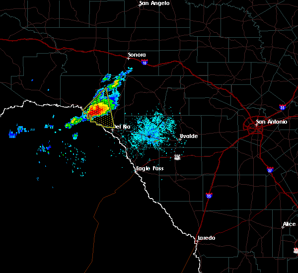 At 624 pm cdt, a severe thunderstorm was located near comstock, moving east at 25 mph (radar indicated). Hazards include golf ball size hail and 60 mph wind gusts. People and animals outdoors will be injured. expect hail damage to roofs, siding, windows, and vehicles. expect wind damage to roofs, siding, and trees. Locations impacted include, comstock, amistad village, lake view, box canyon-amistad, devils shores, pafford crossing, devils river state natural area and rough canyon rec area. At 624 pm cdt, a severe thunderstorm was located near comstock, moving east at 25 mph (radar indicated). Hazards include golf ball size hail and 60 mph wind gusts. People and animals outdoors will be injured. expect hail damage to roofs, siding, windows, and vehicles. expect wind damage to roofs, siding, and trees. Locations impacted include, comstock, amistad village, lake view, box canyon-amistad, devils shores, pafford crossing, devils river state natural area and rough canyon rec area.
|
| 3/28/2017 6:01 PM CDT |
 At 600 pm cdt, a severe thunderstorm was located 7 miles south of seminole canyon state park, or 12 miles southwest of comstock, moving east at 30 mph (radar indicated). Hazards include golf ball size hail and 60 mph wind gusts. People and animals outdoors will be injured. expect hail damage to roofs, siding, windows, and vehicles. Expect wind damage to roofs, siding, and trees. At 600 pm cdt, a severe thunderstorm was located 7 miles south of seminole canyon state park, or 12 miles southwest of comstock, moving east at 30 mph (radar indicated). Hazards include golf ball size hail and 60 mph wind gusts. People and animals outdoors will be injured. expect hail damage to roofs, siding, windows, and vehicles. Expect wind damage to roofs, siding, and trees.
|
| 6/1/2016 10:59 PM CDT |
 At 1059 pm cdt, severe thunderstorms were located along a line extending from lake view to 11 miles south of del rio, moving southeast at 30 mph (radar indicated). Hazards include 60 mph wind gusts and quarter size hail. Hail damage to vehicles is expected. expect wind damage to roofs, siding, and trees. Locations impacted include, del rio, lake view, amanda, val verde park, cienegas terrace, laughlin afb and amistad village. At 1059 pm cdt, severe thunderstorms were located along a line extending from lake view to 11 miles south of del rio, moving southeast at 30 mph (radar indicated). Hazards include 60 mph wind gusts and quarter size hail. Hail damage to vehicles is expected. expect wind damage to roofs, siding, and trees. Locations impacted include, del rio, lake view, amanda, val verde park, cienegas terrace, laughlin afb and amistad village.
|
| 6/1/2016 10:38 PM CDT |
 At 1038 pm cdt, severe thunderstorms were located along a line extending from 7 miles southeast of comstock to 12 miles southwest of cienegas terrace, moving southeast at 30 mph (radar indicated). Hazards include 60 mph wind gusts and quarter size hail. Hail damage to vehicles is expected. Expect wind damage to roofs, siding, and trees. At 1038 pm cdt, severe thunderstorms were located along a line extending from 7 miles southeast of comstock to 12 miles southwest of cienegas terrace, moving southeast at 30 mph (radar indicated). Hazards include 60 mph wind gusts and quarter size hail. Hail damage to vehicles is expected. Expect wind damage to roofs, siding, and trees.
|
| 5/26/2016 7:30 PM CDT |
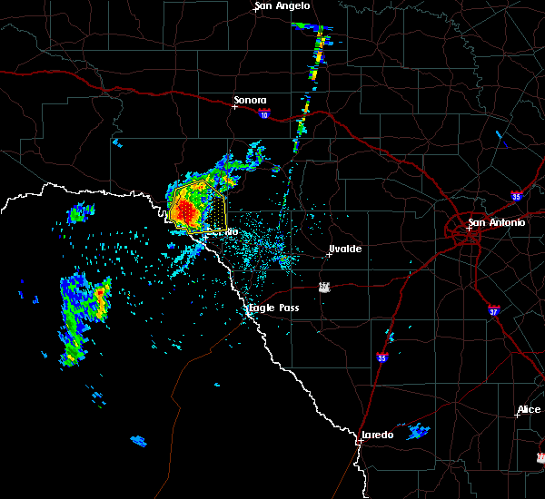 At 730 pm cdt, a severe thunderstorm was located 7 miles east of comstock, moving east at 35 mph (radar indicated). Hazards include 70 mph wind gusts and ping pong ball size hail. People and animals outdoors will be injured. expect hail damage to roofs, siding, windows, and vehicles. expect considerable tree damage. wind damage is also likely to mobile homes, roofs, and outbuildings. Locations impacted include, comstock, lake view, amistad village, box canyon-amistad, pafford crossing, rough canyon rec area and devils shores. At 730 pm cdt, a severe thunderstorm was located 7 miles east of comstock, moving east at 35 mph (radar indicated). Hazards include 70 mph wind gusts and ping pong ball size hail. People and animals outdoors will be injured. expect hail damage to roofs, siding, windows, and vehicles. expect considerable tree damage. wind damage is also likely to mobile homes, roofs, and outbuildings. Locations impacted include, comstock, lake view, amistad village, box canyon-amistad, pafford crossing, rough canyon rec area and devils shores.
|
| 5/26/2016 7:20 PM CDT |
 At 720 pm cdt, a severe thunderstorm was located near comstock, moving east at 35 mph (radar indicated). Hazards include ping pong ball size hail and 60 mph wind gusts. People and animals outdoors will be injured. expect hail damage to roofs, siding, windows, and vehicles. expect wind damage to roofs, siding, and trees. Locations impacted include, comstock, lake view, amistad village, box canyon-amistad, pafford crossing, rough canyon rec area and devils shores. At 720 pm cdt, a severe thunderstorm was located near comstock, moving east at 35 mph (radar indicated). Hazards include ping pong ball size hail and 60 mph wind gusts. People and animals outdoors will be injured. expect hail damage to roofs, siding, windows, and vehicles. expect wind damage to roofs, siding, and trees. Locations impacted include, comstock, lake view, amistad village, box canyon-amistad, pafford crossing, rough canyon rec area and devils shores.
|
| 5/26/2016 7:00 PM CDT |
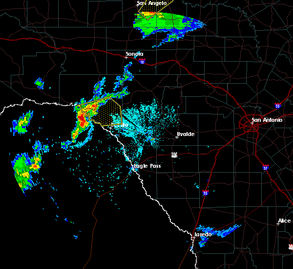 At 659 pm cdt, a severe thunderstorm was located 10 miles south of seminole canyon state park, or 14 miles southwest of comstock, moving east at 35 mph (radar indicated). Hazards include 60 mph wind gusts and quarter size hail. Hail damage to vehicles is expected. Expect wind damage to roofs, siding, and trees. At 659 pm cdt, a severe thunderstorm was located 10 miles south of seminole canyon state park, or 14 miles southwest of comstock, moving east at 35 mph (radar indicated). Hazards include 60 mph wind gusts and quarter size hail. Hail damage to vehicles is expected. Expect wind damage to roofs, siding, and trees.
|
| 5/17/2016 10:53 PM CDT |
 At 1053 pm cdt, a severe thunderstorm was located over lake view, or 9 miles northwest of del rio, moving southeast at 10 mph (radar indicated). Hazards include golf ball size hail and 60 mph wind gusts. People and animals outdoors will be injured. expect hail damage to roofs, siding, windows, and vehicles. expect wind damage to roofs, siding, and trees. Locations impacted include, cienegas terrace, amistad village, lake view, rough canyon rec area and devils shores. At 1053 pm cdt, a severe thunderstorm was located over lake view, or 9 miles northwest of del rio, moving southeast at 10 mph (radar indicated). Hazards include golf ball size hail and 60 mph wind gusts. People and animals outdoors will be injured. expect hail damage to roofs, siding, windows, and vehicles. expect wind damage to roofs, siding, and trees. Locations impacted include, cienegas terrace, amistad village, lake view, rough canyon rec area and devils shores.
|
| 5/17/2016 10:19 PM CDT |
 At 1018 pm cdt, severe thunderstorms were located along a line extending from 12 miles southwest of carta valley to near box canyon-amistad, moving southeast at 15 mph (radar indicated). Hazards include 60 mph wind gusts and quarter size hail. Hail damage to vehicles is expected. Expect wind damage to roofs, siding, and trees. At 1018 pm cdt, severe thunderstorms were located along a line extending from 12 miles southwest of carta valley to near box canyon-amistad, moving southeast at 15 mph (radar indicated). Hazards include 60 mph wind gusts and quarter size hail. Hail damage to vehicles is expected. Expect wind damage to roofs, siding, and trees.
|
| 5/1/2016 5:42 PM CDT |
 At 539 pm cdt, a severe thunderstorm was located over del rio, moving east at 20 mph. this storm will move to the east along highway 90, passing near laughlin afb (radar indicated). Hazards include 60 mph wind gusts and quarter size hail. Hail damage to vehicles is expected. expect wind damage to roofs, siding, and trees. Locations impacted include, del rio, standart, lake view, amanda, val verde park, cienegas terrace, laughlin afb and amistad village. At 539 pm cdt, a severe thunderstorm was located over del rio, moving east at 20 mph. this storm will move to the east along highway 90, passing near laughlin afb (radar indicated). Hazards include 60 mph wind gusts and quarter size hail. Hail damage to vehicles is expected. expect wind damage to roofs, siding, and trees. Locations impacted include, del rio, standart, lake view, amanda, val verde park, cienegas terrace, laughlin afb and amistad village.
|
| 5/1/2016 5:27 PM CDT |
 At 527 pm cdt, a severe thunderstorm was located near cienegas terrace, or near del rio, moving east at 30 mph (radar indicated). Hazards include 60 mph wind gusts and quarter size hail. Hail damage to vehicles is expected. Expect wind damage to roofs, siding, and trees. At 527 pm cdt, a severe thunderstorm was located near cienegas terrace, or near del rio, moving east at 30 mph (radar indicated). Hazards include 60 mph wind gusts and quarter size hail. Hail damage to vehicles is expected. Expect wind damage to roofs, siding, and trees.
|
| 4/18/2016 3:09 AM CDT |
 At 308 am cdt, a severe thunderstorm was located near amanda, or 13 miles east of del rio, moving northeast at 25 mph (radar indicated). Hazards include quarter size hail. Damage to vehicles is expected. Locations impacted include, del rio, standart, lake view, amanda, val verde park, cienegas terrace and laughlin afb. At 308 am cdt, a severe thunderstorm was located near amanda, or 13 miles east of del rio, moving northeast at 25 mph (radar indicated). Hazards include quarter size hail. Damage to vehicles is expected. Locations impacted include, del rio, standart, lake view, amanda, val verde park, cienegas terrace and laughlin afb.
|
| 4/18/2016 2:50 AM CDT |
 At 248 am cdt, a severe thunderstorm was located over del rio, moving northeast at 20 mph (radar indicated). Hazards include 60 mph wind gusts and quarter size hail. Hail damage to vehicles is expected. expect wind damage to roofs, siding, and trees. Locations impacted include, del rio, alamo village, standart, lake view, amanda, val verde park, cienegas terrace and laughlin afb. At 248 am cdt, a severe thunderstorm was located over del rio, moving northeast at 20 mph (radar indicated). Hazards include 60 mph wind gusts and quarter size hail. Hail damage to vehicles is expected. expect wind damage to roofs, siding, and trees. Locations impacted include, del rio, alamo village, standart, lake view, amanda, val verde park, cienegas terrace and laughlin afb.
|
| 4/18/2016 2:32 AM CDT |
 At 231 am cdt, a severe thunderstorm was located over laughlin afb, or near del rio, moving northeast at 25 mph (radar indicated). Hazards include 60 mph wind gusts and quarter size hail. Hail damage to vehicles is expected. Expect wind damage to roofs, siding, and trees. At 231 am cdt, a severe thunderstorm was located over laughlin afb, or near del rio, moving northeast at 25 mph (radar indicated). Hazards include 60 mph wind gusts and quarter size hail. Hail damage to vehicles is expected. Expect wind damage to roofs, siding, and trees.
|
| 3/24/2016 12:26 AM CDT |
 The severe thunderstorm warning for southeastern val verde and northwestern kinney counties will expire at 1230 am cdt, the storm which prompted the warning has weakened below severe limits, and no longer pose an immediate threat to life or property. therefore the warning will be allowed to expire. however small. The severe thunderstorm warning for southeastern val verde and northwestern kinney counties will expire at 1230 am cdt, the storm which prompted the warning has weakened below severe limits, and no longer pose an immediate threat to life or property. therefore the warning will be allowed to expire. however small.
|
| 3/24/2016 12:04 AM CDT |
 At 1203 am cdt, a severe thunderstorm was located near lake view, or near del rio, moving east at 35 mph (radar indicated). Hazards include 60 mph wind gusts and quarter size hail. Hail damage to vehicles is expected. expect wind damage to roofs, siding, and trees. Locations impacted include, del rio, standart, lake view, amanda, val verde park, cienegas terrace, laughlin afb, amistad village and box canyon-amistad. At 1203 am cdt, a severe thunderstorm was located near lake view, or near del rio, moving east at 35 mph (radar indicated). Hazards include 60 mph wind gusts and quarter size hail. Hail damage to vehicles is expected. expect wind damage to roofs, siding, and trees. Locations impacted include, del rio, standart, lake view, amanda, val verde park, cienegas terrace, laughlin afb, amistad village and box canyon-amistad.
|
| 3/23/2016 11:46 PM CDT |
 At 1145 pm cdt, a severe thunderstorm was located over amistad village, or 11 miles northwest of del rio, moving east at 40 mph (radar indicated). Hazards include golf ball size hail and 60 mph wind gusts. People and animals outdoors will be injured. expect hail damage to roofs, siding, windows, and vehicles. Expect wind damage to roofs, siding, and trees. At 1145 pm cdt, a severe thunderstorm was located over amistad village, or 11 miles northwest of del rio, moving east at 40 mph (radar indicated). Hazards include golf ball size hail and 60 mph wind gusts. People and animals outdoors will be injured. expect hail damage to roofs, siding, windows, and vehicles. Expect wind damage to roofs, siding, and trees.
|
| 2/22/2016 10:33 PM CST |
 At 1032 pm cst, a severe thunderstorm was located near laughlin afb, or 9 miles east of del rio, moving southeast at 50 mph (radar indicated). Hazards include 60 mph wind gusts and quarter size hail. Hail damage to vehicles is expected. expect wind damage to roofs, siding, and trees. Locations impacted include, del rio, brackettville, alamo village, standart, lake view, amanda, val verde park, cienegas terrace, laughlin afb and kickapoo cavern state park. At 1032 pm cst, a severe thunderstorm was located near laughlin afb, or 9 miles east of del rio, moving southeast at 50 mph (radar indicated). Hazards include 60 mph wind gusts and quarter size hail. Hail damage to vehicles is expected. expect wind damage to roofs, siding, and trees. Locations impacted include, del rio, brackettville, alamo village, standart, lake view, amanda, val verde park, cienegas terrace, laughlin afb and kickapoo cavern state park.
|
| 2/22/2016 10:15 PM CST |
 At 1015 pm cst, a severe thunderstorm was located near lake view, or 12 miles northwest of del rio, moving east at 40 mph (radar indicated). Hazards include 60 mph wind gusts and quarter size hail. Hail damage to vehicles is expected. expect wind damage to roofs, siding, and trees. Locations impacted include, del rio, brackettville, alamo village, standart, lake view, amanda, val verde park, cienegas terrace, laughlin afb, amistad village, box canyon-amistad, pafford crossing, rough canyon rec area, devils shores and kickapoo cavern state park. At 1015 pm cst, a severe thunderstorm was located near lake view, or 12 miles northwest of del rio, moving east at 40 mph (radar indicated). Hazards include 60 mph wind gusts and quarter size hail. Hail damage to vehicles is expected. expect wind damage to roofs, siding, and trees. Locations impacted include, del rio, brackettville, alamo village, standart, lake view, amanda, val verde park, cienegas terrace, laughlin afb, amistad village, box canyon-amistad, pafford crossing, rough canyon rec area, devils shores and kickapoo cavern state park.
|
| 2/22/2016 10:08 PM CST |
 At 1007 pm cst, a severe thunderstorm was located near box canyon-amistad, or 10 miles southeast of comstock, moving east at 35 mph (radar indicated). Hazards include quarter size hail. damage to vehicles is expected At 1007 pm cst, a severe thunderstorm was located near box canyon-amistad, or 10 miles southeast of comstock, moving east at 35 mph (radar indicated). Hazards include quarter size hail. damage to vehicles is expected
|
| 12/27/2015 12:06 AM CST |
 At 1205 am cst, severe thunderstorms were located along a line extending from 14 miles north of flour mills to 10 miles south of laughlin afb, moving east at 35 mph (radar indicated). Hazards include 60 mph wind gusts and nickel size hail. Expect damage to roofs. Siding and trees. At 1205 am cst, severe thunderstorms were located along a line extending from 14 miles north of flour mills to 10 miles south of laughlin afb, moving east at 35 mph (radar indicated). Hazards include 60 mph wind gusts and nickel size hail. Expect damage to roofs. Siding and trees.
|
| 10/30/2015 10:11 PM CDT |
 At 1010 pm cdt, severe thunderstorms were located along a line extending from 14 miles northeast of shumla to 8 miles north of comstock to 8 miles northeast of box canyon-amistad to amistad village, moving northeast at 45 mph (radar indicated). Hazards include 60 mph wind gusts and nickel size hail. Expect damage to roofs. siding and trees. Locations impacted include, del rio, comstock, langtry, shumla, lake view, seminole canyon state park, val verde park, cienegas terrace, amistad village, box canyon-amistad, laughlin afb, pafford crossing, rough canyon rec area, devils shores, bakers crossing and devils river state natural area. At 1010 pm cdt, severe thunderstorms were located along a line extending from 14 miles northeast of shumla to 8 miles north of comstock to 8 miles northeast of box canyon-amistad to amistad village, moving northeast at 45 mph (radar indicated). Hazards include 60 mph wind gusts and nickel size hail. Expect damage to roofs. siding and trees. Locations impacted include, del rio, comstock, langtry, shumla, lake view, seminole canyon state park, val verde park, cienegas terrace, amistad village, box canyon-amistad, laughlin afb, pafford crossing, rough canyon rec area, devils shores, bakers crossing and devils river state natural area.
|
| 10/30/2015 9:53 PM CDT |
 At 952 pm cdt, severe thunderstorms were located along a line extending from near shumla to near seminole canyon state park to 6 miles west of box canyon-amistad to 13 miles southwest of amistad village, moving northeast at 45 mph (radar indicated). Hazards include 70 mph wind gusts and quarter size hail. Hail damage to vehicles is expected. expect considerable tree damage. wind damage is also likely to mobile homes, roofs and outbuildings. Locations impacted include, del rio, comstock, langtry, shumla, lake view, seminole canyon state park, val verde park, cienegas terrace, amistad village, box canyon-amistad, laughlin afb, pafford crossing, rough canyon rec area, devils shores, bakers crossing and devils river state natural area. At 952 pm cdt, severe thunderstorms were located along a line extending from near shumla to near seminole canyon state park to 6 miles west of box canyon-amistad to 13 miles southwest of amistad village, moving northeast at 45 mph (radar indicated). Hazards include 70 mph wind gusts and quarter size hail. Hail damage to vehicles is expected. expect considerable tree damage. wind damage is also likely to mobile homes, roofs and outbuildings. Locations impacted include, del rio, comstock, langtry, shumla, lake view, seminole canyon state park, val verde park, cienegas terrace, amistad village, box canyon-amistad, laughlin afb, pafford crossing, rough canyon rec area, devils shores, bakers crossing and devils river state natural area.
|
| 10/30/2015 9:50 PM CDT |
 At 949 pm cdt, severe thunderstorms were located along a line extending from near langtry to near seminole canyon state park to 8 miles west of box canyon-amistad to 15 miles southwest of amistad village, moving northeast at 50 mph (radar indicated). Hazards include 70 mph wind gusts and quarter size hail. Hail damage to vehicles is expected. expect considerable tree damage. Wind damage is also likely to mobile homes, roofs and outbuildings. At 949 pm cdt, severe thunderstorms were located along a line extending from near langtry to near seminole canyon state park to 8 miles west of box canyon-amistad to 15 miles southwest of amistad village, moving northeast at 50 mph (radar indicated). Hazards include 70 mph wind gusts and quarter size hail. Hail damage to vehicles is expected. expect considerable tree damage. Wind damage is also likely to mobile homes, roofs and outbuildings.
|
| 10/30/2015 6:51 PM CDT |
 At 648 pm cdt, a severe thunderstorm was located near lake view, or 7 miles north of del rio, moving east at 30 mph. this storm will move along highway 90 along and just south of lake amistad to across the intersection with highway 277 (radar indicated). Hazards include 70 mph wind gusts and half dollar size hail. Hail damage to vehicles is expected. expect considerable tree damage. wind damage is also likely to mobile homes, roofs and outbuildings. Locations impacted include, del rio, lake view, val verde park, cienegas terrace, amistad village, laughlin afb, box canyon-amistad, pafford crossing, rough canyon rec area and devils shores. At 648 pm cdt, a severe thunderstorm was located near lake view, or 7 miles north of del rio, moving east at 30 mph. this storm will move along highway 90 along and just south of lake amistad to across the intersection with highway 277 (radar indicated). Hazards include 70 mph wind gusts and half dollar size hail. Hail damage to vehicles is expected. expect considerable tree damage. wind damage is also likely to mobile homes, roofs and outbuildings. Locations impacted include, del rio, lake view, val verde park, cienegas terrace, amistad village, laughlin afb, box canyon-amistad, pafford crossing, rough canyon rec area and devils shores.
|
| 10/30/2015 6:34 PM CDT |
 At 633 pm cdt, a severe thunderstorm was located over lake view, or 7 miles northwest of del rio, moving east at 35 mph. this storm will move across the lake amistad dam and then move toward the northern parts of del rio along highway 90 (radar indicated). Hazards include 60 mph wind gusts and quarter size hail. Hail damage to vehicles is expected. expect wind damage to roofs, siding and trees. Locations impacted include, del rio, lake view, val verde park, cienegas terrace, amistad village, laughlin afb, box canyon-amistad, pafford crossing, rough canyon rec area and devils shores. At 633 pm cdt, a severe thunderstorm was located over lake view, or 7 miles northwest of del rio, moving east at 35 mph. this storm will move across the lake amistad dam and then move toward the northern parts of del rio along highway 90 (radar indicated). Hazards include 60 mph wind gusts and quarter size hail. Hail damage to vehicles is expected. expect wind damage to roofs, siding and trees. Locations impacted include, del rio, lake view, val verde park, cienegas terrace, amistad village, laughlin afb, box canyon-amistad, pafford crossing, rough canyon rec area and devils shores.
|
| 10/30/2015 6:10 PM CDT |
 The national weather service in austin san antonio has issued a * severe thunderstorm warning for. southeastern val verde county in south central texas. until 715 pm cdt * at 609 pm cdt. a severe thunderstorm was located 9 miles south of box canyon-amistad. or 16 miles west of del rio. Moving east at. The national weather service in austin san antonio has issued a * severe thunderstorm warning for. southeastern val verde county in south central texas. until 715 pm cdt * at 609 pm cdt. a severe thunderstorm was located 9 miles south of box canyon-amistad. or 16 miles west of del rio. Moving east at.
|
| 10/8/2015 7:37 PM CDT |
 At 731 pm cdt, a line of strong to severe thunderstorms is moving northeast at 20 mph. the stronger winds shown on radar are across the southwest of kinney county. this area of strong to severe thunderstorm winds will move the northweast and affect central kinney county within the next several minutes. also, very heavy rain is falling and localized flash flooding is possible. an areal flood advisory is in effect for the area through 1015 pm (radar indicated). Hazards include 60 mph wind gusts and quarter size hail. Hail damage to vehicles is expected. expect wind damage to roofs, siding and trees. Locations impacted include, del rio, brackettville, spofford, quemado, darling, standart, lake view, val verde park, amanda, cienegas terrace, laughlin afb, normandy and laughlin afb aux field. At 731 pm cdt, a line of strong to severe thunderstorms is moving northeast at 20 mph. the stronger winds shown on radar are across the southwest of kinney county. this area of strong to severe thunderstorm winds will move the northweast and affect central kinney county within the next several minutes. also, very heavy rain is falling and localized flash flooding is possible. an areal flood advisory is in effect for the area through 1015 pm (radar indicated). Hazards include 60 mph wind gusts and quarter size hail. Hail damage to vehicles is expected. expect wind damage to roofs, siding and trees. Locations impacted include, del rio, brackettville, spofford, quemado, darling, standart, lake view, val verde park, amanda, cienegas terrace, laughlin afb, normandy and laughlin afb aux field.
|
| 10/8/2015 6:53 PM CDT |
 At 652 pm cdt, a severe thunderstorm was located 10 miles southwest of laughlin afb, or 10 miles south of del rio, moving northeast at 25 mph (radar indicated). Hazards include 60 mph wind gusts and quarter size hail. Hail damage to vehicles is expected. Expect wind damage to roofs, siding and trees. At 652 pm cdt, a severe thunderstorm was located 10 miles southwest of laughlin afb, or 10 miles south of del rio, moving northeast at 25 mph (radar indicated). Hazards include 60 mph wind gusts and quarter size hail. Hail damage to vehicles is expected. Expect wind damage to roofs, siding and trees.
|
| 8/12/2015 4:32 PM CDT |
 At 432 pm cdt, a severe thunderstorm was located 11 miles southwest of cienegas terrace, or 13 miles southwest of del rio, moving southwest at 25 mph (radar indicated). Hazards include 60 mph wind gusts. Expect damage to roofs. Siding and trees. At 432 pm cdt, a severe thunderstorm was located 11 miles southwest of cienegas terrace, or 13 miles southwest of del rio, moving southwest at 25 mph (radar indicated). Hazards include 60 mph wind gusts. Expect damage to roofs. Siding and trees.
|
| 8/12/2015 4:28 PM CDT | Measured wind gust of 50 mph blew some shingles off a roof near lake amista in val verde county TX, 1.3 miles SSW of Lake View, TX |
| 6/23/2015 7:55 PM CDT |
 At 755 pm cdt, a severe thunderstorm was located near val verde park, or 7 miles northeast of del rio, moving northwest at 35 mph (radar indicated). Hazards include 60 mph wind gusts. Expect damage to roofs. Siding and trees. At 755 pm cdt, a severe thunderstorm was located near val verde park, or 7 miles northeast of del rio, moving northwest at 35 mph (radar indicated). Hazards include 60 mph wind gusts. Expect damage to roofs. Siding and trees.
|
| 6/13/2015 11:49 PM CDT |
 At 1148 pm cdt, a severe thunderstorm was located 14 miles east of comstock, moving east at 20 mph (radar indicated). Hazards include 60 mph wind gusts and penny size hail. Expect damage to roofs. Siding and trees. At 1148 pm cdt, a severe thunderstorm was located 14 miles east of comstock, moving east at 20 mph (radar indicated). Hazards include 60 mph wind gusts and penny size hail. Expect damage to roofs. Siding and trees.
|
| 6/12/2015 10:24 PM CDT |
 The severe thunderstorm warning for northwestern kinney and southeastern val verde counties will expire at 1030 pm cdt. the storm which prompted the warning has weakened below severe limits. and no longer pose an immediate threat to life or property. therefore the warning will be allowed to expire. However gusty winds and heavy rain are still possible with this thunderstorm. The severe thunderstorm warning for northwestern kinney and southeastern val verde counties will expire at 1030 pm cdt. the storm which prompted the warning has weakened below severe limits. and no longer pose an immediate threat to life or property. therefore the warning will be allowed to expire. However gusty winds and heavy rain are still possible with this thunderstorm.
|
| 6/12/2015 10:10 PM CDT |
 At 1008 pm cdt, doppler radar continues to detect a severe thundersotrm 7 miles northeast of del rio, moving east at 20 mph (radar indicated). Hazards include 60 mph wind gusts and penny size hail are possible with this storm. Expect damage to roofs. siding and trees. Locations impacted include, del rio, standart, lake view, amanda, val verde park, cienegas terrace and laughlin afb. At 1008 pm cdt, doppler radar continues to detect a severe thundersotrm 7 miles northeast of del rio, moving east at 20 mph (radar indicated). Hazards include 60 mph wind gusts and penny size hail are possible with this storm. Expect damage to roofs. siding and trees. Locations impacted include, del rio, standart, lake view, amanda, val verde park, cienegas terrace and laughlin afb.
|
| 6/12/2015 9:48 PM CDT |
 At 947 pm cdt, a severe thunderstorm was located over lake view, or near del rio, moving east at 20 mph (radar indicated). Hazards include 60 mph wind gusts and penny size hail. Expect damage to roofs. Siding and trees. At 947 pm cdt, a severe thunderstorm was located over lake view, or near del rio, moving east at 20 mph (radar indicated). Hazards include 60 mph wind gusts and penny size hail. Expect damage to roofs. Siding and trees.
|
| 5/30/2015 12:05 PM CDT | At 1202 pm cdt, a severe thunderstorm was located over val verde park, or near del rio, moving east at 15 mph (radar indicated heavy rain with strong wind gusts up to 60 mph). Hazards include 60 mph wind gusts and penny size hail. Expect damage to roofs. Siding and trees. |
| 5/28/2015 11:05 PM CDT | At 1104 pm cdt, severe thunderstorms were located along a line extending from 7 miles northwest of lost maples state park to near barksdale to 15 miles north of alamo village to 11 miles northeast of lake view to near box canyon-amistad, moving southeast at 40 mph (radar indicated). Hazards include 60 mph wind gusts and penny size hail. Expect damage to roofs. siding and trees. Locations impacted include, del rio, brackettville, leakey, langtry, loma alta, comstock, camp wood, laguna, montell, alamo village, concan, standart, lake view, amanda, val verde park, seminole canyon state park, box canyon-amistad, osman, garner state park and vance. |
| 5/28/2015 10:35 PM CDT | At 1035 pm cdt, severe thunderstorms were located along a line extending from 10 miles northwest of lost maples state park to near vance to 20 miles north of alamo village to 12 miles southwest of carta valley to near comstock, moving southeast at 40 mph (radar indicated). Hazards include 60 mph wind gusts and penny size hail. Expect damage to roofs. siding and trees. Locations impacted include, del rio, brackettville, leakey, langtry, loma alta, comstock, juno, camp wood, laguna, montell, alamo village, concan, standart, lake view, amanda, pumpville, val verde park, seminole canyon state park, box canyon-amistad and osman. |
| 5/28/2015 9:57 PM CDT | At 954 pm cdt, severe thunderstorms were located along a line extending from near telegraph to 7 miles northwest of rocksprings to near flour mills to 14 miles south of juno to 11 miles north of shumla, moving southeast at 40 mph. * the strongest winds near 70 mph will be in northwest val verde and crossing into west, southwest and south central edwards county over the next half hour. these strong winds will likely be in northern uvalde and kinney country within the next hour (radar indicated). Hazards include 70 mph wind gusts and nickel size hail. Expect considerable tree damage. Damage is likely to mobile homes, roofs and outbuildings. |
| 5/25/2015 6:29 AM CDT | At 629 am cdt, a severe thunderstorm was located over del rio, moving northeast at 15 mph (radar indicated). Hazards include ping pong ball size hail and 60 mph wind gusts. People and animals outdoors will be injured. expect hail damage to roofs, siding, windows and vehicles. expect wind damage to roofs, siding and trees. Locations impacted include, del rio, cienegas terrace, laughlin afb, val verde park and lake view. |
| 5/25/2015 6:08 AM CDT | At 607 am cdt, a severe thunderstorm was located over del rio, moving northeast at 25 mph (radar indicated). Hazards include ping pong ball size hail and 60 mph wind gusts. People and animals outdoors will be injured. expect hail damage to roofs, siding, windows and vehicles. expect wind damage to roofs, siding and trees. Locations impacted include, del rio, cienegas terrace, laughlin afb, amistad village, lake view and val verde park. |
| 5/25/2015 5:37 AM CDT | At 537 am cdt, a severe thunderstorm was located 10 miles southwest of cienegas terrace, or 13 miles southwest of del rio, moving northeast at 25 mph (radar indicated). Hazards include ping pong ball size hail and 60 mph wind gusts. People and animals outdoors will be injured. expect hail damage to roofs, siding, windows and vehicles. Expect wind damage to roofs, siding and trees. |
| 5/23/2015 2:40 PM CDT | At 239 pm cdt, a severe thunderstorm was located 22 miles southwest of box canyon-amistad, or 28 miles southwest of comstock, moving east at 20 mph (radar indicated). Hazards include 60 mph wind gusts and quarter size hail. Hail damage to vehicles is expected. Expect wind damage to roofs, siding and trees. |
| 5/11/2015 4:27 PM CDT | At 426 pm cdt, a severe thunderstorm was located over lake view, or near del rio, moving north at 30 mph (radar indicated). Hazards include quarter size hail. Damage to vehicles is expected. locations impacted include, del rio, cienegas terrace, amistad village, lake view, box canyon-amistad and rough canyon rec area. 1. 00in. |
| 5/11/2015 4:08 PM CDT | At 408 pm cdt, a severe thunderstorm was located near amistad village, or 7 miles west of del rio, moving northwest at 60 mph (radar indicated). Hazards include quarter size hail. damage to vehicles is expected |
| 4/26/2015 11:14 PM CDT | At 1114 pm cdt, severe thunderstorms were located along a line extending from 15 miles north of alamo village to near lake view to 14 miles northwest of quemado, moving east at 20 mph (radar indicated). Hazards include 60 mph wind gusts and quarter size hail. Hail damage to vehicles is expected. Expect wind damage to roofs, siding and trees. |
| 4/12/2015 7:32 PM CDT | A severe thunderstorm warning remains in effect until 745 pm cdt for southwestern edwards. western kinney and southeastern val verde counties. at 731 pm cdt. severe thunderstorms were located along a line extending from 9 miles northeast of flour mills to 6 miles south of standart. moving east at 25 mph. These storms continue to weaken. |
| 4/12/2015 6:46 PM CDT | The national weather service in austin san antonio has issued a * severe thunderstorm warning for. southwestern edwards county in south central texas. western kinney county in south central texas. southeastern val verde county in south central texas. Until 745 pm cdt. |
| 4/12/2015 6:16 PM CDT | A severe thunderstorm warning remains in effect until 645 pm cdt for val verde county. at 615 pm cdt. severe thunderstorms were located along a line extending from 7 miles east of pandale to 21 miles southwest of box canyon-amistad. moving east at 25 mph. hazard. 70 mph wind gusts and quarter size hail. |
| 4/12/2015 5:49 PM CDT | The national weather service in austin san antonio has issued a * severe thunderstorm warning for. val verde county in south central texas. until 645 pm cdt * at 548 pm cdt. Severe thunderstorms were located along a line extending from near pandale to 30 miles southwest of box. |
| 9/27/2012 11:37 PM CDT | Strong winds ripped porch roof from diablo east marina store with wall and ceiling damage in store. not far away a 28 foot pontoon boat was flipped from a parking lot o in val verde county TX, 1.4 miles E of Lake View, TX |
| 9/27/2012 11:37 PM CDT | Strong winds ripped porch roof from diablo east marina store with wall and ceiling damage in store. not far away a 28 foor pontoon boat was flipped from a parking lot o in val verde county TX, 1.4 miles E of Lake View, TX |
| 1/1/0001 12:00 AM | Patio roof blown off house onto roa in val verde county TX, 1.6 miles SW of Lake View, TX |
Hail Maps for Lake View, TX


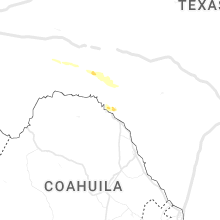


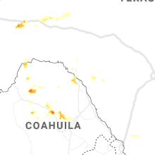
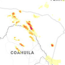


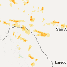

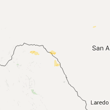


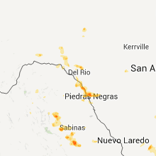


Connect with Interactive Hail Maps