

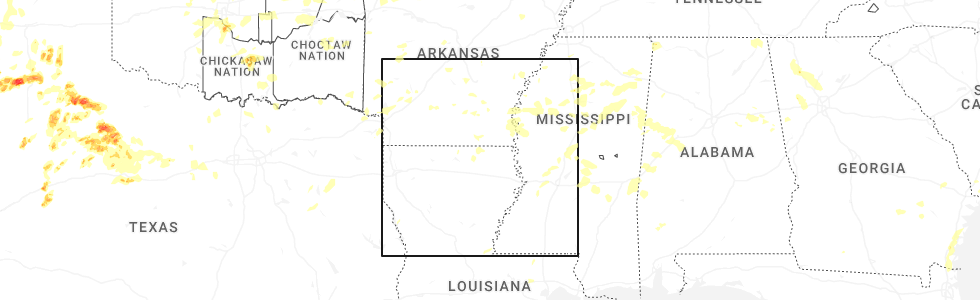
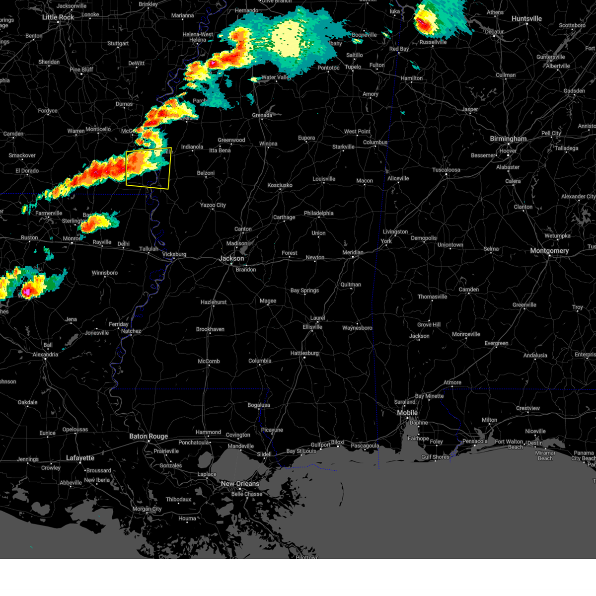
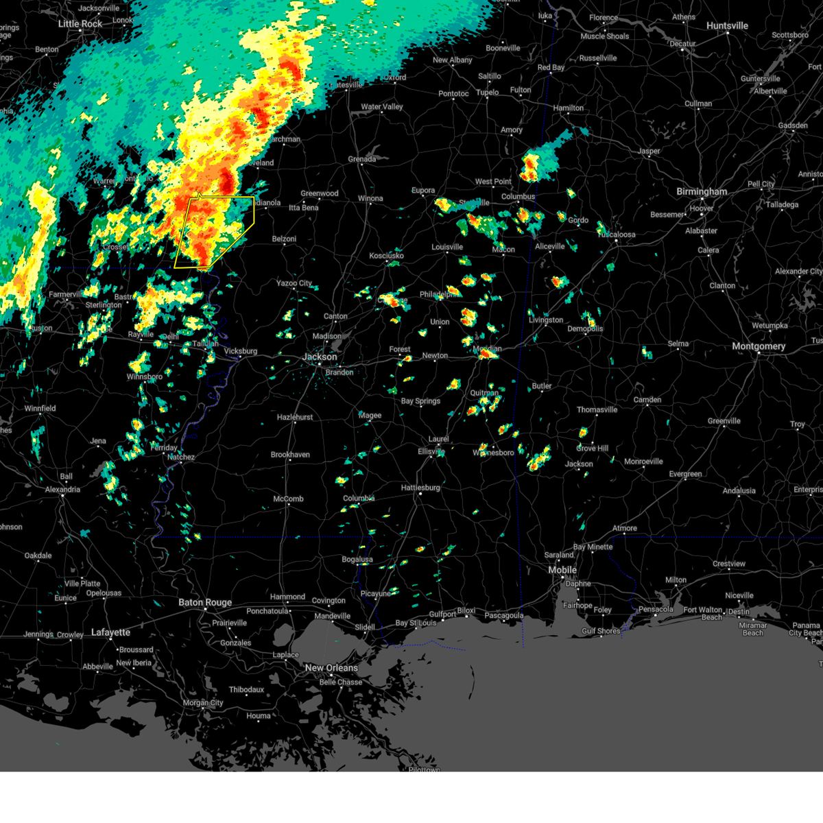
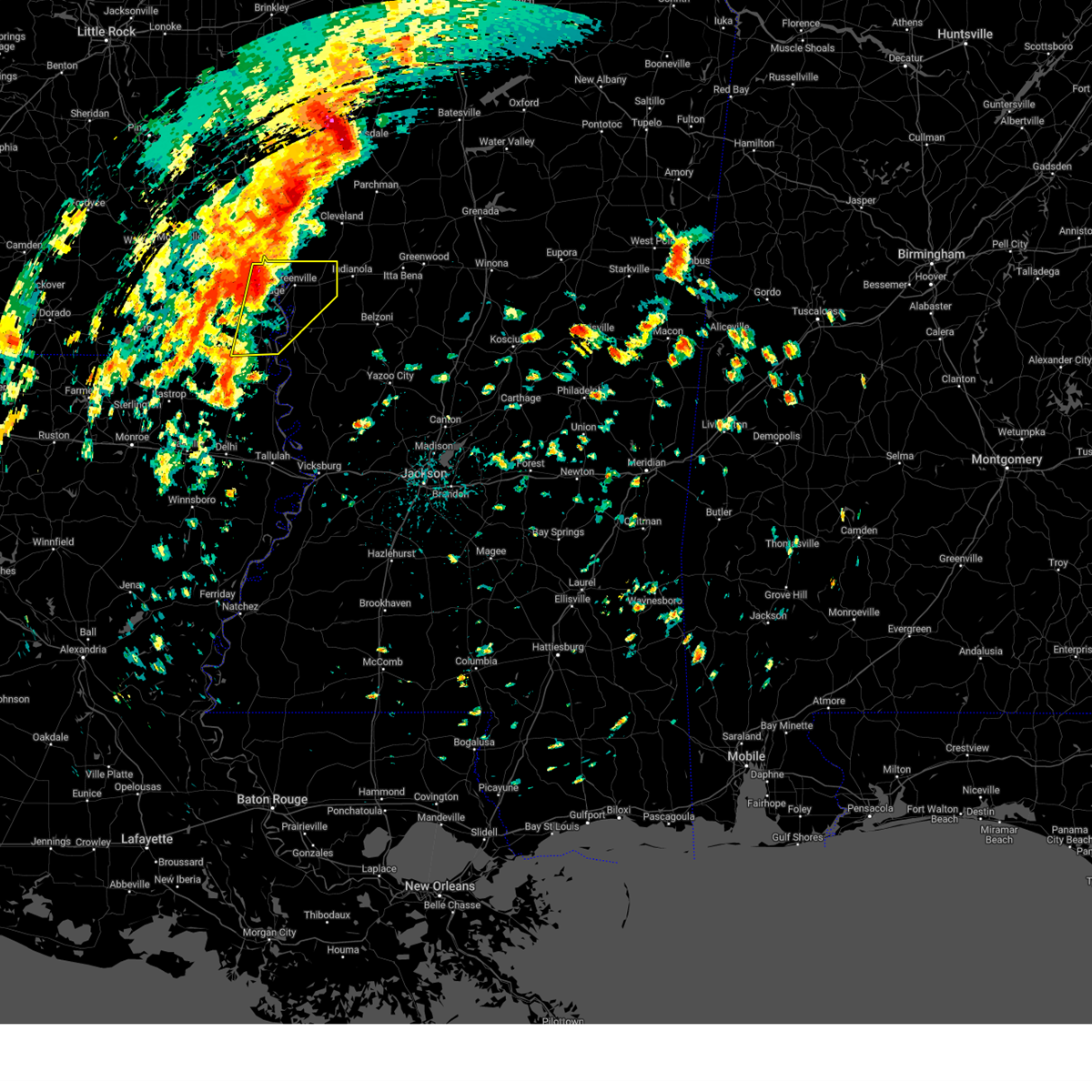
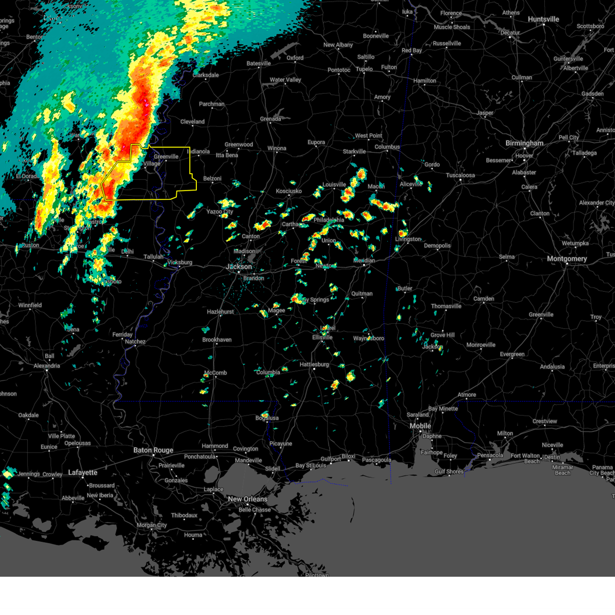
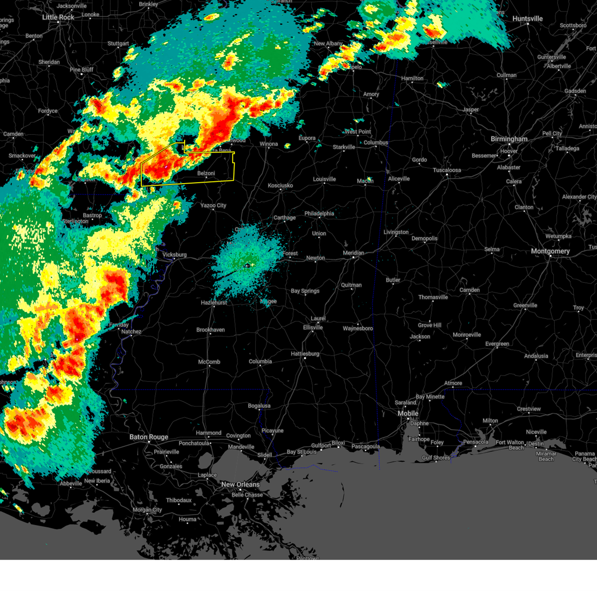
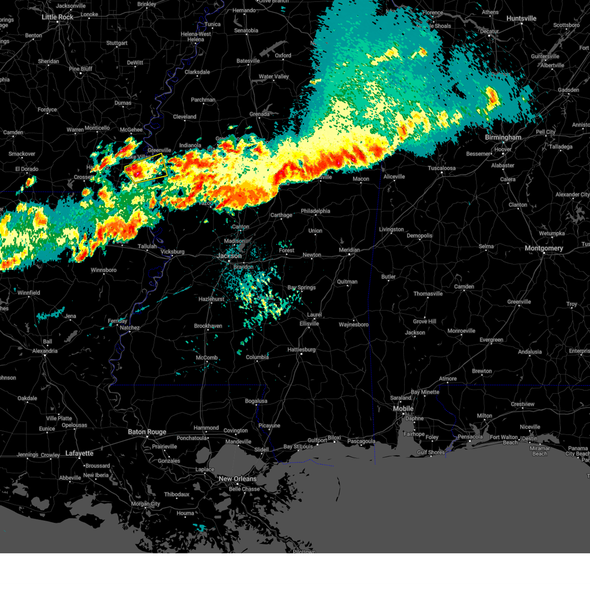
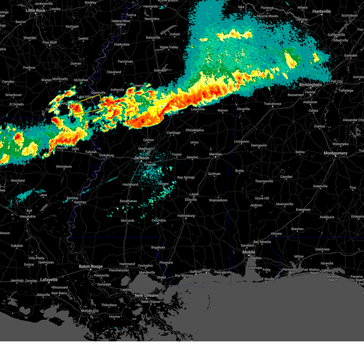
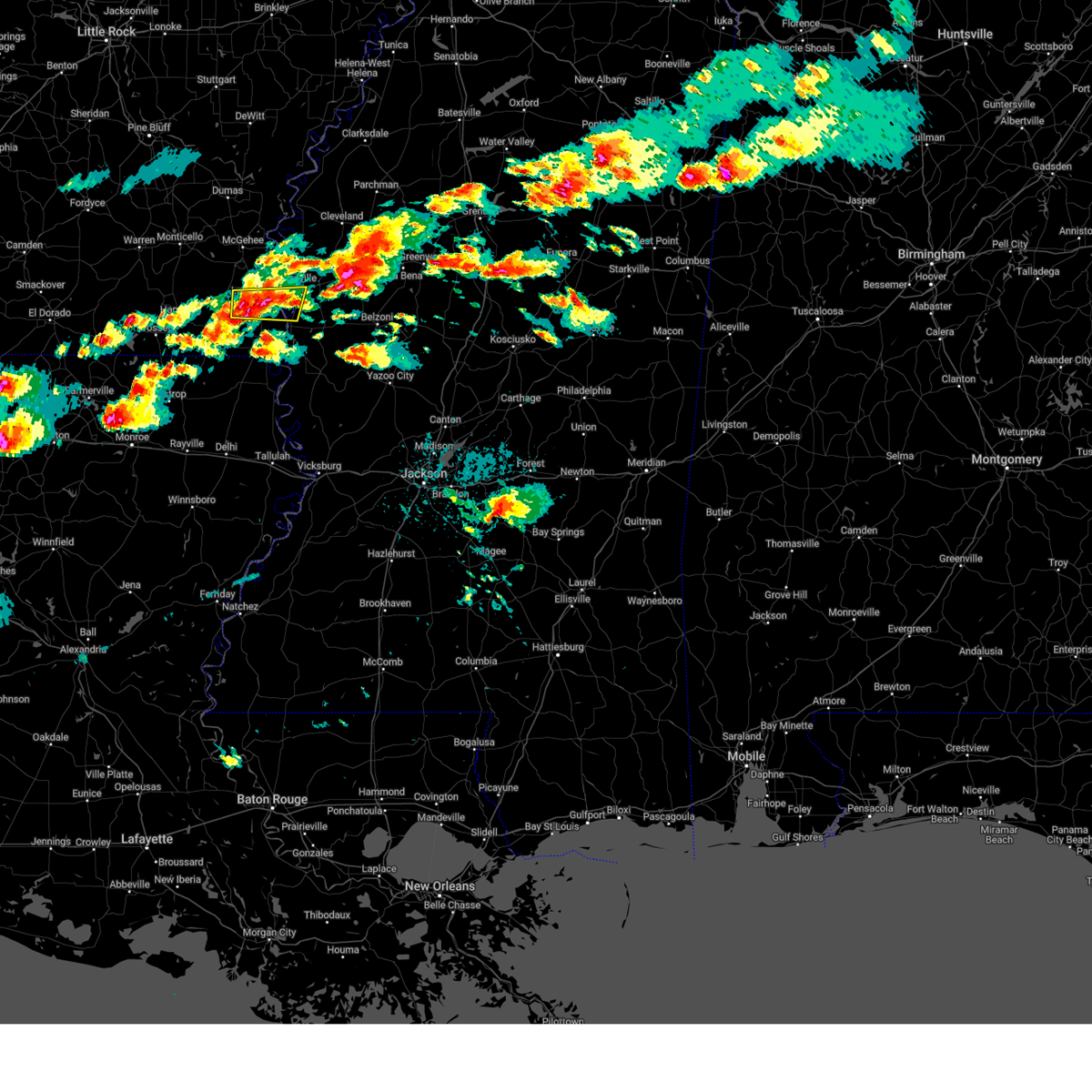
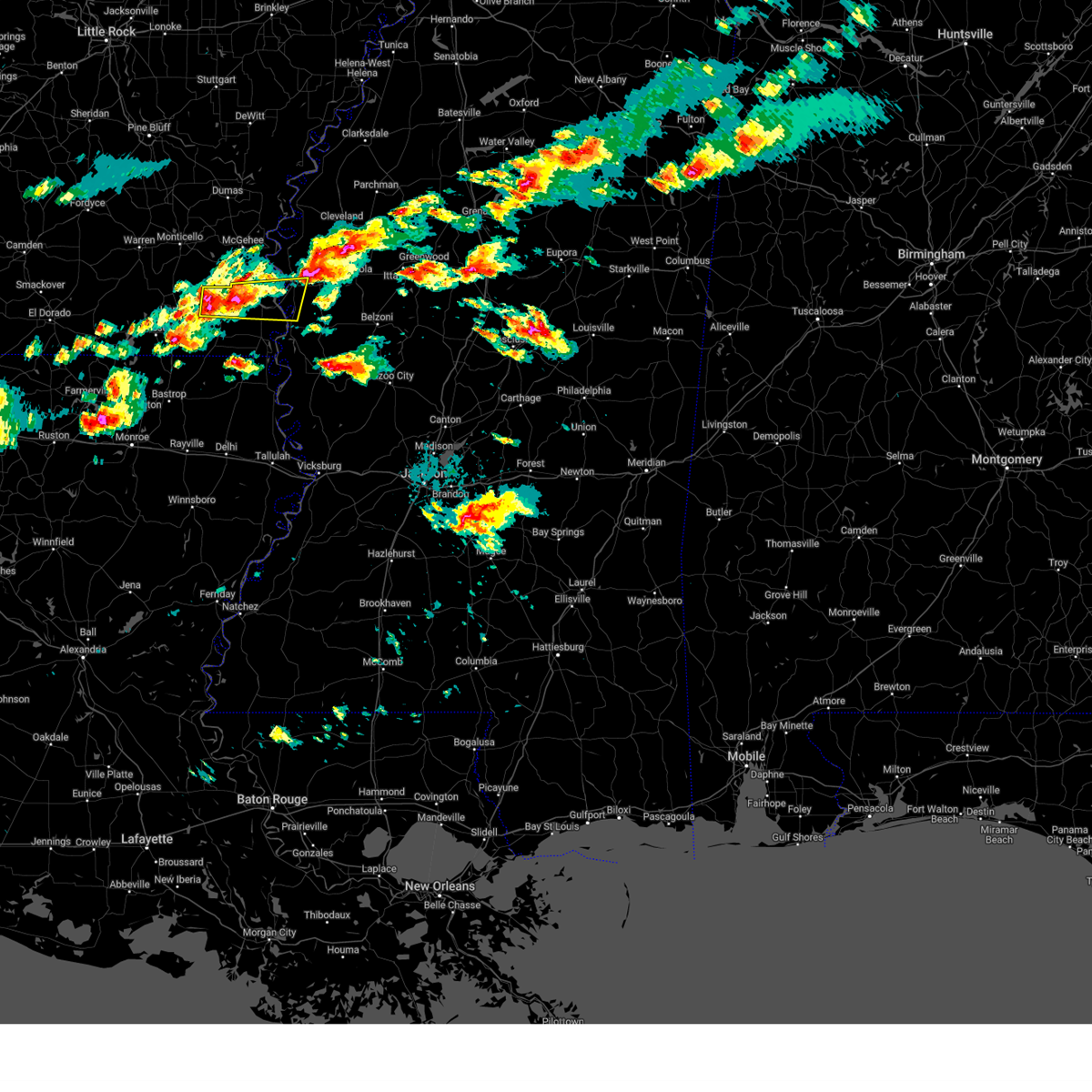
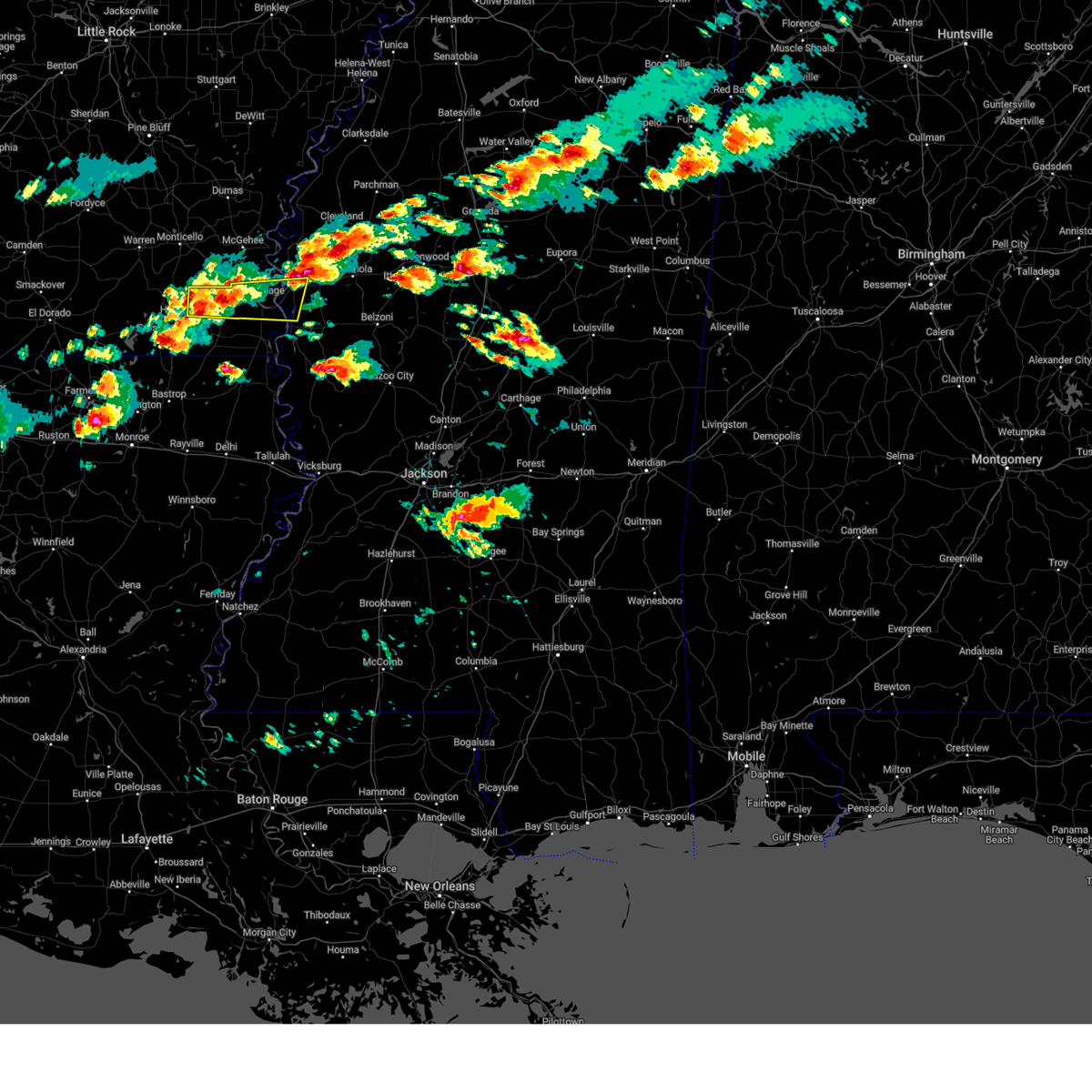
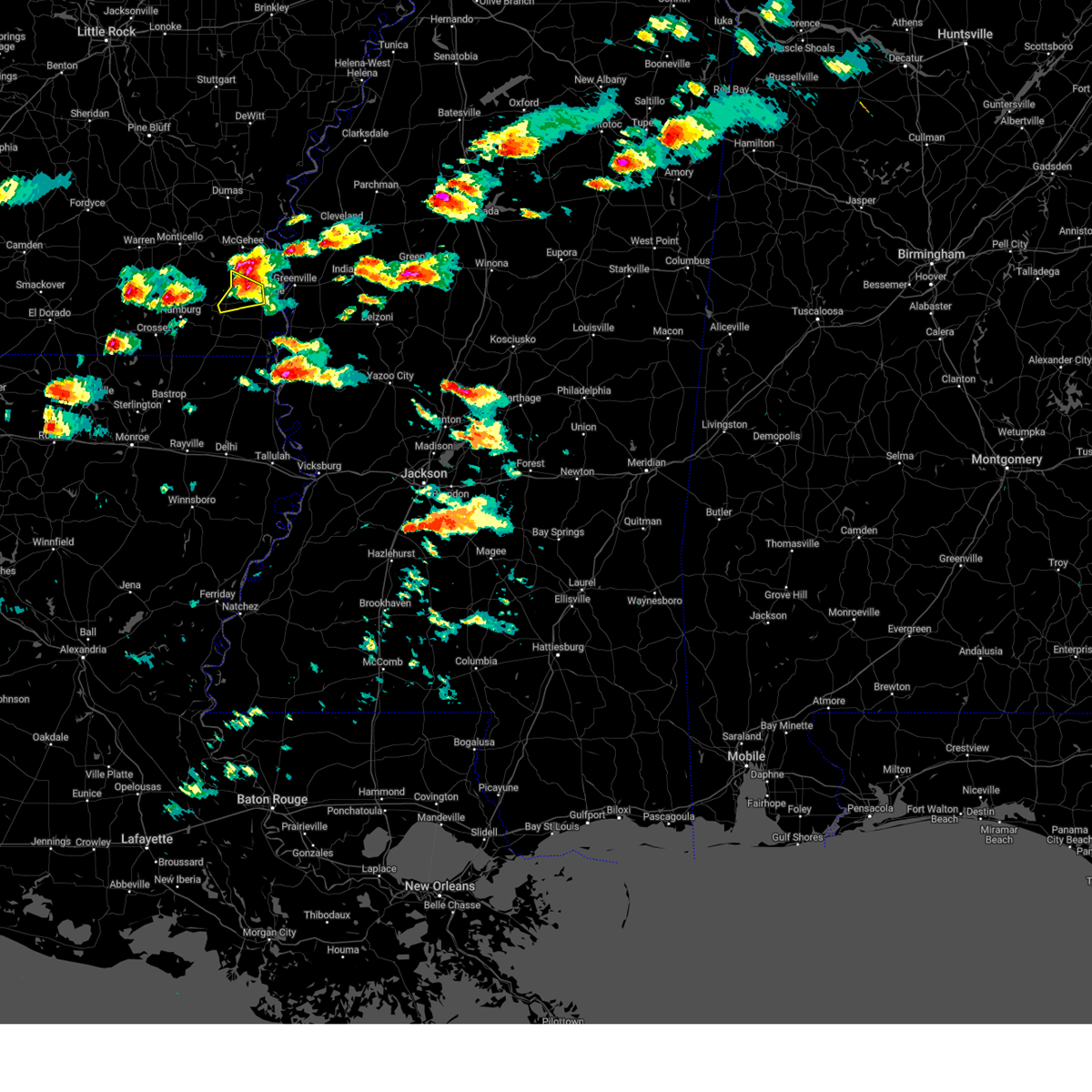
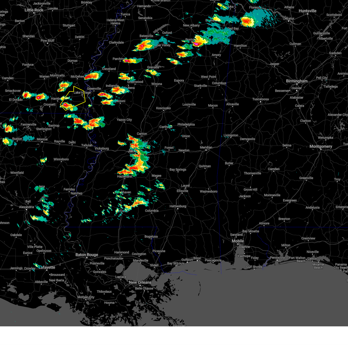
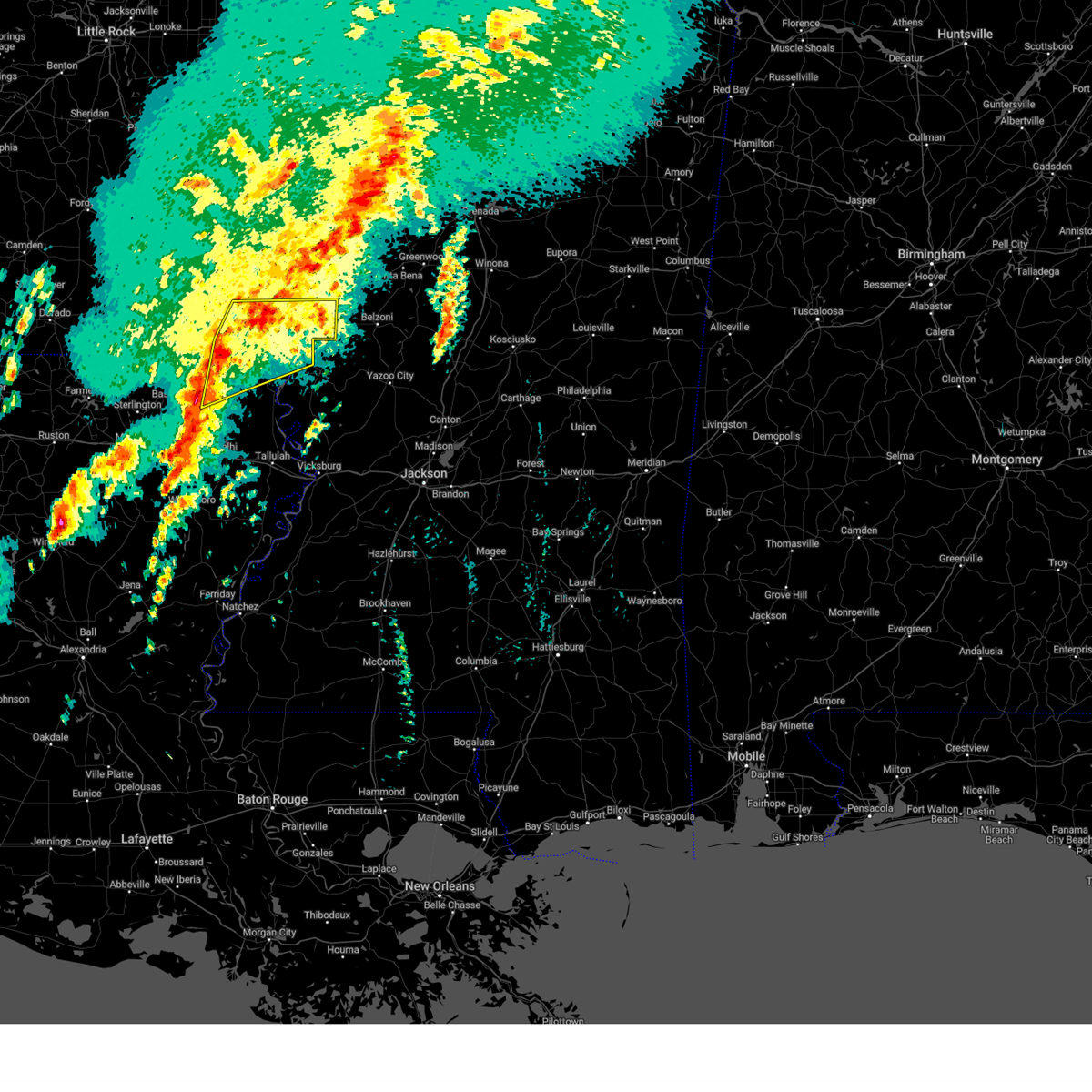
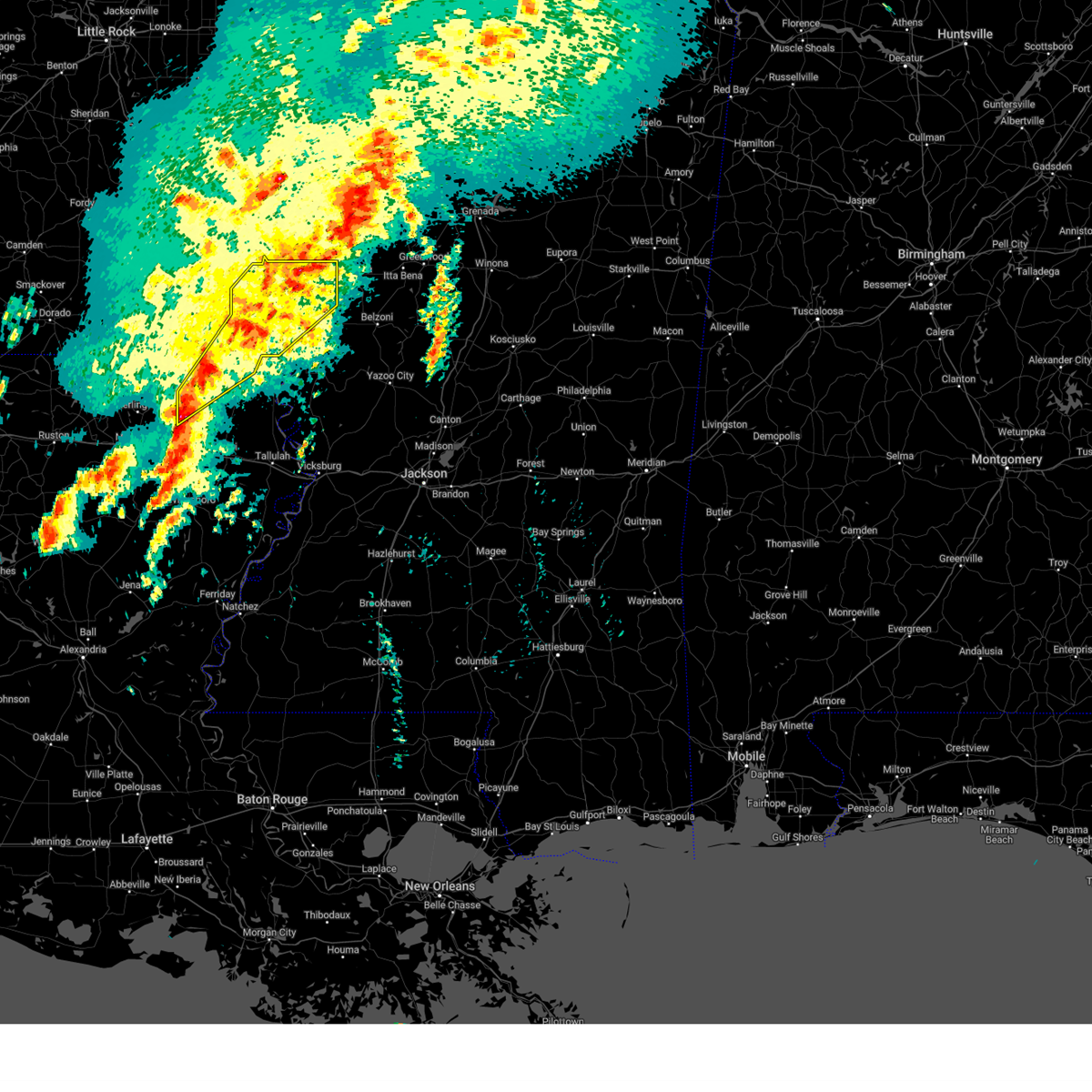
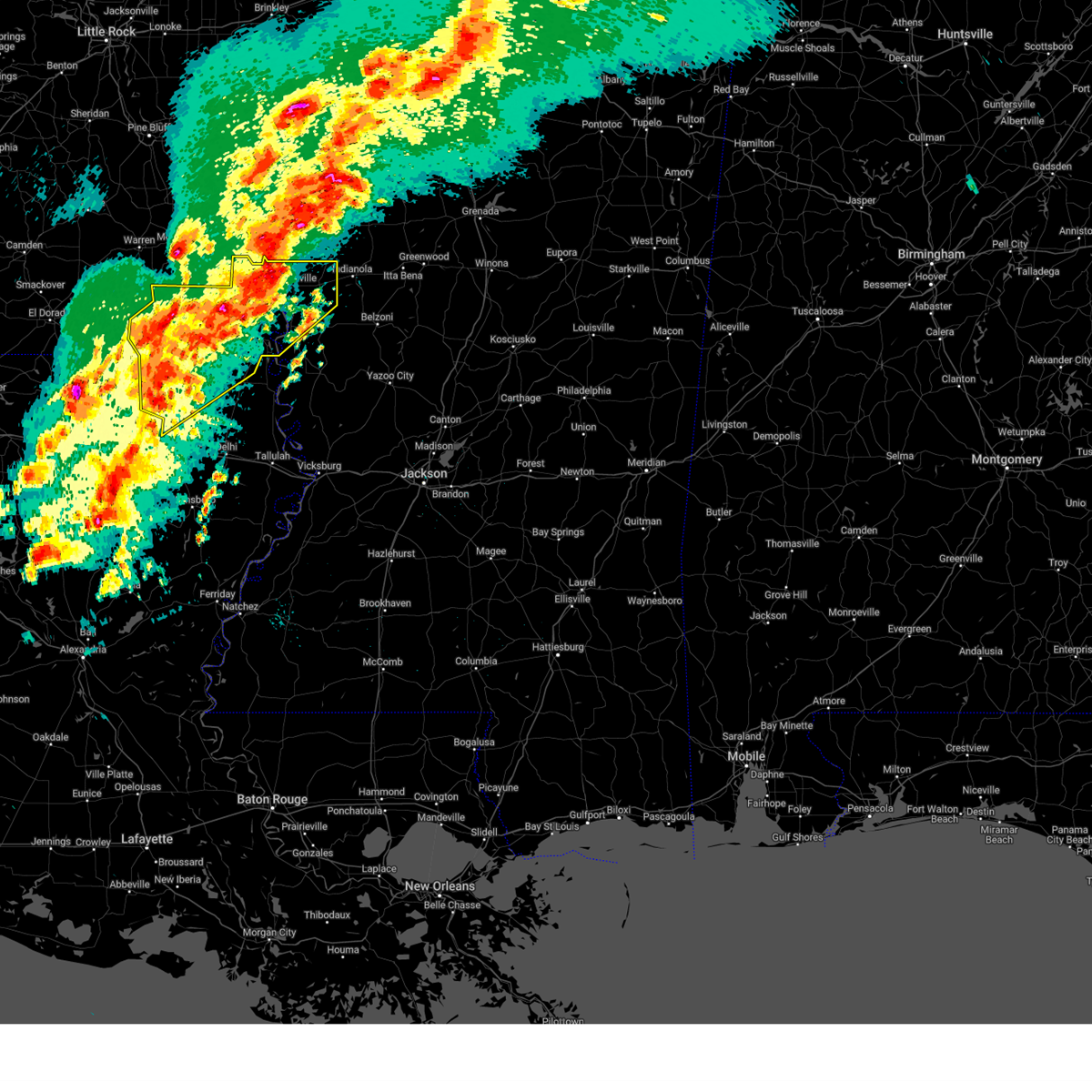
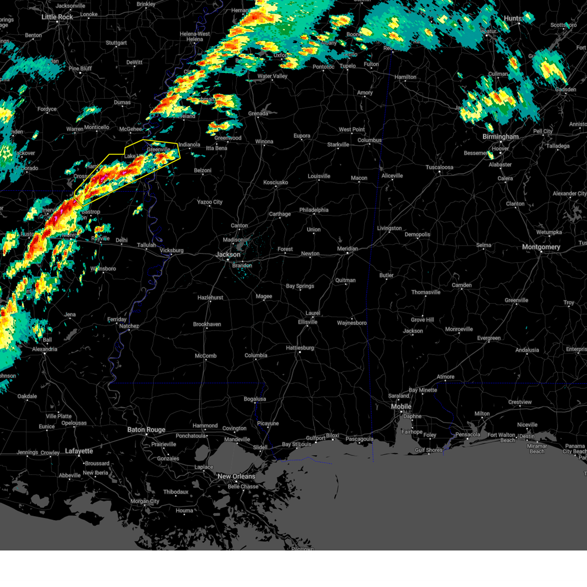
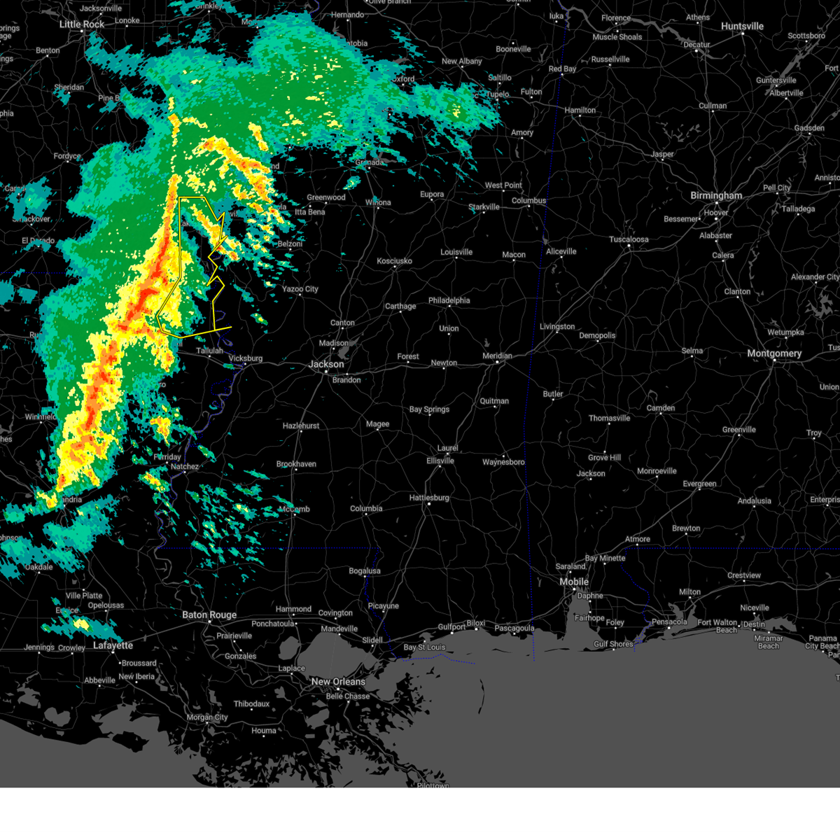
Hail Map for Lake Village, AR
The Lake Village, AR area has had 14 reports of on-the-ground hail by trained spotters, and has been under severe weather warnings 45 times during the past 12 months. Doppler radar has detected hail at or near Lake Village, AR on 59 occasions, including 7 occasions during the past year.
| Name: | Lake Village, AR |
| Where Located: | 52.7 miles NE of Bastrop, LA |
| Map: | Google Map for Lake Village, AR |
| Population: | 2575 |
| Housing Units: | 1184 |
| More Info: | Search Google for Lake Village, AR |
1
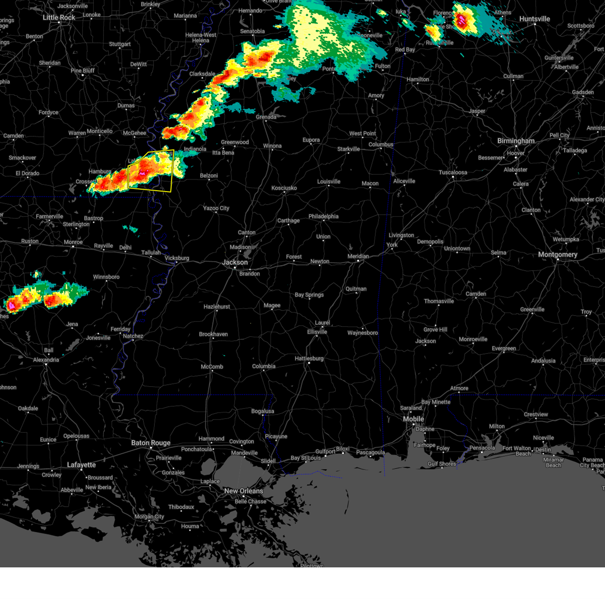
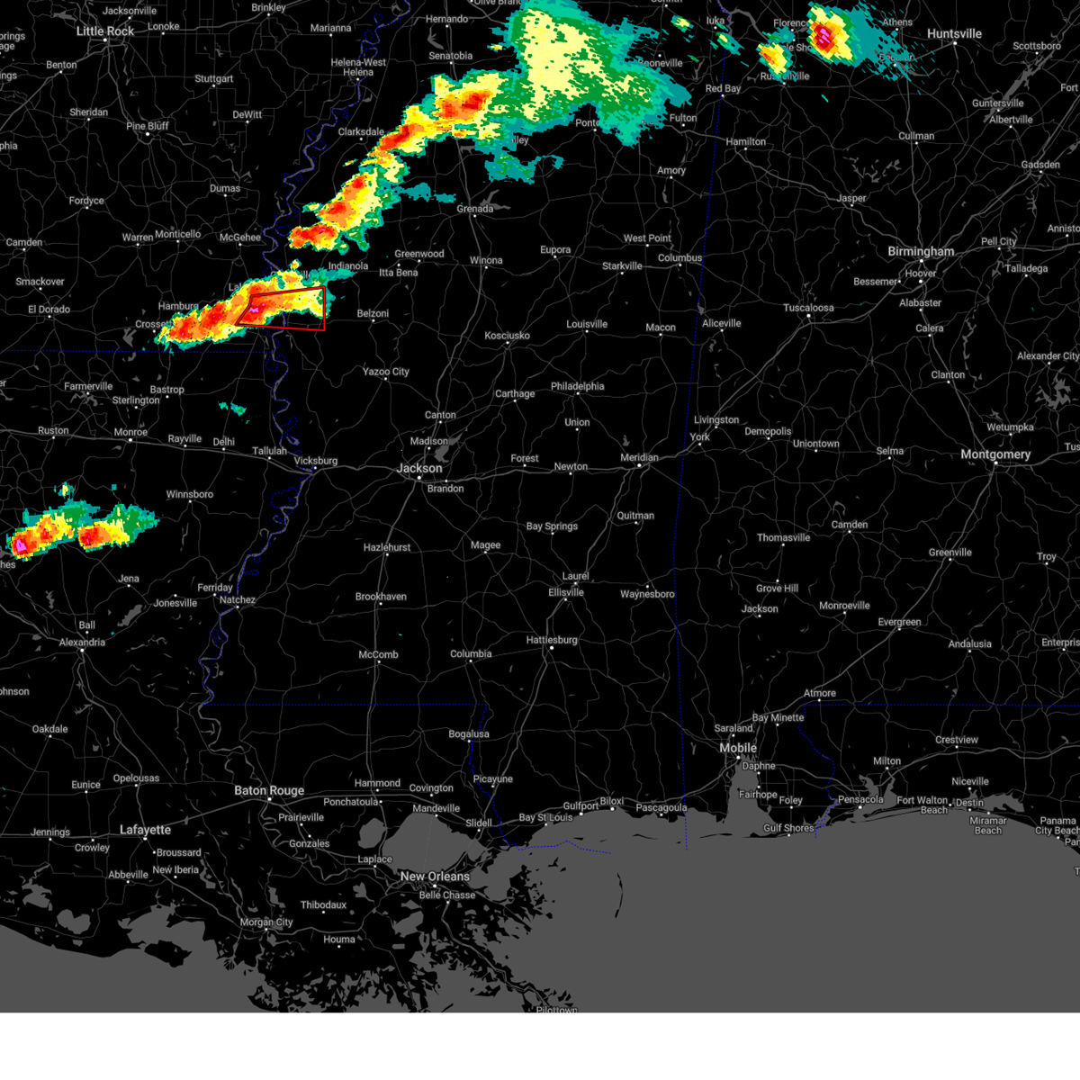
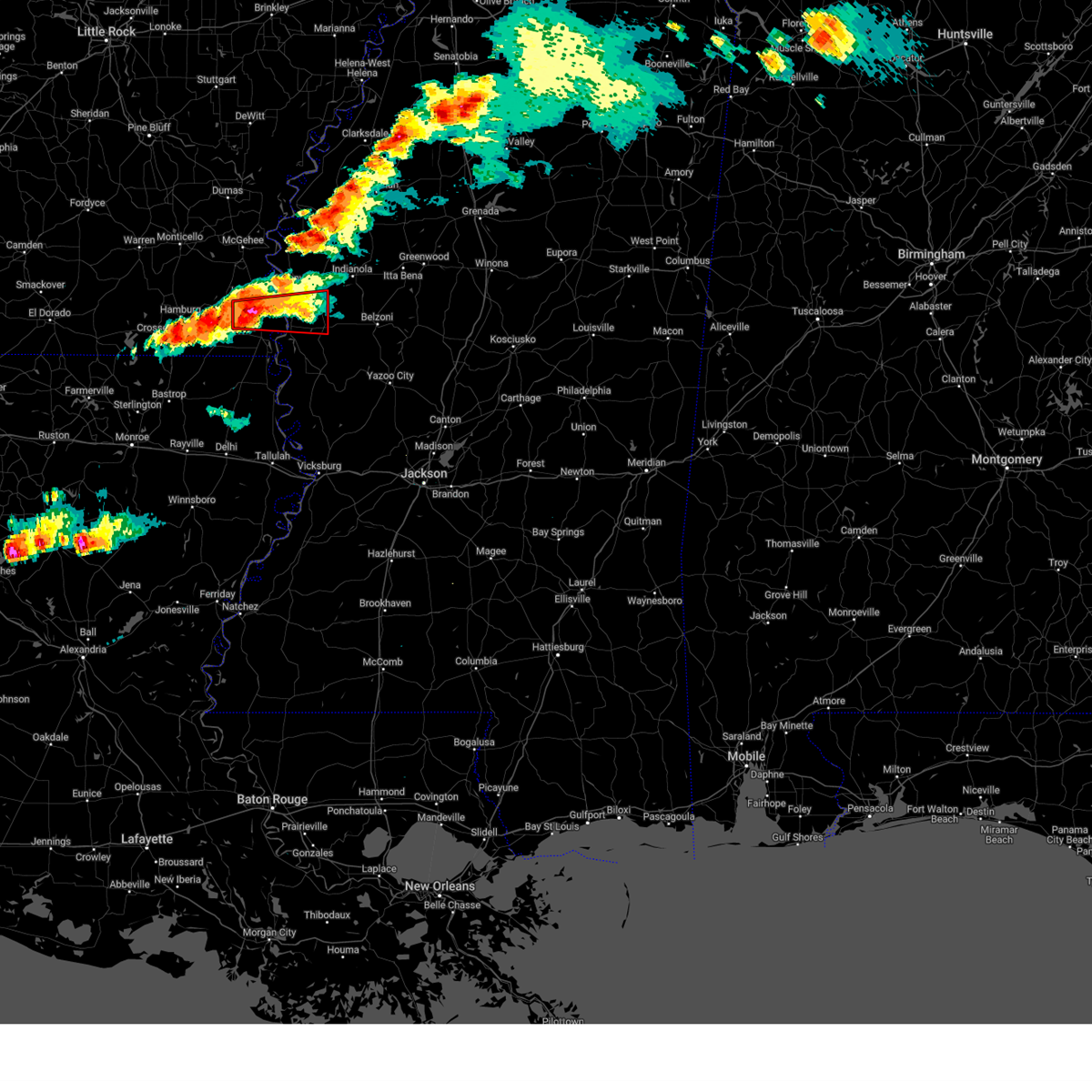
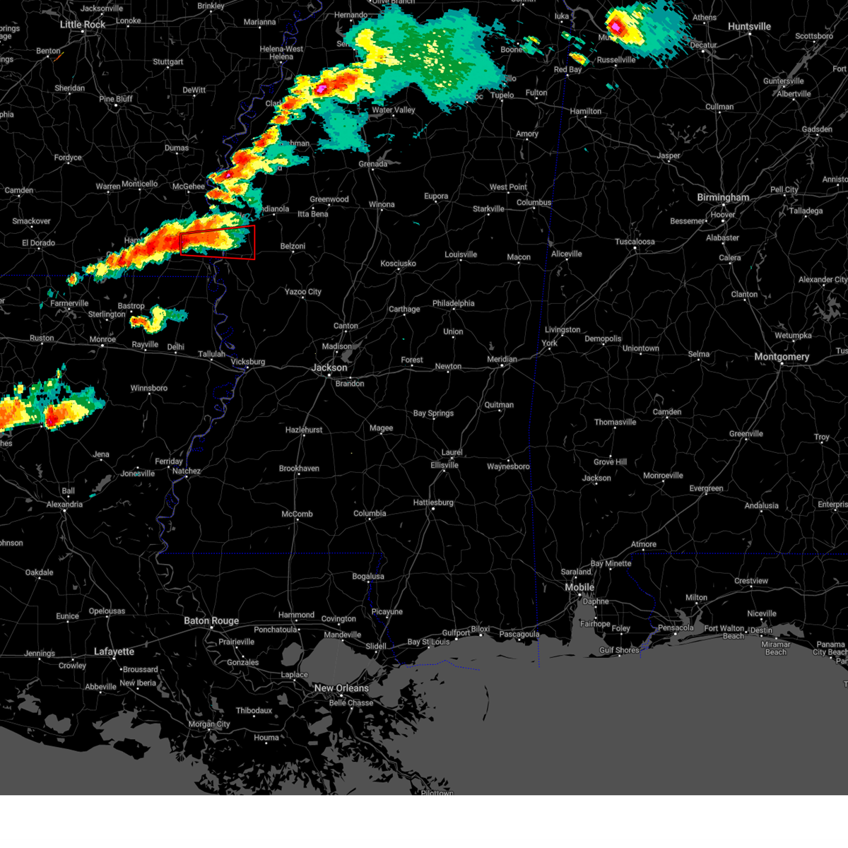
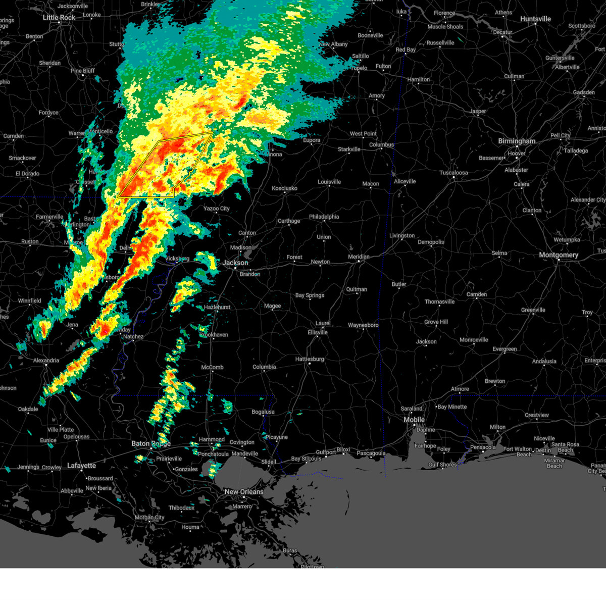
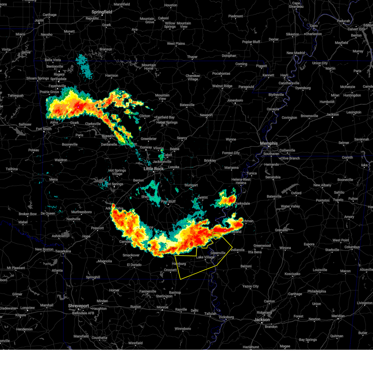
The Top Recent Hail Date for Lake Village, AR is Sunday, May 25, 2025 (12th out of 59)
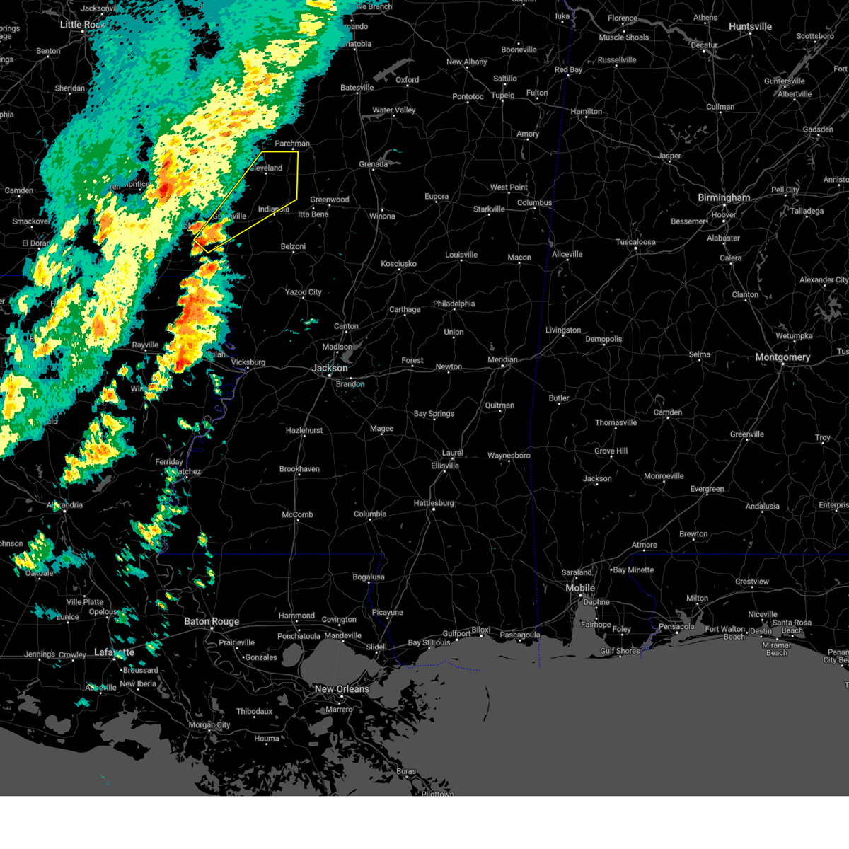
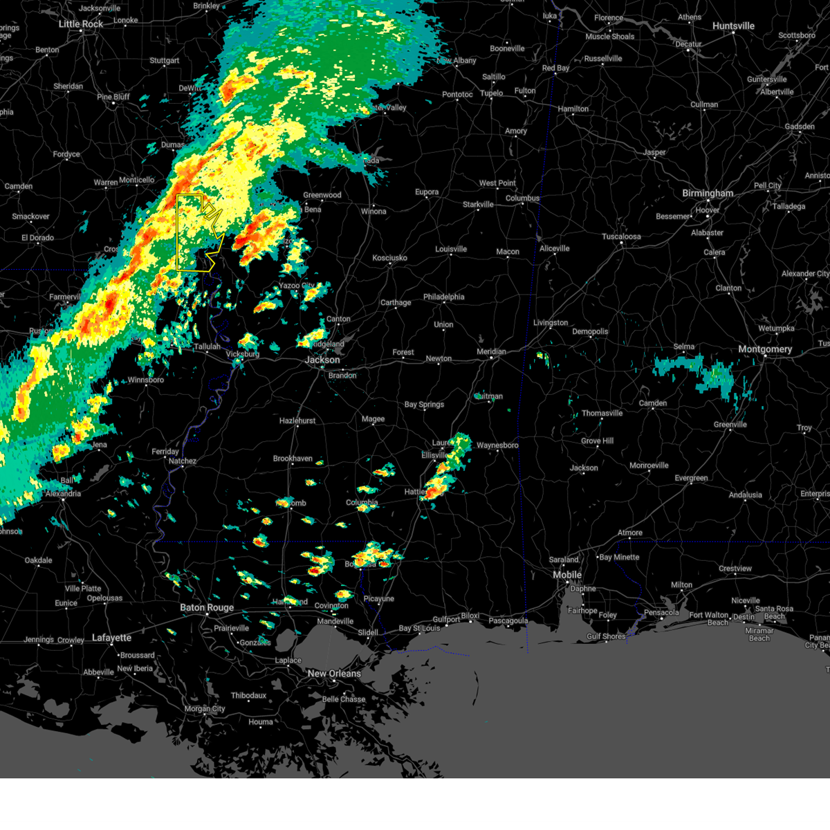
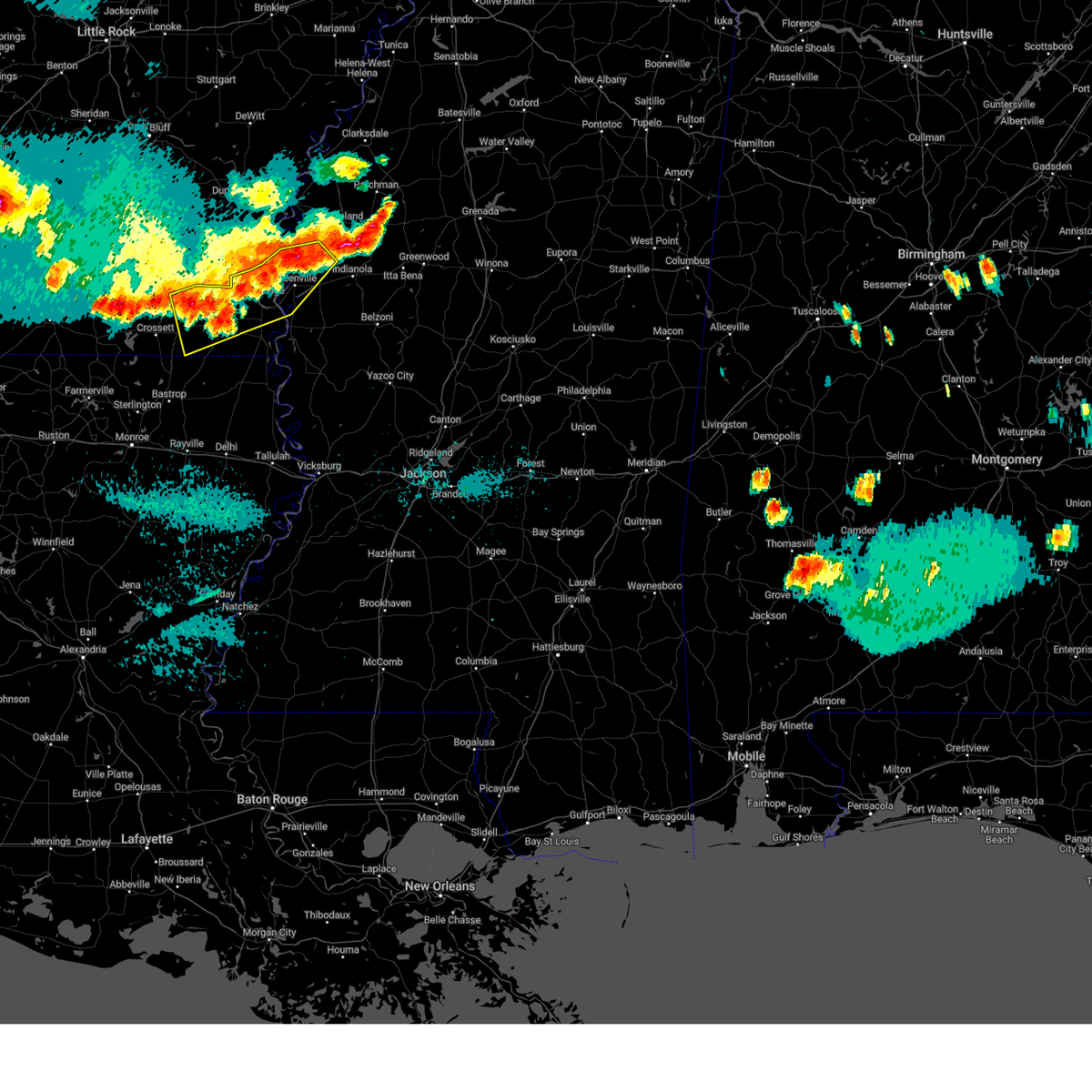
Hail and Wind Damage Spotted near Lake Village, AR
| Date / Time | Report Details |
|---|---|
| 5/25/2025 7:45 PM CDT |
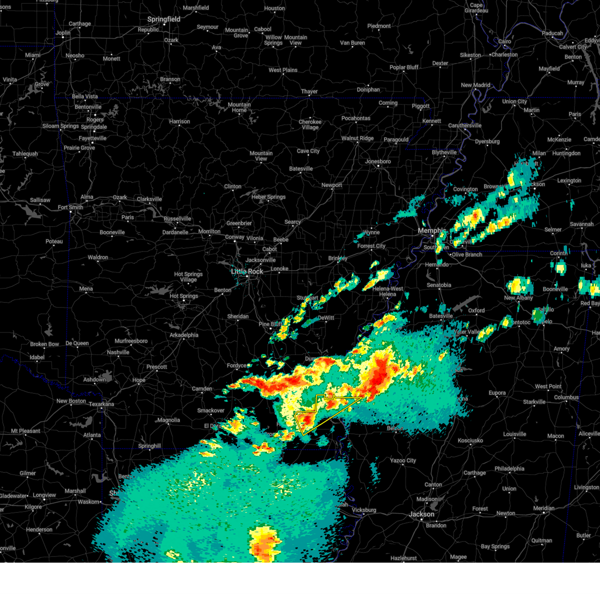
 At 744 pm cdt, severe thunderstorms were located along a line extending from near tribbett to near eudora to near crossett, moving southeast at 25 mph (trained weather spotters. at 718 pm, a 66 mph wind gust was reported at the greenville airport). Hazards include 60 mph wind gusts and half dollar size hail. Hail damage to vehicles is expected. expect wind damage to roofs, siding, and trees. Locations impacted include, greenville, crossett, leland, hamburg, hollandale, lake village, north crossett, eudora, metcalfe, wilmot, portland, arcola, montrose, glen allan, parkdale, fountain hill, darlove, wayside, estill, and old milo. At 744 pm cdt, severe thunderstorms were located along a line extending from near tribbett to near eudora to near crossett, moving southeast at 25 mph (trained weather spotters. at 718 pm, a 66 mph wind gust was reported at the greenville airport). Hazards include 60 mph wind gusts and half dollar size hail. Hail damage to vehicles is expected. expect wind damage to roofs, siding, and trees. Locations impacted include, greenville, crossett, leland, hamburg, hollandale, lake village, north crossett, eudora, metcalfe, wilmot, portland, arcola, montrose, glen allan, parkdale, fountain hill, darlove, wayside, estill, and old milo.
|
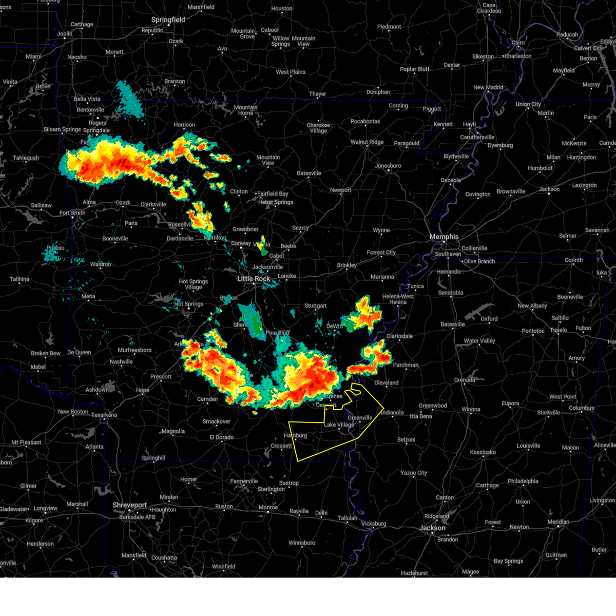
| 5/25/2025 7:04 PM CDT | Svrjan the national weather service in jackson has issued a * severe thunderstorm warning for, chicot county in southeastern arkansas, ashley county in southeastern arkansas, washington county in northwestern mississippi, * until 815 pm cdt. * at 704 pm cdt, severe thunderstorms were located along a line extending from winterville to near montrose to hamburg, moving southeast at 30 mph (radar indicated). Hazards include 60 mph wind gusts and penny size hail. expect damage to roofs, siding, and trees |
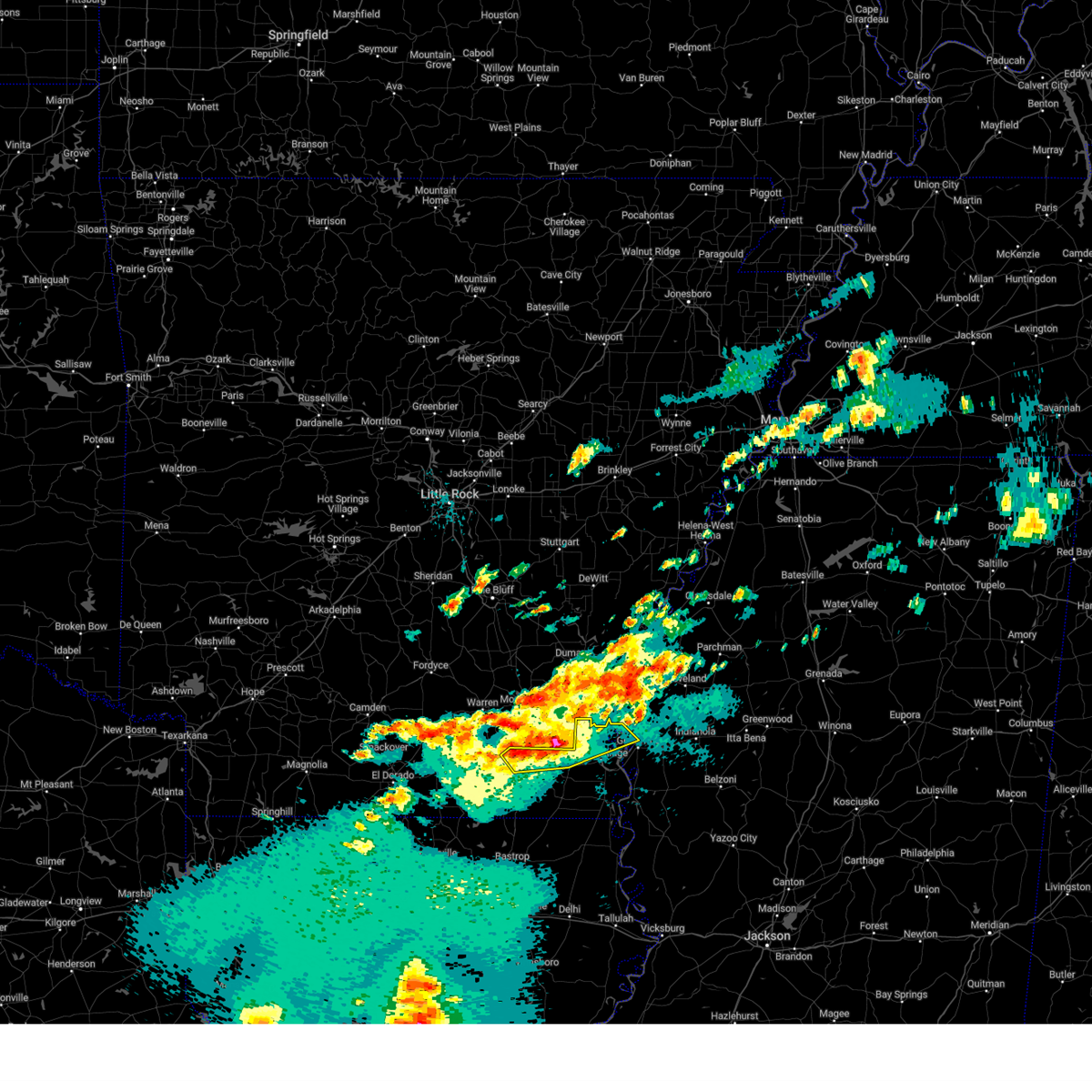
| 5/24/2025 2:07 PM CDT |
 At 207 pm cdt, a severe thunderstorm was located near mcmillan corner, or near lake village, moving east at 30 mph (radar indicated). Hazards include 60 mph wind gusts and quarter size hail. Hail damage to vehicles is expected. expect wind damage to roofs, siding, and trees. this severe storm will be near, lake village and mcmillan corner around 215 pm cdt. greenville around 225 pm cdt. Metcalfe and winterville around 240 pm cdt. At 207 pm cdt, a severe thunderstorm was located near mcmillan corner, or near lake village, moving east at 30 mph (radar indicated). Hazards include 60 mph wind gusts and quarter size hail. Hail damage to vehicles is expected. expect wind damage to roofs, siding, and trees. this severe storm will be near, lake village and mcmillan corner around 215 pm cdt. greenville around 225 pm cdt. Metcalfe and winterville around 240 pm cdt.
|
| 5/24/2025 1:55 PM CDT |
 Svrjan the national weather service in jackson has issued a * severe thunderstorm warning for, chicot county in southeastern arkansas, washington county in northwestern mississippi, * until 245 pm cdt. * at 155 pm cdt, a severe thunderstorm was located near montrose, or 11 miles south of dermott, moving east at 30 mph (radar indicated). Hazards include 60 mph wind gusts and quarter size hail. Hail damage to vehicles is expected. expect wind damage to roofs, siding, and trees. this severe thunderstorm will be near, lake village and mcmillan corner around 200 pm cdt. Greenville around 225 pm cdt. Svrjan the national weather service in jackson has issued a * severe thunderstorm warning for, chicot county in southeastern arkansas, washington county in northwestern mississippi, * until 245 pm cdt. * at 155 pm cdt, a severe thunderstorm was located near montrose, or 11 miles south of dermott, moving east at 30 mph (radar indicated). Hazards include 60 mph wind gusts and quarter size hail. Hail damage to vehicles is expected. expect wind damage to roofs, siding, and trees. this severe thunderstorm will be near, lake village and mcmillan corner around 200 pm cdt. Greenville around 225 pm cdt.
|
| 5/20/2025 5:18 PM CDT |
 At 518 pm cdt, a severe thunderstorm was located near avon, or 9 miles southeast of lake village, moving east at 50 mph (radar indicated). Hazards include golf ball size hail and 60 mph wind gusts. People and animals outdoors will be injured. expect hail damage to roofs, siding, windows, and vehicles. expect wind damage to roofs, siding, and trees. This severe storm will be near, greenville, wayside, and avon around 525 pm cdt. At 518 pm cdt, a severe thunderstorm was located near avon, or 9 miles southeast of lake village, moving east at 50 mph (radar indicated). Hazards include golf ball size hail and 60 mph wind gusts. People and animals outdoors will be injured. expect hail damage to roofs, siding, windows, and vehicles. expect wind damage to roofs, siding, and trees. This severe storm will be near, greenville, wayside, and avon around 525 pm cdt.
|
| 5/20/2025 5:17 PM CDT |
 At 517 pm cdt, a severe thunderstorm capable of producing a tornado was located near chicot junction, or 7 miles southeast of lake village, moving east at 35 mph (radar indicated rotation). Hazards include tornado and golf ball size hail. Flying debris will be dangerous to those caught without shelter. mobile homes will be damaged or destroyed. damage to roofs, windows, and vehicles will occur. tree damage is likely. this dangerous storm will be near, avon around 520 pm cdt. greenville and wayside around 525 pm cdt. Hollandale, arcola, and estill around 540 pm cdt. At 517 pm cdt, a severe thunderstorm capable of producing a tornado was located near chicot junction, or 7 miles southeast of lake village, moving east at 35 mph (radar indicated rotation). Hazards include tornado and golf ball size hail. Flying debris will be dangerous to those caught without shelter. mobile homes will be damaged or destroyed. damage to roofs, windows, and vehicles will occur. tree damage is likely. this dangerous storm will be near, avon around 520 pm cdt. greenville and wayside around 525 pm cdt. Hollandale, arcola, and estill around 540 pm cdt.
|
| 5/20/2025 5:09 PM CDT |
 At 509 pm cdt, a severe thunderstorm capable of producing a tornado was located over chicot junction, or near lake village, moving east at 35 mph (radar indicated rotation). Hazards include tornado and golf ball size hail. Flying debris will be dangerous to those caught without shelter. mobile homes will be damaged or destroyed. damage to roofs, windows, and vehicles will occur. tree damage is likely. this dangerous storm will be near, lake village and chicot junction around 515 pm cdt. avon around 520 pm cdt. greenville and wayside around 525 pm cdt. Hollandale, arcola, and estill around 540 pm cdt. At 509 pm cdt, a severe thunderstorm capable of producing a tornado was located over chicot junction, or near lake village, moving east at 35 mph (radar indicated rotation). Hazards include tornado and golf ball size hail. Flying debris will be dangerous to those caught without shelter. mobile homes will be damaged or destroyed. damage to roofs, windows, and vehicles will occur. tree damage is likely. this dangerous storm will be near, lake village and chicot junction around 515 pm cdt. avon around 520 pm cdt. greenville and wayside around 525 pm cdt. Hollandale, arcola, and estill around 540 pm cdt.
|
| 5/20/2025 5:03 PM CDT |
 Torjan the national weather service in jackson has issued a * tornado warning for, central chicot county in southeastern arkansas, central washington county in northwestern mississippi, * until 600 pm cdt. * at 503 pm cdt, a severe thunderstorm capable of producing a tornado was located near chicot junction, or 8 miles southwest of lake village, moving east at 35 mph (radar indicated rotation). Hazards include tornado. Flying debris will be dangerous to those caught without shelter. mobile homes will be damaged or destroyed. damage to roofs, windows, and vehicles will occur. tree damage is likely. this dangerous storm will be near, lake village and chicot junction around 510 pm cdt. avon around 520 pm cdt. greenville and wayside around 525 pm cdt. Hollandale, arcola, and estill around 540 pm cdt. Torjan the national weather service in jackson has issued a * tornado warning for, central chicot county in southeastern arkansas, central washington county in northwestern mississippi, * until 600 pm cdt. * at 503 pm cdt, a severe thunderstorm capable of producing a tornado was located near chicot junction, or 8 miles southwest of lake village, moving east at 35 mph (radar indicated rotation). Hazards include tornado. Flying debris will be dangerous to those caught without shelter. mobile homes will be damaged or destroyed. damage to roofs, windows, and vehicles will occur. tree damage is likely. this dangerous storm will be near, lake village and chicot junction around 510 pm cdt. avon around 520 pm cdt. greenville and wayside around 525 pm cdt. Hollandale, arcola, and estill around 540 pm cdt.
|
| 5/20/2025 4:44 PM CDT |
 At 444 pm cdt, a severe thunderstorm was located near montrose, or 8 miles west of lake village, moving east at 30 mph (radar indicated). Hazards include 60 mph wind gusts and quarter size hail. Hail damage to vehicles is expected. expect wind damage to roofs, siding, and trees. this severe storm will be near, lake village and mcmillan corner around 450 pm cdt. chicot junction around 455 pm cdt. greenville around 505 pm cdt. wayside around 515 pm cdt. Avon around 520 pm cdt. At 444 pm cdt, a severe thunderstorm was located near montrose, or 8 miles west of lake village, moving east at 30 mph (radar indicated). Hazards include 60 mph wind gusts and quarter size hail. Hail damage to vehicles is expected. expect wind damage to roofs, siding, and trees. this severe storm will be near, lake village and mcmillan corner around 450 pm cdt. chicot junction around 455 pm cdt. greenville around 505 pm cdt. wayside around 515 pm cdt. Avon around 520 pm cdt.
|
| 5/20/2025 4:34 PM CDT |
 Svrjan the national weather service in jackson has issued a * severe thunderstorm warning for, chicot county in southeastern arkansas, western washington county in northwestern mississippi, * until 545 pm cdt. * at 434 pm cdt, a severe thunderstorm was located over montrose, or 13 miles west of lake village, moving east at 30 mph (radar indicated). Hazards include 60 mph wind gusts and quarter size hail. Hail damage to vehicles is expected. expect wind damage to roofs, siding, and trees. this severe thunderstorm will be near, lake village around 445 pm cdt. mcmillan corner around 450 pm cdt. chicot junction around 455 pm cdt. greenville around 510 pm cdt. wayside around 515 pm cdt. Avon around 520 pm cdt. Svrjan the national weather service in jackson has issued a * severe thunderstorm warning for, chicot county in southeastern arkansas, western washington county in northwestern mississippi, * until 545 pm cdt. * at 434 pm cdt, a severe thunderstorm was located over montrose, or 13 miles west of lake village, moving east at 30 mph (radar indicated). Hazards include 60 mph wind gusts and quarter size hail. Hail damage to vehicles is expected. expect wind damage to roofs, siding, and trees. this severe thunderstorm will be near, lake village around 445 pm cdt. mcmillan corner around 450 pm cdt. chicot junction around 455 pm cdt. greenville around 510 pm cdt. wayside around 515 pm cdt. Avon around 520 pm cdt.
|
| 5/20/2025 4:29 PM CDT |
 the tornado warning has been cancelled and is no longer in effect the tornado warning has been cancelled and is no longer in effect
|
| 5/20/2025 4:10 PM CDT |
 Torjan the national weather service in jackson has issued a * tornado warning for, west central chicot county in southeastern arkansas, northeastern ashley county in southeastern arkansas, * until 515 pm cdt. * at 410 pm cdt, a severe thunderstorm capable of producing a tornado was located near hamburg, moving east at 30 mph (radar indicated rotation). Hazards include tornado. Flying debris will be dangerous to those caught without shelter. mobile homes will be damaged or destroyed. damage to roofs, windows, and vehicles will occur. tree damage is likely. this dangerous storm will be near, snyder around 415 pm cdt. portland around 425 pm cdt. montrose around 430 pm cdt. lake village around 450 pm cdt. Mcmillan corner around 500 pm cdt. Torjan the national weather service in jackson has issued a * tornado warning for, west central chicot county in southeastern arkansas, northeastern ashley county in southeastern arkansas, * until 515 pm cdt. * at 410 pm cdt, a severe thunderstorm capable of producing a tornado was located near hamburg, moving east at 30 mph (radar indicated rotation). Hazards include tornado. Flying debris will be dangerous to those caught without shelter. mobile homes will be damaged or destroyed. damage to roofs, windows, and vehicles will occur. tree damage is likely. this dangerous storm will be near, snyder around 415 pm cdt. portland around 425 pm cdt. montrose around 430 pm cdt. lake village around 450 pm cdt. Mcmillan corner around 500 pm cdt.
|
| 4/5/2025 3:51 PM CDT |
 The storm which prompted the warning has moved out of the area. therefore, the warning will be allowed to expire. a tornado watch remains in effect until 700 pm cdt for southeastern arkansas, and northwestern mississippi. The storm which prompted the warning has moved out of the area. therefore, the warning will be allowed to expire. a tornado watch remains in effect until 700 pm cdt for southeastern arkansas, and northwestern mississippi.
|
| 4/5/2025 3:20 PM CDT |
 At 319 pm cdt, a severe thunderstorm was located near leland, moving northeast at 55 mph (radar indicated). Hazards include 60 mph wind gusts and quarter size hail. Hail damage to vehicles is expected. expect wind damage to roofs, siding, and trees. This severe thunderstorm will remain over mainly rural areas of chicot and washington counties. At 319 pm cdt, a severe thunderstorm was located near leland, moving northeast at 55 mph (radar indicated). Hazards include 60 mph wind gusts and quarter size hail. Hail damage to vehicles is expected. expect wind damage to roofs, siding, and trees. This severe thunderstorm will remain over mainly rural areas of chicot and washington counties.
|
| 4/5/2025 3:20 PM CDT |
 the severe thunderstorm warning has been cancelled and is no longer in effect the severe thunderstorm warning has been cancelled and is no longer in effect
|
| 4/5/2025 3:15 PM CDT | Power line dow in chicot county AR, 10.6 miles SSW of Lake Village, AR |
| 4/5/2025 2:57 PM CDT | At 257 pm cdt, a severe thunderstorm was located near lake village, moving northeast at 55 mph (radar indicated). Hazards include 60 mph wind gusts and quarter size hail. Hail damage to vehicles is expected. expect wind damage to roofs, siding, and trees. this severe storm will be near, greenville around 300 pm cdt. metcalfe and winterville around 305 pm cdt. Leland around 310 pm cdt. |
| 4/5/2025 2:26 PM CDT |
 Svrjan the national weather service in jackson has issued a * severe thunderstorm warning for, chicot county in southeastern arkansas, eastern ashley county in southeastern arkansas, washington county in northwestern mississippi, * until 400 pm cdt. * at 226 pm cdt, a severe thunderstorm was located near parkdale, or 10 miles southeast of hamburg, moving northeast at 55 mph (radar indicated). Hazards include 60 mph wind gusts and quarter size hail. Hail damage to vehicles is expected. expect wind damage to roofs, siding, and trees. this severe thunderstorm will be near, parkdale, wilmot, and portland around 230 pm cdt. montrose around 235 pm cdt. chicot junction, mcmillan corner, and lake village around 245 pm cdt. greenville around 255 pm cdt. metcalfe and winterville around 305 pm cdt. Leland around 310 pm cdt. Svrjan the national weather service in jackson has issued a * severe thunderstorm warning for, chicot county in southeastern arkansas, eastern ashley county in southeastern arkansas, washington county in northwestern mississippi, * until 400 pm cdt. * at 226 pm cdt, a severe thunderstorm was located near parkdale, or 10 miles southeast of hamburg, moving northeast at 55 mph (radar indicated). Hazards include 60 mph wind gusts and quarter size hail. Hail damage to vehicles is expected. expect wind damage to roofs, siding, and trees. this severe thunderstorm will be near, parkdale, wilmot, and portland around 230 pm cdt. montrose around 235 pm cdt. chicot junction, mcmillan corner, and lake village around 245 pm cdt. greenville around 255 pm cdt. metcalfe and winterville around 305 pm cdt. Leland around 310 pm cdt.
|
| 3/31/2025 3:34 AM CDT |
 Svrjan the national weather service in jackson has issued a * severe thunderstorm warning for, southeastern chicot county in southeastern arkansas, southern sunflower county in northwestern mississippi, northwestern holmes county in central mississippi, southern leflore county in north central mississippi, washington county in northwestern mississippi, northern humphreys county in central mississippi, * until 430 am cdt. * at 334 am cdt, a severe thunderstorm was located over avon, or 10 miles south of greenville, moving east at 40 mph (radar indicated). Hazards include 60 mph wind gusts and quarter size hail. Hail damage to vehicles is expected. expect wind damage to roofs, siding, and trees. this severe thunderstorm will be near, arcola, estill, hollandale, and greenville around 340 am cdt. darlove, tribbett, and leland around 345 am cdt. inverness and indianola around 400 am cdt. isola around 405 am cdt. Swiftown around 415 am cdt. Svrjan the national weather service in jackson has issued a * severe thunderstorm warning for, southeastern chicot county in southeastern arkansas, southern sunflower county in northwestern mississippi, northwestern holmes county in central mississippi, southern leflore county in north central mississippi, washington county in northwestern mississippi, northern humphreys county in central mississippi, * until 430 am cdt. * at 334 am cdt, a severe thunderstorm was located over avon, or 10 miles south of greenville, moving east at 40 mph (radar indicated). Hazards include 60 mph wind gusts and quarter size hail. Hail damage to vehicles is expected. expect wind damage to roofs, siding, and trees. this severe thunderstorm will be near, arcola, estill, hollandale, and greenville around 340 am cdt. darlove, tribbett, and leland around 345 am cdt. inverness and indianola around 400 am cdt. isola around 405 am cdt. Swiftown around 415 am cdt.
|
| 3/31/2025 2:55 AM CDT |
 Svrjan the national weather service in jackson has issued a * severe thunderstorm warning for, northern chicot county in southeastern arkansas, northeastern ashley county in southeastern arkansas, northwestern washington county in northwestern mississippi, * until 345 am cdt. * at 255 am cdt, a severe thunderstorm was located near montrose, or 14 miles southwest of dermott, moving northeast at 40 mph (radar indicated). Hazards include 60 mph wind gusts and quarter size hail. Hail damage to vehicles is expected. expect wind damage to roofs, siding, and trees. this severe thunderstorm will be near, mcmillan corner around 305 am cdt. lake village around 310 am cdt. Winterville around 330 am cdt. Svrjan the national weather service in jackson has issued a * severe thunderstorm warning for, northern chicot county in southeastern arkansas, northeastern ashley county in southeastern arkansas, northwestern washington county in northwestern mississippi, * until 345 am cdt. * at 255 am cdt, a severe thunderstorm was located near montrose, or 14 miles southwest of dermott, moving northeast at 40 mph (radar indicated). Hazards include 60 mph wind gusts and quarter size hail. Hail damage to vehicles is expected. expect wind damage to roofs, siding, and trees. this severe thunderstorm will be near, mcmillan corner around 305 am cdt. lake village around 310 am cdt. Winterville around 330 am cdt.
|
| 3/31/2025 2:16 AM CDT |
 At 215 am cdt, a severe thunderstorm was located near fountain hill, moving northeast at 30 mph (radar indicated). Hazards include 60 mph wind gusts and quarter size hail. Hail damage to vehicles is expected. expect wind damage to roofs, siding, and trees. This severe storm will be near, dermott around 220 am cdt. At 215 am cdt, a severe thunderstorm was located near fountain hill, moving northeast at 30 mph (radar indicated). Hazards include 60 mph wind gusts and quarter size hail. Hail damage to vehicles is expected. expect wind damage to roofs, siding, and trees. This severe storm will be near, dermott around 220 am cdt.
|
| 3/31/2025 1:38 AM CDT |
 Svrjan the national weather service in jackson has issued a * severe thunderstorm warning for, northern chicot county in southeastern arkansas, northeastern ashley county in southeastern arkansas, northwestern washington county in northwestern mississippi, * until 245 am cdt. * at 138 am cdt, a severe thunderstorm was located near fountain hill, or near hamburg, moving northeast at 30 mph (radar indicated). Hazards include 60 mph wind gusts and quarter size hail. Hail damage to vehicles is expected. expect wind damage to roofs, siding, and trees. this severe thunderstorm will be near, snyder around 145 am cdt. Dermott around 210 am cdt. Svrjan the national weather service in jackson has issued a * severe thunderstorm warning for, northern chicot county in southeastern arkansas, northeastern ashley county in southeastern arkansas, northwestern washington county in northwestern mississippi, * until 245 am cdt. * at 138 am cdt, a severe thunderstorm was located near fountain hill, or near hamburg, moving northeast at 30 mph (radar indicated). Hazards include 60 mph wind gusts and quarter size hail. Hail damage to vehicles is expected. expect wind damage to roofs, siding, and trees. this severe thunderstorm will be near, snyder around 145 am cdt. Dermott around 210 am cdt.
|
| 3/23/2025 11:19 PM CDT |
 the severe thunderstorm warning has been cancelled and is no longer in effect the severe thunderstorm warning has been cancelled and is no longer in effect
|
| 3/23/2025 11:10 PM CDT |
 the severe thunderstorm warning has been cancelled and is no longer in effect the severe thunderstorm warning has been cancelled and is no longer in effect
|
| 3/23/2025 11:10 PM CDT |
 At 1110 pm cdt, a severe thunderstorm was located near chicot junction, or 7 miles south of lake village, moving east at 30 mph (radar indicated). Hazards include 60 mph wind gusts and quarter size hail. Hail damage to vehicles is expected. expect wind damage to roofs, siding, and trees. this severe storm will be near, chicot junction and lake village around 1115 pm cdt. Wayside, avon, and greenville around 1125 pm cdt. At 1110 pm cdt, a severe thunderstorm was located near chicot junction, or 7 miles south of lake village, moving east at 30 mph (radar indicated). Hazards include 60 mph wind gusts and quarter size hail. Hail damage to vehicles is expected. expect wind damage to roofs, siding, and trees. this severe storm will be near, chicot junction and lake village around 1115 pm cdt. Wayside, avon, and greenville around 1125 pm cdt.
|
| 3/23/2025 10:52 PM CDT |
 Svrjan the national weather service in jackson has issued a * severe thunderstorm warning for, central chicot county in southeastern arkansas, east central ashley county in southeastern arkansas, west central washington county in northwestern mississippi, * until 1145 pm cdt. * at 1052 pm cdt, a severe thunderstorm was located near portland, or 15 miles southwest of lake village, moving east at 30 mph (radar indicated). Hazards include 60 mph wind gusts and quarter size hail. Hail damage to vehicles is expected. expect wind damage to roofs, siding, and trees. this severe thunderstorm will be near, chicot junction around 1100 pm cdt. eudora and lake village around 1105 pm cdt. Wayside, avon, and greenville around 1125 pm cdt. Svrjan the national weather service in jackson has issued a * severe thunderstorm warning for, central chicot county in southeastern arkansas, east central ashley county in southeastern arkansas, west central washington county in northwestern mississippi, * until 1145 pm cdt. * at 1052 pm cdt, a severe thunderstorm was located near portland, or 15 miles southwest of lake village, moving east at 30 mph (radar indicated). Hazards include 60 mph wind gusts and quarter size hail. Hail damage to vehicles is expected. expect wind damage to roofs, siding, and trees. this severe thunderstorm will be near, chicot junction around 1100 pm cdt. eudora and lake village around 1105 pm cdt. Wayside, avon, and greenville around 1125 pm cdt.
|
| 3/23/2025 7:55 PM CDT |
 the severe thunderstorm warning has been cancelled and is no longer in effect the severe thunderstorm warning has been cancelled and is no longer in effect
|
| 3/23/2025 7:55 PM CDT |
 At 755 pm cdt, a severe thunderstorm was located over lake village, moving east at 30 mph (radar indicated). Hazards include 60 mph wind gusts and quarter size hail. Hail damage to vehicles is expected. expect wind damage to roofs, siding, and trees. this severe storm will be near, lake village and greenville around 800 pm cdt. Wayside and avon around 810 pm cdt. At 755 pm cdt, a severe thunderstorm was located over lake village, moving east at 30 mph (radar indicated). Hazards include 60 mph wind gusts and quarter size hail. Hail damage to vehicles is expected. expect wind damage to roofs, siding, and trees. this severe storm will be near, lake village and greenville around 800 pm cdt. Wayside and avon around 810 pm cdt.
|
| 3/23/2025 7:36 PM CDT |
 At 736 pm cdt, a severe thunderstorm was located near montrose, or 8 miles west of lake village, moving east at 30 mph (radar indicated). Hazards include golf ball size hail and 60 mph wind gusts. People and animals outdoors will be injured. expect hail damage to roofs, siding, windows, and vehicles. expect wind damage to roofs, siding, and trees. this severe storm will be near, mcmillan corner and lake village around 740 pm cdt. greenville around 800 pm cdt. Wayside and avon around 805 pm cdt. At 736 pm cdt, a severe thunderstorm was located near montrose, or 8 miles west of lake village, moving east at 30 mph (radar indicated). Hazards include golf ball size hail and 60 mph wind gusts. People and animals outdoors will be injured. expect hail damage to roofs, siding, windows, and vehicles. expect wind damage to roofs, siding, and trees. this severe storm will be near, mcmillan corner and lake village around 740 pm cdt. greenville around 800 pm cdt. Wayside and avon around 805 pm cdt.
|
| 3/23/2025 7:28 PM CDT |
 Svrjan the national weather service in jackson has issued a * severe thunderstorm warning for, central chicot county in southeastern arkansas, northeastern ashley county in southeastern arkansas, northwestern washington county in northwestern mississippi, * until 830 pm cdt. * at 728 pm cdt, a severe thunderstorm was located over montrose, or 13 miles west of lake village, moving east at 30 mph (radar indicated). Hazards include 60 mph wind gusts and quarter size hail. Hail damage to vehicles is expected. expect wind damage to roofs, siding, and trees. this severe thunderstorm will be near, lake village around 735 pm cdt. mcmillan corner around 740 pm cdt. greenville around 800 pm cdt. wayside around 810 pm cdt. Avon around 815 pm cdt. Svrjan the national weather service in jackson has issued a * severe thunderstorm warning for, central chicot county in southeastern arkansas, northeastern ashley county in southeastern arkansas, northwestern washington county in northwestern mississippi, * until 830 pm cdt. * at 728 pm cdt, a severe thunderstorm was located over montrose, or 13 miles west of lake village, moving east at 30 mph (radar indicated). Hazards include 60 mph wind gusts and quarter size hail. Hail damage to vehicles is expected. expect wind damage to roofs, siding, and trees. this severe thunderstorm will be near, lake village around 735 pm cdt. mcmillan corner around 740 pm cdt. greenville around 800 pm cdt. wayside around 810 pm cdt. Avon around 815 pm cdt.
|
| 3/23/2025 6:49 PM CDT |
 At 649 pm cdt, a severe thunderstorm was located over mcmillan corner, or near lake village, moving northeast at 35 mph (radar indicated). Hazards include 60 mph wind gusts and quarter size hail. Hail damage to vehicles is expected. expect wind damage to roofs, siding, and trees. This severe thunderstorm will remain over mainly rural areas of northwestern chicot and east central ashley counties. At 649 pm cdt, a severe thunderstorm was located over mcmillan corner, or near lake village, moving northeast at 35 mph (radar indicated). Hazards include 60 mph wind gusts and quarter size hail. Hail damage to vehicles is expected. expect wind damage to roofs, siding, and trees. This severe thunderstorm will remain over mainly rural areas of northwestern chicot and east central ashley counties.
|
| 3/23/2025 6:34 PM CDT | At 633 pm cdt, a severe thunderstorm was located near montrose, or 9 miles west of lake village, moving northeast at 35 mph (radar indicated). Hazards include 60 mph wind gusts and quarter size hail. Hail damage to vehicles is expected. expect wind damage to roofs, siding, and trees. This severe storm will be near, lake village and mcmillan corner around 640 pm cdt. |
| 3/23/2025 6:13 PM CDT |
 Svrjan the national weather service in jackson has issued a * severe thunderstorm warning for, northwestern chicot county in southeastern arkansas, eastern ashley county in southeastern arkansas, * until 715 pm cdt. * at 611 pm cdt, a severe thunderstorm was located near parkdale, or 11 miles east of hamburg, moving northeast at 35 mph (radar indicated). Hazards include ping pong ball size hail and 60 mph wind gusts. People and animals outdoors will be injured. expect hail damage to roofs, siding, windows, and vehicles. expect wind damage to roofs, siding, and trees. this severe thunderstorm will be near, parkdale, snyder, montrose, and portland around 615 pm cdt. lake village around 635 pm cdt. Mcmillan corner around 640 pm cdt. Svrjan the national weather service in jackson has issued a * severe thunderstorm warning for, northwestern chicot county in southeastern arkansas, eastern ashley county in southeastern arkansas, * until 715 pm cdt. * at 611 pm cdt, a severe thunderstorm was located near parkdale, or 11 miles east of hamburg, moving northeast at 35 mph (radar indicated). Hazards include ping pong ball size hail and 60 mph wind gusts. People and animals outdoors will be injured. expect hail damage to roofs, siding, windows, and vehicles. expect wind damage to roofs, siding, and trees. this severe thunderstorm will be near, parkdale, snyder, montrose, and portland around 615 pm cdt. lake village around 635 pm cdt. Mcmillan corner around 640 pm cdt.
|
| 3/15/2025 9:10 AM CDT |
 Svrjan the national weather service in jackson has issued a * severe thunderstorm warning for, northeastern chicot county in southeastern arkansas, sunflower county in northwestern mississippi, northern washington county in northwestern mississippi, southeastern bolivar county in northwestern mississippi, * until 1015 am cdt. * at 910 am cdt, a severe thunderstorm was located near wayside, or 7 miles east of lake village, moving northeast at 40 mph (radar indicated). Hazards include 60 mph wind gusts and quarter size hail. Hail damage to vehicles is expected. expect wind damage to roofs, siding, and trees. this severe thunderstorm will be near, metcalfe and greenville around 915 am cdt. winterville around 920 am cdt. leland around 925 am cdt. shaw around 945 am cdt. boyle and cleveland around 950 am cdt. renova around 1000 am cdt. Merigold around 1005 am cdt. Svrjan the national weather service in jackson has issued a * severe thunderstorm warning for, northeastern chicot county in southeastern arkansas, sunflower county in northwestern mississippi, northern washington county in northwestern mississippi, southeastern bolivar county in northwestern mississippi, * until 1015 am cdt. * at 910 am cdt, a severe thunderstorm was located near wayside, or 7 miles east of lake village, moving northeast at 40 mph (radar indicated). Hazards include 60 mph wind gusts and quarter size hail. Hail damage to vehicles is expected. expect wind damage to roofs, siding, and trees. this severe thunderstorm will be near, metcalfe and greenville around 915 am cdt. winterville around 920 am cdt. leland around 925 am cdt. shaw around 945 am cdt. boyle and cleveland around 950 am cdt. renova around 1000 am cdt. Merigold around 1005 am cdt.
|
| 3/15/2025 8:59 AM CDT |
 Svrjan the national weather service in jackson has issued a * severe thunderstorm warning for, chicot county in southeastern arkansas, southeastern ashley county in southeastern arkansas, northeastern morehouse parish in northeastern louisiana, northeastern east carroll parish in northeastern louisiana, northern west carroll parish in northeastern louisiana, southern washington county in northwestern mississippi, northwestern issaquena county in west central mississippi, * until 1000 am cdt. * at 859 am cdt, severe thunderstorms were located along a line extending from near parkdale to 7 miles northwest of oak grove to 6 miles southeast of oak ridge, moving east at 35 mph (radar indicated). Hazards include 60 mph wind gusts. Expect damage to roofs, siding, and trees. severe thunderstorms will be near, oak grove and goodwill around 905 am cdt. kilbourne and eudora around 910 am cdt. gassoway, millikin, and chicot junction around 920 am cdt. shelburn around 925 am cdt. avon around 935 am cdt. Wayside and glen allan around 940 am cdt. Svrjan the national weather service in jackson has issued a * severe thunderstorm warning for, chicot county in southeastern arkansas, southeastern ashley county in southeastern arkansas, northeastern morehouse parish in northeastern louisiana, northeastern east carroll parish in northeastern louisiana, northern west carroll parish in northeastern louisiana, southern washington county in northwestern mississippi, northwestern issaquena county in west central mississippi, * until 1000 am cdt. * at 859 am cdt, severe thunderstorms were located along a line extending from near parkdale to 7 miles northwest of oak grove to 6 miles southeast of oak ridge, moving east at 35 mph (radar indicated). Hazards include 60 mph wind gusts. Expect damage to roofs, siding, and trees. severe thunderstorms will be near, oak grove and goodwill around 905 am cdt. kilbourne and eudora around 910 am cdt. gassoway, millikin, and chicot junction around 920 am cdt. shelburn around 925 am cdt. avon around 935 am cdt. Wayside and glen allan around 940 am cdt.
|
| 3/15/2025 8:53 AM CDT |
 At 853 am cdt, severe thunderstorms were located along a line extending from near wilmot to 8 miles northwest of oak grove to near rayville, moving northeast at 60 mph (radar indicated). Hazards include 60 mph wind gusts. Expect damage to roofs, siding, and trees. these severe storms will be near, parkdale and goodwill around 900 am cdt. kilbourne around 905 am cdt. chicot junction and eudora around 910 am cdt. lake village around 915 am cdt. mcmillan corner around 920 am cdt. greenville around 925 am cdt. wayside around 930 am cdt. Metcalfe, avon, and winterville around 935 am cdt. At 853 am cdt, severe thunderstorms were located along a line extending from near wilmot to 8 miles northwest of oak grove to near rayville, moving northeast at 60 mph (radar indicated). Hazards include 60 mph wind gusts. Expect damage to roofs, siding, and trees. these severe storms will be near, parkdale and goodwill around 900 am cdt. kilbourne around 905 am cdt. chicot junction and eudora around 910 am cdt. lake village around 915 am cdt. mcmillan corner around 920 am cdt. greenville around 925 am cdt. wayside around 930 am cdt. Metcalfe, avon, and winterville around 935 am cdt.
|
| 3/15/2025 7:56 AM CDT |
 Svrjan the national weather service in jackson has issued a * severe thunderstorm warning for, chicot county in southeastern arkansas, ashley county in southeastern arkansas, morehouse parish in northeastern louisiana, northern west carroll parish in northeastern louisiana, washington county in northwestern mississippi, * until 900 am cdt. * at 756 am cdt, severe thunderstorms were located along a line extending from near arkansas city to near greenville to near eudora to mer rouge, moving east at 35 mph (radar indicated). Hazards include 60 mph wind gusts and quarter size hail. Hail damage to vehicles is expected. expect wind damage to roofs, siding, and trees. severe thunderstorms will be near, chicot junction, metcalfe, winterville, eudora, lake village, and greenville around 800 am cdt. wayside, kilbourne, goodwill, and leland around 810 am cdt. avon around 815 am cdt. oak grove around 820 am cdt. arcola around 830 am cdt. tribbett around 835 am cdt. estill around 840 am cdt. Other locations impacted by these severe thunderstorms include perryville. Svrjan the national weather service in jackson has issued a * severe thunderstorm warning for, chicot county in southeastern arkansas, ashley county in southeastern arkansas, morehouse parish in northeastern louisiana, northern west carroll parish in northeastern louisiana, washington county in northwestern mississippi, * until 900 am cdt. * at 756 am cdt, severe thunderstorms were located along a line extending from near arkansas city to near greenville to near eudora to mer rouge, moving east at 35 mph (radar indicated). Hazards include 60 mph wind gusts and quarter size hail. Hail damage to vehicles is expected. expect wind damage to roofs, siding, and trees. severe thunderstorms will be near, chicot junction, metcalfe, winterville, eudora, lake village, and greenville around 800 am cdt. wayside, kilbourne, goodwill, and leland around 810 am cdt. avon around 815 am cdt. oak grove around 820 am cdt. arcola around 830 am cdt. tribbett around 835 am cdt. estill around 840 am cdt. Other locations impacted by these severe thunderstorms include perryville.
|
| 3/15/2025 7:00 AM CDT | The storm which prompted the warning has moved out of the area. therefore, the warning will be allowed to expire. a tornado watch remains in effect until 100 pm cdt for southeastern arkansas, northeastern louisiana, and northwestern mississippi. remember, a severe thunderstorm warning still remains in effect for portion of ashley and chicot counties ar until 0800. |
| 3/15/2025 6:04 AM CDT |
 Svrjan the national weather service in jackson has issued a * severe thunderstorm warning for, chicot county in southeastern arkansas, ashley county in southeastern arkansas, northwestern morehouse parish in northeastern louisiana, northern washington county in northwestern mississippi, * until 700 am cdt. * at 604 am cdt, a severe thunderstorm was located near beekman, or 8 miles south of crossett, moving northeast at 60 mph (radar indicated). Hazards include 60 mph wind gusts and half dollar size hail. Hail damage to vehicles is expected. expect wind damage to roofs, siding, and trees. this severe thunderstorm will be near, hamburg, crossett, and berlin around 610 am cdt. snyder around 620 am cdt. montrose and portland around 625 am cdt. Mcmillan corner around 640 am cdt. Svrjan the national weather service in jackson has issued a * severe thunderstorm warning for, chicot county in southeastern arkansas, ashley county in southeastern arkansas, northwestern morehouse parish in northeastern louisiana, northern washington county in northwestern mississippi, * until 700 am cdt. * at 604 am cdt, a severe thunderstorm was located near beekman, or 8 miles south of crossett, moving northeast at 60 mph (radar indicated). Hazards include 60 mph wind gusts and half dollar size hail. Hail damage to vehicles is expected. expect wind damage to roofs, siding, and trees. this severe thunderstorm will be near, hamburg, crossett, and berlin around 610 am cdt. snyder around 620 am cdt. montrose and portland around 625 am cdt. Mcmillan corner around 640 am cdt.
|
| 3/4/2025 12:09 PM CST |
 Svrjan the national weather service in jackson has issued a * severe thunderstorm warning for, chicot county in southeastern arkansas, east carroll parish in northeastern louisiana, west carroll parish in northeastern louisiana, * until 130 pm cst. * at 1209 pm cst, severe thunderstorms were located along a line extending from near mcgehee to parkdale to near mer rouge, moving east at 40 mph (radar indicated). Hazards include 60 mph wind gusts. Expect damage to roofs, siding, and trees. severe thunderstorms will be near, dermott and goodwill around 1215 pm cst. mcmillan corner and lake village around 1220 pm cst. chicot junction around 1225 pm cst. oak grove, kilbourne, pioneer, eudora, forest, and darnell around 1230 pm cst. gassoway around 1235 pm cst. millikin, shelburn, and greenville around 1240 pm cst. lake providence around 1245 pm cst. Other locations impacted by these severe thunderstorms include halley. Svrjan the national weather service in jackson has issued a * severe thunderstorm warning for, chicot county in southeastern arkansas, east carroll parish in northeastern louisiana, west carroll parish in northeastern louisiana, * until 130 pm cst. * at 1209 pm cst, severe thunderstorms were located along a line extending from near mcgehee to parkdale to near mer rouge, moving east at 40 mph (radar indicated). Hazards include 60 mph wind gusts. Expect damage to roofs, siding, and trees. severe thunderstorms will be near, dermott and goodwill around 1215 pm cst. mcmillan corner and lake village around 1220 pm cst. chicot junction around 1225 pm cst. oak grove, kilbourne, pioneer, eudora, forest, and darnell around 1230 pm cst. gassoway around 1235 pm cst. millikin, shelburn, and greenville around 1240 pm cst. lake providence around 1245 pm cst. Other locations impacted by these severe thunderstorms include halley.
|
| 2/15/2025 8:27 PM CST |
 Svrjan the national weather service in jackson has issued a * severe thunderstorm warning for, chicot county in southeastern arkansas, southeastern ashley county in southeastern arkansas, southern sunflower county in northwestern mississippi, washington county in northwestern mississippi, southeastern bolivar county in northwestern mississippi, * until 915 pm cst. * at 826 pm cst, severe thunderstorms were located along a line extending from lamont to near wilmot, moving east at 55 mph (radar indicated). Hazards include 60 mph wind gusts. Expect damage to roofs, siding, and trees. severe thunderstorms will be near, chicot junction, metcalfe, winterville, eudora, lake village, and greenville around 830 pm cst. wayside and leland around 835 pm cst. avon and shaw around 840 pm cst. arcola, holly ridge, and tribbett around 845 pm cst. estill, hollandale, glen allan, and indianola around 850 pm cst. Sunflower, darlove, and blaine around 855 pm cst. Svrjan the national weather service in jackson has issued a * severe thunderstorm warning for, chicot county in southeastern arkansas, southeastern ashley county in southeastern arkansas, southern sunflower county in northwestern mississippi, washington county in northwestern mississippi, southeastern bolivar county in northwestern mississippi, * until 915 pm cst. * at 826 pm cst, severe thunderstorms were located along a line extending from lamont to near wilmot, moving east at 55 mph (radar indicated). Hazards include 60 mph wind gusts. Expect damage to roofs, siding, and trees. severe thunderstorms will be near, chicot junction, metcalfe, winterville, eudora, lake village, and greenville around 830 pm cst. wayside and leland around 835 pm cst. avon and shaw around 840 pm cst. arcola, holly ridge, and tribbett around 845 pm cst. estill, hollandale, glen allan, and indianola around 850 pm cst. Sunflower, darlove, and blaine around 855 pm cst.
|
| 2/15/2025 7:04 PM CST |
 Svrjan the national weather service in jackson has issued a * severe thunderstorm warning for, central chicot county in southeastern arkansas, central sunflower county in northwestern mississippi, northern washington county in northwestern mississippi, southeastern bolivar county in northwestern mississippi, * until 800 pm cst. * at 704 pm cst, a severe thunderstorm was located near lake village, moving northeast at 60 mph (radar indicated). Hazards include 60 mph wind gusts and quarter size hail. Hail damage to vehicles is expected. expect wind damage to roofs, siding, and trees. this severe thunderstorm will be near, metcalfe, winterville, and greenville around 710 pm cst. lamont and leland around 715 pm cst. shaw around 725 pm cst. boyle and cleveland around 735 pm cst. ruleville and renova around 740 pm cst. Doddsville and drew around 745 pm cst. Svrjan the national weather service in jackson has issued a * severe thunderstorm warning for, central chicot county in southeastern arkansas, central sunflower county in northwestern mississippi, northern washington county in northwestern mississippi, southeastern bolivar county in northwestern mississippi, * until 800 pm cst. * at 704 pm cst, a severe thunderstorm was located near lake village, moving northeast at 60 mph (radar indicated). Hazards include 60 mph wind gusts and quarter size hail. Hail damage to vehicles is expected. expect wind damage to roofs, siding, and trees. this severe thunderstorm will be near, metcalfe, winterville, and greenville around 710 pm cst. lamont and leland around 715 pm cst. shaw around 725 pm cst. boyle and cleveland around 735 pm cst. ruleville and renova around 740 pm cst. Doddsville and drew around 745 pm cst.
|
| 1/5/2025 2:57 PM CST |
 Svrjan the national weather service in jackson has issued a * severe thunderstorm warning for, chicot county in southeastern arkansas, * until 400 pm cst. * at 256 pm cst, a severe thunderstorm was located 7 miles east of hamburg, moving northeast at 60 mph (radar indicated). Hazards include 60 mph wind gusts and penny size hail. Expect damage to roofs, siding, and trees. this severe thunderstorm will be near, lake village around 310 pm cst. mcmillan corner around 315 pm cst. Other locations impacted by this severe thunderstorm include halley. Svrjan the national weather service in jackson has issued a * severe thunderstorm warning for, chicot county in southeastern arkansas, * until 400 pm cst. * at 256 pm cst, a severe thunderstorm was located 7 miles east of hamburg, moving northeast at 60 mph (radar indicated). Hazards include 60 mph wind gusts and penny size hail. Expect damage to roofs, siding, and trees. this severe thunderstorm will be near, lake village around 310 pm cst. mcmillan corner around 315 pm cst. Other locations impacted by this severe thunderstorm include halley.
|
| 8/18/2024 7:38 PM CDT |
 At 737 pm cdt, severe thunderstorms were located along a line extending from near shaw to 7 miles southwest of greenville to hamburg, moving southeast at 40 mph (radar indicated. wind gusts of 50 mph have been measured at several weather stations in the area). Hazards include 60 mph wind gusts and nickel size hail. Expect damage to roofs, siding, and trees. Locations impacted include, greenville, leland, hamburg, lake village, metcalfe, portland, montrose, parkdale, winterville, scott, wayside, berlin, lamont, mcmillan corner, chicot junction, and snyder. At 737 pm cdt, severe thunderstorms were located along a line extending from near shaw to 7 miles southwest of greenville to hamburg, moving southeast at 40 mph (radar indicated. wind gusts of 50 mph have been measured at several weather stations in the area). Hazards include 60 mph wind gusts and nickel size hail. Expect damage to roofs, siding, and trees. Locations impacted include, greenville, leland, hamburg, lake village, metcalfe, portland, montrose, parkdale, winterville, scott, wayside, berlin, lamont, mcmillan corner, chicot junction, and snyder.
|
| 8/18/2024 7:12 PM CDT |
 At 711 pm cdt, severe thunderstorms were located along a line extending from near lucca landing to near arkansas city to near ladelle, moving southeast at 40 mph (trained weather spotters. at 702 pm, a 63 mph wind gust was recorded in mcgehee arkansas). Hazards include 60 mph wind gusts. Expect damage to roofs, siding, and trees. Locations impacted include, greenville, leland, hamburg, lake village, dermott, metcalfe, benoit, portland, montrose, parkdale, fountain hill, winterville, scott, wayside, berlin, lamont, mcmillan corner, chicot junction, snyder, and jersey point. At 711 pm cdt, severe thunderstorms were located along a line extending from near lucca landing to near arkansas city to near ladelle, moving southeast at 40 mph (trained weather spotters. at 702 pm, a 63 mph wind gust was recorded in mcgehee arkansas). Hazards include 60 mph wind gusts. Expect damage to roofs, siding, and trees. Locations impacted include, greenville, leland, hamburg, lake village, dermott, metcalfe, benoit, portland, montrose, parkdale, fountain hill, winterville, scott, wayside, berlin, lamont, mcmillan corner, chicot junction, snyder, and jersey point.
|
| 8/18/2024 6:58 PM CDT |
 Svrjan the national weather service in jackson has issued a * severe thunderstorm warning for, chicot county in southeastern arkansas, eastern ashley county in southeastern arkansas, northwestern washington county in northwestern mississippi, southwestern bolivar county in northwestern mississippi, * until 800 pm cdt. * at 656 pm cdt, severe thunderstorms were located along a line extending from kelso to near mcgehee to near monticello, moving southeast at 40 mph (emergency management. several trees have been downed in southeast arkansas). Hazards include 60 mph wind gusts. expect damage to roofs, siding, and trees Svrjan the national weather service in jackson has issued a * severe thunderstorm warning for, chicot county in southeastern arkansas, eastern ashley county in southeastern arkansas, northwestern washington county in northwestern mississippi, southwestern bolivar county in northwestern mississippi, * until 800 pm cdt. * at 656 pm cdt, severe thunderstorms were located along a line extending from kelso to near mcgehee to near monticello, moving southeast at 40 mph (emergency management. several trees have been downed in southeast arkansas). Hazards include 60 mph wind gusts. expect damage to roofs, siding, and trees
|
| 6/26/2024 3:17 PM CDT |
 At 317 pm cdt, severe thunderstorms were located along a line extending from near leland to near chicot junction to near portland, moving east at 30 mph (radar indicated). Hazards include 60 mph wind gusts. Expect damage to roofs, siding, and trees. these severe storms will be near, greenville, leland, lake village, wayside, and chicot junction around 320 pm cdt. avon around 325 pm cdt. Eudora around 330 pm cdt. At 317 pm cdt, severe thunderstorms were located along a line extending from near leland to near chicot junction to near portland, moving east at 30 mph (radar indicated). Hazards include 60 mph wind gusts. Expect damage to roofs, siding, and trees. these severe storms will be near, greenville, leland, lake village, wayside, and chicot junction around 320 pm cdt. avon around 325 pm cdt. Eudora around 330 pm cdt.
|
| 6/26/2024 1:58 PM CDT |
 Svrjan the national weather service in jackson has issued a * severe thunderstorm warning for, chicot county in southeastern arkansas, ashley county in southeastern arkansas, northern washington county in northwestern mississippi, * until 330 pm cdt. * at 158 pm cdt, severe thunderstorms were located along a line extending from 6 miles southwest of tillar to 6 miles northwest of fountain hill to near moro bay state park, moving southeast at 30 mph (radar indicated). Hazards include 60 mph wind gusts and penny size hail. Expect damage to roofs, siding, and trees. severe thunderstorms will be near, dermott, fountain hill, and old milo around 205 pm cdt. crossett, hamburg, north crossett, and west crossett around 215 pm cdt. snyder around 220 pm cdt. montrose around 230 pm cdt. portland, mcmillan corner, and berlin around 235 pm cdt. lake village around 240 pm cdt. parkdale around 245 pm cdt. Wilmot around 250 pm cdt. Svrjan the national weather service in jackson has issued a * severe thunderstorm warning for, chicot county in southeastern arkansas, ashley county in southeastern arkansas, northern washington county in northwestern mississippi, * until 330 pm cdt. * at 158 pm cdt, severe thunderstorms were located along a line extending from 6 miles southwest of tillar to 6 miles northwest of fountain hill to near moro bay state park, moving southeast at 30 mph (radar indicated). Hazards include 60 mph wind gusts and penny size hail. Expect damage to roofs, siding, and trees. severe thunderstorms will be near, dermott, fountain hill, and old milo around 205 pm cdt. crossett, hamburg, north crossett, and west crossett around 215 pm cdt. snyder around 220 pm cdt. montrose around 230 pm cdt. portland, mcmillan corner, and berlin around 235 pm cdt. lake village around 240 pm cdt. parkdale around 245 pm cdt. Wilmot around 250 pm cdt.
|
| 6/3/2024 8:24 PM CDT |
 At 824 pm cdt, severe thunderstorms were located along a line extending from lake village to near kilbourne to 7 miles southwest of goodwill, moving east at 45 mph (radar indicated). Hazards include 60 mph wind gusts and penny size hail. Expect damage to roofs, siding, and trees. these severe storms will be near, lake village, oak grove, eudora, kilbourne, forest, chicot junction, and goodwill around 830 pm cdt. pioneer, gassoway, and millikin around 835 pm cdt. shelburn and darnell around 840 pm cdt. lake providence around 845 pm cdt. Transylvania around 900 pm cdt. At 824 pm cdt, severe thunderstorms were located along a line extending from lake village to near kilbourne to 7 miles southwest of goodwill, moving east at 45 mph (radar indicated). Hazards include 60 mph wind gusts and penny size hail. Expect damage to roofs, siding, and trees. these severe storms will be near, lake village, oak grove, eudora, kilbourne, forest, chicot junction, and goodwill around 830 pm cdt. pioneer, gassoway, and millikin around 835 pm cdt. shelburn and darnell around 840 pm cdt. lake providence around 845 pm cdt. Transylvania around 900 pm cdt.
|
| 6/3/2024 8:11 PM CDT |
 Svrjan the national weather service in jackson has issued a * severe thunderstorm warning for, chicot county in southeastern arkansas, east carroll parish in northeastern louisiana, west carroll parish in northeastern louisiana, * until 915 pm cdt. * at 810 pm cdt, severe thunderstorms were located along a line extending from near mcmillan corner to near wilmot to near collinston, moving east at 45 mph (radar indicated). Hazards include 60 mph wind gusts and penny size hail. Expect damage to roofs, siding, and trees. severe thunderstorms will be near, lake village and mcmillan corner around 815 pm cdt. eudora, kilbourne, chicot junction, and goodwill around 820 pm cdt. oak grove around 825 pm cdt. forest, gassoway around 830 pm cdt. pioneer around 835 pm cdt. shelburn and darnell around 840 pm cdt. lake providence around 845 pm cdt. Transylvania around 905 pm cdt. Svrjan the national weather service in jackson has issued a * severe thunderstorm warning for, chicot county in southeastern arkansas, east carroll parish in northeastern louisiana, west carroll parish in northeastern louisiana, * until 915 pm cdt. * at 810 pm cdt, severe thunderstorms were located along a line extending from near mcmillan corner to near wilmot to near collinston, moving east at 45 mph (radar indicated). Hazards include 60 mph wind gusts and penny size hail. Expect damage to roofs, siding, and trees. severe thunderstorms will be near, lake village and mcmillan corner around 815 pm cdt. eudora, kilbourne, chicot junction, and goodwill around 820 pm cdt. oak grove around 825 pm cdt. forest, gassoway around 830 pm cdt. pioneer around 835 pm cdt. shelburn and darnell around 840 pm cdt. lake providence around 845 pm cdt. Transylvania around 905 pm cdt.
|
| 5/27/2024 2:19 AM CDT |
 the tornado warning has been cancelled and is no longer in effect the tornado warning has been cancelled and is no longer in effect
|
| 5/27/2024 2:16 AM CDT |
 At 216 am cdt, severe thunderstorms were located along a line extending from mound bayou to winterville to near snyder, moving east at 45 mph (radar indicated). Hazards include 60 mph wind gusts and quarter size hail. Hail damage to vehicles is expected. expect wind damage to roofs, siding, and trees. these severe storms will be near, lake village, portland, montrose, and mcmillan corner around 220 am cdt. Other locations impacted by these severe thunderstorms include halley. At 216 am cdt, severe thunderstorms were located along a line extending from mound bayou to winterville to near snyder, moving east at 45 mph (radar indicated). Hazards include 60 mph wind gusts and quarter size hail. Hail damage to vehicles is expected. expect wind damage to roofs, siding, and trees. these severe storms will be near, lake village, portland, montrose, and mcmillan corner around 220 am cdt. Other locations impacted by these severe thunderstorms include halley.
|
| 5/27/2024 2:01 AM CDT |
 At 201 am cdt, a severe thunderstorm capable of producing a tornado was located near dermott, moving southeast at 35 mph (radar indicated rotation). Hazards include tornado and quarter size hail. Flying debris will be dangerous to those caught without shelter. mobile homes will be damaged or destroyed. damage to roofs, windows, and vehicles will occur. tree damage is likely. this dangerous storm will be near, mcmillan corner around 205 am cdt. Lake village around 210 am cdt. At 201 am cdt, a severe thunderstorm capable of producing a tornado was located near dermott, moving southeast at 35 mph (radar indicated rotation). Hazards include tornado and quarter size hail. Flying debris will be dangerous to those caught without shelter. mobile homes will be damaged or destroyed. damage to roofs, windows, and vehicles will occur. tree damage is likely. this dangerous storm will be near, mcmillan corner around 205 am cdt. Lake village around 210 am cdt.
|
| 5/27/2024 1:50 AM CDT |
 Svrjan the national weather service in jackson has issued a * severe thunderstorm warning for, northern chicot county in southeastern arkansas, ashley county in southeastern arkansas, northwestern washington county in northwestern mississippi, central bolivar county in northwestern mississippi, * until 230 am cdt. * at 149 am cdt, severe thunderstorms were located along a line extending from near yancopin to dermott to old milo, moving southeast at 40 mph (radar indicated). Hazards include 60 mph wind gusts and quarter size hail. Hail damage to vehicles is expected. expect wind damage to roofs, siding, and trees. severe thunderstorms will be near, hamburg, dermott, rosedale, and snyder around 155 am cdt. beulah around 200 am cdt. montrose and mcmillan corner around 205 am cdt. lake village, benoit, portland, scott, and lamont around 210 am cdt. pace, winterville, and berlin around 215 am cdt. Other locations impacted by these severe thunderstorms include halley. Svrjan the national weather service in jackson has issued a * severe thunderstorm warning for, northern chicot county in southeastern arkansas, ashley county in southeastern arkansas, northwestern washington county in northwestern mississippi, central bolivar county in northwestern mississippi, * until 230 am cdt. * at 149 am cdt, severe thunderstorms were located along a line extending from near yancopin to dermott to old milo, moving southeast at 40 mph (radar indicated). Hazards include 60 mph wind gusts and quarter size hail. Hail damage to vehicles is expected. expect wind damage to roofs, siding, and trees. severe thunderstorms will be near, hamburg, dermott, rosedale, and snyder around 155 am cdt. beulah around 200 am cdt. montrose and mcmillan corner around 205 am cdt. lake village, benoit, portland, scott, and lamont around 210 am cdt. pace, winterville, and berlin around 215 am cdt. Other locations impacted by these severe thunderstorms include halley.
|
| 5/27/2024 1:46 AM CDT |
 Torjan the national weather service in jackson has issued a * tornado warning for, northwestern chicot county in southeastern arkansas, northeastern ashley county in southeastern arkansas, * until 230 am cdt. * at 146 am cdt, a severe thunderstorm capable of producing a tornado was located 9 miles west of dermott, moving southeast at 35 mph (radar indicated rotation). Hazards include tornado and quarter size hail. Flying debris will be dangerous to those caught without shelter. mobile homes will be damaged or destroyed. damage to roofs, windows, and vehicles will occur. tree damage is likely. this dangerous storm will be near, dermott around 150 am cdt. montrose around 200 am cdt. mcmillan corner around 205 am cdt. Lake village around 210 am cdt. Torjan the national weather service in jackson has issued a * tornado warning for, northwestern chicot county in southeastern arkansas, northeastern ashley county in southeastern arkansas, * until 230 am cdt. * at 146 am cdt, a severe thunderstorm capable of producing a tornado was located 9 miles west of dermott, moving southeast at 35 mph (radar indicated rotation). Hazards include tornado and quarter size hail. Flying debris will be dangerous to those caught without shelter. mobile homes will be damaged or destroyed. damage to roofs, windows, and vehicles will occur. tree damage is likely. this dangerous storm will be near, dermott around 150 am cdt. montrose around 200 am cdt. mcmillan corner around 205 am cdt. Lake village around 210 am cdt.
|
| 5/4/2024 7:02 PM CDT |
 At 701 pm cdt, a severe thunderstorm was located near mcmillan corner, or near lake village, moving southeast at 20 mph (radar indicated). Hazards include ping pong ball size hail and 60 mph wind gusts. People and animals outdoors will be injured. expect hail damage to roofs, siding, windows, and vehicles. expect wind damage to roofs, siding, and trees. This severe storm will be near, lake village around 705 pm cdt. At 701 pm cdt, a severe thunderstorm was located near mcmillan corner, or near lake village, moving southeast at 20 mph (radar indicated). Hazards include ping pong ball size hail and 60 mph wind gusts. People and animals outdoors will be injured. expect hail damage to roofs, siding, windows, and vehicles. expect wind damage to roofs, siding, and trees. This severe storm will be near, lake village around 705 pm cdt.
|
| 5/4/2024 7:02 PM CDT |
 the severe thunderstorm warning has been cancelled and is no longer in effect the severe thunderstorm warning has been cancelled and is no longer in effect
|
| 5/4/2024 6:36 PM CDT |
 At 636 pm cdt, a severe thunderstorm was located near mcmillan corner, or near dermott, moving southeast at 20 mph (radar indicated). Hazards include golf ball size hail and 60 mph wind gusts. People and animals outdoors will be injured. expect hail damage to roofs, siding, windows, and vehicles. expect wind damage to roofs, siding, and trees. This severe storm will be near, lake village and mcmillan corner around 640 pm cdt. At 636 pm cdt, a severe thunderstorm was located near mcmillan corner, or near dermott, moving southeast at 20 mph (radar indicated). Hazards include golf ball size hail and 60 mph wind gusts. People and animals outdoors will be injured. expect hail damage to roofs, siding, windows, and vehicles. expect wind damage to roofs, siding, and trees. This severe storm will be near, lake village and mcmillan corner around 640 pm cdt.
|
| 5/4/2024 6:17 PM CDT |
 Svrjan the national weather service in jackson has issued a * severe thunderstorm warning for, northern chicot county in southeastern arkansas, northwestern washington county in northwestern mississippi, * until 715 pm cdt. * at 617 pm cdt, a severe thunderstorm was located over dermott, moving southeast at 20 mph (radar indicated). Hazards include 60 mph wind gusts and quarter size hail. Hail damage to vehicles is expected. expect wind damage to roofs, siding, and trees. this severe thunderstorm will be near, dermott around 625 pm cdt. mcmillan corner around 630 pm cdt. Lake village around 640 pm cdt. Svrjan the national weather service in jackson has issued a * severe thunderstorm warning for, northern chicot county in southeastern arkansas, northwestern washington county in northwestern mississippi, * until 715 pm cdt. * at 617 pm cdt, a severe thunderstorm was located over dermott, moving southeast at 20 mph (radar indicated). Hazards include 60 mph wind gusts and quarter size hail. Hail damage to vehicles is expected. expect wind damage to roofs, siding, and trees. this severe thunderstorm will be near, dermott around 625 pm cdt. mcmillan corner around 630 pm cdt. Lake village around 640 pm cdt.
|
| 1/12/2024 6:27 AM CST |
 At 627 am cst, severe thunderstorms were located along a line extending from near arkansas city to near portland, moving east at 75 mph (radar indicated). Hazards include 60 mph wind gusts. Expect damage to roofs, siding, and trees. severe thunderstorms will be near, greenville, lake village, metcalfe, benoit, winterville, scott, and lamont around 635 am cst. cleveland, leland, shaw, and boyle around 645 am cst. ruleville, holly ridge, and tribbett around 655 am cst. indianola, drew, doddsville, and blaine around 700 am cst. sunflower around 705 am cst. moorhead around 710 am cst. other locations impacted by these severe thunderstorms include halley. hail threat, radar indicated max hail size, <. 75 in wind threat, radar indicated max wind gust, 60 mph. At 627 am cst, severe thunderstorms were located along a line extending from near arkansas city to near portland, moving east at 75 mph (radar indicated). Hazards include 60 mph wind gusts. Expect damage to roofs, siding, and trees. severe thunderstorms will be near, greenville, lake village, metcalfe, benoit, winterville, scott, and lamont around 635 am cst. cleveland, leland, shaw, and boyle around 645 am cst. ruleville, holly ridge, and tribbett around 655 am cst. indianola, drew, doddsville, and blaine around 700 am cst. sunflower around 705 am cst. moorhead around 710 am cst. other locations impacted by these severe thunderstorms include halley. hail threat, radar indicated max hail size, <. 75 in wind threat, radar indicated max wind gust, 60 mph.
|
| 1/12/2024 6:27 AM CST |
 The national weather service in jackson has issued a * severe thunderstorm warning for. chicot county in southeastern arkansas. sunflower county in northwestern mississippi. washington county in northwestern mississippi. Bolivar county in northwestern mississippi. The national weather service in jackson has issued a * severe thunderstorm warning for. chicot county in southeastern arkansas. sunflower county in northwestern mississippi. washington county in northwestern mississippi. Bolivar county in northwestern mississippi.
|
| 1/12/2024 6:05 AM CST |
 At 605 am cst, a severe thunderstorm was located near pace, or 8 miles southwest of shelby, moving northeast at 65 mph (radar indicated). Hazards include 60 mph wind gusts. Expect damage to roofs, siding, and trees. this severe storm will be near, cleveland, shelby, mound bayou, merigold, and winstonville around 610 am cst. duncan around 615 am cst. rome around 620 am cst. hail threat, radar indicated max hail size, <. 75 in wind threat, radar indicated max wind gust, 60 mph. At 605 am cst, a severe thunderstorm was located near pace, or 8 miles southwest of shelby, moving northeast at 65 mph (radar indicated). Hazards include 60 mph wind gusts. Expect damage to roofs, siding, and trees. this severe storm will be near, cleveland, shelby, mound bayou, merigold, and winstonville around 610 am cst. duncan around 615 am cst. rome around 620 am cst. hail threat, radar indicated max hail size, <. 75 in wind threat, radar indicated max wind gust, 60 mph.
|
| 1/12/2024 6:04 AM CST |
 At 604 am cst, a severe thunderstorm capable of producing a tornado was located over lake village, moving northeast at 55 mph (radar indicated rotation). Hazards include tornado. Flying debris will be dangerous to those caught without shelter. mobile homes will be damaged or destroyed. damage to roofs, windows, and vehicles will occur. tree damage is likely. this dangerous storm will be near, greenville and lake village around 610 am cst. Metcalfe and winterville around 615 am cst. At 604 am cst, a severe thunderstorm capable of producing a tornado was located over lake village, moving northeast at 55 mph (radar indicated rotation). Hazards include tornado. Flying debris will be dangerous to those caught without shelter. mobile homes will be damaged or destroyed. damage to roofs, windows, and vehicles will occur. tree damage is likely. this dangerous storm will be near, greenville and lake village around 610 am cst. Metcalfe and winterville around 615 am cst.
|
| 1/12/2024 5:53 AM CST |
 At 553 am cst, a severe thunderstorm capable of producing a tornado was located near portland, or 13 miles southwest of lake village, moving northeast at 55 mph (radar indicated rotation). Hazards include tornado. Flying debris will be dangerous to those caught without shelter. mobile homes will be damaged or destroyed. damage to roofs, windows, and vehicles will occur. tree damage is likely. this dangerous storm will be near, lake village and chicot junction around 600 am cst. greenville around 610 am cst. Metcalfe and winterville around 620 am cst. At 553 am cst, a severe thunderstorm capable of producing a tornado was located near portland, or 13 miles southwest of lake village, moving northeast at 55 mph (radar indicated rotation). Hazards include tornado. Flying debris will be dangerous to those caught without shelter. mobile homes will be damaged or destroyed. damage to roofs, windows, and vehicles will occur. tree damage is likely. this dangerous storm will be near, lake village and chicot junction around 600 am cst. greenville around 610 am cst. Metcalfe and winterville around 620 am cst.
|
| 1/12/2024 5:51 AM CST |
 At 551 am cst, a severe thunderstorm was located near benoit, or 10 miles south of rosedale, moving northeast at 65 mph (radar indicated). Hazards include 60 mph wind gusts. Expect damage to roofs, siding, and trees. this severe storm will be near, beulah and pace around 555 am cst. cleveland, mound bayou, renova, merigold, and winstonville around 600 am cst. shelby around 605 am cst. duncan around 610 am cst. rome around 620 am cst. hail threat, radar indicated max hail size, <. 75 in wind threat, radar indicated max wind gust, 60 mph. At 551 am cst, a severe thunderstorm was located near benoit, or 10 miles south of rosedale, moving northeast at 65 mph (radar indicated). Hazards include 60 mph wind gusts. Expect damage to roofs, siding, and trees. this severe storm will be near, beulah and pace around 555 am cst. cleveland, mound bayou, renova, merigold, and winstonville around 600 am cst. shelby around 605 am cst. duncan around 610 am cst. rome around 620 am cst. hail threat, radar indicated max hail size, <. 75 in wind threat, radar indicated max wind gust, 60 mph.
|
| 1/12/2024 5:42 AM CST |
 At 542 am cst, a severe thunderstorm capable of producing a tornado was located over parkdale, or 16 miles southeast of hamburg, moving northeast at 55 mph (radar indicated rotation). Hazards include tornado. Flying debris will be dangerous to those caught without shelter. mobile homes will be damaged or destroyed. damage to roofs, windows, and vehicles will occur. tree damage is likely. this dangerous storm will be near, lake village and chicot junction around 555 am cst. greenville around 610 am cst. Metcalfe and winterville around 620 am cst. At 542 am cst, a severe thunderstorm capable of producing a tornado was located over parkdale, or 16 miles southeast of hamburg, moving northeast at 55 mph (radar indicated rotation). Hazards include tornado. Flying debris will be dangerous to those caught without shelter. mobile homes will be damaged or destroyed. damage to roofs, windows, and vehicles will occur. tree damage is likely. this dangerous storm will be near, lake village and chicot junction around 555 am cst. greenville around 610 am cst. Metcalfe and winterville around 620 am cst.
|
| 1/12/2024 5:42 AM CST |
 The national weather service in jackson has issued a * tornado warning for. central chicot county in southeastern arkansas. southeastern ashley county in southeastern arkansas. northwestern washington county in northwestern mississippi. Until 630 am cst. The national weather service in jackson has issued a * tornado warning for. central chicot county in southeastern arkansas. southeastern ashley county in southeastern arkansas. northwestern washington county in northwestern mississippi. Until 630 am cst.
|
| 1/12/2024 5:31 AM CST |
 The national weather service in jackson has issued a * severe thunderstorm warning for. northern chicot county in southeastern arkansas. northeastern sunflower county in northwestern mississippi. northwestern washington county in northwestern mississippi. Bolivar county in northwestern mississippi. The national weather service in jackson has issued a * severe thunderstorm warning for. northern chicot county in southeastern arkansas. northeastern sunflower county in northwestern mississippi. northwestern washington county in northwestern mississippi. Bolivar county in northwestern mississippi.
|
| 1/12/2024 5:31 AM CST |
 At 530 am cst, a severe thunderstorm was located 7 miles north of mcmillan corner, or 8 miles east of dermott, moving northeast at 70 mph (radar indicated). Hazards include 60 mph wind gusts and nickel size hail. Expect damage to roofs, siding, and trees. this severe thunderstorm will be near, scott and lamont around 535 am cst. benoit around 540 am cst. beulah around 550 am cst. pace around 555 am cst. cleveland, mound bayou, renova, merigold, and winstonville around 600 am cst. shelby around 605 am cst. duncan around 610 am cst. rome around 620 am cst. hail threat, radar indicated max hail size, 0. 88 in wind threat, radar indicated max wind gust, 60 mph. At 530 am cst, a severe thunderstorm was located 7 miles north of mcmillan corner, or 8 miles east of dermott, moving northeast at 70 mph (radar indicated). Hazards include 60 mph wind gusts and nickel size hail. Expect damage to roofs, siding, and trees. this severe thunderstorm will be near, scott and lamont around 535 am cst. benoit around 540 am cst. beulah around 550 am cst. pace around 555 am cst. cleveland, mound bayou, renova, merigold, and winstonville around 600 am cst. shelby around 605 am cst. duncan around 610 am cst. rome around 620 am cst. hail threat, radar indicated max hail size, 0. 88 in wind threat, radar indicated max wind gust, 60 mph.
|
| 12/9/2023 4:05 PM CST |
 At 404 pm cst, a severe thunderstorm was located near mcmillan corner, or 8 miles south of dermott, moving east at 45 mph (radar indicated). Hazards include 60 mph wind gusts and quarter size hail. Hail damage to vehicles is expected. expect wind damage to roofs, siding, and trees. this severe storm will be near, lake village, dermott, and mcmillan corner around 410 pm cst. hail threat, radar indicated max hail size, 1. 00 in wind threat, radar indicated max wind gust, 60 mph. At 404 pm cst, a severe thunderstorm was located near mcmillan corner, or 8 miles south of dermott, moving east at 45 mph (radar indicated). Hazards include 60 mph wind gusts and quarter size hail. Hail damage to vehicles is expected. expect wind damage to roofs, siding, and trees. this severe storm will be near, lake village, dermott, and mcmillan corner around 410 pm cst. hail threat, radar indicated max hail size, 1. 00 in wind threat, radar indicated max wind gust, 60 mph.
|
| 12/9/2023 3:48 PM CST |
 At 348 pm cst, a severe thunderstorm was located near snyder, or 14 miles northeast of hamburg, moving east at 45 mph (radar indicated). Hazards include 60 mph wind gusts and quarter size hail. Hail damage to vehicles is expected. expect wind damage to roofs, siding, and trees. this severe thunderstorm will be near, montrose around 355 pm cst. dermott and mcmillan corner around 400 pm cst. lake village around 405 pm cst. hail threat, radar indicated max hail size, 1. 00 in wind threat, radar indicated max wind gust, 60 mph. At 348 pm cst, a severe thunderstorm was located near snyder, or 14 miles northeast of hamburg, moving east at 45 mph (radar indicated). Hazards include 60 mph wind gusts and quarter size hail. Hail damage to vehicles is expected. expect wind damage to roofs, siding, and trees. this severe thunderstorm will be near, montrose around 355 pm cst. dermott and mcmillan corner around 400 pm cst. lake village around 405 pm cst. hail threat, radar indicated max hail size, 1. 00 in wind threat, radar indicated max wind gust, 60 mph.
|
| 9/6/2023 6:37 PM CDT |
 At 637 pm cdt, a severe thunderstorm was located near snyder, or 14 miles southwest of dermott, moving southeast at 15 mph (radar indicated). Hazards include 60 mph wind gusts and quarter size hail. Hail damage to vehicles is expected. expect wind damage to roofs, siding, and trees. this severe thunderstorm will be near, montrose and snyder around 640 pm cdt. portland around 645 pm cdt. eudora and chicot junction around 710 pm cdt. hail threat, radar indicated max hail size, 1. 00 in wind threat, radar indicated max wind gust, 60 mph. At 637 pm cdt, a severe thunderstorm was located near snyder, or 14 miles southwest of dermott, moving southeast at 15 mph (radar indicated). Hazards include 60 mph wind gusts and quarter size hail. Hail damage to vehicles is expected. expect wind damage to roofs, siding, and trees. this severe thunderstorm will be near, montrose and snyder around 640 pm cdt. portland around 645 pm cdt. eudora and chicot junction around 710 pm cdt. hail threat, radar indicated max hail size, 1. 00 in wind threat, radar indicated max wind gust, 60 mph.
|
| 7/15/2023 7:12 PM CDT | Numerous trees and powerlines were blown down in the lake village area. several trees were down across road in chicot county AR, 0.2 miles ENE of Lake Village, AR |
| 7/15/2023 6:17 PM CDT |
 At 616 pm cdt, severe thunderstorms were located along a line extending from 10 miles east of monticello to 9 miles southeast of moro bay state park, moving south at 30 mph (radar indicated). Hazards include 60 mph wind gusts and quarter size hail. Hail damage to vehicles is expected. expect wind damage to roofs, siding, and trees. severe thunderstorms will be near, dermott around 635 pm cdt. snyder around 700 pm cdt. montrose around 705 pm cdt. portland around 710 pm cdt. parkdale around 725 pm cdt. other locations impacted by these severe thunderstorms include halley. hail threat, radar indicated max hail size, 1. 00 in wind threat, radar indicated max wind gust, 60 mph. At 616 pm cdt, severe thunderstorms were located along a line extending from 10 miles east of monticello to 9 miles southeast of moro bay state park, moving south at 30 mph (radar indicated). Hazards include 60 mph wind gusts and quarter size hail. Hail damage to vehicles is expected. expect wind damage to roofs, siding, and trees. severe thunderstorms will be near, dermott around 635 pm cdt. snyder around 700 pm cdt. montrose around 705 pm cdt. portland around 710 pm cdt. parkdale around 725 pm cdt. other locations impacted by these severe thunderstorms include halley. hail threat, radar indicated max hail size, 1. 00 in wind threat, radar indicated max wind gust, 60 mph.
|
| 6/27/2023 4:18 PM CDT |
 At 418 pm cdt, severe thunderstorms were located along a line extending from near rohwer to near lapile, moving southeast at 35 mph (radar indicated). Hazards include 60 mph wind gusts and quarter size hail. Hail damage to vehicles is expected. expect wind damage to roofs, siding, and trees. severe thunderstorms will be near, west crossett around 440 pm cdt. crossett around 445 pm cdt. winterville around 455 pm cdt. greenville around 500 pm cdt. metcalfe and beekman around 505 pm cdt. leland around 515 pm cdt. galion around 520 pm cdt. mer rouge, bonita and tribbett around 525 pm cdt. hail threat, radar indicated max hail size, 1. 00 in wind threat, radar indicated max wind gust, 60 mph. At 418 pm cdt, severe thunderstorms were located along a line extending from near rohwer to near lapile, moving southeast at 35 mph (radar indicated). Hazards include 60 mph wind gusts and quarter size hail. Hail damage to vehicles is expected. expect wind damage to roofs, siding, and trees. severe thunderstorms will be near, west crossett around 440 pm cdt. crossett around 445 pm cdt. winterville around 455 pm cdt. greenville around 500 pm cdt. metcalfe and beekman around 505 pm cdt. leland around 515 pm cdt. galion around 520 pm cdt. mer rouge, bonita and tribbett around 525 pm cdt. hail threat, radar indicated max hail size, 1. 00 in wind threat, radar indicated max wind gust, 60 mph.
|
| 6/25/2023 9:46 PM CDT |
 At 945 pm cdt, severe thunderstorms were located along a line extending from near swiftown to grace to near old milo, moving southeast at 45 mph (radar indicated). Hazards include 60 mph wind gusts and penny size hail. Expect damage to roofs, siding, and trees. these severe storms will be near, glen allan around 950 pm cdt. berlin around 1005 pm cdt. wilmot around 1015 pm cdt. other locations impacted by these severe thunderstorms include blanchton. hail threat, radar indicated max hail size, 0. 75 in wind threat, radar indicated max wind gust, 60 mph. At 945 pm cdt, severe thunderstorms were located along a line extending from near swiftown to grace to near old milo, moving southeast at 45 mph (radar indicated). Hazards include 60 mph wind gusts and penny size hail. Expect damage to roofs, siding, and trees. these severe storms will be near, glen allan around 950 pm cdt. berlin around 1005 pm cdt. wilmot around 1015 pm cdt. other locations impacted by these severe thunderstorms include blanchton. hail threat, radar indicated max hail size, 0. 75 in wind threat, radar indicated max wind gust, 60 mph.
|
| 6/25/2023 9:36 PM CDT |
 At 936 pm cdt, severe thunderstorms were located along a line extending from moorhead to near glen allan to near wilmot, moving southeast at 45 mph (radar indicated). Hazards include 60 mph wind gusts and penny size hail. Expect damage to roofs, siding, and trees. these severe storms will be near, glen allan around 940 pm cdt. other locations impacted by these severe thunderstorms include blanchton. hail threat, radar indicated max hail size, 0. 75 in wind threat, radar indicated max wind gust, 60 mph. At 936 pm cdt, severe thunderstorms were located along a line extending from moorhead to near glen allan to near wilmot, moving southeast at 45 mph (radar indicated). Hazards include 60 mph wind gusts and penny size hail. Expect damage to roofs, siding, and trees. these severe storms will be near, glen allan around 940 pm cdt. other locations impacted by these severe thunderstorms include blanchton. hail threat, radar indicated max hail size, 0. 75 in wind threat, radar indicated max wind gust, 60 mph.
|
| 6/25/2023 8:58 PM CDT |
 At 857 pm cdt, severe thunderstorms were located along a line extending from near beulah to near mcmillan corner to fountain hill, moving southeast at 50 mph (radar indicated). Hazards include 60 mph wind gusts and penny size hail. Expect damage to roofs, siding, and trees. these severe storms will be near, lake village and mcmillan corner around 905 pm cdt. cleveland, boyle and chicot junction around 915 pm cdt. shaw, avon, berlin and wayside around 920 pm cdt. parkdale around 925 pm cdt. wilmot and holly ridge around 930 pm cdt. glen allan around 935 pm cdt. other locations impacted by these severe thunderstorms include blanchton and halley. hail threat, radar indicated max hail size, 0. 75 in wind threat, radar indicated max wind gust, 60 mph. At 857 pm cdt, severe thunderstorms were located along a line extending from near beulah to near mcmillan corner to fountain hill, moving southeast at 50 mph (radar indicated). Hazards include 60 mph wind gusts and penny size hail. Expect damage to roofs, siding, and trees. these severe storms will be near, lake village and mcmillan corner around 905 pm cdt. cleveland, boyle and chicot junction around 915 pm cdt. shaw, avon, berlin and wayside around 920 pm cdt. parkdale around 925 pm cdt. wilmot and holly ridge around 930 pm cdt. glen allan around 935 pm cdt. other locations impacted by these severe thunderstorms include blanchton and halley. hail threat, radar indicated max hail size, 0. 75 in wind threat, radar indicated max wind gust, 60 mph.
|
| 6/25/2023 8:39 PM CDT |
 At 838 pm cdt, severe thunderstorms were located along a line extending from near trusten holder to near mcgehee to 6 miles southeast of warren, moving southeast at 45 mph (radar indicated). Hazards include 60 mph wind gusts and penny size hail. Expect damage to roofs, siding, and trees. severe thunderstorms will be near, dermott around 845 pm cdt. gunnison around 850 pm cdt. beulah, fountain hill and old milo around 900 pm cdt. pace and mcmillan corner around 905 pm cdt. hamburg and lake village around 910 pm cdt. cleveland and boyle around 915 pm cdt. berlin and chicot junction around 920 pm cdt. shaw and avon around 925 pm cdt. other locations impacted by these severe thunderstorms include blanchton and halley. hail threat, radar indicated max hail size, 0. 75 in wind threat, radar indicated max wind gust, 60 mph. At 838 pm cdt, severe thunderstorms were located along a line extending from near trusten holder to near mcgehee to 6 miles southeast of warren, moving southeast at 45 mph (radar indicated). Hazards include 60 mph wind gusts and penny size hail. Expect damage to roofs, siding, and trees. severe thunderstorms will be near, dermott around 845 pm cdt. gunnison around 850 pm cdt. beulah, fountain hill and old milo around 900 pm cdt. pace and mcmillan corner around 905 pm cdt. hamburg and lake village around 910 pm cdt. cleveland and boyle around 915 pm cdt. berlin and chicot junction around 920 pm cdt. shaw and avon around 925 pm cdt. other locations impacted by these severe thunderstorms include blanchton and halley. hail threat, radar indicated max hail size, 0. 75 in wind threat, radar indicated max wind gust, 60 mph.
|
| 6/18/2023 9:39 PM CDT |
 At 939 pm cdt, a severe thunderstorm was located near lake village, moving east at 45 mph (radar indicated). Hazards include 60 mph wind gusts and quarter size hail. Hail damage to vehicles is expected. expect wind damage to roofs, siding, and trees. this severe storm will be near, wayside and avon around 955 pm cdt. hail threat, radar indicated max hail size, 1. 00 in wind threat, radar indicated max wind gust, 60 mph. At 939 pm cdt, a severe thunderstorm was located near lake village, moving east at 45 mph (radar indicated). Hazards include 60 mph wind gusts and quarter size hail. Hail damage to vehicles is expected. expect wind damage to roofs, siding, and trees. this severe storm will be near, wayside and avon around 955 pm cdt. hail threat, radar indicated max hail size, 1. 00 in wind threat, radar indicated max wind gust, 60 mph.
|
| 6/18/2023 9:14 PM CDT |
 At 914 pm cdt, a severe thunderstorm was located near montrose, or 10 miles west of lake village, moving east at 35 mph (radar indicated). Hazards include 60 mph wind gusts and half dollar size hail. Hail damage to vehicles is expected. expect wind damage to roofs, siding, and trees. this severe thunderstorm will be near, mcmillan corner around 925 pm cdt. lake village around 930 pm cdt. chicot junction around 940 pm cdt. avon and wayside around 955 pm cdt. hail threat, radar indicated max hail size, 1. 25 in wind threat, radar indicated max wind gust, 60 mph. At 914 pm cdt, a severe thunderstorm was located near montrose, or 10 miles west of lake village, moving east at 35 mph (radar indicated). Hazards include 60 mph wind gusts and half dollar size hail. Hail damage to vehicles is expected. expect wind damage to roofs, siding, and trees. this severe thunderstorm will be near, mcmillan corner around 925 pm cdt. lake village around 930 pm cdt. chicot junction around 940 pm cdt. avon and wayside around 955 pm cdt. hail threat, radar indicated max hail size, 1. 25 in wind threat, radar indicated max wind gust, 60 mph.
|
| 6/18/2023 4:14 AM CDT |
 At 414 am cdt, severe thunderstorms were located along a line extending from near lake village to near kilbourne to pioneer, moving east at 45 mph (radar indicated). Hazards include 60 mph wind gusts and quarter size hail. Hail damage to vehicles is expected. expect wind damage to roofs, siding, and trees. these severe storms will be near, gassoway and millikin around 420 am cdt. avon and wayside around 430 am cdt. mayersville and glen allan around 435 am cdt. arcola, grace, estill and fitler around 440 am cdt. hollandale, rolling fork, cary and panther burn around 445 am cdt. anguilla, delta city, darlove and onward around 450 am cdt. valley park and murphy around 455 am cdt. holly bluff around 500 am cdt. hail threat, radar indicated max hail size, 1. 00 in wind threat, radar indicated max wind gust, 60 mph. At 414 am cdt, severe thunderstorms were located along a line extending from near lake village to near kilbourne to pioneer, moving east at 45 mph (radar indicated). Hazards include 60 mph wind gusts and quarter size hail. Hail damage to vehicles is expected. expect wind damage to roofs, siding, and trees. these severe storms will be near, gassoway and millikin around 420 am cdt. avon and wayside around 430 am cdt. mayersville and glen allan around 435 am cdt. arcola, grace, estill and fitler around 440 am cdt. hollandale, rolling fork, cary and panther burn around 445 am cdt. anguilla, delta city, darlove and onward around 450 am cdt. valley park and murphy around 455 am cdt. holly bluff around 500 am cdt. hail threat, radar indicated max hail size, 1. 00 in wind threat, radar indicated max wind gust, 60 mph.
|
| 6/18/2023 3:55 AM CDT |
 At 355 am cdt, severe thunderstorms were located along a line extending from near montrose to near parkdale to galion, moving east at 60 mph (radar indicated). Hazards include 60 mph wind gusts and half dollar size hail. Hail damage to vehicles is expected. expect wind damage to roofs, siding, and trees. severe thunderstorms will be near, eudora and kilbourne around 405 am cdt. lake village, gassoway, chicot junction and millikin around 410 am cdt. oak grove and forest around 415 am cdt. glen allan around 420 am cdt. lake providence, mayersville, grace, avon and wayside around 425 am cdt. rolling fork, arcola and nitta yuma around 430 am cdt. hollandale, anguilla, panther burn, fitler, estill and darlove around 435 am cdt. delta city and onward around 440 am cdt. hail threat, radar indicated max hail size, 1. 25 in wind threat, radar indicated max wind gust, 60 mph. At 355 am cdt, severe thunderstorms were located along a line extending from near montrose to near parkdale to galion, moving east at 60 mph (radar indicated). Hazards include 60 mph wind gusts and half dollar size hail. Hail damage to vehicles is expected. expect wind damage to roofs, siding, and trees. severe thunderstorms will be near, eudora and kilbourne around 405 am cdt. lake village, gassoway, chicot junction and millikin around 410 am cdt. oak grove and forest around 415 am cdt. glen allan around 420 am cdt. lake providence, mayersville, grace, avon and wayside around 425 am cdt. rolling fork, arcola and nitta yuma around 430 am cdt. hollandale, anguilla, panther burn, fitler, estill and darlove around 435 am cdt. delta city and onward around 440 am cdt. hail threat, radar indicated max hail size, 1. 25 in wind threat, radar indicated max wind gust, 60 mph.
|
| 6/15/2023 3:36 AM CDT |
 At 336 am cdt, a severe thunderstorm was located near avon, or 11 miles west of hollandale, moving east at 40 mph (radar indicated). Hazards include two inch hail and 60 mph wind gusts. People and animals outdoors will be injured. expect hail damage to roofs, siding, windows, and vehicles. expect wind damage to roofs, siding, and trees. this severe storm will be near, estill around 350 am cdt. hollandale and panther burn around 355 am cdt. delta city and darlove around 400 am cdt. murphy around 410 am cdt. thunderstorm damage threat, considerable hail threat, radar indicated max hail size, 2. 00 in wind threat, radar indicated max wind gust, 60 mph. At 336 am cdt, a severe thunderstorm was located near avon, or 11 miles west of hollandale, moving east at 40 mph (radar indicated). Hazards include two inch hail and 60 mph wind gusts. People and animals outdoors will be injured. expect hail damage to roofs, siding, windows, and vehicles. expect wind damage to roofs, siding, and trees. this severe storm will be near, estill around 350 am cdt. hollandale and panther burn around 355 am cdt. delta city and darlove around 400 am cdt. murphy around 410 am cdt. thunderstorm damage threat, considerable hail threat, radar indicated max hail size, 2. 00 in wind threat, radar indicated max wind gust, 60 mph.
|
| 6/15/2023 3:19 AM CDT |
 At 318 am cdt, a severe thunderstorm was located over chicot junction, or 8 miles south of lake village, moving east at 45 mph (radar indicated). Hazards include ping pong ball size hail and 60 mph wind gusts. People and animals outdoors will be injured. expect hail damage to roofs, siding, windows, and vehicles. expect wind damage to roofs, siding, and trees. this severe thunderstorm will be near, avon and wayside around 335 am cdt. estill around 345 am cdt. hollandale and panther burn around 350 am cdt. delta city and darlove around 355 am cdt. murphy around 400 am cdt. hail threat, radar indicated max hail size, 1. 50 in wind threat, radar indicated max wind gust, 60 mph. At 318 am cdt, a severe thunderstorm was located over chicot junction, or 8 miles south of lake village, moving east at 45 mph (radar indicated). Hazards include ping pong ball size hail and 60 mph wind gusts. People and animals outdoors will be injured. expect hail damage to roofs, siding, windows, and vehicles. expect wind damage to roofs, siding, and trees. this severe thunderstorm will be near, avon and wayside around 335 am cdt. estill around 345 am cdt. hollandale and panther burn around 350 am cdt. delta city and darlove around 355 am cdt. murphy around 400 am cdt. hail threat, radar indicated max hail size, 1. 50 in wind threat, radar indicated max wind gust, 60 mph.
|
| 6/15/2023 12:38 AM CDT |
 At 1238 am cdt, a severe thunderstorm was located over mcmillan corner, or near lake village, moving east at 35 mph (radar indicated). Hazards include ping pong ball size hail and 60 mph wind gusts. People and animals outdoors will be injured. expect hail damage to roofs, siding, windows, and vehicles. expect wind damage to roofs, siding, and trees. this severe thunderstorm will be near, greenville, metcalfe and wayside around 105 am cdt. leland around 115 am cdt. arcola and estill around 125 am cdt. tribbett around 130 am cdt. hail threat, radar indicated max hail size, 1. 50 in wind threat, radar indicated max wind gust, 60 mph. At 1238 am cdt, a severe thunderstorm was located over mcmillan corner, or near lake village, moving east at 35 mph (radar indicated). Hazards include ping pong ball size hail and 60 mph wind gusts. People and animals outdoors will be injured. expect hail damage to roofs, siding, windows, and vehicles. expect wind damage to roofs, siding, and trees. this severe thunderstorm will be near, greenville, metcalfe and wayside around 105 am cdt. leland around 115 am cdt. arcola and estill around 125 am cdt. tribbett around 130 am cdt. hail threat, radar indicated max hail size, 1. 50 in wind threat, radar indicated max wind gust, 60 mph.
|
| 6/15/2023 12:29 AM CDT |
 At 1228 am cdt, a severe thunderstorm was located near mcmillan corner, or 7 miles southeast of dermott, moving east at 35 mph (radar indicated). Hazards include golf ball size hail and 60 mph wind gusts. People and animals outdoors will be injured. expect hail damage to roofs, siding, windows, and vehicles. expect wind damage to roofs, siding, and trees. this severe storm will be near, mcmillan corner around 1235 am cdt. lake village around 1240 am cdt. thunderstorm damage threat, considerable hail threat, radar indicated max hail size, 1. 75 in wind threat, radar indicated max wind gust, 60 mph. At 1228 am cdt, a severe thunderstorm was located near mcmillan corner, or 7 miles southeast of dermott, moving east at 35 mph (radar indicated). Hazards include golf ball size hail and 60 mph wind gusts. People and animals outdoors will be injured. expect hail damage to roofs, siding, windows, and vehicles. expect wind damage to roofs, siding, and trees. this severe storm will be near, mcmillan corner around 1235 am cdt. lake village around 1240 am cdt. thunderstorm damage threat, considerable hail threat, radar indicated max hail size, 1. 75 in wind threat, radar indicated max wind gust, 60 mph.
|
| 6/15/2023 12:01 AM CDT |
 At 1200 am cdt, a severe thunderstorm was located 9 miles west of dermott, moving east at 40 mph (radar indicated). Hazards include ping pong ball size hail and 60 mph wind gusts. People and animals outdoors will be injured. expect hail damage to roofs, siding, windows, and vehicles. expect wind damage to roofs, siding, and trees. this severe thunderstorm will be near, dermott around 1215 am cdt. mcmillan corner around 1230 am cdt. hail threat, radar indicated max hail size, 1. 50 in wind threat, radar indicated max wind gust, 60 mph. At 1200 am cdt, a severe thunderstorm was located 9 miles west of dermott, moving east at 40 mph (radar indicated). Hazards include ping pong ball size hail and 60 mph wind gusts. People and animals outdoors will be injured. expect hail damage to roofs, siding, windows, and vehicles. expect wind damage to roofs, siding, and trees. this severe thunderstorm will be near, dermott around 1215 am cdt. mcmillan corner around 1230 am cdt. hail threat, radar indicated max hail size, 1. 50 in wind threat, radar indicated max wind gust, 60 mph.
|
| 6/14/2023 8:57 PM CDT |
 At 857 pm cdt, a severe thunderstorm was located near winterville, or 7 miles northwest of greenville, moving east at 50 mph (radar indicated). Hazards include two inch hail and 60 mph wind gusts. People and animals outdoors will be injured. expect hail damage to roofs, siding, windows, and vehicles. expect wind damage to roofs, siding, and trees. this severe storm will be near, lamont around 900 pm cdt. greenville and winterville around 905 pm cdt. metcalfe around 910 pm cdt. thunderstorm damage threat, considerable hail threat, radar indicated max hail size, 2. 00 in wind threat, radar indicated max wind gust, 60 mph. At 857 pm cdt, a severe thunderstorm was located near winterville, or 7 miles northwest of greenville, moving east at 50 mph (radar indicated). Hazards include two inch hail and 60 mph wind gusts. People and animals outdoors will be injured. expect hail damage to roofs, siding, windows, and vehicles. expect wind damage to roofs, siding, and trees. this severe storm will be near, lamont around 900 pm cdt. greenville and winterville around 905 pm cdt. metcalfe around 910 pm cdt. thunderstorm damage threat, considerable hail threat, radar indicated max hail size, 2. 00 in wind threat, radar indicated max wind gust, 60 mph.
|
| 6/14/2023 8:34 PM CDT |
 At 834 pm cdt, a severe thunderstorm was located over dermott, moving east at 45 mph (radar indicated). Hazards include golf ball size hail and 60 mph wind gusts. People and animals outdoors will be injured. expect hail damage to roofs, siding, windows, and vehicles. expect wind damage to roofs, siding, and trees. this severe storm will be near, mcmillan corner around 850 pm cdt. winterville and lamont around 905 pm cdt. greenville and metcalfe around 910 pm cdt. thunderstorm damage threat, considerable hail threat, radar indicated max hail size, 1. 75 in wind threat, radar indicated max wind gust, 60 mph. At 834 pm cdt, a severe thunderstorm was located over dermott, moving east at 45 mph (radar indicated). Hazards include golf ball size hail and 60 mph wind gusts. People and animals outdoors will be injured. expect hail damage to roofs, siding, windows, and vehicles. expect wind damage to roofs, siding, and trees. this severe storm will be near, mcmillan corner around 850 pm cdt. winterville and lamont around 905 pm cdt. greenville and metcalfe around 910 pm cdt. thunderstorm damage threat, considerable hail threat, radar indicated max hail size, 1. 75 in wind threat, radar indicated max wind gust, 60 mph.
|
| 6/14/2023 8:28 PM CDT |
 At 828 pm cdt, a severe thunderstorm was located near dermott, moving east at 45 mph (radar indicated). Hazards include 60 mph wind gusts and half dollar size hail. Hail damage to vehicles is expected. expect wind damage to roofs, siding, and trees. this severe thunderstorm will be near, dermott around 835 pm cdt. winterville and lamont around 905 pm cdt. greenville and metcalfe around 910 pm cdt. hail threat, radar indicated max hail size, 1. 25 in wind threat, radar indicated max wind gust, 60 mph. At 828 pm cdt, a severe thunderstorm was located near dermott, moving east at 45 mph (radar indicated). Hazards include 60 mph wind gusts and half dollar size hail. Hail damage to vehicles is expected. expect wind damage to roofs, siding, and trees. this severe thunderstorm will be near, dermott around 835 pm cdt. winterville and lamont around 905 pm cdt. greenville and metcalfe around 910 pm cdt. hail threat, radar indicated max hail size, 1. 25 in wind threat, radar indicated max wind gust, 60 mph.
|
| 6/14/2023 8:06 PM CDT |
 At 806 pm cdt, a severe thunderstorm was located near greenville, moving east at 50 mph (radar indicated). Hazards include two inch hail and 60 mph wind gusts. People and animals outdoors will be injured. expect hail damage to roofs, siding, windows, and vehicles. expect wind damage to roofs, siding, and trees. this severe storm will be near, greenville, metcalfe and wayside around 810 pm cdt. leland and arcola around 820 pm cdt. tribbett around 825 pm cdt. holly ridge around 830 pm cdt. thunderstorm damage threat, considerable hail threat, radar indicated max hail size, 2. 00 in wind threat, radar indicated max wind gust, 60 mph. At 806 pm cdt, a severe thunderstorm was located near greenville, moving east at 50 mph (radar indicated). Hazards include two inch hail and 60 mph wind gusts. People and animals outdoors will be injured. expect hail damage to roofs, siding, windows, and vehicles. expect wind damage to roofs, siding, and trees. this severe storm will be near, greenville, metcalfe and wayside around 810 pm cdt. leland and arcola around 820 pm cdt. tribbett around 825 pm cdt. holly ridge around 830 pm cdt. thunderstorm damage threat, considerable hail threat, radar indicated max hail size, 2. 00 in wind threat, radar indicated max wind gust, 60 mph.
|
| 6/14/2023 7:44 PM CDT |
 At 744 pm cdt, a severe thunderstorm was located 7 miles west of mcmillan corner, or 9 miles south of dermott, moving east at 50 mph (radar indicated). Hazards include 60 mph wind gusts and half dollar size hail. Hail damage to vehicles is expected. expect wind damage to roofs, siding, and trees. this severe thunderstorm will be near, lake village and mcmillan corner around 755 pm cdt. greenville and wayside around 810 pm cdt. metcalfe around 815 pm cdt. leland and arcola around 820 pm cdt. tribbett around 825 pm cdt. holly ridge and darlove around 830 pm cdt. hail threat, radar indicated max hail size, 1. 25 in wind threat, radar indicated max wind gust, 60 mph. At 744 pm cdt, a severe thunderstorm was located 7 miles west of mcmillan corner, or 9 miles south of dermott, moving east at 50 mph (radar indicated). Hazards include 60 mph wind gusts and half dollar size hail. Hail damage to vehicles is expected. expect wind damage to roofs, siding, and trees. this severe thunderstorm will be near, lake village and mcmillan corner around 755 pm cdt. greenville and wayside around 810 pm cdt. metcalfe around 815 pm cdt. leland and arcola around 820 pm cdt. tribbett around 825 pm cdt. holly ridge and darlove around 830 pm cdt. hail threat, radar indicated max hail size, 1. 25 in wind threat, radar indicated max wind gust, 60 mph.
|
| 6/14/2023 1:52 PM CDT |
 At 152 pm cdt, a severe thunderstorm was located 7 miles south of dermott, moving east at 35 mph (radar indicated). Hazards include 60 mph wind gusts and half dollar size hail. Hail damage to vehicles is expected. expect wind damage to roofs, siding, and trees. this severe storm will be near, lake village and mcmillan corner around 205 pm cdt. hail threat, radar indicated max hail size, 1. 25 in wind threat, radar indicated max wind gust, 60 mph. At 152 pm cdt, a severe thunderstorm was located 7 miles south of dermott, moving east at 35 mph (radar indicated). Hazards include 60 mph wind gusts and half dollar size hail. Hail damage to vehicles is expected. expect wind damage to roofs, siding, and trees. this severe storm will be near, lake village and mcmillan corner around 205 pm cdt. hail threat, radar indicated max hail size, 1. 25 in wind threat, radar indicated max wind gust, 60 mph.
|
| 6/14/2023 1:51 PM CDT |
 At 151 pm cdt, a severe thunderstorm was located over mcmillan corner, or near lake village, moving east at 50 mph (radar indicated). Hazards include 60 mph wind gusts and half dollar size hail. Hail damage to vehicles is expected. expect wind damage to roofs, siding, and trees. this severe thunderstorm will be near, lake village around 155 pm cdt. greenville, metcalfe, wayside and avon around 215 pm cdt. leland around 220 pm cdt. arcola and estill around 225 pm cdt. tribbett and darlove around 230 pm cdt. hail threat, radar indicated max hail size, 1. 25 in wind threat, radar indicated max wind gust, 60 mph. At 151 pm cdt, a severe thunderstorm was located over mcmillan corner, or near lake village, moving east at 50 mph (radar indicated). Hazards include 60 mph wind gusts and half dollar size hail. Hail damage to vehicles is expected. expect wind damage to roofs, siding, and trees. this severe thunderstorm will be near, lake village around 155 pm cdt. greenville, metcalfe, wayside and avon around 215 pm cdt. leland around 220 pm cdt. arcola and estill around 225 pm cdt. tribbett and darlove around 230 pm cdt. hail threat, radar indicated max hail size, 1. 25 in wind threat, radar indicated max wind gust, 60 mph.
|
| 6/14/2023 1:33 PM CDT |
 At 133 pm cdt, a severe thunderstorm was located 7 miles north of snyder, or 13 miles southwest of dermott, moving east at 35 mph (radar indicated). Hazards include 60 mph wind gusts and half dollar size hail. Hail damage to vehicles is expected. expect wind damage to roofs, siding, and trees. this severe storm will be near, dermott around 155 pm cdt. lake village and mcmillan corner around 205 pm cdt. hail threat, radar indicated max hail size, 1. 25 in wind threat, radar indicated max wind gust, 60 mph. At 133 pm cdt, a severe thunderstorm was located 7 miles north of snyder, or 13 miles southwest of dermott, moving east at 35 mph (radar indicated). Hazards include 60 mph wind gusts and half dollar size hail. Hail damage to vehicles is expected. expect wind damage to roofs, siding, and trees. this severe storm will be near, dermott around 155 pm cdt. lake village and mcmillan corner around 205 pm cdt. hail threat, radar indicated max hail size, 1. 25 in wind threat, radar indicated max wind gust, 60 mph.
|
| 6/14/2023 1:21 PM CDT |
 At 121 pm cdt, a severe thunderstorm was located near ladelle, or 12 miles north of hamburg, moving east at 35 mph (radar indicated). Hazards include 60 mph wind gusts and half dollar size hail. Hail damage to vehicles is expected. expect wind damage to roofs, siding, and trees. this severe thunderstorm will be near, snyder around 135 pm cdt. montrose around 145 pm cdt. dermott around 155 pm cdt. mcmillan corner around 205 pm cdt. lake village around 210 pm cdt. hail threat, radar indicated max hail size, 1. 25 in wind threat, radar indicated max wind gust, 60 mph. At 121 pm cdt, a severe thunderstorm was located near ladelle, or 12 miles north of hamburg, moving east at 35 mph (radar indicated). Hazards include 60 mph wind gusts and half dollar size hail. Hail damage to vehicles is expected. expect wind damage to roofs, siding, and trees. this severe thunderstorm will be near, snyder around 135 pm cdt. montrose around 145 pm cdt. dermott around 155 pm cdt. mcmillan corner around 205 pm cdt. lake village around 210 pm cdt. hail threat, radar indicated max hail size, 1. 25 in wind threat, radar indicated max wind gust, 60 mph.
|
| 6/10/2023 4:08 PM CDT |
 At 408 pm cdt, severe thunderstorms were located along a line extending from near hollandale to near mangham, moving southeast at 50 mph (radar indicated). Hazards include 60 mph wind gusts and quarter size hail. Hail damage to vehicles is expected. expect wind damage to roofs, siding, and trees. these severe thunderstorms will remain over mainly rural areas of southeastern chicot county, south central morehouse, east carroll, northwestern madison, richland and west carroll parishes, southwestern washington and issaquena counties. hail threat, radar indicated max hail size, 1. 00 in wind threat, radar indicated max wind gust, 60 mph. At 408 pm cdt, severe thunderstorms were located along a line extending from near hollandale to near mangham, moving southeast at 50 mph (radar indicated). Hazards include 60 mph wind gusts and quarter size hail. Hail damage to vehicles is expected. expect wind damage to roofs, siding, and trees. these severe thunderstorms will remain over mainly rural areas of southeastern chicot county, south central morehouse, east carroll, northwestern madison, richland and west carroll parishes, southwestern washington and issaquena counties. hail threat, radar indicated max hail size, 1. 00 in wind threat, radar indicated max wind gust, 60 mph.
|
| 6/10/2023 3:44 PM CDT |
 At 344 pm cdt, severe thunderstorms were located along a line extending from near avon to 6 miles southwest of start, moving southeast at 50 mph (radar indicated). Hazards include 60 mph wind gusts and quarter size hail. Hail damage to vehicles is expected. expect wind damage to roofs, siding, and trees. severe thunderstorms will be near, avon around 350 pm cdt. mangham around 400 pm cdt. hail threat, radar indicated max hail size, 1. 00 in wind threat, radar indicated max wind gust, 60 mph. At 344 pm cdt, severe thunderstorms were located along a line extending from near avon to 6 miles southwest of start, moving southeast at 50 mph (radar indicated). Hazards include 60 mph wind gusts and quarter size hail. Hail damage to vehicles is expected. expect wind damage to roofs, siding, and trees. severe thunderstorms will be near, avon around 350 pm cdt. mangham around 400 pm cdt. hail threat, radar indicated max hail size, 1. 00 in wind threat, radar indicated max wind gust, 60 mph.
|
| 5/11/2023 1:51 PM CDT |
 At 151 pm cdt, a severe thunderstorm capable of producing a tornado was located over montrose, or 13 miles west of lake village, moving east at 25 mph (radar indicated rotation). Hazards include tornado. Flying debris will be dangerous to those caught without shelter. mobile homes will be damaged or destroyed. damage to roofs, windows, and vehicles will occur. tree damage is likely. this dangerous storm will be near, lake village around 220 pm cdt. Mcmillan corner around 225 pm cdt. At 151 pm cdt, a severe thunderstorm capable of producing a tornado was located over montrose, or 13 miles west of lake village, moving east at 25 mph (radar indicated rotation). Hazards include tornado. Flying debris will be dangerous to those caught without shelter. mobile homes will be damaged or destroyed. damage to roofs, windows, and vehicles will occur. tree damage is likely. this dangerous storm will be near, lake village around 220 pm cdt. Mcmillan corner around 225 pm cdt.
|
| 3/24/2023 6:54 PM CDT |
 At 654 pm cdt, a severe thunderstorm capable of producing a tornado was located over mcmillan corner, or near lake village, moving northeast at 25 mph (radar indicated rotation). Hazards include tornado and quarter size hail. Flying debris will be dangerous to those caught without shelter. mobile homes will be damaged or destroyed. damage to roofs, windows, and vehicles will occur. tree damage is likely. This tornadic thunderstorm will remain over mainly rural areas of northern chicot county. At 654 pm cdt, a severe thunderstorm capable of producing a tornado was located over mcmillan corner, or near lake village, moving northeast at 25 mph (radar indicated rotation). Hazards include tornado and quarter size hail. Flying debris will be dangerous to those caught without shelter. mobile homes will be damaged or destroyed. damage to roofs, windows, and vehicles will occur. tree damage is likely. This tornadic thunderstorm will remain over mainly rural areas of northern chicot county.
|
| 3/24/2023 6:39 PM CDT |
 At 639 pm cdt, a severe thunderstorm capable of producing a tornado was located over montrose, or 15 miles west of lake village, moving northeast at 45 mph (radar indicated rotation). Hazards include tornado and quarter size hail. Flying debris will be dangerous to those caught without shelter. mobile homes will be damaged or destroyed. damage to roofs, windows, and vehicles will occur. tree damage is likely. this dangerous storm will be near, lake village around 655 pm cdt. Mcmillan corner around 700 pm cdt. At 639 pm cdt, a severe thunderstorm capable of producing a tornado was located over montrose, or 15 miles west of lake village, moving northeast at 45 mph (radar indicated rotation). Hazards include tornado and quarter size hail. Flying debris will be dangerous to those caught without shelter. mobile homes will be damaged or destroyed. damage to roofs, windows, and vehicles will occur. tree damage is likely. this dangerous storm will be near, lake village around 655 pm cdt. Mcmillan corner around 700 pm cdt.
|
| 3/24/2023 6:30 PM CDT |
 At 630 pm cdt, a severe thunderstorm capable of producing a tornado was located near snyder, or 10 miles east of hamburg, moving northeast at 60 mph (radar indicated rotation). Hazards include tornado and quarter size hail. Flying debris will be dangerous to those caught without shelter. mobile homes will be damaged or destroyed. damage to roofs, windows, and vehicles will occur. tree damage is likely. this dangerous storm will be near, portland around 635 pm cdt. montrose around 640 pm cdt. Dermott and mcmillan corner around 650 pm cdt. At 630 pm cdt, a severe thunderstorm capable of producing a tornado was located near snyder, or 10 miles east of hamburg, moving northeast at 60 mph (radar indicated rotation). Hazards include tornado and quarter size hail. Flying debris will be dangerous to those caught without shelter. mobile homes will be damaged or destroyed. damage to roofs, windows, and vehicles will occur. tree damage is likely. this dangerous storm will be near, portland around 635 pm cdt. montrose around 640 pm cdt. Dermott and mcmillan corner around 650 pm cdt.
|
| 3/12/2023 1:46 AM CDT |
 At 1246 am cst, severe thunderstorms were located along a line extending from near wayside to near portland to 6 miles southeast of hamburg to near north crossett, moving east at 35 mph (radar indicated). Hazards include 60 mph wind gusts and quarter size hail. Hail damage to vehicles is expected. expect wind damage to roofs, siding, and trees. severe thunderstorms will be near, lake village and chicot junction around 100 am cst. wilmot around 115 am cst. eudora around 130 am cst. hail threat, radar indicated max hail size, 1. 00 in wind threat, radar indicated max wind gust, 60 mph. At 1246 am cst, severe thunderstorms were located along a line extending from near wayside to near portland to 6 miles southeast of hamburg to near north crossett, moving east at 35 mph (radar indicated). Hazards include 60 mph wind gusts and quarter size hail. Hail damage to vehicles is expected. expect wind damage to roofs, siding, and trees. severe thunderstorms will be near, lake village and chicot junction around 100 am cst. wilmot around 115 am cst. eudora around 130 am cst. hail threat, radar indicated max hail size, 1. 00 in wind threat, radar indicated max wind gust, 60 mph.
|
| 3/12/2023 1:35 AM CDT |
 At 1235 am cst, severe thunderstorms were located along a line extending from 7 miles east of lake village to portland to hamburg to north crossett, moving southeast at 25 mph (radar indicated). Hazards include 60 mph wind gusts and half dollar size hail. Hail damage to vehicles is expected. expect wind damage to roofs, siding, and trees. these severe storms will be near, portland around 1240 am cst. parkdale and chicot junction around 105 am cst. eudora and wilmot around 110 am cst. hail threat, radar indicated max hail size, 1. 25 in wind threat, radar indicated max wind gust, 60 mph. At 1235 am cst, severe thunderstorms were located along a line extending from 7 miles east of lake village to portland to hamburg to north crossett, moving southeast at 25 mph (radar indicated). Hazards include 60 mph wind gusts and half dollar size hail. Hail damage to vehicles is expected. expect wind damage to roofs, siding, and trees. these severe storms will be near, portland around 1240 am cst. parkdale and chicot junction around 105 am cst. eudora and wilmot around 110 am cst. hail threat, radar indicated max hail size, 1. 25 in wind threat, radar indicated max wind gust, 60 mph.
|
| 3/12/2023 1:30 AM CDT | Golf Ball sized hail reported 0.2 miles ENE of Lake Village, AR, corrects previous hail report from 1 nw lake village. golf ball sized hail reported by the sheriffs office. |
| 3/12/2023 1:10 AM CDT |
 At 1210 am cst, severe thunderstorms were located along a line extending from near mcmillan corner to near snyder to 8 miles southeast of ingalls, moving east at 35 mph (radar indicated). Hazards include two inch hail and 60 mph wind gusts. People and animals outdoors will be injured. expect hail damage to roofs, siding, windows, and vehicles. expect wind damage to roofs, siding, and trees. these severe storms will be near, lake village, mcmillan corner and snyder around 1215 am cst. west crossett around 1220 am cst. portland and montrose around 1225 am cst. crossett, north crossett and old milo around 1230 am cst. hamburg around 1240 am cst. chicot junction and berlin around 1250 am cst. eudora around 1255 am cst. wilmot and parkdale around 105 am cst. other locations impacted by these severe thunderstorms include halley. thunderstorm damage threat, considerable hail threat, radar indicated max hail size, 2. 00 in wind threat, radar indicated max wind gust, 60 mph. At 1210 am cst, severe thunderstorms were located along a line extending from near mcmillan corner to near snyder to 8 miles southeast of ingalls, moving east at 35 mph (radar indicated). Hazards include two inch hail and 60 mph wind gusts. People and animals outdoors will be injured. expect hail damage to roofs, siding, windows, and vehicles. expect wind damage to roofs, siding, and trees. these severe storms will be near, lake village, mcmillan corner and snyder around 1215 am cst. west crossett around 1220 am cst. portland and montrose around 1225 am cst. crossett, north crossett and old milo around 1230 am cst. hamburg around 1240 am cst. chicot junction and berlin around 1250 am cst. eudora around 1255 am cst. wilmot and parkdale around 105 am cst. other locations impacted by these severe thunderstorms include halley. thunderstorm damage threat, considerable hail threat, radar indicated max hail size, 2. 00 in wind threat, radar indicated max wind gust, 60 mph.
|
| 3/12/2023 12:57 AM CDT |
 At 1156 pm cst, severe thunderstorms were located along a line extending from near dermott to near fountain hill to near hilo, moving east at 35 mph (radar indicated). Hazards include 60 mph wind gusts and half dollar size hail. Hail damage to vehicles is expected. expect wind damage to roofs, siding, and trees. severe thunderstorms will be near, dermott around 1200 am cst. mcmillan corner and snyder around 1210 am cst. lake village around 1215 am cst. west crossett around 1220 am cst. portland, montrose and old milo around 1225 am cst. crossett and north crossett around 1230 am cst. hamburg around 1240 am cst. eudora, chicot junction and berlin around 1250 am cst. other locations impacted by these severe thunderstorms include halley. hail threat, radar indicated max hail size, 1. 25 in wind threat, radar indicated max wind gust, 60 mph. At 1156 pm cst, severe thunderstorms were located along a line extending from near dermott to near fountain hill to near hilo, moving east at 35 mph (radar indicated). Hazards include 60 mph wind gusts and half dollar size hail. Hail damage to vehicles is expected. expect wind damage to roofs, siding, and trees. severe thunderstorms will be near, dermott around 1200 am cst. mcmillan corner and snyder around 1210 am cst. lake village around 1215 am cst. west crossett around 1220 am cst. portland, montrose and old milo around 1225 am cst. crossett and north crossett around 1230 am cst. hamburg around 1240 am cst. eudora, chicot junction and berlin around 1250 am cst. other locations impacted by these severe thunderstorms include halley. hail threat, radar indicated max hail size, 1. 25 in wind threat, radar indicated max wind gust, 60 mph.
|
| 3/12/2023 12:30 AM CDT | Golf Ball sized hail reported 0.2 miles ENE of Lake Village, AR, golf ball sized hail reported by the sheriffs office. |
| 1/3/2023 7:34 AM CST | Corrects previous flash flood report from 3 s jennie. trees and powerlines were reported down around the count in chicot county AR, 8.3 miles N of Lake Village, AR |
| 1/3/2023 7:27 AM CST |
 At 727 am cst, severe thunderstorms were located along a line extending from 6 miles southwest of lamont to lake village, moving northeast at 55 mph (radar indicated). Hazards include 60 mph wind gusts. Expect damage to roofs, siding, and trees. severe thunderstorms will be near, scott, lamont and winterville around 735 am cst. greenville around 745 am cst. leland and metcalfe around 750 am cst. shaw around 805 am cst. hail threat, radar indicated max hail size, <. 75 in wind threat, radar indicated max wind gust, 60 mph. At 727 am cst, severe thunderstorms were located along a line extending from 6 miles southwest of lamont to lake village, moving northeast at 55 mph (radar indicated). Hazards include 60 mph wind gusts. Expect damage to roofs, siding, and trees. severe thunderstorms will be near, scott, lamont and winterville around 735 am cst. greenville around 745 am cst. leland and metcalfe around 750 am cst. shaw around 805 am cst. hail threat, radar indicated max hail size, <. 75 in wind threat, radar indicated max wind gust, 60 mph.
|
| 1/3/2023 7:20 AM CST | Trees were reported down in the are in chicot county AR, 8.3 miles S of Lake Village, AR |
| 1/2/2023 7:40 PM CST | Measured at private weather station at lake village municipal airpor in chicot county AR, 2.3 miles SE of Lake Village, AR |
| 1/2/2023 7:29 PM CST |
 At 729 pm cst, a severe thunderstorm was located over dermott, moving northeast at 55 mph (radar indicated). Hazards include 60 mph wind gusts and quarter size hail. Hail damage to vehicles is expected. expect wind damage to roofs, siding, and trees. This severe thunderstorm will remain over mainly rural areas of northern chicot and northeastern ashley counties. At 729 pm cst, a severe thunderstorm was located over dermott, moving northeast at 55 mph (radar indicated). Hazards include 60 mph wind gusts and quarter size hail. Hail damage to vehicles is expected. expect wind damage to roofs, siding, and trees. This severe thunderstorm will remain over mainly rural areas of northern chicot and northeastern ashley counties.
|
| 1/2/2023 6:57 PM CST |
 At 657 pm cst, a severe thunderstorm was located near hamburg, moving northeast at 55 mph (radar indicated). Hazards include 60 mph wind gusts and nickel size hail. Expect damage to roofs, siding, and trees. this severe thunderstorm will be near, hamburg around 700 pm cst. snyder around 710 pm cst. Dermott around 730 pm cst. At 657 pm cst, a severe thunderstorm was located near hamburg, moving northeast at 55 mph (radar indicated). Hazards include 60 mph wind gusts and nickel size hail. Expect damage to roofs, siding, and trees. this severe thunderstorm will be near, hamburg around 700 pm cst. snyder around 710 pm cst. Dermott around 730 pm cst.
|
| 12/13/2022 10:39 PM CST |
 At 1038 pm cst, a severe thunderstorm was located over greenville, moving northeast at 50 mph (radar indicated). Hazards include 60 mph wind gusts and quarter size hail. Hail damage to vehicles is expected. expect wind damage to roofs, siding, and trees. this severe storm will be near, leland around 1045 pm cst. tribbett around 1050 pm cst. other locations impacted by this severe thunderstorm include arcola. hail threat, radar indicated max hail size, 1. 00 in wind threat, radar indicated max wind gust, 60 mph. At 1038 pm cst, a severe thunderstorm was located over greenville, moving northeast at 50 mph (radar indicated). Hazards include 60 mph wind gusts and quarter size hail. Hail damage to vehicles is expected. expect wind damage to roofs, siding, and trees. this severe storm will be near, leland around 1045 pm cst. tribbett around 1050 pm cst. other locations impacted by this severe thunderstorm include arcola. hail threat, radar indicated max hail size, 1. 00 in wind threat, radar indicated max wind gust, 60 mph.
|
| 12/13/2022 10:04 PM CST |
 At 1004 pm cst, a severe thunderstorm was located near portland, or 11 miles west of eudora, moving northeast at 50 mph (radar indicated). Hazards include 60 mph wind gusts and quarter size hail. Hail damage to vehicles is expected. expect wind damage to roofs, siding, and trees. this severe thunderstorm will be near, chicot junction around 1015 pm cst. lake village around 1020 pm cst. avon around 1030 pm cst. wayside around 1035 pm cst. greenville and metcalfe around 1040 pm cst. leland around 1045 pm cst. tribbett around 1050 pm cst. other locations impacted by this severe thunderstorm include arcola. hail threat, radar indicated max hail size, 1. 00 in wind threat, radar indicated max wind gust, 60 mph. At 1004 pm cst, a severe thunderstorm was located near portland, or 11 miles west of eudora, moving northeast at 50 mph (radar indicated). Hazards include 60 mph wind gusts and quarter size hail. Hail damage to vehicles is expected. expect wind damage to roofs, siding, and trees. this severe thunderstorm will be near, chicot junction around 1015 pm cst. lake village around 1020 pm cst. avon around 1030 pm cst. wayside around 1035 pm cst. greenville and metcalfe around 1040 pm cst. leland around 1045 pm cst. tribbett around 1050 pm cst. other locations impacted by this severe thunderstorm include arcola. hail threat, radar indicated max hail size, 1. 00 in wind threat, radar indicated max wind gust, 60 mph.
|
| 12/13/2022 9:58 PM CST |
 At 958 pm cst, a severe thunderstorm capable of producing a tornado was located near dermott, moving northeast at 45 mph (radar indicated rotation). Hazards include tornado. Flying debris will be dangerous to those caught without shelter. mobile homes will be damaged or destroyed. damage to roofs, windows, and vehicles will occur. tree damage is likely. This dangerous storm will be near, mcmillan corner around 1005 pm cst. At 958 pm cst, a severe thunderstorm capable of producing a tornado was located near dermott, moving northeast at 45 mph (radar indicated rotation). Hazards include tornado. Flying debris will be dangerous to those caught without shelter. mobile homes will be damaged or destroyed. damage to roofs, windows, and vehicles will occur. tree damage is likely. This dangerous storm will be near, mcmillan corner around 1005 pm cst.
|
| 12/13/2022 9:48 PM CST |
 At 948 pm cst, a severe thunderstorm capable of producing a tornado was located near montrose, or 13 miles southwest of dermott, moving northeast at 45 mph (radar indicated rotation). Hazards include tornado and quarter size hail. Flying debris will be dangerous to those caught without shelter. mobile homes will be damaged or destroyed. damage to roofs, windows, and vehicles will occur. tree damage is likely. This dangerous storm will be near, dermott and mcmillan corner around 1005 pm cst. At 948 pm cst, a severe thunderstorm capable of producing a tornado was located near montrose, or 13 miles southwest of dermott, moving northeast at 45 mph (radar indicated rotation). Hazards include tornado and quarter size hail. Flying debris will be dangerous to those caught without shelter. mobile homes will be damaged or destroyed. damage to roofs, windows, and vehicles will occur. tree damage is likely. This dangerous storm will be near, dermott and mcmillan corner around 1005 pm cst.
|
| 12/13/2022 9:31 PM CST |
 At 930 pm cst, a severe thunderstorm capable of producing a tornado was located about 1 mile east of hamburg, moving northeast at 45 mph (radar indicated rotation). Hazards include tornado and quarter size hail. Flying debris will be dangerous to those caught without shelter. mobile homes will be damaged or destroyed. damage to roofs, windows, and vehicles will occur. tree damage is likely. this dangerous storm will be near, snyder around 940 pm cst. portland around 945 pm cst. montrose around 950 pm cst. Dermott and mcmillan corner around 1005 pm cst. At 930 pm cst, a severe thunderstorm capable of producing a tornado was located about 1 mile east of hamburg, moving northeast at 45 mph (radar indicated rotation). Hazards include tornado and quarter size hail. Flying debris will be dangerous to those caught without shelter. mobile homes will be damaged or destroyed. damage to roofs, windows, and vehicles will occur. tree damage is likely. this dangerous storm will be near, snyder around 940 pm cst. portland around 945 pm cst. montrose around 950 pm cst. Dermott and mcmillan corner around 1005 pm cst.
|
| 12/13/2022 9:20 PM CST |
 At 920 pm cst, a severe thunderstorm capable of producing a tornado was located near hamburg, moving northeast at 45 mph (radar indicated rotation). Hazards include tornado and quarter size hail. Flying debris will be dangerous to those caught without shelter. mobile homes will be damaged or destroyed. damage to roofs, windows, and vehicles will occur. tree damage is likely. this dangerous storm will be near, hamburg around 925 pm cst. snyder around 940 pm cst. portland around 945 pm cst. montrose around 950 pm cst. Dermott and mcmillan corner around 1005 pm cst. At 920 pm cst, a severe thunderstorm capable of producing a tornado was located near hamburg, moving northeast at 45 mph (radar indicated rotation). Hazards include tornado and quarter size hail. Flying debris will be dangerous to those caught without shelter. mobile homes will be damaged or destroyed. damage to roofs, windows, and vehicles will occur. tree damage is likely. this dangerous storm will be near, hamburg around 925 pm cst. snyder around 940 pm cst. portland around 945 pm cst. montrose around 950 pm cst. Dermott and mcmillan corner around 1005 pm cst.
|
| 12/13/2022 9:11 PM CST |
 At 911 pm cst, a severe thunderstorm capable of producing a tornado was located near eudora, moving northeast at 55 mph (radar indicated rotation). Hazards include tornado and quarter size hail. Flying debris will be dangerous to those caught without shelter. mobile homes will be damaged or destroyed. damage to roofs, windows, and vehicles will occur. tree damage is likely. this dangerous storm will be near, eudora around 915 pm cst. chicot junction around 920 pm cst. avon and wayside around 935 pm cst. greenville and metcalfe around 945 pm cst. leland around 950 pm cst. Shaw around 1005 pm cst. At 911 pm cst, a severe thunderstorm capable of producing a tornado was located near eudora, moving northeast at 55 mph (radar indicated rotation). Hazards include tornado and quarter size hail. Flying debris will be dangerous to those caught without shelter. mobile homes will be damaged or destroyed. damage to roofs, windows, and vehicles will occur. tree damage is likely. this dangerous storm will be near, eudora around 915 pm cst. chicot junction around 920 pm cst. avon and wayside around 935 pm cst. greenville and metcalfe around 945 pm cst. leland around 950 pm cst. Shaw around 1005 pm cst.
|
| 12/13/2022 9:04 PM CST |
 At 904 pm cst, a severe thunderstorm was located near eudora, moving northeast at 45 mph (radar indicated). Hazards include 60 mph wind gusts and quarter size hail. Hail damage to vehicles is expected. expect wind damage to roofs, siding, and trees. this severe storm will be near, eudora around 915 pm cst. chicot junction around 920 pm cst. avon and wayside around 935 pm cst. greenville and metcalfe around 950 pm cst. leland and winterville around 955 pm cst. Other locations impacted by this severe thunderstorm include arcola. At 904 pm cst, a severe thunderstorm was located near eudora, moving northeast at 45 mph (radar indicated). Hazards include 60 mph wind gusts and quarter size hail. Hail damage to vehicles is expected. expect wind damage to roofs, siding, and trees. this severe storm will be near, eudora around 915 pm cst. chicot junction around 920 pm cst. avon and wayside around 935 pm cst. greenville and metcalfe around 950 pm cst. leland and winterville around 955 pm cst. Other locations impacted by this severe thunderstorm include arcola.
|
| 12/13/2022 8:38 PM CST |
 At 838 pm cst, a severe thunderstorm was located near chicot junction, or 7 miles northeast of eudora, moving northeast at 55 mph (radar indicated). Hazards include 60 mph wind gusts and quarter size hail. Hail damage to vehicles is expected. expect wind damage to roofs, siding, and trees. this severe storm will be near, avon around 845 pm cst. wayside around 850 pm cst. greenville, leland and metcalfe around 900 pm cst. tribbett around 905 pm cst. other locations impacted by this severe thunderstorm include arcola. hail threat, radar indicated max hail size, 1. 00 in wind threat, radar indicated max wind gust, 60 mph. At 838 pm cst, a severe thunderstorm was located near chicot junction, or 7 miles northeast of eudora, moving northeast at 55 mph (radar indicated). Hazards include 60 mph wind gusts and quarter size hail. Hail damage to vehicles is expected. expect wind damage to roofs, siding, and trees. this severe storm will be near, avon around 845 pm cst. wayside around 850 pm cst. greenville, leland and metcalfe around 900 pm cst. tribbett around 905 pm cst. other locations impacted by this severe thunderstorm include arcola. hail threat, radar indicated max hail size, 1. 00 in wind threat, radar indicated max wind gust, 60 mph.
|
| 12/13/2022 8:21 PM CST |
 At 820 pm cst, a severe thunderstorm was located 8 miles southwest of eudora, moving northeast at 55 mph (radar indicated). Hazards include 60 mph wind gusts and quarter size hail. Hail damage to vehicles is expected. expect wind damage to roofs, siding, and trees. this severe thunderstorm will be near, eudora around 830 pm cst. chicot junction around 835 pm cst. avon around 845 pm cst. wayside around 850 pm cst. greenville and metcalfe around 900 pm cst. leland and tribbett around 905 pm cst. other locations impacted by this severe thunderstorm include kilbourne and arcola. hail threat, radar indicated max hail size, 1. 00 in wind threat, radar indicated max wind gust, 60 mph. At 820 pm cst, a severe thunderstorm was located 8 miles southwest of eudora, moving northeast at 55 mph (radar indicated). Hazards include 60 mph wind gusts and quarter size hail. Hail damage to vehicles is expected. expect wind damage to roofs, siding, and trees. this severe thunderstorm will be near, eudora around 830 pm cst. chicot junction around 835 pm cst. avon around 845 pm cst. wayside around 850 pm cst. greenville and metcalfe around 900 pm cst. leland and tribbett around 905 pm cst. other locations impacted by this severe thunderstorm include kilbourne and arcola. hail threat, radar indicated max hail size, 1. 00 in wind threat, radar indicated max wind gust, 60 mph.
|
| 10/12/2022 10:46 PM CDT |
 At 1045 pm cdt, a severe thunderstorm was located near lake village, moving southeast at 35 mph (radar indicated). Hazards include 60 mph wind gusts and quarter size hail. Hail damage to vehicles is expected. expect wind damage to roofs, siding, and trees. this severe thunderstorm will be near, lake village around 1050 pm cdt. chicot junction around 1100 pm cdt. eudora around 1105 pm cdt. avon around 1120 pm cdt. hail threat, radar indicated max hail size, 1. 00 in wind threat, radar indicated max wind gust, 60 mph. At 1045 pm cdt, a severe thunderstorm was located near lake village, moving southeast at 35 mph (radar indicated). Hazards include 60 mph wind gusts and quarter size hail. Hail damage to vehicles is expected. expect wind damage to roofs, siding, and trees. this severe thunderstorm will be near, lake village around 1050 pm cdt. chicot junction around 1100 pm cdt. eudora around 1105 pm cdt. avon around 1120 pm cdt. hail threat, radar indicated max hail size, 1. 00 in wind threat, radar indicated max wind gust, 60 mph.
|
| 7/21/2022 5:31 PM CDT |
 At 530 pm cdt, a severe thunderstorm was located near dermott, moving southeast at 10 mph (radar indicated). Hazards include 60 mph wind gusts and quarter size hail. Hail damage to vehicles is expected. expect wind damage to roofs, siding, and trees. this severe thunderstorm will be near, mcmillan corner around 625 pm cdt. lake village around 630 pm cdt. hail threat, radar indicated max hail size, 1. 00 in wind threat, radar indicated max wind gust, 60 mph. At 530 pm cdt, a severe thunderstorm was located near dermott, moving southeast at 10 mph (radar indicated). Hazards include 60 mph wind gusts and quarter size hail. Hail damage to vehicles is expected. expect wind damage to roofs, siding, and trees. this severe thunderstorm will be near, mcmillan corner around 625 pm cdt. lake village around 630 pm cdt. hail threat, radar indicated max hail size, 1. 00 in wind threat, radar indicated max wind gust, 60 mph.
|
| 6/10/2022 10:00 AM CDT | Overturned 18 wheeler due to wind gust in chicot county AR, 8.4 miles WNW of Lake Village, AR |
| 6/10/2022 9:54 AM CDT | Corrects previous tstm wnd dmg report from 5 nnw lakeport. overturned 18 wheeler due to wind gust in chicot county AR, 8.4 miles WNW of Lake Village, AR |
| 6/10/2022 9:42 AM CDT |
 At 942 am cdt, severe thunderstorms were located along a line extending from 6 miles east of dermott to near chicot junction to 9 miles west of gassoway, moving east at 35 mph (radar indicated). Hazards include 60 mph wind gusts. Expect damage to roofs, siding, and trees. severe thunderstorms will be near, lake village and chicot junction around 945 am cdt. eudora around 955 am cdt. avon around 1005 am cdt. wayside and winterville around 1010 am cdt. greenville and metcalfe around 1015 am cdt. glen allan around 1020 am cdt. hollandale and estill around 1025 am cdt. tribbett and darlove around 1035 am cdt. other locations impacted by these severe thunderstorms include arcola. hail threat, radar indicated max hail size, <. 75 in wind threat, radar indicated max wind gust, 60 mph. At 942 am cdt, severe thunderstorms were located along a line extending from 6 miles east of dermott to near chicot junction to 9 miles west of gassoway, moving east at 35 mph (radar indicated). Hazards include 60 mph wind gusts. Expect damage to roofs, siding, and trees. severe thunderstorms will be near, lake village and chicot junction around 945 am cdt. eudora around 955 am cdt. avon around 1005 am cdt. wayside and winterville around 1010 am cdt. greenville and metcalfe around 1015 am cdt. glen allan around 1020 am cdt. hollandale and estill around 1025 am cdt. tribbett and darlove around 1035 am cdt. other locations impacted by these severe thunderstorms include arcola. hail threat, radar indicated max hail size, <. 75 in wind threat, radar indicated max wind gust, 60 mph.
|
| 6/10/2022 9:40 AM CDT | Measured at private airport weather statio in chicot county AR, 6.3 miles SE of Lake Village, AR |
| 5/15/2022 6:55 PM CDT |
 At 655 pm cdt, severe thunderstorms were located along a line extending from leland to near portland to near west crossett, moving southeast at 50 mph (radar indicated). Hazards include 60 mph wind gusts. Expect damage to roofs, siding, and trees. these severe storms will be near, leland and parkdale around 700 pm cdt. wilmot and tribbett around 705 pm cdt. estill around 710 pm cdt. hollandale and darlove around 715 pm cdt. murphy around 725 pm cdt. other locations impacted by these severe thunderstorms include arcola. hail threat, radar indicated max hail size, <. 75 in wind threat, radar indicated max wind gust, 60 mph. At 655 pm cdt, severe thunderstorms were located along a line extending from leland to near portland to near west crossett, moving southeast at 50 mph (radar indicated). Hazards include 60 mph wind gusts. Expect damage to roofs, siding, and trees. these severe storms will be near, leland and parkdale around 700 pm cdt. wilmot and tribbett around 705 pm cdt. estill around 710 pm cdt. hollandale and darlove around 715 pm cdt. murphy around 725 pm cdt. other locations impacted by these severe thunderstorms include arcola. hail threat, radar indicated max hail size, <. 75 in wind threat, radar indicated max wind gust, 60 mph.
|
| 5/15/2022 6:50 PM CDT | Trees were down in lake village and around the count in chicot county AR, 0.8 miles NNW of Lake Village, AR |
| 5/15/2022 6:42 PM CDT | Recorded at private airport weather statio in chicot county AR, 5.9 miles SE of Lake Village, AR |
| 5/15/2022 6:40 PM CDT | At the pecan grove rv park on the south side of lake village... several pecan trees were blown down or lost limbs. one tree fell onto an rv at the park... but no one wa in chicot county AR, 2.2 miles N of Lake Village, AR |
| 5/15/2022 6:22 PM CDT |
 At 621 pm cdt, severe thunderstorms were located along a line extending from near jersey point to near ladelle to hermitage, moving southeast at 45 mph (radar indicated). Hazards include 60 mph wind gusts. Expect damage to roofs, siding, and trees. severe thunderstorms will be near, winterville around 640 pm cdt. montrose and snyder around 645 pm cdt. greenville, west crossett, north crossett, metcalfe and portland around 650 pm cdt. crossett and leland around 655 pm cdt. parkdale around 700 pm cdt. wilmot and tribbett around 705 pm cdt. hollandale, darlove and estill around 715 pm cdt. other locations impacted by these severe thunderstorms include arcola. hail threat, radar indicated max hail size, <. 75 in wind threat, radar indicated max wind gust, 60 mph. At 621 pm cdt, severe thunderstorms were located along a line extending from near jersey point to near ladelle to hermitage, moving southeast at 45 mph (radar indicated). Hazards include 60 mph wind gusts. Expect damage to roofs, siding, and trees. severe thunderstorms will be near, winterville around 640 pm cdt. montrose and snyder around 645 pm cdt. greenville, west crossett, north crossett, metcalfe and portland around 650 pm cdt. crossett and leland around 655 pm cdt. parkdale around 700 pm cdt. wilmot and tribbett around 705 pm cdt. hollandale, darlove and estill around 715 pm cdt. other locations impacted by these severe thunderstorms include arcola. hail threat, radar indicated max hail size, <. 75 in wind threat, radar indicated max wind gust, 60 mph.
|
| 4/16/2022 10:06 AM CDT |
 The severe thunderstorm warning for northwestern chicot and northeastern ashley counties will expire at 1015 am cdt, the storm which prompted the warning has weakened below severe limits, and has exited the warned area. therefore, the warning will be allowed to expire. The severe thunderstorm warning for northwestern chicot and northeastern ashley counties will expire at 1015 am cdt, the storm which prompted the warning has weakened below severe limits, and has exited the warned area. therefore, the warning will be allowed to expire.
|
| 4/16/2022 9:11 AM CDT |
 At 911 am cdt, a severe thunderstorm was located near snyder, or 7 miles northeast of hamburg, moving east at 25 mph (radar indicated). Hazards include 60 mph wind gusts and half dollar size hail. Hail damage to vehicles is expected. expect wind damage to roofs, siding, and trees. this severe thunderstorm will be near, snyder around 925 am cdt. portland around 940 am cdt. montrose around 945 am cdt. mcmillan corner around 1010 am cdt. lake village and chicot junction around 1015 am cdt. hail threat, radar indicated max hail size, 1. 25 in wind threat, radar indicated max wind gust, 60 mph. At 911 am cdt, a severe thunderstorm was located near snyder, or 7 miles northeast of hamburg, moving east at 25 mph (radar indicated). Hazards include 60 mph wind gusts and half dollar size hail. Hail damage to vehicles is expected. expect wind damage to roofs, siding, and trees. this severe thunderstorm will be near, snyder around 925 am cdt. portland around 940 am cdt. montrose around 945 am cdt. mcmillan corner around 1010 am cdt. lake village and chicot junction around 1015 am cdt. hail threat, radar indicated max hail size, 1. 25 in wind threat, radar indicated max wind gust, 60 mph.
|
| 4/13/2022 6:14 PM CDT |
 At 614 pm cdt, severe thunderstorms were located along a line extending from parchman to greenville, moving east at 35 mph (radar indicated). Hazards include 60 mph wind gusts. Expect damage to roofs, siding, and trees. these severe storms will be near, tribbett around 635 pm cdt. other locations impacted by these severe thunderstorms include arcola and merigold. hail threat, radar indicated max hail size, <. 75 in wind threat, radar indicated max wind gust, 60 mph. At 614 pm cdt, severe thunderstorms were located along a line extending from parchman to greenville, moving east at 35 mph (radar indicated). Hazards include 60 mph wind gusts. Expect damage to roofs, siding, and trees. these severe storms will be near, tribbett around 635 pm cdt. other locations impacted by these severe thunderstorms include arcola and merigold. hail threat, radar indicated max hail size, <. 75 in wind threat, radar indicated max wind gust, 60 mph.
|
| 4/13/2022 5:55 PM CDT | Trees downe in chicot county AR, 0.4 miles W of Lake Village, AR |
| 4/13/2022 5:30 PM CDT |
 At 530 pm cdt, severe thunderstorms were located along a line extending from near gunnison to 7 miles northeast of montrose, moving east at 35 mph (radar indicated). Hazards include 60 mph wind gusts. Expect damage to roofs, siding, and trees. severe thunderstorms will be near, gunnison and deeson around 535 pm cdt. lake village and shelby around 545 pm cdt. mound bayou around 550 pm cdt. winterville around 610 pm cdt. greenville and metcalfe around 615 pm cdt. leland around 625 pm cdt. tribbett around 635 pm cdt. other locations impacted by these severe thunderstorms include arcola, alligator, beulah, pace, winstonville, duncan, merigold and halley. hail threat, radar indicated max hail size, <. 75 in wind threat, radar indicated max wind gust, 60 mph. At 530 pm cdt, severe thunderstorms were located along a line extending from near gunnison to 7 miles northeast of montrose, moving east at 35 mph (radar indicated). Hazards include 60 mph wind gusts. Expect damage to roofs, siding, and trees. severe thunderstorms will be near, gunnison and deeson around 535 pm cdt. lake village and shelby around 545 pm cdt. mound bayou around 550 pm cdt. winterville around 610 pm cdt. greenville and metcalfe around 615 pm cdt. leland around 625 pm cdt. tribbett around 635 pm cdt. other locations impacted by these severe thunderstorms include arcola, alligator, beulah, pace, winstonville, duncan, merigold and halley. hail threat, radar indicated max hail size, <. 75 in wind threat, radar indicated max wind gust, 60 mph.
|
| 3/30/2022 2:26 PM CDT |
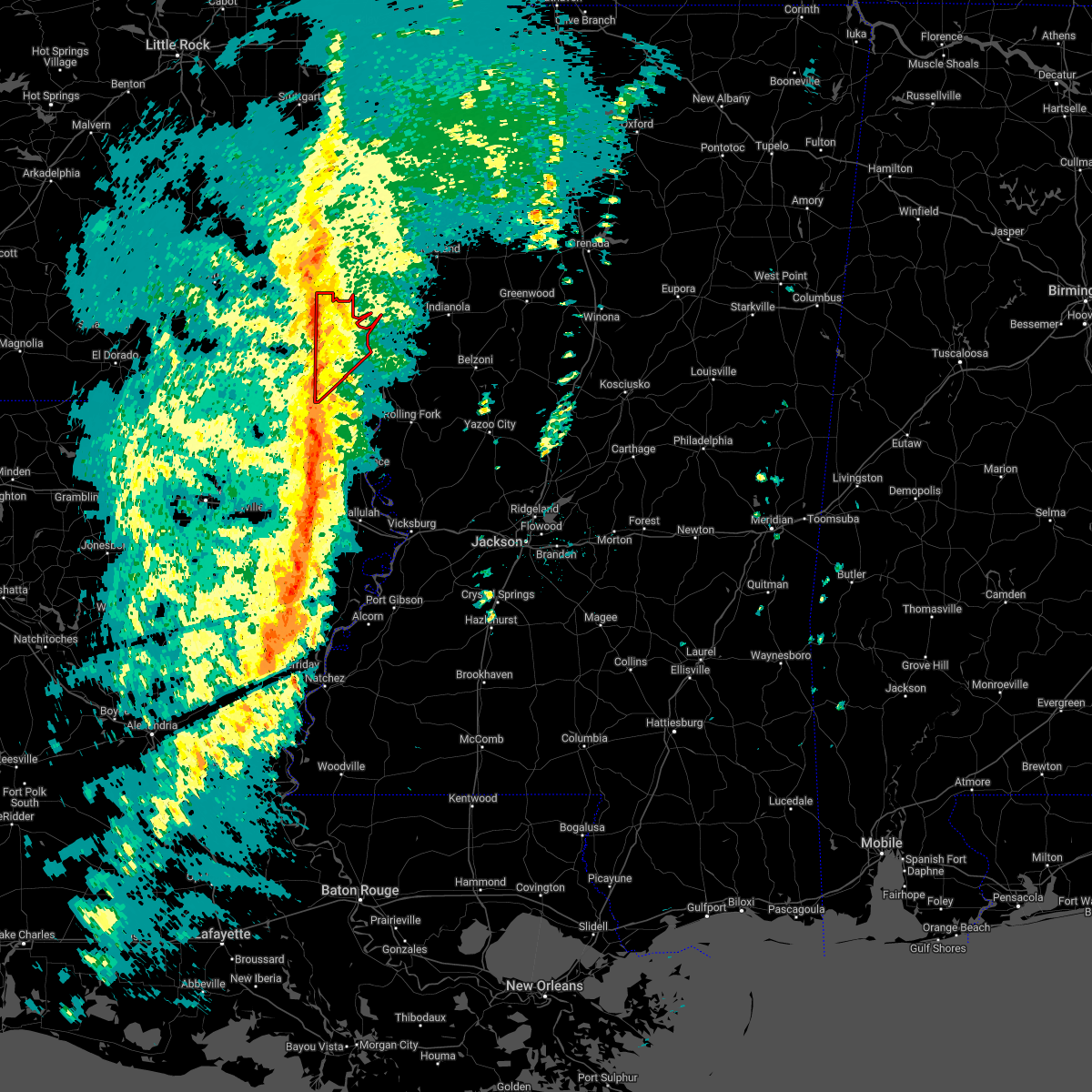 At 226 pm cdt, severe thunderstorms capable of producing tornadoes were located along a line extending from near tillar to near mcmillan corner to 6 miles west of eudora, moving northeast at 55 mph (radar indicated rotation). Hazards include tornado. Flying debris will be dangerous to those caught without shelter. mobile homes will be damaged or destroyed. damage to roofs, windows, and vehicles will occur. tree damage is likely. these dangerous storms will be near, mcmillan corner around 230 pm cdt. Lake village around 240 pm cdt. At 226 pm cdt, severe thunderstorms capable of producing tornadoes were located along a line extending from near tillar to near mcmillan corner to 6 miles west of eudora, moving northeast at 55 mph (radar indicated rotation). Hazards include tornado. Flying debris will be dangerous to those caught without shelter. mobile homes will be damaged or destroyed. damage to roofs, windows, and vehicles will occur. tree damage is likely. these dangerous storms will be near, mcmillan corner around 230 pm cdt. Lake village around 240 pm cdt.
|
| 3/30/2022 2:15 PM CDT |
 At 215 pm cdt, severe thunderstorms capable of producing tornadoes were located along a line extending from 10 miles east of monticello to 6 miles north of montrose to near parkdale, moving northeast at 55 mph (radar indicated rotation). Hazards include tornado. Flying debris will be dangerous to those caught without shelter. mobile homes will be damaged or destroyed. damage to roofs, windows, and vehicles will occur. tree damage is likely. these dangerous storms will be near, dermott and mcmillan corner around 225 pm cdt. chicot junction around 230 pm cdt. Lake village around 235 pm cdt. At 215 pm cdt, severe thunderstorms capable of producing tornadoes were located along a line extending from 10 miles east of monticello to 6 miles north of montrose to near parkdale, moving northeast at 55 mph (radar indicated rotation). Hazards include tornado. Flying debris will be dangerous to those caught without shelter. mobile homes will be damaged or destroyed. damage to roofs, windows, and vehicles will occur. tree damage is likely. these dangerous storms will be near, dermott and mcmillan corner around 225 pm cdt. chicot junction around 230 pm cdt. Lake village around 235 pm cdt.
|
| 3/30/2022 2:04 PM CDT |
 At 204 pm cdt, severe thunderstorms capable of producing tornadoes were located along a line extending from ladelle to near snyder to near wilmot, moving northeast at 55 mph (radar indicated rotation). Hazards include tornado. Flying debris will be dangerous to those caught without shelter. mobile homes will be damaged or destroyed. damage to roofs, windows, and vehicles will occur. tree damage is likely. these dangerous storms will be near, portland around 210 pm cdt. montrose around 215 pm cdt. dermott, chicot junction and mcmillan corner around 230 pm cdt. Lake village around 235 pm cdt. At 204 pm cdt, severe thunderstorms capable of producing tornadoes were located along a line extending from ladelle to near snyder to near wilmot, moving northeast at 55 mph (radar indicated rotation). Hazards include tornado. Flying debris will be dangerous to those caught without shelter. mobile homes will be damaged or destroyed. damage to roofs, windows, and vehicles will occur. tree damage is likely. these dangerous storms will be near, portland around 210 pm cdt. montrose around 215 pm cdt. dermott, chicot junction and mcmillan corner around 230 pm cdt. Lake village around 235 pm cdt.
|
| 3/30/2022 1:49 PM CDT |
 At 149 pm cdt, severe thunderstorms capable of producing a tornado were located along a line extending from near old milo to near berlin to near galion, moving northeast at 55 mph (radar indicated rotation). Hazards include tornado. Flying debris will be dangerous to those caught without shelter. mobile homes will be damaged or destroyed. damage to roofs, windows, and vehicles will occur. tree damage is likely. these dangerous storms will be near, fountain hill around 155 pm cdt. snyder around 205 pm cdt. portland, montrose and parkdale around 210 pm cdt. dermott, chicot junction and mcmillan corner around 225 pm cdt. Lake village around 230 pm cdt. At 149 pm cdt, severe thunderstorms capable of producing a tornado were located along a line extending from near old milo to near berlin to near galion, moving northeast at 55 mph (radar indicated rotation). Hazards include tornado. Flying debris will be dangerous to those caught without shelter. mobile homes will be damaged or destroyed. damage to roofs, windows, and vehicles will occur. tree damage is likely. these dangerous storms will be near, fountain hill around 155 pm cdt. snyder around 205 pm cdt. portland, montrose and parkdale around 210 pm cdt. dermott, chicot junction and mcmillan corner around 225 pm cdt. Lake village around 230 pm cdt.
|
| 6/7/2021 6:23 PM CDT |
 At 623 pm cdt, severe thunderstorms were located along a line extending from near tillar to 8 miles southeast of parkdale to near darnell, moving northeast at 50 mph (radar indicated). Hazards include 60 mph wind gusts and penny size hail. Expect damage to roofs, siding, and trees. severe thunderstorms will be near, eudora around 635 pm cdt. chicot junction around 640 pm cdt. lake providence and shelburn around 650 pm cdt. avon and wayside around 655 pm cdt. hollandale around 700 pm cdt. gunnison and estill around 705 pm cdt. rolling fork, tribbett, grace and darlove around 710 pm cdt. shelby, mound bayou, anguilla and deeson around 715 pm cdt. Other locations impacted by these severe thunderstorms include mayersville, arcola, alligator, beulah, pace, cary, halley, winstonville, duncan and merigold. At 623 pm cdt, severe thunderstorms were located along a line extending from near tillar to 8 miles southeast of parkdale to near darnell, moving northeast at 50 mph (radar indicated). Hazards include 60 mph wind gusts and penny size hail. Expect damage to roofs, siding, and trees. severe thunderstorms will be near, eudora around 635 pm cdt. chicot junction around 640 pm cdt. lake providence and shelburn around 650 pm cdt. avon and wayside around 655 pm cdt. hollandale around 700 pm cdt. gunnison and estill around 705 pm cdt. rolling fork, tribbett, grace and darlove around 710 pm cdt. shelby, mound bayou, anguilla and deeson around 715 pm cdt. Other locations impacted by these severe thunderstorms include mayersville, arcola, alligator, beulah, pace, cary, halley, winstonville, duncan and merigold.
|
| 5/4/2021 1:09 PM CDT |
 At 109 pm cdt, severe thunderstorms were located along a line extending from 6 miles west of boyle to near leland, moving east at 40 mph (radar indicated). Hazards include 70 mph wind gusts and penny size hail. Expect considerable tree damage. damage is likely to mobile homes, roofs, and outbuildings. these severe storms will be near, cleveland and boyle around 115 pm cdt. renova around 120 pm cdt. shaw around 125 pm cdt. other locations impacted by these severe thunderstorms include winstonville, beulah, pace and merigold. A tornado watch remains in effect until 600 pm cdt for southeastern arkansas, and northwestern mississippi. At 109 pm cdt, severe thunderstorms were located along a line extending from 6 miles west of boyle to near leland, moving east at 40 mph (radar indicated). Hazards include 70 mph wind gusts and penny size hail. Expect considerable tree damage. damage is likely to mobile homes, roofs, and outbuildings. these severe storms will be near, cleveland and boyle around 115 pm cdt. renova around 120 pm cdt. shaw around 125 pm cdt. other locations impacted by these severe thunderstorms include winstonville, beulah, pace and merigold. A tornado watch remains in effect until 600 pm cdt for southeastern arkansas, and northwestern mississippi.
|
| 5/4/2021 1:09 PM CDT |
 At 1243 pm cdt, a severe thunderstorm was located near mcmillan corner, or 9 miles north of lake village, moving east at 35 mph (radar indicated). Hazards include 70 mph wind gusts and quarter size hail. Hail damage to vehicles is expected. expect considerable tree damage. wind damage is also likely to mobile homes, roofs, and outbuildings. this severe storm will be near, greenville, scott, metcalfe, winterville and lamont around 105 pm cdt. benoit around 115 pm cdt. shaw around 135 pm cdt. cleveland and boyle around 140 pm cdt. other locations impacted by this severe thunderstorm include winstonville, beulah, pace and merigold. A tornado watch remains in effect until 600 pm cdt for southeastern arkansas, and northwestern mississippi. At 1243 pm cdt, a severe thunderstorm was located near mcmillan corner, or 9 miles north of lake village, moving east at 35 mph (radar indicated). Hazards include 70 mph wind gusts and quarter size hail. Hail damage to vehicles is expected. expect considerable tree damage. wind damage is also likely to mobile homes, roofs, and outbuildings. this severe storm will be near, greenville, scott, metcalfe, winterville and lamont around 105 pm cdt. benoit around 115 pm cdt. shaw around 135 pm cdt. cleveland and boyle around 140 pm cdt. other locations impacted by this severe thunderstorm include winstonville, beulah, pace and merigold. A tornado watch remains in effect until 600 pm cdt for southeastern arkansas, and northwestern mississippi.
|
| 5/4/2021 12:43 PM CDT |
 At 1218 pm cdt, a severe thunderstorm was located 7 miles east of dermott, moving northeast at 35 mph (radar indicated). Hazards include 60 mph wind gusts and quarter size hail. Hail damage to vehicles is expected. expect wind damage to roofs, siding, and trees. this severe thunderstorm will be near, lamont and winterville around 1240 pm cdt. scott around 1245 pm cdt. benoit around 1255 pm cdt. cleveland and boyle around 120 pm cdt. renova around 125 pm cdt. other locations impacted by this severe thunderstorm include winstonville, beulah, pace and merigold. A tornado watch remains in effect until 600 pm cdt for southeastern arkansas, and northwestern mississippi. At 1218 pm cdt, a severe thunderstorm was located 7 miles east of dermott, moving northeast at 35 mph (radar indicated). Hazards include 60 mph wind gusts and quarter size hail. Hail damage to vehicles is expected. expect wind damage to roofs, siding, and trees. this severe thunderstorm will be near, lamont and winterville around 1240 pm cdt. scott around 1245 pm cdt. benoit around 1255 pm cdt. cleveland and boyle around 120 pm cdt. renova around 125 pm cdt. other locations impacted by this severe thunderstorm include winstonville, beulah, pace and merigold. A tornado watch remains in effect until 600 pm cdt for southeastern arkansas, and northwestern mississippi.
|
| 5/4/2021 12:18 PM CDT |
 At 1218 pm cdt, a severe thunderstorm was located 7 miles east of dermott, moving northeast at 35 mph (radar indicated). Hazards include 60 mph wind gusts and quarter size hail. Hail damage to vehicles is expected. expect wind damage to roofs, siding, and trees. this severe thunderstorm will be near, lamont and winterville around 1240 pm cdt. scott around 1245 pm cdt. benoit around 1255 pm cdt. cleveland and boyle around 120 pm cdt. renova around 125 pm cdt. other locations impacted by this severe thunderstorm include winstonville, beulah, pace and merigold. A tornado watch remains in effect until 600 pm cdt for southeastern arkansas, and northwestern mississippi. At 1218 pm cdt, a severe thunderstorm was located 7 miles east of dermott, moving northeast at 35 mph (radar indicated). Hazards include 60 mph wind gusts and quarter size hail. Hail damage to vehicles is expected. expect wind damage to roofs, siding, and trees. this severe thunderstorm will be near, lamont and winterville around 1240 pm cdt. scott around 1245 pm cdt. benoit around 1255 pm cdt. cleveland and boyle around 120 pm cdt. renova around 125 pm cdt. other locations impacted by this severe thunderstorm include winstonville, beulah, pace and merigold. A tornado watch remains in effect until 600 pm cdt for southeastern arkansas, and northwestern mississippi.
|
| 4/9/2021 5:55 PM CDT |
 At 555 pm cdt, a severe thunderstorm was located over chicot junction, or near eudora, moving east at 35 mph (radar indicated). Hazards include 60 mph wind gusts and penny size hail. Expect damage to roofs, siding, and trees. This severe thunderstorm will remain over mainly rural areas of chicot county. At 555 pm cdt, a severe thunderstorm was located over chicot junction, or near eudora, moving east at 35 mph (radar indicated). Hazards include 60 mph wind gusts and penny size hail. Expect damage to roofs, siding, and trees. This severe thunderstorm will remain over mainly rural areas of chicot county.
|
| 4/9/2021 5:47 PM CDT |
 At 547 pm cdt, a severe thunderstorm was located near eudora, moving east at 40 mph (radar indicated). Hazards include 60 mph wind gusts and penny size hail. Expect damage to roofs, siding, and trees. This severe storm will be near, eudora and chicot junction around 555 pm cdt. At 547 pm cdt, a severe thunderstorm was located near eudora, moving east at 40 mph (radar indicated). Hazards include 60 mph wind gusts and penny size hail. Expect damage to roofs, siding, and trees. This severe storm will be near, eudora and chicot junction around 555 pm cdt.
|
| 4/9/2021 5:12 PM CDT |
 At 512 pm cdt, a severe thunderstorm was located near berlin, or near hamburg, moving east at 35 mph (radar indicated). Hazards include 60 mph wind gusts and quarter size hail. Hail damage to vehicles is expected. expect wind damage to roofs, siding, and trees. this severe thunderstorm will be near, wilmot around 535 pm cdt. parkdale around 540 pm cdt. portland around 545 pm cdt. eudora around 605 pm cdt. Lake village and chicot junction around 610 pm cdt. At 512 pm cdt, a severe thunderstorm was located near berlin, or near hamburg, moving east at 35 mph (radar indicated). Hazards include 60 mph wind gusts and quarter size hail. Hail damage to vehicles is expected. expect wind damage to roofs, siding, and trees. this severe thunderstorm will be near, wilmot around 535 pm cdt. parkdale around 540 pm cdt. portland around 545 pm cdt. eudora around 605 pm cdt. Lake village and chicot junction around 610 pm cdt.
|
| 3/28/2021 12:11 AM CDT |
 At 1211 am cdt, a severe thunderstorm was located 7 miles west of mcmillan corner, or 7 miles south of dermott, moving northeast at 60 mph (radar indicated). Hazards include 60 mph wind gusts and quarter size hail. Hail damage to vehicles is expected. expect wind damage to roofs, siding, and trees. this severe thunderstorm will be near, mcmillan corner around 1215 am cdt. scott, lamont and winterville around 1235 am cdt. A tornado watch remains in effect until 400 am cdt for southeastern arkansas, and northwestern mississippi. At 1211 am cdt, a severe thunderstorm was located 7 miles west of mcmillan corner, or 7 miles south of dermott, moving northeast at 60 mph (radar indicated). Hazards include 60 mph wind gusts and quarter size hail. Hail damage to vehicles is expected. expect wind damage to roofs, siding, and trees. this severe thunderstorm will be near, mcmillan corner around 1215 am cdt. scott, lamont and winterville around 1235 am cdt. A tornado watch remains in effect until 400 am cdt for southeastern arkansas, and northwestern mississippi.
|
| 3/27/2021 11:59 PM CDT |
 At 1158 pm cdt, a severe thunderstorm was located near snyder, or 12 miles northeast of hamburg, moving east at 50 mph (radar indicated). Hazards include 60 mph wind gusts and quarter size hail. Hail damage to vehicles is expected. expect wind damage to roofs, siding, and trees. this severe storm will be near, montrose around 1205 am cdt. mcmillan corner around 1220 am cdt. other locations impacted by this severe thunderstorm include blanchton. A tornado watch remains in effect until 400 am cdt for southeastern arkansas, and northwestern mississippi. At 1158 pm cdt, a severe thunderstorm was located near snyder, or 12 miles northeast of hamburg, moving east at 50 mph (radar indicated). Hazards include 60 mph wind gusts and quarter size hail. Hail damage to vehicles is expected. expect wind damage to roofs, siding, and trees. this severe storm will be near, montrose around 1205 am cdt. mcmillan corner around 1220 am cdt. other locations impacted by this severe thunderstorm include blanchton. A tornado watch remains in effect until 400 am cdt for southeastern arkansas, and northwestern mississippi.
|
| 3/27/2021 11:22 PM CDT |
 At 1118 pm cdt, a severe thunderstorm was located 7 miles northeast of lapile, or 8 miles north of huttig, moving east at 50 mph (radar indicated). Hazards include 60 mph wind gusts and quarter size hail. Hail damage to vehicles is expected. expect wind damage to roofs, siding, and trees. this severe thunderstorm will be near, crossett and west crossett around 1130 pm cdt. north crossett around 1135 pm cdt. old milo around 1140 pm cdt. hamburg and fountain hill around 1145 pm cdt. snyder around 1200 am cdt. montrose around 1205 am cdt. mcmillan corner around 1215 am cdt. other locations impacted by this severe thunderstorm include blanchton. A tornado watch remains in effect until 400 am cdt for southeastern arkansas, northeastern louisiana, and northwestern mississippi. At 1118 pm cdt, a severe thunderstorm was located 7 miles northeast of lapile, or 8 miles north of huttig, moving east at 50 mph (radar indicated). Hazards include 60 mph wind gusts and quarter size hail. Hail damage to vehicles is expected. expect wind damage to roofs, siding, and trees. this severe thunderstorm will be near, crossett and west crossett around 1130 pm cdt. north crossett around 1135 pm cdt. old milo around 1140 pm cdt. hamburg and fountain hill around 1145 pm cdt. snyder around 1200 am cdt. montrose around 1205 am cdt. mcmillan corner around 1215 am cdt. other locations impacted by this severe thunderstorm include blanchton. A tornado watch remains in effect until 400 am cdt for southeastern arkansas, northeastern louisiana, and northwestern mississippi.
|
| 3/17/2021 4:52 PM CDT |
 At 452 pm cdt, a severe thunderstorm was located near mcmillan corner, or 8 miles north of lake village, moving northeast at 45 mph (radar indicated). Hazards include 60 mph wind gusts and quarter size hail. Hail damage to vehicles is expected. expect wind damage to roofs, siding, and trees. this severe storm will be near, greenville and winterville around 505 pm cdt. scott, metcalfe and lamont around 510 pm cdt. benoit around 520 pm cdt. shaw around 530 pm cdt. cleveland and boyle around 540 pm cdt. renova around 545 pm cdt. A tornado watch remains in effect until 700 pm cdt for southeastern arkansas, and northwestern mississippi. At 452 pm cdt, a severe thunderstorm was located near mcmillan corner, or 8 miles north of lake village, moving northeast at 45 mph (radar indicated). Hazards include 60 mph wind gusts and quarter size hail. Hail damage to vehicles is expected. expect wind damage to roofs, siding, and trees. this severe storm will be near, greenville and winterville around 505 pm cdt. scott, metcalfe and lamont around 510 pm cdt. benoit around 520 pm cdt. shaw around 530 pm cdt. cleveland and boyle around 540 pm cdt. renova around 545 pm cdt. A tornado watch remains in effect until 700 pm cdt for southeastern arkansas, and northwestern mississippi.
|
| 3/17/2021 4:45 PM CDT |
 At 445 pm cdt, a severe thunderstorm was located over mcmillan corner, or near lake village, moving northeast at 45 mph (radar indicated). Hazards include 60 mph wind gusts and quarter size hail. Hail damage to vehicles is expected. expect wind damage to roofs, siding, and trees. this severe thunderstorm will be near, greenville, metcalfe, winterville and lamont around 505 pm cdt. scott around 510 pm cdt. benoit around 515 pm cdt. shaw around 530 pm cdt. cleveland and boyle around 535 pm cdt. renova around 540 pm cdt. A tornado watch remains in effect until 700 pm cdt for southeastern arkansas, and northwestern mississippi. At 445 pm cdt, a severe thunderstorm was located over mcmillan corner, or near lake village, moving northeast at 45 mph (radar indicated). Hazards include 60 mph wind gusts and quarter size hail. Hail damage to vehicles is expected. expect wind damage to roofs, siding, and trees. this severe thunderstorm will be near, greenville, metcalfe, winterville and lamont around 505 pm cdt. scott around 510 pm cdt. benoit around 515 pm cdt. shaw around 530 pm cdt. cleveland and boyle around 535 pm cdt. renova around 540 pm cdt. A tornado watch remains in effect until 700 pm cdt for southeastern arkansas, and northwestern mississippi.
|
| 7/31/2020 2:34 PM CDT |
 At 234 pm cdt, a severe thunderstorm was located over eudora, moving east at 45 mph (radar indicated). Hazards include 60 mph wind gusts. Expect damage to roofs, siding, and trees. This severe storm will be near, avon and wayside around 255 pm cdt. At 234 pm cdt, a severe thunderstorm was located over eudora, moving east at 45 mph (radar indicated). Hazards include 60 mph wind gusts. Expect damage to roofs, siding, and trees. This severe storm will be near, avon and wayside around 255 pm cdt.
|
| 7/31/2020 2:33 PM CDT | Tree down along hwy 16 in chicot county AR, 8.3 miles N of Lake Village, AR |
| 7/31/2020 2:24 PM CDT |
 At 224 pm cdt, a severe thunderstorm was located near chicot junction, or near eudora, moving east at 40 mph (radar indicated). Hazards include 60 mph wind gusts. Expect damage to roofs, siding, and trees. this severe storm will be near, eudora and chicot junction around 230 pm cdt. lake village around 235 pm cdt. Avon and wayside around 250 pm cdt. At 224 pm cdt, a severe thunderstorm was located near chicot junction, or near eudora, moving east at 40 mph (radar indicated). Hazards include 60 mph wind gusts. Expect damage to roofs, siding, and trees. this severe storm will be near, eudora and chicot junction around 230 pm cdt. lake village around 235 pm cdt. Avon and wayside around 250 pm cdt.
|
| 7/31/2020 2:15 PM CDT |
 At 213 pm cdt, a severe thunderstorm was located near parkdale, or 8 miles northeast of wilmot, moving east at 40 mph (radar indicated). Hazards include 60 mph wind gusts. Expect damage to roofs, siding, and trees. this severe storm will be near, eudora around 230 pm cdt. chicot junction around 235 pm cdt. avon around 250 pm cdt. Wayside around 255 pm cdt. At 213 pm cdt, a severe thunderstorm was located near parkdale, or 8 miles northeast of wilmot, moving east at 40 mph (radar indicated). Hazards include 60 mph wind gusts. Expect damage to roofs, siding, and trees. this severe storm will be near, eudora around 230 pm cdt. chicot junction around 235 pm cdt. avon around 250 pm cdt. Wayside around 255 pm cdt.
|
| 7/31/2020 1:56 PM CDT |
 At 156 pm cdt, a severe thunderstorm was located near berlin, or 7 miles northwest of wilmot, moving east at 45 mph (radar indicated). Hazards include 60 mph wind gusts. Expect damage to roofs, siding, and trees. this severe thunderstorm will be near, wilmot around 200 pm cdt. parkdale around 205 pm cdt. portland around 210 pm cdt. montrose around 215 pm cdt. lake village and chicot junction around 230 pm cdt. Avon and wayside around 245 pm cdt. At 156 pm cdt, a severe thunderstorm was located near berlin, or 7 miles northwest of wilmot, moving east at 45 mph (radar indicated). Hazards include 60 mph wind gusts. Expect damage to roofs, siding, and trees. this severe thunderstorm will be near, wilmot around 200 pm cdt. parkdale around 205 pm cdt. portland around 210 pm cdt. montrose around 215 pm cdt. lake village and chicot junction around 230 pm cdt. Avon and wayside around 245 pm cdt.
|
| 7/2/2020 5:09 PM CDT |
 At 509 pm cdt, severe thunderstorms were located along a line extending from near greenville to near chicot junction, moving southeast at 5 mph (radar indicated). Hazards include 60 mph wind gusts and quarter size hail. Hail damage to vehicles is expected. expect wind damage to roofs, siding, and trees. severe thunderstorms will be near, chicot junction around 540 pm cdt. eudora, avon and wayside around 600 pm cdt. Other locations impacted by these severe thunderstorms include arcola. At 509 pm cdt, severe thunderstorms were located along a line extending from near greenville to near chicot junction, moving southeast at 5 mph (radar indicated). Hazards include 60 mph wind gusts and quarter size hail. Hail damage to vehicles is expected. expect wind damage to roofs, siding, and trees. severe thunderstorms will be near, chicot junction around 540 pm cdt. eudora, avon and wayside around 600 pm cdt. Other locations impacted by these severe thunderstorms include arcola.
|
| 4/12/2020 9:22 PM CDT | Power lines damage in chicot county AR, 0.2 miles ENE of Lake Village, AR |
| 4/12/2020 9:18 PM CDT |
 At 918 pm cdt, severe thunderstorms were located along a line extending from near winterville to eudora, moving east at 50 mph (radar indicated). Hazards include 60 mph wind gusts and quarter size hail. Hail damage to vehicles is expected. expect wind damage to roofs, siding, and trees. these severe storms will be near, winterville and lamont around 925 pm cdt. greenville and metcalfe around 930 pm cdt. leland and avon around 935 pm cdt. hollandale, estill and darlove around 945 pm cdt. Other locations impacted by these severe thunderstorms include arcola. At 918 pm cdt, severe thunderstorms were located along a line extending from near winterville to eudora, moving east at 50 mph (radar indicated). Hazards include 60 mph wind gusts and quarter size hail. Hail damage to vehicles is expected. expect wind damage to roofs, siding, and trees. these severe storms will be near, winterville and lamont around 925 pm cdt. greenville and metcalfe around 930 pm cdt. leland and avon around 935 pm cdt. hollandale, estill and darlove around 945 pm cdt. Other locations impacted by these severe thunderstorms include arcola.
|
| 4/12/2020 9:15 PM CDT | Trees and power lines dow in chicot county AR, 0.4 miles W of Lake Village, AR |
| 4/12/2020 9:12 PM CDT |
 At 912 pm cdt, severe thunderstorms were located along a line extending from 7 miles northeast of mcmillan corner to near eudora, moving east at 60 mph (radar indicated). Hazards include 60 mph wind gusts and quarter size hail. Hail damage to vehicles is expected. expect wind damage to roofs, siding, and trees. these severe storms will be near, winterville and lamont around 920 pm cdt. greenville and metcalfe around 925 pm cdt. leland, avon and glen allan around 930 pm cdt. hollandale, estill and tribbett around 940 pm cdt. murphy and darlove around 945 pm cdt. Other locations impacted by these severe thunderstorms include arcola. At 912 pm cdt, severe thunderstorms were located along a line extending from 7 miles northeast of mcmillan corner to near eudora, moving east at 60 mph (radar indicated). Hazards include 60 mph wind gusts and quarter size hail. Hail damage to vehicles is expected. expect wind damage to roofs, siding, and trees. these severe storms will be near, winterville and lamont around 920 pm cdt. greenville and metcalfe around 925 pm cdt. leland, avon and glen allan around 930 pm cdt. hollandale, estill and tribbett around 940 pm cdt. murphy and darlove around 945 pm cdt. Other locations impacted by these severe thunderstorms include arcola.
|
| 4/12/2020 8:44 PM CDT |
 At 844 pm cdt, severe thunderstorms were located along a line extending from near tillar to snyder, moving east at 50 mph (radar indicated). Hazards include 60 mph wind gusts and quarter size hail. Hail damage to vehicles is expected. expect wind damage to roofs, siding, and trees. severe thunderstorms will be near, mcmillan corner around 905 pm cdt. lake village and chicot junction around 910 pm cdt. avon and wayside around 925 pm cdt. estill around 935 pm cdt. tribbett and darlove around 940 pm cdt. Other locations impacted by these severe thunderstorms include arcola. At 844 pm cdt, severe thunderstorms were located along a line extending from near tillar to snyder, moving east at 50 mph (radar indicated). Hazards include 60 mph wind gusts and quarter size hail. Hail damage to vehicles is expected. expect wind damage to roofs, siding, and trees. severe thunderstorms will be near, mcmillan corner around 905 pm cdt. lake village and chicot junction around 910 pm cdt. avon and wayside around 925 pm cdt. estill around 935 pm cdt. tribbett and darlove around 940 pm cdt. Other locations impacted by these severe thunderstorms include arcola.
|
| 4/12/2020 12:47 PM CDT |
 At 1246 pm cdt, severe thunderstorms were located along a line extending from near lake village to near millikin, moving east at 35 mph (radar indicated). Hazards include 60 mph wind gusts. Expect damage to roofs, siding, and trees. these severe storms will be near, glen allan around 100 pm cdt. grace and winterville around 105 pm cdt. greenville and metcalfe around 110 pm cdt. leland, panther burn and delta city around 115 pm cdt. other locations impacted by these severe thunderstorms include arcola. A tornado watch remains in effect until 800 pm cdt for southeastern arkansas, northeastern louisiana, and central, northwestern and west central mississippi. At 1246 pm cdt, severe thunderstorms were located along a line extending from near lake village to near millikin, moving east at 35 mph (radar indicated). Hazards include 60 mph wind gusts. Expect damage to roofs, siding, and trees. these severe storms will be near, glen allan around 100 pm cdt. grace and winterville around 105 pm cdt. greenville and metcalfe around 110 pm cdt. leland, panther burn and delta city around 115 pm cdt. other locations impacted by these severe thunderstorms include arcola. A tornado watch remains in effect until 800 pm cdt for southeastern arkansas, northeastern louisiana, and central, northwestern and west central mississippi.
|
| 4/12/2020 12:26 PM CDT |
 At 1226 pm cdt, a severe thunderstorm was located near gassoway, or near eudora, moving northeast at 60 mph (radar indicated). Hazards include 60 mph wind gusts and quarter size hail. Hail damage to vehicles is expected. expect wind damage to roofs, siding, and trees. this severe thunderstorm will be near, glen allan around 1235 pm cdt. avon around 1245 pm cdt. hollandale and estill around 1250 pm cdt. darlove around 1255 pm cdt. tribbett around 100 pm cdt. other locations impacted by this severe thunderstorm include arcola. A tornado watch remains in effect until 800 pm cdt for southeastern arkansas, northeastern louisiana, and central, northwestern and west central mississippi. At 1226 pm cdt, a severe thunderstorm was located near gassoway, or near eudora, moving northeast at 60 mph (radar indicated). Hazards include 60 mph wind gusts and quarter size hail. Hail damage to vehicles is expected. expect wind damage to roofs, siding, and trees. this severe thunderstorm will be near, glen allan around 1235 pm cdt. avon around 1245 pm cdt. hollandale and estill around 1250 pm cdt. darlove around 1255 pm cdt. tribbett around 100 pm cdt. other locations impacted by this severe thunderstorm include arcola. A tornado watch remains in effect until 800 pm cdt for southeastern arkansas, northeastern louisiana, and central, northwestern and west central mississippi.
|
| 1/11/2020 3:35 AM CST |
 At 334 am cst, a severe thunderstorm capable of producing a tornado was located over mcmillan corner, or near lake village, moving northeast at 65 mph (radar indicated rotation). Hazards include tornado. Flying debris will be dangerous to those caught without shelter. mobile homes will be damaged or destroyed. damage to roofs, windows, and vehicles will occur. tree damage is likely. This tornadic thunderstorm will remain over mainly rural areas of northwestern chicot county. At 334 am cst, a severe thunderstorm capable of producing a tornado was located over mcmillan corner, or near lake village, moving northeast at 65 mph (radar indicated rotation). Hazards include tornado. Flying debris will be dangerous to those caught without shelter. mobile homes will be damaged or destroyed. damage to roofs, windows, and vehicles will occur. tree damage is likely. This tornadic thunderstorm will remain over mainly rural areas of northwestern chicot county.
|
| 1/11/2020 3:34 AM CST | Trees down across lake villag in chicot county AR, 0.4 miles W of Lake Village, AR |
| 1/11/2020 3:34 AM CST | *** 1 inj *** tree down on a hous in chicot county AR, 1 miles SE of Lake Village, AR |
| 1/11/2020 3:33 AM CST | Multiple trees and power lines down along hwy 65 between dermott and lake villag in chicot county AR, 7.3 miles SSE of Lake Village, AR |
| 1/11/2020 3:33 AM CST |
 At 333 am cst, severe thunderstorms were located along a line extending from near portland to near sterlington, moving northeast at 65 mph (radar indicated). Hazards include 60 mph wind gusts. Expect damage to roofs, siding, and trees. severe thunderstorms will be near, lake village and chicot junction around 345 am cst. galion around 355 am cst. goodwill around 400 am cst. oak grove around 410 am cst. shelburn around 420 am cst. gassoway and millikin around 425 am cst. other locations impacted by these severe thunderstorms include perryville, collinston, mer rouge, pioneer, kilbourne, forest, bonita, oak ridge and epps. a tornado watch remains in effect until 700 am cst for southeastern arkansas, and northwestern mississippi. A tornado watch also remains in effect until 900 am cst for northeastern louisiana, and west central mississippi. At 333 am cst, severe thunderstorms were located along a line extending from near portland to near sterlington, moving northeast at 65 mph (radar indicated). Hazards include 60 mph wind gusts. Expect damage to roofs, siding, and trees. severe thunderstorms will be near, lake village and chicot junction around 345 am cst. galion around 355 am cst. goodwill around 400 am cst. oak grove around 410 am cst. shelburn around 420 am cst. gassoway and millikin around 425 am cst. other locations impacted by these severe thunderstorms include perryville, collinston, mer rouge, pioneer, kilbourne, forest, bonita, oak ridge and epps. a tornado watch remains in effect until 700 am cst for southeastern arkansas, and northwestern mississippi. A tornado watch also remains in effect until 900 am cst for northeastern louisiana, and west central mississippi.
|
| 1/11/2020 3:25 AM CST |
 At 324 am cst, a severe thunderstorm capable of producing a tornado was located near montrose, or 8 miles west of lake village, moving northeast at 70 mph (radar indicated rotation). Hazards include tornado. Flying debris will be dangerous to those caught without shelter. mobile homes will be damaged or destroyed. damage to roofs, windows, and vehicles will occur. tree damage is likely. This dangerous storm will be near, lake village and mcmillan corner around 330 am cst. At 324 am cst, a severe thunderstorm capable of producing a tornado was located near montrose, or 8 miles west of lake village, moving northeast at 70 mph (radar indicated rotation). Hazards include tornado. Flying debris will be dangerous to those caught without shelter. mobile homes will be damaged or destroyed. damage to roofs, windows, and vehicles will occur. tree damage is likely. This dangerous storm will be near, lake village and mcmillan corner around 330 am cst.
|
| 1/11/2020 3:14 AM CST |
 At 313 am cst, a severe thunderstorm capable of producing a tornado was located over snyder, or 10 miles northeast of hamburg, moving northeast at 65 mph (radar indicated rotation). Hazards include tornado. Flying debris will be dangerous to those caught without shelter. mobile homes will be damaged or destroyed. damage to roofs, windows, and vehicles will occur. tree damage is likely. this dangerous storm will be near, montrose around 320 am cst. Dermott and mcmillan corner around 330 am cst. At 313 am cst, a severe thunderstorm capable of producing a tornado was located over snyder, or 10 miles northeast of hamburg, moving northeast at 65 mph (radar indicated rotation). Hazards include tornado. Flying debris will be dangerous to those caught without shelter. mobile homes will be damaged or destroyed. damage to roofs, windows, and vehicles will occur. tree damage is likely. this dangerous storm will be near, montrose around 320 am cst. Dermott and mcmillan corner around 330 am cst.
|
| 1/11/2020 3:00 AM CST |
 At 259 am cst, a severe thunderstorm capable of producing a tornado was located near old milo, or near hamburg, moving northeast at 65 mph (radar indicated rotation). Hazards include tornado. Flying debris will be dangerous to those caught without shelter. mobile homes will be damaged or destroyed. damage to roofs, windows, and vehicles will occur. tree damage is likely. this dangerous storm will be near, snyder around 310 am cst. Dermott around 325 am cst. At 259 am cst, a severe thunderstorm capable of producing a tornado was located near old milo, or near hamburg, moving northeast at 65 mph (radar indicated rotation). Hazards include tornado. Flying debris will be dangerous to those caught without shelter. mobile homes will be damaged or destroyed. damage to roofs, windows, and vehicles will occur. tree damage is likely. this dangerous storm will be near, snyder around 310 am cst. Dermott around 325 am cst.
|
| 1/11/2020 2:51 AM CST |
 At 251 am cst, a severe thunderstorm capable of producing a tornado was located near north crossett, moving northeast at 65 mph (radar indicated rotation). Hazards include tornado. Flying debris will be dangerous to those caught without shelter. mobile homes will be damaged or destroyed. damage to roofs, windows, and vehicles will occur. tree damage is likely. this dangerous storm will be near, old milo around 255 am cst. hamburg and fountain hill around 300 am cst. snyder around 310 am cst. Dermott around 325 am cst. At 251 am cst, a severe thunderstorm capable of producing a tornado was located near north crossett, moving northeast at 65 mph (radar indicated rotation). Hazards include tornado. Flying debris will be dangerous to those caught without shelter. mobile homes will be damaged or destroyed. damage to roofs, windows, and vehicles will occur. tree damage is likely. this dangerous storm will be near, old milo around 255 am cst. hamburg and fountain hill around 300 am cst. snyder around 310 am cst. Dermott around 325 am cst.
|
| 12/16/2019 1:31 PM CST |
 At 131 pm cst, a severe thunderstorm was located near greenville, moving east at 50 mph (radar indicated). Hazards include 60 mph wind gusts. Expect damage to roofs, siding, and trees. this severe storm will be near, greenville, metcalfe and winterville around 140 pm cst. leland around 145 pm cst. other locations impacted by this severe thunderstorm include arcola. A tornado watch remains in effect until 600 pm cst for southeastern arkansas, and northwestern mississippi. At 131 pm cst, a severe thunderstorm was located near greenville, moving east at 50 mph (radar indicated). Hazards include 60 mph wind gusts. Expect damage to roofs, siding, and trees. this severe storm will be near, greenville, metcalfe and winterville around 140 pm cst. leland around 145 pm cst. other locations impacted by this severe thunderstorm include arcola. A tornado watch remains in effect until 600 pm cst for southeastern arkansas, and northwestern mississippi.
|
| 12/16/2019 1:02 PM CST |
 At 102 pm cst, a severe thunderstorm was located near montrose, or 13 miles west of lake village, moving east at 45 mph (radar indicated). Hazards include 60 mph wind gusts. Expect damage to roofs, siding, and trees. this severe thunderstorm will be near, lake village around 115 pm cst. mcmillan corner around 120 pm cst. greenville, scott, metcalfe, winterville and lamont around 140 pm cst. shaw around 200 pm cst. other locations impacted by this severe thunderstorm include arcola. A tornado watch remains in effect until 600 pm cst for southeastern arkansas, and northwestern mississippi. At 102 pm cst, a severe thunderstorm was located near montrose, or 13 miles west of lake village, moving east at 45 mph (radar indicated). Hazards include 60 mph wind gusts. Expect damage to roofs, siding, and trees. this severe thunderstorm will be near, lake village around 115 pm cst. mcmillan corner around 120 pm cst. greenville, scott, metcalfe, winterville and lamont around 140 pm cst. shaw around 200 pm cst. other locations impacted by this severe thunderstorm include arcola. A tornado watch remains in effect until 600 pm cst for southeastern arkansas, and northwestern mississippi.
|
| 6/28/2019 12:56 PM CDT |
 At 1256 pm cdt, a severe thunderstorm was located near montrose, or 11 miles west of lake village, moving south at 15 mph (radar indicated). Hazards include 60 mph wind gusts and quarter size hail. Hail damage to vehicles is expected. expect wind damage to roofs, siding, and trees. This severe thunderstorm will be near, parkdale around 125 pm cdt. At 1256 pm cdt, a severe thunderstorm was located near montrose, or 11 miles west of lake village, moving south at 15 mph (radar indicated). Hazards include 60 mph wind gusts and quarter size hail. Hail damage to vehicles is expected. expect wind damage to roofs, siding, and trees. This severe thunderstorm will be near, parkdale around 125 pm cdt.
|
| 6/19/2019 9:26 PM CDT |
 At 925 pm cdt, a severe thunderstorm was located near ingalls, or 14 miles northwest of west crossett, moving east at 50 mph (radar indicated). Hazards include 60 mph wind gusts and quarter size hail. Hail damage to vehicles is expected. expect wind damage to roofs, siding, and trees. this severe thunderstorm will be near, fountain hill and old milo around 945 pm cdt. hamburg around 950 pm cdt. snyder around 1005 pm cdt. portland and montrose around 1010 pm cdt. lake village around 1025 pm cdt. eudora and chicot junction around 1030 pm cdt. Other locations impacted by this severe thunderstorm include halley. At 925 pm cdt, a severe thunderstorm was located near ingalls, or 14 miles northwest of west crossett, moving east at 50 mph (radar indicated). Hazards include 60 mph wind gusts and quarter size hail. Hail damage to vehicles is expected. expect wind damage to roofs, siding, and trees. this severe thunderstorm will be near, fountain hill and old milo around 945 pm cdt. hamburg around 950 pm cdt. snyder around 1005 pm cdt. portland and montrose around 1010 pm cdt. lake village around 1025 pm cdt. eudora and chicot junction around 1030 pm cdt. Other locations impacted by this severe thunderstorm include halley.
|
| 5/8/2019 7:51 PM CDT |
 At 750 pm cdt, severe thunderstorms were located along a line extending from near metcalfe to 7 miles east of eudora to near lake providence, moving east at 30 mph (radar indicated). Hazards include 60 mph wind gusts. Expect damage to roofs, siding, and trees. these severe storms will be near, greenville around 755 pm cdt. other locations impacted by these severe thunderstorms include kilbourne. a tornado watch remains in effect until 1100 pm cdt for southeastern arkansas, and northeastern louisiana. A tornado watch also remains in effect until midnight cdt for northwestern and west central mississippi. At 750 pm cdt, severe thunderstorms were located along a line extending from near metcalfe to 7 miles east of eudora to near lake providence, moving east at 30 mph (radar indicated). Hazards include 60 mph wind gusts. Expect damage to roofs, siding, and trees. these severe storms will be near, greenville around 755 pm cdt. other locations impacted by these severe thunderstorms include kilbourne. a tornado watch remains in effect until 1100 pm cdt for southeastern arkansas, and northeastern louisiana. A tornado watch also remains in effect until midnight cdt for northwestern and west central mississippi.
|
| 5/8/2019 7:37 PM CDT |
 At 714 pm cdt, severe thunderstorms were located along a line extending from near montrose to wilmot to 7 miles southwest of goodwill, moving east at 30 mph (radar indicated). Hazards include 60 mph wind gusts. Expect damage to roofs, siding, and trees. severe thunderstorms will be near, montrose around 720 pm cdt. parkdale around 725 pm cdt. lake village and mcmillan corner around 730 pm cdt. eudora and oak grove around 750 pm cdt. chicot junction around 755 pm cdt. greenville and shelburn around 805 pm cdt. lake providence and millikin around 810 pm cdt. other locations impacted by these severe thunderstorms include kilbourne, forest, jerome and pioneer. a tornado watch remains in effect until 1100 pm cdt for southeastern arkansas, and northeastern louisiana. A tornado watch also remains in effect until midnight cdt for northwestern and west central mississippi. At 714 pm cdt, severe thunderstorms were located along a line extending from near montrose to wilmot to 7 miles southwest of goodwill, moving east at 30 mph (radar indicated). Hazards include 60 mph wind gusts. Expect damage to roofs, siding, and trees. severe thunderstorms will be near, montrose around 720 pm cdt. parkdale around 725 pm cdt. lake village and mcmillan corner around 730 pm cdt. eudora and oak grove around 750 pm cdt. chicot junction around 755 pm cdt. greenville and shelburn around 805 pm cdt. lake providence and millikin around 810 pm cdt. other locations impacted by these severe thunderstorms include kilbourne, forest, jerome and pioneer. a tornado watch remains in effect until 1100 pm cdt for southeastern arkansas, and northeastern louisiana. A tornado watch also remains in effect until midnight cdt for northwestern and west central mississippi.
|
| 5/8/2019 7:37 PM CDT |
 At 737 pm cdt, severe thunderstorms were located along a line extending from 6 miles west of greenville to eudora to 6 miles southeast of oak grove, moving east at 45 mph (radar indicated). Hazards include 60 mph wind gusts. Expect damage to roofs, siding, and trees. these severe storms will be near, greenville around 750 pm cdt. other locations impacted by these severe thunderstorms include kilbourne, forest, jerome and pioneer. a tornado watch remains in effect until 1100 pm cdt for southeastern arkansas, and northeastern louisiana. A tornado watch also remains in effect until midnight cdt for northwestern and west central mississippi. At 737 pm cdt, severe thunderstorms were located along a line extending from 6 miles west of greenville to eudora to 6 miles southeast of oak grove, moving east at 45 mph (radar indicated). Hazards include 60 mph wind gusts. Expect damage to roofs, siding, and trees. these severe storms will be near, greenville around 750 pm cdt. other locations impacted by these severe thunderstorms include kilbourne, forest, jerome and pioneer. a tornado watch remains in effect until 1100 pm cdt for southeastern arkansas, and northeastern louisiana. A tornado watch also remains in effect until midnight cdt for northwestern and west central mississippi.
|
| 5/8/2019 7:14 PM CDT |
 At 714 pm cdt, severe thunderstorms were located along a line extending from near montrose to wilmot to 7 miles southwest of goodwill, moving east at 30 mph (radar indicated). Hazards include 60 mph wind gusts. Expect damage to roofs, siding, and trees. severe thunderstorms will be near, montrose around 720 pm cdt. parkdale around 725 pm cdt. lake village and mcmillan corner around 730 pm cdt. eudora and oak grove around 750 pm cdt. chicot junction around 755 pm cdt. greenville and shelburn around 805 pm cdt. lake providence and millikin around 810 pm cdt. other locations impacted by these severe thunderstorms include kilbourne, forest, jerome and pioneer. a tornado watch remains in effect until 1100 pm cdt for southeastern arkansas, and northeastern louisiana. A tornado watch also remains in effect until midnight cdt for northwestern and west central mississippi. At 714 pm cdt, severe thunderstorms were located along a line extending from near montrose to wilmot to 7 miles southwest of goodwill, moving east at 30 mph (radar indicated). Hazards include 60 mph wind gusts. Expect damage to roofs, siding, and trees. severe thunderstorms will be near, montrose around 720 pm cdt. parkdale around 725 pm cdt. lake village and mcmillan corner around 730 pm cdt. eudora and oak grove around 750 pm cdt. chicot junction around 755 pm cdt. greenville and shelburn around 805 pm cdt. lake providence and millikin around 810 pm cdt. other locations impacted by these severe thunderstorms include kilbourne, forest, jerome and pioneer. a tornado watch remains in effect until 1100 pm cdt for southeastern arkansas, and northeastern louisiana. A tornado watch also remains in effect until midnight cdt for northwestern and west central mississippi.
|
| 4/13/2019 4:24 PM CDT |
 At 424 pm cdt, severe thunderstorms were located along a line extending from near mcmillan corner to near shelburn, moving northeast at 45 mph (radar indicated). Hazards include 60 mph wind gusts and penny size hail. Expect damage to roofs, siding, and trees. severe thunderstorms will be near, mcmillan corner around 430 pm cdt. scott, lamont and winterville around 450 pm cdt. benoit around 500 pm cdt. other locations impacted by these severe thunderstorms include arcola. A tornado watch remains in effect until 900 pm cdt for southeastern arkansas, and central and northwestern mississippi. At 424 pm cdt, severe thunderstorms were located along a line extending from near mcmillan corner to near shelburn, moving northeast at 45 mph (radar indicated). Hazards include 60 mph wind gusts and penny size hail. Expect damage to roofs, siding, and trees. severe thunderstorms will be near, mcmillan corner around 430 pm cdt. scott, lamont and winterville around 450 pm cdt. benoit around 500 pm cdt. other locations impacted by these severe thunderstorms include arcola. A tornado watch remains in effect until 900 pm cdt for southeastern arkansas, and central and northwestern mississippi.
|
| 4/13/2019 4:09 PM CDT |
 At 408 pm cdt, severe thunderstorms were located along a line extending from 6 miles north of montrose to near oak grove, moving northeast at 50 mph (radar indicated). Hazards include 60 mph wind gusts and quarter size hail. Hail damage to vehicles is expected. expect wind damage to roofs, siding, and trees. these severe storms will be near, mcmillan corner around 415 pm cdt. dermott around 420 pm cdt. eudora around 425 pm cdt. A tornado watch remains in effect until 900 pm cdt for southeastern arkansas, northeastern louisiana, and northwestern mississippi. At 408 pm cdt, severe thunderstorms were located along a line extending from 6 miles north of montrose to near oak grove, moving northeast at 50 mph (radar indicated). Hazards include 60 mph wind gusts and quarter size hail. Hail damage to vehicles is expected. expect wind damage to roofs, siding, and trees. these severe storms will be near, mcmillan corner around 415 pm cdt. dermott around 420 pm cdt. eudora around 425 pm cdt. A tornado watch remains in effect until 900 pm cdt for southeastern arkansas, northeastern louisiana, and northwestern mississippi.
|
| 4/13/2019 4:00 PM CDT | Large oak tree on house. power poles also dow in chicot county AR, 0.2 miles ENE of Lake Village, AR |
| 4/13/2019 3:32 PM CDT |
 At 332 pm cdt, severe thunderstorms were located along a line extending from near hamburg to 8 miles north of start, moving northeast at 55 mph (radar indicated). Hazards include 60 mph wind gusts and quarter size hail. Hail damage to vehicles is expected. expect wind damage to roofs, siding, and trees. severe thunderstorms will be near, snyder around 340 pm cdt. montrose around 350 pm cdt. goodwill around 355 pm cdt. dermott around 400 pm cdt. eudora around 425 pm cdt. other locations impacted by these severe thunderstorms include bonita. A tornado watch remains in effect until 900 pm cdt for southeastern arkansas, northeastern louisiana, and northwestern mississippi. At 332 pm cdt, severe thunderstorms were located along a line extending from near hamburg to 8 miles north of start, moving northeast at 55 mph (radar indicated). Hazards include 60 mph wind gusts and quarter size hail. Hail damage to vehicles is expected. expect wind damage to roofs, siding, and trees. severe thunderstorms will be near, snyder around 340 pm cdt. montrose around 350 pm cdt. goodwill around 355 pm cdt. dermott around 400 pm cdt. eudora around 425 pm cdt. other locations impacted by these severe thunderstorms include bonita. A tornado watch remains in effect until 900 pm cdt for southeastern arkansas, northeastern louisiana, and northwestern mississippi.
|
| 4/7/2019 6:12 AM CDT |
 At 610 am cdt, a severe thunderstorm was located 7 miles northeast of mcmillan corner, or 10 miles north of lake village, moving northeast at 40 mph (radar indicated). Hazards include 60 mph wind gusts and half dollar size hail. Hail damage to vehicles is expected. expect wind damage to roofs, siding, and trees. This severe thunderstorm will remain over mainly rural areas of northern chicot, northeastern ashley and northwestern washington counties. At 610 am cdt, a severe thunderstorm was located 7 miles northeast of mcmillan corner, or 10 miles north of lake village, moving northeast at 40 mph (radar indicated). Hazards include 60 mph wind gusts and half dollar size hail. Hail damage to vehicles is expected. expect wind damage to roofs, siding, and trees. This severe thunderstorm will remain over mainly rural areas of northern chicot, northeastern ashley and northwestern washington counties.
|
| 4/7/2019 5:45 AM CDT |
 At 545 am cdt, a severe thunderstorm was located near montrose, or 13 miles southwest of dermott, moving northeast at 40 mph (radar indicated). Hazards include 60 mph wind gusts and half dollar size hail. Hail damage to vehicles is expected. expect wind damage to roofs, siding, and trees. this severe thunderstorm will be near, dermott around 600 am cdt. Mcmillan corner around 605 am cdt. At 545 am cdt, a severe thunderstorm was located near montrose, or 13 miles southwest of dermott, moving northeast at 40 mph (radar indicated). Hazards include 60 mph wind gusts and half dollar size hail. Hail damage to vehicles is expected. expect wind damage to roofs, siding, and trees. this severe thunderstorm will be near, dermott around 600 am cdt. Mcmillan corner around 605 am cdt.
|
| 3/13/2019 8:17 PM CDT |
 At 816 pm cdt, a severe thunderstorm was located near mcgehee, or near dermott, moving northeast at 75 mph (radar indicated). Hazards include 60 mph wind gusts and quarter size hail. Hail damage to vehicles is expected. expect wind damage to roofs, siding, and trees. this severe storm will be near, rosedale around 835 pm cdt. Other locations impacted by this severe thunderstorm include beulah. At 816 pm cdt, a severe thunderstorm was located near mcgehee, or near dermott, moving northeast at 75 mph (radar indicated). Hazards include 60 mph wind gusts and quarter size hail. Hail damage to vehicles is expected. expect wind damage to roofs, siding, and trees. this severe storm will be near, rosedale around 835 pm cdt. Other locations impacted by this severe thunderstorm include beulah.
|
| 3/13/2019 7:52 PM CDT |
 At 752 pm cdt, a severe thunderstorm was located near hamburg, moving northeast at 75 mph (radar indicated). Hazards include 60 mph wind gusts and quarter size hail. Hail damage to vehicles is expected. expect wind damage to roofs, siding, and trees. this severe thunderstorm will be near, dermott around 810 pm cdt. rosedale around 840 pm cdt. Other locations impacted by this severe thunderstorm include beulah and halley. At 752 pm cdt, a severe thunderstorm was located near hamburg, moving northeast at 75 mph (radar indicated). Hazards include 60 mph wind gusts and quarter size hail. Hail damage to vehicles is expected. expect wind damage to roofs, siding, and trees. this severe thunderstorm will be near, dermott around 810 pm cdt. rosedale around 840 pm cdt. Other locations impacted by this severe thunderstorm include beulah and halley.
|
| 2/23/2019 2:56 PM CST |
 At 256 pm cst, a severe thunderstorm was located near eudora, moving northeast at 60 mph (radar indicated). Hazards include 60 mph wind gusts. Expect damage to roofs, siding, and trees. this severe storm will be near, avon around 305 pm cst. wayside around 310 pm cst. A tornado watch remains in effect until 800 pm cst for southeastern arkansas, and northwestern and west central mississippi. At 256 pm cst, a severe thunderstorm was located near eudora, moving northeast at 60 mph (radar indicated). Hazards include 60 mph wind gusts. Expect damage to roofs, siding, and trees. this severe storm will be near, avon around 305 pm cst. wayside around 310 pm cst. A tornado watch remains in effect until 800 pm cst for southeastern arkansas, and northwestern and west central mississippi.
|
| 2/23/2019 2:42 PM CST |
 At 242 pm cst, a severe thunderstorm was located 8 miles west of gassoway, or 10 miles southwest of eudora, moving northeast at 40 mph (radar indicated). Hazards include 60 mph wind gusts. Expect damage to roofs, siding, and trees. this severe storm will be near, gassoway around 250 pm cst. eudora around 255 pm cst. avon and wayside around 315 pm cst. other locations impacted by this severe thunderstorm include kilbourne. A tornado watch remains in effect until 800 pm cst for southeastern arkansas, northeastern louisiana, and northwestern and west central mississippi. At 242 pm cst, a severe thunderstorm was located 8 miles west of gassoway, or 10 miles southwest of eudora, moving northeast at 40 mph (radar indicated). Hazards include 60 mph wind gusts. Expect damage to roofs, siding, and trees. this severe storm will be near, gassoway around 250 pm cst. eudora around 255 pm cst. avon and wayside around 315 pm cst. other locations impacted by this severe thunderstorm include kilbourne. A tornado watch remains in effect until 800 pm cst for southeastern arkansas, northeastern louisiana, and northwestern and west central mississippi.
|
| 2/23/2019 2:27 PM CST |
 At 227 pm cst, a severe thunderstorm was located 8 miles northwest of oak grove, or 8 miles southeast of wilmot, moving northeast at 55 mph (radar indicated). Hazards include 60 mph wind gusts. Expect damage to roofs, siding, and trees. this severe storm will be near, gassoway around 240 pm cst. eudora and chicot junction around 245 pm cst. avon and wayside around 300 pm cst. other locations impacted by this severe thunderstorm include kilbourne. A tornado watch remains in effect until 800 pm cst for southeastern arkansas, northeastern louisiana, and northwestern and west central mississippi. At 227 pm cst, a severe thunderstorm was located 8 miles northwest of oak grove, or 8 miles southeast of wilmot, moving northeast at 55 mph (radar indicated). Hazards include 60 mph wind gusts. Expect damage to roofs, siding, and trees. this severe storm will be near, gassoway around 240 pm cst. eudora and chicot junction around 245 pm cst. avon and wayside around 300 pm cst. other locations impacted by this severe thunderstorm include kilbourne. A tornado watch remains in effect until 800 pm cst for southeastern arkansas, northeastern louisiana, and northwestern and west central mississippi.
|
| 2/23/2019 2:13 PM CST |
 At 213 pm cst, a severe thunderstorm was located near jones, or 12 miles south of wilmot, moving northeast at 60 mph (radar indicated). Hazards include 60 mph wind gusts. Expect damage to roofs, siding, and trees. this severe thunderstorm will be near, wilmot around 225 pm cst. eudora around 240 pm cst. chicot junction around 245 pm cst. avon around 255 pm cst. wayside around 300 pm cst. greenville around 305 pm cst. metcalfe around 310 pm cst. other locations impacted by this severe thunderstorm include kilbourne and bonita. A tornado watch remains in effect until 800 pm cst for southeastern arkansas, northeastern louisiana, and northwestern and west central mississippi. At 213 pm cst, a severe thunderstorm was located near jones, or 12 miles south of wilmot, moving northeast at 60 mph (radar indicated). Hazards include 60 mph wind gusts. Expect damage to roofs, siding, and trees. this severe thunderstorm will be near, wilmot around 225 pm cst. eudora around 240 pm cst. chicot junction around 245 pm cst. avon around 255 pm cst. wayside around 300 pm cst. greenville around 305 pm cst. metcalfe around 310 pm cst. other locations impacted by this severe thunderstorm include kilbourne and bonita. A tornado watch remains in effect until 800 pm cst for southeastern arkansas, northeastern louisiana, and northwestern and west central mississippi.
|
| 2/19/2019 10:49 PM CST |
 At 1049 pm cst, a severe thunderstorm was located over wilmot, moving northeast at 80 mph (radar indicated). Hazards include quarter size hail. Damage to vehicles is expected. this severe storm will be near, portland around 1055 pm cst. montrose around 1100 pm cst. lake village around 1105 pm cst. Dermott and mcmillan corner around 1110 pm cst. At 1049 pm cst, a severe thunderstorm was located over wilmot, moving northeast at 80 mph (radar indicated). Hazards include quarter size hail. Damage to vehicles is expected. this severe storm will be near, portland around 1055 pm cst. montrose around 1100 pm cst. lake village around 1105 pm cst. Dermott and mcmillan corner around 1110 pm cst.
|
| 2/19/2019 10:33 PM CST |
 At 1033 pm cst, a severe thunderstorm was located over galion, or 9 miles northeast of bastrop, moving northeast at 80 mph (radar indicated). Hazards include quarter size hail. Damage to vehicles is expected. this severe thunderstorm will be near, jones around 1040 pm cst. berlin around 1045 pm cst. wilmot and parkdale around 1050 pm cst. portland around 1055 pm cst. montrose and snyder around 1100 pm cst. dermott and mcmillan corner around 1110 pm cst. Other locations impacted by this severe thunderstorm include mer rouge and bonita. At 1033 pm cst, a severe thunderstorm was located over galion, or 9 miles northeast of bastrop, moving northeast at 80 mph (radar indicated). Hazards include quarter size hail. Damage to vehicles is expected. this severe thunderstorm will be near, jones around 1040 pm cst. berlin around 1045 pm cst. wilmot and parkdale around 1050 pm cst. portland around 1055 pm cst. montrose and snyder around 1100 pm cst. dermott and mcmillan corner around 1110 pm cst. Other locations impacted by this severe thunderstorm include mer rouge and bonita.
|
| 11/1/2018 12:46 AM CDT |
 At 1246 am cdt, a severe thunderstorm capable of producing a tornado was located near montrose, or 8 miles southwest of lake village, moving northeast at 50 mph (radar indicated rotation). Hazards include tornado. Flying debris will be dangerous to those caught without shelter. mobile homes will be damaged or destroyed. damage to roofs, windows, and vehicles will occur. tree damage is likely. this dangerous storm will be near, lake village around 1255 am cdt. Mcmillan corner around 100 am cdt. At 1246 am cdt, a severe thunderstorm capable of producing a tornado was located near montrose, or 8 miles southwest of lake village, moving northeast at 50 mph (radar indicated rotation). Hazards include tornado. Flying debris will be dangerous to those caught without shelter. mobile homes will be damaged or destroyed. damage to roofs, windows, and vehicles will occur. tree damage is likely. this dangerous storm will be near, lake village around 1255 am cdt. Mcmillan corner around 100 am cdt.
|
| 11/1/2018 12:36 AM CDT |
 At 1236 am cdt, a severe thunderstorm capable of producing a tornado was located near portland, or 11 miles southwest of lake village, moving northeast at 50 mph (radar indicated rotation). Hazards include tornado. Flying debris will be dangerous to those caught without shelter. mobile homes will be damaged or destroyed. damage to roofs, windows, and vehicles will occur. tree damage is likely. This dangerous storm will be near, lake village and mcmillan corner around 1250 am cdt. At 1236 am cdt, a severe thunderstorm capable of producing a tornado was located near portland, or 11 miles southwest of lake village, moving northeast at 50 mph (radar indicated rotation). Hazards include tornado. Flying debris will be dangerous to those caught without shelter. mobile homes will be damaged or destroyed. damage to roofs, windows, and vehicles will occur. tree damage is likely. This dangerous storm will be near, lake village and mcmillan corner around 1250 am cdt.
|
| 11/1/2018 12:24 AM CDT |
 At 1224 am cdt, a severe thunderstorm capable of producing a tornado was located over parkdale, or near wilmot, moving northeast at 50 mph (radar indicated rotation). Hazards include tornado. Flying debris will be dangerous to those caught without shelter. mobile homes will be damaged or destroyed. damage to roofs, windows, and vehicles will occur. tree damage is likely. this dangerous storm will be near, portland around 1235 am cdt. montrose around 1240 am cdt. lake village around 1250 am cdt. Mcmillan corner around 1255 am cdt. At 1224 am cdt, a severe thunderstorm capable of producing a tornado was located over parkdale, or near wilmot, moving northeast at 50 mph (radar indicated rotation). Hazards include tornado. Flying debris will be dangerous to those caught without shelter. mobile homes will be damaged or destroyed. damage to roofs, windows, and vehicles will occur. tree damage is likely. this dangerous storm will be near, portland around 1235 am cdt. montrose around 1240 am cdt. lake village around 1250 am cdt. Mcmillan corner around 1255 am cdt.
|
| 10/14/2018 8:12 PM CDT |
 At 812 pm cdt, a severe thunderstorm was located over lake village, moving east at 25 mph (radar indicated). Hazards include 60 mph wind gusts and quarter size hail. Hail damage to vehicles is expected. expect wind damage to roofs, siding, and trees. This severe storm will be near, lake village around 815 pm cdt. At 812 pm cdt, a severe thunderstorm was located over lake village, moving east at 25 mph (radar indicated). Hazards include 60 mph wind gusts and quarter size hail. Hail damage to vehicles is expected. expect wind damage to roofs, siding, and trees. This severe storm will be near, lake village around 815 pm cdt.
|
| 10/14/2018 7:49 PM CDT |
 At 749 pm cdt, a severe thunderstorm was located over montrose, or 11 miles west of lake village, moving east at 25 mph (radar indicated). Hazards include 60 mph wind gusts and half dollar size hail. Hail damage to vehicles is expected. expect wind damage to roofs, siding, and trees. This severe thunderstorm will be near, lake village and mcmillan corner around 815 pm cdt. At 749 pm cdt, a severe thunderstorm was located over montrose, or 11 miles west of lake village, moving east at 25 mph (radar indicated). Hazards include 60 mph wind gusts and half dollar size hail. Hail damage to vehicles is expected. expect wind damage to roofs, siding, and trees. This severe thunderstorm will be near, lake village and mcmillan corner around 815 pm cdt.
|
| 8/20/2018 6:50 PM CDT |
 The severe thunderstorm warning for eastern chicot county will expire at 700 pm cdt, the storms which prompted the warning have moved out of the area. therefore, the warning will be allowed to expire. The severe thunderstorm warning for eastern chicot county will expire at 700 pm cdt, the storms which prompted the warning have moved out of the area. therefore, the warning will be allowed to expire.
|
| 8/20/2018 6:40 PM CDT |
 At 640 pm cdt, severe thunderstorms were located along a line extending from near winterville to near wayside to 6 miles northwest of glen allan, moving east at 30 mph (radar indicated). Hazards include 60 mph wind gusts and nickel size hail. Expect damage to roofs, siding, and trees. Locations impacted include, lake village, eudora and chicot junction. At 640 pm cdt, severe thunderstorms were located along a line extending from near winterville to near wayside to 6 miles northwest of glen allan, moving east at 30 mph (radar indicated). Hazards include 60 mph wind gusts and nickel size hail. Expect damage to roofs, siding, and trees. Locations impacted include, lake village, eudora and chicot junction.
|
| 8/20/2018 6:29 PM CDT |
 At 629 pm cdt, severe thunderstorms were located along a line extending from 7 miles west of winterville to 6 miles northeast of chicot junction to near eudora, moving east at 35 mph (radar indicated). Hazards include 60 mph wind gusts and nickel size hail. Expect damage to roofs, siding, and trees. These severe thunderstorms will remain over mainly rural areas of chicot county. At 629 pm cdt, severe thunderstorms were located along a line extending from 7 miles west of winterville to 6 miles northeast of chicot junction to near eudora, moving east at 35 mph (radar indicated). Hazards include 60 mph wind gusts and nickel size hail. Expect damage to roofs, siding, and trees. These severe thunderstorms will remain over mainly rural areas of chicot county.
|
| 8/20/2018 6:18 PM CDT |
 At 618 pm cdt, severe thunderstorms were located along a line extending from near mcmillan corner to near lake village to 8 miles southwest of eudora, moving east at 30 mph (radar indicated). Hazards include 60 mph wind gusts and penny size hail. Expect damage to roofs, siding, and trees. these severe storms will be near, lake village, chicot junction and mcmillan corner around 625 pm cdt. Eudora around 630 pm cdt. At 618 pm cdt, severe thunderstorms were located along a line extending from near mcmillan corner to near lake village to 8 miles southwest of eudora, moving east at 30 mph (radar indicated). Hazards include 60 mph wind gusts and penny size hail. Expect damage to roofs, siding, and trees. these severe storms will be near, lake village, chicot junction and mcmillan corner around 625 pm cdt. Eudora around 630 pm cdt.
|
| 8/20/2018 5:56 PM CDT |
 At 556 pm cdt, severe thunderstorms were located along a line extending from 8 miles southwest of dermott to portland to near wilmot, moving east at 30 mph (radar indicated). Hazards include 60 mph wind gusts and quarter size hail. Hail damage to vehicles is expected. expect wind damage to roofs, siding, and trees. severe thunderstorms will be near, montrose around 600 pm cdt. mcmillan corner around 620 pm cdt. lake village and chicot junction around 625 pm cdt. eudora around 630 pm cdt. Other locations impacted by these severe thunderstorms include jerome. At 556 pm cdt, severe thunderstorms were located along a line extending from 8 miles southwest of dermott to portland to near wilmot, moving east at 30 mph (radar indicated). Hazards include 60 mph wind gusts and quarter size hail. Hail damage to vehicles is expected. expect wind damage to roofs, siding, and trees. severe thunderstorms will be near, montrose around 600 pm cdt. mcmillan corner around 620 pm cdt. lake village and chicot junction around 625 pm cdt. eudora around 630 pm cdt. Other locations impacted by these severe thunderstorms include jerome.
|
| 8/17/2018 1:31 PM CDT |
 At 130 pm cdt, a severe thunderstorm was located near greenville, moving southeast at 20 mph (radar indicated). Hazards include 60 mph wind gusts. Expect damage to roofs, siding, and trees. This severe thunderstorm will remain over mainly rural areas of central chicot and northwestern washington counties. At 130 pm cdt, a severe thunderstorm was located near greenville, moving southeast at 20 mph (radar indicated). Hazards include 60 mph wind gusts. Expect damage to roofs, siding, and trees. This severe thunderstorm will remain over mainly rural areas of central chicot and northwestern washington counties.
|
| 8/17/2018 1:06 PM CDT |
 At 106 pm cdt, a severe thunderstorm was located 7 miles southwest of winterville, or 7 miles northwest of greenville, moving southeast at 20 mph (radar indicated). Hazards include 60 mph wind gusts. Expect damage to roofs, siding, and trees. this severe thunderstorm will be near, winterville around 110 pm cdt. greenville and metcalfe around 125 pm cdt. Leland around 140 pm cdt. At 106 pm cdt, a severe thunderstorm was located 7 miles southwest of winterville, or 7 miles northwest of greenville, moving southeast at 20 mph (radar indicated). Hazards include 60 mph wind gusts. Expect damage to roofs, siding, and trees. this severe thunderstorm will be near, winterville around 110 pm cdt. greenville and metcalfe around 125 pm cdt. Leland around 140 pm cdt.
|
| 7/21/2018 4:46 AM CDT |
 At 446 am cdt, severe thunderstorms were located along a line extending from near sunflower to 7 miles northeast of metcalfe, moving south at 50 mph (radar indicated). Hazards include 60 mph wind gusts. Expect damage to roofs, siding, and trees. these severe storms will be near, greenville and sunflower around 450 am cdt. indianola, leland, moorhead and holly ridge around 455 am cdt. inverness and tribbett around 500 am cdt. darlove and estill around 510 am cdt. hollandale around 515 am cdt. murphy around 520 am cdt. Other locations impacted by these severe thunderstorms include arcola and doddsville. At 446 am cdt, severe thunderstorms were located along a line extending from near sunflower to 7 miles northeast of metcalfe, moving south at 50 mph (radar indicated). Hazards include 60 mph wind gusts. Expect damage to roofs, siding, and trees. these severe storms will be near, greenville and sunflower around 450 am cdt. indianola, leland, moorhead and holly ridge around 455 am cdt. inverness and tribbett around 500 am cdt. darlove and estill around 510 am cdt. hollandale around 515 am cdt. murphy around 520 am cdt. Other locations impacted by these severe thunderstorms include arcola and doddsville.
|
| 7/21/2018 4:37 AM CDT |
 At 437 am cdt, severe thunderstorms were located along a line extending from near boyle to benoit, moving south at 50 mph (radar indicated). Hazards include 60 mph wind gusts. Expect damage to roofs, siding, and trees. these severe storms will be near, blaine around 445 am cdt. greenville, sunflower and metcalfe around 450 am cdt. indianola and leland around 455 am cdt. moorhead around 500 am cdt. inverness and tribbett around 505 am cdt. hollandale, estill and darlove around 515 am cdt. murphy around 525 am cdt. Other locations impacted by these severe thunderstorms include arcola and doddsville. At 437 am cdt, severe thunderstorms were located along a line extending from near boyle to benoit, moving south at 50 mph (radar indicated). Hazards include 60 mph wind gusts. Expect damage to roofs, siding, and trees. these severe storms will be near, blaine around 445 am cdt. greenville, sunflower and metcalfe around 450 am cdt. indianola and leland around 455 am cdt. moorhead around 500 am cdt. inverness and tribbett around 505 am cdt. hollandale, estill and darlove around 515 am cdt. murphy around 525 am cdt. Other locations impacted by these severe thunderstorms include arcola and doddsville.
|
| 7/21/2018 4:25 AM CDT |
 The national weather service in jackson has issued a * severe thunderstorm warning for. chicot county in southeastern arkansas. sunflower county in northwestern mississippi. washington county in northwestern mississippi. Southern bolivar county in northwestern mississippi. The national weather service in jackson has issued a * severe thunderstorm warning for. chicot county in southeastern arkansas. sunflower county in northwestern mississippi. washington county in northwestern mississippi. Southern bolivar county in northwestern mississippi.
|
| 7/6/2018 5:32 PM CDT |
 At 532 pm cdt, a severe thunderstorm was located near montrose, or 7 miles southwest of lake village, moving west at 25 mph (radar indicated). Hazards include 60 mph wind gusts. Expect damage to roofs, siding, and trees. This severe thunderstorm will remain over mainly rural areas of northwestern chicot county. At 532 pm cdt, a severe thunderstorm was located near montrose, or 7 miles southwest of lake village, moving west at 25 mph (radar indicated). Hazards include 60 mph wind gusts. Expect damage to roofs, siding, and trees. This severe thunderstorm will remain over mainly rural areas of northwestern chicot county.
|
| 7/6/2018 5:11 PM CDT |
 At 510 pm cdt, a severe thunderstorm was located near lake village, moving southwest at 25 mph (radar indicated). Hazards include 60 mph wind gusts. Expect damage to roofs, siding, and trees. This severe storm will be near, chicot junction around 515 pm cdt. At 510 pm cdt, a severe thunderstorm was located near lake village, moving southwest at 25 mph (radar indicated). Hazards include 60 mph wind gusts. Expect damage to roofs, siding, and trees. This severe storm will be near, chicot junction around 515 pm cdt.
|
| 7/6/2018 4:56 PM CDT |
 At 456 pm cdt, a severe thunderstorm was located 7 miles northwest of wayside, or 7 miles southwest of greenville, moving west at 30 mph (radar indicated). Hazards include 60 mph wind gusts. Expect damage to roofs, siding, and trees. This severe thunderstorm will be near, lake village and chicot junction around 515 pm cdt. At 456 pm cdt, a severe thunderstorm was located 7 miles northwest of wayside, or 7 miles southwest of greenville, moving west at 30 mph (radar indicated). Hazards include 60 mph wind gusts. Expect damage to roofs, siding, and trees. This severe thunderstorm will be near, lake village and chicot junction around 515 pm cdt.
|
| 6/22/2018 2:47 PM CDT |
 At 247 pm cdt, a severe thunderstorm was located near lake village, moving southeast at 25 mph (radar indicated). Hazards include 60 mph wind gusts and quarter size hail. Hail damage to vehicles is expected. expect wind damage to roofs, siding, and trees. This severe storm will be near, wayside around 300 pm cdt. At 247 pm cdt, a severe thunderstorm was located near lake village, moving southeast at 25 mph (radar indicated). Hazards include 60 mph wind gusts and quarter size hail. Hail damage to vehicles is expected. expect wind damage to roofs, siding, and trees. This severe storm will be near, wayside around 300 pm cdt.
|
| 6/22/2018 2:13 PM CDT |
 At 213 pm cdt, a severe thunderstorm was located near dermott, moving southeast at 45 mph (radar indicated). Hazards include 60 mph wind gusts and quarter size hail. Hail damage to vehicles is expected. expect wind damage to roofs, siding, and trees. this severe thunderstorm will be near, mcmillan corner around 225 pm cdt. lake village around 230 pm cdt. wayside around 250 pm cdt. Avon around 255 pm cdt. At 213 pm cdt, a severe thunderstorm was located near dermott, moving southeast at 45 mph (radar indicated). Hazards include 60 mph wind gusts and quarter size hail. Hail damage to vehicles is expected. expect wind damage to roofs, siding, and trees. this severe thunderstorm will be near, mcmillan corner around 225 pm cdt. lake village around 230 pm cdt. wayside around 250 pm cdt. Avon around 255 pm cdt.
|
| 6/13/2018 6:12 PM CDT |
 At 612 pm cdt, a severe thunderstorm was located over montrose, or 12 miles west of lake village, moving south at 15 mph (radar indicated). Hazards include 60 mph wind gusts and quarter size hail. Hail damage to vehicles is expected. expect wind damage to roofs, siding, and trees. this severe thunderstorm will be near, montrose around 620 pm cdt. portland around 640 pm cdt. parkdale around 710 pm cdt. Other locations impacted by this severe thunderstorm include blanchton. At 612 pm cdt, a severe thunderstorm was located over montrose, or 12 miles west of lake village, moving south at 15 mph (radar indicated). Hazards include 60 mph wind gusts and quarter size hail. Hail damage to vehicles is expected. expect wind damage to roofs, siding, and trees. this severe thunderstorm will be near, montrose around 620 pm cdt. portland around 640 pm cdt. parkdale around 710 pm cdt. Other locations impacted by this severe thunderstorm include blanchton.
|
| 6/3/2018 4:40 AM CDT |
 The severe thunderstorm warning for southern chicot and southeastern ashley counties will expire at 445 am cdt, the storm which prompted the warning has weakened below severe limits, and no longer poses an immediate threat to life or property. therefore, the warning will be allowed to expire. The severe thunderstorm warning for southern chicot and southeastern ashley counties will expire at 445 am cdt, the storm which prompted the warning has weakened below severe limits, and no longer poses an immediate threat to life or property. therefore, the warning will be allowed to expire.
|
| 6/3/2018 4:09 AM CDT |
 At 409 am cdt, a severe thunderstorm was located near montrose, or 10 miles southwest of lake village, moving southeast at 25 mph (radar indicated). Hazards include 60 mph wind gusts and quarter size hail. Hail damage to vehicles is expected. expect wind damage to roofs, siding, and trees. this severe storm will be near, chicot junction around 430 am cdt. Eudora around 445 am cdt. At 409 am cdt, a severe thunderstorm was located near montrose, or 10 miles southwest of lake village, moving southeast at 25 mph (radar indicated). Hazards include 60 mph wind gusts and quarter size hail. Hail damage to vehicles is expected. expect wind damage to roofs, siding, and trees. this severe storm will be near, chicot junction around 430 am cdt. Eudora around 445 am cdt.
|
| 6/3/2018 3:40 AM CDT |
 At 340 am cdt, a severe thunderstorm was located near montrose, or 11 miles southwest of dermott, moving southeast at 30 mph (radar indicated). Hazards include ping pong ball size hail and 60 mph wind gusts. People and animals outdoors will be injured. expect hail damage to roofs, siding, windows, and vehicles. expect wind damage to roofs, siding, and trees. this severe thunderstorm will be near, montrose around 350 am cdt. portland around 355 am cdt. lake village around 410 am cdt. chicot junction around 420 am cdt. Eudora around 425 am cdt. At 340 am cdt, a severe thunderstorm was located near montrose, or 11 miles southwest of dermott, moving southeast at 30 mph (radar indicated). Hazards include ping pong ball size hail and 60 mph wind gusts. People and animals outdoors will be injured. expect hail damage to roofs, siding, windows, and vehicles. expect wind damage to roofs, siding, and trees. this severe thunderstorm will be near, montrose around 350 am cdt. portland around 355 am cdt. lake village around 410 am cdt. chicot junction around 420 am cdt. Eudora around 425 am cdt.
|
| 4/14/2018 3:22 AM CDT |
 At 322 am cdt, a severe thunderstorm capable of producing a tornado was located over portland, or 13 miles west of lake village, moving east at 45 mph (radar indicated rotation). Hazards include tornado. Flying debris will be dangerous to those caught without shelter. mobile homes will be damaged or destroyed. damage to roofs, windows, and vehicles will occur. tree damage is likely. This dangerous storm will be near, lake village and mcmillan corner around 340 am cdt. At 322 am cdt, a severe thunderstorm capable of producing a tornado was located over portland, or 13 miles west of lake village, moving east at 45 mph (radar indicated rotation). Hazards include tornado. Flying debris will be dangerous to those caught without shelter. mobile homes will be damaged or destroyed. damage to roofs, windows, and vehicles will occur. tree damage is likely. This dangerous storm will be near, lake village and mcmillan corner around 340 am cdt.
|
| 4/3/2018 6:49 PM CDT |
 At 639 pm cdt, severe thunderstorms were located along a line extending from near dermott to near kilbourne, moving northeast at 55 mph (trained weather spotters. at 600 pm, downed trees were reported in north crossett). Hazards include 60 mph wind gusts. Expect damage to roofs, siding, and trees. Locations impacted include, greenville, cleveland, leland, hollandale, lake village, dermott, eudora, shaw, avon, scott, metcalfe, renova, boyle, benoit, darlove, wayside, lamont, mcmillan corner, estill and tribbett. At 639 pm cdt, severe thunderstorms were located along a line extending from near dermott to near kilbourne, moving northeast at 55 mph (trained weather spotters. at 600 pm, downed trees were reported in north crossett). Hazards include 60 mph wind gusts. Expect damage to roofs, siding, and trees. Locations impacted include, greenville, cleveland, leland, hollandale, lake village, dermott, eudora, shaw, avon, scott, metcalfe, renova, boyle, benoit, darlove, wayside, lamont, mcmillan corner, estill and tribbett.
|
| 4/3/2018 6:49 PM CDT |
 At 648 pm cdt, severe thunderstorms were located along a line extending from near dermott to near eudora, moving northeast at 55 mph (law enforcement. ashley county s.o. reported numerous trees downed across the county). Hazards include 60 mph wind gusts. Expect damage to roofs, siding, and trees. Locations impacted include, greenville, cleveland, leland, hollandale, lake village, dermott, eudora, shaw, avon, scott, metcalfe, renova, boyle, benoit, darlove, wayside, lamont, mcmillan corner, estill and tribbett. At 648 pm cdt, severe thunderstorms were located along a line extending from near dermott to near eudora, moving northeast at 55 mph (law enforcement. ashley county s.o. reported numerous trees downed across the county). Hazards include 60 mph wind gusts. Expect damage to roofs, siding, and trees. Locations impacted include, greenville, cleveland, leland, hollandale, lake village, dermott, eudora, shaw, avon, scott, metcalfe, renova, boyle, benoit, darlove, wayside, lamont, mcmillan corner, estill and tribbett.
|
| 4/3/2018 6:45 PM CDT | Approximately 30 power poles and multiple trees downed and snapped from lake village down to the greenville bridge. most of the area is without powe in chicot county AR, 3 miles NNW of Lake Village, AR |
| 4/3/2018 6:43 PM CDT | Power pole snapped along highway 6 in chicot county AR, 1.3 miles S of Lake Village, AR |
| 4/3/2018 6:43 PM CDT | There are reports of stoplights... trees... and power lines down in lake villag in chicot county AR, 0.2 miles ENE of Lake Village, AR |
| 4/3/2018 6:40 PM CDT |
 At 639 pm cdt, severe thunderstorms were located along a line extending from near dermott to near kilbourne, moving northeast at 55 mph (trained weather spotters. at 600 pm, downed trees were reported in north crossett). Hazards include 60 mph wind gusts. Expect damage to roofs, siding, and trees. Locations impacted include, greenville, cleveland, leland, hollandale, lake village, dermott, eudora, shaw, avon, scott, metcalfe, renova, boyle, benoit, darlove, wayside, lamont, mcmillan corner, estill and tribbett. At 639 pm cdt, severe thunderstorms were located along a line extending from near dermott to near kilbourne, moving northeast at 55 mph (trained weather spotters. at 600 pm, downed trees were reported in north crossett). Hazards include 60 mph wind gusts. Expect damage to roofs, siding, and trees. Locations impacted include, greenville, cleveland, leland, hollandale, lake village, dermott, eudora, shaw, avon, scott, metcalfe, renova, boyle, benoit, darlove, wayside, lamont, mcmillan corner, estill and tribbett.
|
| 4/3/2018 6:27 PM CDT |
 The national weather service in jackson has issued a * severe thunderstorm warning for. chicot county in southeastern arkansas. washington county in northwestern mississippi. southern bolivar county in northwestern mississippi. Until 745 pm cdt. The national weather service in jackson has issued a * severe thunderstorm warning for. chicot county in southeastern arkansas. washington county in northwestern mississippi. southern bolivar county in northwestern mississippi. Until 745 pm cdt.
|
| 3/11/2018 12:28 AM CDT |
 At 1128 pm cst, a severe thunderstorm was located near lake village, moving southeast at 30 mph (radar indicated). Hazards include ping pong ball size hail and 60 mph wind gusts. People and animals outdoors will be injured. expect hail damage to roofs, siding, windows, and vehicles. expect wind damage to roofs, siding, and trees. This severe thunderstorm will remain over mainly rural areas of central chicot county. At 1128 pm cst, a severe thunderstorm was located near lake village, moving southeast at 30 mph (radar indicated). Hazards include ping pong ball size hail and 60 mph wind gusts. People and animals outdoors will be injured. expect hail damage to roofs, siding, windows, and vehicles. expect wind damage to roofs, siding, and trees. This severe thunderstorm will remain over mainly rural areas of central chicot county.
|
| 3/11/2018 12:14 AM CDT |
 At 1113 pm cst, a severe thunderstorm was located over mcmillan corner, or near lake village, moving southeast at 30 mph (radar indicated). Hazards include golf ball size hail and 60 mph wind gusts. People and animals outdoors will be injured. expect hail damage to roofs, siding, windows, and vehicles. expect wind damage to roofs, siding, and trees. This severe storm will be near, lake village around 1120 pm cst. At 1113 pm cst, a severe thunderstorm was located over mcmillan corner, or near lake village, moving southeast at 30 mph (radar indicated). Hazards include golf ball size hail and 60 mph wind gusts. People and animals outdoors will be injured. expect hail damage to roofs, siding, windows, and vehicles. expect wind damage to roofs, siding, and trees. This severe storm will be near, lake village around 1120 pm cst.
|
| 3/11/2018 12:01 AM CDT |
 At 1101 pm cst, a severe thunderstorm was located over chicot junction, or 7 miles north of eudora, moving southeast at 25 mph (radar indicated). Hazards include golf ball size hail and 60 mph wind gusts. People and animals outdoors will be injured. expect hail damage to roofs, siding, windows, and vehicles. expect wind damage to roofs, siding, and trees. This severe thunderstorm will remain over mainly rural areas of central chicot county. At 1101 pm cst, a severe thunderstorm was located over chicot junction, or 7 miles north of eudora, moving southeast at 25 mph (radar indicated). Hazards include golf ball size hail and 60 mph wind gusts. People and animals outdoors will be injured. expect hail damage to roofs, siding, windows, and vehicles. expect wind damage to roofs, siding, and trees. This severe thunderstorm will remain over mainly rural areas of central chicot county.
|
| 3/10/2018 11:58 PM CDT |
 At 1058 pm cst, a severe thunderstorm was located near dermott, moving southeast at 25 mph (radar indicated). Hazards include golf ball size hail and 60 mph wind gusts. People and animals outdoors will be injured. expect hail damage to roofs, siding, windows, and vehicles. expect wind damage to roofs, siding, and trees. this severe storm will be near, mcmillan corner around 1115 pm cst. Lake village around 1120 pm cst. At 1058 pm cst, a severe thunderstorm was located near dermott, moving southeast at 25 mph (radar indicated). Hazards include golf ball size hail and 60 mph wind gusts. People and animals outdoors will be injured. expect hail damage to roofs, siding, windows, and vehicles. expect wind damage to roofs, siding, and trees. this severe storm will be near, mcmillan corner around 1115 pm cst. Lake village around 1120 pm cst.
|
| 3/10/2018 11:49 PM CDT |
 At 1049 pm cst, a severe thunderstorm was located near chicot junction, or near lake village, moving east at 25 mph (radar indicated). Hazards include golf ball size hail and 60 mph wind gusts. People and animals outdoors will be injured. expect hail damage to roofs, siding, windows, and vehicles. expect wind damage to roofs, siding, and trees. This severe storm will be near, chicot junction around 1100 pm cst. At 1049 pm cst, a severe thunderstorm was located near chicot junction, or near lake village, moving east at 25 mph (radar indicated). Hazards include golf ball size hail and 60 mph wind gusts. People and animals outdoors will be injured. expect hail damage to roofs, siding, windows, and vehicles. expect wind damage to roofs, siding, and trees. This severe storm will be near, chicot junction around 1100 pm cst.
|
| 3/10/2018 11:39 PM CDT |
 At 1039 pm cst, a severe thunderstorm was located near dermott, moving southeast at 30 mph (radar indicated). Hazards include golf ball size hail and 60 mph wind gusts. People and animals outdoors will be injured. expect hail damage to roofs, siding, windows, and vehicles. expect wind damage to roofs, siding, and trees. this severe thunderstorm will be near, dermott around 1045 pm cst. mcmillan corner around 1105 pm cst. Lake village around 1115 pm cst. At 1039 pm cst, a severe thunderstorm was located near dermott, moving southeast at 30 mph (radar indicated). Hazards include golf ball size hail and 60 mph wind gusts. People and animals outdoors will be injured. expect hail damage to roofs, siding, windows, and vehicles. expect wind damage to roofs, siding, and trees. this severe thunderstorm will be near, dermott around 1045 pm cst. mcmillan corner around 1105 pm cst. Lake village around 1115 pm cst.
|
| 3/10/2018 11:24 PM CDT |
 The national weather service in jackson has issued a * severe thunderstorm warning for. central chicot county in southeastern arkansas. Until 1130 pm cst * at 1024 pm cst, a severe thunderstorm was located over montrose, or 10 miles west of lake village, moving east at 30 mph. The national weather service in jackson has issued a * severe thunderstorm warning for. central chicot county in southeastern arkansas. Until 1130 pm cst * at 1024 pm cst, a severe thunderstorm was located over montrose, or 10 miles west of lake village, moving east at 30 mph.
|
| 6/22/2017 4:07 PM CDT |
 The severe thunderstorm warning for chicot and western washington counties will expire at 415 pm cdt, the storms which prompted the warning have weakened below severe limits, and are exiting the warned area. therefore the warning will be allowed to expire. however, gusty winds are still possible with these thunderstorms. a tornado watch remains in effect until 1000 pm cdt for southeastern arkansas, and northwestern and west central mississippi. The severe thunderstorm warning for chicot and western washington counties will expire at 415 pm cdt, the storms which prompted the warning have weakened below severe limits, and are exiting the warned area. therefore the warning will be allowed to expire. however, gusty winds are still possible with these thunderstorms. a tornado watch remains in effect until 1000 pm cdt for southeastern arkansas, and northwestern and west central mississippi.
|
| 6/22/2017 3:46 PM CDT |
 At 346 pm cdt, severe thunderstorms were located along a line extending from 6 miles east of dermott to near mcmillan corner to 6 miles east of lake village to 6 miles east of chicot junction to 6 miles northeast of gassoway, moving north at 40 mph (radar indicated). Hazards include 60 mph wind gusts. Expect damage to roofs, siding, and trees. these severe storms will be near, dermott and mcmillan corner around 350 pm cdt. greenville around 410 pm cdt. metcalfe and winterville around 415 pm cdt. A tornado watch remains in effect until 1000 pm cdt for southeastern arkansas, and northwestern and west central mississippi. At 346 pm cdt, severe thunderstorms were located along a line extending from 6 miles east of dermott to near mcmillan corner to 6 miles east of lake village to 6 miles east of chicot junction to 6 miles northeast of gassoway, moving north at 40 mph (radar indicated). Hazards include 60 mph wind gusts. Expect damage to roofs, siding, and trees. these severe storms will be near, dermott and mcmillan corner around 350 pm cdt. greenville around 410 pm cdt. metcalfe and winterville around 415 pm cdt. A tornado watch remains in effect until 1000 pm cdt for southeastern arkansas, and northwestern and west central mississippi.
|
| 6/22/2017 3:38 PM CDT |
 At 337 pm cdt, severe thunderstorms were located along a line extending from near mcmillan corner to near lake village to near chicot junction to near eudora to near gassoway, moving north at 35 mph (radar indicated). Hazards include 60 mph wind gusts. Expect damage to roofs, siding, and trees. these severe storms will be near, lake village, dermott and mcmillan corner around 345 pm cdt. eudora around 350 pm cdt. winterville and wayside around 410 pm cdt. greenville and metcalfe around 415 pm cdt. other locations impacted by these severe thunderstorms include arcola. A tornado watch remains in effect until 1000 pm cdt for southeastern arkansas, northeastern louisiana, and northwestern and west central mississippi. At 337 pm cdt, severe thunderstorms were located along a line extending from near mcmillan corner to near lake village to near chicot junction to near eudora to near gassoway, moving north at 35 mph (radar indicated). Hazards include 60 mph wind gusts. Expect damage to roofs, siding, and trees. these severe storms will be near, lake village, dermott and mcmillan corner around 345 pm cdt. eudora around 350 pm cdt. winterville and wayside around 410 pm cdt. greenville and metcalfe around 415 pm cdt. other locations impacted by these severe thunderstorms include arcola. A tornado watch remains in effect until 1000 pm cdt for southeastern arkansas, northeastern louisiana, and northwestern and west central mississippi.
|
| 6/22/2017 3:06 PM CDT |
 At 305 pm cdt, severe thunderstorms were located along a line extending from 6 miles southwest of eudora to near lake providence, moving north at 30 mph (radar indicated). Hazards include 60 mph wind gusts. Expect damage to roofs, siding, and trees. severe thunderstorms will be near, eudora around 315 pm cdt. chicot junction around 325 pm cdt. millikin and gassoway around 335 pm cdt. lake village around 340 pm cdt. glen allan around 345 pm cdt. mcmillan corner around 350 pm cdt. avon and wayside around 415 pm cdt. other locations impacted by these severe thunderstorms include mayersville, kilbourne and arcola. A tornado watch remains in effect until 1000 pm cdt for southeastern arkansas, northeastern louisiana, and northwestern and west central mississippi. At 305 pm cdt, severe thunderstorms were located along a line extending from 6 miles southwest of eudora to near lake providence, moving north at 30 mph (radar indicated). Hazards include 60 mph wind gusts. Expect damage to roofs, siding, and trees. severe thunderstorms will be near, eudora around 315 pm cdt. chicot junction around 325 pm cdt. millikin and gassoway around 335 pm cdt. lake village around 340 pm cdt. glen allan around 345 pm cdt. mcmillan corner around 350 pm cdt. avon and wayside around 415 pm cdt. other locations impacted by these severe thunderstorms include mayersville, kilbourne and arcola. A tornado watch remains in effect until 1000 pm cdt for southeastern arkansas, northeastern louisiana, and northwestern and west central mississippi.
|
| 6/16/2017 6:47 PM CDT |
 At 647 pm cdt, severe thunderstorms were located along a line extending from 8 miles east of dermott to near belzoni, moving south at 25 mph (radar indicated). Hazards include 60 mph wind gusts and penny size hail. Expect damage to roofs, siding, and trees. severe thunderstorms will be near, isola around 650 pm cdt. belzoni around 655 pm cdt. lake village and midnight around 720 pm cdt. chicot junction around 740 pm cdt. eudora around 755 pm cdt. Other locations impacted by these severe thunderstorms include arcola and louise. At 647 pm cdt, severe thunderstorms were located along a line extending from 8 miles east of dermott to near belzoni, moving south at 25 mph (radar indicated). Hazards include 60 mph wind gusts and penny size hail. Expect damage to roofs, siding, and trees. severe thunderstorms will be near, isola around 650 pm cdt. belzoni around 655 pm cdt. lake village and midnight around 720 pm cdt. chicot junction around 740 pm cdt. eudora around 755 pm cdt. Other locations impacted by these severe thunderstorms include arcola and louise.
|
| 6/16/2017 6:11 PM CDT |
 At 611 pm cdt, severe thunderstorms were located along a line extending from near lucca landing to near holly ridge, moving south at 30 mph (radar indicated). Hazards include 60 mph wind gusts and quarter size hail. Hail damage to vehicles is expected. expect wind damage to roofs, siding, and trees. severe thunderstorms will be near, tribbett around 635 pm cdt. dermott around 640 pm cdt. mcmillan corner around 655 pm cdt. Lake village around 705 pm cdt. At 611 pm cdt, severe thunderstorms were located along a line extending from near lucca landing to near holly ridge, moving south at 30 mph (radar indicated). Hazards include 60 mph wind gusts and quarter size hail. Hail damage to vehicles is expected. expect wind damage to roofs, siding, and trees. severe thunderstorms will be near, tribbett around 635 pm cdt. dermott around 640 pm cdt. mcmillan corner around 655 pm cdt. Lake village around 705 pm cdt.
|
| 6/15/2017 7:56 PM CDT |
 The severe thunderstorm warning for northwestern chicot and northeastern ashley counties will expire at 800 pm cdt, the storm which prompted the warning has weakened below severe limits, and has exited the warned area. therefore, the warning will be allowed to expire. however gusty winds are still possible with this thunderstorm. The severe thunderstorm warning for northwestern chicot and northeastern ashley counties will expire at 800 pm cdt, the storm which prompted the warning has weakened below severe limits, and has exited the warned area. therefore, the warning will be allowed to expire. however gusty winds are still possible with this thunderstorm.
|
| 6/15/2017 7:37 PM CDT |
 At 736 pm cdt, a severe thunderstorm was located 8 miles west of dermott, moving south at 5 mph (radar indicated). Hazards include 60 mph wind gusts and penny size hail. Expect damage to roofs, siding, and trees. Locations impacted include, lake village, dermott, montrose and mcmillan corner. At 736 pm cdt, a severe thunderstorm was located 8 miles west of dermott, moving south at 5 mph (radar indicated). Hazards include 60 mph wind gusts and penny size hail. Expect damage to roofs, siding, and trees. Locations impacted include, lake village, dermott, montrose and mcmillan corner.
|
| 6/15/2017 6:55 PM CDT |
 At 655 pm cdt, a severe thunderstorm was located near dermott, moving southeast at 10 mph (radar indicated). Hazards include 60 mph wind gusts and half dollar size hail. Hail damage to vehicles is expected. expect wind damage to roofs, siding, and trees. this severe thunderstorm will be near, dermott around 715 pm cdt. Mcmillan corner around 800 pm cdt. At 655 pm cdt, a severe thunderstorm was located near dermott, moving southeast at 10 mph (radar indicated). Hazards include 60 mph wind gusts and half dollar size hail. Hail damage to vehicles is expected. expect wind damage to roofs, siding, and trees. this severe thunderstorm will be near, dermott around 715 pm cdt. Mcmillan corner around 800 pm cdt.
|
| 4/29/2017 6:09 PM CDT |
 The severe thunderstorm warning for chicot county will expire at 615 pm cdt, the storms which prompted the warning have weakened below severe limits, and no longer pose an immediate threat to life or property. therefore the warning will be allowed to expire. however, gusty winds are still possible with these thunderstorms. The severe thunderstorm warning for chicot county will expire at 615 pm cdt, the storms which prompted the warning have weakened below severe limits, and no longer pose an immediate threat to life or property. therefore the warning will be allowed to expire. however, gusty winds are still possible with these thunderstorms.
|
| 4/29/2017 6:00 PM CDT |
 At 600 pm cdt, severe thunderstorms were located along a line extending from 7 miles northeast of mcmillan corner to near chicot junction to near eudora, moving northeast at 25 mph (radar indicated). Hazards include 60 mph wind gusts and penny size hail. Expect damage to roofs, siding, and trees. These severe storms will be near, lake village around 605 pm cdt. At 600 pm cdt, severe thunderstorms were located along a line extending from 7 miles northeast of mcmillan corner to near chicot junction to near eudora, moving northeast at 25 mph (radar indicated). Hazards include 60 mph wind gusts and penny size hail. Expect damage to roofs, siding, and trees. These severe storms will be near, lake village around 605 pm cdt.
|
| 4/29/2017 5:51 PM CDT |
 At 550 pm cdt, severe thunderstorms were located along a line extending from 6 miles northeast of mcmillan corner to near chicot junction to 7 miles north of oak grove, moving north at 40 mph (radar indicated). Hazards include 60 mph wind gusts and penny size hail. Expect damage to roofs, siding, and trees. these severe storms will be near, lake village around 600 pm cdt. mcmillan corner around 605 pm cdt. eudora around 610 pm cdt. Other locations impacted by these severe thunderstorms include kilbourne. At 550 pm cdt, severe thunderstorms were located along a line extending from 6 miles northeast of mcmillan corner to near chicot junction to 7 miles north of oak grove, moving north at 40 mph (radar indicated). Hazards include 60 mph wind gusts and penny size hail. Expect damage to roofs, siding, and trees. these severe storms will be near, lake village around 600 pm cdt. mcmillan corner around 605 pm cdt. eudora around 610 pm cdt. Other locations impacted by these severe thunderstorms include kilbourne.
|
| 4/29/2017 5:20 PM CDT |
 At 519 pm cdt, severe thunderstorms were located along a line extending from near dermott to 6 miles southeast of montrose to 9 miles north of oak grove to near goodwill, moving north at 55 mph (radar indicated). Hazards include 60 mph wind gusts and penny size hail. Expect damage to roofs, siding, and trees. these severe storms will be near, dermott around 525 pm cdt. eudora and mcmillan corner around 530 pm cdt. chicot junction around 540 pm cdt. lake village around 545 pm cdt. Other locations impacted by these severe thunderstorms include kilbourne, pioneer and forest. At 519 pm cdt, severe thunderstorms were located along a line extending from near dermott to 6 miles southeast of montrose to 9 miles north of oak grove to near goodwill, moving north at 55 mph (radar indicated). Hazards include 60 mph wind gusts and penny size hail. Expect damage to roofs, siding, and trees. these severe storms will be near, dermott around 525 pm cdt. eudora and mcmillan corner around 530 pm cdt. chicot junction around 540 pm cdt. lake village around 545 pm cdt. Other locations impacted by these severe thunderstorms include kilbourne, pioneer and forest.
|
| 4/29/2017 4:49 PM CDT |
 At 449 pm cdt, severe thunderstorms were located along a line extending from near ladelle, to near parkdale, to near jones, to near bastrop, moving northeast at 60 mph (radar indicated). Hazards include 60 mph wind gusts and nickel size hail. Expect damage to roofs, siding, and trees. severe thunderstorms will be near, dermott around 505 pm cdt. lake village and mcmillan corner around 510 pm cdt. chicot junction around 520 pm cdt. eudora around 535 pm cdt. Other locations impacted by these severe thunderstorms include kilbourne, pioneer and forest. At 449 pm cdt, severe thunderstorms were located along a line extending from near ladelle, to near parkdale, to near jones, to near bastrop, moving northeast at 60 mph (radar indicated). Hazards include 60 mph wind gusts and nickel size hail. Expect damage to roofs, siding, and trees. severe thunderstorms will be near, dermott around 505 pm cdt. lake village and mcmillan corner around 510 pm cdt. chicot junction around 520 pm cdt. eudora around 535 pm cdt. Other locations impacted by these severe thunderstorms include kilbourne, pioneer and forest.
|
| 4/26/2017 7:36 PM CDT |
 At 736 pm cdt, a severe thunderstorm was located near rosedale, moving north at 45 mph (radar indicated). Hazards include 60 mph wind gusts and quarter size hail. Hail damage to vehicles is expected. expect wind damage to roofs, siding, and trees. A tornado watch remains in effect until 1100 pm cdt for southeastern arkansas, and northwestern mississippi. At 736 pm cdt, a severe thunderstorm was located near rosedale, moving north at 45 mph (radar indicated). Hazards include 60 mph wind gusts and quarter size hail. Hail damage to vehicles is expected. expect wind damage to roofs, siding, and trees. A tornado watch remains in effect until 1100 pm cdt for southeastern arkansas, and northwestern mississippi.
|
| 4/26/2017 6:43 PM CDT |
 At 643 pm cdt, a severe thunderstorm was located near montrose, or 7 miles southwest of lake village, moving north at 45 mph (radar indicated). Hazards include 60 mph wind gusts and quarter size hail. Hail damage to vehicles is expected. expect wind damage to roofs, siding, and trees. this severe thunderstorm will be near, lake village around 650 pm cdt. mcmillan corner around 655 pm cdt. jersey point around 725 pm cdt. other locations impacted by this severe thunderstorm include alligator, beulah, pace, winstonville, duncan, merigold and halley. A tornado watch remains in effect until 1100 pm cdt for southeastern arkansas, and northwestern mississippi. At 643 pm cdt, a severe thunderstorm was located near montrose, or 7 miles southwest of lake village, moving north at 45 mph (radar indicated). Hazards include 60 mph wind gusts and quarter size hail. Hail damage to vehicles is expected. expect wind damage to roofs, siding, and trees. this severe thunderstorm will be near, lake village around 650 pm cdt. mcmillan corner around 655 pm cdt. jersey point around 725 pm cdt. other locations impacted by this severe thunderstorm include alligator, beulah, pace, winstonville, duncan, merigold and halley. A tornado watch remains in effect until 1100 pm cdt for southeastern arkansas, and northwestern mississippi.
|
| 4/2/2017 4:41 PM CDT |
 At 441 pm cdt, severe thunderstorms were located along a line extending from 9 miles west of dermott to portland to 6 miles southeast of jones, moving northeast at 80 mph (radar indicated). Hazards include 70 mph wind gusts. Expect considerable tree damage. damage is likely to mobile homes, roofs, and outbuildings. severe thunderstorms will be near, dermott around 445 pm cdt. lake village, mcmillan corner and chicot junction around 450 pm cdt. gassoway and millikin around 455 pm cdt. eudora around 500 pm cdt. greenville, metcalfe, winterville, lamont and glen allan around 505 pm cdt. leland, rosedale, avon and wayside around 510 pm cdt. hollandale and estill around 515 pm cdt. shaw, mound bayou and tribbett around 520 pm cdt. other locations impacted by these severe thunderstorms include mayersville, arcola, beulah, pace, kilbourne, winstonville, merigold and halley. A tornado watch remains in effect until 900 pm cdt for southeastern arkansas, northeastern louisiana, and northwestern and west central mississippi. At 441 pm cdt, severe thunderstorms were located along a line extending from 9 miles west of dermott to portland to 6 miles southeast of jones, moving northeast at 80 mph (radar indicated). Hazards include 70 mph wind gusts. Expect considerable tree damage. damage is likely to mobile homes, roofs, and outbuildings. severe thunderstorms will be near, dermott around 445 pm cdt. lake village, mcmillan corner and chicot junction around 450 pm cdt. gassoway and millikin around 455 pm cdt. eudora around 500 pm cdt. greenville, metcalfe, winterville, lamont and glen allan around 505 pm cdt. leland, rosedale, avon and wayside around 510 pm cdt. hollandale and estill around 515 pm cdt. shaw, mound bayou and tribbett around 520 pm cdt. other locations impacted by these severe thunderstorms include mayersville, arcola, beulah, pace, kilbourne, winstonville, merigold and halley. A tornado watch remains in effect until 900 pm cdt for southeastern arkansas, northeastern louisiana, and northwestern and west central mississippi.
|
| 3/25/2017 2:13 AM CDT |
 The severe thunderstorm warning for chicot and eastern ashley counties, northeastern morehouse, north central east carroll and northeastern west carroll parishes will expire at 215 am cdt, the storms which prompted the warning are moving out of the area. therefore the warning will be allowed to expire. however gusty winds are still possible with these thunderstorms. a severe thunderstorm watch remains in effect until 600 am cdt for southeastern arkansas, northeastern louisiana, and northwestern and west central mississippi. The severe thunderstorm warning for chicot and eastern ashley counties, northeastern morehouse, north central east carroll and northeastern west carroll parishes will expire at 215 am cdt, the storms which prompted the warning are moving out of the area. therefore the warning will be allowed to expire. however gusty winds are still possible with these thunderstorms. a severe thunderstorm watch remains in effect until 600 am cdt for southeastern arkansas, northeastern louisiana, and northwestern and west central mississippi.
|
| 3/25/2017 1:54 AM CDT |
 At 154 am cdt, severe thunderstorms were located along a line extending from 7 miles southwest of dermott to 7 miles west of gassoway to near darnell, moving northeast at 55 mph (radar indicated). Hazards include 60 mph wind gusts and nickel size hail. Expect damage to roofs, siding, and trees. these severe storms will be near, dermott around 200 am cdt. eudora around 205 am cdt. chicot junction around 210 am cdt. shelburn around 215 am cdt. Other locations impacted by these severe thunderstorms include kilbourne, forest and halley. At 154 am cdt, severe thunderstorms were located along a line extending from 7 miles southwest of dermott to 7 miles west of gassoway to near darnell, moving northeast at 55 mph (radar indicated). Hazards include 60 mph wind gusts and nickel size hail. Expect damage to roofs, siding, and trees. these severe storms will be near, dermott around 200 am cdt. eudora around 205 am cdt. chicot junction around 210 am cdt. shelburn around 215 am cdt. Other locations impacted by these severe thunderstorms include kilbourne, forest and halley.
|
| 3/25/2017 1:28 AM CDT |
 At 126 am cdt, severe thunderstorms were located along a line extending from hamburg to near goodwill to near rayville, moving northeast at 55 mph (radar indicated). Hazards include 60 mph wind gusts and penny size hail. Expect damage to roofs, siding, and trees. severe thunderstorms will be near, snyder around 135 am cdt. montrose around 145 am cdt. darnell around 150 am cdt. dermott around 155 am cdt. eudora and oak grove around 200 am cdt. chicot junction around 205 am cdt. lake providence and shelburn around 210 am cdt. millikin and gassoway around 215 am cdt. Other locations impacted by these severe thunderstorms include kilbourne, forest, halley and pioneer. At 126 am cdt, severe thunderstorms were located along a line extending from hamburg to near goodwill to near rayville, moving northeast at 55 mph (radar indicated). Hazards include 60 mph wind gusts and penny size hail. Expect damage to roofs, siding, and trees. severe thunderstorms will be near, snyder around 135 am cdt. montrose around 145 am cdt. darnell around 150 am cdt. dermott around 155 am cdt. eudora and oak grove around 200 am cdt. chicot junction around 205 am cdt. lake providence and shelburn around 210 am cdt. millikin and gassoway around 215 am cdt. Other locations impacted by these severe thunderstorms include kilbourne, forest, halley and pioneer.
|
| 1/21/2017 9:51 PM CST |
 At 951 pm cst, a severe thunderstorm was located over winterville, or near greenville, moving northeast at 40 mph (radar indicated). Hazards include 60 mph wind gusts. Expect damage to roofs, siding, and trees. this severe storm will be near, metcalfe, winterville and lamont around 955 pm cst. scott around 1000 pm cst. A tornado watch remains in effect until 300 am cst for southeastern arkansas, and northwestern mississippi. At 951 pm cst, a severe thunderstorm was located over winterville, or near greenville, moving northeast at 40 mph (radar indicated). Hazards include 60 mph wind gusts. Expect damage to roofs, siding, and trees. this severe storm will be near, metcalfe, winterville and lamont around 955 pm cst. scott around 1000 pm cst. A tornado watch remains in effect until 300 am cst for southeastern arkansas, and northwestern mississippi.
|
| 1/21/2017 9:20 PM CST |
 At 920 pm cst, a severe thunderstorm was located near montrose, or 8 miles west of lake village, moving northeast at 35 mph (radar indicated). Hazards include 60 mph wind gusts and quarter size hail. Hail damage to vehicles is expected. expect wind damage to roofs, siding, and trees. this severe thunderstorm will be near, lake village around 930 pm cst. mcmillan corner around 935 pm cst. greenville, metcalfe, lamont and winterville around 1000 pm cst. scott around 1005 pm cst. benoit around 1015 pm cst. A tornado watch remains in effect until 300 am cst for southeastern arkansas, and northwestern mississippi. At 920 pm cst, a severe thunderstorm was located near montrose, or 8 miles west of lake village, moving northeast at 35 mph (radar indicated). Hazards include 60 mph wind gusts and quarter size hail. Hail damage to vehicles is expected. expect wind damage to roofs, siding, and trees. this severe thunderstorm will be near, lake village around 930 pm cst. mcmillan corner around 935 pm cst. greenville, metcalfe, lamont and winterville around 1000 pm cst. scott around 1005 pm cst. benoit around 1015 pm cst. A tornado watch remains in effect until 300 am cst for southeastern arkansas, and northwestern mississippi.
|
| 11/29/2016 6:42 PM CST |
 At 641 pm cst, a severe thunderstorm was located near wilmot, moving northeast at 50 mph (radar indicated). Hazards include golf ball size hail and 60 mph wind gusts. People and animals outdoors will be injured. expect hail damage to roofs, siding, windows, and vehicles. expect wind damage to roofs, siding, and trees. this severe thunderstorm will be near, eudora around 700 pm cst. chicot junction around 705 pm cst. other locations impacted by this severe thunderstorm include kilbourne. A tornado watch remains in effect until 900 pm cst for southeastern arkansas, northeastern louisiana, and west central and northwestern mississippi. At 641 pm cst, a severe thunderstorm was located near wilmot, moving northeast at 50 mph (radar indicated). Hazards include golf ball size hail and 60 mph wind gusts. People and animals outdoors will be injured. expect hail damage to roofs, siding, windows, and vehicles. expect wind damage to roofs, siding, and trees. this severe thunderstorm will be near, eudora around 700 pm cst. chicot junction around 705 pm cst. other locations impacted by this severe thunderstorm include kilbourne. A tornado watch remains in effect until 900 pm cst for southeastern arkansas, northeastern louisiana, and west central and northwestern mississippi.
|
| 8/7/2016 7:56 PM CDT |
 The severe thunderstorm warning for chicot and ashley counties will expire at 800 pm cdt, the storms which prompted the warning have weakened below severe limits, and no longer pose an immediate threat to life or property. therefore the warning will be allowed to expire. however, gusty winds around 40 mph are still possible with these thunderstorms. The severe thunderstorm warning for chicot and ashley counties will expire at 800 pm cdt, the storms which prompted the warning have weakened below severe limits, and no longer pose an immediate threat to life or property. therefore the warning will be allowed to expire. however, gusty winds around 40 mph are still possible with these thunderstorms.
|
| 8/7/2016 7:43 PM CDT |
 At 743 pm cdt, severe thunderstorms were located along a line extending from lake village to near portland to near berlin to near west crossett, moving south at 35 mph (radar indicated). Hazards include 60 mph wind gusts. Expect damage to roofs. siding. and trees. these severe storms will be near, berlin around 750 pm cdt. wilmot, parkdale and chicot junction around 755 pm cdt. Eudora around 800 pm cdt. At 743 pm cdt, severe thunderstorms were located along a line extending from lake village to near portland to near berlin to near west crossett, moving south at 35 mph (radar indicated). Hazards include 60 mph wind gusts. Expect damage to roofs. siding. and trees. these severe storms will be near, berlin around 750 pm cdt. wilmot, parkdale and chicot junction around 755 pm cdt. Eudora around 800 pm cdt.
|
| 8/7/2016 7:16 PM CDT |
 At 716 pm cdt, severe thunderstorms were located along a line extending from 6 miles south of arkansas city to near fountain hill to 7 miles southeast of ingalls, moving south at 30 mph (radar indicated). Hazards include 60 mph wind gusts. Expect damage to roofs. siding. and trees. severe thunderstorms will be near, hamburg, snyder and mcmillan corner around 730 pm cdt. lake village, west crossett and north crossett around 740 pm cdt. crossett around 745 pm cdt. berlin around 750 pm cdt. parkdale around 755 pm cdt. Wilmot around 800 pm cdt. At 716 pm cdt, severe thunderstorms were located along a line extending from 6 miles south of arkansas city to near fountain hill to 7 miles southeast of ingalls, moving south at 30 mph (radar indicated). Hazards include 60 mph wind gusts. Expect damage to roofs. siding. and trees. severe thunderstorms will be near, hamburg, snyder and mcmillan corner around 730 pm cdt. lake village, west crossett and north crossett around 740 pm cdt. crossett around 745 pm cdt. berlin around 750 pm cdt. parkdale around 755 pm cdt. Wilmot around 800 pm cdt.
|
| 7/14/2016 8:19 PM CDT |
 At 818 pm cdt, severe thunderstorms were located along a line extending from near lake village to near jones to near swartz, moving east at 40 mph (radar indicated). Hazards include 70 mph wind gusts and quarter size hail. Hail damage to vehicles is expected. expect considerable tree damage. wind damage is also likely to mobile homes, roofs, and outbuildings. severe thunderstorms will be near, lake village around 825 pm cdt. wilmot around 830 pm cdt. oak grove around 845 pm cdt. warden around 855 pm cdt. gassoway, millikin, darnell, monticello and shelburn around 900 pm cdt. Other locations impacted by these severe thunderstorms include forest, collinston, epps, kilbourne, bonita, pioneer, oak ridge and mer rouge. At 818 pm cdt, severe thunderstorms were located along a line extending from near lake village to near jones to near swartz, moving east at 40 mph (radar indicated). Hazards include 70 mph wind gusts and quarter size hail. Hail damage to vehicles is expected. expect considerable tree damage. wind damage is also likely to mobile homes, roofs, and outbuildings. severe thunderstorms will be near, lake village around 825 pm cdt. wilmot around 830 pm cdt. oak grove around 845 pm cdt. warden around 855 pm cdt. gassoway, millikin, darnell, monticello and shelburn around 900 pm cdt. Other locations impacted by these severe thunderstorms include forest, collinston, epps, kilbourne, bonita, pioneer, oak ridge and mer rouge.
|
| 7/14/2016 7:50 PM CDT |
 At 749 pm cdt, severe thunderstorms were located along a line extending from 6 miles southwest of merrisach lake to near portland to 6 miles northwest of farmerville, moving southeast at 40 mph (radar indicated). Hazards include 70 mph wind gusts and quarter size hail. Hail damage to vehicles is expected. expect considerable tree damage. wind damage is also likely to mobile homes, roofs, and outbuildings. these severe storms will be near, wilmot, portland and parkdale around 755 pm cdt. Other locations impacted by these severe thunderstorms include forest, collinston, kilbourne, bonita, oak ridge, perryville and mer rouge. At 749 pm cdt, severe thunderstorms were located along a line extending from 6 miles southwest of merrisach lake to near portland to 6 miles northwest of farmerville, moving southeast at 40 mph (radar indicated). Hazards include 70 mph wind gusts and quarter size hail. Hail damage to vehicles is expected. expect considerable tree damage. wind damage is also likely to mobile homes, roofs, and outbuildings. these severe storms will be near, wilmot, portland and parkdale around 755 pm cdt. Other locations impacted by these severe thunderstorms include forest, collinston, kilbourne, bonita, oak ridge, perryville and mer rouge.
|
| 7/14/2016 7:31 PM CDT |
 At 729 pm cdt, severe thunderstorms were located along a line extending from near richardson to near fountain hill to near junction city, moving southeast at 40 mph (radar indicated). Hazards include 70 mph wind gusts and quarter size hail. Hail damage to vehicles is expected. expect considerable tree damage. wind damage is also likely to mobile homes, roofs, and outbuildings. severe thunderstorms will be near, fountain hill and old milo around 735 pm cdt. hamburg around 745 pm cdt. snyder around 750 pm cdt. portland around 800 pm cdt. wilmot and parkdale around 805 pm cdt. Other locations impacted by these severe thunderstorms include forest, collinston, kilbourne, bonita, oak ridge, perryville and mer rouge. At 729 pm cdt, severe thunderstorms were located along a line extending from near richardson to near fountain hill to near junction city, moving southeast at 40 mph (radar indicated). Hazards include 70 mph wind gusts and quarter size hail. Hail damage to vehicles is expected. expect considerable tree damage. wind damage is also likely to mobile homes, roofs, and outbuildings. severe thunderstorms will be near, fountain hill and old milo around 735 pm cdt. hamburg around 745 pm cdt. snyder around 750 pm cdt. portland around 800 pm cdt. wilmot and parkdale around 805 pm cdt. Other locations impacted by these severe thunderstorms include forest, collinston, kilbourne, bonita, oak ridge, perryville and mer rouge.
|
| 7/10/2016 2:30 PM CDT |
 At 229 pm cdt, a severe thunderstorm was located over chicot junction, or near eudora, moving east at 25 mph (radar indicated). Hazards include 60 mph wind gusts and quarter size hail. Hail damage to vehicles is expected. expect wind damage to roofs, siding, and trees. This severe thunderstorm will be near, avon and wayside around 255 pm cdt. At 229 pm cdt, a severe thunderstorm was located over chicot junction, or near eudora, moving east at 25 mph (radar indicated). Hazards include 60 mph wind gusts and quarter size hail. Hail damage to vehicles is expected. expect wind damage to roofs, siding, and trees. This severe thunderstorm will be near, avon and wayside around 255 pm cdt.
|
| 6/17/2016 8:30 PM CDT | A tree had fallen on a car. there was a power outage at the holiday in in chicot county AR, 0.8 miles NNW of Lake Village, AR |
| 6/17/2016 8:20 PM CDT | Tree downed along ar hwy 142 near the lakeport community in chicot county AR, 9.7 miles NW of Lake Village, AR |
| 6/17/2016 7:44 PM CDT |
 At 744 pm cdt, severe thunderstorms were located along a line extending from mcgehee to near greenville to near tribbett, moving southeast at 20 mph (radar indicated). Hazards include 60 mph wind gusts and quarter size hail. Hail damage to vehicles is expected. expect wind damage to roofs, siding, and trees. severe thunderstorms will be near, greenville, leland, metcalfe and tribbett around 750 pm cdt. wayside around 800 pm cdt. avon and darlove around 805 pm cdt. estill around 820 pm cdt. hollandale, murphy and mcmillan corner around 830 pm cdt. lake village around 845 pm cdt. chicot junction around 900 pm cdt. Other locations impacted by these severe thunderstorms include arcola. At 744 pm cdt, severe thunderstorms were located along a line extending from mcgehee to near greenville to near tribbett, moving southeast at 20 mph (radar indicated). Hazards include 60 mph wind gusts and quarter size hail. Hail damage to vehicles is expected. expect wind damage to roofs, siding, and trees. severe thunderstorms will be near, greenville, leland, metcalfe and tribbett around 750 pm cdt. wayside around 800 pm cdt. avon and darlove around 805 pm cdt. estill around 820 pm cdt. hollandale, murphy and mcmillan corner around 830 pm cdt. lake village around 845 pm cdt. chicot junction around 900 pm cdt. Other locations impacted by these severe thunderstorms include arcola.
|
| 5/25/2016 6:00 PM CDT | Quarter sized hail reported 5.6 miles N of Lake Village, AR, pea to quarter size hail fell. |
| 3/13/2016 10:10 PM CDT |
 At 1010 pm cdt, a severe thunderstorm was located over chicot junction, or near lake village, moving east at 30 mph (radar indicated). Hazards include golf ball size hail and 60 mph wind gusts. People and animals outdoors will be injured. expect hail damage to roofs, siding, windows and vehicles. expect wind damage to roofs, siding and trees. this severe storm will be near, avon and wayside around 1035 pm cdt. leland and tribbett around 1100 pm cdt. other locations impacted by this severe thunderstorm include arcola. A tornado watch remains in effect until 200 am cdt for southeastern arkansas and northwestern mississippi. At 1010 pm cdt, a severe thunderstorm was located over chicot junction, or near lake village, moving east at 30 mph (radar indicated). Hazards include golf ball size hail and 60 mph wind gusts. People and animals outdoors will be injured. expect hail damage to roofs, siding, windows and vehicles. expect wind damage to roofs, siding and trees. this severe storm will be near, avon and wayside around 1035 pm cdt. leland and tribbett around 1100 pm cdt. other locations impacted by this severe thunderstorm include arcola. A tornado watch remains in effect until 200 am cdt for southeastern arkansas and northwestern mississippi.
|
| 3/13/2016 10:04 PM CDT |
 At 1003 pm cdt, a severe thunderstorm was located over chicot junction, or near eudora, moving east at 35 mph (radar indicated). Hazards include 60 mph wind gusts and half dollar size hail. Hail damage to vehicles is expected. expect wind damage to roofs, siding and trees. this severe thunderstorm will be near, avon and wayside around 1030 pm cdt. leland and estill around 1045 pm cdt. tribbett and darlove around 1055 pm cdt. other locations impacted by this severe thunderstorm include arcola. A tornado watch remains in effect until 200 am cdt for southeastern arkansas and northwestern mississippi. At 1003 pm cdt, a severe thunderstorm was located over chicot junction, or near eudora, moving east at 35 mph (radar indicated). Hazards include 60 mph wind gusts and half dollar size hail. Hail damage to vehicles is expected. expect wind damage to roofs, siding and trees. this severe thunderstorm will be near, avon and wayside around 1030 pm cdt. leland and estill around 1045 pm cdt. tribbett and darlove around 1055 pm cdt. other locations impacted by this severe thunderstorm include arcola. A tornado watch remains in effect until 200 am cdt for southeastern arkansas and northwestern mississippi.
|
| 3/13/2016 9:01 PM CDT |
 At 901 pm cdt, a severe thunderstorm capable of producing a tornado was located 7 miles south of dermott, moving east at 30 mph (radar indicated rotation). Hazards include tornado and quarter size hail. Flying debris will be dangerous to those caught without shelter. mobile homes will be damaged or destroyed. damage to roofs, windows and vehicles will occur. tree damage is likely. this dangerous storm will be near, dermott around 910 pm cdt. Mcmillan corner around 915 pm cdt. At 901 pm cdt, a severe thunderstorm capable of producing a tornado was located 7 miles south of dermott, moving east at 30 mph (radar indicated rotation). Hazards include tornado and quarter size hail. Flying debris will be dangerous to those caught without shelter. mobile homes will be damaged or destroyed. damage to roofs, windows and vehicles will occur. tree damage is likely. this dangerous storm will be near, dermott around 910 pm cdt. Mcmillan corner around 915 pm cdt.
|
| 3/13/2016 8:39 PM CDT |
 At 839 pm cdt, a severe thunderstorm was located near snyder, or 10 miles northeast of hamburg, moving east at 35 mph (radar indicated). Hazards include 60 mph wind gusts and half dollar size hail. Hail damage to vehicles is expected. expect wind damage to roofs, siding and trees. this severe thunderstorm will be near, dermott around 910 pm cdt. mcmillan corner around 920 pm cdt. A tornado watch remains in effect until 200 am cdt for southeastern arkansas and northwestern mississippi. At 839 pm cdt, a severe thunderstorm was located near snyder, or 10 miles northeast of hamburg, moving east at 35 mph (radar indicated). Hazards include 60 mph wind gusts and half dollar size hail. Hail damage to vehicles is expected. expect wind damage to roofs, siding and trees. this severe thunderstorm will be near, dermott around 910 pm cdt. mcmillan corner around 920 pm cdt. A tornado watch remains in effect until 200 am cdt for southeastern arkansas and northwestern mississippi.
|
| 12/28/2015 3:15 AM CST |
 At 315 am cst, severe thunderstorms were located along a line extending from near mcgehee to 9 miles north of oak grove, moving northeast at 45 mph (radar indicated). Hazards include 60 mph wind gusts. Expect damage to roofs. siding and trees. these severe storms will be near, chicot junction around 335 am cst. A tornado watch remains in effect until 500 am cst for southeastern arkansas and northwestern mississippi. At 315 am cst, severe thunderstorms were located along a line extending from near mcgehee to 9 miles north of oak grove, moving northeast at 45 mph (radar indicated). Hazards include 60 mph wind gusts. Expect damage to roofs. siding and trees. these severe storms will be near, chicot junction around 335 am cst. A tornado watch remains in effect until 500 am cst for southeastern arkansas and northwestern mississippi.
|
| 12/28/2015 2:49 AM CST |
 At 249 am cst, severe thunderstorms were located along a line extending from 7 miles west of dermott to 7 miles southeast of jones, moving northeast at 70 mph (radar indicated). Hazards include 60 mph wind gusts and nickel size hail. Expect damage to roofs. siding and trees. severe thunderstorms will be near, dermott around 255 am cst. eudora around 310 am cst. chicot junction around 315 am cst. A tornado watch remains in effect until 500 am cst for southeastern arkansas and northwestern mississippi. At 249 am cst, severe thunderstorms were located along a line extending from 7 miles west of dermott to 7 miles southeast of jones, moving northeast at 70 mph (radar indicated). Hazards include 60 mph wind gusts and nickel size hail. Expect damage to roofs. siding and trees. severe thunderstorms will be near, dermott around 255 am cst. eudora around 310 am cst. chicot junction around 315 am cst. A tornado watch remains in effect until 500 am cst for southeastern arkansas and northwestern mississippi.
|
| 11/17/2015 3:58 PM CST |
 At 357 pm cst, severe thunderstorms were located along a line extending from near mcgehee to near mcmillan corner to near portland, moving northeast at 50 mph (radar indicated). Hazards include 60 mph wind gusts. Expect damage to roofs. siding and trees. these severe storms will be near, mcmillan corner around 415 pm cst. A tornado watch remains in effect until 800 pm cst for southeastern arkansas and northwestern mississippi. At 357 pm cst, severe thunderstorms were located along a line extending from near mcgehee to near mcmillan corner to near portland, moving northeast at 50 mph (radar indicated). Hazards include 60 mph wind gusts. Expect damage to roofs. siding and trees. these severe storms will be near, mcmillan corner around 415 pm cst. A tornado watch remains in effect until 800 pm cst for southeastern arkansas and northwestern mississippi.
|
| 11/17/2015 3:50 PM CST | A utility pole was broken along hwy 82 in chicot county AR, 6.2 miles ENE of Lake Village, AR |
| 11/17/2015 3:45 PM CST |
 At 344 pm cst, severe thunderstorms were located along a line extending from mcgehee to near montrose to 6 miles east of jones, moving northeast at 50 mph (radar indicated). Hazards include 60 mph wind gusts. Expect damage to roofs. siding and trees. these severe storms will be near, lake village around 350 pm cst. mcmillan corner around 355 pm cst. eudora around 405 pm cst. chicot junction around 410 pm cst. A tornado watch remains in effect until 800 pm cst for southeastern arkansas, northeastern louisiana and northwestern mississippi. At 344 pm cst, severe thunderstorms were located along a line extending from mcgehee to near montrose to 6 miles east of jones, moving northeast at 50 mph (radar indicated). Hazards include 60 mph wind gusts. Expect damage to roofs. siding and trees. these severe storms will be near, lake village around 350 pm cst. mcmillan corner around 355 pm cst. eudora around 405 pm cst. chicot junction around 410 pm cst. A tornado watch remains in effect until 800 pm cst for southeastern arkansas, northeastern louisiana and northwestern mississippi.
|
| 11/17/2015 3:28 PM CST |
 At 328 pm cst, severe thunderstorms were located along a line extending from 8 miles west of dermott to 6 miles northwest of parkdale to near jones, moving northeast at 50 mph (radar indicated). Hazards include 60 mph wind gusts. Expect damage to roofs. siding and trees. severe thunderstorms will be near, dermott and portland around 335 pm cst. montrose around 340 pm cst. parkdale around 345 pm cst. lake village around 410 pm cst. mcmillan corner around 415 pm cst. other locations impacted by these severe thunderstorms include bonita. A tornado watch remains in effect until 800 pm cst for southeastern arkansas, northeastern louisiana and northwestern mississippi. At 328 pm cst, severe thunderstorms were located along a line extending from 8 miles west of dermott to 6 miles northwest of parkdale to near jones, moving northeast at 50 mph (radar indicated). Hazards include 60 mph wind gusts. Expect damage to roofs. siding and trees. severe thunderstorms will be near, dermott and portland around 335 pm cst. montrose around 340 pm cst. parkdale around 345 pm cst. lake village around 410 pm cst. mcmillan corner around 415 pm cst. other locations impacted by these severe thunderstorms include bonita. A tornado watch remains in effect until 800 pm cst for southeastern arkansas, northeastern louisiana and northwestern mississippi.
|
| 10/12/2015 9:22 PM CDT | The severe thunderstorm warning for central chicot county will expire at 930 pm cdt, the severe thunderstorm has weakened and the warning will be allowed to expire. |
| 10/12/2015 9:12 PM CDT | At 912 pm cdt, a severe thunderstorm was located near lake village, moving east at 40 mph (radar indicated). Hazards include 60 mph wind gusts and quarter size hail. Hail damage to vehicles is expected. expect wind damage to roofs, siding and trees. Locations impacted include, lake village. |
| 10/12/2015 9:02 PM CDT |
 At 902 pm cdt, a severe thunderstorm was located over mcmillan corner, or near lake village, moving east at 45 mph (radar indicated). Hazards include 60 mph wind gusts and quarter size hail. Hail damage to vehicles is expected. expect wind damage to roofs, siding and trees. This severe thunderstorm will remain over mainly rural areas of central chicot county. At 902 pm cdt, a severe thunderstorm was located over mcmillan corner, or near lake village, moving east at 45 mph (radar indicated). Hazards include 60 mph wind gusts and quarter size hail. Hail damage to vehicles is expected. expect wind damage to roofs, siding and trees. This severe thunderstorm will remain over mainly rural areas of central chicot county.
|
| 8/22/2015 6:41 PM CDT |
 At 641 pm cdt, a severe thunderstorm was located near montrose, or 13 miles southwest of dermott, moving east at 20 mph (radar indicated). Hazards include 60 mph wind gusts and quarter size hail. Hail damage to vehicles is expected. expect wind damage to roofs, siding and trees. This severe thunderstorm will be near, lake village and mcmillan corner around 720 pm cdt. At 641 pm cdt, a severe thunderstorm was located near montrose, or 13 miles southwest of dermott, moving east at 20 mph (radar indicated). Hazards include 60 mph wind gusts and quarter size hail. Hail damage to vehicles is expected. expect wind damage to roofs, siding and trees. This severe thunderstorm will be near, lake village and mcmillan corner around 720 pm cdt.
|
| 6/30/2015 6:18 AM CDT |
 At 618 am cdt, a severe thunderstorm was located near dermott, moving southeast at 35 mph (radar indicated). Hazards include 60 mph wind gusts and quarter size hail. Hail damage to vehicles is expected. expect wind damage to roofs, siding and trees. this severe storm will be near, mcmillan corner around 630 am cdt. lake village around 635 am cdt. Other locations impacted by this severe thunderstorm include arcola. At 618 am cdt, a severe thunderstorm was located near dermott, moving southeast at 35 mph (radar indicated). Hazards include 60 mph wind gusts and quarter size hail. Hail damage to vehicles is expected. expect wind damage to roofs, siding and trees. this severe storm will be near, mcmillan corner around 630 am cdt. lake village around 635 am cdt. Other locations impacted by this severe thunderstorm include arcola.
|
| 6/30/2015 5:42 AM CDT |
 At 542 am cdt, a severe thunderstorm was located near mcmillan corner, or 8 miles north of lake village, moving southeast at 35 mph (radar indicated). Hazards include 60 mph wind gusts and quarter size hail. Hail damage to vehicles is expected. expect wind damage to roofs, siding and trees. this severe thunderstorm will be near, lake village around 550 am cdt. avon and wayside around 615 am cdt. Other locations impacted by this severe thunderstorm include arcola. At 542 am cdt, a severe thunderstorm was located near mcmillan corner, or 8 miles north of lake village, moving southeast at 35 mph (radar indicated). Hazards include 60 mph wind gusts and quarter size hail. Hail damage to vehicles is expected. expect wind damage to roofs, siding and trees. this severe thunderstorm will be near, lake village around 550 am cdt. avon and wayside around 615 am cdt. Other locations impacted by this severe thunderstorm include arcola.
|
| 5/24/2015 5:05 PM CDT | Trees downed in chicot county AR, 4.7 miles SW of Lake Village, AR |
| 5/24/2015 5:03 PM CDT | At 502 pm cdt, severe thunderstorms were located along a line extending from 6 miles west of lake village to near avon to near anguilla, moving northeast at 40 mph (radar indicated). Hazards include 60 mph wind gusts. Expect damage to roofs. siding and trees. severe thunderstorms will be near, wayside and estill around 510 pm cdt. mcmillan corner around 515 pm cdt. greenville, murphy and tribbett around 525 pm cdt. leland, metcalfe, holly ridge and darlove around 530 pm cdt. other locations impacted by these severe thunderstorms include arcola. A tornado watch remains in effect until 800 pm cdt for southeastern arkansas and northwestern mississippi. |
| 5/24/2015 5:03 PM CDT | At 502 pm cdt, severe thunderstorms were located along a line extending from 6 miles west of lake village to near avon to near anguilla, moving northeast at 40 mph (radar indicated). Hazards include 60 mph wind gusts. Expect damage to roofs. siding and trees. severe thunderstorms will be near, wayside and estill around 510 pm cdt. mcmillan corner around 515 pm cdt. greenville, murphy and tribbett around 525 pm cdt. leland, metcalfe, holly ridge and darlove around 530 pm cdt. other locations impacted by these severe thunderstorms include arcola. A tornado watch remains in effect until 800 pm cdt for southeastern arkansas and northwestern mississippi. |
| 5/24/2015 4:58 PM CDT | Trees and power lines downed around lake village in chicot county AR, 0.8 miles NNW of Lake Village, AR |
| 5/24/2015 4:53 PM CDT | At 453 pm cdt, severe thunderstorms were located along a line extending from portland to near avon to near rolling fork, moving north at 45 mph (radar indicated). Hazards include 60 mph wind gusts. Expect damage to roofs. siding and trees. these severe storms will be near, avon, montrose and wayside around 500 pm cdt. other locations impacted by these severe thunderstorms include arcola. A tornado watch remains in effect until 800 pm cdt for southeastern arkansas, northeastern louisiana and northwestern mississippi. |
| 5/24/2015 4:53 PM CDT | At 453 pm cdt, severe thunderstorms were located along a line extending from portland to near avon to near rolling fork, moving north at 45 mph (radar indicated). Hazards include 60 mph wind gusts. Expect damage to roofs. siding and trees. these severe storms will be near, avon, montrose and wayside around 500 pm cdt. other locations impacted by these severe thunderstorms include arcola. A tornado watch remains in effect until 800 pm cdt for southeastern arkansas, northeastern louisiana and northwestern mississippi. |
| 5/24/2015 4:39 PM CDT | At 438 pm cdt, severe thunderstorms were located along a line extending from wilmot to near gassoway to near onward, moving northeast at 40 mph (radar indicated). Hazards include 60 mph wind gusts. Expect damage to roofs. siding and trees. these severe storms will be near, glen allan around 445 pm cdt. rolling fork and portland around 455 pm cdt. avon, anguilla, montrose and wayside around 500 pm cdt. other locations impacted by these severe thunderstorms include kilbourne, mayersville, cary and arcola. A tornado watch remains in effect until 800 pm cdt for southeastern arkansas, northeastern louisiana and northwestern mississippi. |
| 5/24/2015 4:39 PM CDT | At 438 pm cdt, severe thunderstorms were located along a line extending from wilmot to near gassoway to near onward, moving northeast at 40 mph (radar indicated). Hazards include 60 mph wind gusts. Expect damage to roofs. siding and trees. these severe storms will be near, glen allan around 445 pm cdt. rolling fork and portland around 455 pm cdt. avon, anguilla, montrose and wayside around 500 pm cdt. other locations impacted by these severe thunderstorms include kilbourne, mayersville, cary and arcola. A tornado watch remains in effect until 800 pm cdt for southeastern arkansas, northeastern louisiana and northwestern mississippi. |
| 5/24/2015 4:39 PM CDT | At 438 pm cdt, severe thunderstorms were located along a line extending from wilmot to near gassoway to near onward, moving northeast at 40 mph (radar indicated). Hazards include 60 mph wind gusts. Expect damage to roofs. siding and trees. these severe storms will be near, glen allan around 445 pm cdt. rolling fork and portland around 455 pm cdt. avon, anguilla, montrose and wayside around 500 pm cdt. other locations impacted by these severe thunderstorms include kilbourne, mayersville, cary and arcola. A tornado watch remains in effect until 800 pm cdt for southeastern arkansas, northeastern louisiana and northwestern mississippi. |
| 5/24/2015 4:28 PM CDT | At 427 pm cdt, severe thunderstorms were located along a line extending from jones to shelburn to near valley park, moving north at 50 mph (radar indicated). Hazards include 60 mph wind gusts. Expect damage to roofs. siding and trees. these severe storms will be near, gassoway and millikin around 435 pm cdt. wilmot around 440 pm cdt. eudora and parkdale around 445 pm cdt. rolling fork and chicot junction around 450 pm cdt. avon, anguilla, portland and grace around 455 pm cdt. montrose, delta city, nitta yuma, panther burn and wayside around 500 pm cdt. other locations impacted by these severe thunderstorms include kilbourne, mayersville, cary and arcola. A tornado watch remains in effect until 800 pm cdt for southeastern arkansas, northeastern louisiana and northwestern mississippi. |
| 5/24/2015 4:28 PM CDT | At 427 pm cdt, severe thunderstorms were located along a line extending from jones to shelburn to near valley park, moving north at 50 mph (radar indicated). Hazards include 60 mph wind gusts. Expect damage to roofs. siding and trees. these severe storms will be near, gassoway and millikin around 435 pm cdt. wilmot around 440 pm cdt. eudora and parkdale around 445 pm cdt. rolling fork and chicot junction around 450 pm cdt. avon, anguilla, portland and grace around 455 pm cdt. montrose, delta city, nitta yuma, panther burn and wayside around 500 pm cdt. other locations impacted by these severe thunderstorms include kilbourne, mayersville, cary and arcola. A tornado watch remains in effect until 800 pm cdt for southeastern arkansas, northeastern louisiana and northwestern mississippi. |
| 5/24/2015 4:28 PM CDT | At 427 pm cdt, severe thunderstorms were located along a line extending from jones to shelburn to near valley park, moving north at 50 mph (radar indicated). Hazards include 60 mph wind gusts. Expect damage to roofs. siding and trees. these severe storms will be near, gassoway and millikin around 435 pm cdt. wilmot around 440 pm cdt. eudora and parkdale around 445 pm cdt. rolling fork and chicot junction around 450 pm cdt. avon, anguilla, portland and grace around 455 pm cdt. montrose, delta city, nitta yuma, panther burn and wayside around 500 pm cdt. other locations impacted by these severe thunderstorms include kilbourne, mayersville, cary and arcola. A tornado watch remains in effect until 800 pm cdt for southeastern arkansas, northeastern louisiana and northwestern mississippi. |
| 5/24/2015 4:13 PM CDT | At 413 pm cdt, severe thunderstorms were located along a line extending from near galion to 8 miles southwest of lake providence to near eagle bend, moving northeast at 50 mph (radar indicated). Hazards include 60 mph wind gusts. Expect damage to roofs. siding and trees. severe thunderstorms will be near, valley park around 420 pm cdt. lake providence, shelburn and onward around 425 pm cdt. jones and millikin around 430 pm cdt. gassoway around 435 pm cdt. rolling fork, wilmot and glen allan around 440 pm cdt. anguilla and parkdale around 445 pm cdt. avon and portland around 455 pm cdt. montrose, wayside, murphy and estill around 500 pm cdt. other locations impacted by these severe thunderstorms include forest, mayersville, arcola, kilbourne, bonita, pioneer, cary and mer rouge. A tornado watch remains in effect until 800 pm cdt for southeastern arkansas, northeastern louisiana and northwestern mississippi. |
| 5/24/2015 4:13 PM CDT | At 413 pm cdt, severe thunderstorms were located along a line extending from near galion to 8 miles southwest of lake providence to near eagle bend, moving northeast at 50 mph (radar indicated). Hazards include 60 mph wind gusts. Expect damage to roofs. siding and trees. severe thunderstorms will be near, valley park around 420 pm cdt. lake providence, shelburn and onward around 425 pm cdt. jones and millikin around 430 pm cdt. gassoway around 435 pm cdt. rolling fork, wilmot and glen allan around 440 pm cdt. anguilla and parkdale around 445 pm cdt. avon and portland around 455 pm cdt. montrose, wayside, murphy and estill around 500 pm cdt. other locations impacted by these severe thunderstorms include forest, mayersville, arcola, kilbourne, bonita, pioneer, cary and mer rouge. A tornado watch remains in effect until 800 pm cdt for southeastern arkansas, northeastern louisiana and northwestern mississippi. |
| 5/24/2015 4:13 PM CDT | At 413 pm cdt, severe thunderstorms were located along a line extending from near galion to 8 miles southwest of lake providence to near eagle bend, moving northeast at 50 mph (radar indicated). Hazards include 60 mph wind gusts. Expect damage to roofs. siding and trees. severe thunderstorms will be near, valley park around 420 pm cdt. lake providence, shelburn and onward around 425 pm cdt. jones and millikin around 430 pm cdt. gassoway around 435 pm cdt. rolling fork, wilmot and glen allan around 440 pm cdt. anguilla and parkdale around 445 pm cdt. avon and portland around 455 pm cdt. montrose, wayside, murphy and estill around 500 pm cdt. other locations impacted by these severe thunderstorms include forest, mayersville, arcola, kilbourne, bonita, pioneer, cary and mer rouge. A tornado watch remains in effect until 800 pm cdt for southeastern arkansas, northeastern louisiana and northwestern mississippi. |
| 5/17/2015 5:33 PM CDT | Three large oak trees uprooted along hwy 82...one caused damage to a work shop...reported by lake village em in chicot county AR, 1.5 miles NNW of Lake Village, AR |
| 5/17/2015 5:27 PM CDT | At 525 pm cdt, severe thunderstorms were located along a line extending from near montrose to near eudora to near oak grove, moving northeast at 40 mph (radar indicated). Hazards include 60 mph wind gusts and penny size hail. Expect damage to roofs. siding and trees. these severe storms will be near, eudora around 530 pm cdt. lake village and chicot junction around 535 pm cdt. mcmillan corner and millikin around 540 pm cdt. gassoway around 545 pm cdt. other locations impacted by these severe thunderstorms include forest and kilbourne. 0. 75in. |
| 5/17/2015 5:27 PM CDT | At 525 pm cdt, severe thunderstorms were located along a line extending from near montrose to near eudora to near oak grove, moving northeast at 40 mph (radar indicated). Hazards include 60 mph wind gusts and penny size hail. Expect damage to roofs. siding and trees. these severe storms will be near, eudora around 530 pm cdt. lake village and chicot junction around 535 pm cdt. mcmillan corner and millikin around 540 pm cdt. gassoway around 545 pm cdt. other locations impacted by these severe thunderstorms include forest and kilbourne. 0. 75in. |
| 5/17/2015 5:01 PM CDT | At 501 pm cdt, severe thunderstorms were located along a line extending from near berlin to near goodwill to near darnell, moving northeast at 50 mph (radar indicated). Hazards include 60 mph wind gusts and penny size hail. Expect damage to roofs. siding and trees. severe thunderstorms will be near, wilmot around 505 pm cdt. oak grove and parkdale around 510 pm cdt. portland around 520 pm cdt. lake providence, montrose and gassoway around 525 pm cdt. eudora and shelburn around 530 pm cdt. lake village, chicot junction and millikin around 535 pm cdt. mcmillan corner around 540 pm cdt. other locations impacted by these severe thunderstorms include epps, forest, kilbourne, bonita and pioneer. 0. 75in. |
| 5/17/2015 5:01 PM CDT | At 501 pm cdt, severe thunderstorms were located along a line extending from near berlin to near goodwill to near darnell, moving northeast at 50 mph (radar indicated). Hazards include 60 mph wind gusts and penny size hail. Expect damage to roofs. siding and trees. severe thunderstorms will be near, wilmot around 505 pm cdt. oak grove and parkdale around 510 pm cdt. portland around 520 pm cdt. lake providence, montrose and gassoway around 525 pm cdt. eudora and shelburn around 530 pm cdt. lake village, chicot junction and millikin around 535 pm cdt. mcmillan corner around 540 pm cdt. other locations impacted by these severe thunderstorms include epps, forest, kilbourne, bonita and pioneer. 0. 75in. |
| 4/19/2015 9:02 PM CDT | At 902 pm cdt, a severe thunderstorm was located near mcmillan corner, or near lake village, moving east at 40 mph (radar indicated). Hazards include ping pong ball size hail and 60 mph wind gusts. People and animals outdoors will be injured. expect hail damage to roofs, siding, windows and vehicles. expect wind damage to roofs, siding and trees. this severe thunderstorm will be near, greenville, metcalfe, winterville and lamont around 920 pm cdt. leland around 930 pm cdt. holly ridge around 940 pm cdt. shaw around 945 pm cdt. indianola around 950 pm cdt. a tornado watch remains in effect until 100 am cdt for southeastern arkansas. a tornado watch also remains in effect until 300 am cdt for northwestern mississippi. 1. 50in. |
| 4/19/2015 9:02 PM CDT | At 902 pm cdt, a severe thunderstorm was located near mcmillan corner, or near lake village, moving east at 40 mph (radar indicated). Hazards include ping pong ball size hail and 60 mph wind gusts. People and animals outdoors will be injured. expect hail damage to roofs, siding, windows and vehicles. expect wind damage to roofs, siding and trees. this severe thunderstorm will be near, greenville, metcalfe, winterville and lamont around 920 pm cdt. leland around 930 pm cdt. holly ridge around 940 pm cdt. shaw around 945 pm cdt. indianola around 950 pm cdt. a tornado watch remains in effect until 100 am cdt for southeastern arkansas. a tornado watch also remains in effect until 300 am cdt for northwestern mississippi. 1. 50in. |
| 4/3/2015 5:54 PM CDT | The national weather service in jackson has issued a * severe thunderstorm warning for. northern chicot county in southeastern arkansas. until 700 pm cdt * at 554 pm cdt. a severe thunderstorm was located near dermott. Moving east at 30 mph. |
| 10/13/2014 12:17 PM CDT | Trees and power lines downed in the city in chicot county AR, 0.8 miles NNW of Lake Village, AR |
| 10/13/2014 12:17 PM CDT | Golf Ball sized hail reported 0.8 miles NNW of Lake Village, AR, relayed via social media. |
| 10/13/2014 12:17 PM CDT | The roof of a two-story apartment building along us highway 82 was damaged in chicot county AR, 1.1 miles NE of Lake Village, AR |
| 10/13/2014 12:17 PM CDT | Hen Egg sized hail reported 0.8 miles NNW of Lake Village, AR, based on pictures relayed via social media... |
| 10/13/2014 12:16 PM CDT | 6 poles were downed along us highway 82 near lake village in chicot county AR, 2.1 miles ENE of Lake Village, AR |
| 7/14/2014 7:45 PM CDT | Power lines down in chicot county AR, 5.9 miles SE of Lake Village, AR |
| 3/28/2014 7:25 PM CDT | Storm chaser reported 60-70 mph inflow winds with a rain-wrapped funnel cloud to the east in chicot county AR, 7.5 miles NW of Lake Village, AR |
| 3/28/2014 7:10 PM CDT | Power lines downed at us 82 and us 65 in chicot county AR, 4.1 miles NNW of Lake Village, AR |
| 3/28/2014 7:10 PM CDT | Quarter sized hail reported 0.8 miles NNW of Lake Village, AR |
| 5/21/2013 9:10 PM CDT | Numerous reports of trees and powerlines down across the county. 20-30 powerlines were down on lake hall road. several powerlines and trees were down on highway 159. al in chicot county AR, 0.8 miles NNW of Lake Village, AR |
| 5/21/2013 9:10 PM CDT | Several trees and power lines down in central chicot co in chicot county AR, 3.2 miles ENE of Lake Village, AR |
| 2/25/2013 3:42 PM CST | Half Dollar sized hail reported 4 miles SSW of Lake Village, AR, quarter to half dollar size hail covering the ground along bayou drive |
| 2/25/2013 3:40 PM CST | Quarter sized hail reported 0.7 miles SSW of Lake Village, AR, quarter sized hail on ground from just north of lake village along highway 65 to the levi on the mississippi river. |
| 1/29/2013 11:55 PM CST | Many power lines down across the n part of the count in chicot county AR, 3.4 miles S of Lake Village, AR |
| 12/20/2012 3:30 AM CST | Powerlines down in lake villag in chicot county AR, 0.8 miles NNW of Lake Village, AR |
| 10/17/2012 9:32 PM CDT | A couple trees down in lake chicot st park along hwy 257 in chicot county AR, 2.8 miles WSW of Lake Village, AR |
| 4/2/2012 4:20 PM CDT | Trees and signs down on west side of lake village due to outflow winds...also 90 percent of the shingles blown off a motel and a few trees down on sunnyside-lakeland ro in chicot county AR, 0.8 miles NNW of Lake Village, AR |
| 4/2/2012 4:20 PM CDT | Trees and signs down on west side of lake village due to outflow winds in chicot county AR, 0.8 miles NNW of Lake Village, AR |
| 3/2/2012 3:02 PM CST | Golf Ball sized hail reported 0.8 miles NNW of Lake Village, AR, golf ball sized hail reported in lake village along highway 82 |
| 1/1/0001 12:00 AM | Powerlines down in chicot county AR, 0.8 miles NNW of Lake Village, AR |
| 3/2/2012 2:52 PM CST | Golf Ball sized hail reported 1.4 miles SSW of Lake Village, AR, strong winds also reported. along highway 82 n of lake village. |
| 3/2/2012 2:44 PM CST | Golf Ball sized hail reported 9.7 miles ENE of Lake Village, AR |
| 1/1/0001 12:00 AM | Between lake village and eudora on highway 52...power poles snapped. on bill young road and ginny road...power poles snapped...trees down on houses...roofs blown off ho in chicot county AR, 4.2 miles N of Lake Village, AR |
| 1/1/0001 12:00 AM | Golf Ball sized hail reported 0.8 miles NNW of Lake Village, AR, golf ball size hail around lake village |
| 1/1/0001 12:00 AM | Numerous laerge trees down arounnd lake villag in chicot county AR, 0.8 miles NNW of Lake Village, AR |
| 1/1/0001 12:00 AM | Numerous large trees down around lake villag in chicot county AR, 0.8 miles NNW of Lake Village, AR |
| 1/1/0001 12:00 AM | Golf Ball sized hail reported 5.1 miles W of Lake Village, AR, swath of large hail up to golfball size from lake chicot state park to the us highway 82 mississippi river bridge. |
| 1/1/0001 12:00 AM | Couple powerpoles snapped on north lake shore dr along with snapped tree in chicot county AR, 0.8 miles NNW of Lake Village, AR |
| 1/1/0001 12:00 AM | Numerous trees downed along lakehall road at chicot county par in chicot county AR, 5.6 miles NW of Lake Village, AR |
| 1/1/0001 12:00 AM | Trees down across hwy 159 between jennie and lake villag in chicot county AR, 3.5 miles N of Lake Village, AR |
| 1/1/0001 12:00 AM | Ping Pong Ball sized hail reported 0.8 miles NNE of Lake Village, AR |
Hail Maps for Lake Village, AR
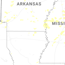
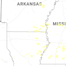

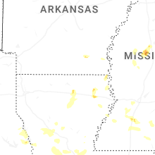


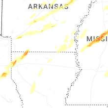


Connect with Interactive Hail Maps