

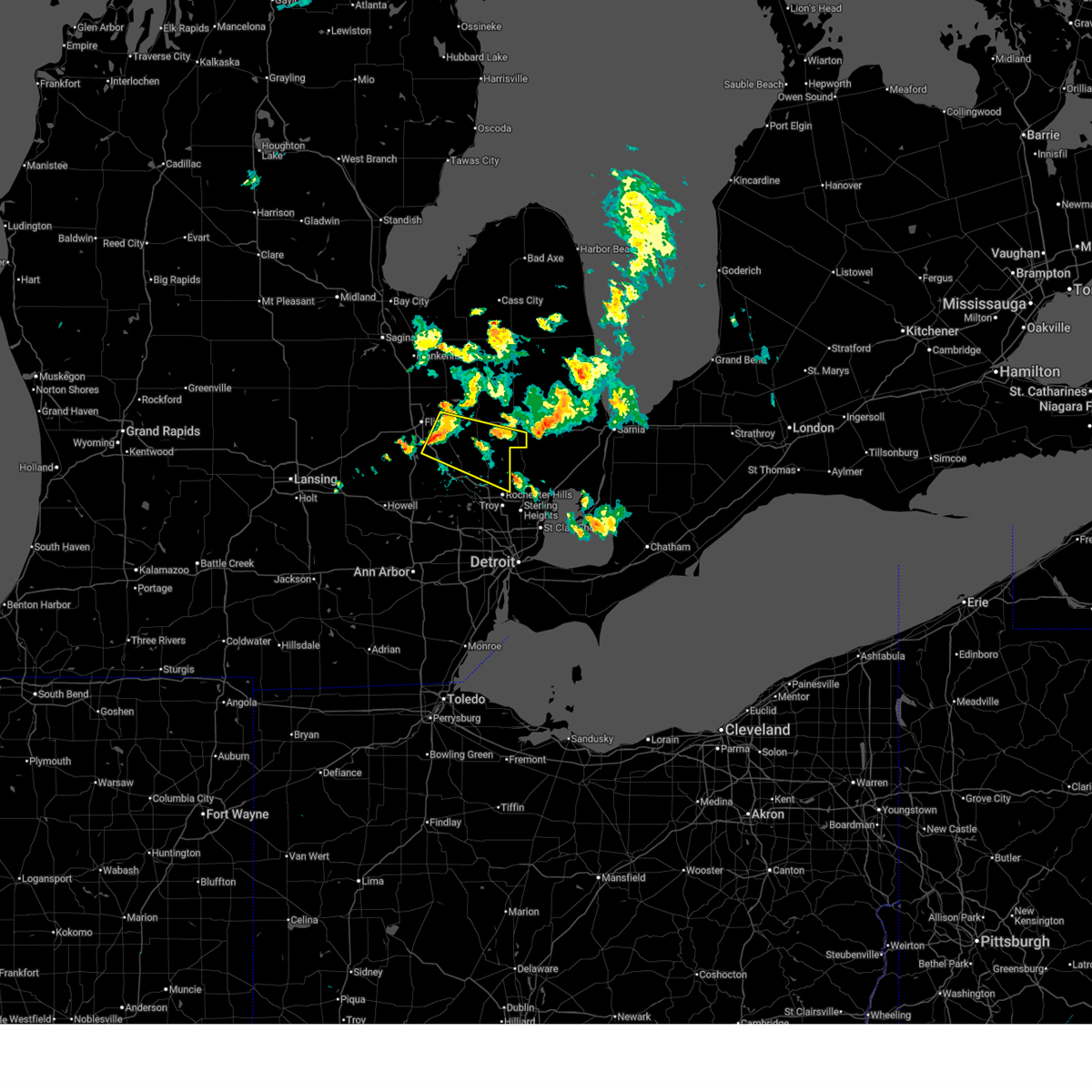
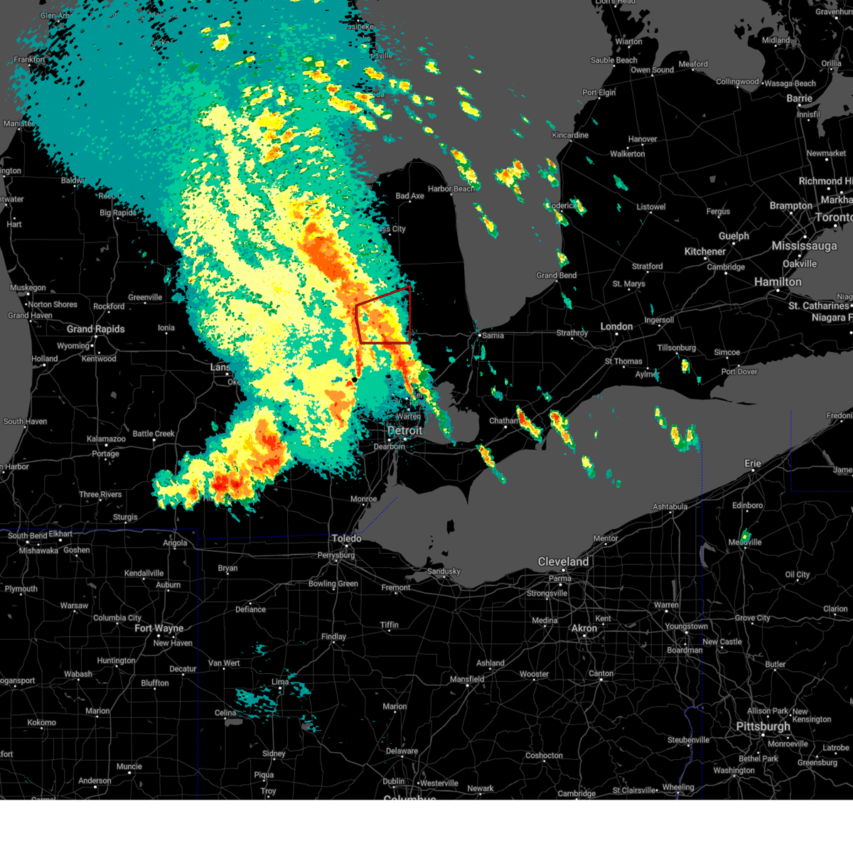
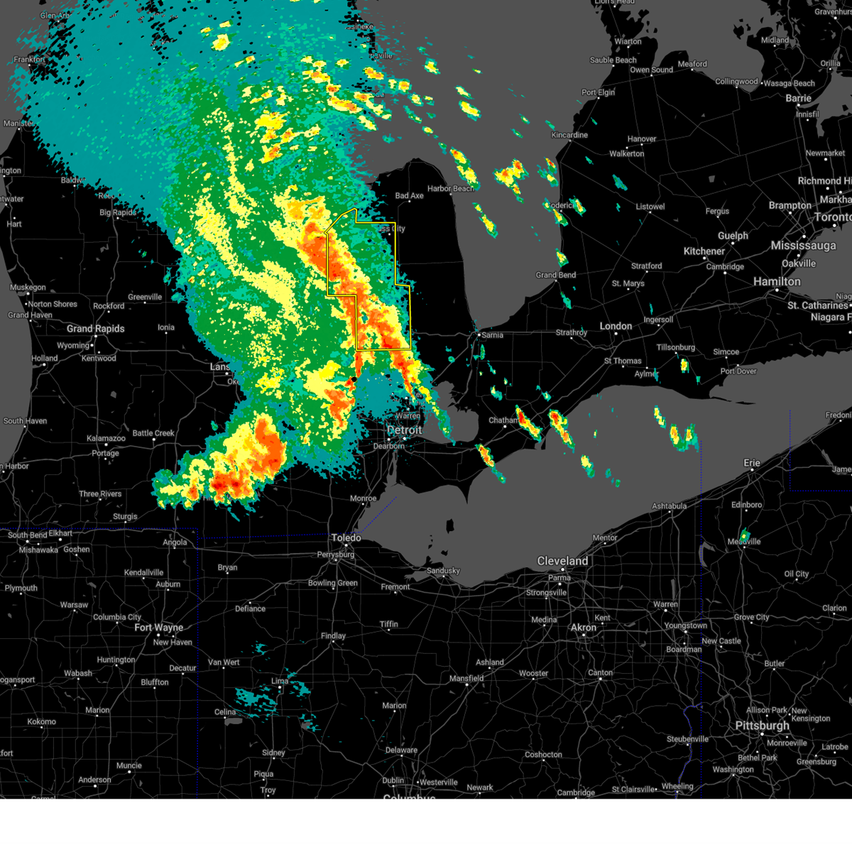
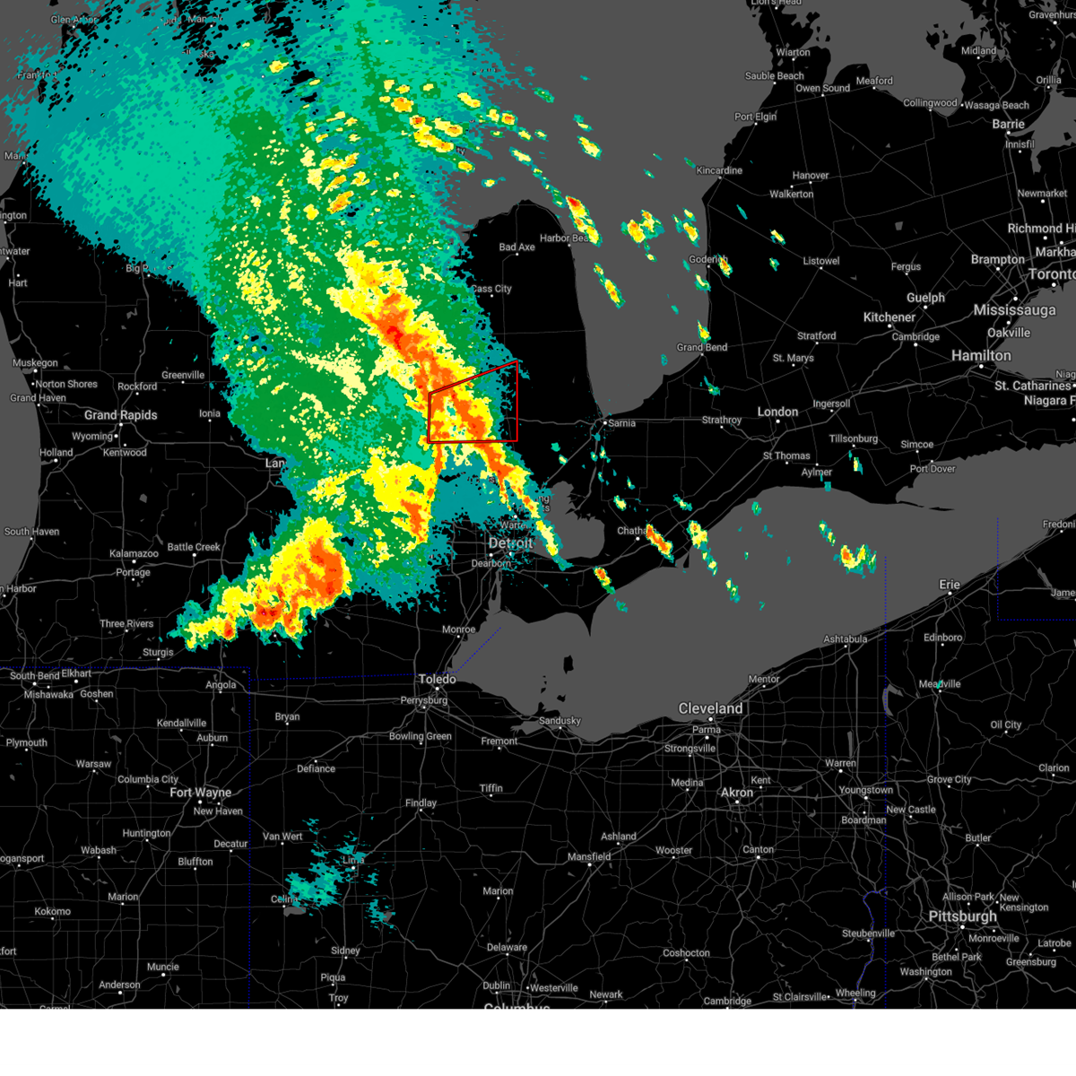
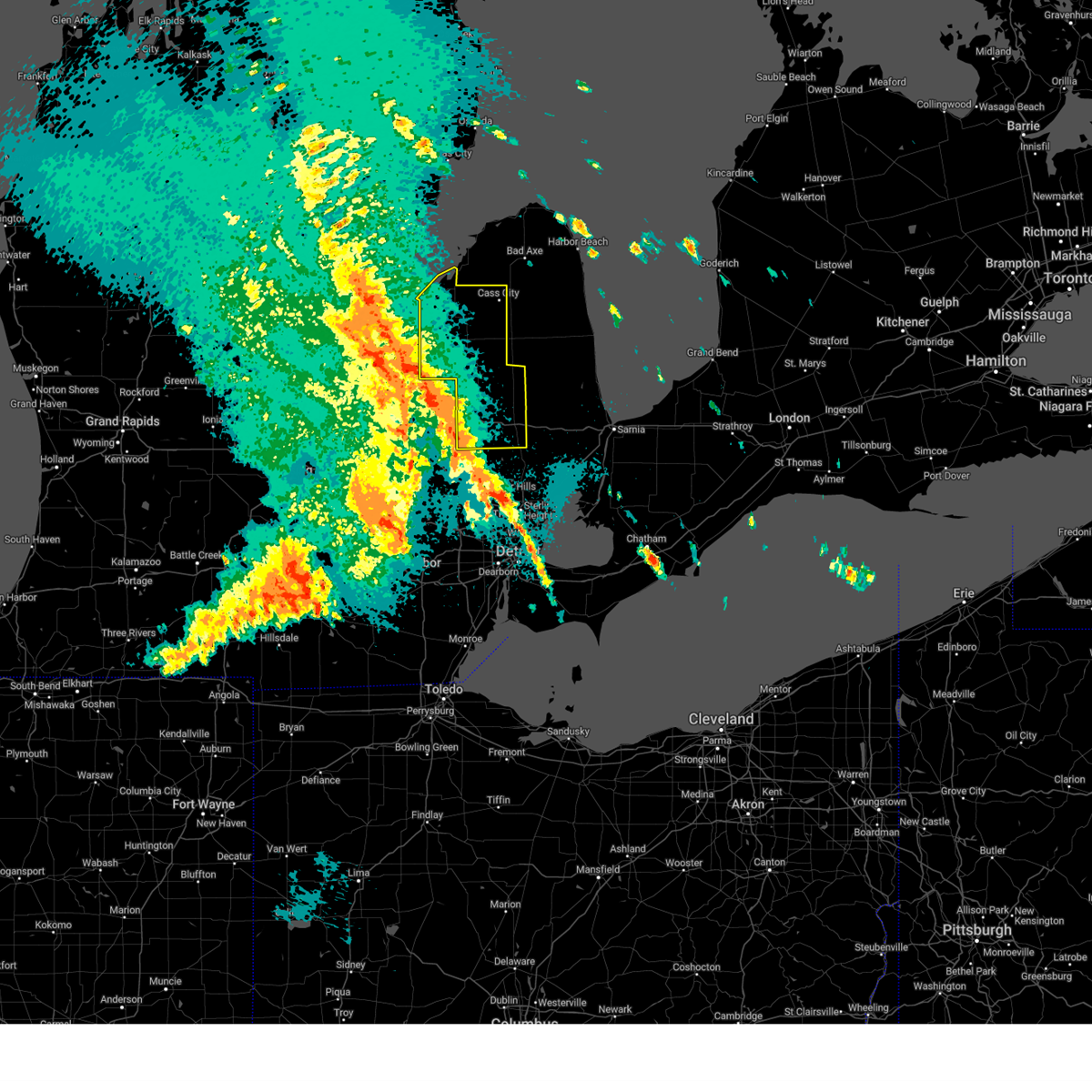
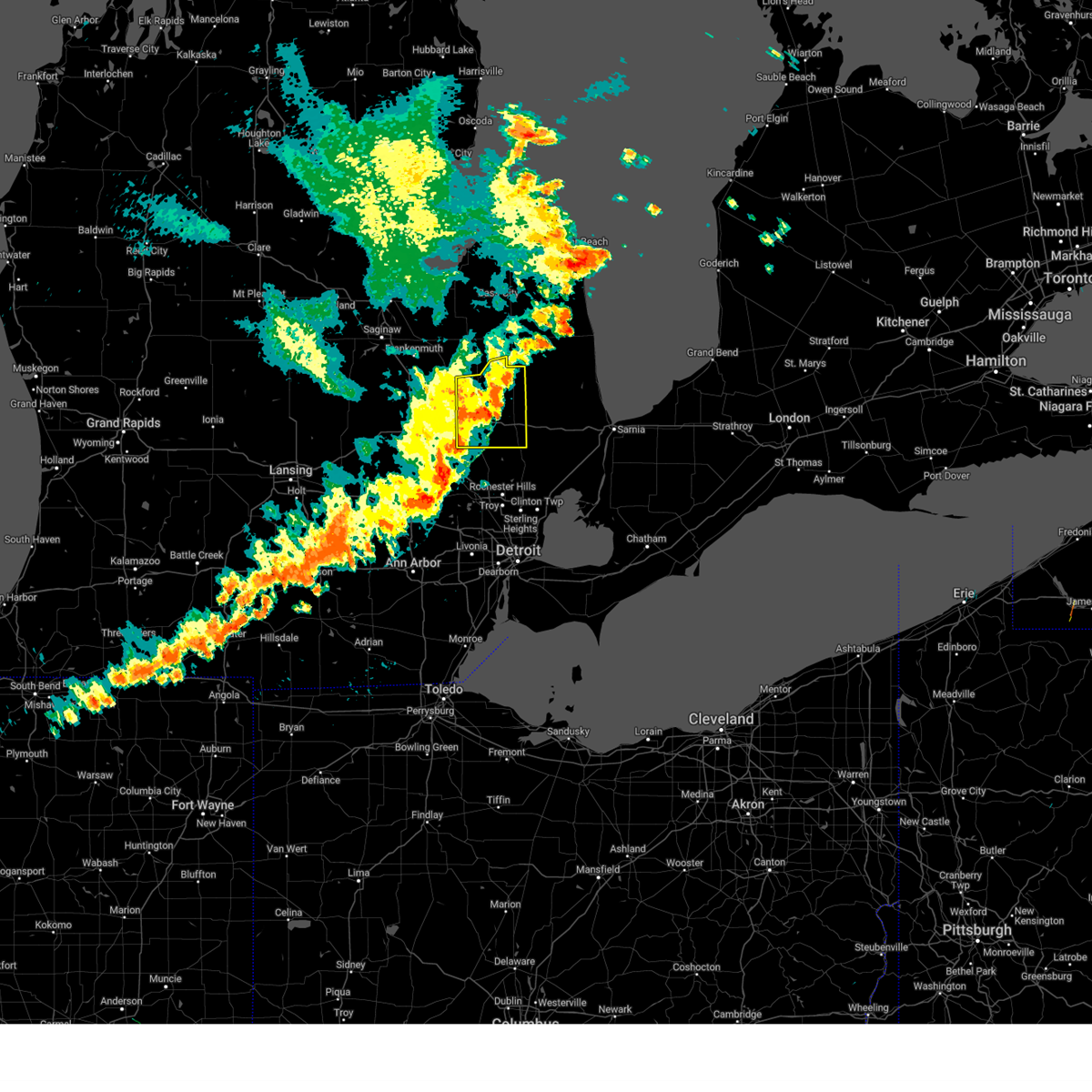
Hail Map for Lapeer, MI
The Lapeer, MI area has had 5 reports of on-the-ground hail by trained spotters, and has been under severe weather warnings 18 times during the past 12 months. Doppler radar has detected hail at or near Lapeer, MI on 25 occasions, including 1 occasion during the past year.
| Name: | Lapeer, MI |
| Where Located: | 18.5 miles E of Flint, MI |
| Map: | Google Map for Lapeer, MI |
| Population: | 8841 |
| Housing Units: | 3956 |
| More Info: | Search Google for Lapeer, MI |
1
The Top Recent Hail Date for Lapeer, MI is Tuesday, August 27, 2024 (9th out of 25)

Hail and Wind Damage Spotted near Lapeer, MI
| Date / Time | Report Details |
|---|---|
| 7/11/2025 7:56 PM EDT | the severe thunderstorm warning has been cancelled and is no longer in effect |
| 7/11/2025 7:40 PM EDT | the severe thunderstorm warning has been cancelled and is no longer in effect |
| 7/11/2025 7:40 PM EDT | At 740 pm edt, a severe thunderstorm was located over ortonville, or 9 miles east of grand blanc, moving east at 25 mph (radar indicated). Hazards include 60 mph wind gusts and quarter size hail. Hail damage to vehicles is expected. expect wind damage to roofs, siding, and trees. this severe storm will be near, ortonville around 745 pm edt. oxford around 755 pm edt. Other locations impacted by this severe thunderstorm include leonard, lakeville, lake orion, thornville, and rochester hills. |
| 7/11/2025 7:22 PM EDT |
 Svrdtx the national weather service in detroit/pontiac has issued a * severe thunderstorm warning for, southern lapeer county in southeastern michigan, northern oakland county in southeastern michigan, southeastern genesee county in southeastern michigan, * until 815 pm edt. * at 722 pm edt, a severe thunderstorm was located over goodrich, or near grand blanc, moving east at 40 mph (radar indicated). Hazards include 60 mph wind gusts and quarter size hail. Hail damage to vehicles is expected. expect wind damage to roofs, siding, and trees. this severe thunderstorm will be near, hadley, goodrich, and ortonville around 725 pm edt. metamora around 735 pm edt. oxford around 740 pm edt. Other locations impacted by this severe thunderstorm include atlas, lakeville, elba, holly state recreation area, leonard, lake orion, thornville, and rochester hills. Svrdtx the national weather service in detroit/pontiac has issued a * severe thunderstorm warning for, southern lapeer county in southeastern michigan, northern oakland county in southeastern michigan, southeastern genesee county in southeastern michigan, * until 815 pm edt. * at 722 pm edt, a severe thunderstorm was located over goodrich, or near grand blanc, moving east at 40 mph (radar indicated). Hazards include 60 mph wind gusts and quarter size hail. Hail damage to vehicles is expected. expect wind damage to roofs, siding, and trees. this severe thunderstorm will be near, hadley, goodrich, and ortonville around 725 pm edt. metamora around 735 pm edt. oxford around 740 pm edt. Other locations impacted by this severe thunderstorm include atlas, lakeville, elba, holly state recreation area, leonard, lake orion, thornville, and rochester hills.
|
| 6/24/2025 3:55 PM EDT |
 the severe thunderstorm warning has been cancelled and is no longer in effect the severe thunderstorm warning has been cancelled and is no longer in effect
|
| 6/24/2025 3:41 PM EDT |
 At 341 pm edt, a severe thunderstorm was located over goodrich, or near grand blanc, moving east at 30 mph (radar indicated). Hazards include 60 mph wind gusts and penny size hail. Expect damage to roofs, siding, and trees. this severe storm will be near, hadley and goodrich around 345 pm edt. Other locations impacted by this severe thunderstorm include holly state recreation area and atlas. At 341 pm edt, a severe thunderstorm was located over goodrich, or near grand blanc, moving east at 30 mph (radar indicated). Hazards include 60 mph wind gusts and penny size hail. Expect damage to roofs, siding, and trees. this severe storm will be near, hadley and goodrich around 345 pm edt. Other locations impacted by this severe thunderstorm include holly state recreation area and atlas.
|
| 6/24/2025 3:29 PM EDT |
 Svrdtx the national weather service in detroit/pontiac has issued a * severe thunderstorm warning for, southwestern lapeer county in southeastern michigan, northwestern oakland county in southeastern michigan, southeastern genesee county in southeastern michigan, * until 415 pm edt. * at 329 pm edt, a severe thunderstorm was located near lake fenton, or near grand blanc, moving east at 30 mph (radar indicated). Hazards include 60 mph wind gusts and quarter size hail. Hail damage to vehicles is expected. expect wind damage to roofs, siding, and trees. this severe thunderstorm will be near, grand blanc and goodrich around 335 pm edt. hadley around 350 pm edt. Other locations impacted by this severe thunderstorm include holly state recreation area and atlas. Svrdtx the national weather service in detroit/pontiac has issued a * severe thunderstorm warning for, southwestern lapeer county in southeastern michigan, northwestern oakland county in southeastern michigan, southeastern genesee county in southeastern michigan, * until 415 pm edt. * at 329 pm edt, a severe thunderstorm was located near lake fenton, or near grand blanc, moving east at 30 mph (radar indicated). Hazards include 60 mph wind gusts and quarter size hail. Hail damage to vehicles is expected. expect wind damage to roofs, siding, and trees. this severe thunderstorm will be near, grand blanc and goodrich around 335 pm edt. hadley around 350 pm edt. Other locations impacted by this severe thunderstorm include holly state recreation area and atlas.
|
| 5/16/2025 12:45 AM EDT |
 At 1245 am edt, a severe thunderstorm capable of producing a tornado was located over lapeer, moving east at 70 mph (radar indicated rotation). Hazards include tornado. Flying debris will be dangerous to those caught without shelter. mobile homes will be damaged or destroyed. damage to roofs, windows, and vehicles will occur. tree damage is likely. this dangerous storm will be near, imlay city and lum around 1250 am edt. Other locations impacted by this tornadic thunderstorm include goodland township, burnside, kings mill, attica, elba, and thornville. At 1245 am edt, a severe thunderstorm capable of producing a tornado was located over lapeer, moving east at 70 mph (radar indicated rotation). Hazards include tornado. Flying debris will be dangerous to those caught without shelter. mobile homes will be damaged or destroyed. damage to roofs, windows, and vehicles will occur. tree damage is likely. this dangerous storm will be near, imlay city and lum around 1250 am edt. Other locations impacted by this tornadic thunderstorm include goodland township, burnside, kings mill, attica, elba, and thornville.
|
| 5/16/2025 12:45 AM EDT |
 the tornado warning has been cancelled and is no longer in effect the tornado warning has been cancelled and is no longer in effect
|
| 5/16/2025 12:43 AM EDT |
 At 1243 am edt, severe thunderstorms were located along a line extending from near quanicassee to near mayville to near almont, moving east at 55 mph (radar indicated). Hazards include 60 mph wind gusts. Expect damage to roofs, siding, and trees. these severe storms will be near, caro, sebewaing, brown city, unionville, kingston, and clifford around 1250 am edt. cass city and gagetown around 1255 am edt. Other locations impacted by these severe thunderstorms include goodland township, east dayton, attica, tuscola, elba, colling, wilmot, wisner, ellington, and gilford. At 1243 am edt, severe thunderstorms were located along a line extending from near quanicassee to near mayville to near almont, moving east at 55 mph (radar indicated). Hazards include 60 mph wind gusts. Expect damage to roofs, siding, and trees. these severe storms will be near, caro, sebewaing, brown city, unionville, kingston, and clifford around 1250 am edt. cass city and gagetown around 1255 am edt. Other locations impacted by these severe thunderstorms include goodland township, east dayton, attica, tuscola, elba, colling, wilmot, wisner, ellington, and gilford.
|
| 5/16/2025 12:36 AM EDT |
 Tordtx the national weather service in detroit/pontiac has issued a * tornado warning for, lapeer county in southeastern michigan, northeastern genesee county in southeastern michigan, * until 130 am edt. * at 1236 am edt, a severe thunderstorm capable of producing a tornado was located near goodrich, or near davison, moving east at 55 mph (radar indicated rotation). Hazards include tornado. Flying debris will be dangerous to those caught without shelter. mobile homes will be damaged or destroyed. damage to roofs, windows, and vehicles will occur. tree damage is likely. this dangerous storm will be near, hadley around 1240 am edt. lapeer and metamora around 1245 am edt. imlay city and dryden around 1255 am edt. other locations impacted by this tornadic thunderstorm include atlas, goodland township, burnside, attica, elba, kings mill, and thornville. This includes i-69 between mile markers 141 and 172. Tordtx the national weather service in detroit/pontiac has issued a * tornado warning for, lapeer county in southeastern michigan, northeastern genesee county in southeastern michigan, * until 130 am edt. * at 1236 am edt, a severe thunderstorm capable of producing a tornado was located near goodrich, or near davison, moving east at 55 mph (radar indicated rotation). Hazards include tornado. Flying debris will be dangerous to those caught without shelter. mobile homes will be damaged or destroyed. damage to roofs, windows, and vehicles will occur. tree damage is likely. this dangerous storm will be near, hadley around 1240 am edt. lapeer and metamora around 1245 am edt. imlay city and dryden around 1255 am edt. other locations impacted by this tornadic thunderstorm include atlas, goodland township, burnside, attica, elba, kings mill, and thornville. This includes i-69 between mile markers 141 and 172.
|
| 5/16/2025 12:33 AM EDT | Photos of trees down and large branches in lapeer county MI, 5.7 miles SE of Lapeer, MI |
| 5/16/2025 12:25 AM EDT |
 Svrdtx the national weather service in detroit/pontiac has issued a * severe thunderstorm warning for, tuscola county in southeastern michigan, lapeer county in southeastern michigan, * until 130 am edt. * at 1225 am edt, severe thunderstorms were located along a line extending from near auburn to birch run to fenton, moving east at 55 mph (radar indicated). Hazards include 60 mph wind gusts. Expect damage to roofs, siding, and trees. severe thunderstorms will be near, reese around 1230 am edt. vassar, millington, otter lake, and quanicassee around 1235 am edt. lapeer, columbiaville, hadley, and fairgrove around 1240 am edt. caro, mayville, akron, and metamora around 1245 am edt. sebewaing, north branch, unionville, and clifford around 1250 am edt. imlay city, almont, dryden, kingston, and lum around 1255 am edt. cass city, brown city, and gagetown around 100 am edt. Other locations impacted by these severe thunderstorms include goodland township, east dayton, attica, tuscola, elba, colling, wilmot, wisner, ellington, and gilford. Svrdtx the national weather service in detroit/pontiac has issued a * severe thunderstorm warning for, tuscola county in southeastern michigan, lapeer county in southeastern michigan, * until 130 am edt. * at 1225 am edt, severe thunderstorms were located along a line extending from near auburn to birch run to fenton, moving east at 55 mph (radar indicated). Hazards include 60 mph wind gusts. Expect damage to roofs, siding, and trees. severe thunderstorms will be near, reese around 1230 am edt. vassar, millington, otter lake, and quanicassee around 1235 am edt. lapeer, columbiaville, hadley, and fairgrove around 1240 am edt. caro, mayville, akron, and metamora around 1245 am edt. sebewaing, north branch, unionville, and clifford around 1250 am edt. imlay city, almont, dryden, kingston, and lum around 1255 am edt. cass city, brown city, and gagetown around 100 am edt. Other locations impacted by these severe thunderstorms include goodland township, east dayton, attica, tuscola, elba, colling, wilmot, wisner, ellington, and gilford.
|
| 3/30/2025 7:41 PM EDT |
 At 741 pm edt, severe thunderstorms were located along a line extending from near quanicassee to mayville to lum, moving northeast at 65 mph (radar indicated). Hazards include 70 mph wind gusts and penny size hail. Expect considerable tree damage. damage is likely to mobile homes, roofs, and outbuildings. these severe storms will be near, akron, north branch, clifford, caro, kingston, and unionville around 745 pm edt. gagetown, cass city, and brown city around 750 pm edt. other locations impacted by these severe thunderstorms include goodland township, east dayton, attica, colling, wilmot, wisner, ellington, gilford, silverwood, and deford. This includes i-69 between mile markers 159 and 172. At 741 pm edt, severe thunderstorms were located along a line extending from near quanicassee to mayville to lum, moving northeast at 65 mph (radar indicated). Hazards include 70 mph wind gusts and penny size hail. Expect considerable tree damage. damage is likely to mobile homes, roofs, and outbuildings. these severe storms will be near, akron, north branch, clifford, caro, kingston, and unionville around 745 pm edt. gagetown, cass city, and brown city around 750 pm edt. other locations impacted by these severe thunderstorms include goodland township, east dayton, attica, colling, wilmot, wisner, ellington, gilford, silverwood, and deford. This includes i-69 between mile markers 159 and 172.
|
| 3/30/2025 7:31 PM EDT | At 730 pm edt, severe thunderstorms were located along a line extending from near munger to otter lake to near metamora, moving northeast at 65 mph (radar indicated). Hazards include 70 mph wind gusts and penny size hail. Expect considerable tree damage. damage is likely to mobile homes, roofs, and outbuildings. these severe storms will be near, lapeer, quanicassee, lum, fairgrove, vassar, and mayville around 735 pm edt. akron, north branch, imlay city, clifford, and caro around 740 pm edt. brown city, kingston, and unionville around 745 pm edt. gagetown and cass city around 750 pm edt. other locations impacted by these severe thunderstorms include goodland township, east dayton, attica, tuscola, elba, colling, wilmot, wisner, ellington, and gilford. This includes i-69 between mile markers 149 and 172. |
| 3/30/2025 7:15 PM EDT | Svrdtx the national weather service in detroit/pontiac has issued a * severe thunderstorm warning for, tuscola county in southeastern michigan, lapeer county in southeastern michigan, * until 815 pm edt. * at 715 pm edt, severe thunderstorms were located along a line extending from near bridgeport to near beecher to near ortonville, moving northeast at 65 mph (radar indicated). Hazards include 70 mph wind gusts and penny size hail. Expect considerable tree damage. damage is likely to mobile homes, roofs, and outbuildings. severe thunderstorms will be near, hadley around 720 pm edt. lapeer, otter lake, millington, vassar, reese, metamora, and columbiaville around 725 pm edt. quanicassee around 730 pm edt. lum, akron, north branch, fairgrove, caro, and mayville around 735 pm edt. clifford and unionville around 740 pm edt. brown city and kingston around 745 pm edt. gagetown and cass city around 750 pm edt. other locations impacted by these severe thunderstorms include goodland township, east dayton, attica, tuscola, elba, colling, wilmot, wisner, ellington, and gilford. This includes i-69 between mile markers 149 and 172. |
| 8/27/2024 5:27 PM EDT |
 At 527 pm edt, severe thunderstorms were located along a line extending from near marlette to near lum to near ortonville, moving east at 40 mph (radar indicated). Hazards include 70 mph wind gusts and penny size hail. Expect considerable tree damage. damage is likely to mobile homes, roofs, and outbuildings. these severe storms will be near, imlay city, brown city, dryden, and metamora around 530 pm edt. almont around 535 pm edt. other locations impacted by these severe thunderstorms include goodland township, burnside, kings mill, attica, elba, and thornville. This includes i-69 between mile markers 149 and 172. At 527 pm edt, severe thunderstorms were located along a line extending from near marlette to near lum to near ortonville, moving east at 40 mph (radar indicated). Hazards include 70 mph wind gusts and penny size hail. Expect considerable tree damage. damage is likely to mobile homes, roofs, and outbuildings. these severe storms will be near, imlay city, brown city, dryden, and metamora around 530 pm edt. almont around 535 pm edt. other locations impacted by these severe thunderstorms include goodland township, burnside, kings mill, attica, elba, and thornville. This includes i-69 between mile markers 149 and 172.
|
| 8/27/2024 5:11 PM EDT |
 At 511 pm edt, severe thunderstorms were located along a line extending from near mayville to near columbiaville to grand blanc, moving east at 45 mph (radar indicated). Hazards include 70 mph wind gusts and penny size hail. Expect considerable tree damage. damage is likely to mobile homes, roofs, and outbuildings. these severe storms will be near, lapeer, north branch, hadley, and clifford around 515 pm edt. brown city, metamora, and lum around 525 pm edt. imlay city around 530 pm edt. dryden around 535 pm edt. almont around 540 pm edt. other locations impacted by these severe thunderstorms include goodland township, burnside, attica, elba, kings mill, silverwood, and thornville. This includes i-69 between mile markers 149 and 172. At 511 pm edt, severe thunderstorms were located along a line extending from near mayville to near columbiaville to grand blanc, moving east at 45 mph (radar indicated). Hazards include 70 mph wind gusts and penny size hail. Expect considerable tree damage. damage is likely to mobile homes, roofs, and outbuildings. these severe storms will be near, lapeer, north branch, hadley, and clifford around 515 pm edt. brown city, metamora, and lum around 525 pm edt. imlay city around 530 pm edt. dryden around 535 pm edt. almont around 540 pm edt. other locations impacted by these severe thunderstorms include goodland township, burnside, attica, elba, kings mill, silverwood, and thornville. This includes i-69 between mile markers 149 and 172.
|
| 8/27/2024 4:54 PM EDT |
 Svrdtx the national weather service in detroit/pontiac has issued a * severe thunderstorm warning for, lapeer county in southeastern michigan, * until 615 pm edt. * at 454 pm edt, severe thunderstorms were located along a line extending from near vassar to near mount morris to near lennon, moving east at 35 mph (radar indicated). Hazards include 70 mph wind gusts and penny size hail. Expect considerable tree damage. damage is likely to mobile homes, roofs, and outbuildings. severe thunderstorms will be near, otter lake around 505 pm edt. columbiaville around 510 pm edt. clifford around 520 pm edt. lapeer and north branch around 525 pm edt. hadley around 530 pm edt. metamora and lum around 540 pm edt. brown city around 545 pm edt. imlay city and dryden around 550 pm edt. other locations impacted by these severe thunderstorms include goodland township, burnside, attica, elba, kings mill, silverwood, and thornville. This includes i-69 between mile markers 149 and 172. Svrdtx the national weather service in detroit/pontiac has issued a * severe thunderstorm warning for, lapeer county in southeastern michigan, * until 615 pm edt. * at 454 pm edt, severe thunderstorms were located along a line extending from near vassar to near mount morris to near lennon, moving east at 35 mph (radar indicated). Hazards include 70 mph wind gusts and penny size hail. Expect considerable tree damage. damage is likely to mobile homes, roofs, and outbuildings. severe thunderstorms will be near, otter lake around 505 pm edt. columbiaville around 510 pm edt. clifford around 520 pm edt. lapeer and north branch around 525 pm edt. hadley around 530 pm edt. metamora and lum around 540 pm edt. brown city around 545 pm edt. imlay city and dryden around 550 pm edt. other locations impacted by these severe thunderstorms include goodland township, burnside, attica, elba, kings mill, silverwood, and thornville. This includes i-69 between mile markers 149 and 172.
|
| 5/17/2024 6:30 PM EDT |
 the severe thunderstorm warning has been cancelled and is no longer in effect the severe thunderstorm warning has been cancelled and is no longer in effect
|
| 5/17/2024 6:16 PM EDT |
 At 616 pm edt, a severe thunderstorm was located near lapeer, moving south at 15 mph (radar indicated). Hazards include 60 mph wind gusts and quarter size hail. Hail damage to vehicles is expected. expect wind damage to roofs, siding, and trees. this severe storm will be near, lapeer around 620 pm edt. Other locations impacted by this severe thunderstorm include elba. At 616 pm edt, a severe thunderstorm was located near lapeer, moving south at 15 mph (radar indicated). Hazards include 60 mph wind gusts and quarter size hail. Hail damage to vehicles is expected. expect wind damage to roofs, siding, and trees. this severe storm will be near, lapeer around 620 pm edt. Other locations impacted by this severe thunderstorm include elba.
|
| 5/17/2024 6:04 PM EDT |
 At 602 pm edt, a severe thunderstorm was located southeast of columbiaville, moving south at 10 mph. trained spotters reported half dollar size hail 5 miles southeast of columbiaville (trained weather spotters). Hazards include 60 mph wind gusts and half dollar size hail. Hail damage to vehicles is expected. expect wind damage to roofs, siding, and trees. this severe storm will be near, lapeer around 610 pm edt. Other locations impacted by this severe thunderstorm include elba. At 602 pm edt, a severe thunderstorm was located southeast of columbiaville, moving south at 10 mph. trained spotters reported half dollar size hail 5 miles southeast of columbiaville (trained weather spotters). Hazards include 60 mph wind gusts and half dollar size hail. Hail damage to vehicles is expected. expect wind damage to roofs, siding, and trees. this severe storm will be near, lapeer around 610 pm edt. Other locations impacted by this severe thunderstorm include elba.
|
| 5/17/2024 5:56 PM EDT |
 At 556 pm edt, a severe thunderstorm was located over columbiaville, moving south at 10 mph (radar indicated). Hazards include 60 mph wind gusts and half dollar size hail. Hail damage to vehicles is expected. expect wind damage to roofs, siding, and trees. this severe storm will be near, lapeer around 600 pm edt. Other locations impacted by this severe thunderstorm include elba. At 556 pm edt, a severe thunderstorm was located over columbiaville, moving south at 10 mph (radar indicated). Hazards include 60 mph wind gusts and half dollar size hail. Hail damage to vehicles is expected. expect wind damage to roofs, siding, and trees. this severe storm will be near, lapeer around 600 pm edt. Other locations impacted by this severe thunderstorm include elba.
|
| 5/17/2024 5:43 PM EDT |
 Svrdtx the national weather service in detroit/pontiac has issued a * severe thunderstorm warning for, northwestern lapeer county in southeastern michigan, * until 645 pm edt. * at 543 pm edt, a severe thunderstorm was located over columbiaville, moving south at 15 mph (radar indicated). Hazards include 60 mph wind gusts and quarter size hail. Hail damage to vehicles is expected. expect wind damage to roofs, siding, and trees. this severe thunderstorm will be near, columbiaville around 550 pm edt. lapeer around 600 pm edt. Other locations impacted by this severe thunderstorm include elba. Svrdtx the national weather service in detroit/pontiac has issued a * severe thunderstorm warning for, northwestern lapeer county in southeastern michigan, * until 645 pm edt. * at 543 pm edt, a severe thunderstorm was located over columbiaville, moving south at 15 mph (radar indicated). Hazards include 60 mph wind gusts and quarter size hail. Hail damage to vehicles is expected. expect wind damage to roofs, siding, and trees. this severe thunderstorm will be near, columbiaville around 550 pm edt. lapeer around 600 pm edt. Other locations impacted by this severe thunderstorm include elba.
|
| 2/28/2024 1:36 AM EST |
 At 136 am est, a severe thunderstorm was located over metamora, or 7 miles north of oxford, moving east at 35 mph (radar indicated). Hazards include 60 mph wind gusts and quarter size hail. Hail damage to vehicles is expected. expect wind damage to roofs, siding, and trees. this severe storm will be near, metamora around 140 am est. dryden around 145 am est. almont around 150 am est. imlay city around 155 am est. Other locations impacted by this severe thunderstorm include attica and thornville. At 136 am est, a severe thunderstorm was located over metamora, or 7 miles north of oxford, moving east at 35 mph (radar indicated). Hazards include 60 mph wind gusts and quarter size hail. Hail damage to vehicles is expected. expect wind damage to roofs, siding, and trees. this severe storm will be near, metamora around 140 am est. dryden around 145 am est. almont around 150 am est. imlay city around 155 am est. Other locations impacted by this severe thunderstorm include attica and thornville.
|
| 2/28/2024 1:29 AM EST |
 Svrdtx the national weather service in detroit/pontiac has issued a * severe thunderstorm warning for, southern lapeer county in southeastern michigan, * until 245 am est. * at 128 am est, a severe thunderstorm was located near hadley, or 9 miles southeast of davison, moving east at 35 mph (radar indicated). Hazards include 60 mph wind gusts and quarter size hail. Hail damage to vehicles is expected. expect wind damage to roofs, siding, and trees. this severe thunderstorm will be near, metamora around 135 am est. dryden around 145 am est. imlay city and almont around 155 am est. Other locations impacted by this severe thunderstorm include attica and thornville. Svrdtx the national weather service in detroit/pontiac has issued a * severe thunderstorm warning for, southern lapeer county in southeastern michigan, * until 245 am est. * at 128 am est, a severe thunderstorm was located near hadley, or 9 miles southeast of davison, moving east at 35 mph (radar indicated). Hazards include 60 mph wind gusts and quarter size hail. Hail damage to vehicles is expected. expect wind damage to roofs, siding, and trees. this severe thunderstorm will be near, metamora around 135 am est. dryden around 145 am est. imlay city and almont around 155 am est. Other locations impacted by this severe thunderstorm include attica and thornville.
|
| 8/24/2023 9:23 PM EDT |
 At 922 pm edt, severe thunderstorms were located along a line extending from near lapeer to near hadley to near davison, moving southeast at 40 mph (radar indicated). Hazards include 60 mph wind gusts. Expect damage to roofs, siding, and trees. severe thunderstorms will be near, hadley around 930 pm edt. lum around 935 pm edt. metamora around 940 pm edt. imlay city and dryden around 945 pm edt. almont around 955 pm edt. other locations impacted by these severe thunderstorms include kings mill, attica, elba and thornville. people attending everett cummings center should seek safe shelter immediately! hail threat, radar indicated max hail size, <. 75 in wind threat, radar indicated max wind gust, 60 mph. At 922 pm edt, severe thunderstorms were located along a line extending from near lapeer to near hadley to near davison, moving southeast at 40 mph (radar indicated). Hazards include 60 mph wind gusts. Expect damage to roofs, siding, and trees. severe thunderstorms will be near, hadley around 930 pm edt. lum around 935 pm edt. metamora around 940 pm edt. imlay city and dryden around 945 pm edt. almont around 955 pm edt. other locations impacted by these severe thunderstorms include kings mill, attica, elba and thornville. people attending everett cummings center should seek safe shelter immediately! hail threat, radar indicated max hail size, <. 75 in wind threat, radar indicated max wind gust, 60 mph.
|
| 8/24/2023 8:51 PM EDT |
 At 851 pm edt, a severe thunderstorm was located over imlay city, moving southeast at 30 mph (radar indicated). Hazards include 60 mph wind gusts. Expect damage to roofs, siding, and trees. this severe storm will be near, dryden around 900 pm edt. almont around 910 pm edt. other locations impacted by this severe thunderstorm include attica, thornville and goodland township. hail threat, radar indicated max hail size, <. 75 in wind threat, radar indicated max wind gust, 60 mph. At 851 pm edt, a severe thunderstorm was located over imlay city, moving southeast at 30 mph (radar indicated). Hazards include 60 mph wind gusts. Expect damage to roofs, siding, and trees. this severe storm will be near, dryden around 900 pm edt. almont around 910 pm edt. other locations impacted by this severe thunderstorm include attica, thornville and goodland township. hail threat, radar indicated max hail size, <. 75 in wind threat, radar indicated max wind gust, 60 mph.
|
| 8/24/2023 8:38 PM EDT |
 At 837 pm edt, a severe thunderstorm was located near lum, or 7 miles southeast of north branch, moving southeast at 30 mph (radar indicated). Hazards include 60 mph wind gusts. Expect damage to roofs, siding, and trees. this severe storm will be near, imlay city around 850 pm edt. dryden around 900 pm edt. almont around 910 pm edt. other locations impacted by this severe thunderstorm include goodland township, burnside, kings mill, attica and thornville. hail threat, radar indicated max hail size, <. 75 in wind threat, radar indicated max wind gust, 60 mph. At 837 pm edt, a severe thunderstorm was located near lum, or 7 miles southeast of north branch, moving southeast at 30 mph (radar indicated). Hazards include 60 mph wind gusts. Expect damage to roofs, siding, and trees. this severe storm will be near, imlay city around 850 pm edt. dryden around 900 pm edt. almont around 910 pm edt. other locations impacted by this severe thunderstorm include goodland township, burnside, kings mill, attica and thornville. hail threat, radar indicated max hail size, <. 75 in wind threat, radar indicated max wind gust, 60 mph.
|
| 8/24/2023 8:29 PM EDT |
 At 828 pm edt, a severe thunderstorm was located over north branch, moving southeast at 30 mph (radar indicated). Hazards include 60 mph wind gusts and penny size hail. Expect damage to roofs, siding, and trees. this severe thunderstorm will be near, brown city around 835 pm edt. lum around 845 pm edt. imlay city around 855 pm edt. almont around 910 pm edt. other locations impacted by this severe thunderstorm include goodland township, burnside, kings mill, attica, silverwood and thornville. hail threat, radar indicated max hail size, 0. 75 in wind threat, radar indicated max wind gust, 60 mph. At 828 pm edt, a severe thunderstorm was located over north branch, moving southeast at 30 mph (radar indicated). Hazards include 60 mph wind gusts and penny size hail. Expect damage to roofs, siding, and trees. this severe thunderstorm will be near, brown city around 835 pm edt. lum around 845 pm edt. imlay city around 855 pm edt. almont around 910 pm edt. other locations impacted by this severe thunderstorm include goodland township, burnside, kings mill, attica, silverwood and thornville. hail threat, radar indicated max hail size, 0. 75 in wind threat, radar indicated max wind gust, 60 mph.
|
| 8/23/2023 9:35 AM EDT |
 At 934 am edt, a severe thunderstorm was located over dryden, or near imlay city, moving southeast at 40 mph (radar indicated). Hazards include quarter size hail. Damage to vehicles is expected. this severe storm will be near, almont around 945 am edt. other locations impacted by this severe thunderstorm include attica and thornville. hail threat, radar indicated max hail size, 1. 00 in wind threat, radar indicated max wind gust, <50 mph. At 934 am edt, a severe thunderstorm was located over dryden, or near imlay city, moving southeast at 40 mph (radar indicated). Hazards include quarter size hail. Damage to vehicles is expected. this severe storm will be near, almont around 945 am edt. other locations impacted by this severe thunderstorm include attica and thornville. hail threat, radar indicated max hail size, 1. 00 in wind threat, radar indicated max wind gust, <50 mph.
|
| 8/23/2023 9:28 AM EDT | Ping Pong Ball sized hail reported 3 miles WSW of Lapeer, MI, picture sent on social media of hail near ping-pong ball and quarter size. |
| 8/23/2023 9:20 AM EDT |
 At 920 am edt, a severe thunderstorm was located near lapeer, moving southeast at 40 mph (radar indicated). Hazards include quarter size hail. Damage to vehicles is expected. this severe storm will be near, lum around 925 am edt. metamora around 930 am edt. imlay city around 935 am edt. dryden around 940 am edt. almont around 945 am edt. other locations impacted by this severe thunderstorm include goodland township, kings mill, attica, elba and thornville. hail threat, radar indicated max hail size, 1. 00 in wind threat, radar indicated max wind gust, <50 mph. At 920 am edt, a severe thunderstorm was located near lapeer, moving southeast at 40 mph (radar indicated). Hazards include quarter size hail. Damage to vehicles is expected. this severe storm will be near, lum around 925 am edt. metamora around 930 am edt. imlay city around 935 am edt. dryden around 940 am edt. almont around 945 am edt. other locations impacted by this severe thunderstorm include goodland township, kings mill, attica, elba and thornville. hail threat, radar indicated max hail size, 1. 00 in wind threat, radar indicated max wind gust, <50 mph.
|
| 8/23/2023 8:54 AM EDT |
 At 852 am edt, a severe thunderstorm was located near otter lake, or near millington, moving southeast at 40 mph (radar indicated). Hazards include quarter size hail. Damage to vehicles is expected. this severe thunderstorm will be near, columbiaville around 900 am edt. lapeer around 915 am edt. lum around 920 am edt. metamora around 925 am edt. imlay city around 930 am edt. dryden around 935 am edt. almont around 940 am edt. other locations impacted by this severe thunderstorm include atlas, goodland township, attica, elba, thetford township, kings mill, silverwood, thornville and fostoria. hail threat, radar indicated max hail size, 1. 00 in wind threat, radar indicated max wind gust, <50 mph. At 852 am edt, a severe thunderstorm was located near otter lake, or near millington, moving southeast at 40 mph (radar indicated). Hazards include quarter size hail. Damage to vehicles is expected. this severe thunderstorm will be near, columbiaville around 900 am edt. lapeer around 915 am edt. lum around 920 am edt. metamora around 925 am edt. imlay city around 930 am edt. dryden around 935 am edt. almont around 940 am edt. other locations impacted by this severe thunderstorm include atlas, goodland township, attica, elba, thetford township, kings mill, silverwood, thornville and fostoria. hail threat, radar indicated max hail size, 1. 00 in wind threat, radar indicated max wind gust, <50 mph.
|
| 8/11/2023 9:08 PM EDT |
 At 906 pm edt, severe thunderstorms were located along a line extending from near goodrich to near ortonville to near holly, moving east at 20 mph (radar indicated). Hazards include 60 mph wind gusts and penny size hail. Expect damage to roofs, siding, and trees. these severe storms will be near, hadley and ortonville around 920 pm edt. metamora and clarkston around 945 pm edt. pontiac, oxford and dryden around 1000 pm edt. other locations impacted by these severe thunderstorms include rochester hills, atlas, lakeville, waterford, davisburg, attica, holly state recreation area, rose center, lake orion and auburn hills. People attending the imlay city summer fest should seek safe shelter immediately!. At 906 pm edt, severe thunderstorms were located along a line extending from near goodrich to near ortonville to near holly, moving east at 20 mph (radar indicated). Hazards include 60 mph wind gusts and penny size hail. Expect damage to roofs, siding, and trees. these severe storms will be near, hadley and ortonville around 920 pm edt. metamora and clarkston around 945 pm edt. pontiac, oxford and dryden around 1000 pm edt. other locations impacted by these severe thunderstorms include rochester hills, atlas, lakeville, waterford, davisburg, attica, holly state recreation area, rose center, lake orion and auburn hills. People attending the imlay city summer fest should seek safe shelter immediately!.
|
| 8/11/2023 8:45 PM EDT |
 At 844 pm edt, a severe thunderstorm was located over grand blanc, moving east at 20 mph (radar indicated). Hazards include 60 mph wind gusts and quarter size hail. Hail damage to vehicles is expected. expect wind damage to roofs, siding, and trees. this severe thunderstorm will be near, davison around 855 pm edt. goodrich around 905 pm edt. ortonville around 915 pm edt. hadley around 920 pm edt. metamora around 940 pm edt. oxford around 945 pm edt. other locations impacted by this severe thunderstorm include rochester hills, atlas, lakeville, waterford, davisburg, attica, elba, holly state recreation area, rose center and lake orion. People attending the imlay city summer fest should seek safe shelter immediately!. At 844 pm edt, a severe thunderstorm was located over grand blanc, moving east at 20 mph (radar indicated). Hazards include 60 mph wind gusts and quarter size hail. Hail damage to vehicles is expected. expect wind damage to roofs, siding, and trees. this severe thunderstorm will be near, davison around 855 pm edt. goodrich around 905 pm edt. ortonville around 915 pm edt. hadley around 920 pm edt. metamora around 940 pm edt. oxford around 945 pm edt. other locations impacted by this severe thunderstorm include rochester hills, atlas, lakeville, waterford, davisburg, attica, elba, holly state recreation area, rose center and lake orion. People attending the imlay city summer fest should seek safe shelter immediately!.
|
| 7/28/2023 9:35 PM EDT | Storm damage reported in lapeer county MI, 0.6 miles S of Lapeer, MI |
| 7/28/2023 9:23 PM EDT |
 At 921 pm edt, severe thunderstorms were located along a line extending from lum to lapeer to near davison, moving southeast at 25 mph (radar indicated). Hazards include 60 mph wind gusts and quarter size hail. Hail damage to vehicles is expected. expect wind damage to roofs, siding, and trees. these severe storms will be near, lapeer and lum around 925 pm edt. imlay city around 935 pm edt. metamora around 940 pm edt. goodrich around 945 pm edt. hadley and dryden around 950 pm edt. almont around 1005 pm edt. other locations impacted by these severe thunderstorms include atlas, goodland township, burnside, attica, elba, thetford township, kings mill, genesee and thornville. another strong thunderstorm east of clio will produce very heavy rainfall and small hail. people attending eastern michigan state fair should seek safe shelter immediately! hail threat, radar indicated max hail size, 1. 00 in wind threat, radar indicated max wind gust, 60 mph. At 921 pm edt, severe thunderstorms were located along a line extending from lum to lapeer to near davison, moving southeast at 25 mph (radar indicated). Hazards include 60 mph wind gusts and quarter size hail. Hail damage to vehicles is expected. expect wind damage to roofs, siding, and trees. these severe storms will be near, lapeer and lum around 925 pm edt. imlay city around 935 pm edt. metamora around 940 pm edt. goodrich around 945 pm edt. hadley and dryden around 950 pm edt. almont around 1005 pm edt. other locations impacted by these severe thunderstorms include atlas, goodland township, burnside, attica, elba, thetford township, kings mill, genesee and thornville. another strong thunderstorm east of clio will produce very heavy rainfall and small hail. people attending eastern michigan state fair should seek safe shelter immediately! hail threat, radar indicated max hail size, 1. 00 in wind threat, radar indicated max wind gust, 60 mph.
|
| 7/28/2023 9:02 PM EDT |
 At 902 pm edt, severe thunderstorms were located along a line extending from near lum to near columbiaville to near crossroads village, moving southeast at 25 mph (radar indicated). Hazards include 60 mph wind gusts and quarter size hail. Hail damage to vehicles is expected. expect wind damage to roofs, siding, and trees. these severe storms will be near, lum around 910 pm edt. lapeer around 915 pm edt. imlay city around 925 pm edt. goodrich around 940 pm edt. hadley and dryden around 945 pm edt. metamora around 955 pm edt. almont around 1000 pm edt. other locations impacted by these severe thunderstorms include atlas, goodland township, burnside, attica, elba, thetford township, kings mill, genesee and thornville. people attending eastern michigan state fair should seek safe shelter immediately! hail threat, radar indicated max hail size, 1. 00 in wind threat, radar indicated max wind gust, 60 mph. At 902 pm edt, severe thunderstorms were located along a line extending from near lum to near columbiaville to near crossroads village, moving southeast at 25 mph (radar indicated). Hazards include 60 mph wind gusts and quarter size hail. Hail damage to vehicles is expected. expect wind damage to roofs, siding, and trees. these severe storms will be near, lum around 910 pm edt. lapeer around 915 pm edt. imlay city around 925 pm edt. goodrich around 940 pm edt. hadley and dryden around 945 pm edt. metamora around 955 pm edt. almont around 1000 pm edt. other locations impacted by these severe thunderstorms include atlas, goodland township, burnside, attica, elba, thetford township, kings mill, genesee and thornville. people attending eastern michigan state fair should seek safe shelter immediately! hail threat, radar indicated max hail size, 1. 00 in wind threat, radar indicated max wind gust, 60 mph.
|
| 7/28/2023 8:44 PM EDT |
 At 844 pm edt, severe thunderstorms were located along a line extending from near north branch to otter lake to near otisville, moving southeast at 35 mph (radar indicated). Hazards include 60 mph wind gusts and quarter size hail. Hail damage to vehicles is expected. expect wind damage to roofs, siding, and trees. severe thunderstorms will be near, north branch around 850 pm edt. brown city around 855 pm edt. davison around 905 pm edt. lum around 910 pm edt. lapeer around 915 pm edt. imlay city around 920 pm edt. metamora around 925 pm edt. dryden around 935 pm edt. other locations impacted by these severe thunderstorms include atlas, goodland township, burnside, attica, elba, thetford township, kings mill, silverwood, genesee and thornville. people attending eastern michigan state fair should seek safe shelter immediately! hail threat, radar indicated max hail size, 1. 00 in wind threat, radar indicated max wind gust, 60 mph. At 844 pm edt, severe thunderstorms were located along a line extending from near north branch to otter lake to near otisville, moving southeast at 35 mph (radar indicated). Hazards include 60 mph wind gusts and quarter size hail. Hail damage to vehicles is expected. expect wind damage to roofs, siding, and trees. severe thunderstorms will be near, north branch around 850 pm edt. brown city around 855 pm edt. davison around 905 pm edt. lum around 910 pm edt. lapeer around 915 pm edt. imlay city around 920 pm edt. metamora around 925 pm edt. dryden around 935 pm edt. other locations impacted by these severe thunderstorms include atlas, goodland township, burnside, attica, elba, thetford township, kings mill, silverwood, genesee and thornville. people attending eastern michigan state fair should seek safe shelter immediately! hail threat, radar indicated max hail size, 1. 00 in wind threat, radar indicated max wind gust, 60 mph.
|
| 7/26/2023 4:35 PM EDT |
 The severe thunderstorm warning for southern lapeer county will expire at 445 pm edt, the storms which prompted the warning have weakened below severe limits, and no longer pose an immediate threat to life or property. therefore, the warning will be allowed to expire. a severe thunderstorm watch remains in effect until 700 pm edt for southeastern michigan. The severe thunderstorm warning for southern lapeer county will expire at 445 pm edt, the storms which prompted the warning have weakened below severe limits, and no longer pose an immediate threat to life or property. therefore, the warning will be allowed to expire. a severe thunderstorm watch remains in effect until 700 pm edt for southeastern michigan.
|
| 7/26/2023 4:18 PM EDT |
 At 418 pm edt, severe thunderstorms were located along a line extending from near lapeer to near dryden to near romeo, moving north at 25 mph (radar indicated). Hazards include 60 mph wind gusts. Expect damage to roofs, siding, and trees. these severe storms will be near, imlay city around 440 pm edt. other locations impacted by these severe thunderstorms include thornville. people attending eastern michigan state fair should seek safe shelter immediately! hail threat, radar indicated max hail size, <. 75 in wind threat, radar indicated max wind gust, 60 mph. At 418 pm edt, severe thunderstorms were located along a line extending from near lapeer to near dryden to near romeo, moving north at 25 mph (radar indicated). Hazards include 60 mph wind gusts. Expect damage to roofs, siding, and trees. these severe storms will be near, imlay city around 440 pm edt. other locations impacted by these severe thunderstorms include thornville. people attending eastern michigan state fair should seek safe shelter immediately! hail threat, radar indicated max hail size, <. 75 in wind threat, radar indicated max wind gust, 60 mph.
|
| 7/26/2023 4:06 PM EDT |
 At 406 pm edt, severe thunderstorms were located along a line extending from ortonville to near oxford to romeo, moving north at 45 mph (radar indicated). Hazards include 60 mph wind gusts. Expect damage to roofs, siding, and trees. severe thunderstorms will be near, hadley and metamora around 415 pm edt. almont and dryden around 420 pm edt. imlay city around 425 pm edt. other locations impacted by these severe thunderstorms include thornville. people attending eastern michigan state fair should seek safe shelter immediately! hail threat, radar indicated max hail size, <. 75 in wind threat, radar indicated max wind gust, 60 mph. At 406 pm edt, severe thunderstorms were located along a line extending from ortonville to near oxford to romeo, moving north at 45 mph (radar indicated). Hazards include 60 mph wind gusts. Expect damage to roofs, siding, and trees. severe thunderstorms will be near, hadley and metamora around 415 pm edt. almont and dryden around 420 pm edt. imlay city around 425 pm edt. other locations impacted by these severe thunderstorms include thornville. people attending eastern michigan state fair should seek safe shelter immediately! hail threat, radar indicated max hail size, <. 75 in wind threat, radar indicated max wind gust, 60 mph.
|
| 7/20/2023 3:10 PM EDT |
 At 309 pm edt, severe thunderstorms were located along a line extending from near lum to near lapeer to near ortonville, moving east at 50 mph (radar indicated). Hazards include ping pong ball size hail and 60 mph wind gusts. People and animals outdoors will be injured. expect hail damage to roofs, siding, windows, and vehicles. expect wind damage to roofs, siding, and trees. these severe storms will be near, lum around 315 pm edt. imlay city and brown city around 320 pm edt. metamora around 325 pm edt. dryden around 335 pm edt. almont around 340 pm edt. other locations impacted by these severe thunderstorms include goodland township, burnside, attica, elba, kings mill, silverwood and thornville. hail threat, radar indicated max hail size, 1. 50 in wind threat, radar indicated max wind gust, 60 mph. At 309 pm edt, severe thunderstorms were located along a line extending from near lum to near lapeer to near ortonville, moving east at 50 mph (radar indicated). Hazards include ping pong ball size hail and 60 mph wind gusts. People and animals outdoors will be injured. expect hail damage to roofs, siding, windows, and vehicles. expect wind damage to roofs, siding, and trees. these severe storms will be near, lum around 315 pm edt. imlay city and brown city around 320 pm edt. metamora around 325 pm edt. dryden around 335 pm edt. almont around 340 pm edt. other locations impacted by these severe thunderstorms include goodland township, burnside, attica, elba, kings mill, silverwood and thornville. hail threat, radar indicated max hail size, 1. 50 in wind threat, radar indicated max wind gust, 60 mph.
|
| 7/20/2023 2:57 PM EDT | Ping Pong Ball sized hail reported 5 miles E of Lapeer, MI |
| 7/20/2023 2:54 PM EDT |
 At 253 pm edt, a severe thunderstorm was located near lapeer, moving east at 35 mph (radar indicated). Hazards include ping pong ball size hail and 60 mph wind gusts. People and animals outdoors will be injured. expect hail damage to roofs, siding, windows, and vehicles. expect wind damage to roofs, siding, and trees. this severe storm will be near, lum around 315 pm edt. imlay city around 320 pm edt. brown city around 330 pm edt. other locations impacted by this severe thunderstorm include goodland township, burnside, attica, elba, kings mill, silverwood and thornville. hail threat, radar indicated max hail size, 1. 50 in wind threat, radar indicated max wind gust, 60 mph. At 253 pm edt, a severe thunderstorm was located near lapeer, moving east at 35 mph (radar indicated). Hazards include ping pong ball size hail and 60 mph wind gusts. People and animals outdoors will be injured. expect hail damage to roofs, siding, windows, and vehicles. expect wind damage to roofs, siding, and trees. this severe storm will be near, lum around 315 pm edt. imlay city around 320 pm edt. brown city around 330 pm edt. other locations impacted by this severe thunderstorm include goodland township, burnside, attica, elba, kings mill, silverwood and thornville. hail threat, radar indicated max hail size, 1. 50 in wind threat, radar indicated max wind gust, 60 mph.
|
| 7/20/2023 2:43 PM EDT |
 At 243 pm edt, a severe thunderstorm was located over davison, moving east at 30 mph (radar indicated). Hazards include 60 mph wind gusts and half dollar size hail. Hail damage to vehicles is expected. expect wind damage to roofs, siding, and trees. this severe storm will be near, columbiaville around 255 pm edt. lapeer around 305 pm edt. lum around 320 pm edt. imlay city around 325 pm edt. brown city around 335 pm edt. other locations impacted by this severe thunderstorm include goodland township, burnside, attica, elba, kings mill, silverwood and thornville. hail threat, radar indicated max hail size, 1. 25 in wind threat, radar indicated max wind gust, 60 mph. At 243 pm edt, a severe thunderstorm was located over davison, moving east at 30 mph (radar indicated). Hazards include 60 mph wind gusts and half dollar size hail. Hail damage to vehicles is expected. expect wind damage to roofs, siding, and trees. this severe storm will be near, columbiaville around 255 pm edt. lapeer around 305 pm edt. lum around 320 pm edt. imlay city around 325 pm edt. brown city around 335 pm edt. other locations impacted by this severe thunderstorm include goodland township, burnside, attica, elba, kings mill, silverwood and thornville. hail threat, radar indicated max hail size, 1. 25 in wind threat, radar indicated max wind gust, 60 mph.
|
| 7/20/2023 2:33 PM EDT |
 At 233 pm edt, a severe thunderstorm was located near flint, moving east at 30 mph (radar indicated). Hazards include 60 mph wind gusts and quarter size hail. Hail damage to vehicles is expected. expect wind damage to roofs, siding, and trees. this severe thunderstorm will be near, columbiaville and otter lake around 300 pm edt. lapeer around 305 pm edt. lum around 320 pm edt. north branch around 325 pm edt. brown city around 340 pm edt. other locations impacted by this severe thunderstorm include goodland township, burnside, attica, elba, kings mill, silverwood and thornville. hail threat, radar indicated max hail size, 1. 00 in wind threat, radar indicated max wind gust, 60 mph. At 233 pm edt, a severe thunderstorm was located near flint, moving east at 30 mph (radar indicated). Hazards include 60 mph wind gusts and quarter size hail. Hail damage to vehicles is expected. expect wind damage to roofs, siding, and trees. this severe thunderstorm will be near, columbiaville and otter lake around 300 pm edt. lapeer around 305 pm edt. lum around 320 pm edt. north branch around 325 pm edt. brown city around 340 pm edt. other locations impacted by this severe thunderstorm include goodland township, burnside, attica, elba, kings mill, silverwood and thornville. hail threat, radar indicated max hail size, 1. 00 in wind threat, radar indicated max wind gust, 60 mph.
|
| 7/11/2023 4:15 PM EDT |
 At 415 pm edt, a severe thunderstorm was located near lum, or near lapeer, moving east at 25 mph (radar indicated). Hazards include 60 mph wind gusts and quarter size hail. Hail damage to vehicles is expected. expect wind damage to roofs, siding, and trees. this severe storm will be near, lum around 425 pm edt. imlay city around 435 pm edt. other locations impacted by this severe thunderstorm include goodland township, burnside, kings mill and attica. hail threat, radar indicated max hail size, 1. 00 in wind threat, radar indicated max wind gust, 60 mph. At 415 pm edt, a severe thunderstorm was located near lum, or near lapeer, moving east at 25 mph (radar indicated). Hazards include 60 mph wind gusts and quarter size hail. Hail damage to vehicles is expected. expect wind damage to roofs, siding, and trees. this severe storm will be near, lum around 425 pm edt. imlay city around 435 pm edt. other locations impacted by this severe thunderstorm include goodland township, burnside, kings mill and attica. hail threat, radar indicated max hail size, 1. 00 in wind threat, radar indicated max wind gust, 60 mph.
|
| 7/11/2023 4:02 PM EDT |
 At 401 pm edt, a severe thunderstorm was located near columbiaville, moving east at 35 mph (radar indicated). Hazards include 60 mph wind gusts and quarter size hail. Hail damage to vehicles is expected. expect wind damage to roofs, siding, and trees. this severe thunderstorm will be near, lum around 420 pm edt. imlay city around 425 pm edt. other locations impacted by this severe thunderstorm include goodland township, burnside, kings mill and attica. hail threat, radar indicated max hail size, 1. 00 in wind threat, radar indicated max wind gust, 60 mph. At 401 pm edt, a severe thunderstorm was located near columbiaville, moving east at 35 mph (radar indicated). Hazards include 60 mph wind gusts and quarter size hail. Hail damage to vehicles is expected. expect wind damage to roofs, siding, and trees. this severe thunderstorm will be near, lum around 420 pm edt. imlay city around 425 pm edt. other locations impacted by this severe thunderstorm include goodland township, burnside, kings mill and attica. hail threat, radar indicated max hail size, 1. 00 in wind threat, radar indicated max wind gust, 60 mph.
|
| 8/29/2022 6:25 PM EDT |
 The severe thunderstorm warning for lapeer county will expire at 630 pm edt, the storms which prompted the warning have moved out of the area. therefore, the warning will be allowed to expire. a severe thunderstorm watch remains in effect until 1000 pm edt for southeastern michigan. The severe thunderstorm warning for lapeer county will expire at 630 pm edt, the storms which prompted the warning have moved out of the area. therefore, the warning will be allowed to expire. a severe thunderstorm watch remains in effect until 1000 pm edt for southeastern michigan.
|
| 8/29/2022 6:07 PM EDT |
 At 607 pm edt, severe thunderstorms were located along a line extending from marlette to near imlay city to near dryden, moving east at 50 mph (radar indicated). Hazards include 60 mph wind gusts. Expect damage to roofs, siding, and trees. these severe storms will be near, brown city around 610 pm edt. other locations impacted by these severe thunderstorms include goodland township, burnside, attica, elba, kings mill, silverwood and thornville. hail threat, radar indicated max hail size, <. 75 in wind threat, radar indicated max wind gust, 60 mph. At 607 pm edt, severe thunderstorms were located along a line extending from marlette to near imlay city to near dryden, moving east at 50 mph (radar indicated). Hazards include 60 mph wind gusts. Expect damage to roofs, siding, and trees. these severe storms will be near, brown city around 610 pm edt. other locations impacted by these severe thunderstorms include goodland township, burnside, attica, elba, kings mill, silverwood and thornville. hail threat, radar indicated max hail size, <. 75 in wind threat, radar indicated max wind gust, 60 mph.
|
| 8/29/2022 5:47 PM EDT | Measured gust and 130 ft pine tree snappe in lapeer county MI, 2 miles ESE of Lapeer, MI |
| 8/29/2022 5:47 PM EDT |
 At 547 pm edt, severe thunderstorms were located along a line extending from near mayville to near lapeer to near ortonville, moving east at 45 mph (radar indicated). Hazards include 70 mph wind gusts. Expect considerable tree damage. damage is likely to mobile homes, roofs, and outbuildings. these severe storms will be near, lapeer around 555 pm edt. north branch, metamora and clifford around 600 pm edt. imlay city and lum around 605 pm edt. dryden around 610 pm edt. brown city around 615 pm edt. almont around 620 pm edt. other locations impacted by these severe thunderstorms include atlas, goodland township, burnside, attica, elba, thetford township, kings mill, silverwood, genesee and thornville. thunderstorm damage threat, considerable hail threat, radar indicated max hail size, <. 75 in wind threat, radar indicated max wind gust, 70 mph. At 547 pm edt, severe thunderstorms were located along a line extending from near mayville to near lapeer to near ortonville, moving east at 45 mph (radar indicated). Hazards include 70 mph wind gusts. Expect considerable tree damage. damage is likely to mobile homes, roofs, and outbuildings. these severe storms will be near, lapeer around 555 pm edt. north branch, metamora and clifford around 600 pm edt. imlay city and lum around 605 pm edt. dryden around 610 pm edt. brown city around 615 pm edt. almont around 620 pm edt. other locations impacted by these severe thunderstorms include atlas, goodland township, burnside, attica, elba, thetford township, kings mill, silverwood, genesee and thornville. thunderstorm damage threat, considerable hail threat, radar indicated max hail size, <. 75 in wind threat, radar indicated max wind gust, 70 mph.
|
| 8/29/2022 5:23 PM EDT |
 At 523 pm edt, severe thunderstorms were located along a line extending from near birch run to flint to linden, moving east at 45 mph (radar indicated). Hazards include 70 mph wind gusts. Expect considerable tree damage. damage is likely to mobile homes, roofs, and outbuildings. severe thunderstorms will be near, burton around 530 pm edt. davison and otisville around 535 pm edt. grand blanc and otter lake around 540 pm edt. columbiaville and goodrich around 545 pm edt. lapeer and hadley around 550 pm edt. north branch, metamora, clifford and lum around 600 pm edt. imlay city around 605 pm edt. brown city and dryden around 610 pm edt. other locations impacted by these severe thunderstorms include atlas, goodland township, burnside, attica, elba, thetford township, kings mill, silverwood, genesee and thornville. thunderstorm damage threat, considerable hail threat, radar indicated max hail size, <. 75 in wind threat, radar indicated max wind gust, 70 mph. At 523 pm edt, severe thunderstorms were located along a line extending from near birch run to flint to linden, moving east at 45 mph (radar indicated). Hazards include 70 mph wind gusts. Expect considerable tree damage. damage is likely to mobile homes, roofs, and outbuildings. severe thunderstorms will be near, burton around 530 pm edt. davison and otisville around 535 pm edt. grand blanc and otter lake around 540 pm edt. columbiaville and goodrich around 545 pm edt. lapeer and hadley around 550 pm edt. north branch, metamora, clifford and lum around 600 pm edt. imlay city around 605 pm edt. brown city and dryden around 610 pm edt. other locations impacted by these severe thunderstorms include atlas, goodland township, burnside, attica, elba, thetford township, kings mill, silverwood, genesee and thornville. thunderstorm damage threat, considerable hail threat, radar indicated max hail size, <. 75 in wind threat, radar indicated max wind gust, 70 mph.
|
| 8/3/2022 4:52 PM EDT |
 At 451 pm edt, severe thunderstorms were located along a line extending from lexington to near goodrich, moving southeast at 15 mph (radar indicated). Hazards include 60 mph wind gusts and penny size hail. Expect damage to roofs, siding, and trees. these severe storms will be near, croswell and lexington around 455 pm edt. other locations impacted by these severe thunderstorms include goodland township, birch beach, attica, lynn township, amador, brockway, valley center, thornville, allenton and avoca. hail threat, radar indicated max hail size, 0. 75 in wind threat, radar indicated max wind gust, 60 mph. At 451 pm edt, severe thunderstorms were located along a line extending from lexington to near goodrich, moving southeast at 15 mph (radar indicated). Hazards include 60 mph wind gusts and penny size hail. Expect damage to roofs, siding, and trees. these severe storms will be near, croswell and lexington around 455 pm edt. other locations impacted by these severe thunderstorms include goodland township, birch beach, attica, lynn township, amador, brockway, valley center, thornville, allenton and avoca. hail threat, radar indicated max hail size, 0. 75 in wind threat, radar indicated max wind gust, 60 mph.
|
| 8/3/2022 4:37 PM EDT |
 At 437 pm edt, severe thunderstorms were located along a line extending from 6 miles southwest of brown city to near lum to near lapeer, moving east at 40 mph (radar indicated). Hazards include 60 mph wind gusts and penny size hail. Expect damage to roofs, siding, and trees. locations impacted include, lapeer, north branch, columbiaville, otter lake, burnside, elba and kings mill. hail threat, radar indicated max hail size, 0. 75 in wind threat, radar indicated max wind gust, 60 mph. At 437 pm edt, severe thunderstorms were located along a line extending from 6 miles southwest of brown city to near lum to near lapeer, moving east at 40 mph (radar indicated). Hazards include 60 mph wind gusts and penny size hail. Expect damage to roofs, siding, and trees. locations impacted include, lapeer, north branch, columbiaville, otter lake, burnside, elba and kings mill. hail threat, radar indicated max hail size, 0. 75 in wind threat, radar indicated max wind gust, 60 mph.
|
| 8/3/2022 4:33 PM EDT |
 At 433 pm edt, severe thunderstorms were located along a line extending from near applegate to goodrich, moving southeast at 15 mph (radar indicated). Hazards include 60 mph wind gusts and penny size hail. Expect damage to roofs, siding, and trees. severe thunderstorms will be near, croswell around 440 pm edt. lexington around 450 pm edt. metamora around 510 pm edt. other locations impacted by these severe thunderstorms include goodland township, birch beach, attica, lynn township, amador, brockway, valley center, thornville, allenton and avoca. hail threat, radar indicated max hail size, 0. 75 in wind threat, radar indicated max wind gust, 60 mph. At 433 pm edt, severe thunderstorms were located along a line extending from near applegate to goodrich, moving southeast at 15 mph (radar indicated). Hazards include 60 mph wind gusts and penny size hail. Expect damage to roofs, siding, and trees. severe thunderstorms will be near, croswell around 440 pm edt. lexington around 450 pm edt. metamora around 510 pm edt. other locations impacted by these severe thunderstorms include goodland township, birch beach, attica, lynn township, amador, brockway, valley center, thornville, allenton and avoca. hail threat, radar indicated max hail size, 0. 75 in wind threat, radar indicated max wind gust, 60 mph.
|
| 8/3/2022 4:28 PM EDT | Report of multiple trees and powerlines down in lapeer county MI, 5.3 miles SE of Lapeer, MI |
| 8/3/2022 4:25 PM EDT | Large healthy tree down roughly 18 inches in diameter. sent via social media phot in lapeer county MI, 4.8 miles SE of Lapeer, MI |
| 8/3/2022 4:18 PM EDT |
 At 418 pm edt, severe thunderstorms were located along a line extending from near brown city to near north branch to near columbiaville, moving east at 25 mph (radar indicated). Hazards include 60 mph wind gusts and penny size hail. Expect damage to roofs, siding, and trees. locations impacted include, lapeer, north branch, columbiaville, otter lake, clifford, burnside, elba, kings mill and silverwood. hail threat, radar indicated max hail size, 0. 75 in wind threat, radar indicated max wind gust, 60 mph. At 418 pm edt, severe thunderstorms were located along a line extending from near brown city to near north branch to near columbiaville, moving east at 25 mph (radar indicated). Hazards include 60 mph wind gusts and penny size hail. Expect damage to roofs, siding, and trees. locations impacted include, lapeer, north branch, columbiaville, otter lake, clifford, burnside, elba, kings mill and silverwood. hail threat, radar indicated max hail size, 0. 75 in wind threat, radar indicated max wind gust, 60 mph.
|
| 8/3/2022 4:03 PM EDT |
 At 403 pm edt, severe thunderstorms were located along a line extending from near marlette to near north branch to otisville, moving east at 65 mph (radar indicated). Hazards include 60 mph wind gusts and penny size hail. Expect damage to roofs, siding, and trees. these severe thunderstorms will remain over mainly rural areas of northern lapeer county, including the following locations, burnside, kings mill, silverwood and elba. hail threat, radar indicated max hail size, 0. 75 in wind threat, radar indicated max wind gust, 60 mph. At 403 pm edt, severe thunderstorms were located along a line extending from near marlette to near north branch to otisville, moving east at 65 mph (radar indicated). Hazards include 60 mph wind gusts and penny size hail. Expect damage to roofs, siding, and trees. these severe thunderstorms will remain over mainly rural areas of northern lapeer county, including the following locations, burnside, kings mill, silverwood and elba. hail threat, radar indicated max hail size, 0. 75 in wind threat, radar indicated max wind gust, 60 mph.
|
| 7/20/2022 2:45 PM EDT |
 At 245 pm edt, a severe thunderstorm was located over metamora, or 7 miles south of lapeer, moving northeast at 50 mph (radar indicated). Hazards include 60 mph wind gusts. Expect damage to roofs, siding, and trees. this severe storm will be near, dryden around 255 pm edt. imlay city and lum around 300 pm edt. Other locations impacted by this severe thunderstorm include leonard, goodland township, lakeville, attica and thornville. At 245 pm edt, a severe thunderstorm was located over metamora, or 7 miles south of lapeer, moving northeast at 50 mph (radar indicated). Hazards include 60 mph wind gusts. Expect damage to roofs, siding, and trees. this severe storm will be near, dryden around 255 pm edt. imlay city and lum around 300 pm edt. Other locations impacted by this severe thunderstorm include leonard, goodland township, lakeville, attica and thornville.
|
| 7/20/2022 2:43 PM EDT | Dipatch reported wires down southwest of lapeer. single wire down also reported down in elba along with a power outage reproted in the city of lapee in lapeer county MI, 3.5 miles ENE of Lapeer, MI |
| 7/20/2022 2:23 PM EDT |
 At 223 pm edt, a severe thunderstorm was located over goodrich, or near grand blanc, moving east at 40 mph (radar indicated). Hazards include 60 mph wind gusts and quarter size hail. Hail damage to vehicles is expected. expect wind damage to roofs, siding, and trees. this severe thunderstorm will be near, hadley around 235 pm edt. lapeer and metamora around 245 pm edt. dryden around 255 pm edt. imlay city, almont and lum around 300 pm edt. Other locations impacted by this severe thunderstorm include atlas, goodland township, lakeville, attica, holly state recreation area, leonard and thornville. At 223 pm edt, a severe thunderstorm was located over goodrich, or near grand blanc, moving east at 40 mph (radar indicated). Hazards include 60 mph wind gusts and quarter size hail. Hail damage to vehicles is expected. expect wind damage to roofs, siding, and trees. this severe thunderstorm will be near, hadley around 235 pm edt. lapeer and metamora around 245 pm edt. dryden around 255 pm edt. imlay city, almont and lum around 300 pm edt. Other locations impacted by this severe thunderstorm include atlas, goodland township, lakeville, attica, holly state recreation area, leonard and thornville.
|
| 7/11/2022 11:59 PM EDT |
 At 1159 pm edt, a severe thunderstorm was located over oxford, moving east at 45 mph (radar indicated). Hazards include 60 mph wind gusts and penny size hail. Expect damage to roofs, siding, and trees. this severe storm will be near, almont around 1215 am edt. other locations impacted by this severe thunderstorm include lakeville, attica, holly state recreation area, leonard, lake orion, thornville, davisburg, rochester hills and auburn hills. hail threat, radar indicated max hail size, 0. 75 in wind threat, radar indicated max wind gust, 60 mph. At 1159 pm edt, a severe thunderstorm was located over oxford, moving east at 45 mph (radar indicated). Hazards include 60 mph wind gusts and penny size hail. Expect damage to roofs, siding, and trees. this severe storm will be near, almont around 1215 am edt. other locations impacted by this severe thunderstorm include lakeville, attica, holly state recreation area, leonard, lake orion, thornville, davisburg, rochester hills and auburn hills. hail threat, radar indicated max hail size, 0. 75 in wind threat, radar indicated max wind gust, 60 mph.
|
| 7/11/2022 11:47 PM EDT |
 At 1147 pm edt, a severe thunderstorm was located over ortonville, or 8 miles northeast of holly, moving east at 40 mph (radar indicated). Hazards include 60 mph wind gusts and penny size hail. Expect damage to roofs, siding, and trees. this severe thunderstorm will be near, metamora around 1200 am edt. oxford around 1205 am edt. almont around 1220 am edt. Other locations impacted by this severe thunderstorm include lakeville, attica, holly state recreation area, leonard, lake orion, thornville, davisburg, rochester hills and auburn hills. At 1147 pm edt, a severe thunderstorm was located over ortonville, or 8 miles northeast of holly, moving east at 40 mph (radar indicated). Hazards include 60 mph wind gusts and penny size hail. Expect damage to roofs, siding, and trees. this severe thunderstorm will be near, metamora around 1200 am edt. oxford around 1205 am edt. almont around 1220 am edt. Other locations impacted by this severe thunderstorm include lakeville, attica, holly state recreation area, leonard, lake orion, thornville, davisburg, rochester hills and auburn hills.
|
| 7/1/2022 6:05 PM EDT | One large tree downed with other large limbs broke in lapeer county MI, 1.7 miles SW of Lapeer, MI |
| 9/12/2021 8:32 PM EDT |
 At 832 pm edt, a severe thunderstorm was located over crossroads village, or near clio, moving east at 65 mph (radar indicated). Hazards include 60 mph wind gusts. Expect damage to roofs, siding, and trees. this severe thunderstorm will be near, columbiaville around 845 pm edt. lapeer around 850 pm edt. lum around 855 pm edt. imlay city and dryden around 900 pm edt. almont around 905 pm edt. other locations impacted by this severe thunderstorm include goodland township, burnside, attica, elba, kings mill, silverwood and thornville. hail threat, radar indicated max hail size, <. 75 in wind threat, radar indicated max wind gust, 60 mph. At 832 pm edt, a severe thunderstorm was located over crossroads village, or near clio, moving east at 65 mph (radar indicated). Hazards include 60 mph wind gusts. Expect damage to roofs, siding, and trees. this severe thunderstorm will be near, columbiaville around 845 pm edt. lapeer around 850 pm edt. lum around 855 pm edt. imlay city and dryden around 900 pm edt. almont around 905 pm edt. other locations impacted by this severe thunderstorm include goodland township, burnside, attica, elba, kings mill, silverwood and thornville. hail threat, radar indicated max hail size, <. 75 in wind threat, radar indicated max wind gust, 60 mph.
|
| 9/12/2021 6:09 PM EDT |
 At 609 pm edt, a severe thunderstorm was located near columbiaville, moving east at 55 mph (radar indicated). Hazards include 60 mph wind gusts and quarter size hail. Hail damage to vehicles is expected. expect wind damage to roofs, siding, and trees. this severe thunderstorm will be near, lum around 620 pm edt. imlay city and dryden around 625 pm edt. other locations impacted by this severe thunderstorm include goodland township, burnside, attica, elba, kings mill, silverwood and thornville. hail threat, radar indicated max hail size, 1. 00 in wind threat, radar indicated max wind gust, 60 mph. At 609 pm edt, a severe thunderstorm was located near columbiaville, moving east at 55 mph (radar indicated). Hazards include 60 mph wind gusts and quarter size hail. Hail damage to vehicles is expected. expect wind damage to roofs, siding, and trees. this severe thunderstorm will be near, lum around 620 pm edt. imlay city and dryden around 625 pm edt. other locations impacted by this severe thunderstorm include goodland township, burnside, attica, elba, kings mill, silverwood and thornville. hail threat, radar indicated max hail size, 1. 00 in wind threat, radar indicated max wind gust, 60 mph.
|
| 8/29/2021 6:57 PM EDT |
 The severe thunderstorm warning for lapeer county will expire at 700 pm edt, the storms which prompted the warning have moved out of the area. therefore, the warning will be allowed to expire. however gusty winds are still possible with these thunderstorms. a severe thunderstorm watch remains in effect until 800 pm edt for southeastern michigan. The severe thunderstorm warning for lapeer county will expire at 700 pm edt, the storms which prompted the warning have moved out of the area. therefore, the warning will be allowed to expire. however gusty winds are still possible with these thunderstorms. a severe thunderstorm watch remains in effect until 800 pm edt for southeastern michigan.
|
| 8/29/2021 6:37 PM EDT |
 At 637 pm edt, severe thunderstorms were located along a line extending from near brown city to 6 miles east of lum to near dryden, moving east at 40 mph (radar indicated). Hazards include 60 mph wind gusts. Expect damage to roofs, siding, and trees. these severe storms will be near, brown city around 640 pm edt. other locations impacted by these severe thunderstorms include goodland township, burnside, kings mill, attica and thornville. people attending metamora country days should seek safe shelter immediately! hail threat, radar indicated max hail size, <. 75 in wind threat, radar indicated max wind gust, 60 mph. At 637 pm edt, severe thunderstorms were located along a line extending from near brown city to 6 miles east of lum to near dryden, moving east at 40 mph (radar indicated). Hazards include 60 mph wind gusts. Expect damage to roofs, siding, and trees. these severe storms will be near, brown city around 640 pm edt. other locations impacted by these severe thunderstorms include goodland township, burnside, kings mill, attica and thornville. people attending metamora country days should seek safe shelter immediately! hail threat, radar indicated max hail size, <. 75 in wind threat, radar indicated max wind gust, 60 mph.
|
| 8/29/2021 6:23 PM EDT |
 At 623 pm edt, severe thunderstorms were located along a line extending from near marlette to lum to near ortonville, moving east at 40 mph (radar indicated). Hazards include 60 mph wind gusts. Expect damage to roofs, siding, and trees. these severe storms will be near, imlay city around 630 pm edt. brown city around 640 pm edt. dryden around 645 pm edt. almont around 650 pm edt. other locations impacted by these severe thunderstorms include goodland township, burnside, attica, elba, kings mill, silverwood and thornville. people attending metamora country days should seek safe shelter immediately! hail threat, radar indicated max hail size, <. 75 in wind threat, radar indicated max wind gust, 60 mph. At 623 pm edt, severe thunderstorms were located along a line extending from near marlette to lum to near ortonville, moving east at 40 mph (radar indicated). Hazards include 60 mph wind gusts. Expect damage to roofs, siding, and trees. these severe storms will be near, imlay city around 630 pm edt. brown city around 640 pm edt. dryden around 645 pm edt. almont around 650 pm edt. other locations impacted by these severe thunderstorms include goodland township, burnside, attica, elba, kings mill, silverwood and thornville. people attending metamora country days should seek safe shelter immediately! hail threat, radar indicated max hail size, <. 75 in wind threat, radar indicated max wind gust, 60 mph.
|
| 8/29/2021 6:09 PM EDT |
 At 609 pm edt, severe thunderstorms were located along a line extending from near clifford to lapeer to near holly, moving east at 40 mph (radar indicated). Hazards include 60 mph wind gusts. Expect damage to roofs, siding, and trees. these severe storms will be near, clifford around 615 pm edt. lum around 625 pm edt. metamora around 630 pm edt. brown city around 640 pm edt. dryden around 645 pm edt. imlay city and almont around 650 pm edt. other locations impacted by these severe thunderstorms include goodland township, burnside, attica, elba, kings mill, silverwood and thornville. people attending metamora country days should seek safe shelter immediately! hail threat, radar indicated max hail size, <. 75 in wind threat, radar indicated max wind gust, 60 mph. At 609 pm edt, severe thunderstorms were located along a line extending from near clifford to lapeer to near holly, moving east at 40 mph (radar indicated). Hazards include 60 mph wind gusts. Expect damage to roofs, siding, and trees. these severe storms will be near, clifford around 615 pm edt. lum around 625 pm edt. metamora around 630 pm edt. brown city around 640 pm edt. dryden around 645 pm edt. imlay city and almont around 650 pm edt. other locations impacted by these severe thunderstorms include goodland township, burnside, attica, elba, kings mill, silverwood and thornville. people attending metamora country days should seek safe shelter immediately! hail threat, radar indicated max hail size, <. 75 in wind threat, radar indicated max wind gust, 60 mph.
|
| 8/29/2021 5:58 PM EDT |
 At 558 pm edt, severe thunderstorms were located along a line extending from mayville to davison to fenton, moving east at 40 mph (radar indicated). Hazards include 60 mph wind gusts. Expect damage to roofs, siding, and trees. severe thunderstorms will be near, north branch, columbiaville and clifford around 610 pm edt. lapeer around 615 pm edt. hadley and lum around 625 pm edt. imlay city around 630 pm edt. metamora around 635 pm edt. brown city around 640 pm edt. dryden around 645 pm edt. almont around 655 pm edt. other locations impacted by these severe thunderstorms include goodland township, burnside, attica, elba, kings mill, silverwood and thornville. people attending metamora country days should seek safe shelter immediately! hail threat, radar indicated max hail size, <. 75 in wind threat, radar indicated max wind gust, 60 mph. At 558 pm edt, severe thunderstorms were located along a line extending from mayville to davison to fenton, moving east at 40 mph (radar indicated). Hazards include 60 mph wind gusts. Expect damage to roofs, siding, and trees. severe thunderstorms will be near, north branch, columbiaville and clifford around 610 pm edt. lapeer around 615 pm edt. hadley and lum around 625 pm edt. imlay city around 630 pm edt. metamora around 635 pm edt. brown city around 640 pm edt. dryden around 645 pm edt. almont around 655 pm edt. other locations impacted by these severe thunderstorms include goodland township, burnside, attica, elba, kings mill, silverwood and thornville. people attending metamora country days should seek safe shelter immediately! hail threat, radar indicated max hail size, <. 75 in wind threat, radar indicated max wind gust, 60 mph.
|
| 8/24/2021 8:17 PM EDT |
 At 817 pm edt, severe thunderstorms were located along a line extending from near north branch to near hadley to ortonville, moving east at 30 mph (radar indicated). Hazards include 60 mph wind gusts. Expect damage to roofs, siding, and trees. these severe storms will be near, north branch and metamora around 825 pm edt. lum around 830 pm edt. dryden around 840 pm edt. imlay city around 845 pm edt. almont around 900 pm edt. other locations impacted by these severe thunderstorms include goodland township, burnside, kings mill, attica, elba and thornville. hail threat, radar indicated max hail size, <. 75 in wind threat, radar indicated max wind gust, 60 mph. At 817 pm edt, severe thunderstorms were located along a line extending from near north branch to near hadley to ortonville, moving east at 30 mph (radar indicated). Hazards include 60 mph wind gusts. Expect damage to roofs, siding, and trees. these severe storms will be near, north branch and metamora around 825 pm edt. lum around 830 pm edt. dryden around 840 pm edt. imlay city around 845 pm edt. almont around 900 pm edt. other locations impacted by these severe thunderstorms include goodland township, burnside, kings mill, attica, elba and thornville. hail threat, radar indicated max hail size, <. 75 in wind threat, radar indicated max wind gust, 60 mph.
|
| 8/24/2021 8:02 PM EDT |
 At 801 pm edt, severe thunderstorms were located along a line extending from near otter lake to near goodrich to fenton, moving east at 30 mph (radar indicated). Hazards include 60 mph wind gusts. Expect damage to roofs, siding, and trees. severe thunderstorms will be near, columbiaville and otter lake around 805 pm edt. hadley around 810 pm edt. lapeer and metamora around 820 pm edt. north branch and lum around 825 pm edt. imlay city and dryden around 840 pm edt. almont around 845 pm edt. other locations impacted by these severe thunderstorms include goodland township, burnside, kings mill, attica, elba and thornville. hail threat, radar indicated max hail size, <. 75 in wind threat, radar indicated max wind gust, 60 mph. At 801 pm edt, severe thunderstorms were located along a line extending from near otter lake to near goodrich to fenton, moving east at 30 mph (radar indicated). Hazards include 60 mph wind gusts. Expect damage to roofs, siding, and trees. severe thunderstorms will be near, columbiaville and otter lake around 805 pm edt. hadley around 810 pm edt. lapeer and metamora around 820 pm edt. north branch and lum around 825 pm edt. imlay city and dryden around 840 pm edt. almont around 845 pm edt. other locations impacted by these severe thunderstorms include goodland township, burnside, kings mill, attica, elba and thornville. hail threat, radar indicated max hail size, <. 75 in wind threat, radar indicated max wind gust, 60 mph.
|
| 8/11/2021 3:59 PM EDT |
 At 357 pm edt, severe thunderstorms were located along a line extending from near columbiaville to almont to near mount clemens, moving northeast at 55 mph (radar indicated). Hazards include 70 mph wind gusts. Expect considerable tree damage. damage is likely to mobile homes, roofs, and outbuildings. these severe storms will be near, armada around 405 pm edt. new baltimore and capac around 410 pm edt. brown city, memphis, emmett and harsens island around 415 pm edt. algonac and yale around 420 pm edt. marine city and peck around 425 pm edt. st. clair around 430 pm edt. lakeport around 435 pm edt. other locations impacted by these severe thunderstorms include anchorville, north street, goodland township, roseville, shelby township, lynn township, amador, ray center, brockway and utica. thunderstorm damage threat, considerable hail threat, radar indicated max hail size, <. 75 in wind threat, observed max wind gust, 70 mph. At 357 pm edt, severe thunderstorms were located along a line extending from near columbiaville to almont to near mount clemens, moving northeast at 55 mph (radar indicated). Hazards include 70 mph wind gusts. Expect considerable tree damage. damage is likely to mobile homes, roofs, and outbuildings. these severe storms will be near, armada around 405 pm edt. new baltimore and capac around 410 pm edt. brown city, memphis, emmett and harsens island around 415 pm edt. algonac and yale around 420 pm edt. marine city and peck around 425 pm edt. st. clair around 430 pm edt. lakeport around 435 pm edt. other locations impacted by these severe thunderstorms include anchorville, north street, goodland township, roseville, shelby township, lynn township, amador, ray center, brockway and utica. thunderstorm damage threat, considerable hail threat, radar indicated max hail size, <. 75 in wind threat, observed max wind gust, 70 mph.
|
| 8/11/2021 3:51 PM EDT |
 At 350 pm edt, severe thunderstorms were located along a line extending from columbiaville to near oxford to warren, moving northeast at 50 mph (radar indicated). Hazards include 60 mph wind gusts. Expect damage to roofs, siding, and trees. these severe storms will be near, dryden around 355 pm edt. imlay city, romeo and almont around 400 pm edt. st. clair shores, mount clemens and macomb township around 405 pm edt. capac and north branch around 410 pm edt. new baltimore and emmett around 415 pm edt. yale, brown city and harsens island around 420 pm edt. algonac around 425 pm edt. marine city and peck around 430 pm edt. other locations impacted by these severe thunderstorms include anchorville, north street, goodland township, roseville, shelby township, lynn township, amador, ray center, brockway and utica. hail threat, radar indicated max hail size, <. 75 in wind threat, observed max wind gust, 60 mph. At 350 pm edt, severe thunderstorms were located along a line extending from columbiaville to near oxford to warren, moving northeast at 50 mph (radar indicated). Hazards include 60 mph wind gusts. Expect damage to roofs, siding, and trees. these severe storms will be near, dryden around 355 pm edt. imlay city, romeo and almont around 400 pm edt. st. clair shores, mount clemens and macomb township around 405 pm edt. capac and north branch around 410 pm edt. new baltimore and emmett around 415 pm edt. yale, brown city and harsens island around 420 pm edt. algonac around 425 pm edt. marine city and peck around 430 pm edt. other locations impacted by these severe thunderstorms include anchorville, north street, goodland township, roseville, shelby township, lynn township, amador, ray center, brockway and utica. hail threat, radar indicated max hail size, <. 75 in wind threat, observed max wind gust, 60 mph.
|
| 8/11/2021 3:36 PM EDT |
 At 336 pm edt, severe thunderstorms were located along a line extending from near flint to near southfield, moving northeast at 55 mph (radar indicated). Hazards include 60 mph wind gusts. Expect damage to roofs, siding, and trees. severe thunderstorms will be near, warren and hadley around 350 pm edt. columbiaville, sterling heights and clinton around 355 pm edt. st. clair shores, mount clemens, lapeer and macomb township around 400 pm edt. lum around 405 pm edt. new baltimore and north branch around 410 pm edt. harsens island around 415 pm edt. algonac and brown city around 420 pm edt. marine city and melvin around 425 pm edt. other locations impacted by these severe thunderstorms include anchorville, north street, goodland township, roseville, shelby township, lynn township, amador, ray center, brockway and utica. hail threat, radar indicated max hail size, <. 75 in wind threat, radar indicated max wind gust, 60 mph. At 336 pm edt, severe thunderstorms were located along a line extending from near flint to near southfield, moving northeast at 55 mph (radar indicated). Hazards include 60 mph wind gusts. Expect damage to roofs, siding, and trees. severe thunderstorms will be near, warren and hadley around 350 pm edt. columbiaville, sterling heights and clinton around 355 pm edt. st. clair shores, mount clemens, lapeer and macomb township around 400 pm edt. lum around 405 pm edt. new baltimore and north branch around 410 pm edt. harsens island around 415 pm edt. algonac and brown city around 420 pm edt. marine city and melvin around 425 pm edt. other locations impacted by these severe thunderstorms include anchorville, north street, goodland township, roseville, shelby township, lynn township, amador, ray center, brockway and utica. hail threat, radar indicated max hail size, <. 75 in wind threat, radar indicated max wind gust, 60 mph.
|
| 7/24/2021 7:16 PM EDT |
 At 716 pm edt, a severe thunderstorm was located over dryden, or near imlay city, moving east at 45 mph (radar indicated). Hazards include 60 mph wind gusts. Expect damage to roofs, siding, and trees. this severe storm will be near, imlay city around 720 pm edt. almont around 725 pm edt. Other locations impacted by this severe thunderstorm include attica and thornville. At 716 pm edt, a severe thunderstorm was located over dryden, or near imlay city, moving east at 45 mph (radar indicated). Hazards include 60 mph wind gusts. Expect damage to roofs, siding, and trees. this severe storm will be near, imlay city around 720 pm edt. almont around 725 pm edt. Other locations impacted by this severe thunderstorm include attica and thornville.
|
| 7/24/2021 7:12 PM EDT |
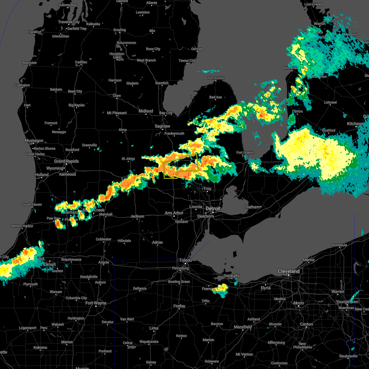 The severe thunderstorm warning for southwestern lapeer and southern genesee counties will expire at 715 pm edt, the storms which prompted the warning have weakened below severe limits, and have exited the warned area. therefore, the warning will be allowed to expire. however gusty winds and heavy rain are still possible with areas of thunderstorm across most of genesee and lapeer counties. a severe thunderstorm watch remains in effect until 1000 pm edt for southeastern michigan. The severe thunderstorm warning for southwestern lapeer and southern genesee counties will expire at 715 pm edt, the storms which prompted the warning have weakened below severe limits, and have exited the warned area. therefore, the warning will be allowed to expire. however gusty winds and heavy rain are still possible with areas of thunderstorm across most of genesee and lapeer counties. a severe thunderstorm watch remains in effect until 1000 pm edt for southeastern michigan.
|
| 7/24/2021 7:02 PM EDT |
 At 702 pm edt, a severe thunderstorm was located near dryden, or near imlay city, moving southeast at 30 mph (radar indicated). Hazards include 60 mph wind gusts. Expect damage to roofs, siding, and trees. Locations impacted include, almont. At 702 pm edt, a severe thunderstorm was located near dryden, or near imlay city, moving southeast at 30 mph (radar indicated). Hazards include 60 mph wind gusts. Expect damage to roofs, siding, and trees. Locations impacted include, almont.
|
| 7/24/2021 6:57 PM EDT |
 At 657 pm edt, severe thunderstorms were located along a line extending from near metamora to near lake fenton to gaines, moving southeast at 25 mph (radar indicated). Hazards include 60 mph wind gusts and nickel size hail. Expect damage to roofs, siding, and trees. these severe storms will be near, hadley around 700 pm edt. goodrich around 705 pm edt. Other locations impacted by these severe thunderstorms include atlas, argentine, rankin and elba. At 657 pm edt, severe thunderstorms were located along a line extending from near metamora to near lake fenton to gaines, moving southeast at 25 mph (radar indicated). Hazards include 60 mph wind gusts and nickel size hail. Expect damage to roofs, siding, and trees. these severe storms will be near, hadley around 700 pm edt. goodrich around 705 pm edt. Other locations impacted by these severe thunderstorms include atlas, argentine, rankin and elba.
|
| 7/24/2021 6:43 PM EDT |
 At 642 pm edt, a severe thunderstorm was located over lapeer, moving southeast at 35 mph (radar indicated). Hazards include 60 mph wind gusts. Expect damage to roofs, siding, and trees. this severe thunderstorm will be near, imlay city around 700 pm edt. Other locations in the path of this severe thunderstorm include dryden and almont. At 642 pm edt, a severe thunderstorm was located over lapeer, moving southeast at 35 mph (radar indicated). Hazards include 60 mph wind gusts. Expect damage to roofs, siding, and trees. this severe thunderstorm will be near, imlay city around 700 pm edt. Other locations in the path of this severe thunderstorm include dryden and almont.
|
| 7/24/2021 6:35 PM EDT |
 At 635 pm edt, severe thunderstorms were located along a line extending from near lapeer to near goodrich to near swartz creek, moving southeast at 30 mph (radar indicated). Hazards include 60 mph wind gusts and quarter size hail. Hail damage to vehicles is expected. expect wind damage to roofs, siding, and trees. these severe storms will be near, lapeer and goodrich around 640 pm edt. hadley around 645 pm edt. Other locations impacted by these severe thunderstorms include atlas, argentine, rankin, elba and genesee. At 635 pm edt, severe thunderstorms were located along a line extending from near lapeer to near goodrich to near swartz creek, moving southeast at 30 mph (radar indicated). Hazards include 60 mph wind gusts and quarter size hail. Hail damage to vehicles is expected. expect wind damage to roofs, siding, and trees. these severe storms will be near, lapeer and goodrich around 640 pm edt. hadley around 645 pm edt. Other locations impacted by these severe thunderstorms include atlas, argentine, rankin, elba and genesee.
|
| 7/24/2021 6:17 PM EDT |
 At 617 pm edt, severe thunderstorms were located along a line extending from columbiaville to near flint to near lennon, moving southeast at 30 mph (radar indicated). Hazards include 60 mph wind gusts and quarter size hail. Hail damage to vehicles is expected. expect wind damage to roofs, siding, and trees. these severe storms will be near, columbiaville and otter lake around 620 pm edt. burton around 625 pm edt. davison around 630 pm edt. lapeer, grand blanc and gaines around 635 pm edt. goodrich around 640 pm edt. hadley and linden around 645 pm edt. fenton and lake fenton around 650 pm edt. Other locations impacted by these severe thunderstorms include atlas, thetford township, argentine, rankin, elba and genesee. At 617 pm edt, severe thunderstorms were located along a line extending from columbiaville to near flint to near lennon, moving southeast at 30 mph (radar indicated). Hazards include 60 mph wind gusts and quarter size hail. Hail damage to vehicles is expected. expect wind damage to roofs, siding, and trees. these severe storms will be near, columbiaville and otter lake around 620 pm edt. burton around 625 pm edt. davison around 630 pm edt. lapeer, grand blanc and gaines around 635 pm edt. goodrich around 640 pm edt. hadley and linden around 645 pm edt. fenton and lake fenton around 650 pm edt. Other locations impacted by these severe thunderstorms include atlas, thetford township, argentine, rankin, elba and genesee.
|
| 7/24/2021 6:11 PM EDT |
 At 610 pm edt, a line of severe thunderstorms were located new lothrop to otter lake moving southeast at 25 mph (radar indicated). Hazards include 60 mph wind gusts. Expect damage to roofs, siding, and trees. this severe thunderstorm will be near, burton around 620 pm edt. davison around 625 pm edt. Other locations in the path of this severe thunderstorm include grand blanc, goodrich and hadley. At 610 pm edt, a line of severe thunderstorms were located new lothrop to otter lake moving southeast at 25 mph (radar indicated). Hazards include 60 mph wind gusts. Expect damage to roofs, siding, and trees. this severe thunderstorm will be near, burton around 620 pm edt. davison around 625 pm edt. Other locations in the path of this severe thunderstorm include grand blanc, goodrich and hadley.
|
| 7/24/2021 6:04 PM EDT |
 At 603 pm edt, severe thunderstorms were located along a line extending from near millington to near clio to flushing, moving southeast at 30 mph (radar indicated). Hazards include 60 mph wind gusts and penny size hail. Expect damage to roofs, siding, and trees. these severe storms will be near, millington and otter lake around 610 pm edt. otisville around 615 pm edt. columbiaville around 625 pm edt. burton around 630 pm edt. davison and north branch around 635 pm edt. lapeer around 640 pm edt. lum around 655 pm edt. Other locations impacted by these severe thunderstorms include thetford township, kings mill, elba, genesee and fostoria. At 603 pm edt, severe thunderstorms were located along a line extending from near millington to near clio to flushing, moving southeast at 30 mph (radar indicated). Hazards include 60 mph wind gusts and penny size hail. Expect damage to roofs, siding, and trees. these severe storms will be near, millington and otter lake around 610 pm edt. otisville around 615 pm edt. columbiaville around 625 pm edt. burton around 630 pm edt. davison and north branch around 635 pm edt. lapeer around 640 pm edt. lum around 655 pm edt. Other locations impacted by these severe thunderstorms include thetford township, kings mill, elba, genesee and fostoria.
|
| 7/24/2021 5:41 PM EDT |
 At 541 pm edt, severe thunderstorms were located along a line extending from near caro to near birch run to near new lothrop, moving southeast at 30 mph (radar indicated). Hazards include 60 mph wind gusts. Expect damage to roofs, siding, and trees. these severe storms will be near, mayville around 550 pm edt. flushing, millington and clifford around 605 pm edt. otisville around 610 pm edt. mount morris, otter lake and beecher around 615 pm edt. flint, columbiaville and crossroads village around 620 pm edt. burton around 630 pm edt. davison around 635 pm edt. lapeer around 640 pm edt. Other locations impacted by these severe thunderstorms include tuscola, elba, thetford township, kings mill, silverwood, genesee and fostoria. At 541 pm edt, severe thunderstorms were located along a line extending from near caro to near birch run to near new lothrop, moving southeast at 30 mph (radar indicated). Hazards include 60 mph wind gusts. Expect damage to roofs, siding, and trees. these severe storms will be near, mayville around 550 pm edt. flushing, millington and clifford around 605 pm edt. otisville around 610 pm edt. mount morris, otter lake and beecher around 615 pm edt. flint, columbiaville and crossroads village around 620 pm edt. burton around 630 pm edt. davison around 635 pm edt. lapeer around 640 pm edt. Other locations impacted by these severe thunderstorms include tuscola, elba, thetford township, kings mill, silverwood, genesee and fostoria.
|
| 7/24/2021 5:26 PM EDT |
 At 526 pm edt, severe thunderstorms were located along a line extending from caro to near millington to near chesaning, moving east at 45 mph (radar indicated). Hazards include 60 mph wind gusts. Expect damage to roofs, siding, and trees. Locations impacted include, flint, lapeer, flushing, davison, vassar, clio, millington, north branch, mayville, columbiaville, burton, mount morris, otisville, otter lake, clifford, beecher, crossroads village, lum, genesee and tuscola. At 526 pm edt, severe thunderstorms were located along a line extending from caro to near millington to near chesaning, moving east at 45 mph (radar indicated). Hazards include 60 mph wind gusts. Expect damage to roofs, siding, and trees. Locations impacted include, flint, lapeer, flushing, davison, vassar, clio, millington, north branch, mayville, columbiaville, burton, mount morris, otisville, otter lake, clifford, beecher, crossroads village, lum, genesee and tuscola.
|
| 7/24/2021 5:11 PM EDT |
 At 510 pm edt, a line of severe thunderstorms were located from marion springs to quanicassee moving southeast at 35 mph (radar indicated). Hazards include 60 mph wind gusts. expect damage to roofs, siding, and trees At 510 pm edt, a line of severe thunderstorms were located from marion springs to quanicassee moving southeast at 35 mph (radar indicated). Hazards include 60 mph wind gusts. expect damage to roofs, siding, and trees
|
| 7/20/2021 5:59 PM EDT |
 At 559 pm edt, a severe thunderstorm was located over almont, moving southeast at 25 mph (radar indicated). Hazards include 60 mph wind gusts and quarter size hail. Hail damage to vehicles is expected. Expect wind damage to roofs, siding, and trees. At 559 pm edt, a severe thunderstorm was located over almont, moving southeast at 25 mph (radar indicated). Hazards include 60 mph wind gusts and quarter size hail. Hail damage to vehicles is expected. Expect wind damage to roofs, siding, and trees.
|
| 6/29/2021 2:14 PM EDT |
 At 213 pm edt, a severe thunderstorm was located over metamora, or near lapeer, moving east at 35 mph (radar indicated). Hazards include 60 mph wind gusts and penny size hail. Expect damage to roofs, siding, and trees. this severe storm will be near, dryden around 225 pm edt. imlay city around 230 pm edt. almont around 235 pm edt. Other locations impacted by this severe thunderstorm include goodland township, burnside, kings mill, attica, elba and thornville. At 213 pm edt, a severe thunderstorm was located over metamora, or near lapeer, moving east at 35 mph (radar indicated). Hazards include 60 mph wind gusts and penny size hail. Expect damage to roofs, siding, and trees. this severe storm will be near, dryden around 225 pm edt. imlay city around 230 pm edt. almont around 235 pm edt. Other locations impacted by this severe thunderstorm include goodland township, burnside, kings mill, attica, elba and thornville.
|
| 6/29/2021 1:55 PM EDT |
 At 151 pm edt, a severe thunderstorm was located over goodrich, or near grand blanc, moving east at 35 mph (radar indicated). Hazards include 60 mph wind gusts and quarter size hail. Hail damage to vehicles is expected. expect wind damage to roofs, siding, and trees. this severe thunderstorm will be near, goodrich around 155 pm edt. ortonville around 200 pm edt. hadley around 205 pm edt. lapeer and metamora around 215 pm edt. dryden around 225 pm edt. imlay city around 230 pm edt. almont around 235 pm edt. Other locations impacted by this severe thunderstorm include atlas, goodland township, lakeville, burnside, attica, elba, holly state recreation area, leonard, kings mill and thornville. At 151 pm edt, a severe thunderstorm was located over goodrich, or near grand blanc, moving east at 35 mph (radar indicated). Hazards include 60 mph wind gusts and quarter size hail. Hail damage to vehicles is expected. expect wind damage to roofs, siding, and trees. this severe thunderstorm will be near, goodrich around 155 pm edt. ortonville around 200 pm edt. hadley around 205 pm edt. lapeer and metamora around 215 pm edt. dryden around 225 pm edt. imlay city around 230 pm edt. almont around 235 pm edt. Other locations impacted by this severe thunderstorm include atlas, goodland township, lakeville, burnside, attica, elba, holly state recreation area, leonard, kings mill and thornville.
|
| 6/26/2021 7:19 PM EDT |
 At 719 pm edt, severe thunderstorms were located along a line extending from near mayville to near north branch to near lapeer, moving northeast at 40 mph (radar indicated). Hazards include 60 mph wind gusts. Expect damage to roofs, siding, and trees. these severe storms will be near, north branch around 725 pm edt. clifford around 730 pm edt. lum around 735 pm edt. brown city around 750 pm edt. Other locations impacted by these severe thunderstorms include goodland township, burnside, kings mill and elba. At 719 pm edt, severe thunderstorms were located along a line extending from near mayville to near north branch to near lapeer, moving northeast at 40 mph (radar indicated). Hazards include 60 mph wind gusts. Expect damage to roofs, siding, and trees. these severe storms will be near, north branch around 725 pm edt. clifford around 730 pm edt. lum around 735 pm edt. brown city around 750 pm edt. Other locations impacted by these severe thunderstorms include goodland township, burnside, kings mill and elba.
|
| 6/26/2021 7:06 PM EDT |
 At 705 pm edt, severe thunderstorms were located along a line extending from near otter lake to near columbiaville to davison, moving northeast at 40 mph (radar indicated). Hazards include 60 mph wind gusts. Expect damage to roofs, siding, and trees. these severe storms will be near, lapeer around 720 pm edt. north branch around 725 pm edt. clifford around 730 pm edt. lum around 735 pm edt. brown city around 750 pm edt. Other locations impacted by these severe thunderstorms include goodland township, burnside, kings mill and elba. At 705 pm edt, severe thunderstorms were located along a line extending from near otter lake to near columbiaville to davison, moving northeast at 40 mph (radar indicated). Hazards include 60 mph wind gusts. Expect damage to roofs, siding, and trees. these severe storms will be near, lapeer around 720 pm edt. north branch around 725 pm edt. clifford around 730 pm edt. lum around 735 pm edt. brown city around 750 pm edt. Other locations impacted by these severe thunderstorms include goodland township, burnside, kings mill and elba.
|
| 6/26/2021 6:49 PM EDT |
 At 649 pm edt, severe thunderstorms were located along a line extending from near clio to near otisville to near flint, moving east at 40 mph (radar indicated). Hazards include 60 mph wind gusts. Expect damage to roofs, siding, and trees. severe thunderstorms will be near, columbiaville and otter lake around 700 pm edt. lapeer and north branch around 720 pm edt. clifford around 725 pm edt. lum around 735 pm edt. brown city around 745 pm edt. Other locations impacted by these severe thunderstorms include goodland township, burnside, kings mill and elba. At 649 pm edt, severe thunderstorms were located along a line extending from near clio to near otisville to near flint, moving east at 40 mph (radar indicated). Hazards include 60 mph wind gusts. Expect damage to roofs, siding, and trees. severe thunderstorms will be near, columbiaville and otter lake around 700 pm edt. lapeer and north branch around 720 pm edt. clifford around 725 pm edt. lum around 735 pm edt. brown city around 745 pm edt. Other locations impacted by these severe thunderstorms include goodland township, burnside, kings mill and elba.
|
| 10/23/2020 3:43 PM EDT |
 The severe thunderstorm warning for lapeer county will expire at 345 pm edt, the storms which prompted the warning have weakened below severe limits, and no longer pose an immediate threat to life or property. therefore, the warning will be allowed to expire. however gusty winds and heavy rain are still possible with these thunderstorms. a severe thunderstorm watch remains in effect until 900 pm edt for southeastern michigan. The severe thunderstorm warning for lapeer county will expire at 345 pm edt, the storms which prompted the warning have weakened below severe limits, and no longer pose an immediate threat to life or property. therefore, the warning will be allowed to expire. however gusty winds and heavy rain are still possible with these thunderstorms. a severe thunderstorm watch remains in effect until 900 pm edt for southeastern michigan.
|
| 10/23/2020 3:20 PM EDT |
 At 320 pm edt, severe thunderstorms were located along a line extending from near north branch to hadley, moving east at 30 mph (radar indicated). Hazards include 60 mph wind gusts and penny size hail. Expect damage to roofs, siding, and trees. these severe storms will be near, north branch around 325 pm edt. brown city around 330 pm edt. lapeer around 335 pm edt. dryden around 350 pm edt. imlay city and almont around 355 pm edt. Other locations impacted by these severe thunderstorms include goodland township, burnside, kings mill, attica, elba and thornville. At 320 pm edt, severe thunderstorms were located along a line extending from near north branch to hadley, moving east at 30 mph (radar indicated). Hazards include 60 mph wind gusts and penny size hail. Expect damage to roofs, siding, and trees. these severe storms will be near, north branch around 325 pm edt. brown city around 330 pm edt. lapeer around 335 pm edt. dryden around 350 pm edt. imlay city and almont around 355 pm edt. Other locations impacted by these severe thunderstorms include goodland township, burnside, kings mill, attica, elba and thornville.
|
| 10/23/2020 3:01 PM EDT | County dispatch reports trees down near w oregon and millville rds. multiple additional reports of trees down between elba and lapeer cit in lapeer county MI, 1.6 miles SE of Lapeer, MI |
| 10/23/2020 2:47 PM EDT |
 At 247 pm edt, severe thunderstorms were located along a line extending from near vassar to near lake fenton, moving east at 50 mph (radar indicated). Hazards include 60 mph wind gusts and penny size hail. Expect damage to roofs, siding, and trees. severe thunderstorms will be near, hadley and clifford around 305 pm edt. metamora around 310 pm edt. dryden around 320 pm edt. imlay city and almont around 325 pm edt. Other locations impacted by these severe thunderstorms include goodland township, burnside, attica, elba, kings mill, silverwood and thornville. At 247 pm edt, severe thunderstorms were located along a line extending from near vassar to near lake fenton, moving east at 50 mph (radar indicated). Hazards include 60 mph wind gusts and penny size hail. Expect damage to roofs, siding, and trees. severe thunderstorms will be near, hadley and clifford around 305 pm edt. metamora around 310 pm edt. dryden around 320 pm edt. imlay city and almont around 325 pm edt. Other locations impacted by these severe thunderstorms include goodland township, burnside, attica, elba, kings mill, silverwood and thornville.
|
| 7/19/2020 11:08 AM EDT |
 The severe thunderstorm warning for southern lapeer and northern oakland counties will expire at 1115 am edt, the storms which prompted the warning have weakened below severe limits, and no longer pose an immediate threat to life or property. therefore, the warning will be allowed to expire. however gusty winds to 50 mph and heavy rain are still possible with these thunderstorms through 1130 am. The severe thunderstorm warning for southern lapeer and northern oakland counties will expire at 1115 am edt, the storms which prompted the warning have weakened below severe limits, and no longer pose an immediate threat to life or property. therefore, the warning will be allowed to expire. however gusty winds to 50 mph and heavy rain are still possible with these thunderstorms through 1130 am.
|
| 7/19/2020 10:37 AM EDT |
 At 1036 am edt, severe thunderstorms were located along a line extending from near lapeer to near goodrich to near holly, moving east at 50 mph (radar indicated). Hazards include 60 mph wind gusts. Expect damage to roofs, siding, and trees. these severe storms will be near, hadley and ortonville around 1040 am edt. lapeer, metamora and clarkston around 1045 am edt. oxford around 1050 am edt. pontiac, imlay city and dryden around 1055 am edt. almont around 1100 am edt. rochester around 1105 am edt. Other locations impacted by these severe thunderstorms include rochester hills, lakeville, waterford, davisburg, attica, elba, holly state recreation area, rose center, lake orion and auburn hills. At 1036 am edt, severe thunderstorms were located along a line extending from near lapeer to near goodrich to near holly, moving east at 50 mph (radar indicated). Hazards include 60 mph wind gusts. Expect damage to roofs, siding, and trees. these severe storms will be near, hadley and ortonville around 1040 am edt. lapeer, metamora and clarkston around 1045 am edt. oxford around 1050 am edt. pontiac, imlay city and dryden around 1055 am edt. almont around 1100 am edt. rochester around 1105 am edt. Other locations impacted by these severe thunderstorms include rochester hills, lakeville, waterford, davisburg, attica, elba, holly state recreation area, rose center, lake orion and auburn hills.
|
| 7/19/2020 10:21 AM EDT |
 At 1021 am edt, severe thunderstorms were located along a line extending from near grand blanc to near linden, moving east at 45 mph (radar indicated). Hazards include 60 mph wind gusts. Expect damage to roofs, siding, and trees. severe thunderstorms will be near, holly around 1035 am edt. hadley, ortonville and clarkston around 1045 am edt. lapeer and metamora around 1050 am edt. pontiac around 1055 am edt. oxford and dryden around 1100 am edt. imlay city around 1105 am edt. almont and rochester around 1110 am edt. Other locations impacted by these severe thunderstorms include rochester hills, lakeville, waterford, davisburg, attica, elba, holly state recreation area, rose center, lake orion and auburn hills. At 1021 am edt, severe thunderstorms were located along a line extending from near grand blanc to near linden, moving east at 45 mph (radar indicated). Hazards include 60 mph wind gusts. Expect damage to roofs, siding, and trees. severe thunderstorms will be near, holly around 1035 am edt. hadley, ortonville and clarkston around 1045 am edt. lapeer and metamora around 1050 am edt. pontiac around 1055 am edt. oxford and dryden around 1100 am edt. imlay city around 1105 am edt. almont and rochester around 1110 am edt. Other locations impacted by these severe thunderstorms include rochester hills, lakeville, waterford, davisburg, attica, elba, holly state recreation area, rose center, lake orion and auburn hills.
|
| 6/10/2020 4:45 PM EDT |
 At 445 pm edt, a severe thunderstorm was located over sandusky, moving northeast at 45 mph (radar indicated). Hazards include 60 mph wind gusts and nickel size hail. Expect damage to roofs, siding, and trees. this severe storm will be near, deckerville around 450 pm edt. forestville around 510 pm edt. Other locations impacted by this severe thunderstorm include goodland township, birch beach, attica, elba, mcgregor, amador, snover, juhl, elmer and valley center. At 445 pm edt, a severe thunderstorm was located over sandusky, moving northeast at 45 mph (radar indicated). Hazards include 60 mph wind gusts and nickel size hail. Expect damage to roofs, siding, and trees. this severe storm will be near, deckerville around 450 pm edt. forestville around 510 pm edt. Other locations impacted by this severe thunderstorm include goodland township, birch beach, attica, elba, mcgregor, amador, snover, juhl, elmer and valley center.
|
| 6/10/2020 4:30 PM EDT |
 At 430 pm edt, a severe thunderstorm was located 7 miles northwest of peck, or 7 miles east of marlette, moving northeast at 55 mph (radar indicated). Hazards include golf ball size hail and 70 mph wind gusts. People and animals outdoors will be injured. expect hail damage to roofs, siding, windows, and vehicles. expect considerable tree damage. wind damage is also likely to mobile homes, roofs, and outbuildings. this severe storm will be near, sandusky around 440 pm edt. deckerville and carsonville around 445 pm edt. forestville around 500 pm edt. Other locations impacted by this severe thunderstorm include goodland township, birch beach, attica, elba, mcgregor, amador, snover, juhl, elmer and silverwood. At 430 pm edt, a severe thunderstorm was located 7 miles northwest of peck, or 7 miles east of marlette, moving northeast at 55 mph (radar indicated). Hazards include golf ball size hail and 70 mph wind gusts. People and animals outdoors will be injured. expect hail damage to roofs, siding, windows, and vehicles. expect considerable tree damage. wind damage is also likely to mobile homes, roofs, and outbuildings. this severe storm will be near, sandusky around 440 pm edt. deckerville and carsonville around 445 pm edt. forestville around 500 pm edt. Other locations impacted by this severe thunderstorm include goodland township, birch beach, attica, elba, mcgregor, amador, snover, juhl, elmer and silverwood.
|
| 6/10/2020 4:14 PM EDT |
 At 414 pm edt, severe thunderstorms were located along a line extending from 7 miles west of forestville to 6 miles northwest of peck to near lapeer, moving northeast at 35 mph (radar indicated). Hazards include 70 mph wind gusts. Expect considerable tree damage. damage is likely to mobile homes, roofs, and outbuildings. these severe storms will be near, sandusky and forestville around 425 pm edt. north branch, carsonville and lum around 435 pm edt. brown city around 450 pm edt. melvin around 500 pm edt. peck around 505 pm edt. croswell around 520 pm edt. applegate around 525 pm edt. lexington around 530 pm edt. Other locations impacted by these severe thunderstorms include goodland township, birch beach, attica, elba, mcgregor, amador, snover, juhl, elmer and silverwood. At 414 pm edt, severe thunderstorms were located along a line extending from 7 miles west of forestville to 6 miles northwest of peck to near lapeer, moving northeast at 35 mph (radar indicated). Hazards include 70 mph wind gusts. Expect considerable tree damage. damage is likely to mobile homes, roofs, and outbuildings. these severe storms will be near, sandusky and forestville around 425 pm edt. north branch, carsonville and lum around 435 pm edt. brown city around 450 pm edt. melvin around 500 pm edt. peck around 505 pm edt. croswell around 520 pm edt. applegate around 525 pm edt. lexington around 530 pm edt. Other locations impacted by these severe thunderstorms include goodland township, birch beach, attica, elba, mcgregor, amador, snover, juhl, elmer and silverwood.
|
| 6/10/2020 3:59 PM EDT |
 At 359 pm edt, severe thunderstorms were located along a line extending from argyle to near lum, moving northeast at 40 mph (radar indicated). Hazards include 70 mph wind gusts and half dollar size hail. Hail damage to vehicles is expected. expect considerable tree damage. wind damage is also likely to mobile homes, roofs, and outbuildings. these severe storms will be near, argyle around 405 pm edt. north branch around 415 pm edt. brown city around 420 pm edt. clifford around 425 pm edt. marlette around 430 pm edt. sandusky around 445 pm edt. deckerville around 455 pm edt. forestville around 515 pm edt. Other locations impacted by these severe thunderstorms include goodland township, birch beach, attica, elba, mcgregor, amador, snover, juhl, elmer and silverwood. At 359 pm edt, severe thunderstorms were located along a line extending from argyle to near lum, moving northeast at 40 mph (radar indicated). Hazards include 70 mph wind gusts and half dollar size hail. Hail damage to vehicles is expected. expect considerable tree damage. wind damage is also likely to mobile homes, roofs, and outbuildings. these severe storms will be near, argyle around 405 pm edt. north branch around 415 pm edt. brown city around 420 pm edt. clifford around 425 pm edt. marlette around 430 pm edt. sandusky around 445 pm edt. deckerville around 455 pm edt. forestville around 515 pm edt. Other locations impacted by these severe thunderstorms include goodland township, birch beach, attica, elba, mcgregor, amador, snover, juhl, elmer and silverwood.
|
| 6/10/2020 3:46 PM EDT |
 At 345 pm edt, severe thunderstorms were located along a line extending from near sandusky to near davison, moving northeast at 45 mph (radar indicated). Hazards include 70 mph wind gusts and quarter size hail. Hail damage to vehicles is expected. expect considerable tree damage. wind damage is also likely to mobile homes, roofs, and outbuildings. severe thunderstorms will be near, argyle around 355 pm edt. deckerville around 400 pm edt. lapeer and columbiaville around 405 pm edt. lum around 415 pm edt. north branch and forestville around 420 pm edt. clifford around 425 pm edt. brown city around 430 pm edt. marlette around 435 pm edt. Other locations impacted by these severe thunderstorms include goodland township, birch beach, attica, elba, mcgregor, amador, snover, juhl, elmer and silverwood. At 345 pm edt, severe thunderstorms were located along a line extending from near sandusky to near davison, moving northeast at 45 mph (radar indicated). Hazards include 70 mph wind gusts and quarter size hail. Hail damage to vehicles is expected. expect considerable tree damage. wind damage is also likely to mobile homes, roofs, and outbuildings. severe thunderstorms will be near, argyle around 355 pm edt. deckerville around 400 pm edt. lapeer and columbiaville around 405 pm edt. lum around 415 pm edt. north branch and forestville around 420 pm edt. clifford around 425 pm edt. brown city around 430 pm edt. marlette around 435 pm edt. Other locations impacted by these severe thunderstorms include goodland township, birch beach, attica, elba, mcgregor, amador, snover, juhl, elmer and silverwood.
|
| 4/7/2020 8:58 PM EDT |
 The severe thunderstorm warning for southern lapeer county will expire at 900 pm edt, the storms which prompted the warning have moved out of the area. therefore, the warning will be allowed to expire. a severe thunderstorm watch remains in effect until 100 am edt for southeastern michigan. The severe thunderstorm warning for southern lapeer county will expire at 900 pm edt, the storms which prompted the warning have moved out of the area. therefore, the warning will be allowed to expire. a severe thunderstorm watch remains in effect until 100 am edt for southeastern michigan.
|
| 4/7/2020 8:42 PM EDT |
 At 842 pm edt, severe thunderstorms were located along a line extending from near brown city to near lum to near lapeer, moving southeast at 60 mph (radar indicated). Hazards include quarter size hail. Damage to vehicles is expected. these severe storms will be near, almont around 855 pm edt. Other locations impacted by these severe thunderstorms include kings mill, attica and goodland township. At 842 pm edt, severe thunderstorms were located along a line extending from near brown city to near lum to near lapeer, moving southeast at 60 mph (radar indicated). Hazards include quarter size hail. Damage to vehicles is expected. these severe storms will be near, almont around 855 pm edt. Other locations impacted by these severe thunderstorms include kings mill, attica and goodland township.
|
| 4/7/2020 8:39 PM EDT | Quarter sized hail reported 4.3 miles SW of Lapeer, MI, report along slater road. |
| 4/7/2020 8:32 PM EDT |
 At 831 pm edt, severe thunderstorms were located along a line extending from marlette to north branch to columbiaville, moving southeast at 65 mph (radar indicated). Hazards include quarter size hail. Damage to vehicles is expected. these severe storms will be near, brown city around 840 pm edt. lum around 845 pm edt. imlay city and dryden around 850 pm edt. almont around 855 pm edt. Other locations impacted by these severe thunderstorms include goodland township, burnside, kings mill and attica. At 831 pm edt, severe thunderstorms were located along a line extending from marlette to north branch to columbiaville, moving southeast at 65 mph (radar indicated). Hazards include quarter size hail. Damage to vehicles is expected. these severe storms will be near, brown city around 840 pm edt. lum around 845 pm edt. imlay city and dryden around 850 pm edt. almont around 855 pm edt. Other locations impacted by these severe thunderstorms include goodland township, burnside, kings mill and attica.
|
| 4/7/2020 8:19 PM EDT |
 At 819 pm edt, severe thunderstorms were located along a line extending from near mayville to near millington, moving southeast at 60 mph (radar indicated). Hazards include quarter size hail. Damage to vehicles is expected. severe thunderstorms will be near, clifford around 825 pm edt. north branch and columbiaville around 830 pm edt. lapeer and brown city around 840 pm edt. lum around 845 pm edt. imlay city and dryden around 850 pm edt. almont around 855 pm edt. Other locations impacted by these severe thunderstorms include goodland township, east dayton, burnside, attica, kings mill, silverwood and fostoria. At 819 pm edt, severe thunderstorms were located along a line extending from near mayville to near millington, moving southeast at 60 mph (radar indicated). Hazards include quarter size hail. Damage to vehicles is expected. severe thunderstorms will be near, clifford around 825 pm edt. north branch and columbiaville around 830 pm edt. lapeer and brown city around 840 pm edt. lum around 845 pm edt. imlay city and dryden around 850 pm edt. almont around 855 pm edt. Other locations impacted by these severe thunderstorms include goodland township, east dayton, burnside, attica, kings mill, silverwood and fostoria.
|
| 9/21/2019 6:25 PM EDT |
 At 623 pm edt, severe thunderstorms were located along a line extending from near north branch to 6 miles northwest of lum to near hadley, moving northeast at 30 mph (radar indicated). Hazards include 60 mph wind gusts. Expect damage to roofs, siding, and trees. these severe storms will be near, clifford around 640 pm edt. dryden around 645 pm edt. imlay city and lum around 650 pm edt. brown city around 655 pm edt. Other locations impacted by these severe thunderstorms include goodland township, burnside, attica, elba, kings mill, silverwood and thornville. At 623 pm edt, severe thunderstorms were located along a line extending from near north branch to 6 miles northwest of lum to near hadley, moving northeast at 30 mph (radar indicated). Hazards include 60 mph wind gusts. Expect damage to roofs, siding, and trees. these severe storms will be near, clifford around 640 pm edt. dryden around 645 pm edt. imlay city and lum around 650 pm edt. brown city around 655 pm edt. Other locations impacted by these severe thunderstorms include goodland township, burnside, attica, elba, kings mill, silverwood and thornville.
|
| 9/21/2019 6:08 PM EDT |
 At 607 pm edt, severe thunderstorms were located along a line extending from otter lake to near columbiaville to near goodrich, moving east at 30 mph (radar indicated). Hazards include 60 mph wind gusts. Expect damage to roofs, siding, and trees. severe thunderstorms will be near, metamora around 625 pm edt. lapeer around 630 pm edt. north branch around 635 pm edt. clifford around 640 pm edt. dryden around 645 pm edt. imlay city and lum around 650 pm edt. brown city around 655 pm edt. Other locations impacted by these severe thunderstorms include atlas, goodland township, burnside, attica, elba, kings mill, silverwood and thornville. At 607 pm edt, severe thunderstorms were located along a line extending from otter lake to near columbiaville to near goodrich, moving east at 30 mph (radar indicated). Hazards include 60 mph wind gusts. Expect damage to roofs, siding, and trees. severe thunderstorms will be near, metamora around 625 pm edt. lapeer around 630 pm edt. north branch around 635 pm edt. clifford around 640 pm edt. dryden around 645 pm edt. imlay city and lum around 650 pm edt. brown city around 655 pm edt. Other locations impacted by these severe thunderstorms include atlas, goodland township, burnside, attica, elba, kings mill, silverwood and thornville.
|
| 9/11/2019 3:56 PM EDT |
 At 356 pm edt, a severe thunderstorm was located near ortonville, or 7 miles northwest of oxford, moving east at 20 mph (radar indicated). Hazards include 60 mph wind gusts and quarter size hail. Hail damage to vehicles is expected. expect wind damage to roofs, siding, and trees. this severe thunderstorm will be near, oxford and metamora around 410 pm edt. dryden around 430 pm edt. almont around 445 pm edt. Other locations impacted by this severe thunderstorm include holly state recreation area, leonard, lakeville, lake orion, attica and thornville. At 356 pm edt, a severe thunderstorm was located near ortonville, or 7 miles northwest of oxford, moving east at 20 mph (radar indicated). Hazards include 60 mph wind gusts and quarter size hail. Hail damage to vehicles is expected. expect wind damage to roofs, siding, and trees. this severe thunderstorm will be near, oxford and metamora around 410 pm edt. dryden around 430 pm edt. almont around 445 pm edt. Other locations impacted by this severe thunderstorm include holly state recreation area, leonard, lakeville, lake orion, attica and thornville.
|
| 7/20/2019 6:22 PM EDT |
 At 622 pm edt, severe thunderstorms were located along a line extending from near north branch to near metamora, moving east at 20 mph (radar indicated). Hazards include 60 mph wind gusts. Expect damage to roofs, siding, and trees. these severe storms will be near, dryden around 640 pm edt. brown city around 645 pm edt. almont around 655 pm edt. melvin around 705 pm edt. capac and memphis around 715 pm edt. other locations impacted by these severe thunderstorms include north street, goodland township, lynn township, amador, brockway, fort gratiot, avoca, burnside, fargo and berville. People attending st clair county 4h fair, and blue water fest 2019 should seek safe shelter immediately!. At 622 pm edt, severe thunderstorms were located along a line extending from near north branch to near metamora, moving east at 20 mph (radar indicated). Hazards include 60 mph wind gusts. Expect damage to roofs, siding, and trees. these severe storms will be near, dryden around 640 pm edt. brown city around 645 pm edt. almont around 655 pm edt. melvin around 705 pm edt. capac and memphis around 715 pm edt. other locations impacted by these severe thunderstorms include north street, goodland township, lynn township, amador, brockway, fort gratiot, avoca, burnside, fargo and berville. People attending st clair county 4h fair, and blue water fest 2019 should seek safe shelter immediately!.
|
| 7/20/2019 6:09 PM EDT |
 The national weather service in detroit/pontiac has issued a * severe thunderstorm warning for. southeastern sanilac county in southeastern michigan. lapeer county in southeastern michigan. st. clair county in southeastern michigan. Until 715 pm edt. The national weather service in detroit/pontiac has issued a * severe thunderstorm warning for. southeastern sanilac county in southeastern michigan. lapeer county in southeastern michigan. st. clair county in southeastern michigan. Until 715 pm edt.
|
| 7/20/2019 5:58 PM EDT | Social media pictures of large tree limbs down at lapeer and genesse road in lapeer county MI, 0.6 miles S of Lapeer, MI |
| 7/20/2019 5:58 PM EDT | Large tree limbs down in downtown lapeer in lapeer county MI, 0.6 miles S of Lapeer, MI |
| 5/19/2019 2:29 PM EDT |
 At 229 pm edt, a severe thunderstorm was located near mayville, moving northeast at 55 mph (radar indicated). Hazards include 60 mph wind gusts. Expect damage to roofs, siding, and trees. this severe thunderstorm will be near, kingston around 235 pm edt. Other locations impacted by this severe thunderstorm include east dayton, deford, burnside, elba, colling, wilmot, colwood, ellington, kings mill and silverwood. At 229 pm edt, a severe thunderstorm was located near mayville, moving northeast at 55 mph (radar indicated). Hazards include 60 mph wind gusts. Expect damage to roofs, siding, and trees. this severe thunderstorm will be near, kingston around 235 pm edt. Other locations impacted by this severe thunderstorm include east dayton, deford, burnside, elba, colling, wilmot, colwood, ellington, kings mill and silverwood.
|
| 3/14/2019 7:49 PM EDT |
 At 749 pm edt, a severe thunderstorm was located near north branch, moving northeast at 60 mph (radar indicated). Hazards include 60 mph wind gusts and quarter size hail. Hail damage to vehicles is expected. expect wind damage to roofs, siding, and trees. this severe storm will be near, clifford around 755 pm edt. Other locations impacted by this severe thunderstorm include goodland township, burnside, attica, elba, kings mill, silverwood and fostoria. At 749 pm edt, a severe thunderstorm was located near north branch, moving northeast at 60 mph (radar indicated). Hazards include 60 mph wind gusts and quarter size hail. Hail damage to vehicles is expected. expect wind damage to roofs, siding, and trees. this severe storm will be near, clifford around 755 pm edt. Other locations impacted by this severe thunderstorm include goodland township, burnside, attica, elba, kings mill, silverwood and fostoria.
|
| 3/14/2019 7:34 PM EDT |
 At 733 pm edt, a severe thunderstorm was located over otisville, or near columbiaville, moving northeast at 50 mph (radar indicated). Hazards include 60 mph wind gusts and quarter size hail. Hail damage to vehicles is expected. expect wind damage to roofs, siding, and trees. this severe thunderstorm will be near, mayville around 750 pm edt. north branch and clifford around 755 pm edt. Other locations impacted by this severe thunderstorm include goodland township, burnside, attica, elba, kings mill, silverwood and fostoria. At 733 pm edt, a severe thunderstorm was located over otisville, or near columbiaville, moving northeast at 50 mph (radar indicated). Hazards include 60 mph wind gusts and quarter size hail. Hail damage to vehicles is expected. expect wind damage to roofs, siding, and trees. this severe thunderstorm will be near, mayville around 750 pm edt. north branch and clifford around 755 pm edt. Other locations impacted by this severe thunderstorm include goodland township, burnside, attica, elba, kings mill, silverwood and fostoria.
|
| 10/20/2018 2:19 PM EDT |
 At 218 pm edt, a severe thunderstorm was located near rochester, or near romeo, moving east at 40 mph (radar indicated). Hazards include 60 mph wind gusts. Expect damage to roofs, siding, and trees. This severe thunderstorm will remain over mainly rural areas of southern lapeer, oakland, northwestern macomb and southeastern genesee counties, including the following locations, franklin, keego harbor, waterford, orchard lake, holly state recreation area, commerce, rose center, lathrup village, auburn hills and bingham farms. At 218 pm edt, a severe thunderstorm was located near rochester, or near romeo, moving east at 40 mph (radar indicated). Hazards include 60 mph wind gusts. Expect damage to roofs, siding, and trees. This severe thunderstorm will remain over mainly rural areas of southern lapeer, oakland, northwestern macomb and southeastern genesee counties, including the following locations, franklin, keego harbor, waterford, orchard lake, holly state recreation area, commerce, rose center, lathrup village, auburn hills and bingham farms.
|
| 9/5/2018 9:10 PM EDT |
 At 910 pm edt, a severe thunderstorm was located over lum, or 7 miles south of north branch, moving northeast at 30 mph (radar indicated). Hazards include 60 mph wind gusts and quarter size hail. Hail damage to vehicles is expected. expect wind damage to roofs, siding, and trees. this severe storm will be near, brown city around 930 pm edt. Other locations impacted by this severe thunderstorm include goodland township, burnside, kings mill and attica. At 910 pm edt, a severe thunderstorm was located over lum, or 7 miles south of north branch, moving northeast at 30 mph (radar indicated). Hazards include 60 mph wind gusts and quarter size hail. Hail damage to vehicles is expected. expect wind damage to roofs, siding, and trees. this severe storm will be near, brown city around 930 pm edt. Other locations impacted by this severe thunderstorm include goodland township, burnside, kings mill and attica.
|
| 9/5/2018 9:02 PM EDT |
 The national weather service in detroit/pontiac has issued a * severe thunderstorm warning for. southeastern tuscola county in southeastern michigan. southwestern sanilac county in southeastern michigan. central lapeer county in southeastern michigan. Until 1000 pm edt. The national weather service in detroit/pontiac has issued a * severe thunderstorm warning for. southeastern tuscola county in southeastern michigan. southwestern sanilac county in southeastern michigan. central lapeer county in southeastern michigan. Until 1000 pm edt.
|
| 10/7/2017 10:56 PM EDT |
 At 1056 pm edt, a severe thunderstorm capable of producing a tornado was located over lapeer, moving northeast at 50 mph (radar indicated rotation). Hazards include tornado. Flying debris will be dangerous to those caught without shelter. mobile homes will be damaged or destroyed. damage to roofs, windows, and vehicles will occur. tree damage is likely. this dangerous storm will be near, lum around 1105 pm edt. north branch around 1110 pm edt. brown city around 1120 pm edt. Other locations impacted by this tornadic thunderstorm include north branch, lapeer, lum, goodland township, burnside, kings mill and brown city. At 1056 pm edt, a severe thunderstorm capable of producing a tornado was located over lapeer, moving northeast at 50 mph (radar indicated rotation). Hazards include tornado. Flying debris will be dangerous to those caught without shelter. mobile homes will be damaged or destroyed. damage to roofs, windows, and vehicles will occur. tree damage is likely. this dangerous storm will be near, lum around 1105 pm edt. north branch around 1110 pm edt. brown city around 1120 pm edt. Other locations impacted by this tornadic thunderstorm include north branch, lapeer, lum, goodland township, burnside, kings mill and brown city.
|
| 10/7/2017 10:49 PM EDT |
 At 1049 pm edt, a severe thunderstorm capable of producing a tornado was located near hadley, or near lapeer, moving northeast at 50 mph (radar indicated rotation). Hazards include tornado. Flying debris will be dangerous to those caught without shelter. mobile homes will be damaged or destroyed. damage to roofs, windows, and vehicles will occur. tree damage is likely. this dangerous storm will be near, lum around 1105 pm edt. north branch around 1110 pm edt. brown city around 1120 pm edt. Other locations impacted by this tornadic thunderstorm include north branch, lapeer, lum, goodland township, burnside, attica, elba, kings mill, brown city and imlay city. At 1049 pm edt, a severe thunderstorm capable of producing a tornado was located near hadley, or near lapeer, moving northeast at 50 mph (radar indicated rotation). Hazards include tornado. Flying debris will be dangerous to those caught without shelter. mobile homes will be damaged or destroyed. damage to roofs, windows, and vehicles will occur. tree damage is likely. this dangerous storm will be near, lum around 1105 pm edt. north branch around 1110 pm edt. brown city around 1120 pm edt. Other locations impacted by this tornadic thunderstorm include north branch, lapeer, lum, goodland township, burnside, attica, elba, kings mill, brown city and imlay city.
|
| 8/3/2017 2:04 PM EDT |
 At 203 pm edt, a severe thunderstorm was located near metamora, or 8 miles southeast of lapeer, moving northeast at 20 mph (radar indicated). Hazards include 60 mph wind gusts and quarter size hail. Hail damage to vehicles is expected. expect wind damage to roofs, siding, and trees. this severe storm will be near, dryden around 210 pm edt. imlay city and lum around 230 pm edt. Other locations impacted by this severe thunderstorm include almont, imlay city, lum, dryden, metamora, goodland township, burnside, attica, kings mill and thornville. At 203 pm edt, a severe thunderstorm was located near metamora, or 8 miles southeast of lapeer, moving northeast at 20 mph (radar indicated). Hazards include 60 mph wind gusts and quarter size hail. Hail damage to vehicles is expected. expect wind damage to roofs, siding, and trees. this severe storm will be near, dryden around 210 pm edt. imlay city and lum around 230 pm edt. Other locations impacted by this severe thunderstorm include almont, imlay city, lum, dryden, metamora, goodland township, burnside, attica, kings mill and thornville.
|
| 8/3/2017 1:48 PM EDT |
 At 148 pm edt, severe thunderstorms were located along a line extending from near metamora to near oxford, moving northeast at 15 mph (radar indicated). Hazards include 60 mph wind gusts and quarter size hail. Hail damage to vehicles is expected. expect wind damage to roofs, siding, and trees. these severe storms will be near, romeo around 215 pm edt. almont around 220 pm edt. dryden around 225 pm edt. imlay city around 245 pm edt. Other locations impacted by these severe thunderstorms include almont, imlay city, oxford, lum, dryden, hadley, metamora, goodland township, lakeville and attica. At 148 pm edt, severe thunderstorms were located along a line extending from near metamora to near oxford, moving northeast at 15 mph (radar indicated). Hazards include 60 mph wind gusts and quarter size hail. Hail damage to vehicles is expected. expect wind damage to roofs, siding, and trees. these severe storms will be near, romeo around 215 pm edt. almont around 220 pm edt. dryden around 225 pm edt. imlay city around 245 pm edt. Other locations impacted by these severe thunderstorms include almont, imlay city, oxford, lum, dryden, hadley, metamora, goodland township, lakeville and attica.
|
| 8/3/2017 1:36 PM EDT |
 At 135 pm edt, two severe thunderstorms were located along a line extending from near metamora to near oxford, moving northeast at 15 mph (radar indicated). Hazards include 60 mph wind gusts and quarter size hail. Hail damage to vehicles is expected. expect wind damage to roofs, siding, and trees. severe thunderstorms will be near, metamora around 145 pm edt. lapeer around 205 pm edt. dryden around 210 pm edt. almont around 220 pm edt. imlay city and lum around 235 pm edt. Other locations impacted by these severe thunderstorms include almont, imlay city, lapeer, romeo, oxford, lum, dryden, hadley, metamora and goodland township. At 135 pm edt, two severe thunderstorms were located along a line extending from near metamora to near oxford, moving northeast at 15 mph (radar indicated). Hazards include 60 mph wind gusts and quarter size hail. Hail damage to vehicles is expected. expect wind damage to roofs, siding, and trees. severe thunderstorms will be near, metamora around 145 pm edt. lapeer around 205 pm edt. dryden around 210 pm edt. almont around 220 pm edt. imlay city and lum around 235 pm edt. Other locations impacted by these severe thunderstorms include almont, imlay city, lapeer, romeo, oxford, lum, dryden, hadley, metamora and goodland township.
|
| 8/2/2017 7:13 PM EDT |
 At 712 pm edt, a severe thunderstorm was located near lapeer, moving south at 10 mph (radar indicated). Hazards include 60 mph wind gusts and quarter size hail. Hail damage to vehicles is expected. expect wind damage to roofs, siding, and trees. this severe storm will be near, lapeer around 725 pm edt. Other locations impacted by this severe thunderstorm include imlay city, columbiaville, lapeer, lum, goodland township, burnside, attica, elba, kings mill and north branch. At 712 pm edt, a severe thunderstorm was located near lapeer, moving south at 10 mph (radar indicated). Hazards include 60 mph wind gusts and quarter size hail. Hail damage to vehicles is expected. expect wind damage to roofs, siding, and trees. this severe storm will be near, lapeer around 725 pm edt. Other locations impacted by this severe thunderstorm include imlay city, columbiaville, lapeer, lum, goodland township, burnside, attica, elba, kings mill and north branch.
|
| 8/2/2017 6:47 PM EDT |
 At 646 pm edt, a severe thunderstorm was located near north branch, moving south at 10 mph (radar indicated). Hazards include 60 mph wind gusts and quarter size hail. Hail damage to vehicles is expected. expect wind damage to roofs, siding, and trees. this severe thunderstorm will be near, lum around 715 pm edt. lapeer around 725 pm edt. Other locations impacted by this severe thunderstorm include imlay city, columbiaville, north branch, lapeer, lum, otter lake, goodland township, burnside, attica and elba. At 646 pm edt, a severe thunderstorm was located near north branch, moving south at 10 mph (radar indicated). Hazards include 60 mph wind gusts and quarter size hail. Hail damage to vehicles is expected. expect wind damage to roofs, siding, and trees. this severe thunderstorm will be near, lum around 715 pm edt. lapeer around 725 pm edt. Other locations impacted by this severe thunderstorm include imlay city, columbiaville, north branch, lapeer, lum, otter lake, goodland township, burnside, attica and elba.
|
| 7/23/2017 7:03 PM EDT |
 At 703 pm edt, a severe thunderstorm was located near columbiaville, moving southeast at 30 mph (radar indicated). Hazards include 60 mph wind gusts and quarter size hail. Hail damage to vehicles is expected. expect wind damage to roofs, siding, and trees. This severe thunderstorm will remain over mainly rural areas of northwestern lapeer county, including the following locations: columbiaville, north branch, lapeer and kings mill. At 703 pm edt, a severe thunderstorm was located near columbiaville, moving southeast at 30 mph (radar indicated). Hazards include 60 mph wind gusts and quarter size hail. Hail damage to vehicles is expected. expect wind damage to roofs, siding, and trees. This severe thunderstorm will remain over mainly rural areas of northwestern lapeer county, including the following locations: columbiaville, north branch, lapeer and kings mill.
|
| 7/23/2017 6:52 PM EDT |
 At 651 pm edt, severe thunderstorms were located along a line extending from 6 miles southwest of cass city to otisville, moving southeast at 20 mph (radar indicated). Hazards include 60 mph wind gusts and quarter size hail. Hail damage to vehicles is expected. expect wind damage to roofs, siding, and trees. these severe storms will be near, columbiaville around 705 pm edt. kingston around 710 pm edt. lapeer around 730 pm edt. Other locations impacted by these severe thunderstorms include columbiaville, cass city, north branch, lapeer, mayville, otisville, kingston, otter lake, clifford and east dayton. At 651 pm edt, severe thunderstorms were located along a line extending from 6 miles southwest of cass city to otisville, moving southeast at 20 mph (radar indicated). Hazards include 60 mph wind gusts and quarter size hail. Hail damage to vehicles is expected. expect wind damage to roofs, siding, and trees. these severe storms will be near, columbiaville around 705 pm edt. kingston around 710 pm edt. lapeer around 730 pm edt. Other locations impacted by these severe thunderstorms include columbiaville, cass city, north branch, lapeer, mayville, otisville, kingston, otter lake, clifford and east dayton.
|
| 7/23/2017 6:33 PM EDT |
 At 632 pm edt, severe thunderstorms were located along a line extending from 6 miles northeast of caro to 6 miles northeast of clio, moving east at 20 mph (radar indicated). Hazards include 60 mph wind gusts and quarter size hail. Hail damage to vehicles is expected. expect wind damage to roofs, siding, and trees. severe thunderstorms will be near, otter lake around 705 pm edt. columbiaville around 715 pm edt. Other locations impacted by these severe thunderstorms include caro, columbiaville, cass city, north branch, lapeer, mayville, vassar, millington, otisville and kingston. At 632 pm edt, severe thunderstorms were located along a line extending from 6 miles northeast of caro to 6 miles northeast of clio, moving east at 20 mph (radar indicated). Hazards include 60 mph wind gusts and quarter size hail. Hail damage to vehicles is expected. expect wind damage to roofs, siding, and trees. severe thunderstorms will be near, otter lake around 705 pm edt. columbiaville around 715 pm edt. Other locations impacted by these severe thunderstorms include caro, columbiaville, cass city, north branch, lapeer, mayville, vassar, millington, otisville and kingston.
|
| 7/7/2017 5:10 PM EDT |
 At 510 pm edt, a severe thunderstorm was located near lapeer, moving southeast at 30 mph (radar indicated). Hazards include 60 mph wind gusts and nickel size hail. Expect damage to roofs, siding, and trees. this severe storm will be near, metamora around 515 pm edt. dryden around 530 pm edt. Other locations impacted by this severe thunderstorm include almont, imlay city, lapeer, hadley, dryden, metamora, attica, elba and thornville. At 510 pm edt, a severe thunderstorm was located near lapeer, moving southeast at 30 mph (radar indicated). Hazards include 60 mph wind gusts and nickel size hail. Expect damage to roofs, siding, and trees. this severe storm will be near, metamora around 515 pm edt. dryden around 530 pm edt. Other locations impacted by this severe thunderstorm include almont, imlay city, lapeer, hadley, dryden, metamora, attica, elba and thornville.
|
| 7/7/2017 4:52 PM EDT |
 At 451 pm edt, a severe thunderstorm was located over davison, moving southeast at 30 mph (radar indicated). Hazards include 60 mph wind gusts and quarter size hail. Hail damage to vehicles is expected. expect wind damage to roofs, siding, and trees. this severe thunderstorm will be near, hadley around 505 pm edt. metamora around 515 pm edt. Other locations impacted by this severe thunderstorm include almont, imlay city, lapeer, hadley, dryden, metamora, attica, elba and thornville. At 451 pm edt, a severe thunderstorm was located over davison, moving southeast at 30 mph (radar indicated). Hazards include 60 mph wind gusts and quarter size hail. Hail damage to vehicles is expected. expect wind damage to roofs, siding, and trees. this severe thunderstorm will be near, hadley around 505 pm edt. metamora around 515 pm edt. Other locations impacted by this severe thunderstorm include almont, imlay city, lapeer, hadley, dryden, metamora, attica, elba and thornville.
|
| 11/18/2016 8:22 PM EST |
 At 821 pm est, severe thunderstorms were located along a line extending from near mayville to near imlay city to near rochester, moving east at 65 mph (radar indicated). Hazards include 60 mph wind gusts. Expect damage to roofs. siding. and trees. these severe storms will be near, north branch around 830 pm est. Other locations impacted by these severe thunderstorms include dryden, lum, kings mill, thornville, attica and north branch. At 821 pm est, severe thunderstorms were located along a line extending from near mayville to near imlay city to near rochester, moving east at 65 mph (radar indicated). Hazards include 60 mph wind gusts. Expect damage to roofs. siding. and trees. these severe storms will be near, north branch around 830 pm est. Other locations impacted by these severe thunderstorms include dryden, lum, kings mill, thornville, attica and north branch.
|
| 11/18/2016 8:12 PM EST |
 At 811 pm est, severe thunderstorms were located along a line extending from near otter lake to metamora to near pontiac, moving northeast at 75 mph (radar indicated). Hazards include 60 mph wind gusts. Expect damage to roofs. siding. and trees. these severe storms will be near, lapeer and otter lake around 815 pm est. oxford and lum around 820 pm est. dryden around 830 pm est. Other locations impacted by these severe thunderstorms include columbiaville, oxford, clio, lapeer, davison, otisville, metamora, dryden, mount morris and beecher. At 811 pm est, severe thunderstorms were located along a line extending from near otter lake to metamora to near pontiac, moving northeast at 75 mph (radar indicated). Hazards include 60 mph wind gusts. Expect damage to roofs. siding. and trees. these severe storms will be near, lapeer and otter lake around 815 pm est. oxford and lum around 820 pm est. dryden around 830 pm est. Other locations impacted by these severe thunderstorms include columbiaville, oxford, clio, lapeer, davison, otisville, metamora, dryden, mount morris and beecher.
|
| 11/18/2016 7:58 PM EST |
 At 757 pm est, severe thunderstorms were located along a line extending from beecher to near holly to near south lyon, moving northeast at 70 mph (radar indicated). Hazards include 60 mph wind gusts. Expect damage to roofs. siding. and trees. these severe storms will be near, hadley and otisville around 805 pm est. pontiac, metamora, otter lake and clarkston around 810 pm est. lapeer and oxford around 815 pm est. lum around 820 pm est. dryden around 825 pm est. Other locations impacted by these severe thunderstorms include clio, new lothrop, holly, lapeer, grand blanc, milford, flushing, north branch, flint and columbiaville. At 757 pm est, severe thunderstorms were located along a line extending from beecher to near holly to near south lyon, moving northeast at 70 mph (radar indicated). Hazards include 60 mph wind gusts. Expect damage to roofs. siding. and trees. these severe storms will be near, hadley and otisville around 805 pm est. pontiac, metamora, otter lake and clarkston around 810 pm est. lapeer and oxford around 815 pm est. lum around 820 pm est. dryden around 825 pm est. Other locations impacted by these severe thunderstorms include clio, new lothrop, holly, lapeer, grand blanc, milford, flushing, north branch, flint and columbiaville.
|
| 11/18/2016 7:45 PM EST |
 At 744 pm est, severe thunderstorms were located along a line extending from byron to near brighton to near ann arbor, moving northeast at 75 mph (radar indicated). Hazards include 60 mph wind gusts. Expect damage to roofs. siding. and trees. severe thunderstorms will be near, linden around 750 pm est. milford and lake fenton around 755 pm est. grand blanc around 800 pm est. davison, burton, goodrich and clarkston around 805 pm est. pontiac and hadley around 810 pm est. lapeer around 815 pm est. lum around 825 pm est. Other locations impacted by these severe thunderstorms include clio, new lothrop, holly, lapeer, grand blanc, owosso, milford, flushing, north branch and flint. At 744 pm est, severe thunderstorms were located along a line extending from byron to near brighton to near ann arbor, moving northeast at 75 mph (radar indicated). Hazards include 60 mph wind gusts. Expect damage to roofs. siding. and trees. severe thunderstorms will be near, linden around 750 pm est. milford and lake fenton around 755 pm est. grand blanc around 800 pm est. davison, burton, goodrich and clarkston around 805 pm est. pontiac and hadley around 810 pm est. lapeer around 815 pm est. lum around 825 pm est. Other locations impacted by these severe thunderstorms include clio, new lothrop, holly, lapeer, grand blanc, owosso, milford, flushing, north branch and flint.
|
| 9/10/2016 5:20 PM EDT | Large tree branch down in lapeer county MI, 0.6 miles S of Lapeer, MI |
| 9/10/2016 5:09 PM EDT |
 At 509 pm edt, a line of showers containing strong wind gusts were located along a line extending from near columbiaville to near lapeer to near ortonville, moving east at 45 mph (radar indicated). Hazards include 60 mph wind gusts. Expect damage to roofs. siding. and trees. these severe storms will be near, oxford, north branch, dryden and lum around 520 pm edt. imlay city around 525 pm edt. brown city around 530 pm edt. Other locations impacted by these severe thunderstorms include lapeer, oxford, imlay city, almont, north branch, metamora, dryden, hadley, ortonville and lum. At 509 pm edt, a line of showers containing strong wind gusts were located along a line extending from near columbiaville to near lapeer to near ortonville, moving east at 45 mph (radar indicated). Hazards include 60 mph wind gusts. Expect damage to roofs. siding. and trees. these severe storms will be near, oxford, north branch, dryden and lum around 520 pm edt. imlay city around 525 pm edt. brown city around 530 pm edt. Other locations impacted by these severe thunderstorms include lapeer, oxford, imlay city, almont, north branch, metamora, dryden, hadley, ortonville and lum.
|
| 9/10/2016 4:56 PM EDT |
 At 456 pm edt, severe thunderstorms were located along a line extending from near otisville to davison to holly, moving east at 45 mph (radar indicated). Hazards include 60 mph wind gusts. Expect damage to roofs. siding. and trees. these severe storms will be near, columbiaville, hadley and otter lake around 500 pm edt. ortonville around 505 pm edt. lapeer and metamora around 510 pm edt. north branch around 515 pm edt. oxford, dryden and lum around 520 pm edt. imlay city around 525 pm edt. brown city around 530 pm edt. other locations impacted by these severe thunderstorms include columbiaville, oxford, holly, lapeer, imlay city, grand blanc, davison, fenton, almont and north branch. People attending michigan renaissance festival should seek safe shelter immediately!. At 456 pm edt, severe thunderstorms were located along a line extending from near otisville to davison to holly, moving east at 45 mph (radar indicated). Hazards include 60 mph wind gusts. Expect damage to roofs. siding. and trees. these severe storms will be near, columbiaville, hadley and otter lake around 500 pm edt. ortonville around 505 pm edt. lapeer and metamora around 510 pm edt. north branch around 515 pm edt. oxford, dryden and lum around 520 pm edt. imlay city around 525 pm edt. brown city around 530 pm edt. other locations impacted by these severe thunderstorms include columbiaville, oxford, holly, lapeer, imlay city, grand blanc, davison, fenton, almont and north branch. People attending michigan renaissance festival should seek safe shelter immediately!.
|
| 9/10/2016 4:43 PM EDT |
 At 442 pm edt, a line of showers containing isolated thunderstorms were located along a line extending from near clio to flint to linden, moving east at 45 mph (radar indicated). Hazards include 60 mph wind gusts. Expect damage to roofs. siding. and trees. these severe storms will be near, burton around 450 pm edt. holly, davison, otisville and otter lake around 455 pm edt. columbiaville, hadley and goodrich around 500 pm edt. ortonville around 505 pm edt. lapeer around 510 pm edt. oxford and north branch around 515 pm edt. imlay city, dryden and lum around 520 pm edt. brown city around 525 pm edt. other locations impacted by these severe thunderstorms include columbiaville, oxford, clio, holly, lapeer, imlay city, grand blanc, davison, fenton and flushing. People attending michigan renaissance festival should seek safe shelter immediately!. At 442 pm edt, a line of showers containing isolated thunderstorms were located along a line extending from near clio to flint to linden, moving east at 45 mph (radar indicated). Hazards include 60 mph wind gusts. Expect damage to roofs. siding. and trees. these severe storms will be near, burton around 450 pm edt. holly, davison, otisville and otter lake around 455 pm edt. columbiaville, hadley and goodrich around 500 pm edt. ortonville around 505 pm edt. lapeer around 510 pm edt. oxford and north branch around 515 pm edt. imlay city, dryden and lum around 520 pm edt. brown city around 525 pm edt. other locations impacted by these severe thunderstorms include columbiaville, oxford, clio, holly, lapeer, imlay city, grand blanc, davison, fenton and flushing. People attending michigan renaissance festival should seek safe shelter immediately!.
|
| 9/10/2016 4:31 PM EDT |
 At 430 pm edt, a line of showers containing isolated thunderstorms were located along a line extending from near montrose to flushing to gaines, moving east at 45 mph (radar indicated). Hazards include 60 mph wind gusts. Expect damage to roofs. siding. and trees. severe thunderstorms will be near, flint, clio, linden, mount morris and beecher around 440 pm edt. fenton, burton and lake fenton around 445 pm edt. grand blanc and holly around 450 pm edt. davison, goodrich, otisville and otter lake around 455 pm edt. columbiaville and hadley around 500 pm edt. lapeer and ortonville around 505 pm edt. metamora around 510 pm edt. oxford and lum around 515 pm edt. other locations impacted by these severe thunderstorms include columbiaville, oxford, clio, holly, lapeer, imlay city, grand blanc, davison, fenton and flushing. People attending michigan renaissance festival should seek safe shelter immediately!. At 430 pm edt, a line of showers containing isolated thunderstorms were located along a line extending from near montrose to flushing to gaines, moving east at 45 mph (radar indicated). Hazards include 60 mph wind gusts. Expect damage to roofs. siding. and trees. severe thunderstorms will be near, flint, clio, linden, mount morris and beecher around 440 pm edt. fenton, burton and lake fenton around 445 pm edt. grand blanc and holly around 450 pm edt. davison, goodrich, otisville and otter lake around 455 pm edt. columbiaville and hadley around 500 pm edt. lapeer and ortonville around 505 pm edt. metamora around 510 pm edt. oxford and lum around 515 pm edt. other locations impacted by these severe thunderstorms include columbiaville, oxford, clio, holly, lapeer, imlay city, grand blanc, davison, fenton and flushing. People attending michigan renaissance festival should seek safe shelter immediately!.
|
| 4/1/2016 8:59 AM EDT | Tree down across road near north elm street between 6 and 7 pm 3/31/16. dead pine 70ft tall approx.12.5 inch diameter. car hit tree - no injuries. road temporarily clos in lapeer county MI, 0.6 miles S of Lapeer, MI |
| 8/19/2015 4:02 PM EDT | Tree downed in lapeer township in lapeer county MI, 3 miles NW of Lapeer, MI |
| 6/22/2015 11:56 PM EDT |
 The severe thunderstorm warning for southern lapeer county will expire at 1200 am edt, the storms which prompted the warning have weakened below severe limits, and no longer pose an immediate threat to life or property. therefore the warning will be allowed to expire. however heavy rain is still possible with these thunderstorms. a tornado watch remains in effect until 300 am edt for southeastern michigan. The severe thunderstorm warning for southern lapeer county will expire at 1200 am edt, the storms which prompted the warning have weakened below severe limits, and no longer pose an immediate threat to life or property. therefore the warning will be allowed to expire. however heavy rain is still possible with these thunderstorms. a tornado watch remains in effect until 300 am edt for southeastern michigan.
|
| 6/22/2015 11:27 PM EDT |
 At 1127 pm edt, severe thunderstorms were located along a line extending from near imlay city to near hadley, moving east at 35 mph (radar indicated). Hazards include 60 mph wind gusts. Expect damage to roofs. siding and trees. these severe storms will be near, imlay city and lum around 1130 pm edt. dryden around 1145 pm edt. almont around 1155 pm edt. other locations impacted by these severe thunderstorms include kings mill, elba, thornville, goodland township and attica. A tornado watch remains in effect until 300 am edt for southeastern michigan. At 1127 pm edt, severe thunderstorms were located along a line extending from near imlay city to near hadley, moving east at 35 mph (radar indicated). Hazards include 60 mph wind gusts. Expect damage to roofs. siding and trees. these severe storms will be near, imlay city and lum around 1130 pm edt. dryden around 1145 pm edt. almont around 1155 pm edt. other locations impacted by these severe thunderstorms include kings mill, elba, thornville, goodland township and attica. A tornado watch remains in effect until 300 am edt for southeastern michigan.
|
| 6/22/2015 11:10 PM EDT |
 At 1110 pm edt, severe thunderstorms were located along a line extending from near brown city to lum to near davison, moving southeast at 30 mph (radar indicated). Hazards include 60 mph wind gusts. Expect damage to roofs. siding and trees. these severe storms will be near, imlay city, brown city and lum around 1115 pm edt. dryden around 1145 pm edt. almont around 1155 pm edt. other locations impacted by these severe thunderstorms include kings mill, elba, thornville, burnside, goodland township and attica. A tornado watch remains in effect until 300 am edt for southeastern michigan. At 1110 pm edt, severe thunderstorms were located along a line extending from near brown city to lum to near davison, moving southeast at 30 mph (radar indicated). Hazards include 60 mph wind gusts. Expect damage to roofs. siding and trees. these severe storms will be near, imlay city, brown city and lum around 1115 pm edt. dryden around 1145 pm edt. almont around 1155 pm edt. other locations impacted by these severe thunderstorms include kings mill, elba, thornville, burnside, goodland township and attica. A tornado watch remains in effect until 300 am edt for southeastern michigan.
|
| 6/22/2015 10:57 PM EDT |
 At 1057 pm edt, severe thunderstorms were located along a line extending from north branch to near lum to near davison, moving east at 30 mph (radar indicated). Hazards include 60 mph wind gusts. Expect damage to roofs. siding and trees. severe thunderstorms will be near, lapeer and north branch around 1100 pm edt. lum around 1110 pm edt. brown city around 1115 pm edt. imlay city and hadley around 1120 pm edt. metamora around 1130 pm edt. dryden around 1145 pm edt. almont around 1200 am edt. other locations impacted by these severe thunderstorms include kings mill, elba, thornville, burnside, goodland township and attica. A tornado watch remains in effect until 300 am edt for southeastern michigan. At 1057 pm edt, severe thunderstorms were located along a line extending from north branch to near lum to near davison, moving east at 30 mph (radar indicated). Hazards include 60 mph wind gusts. Expect damage to roofs. siding and trees. severe thunderstorms will be near, lapeer and north branch around 1100 pm edt. lum around 1110 pm edt. brown city around 1115 pm edt. imlay city and hadley around 1120 pm edt. metamora around 1130 pm edt. dryden around 1145 pm edt. almont around 1200 am edt. other locations impacted by these severe thunderstorms include kings mill, elba, thornville, burnside, goodland township and attica. A tornado watch remains in effect until 300 am edt for southeastern michigan.
|
| 4/29/2014 10:06 PM EDT | Large tree downed and blocking haines road west of grosbeck in lapeer county MI, 4.6 miles WSW of Lapeer, MI |
| 7/23/2013 3:00 PM EDT | Power lines down and transformer ble in lapeer county MI, 0.6 miles S of Lapeer, MI |
| 6/17/2013 4:16 PM EDT | 3-5 inch branch dow in lapeer county MI, 1.8 miles NW of Lapeer, MI |
| 6/17/2013 4:16 PM EDT | Quarter sized hail reported 6 miles E of Lapeer, MI |
| 6/17/2013 4:10 PM EDT | Trees snapped and uprooted along with damage roof in lapeer county MI, 5.4 miles ENE of Lapeer, MI |
| 4/18/2013 5:28 PM EDT | 2 inch diameter tree and a 1 inch diameter tree down in lapeer county MI, 4 miles E of Lapeer, MI |
| 4/18/2013 3:00 PM EDT | Cross gate down at train crossing near saginaw rd and m21...power lines dow in lapeer county MI, 0.6 miles S of Lapeer, MI |
| 4/18/2013 2:50 PM EDT | 2 trees down...one 1 inch diameter tree....one 6 inch diameter tree snapped in hal in lapeer county MI, 2 miles ESE of Lapeer, MI |
| 4/18/2013 2:30 PM EDT | Cross gate down at train crossing near saginaw rd and m21...power lines dow in lapeer county MI, 0.6 miles S of Lapeer, MI |
| 4/18/2013 2:30 PM EDT | Power lines downs at park and calhoun in lapeer county MI, 0.6 miles S of Lapeer, MI |
| 4/18/2013 2:30 PM EDT | 2 trees down...one 1 inch diameter tree....one 6 inch diameter tree snapped in hal in lapeer county MI, 2 miles ESE of Lapeer, MI |
| 4/18/2013 2:30 PM EDT | 2 inch diameter tree and a 1 inch diameter tree down in lapeer county MI, 4 miles E of Lapeer, MI |
| 3/15/2012 7:35 PM EDT | Ping Pong Ball sized hail reported 6 miles E of Lapeer, MI |
| 1/1/0001 12:00 AM | Trees reported town in oregon townshi in lapeer county MI, 4.5 miles SE of Lapeer, MI |
| 1/1/0001 12:00 AM | Barn roof torn off in lapeer county MI, 2.6 miles NW of Lapeer, MI |
| 1/1/0001 12:00 AM | Storm damage reported in lapeer county MI, 0.6 miles S of Lapeer, MI |
| 1/1/0001 12:00 AM | House moved off foundation and apartment damage at brookshire apartment in lapeer county MI, 1.4 miles SSE of Lapeer, MI |
Hail Maps for Lapeer, MI


Connect with Interactive Hail Maps