

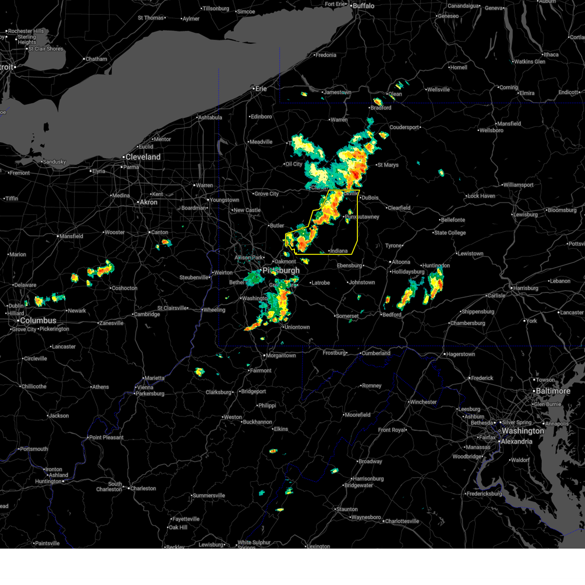
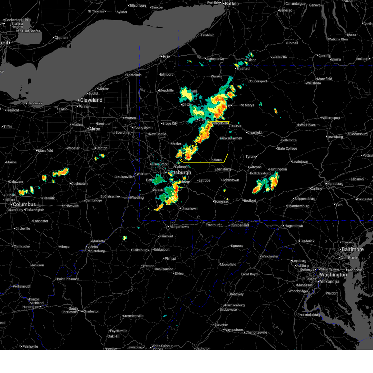
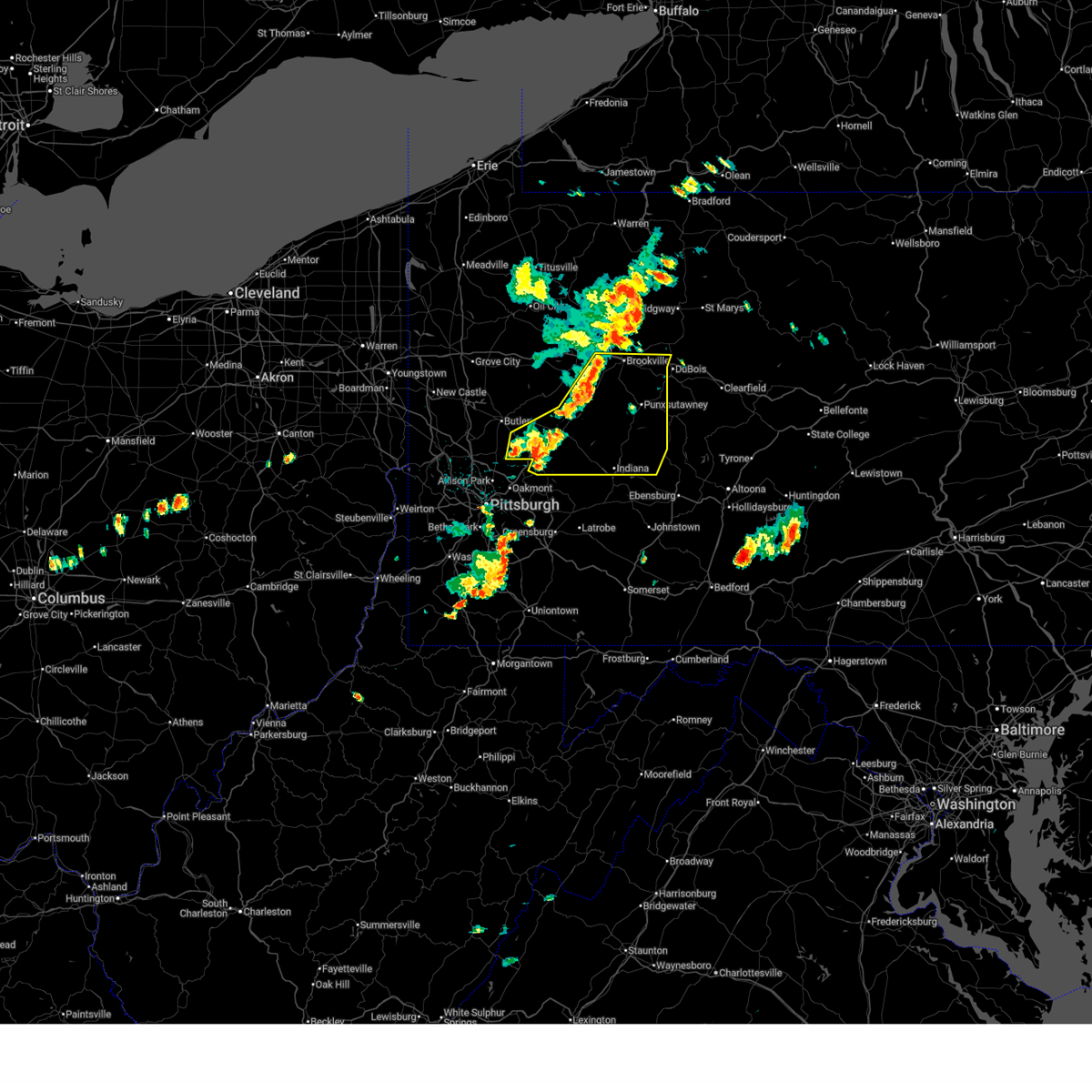
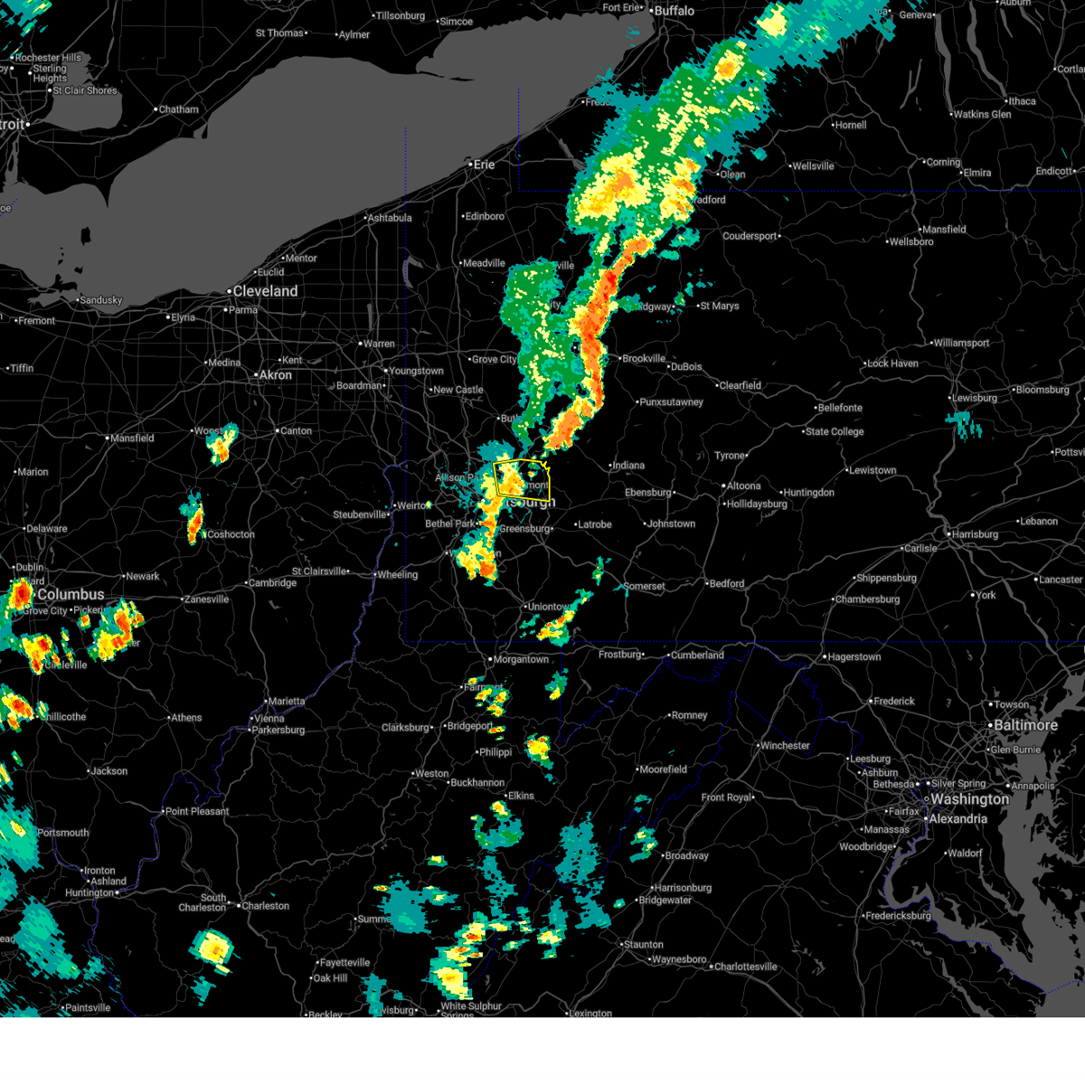
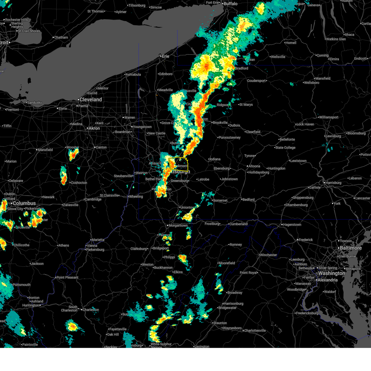
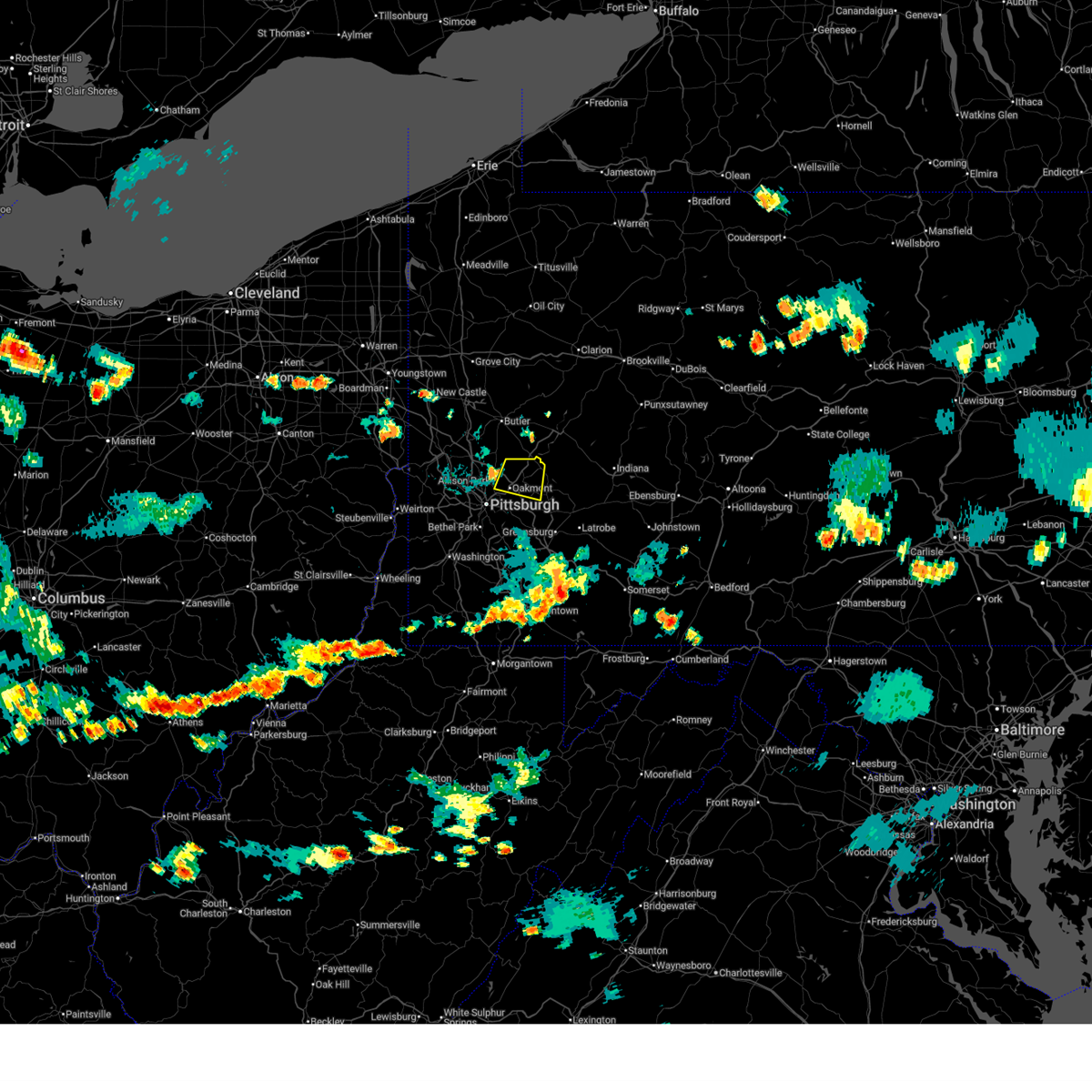
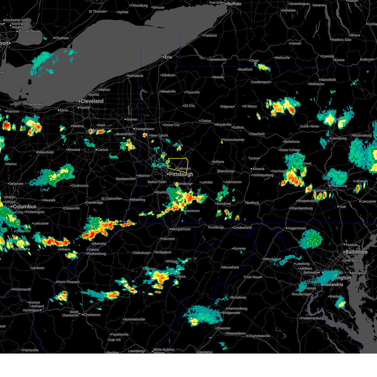
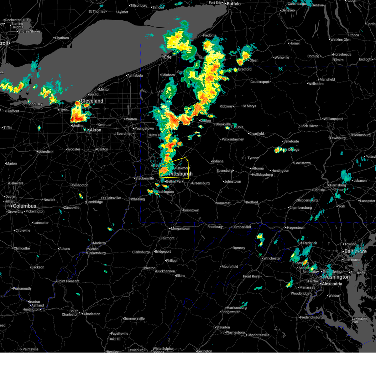
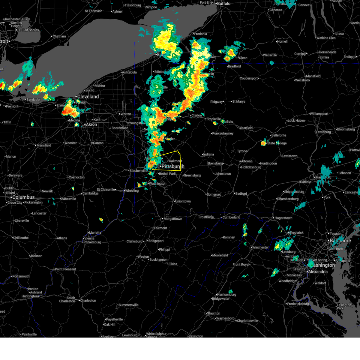
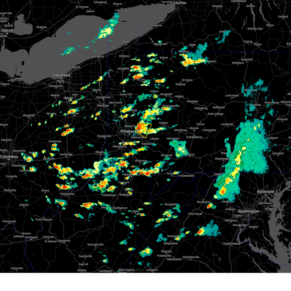
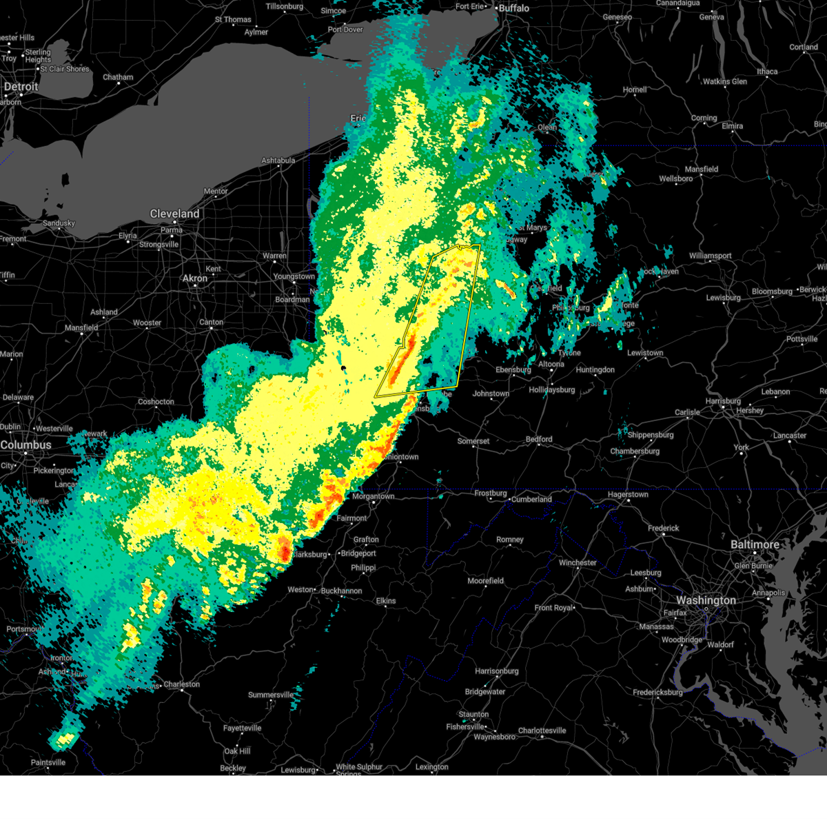
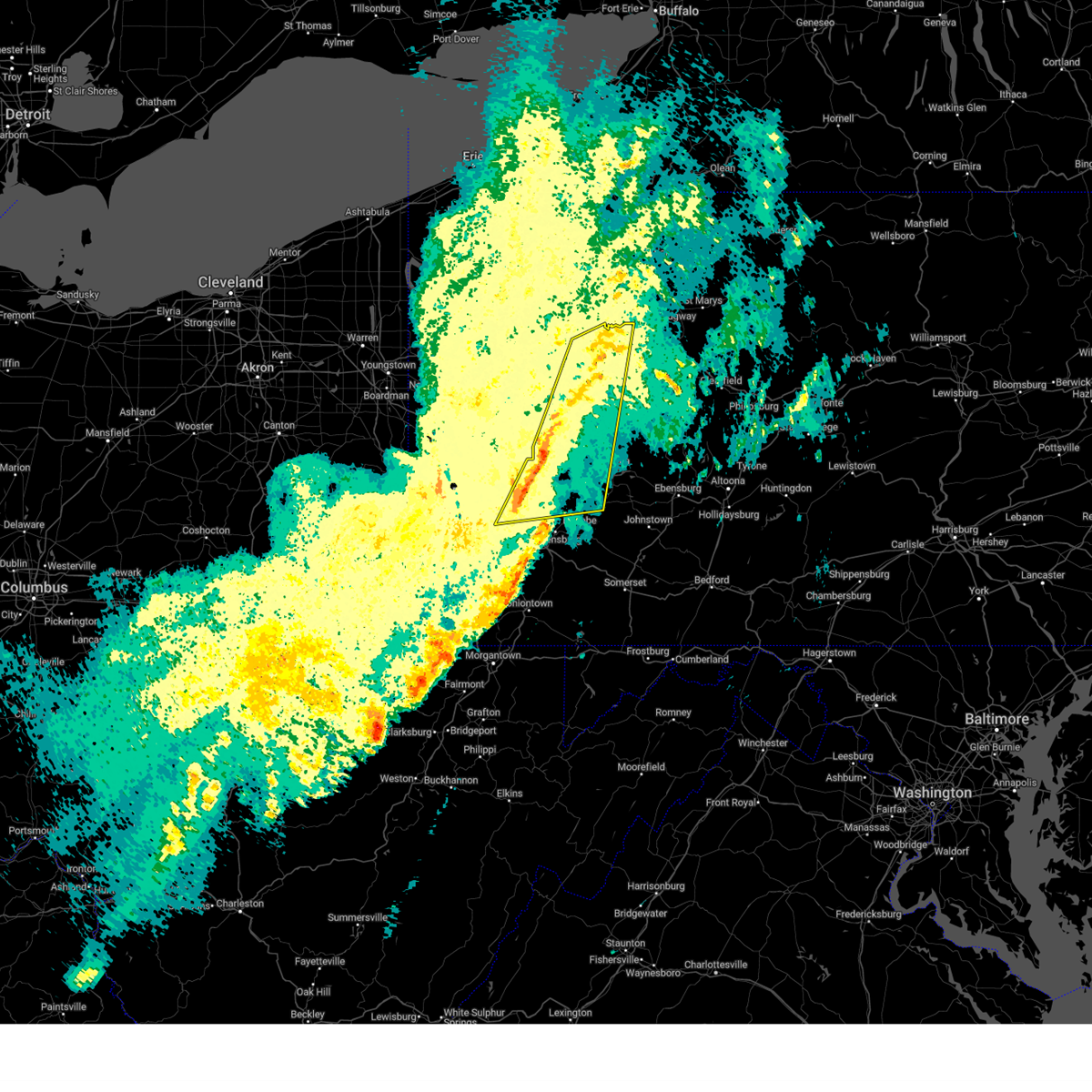
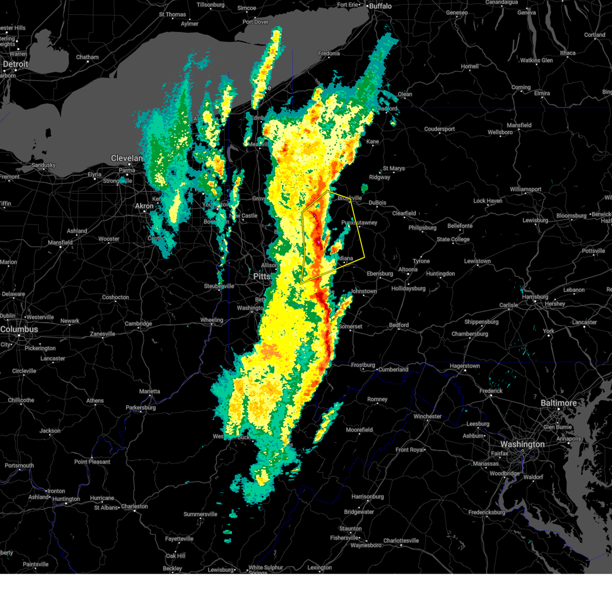
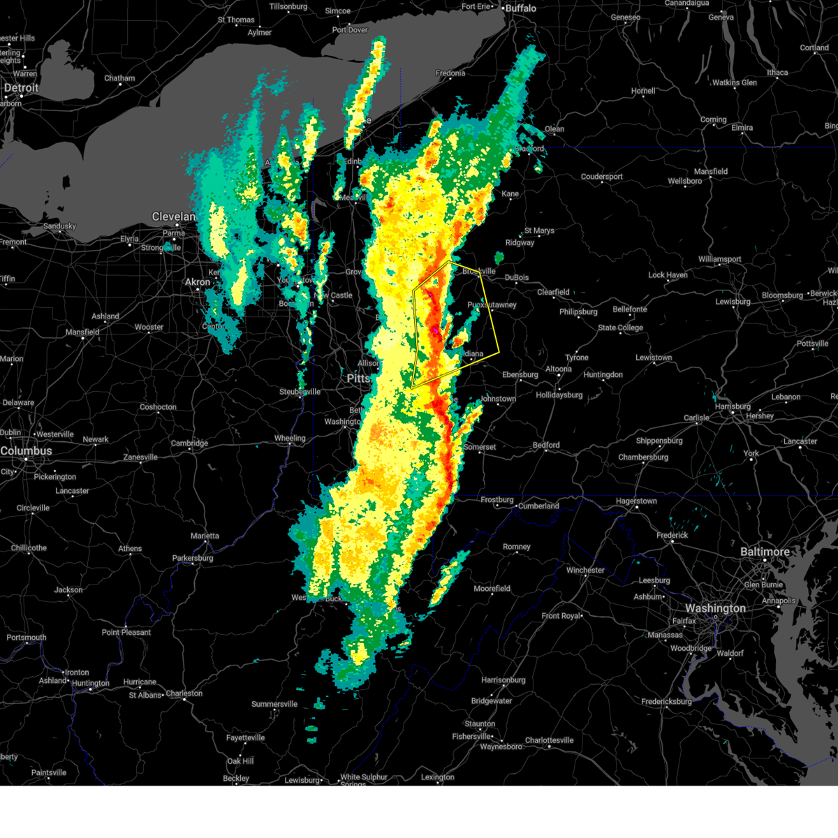
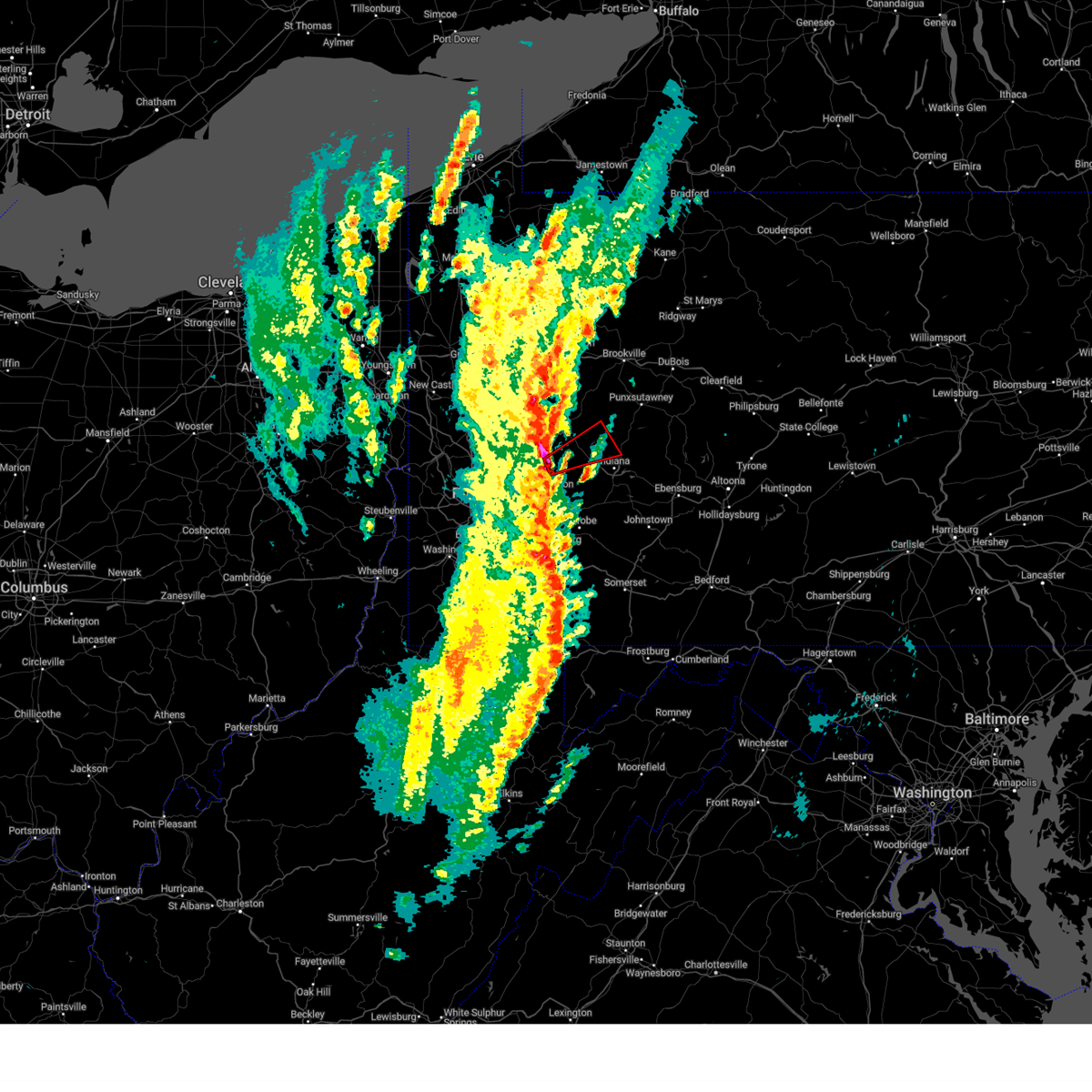
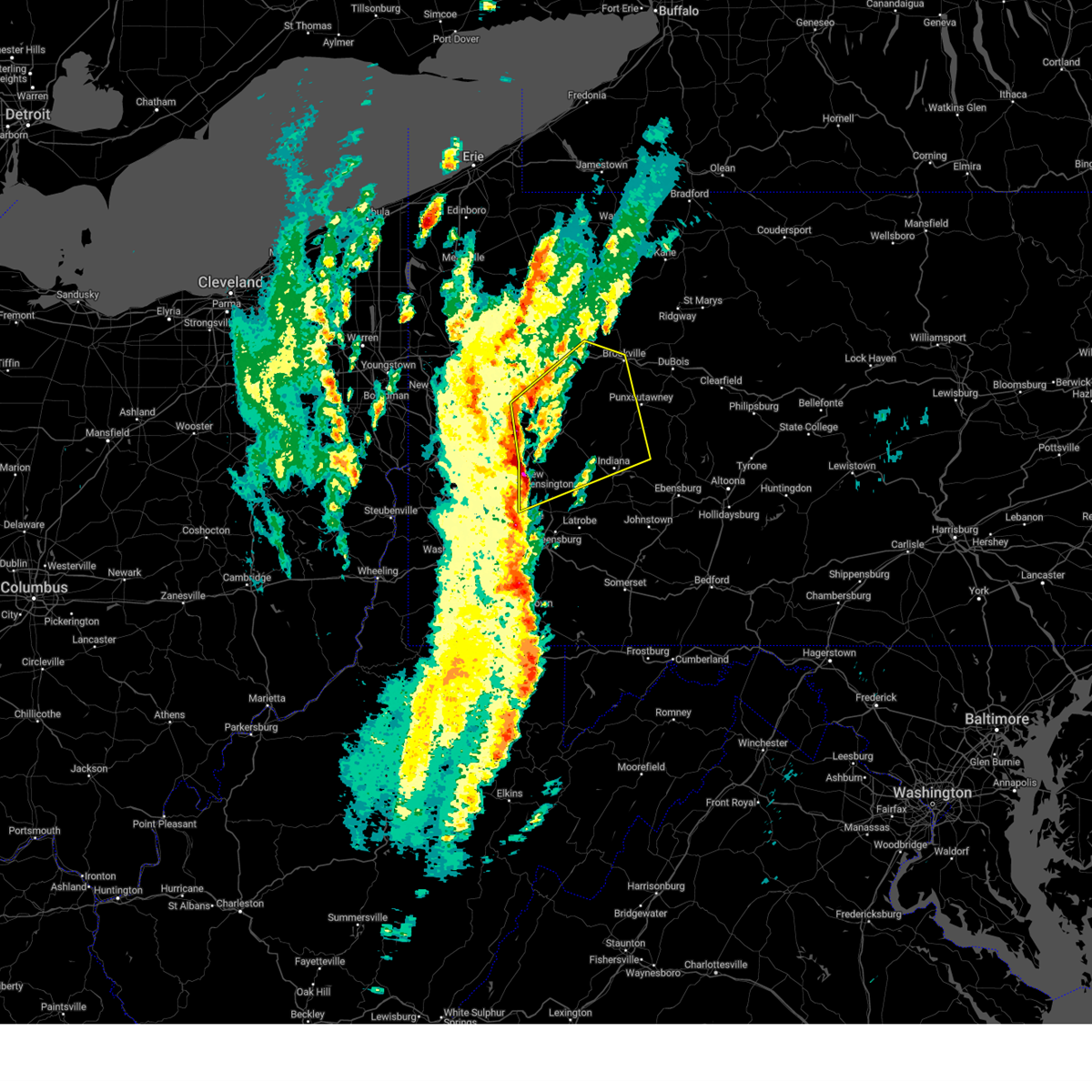
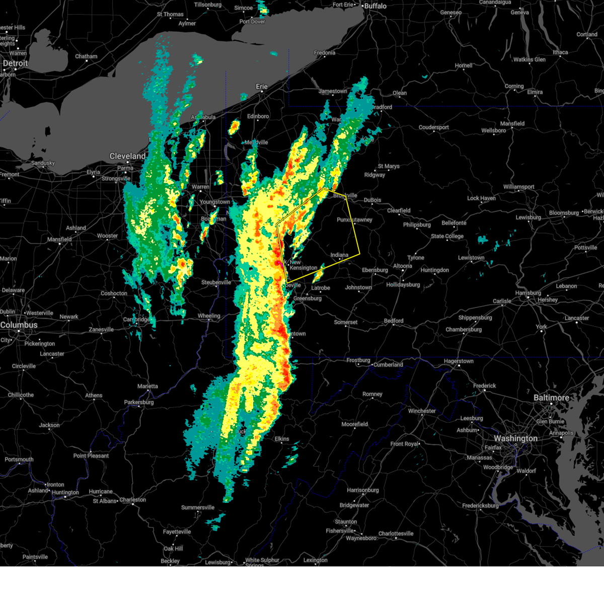
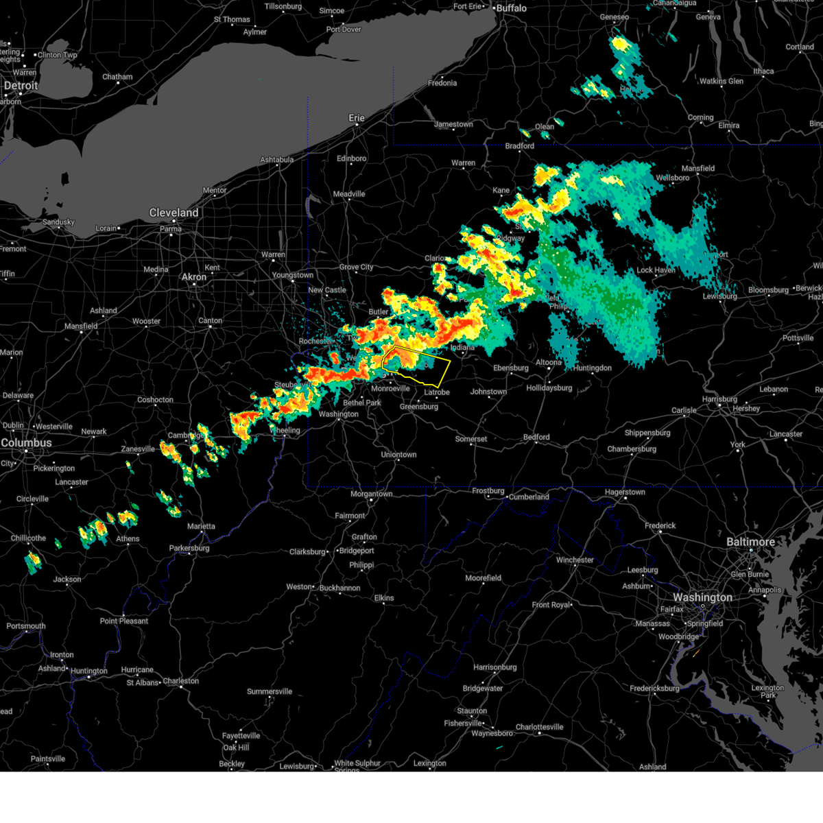
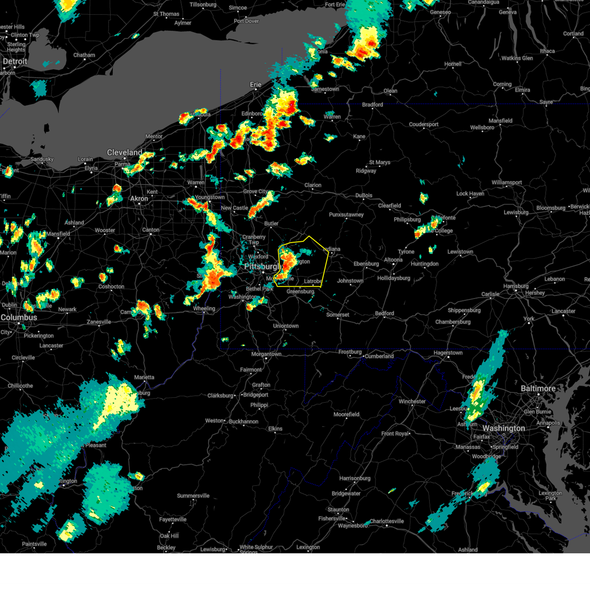
Hail Map for Leechburg, PA
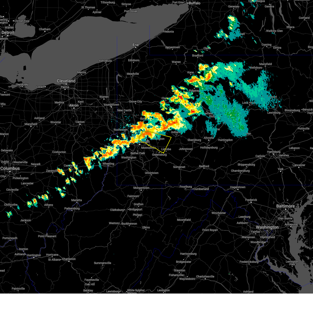
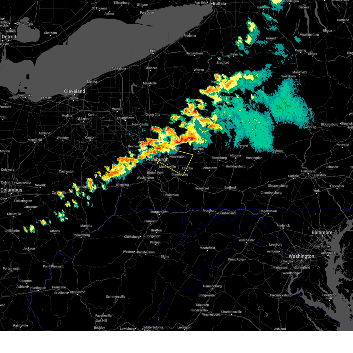
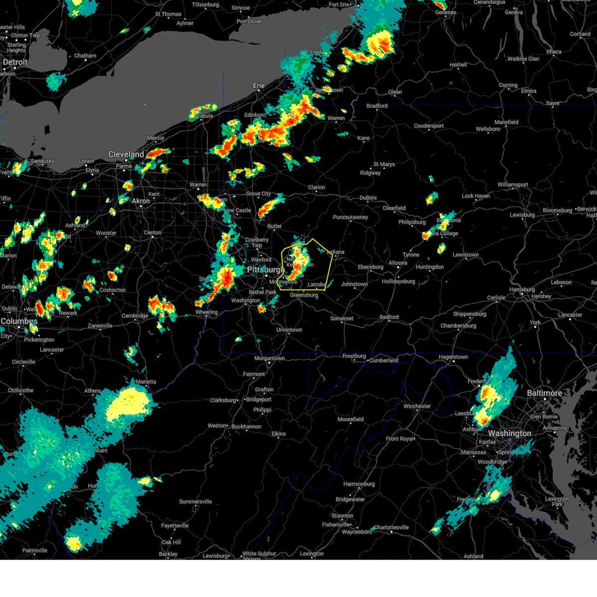
The Leechburg, PA area has had 5 reports of on-the-ground hail by trained spotters, and has been under severe weather warnings 71 times during the past 12 months. Doppler radar has detected hail at or near Leechburg, PA on 23 occasions, including 3 occasions during the past year.
| Name: | Leechburg, PA |
| Where Located: | 24.7 miles ENE of Pittsburgh, PA |
| Map: | Google Map for Leechburg, PA |
| Population: | 2156 |
| Housing Units: | 1138 |
| More Info: | Search Google for Leechburg, PA |
5
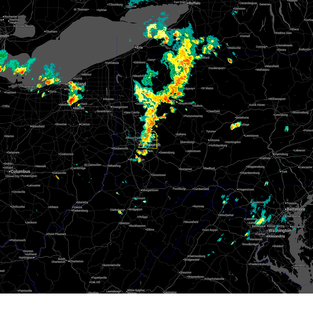
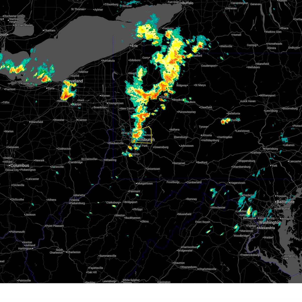
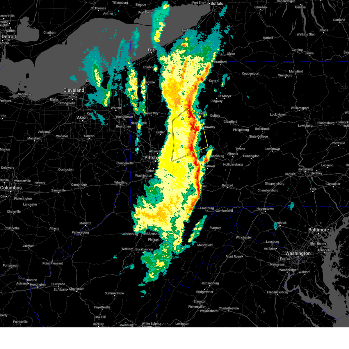
The Top Recent Hail Date for Leechburg, PA is Sunday, March 16, 2025 (1st out of 23)

Hail and Wind Damage Spotted near Leechburg, PA
| Date / Time | Report Details |
|---|---|
| 6/28/2025 1:04 PM EDT |
 the severe thunderstorm warning has been cancelled and is no longer in effect the severe thunderstorm warning has been cancelled and is no longer in effect
|
| 6/28/2025 1:04 PM EDT |
 At 104 pm edt, severe thunderstorms were located along a line from 10 miles northwest of brockway to 18 miles south of punxsutawney, or along a line from 13 miles northeast of brookville to 14 miles east of indiana, moving east at 45 mph (law enforcement reported). Hazards include 60 mph wind gusts. Expect damage to roofs, siding, and trees. Locations impacted include, indiana, punxsutawney, vandergrift, kittanning, brookville, ford city, reynoldsville, leechburg, freeport, new bethlehem, west kittanning, clymer, north apollo, west leechburg, sykesville, falls creek, orchard hills, rural valley, oklahoma and west lebanon. At 104 pm edt, severe thunderstorms were located along a line from 10 miles northwest of brockway to 18 miles south of punxsutawney, or along a line from 13 miles northeast of brookville to 14 miles east of indiana, moving east at 45 mph (law enforcement reported). Hazards include 60 mph wind gusts. Expect damage to roofs, siding, and trees. Locations impacted include, indiana, punxsutawney, vandergrift, kittanning, brookville, ford city, reynoldsville, leechburg, freeport, new bethlehem, west kittanning, clymer, north apollo, west leechburg, sykesville, falls creek, orchard hills, rural valley, oklahoma and west lebanon.
|
| 6/28/2025 1:01 PM EDT |
 At 101 pm edt, severe thunderstorms were located along a line from 12 miles north of brookville to 12 miles northeast of indiana, moving east at 45 mph (radar indicated). Hazards include 60 mph wind gusts. Expect damage to roofs, siding, and trees. Locations impacted include, indiana, punxsutawney, vandergrift, kittanning, brookville, lower burrell, harrison township, ford city, reynoldsville, leechburg, freeport, new bethlehem, west kittanning, clymer, north apollo, west leechburg, sykesville, falls creek, orchard hills and rural valley. At 101 pm edt, severe thunderstorms were located along a line from 12 miles north of brookville to 12 miles northeast of indiana, moving east at 45 mph (radar indicated). Hazards include 60 mph wind gusts. Expect damage to roofs, siding, and trees. Locations impacted include, indiana, punxsutawney, vandergrift, kittanning, brookville, lower burrell, harrison township, ford city, reynoldsville, leechburg, freeport, new bethlehem, west kittanning, clymer, north apollo, west leechburg, sykesville, falls creek, orchard hills and rural valley.
|
| 6/28/2025 1:01 PM EDT |
 the severe thunderstorm warning has been cancelled and is no longer in effect the severe thunderstorm warning has been cancelled and is no longer in effect
|
| 6/28/2025 12:44 PM EDT |
 Svrpbz the national weather service in pittsburgh has issued a * severe thunderstorm warning for, north central westmoreland county in southwestern pennsylvania, armstrong county in west central pennsylvania, southeastern butler county in west central pennsylvania, southeastern clarion county in west central pennsylvania, indiana county in west central pennsylvania, jefferson pa county in west central pennsylvania, * until 145 pm edt. * at 1244 pm edt, severe thunderstorms were located along a line from 10 miles northeast of clarion to near indiana, moving east at 45 mph (radar indicated). Hazards include 60 mph wind gusts. expect damage to roofs, siding, and trees Svrpbz the national weather service in pittsburgh has issued a * severe thunderstorm warning for, north central westmoreland county in southwestern pennsylvania, armstrong county in west central pennsylvania, southeastern butler county in west central pennsylvania, southeastern clarion county in west central pennsylvania, indiana county in west central pennsylvania, jefferson pa county in west central pennsylvania, * until 145 pm edt. * at 1244 pm edt, severe thunderstorms were located along a line from 10 miles northeast of clarion to near indiana, moving east at 45 mph (radar indicated). Hazards include 60 mph wind gusts. expect damage to roofs, siding, and trees
|
| 6/27/2025 6:01 PM EDT |
 the severe thunderstorm warning has been cancelled and is no longer in effect the severe thunderstorm warning has been cancelled and is no longer in effect
|
| 6/27/2025 5:55 PM EDT |
 At 555 pm edt, a severe thunderstorm was located over new kensington, or 6 miles northeast of penn hills, moving east at 25 mph (radar indicated). Hazards include 60 mph wind gusts. Expect damage to roofs, siding, and trees. Locations impacted include, pittsburgh, penn hills, monroeville, vandergrift, apollo, plum, murrysville, hampton township, new kensington, lower burrell, harrison township, o'hara township, oakmont, fox chapel, arnold, tarentum, natrona heights, springdale, brackenridge and aspinwall. At 555 pm edt, a severe thunderstorm was located over new kensington, or 6 miles northeast of penn hills, moving east at 25 mph (radar indicated). Hazards include 60 mph wind gusts. Expect damage to roofs, siding, and trees. Locations impacted include, pittsburgh, penn hills, monroeville, vandergrift, apollo, plum, murrysville, hampton township, new kensington, lower burrell, harrison township, o'hara township, oakmont, fox chapel, arnold, tarentum, natrona heights, springdale, brackenridge and aspinwall.
|
| 6/27/2025 5:34 PM EDT |
 Svrpbz the national weather service in pittsburgh has issued a * severe thunderstorm warning for, northeastern allegheny county in southwestern pennsylvania, northwestern westmoreland county in southwestern pennsylvania, * until 615 pm edt. * at 534 pm edt, a severe thunderstorm was located over fox chapel, or 6 miles east of ross township, moving east at 25 mph (radar indicated). Hazards include 60 mph wind gusts. expect damage to roofs, siding, and trees Svrpbz the national weather service in pittsburgh has issued a * severe thunderstorm warning for, northeastern allegheny county in southwestern pennsylvania, northwestern westmoreland county in southwestern pennsylvania, * until 615 pm edt. * at 534 pm edt, a severe thunderstorm was located over fox chapel, or 6 miles east of ross township, moving east at 25 mph (radar indicated). Hazards include 60 mph wind gusts. expect damage to roofs, siding, and trees
|
| 6/25/2025 6:40 PM EDT |
 The storm which prompted the warning has weakened below severe limits, and no longer poses an immediate threat to life or property. therefore, the warning will be allowed to expire. however, gusty winds are still possible with this thunderstorm. The storm which prompted the warning has weakened below severe limits, and no longer poses an immediate threat to life or property. therefore, the warning will be allowed to expire. however, gusty winds are still possible with this thunderstorm.
|
| 6/25/2025 6:34 PM EDT |
 At 634 pm edt, a severe thunderstorm was located over arnold, or 8 miles northeast of penn hills, moving east at 15 mph (radar indicated). Hazards include 60 mph wind gusts. Expect damage to roofs, siding, and trees. Locations impacted include, penn hills, plum, murrysville, new kensington, lower burrell, harrison township, o'hara township, oakmont, fox chapel, arnold, tarentum, natrona heights, springdale, brackenridge, verona, cheswick, russellton and west leechburg. At 634 pm edt, a severe thunderstorm was located over arnold, or 8 miles northeast of penn hills, moving east at 15 mph (radar indicated). Hazards include 60 mph wind gusts. Expect damage to roofs, siding, and trees. Locations impacted include, penn hills, plum, murrysville, new kensington, lower burrell, harrison township, o'hara township, oakmont, fox chapel, arnold, tarentum, natrona heights, springdale, brackenridge, verona, cheswick, russellton and west leechburg.
|
| 6/25/2025 6:24 PM EDT |
 At 624 pm edt, a severe thunderstorm was located over arnold, or 8 miles north of penn hills, moving east at 15 mph (radar indicated). Hazards include 60 mph wind gusts. Expect damage to roofs, siding, and trees. Locations impacted include, penn hills, shaler township, plum, murrysville, hampton township, new kensington, lower burrell, harrison township, o'hara township, oakmont, fox chapel, arnold, tarentum, natrona heights, springdale, brackenridge, verona, freeport, cheswick and russellton. At 624 pm edt, a severe thunderstorm was located over arnold, or 8 miles north of penn hills, moving east at 15 mph (radar indicated). Hazards include 60 mph wind gusts. Expect damage to roofs, siding, and trees. Locations impacted include, penn hills, shaler township, plum, murrysville, hampton township, new kensington, lower burrell, harrison township, o'hara township, oakmont, fox chapel, arnold, tarentum, natrona heights, springdale, brackenridge, verona, freeport, cheswick and russellton.
|
| 6/25/2025 6:07 PM EDT |
 Svrpbz the national weather service in pittsburgh has issued a * severe thunderstorm warning for, northeastern allegheny county in southwestern pennsylvania, northwestern westmoreland county in southwestern pennsylvania, * until 645 pm edt. * at 607 pm edt, a severe thunderstorm was located near hampton township, or 7 miles east of mccandless township, moving east at 15 mph (radar indicated). Hazards include 60 mph wind gusts. expect damage to roofs, siding, and trees Svrpbz the national weather service in pittsburgh has issued a * severe thunderstorm warning for, northeastern allegheny county in southwestern pennsylvania, northwestern westmoreland county in southwestern pennsylvania, * until 645 pm edt. * at 607 pm edt, a severe thunderstorm was located near hampton township, or 7 miles east of mccandless township, moving east at 15 mph (radar indicated). Hazards include 60 mph wind gusts. expect damage to roofs, siding, and trees
|
| 6/19/2025 5:08 PM EDT | At 508 pm edt, a severe thunderstorm was located near apollo, moving east at 40 mph (radar indicated). Hazards include 60 mph wind gusts. Expect damage to roofs, siding, and trees. Locations impacted include, indiana, vandergrift, homer city, apollo, murrysville, lower burrell, blairsville, leechburg, black lick, north apollo, west leechburg, avonmore, orchard hills, saltsburg, oklahoma, west lebanon, east vandergrift, north vandergrift, hyde park and chevy chase heights. |
| 6/19/2025 5:08 PM EDT | the severe thunderstorm warning has been cancelled and is no longer in effect |
| 6/19/2025 4:59 PM EDT | Svrpbz the national weather service in pittsburgh has issued a * severe thunderstorm warning for, northeastern allegheny county in southwestern pennsylvania, northwestern westmoreland county in southwestern pennsylvania, southern armstrong county in west central pennsylvania, southwestern indiana county in west central pennsylvania, * until 545 pm edt. * at 459 pm edt, a severe thunderstorm was located over plum, or 7 miles northeast of penn hills, moving east at 40 mph (radar indicated). Hazards include 60 mph wind gusts. expect damage to roofs, siding, and trees |
| 6/19/2025 12:14 AM EDT |
 the severe thunderstorm warning has been cancelled and is no longer in effect the severe thunderstorm warning has been cancelled and is no longer in effect
|
| 6/19/2025 12:14 AM EDT |
 At 1214 am edt, severe thunderstorms were located along a line from 9 miles west of marienville to over murrysville, or along a line from 9 miles west of marienville to 6 miles east of monroeville, moving east at 30 mph (law enforcement reported trees and wires down with this line of storms). Hazards include 60 mph wind gusts. Expect damage to roofs, siding, and trees. Locations impacted include, pittsburgh, penn hills, monroeville, indiana, punxsutawney, clarion, vandergrift, kittanning, brookville, marienville, homer city, apollo, knox, rimersburg, plum, murrysville, wilkinsburg, new kensington, lower burrell and harrison township. At 1214 am edt, severe thunderstorms were located along a line from 9 miles west of marienville to over murrysville, or along a line from 9 miles west of marienville to 6 miles east of monroeville, moving east at 30 mph (law enforcement reported trees and wires down with this line of storms). Hazards include 60 mph wind gusts. Expect damage to roofs, siding, and trees. Locations impacted include, pittsburgh, penn hills, monroeville, indiana, punxsutawney, clarion, vandergrift, kittanning, brookville, marienville, homer city, apollo, knox, rimersburg, plum, murrysville, wilkinsburg, new kensington, lower burrell and harrison township.
|
| 6/18/2025 11:59 PM EDT |
 The storms which prompted the warning have moved out of a portion of the area. a new severe thunderstorm warning has been issued for this line of storms to the east. The storms which prompted the warning have moved out of a portion of the area. a new severe thunderstorm warning has been issued for this line of storms to the east.
|
| 6/18/2025 11:57 PM EDT |
 Svrpbz the national weather service in pittsburgh has issued a * severe thunderstorm warning for, forest county in northwestern pennsylvania, eastern venango county in northwestern pennsylvania, northeastern allegheny county in southwestern pennsylvania, northern westmoreland county in southwestern pennsylvania, armstrong county in west central pennsylvania, eastern butler county in west central pennsylvania, clarion county in west central pennsylvania, indiana county in west central pennsylvania, jefferson pa county in west central pennsylvania, * until 115 am edt. * at 1157 pm edt, severe thunderstorms were located along a line from near tionesta to over penn hills, or along a line from 16 miles northeast of oil city to over penn hills, moving east at 30 mph (law enforcement reported trees and wires down with this line of storms). Hazards include 60 mph wind gusts. expect damage to roofs, siding, and trees Svrpbz the national weather service in pittsburgh has issued a * severe thunderstorm warning for, forest county in northwestern pennsylvania, eastern venango county in northwestern pennsylvania, northeastern allegheny county in southwestern pennsylvania, northern westmoreland county in southwestern pennsylvania, armstrong county in west central pennsylvania, eastern butler county in west central pennsylvania, clarion county in west central pennsylvania, indiana county in west central pennsylvania, jefferson pa county in west central pennsylvania, * until 115 am edt. * at 1157 pm edt, severe thunderstorms were located along a line from near tionesta to over penn hills, or along a line from 16 miles northeast of oil city to over penn hills, moving east at 30 mph (law enforcement reported trees and wires down with this line of storms). Hazards include 60 mph wind gusts. expect damage to roofs, siding, and trees
|
| 6/18/2025 11:42 PM EDT |
 the severe thunderstorm warning has been cancelled and is no longer in effect the severe thunderstorm warning has been cancelled and is no longer in effect
|
| 6/18/2025 11:42 PM EDT |
 At 1142 pm edt, severe thunderstorms were located along a line from over tionesta to over monongahela, or along a line from 11 miles east of oil city to 5 miles southeast of gastonville, moving east at 45 mph (law enforcement reported trees down with this line of storms). Hazards include 60 mph wind gusts. Expect damage to roofs, siding, and trees. Locations impacted include, pittsburgh, penn hills, mount lebanon, bethel park, ross township, mccandless township, monroeville, mcmurray, mckeesport, butler, franklin park, oil city, jeannette, canonsburg, franklin, clarion, vandergrift, kittanning, apollo and knox. At 1142 pm edt, severe thunderstorms were located along a line from over tionesta to over monongahela, or along a line from 11 miles east of oil city to 5 miles southeast of gastonville, moving east at 45 mph (law enforcement reported trees down with this line of storms). Hazards include 60 mph wind gusts. Expect damage to roofs, siding, and trees. Locations impacted include, pittsburgh, penn hills, mount lebanon, bethel park, ross township, mccandless township, monroeville, mcmurray, mckeesport, butler, franklin park, oil city, jeannette, canonsburg, franklin, clarion, vandergrift, kittanning, apollo and knox.
|
| 6/18/2025 11:29 PM EDT |
 the severe thunderstorm warning has been cancelled and is no longer in effect the severe thunderstorm warning has been cancelled and is no longer in effect
|
| 6/18/2025 11:29 PM EDT |
 At 1129 pm edt, severe thunderstorms were located along a line from near oil city to near canonsburg, moving east at 45 mph (law enforcement reported trees down with this line of storms). Hazards include 60 mph wind gusts. Expect damage to roofs, siding, and trees. Locations impacted include, pittsburgh, penn hills, mount lebanon, bethel park, ross township, mccandless township, monroeville, cranberry, moon township, new castle, mcmurray, mckeesport, butler, washington, franklin park, oil city, jeannette, aliquippa, canonsburg and grove city. At 1129 pm edt, severe thunderstorms were located along a line from near oil city to near canonsburg, moving east at 45 mph (law enforcement reported trees down with this line of storms). Hazards include 60 mph wind gusts. Expect damage to roofs, siding, and trees. Locations impacted include, pittsburgh, penn hills, mount lebanon, bethel park, ross township, mccandless township, monroeville, cranberry, moon township, new castle, mcmurray, mckeesport, butler, washington, franklin park, oil city, jeannette, aliquippa, canonsburg and grove city.
|
| 6/18/2025 11:16 PM EDT |
 At 1116 pm edt, severe thunderstorms were located along a line from near sugarcreek to over wolfdale, or along a line from 6 miles north of franklin to near washington, moving east at 45 mph (law enforcement reported trees down with this line of storms). Hazards include 60 mph wind gusts. Expect damage to roofs, siding, and trees. Locations impacted include, pittsburgh, penn hills, mount lebanon, bethel park, ross township, mccandless township, monroeville, cranberry, moon township, new castle, mcmurray, weirton, mckeesport, steubenville, butler, franklin park, oil city, jeannette, aliquippa and canonsburg. At 1116 pm edt, severe thunderstorms were located along a line from near sugarcreek to over wolfdale, or along a line from 6 miles north of franklin to near washington, moving east at 45 mph (law enforcement reported trees down with this line of storms). Hazards include 60 mph wind gusts. Expect damage to roofs, siding, and trees. Locations impacted include, pittsburgh, penn hills, mount lebanon, bethel park, ross township, mccandless township, monroeville, cranberry, moon township, new castle, mcmurray, weirton, mckeesport, steubenville, butler, franklin park, oil city, jeannette, aliquippa and canonsburg.
|
| 6/18/2025 11:16 PM EDT |
 the severe thunderstorm warning has been cancelled and is no longer in effect the severe thunderstorm warning has been cancelled and is no longer in effect
|
| 6/18/2025 10:54 PM EDT |
 Svrpbz the national weather service in pittsburgh has issued a * severe thunderstorm warning for, eastern columbiana county in east central ohio, eastern jefferson oh county in east central ohio, western forest county in northwestern pennsylvania, mercer county in northwestern pennsylvania, venango county in northwestern pennsylvania, allegheny county in southwestern pennsylvania, northern washington county in southwestern pennsylvania, northwestern westmoreland county in southwestern pennsylvania, western armstrong county in west central pennsylvania, butler county in west central pennsylvania, clarion county in west central pennsylvania, beaver county in western pennsylvania, lawrence county in western pennsylvania, brooke county in northern west virginia, hancock county in northern west virginia, * until midnight edt. * at 1054 pm edt, severe thunderstorms were located along a line from 11 miles northeast of greenville to near west liberty, or along a line from 18 miles west of franklin to near west liberty, moving east at 45 mph (law enforcement reported trees were reported down with this line of storms). Hazards include 60 mph wind gusts. expect damage to roofs, siding, and trees Svrpbz the national weather service in pittsburgh has issued a * severe thunderstorm warning for, eastern columbiana county in east central ohio, eastern jefferson oh county in east central ohio, western forest county in northwestern pennsylvania, mercer county in northwestern pennsylvania, venango county in northwestern pennsylvania, allegheny county in southwestern pennsylvania, northern washington county in southwestern pennsylvania, northwestern westmoreland county in southwestern pennsylvania, western armstrong county in west central pennsylvania, butler county in west central pennsylvania, clarion county in west central pennsylvania, beaver county in western pennsylvania, lawrence county in western pennsylvania, brooke county in northern west virginia, hancock county in northern west virginia, * until midnight edt. * at 1054 pm edt, severe thunderstorms were located along a line from 11 miles northeast of greenville to near west liberty, or along a line from 18 miles west of franklin to near west liberty, moving east at 45 mph (law enforcement reported trees were reported down with this line of storms). Hazards include 60 mph wind gusts. expect damage to roofs, siding, and trees
|
| 6/18/2025 6:00 PM EDT | The storm which prompted the warning has weakened below severe limits, and no longer poses an immediate threat to life or property. therefore, the warning has been allowed to expire. however, gusty winds and heavy rain are still possible with this thunderstorm. |
| 6/18/2025 5:49 PM EDT |
 At 549 pm edt, a severe thunderstorm was located over springdale, or near penn hills, moving east at 35 mph (law enforcement reported). Hazards include 60 mph wind gusts. Expect damage to roofs, siding, and trees. locations impacted include, pittsburgh, penn hills, monroeville, shaler township, plum, west mifflin, baldwin, murrysville, hampton township, wilkinsburg, new kensington, lower burrell, munhall, harrison township, north versailles, swissvale, o'hara township, forest hills, wilkins township and oakmont. Tree was reported down in the north hills of pittsburgh. At 549 pm edt, a severe thunderstorm was located over springdale, or near penn hills, moving east at 35 mph (law enforcement reported). Hazards include 60 mph wind gusts. Expect damage to roofs, siding, and trees. locations impacted include, pittsburgh, penn hills, monroeville, shaler township, plum, west mifflin, baldwin, murrysville, hampton township, wilkinsburg, new kensington, lower burrell, munhall, harrison township, north versailles, swissvale, o'hara township, forest hills, wilkins township and oakmont. Tree was reported down in the north hills of pittsburgh.
|
| 6/18/2025 5:38 PM EDT |
 At 538 pm edt, a severe thunderstorm was located over o'hara township, or 6 miles northwest of penn hills, moving east at 35 mph (radar indicated). Hazards include 60 mph wind gusts. Expect damage to roofs, siding, and trees. Locations impacted include, pittsburgh, penn hills, mount lebanon, ross township, mccandless township, monroeville, shaler township, plum, west mifflin, north side pittsburgh, baldwin, murrysville, hampton township, scott township, wilkinsburg, new kensington, lower burrell, munhall, harrison township and north versailles. At 538 pm edt, a severe thunderstorm was located over o'hara township, or 6 miles northwest of penn hills, moving east at 35 mph (radar indicated). Hazards include 60 mph wind gusts. Expect damage to roofs, siding, and trees. Locations impacted include, pittsburgh, penn hills, mount lebanon, ross township, mccandless township, monroeville, shaler township, plum, west mifflin, north side pittsburgh, baldwin, murrysville, hampton township, scott township, wilkinsburg, new kensington, lower burrell, munhall, harrison township and north versailles.
|
| 6/18/2025 5:29 PM EDT |
 At 529 pm edt, a severe thunderstorm was located over ross township, moving east at 35 mph (radar indicated). Hazards include 60 mph wind gusts. Expect damage to roofs, siding, and trees. Locations impacted include, pittsburgh, penn hills, mount lebanon, ross township, mccandless township, monroeville, franklin park, shaler township, plum, west mifflin, north side pittsburgh, baldwin, murrysville, hampton township, scott township, wilkinsburg, robinson township, new kensington, lower burrell and munhall. At 529 pm edt, a severe thunderstorm was located over ross township, moving east at 35 mph (radar indicated). Hazards include 60 mph wind gusts. Expect damage to roofs, siding, and trees. Locations impacted include, pittsburgh, penn hills, mount lebanon, ross township, mccandless township, monroeville, franklin park, shaler township, plum, west mifflin, north side pittsburgh, baldwin, murrysville, hampton township, scott township, wilkinsburg, robinson township, new kensington, lower burrell and munhall.
|
| 6/18/2025 5:20 PM EDT |
 Svrpbz the national weather service in pittsburgh has issued a * severe thunderstorm warning for, central allegheny county in southwestern pennsylvania, northwestern westmoreland county in southwestern pennsylvania, * until 600 pm edt. * at 520 pm edt, a severe thunderstorm was located over kennedy township, or 5 miles southwest of ross township, moving east at 35 mph (radar indicated). Hazards include 60 mph wind gusts. expect damage to roofs, siding, and trees Svrpbz the national weather service in pittsburgh has issued a * severe thunderstorm warning for, central allegheny county in southwestern pennsylvania, northwestern westmoreland county in southwestern pennsylvania, * until 600 pm edt. * at 520 pm edt, a severe thunderstorm was located over kennedy township, or 5 miles southwest of ross township, moving east at 35 mph (radar indicated). Hazards include 60 mph wind gusts. expect damage to roofs, siding, and trees
|
| 6/6/2025 2:19 PM EDT |
 Svrpbz the national weather service in pittsburgh has issued a * severe thunderstorm warning for, northeastern allegheny county in southwestern pennsylvania, northwestern westmoreland county in southwestern pennsylvania, south central armstrong county in west central pennsylvania, * until 245 pm edt. * at 219 pm edt, a severe thunderstorm was located over springdale, or 5 miles northeast of penn hills, moving east at 20 mph (radar indicated). Hazards include 60 mph wind gusts and quarter size hail. Hail damage to vehicles is expected. Expect wind damage to roofs, siding, and trees. Svrpbz the national weather service in pittsburgh has issued a * severe thunderstorm warning for, northeastern allegheny county in southwestern pennsylvania, northwestern westmoreland county in southwestern pennsylvania, south central armstrong county in west central pennsylvania, * until 245 pm edt. * at 219 pm edt, a severe thunderstorm was located over springdale, or 5 miles northeast of penn hills, moving east at 20 mph (radar indicated). Hazards include 60 mph wind gusts and quarter size hail. Hail damage to vehicles is expected. Expect wind damage to roofs, siding, and trees.
|
| 4/29/2025 5:42 PM EDT | At 540 pm edt, severe thunderstorms were located along a line extending from 10 miles southwest of knox to near rimersburg to 9 miles east of ford city to 6 miles northeast of delmont, moving northeast at 70 mph. these are destructive storms for armstrong, indiana, and jefferson counties (radar indicated). Hazards include 80 mph wind gusts. Extensive tree damage and widespread power outages. mobile homes will be heavily damaged. expect considerable damage to roofs, windows and vehicles. Locations impacted include, greensburg, indiana, jeannette, latrobe, punxsutawney, clarion, vandergrift, kittanning, brookville, homer city, apollo, rimersburg, murrysville, irwin, mcchesneytown-loyalhanna, blairsville, manor, youngwood, ford city, and reynoldsville. |
| 4/29/2025 5:42 PM EDT | the severe thunderstorm warning has been cancelled and is no longer in effect |
| 4/29/2025 5:26 PM EDT | The storms which prompted the warning have moved out of the area. therefore, the warning will be allowed to expire. however, gusty winds are still possible with these thunderstorms. a severe thunderstorm watch remains in effect until 1000 pm edt for western, southwestern and west central pennsylvania. remember, a severe thunderstorm warning still remains in effect for butler, armstrong, and westmoreland counties. |
| 4/29/2025 5:21 PM EDT | Svrpbz the national weather service in pittsburgh has issued a * severe thunderstorm warning for, east central washington county in southwestern pennsylvania, southeastern lawrence county in western pennsylvania, butler county in west central pennsylvania, indiana county in west central pennsylvania, eastern allegheny county in southwestern pennsylvania, jefferson county in west central pennsylvania, westmoreland county in southwestern pennsylvania, armstrong county in west central pennsylvania, clarion county in west central pennsylvania, south central forest county in northwestern pennsylvania, * until 615 pm edt. * at 520 pm edt, severe thunderstorms were located along a line extending from 7 miles west of shanor-northvue to near meadowood to near new kensington to near clairton, moving northeast at 70 mph. these are destructive storms for butler, armstrong, and westmoreland counties (radar indicated). Hazards include 80 mph wind gusts. Extensive tree damage and widespread power outages. mobile homes will be heavily damaged. Expect considerable damage to roofs, windows and vehicles. |
| 4/29/2025 5:10 PM EDT | At 509 pm edt, severe thunderstorms were located along a line extending from near ellwood city to near gibsonia to brentwood to mcmurray, moving east at 65 mph. these are destructive storms for allegheny, butler, and armstrong counties (radar indicated). Hazards include 80 mph wind gusts. Extensive tree damage and widespread power outages. mobile homes will be heavily damaged. expect considerable damage to roofs, windows and vehicles. Locations impacted include, pittsburgh, penn hills, mount lebanon, bethel park, ross township, mccandless township, monroeville, cranberry, moon township, mcmurray, greensburg, mckeesport, butler, washington, franklin park, jeannette, aliquippa, canonsburg, beaver falls, and monaca. |
| 4/29/2025 5:10 PM EDT | the severe thunderstorm warning has been cancelled and is no longer in effect |
| 4/29/2025 4:46 PM EDT | Svrpbz the national weather service in pittsburgh has issued a * severe thunderstorm warning for, eastern columbiana county in east central ohio, beaver county in western pennsylvania, northern washington county in southwestern pennsylvania, southeastern lawrence county in western pennsylvania, butler county in west central pennsylvania, southwestern indiana county in west central pennsylvania, allegheny county in southwestern pennsylvania, northwestern westmoreland county in southwestern pennsylvania, armstrong county in west central pennsylvania, ohio county in northern west virginia, brooke county in northern west virginia, hancock county in northern west virginia, * until 530 pm edt. * at 445 pm edt, severe thunderstorms were located along a line extending from lisbon to near shippingport to near avella to west liberty, moving east at 75 mph. these are destructive storms for southern beaver, northern washington, and allegheny counties (radar indicated). Hazards include 80 mph wind gusts. Extensive tree damage and widespread power outages. mobile homes will be heavily damaged. Expect considerable damage to roofs, windows and vehicles. |
| 4/3/2025 5:10 AM EDT | The storms which prompted the warning have weakened below severe limits, and no longer pose an immediate threat to life or property. therefore, the warning will be allowed to expire. however, gusty winds are still possible with these thunderstorms. |
| 4/3/2025 5:05 AM EDT |
 At 505 am edt, severe thunderstorms were located along a line from 8 miles northeast of clarion to over plum, or along a line from 8 miles northeast of clarion to 6 miles northeast of monroeville, moving northeast at 65 mph (radar indicated). Hazards include 60 mph wind gusts. Expect damage to roofs, siding, and trees. Locations impacted include, monroeville, indiana, vandergrift, kittanning, apollo, murrysville, blairsville, trafford, ford city, delmont, leechburg, new bethlehem, black lick, west kittanning, north apollo, west leechburg, avonmore, orchard hills, export and rural valley. At 505 am edt, severe thunderstorms were located along a line from 8 miles northeast of clarion to over plum, or along a line from 8 miles northeast of clarion to 6 miles northeast of monroeville, moving northeast at 65 mph (radar indicated). Hazards include 60 mph wind gusts. Expect damage to roofs, siding, and trees. Locations impacted include, monroeville, indiana, vandergrift, kittanning, apollo, murrysville, blairsville, trafford, ford city, delmont, leechburg, new bethlehem, black lick, west kittanning, north apollo, west leechburg, avonmore, orchard hills, export and rural valley.
|
| 4/3/2025 5:05 AM EDT |
 the severe thunderstorm warning has been cancelled and is no longer in effect the severe thunderstorm warning has been cancelled and is no longer in effect
|
| 4/3/2025 4:57 AM EDT |
 the severe thunderstorm warning has been cancelled and is no longer in effect the severe thunderstorm warning has been cancelled and is no longer in effect
|
| 4/3/2025 4:57 AM EDT |
 At 457 am edt, severe thunderstorms were located along a line from over clarion to over churchill, or along a line from over clarion to over penn hills, moving northeast at 65 mph (radar indicated). Hazards include 60 mph wind gusts. Expect damage to roofs, siding, and trees. Locations impacted include, pittsburgh, penn hills, monroeville, mckeesport, clarion, vandergrift, kittanning, brookville, apollo, rimersburg, plum, west mifflin, murrysville, wilkinsburg, new kensington, lower burrell, munhall, harrison township, north versailles and swissvale. At 457 am edt, severe thunderstorms were located along a line from over clarion to over churchill, or along a line from over clarion to over penn hills, moving northeast at 65 mph (radar indicated). Hazards include 60 mph wind gusts. Expect damage to roofs, siding, and trees. Locations impacted include, pittsburgh, penn hills, monroeville, mckeesport, clarion, vandergrift, kittanning, brookville, apollo, rimersburg, plum, west mifflin, murrysville, wilkinsburg, new kensington, lower burrell, munhall, harrison township, north versailles and swissvale.
|
| 4/3/2025 4:47 AM EDT | At 447 am edt, severe thunderstorms were located along a line from 6 miles south of knox to over dormont, or along a line from 6 miles south of knox to over mount lebanon, moving northeast at 65 mph (radar indicated). Hazards include 60 mph wind gusts. Expect damage to roofs, siding, and trees. locations impacted include, pittsburgh, penn hills, mount lebanon, bethel park, monroeville, mckeesport, clarion, vandergrift, kittanning, brookville, apollo, rimersburg, shaler township, plum, west mifflin, north side pittsburgh, baldwin, upper st. Clair, murrysville and hampton township. |
| 4/3/2025 4:47 AM EDT | the severe thunderstorm warning has been cancelled and is no longer in effect |
| 4/3/2025 4:37 AM EDT | Svrpbz the national weather service in pittsburgh has issued a * severe thunderstorm warning for, allegheny county in southwestern pennsylvania, north central washington county in southwestern pennsylvania, northwestern westmoreland county in southwestern pennsylvania, armstrong county in west central pennsylvania, eastern butler county in west central pennsylvania, clarion county in west central pennsylvania, western indiana county in west central pennsylvania, western jefferson pa county in west central pennsylvania, * until 515 am edt. * at 437 am edt, severe thunderstorms were located along a line from 15 miles northeast of shanor-northvue to over cecil-bishop, or along a line from 13 miles west of rimersburg to 6 miles north of canonsburg, moving northeast at 65 mph (radar indicated). Hazards include 60 mph wind gusts. expect damage to roofs, siding, and trees |
| 4/2/2025 2:45 PM EDT |
 the severe thunderstorm warning has been cancelled and is no longer in effect the severe thunderstorm warning has been cancelled and is no longer in effect
|
| 4/2/2025 2:45 PM EDT |
 At 245 pm edt, severe thunderstorms were located along a line from over vandergrift to over wilkins township, or along a line from over vandergrift to near monroeville, moving east at 70 mph (radar indicated). Hazards include quarter size hail. Damage to vehicles is expected. locations impacted include, pittsburgh, penn hills, bethel park, monroeville, greensburg, mckeesport, indiana, jeannette, latrobe, vandergrift, homer city, apollo, plum, west mifflin, baldwin, upper st. Clair, murrysville, wilkinsburg, whitehall and south park township. At 245 pm edt, severe thunderstorms were located along a line from over vandergrift to over wilkins township, or along a line from over vandergrift to near monroeville, moving east at 70 mph (radar indicated). Hazards include quarter size hail. Damage to vehicles is expected. locations impacted include, pittsburgh, penn hills, bethel park, monroeville, greensburg, mckeesport, indiana, jeannette, latrobe, vandergrift, homer city, apollo, plum, west mifflin, baldwin, upper st. Clair, murrysville, wilkinsburg, whitehall and south park township.
|
| 4/2/2025 2:33 PM EDT |
 Svrpbz the national weather service in pittsburgh has issued a * severe thunderstorm warning for, eastern allegheny county in southwestern pennsylvania, central washington county in southwestern pennsylvania, central westmoreland county in southwestern pennsylvania, southern armstrong county in west central pennsylvania, central indiana county in west central pennsylvania, * until 315 pm edt. * at 233 pm edt, severe thunderstorms were located along a line from over arnold to over scott township, or along a line from 8 miles north of penn hills to over mount lebanon, moving east at 70 mph (radar indicated). Hazards include half dollar size hail. damage to vehicles is expected Svrpbz the national weather service in pittsburgh has issued a * severe thunderstorm warning for, eastern allegheny county in southwestern pennsylvania, central washington county in southwestern pennsylvania, central westmoreland county in southwestern pennsylvania, southern armstrong county in west central pennsylvania, central indiana county in west central pennsylvania, * until 315 pm edt. * at 233 pm edt, severe thunderstorms were located along a line from over arnold to over scott township, or along a line from 8 miles north of penn hills to over mount lebanon, moving east at 70 mph (radar indicated). Hazards include half dollar size hail. damage to vehicles is expected
|
| 3/16/2025 1:36 PM EDT |
 The severe thunderstorm warning that was previously in effect has been reissued for indiana, clarion, armstrong, and jefferson pa counties and is in effect until 215 pm edt. please refer to that bulletin for the latest severe weather information. a tornado watch remains in effect until 400 pm edt for portions of southwest and west central pennsylvania. The severe thunderstorm warning that was previously in effect has been reissued for indiana, clarion, armstrong, and jefferson pa counties and is in effect until 215 pm edt. please refer to that bulletin for the latest severe weather information. a tornado watch remains in effect until 400 pm edt for portions of southwest and west central pennsylvania.
|
| 3/16/2025 1:20 PM EDT |
 At 120 pm edt, severe thunderstorms were located along a line from near knox to 10 miles east of kittanning, moving northeast at 55 mph (trained spotters reported. at 1254pm, a national weather service employee reported golf ball sized hail in lower burrell). Hazards include 70 mph wind gusts and ping pong ball size hail. People and animals outdoors will be injured. expect hail damage to roofs, siding, windows, and vehicles. expect considerable tree damage. wind damage is also likely to mobile homes, roofs, and outbuildings. this severe thunderstorm will be near, murrysville around 1255 pm edt. leechburg, vandergrift and apollo around 100 pm edt. ford city around 105 pm edt. kittanning and west kittanning around 110 pm edt. rimersburg around 115 pm edt. clarion around 120 pm edt. new bethlehem around 125 pm edt. Other locations impacted by the severe thunderstorm include west leechburg, worthington, hyde park, oklahoma, east vandergrift, north apollo, orchard hills, north washington, east brady and west hills. At 120 pm edt, severe thunderstorms were located along a line from near knox to 10 miles east of kittanning, moving northeast at 55 mph (trained spotters reported. at 1254pm, a national weather service employee reported golf ball sized hail in lower burrell). Hazards include 70 mph wind gusts and ping pong ball size hail. People and animals outdoors will be injured. expect hail damage to roofs, siding, windows, and vehicles. expect considerable tree damage. wind damage is also likely to mobile homes, roofs, and outbuildings. this severe thunderstorm will be near, murrysville around 1255 pm edt. leechburg, vandergrift and apollo around 100 pm edt. ford city around 105 pm edt. kittanning and west kittanning around 110 pm edt. rimersburg around 115 pm edt. clarion around 120 pm edt. new bethlehem around 125 pm edt. Other locations impacted by the severe thunderstorm include west leechburg, worthington, hyde park, oklahoma, east vandergrift, north apollo, orchard hills, north washington, east brady and west hills.
|
| 3/16/2025 1:20 PM EDT |
 the severe thunderstorm warning has been cancelled and is no longer in effect the severe thunderstorm warning has been cancelled and is no longer in effect
|
| 3/16/2025 1:05 PM EDT |
 Torpbz the national weather service in pittsburgh has issued a * tornado warning for, southern armstrong county in west central pennsylvania, central indiana county in west central pennsylvania, * until 130 pm edt. * at 105 pm edt, a severe thunderstorm capable of producing a tornado was located near vandergrift, moving northeast at 50 mph (radar indicated rotation). Hazards include tornado and golf ball size hail. Flying debris will be dangerous to those caught without shelter. mobile homes will be damaged or destroyed. damage to roofs, windows and vehicles will occur. Tree damage is likely. Torpbz the national weather service in pittsburgh has issued a * tornado warning for, southern armstrong county in west central pennsylvania, central indiana county in west central pennsylvania, * until 130 pm edt. * at 105 pm edt, a severe thunderstorm capable of producing a tornado was located near vandergrift, moving northeast at 50 mph (radar indicated rotation). Hazards include tornado and golf ball size hail. Flying debris will be dangerous to those caught without shelter. mobile homes will be damaged or destroyed. damage to roofs, windows and vehicles will occur. Tree damage is likely.
|
| 3/16/2025 1:03 PM EDT |
 At 103 pm edt, severe thunderstorms were located along a line from 10 miles west of rimersburg to over vandergrift, moving northeast at 55 mph (trained spotters reported. at 1255pm, a national weather service employee reported golf ball sized hail in lower burrell). Hazards include golf ball size hail and 70 mph wind gusts. People and animals outdoors will be injured. expect hail damage to roofs, siding, windows, and vehicles. expect considerable tree damage. wind damage is also likely to mobile homes, roofs, and outbuildings. Locations impacted include, penn hills, monroeville, indiana, punxsutawney, clarion, vandergrift, kittanning, brookville, apollo, rimersburg, plum, murrysville, new kensington, lower burrell, harrison township, arnold, tarentum, natrona heights, springdale and pitcairn. At 103 pm edt, severe thunderstorms were located along a line from 10 miles west of rimersburg to over vandergrift, moving northeast at 55 mph (trained spotters reported. at 1255pm, a national weather service employee reported golf ball sized hail in lower burrell). Hazards include golf ball size hail and 70 mph wind gusts. People and animals outdoors will be injured. expect hail damage to roofs, siding, windows, and vehicles. expect considerable tree damage. wind damage is also likely to mobile homes, roofs, and outbuildings. Locations impacted include, penn hills, monroeville, indiana, punxsutawney, clarion, vandergrift, kittanning, brookville, apollo, rimersburg, plum, murrysville, new kensington, lower burrell, harrison township, arnold, tarentum, natrona heights, springdale and pitcairn.
|
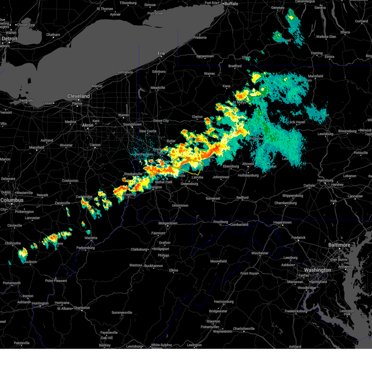
| 3/16/2025 1:00 PM EDT | Half Dollar sized hail reported 2.9 miles ENE of Leechburg, PA, report from mping: half dollar (1.25 in.). |
| 3/16/2025 1:00 PM EDT | Half Dollar sized hail reported 2.7 miles ENE of Leechburg, PA |
| 3/16/2025 1:00 PM EDT | Quarter sized hail reported 1.7 miles ENE of Leechburg, PA |
| 3/16/2025 1:00 PM EDT | Golf Ball sized hail reported 4 miles ESE of Leechburg, PA |
| 3/16/2025 12:48 PM EDT |
 Svrpbz the national weather service in pittsburgh has issued a * severe thunderstorm warning for, northeastern allegheny county in southwestern pennsylvania, northwestern westmoreland county in southwestern pennsylvania, armstrong county in west central pennsylvania, southeastern butler county in west central pennsylvania, southern clarion county in west central pennsylvania, northern indiana county in west central pennsylvania, southwestern jefferson pa county in west central pennsylvania, * until 145 pm edt. * at 1248 pm edt, severe thunderstorms were located along a line from over shanor-northvue to over plum, or along a line from near butler to near penn hills, moving northeast at 55 mph (radar indicated). Hazards include 70 mph wind gusts and quarter size hail. Hail damage to vehicles is expected. expect considerable tree damage. Wind damage is also likely to mobile homes, roofs, and outbuildings. Svrpbz the national weather service in pittsburgh has issued a * severe thunderstorm warning for, northeastern allegheny county in southwestern pennsylvania, northwestern westmoreland county in southwestern pennsylvania, armstrong county in west central pennsylvania, southeastern butler county in west central pennsylvania, southern clarion county in west central pennsylvania, northern indiana county in west central pennsylvania, southwestern jefferson pa county in west central pennsylvania, * until 145 pm edt. * at 1248 pm edt, severe thunderstorms were located along a line from over shanor-northvue to over plum, or along a line from near butler to near penn hills, moving northeast at 55 mph (radar indicated). Hazards include 70 mph wind gusts and quarter size hail. Hail damage to vehicles is expected. expect considerable tree damage. Wind damage is also likely to mobile homes, roofs, and outbuildings.
|
| 11/20/2024 5:24 PM EST |
 At 524 pm est, severe thunderstorms were located along a line from near kittanning to over mount pleasant, or along a line from near kittanning to 9 miles north of connellsville, moving east at 40 mph (radar indicated). Hazards include 60 mph wind gusts. Expect damage to roofs, siding, and trees. Locations impacted include, greensburg, indiana, jeannette, latrobe, vandergrift, kittanning, homer city, apollo, murrysville, lower burrell, harrison township, mount pleasant, scottdale, irwin, mcchesneytown-loyalhanna, blairsville, manor, youngwood, ford city and derry. At 524 pm est, severe thunderstorms were located along a line from near kittanning to over mount pleasant, or along a line from near kittanning to 9 miles north of connellsville, moving east at 40 mph (radar indicated). Hazards include 60 mph wind gusts. Expect damage to roofs, siding, and trees. Locations impacted include, greensburg, indiana, jeannette, latrobe, vandergrift, kittanning, homer city, apollo, murrysville, lower burrell, harrison township, mount pleasant, scottdale, irwin, mcchesneytown-loyalhanna, blairsville, manor, youngwood, ford city and derry.
|
| 11/20/2024 5:24 PM EST |
 the severe thunderstorm warning has been cancelled and is no longer in effect the severe thunderstorm warning has been cancelled and is no longer in effect
|
| 11/20/2024 5:10 PM EST |
 Svrpbz the national weather service in pittsburgh has issued a * severe thunderstorm warning for, eastern allegheny county in southwestern pennsylvania, northeastern fayette county in southwestern pennsylvania, westmoreland county in southwestern pennsylvania, southern armstrong county in west central pennsylvania, southeastern butler county in west central pennsylvania, indiana county in west central pennsylvania, * until 615 pm est. * at 510 pm est, severe thunderstorms were located along a line from 10 miles north of sarver to near perryopolis, or along a line from 8 miles east of butler to 10 miles northwest of connellsville, moving east at 40 mph (radar indicated). Hazards include 60 mph wind gusts. expect damage to roofs, siding, and trees Svrpbz the national weather service in pittsburgh has issued a * severe thunderstorm warning for, eastern allegheny county in southwestern pennsylvania, northeastern fayette county in southwestern pennsylvania, westmoreland county in southwestern pennsylvania, southern armstrong county in west central pennsylvania, southeastern butler county in west central pennsylvania, indiana county in west central pennsylvania, * until 615 pm est. * at 510 pm est, severe thunderstorms were located along a line from 10 miles north of sarver to near perryopolis, or along a line from 8 miles east of butler to 10 miles northwest of connellsville, moving east at 40 mph (radar indicated). Hazards include 60 mph wind gusts. expect damage to roofs, siding, and trees
|
| 10/6/2024 8:45 PM EDT |
 the severe thunderstorm warning has been cancelled and is no longer in effect the severe thunderstorm warning has been cancelled and is no longer in effect
|
| 10/6/2024 8:33 PM EDT |
 At 833 pm edt, a severe thunderstorm was located over lower burrell, or 8 miles west of vandergrift, moving east at 40 mph (radar indicated). Hazards include 60 mph wind gusts. Expect damage to roofs, siding, and trees. Locations impacted include, penn hills, vandergrift, apollo, plum, murrysville, new kensington, lower burrell, harrison township, o'hara township, oakmont, fox chapel, arnold, tarentum, natrona heights, springdale, brackenridge, leechburg, cheswick, russellton and north apollo. At 833 pm edt, a severe thunderstorm was located over lower burrell, or 8 miles west of vandergrift, moving east at 40 mph (radar indicated). Hazards include 60 mph wind gusts. Expect damage to roofs, siding, and trees. Locations impacted include, penn hills, vandergrift, apollo, plum, murrysville, new kensington, lower burrell, harrison township, o'hara township, oakmont, fox chapel, arnold, tarentum, natrona heights, springdale, brackenridge, leechburg, cheswick, russellton and north apollo.
|
| 10/6/2024 8:23 PM EDT |
 At 823 pm edt, a severe thunderstorm was located over oakmont, or near penn hills, moving southeast at 45 mph (radar indicated). Hazards include 60 mph wind gusts and small hail. Expect damage to roofs, siding, and trees. Locations impacted include, pittsburgh, penn hills, ross township, mccandless township, monroeville, greensburg, vandergrift, apollo, shaler township, plum, murrysville, hampton township, new kensington, lower burrell, harrison township, o'hara township, wilkins township, oakmont, fox chapel and arnold. At 823 pm edt, a severe thunderstorm was located over oakmont, or near penn hills, moving southeast at 45 mph (radar indicated). Hazards include 60 mph wind gusts and small hail. Expect damage to roofs, siding, and trees. Locations impacted include, pittsburgh, penn hills, ross township, mccandless township, monroeville, greensburg, vandergrift, apollo, shaler township, plum, murrysville, hampton township, new kensington, lower burrell, harrison township, o'hara township, wilkins township, oakmont, fox chapel and arnold.
|
| 10/6/2024 8:23 PM EDT |
 the severe thunderstorm warning has been cancelled and is no longer in effect the severe thunderstorm warning has been cancelled and is no longer in effect
|
| 10/6/2024 8:10 PM EDT |
 Svrpbz the national weather service in pittsburgh has issued a * severe thunderstorm warning for, northeastern allegheny county in southwestern pennsylvania, northwestern westmoreland county in southwestern pennsylvania, south central armstrong county in west central pennsylvania, south central butler county in west central pennsylvania, southwestern indiana county in west central pennsylvania, * until 900 pm edt. * at 810 pm edt, a severe thunderstorm was located over mccandless township, moving southeast at 45 mph (radar indicated). Hazards include 60 mph wind gusts and small hail. expect damage to roofs, siding, and trees Svrpbz the national weather service in pittsburgh has issued a * severe thunderstorm warning for, northeastern allegheny county in southwestern pennsylvania, northwestern westmoreland county in southwestern pennsylvania, south central armstrong county in west central pennsylvania, south central butler county in west central pennsylvania, southwestern indiana county in west central pennsylvania, * until 900 pm edt. * at 810 pm edt, a severe thunderstorm was located over mccandless township, moving southeast at 45 mph (radar indicated). Hazards include 60 mph wind gusts and small hail. expect damage to roofs, siding, and trees
|
| 8/17/2024 4:57 PM EDT |
 The storm which prompted the warning has weakened below severe limits, and no longer poses an immediate threat to life or property. therefore, the warning will be allowed to expire. however, gusty winds and heavy rain are still possible with this thunderstorm. to report severe weather, contact your nearest law enforcement agency. they will send your report to the national weather service office. The storm which prompted the warning has weakened below severe limits, and no longer poses an immediate threat to life or property. therefore, the warning will be allowed to expire. however, gusty winds and heavy rain are still possible with this thunderstorm. to report severe weather, contact your nearest law enforcement agency. they will send your report to the national weather service office.
|
| 8/17/2024 4:44 PM EDT |
 At 444 pm edt, a severe thunderstorm was located 7 miles northeast of delmont, or 7 miles southeast of apollo, moving east at 40 mph (radar indicated). Hazards include 60 mph wind gusts and quarter size hail. Hail damage to vehicles is expected. expect wind damage to roofs, siding, and trees. Locations impacted include, penn hills, monroeville, greensburg, mckeesport, jeannette, latrobe, vandergrift, apollo, plum, west mifflin, murrysville, new kensington, lower burrell, harrison township, north versailles, white oak, forest hills, wilkins township, duquesne and turtle creek. At 444 pm edt, a severe thunderstorm was located 7 miles northeast of delmont, or 7 miles southeast of apollo, moving east at 40 mph (radar indicated). Hazards include 60 mph wind gusts and quarter size hail. Hail damage to vehicles is expected. expect wind damage to roofs, siding, and trees. Locations impacted include, penn hills, monroeville, greensburg, mckeesport, jeannette, latrobe, vandergrift, apollo, plum, west mifflin, murrysville, new kensington, lower burrell, harrison township, north versailles, white oak, forest hills, wilkins township, duquesne and turtle creek.
|
| 8/17/2024 4:29 PM EDT |
 At 429 pm edt, a severe thunderstorm was located over murrysville, or near monroeville, moving east at 40 mph (radar indicated). Hazards include 60 mph wind gusts and quarter size hail. Hail damage to vehicles is expected. expect wind damage to roofs, siding, and trees. Locations impacted include, pittsburgh, penn hills, monroeville, greensburg, mckeesport, jeannette, latrobe, vandergrift, kittanning, apollo, plum, west mifflin, murrysville, wilkinsburg, new kensington, lower burrell, munhall, harrison township, north versailles and swissvale. At 429 pm edt, a severe thunderstorm was located over murrysville, or near monroeville, moving east at 40 mph (radar indicated). Hazards include 60 mph wind gusts and quarter size hail. Hail damage to vehicles is expected. expect wind damage to roofs, siding, and trees. Locations impacted include, pittsburgh, penn hills, monroeville, greensburg, mckeesport, jeannette, latrobe, vandergrift, kittanning, apollo, plum, west mifflin, murrysville, wilkinsburg, new kensington, lower burrell, munhall, harrison township, north versailles and swissvale.
|
| 8/17/2024 4:19 PM EDT |
 Svrpbz the national weather service in pittsburgh has issued a * severe thunderstorm warning for, eastern allegheny county in southwestern pennsylvania, central westmoreland county in southwestern pennsylvania, southern armstrong county in west central pennsylvania, southeastern butler county in west central pennsylvania, southwestern indiana county in west central pennsylvania, * until 500 pm edt. * at 419 pm edt, a severe thunderstorm was located over wilkins township, or over monroeville, moving east at 40 mph (radar indicated). Hazards include 60 mph wind gusts and quarter size hail. Hail damage to vehicles is expected. Expect wind damage to roofs, siding, and trees. Svrpbz the national weather service in pittsburgh has issued a * severe thunderstorm warning for, eastern allegheny county in southwestern pennsylvania, central westmoreland county in southwestern pennsylvania, southern armstrong county in west central pennsylvania, southeastern butler county in west central pennsylvania, southwestern indiana county in west central pennsylvania, * until 500 pm edt. * at 419 pm edt, a severe thunderstorm was located over wilkins township, or over monroeville, moving east at 40 mph (radar indicated). Hazards include 60 mph wind gusts and quarter size hail. Hail damage to vehicles is expected. Expect wind damage to roofs, siding, and trees.
|
| 8/6/2024 7:02 PM EDT |
 At 702 pm edt, severe thunderstorms were located along a line extending from near clarion to 9 miles southeast of ford city to near vandergrift, moving east at 35 mph (radar indicated). Hazards include 60 mph wind gusts. Expect damage to trees and power lines, resulting in some power outages. Locations impacted include, indiana, punxsutawney, vandergrift, brookville, apollo, new kensington, lower burrell, arnold, leechburg, new bethlehem, clymer, north apollo, west leechburg, avonmore, orchard hills, rural valley, saltsburg, oklahoma, west lebanon, and east vandergrift. At 702 pm edt, severe thunderstorms were located along a line extending from near clarion to 9 miles southeast of ford city to near vandergrift, moving east at 35 mph (radar indicated). Hazards include 60 mph wind gusts. Expect damage to trees and power lines, resulting in some power outages. Locations impacted include, indiana, punxsutawney, vandergrift, brookville, apollo, new kensington, lower burrell, arnold, leechburg, new bethlehem, clymer, north apollo, west leechburg, avonmore, orchard hills, rural valley, saltsburg, oklahoma, west lebanon, and east vandergrift.
|
| 8/6/2024 7:02 PM EDT |
 the severe thunderstorm warning has been cancelled and is no longer in effect the severe thunderstorm warning has been cancelled and is no longer in effect
|
| 8/6/2024 6:39 PM EDT |
 Svrpbz the national weather service in pittsburgh has issued a * severe thunderstorm warning for, southern venango county in northwestern pennsylvania, eastern butler county in west central pennsylvania, central indiana county in west central pennsylvania, northeastern allegheny county in southwestern pennsylvania, southwestern jefferson county in west central pennsylvania, northwestern westmoreland county in southwestern pennsylvania, armstrong county in west central pennsylvania, southern clarion county in west central pennsylvania, * until 745 pm edt. * at 639 pm edt, severe thunderstorms were located along a line extending from 7 miles southwest of knox to near freeport to natrona heights, moving east at 35 mph (radar indicated). Hazards include 60 mph wind gusts. expect damage to trees and power lines, resulting in some power outages Svrpbz the national weather service in pittsburgh has issued a * severe thunderstorm warning for, southern venango county in northwestern pennsylvania, eastern butler county in west central pennsylvania, central indiana county in west central pennsylvania, northeastern allegheny county in southwestern pennsylvania, southwestern jefferson county in west central pennsylvania, northwestern westmoreland county in southwestern pennsylvania, armstrong county in west central pennsylvania, southern clarion county in west central pennsylvania, * until 745 pm edt. * at 639 pm edt, severe thunderstorms were located along a line extending from 7 miles southwest of knox to near freeport to natrona heights, moving east at 35 mph (radar indicated). Hazards include 60 mph wind gusts. expect damage to trees and power lines, resulting in some power outages
|
| 6/17/2024 6:01 PM EDT |
 The storms which prompted the warning have weakened below severe limits, and have exited the warned area. therefore, the warning has been allowed to expire. however, gusty winds are still possible with these thunderstorms. to report severe weather, contact your nearest law enforcement agency. they will relay your report to the national weather service pittsburgh. The storms which prompted the warning have weakened below severe limits, and have exited the warned area. therefore, the warning has been allowed to expire. however, gusty winds are still possible with these thunderstorms. to report severe weather, contact your nearest law enforcement agency. they will relay your report to the national weather service pittsburgh.
|
| 6/17/2024 5:44 PM EDT |
 At 543 pm edt, severe thunderstorms were located along a line extending from 8 miles west of indiana to near greensburg to near avella, moving southeast at 20 mph (law enforcement and trained spotters). Hazards include 70 mph wind gusts and nickel size hail. Trees snapped and uprooted. power outages can be expected. Locations impacted include, pittsburgh, penn hills, mount lebanon, bethel park, ross township, monroeville, moon township, mcmurray, greensburg, weirton, mckeesport, jeannette, canonsburg, vandergrift, kittanning, apollo, gastonville, shaler township, plum, and west mifflin. At 543 pm edt, severe thunderstorms were located along a line extending from 8 miles west of indiana to near greensburg to near avella, moving southeast at 20 mph (law enforcement and trained spotters). Hazards include 70 mph wind gusts and nickel size hail. Trees snapped and uprooted. power outages can be expected. Locations impacted include, pittsburgh, penn hills, mount lebanon, bethel park, ross township, monroeville, moon township, mcmurray, greensburg, weirton, mckeesport, jeannette, canonsburg, vandergrift, kittanning, apollo, gastonville, shaler township, plum, and west mifflin.
|
| 6/17/2024 5:23 PM EDT |
 Svrpbz the national weather service in pittsburgh has issued a * severe thunderstorm warning for, southern beaver county in western pennsylvania, northern washington county in southwestern pennsylvania, southeastern butler county in west central pennsylvania, western indiana county in west central pennsylvania, allegheny county in southwestern pennsylvania, northwestern westmoreland county in southwestern pennsylvania, southern armstrong county in west central pennsylvania, brooke county in northern west virginia, hancock county in northern west virginia, * until 600 pm edt. * at 522 pm edt, severe thunderstorms were located along a line extending from 8 miles east of ford city to murrysville to near avella, moving southeast at 20 mph (law enforcement and trained spotters reported widespread wind damage across the warned area). Hazards include 70 mph wind gusts and nickel size hail. Trees snapped and uprooted. Power outages can be expected. Svrpbz the national weather service in pittsburgh has issued a * severe thunderstorm warning for, southern beaver county in western pennsylvania, northern washington county in southwestern pennsylvania, southeastern butler county in west central pennsylvania, western indiana county in west central pennsylvania, allegheny county in southwestern pennsylvania, northwestern westmoreland county in southwestern pennsylvania, southern armstrong county in west central pennsylvania, brooke county in northern west virginia, hancock county in northern west virginia, * until 600 pm edt. * at 522 pm edt, severe thunderstorms were located along a line extending from 8 miles east of ford city to murrysville to near avella, moving southeast at 20 mph (law enforcement and trained spotters reported widespread wind damage across the warned area). Hazards include 70 mph wind gusts and nickel size hail. Trees snapped and uprooted. Power outages can be expected.
|
| 6/17/2024 5:10 PM EDT |
 At 509 pm edt, severe thunderstorms were located along a line extending from 9 miles west of kittanning to near gibsonia to 6 miles east of weirton, moving east at 35 mph (law enforcement and the public reported widespread wind damage across the warned area). Hazards include 70 mph wind gusts and quarter size hail. Minor hail damage to vehicles is possible. trees snapped and uprooted. power outages can be expected. locations impacted include, pittsburgh, penn hills, mount lebanon, bethel park, ross township, mccandless township, cranberry, moon township, weirton, butler, franklin park, aliquippa, vandergrift, kittanning, shaler township, plum, north side pittsburgh, baldwin, upper st. Clair, and hampton township. At 509 pm edt, severe thunderstorms were located along a line extending from 9 miles west of kittanning to near gibsonia to 6 miles east of weirton, moving east at 35 mph (law enforcement and the public reported widespread wind damage across the warned area). Hazards include 70 mph wind gusts and quarter size hail. Minor hail damage to vehicles is possible. trees snapped and uprooted. power outages can be expected. locations impacted include, pittsburgh, penn hills, mount lebanon, bethel park, ross township, mccandless township, cranberry, moon township, weirton, butler, franklin park, aliquippa, vandergrift, kittanning, shaler township, plum, north side pittsburgh, baldwin, upper st. Clair, and hampton township.
|
| 6/17/2024 5:00 PM EDT |
 At 459 pm edt, severe thunderstorms were located along a line extending from near butler to gibsonia to weirton, moving east at 35 mph (law enforcement and the public are reporting widespread wind damage across the warned area). Hazards include 70 mph wind gusts and quarter size hail. Minor hail damage to vehicles is possible. trees snapped and uprooted. power outages can be expected. locations impacted include, pittsburgh, penn hills, mount lebanon, bethel park, ross township, mccandless township, cranberry, moon township, weirton, butler, franklin park, aliquippa, vandergrift, kittanning, shaler township, plum, north side pittsburgh, baldwin, upper st. Clair, and hampton township. At 459 pm edt, severe thunderstorms were located along a line extending from near butler to gibsonia to weirton, moving east at 35 mph (law enforcement and the public are reporting widespread wind damage across the warned area). Hazards include 70 mph wind gusts and quarter size hail. Minor hail damage to vehicles is possible. trees snapped and uprooted. power outages can be expected. locations impacted include, pittsburgh, penn hills, mount lebanon, bethel park, ross township, mccandless township, cranberry, moon township, weirton, butler, franklin park, aliquippa, vandergrift, kittanning, shaler township, plum, north side pittsburgh, baldwin, upper st. Clair, and hampton township.
|
| 6/17/2024 4:51 PM EDT |
 At 450 pm edt, severe thunderstorms were located along a line extending from shanor-northvue to seven fields to near toronto, moving east at 35 mph (law enforcement reported widespread trees and wires down across beaver county). Hazards include 60 mph wind gusts and quarter size hail. Minor hail damage to vehicles is possible. expect wind damage to trees and power lines, resulting in some power outages. locations impacted include, pittsburgh, penn hills, mount lebanon, bethel park, ross township, mccandless township, cranberry, moon township, weirton, butler, franklin park, aliquippa, vandergrift, kittanning, shaler township, plum, north side pittsburgh, baldwin, upper st. Clair, and hampton township. At 450 pm edt, severe thunderstorms were located along a line extending from shanor-northvue to seven fields to near toronto, moving east at 35 mph (law enforcement reported widespread trees and wires down across beaver county). Hazards include 60 mph wind gusts and quarter size hail. Minor hail damage to vehicles is possible. expect wind damage to trees and power lines, resulting in some power outages. locations impacted include, pittsburgh, penn hills, mount lebanon, bethel park, ross township, mccandless township, cranberry, moon township, weirton, butler, franklin park, aliquippa, vandergrift, kittanning, shaler township, plum, north side pittsburgh, baldwin, upper st. Clair, and hampton township.
|
| 6/17/2024 4:44 PM EDT |
 Svrpbz the national weather service in pittsburgh has issued a * severe thunderstorm warning for, east central jefferson county in east central ohio, southern beaver county in western pennsylvania, northwestern washington county in southwestern pennsylvania, southern butler county in west central pennsylvania, allegheny county in southwestern pennsylvania, northwestern westmoreland county in southwestern pennsylvania, southwestern armstrong county in west central pennsylvania, brooke county in northern west virginia, hancock county in northern west virginia, * until 530 pm edt. * at 444 pm edt, severe thunderstorms were located along a line extending from near shanor-northvue to cranberry to near wintersville, moving east at 35 mph (radar indicated). Hazards include 60 mph wind gusts and quarter size hail. Minor hail damage to vehicles is possible. Expect wind damage to trees and power lines, resulting in some power outages. Svrpbz the national weather service in pittsburgh has issued a * severe thunderstorm warning for, east central jefferson county in east central ohio, southern beaver county in western pennsylvania, northwestern washington county in southwestern pennsylvania, southern butler county in west central pennsylvania, allegheny county in southwestern pennsylvania, northwestern westmoreland county in southwestern pennsylvania, southwestern armstrong county in west central pennsylvania, brooke county in northern west virginia, hancock county in northern west virginia, * until 530 pm edt. * at 444 pm edt, severe thunderstorms were located along a line extending from near shanor-northvue to cranberry to near wintersville, moving east at 35 mph (radar indicated). Hazards include 60 mph wind gusts and quarter size hail. Minor hail damage to vehicles is possible. Expect wind damage to trees and power lines, resulting in some power outages.
|
| 5/26/2024 8:52 PM EDT |
 At 852 pm edt, severe thunderstorms were located along a line extending from 12 miles northeast of slippery rock to near west kittanning to near ford city to near apollo, moving northeast at 30 mph (radar indicated). Hazards include 60 mph wind gusts. Expect damage to trees and power lines, resulting in some power outages. Locations impacted include, vandergrift, kittanning, apollo, knox, rimersburg, ford city, leechburg, new bethlehem, west kittanning, north apollo, west leechburg, chicora, orchard hills, seneca, east brady, harrisville, rural valley, parker, oklahoma, and sligo. At 852 pm edt, severe thunderstorms were located along a line extending from 12 miles northeast of slippery rock to near west kittanning to near ford city to near apollo, moving northeast at 30 mph (radar indicated). Hazards include 60 mph wind gusts. Expect damage to trees and power lines, resulting in some power outages. Locations impacted include, vandergrift, kittanning, apollo, knox, rimersburg, ford city, leechburg, new bethlehem, west kittanning, north apollo, west leechburg, chicora, orchard hills, seneca, east brady, harrisville, rural valley, parker, oklahoma, and sligo.
|
| 5/26/2024 8:52 PM EDT |
 the severe thunderstorm warning has been cancelled and is no longer in effect the severe thunderstorm warning has been cancelled and is no longer in effect
|
| 5/26/2024 8:40 PM EDT |
 The storms which prompted the warning have moved out of portions of the area. therefore, the warning will be allowed to expire. a new severe warning is in effect for some areas. gusty winds are still possible with these thunderstorms. a severe thunderstorm watch remains in effect until 1100 pm edt for southwestern, northwestern and west central pennsylvania. The storms which prompted the warning have moved out of portions of the area. therefore, the warning will be allowed to expire. a new severe warning is in effect for some areas. gusty winds are still possible with these thunderstorms. a severe thunderstorm watch remains in effect until 1100 pm edt for southwestern, northwestern and west central pennsylvania.
|
| 5/26/2024 8:39 PM EDT |
 Svrpbz the national weather service in pittsburgh has issued a * severe thunderstorm warning for, southeastern venango county in northwestern pennsylvania, eastern butler county in west central pennsylvania, north central indiana county in west central pennsylvania, northeastern allegheny county in southwestern pennsylvania, northwestern westmoreland county in southwestern pennsylvania, armstrong county in west central pennsylvania, southwestern clarion county in west central pennsylvania, * until 930 pm edt. * at 838 pm edt, severe thunderstorms were located along a line extending from near slippery rock to near sarver to near freeport to near murrysville, moving northeast at 30 mph (radar indicated). Hazards include 60 mph wind gusts. expect damage to trees and power lines, resulting in some power outages Svrpbz the national weather service in pittsburgh has issued a * severe thunderstorm warning for, southeastern venango county in northwestern pennsylvania, eastern butler county in west central pennsylvania, north central indiana county in west central pennsylvania, northeastern allegheny county in southwestern pennsylvania, northwestern westmoreland county in southwestern pennsylvania, armstrong county in west central pennsylvania, southwestern clarion county in west central pennsylvania, * until 930 pm edt. * at 838 pm edt, severe thunderstorms were located along a line extending from near slippery rock to near sarver to near freeport to near murrysville, moving northeast at 30 mph (radar indicated). Hazards include 60 mph wind gusts. expect damage to trees and power lines, resulting in some power outages
|
| 5/26/2024 8:28 PM EDT |
 At 827 pm edt, severe thunderstorms were located along a line extending from 8 miles north of zelienople to manor, moving east at 30 mph (public). Hazards include 60 mph wind gusts. Expect damage to trees and power lines, resulting in some power outages. Locations impacted include, penn hills, monroeville, butler, vandergrift, kittanning, apollo, plum, murrysville, new kensington, lower burrell, harrison township, homeacre-lyndora, oakmont, arnold, shanor-northvue, tarentum, natrona heights, meridian, slippery rock, and springdale. At 827 pm edt, severe thunderstorms were located along a line extending from 8 miles north of zelienople to manor, moving east at 30 mph (public). Hazards include 60 mph wind gusts. Expect damage to trees and power lines, resulting in some power outages. Locations impacted include, penn hills, monroeville, butler, vandergrift, kittanning, apollo, plum, murrysville, new kensington, lower burrell, harrison township, homeacre-lyndora, oakmont, arnold, shanor-northvue, tarentum, natrona heights, meridian, slippery rock, and springdale.
|
| 5/26/2024 8:28 PM EDT |
 the severe thunderstorm warning has been cancelled and is no longer in effect the severe thunderstorm warning has been cancelled and is no longer in effect
|
| 5/26/2024 8:20 PM EDT |
 At 820 pm edt, severe thunderstorms were located along a line extending from 7 miles northeast of ellwood city to near irwin, moving east at 30 mph (public reported trees and wires down). Hazards include 60 mph wind gusts. Expect damage to trees and power lines, resulting in some power outages. Locations impacted include, pittsburgh, penn hills, mccandless township, monroeville, cranberry, butler, vandergrift, kittanning, apollo, shaler township, plum, murrysville, hampton township, wilkinsburg, new kensington, lower burrell, harrison township, north versailles, swissvale, and o'hara township. At 820 pm edt, severe thunderstorms were located along a line extending from 7 miles northeast of ellwood city to near irwin, moving east at 30 mph (public reported trees and wires down). Hazards include 60 mph wind gusts. Expect damage to trees and power lines, resulting in some power outages. Locations impacted include, pittsburgh, penn hills, mccandless township, monroeville, cranberry, butler, vandergrift, kittanning, apollo, shaler township, plum, murrysville, hampton township, wilkinsburg, new kensington, lower burrell, harrison township, north versailles, swissvale, and o'hara township.
|
| 5/26/2024 8:03 PM EDT |
 Svrpbz the national weather service in pittsburgh has issued a * severe thunderstorm warning for, northeastern beaver county in western pennsylvania, central lawrence county in western pennsylvania, butler county in west central pennsylvania, northeastern allegheny county in southwestern pennsylvania, northwestern westmoreland county in southwestern pennsylvania, western armstrong county in west central pennsylvania, * until 845 pm edt. * at 803 pm edt, severe thunderstorms were located along a line extending from near ellwood city to west mifflin, moving east at 30 mph (radar indicated). Hazards include 60 mph wind gusts. expect damage to trees and power lines, resulting in some power outages Svrpbz the national weather service in pittsburgh has issued a * severe thunderstorm warning for, northeastern beaver county in western pennsylvania, central lawrence county in western pennsylvania, butler county in west central pennsylvania, northeastern allegheny county in southwestern pennsylvania, northwestern westmoreland county in southwestern pennsylvania, western armstrong county in west central pennsylvania, * until 845 pm edt. * at 803 pm edt, severe thunderstorms were located along a line extending from near ellwood city to west mifflin, moving east at 30 mph (radar indicated). Hazards include 60 mph wind gusts. expect damage to trees and power lines, resulting in some power outages
|
| 5/25/2024 4:14 PM EDT |
 The storm which prompted the warning has weakened below severe limits, and has exited the warned area. therefore, the warning will be allowed to expire. to report severe weather, contact your nearest law enforcement agency. they will relay your report to the national weather service pittsburgh. The storm which prompted the warning has weakened below severe limits, and has exited the warned area. therefore, the warning will be allowed to expire. to report severe weather, contact your nearest law enforcement agency. they will relay your report to the national weather service pittsburgh.
|
| 5/25/2024 3:35 PM EDT |
 At 335 pm edt, a severe thunderstorm was located over sarver, or 11 miles southeast of butler, moving east at 25 mph (radar indicated). Hazards include 60 mph wind gusts. Expect damage to trees and power lines, resulting in some power outages. Locations impacted include, vandergrift, hampton township, new kensington, lower burrell, harrison township, tarentum, natrona heights, brackenridge, oak hills, leechburg, sarver, freeport, saxonburg, russellton, north apollo, west leechburg, curtisville, orchard hills, east vandergrift, and worthington. At 335 pm edt, a severe thunderstorm was located over sarver, or 11 miles southeast of butler, moving east at 25 mph (radar indicated). Hazards include 60 mph wind gusts. Expect damage to trees and power lines, resulting in some power outages. Locations impacted include, vandergrift, hampton township, new kensington, lower burrell, harrison township, tarentum, natrona heights, brackenridge, oak hills, leechburg, sarver, freeport, saxonburg, russellton, north apollo, west leechburg, curtisville, orchard hills, east vandergrift, and worthington.
|
| 5/25/2024 3:26 PM EDT |
 Svrpbz the national weather service in pittsburgh has issued a * severe thunderstorm warning for, northeastern allegheny county in southwestern pennsylvania, northwestern westmoreland county in southwestern pennsylvania, southwestern armstrong county in west central pennsylvania, * until 415 pm edt. * at 326 pm edt, a severe thunderstorm was located over fox chapel, or near mccandless township, moving east at 30 mph (radar indicated). Hazards include 60 mph wind gusts. expect damage to trees and power lines, resulting in some power outages Svrpbz the national weather service in pittsburgh has issued a * severe thunderstorm warning for, northeastern allegheny county in southwestern pennsylvania, northwestern westmoreland county in southwestern pennsylvania, southwestern armstrong county in west central pennsylvania, * until 415 pm edt. * at 326 pm edt, a severe thunderstorm was located over fox chapel, or near mccandless township, moving east at 30 mph (radar indicated). Hazards include 60 mph wind gusts. expect damage to trees and power lines, resulting in some power outages
|
| 5/25/2024 3:13 PM EDT |
 Svrpbz the national weather service in pittsburgh has issued a * severe thunderstorm warning for, southern butler county in west central pennsylvania, northeastern allegheny county in southwestern pennsylvania, north central westmoreland county in southwestern pennsylvania, southwestern armstrong county in west central pennsylvania, * until 400 pm edt. * at 312 pm edt, a severe thunderstorm was located over mars, or 7 miles east of cranberry, moving east at 25 mph (law enforcement reported wind damage across allegheny and beaver counties). Hazards include 60 mph wind gusts. expect damage to trees and power lines, resulting in some power outages Svrpbz the national weather service in pittsburgh has issued a * severe thunderstorm warning for, southern butler county in west central pennsylvania, northeastern allegheny county in southwestern pennsylvania, north central westmoreland county in southwestern pennsylvania, southwestern armstrong county in west central pennsylvania, * until 400 pm edt. * at 312 pm edt, a severe thunderstorm was located over mars, or 7 miles east of cranberry, moving east at 25 mph (law enforcement reported wind damage across allegheny and beaver counties). Hazards include 60 mph wind gusts. expect damage to trees and power lines, resulting in some power outages
|
| 4/14/2024 9:43 PM EDT |
 The storm which prompted the warning has weakened below severe limits, and no longer poses an immediate threat to life or property. therefore, the warning will be allowed to expire. a severe thunderstorm watch remains in effect until 1100 pm edt for southwestern and west central pennsylvania. The storm which prompted the warning has weakened below severe limits, and no longer poses an immediate threat to life or property. therefore, the warning will be allowed to expire. a severe thunderstorm watch remains in effect until 1100 pm edt for southwestern and west central pennsylvania.
|
| 4/14/2024 9:31 PM EDT |
 At 931 pm edt, a severe thunderstorm was located over freeport, or 8 miles northwest of vandergrift, moving southeast at 55 mph (radar indicated). Hazards include half dollar size hail. Minor damage to vehicles is possible. Locations impacted include, butler, vandergrift, apollo, harrison township, ford city, meadowood, oak hills, leechburg, sarver, evans city, freeport, saxonburg, nixon, north apollo, west leechburg, oklahoma, east vandergrift, hyde park, north vandergrift, and ford cliff. At 931 pm edt, a severe thunderstorm was located over freeport, or 8 miles northwest of vandergrift, moving southeast at 55 mph (radar indicated). Hazards include half dollar size hail. Minor damage to vehicles is possible. Locations impacted include, butler, vandergrift, apollo, harrison township, ford city, meadowood, oak hills, leechburg, sarver, evans city, freeport, saxonburg, nixon, north apollo, west leechburg, oklahoma, east vandergrift, hyde park, north vandergrift, and ford cliff.
|
| 4/14/2024 9:31 PM EDT |
 the severe thunderstorm warning has been cancelled and is no longer in effect the severe thunderstorm warning has been cancelled and is no longer in effect
|
| 4/14/2024 9:13 PM EDT |
 At 912 pm edt, a severe thunderstorm was located over oak hills, or near butler, moving southeast at 45 mph (radar indicated). Hazards include golf ball size hail. People and animals outdoors will be injured. expect damage to roofs, siding, windows, and vehicles. Locations impacted include, butler, vandergrift, apollo, harrison township, homeacre-lyndora, shanor-northvue, meridian, ford city, meadowood, oak hills, leechburg, sarver, evans city, freeport, saxonburg, nixon, north apollo, west leechburg, prospect, and harmony. At 912 pm edt, a severe thunderstorm was located over oak hills, or near butler, moving southeast at 45 mph (radar indicated). Hazards include golf ball size hail. People and animals outdoors will be injured. expect damage to roofs, siding, windows, and vehicles. Locations impacted include, butler, vandergrift, apollo, harrison township, homeacre-lyndora, shanor-northvue, meridian, ford city, meadowood, oak hills, leechburg, sarver, evans city, freeport, saxonburg, nixon, north apollo, west leechburg, prospect, and harmony.
|
| 4/14/2024 8:58 PM EDT |
 Svrpbz the national weather service in pittsburgh has issued a * severe thunderstorm warning for, northeastern beaver county in western pennsylvania, southeastern lawrence county in western pennsylvania, southern butler county in west central pennsylvania, northeastern allegheny county in southwestern pennsylvania, north central westmoreland county in southwestern pennsylvania, southwestern armstrong county in west central pennsylvania, * until 945 pm edt. * at 858 pm edt, a severe thunderstorm was located near zelienople, or 9 miles west of butler, moving southeast at 45 mph (radar indicated). Hazards include golf ball size hail. People and animals outdoors will be injured. Expect damage to roofs, siding, windows, and vehicles. Svrpbz the national weather service in pittsburgh has issued a * severe thunderstorm warning for, northeastern beaver county in western pennsylvania, southeastern lawrence county in western pennsylvania, southern butler county in west central pennsylvania, northeastern allegheny county in southwestern pennsylvania, north central westmoreland county in southwestern pennsylvania, southwestern armstrong county in west central pennsylvania, * until 945 pm edt. * at 858 pm edt, a severe thunderstorm was located near zelienople, or 9 miles west of butler, moving southeast at 45 mph (radar indicated). Hazards include golf ball size hail. People and animals outdoors will be injured. Expect damage to roofs, siding, windows, and vehicles.
|
| 4/14/2024 8:24 PM EDT |
 At 823 pm edt, severe thunderstorms producing strong wind along an outflow boundary were located along a line extending from near meridian to near freeport to near ford city to 7 miles southeast of kittanning, moving southeast at 45 mph (radar indicated). Hazards include 60 mph wind gusts and quarter size hail. Minor hail damage to vehicles is possible. expect wind damage to trees and power lines, resulting in some power outages. Locations impacted include, indiana, butler, vandergrift, kittanning, ellwood city, homeacre-lyndora, shanor-northvue, meridian, zelienople, slippery rock, ford city, meadowood, oak hills, leechburg, sarver, evans city, freeport, west kittanning, saxonburg, and nixon. At 823 pm edt, severe thunderstorms producing strong wind along an outflow boundary were located along a line extending from near meridian to near freeport to near ford city to 7 miles southeast of kittanning, moving southeast at 45 mph (radar indicated). Hazards include 60 mph wind gusts and quarter size hail. Minor hail damage to vehicles is possible. expect wind damage to trees and power lines, resulting in some power outages. Locations impacted include, indiana, butler, vandergrift, kittanning, ellwood city, homeacre-lyndora, shanor-northvue, meridian, zelienople, slippery rock, ford city, meadowood, oak hills, leechburg, sarver, evans city, freeport, west kittanning, saxonburg, and nixon.
|
| 4/14/2024 8:05 PM EDT |
 Svrpbz the national weather service in pittsburgh has issued a * severe thunderstorm warning for, southeastern mercer county in northwestern pennsylvania, northeastern beaver county in western pennsylvania, southeastern lawrence county in western pennsylvania, butler county in west central pennsylvania, west central indiana county in west central pennsylvania, southern armstrong county in west central pennsylvania, southwestern clarion county in west central pennsylvania, * until 845 pm edt. * at 805 pm edt, severe thunderstorms were located along a line extending from near ellwood city to near meadowood to near sarver to near kittanning, moving southeast at 45 mph (radar indicated). Hazards include 60 mph wind gusts and quarter size hail. Minor hail damage to vehicles is possible. Expect wind damage to trees and power lines, resulting in some power outages. Svrpbz the national weather service in pittsburgh has issued a * severe thunderstorm warning for, southeastern mercer county in northwestern pennsylvania, northeastern beaver county in western pennsylvania, southeastern lawrence county in western pennsylvania, butler county in west central pennsylvania, west central indiana county in west central pennsylvania, southern armstrong county in west central pennsylvania, southwestern clarion county in west central pennsylvania, * until 845 pm edt. * at 805 pm edt, severe thunderstorms were located along a line extending from near ellwood city to near meadowood to near sarver to near kittanning, moving southeast at 45 mph (radar indicated). Hazards include 60 mph wind gusts and quarter size hail. Minor hail damage to vehicles is possible. Expect wind damage to trees and power lines, resulting in some power outages.
|
| 8/25/2023 2:25 AM EDT |
 The severe thunderstorm warning for southeastern butler, indiana, northeastern allegheny, jefferson, north central westmoreland, armstrong, eastern clarion and eastern forest counties will expire at 230 am edt, the storms which prompted the warning have moved out of the area. therefore, the warning will be allowed to expire. The severe thunderstorm warning for southeastern butler, indiana, northeastern allegheny, jefferson, north central westmoreland, armstrong, eastern clarion and eastern forest counties will expire at 230 am edt, the storms which prompted the warning have moved out of the area. therefore, the warning will be allowed to expire.
|
| 8/25/2023 2:02 AM EDT |
 At 202 am edt, severe thunderstorms were located along a line extending from near portland mills to 7 miles northwest of punxsutawney to near delmont, moving east at 60 mph (radar indicated). Hazards include 60 mph wind gusts. Expect damage to trees and power lines, resulting in some power outages. locations impacted include, indiana, punxsutawney, clarion, vandergrift, kittanning, brookville, marienville, apollo, rimersburg, lower burrell, harrison township, tarentum, natrona heights, brackenridge, ford city, reynoldsville, leechburg, brockway, sarver, and freeport. hail threat, radar indicated max hail size, <. 75 in wind threat, radar indicated max wind gust, 60 mph. At 202 am edt, severe thunderstorms were located along a line extending from near portland mills to 7 miles northwest of punxsutawney to near delmont, moving east at 60 mph (radar indicated). Hazards include 60 mph wind gusts. Expect damage to trees and power lines, resulting in some power outages. locations impacted include, indiana, punxsutawney, clarion, vandergrift, kittanning, brookville, marienville, apollo, rimersburg, lower burrell, harrison township, tarentum, natrona heights, brackenridge, ford city, reynoldsville, leechburg, brockway, sarver, and freeport. hail threat, radar indicated max hail size, <. 75 in wind threat, radar indicated max wind gust, 60 mph.
|
| 8/25/2023 1:46 AM EDT |
 At 145 am edt, severe thunderstorms were located along a line extending from near james city to near rimersburg to freeport, moving east at 65 mph (radar indicated). Hazards include 60 mph wind gusts. expect damage to trees and power lines, resulting in some power outages At 145 am edt, severe thunderstorms were located along a line extending from near james city to near rimersburg to freeport, moving east at 65 mph (radar indicated). Hazards include 60 mph wind gusts. expect damage to trees and power lines, resulting in some power outages
|
| 8/12/2023 6:48 PM EDT |
 At 648 pm edt, a severe thunderstorm was located over apollo, moving east at 35 mph (radar indicated). Hazards include 60 mph wind gusts and quarter size hail. Minor hail damage to vehicles is possible. Expect wind damage to trees and power lines, resulting in some power outages. At 648 pm edt, a severe thunderstorm was located over apollo, moving east at 35 mph (radar indicated). Hazards include 60 mph wind gusts and quarter size hail. Minor hail damage to vehicles is possible. Expect wind damage to trees and power lines, resulting in some power outages.
|
| 8/12/2023 6:46 PM EDT |
 At 646 pm edt, a severe thunderstorm was located over vandergrift, moving east at 35 mph (radar indicated). Hazards include 60 mph wind gusts and quarter size hail. Minor hail damage to vehicles is possible. expect wind damage to trees and power lines, resulting in some power outages. locations impacted include, vandergrift, apollo, murrysville, lower burrell, leechburg, freeport, north apollo, west leechburg, avonmore, orchard hills, oklahoma, east vandergrift, hyde park, north vandergrift, crooked creek lake park, and north washington. hail threat, radar indicated max hail size, 1. 00 in wind threat, radar indicated max wind gust, 60 mph. At 646 pm edt, a severe thunderstorm was located over vandergrift, moving east at 35 mph (radar indicated). Hazards include 60 mph wind gusts and quarter size hail. Minor hail damage to vehicles is possible. expect wind damage to trees and power lines, resulting in some power outages. locations impacted include, vandergrift, apollo, murrysville, lower burrell, leechburg, freeport, north apollo, west leechburg, avonmore, orchard hills, oklahoma, east vandergrift, hyde park, north vandergrift, crooked creek lake park, and north washington. hail threat, radar indicated max hail size, 1. 00 in wind threat, radar indicated max wind gust, 60 mph.
|
| 8/12/2023 6:32 PM EDT |
 At 632 pm edt, a severe thunderstorm was located over tarentum, or 9 miles north of penn hills, moving east at 35 mph (radar indicated). Hazards include 60 mph wind gusts and quarter size hail. Minor hail damage to vehicles is possible. expect wind damage to trees and power lines, resulting in some power outages. locations impacted include, penn hills, vandergrift, apollo, plum, murrysville, new kensington, lower burrell, harrison township, oakmont, arnold, tarentum, natrona heights, springdale, brackenridge, verona, leechburg, freeport, cheswick, russellton, and north apollo. hail threat, radar indicated max hail size, 1. 00 in wind threat, radar indicated max wind gust, 60 mph. At 632 pm edt, a severe thunderstorm was located over tarentum, or 9 miles north of penn hills, moving east at 35 mph (radar indicated). Hazards include 60 mph wind gusts and quarter size hail. Minor hail damage to vehicles is possible. expect wind damage to trees and power lines, resulting in some power outages. locations impacted include, penn hills, vandergrift, apollo, plum, murrysville, new kensington, lower burrell, harrison township, oakmont, arnold, tarentum, natrona heights, springdale, brackenridge, verona, leechburg, freeport, cheswick, russellton, and north apollo. hail threat, radar indicated max hail size, 1. 00 in wind threat, radar indicated max wind gust, 60 mph.
|
| 8/12/2023 6:21 PM EDT |
 At 621 pm edt, a severe thunderstorm was located over hampton township, or near mccandless township, moving east at 35 mph (radar indicated). Hazards include 60 mph wind gusts and quarter size hail. Minor hail damage to vehicles is possible. Expect wind damage to trees and power lines, resulting in some power outages. At 621 pm edt, a severe thunderstorm was located over hampton township, or near mccandless township, moving east at 35 mph (radar indicated). Hazards include 60 mph wind gusts and quarter size hail. Minor hail damage to vehicles is possible. Expect wind damage to trees and power lines, resulting in some power outages.
|
| 7/20/2023 10:11 PM EDT |
 The severe thunderstorm warning for southern beaver, southern butler, allegheny, northwestern westmoreland and southern armstrong counties will expire at 1015 pm edt, the storms which prompted the warning have weakened below severe limits, and no longer pose an immediate threat to life or property. therefore, the warning will be allowed to expire. a severe thunderstorm watch remains in effect until 300 am edt for western, southwestern and west central pennsylvania. The severe thunderstorm warning for southern beaver, southern butler, allegheny, northwestern westmoreland and southern armstrong counties will expire at 1015 pm edt, the storms which prompted the warning have weakened below severe limits, and no longer pose an immediate threat to life or property. therefore, the warning will be allowed to expire. a severe thunderstorm watch remains in effect until 300 am edt for western, southwestern and west central pennsylvania.
|
| 7/20/2023 9:54 PM EDT |
 At 954 pm edt, severe thunderstorms were located along a line extending from 10 miles west of indiana to near hampton township to near shippingport, moving southeast at 30 mph (radar indicated). Hazards include 60 mph wind gusts. Expect damage to trees and power lines, resulting in some power outages. locations impacted include, pittsburgh, penn hills, mount lebanon, ross township, mccandless township, monroeville, cranberry, moon township, franklin park, aliquippa, monaca, vandergrift, kittanning, apollo, shaler township, plum, west mifflin, north side pittsburgh, baldwin, and murrysville. hail threat, radar indicated max hail size, <. 75 in wind threat, radar indicated max wind gust, 60 mph. At 954 pm edt, severe thunderstorms were located along a line extending from 10 miles west of indiana to near hampton township to near shippingport, moving southeast at 30 mph (radar indicated). Hazards include 60 mph wind gusts. Expect damage to trees and power lines, resulting in some power outages. locations impacted include, pittsburgh, penn hills, mount lebanon, ross township, mccandless township, monroeville, cranberry, moon township, franklin park, aliquippa, monaca, vandergrift, kittanning, apollo, shaler township, plum, west mifflin, north side pittsburgh, baldwin, and murrysville. hail threat, radar indicated max hail size, <. 75 in wind threat, radar indicated max wind gust, 60 mph.
|
| 7/20/2023 9:34 PM EDT |
 At 934 pm edt, severe thunderstorms were located along a line extending from near ford city to mars to ohioville, moving south at 35 mph (radar indicated). Hazards include 60 mph wind gusts. Expect damage to trees and power lines, resulting in some power outages. locations impacted include, pittsburgh, penn hills, mount lebanon, ross township, mccandless township, monroeville, cranberry, moon township, butler, franklin park, aliquippa, beaver falls, monaca, vandergrift, kittanning, apollo, shaler township, plum, west mifflin, and north side pittsburgh. hail threat, radar indicated max hail size, <. 75 in wind threat, radar indicated max wind gust, 60 mph. At 934 pm edt, severe thunderstorms were located along a line extending from near ford city to mars to ohioville, moving south at 35 mph (radar indicated). Hazards include 60 mph wind gusts. Expect damage to trees and power lines, resulting in some power outages. locations impacted include, pittsburgh, penn hills, mount lebanon, ross township, mccandless township, monroeville, cranberry, moon township, butler, franklin park, aliquippa, beaver falls, monaca, vandergrift, kittanning, apollo, shaler township, plum, west mifflin, and north side pittsburgh. hail threat, radar indicated max hail size, <. 75 in wind threat, radar indicated max wind gust, 60 mph.
|
| 7/20/2023 9:30 PM EDT |
 At 929 pm edt, severe thunderstorms were located along a line extending from kittanning to zelienople to beaver, moving southeast at 30 mph (radar indicated). Hazards include 60 mph wind gusts. Expect damage to trees and power lines, resulting in some power outages. locations impacted include, pittsburgh, penn hills, mount lebanon, ross township, mccandless township, monroeville, cranberry, moon township, new castle, butler, franklin park, aliquippa, beaver falls, monaca, vandergrift, east palestine, kittanning, apollo, shaler township, and plum. hail threat, radar indicated max hail size, <. 75 in wind threat, observed max wind gust, 60 mph. At 929 pm edt, severe thunderstorms were located along a line extending from kittanning to zelienople to beaver, moving southeast at 30 mph (radar indicated). Hazards include 60 mph wind gusts. Expect damage to trees and power lines, resulting in some power outages. locations impacted include, pittsburgh, penn hills, mount lebanon, ross township, mccandless township, monroeville, cranberry, moon township, new castle, butler, franklin park, aliquippa, beaver falls, monaca, vandergrift, east palestine, kittanning, apollo, shaler township, and plum. hail threat, radar indicated max hail size, <. 75 in wind threat, observed max wind gust, 60 mph.
|
| 7/20/2023 9:12 PM EDT |
 At 911 pm edt, severe thunderstorms were located along a line extending from 8 miles northwest of kittanning to near ellwood city to near beaver falls, moving southeast at 30 mph (radar indicated). Hazards include 60 mph wind gusts. expect damage to trees and power lines, resulting in some power outages At 911 pm edt, severe thunderstorms were located along a line extending from 8 miles northwest of kittanning to near ellwood city to near beaver falls, moving southeast at 30 mph (radar indicated). Hazards include 60 mph wind gusts. expect damage to trees and power lines, resulting in some power outages
|
| 7/13/2023 9:16 PM EDT |
 At 915 pm edt, a severe thunderstorm was located near vandergrift, moving northeast at 30 mph (radar indicated). Hazards include 60 mph wind gusts and penny size hail. Expect damage to trees and power lines, resulting in some power outages. locations impacted include, vandergrift, apollo, ford city, leechburg, north apollo, avonmore, orchard hills, oklahoma, west lebanon, east vandergrift, hyde park, north vandergrift, manorville, ford cliff, lenape heights, jacksonville, and crooked creek lake park. hail threat, radar indicated max hail size, 0. 75 in wind threat, observed max wind gust, 60 mph. At 915 pm edt, a severe thunderstorm was located near vandergrift, moving northeast at 30 mph (radar indicated). Hazards include 60 mph wind gusts and penny size hail. Expect damage to trees and power lines, resulting in some power outages. locations impacted include, vandergrift, apollo, ford city, leechburg, north apollo, avonmore, orchard hills, oklahoma, west lebanon, east vandergrift, hyde park, north vandergrift, manorville, ford cliff, lenape heights, jacksonville, and crooked creek lake park. hail threat, radar indicated max hail size, 0. 75 in wind threat, observed max wind gust, 60 mph.
|
| 7/13/2023 9:06 PM EDT |
 At 905 pm edt, a severe thunderstorm was located over vandergrift, moving northeast at 30 mph (radar indicated). Hazards include 60 mph wind gusts and penny size hail. Expect damage to trees and power lines, resulting in some power outages. locations impacted include, vandergrift, apollo, lower burrell, harrison township, ford city, leechburg, freeport, north apollo, west leechburg, avonmore, orchard hills, oklahoma, west lebanon, east vandergrift, hyde park, north vandergrift, manorville, ford cliff, lenape heights, and jacksonville. hail threat, radar indicated max hail size, 0. 75 in wind threat, observed max wind gust, 60 mph. At 905 pm edt, a severe thunderstorm was located over vandergrift, moving northeast at 30 mph (radar indicated). Hazards include 60 mph wind gusts and penny size hail. Expect damage to trees and power lines, resulting in some power outages. locations impacted include, vandergrift, apollo, lower burrell, harrison township, ford city, leechburg, freeport, north apollo, west leechburg, avonmore, orchard hills, oklahoma, west lebanon, east vandergrift, hyde park, north vandergrift, manorville, ford cliff, lenape heights, and jacksonville. hail threat, radar indicated max hail size, 0. 75 in wind threat, observed max wind gust, 60 mph.
|
| 7/13/2023 8:58 PM EDT |
 At 858 pm edt, a severe thunderstorm was located near lower burrell, or near apollo, moving northeast at 30 mph (radar indicated). Hazards include 60 mph wind gusts and penny size hail. expect damage to trees and power lines, resulting in some power outages At 858 pm edt, a severe thunderstorm was located near lower burrell, or near apollo, moving northeast at 30 mph (radar indicated). Hazards include 60 mph wind gusts and penny size hail. expect damage to trees and power lines, resulting in some power outages
|
| 7/13/2023 8:48 PM EDT |
 At 847 pm edt, a severe thunderstorm was located over penn hills, moving northeast at 40 mph (radar indicated). Hazards include 60 mph wind gusts and nickel size hail. Expect damage to trees and power lines, resulting in some power outages. locations impacted include, pittsburgh, penn hills, ross township, mccandless township, monroeville, greensburg, mckeesport, franklin park, jeannette, vandergrift, shaler township, plum, west mifflin, north side pittsburgh, baldwin, murrysville, hampton township, wilkinsburg, whitehall, and robinson township. hail threat, radar indicated max hail size, 0. 88 in wind threat, observed max wind gust, 60 mph. At 847 pm edt, a severe thunderstorm was located over penn hills, moving northeast at 40 mph (radar indicated). Hazards include 60 mph wind gusts and nickel size hail. Expect damage to trees and power lines, resulting in some power outages. locations impacted include, pittsburgh, penn hills, ross township, mccandless township, monroeville, greensburg, mckeesport, franklin park, jeannette, vandergrift, shaler township, plum, west mifflin, north side pittsburgh, baldwin, murrysville, hampton township, wilkinsburg, whitehall, and robinson township. hail threat, radar indicated max hail size, 0. 88 in wind threat, observed max wind gust, 60 mph.
|
| 7/13/2023 8:39 PM EDT |
 At 839 pm edt, a severe thunderstorm was located over swissvale, or near pittsburgh, moving northeast at 40 mph (radar indicated). Hazards include 60 mph wind gusts and nickel size hail. expect damage to trees and power lines, resulting in some power outages At 839 pm edt, a severe thunderstorm was located over swissvale, or near pittsburgh, moving northeast at 40 mph (radar indicated). Hazards include 60 mph wind gusts and nickel size hail. expect damage to trees and power lines, resulting in some power outages
|
| 4/5/2023 8:23 PM EDT |
 At 823 pm edt, a severe thunderstorm was located over fox chapel, or near ross township, moving east at 55 mph (radar indicated). Hazards include 60 mph wind gusts. Expect damage to trees and power lines, resulting in some power outages. locations impacted include, pittsburgh, penn hills, ross township, mccandless township, monroeville, franklin park, shaler township, plum, murrysville, hampton township, wilkinsburg, and new kensington. hail threat, radar indicated max hail size, <. 75 in wind threat, radar indicated max wind gust, 60 mph. At 823 pm edt, a severe thunderstorm was located over fox chapel, or near ross township, moving east at 55 mph (radar indicated). Hazards include 60 mph wind gusts. Expect damage to trees and power lines, resulting in some power outages. locations impacted include, pittsburgh, penn hills, ross township, mccandless township, monroeville, franklin park, shaler township, plum, murrysville, hampton township, wilkinsburg, and new kensington. hail threat, radar indicated max hail size, <. 75 in wind threat, radar indicated max wind gust, 60 mph.
|
| 4/5/2023 8:13 PM EDT |
 At 812 pm edt, a severe thunderstorm was located over emsworth, or near franklin park, moving east at 55 mph (radar indicated). Hazards include 60 mph wind gusts. expect damage to trees and power lines, resulting in some power outages At 812 pm edt, a severe thunderstorm was located over emsworth, or near franklin park, moving east at 55 mph (radar indicated). Hazards include 60 mph wind gusts. expect damage to trees and power lines, resulting in some power outages
|
| 4/1/2023 1:59 PM EDT |
 At 158 pm edt, severe thunderstorms were located along a line extending from oil city to plum, moving east at 65 mph (radar indicated). Hazards include 60 mph wind gusts. expect damage to trees and power lines, resulting in some power outages At 158 pm edt, severe thunderstorms were located along a line extending from oil city to plum, moving east at 65 mph (radar indicated). Hazards include 60 mph wind gusts. expect damage to trees and power lines, resulting in some power outages
|
| 8/29/2022 4:31 PM EDT |
 At 431 pm edt, a severe thunderstorm was located near leechburg, or near vandergrift, moving northeast at 35 mph (radar indicated). Hazards include 60 mph wind gusts and penny size hail. Expect damage to trees and power lines, resulting in some power outages. locations impacted include, vandergrift, apollo, murrysville, ford city, leechburg, north apollo, west leechburg, orchard hills, oklahoma, east vandergrift, hyde park, and north vandergrift. hail threat, radar indicated max hail size, 0. 75 in wind threat, radar indicated max wind gust, 60 mph. At 431 pm edt, a severe thunderstorm was located near leechburg, or near vandergrift, moving northeast at 35 mph (radar indicated). Hazards include 60 mph wind gusts and penny size hail. Expect damage to trees and power lines, resulting in some power outages. locations impacted include, vandergrift, apollo, murrysville, ford city, leechburg, north apollo, west leechburg, orchard hills, oklahoma, east vandergrift, hyde park, and north vandergrift. hail threat, radar indicated max hail size, 0. 75 in wind threat, radar indicated max wind gust, 60 mph.
|
| 8/29/2022 4:26 PM EDT |
 At 426 pm edt, a severe thunderstorm was located over leechburg, or over vandergrift, moving northeast at 25 mph (radar indicated). Hazards include 60 mph wind gusts and penny size hail. Expect damage to trees and power lines, resulting in some power outages. locations impacted include, vandergrift, apollo, plum, murrysville, new kensington, lower burrell, harrison township, arnold, tarentum, natrona heights, brackenridge, and ford city. hail threat, radar indicated max hail size, 0. 75 in wind threat, radar indicated max wind gust, 60 mph. At 426 pm edt, a severe thunderstorm was located over leechburg, or over vandergrift, moving northeast at 25 mph (radar indicated). Hazards include 60 mph wind gusts and penny size hail. Expect damage to trees and power lines, resulting in some power outages. locations impacted include, vandergrift, apollo, plum, murrysville, new kensington, lower burrell, harrison township, arnold, tarentum, natrona heights, brackenridge, and ford city. hail threat, radar indicated max hail size, 0. 75 in wind threat, radar indicated max wind gust, 60 mph.
|
| 8/29/2022 4:24 PM EDT | Tree down along church street in westmoreland county PA, 3.3 miles ESE of Leechburg, PA |
| 8/29/2022 4:21 PM EDT |
 At 421 pm edt, a severe thunderstorm was located near lower burrell, or near vandergrift, moving northeast at 40 mph (radar indicated). Hazards include 60 mph wind gusts and penny size hail. Expect damage to trees and power lines, resulting in some power outages. locations impacted include, penn hills, monroeville, vandergrift, apollo, plum, murrysville, new kensington, lower burrell, harrison township, o`hara township, oakmont, and fox chapel. hail threat, radar indicated max hail size, 0. 75 in wind threat, radar indicated max wind gust, 60 mph. At 421 pm edt, a severe thunderstorm was located near lower burrell, or near vandergrift, moving northeast at 40 mph (radar indicated). Hazards include 60 mph wind gusts and penny size hail. Expect damage to trees and power lines, resulting in some power outages. locations impacted include, penn hills, monroeville, vandergrift, apollo, plum, murrysville, new kensington, lower burrell, harrison township, o`hara township, oakmont, and fox chapel. hail threat, radar indicated max hail size, 0. 75 in wind threat, radar indicated max wind gust, 60 mph.
|
| 8/29/2022 4:13 PM EDT |
 At 412 pm edt, a severe thunderstorm was located over springdale, or near penn hills, moving northeast at 35 mph (radar indicated). Hazards include 60 mph wind gusts and penny size hail. expect damage to trees and power lines, resulting in some power outages At 412 pm edt, a severe thunderstorm was located over springdale, or near penn hills, moving northeast at 35 mph (radar indicated). Hazards include 60 mph wind gusts and penny size hail. expect damage to trees and power lines, resulting in some power outages
|
| 8/4/2022 3:55 PM EDT |
 The severe thunderstorm warning for southwestern indiana, central westmoreland and southeastern armstrong counties will expire at 400 pm edt, the storm which prompted the warning has weakened below severe limits, and no longer poses an immediate threat to life or property. therefore, the warning will be allowed to expire. however gusty winds and heavy rain are still possible with this thunderstorm. The severe thunderstorm warning for southwestern indiana, central westmoreland and southeastern armstrong counties will expire at 400 pm edt, the storm which prompted the warning has weakened below severe limits, and no longer poses an immediate threat to life or property. therefore, the warning will be allowed to expire. however gusty winds and heavy rain are still possible with this thunderstorm.
|
| 8/4/2022 3:32 PM EDT |
 At 331 pm edt, a severe thunderstorm was located 8 miles southeast of apollo, moving east at 20 mph (radar indicated). Hazards include 60 mph wind gusts. Expect damage to trees and power lines, resulting in some power outages. locations impacted include, indiana, vandergrift, homer city, apollo, murrysville, blairsville, derry, delmont, leechburg, black lick, north apollo, and avonmore. hail threat, radar indicated max hail size, <. 75 in wind threat, radar indicated max wind gust, 60 mph. At 331 pm edt, a severe thunderstorm was located 8 miles southeast of apollo, moving east at 20 mph (radar indicated). Hazards include 60 mph wind gusts. Expect damage to trees and power lines, resulting in some power outages. locations impacted include, indiana, vandergrift, homer city, apollo, murrysville, blairsville, derry, delmont, leechburg, black lick, north apollo, and avonmore. hail threat, radar indicated max hail size, <. 75 in wind threat, radar indicated max wind gust, 60 mph.
|
| 8/4/2022 3:18 PM EDT |
 At 318 pm edt, a cluster of severe thunderstorms was located near plum, or near penn hills, and near saltsburg moving east at 15 mph (radar indicated). Hazards include 60 mph wind gusts and quarter size hail. Minor hail damage to vehicles is possible. Expect wind damage to trees and power lines, resulting in some power outages. At 318 pm edt, a cluster of severe thunderstorms was located near plum, or near penn hills, and near saltsburg moving east at 15 mph (radar indicated). Hazards include 60 mph wind gusts and quarter size hail. Minor hail damage to vehicles is possible. Expect wind damage to trees and power lines, resulting in some power outages.
|
| 7/25/2022 6:41 AM EDT |
 The severe thunderstorm warning for southeastern butler, northeastern allegheny, northwestern westmoreland and armstrong counties will expire at 645 am edt, the storm which prompted the warning has weakened below severe limits, and has exited the warned area. therefore, the warning will be allowed to expire. however gusty winds and heavy rain are still possible with this thunderstorm. The severe thunderstorm warning for southeastern butler, northeastern allegheny, northwestern westmoreland and armstrong counties will expire at 645 am edt, the storm which prompted the warning has weakened below severe limits, and has exited the warned area. therefore, the warning will be allowed to expire. however gusty winds and heavy rain are still possible with this thunderstorm.
|
| 7/25/2022 6:22 AM EDT |
 At 622 am edt, a severe thunderstorm was located near ford city, or near kittanning, moving east at 55 mph (radar indicated). Hazards include 60 mph wind gusts. Expect damage to trees and power lines, resulting in some power outages. locations impacted include, vandergrift, kittanning, apollo, new kensington, lower burrell, harrison township, arnold, tarentum, natrona heights, brackenridge, ford city, and leechburg. hail threat, radar indicated max hail size, <. 75 in wind threat, radar indicated max wind gust, 60 mph. At 622 am edt, a severe thunderstorm was located near ford city, or near kittanning, moving east at 55 mph (radar indicated). Hazards include 60 mph wind gusts. Expect damage to trees and power lines, resulting in some power outages. locations impacted include, vandergrift, kittanning, apollo, new kensington, lower burrell, harrison township, arnold, tarentum, natrona heights, brackenridge, ford city, and leechburg. hail threat, radar indicated max hail size, <. 75 in wind threat, radar indicated max wind gust, 60 mph.
|
| 7/25/2022 6:09 AM EDT |
 At 609 am edt, a severe thunderstorm was located near harrison township, or 10 miles northwest of vandergrift, moving east at 55 mph (radar indicated). Hazards include 60 mph wind gusts. expect damage to trees and power lines, resulting in some power outages At 609 am edt, a severe thunderstorm was located near harrison township, or 10 miles northwest of vandergrift, moving east at 55 mph (radar indicated). Hazards include 60 mph wind gusts. expect damage to trees and power lines, resulting in some power outages
|
| 7/23/2022 3:51 PM EDT |
 At 351 pm edt, a severe thunderstorm was located 8 miles west of indiana, moving east at 30 mph (radar indicated). Hazards include 60 mph wind gusts and quarter size hail. Minor hail damage to vehicles is possible. expect wind damage to trees and power lines, resulting in some power outages. locations impacted include, greensburg, indiana, latrobe, vandergrift, kittanning, homer city, apollo, mount pleasant, scottdale, mcchesneytown-loyalhanna, blairsville, and youngwood. hail threat, radar indicated max hail size, 1. 00 in wind threat, radar indicated max wind gust, 60 mph. At 351 pm edt, a severe thunderstorm was located 8 miles west of indiana, moving east at 30 mph (radar indicated). Hazards include 60 mph wind gusts and quarter size hail. Minor hail damage to vehicles is possible. expect wind damage to trees and power lines, resulting in some power outages. locations impacted include, greensburg, indiana, latrobe, vandergrift, kittanning, homer city, apollo, mount pleasant, scottdale, mcchesneytown-loyalhanna, blairsville, and youngwood. hail threat, radar indicated max hail size, 1. 00 in wind threat, radar indicated max wind gust, 60 mph.
|
| 7/23/2022 3:30 PM EDT |
 At 330 pm edt, a severe thunderstorm was located near delmont, or 8 miles north of greensburg, moving east at 40 mph (radar indicated). Hazards include 60 mph wind gusts and quarter size hail. Minor hail damage to vehicles is possible. expect wind damage to trees and power lines, resulting in some power outages. locations impacted include, pittsburgh, penn hills, monroeville, greensburg, mckeesport, uniontown, jeannette, connellsville, vandergrift, waynesburg, apollo, and plum. hail threat, radar indicated max hail size, 1. 00 in wind threat, radar indicated max wind gust, 60 mph. At 330 pm edt, a severe thunderstorm was located near delmont, or 8 miles north of greensburg, moving east at 40 mph (radar indicated). Hazards include 60 mph wind gusts and quarter size hail. Minor hail damage to vehicles is possible. expect wind damage to trees and power lines, resulting in some power outages. locations impacted include, pittsburgh, penn hills, monroeville, greensburg, mckeesport, uniontown, jeannette, connellsville, vandergrift, waynesburg, apollo, and plum. hail threat, radar indicated max hail size, 1. 00 in wind threat, radar indicated max wind gust, 60 mph.
|
| 7/23/2022 3:29 PM EDT |
 At 329 pm edt, a severe thunderstorm was located near apollo, moving east at 35 mph (radar indicated). Hazards include 60 mph wind gusts and quarter size hail. Minor hail damage to vehicles is possible. Expect wind damage to trees and power lines, resulting in some power outages. At 329 pm edt, a severe thunderstorm was located near apollo, moving east at 35 mph (radar indicated). Hazards include 60 mph wind gusts and quarter size hail. Minor hail damage to vehicles is possible. Expect wind damage to trees and power lines, resulting in some power outages.
|
| 7/23/2022 3:02 PM EDT |
 At 302 pm edt, a severe thunderstorm was located over north braddock, or near mckeesport, moving east at 40 mph (radar indicated). Hazards include 70 mph wind gusts and quarter size hail. Minor hail damage to vehicles is possible. trees snapped and uprooted. Power outages can be expected. At 302 pm edt, a severe thunderstorm was located over north braddock, or near mckeesport, moving east at 40 mph (radar indicated). Hazards include 70 mph wind gusts and quarter size hail. Minor hail damage to vehicles is possible. trees snapped and uprooted. Power outages can be expected.
|
| 6/22/2022 6:12 PM EDT |
 The severe thunderstorm warning for southwestern indiana, northwestern westmoreland and southern armstrong counties will expire at 615 pm edt, the storm which prompted the warning has weakened below severe limits, and no longer poses an immediate threat to life or property. therefore, the warning will be allowed to expire. however gusty winds are still possible with this thunderstorm. a severe thunderstorm watch remains in effect until 1000 pm edt for southwestern and west central pennsylvania. The severe thunderstorm warning for southwestern indiana, northwestern westmoreland and southern armstrong counties will expire at 615 pm edt, the storm which prompted the warning has weakened below severe limits, and no longer poses an immediate threat to life or property. therefore, the warning will be allowed to expire. however gusty winds are still possible with this thunderstorm. a severe thunderstorm watch remains in effect until 1000 pm edt for southwestern and west central pennsylvania.
|
| 6/22/2022 5:44 PM EDT |
 At 544 pm edt, a severe thunderstorm was located near ford city, or 7 miles northeast of vandergrift, moving southeast at 20 mph (radar indicated). Hazards include 60 mph wind gusts and quarter size hail. Minor hail damage to vehicles is possible. expect wind damage to trees and power lines, resulting in some power outages. locations impacted include, indiana, vandergrift, homer city, apollo, new kensington, lower burrell, blairsville, derry, leechburg, black lick, north apollo, and west leechburg. hail threat, radar indicated max hail size, 1. 00 in wind threat, radar indicated max wind gust, 60 mph. At 544 pm edt, a severe thunderstorm was located near ford city, or 7 miles northeast of vandergrift, moving southeast at 20 mph (radar indicated). Hazards include 60 mph wind gusts and quarter size hail. Minor hail damage to vehicles is possible. expect wind damage to trees and power lines, resulting in some power outages. locations impacted include, indiana, vandergrift, homer city, apollo, new kensington, lower burrell, blairsville, derry, leechburg, black lick, north apollo, and west leechburg. hail threat, radar indicated max hail size, 1. 00 in wind threat, radar indicated max wind gust, 60 mph.
|
| 6/22/2022 5:27 PM EDT |
 At 527 pm edt, a severe thunderstorm was located over leechburg, or over vandergrift, moving southeast at 20 mph (radar indicated). Hazards include 60 mph wind gusts and quarter size hail. Minor hail damage to vehicles is possible. Expect wind damage to trees and power lines, resulting in some power outages. At 527 pm edt, a severe thunderstorm was located over leechburg, or over vandergrift, moving southeast at 20 mph (radar indicated). Hazards include 60 mph wind gusts and quarter size hail. Minor hail damage to vehicles is possible. Expect wind damage to trees and power lines, resulting in some power outages.
|
| 6/22/2022 5:18 PM EDT |
 At 518 pm edt, a severe thunderstorm was located over brackenridge, or 8 miles west of vandergrift, moving southeast at 20 mph (radar indicated). Hazards include 60 mph wind gusts. Expect damage to trees and power lines, resulting in some power outages. locations impacted include, vandergrift, apollo, plum, murrysville, hampton township, new kensington, lower burrell, harrison township, arnold, tarentum, natrona heights, and springdale. hail threat, radar indicated max hail size, <. 75 in wind threat, radar indicated max wind gust, 60 mph. At 518 pm edt, a severe thunderstorm was located over brackenridge, or 8 miles west of vandergrift, moving southeast at 20 mph (radar indicated). Hazards include 60 mph wind gusts. Expect damage to trees and power lines, resulting in some power outages. locations impacted include, vandergrift, apollo, plum, murrysville, hampton township, new kensington, lower burrell, harrison township, arnold, tarentum, natrona heights, and springdale. hail threat, radar indicated max hail size, <. 75 in wind threat, radar indicated max wind gust, 60 mph.
|
| 6/22/2022 4:55 PM EDT |
 At 455 pm edt, a severe thunderstorm was located near tarentum, or 10 miles east of mccandless township, moving southeast at 30 mph (radar indicated). Hazards include 60 mph wind gusts and half dollar size hail. Minor hail damage to vehicles is possible. expect wind damage to trees and power lines, resulting in some power outages. locations impacted include, vandergrift, apollo, plum, murrysville, hampton township, new kensington, lower burrell, harrison township, arnold, tarentum, natrona heights, and springdale. hail threat, radar indicated max hail size, 1. 25 in wind threat, radar indicated max wind gust, 60 mph. At 455 pm edt, a severe thunderstorm was located near tarentum, or 10 miles east of mccandless township, moving southeast at 30 mph (radar indicated). Hazards include 60 mph wind gusts and half dollar size hail. Minor hail damage to vehicles is possible. expect wind damage to trees and power lines, resulting in some power outages. locations impacted include, vandergrift, apollo, plum, murrysville, hampton township, new kensington, lower burrell, harrison township, arnold, tarentum, natrona heights, and springdale. hail threat, radar indicated max hail size, 1. 25 in wind threat, radar indicated max wind gust, 60 mph.
|
| 6/22/2022 4:43 PM EDT |
 At 442 pm edt, severe thunderstorms centered near mars, or 8 miles east of cranberry, are moving southeast at 30 mph (radar indicated). Hazards include 60 mph wind gusts. expect damage to trees and power lines, resulting in some power outages At 442 pm edt, severe thunderstorms centered near mars, or 8 miles east of cranberry, are moving southeast at 30 mph (radar indicated). Hazards include 60 mph wind gusts. expect damage to trees and power lines, resulting in some power outages
|
| 3/31/2022 11:41 AM EDT |
 At 1141 am edt, severe thunderstorms were located along a line extending from ford city to near irwin, moving east at 40 mph (radar indicated). Hazards include 60 mph wind gusts. Expect damage to trees and power lines, resulting in some power outages. locations impacted include, vandergrift, kittanning, apollo, murrysville, ford city, delmont, leechburg, west kittanning, north apollo, avonmore, orchard hills, and export. hail threat, radar indicated max hail size, <. 75 in wind threat, radar indicated max wind gust, 60 mph. At 1141 am edt, severe thunderstorms were located along a line extending from ford city to near irwin, moving east at 40 mph (radar indicated). Hazards include 60 mph wind gusts. Expect damage to trees and power lines, resulting in some power outages. locations impacted include, vandergrift, kittanning, apollo, murrysville, ford city, delmont, leechburg, west kittanning, north apollo, avonmore, orchard hills, and export. hail threat, radar indicated max hail size, <. 75 in wind threat, radar indicated max wind gust, 60 mph.
|
| 3/31/2022 11:31 AM EDT |
 At 1131 am edt, severe thunderstorms were located along a line extending from near sarver to near white oak, moving east at 40 mph (radar indicated). Hazards include 60 mph wind gusts. Expect damage to trees and power lines, resulting in some power outages. locations impacted include, monroeville, vandergrift, kittanning, apollo, plum, murrysville, new kensington, lower burrell, harrison township, natrona heights, brackenridge, and trafford. hail threat, radar indicated max hail size, <. 75 in wind threat, radar indicated max wind gust, 60 mph. At 1131 am edt, severe thunderstorms were located along a line extending from near sarver to near white oak, moving east at 40 mph (radar indicated). Hazards include 60 mph wind gusts. Expect damage to trees and power lines, resulting in some power outages. locations impacted include, monroeville, vandergrift, kittanning, apollo, plum, murrysville, new kensington, lower burrell, harrison township, natrona heights, brackenridge, and trafford. hail threat, radar indicated max hail size, <. 75 in wind threat, radar indicated max wind gust, 60 mph.
|
| 3/31/2022 11:26 AM EDT |
 At 1126 am edt, severe thunderstorms were located along a line extending from near sarver to near clairton, moving east at 40 mph (radar indicated). Hazards include 60 mph wind gusts. Expect damage to trees and power lines, resulting in some power outages. locations impacted include, penn hills, monroeville, greensburg, mckeesport, jeannette, latrobe, vandergrift, kittanning, apollo, plum, west mifflin, and murrysville. hail threat, radar indicated max hail size, <. 75 in wind threat, radar indicated max wind gust, 60 mph. At 1126 am edt, severe thunderstorms were located along a line extending from near sarver to near clairton, moving east at 40 mph (radar indicated). Hazards include 60 mph wind gusts. Expect damage to trees and power lines, resulting in some power outages. locations impacted include, penn hills, monroeville, greensburg, mckeesport, jeannette, latrobe, vandergrift, kittanning, apollo, plum, west mifflin, and murrysville. hail threat, radar indicated max hail size, <. 75 in wind threat, radar indicated max wind gust, 60 mph.
|
| 3/31/2022 11:16 AM EDT |
 At 1116 am edt, severe thunderstorms were located along a line extending from near sarver to near jefferson hills, moving east at 40 mph (radar indicated). Hazards include 60 mph wind gusts. expect damage to trees and power lines, resulting in some power outages At 1116 am edt, severe thunderstorms were located along a line extending from near sarver to near jefferson hills, moving east at 40 mph (radar indicated). Hazards include 60 mph wind gusts. expect damage to trees and power lines, resulting in some power outages
|
| 3/7/2022 4:28 PM EST |
 At 428 pm est, severe rated winds were located along a line extending from near leechburg to fredericktown-millsboro, moving east at 55 mph (radar indicated). Hazards include 60 mph wind gusts. expect damage to trees and power lines, resulting in some power outages At 428 pm est, severe rated winds were located along a line extending from near leechburg to fredericktown-millsboro, moving east at 55 mph (radar indicated). Hazards include 60 mph wind gusts. expect damage to trees and power lines, resulting in some power outages
|
| 8/13/2021 8:11 PM EDT |
 At 811 pm edt, a severe thunderstorm was located over leechburg, or near vandergrift, moving northeast at 40 mph (radar indicated). Hazards include 60 mph wind gusts. expect damage to trees and power lines, resulting in some power outages At 811 pm edt, a severe thunderstorm was located over leechburg, or near vandergrift, moving northeast at 40 mph (radar indicated). Hazards include 60 mph wind gusts. expect damage to trees and power lines, resulting in some power outages
|
| 8/13/2021 8:05 PM EDT |
 At 805 pm edt, a severe thunderstorm was located 9 miles east of apollo, moving northeast at 35 mph (radar indicated). Hazards include 60 mph wind gusts. Expect damage to trees and power lines, resulting in some power outages. locations impacted include, vandergrift, homer city, apollo, mcchesneytown-loyalhanna, blairsville, derry, leechburg, ligonier, black lick, north apollo, west leechburg, and avonmore. hail threat, radar indicated max hail size, <. 75 in wind threat, radar indicated max wind gust, 60 mph. At 805 pm edt, a severe thunderstorm was located 9 miles east of apollo, moving northeast at 35 mph (radar indicated). Hazards include 60 mph wind gusts. Expect damage to trees and power lines, resulting in some power outages. locations impacted include, vandergrift, homer city, apollo, mcchesneytown-loyalhanna, blairsville, derry, leechburg, ligonier, black lick, north apollo, west leechburg, and avonmore. hail threat, radar indicated max hail size, <. 75 in wind threat, radar indicated max wind gust, 60 mph.
|
| 8/13/2021 7:37 PM EDT |
 At 737 pm edt, a severe thunderstorm was located over murrysville, or near jeannette, moving northeast at 35 mph (radar indicated). Hazards include 60 mph wind gusts. expect damage to trees and power lines, resulting in some power outages At 737 pm edt, a severe thunderstorm was located over murrysville, or near jeannette, moving northeast at 35 mph (radar indicated). Hazards include 60 mph wind gusts. expect damage to trees and power lines, resulting in some power outages
|
| 8/12/2021 6:38 PM EDT |
 At 637 pm edt, severe thunderstorms were located along a line extending from near new bethlehem to near hampton township, moving east at 40 mph (radar indicated). Hazards include 60 mph wind gusts. expect damage to trees and power lines, resulting in some power outages At 637 pm edt, severe thunderstorms were located along a line extending from near new bethlehem to near hampton township, moving east at 40 mph (radar indicated). Hazards include 60 mph wind gusts. expect damage to trees and power lines, resulting in some power outages
|
| 8/12/2021 1:22 PM EDT |
 At 122 pm edt, a severe thunderstorm was located near ford city, or 7 miles northeast of vandergrift, moving southeast at 40 mph (radar indicated). Hazards include 60 mph wind gusts. Expect damage to trees and power lines, resulting in some power outages. locations impacted include, vandergrift, kittanning, apollo, harrison township, ford city, leechburg, sarver, freeport, west kittanning, north apollo, west leechburg, and orchard hills. hail threat, radar indicated max hail size, <. 75 in wind threat, radar indicated max wind gust, 60 mph. At 122 pm edt, a severe thunderstorm was located near ford city, or 7 miles northeast of vandergrift, moving southeast at 40 mph (radar indicated). Hazards include 60 mph wind gusts. Expect damage to trees and power lines, resulting in some power outages. locations impacted include, vandergrift, kittanning, apollo, harrison township, ford city, leechburg, sarver, freeport, west kittanning, north apollo, west leechburg, and orchard hills. hail threat, radar indicated max hail size, <. 75 in wind threat, radar indicated max wind gust, 60 mph.
|
| 8/12/2021 12:56 PM EDT |
 At 1256 pm edt, a severe thunderstorm was located near sarver, or 8 miles southeast of butler, moving southeast at 40 mph (radar indicated). Hazards include 60 mph wind gusts. expect damage to trees and power lines, resulting in some power outages At 1256 pm edt, a severe thunderstorm was located near sarver, or 8 miles southeast of butler, moving southeast at 40 mph (radar indicated). Hazards include 60 mph wind gusts. expect damage to trees and power lines, resulting in some power outages
|
| 8/12/2021 12:51 PM EDT |
 At 1251 pm edt, a severe thunderstorm was located near rimersburg, moving east at 45 mph (radar indicated). Hazards include 60 mph wind gusts and quarter size hail. Minor hail damage to vehicles is possible. expect wind damage to trees and power lines, resulting in some power outages. locations impacted include, cranberry, butler, kittanning, new kensington, lower burrell, harrison township, homeacre-lyndora, shanor-northvue, tarentum, natrona heights, meridian, and brackenridge. hail threat, radar indicated max hail size, 1. 00 in wind threat, radar indicated max wind gust, 60 mph. At 1251 pm edt, a severe thunderstorm was located near rimersburg, moving east at 45 mph (radar indicated). Hazards include 60 mph wind gusts and quarter size hail. Minor hail damage to vehicles is possible. expect wind damage to trees and power lines, resulting in some power outages. locations impacted include, cranberry, butler, kittanning, new kensington, lower burrell, harrison township, homeacre-lyndora, shanor-northvue, tarentum, natrona heights, meridian, and brackenridge. hail threat, radar indicated max hail size, 1. 00 in wind threat, radar indicated max wind gust, 60 mph.
|
| 8/12/2021 12:39 PM EDT |
 At 1239 pm edt, a severe thunderstorm was located 10 miles northeast of shanor-northvue, or 11 miles northeast of butler, moving east at 45 mph (radar indicated). Hazards include 60 mph wind gusts and quarter size hail. Minor hail damage to vehicles is possible. expect wind damage to trees and power lines, resulting in some power outages. locations impacted include, cranberry, butler, kittanning, new kensington, lower burrell, harrison township, homeacre-lyndora, shanor-northvue, tarentum, natrona heights, meridian, and zelienople. hail threat, radar indicated max hail size, 1. 00 in wind threat, radar indicated max wind gust, 60 mph. At 1239 pm edt, a severe thunderstorm was located 10 miles northeast of shanor-northvue, or 11 miles northeast of butler, moving east at 45 mph (radar indicated). Hazards include 60 mph wind gusts and quarter size hail. Minor hail damage to vehicles is possible. expect wind damage to trees and power lines, resulting in some power outages. locations impacted include, cranberry, butler, kittanning, new kensington, lower burrell, harrison township, homeacre-lyndora, shanor-northvue, tarentum, natrona heights, meridian, and zelienople. hail threat, radar indicated max hail size, 1. 00 in wind threat, radar indicated max wind gust, 60 mph.
|
| 8/12/2021 12:21 PM EDT |
 At 1220 pm edt, a severe thunderstorm was located near slippery rock, or 11 miles south of grove city, moving east at 45 mph (radar indicated). Hazards include 60 mph wind gusts and quarter size hail. Minor hail damage to vehicles is possible. Expect wind damage to trees and power lines, resulting in some power outages. At 1220 pm edt, a severe thunderstorm was located near slippery rock, or 11 miles south of grove city, moving east at 45 mph (radar indicated). Hazards include 60 mph wind gusts and quarter size hail. Minor hail damage to vehicles is possible. Expect wind damage to trees and power lines, resulting in some power outages.
|
| 8/11/2021 1:17 PM EDT |
 At 116 pm edt, a severe thunderstorm was located near apollo, moving southeast at 40 mph (emergency management). Hazards include 60 mph wind gusts. expect damage to trees and power lines, resulting in some power outages At 116 pm edt, a severe thunderstorm was located near apollo, moving southeast at 40 mph (emergency management). Hazards include 60 mph wind gusts. expect damage to trees and power lines, resulting in some power outages
|
| 7/7/2021 4:09 PM EDT |
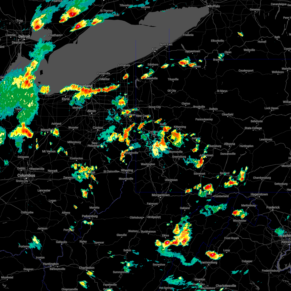 The severe thunderstorm warning for southeastern butler, northeastern allegheny, northwestern westmoreland and southwestern armstrong counties will expire at 415 pm edt, the storm which prompted the warning has weakened below severe limits, and has exited the warned area. therefore, the warning will be allowed to expire. however gusty winds and heavy rain are still possible with this thunderstorm. a severe thunderstorm watch remains in effect until 1100 pm edt for southwestern and west central pennsylvania. The severe thunderstorm warning for southeastern butler, northeastern allegheny, northwestern westmoreland and southwestern armstrong counties will expire at 415 pm edt, the storm which prompted the warning has weakened below severe limits, and has exited the warned area. therefore, the warning will be allowed to expire. however gusty winds and heavy rain are still possible with this thunderstorm. a severe thunderstorm watch remains in effect until 1100 pm edt for southwestern and west central pennsylvania.
|
| 7/7/2021 4:02 PM EDT |
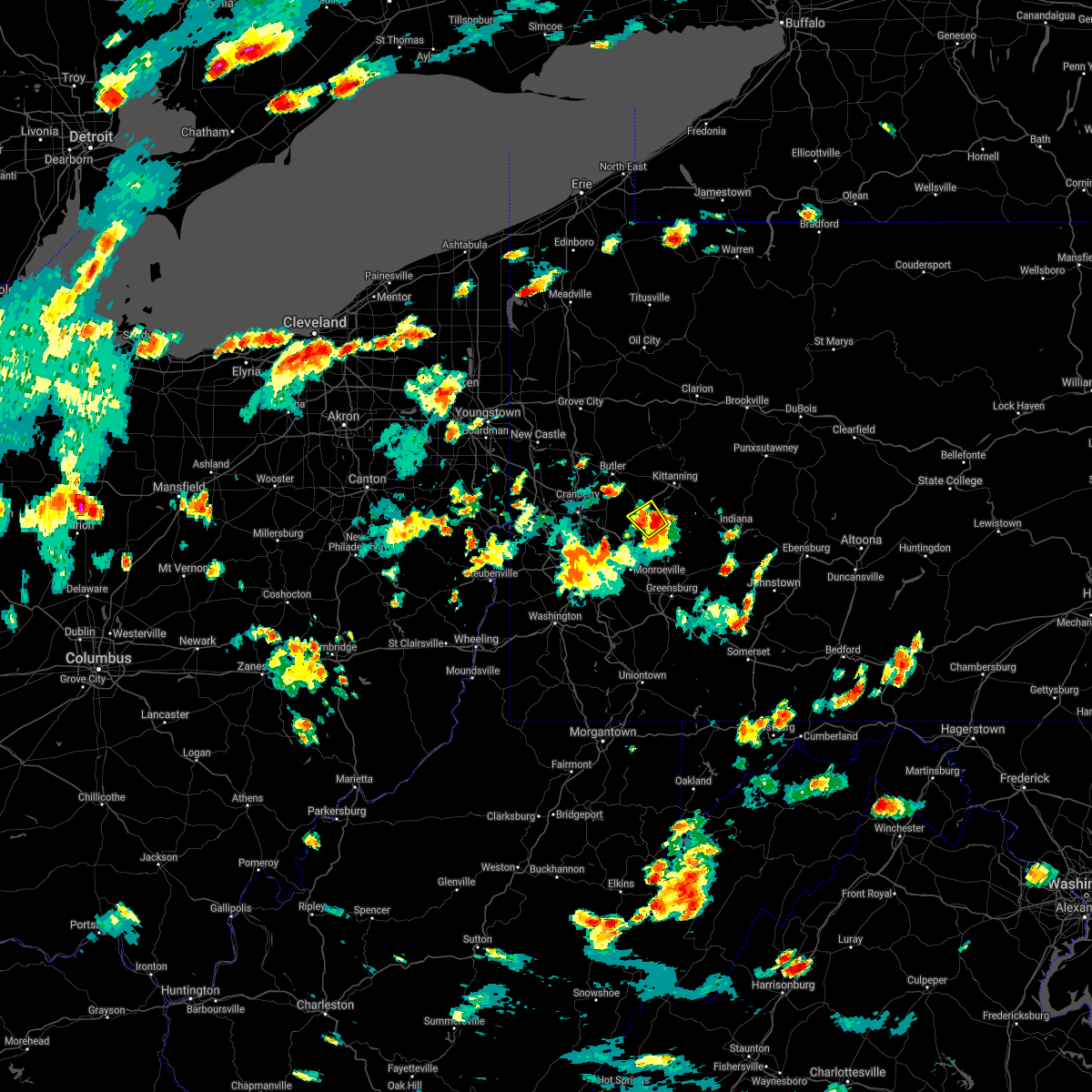 At 402 pm edt, a severe thunderstorm was located over natrona heights, or 8 miles west of vandergrift, moving northwest at 10 mph (radar). Hazards include wind gusts to 60 mph and quarter-size hail. Minor hail damage to vehicles is possible. expect wind damage to trees and power lines, resulting in some power outages. Locations impacted include, lower burrell, harrison township, natrona heights, leechburg, freeport, west leechburg, hyde park,. At 402 pm edt, a severe thunderstorm was located over natrona heights, or 8 miles west of vandergrift, moving northwest at 10 mph (radar). Hazards include wind gusts to 60 mph and quarter-size hail. Minor hail damage to vehicles is possible. expect wind damage to trees and power lines, resulting in some power outages. Locations impacted include, lower burrell, harrison township, natrona heights, leechburg, freeport, west leechburg, hyde park,.
|
| 7/7/2021 3:50 PM EDT |
 At 350 pm edt, a severe thunderstorm was located over natrona heights, or 7 miles west of vandergrift, moving northwest at 10 mph (radar). Hazards include wind gusts to 60 mph and quarter-size hail. Minor hail damage to vehicles is possible. expect wind damage to trees and power lines, resulting in some power outages. Locations impacted include, vandergrift, apollo, new kensington, lower burrell, harrison township, tarentum, natrona heights, brackenridge, leechburg, freeport, north apollo, west leechburg,. At 350 pm edt, a severe thunderstorm was located over natrona heights, or 7 miles west of vandergrift, moving northwest at 10 mph (radar). Hazards include wind gusts to 60 mph and quarter-size hail. Minor hail damage to vehicles is possible. expect wind damage to trees and power lines, resulting in some power outages. Locations impacted include, vandergrift, apollo, new kensington, lower burrell, harrison township, tarentum, natrona heights, brackenridge, leechburg, freeport, north apollo, west leechburg,.
|
| 7/7/2021 3:49 PM EDT | Quarter sized hail reported 0.2 miles NW of Leechburg, PA, quarter-sized hail observed based on twitter video from leechburg |
| 7/7/2021 3:49 PM EDT | Trees and poles down in westmoreland county PA, 1.6 miles ESE of Leechburg, PA |
| 7/7/2021 3:45 PM EDT |
 At 345 pm edt, a severe thunderstorm was located over lower burrell, or near vandergrift, moving northwest at 10 mph (radar). Hazards include wind gusts to 60 mph and quarter-size hail. Minor hail damage to vehicles is possible. Expect wind damage to trees and power lines, resulting in some power outages. At 345 pm edt, a severe thunderstorm was located over lower burrell, or near vandergrift, moving northwest at 10 mph (radar). Hazards include wind gusts to 60 mph and quarter-size hail. Minor hail damage to vehicles is possible. Expect wind damage to trees and power lines, resulting in some power outages.
|
| 6/21/2021 3:37 PM EDT |
 At 337 pm edt, severe thunderstorms were located along a line extending from 9 miles southeast of new bethlehem to near murrysville, moving east at 55 mph (radar). Hazards include wind gusts to 60 mph. expect damage to trees and power lines, resulting in some power outages At 337 pm edt, severe thunderstorms were located along a line extending from 9 miles southeast of new bethlehem to near murrysville, moving east at 55 mph (radar). Hazards include wind gusts to 60 mph. expect damage to trees and power lines, resulting in some power outages
|
| 6/21/2021 3:32 PM EDT |
 At 332 pm edt, severe thunderstorms were located along a line extending from 10 miles south of new bethlehem to murrysville, moving east at 60 mph (radar). Hazards include wind gusts to 60 mph. Expect damage to trees and power lines, resulting in some power outages. locations impacted include, pittsburgh, penn hills, monroeville, vandergrift, kittanning, apollo, plum, west mifflin, murrysville, wilkinsburg, new kensington, lower burrell, this includes the following highways, pennsylvania turnpike between mile markers 45 and 64. Interstate 376 in pennsylvania between mile markers 74 and 84. At 332 pm edt, severe thunderstorms were located along a line extending from 10 miles south of new bethlehem to murrysville, moving east at 60 mph (radar). Hazards include wind gusts to 60 mph. Expect damage to trees and power lines, resulting in some power outages. locations impacted include, pittsburgh, penn hills, monroeville, vandergrift, kittanning, apollo, plum, west mifflin, murrysville, wilkinsburg, new kensington, lower burrell, this includes the following highways, pennsylvania turnpike between mile markers 45 and 64. Interstate 376 in pennsylvania between mile markers 74 and 84.
|
| 6/21/2021 3:28 PM EDT |
 The severe thunderstorm warning for southeastern beaver, southeastern butler, northern allegheny, northwestern westmoreland and southwestern armstrong counties will expire at 330 pm edt, the storms which prompted the warning have moved out of the area. therefore, the warning will be allowed to expire. however gusty winds and heavy rain are still possible with these thunderstorms. a severe thunderstorm watch remains in effect until 800 pm edt for western, southwestern and west central pennsylvania. remember, a severe thunderstorm warning still remains in effect for allegheny, butler counties until 4 pm. The severe thunderstorm warning for southeastern beaver, southeastern butler, northern allegheny, northwestern westmoreland and southwestern armstrong counties will expire at 330 pm edt, the storms which prompted the warning have moved out of the area. therefore, the warning will be allowed to expire. however gusty winds and heavy rain are still possible with these thunderstorms. a severe thunderstorm watch remains in effect until 800 pm edt for western, southwestern and west central pennsylvania. remember, a severe thunderstorm warning still remains in effect for allegheny, butler counties until 4 pm.
|
| 6/21/2021 3:21 PM EDT |
 At 321 pm edt, severe thunderstorms were located along a line extending from near kittanning to penn hills, moving east at 60 mph (radar). Hazards include wind gusts to 60 mph. expect damage to trees and power lines, resulting in some power outages At 321 pm edt, severe thunderstorms were located along a line extending from near kittanning to penn hills, moving east at 60 mph (radar). Hazards include wind gusts to 60 mph. expect damage to trees and power lines, resulting in some power outages
|
| 6/21/2021 3:10 PM EDT |
 At 309 pm edt, severe thunderstorms were located along a line extending from 6 miles northwest of west kittanning to near imperial, moving east at 60 mph (radar). Hazards include wind gusts to 60 mph. Expect damage to trees and power lines, resulting in some power outages. locations impacted include, pittsburgh, penn hills, ross township, mccandless township, cranberry, moon township, franklin park, vandergrift, shaler township, plum, north side pittsburgh, hampton township, this includes the following highways, pennsylvania turnpike between mile markers 29 and 52. interstate 79 in pennsylvania between mile markers 62 and 79. Interstate 376 in pennsylvania between mile markers 49 and 52, and between mile markers 69 and 74. At 309 pm edt, severe thunderstorms were located along a line extending from 6 miles northwest of west kittanning to near imperial, moving east at 60 mph (radar). Hazards include wind gusts to 60 mph. Expect damage to trees and power lines, resulting in some power outages. locations impacted include, pittsburgh, penn hills, ross township, mccandless township, cranberry, moon township, franklin park, vandergrift, shaler township, plum, north side pittsburgh, hampton township, this includes the following highways, pennsylvania turnpike between mile markers 29 and 52. interstate 79 in pennsylvania between mile markers 62 and 79. Interstate 376 in pennsylvania between mile markers 49 and 52, and between mile markers 69 and 74.
|
| 6/21/2021 2:55 PM EDT |
 At 255 pm edt, severe thunderstorms were located along a line extending from near oak hills to 6 miles east of weirton, moving east at 60 mph (radar). Hazards include wind gusts to 60 mph. expect damage to trees and power lines, resulting in some power outages At 255 pm edt, severe thunderstorms were located along a line extending from near oak hills to 6 miles east of weirton, moving east at 60 mph (radar). Hazards include wind gusts to 60 mph. expect damage to trees and power lines, resulting in some power outages
|
| 11/15/2020 3:02 PM EST |
 At 302 pm est, severe thunderstorms were located along a line extending from near west kittanning to near uniontown, moving east at 65 mph (radar). Hazards include wind gusts to 70 mph. Trees snapped and uprooted. Power outages can be expected. At 302 pm est, severe thunderstorms were located along a line extending from near west kittanning to near uniontown, moving east at 65 mph (radar). Hazards include wind gusts to 70 mph. Trees snapped and uprooted. Power outages can be expected.
|
| 8/27/2020 6:01 PM EDT |
 A severe thunderstorm warning remains in effect until 630 pm edt for indiana. southeastern butler. northeastern allegheny. westmoreland and southern armstrong counties. At 601 pm edt, severe thunderstorms were located along a line extending from 10 miles south of new bethlehem to 9 miles southeast of ford city to near vandergrift to near freeport to harrison. A severe thunderstorm warning remains in effect until 630 pm edt for indiana. southeastern butler. northeastern allegheny. westmoreland and southern armstrong counties. At 601 pm edt, severe thunderstorms were located along a line extending from 10 miles south of new bethlehem to 9 miles southeast of ford city to near vandergrift to near freeport to harrison.
|
| 8/27/2020 5:43 PM EDT |
 At 542 pm edt, severe thunderstorms were located along a line extending from 6 miles southeast of rimersburg to near kittanning to 6 miles west of west kittanning to near meadowood to near oak hills to near evans city, moving southeast at 45 mph (radar). Hazards include wind gusts to 60 mph. Expect damage to trees and power lines, resulting in some power outages. locations impacted include, penn hills, monroeville, greensburg, indiana, jeannette, latrobe, vandergrift, kittanning, homer city, apollo, plum, murrysville, this includes the following highways, interstate 70 in pennsylvania near mile marker 57. pennsylvania turnpike between mile markers 40 and 69, and between mile markers 71 and 79. Interstate 376 in pennsylvania between mile markers 82 and 84. At 542 pm edt, severe thunderstorms were located along a line extending from 6 miles southeast of rimersburg to near kittanning to 6 miles west of west kittanning to near meadowood to near oak hills to near evans city, moving southeast at 45 mph (radar). Hazards include wind gusts to 60 mph. Expect damage to trees and power lines, resulting in some power outages. locations impacted include, penn hills, monroeville, greensburg, indiana, jeannette, latrobe, vandergrift, kittanning, homer city, apollo, plum, murrysville, this includes the following highways, interstate 70 in pennsylvania near mile marker 57. pennsylvania turnpike between mile markers 40 and 69, and between mile markers 71 and 79. Interstate 376 in pennsylvania between mile markers 82 and 84.
|
| 8/27/2020 5:26 PM EDT |
 At 525 pm edt, severe thunderstorms were located along a line extending from near rimersburg to 8 miles northwest of kittanning to 7 miles east of butler to shanor-northvue to meridian to 6 miles west of homeacre-lyndora to near zelienople, moving southeast at 45 mph (radar). Hazards include wind gusts to 60 mph. expect damage to trees and power lines, resulting in some power outages At 525 pm edt, severe thunderstorms were located along a line extending from near rimersburg to 8 miles northwest of kittanning to 7 miles east of butler to shanor-northvue to meridian to 6 miles west of homeacre-lyndora to near zelienople, moving southeast at 45 mph (radar). Hazards include wind gusts to 60 mph. expect damage to trees and power lines, resulting in some power outages
|
| 8/25/2020 2:56 PM EDT |
 The severe thunderstorm warning for central indiana, southeastern butler, northeastern allegheny, northwestern westmoreland and southern armstrong counties will expire at 300 pm edt, the storms which prompted the warning have moved out of the area. therefore, the warning will be allowed to expire. however gusty winds are still possible with these thunderstorms. a severe thunderstorm watch remains in effect until 900 pm edt for southwestern and west central pennsylvania. remember, a severe thunderstorm warning still remains in effect for southern armstrong, southern indiana, and westmoreland county until 3:15 pm. The severe thunderstorm warning for central indiana, southeastern butler, northeastern allegheny, northwestern westmoreland and southern armstrong counties will expire at 300 pm edt, the storms which prompted the warning have moved out of the area. therefore, the warning will be allowed to expire. however gusty winds are still possible with these thunderstorms. a severe thunderstorm watch remains in effect until 900 pm edt for southwestern and west central pennsylvania. remember, a severe thunderstorm warning still remains in effect for southern armstrong, southern indiana, and westmoreland county until 3:15 pm.
|
| 8/25/2020 2:37 PM EDT |
 At 236 pm edt, severe thunderstorms were located along a line extending from near belsano to penn hills, moving southeast at 40 mph (radar). Hazards include wind gusts to 60 mph and quarter-size hail. Minor hail damage to vehicles is possible. expect wind damage to trees and power lines, resulting in some power outages. Locations impacted include, penn hills, indiana, vandergrift, apollo, shaler township, plum, murrysville, hampton township, new kensington, lower burrell, harrison township, o`hara township, this includes pennsylvania turnpike between mile markers 40 and 52. At 236 pm edt, severe thunderstorms were located along a line extending from near belsano to penn hills, moving southeast at 40 mph (radar). Hazards include wind gusts to 60 mph and quarter-size hail. Minor hail damage to vehicles is possible. expect wind damage to trees and power lines, resulting in some power outages. Locations impacted include, penn hills, indiana, vandergrift, apollo, shaler township, plum, murrysville, hampton township, new kensington, lower burrell, harrison township, o`hara township, this includes pennsylvania turnpike between mile markers 40 and 52.
|
| 8/25/2020 2:09 PM EDT |
 At 209 pm edt, severe thunderstorms were located along a line extending from 8 miles north of indiana to mars, moving southeast at 40 mph (radar). Hazards include wind gusts to 60 mph and quarter-size hail. Minor hail damage to vehicles is possible. Expect wind damage to trees and power lines, resulting in some power outages. At 209 pm edt, severe thunderstorms were located along a line extending from 8 miles north of indiana to mars, moving southeast at 40 mph (radar). Hazards include wind gusts to 60 mph and quarter-size hail. Minor hail damage to vehicles is possible. Expect wind damage to trees and power lines, resulting in some power outages.
|
| 8/25/2020 6:55 AM EDT |
 The severe thunderstorm warning for southeastern butler, northeastern allegheny, north central westmoreland and southwestern armstrong counties will expire at 700 am edt, the storm which prompted the warning has weakened and the warning will be allowed to expire. The severe thunderstorm warning for southeastern butler, northeastern allegheny, north central westmoreland and southwestern armstrong counties will expire at 700 am edt, the storm which prompted the warning has weakened and the warning will be allowed to expire.
|
| 8/25/2020 6:50 AM EDT |
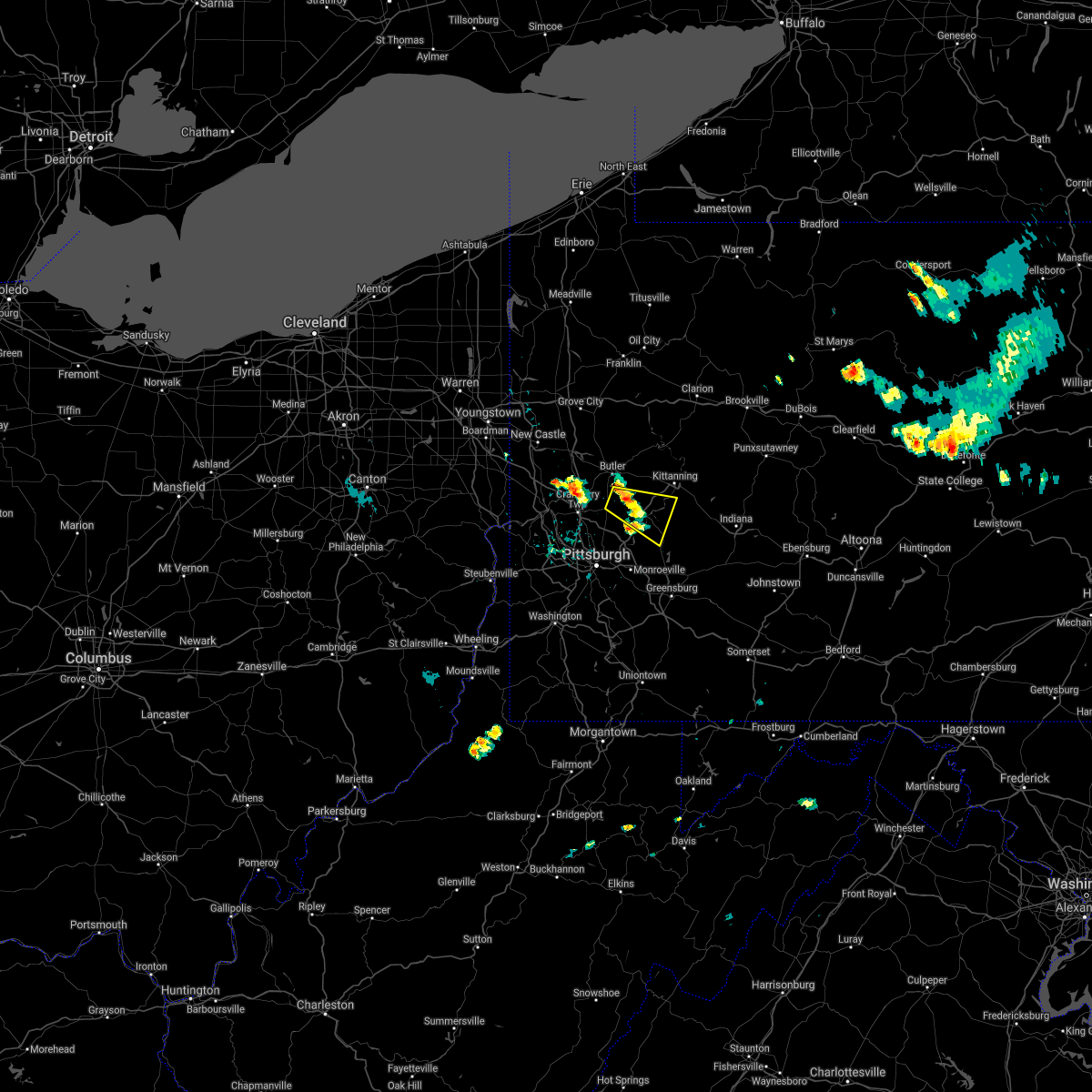 At 649 am edt, a severe thunderstorm was located near sarver, or 10 miles southeast of butler, moving east at 25 mph (radar). Hazards include quarter-size hail. Minor damage to vehicles is possible. Locations impacted include, vandergrift, lower burrell, harrison township, tarentum, natrona heights, brackenridge, leechburg, sarver, freeport, saxonburg, west leechburg, curtisville,. At 649 am edt, a severe thunderstorm was located near sarver, or 10 miles southeast of butler, moving east at 25 mph (radar). Hazards include quarter-size hail. Minor damage to vehicles is possible. Locations impacted include, vandergrift, lower burrell, harrison township, tarentum, natrona heights, brackenridge, leechburg, sarver, freeport, saxonburg, west leechburg, curtisville,.
|
| 8/25/2020 6:41 AM EDT |
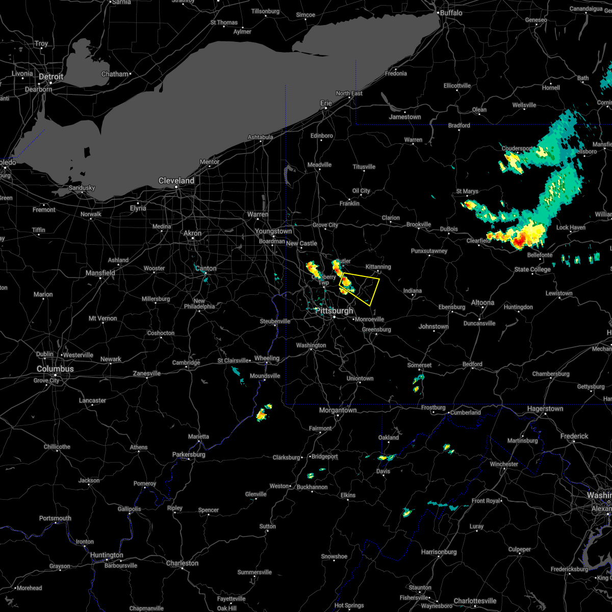 At 641 am edt, a severe thunderstorm was located near sarver, or 8 miles south of butler, moving east at 25 mph (radar). Hazards include wind gusts to 60 mph and quarter-size hail. Minor hail damage to vehicles is possible. Expect wind damage to trees and power lines, resulting in some power outages. At 641 am edt, a severe thunderstorm was located near sarver, or 8 miles south of butler, moving east at 25 mph (radar). Hazards include wind gusts to 60 mph and quarter-size hail. Minor hail damage to vehicles is possible. Expect wind damage to trees and power lines, resulting in some power outages.
|
| 7/16/2020 3:47 PM EDT |
 At 346 pm edt, a severe thunderstorm was located near gibsonia, or 8 miles northeast of mccandless township, moving northeast at 30 mph (radar). Hazards include wind gusts to 60 mph. expect damage to trees and power lines, resulting in some power outages At 346 pm edt, a severe thunderstorm was located near gibsonia, or 8 miles northeast of mccandless township, moving northeast at 30 mph (radar). Hazards include wind gusts to 60 mph. expect damage to trees and power lines, resulting in some power outages
|
| 7/10/2020 7:11 PM EDT |
 The severe thunderstorm warning for northeastern beaver, southeastern lawrence, southwestern indiana, butler, northeastern allegheny, westmoreland, armstrong, southwestern clarion and northeastern fayette counties will expire at 715 pm edt, the storms which prompted the warning have weakened below severe limits, and no longer pose an immediate threat to life or property. therefore, the warning will be allowed to expire. however gusty winds and heavy rain are still possible with these thunderstorms. The severe thunderstorm warning for northeastern beaver, southeastern lawrence, southwestern indiana, butler, northeastern allegheny, westmoreland, armstrong, southwestern clarion and northeastern fayette counties will expire at 715 pm edt, the storms which prompted the warning have weakened below severe limits, and no longer pose an immediate threat to life or property. therefore, the warning will be allowed to expire. however gusty winds and heavy rain are still possible with these thunderstorms.
|
| 7/10/2020 7:04 PM EDT |
 At 702 pm edt, severe thunderstorms were located along a line extending from 6 miles north of zelienople to arnold to jeannette to south connellsville, moving east at 30 mph (trained weather spotters). Hazards include wind gusts to 60 mph. Expect damage to trees and power lines, resulting in some power outages. locations impacted include, penn hills, monroeville, greensburg, butler, jeannette, latrobe, connellsville, vandergrift, kittanning, apollo, rimersburg, plum, this includes the following highways, interstate 70 in pennsylvania between mile markers 51 and 57. pennsylvania turnpike between mile markers 41 and 99. interstate 79 in pennsylvania between mile markers 89 and 104. Interstate 376 in pennsylvania between mile markers 83 and 84. At 702 pm edt, severe thunderstorms were located along a line extending from 6 miles north of zelienople to arnold to jeannette to south connellsville, moving east at 30 mph (trained weather spotters). Hazards include wind gusts to 60 mph. Expect damage to trees and power lines, resulting in some power outages. locations impacted include, penn hills, monroeville, greensburg, butler, jeannette, latrobe, connellsville, vandergrift, kittanning, apollo, rimersburg, plum, this includes the following highways, interstate 70 in pennsylvania between mile markers 51 and 57. pennsylvania turnpike between mile markers 41 and 99. interstate 79 in pennsylvania between mile markers 89 and 104. Interstate 376 in pennsylvania between mile markers 83 and 84.
|
| 7/10/2020 6:41 PM EDT |
 At 640 pm edt, severe thunderstorms were located along a line extending from near ellwood city to etna to near white oak to near uniontown, moving east at 20 mph. several trees and power lines have been reported down with this line of thunderstorms (trained weather spotters). Hazards include wind gusts to 60 mph. Expect damage to trees and power lines, resulting in some power outages. locations impacted include, pittsburgh, penn hills, mount lebanon, bethel park, ross township, mccandless township, monroeville, cranberry, greensburg, mckeesport, butler, franklin park, this includes the following highways, interstate 70 in pennsylvania between mile markers 39 and 57. pennsylvania turnpike between mile markers 21 and 99. interstate 79 in pennsylvania between mile markers 70 and 104. Interstate 376 in pennsylvania between mile markers 67 and 84. At 640 pm edt, severe thunderstorms were located along a line extending from near ellwood city to etna to near white oak to near uniontown, moving east at 20 mph. several trees and power lines have been reported down with this line of thunderstorms (trained weather spotters). Hazards include wind gusts to 60 mph. Expect damage to trees and power lines, resulting in some power outages. locations impacted include, pittsburgh, penn hills, mount lebanon, bethel park, ross township, mccandless township, monroeville, cranberry, greensburg, mckeesport, butler, franklin park, this includes the following highways, interstate 70 in pennsylvania between mile markers 39 and 57. pennsylvania turnpike between mile markers 21 and 99. interstate 79 in pennsylvania between mile markers 70 and 104. Interstate 376 in pennsylvania between mile markers 67 and 84.
|
| 7/10/2020 6:30 PM EDT |
 At 629 pm edt, severe thunderstorms were located along a line extending from near ellwood city to millvale to near liberty to near uniontown, moving east at 20 mph (radar). Hazards include wind gusts to 60 mph. expect damage to trees and power lines, resulting in some power outages At 629 pm edt, severe thunderstorms were located along a line extending from near ellwood city to millvale to near liberty to near uniontown, moving east at 20 mph (radar). Hazards include wind gusts to 60 mph. expect damage to trees and power lines, resulting in some power outages
|
| 6/4/2020 5:55 PM EDT |
 The severe thunderstorm warning for eastern washington, indiana, southeastern allegheny, westmoreland, southern armstrong and northeastern fayette counties will expire at 600 pm edt, the storms which prompted the warning have weakened below severe limits, and no longer pose an immediate threat to life or property. therefore, the warning will be allowed to expire. however gusty winds and heavy rain are still possible with these thunderstorms. a severe thunderstorm watch remains in effect until 800 pm edt for southwestern and west central pennsylvania. The severe thunderstorm warning for eastern washington, indiana, southeastern allegheny, westmoreland, southern armstrong and northeastern fayette counties will expire at 600 pm edt, the storms which prompted the warning have weakened below severe limits, and no longer pose an immediate threat to life or property. therefore, the warning will be allowed to expire. however gusty winds and heavy rain are still possible with these thunderstorms. a severe thunderstorm watch remains in effect until 800 pm edt for southwestern and west central pennsylvania.
|
| 6/4/2020 5:48 PM EDT |
 At 547 pm edt, severe thunderstorms were located along a line extending from near leechburg to near delmont to near perryopolis, moving east at 30 mph (radar). Hazards include wind gusts to 60 mph. Expect damage to trees and power lines, resulting in some power outages. locations impacted include, greensburg, indiana, jeannette, latrobe, connellsville, vandergrift, homer city, apollo, murrysville, monessen, donora, mount pleasant, this includes the following highways, interstate 70 in pennsylvania between mile markers 42 and 57. Pennsylvania turnpike between mile markers 62 and 99. At 547 pm edt, severe thunderstorms were located along a line extending from near leechburg to near delmont to near perryopolis, moving east at 30 mph (radar). Hazards include wind gusts to 60 mph. Expect damage to trees and power lines, resulting in some power outages. locations impacted include, greensburg, indiana, jeannette, latrobe, connellsville, vandergrift, homer city, apollo, murrysville, monessen, donora, mount pleasant, this includes the following highways, interstate 70 in pennsylvania between mile markers 42 and 57. Pennsylvania turnpike between mile markers 62 and 99.
|
| 6/4/2020 5:14 PM EDT |
 At 514 pm edt, severe thunderstorms were located along a line extending from near mars to etna to near east washington, moving east at 30 mph (radar). Hazards include wind gusts to 60 mph. Expect damage to trees and power lines, resulting in some power outages. locations impacted include, pittsburgh, penn hills, mount lebanon, bethel park, monroeville, mcmurray, greensburg, mckeesport, indiana, jeannette, latrobe, connellsville, this includes the following highways, interstate 70 in pennsylvania between mile markers 20 and 57. pennsylvania turnpike between mile markers 41 and 99. interstate 79 in pennsylvania between mile markers 29 and 35. Interstate 376 in pennsylvania between mile markers 73 and 84. At 514 pm edt, severe thunderstorms were located along a line extending from near mars to etna to near east washington, moving east at 30 mph (radar). Hazards include wind gusts to 60 mph. Expect damage to trees and power lines, resulting in some power outages. locations impacted include, pittsburgh, penn hills, mount lebanon, bethel park, monroeville, mcmurray, greensburg, mckeesport, indiana, jeannette, latrobe, connellsville, this includes the following highways, interstate 70 in pennsylvania between mile markers 20 and 57. pennsylvania turnpike between mile markers 41 and 99. interstate 79 in pennsylvania between mile markers 29 and 35. Interstate 376 in pennsylvania between mile markers 73 and 84.
|
| 6/4/2020 4:43 PM EDT |
 At 442 pm edt, severe thunderstorms were located along a line extending from near rochester to moon township to 6 miles west of wolfdale, moving east at 30 mph (radar). Hazards include wind gusts to 60 mph. expect damage to trees and power lines, resulting in some power outages At 442 pm edt, severe thunderstorms were located along a line extending from near rochester to moon township to 6 miles west of wolfdale, moving east at 30 mph (radar). Hazards include wind gusts to 60 mph. expect damage to trees and power lines, resulting in some power outages
|
| 4/8/2020 1:22 AM EDT |
 At 122 am edt, severe thunderstorms were located along a line extending from 6 miles south of ford city to near cecil-bishop, moving southeast at 65 mph (radar). Hazards include wind gusts to 70 mph. Trees snapped and uprooted. Power outages can be expected. At 122 am edt, severe thunderstorms were located along a line extending from 6 miles south of ford city to near cecil-bishop, moving southeast at 65 mph (radar). Hazards include wind gusts to 70 mph. Trees snapped and uprooted. Power outages can be expected.
|
| 4/8/2020 1:11 AM EDT |
 At 111 am edt, severe thunderstorms were located along a line extending from near sarver to steubenville, moving southeast at 45 mph (radar). Hazards include wind gusts to 70 mph. Trees snapped and uprooted. Power outages can be expected. At 111 am edt, severe thunderstorms were located along a line extending from near sarver to steubenville, moving southeast at 45 mph (radar). Hazards include wind gusts to 70 mph. Trees snapped and uprooted. Power outages can be expected.
|
| 3/28/2020 4:42 PM EDT |
 At 442 pm edt, a severe thunderstorm was located over new kensington, or near penn hills, moving east at 35 mph (radar). Hazards include wind gusts to 60 mph and quarter-size hail. Minor hail damage to vehicles is possible. Expect wind damage to trees and power lines, resulting in some power outages. At 442 pm edt, a severe thunderstorm was located over new kensington, or near penn hills, moving east at 35 mph (radar). Hazards include wind gusts to 60 mph and quarter-size hail. Minor hail damage to vehicles is possible. Expect wind damage to trees and power lines, resulting in some power outages.
|
| 3/28/2020 4:31 PM EDT |
 At 431 pm edt, a severe thunderstorm was located over arnold, or 7 miles northeast of penn hills, moving east at 40 mph (radar). Hazards include wind gusts to 60 mph and quarter-size hail. Minor hail damage to vehicles is possible. expect wind damage to trees and power lines, resulting in some power outages. locations impacted include, pittsburgh, penn hills, ross township, mccandless township, monroeville, franklin park, vandergrift, apollo, shaler township, plum, north side pittsburgh, murrysville, this includes the following highways, pennsylvania turnpike between mile markers 32 and 62. Interstate 376 in pennsylvania between mile markers 77 and 84. At 431 pm edt, a severe thunderstorm was located over arnold, or 7 miles northeast of penn hills, moving east at 40 mph (radar). Hazards include wind gusts to 60 mph and quarter-size hail. Minor hail damage to vehicles is possible. expect wind damage to trees and power lines, resulting in some power outages. locations impacted include, pittsburgh, penn hills, ross township, mccandless township, monroeville, franklin park, vandergrift, apollo, shaler township, plum, north side pittsburgh, murrysville, this includes the following highways, pennsylvania turnpike between mile markers 32 and 62. Interstate 376 in pennsylvania between mile markers 77 and 84.
|
| 3/28/2020 3:56 PM EDT |
 At 356 pm edt, a severe thunderstorm was located over harmony township, or over aliquippa, moving east at 40 mph (radar). Hazards include wind gusts to 60 mph and quarter-size hail. Minor hail damage to vehicles is possible. Expect wind damage to trees and power lines, resulting in some power outages. At 356 pm edt, a severe thunderstorm was located over harmony township, or over aliquippa, moving east at 40 mph (radar). Hazards include wind gusts to 60 mph and quarter-size hail. Minor hail damage to vehicles is possible. Expect wind damage to trees and power lines, resulting in some power outages.
|
| 8/17/2019 7:37 PM EDT |
 The severe thunderstorm warning for northeastern allegheny, northwestern westmoreland and southwestern armstrong counties will expire at 745 pm edt, the storm that prompted the warning has weakened and the warning will be allowed to expire. The severe thunderstorm warning for northeastern allegheny, northwestern westmoreland and southwestern armstrong counties will expire at 745 pm edt, the storm that prompted the warning has weakened and the warning will be allowed to expire.
|
| 8/17/2019 7:22 PM EDT |
 At 722 pm edt, a severe thunderstorm was located over penn hills, moving east at 25 mph (radar). Hazards include wind gusts to 60 mph. Expect damage to trees and power lines, resulting in some power outages. locations impacted include, pittsburgh, penn hills, monroeville, vandergrift, apollo, shaler township, plum, murrysville, hampton township, wilkinsburg, new kensington, lower burrell, this includes the following highways, pennsylvania turnpike between mile markers 43 and 55. Interstate 376 in pennsylvania between mile markers 75 and 83. At 722 pm edt, a severe thunderstorm was located over penn hills, moving east at 25 mph (radar). Hazards include wind gusts to 60 mph. Expect damage to trees and power lines, resulting in some power outages. locations impacted include, pittsburgh, penn hills, monroeville, vandergrift, apollo, shaler township, plum, murrysville, hampton township, wilkinsburg, new kensington, lower burrell, this includes the following highways, pennsylvania turnpike between mile markers 43 and 55. Interstate 376 in pennsylvania between mile markers 75 and 83.
|
| 8/17/2019 7:15 PM EDT |
 The national weather service in pittsburgh has issued a * severe thunderstorm warning for. northeastern allegheny county in southwestern pennsylvania. northwestern westmoreland county in southwestern pennsylvania. southwestern armstrong county in west central pennsylvania. Until 745 pm edt. The national weather service in pittsburgh has issued a * severe thunderstorm warning for. northeastern allegheny county in southwestern pennsylvania. northwestern westmoreland county in southwestern pennsylvania. southwestern armstrong county in west central pennsylvania. Until 745 pm edt.
|
| 5/29/2019 2:27 PM EDT |
 At 227 pm edt, severe thunderstorms were located along a line extending from seven fields to franklin park to near coraopolis, moving east at 40 mph (radar). Hazards include wind gusts to 60 mph. Expect damage to trees and power lines, resulting in some power outages. locations impacted include, penn hills, ross township, mccandless township, cranberry, franklin park, aliquippa, shaler township, plum, murrysville, hampton township, new kensington, lower burrell, this includes the following highways, pennsylvania turnpike between mile markers 24 and 53. interstate 79 in pennsylvania between mile markers 68 and 82. Interstate 376 in pennsylvania between mile markers 46 and 48. At 227 pm edt, severe thunderstorms were located along a line extending from seven fields to franklin park to near coraopolis, moving east at 40 mph (radar). Hazards include wind gusts to 60 mph. Expect damage to trees and power lines, resulting in some power outages. locations impacted include, penn hills, ross township, mccandless township, cranberry, franklin park, aliquippa, shaler township, plum, murrysville, hampton township, new kensington, lower burrell, this includes the following highways, pennsylvania turnpike between mile markers 24 and 53. interstate 79 in pennsylvania between mile markers 68 and 82. Interstate 376 in pennsylvania between mile markers 46 and 48.
|
| 5/29/2019 1:52 PM EDT |
 At 152 pm edt, severe thunderstorms were located along a line extending from monaca to near ambridge to 6 miles west of leetsdale, moving east at 40 mph (radar). Hazards include wind gusts to 60 mph. expect damage to trees and power lines, resulting in some power outages At 152 pm edt, severe thunderstorms were located along a line extending from monaca to near ambridge to 6 miles west of leetsdale, moving east at 40 mph (radar). Hazards include wind gusts to 60 mph. expect damage to trees and power lines, resulting in some power outages
|
| 5/29/2019 1:41 AM EDT |
 The severe thunderstorm warning for northeastern allegheny and northwestern westmoreland counties will expire at 145 am edt, the storm that prompted the warning has weakened below severe limits and no longer pose an immediate threat to life and property. therefore, the warning will be allowed to expire. however small hail, gusty winds and heavy rain are still possible with this thunderstorm. The severe thunderstorm warning for northeastern allegheny and northwestern westmoreland counties will expire at 145 am edt, the storm that prompted the warning has weakened below severe limits and no longer pose an immediate threat to life and property. therefore, the warning will be allowed to expire. however small hail, gusty winds and heavy rain are still possible with this thunderstorm.
|
| 5/29/2019 1:23 AM EDT |
 At 123 am edt, a severe thunderstorm was located over new kensington, or near penn hills, moving east at 35 mph (radar). Hazards include wind gusts to 60 mph and half dollar-size hail. Minor hail damage to vehicles is possible. expect wind damage to trees and power lines, resulting in some power outages. Locations impacted include, pittsburgh, penn hills, ross township, mccandless township, monroeville, vandergrift, apollo, shaler township, plum, murrysville, hampton township, new kensington, this includes pennsylvania turnpike between mile markers 35 and 55. At 123 am edt, a severe thunderstorm was located over new kensington, or near penn hills, moving east at 35 mph (radar). Hazards include wind gusts to 60 mph and half dollar-size hail. Minor hail damage to vehicles is possible. expect wind damage to trees and power lines, resulting in some power outages. Locations impacted include, pittsburgh, penn hills, ross township, mccandless township, monroeville, vandergrift, apollo, shaler township, plum, murrysville, hampton township, new kensington, this includes pennsylvania turnpike between mile markers 35 and 55.
|
| 5/29/2019 1:08 AM EDT |
 At 108 am edt, a severe thunderstorm was located near hampton township, or 7 miles east of mccandless township, moving east at 35 mph (radar). Hazards include wind gusts to 60 mph and half dollar-size hail. Minor hail damage to vehicles is possible. expect wind damage to trees and power lines, resulting in some power outages. Locations impacted include, pittsburgh, penn hills, ross township, mccandless township, monroeville, vandergrift, apollo, shaler township, plum, murrysville, hampton township, new kensington, this includes pennsylvania turnpike between mile markers 35 and 55. At 108 am edt, a severe thunderstorm was located near hampton township, or 7 miles east of mccandless township, moving east at 35 mph (radar). Hazards include wind gusts to 60 mph and half dollar-size hail. Minor hail damage to vehicles is possible. expect wind damage to trees and power lines, resulting in some power outages. Locations impacted include, pittsburgh, penn hills, ross township, mccandless township, monroeville, vandergrift, apollo, shaler township, plum, murrysville, hampton township, new kensington, this includes pennsylvania turnpike between mile markers 35 and 55.
|
| 5/29/2019 1:00 AM EDT |
 At 1259 am edt, a severe thunderstorm was located over gibsonia, or over mccandless township, moving east at 35 mph (radar). Hazards include wind gusts to 60 mph and half dollar-size hail. Minor hail damage to vehicles is possible. Expect wind damage to trees and power lines, resulting in some power outages. At 1259 am edt, a severe thunderstorm was located over gibsonia, or over mccandless township, moving east at 35 mph (radar). Hazards include wind gusts to 60 mph and half dollar-size hail. Minor hail damage to vehicles is possible. Expect wind damage to trees and power lines, resulting in some power outages.
|
| 5/28/2019 6:57 PM EDT |
 The severe thunderstorm warning for southern indiana, southeastern butler, northeastern allegheny, northern westmoreland and southern armstrong counties will expire at 700 pm edt, the storm that prompted the warning has weakened below severe limits and no longer poses an immediate threat to life and property. therefore, the warning will be allowed to expire. however small hail and gusty winds are still possible with this thunderstorm. a tornado watch remains in effect until 1000 pm edt for southwestern and west central pennsylvania. The severe thunderstorm warning for southern indiana, southeastern butler, northeastern allegheny, northern westmoreland and southern armstrong counties will expire at 700 pm edt, the storm that prompted the warning has weakened below severe limits and no longer poses an immediate threat to life and property. therefore, the warning will be allowed to expire. however small hail and gusty winds are still possible with this thunderstorm. a tornado watch remains in effect until 1000 pm edt for southwestern and west central pennsylvania.
|
| 5/28/2019 6:33 PM EDT |
 At 632 pm edt, a severe thunderstorm was located 7 miles northwest of blairsville, or 10 miles west of homer city, moving east at 45 mph. another severe thunderstorm was east of evans city (radar). Hazards include ping pong ball-size hail and wind gusts to 60 mph. People and animals outdoors will be injured. expect hail damage to roofs, siding, windows, and vehicles. expect wind damage to trees and power lines, resulting in some power outages. locations impacted include, penn hills, mccandless township, indiana, vandergrift, homer city, apollo, shaler township, plum, murrysville, hampton township, new kensington, lower burrell, this includes pennsylvania turnpike between mile markers 34 and 52. A tornado watch remains in effect until 1000 pm edt for southwestern and west central pennsylvania. At 632 pm edt, a severe thunderstorm was located 7 miles northwest of blairsville, or 10 miles west of homer city, moving east at 45 mph. another severe thunderstorm was east of evans city (radar). Hazards include ping pong ball-size hail and wind gusts to 60 mph. People and animals outdoors will be injured. expect hail damage to roofs, siding, windows, and vehicles. expect wind damage to trees and power lines, resulting in some power outages. locations impacted include, penn hills, mccandless township, indiana, vandergrift, homer city, apollo, shaler township, plum, murrysville, hampton township, new kensington, lower burrell, this includes pennsylvania turnpike between mile markers 34 and 52. A tornado watch remains in effect until 1000 pm edt for southwestern and west central pennsylvania.
|
| 5/28/2019 6:15 PM EDT |
 At 614 pm edt, a severe thunderstorm was located over apollo, moving east at 45 mph. another severe storm was near curtisville (radar). Hazards include ping-pong ball-size hail and wind gusts to 60 mph. People and animals outdoors will be injured. expect hail damage to roofs, siding, windows, and vehicles. Expect wind damage to trees and power lines, resulting in some power outages. At 614 pm edt, a severe thunderstorm was located over apollo, moving east at 45 mph. another severe storm was near curtisville (radar). Hazards include ping-pong ball-size hail and wind gusts to 60 mph. People and animals outdoors will be injured. expect hail damage to roofs, siding, windows, and vehicles. Expect wind damage to trees and power lines, resulting in some power outages.
|
| 5/28/2019 6:00 PM EDT |
 At 559 pm edt, a severe thunderstorm was located over lower burrell, or near apollo, moving east at 35 mph (radar). Hazards include wind gusts to 60 mph and quarter-size hail. Minor hail damage to vehicles is possible. expect wind damage to trees and power lines, resulting in some power outages. locations impacted include, penn hills, ross township, mccandless township, monroeville, cranberry, franklin park, vandergrift, apollo, shaler township, plum, murrysville, hampton township, this includes the following highways, pennsylvania turnpike between mile markers 28 and 55. interstate 79 in pennsylvania between mile markers 72 and 81. A tornado watch remains in effect until 1000 pm edt for western, southwestern and west central pennsylvania. At 559 pm edt, a severe thunderstorm was located over lower burrell, or near apollo, moving east at 35 mph (radar). Hazards include wind gusts to 60 mph and quarter-size hail. Minor hail damage to vehicles is possible. expect wind damage to trees and power lines, resulting in some power outages. locations impacted include, penn hills, ross township, mccandless township, monroeville, cranberry, franklin park, vandergrift, apollo, shaler township, plum, murrysville, hampton township, this includes the following highways, pennsylvania turnpike between mile markers 28 and 55. interstate 79 in pennsylvania between mile markers 72 and 81. A tornado watch remains in effect until 1000 pm edt for western, southwestern and west central pennsylvania.
|
| 5/28/2019 5:38 PM EDT |
 At 538 pm edt, a severe thunderstorm was located over gibsonia, or near mccandless township, moving east at 35 mph (trained weather spotters and weather radar). Hazards include golf ball size-hail and wind gusts to 60 mph. People and animals outdoors will be injured. expect hail damage to roofs, siding, windows, and vehicles. expect wind damage to trees and power lines, resulting in some power outages. locations impacted include, penn hills, ross township, mccandless township, monroeville, cranberry, franklin park, vandergrift, apollo, shaler township, plum, murrysville, hampton township, this includes the following highways, pennsylvania turnpike between mile markers 28 and 55. interstate 79 in pennsylvania between mile markers 72 and 81. A tornado watch remains in effect until 1000 pm edt for western, southwestern and west central pennsylvania. At 538 pm edt, a severe thunderstorm was located over gibsonia, or near mccandless township, moving east at 35 mph (trained weather spotters and weather radar). Hazards include golf ball size-hail and wind gusts to 60 mph. People and animals outdoors will be injured. expect hail damage to roofs, siding, windows, and vehicles. expect wind damage to trees and power lines, resulting in some power outages. locations impacted include, penn hills, ross township, mccandless township, monroeville, cranberry, franklin park, vandergrift, apollo, shaler township, plum, murrysville, hampton township, this includes the following highways, pennsylvania turnpike between mile markers 28 and 55. interstate 79 in pennsylvania between mile markers 72 and 81. A tornado watch remains in effect until 1000 pm edt for western, southwestern and west central pennsylvania.
|
| 5/28/2019 5:29 PM EDT |
 At 528 pm edt, a severe thunderstorm was located over seven fields, or near cranberry, moving east at 35 mph (radar). Hazards include wind gusts to 60 mph and quarter-size hail. Minor hail damage to vehicles is possible. Expect wind damage to trees and power lines, resulting in some power outages. At 528 pm edt, a severe thunderstorm was located over seven fields, or near cranberry, moving east at 35 mph (radar). Hazards include wind gusts to 60 mph and quarter-size hail. Minor hail damage to vehicles is possible. Expect wind damage to trees and power lines, resulting in some power outages.
|
| 5/25/2019 7:56 PM EDT |
 At 756 pm edt, a severe thunderstorm capable of producing a tornado was located over lower burrell, or near apollo, moving east at 25 mph (radar indicated rotation). Hazards include tornado. Flying debris will be dangerous to those caught without shelter. mobile homes will be damaged or destroyed. damage to roofs, windows, and vehicles will occur. tree damage is likely. this dangerous storm will be near, apollo around 810 pm edt. vandergrift around 815 pm edt. other locations impacted by this tornadic thunderstorm include north apollo, orchard hills, north vandergrift, oklahoma, east vandergrift and north washington. Please report severe weather by calling 412-262-1988, posting to the nws pittsburgh facebook page, or using twitter @nwspittsburgh. At 756 pm edt, a severe thunderstorm capable of producing a tornado was located over lower burrell, or near apollo, moving east at 25 mph (radar indicated rotation). Hazards include tornado. Flying debris will be dangerous to those caught without shelter. mobile homes will be damaged or destroyed. damage to roofs, windows, and vehicles will occur. tree damage is likely. this dangerous storm will be near, apollo around 810 pm edt. vandergrift around 815 pm edt. other locations impacted by this tornadic thunderstorm include north apollo, orchard hills, north vandergrift, oklahoma, east vandergrift and north washington. Please report severe weather by calling 412-262-1988, posting to the nws pittsburgh facebook page, or using twitter @nwspittsburgh.
|
| 5/25/2019 7:53 PM EDT |
 At 753 pm edt, a severe thunderstorm was located over lower burrell, or 7 miles northeast of penn hills, moving east at 40 mph (radar). Hazards include wind gusts to 60 mph and quarter-size hail. Minor hail damage to vehicles is possible. expect wind damage to trees and power lines, resulting in some power outages. locations impacted include, pittsburgh, penn hills, ross township, mccandless township, monroeville, franklin park, vandergrift, apollo, shaler township, plum, murrysville, hampton township, this includes the following highways, pennsylvania turnpike between mile markers 36 and 61. interstate 79 in pennsylvania between mile markers 69 and 70. Interstate 376 in pennsylvania between mile markers 79 and 84. At 753 pm edt, a severe thunderstorm was located over lower burrell, or 7 miles northeast of penn hills, moving east at 40 mph (radar). Hazards include wind gusts to 60 mph and quarter-size hail. Minor hail damage to vehicles is possible. expect wind damage to trees and power lines, resulting in some power outages. locations impacted include, pittsburgh, penn hills, ross township, mccandless township, monroeville, franklin park, vandergrift, apollo, shaler township, plum, murrysville, hampton township, this includes the following highways, pennsylvania turnpike between mile markers 36 and 61. interstate 79 in pennsylvania between mile markers 69 and 70. Interstate 376 in pennsylvania between mile markers 79 and 84.
|
| 5/25/2019 7:31 PM EDT |
 At 731 pm edt, a severe thunderstorm was located over gibsonia, or near mccandless township, moving southeast at 35 mph (radar). Hazards include wind gusts to 60 mph. expect damage to trees and power lines, resulting in some power outages At 731 pm edt, a severe thunderstorm was located over gibsonia, or near mccandless township, moving southeast at 35 mph (radar). Hazards include wind gusts to 60 mph. expect damage to trees and power lines, resulting in some power outages
|
| 9/21/2018 7:58 PM EDT |
 At 757 pm edt, severe thunderstorms were located along a line extending from 7 miles northwest of west kittanning to near ford city to tarentum to etna, moving east at 50 mph (radar). Hazards include wind gusts to 60 mph. expect damage to trees and power lines, resulting in some power outages At 757 pm edt, severe thunderstorms were located along a line extending from 7 miles northwest of west kittanning to near ford city to tarentum to etna, moving east at 50 mph (radar). Hazards include wind gusts to 60 mph. expect damage to trees and power lines, resulting in some power outages
|
| 8/5/2018 4:07 PM EDT | Trees down along garvers ferry roa in westmoreland county PA, 3.8 miles ESE of Leechburg, PA |
| 6/5/2018 5:27 PM EDT |
 The severe thunderstorm warning for southwestern indiana, central westmoreland and southwestern armstrong counties will expire at 530 pm edt, the storm that prompted the warning has weakened; therefore, the warning will be allowed to expire. The severe thunderstorm warning for southwestern indiana, central westmoreland and southwestern armstrong counties will expire at 530 pm edt, the storm that prompted the warning has weakened; therefore, the warning will be allowed to expire.
|
| 6/5/2018 5:14 PM EDT |
 At 513 pm edt, a severe thunderstorm was located 8 miles northeast of delmont, or 9 miles southeast of apollo, moving southeast at 30 mph (radar). Hazards include wind gusts to 60 mph and quarter-size hail. Minor hail damage to vehicles is possible. expect wind damage to trees and power lines, resulting in some power outages. Locations impacted include, latrobe, vandergrift, apollo, murrysville, mcchesneytown-loyalhanna, blairsville, derry, leechburg, black lick, north apollo, west leechburg, avonmore,. At 513 pm edt, a severe thunderstorm was located 8 miles northeast of delmont, or 9 miles southeast of apollo, moving southeast at 30 mph (radar). Hazards include wind gusts to 60 mph and quarter-size hail. Minor hail damage to vehicles is possible. expect wind damage to trees and power lines, resulting in some power outages. Locations impacted include, latrobe, vandergrift, apollo, murrysville, mcchesneytown-loyalhanna, blairsville, derry, leechburg, black lick, north apollo, west leechburg, avonmore,.
|
| 6/5/2018 4:57 PM EDT |
 At 457 pm edt, a severe thunderstorm was located over apollo, moving southeast at 30 mph (radar). Hazards include wind gusts to 60 mph and quarter-size hail. Minor hail damage to vehicles is possible. Expect wind damage to trees and power lines, resulting in some power outages. At 457 pm edt, a severe thunderstorm was located over apollo, moving southeast at 30 mph (radar). Hazards include wind gusts to 60 mph and quarter-size hail. Minor hail damage to vehicles is possible. Expect wind damage to trees and power lines, resulting in some power outages.
|
| 5/4/2018 6:13 PM EDT |
 At 613 pm edt, severe thunderstorms were located along a line extending from 13 miles southeast of new bethlehem to near oakmont, moving east at 60 mph (radar). Hazards include wind gusts to 60 mph. Expect damage to trees and power lines, resulting in some power outages. locations impacted include, pittsburgh, penn hills, ross township, mccandless township, monroeville, indiana, franklin park, vandergrift, kittanning, homer city, apollo, shaler township, this includes the following highways, pennsylvania turnpike between mile markers 37 and 57. interstate 79 in pennsylvania between mile markers 38 and 41. Parkway north between mile markers 5 and 12. At 613 pm edt, severe thunderstorms were located along a line extending from 13 miles southeast of new bethlehem to near oakmont, moving east at 60 mph (radar). Hazards include wind gusts to 60 mph. Expect damage to trees and power lines, resulting in some power outages. locations impacted include, pittsburgh, penn hills, ross township, mccandless township, monroeville, indiana, franklin park, vandergrift, kittanning, homer city, apollo, shaler township, this includes the following highways, pennsylvania turnpike between mile markers 37 and 57. interstate 79 in pennsylvania between mile markers 38 and 41. Parkway north between mile markers 5 and 12.
|
| 5/4/2018 5:51 PM EDT |
 At 550 pm edt, severe thunderstorms were located along a line extending from near west kittanning to near moon township, moving east at 45 mph (radar). Hazards include wind gusts to 60 mph. expect damage to trees and power lines, resulting in some power outages At 550 pm edt, severe thunderstorms were located along a line extending from near west kittanning to near moon township, moving east at 45 mph (radar). Hazards include wind gusts to 60 mph. expect damage to trees and power lines, resulting in some power outages
|
| 11/5/2017 8:25 PM EST |
 At 825 pm est, severe thunderstorms were located along a line extending from 6 miles south of new bethlehem to 7 miles east of kittanning to near freeport, moving east at 40 mph (radar). Hazards include 60 mph wind gusts. expect damage to trees and power lines, resulting in some power outages At 825 pm est, severe thunderstorms were located along a line extending from 6 miles south of new bethlehem to 7 miles east of kittanning to near freeport, moving east at 40 mph (radar). Hazards include 60 mph wind gusts. expect damage to trees and power lines, resulting in some power outages
|
| 11/5/2017 8:17 PM EST |
 At 817 pm est, severe thunderstorms were located along a line extending from near sarver to near hampton township to shaler township, moving east at 40 mph (radar). Hazards include 60 mph wind gusts and quarter-size hail. Minor hail damage to vehicles is possible. expect wind damage to trees and power lines, resulting in some power outages. Locations impacted include, penn hills, mccandless township, franklin park, vandergrift, apollo, shaler township, plum, murrysville, hampton township, new kensington, lower burrell, harrison township, this includes pennsylvania turnpike between mile markers 34 and 51. At 817 pm est, severe thunderstorms were located along a line extending from near sarver to near hampton township to shaler township, moving east at 40 mph (radar). Hazards include 60 mph wind gusts and quarter-size hail. Minor hail damage to vehicles is possible. expect wind damage to trees and power lines, resulting in some power outages. Locations impacted include, penn hills, mccandless township, franklin park, vandergrift, apollo, shaler township, plum, murrysville, hampton township, new kensington, lower burrell, harrison township, this includes pennsylvania turnpike between mile markers 34 and 51.
|
| 11/5/2017 7:57 PM EST |
 At 757 pm est, severe thunderstorms were located along a line extending from seven fields to near wexford to near leetsdale, moving east at 40 mph (radar). Hazards include 60 mph wind gusts and quarter-size hail. Minor hail damage to vehicles is possible. Expect wind damage to trees and power lines, resulting in some power outages. At 757 pm est, severe thunderstorms were located along a line extending from seven fields to near wexford to near leetsdale, moving east at 40 mph (radar). Hazards include 60 mph wind gusts and quarter-size hail. Minor hail damage to vehicles is possible. Expect wind damage to trees and power lines, resulting in some power outages.
|
| 8/19/2017 4:36 PM EDT |
 At 436 pm edt, a severe thunderstorm was located near vandergrift, moving east at 30 mph (radar). Hazards include 60 mph wind gusts and quarter-size hail. Minor hail damage to vehicles is possible. Expect wind damage to trees and power lines, resulting in some power outages. At 436 pm edt, a severe thunderstorm was located near vandergrift, moving east at 30 mph (radar). Hazards include 60 mph wind gusts and quarter-size hail. Minor hail damage to vehicles is possible. Expect wind damage to trees and power lines, resulting in some power outages.
|
| 8/19/2017 4:26 PM EDT |
 At 425 pm edt, a severe thunderstorm was located over lower burrell, or 7 miles northeast of penn hills, moving east at 35 mph (public). Hazards include quarter-size hail. Minor damage to vehicles is possible. locations impacted include, pittsburgh, penn hills, ross township, mccandless township, monroeville, vandergrift, shaler township, plum, murrysville, hampton township, wilkinsburg, new kensington, this includes the following highways, pennsylvania turnpike between mile markers 40 and 58. Parkway north between mile markers 4 and 9. At 425 pm edt, a severe thunderstorm was located over lower burrell, or 7 miles northeast of penn hills, moving east at 35 mph (public). Hazards include quarter-size hail. Minor damage to vehicles is possible. locations impacted include, pittsburgh, penn hills, ross township, mccandless township, monroeville, vandergrift, shaler township, plum, murrysville, hampton township, wilkinsburg, new kensington, this includes the following highways, pennsylvania turnpike between mile markers 40 and 58. Parkway north between mile markers 4 and 9.
|
| 8/19/2017 3:54 PM EDT |
 At 354 pm edt, a severe thunderstorm was located over wexford, or over franklin park, moving east at 25 mph (radar). Hazards include 60 mph wind gusts and quarter-size hail. Minor hail damage to vehicles is possible. Expect wind damage to trees and power lines, resulting in some power outages. At 354 pm edt, a severe thunderstorm was located over wexford, or over franklin park, moving east at 25 mph (radar). Hazards include 60 mph wind gusts and quarter-size hail. Minor hail damage to vehicles is possible. Expect wind damage to trees and power lines, resulting in some power outages.
|
| 8/4/2017 3:27 PM EDT |
 The severe thunderstorm warning for southwestern indiana, southeastern butler, northeastern allegheny, northwestern westmoreland and southern armstrong counties will expire at 330 pm edt, the storms that prompted the warning have weakened below severe limits and no longer pose an immediate threat to life and property. therefore, the warning will be allowed to expire. however gusty winds are still possible with these thunderstorms. a severe thunderstorm watch remains in effect until 900 pm edt for southwestern and west central pennsylvania. The severe thunderstorm warning for southwestern indiana, southeastern butler, northeastern allegheny, northwestern westmoreland and southern armstrong counties will expire at 330 pm edt, the storms that prompted the warning have weakened below severe limits and no longer pose an immediate threat to life and property. therefore, the warning will be allowed to expire. however gusty winds are still possible with these thunderstorms. a severe thunderstorm watch remains in effect until 900 pm edt for southwestern and west central pennsylvania.
|
| 8/4/2017 2:56 PM EDT |
 At 256 pm edt, severe thunderstorms were located along a line extending from near tarentum to near murrysville, moving northeast at 55 mph (trained weather spotters). Hazards include 60 mph wind gusts. damage to trees and power lines At 256 pm edt, severe thunderstorms were located along a line extending from near tarentum to near murrysville, moving northeast at 55 mph (trained weather spotters). Hazards include 60 mph wind gusts. damage to trees and power lines
|
| 6/15/2017 4:01 PM EDT |
 At 401 pm edt, a severe thunderstorm was located over fox chapel, or near penn hills, moving northeast at 40 mph (radar). Hazards include 60 mph wind gusts. Expect damage to trees and power lines, resulting in some power outages. Locations impacted include, penn hills, ross township, mccandless township, franklin park, vandergrift, shaler township, plum, hampton township, new kensington, lower burrell, harrison township, o`hara township, this includes pennsylvania turnpike between mile markers 36 and 51. At 401 pm edt, a severe thunderstorm was located over fox chapel, or near penn hills, moving northeast at 40 mph (radar). Hazards include 60 mph wind gusts. Expect damage to trees and power lines, resulting in some power outages. Locations impacted include, penn hills, ross township, mccandless township, franklin park, vandergrift, shaler township, plum, hampton township, new kensington, lower burrell, harrison township, o`hara township, this includes pennsylvania turnpike between mile markers 36 and 51.
|
| 6/15/2017 3:45 PM EDT |
 At 345 pm edt, a severe thunderstorm was located over carnegie, or near mount lebanon, moving northeast at 45 mph (radar). Hazards include 60 mph wind gusts. expect damage to trees and power lines, resulting in some power outages At 345 pm edt, a severe thunderstorm was located over carnegie, or near mount lebanon, moving northeast at 45 mph (radar). Hazards include 60 mph wind gusts. expect damage to trees and power lines, resulting in some power outages
|
| 5/31/2017 4:36 PM EDT |
 At 436 pm edt, severe thunderstorms were located along a line extending from near ford city to near murrysville to gastonville, moving east at 45 mph (radar). Hazards include 60 mph wind gusts. Expect damage to trees and power lines, resulting in some power outages. Locations impacted include, pittsburgh, penn hills, bethel park, monroeville, mcmurray, greensburg, mckeesport, jeannette, canonsburg, vandergrift, kittanning, apollo, this includes pennsylvania turnpike between mile markers 50 and 72. At 436 pm edt, severe thunderstorms were located along a line extending from near ford city to near murrysville to gastonville, moving east at 45 mph (radar). Hazards include 60 mph wind gusts. Expect damage to trees and power lines, resulting in some power outages. Locations impacted include, pittsburgh, penn hills, bethel park, monroeville, mcmurray, greensburg, mckeesport, jeannette, canonsburg, vandergrift, kittanning, apollo, this includes pennsylvania turnpike between mile markers 50 and 72.
|
| 5/31/2017 4:20 PM EDT |
 At 419 pm edt, severe thunderstorms were located along a line extending from near sarver to penn hills to near canonsburg, moving east at 45 mph (radar). Hazards include 60 mph wind gusts. Expect damage to trees and power lines, resulting in some power outages. locations impacted include, pittsburgh, penn hills, mount lebanon, bethel park, monroeville, mcmurray, greensburg, mckeesport, jeannette, canonsburg, vandergrift, kittanning, this includes the following highways, pennsylvania turnpike between mile markers 41 and 72. interstate 79 in pennsylvania between mile markers 22 and 30. Parkway north between mile markers 1 and 3. At 419 pm edt, severe thunderstorms were located along a line extending from near sarver to penn hills to near canonsburg, moving east at 45 mph (radar). Hazards include 60 mph wind gusts. Expect damage to trees and power lines, resulting in some power outages. locations impacted include, pittsburgh, penn hills, mount lebanon, bethel park, monroeville, mcmurray, greensburg, mckeesport, jeannette, canonsburg, vandergrift, kittanning, this includes the following highways, pennsylvania turnpike between mile markers 41 and 72. interstate 79 in pennsylvania between mile markers 22 and 30. Parkway north between mile markers 1 and 3.
|
| 5/31/2017 4:06 PM EDT |
 At 406 pm edt, severe thunderstorms were located along a line extending from near oak hills to millvale to near avella, moving east at 45 mph (radar). Hazards include 60 mph wind gusts. expect damage to trees and power lines, resulting in some power outages At 406 pm edt, severe thunderstorms were located along a line extending from near oak hills to millvale to near avella, moving east at 45 mph (radar). Hazards include 60 mph wind gusts. expect damage to trees and power lines, resulting in some power outages
|
| 5/30/2017 1:27 PM EDT |
 At 126 pm edt, a severe thunderstorm was located over leechburg, or near vandergrift, moving east at 30 mph (radar). Hazards include 60 mph wind gusts. damage to trees and power lines At 126 pm edt, a severe thunderstorm was located over leechburg, or near vandergrift, moving east at 30 mph (radar). Hazards include 60 mph wind gusts. damage to trees and power lines
|
| 5/1/2017 3:31 PM EDT |
 At 331 pm edt, severe thunderstorms were located along a line extending from 6 miles southwest of clarion to 7 miles east of kittanning to 7 miles east of vandergrift to jeannette, moving east at 40 mph (radar). Hazards include 70 mph wind gusts. Trees snapped and uprooted. power outages can be expected. locations impacted include, greensburg, jeannette, latrobe, vandergrift, kittanning, apollo, murrysville, manor, youngwood, ford city, delmont, lawson heights, this includes pennsylvania turnpike between mile markers 67 and 70. A tornado watch remains in effect until 700 pm edt for southwestern and west central pennsylvania. At 331 pm edt, severe thunderstorms were located along a line extending from 6 miles southwest of clarion to 7 miles east of kittanning to 7 miles east of vandergrift to jeannette, moving east at 40 mph (radar). Hazards include 70 mph wind gusts. Trees snapped and uprooted. power outages can be expected. locations impacted include, greensburg, jeannette, latrobe, vandergrift, kittanning, apollo, murrysville, manor, youngwood, ford city, delmont, lawson heights, this includes pennsylvania turnpike between mile markers 67 and 70. A tornado watch remains in effect until 700 pm edt for southwestern and west central pennsylvania.
|
| 5/1/2017 3:23 PM EDT |
 At 322 pm edt, severe thunderstorms were located along a line extending from near rimersburg to near kittanning to near apollo to manor, moving east at 40 mph (radar). Hazards include 70 mph wind gusts. Trees snapped and uprooted. power outages can be expected. locations impacted include, greensburg, jeannette, latrobe, vandergrift, kittanning, apollo, rimersburg, murrysville, irwin, manor, youngwood, ford city, this includes pennsylvania turnpike between mile markers 60 and 70. A tornado watch remains in effect until 700 pm edt for southwestern and west central pennsylvania. At 322 pm edt, severe thunderstorms were located along a line extending from near rimersburg to near kittanning to near apollo to manor, moving east at 40 mph (radar). Hazards include 70 mph wind gusts. Trees snapped and uprooted. power outages can be expected. locations impacted include, greensburg, jeannette, latrobe, vandergrift, kittanning, apollo, rimersburg, murrysville, irwin, manor, youngwood, ford city, this includes pennsylvania turnpike between mile markers 60 and 70. A tornado watch remains in effect until 700 pm edt for southwestern and west central pennsylvania.
|
| 5/1/2017 3:16 PM EDT | Trees down in armstrong county PA, 4.7 miles S of Leechburg, PA |
| 5/1/2017 3:07 PM EDT |
 At 307 pm edt, severe thunderstorms were located along a line extending from 11 miles southwest of knox to 7 miles northwest of west kittanning to lower burrell to mckeesport, moving east at 40 mph (radar). Hazards include 70 mph wind gusts. Trees snapped and uprooted. power outages can be expected. locations impacted include, penn hills, monroeville, greensburg, mckeesport, jeannette, latrobe, vandergrift, kittanning, apollo, rimersburg, plum, west mifflin, this includes the following highways, pennsylvania turnpike between mile markers 47 and 71. interstate 80 in pennsylvania near mile marker 44. A tornado watch remains in effect until 700 pm edt for southwestern, northwestern and west central pennsylvania. At 307 pm edt, severe thunderstorms were located along a line extending from 11 miles southwest of knox to 7 miles northwest of west kittanning to lower burrell to mckeesport, moving east at 40 mph (radar). Hazards include 70 mph wind gusts. Trees snapped and uprooted. power outages can be expected. locations impacted include, penn hills, monroeville, greensburg, mckeesport, jeannette, latrobe, vandergrift, kittanning, apollo, rimersburg, plum, west mifflin, this includes the following highways, pennsylvania turnpike between mile markers 47 and 71. interstate 80 in pennsylvania near mile marker 44. A tornado watch remains in effect until 700 pm edt for southwestern, northwestern and west central pennsylvania.
|
| 5/1/2017 2:47 PM EDT |
 At 247 pm edt, severe thunderstorms were located along a line extending from 8 miles east of grove city to butler to near hampton township to upper st. clair, moving east at 35 mph (radar). Hazards include 70 mph wind gusts. Trees snapped and uprooted. Power outages can be expected. At 247 pm edt, severe thunderstorms were located along a line extending from 8 miles east of grove city to butler to near hampton township to upper st. clair, moving east at 35 mph (radar). Hazards include 70 mph wind gusts. Trees snapped and uprooted. Power outages can be expected.
|
| 4/27/2017 9:17 PM EDT |
 At 917 pm edt, a severe thunderstorm was located near ford city, or near kittanning, moving northeast at 45 mph (radar). Hazards include 60 mph wind gusts and quarter-size hail. Hail damage to vehicles is expected. expect wind damage to trees and power lines, resulting in some power outages. Locations impacted include, kittanning, ford city, freeport, west kittanning, west leechburg, rural valley, worthington, west hills, manorville, ford cliff, applewold, lenape heights,. At 917 pm edt, a severe thunderstorm was located near ford city, or near kittanning, moving northeast at 45 mph (radar). Hazards include 60 mph wind gusts and quarter-size hail. Hail damage to vehicles is expected. expect wind damage to trees and power lines, resulting in some power outages. Locations impacted include, kittanning, ford city, freeport, west kittanning, west leechburg, rural valley, worthington, west hills, manorville, ford cliff, applewold, lenape heights,.
|
| 4/20/2017 1:05 PM EDT |
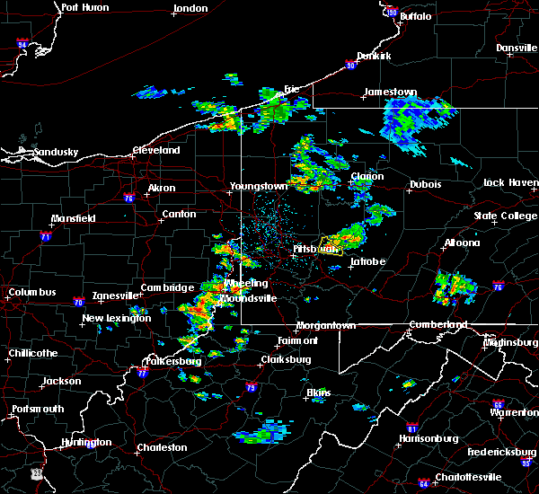 At 104 pm edt, a severe thunderstorm was located near murrysville, or near apollo, moving east at 25 mph (public). Hazards include golf ball size-hail and 60 mph wind gusts. People and animals outdoors will be injured. expect hail damage to roofs, siding, windows, and vehicles. expect wind damage to trees and power lines, resulting in some power outages. Locations impacted include, vandergrift, apollo, murrysville, west leechburg, avonmore, saltsburg, oklahoma, east vandergrift, slickville, north washington,. At 104 pm edt, a severe thunderstorm was located near murrysville, or near apollo, moving east at 25 mph (public). Hazards include golf ball size-hail and 60 mph wind gusts. People and animals outdoors will be injured. expect hail damage to roofs, siding, windows, and vehicles. expect wind damage to trees and power lines, resulting in some power outages. Locations impacted include, vandergrift, apollo, murrysville, west leechburg, avonmore, saltsburg, oklahoma, east vandergrift, slickville, north washington,.
|
| 4/20/2017 12:53 PM EDT |
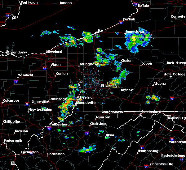 At 1253 pm edt, a severe thunderstorm was located over new kensington, or near penn hills, moving east at 20 mph (public). Hazards include 60 mph wind gusts and half dollar-size hail. Hail damage to vehicles is expected. expect wind damage to trees and power lines, resulting in some power outages. Locations impacted include, vandergrift, apollo, plum, murrysville, new kensington, lower burrell, harrison township, arnold, tarentum, natrona heights, springdale, brackenridge, this includes pennsylvania turnpike near mile marker 52. At 1253 pm edt, a severe thunderstorm was located over new kensington, or near penn hills, moving east at 20 mph (public). Hazards include 60 mph wind gusts and half dollar-size hail. Hail damage to vehicles is expected. expect wind damage to trees and power lines, resulting in some power outages. Locations impacted include, vandergrift, apollo, plum, murrysville, new kensington, lower burrell, harrison township, arnold, tarentum, natrona heights, springdale, brackenridge, this includes pennsylvania turnpike near mile marker 52.
|
| 4/20/2017 12:41 PM EDT |
 At 1241 pm edt, a severe thunderstorm was located over new kensington, or near penn hills, moving east at 20 mph (radar). Hazards include 60 mph wind gusts and quarter-size hail. Hail damage to vehicles is expected. Expect wind damage to trees and power lines, resulting in some power outages. At 1241 pm edt, a severe thunderstorm was located over new kensington, or near penn hills, moving east at 20 mph (radar). Hazards include 60 mph wind gusts and quarter-size hail. Hail damage to vehicles is expected. Expect wind damage to trees and power lines, resulting in some power outages.
|
| 2/12/2017 7:26 PM EST |
 At 725 pm est, severe thunderstorms were located along a line extending from 7 miles northwest of west kittanning to near imperial, moving east at 50 mph (radar). Hazards include 60 mph wind gusts. Expect damage to trees and power lines, resulting in some power outages. locations impacted include, pittsburgh, penn hills, mount lebanon, bethel park, ross township, mccandless township, monroeville, cranberry, moon township, greensburg, weirton, mckeesport, this includes the following highways, pennsylvania turnpike between mile markers 27 and 69. interstate 79 in pennsylvania between mile markers 25 and 51. Parkway north between mile markers 1 and 13. At 725 pm est, severe thunderstorms were located along a line extending from 7 miles northwest of west kittanning to near imperial, moving east at 50 mph (radar). Hazards include 60 mph wind gusts. Expect damage to trees and power lines, resulting in some power outages. locations impacted include, pittsburgh, penn hills, mount lebanon, bethel park, ross township, mccandless township, monroeville, cranberry, moon township, greensburg, weirton, mckeesport, this includes the following highways, pennsylvania turnpike between mile markers 27 and 69. interstate 79 in pennsylvania between mile markers 25 and 51. Parkway north between mile markers 1 and 13.
|
| 2/12/2017 7:02 PM EST |
 At 701 pm est, severe thunderstorms were located along a line extending from near meridian to near toronto, moving east at 50 mph (radar). Hazards include 60 mph wind gusts. expect damage to trees and power lines, resulting in some power outages At 701 pm est, severe thunderstorms were located along a line extending from near meridian to near toronto, moving east at 50 mph (radar). Hazards include 60 mph wind gusts. expect damage to trees and power lines, resulting in some power outages
|
| 9/7/2016 4:15 PM EDT |
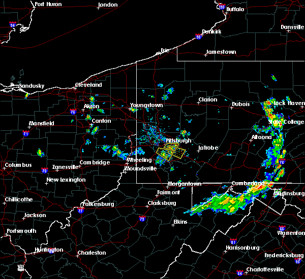 At 415 pm edt, a severe thunderstorm was located over freeport, or near vandergrift, moving east at 30 mph (radar indicated). Hazards include 60 mph wind gusts and penny size hail. Expect damage to trees and power lines. Resulting in some power outages. At 415 pm edt, a severe thunderstorm was located over freeport, or near vandergrift, moving east at 30 mph (radar indicated). Hazards include 60 mph wind gusts and penny size hail. Expect damage to trees and power lines. Resulting in some power outages.
|
| 8/28/2016 7:37 PM EDT | Trees down in westmoreland county PA, 2.7 miles ENE of Leechburg, PA |
| 8/25/2016 11:04 PM EDT |
 At 1103 pm edt, the leading edge of a severe thunderstorm cluster was located near ford city, or 8 miles southeast of kittanning, moving east at 45 mph (radar indicated). Hazards include 60 mph wind gusts. Expect damage to trees and power lines. resulting in some power outages. locations impacted include, kittanning, ford city, leechburg, sarver, freeport, west kittanning, saxonburg, nixon, west leechburg, orchard hills, worthington, hyde park, west hills, manorville, ford cliff, elderton, applewold, lenape heights, atwood and crooked creek lake park. Please report severe weather by calling 4 1 2, 2 6 2, 1 9 8 8, posting to the nws pittsburgh facebook page, or using twitter @nwspittsburgh. At 1103 pm edt, the leading edge of a severe thunderstorm cluster was located near ford city, or 8 miles southeast of kittanning, moving east at 45 mph (radar indicated). Hazards include 60 mph wind gusts. Expect damage to trees and power lines. resulting in some power outages. locations impacted include, kittanning, ford city, leechburg, sarver, freeport, west kittanning, saxonburg, nixon, west leechburg, orchard hills, worthington, hyde park, west hills, manorville, ford cliff, elderton, applewold, lenape heights, atwood and crooked creek lake park. Please report severe weather by calling 4 1 2, 2 6 2, 1 9 8 8, posting to the nws pittsburgh facebook page, or using twitter @nwspittsburgh.
|
| 8/25/2016 10:40 PM EDT |
 At 1040 pm edt, a severe thunderstorm was located near sarver, or 9 miles southeast of butler, moving east at 45 mph (radar indicated). Hazards include 60 mph wind gusts. Expect damage to trees and power lines. resulting in some power outages. locations impacted include, butler, kittanning, homeacre-lyndora, shanor-northvue, meridian, ford city, meadowood, oak hills, leechburg, sarver, freeport, west kittanning, saxonburg, nixon, west leechburg, orchard hills, rural valley, east butler, worthington and connoquenessing. Please report severe weather by calling 4 1 2, 2 6 2, 1 9 8 8, posting to the nws pittsburgh facebook page, or using twitter @nwspittsburgh. At 1040 pm edt, a severe thunderstorm was located near sarver, or 9 miles southeast of butler, moving east at 45 mph (radar indicated). Hazards include 60 mph wind gusts. Expect damage to trees and power lines. resulting in some power outages. locations impacted include, butler, kittanning, homeacre-lyndora, shanor-northvue, meridian, ford city, meadowood, oak hills, leechburg, sarver, freeport, west kittanning, saxonburg, nixon, west leechburg, orchard hills, rural valley, east butler, worthington and connoquenessing. Please report severe weather by calling 4 1 2, 2 6 2, 1 9 8 8, posting to the nws pittsburgh facebook page, or using twitter @nwspittsburgh.
|
| 8/25/2016 10:25 PM EDT |
 At 1025 pm edt, a severe thunderstorm was located over butler, moving east at 45 mph (radar indicated). Hazards include 60 mph wind gusts. Expect damage to trees and power lines. Resulting in some power outages. At 1025 pm edt, a severe thunderstorm was located over butler, moving east at 45 mph (radar indicated). Hazards include 60 mph wind gusts. Expect damage to trees and power lines. Resulting in some power outages.
|
| 8/16/2016 6:35 PM EDT |
 At 634 pm edt, severe thunderstorms were located along a line extending from 15 miles north of homer city to near indiana to near latrobe, moving east at 45 mph (public. trees and power lines have been reported down in several towns). Hazards include 60 mph wind gusts. Expect damage to trees and power lines. resulting in some power outages. locations impacted include, greensburg, indiana, jeannette, latrobe, vandergrift, homer city, apollo, murrysville, irwin, mcchesneytown-loyalhanna, blairsville, manor, youngwood, derry, delmont, lawson heights, new stanton, leechburg, black lick and calumet-norvelt. this includes the following highways, interstate 70 in pennsylvania between mile markers 52 and 57. pennsylvania turnpike between mile markers 61 and 79. Please report severe weather by calling 4 1 2, 2 6 2, 1 9 8 8, posting to the nws pittsburgh facebook page, or using twitter @nwspittsburgh. At 634 pm edt, severe thunderstorms were located along a line extending from 15 miles north of homer city to near indiana to near latrobe, moving east at 45 mph (public. trees and power lines have been reported down in several towns). Hazards include 60 mph wind gusts. Expect damage to trees and power lines. resulting in some power outages. locations impacted include, greensburg, indiana, jeannette, latrobe, vandergrift, homer city, apollo, murrysville, irwin, mcchesneytown-loyalhanna, blairsville, manor, youngwood, derry, delmont, lawson heights, new stanton, leechburg, black lick and calumet-norvelt. this includes the following highways, interstate 70 in pennsylvania between mile markers 52 and 57. pennsylvania turnpike between mile markers 61 and 79. Please report severe weather by calling 4 1 2, 2 6 2, 1 9 8 8, posting to the nws pittsburgh facebook page, or using twitter @nwspittsburgh.
|
| 8/16/2016 6:14 PM EDT |
 At 613 pm edt, severe thunderstorms were located along a line extending from near vandergrift to near west newton, moving east at 50 mph (public. downed trees and power lines have been reported in several towns). Hazards include 60 mph wind gusts. Expect damage to trees and power lines. Resulting in some power outages. At 613 pm edt, severe thunderstorms were located along a line extending from near vandergrift to near west newton, moving east at 50 mph (public. downed trees and power lines have been reported in several towns). Hazards include 60 mph wind gusts. Expect damage to trees and power lines. Resulting in some power outages.
|
| 7/24/2016 4:48 PM EDT |
 At 448 pm edt, severe thunderstorms were located along a line extending from near freeport to mount oliver, moving east at 30 mph (radar indicated). Hazards include 60 mph wind gusts. Expect damage to trees and power lines. resulting in some power outages. locations impacted include, pittsburgh, penn hills, mount lebanon, bethel park, monroeville, greensburg, mckeesport, indiana, jeannette, vandergrift, apollo, plum, west mifflin, baldwin, upper st. clair, murrysville, wilkinsburg, whitehall, south park township and new kensington. this includes the following highways, pennsylvania turnpike between mile markers 49 and 73. interstate 376 in pennsylvania between mile markers 73 and 84. Please report severe weather by calling 4 1 2, 2 6 2, 1 9 8 8, posting to the nws pittsburgh facebook page, or using twitter @nwspittsburgh. At 448 pm edt, severe thunderstorms were located along a line extending from near freeport to mount oliver, moving east at 30 mph (radar indicated). Hazards include 60 mph wind gusts. Expect damage to trees and power lines. resulting in some power outages. locations impacted include, pittsburgh, penn hills, mount lebanon, bethel park, monroeville, greensburg, mckeesport, indiana, jeannette, vandergrift, apollo, plum, west mifflin, baldwin, upper st. clair, murrysville, wilkinsburg, whitehall, south park township and new kensington. this includes the following highways, pennsylvania turnpike between mile markers 49 and 73. interstate 376 in pennsylvania between mile markers 73 and 84. Please report severe weather by calling 4 1 2, 2 6 2, 1 9 8 8, posting to the nws pittsburgh facebook page, or using twitter @nwspittsburgh.
|
| 7/24/2016 4:25 PM EDT |
 At 425 pm edt, severe thunderstorms were located along a line extending from near sarver to robinson township, moving east at 30 mph (radar indicated). Hazards include 60 mph wind gusts. Expect damage to trees and power lines. Resulting in some power outages. At 425 pm edt, severe thunderstorms were located along a line extending from near sarver to robinson township, moving east at 30 mph (radar indicated). Hazards include 60 mph wind gusts. Expect damage to trees and power lines. Resulting in some power outages.
|
| 9/9/2015 5:28 PM EDT | The severe thunderstorm warning for northeastern allegheny, southwestern armstrong and northwestern westmoreland counties will expire at 530 pm edt, the storm which prompted the warning has weakened below severe limits, and no longer poses an immediate threat to life or property. therefore the warning will be allowed to expire. however heavy rain is still possible with this thunderstorm. |
| 9/9/2015 5:17 PM EDT |
 At 516 pm edt, a severe thunderstorm was located over oakmont, or near penn hills, moving northeast at 10 mph (radar indicated). Hazards include 60 mph wind gusts and quarter size hail. Hail damage to vehicles is expected. expect wind damage to trees and some power outages. Locations impacted include, pittsburgh, penn hills, ross township, mccandless township, vandergrift, apollo, shaler township, plum, murrysville, hampton township, wilkinsburg, new kensington, lower burrell, harrison township, o`hara township, oakmont, fox chapel, arnold, tarentum and natrona heights. At 516 pm edt, a severe thunderstorm was located over oakmont, or near penn hills, moving northeast at 10 mph (radar indicated). Hazards include 60 mph wind gusts and quarter size hail. Hail damage to vehicles is expected. expect wind damage to trees and some power outages. Locations impacted include, pittsburgh, penn hills, ross township, mccandless township, vandergrift, apollo, shaler township, plum, murrysville, hampton township, wilkinsburg, new kensington, lower burrell, harrison township, o`hara township, oakmont, fox chapel, arnold, tarentum and natrona heights.
|
| 9/9/2015 4:52 PM EDT |
 At 452 pm edt, a severe thunderstorm was located near fox chapel, or near penn hills, moving northeast at 15 mph (radar indicated). Hazards include 60 mph wind gusts and quarter size hail. Hail damage to vehicles is expected. Expect wind damage to trees and some power outages. At 452 pm edt, a severe thunderstorm was located near fox chapel, or near penn hills, moving northeast at 15 mph (radar indicated). Hazards include 60 mph wind gusts and quarter size hail. Hail damage to vehicles is expected. Expect wind damage to trees and some power outages.
|
| 7/7/2015 8:22 PM EDT |
 At 821 pm edt, severe thunderstorms were located along a line extending from vandergrift to near ligonier, moving northeast at 45 mph (radar indicated). Hazards include 60 mph wind gusts. expect damage to trees and some power outages locations impacted include, greensburg, indiana, jeannette, latrobe, vandergrift, homer city, apollo, plum, murrysville, new kensington, lower burrell, harrison township, arnold, tarentum, mcchesneytown-loyalhanna, blairsville, springdale, brackenridge, derry and delmont At 821 pm edt, severe thunderstorms were located along a line extending from vandergrift to near ligonier, moving northeast at 45 mph (radar indicated). Hazards include 60 mph wind gusts. expect damage to trees and some power outages locations impacted include, greensburg, indiana, jeannette, latrobe, vandergrift, homer city, apollo, plum, murrysville, new kensington, lower burrell, harrison township, arnold, tarentum, mcchesneytown-loyalhanna, blairsville, springdale, brackenridge, derry and delmont
|
| 7/7/2015 8:04 PM EDT |
 At 803 pm edt, severe thunderstorms were located along a line extending from near monroeville to near connellsville, moving northeast at 45 mph (radar indicated). Hazards include 60 mph wind gusts. expect damage to trees and some power outages At 803 pm edt, severe thunderstorms were located along a line extending from near monroeville to near connellsville, moving northeast at 45 mph (radar indicated). Hazards include 60 mph wind gusts. expect damage to trees and some power outages
|
| 6/23/2015 2:04 PM EDT |
 At 204 pm edt, a severe thunderstorm was located near leechburg, or near vandergrift, moving east at 35 mph (radar indicated). Hazards include 60 mph wind gusts and quarter size hail. Hail damage to vehicles is expected. expect wind damage to roofs, siding and trees. Locations impacted include, vandergrift, apollo, new kensington, lower burrell, harrison township, arnold, tarentum, natrona heights, brackenridge, leechburg, freeport, russellton, north apollo, west leechburg, curtisville, avonmore, orchard hills, oklahoma, east vandergrift and hyde park. At 204 pm edt, a severe thunderstorm was located near leechburg, or near vandergrift, moving east at 35 mph (radar indicated). Hazards include 60 mph wind gusts and quarter size hail. Hail damage to vehicles is expected. expect wind damage to roofs, siding and trees. Locations impacted include, vandergrift, apollo, new kensington, lower burrell, harrison township, arnold, tarentum, natrona heights, brackenridge, leechburg, freeport, russellton, north apollo, west leechburg, curtisville, avonmore, orchard hills, oklahoma, east vandergrift and hyde park.
|
| 6/23/2015 1:37 PM EDT |
 At 137 pm edt, a severe thunderstorm was located near sarver, or 10 miles south of butler, moving east at 35 mph (radar indicated). Hazards include 60 mph wind gusts and quarter size hail. Hail damage to vehicles is expected. Expect wind damage to roofs, siding and trees. At 137 pm edt, a severe thunderstorm was located near sarver, or 10 miles south of butler, moving east at 35 mph (radar indicated). Hazards include 60 mph wind gusts and quarter size hail. Hail damage to vehicles is expected. Expect wind damage to roofs, siding and trees.
|
| 6/18/2015 9:27 PM EDT | At 925 pm edt, a severe thunderstorm was located over forest hills, or near monroeville, moving east at 35 mph (radar indicated). Hazards include 60 mph wind gusts. Expect damage to roofs. siding and trees. locations impacted include, pittsburgh, penn hills, mount lebanon, bethel park, ross township, monroeville, mcmurray, mckeesport, vandergrift, gastonville, shaler township, plum, west mifflin, north side pittsburgh, baldwin, upper st. Clair, murrysville, hampton township, scott township and wilkinsburg. |
| 6/18/2015 9:14 PM EDT | At 910 pm edt, a severe thunderstorm was located over north side pittsburgh, or over pittsburgh, moving east at 35 mph, with the line of strongest winds extending from north of mccandles township and extending south to upper st clair (radar indicated). Hazards include 60 mph wind gusts. Expect damage to roofs. siding and trees. Locations impacted include, pittsburgh, penn hills, mount lebanon, bethel park, ross township, mccandless township, monroeville, cranberry, moon township, mcmurray, mckeesport, franklin park, canonsburg, vandergrift, gastonville, shaler township, plum, west mifflin, north side pittsburgh and baldwin. |
| 6/18/2015 8:49 PM EDT | At 846 pm edt, a severe thunderstorm was located over moon township, moving southeast at 35 mph (radar indicated). Hazards include 60 mph wind gusts. Expect damage to roofs. Siding and trees. |
| 6/12/2015 6:29 PM EDT |
 At 629 pm edt, severe thunderstorms were located along a line extending from 8 miles southeast of new bethlehem to north braddock, moving east at 55 mph (radar indicated). Hazards include 60 mph wind gusts. Expect damage to roofs. siding and trees. Locations impacted include, pittsburgh, penn hills, mount lebanon, ross township, mccandless township, monroeville, greensburg, mckeesport, indiana, jeannette, latrobe, punxsutawney, vandergrift, kittanning, homer city, apollo, shaler township, plum, west mifflin and north side pittsburgh. At 629 pm edt, severe thunderstorms were located along a line extending from 8 miles southeast of new bethlehem to north braddock, moving east at 55 mph (radar indicated). Hazards include 60 mph wind gusts. Expect damage to roofs. siding and trees. Locations impacted include, pittsburgh, penn hills, mount lebanon, ross township, mccandless township, monroeville, greensburg, mckeesport, indiana, jeannette, latrobe, punxsutawney, vandergrift, kittanning, homer city, apollo, shaler township, plum, west mifflin and north side pittsburgh.
|
| 6/12/2015 6:21 PM EDT |
 At 621 pm edt, severe thunderstorms were located along a line extending from near new bethlehem to mount oliver, moving east at 55 mph (radar indicated). Hazards include 60 mph wind gusts. Expect damage to roofs. siding and trees. Locations impacted include, pittsburgh, penn hills, mount lebanon, ross township, mccandless township, monroeville, moon township, greensburg, mckeesport, indiana, franklin park, jeannette, latrobe, punxsutawney, vandergrift, kittanning, homer city, apollo, shaler township and plum. At 621 pm edt, severe thunderstorms were located along a line extending from near new bethlehem to mount oliver, moving east at 55 mph (radar indicated). Hazards include 60 mph wind gusts. Expect damage to roofs. siding and trees. Locations impacted include, pittsburgh, penn hills, mount lebanon, ross township, mccandless township, monroeville, moon township, greensburg, mckeesport, indiana, franklin park, jeannette, latrobe, punxsutawney, vandergrift, kittanning, homer city, apollo, shaler township and plum.
|
| 6/12/2015 6:10 PM EDT |
 At 610 pm edt, severe thunderstorms were located along a line extending from near rimersburg to carnegie, moving east at 45 mph (radar indicated). Hazards include 60 mph wind gusts. Expect damage to roofs. siding and trees. Locations impacted include, pittsburgh, penn hills, mount lebanon, ross township, mccandless township, monroeville, cranberry, moon township, greensburg, mckeesport, indiana, butler, franklin park, jeannette, latrobe, punxsutawney, vandergrift, kittanning, homer city and apollo. At 610 pm edt, severe thunderstorms were located along a line extending from near rimersburg to carnegie, moving east at 45 mph (radar indicated). Hazards include 60 mph wind gusts. Expect damage to roofs. siding and trees. Locations impacted include, pittsburgh, penn hills, mount lebanon, ross township, mccandless township, monroeville, cranberry, moon township, greensburg, mckeesport, indiana, butler, franklin park, jeannette, latrobe, punxsutawney, vandergrift, kittanning, homer city and apollo.
|
| 6/12/2015 5:58 PM EDT |
 At 558 pm edt, severe thunderstorms were located along a line extending from 7 miles southwest of rimersburg to near imperial, moving east at 55 mph (radar indicated). Hazards include 60 mph wind gusts. Expect damage to roofs. Siding and trees. At 558 pm edt, severe thunderstorms were located along a line extending from 7 miles southwest of rimersburg to near imperial, moving east at 55 mph (radar indicated). Hazards include 60 mph wind gusts. Expect damage to roofs. Siding and trees.
|
| 5/29/2015 5:22 PM EDT | At 522 pm edt, a severe thunderstorm was located over murrysville, or near monroeville, moving north at 20 mph (radar indicated). Hazards include 70 mph wind gusts and quarter size hail. Hail damage to vehicles is expected. expect considerable tree damage. Wind damage is also likely to mobile homes, roofs and outbuildings. |
| 4/9/2015 6:37 PM EDT | A severe thunderstorm warning remains in effect until 645 pm edt for northwestern fayette. northeastern greene. southwestern armstrong. southeastern butler. southeastern washington. western westmoreland and eastern allegheny counties. at 637 pm edt. Severe thunderstorms were located along a line extending from 6 miles west of west hills to saltsburg to new stanton. |
| 4/9/2015 6:17 PM EDT | The national weather service in pittsburgh has issued a * severe thunderstorm warning for. northwestern fayette county in southwestern pennsylvania. central greene county in southwestern pennsylvania. southwestern armstrong county in west central pennsylvania. Southern butler county in west central pennsylvania. |
| 9/22/2012 7:38 PM EDT | Trees down in armstrong county PA, 0.2 miles NW of Leechburg, PA |
Hail Maps for Leechburg, PA
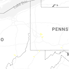
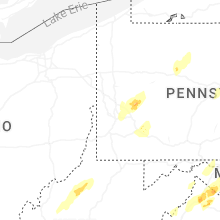


Connect with Interactive Hail Maps