

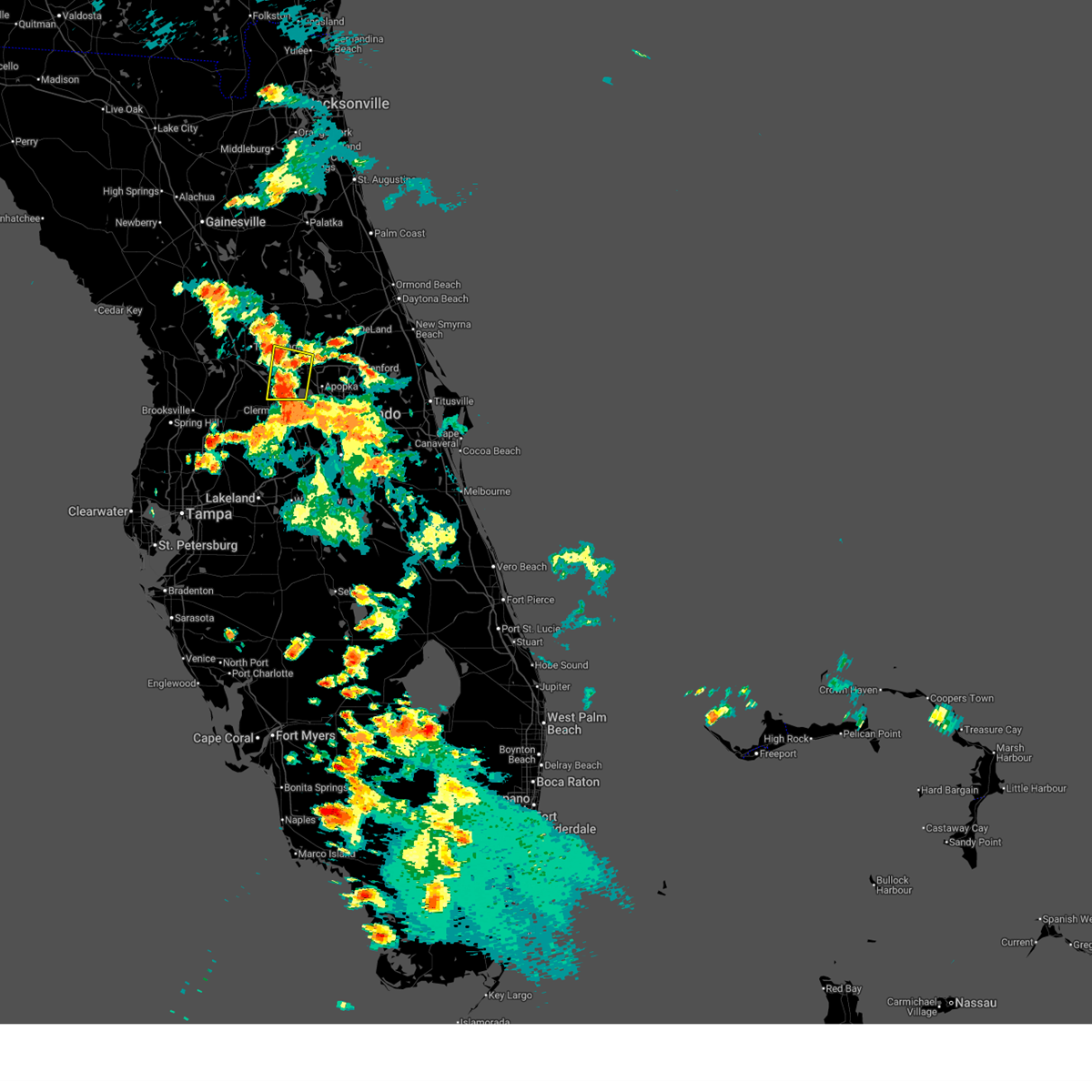
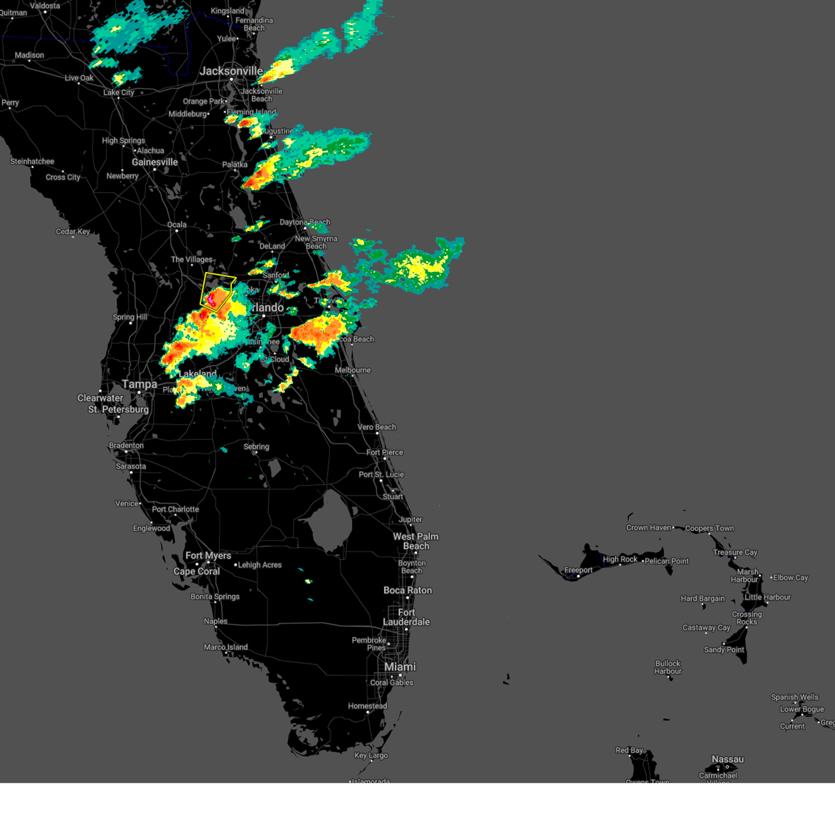
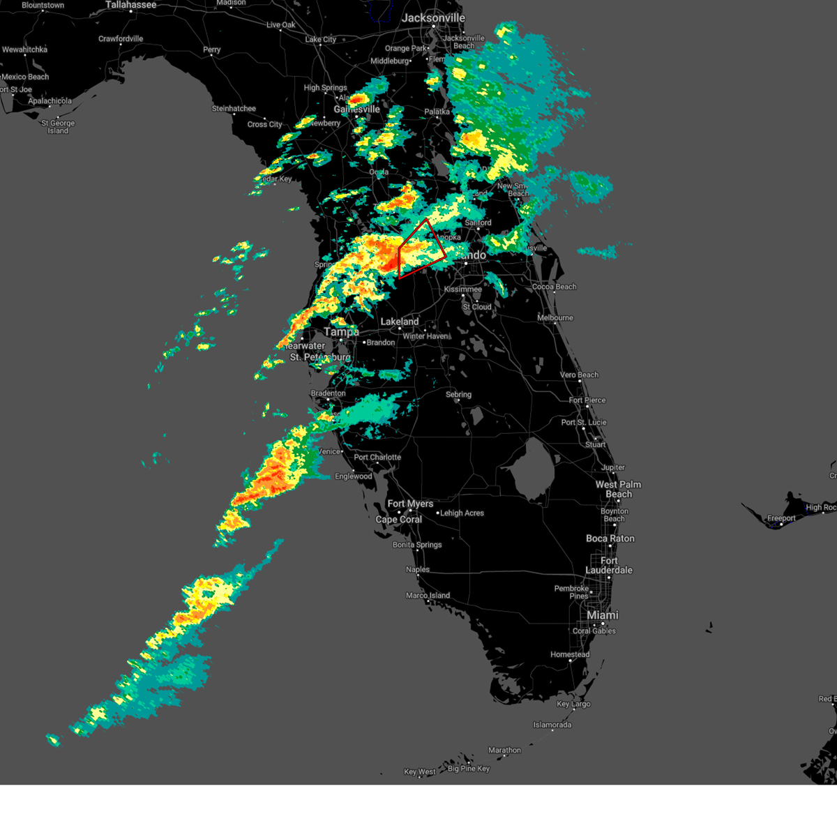
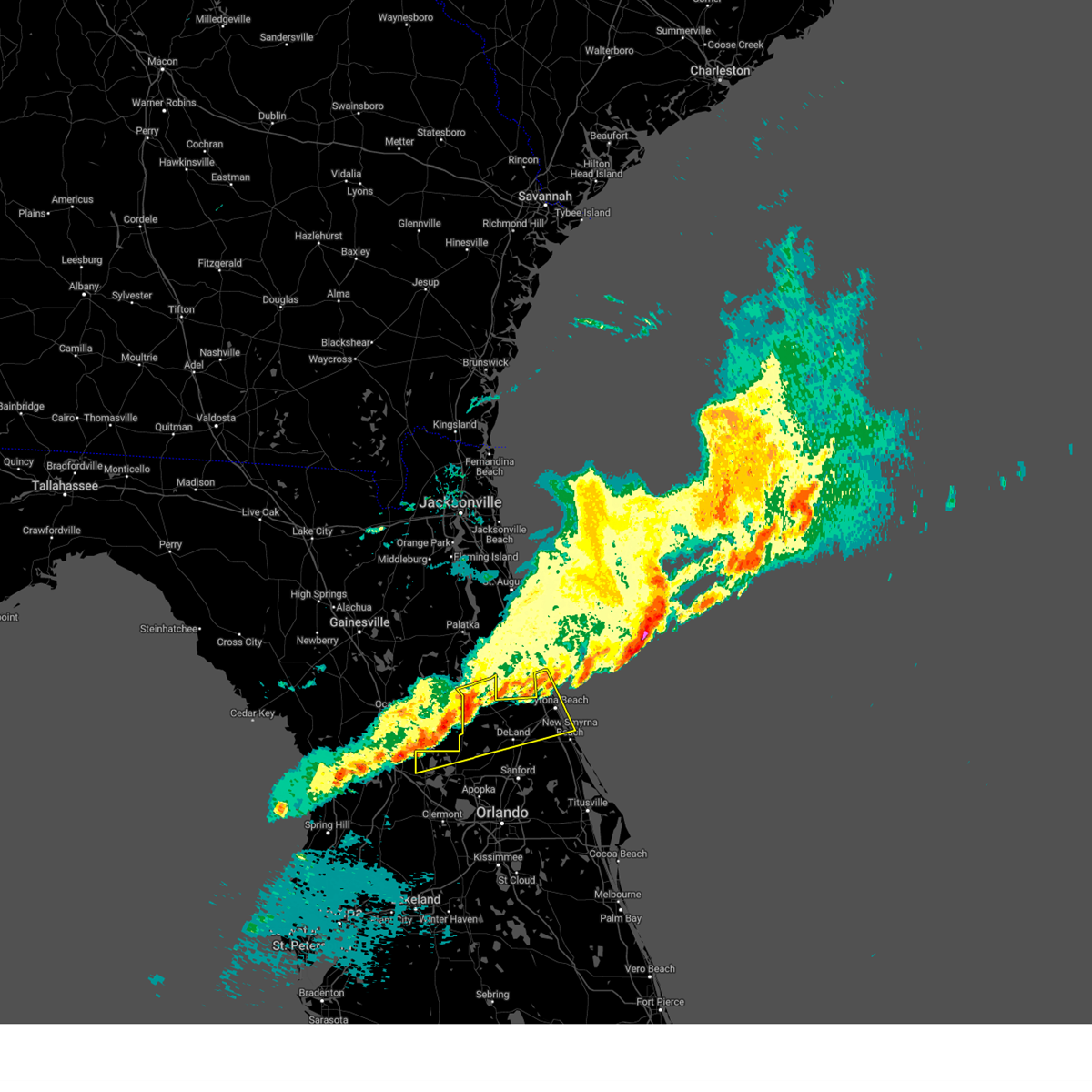
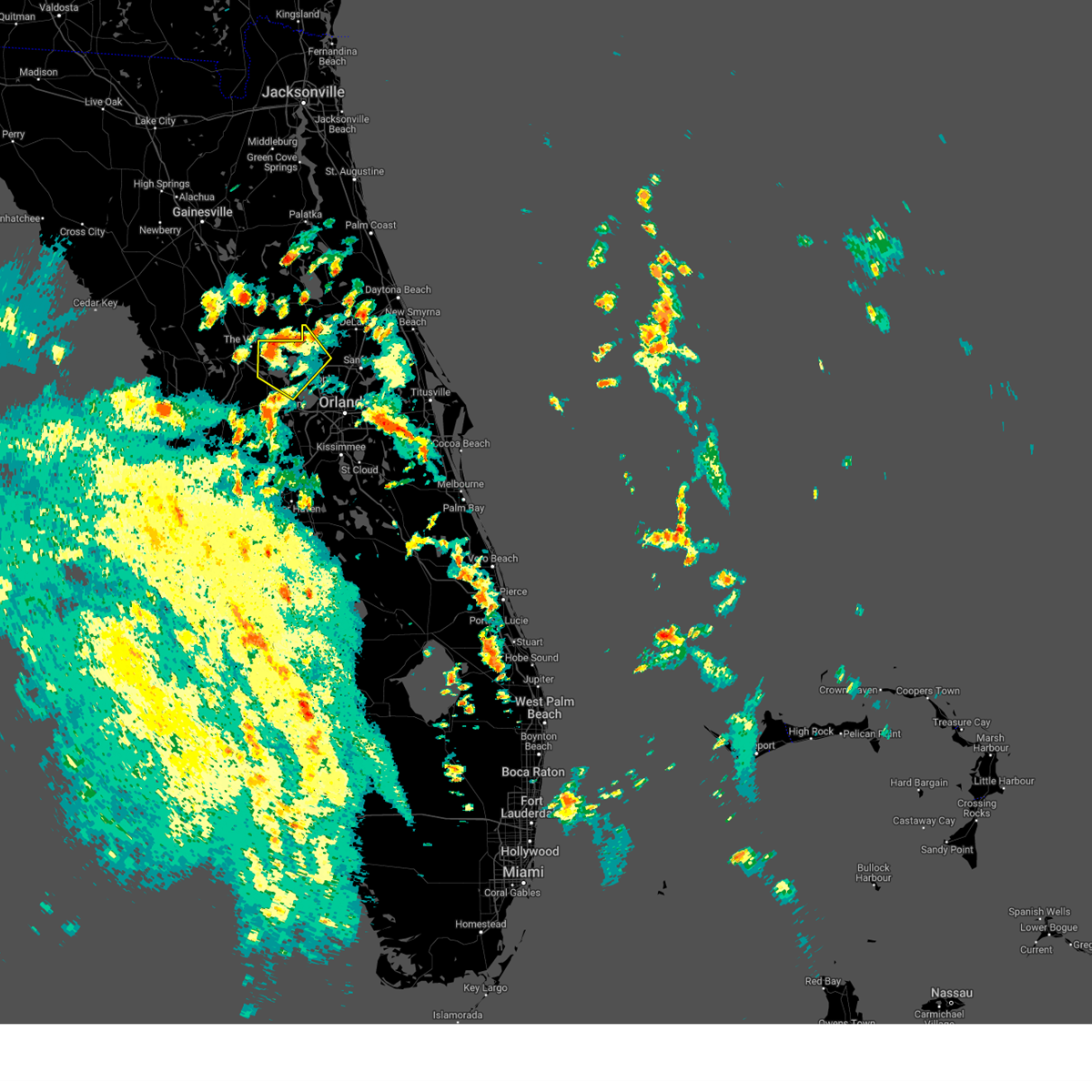
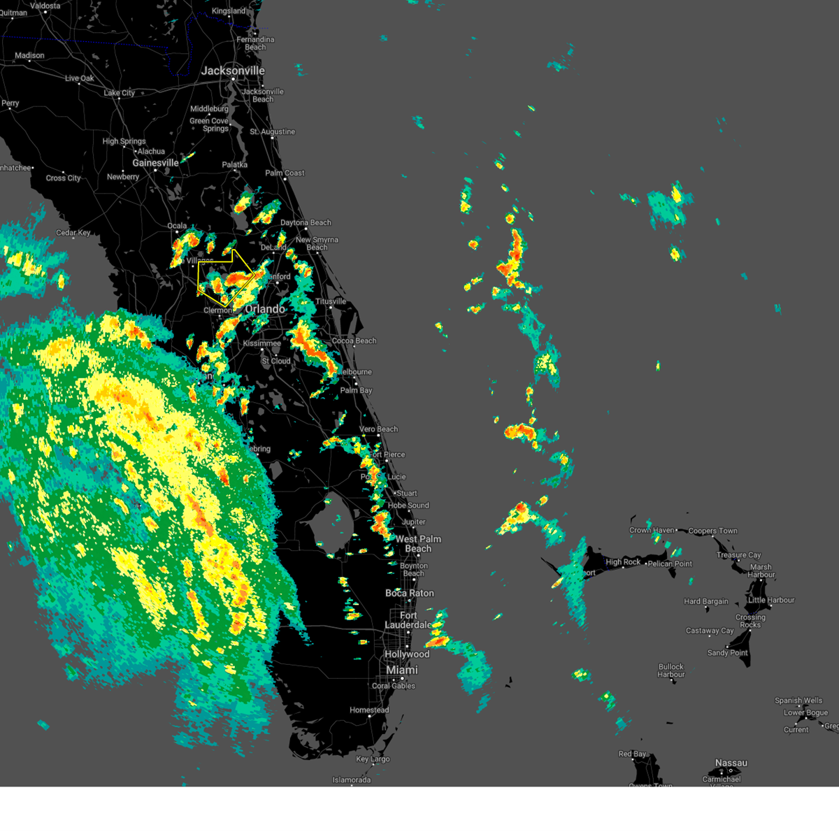
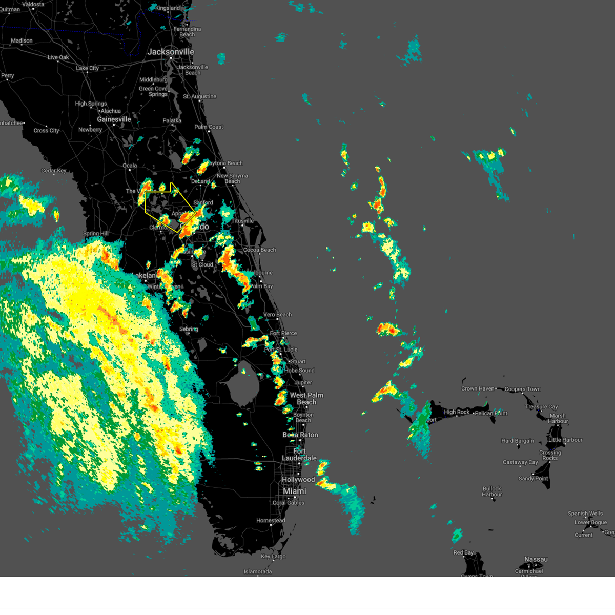
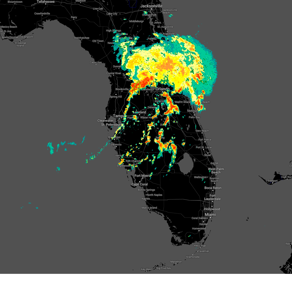
Hail Map for Leesburg, FL
The Leesburg, FL area has had 3 reports of on-the-ground hail by trained spotters, and has been under severe weather warnings 12 times during the past 12 months. Doppler radar has detected hail at or near Leesburg, FL on 101 occasions, including 6 occasions during the past year.
| Name: | Leesburg, FL |
| Where Located: | 34.7 miles WNW of Orlando, FL |
| Map: | Google Map for Leesburg, FL |
| Population: | 20117 |
| Housing Units: | 10625 |
| More Info: | Search Google for Leesburg, FL |
1
The Top Recent Hail Date for Leesburg, FL is Tuesday, July 16, 2024 (25th out of 101)

Hail and Wind Damage Spotted near Leesburg, FL
| Date / Time | Report Details |
|---|---|
| 6/27/2025 5:44 PM EDT | The severe thunderstorm which prompted the warning has weakened. therefore, the warning will be allowed to expire. however gusty winds and heavy rain are still possible with this thunderstorm. |
| 6/27/2025 5:31 PM EDT | At 531 pm edt, a severe thunderstorm was located over tavares, moving north at 10 mph (radar indicated). Hazards include 60 mph wind gusts and penny size hail. Expect damage to roofs, siding, and trees. Locations impacted include, eustis, tavares, mount dora, howey-in-the-hills, and lake griffin. |
| 6/27/2025 5:16 PM EDT |
 Svrmlb the national weather service in melbourne has issued a * severe thunderstorm warning for, west central lake county in east central florida, northwestern orange county in east central florida, * until 545 pm edt. * at 516 pm edt, a severe thunderstorm was located over howey-in-the-hills, moving northeast at 20 mph (radar indicated). Hazards include 60 mph wind gusts and penny size hail. expect damage to roofs, siding, and trees Svrmlb the national weather service in melbourne has issued a * severe thunderstorm warning for, west central lake county in east central florida, northwestern orange county in east central florida, * until 545 pm edt. * at 516 pm edt, a severe thunderstorm was located over howey-in-the-hills, moving northeast at 20 mph (radar indicated). Hazards include 60 mph wind gusts and penny size hail. expect damage to roofs, siding, and trees
|
| 5/9/2025 6:58 PM EDT | Quarter sized hail reported 7.9 miles NNW of Leesburg, FL, trained spotter reporting quarter sized hail on blue cedar rd near the fl turnpike onramp. |
| 5/9/2025 6:50 PM EDT |
 Svrmlb the national weather service in melbourne has issued a * severe thunderstorm warning for, west central lake county in east central florida, * until 715 pm edt. * at 650 pm edt, a severe thunderstorm was located near howey-in-the-hills, moving northeast at 15 mph (radar indicated). Hazards include 60 mph wind gusts and quarter size hail. Hail damage to vehicles is expected. Expect wind damage to roofs, siding, and trees. Svrmlb the national weather service in melbourne has issued a * severe thunderstorm warning for, west central lake county in east central florida, * until 715 pm edt. * at 650 pm edt, a severe thunderstorm was located near howey-in-the-hills, moving northeast at 15 mph (radar indicated). Hazards include 60 mph wind gusts and quarter size hail. Hail damage to vehicles is expected. Expect wind damage to roofs, siding, and trees.
|
| 3/10/2025 8:35 AM EDT |
 Tormlb the national weather service in melbourne has issued a * tornado warning for, southwestern lake county in east central florida, west central orange county in east central florida, * until 900 am edt. * at 834 am edt, a severe thunderstorm capable of producing a tornado was located near mascotte, moving northeast at 45 mph (radar indicated rotation). Hazards include tornado. Flying debris will be dangerous to those caught without shelter. mobile homes will be damaged or destroyed. damage to roofs, windows, and vehicles will occur. tree damage is likely. this dangerous storm will be near, mascotte and groveland around 840 am edt. howey-in-the-hills and ferndale around 850 am edt. tavares around 900 am edt. Other locations impacted by this tornadic thunderstorm include minneola. Tormlb the national weather service in melbourne has issued a * tornado warning for, southwestern lake county in east central florida, west central orange county in east central florida, * until 900 am edt. * at 834 am edt, a severe thunderstorm capable of producing a tornado was located near mascotte, moving northeast at 45 mph (radar indicated rotation). Hazards include tornado. Flying debris will be dangerous to those caught without shelter. mobile homes will be damaged or destroyed. damage to roofs, windows, and vehicles will occur. tree damage is likely. this dangerous storm will be near, mascotte and groveland around 840 am edt. howey-in-the-hills and ferndale around 850 am edt. tavares around 900 am edt. Other locations impacted by this tornadic thunderstorm include minneola.
|
| 1/19/2025 8:51 AM EST |
 Svrmlb the national weather service in melbourne has issued a * severe thunderstorm warning for, northern lake county in east central florida, northern volusia county in east central florida, * until 930 am est. * at 850 am est, a severe thunderstorm was located near the villages, moving east at 55 mph (radar indicated). Hazards include 60 mph wind gusts and penny size hail. expect damage to roofs, siding, and trees Svrmlb the national weather service in melbourne has issued a * severe thunderstorm warning for, northern lake county in east central florida, northern volusia county in east central florida, * until 930 am est. * at 850 am est, a severe thunderstorm was located near the villages, moving east at 55 mph (radar indicated). Hazards include 60 mph wind gusts and penny size hail. expect damage to roofs, siding, and trees
|
| 10/10/2024 12:24 PM EDT | Public reports trees down in leesburg near us-441 and 3rd stree in lake county FL, 1.9 miles S of Leesburg, FL |
| 10/9/2024 10:32 PM EDT | The asos at the leesburg international airport measured a wind gust of 75mph/65kts from the northeas in lake county FL, 4.3 miles SW of Leesburg, FL |
| 10/9/2024 9:21 PM EDT | The asos at the leesburg international airport measured a wind gust of 71mph/62kts from the northeas in lake county FL, 4.3 miles SW of Leesburg, FL |
| 10/9/2024 7:29 PM EDT | The asos at the leesburg international airport measured a wind gust of 58mph/50kts from the northeas in lake county FL, 4.3 miles SW of Leesburg, FL |
| 8/4/2024 1:13 PM EDT |
 The storm which prompted the warning has weakened below severe limits, and no longer poses an immediate threat to life or property. therefore, the warning will be allowed to expire. however gusty winds are still possible with this thunderstorm. a tornado watch remains in effect until 800 pm edt for east central florida. remember, a tornado warning still remains in effect until 8 pm. The storm which prompted the warning has weakened below severe limits, and no longer poses an immediate threat to life or property. therefore, the warning will be allowed to expire. however gusty winds are still possible with this thunderstorm. a tornado watch remains in effect until 800 pm edt for east central florida. remember, a tornado warning still remains in effect until 8 pm.
|
| 8/4/2024 1:02 PM EDT |
 At 101 pm edt, a severe thunderstorm was located over eustis, moving northwest at 45 mph (radar indicated). Hazards include 60 mph wind gusts. Expect damage to roofs, siding, and trees. Locations impacted include, leesburg, eustis, tavares, lady lake, and mount dora. At 101 pm edt, a severe thunderstorm was located over eustis, moving northwest at 45 mph (radar indicated). Hazards include 60 mph wind gusts. Expect damage to roofs, siding, and trees. Locations impacted include, leesburg, eustis, tavares, lady lake, and mount dora.
|
| 8/4/2024 1:02 PM EDT |
 the severe thunderstorm warning has been cancelled and is no longer in effect the severe thunderstorm warning has been cancelled and is no longer in effect
|
| 8/4/2024 12:45 PM EDT |
 Svrmlb the national weather service in melbourne has issued a * severe thunderstorm warning for, west central seminole county in east central florida, central lake county in east central florida, northwestern orange county in east central florida, * until 115 pm edt. * at 1245 pm edt, a severe thunderstorm was located over zellwood, moving northwest at 40 mph (radar indicated). Hazards include 60 mph wind gusts. expect damage to roofs, siding, and trees Svrmlb the national weather service in melbourne has issued a * severe thunderstorm warning for, west central seminole county in east central florida, central lake county in east central florida, northwestern orange county in east central florida, * until 115 pm edt. * at 1245 pm edt, a severe thunderstorm was located over zellwood, moving northwest at 40 mph (radar indicated). Hazards include 60 mph wind gusts. expect damage to roofs, siding, and trees
|
| 7/16/2024 2:41 PM EDT |
 the severe thunderstorm warning has been cancelled and is no longer in effect the severe thunderstorm warning has been cancelled and is no longer in effect
|
| 7/16/2024 2:21 PM EDT |
 Svrmlb the national weather service in melbourne has issued a * severe thunderstorm warning for, west central lake county in east central florida, * until 300 pm edt. * at 220 pm edt, a severe thunderstorm was located near leesburg, and is nearly stationary (radar indicated). Hazards include 60 mph wind gusts and quarter size hail. Hail damage to vehicles is expected. Expect wind damage to roofs, siding, and trees. Svrmlb the national weather service in melbourne has issued a * severe thunderstorm warning for, west central lake county in east central florida, * until 300 pm edt. * at 220 pm edt, a severe thunderstorm was located near leesburg, and is nearly stationary (radar indicated). Hazards include 60 mph wind gusts and quarter size hail. Hail damage to vehicles is expected. Expect wind damage to roofs, siding, and trees.
|
| 5/18/2024 3:35 PM EDT | Ham radio relayed a report of downed trees and powerlines near the intersection of state road 44 and emeralda av in lake county FL, 8.4 miles SW of Leesburg, FL |
| 5/18/2024 3:30 PM EDT | Trained spotter reports powerlines down and several trees down at the intersection of state road 44 and county road 47 in lake county FL, 7 miles WSW of Leesburg, FL |
| 5/18/2024 3:29 PM EDT |
 Svrmlb the national weather service in melbourne has issued a * severe thunderstorm warning for, northwestern seminole county in east central florida, central lake county in east central florida, northwestern orange county in east central florida, * until 400 pm edt. * at 329 pm edt, a severe thunderstorm was located over tavares, moving east at 35 mph (radar indicated). Hazards include 60 mph wind gusts and quarter size hail. Hail damage to vehicles is expected. Expect wind damage to roofs, siding, and trees. Svrmlb the national weather service in melbourne has issued a * severe thunderstorm warning for, northwestern seminole county in east central florida, central lake county in east central florida, northwestern orange county in east central florida, * until 400 pm edt. * at 329 pm edt, a severe thunderstorm was located over tavares, moving east at 35 mph (radar indicated). Hazards include 60 mph wind gusts and quarter size hail. Hail damage to vehicles is expected. Expect wind damage to roofs, siding, and trees.
|
| 5/15/2024 4:57 AM EDT |
 the severe thunderstorm warning has been cancelled and is no longer in effect the severe thunderstorm warning has been cancelled and is no longer in effect
|
| 5/15/2024 4:25 AM EDT |
 Svrmlb the national weather service in melbourne has issued a * severe thunderstorm warning for, west central lake county in east central florida, * until 515 am edt. * at 425 am edt, a severe thunderstorm was located over wildwood, moving east at 35 mph (radar indicated). Hazards include 60 mph wind gusts and penny size hail. expect damage to roofs, siding, and trees Svrmlb the national weather service in melbourne has issued a * severe thunderstorm warning for, west central lake county in east central florida, * until 515 am edt. * at 425 am edt, a severe thunderstorm was located over wildwood, moving east at 35 mph (radar indicated). Hazards include 60 mph wind gusts and penny size hail. expect damage to roofs, siding, and trees
|
| 5/15/2024 4:21 AM EDT |
 Svrtbw the national weather service in ruskin has issued a * severe thunderstorm warning for, northeastern sumter county in central florida, * until 445 am edt. * at 421 am edt, a severe thunderstorm was located over wildwood, moving east at 25 mph (radar indicated). Hazards include 60 mph wind gusts. expect damage to roofs, siding, and trees Svrtbw the national weather service in ruskin has issued a * severe thunderstorm warning for, northeastern sumter county in central florida, * until 445 am edt. * at 421 am edt, a severe thunderstorm was located over wildwood, moving east at 25 mph (radar indicated). Hazards include 60 mph wind gusts. expect damage to roofs, siding, and trees
|
| 4/11/2024 12:30 PM EDT |
 Svrtbw the national weather service in ruskin has issued a * severe thunderstorm warning for, southeastern citrus county in west central florida, sumter county in central florida, pasco county in west central florida, hernando county in west central florida, northwestern manatee county in west central florida, pinellas county in west central florida, northwestern polk county in central florida, hillsborough county in west central florida, * until 115 pm edt. * at 1229 pm edt, severe thunderstorms were located along a line extending from near spring hill to 6 miles southwest of citrus park to 17 miles west of anna maria, moving east at 45 mph (radar indicated). Hazards include 60 mph wind gusts. expect damage to roofs, siding, and trees Svrtbw the national weather service in ruskin has issued a * severe thunderstorm warning for, southeastern citrus county in west central florida, sumter county in central florida, pasco county in west central florida, hernando county in west central florida, northwestern manatee county in west central florida, pinellas county in west central florida, northwestern polk county in central florida, hillsborough county in west central florida, * until 115 pm edt. * at 1229 pm edt, severe thunderstorms were located along a line extending from near spring hill to 6 miles southwest of citrus park to 17 miles west of anna maria, moving east at 45 mph (radar indicated). Hazards include 60 mph wind gusts. expect damage to roofs, siding, and trees
|
| 2/4/2024 6:57 PM EST |
 At 656 pm est, a severe thunderstorm was located over tavares, moving northeast at 30 mph (radar indicated). Hazards include 60 mph wind gusts and quarter size hail. Hail damage to vehicles is expected. Expect wind damage to roofs, siding, and trees. At 656 pm est, a severe thunderstorm was located over tavares, moving northeast at 30 mph (radar indicated). Hazards include 60 mph wind gusts and quarter size hail. Hail damage to vehicles is expected. Expect wind damage to roofs, siding, and trees.
|
| 1/9/2024 5:07 PM EST |
 At 506 pm est, severe thunderstorms were located along a line extending from near pierson to mid florida lakes to 12 miles southwest of lake louisa, moving northeast at 70 mph (radar indicated). Hazards include 60 mph wind gusts. Expect damage to roofs, siding, and trees. Locations impacted include, apopka, ocoee, winter garden, leesburg, and eustis. At 506 pm est, severe thunderstorms were located along a line extending from near pierson to mid florida lakes to 12 miles southwest of lake louisa, moving northeast at 70 mph (radar indicated). Hazards include 60 mph wind gusts. Expect damage to roofs, siding, and trees. Locations impacted include, apopka, ocoee, winter garden, leesburg, and eustis.
|
| 1/9/2024 4:46 PM EST |
 At 446 pm est, severe thunderstorms were located along a line extending from lake george to near leesburg to 6 miles east of dade city, moving northeast at 65 mph (radar indicated). Hazards include 60 mph wind gusts. expect damage to roofs, siding, and trees At 446 pm est, severe thunderstorms were located along a line extending from lake george to near leesburg to 6 miles east of dade city, moving northeast at 65 mph (radar indicated). Hazards include 60 mph wind gusts. expect damage to roofs, siding, and trees
|
| 1/9/2024 4:40 PM EST |
 At 439 pm est, a severe thunderstorm was located over lady lake, moving northeast at 60 mph (radar indicated). Hazards include 60 mph wind gusts. Expect damage to roofs, siding, and trees. Locations impacted include, lady lake, emeralda, the villages, fruitland park, and pittman. At 439 pm est, a severe thunderstorm was located over lady lake, moving northeast at 60 mph (radar indicated). Hazards include 60 mph wind gusts. Expect damage to roofs, siding, and trees. Locations impacted include, lady lake, emeralda, the villages, fruitland park, and pittman.
|
| 1/9/2024 4:34 PM EST |
 At 433 pm est, a severe thunderstorm was located near wildwood, moving northeast at 55 mph (radar indicated). Hazards include 60 mph wind gusts. expect damage to roofs, siding, and trees At 433 pm est, a severe thunderstorm was located near wildwood, moving northeast at 55 mph (radar indicated). Hazards include 60 mph wind gusts. expect damage to roofs, siding, and trees
|
| 10/12/2023 4:37 AM EDT |
 At 436 am edt, a severe thunderstorm capable of producing a tornado was located near paisley, moving northeast at 55 mph. another storm capable of producing a tornado is near lake yale (radar indicated rotation). Hazards include tornado. Flying debris will be dangerous to those caught without shelter. mobile homes will be damaged or destroyed. damage to roofs, windows, and vehicles will occur. tree damage is likely. this dangerous storm will be near, deleon springs and paisley around 440 am edt. barberville around 450 am edt. Other locations impacted by this tornadic thunderstorm include eldridge. At 436 am edt, a severe thunderstorm capable of producing a tornado was located near paisley, moving northeast at 55 mph. another storm capable of producing a tornado is near lake yale (radar indicated rotation). Hazards include tornado. Flying debris will be dangerous to those caught without shelter. mobile homes will be damaged or destroyed. damage to roofs, windows, and vehicles will occur. tree damage is likely. this dangerous storm will be near, deleon springs and paisley around 440 am edt. barberville around 450 am edt. Other locations impacted by this tornadic thunderstorm include eldridge.
|
| 10/12/2023 4:26 AM EDT |
 At 425 am edt, a severe thunderstorm capable of producing a tornado was located over leesburg airport, or over lake griffin, moving northeast at 60 mph (radar indicated rotation). Hazards include tornado. Flying debris will be dangerous to those caught without shelter. mobile homes will be damaged or destroyed. damage to roofs, windows, and vehicles will occur. tree damage is likely. this dangerous storm will be near, eustis, tavares, and lisbon around 430 am edt. paisley and pittman around 440 am edt. deleon springs around 450 am edt. barberville around 500 am edt. Other locations impacted by this tornadic thunderstorm include pine lakes. At 425 am edt, a severe thunderstorm capable of producing a tornado was located over leesburg airport, or over lake griffin, moving northeast at 60 mph (radar indicated rotation). Hazards include tornado. Flying debris will be dangerous to those caught without shelter. mobile homes will be damaged or destroyed. damage to roofs, windows, and vehicles will occur. tree damage is likely. this dangerous storm will be near, eustis, tavares, and lisbon around 430 am edt. paisley and pittman around 440 am edt. deleon springs around 450 am edt. barberville around 500 am edt. Other locations impacted by this tornadic thunderstorm include pine lakes.
|
| 10/12/2023 4:18 AM EDT |
 At 418 am edt, a severe thunderstorm capable of producing a tornado was located over leesburg, moving northeast at 55 mph (radar indicated rotation). Hazards include tornado. Flying debris will be dangerous to those caught without shelter. mobile homes will be damaged or destroyed. damage to roofs, windows, and vehicles will occur. tree damage is likely. this dangerous storm will be near, leesburg, eustis, and tavares around 420 am edt. pittman around 430 am edt. paisley around 440 am edt. Other locations impacted by this tornadic thunderstorm include forest hills. At 418 am edt, a severe thunderstorm capable of producing a tornado was located over leesburg, moving northeast at 55 mph (radar indicated rotation). Hazards include tornado. Flying debris will be dangerous to those caught without shelter. mobile homes will be damaged or destroyed. damage to roofs, windows, and vehicles will occur. tree damage is likely. this dangerous storm will be near, leesburg, eustis, and tavares around 420 am edt. pittman around 430 am edt. paisley around 440 am edt. Other locations impacted by this tornadic thunderstorm include forest hills.
|
| 10/12/2023 4:06 AM EDT |
 At 405 am edt, a severe thunderstorm capable of producing a tornado was located over lake griffin, moving northeast at 45 mph (radar indicated rotation). Hazards include tornado. Flying debris will be dangerous to those caught without shelter. mobile homes will be damaged or destroyed. damage to roofs, windows, and vehicles will occur. tree damage is likely. this dangerous storm will be near, eustis, tavares, and lisbon around 410 am edt. paisley and pittman around 420 am edt. Other locations impacted by this tornadic thunderstorm include forest hills. At 405 am edt, a severe thunderstorm capable of producing a tornado was located over lake griffin, moving northeast at 45 mph (radar indicated rotation). Hazards include tornado. Flying debris will be dangerous to those caught without shelter. mobile homes will be damaged or destroyed. damage to roofs, windows, and vehicles will occur. tree damage is likely. this dangerous storm will be near, eustis, tavares, and lisbon around 410 am edt. paisley and pittman around 420 am edt. Other locations impacted by this tornadic thunderstorm include forest hills.
|
| 10/12/2023 4:01 AM EDT |
 At 401 am edt, a severe thunderstorm was located near bushnell, moving northeast at 40 mph (radar indicated). Hazards include 60 mph wind gusts. expect damage to roofs, siding, and trees At 401 am edt, a severe thunderstorm was located near bushnell, moving northeast at 40 mph (radar indicated). Hazards include 60 mph wind gusts. expect damage to roofs, siding, and trees
|
| 10/12/2023 3:12 AM EDT |
 At 312 am edt, a severe thunderstorm capable of producing a tornado was located near hill n dale, or 10 miles east of brooksville, moving northeast at 35 mph (radar indicated rotation). Hazards include tornado. Flying debris will be dangerous to those caught without shelter. mobile homes will be damaged or destroyed. damage to roofs, windows, and vehicles will occur. tree damage is likely. this dangerous storm will be near, bushnell around 315 am edt. Other locations impacted by this tornadic thunderstorm include webster, ridge manor, tarrytown, croom, center hill, sumterville, adamsville, and spring lake. At 312 am edt, a severe thunderstorm capable of producing a tornado was located near hill n dale, or 10 miles east of brooksville, moving northeast at 35 mph (radar indicated rotation). Hazards include tornado. Flying debris will be dangerous to those caught without shelter. mobile homes will be damaged or destroyed. damage to roofs, windows, and vehicles will occur. tree damage is likely. this dangerous storm will be near, bushnell around 315 am edt. Other locations impacted by this tornadic thunderstorm include webster, ridge manor, tarrytown, croom, center hill, sumterville, adamsville, and spring lake.
|
| 7/31/2023 2:26 PM EDT |
 The severe thunderstorm warning for southwestern lake county will expire at 230 pm edt, the storm which prompted the warning has weakened below severe limits, and no longer poses an immediate threat to life or property. therefore, the warning will be allowed to expire. however heavy rain is still possible with this thunderstorm. to report severe weather, contact your nearest law enforcement agency. they will relay your report to the national weather service melbourne. The severe thunderstorm warning for southwestern lake county will expire at 230 pm edt, the storm which prompted the warning has weakened below severe limits, and no longer poses an immediate threat to life or property. therefore, the warning will be allowed to expire. however heavy rain is still possible with this thunderstorm. to report severe weather, contact your nearest law enforcement agency. they will relay your report to the national weather service melbourne.
|
| 7/31/2023 2:10 PM EDT |
 At 207 pm edt, a severe thunderstorm was located near howey-in-the-hills, moving east at 10 mph (radar indicated). Hazards include 60 mph wind gusts. expect damage to roofs, siding, and trees At 207 pm edt, a severe thunderstorm was located near howey-in-the-hills, moving east at 10 mph (radar indicated). Hazards include 60 mph wind gusts. expect damage to roofs, siding, and trees
|
| 6/19/2023 8:09 PM EDT |
 At 808 pm edt, severe thunderstorms were located along a line extending from near tavares to near groveland, moving east at 30 mph. terminal doppler weather radar form orlando continues to indicate wind gusts near 60 mph possible with this band of storms (radar indicated). Hazards include 60 mph wind gusts. Expect damage to roofs, siding, and trees. locations impacted include, apopka, winter garden, tavares, groveland and mascotte. hail threat, radar indicated max hail size, <. 75 in wind threat, radar indicated max wind gust, 60 mph. At 808 pm edt, severe thunderstorms were located along a line extending from near tavares to near groveland, moving east at 30 mph. terminal doppler weather radar form orlando continues to indicate wind gusts near 60 mph possible with this band of storms (radar indicated). Hazards include 60 mph wind gusts. Expect damage to roofs, siding, and trees. locations impacted include, apopka, winter garden, tavares, groveland and mascotte. hail threat, radar indicated max hail size, <. 75 in wind threat, radar indicated max wind gust, 60 mph.
|
| 6/19/2023 7:51 PM EDT |
 At 751 pm edt, doppler radar indicated severe thunderstorms were located along a line extending from the lake county line west of leesburg to 7 miles west of mascotte, moving east at 30 mph (radar indicated). Hazards include 60 mph wind gusts. expect damage to roofs, siding, and trees At 751 pm edt, doppler radar indicated severe thunderstorms were located along a line extending from the lake county line west of leesburg to 7 miles west of mascotte, moving east at 30 mph (radar indicated). Hazards include 60 mph wind gusts. expect damage to roofs, siding, and trees
|
| 6/17/2023 11:13 AM EDT |
 At 1112 am edt, a strong to severe thunderstorm was located over ferndale, to near clermont moving southeast at 30 mph (radar indicated). Hazards include 60 mph wind gusts and penny size hail. Expect damage to roofs, siding, and trees. locations impacted include, apopka, ocoee, winter garden, eustis and tavares. hail threat, radar indicated max hail size, 0. 75 in wind threat, radar indicated max wind gust, 60 mph. At 1112 am edt, a strong to severe thunderstorm was located over ferndale, to near clermont moving southeast at 30 mph (radar indicated). Hazards include 60 mph wind gusts and penny size hail. Expect damage to roofs, siding, and trees. locations impacted include, apopka, ocoee, winter garden, eustis and tavares. hail threat, radar indicated max hail size, 0. 75 in wind threat, radar indicated max wind gust, 60 mph.
|
| 6/17/2023 11:02 AM EDT |
 At 1102 am edt, a severe thunderstorm was located near howey-in-the-hills, moving southeast at 30 mph (radar indicated). Hazards include 60 mph wind gusts and penny size hail. expect damage to roofs, siding, and trees At 1102 am edt, a severe thunderstorm was located near howey-in-the-hills, moving southeast at 30 mph (radar indicated). Hazards include 60 mph wind gusts and penny size hail. expect damage to roofs, siding, and trees
|
| 6/17/2023 10:59 AM EDT |
 At 1059 am edt, a severe thunderstorm was located 7 miles east of bushnell, moving southeast at 20 mph (radar indicated). Hazards include 60 mph wind gusts. expect damage to roofs, siding, and trees At 1059 am edt, a severe thunderstorm was located 7 miles east of bushnell, moving southeast at 20 mph (radar indicated). Hazards include 60 mph wind gusts. expect damage to roofs, siding, and trees
|
| 6/17/2023 10:46 AM EDT |
 At 1046 am edt, a severe thunderstorm was located 8 miles southwest of leesburg, moving southeast at 55 mph (radar indicated). Hazards include 60 mph wind gusts. expect damage to roofs, siding, and trees At 1046 am edt, a severe thunderstorm was located 8 miles southwest of leesburg, moving southeast at 55 mph (radar indicated). Hazards include 60 mph wind gusts. expect damage to roofs, siding, and trees
|
| 6/7/2023 5:33 PM EDT |
 At 533 pm edt, a severe thunderstorm was located over leesburg airport, or over lisbon, moving northeast at 15 mph (radar indicated). Hazards include 60 mph wind gusts and nickel size hail. expect damage to roofs, siding, and trees At 533 pm edt, a severe thunderstorm was located over leesburg airport, or over lisbon, moving northeast at 15 mph (radar indicated). Hazards include 60 mph wind gusts and nickel size hail. expect damage to roofs, siding, and trees
|
| 6/7/2023 5:27 PM EDT | The klee asos measured a 58 mph/50 kt wind gust from the southwes in lake county FL, 4.8 miles WSW of Leesburg, FL |
| 4/26/2023 10:40 PM EDT |
 The severe thunderstorm warning for northeastern sumter county will expire at 1045 pm edt, the storm which prompted the warning has weakened below severe limits, and no longer poses an immediate threat to life or property. therefore, the warning will be allowed to expire. however, small hail, gusty winds and heavy rain are still possible with this thunderstorm. The severe thunderstorm warning for northeastern sumter county will expire at 1045 pm edt, the storm which prompted the warning has weakened below severe limits, and no longer poses an immediate threat to life or property. therefore, the warning will be allowed to expire. however, small hail, gusty winds and heavy rain are still possible with this thunderstorm.
|
| 4/26/2023 10:04 PM EDT |
 At 1004 pm edt, a severe thunderstorm was located 7 miles west of lake weir, or 9 miles west of the villages, moving southeast at 15 mph (radar indicated). Hazards include 60 mph wind gusts and quarter size hail. Hail damage to vehicles is expected. Expect wind damage to roofs, siding, and trees. At 1004 pm edt, a severe thunderstorm was located 7 miles west of lake weir, or 9 miles west of the villages, moving southeast at 15 mph (radar indicated). Hazards include 60 mph wind gusts and quarter size hail. Hail damage to vehicles is expected. Expect wind damage to roofs, siding, and trees.
|
| 4/25/2023 4:56 PM EDT |
 The severe thunderstorm warning for central lake county will expire at 500 pm edt, the storm which prompted the warning has weakened below severe limits, and no longer poses an immediate threat to life or property. therefore, the warning will be allowed to expire. however small hail, gusty winds and heavy rain are still possible with this thunderstorm. The severe thunderstorm warning for central lake county will expire at 500 pm edt, the storm which prompted the warning has weakened below severe limits, and no longer poses an immediate threat to life or property. therefore, the warning will be allowed to expire. however small hail, gusty winds and heavy rain are still possible with this thunderstorm.
|
| 4/25/2023 4:31 PM EDT | Power lines downed on north lake street in leesbur in lake county FL, 1.9 miles SSW of Leesburg, FL |
| 4/25/2023 4:30 PM EDT |
 At 430 pm edt, a severe thunderstorm was located over lake griffin, moving southeast at 25 mph (radar indicated). Hazards include 60 mph wind gusts and quarter size hail. Hail damage to vehicles is expected. Expect wind damage to roofs, siding, and trees. At 430 pm edt, a severe thunderstorm was located over lake griffin, moving southeast at 25 mph (radar indicated). Hazards include 60 mph wind gusts and quarter size hail. Hail damage to vehicles is expected. Expect wind damage to roofs, siding, and trees.
|
| 4/25/2023 4:24 PM EDT |
 At 424 pm edt, a severe thunderstorm was located over mascotte, moving southeast at 25 mph (radar indicated). Hazards include 60 mph wind gusts and half dollar size hail. Hail damage to vehicles is expected. expect wind damage to roofs, siding, and trees. Locations impacted include, groveland, mascotte and minneola. At 424 pm edt, a severe thunderstorm was located over mascotte, moving southeast at 25 mph (radar indicated). Hazards include 60 mph wind gusts and half dollar size hail. Hail damage to vehicles is expected. expect wind damage to roofs, siding, and trees. Locations impacted include, groveland, mascotte and minneola.
|
| 4/25/2023 4:20 PM EDT |
 At 420 pm edt, a severe thunderstorm was located over fruitland park, or over lake griffin, moving southeast at 20 mph (radar indicated). Hazards include 60 mph wind gusts and half dollar size hail. Hail damage to vehicles is expected. expect wind damage to roofs, siding, and trees. Locations impacted include, leesburg, lady lake, lake griffin, lisbon and fruitland park. At 420 pm edt, a severe thunderstorm was located over fruitland park, or over lake griffin, moving southeast at 20 mph (radar indicated). Hazards include 60 mph wind gusts and half dollar size hail. Hail damage to vehicles is expected. expect wind damage to roofs, siding, and trees. Locations impacted include, leesburg, lady lake, lake griffin, lisbon and fruitland park.
|
| 4/25/2023 4:11 PM EDT |
 At 411 pm edt, a severe thunderstorm was located near mascotte, moving southeast at 20 mph (radar indicated). Hazards include 60 mph wind gusts and quarter size hail. Hail damage to vehicles is expected. Expect wind damage to roofs, siding, and trees. At 411 pm edt, a severe thunderstorm was located near mascotte, moving southeast at 20 mph (radar indicated). Hazards include 60 mph wind gusts and quarter size hail. Hail damage to vehicles is expected. Expect wind damage to roofs, siding, and trees.
|
| 4/25/2023 4:05 PM EDT |
 At 405 pm edt, a severe thunderstorm was located over lady lake, moving southeast at 20 mph (radar indicated). Hazards include 60 mph wind gusts and quarter size hail. Hail damage to vehicles is expected. Expect wind damage to roofs, siding, and trees. At 405 pm edt, a severe thunderstorm was located over lady lake, moving southeast at 20 mph (radar indicated). Hazards include 60 mph wind gusts and quarter size hail. Hail damage to vehicles is expected. Expect wind damage to roofs, siding, and trees.
|
| 4/24/2023 5:17 PM EDT |
 At 517 pm edt, a severe thunderstorm was located near wildwood, moving east at 10 mph (radar indicated). Hazards include 60 mph wind gusts and quarter size hail. Hail damage to vehicles is expected. Expect wind damage to roofs, siding, and trees. At 517 pm edt, a severe thunderstorm was located near wildwood, moving east at 10 mph (radar indicated). Hazards include 60 mph wind gusts and quarter size hail. Hail damage to vehicles is expected. Expect wind damage to roofs, siding, and trees.
|
| 12/15/2022 12:10 PM EST |
 The severe thunderstorm warning for southwestern lake county will expire at 1215 pm est, the storm which prompted the warning has weakened below severe limits, and no longer poses an immediate threat to life or property. therefore, the warning will be allowed to expire. however gusty winds and heavy rain are still possible with this thunderstorm. a tornado watch remains in effect until 400 pm est for east central florida. to report severe weather, contact your nearest law enforcement agency. they will relay your report to the national weather service melbourne. The severe thunderstorm warning for southwestern lake county will expire at 1215 pm est, the storm which prompted the warning has weakened below severe limits, and no longer poses an immediate threat to life or property. therefore, the warning will be allowed to expire. however gusty winds and heavy rain are still possible with this thunderstorm. a tornado watch remains in effect until 400 pm est for east central florida. to report severe weather, contact your nearest law enforcement agency. they will relay your report to the national weather service melbourne.
|
| 12/15/2022 11:53 AM EST |
 At 1153 am est, a severe thunderstorm was located near howey-in-the-hills, moving northeast at 35 mph (radar indicated). Hazards include 60 mph wind gusts. Expect damage to roofs, siding, and trees. Locations impacted include, leesburg, eustis, tavares, mount dora and groveland. At 1153 am est, a severe thunderstorm was located near howey-in-the-hills, moving northeast at 35 mph (radar indicated). Hazards include 60 mph wind gusts. Expect damage to roofs, siding, and trees. Locations impacted include, leesburg, eustis, tavares, mount dora and groveland.
|
| 12/15/2022 11:31 AM EST |
 At 1131 am est, a severe thunderstorm was located near mascotte, moving northeast at 40 mph (radar indicated). Hazards include 60 mph wind gusts. expect damage to roofs, siding, and trees At 1131 am est, a severe thunderstorm was located near mascotte, moving northeast at 40 mph (radar indicated). Hazards include 60 mph wind gusts. expect damage to roofs, siding, and trees
|
| 9/7/2022 6:51 PM EDT |
 The severe thunderstorm warning for west central lake county will expire at 700 pm edt, the storm which prompted the warning has weakened below severe limits, and no longer poses an immediate threat to life or property. therefore, the warning will be allowed to expire. however gusty winds and heavy rain are still possible with this thunderstorm and a special weather statement is in effect. The severe thunderstorm warning for west central lake county will expire at 700 pm edt, the storm which prompted the warning has weakened below severe limits, and no longer poses an immediate threat to life or property. therefore, the warning will be allowed to expire. however gusty winds and heavy rain are still possible with this thunderstorm and a special weather statement is in effect.
|
| 9/7/2022 6:31 PM EDT |
 At 631 pm edt, a severe thunderstorm was located near howey-in-the-hills, moving southeast at 10 mph (radar indicated). Hazards include 60 mph wind gusts and nickel size hail. expect damage to roofs, siding, and trees At 631 pm edt, a severe thunderstorm was located near howey-in-the-hills, moving southeast at 10 mph (radar indicated). Hazards include 60 mph wind gusts and nickel size hail. expect damage to roofs, siding, and trees
|
| 8/17/2022 3:38 PM EDT |
 The severe thunderstorm warning for northeastern sumter county will expire at 345 pm edt, the severe thunderstorm which prompted the warning has weakened. moved out of the warned area. therefore, the warning will be allowed to expire. however heavy rain is still possible with this thunderstorm. The severe thunderstorm warning for northeastern sumter county will expire at 345 pm edt, the severe thunderstorm which prompted the warning has weakened. moved out of the warned area. therefore, the warning will be allowed to expire. however heavy rain is still possible with this thunderstorm.
|
| 8/17/2022 3:17 PM EDT |
 At 317 pm edt, a severe thunderstorm was located 7 miles northwest of wildwood, moving south at 15 mph (radar indicated). Hazards include 60 mph wind gusts and quarter size hail. Hail damage to vehicles is expected. Expect wind damage to roofs, siding, and trees. At 317 pm edt, a severe thunderstorm was located 7 miles northwest of wildwood, moving south at 15 mph (radar indicated). Hazards include 60 mph wind gusts and quarter size hail. Hail damage to vehicles is expected. Expect wind damage to roofs, siding, and trees.
|
| 8/17/2022 3:06 PM EDT |
 At 305 pm edt, a severe thunderstorm was located 7 miles west of lake weir, or 10 miles west of the villages, moving southeast at 20 mph (radar indicated). Hazards include 60 mph wind gusts and quarter size hail. Hail damage to vehicles is expected. Expect wind damage to roofs, siding, and trees. At 305 pm edt, a severe thunderstorm was located 7 miles west of lake weir, or 10 miles west of the villages, moving southeast at 20 mph (radar indicated). Hazards include 60 mph wind gusts and quarter size hail. Hail damage to vehicles is expected. Expect wind damage to roofs, siding, and trees.
|
| 7/13/2022 8:59 PM EDT |
 At 859 pm edt, a severe thunderstorm was located over howey-in-the-hills, moving north at 10 mph (radar indicated). Hazards include 60 mph wind gusts. Expect damage to roofs, siding, and trees. locations impacted include, tavares, howey-in-the-hills, lake harris, leesburg airport and astatula. hail threat, radar indicated max hail size, <. 75 in wind threat, radar indicated max wind gust, 60 mph. At 859 pm edt, a severe thunderstorm was located over howey-in-the-hills, moving north at 10 mph (radar indicated). Hazards include 60 mph wind gusts. Expect damage to roofs, siding, and trees. locations impacted include, tavares, howey-in-the-hills, lake harris, leesburg airport and astatula. hail threat, radar indicated max hail size, <. 75 in wind threat, radar indicated max wind gust, 60 mph.
|
| 7/13/2022 8:44 PM EDT |
 At 843 pm edt, a severe thunderstorm was located over howey-in-the-hills, moving northeast at 5 mph (radar indicated). Hazards include 60 mph wind gusts. expect damage to roofs, siding, and trees At 843 pm edt, a severe thunderstorm was located over howey-in-the-hills, moving northeast at 5 mph (radar indicated). Hazards include 60 mph wind gusts. expect damage to roofs, siding, and trees
|
| 7/1/2022 3:21 PM EDT | Trained spotter reports numerous branches down with an average diameter of around 3-4..." a few branches greater than 6" down... and an oak tree split in half near the in lake county FL, 3.6 miles N of Leesburg, FL |
| 6/24/2022 4:10 PM EDT |
 The severe thunderstorm warning for west central lake county will expire at 415 pm edt, the storm which prompted the warning has weakened below severe limits, and has exited the warned area. therefore, the warning will be allowed to expire. however small hail, gusty winds and heavy rain are still possible with this thunderstorm. to report severe weather, contact your nearest law enforcement agency. they will relay your report to the national weather service melbourne. The severe thunderstorm warning for west central lake county will expire at 415 pm edt, the storm which prompted the warning has weakened below severe limits, and has exited the warned area. therefore, the warning will be allowed to expire. however small hail, gusty winds and heavy rain are still possible with this thunderstorm. to report severe weather, contact your nearest law enforcement agency. they will relay your report to the national weather service melbourne.
|
| 6/24/2022 3:47 PM EDT |
 At 346 pm edt, a severe thunderstorm was located over lake griffin, moving southeast at 10 mph. at 345 pm, a wind gust of 56 mph was reported at the leesburg airport (radar indicated). Hazards include 60 mph wind gusts. Expect damage to roofs, siding, and trees. locations impacted include, leesburg, eustis, tavares, lady lake and mount dora. hail threat, radar indicated max hail size, <. 75 in wind threat, radar indicated max wind gust, 60 mph. At 346 pm edt, a severe thunderstorm was located over lake griffin, moving southeast at 10 mph. at 345 pm, a wind gust of 56 mph was reported at the leesburg airport (radar indicated). Hazards include 60 mph wind gusts. Expect damage to roofs, siding, and trees. locations impacted include, leesburg, eustis, tavares, lady lake and mount dora. hail threat, radar indicated max hail size, <. 75 in wind threat, radar indicated max wind gust, 60 mph.
|
| 6/24/2022 3:38 PM EDT |
 At 338 pm edt, a severe thunderstorm was located near fruitland park, or near lake griffin, and is nearly stationary (radar indicated). Hazards include 60 mph wind gusts. expect damage to roofs, siding, and trees At 338 pm edt, a severe thunderstorm was located near fruitland park, or near lake griffin, and is nearly stationary (radar indicated). Hazards include 60 mph wind gusts. expect damage to roofs, siding, and trees
|
| 6/19/2022 2:36 PM EDT |
 At 236 pm edt, a severe thunderstorm was located 7 miles southwest of wildwood, and is nearly stationary (radar indicated). Hazards include 60 mph wind gusts and quarter size hail. Hail damage to vehicles is expected. Expect wind damage to roofs, siding, and trees. At 236 pm edt, a severe thunderstorm was located 7 miles southwest of wildwood, and is nearly stationary (radar indicated). Hazards include 60 mph wind gusts and quarter size hail. Hail damage to vehicles is expected. Expect wind damage to roofs, siding, and trees.
|
| 4/7/2022 11:57 AM EDT |
 At 1152 am edt, severe thunderstorms were located along a line extending from near mascotte to groveland to hillsborough river state park, moving east at 45 mph (radar indicated). Hazards include 60 mph wind gusts and penny size hail. expect damage to roofs, siding, and trees At 1152 am edt, severe thunderstorms were located along a line extending from near mascotte to groveland to hillsborough river state park, moving east at 45 mph (radar indicated). Hazards include 60 mph wind gusts and penny size hail. expect damage to roofs, siding, and trees
|
| 4/2/2022 2:26 PM EDT |
 At 226 pm edt, a severe thunderstorm was located over tavares, moving east at 30 mph (radar indicated). Hazards include 60 mph wind gusts and nickel size hail. expect damage to roofs, siding, and trees At 226 pm edt, a severe thunderstorm was located over tavares, moving east at 30 mph (radar indicated). Hazards include 60 mph wind gusts and nickel size hail. expect damage to roofs, siding, and trees
|
| 3/15/2022 6:53 PM EDT |
 At 653 pm edt, a severe thunderstorm was located 11 miles northeast of dade city, moving northeast at 25 mph (radar indicated). Hazards include 60 mph wind gusts and quarter size hail. Hail damage to vehicles is expected. Expect wind damage to roofs, siding, and trees. At 653 pm edt, a severe thunderstorm was located 11 miles northeast of dade city, moving northeast at 25 mph (radar indicated). Hazards include 60 mph wind gusts and quarter size hail. Hail damage to vehicles is expected. Expect wind damage to roofs, siding, and trees.
|
| 3/12/2022 8:43 AM EST |
 At 842 am est, severe thunderstorms were located along a line extending from near lake george to near lady lake and into sumter county, moving east at 55 mph (radar indicated). Hazards include 60 mph wind gusts and penny size hail. expect damage to roofs, siding, and trees At 842 am est, severe thunderstorms were located along a line extending from near lake george to near lady lake and into sumter county, moving east at 55 mph (radar indicated). Hazards include 60 mph wind gusts and penny size hail. expect damage to roofs, siding, and trees
|
| 10/28/2021 2:09 PM EDT |
 At 208 pm edt, a severe thunderstorm was located over zellwood, moving northeast at 60 mph (radar indicated). Hazards include 60 mph wind gusts. Expect damage to roofs, siding, and trees. locations impacted include, apopka, eustis, tavares, mount dora and howey-in-the-hills. hail threat, radar indicated max hail size, <. 75 in wind threat, radar indicated max wind gust, 60 mph. At 208 pm edt, a severe thunderstorm was located over zellwood, moving northeast at 60 mph (radar indicated). Hazards include 60 mph wind gusts. Expect damage to roofs, siding, and trees. locations impacted include, apopka, eustis, tavares, mount dora and howey-in-the-hills. hail threat, radar indicated max hail size, <. 75 in wind threat, radar indicated max wind gust, 60 mph.
|
| 10/28/2021 1:38 PM EDT |
 At 137 pm edt, a severe thunderstorm was located 7 miles southeast of bushnell, moving northeast at 60 mph (radar indicated). Hazards include 60 mph wind gusts. expect damage to roofs, siding, and trees At 137 pm edt, a severe thunderstorm was located 7 miles southeast of bushnell, moving northeast at 60 mph (radar indicated). Hazards include 60 mph wind gusts. expect damage to roofs, siding, and trees
|
| 7/7/2021 4:16 AM EDT |
 At 415 am edt, a severe thunderstorm capable of producing a tornado was located over emeralda, moving north at 35 mph (radar indicated rotation). Hazards include tornado. Flying debris will be dangerous to those caught without shelter. mobile homes will be damaged or destroyed. damage to roofs, windows, and vehicles will occur. tree damage is likely. This tornadic thunderstorm will remain over mainly rural areas of west central lake county, including the following locations, silver lake. At 415 am edt, a severe thunderstorm capable of producing a tornado was located over emeralda, moving north at 35 mph (radar indicated rotation). Hazards include tornado. Flying debris will be dangerous to those caught without shelter. mobile homes will be damaged or destroyed. damage to roofs, windows, and vehicles will occur. tree damage is likely. This tornadic thunderstorm will remain over mainly rural areas of west central lake county, including the following locations, silver lake.
|
| 4/17/2021 9:26 AM EDT | Trained spotter reports wind downed thick trees and shingles were blown off roofs near urick street. also received photos of roof damage to church near urick street and in lake county FL, 4.7 miles SSE of Leesburg, FL |
| 3/30/2021 8:13 PM EDT |
 At 812 pm edt, a severe thunderstorm was located over lake harris, moving east at 5 mph. quarter size hail has been reported with this storm (trained weather spotters). Hazards include ping pong ball size hail and 60 mph wind gusts. People and animals outdoors will be injured. expect hail damage to roofs, siding, windows, and vehicles. expect wind damage to roofs, siding, and trees. Locations impacted include, howey-in-the-hills, lake harris, hawthorne, yalaha and okahumpka. At 812 pm edt, a severe thunderstorm was located over lake harris, moving east at 5 mph. quarter size hail has been reported with this storm (trained weather spotters). Hazards include ping pong ball size hail and 60 mph wind gusts. People and animals outdoors will be injured. expect hail damage to roofs, siding, windows, and vehicles. expect wind damage to roofs, siding, and trees. Locations impacted include, howey-in-the-hills, lake harris, hawthorne, yalaha and okahumpka.
|
| 3/30/2021 8:07 PM EDT | Quarter sized hail reported 3.6 miles N of Leesburg, FL, dime to quarter size hail reported by trained storm spotter. |
| 3/30/2021 7:58 PM EDT |
 At 758 pm edt, a severe thunderstorm was located near lake harris, moving east at 5 mph (radar indicated). Hazards include 60 mph wind gusts and quarter size hail. Hail damage to vehicles is expected. Expect wind damage to roofs, siding, and trees. At 758 pm edt, a severe thunderstorm was located near lake harris, moving east at 5 mph (radar indicated). Hazards include 60 mph wind gusts and quarter size hail. Hail damage to vehicles is expected. Expect wind damage to roofs, siding, and trees.
|
| 3/30/2021 6:48 PM EDT |
 At 648 pm edt, a severe thunderstorm was located near bushnell, moving northeast at 10 mph (radar indicated). Hazards include quarter size hail. damage to vehicles is expected At 648 pm edt, a severe thunderstorm was located near bushnell, moving northeast at 10 mph (radar indicated). Hazards include quarter size hail. damage to vehicles is expected
|
| 7/22/2020 1:48 PM EDT |
 At 148 pm edt, a severe thunderstorm was located near zellwood, moving northwest at 15 mph (radar indicated). Hazards include 60 mph wind gusts. expect damage to roofs, siding, and trees At 148 pm edt, a severe thunderstorm was located near zellwood, moving northwest at 15 mph (radar indicated). Hazards include 60 mph wind gusts. expect damage to roofs, siding, and trees
|
| 6/7/2020 3:29 PM EDT |
 At 328 pm edt, a severe thunderstorm capable of producing a tornado was located near emeralda, moving northeast at 20 mph (radar indicated rotation). Hazards include tornado. Flying debris will be dangerous to those caught without shelter. mobile homes will be damaged or destroyed. damage to roofs, windows, and vehicles will occur. tree damage is likely. Locations impacted include, emeralda, lake griffin, lisbon and silver lake. At 328 pm edt, a severe thunderstorm capable of producing a tornado was located near emeralda, moving northeast at 20 mph (radar indicated rotation). Hazards include tornado. Flying debris will be dangerous to those caught without shelter. mobile homes will be damaged or destroyed. damage to roofs, windows, and vehicles will occur. tree damage is likely. Locations impacted include, emeralda, lake griffin, lisbon and silver lake.
|
| 6/7/2020 3:13 PM EDT |
 At 313 pm edt, a severe thunderstorm capable of producing a tornado was located over fruitland park, or over lake griffin, moving northeast at 20 mph (radar indicated rotation). Hazards include tornado. Flying debris will be dangerous to those caught without shelter. mobile homes will be damaged or destroyed. damage to roofs, windows, and vehicles will occur. Tree damage is likely. At 313 pm edt, a severe thunderstorm capable of producing a tornado was located over fruitland park, or over lake griffin, moving northeast at 20 mph (radar indicated rotation). Hazards include tornado. Flying debris will be dangerous to those caught without shelter. mobile homes will be damaged or destroyed. damage to roofs, windows, and vehicles will occur. Tree damage is likely.
|
| 5/21/2020 5:56 PM EDT |
 The severe thunderstorm warning for central lake county will expire at 600 pm edt, the storm which prompted the warning has weakened below severe limits, and no longer poses an immediate threat to life or property. therefore, the warning will be allowed to expire. however heavy rain is still possible with this thunderstorm. The severe thunderstorm warning for central lake county will expire at 600 pm edt, the storm which prompted the warning has weakened below severe limits, and no longer poses an immediate threat to life or property. therefore, the warning will be allowed to expire. however heavy rain is still possible with this thunderstorm.
|
| 5/21/2020 5:34 PM EDT |
 At 534 pm edt, a severe thunderstorm was located over tavares, moving northeast at 15 mph (radar indicated). Hazards include 60 mph wind gusts and quarter size hail. Hail damage to vehicles is expected. Expect wind damage to roofs, siding, and trees. At 534 pm edt, a severe thunderstorm was located over tavares, moving northeast at 15 mph (radar indicated). Hazards include 60 mph wind gusts and quarter size hail. Hail damage to vehicles is expected. Expect wind damage to roofs, siding, and trees.
|
| 4/24/2020 6:25 AM EDT |
 The severe thunderstorm warning for lake and northwestern volusia counties will expire at 630 am edt, the storms which prompted the warning have weakened below severe limits, and are exiting the warned area. therefore, the warning will be allowed to expire. however gusty winds and heavy rain are still possible with these thunderstorms. a tornado watch remains in effect until 1100 am edt for east central florida. to report severe weather, contact your nearest law enforcement agency. they will relay your report to the national weather service melbourne. The severe thunderstorm warning for lake and northwestern volusia counties will expire at 630 am edt, the storms which prompted the warning have weakened below severe limits, and are exiting the warned area. therefore, the warning will be allowed to expire. however gusty winds and heavy rain are still possible with these thunderstorms. a tornado watch remains in effect until 1100 am edt for east central florida. to report severe weather, contact your nearest law enforcement agency. they will relay your report to the national weather service melbourne.
|
| 4/24/2020 5:59 AM EDT |
 At 559 am edt, severe thunderstorms were located along a line extending from near daytona international speedway to paisley to near mascotte, moving northeast at 45 mph (radar indicated). Hazards include 60 mph wind gusts. Expect damage to roofs, siding, and trees. Locations impacted include, daytona beach, port orange, ormond beach, deland and leesburg. At 559 am edt, severe thunderstorms were located along a line extending from near daytona international speedway to paisley to near mascotte, moving northeast at 45 mph (radar indicated). Hazards include 60 mph wind gusts. Expect damage to roofs, siding, and trees. Locations impacted include, daytona beach, port orange, ormond beach, deland and leesburg.
|
| 4/24/2020 5:35 AM EDT |
 At 535 am edt, severe thunderstorms were located along a line extending from 8 miles west of ormond beach to near pittman to near bushnell, moving east at 35 mph (radar indicated). Hazards include 60 mph wind gusts. expect damage to roofs, siding, and trees At 535 am edt, severe thunderstorms were located along a line extending from 8 miles west of ormond beach to near pittman to near bushnell, moving east at 35 mph (radar indicated). Hazards include 60 mph wind gusts. expect damage to roofs, siding, and trees
|
| 4/20/2020 10:42 AM EDT |
 At 1041 am edt, a severe thunderstorm was located 8 miles northeast of bushnell, moving east at 45 to 50 mph (radar indicated). Hazards include 60 mph wind gusts and quarter size hail. Hail damage to vehicles is expected. Expect wind damage to roofs, siding, and trees. At 1041 am edt, a severe thunderstorm was located 8 miles northeast of bushnell, moving east at 45 to 50 mph (radar indicated). Hazards include 60 mph wind gusts and quarter size hail. Hail damage to vehicles is expected. Expect wind damage to roofs, siding, and trees.
|
| 4/20/2020 10:33 AM EDT |
 At 1033 am edt, a severe thunderstorm capable of producing a tornado was located near bushnell, moving east at 40 mph (radar indicated rotation). Hazards include tornado. Flying debris will be dangerous to those caught without shelter. mobile homes will be damaged or destroyed. damage to roofs, windows, and vehicles will occur. tree damage is likely. This tornadic thunderstorm will remain over mainly rural areas of east central sumter county, including the following locations, sumterville and lake panasoffkee. At 1033 am edt, a severe thunderstorm capable of producing a tornado was located near bushnell, moving east at 40 mph (radar indicated rotation). Hazards include tornado. Flying debris will be dangerous to those caught without shelter. mobile homes will be damaged or destroyed. damage to roofs, windows, and vehicles will occur. tree damage is likely. This tornadic thunderstorm will remain over mainly rural areas of east central sumter county, including the following locations, sumterville and lake panasoffkee.
|
| 2/6/2020 11:18 PM EST |
 At 1117 pm est, severe thunderstorms were located along a line extending from near pierson to 9 miles west of four corners, moving east at 50 mph (radar indicated). Hazards include 70 mph wind gusts. Expect considerable tree damage. Damage is likely to mobile homes, roofs, and outbuildings. At 1117 pm est, severe thunderstorms were located along a line extending from near pierson to 9 miles west of four corners, moving east at 50 mph (radar indicated). Hazards include 70 mph wind gusts. Expect considerable tree damage. Damage is likely to mobile homes, roofs, and outbuildings.
|
| 2/6/2020 10:39 PM EST |
 At 1038 pm est, severe thunderstorms were located along a line extending from near fruitland to near dade city, moving east at 60 mph (radar indicated). Hazards include 70 mph wind gusts. Expect considerable tree damage. Damage is likely to mobile homes, roofs, and outbuildings. At 1038 pm est, severe thunderstorms were located along a line extending from near fruitland to near dade city, moving east at 60 mph (radar indicated). Hazards include 70 mph wind gusts. Expect considerable tree damage. Damage is likely to mobile homes, roofs, and outbuildings.
|
| 6/9/2019 2:44 PM EDT |
 At 244 pm edt, a severe thunderstorm was located near wildwood, moving northeast at 40 mph (radar indicated). Hazards include 60 mph wind gusts and penny size hail. expect damage to roofs, siding, and trees At 244 pm edt, a severe thunderstorm was located near wildwood, moving northeast at 40 mph (radar indicated). Hazards include 60 mph wind gusts and penny size hail. expect damage to roofs, siding, and trees
|
| 5/5/2019 2:03 PM EDT |
 At 203 pm edt, severe thunderstorms were located along a line extending from near lisbon to near clermont, moving northeast at 40 mph (radar indicated). Hazards include 60 mph wind gusts and penny size hail. Expect damage to roofs, siding, and trees. Locations impacted include, leesburg, eustis, tavares, lady lake and mount dora. At 203 pm edt, severe thunderstorms were located along a line extending from near lisbon to near clermont, moving northeast at 40 mph (radar indicated). Hazards include 60 mph wind gusts and penny size hail. Expect damage to roofs, siding, and trees. Locations impacted include, leesburg, eustis, tavares, lady lake and mount dora.
|
| 5/5/2019 1:45 PM EDT |
 At 145 pm edt, severe thunderstorms were located along a line extending from lake griffin to 10 miles east of dade city, moving northeast at 45 mph (radar indicated). Hazards include 60 mph wind gusts and nickel size hail. expect damage to roofs, siding, and trees At 145 pm edt, severe thunderstorms were located along a line extending from lake griffin to 10 miles east of dade city, moving northeast at 45 mph (radar indicated). Hazards include 60 mph wind gusts and nickel size hail. expect damage to roofs, siding, and trees
|
| 4/19/2019 1:51 PM EDT |
 At 149 pm edt, severe thunderstorms were located along a line extending from lake george to eustis to near mascotte, moving northeast at 60 mph (radar indicated). Hazards include 60 mph wind gusts. Expect damage to roofs, siding, and trees. Locations impacted include, apopka, ocoee, winter garden, leesburg and eustis. At 149 pm edt, severe thunderstorms were located along a line extending from lake george to eustis to near mascotte, moving northeast at 60 mph (radar indicated). Hazards include 60 mph wind gusts. Expect damage to roofs, siding, and trees. Locations impacted include, apopka, ocoee, winter garden, leesburg and eustis.
|
| 4/19/2019 1:30 PM EDT |
 At 128 pm edt, severe thunderstorms were located along a line extending from ocala south to tarrytown in southern sumter county, moving northeast at 60 mph (radar indicated). Hazards include 60 mph wind gusts. expect damage to roofs, siding, and trees At 128 pm edt, severe thunderstorms were located along a line extending from ocala south to tarrytown in southern sumter county, moving northeast at 60 mph (radar indicated). Hazards include 60 mph wind gusts. expect damage to roofs, siding, and trees
|
| 1/24/2019 5:34 AM EST |
 At 533 am est, severe thunderstorms were located along a line extending from near altoona to fruitland park to near mascotte to 9 miles east of dade city, moving east-northeast at 55 mph (radar indicated). Hazards include 60 mph wind gusts. expect damage to roofs, siding, and trees At 533 am est, severe thunderstorms were located along a line extending from near altoona to fruitland park to near mascotte to 9 miles east of dade city, moving east-northeast at 55 mph (radar indicated). Hazards include 60 mph wind gusts. expect damage to roofs, siding, and trees
|
| 12/20/2018 9:36 AM EST | Em reports aluminum porch roof blown off of a residential structure. photos shared via twitter from local medi in lake county FL, 2.3 miles WSW of Leesburg, FL |
| 11/2/2018 3:54 PM EDT |
 At 353 pm edt, a severe thunderstorm was located near dade city, moving east at 45 mph (radar indicated). Hazards include 60 mph wind gusts. expect damage to roofs, siding, and trees At 353 pm edt, a severe thunderstorm was located near dade city, moving east at 45 mph (radar indicated). Hazards include 60 mph wind gusts. expect damage to roofs, siding, and trees
|
| 11/2/2018 3:47 PM EDT |
 At 347 pm edt, severe thunderstorms were located along a line extending from near hill n dale to dade city to near hillsborough river state park, moving northeast at 50 mph (radar indicated). Hazards include 60 mph wind gusts and quarter size hail. Hail damage to vehicles is expected. Expect wind damage to roofs, siding, and trees. At 347 pm edt, severe thunderstorms were located along a line extending from near hill n dale to dade city to near hillsborough river state park, moving northeast at 50 mph (radar indicated). Hazards include 60 mph wind gusts and quarter size hail. Hail damage to vehicles is expected. Expect wind damage to roofs, siding, and trees.
|
| 3/20/2018 2:58 PM EDT |
 The severe thunderstorm warning for southwestern lake county will expire at 300 pm edt, the storm which prompted the warning has weakened below severe limits, and no longer poses an immediate threat to life or property. therefore the warning will be allowed to expire. however heavy rain is still possible with this thunderstorm. a tornado watch remains in effect until 700 pm edt for east central florida. The severe thunderstorm warning for southwestern lake county will expire at 300 pm edt, the storm which prompted the warning has weakened below severe limits, and no longer poses an immediate threat to life or property. therefore the warning will be allowed to expire. however heavy rain is still possible with this thunderstorm. a tornado watch remains in effect until 700 pm edt for east central florida.
|
| 3/20/2018 2:24 PM EDT |
 At 224 pm edt, a severe thunderstorm was located over mascotte, moving northeast at 45 mph (radar indicated). Hazards include 60 mph wind gusts and quarter size hail. Hail damage to vehicles is expected. Expect wind damage to roofs, siding, and trees. At 224 pm edt, a severe thunderstorm was located over mascotte, moving northeast at 45 mph (radar indicated). Hazards include 60 mph wind gusts and quarter size hail. Hail damage to vehicles is expected. Expect wind damage to roofs, siding, and trees.
|
| 3/20/2018 2:04 PM EDT |
 At 202 pm edt, multiple severe thunderstorms was located in hernando and pasco counties moving northeast at 55 mph (radar indicated). Hazards include 60 mph wind gusts and quarter size hail. Hail damage to vehicles is expected. Expect wind damage to roofs, siding, and trees. At 202 pm edt, multiple severe thunderstorms was located in hernando and pasco counties moving northeast at 55 mph (radar indicated). Hazards include 60 mph wind gusts and quarter size hail. Hail damage to vehicles is expected. Expect wind damage to roofs, siding, and trees.
|
| 9/10/2017 7:55 PM EDT |
 The tornado warning for west central lake county will expire at 800 pm edt, the tornadic thunderstorm which prompted the warning has moved out of the warned area. therefore, the warning will be allowed to expire. a tornado watch remains in effect until midnight edt for east central florida. The tornado warning for west central lake county will expire at 800 pm edt, the tornadic thunderstorm which prompted the warning has moved out of the warned area. therefore, the warning will be allowed to expire. a tornado watch remains in effect until midnight edt for east central florida.
|
| 9/10/2017 7:25 PM EDT |
 At 724 pm edt, a severe thunderstorm capable of producing a tornado was located over ferndale, moving west at 60 mph (radar indicated rotation). Hazards include tornado. Flying debris will be dangerous to those caught without shelter. mobile homes will be damaged or destroyed. damage to roofs, windows, and vehicles will occur. Tree damage is likely. At 724 pm edt, a severe thunderstorm capable of producing a tornado was located over ferndale, moving west at 60 mph (radar indicated rotation). Hazards include tornado. Flying debris will be dangerous to those caught without shelter. mobile homes will be damaged or destroyed. damage to roofs, windows, and vehicles will occur. Tree damage is likely.
|
| 8/3/2017 4:26 PM EDT |
 At 425 pm edt, a severe thunderstorm was located near clermont, or near groveland, and is nearly stationary (radar indicated). Hazards include 60 mph wind gusts and quarter size hail. Hail damage to vehicles is expected. Expect wind damage to roofs, siding, and trees. At 425 pm edt, a severe thunderstorm was located near clermont, or near groveland, and is nearly stationary (radar indicated). Hazards include 60 mph wind gusts and quarter size hail. Hail damage to vehicles is expected. Expect wind damage to roofs, siding, and trees.
|
| 7/4/2017 6:38 PM EDT |
 At 638 pm edt, a severe thunderstorm was located near leesburg, moving west at 20 mph (radar indicated). Hazards include 60 mph wind gusts and nickel size hail. expect damage to roofs, siding, and trees At 638 pm edt, a severe thunderstorm was located near leesburg, moving west at 20 mph (radar indicated). Hazards include 60 mph wind gusts and nickel size hail. expect damage to roofs, siding, and trees
|
| 4/4/2017 1:41 PM EDT |
 At 140 pm edt, a severe thunderstorm was located over mount dora, moving east-southeast at 15 mph (radar indicated). Hazards include 60 mph wind gusts and quarter size hail. Hail damage to vehicles is expected. expect wind damage to roofs, siding, and trees. Locations impacted include, apopka, leesburg, eustis, tavares and mount dora. At 140 pm edt, a severe thunderstorm was located over mount dora, moving east-southeast at 15 mph (radar indicated). Hazards include 60 mph wind gusts and quarter size hail. Hail damage to vehicles is expected. expect wind damage to roofs, siding, and trees. Locations impacted include, apopka, leesburg, eustis, tavares and mount dora.
|
| 4/4/2017 1:12 PM EDT |
 At 111 pm edt, a severe thunderstorm was located over tavares, moving east at 25 mph (radar indicated). Hazards include 60 mph wind gusts and quarter size hail. Hail damage to vehicles is expected. Expect wind damage to roofs, siding, and trees. At 111 pm edt, a severe thunderstorm was located over tavares, moving east at 25 mph (radar indicated). Hazards include 60 mph wind gusts and quarter size hail. Hail damage to vehicles is expected. Expect wind damage to roofs, siding, and trees.
|
| 2/15/2017 3:56 PM EST |
 At 356 pm est, a severe thunderstorm was located over lisbon, moving east at 50 mph (radar indicated). Hazards include 60 mph wind gusts and nickel size hail. expect damage to roofs, siding, and trees At 356 pm est, a severe thunderstorm was located over lisbon, moving east at 50 mph (radar indicated). Hazards include 60 mph wind gusts and nickel size hail. expect damage to roofs, siding, and trees
|
| 2/15/2017 3:37 PM EST |
 At 336 pm est, a severe thunderstorm was located over wildwood, moving east at 50 mph (radar indicated). Hazards include 60 mph wind gusts and penny size hail. expect damage to roofs, siding, and trees At 336 pm est, a severe thunderstorm was located over wildwood, moving east at 50 mph (radar indicated). Hazards include 60 mph wind gusts and penny size hail. expect damage to roofs, siding, and trees
|
| 2/15/2017 3:28 PM EST |
 At 327 pm est, a severe thunderstorm capable of producing a tornado was located 5 miles southwest of wildwood, moving east at 50 mph (radar indicated rotation). Hazards include tornado. Flying debris will be dangerous to those caught without shelter. mobile homes will be damaged or destroyed. damage to roofs, windows, and vehicles will occur. tree damage is likely. this dangerous storm will be near, wildwood around 340 pm est. Other locations impacted by this tornadic thunderstorm include adamsville, coleman and lake panasoffkee. At 327 pm est, a severe thunderstorm capable of producing a tornado was located 5 miles southwest of wildwood, moving east at 50 mph (radar indicated rotation). Hazards include tornado. Flying debris will be dangerous to those caught without shelter. mobile homes will be damaged or destroyed. damage to roofs, windows, and vehicles will occur. tree damage is likely. this dangerous storm will be near, wildwood around 340 pm est. Other locations impacted by this tornadic thunderstorm include adamsville, coleman and lake panasoffkee.
|
| 1/22/2017 7:52 PM EST |
 At 750 pm est, severe thunderstorms were located along a line extending from near barberville to near paisley to near mascotte, moving east at 60 mph. the threat for damaging winds is especially high near paisley and cassia (radar indicated). Hazards include 70 mph wind gusts and quarter size hail. Hail damage to vehicles is expected. expect considerable tree damage. wind damage is also likely to mobile homes, roofs, and outbuildings. locations impacted include, apopka, leesburg, eustis, tavares and mount dora. A tornado watch remains in effect until 1000 pm est for east central florida. At 750 pm est, severe thunderstorms were located along a line extending from near barberville to near paisley to near mascotte, moving east at 60 mph. the threat for damaging winds is especially high near paisley and cassia (radar indicated). Hazards include 70 mph wind gusts and quarter size hail. Hail damage to vehicles is expected. expect considerable tree damage. wind damage is also likely to mobile homes, roofs, and outbuildings. locations impacted include, apopka, leesburg, eustis, tavares and mount dora. A tornado watch remains in effect until 1000 pm est for east central florida.
|
| 1/22/2017 7:26 PM EST |
 At 726 pm est, severe thunderstorms were located near lisbon and leesburg, moving northeast at 55 mph (radar indicated). Hazards include 70 mph wind gusts. Expect considerable tree damage. Damage is likely to mobile homes, roofs, and outbuildings. At 726 pm est, severe thunderstorms were located near lisbon and leesburg, moving northeast at 55 mph (radar indicated). Hazards include 70 mph wind gusts. Expect considerable tree damage. Damage is likely to mobile homes, roofs, and outbuildings.
|
| 1/22/2017 6:54 PM EST |
 At 653 pm est, a severe thunderstorm capable of producing a tornado was located near lake harris and okahumpka, moving east at 55 mph (radar indicated rotation). Hazards include tornado and quarter size hail. Flying debris will be dangerous to those caught without shelter. mobile homes will be damaged or destroyed. damage to roofs, windows, and vehicles will occur. tree damage is likely. this dangerous storm will be near, mount dora around 710 pm est. Other locations impacted by this tornadic thunderstorm include yalaha. At 653 pm est, a severe thunderstorm capable of producing a tornado was located near lake harris and okahumpka, moving east at 55 mph (radar indicated rotation). Hazards include tornado and quarter size hail. Flying debris will be dangerous to those caught without shelter. mobile homes will be damaged or destroyed. damage to roofs, windows, and vehicles will occur. tree damage is likely. this dangerous storm will be near, mount dora around 710 pm est. Other locations impacted by this tornadic thunderstorm include yalaha.
|
| 1/22/2017 6:48 PM EST | Quarter sized hail reported 1.9 miles S of Leesburg, FL, picture via twitter of estimated quarter size hail in leesburg. time estimated. |
| 1/22/2017 6:41 PM EST |
 At 641 pm est, a severe thunderstorm capable of producing a tornado was located 7 miles northeast of bushnell, moving northeast at 55 mph (radar indicated rotation). Hazards include tornado and quarter size hail. Flying debris will be dangerous to those caught without shelter. mobile homes will be damaged or destroyed. damage to roofs, windows, and vehicles will occur. tree damage is likely. this dangerous storm will be near, leesburg, lake griffin and lake harris around 650 pm est. lisbon, mid florida lakes and leesburg airport around 700 pm est. Other locations impacted by this tornadic thunderstorm include yalaha. At 641 pm est, a severe thunderstorm capable of producing a tornado was located 7 miles northeast of bushnell, moving northeast at 55 mph (radar indicated rotation). Hazards include tornado and quarter size hail. Flying debris will be dangerous to those caught without shelter. mobile homes will be damaged or destroyed. damage to roofs, windows, and vehicles will occur. tree damage is likely. this dangerous storm will be near, leesburg, lake griffin and lake harris around 650 pm est. lisbon, mid florida lakes and leesburg airport around 700 pm est. Other locations impacted by this tornadic thunderstorm include yalaha.
|
| 1/22/2017 6:15 PM EST |
 At 612 pm est, severe thunderstorms capable of producing tornadoes were located near ferndale and lake harris, moving northeast at 55 mph (radar indicated rotation). Hazards include tornado and quarter size hail. Flying debris will be dangerous to those caught without shelter. mobile homes will be damaged or destroyed. damage to roofs, windows, and vehicles will occur. tree damage is likely. this dangerous storm will be near, tavares around 620 pm est. eustis, mount dora and sorrento around 630 pm est. paisley around 640 pm est. Other locations impacted by this tornadic thunderstorm include yalaha. At 612 pm est, severe thunderstorms capable of producing tornadoes were located near ferndale and lake harris, moving northeast at 55 mph (radar indicated rotation). Hazards include tornado and quarter size hail. Flying debris will be dangerous to those caught without shelter. mobile homes will be damaged or destroyed. damage to roofs, windows, and vehicles will occur. tree damage is likely. this dangerous storm will be near, tavares around 620 pm est. eustis, mount dora and sorrento around 630 pm est. paisley around 640 pm est. Other locations impacted by this tornadic thunderstorm include yalaha.
|
| 1/22/2017 6:03 PM EST |
 At 601 pm est, a severe thunderstorm capable of producing a tornado was just west of mascotte near the lake county and sumter county border, moving northeast at 55 mph (radar indicated rotation). Hazards include tornado and quarter size hail. Flying debris will be dangerous to those caught without shelter. mobile homes will be damaged or destroyed. damage to roofs, windows, and vehicles will occur. tree damage is likely. this dangerous storm will be near, howey-in-the-hills around 610 pm est. tavares around 620 pm est. eustis, mount dora and sorrento around 630 pm est. paisley around 640 pm est. Other locations impacted by this tornadic thunderstorm include bassville park. At 601 pm est, a severe thunderstorm capable of producing a tornado was just west of mascotte near the lake county and sumter county border, moving northeast at 55 mph (radar indicated rotation). Hazards include tornado and quarter size hail. Flying debris will be dangerous to those caught without shelter. mobile homes will be damaged or destroyed. damage to roofs, windows, and vehicles will occur. tree damage is likely. this dangerous storm will be near, howey-in-the-hills around 610 pm est. tavares around 620 pm est. eustis, mount dora and sorrento around 630 pm est. paisley around 640 pm est. Other locations impacted by this tornadic thunderstorm include bassville park.
|
| 1/22/2017 5:54 PM EST |
 At 553 pm est, developing severe thunderstorms were located near bushnell, moving northeast at 55 to 60 mph (radar indicated). Hazards include 60 mph wind gusts and quarter size hail. Hail damage to vehicles is expected. Expect wind damage to roofs, siding, and trees. At 553 pm est, developing severe thunderstorms were located near bushnell, moving northeast at 55 to 60 mph (radar indicated). Hazards include 60 mph wind gusts and quarter size hail. Hail damage to vehicles is expected. Expect wind damage to roofs, siding, and trees.
|
| 1/7/2017 6:29 AM EST |
 At 628 am est, strong to severe thunderstorms were located near eustis, cassia, and deland, moving northeast at 45 to 50 mph (radar indicated). Hazards include 60 mph wind gusts and penny size hail. Expect damage to roofs, siding, and trees. Locations impacted include, deltona, deland, eustis, tavares and mount dora. At 628 am est, strong to severe thunderstorms were located near eustis, cassia, and deland, moving northeast at 45 to 50 mph (radar indicated). Hazards include 60 mph wind gusts and penny size hail. Expect damage to roofs, siding, and trees. Locations impacted include, deltona, deland, eustis, tavares and mount dora.
|
| 1/7/2017 6:09 AM EST |
 At 608 am est, a severe thunderstorm was located near eustis, moving northeast at 50 mph (radar indicated). Hazards include 60 mph wind gusts and penny size hail. expect damage to roofs, siding, and trees At 608 am est, a severe thunderstorm was located near eustis, moving northeast at 50 mph (radar indicated). Hazards include 60 mph wind gusts and penny size hail. expect damage to roofs, siding, and trees
|
| 9/1/2016 8:57 PM EDT | The tornado warning for west central lake county will expire at 900 pm edt, the storm which prompted the warning has moved out of the area. therefore, the warning will be allowed to expire. however gusty winds are still possible. a tornado watch remains in effect until 1100 pm edt for east central florida. |
| 9/1/2016 8:41 PM EDT |
 At 840 pm edt, a severe thunderstorm capable of producing a tornado was located 7 miles south of lady lake, moving north at 60 mph (radar indicated rotation). Hazards include tornado. Flying debris will be dangerous to those caught without shelter. mobile homes will be damaged or destroyed. damage to roofs, windows, and vehicles will occur. tree damage is likely. Locations impacted include, leesburg, lady lake, lake griffin, the villages and fruitland park. At 840 pm edt, a severe thunderstorm capable of producing a tornado was located 7 miles south of lady lake, moving north at 60 mph (radar indicated rotation). Hazards include tornado. Flying debris will be dangerous to those caught without shelter. mobile homes will be damaged or destroyed. damage to roofs, windows, and vehicles will occur. tree damage is likely. Locations impacted include, leesburg, lady lake, lake griffin, the villages and fruitland park.
|
| 9/1/2016 8:40 PM EDT | Lake county ems reports several large tree limbs and some dead trees down near route 441 and west dixie avenue in leesbur in lake county FL, 2.2 miles SSW of Leesburg, FL |
| 9/1/2016 8:28 PM EDT |
 At 827 pm edt, a severe thunderstorm capable of producing a tornado was located 10 miles southeast of leesburg, moving north at 60 mph (radar indicated rotation). Hazards include tornado. Flying debris will be dangerous to those caught without shelter. mobile homes will be damaged or destroyed. damage to roofs, windows, and vehicles will occur. Tree damage is likely. At 827 pm edt, a severe thunderstorm capable of producing a tornado was located 10 miles southeast of leesburg, moving north at 60 mph (radar indicated rotation). Hazards include tornado. Flying debris will be dangerous to those caught without shelter. mobile homes will be damaged or destroyed. damage to roofs, windows, and vehicles will occur. Tree damage is likely.
|
| 8/14/2016 3:52 PM EDT |
 The severe thunderstorm warning for west central lake county will expire at 400 pm edt, the storms which prompted the warning have weakened below severe limits, and have exited the warned area. therefore, the warning will be allowed to expire. however gusty winds are still possible with these thunderstorms. The severe thunderstorm warning for west central lake county will expire at 400 pm edt, the storms which prompted the warning have weakened below severe limits, and have exited the warned area. therefore, the warning will be allowed to expire. however gusty winds are still possible with these thunderstorms.
|
| 8/14/2016 3:34 PM EDT |
 At 334 pm edt, severe thunderstorms were located along a line extending from near paisley to lisbon to 8 miles northeast of bushnell, moving northwest at 15 to 20 mph (radar indicated). Hazards include 60 mph wind gusts. Expect damage to roofs. siding. and trees. Locations impacted include, leesburg, eustis, tavares, lady lake and mount dora. At 334 pm edt, severe thunderstorms were located along a line extending from near paisley to lisbon to 8 miles northeast of bushnell, moving northwest at 15 to 20 mph (radar indicated). Hazards include 60 mph wind gusts. Expect damage to roofs. siding. and trees. Locations impacted include, leesburg, eustis, tavares, lady lake and mount dora.
|
| 8/14/2016 3:22 PM EDT |
 At 332 pm edt, severe thunderstorms were located along a line extending from near eustis to tavares to near howey in the hills, moving northwest at 15 mph (radar indicated). Hazards include 60 mph wind gusts. Expect damage to roofs. siding. and trees. Locations impacted include, leesburg, eustis, tavares, lady lake and mount dora. At 332 pm edt, severe thunderstorms were located along a line extending from near eustis to tavares to near howey in the hills, moving northwest at 15 mph (radar indicated). Hazards include 60 mph wind gusts. Expect damage to roofs. siding. and trees. Locations impacted include, leesburg, eustis, tavares, lady lake and mount dora.
|
| 8/14/2016 3:03 PM EDT |
 At 303 pm edt, severe thunderstorms were located along a line extending from near lake apopka to clermont to 7 miles southwest of lake louisa, moving northwest at 20 mph (radar indicated). Hazards include 60 mph wind gusts. Expect damage to roofs. siding. And trees. At 303 pm edt, severe thunderstorms were located along a line extending from near lake apopka to clermont to 7 miles southwest of lake louisa, moving northwest at 20 mph (radar indicated). Hazards include 60 mph wind gusts. Expect damage to roofs. siding. And trees.
|
| 7/15/2016 8:17 PM EDT |
 At 817 pm edt, a severe thunderstorm was located over clermont, or near groveland, moving northwest at 5 mph (radar indicated). Hazards include 60 mph wind gusts and penny size hail. Expect damage to roofs. siding. And trees. At 817 pm edt, a severe thunderstorm was located over clermont, or near groveland, moving northwest at 5 mph (radar indicated). Hazards include 60 mph wind gusts and penny size hail. Expect damage to roofs. siding. And trees.
|
| 7/29/2015 3:35 PM EDT | Trees down in the leesburg area. report from wft in lake county FL, 4.2 miles SE of Leesburg, FL |
| 6/10/2015 1:49 PM EDT |
 At 148 pm edt, doppler radar indicated a severe thunderstorm capable of producing damaging winds in excess of 60 mph. this storm was located over mount dora, and moving east northeast at 20 mph. At 148 pm edt, doppler radar indicated a severe thunderstorm capable of producing damaging winds in excess of 60 mph. this storm was located over mount dora, and moving east northeast at 20 mph.
|
| 6/5/2015 3:35 PM EDT | Wind took off part of a roof in apartment building in 600 block of w. dixie avenue. large tree fell on a building in the 300 block of w. dixie avenue. time estimated fr in lake county FL, 1.9 miles S of Leesburg, FL |
Hail Maps for Leesburg, FL


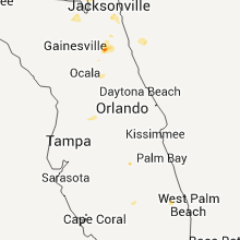


Connect with Interactive Hail Maps