

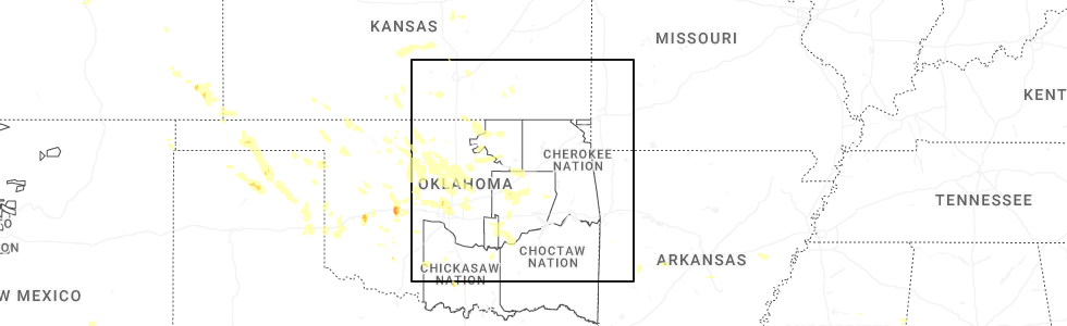
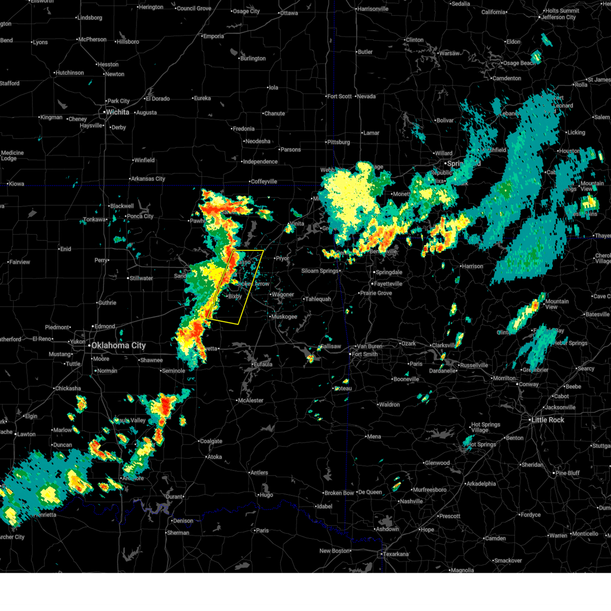
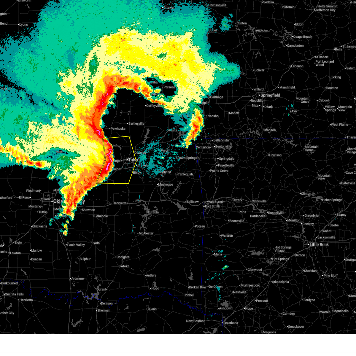
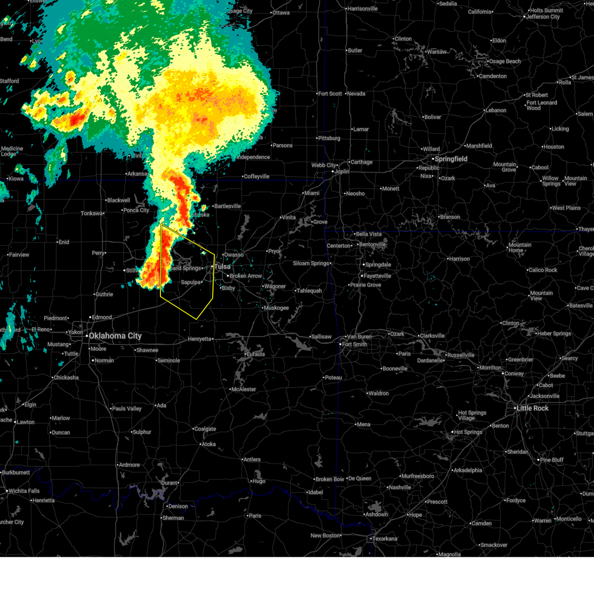
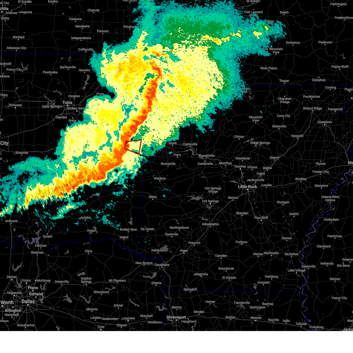
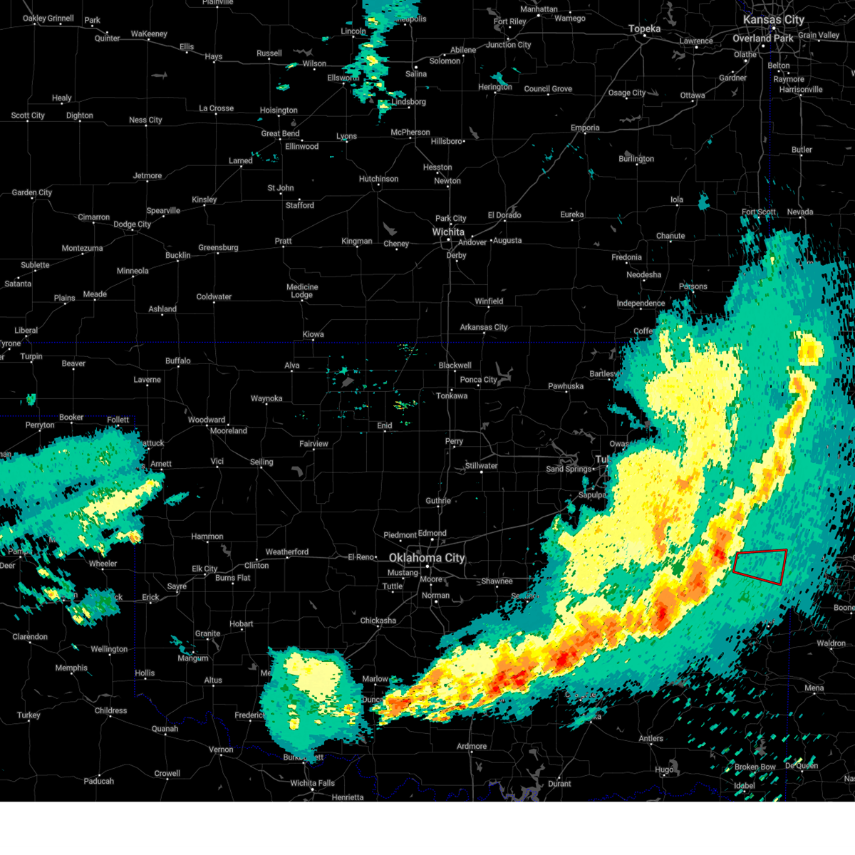
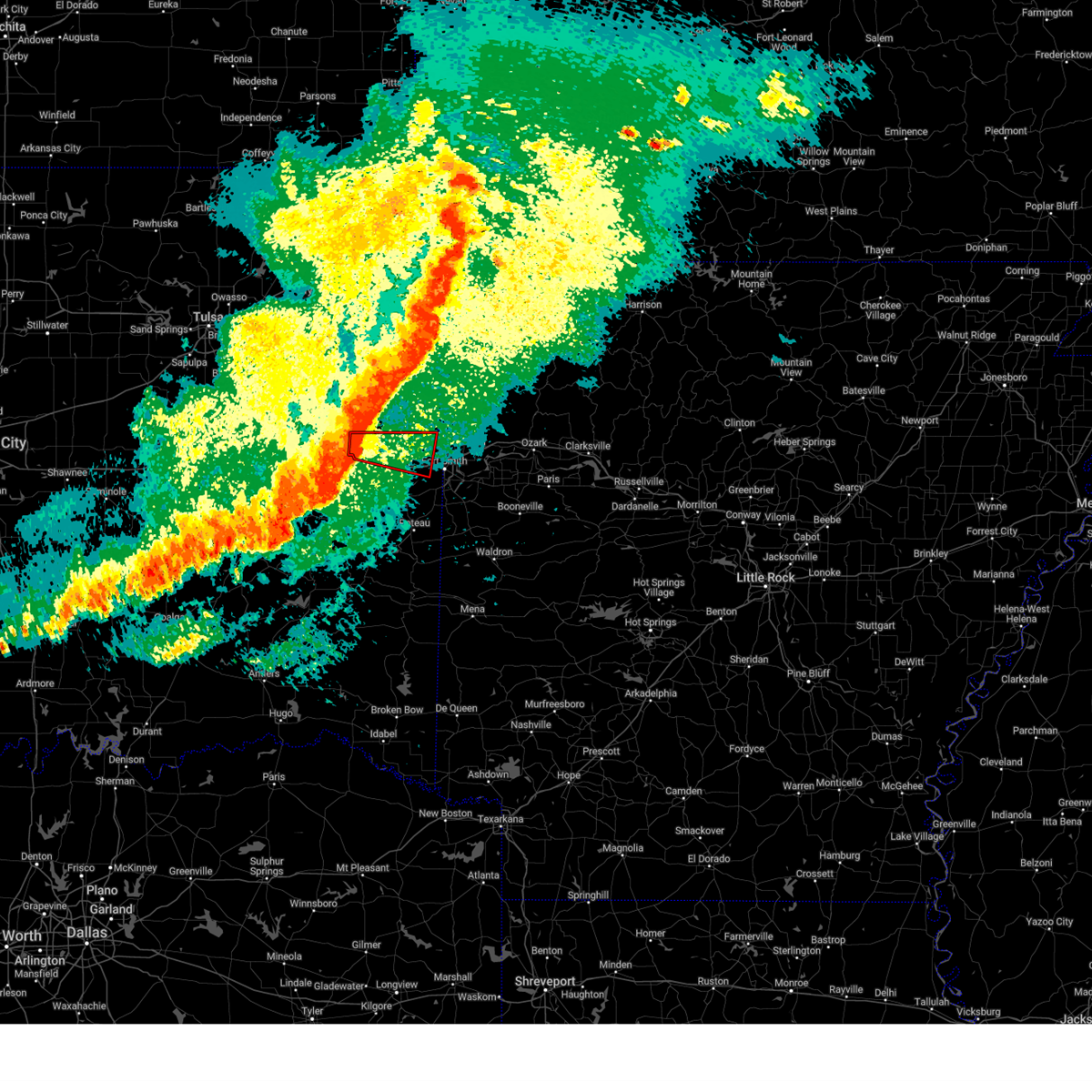
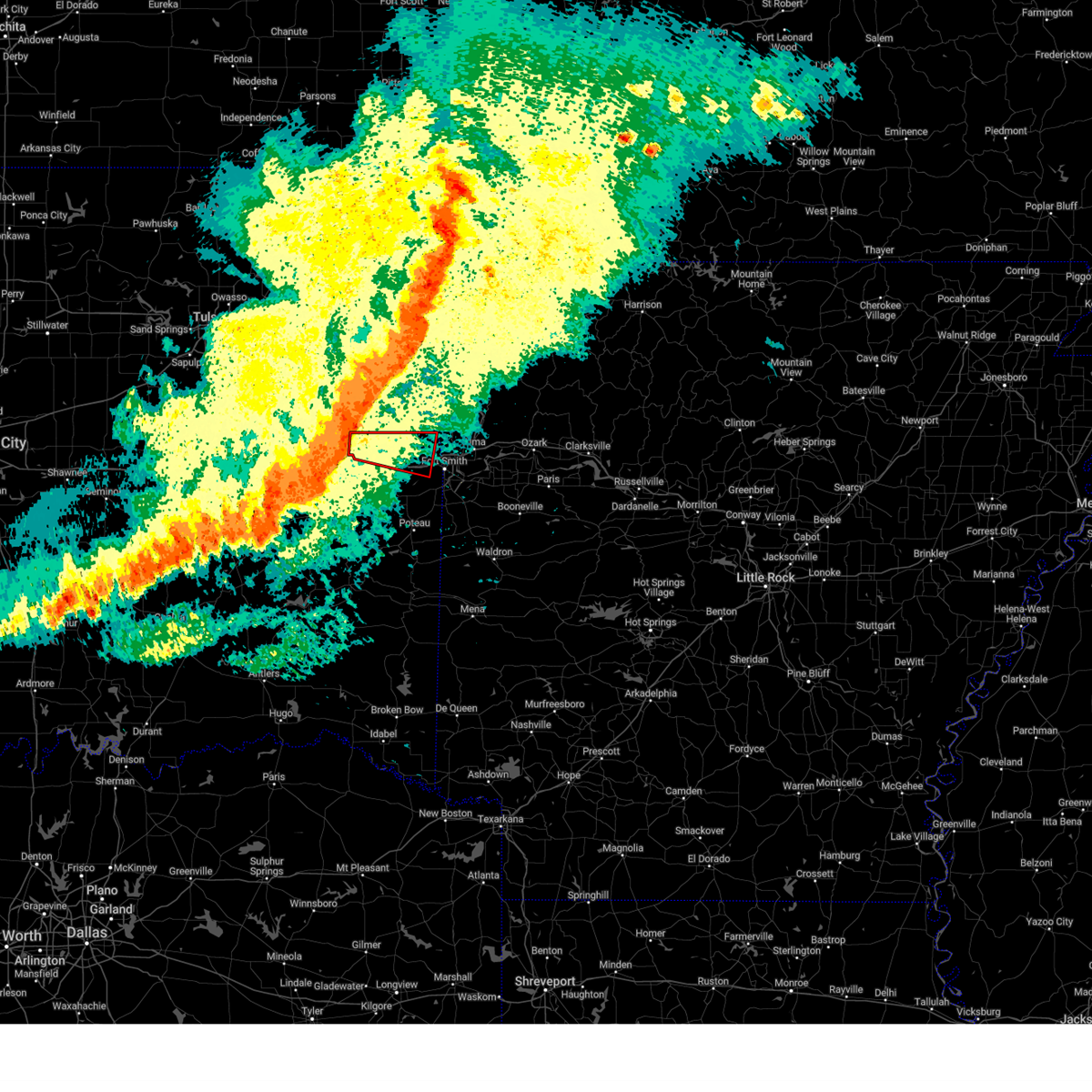
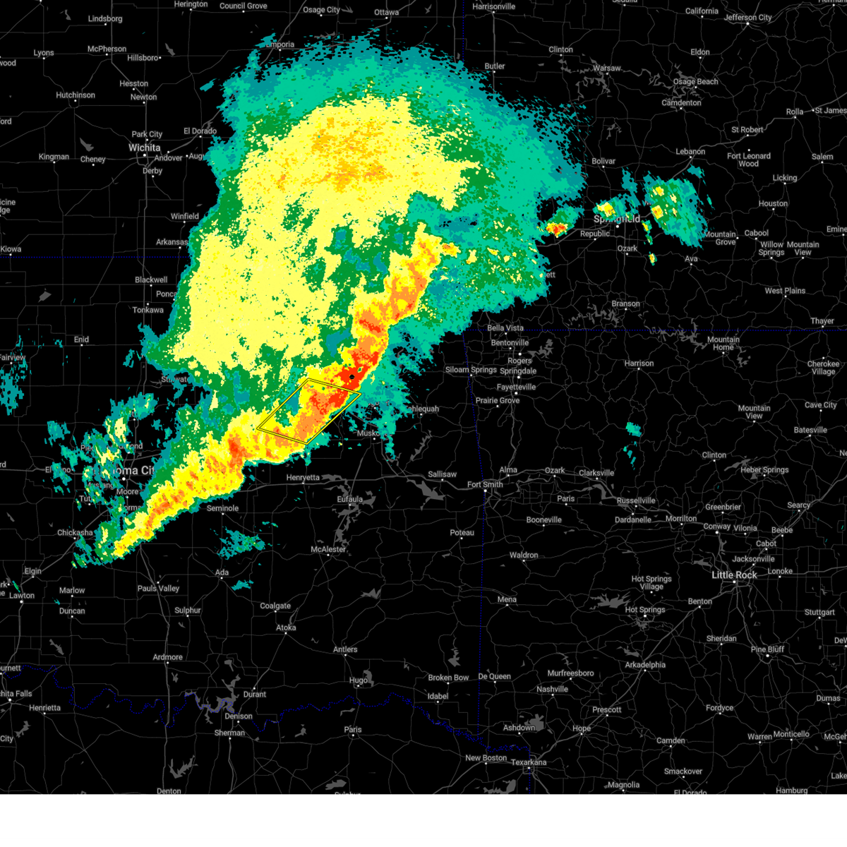
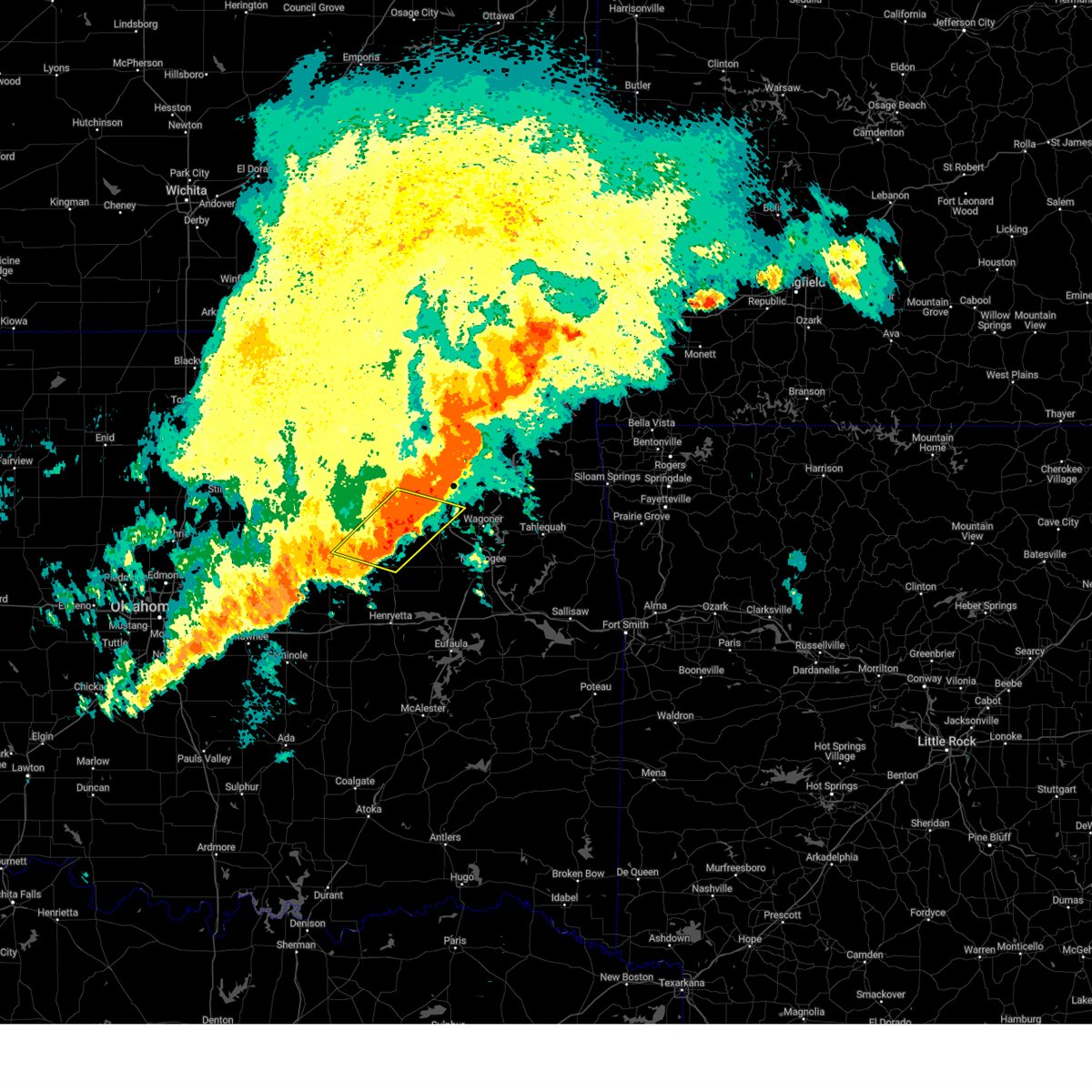
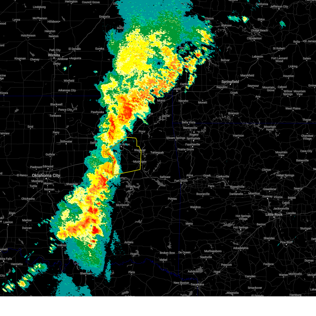
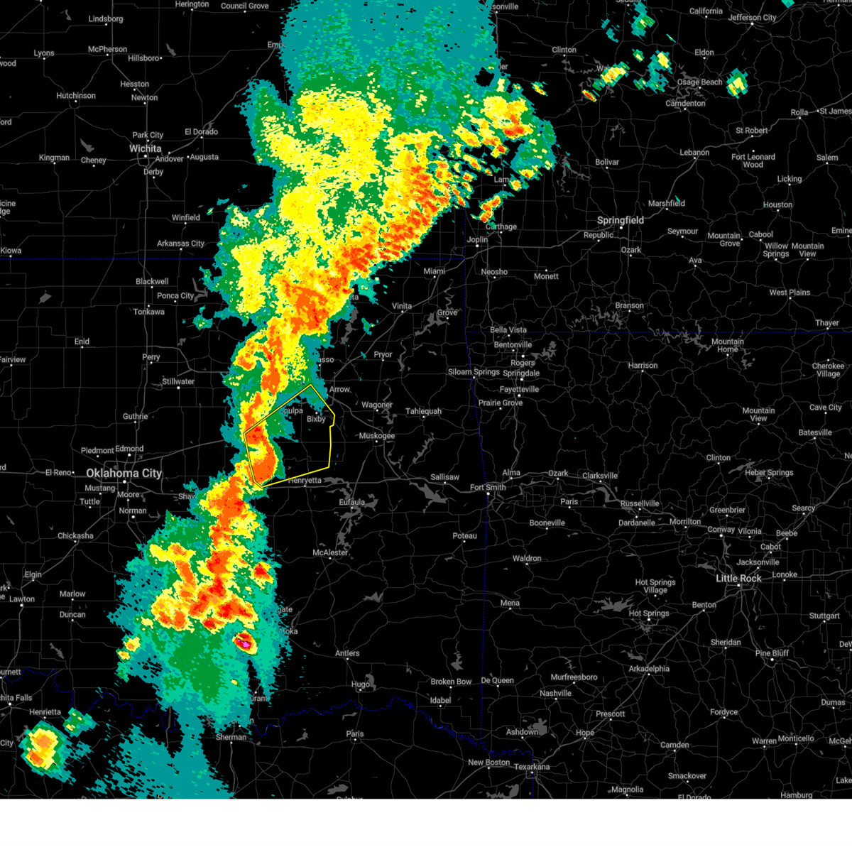
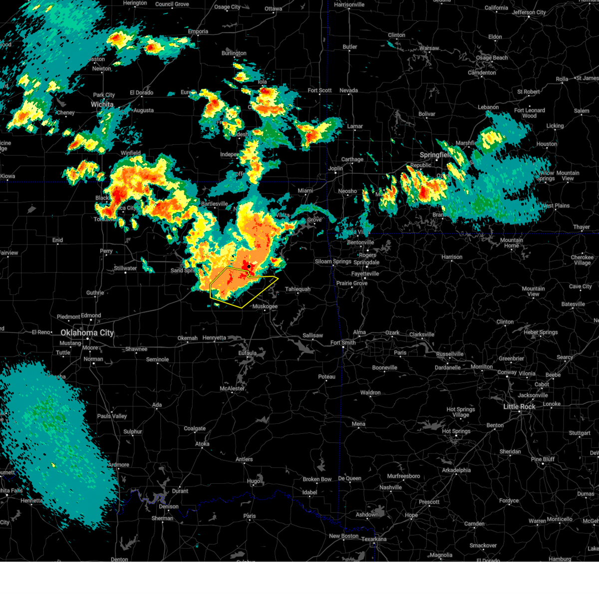
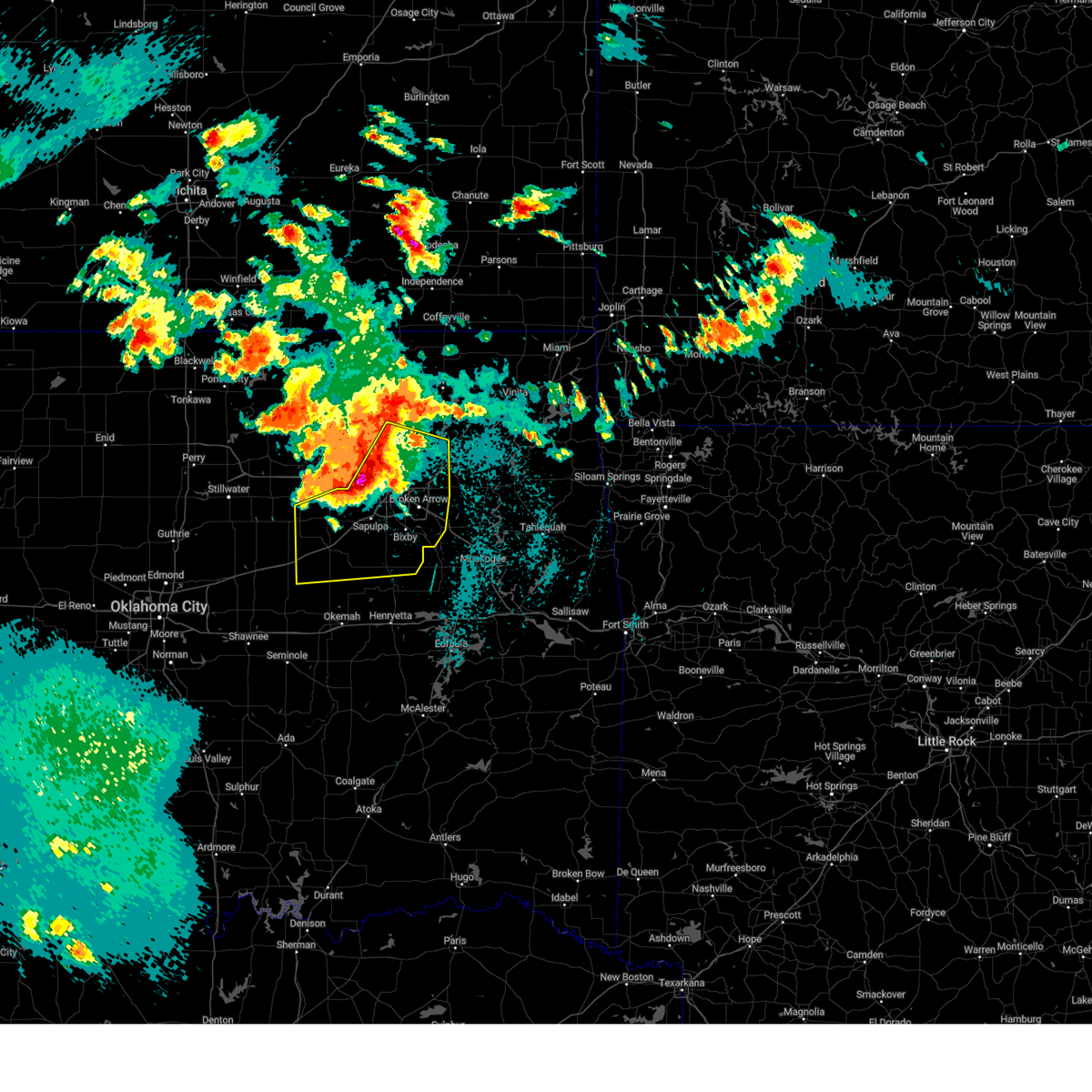
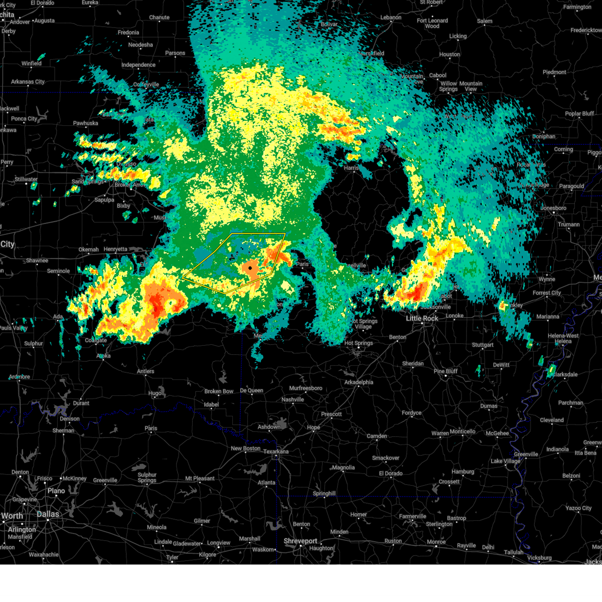
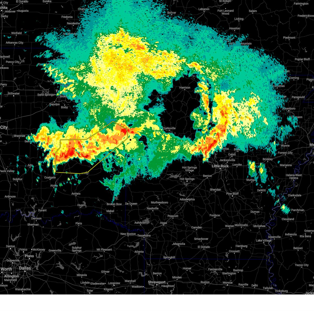
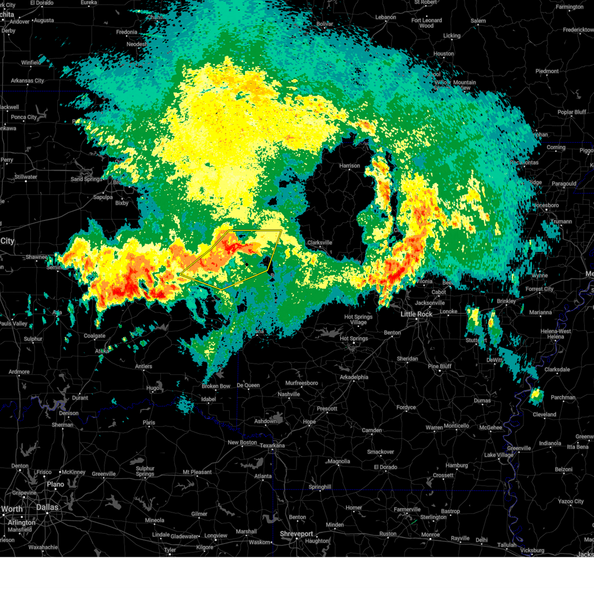
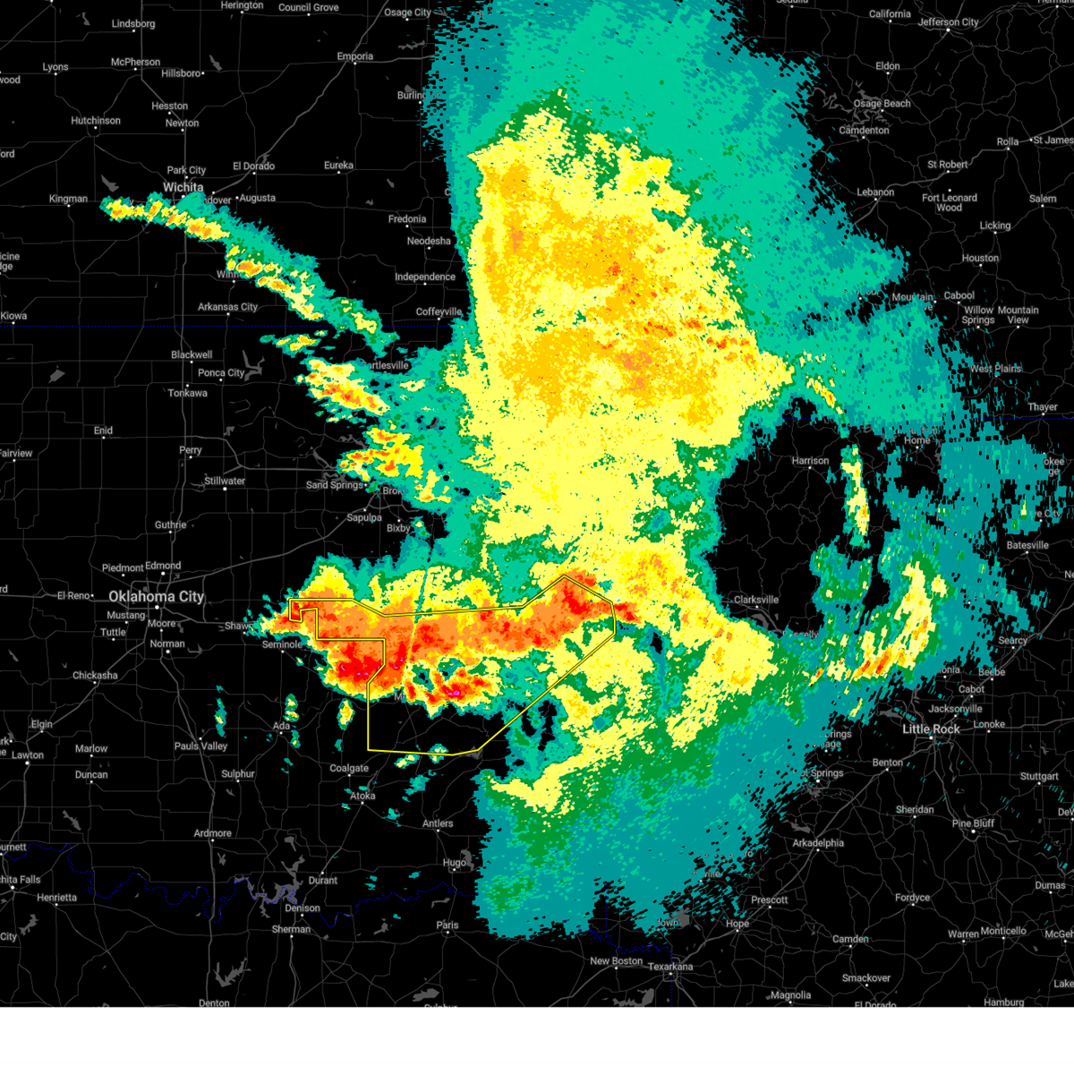
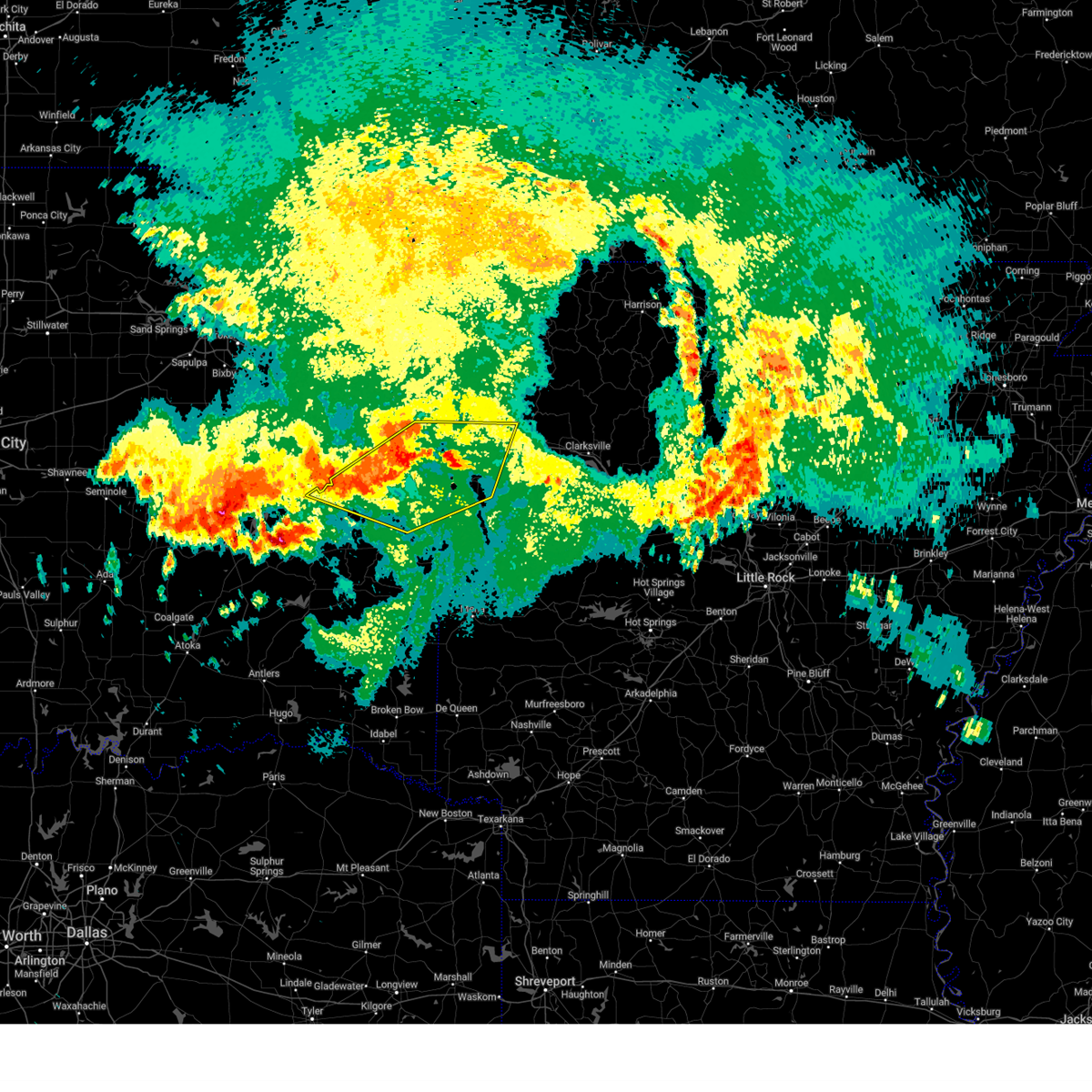
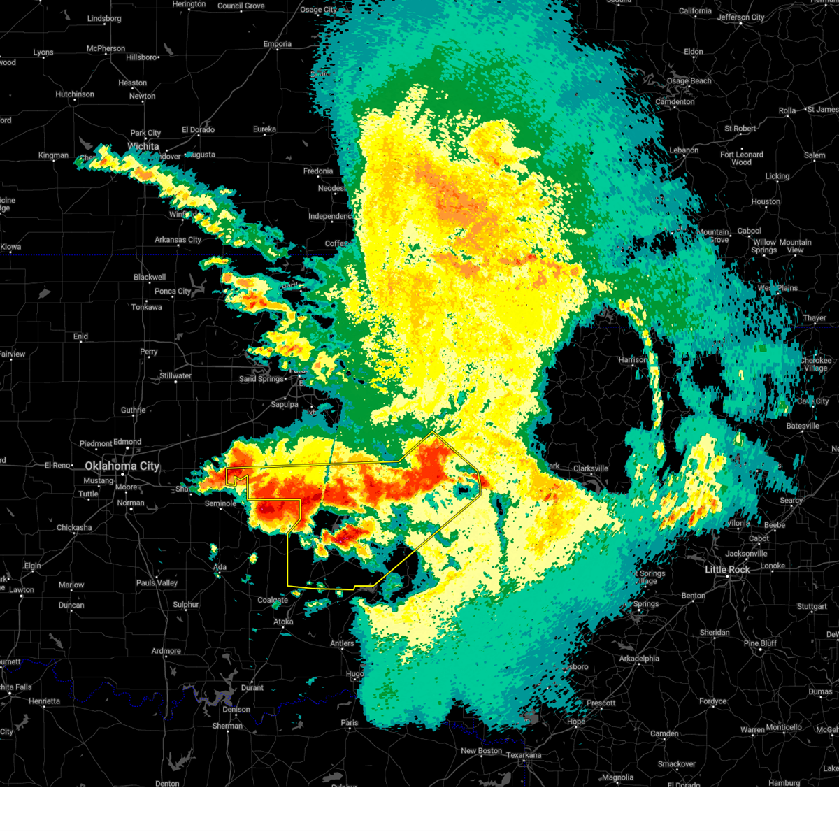
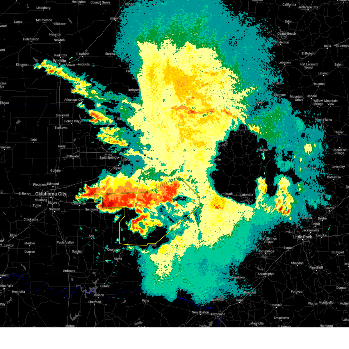
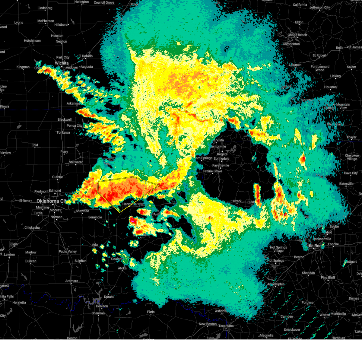
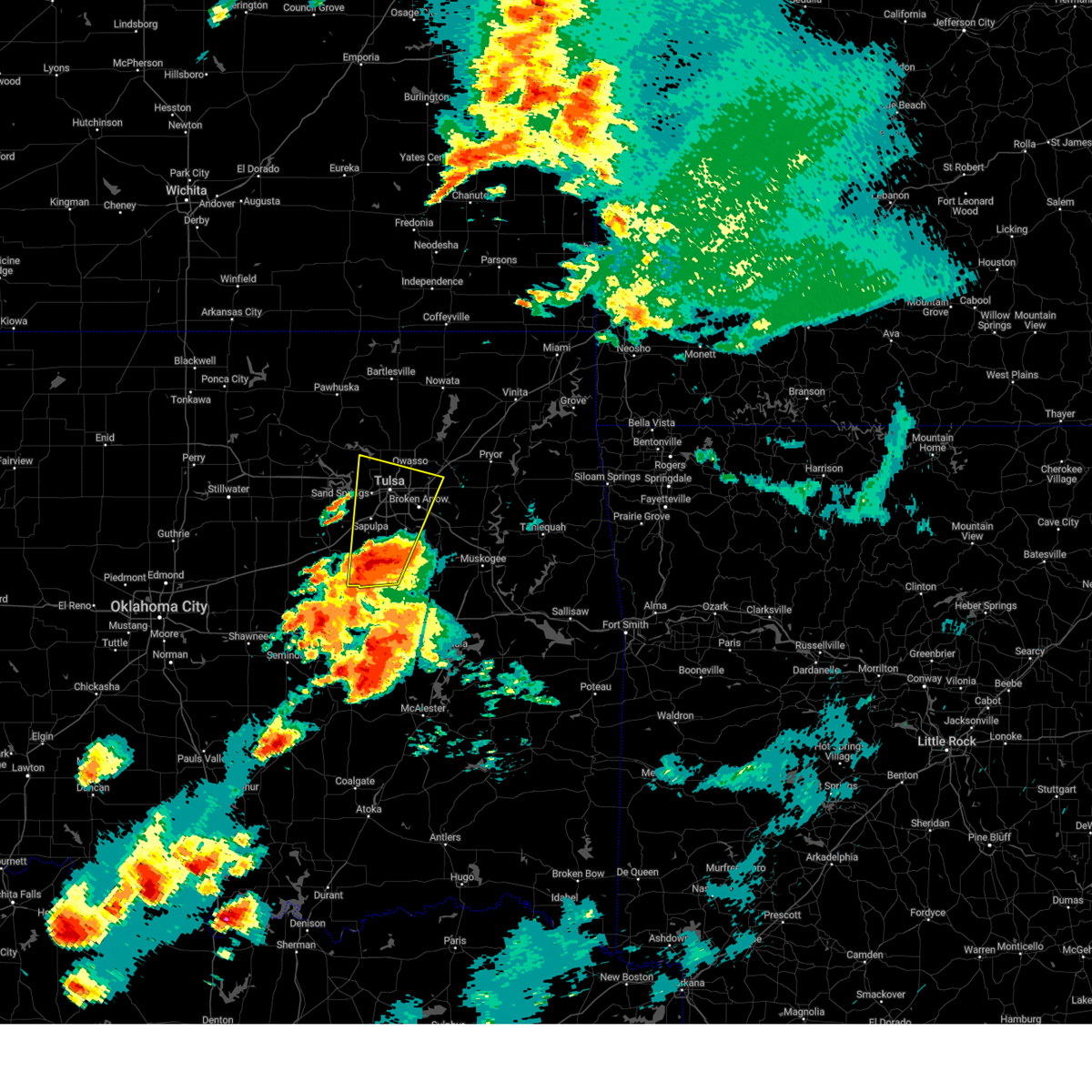
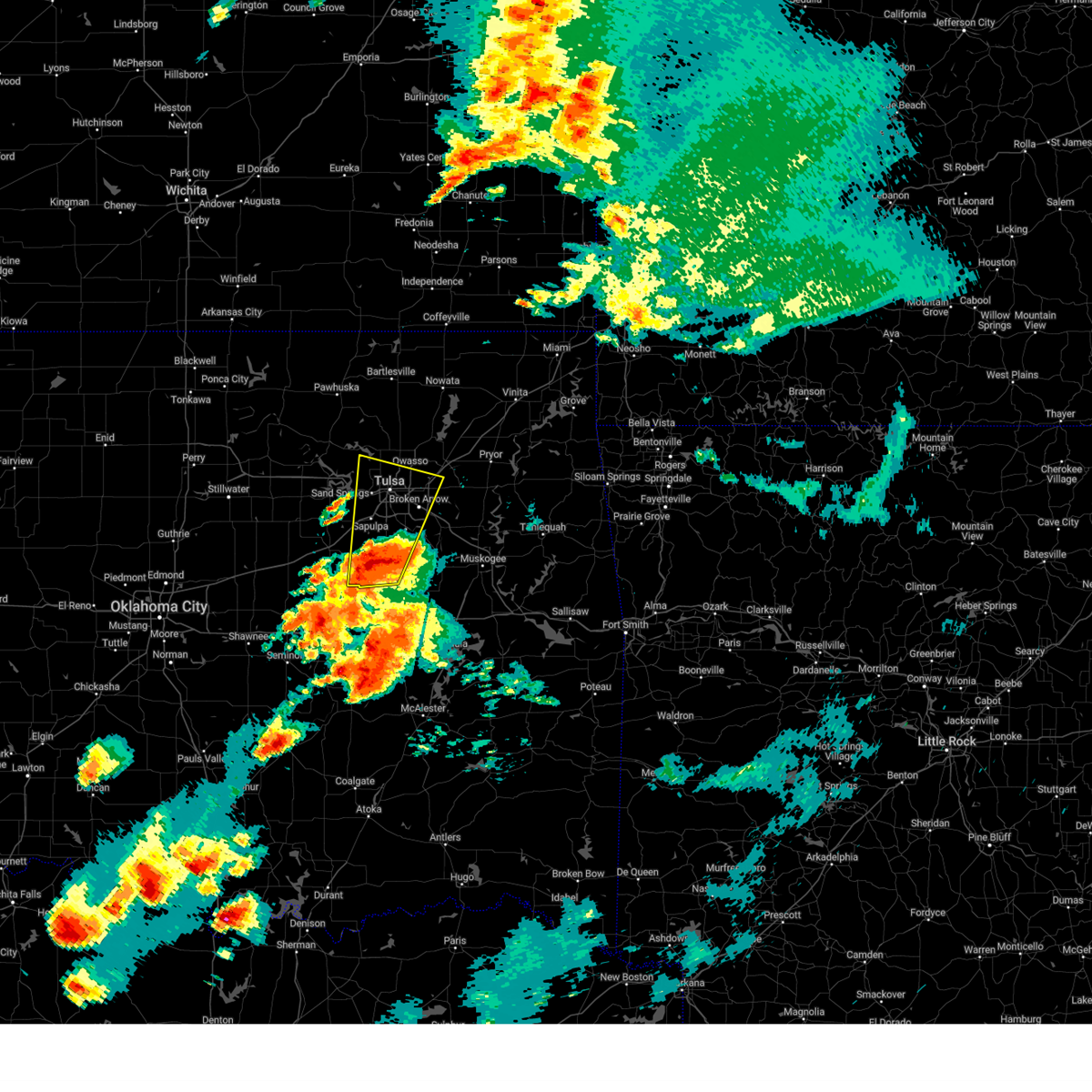
Hail Map for Liberty, OK
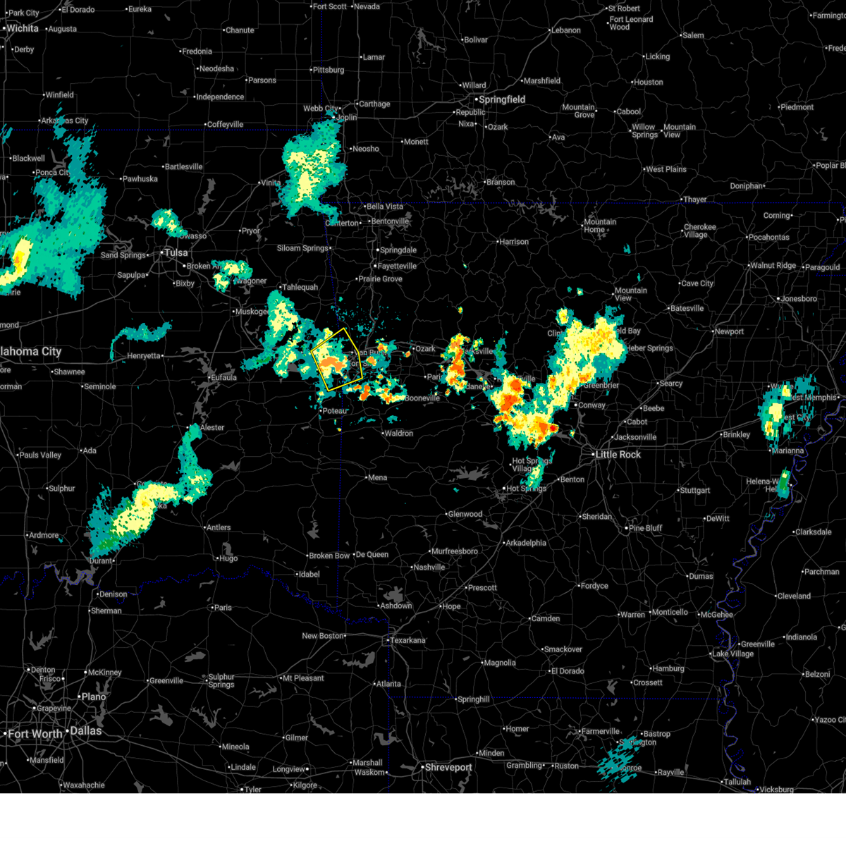
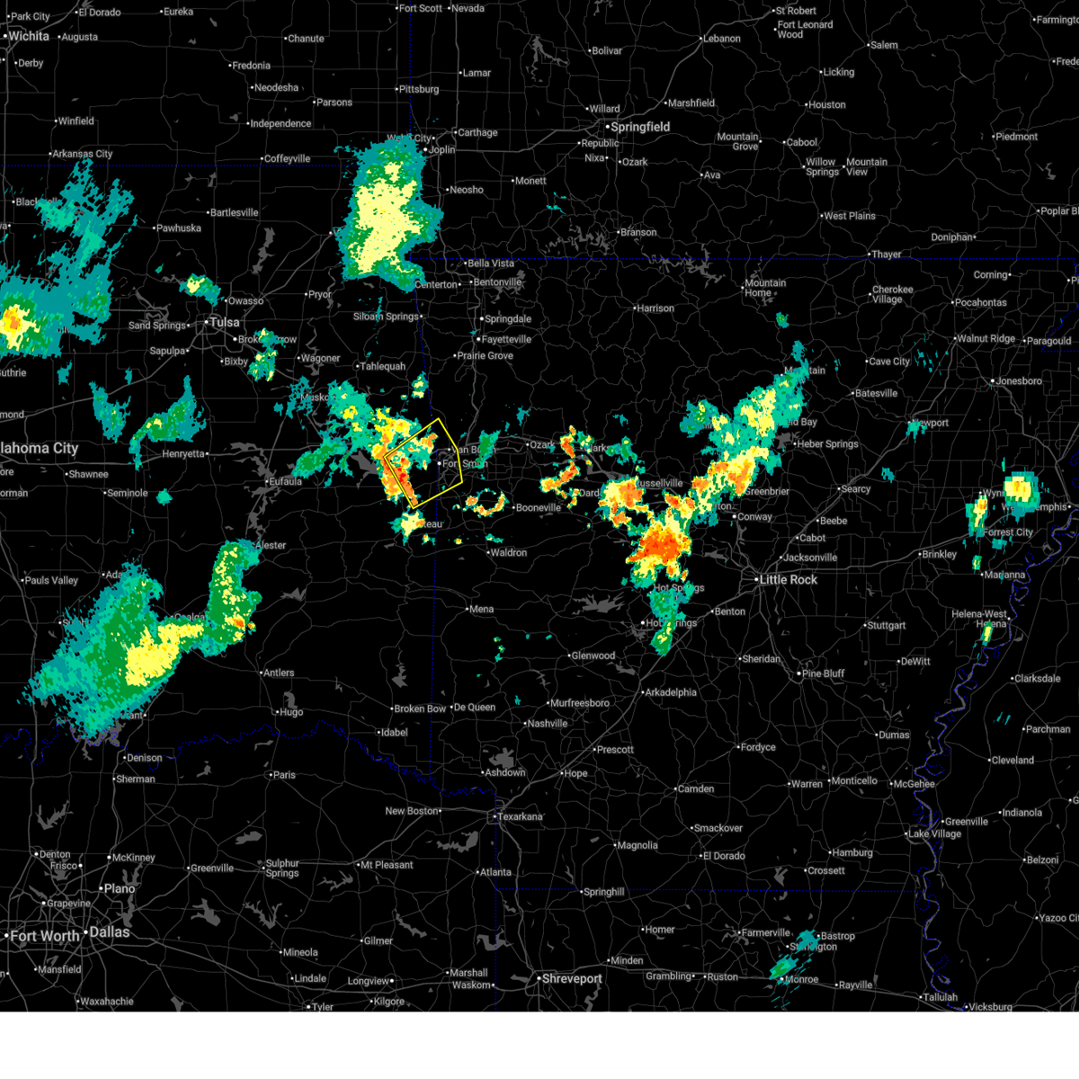
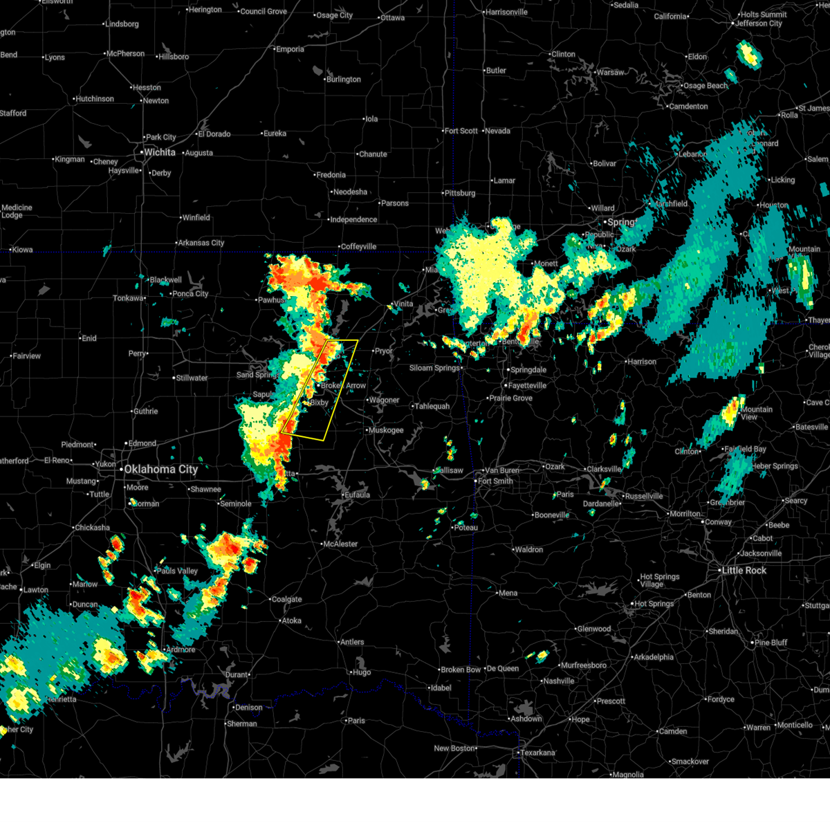
The Liberty, OK area has had 0 reports of on-the-ground hail by trained spotters, and has been under severe weather warnings 144 times during the past 12 months. Doppler radar has detected hail at or near Liberty, OK on 154 occasions, including 8 occasions during the past year.
| Name: | Liberty, OK |
| Where Located: | 8.9 miles NW of Fort Smith, AR |
| Map: | Google Map for Liberty, OK |
| Population: | 220 |
| Housing Units: | 90 |
| More Info: | Search Google for Liberty, OK |
1
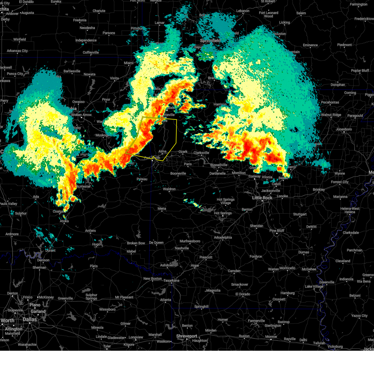
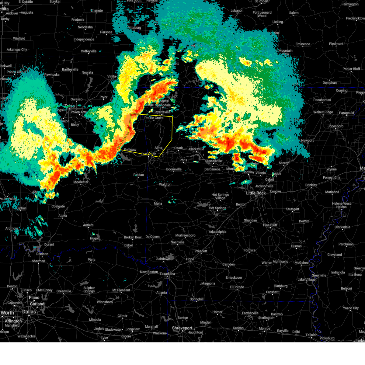
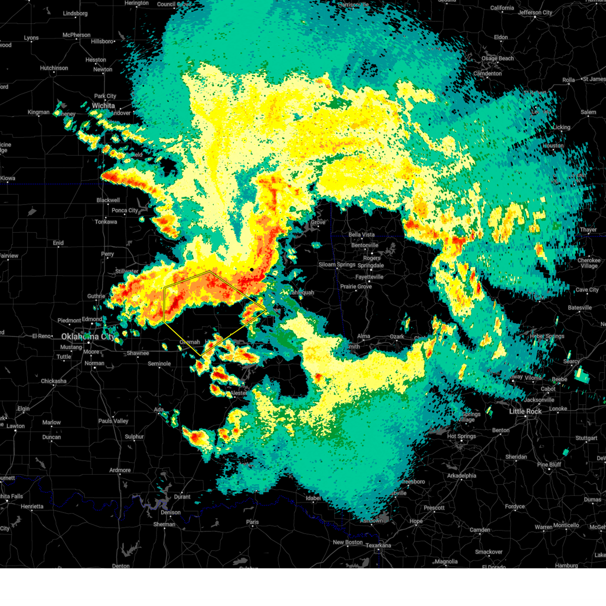
The Top Recent Hail Date for Liberty, OK is Saturday, June 14, 2025 (41st out of 154)
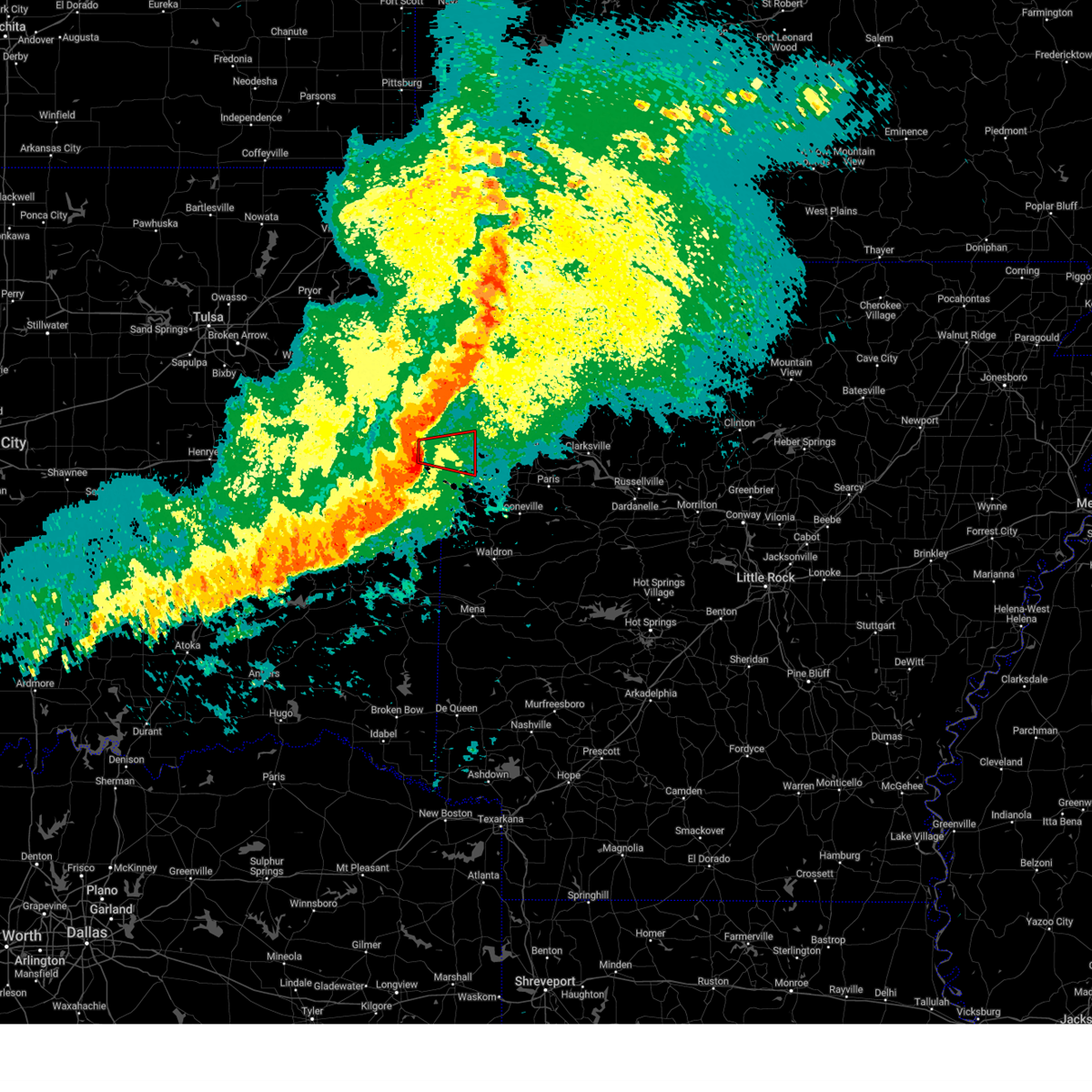
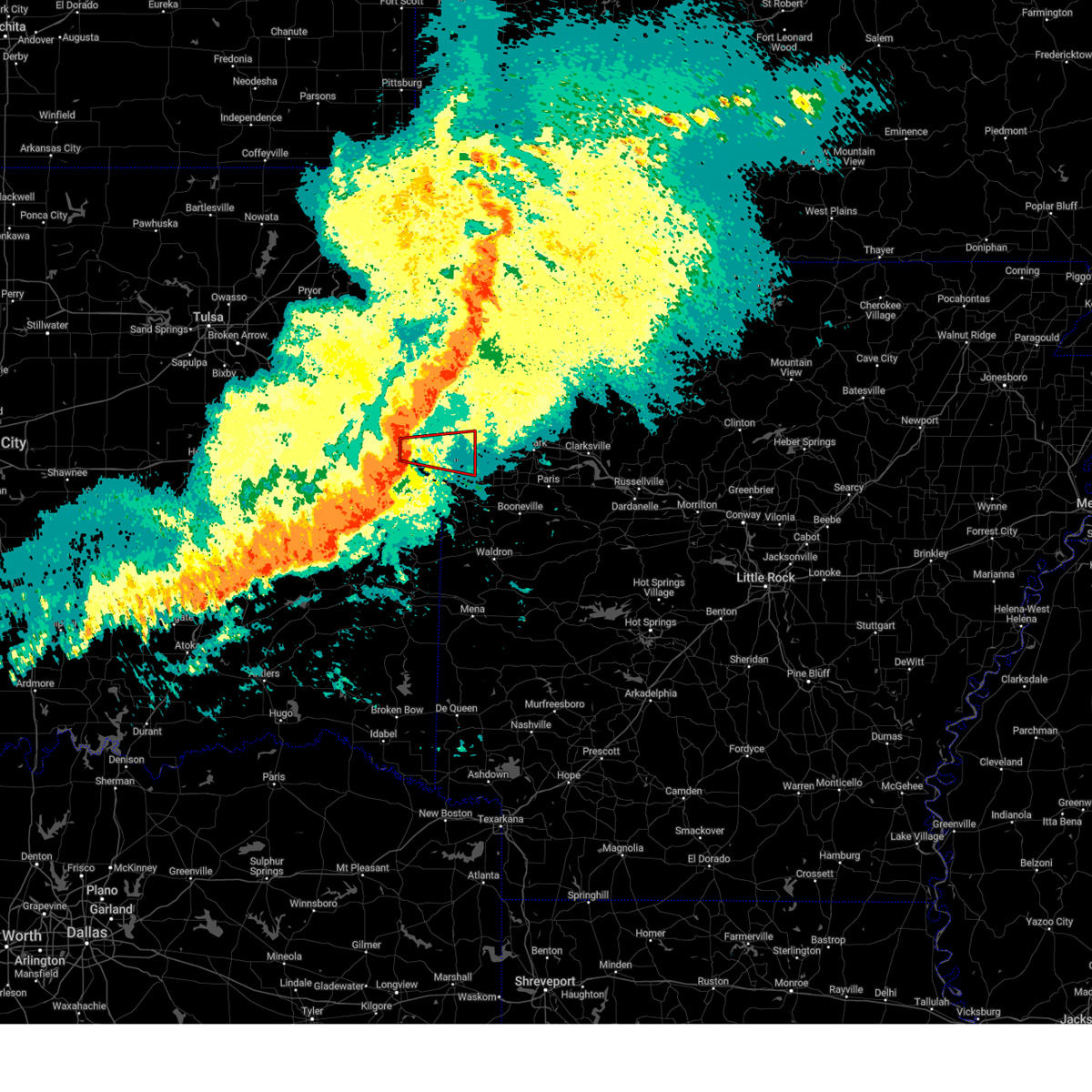
Hail and Wind Damage Spotted near Liberty, OK
| Date / Time | Report Details |
|---|---|
| 6/27/2025 8:59 PM CDT |
 the severe thunderstorm warning has been cancelled and is no longer in effect the severe thunderstorm warning has been cancelled and is no longer in effect
|
| 6/27/2025 8:44 PM CDT | At 844 pm cdt, severe thunderstorms were located along a line extending from 6 miles southeast of brushy to near pocola, moving east at 25 mph (radar indicated). Hazards include 60 mph wind gusts. Expect damage to roofs, siding, and trees. Locations impacted include, fort smith, van buren, cedarville, barling, pocola, muldrow, roland, arkoma, bonanza, moffett, figure five, fort smith regional airport, short, scullyville, braden, mill creek, rye hill, cottonwood, uniontown, and dora. |
| 6/27/2025 8:27 PM CDT |
 Svrtsa the national weather service in tulsa has issued a * severe thunderstorm warning for, southwestern crawford county in northwestern arkansas, northwestern sebastian county in west central arkansas, southeastern sequoyah county in east central oklahoma, northeastern le flore county in southeastern oklahoma, * until 915 pm cdt. * at 827 pm cdt, severe thunderstorms were located along a line extending from 3 miles north of gans to near cameron, moving northeast at 25 mph (radar indicated). Hazards include 60 mph wind gusts. expect damage to roofs, siding, and trees Svrtsa the national weather service in tulsa has issued a * severe thunderstorm warning for, southwestern crawford county in northwestern arkansas, northwestern sebastian county in west central arkansas, southeastern sequoyah county in east central oklahoma, northeastern le flore county in southeastern oklahoma, * until 915 pm cdt. * at 827 pm cdt, severe thunderstorms were located along a line extending from 3 miles north of gans to near cameron, moving northeast at 25 mph (radar indicated). Hazards include 60 mph wind gusts. expect damage to roofs, siding, and trees
|
| 6/27/2025 4:23 PM CDT | The storms which prompted the warning have weakened below severe limits, therefore the warning will be allowed to expire. however, gusty winds are still possible with these thunderstorms, especially in the claremore, bald hill and preston areas. |
| 6/27/2025 4:01 PM CDT |
 At 400 pm cdt, severe thunderstorms were located along a line extending from near claremore to near preston, moving east at 20 mph. strong winds may also occur well ahead of the thunderstorms themselves (radar indicated). Hazards include 60 mph wind gusts and penny size hail. Expect damage to roofs, siding, and trees. Locations impacted include, tulsa, broken arrow, claremore, bixby, jenks, glenpool, coweta, catoosa, verdigris, haskell, inola, beggs, preston, bald hill, stonebluff, tiawah, oneta, liberty, hectorville, and leonard. At 400 pm cdt, severe thunderstorms were located along a line extending from near claremore to near preston, moving east at 20 mph. strong winds may also occur well ahead of the thunderstorms themselves (radar indicated). Hazards include 60 mph wind gusts and penny size hail. Expect damage to roofs, siding, and trees. Locations impacted include, tulsa, broken arrow, claremore, bixby, jenks, glenpool, coweta, catoosa, verdigris, haskell, inola, beggs, preston, bald hill, stonebluff, tiawah, oneta, liberty, hectorville, and leonard.
|
| 6/27/2025 3:41 PM CDT |
 Svrtsa the national weather service in tulsa has issued a * severe thunderstorm warning for, southwestern rogers county in northeastern oklahoma, western wagoner county in northeastern oklahoma, northwestern muskogee county in east central oklahoma, northern okmulgee county in northeastern oklahoma, southeastern tulsa county in northeastern oklahoma, * until 430 pm cdt. * at 339 pm cdt, severe thunderstorms were located along a line extending from near owasso to near beggs, moving east at 15 mph. winds of 72 mph were recorded at the tulsa airport (radar indicated). Hazards include 70 mph wind gusts and penny size hail. Expect considerable tree damage. Damage is likely to mobile homes, roofs, and outbuildings. Svrtsa the national weather service in tulsa has issued a * severe thunderstorm warning for, southwestern rogers county in northeastern oklahoma, western wagoner county in northeastern oklahoma, northwestern muskogee county in east central oklahoma, northern okmulgee county in northeastern oklahoma, southeastern tulsa county in northeastern oklahoma, * until 430 pm cdt. * at 339 pm cdt, severe thunderstorms were located along a line extending from near owasso to near beggs, moving east at 15 mph. winds of 72 mph were recorded at the tulsa airport (radar indicated). Hazards include 70 mph wind gusts and penny size hail. Expect considerable tree damage. Damage is likely to mobile homes, roofs, and outbuildings.
|
| 6/18/2025 12:18 AM CDT |
 the severe thunderstorm warning has been cancelled and is no longer in effect the severe thunderstorm warning has been cancelled and is no longer in effect
|
| 6/18/2025 12:18 AM CDT |
 At 1217 am cdt, severe thunderstorms were located along a line extending from near vera to 3 miles south of catoosa to 6 miles south of bixby, moving east at 65 mph (radar indicated). Hazards include 70 mph wind gusts and nickel size hail. Expect considerable tree damage. damage is likely to mobile homes, roofs, and outbuildings. Locations impacted include, tulsa, broken arrow, claremore, wagoner, pryor, owasso, bixby, jenks, glenpool, coweta, pryor creek, skiatook, catoosa, collinsville, verdigris, chouteau, haskell, chelsea, inola, and locust grove. At 1217 am cdt, severe thunderstorms were located along a line extending from near vera to 3 miles south of catoosa to 6 miles south of bixby, moving east at 65 mph (radar indicated). Hazards include 70 mph wind gusts and nickel size hail. Expect considerable tree damage. damage is likely to mobile homes, roofs, and outbuildings. Locations impacted include, tulsa, broken arrow, claremore, wagoner, pryor, owasso, bixby, jenks, glenpool, coweta, pryor creek, skiatook, catoosa, collinsville, verdigris, chouteau, haskell, chelsea, inola, and locust grove.
|
| 6/18/2025 12:00 AM CDT |
 Svrtsa the national weather service in tulsa has issued a * severe thunderstorm warning for, rogers county in northeastern oklahoma, southeastern osage county in northeastern oklahoma, northeastern creek county in northeastern oklahoma, western mayes county in northeastern oklahoma, southern washington county in northeastern oklahoma, wagoner county in northeastern oklahoma, northwestern muskogee county in east central oklahoma, northern okmulgee county in northeastern oklahoma, tulsa county in northeastern oklahoma, * until 1245 am cdt. * at 1200 am cdt, severe thunderstorms were located along a line extending from 4 miles southwest of avant to 4 miles east of sand springs to 6 miles west of mounds, moving east at 65 mph (radar indicated). Hazards include 70 mph wind gusts and penny size hail. Expect considerable tree damage. Damage is likely to mobile homes, roofs, and outbuildings. Svrtsa the national weather service in tulsa has issued a * severe thunderstorm warning for, rogers county in northeastern oklahoma, southeastern osage county in northeastern oklahoma, northeastern creek county in northeastern oklahoma, western mayes county in northeastern oklahoma, southern washington county in northeastern oklahoma, wagoner county in northeastern oklahoma, northwestern muskogee county in east central oklahoma, northern okmulgee county in northeastern oklahoma, tulsa county in northeastern oklahoma, * until 1245 am cdt. * at 1200 am cdt, severe thunderstorms were located along a line extending from 4 miles southwest of avant to 4 miles east of sand springs to 6 miles west of mounds, moving east at 65 mph (radar indicated). Hazards include 70 mph wind gusts and penny size hail. Expect considerable tree damage. Damage is likely to mobile homes, roofs, and outbuildings.
|
| 6/17/2025 11:48 PM CDT |
 At 1148 pm cdt, severe thunderstorms were located along a line extending from 3 miles west of wynona to near keystone state park to near bristow, moving east at 60 mph (radar indicated). Hazards include 70 mph wind gusts and nickel size hail. Expect considerable tree damage. damage is likely to mobile homes, roofs, and outbuildings. Locations impacted include, tulsa, broken arrow, sand springs, bristow, owasso, bixby, sapulpa, jenks, glenpool, skiatook, hominy, mannford, kiefer, sperry, mounds, kellyville, depew, avant, westport, and osage. At 1148 pm cdt, severe thunderstorms were located along a line extending from 3 miles west of wynona to near keystone state park to near bristow, moving east at 60 mph (radar indicated). Hazards include 70 mph wind gusts and nickel size hail. Expect considerable tree damage. damage is likely to mobile homes, roofs, and outbuildings. Locations impacted include, tulsa, broken arrow, sand springs, bristow, owasso, bixby, sapulpa, jenks, glenpool, skiatook, hominy, mannford, kiefer, sperry, mounds, kellyville, depew, avant, westport, and osage.
|
| 6/17/2025 11:31 PM CDT |
 Svrtsa the national weather service in tulsa has issued a * severe thunderstorm warning for, southeastern osage county in northeastern oklahoma, creek county in northeastern oklahoma, southwestern washington county in northeastern oklahoma, northwestern okmulgee county in northeastern oklahoma, eastern pawnee county in northeastern oklahoma, tulsa county in northeastern oklahoma, * until 1215 am cdt. * at 1130 pm cdt, severe thunderstorms were located along a line extending from near fairfax to near jennings to 3 miles southeast of avery, moving east at 45 mph (radar indicated). Hazards include 70 mph wind gusts and quarter size hail. Hail damage to vehicles is expected. expect considerable tree damage. Wind damage is also likely to mobile homes, roofs, and outbuildings. Svrtsa the national weather service in tulsa has issued a * severe thunderstorm warning for, southeastern osage county in northeastern oklahoma, creek county in northeastern oklahoma, southwestern washington county in northeastern oklahoma, northwestern okmulgee county in northeastern oklahoma, eastern pawnee county in northeastern oklahoma, tulsa county in northeastern oklahoma, * until 1215 am cdt. * at 1130 pm cdt, severe thunderstorms were located along a line extending from near fairfax to near jennings to 3 miles southeast of avery, moving east at 45 mph (radar indicated). Hazards include 70 mph wind gusts and quarter size hail. Hail damage to vehicles is expected. expect considerable tree damage. Wind damage is also likely to mobile homes, roofs, and outbuildings.
|
| 6/17/2025 8:23 AM CDT |
 At 823 am cdt, severe thunderstorms were located along a line extending from 7 miles west of sperry to near kellyville to near slick, moving southeast at 35 mph (radar indicated). Hazards include 60 mph wind gusts and penny size hail. Expect damage to roofs, siding, and trees. Locations impacted include, tulsa, sand springs, bristow, sapulpa, jenks, glenpool, mannford, kiefer, beggs, sperry, mounds, kellyville, depew, westport, slick, keystone state park, walnut creek state park, jenks riverside airport, turley, and liberty. At 823 am cdt, severe thunderstorms were located along a line extending from 7 miles west of sperry to near kellyville to near slick, moving southeast at 35 mph (radar indicated). Hazards include 60 mph wind gusts and penny size hail. Expect damage to roofs, siding, and trees. Locations impacted include, tulsa, sand springs, bristow, sapulpa, jenks, glenpool, mannford, kiefer, beggs, sperry, mounds, kellyville, depew, westport, slick, keystone state park, walnut creek state park, jenks riverside airport, turley, and liberty.
|
| 6/17/2025 8:12 AM CDT |
 At 811 am cdt, severe thunderstorms were located along a line extending from 6 miles northeast of walnut creek state park to 4 miles northwest of kellyville to 4 miles west of slick, moving southeast at 35 mph (radar indicated). Hazards include 60 mph wind gusts and penny size hail. Expect damage to roofs, siding, and trees. Locations impacted include, tulsa, sand springs, bristow, sapulpa, jenks, glenpool, hominy, cleveland, mannford, kiefer, beggs, sperry, mounds, kellyville, depew, westport, osage, slick, terlton, and shamrock. At 811 am cdt, severe thunderstorms were located along a line extending from 6 miles northeast of walnut creek state park to 4 miles northwest of kellyville to 4 miles west of slick, moving southeast at 35 mph (radar indicated). Hazards include 60 mph wind gusts and penny size hail. Expect damage to roofs, siding, and trees. Locations impacted include, tulsa, sand springs, bristow, sapulpa, jenks, glenpool, hominy, cleveland, mannford, kiefer, beggs, sperry, mounds, kellyville, depew, westport, osage, slick, terlton, and shamrock.
|
| 6/17/2025 7:38 AM CDT |
 Svrtsa the national weather service in tulsa has issued a * severe thunderstorm warning for, southeastern osage county in northeastern oklahoma, creek county in northeastern oklahoma, northwestern okmulgee county in northeastern oklahoma, southeastern pawnee county in northeastern oklahoma, central tulsa county in northeastern oklahoma, * until 830 am cdt. * at 738 am cdt, severe thunderstorms were located along a line extending from 3 miles southwest of hominy to 7 miles southeast of oilton to near shamrock, moving southeast at 35 mph (radar indicated). Hazards include 60 mph wind gusts and penny size hail. expect damage to roofs, siding, and trees Svrtsa the national weather service in tulsa has issued a * severe thunderstorm warning for, southeastern osage county in northeastern oklahoma, creek county in northeastern oklahoma, northwestern okmulgee county in northeastern oklahoma, southeastern pawnee county in northeastern oklahoma, central tulsa county in northeastern oklahoma, * until 830 am cdt. * at 738 am cdt, severe thunderstorms were located along a line extending from 3 miles southwest of hominy to 7 miles southeast of oilton to near shamrock, moving southeast at 35 mph (radar indicated). Hazards include 60 mph wind gusts and penny size hail. expect damage to roofs, siding, and trees
|
| 6/14/2025 11:47 PM CDT |
 Svrtsa the national weather service in tulsa has issued a * severe thunderstorm warning for, western rogers county in northeastern oklahoma, southeastern osage county in northeastern oklahoma, northeastern creek county in northeastern oklahoma, southern washington county in northeastern oklahoma, northwestern wagoner county in northeastern oklahoma, southeastern pawnee county in northeastern oklahoma, tulsa county in northeastern oklahoma, * until 1230 am cdt. * at 1146 pm cdt, severe thunderstorms were located along a line extending from 2 miles west of avant to 6 miles west of sperry to 5 miles northwest of kellyville, moving east at 35 mph (radar indicated). Hazards include 60 mph wind gusts and penny size hail. Expect damage to roofs, siding, and trees. Locations in or near the path include, barnsdall, sand springs, broken arrow, mannford, sapulpa, collinsville, jenks riverside airport, sperry, skiatook, ramona, vera, talala, leonard, jenks, bixby, wolco, owasso, westport, keystone state park, walnut creek state park, this includes interstate 44 between mile markers 205 and 250. Svrtsa the national weather service in tulsa has issued a * severe thunderstorm warning for, western rogers county in northeastern oklahoma, southeastern osage county in northeastern oklahoma, northeastern creek county in northeastern oklahoma, southern washington county in northeastern oklahoma, northwestern wagoner county in northeastern oklahoma, southeastern pawnee county in northeastern oklahoma, tulsa county in northeastern oklahoma, * until 1230 am cdt. * at 1146 pm cdt, severe thunderstorms were located along a line extending from 2 miles west of avant to 6 miles west of sperry to 5 miles northwest of kellyville, moving east at 35 mph (radar indicated). Hazards include 60 mph wind gusts and penny size hail. Expect damage to roofs, siding, and trees. Locations in or near the path include, barnsdall, sand springs, broken arrow, mannford, sapulpa, collinsville, jenks riverside airport, sperry, skiatook, ramona, vera, talala, leonard, jenks, bixby, wolco, owasso, westport, keystone state park, walnut creek state park, this includes interstate 44 between mile markers 205 and 250.
|
| 6/14/2025 10:42 AM CDT |
 Svrtsa the national weather service in tulsa has issued a * severe thunderstorm warning for, south central creek county in northeastern oklahoma, northwestern okmulgee county in northeastern oklahoma, * until 1115 am cdt. * at 1042 am cdt, a couple of severe thunderstorms were located near slick, moving east at 20 mph (radar indicated). Hazards include 60 mph wind gusts and quarter size hail. Hail damage to vehicles is expected. expect wind damage to roofs, siding, and trees. Locations in or near the path include, beggs, preston, slick, okmulgee state park, liberty, okmulgee,. Svrtsa the national weather service in tulsa has issued a * severe thunderstorm warning for, south central creek county in northeastern oklahoma, northwestern okmulgee county in northeastern oklahoma, * until 1115 am cdt. * at 1042 am cdt, a couple of severe thunderstorms were located near slick, moving east at 20 mph (radar indicated). Hazards include 60 mph wind gusts and quarter size hail. Hail damage to vehicles is expected. expect wind damage to roofs, siding, and trees. Locations in or near the path include, beggs, preston, slick, okmulgee state park, liberty, okmulgee,.
|
| 6/7/2025 6:10 AM CDT |
 the severe thunderstorm warning has been cancelled and is no longer in effect the severe thunderstorm warning has been cancelled and is no longer in effect
|
| 6/7/2025 6:10 AM CDT |
 At 610 am cdt, severe thunderstorms were located along a line extending from near west fork to 2 miles northeast of chester to 3 miles southwest of figure five, moving east at 55 mph (radar indicated). Hazards include 70 mph wind gusts and quarter size hail. Hail damage to vehicles is expected. expect considerable tree damage. wind damage is also likely to mobile homes, roofs, and outbuildings. locations in or near the path include, alma, shibley, dyer, brushy, kibler, woolsey, elkins, cincinnati, winslow, locke, odell, mount gayler, lincoln, short, rudy, natural dam, devils den state park, brentwood, lake fort smith, strickler, this includes the following highways, interstate 40 in arkansas between mile markers 0 and 20. interstate 40 in oklahoma between mile markers 326 and 328. interstate 540 between mile markers 1 and 4. Interstate 49 between mile markers 22 and 60. At 610 am cdt, severe thunderstorms were located along a line extending from near west fork to 2 miles northeast of chester to 3 miles southwest of figure five, moving east at 55 mph (radar indicated). Hazards include 70 mph wind gusts and quarter size hail. Hail damage to vehicles is expected. expect considerable tree damage. wind damage is also likely to mobile homes, roofs, and outbuildings. locations in or near the path include, alma, shibley, dyer, brushy, kibler, woolsey, elkins, cincinnati, winslow, locke, odell, mount gayler, lincoln, short, rudy, natural dam, devils den state park, brentwood, lake fort smith, strickler, this includes the following highways, interstate 40 in arkansas between mile markers 0 and 20. interstate 40 in oklahoma between mile markers 326 and 328. interstate 540 between mile markers 1 and 4. Interstate 49 between mile markers 22 and 60.
|
| 6/7/2025 5:56 AM CDT |
 the severe thunderstorm warning has been cancelled and is no longer in effect the severe thunderstorm warning has been cancelled and is no longer in effect
|
| 6/7/2025 5:56 AM CDT |
 At 556 am cdt, severe thunderstorms were located along a line extending from 2 miles northeast of lincoln to 4 miles northwest of lee creek to 5 miles southeast of brushy, moving east at 55 mph (radar indicated). Hazards include 70 mph wind gusts and quarter size hail. Hail damage to vehicles is expected. expect considerable tree damage. wind damage is also likely to mobile homes, roofs, and outbuildings. locations in or near the path include, alma, shibley, adair state park, dyer, brushy, kibler, woolsey, elkins, cincinnati, maryetta, winslow, locke, odell, stilwell, mount gayler, lincoln, short, rudy, natural dam, devils den state park, this includes the following highways, interstate 40 in arkansas between mile markers 0 and 20. interstate 40 in oklahoma between mile markers 326 and 328. interstate 540 between mile markers 1 and 4. Interstate 49 between mile markers 22 and 60. At 556 am cdt, severe thunderstorms were located along a line extending from 2 miles northeast of lincoln to 4 miles northwest of lee creek to 5 miles southeast of brushy, moving east at 55 mph (radar indicated). Hazards include 70 mph wind gusts and quarter size hail. Hail damage to vehicles is expected. expect considerable tree damage. wind damage is also likely to mobile homes, roofs, and outbuildings. locations in or near the path include, alma, shibley, adair state park, dyer, brushy, kibler, woolsey, elkins, cincinnati, maryetta, winslow, locke, odell, stilwell, mount gayler, lincoln, short, rudy, natural dam, devils den state park, this includes the following highways, interstate 40 in arkansas between mile markers 0 and 20. interstate 40 in oklahoma between mile markers 326 and 328. interstate 540 between mile markers 1 and 4. Interstate 49 between mile markers 22 and 60.
|
| 6/7/2025 5:39 AM CDT |
 Svrtsa the national weather service in tulsa has issued a * severe thunderstorm warning for, northwestern franklin county in west central arkansas, crawford county in northwestern arkansas, washington county in northwestern arkansas, northern sequoyah county in east central oklahoma, adair county in northeastern oklahoma, southeastern cherokee county in east central oklahoma, * until 630 am cdt. * at 539 am cdt, severe thunderstorms were located along a line extending from 4 miles northwest of westville to 3 miles south of stilwell to 4 miles west of brushy lake state park, moving east at 55 mph (radar indicated). Hazards include 70 mph wind gusts and quarter size hail. Hail damage to vehicles is expected. expect considerable tree damage. wind damage is also likely to mobile homes, roofs, and outbuildings. locations in or near the path include, alma, shibley, adair state park, dyer, brushy, kibler, woolsey, elkins, cincinnati, maryetta, winslow, locke, odell, stilwell, mount gayler, lincoln, short, rudy, natural dam, devils den state park, this includes the following highways, interstate 40 in arkansas between mile markers 0 and 20. interstate 40 in oklahoma between mile markers 325 and 328. interstate 540 between mile markers 1 and 4. Interstate 49 between mile markers 22 and 60. Svrtsa the national weather service in tulsa has issued a * severe thunderstorm warning for, northwestern franklin county in west central arkansas, crawford county in northwestern arkansas, washington county in northwestern arkansas, northern sequoyah county in east central oklahoma, adair county in northeastern oklahoma, southeastern cherokee county in east central oklahoma, * until 630 am cdt. * at 539 am cdt, severe thunderstorms were located along a line extending from 4 miles northwest of westville to 3 miles south of stilwell to 4 miles west of brushy lake state park, moving east at 55 mph (radar indicated). Hazards include 70 mph wind gusts and quarter size hail. Hail damage to vehicles is expected. expect considerable tree damage. wind damage is also likely to mobile homes, roofs, and outbuildings. locations in or near the path include, alma, shibley, adair state park, dyer, brushy, kibler, woolsey, elkins, cincinnati, maryetta, winslow, locke, odell, stilwell, mount gayler, lincoln, short, rudy, natural dam, devils den state park, this includes the following highways, interstate 40 in arkansas between mile markers 0 and 20. interstate 40 in oklahoma between mile markers 325 and 328. interstate 540 between mile markers 1 and 4. Interstate 49 between mile markers 22 and 60.
|
| 6/6/2025 7:34 AM CDT |
 At 734 am cdt, a severe thunderstorm with strong low level rotation that could produce a tornado at any time was located 4 miles north of roland, moving east at 35 mph (radar indicated rotation). Hazards include tornado. Flying debris will be dangerous to those caught without shelter. mobile homes will be damaged or destroyed. damage to roofs, windows, and vehicles will occur. tree damage is likely. locations in or near the path include, shibley, kibler, concord, figure five, roland, dora, van buren, furry, rudy, alma, moffett, cedarville, muldrow, fort smith, this includes the following highways, interstate 40 in arkansas between mile markers 0 and 12. interstate 40 in oklahoma between mile markers 324 and 328. interstate 540 between mile markers 1 and 7. Interstate 49 between mile markers 22 and 26. At 734 am cdt, a severe thunderstorm with strong low level rotation that could produce a tornado at any time was located 4 miles north of roland, moving east at 35 mph (radar indicated rotation). Hazards include tornado. Flying debris will be dangerous to those caught without shelter. mobile homes will be damaged or destroyed. damage to roofs, windows, and vehicles will occur. tree damage is likely. locations in or near the path include, shibley, kibler, concord, figure five, roland, dora, van buren, furry, rudy, alma, moffett, cedarville, muldrow, fort smith, this includes the following highways, interstate 40 in arkansas between mile markers 0 and 12. interstate 40 in oklahoma between mile markers 324 and 328. interstate 540 between mile markers 1 and 7. Interstate 49 between mile markers 22 and 26.
|
| 6/6/2025 7:24 AM CDT |
 Tortsa the national weather service in tulsa has issued a * tornado warning for, southwestern crawford county in northwestern arkansas, northwestern sebastian county in west central arkansas, east central sequoyah county in east central oklahoma, * until 815 am cdt. * at 724 am cdt, a severe thunderstorm with strong low level rotation that could produce a tornado at any time was located 5 miles northwest of muldrow, moving east at 35 mph (radar indicated rotation). Hazards include tornado. Flying debris will be dangerous to those caught without shelter. mobile homes will be damaged or destroyed. damage to roofs, windows, and vehicles will occur. tree damage is likely. locations in or near the path include, shibley, kibler, concord, figure five, roland, moffett, dora, van buren, furry, rudy, alma, cedarville, muldrow, fort smith, this includes the following highways, interstate 40 in arkansas between mile markers 0 and 12. interstate 40 in oklahoma between mile markers 323 and 328. interstate 540 between mile markers 1 and 7. Interstate 49 between mile markers 22 and 26. Tortsa the national weather service in tulsa has issued a * tornado warning for, southwestern crawford county in northwestern arkansas, northwestern sebastian county in west central arkansas, east central sequoyah county in east central oklahoma, * until 815 am cdt. * at 724 am cdt, a severe thunderstorm with strong low level rotation that could produce a tornado at any time was located 5 miles northwest of muldrow, moving east at 35 mph (radar indicated rotation). Hazards include tornado. Flying debris will be dangerous to those caught without shelter. mobile homes will be damaged or destroyed. damage to roofs, windows, and vehicles will occur. tree damage is likely. locations in or near the path include, shibley, kibler, concord, figure five, roland, moffett, dora, van buren, furry, rudy, alma, cedarville, muldrow, fort smith, this includes the following highways, interstate 40 in arkansas between mile markers 0 and 12. interstate 40 in oklahoma between mile markers 323 and 328. interstate 540 between mile markers 1 and 7. Interstate 49 between mile markers 22 and 26.
|
| 6/6/2025 7:14 AM CDT |
 At 713 am cdt, a severe thunderstorm with strong low level rotation that could produce a tornado at any time was located 4 miles east of sallisaw, moving east at 45 mph (radar indicated rotation). Hazards include tornado. Flying debris will be dangerous to those caught without shelter. mobile homes will be damaged or destroyed. damage to roofs, windows, and vehicles will occur. tree damage is likely. Locations in or near the path include, sallisaw, roland, muldrow, short, cottonwood, brushy, this includes interstate 40 in oklahoma between mile markers 306 and 324. At 713 am cdt, a severe thunderstorm with strong low level rotation that could produce a tornado at any time was located 4 miles east of sallisaw, moving east at 45 mph (radar indicated rotation). Hazards include tornado. Flying debris will be dangerous to those caught without shelter. mobile homes will be damaged or destroyed. damage to roofs, windows, and vehicles will occur. tree damage is likely. Locations in or near the path include, sallisaw, roland, muldrow, short, cottonwood, brushy, this includes interstate 40 in oklahoma between mile markers 306 and 324.
|
| 6/6/2025 7:05 AM CDT |
 At 705 am cdt, a confirmed tornado was located near sallisaw, moving east at 50 mph (radar confirmed tornado). Hazards include damaging tornado. Flying debris will be dangerous to those caught without shelter. mobile homes will be damaged or destroyed. damage to roofs, windows, and vehicles will occur. tree damage is likely. Locations in or near the path include, brushy lake state park, sallisaw, brushy, mc key, roland, cottonwood, muldrow, short, gans, this includes interstate 40 in oklahoma between mile markers 300 and 324. At 705 am cdt, a confirmed tornado was located near sallisaw, moving east at 50 mph (radar confirmed tornado). Hazards include damaging tornado. Flying debris will be dangerous to those caught without shelter. mobile homes will be damaged or destroyed. damage to roofs, windows, and vehicles will occur. tree damage is likely. Locations in or near the path include, brushy lake state park, sallisaw, brushy, mc key, roland, cottonwood, muldrow, short, gans, this includes interstate 40 in oklahoma between mile markers 300 and 324.
|
| 6/6/2025 6:57 AM CDT |
 At 656 am cdt, a confirmed tornado was located over vian, moving east at 50 mph (radar confirmed tornado). Hazards include damaging tornado. Flying debris will be dangerous to those caught without shelter. mobile homes will be damaged or destroyed. damage to roofs, windows, and vehicles will occur. tree damage is likely. Locations in or near the path include, brushy lake state park, sallisaw, brushy, mc key, roland, cottonwood, vian, marble city, muldrow, short, gans, this includes interstate 40 in oklahoma between mile markers 291 and 324. At 656 am cdt, a confirmed tornado was located over vian, moving east at 50 mph (radar confirmed tornado). Hazards include damaging tornado. Flying debris will be dangerous to those caught without shelter. mobile homes will be damaged or destroyed. damage to roofs, windows, and vehicles will occur. tree damage is likely. Locations in or near the path include, brushy lake state park, sallisaw, brushy, mc key, roland, cottonwood, vian, marble city, muldrow, short, gans, this includes interstate 40 in oklahoma between mile markers 291 and 324.
|
| 6/6/2025 6:52 AM CDT |
 Tortsa the national weather service in tulsa has issued a * tornado warning for, central sequoyah county in east central oklahoma, * until 730 am cdt. * at 652 am cdt, a severe thunderstorm capable of producing a tornado was located near vian, moving east at 50 mph (radar indicated rotation). Hazards include tornado. Flying debris will be dangerous to those caught without shelter. mobile homes will be damaged or destroyed. damage to roofs, windows, and vehicles will occur. tree damage is likely. Locations in or near the path include, brushy lake state park, sallisaw, brushy, mc key, roland, cottonwood, vian, marble city, muldrow, short, gans, this includes interstate 40 in oklahoma between mile markers 291 and 324. Tortsa the national weather service in tulsa has issued a * tornado warning for, central sequoyah county in east central oklahoma, * until 730 am cdt. * at 652 am cdt, a severe thunderstorm capable of producing a tornado was located near vian, moving east at 50 mph (radar indicated rotation). Hazards include tornado. Flying debris will be dangerous to those caught without shelter. mobile homes will be damaged or destroyed. damage to roofs, windows, and vehicles will occur. tree damage is likely. Locations in or near the path include, brushy lake state park, sallisaw, brushy, mc key, roland, cottonwood, vian, marble city, muldrow, short, gans, this includes interstate 40 in oklahoma between mile markers 291 and 324.
|
| 6/6/2025 5:26 AM CDT |
 the severe thunderstorm warning has been cancelled and is no longer in effect the severe thunderstorm warning has been cancelled and is no longer in effect
|
| 6/6/2025 5:13 AM CDT |
 At 513 am cdt, severe thunderstorms were located along a line extending from 4 miles north of broken arrow to 4 miles northeast of slick, moving east at 30 mph (radar indicated). Hazards include 60 mph wind gusts and quarter size hail. Hail damage to vehicles is expected. expect wind damage to roofs, siding, and trees. Locations in or near the path include, beggs, broken arrow, sapulpa, jenks riverside airport, liberty, coweta, tulsa, mounds, stonebluff, hectorville, leonard, jenks, glenpool, bixby, kellyville, kiefer, oneta, this includes interstate 44 between mile markers 210 and 214, and between mile markers 219 and 229. At 513 am cdt, severe thunderstorms were located along a line extending from 4 miles north of broken arrow to 4 miles northeast of slick, moving east at 30 mph (radar indicated). Hazards include 60 mph wind gusts and quarter size hail. Hail damage to vehicles is expected. expect wind damage to roofs, siding, and trees. Locations in or near the path include, beggs, broken arrow, sapulpa, jenks riverside airport, liberty, coweta, tulsa, mounds, stonebluff, hectorville, leonard, jenks, glenpool, bixby, kellyville, kiefer, oneta, this includes interstate 44 between mile markers 210 and 214, and between mile markers 219 and 229.
|
| 6/6/2025 4:59 AM CDT |
 Svrtsa the national weather service in tulsa has issued a * severe thunderstorm warning for, east central creek county in northeastern oklahoma, northwestern wagoner county in northeastern oklahoma, northwestern okmulgee county in northeastern oklahoma, southeastern tulsa county in northeastern oklahoma, * until 545 am cdt. * at 459 am cdt, severe thunderstorms were located along a line extending from near tulsa to 5 miles north of slick, moving east at 30 mph (radar indicated). Hazards include 60 mph wind gusts and half dollar size hail. Hail damage to vehicles is expected. expect wind damage to roofs, siding, and trees. Locations in or near the path include, beggs, broken arrow, bristow, sapulpa, jenks riverside airport, liberty, coweta, tulsa, mounds, stonebluff, hectorville, leonard, jenks, glenpool, bixby, kellyville, kiefer, oneta, sand springs, this includes interstate 44 between mile markers 190 and 229. Svrtsa the national weather service in tulsa has issued a * severe thunderstorm warning for, east central creek county in northeastern oklahoma, northwestern wagoner county in northeastern oklahoma, northwestern okmulgee county in northeastern oklahoma, southeastern tulsa county in northeastern oklahoma, * until 545 am cdt. * at 459 am cdt, severe thunderstorms were located along a line extending from near tulsa to 5 miles north of slick, moving east at 30 mph (radar indicated). Hazards include 60 mph wind gusts and half dollar size hail. Hail damage to vehicles is expected. expect wind damage to roofs, siding, and trees. Locations in or near the path include, beggs, broken arrow, bristow, sapulpa, jenks riverside airport, liberty, coweta, tulsa, mounds, stonebluff, hectorville, leonard, jenks, glenpool, bixby, kellyville, kiefer, oneta, sand springs, this includes interstate 44 between mile markers 190 and 229.
|
| 6/3/2025 7:25 PM CDT |
 Svrtsa the national weather service in tulsa has issued a * severe thunderstorm warning for, southwestern rogers county in northeastern oklahoma, east central creek county in northeastern oklahoma, wagoner county in northeastern oklahoma, northeastern okmulgee county in northeastern oklahoma, northwestern muskogee county in east central oklahoma, southeastern tulsa county in northeastern oklahoma, * until 815 pm cdt. * at 725 pm cdt, severe thunderstorms were located along a line extending from near kiefer to 6 miles northwest of bald hill to 2 miles southeast of okmulgee, moving northeast at 45 mph (radar indicated). Hazards include 60 mph wind gusts. Expect damage to roofs, siding, and trees. Locations in or near the path include, broken arrow, inola, jenks riverside airport, summit, liberty, muskogee, mounds, stonebluff, hectorville, eram, haskell, leonard, jenks, morris, bixby, porter, wainwright, tullahassee, okmulgee, jamesville, this includes interstate 44 between mile markers 224 and 227, and between mile markers 233 and 243. Svrtsa the national weather service in tulsa has issued a * severe thunderstorm warning for, southwestern rogers county in northeastern oklahoma, east central creek county in northeastern oklahoma, wagoner county in northeastern oklahoma, northeastern okmulgee county in northeastern oklahoma, northwestern muskogee county in east central oklahoma, southeastern tulsa county in northeastern oklahoma, * until 815 pm cdt. * at 725 pm cdt, severe thunderstorms were located along a line extending from near kiefer to 6 miles northwest of bald hill to 2 miles southeast of okmulgee, moving northeast at 45 mph (radar indicated). Hazards include 60 mph wind gusts. Expect damage to roofs, siding, and trees. Locations in or near the path include, broken arrow, inola, jenks riverside airport, summit, liberty, muskogee, mounds, stonebluff, hectorville, eram, haskell, leonard, jenks, morris, bixby, porter, wainwright, tullahassee, okmulgee, jamesville, this includes interstate 44 between mile markers 224 and 227, and between mile markers 233 and 243.
|
| 6/3/2025 7:02 PM CDT |
 At 702 pm cdt, severe thunderstorms were located along a line extending from 5 miles northeast of bristow to 6 miles southeast of slick to 5 miles south of okfuskee, moving northeast at 45 mph (radar indicated). Hazards include 60 mph wind gusts. Expect damage to roofs, siding, and trees. Locations in or near the path include, beggs, preston, sapulpa, jenks riverside airport, liberty, mounds, stonebluff, hectorville, leonard, jenks, morris, bixby, bristow, okmulgee, bald hill, okfuskee, tulsa, mason, okmulgee state park, castle, this includes interstate 44 between mile markers 188 and 203, between mile markers 208 and 214, and between mile markers 220 and 226. At 702 pm cdt, severe thunderstorms were located along a line extending from 5 miles northeast of bristow to 6 miles southeast of slick to 5 miles south of okfuskee, moving northeast at 45 mph (radar indicated). Hazards include 60 mph wind gusts. Expect damage to roofs, siding, and trees. Locations in or near the path include, beggs, preston, sapulpa, jenks riverside airport, liberty, mounds, stonebluff, hectorville, leonard, jenks, morris, bixby, bristow, okmulgee, bald hill, okfuskee, tulsa, mason, okmulgee state park, castle, this includes interstate 44 between mile markers 188 and 203, between mile markers 208 and 214, and between mile markers 220 and 226.
|
| 6/3/2025 6:42 PM CDT | Svrtsa the national weather service in tulsa has issued a * severe thunderstorm warning for, southern creek county in northeastern oklahoma, west central wagoner county in northeastern oklahoma, okmulgee county in northeastern oklahoma, southeastern tulsa county in northeastern oklahoma, okfuskee county in east central oklahoma, * until 730 pm cdt. * at 642 pm cdt, severe thunderstorms were located along a line extending from 4 miles south of depew to welty to 2 miles southwest of castle, moving northeast at 50 mph (radar indicated). Hazards include 60 mph wind gusts. Expect damage to roofs, siding, and trees. locations in or near the path include, beggs, preston, boley, sapulpa, jenks riverside airport, liberty, mounds, schulter, stonebluff, hectorville, leonard, jenks, morris, bixby, bristow, okmulgee, okemah, bald hill, okfuskee, tulsa, this includes the following highways, interstate 40 in oklahoma between mile markers 212 and 225. Interstate 44 between mile markers 188 and 203, between mile markers 208 and 214, and between mile markers 220 and 226. |
| 5/25/2025 3:42 AM CDT |
 the severe thunderstorm warning has been cancelled and is no longer in effect the severe thunderstorm warning has been cancelled and is no longer in effect
|
| 5/25/2025 3:42 AM CDT |
 At 341 am cdt, a severe thunderstorm was located near oneta, moving east at 35 mph (radar indicated). Hazards include quarter size hail. Damage to vehicles is expected. Locations in or near the path include, broken arrow, wagoner, jenks riverside airport, liberty, redbird, coweta, stonebluff, haskell, leonard, jenks, glenpool, bixby, porter, choska, oneta, hectorville, catoosa, tulsa, this includes interstate 44 between mile markers 227 and 234. At 341 am cdt, a severe thunderstorm was located near oneta, moving east at 35 mph (radar indicated). Hazards include quarter size hail. Damage to vehicles is expected. Locations in or near the path include, broken arrow, wagoner, jenks riverside airport, liberty, redbird, coweta, stonebluff, haskell, leonard, jenks, glenpool, bixby, porter, choska, oneta, hectorville, catoosa, tulsa, this includes interstate 44 between mile markers 227 and 234.
|
| 5/25/2025 3:24 AM CDT |
 Svrtsa the national weather service in tulsa has issued a * severe thunderstorm warning for, northeastern creek county in northeastern oklahoma, wagoner county in northeastern oklahoma, northeastern okmulgee county in northeastern oklahoma, northwestern muskogee county in east central oklahoma, tulsa county in northeastern oklahoma, * until 415 am cdt. * at 323 am cdt, a severe thunderstorm was located 3 miles southeast of tulsa, moving east at 35 mph (radar indicated). Hazards include quarter size hail. Damage to vehicles is expected. Locations in or near the path include, sand springs, broken arrow, sapulpa, wagoner, jenks riverside airport, redbird, coweta, tulsa, stonebluff, haskell, leonard, jenks, glenpool, bixby, porter, choska, kellyville, kiefer, oneta, liberty, this includes interstate 44 between mile markers 201 and 234. Svrtsa the national weather service in tulsa has issued a * severe thunderstorm warning for, northeastern creek county in northeastern oklahoma, wagoner county in northeastern oklahoma, northeastern okmulgee county in northeastern oklahoma, northwestern muskogee county in east central oklahoma, tulsa county in northeastern oklahoma, * until 415 am cdt. * at 323 am cdt, a severe thunderstorm was located 3 miles southeast of tulsa, moving east at 35 mph (radar indicated). Hazards include quarter size hail. Damage to vehicles is expected. Locations in or near the path include, sand springs, broken arrow, sapulpa, wagoner, jenks riverside airport, redbird, coweta, tulsa, stonebluff, haskell, leonard, jenks, glenpool, bixby, porter, choska, kellyville, kiefer, oneta, liberty, this includes interstate 44 between mile markers 201 and 234.
|
| 5/25/2025 3:03 AM CDT |
 At 302 am cdt, severe thunderstorms were located along a line extending from 2 miles northwest of owasso to 2 miles northeast of kiefer to 6 miles north of bristow, moving southeast at 35 mph (radar indicated). Hazards include 60 mph wind gusts and quarter size hail. Hail damage to vehicles is expected. expect wind damage to roofs, siding, and trees. Locations in or near the path include, sand springs, broken arrow, mannford, sapulpa, collinsville, jenks riverside airport, liberty, sperry, skiatook, mounds, stonebluff, hectorville, vera, leonard, jenks, bixby, owasso, keystone state park, bristow, verdigris, this includes interstate 44 between mile markers 188 and 248. At 302 am cdt, severe thunderstorms were located along a line extending from 2 miles northwest of owasso to 2 miles northeast of kiefer to 6 miles north of bristow, moving southeast at 35 mph (radar indicated). Hazards include 60 mph wind gusts and quarter size hail. Hail damage to vehicles is expected. expect wind damage to roofs, siding, and trees. Locations in or near the path include, sand springs, broken arrow, mannford, sapulpa, collinsville, jenks riverside airport, liberty, sperry, skiatook, mounds, stonebluff, hectorville, vera, leonard, jenks, bixby, owasso, keystone state park, bristow, verdigris, this includes interstate 44 between mile markers 188 and 248.
|
| 5/25/2025 2:53 AM CDT |
 At 253 am cdt, severe thunderstorms were located along a line extending from 3 miles east of skiatook to 2 miles northeast of sapulpa to 6 miles east of drumright, moving southeast at 35 mph (radar indicated). Hazards include ping pong ball size hail and 60 mph wind gusts. People and animals outdoors will be injured. expect hail damage to roofs, siding, windows, and vehicles. expect wind damage to roofs, siding, and trees. Locations in or near the path include, beggs, sand springs, broken arrow, shamrock, preston, mannford, sapulpa, collinsville, jenks riverside airport, liberty, depew, sperry, skiatook, mounds, stonebluff, hectorville, vera, leonard, jenks, bixby, this includes interstate 44 between mile markers 178 and 248. At 253 am cdt, severe thunderstorms were located along a line extending from 3 miles east of skiatook to 2 miles northeast of sapulpa to 6 miles east of drumright, moving southeast at 35 mph (radar indicated). Hazards include ping pong ball size hail and 60 mph wind gusts. People and animals outdoors will be injured. expect hail damage to roofs, siding, windows, and vehicles. expect wind damage to roofs, siding, and trees. Locations in or near the path include, beggs, sand springs, broken arrow, shamrock, preston, mannford, sapulpa, collinsville, jenks riverside airport, liberty, depew, sperry, skiatook, mounds, stonebluff, hectorville, vera, leonard, jenks, bixby, this includes interstate 44 between mile markers 178 and 248.
|
| 5/25/2025 2:45 AM CDT |
 Svrtsa the national weather service in tulsa has issued a * severe thunderstorm warning for, southwestern rogers county in northeastern oklahoma, southeastern osage county in northeastern oklahoma, creek county in northeastern oklahoma, southern washington county in northeastern oklahoma, northwestern wagoner county in northeastern oklahoma, northern okmulgee county in northeastern oklahoma, tulsa county in northeastern oklahoma, * until 330 am cdt. * at 244 am cdt, severe thunderstorms were located along a line extending from near skiatook to 4 miles north of sapulpa to 4 miles east of drumright, moving southeast at 35 mph (radar indicated). Hazards include golf ball size hail and 60 mph wind gusts. People and animals outdoors will be injured. expect hail damage to roofs, siding, windows, and vehicles. expect wind damage to roofs, siding, and trees. Locations in or near the path include, beggs, sand springs, broken arrow, shamrock, preston, mannford, sapulpa, collinsville, jenks riverside airport, liberty, depew, sperry, skiatook, mounds, stonebluff, hectorville, vera, leonard, jenks, bixby, this includes interstate 44 between mile markers 178 and 248. Svrtsa the national weather service in tulsa has issued a * severe thunderstorm warning for, southwestern rogers county in northeastern oklahoma, southeastern osage county in northeastern oklahoma, creek county in northeastern oklahoma, southern washington county in northeastern oklahoma, northwestern wagoner county in northeastern oklahoma, northern okmulgee county in northeastern oklahoma, tulsa county in northeastern oklahoma, * until 330 am cdt. * at 244 am cdt, severe thunderstorms were located along a line extending from near skiatook to 4 miles north of sapulpa to 4 miles east of drumright, moving southeast at 35 mph (radar indicated). Hazards include golf ball size hail and 60 mph wind gusts. People and animals outdoors will be injured. expect hail damage to roofs, siding, windows, and vehicles. expect wind damage to roofs, siding, and trees. Locations in or near the path include, beggs, sand springs, broken arrow, shamrock, preston, mannford, sapulpa, collinsville, jenks riverside airport, liberty, depew, sperry, skiatook, mounds, stonebluff, hectorville, vera, leonard, jenks, bixby, this includes interstate 44 between mile markers 178 and 248.
|
| 5/24/2025 8:25 AM CDT |
 The storms which prompted the warning have weakened below severe limits, and no longer pose an immediate threat to life or property. therefore, the warning will be allowed to expire. however, gusty winds and heavy rain are still possible with these thunderstorms. a severe thunderstorm watch remains in effect until 1000 am cdt for northwestern and west central arkansas, and southeastern and east central oklahoma. to report severe weather, contact your nearest law enforcement agency. they will relay your report to the national weather service tulsa. The storms which prompted the warning have weakened below severe limits, and no longer pose an immediate threat to life or property. therefore, the warning will be allowed to expire. however, gusty winds and heavy rain are still possible with these thunderstorms. a severe thunderstorm watch remains in effect until 1000 am cdt for northwestern and west central arkansas, and southeastern and east central oklahoma. to report severe weather, contact your nearest law enforcement agency. they will relay your report to the national weather service tulsa.
|
| 5/24/2025 7:55 AM CDT |
 the severe thunderstorm warning has been cancelled and is no longer in effect the severe thunderstorm warning has been cancelled and is no longer in effect
|
| 5/24/2025 7:55 AM CDT |
 At 755 am cdt, severe thunderstorms were located along a line extending from near spiro to 2 miles west of hartshorne to 2 miles southeast of atwood, moving south at 40 mph (radar indicated). Hazards include 60 mph wind gusts and penny size hail. Expect damage to roofs, siding, and trees. Locations in or near the path include, kanima, arpelar, brushy, mcalester, pittsburg, raiford, whitefield, panola, haywood, spiro, mc curtain, porum, moffett, haileyville, panama, muldrow, lequire, gans, bokoshe, red oak, this includes interstate 40 in oklahoma between mile markers 294 and 328. At 755 am cdt, severe thunderstorms were located along a line extending from near spiro to 2 miles west of hartshorne to 2 miles southeast of atwood, moving south at 40 mph (radar indicated). Hazards include 60 mph wind gusts and penny size hail. Expect damage to roofs, siding, and trees. Locations in or near the path include, kanima, arpelar, brushy, mcalester, pittsburg, raiford, whitefield, panola, haywood, spiro, mc curtain, porum, moffett, haileyville, panama, muldrow, lequire, gans, bokoshe, red oak, this includes interstate 40 in oklahoma between mile markers 294 and 328.
|
| 5/24/2025 7:53 AM CDT |
 At 753 am cdt, severe thunderstorms were located along a line extending from 2 miles northwest of figure five to 4 miles southwest of arkoma to 3 miles northwest of mccurtain, moving east at 40 mph (radar indicated). Hazards include 60 mph wind gusts. Expect damage to roofs, siding, and trees. locations in or near the path include, kanima, alma, shibley, dyer, kibler, central city, cameron, spiro, mc curtain, moffett, panama, ursula, muldrow, short, gans, rudy, mulberry, bokoshe, greenwood, bloomer, this includes the following highways, interstate 40 in arkansas between mile markers 0 and 26. interstate 40 in oklahoma between mile markers 307 and 328. interstate 540 between mile markers 1 and 14. Interstate 49 between mile markers 22 and 30. At 753 am cdt, severe thunderstorms were located along a line extending from 2 miles northwest of figure five to 4 miles southwest of arkoma to 3 miles northwest of mccurtain, moving east at 40 mph (radar indicated). Hazards include 60 mph wind gusts. Expect damage to roofs, siding, and trees. locations in or near the path include, kanima, alma, shibley, dyer, kibler, central city, cameron, spiro, mc curtain, moffett, panama, ursula, muldrow, short, gans, rudy, mulberry, bokoshe, greenwood, bloomer, this includes the following highways, interstate 40 in arkansas between mile markers 0 and 26. interstate 40 in oklahoma between mile markers 307 and 328. interstate 540 between mile markers 1 and 14. Interstate 49 between mile markers 22 and 30.
|
| 5/24/2025 7:44 AM CDT |
 the severe thunderstorm warning has been cancelled and is no longer in effect the severe thunderstorm warning has been cancelled and is no longer in effect
|
| 5/24/2025 7:44 AM CDT |
 At 743 am cdt, severe thunderstorms were located along a line extending from near muldrow to 5 miles northeast of alderson to 4 miles north of atwood, moving south at 40 mph (radar indicated). Hazards include 70 mph wind gusts and penny size hail. Expect considerable tree damage. damage is likely to mobile homes, roofs, and outbuildings. Locations in or near the path include, kanima, arpelar, brushy, mcalester, pittsburg, raiford, whitefield, panola, haywood, spiro, mc curtain, porum, pierce, clearview, moffett, haileyville, panama, lake eufaula state park, pharoah, muldrow, this includes interstate 40 in oklahoma between mile markers 212 and 235, and between mile markers 294 and 328. At 743 am cdt, severe thunderstorms were located along a line extending from near muldrow to 5 miles northeast of alderson to 4 miles north of atwood, moving south at 40 mph (radar indicated). Hazards include 70 mph wind gusts and penny size hail. Expect considerable tree damage. damage is likely to mobile homes, roofs, and outbuildings. Locations in or near the path include, kanima, arpelar, brushy, mcalester, pittsburg, raiford, whitefield, panola, haywood, spiro, mc curtain, porum, pierce, clearview, moffett, haileyville, panama, lake eufaula state park, pharoah, muldrow, this includes interstate 40 in oklahoma between mile markers 212 and 235, and between mile markers 294 and 328.
|
| 5/24/2025 7:39 AM CDT |
 Svrtsa the national weather service in tulsa has issued a * severe thunderstorm warning for, west central franklin county in west central arkansas, crawford county in northwestern arkansas, northern sebastian county in west central arkansas, haskell county in southeastern oklahoma, sequoyah county in east central oklahoma, northern le flore county in southeastern oklahoma, * until 830 am cdt. * at 739 am cdt, severe thunderstorms were located along a line extending from 4 miles northwest of short to 2 miles southeast of gans to 2 miles west of stigler, moving east at 40 mph (radar indicated). Hazards include 60 mph wind gusts. Expect damage to roofs, siding, and trees. locations in or near the path include, kanima, alma, shibley, dyer, brushy, kibler, whitefield, central city, cameron, spiro, mc curtain, moffett, panama, ursula, muldrow, short, gans, rudy, mulberry, bokoshe, this includes the following highways, interstate 40 in arkansas between mile markers 0 and 26. interstate 40 in oklahoma between mile markers 299 and 328. interstate 540 between mile markers 1 and 14. Interstate 49 between mile markers 22 and 30. Svrtsa the national weather service in tulsa has issued a * severe thunderstorm warning for, west central franklin county in west central arkansas, crawford county in northwestern arkansas, northern sebastian county in west central arkansas, haskell county in southeastern oklahoma, sequoyah county in east central oklahoma, northern le flore county in southeastern oklahoma, * until 830 am cdt. * at 739 am cdt, severe thunderstorms were located along a line extending from 4 miles northwest of short to 2 miles southeast of gans to 2 miles west of stigler, moving east at 40 mph (radar indicated). Hazards include 60 mph wind gusts. Expect damage to roofs, siding, and trees. locations in or near the path include, kanima, alma, shibley, dyer, brushy, kibler, whitefield, central city, cameron, spiro, mc curtain, moffett, panama, ursula, muldrow, short, gans, rudy, mulberry, bokoshe, this includes the following highways, interstate 40 in arkansas between mile markers 0 and 26. interstate 40 in oklahoma between mile markers 299 and 328. interstate 540 between mile markers 1 and 14. Interstate 49 between mile markers 22 and 30.
|
| 5/24/2025 7:30 AM CDT |
 At 730 am cdt, severe thunderstorms were located along a line extending from 7 miles southeast of brushy to near quinton to yeager, moving southeast at 40 mph (radar indicated). Hazards include 70 mph wind gusts and penny size hail. Expect considerable tree damage. damage is likely to mobile homes, roofs, and outbuildings. Locations in or near the path include, mcalester, whitefield, haywood, spiro, mc curtain, pierce, moffett, schulter, panama, lake eufaula state park, gore, pharoah, lake tenkiller state park, gans, bryant, red oak, hoffman, hitchita, briartown, okemah, this includes interstate 40 in oklahoma between mile markers 212 and 328. At 730 am cdt, severe thunderstorms were located along a line extending from 7 miles southeast of brushy to near quinton to yeager, moving southeast at 40 mph (radar indicated). Hazards include 70 mph wind gusts and penny size hail. Expect considerable tree damage. damage is likely to mobile homes, roofs, and outbuildings. Locations in or near the path include, mcalester, whitefield, haywood, spiro, mc curtain, pierce, moffett, schulter, panama, lake eufaula state park, gore, pharoah, lake tenkiller state park, gans, bryant, red oak, hoffman, hitchita, briartown, okemah, this includes interstate 40 in oklahoma between mile markers 212 and 328.
|
| 5/24/2025 7:14 AM CDT |
 Svrtsa the national weather service in tulsa has issued a * severe thunderstorm warning for, haskell county in southeastern oklahoma, mcintosh county in southeastern oklahoma, sequoyah county in east central oklahoma, latimer county in southeastern oklahoma, southwestern adair county in northeastern oklahoma, northern le flore county in southeastern oklahoma, southeastern cherokee county in east central oklahoma, pittsburg county in southeastern oklahoma, southwestern okmulgee county in northeastern oklahoma, southern muskogee county in east central oklahoma, okfuskee county in east central oklahoma, * until 815 am cdt. * at 713 am cdt, severe thunderstorms were located along a line extending from cookson to 5 miles northwest of enterprise to 4 miles southeast of cromwell, moving south at 40 mph (trained spotter. a 69 mph gust was measured in muskogee and numerous reports of trees down and roof damage have been received). Hazards include 70 mph wind gusts and penny size hail. Expect considerable tree damage. damage is likely to mobile homes, roofs, and outbuildings. Locations in or near the path include, mcalester, whitefield, haywood, spiro, mc curtain, braggs, pierce, moffett, schulter, panama, lake eufaula state park, gore, pharoah, lake tenkiller state park, keefeton, gans, bryant, red oak, hoffman, hitchita, this includes interstate 40 in oklahoma between mile markers 212 and 328. Svrtsa the national weather service in tulsa has issued a * severe thunderstorm warning for, haskell county in southeastern oklahoma, mcintosh county in southeastern oklahoma, sequoyah county in east central oklahoma, latimer county in southeastern oklahoma, southwestern adair county in northeastern oklahoma, northern le flore county in southeastern oklahoma, southeastern cherokee county in east central oklahoma, pittsburg county in southeastern oklahoma, southwestern okmulgee county in northeastern oklahoma, southern muskogee county in east central oklahoma, okfuskee county in east central oklahoma, * until 815 am cdt. * at 713 am cdt, severe thunderstorms were located along a line extending from cookson to 5 miles northwest of enterprise to 4 miles southeast of cromwell, moving south at 40 mph (trained spotter. a 69 mph gust was measured in muskogee and numerous reports of trees down and roof damage have been received). Hazards include 70 mph wind gusts and penny size hail. Expect considerable tree damage. damage is likely to mobile homes, roofs, and outbuildings. Locations in or near the path include, mcalester, whitefield, haywood, spiro, mc curtain, braggs, pierce, moffett, schulter, panama, lake eufaula state park, gore, pharoah, lake tenkiller state park, keefeton, gans, bryant, red oak, hoffman, hitchita, this includes interstate 40 in oklahoma between mile markers 212 and 328.
|
| 5/24/2025 6:47 AM CDT |
 At 647 am cdt, severe thunderstorms were located along a line extending from 5 miles east of rentiesville to 3 miles south of hoffman to 2 miles southwest of okemah, moving southeast at 45 mph (trained weather spotters. multiple reports of trees down have been received from the tulsa metro area and into northern okmulgee county). Hazards include 60 mph wind gusts and penny size hail. Expect damage to roofs, siding, and trees. locations in or near the path include, beggs, preston, liberty, depew, mounds, clearview, schulter, hectorville, eram, haskell, morris, pharoah, bristow, okmulgee, jamesville, bald hill, okfuskee, milfay, boynton, mason, this includes the following highways, interstate 40 in oklahoma between mile markers 221 and 236. Interstate 44 between mile markers 178 and 194. At 647 am cdt, severe thunderstorms were located along a line extending from 5 miles east of rentiesville to 3 miles south of hoffman to 2 miles southwest of okemah, moving southeast at 45 mph (trained weather spotters. multiple reports of trees down have been received from the tulsa metro area and into northern okmulgee county). Hazards include 60 mph wind gusts and penny size hail. Expect damage to roofs, siding, and trees. locations in or near the path include, beggs, preston, liberty, depew, mounds, clearview, schulter, hectorville, eram, haskell, morris, pharoah, bristow, okmulgee, jamesville, bald hill, okfuskee, milfay, boynton, mason, this includes the following highways, interstate 40 in oklahoma between mile markers 221 and 236. Interstate 44 between mile markers 178 and 194.
|
| 5/24/2025 6:17 AM CDT |
 the severe thunderstorm warning has been cancelled and is no longer in effect the severe thunderstorm warning has been cancelled and is no longer in effect
|
| 5/24/2025 6:17 AM CDT |
 At 617 am cdt, severe thunderstorms were located along a line extending from 4 miles south of coweta to 3 miles west of preston to 7 miles west of welty, moving southeast at 50 mph (radar indicated). Hazards include 70 mph wind gusts and penny size hail. Expect considerable tree damage. damage is likely to mobile homes, roofs, and outbuildings. locations in or near the path include, beggs, sand springs, shamrock, preston, sapulpa, jenks riverside airport, liberty, depew, mounds, clearview, schulter, stonebluff, hectorville, eram, haskell, leonard, jenks, morris, pharoah, bixby, this includes the following highways, interstate 40 in oklahoma between mile markers 221 and 236. Interstate 44 between mile markers 178 and 223. At 617 am cdt, severe thunderstorms were located along a line extending from 4 miles south of coweta to 3 miles west of preston to 7 miles west of welty, moving southeast at 50 mph (radar indicated). Hazards include 70 mph wind gusts and penny size hail. Expect considerable tree damage. damage is likely to mobile homes, roofs, and outbuildings. locations in or near the path include, beggs, sand springs, shamrock, preston, sapulpa, jenks riverside airport, liberty, depew, mounds, clearview, schulter, stonebluff, hectorville, eram, haskell, leonard, jenks, morris, pharoah, bixby, this includes the following highways, interstate 40 in oklahoma between mile markers 221 and 236. Interstate 44 between mile markers 178 and 223.
|
| 5/24/2025 5:58 AM CDT |
 Svrtsa the national weather service in tulsa has issued a * severe thunderstorm warning for, south central osage county in northeastern oklahoma, creek county in northeastern oklahoma, southwestern wagoner county in northeastern oklahoma, okmulgee county in northeastern oklahoma, northwestern muskogee county in east central oklahoma, southeastern pawnee county in northeastern oklahoma, southern tulsa county in northeastern oklahoma, eastern okfuskee county in east central oklahoma, * until 700 am cdt. * at 558 am cdt, severe thunderstorms were located along a line extending from 4 miles northwest of broken arrow to 6 miles southwest of mannford to 2 miles south of shamrock, moving southeast at 45 mph (radar indicated). Hazards include 70 mph wind gusts and penny size hail. Expect considerable tree damage. damage is likely to mobile homes, roofs, and outbuildings. locations in or near the path include, beggs, sand springs, shamrock, sapulpa, jenks riverside airport, depew, mounds, clearview, schulter, stonebluff, hectorville, eram, haskell, leonard, morris, pharoah, keystone state park, okmulgee, oilton, okfuskee, this includes the following highways, interstate 40 in oklahoma between mile markers 221 and 236. Interstate 44 between mile markers 178 and 223. Svrtsa the national weather service in tulsa has issued a * severe thunderstorm warning for, south central osage county in northeastern oklahoma, creek county in northeastern oklahoma, southwestern wagoner county in northeastern oklahoma, okmulgee county in northeastern oklahoma, northwestern muskogee county in east central oklahoma, southeastern pawnee county in northeastern oklahoma, southern tulsa county in northeastern oklahoma, eastern okfuskee county in east central oklahoma, * until 700 am cdt. * at 558 am cdt, severe thunderstorms were located along a line extending from 4 miles northwest of broken arrow to 6 miles southwest of mannford to 2 miles south of shamrock, moving southeast at 45 mph (radar indicated). Hazards include 70 mph wind gusts and penny size hail. Expect considerable tree damage. damage is likely to mobile homes, roofs, and outbuildings. locations in or near the path include, beggs, sand springs, shamrock, sapulpa, jenks riverside airport, depew, mounds, clearview, schulter, stonebluff, hectorville, eram, haskell, leonard, morris, pharoah, keystone state park, okmulgee, oilton, okfuskee, this includes the following highways, interstate 40 in oklahoma between mile markers 221 and 236. Interstate 44 between mile markers 178 and 223.
|
| 5/19/2025 7:19 PM CDT | At 719 pm cdt, severe thunderstorms were located along a line extending from 3 miles southwest of strickler to 3 miles southwest of arkoma to 5 miles southwest of lake wister state park, moving east at 40 mph (radar indicated). Hazards include 70 mph wind gusts. Expect considerable tree damage. damage is likely to mobile homes, roofs, and outbuildings. locations in or near the path include, alma, shibley, brushy, adair state park, kibler, woolsey, central city, cameron, spiro, maryetta, mc curtain, moffett, panama, howe, odell, stilwell, muldrow, short, gans, rudy, this includes the following highways, interstate 40 in arkansas between mile markers 0 and 15. interstate 40 in oklahoma between mile markers 304 and 328. interstate 540 between mile markers 1 and 14. Interstate 49 between mile markers 22 and 51. |
| 5/19/2025 7:19 PM CDT | the severe thunderstorm warning has been cancelled and is no longer in effect |
| 5/19/2025 6:54 PM CDT | Svrtsa the national weather service in tulsa has issued a * severe thunderstorm warning for, crawford county in northwestern arkansas, sebastian county in west central arkansas, southwestern washington county in northwestern arkansas, haskell county in southeastern oklahoma, sequoyah county in east central oklahoma, northeastern latimer county in southeastern oklahoma, southern adair county in northeastern oklahoma, le flore county in southeastern oklahoma, southeastern cherokee county in east central oklahoma, * until 745 pm cdt. * at 654 pm cdt, severe thunderstorms were located along a line extending from 4 miles southwest of maryetta to 4 miles southwest of gans to 3 miles northeast of bengal, moving east at 40 mph (radar indicated). Hazards include 70 mph wind gusts. Expect considerable tree damage. damage is likely to mobile homes, roofs, and outbuildings. locations in or near the path include, kanima, alma, shibley, adair state park, brushy, kibler, woolsey, panola, central city, cameron, maryetta, spiro, mc curtain, moffett, panama, howe, odell, stilwell, lake tenkiller state park, muldrow, this includes the following highways, interstate 40 in arkansas between mile markers 0 and 15. interstate 40 in oklahoma between mile markers 290 and 328. interstate 540 between mile markers 1 and 14. Interstate 49 between mile markers 22 and 51. |
| 5/19/2025 6:33 PM CDT |
 Svrtsa the national weather service in tulsa has issued a * severe thunderstorm warning for, haskell county in southeastern oklahoma, sequoyah county in east central oklahoma, northeastern latimer county in southeastern oklahoma, southern adair county in northeastern oklahoma, northern le flore county in southeastern oklahoma, southeastern cherokee county in east central oklahoma, eastern muskogee county in east central oklahoma, * until 715 pm cdt. * at 633 pm cdt, severe thunderstorms were located along a line extending from 2 miles east of pumpkin center to 4 miles north of stigler to 5 miles northwest of red oak, moving east at 55 mph (radar indicated). Hazards include 70 mph wind gusts. Expect considerable tree damage. damage is likely to mobile homes, roofs, and outbuildings. Locations in or near the path include, kanima, brushy, adair state park, panola, whitefield, pumpkin center, cameron, webbers falls, spiro, maryetta, mc curtain, porum, braggs, moffett, panama, howe, stilwell, gore, lake tenkiller state park, muldrow, this includes interstate 40 in oklahoma between mile markers 279 and 328. Svrtsa the national weather service in tulsa has issued a * severe thunderstorm warning for, haskell county in southeastern oklahoma, sequoyah county in east central oklahoma, northeastern latimer county in southeastern oklahoma, southern adair county in northeastern oklahoma, northern le flore county in southeastern oklahoma, southeastern cherokee county in east central oklahoma, eastern muskogee county in east central oklahoma, * until 715 pm cdt. * at 633 pm cdt, severe thunderstorms were located along a line extending from 2 miles east of pumpkin center to 4 miles north of stigler to 5 miles northwest of red oak, moving east at 55 mph (radar indicated). Hazards include 70 mph wind gusts. Expect considerable tree damage. damage is likely to mobile homes, roofs, and outbuildings. Locations in or near the path include, kanima, brushy, adair state park, panola, whitefield, pumpkin center, cameron, webbers falls, spiro, maryetta, mc curtain, porum, braggs, moffett, panama, howe, stilwell, gore, lake tenkiller state park, muldrow, this includes interstate 40 in oklahoma between mile markers 279 and 328.
|
| 5/19/2025 5:23 PM CDT | At 523 pm cdt, a severe thunderstorm was located over stonebluff, moving northeast at 55 mph (radar indicated). Hazards include 60 mph wind gusts and quarter size hail. Hail damage to vehicles is expected. expect wind damage to roofs, siding, and trees. Locations in or near the path include, wagoner, bald hill, redbird, coweta, stonebluff, hectorville, haskell, leonard, porter, choska, oneta, liberty, broken arrow, bixby,. |
| 5/19/2025 5:07 PM CDT | Svrtsa the national weather service in tulsa has issued a * severe thunderstorm warning for, wagoner county in northeastern oklahoma, northern okmulgee county in northeastern oklahoma, northwestern muskogee county in east central oklahoma, southeastern tulsa county in northeastern oklahoma, * until 600 pm cdt. * at 507 pm cdt, a severe thunderstorm was located 3 miles northeast of preston, moving northeast at 55 mph (radar indicated). Hazards include 60 mph wind gusts and quarter size hail. Hail damage to vehicles is expected. expect wind damage to roofs, siding, and trees. Locations in or near the path include, beggs, preston, wagoner, bald hill, liberty, redbird, coweta, stonebluff, hectorville, haskell, leonard, porter, choska, oneta, broken arrow, okmulgee, bixby,. |
| 5/19/2025 4:54 PM CDT | At 454 pm cdt, severe thunderstorms were located along a line extending from 2 miles northwest of haskell to okfuskee, moving northeast at 50 mph (radar indicated). Hazards include 60 mph wind gusts and quarter size hail. Hail damage to vehicles is expected. expect wind damage to roofs, siding, and trees. Locations in or near the path include, beggs, preston, okmulgee, stonebluff, okmulgee state park, hectorville, haskell, morris, bald hill, okfuskee, coweta,. |
| 5/19/2025 4:54 PM CDT | the severe thunderstorm warning has been cancelled and is no longer in effect |
| 5/19/2025 4:36 PM CDT | Svrtsa the national weather service in tulsa has issued a * severe thunderstorm warning for, south central creek county in northeastern oklahoma, southwestern wagoner county in northeastern oklahoma, northern okmulgee county in northeastern oklahoma, northwestern muskogee county in east central oklahoma, eastern okfuskee county in east central oklahoma, * until 515 pm cdt. * at 436 pm cdt, severe thunderstorms were located along a line extending from near bald hill to castle, moving northeast at 50 mph (radar indicated). Hazards include 60 mph wind gusts and quarter size hail. Hail damage to vehicles is expected. expect wind damage to roofs, siding, and trees. Locations in or near the path include, beggs, preston, okmulgee, okemah, bald hill, okfuskee, mason, stonebluff, okmulgee state park, hectorville, haskell, castle, morris, coweta, bearden, this includes interstate 40 in oklahoma between mile markers 215 and 222. |
| 5/19/2025 4:00 PM CDT | the severe thunderstorm warning has been cancelled and is no longer in effect |
| 5/19/2025 4:00 PM CDT | At 400 pm cdt, a severe thunderstorm was located near tulsa, moving north at 60 mph. ping pong ball sized hail was reported in jenks (radar indicated). Hazards include two inch hail and 60 mph wind gusts. People and animals outdoors will be injured. expect hail damage to roofs, siding, windows, and vehicles. expect wind damage to roofs, siding, and trees. Locations in or near the path include, sand springs, broken arrow, sapulpa, jenks riverside airport, sperry, tulsa, turley, tulsa international airport, jenks, glenpool, catoosa, bixby, kellyville, kiefer, owasso, liberty, this includes interstate 44 between mile markers 205 and 242. |
| 5/19/2025 3:53 PM CDT | At 352 pm cdt, a severe thunderstorm was located over jenks, moving north at 60 mph (radar indicated). Hazards include golf ball size hail and 60 mph wind gusts. People and animals outdoors will be injured. expect hail damage to roofs, siding, windows, and vehicles. expect wind damage to roofs, siding, and trees. Locations in or near the path include, sand springs, broken arrow, sapulpa, jenks riverside airport, liberty, sperry, tulsa, mounds, turley, tulsa international airport, hectorville, jenks, glenpool, catoosa, bixby, kellyville, kiefer, owasso, this includes interstate 44 between mile markers 205 and 242. |
| 5/19/2025 3:35 PM CDT |
 the severe thunderstorm warning has been cancelled and is no longer in effect the severe thunderstorm warning has been cancelled and is no longer in effect
|
| 5/19/2025 3:35 PM CDT |
 At 335 pm cdt, a severe thunderstorm was located near beggs, moving north at 60 mph (radar indicated). Hazards include ping pong ball size hail and 60 mph wind gusts. People and animals outdoors will be injured. expect hail damage to roofs, siding, windows, and vehicles. expect wind damage to roofs, siding, and trees. Locations in or near the path include, beggs, sand springs, broken arrow, preston, sapulpa, jenks riverside airport, liberty, sperry, tulsa, mounds, turley, tulsa international airport, hectorville, leonard, jenks, glenpool, catoosa, bixby, kellyville, kiefer, this includes interstate 44 between mile markers 204 and 242. At 335 pm cdt, a severe thunderstorm was located near beggs, moving north at 60 mph (radar indicated). Hazards include ping pong ball size hail and 60 mph wind gusts. People and animals outdoors will be injured. expect hail damage to roofs, siding, windows, and vehicles. expect wind damage to roofs, siding, and trees. Locations in or near the path include, beggs, sand springs, broken arrow, preston, sapulpa, jenks riverside airport, liberty, sperry, tulsa, mounds, turley, tulsa international airport, hectorville, leonard, jenks, glenpool, catoosa, bixby, kellyville, kiefer, this includes interstate 44 between mile markers 204 and 242.
|
| 5/19/2025 3:26 PM CDT | Svrtsa the national weather service in tulsa has issued a * severe thunderstorm warning for, southwestern rogers county in northeastern oklahoma, southeastern osage county in northeastern oklahoma, eastern creek county in northeastern oklahoma, northwestern wagoner county in northeastern oklahoma, western okmulgee county in northeastern oklahoma, tulsa county in northeastern oklahoma, northeastern okfuskee county in east central oklahoma, * until 415 pm cdt. * at 326 pm cdt, a severe thunderstorm was located 3 miles northwest of okmulgee state park, moving north at 60 mph (radar indicated). Hazards include two inch hail and 60 mph wind gusts. People and animals outdoors will be injured. expect hail damage to roofs, siding, windows, and vehicles. expect wind damage to roofs, siding, and trees. Locations in or near the path include, beggs, sand springs, broken arrow, preston, sapulpa, jenks riverside airport, liberty, sperry, mounds, hectorville, leonard, jenks, bixby, okmulgee, okfuskee, tulsa, turley, tulsa international airport, okmulgee state park, glenpool, this includes interstate 44 between mile markers 202 and 242. |
| 5/18/2025 4:11 AM CDT |
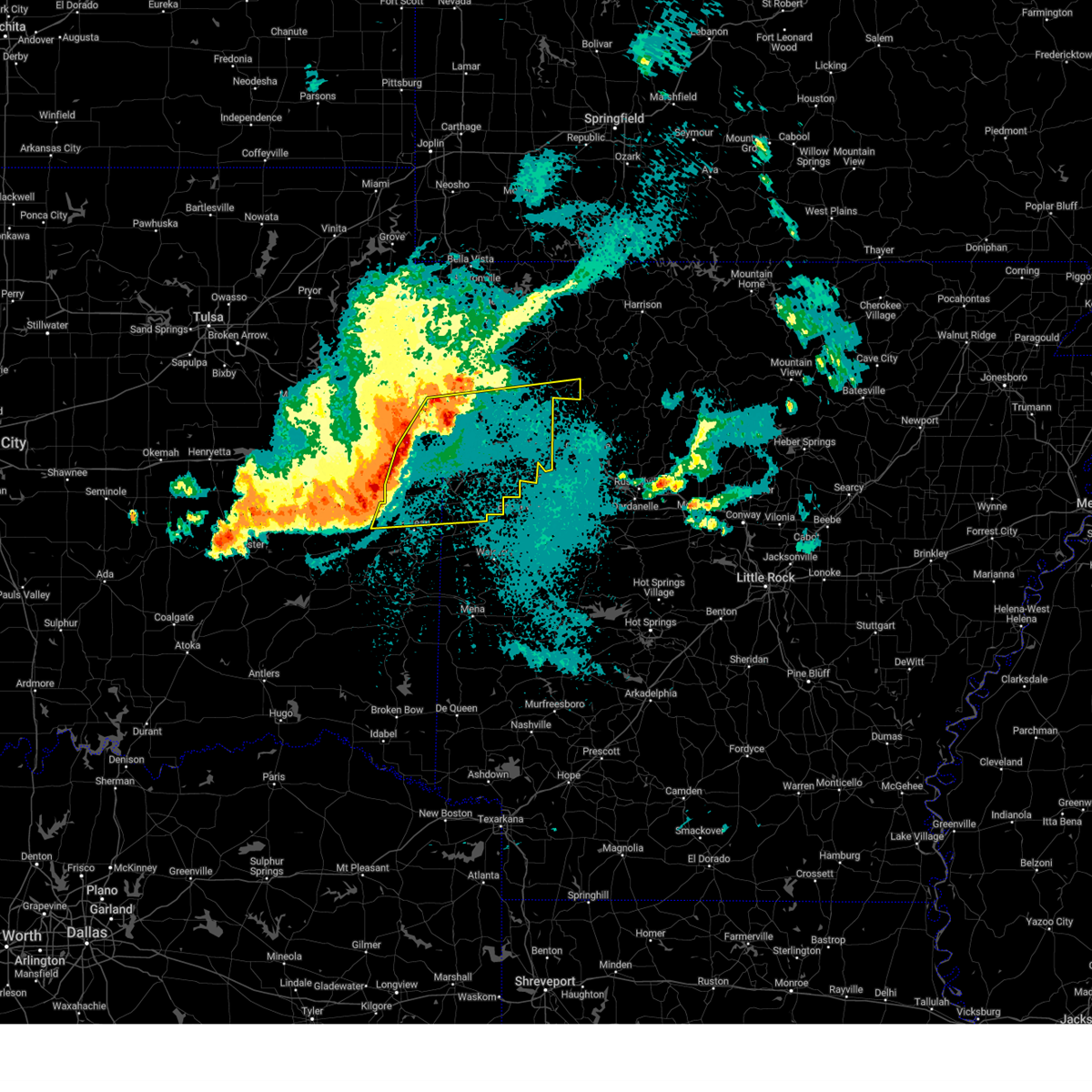 Svrtsa the national weather service in tulsa has issued a * severe thunderstorm warning for, southern madison county in northwestern arkansas, franklin county in west central arkansas, crawford county in northwestern arkansas, sebastian county in west central arkansas, southeastern washington county in northwestern arkansas, eastern sequoyah county in east central oklahoma, southeastern adair county in northeastern oklahoma, northeastern le flore county in southeastern oklahoma, * until 500 am cdt. * at 410 am cdt, severe thunderstorms were located along a line extending from 3 miles northwest of natural dam to 3 miles north of muldrow to 3 miles south of bokoshe, moving east at 70 mph (radar indicated). Hazards include 60 mph wind gusts and quarter size hail. Hail damage to vehicles is expected. expect wind damage to roofs, siding, and trees. locations in or near the path include, alma, charleston, shibley, dyer, kibler, spiro, winslow, moffett, panama, locke, odell, turners bend, mount gayler, vesta, ursula, gans, rudy, boston, dutton, altus, this includes the following highways, interstate 40 in arkansas between mile markers 0 and 42. interstate 40 in oklahoma between mile markers 309 and 328. interstate 540 between mile markers 1 and 14. Interstate 49 between mile markers 22 and 44. Svrtsa the national weather service in tulsa has issued a * severe thunderstorm warning for, southern madison county in northwestern arkansas, franklin county in west central arkansas, crawford county in northwestern arkansas, sebastian county in west central arkansas, southeastern washington county in northwestern arkansas, eastern sequoyah county in east central oklahoma, southeastern adair county in northeastern oklahoma, northeastern le flore county in southeastern oklahoma, * until 500 am cdt. * at 410 am cdt, severe thunderstorms were located along a line extending from 3 miles northwest of natural dam to 3 miles north of muldrow to 3 miles south of bokoshe, moving east at 70 mph (radar indicated). Hazards include 60 mph wind gusts and quarter size hail. Hail damage to vehicles is expected. expect wind damage to roofs, siding, and trees. locations in or near the path include, alma, charleston, shibley, dyer, kibler, spiro, winslow, moffett, panama, locke, odell, turners bend, mount gayler, vesta, ursula, gans, rudy, boston, dutton, altus, this includes the following highways, interstate 40 in arkansas between mile markers 0 and 42. interstate 40 in oklahoma between mile markers 309 and 328. interstate 540 between mile markers 1 and 14. Interstate 49 between mile markers 22 and 44.
|
| 5/18/2025 3:53 AM CDT |
 At 352 am cdt, a severe thunderstorm was located over sallisaw, moving east at 65 mph (radar indicated. at 339 am, 58 mph wind gusts were measured by the webbers falls oklahoma mesonet station). Hazards include 60 mph wind gusts and quarter size hail. Hail damage to vehicles is expected. expect wind damage to roofs, siding, and trees. Locations in or near the path include, kanima, brushy, marble city, pumpkin center, webbers falls, spiro, cowlington, cookson, porum, brushy lake state park, moffett, cherokee landing state park, bunch, gore, lake tenkiller state park, muldrow, short, gans, sallisaw, scullyville, this includes interstate 40 in oklahoma between mile markers 281 and 328. At 352 am cdt, a severe thunderstorm was located over sallisaw, moving east at 65 mph (radar indicated. at 339 am, 58 mph wind gusts were measured by the webbers falls oklahoma mesonet station). Hazards include 60 mph wind gusts and quarter size hail. Hail damage to vehicles is expected. expect wind damage to roofs, siding, and trees. Locations in or near the path include, kanima, brushy, marble city, pumpkin center, webbers falls, spiro, cowlington, cookson, porum, brushy lake state park, moffett, cherokee landing state park, bunch, gore, lake tenkiller state park, muldrow, short, gans, sallisaw, scullyville, this includes interstate 40 in oklahoma between mile markers 281 and 328.
|
| 5/18/2025 3:53 AM CDT |
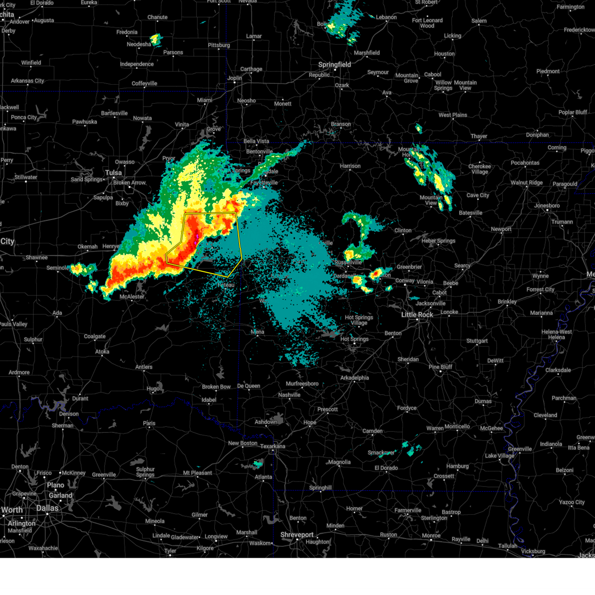 the severe thunderstorm warning has been cancelled and is no longer in effect the severe thunderstorm warning has been cancelled and is no longer in effect
|
| 5/18/2025 3:42 AM CDT |
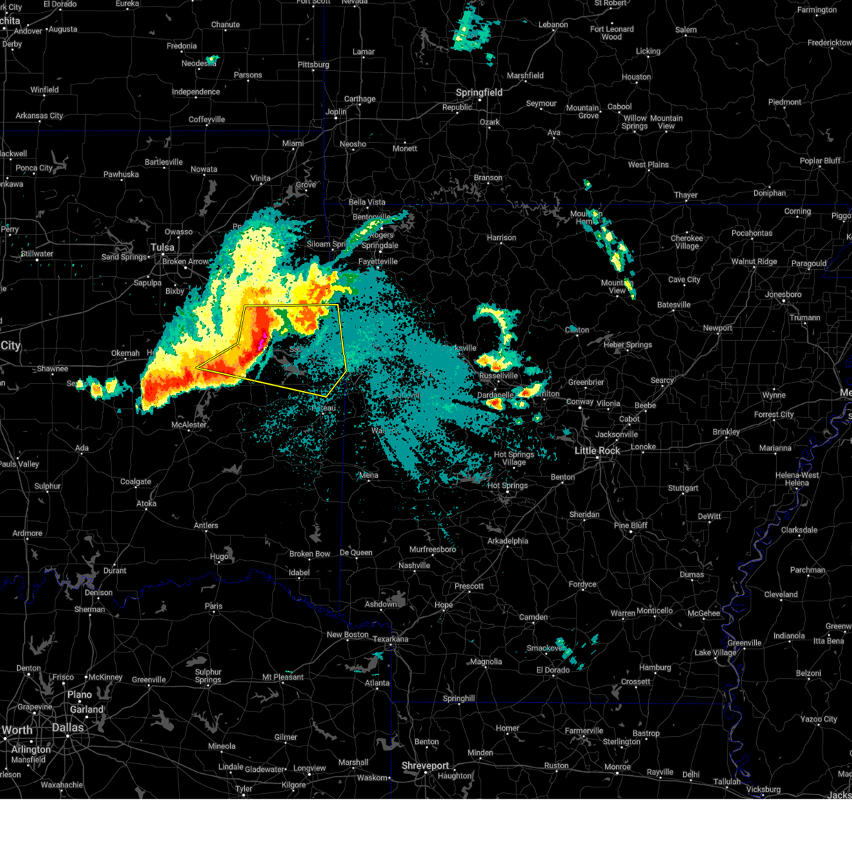 At 342 am cdt, a severe thunderstorm was located over vian, moving east at 55 mph (radar indicated). Hazards include 60 mph wind gusts and quarter size hail. Hail damage to vehicles is expected. expect wind damage to roofs, siding, and trees. Locations in or near the path include, kanima, brushy, greenleaf state park, marble city, pumpkin center, webbers falls, spiro, cowlington, porum, cookson, braggs, warner, brushy lake state park, moffett, cherokee landing state park, bunch, lake eufaula state park, gore, lake tenkiller state park, muldrow, this includes interstate 40 in oklahoma between mile markers 265 and 328. At 342 am cdt, a severe thunderstorm was located over vian, moving east at 55 mph (radar indicated). Hazards include 60 mph wind gusts and quarter size hail. Hail damage to vehicles is expected. expect wind damage to roofs, siding, and trees. Locations in or near the path include, kanima, brushy, greenleaf state park, marble city, pumpkin center, webbers falls, spiro, cowlington, porum, cookson, braggs, warner, brushy lake state park, moffett, cherokee landing state park, bunch, lake eufaula state park, gore, lake tenkiller state park, muldrow, this includes interstate 40 in oklahoma between mile markers 265 and 328.
|
| 5/18/2025 3:13 AM CDT |
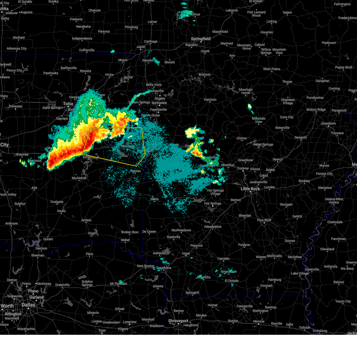 Svrtsa the national weather service in tulsa has issued a * severe thunderstorm warning for, northern haskell county in southeastern oklahoma, northeastern mcintosh county in southeastern oklahoma, sequoyah county in east central oklahoma, southern adair county in northeastern oklahoma, northeastern le flore county in southeastern oklahoma, southeastern cherokee county in east central oklahoma, muskogee county in east central oklahoma, * until 415 am cdt. * at 311 am cdt, a severe thunderstorm was located over rentiesville, moving east at 65 mph (radar indicated. the okmulgee mesonet station gusted to 60 mph at 255 am). Hazards include 60 mph wind gusts and quarter size hail. Hail damage to vehicles is expected. expect wind damage to roofs, siding, and trees. Locations in or near the path include, kanima, brushy, greenleaf state park, marble city, oktaha, summit, pumpkin center, webbers falls, spiro, cowlington, fort gibson, porum, muskogee, cookson, braggs, warner, brushy lake state park, moffett, cherokee landing state park, checotah, this includes interstate 40 in oklahoma between mile markers 256 and 328. Svrtsa the national weather service in tulsa has issued a * severe thunderstorm warning for, northern haskell county in southeastern oklahoma, northeastern mcintosh county in southeastern oklahoma, sequoyah county in east central oklahoma, southern adair county in northeastern oklahoma, northeastern le flore county in southeastern oklahoma, southeastern cherokee county in east central oklahoma, muskogee county in east central oklahoma, * until 415 am cdt. * at 311 am cdt, a severe thunderstorm was located over rentiesville, moving east at 65 mph (radar indicated. the okmulgee mesonet station gusted to 60 mph at 255 am). Hazards include 60 mph wind gusts and quarter size hail. Hail damage to vehicles is expected. expect wind damage to roofs, siding, and trees. Locations in or near the path include, kanima, brushy, greenleaf state park, marble city, oktaha, summit, pumpkin center, webbers falls, spiro, cowlington, fort gibson, porum, muskogee, cookson, braggs, warner, brushy lake state park, moffett, cherokee landing state park, checotah, this includes interstate 40 in oklahoma between mile markers 256 and 328.
|
| 5/18/2025 2:45 AM CDT |
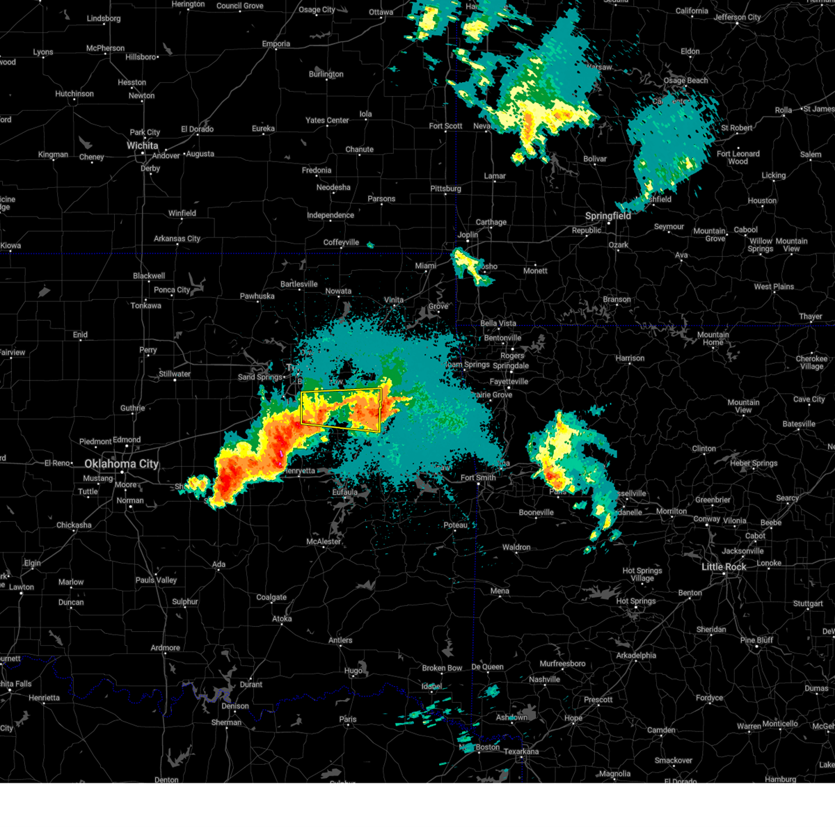 The storm which prompted the warning has weakened below severe limits, and has exited the warned area. therefore, the warning has been allowed to expire. a severe thunderstorm watch remains in effect until 400 am cdt for northeastern and east central oklahoma. The storm which prompted the warning has weakened below severe limits, and has exited the warned area. therefore, the warning has been allowed to expire. a severe thunderstorm watch remains in effect until 400 am cdt for northeastern and east central oklahoma.
|
| 5/18/2025 2:41 AM CDT |
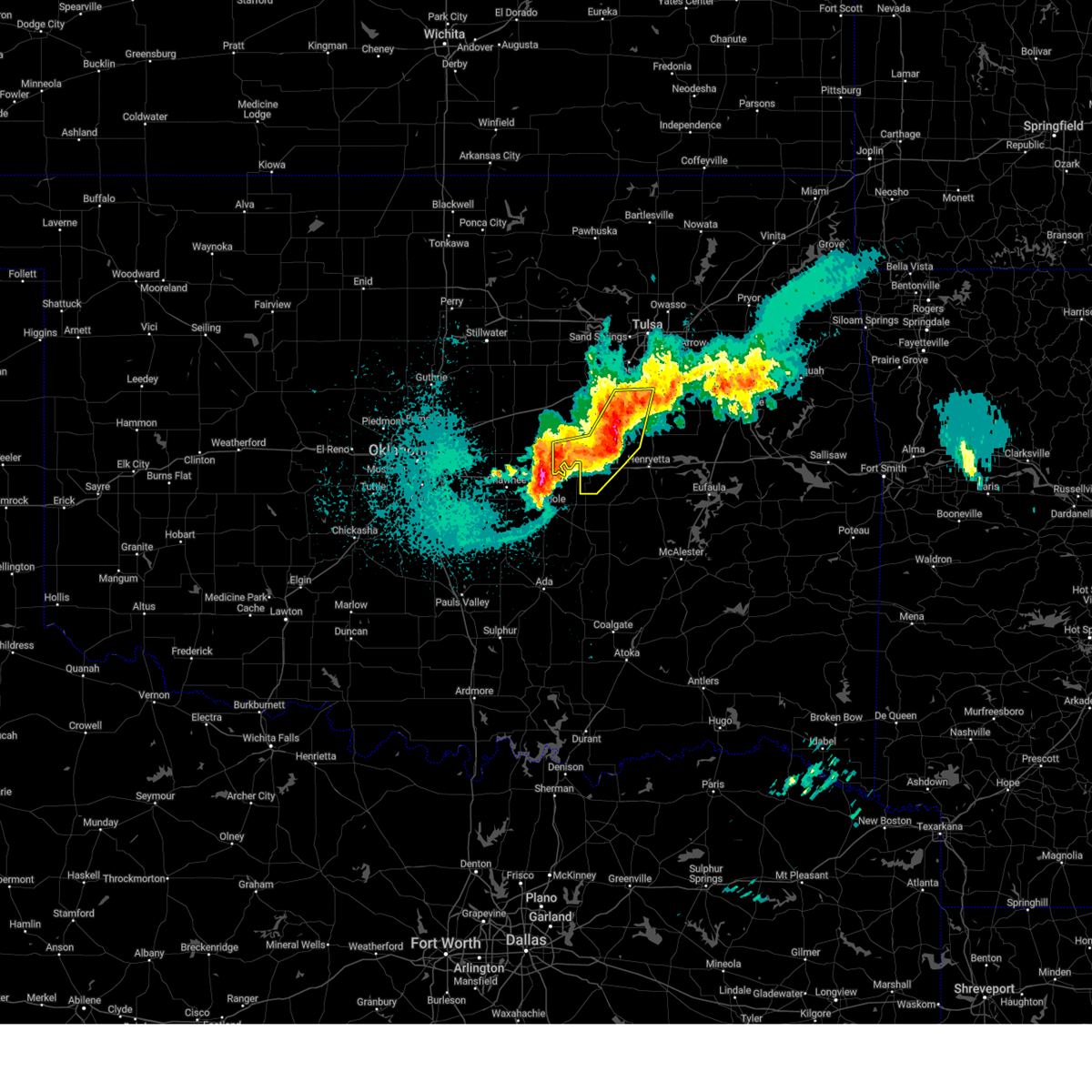 At 241 am cdt, severe thunderstorms were located along a line extending from 5 miles north of preston to 5 miles southwest of okmulgee state park to 2 miles west of boley, moving east at 70 mph (radar indicated). Hazards include 60 mph wind gusts and quarter size hail. Hail damage to vehicles is expected. expect wind damage to roofs, siding, and trees. Locations in or near the path include, beggs, mason, boley, okmulgee state park, paden, castle, okemah, bearden, okfuskee, preston, liberty, slick, this includes interstate 40 in oklahoma between mile markers 212 and 227. At 241 am cdt, severe thunderstorms were located along a line extending from 5 miles north of preston to 5 miles southwest of okmulgee state park to 2 miles west of boley, moving east at 70 mph (radar indicated). Hazards include 60 mph wind gusts and quarter size hail. Hail damage to vehicles is expected. expect wind damage to roofs, siding, and trees. Locations in or near the path include, beggs, mason, boley, okmulgee state park, paden, castle, okemah, bearden, okfuskee, preston, liberty, slick, this includes interstate 40 in oklahoma between mile markers 212 and 227.
|
| 5/18/2025 2:27 AM CDT |
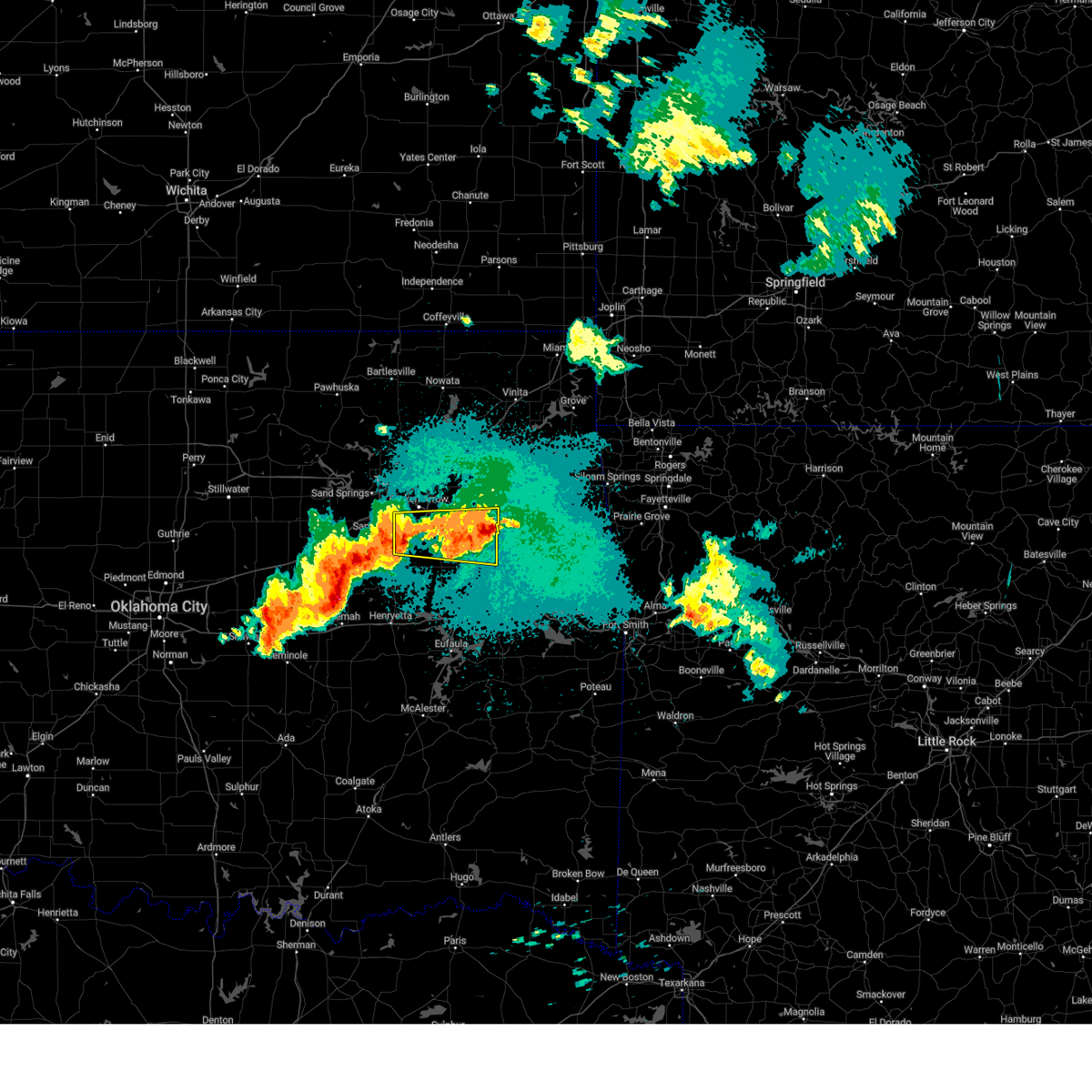 At 226 am cdt, a severe thunderstorm was located 3 miles south of wagoner, moving east at 35 mph. another severe thunderstorm was located south of bixby, moving east at 35 mph (radar indicated). Hazards include 60 mph wind gusts and quarter size hail. Hail damage to vehicles is expected. expect wind damage to roofs, siding, and trees. Locations in or near the path include, broken arrow, tullahassee, wagoner, redbird, coweta, okay, stonebluff, hectorville, haskell, leonard, bixby, porter, choska, oneta, muskogee, jenks, liberty, tulsa,. At 226 am cdt, a severe thunderstorm was located 3 miles south of wagoner, moving east at 35 mph. another severe thunderstorm was located south of bixby, moving east at 35 mph (radar indicated). Hazards include 60 mph wind gusts and quarter size hail. Hail damage to vehicles is expected. expect wind damage to roofs, siding, and trees. Locations in or near the path include, broken arrow, tullahassee, wagoner, redbird, coweta, okay, stonebluff, hectorville, haskell, leonard, bixby, porter, choska, oneta, muskogee, jenks, liberty, tulsa,.
|
| 5/18/2025 2:21 AM CDT |
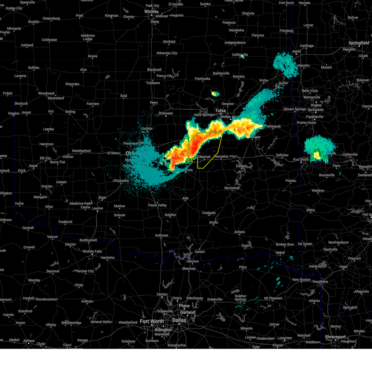 At 221 am cdt, severe thunderstorms were located along a line extending from 2 miles north of slick to near welty to 4 miles south of paden, moving east at 50 mph (radar indicated). Hazards include 60 mph wind gusts and quarter size hail. Hail damage to vehicles is expected. expect wind damage to roofs, siding, and trees. locations in or near the path include, beggs, bristow, boley, paden, okemah, okfuskee, mason, okmulgee state park, castle, bearden, welty, slick, preston, liberty, this includes the following highways, interstate 40 in oklahoma between mile markers 212 and 227. Interstate 44 between mile markers 187 and 191. At 221 am cdt, severe thunderstorms were located along a line extending from 2 miles north of slick to near welty to 4 miles south of paden, moving east at 50 mph (radar indicated). Hazards include 60 mph wind gusts and quarter size hail. Hail damage to vehicles is expected. expect wind damage to roofs, siding, and trees. locations in or near the path include, beggs, bristow, boley, paden, okemah, okfuskee, mason, okmulgee state park, castle, bearden, welty, slick, preston, liberty, this includes the following highways, interstate 40 in oklahoma between mile markers 212 and 227. Interstate 44 between mile markers 187 and 191.
|
| 5/18/2025 2:03 AM CDT |
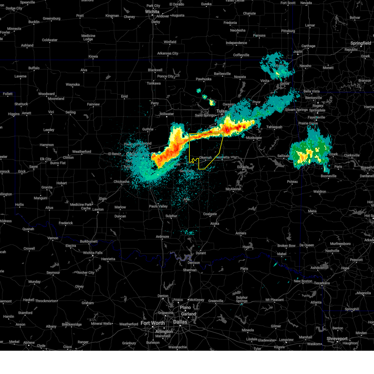 Svrtsa the national weather service in tulsa has issued a * severe thunderstorm warning for, southern creek county in northeastern oklahoma, northwestern okmulgee county in northeastern oklahoma, okfuskee county in east central oklahoma, * until 300 am cdt. * at 203 am cdt, severe thunderstorms were located along a line extending from 2 miles east of stroud to 5 miles southeast of sparks to 3 miles north of shawnee, moving east at 40 mph (radar indicated). Hazards include 60 mph wind gusts and quarter size hail. Hail damage to vehicles is expected. expect wind damage to roofs, siding, and trees. locations in or near the path include, beggs, bristow, boley, paden, okemah, depew, okfuskee, milfay, mason, okmulgee state park, castle, bearden, welty, slick, preston, liberty, this includes the following highways, interstate 40 in oklahoma between mile markers 212 and 227. Interstate 44 between mile markers 178 and 192. Svrtsa the national weather service in tulsa has issued a * severe thunderstorm warning for, southern creek county in northeastern oklahoma, northwestern okmulgee county in northeastern oklahoma, okfuskee county in east central oklahoma, * until 300 am cdt. * at 203 am cdt, severe thunderstorms were located along a line extending from 2 miles east of stroud to 5 miles southeast of sparks to 3 miles north of shawnee, moving east at 40 mph (radar indicated). Hazards include 60 mph wind gusts and quarter size hail. Hail damage to vehicles is expected. expect wind damage to roofs, siding, and trees. locations in or near the path include, beggs, bristow, boley, paden, okemah, depew, okfuskee, milfay, mason, okmulgee state park, castle, bearden, welty, slick, preston, liberty, this includes the following highways, interstate 40 in oklahoma between mile markers 212 and 227. Interstate 44 between mile markers 178 and 192.
|
| 5/18/2025 1:58 AM CDT |
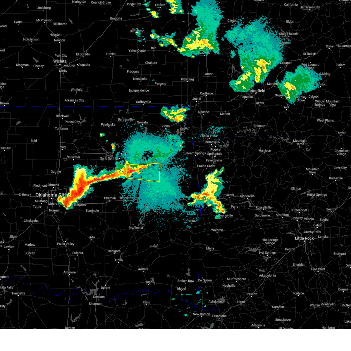 Svrtsa the national weather service in tulsa has issued a * severe thunderstorm warning for, wagoner county in northeastern oklahoma, northeastern okmulgee county in northeastern oklahoma, northwestern muskogee county in east central oklahoma, southeastern tulsa county in northeastern oklahoma, * until 245 am cdt. * at 158 am cdt, a severe thunderstorm was located 4 miles southeast of bixby, moving east at 35 mph (radar indicated). Hazards include 60 mph wind gusts and quarter size hail. Hail damage to vehicles is expected. expect wind damage to roofs, siding, and trees. Locations in or near the path include, broken arrow, tullahassee, wagoner, redbird, coweta, okay, stonebluff, hectorville, haskell, leonard, bixby, porter, choska, oneta, muskogee, jenks, liberty, tulsa,. Svrtsa the national weather service in tulsa has issued a * severe thunderstorm warning for, wagoner county in northeastern oklahoma, northeastern okmulgee county in northeastern oklahoma, northwestern muskogee county in east central oklahoma, southeastern tulsa county in northeastern oklahoma, * until 245 am cdt. * at 158 am cdt, a severe thunderstorm was located 4 miles southeast of bixby, moving east at 35 mph (radar indicated). Hazards include 60 mph wind gusts and quarter size hail. Hail damage to vehicles is expected. expect wind damage to roofs, siding, and trees. Locations in or near the path include, broken arrow, tullahassee, wagoner, redbird, coweta, okay, stonebluff, hectorville, haskell, leonard, bixby, porter, choska, oneta, muskogee, jenks, liberty, tulsa,.
|
| 5/2/2025 5:42 AM CDT |
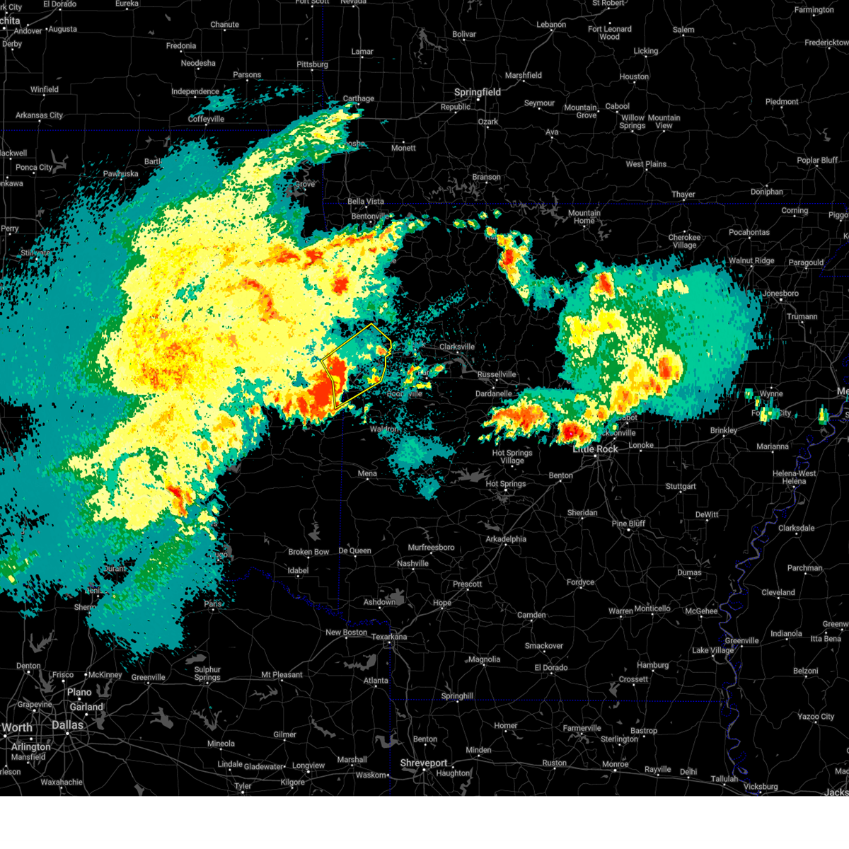 Svrtsa the national weather service in tulsa has issued a * severe thunderstorm warning for, southwestern crawford county in northwestern arkansas, northern sebastian county in west central arkansas, southeastern sequoyah county in east central oklahoma, northeastern le flore county in southeastern oklahoma, * until 630 am cdt. * at 542 am cdt, severe thunderstorms were located along a line extending from 4 miles north of roland to near fort smith to 3 miles southwest of hackett, moving northeast at 30 mph (radar indicated). Hazards include 60 mph wind gusts and quarter size hail. Hail damage to vehicles is expected. expect wind damage to roofs, siding, and trees. locations in or near the path include, alma, shibley, dyer, kibler, mountainburg, central city, pocola, rye hill, moffett, fort smith, excelsior, fort smith regional airport, van buren, muldrow, rudy, lavaca, mulberry, bloomer, hackett, concord, this includes the following highways, interstate 40 in arkansas between mile markers 0 and 23. interstate 40 in oklahoma between mile markers 318 and 328. interstate 540 between mile markers 1 and 14. Interstate 49 between mile markers 22 and 32. Svrtsa the national weather service in tulsa has issued a * severe thunderstorm warning for, southwestern crawford county in northwestern arkansas, northern sebastian county in west central arkansas, southeastern sequoyah county in east central oklahoma, northeastern le flore county in southeastern oklahoma, * until 630 am cdt. * at 542 am cdt, severe thunderstorms were located along a line extending from 4 miles north of roland to near fort smith to 3 miles southwest of hackett, moving northeast at 30 mph (radar indicated). Hazards include 60 mph wind gusts and quarter size hail. Hail damage to vehicles is expected. expect wind damage to roofs, siding, and trees. locations in or near the path include, alma, shibley, dyer, kibler, mountainburg, central city, pocola, rye hill, moffett, fort smith, excelsior, fort smith regional airport, van buren, muldrow, rudy, lavaca, mulberry, bloomer, hackett, concord, this includes the following highways, interstate 40 in arkansas between mile markers 0 and 23. interstate 40 in oklahoma between mile markers 318 and 328. interstate 540 between mile markers 1 and 14. Interstate 49 between mile markers 22 and 32.
|
| 4/30/2025 2:08 PM CDT |
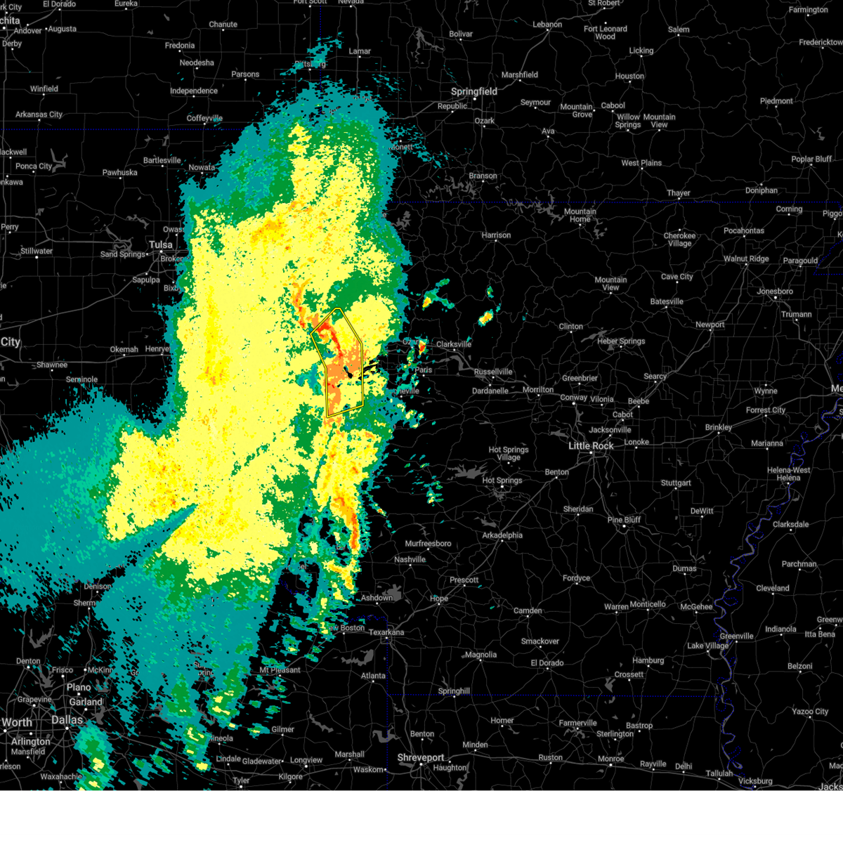 At 208 pm cdt, severe thunderstorms were located along a line extending from 6 miles north of short to 3 miles west of van buren to 4 miles west of midland, moving northeast at 30 mph (radar indicated). Hazards include 60 mph wind gusts. Expect damage to roofs, siding, and trees. locations in or near the path include, shibley, arkola, huntington, cameron, witcherville, pocola, rye hill, moffett, fort smith, uniontown, excelsior, fort smith regional airport, van buren, muldrow, short, natural dam, hackett, arkoma, braden, figure five, this includes the following highways, interstate 40 in arkansas between mile markers 0 and 10. interstate 40 in oklahoma between mile markers 319 and 328. Interstate 540 between mile markers 1 and 14. At 208 pm cdt, severe thunderstorms were located along a line extending from 6 miles north of short to 3 miles west of van buren to 4 miles west of midland, moving northeast at 30 mph (radar indicated). Hazards include 60 mph wind gusts. Expect damage to roofs, siding, and trees. locations in or near the path include, shibley, arkola, huntington, cameron, witcherville, pocola, rye hill, moffett, fort smith, uniontown, excelsior, fort smith regional airport, van buren, muldrow, short, natural dam, hackett, arkoma, braden, figure five, this includes the following highways, interstate 40 in arkansas between mile markers 0 and 10. interstate 40 in oklahoma between mile markers 319 and 328. Interstate 540 between mile markers 1 and 14.
|
| 4/30/2025 1:47 PM CDT |
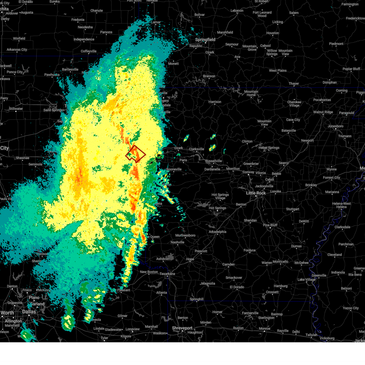 The storm which prompted the warning has weakened, and no longer appears capable of producing a tornado. therefore, the tornado warning has been allowed to expire. a tornado watch remains in effect until 500 pm cdt for southeastern and east central oklahoma. remember, a severe thunderstorm warning still remains in effect for eastern sequoyah county until 230 pm. The storm which prompted the warning has weakened, and no longer appears capable of producing a tornado. therefore, the tornado warning has been allowed to expire. a tornado watch remains in effect until 500 pm cdt for southeastern and east central oklahoma. remember, a severe thunderstorm warning still remains in effect for eastern sequoyah county until 230 pm.
|
| 4/30/2025 1:41 PM CDT |
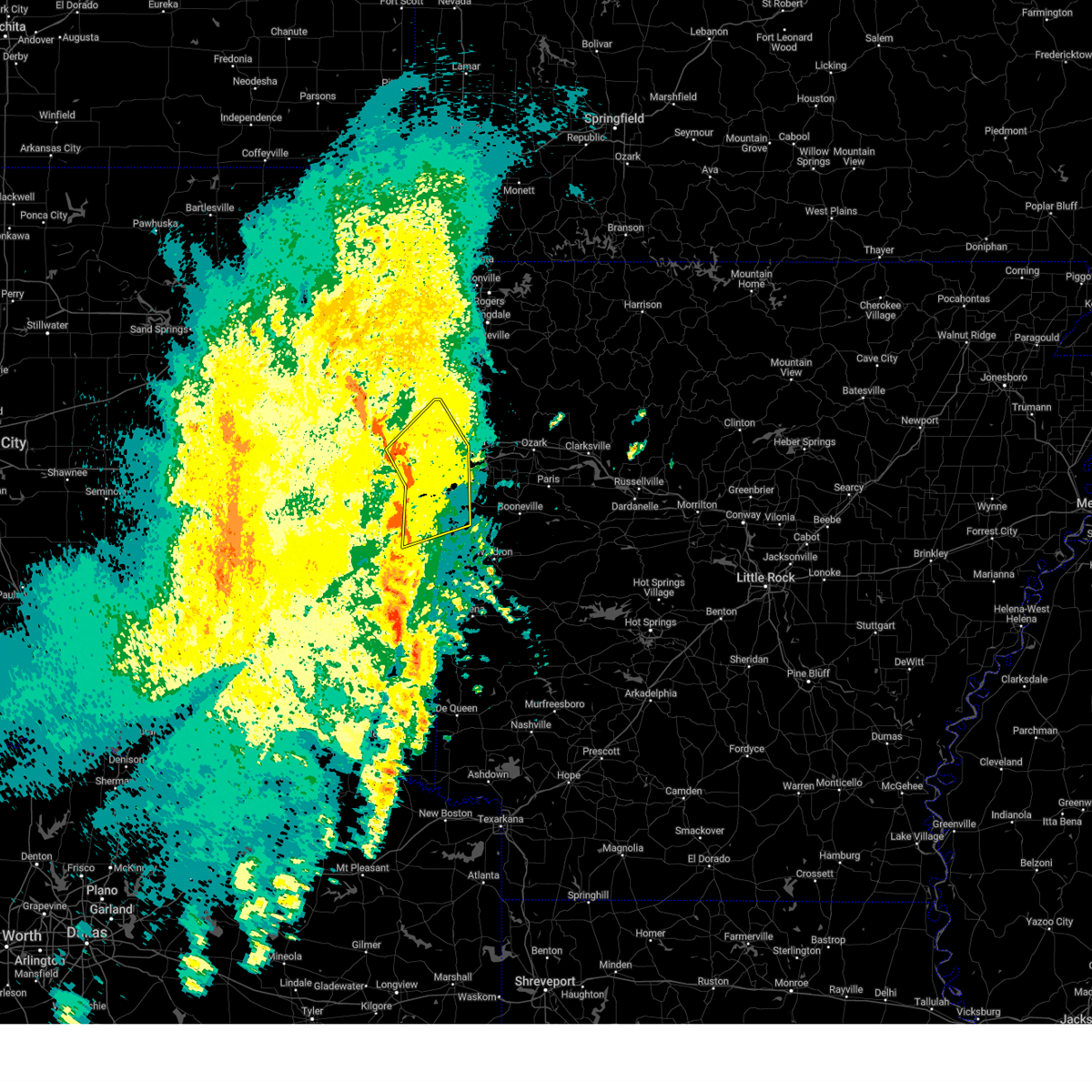 Svrtsa the national weather service in tulsa has issued a * severe thunderstorm warning for, western crawford county in northwestern arkansas, northwestern sebastian county in west central arkansas, eastern sequoyah county in east central oklahoma, southeastern adair county in northeastern oklahoma, northeastern le flore county in southeastern oklahoma, * until 230 pm cdt. * at 141 pm cdt, severe thunderstorms were located along a line extending from 5 miles north of gans to 4 miles south of muldrow to 2 miles south of poteau, moving northeast at 20 mph (radar indicated). Hazards include 60 mph wind gusts. Expect damage to roofs, siding, and trees. locations in or near the path include, shibley, brushy, arkola, huntington, cameron, witcherville, pocola, spiro, rye hill, poteau, moffett, shady point, panama, fort smith, uniontown, excelsior, fort smith regional airport, van buren, muldrow, short, this includes the following highways, interstate 40 in arkansas between mile markers 0 and 10. interstate 40 in oklahoma between mile markers 308 and 328. Interstate 540 between mile markers 1 and 14. Svrtsa the national weather service in tulsa has issued a * severe thunderstorm warning for, western crawford county in northwestern arkansas, northwestern sebastian county in west central arkansas, eastern sequoyah county in east central oklahoma, southeastern adair county in northeastern oklahoma, northeastern le flore county in southeastern oklahoma, * until 230 pm cdt. * at 141 pm cdt, severe thunderstorms were located along a line extending from 5 miles north of gans to 4 miles south of muldrow to 2 miles south of poteau, moving northeast at 20 mph (radar indicated). Hazards include 60 mph wind gusts. Expect damage to roofs, siding, and trees. locations in or near the path include, shibley, brushy, arkola, huntington, cameron, witcherville, pocola, spiro, rye hill, poteau, moffett, shady point, panama, fort smith, uniontown, excelsior, fort smith regional airport, van buren, muldrow, short, this includes the following highways, interstate 40 in arkansas between mile markers 0 and 10. interstate 40 in oklahoma between mile markers 308 and 328. Interstate 540 between mile markers 1 and 14.
|
| 4/30/2025 1:32 PM CDT | At 132 pm cdt, severe thunderstorms were located along a line extending from 2 miles northwest of muldrow to 3 miles west of poteau, moving northeast at 35 mph (radar indicated). Hazards include 60 mph wind gusts. Expect damage to roofs, siding, and trees. Locations in or near the path include, bokoshe, sallisaw, scullyville, arkoma, cameron, pocola, braden, spiro, cowlington, poteau, wister, roland, moffett, lake wister state park, shady point, panama, jenson, cottonwood, howe, muldrow, this includes interstate 40 in oklahoma between mile markers 305 and 327. |
| 4/30/2025 1:32 PM CDT | the severe thunderstorm warning has been cancelled and is no longer in effect |
| 4/30/2025 1:23 PM CDT | At 123 pm cdt, a severe thunderstorm capable of producing a tornado was located 5 miles west of gans, moving northeast at 20 mph (radar indicated rotation). Hazards include tornado. Flying debris will be dangerous to those caught without shelter. mobile homes will be damaged or destroyed. damage to roofs, windows, and vehicles will occur. tree damage is likely. Locations in or near the path include, sallisaw, roland, muldrow, gans, this includes interstate 40 in oklahoma between mile markers 305 and 325. |
| 4/30/2025 1:23 PM CDT | the tornado warning has been cancelled and is no longer in effect |
| 4/30/2025 1:12 PM CDT |
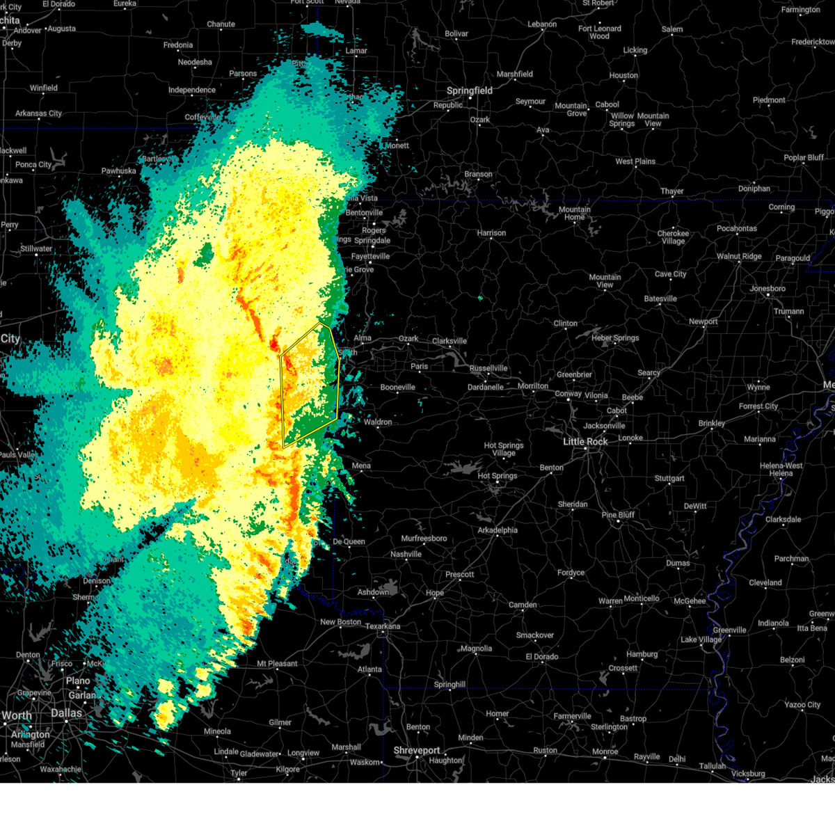 the severe thunderstorm warning has been cancelled and is no longer in effect the severe thunderstorm warning has been cancelled and is no longer in effect
|
| 4/30/2025 1:12 PM CDT |
 At 112 pm cdt, severe thunderstorms were located along a line extending from 5 miles southwest of gans to 4 miles west of lake wister state park, moving northeast at 25 mph (radar indicated). Hazards include 60 mph wind gusts. Expect damage to roofs, siding, and trees. Locations in or near the path include, cameron, pocola, spiro, cowlington, poteau, moffett, shady point, panama, howe, muldrow, gans, bokoshe, sallisaw, scullyville, arkoma, summerfield, fanshawe, braden, keota, wister, this includes interstate 40 in oklahoma between mile markers 303 and 327. At 112 pm cdt, severe thunderstorms were located along a line extending from 5 miles southwest of gans to 4 miles west of lake wister state park, moving northeast at 25 mph (radar indicated). Hazards include 60 mph wind gusts. Expect damage to roofs, siding, and trees. Locations in or near the path include, cameron, pocola, spiro, cowlington, poteau, moffett, shady point, panama, howe, muldrow, gans, bokoshe, sallisaw, scullyville, arkoma, summerfield, fanshawe, braden, keota, wister, this includes interstate 40 in oklahoma between mile markers 303 and 327.
|
| 4/30/2025 1:04 PM CDT |
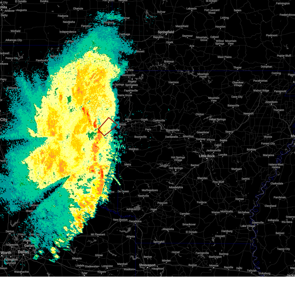 Tortsa the national weather service in tulsa has issued a * tornado warning for, east central haskell county in southeastern oklahoma, eastern sequoyah county in east central oklahoma, north central le flore county in southeastern oklahoma, * until 145 pm cdt. * at 104 pm cdt, a severe thunderstorm capable of producing a tornado was located 5 miles northeast of keota, moving northeast at 25 mph (radar indicated rotation). Hazards include tornado. Flying debris will be dangerous to those caught without shelter. mobile homes will be damaged or destroyed. damage to roofs, windows, and vehicles will occur. tree damage is likely. Locations in or near the path include, sallisaw, roland, muldrow, gans, cowlington, this includes interstate 40 in oklahoma between mile markers 305 and 325. Tortsa the national weather service in tulsa has issued a * tornado warning for, east central haskell county in southeastern oklahoma, eastern sequoyah county in east central oklahoma, north central le flore county in southeastern oklahoma, * until 145 pm cdt. * at 104 pm cdt, a severe thunderstorm capable of producing a tornado was located 5 miles northeast of keota, moving northeast at 25 mph (radar indicated rotation). Hazards include tornado. Flying debris will be dangerous to those caught without shelter. mobile homes will be damaged or destroyed. damage to roofs, windows, and vehicles will occur. tree damage is likely. Locations in or near the path include, sallisaw, roland, muldrow, gans, cowlington, this includes interstate 40 in oklahoma between mile markers 305 and 325.
|
| 4/30/2025 12:55 PM CDT |
 Svrtsa the national weather service in tulsa has issued a * severe thunderstorm warning for, eastern haskell county in southeastern oklahoma, eastern sequoyah county in east central oklahoma, northeastern latimer county in southeastern oklahoma, central le flore county in southeastern oklahoma, * until 145 pm cdt. * at 1254 pm cdt, severe thunderstorms were located along a line extending from 6 miles northeast of keota to 5 miles north of talimena state park, moving northeast at 35 mph (radar indicated). Hazards include 60 mph wind gusts. Expect damage to roofs, siding, and trees. Locations in or near the path include, kanima, talimena state park, mccurtain, cameron, pocola, spiro, cowlington, mc curtain, poteau, moffett, shady point, panama, howe, talihina, muldrow, gans, bokoshe, sallisaw, scullyville, arkoma, this includes interstate 40 in oklahoma between mile markers 303 and 327. Svrtsa the national weather service in tulsa has issued a * severe thunderstorm warning for, eastern haskell county in southeastern oklahoma, eastern sequoyah county in east central oklahoma, northeastern latimer county in southeastern oklahoma, central le flore county in southeastern oklahoma, * until 145 pm cdt. * at 1254 pm cdt, severe thunderstorms were located along a line extending from 6 miles northeast of keota to 5 miles north of talimena state park, moving northeast at 35 mph (radar indicated). Hazards include 60 mph wind gusts. Expect damage to roofs, siding, and trees. Locations in or near the path include, kanima, talimena state park, mccurtain, cameron, pocola, spiro, cowlington, mc curtain, poteau, moffett, shady point, panama, howe, talihina, muldrow, gans, bokoshe, sallisaw, scullyville, arkoma, this includes interstate 40 in oklahoma between mile markers 303 and 327.
|
| 4/5/2025 5:08 AM CDT |
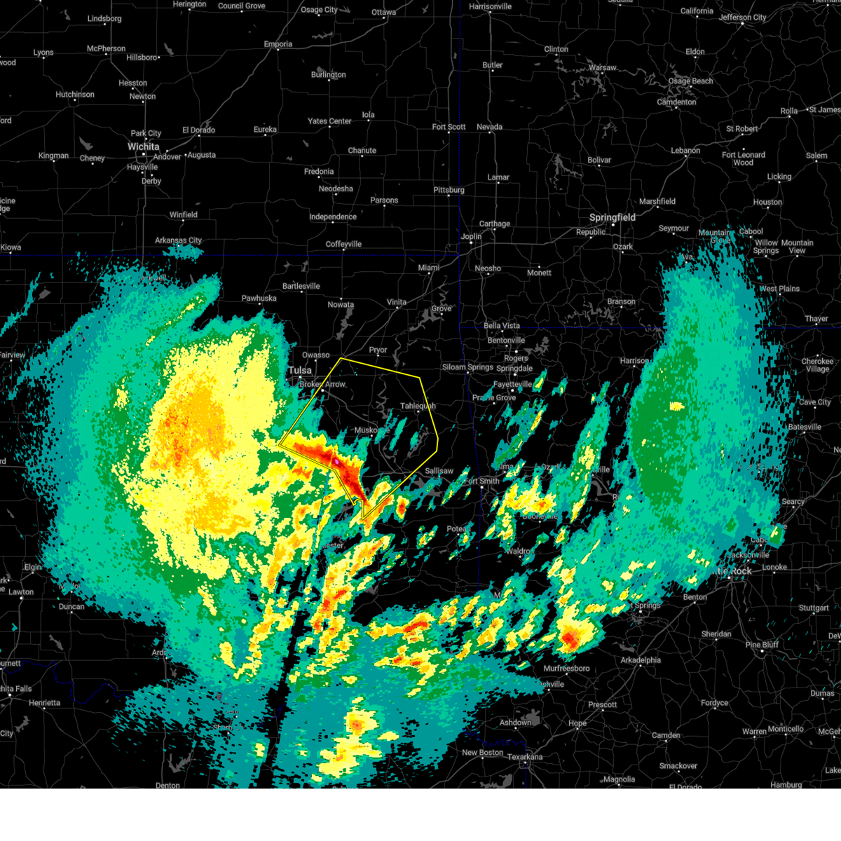 Svrtsa the national weather service in tulsa has issued a * severe thunderstorm warning for, southwestern rogers county in northeastern oklahoma, northwestern haskell county in southeastern oklahoma, northeastern mcintosh county in southeastern oklahoma, northwestern sequoyah county in east central oklahoma, southern mayes county in northeastern oklahoma, wagoner county in northeastern oklahoma, cherokee county in east central oklahoma, northern okmulgee county in northeastern oklahoma, muskogee county in east central oklahoma, southeastern tulsa county in northeastern oklahoma, * until 545 am cdt. * at 506 am cdt, severe thunderstorms were located along a line extending from 3 miles south of beggs to 2 miles northeast of council hill to 3 miles southwest of enterprise, moving northeast at 60 mph (radar indicated). Hazards include 60 mph wind gusts and quarter size hail. Hail damage to vehicles is expected. expect wind damage to roofs, siding, and trees. locations in or near the path include, beggs, inola, mazie, coweta pumpkin center, webbers falls, fort gibson, porum, braggs, okay, broken arrow hectorville, chouteau, checotah haskell, leonard, lake eufaula state park, morris, gore, muskogee, this includes the following highways, interstate 40 in oklahoma between mile markers 257 and 293. Interstate 44 between mile markers 238 and 247. Svrtsa the national weather service in tulsa has issued a * severe thunderstorm warning for, southwestern rogers county in northeastern oklahoma, northwestern haskell county in southeastern oklahoma, northeastern mcintosh county in southeastern oklahoma, northwestern sequoyah county in east central oklahoma, southern mayes county in northeastern oklahoma, wagoner county in northeastern oklahoma, cherokee county in east central oklahoma, northern okmulgee county in northeastern oklahoma, muskogee county in east central oklahoma, southeastern tulsa county in northeastern oklahoma, * until 545 am cdt. * at 506 am cdt, severe thunderstorms were located along a line extending from 3 miles south of beggs to 2 miles northeast of council hill to 3 miles southwest of enterprise, moving northeast at 60 mph (radar indicated). Hazards include 60 mph wind gusts and quarter size hail. Hail damage to vehicles is expected. expect wind damage to roofs, siding, and trees. locations in or near the path include, beggs, inola, mazie, coweta pumpkin center, webbers falls, fort gibson, porum, braggs, okay, broken arrow hectorville, chouteau, checotah haskell, leonard, lake eufaula state park, morris, gore, muskogee, this includes the following highways, interstate 40 in oklahoma between mile markers 257 and 293. Interstate 44 between mile markers 238 and 247.
|
| 4/4/2025 6:50 AM CDT |
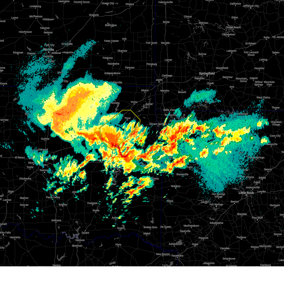 At 649 am cdt, severe thunderstorms were located along a line extending from 3 miles northeast of jenks riverside airport to 4 miles southwest of inola to 2 miles south of wagoner, moving northeast at 90 mph (radar indicated). Hazards include 60 mph wind gusts and half dollar size hail. Hail damage to vehicles is expected. expect wind damage to roofs, siding, and trees. Locations in or near the path include, broken arrow, inola, rose, mazie, jenks riverside airport, snowdale state park, locust grove, strang, hoot owl, stonebluff, hectorville, chouteau, pryor creek, haskell, leonard, jenks, porter, bixby, murphy, foyil, this includes interstate 44 between mile markers 219 and 272. At 649 am cdt, severe thunderstorms were located along a line extending from 3 miles northeast of jenks riverside airport to 4 miles southwest of inola to 2 miles south of wagoner, moving northeast at 90 mph (radar indicated). Hazards include 60 mph wind gusts and half dollar size hail. Hail damage to vehicles is expected. expect wind damage to roofs, siding, and trees. Locations in or near the path include, broken arrow, inola, rose, mazie, jenks riverside airport, snowdale state park, locust grove, strang, hoot owl, stonebluff, hectorville, chouteau, pryor creek, haskell, leonard, jenks, porter, bixby, murphy, foyil, this includes interstate 44 between mile markers 219 and 272.
|
| 4/4/2025 6:50 AM CDT |
 the severe thunderstorm warning has been cancelled and is no longer in effect the severe thunderstorm warning has been cancelled and is no longer in effect
|
| 4/4/2025 6:34 AM CDT |
 At 634 am cdt, severe thunderstorms were located along a line extending from 5 miles northeast of slick to 6 miles west of stonebluff to 3 miles north of boynton, moving northeast at 65 mph (radar indicated). Hazards include 60 mph wind gusts and half dollar size hail. Hail damage to vehicles is expected. expect wind damage to roofs, siding, and trees. Locations in or near the path include, beggs, sapulpa, inola, collinsville, mazie, jenks riverside airport, locust grove, mounds, strang, hoot owl, stonebluff, hectorville, chouteau, eram, haskell, leonard, morris, murphy, bushyhead, owasso, this includes interstate 44 between mile markers 202 and 272. At 634 am cdt, severe thunderstorms were located along a line extending from 5 miles northeast of slick to 6 miles west of stonebluff to 3 miles north of boynton, moving northeast at 65 mph (radar indicated). Hazards include 60 mph wind gusts and half dollar size hail. Hail damage to vehicles is expected. expect wind damage to roofs, siding, and trees. Locations in or near the path include, beggs, sapulpa, inola, collinsville, mazie, jenks riverside airport, locust grove, mounds, strang, hoot owl, stonebluff, hectorville, chouteau, eram, haskell, leonard, morris, murphy, bushyhead, owasso, this includes interstate 44 between mile markers 202 and 272.
|
| 4/4/2025 6:32 AM CDT |
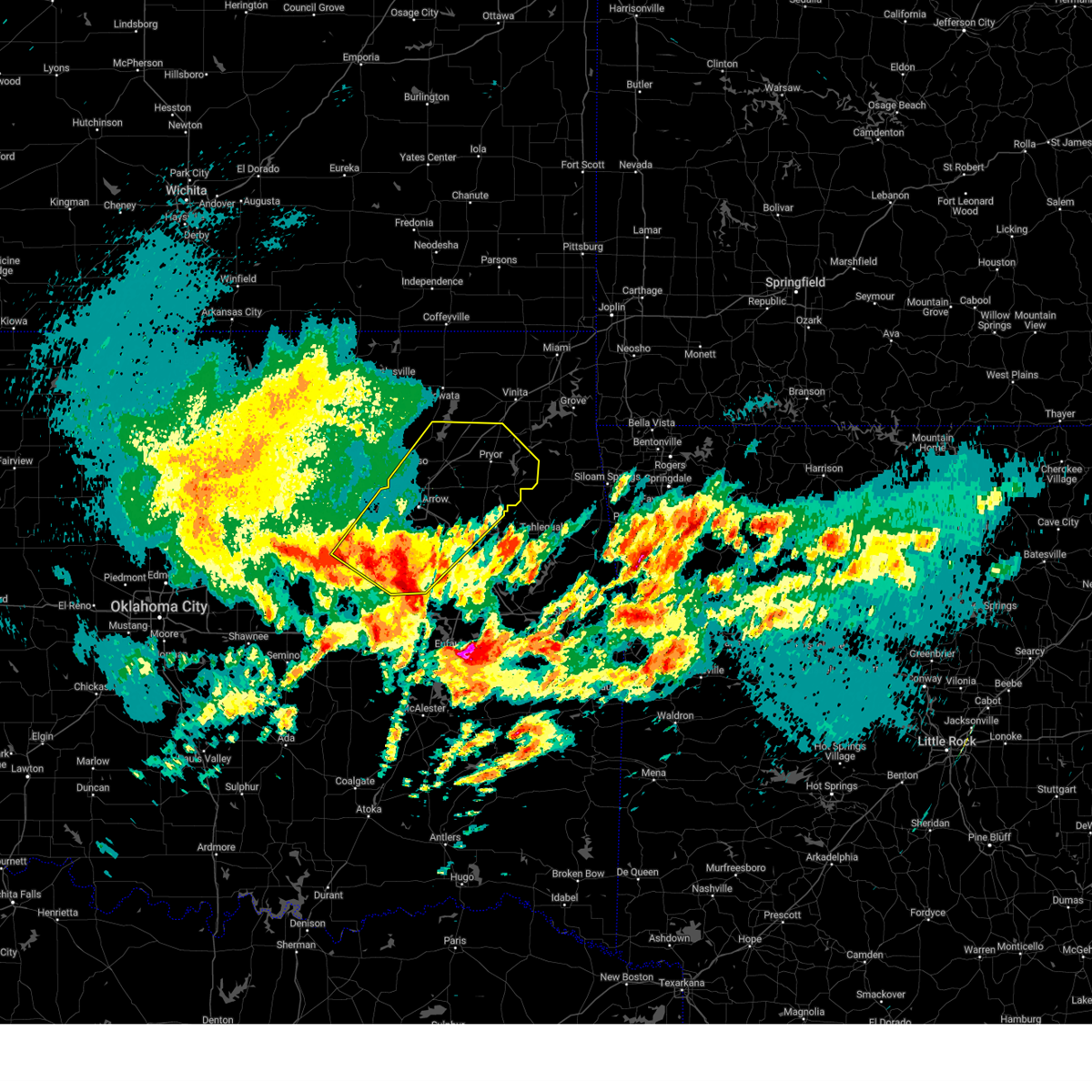 Svrtsa the national weather service in tulsa has issued a * severe thunderstorm warning for, rogers county in northeastern oklahoma, southeastern creek county in northeastern oklahoma, mayes county in northeastern oklahoma, wagoner county in northeastern oklahoma, northern okmulgee county in northeastern oklahoma, northwestern muskogee county in east central oklahoma, tulsa county in northeastern oklahoma, * until 715 am cdt. * at 631 am cdt, severe thunderstorms were located along a line extending from 3 miles north of slick to 6 miles north of bald hill to 2 miles northwest of boynton, moving northeast at 90 mph (radar indicated). Hazards include 60 mph wind gusts and half dollar size hail. Hail damage to vehicles is expected. expect wind damage to roofs, siding, and trees. Locations in or near the path include, beggs, sapulpa, inola, collinsville, mazie, jenks riverside airport, locust grove, mounds, strang, hoot owl, stonebluff, hectorville, chouteau, eram, haskell, leonard, morris, murphy, bushyhead, owasso, this includes interstate 44 between mile markers 202 and 272. Svrtsa the national weather service in tulsa has issued a * severe thunderstorm warning for, rogers county in northeastern oklahoma, southeastern creek county in northeastern oklahoma, mayes county in northeastern oklahoma, wagoner county in northeastern oklahoma, northern okmulgee county in northeastern oklahoma, northwestern muskogee county in east central oklahoma, tulsa county in northeastern oklahoma, * until 715 am cdt. * at 631 am cdt, severe thunderstorms were located along a line extending from 3 miles north of slick to 6 miles north of bald hill to 2 miles northwest of boynton, moving northeast at 90 mph (radar indicated). Hazards include 60 mph wind gusts and half dollar size hail. Hail damage to vehicles is expected. expect wind damage to roofs, siding, and trees. Locations in or near the path include, beggs, sapulpa, inola, collinsville, mazie, jenks riverside airport, locust grove, mounds, strang, hoot owl, stonebluff, hectorville, chouteau, eram, haskell, leonard, morris, murphy, bushyhead, owasso, this includes interstate 44 between mile markers 202 and 272.
|
| 4/4/2025 5:53 AM CDT |
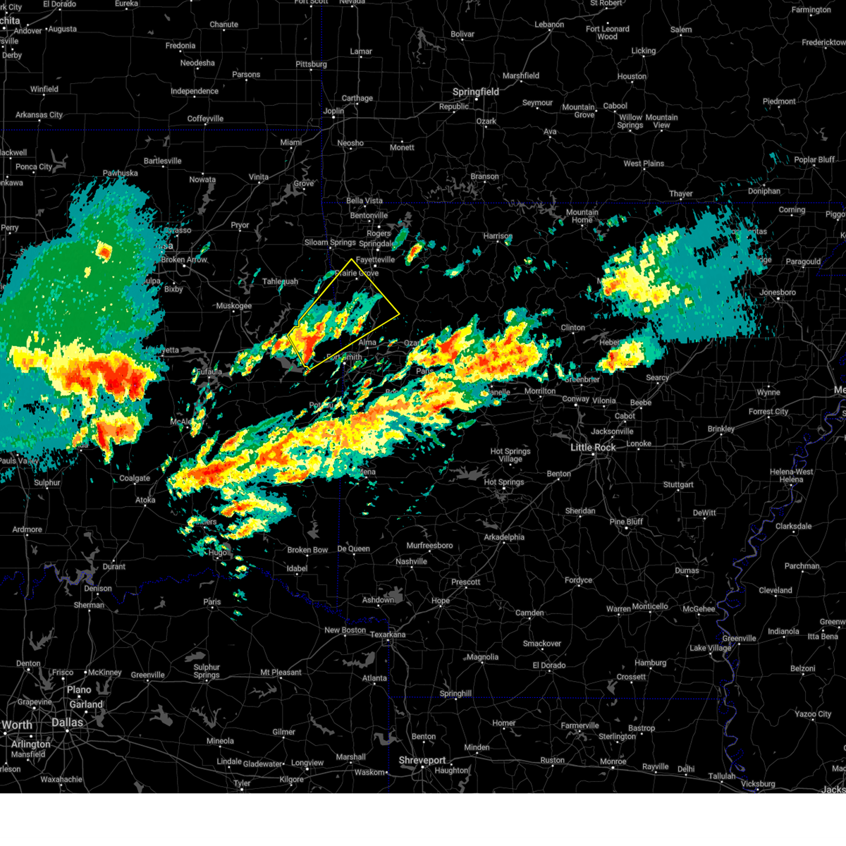 Svrtsa the national weather service in tulsa has issued a * severe thunderstorm warning for, northwestern crawford county in northwestern arkansas, southwestern washington county in northwestern arkansas, eastern sequoyah county in east central oklahoma, southern adair county in northeastern oklahoma, * until 645 am cdt. * at 552 am cdt, a severe thunderstorm was located 4 miles southeast of brushy, moving northeast at 55 mph (radar indicated). Hazards include 60 mph wind gusts and quarter size hail. Hail damage to vehicles is expected. expect wind damage to roofs, siding, and trees. locations in or near the path include, walnut grove, adair state park, brushy, bidville, woolsey, west fork, marble city, mountainburg, blackburn, brushy lake state park, winslow, rhea, lee creek, canehill, uniontown, locke, odell, stilwell, bunch, mount gayler, this includes the following highways, interstate 40 in oklahoma between mile markers 306 and 317. Interstate 49 between mile markers 29 and 54. Svrtsa the national weather service in tulsa has issued a * severe thunderstorm warning for, northwestern crawford county in northwestern arkansas, southwestern washington county in northwestern arkansas, eastern sequoyah county in east central oklahoma, southern adair county in northeastern oklahoma, * until 645 am cdt. * at 552 am cdt, a severe thunderstorm was located 4 miles southeast of brushy, moving northeast at 55 mph (radar indicated). Hazards include 60 mph wind gusts and quarter size hail. Hail damage to vehicles is expected. expect wind damage to roofs, siding, and trees. locations in or near the path include, walnut grove, adair state park, brushy, bidville, woolsey, west fork, marble city, mountainburg, blackburn, brushy lake state park, winslow, rhea, lee creek, canehill, uniontown, locke, odell, stilwell, bunch, mount gayler, this includes the following highways, interstate 40 in oklahoma between mile markers 306 and 317. Interstate 49 between mile markers 29 and 54.
|
| 4/2/2025 7:21 AM CDT |
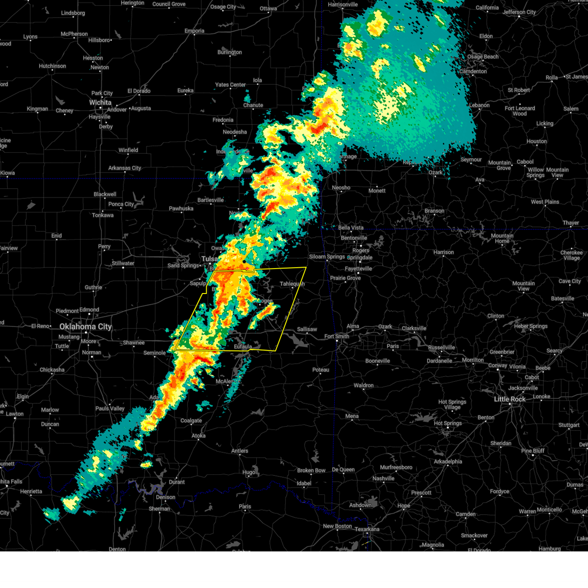 Svrtsa the national weather service in tulsa has issued a * severe thunderstorm warning for, northwestern haskell county in southeastern oklahoma, mcintosh county in southeastern oklahoma, northwestern sequoyah county in east central oklahoma, southwestern mayes county in northeastern oklahoma, wagoner county in northeastern oklahoma, cherokee county in east central oklahoma, okmulgee county in northeastern oklahoma, muskogee county in east central oklahoma, southeastern tulsa county in northeastern oklahoma, eastern okfuskee county in east central oklahoma, * until 800 am cdt. * at 720 am cdt, severe thunderstorms were located along a line extending from 3 miles southeast of inola to 7 miles northeast of dustin, moving east at 60 mph (radar indicated). Hazards include 60 mph wind gusts and quarter size hail. Hail damage to vehicles is expected. expect wind damage to roofs, siding, and trees. Locations in or near the path include, beggs, summit, pumpkin center, webbers falls, fort gibson, porum, braggs, okay, pierce, clearview, schulter, stonebluff, hectorville, scraper, eram, haskell, leonard, lake eufaula state park, morris, gore, this includes interstate 40 in oklahoma between mile markers 217 and 289. Svrtsa the national weather service in tulsa has issued a * severe thunderstorm warning for, northwestern haskell county in southeastern oklahoma, mcintosh county in southeastern oklahoma, northwestern sequoyah county in east central oklahoma, southwestern mayes county in northeastern oklahoma, wagoner county in northeastern oklahoma, cherokee county in east central oklahoma, okmulgee county in northeastern oklahoma, muskogee county in east central oklahoma, southeastern tulsa county in northeastern oklahoma, eastern okfuskee county in east central oklahoma, * until 800 am cdt. * at 720 am cdt, severe thunderstorms were located along a line extending from 3 miles southeast of inola to 7 miles northeast of dustin, moving east at 60 mph (radar indicated). Hazards include 60 mph wind gusts and quarter size hail. Hail damage to vehicles is expected. expect wind damage to roofs, siding, and trees. Locations in or near the path include, beggs, summit, pumpkin center, webbers falls, fort gibson, porum, braggs, okay, pierce, clearview, schulter, stonebluff, hectorville, scraper, eram, haskell, leonard, lake eufaula state park, morris, gore, this includes interstate 40 in oklahoma between mile markers 217 and 289.
|
| 4/2/2025 7:06 AM CDT |
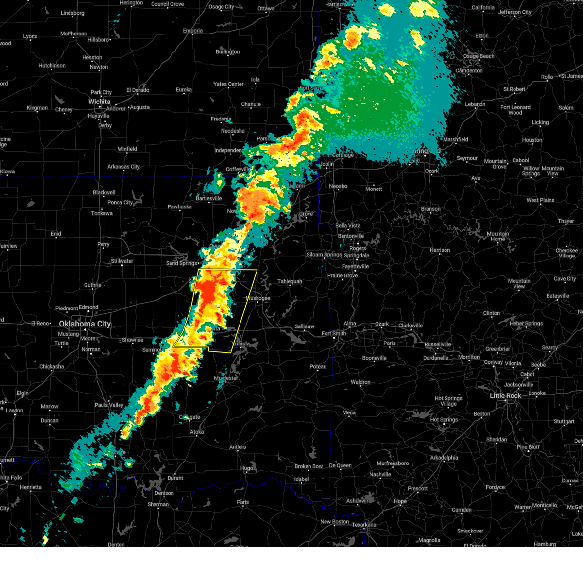 At 706 am cdt, severe thunderstorms were located along a line extending from 5 miles east of jenks riverside airport to 5 miles north of wetumka, moving east at 45 mph (radar indicated). Hazards include 60 mph wind gusts and quarter size hail. Hail damage to vehicles is expected. expect wind damage to roofs, siding, and trees. locations in or near the path include, beggs, broken arrow, preston, sapulpa, raiford, weleetka, dewar, jenks riverside airport, liberty, vivian, mounds, pierce, clearview, schulter, stonebluff, hectorville, eram, haskell, leonard, jenks, this includes the following highways, interstate 40 in oklahoma between mile markers 219 and 258. Interstate 44 between mile markers 211 and 216. At 706 am cdt, severe thunderstorms were located along a line extending from 5 miles east of jenks riverside airport to 5 miles north of wetumka, moving east at 45 mph (radar indicated). Hazards include 60 mph wind gusts and quarter size hail. Hail damage to vehicles is expected. expect wind damage to roofs, siding, and trees. locations in or near the path include, beggs, broken arrow, preston, sapulpa, raiford, weleetka, dewar, jenks riverside airport, liberty, vivian, mounds, pierce, clearview, schulter, stonebluff, hectorville, eram, haskell, leonard, jenks, this includes the following highways, interstate 40 in oklahoma between mile markers 219 and 258. Interstate 44 between mile markers 211 and 216.
|
| 4/2/2025 6:48 AM CDT |
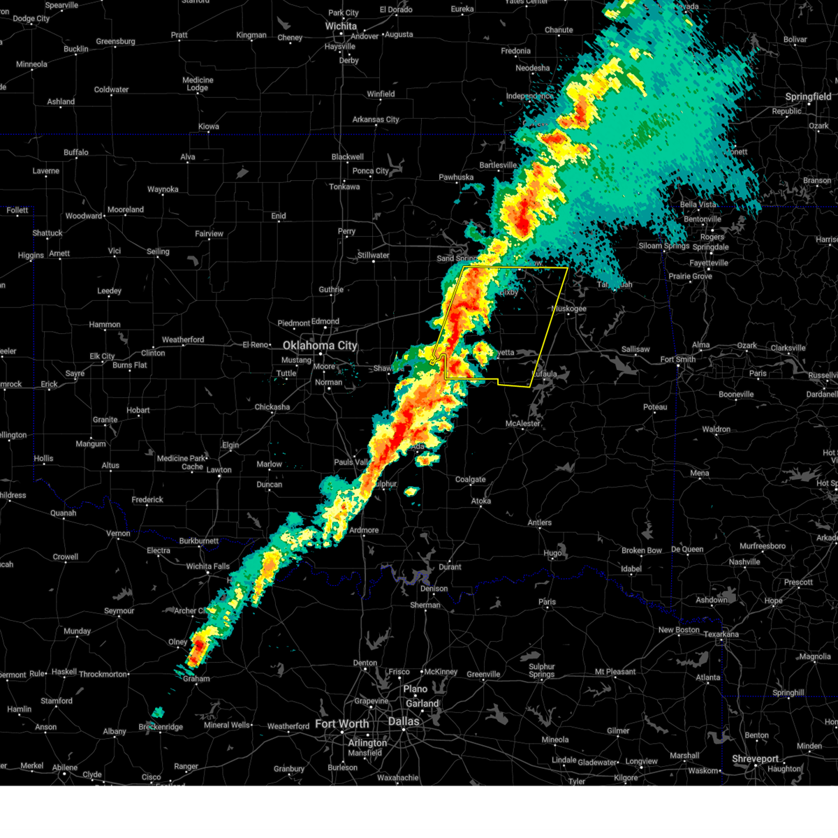 Svrtsa the national weather service in tulsa has issued a * severe thunderstorm warning for, eastern creek county in northeastern oklahoma, western mcintosh county in southeastern oklahoma, southwestern wagoner county in northeastern oklahoma, okmulgee county in northeastern oklahoma, northwestern muskogee county in east central oklahoma, southern tulsa county in northeastern oklahoma, okfuskee county in east central oklahoma, * until 745 am cdt. * at 648 am cdt, severe thunderstorms were located along a line extending from 2 miles north of sapulpa to 3 miles south of cromwell, moving east at 45 mph (radar indicated). Hazards include 60 mph wind gusts and quarter size hail. Hail damage to vehicles is expected. expect wind damage to roofs, siding, and trees. locations in or near the path include, beggs, sapulpa, raiford, jenks riverside airport, mounds, pierce, clearview, schulter, stonebluff, hectorville, eram, haskell, leonard, morris, pharoah, bryant, hoffman, okmulgee, hitchita, okemah, this includes the following highways, interstate 40 in oklahoma between mile markers 212 and 258. Interstate 44 between mile markers 193 and 216. Svrtsa the national weather service in tulsa has issued a * severe thunderstorm warning for, eastern creek county in northeastern oklahoma, western mcintosh county in southeastern oklahoma, southwestern wagoner county in northeastern oklahoma, okmulgee county in northeastern oklahoma, northwestern muskogee county in east central oklahoma, southern tulsa county in northeastern oklahoma, okfuskee county in east central oklahoma, * until 745 am cdt. * at 648 am cdt, severe thunderstorms were located along a line extending from 2 miles north of sapulpa to 3 miles south of cromwell, moving east at 45 mph (radar indicated). Hazards include 60 mph wind gusts and quarter size hail. Hail damage to vehicles is expected. expect wind damage to roofs, siding, and trees. locations in or near the path include, beggs, sapulpa, raiford, jenks riverside airport, mounds, pierce, clearview, schulter, stonebluff, hectorville, eram, haskell, leonard, morris, pharoah, bryant, hoffman, okmulgee, hitchita, okemah, this includes the following highways, interstate 40 in oklahoma between mile markers 212 and 258. Interstate 44 between mile markers 193 and 216.
|
| 4/2/2025 6:00 AM CDT |
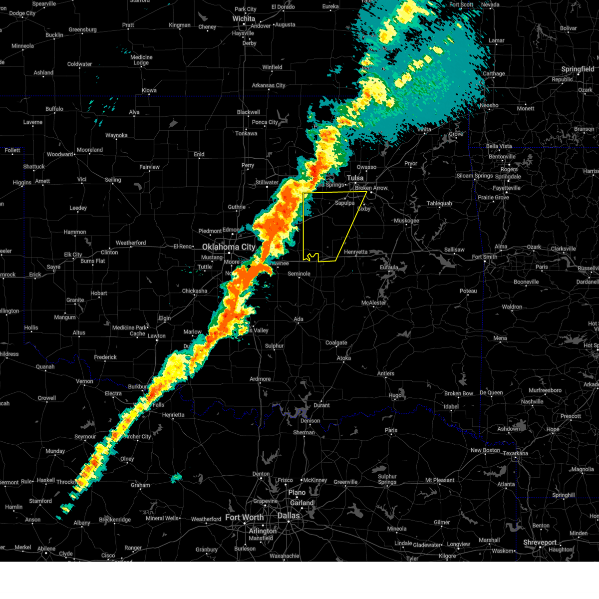 Svrtsa the national weather service in tulsa has issued a * severe thunderstorm warning for, creek county in northeastern oklahoma, northwestern okmulgee county in northeastern oklahoma, southeastern tulsa county in northeastern oklahoma, okfuskee county in east central oklahoma, * until 645 am cdt. * at 559 am cdt, severe thunderstorms were located along a line extending from near oilton to 4 miles northeast of dale, moving east at 60 mph (radar indicated). Hazards include 60 mph wind gusts and quarter size hail. Hail damage to vehicles is expected. expect wind damage to roofs, siding, and trees. locations in or near the path include, beggs, shamrock, bristow, boley, sapulpa, paden, okemah, jenks riverside airport, liberty, depew, okfuskee, milfay, mounds, drumright, mason, castle, jenks, glenpool, welty, slick, this includes the following highways, interstate 40 in oklahoma between mile markers 212 and 224. Interstate 44 between mile markers 178 and 215. Svrtsa the national weather service in tulsa has issued a * severe thunderstorm warning for, creek county in northeastern oklahoma, northwestern okmulgee county in northeastern oklahoma, southeastern tulsa county in northeastern oklahoma, okfuskee county in east central oklahoma, * until 645 am cdt. * at 559 am cdt, severe thunderstorms were located along a line extending from near oilton to 4 miles northeast of dale, moving east at 60 mph (radar indicated). Hazards include 60 mph wind gusts and quarter size hail. Hail damage to vehicles is expected. expect wind damage to roofs, siding, and trees. locations in or near the path include, beggs, shamrock, bristow, boley, sapulpa, paden, okemah, jenks riverside airport, liberty, depew, okfuskee, milfay, mounds, drumright, mason, castle, jenks, glenpool, welty, slick, this includes the following highways, interstate 40 in oklahoma between mile markers 212 and 224. Interstate 44 between mile markers 178 and 215.
|
| 3/30/2025 2:23 AM CDT |
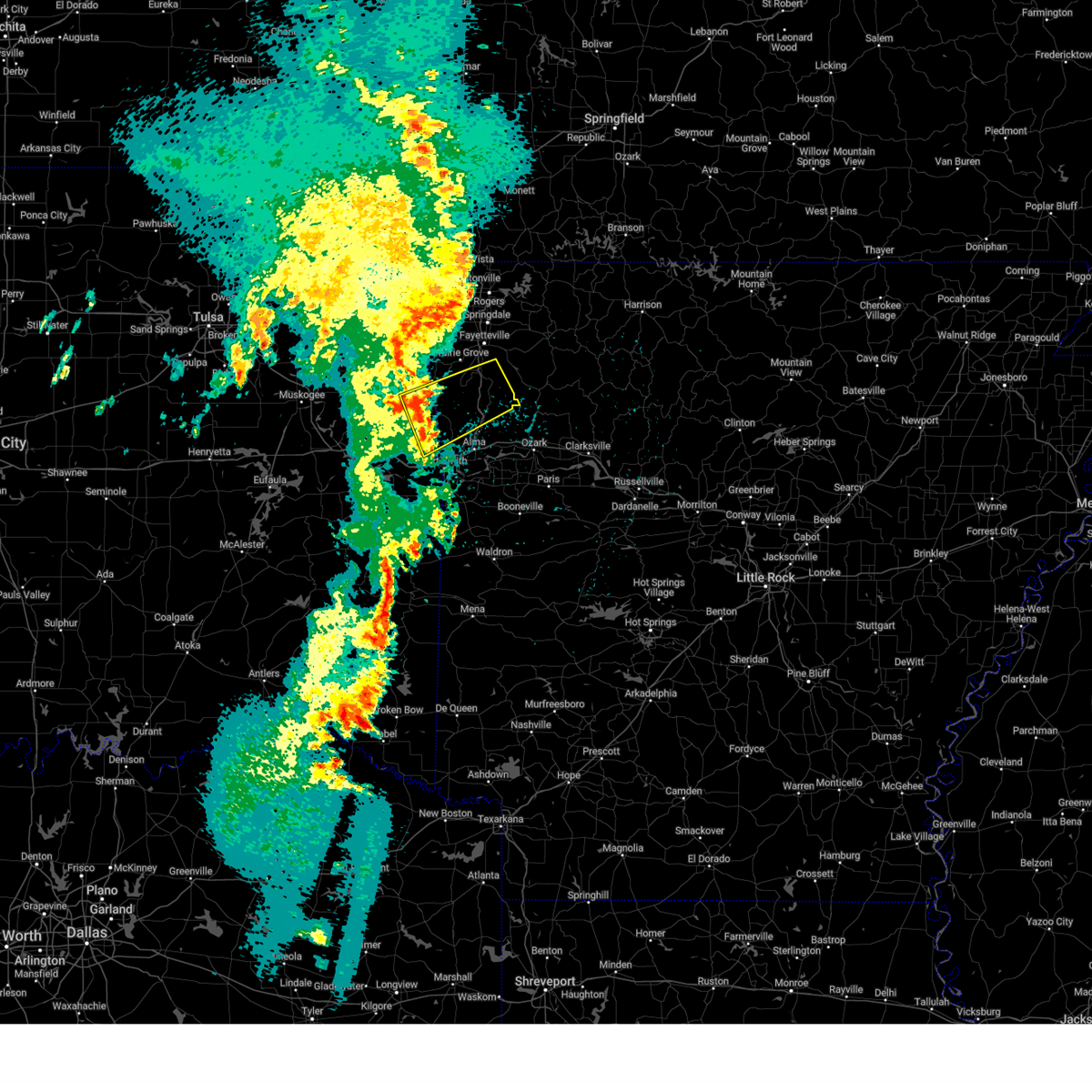 Svrtsa the national weather service in tulsa has issued a * severe thunderstorm warning for, northern crawford county in northwestern arkansas, southern washington county in northwestern arkansas, northeastern sequoyah county in east central oklahoma, southeastern adair county in northeastern oklahoma, * until 315 am cdt. * at 223 am cdt, severe thunderstorms were located along a line extending from 6 miles northeast of bunch to 2 miles north of roland, moving northeast at 60 mph (radar indicated). Hazards include 60 mph wind gusts. Expect damage to roofs, siding, and trees. Locations in or near the path include, wyola, natural dam, bidville, woolsey, devils den state park, brentwood, west fork, lake fort smith, strickler, mountainburg, arnett, blackburn, chester, winslow, lee creek, uniontown, hogeye, locke, odell, mount gayler, this includes interstate 49 between mile markers 30 and 53. Svrtsa the national weather service in tulsa has issued a * severe thunderstorm warning for, northern crawford county in northwestern arkansas, southern washington county in northwestern arkansas, northeastern sequoyah county in east central oklahoma, southeastern adair county in northeastern oklahoma, * until 315 am cdt. * at 223 am cdt, severe thunderstorms were located along a line extending from 6 miles northeast of bunch to 2 miles north of roland, moving northeast at 60 mph (radar indicated). Hazards include 60 mph wind gusts. Expect damage to roofs, siding, and trees. Locations in or near the path include, wyola, natural dam, bidville, woolsey, devils den state park, brentwood, west fork, lake fort smith, strickler, mountainburg, arnett, blackburn, chester, winslow, lee creek, uniontown, hogeye, locke, odell, mount gayler, this includes interstate 49 between mile markers 30 and 53.
|
| 3/30/2025 1:48 AM CDT |
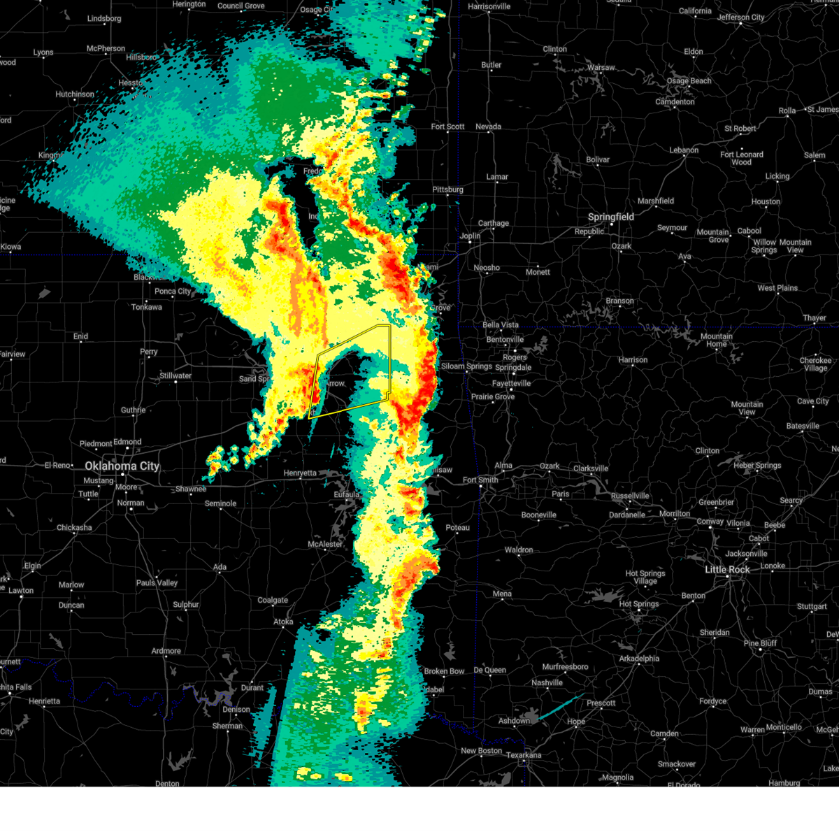 Svrtsa the national weather service in tulsa has issued a * severe thunderstorm warning for, southern rogers county in northeastern oklahoma, western mayes county in northeastern oklahoma, central wagoner county in northeastern oklahoma, southeastern tulsa county in northeastern oklahoma, * until 230 am cdt. * at 148 am cdt, severe thunderstorms were located along a line extending from 2 miles southeast of owasso to 7 miles south of bixby, moving northeast at 50 mph (radar indicated). Hazards include 60 mph wind gusts. Expect damage to roofs, siding, and trees. Locations in or near the path include, broken arrow, adair, pryor, inola, mazie, verdigris, coweta, claremore, chouteau, pryor creek, leonard, sportsmen acres community, catoosa, bixby, murphy, tiawah, oneta, owasso, wagoner, tulsa, this includes interstate 44 between mile markers 230 and 272. Svrtsa the national weather service in tulsa has issued a * severe thunderstorm warning for, southern rogers county in northeastern oklahoma, western mayes county in northeastern oklahoma, central wagoner county in northeastern oklahoma, southeastern tulsa county in northeastern oklahoma, * until 230 am cdt. * at 148 am cdt, severe thunderstorms were located along a line extending from 2 miles southeast of owasso to 7 miles south of bixby, moving northeast at 50 mph (radar indicated). Hazards include 60 mph wind gusts. Expect damage to roofs, siding, and trees. Locations in or near the path include, broken arrow, adair, pryor, inola, mazie, verdigris, coweta, claremore, chouteau, pryor creek, leonard, sportsmen acres community, catoosa, bixby, murphy, tiawah, oneta, owasso, wagoner, tulsa, this includes interstate 44 between mile markers 230 and 272.
|
| 3/30/2025 12:37 AM CDT |
 the severe thunderstorm warning has been cancelled and is no longer in effect the severe thunderstorm warning has been cancelled and is no longer in effect
|
| 3/30/2025 12:37 AM CDT |
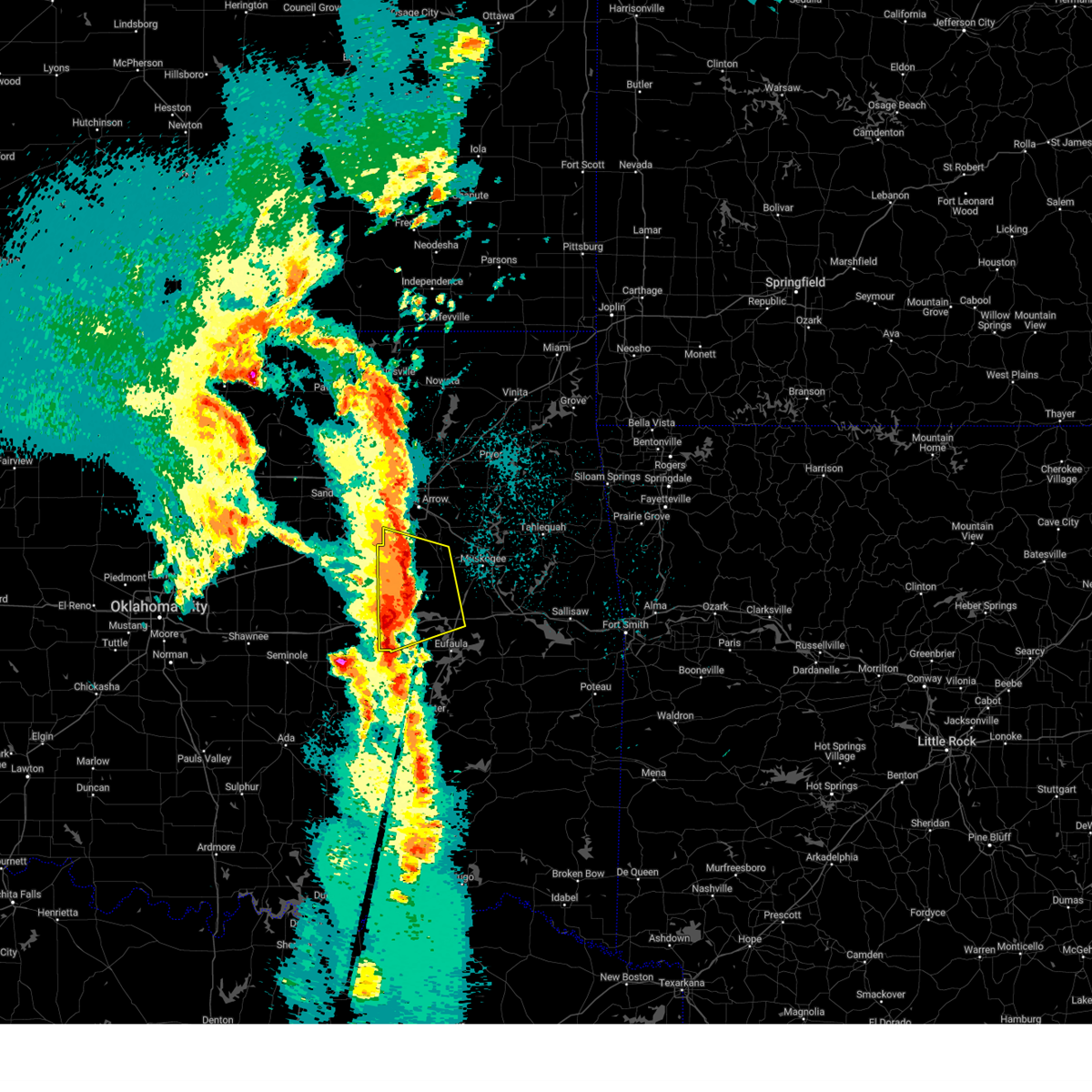 At 1236 am cdt, a severe thunderstorm was located 3 miles south of bald hill, moving northeast at 65 to 70 mph (radar indicated). Hazards include 60 mph wind gusts and quarter size hail. Hail damage to vehicles is expected. expect wind damage to roofs, siding, and trees. Locations in or near the path include, preston, dewar, liberty, pierce, schulter, hectorville, eram, checotah, haskell, lake eufaula state park, morris, grayson, wainwright, hoffman, okmulgee, jamesville, hitchita, bald hill, henryetta, boynton, this includes interstate 40 in oklahoma between mile markers 234 and 265. At 1236 am cdt, a severe thunderstorm was located 3 miles south of bald hill, moving northeast at 65 to 70 mph (radar indicated). Hazards include 60 mph wind gusts and quarter size hail. Hail damage to vehicles is expected. expect wind damage to roofs, siding, and trees. Locations in or near the path include, preston, dewar, liberty, pierce, schulter, hectorville, eram, checotah, haskell, lake eufaula state park, morris, grayson, wainwright, hoffman, okmulgee, jamesville, hitchita, bald hill, henryetta, boynton, this includes interstate 40 in oklahoma between mile markers 234 and 265.
|
| 3/30/2025 12:35 AM CDT |
 Svrtsa the national weather service in tulsa has issued a * severe thunderstorm warning for, central rogers county in northeastern oklahoma, northwestern mcintosh county in southeastern oklahoma, mayes county in northeastern oklahoma, wagoner county in northeastern oklahoma, northwestern cherokee county in east central oklahoma, eastern okmulgee county in northeastern oklahoma, northern muskogee county in east central oklahoma, southeastern tulsa county in northeastern oklahoma, * until 115 am cdt. * at 1234 am cdt, severe thunderstorms were located along a line extending from 3 miles east of jenks riverside airport to 3 miles east of morris to 4 miles east of dustin, moving northeast at 70 mph (radar indicated). Hazards include 60 mph wind gusts and quarter size hail. Hail damage to vehicles is expected. expect wind damage to roofs, siding, and trees. locations in or near the path include, inola, mazie, summit, locust grove, fort gibson, okay, pierce, schulter, stonebluff, hectorville, chouteau, eram, chelsea, haskell, leonard, morris, murphy, bushyhead, tullahassee, hoffman, this includes the following highways, interstate 40 in oklahoma between mile markers 238 and 260. Interstate 44 between mile markers 224 and 272. Svrtsa the national weather service in tulsa has issued a * severe thunderstorm warning for, central rogers county in northeastern oklahoma, northwestern mcintosh county in southeastern oklahoma, mayes county in northeastern oklahoma, wagoner county in northeastern oklahoma, northwestern cherokee county in east central oklahoma, eastern okmulgee county in northeastern oklahoma, northern muskogee county in east central oklahoma, southeastern tulsa county in northeastern oklahoma, * until 115 am cdt. * at 1234 am cdt, severe thunderstorms were located along a line extending from 3 miles east of jenks riverside airport to 3 miles east of morris to 4 miles east of dustin, moving northeast at 70 mph (radar indicated). Hazards include 60 mph wind gusts and quarter size hail. Hail damage to vehicles is expected. expect wind damage to roofs, siding, and trees. locations in or near the path include, inola, mazie, summit, locust grove, fort gibson, okay, pierce, schulter, stonebluff, hectorville, chouteau, eram, chelsea, haskell, leonard, morris, murphy, bushyhead, tullahassee, hoffman, this includes the following highways, interstate 40 in oklahoma between mile markers 238 and 260. Interstate 44 between mile markers 224 and 272.
|
| 3/30/2025 12:20 AM CDT |
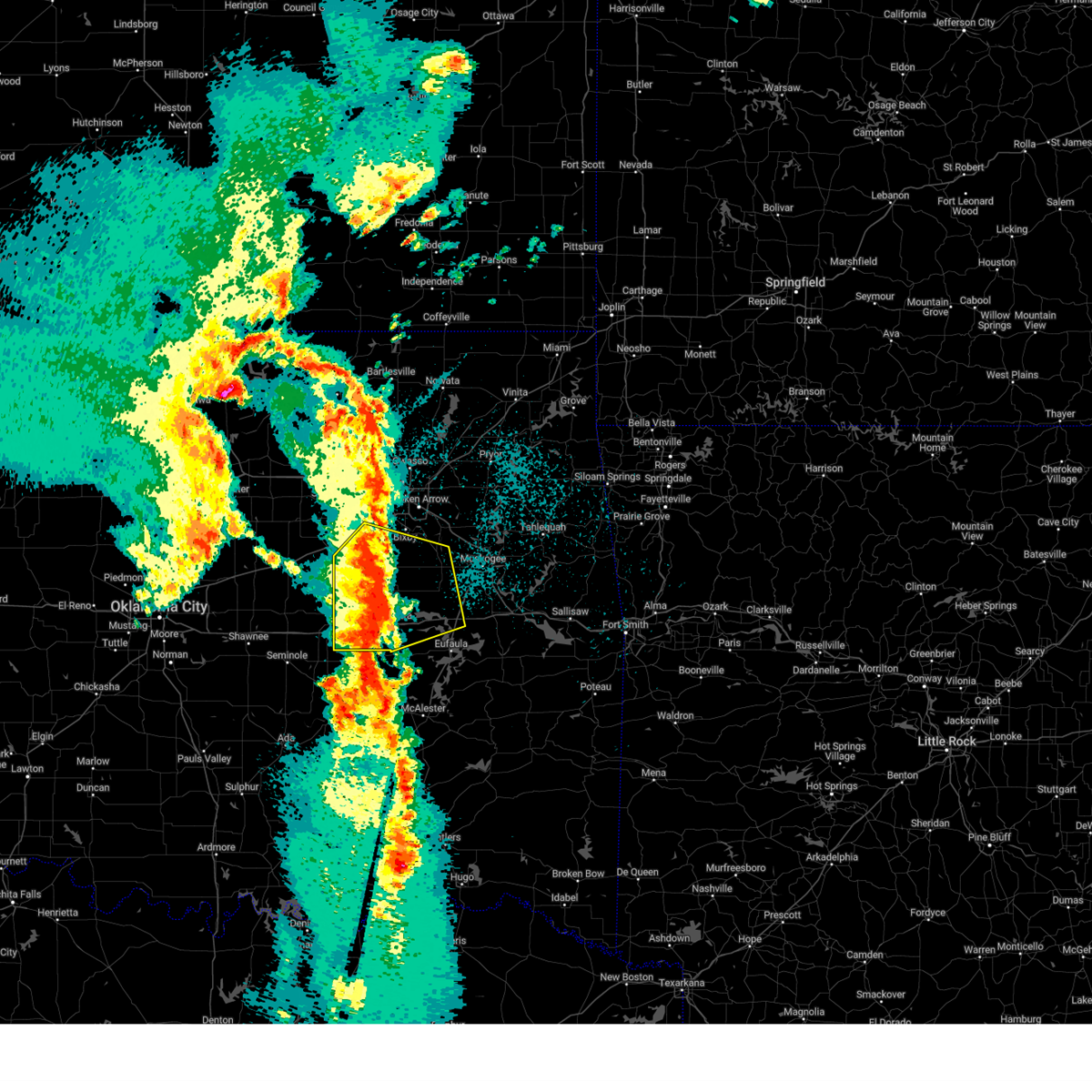 At 1219 am cdt, a severe thunderstorm was located 6 miles southwest of okmulgee state park, moving northeast at 55 mph (radar indicated). Hazards include 70 mph wind gusts and quarter size hail. Hail damage to vehicles is expected. expect considerable tree damage. wind damage is also likely to mobile homes, roofs, and outbuildings. Locations in or near the path include, beggs, preston, weleetka, dewar, liberty, mounds, pierce, clearview, schulter, hectorville, eram, checotah, haskell, lake eufaula state park, morris, pharoah, grayson, bryant, wainwright, hoffman, this includes interstate 40 in oklahoma between mile markers 217 and 265. At 1219 am cdt, a severe thunderstorm was located 6 miles southwest of okmulgee state park, moving northeast at 55 mph (radar indicated). Hazards include 70 mph wind gusts and quarter size hail. Hail damage to vehicles is expected. expect considerable tree damage. wind damage is also likely to mobile homes, roofs, and outbuildings. Locations in or near the path include, beggs, preston, weleetka, dewar, liberty, mounds, pierce, clearview, schulter, hectorville, eram, checotah, haskell, lake eufaula state park, morris, pharoah, grayson, bryant, wainwright, hoffman, this includes interstate 40 in oklahoma between mile markers 217 and 265.
|
| 3/30/2025 12:09 AM CDT |
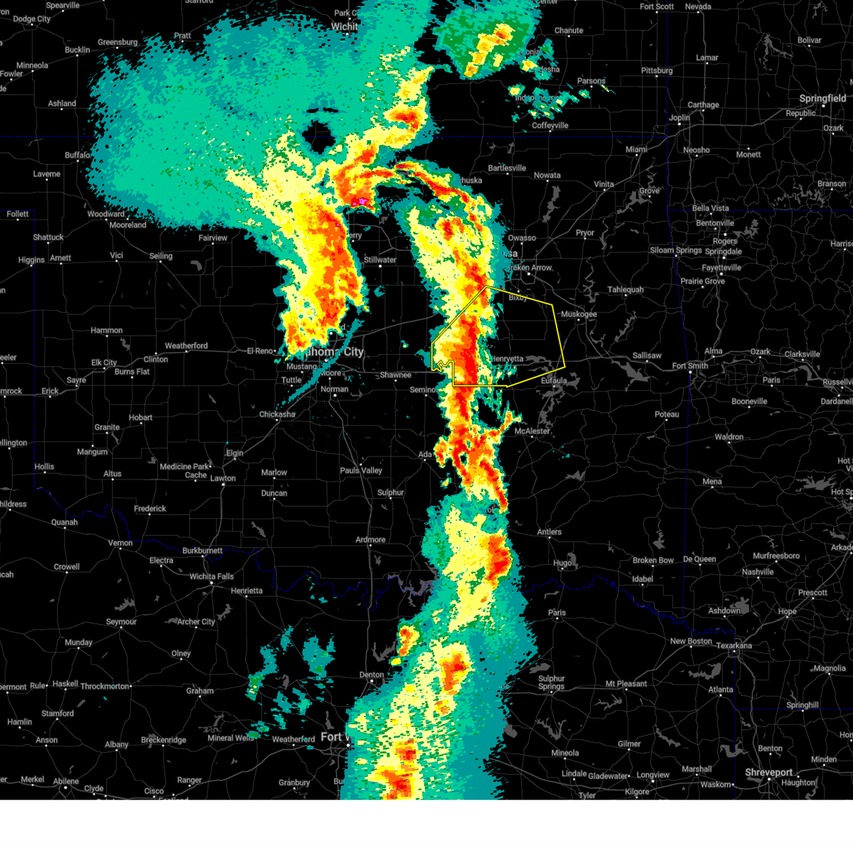 At 1209 am cdt, a severe thunderstorm was located 3 miles east of okemah, moving northeast at 60 mph (radar indicated). Hazards include 70 mph wind gusts and quarter size hail. Hail damage to vehicles is expected. expect considerable tree damage. wind damage is also likely to mobile homes, roofs, and outbuildings. Locations in or near the path include, beggs, preston, boley, paden, weleetka, dewar, liberty, mounds, pierce, clearview, schulter, hectorville, eram, checotah, haskell, lake eufaula state park, morris, pharoah, grayson, bryant, this includes interstate 40 in oklahoma between mile markers 212 and 265. At 1209 am cdt, a severe thunderstorm was located 3 miles east of okemah, moving northeast at 60 mph (radar indicated). Hazards include 70 mph wind gusts and quarter size hail. Hail damage to vehicles is expected. expect considerable tree damage. wind damage is also likely to mobile homes, roofs, and outbuildings. Locations in or near the path include, beggs, preston, boley, paden, weleetka, dewar, liberty, mounds, pierce, clearview, schulter, hectorville, eram, checotah, haskell, lake eufaula state park, morris, pharoah, grayson, bryant, this includes interstate 40 in oklahoma between mile markers 212 and 265.
|
| 3/30/2025 12:04 AM CDT |
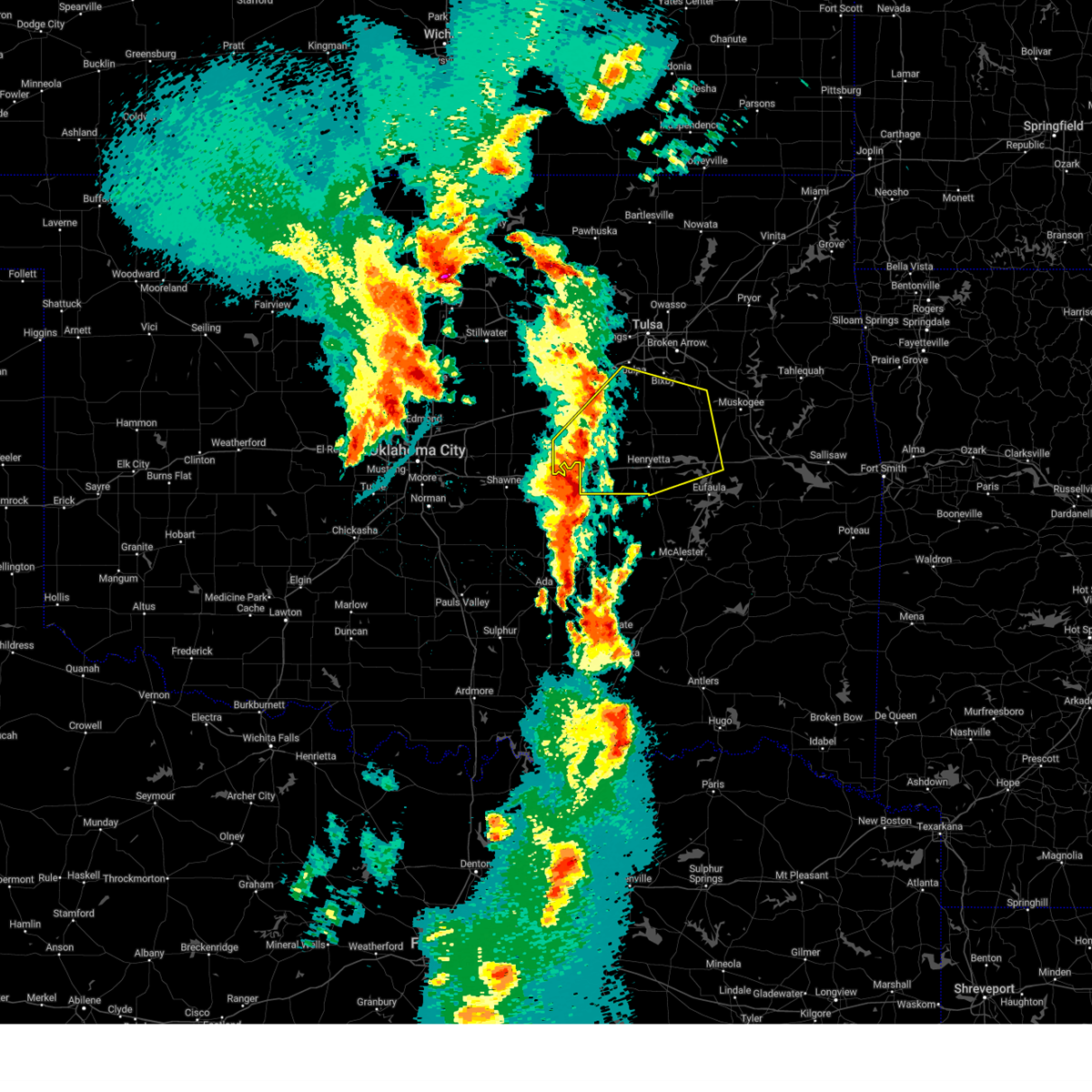 Svrtsa the national weather service in tulsa has issued a * severe thunderstorm warning for, southeastern creek county in northeastern oklahoma, northern mcintosh county in southeastern oklahoma, southwestern wagoner county in northeastern oklahoma, okmulgee county in northeastern oklahoma, northwestern muskogee county in east central oklahoma, south central tulsa county in northeastern oklahoma, okfuskee county in east central oklahoma, * until 1245 am cdt. * at 1203 am cdt, a severe thunderstorm was located over okemah, moving northeast at 65 mph (radar indicated). Hazards include 60 mph wind gusts and quarter size hail. Hail damage to vehicles is expected. expect wind damage to roofs, siding, and trees. Locations in or near the path include, beggs, preston, boley, paden, weleetka, dewar, liberty, mounds, pierce, clearview, schulter, hectorville, eram, checotah, haskell, lake eufaula state park, morris, pharoah, grayson, bryant, this includes interstate 40 in oklahoma between mile markers 212 and 265. Svrtsa the national weather service in tulsa has issued a * severe thunderstorm warning for, southeastern creek county in northeastern oklahoma, northern mcintosh county in southeastern oklahoma, southwestern wagoner county in northeastern oklahoma, okmulgee county in northeastern oklahoma, northwestern muskogee county in east central oklahoma, south central tulsa county in northeastern oklahoma, okfuskee county in east central oklahoma, * until 1245 am cdt. * at 1203 am cdt, a severe thunderstorm was located over okemah, moving northeast at 65 mph (radar indicated). Hazards include 60 mph wind gusts and quarter size hail. Hail damage to vehicles is expected. expect wind damage to roofs, siding, and trees. Locations in or near the path include, beggs, preston, boley, paden, weleetka, dewar, liberty, mounds, pierce, clearview, schulter, hectorville, eram, checotah, haskell, lake eufaula state park, morris, pharoah, grayson, bryant, this includes interstate 40 in oklahoma between mile markers 212 and 265.
|
| 3/4/2025 8:27 AM CST |
 the severe thunderstorm warning has been cancelled and is no longer in effect the severe thunderstorm warning has been cancelled and is no longer in effect
|
| 3/4/2025 8:27 AM CST |
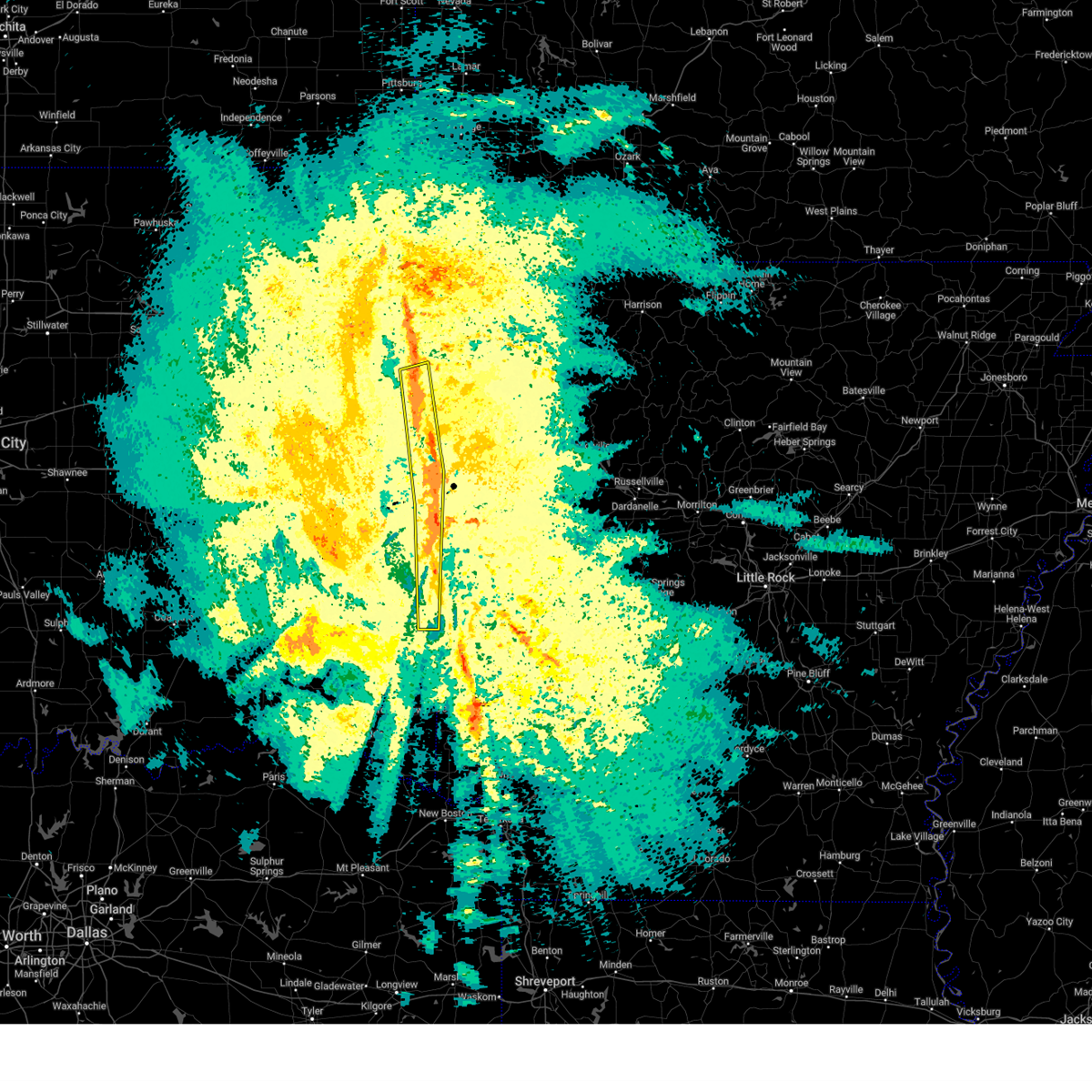 At 827 am cst, severe thunderstorms were located along a line extending from 3 miles east of baron to 6 miles southeast of heavener, moving northeast at 40 mph (radar indicated). Hazards include 60 mph wind gusts and penny size hail. Expect damage to roofs, siding, and trees. Locations in or near the path include, adair state park, scullyville, arkoma, cameron, pocola, braden, maryetta, spiro, roland, moffett, jenson, heavener, cottonwood, stilwell, muldrow, baron, short, rock island, poteau, bonanza, this includes interstate 40 in oklahoma between mile markers 317 and 328. At 827 am cst, severe thunderstorms were located along a line extending from 3 miles east of baron to 6 miles southeast of heavener, moving northeast at 40 mph (radar indicated). Hazards include 60 mph wind gusts and penny size hail. Expect damage to roofs, siding, and trees. Locations in or near the path include, adair state park, scullyville, arkoma, cameron, pocola, braden, maryetta, spiro, roland, moffett, jenson, heavener, cottonwood, stilwell, muldrow, baron, short, rock island, poteau, bonanza, this includes interstate 40 in oklahoma between mile markers 317 and 328.
|
| 3/4/2025 7:57 AM CST |
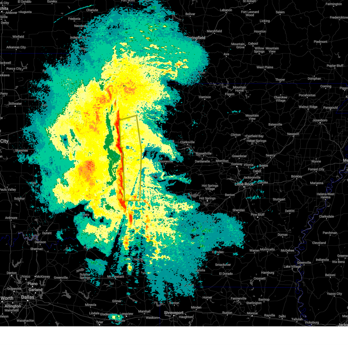 Svrtsa the national weather service in tulsa has issued a * severe thunderstorm warning for, sequoyah county in east central oklahoma, southern adair county in northeastern oklahoma, le flore county in southeastern oklahoma, southeastern cherokee county in east central oklahoma, * until 845 am cst. * at 757 am cst, severe thunderstorms were located along a line extending from 3 miles southwest of bunch to 4 miles west of octavia, moving northeast at 60 mph (radar indicated). Hazards include 60 mph wind gusts and penny size hail. Expect damage to roofs, siding, and trees. Locations in or near the path include, octavia, adair state park, brushy, marble city, cameron, pocola, maryetta, spiro, big cedar, cowlington, brushy lake state park, poteau, moffett, shady point, panama, howe, stilwell, bunch, muldrow, baron, this includes interstate 40 in oklahoma between mile markers 303 and 328. Svrtsa the national weather service in tulsa has issued a * severe thunderstorm warning for, sequoyah county in east central oklahoma, southern adair county in northeastern oklahoma, le flore county in southeastern oklahoma, southeastern cherokee county in east central oklahoma, * until 845 am cst. * at 757 am cst, severe thunderstorms were located along a line extending from 3 miles southwest of bunch to 4 miles west of octavia, moving northeast at 60 mph (radar indicated). Hazards include 60 mph wind gusts and penny size hail. Expect damage to roofs, siding, and trees. Locations in or near the path include, octavia, adair state park, brushy, marble city, cameron, pocola, maryetta, spiro, big cedar, cowlington, brushy lake state park, poteau, moffett, shady point, panama, howe, stilwell, bunch, muldrow, baron, this includes interstate 40 in oklahoma between mile markers 303 and 328.
|
| 11/4/2024 2:00 PM CST |
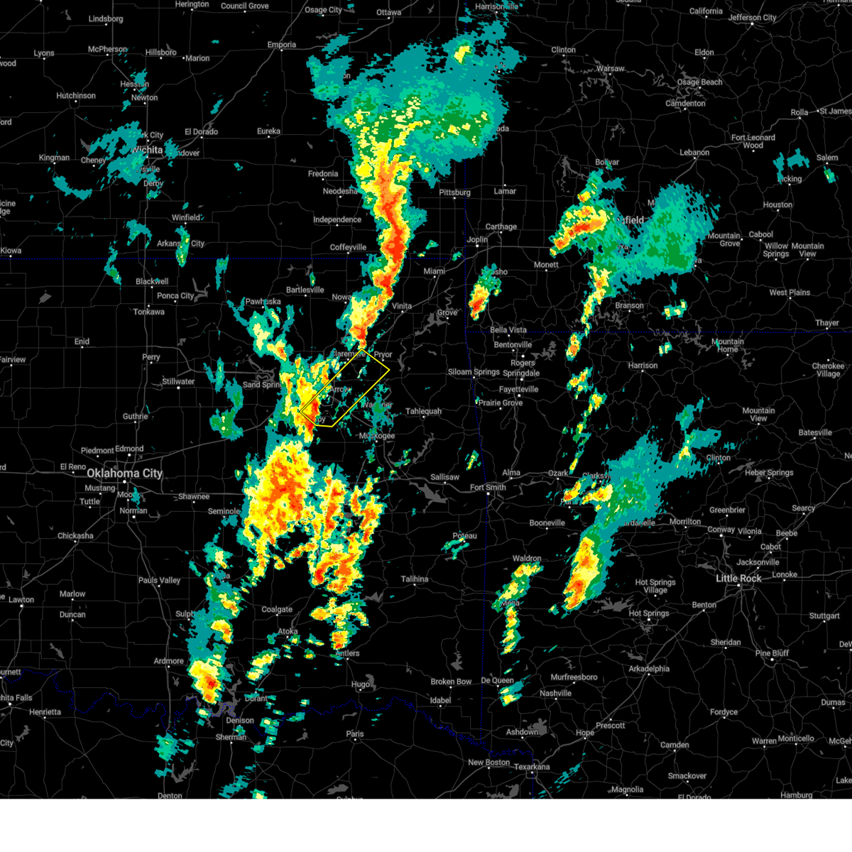 Svrtsa the national weather service in tulsa has issued a * severe thunderstorm warning for, southern rogers county in northeastern oklahoma, southwestern mayes county in northeastern oklahoma, northwestern wagoner county in northeastern oklahoma, southeastern tulsa county in northeastern oklahoma, * until 245 pm cst. * at 200 pm cst, a severe thunderstorm was located 3 miles southeast of bixby, moving northeast at 60 mph (radar indicated). Hazards include 60 mph wind gusts and quarter size hail. Hail damage to vehicles is expected. expect wind damage to roofs, siding, and trees. Locations in or near the path include, tulsa, broken arrow, bixby, jenks, glenpool, coweta, catoosa, chouteau, inola, stonebluff, sportsmen acres community, taiwah, tiawah, oneta, leonard, this includes interstate 44 between mile markers 236 and 245, and between mile markers 249 and 257. Svrtsa the national weather service in tulsa has issued a * severe thunderstorm warning for, southern rogers county in northeastern oklahoma, southwestern mayes county in northeastern oklahoma, northwestern wagoner county in northeastern oklahoma, southeastern tulsa county in northeastern oklahoma, * until 245 pm cst. * at 200 pm cst, a severe thunderstorm was located 3 miles southeast of bixby, moving northeast at 60 mph (radar indicated). Hazards include 60 mph wind gusts and quarter size hail. Hail damage to vehicles is expected. expect wind damage to roofs, siding, and trees. Locations in or near the path include, tulsa, broken arrow, bixby, jenks, glenpool, coweta, catoosa, chouteau, inola, stonebluff, sportsmen acres community, taiwah, tiawah, oneta, leonard, this includes interstate 44 between mile markers 236 and 245, and between mile markers 249 and 257.
|
| 11/4/2024 1:47 PM CST |
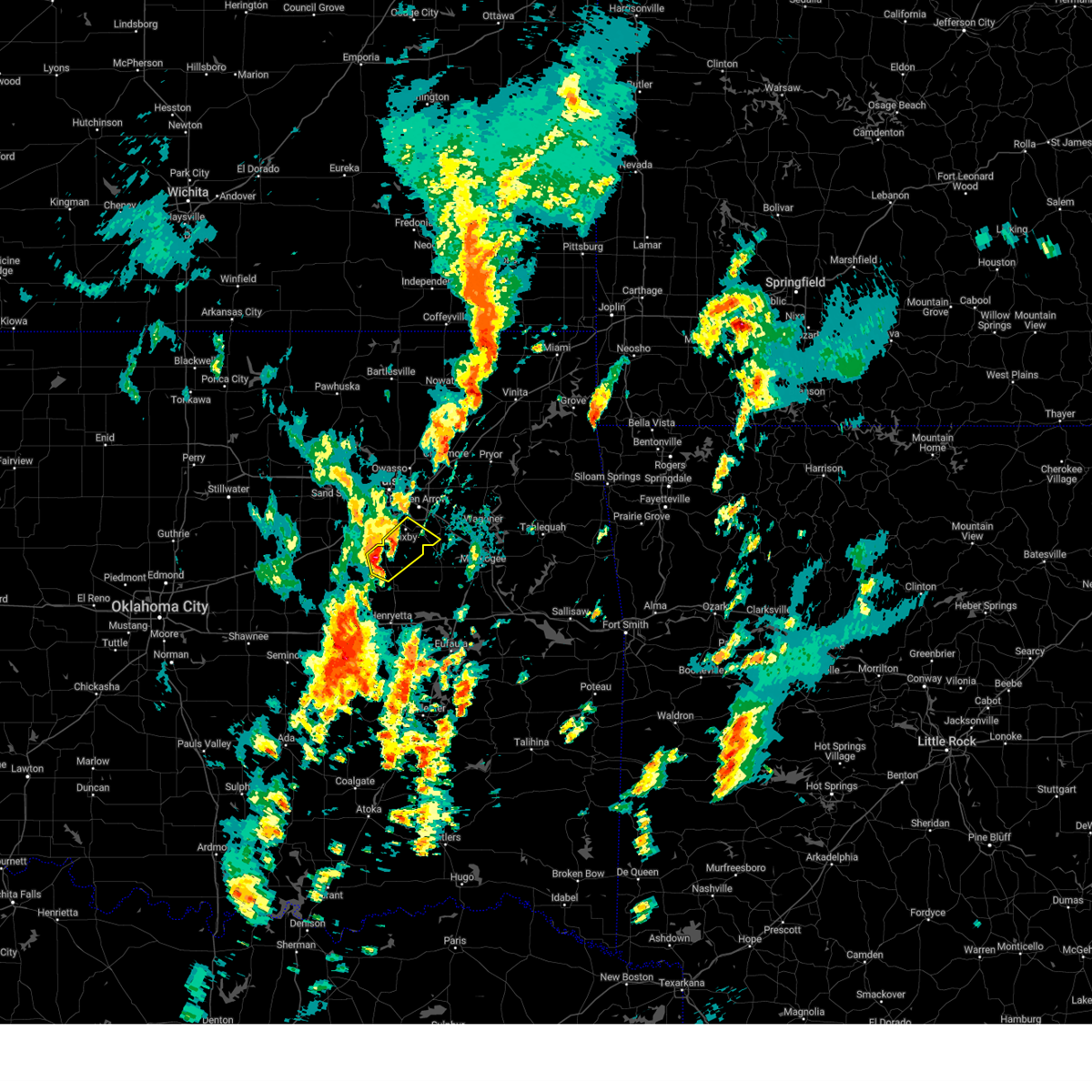 At 147 pm cst, a severe thunderstorm was located 4 miles north of preston, moving northeast at 50 mph (radar indicated). Hazards include 60 mph wind gusts and quarter size hail. Hail damage to vehicles is expected. expect wind damage to roofs, siding, and trees. Locations in or near the path include, broken arrow, bixby, jenks, beggs, preston, stonebluff, liberty, hectorville, leonard,. At 147 pm cst, a severe thunderstorm was located 4 miles north of preston, moving northeast at 50 mph (radar indicated). Hazards include 60 mph wind gusts and quarter size hail. Hail damage to vehicles is expected. expect wind damage to roofs, siding, and trees. Locations in or near the path include, broken arrow, bixby, jenks, beggs, preston, stonebluff, liberty, hectorville, leonard,.
|
| 11/4/2024 1:37 PM CST |
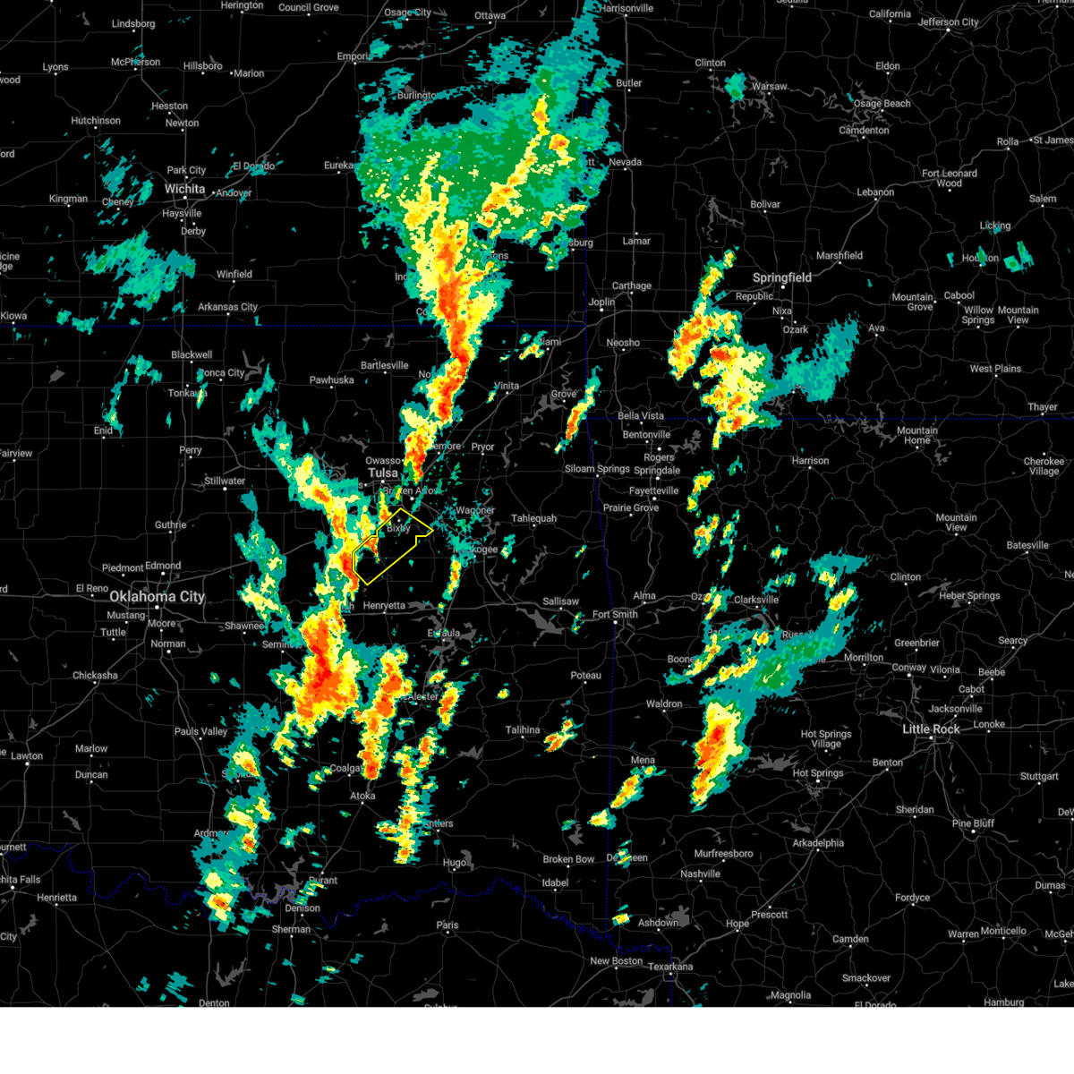 Svrtsa the national weather service in tulsa has issued a * severe thunderstorm warning for, west central wagoner county in northeastern oklahoma, northwestern okmulgee county in northeastern oklahoma, southeastern tulsa county in northeastern oklahoma, * until 200 pm cst. * at 137 pm cst, a severe thunderstorm was located 3 miles southwest of beggs, moving northeast at 55 mph (radar indicated). Hazards include 60 mph wind gusts and quarter size hail. Hail damage to vehicles is expected. expect wind damage to roofs, siding, and trees. Locations in or near the path include, broken arrow, okmulgee, bixby, jenks, beggs, preston, stonebluff, okmulgee state park, liberty, hectorville, leonard,. Svrtsa the national weather service in tulsa has issued a * severe thunderstorm warning for, west central wagoner county in northeastern oklahoma, northwestern okmulgee county in northeastern oklahoma, southeastern tulsa county in northeastern oklahoma, * until 200 pm cst. * at 137 pm cst, a severe thunderstorm was located 3 miles southwest of beggs, moving northeast at 55 mph (radar indicated). Hazards include 60 mph wind gusts and quarter size hail. Hail damage to vehicles is expected. expect wind damage to roofs, siding, and trees. Locations in or near the path include, broken arrow, okmulgee, bixby, jenks, beggs, preston, stonebluff, okmulgee state park, liberty, hectorville, leonard,.
|
| 11/3/2024 4:06 AM CST |
 the severe thunderstorm warning has been cancelled and is no longer in effect the severe thunderstorm warning has been cancelled and is no longer in effect
|
| 11/3/2024 4:06 AM CST |
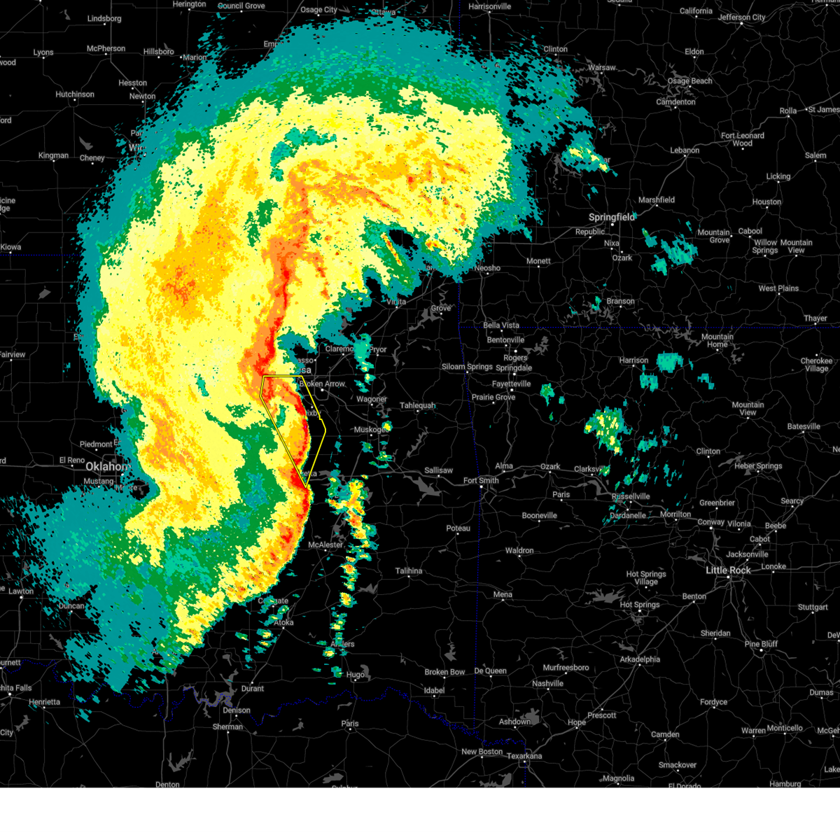 At 406 am cst, severe thunderstorms were located along a line extending from 2 miles west of tulsa to 4 miles west of haskell to 4 miles southeast of hoffman, moving east at 50 mph (radar indicated). Hazards include 70 mph wind gusts. Expect considerable tree damage. damage is likely to mobile homes, roofs, and outbuildings. locations in or near the path include, tulsa, sand springs, okmulgee, bixby, sapulpa, jenks, glenpool, henryetta, mannford, kiefer, morris, beggs, mounds, kellyville, dewar, schulter, keystone state park, preston, jenks riverside airport, bald hill, this includes the following highways, interstate 40 in oklahoma between mile markers 239 and 241. Interstate 44 between mile markers 201 and 223. At 406 am cst, severe thunderstorms were located along a line extending from 2 miles west of tulsa to 4 miles west of haskell to 4 miles southeast of hoffman, moving east at 50 mph (radar indicated). Hazards include 70 mph wind gusts. Expect considerable tree damage. damage is likely to mobile homes, roofs, and outbuildings. locations in or near the path include, tulsa, sand springs, okmulgee, bixby, sapulpa, jenks, glenpool, henryetta, mannford, kiefer, morris, beggs, mounds, kellyville, dewar, schulter, keystone state park, preston, jenks riverside airport, bald hill, this includes the following highways, interstate 40 in oklahoma between mile markers 239 and 241. Interstate 44 between mile markers 201 and 223.
|
| 11/3/2024 3:29 AM CST |
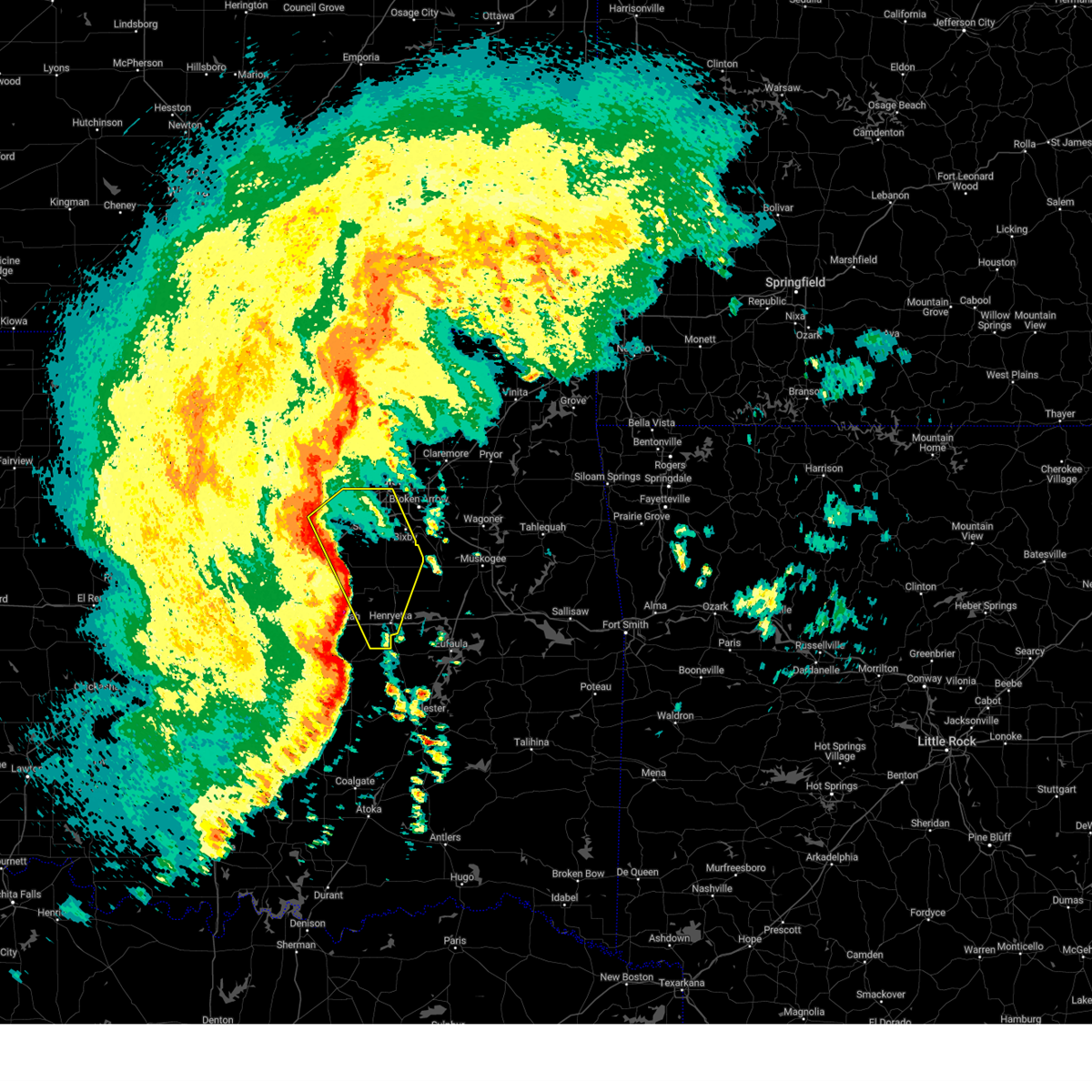 Svrtsa the national weather service in tulsa has issued a * severe thunderstorm warning for, central creek county in northeastern oklahoma, okmulgee county in northeastern oklahoma, southern tulsa county in northeastern oklahoma, eastern okfuskee county in east central oklahoma, * until 415 am cst. * at 329 am cst, severe thunderstorms were located along a line extending from 6 miles east of drumright to 6 miles northwest of okfuskee to 4 miles southeast of bearden, moving east at 50 mph (radar indicated). Hazards include 70 mph wind gusts. Expect considerable tree damage. damage is likely to mobile homes, roofs, and outbuildings. locations in or near the path include, tulsa, sand springs, okmulgee, bristow, bixby, sapulpa, jenks, okfuskee, glenpool, henryetta, mannford, kiefer, morris, beggs, mounds, kellyville, weleetka, dewar, schulter, slick, this includes the following highways, interstate 40 in oklahoma between mile markers 226 and 241. Interstate 44 between mile markers 190 and 223. Svrtsa the national weather service in tulsa has issued a * severe thunderstorm warning for, central creek county in northeastern oklahoma, okmulgee county in northeastern oklahoma, southern tulsa county in northeastern oklahoma, eastern okfuskee county in east central oklahoma, * until 415 am cst. * at 329 am cst, severe thunderstorms were located along a line extending from 6 miles east of drumright to 6 miles northwest of okfuskee to 4 miles southeast of bearden, moving east at 50 mph (radar indicated). Hazards include 70 mph wind gusts. Expect considerable tree damage. damage is likely to mobile homes, roofs, and outbuildings. locations in or near the path include, tulsa, sand springs, okmulgee, bristow, bixby, sapulpa, jenks, okfuskee, glenpool, henryetta, mannford, kiefer, morris, beggs, mounds, kellyville, weleetka, dewar, schulter, slick, this includes the following highways, interstate 40 in oklahoma between mile markers 226 and 241. Interstate 44 between mile markers 190 and 223.
|
| 11/2/2024 8:05 PM CST |
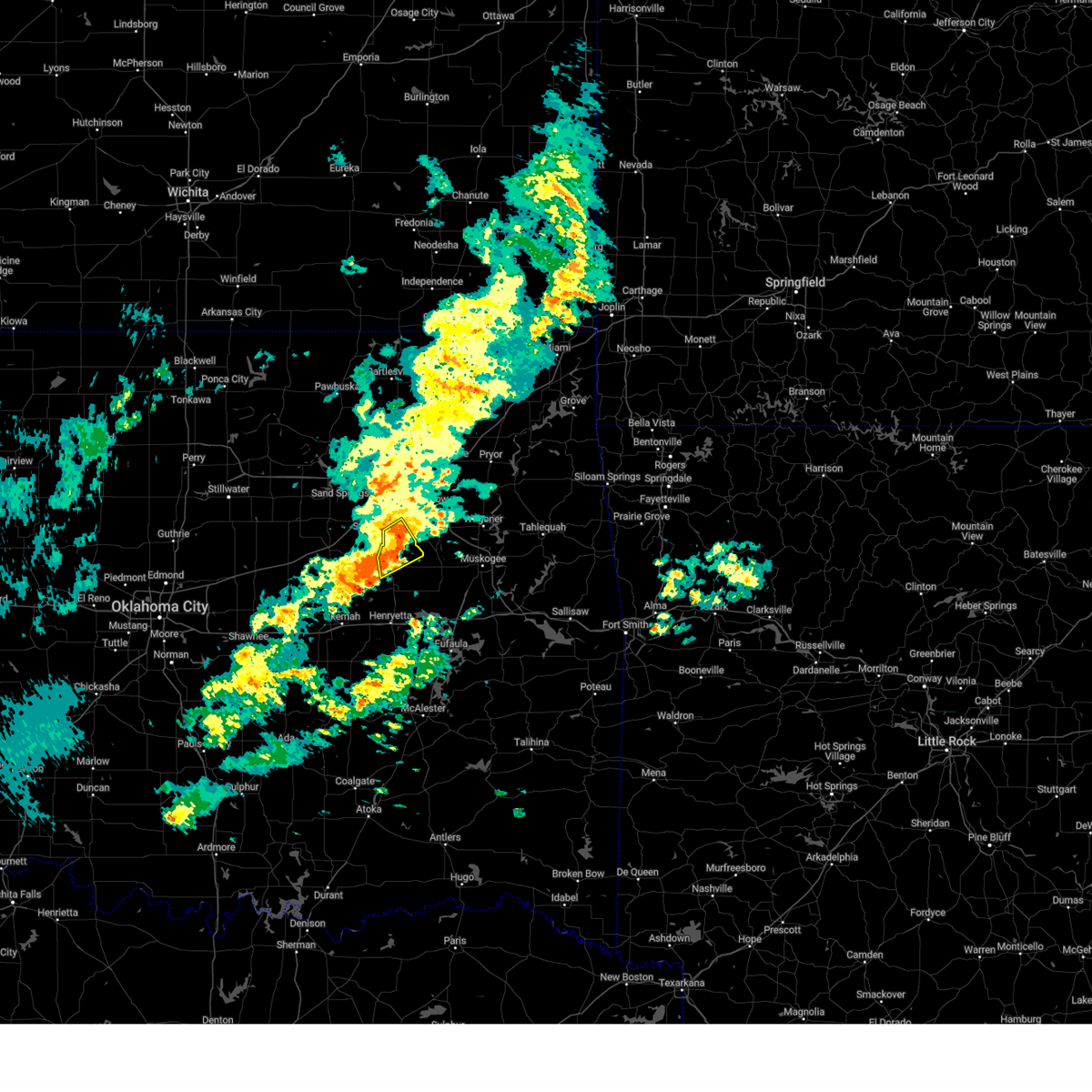 The storm which prompted the warning has weakened below severe limits, and no longer poses an immediate threat to life or property. therefore, the warning will be allowed to expire. however, gusty winds to 40 mph are still possible with this thunderstorm. The storm which prompted the warning has weakened below severe limits, and no longer poses an immediate threat to life or property. therefore, the warning will be allowed to expire. however, gusty winds to 40 mph are still possible with this thunderstorm.
|
| 11/2/2024 8:46 PM CDT |
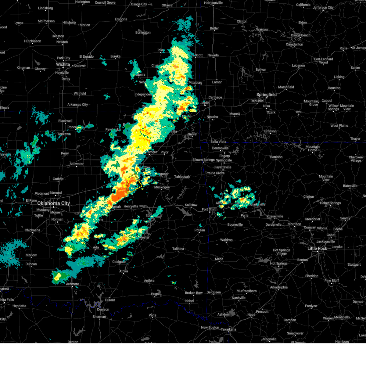 At 846 pm cdt, a severe thunderstorm was located 3 miles northeast of beggs, moving northeast at 30 mph (radar indicated). Hazards include 60 mph wind gusts and nickel size hail. Expect damage to roofs, siding, and trees. Locations in or near the path include, tulsa, bixby, jenks, glenpool, preston, liberty, hectorville,. At 846 pm cdt, a severe thunderstorm was located 3 miles northeast of beggs, moving northeast at 30 mph (radar indicated). Hazards include 60 mph wind gusts and nickel size hail. Expect damage to roofs, siding, and trees. Locations in or near the path include, tulsa, bixby, jenks, glenpool, preston, liberty, hectorville,.
|
| 11/2/2024 8:46 PM CDT |
 the severe thunderstorm warning has been cancelled and is no longer in effect the severe thunderstorm warning has been cancelled and is no longer in effect
|
| 11/2/2024 8:28 PM CDT |
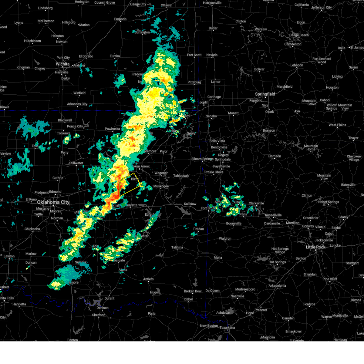 Svrtsa the national weather service in tulsa has issued a * severe thunderstorm warning for, east central creek county in northeastern oklahoma, northern okmulgee county in northeastern oklahoma, south central tulsa county in northeastern oklahoma, * until 915 pm cdt. * at 827 pm cdt, a severe thunderstorm was located 5 miles west of beggs, moving northeast at 30 mph (radar indicated). Hazards include 60 mph wind gusts and half dollar size hail. Hail damage to vehicles is expected. expect wind damage to roofs, siding, and trees. Locations in or near the path include, tulsa, bixby, jenks, glenpool, beggs, mounds, preston, liberty, hectorville,. Svrtsa the national weather service in tulsa has issued a * severe thunderstorm warning for, east central creek county in northeastern oklahoma, northern okmulgee county in northeastern oklahoma, south central tulsa county in northeastern oklahoma, * until 915 pm cdt. * at 827 pm cdt, a severe thunderstorm was located 5 miles west of beggs, moving northeast at 30 mph (radar indicated). Hazards include 60 mph wind gusts and half dollar size hail. Hail damage to vehicles is expected. expect wind damage to roofs, siding, and trees. Locations in or near the path include, tulsa, bixby, jenks, glenpool, beggs, mounds, preston, liberty, hectorville,.
|
| 9/24/2024 8:35 PM CDT |
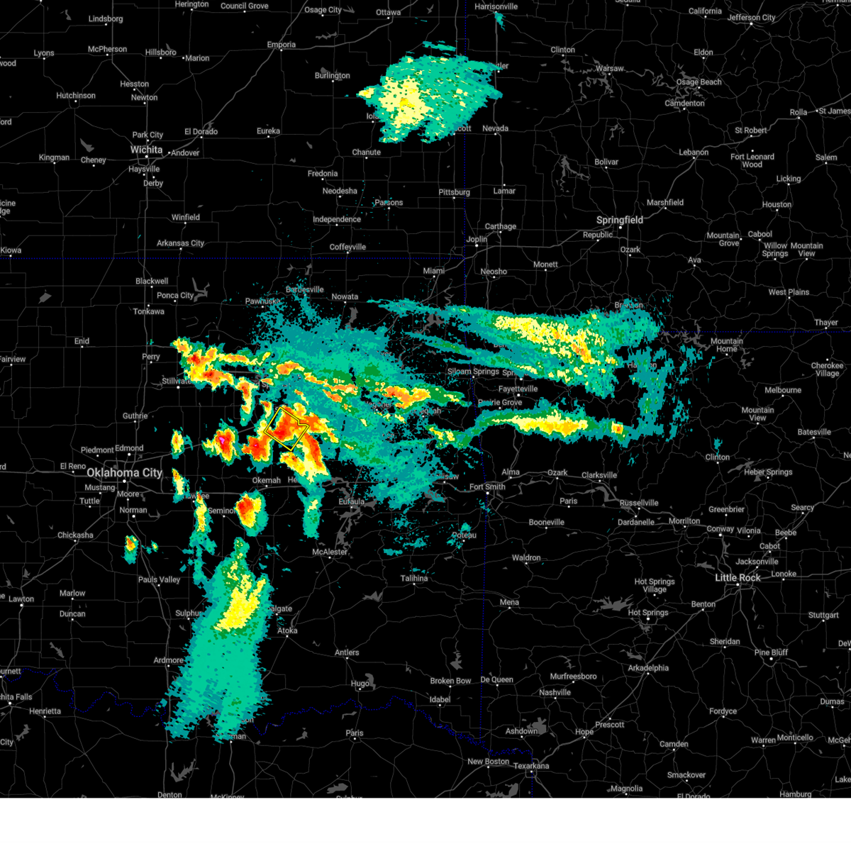 The severe thunderstorm which prompted the warning has weakened. therefore, the warning will be allowed to expire. however, heavy rain is still possible with this thunderstorm. a severe thunderstorm watch remains in effect until 1100 pm cdt for northeastern oklahoma. The severe thunderstorm which prompted the warning has weakened. therefore, the warning will be allowed to expire. however, heavy rain is still possible with this thunderstorm. a severe thunderstorm watch remains in effect until 1100 pm cdt for northeastern oklahoma.
|
| 9/24/2024 8:27 PM CDT |
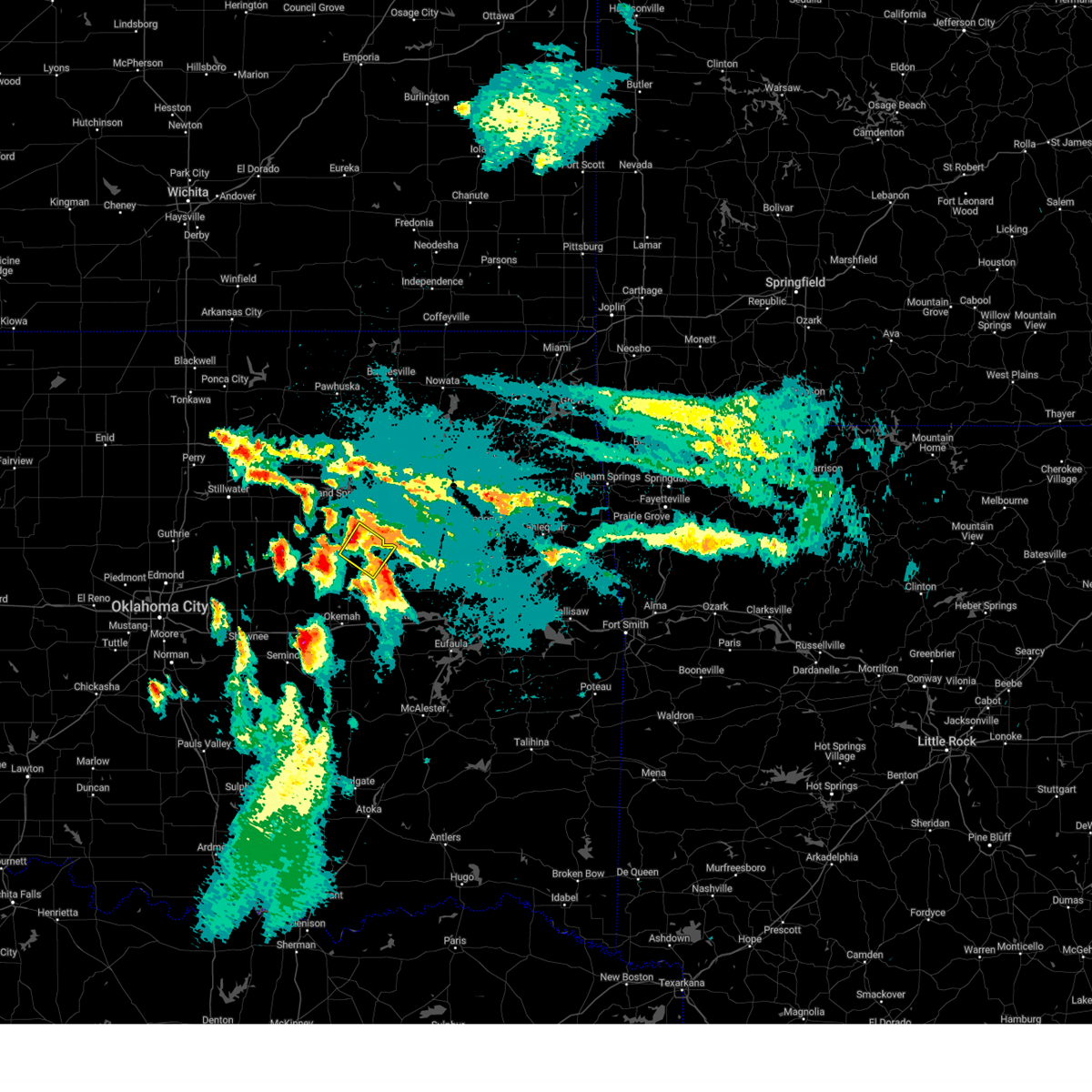 At 826 pm cdt, a severe thunderstorm was located 6 miles west of mounds, moving southeast at 35 mph (radar indicated). Hazards include quarter size hail. Damage to vehicles is expected. Locations in or near the path include, beggs, mounds, kellyville, slick, liberty,. At 826 pm cdt, a severe thunderstorm was located 6 miles west of mounds, moving southeast at 35 mph (radar indicated). Hazards include quarter size hail. Damage to vehicles is expected. Locations in or near the path include, beggs, mounds, kellyville, slick, liberty,.
|
| 9/24/2024 8:18 PM CDT |
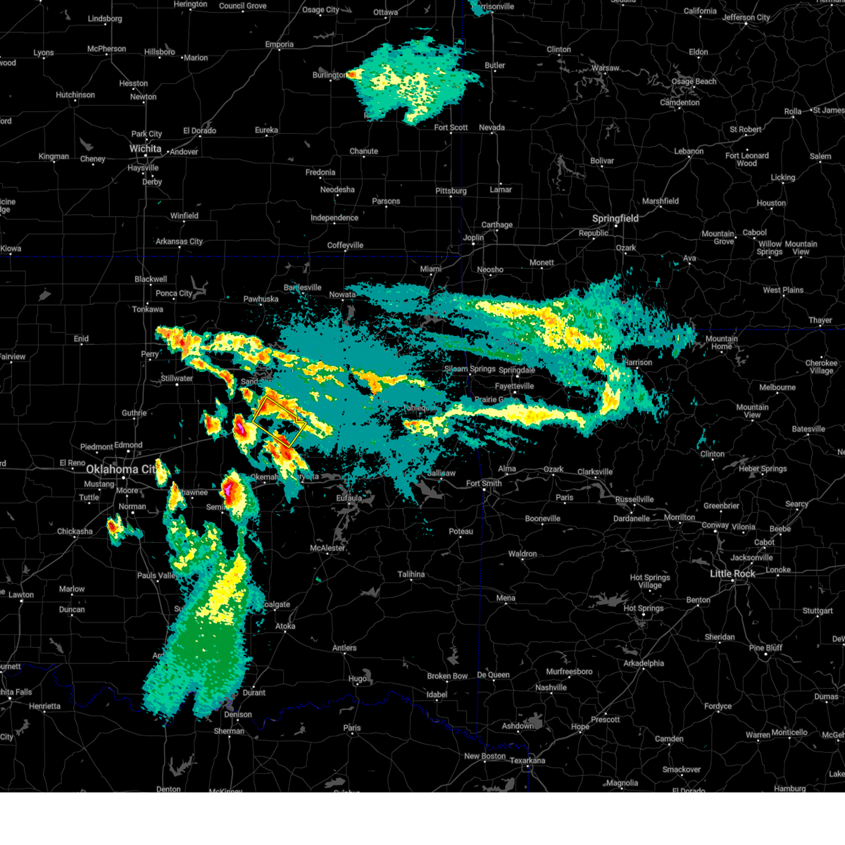 At 818 pm cdt, a severe thunderstorm was located 3 miles southwest of kellyville, moving southeast at 30 mph (radar indicated). Hazards include half dollar size hail. Damage to vehicles is expected. Locations in or near the path include, beggs, mounds, kellyville, slick, liberty, this includes interstate 44 between mile markers 192 and 205. At 818 pm cdt, a severe thunderstorm was located 3 miles southwest of kellyville, moving southeast at 30 mph (radar indicated). Hazards include half dollar size hail. Damage to vehicles is expected. Locations in or near the path include, beggs, mounds, kellyville, slick, liberty, this includes interstate 44 between mile markers 192 and 205.
|
| 9/24/2024 8:11 PM CDT |
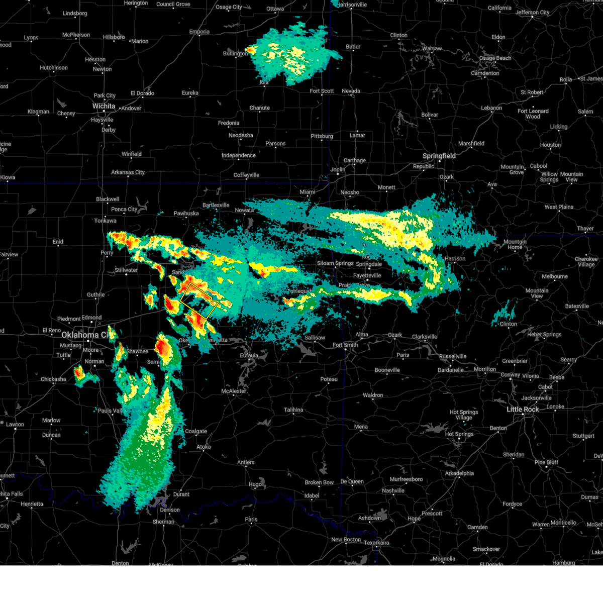 Svrtsa the national weather service in tulsa has issued a * severe thunderstorm warning for, central creek county in northeastern oklahoma, northwestern okmulgee county in northeastern oklahoma, * until 845 pm cdt. * at 811 pm cdt, a severe thunderstorm was located 4 miles southwest of kellyville, moving southeast at 35 mph (radar indicated). Hazards include quarter size hail. Damage to vehicles is expected. Locations in or near the path include, beggs, mounds, kellyville, slick, liberty, this includes interstate 44 between mile markers 192 and 205. Svrtsa the national weather service in tulsa has issued a * severe thunderstorm warning for, central creek county in northeastern oklahoma, northwestern okmulgee county in northeastern oklahoma, * until 845 pm cdt. * at 811 pm cdt, a severe thunderstorm was located 4 miles southwest of kellyville, moving southeast at 35 mph (radar indicated). Hazards include quarter size hail. Damage to vehicles is expected. Locations in or near the path include, beggs, mounds, kellyville, slick, liberty, this includes interstate 44 between mile markers 192 and 205.
|
| 8/19/2024 2:10 AM CDT |
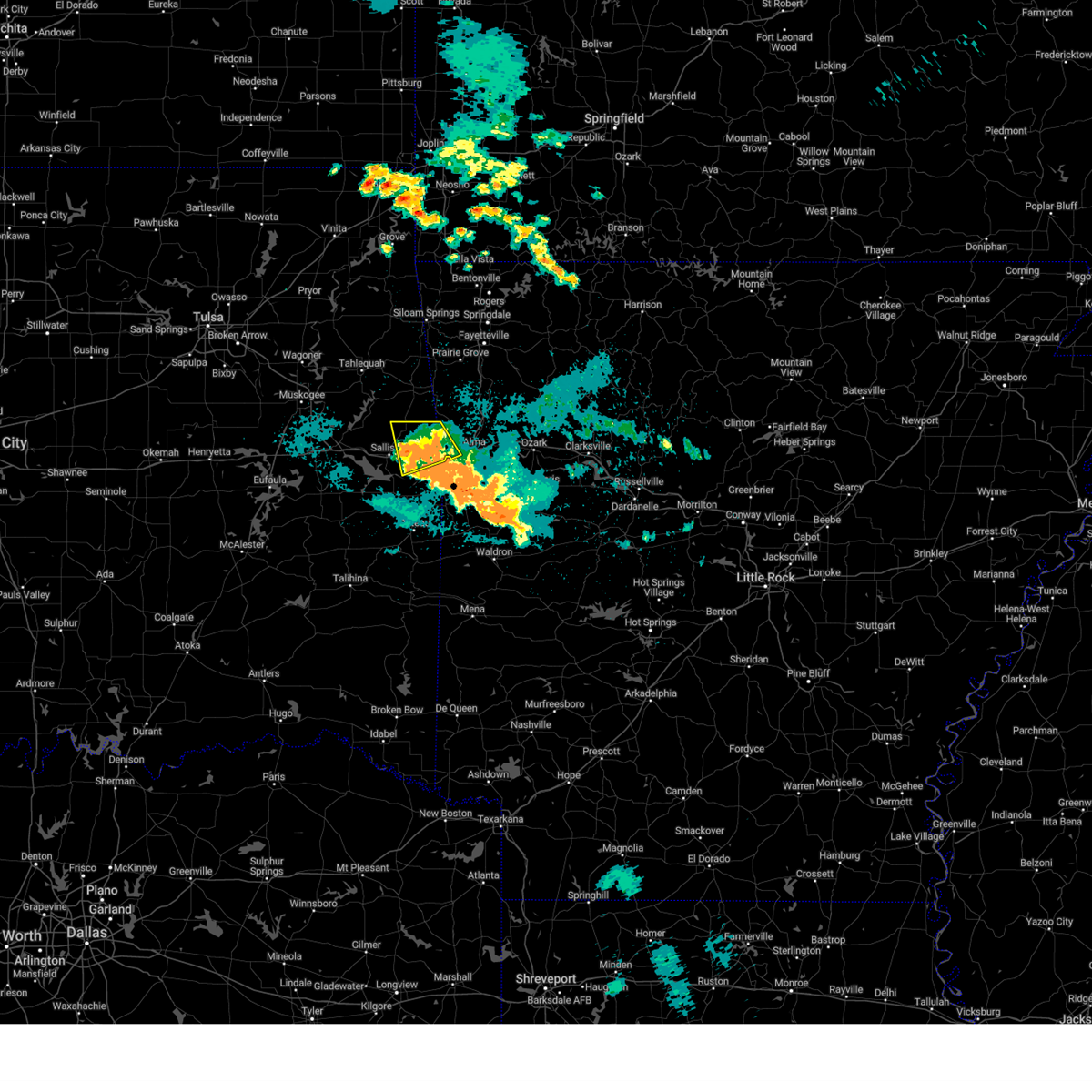 The storm which prompted the warning has weakened below severe limits, and no longer poses an immediate threat to life or property. therefore, the warning will be allowed to expire. however, gusty winds to 40 mph are still possible with this thunderstorms continue to move south at 20 to 30 mph. The storm which prompted the warning has weakened below severe limits, and no longer poses an immediate threat to life or property. therefore, the warning will be allowed to expire. however, gusty winds to 40 mph are still possible with this thunderstorms continue to move south at 20 to 30 mph.
|
| 8/19/2024 1:57 AM CDT |
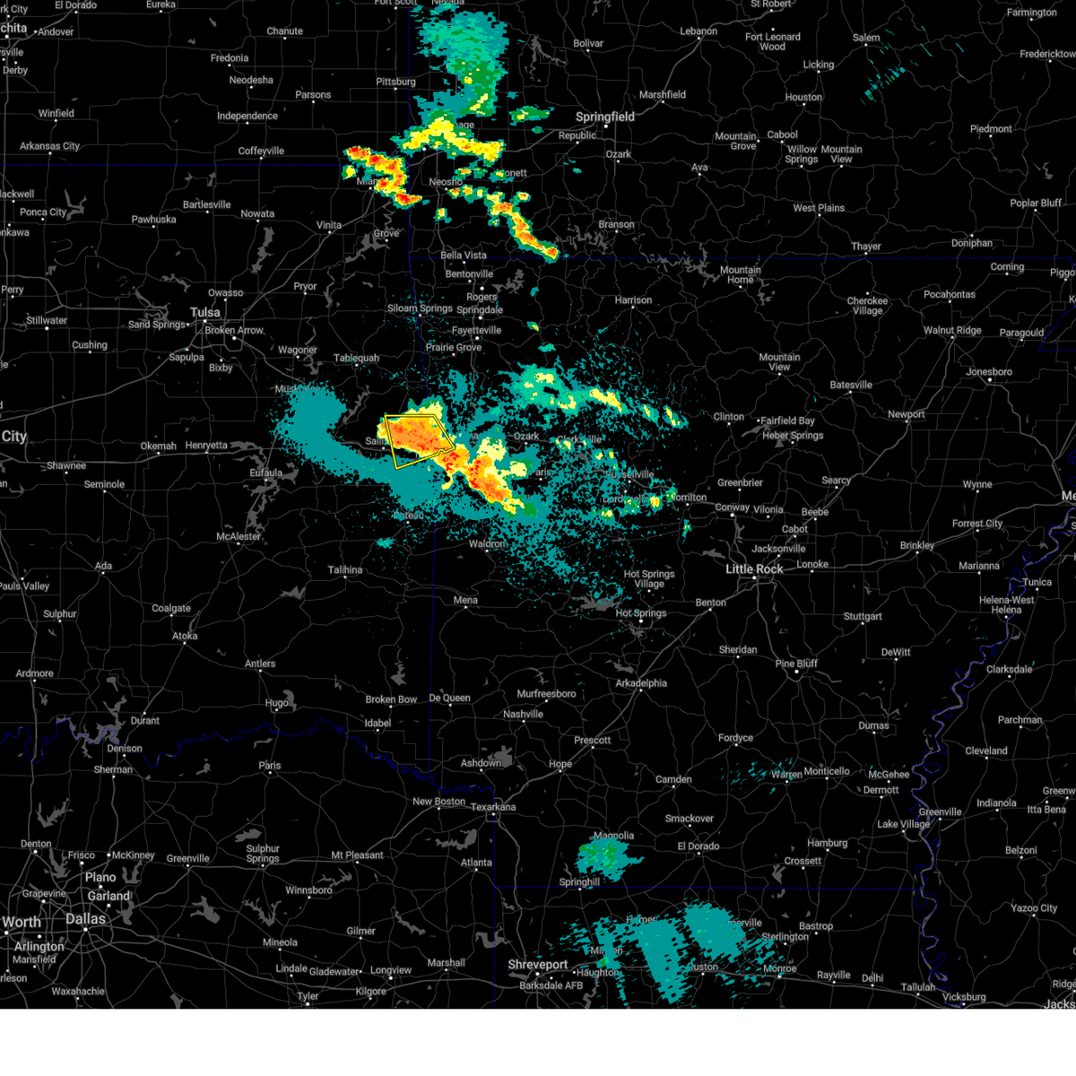 At 157 am cdt, a severe thunderstorm was located 6 miles west of short, moving south at 35 mph (radar indicated). Hazards include 60 mph wind gusts and quarter size hail. Hail damage to vehicles is expected. expect wind damage to roofs, siding, and trees. locations in or near the path include, van buren, muldrow, roland, gans, brushy, short, figure five, uniontown, dora, this includes the following highways, interstate 40 in arkansas between mile markers 0 and 6. Interstate 40 in oklahoma between mile markers 312 and 328. At 157 am cdt, a severe thunderstorm was located 6 miles west of short, moving south at 35 mph (radar indicated). Hazards include 60 mph wind gusts and quarter size hail. Hail damage to vehicles is expected. expect wind damage to roofs, siding, and trees. locations in or near the path include, van buren, muldrow, roland, gans, brushy, short, figure five, uniontown, dora, this includes the following highways, interstate 40 in arkansas between mile markers 0 and 6. Interstate 40 in oklahoma between mile markers 312 and 328.
|
| 8/19/2024 1:57 AM CDT |
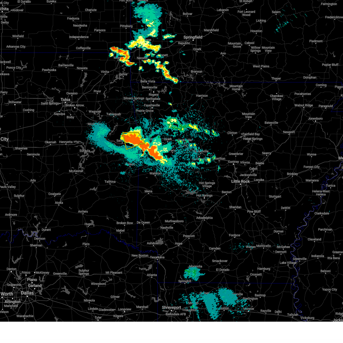 the severe thunderstorm warning has been cancelled and is no longer in effect the severe thunderstorm warning has been cancelled and is no longer in effect
|
| 8/19/2024 1:36 AM CDT |
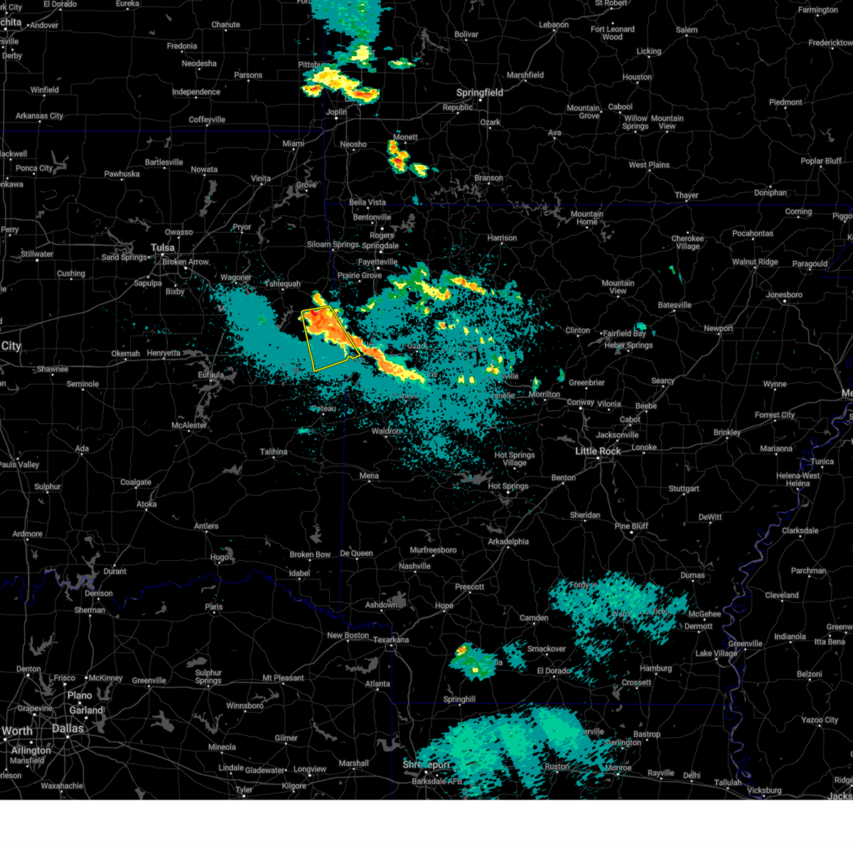 Svrtsa the national weather service in tulsa has issued a * severe thunderstorm warning for, southwestern crawford county in northwestern arkansas, eastern sequoyah county in east central oklahoma, southern adair county in northeastern oklahoma, * until 215 am cdt. * at 136 am cdt, a severe thunderstorm was located 6 miles northeast of bunch, moving southeast at 35 mph (radar indicated). Hazards include 60 mph wind gusts and quarter size hail. Hail damage to vehicles is expected. expect wind damage to roofs, siding, and trees. locations in or near the path include, van buren, muldrow, roland, gans, figure five, brushy, bunch, short, uniontown, dora, this includes the following highways, interstate 40 in arkansas between mile markers 0 and 6. Interstate 40 in oklahoma between mile markers 312 and 328. Svrtsa the national weather service in tulsa has issued a * severe thunderstorm warning for, southwestern crawford county in northwestern arkansas, eastern sequoyah county in east central oklahoma, southern adair county in northeastern oklahoma, * until 215 am cdt. * at 136 am cdt, a severe thunderstorm was located 6 miles northeast of bunch, moving southeast at 35 mph (radar indicated). Hazards include 60 mph wind gusts and quarter size hail. Hail damage to vehicles is expected. expect wind damage to roofs, siding, and trees. locations in or near the path include, van buren, muldrow, roland, gans, figure five, brushy, bunch, short, uniontown, dora, this includes the following highways, interstate 40 in arkansas between mile markers 0 and 6. Interstate 40 in oklahoma between mile markers 312 and 328.
|
| 8/17/2024 2:28 AM CDT |
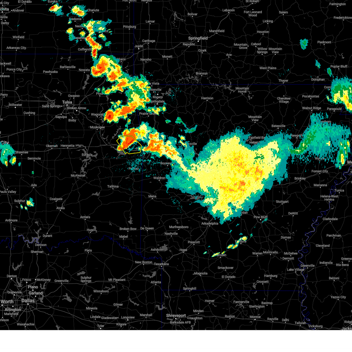 The storm which prompted the warning has weakened below severe limits, and no longer poses an immediate threat to life or property. therefore, the warning will be allowed to expire. however, gusty winds of 40 to 50 mph and small hail are still possible with this thunderstorm. a severe thunderstorm watch remains in effect until 400 am cdt for southeastern and east central oklahoma. The storm which prompted the warning has weakened below severe limits, and no longer poses an immediate threat to life or property. therefore, the warning will be allowed to expire. however, gusty winds of 40 to 50 mph and small hail are still possible with this thunderstorm. a severe thunderstorm watch remains in effect until 400 am cdt for southeastern and east central oklahoma.
|
| 8/17/2024 2:14 AM CDT |
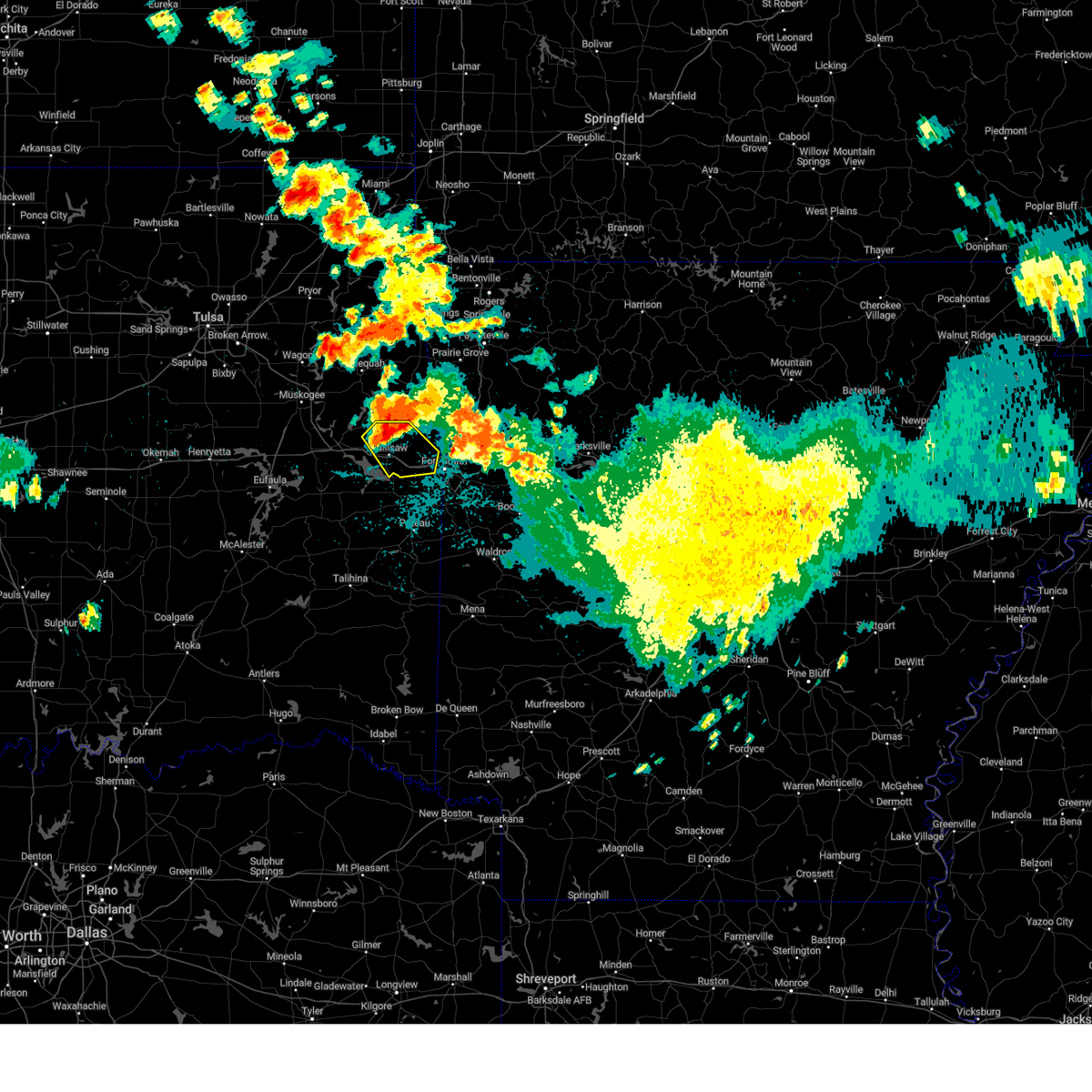 the severe thunderstorm warning has been cancelled and is no longer in effect the severe thunderstorm warning has been cancelled and is no longer in effect
|
| 8/17/2024 2:14 AM CDT |
 At 213 am cdt, a severe thunderstorm was located near brushy, moving southeast at 35 mph (radar indicated). Hazards include 60 mph wind gusts and quarter size hail. Hail damage to vehicles is expected. expect wind damage to roofs, siding, and trees. Locations in or near the path include, sallisaw, muldrow, roland, gans, marble city, brushy lake state park, brushy, mc key, cottonwood, this includes interstate 40 in oklahoma between mile markers 302 and 326. At 213 am cdt, a severe thunderstorm was located near brushy, moving southeast at 35 mph (radar indicated). Hazards include 60 mph wind gusts and quarter size hail. Hail damage to vehicles is expected. expect wind damage to roofs, siding, and trees. Locations in or near the path include, sallisaw, muldrow, roland, gans, marble city, brushy lake state park, brushy, mc key, cottonwood, this includes interstate 40 in oklahoma between mile markers 302 and 326.
|
| 8/17/2024 1:44 AM CDT |
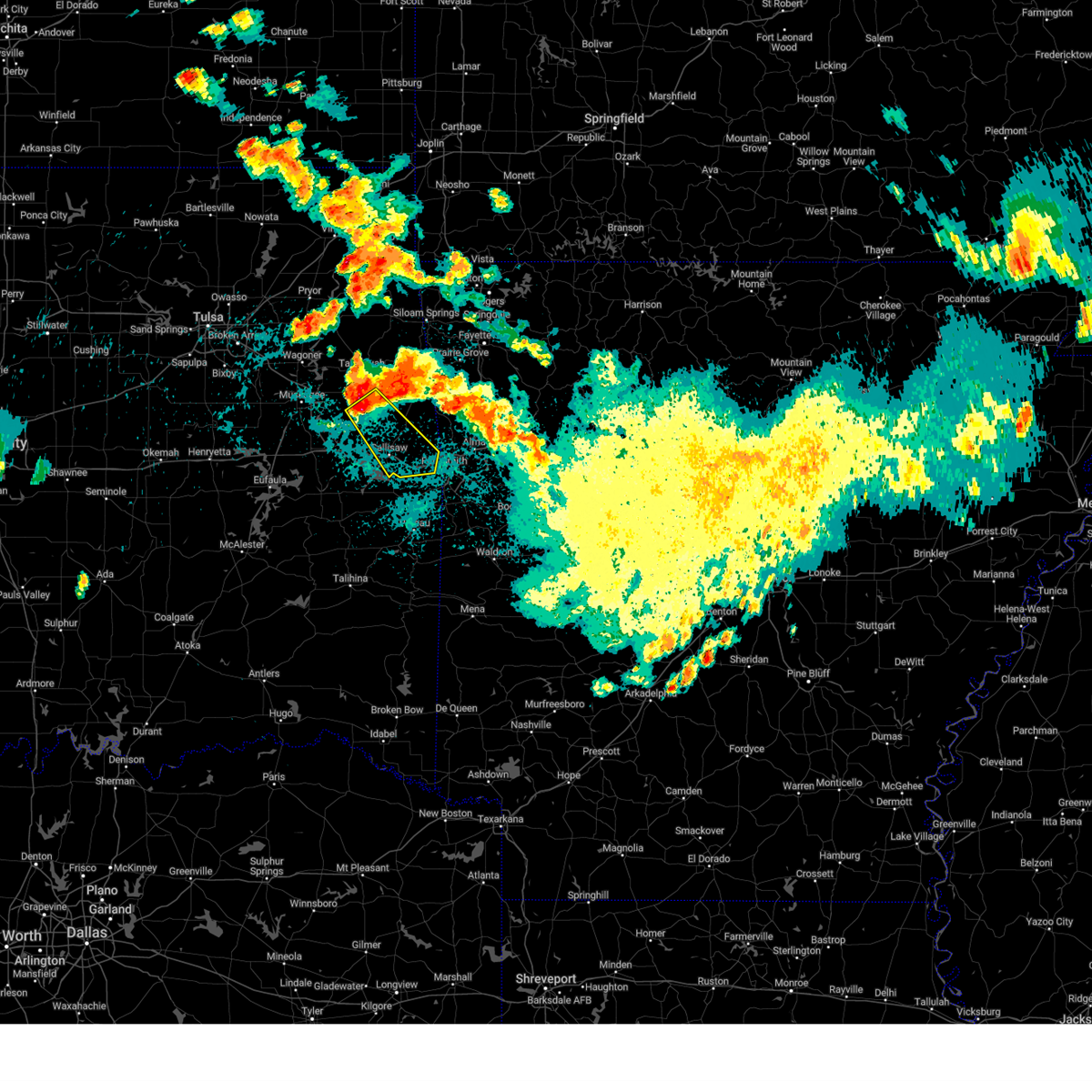 Svrtsa the national weather service in tulsa has issued a * severe thunderstorm warning for, sequoyah county in east central oklahoma, southwestern adair county in northeastern oklahoma, southeastern cherokee county in east central oklahoma, * until 230 am cdt. * at 144 am cdt, a severe thunderstorm was located over cookson, moving southeast at 40 mph (radar indicated). Hazards include 60 mph wind gusts and quarter size hail. Hail damage to vehicles is expected. expect wind damage to roofs, siding, and trees. Locations in or near the path include, sallisaw, muldrow, roland, gans, marble city, brushy, cookson, brushy lake state park, cherokee landing state park, bunch, box, mc key, cottonwood, this includes interstate 40 in oklahoma between mile markers 302 and 326. Svrtsa the national weather service in tulsa has issued a * severe thunderstorm warning for, sequoyah county in east central oklahoma, southwestern adair county in northeastern oklahoma, southeastern cherokee county in east central oklahoma, * until 230 am cdt. * at 144 am cdt, a severe thunderstorm was located over cookson, moving southeast at 40 mph (radar indicated). Hazards include 60 mph wind gusts and quarter size hail. Hail damage to vehicles is expected. expect wind damage to roofs, siding, and trees. Locations in or near the path include, sallisaw, muldrow, roland, gans, marble city, brushy, cookson, brushy lake state park, cherokee landing state park, bunch, box, mc key, cottonwood, this includes interstate 40 in oklahoma between mile markers 302 and 326.
|
| 8/16/2024 11:57 PM CDT |
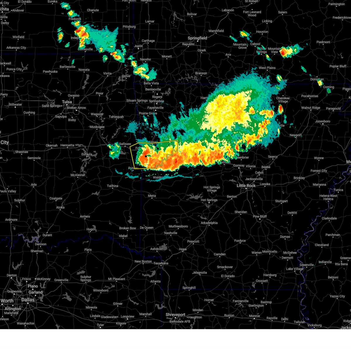 The line of storms which prompted the warning have weakened below severe limits, and are gradually exiting the warned area. therefore, the warning will be allowed to expire. however, gusty winds to 40 mph are still possible with the ongoing thunderstorms. a severe thunderstorm watch remains in effect until 200 am cdt for northwestern and west central arkansas, and southeastern and east central oklahoma. The line of storms which prompted the warning have weakened below severe limits, and are gradually exiting the warned area. therefore, the warning will be allowed to expire. however, gusty winds to 40 mph are still possible with the ongoing thunderstorms. a severe thunderstorm watch remains in effect until 200 am cdt for northwestern and west central arkansas, and southeastern and east central oklahoma.
|
| 8/16/2024 11:33 PM CDT |
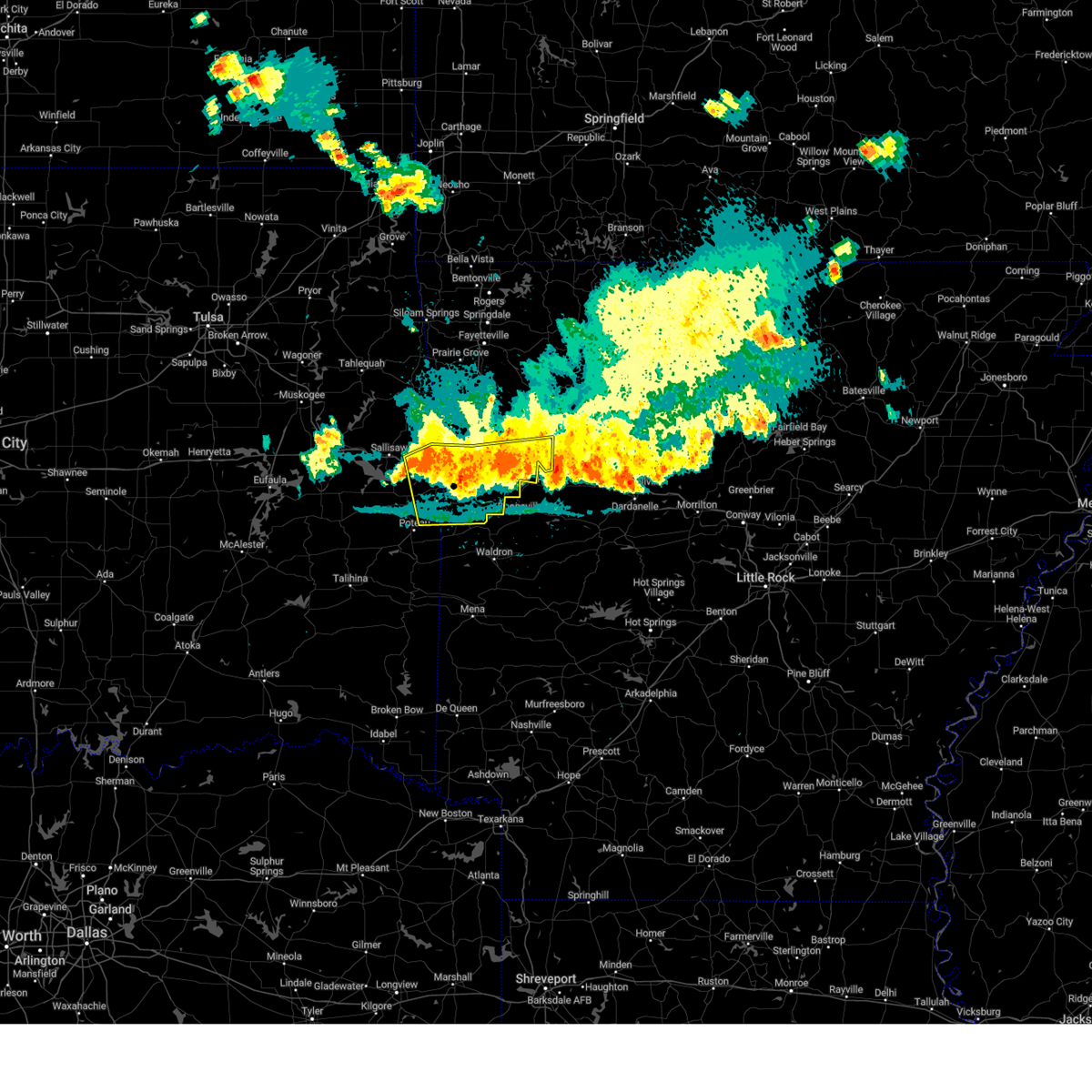 At 1133 pm cdt, severe thunderstorms were located along a line extending from 5 miles north of spiro to near greenwood to 3 miles northeast of ratcliff, moving southeast at 40 mph (radar indicated). Hazards include 60 mph wind gusts. Expect damage to roofs, siding, and trees. locations in or near the path include, fort smith, van buren, ozark, charleston, greenwood, alma, barling, pocola, muldrow, roland, lavaca, spiro, arkoma, mulberry, dyer, hackett, altus, bonanza, branch, midland, this includes the following highways, interstate 40 in arkansas between mile markers 0 and 20, and between mile markers 23 and 42. interstate 40 in oklahoma between mile markers 315 and 328. Interstate 540 between mile markers 1 and 14. At 1133 pm cdt, severe thunderstorms were located along a line extending from 5 miles north of spiro to near greenwood to 3 miles northeast of ratcliff, moving southeast at 40 mph (radar indicated). Hazards include 60 mph wind gusts. Expect damage to roofs, siding, and trees. locations in or near the path include, fort smith, van buren, ozark, charleston, greenwood, alma, barling, pocola, muldrow, roland, lavaca, spiro, arkoma, mulberry, dyer, hackett, altus, bonanza, branch, midland, this includes the following highways, interstate 40 in arkansas between mile markers 0 and 20, and between mile markers 23 and 42. interstate 40 in oklahoma between mile markers 315 and 328. Interstate 540 between mile markers 1 and 14.
|
| 8/16/2024 11:13 PM CDT |
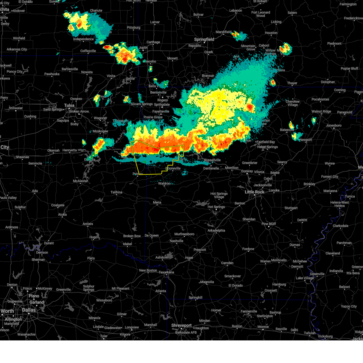 At 1113 pm cdt, severe thunderstorms were located along a line extending from 2 miles east of gans to 3 miles north of lavaca to altus, moving southeast at 40 mph (radar indicated). Hazards include 70 mph wind gusts and penny size hail. Expect considerable tree damage. damage is likely to mobile homes, roofs, and outbuildings. locations in or near the path include, fort smith, van buren, ozark, charleston, greenwood, alma, barling, pocola, muldrow, roland, lavaca, spiro, arkoma, mulberry, dyer, hackett, altus, bonanza, branch, midland, this includes the following highways, interstate 40 in arkansas between mile markers 0 and 20, and between mile markers 23 and 42. interstate 40 in oklahoma between mile markers 313 and 328. Interstate 540 between mile markers 1 and 14. At 1113 pm cdt, severe thunderstorms were located along a line extending from 2 miles east of gans to 3 miles north of lavaca to altus, moving southeast at 40 mph (radar indicated). Hazards include 70 mph wind gusts and penny size hail. Expect considerable tree damage. damage is likely to mobile homes, roofs, and outbuildings. locations in or near the path include, fort smith, van buren, ozark, charleston, greenwood, alma, barling, pocola, muldrow, roland, lavaca, spiro, arkoma, mulberry, dyer, hackett, altus, bonanza, branch, midland, this includes the following highways, interstate 40 in arkansas between mile markers 0 and 20, and between mile markers 23 and 42. interstate 40 in oklahoma between mile markers 313 and 328. Interstate 540 between mile markers 1 and 14.
|
| 8/16/2024 11:01 PM CDT |
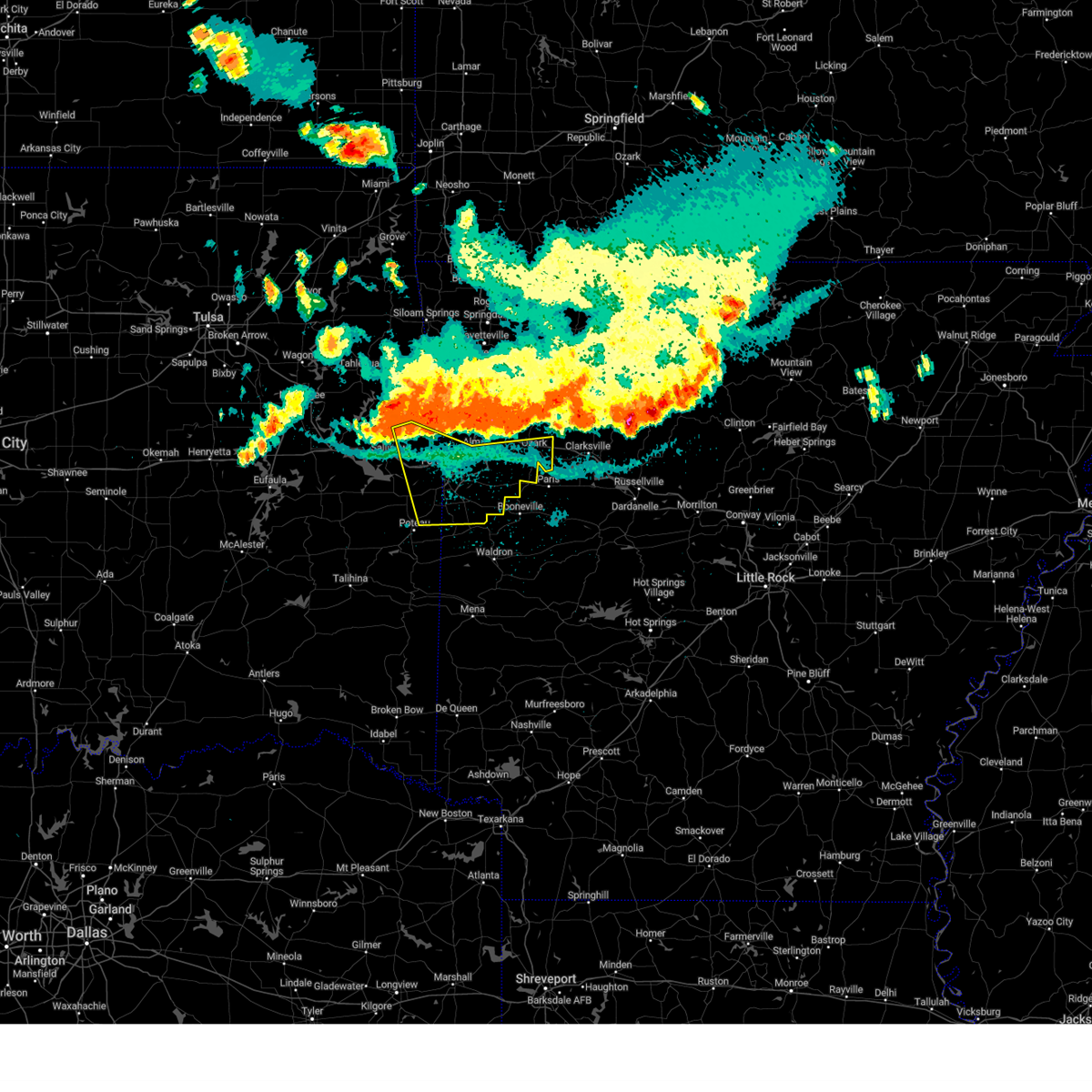 Svrtsa the national weather service in tulsa has issued a * severe thunderstorm warning for, southern franklin county in west central arkansas, southern crawford county in northwestern arkansas, sebastian county in west central arkansas, eastern sequoyah county in east central oklahoma, northeastern le flore county in southeastern oklahoma, * until midnight cdt. * at 1101 pm cdt, severe thunderstorms were located along a line extending from 3 miles northwest of muldrow to 2 miles southeast of dyer to 7 miles northeast of wiederkehr village, moving southeast at 40 mph (radar indicated). Hazards include 80 mph wind gusts and penny size hail. Flying debris will be dangerous to those caught without shelter. mobile homes will be heavily damaged. expect considerable damage to roofs, windows, and vehicles. extensive tree damage and power outages are likely. locations in or near the path include, fort smith, van buren, ozark, charleston, greenwood, alma, barling, pocola, muldrow, roland, lavaca, spiro, arkoma, mulberry, dyer, hackett, altus, bonanza, branch, midland, this includes the following highways, interstate 40 in arkansas between mile markers 0 and 20, and between mile markers 23 and 42. interstate 40 in oklahoma between mile markers 313 and 328. Interstate 540 between mile markers 1 and 14. Svrtsa the national weather service in tulsa has issued a * severe thunderstorm warning for, southern franklin county in west central arkansas, southern crawford county in northwestern arkansas, sebastian county in west central arkansas, eastern sequoyah county in east central oklahoma, northeastern le flore county in southeastern oklahoma, * until midnight cdt. * at 1101 pm cdt, severe thunderstorms were located along a line extending from 3 miles northwest of muldrow to 2 miles southeast of dyer to 7 miles northeast of wiederkehr village, moving southeast at 40 mph (radar indicated). Hazards include 80 mph wind gusts and penny size hail. Flying debris will be dangerous to those caught without shelter. mobile homes will be heavily damaged. expect considerable damage to roofs, windows, and vehicles. extensive tree damage and power outages are likely. locations in or near the path include, fort smith, van buren, ozark, charleston, greenwood, alma, barling, pocola, muldrow, roland, lavaca, spiro, arkoma, mulberry, dyer, hackett, altus, bonanza, branch, midland, this includes the following highways, interstate 40 in arkansas between mile markers 0 and 20, and between mile markers 23 and 42. interstate 40 in oklahoma between mile markers 313 and 328. Interstate 540 between mile markers 1 and 14.
|
| 8/16/2024 10:46 PM CDT |
 At 1046 pm cdt, severe thunderstorms were located along a line extending from 3 miles north of cass to 3 miles southwest of fern to natural dam, moving southeast at 35 mph (radar indicated). Hazards include 70 mph wind gusts and nickel size hail. Expect considerable tree damage. damage is likely to mobile homes, roofs, and outbuildings. locations in or near the path include, fort smith, van buren, stilwell, ozark, cedarville, mountainburg, natural dam, alma, roland, mulberry, dyer, altus, winslow, denning, chester, moffett, st. paul, rudy, wiederkehr village, saint paul, this includes the following highways, interstate 40 in arkansas between mile markers 0 and 42. interstate 40 in oklahoma between mile markers 324 and 328. interstate 540 between mile markers 1 and 8. Interstate 49 between mile markers 22 and 45. At 1046 pm cdt, severe thunderstorms were located along a line extending from 3 miles north of cass to 3 miles southwest of fern to natural dam, moving southeast at 35 mph (radar indicated). Hazards include 70 mph wind gusts and nickel size hail. Expect considerable tree damage. damage is likely to mobile homes, roofs, and outbuildings. locations in or near the path include, fort smith, van buren, stilwell, ozark, cedarville, mountainburg, natural dam, alma, roland, mulberry, dyer, altus, winslow, denning, chester, moffett, st. paul, rudy, wiederkehr village, saint paul, this includes the following highways, interstate 40 in arkansas between mile markers 0 and 42. interstate 40 in oklahoma between mile markers 324 and 328. interstate 540 between mile markers 1 and 8. Interstate 49 between mile markers 22 and 45.
|
| 8/16/2024 10:40 PM CDT |
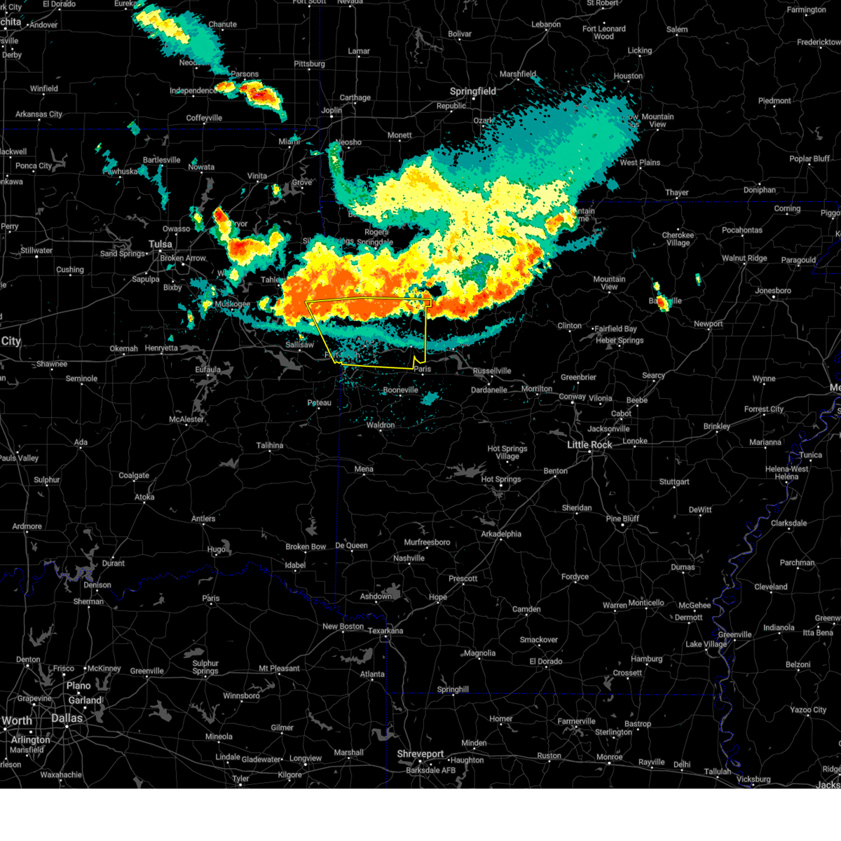 Svrtsa the national weather service in tulsa has issued a * severe thunderstorm warning for, southwestern madison county in northwestern arkansas, franklin county in west central arkansas, crawford county in northwestern arkansas, northern sebastian county in west central arkansas, southern washington county in northwestern arkansas, northeastern sequoyah county in east central oklahoma, southern adair county in northeastern oklahoma, * until 1130 pm cdt. * at 1039 pm cdt, severe thunderstorms were located along a line extending from 6 miles southwest of saint paul to near lake fort smith to 2 miles northwest of natural dam, moving southeast at 35 mph (radar indicated). Hazards include 60 mph wind gusts and nickel size hail. Expect damage to roofs, siding, and trees. locations in or near the path include, fort smith, van buren, stilwell, ozark, cedarville, mountainburg, natural dam, alma, roland, mulberry, dyer, altus, winslow, denning, chester, moffett, st. paul, rudy, wiederkehr village, saint paul, this includes the following highways, interstate 40 in arkansas between mile markers 0 and 42. interstate 40 in oklahoma between mile markers 324 and 328. interstate 540 between mile markers 1 and 8. Interstate 49 between mile markers 22 and 45. Svrtsa the national weather service in tulsa has issued a * severe thunderstorm warning for, southwestern madison county in northwestern arkansas, franklin county in west central arkansas, crawford county in northwestern arkansas, northern sebastian county in west central arkansas, southern washington county in northwestern arkansas, northeastern sequoyah county in east central oklahoma, southern adair county in northeastern oklahoma, * until 1130 pm cdt. * at 1039 pm cdt, severe thunderstorms were located along a line extending from 6 miles southwest of saint paul to near lake fort smith to 2 miles northwest of natural dam, moving southeast at 35 mph (radar indicated). Hazards include 60 mph wind gusts and nickel size hail. Expect damage to roofs, siding, and trees. locations in or near the path include, fort smith, van buren, stilwell, ozark, cedarville, mountainburg, natural dam, alma, roland, mulberry, dyer, altus, winslow, denning, chester, moffett, st. paul, rudy, wiederkehr village, saint paul, this includes the following highways, interstate 40 in arkansas between mile markers 0 and 42. interstate 40 in oklahoma between mile markers 324 and 328. interstate 540 between mile markers 1 and 8. Interstate 49 between mile markers 22 and 45.
|
| 8/15/2024 11:26 PM CDT |
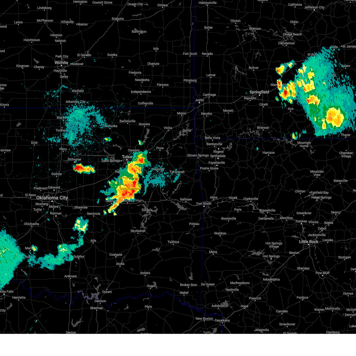 The storm which prompted the warning has weakened below severe limits, and no longer poses an immediate threat to life or property. therefore, the warning will be allowed to expire. however, gusty winds and heavy rain are still possible with this thunderstorm. a severe thunderstorm watch remains in effect until midnight cdt for northeastern oklahoma. The storm which prompted the warning has weakened below severe limits, and no longer poses an immediate threat to life or property. therefore, the warning will be allowed to expire. however, gusty winds and heavy rain are still possible with this thunderstorm. a severe thunderstorm watch remains in effect until midnight cdt for northeastern oklahoma.
|
| 8/15/2024 11:23 PM CDT |
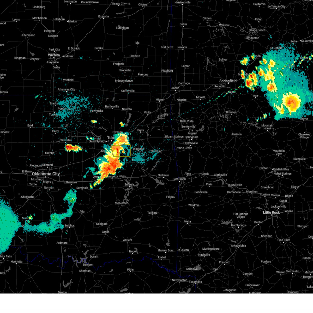 The storm which prompted the warning has weakened below severe limits, and no longer poses an immediate threat to life or property. therefore, the warning will be allowed to expire. however, gusty winds and heavy rain are still possible with this thunderstorm. a severe thunderstorm watch remains in effect until midnight cdt for northeastern oklahoma. The storm which prompted the warning has weakened below severe limits, and no longer poses an immediate threat to life or property. therefore, the warning will be allowed to expire. however, gusty winds and heavy rain are still possible with this thunderstorm. a severe thunderstorm watch remains in effect until midnight cdt for northeastern oklahoma.
|
| 8/15/2024 11:19 PM CDT |
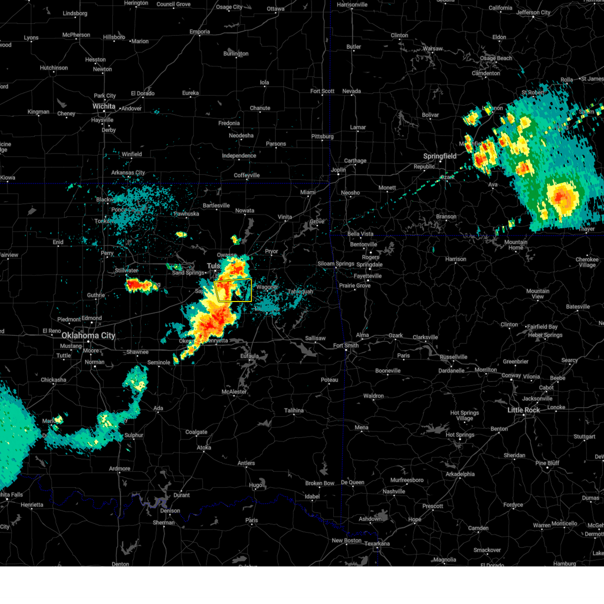 At 1119 pm cdt, a severe thunderstorm was located near bixby, moving east at 25 mph (radar indicated). Hazards include 60 mph wind gusts and nickel size hail. Expect damage to roofs, siding, and trees. Locations in or near the path include, tulsa, broken arrow, bixby, jenks, glenpool, coweta, stonebluff, jenks riverside airport, oneta, redbird, leonard,. At 1119 pm cdt, a severe thunderstorm was located near bixby, moving east at 25 mph (radar indicated). Hazards include 60 mph wind gusts and nickel size hail. Expect damage to roofs, siding, and trees. Locations in or near the path include, tulsa, broken arrow, bixby, jenks, glenpool, coweta, stonebluff, jenks riverside airport, oneta, redbird, leonard,.
|
| 8/15/2024 11:05 PM CDT |
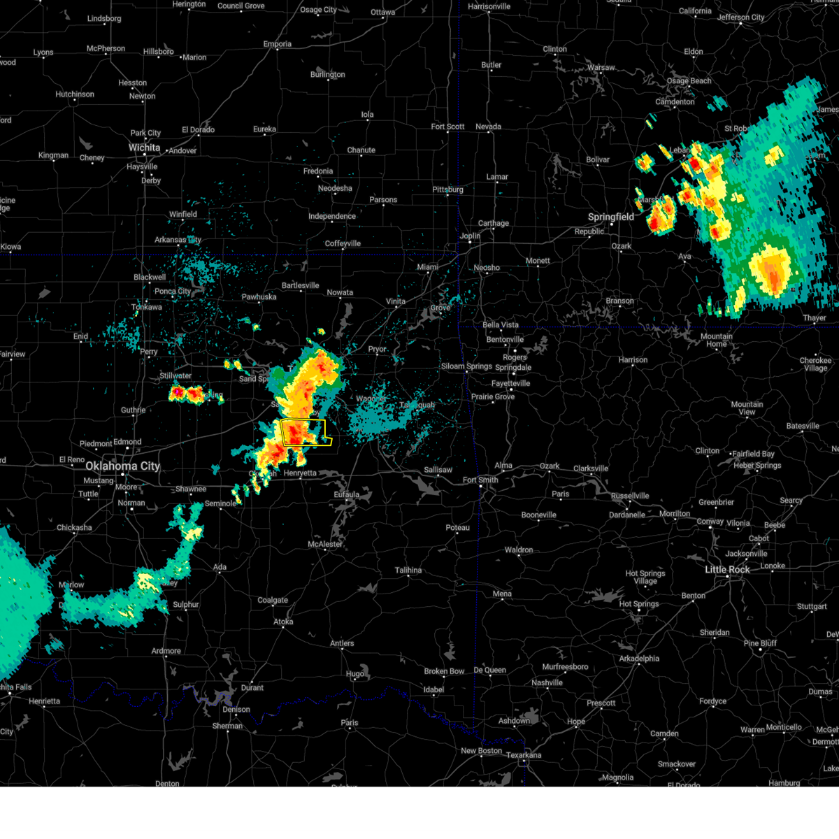 Svrtsa the national weather service in tulsa has issued a * severe thunderstorm warning for, northern okmulgee county in northeastern oklahoma, * until 1130 pm cdt. * at 1105 pm cdt, a severe thunderstorm was located near beggs, moving east at 25 mph (radar indicated). Hazards include 60 mph wind gusts and quarter size hail. Hail damage to vehicles is expected. expect wind damage to roofs, siding, and trees. Locations in or near the path include, okmulgee, beggs, bald hill, preston, liberty, hectorville,. Svrtsa the national weather service in tulsa has issued a * severe thunderstorm warning for, northern okmulgee county in northeastern oklahoma, * until 1130 pm cdt. * at 1105 pm cdt, a severe thunderstorm was located near beggs, moving east at 25 mph (radar indicated). Hazards include 60 mph wind gusts and quarter size hail. Hail damage to vehicles is expected. expect wind damage to roofs, siding, and trees. Locations in or near the path include, okmulgee, beggs, bald hill, preston, liberty, hectorville,.
|
| 8/15/2024 10:56 PM CDT |
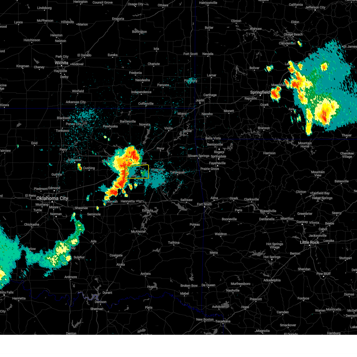 Svrtsa the national weather service in tulsa has issued a * severe thunderstorm warning for, northwestern wagoner county in northeastern oklahoma, southeastern tulsa county in northeastern oklahoma, * until 1130 pm cdt. * at 1056 pm cdt, a severe thunderstorm was located near glenpool, moving east at 45 mph (radar indicated). Hazards include 60 mph wind gusts and nickel size hail. Expect damage to roofs, siding, and trees. Locations in or near the path include, tulsa, broken arrow, bixby, jenks, glenpool, coweta, stonebluff, jenks riverside airport, oneta, liberty, redbird, leonard,. Svrtsa the national weather service in tulsa has issued a * severe thunderstorm warning for, northwestern wagoner county in northeastern oklahoma, southeastern tulsa county in northeastern oklahoma, * until 1130 pm cdt. * at 1056 pm cdt, a severe thunderstorm was located near glenpool, moving east at 45 mph (radar indicated). Hazards include 60 mph wind gusts and nickel size hail. Expect damage to roofs, siding, and trees. Locations in or near the path include, tulsa, broken arrow, bixby, jenks, glenpool, coweta, stonebluff, jenks riverside airport, oneta, liberty, redbird, leonard,.
|
| 7/4/2024 6:45 PM CDT |
 the severe thunderstorm warning has been cancelled and is no longer in effect the severe thunderstorm warning has been cancelled and is no longer in effect
|
| 7/4/2024 6:27 PM CDT |
 Svrtsa the national weather service in tulsa has issued a * severe thunderstorm warning for, northwestern muskogee county in east central oklahoma, northern okmulgee county in northeastern oklahoma, * until 715 pm cdt. * at 627 pm cdt, a severe thunderstorm was located near preston, moving southeast at 15 mph (radar indicated). Hazards include 60 mph wind gusts and quarter size hail. Hail damage to vehicles is expected. expect wind damage to roofs, siding, and trees. Locations in or near the path include, okmulgee, haskell, morris, beggs, preston, bald hill, liberty, jamesville, hectorville, eram,. Svrtsa the national weather service in tulsa has issued a * severe thunderstorm warning for, northwestern muskogee county in east central oklahoma, northern okmulgee county in northeastern oklahoma, * until 715 pm cdt. * at 627 pm cdt, a severe thunderstorm was located near preston, moving southeast at 15 mph (radar indicated). Hazards include 60 mph wind gusts and quarter size hail. Hail damage to vehicles is expected. expect wind damage to roofs, siding, and trees. Locations in or near the path include, okmulgee, haskell, morris, beggs, preston, bald hill, liberty, jamesville, hectorville, eram,.
|
| 7/4/2024 6:25 PM CDT |
 At 625 pm cdt, a severe thunderstorm was located over bixby, moving east at 10 mph (radar indicated). Hazards include 60 mph wind gusts and nickel size hail. Expect damage to roofs, siding, and trees. Locations in or near the path include, tulsa, broken arrow, bixby, jenks, glenpool, liberty, hectorville, leonard,. At 625 pm cdt, a severe thunderstorm was located over bixby, moving east at 10 mph (radar indicated). Hazards include 60 mph wind gusts and nickel size hail. Expect damage to roofs, siding, and trees. Locations in or near the path include, tulsa, broken arrow, bixby, jenks, glenpool, liberty, hectorville, leonard,.
|
| 7/4/2024 6:18 PM CDT |
 At 618 pm cdt, a severe thunderstorm was located 4 miles northeast of beggs, moving east at 10 mph (radar indicated). Hazards include 60 mph wind gusts and penny size hail. Expect damage to roofs, siding, and trees. Locations in or near the path include, beggs, liberty,. At 618 pm cdt, a severe thunderstorm was located 4 miles northeast of beggs, moving east at 10 mph (radar indicated). Hazards include 60 mph wind gusts and penny size hail. Expect damage to roofs, siding, and trees. Locations in or near the path include, beggs, liberty,.
|
| 7/4/2024 6:08 PM CDT |
 Svrtsa the national weather service in tulsa has issued a * severe thunderstorm warning for, west central wagoner county in northeastern oklahoma, north central okmulgee county in northeastern oklahoma, southeastern tulsa county in northeastern oklahoma, * until 700 pm cdt. * at 607 pm cdt, a severe thunderstorm was located near glenpool, moving east at 5 mph. additional strong to severe storms extended to near bixby and leonard (radar indicated). Hazards include 60 mph wind gusts and penny size hail. Expect damage to roofs, siding, and trees. Locations in or near the path include, tulsa, broken arrow, bixby, jenks, glenpool, liberty, hectorville, leonard,. Svrtsa the national weather service in tulsa has issued a * severe thunderstorm warning for, west central wagoner county in northeastern oklahoma, north central okmulgee county in northeastern oklahoma, southeastern tulsa county in northeastern oklahoma, * until 700 pm cdt. * at 607 pm cdt, a severe thunderstorm was located near glenpool, moving east at 5 mph. additional strong to severe storms extended to near bixby and leonard (radar indicated). Hazards include 60 mph wind gusts and penny size hail. Expect damage to roofs, siding, and trees. Locations in or near the path include, tulsa, broken arrow, bixby, jenks, glenpool, liberty, hectorville, leonard,.
|
| 7/4/2024 6:04 PM CDT |
 At 604 pm cdt, a severe thunderstorm was located 3 miles north of beggs, moving east at 10 mph (radar indicated). Hazards include 70 mph wind gusts and nickel size hail. Expect considerable tree damage. damage is likely to mobile homes, roofs, and outbuildings. Locations in or near the path include, beggs, liberty,. At 604 pm cdt, a severe thunderstorm was located 3 miles north of beggs, moving east at 10 mph (radar indicated). Hazards include 70 mph wind gusts and nickel size hail. Expect considerable tree damage. damage is likely to mobile homes, roofs, and outbuildings. Locations in or near the path include, beggs, liberty,.
|
| 7/4/2024 5:58 PM CDT |
 The storm which prompted the warning has weakened below severe limits, and no longer poses an immediate threat to life or property. therefore, the warning will be allowed to expire. however, gusty winds to 50 mph and cloud to ground lightning are still possible with this thunderstorm. a separate severe thunderstorm warning remains in effect for the northwestern corner of okmulgee county through 630 pm cdt. to report severe weather, contact your nearest law enforcement agency. they will relay your report to the national weather service tulsa. The storm which prompted the warning has weakened below severe limits, and no longer poses an immediate threat to life or property. therefore, the warning will be allowed to expire. however, gusty winds to 50 mph and cloud to ground lightning are still possible with this thunderstorm. a separate severe thunderstorm warning remains in effect for the northwestern corner of okmulgee county through 630 pm cdt. to report severe weather, contact your nearest law enforcement agency. they will relay your report to the national weather service tulsa.
|
| 7/4/2024 5:47 PM CDT |
 Svrtsa the national weather service in tulsa has issued a * severe thunderstorm warning for, northwestern okmulgee county in northeastern oklahoma, * until 630 pm cdt. * at 547 pm cdt, a severe thunderstorm was located 5 miles southwest of mounds, moving east at 10 mph (radar indicated). Hazards include 60 mph wind gusts and nickel size hail. Expect damage to roofs, siding, and trees. Locations in or near the path include, beggs, liberty,. Svrtsa the national weather service in tulsa has issued a * severe thunderstorm warning for, northwestern okmulgee county in northeastern oklahoma, * until 630 pm cdt. * at 547 pm cdt, a severe thunderstorm was located 5 miles southwest of mounds, moving east at 10 mph (radar indicated). Hazards include 60 mph wind gusts and nickel size hail. Expect damage to roofs, siding, and trees. Locations in or near the path include, beggs, liberty,.
|
| 7/4/2024 5:37 PM CDT |
 At 537 pm cdt, a severe thunderstorm was located over mounds, moving east at 10 mph (radar indicated). Hazards include 60 mph wind gusts and penny size hail. Expect damage to roofs, siding, and trees. Locations in or near the path include, tulsa, jenks, glenpool, kiefer, mounds, liberty, hectorville,. At 537 pm cdt, a severe thunderstorm was located over mounds, moving east at 10 mph (radar indicated). Hazards include 60 mph wind gusts and penny size hail. Expect damage to roofs, siding, and trees. Locations in or near the path include, tulsa, jenks, glenpool, kiefer, mounds, liberty, hectorville,.
|
| 7/4/2024 5:20 PM CDT |
 Svrtsa the national weather service in tulsa has issued a * severe thunderstorm warning for, east central creek county in northeastern oklahoma, northwestern okmulgee county in northeastern oklahoma, south central tulsa county in northeastern oklahoma, * until 600 pm cdt. * at 519 pm cdt, a severe thunderstorm was located 4 miles west of mounds, moving east at 10 mph (radar indicated). Hazards include 60 mph wind gusts and penny size hail. Expect damage to roofs, siding, and trees. Locations in or near the path include, tulsa, jenks, glenpool, kiefer, mounds, liberty, hectorville,. Svrtsa the national weather service in tulsa has issued a * severe thunderstorm warning for, east central creek county in northeastern oklahoma, northwestern okmulgee county in northeastern oklahoma, south central tulsa county in northeastern oklahoma, * until 600 pm cdt. * at 519 pm cdt, a severe thunderstorm was located 4 miles west of mounds, moving east at 10 mph (radar indicated). Hazards include 60 mph wind gusts and penny size hail. Expect damage to roofs, siding, and trees. Locations in or near the path include, tulsa, jenks, glenpool, kiefer, mounds, liberty, hectorville,.
|
| 6/26/2024 8:20 AM CDT |
 At 819 am cdt, severe thunderstorms were located along a line extending from 5 miles southwest of welty to 5 miles northwest of henryetta, moving south at 50 mph (radar indicated). Hazards include 60 mph wind gusts. Expect damage to roofs, siding, and trees. Locations in or near the path include, tulsa, broken arrow, okmulgee, bixby, sapulpa, jenks, glenpool, kiefer, beggs, mounds, kellyville, preston, bald hill, liberty, hectorville, leonard, this includes interstate 44 between mile markers 200 and 212. At 819 am cdt, severe thunderstorms were located along a line extending from 5 miles southwest of welty to 5 miles northwest of henryetta, moving south at 50 mph (radar indicated). Hazards include 60 mph wind gusts. Expect damage to roofs, siding, and trees. Locations in or near the path include, tulsa, broken arrow, okmulgee, bixby, sapulpa, jenks, glenpool, kiefer, beggs, mounds, kellyville, preston, bald hill, liberty, hectorville, leonard, this includes interstate 44 between mile markers 200 and 212.
|
| 6/26/2024 8:20 AM CDT |
 the severe thunderstorm warning has been cancelled and is no longer in effect the severe thunderstorm warning has been cancelled and is no longer in effect
|
| 6/26/2024 8:07 AM CDT |
 Svrtsa the national weather service in tulsa has issued a * severe thunderstorm warning for, haskell county in southeastern oklahoma, northeastern mcintosh county in southeastern oklahoma, sequoyah county in east central oklahoma, southwestern adair county in northeastern oklahoma, northern le flore county in southeastern oklahoma, southeastern cherokee county in east central oklahoma, southeastern muskogee county in east central oklahoma, * until 900 am cdt. * at 807 am cdt, severe thunderstorms were located along a line extending from 3 miles east of rentiesville to 3 miles south of bunch, moving south at 45 mph (radar indicated). Hazards include 70 mph wind gusts. Expect considerable tree damage. damage is likely to mobile homes, roofs, and outbuildings. Locations in or near the path include, sallisaw, stigler, muldrow, roland, spiro, arkoma, warner, vian, gore, porum, webbers falls, keota, whitefield, gans, marble city, braggs, tamaha, brushy, greenleaf state park, brushy lake state park, this includes interstate 40 in oklahoma between mile markers 271 and 327. Svrtsa the national weather service in tulsa has issued a * severe thunderstorm warning for, haskell county in southeastern oklahoma, northeastern mcintosh county in southeastern oklahoma, sequoyah county in east central oklahoma, southwestern adair county in northeastern oklahoma, northern le flore county in southeastern oklahoma, southeastern cherokee county in east central oklahoma, southeastern muskogee county in east central oklahoma, * until 900 am cdt. * at 807 am cdt, severe thunderstorms were located along a line extending from 3 miles east of rentiesville to 3 miles south of bunch, moving south at 45 mph (radar indicated). Hazards include 70 mph wind gusts. Expect considerable tree damage. damage is likely to mobile homes, roofs, and outbuildings. Locations in or near the path include, sallisaw, stigler, muldrow, roland, spiro, arkoma, warner, vian, gore, porum, webbers falls, keota, whitefield, gans, marble city, braggs, tamaha, brushy, greenleaf state park, brushy lake state park, this includes interstate 40 in oklahoma between mile markers 271 and 327.
|
| 6/26/2024 8:00 AM CDT |
 the severe thunderstorm warning has been cancelled and is no longer in effect the severe thunderstorm warning has been cancelled and is no longer in effect
|
| 6/26/2024 8:00 AM CDT |
 At 800 am cdt, severe thunderstorms were located along a line extending from bristow to 2 miles northeast of preston, moving south at 35 mph (radar indicated). Hazards include 70 mph wind gusts. Expect considerable tree damage. damage is likely to mobile homes, roofs, and outbuildings. Locations in or near the path include, tulsa, broken arrow, sand springs, okmulgee, bristow, bixby, sapulpa, jenks, glenpool, catoosa, mannford, kiefer, beggs, mounds, kellyville, slick, preston, jenks riverside airport, keystone state park, bald hill, this includes interstate 44 between mile markers 188 and 237. At 800 am cdt, severe thunderstorms were located along a line extending from bristow to 2 miles northeast of preston, moving south at 35 mph (radar indicated). Hazards include 70 mph wind gusts. Expect considerable tree damage. damage is likely to mobile homes, roofs, and outbuildings. Locations in or near the path include, tulsa, broken arrow, sand springs, okmulgee, bristow, bixby, sapulpa, jenks, glenpool, catoosa, mannford, kiefer, beggs, mounds, kellyville, slick, preston, jenks riverside airport, keystone state park, bald hill, this includes interstate 44 between mile markers 188 and 237.
|
| 6/26/2024 7:32 AM CDT |
 Svrtsa the national weather service in tulsa has issued a * severe thunderstorm warning for, southwestern rogers county in northeastern oklahoma, southeastern osage county in northeastern oklahoma, central creek county in northeastern oklahoma, northwestern wagoner county in northeastern oklahoma, northern okmulgee county in northeastern oklahoma, southeastern pawnee county in northeastern oklahoma, tulsa county in northeastern oklahoma, * until 830 am cdt. * at 732 am cdt, severe thunderstorms were located along a line extending from near keystone state park to 3 miles northwest of broken arrow, moving south at 65 mph (radar indicated). Hazards include 70 mph wind gusts. Expect considerable tree damage. damage is likely to mobile homes, roofs, and outbuildings. Locations in or near the path include, tulsa, broken arrow, sand springs, okmulgee, bristow, owasso, bixby, sapulpa, jenks, glenpool, catoosa, mannford, kiefer, beggs, sperry, mounds, kellyville, westport, slick, shamrock, this includes interstate 44 between mile markers 188 and 237. Svrtsa the national weather service in tulsa has issued a * severe thunderstorm warning for, southwestern rogers county in northeastern oklahoma, southeastern osage county in northeastern oklahoma, central creek county in northeastern oklahoma, northwestern wagoner county in northeastern oklahoma, northern okmulgee county in northeastern oklahoma, southeastern pawnee county in northeastern oklahoma, tulsa county in northeastern oklahoma, * until 830 am cdt. * at 732 am cdt, severe thunderstorms were located along a line extending from near keystone state park to 3 miles northwest of broken arrow, moving south at 65 mph (radar indicated). Hazards include 70 mph wind gusts. Expect considerable tree damage. damage is likely to mobile homes, roofs, and outbuildings. Locations in or near the path include, tulsa, broken arrow, sand springs, okmulgee, bristow, owasso, bixby, sapulpa, jenks, glenpool, catoosa, mannford, kiefer, beggs, sperry, mounds, kellyville, westport, slick, shamrock, this includes interstate 44 between mile markers 188 and 237.
|
| 6/3/2024 2:09 PM CDT |
 The storms which prompted the warning have weakened below severe limits, and no longer pose an immediate threat to life or property. therefore, the warning will be allowed to expire. however, gusty winds are still possible with these thunderstorms. The storms which prompted the warning have weakened below severe limits, and no longer pose an immediate threat to life or property. therefore, the warning will be allowed to expire. however, gusty winds are still possible with these thunderstorms.
|
| 6/3/2024 1:50 PM CDT |
 Svrtsa the national weather service in tulsa has issued a * severe thunderstorm warning for, southwestern franklin county in west central arkansas, southern crawford county in northwestern arkansas, sebastian county in west central arkansas, southeastern sequoyah county in east central oklahoma, northeastern le flore county in southeastern oklahoma, * until 215 pm cdt. * at 150 pm cdt, severe thunderstorms were located along a line extending from 2 miles southeast of short to hackett, moving east at 60 mph (radar indicated). Hazards include 60 mph wind gusts. Expect damage to roofs, siding, and trees. locations in or near the path include, fort smith, van buren, charleston, greenwood, alma, barling, pocola, muldrow, roland, lavaca, arkoma, mulberry, dyer, hackett, bonanza, moffett, rudy, excelsior, fort smith regional airport, bloomer, this includes the following highways, interstate 40 in arkansas between mile markers 0 and 25. interstate 40 in oklahoma between mile markers 320 and 328. interstate 540 between mile markers 1 and 14. Interstate 49 between mile markers 22 and 26. Svrtsa the national weather service in tulsa has issued a * severe thunderstorm warning for, southwestern franklin county in west central arkansas, southern crawford county in northwestern arkansas, sebastian county in west central arkansas, southeastern sequoyah county in east central oklahoma, northeastern le flore county in southeastern oklahoma, * until 215 pm cdt. * at 150 pm cdt, severe thunderstorms were located along a line extending from 2 miles southeast of short to hackett, moving east at 60 mph (radar indicated). Hazards include 60 mph wind gusts. Expect damage to roofs, siding, and trees. locations in or near the path include, fort smith, van buren, charleston, greenwood, alma, barling, pocola, muldrow, roland, lavaca, arkoma, mulberry, dyer, hackett, bonanza, moffett, rudy, excelsior, fort smith regional airport, bloomer, this includes the following highways, interstate 40 in arkansas between mile markers 0 and 25. interstate 40 in oklahoma between mile markers 320 and 328. interstate 540 between mile markers 1 and 14. Interstate 49 between mile markers 22 and 26.
|
| 5/24/2024 9:50 PM CDT |
 the severe thunderstorm warning has been cancelled and is no longer in effect the severe thunderstorm warning has been cancelled and is no longer in effect
|
| 5/24/2024 9:26 PM CDT |
 Svrtsa the national weather service in tulsa has issued a * severe thunderstorm warning for, northwestern sebastian county in west central arkansas, southeastern sequoyah county in east central oklahoma, northeastern le flore county in southeastern oklahoma, * until 1015 pm cdt. * at 926 pm cdt, a severe thunderstorm was located 3 miles northwest of muldrow, moving southeast at 35 mph (radar indicated). Hazards include 60 mph wind gusts and quarter size hail. Hail damage to vehicles is expected. expect wind damage to roofs, siding, and trees. locations in or near the path include, fort smith, greenwood, barling, pocola, muldrow, roland, lavaca, arkoma, hackett, bonanza, gans, moffett, excelsior, fort smith regional airport, jenny lind, rock island, central city, scullyville, braden, mill creek, this includes the following highways, interstate 40 in oklahoma between mile markers 310 and 328. Interstate 540 between mile markers 5 and 14. Svrtsa the national weather service in tulsa has issued a * severe thunderstorm warning for, northwestern sebastian county in west central arkansas, southeastern sequoyah county in east central oklahoma, northeastern le flore county in southeastern oklahoma, * until 1015 pm cdt. * at 926 pm cdt, a severe thunderstorm was located 3 miles northwest of muldrow, moving southeast at 35 mph (radar indicated). Hazards include 60 mph wind gusts and quarter size hail. Hail damage to vehicles is expected. expect wind damage to roofs, siding, and trees. locations in or near the path include, fort smith, greenwood, barling, pocola, muldrow, roland, lavaca, arkoma, hackett, bonanza, gans, moffett, excelsior, fort smith regional airport, jenny lind, rock island, central city, scullyville, braden, mill creek, this includes the following highways, interstate 40 in oklahoma between mile markers 310 and 328. Interstate 540 between mile markers 5 and 14.
|
| 5/24/2024 8:47 PM CDT |
 the tornado warning has been cancelled and is no longer in effect the tornado warning has been cancelled and is no longer in effect
|
| 5/24/2024 8:37 PM CDT |
 At 837 pm cdt, a severe thunderstorm capable of producing a tornado was located 3 miles west of brushy lake state park, moving southeast at 25 mph (radar indicated rotation). Hazards include tornado and two inch hail. Flying debris will be dangerous to those caught without shelter. mobile homes will be damaged or destroyed. damage to roofs, windows, and vehicles will occur. tree damage is likely. Locations in or near the path include, sallisaw, muldrow, gans, marble city, brushy lake state park, brushy, mc key, this includes interstate 40 in oklahoma between mile markers 303 and 322. At 837 pm cdt, a severe thunderstorm capable of producing a tornado was located 3 miles west of brushy lake state park, moving southeast at 25 mph (radar indicated rotation). Hazards include tornado and two inch hail. Flying debris will be dangerous to those caught without shelter. mobile homes will be damaged or destroyed. damage to roofs, windows, and vehicles will occur. tree damage is likely. Locations in or near the path include, sallisaw, muldrow, gans, marble city, brushy lake state park, brushy, mc key, this includes interstate 40 in oklahoma between mile markers 303 and 322.
|
| 5/24/2024 8:25 PM CDT |
 At 825 pm cdt, a severe thunderstorm capable of producing a tornado was located 5 miles west of marble city, moving east at 20 mph (radar indicated rotation). Hazards include tornado. Flying debris will be dangerous to those caught without shelter. mobile homes will be damaged or destroyed. damage to roofs, windows, and vehicles will occur. tree damage is likely. Locations in or near the path include, sallisaw, muldrow, gans, marble city, brushy lake state park, brushy, mc key, box, this includes interstate 40 in oklahoma between mile markers 303 and 322. At 825 pm cdt, a severe thunderstorm capable of producing a tornado was located 5 miles west of marble city, moving east at 20 mph (radar indicated rotation). Hazards include tornado. Flying debris will be dangerous to those caught without shelter. mobile homes will be damaged or destroyed. damage to roofs, windows, and vehicles will occur. tree damage is likely. Locations in or near the path include, sallisaw, muldrow, gans, marble city, brushy lake state park, brushy, mc key, box, this includes interstate 40 in oklahoma between mile markers 303 and 322.
|
| 5/24/2024 8:17 PM CDT |
 Tortsa the national weather service in tulsa has issued a * tornado warning for, sequoyah county in east central oklahoma, * until 900 pm cdt. * at 817 pm cdt, a severe thunderstorm capable of producing a tornado was located 4 miles east of lake tenkiller state park, moving southeast at 25 mph (radar indicated rotation). Hazards include tornado. Flying debris will be dangerous to those caught without shelter. mobile homes will be damaged or destroyed. damage to roofs, windows, and vehicles will occur. tree damage is likely. Locations in or near the path include, sallisaw, muldrow, vian, gans, marble city, brushy lake state park, brushy, lake tenkiller state park, mc key, box, this includes interstate 40 in oklahoma between mile markers 295 and 322. Tortsa the national weather service in tulsa has issued a * tornado warning for, sequoyah county in east central oklahoma, * until 900 pm cdt. * at 817 pm cdt, a severe thunderstorm capable of producing a tornado was located 4 miles east of lake tenkiller state park, moving southeast at 25 mph (radar indicated rotation). Hazards include tornado. Flying debris will be dangerous to those caught without shelter. mobile homes will be damaged or destroyed. damage to roofs, windows, and vehicles will occur. tree damage is likely. Locations in or near the path include, sallisaw, muldrow, vian, gans, marble city, brushy lake state park, brushy, lake tenkiller state park, mc key, box, this includes interstate 40 in oklahoma between mile markers 295 and 322.
|
| 5/7/2024 3:43 AM CDT |
 The storm which prompted the warning has weakened below severe limits, and no longer poses an immediate threat to life or property. therefore, the warning will be allowed to expire. however, heavy rain is still possible with this thunderstorm. a tornado watch remains in effect until 700 am cdt for northwestern and west central arkansas, and southeastern and east central oklahoma. The storm which prompted the warning has weakened below severe limits, and no longer poses an immediate threat to life or property. therefore, the warning will be allowed to expire. however, heavy rain is still possible with this thunderstorm. a tornado watch remains in effect until 700 am cdt for northwestern and west central arkansas, and southeastern and east central oklahoma.
|
| 5/7/2024 3:18 AM CDT |
 At 317 am cdt, a severe thunderstorm was located 4 miles west of gans, moving east at 40 mph (radar indicated). Hazards include 60 mph wind gusts and quarter size hail. Hail damage to vehicles is expected. expect wind damage to roofs, siding, and trees. locations in or near the path include, fort smith, van buren, sallisaw, cedarville, alma, barling, muldrow, roland, lavaca, arkoma, gans, moffett, rudy, figure five, fort smith regional airport, kibler, concord, shibley, mill creek, cottonwood, this includes the following highways, interstate 40 in arkansas between mile markers 0 and 15. interstate 40 in oklahoma between mile markers 305 and 328. interstate 540 between mile markers 1 and 13. Interstate 49 between mile markers 22 and 28. At 317 am cdt, a severe thunderstorm was located 4 miles west of gans, moving east at 40 mph (radar indicated). Hazards include 60 mph wind gusts and quarter size hail. Hail damage to vehicles is expected. expect wind damage to roofs, siding, and trees. locations in or near the path include, fort smith, van buren, sallisaw, cedarville, alma, barling, muldrow, roland, lavaca, arkoma, gans, moffett, rudy, figure five, fort smith regional airport, kibler, concord, shibley, mill creek, cottonwood, this includes the following highways, interstate 40 in arkansas between mile markers 0 and 15. interstate 40 in oklahoma between mile markers 305 and 328. interstate 540 between mile markers 1 and 13. Interstate 49 between mile markers 22 and 28.
|
| 5/7/2024 3:18 AM CDT |
 the severe thunderstorm warning has been cancelled and is no longer in effect the severe thunderstorm warning has been cancelled and is no longer in effect
|
| 5/7/2024 2:57 AM CDT |
 Svrtsa the national weather service in tulsa has issued a * severe thunderstorm warning for, southwestern crawford county in northwestern arkansas, northwestern sebastian county in west central arkansas, northeastern haskell county in southeastern oklahoma, southern sequoyah county in east central oklahoma, northeastern le flore county in southeastern oklahoma, * until 345 am cdt. * at 256 am cdt, a severe thunderstorm was located 5 miles southwest of tamaha, moving east at 60 mph (radar indicated). Hazards include 60 mph wind gusts and quarter size hail. Hail damage to vehicles is expected. expect wind damage to roofs, siding, and trees. locations in or near the path include, fort smith, van buren, sallisaw, stigler, cedarville, alma, barling, muldrow, roland, lavaca, arkoma, keota, gans, tamaha, moffett, rudy, fort smith regional airport, figure five, kibler, concord, this includes the following highways, interstate 40 in arkansas between mile markers 0 and 15. interstate 40 in oklahoma between mile markers 300 and 328. interstate 540 between mile markers 1 and 13. Interstate 49 between mile markers 22 and 28. Svrtsa the national weather service in tulsa has issued a * severe thunderstorm warning for, southwestern crawford county in northwestern arkansas, northwestern sebastian county in west central arkansas, northeastern haskell county in southeastern oklahoma, southern sequoyah county in east central oklahoma, northeastern le flore county in southeastern oklahoma, * until 345 am cdt. * at 256 am cdt, a severe thunderstorm was located 5 miles southwest of tamaha, moving east at 60 mph (radar indicated). Hazards include 60 mph wind gusts and quarter size hail. Hail damage to vehicles is expected. expect wind damage to roofs, siding, and trees. locations in or near the path include, fort smith, van buren, sallisaw, stigler, cedarville, alma, barling, muldrow, roland, lavaca, arkoma, keota, gans, tamaha, moffett, rudy, fort smith regional airport, figure five, kibler, concord, this includes the following highways, interstate 40 in arkansas between mile markers 0 and 15. interstate 40 in oklahoma between mile markers 300 and 328. interstate 540 between mile markers 1 and 13. Interstate 49 between mile markers 22 and 28.
|
| 5/7/2024 2:47 AM CDT |
 the severe thunderstorm warning has been cancelled and is no longer in effect the severe thunderstorm warning has been cancelled and is no longer in effect
|
| 5/7/2024 2:47 AM CDT |
 At 247 am cdt, severe thunderstorms were located along a line extending from 5 miles north of roland to 4 miles south of gans to 4 miles west of keota, moving east at 80 mph (radar indicated). Hazards include 60 mph wind gusts and penny size hail. Expect damage to roofs, siding, and trees. locations in or near the path include, fort smith, van buren, barling, muldrow, roland, spiro, arkoma, keota, gans, moffett, fort smith regional airport, central city, cowlington, scullyville, braden, mill creek, rye hill, cottonwood, dora, this includes the following highways, interstate 40 in arkansas between mile markers 0 and 3. interstate 40 in oklahoma between mile markers 314 and 328. Interstate 540 between mile markers 2 and 14. At 247 am cdt, severe thunderstorms were located along a line extending from 5 miles north of roland to 4 miles south of gans to 4 miles west of keota, moving east at 80 mph (radar indicated). Hazards include 60 mph wind gusts and penny size hail. Expect damage to roofs, siding, and trees. locations in or near the path include, fort smith, van buren, barling, muldrow, roland, spiro, arkoma, keota, gans, moffett, fort smith regional airport, central city, cowlington, scullyville, braden, mill creek, rye hill, cottonwood, dora, this includes the following highways, interstate 40 in arkansas between mile markers 0 and 3. interstate 40 in oklahoma between mile markers 314 and 328. Interstate 540 between mile markers 2 and 14.
|
| 5/7/2024 2:16 AM CDT |
 the severe thunderstorm warning has been cancelled and is no longer in effect the severe thunderstorm warning has been cancelled and is no longer in effect
|
| 5/7/2024 2:16 AM CDT |
 At 216 am cdt, severe thunderstorms were located along a line extending from 5 miles east of siloam springs to near marble city, moving east at 45 mph (radar indicated). Hazards include 60 mph wind gusts and nickel size hail. Expect damage to roofs, siding, and trees. locations in or near the path include, fayetteville, springdale, van buren, siloam springs, sallisaw, stilwell, cedarville, natural dam, farmington, prairie grove, elkins, tontitown, west fork, lincoln, westville, vian, greenland, gore, west siloam springs, webbers falls, this includes the following highways, interstate 40 in arkansas between mile markers 0 and 6. interstate 40 in oklahoma between mile markers 284 and 309, and near mile marker 328. Interstate 49 between mile markers 37 and 72. At 216 am cdt, severe thunderstorms were located along a line extending from 5 miles east of siloam springs to near marble city, moving east at 45 mph (radar indicated). Hazards include 60 mph wind gusts and nickel size hail. Expect damage to roofs, siding, and trees. locations in or near the path include, fayetteville, springdale, van buren, siloam springs, sallisaw, stilwell, cedarville, natural dam, farmington, prairie grove, elkins, tontitown, west fork, lincoln, westville, vian, greenland, gore, west siloam springs, webbers falls, this includes the following highways, interstate 40 in arkansas between mile markers 0 and 6. interstate 40 in oklahoma between mile markers 284 and 309, and near mile marker 328. Interstate 49 between mile markers 37 and 72.
|
| 5/7/2024 2:14 AM CDT |
 Svrtsa the national weather service in tulsa has issued a * severe thunderstorm warning for, southwestern crawford county in northwestern arkansas, northwestern sebastian county in west central arkansas, northeastern haskell county in southeastern oklahoma, sequoyah county in east central oklahoma, northern le flore county in southeastern oklahoma, southeastern muskogee county in east central oklahoma, * until 300 am cdt. * at 214 am cdt, severe thunderstorms were located along a line extending from 3 miles northwest of brushy to 5 miles east of tamaha to 3 miles northeast of briartown, moving southeast at 40 mph (radar indicated). Hazards include 60 mph wind gusts and penny size hail. Expect damage to roofs, siding, and trees. locations in or near the path include, fort smith, van buren, sallisaw, poteau, stigler, greenwood, barling, pocola, muldrow, roland, spiro, arkoma, panama, hackett, porum, bonanza, keota, bokoshe, gans, cameron, this includes the following highways, interstate 40 in arkansas between mile markers 0 and 2. interstate 40 in oklahoma between mile markers 297 and 328. Interstate 540 between mile markers 2 and 14. Svrtsa the national weather service in tulsa has issued a * severe thunderstorm warning for, southwestern crawford county in northwestern arkansas, northwestern sebastian county in west central arkansas, northeastern haskell county in southeastern oklahoma, sequoyah county in east central oklahoma, northern le flore county in southeastern oklahoma, southeastern muskogee county in east central oklahoma, * until 300 am cdt. * at 214 am cdt, severe thunderstorms were located along a line extending from 3 miles northwest of brushy to 5 miles east of tamaha to 3 miles northeast of briartown, moving southeast at 40 mph (radar indicated). Hazards include 60 mph wind gusts and penny size hail. Expect damage to roofs, siding, and trees. locations in or near the path include, fort smith, van buren, sallisaw, poteau, stigler, greenwood, barling, pocola, muldrow, roland, spiro, arkoma, panama, hackett, porum, bonanza, keota, bokoshe, gans, cameron, this includes the following highways, interstate 40 in arkansas between mile markers 0 and 2. interstate 40 in oklahoma between mile markers 297 and 328. Interstate 540 between mile markers 2 and 14.
|
| 5/7/2024 1:54 AM CDT |
 Svrtsa the national weather service in tulsa has issued a * severe thunderstorm warning for, southwestern benton county in northwestern arkansas, northwestern crawford county in northwestern arkansas, washington county in northwestern arkansas, sequoyah county in east central oklahoma, adair county in northeastern oklahoma, eastern cherokee county in east central oklahoma, east central muskogee county in east central oklahoma, * until 245 am cdt. * at 154 am cdt, severe thunderstorms were located along a line extending from 6 miles southwest of west siloam springs to 3 miles south of lake tenkiller state park, moving east at 60 mph (radar indicated). Hazards include 60 mph wind gusts and nickel size hail. Expect damage to roofs, siding, and trees. locations in or near the path include, fayetteville, springdale, van buren, tahlequah, siloam springs, sallisaw, stilwell, cedarville, natural dam, farmington, prairie grove, elkins, tontitown, west fork, lincoln, westville, vian, greenland, gore, west siloam springs, this includes the following highways, interstate 40 in arkansas between mile markers 0 and 6. interstate 40 in oklahoma between mile markers 284 and 309, and near mile marker 328. Interstate 49 between mile markers 37 and 72. Svrtsa the national weather service in tulsa has issued a * severe thunderstorm warning for, southwestern benton county in northwestern arkansas, northwestern crawford county in northwestern arkansas, washington county in northwestern arkansas, sequoyah county in east central oklahoma, adair county in northeastern oklahoma, eastern cherokee county in east central oklahoma, east central muskogee county in east central oklahoma, * until 245 am cdt. * at 154 am cdt, severe thunderstorms were located along a line extending from 6 miles southwest of west siloam springs to 3 miles south of lake tenkiller state park, moving east at 60 mph (radar indicated). Hazards include 60 mph wind gusts and nickel size hail. Expect damage to roofs, siding, and trees. locations in or near the path include, fayetteville, springdale, van buren, tahlequah, siloam springs, sallisaw, stilwell, cedarville, natural dam, farmington, prairie grove, elkins, tontitown, west fork, lincoln, westville, vian, greenland, gore, west siloam springs, this includes the following highways, interstate 40 in arkansas between mile markers 0 and 6. interstate 40 in oklahoma between mile markers 284 and 309, and near mile marker 328. Interstate 49 between mile markers 37 and 72.
|
| 5/6/2024 11:13 PM CDT |
 At 1113 pm cdt, a severe thunderstorm was located near keystone state park, moving east at 50 mph (radar indicated). Hazards include 60 mph wind gusts and quarter size hail. Hail damage to vehicles is expected. expect wind damage to roofs, siding, and trees. Locations in or near the path include, tulsa, broken arrow, sand springs, claremore, bristow, pryor, owasso, bixby, sapulpa, jenks, glenpool, coweta, pryor creek, catoosa, verdigris, mannford, drumright, chouteau, inola, kiefer, this includes interstate 44 between mile markers 178 and 252. At 1113 pm cdt, a severe thunderstorm was located near keystone state park, moving east at 50 mph (radar indicated). Hazards include 60 mph wind gusts and quarter size hail. Hail damage to vehicles is expected. expect wind damage to roofs, siding, and trees. Locations in or near the path include, tulsa, broken arrow, sand springs, claremore, bristow, pryor, owasso, bixby, sapulpa, jenks, glenpool, coweta, pryor creek, catoosa, verdigris, mannford, drumright, chouteau, inola, kiefer, this includes interstate 44 between mile markers 178 and 252.
|
| 5/6/2024 11:06 PM CDT |
 At 1106 pm cdt, severe thunderstorms were located along a line extending from 6 miles west of pryor to near oneta to 3 miles southeast of depew, moving east at 25 mph (radar indicated). Hazards include 60 mph wind gusts and quarter size hail. Hail damage to vehicles is expected. expect wind damage to roofs, siding, and trees. Locations in or near the path include, tulsa, broken arrow, sand springs, claremore, bristow, pryor, owasso, bixby, sapulpa, jenks, glenpool, coweta, pryor creek, catoosa, verdigris, mannford, drumright, chouteau, inola, kiefer, this includes interstate 44 between mile markers 178 and 252. At 1106 pm cdt, severe thunderstorms were located along a line extending from 6 miles west of pryor to near oneta to 3 miles southeast of depew, moving east at 25 mph (radar indicated). Hazards include 60 mph wind gusts and quarter size hail. Hail damage to vehicles is expected. expect wind damage to roofs, siding, and trees. Locations in or near the path include, tulsa, broken arrow, sand springs, claremore, bristow, pryor, owasso, bixby, sapulpa, jenks, glenpool, coweta, pryor creek, catoosa, verdigris, mannford, drumright, chouteau, inola, kiefer, this includes interstate 44 between mile markers 178 and 252.
|
| 5/6/2024 10:42 PM CDT |
 Svrtsa the national weather service in tulsa has issued a * severe thunderstorm warning for, southern rogers county in northeastern oklahoma, southeastern osage county in northeastern oklahoma, creek county in northeastern oklahoma, west central mayes county in northeastern oklahoma, northwestern wagoner county in northeastern oklahoma, northwestern okmulgee county in northeastern oklahoma, southern pawnee county in northeastern oklahoma, tulsa county in northeastern oklahoma, * until 1130 pm cdt. * at 1041 pm cdt, severe thunderstorms were located along a line extending from near claremore to 3 miles east of jenks riverside airport to 2 miles north of stroud, moving east at 25 mph (radar indicated). Hazards include 60 mph wind gusts and half dollar size hail. Hail damage to vehicles is expected. expect wind damage to roofs, siding, and trees. Locations in or near the path include, tulsa, broken arrow, sand springs, claremore, bristow, pryor, owasso, bixby, sapulpa, jenks, glenpool, coweta, pryor creek, catoosa, verdigris, mannford, drumright, chouteau, inola, kiefer, this includes interstate 44 between mile markers 178 and 252. Svrtsa the national weather service in tulsa has issued a * severe thunderstorm warning for, southern rogers county in northeastern oklahoma, southeastern osage county in northeastern oklahoma, creek county in northeastern oklahoma, west central mayes county in northeastern oklahoma, northwestern wagoner county in northeastern oklahoma, northwestern okmulgee county in northeastern oklahoma, southern pawnee county in northeastern oklahoma, tulsa county in northeastern oklahoma, * until 1130 pm cdt. * at 1041 pm cdt, severe thunderstorms were located along a line extending from near claremore to 3 miles east of jenks riverside airport to 2 miles north of stroud, moving east at 25 mph (radar indicated). Hazards include 60 mph wind gusts and half dollar size hail. Hail damage to vehicles is expected. expect wind damage to roofs, siding, and trees. Locations in or near the path include, tulsa, broken arrow, sand springs, claremore, bristow, pryor, owasso, bixby, sapulpa, jenks, glenpool, coweta, pryor creek, catoosa, verdigris, mannford, drumright, chouteau, inola, kiefer, this includes interstate 44 between mile markers 178 and 252.
|
| 5/6/2024 9:58 PM CDT |
 Svrtsa the national weather service in tulsa has issued a * severe thunderstorm warning for, rogers county in northeastern oklahoma, southeastern osage county in northeastern oklahoma, creek county in northeastern oklahoma, southern washington county in northeastern oklahoma, southwestern nowata county in northeastern oklahoma, northwestern wagoner county in northeastern oklahoma, southeastern pawnee county in northeastern oklahoma, tulsa county in northeastern oklahoma, * until 1045 pm cdt. * at 958 pm cdt, severe thunderstorms were located along a line extending from 4 miles south of ochelata to 7 miles west of sperry to 8 miles south of mannford, moving east at 50 mph (radar indicated). Hazards include 70 mph wind gusts and penny size hail. Expect considerable tree damage. damage is likely to mobile homes, roofs, and outbuildings. Locations in or near the path include, tulsa, broken arrow, sand springs, claremore, owasso, bixby, sapulpa, jenks, glenpool, coweta, skiatook, catoosa, collinsville, verdigris, mannford, drumright, chelsea, inola, kiefer, sperry, this includes interstate 44 between mile markers 194 and 259. Svrtsa the national weather service in tulsa has issued a * severe thunderstorm warning for, rogers county in northeastern oklahoma, southeastern osage county in northeastern oklahoma, creek county in northeastern oklahoma, southern washington county in northeastern oklahoma, southwestern nowata county in northeastern oklahoma, northwestern wagoner county in northeastern oklahoma, southeastern pawnee county in northeastern oklahoma, tulsa county in northeastern oklahoma, * until 1045 pm cdt. * at 958 pm cdt, severe thunderstorms were located along a line extending from 4 miles south of ochelata to 7 miles west of sperry to 8 miles south of mannford, moving east at 50 mph (radar indicated). Hazards include 70 mph wind gusts and penny size hail. Expect considerable tree damage. damage is likely to mobile homes, roofs, and outbuildings. Locations in or near the path include, tulsa, broken arrow, sand springs, claremore, owasso, bixby, sapulpa, jenks, glenpool, coweta, skiatook, catoosa, collinsville, verdigris, mannford, drumright, chelsea, inola, kiefer, sperry, this includes interstate 44 between mile markers 194 and 259.
|
| 5/3/2024 1:47 AM CDT |
 At 147 am cdt, severe thunderstorms were located along a line extending from 4 miles south of short to 3 miles north of pocola, moving southeast at 30 mph (radar indicated). Hazards include 60 mph wind gusts and quarter size hail. Hail damage to vehicles is expected. expect wind damage to roofs, siding, and trees. locations in or near the path include, fort smith, van buren, cedarville, barling, pocola, muldrow, roland, spiro, arkoma, hackett, bonanza, gans, moffett, rudy, fort smith regional airport, short, figure five, jenny lind, concord, cowlington, this includes the following highways, interstate 40 in arkansas between mile markers 0 and 11. interstate 40 in oklahoma between mile markers 313 and 328. interstate 540 between mile markers 1 and 14. Interstate 49 between mile markers 22 and 26. At 147 am cdt, severe thunderstorms were located along a line extending from 4 miles south of short to 3 miles north of pocola, moving southeast at 30 mph (radar indicated). Hazards include 60 mph wind gusts and quarter size hail. Hail damage to vehicles is expected. expect wind damage to roofs, siding, and trees. locations in or near the path include, fort smith, van buren, cedarville, barling, pocola, muldrow, roland, spiro, arkoma, hackett, bonanza, gans, moffett, rudy, fort smith regional airport, short, figure five, jenny lind, concord, cowlington, this includes the following highways, interstate 40 in arkansas between mile markers 0 and 11. interstate 40 in oklahoma between mile markers 313 and 328. interstate 540 between mile markers 1 and 14. Interstate 49 between mile markers 22 and 26.
|
| 5/3/2024 1:27 AM CDT |
 Svrtsa the national weather service in tulsa has issued a * severe thunderstorm warning for, southwestern crawford county in northwestern arkansas, northwestern sebastian county in west central arkansas, eastern sequoyah county in east central oklahoma, northeastern le flore county in southeastern oklahoma, * until 215 am cdt. * at 127 am cdt, severe thunderstorms were located along a line extending from 6 miles west of short to 3 miles south of gans, moving southeast at 30 mph (radar indicated). Hazards include 60 mph wind gusts and quarter size hail. Hail damage to vehicles is expected. expect wind damage to roofs, siding, and trees. locations in or near the path include, fort smith, van buren, cedarville, barling, pocola, muldrow, roland, spiro, arkoma, hackett, bonanza, gans, moffett, rudy, fort smith regional airport, short, figure five, jenny lind, concord, cowlington, this includes the following highways, interstate 40 in arkansas between mile markers 0 and 11. interstate 40 in oklahoma between mile markers 310 and 328. interstate 540 between mile markers 1 and 14. Interstate 49 between mile markers 22 and 26. Svrtsa the national weather service in tulsa has issued a * severe thunderstorm warning for, southwestern crawford county in northwestern arkansas, northwestern sebastian county in west central arkansas, eastern sequoyah county in east central oklahoma, northeastern le flore county in southeastern oklahoma, * until 215 am cdt. * at 127 am cdt, severe thunderstorms were located along a line extending from 6 miles west of short to 3 miles south of gans, moving southeast at 30 mph (radar indicated). Hazards include 60 mph wind gusts and quarter size hail. Hail damage to vehicles is expected. expect wind damage to roofs, siding, and trees. locations in or near the path include, fort smith, van buren, cedarville, barling, pocola, muldrow, roland, spiro, arkoma, hackett, bonanza, gans, moffett, rudy, fort smith regional airport, short, figure five, jenny lind, concord, cowlington, this includes the following highways, interstate 40 in arkansas between mile markers 0 and 11. interstate 40 in oklahoma between mile markers 310 and 328. interstate 540 between mile markers 1 and 14. Interstate 49 between mile markers 22 and 26.
|
| 4/28/2024 7:12 PM CDT |
 Svrtsa the national weather service in tulsa has issued a * severe thunderstorm warning for, crawford county in northwestern arkansas, northern sebastian county in west central arkansas, eastern sequoyah county in east central oklahoma, * until 745 pm cdt. * at 712 pm cdt, a severe thunderstorm was located near muldrow, moving northeast at 25 mph (radar indicated). Hazards include 60 mph wind gusts. Expect damage to roofs, siding, and trees. locations in or near the path include, fort smith, van buren, cedarville, mountainburg, natural dam, alma, muldrow, roland, mulberry, dyer, chester, moffett, rudy, lake fort smith, figure five, lee creek, short, kibler, concord, shibley, this includes the following highways, interstate 40 in arkansas between mile markers 0 and 19. interstate 40 in oklahoma between mile markers 316 and 328. interstate 540 between mile markers 1 and 8. Interstate 49 between mile markers 22 and 37. Svrtsa the national weather service in tulsa has issued a * severe thunderstorm warning for, crawford county in northwestern arkansas, northern sebastian county in west central arkansas, eastern sequoyah county in east central oklahoma, * until 745 pm cdt. * at 712 pm cdt, a severe thunderstorm was located near muldrow, moving northeast at 25 mph (radar indicated). Hazards include 60 mph wind gusts. Expect damage to roofs, siding, and trees. locations in or near the path include, fort smith, van buren, cedarville, mountainburg, natural dam, alma, muldrow, roland, mulberry, dyer, chester, moffett, rudy, lake fort smith, figure five, lee creek, short, kibler, concord, shibley, this includes the following highways, interstate 40 in arkansas between mile markers 0 and 19. interstate 40 in oklahoma between mile markers 316 and 328. interstate 540 between mile markers 1 and 8. Interstate 49 between mile markers 22 and 37.
|
| 4/28/2024 12:15 AM CDT |
 the tornado warning has been cancelled and is no longer in effect the tornado warning has been cancelled and is no longer in effect
|
| 4/28/2024 12:10 AM CDT |
 At 1210 am cdt, severe thunderstorms capable of producing tornadoes were located along a line extending from 3 miles southwest of kiefer to 3 miles east of preston, moving northeast at 50 mph (radar indicated rotation). Hazards include tornado. Flying debris will be dangerous to those caught without shelter. mobile homes will be damaged or destroyed. damage to roofs, windows, and vehicles will occur. tree damage is likely. Locations in or near the path include, bixby, glenpool, kiefer, beggs, mounds, preston, liberty, hectorville,. At 1210 am cdt, severe thunderstorms capable of producing tornadoes were located along a line extending from 3 miles southwest of kiefer to 3 miles east of preston, moving northeast at 50 mph (radar indicated rotation). Hazards include tornado. Flying debris will be dangerous to those caught without shelter. mobile homes will be damaged or destroyed. damage to roofs, windows, and vehicles will occur. tree damage is likely. Locations in or near the path include, bixby, glenpool, kiefer, beggs, mounds, preston, liberty, hectorville,.
|
| 4/27/2024 11:59 PM CDT |
 Tortsa the national weather service in tulsa has issued a * tornado warning for, east central creek county in northeastern oklahoma, northwestern okmulgee county in northeastern oklahoma, south central tulsa county in northeastern oklahoma, * until 1245 am cdt. * at 1159 pm cdt, severe thunderstorms capable of producing a tornado were located along a line extending from 6 miles south of kellyville to 3 miles east of okmulgee state park, moving north at 25 mph (radar indicated rotation). Hazards include tornado. Flying debris will be dangerous to those caught without shelter. mobile homes will be damaged or destroyed. damage to roofs, windows, and vehicles will occur. tree damage is likely. Locations in or near the path include, okmulgee, bixby, glenpool, kiefer, beggs, mounds, preston, liberty, hectorville,. Tortsa the national weather service in tulsa has issued a * tornado warning for, east central creek county in northeastern oklahoma, northwestern okmulgee county in northeastern oklahoma, south central tulsa county in northeastern oklahoma, * until 1245 am cdt. * at 1159 pm cdt, severe thunderstorms capable of producing a tornado were located along a line extending from 6 miles south of kellyville to 3 miles east of okmulgee state park, moving north at 25 mph (radar indicated rotation). Hazards include tornado. Flying debris will be dangerous to those caught without shelter. mobile homes will be damaged or destroyed. damage to roofs, windows, and vehicles will occur. tree damage is likely. Locations in or near the path include, okmulgee, bixby, glenpool, kiefer, beggs, mounds, preston, liberty, hectorville,.
|
| 4/27/2024 11:49 PM CDT |
 Svrtsa the national weather service in tulsa has issued a * severe thunderstorm warning for, western mcintosh county in southeastern oklahoma, western wagoner county in northeastern oklahoma, northwestern muskogee county in east central oklahoma, okmulgee county in northeastern oklahoma, southeastern tulsa county in northeastern oklahoma, southeastern okfuskee county in east central oklahoma, * until 1245 am cdt. * at 1149 pm cdt, severe thunderstorms were located along a line extending from near broken arrow to 4 miles west of dustin, moving northeast at 30 mph (radar indicated). Hazards include 60 mph wind gusts and penny size hail. Expect damage to roofs, siding, and trees. Locations in or near the path include, tulsa, broken arrow, okmulgee, bixby, jenks, coweta, henryetta, haskell, morris, dewar, schulter, boynton, grayson, hanna, hoffman, preston, raiford, stonebluff, bald hill, oneta, this includes interstate 40 in oklahoma between mile markers 233 and 253. Svrtsa the national weather service in tulsa has issued a * severe thunderstorm warning for, western mcintosh county in southeastern oklahoma, western wagoner county in northeastern oklahoma, northwestern muskogee county in east central oklahoma, okmulgee county in northeastern oklahoma, southeastern tulsa county in northeastern oklahoma, southeastern okfuskee county in east central oklahoma, * until 1245 am cdt. * at 1149 pm cdt, severe thunderstorms were located along a line extending from near broken arrow to 4 miles west of dustin, moving northeast at 30 mph (radar indicated). Hazards include 60 mph wind gusts and penny size hail. Expect damage to roofs, siding, and trees. Locations in or near the path include, tulsa, broken arrow, okmulgee, bixby, jenks, coweta, henryetta, haskell, morris, dewar, schulter, boynton, grayson, hanna, hoffman, preston, raiford, stonebluff, bald hill, oneta, this includes interstate 40 in oklahoma between mile markers 233 and 253.
|
| 4/27/2024 11:47 PM CDT |
 the severe thunderstorm warning has been cancelled and is no longer in effect the severe thunderstorm warning has been cancelled and is no longer in effect
|
| 4/27/2024 11:47 PM CDT |
 At 1147 pm cdt, severe thunderstorms were located along a line extending from 3 miles east of wynona to near avant to 4 miles southwest of collinsville to 2 miles southeast of tulsa, moving northeast at 45 mph (radar indicated). Hazards include 70 mph wind gusts and penny size hail. Expect considerable tree damage. damage is likely to mobile homes, roofs, and outbuildings. Locations in or near the path include, tulsa, broken arrow, sand springs, owasso, bixby, sapulpa, jenks, glenpool, skiatook, hominy, kiefer, sperry, mounds, wynona, jenks riverside airport, turley, tulsa international airport, liberty, gray, this includes interstate 44 between mile markers 211 and 229. At 1147 pm cdt, severe thunderstorms were located along a line extending from 3 miles east of wynona to near avant to 4 miles southwest of collinsville to 2 miles southeast of tulsa, moving northeast at 45 mph (radar indicated). Hazards include 70 mph wind gusts and penny size hail. Expect considerable tree damage. damage is likely to mobile homes, roofs, and outbuildings. Locations in or near the path include, tulsa, broken arrow, sand springs, owasso, bixby, sapulpa, jenks, glenpool, skiatook, hominy, kiefer, sperry, mounds, wynona, jenks riverside airport, turley, tulsa international airport, liberty, gray, this includes interstate 44 between mile markers 211 and 229.
|
| 4/27/2024 11:43 PM CDT |
 At 1142 pm cdt, severe thunderstorms were located along a line extending from 4 miles southeast of mounds to 3 miles northeast of wetumka, moving east at 35 mph. a tornado warning also remain in effect for portions of okfuskee, okmulgee and creek counties (radar indicated). Hazards include 60 mph wind gusts and nickel size hail. Expect damage to roofs, siding, and trees. Locations in or near the path include, okmulgee, okemah, okfuskee, henryetta, beggs, weleetka, dewar, schulter, bearden, castle, clearview, preston, okmulgee state park, pharoah, bryant, mason, hectorville, this includes interstate 40 in oklahoma between mile markers 212 and 239. At 1142 pm cdt, severe thunderstorms were located along a line extending from 4 miles southeast of mounds to 3 miles northeast of wetumka, moving east at 35 mph. a tornado warning also remain in effect for portions of okfuskee, okmulgee and creek counties (radar indicated). Hazards include 60 mph wind gusts and nickel size hail. Expect damage to roofs, siding, and trees. Locations in or near the path include, okmulgee, okemah, okfuskee, henryetta, beggs, weleetka, dewar, schulter, bearden, castle, clearview, preston, okmulgee state park, pharoah, bryant, mason, hectorville, this includes interstate 40 in oklahoma between mile markers 212 and 239.
|
| 4/27/2024 11:24 PM CDT |
 At 1124 pm cdt, severe thunderstorms were located along a line extending from 4 miles southwest of hominy to 5 miles north of walnut creek state park to 2 miles northeast of sand springs to 2 miles southwest of kiefer, moving northeast at 50 mph (radar indicated). Hazards include 70 mph wind gusts and penny size hail. Expect considerable tree damage. damage is likely to mobile homes, roofs, and outbuildings. Locations in or near the path include, tulsa, broken arrow, sand springs, owasso, bixby, sapulpa, jenks, glenpool, skiatook, hominy, cleveland, mannford, kiefer, sperry, mounds, wynona, westport, osage, blackburn, jenks riverside airport, this includes interstate 44 between mile markers 207 and 229. At 1124 pm cdt, severe thunderstorms were located along a line extending from 4 miles southwest of hominy to 5 miles north of walnut creek state park to 2 miles northeast of sand springs to 2 miles southwest of kiefer, moving northeast at 50 mph (radar indicated). Hazards include 70 mph wind gusts and penny size hail. Expect considerable tree damage. damage is likely to mobile homes, roofs, and outbuildings. Locations in or near the path include, tulsa, broken arrow, sand springs, owasso, bixby, sapulpa, jenks, glenpool, skiatook, hominy, cleveland, mannford, kiefer, sperry, mounds, wynona, westport, osage, blackburn, jenks riverside airport, this includes interstate 44 between mile markers 207 and 229.
|
| 4/27/2024 11:16 PM CDT |
 Svrtsa the national weather service in tulsa has issued a * severe thunderstorm warning for, south central creek county in northeastern oklahoma, okmulgee county in northeastern oklahoma, okfuskee county in east central oklahoma, * until midnight cdt. * at 1116 pm cdt, severe thunderstorms were located along a line extending from slick to 2 miles northeast of wewoka, moving northeast at 30 mph. also, an ongoing tornado continues across southwestern okfuskee couonty (radar indicated). Hazards include 60 mph wind gusts and nickel size hail. Expect damage to roofs, siding, and trees. Locations in or near the path include, okmulgee, okemah, okfuskee, henryetta, beggs, weleetka, dewar, schulter, bearden, castle, clearview, preston, okmulgee state park, pharoah, bryant, mason, hectorville, this includes interstate 40 in oklahoma between mile markers 212 and 239. Svrtsa the national weather service in tulsa has issued a * severe thunderstorm warning for, south central creek county in northeastern oklahoma, okmulgee county in northeastern oklahoma, okfuskee county in east central oklahoma, * until midnight cdt. * at 1116 pm cdt, severe thunderstorms were located along a line extending from slick to 2 miles northeast of wewoka, moving northeast at 30 mph. also, an ongoing tornado continues across southwestern okfuskee couonty (radar indicated). Hazards include 60 mph wind gusts and nickel size hail. Expect damage to roofs, siding, and trees. Locations in or near the path include, okmulgee, okemah, okfuskee, henryetta, beggs, weleetka, dewar, schulter, bearden, castle, clearview, preston, okmulgee state park, pharoah, bryant, mason, hectorville, this includes interstate 40 in oklahoma between mile markers 212 and 239.
|
| 4/27/2024 10:57 PM CDT |
 Svrtsa the national weather service in tulsa has issued a * severe thunderstorm warning for, southeastern osage county in northeastern oklahoma, northeastern creek county in northeastern oklahoma, northwestern okmulgee county in northeastern oklahoma, southeastern pawnee county in northeastern oklahoma, tulsa county in northeastern oklahoma, * until midnight cdt. * at 1057 pm cdt, severe thunderstorms were located along a line extending from 2 miles southwest of quay to 2 miles east of oilton to 4 miles north of bristow to 3 miles north of welty, moving northeast at 50 mph (radar indicated). Hazards include 70 mph wind gusts and nickel size hail. Expect considerable tree damage. damage is likely to mobile homes, roofs, and outbuildings. Locations in or near the path include, tulsa, broken arrow, sand springs, owasso, bixby, sapulpa, jenks, glenpool, skiatook, hominy, cleveland, mannford, kiefer, sperry, mounds, kellyville, wynona, jennings, westport, osage, this includes interstate 44 between mile markers 202 and 229. Svrtsa the national weather service in tulsa has issued a * severe thunderstorm warning for, southeastern osage county in northeastern oklahoma, northeastern creek county in northeastern oklahoma, northwestern okmulgee county in northeastern oklahoma, southeastern pawnee county in northeastern oklahoma, tulsa county in northeastern oklahoma, * until midnight cdt. * at 1057 pm cdt, severe thunderstorms were located along a line extending from 2 miles southwest of quay to 2 miles east of oilton to 4 miles north of bristow to 3 miles north of welty, moving northeast at 50 mph (radar indicated). Hazards include 70 mph wind gusts and nickel size hail. Expect considerable tree damage. damage is likely to mobile homes, roofs, and outbuildings. Locations in or near the path include, tulsa, broken arrow, sand springs, owasso, bixby, sapulpa, jenks, glenpool, skiatook, hominy, cleveland, mannford, kiefer, sperry, mounds, kellyville, wynona, jennings, westport, osage, this includes interstate 44 between mile markers 202 and 229.
|
| 4/26/2024 8:42 AM CDT |
 The storms which prompted the warning have weakened below severe limits, and no longer pose an immediate threat to life or property. therefore, the warning will be allowed to expire. however, gusty winds are still possible with these thunderstorms. a tornado watch remains in effect until 1100 am cdt for southeastern, northeastern and east central oklahoma. to report severe weather, contact your nearest law enforcement agency. they will relay your report to the national weather service tulsa. The storms which prompted the warning have weakened below severe limits, and no longer pose an immediate threat to life or property. therefore, the warning will be allowed to expire. however, gusty winds are still possible with these thunderstorms. a tornado watch remains in effect until 1100 am cdt for southeastern, northeastern and east central oklahoma. to report severe weather, contact your nearest law enforcement agency. they will relay your report to the national weather service tulsa.
|
| 4/26/2024 8:22 AM CDT |
 At 822 am cdt, severe thunderstorms were located along a line extending from 5 miles west of tontitown to 5 miles west of strickler to 5 miles west of short to near keota, moving east at 40 mph (radar indicated). Hazards include 70 mph wind gusts and penny size hail. Expect considerable tree damage. damage is likely to mobile homes, roofs, and outbuildings. locations in or near the path include, fort smith, fayetteville, springdale, rogers, van buren, sallisaw, stilwell, cedarville, natural dam, lowell, farmington, prairie grove, muldrow, roland, tontitown, lincoln, cave springs, westville, greenland, highfill, !** weakened. this includes the following highways, interstate 40 in arkansas between mile markers 0 and 2. interstate 40 in oklahoma between mile markers 299 and 328. Interstate 49 near mile marker 58, and between mile markers 60 and 82. At 822 am cdt, severe thunderstorms were located along a line extending from 5 miles west of tontitown to 5 miles west of strickler to 5 miles west of short to near keota, moving east at 40 mph (radar indicated). Hazards include 70 mph wind gusts and penny size hail. Expect considerable tree damage. damage is likely to mobile homes, roofs, and outbuildings. locations in or near the path include, fort smith, fayetteville, springdale, rogers, van buren, sallisaw, stilwell, cedarville, natural dam, lowell, farmington, prairie grove, muldrow, roland, tontitown, lincoln, cave springs, westville, greenland, highfill, !** weakened. this includes the following highways, interstate 40 in arkansas between mile markers 0 and 2. interstate 40 in oklahoma between mile markers 299 and 328. Interstate 49 near mile marker 58, and between mile markers 60 and 82.
|
| 4/26/2024 8:22 AM CDT |
 the severe thunderstorm warning has been cancelled and is no longer in effect the severe thunderstorm warning has been cancelled and is no longer in effect
|
| 4/26/2024 8:12 AM CDT |
 At 811 am cdt, severe thunderstorms were located along a line extending from 4 miles east of siloam springs to 6 miles east of adair state park to near brushy to 5 miles southwest of tamaha, moving east at 35 mph. the most intense portion of the line extended from near cincinnati arkansas to near brushy oklahoma (radar indicated). Hazards include 70 mph wind gusts. Expect considerable tree damage. damage is likely to mobile homes, roofs, and outbuildings. locations in or near the path include, fort smith, fayetteville, springdale, rogers, van buren, tahlequah, siloam springs, sallisaw, stilwell, stigler, cedarville, natural dam, lowell, farmington, prairie grove, muldrow, roland, tontitown, lincoln, cave springs, this includes the following highways, interstate 40 in arkansas between mile markers 0 and 2. interstate 40 in oklahoma between mile markers 273 and 328. Interstate 49 near mile marker 58, and between mile markers 60 and 82. At 811 am cdt, severe thunderstorms were located along a line extending from 4 miles east of siloam springs to 6 miles east of adair state park to near brushy to 5 miles southwest of tamaha, moving east at 35 mph. the most intense portion of the line extended from near cincinnati arkansas to near brushy oklahoma (radar indicated). Hazards include 70 mph wind gusts. Expect considerable tree damage. damage is likely to mobile homes, roofs, and outbuildings. locations in or near the path include, fort smith, fayetteville, springdale, rogers, van buren, tahlequah, siloam springs, sallisaw, stilwell, stigler, cedarville, natural dam, lowell, farmington, prairie grove, muldrow, roland, tontitown, lincoln, cave springs, this includes the following highways, interstate 40 in arkansas between mile markers 0 and 2. interstate 40 in oklahoma between mile markers 273 and 328. Interstate 49 near mile marker 58, and between mile markers 60 and 82.
|
| 4/26/2024 7:54 AM CDT |
 Svrtsa the national weather service in tulsa has issued a * severe thunderstorm warning for, southwestern benton county in northwestern arkansas, northwestern crawford county in northwestern arkansas, western washington county in northwestern arkansas, central haskell county in southeastern oklahoma, east central mcintosh county in southeastern oklahoma, sequoyah county in east central oklahoma, adair county in northeastern oklahoma, northeastern le flore county in southeastern oklahoma, southeastern cherokee county in east central oklahoma, southeastern muskogee county in east central oklahoma, * until 845 am cdt. * at 753 am cdt, severe thunderstorms were located along a line extending from 2 miles northwest of watts to 2 miles west of stilwell to 3 miles southwest of brushy lake state park to 2 miles east of briartown, moving east at 40 mph (radar indicated). Hazards include 70 mph wind gusts. Expect considerable tree damage. damage is likely to mobile homes, roofs, and outbuildings. locations in or near the path include, fort smith, fayetteville, springdale, rogers, van buren, tahlequah, siloam springs, sallisaw, stilwell, stigler, cedarville, natural dam, lowell, farmington, prairie grove, muldrow, roland, tontitown, lincoln, cave springs, this includes the following highways, interstate 40 in arkansas between mile markers 0 and 2. interstate 40 in oklahoma between mile markers 273 and 328. Interstate 49 near mile marker 58, and between mile markers 60 and 82. Svrtsa the national weather service in tulsa has issued a * severe thunderstorm warning for, southwestern benton county in northwestern arkansas, northwestern crawford county in northwestern arkansas, western washington county in northwestern arkansas, central haskell county in southeastern oklahoma, east central mcintosh county in southeastern oklahoma, sequoyah county in east central oklahoma, adair county in northeastern oklahoma, northeastern le flore county in southeastern oklahoma, southeastern cherokee county in east central oklahoma, southeastern muskogee county in east central oklahoma, * until 845 am cdt. * at 753 am cdt, severe thunderstorms were located along a line extending from 2 miles northwest of watts to 2 miles west of stilwell to 3 miles southwest of brushy lake state park to 2 miles east of briartown, moving east at 40 mph (radar indicated). Hazards include 70 mph wind gusts. Expect considerable tree damage. damage is likely to mobile homes, roofs, and outbuildings. locations in or near the path include, fort smith, fayetteville, springdale, rogers, van buren, tahlequah, siloam springs, sallisaw, stilwell, stigler, cedarville, natural dam, lowell, farmington, prairie grove, muldrow, roland, tontitown, lincoln, cave springs, this includes the following highways, interstate 40 in arkansas between mile markers 0 and 2. interstate 40 in oklahoma between mile markers 273 and 328. Interstate 49 near mile marker 58, and between mile markers 60 and 82.
|
| 4/26/2024 6:58 AM CDT |
 The storms which prompted the warning have moved out of the warned area. therefore, the warning will be allowed to expire. a tornado watch remains in effect until 1100 am cdt for northeastern and east central oklahoma. remember, a severe thunderstorm warning still remains in effect for pars of washington, tulsa, rogers and wagoner counties until 745 am cdt. The storms which prompted the warning have moved out of the warned area. therefore, the warning will be allowed to expire. a tornado watch remains in effect until 1100 am cdt for northeastern and east central oklahoma. remember, a severe thunderstorm warning still remains in effect for pars of washington, tulsa, rogers and wagoner counties until 745 am cdt.
|
| 4/26/2024 6:34 AM CDT |
 the severe thunderstorm warning has been cancelled and is no longer in effect the severe thunderstorm warning has been cancelled and is no longer in effect
|
| 4/26/2024 6:34 AM CDT |
 At 634 am cdt, severe thunderstorms were located along a line extending from 6 miles west of sperry to 4 miles south of turley to 5 miles west of haskell, moving northeast at 60 mph (radar indicated). Hazards include 70 mph wind gusts. Expect considerable tree damage. damage is likely to mobile homes, roofs, and outbuildings. Locations in or near the path include, tulsa, broken arrow, sand springs, claremore, okmulgee, wagoner, owasso, bixby, jenks, glenpool, coweta, skiatook, catoosa, collinsville, verdigris, haskell, inola, sperry, oologah, porter, this includes interstate 44 between mile markers 216 and 250. At 634 am cdt, severe thunderstorms were located along a line extending from 6 miles west of sperry to 4 miles south of turley to 5 miles west of haskell, moving northeast at 60 mph (radar indicated). Hazards include 70 mph wind gusts. Expect considerable tree damage. damage is likely to mobile homes, roofs, and outbuildings. Locations in or near the path include, tulsa, broken arrow, sand springs, claremore, okmulgee, wagoner, owasso, bixby, jenks, glenpool, coweta, skiatook, catoosa, collinsville, verdigris, haskell, inola, sperry, oologah, porter, this includes interstate 44 between mile markers 216 and 250.
|
| 4/26/2024 6:16 AM CDT |
 Svrtsa the national weather service in tulsa has issued a * severe thunderstorm warning for, western rogers county in northeastern oklahoma, southeastern osage county in northeastern oklahoma, northeastern creek county in northeastern oklahoma, southern washington county in northeastern oklahoma, wagoner county in northeastern oklahoma, northwestern muskogee county in east central oklahoma, okmulgee county in northeastern oklahoma, southeastern pawnee county in northeastern oklahoma, tulsa county in northeastern oklahoma, * until 700 am cdt. * at 615 am cdt, severe thunderstorms were located along a line extending from mannford to 4 miles north of kellyville to 3 miles southwest of okmulgee, moving northeast at 55 mph (radar indicated). Hazards include 70 mph wind gusts. Expect considerable tree damage. damage is likely to mobile homes, roofs, and outbuildings. Locations in or near the path include, tulsa, broken arrow, sand springs, claremore, okmulgee, wagoner, owasso, bixby, sapulpa, jenks, glenpool, coweta, skiatook, catoosa, collinsville, verdigris, mannford, haskell, inola, kiefer, this includes interstate 44 between mile markers 201 and 250. Svrtsa the national weather service in tulsa has issued a * severe thunderstorm warning for, western rogers county in northeastern oklahoma, southeastern osage county in northeastern oklahoma, northeastern creek county in northeastern oklahoma, southern washington county in northeastern oklahoma, wagoner county in northeastern oklahoma, northwestern muskogee county in east central oklahoma, okmulgee county in northeastern oklahoma, southeastern pawnee county in northeastern oklahoma, tulsa county in northeastern oklahoma, * until 700 am cdt. * at 615 am cdt, severe thunderstorms were located along a line extending from mannford to 4 miles north of kellyville to 3 miles southwest of okmulgee, moving northeast at 55 mph (radar indicated). Hazards include 70 mph wind gusts. Expect considerable tree damage. damage is likely to mobile homes, roofs, and outbuildings. Locations in or near the path include, tulsa, broken arrow, sand springs, claremore, okmulgee, wagoner, owasso, bixby, sapulpa, jenks, glenpool, coweta, skiatook, catoosa, collinsville, verdigris, mannford, haskell, inola, kiefer, this includes interstate 44 between mile markers 201 and 250.
|
| 4/2/2024 12:26 AM CDT |
 Svrtsa the national weather service in tulsa has issued a * severe thunderstorm warning for, northern sequoyah county in east central oklahoma, southern adair county in northeastern oklahoma, southeastern cherokee county in east central oklahoma, east central muskogee county in east central oklahoma, * until 115 am cdt. * at 1225 am cdt, a severe thunderstorm was located near greenleaf state park, moving east at 45 mph (radar indicated). Hazards include 60 mph wind gusts. Expect damage to roofs, siding, and trees. Locations in or near the path include, sallisaw, vian, gore, webbers falls, marble city, braggs, brushy, greenleaf state park, cookson, brushy lake state park, bunch, lake tenkiller state park, short, box,. Svrtsa the national weather service in tulsa has issued a * severe thunderstorm warning for, northern sequoyah county in east central oklahoma, southern adair county in northeastern oklahoma, southeastern cherokee county in east central oklahoma, east central muskogee county in east central oklahoma, * until 115 am cdt. * at 1225 am cdt, a severe thunderstorm was located near greenleaf state park, moving east at 45 mph (radar indicated). Hazards include 60 mph wind gusts. Expect damage to roofs, siding, and trees. Locations in or near the path include, sallisaw, vian, gore, webbers falls, marble city, braggs, brushy, greenleaf state park, cookson, brushy lake state park, bunch, lake tenkiller state park, short, box,.
|
| 3/14/2024 5:51 PM CDT |
 Svrtsa the national weather service in tulsa has issued a * severe thunderstorm warning for, southwestern crawford county in northwestern arkansas, northwestern sebastian county in west central arkansas, southeastern sequoyah county in east central oklahoma, northeastern le flore county in southeastern oklahoma, * until 630 pm cdt. * at 551 pm cdt, a severe thunderstorm was located 5 miles north of spiro, moving east at 30 mph (radar indicated). Hazards include golf ball size hail and 60 mph wind gusts. People and animals outdoors will be injured. expect hail damage to roofs, siding, windows, and vehicles. expect wind damage to roofs, siding, and trees. locations in or near the path include, fort smith, van buren, alma, barling, pocola, muldrow, roland, spiro, arkoma, bonanza, gans, moffett, rudy, fort smith regional airport, jenny lind, kibler, central city, concord, cowlington, shibley, this includes the following highways, interstate 40 in arkansas between mile markers 0 and 13. interstate 40 in oklahoma between mile markers 314 and 328. interstate 540 between mile markers 1 and 14. Interstate 49 between mile markers 22 and 24. Svrtsa the national weather service in tulsa has issued a * severe thunderstorm warning for, southwestern crawford county in northwestern arkansas, northwestern sebastian county in west central arkansas, southeastern sequoyah county in east central oklahoma, northeastern le flore county in southeastern oklahoma, * until 630 pm cdt. * at 551 pm cdt, a severe thunderstorm was located 5 miles north of spiro, moving east at 30 mph (radar indicated). Hazards include golf ball size hail and 60 mph wind gusts. People and animals outdoors will be injured. expect hail damage to roofs, siding, windows, and vehicles. expect wind damage to roofs, siding, and trees. locations in or near the path include, fort smith, van buren, alma, barling, pocola, muldrow, roland, spiro, arkoma, bonanza, gans, moffett, rudy, fort smith regional airport, jenny lind, kibler, central city, concord, cowlington, shibley, this includes the following highways, interstate 40 in arkansas between mile markers 0 and 13. interstate 40 in oklahoma between mile markers 314 and 328. interstate 540 between mile markers 1 and 14. Interstate 49 between mile markers 22 and 24.
|
| 3/14/2024 5:39 PM CDT |
 the severe thunderstorm warning has been cancelled and is no longer in effect the severe thunderstorm warning has been cancelled and is no longer in effect
|
| 3/14/2024 5:39 PM CDT |
 At 538 pm cdt, a severe thunderstorm was located 5 miles northwest of spiro, moving east at 35 mph. this is a destructive storm for cowlington, spiro and cottonwood oklahoma (radar indicated). Hazards include baseball size hail and 60 mph wind gusts. People and animals outdoors will be severely injured. expect shattered windows, extensive damage to roofs, siding, and vehicles. Locations in or near the path include, pocola, muldrow, roland, spiro, arkoma, bokoshe, gans, moffett, cowlington, scullyville, braden, cottonwood, dora, this includes interstate 40 in oklahoma between mile markers 315 and 328. At 538 pm cdt, a severe thunderstorm was located 5 miles northwest of spiro, moving east at 35 mph. this is a destructive storm for cowlington, spiro and cottonwood oklahoma (radar indicated). Hazards include baseball size hail and 60 mph wind gusts. People and animals outdoors will be severely injured. expect shattered windows, extensive damage to roofs, siding, and vehicles. Locations in or near the path include, pocola, muldrow, roland, spiro, arkoma, bokoshe, gans, moffett, cowlington, scullyville, braden, cottonwood, dora, this includes interstate 40 in oklahoma between mile markers 315 and 328.
|
| 3/14/2024 5:27 PM CDT |
 Svrtsa the national weather service in tulsa has issued a * severe thunderstorm warning for, east central haskell county in southeastern oklahoma, southeastern sequoyah county in east central oklahoma, northeastern le flore county in southeastern oklahoma, * until 615 pm cdt. * at 527 pm cdt, a severe thunderstorm was located 4 miles north of bokoshe, moving northeast at 35 mph (radar indicated). Hazards include golf ball size hail and 60 mph wind gusts. People and animals outdoors will be injured. expect hail damage to roofs, siding, windows, and vehicles. expect wind damage to roofs, siding, and trees. Locations in or near the path include, pocola, muldrow, roland, spiro, arkoma, keota, bokoshe, gans, moffett, cowlington, scullyville, braden, cottonwood, milton, dora, this includes interstate 40 in oklahoma between mile markers 314 and 328. Svrtsa the national weather service in tulsa has issued a * severe thunderstorm warning for, east central haskell county in southeastern oklahoma, southeastern sequoyah county in east central oklahoma, northeastern le flore county in southeastern oklahoma, * until 615 pm cdt. * at 527 pm cdt, a severe thunderstorm was located 4 miles north of bokoshe, moving northeast at 35 mph (radar indicated). Hazards include golf ball size hail and 60 mph wind gusts. People and animals outdoors will be injured. expect hail damage to roofs, siding, windows, and vehicles. expect wind damage to roofs, siding, and trees. Locations in or near the path include, pocola, muldrow, roland, spiro, arkoma, keota, bokoshe, gans, moffett, cowlington, scullyville, braden, cottonwood, milton, dora, this includes interstate 40 in oklahoma between mile markers 314 and 328.
|
| 3/14/2024 5:23 PM CDT |
 the severe thunderstorm warning has been cancelled and is no longer in effect the severe thunderstorm warning has been cancelled and is no longer in effect
|
| 3/14/2024 5:09 PM CDT |
 Svrtsa the national weather service in tulsa has issued a * severe thunderstorm warning for, northwestern franklin county in west central arkansas, crawford county in northwestern arkansas, southeastern washington county in northwestern arkansas, northeastern sequoyah county in east central oklahoma, southeastern adair county in northeastern oklahoma, * until 545 pm cdt. * at 509 pm cdt, a severe thunderstorm was located near natural dam, moving northeast at 40 mph (radar indicated). Hazards include 60 mph wind gusts and quarter size hail. Hail damage to vehicles is expected. expect wind damage to roofs, siding, and trees. Locations in or near the path include, cedarville, mountainburg, natural dam, west fork, winslow, chester, rudy, devils den state park, brentwood, lake fort smith, strickler, blackburn, figure five, lee creek, fern, short, wyola, bidville, woolsey, piney, this includes interstate 49 between mile markers 24 and 52. Svrtsa the national weather service in tulsa has issued a * severe thunderstorm warning for, northwestern franklin county in west central arkansas, crawford county in northwestern arkansas, southeastern washington county in northwestern arkansas, northeastern sequoyah county in east central oklahoma, southeastern adair county in northeastern oklahoma, * until 545 pm cdt. * at 509 pm cdt, a severe thunderstorm was located near natural dam, moving northeast at 40 mph (radar indicated). Hazards include 60 mph wind gusts and quarter size hail. Hail damage to vehicles is expected. expect wind damage to roofs, siding, and trees. Locations in or near the path include, cedarville, mountainburg, natural dam, west fork, winslow, chester, rudy, devils den state park, brentwood, lake fort smith, strickler, blackburn, figure five, lee creek, fern, short, wyola, bidville, woolsey, piney, this includes interstate 49 between mile markers 24 and 52.
|
| 3/14/2024 5:03 PM CDT |
 At 503 pm cdt, a severe thunderstorm was located over short, moving northeast at 40 mph (broadcast media). Hazards include 60 mph wind gusts and half dollar size hail. Hail damage to vehicles is expected. expect wind damage to roofs, siding, and trees. Locations in or near the path include, cedarville, figure five, short, uniontown,. At 503 pm cdt, a severe thunderstorm was located over short, moving northeast at 40 mph (broadcast media). Hazards include 60 mph wind gusts and half dollar size hail. Hail damage to vehicles is expected. expect wind damage to roofs, siding, and trees. Locations in or near the path include, cedarville, figure five, short, uniontown,.
|
| 3/14/2024 4:38 PM CDT |
 At 437 pm cdt, a severe thunderstorm was located 4 miles east of sallisaw, moving east at 45 mph (broadcast media. at 426 pm 1.75 inch hail was reported 4 miles southwest of sallisaw). Hazards include golf ball size hail and 60 mph wind gusts. People and animals outdoors will be injured. expect hail damage to roofs, siding, windows, and vehicles. expect wind damage to roofs, siding, and trees. Locations in or near the path include, sallisaw, cedarville, figure five, brushy lake state park, brushy, short, uniontown, this includes interstate 40 in oklahoma between mile markers 306 and 314. At 437 pm cdt, a severe thunderstorm was located 4 miles east of sallisaw, moving east at 45 mph (broadcast media. at 426 pm 1.75 inch hail was reported 4 miles southwest of sallisaw). Hazards include golf ball size hail and 60 mph wind gusts. People and animals outdoors will be injured. expect hail damage to roofs, siding, windows, and vehicles. expect wind damage to roofs, siding, and trees. Locations in or near the path include, sallisaw, cedarville, figure five, brushy lake state park, brushy, short, uniontown, this includes interstate 40 in oklahoma between mile markers 306 and 314.
|
| 3/14/2024 4:38 PM CDT |
 the severe thunderstorm warning has been cancelled and is no longer in effect the severe thunderstorm warning has been cancelled and is no longer in effect
|
| 3/14/2024 4:29 PM CDT |
 At 429 pm cdt, a severe thunderstorm was located 3 miles southwest of sallisaw, moving northeast at 30 mph (broadcast media). Hazards include golf ball size hail and 60 mph wind gusts. People and animals outdoors will be injured. expect hail damage to roofs, siding, windows, and vehicles. expect wind damage to roofs, siding, and trees. Locations in or near the path include, sallisaw, cedarville, muldrow, vian, gans, marble city, figure five, brushy lake state park, brushy, short, mc key, uniontown, this includes interstate 40 in oklahoma between mile markers 296 and 317. At 429 pm cdt, a severe thunderstorm was located 3 miles southwest of sallisaw, moving northeast at 30 mph (broadcast media). Hazards include golf ball size hail and 60 mph wind gusts. People and animals outdoors will be injured. expect hail damage to roofs, siding, windows, and vehicles. expect wind damage to roofs, siding, and trees. Locations in or near the path include, sallisaw, cedarville, muldrow, vian, gans, marble city, figure five, brushy lake state park, brushy, short, mc key, uniontown, this includes interstate 40 in oklahoma between mile markers 296 and 317.
|
| 3/14/2024 4:26 PM CDT |
 Svrtsa the national weather service in tulsa has issued a * severe thunderstorm warning for, west central crawford county in northwestern arkansas, northeastern haskell county in southeastern oklahoma, sequoyah county in east central oklahoma, southeastern adair county in northeastern oklahoma, * until 515 pm cdt. * at 425 pm cdt, a severe thunderstorm was located 5 miles southwest of sallisaw, moving northeast at 30 mph (radar indicated). Hazards include 60 mph wind gusts and half dollar size hail. Hail damage to vehicles is expected. expect wind damage to roofs, siding, and trees. Locations in or near the path include, sallisaw, cedarville, muldrow, vian, gans, marble city, tamaha, brushy, figure five, brushy lake state park, short, mc key, uniontown, this includes interstate 40 in oklahoma between mile markers 296 and 317. Svrtsa the national weather service in tulsa has issued a * severe thunderstorm warning for, west central crawford county in northwestern arkansas, northeastern haskell county in southeastern oklahoma, sequoyah county in east central oklahoma, southeastern adair county in northeastern oklahoma, * until 515 pm cdt. * at 425 pm cdt, a severe thunderstorm was located 5 miles southwest of sallisaw, moving northeast at 30 mph (radar indicated). Hazards include 60 mph wind gusts and half dollar size hail. Hail damage to vehicles is expected. expect wind damage to roofs, siding, and trees. Locations in or near the path include, sallisaw, cedarville, muldrow, vian, gans, marble city, tamaha, brushy, figure five, brushy lake state park, short, mc key, uniontown, this includes interstate 40 in oklahoma between mile markers 296 and 317.
|
| 3/14/2024 4:11 PM CDT |
 the severe thunderstorm warning has been cancelled and is no longer in effect the severe thunderstorm warning has been cancelled and is no longer in effect
|
| 3/14/2024 4:11 PM CDT |
 At 411 pm cdt, a severe thunderstorm was located near tamaha, moving northeast at 45 mph (radar indicated). Hazards include ping pong ball size hail and 60 mph wind gusts. People and animals outdoors will be injured. expect hail damage to roofs, siding, windows, and vehicles. expect wind damage to roofs, siding, and trees. Locations in or near the path include, sallisaw, stigler, vian, gore, webbers falls, marble city, tamaha, brushy, brushy lake state park, bunch, short, box, mc key, uniontown, this includes interstate 40 in oklahoma between mile markers 285 and 312. At 411 pm cdt, a severe thunderstorm was located near tamaha, moving northeast at 45 mph (radar indicated). Hazards include ping pong ball size hail and 60 mph wind gusts. People and animals outdoors will be injured. expect hail damage to roofs, siding, windows, and vehicles. expect wind damage to roofs, siding, and trees. Locations in or near the path include, sallisaw, stigler, vian, gore, webbers falls, marble city, tamaha, brushy, brushy lake state park, bunch, short, box, mc key, uniontown, this includes interstate 40 in oklahoma between mile markers 285 and 312.
|
| 3/14/2024 3:45 PM CDT |
 Svrtsa the national weather service in tulsa has issued a * severe thunderstorm warning for, west central crawford county in northwestern arkansas, northern haskell county in southeastern oklahoma, sequoyah county in east central oklahoma, southern adair county in northeastern oklahoma, southeastern cherokee county in east central oklahoma, southeastern muskogee county in east central oklahoma, * until 430 pm cdt. * at 345 pm cdt, a severe thunderstorm was located 5 miles northwest of tamaha, moving northeast at 45 mph (radar indicated). Hazards include ping pong ball size hail and 60 mph wind gusts. People and animals outdoors will be injured. expect hail damage to roofs, siding, windows, and vehicles. expect wind damage to roofs, siding, and trees. Locations in or near the path include, sallisaw, vian, gore, porum, webbers falls, whitefield, marble city, tamaha, brushy, briartown, cookson, brushy lake state park, bunch, lake tenkiller state park, short, box, mc key, uniontown, this includes interstate 40 in oklahoma between mile markers 282 and 312. Svrtsa the national weather service in tulsa has issued a * severe thunderstorm warning for, west central crawford county in northwestern arkansas, northern haskell county in southeastern oklahoma, sequoyah county in east central oklahoma, southern adair county in northeastern oklahoma, southeastern cherokee county in east central oklahoma, southeastern muskogee county in east central oklahoma, * until 430 pm cdt. * at 345 pm cdt, a severe thunderstorm was located 5 miles northwest of tamaha, moving northeast at 45 mph (radar indicated). Hazards include ping pong ball size hail and 60 mph wind gusts. People and animals outdoors will be injured. expect hail damage to roofs, siding, windows, and vehicles. expect wind damage to roofs, siding, and trees. Locations in or near the path include, sallisaw, vian, gore, porum, webbers falls, whitefield, marble city, tamaha, brushy, briartown, cookson, brushy lake state park, bunch, lake tenkiller state park, short, box, mc key, uniontown, this includes interstate 40 in oklahoma between mile markers 282 and 312.
|
| 3/14/2024 3:34 PM CDT |
 At 334 pm cdt, severe thunderstorms were located along a line extending from 2 miles west of garfield to 2 miles northeast of lee creek to near stigler, moving east at 45 mph (radar indicated). Hazards include 60 mph wind gusts and quarter size hail. Hail damage to vehicles is expected. expect wind damage to roofs, siding, and trees. Locations in or near the path include, fayetteville, springdale, sallisaw, stilwell, stigler, cedarville, natural dam, farmington, prairie grove, muldrow, tontitown, lincoln, vian, gore, porum, webbers falls, keota, whitefield, gans, marble city, this includes interstate 40 in oklahoma between mile markers 284 and 319. At 334 pm cdt, severe thunderstorms were located along a line extending from 2 miles west of garfield to 2 miles northeast of lee creek to near stigler, moving east at 45 mph (radar indicated). Hazards include 60 mph wind gusts and quarter size hail. Hail damage to vehicles is expected. expect wind damage to roofs, siding, and trees. Locations in or near the path include, fayetteville, springdale, sallisaw, stilwell, stigler, cedarville, natural dam, farmington, prairie grove, muldrow, tontitown, lincoln, vian, gore, porum, webbers falls, keota, whitefield, gans, marble city, this includes interstate 40 in oklahoma between mile markers 284 and 319.
|
| 3/14/2024 3:34 PM CDT |
 the severe thunderstorm warning has been cancelled and is no longer in effect the severe thunderstorm warning has been cancelled and is no longer in effect
|
| 3/14/2024 3:15 PM CDT |
 At 314 pm cdt, severe thunderstorms were located along a line extending from near bella vista to 8 miles northwest of short to 2 miles east of enterprise, moving northeast at 50 mph (radar indicated). Hazards include 60 mph wind gusts and quarter size hail. Hail damage to vehicles is expected. expect wind damage to roofs, siding, and trees. locations in or near the path include, fayetteville, springdale, rogers, bentonville, siloam springs, sallisaw, stilwell, eufaula, stigler, cedarville, natural dam, farmington, prairie grove, muldrow, gentry, tontitown, lincoln, cave springs, decatur, warner, this includes the following highways, interstate 40 in oklahoma between mile markers 270 and 319. Interstate 49 between mile markers 82 and 89. At 314 pm cdt, severe thunderstorms were located along a line extending from near bella vista to 8 miles northwest of short to 2 miles east of enterprise, moving northeast at 50 mph (radar indicated). Hazards include 60 mph wind gusts and quarter size hail. Hail damage to vehicles is expected. expect wind damage to roofs, siding, and trees. locations in or near the path include, fayetteville, springdale, rogers, bentonville, siloam springs, sallisaw, stilwell, eufaula, stigler, cedarville, natural dam, farmington, prairie grove, muldrow, gentry, tontitown, lincoln, cave springs, decatur, warner, this includes the following highways, interstate 40 in oklahoma between mile markers 270 and 319. Interstate 49 between mile markers 82 and 89.
|
| 3/14/2024 2:55 PM CDT |
 Svrtsa the national weather service in tulsa has issued a * severe thunderstorm warning for, southwestern benton county in northwestern arkansas, northwestern crawford county in northwestern arkansas, western washington county in northwestern arkansas, southern delaware county in northeastern oklahoma, central haskell county in southeastern oklahoma, eastern mcintosh county in southeastern oklahoma, sequoyah county in east central oklahoma, adair county in northeastern oklahoma, north central le flore county in southeastern oklahoma, cherokee county in east central oklahoma, northeastern pittsburg county in southeastern oklahoma, eastern muskogee county in east central oklahoma, * until 345 pm cdt. * at 254 pm cdt, severe thunderstorms were located along a line extending from 3 miles southwest of decatur to 5 miles west of marble city to 3 miles south of quinton, moving east at 45 mph (radar indicated). Hazards include 60 mph wind gusts and quarter size hail. Hail damage to vehicles is expected. expect wind damage to roofs, siding, and trees. locations in or near the path include, fayetteville, springdale, rogers, bentonville, tahlequah, siloam springs, sallisaw, stilwell, eufaula, stigler, cedarville, natural dam, farmington, prairie grove, muldrow, checotah, gentry, tontitown, lincoln, cave springs, this includes the following highways, interstate 40 in oklahoma between mile markers 261 and 319. Interstate 49 between mile markers 82 and 89. Svrtsa the national weather service in tulsa has issued a * severe thunderstorm warning for, southwestern benton county in northwestern arkansas, northwestern crawford county in northwestern arkansas, western washington county in northwestern arkansas, southern delaware county in northeastern oklahoma, central haskell county in southeastern oklahoma, eastern mcintosh county in southeastern oklahoma, sequoyah county in east central oklahoma, adair county in northeastern oklahoma, north central le flore county in southeastern oklahoma, cherokee county in east central oklahoma, northeastern pittsburg county in southeastern oklahoma, eastern muskogee county in east central oklahoma, * until 345 pm cdt. * at 254 pm cdt, severe thunderstorms were located along a line extending from 3 miles southwest of decatur to 5 miles west of marble city to 3 miles south of quinton, moving east at 45 mph (radar indicated). Hazards include 60 mph wind gusts and quarter size hail. Hail damage to vehicles is expected. expect wind damage to roofs, siding, and trees. locations in or near the path include, fayetteville, springdale, rogers, bentonville, tahlequah, siloam springs, sallisaw, stilwell, eufaula, stigler, cedarville, natural dam, farmington, prairie grove, muldrow, checotah, gentry, tontitown, lincoln, cave springs, this includes the following highways, interstate 40 in oklahoma between mile markers 261 and 319. Interstate 49 between mile markers 82 and 89.
|
| 10/4/2023 6:55 PM CDT |
 At 654 pm cdt, severe thunderstorms were located along a line extending from 8 miles west of turley to 4 miles southeast of sand springs to 2 miles northeast of sapulpa to 3 miles west of mounds, moving east at 40 mph (radar indicated). Hazards include 60 mph wind gusts and penny size hail. Expect damage to roofs, siding, and trees. locations in or near the path include, tulsa, broken arrow, sand springs, owasso, bixby, sapulpa, jenks, glenpool, kiefer, mounds, jenks riverside airport, turley, tulsa international airport, liberty, gray, this includes interstate 44 between mile markers 206 and 230. hail threat, radar indicated max hail size, 0. 75 in wind threat, radar indicated max wind gust, 60 mph. At 654 pm cdt, severe thunderstorms were located along a line extending from 8 miles west of turley to 4 miles southeast of sand springs to 2 miles northeast of sapulpa to 3 miles west of mounds, moving east at 40 mph (radar indicated). Hazards include 60 mph wind gusts and penny size hail. Expect damage to roofs, siding, and trees. locations in or near the path include, tulsa, broken arrow, sand springs, owasso, bixby, sapulpa, jenks, glenpool, kiefer, mounds, jenks riverside airport, turley, tulsa international airport, liberty, gray, this includes interstate 44 between mile markers 206 and 230. hail threat, radar indicated max hail size, 0. 75 in wind threat, radar indicated max wind gust, 60 mph.
|
| 10/4/2023 6:35 PM CDT |
 At 635 pm cdt, severe thunderstorms were located along a line extending from 3 miles north of keystone state park to 5 miles west of kellyville, moving east at 35 mph (radar indicated). Hazards include 60 mph wind gusts and quarter size hail. Hail damage to vehicles is expected. expect wind damage to roofs, siding, and trees. locations in or near the path include, tulsa, broken arrow, sand springs, owasso, bixby, sapulpa, jenks, glenpool, mannford, kiefer, mounds, kellyville, westport, keystone state park, walnut creek state park, jenks riverside airport, turley, tulsa international airport, liberty, gray, this includes interstate 44 between mile markers 197 and 230. hail threat, radar indicated max hail size, 1. 00 in wind threat, radar indicated max wind gust, 60 mph. At 635 pm cdt, severe thunderstorms were located along a line extending from 3 miles north of keystone state park to 5 miles west of kellyville, moving east at 35 mph (radar indicated). Hazards include 60 mph wind gusts and quarter size hail. Hail damage to vehicles is expected. expect wind damage to roofs, siding, and trees. locations in or near the path include, tulsa, broken arrow, sand springs, owasso, bixby, sapulpa, jenks, glenpool, mannford, kiefer, mounds, kellyville, westport, keystone state park, walnut creek state park, jenks riverside airport, turley, tulsa international airport, liberty, gray, this includes interstate 44 between mile markers 197 and 230. hail threat, radar indicated max hail size, 1. 00 in wind threat, radar indicated max wind gust, 60 mph.
|
| 9/23/2023 8:30 PM CDT |
 At 830 pm cdt, a severe thunderstorm was located 5 miles north of preston, moving southeast at 25 mph (radar indicated). Hazards include golf ball size hail and 60 mph wind gusts. People and animals outdoors will be injured. expect hail damage to roofs, siding, windows, and vehicles. expect wind damage to roofs, siding, and trees. locations in or near the path include, okmulgee, haskell, beggs, preston, okmulgee state park, bald hill, liberty, jamesville, hectorville, thunderstorm damage threat, considerable hail threat, radar indicated max hail size, 1. 75 in wind threat, radar indicated max wind gust, 60 mph. At 830 pm cdt, a severe thunderstorm was located 5 miles north of preston, moving southeast at 25 mph (radar indicated). Hazards include golf ball size hail and 60 mph wind gusts. People and animals outdoors will be injured. expect hail damage to roofs, siding, windows, and vehicles. expect wind damage to roofs, siding, and trees. locations in or near the path include, okmulgee, haskell, beggs, preston, okmulgee state park, bald hill, liberty, jamesville, hectorville, thunderstorm damage threat, considerable hail threat, radar indicated max hail size, 1. 75 in wind threat, radar indicated max wind gust, 60 mph.
|
| 9/23/2023 8:22 PM CDT |
 At 822 pm cdt, severe thunderstorms were located along a line extending from 4 miles west of stonebluff to 4 miles south of mounds, moving southeast at 30 mph (radar indicated). Hazards include 60 mph wind gusts and quarter size hail. Hail damage to vehicles is expected. expect wind damage to roofs, siding, and trees. locations in or near the path include, tulsa, broken arrow, okmulgee, bixby, jenks, glenpool, haskell, beggs, preston, bald hill, stonebluff, okmulgee state park, liberty, jamesville, hectorville, leonard, choska, hail threat, radar indicated max hail size, 1. 00 in wind threat, radar indicated max wind gust, 60 mph. At 822 pm cdt, severe thunderstorms were located along a line extending from 4 miles west of stonebluff to 4 miles south of mounds, moving southeast at 30 mph (radar indicated). Hazards include 60 mph wind gusts and quarter size hail. Hail damage to vehicles is expected. expect wind damage to roofs, siding, and trees. locations in or near the path include, tulsa, broken arrow, okmulgee, bixby, jenks, glenpool, haskell, beggs, preston, bald hill, stonebluff, okmulgee state park, liberty, jamesville, hectorville, leonard, choska, hail threat, radar indicated max hail size, 1. 00 in wind threat, radar indicated max wind gust, 60 mph.
|
| 9/23/2023 8:03 PM CDT |
 At 803 pm cdt, severe thunderstorms were located along a line extending from 2 miles east of glenpool to 4 miles south of kellyville, moving southeast at 30 mph (radar indicated). Hazards include 60 mph wind gusts and quarter size hail. Hail damage to vehicles is expected. expect wind damage to roofs, siding, and trees. locations in or near the path include, tulsa, broken arrow, okmulgee, bixby, jenks, glenpool, haskell, kiefer, beggs, mounds, kellyville, preston, bald hill, stonebluff, okmulgee state park, liberty, jamesville, hectorville, leonard, choska, this includes interstate 44 between mile markers 196 and 201. hail threat, radar indicated max hail size, 1. 00 in wind threat, radar indicated max wind gust, 60 mph. At 803 pm cdt, severe thunderstorms were located along a line extending from 2 miles east of glenpool to 4 miles south of kellyville, moving southeast at 30 mph (radar indicated). Hazards include 60 mph wind gusts and quarter size hail. Hail damage to vehicles is expected. expect wind damage to roofs, siding, and trees. locations in or near the path include, tulsa, broken arrow, okmulgee, bixby, jenks, glenpool, haskell, kiefer, beggs, mounds, kellyville, preston, bald hill, stonebluff, okmulgee state park, liberty, jamesville, hectorville, leonard, choska, this includes interstate 44 between mile markers 196 and 201. hail threat, radar indicated max hail size, 1. 00 in wind threat, radar indicated max wind gust, 60 mph.
|
| 9/23/2023 7:52 PM CDT |
 At 752 pm cdt, a severe thunderstorm was located over bald hill, moving east at 20 mph (radar indicated). Hazards include 60 mph wind gusts and quarter size hail. Hail damage to vehicles is expected. expect wind damage to roofs, siding, and trees. locations in or near the path include, okmulgee, morris, preston, bald hill, liberty, hectorville, eram, hail threat, radar indicated max hail size, 1. 00 in wind threat, radar indicated max wind gust, 60 mph. At 752 pm cdt, a severe thunderstorm was located over bald hill, moving east at 20 mph (radar indicated). Hazards include 60 mph wind gusts and quarter size hail. Hail damage to vehicles is expected. expect wind damage to roofs, siding, and trees. locations in or near the path include, okmulgee, morris, preston, bald hill, liberty, hectorville, eram, hail threat, radar indicated max hail size, 1. 00 in wind threat, radar indicated max wind gust, 60 mph.
|
| 9/23/2023 7:34 PM CDT |
 At 734 pm cdt, a severe thunderstorm was located 3 miles east of preston, moving east at 20 mph (radar indicated). Hazards include two inch hail and 60 mph wind gusts. People and animals outdoors will be injured. expect hail damage to roofs, siding, windows, and vehicles. expect wind damage to roofs, siding, and trees. locations in or near the path include, okmulgee, morris, preston, bald hill, liberty, hectorville, eram, thunderstorm damage threat, considerable hail threat, radar indicated max hail size, 2. 00 in wind threat, radar indicated max wind gust, 60 mph. At 734 pm cdt, a severe thunderstorm was located 3 miles east of preston, moving east at 20 mph (radar indicated). Hazards include two inch hail and 60 mph wind gusts. People and animals outdoors will be injured. expect hail damage to roofs, siding, windows, and vehicles. expect wind damage to roofs, siding, and trees. locations in or near the path include, okmulgee, morris, preston, bald hill, liberty, hectorville, eram, thunderstorm damage threat, considerable hail threat, radar indicated max hail size, 2. 00 in wind threat, radar indicated max wind gust, 60 mph.
|
| 9/23/2023 7:24 PM CDT |
 At 724 pm cdt, a severe thunderstorm was located near preston, moving east at 30 mph (radar indicated). Hazards include golf ball size hail and 60 mph wind gusts. People and animals outdoors will be injured. expect hail damage to roofs, siding, windows, and vehicles. expect wind damage to roofs, siding, and trees. Locations in or near the path include, beggs, bald hill, preston, liberty, hectorville,. At 724 pm cdt, a severe thunderstorm was located near preston, moving east at 30 mph (radar indicated). Hazards include golf ball size hail and 60 mph wind gusts. People and animals outdoors will be injured. expect hail damage to roofs, siding, windows, and vehicles. expect wind damage to roofs, siding, and trees. Locations in or near the path include, beggs, bald hill, preston, liberty, hectorville,.
|
| 9/23/2023 7:12 PM CDT |
 At 712 pm cdt, a severe thunderstorm was located near bixby, moving east at 25 mph (radar indicated). Hazards include 60 mph wind gusts and quarter size hail. Hail damage to vehicles is expected. expect wind damage to roofs, siding, and trees. locations in or near the path include, tulsa, broken arrow, bixby, jenks, glenpool, coweta, catoosa, jenks riverside airport, oneta, liberty, leonard, this includes interstate 44 between mile markers 219 and 230. hail threat, radar indicated max hail size, 1. 00 in wind threat, radar indicated max wind gust, 60 mph. At 712 pm cdt, a severe thunderstorm was located near bixby, moving east at 25 mph (radar indicated). Hazards include 60 mph wind gusts and quarter size hail. Hail damage to vehicles is expected. expect wind damage to roofs, siding, and trees. locations in or near the path include, tulsa, broken arrow, bixby, jenks, glenpool, coweta, catoosa, jenks riverside airport, oneta, liberty, leonard, this includes interstate 44 between mile markers 219 and 230. hail threat, radar indicated max hail size, 1. 00 in wind threat, radar indicated max wind gust, 60 mph.
|
| 9/23/2023 7:04 PM CDT |
 At 703 pm cdt, a severe thunderstorm was located 3 miles north of beggs, moving east at 25 mph (radar indicated). Hazards include golf ball size hail and 60 mph wind gusts. People and animals outdoors will be injured. expect hail damage to roofs, siding, windows, and vehicles. expect wind damage to roofs, siding, and trees. Locations in or near the path include, beggs, bald hill, preston, liberty, hectorville,. At 703 pm cdt, a severe thunderstorm was located 3 miles north of beggs, moving east at 25 mph (radar indicated). Hazards include golf ball size hail and 60 mph wind gusts. People and animals outdoors will be injured. expect hail damage to roofs, siding, windows, and vehicles. expect wind damage to roofs, siding, and trees. Locations in or near the path include, beggs, bald hill, preston, liberty, hectorville,.
|
| 9/23/2023 6:54 PM CDT |
 At 654 pm cdt, a severe thunderstorm was located 4 miles northwest of beggs, moving east at 30 mph (radar indicated). Hazards include golf ball size hail and 60 mph wind gusts. People and animals outdoors will be injured. expect hail damage to roofs, siding, windows, and vehicles. expect wind damage to roofs, siding, and trees. locations in or near the path include, beggs, bald hill, preston, liberty, hectorville, thunderstorm damage threat, considerable hail threat, radar indicated max hail size, 1. 75 in wind threat, radar indicated max wind gust, 60 mph. At 654 pm cdt, a severe thunderstorm was located 4 miles northwest of beggs, moving east at 30 mph (radar indicated). Hazards include golf ball size hail and 60 mph wind gusts. People and animals outdoors will be injured. expect hail damage to roofs, siding, windows, and vehicles. expect wind damage to roofs, siding, and trees. locations in or near the path include, beggs, bald hill, preston, liberty, hectorville, thunderstorm damage threat, considerable hail threat, radar indicated max hail size, 1. 75 in wind threat, radar indicated max wind gust, 60 mph.
|
| 8/13/2023 11:45 PM CDT |
 At 1145 pm cdt, severe thunderstorms were located along a line extending from near mannford to 2 miles northwest of kellyville, moving east at 55 mph (radar indicated). Hazards include 70 mph wind gusts. Expect considerable tree damage. damage is likely to mobile homes, roofs, and outbuildings. locations in or near the path include, tulsa, broken arrow, sand springs, bixby, sapulpa, jenks, glenpool, coweta, catoosa, mannford, kiefer, mounds, kellyville, porter, jenks riverside airport, stonebluff, keystone state park, turley, tulsa international airport, oneta, this includes interstate 44 between mile markers 202 and 238. thunderstorm damage threat, considerable hail threat, radar indicated max hail size, <. 75 in wind threat, radar indicated max wind gust, 70 mph. At 1145 pm cdt, severe thunderstorms were located along a line extending from near mannford to 2 miles northwest of kellyville, moving east at 55 mph (radar indicated). Hazards include 70 mph wind gusts. Expect considerable tree damage. damage is likely to mobile homes, roofs, and outbuildings. locations in or near the path include, tulsa, broken arrow, sand springs, bixby, sapulpa, jenks, glenpool, coweta, catoosa, mannford, kiefer, mounds, kellyville, porter, jenks riverside airport, stonebluff, keystone state park, turley, tulsa international airport, oneta, this includes interstate 44 between mile markers 202 and 238. thunderstorm damage threat, considerable hail threat, radar indicated max hail size, <. 75 in wind threat, radar indicated max wind gust, 70 mph.
|
| 8/7/2023 4:34 AM CDT |
 At 434 am cdt, a severe thunderstorm was located 3 miles southeast of short, moving east at 30 mph (radar indicated). Hazards include ping pong ball size hail and 60 mph wind gusts. People and animals outdoors will be injured. expect hail damage to roofs, siding, windows, and vehicles. expect wind damage to roofs, siding, and trees. locations in or near the path include, fort smith, van buren, cedarville, alma, lavaca, mulberry, dyer, rudy, figure five, short, kibler, concord, shibley, uniontown, dora, furry, this includes the following highways, interstate 40 in arkansas between mile markers 0 and 21. interstate 40 in oklahoma between mile markers 327 and 328. interstate 540 between mile markers 1 and 6. interstate 49 between mile markers 22 and 27. hail threat, radar indicated max hail size, 1. 50 in wind threat, radar indicated max wind gust, 60 mph. At 434 am cdt, a severe thunderstorm was located 3 miles southeast of short, moving east at 30 mph (radar indicated). Hazards include ping pong ball size hail and 60 mph wind gusts. People and animals outdoors will be injured. expect hail damage to roofs, siding, windows, and vehicles. expect wind damage to roofs, siding, and trees. locations in or near the path include, fort smith, van buren, cedarville, alma, lavaca, mulberry, dyer, rudy, figure five, short, kibler, concord, shibley, uniontown, dora, furry, this includes the following highways, interstate 40 in arkansas between mile markers 0 and 21. interstate 40 in oklahoma between mile markers 327 and 328. interstate 540 between mile markers 1 and 6. interstate 49 between mile markers 22 and 27. hail threat, radar indicated max hail size, 1. 50 in wind threat, radar indicated max wind gust, 60 mph.
|
| 8/7/2023 4:27 AM CDT |
 At 427 am cdt, a severe thunderstorm was located near short, moving east at 30 mph (radar indicated). Hazards include 60 mph wind gusts and half dollar size hail. Hail damage to vehicles is expected. expect wind damage to roofs, siding, and trees. locations in or near the path include, fort smith, van buren, cedarville, alma, lavaca, mulberry, dyer, rudy, figure five, short, kibler, concord, shibley, uniontown, dora, furry, this includes the following highways, interstate 40 in arkansas between mile markers 0 and 21. interstate 40 in oklahoma between mile markers 327 and 328. interstate 540 between mile markers 1 and 6. interstate 49 between mile markers 22 and 27. hail threat, radar indicated max hail size, 1. 25 in wind threat, radar indicated max wind gust, 60 mph. At 427 am cdt, a severe thunderstorm was located near short, moving east at 30 mph (radar indicated). Hazards include 60 mph wind gusts and half dollar size hail. Hail damage to vehicles is expected. expect wind damage to roofs, siding, and trees. locations in or near the path include, fort smith, van buren, cedarville, alma, lavaca, mulberry, dyer, rudy, figure five, short, kibler, concord, shibley, uniontown, dora, furry, this includes the following highways, interstate 40 in arkansas between mile markers 0 and 21. interstate 40 in oklahoma between mile markers 327 and 328. interstate 540 between mile markers 1 and 6. interstate 49 between mile markers 22 and 27. hail threat, radar indicated max hail size, 1. 25 in wind threat, radar indicated max wind gust, 60 mph.
|
| 8/7/2023 2:48 AM CDT |
 At 247 am cdt, a severe thunderstorm was located 6 miles northwest of kellyville, moving east at 50 mph (radar indicated). Hazards include 60 mph wind gusts and half dollar size hail. Hail damage to vehicles is expected. expect wind damage to roofs, siding, and trees. locations in or near the path include, tulsa, broken arrow, sand springs, bixby, sapulpa, jenks, glenpool, coweta, kiefer, kellyville, jenks riverside airport, stonebluff, oneta, liberty, leonard, this includes interstate 44 between mile markers 201 and 225. hail threat, radar indicated max hail size, 1. 25 in wind threat, radar indicated max wind gust, 60 mph. At 247 am cdt, a severe thunderstorm was located 6 miles northwest of kellyville, moving east at 50 mph (radar indicated). Hazards include 60 mph wind gusts and half dollar size hail. Hail damage to vehicles is expected. expect wind damage to roofs, siding, and trees. locations in or near the path include, tulsa, broken arrow, sand springs, bixby, sapulpa, jenks, glenpool, coweta, kiefer, kellyville, jenks riverside airport, stonebluff, oneta, liberty, leonard, this includes interstate 44 between mile markers 201 and 225. hail threat, radar indicated max hail size, 1. 25 in wind threat, radar indicated max wind gust, 60 mph.
|
| 8/7/2023 2:42 AM CDT |
 At 242 am cdt, a severe thunderstorm was located 4 miles northeast of preston, moving southeast at 40 mph (radar indicated). Hazards include ping pong ball size hail and 60 mph wind gusts. People and animals outdoors will be injured. expect hail damage to roofs, siding, windows, and vehicles. expect wind damage to roofs, siding, and trees. locations in or near the path include, muskogee, okmulgee, checotah, morris, oktaha, taft, boynton, council hill, rentiesville, preston, bald hill, liberty, wainwright, summit, hitchita, jamesville, hectorville, eram, this includes interstate 40 in oklahoma between mile markers 258 and 263. hail threat, radar indicated max hail size, 1. 50 in wind threat, radar indicated max wind gust, 60 mph. At 242 am cdt, a severe thunderstorm was located 4 miles northeast of preston, moving southeast at 40 mph (radar indicated). Hazards include ping pong ball size hail and 60 mph wind gusts. People and animals outdoors will be injured. expect hail damage to roofs, siding, windows, and vehicles. expect wind damage to roofs, siding, and trees. locations in or near the path include, muskogee, okmulgee, checotah, morris, oktaha, taft, boynton, council hill, rentiesville, preston, bald hill, liberty, wainwright, summit, hitchita, jamesville, hectorville, eram, this includes interstate 40 in oklahoma between mile markers 258 and 263. hail threat, radar indicated max hail size, 1. 50 in wind threat, radar indicated max wind gust, 60 mph.
|
| 7/21/2023 6:26 AM CDT |
 The severe thunderstorm warning for southwestern rogers, southwestern washington, western wagoner and tulsa counties will expire at 630 am cdt, the storms which prompted the warning have weakened below severe limits, and no longer pose an immediate threat to life or property. therefore, the warning will be allowed to expire. a severe thunderstorm watch remains in effect until 1000 am cdt for northeastern and east central oklahoma. The severe thunderstorm warning for southwestern rogers, southwestern washington, western wagoner and tulsa counties will expire at 630 am cdt, the storms which prompted the warning have weakened below severe limits, and no longer pose an immediate threat to life or property. therefore, the warning will be allowed to expire. a severe thunderstorm watch remains in effect until 1000 am cdt for northeastern and east central oklahoma.
|
| 7/21/2023 6:09 AM CDT |
 At 609 am cdt, severe thunderstorms were located along a line extending from 3 miles east of sperry to 5 miles northwest of broken arrow to 6 miles east of mounds, moving east at 50 mph (radar indicated). Hazards include 60 mph wind gusts. Expect damage to roofs, siding, and trees. locations in or near the path include, tulsa, broken arrow, claremore, owasso, bixby, jenks, glenpool, coweta, skiatook, catoosa, collinsville, verdigris, inola, sperry, oologah, vera, jenks riverside airport, turley, tulsa international airport, stonebluff, this includes interstate 44 between mile markers 219 and 249. hail threat, radar indicated max hail size, <. 75 in wind threat, radar indicated max wind gust, 60 mph. At 609 am cdt, severe thunderstorms were located along a line extending from 3 miles east of sperry to 5 miles northwest of broken arrow to 6 miles east of mounds, moving east at 50 mph (radar indicated). Hazards include 60 mph wind gusts. Expect damage to roofs, siding, and trees. locations in or near the path include, tulsa, broken arrow, claremore, owasso, bixby, jenks, glenpool, coweta, skiatook, catoosa, collinsville, verdigris, inola, sperry, oologah, vera, jenks riverside airport, turley, tulsa international airport, stonebluff, this includes interstate 44 between mile markers 219 and 249. hail threat, radar indicated max hail size, <. 75 in wind threat, radar indicated max wind gust, 60 mph.
|
| 7/21/2023 6:06 AM CDT |
 At 606 am cdt, severe thunderstorms were located along a line extending from 2 miles northeast of sperry to 4 miles south of tulsa to 5 miles east of mounds, moving east at 50 mph (radar indicated). Hazards include 60 mph wind gusts. Expect damage to roofs, siding, and trees. locations in or near the path include, tulsa, broken arrow, claremore, owasso, bixby, jenks, glenpool, coweta, skiatook, catoosa, collinsville, verdigris, inola, sperry, oologah, vera, jenks riverside airport, turley, tulsa international airport, stonebluff, this includes interstate 44 between mile markers 219 and 249. hail threat, radar indicated max hail size, <. 75 in wind threat, radar indicated max wind gust, 60 mph. At 606 am cdt, severe thunderstorms were located along a line extending from 2 miles northeast of sperry to 4 miles south of tulsa to 5 miles east of mounds, moving east at 50 mph (radar indicated). Hazards include 60 mph wind gusts. Expect damage to roofs, siding, and trees. locations in or near the path include, tulsa, broken arrow, claremore, owasso, bixby, jenks, glenpool, coweta, skiatook, catoosa, collinsville, verdigris, inola, sperry, oologah, vera, jenks riverside airport, turley, tulsa international airport, stonebluff, this includes interstate 44 between mile markers 219 and 249. hail threat, radar indicated max hail size, <. 75 in wind threat, radar indicated max wind gust, 60 mph.
|
| 7/21/2023 5:44 AM CDT |
 At 544 am cdt, severe thunderstorms were located along a line extending from 6 miles north of walnut creek state park to 4 miles southeast of keystone state park to 4 miles southwest of kellyville, moving east at 50 mph (radar indicated). Hazards include 60 mph wind gusts. Expect damage to roofs, siding, and trees. locations in or near the path include, tulsa, broken arrow, sand springs, claremore, owasso, bixby, sapulpa, jenks, glenpool, coweta, skiatook, catoosa, collinsville, verdigris, inola, kiefer, sperry, mounds, kellyville, oologah, this includes interstate 44 between mile markers 199 and 249. hail threat, radar indicated max hail size, <. 75 in wind threat, radar indicated max wind gust, 60 mph. At 544 am cdt, severe thunderstorms were located along a line extending from 6 miles north of walnut creek state park to 4 miles southeast of keystone state park to 4 miles southwest of kellyville, moving east at 50 mph (radar indicated). Hazards include 60 mph wind gusts. Expect damage to roofs, siding, and trees. locations in or near the path include, tulsa, broken arrow, sand springs, claremore, owasso, bixby, sapulpa, jenks, glenpool, coweta, skiatook, catoosa, collinsville, verdigris, inola, kiefer, sperry, mounds, kellyville, oologah, this includes interstate 44 between mile markers 199 and 249. hail threat, radar indicated max hail size, <. 75 in wind threat, radar indicated max wind gust, 60 mph.
|
| 7/14/2023 10:10 PM CDT |
 The severe thunderstorm warning for franklin, southeastern crawford, sebastian, southeastern sequoyah and northeastern le flore counties will expire at 1015 pm cdt, the storms which prompted the warning have weakened below severe limits, and have exited the warned area. therefore, the warning will be allowed to expire. however gusty winds and heavy rain are still possible with these thunderstorms. a severe thunderstorm watch remains in effect until midnight cdt for northwestern arkansas, and east central oklahoma. a severe thunderstorm watch also remains in effect until 200 am cdt for west central arkansas, and southeastern oklahoma. The severe thunderstorm warning for franklin, southeastern crawford, sebastian, southeastern sequoyah and northeastern le flore counties will expire at 1015 pm cdt, the storms which prompted the warning have weakened below severe limits, and have exited the warned area. therefore, the warning will be allowed to expire. however gusty winds and heavy rain are still possible with these thunderstorms. a severe thunderstorm watch remains in effect until midnight cdt for northwestern arkansas, and east central oklahoma. a severe thunderstorm watch also remains in effect until 200 am cdt for west central arkansas, and southeastern oklahoma.
|
| 7/14/2023 9:53 PM CDT |
 At 951 pm cdt, severe thunderstorms were located along a line extending from ozark to 4 miles north of spiro, moving southeast at 60 mph (radar indicated. at 9:43 pm, wind damage to trees and 65 mph wind gusts were reported in van buren). Hazards include 60 mph wind gusts. Expect damage to roofs, siding, and trees. locations in or near the path include, fort smith, van buren, poteau, ozark, charleston, cedarville, mountainburg, greenwood, alma, barling, pocola, muldrow, roland, lavaca, spiro, arkoma, mulberry, panama, dyer, hackett, this includes the following highways, interstate 40 in arkansas between mile markers 0 and 42. interstate 40 in oklahoma between mile markers 311 and 328. interstate 540 between mile markers 1 and 14. interstate 49 between mile markers 22 and 29. hail threat, radar indicated max hail size, <. 75 in wind threat, radar indicated max wind gust, 60 mph. At 951 pm cdt, severe thunderstorms were located along a line extending from ozark to 4 miles north of spiro, moving southeast at 60 mph (radar indicated. at 9:43 pm, wind damage to trees and 65 mph wind gusts were reported in van buren). Hazards include 60 mph wind gusts. Expect damage to roofs, siding, and trees. locations in or near the path include, fort smith, van buren, poteau, ozark, charleston, cedarville, mountainburg, greenwood, alma, barling, pocola, muldrow, roland, lavaca, spiro, arkoma, mulberry, panama, dyer, hackett, this includes the following highways, interstate 40 in arkansas between mile markers 0 and 42. interstate 40 in oklahoma between mile markers 311 and 328. interstate 540 between mile markers 1 and 14. interstate 49 between mile markers 22 and 29. hail threat, radar indicated max hail size, <. 75 in wind threat, radar indicated max wind gust, 60 mph.
|
| 7/14/2023 9:35 PM CDT |
 At 934 pm cdt, severe thunderstorms were located along a line extending from near chester to 4 miles southeast of sallisaw, moving east at 55 mph (radar indicated). Hazards include 60 mph wind gusts. Expect damage to roofs, siding, and trees. locations in or near the path include, van buren, sallisaw, cedarville, mountainburg, natural dam, muldrow, roland, vian, gore, gans, marble city, rudy, brushy, figure five, brushy lake state park, lee creek, lake tenkiller state park, short, box, mc key, this includes the following highways, interstate 40 in arkansas between mile markers 0 and 5. interstate 40 in oklahoma between mile markers 289 and 328. interstate 49 between mile markers 22 and 32. hail threat, radar indicated max hail size, <. 75 in wind threat, radar indicated max wind gust, 60 mph. At 934 pm cdt, severe thunderstorms were located along a line extending from near chester to 4 miles southeast of sallisaw, moving east at 55 mph (radar indicated). Hazards include 60 mph wind gusts. Expect damage to roofs, siding, and trees. locations in or near the path include, van buren, sallisaw, cedarville, mountainburg, natural dam, muldrow, roland, vian, gore, gans, marble city, rudy, brushy, figure five, brushy lake state park, lee creek, lake tenkiller state park, short, box, mc key, this includes the following highways, interstate 40 in arkansas between mile markers 0 and 5. interstate 40 in oklahoma between mile markers 289 and 328. interstate 49 between mile markers 22 and 32. hail threat, radar indicated max hail size, <. 75 in wind threat, radar indicated max wind gust, 60 mph.
|
| 7/14/2023 9:33 PM CDT |
 At 933 pm cdt, severe thunderstorms were located along a line extending from 3 miles east of lake fort smith to 4 miles northwest of sallisaw, moving southeast at 55 mph (radar indicated). Hazards include 60 mph wind gusts. Expect damage to roofs, siding, and trees. locations in or near the path include, fort smith, van buren, sallisaw, poteau, ozark, charleston, cedarville, mountainburg, natural dam, greenwood, alma, barling, pocola, muldrow, roland, lavaca, spiro, arkoma, mulberry, vian, this includes the following highways, interstate 40 in arkansas between mile markers 0 and 42. interstate 40 in oklahoma between mile markers 293 and 328. interstate 540 between mile markers 1 and 14. interstate 49 between mile markers 22 and 38. hail threat, radar indicated max hail size, <. 75 in wind threat, radar indicated max wind gust, 60 mph. At 933 pm cdt, severe thunderstorms were located along a line extending from 3 miles east of lake fort smith to 4 miles northwest of sallisaw, moving southeast at 55 mph (radar indicated). Hazards include 60 mph wind gusts. Expect damage to roofs, siding, and trees. locations in or near the path include, fort smith, van buren, sallisaw, poteau, ozark, charleston, cedarville, mountainburg, natural dam, greenwood, alma, barling, pocola, muldrow, roland, lavaca, spiro, arkoma, mulberry, vian, this includes the following highways, interstate 40 in arkansas between mile markers 0 and 42. interstate 40 in oklahoma between mile markers 293 and 328. interstate 540 between mile markers 1 and 14. interstate 49 between mile markers 22 and 38. hail threat, radar indicated max hail size, <. 75 in wind threat, radar indicated max wind gust, 60 mph.
|
| 7/14/2023 9:19 PM CDT |
 At 919 pm cdt, severe thunderstorms were located along a line extending from 6 miles southwest of strickler to near vian, moving east at 55 mph (radar indicated). Hazards include 60 mph wind gusts. Expect damage to roofs, siding, and trees. locations in or near the path include, van buren, sallisaw, stilwell, cedarville, mountainburg, natural dam, muldrow, roland, vian, gore, gans, marble city, rudy, adair state park, brushy, pumpkin center, maryetta, cookson, brushy lake state park, lee creek, this includes the following highways, interstate 40 in arkansas between mile markers 0 and 5. interstate 40 in oklahoma between mile markers 288 and 328. interstate 49 between mile markers 22 and 32. hail threat, radar indicated max hail size, <. 75 in wind threat, radar indicated max wind gust, 60 mph. At 919 pm cdt, severe thunderstorms were located along a line extending from 6 miles southwest of strickler to near vian, moving east at 55 mph (radar indicated). Hazards include 60 mph wind gusts. Expect damage to roofs, siding, and trees. locations in or near the path include, van buren, sallisaw, stilwell, cedarville, mountainburg, natural dam, muldrow, roland, vian, gore, gans, marble city, rudy, adair state park, brushy, pumpkin center, maryetta, cookson, brushy lake state park, lee creek, this includes the following highways, interstate 40 in arkansas between mile markers 0 and 5. interstate 40 in oklahoma between mile markers 288 and 328. interstate 49 between mile markers 22 and 32. hail threat, radar indicated max hail size, <. 75 in wind threat, radar indicated max wind gust, 60 mph.
|
| 7/14/2023 9:07 PM CDT |
 At 907 pm cdt, severe thunderstorms were located along a line extending from 4 miles northeast of adair state park to 3 miles east of greenleaf state park, moving southeast at 55 mph (radar indicated). Hazards include 60 mph wind gusts. Expect damage to roofs, siding, and trees. locations in or near the path include, van buren, sallisaw, stilwell, cedarville, mountainburg, natural dam, muldrow, roland, vian, gore, webbers falls, keota, gans, marble city, braggs, tamaha, rudy, adair state park, brushy, greenleaf state park, this includes the following highways, interstate 40 in arkansas between mile markers 0 and 5. interstate 40 in oklahoma between mile markers 283 and 328. interstate 49 between mile markers 22 and 32. hail threat, radar indicated max hail size, <. 75 in wind threat, radar indicated max wind gust, 60 mph. At 907 pm cdt, severe thunderstorms were located along a line extending from 4 miles northeast of adair state park to 3 miles east of greenleaf state park, moving southeast at 55 mph (radar indicated). Hazards include 60 mph wind gusts. Expect damage to roofs, siding, and trees. locations in or near the path include, van buren, sallisaw, stilwell, cedarville, mountainburg, natural dam, muldrow, roland, vian, gore, webbers falls, keota, gans, marble city, braggs, tamaha, rudy, adair state park, brushy, greenleaf state park, this includes the following highways, interstate 40 in arkansas between mile markers 0 and 5. interstate 40 in oklahoma between mile markers 283 and 328. interstate 49 between mile markers 22 and 32. hail threat, radar indicated max hail size, <. 75 in wind threat, radar indicated max wind gust, 60 mph.
|
| 7/14/2023 8:16 PM CDT |
 At 816 pm cdt, severe thunderstorms were located along a line extending from 7 miles northeast of wagoner to 3 miles northeast of porter to 3 miles north of bald hill, moving south at 55 mph (radar indicated). Hazards include 70 mph wind gusts. Expect considerable tree damage. damage is likely to mobile homes, roofs, and outbuildings. locations in or near the path include, tulsa, broken arrow, muskogee, tahlequah, wagoner, bixby, jenks, glenpool, coweta, fort gibson, haskell, morris, locust grove, okay, hulbert, porter, oaks, taft, boynton, tullahassee, thunderstorm damage threat, considerable hail threat, radar indicated max hail size, <. 75 in wind threat, radar indicated max wind gust, 70 mph. At 816 pm cdt, severe thunderstorms were located along a line extending from 7 miles northeast of wagoner to 3 miles northeast of porter to 3 miles north of bald hill, moving south at 55 mph (radar indicated). Hazards include 70 mph wind gusts. Expect considerable tree damage. damage is likely to mobile homes, roofs, and outbuildings. locations in or near the path include, tulsa, broken arrow, muskogee, tahlequah, wagoner, bixby, jenks, glenpool, coweta, fort gibson, haskell, morris, locust grove, okay, hulbert, porter, oaks, taft, boynton, tullahassee, thunderstorm damage threat, considerable hail threat, radar indicated max hail size, <. 75 in wind threat, radar indicated max wind gust, 70 mph.
|
| 7/14/2023 8:00 PM CDT |
 At 800 pm cdt, severe thunderstorms were located along a line extending from 2 miles south of spavinaw state park to inola to jenks, moving southeast at 40 mph (radar indicated). Hazards include 60 mph wind gusts and penny size hail. Expect damage to roofs, siding, and trees. locations in or near the path include, tulsa, broken arrow, muskogee, tahlequah, wagoner, bixby, jenks, glenpool, coweta, pryor creek, fort gibson, chouteau, haskell, inola, morris, locust grove, salina, okay, hulbert, porter, this includes interstate 44 near mile marker 217, and between mile markers 220 and 226. hail threat, radar indicated max hail size, 0. 75 in wind threat, radar indicated max wind gust, 60 mph. At 800 pm cdt, severe thunderstorms were located along a line extending from 2 miles south of spavinaw state park to inola to jenks, moving southeast at 40 mph (radar indicated). Hazards include 60 mph wind gusts and penny size hail. Expect damage to roofs, siding, and trees. locations in or near the path include, tulsa, broken arrow, muskogee, tahlequah, wagoner, bixby, jenks, glenpool, coweta, pryor creek, fort gibson, chouteau, haskell, inola, morris, locust grove, salina, okay, hulbert, porter, this includes interstate 44 near mile marker 217, and between mile markers 220 and 226. hail threat, radar indicated max hail size, 0. 75 in wind threat, radar indicated max wind gust, 60 mph.
|
| 7/8/2023 2:25 AM CDT |
 At 224 am cdt, a severe thunderstorm was located over bixby, moving northeast at 30 mph (radar indicated). Hazards include 60 mph wind gusts. Expect damage to roofs, siding, and trees. locations in or near the path include, tulsa, broken arrow, bixby, jenks, glenpool, coweta, catoosa, verdigris, inola, jenks riverside airport, oneta, leonard, this includes interstate 44 between mile markers 231 and 242. hail threat, radar indicated max hail size, <. 75 in wind threat, radar indicated max wind gust, 60 mph. At 224 am cdt, a severe thunderstorm was located over bixby, moving northeast at 30 mph (radar indicated). Hazards include 60 mph wind gusts. Expect damage to roofs, siding, and trees. locations in or near the path include, tulsa, broken arrow, bixby, jenks, glenpool, coweta, catoosa, verdigris, inola, jenks riverside airport, oneta, leonard, this includes interstate 44 between mile markers 231 and 242. hail threat, radar indicated max hail size, <. 75 in wind threat, radar indicated max wind gust, 60 mph.
|
| 7/3/2023 3:23 PM CDT |
 At 323 pm cdt, a severe thunderstorm was located 5 miles northwest of bald hill, moving south at 10 mph (radar indicated). Hazards include 60 mph wind gusts and quarter size hail. Hail damage to vehicles is expected. expect wind damage to roofs, siding, and trees. locations in or near the path include, okmulgee, bald hill, preston, liberty, hectorville, hail threat, radar indicated max hail size, 1. 00 in wind threat, radar indicated max wind gust, 60 mph. At 323 pm cdt, a severe thunderstorm was located 5 miles northwest of bald hill, moving south at 10 mph (radar indicated). Hazards include 60 mph wind gusts and quarter size hail. Hail damage to vehicles is expected. expect wind damage to roofs, siding, and trees. locations in or near the path include, okmulgee, bald hill, preston, liberty, hectorville, hail threat, radar indicated max hail size, 1. 00 in wind threat, radar indicated max wind gust, 60 mph.
|
| 6/27/2023 11:59 AM CDT |
 At 1159 am cdt, a severe thunderstorm was located over barling, moving east at 40 mph (radar indicated). Hazards include 60 mph wind gusts. Expect damage to roofs, siding, and trees. locations in or near the path include, fort smith, van buren, greenwood, alma, barling, pocola, muldrow, roland, lavaca, spiro, arkoma, panama, dyer, hackett, hartford, huntington, bonanza, midland, cameron, moffett, this includes the following highways, interstate 40 in arkansas between mile markers 0 and 15. interstate 40 in oklahoma between mile markers 315 and 328. interstate 540 between mile markers 1 and 14. hail threat, radar indicated max hail size, <. 75 in wind threat, radar indicated max wind gust, 60 mph. At 1159 am cdt, a severe thunderstorm was located over barling, moving east at 40 mph (radar indicated). Hazards include 60 mph wind gusts. Expect damage to roofs, siding, and trees. locations in or near the path include, fort smith, van buren, greenwood, alma, barling, pocola, muldrow, roland, lavaca, spiro, arkoma, panama, dyer, hackett, hartford, huntington, bonanza, midland, cameron, moffett, this includes the following highways, interstate 40 in arkansas between mile markers 0 and 15. interstate 40 in oklahoma between mile markers 315 and 328. interstate 540 between mile markers 1 and 14. hail threat, radar indicated max hail size, <. 75 in wind threat, radar indicated max wind gust, 60 mph.
|
| 6/27/2023 11:42 AM CDT |
 At 1142 am cdt, a severe thunderstorm was located 5 miles south of gans, moving east at 35 mph (radar indicated). Hazards include 60 mph wind gusts. Expect damage to roofs, siding, and trees. locations in or near the path include, fort smith, van buren, greenwood, alma, barling, pocola, muldrow, roland, lavaca, spiro, arkoma, panama, dyer, hackett, hartford, huntington, bonanza, midland, gans, cameron, this includes the following highways, interstate 40 in arkansas between mile markers 0 and 15. interstate 40 in oklahoma between mile markers 310 and 328. interstate 540 between mile markers 1 and 14. hail threat, radar indicated max hail size, <. 75 in wind threat, radar indicated max wind gust, 60 mph. At 1142 am cdt, a severe thunderstorm was located 5 miles south of gans, moving east at 35 mph (radar indicated). Hazards include 60 mph wind gusts. Expect damage to roofs, siding, and trees. locations in or near the path include, fort smith, van buren, greenwood, alma, barling, pocola, muldrow, roland, lavaca, spiro, arkoma, panama, dyer, hackett, hartford, huntington, bonanza, midland, gans, cameron, this includes the following highways, interstate 40 in arkansas between mile markers 0 and 15. interstate 40 in oklahoma between mile markers 310 and 328. interstate 540 between mile markers 1 and 14. hail threat, radar indicated max hail size, <. 75 in wind threat, radar indicated max wind gust, 60 mph.
|
| 6/27/2023 9:34 AM CDT |
 At 933 am cdt, severe thunderstorms were located along a line extending from sapulpa to 2 miles southwest of preston to 3 miles northeast of wetumka, moving east at 45 mph (radar indicated). Hazards include 60 mph wind gusts and penny size hail. Expect damage to roofs, siding, and trees. locations in or near the path include, tulsa, broken arrow, okmulgee, bristow, okemah, bixby, sapulpa, jenks, okfuskee, glenpool, henryetta, kiefer, morris, beggs, mounds, kellyville, weleetka, dewar, schulter, grayson, this includes the following highways, interstate 40 in oklahoma between mile markers 212 and 246. interstate 44 between mile markers 190 and 216. hail threat, radar indicated max hail size, 0. 75 in wind threat, radar indicated max wind gust, 60 mph. At 933 am cdt, severe thunderstorms were located along a line extending from sapulpa to 2 miles southwest of preston to 3 miles northeast of wetumka, moving east at 45 mph (radar indicated). Hazards include 60 mph wind gusts and penny size hail. Expect damage to roofs, siding, and trees. locations in or near the path include, tulsa, broken arrow, okmulgee, bristow, okemah, bixby, sapulpa, jenks, okfuskee, glenpool, henryetta, kiefer, morris, beggs, mounds, kellyville, weleetka, dewar, schulter, grayson, this includes the following highways, interstate 40 in oklahoma between mile markers 212 and 246. interstate 44 between mile markers 190 and 216. hail threat, radar indicated max hail size, 0. 75 in wind threat, radar indicated max wind gust, 60 mph.
|
| 6/27/2023 9:17 AM CDT |
 At 917 am cdt, severe thunderstorms were located along a line extending from 6 miles south of mannford to 3 miles southeast of slick to near bearden, moving east at 45 mph (radar indicated). Hazards include 60 mph wind gusts and nickel size hail. Expect damage to roofs, siding, and trees. locations in or near the path include, tulsa, broken arrow, okmulgee, bristow, okemah, bixby, sapulpa, jenks, okfuskee, glenpool, henryetta, kiefer, morris, beggs, mounds, kellyville, weleetka, dewar, schulter, grayson, this includes the following highways, interstate 40 in oklahoma between mile markers 212 and 246. interstate 44 between mile markers 190 and 216. hail threat, radar indicated max hail size, 0. 88 in wind threat, radar indicated max wind gust, 60 mph. At 917 am cdt, severe thunderstorms were located along a line extending from 6 miles south of mannford to 3 miles southeast of slick to near bearden, moving east at 45 mph (radar indicated). Hazards include 60 mph wind gusts and nickel size hail. Expect damage to roofs, siding, and trees. locations in or near the path include, tulsa, broken arrow, okmulgee, bristow, okemah, bixby, sapulpa, jenks, okfuskee, glenpool, henryetta, kiefer, morris, beggs, mounds, kellyville, weleetka, dewar, schulter, grayson, this includes the following highways, interstate 40 in oklahoma between mile markers 212 and 246. interstate 44 between mile markers 190 and 216. hail threat, radar indicated max hail size, 0. 88 in wind threat, radar indicated max wind gust, 60 mph.
|
| 6/18/2023 12:42 AM CDT |
 At 1241 am cdt, severe thunderstorms were located along a line extending from 6 miles southwest of short to near fort chaffee, moving northeast at 55 mph (radar indicated). Hazards include 60 mph wind gusts and quarter size hail. Hail damage to vehicles is expected. expect wind damage to roofs, siding, and trees. locations in or near the path include, fort smith, fayetteville, van buren, ozark, charleston, cedarville, mountainburg, natural dam, greenwood, alma, barling, roland, elkins, west fork, lavaca, mulberry, dyer, altus, winslow, branch, this includes the following highways, interstate 40 in arkansas between mile markers 0 and 42. interstate 40 in oklahoma between mile markers 323 and 328. interstate 540 between mile markers 1 and 11. interstate 49 between mile markers 22 and 54. hail threat, radar indicated max hail size, 1. 00 in wind threat, radar indicated max wind gust, 60 mph. At 1241 am cdt, severe thunderstorms were located along a line extending from 6 miles southwest of short to near fort chaffee, moving northeast at 55 mph (radar indicated). Hazards include 60 mph wind gusts and quarter size hail. Hail damage to vehicles is expected. expect wind damage to roofs, siding, and trees. locations in or near the path include, fort smith, fayetteville, van buren, ozark, charleston, cedarville, mountainburg, natural dam, greenwood, alma, barling, roland, elkins, west fork, lavaca, mulberry, dyer, altus, winslow, branch, this includes the following highways, interstate 40 in arkansas between mile markers 0 and 42. interstate 40 in oklahoma between mile markers 323 and 328. interstate 540 between mile markers 1 and 11. interstate 49 between mile markers 22 and 54. hail threat, radar indicated max hail size, 1. 00 in wind threat, radar indicated max wind gust, 60 mph.
|
| 6/18/2023 12:18 AM CDT |
 At 1217 am cdt, severe thunderstorms were located along a line extending from 5 miles west of sperry to 3 miles south of broken arrow to 5 miles northwest of bald hill, moving east at 70 mph. these are destructive storms for the tulsa metro area (radar indicated). Hazards include 100 mph wind gusts and quarter size hail. You are in a life-threatening situation. flying debris may be deadly to those caught without shelter. mobile homes will be destroyed. expect considerable damage to homes and businesses. expect extensive tree damage and power outages. locations in or near the path include, tulsa, broken arrow, sand springs, bristow, owasso, bixby, sapulpa, jenks, glenpool, catoosa, mannford, kiefer, beggs, sperry, mounds, kellyville, westport, slick, jenks riverside airport, keystone state park, this includes interstate 44 between mile markers 190 and 232. thunderstorm damage threat, destructive hail threat, radar indicated max hail size, 1. 00 in wind threat, radar indicated max wind gust, 100 mph. At 1217 am cdt, severe thunderstorms were located along a line extending from 5 miles west of sperry to 3 miles south of broken arrow to 5 miles northwest of bald hill, moving east at 70 mph. these are destructive storms for the tulsa metro area (radar indicated). Hazards include 100 mph wind gusts and quarter size hail. You are in a life-threatening situation. flying debris may be deadly to those caught without shelter. mobile homes will be destroyed. expect considerable damage to homes and businesses. expect extensive tree damage and power outages. locations in or near the path include, tulsa, broken arrow, sand springs, bristow, owasso, bixby, sapulpa, jenks, glenpool, catoosa, mannford, kiefer, beggs, sperry, mounds, kellyville, westport, slick, jenks riverside airport, keystone state park, this includes interstate 44 between mile markers 190 and 232. thunderstorm damage threat, destructive hail threat, radar indicated max hail size, 1. 00 in wind threat, radar indicated max wind gust, 100 mph.
|
| 6/18/2023 12:12 AM CDT |
 At 1211 am cdt, severe thunderstorms were located along a line extending from 3 miles northeast of walnut creek state park to jenks to near beggs, moving east at 55 mph. these are destructive storms for tulsa metro area eastward through much of wagoner county and southern rogers county (radar indicated). Hazards include 100 mph wind gusts and quarter size hail. You are in a life-threatening situation. flying debris may be deadly to those caught without shelter. mobile homes will be destroyed. expect considerable damage to homes and businesses. expect extensive tree damage and power outages. locations in or near the path include, tulsa, broken arrow, muskogee, claremore, wagoner, owasso, bixby, jenks, coweta, catoosa, fort gibson, verdigris, chouteau, haskell, inola, sperry, okay, porter, taft, tullahassee, this includes interstate 44 between mile markers 224 and 260. thunderstorm damage threat, destructive hail threat, radar indicated max hail size, 1. 00 in wind threat, radar indicated max wind gust, 100 mph. At 1211 am cdt, severe thunderstorms were located along a line extending from 3 miles northeast of walnut creek state park to jenks to near beggs, moving east at 55 mph. these are destructive storms for tulsa metro area eastward through much of wagoner county and southern rogers county (radar indicated). Hazards include 100 mph wind gusts and quarter size hail. You are in a life-threatening situation. flying debris may be deadly to those caught without shelter. mobile homes will be destroyed. expect considerable damage to homes and businesses. expect extensive tree damage and power outages. locations in or near the path include, tulsa, broken arrow, muskogee, claremore, wagoner, owasso, bixby, jenks, coweta, catoosa, fort gibson, verdigris, chouteau, haskell, inola, sperry, okay, porter, taft, tullahassee, this includes interstate 44 between mile markers 224 and 260. thunderstorm damage threat, destructive hail threat, radar indicated max hail size, 1. 00 in wind threat, radar indicated max wind gust, 100 mph.
|
| 6/18/2023 12:05 AM CDT |
 At 1204 am cdt, severe thunderstorms were located along a line extending from 3 miles north of stigler to 5 miles southwest of morgan springs, moving northeast at 45 mph (radar indicated). Hazards include 70 mph wind gusts and nickel size hail. Expect considerable tree damage. damage is likely to mobile homes, roofs, and outbuildings. locations in or near the path include, fort smith, van buren, sallisaw, poteau, charleston, cedarville, greenwood, alma, barling, pocola, muldrow, heavener, roland, lavaca, spiro, arkoma, panama, wister, hackett, howe, this includes the following highways, interstate 40 in arkansas between mile markers 0 and 11. interstate 40 in oklahoma between mile markers 301 and 328. interstate 540 between mile markers 1 and 14. thunderstorm damage threat, considerable hail threat, radar indicated max hail size, 0. 88 in wind threat, radar indicated max wind gust, 70 mph. At 1204 am cdt, severe thunderstorms were located along a line extending from 3 miles north of stigler to 5 miles southwest of morgan springs, moving northeast at 45 mph (radar indicated). Hazards include 70 mph wind gusts and nickel size hail. Expect considerable tree damage. damage is likely to mobile homes, roofs, and outbuildings. locations in or near the path include, fort smith, van buren, sallisaw, poteau, charleston, cedarville, greenwood, alma, barling, pocola, muldrow, heavener, roland, lavaca, spiro, arkoma, panama, wister, hackett, howe, this includes the following highways, interstate 40 in arkansas between mile markers 0 and 11. interstate 40 in oklahoma between mile markers 301 and 328. interstate 540 between mile markers 1 and 14. thunderstorm damage threat, considerable hail threat, radar indicated max hail size, 0. 88 in wind threat, radar indicated max wind gust, 70 mph.
|
| 6/18/2023 12:03 AM CDT |
 At 1203 am cdt, severe thunderstorms were located along a line extending from 2 miles northwest of keystone state park to 2 miles south of sapulpa to 2 miles east of slick, moving east at 70 mph. these are destructive storms for the tulsa metro area (radar indicated). Hazards include 100 mph wind gusts and quarter size hail. You are in a life-threatening situation. flying debris may be deadly to those caught without shelter. mobile homes will be destroyed. expect considerable damage to homes and businesses. expect extensive tree damage and power outages. locations in or near the path include, tulsa, broken arrow, sand springs, bristow, owasso, bixby, sapulpa, jenks, glenpool, catoosa, mannford, drumright, kiefer, beggs, sperry, mounds, kellyville, oilton, depew, jennings, this includes interstate 44 between mile markers 178 and 232. thunderstorm damage threat, destructive hail threat, radar indicated max hail size, 1. 00 in wind threat, radar indicated max wind gust, 100 mph. At 1203 am cdt, severe thunderstorms were located along a line extending from 2 miles northwest of keystone state park to 2 miles south of sapulpa to 2 miles east of slick, moving east at 70 mph. these are destructive storms for the tulsa metro area (radar indicated). Hazards include 100 mph wind gusts and quarter size hail. You are in a life-threatening situation. flying debris may be deadly to those caught without shelter. mobile homes will be destroyed. expect considerable damage to homes and businesses. expect extensive tree damage and power outages. locations in or near the path include, tulsa, broken arrow, sand springs, bristow, owasso, bixby, sapulpa, jenks, glenpool, catoosa, mannford, drumright, kiefer, beggs, sperry, mounds, kellyville, oilton, depew, jennings, this includes interstate 44 between mile markers 178 and 232. thunderstorm damage threat, destructive hail threat, radar indicated max hail size, 1. 00 in wind threat, radar indicated max wind gust, 100 mph.
|
| 6/17/2023 11:57 PM CDT |
 At 1156 pm cdt, severe thunderstorms were located along a line extending from 4 miles northwest of mannford to 2 miles northwest of kellyville to 3 miles southeast of bristow, moving east at 70 mph. these are destructive storms moving into the western tulsa metro (radar indicated). Hazards include 90 mph wind gusts and quarter size hail. You are in a life-threatening situation. flying debris may be deadly to those caught without shelter. mobile homes will be heavily damaged or destroyed. homes and businesses will have substantial roof and window damage. expect extensive tree damage and power outages. locations in or near the path include, tulsa, broken arrow, sand springs, bristow, owasso, bixby, sapulpa, jenks, glenpool, catoosa, mannford, drumright, kiefer, beggs, sperry, mounds, kellyville, oilton, depew, jennings, this includes interstate 44 between mile markers 178 and 232. thunderstorm damage threat, destructive hail threat, radar indicated max hail size, 1. 00 in wind threat, radar indicated max wind gust, 90 mph. At 1156 pm cdt, severe thunderstorms were located along a line extending from 4 miles northwest of mannford to 2 miles northwest of kellyville to 3 miles southeast of bristow, moving east at 70 mph. these are destructive storms moving into the western tulsa metro (radar indicated). Hazards include 90 mph wind gusts and quarter size hail. You are in a life-threatening situation. flying debris may be deadly to those caught without shelter. mobile homes will be heavily damaged or destroyed. homes and businesses will have substantial roof and window damage. expect extensive tree damage and power outages. locations in or near the path include, tulsa, broken arrow, sand springs, bristow, owasso, bixby, sapulpa, jenks, glenpool, catoosa, mannford, drumright, kiefer, beggs, sperry, mounds, kellyville, oilton, depew, jennings, this includes interstate 44 between mile markers 178 and 232. thunderstorm damage threat, destructive hail threat, radar indicated max hail size, 1. 00 in wind threat, radar indicated max wind gust, 90 mph.
|
| 6/17/2023 11:39 PM CDT |
 At 1137 pm cdt, severe thunderstorms were located along a line extending from 3 miles west of quay to drumright to 3 miles east of kendrick, moving east at 50 mph. these are destructive storms for across creek and tulsa counties including the tulsa metro area (radar indicated). Hazards include 90 mph wind gusts and quarter size hail. You are in a life-threatening situation. flying debris may be deadly to those caught without shelter. mobile homes will be heavily damaged or destroyed. homes and businesses will have substantial roof and window damage. expect extensive tree damage and power outages. locations in or near the path include, tulsa, broken arrow, sand springs, bristow, owasso, bixby, sapulpa, jenks, glenpool, catoosa, mannford, drumright, kiefer, beggs, sperry, mounds, kellyville, oilton, depew, jennings, this includes interstate 44 between mile markers 178 and 232. thunderstorm damage threat, destructive hail threat, radar indicated max hail size, 1. 00 in wind threat, radar indicated max wind gust, 90 mph. At 1137 pm cdt, severe thunderstorms were located along a line extending from 3 miles west of quay to drumright to 3 miles east of kendrick, moving east at 50 mph. these are destructive storms for across creek and tulsa counties including the tulsa metro area (radar indicated). Hazards include 90 mph wind gusts and quarter size hail. You are in a life-threatening situation. flying debris may be deadly to those caught without shelter. mobile homes will be heavily damaged or destroyed. homes and businesses will have substantial roof and window damage. expect extensive tree damage and power outages. locations in or near the path include, tulsa, broken arrow, sand springs, bristow, owasso, bixby, sapulpa, jenks, glenpool, catoosa, mannford, drumright, kiefer, beggs, sperry, mounds, kellyville, oilton, depew, jennings, this includes interstate 44 between mile markers 178 and 232. thunderstorm damage threat, destructive hail threat, radar indicated max hail size, 1. 00 in wind threat, radar indicated max wind gust, 90 mph.
|
| 6/6/2023 7:18 PM CDT |
 At 718 pm cdt, severe thunderstorms were located along a line extending from 4 miles northeast of sapulpa to kiefer, moving southeast at 10 mph (radar indicated). Hazards include 60 mph wind gusts and quarter size hail. Hail damage to vehicles is expected. expect wind damage to roofs, siding, and trees. locations in or near the path include, tulsa, bixby, sapulpa, jenks, glenpool, kiefer, mounds, jenks riverside airport, liberty, hectorville, this includes interstate 44 between mile markers 211 and 217. hail threat, radar indicated max hail size, 1. 00 in wind threat, radar indicated max wind gust, 60 mph. At 718 pm cdt, severe thunderstorms were located along a line extending from 4 miles northeast of sapulpa to kiefer, moving southeast at 10 mph (radar indicated). Hazards include 60 mph wind gusts and quarter size hail. Hail damage to vehicles is expected. expect wind damage to roofs, siding, and trees. locations in or near the path include, tulsa, bixby, sapulpa, jenks, glenpool, kiefer, mounds, jenks riverside airport, liberty, hectorville, this includes interstate 44 between mile markers 211 and 217. hail threat, radar indicated max hail size, 1. 00 in wind threat, radar indicated max wind gust, 60 mph.
|
| 6/6/2023 7:13 PM CDT |
 The severe thunderstorm warning for southwestern wagoner, northeastern okmulgee, northwestern muskogee and southeastern tulsa counties will expire at 715 pm cdt, the storms which prompted the warning have weakened below severe limits, and no longer pose an immediate threat to life or property. therefore, the warning will be allowed to expire. however small hail, gusty winds and heavy rain are still possible with these thunderstorms. to report severe weather, contact your nearest law enforcement agency. they will relay your report to the national weather service tulsa. The severe thunderstorm warning for southwestern wagoner, northeastern okmulgee, northwestern muskogee and southeastern tulsa counties will expire at 715 pm cdt, the storms which prompted the warning have weakened below severe limits, and no longer pose an immediate threat to life or property. therefore, the warning will be allowed to expire. however small hail, gusty winds and heavy rain are still possible with these thunderstorms. to report severe weather, contact your nearest law enforcement agency. they will relay your report to the national weather service tulsa.
|
| 6/6/2023 6:44 PM CDT |
 At 643 pm cdt, severe thunderstorms were located along a line extending from near jenks to 4 miles southwest of bixby to 3 miles south of stonebluff, and are nearly stationary (radar indicated). Hazards include 60 mph wind gusts. Expect damage to roofs, siding, and trees. locations in or near the path include, tulsa, broken arrow, bixby, jenks, glenpool, haskell, stonebluff, jenks riverside airport, liberty, leonard, hail threat, radar indicated max hail size, <. 75 in wind threat, radar indicated max wind gust, 60 mph. At 643 pm cdt, severe thunderstorms were located along a line extending from near jenks to 4 miles southwest of bixby to 3 miles south of stonebluff, and are nearly stationary (radar indicated). Hazards include 60 mph wind gusts. Expect damage to roofs, siding, and trees. locations in or near the path include, tulsa, broken arrow, bixby, jenks, glenpool, haskell, stonebluff, jenks riverside airport, liberty, leonard, hail threat, radar indicated max hail size, <. 75 in wind threat, radar indicated max wind gust, 60 mph.
|
| 6/6/2023 6:24 PM CDT |
 At 623 pm cdt, severe thunderstorms were located near jenks riverside airport, 2 miles southeast of glenpool and near stonebluff, and are nearly stationary (radar indicated). Hazards include 60 mph wind gusts and quarter size hail. Hail damage to vehicles is expected. expect wind damage to roofs, siding, and trees. locations in or near the path include, tulsa, broken arrow, bixby, jenks, glenpool, haskell, kiefer, mounds, jenks riverside airport, stonebluff, liberty, leonard, hectorville, this includes interstate 44 between mile markers 221 and 226. hail threat, radar indicated max hail size, 1. 00 in wind threat, radar indicated max wind gust, 60 mph. At 623 pm cdt, severe thunderstorms were located near jenks riverside airport, 2 miles southeast of glenpool and near stonebluff, and are nearly stationary (radar indicated). Hazards include 60 mph wind gusts and quarter size hail. Hail damage to vehicles is expected. expect wind damage to roofs, siding, and trees. locations in or near the path include, tulsa, broken arrow, bixby, jenks, glenpool, haskell, kiefer, mounds, jenks riverside airport, stonebluff, liberty, leonard, hectorville, this includes interstate 44 between mile markers 221 and 226. hail threat, radar indicated max hail size, 1. 00 in wind threat, radar indicated max wind gust, 60 mph.
|
| 6/6/2023 6:18 PM CDT |
 At 618 pm cdt, a severe thunderstorm was located 3 miles southeast of glenpool, moving southwest at 5 mph (radar indicated). Hazards include 60 mph wind gusts and quarter size hail. Hail damage to vehicles is expected. expect wind damage to roofs, siding, and trees. locations in or near the path include, bixby, jenks, glenpool, hail threat, radar indicated max hail size, 1. 00 in wind threat, radar indicated max wind gust, 60 mph. At 618 pm cdt, a severe thunderstorm was located 3 miles southeast of glenpool, moving southwest at 5 mph (radar indicated). Hazards include 60 mph wind gusts and quarter size hail. Hail damage to vehicles is expected. expect wind damage to roofs, siding, and trees. locations in or near the path include, bixby, jenks, glenpool, hail threat, radar indicated max hail size, 1. 00 in wind threat, radar indicated max wind gust, 60 mph.
|
| 6/6/2023 6:10 PM CDT |
 At 610 pm cdt, a severe thunderstorm was located near bixby, moving southwest at 5 mph (radar indicated). Hazards include 60 mph wind gusts and quarter size hail. Hail damage to vehicles is expected. expect wind damage to roofs, siding, and trees. locations in or near the path include, tulsa, broken arrow, bixby, jenks, glenpool, hail threat, radar indicated max hail size, 1. 00 in wind threat, radar indicated max wind gust, 60 mph. At 610 pm cdt, a severe thunderstorm was located near bixby, moving southwest at 5 mph (radar indicated). Hazards include 60 mph wind gusts and quarter size hail. Hail damage to vehicles is expected. expect wind damage to roofs, siding, and trees. locations in or near the path include, tulsa, broken arrow, bixby, jenks, glenpool, hail threat, radar indicated max hail size, 1. 00 in wind threat, radar indicated max wind gust, 60 mph.
|
| 6/3/2023 2:33 PM CDT |
 At 233 pm cdt, severe thunderstorms were located along a line extending from 2 miles southwest of short to near muldrow, moving northwest at 25 mph (radar indicated). Hazards include 60 mph wind gusts and penny size hail. Expect damage to roofs, siding, and trees. locations in or near the path include, fort smith, van buren, cedarville, muldrow, roland, moffett, brushy, figure five, short, shibley, cottonwood, uniontown, dora, furry, this includes the following highways, interstate 40 in arkansas between mile markers 0 and 9. interstate 40 in oklahoma between mile markers 314 and 328. interstate 540 between mile markers 1 and 6. hail threat, radar indicated max hail size, 0. 75 in wind threat, radar indicated max wind gust, 60 mph. At 233 pm cdt, severe thunderstorms were located along a line extending from 2 miles southwest of short to near muldrow, moving northwest at 25 mph (radar indicated). Hazards include 60 mph wind gusts and penny size hail. Expect damage to roofs, siding, and trees. locations in or near the path include, fort smith, van buren, cedarville, muldrow, roland, moffett, brushy, figure five, short, shibley, cottonwood, uniontown, dora, furry, this includes the following highways, interstate 40 in arkansas between mile markers 0 and 9. interstate 40 in oklahoma between mile markers 314 and 328. interstate 540 between mile markers 1 and 6. hail threat, radar indicated max hail size, 0. 75 in wind threat, radar indicated max wind gust, 60 mph.
|
| 6/3/2023 2:16 PM CDT |
 At 216 pm cdt, severe thunderstorms were located along a line extending from 2 miles west of van buren to near roland to 4 miles west of arkoma, moving northwest at 25 mph (radar indicated). Hazards include 60 mph wind gusts and quarter size hail. Hail damage to vehicles is expected. expect wind damage to roofs, siding, and trees. locations in or near the path include, fort smith, van buren, cedarville, muldrow, roland, moffett, brushy, figure five, fort smith regional airport, short, shibley, mill creek, cottonwood, uniontown, dora, furry, this includes the following highways, interstate 40 in arkansas between mile markers 0 and 9. interstate 40 in oklahoma between mile markers 314 and 328. interstate 540 between mile markers 1 and 12. hail threat, radar indicated max hail size, 1. 00 in wind threat, radar indicated max wind gust, 60 mph. At 216 pm cdt, severe thunderstorms were located along a line extending from 2 miles west of van buren to near roland to 4 miles west of arkoma, moving northwest at 25 mph (radar indicated). Hazards include 60 mph wind gusts and quarter size hail. Hail damage to vehicles is expected. expect wind damage to roofs, siding, and trees. locations in or near the path include, fort smith, van buren, cedarville, muldrow, roland, moffett, brushy, figure five, fort smith regional airport, short, shibley, mill creek, cottonwood, uniontown, dora, furry, this includes the following highways, interstate 40 in arkansas between mile markers 0 and 9. interstate 40 in oklahoma between mile markers 314 and 328. interstate 540 between mile markers 1 and 12. hail threat, radar indicated max hail size, 1. 00 in wind threat, radar indicated max wind gust, 60 mph.
|
| 5/7/2023 12:25 AM CDT |
 At 1225 am cdt, severe thunderstorms were located along a line extending from porum to 5 miles west of keota to 3 miles west of fanshawe, moving northeast at 55 mph (radar indicated). Hazards include 70 mph wind gusts. Expect considerable tree damage. damage is likely to mobile homes, roofs, and outbuildings. locations in or near the path include, sallisaw, poteau, pocola, muldrow, roland, spiro, arkoma, vian, panama, gore, porum, webbers falls, bonanza, keota, mccurtain, bokoshe, fanshawe, gans, cameron, marble city, this includes interstate 40 in oklahoma between mile markers 282 and 328. thunderstorm damage threat, considerable hail threat, radar indicated max hail size, <. 75 in wind threat, radar indicated max wind gust, 70 mph. At 1225 am cdt, severe thunderstorms were located along a line extending from porum to 5 miles west of keota to 3 miles west of fanshawe, moving northeast at 55 mph (radar indicated). Hazards include 70 mph wind gusts. Expect considerable tree damage. damage is likely to mobile homes, roofs, and outbuildings. locations in or near the path include, sallisaw, poteau, pocola, muldrow, roland, spiro, arkoma, vian, panama, gore, porum, webbers falls, bonanza, keota, mccurtain, bokoshe, fanshawe, gans, cameron, marble city, this includes interstate 40 in oklahoma between mile markers 282 and 328. thunderstorm damage threat, considerable hail threat, radar indicated max hail size, <. 75 in wind threat, radar indicated max wind gust, 70 mph.
|
| 4/15/2023 3:21 PM CDT |
 The severe thunderstorm warning for southeastern sequoyah and northeastern le flore counties will expire at 330 pm cdt, the storm which prompted the warning has moved out of the area. therefore, the warning will be allowed to expire. a severe thunderstorm watch remains in effect until 700 pm cdt for northwestern and west central arkansas, and southeastern and east central oklahoma. The severe thunderstorm warning for southeastern sequoyah and northeastern le flore counties will expire at 330 pm cdt, the storm which prompted the warning has moved out of the area. therefore, the warning will be allowed to expire. a severe thunderstorm watch remains in effect until 700 pm cdt for northwestern and west central arkansas, and southeastern and east central oklahoma.
|
| 4/15/2023 3:04 PM CDT |
 At 304 pm cdt, a severe thunderstorm was located 5 miles northwest of pocola, moving northeast at 40 mph (radar indicated). Hazards include 60 mph wind gusts and half dollar size hail. Hail damage to vehicles is expected. expect wind damage to roofs, siding, and trees. locations in or near the path include, roland, spiro, arkoma, moffett, scullyville, cottonwood, braden, dora, this includes interstate 40 in oklahoma between mile markers 321 and 328. hail threat, radar indicated max hail size, 1. 25 in wind threat, radar indicated max wind gust, 60 mph. At 304 pm cdt, a severe thunderstorm was located 5 miles northwest of pocola, moving northeast at 40 mph (radar indicated). Hazards include 60 mph wind gusts and half dollar size hail. Hail damage to vehicles is expected. expect wind damage to roofs, siding, and trees. locations in or near the path include, roland, spiro, arkoma, moffett, scullyville, cottonwood, braden, dora, this includes interstate 40 in oklahoma between mile markers 321 and 328. hail threat, radar indicated max hail size, 1. 25 in wind threat, radar indicated max wind gust, 60 mph.
|
| 4/15/2023 2:46 PM CDT |
 At 245 pm cdt, a severe thunderstorm was located over moffett, moving northeast at 40 mph. another severe thunderstorm was located near uniontown, moving northeast at 40 mph (radar indicated). Hazards include 60 mph wind gusts and quarter size hail. Hail damage to vehicles is expected. expect wind damage to roofs, siding, and trees. locations in or near the path include, fort smith, van buren, cedarville, mountainburg, natural dam, alma, barling, pocola, roland, lavaca, arkoma, mulberry, dyer, winslow, chester, moffett, rudy, lee creek, fort smith regional airport, short, this includes the following highways, interstate 40 in arkansas between mile markers 0 and 32. interstate 40 in oklahoma between mile markers 322 and 328. interstate 540 between mile markers 1 and 14. interstate 49 between mile markers 22 and 43. hail threat, radar indicated max hail size, 1. 00 in wind threat, radar indicated max wind gust, 60 mph. At 245 pm cdt, a severe thunderstorm was located over moffett, moving northeast at 40 mph. another severe thunderstorm was located near uniontown, moving northeast at 40 mph (radar indicated). Hazards include 60 mph wind gusts and quarter size hail. Hail damage to vehicles is expected. expect wind damage to roofs, siding, and trees. locations in or near the path include, fort smith, van buren, cedarville, mountainburg, natural dam, alma, barling, pocola, roland, lavaca, arkoma, mulberry, dyer, winslow, chester, moffett, rudy, lee creek, fort smith regional airport, short, this includes the following highways, interstate 40 in arkansas between mile markers 0 and 32. interstate 40 in oklahoma between mile markers 322 and 328. interstate 540 between mile markers 1 and 14. interstate 49 between mile markers 22 and 43. hail threat, radar indicated max hail size, 1. 00 in wind threat, radar indicated max wind gust, 60 mph.
|
| 4/5/2023 6:44 AM CDT |
 At 643 am cdt, severe thunderstorms were located along a line extending from 3 miles northwest of roland to 3 miles northeast of spiro, moving east at 60 mph (radar indicated). Hazards include 60 mph wind gusts and quarter size hail. Hail damage to vehicles is expected. expect wind damage to roofs, siding, and trees. locations in or near the path include, fort smith, van buren, cedarville, mountainburg, alma, barling, pocola, muldrow, roland, lavaca, spiro, arkoma, mulberry, dyer, bonanza, moffett, rudy, fort smith regional airport, lake fort smith, figure five, this includes the following highways, interstate 40 in arkansas between mile markers 0 and 28. interstate 40 in oklahoma between mile markers 319 and 328. interstate 540 between mile markers 1 and 14. interstate 49 between mile markers 22 and 33. hail threat, radar indicated max hail size, 1. 00 in wind threat, radar indicated max wind gust, 60 mph. At 643 am cdt, severe thunderstorms were located along a line extending from 3 miles northwest of roland to 3 miles northeast of spiro, moving east at 60 mph (radar indicated). Hazards include 60 mph wind gusts and quarter size hail. Hail damage to vehicles is expected. expect wind damage to roofs, siding, and trees. locations in or near the path include, fort smith, van buren, cedarville, mountainburg, alma, barling, pocola, muldrow, roland, lavaca, spiro, arkoma, mulberry, dyer, bonanza, moffett, rudy, fort smith regional airport, lake fort smith, figure five, this includes the following highways, interstate 40 in arkansas between mile markers 0 and 28. interstate 40 in oklahoma between mile markers 319 and 328. interstate 540 between mile markers 1 and 14. interstate 49 between mile markers 22 and 33. hail threat, radar indicated max hail size, 1. 00 in wind threat, radar indicated max wind gust, 60 mph.
|
| 4/5/2023 6:30 AM CDT |
 At 630 am cdt, a severe thunderstorm was located 5 miles southwest of gans, moving northeast at 60 mph (radar indicated). Hazards include 60 mph wind gusts and quarter size hail. Hail damage to vehicles is expected. expect wind damage to roofs, siding, and trees. locations in or near the path include, muldrow, roland, spiro, keota, mccurtain, gans, mc curtain, cowlington, this includes interstate 40 in oklahoma between mile markers 310 and 322. hail threat, radar indicated max hail size, 1. 00 in wind threat, radar indicated max wind gust, 60 mph. At 630 am cdt, a severe thunderstorm was located 5 miles southwest of gans, moving northeast at 60 mph (radar indicated). Hazards include 60 mph wind gusts and quarter size hail. Hail damage to vehicles is expected. expect wind damage to roofs, siding, and trees. locations in or near the path include, muldrow, roland, spiro, keota, mccurtain, gans, mc curtain, cowlington, this includes interstate 40 in oklahoma between mile markers 310 and 322. hail threat, radar indicated max hail size, 1. 00 in wind threat, radar indicated max wind gust, 60 mph.
|
| 4/5/2023 6:17 AM CDT |
 At 617 am cdt, severe thunderstorms were located along a line extending from 2 miles west of keota to 7 miles east of robbers cave state park, moving northeast at 50 mph (radar indicated). Hazards include 60 mph wind gusts and quarter size hail. Hail damage to vehicles is expected. expect wind damage to roofs, siding, and trees. locations in or near the path include, muldrow, roland, spiro, panama, keota, mccurtain, bokoshe, gans, mc curtain, lequire, cowlington, kanima, milton, this includes interstate 40 in oklahoma between mile markers 310 and 322. hail threat, radar indicated max hail size, 1. 00 in wind threat, radar indicated max wind gust, 60 mph. At 617 am cdt, severe thunderstorms were located along a line extending from 2 miles west of keota to 7 miles east of robbers cave state park, moving northeast at 50 mph (radar indicated). Hazards include 60 mph wind gusts and quarter size hail. Hail damage to vehicles is expected. expect wind damage to roofs, siding, and trees. locations in or near the path include, muldrow, roland, spiro, panama, keota, mccurtain, bokoshe, gans, mc curtain, lequire, cowlington, kanima, milton, this includes interstate 40 in oklahoma between mile markers 310 and 322. hail threat, radar indicated max hail size, 1. 00 in wind threat, radar indicated max wind gust, 60 mph.
|
| 2/27/2023 12:47 AM CST |
 At 1246 am cst, severe thunderstorms were located along a line extending from 7 miles east of goodman to 2 miles north of bentonville to 2 miles southwest of tontitown to 4 miles southwest of cedarville, moving northeast at 65 mph (radar indicated). Hazards include 70 mph wind gusts. Expect considerable tree damage. damage is likely to mobile homes, roofs, and outbuildings. locations in or near the path include, fort smith, fayetteville, springdale, rogers, bentonville, van buren, siloam springs, stilwell, cedarville, mountainburg, natural dam, bella vista, lowell, farmington, alma, pea ridge, barling, prairie grove, muldrow, roland, this includes the following highways, interstate 40 in arkansas between mile markers 0 and 23. interstate 40 in oklahoma between mile markers 315 and 328. interstate 540 between mile markers 1 and 14. interstate 49 between mile markers 22 and 93. thunderstorm damage threat, considerable hail threat, radar indicated max hail size, <. 75 in wind threat, observed max wind gust, 70 mph. At 1246 am cst, severe thunderstorms were located along a line extending from 7 miles east of goodman to 2 miles north of bentonville to 2 miles southwest of tontitown to 4 miles southwest of cedarville, moving northeast at 65 mph (radar indicated). Hazards include 70 mph wind gusts. Expect considerable tree damage. damage is likely to mobile homes, roofs, and outbuildings. locations in or near the path include, fort smith, fayetteville, springdale, rogers, bentonville, van buren, siloam springs, stilwell, cedarville, mountainburg, natural dam, bella vista, lowell, farmington, alma, pea ridge, barling, prairie grove, muldrow, roland, this includes the following highways, interstate 40 in arkansas between mile markers 0 and 23. interstate 40 in oklahoma between mile markers 315 and 328. interstate 540 between mile markers 1 and 14. interstate 49 between mile markers 22 and 93. thunderstorm damage threat, considerable hail threat, radar indicated max hail size, <. 75 in wind threat, observed max wind gust, 70 mph.
|
| 2/27/2023 12:42 AM CST |
 At 1242 am cst, severe thunderstorms capable of producing a tornado were located along a line extending from 3 miles east of brushy to muldrow, moving east at 55 mph (radar indicated rotation). Hazards include tornado. Flying debris will be dangerous to those caught without shelter. mobile homes will be damaged or destroyed. damage to roofs, windows, and vehicles will occur. tree damage is likely. locations in or near the path include, fort smith, van buren, cedarville, mountainburg, natural dam, alma, barling, muldrow, roland, lavaca, mulberry, dyer, chester, moffett, rudy, lee creek, fort smith regional airport, short, figure five, brushy, this includes the following highways, interstate 40 in arkansas between mile markers 0 and 19. interstate 40 in oklahoma between mile markers 314 and 328. interstate 540 between mile markers 1 and 12. Interstate 49 between mile markers 22 and 33, and near mile marker 37. At 1242 am cst, severe thunderstorms capable of producing a tornado were located along a line extending from 3 miles east of brushy to muldrow, moving east at 55 mph (radar indicated rotation). Hazards include tornado. Flying debris will be dangerous to those caught without shelter. mobile homes will be damaged or destroyed. damage to roofs, windows, and vehicles will occur. tree damage is likely. locations in or near the path include, fort smith, van buren, cedarville, mountainburg, natural dam, alma, barling, muldrow, roland, lavaca, mulberry, dyer, chester, moffett, rudy, lee creek, fort smith regional airport, short, figure five, brushy, this includes the following highways, interstate 40 in arkansas between mile markers 0 and 19. interstate 40 in oklahoma between mile markers 314 and 328. interstate 540 between mile markers 1 and 12. Interstate 49 between mile markers 22 and 33, and near mile marker 37.
|
| 2/27/2023 12:26 AM CST |
 At 1224 am cst, severe thunderstorms were located along a line extending from 2 miles northwest of south west city to 3 miles northwest of siloam springs to 3 miles northeast of christie to 4 miles west of gans, moving northeast at 65 mph (observed). Hazards include 70 mph wind gusts. Expect considerable tree damage. damage is likely to mobile homes, roofs, and outbuildings. this storm has a history of producing 70mph winds. locations in or near the path include, fort smith, fayetteville, springdale, rogers, bentonville, van buren, siloam springs, miami, sallisaw, stilwell, jay, cedarville, mountainburg, natural dam, bella vista, lowell, grove, farmington, alma, pea ridge, this includes the following highways, interstate 40 in arkansas between mile markers 0 and 23. interstate 40 in oklahoma between mile markers 302 and 328. interstate 44 between mile markers 297 and 308. interstate 540 between mile markers 1 and 14. interstate 49 between mile markers 22 and 93. thunderstorm damage threat, considerable hail threat, radar indicated max hail size, <. 75 in wind threat, observed max wind gust, 70 mph. At 1224 am cst, severe thunderstorms were located along a line extending from 2 miles northwest of south west city to 3 miles northwest of siloam springs to 3 miles northeast of christie to 4 miles west of gans, moving northeast at 65 mph (observed). Hazards include 70 mph wind gusts. Expect considerable tree damage. damage is likely to mobile homes, roofs, and outbuildings. this storm has a history of producing 70mph winds. locations in or near the path include, fort smith, fayetteville, springdale, rogers, bentonville, van buren, siloam springs, miami, sallisaw, stilwell, jay, cedarville, mountainburg, natural dam, bella vista, lowell, grove, farmington, alma, pea ridge, this includes the following highways, interstate 40 in arkansas between mile markers 0 and 23. interstate 40 in oklahoma between mile markers 302 and 328. interstate 44 between mile markers 297 and 308. interstate 540 between mile markers 1 and 14. interstate 49 between mile markers 22 and 93. thunderstorm damage threat, considerable hail threat, radar indicated max hail size, <. 75 in wind threat, observed max wind gust, 70 mph.
|
| 2/26/2023 11:05 PM CST |
 At 1104 pm cst, a severe thunderstorm was located 4 miles east of pryor creek, moving northeast at 70 mph (radar indicated). Hazards include 70 mph wind gusts and penny size hail. Expect considerable tree damage. damage is likely to mobile homes, roofs, and outbuildings. Locations in or near the path include, tulsa, broken arrow, muskogee, okmulgee, wagoner, bixby, jenks, coweta, catoosa, haskell, inola, morris, okay, porter, taft, boynton, tullahassee, stonebluff, bald hill, oneta, this includes interstate 44 between mile markers 222 and 243. At 1104 pm cst, a severe thunderstorm was located 4 miles east of pryor creek, moving northeast at 70 mph (radar indicated). Hazards include 70 mph wind gusts and penny size hail. Expect considerable tree damage. damage is likely to mobile homes, roofs, and outbuildings. Locations in or near the path include, tulsa, broken arrow, muskogee, okmulgee, wagoner, bixby, jenks, coweta, catoosa, haskell, inola, morris, okay, porter, taft, boynton, tullahassee, stonebluff, bald hill, oneta, this includes interstate 44 between mile markers 222 and 243.
|
| 2/26/2023 10:43 PM CST |
 At 1043 pm cst, a severe thunderstorm was located 3 miles southeast of broken arrow, moving northeast at 105 mph (radar indicated). Hazards include 70 mph wind gusts and penny size hail. Expect considerable tree damage. damage is likely to mobile homes, roofs, and outbuildings. Locations in or near the path include, tulsa, broken arrow, muskogee, okmulgee, wagoner, bixby, sapulpa, jenks, glenpool, coweta, catoosa, haskell, inola, kiefer, morris, beggs, mounds, kellyville, okay, porter, this includes interstate 44 between mile markers 211 and 212, between mile markers 223 and 230, and between mile markers 233 and 243. At 1043 pm cst, a severe thunderstorm was located 3 miles southeast of broken arrow, moving northeast at 105 mph (radar indicated). Hazards include 70 mph wind gusts and penny size hail. Expect considerable tree damage. damage is likely to mobile homes, roofs, and outbuildings. Locations in or near the path include, tulsa, broken arrow, muskogee, okmulgee, wagoner, bixby, sapulpa, jenks, glenpool, coweta, catoosa, haskell, inola, kiefer, morris, beggs, mounds, kellyville, okay, porter, this includes interstate 44 between mile markers 211 and 212, between mile markers 223 and 230, and between mile markers 233 and 243.
|
| 2/26/2023 10:27 PM CST |
 At 1026 pm cst, a severe thunderstorm was located 6 miles southeast of slick, moving northeast at 105 mph (radar indicated). Hazards include 70 mph wind gusts and penny size hail. Expect considerable tree damage. damage is likely to mobile homes, roofs, and outbuildings. this storm ha a history of producing wind damage and tornadoes. Locations in or near the path include, tulsa, broken arrow, muskogee, sand springs, claremore, okmulgee, wagoner, bristow, okemah, owasso, bixby, sapulpa, jenks, okfuskee, glenpool, coweta, skiatook, catoosa, collinsville, verdigris, this includes interstate 44 between mile markers 179 and 247. At 1026 pm cst, a severe thunderstorm was located 6 miles southeast of slick, moving northeast at 105 mph (radar indicated). Hazards include 70 mph wind gusts and penny size hail. Expect considerable tree damage. damage is likely to mobile homes, roofs, and outbuildings. this storm ha a history of producing wind damage and tornadoes. Locations in or near the path include, tulsa, broken arrow, muskogee, sand springs, claremore, okmulgee, wagoner, bristow, okemah, owasso, bixby, sapulpa, jenks, okfuskee, glenpool, coweta, skiatook, catoosa, collinsville, verdigris, this includes interstate 44 between mile markers 179 and 247.
|
| 2/15/2023 11:53 PM CST |
 At 1153 pm cst, severe thunderstorms were located along a line extending from 3 miles west of chester to 2 miles southeast of figure five to spiro, moving east at 45 mph (radar indicated). Hazards include 60 mph wind gusts and quarter size hail. Hail damage to vehicles is expected. expect wind damage to roofs, siding, and trees. locations in or near the path include, fort smith, van buren, cedarville, mountainburg, natural dam, alma, barling, pocola, muldrow, roland, lavaca, spiro, arkoma, mulberry, dyer, bonanza, chester, moffett, rudy, lee creek, this includes the following highways, interstate 40 in arkansas between mile markers 0 and 29. interstate 40 in oklahoma between mile markers 319 and 328. interstate 540 between mile markers 1 and 14. interstate 49 between mile markers 22 and 40. hail threat, radar indicated max hail size, 1. 00 in wind threat, radar indicated max wind gust, 60 mph. At 1153 pm cst, severe thunderstorms were located along a line extending from 3 miles west of chester to 2 miles southeast of figure five to spiro, moving east at 45 mph (radar indicated). Hazards include 60 mph wind gusts and quarter size hail. Hail damage to vehicles is expected. expect wind damage to roofs, siding, and trees. locations in or near the path include, fort smith, van buren, cedarville, mountainburg, natural dam, alma, barling, pocola, muldrow, roland, lavaca, spiro, arkoma, mulberry, dyer, bonanza, chester, moffett, rudy, lee creek, this includes the following highways, interstate 40 in arkansas between mile markers 0 and 29. interstate 40 in oklahoma between mile markers 319 and 328. interstate 540 between mile markers 1 and 14. interstate 49 between mile markers 22 and 40. hail threat, radar indicated max hail size, 1. 00 in wind threat, radar indicated max wind gust, 60 mph.
|
| 2/15/2023 11:39 PM CST |
 At 1139 pm cst, a severe thunderstorm was located 5 miles northeast of roland, moving east at 50 mph (radar indicated). Hazards include 60 mph wind gusts and quarter size hail. Hail damage to vehicles is expected. expect wind damage to roofs, siding, and trees. locations in or near the path include, fort smith, van buren, cedarville, natural dam, barling, muldrow, roland, arkoma, gans, moffett, rudy, figure five, fort smith regional airport, short, central city, concord, cowlington, shibley, braden, mill creek, this includes the following highways, interstate 40 in arkansas between mile markers 0 and 10. interstate 40 in oklahoma between mile markers 310 and 328. interstate 540 between mile markers 1 and 14. hail threat, radar indicated max hail size, 1. 00 in wind threat, radar indicated max wind gust, 60 mph. At 1139 pm cst, a severe thunderstorm was located 5 miles northeast of roland, moving east at 50 mph (radar indicated). Hazards include 60 mph wind gusts and quarter size hail. Hail damage to vehicles is expected. expect wind damage to roofs, siding, and trees. locations in or near the path include, fort smith, van buren, cedarville, natural dam, barling, muldrow, roland, arkoma, gans, moffett, rudy, figure five, fort smith regional airport, short, central city, concord, cowlington, shibley, braden, mill creek, this includes the following highways, interstate 40 in arkansas between mile markers 0 and 10. interstate 40 in oklahoma between mile markers 310 and 328. interstate 540 between mile markers 1 and 14. hail threat, radar indicated max hail size, 1. 00 in wind threat, radar indicated max wind gust, 60 mph.
|
| 2/15/2023 11:24 PM CST |
 At 1124 pm cst, a severe thunderstorm was located 4 miles north of gans, moving east at 50 mph (radar indicated). Hazards include 60 mph wind gusts and half dollar size hail. Hail damage to vehicles is expected. expect wind damage to roofs, siding, and trees. locations in or near the path include, fort smith, van buren, sallisaw, cedarville, natural dam, barling, muldrow, roland, arkoma, gans, moffett, rudy, fort smith regional airport, short, figure five, brushy, central city, concord, cowlington, shibley, this includes the following highways, interstate 40 in arkansas between mile markers 0 and 10. interstate 40 in oklahoma between mile markers 302 and 328. interstate 540 between mile markers 1 and 14. hail threat, radar indicated max hail size, 1. 25 in wind threat, radar indicated max wind gust, 60 mph. At 1124 pm cst, a severe thunderstorm was located 4 miles north of gans, moving east at 50 mph (radar indicated). Hazards include 60 mph wind gusts and half dollar size hail. Hail damage to vehicles is expected. expect wind damage to roofs, siding, and trees. locations in or near the path include, fort smith, van buren, sallisaw, cedarville, natural dam, barling, muldrow, roland, arkoma, gans, moffett, rudy, fort smith regional airport, short, figure five, brushy, central city, concord, cowlington, shibley, this includes the following highways, interstate 40 in arkansas between mile markers 0 and 10. interstate 40 in oklahoma between mile markers 302 and 328. interstate 540 between mile markers 1 and 14. hail threat, radar indicated max hail size, 1. 25 in wind threat, radar indicated max wind gust, 60 mph.
|
| 2/15/2023 11:14 PM CST |
 At 1114 pm cst, a severe thunderstorm was located near sallisaw, moving east at 60 mph (radar indicated). Hazards include 60 mph wind gusts and quarter size hail. Hail damage to vehicles is expected. expect wind damage to roofs, siding, and trees. locations in or near the path include, fort smith, van buren, sallisaw, cedarville, natural dam, barling, muldrow, roland, arkoma, gans, moffett, rudy, fort smith regional airport, short, figure five, brushy, central city, concord, cowlington, shibley, this includes the following highways, interstate 40 in arkansas between mile markers 0 and 10. interstate 40 in oklahoma between mile markers 302 and 328. interstate 540 between mile markers 1 and 14. hail threat, radar indicated max hail size, 1. 00 in wind threat, radar indicated max wind gust, 60 mph. At 1114 pm cst, a severe thunderstorm was located near sallisaw, moving east at 60 mph (radar indicated). Hazards include 60 mph wind gusts and quarter size hail. Hail damage to vehicles is expected. expect wind damage to roofs, siding, and trees. locations in or near the path include, fort smith, van buren, sallisaw, cedarville, natural dam, barling, muldrow, roland, arkoma, gans, moffett, rudy, fort smith regional airport, short, figure five, brushy, central city, concord, cowlington, shibley, this includes the following highways, interstate 40 in arkansas between mile markers 0 and 10. interstate 40 in oklahoma between mile markers 302 and 328. interstate 540 between mile markers 1 and 14. hail threat, radar indicated max hail size, 1. 00 in wind threat, radar indicated max wind gust, 60 mph.
|
| 1/2/2023 7:30 PM CST |
 At 730 pm cst, a severe thunderstorm capable of producing a tornado was located near tamaha, moving northeast at 30 mph (radar indicated rotation). Hazards include tornado and quarter size hail. Flying debris will be dangerous to those caught without shelter. mobile homes will be damaged or destroyed. damage to roofs, windows, and vehicles will occur. tree damage is likely. Locations in or near the path include, sallisaw, vian, marble city, brushy lake state park, brushy, mc key, this includes interstate 40 in oklahoma between mile markers 292 and 312. At 730 pm cst, a severe thunderstorm capable of producing a tornado was located near tamaha, moving northeast at 30 mph (radar indicated rotation). Hazards include tornado and quarter size hail. Flying debris will be dangerous to those caught without shelter. mobile homes will be damaged or destroyed. damage to roofs, windows, and vehicles will occur. tree damage is likely. Locations in or near the path include, sallisaw, vian, marble city, brushy lake state park, brushy, mc key, this includes interstate 40 in oklahoma between mile markers 292 and 312.
|
| 1/2/2023 7:18 PM CST |
 At 718 pm cst, a severe thunderstorm capable of producing a tornado was located near tamaha, moving northeast at 40 mph (radar indicated rotation). Hazards include tornado and quarter size hail. Flying debris will be dangerous to those caught without shelter. mobile homes will be damaged or destroyed. damage to roofs, windows, and vehicles will occur. tree damage is likely. Locations in or near the path include, sallisaw, muldrow, roland, vian, gans, marble city, tamaha, brushy lake state park, brushy, mc key, this includes interstate 40 in oklahoma between mile markers 288 and 328. At 718 pm cst, a severe thunderstorm capable of producing a tornado was located near tamaha, moving northeast at 40 mph (radar indicated rotation). Hazards include tornado and quarter size hail. Flying debris will be dangerous to those caught without shelter. mobile homes will be damaged or destroyed. damage to roofs, windows, and vehicles will occur. tree damage is likely. Locations in or near the path include, sallisaw, muldrow, roland, vian, gans, marble city, tamaha, brushy lake state park, brushy, mc key, this includes interstate 40 in oklahoma between mile markers 288 and 328.
|
| 11/4/2022 6:19 PM CDT |
 At 619 pm cdt, severe thunderstorms were located along a line extending from near roland to 4 miles north of poteau, moving northeast at 60 mph (radar indicated). Hazards include 60 mph wind gusts. Expect damage to roofs, siding, and trees. locations in or near the path include, fort smith, van buren, poteau, charleston, greenwood, alma, barling, pocola, muldrow, roland, lavaca, spiro, arkoma, mulberry, panama, dyer, hackett, bonanza, cameron, moffett, this includes the following highways, interstate 40 in arkansas between mile markers 0 and 23. interstate 40 in oklahoma between mile markers 315 and 328. interstate 540 between mile markers 1 and 14. interstate 49 near mile marker 22. hail threat, radar indicated max hail size, <. 75 in wind threat, radar indicated max wind gust, 60 mph. At 619 pm cdt, severe thunderstorms were located along a line extending from near roland to 4 miles north of poteau, moving northeast at 60 mph (radar indicated). Hazards include 60 mph wind gusts. Expect damage to roofs, siding, and trees. locations in or near the path include, fort smith, van buren, poteau, charleston, greenwood, alma, barling, pocola, muldrow, roland, lavaca, spiro, arkoma, mulberry, panama, dyer, hackett, bonanza, cameron, moffett, this includes the following highways, interstate 40 in arkansas between mile markers 0 and 23. interstate 40 in oklahoma between mile markers 315 and 328. interstate 540 between mile markers 1 and 14. interstate 49 near mile marker 22. hail threat, radar indicated max hail size, <. 75 in wind threat, radar indicated max wind gust, 60 mph.
|
| 11/4/2022 5:26 PM CDT |
 The tornado warning for southeastern sequoyah county will expire at 530 pm cdt, the storm which prompted the warning has weakened below severe limits, and no longer appears capable of producing a tornado. therefore, the warning will be allowed to expire. however gusty winds are still possible with this thunderstorm. a tornado watch remains in effect until 800 pm cdt for southeastern and east central oklahoma. The tornado warning for southeastern sequoyah county will expire at 530 pm cdt, the storm which prompted the warning has weakened below severe limits, and no longer appears capable of producing a tornado. therefore, the warning will be allowed to expire. however gusty winds are still possible with this thunderstorm. a tornado watch remains in effect until 800 pm cdt for southeastern and east central oklahoma.
|
| 11/4/2022 5:26 PM CDT |
 The severe thunderstorm warning for eastern sequoyah county will expire at 530 pm cdt, the storm which prompted the warning has weakened below severe limits, and no longer poses an immediate threat to life or property. therefore, the warning will be allowed to expire. however gusty winds are still possible with this thunderstorm. a tornado watch remains in effect until 800 pm cdt for northwestern arkansas, and southeastern and east central oklahoma. The severe thunderstorm warning for eastern sequoyah county will expire at 530 pm cdt, the storm which prompted the warning has weakened below severe limits, and no longer poses an immediate threat to life or property. therefore, the warning will be allowed to expire. however gusty winds are still possible with this thunderstorm. a tornado watch remains in effect until 800 pm cdt for northwestern arkansas, and southeastern and east central oklahoma.
|
| 11/4/2022 5:15 PM CDT |
 At 514 pm cdt, a severe thunderstorm capable of producing a tornado was located near muldrow, moving northeast at 35 mph (radar indicated rotation). Hazards include tornado. Flying debris will be dangerous to those caught without shelter. mobile homes will be damaged or destroyed. damage to roofs, windows, and vehicles will occur. tree damage is likely. Locations in or near the path include, muldrow, roland, gans, moffett, cottonwood, this includes interstate 40 in oklahoma between mile markers 313 and 328. At 514 pm cdt, a severe thunderstorm capable of producing a tornado was located near muldrow, moving northeast at 35 mph (radar indicated rotation). Hazards include tornado. Flying debris will be dangerous to those caught without shelter. mobile homes will be damaged or destroyed. damage to roofs, windows, and vehicles will occur. tree damage is likely. Locations in or near the path include, muldrow, roland, gans, moffett, cottonwood, this includes interstate 40 in oklahoma between mile markers 313 and 328.
|
| 11/4/2022 5:11 PM CDT |
 At 511 pm cdt, a severe thunderstorm was located over muldrow, moving northeast at 40 mph (radar indicated). Hazards include 60 mph wind gusts. Expect damage to roofs, siding, and trees. Locations in or near the path include, muldrow, roland, gans, dora, cottonwood, this includes interstate 40 in oklahoma between mile markers 310 and 328. At 511 pm cdt, a severe thunderstorm was located over muldrow, moving northeast at 40 mph (radar indicated). Hazards include 60 mph wind gusts. Expect damage to roofs, siding, and trees. Locations in or near the path include, muldrow, roland, gans, dora, cottonwood, this includes interstate 40 in oklahoma between mile markers 310 and 328.
|
| 11/4/2022 5:03 PM CDT |
 At 503 pm cdt, a severe thunderstorm capable of producing a tornado was located 3 miles south of gans, moving northeast at 40 mph (radar indicated rotation). Hazards include tornado. Flying debris will be dangerous to those caught without shelter. mobile homes will be damaged or destroyed. damage to roofs, windows, and vehicles will occur. tree damage is likely. Locations in or near the path include, muldrow, roland, gans, moffett, cowlington, cottonwood, this includes interstate 40 in oklahoma between mile markers 311 and 328. At 503 pm cdt, a severe thunderstorm capable of producing a tornado was located 3 miles south of gans, moving northeast at 40 mph (radar indicated rotation). Hazards include tornado. Flying debris will be dangerous to those caught without shelter. mobile homes will be damaged or destroyed. damage to roofs, windows, and vehicles will occur. tree damage is likely. Locations in or near the path include, muldrow, roland, gans, moffett, cowlington, cottonwood, this includes interstate 40 in oklahoma between mile markers 311 and 328.
|
| 11/4/2022 4:55 PM CDT |
 At 455 pm cdt, a severe thunderstorm capable of producing a tornado was located 7 miles north of bokoshe, moving northeast at 40 mph (radar indicated rotation). Hazards include tornado. Flying debris will be dangerous to those caught without shelter. mobile homes will be damaged or destroyed. damage to roofs, windows, and vehicles will occur. tree damage is likely. Locations in or near the path include, muldrow, roland, gans, moffett, cowlington, cottonwood, this includes interstate 40 in oklahoma between mile markers 311 and 328. At 455 pm cdt, a severe thunderstorm capable of producing a tornado was located 7 miles north of bokoshe, moving northeast at 40 mph (radar indicated rotation). Hazards include tornado. Flying debris will be dangerous to those caught without shelter. mobile homes will be damaged or destroyed. damage to roofs, windows, and vehicles will occur. tree damage is likely. Locations in or near the path include, muldrow, roland, gans, moffett, cowlington, cottonwood, this includes interstate 40 in oklahoma between mile markers 311 and 328.
|
| 11/4/2022 4:50 PM CDT |
 At 450 pm cdt, a severe thunderstorm was located 5 miles east of keota, moving northeast at 40 mph (radar indicated). Hazards include 60 mph wind gusts. Expect damage to roofs, siding, and trees. Locations in or near the path include, muldrow, roland, keota, bokoshe, gans, cowlington, cottonwood, dora, this includes interstate 40 in oklahoma between mile markers 310 and 328. At 450 pm cdt, a severe thunderstorm was located 5 miles east of keota, moving northeast at 40 mph (radar indicated). Hazards include 60 mph wind gusts. Expect damage to roofs, siding, and trees. Locations in or near the path include, muldrow, roland, keota, bokoshe, gans, cowlington, cottonwood, dora, this includes interstate 40 in oklahoma between mile markers 310 and 328.
|
| 11/4/2022 4:01 PM CDT |
 At 401 pm cdt, severe thunderstorms were located along a line extending from 4 miles southwest of mounds to 7 miles north of bald hill, moving north at 70 mph (radar indicated). Hazards include 60 mph wind gusts and quarter size hail. Hail damage to vehicles is expected. expect wind damage to roofs, siding, and trees. locations in or near the path include, tulsa, broken arrow, sand springs, owasso, bixby, sapulpa, jenks, glenpool, catoosa, kiefer, beggs, sperry, mounds, jenks riverside airport, turley, tulsa international airport, liberty, gray, hectorville, leonard, this includes interstate 44 between mile markers 207 and 236. hail threat, radar indicated max hail size, 1. 00 in wind threat, radar indicated max wind gust, 60 mph. At 401 pm cdt, severe thunderstorms were located along a line extending from 4 miles southwest of mounds to 7 miles north of bald hill, moving north at 70 mph (radar indicated). Hazards include 60 mph wind gusts and quarter size hail. Hail damage to vehicles is expected. expect wind damage to roofs, siding, and trees. locations in or near the path include, tulsa, broken arrow, sand springs, owasso, bixby, sapulpa, jenks, glenpool, catoosa, kiefer, beggs, sperry, mounds, jenks riverside airport, turley, tulsa international airport, liberty, gray, hectorville, leonard, this includes interstate 44 between mile markers 207 and 236. hail threat, radar indicated max hail size, 1. 00 in wind threat, radar indicated max wind gust, 60 mph.
|
| 10/15/2022 10:31 PM CDT |
 At 1030 pm cdt, a severe thunderstorm was located 3 miles northwest of marble city, moving east at 20 mph (radar indicated). Hazards include 60 mph wind gusts and quarter size hail. Hail damage to vehicles is expected. expect wind damage to roofs, siding, and trees. locations in or near the path include, marble city, brushy lake state park, brushy, hail threat, radar indicated max hail size, 1. 00 in wind threat, radar indicated max wind gust, 60 mph. At 1030 pm cdt, a severe thunderstorm was located 3 miles northwest of marble city, moving east at 20 mph (radar indicated). Hazards include 60 mph wind gusts and quarter size hail. Hail damage to vehicles is expected. expect wind damage to roofs, siding, and trees. locations in or near the path include, marble city, brushy lake state park, brushy, hail threat, radar indicated max hail size, 1. 00 in wind threat, radar indicated max wind gust, 60 mph.
|
| 10/15/2022 10:13 PM CDT |
 At 1013 pm cdt, a severe thunderstorm was located 3 miles east of lake tenkiller state park, moving east at 20 mph (radar indicated). Hazards include 60 mph wind gusts and half dollar size hail. Hail damage to vehicles is expected. expect wind damage to roofs, siding, and trees. locations in or near the path include, sallisaw, vian, marble city, brushy lake state park, brushy, lake tenkiller state park, box, hail threat, radar indicated max hail size, 1. 25 in wind threat, radar indicated max wind gust, 60 mph. At 1013 pm cdt, a severe thunderstorm was located 3 miles east of lake tenkiller state park, moving east at 20 mph (radar indicated). Hazards include 60 mph wind gusts and half dollar size hail. Hail damage to vehicles is expected. expect wind damage to roofs, siding, and trees. locations in or near the path include, sallisaw, vian, marble city, brushy lake state park, brushy, lake tenkiller state park, box, hail threat, radar indicated max hail size, 1. 25 in wind threat, radar indicated max wind gust, 60 mph.
|
| 10/15/2022 7:11 PM CDT |
 At 711 pm cdt, a severe thunderstorm was located 5 miles south of muldrow, moving northeast at 20 mph (radar indicated). Hazards include 60 mph wind gusts and half dollar size hail. Hail damage to vehicles is expected. expect wind damage to roofs, siding, and trees. locations in or near the path include, fort smith, van buren, muldrow, roland, spiro, arkoma, moffett, figure five, fort smith regional airport, short, kibler, shibley, scullyville, braden, mill creek, cottonwood, uniontown, dora, furry, this includes the following highways, interstate 40 in arkansas between mile markers 0 and 8. interstate 40 in oklahoma between mile markers 315 and 328. interstate 540 between mile markers 1 and 12. hail threat, radar indicated max hail size, 1. 25 in wind threat, radar indicated max wind gust, 60 mph. At 711 pm cdt, a severe thunderstorm was located 5 miles south of muldrow, moving northeast at 20 mph (radar indicated). Hazards include 60 mph wind gusts and half dollar size hail. Hail damage to vehicles is expected. expect wind damage to roofs, siding, and trees. locations in or near the path include, fort smith, van buren, muldrow, roland, spiro, arkoma, moffett, figure five, fort smith regional airport, short, kibler, shibley, scullyville, braden, mill creek, cottonwood, uniontown, dora, furry, this includes the following highways, interstate 40 in arkansas between mile markers 0 and 8. interstate 40 in oklahoma between mile markers 315 and 328. interstate 540 between mile markers 1 and 12. hail threat, radar indicated max hail size, 1. 25 in wind threat, radar indicated max wind gust, 60 mph.
|
| 7/21/2022 4:40 PM CDT |
 At 440 pm cdt, a severe thunderstorm was located 5 miles southeast of muldrow, moving southwest at 10 mph (radar indicated). Hazards include 60 mph wind gusts. Expect damage to roofs, siding, and trees. locations in or near the path include, fort smith, van buren, muldrow, roland, arkoma, bonanza, moffett, fort smith regional airport, braden, mill creek, rye hill, cottonwood, dora, this includes the following highways, interstate 40 in arkansas between mile markers 0 and 5. interstate 40 in oklahoma between mile markers 319 and 328. interstate 540 between mile markers 3 and 14. hail threat, radar indicated max hail size, <. 75 in wind threat, radar indicated max wind gust, 60 mph. At 440 pm cdt, a severe thunderstorm was located 5 miles southeast of muldrow, moving southwest at 10 mph (radar indicated). Hazards include 60 mph wind gusts. Expect damage to roofs, siding, and trees. locations in or near the path include, fort smith, van buren, muldrow, roland, arkoma, bonanza, moffett, fort smith regional airport, braden, mill creek, rye hill, cottonwood, dora, this includes the following highways, interstate 40 in arkansas between mile markers 0 and 5. interstate 40 in oklahoma between mile markers 319 and 328. interstate 540 between mile markers 3 and 14. hail threat, radar indicated max hail size, <. 75 in wind threat, radar indicated max wind gust, 60 mph.
|
| 7/21/2022 4:09 PM CDT |
 At 409 pm cdt, a severe thunderstorm was located over moffett, and is nearly stationary (radar indicated). Hazards include 60 mph wind gusts. Expect damage to roofs, siding, and trees. locations in or near the path include, fort smith, van buren, muldrow, roland, arkoma, bonanza, moffett, fort smith regional airport, braden, mill creek, rye hill, cottonwood, dora, this includes the following highways, interstate 40 in arkansas between mile markers 0 and 5. interstate 40 in oklahoma between mile markers 319 and 328. interstate 540 between mile markers 3 and 14. hail threat, radar indicated max hail size, <. 75 in wind threat, radar indicated max wind gust, 60 mph. At 409 pm cdt, a severe thunderstorm was located over moffett, and is nearly stationary (radar indicated). Hazards include 60 mph wind gusts. Expect damage to roofs, siding, and trees. locations in or near the path include, fort smith, van buren, muldrow, roland, arkoma, bonanza, moffett, fort smith regional airport, braden, mill creek, rye hill, cottonwood, dora, this includes the following highways, interstate 40 in arkansas between mile markers 0 and 5. interstate 40 in oklahoma between mile markers 319 and 328. interstate 540 between mile markers 3 and 14. hail threat, radar indicated max hail size, <. 75 in wind threat, radar indicated max wind gust, 60 mph.
|
| 6/10/2022 5:36 AM CDT |
 At 535 am cdt, severe thunderstorms were located along a line extending from 4 miles southeast of mounds to 3 miles west of okmulgee state park to 2 miles southwest of castle, moving southeast at 60 mph (radar indicated). Hazards include 60 mph wind gusts and penny size hail. Expect damage to roofs, siding, and trees. locations in or near the path include, okmulgee, okemah, okfuskee, henryetta, checotah, morris, beggs, boley, weleetka, dewar, schulter, grayson, bearden, hoffman, castle, clearview, stidham, preston, lake eufaula state park, pharoah, this includes interstate 40 in oklahoma between mile markers 212 and 264. hail threat, radar indicated max hail size, 0. 75 in wind threat, radar indicated max wind gust, 60 mph. At 535 am cdt, severe thunderstorms were located along a line extending from 4 miles southeast of mounds to 3 miles west of okmulgee state park to 2 miles southwest of castle, moving southeast at 60 mph (radar indicated). Hazards include 60 mph wind gusts and penny size hail. Expect damage to roofs, siding, and trees. locations in or near the path include, okmulgee, okemah, okfuskee, henryetta, checotah, morris, beggs, boley, weleetka, dewar, schulter, grayson, bearden, hoffman, castle, clearview, stidham, preston, lake eufaula state park, pharoah, this includes interstate 40 in oklahoma between mile markers 212 and 264. hail threat, radar indicated max hail size, 0. 75 in wind threat, radar indicated max wind gust, 60 mph.
|
| 6/10/2022 5:23 AM CDT |
 At 523 am cdt, severe thunderstorms were located along a line extending from 2 miles southwest of mounds to 6 miles southwest of slick to 7 miles southeast of davenport, moving southeast at 50 mph (radar indicated). Hazards include 60 mph wind gusts and penny size hail. Expect damage to roofs, siding, and trees. locations in or near the path include, okmulgee, okemah, okfuskee, henryetta, checotah, morris, beggs, boley, mounds, weleetka, dewar, schulter, paden, grayson, bearden, slick, hoffman, castle, clearview, stidham, this includes interstate 40 in oklahoma between mile markers 212 and 264. hail threat, radar indicated max hail size, 0. 75 in wind threat, radar indicated max wind gust, 60 mph. At 523 am cdt, severe thunderstorms were located along a line extending from 2 miles southwest of mounds to 6 miles southwest of slick to 7 miles southeast of davenport, moving southeast at 50 mph (radar indicated). Hazards include 60 mph wind gusts and penny size hail. Expect damage to roofs, siding, and trees. locations in or near the path include, okmulgee, okemah, okfuskee, henryetta, checotah, morris, beggs, boley, mounds, weleetka, dewar, schulter, paden, grayson, bearden, slick, hoffman, castle, clearview, stidham, this includes interstate 40 in oklahoma between mile markers 212 and 264. hail threat, radar indicated max hail size, 0. 75 in wind threat, radar indicated max wind gust, 60 mph.
|
| 6/8/2022 10:33 AM CDT |
 At 1032 am cdt, severe thunderstorms were located along a line extending from 4 miles northwest of natural dam to near short to 3 miles south of brushy, moving southeast at 40 mph (radar indicated). Hazards include 60 mph wind gusts. Expect damage to roofs, siding, and trees. locations in or near the path include, van buren, cedarville, natural dam, roland, rudy, figure five, brushy, lee creek, short, uniontown, dora, furry, this includes the following highways, interstate 40 in arkansas between mile markers 0 and 6. interstate 40 in oklahoma between mile markers 324 and 328. hail threat, radar indicated max hail size, <. 75 in wind threat, radar indicated max wind gust, 60 mph. At 1032 am cdt, severe thunderstorms were located along a line extending from 4 miles northwest of natural dam to near short to 3 miles south of brushy, moving southeast at 40 mph (radar indicated). Hazards include 60 mph wind gusts. Expect damage to roofs, siding, and trees. locations in or near the path include, van buren, cedarville, natural dam, roland, rudy, figure five, brushy, lee creek, short, uniontown, dora, furry, this includes the following highways, interstate 40 in arkansas between mile markers 0 and 6. interstate 40 in oklahoma between mile markers 324 and 328. hail threat, radar indicated max hail size, <. 75 in wind threat, radar indicated max wind gust, 60 mph.
|
| 6/8/2022 10:14 AM CDT |
 At 1014 am cdt, severe thunderstorms were located along a line extending from 3 miles southwest of maryetta to 5 miles east of bunch to 3 miles west of marble city, moving southeast at 40 mph (radar indicated). Hazards include 60 mph wind gusts. Expect damage to roofs, siding, and trees. locations in or near the path include, van buren, stilwell, cedarville, natural dam, roland, marble city, rudy, brushy, figure five, lee creek, short, uniontown, dora, furry, this includes the following highways, interstate 40 in arkansas between mile markers 0 and 6. interstate 40 in oklahoma between mile markers 324 and 328. hail threat, radar indicated max hail size, <. 75 in wind threat, radar indicated max wind gust, 60 mph. At 1014 am cdt, severe thunderstorms were located along a line extending from 3 miles southwest of maryetta to 5 miles east of bunch to 3 miles west of marble city, moving southeast at 40 mph (radar indicated). Hazards include 60 mph wind gusts. Expect damage to roofs, siding, and trees. locations in or near the path include, van buren, stilwell, cedarville, natural dam, roland, marble city, rudy, brushy, figure five, lee creek, short, uniontown, dora, furry, this includes the following highways, interstate 40 in arkansas between mile markers 0 and 6. interstate 40 in oklahoma between mile markers 324 and 328. hail threat, radar indicated max hail size, <. 75 in wind threat, radar indicated max wind gust, 60 mph.
|
| 5/15/2022 9:17 PM CDT |
 At 917 pm cdt, severe thunderstorms were located along a line extending from 2 miles southwest of sallisaw to near spiro, moving southeast at 35 mph (radar indicated). Hazards include 60 mph wind gusts and half dollar size hail. Hail damage to vehicles is expected. expect wind damage to roofs, siding, and trees. locations in or near the path include, sallisaw, poteau, pocola, muldrow, roland, spiro, arkoma, vian, panama, bokoshe, gans, cameron, shady point, rock island, cowlington, scullyville, braden, mc key, cottonwood, this includes interstate 40 in oklahoma between mile markers 297 and 324. hail threat, radar indicated max hail size, 1. 25 in wind threat, radar indicated max wind gust, 60 mph. At 917 pm cdt, severe thunderstorms were located along a line extending from 2 miles southwest of sallisaw to near spiro, moving southeast at 35 mph (radar indicated). Hazards include 60 mph wind gusts and half dollar size hail. Hail damage to vehicles is expected. expect wind damage to roofs, siding, and trees. locations in or near the path include, sallisaw, poteau, pocola, muldrow, roland, spiro, arkoma, vian, panama, bokoshe, gans, cameron, shady point, rock island, cowlington, scullyville, braden, mc key, cottonwood, this includes interstate 40 in oklahoma between mile markers 297 and 324. hail threat, radar indicated max hail size, 1. 25 in wind threat, radar indicated max wind gust, 60 mph.
|
| 5/15/2022 9:09 PM CDT |
 At 908 pm cdt, severe thunderstorms were located along a line extending from 3 miles south of vian to 4 miles northwest of spiro, moving southeast at 25 mph (radar indicated). Hazards include 60 mph wind gusts and quarter size hail. Hail damage to vehicles is expected. expect wind damage to roofs, siding, and trees. locations in or near the path include, sallisaw, poteau, pocola, muldrow, roland, spiro, arkoma, vian, panama, bokoshe, gans, cameron, moffett, shady point, rock island, cowlington, scullyville, braden, mc key, cottonwood, this includes interstate 40 in oklahoma between mile markers 294 and 328. hail threat, radar indicated max hail size, 1. 00 in wind threat, radar indicated max wind gust, 60 mph. At 908 pm cdt, severe thunderstorms were located along a line extending from 3 miles south of vian to 4 miles northwest of spiro, moving southeast at 25 mph (radar indicated). Hazards include 60 mph wind gusts and quarter size hail. Hail damage to vehicles is expected. expect wind damage to roofs, siding, and trees. locations in or near the path include, sallisaw, poteau, pocola, muldrow, roland, spiro, arkoma, vian, panama, bokoshe, gans, cameron, moffett, shady point, rock island, cowlington, scullyville, braden, mc key, cottonwood, this includes interstate 40 in oklahoma between mile markers 294 and 328. hail threat, radar indicated max hail size, 1. 00 in wind threat, radar indicated max wind gust, 60 mph.
|
| 5/15/2022 8:41 PM CDT |
 The severe thunderstorm warning for northeastern sequoyah and southeastern adair counties will expire at 845 pm cdt, the storms which prompted the warning have weakened below severe limits, and no longer pose an immediate threat to life or property. therefore, the warning will be allowed to expire. however small hail, gusty winds and heavy rain are still possible with these thunderstorms. a severe thunderstorm watch remains in effect until 1000 pm cdt for northwestern arkansas, and northeastern and east central oklahoma. The severe thunderstorm warning for northeastern sequoyah and southeastern adair counties will expire at 845 pm cdt, the storms which prompted the warning have weakened below severe limits, and no longer pose an immediate threat to life or property. therefore, the warning will be allowed to expire. however small hail, gusty winds and heavy rain are still possible with these thunderstorms. a severe thunderstorm watch remains in effect until 1000 pm cdt for northwestern arkansas, and northeastern and east central oklahoma.
|
| 5/15/2022 8:31 PM CDT |
 At 830 pm cdt, severe thunderstorms were located along a line extending from 6 miles west of natural dam to 5 miles west of short to near brushy, moving southeast at 40 mph (radar indicated). Hazards include 60 mph wind gusts and quarter size hail. Hail damage to vehicles is expected. expect wind damage to roofs, siding, and trees. locations in or near the path include, brushy lake state park, short, brushy, this includes interstate 40 in oklahoma near mile marker 316. hail threat, radar indicated max hail size, 1. 00 in wind threat, radar indicated max wind gust, 60 mph. At 830 pm cdt, severe thunderstorms were located along a line extending from 6 miles west of natural dam to 5 miles west of short to near brushy, moving southeast at 40 mph (radar indicated). Hazards include 60 mph wind gusts and quarter size hail. Hail damage to vehicles is expected. expect wind damage to roofs, siding, and trees. locations in or near the path include, brushy lake state park, short, brushy, this includes interstate 40 in oklahoma near mile marker 316. hail threat, radar indicated max hail size, 1. 00 in wind threat, radar indicated max wind gust, 60 mph.
|
| 5/15/2022 8:19 PM CDT |
 At 819 pm cdt, severe thunderstorms were located along a line extending from 5 miles southeast of stilwell to 5 miles east of bunch to 2 miles northwest of marble city, moving southeast at 35 mph (radar indicated). Hazards include 60 mph wind gusts and quarter size hail. Hail damage to vehicles is expected. expect wind damage to roofs, siding, and trees. locations in or near the path include, marble city, brushy lake state park, brushy, short, bunch, this includes interstate 40 in oklahoma near mile marker 316. hail threat, radar indicated max hail size, 1. 00 in wind threat, radar indicated max wind gust, 60 mph. At 819 pm cdt, severe thunderstorms were located along a line extending from 5 miles southeast of stilwell to 5 miles east of bunch to 2 miles northwest of marble city, moving southeast at 35 mph (radar indicated). Hazards include 60 mph wind gusts and quarter size hail. Hail damage to vehicles is expected. expect wind damage to roofs, siding, and trees. locations in or near the path include, marble city, brushy lake state park, brushy, short, bunch, this includes interstate 40 in oklahoma near mile marker 316. hail threat, radar indicated max hail size, 1. 00 in wind threat, radar indicated max wind gust, 60 mph.
|
| 5/15/2022 8:06 PM CDT |
 At 806 pm cdt, severe thunderstorms were located along a line extending from near adair state park to 3 miles north of bunch to 2 miles south of cookson, moving southeast at 35 mph (radar indicated). Hazards include 60 mph wind gusts and quarter size hail. Hail damage to vehicles is expected. expect wind damage to roofs, siding, and trees. locations in or near the path include, stilwell, marble city, cookson, brushy lake state park, adair state park, brushy, bunch, short, this includes interstate 40 in oklahoma near mile marker 316. hail threat, radar indicated max hail size, 1. 00 in wind threat, radar indicated max wind gust, 60 mph. At 806 pm cdt, severe thunderstorms were located along a line extending from near adair state park to 3 miles north of bunch to 2 miles south of cookson, moving southeast at 35 mph (radar indicated). Hazards include 60 mph wind gusts and quarter size hail. Hail damage to vehicles is expected. expect wind damage to roofs, siding, and trees. locations in or near the path include, stilwell, marble city, cookson, brushy lake state park, adair state park, brushy, bunch, short, this includes interstate 40 in oklahoma near mile marker 316. hail threat, radar indicated max hail size, 1. 00 in wind threat, radar indicated max wind gust, 60 mph.
|
| 5/15/2022 7:59 PM CDT |
 At 758 pm cdt, severe thunderstorms were located along a line extending from maryetta to near cookson, moving southeast at 35 mph (radar indicated). Hazards include 60 mph wind gusts and quarter size hail. Hail damage to vehicles is expected. expect wind damage to roofs, siding, and trees. locations in or near the path include, sallisaw, stilwell, marble city, cookson, brushy lake state park, adair state park, brushy, cherokee landing state park, bunch, short, maryetta, this includes interstate 40 in oklahoma near mile marker 316. hail threat, radar indicated max hail size, 1. 00 in wind threat, radar indicated max wind gust, 60 mph. At 758 pm cdt, severe thunderstorms were located along a line extending from maryetta to near cookson, moving southeast at 35 mph (radar indicated). Hazards include 60 mph wind gusts and quarter size hail. Hail damage to vehicles is expected. expect wind damage to roofs, siding, and trees. locations in or near the path include, sallisaw, stilwell, marble city, cookson, brushy lake state park, adair state park, brushy, cherokee landing state park, bunch, short, maryetta, this includes interstate 40 in oklahoma near mile marker 316. hail threat, radar indicated max hail size, 1. 00 in wind threat, radar indicated max wind gust, 60 mph.
|
| 5/15/2022 6:36 PM CDT |
 At 636 pm cdt, severe thunderstorms were located along a line extending from near kiefer to 3 miles southwest of broken arrow to 5 miles south of inola, moving southeast at 20 mph (radar indicated). Hazards include 60 mph wind gusts and quarter size hail. Hail damage to vehicles is expected. expect wind damage to roofs, siding, and trees. locations in or near the path include, tulsa, broken arrow, wagoner, bixby, sapulpa, jenks, glenpool, coweta, haskell, inola, kiefer, mounds, okay, hulbert, porter, tullahassee, jenks riverside airport, stonebluff, sequoyah state park, oneta, this includes interstate 44 between mile markers 205 and 206, and between mile markers 208 and 211. hail threat, radar indicated max hail size, 1. 00 in wind threat, radar indicated max wind gust, 60 mph. At 636 pm cdt, severe thunderstorms were located along a line extending from near kiefer to 3 miles southwest of broken arrow to 5 miles south of inola, moving southeast at 20 mph (radar indicated). Hazards include 60 mph wind gusts and quarter size hail. Hail damage to vehicles is expected. expect wind damage to roofs, siding, and trees. locations in or near the path include, tulsa, broken arrow, wagoner, bixby, sapulpa, jenks, glenpool, coweta, haskell, inola, kiefer, mounds, okay, hulbert, porter, tullahassee, jenks riverside airport, stonebluff, sequoyah state park, oneta, this includes interstate 44 between mile markers 205 and 206, and between mile markers 208 and 211. hail threat, radar indicated max hail size, 1. 00 in wind threat, radar indicated max wind gust, 60 mph.
|
| 5/13/2022 11:53 AM CDT |
 The severe thunderstorm warning for northern okmulgee county will expire at noon cdt, the storm which prompted the warning has weakened below severe limits, and no longer poses an immediate threat to life or property. therefore, the warning will be allowed to expire. The severe thunderstorm warning for northern okmulgee county will expire at noon cdt, the storm which prompted the warning has weakened below severe limits, and no longer poses an immediate threat to life or property. therefore, the warning will be allowed to expire.
|
| 5/13/2022 11:47 AM CDT |
 At 1147 am cdt, a potentially severe thunderstorm was located over preston, moving northeast at 20 mph (radar indicated). Hazards include 60 mph wind gusts and quarter size hail. Hail damage to vehicles is expected. expect wind damage to roofs, siding, and trees. locations in or near the path include, okmulgee, beggs, bald hill, preston, okmulgee state park, liberty, hail threat, radar indicated max hail size, 1. 00 in wind threat, radar indicated max wind gust, 60 mph. At 1147 am cdt, a potentially severe thunderstorm was located over preston, moving northeast at 20 mph (radar indicated). Hazards include 60 mph wind gusts and quarter size hail. Hail damage to vehicles is expected. expect wind damage to roofs, siding, and trees. locations in or near the path include, okmulgee, beggs, bald hill, preston, okmulgee state park, liberty, hail threat, radar indicated max hail size, 1. 00 in wind threat, radar indicated max wind gust, 60 mph.
|
| 5/13/2022 11:27 AM CDT |
 At 1127 am cdt, a severe thunderstorm was located 4 miles north of okmulgee state park, moving northeast at 30 mph (radar indicated). Hazards include 60 mph wind gusts and quarter size hail. Hail damage to vehicles is expected. expect wind damage to roofs, siding, and trees. locations in or near the path include, okmulgee, beggs, bald hill, preston, okmulgee state park, liberty, hail threat, radar indicated max hail size, 1. 00 in wind threat, radar indicated max wind gust, 60 mph. At 1127 am cdt, a severe thunderstorm was located 4 miles north of okmulgee state park, moving northeast at 30 mph (radar indicated). Hazards include 60 mph wind gusts and quarter size hail. Hail damage to vehicles is expected. expect wind damage to roofs, siding, and trees. locations in or near the path include, okmulgee, beggs, bald hill, preston, okmulgee state park, liberty, hail threat, radar indicated max hail size, 1. 00 in wind threat, radar indicated max wind gust, 60 mph.
|
| 5/5/2022 3:07 AM CDT |
 At 307 am cdt, severe thunderstorms were located along a line extending from 3 miles north of rudy to 8 miles south of lake wister state park, moving east at 55 mph (radar indicated). Hazards include 60 mph wind gusts and quarter size hail. Hail damage to vehicles is expected. expect wind damage to roofs, siding, and trees. locations in or near the path include, fort smith, van buren, poteau, ozark, charleston, cedarville, greenwood, alma, barling, pocola, muldrow, heavener, roland, lavaca, spiro, arkoma, mulberry, panama, wister, dyer, this includes the following highways, interstate 40 in arkansas between mile markers 0 and 42. interstate 40 in oklahoma between mile markers 311 and 328. interstate 540 between mile markers 1 and 14. interstate 49 between mile markers 22 and 27. hail threat, radar indicated max hail size, 1. 00 in wind threat, radar indicated max wind gust, 60 mph. At 307 am cdt, severe thunderstorms were located along a line extending from 3 miles north of rudy to 8 miles south of lake wister state park, moving east at 55 mph (radar indicated). Hazards include 60 mph wind gusts and quarter size hail. Hail damage to vehicles is expected. expect wind damage to roofs, siding, and trees. locations in or near the path include, fort smith, van buren, poteau, ozark, charleston, cedarville, greenwood, alma, barling, pocola, muldrow, heavener, roland, lavaca, spiro, arkoma, mulberry, panama, wister, dyer, this includes the following highways, interstate 40 in arkansas between mile markers 0 and 42. interstate 40 in oklahoma between mile markers 311 and 328. interstate 540 between mile markers 1 and 14. interstate 49 between mile markers 22 and 27. hail threat, radar indicated max hail size, 1. 00 in wind threat, radar indicated max wind gust, 60 mph.
|
| 5/5/2022 2:55 AM CDT |
 At 255 am cdt, severe thunderstorms were located along a line extending from 3 miles northeast of short to 2 miles east of talihina, moving east at 45 mph (radar indicated). Hazards include 60 mph wind gusts and quarter size hail. Hail damage to vehicles is expected. expect wind damage to roofs, siding, and trees. locations in or near the path include, fort smith, van buren, sallisaw, poteau, ozark, charleston, cedarville, greenwood, alma, barling, pocola, muldrow, heavener, roland, lavaca, spiro, arkoma, mulberry, panama, wister, this includes the following highways, interstate 40 in arkansas between mile markers 0 and 42. interstate 40 in oklahoma between mile markers 304 and 328. interstate 540 between mile markers 1 and 14. interstate 49 between mile markers 22 and 27. hail threat, radar indicated max hail size, 1. 00 in wind threat, radar indicated max wind gust, 60 mph. At 255 am cdt, severe thunderstorms were located along a line extending from 3 miles northeast of short to 2 miles east of talihina, moving east at 45 mph (radar indicated). Hazards include 60 mph wind gusts and quarter size hail. Hail damage to vehicles is expected. expect wind damage to roofs, siding, and trees. locations in or near the path include, fort smith, van buren, sallisaw, poteau, ozark, charleston, cedarville, greenwood, alma, barling, pocola, muldrow, heavener, roland, lavaca, spiro, arkoma, mulberry, panama, wister, this includes the following highways, interstate 40 in arkansas between mile markers 0 and 42. interstate 40 in oklahoma between mile markers 304 and 328. interstate 540 between mile markers 1 and 14. interstate 49 between mile markers 22 and 27. hail threat, radar indicated max hail size, 1. 00 in wind threat, radar indicated max wind gust, 60 mph.
|
| 5/5/2022 2:40 AM CDT |
 At 240 am cdt, severe thunderstorms were located along a line extending from 6 miles north of keota to 3 miles north of red oak to 3 miles northwest of clayton, moving east at 45 mph (radar indicated). Hazards include 60 mph wind gusts and quarter size hail. Hail damage to vehicles is expected. expect wind damage to roofs, siding, and trees. locations in or near the path include, sallisaw, wilburton, stigler, clayton, muldrow, roland, spiro, hartshorne, vian, panama, talihina, quinton, keota, red oak, mccurtain, bokoshe, fanshawe, whitefield, gans, kinta, this includes interstate 40 in oklahoma between mile markers 290 and 328. hail threat, radar indicated max hail size, 1. 00 in wind threat, radar indicated max wind gust, 60 mph. At 240 am cdt, severe thunderstorms were located along a line extending from 6 miles north of keota to 3 miles north of red oak to 3 miles northwest of clayton, moving east at 45 mph (radar indicated). Hazards include 60 mph wind gusts and quarter size hail. Hail damage to vehicles is expected. expect wind damage to roofs, siding, and trees. locations in or near the path include, sallisaw, wilburton, stigler, clayton, muldrow, roland, spiro, hartshorne, vian, panama, talihina, quinton, keota, red oak, mccurtain, bokoshe, fanshawe, whitefield, gans, kinta, this includes interstate 40 in oklahoma between mile markers 290 and 328. hail threat, radar indicated max hail size, 1. 00 in wind threat, radar indicated max wind gust, 60 mph.
|
| 5/5/2022 2:18 AM CDT |
 At 218 am cdt, severe thunderstorms were located along a line extending from 7 miles east of porum to 2 miles north of robbers cave state park to 8 miles northeast of daisy, moving east at 40 mph (radar indicated). Hazards include 60 mph wind gusts and quarter size hail. Hail damage to vehicles is expected. expect wind damage to roofs, siding, and trees. locations in or near the path include, sallisaw, wilburton, stigler, clayton, muldrow, roland, spiro, hartshorne, vian, panama, talihina, quinton, porum, webbers falls, keota, red oak, mccurtain, bokoshe, fanshawe, whitefield, this includes interstate 40 in oklahoma between mile markers 277 and 328. hail threat, radar indicated max hail size, 1. 00 in wind threat, radar indicated max wind gust, 60 mph. At 218 am cdt, severe thunderstorms were located along a line extending from 7 miles east of porum to 2 miles north of robbers cave state park to 8 miles northeast of daisy, moving east at 40 mph (radar indicated). Hazards include 60 mph wind gusts and quarter size hail. Hail damage to vehicles is expected. expect wind damage to roofs, siding, and trees. locations in or near the path include, sallisaw, wilburton, stigler, clayton, muldrow, roland, spiro, hartshorne, vian, panama, talihina, quinton, porum, webbers falls, keota, red oak, mccurtain, bokoshe, fanshawe, whitefield, this includes interstate 40 in oklahoma between mile markers 277 and 328. hail threat, radar indicated max hail size, 1. 00 in wind threat, radar indicated max wind gust, 60 mph.
|
| 5/5/2022 12:31 AM CDT |
 At 1231 am cdt, severe thunderstorms were located along a line extending from okfuskee to 3 miles southwest of haskell, moving northeast at 35 mph (radar indicated). Hazards include 60 mph wind gusts and nickel size hail. Expect damage to roofs, siding, and trees. locations in or near the path include, okmulgee, bristow, okemah, okfuskee, haskell, morris, beggs, boley, mounds, kellyville, paden, taft, bearden, slick, castle, clearview, preston, bald hill, okmulgee state park, welty, this includes the following highways, interstate 40 in oklahoma between mile markers 212 and 229. interstate 44 between mile markers 193 and 205. hail threat, radar indicated max hail size, 0. 88 in wind threat, radar indicated max wind gust, 60 mph. At 1231 am cdt, severe thunderstorms were located along a line extending from okfuskee to 3 miles southwest of haskell, moving northeast at 35 mph (radar indicated). Hazards include 60 mph wind gusts and nickel size hail. Expect damage to roofs, siding, and trees. locations in or near the path include, okmulgee, bristow, okemah, okfuskee, haskell, morris, beggs, boley, mounds, kellyville, paden, taft, bearden, slick, castle, clearview, preston, bald hill, okmulgee state park, welty, this includes the following highways, interstate 40 in oklahoma between mile markers 212 and 229. interstate 44 between mile markers 193 and 205. hail threat, radar indicated max hail size, 0. 88 in wind threat, radar indicated max wind gust, 60 mph.
|
| 5/5/2022 12:13 AM CDT |
 At 1213 am cdt, severe thunderstorms were located along a line extending from near west siloam springs to 3 miles northwest of bunch to 5 miles northeast of porum, moving east at 45 mph (radar indicated). Hazards include 60 mph wind gusts and quarter size hail. Hail damage to vehicles is expected. expect wind damage to roofs, siding, and trees. locations in or near the path include, fort smith, fayetteville, springdale, van buren, siloam springs, sallisaw, stilwell, cedarville, mountainburg, natural dam, lowell, farmington, prairie grove, muldrow, roland, elkins, tontitown, west fork, lincoln, westville, this includes the following highways, interstate 40 in arkansas between mile markers 0 and 7. interstate 40 in oklahoma between mile markers 282 and 328. interstate 540 mile marker 1 and near mile marker 4. interstate 49 between mile markers 22 and 77. hail threat, radar indicated max hail size, 1. 00 in wind threat, radar indicated max wind gust, 60 mph. At 1213 am cdt, severe thunderstorms were located along a line extending from near west siloam springs to 3 miles northwest of bunch to 5 miles northeast of porum, moving east at 45 mph (radar indicated). Hazards include 60 mph wind gusts and quarter size hail. Hail damage to vehicles is expected. expect wind damage to roofs, siding, and trees. locations in or near the path include, fort smith, fayetteville, springdale, van buren, siloam springs, sallisaw, stilwell, cedarville, mountainburg, natural dam, lowell, farmington, prairie grove, muldrow, roland, elkins, tontitown, west fork, lincoln, westville, this includes the following highways, interstate 40 in arkansas between mile markers 0 and 7. interstate 40 in oklahoma between mile markers 282 and 328. interstate 540 mile marker 1 and near mile marker 4. interstate 49 between mile markers 22 and 77. hail threat, radar indicated max hail size, 1. 00 in wind threat, radar indicated max wind gust, 60 mph.
|
| 5/4/2022 11:57 PM CDT |
 At 1157 pm cdt, severe thunderstorms were located along a line extending from 5 miles southeast of welty to bald hill, moving northeast at 35 mph (radar indicated). Hazards include 60 mph wind gusts and quarter size hail. Hail damage to vehicles is expected. expect wind damage to roofs, siding, and trees. locations in or near the path include, okmulgee, bristow, okemah, okfuskee, haskell, morris, beggs, boley, mounds, kellyville, paden, taft, bearden, slick, castle, clearview, preston, bald hill, okmulgee state park, welty, this includes the following highways, interstate 40 in oklahoma between mile markers 212 and 229. interstate 44 between mile markers 193 and 205. hail threat, radar indicated max hail size, 1. 00 in wind threat, radar indicated max wind gust, 60 mph. At 1157 pm cdt, severe thunderstorms were located along a line extending from 5 miles southeast of welty to bald hill, moving northeast at 35 mph (radar indicated). Hazards include 60 mph wind gusts and quarter size hail. Hail damage to vehicles is expected. expect wind damage to roofs, siding, and trees. locations in or near the path include, okmulgee, bristow, okemah, okfuskee, haskell, morris, beggs, boley, mounds, kellyville, paden, taft, bearden, slick, castle, clearview, preston, bald hill, okmulgee state park, welty, this includes the following highways, interstate 40 in oklahoma between mile markers 212 and 229. interstate 44 between mile markers 193 and 205. hail threat, radar indicated max hail size, 1. 00 in wind threat, radar indicated max wind gust, 60 mph.
|
| 5/4/2022 11:48 PM CDT |
 At 1147 pm cdt, severe thunderstorms were located along a line extending from 4 miles west of slick to 4 miles northwest of okmulgee state park to 2 miles west of bald hill, moving northeast at 35 mph (radar indicated). Hazards include 60 mph wind gusts and quarter size hail. Hail damage to vehicles is expected. expect wind damage to roofs, siding, and trees. locations in or near the path include, okmulgee, bristow, okemah, okfuskee, haskell, beggs, boley, mounds, kellyville, depew, paden, slick, castle, preston, bald hill, okmulgee state park, welty, liberty, milfay, mason, this includes the following highways, interstate 40 in oklahoma between mile markers 212 and 223. interstate 44 between mile markers 183 and 207. hail threat, radar indicated max hail size, 1. 00 in wind threat, radar indicated max wind gust, 60 mph. At 1147 pm cdt, severe thunderstorms were located along a line extending from 4 miles west of slick to 4 miles northwest of okmulgee state park to 2 miles west of bald hill, moving northeast at 35 mph (radar indicated). Hazards include 60 mph wind gusts and quarter size hail. Hail damage to vehicles is expected. expect wind damage to roofs, siding, and trees. locations in or near the path include, okmulgee, bristow, okemah, okfuskee, haskell, beggs, boley, mounds, kellyville, depew, paden, slick, castle, preston, bald hill, okmulgee state park, welty, liberty, milfay, mason, this includes the following highways, interstate 40 in oklahoma between mile markers 212 and 223. interstate 44 between mile markers 183 and 207. hail threat, radar indicated max hail size, 1. 00 in wind threat, radar indicated max wind gust, 60 mph.
|
| 5/4/2022 11:26 PM CDT |
 At 1125 pm cdt, severe thunderstorms were located along a line extending from 4 miles southwest of scraper to 3 miles southeast of keefeton, moving east at 30 mph (radar indicated). Hazards include 60 mph wind gusts and quarter size hail. Hail damage to vehicles is expected. expect wind damage to roofs, siding, and trees. locations in or near the path include, tahlequah, siloam springs, sallisaw, stilwell, gentry, lincoln, warner, westville, vian, gore, west siloam springs, kansas, webbers falls, highfill, watts, oaks, marble city, braggs, springtown, adair state park, this includes interstate 40 in oklahoma between mile markers 277 and 298. hail threat, radar indicated max hail size, 1. 00 in wind threat, radar indicated max wind gust, 60 mph. At 1125 pm cdt, severe thunderstorms were located along a line extending from 4 miles southwest of scraper to 3 miles southeast of keefeton, moving east at 30 mph (radar indicated). Hazards include 60 mph wind gusts and quarter size hail. Hail damage to vehicles is expected. expect wind damage to roofs, siding, and trees. locations in or near the path include, tahlequah, siloam springs, sallisaw, stilwell, gentry, lincoln, warner, westville, vian, gore, west siloam springs, kansas, webbers falls, highfill, watts, oaks, marble city, braggs, springtown, adair state park, this includes interstate 40 in oklahoma between mile markers 277 and 298. hail threat, radar indicated max hail size, 1. 00 in wind threat, radar indicated max wind gust, 60 mph.
|
| 5/4/2022 11:14 PM CDT |
 At 1114 pm cdt, severe thunderstorms were located along a line extending from 6 miles north of welty to 4 miles northeast of castle to near okmulgee state park, moving northeast at 30 mph (radar indicated). Hazards include 60 mph wind gusts and quarter size hail. Hail damage to vehicles is expected. expect wind damage to roofs, siding, and trees. locations in or near the path include, okmulgee, bristow, okemah, okfuskee, haskell, beggs, boley, mounds, kellyville, depew, paden, slick, castle, preston, bald hill, okmulgee state park, welty, liberty, milfay, mason, this includes the following highways, interstate 40 in oklahoma between mile markers 212 and 223. interstate 44 between mile markers 183 and 207. hail threat, radar indicated max hail size, 1. 00 in wind threat, radar indicated max wind gust, 60 mph. At 1114 pm cdt, severe thunderstorms were located along a line extending from 6 miles north of welty to 4 miles northeast of castle to near okmulgee state park, moving northeast at 30 mph (radar indicated). Hazards include 60 mph wind gusts and quarter size hail. Hail damage to vehicles is expected. expect wind damage to roofs, siding, and trees. locations in or near the path include, okmulgee, bristow, okemah, okfuskee, haskell, beggs, boley, mounds, kellyville, depew, paden, slick, castle, preston, bald hill, okmulgee state park, welty, liberty, milfay, mason, this includes the following highways, interstate 40 in oklahoma between mile markers 212 and 223. interstate 44 between mile markers 183 and 207. hail threat, radar indicated max hail size, 1. 00 in wind threat, radar indicated max wind gust, 60 mph.
|
| 5/4/2022 10:48 PM CDT |
 At 1048 pm cdt, a severe thunderstorm was located 4 miles southeast of okfuskee, moving northeast at 40 mph (radar indicated). Hazards include 60 mph wind gusts and quarter size hail. Hail damage to vehicles is expected. expect wind damage to roofs, siding, and trees. locations in or near the path include, okmulgee, okfuskee, beggs, bald hill, preston, okmulgee state park, hail threat, radar indicated max hail size, 1. 00 in wind threat, radar indicated max wind gust, 60 mph. At 1048 pm cdt, a severe thunderstorm was located 4 miles southeast of okfuskee, moving northeast at 40 mph (radar indicated). Hazards include 60 mph wind gusts and quarter size hail. Hail damage to vehicles is expected. expect wind damage to roofs, siding, and trees. locations in or near the path include, okmulgee, okfuskee, beggs, bald hill, preston, okmulgee state park, hail threat, radar indicated max hail size, 1. 00 in wind threat, radar indicated max wind gust, 60 mph.
|
| 5/4/2022 9:24 PM CDT |
 At 924 pm cdt, a severe thunderstorm was located 3 miles east of morris, moving east at 25 mph (radar indicated). Hazards include 60 mph wind gusts and quarter size hail. Hail damage to vehicles is expected. expect wind damage to roofs, siding, and trees. locations in or near the path include, muskogee, okmulgee, haskell, morris, schulter, oktaha, taft, boynton, grayson, council hill, rentiesville, hoffman, tullahassee, bald hill, wainwright, summit, hitchita, jamesville, hectorville, eram, hail threat, radar indicated max hail size, 1. 00 in wind threat, radar indicated max wind gust, 60 mph. At 924 pm cdt, a severe thunderstorm was located 3 miles east of morris, moving east at 25 mph (radar indicated). Hazards include 60 mph wind gusts and quarter size hail. Hail damage to vehicles is expected. expect wind damage to roofs, siding, and trees. locations in or near the path include, muskogee, okmulgee, haskell, morris, schulter, oktaha, taft, boynton, grayson, council hill, rentiesville, hoffman, tullahassee, bald hill, wainwright, summit, hitchita, jamesville, hectorville, eram, hail threat, radar indicated max hail size, 1. 00 in wind threat, radar indicated max wind gust, 60 mph.
|
| 5/2/2022 10:48 PM CDT |
 At 1047 pm cdt, severe thunderstorms were located along a line extending from 2 miles northeast of fern to 3 miles west of spiro to 5 miles northeast of muse, moving east at 50 mph (radar indicated). Hazards include 60 mph wind gusts and quarter size hail. Hail damage to vehicles is expected. expect wind damage to roofs, siding, and trees. locations in or near the path include, fort smith, van buren, sallisaw, poteau, ozark, charleston, cedarville, mountainburg, natural dam, greenwood, alma, barling, pocola, muldrow, heavener, roland, lavaca, spiro, arkoma, mulberry, this includes the following highways, interstate 40 in arkansas between mile markers 0 and 42. interstate 40 in oklahoma between mile markers 299 and 328. interstate 540 between mile markers 1 and 14. interstate 49 between mile markers 22 and 37. hail threat, radar indicated max hail size, 1. 00 in wind threat, radar indicated max wind gust, 60 mph. At 1047 pm cdt, severe thunderstorms were located along a line extending from 2 miles northeast of fern to 3 miles west of spiro to 5 miles northeast of muse, moving east at 50 mph (radar indicated). Hazards include 60 mph wind gusts and quarter size hail. Hail damage to vehicles is expected. expect wind damage to roofs, siding, and trees. locations in or near the path include, fort smith, van buren, sallisaw, poteau, ozark, charleston, cedarville, mountainburg, natural dam, greenwood, alma, barling, pocola, muldrow, heavener, roland, lavaca, spiro, arkoma, mulberry, this includes the following highways, interstate 40 in arkansas between mile markers 0 and 42. interstate 40 in oklahoma between mile markers 299 and 328. interstate 540 between mile markers 1 and 14. interstate 49 between mile markers 22 and 37. hail threat, radar indicated max hail size, 1. 00 in wind threat, radar indicated max wind gust, 60 mph.
|
| 5/2/2022 10:33 PM CDT |
 At 1032 pm cdt, severe thunderstorms were located along a line extending from 4 miles southeast of tamaha to 4 miles east of fanshawe to 4 miles east of albion, moving east at 50 mph. a second severe thundestorm was located near blanco (radar indicated). Hazards include 60 mph wind gusts and penny size hail. Expect damage to roofs, siding, and trees. Locations in or near the path include, mcalester, poteau, wilburton, stigler, antlers, clayton, pocola, muldrow, heavener, roland, spiro, hartshorne, krebs, arkoma, panama, talihina, wister, quinton, howe, kiowa, this includes interstate 40 in oklahoma between mile markers 312 and 328. At 1032 pm cdt, severe thunderstorms were located along a line extending from 4 miles southeast of tamaha to 4 miles east of fanshawe to 4 miles east of albion, moving east at 50 mph. a second severe thundestorm was located near blanco (radar indicated). Hazards include 60 mph wind gusts and penny size hail. Expect damage to roofs, siding, and trees. Locations in or near the path include, mcalester, poteau, wilburton, stigler, antlers, clayton, pocola, muldrow, heavener, roland, spiro, hartshorne, krebs, arkoma, panama, talihina, wister, quinton, howe, kiowa, this includes interstate 40 in oklahoma between mile markers 312 and 328.
|
| 5/2/2022 10:14 PM CDT |
 At 1014 pm cdt, severe thunderstorms were located along a line extending from near natural dam to 3 miles south of sallisaw, moving east at 45 mph (radar indicated). Hazards include 60 mph wind gusts and nickel size hail. Expect damage to roofs, siding, and trees. locations in or near the path include, fort smith, van buren, sallisaw, cedarville, mountainburg, natural dam, alma, muldrow, roland, mulberry, dyer, gans, chester, moffett, rudy, cass, short, lake fort smith, figure five, fern, this includes the following highways, interstate 40 in arkansas between mile markers 0 and 27. interstate 40 in oklahoma between mile markers 305 and 328. interstate 540 between mile markers 1 and 8. interstate 49 between mile markers 22 and 36. hail threat, radar indicated max hail size, 0. 88 in wind threat, radar indicated max wind gust, 60 mph. At 1014 pm cdt, severe thunderstorms were located along a line extending from near natural dam to 3 miles south of sallisaw, moving east at 45 mph (radar indicated). Hazards include 60 mph wind gusts and nickel size hail. Expect damage to roofs, siding, and trees. locations in or near the path include, fort smith, van buren, sallisaw, cedarville, mountainburg, natural dam, alma, muldrow, roland, mulberry, dyer, gans, chester, moffett, rudy, cass, short, lake fort smith, figure five, fern, this includes the following highways, interstate 40 in arkansas between mile markers 0 and 27. interstate 40 in oklahoma between mile markers 305 and 328. interstate 540 between mile markers 1 and 8. interstate 49 between mile markers 22 and 36. hail threat, radar indicated max hail size, 0. 88 in wind threat, radar indicated max wind gust, 60 mph.
|
| 5/2/2022 10:10 PM CDT |
 At 1010 pm cdt, severe thunderstorms were located along a line extending from near whitefield to 5 miles southwest of red oak to 4 miles east of daisy, moving east at 55 mph (radar indicated). Hazards include 60 mph wind gusts and penny size hail. Expect damage to roofs, siding, and trees. locations in or near the path include, mcalester, poteau, wilburton, stigler, antlers, clayton, pocola, muldrow, heavener, roland, spiro, hartshorne, krebs, arkoma, panama, talihina, wister, quinton, howe, kiowa, this includes interstate 40 in oklahoma between mile markers 312 and 328. hail threat, radar indicated max hail size, 0. 75 in wind threat, radar indicated max wind gust, 60 mph. At 1010 pm cdt, severe thunderstorms were located along a line extending from near whitefield to 5 miles southwest of red oak to 4 miles east of daisy, moving east at 55 mph (radar indicated). Hazards include 60 mph wind gusts and penny size hail. Expect damage to roofs, siding, and trees. locations in or near the path include, mcalester, poteau, wilburton, stigler, antlers, clayton, pocola, muldrow, heavener, roland, spiro, hartshorne, krebs, arkoma, panama, talihina, wister, quinton, howe, kiowa, this includes interstate 40 in oklahoma between mile markers 312 and 328. hail threat, radar indicated max hail size, 0. 75 in wind threat, radar indicated max wind gust, 60 mph.
|
| 5/2/2022 9:30 PM CDT |
 At 930 pm cdt, severe thunderstorms were located along a line extending from 4 miles southeast of pumpkin center to 3 miles northeast of morris, moving east at 40 mph (radar indicated). Hazards include 60 mph wind gusts and quarter size hail. Hail damage to vehicles is expected. expect wind damage to roofs, siding, and trees. locations in or near the path include, muskogee, okmulgee, sallisaw, fort gibson, checotah, haskell, warner, morris, vian, gore, okay, webbers falls, schulter, oktaha, marble city, braggs, taft, boynton, grayson, council hill, this includes interstate 40 in oklahoma between mile markers 258 and 307. hail threat, radar indicated max hail size, 1. 00 in wind threat, radar indicated max wind gust, 60 mph. At 930 pm cdt, severe thunderstorms were located along a line extending from 4 miles southeast of pumpkin center to 3 miles northeast of morris, moving east at 40 mph (radar indicated). Hazards include 60 mph wind gusts and quarter size hail. Hail damage to vehicles is expected. expect wind damage to roofs, siding, and trees. locations in or near the path include, muskogee, okmulgee, sallisaw, fort gibson, checotah, haskell, warner, morris, vian, gore, okay, webbers falls, schulter, oktaha, marble city, braggs, taft, boynton, grayson, council hill, this includes interstate 40 in oklahoma between mile markers 258 and 307. hail threat, radar indicated max hail size, 1. 00 in wind threat, radar indicated max wind gust, 60 mph.
|
| 5/2/2022 9:01 PM CDT |
 At 901 pm cdt, a cluster of severe thunderstorms was located along a line extending from 5 miles northwest of keefeton to 3 miles west of okmulgee state park, moving east at 40 mph (radar indicated). Hazards include 60 mph wind gusts and quarter size hail. Hail damage to vehicles is expected. expect wind damage to roofs, siding, and trees. locations in or near the path include, muskogee, okmulgee, sallisaw, fort gibson, checotah, haskell, warner, morris, vian, beggs, gore, okay, webbers falls, porter, schulter, oktaha, marble city, braggs, taft, boynton, this includes interstate 40 in oklahoma between mile markers 258 and 307. hail threat, radar indicated max hail size, 1. 00 in wind threat, radar indicated max wind gust, 60 mph. At 901 pm cdt, a cluster of severe thunderstorms was located along a line extending from 5 miles northwest of keefeton to 3 miles west of okmulgee state park, moving east at 40 mph (radar indicated). Hazards include 60 mph wind gusts and quarter size hail. Hail damage to vehicles is expected. expect wind damage to roofs, siding, and trees. locations in or near the path include, muskogee, okmulgee, sallisaw, fort gibson, checotah, haskell, warner, morris, vian, beggs, gore, okay, webbers falls, porter, schulter, oktaha, marble city, braggs, taft, boynton, this includes interstate 40 in oklahoma between mile markers 258 and 307. hail threat, radar indicated max hail size, 1. 00 in wind threat, radar indicated max wind gust, 60 mph.
|
| 5/2/2022 8:23 PM CDT |
 At 822 pm cdt, severe thunderstorms were located along a line extending from 7 miles north of wagoner to near taft to 3 miles north of paden, moving east at 50 mph (radar indicated). Hazards include 60 mph wind gusts and quarter size hail. Hail damage to vehicles is expected. expect wind damage to roofs, siding, and trees. locations in or near the path include, tulsa, broken arrow, muskogee, tahlequah, okmulgee, wagoner, bristow, bixby, jenks, okfuskee, glenpool, coweta, catoosa, henryetta, fort gibson, checotah, haskell, kiefer, warner, morris, this includes the following highways, interstate 40 in oklahoma between mile markers 229 and 272. interstate 44 between mile markers 178 and 201. hail threat, radar indicated max hail size, 1. 00 in wind threat, radar indicated max wind gust, 60 mph. At 822 pm cdt, severe thunderstorms were located along a line extending from 7 miles north of wagoner to near taft to 3 miles north of paden, moving east at 50 mph (radar indicated). Hazards include 60 mph wind gusts and quarter size hail. Hail damage to vehicles is expected. expect wind damage to roofs, siding, and trees. locations in or near the path include, tulsa, broken arrow, muskogee, tahlequah, okmulgee, wagoner, bristow, bixby, jenks, okfuskee, glenpool, coweta, catoosa, henryetta, fort gibson, checotah, haskell, kiefer, warner, morris, this includes the following highways, interstate 40 in oklahoma between mile markers 229 and 272. interstate 44 between mile markers 178 and 201. hail threat, radar indicated max hail size, 1. 00 in wind threat, radar indicated max wind gust, 60 mph.
|
| 5/2/2022 8:11 PM CDT |
 At 811 pm cdt, severe thunderstorms were located along a line extending from 2 miles south of pryor creek to 4 miles south of haskell to near paden, moving east at 50 mph (radar indicated). Hazards include 60 mph wind gusts and quarter size hail. Hail damage to vehicles is expected. expect wind damage to roofs, siding, and trees. locations in or near the path include, tulsa, broken arrow, muskogee, tahlequah, okmulgee, wagoner, bristow, okemah, bixby, jenks, okfuskee, glenpool, coweta, catoosa, henryetta, fort gibson, checotah, haskell, kiefer, warner, this includes the following highways, interstate 40 in oklahoma between mile markers 212 and 271. interstate 44 between mile markers 178 and 201. hail threat, radar indicated max hail size, 1. 00 in wind threat, radar indicated max wind gust, 60 mph. At 811 pm cdt, severe thunderstorms were located along a line extending from 2 miles south of pryor creek to 4 miles south of haskell to near paden, moving east at 50 mph (radar indicated). Hazards include 60 mph wind gusts and quarter size hail. Hail damage to vehicles is expected. expect wind damage to roofs, siding, and trees. locations in or near the path include, tulsa, broken arrow, muskogee, tahlequah, okmulgee, wagoner, bristow, okemah, bixby, jenks, okfuskee, glenpool, coweta, catoosa, henryetta, fort gibson, checotah, haskell, kiefer, warner, this includes the following highways, interstate 40 in oklahoma between mile markers 212 and 271. interstate 44 between mile markers 178 and 201. hail threat, radar indicated max hail size, 1. 00 in wind threat, radar indicated max wind gust, 60 mph.
|
| 5/2/2022 7:58 PM CDT |
 At 757 pm cdt, severe thunderstorms were located along a line extending from 2 miles west of coweta to preston to 7 miles west of welty, moving east at 35 mph (radar indicated). Hazards include 60 mph wind gusts and quarter size hail. Hail damage to vehicles is expected. expect wind damage to roofs, siding, and trees. locations in or near the path include, tulsa, broken arrow, sand springs, okmulgee, bristow, okemah, owasso, bixby, sapulpa, jenks, okfuskee, glenpool, catoosa, henryetta, kiefer, morris, beggs, boley, mounds, kellyville, this includes the following highways, interstate 40 in oklahoma between mile markers 217 and 243. interstate 44 between mile markers 178 and 232. hail threat, radar indicated max hail size, 1. 00 in wind threat, radar indicated max wind gust, 60 mph. At 757 pm cdt, severe thunderstorms were located along a line extending from 2 miles west of coweta to preston to 7 miles west of welty, moving east at 35 mph (radar indicated). Hazards include 60 mph wind gusts and quarter size hail. Hail damage to vehicles is expected. expect wind damage to roofs, siding, and trees. locations in or near the path include, tulsa, broken arrow, sand springs, okmulgee, bristow, okemah, owasso, bixby, sapulpa, jenks, okfuskee, glenpool, catoosa, henryetta, kiefer, morris, beggs, boley, mounds, kellyville, this includes the following highways, interstate 40 in oklahoma between mile markers 217 and 243. interstate 44 between mile markers 178 and 232. hail threat, radar indicated max hail size, 1. 00 in wind threat, radar indicated max wind gust, 60 mph.
|
| 5/2/2022 7:32 PM CDT |
 At 731 pm cdt, severe thunderstorms were located along a line extending from 4 miles southwest of turley to 2 miles south of glenpool to near welty, moving east at 60 mph (radar indicated). Hazards include 70 mph wind gusts and quarter size hail. Hail damage to vehicles is expected. expect considerable tree damage. wind damage is also likely to mobile homes, roofs, and outbuildings. locations in or near the path include, tulsa, broken arrow, sand springs, okmulgee, bristow, okemah, owasso, bixby, sapulpa, jenks, okfuskee, glenpool, catoosa, henryetta, mannford, kiefer, morris, beggs, sperry, boley, this includes the following highways, interstate 40 in oklahoma between mile markers 217 and 243. Interstate 44 between mile markers 178 and 234. At 731 pm cdt, severe thunderstorms were located along a line extending from 4 miles southwest of turley to 2 miles south of glenpool to near welty, moving east at 60 mph (radar indicated). Hazards include 70 mph wind gusts and quarter size hail. Hail damage to vehicles is expected. expect considerable tree damage. wind damage is also likely to mobile homes, roofs, and outbuildings. locations in or near the path include, tulsa, broken arrow, sand springs, okmulgee, bristow, okemah, owasso, bixby, sapulpa, jenks, okfuskee, glenpool, catoosa, henryetta, mannford, kiefer, morris, beggs, sperry, boley, this includes the following highways, interstate 40 in oklahoma between mile markers 217 and 243. Interstate 44 between mile markers 178 and 234.
|
| 5/2/2022 7:19 PM CDT |
 At 718 pm cdt, severe thunderstorms were located along a line extending from 4 miles southeast of walnut creek state park to 2 miles southeast of kellyville to 7 miles north of paden, moving east at 50 mph (radar indicated). Hazards include 70 mph wind gusts and quarter size hail. Hail damage to vehicles is expected. expect considerable tree damage. wind damage is also likely to mobile homes, roofs, and outbuildings. locations in or near the path include, tulsa, broken arrow, sand springs, okmulgee, bristow, okemah, owasso, bixby, sapulpa, jenks, okfuskee, glenpool, catoosa, henryetta, mannford, drumright, kiefer, morris, beggs, sperry, this includes the following highways, interstate 40 in oklahoma between mile markers 217 and 243. Interstate 44 between mile markers 177 and 234. At 718 pm cdt, severe thunderstorms were located along a line extending from 4 miles southeast of walnut creek state park to 2 miles southeast of kellyville to 7 miles north of paden, moving east at 50 mph (radar indicated). Hazards include 70 mph wind gusts and quarter size hail. Hail damage to vehicles is expected. expect considerable tree damage. wind damage is also likely to mobile homes, roofs, and outbuildings. locations in or near the path include, tulsa, broken arrow, sand springs, okmulgee, bristow, okemah, owasso, bixby, sapulpa, jenks, okfuskee, glenpool, catoosa, henryetta, mannford, drumright, kiefer, morris, beggs, sperry, this includes the following highways, interstate 40 in oklahoma between mile markers 217 and 243. Interstate 44 between mile markers 177 and 234.
|
| 5/2/2022 6:56 PM CDT |
 At 656 pm cdt, severe thunderstorms were located along a line extending from 3 miles west of mannford to 6 miles east of sparks, moving east at 60 mph (radar indicated). Hazards include 70 mph wind gusts and quarter size hail. Hail damage to vehicles is expected. expect considerable tree damage. wind damage is also likely to mobile homes, roofs, and outbuildings. locations in or near the path include, tulsa, broken arrow, sand springs, okmulgee, bristow, okemah, owasso, bixby, sapulpa, jenks, okfuskee, glenpool, catoosa, henryetta, mannford, drumright, kiefer, morris, beggs, sperry, this includes the following highways, interstate 40 in oklahoma between mile markers 217 and 243. interstate 44 between mile markers 177 and 234. thunderstorm damage threat, considerable hail threat, radar indicated max hail size, 1. 00 in wind threat, radar indicated max wind gust, 70 mph. At 656 pm cdt, severe thunderstorms were located along a line extending from 3 miles west of mannford to 6 miles east of sparks, moving east at 60 mph (radar indicated). Hazards include 70 mph wind gusts and quarter size hail. Hail damage to vehicles is expected. expect considerable tree damage. wind damage is also likely to mobile homes, roofs, and outbuildings. locations in or near the path include, tulsa, broken arrow, sand springs, okmulgee, bristow, okemah, owasso, bixby, sapulpa, jenks, okfuskee, glenpool, catoosa, henryetta, mannford, drumright, kiefer, morris, beggs, sperry, this includes the following highways, interstate 40 in oklahoma between mile markers 217 and 243. interstate 44 between mile markers 177 and 234. thunderstorm damage threat, considerable hail threat, radar indicated max hail size, 1. 00 in wind threat, radar indicated max wind gust, 70 mph.
|
| 4/30/2022 2:08 AM CDT |
 At 208 am cdt, severe thunderstorms were located along a line extending from catoosa to 3 miles south of mounds, moving east at 40 mph (radar indicated). Hazards include 60 mph wind gusts and quarter size hail. Hail damage to vehicles is expected. expect wind damage to roofs, siding, and trees. locations in or near the path include, tulsa, broken arrow, bixby, jenks, glenpool, coweta, catoosa, haskell, inola, bald hill, stonebluff, oneta, liberty, redbird, hectorville, leonard, choska, jamesville, this includes interstate 44 between mile markers 227 and 242. hail threat, radar indicated max hail size, 1. 00 in wind threat, radar indicated max wind gust, 60 mph. At 208 am cdt, severe thunderstorms were located along a line extending from catoosa to 3 miles south of mounds, moving east at 40 mph (radar indicated). Hazards include 60 mph wind gusts and quarter size hail. Hail damage to vehicles is expected. expect wind damage to roofs, siding, and trees. locations in or near the path include, tulsa, broken arrow, bixby, jenks, glenpool, coweta, catoosa, haskell, inola, bald hill, stonebluff, oneta, liberty, redbird, hectorville, leonard, choska, jamesville, this includes interstate 44 between mile markers 227 and 242. hail threat, radar indicated max hail size, 1. 00 in wind threat, radar indicated max wind gust, 60 mph.
|
| 4/30/2022 1:45 AM CDT |
 At 145 am cdt, severe thunderstorms were located along a line extending from 4 miles northeast of sand springs to 3 miles south of kellyville, moving east at 40 mph (radar indicated). Hazards include 60 mph wind gusts and quarter size hail. Hail damage to vehicles is expected. expect wind damage to roofs, siding, and trees. locations in or near the path include, tulsa, broken arrow, sand springs, bixby, sapulpa, jenks, glenpool, coweta, catoosa, haskell, inola, kiefer, mounds, kellyville, jenks riverside airport, stonebluff, bald hill, turley, tulsa international airport, oneta, this includes interstate 44 between mile markers 203 and 242. hail threat, radar indicated max hail size, 1. 00 in wind threat, radar indicated max wind gust, 60 mph. At 145 am cdt, severe thunderstorms were located along a line extending from 4 miles northeast of sand springs to 3 miles south of kellyville, moving east at 40 mph (radar indicated). Hazards include 60 mph wind gusts and quarter size hail. Hail damage to vehicles is expected. expect wind damage to roofs, siding, and trees. locations in or near the path include, tulsa, broken arrow, sand springs, bixby, sapulpa, jenks, glenpool, coweta, catoosa, haskell, inola, kiefer, mounds, kellyville, jenks riverside airport, stonebluff, bald hill, turley, tulsa international airport, oneta, this includes interstate 44 between mile markers 203 and 242. hail threat, radar indicated max hail size, 1. 00 in wind threat, radar indicated max wind gust, 60 mph.
|
| 4/16/2022 5:40 AM CDT |
 At 539 am cdt, a severe thunderstorm was located 3 miles northwest of van buren, moving east at 35 mph (radar indicated). Hazards include quarter size hail. Damage to vehicles is expected. locations in or near the path include, fort smith, van buren, cedarville, alma, barling, muldrow, roland, moffett, rudy, figure five, fort smith regional airport, kibler, concord, shibley, dora, furry, this includes the following highways, interstate 40 in arkansas between mile markers 0 and 13. interstate 40 in oklahoma between mile markers 323 and 328. interstate 540 between mile markers 1 and 9. interstate 49 between mile markers 22 and 23. hail threat, radar indicated max hail size, 1. 00 in wind threat, radar indicated max wind gust, <50 mph. At 539 am cdt, a severe thunderstorm was located 3 miles northwest of van buren, moving east at 35 mph (radar indicated). Hazards include quarter size hail. Damage to vehicles is expected. locations in or near the path include, fort smith, van buren, cedarville, alma, barling, muldrow, roland, moffett, rudy, figure five, fort smith regional airport, kibler, concord, shibley, dora, furry, this includes the following highways, interstate 40 in arkansas between mile markers 0 and 13. interstate 40 in oklahoma between mile markers 323 and 328. interstate 540 between mile markers 1 and 9. interstate 49 between mile markers 22 and 23. hail threat, radar indicated max hail size, 1. 00 in wind threat, radar indicated max wind gust, <50 mph.
|
| 4/16/2022 5:27 AM CDT |
 At 527 am cdt, a severe thunderstorm was located 5 miles southwest of short, moving east at 35 mph (radar indicated). Hazards include ping pong ball size hail. People and animals outdoors will be injured. expect damage to roofs, siding, windows, and vehicles. locations in or near the path include, fort smith, van buren, cedarville, alma, barling, roland, moffett, rudy, figure five, short, fort smith regional airport, kibler, concord, shibley, uniontown, dora, furry, this includes the following highways, interstate 40 in arkansas between mile markers 0 and 13. interstate 40 in oklahoma between mile markers 323 and 328. interstate 540 between mile markers 1 and 9. interstate 49 between mile markers 22 and 23. hail threat, radar indicated max hail size, 1. 50 in wind threat, radar indicated max wind gust, <50 mph. At 527 am cdt, a severe thunderstorm was located 5 miles southwest of short, moving east at 35 mph (radar indicated). Hazards include ping pong ball size hail. People and animals outdoors will be injured. expect damage to roofs, siding, windows, and vehicles. locations in or near the path include, fort smith, van buren, cedarville, alma, barling, roland, moffett, rudy, figure five, short, fort smith regional airport, kibler, concord, shibley, uniontown, dora, furry, this includes the following highways, interstate 40 in arkansas between mile markers 0 and 13. interstate 40 in oklahoma between mile markers 323 and 328. interstate 540 between mile markers 1 and 9. interstate 49 between mile markers 22 and 23. hail threat, radar indicated max hail size, 1. 50 in wind threat, radar indicated max wind gust, <50 mph.
|
| 4/16/2022 5:21 AM CDT |
 At 521 am cdt, a severe thunderstorm was located 6 miles east of brushy, moving east at 35 mph (radar indicated). Hazards include half dollar size hail. Damage to vehicles is expected. locations in or near the path include, fort smith, van buren, cedarville, alma, barling, roland, moffett, rudy, figure five, short, fort smith regional airport, kibler, concord, shibley, uniontown, dora, furry, this includes the following highways, interstate 40 in arkansas between mile markers 0 and 13. interstate 40 in oklahoma between mile markers 323 and 328. interstate 540 between mile markers 1 and 9. interstate 49 between mile markers 22 and 23. hail threat, radar indicated max hail size, 1. 25 in wind threat, radar indicated max wind gust, <50 mph. At 521 am cdt, a severe thunderstorm was located 6 miles east of brushy, moving east at 35 mph (radar indicated). Hazards include half dollar size hail. Damage to vehicles is expected. locations in or near the path include, fort smith, van buren, cedarville, alma, barling, roland, moffett, rudy, figure five, short, fort smith regional airport, kibler, concord, shibley, uniontown, dora, furry, this includes the following highways, interstate 40 in arkansas between mile markers 0 and 13. interstate 40 in oklahoma between mile markers 323 and 328. interstate 540 between mile markers 1 and 9. interstate 49 between mile markers 22 and 23. hail threat, radar indicated max hail size, 1. 25 in wind threat, radar indicated max wind gust, <50 mph.
|
| 4/16/2022 5:14 AM CDT |
 At 514 am cdt, a severe thunderstorm was located near brushy, moving east at 35 mph (radar indicated). Hazards include quarter size hail. Damage to vehicles is expected. locations in or near the path include, fort smith, van buren, cedarville, alma, barling, roland, moffett, rudy, brushy, figure five, short, fort smith regional airport, kibler, concord, shibley, uniontown, dora, furry, this includes the following highways, interstate 40 in arkansas between mile markers 0 and 13. interstate 40 in oklahoma between mile markers 323 and 328. interstate 540 between mile markers 1 and 9. interstate 49 between mile markers 22 and 23. hail threat, radar indicated max hail size, 1. 00 in wind threat, radar indicated max wind gust, <50 mph. At 514 am cdt, a severe thunderstorm was located near brushy, moving east at 35 mph (radar indicated). Hazards include quarter size hail. Damage to vehicles is expected. locations in or near the path include, fort smith, van buren, cedarville, alma, barling, roland, moffett, rudy, brushy, figure five, short, fort smith regional airport, kibler, concord, shibley, uniontown, dora, furry, this includes the following highways, interstate 40 in arkansas between mile markers 0 and 13. interstate 40 in oklahoma between mile markers 323 and 328. interstate 540 between mile markers 1 and 9. interstate 49 between mile markers 22 and 23. hail threat, radar indicated max hail size, 1. 00 in wind threat, radar indicated max wind gust, <50 mph.
|
| 4/16/2022 5:08 AM CDT |
 At 508 am cdt, a severe thunderstorm was located over brushy, moving east at 35 mph (radar indicated). Hazards include quarter size hail. Damage to vehicles is expected. locations in or near the path include, fort smith, van buren, sallisaw, cedarville, alma, barling, muldrow, roland, marble city, moffett, rudy, brushy, figure five, brushy lake state park, short, fort smith regional airport, kibler, concord, shibley, uniontown, this includes the following highways, interstate 40 in arkansas between mile markers 0 and 13. interstate 40 in oklahoma between mile markers 322 and 328. interstate 540 between mile markers 1 and 9. interstate 49 between mile markers 22 and 23. hail threat, radar indicated max hail size, 1. 00 in wind threat, radar indicated max wind gust, <50 mph. At 508 am cdt, a severe thunderstorm was located over brushy, moving east at 35 mph (radar indicated). Hazards include quarter size hail. Damage to vehicles is expected. locations in or near the path include, fort smith, van buren, sallisaw, cedarville, alma, barling, muldrow, roland, marble city, moffett, rudy, brushy, figure five, brushy lake state park, short, fort smith regional airport, kibler, concord, shibley, uniontown, this includes the following highways, interstate 40 in arkansas between mile markers 0 and 13. interstate 40 in oklahoma between mile markers 322 and 328. interstate 540 between mile markers 1 and 9. interstate 49 between mile markers 22 and 23. hail threat, radar indicated max hail size, 1. 00 in wind threat, radar indicated max wind gust, <50 mph.
|
| 4/16/2022 1:52 AM CDT |
 At 151 am cdt, severe thunderstorms were located along a line extending from 3 miles southeast of taft to 5 miles south of webbers falls to 2 miles west of marble city to 7 miles northeast of keota, moving east at 30 mph (radar indicated). Hazards include half dollar size hail. Damage to vehicles is expected. locations in or near the path include, muskogee, sallisaw, fort gibson, muldrow, checotah, roland, spiro, warner, vian, panama, gore, webbers falls, oktaha, gans, marble city, braggs, taft, boynton, tamaha, council hill, this includes interstate 40 in oklahoma between mile markers 265 and 324. hail threat, radar indicated max hail size, 1. 25 in wind threat, radar indicated max wind gust, <50 mph. At 151 am cdt, severe thunderstorms were located along a line extending from 3 miles southeast of taft to 5 miles south of webbers falls to 2 miles west of marble city to 7 miles northeast of keota, moving east at 30 mph (radar indicated). Hazards include half dollar size hail. Damage to vehicles is expected. locations in or near the path include, muskogee, sallisaw, fort gibson, muldrow, checotah, roland, spiro, warner, vian, panama, gore, webbers falls, oktaha, gans, marble city, braggs, taft, boynton, tamaha, council hill, this includes interstate 40 in oklahoma between mile markers 265 and 324. hail threat, radar indicated max hail size, 1. 25 in wind threat, radar indicated max wind gust, <50 mph.
|
| 4/16/2022 1:42 AM CDT |
 At 141 am cdt, severe thunderstorms were located along a line extending from council hill to 6 miles east of boynton to 2 miles southwest of tamaha to 2 miles northwest of panama to 2 miles west of arkoma, moving east at 25 mph. an additional severe thunderstorm as located near box, moving northeast at 25 (radar indicated). Hazards include half dollar size hail. Damage to vehicles is expected. locations in or near the path include, muskogee, okmulgee, sallisaw, fort gibson, muldrow, checotah, roland, spiro, haskell, warner, morris, vian, panama, gore, webbers falls, keota, bokoshe, oktaha, gans, marble city, this includes interstate 40 in oklahoma between mile markers 256 and 324. hail threat, radar indicated max hail size, 1. 25 in wind threat, radar indicated max wind gust, <50 mph. At 141 am cdt, severe thunderstorms were located along a line extending from council hill to 6 miles east of boynton to 2 miles southwest of tamaha to 2 miles northwest of panama to 2 miles west of arkoma, moving east at 25 mph. an additional severe thunderstorm as located near box, moving northeast at 25 (radar indicated). Hazards include half dollar size hail. Damage to vehicles is expected. locations in or near the path include, muskogee, okmulgee, sallisaw, fort gibson, muldrow, checotah, roland, spiro, haskell, warner, morris, vian, panama, gore, webbers falls, keota, bokoshe, oktaha, gans, marble city, this includes interstate 40 in oklahoma between mile markers 256 and 324. hail threat, radar indicated max hail size, 1. 25 in wind threat, radar indicated max wind gust, <50 mph.
|
| 4/16/2022 1:21 AM CDT |
 At 120 am cdt, severe thunderstorms were located along a line extending from 5 miles west of boynton to 2 miles east of oktaha to 2 miles east of gore to keota to 3 miles north of spiro, moving northeast at 35 mph (radar indicated). Hazards include half dollar size hail. Damage to vehicles is expected. locations in or near the path include, muskogee, okmulgee, sallisaw, stigler, fort gibson, muldrow, checotah, roland, spiro, haskell, warner, morris, vian, panama, gore, porum, webbers falls, keota, bokoshe, oktaha, this includes interstate 40 in oklahoma between mile markers 252 and 324. hail threat, radar indicated max hail size, 1. 25 in wind threat, radar indicated max wind gust, <50 mph. At 120 am cdt, severe thunderstorms were located along a line extending from 5 miles west of boynton to 2 miles east of oktaha to 2 miles east of gore to keota to 3 miles north of spiro, moving northeast at 35 mph (radar indicated). Hazards include half dollar size hail. Damage to vehicles is expected. locations in or near the path include, muskogee, okmulgee, sallisaw, stigler, fort gibson, muldrow, checotah, roland, spiro, haskell, warner, morris, vian, panama, gore, porum, webbers falls, keota, bokoshe, oktaha, this includes interstate 40 in oklahoma between mile markers 252 and 324. hail threat, radar indicated max hail size, 1. 25 in wind threat, radar indicated max wind gust, <50 mph.
|
| 3/17/2022 10:12 PM CDT |
 The severe thunderstorm warning for west central muskogee, okmulgee and south central tulsa counties will expire at 1015 pm cdt, the storm which prompted the warning has weakened below severe limits, and has exited the warned area. therefore, the warning will be allowed to expire. however gusty winds are still possible with this thunderstorm. a severe thunderstorm watch remains in effect until 1100 pm cdt for southeastern, northeastern and east central oklahoma. The severe thunderstorm warning for west central muskogee, okmulgee and south central tulsa counties will expire at 1015 pm cdt, the storm which prompted the warning has weakened below severe limits, and has exited the warned area. therefore, the warning will be allowed to expire. however gusty winds are still possible with this thunderstorm. a severe thunderstorm watch remains in effect until 1100 pm cdt for southeastern, northeastern and east central oklahoma.
|
| 3/17/2022 9:45 PM CDT |
 At 945 pm cdt, a severe thunderstorm was located 3 miles northwest of okmulgee, moving northeast at 50 mph (radar indicated). Hazards include 60 mph wind gusts and nickel size hail. Expect damage to roofs, siding, and trees. locations in or near the path include, okmulgee, bixby, glenpool, henryetta, morris, beggs, dewar, schulter, boynton, grayson, preston, bald hill, okmulgee state park, liberty, hectorville, eram, hail threat, radar indicated max hail size, 0. 88 in wind threat, radar indicated max wind gust, 60 mph. At 945 pm cdt, a severe thunderstorm was located 3 miles northwest of okmulgee, moving northeast at 50 mph (radar indicated). Hazards include 60 mph wind gusts and nickel size hail. Expect damage to roofs, siding, and trees. locations in or near the path include, okmulgee, bixby, glenpool, henryetta, morris, beggs, dewar, schulter, boynton, grayson, preston, bald hill, okmulgee state park, liberty, hectorville, eram, hail threat, radar indicated max hail size, 0. 88 in wind threat, radar indicated max wind gust, 60 mph.
|
| 3/17/2022 9:34 PM CDT |
 At 933 pm cdt, a severe thunderstorm was located 6 miles southeast of okfuskee, moving northeast at 50 mph (radar indicated). Hazards include 60 mph wind gusts and nickel size hail. Expect damage to roofs, siding, and trees. locations in or near the path include, okmulgee, bixby, okfuskee, glenpool, henryetta, morris, beggs, mounds, weleetka, dewar, schulter, boynton, grayson, clearview, preston, bald hill, okmulgee state park, pharoah, liberty, bryant, this includes interstate 40 in oklahoma between mile markers 223 and 237. hail threat, radar indicated max hail size, 0. 88 in wind threat, radar indicated max wind gust, 60 mph. At 933 pm cdt, a severe thunderstorm was located 6 miles southeast of okfuskee, moving northeast at 50 mph (radar indicated). Hazards include 60 mph wind gusts and nickel size hail. Expect damage to roofs, siding, and trees. locations in or near the path include, okmulgee, bixby, okfuskee, glenpool, henryetta, morris, beggs, mounds, weleetka, dewar, schulter, boynton, grayson, clearview, preston, bald hill, okmulgee state park, pharoah, liberty, bryant, this includes interstate 40 in oklahoma between mile markers 223 and 237. hail threat, radar indicated max hail size, 0. 88 in wind threat, radar indicated max wind gust, 60 mph.
|
| 11/10/2021 7:37 PM CST |
 The severe thunderstorm warning for southwestern rogers, northeastern creek, northwestern wagoner and tulsa counties will expire at 745 pm cst, the storm which prompted the warning has moved out of the area. therefore, the warning will be allowed to expire. however gusty winds and heavy rain are still possible with this thunderstorm. a severe thunderstorm watch remains in effect until 1000 pm cst for northeastern oklahoma. The severe thunderstorm warning for southwestern rogers, northeastern creek, northwestern wagoner and tulsa counties will expire at 745 pm cst, the storm which prompted the warning has moved out of the area. therefore, the warning will be allowed to expire. however gusty winds and heavy rain are still possible with this thunderstorm. a severe thunderstorm watch remains in effect until 1000 pm cst for northeastern oklahoma.
|
| 11/10/2021 7:07 PM CST |
 At 706 pm cst, a severe thunderstorm was located near jenks riverside airport, moving east at 45 mph (radar indicated). Hazards include 60 mph wind gusts and nickel size hail. Expect damage to roofs, siding, and trees. locations in or near the path include, tulsa, broken arrow, sand springs, bixby, sapulpa, jenks, glenpool, coweta, catoosa, kiefer, mounds, jenks riverside airport, tulsa international airport, stonebluff, liberty, gray, leonard, this includes interstate 44 between mile markers 208 and 239. hail threat, radar indicated max hail size, 0. 88 in wind threat, radar indicated max wind gust, 60 mph. At 706 pm cst, a severe thunderstorm was located near jenks riverside airport, moving east at 45 mph (radar indicated). Hazards include 60 mph wind gusts and nickel size hail. Expect damage to roofs, siding, and trees. locations in or near the path include, tulsa, broken arrow, sand springs, bixby, sapulpa, jenks, glenpool, coweta, catoosa, kiefer, mounds, jenks riverside airport, tulsa international airport, stonebluff, liberty, gray, leonard, this includes interstate 44 between mile markers 208 and 239. hail threat, radar indicated max hail size, 0. 88 in wind threat, radar indicated max wind gust, 60 mph.
|
| 10/10/2021 10:19 PM CDT |
 At 1018 pm cdt, severe thunderstorms were located along a line extending from 4 miles northeast of jenks to 4 miles north of morris to 4 miles north of dustin, moving northeast at 40 mph (radar indicated). Hazards include 70 mph wind gusts and nickel size hail. Expect considerable tree damage. damage is likely to mobile homes, roofs, and outbuildings. locations in or near the path include, tulsa, broken arrow, muskogee, okmulgee, wagoner, bixby, jenks, coweta, checotah, haskell, inola, morris, dewar, porter, oktaha, taft, boynton, grayson, council hill, rentiesville, this includes interstate 40 in oklahoma between mile markers 240 and 265. thunderstorm damage threat, considerable hail threat, radar indicated max hail size, 0. 88 in wind threat, radar indicated max wind gust, 70 mph. At 1018 pm cdt, severe thunderstorms were located along a line extending from 4 miles northeast of jenks to 4 miles north of morris to 4 miles north of dustin, moving northeast at 40 mph (radar indicated). Hazards include 70 mph wind gusts and nickel size hail. Expect considerable tree damage. damage is likely to mobile homes, roofs, and outbuildings. locations in or near the path include, tulsa, broken arrow, muskogee, okmulgee, wagoner, bixby, jenks, coweta, checotah, haskell, inola, morris, dewar, porter, oktaha, taft, boynton, grayson, council hill, rentiesville, this includes interstate 40 in oklahoma between mile markers 240 and 265. thunderstorm damage threat, considerable hail threat, radar indicated max hail size, 0. 88 in wind threat, radar indicated max wind gust, 70 mph.
|
| 10/10/2021 10:15 PM CDT |
 At 1014 pm cdt, a severe thunderstorm capable of producing a tornado was located 4 miles northeast of beggs, moving northeast at 35 mph (radar indicated rotation). Hazards include tornado. Flying debris will be dangerous to those caught without shelter. mobile homes will be damaged or destroyed. damage to roofs, windows, and vehicles will occur. tree damage is likely. Locations in or near the path include, bixby, glenpool, beggs, stonebluff, liberty, hectorville, leonard,. At 1014 pm cdt, a severe thunderstorm capable of producing a tornado was located 4 miles northeast of beggs, moving northeast at 35 mph (radar indicated rotation). Hazards include tornado. Flying debris will be dangerous to those caught without shelter. mobile homes will be damaged or destroyed. damage to roofs, windows, and vehicles will occur. tree damage is likely. Locations in or near the path include, bixby, glenpool, beggs, stonebluff, liberty, hectorville, leonard,.
|
| 10/10/2021 10:12 PM CDT |
 At 1012 pm cdt, severe thunderstorms were located along a line extending from 4 miles east of sand springs to 4 miles east of preston to 2 miles east of weleetka, moving northeast at 45 mph (radar indicated). Hazards include 70 mph wind gusts and nickel size hail. Expect considerable tree damage. damage is likely to mobile homes, roofs, and outbuildings. locations in or near the path include, tulsa, broken arrow, sand springs, okmulgee, bixby, sapulpa, jenks, glenpool, henryetta, kiefer, morris, beggs, mounds, weleetka, dewar, schulter, grayson, hoffman, clearview, preston, this includes the following highways, interstate 40 in oklahoma between mile markers 221 and 253. interstate 44 between mile markers 207 and 229. thunderstorm damage threat, considerable hail threat, radar indicated max hail size, 0. 88 in wind threat, radar indicated max wind gust, 70 mph. At 1012 pm cdt, severe thunderstorms were located along a line extending from 4 miles east of sand springs to 4 miles east of preston to 2 miles east of weleetka, moving northeast at 45 mph (radar indicated). Hazards include 70 mph wind gusts and nickel size hail. Expect considerable tree damage. damage is likely to mobile homes, roofs, and outbuildings. locations in or near the path include, tulsa, broken arrow, sand springs, okmulgee, bixby, sapulpa, jenks, glenpool, henryetta, kiefer, morris, beggs, mounds, weleetka, dewar, schulter, grayson, hoffman, clearview, preston, this includes the following highways, interstate 40 in oklahoma between mile markers 221 and 253. interstate 44 between mile markers 207 and 229. thunderstorm damage threat, considerable hail threat, radar indicated max hail size, 0. 88 in wind threat, radar indicated max wind gust, 70 mph.
|
| 10/10/2021 10:05 PM CDT |
 At 1005 pm cdt, a severe thunderstorm capable of producing a tornado was located over beggs, moving northeast at 40 mph (radar indicated rotation). Hazards include tornado. Flying debris will be dangerous to those caught without shelter. mobile homes will be damaged or destroyed. damage to roofs, windows, and vehicles will occur. tree damage is likely. Locations in or near the path include, bixby, glenpool, beggs, stonebluff, liberty, hectorville, leonard,. At 1005 pm cdt, a severe thunderstorm capable of producing a tornado was located over beggs, moving northeast at 40 mph (radar indicated rotation). Hazards include tornado. Flying debris will be dangerous to those caught without shelter. mobile homes will be damaged or destroyed. damage to roofs, windows, and vehicles will occur. tree damage is likely. Locations in or near the path include, bixby, glenpool, beggs, stonebluff, liberty, hectorville, leonard,.
|
| 10/10/2021 9:58 PM CDT |
 At 935 pm cdt, severe thunderstorms were located along a line extending from 8 miles east of drumright to 4 miles northeast of castle to 5 miles north of wewoka, moving northeast at 45 mph (radar indicated). Hazards include 70 mph wind gusts and nickel size hail. Expect considerable tree damage. damage is likely to mobile homes, roofs, and outbuildings. locations in or near the path include, tulsa, broken arrow, sand springs, okmulgee, bristow, okemah, bixby, sapulpa, jenks, okfuskee, glenpool, henryetta, kiefer, morris, beggs, mounds, kellyville, weleetka, dewar, schulter, this includes the following highways, interstate 40 in oklahoma between mile markers 213 and 253. interstate 44 between mile markers 187 and 229. thunderstorm damage threat, considerable hail threat, radar indicated max hail size, 0. 88 in wind threat, radar indicated max wind gust, 70 mph. At 935 pm cdt, severe thunderstorms were located along a line extending from 8 miles east of drumright to 4 miles northeast of castle to 5 miles north of wewoka, moving northeast at 45 mph (radar indicated). Hazards include 70 mph wind gusts and nickel size hail. Expect considerable tree damage. damage is likely to mobile homes, roofs, and outbuildings. locations in or near the path include, tulsa, broken arrow, sand springs, okmulgee, bristow, okemah, bixby, sapulpa, jenks, okfuskee, glenpool, henryetta, kiefer, morris, beggs, mounds, kellyville, weleetka, dewar, schulter, this includes the following highways, interstate 40 in oklahoma between mile markers 213 and 253. interstate 44 between mile markers 187 and 229. thunderstorm damage threat, considerable hail threat, radar indicated max hail size, 0. 88 in wind threat, radar indicated max wind gust, 70 mph.
|
| 10/10/2021 9:36 PM CDT |
 At 935 pm cdt, severe thunderstorms were located along a line extending from 8 miles east of drumright to 4 miles northeast of castle to 5 miles north of wewoka, moving northeast at 45 mph (radar indicated). Hazards include 70 mph wind gusts and nickel size hail. Expect considerable tree damage. damage is likely to mobile homes, roofs, and outbuildings. locations in or near the path include, tulsa, broken arrow, sand springs, okmulgee, bristow, okemah, bixby, sapulpa, jenks, okfuskee, glenpool, henryetta, kiefer, morris, beggs, mounds, kellyville, weleetka, dewar, schulter, this includes the following highways, interstate 40 in oklahoma between mile markers 213 and 253. interstate 44 between mile markers 187 and 229. thunderstorm damage threat, considerable hail threat, radar indicated max hail size, 0. 88 in wind threat, radar indicated max wind gust, 70 mph. At 935 pm cdt, severe thunderstorms were located along a line extending from 8 miles east of drumright to 4 miles northeast of castle to 5 miles north of wewoka, moving northeast at 45 mph (radar indicated). Hazards include 70 mph wind gusts and nickel size hail. Expect considerable tree damage. damage is likely to mobile homes, roofs, and outbuildings. locations in or near the path include, tulsa, broken arrow, sand springs, okmulgee, bristow, okemah, bixby, sapulpa, jenks, okfuskee, glenpool, henryetta, kiefer, morris, beggs, mounds, kellyville, weleetka, dewar, schulter, this includes the following highways, interstate 40 in oklahoma between mile markers 213 and 253. interstate 44 between mile markers 187 and 229. thunderstorm damage threat, considerable hail threat, radar indicated max hail size, 0. 88 in wind threat, radar indicated max wind gust, 70 mph.
|
| 9/15/2021 5:21 PM CDT |
 At 521 pm cdt, a severe thunderstorm was located over jenks riverside airport, moving south at 10 mph (radar indicated). Hazards include 60 mph wind gusts and penny size hail. Expect damage to roofs, siding, and trees. locations in or near the path include, tulsa, broken arrow, bixby, sapulpa, jenks, glenpool, kiefer, jenks riverside airport, this includes interstate 44 between mile markers 204 and 225. hail threat, radar indicated max hail size, 0. 75 in wind threat, radar indicated max wind gust, 60 mph. At 521 pm cdt, a severe thunderstorm was located over jenks riverside airport, moving south at 10 mph (radar indicated). Hazards include 60 mph wind gusts and penny size hail. Expect damage to roofs, siding, and trees. locations in or near the path include, tulsa, broken arrow, bixby, sapulpa, jenks, glenpool, kiefer, jenks riverside airport, this includes interstate 44 between mile markers 204 and 225. hail threat, radar indicated max hail size, 0. 75 in wind threat, radar indicated max wind gust, 60 mph.
|
| 5/3/2021 9:44 PM CDT |
 At 944 pm cdt, a confirmed tornado was located 3 miles northeast of roland, moving northeast at 45 mph (radar confirmed tornado). Hazards include damaging tornado. Flying debris will be dangerous to those caught without shelter. mobile homes will be damaged or destroyed. damage to roofs, windows, and vehicles will occur. tree damage is likely. locations in or near the path include, fort smith, van buren, cedarville, mountainburg, alma, muldrow, roland, mulberry, dyer, chester, moffett, rudy, lake fort smith, figure five, fort smith regional airport, kibler, concord, shibley, mill creek, piney, this includes the following highways, interstate 40 in arkansas between mile markers 0 and 26. interstate 40 in oklahoma between mile markers 319 and 328. interstate 540 between mile markers 1 and 11. Interstate 49 between mile markers 22 and 35. At 944 pm cdt, a confirmed tornado was located 3 miles northeast of roland, moving northeast at 45 mph (radar confirmed tornado). Hazards include damaging tornado. Flying debris will be dangerous to those caught without shelter. mobile homes will be damaged or destroyed. damage to roofs, windows, and vehicles will occur. tree damage is likely. locations in or near the path include, fort smith, van buren, cedarville, mountainburg, alma, muldrow, roland, mulberry, dyer, chester, moffett, rudy, lake fort smith, figure five, fort smith regional airport, kibler, concord, shibley, mill creek, piney, this includes the following highways, interstate 40 in arkansas between mile markers 0 and 26. interstate 40 in oklahoma between mile markers 319 and 328. interstate 540 between mile markers 1 and 11. Interstate 49 between mile markers 22 and 35.
|
| 5/3/2021 9:38 PM CDT |
 At 938 pm cdt, a severe thunderstorm capable of producing a tornado was located over roland, moving northeast at 45 mph (radar indicated rotation). Hazards include tornado. Flying debris will be dangerous to those caught without shelter. mobile homes will be damaged or destroyed. damage to roofs, windows, and vehicles will occur. tree damage is likely. locations in or near the path include, fort smith, van buren, cedarville, mountainburg, alma, muldrow, roland, mulberry, dyer, chester, moffett, rudy, lake fort smith, figure five, fort smith regional airport, kibler, concord, shibley, mill creek, piney, this includes the following highways, interstate 40 in arkansas between mile markers 0 and 26. interstate 40 in oklahoma between mile markers 319 and 328. interstate 540 between mile markers 1 and 11. Interstate 49 between mile markers 22 and 35. At 938 pm cdt, a severe thunderstorm capable of producing a tornado was located over roland, moving northeast at 45 mph (radar indicated rotation). Hazards include tornado. Flying debris will be dangerous to those caught without shelter. mobile homes will be damaged or destroyed. damage to roofs, windows, and vehicles will occur. tree damage is likely. locations in or near the path include, fort smith, van buren, cedarville, mountainburg, alma, muldrow, roland, mulberry, dyer, chester, moffett, rudy, lake fort smith, figure five, fort smith regional airport, kibler, concord, shibley, mill creek, piney, this includes the following highways, interstate 40 in arkansas between mile markers 0 and 26. interstate 40 in oklahoma between mile markers 319 and 328. interstate 540 between mile markers 1 and 11. Interstate 49 between mile markers 22 and 35.
|
| 5/3/2021 9:36 PM CDT |
 At 936 pm cdt, severe thunderstorms were located along a line extending from 3 miles northwest of muldrow to 2 miles southwest of moffett to near bonanza to 3 miles southwest of hackett, moving northeast at 45 mph (radar indicated). Hazards include 70 mph wind gusts and penny size hail. Expect considerable tree damage. damage is likely to mobile homes, roofs, and outbuildings. locations in or near the path include, fort smith, van buren, sallisaw, poteau, cedarville, natural dam, greenwood, alma, barling, pocola, muldrow, roland, lavaca, spiro, arkoma, mulberry, panama, dyer, hackett, huntington, this includes the following highways, interstate 40 in arkansas between mile markers 0 and 18. interstate 40 in oklahoma between mile markers 308 and 328. interstate 540 between mile markers 1 and 14. interstate 49 between mile markers 22 and 29. A tornado watch remains in effect until 1100 pm cdt for southeastern, northeastern and east central oklahoma. At 936 pm cdt, severe thunderstorms were located along a line extending from 3 miles northwest of muldrow to 2 miles southwest of moffett to near bonanza to 3 miles southwest of hackett, moving northeast at 45 mph (radar indicated). Hazards include 70 mph wind gusts and penny size hail. Expect considerable tree damage. damage is likely to mobile homes, roofs, and outbuildings. locations in or near the path include, fort smith, van buren, sallisaw, poteau, cedarville, natural dam, greenwood, alma, barling, pocola, muldrow, roland, lavaca, spiro, arkoma, mulberry, panama, dyer, hackett, huntington, this includes the following highways, interstate 40 in arkansas between mile markers 0 and 18. interstate 40 in oklahoma between mile markers 308 and 328. interstate 540 between mile markers 1 and 14. interstate 49 between mile markers 22 and 29. A tornado watch remains in effect until 1100 pm cdt for southeastern, northeastern and east central oklahoma.
|
| 5/3/2021 9:18 PM CDT |
 At 917 pm cdt, severe thunderstorms were located along a line extending from 6 miles south of sallisaw to 6 miles south of gans to 3 miles southwest of panama to 6 miles northwest of wister, moving northeast at 45 mph (radar indicated). Hazards include 70 mph wind gusts and quarter size hail. Hail damage to vehicles is expected. expect considerable tree damage. wind damage is also likely to mobile homes, roofs, and outbuildings. locations in or near the path include, fort smith, van buren, sallisaw, poteau, cedarville, natural dam, greenwood, alma, barling, pocola, muldrow, roland, lavaca, spiro, arkoma, mulberry, panama, dyer, hackett, huntington, this includes the following highways, interstate 40 in arkansas between mile markers 0 and 18. interstate 40 in oklahoma between mile markers 305 and 328. interstate 540 between mile markers 1 and 14. interstate 49 between mile markers 22 and 29. A tornado watch remains in effect until 1100 pm cdt for southeastern, northeastern and east central oklahoma. At 917 pm cdt, severe thunderstorms were located along a line extending from 6 miles south of sallisaw to 6 miles south of gans to 3 miles southwest of panama to 6 miles northwest of wister, moving northeast at 45 mph (radar indicated). Hazards include 70 mph wind gusts and quarter size hail. Hail damage to vehicles is expected. expect considerable tree damage. wind damage is also likely to mobile homes, roofs, and outbuildings. locations in or near the path include, fort smith, van buren, sallisaw, poteau, cedarville, natural dam, greenwood, alma, barling, pocola, muldrow, roland, lavaca, spiro, arkoma, mulberry, panama, dyer, hackett, huntington, this includes the following highways, interstate 40 in arkansas between mile markers 0 and 18. interstate 40 in oklahoma between mile markers 305 and 328. interstate 540 between mile markers 1 and 14. interstate 49 between mile markers 22 and 29. A tornado watch remains in effect until 1100 pm cdt for southeastern, northeastern and east central oklahoma.
|
| 4/28/2021 2:20 AM CDT |
 At 219 am cdt, a severe thunderstorm capable of producing a tornado was located near clearview, moving north at 35 mph (radar indicated rotation). Hazards include tornado. Flying debris will be dangerous to those caught without shelter. mobile homes will be damaged or destroyed. damage to roofs, windows, and vehicles will occur. tree damage is likely. Locations in or near the path include, okmulgee, okfuskee, beggs, weleetka, clearview, preston, okmulgee state park, pharoah, liberty, bryant, hectorville, this includes interstate 40 in oklahoma between mile markers 222 and 235. At 219 am cdt, a severe thunderstorm capable of producing a tornado was located near clearview, moving north at 35 mph (radar indicated rotation). Hazards include tornado. Flying debris will be dangerous to those caught without shelter. mobile homes will be damaged or destroyed. damage to roofs, windows, and vehicles will occur. tree damage is likely. Locations in or near the path include, okmulgee, okfuskee, beggs, weleetka, clearview, preston, okmulgee state park, pharoah, liberty, bryant, hectorville, this includes interstate 40 in oklahoma between mile markers 222 and 235.
|
| 4/9/2021 10:01 PM CDT |
 At 1000 pm cdt, a severe thunderstorm was located 4 miles south of sallisaw, moving east at 30 mph. a second severe thunderstorm was located near brushy, also moving east at 30 mph (radar indicated). Hazards include 60 mph wind gusts and quarter size hail. Hail damage to vehicles is expected. expect wind damage to roofs, siding, and trees. Locations in or near the path include, sallisaw, muldrow, roland, arkoma, gans, marble city, moffett, brushy, brushy lake state park, braden, mc key, cottonwood, dora, this includes interstate 40 in oklahoma between mile markers 300 and 328. At 1000 pm cdt, a severe thunderstorm was located 4 miles south of sallisaw, moving east at 30 mph. a second severe thunderstorm was located near brushy, also moving east at 30 mph (radar indicated). Hazards include 60 mph wind gusts and quarter size hail. Hail damage to vehicles is expected. expect wind damage to roofs, siding, and trees. Locations in or near the path include, sallisaw, muldrow, roland, arkoma, gans, marble city, moffett, brushy, brushy lake state park, braden, mc key, cottonwood, dora, this includes interstate 40 in oklahoma between mile markers 300 and 328.
|
| 4/9/2021 9:52 PM CDT |
 At 950 pm cdt, a severe thunderstorm was located 4 miles east of tamaha, moving east at 35 mph. a second severe thunderstorm was located 3 miles north of salisaw, also moving east at 35 mph (radar indicated). Hazards include 60 mph wind gusts and quarter size hail. Hail damage to vehicles is expected. expect wind damage to roofs, siding, and trees. Locations in or near the path include, sallisaw, muldrow, roland, arkoma, vian, gans, marble city, tamaha, moffett, brushy, brushy lake state park, braden, mc key, cottonwood, dora, this includes interstate 40 in oklahoma between mile markers 296 and 328. At 950 pm cdt, a severe thunderstorm was located 4 miles east of tamaha, moving east at 35 mph. a second severe thunderstorm was located 3 miles north of salisaw, also moving east at 35 mph (radar indicated). Hazards include 60 mph wind gusts and quarter size hail. Hail damage to vehicles is expected. expect wind damage to roofs, siding, and trees. Locations in or near the path include, sallisaw, muldrow, roland, arkoma, vian, gans, marble city, tamaha, moffett, brushy, brushy lake state park, braden, mc key, cottonwood, dora, this includes interstate 40 in oklahoma between mile markers 296 and 328.
|
| 4/9/2021 9:37 PM CDT |
 At 936 pm cdt, a severe thunderstorm was located 4 miles southeast of vian, moving east at 30 mph (radar indicated). Hazards include 60 mph wind gusts and quarter size hail. Hail damage to vehicles is expected. expect wind damage to roofs, siding, and trees. Locations in or near the path include, sallisaw, muldrow, roland, arkoma, vian, gore, webbers falls, gans, marble city, tamaha, moffett, brushy, brushy lake state park, lake tenkiller state park, box, braden, mc key, cottonwood, dora, this includes interstate 40 in oklahoma between mile markers 286 and 328. At 936 pm cdt, a severe thunderstorm was located 4 miles southeast of vian, moving east at 30 mph (radar indicated). Hazards include 60 mph wind gusts and quarter size hail. Hail damage to vehicles is expected. expect wind damage to roofs, siding, and trees. Locations in or near the path include, sallisaw, muldrow, roland, arkoma, vian, gore, webbers falls, gans, marble city, tamaha, moffett, brushy, brushy lake state park, lake tenkiller state park, box, braden, mc key, cottonwood, dora, this includes interstate 40 in oklahoma between mile markers 286 and 328.
|
| 4/9/2021 8:20 PM CDT |
 The severe thunderstorm warning for southern rogers, western wagoner, north central okmulgee and southeastern tulsa counties will expire at 830 pm cdt, the storms which prompted the warning have moved out of the area. therefore the warning will be allowed to expire. however gusty winds and heavy rain are still possible with these thunderstorms. a severe thunderstorm watch remains in effect until 1100 pm cdt for northeastern and east central oklahoma. The severe thunderstorm warning for southern rogers, western wagoner, north central okmulgee and southeastern tulsa counties will expire at 830 pm cdt, the storms which prompted the warning have moved out of the area. therefore the warning will be allowed to expire. however gusty winds and heavy rain are still possible with these thunderstorms. a severe thunderstorm watch remains in effect until 1100 pm cdt for northeastern and east central oklahoma.
|
| 4/9/2021 8:03 PM CDT |
 At 803 pm cdt, severe thunderstorms were located along a line extending from 3 miles west of claremore to 2 miles east of oneta to 6 miles north of bald hill, moving east at 45 mph (radar indicated). Hazards include 60 mph wind gusts and quarter size hail. Hail damage to vehicles is expected. expect wind damage to roofs, siding, and trees. Locations in or near the path include, tulsa, broken arrow, claremore, bixby, jenks, coweta, catoosa, verdigris, inola, stonebluff, taiwah, tiawah, oneta, liberty, redbird, hectorville, leonard, choska, this includes interstate 44 between mile markers 231 and 254. At 803 pm cdt, severe thunderstorms were located along a line extending from 3 miles west of claremore to 2 miles east of oneta to 6 miles north of bald hill, moving east at 45 mph (radar indicated). Hazards include 60 mph wind gusts and quarter size hail. Hail damage to vehicles is expected. expect wind damage to roofs, siding, and trees. Locations in or near the path include, tulsa, broken arrow, claremore, bixby, jenks, coweta, catoosa, verdigris, inola, stonebluff, taiwah, tiawah, oneta, liberty, redbird, hectorville, leonard, choska, this includes interstate 44 between mile markers 231 and 254.
|
| 4/9/2021 7:38 PM CDT |
 At 738 pm cdt, severe thunderstorms were located along a line extending from 2 miles west of turley to near glenpool to 5 miles east of slick, moving east at 45 mph (radar indicated). Hazards include 60 mph wind gusts and quarter size hail. Hail damage to vehicles is expected. expect wind damage to roofs, siding, and trees. Locations in or near the path include, tulsa, broken arrow, sand springs, claremore, owasso, bixby, sapulpa, jenks, glenpool, coweta, catoosa, verdigris, haskell, inola, kiefer, sperry, mounds, jenks riverside airport, stonebluff, turley, this includes interstate 44 between mile markers 209 and 254. At 738 pm cdt, severe thunderstorms were located along a line extending from 2 miles west of turley to near glenpool to 5 miles east of slick, moving east at 45 mph (radar indicated). Hazards include 60 mph wind gusts and quarter size hail. Hail damage to vehicles is expected. expect wind damage to roofs, siding, and trees. Locations in or near the path include, tulsa, broken arrow, sand springs, claremore, owasso, bixby, sapulpa, jenks, glenpool, coweta, catoosa, verdigris, haskell, inola, kiefer, sperry, mounds, jenks riverside airport, stonebluff, turley, this includes interstate 44 between mile markers 209 and 254.
|
| 11/24/2020 9:48 PM CST |
 At 948 pm cst, severe thunderstorms were located along a line extending from 4 miles southeast of gans to near spiro to 4 miles southeast of panama, moving northeast at 55 mph (radar indicated). Hazards include 60 mph wind gusts and quarter size hail. Hail damage to vehicles is expected. expect wind damage to roofs, siding, and trees. locations in or near the path include, fort smith, van buren, poteau, charleston, mountainburg, greenwood, alma, barling, pocola, muldrow, roland, lavaca, spiro, arkoma, mulberry, dyer, hackett, bonanza, cameron, moffett, this includes the following highways, interstate 40 in arkansas between mile markers 0 and 25. interstate 40 in oklahoma between mile markers 316 and 328. interstate 540 between mile markers 1 and 14. Interstate 49 between mile markers 22 and 30. At 948 pm cst, severe thunderstorms were located along a line extending from 4 miles southeast of gans to near spiro to 4 miles southeast of panama, moving northeast at 55 mph (radar indicated). Hazards include 60 mph wind gusts and quarter size hail. Hail damage to vehicles is expected. expect wind damage to roofs, siding, and trees. locations in or near the path include, fort smith, van buren, poteau, charleston, mountainburg, greenwood, alma, barling, pocola, muldrow, roland, lavaca, spiro, arkoma, mulberry, dyer, hackett, bonanza, cameron, moffett, this includes the following highways, interstate 40 in arkansas between mile markers 0 and 25. interstate 40 in oklahoma between mile markers 316 and 328. interstate 540 between mile markers 1 and 14. Interstate 49 between mile markers 22 and 30.
|
| 11/14/2020 10:43 PM CST |
 At 1039 pm cst, severe thunderstorms were located along a line extending from 2 miles north of red bank to 5 miles northeast of mulberry to 4 miles north of fanshawe, moving southeast at 45 mph. wind gusts of 40 to 50 mph were occurring along much of the line. the strongest part of the line extended from near fort smith to mulberry to northern franklin county. wind gust to near 60 mph are most likely with these stronger storms (radar indicated). Hazards include 60 mph wind gusts. Expect damage to roofs, siding, and trees. locations in or near the path include, fort smith, van buren, poteau, ozark, charleston, cedarville, mountainburg, greenwood, alma, barling, pocola, muldrow, roland, lavaca, spiro, arkoma, mulberry, panama, wister, dyer, this includes the following highways, interstate 40 in arkansas between mile markers 0 and 38. interstate 40 in oklahoma between mile markers 314 and 328. interstate 540 between mile markers 1 and 14. interstate 49 between mile markers 22 and 33. A tornado watch remains in effect until midnight cst for northwestern and west central arkansas, and east central oklahoma. At 1039 pm cst, severe thunderstorms were located along a line extending from 2 miles north of red bank to 5 miles northeast of mulberry to 4 miles north of fanshawe, moving southeast at 45 mph. wind gusts of 40 to 50 mph were occurring along much of the line. the strongest part of the line extended from near fort smith to mulberry to northern franklin county. wind gust to near 60 mph are most likely with these stronger storms (radar indicated). Hazards include 60 mph wind gusts. Expect damage to roofs, siding, and trees. locations in or near the path include, fort smith, van buren, poteau, ozark, charleston, cedarville, mountainburg, greenwood, alma, barling, pocola, muldrow, roland, lavaca, spiro, arkoma, mulberry, panama, wister, dyer, this includes the following highways, interstate 40 in arkansas between mile markers 0 and 38. interstate 40 in oklahoma between mile markers 314 and 328. interstate 540 between mile markers 1 and 14. interstate 49 between mile markers 22 and 33. A tornado watch remains in effect until midnight cst for northwestern and west central arkansas, and east central oklahoma.
|
| 11/14/2020 10:34 PM CST |
 At 1034 pm cst, severe thunderstorms were located along a line extending from carrollton to 3 miles south of fern to 6 miles south of mccurtain, moving southeast at 45 mph (radar indicated). Hazards include 60 mph wind gusts. Expect damage to roofs, siding, and trees. locations in or near the path include, fort smith, van buren, poteau, berryville, ozark, charleston, huntsville, cedarville, mountainburg, natural dam, greenwood, alma, barling, pocola, muldrow, roland, green forest, lavaca, spiro, arkoma, this includes the following highways, interstate 40 in arkansas between mile markers 0 and 38. interstate 40 in oklahoma between mile markers 311 and 328. interstate 540 between mile markers 1 and 14. interstate 49 between mile markers 22 and 42. A tornado watch remains in effect until midnight cst for northwestern and west central arkansas, and east central oklahoma. At 1034 pm cst, severe thunderstorms were located along a line extending from carrollton to 3 miles south of fern to 6 miles south of mccurtain, moving southeast at 45 mph (radar indicated). Hazards include 60 mph wind gusts. Expect damage to roofs, siding, and trees. locations in or near the path include, fort smith, van buren, poteau, berryville, ozark, charleston, huntsville, cedarville, mountainburg, natural dam, greenwood, alma, barling, pocola, muldrow, roland, green forest, lavaca, spiro, arkoma, this includes the following highways, interstate 40 in arkansas between mile markers 0 and 38. interstate 40 in oklahoma between mile markers 311 and 328. interstate 540 between mile markers 1 and 14. interstate 49 between mile markers 22 and 42. A tornado watch remains in effect until midnight cst for northwestern and west central arkansas, and east central oklahoma.
|
| 11/14/2020 10:29 PM CST |
 At 1028 pm cst, severe thunderstorms were located along a line extending from 3 miles west of carrollton to 2 miles southeast of lake fort smith to 4 miles south of mccurtain, moving southeast at 45 mph. other smaller storms from north fort smith to near rudy were also capable of producing winds of 50 to 60 mph (radar indicated). Hazards include 60 mph wind gusts. Expect damage to roofs, siding, and trees. locations in or near the path include, fort smith, fayetteville, van buren, sallisaw, poteau, berryville, ozark, charleston, huntsville, cedarville, mountainburg, natural dam, greenwood, alma, barling, pocola, muldrow, roland, green forest, elkins, this includes the following highways, interstate 40 in arkansas between mile markers 0 and 38. interstate 40 in oklahoma between mile markers 306 and 328. interstate 540 between mile markers 1 and 14. interstate 49 between mile markers 22 and 53. A tornado watch remains in effect until midnight cst for northwestern and west central arkansas, and northeastern and east central oklahoma. At 1028 pm cst, severe thunderstorms were located along a line extending from 3 miles west of carrollton to 2 miles southeast of lake fort smith to 4 miles south of mccurtain, moving southeast at 45 mph. other smaller storms from north fort smith to near rudy were also capable of producing winds of 50 to 60 mph (radar indicated). Hazards include 60 mph wind gusts. Expect damage to roofs, siding, and trees. locations in or near the path include, fort smith, fayetteville, van buren, sallisaw, poteau, berryville, ozark, charleston, huntsville, cedarville, mountainburg, natural dam, greenwood, alma, barling, pocola, muldrow, roland, green forest, elkins, this includes the following highways, interstate 40 in arkansas between mile markers 0 and 38. interstate 40 in oklahoma between mile markers 306 and 328. interstate 540 between mile markers 1 and 14. interstate 49 between mile markers 22 and 53. A tornado watch remains in effect until midnight cst for northwestern and west central arkansas, and northeastern and east central oklahoma.
|
| 11/14/2020 10:23 PM CST |
 At 1022 pm cst, severe thunderstorms were located along a line extending from green forest to near chester to 2 miles southeast of mccurtain, moving southeast at 45 mph. wind gusts of 50 to 60 mph have occurred at many locations along this line of storms (radar indicated). Hazards include 60 mph wind gusts. Expect damage to roofs, siding, and trees. locations in or near the path include, fort smith, fayetteville, van buren, sallisaw, poteau, berryville, ozark, charleston, huntsville, cedarville, mountainburg, natural dam, greenwood, alma, barling, pocola, muldrow, roland, green forest, elkins, this includes the following highways, interstate 40 in arkansas between mile markers 0 and 38. interstate 40 in oklahoma between mile markers 306 and 328. interstate 540 between mile markers 1 and 14. interstate 49 between mile markers 22 and 53. A tornado watch remains in effect until midnight cst for northwestern and west central arkansas, and northeastern and east central oklahoma. At 1022 pm cst, severe thunderstorms were located along a line extending from green forest to near chester to 2 miles southeast of mccurtain, moving southeast at 45 mph. wind gusts of 50 to 60 mph have occurred at many locations along this line of storms (radar indicated). Hazards include 60 mph wind gusts. Expect damage to roofs, siding, and trees. locations in or near the path include, fort smith, fayetteville, van buren, sallisaw, poteau, berryville, ozark, charleston, huntsville, cedarville, mountainburg, natural dam, greenwood, alma, barling, pocola, muldrow, roland, green forest, elkins, this includes the following highways, interstate 40 in arkansas between mile markers 0 and 38. interstate 40 in oklahoma between mile markers 306 and 328. interstate 540 between mile markers 1 and 14. interstate 49 between mile markers 22 and 53. A tornado watch remains in effect until midnight cst for northwestern and west central arkansas, and northeastern and east central oklahoma.
|
| 11/14/2020 10:11 PM CST |
 At 1009 pm cst, severe thunderstorms were located along a line extending from near urbanette to near devils den state park to 5 miles northwest of mccurtain, moving southeast at 45 mph (radar indicated). Hazards include 60 mph wind gusts. Expect damage to roofs, siding, and trees. locations in or near the path include, fort smith, fayetteville, van buren, sallisaw, poteau, berryville, ozark, charleston, huntsville, cedarville, mountainburg, natural dam, greenwood, alma, barling, pocola, muldrow, roland, green forest, elkins, this includes the following highways, interstate 40 in arkansas between mile markers 0 and 38. interstate 40 in oklahoma between mile markers 306 and 328. interstate 540 between mile markers 1 and 14. interstate 49 between mile markers 22 and 53. A tornado watch remains in effect until midnight cst for northwestern and west central arkansas, and northeastern and east central oklahoma. At 1009 pm cst, severe thunderstorms were located along a line extending from near urbanette to near devils den state park to 5 miles northwest of mccurtain, moving southeast at 45 mph (radar indicated). Hazards include 60 mph wind gusts. Expect damage to roofs, siding, and trees. locations in or near the path include, fort smith, fayetteville, van buren, sallisaw, poteau, berryville, ozark, charleston, huntsville, cedarville, mountainburg, natural dam, greenwood, alma, barling, pocola, muldrow, roland, green forest, elkins, this includes the following highways, interstate 40 in arkansas between mile markers 0 and 38. interstate 40 in oklahoma between mile markers 306 and 328. interstate 540 between mile markers 1 and 14. interstate 49 between mile markers 22 and 53. A tornado watch remains in effect until midnight cst for northwestern and west central arkansas, and northeastern and east central oklahoma.
|
| 11/14/2020 9:59 PM CST |
 At 958 pm cst, severe thunderstorms were located along a line extending from 6 miles east of bunch to 2 miles east of briartown, moving southeast at 35 mph (radar indicated). Hazards include 60 mph wind gusts. Expect damage to roofs, siding, and trees. locations in or near the path include, sallisaw, stigler, muldrow, vian, keota, mccurtain, whitefield, gans, marble city, tamaha, brushy, briartown, mc curtain, brushy lake state park, short, kanima, mc key, this includes interstate 40 in oklahoma between mile markers 295 and 317. A tornado watch remains in effect until midnight cst for northeastern and east central oklahoma. At 958 pm cst, severe thunderstorms were located along a line extending from 6 miles east of bunch to 2 miles east of briartown, moving southeast at 35 mph (radar indicated). Hazards include 60 mph wind gusts. Expect damage to roofs, siding, and trees. locations in or near the path include, sallisaw, stigler, muldrow, vian, keota, mccurtain, whitefield, gans, marble city, tamaha, brushy, briartown, mc curtain, brushy lake state park, short, kanima, mc key, this includes interstate 40 in oklahoma between mile markers 295 and 317. A tornado watch remains in effect until midnight cst for northeastern and east central oklahoma.
|
| 8/31/2020 6:56 AM CDT |
 At 655 am cdt, severe thunderstorms were located along a line extending from near figure five to 5 miles west of arkoma to 2 miles northwest of panama, moving east at 35 mph (radar indicated). Hazards include 60 mph wind gusts and penny size hail. Expect damage to roofs, siding, and trees. locations in or near the path include, fort smith, van buren, poteau, cedarville, greenwood, alma, barling, pocola, muldrow, roland, lavaca, spiro, arkoma, mulberry, panama, dyer, hackett, hartford, bonanza, bokoshe, this includes the following highways, interstate 40 in arkansas between mile markers 0 and 18. interstate 40 in oklahoma between mile markers 319 and 328. interstate 540 between mile markers 1 and 14. Interstate 49 between mile markers 22 and 25. At 655 am cdt, severe thunderstorms were located along a line extending from near figure five to 5 miles west of arkoma to 2 miles northwest of panama, moving east at 35 mph (radar indicated). Hazards include 60 mph wind gusts and penny size hail. Expect damage to roofs, siding, and trees. locations in or near the path include, fort smith, van buren, poteau, cedarville, greenwood, alma, barling, pocola, muldrow, roland, lavaca, spiro, arkoma, mulberry, panama, dyer, hackett, hartford, bonanza, bokoshe, this includes the following highways, interstate 40 in arkansas between mile markers 0 and 18. interstate 40 in oklahoma between mile markers 319 and 328. interstate 540 between mile markers 1 and 14. Interstate 49 between mile markers 22 and 25.
|
| 8/31/2020 6:40 AM CDT |
 At 614 am cdt, severe thunderstorms were located along a line extending from 6 miles east of bunch to 2 miles east of vian to 3 miles north of keota, moving southeast at 40 mph (radar indicated). Hazards include 60 mph wind gusts and quarter size hail. Hail damage to vehicles is expected. expect wind damage to roofs, siding, and trees. locations in or near the path include, fort smith, van buren, sallisaw, poteau, cedarville, greenwood, alma, barling, pocola, muldrow, roland, lavaca, spiro, arkoma, mulberry, vian, panama, dyer, hackett, hartford, this includes the following highways, interstate 40 in arkansas between mile markers 0 and 18. interstate 40 in oklahoma between mile markers 291 and 328. interstate 540 between mile markers 1 and 14. Interstate 49 between mile markers 22 and 25. At 614 am cdt, severe thunderstorms were located along a line extending from 6 miles east of bunch to 2 miles east of vian to 3 miles north of keota, moving southeast at 40 mph (radar indicated). Hazards include 60 mph wind gusts and quarter size hail. Hail damage to vehicles is expected. expect wind damage to roofs, siding, and trees. locations in or near the path include, fort smith, van buren, sallisaw, poteau, cedarville, greenwood, alma, barling, pocola, muldrow, roland, lavaca, spiro, arkoma, mulberry, vian, panama, dyer, hackett, hartford, this includes the following highways, interstate 40 in arkansas between mile markers 0 and 18. interstate 40 in oklahoma between mile markers 291 and 328. interstate 540 between mile markers 1 and 14. Interstate 49 between mile markers 22 and 25.
|
| 8/31/2020 6:40 AM CDT |
 At 640 am cdt, severe thunderstorms were located along a line extending from 4 miles southeast of short to 4 miles north of spiro to 2 miles southwest of bokoshe, moving southeast at 55 mph (radar indicated). Hazards include 60 mph wind gusts and penny size hail. Expect damage to roofs, siding, and trees. locations in or near the path include, fort smith, van buren, sallisaw, poteau, cedarville, greenwood, alma, barling, pocola, muldrow, roland, lavaca, spiro, arkoma, mulberry, panama, dyer, hackett, hartford, bonanza, this includes the following highways, interstate 40 in arkansas between mile markers 0 and 18. interstate 40 in oklahoma between mile markers 304 and 328. interstate 540 between mile markers 1 and 14. Interstate 49 between mile markers 22 and 25. At 640 am cdt, severe thunderstorms were located along a line extending from 4 miles southeast of short to 4 miles north of spiro to 2 miles southwest of bokoshe, moving southeast at 55 mph (radar indicated). Hazards include 60 mph wind gusts and penny size hail. Expect damage to roofs, siding, and trees. locations in or near the path include, fort smith, van buren, sallisaw, poteau, cedarville, greenwood, alma, barling, pocola, muldrow, roland, lavaca, spiro, arkoma, mulberry, panama, dyer, hackett, hartford, bonanza, this includes the following highways, interstate 40 in arkansas between mile markers 0 and 18. interstate 40 in oklahoma between mile markers 304 and 328. interstate 540 between mile markers 1 and 14. Interstate 49 between mile markers 22 and 25.
|
| 8/31/2020 6:14 AM CDT |
 At 614 am cdt, severe thunderstorms were located along a line extending from 6 miles east of bunch to 2 miles east of vian to 3 miles north of keota, moving southeast at 40 mph (radar indicated). Hazards include 60 mph wind gusts and quarter size hail. Hail damage to vehicles is expected. expect wind damage to roofs, siding, and trees. locations in or near the path include, fort smith, van buren, sallisaw, poteau, cedarville, greenwood, alma, barling, pocola, muldrow, roland, lavaca, spiro, arkoma, mulberry, vian, panama, dyer, hackett, hartford, this includes the following highways, interstate 40 in arkansas between mile markers 0 and 18. interstate 40 in oklahoma between mile markers 291 and 328. interstate 540 between mile markers 1 and 14. Interstate 49 between mile markers 22 and 25. At 614 am cdt, severe thunderstorms were located along a line extending from 6 miles east of bunch to 2 miles east of vian to 3 miles north of keota, moving southeast at 40 mph (radar indicated). Hazards include 60 mph wind gusts and quarter size hail. Hail damage to vehicles is expected. expect wind damage to roofs, siding, and trees. locations in or near the path include, fort smith, van buren, sallisaw, poteau, cedarville, greenwood, alma, barling, pocola, muldrow, roland, lavaca, spiro, arkoma, mulberry, vian, panama, dyer, hackett, hartford, this includes the following highways, interstate 40 in arkansas between mile markers 0 and 18. interstate 40 in oklahoma between mile markers 291 and 328. interstate 540 between mile markers 1 and 14. Interstate 49 between mile markers 22 and 25.
|
| 8/31/2020 4:43 AM CDT |
 At 443 am cdt, severe thunderstorms were located along a line extending from 3 miles southwest of mounds to 5 miles east of bald hill, moving southeast at 15 mph (radar indicated). Hazards include 60 mph wind gusts and half dollar size hail. Hail damage to vehicles is expected. expect wind damage to roofs, siding, and trees. Locations in or near the path include, okmulgee, haskell, morris, beggs, oktaha, taft, boynton, preston, bald hill, liberty, wainwright, jamesville, hectorville, eram, choska,. At 443 am cdt, severe thunderstorms were located along a line extending from 3 miles southwest of mounds to 5 miles east of bald hill, moving southeast at 15 mph (radar indicated). Hazards include 60 mph wind gusts and half dollar size hail. Hail damage to vehicles is expected. expect wind damage to roofs, siding, and trees. Locations in or near the path include, okmulgee, haskell, morris, beggs, oktaha, taft, boynton, preston, bald hill, liberty, wainwright, jamesville, hectorville, eram, choska,.
|
| 8/31/2020 4:24 AM CDT |
 At 424 am cdt, a severe thunderstorm was located 7 miles northwest of bald hill, moving east at 30 mph (radar indicated). Hazards include 60 mph wind gusts and half dollar size hail. Hail damage to vehicles is expected. expect wind damage to roofs, siding, and trees. Locations in or near the path include, broken arrow, bixby, glenpool, haskell, kiefer, mounds, porter, taft, stonebluff, liberty, redbird, jamesville, hectorville, leonard, choska,. At 424 am cdt, a severe thunderstorm was located 7 miles northwest of bald hill, moving east at 30 mph (radar indicated). Hazards include 60 mph wind gusts and half dollar size hail. Hail damage to vehicles is expected. expect wind damage to roofs, siding, and trees. Locations in or near the path include, broken arrow, bixby, glenpool, haskell, kiefer, mounds, porter, taft, stonebluff, liberty, redbird, jamesville, hectorville, leonard, choska,.
|
| 8/31/2020 4:19 AM CDT |
 The national weather service in tulsa has issued a * severe thunderstorm warning for. east central creek county in northeastern oklahoma. southwestern wagoner county in northeastern oklahoma. northwestern muskogee county in east central oklahoma. Northeastern okmulgee county in northeastern oklahoma. The national weather service in tulsa has issued a * severe thunderstorm warning for. east central creek county in northeastern oklahoma. southwestern wagoner county in northeastern oklahoma. northwestern muskogee county in east central oklahoma. Northeastern okmulgee county in northeastern oklahoma.
|
| 8/14/2020 3:26 AM CDT |
 At 326 am cdt, severe thunderstorms were located along a line extending from near cedarville to 4 miles north of roland to 3 miles southeast of brushy lake state park, moving south at 25 mph (radar indicated). Hazards include 60 mph wind gusts and nickel size hail. Expect damage to roofs, siding, and trees. locations in or near the path include, fort smith, van buren, sallisaw, cedarville, alma, barling, muldrow, roland, arkoma, gans, moffett, rudy, brushy, figure five, fort smith regional airport, short, kibler, concord, shibley, mill creek, this includes the following highways, interstate 40 in arkansas between mile markers 0 and 12. interstate 40 in oklahoma between mile markers 306 and 328. Interstate 540 between mile markers 1 and 14. At 326 am cdt, severe thunderstorms were located along a line extending from near cedarville to 4 miles north of roland to 3 miles southeast of brushy lake state park, moving south at 25 mph (radar indicated). Hazards include 60 mph wind gusts and nickel size hail. Expect damage to roofs, siding, and trees. locations in or near the path include, fort smith, van buren, sallisaw, cedarville, alma, barling, muldrow, roland, arkoma, gans, moffett, rudy, brushy, figure five, fort smith regional airport, short, kibler, concord, shibley, mill creek, this includes the following highways, interstate 40 in arkansas between mile markers 0 and 12. interstate 40 in oklahoma between mile markers 306 and 328. Interstate 540 between mile markers 1 and 14.
|
| 8/14/2020 3:06 AM CDT |
 At 306 am cdt, severe thunderstorms were located along a line extending from 2 miles west of lee creek to 4 miles northwest of short to 2 miles southwest of bunch, moving south at 20 mph (radar indicated). Hazards include 60 mph wind gusts and nickel size hail. Expect damage to roofs, siding, and trees. locations in or near the path include, fort smith, van buren, sallisaw, cedarville, natural dam, alma, barling, muldrow, roland, arkoma, gans, moffett, rudy, brushy, fort smith regional airport, short, figure five, kibler, concord, shibley, this includes the following highways, interstate 40 in arkansas between mile markers 0 and 13. interstate 40 in oklahoma between mile markers 306 and 328. interstate 540 between mile markers 1 and 14. Interstate 49 between mile markers 22 and 23. At 306 am cdt, severe thunderstorms were located along a line extending from 2 miles west of lee creek to 4 miles northwest of short to 2 miles southwest of bunch, moving south at 20 mph (radar indicated). Hazards include 60 mph wind gusts and nickel size hail. Expect damage to roofs, siding, and trees. locations in or near the path include, fort smith, van buren, sallisaw, cedarville, natural dam, alma, barling, muldrow, roland, arkoma, gans, moffett, rudy, brushy, fort smith regional airport, short, figure five, kibler, concord, shibley, this includes the following highways, interstate 40 in arkansas between mile markers 0 and 13. interstate 40 in oklahoma between mile markers 306 and 328. interstate 540 between mile markers 1 and 14. Interstate 49 between mile markers 22 and 23.
|
| 8/13/2020 4:58 AM CDT |
 At 458 am cdt, a severe thunderstorm was located 3 miles north of bald hill, moving southeast at 35 mph (radar indicated). Hazards include 60 mph wind gusts and nickel size hail. Expect damage to roofs, siding, and trees. Locations in or near the path include, okmulgee, preston, liberty, hectorville,. At 458 am cdt, a severe thunderstorm was located 3 miles north of bald hill, moving southeast at 35 mph (radar indicated). Hazards include 60 mph wind gusts and nickel size hail. Expect damage to roofs, siding, and trees. Locations in or near the path include, okmulgee, preston, liberty, hectorville,.
|
| 8/13/2020 4:33 AM CDT |
 At 432 am cdt, a severe thunderstorm was located over kiefer, moving southeast at 35 mph (radar indicated). Hazards include 60 mph wind gusts and quarter size hail. Hail damage to vehicles is expected. expect wind damage to roofs, siding, and trees. Locations in or near the path include, broken arrow, okmulgee, bixby, sapulpa, jenks, glenpool, kiefer, mounds, preston, stonebluff, liberty, hectorville, leonard, this includes interstate 44 near mile marker 212. At 432 am cdt, a severe thunderstorm was located over kiefer, moving southeast at 35 mph (radar indicated). Hazards include 60 mph wind gusts and quarter size hail. Hail damage to vehicles is expected. expect wind damage to roofs, siding, and trees. Locations in or near the path include, broken arrow, okmulgee, bixby, sapulpa, jenks, glenpool, kiefer, mounds, preston, stonebluff, liberty, hectorville, leonard, this includes interstate 44 near mile marker 212.
|
| 8/13/2020 4:16 AM CDT |
 At 416 am cdt, severe thunderstorms were located along a line extending from 6 miles northeast of coweta to near preston, moving southeast at 25 mph (radar indicated). Hazards include 70 mph wind gusts and quarter size hail. Hail damage to vehicles is expected. expect considerable tree damage. wind damage is also likely to mobile homes, roofs, and outbuildings. Locations in or near the path include, broken arrow, okmulgee, coweta, haskell, morris, beggs, porter, preston, bald hill, stonebluff, redbird, jamesville, hectorville, leonard, choska,. At 416 am cdt, severe thunderstorms were located along a line extending from 6 miles northeast of coweta to near preston, moving southeast at 25 mph (radar indicated). Hazards include 70 mph wind gusts and quarter size hail. Hail damage to vehicles is expected. expect considerable tree damage. wind damage is also likely to mobile homes, roofs, and outbuildings. Locations in or near the path include, broken arrow, okmulgee, coweta, haskell, morris, beggs, porter, preston, bald hill, stonebluff, redbird, jamesville, hectorville, leonard, choska,.
|
| 8/13/2020 3:54 AM CDT |
 At 354 am cdt, severe thunderstorms were located along a line extending from near broken arrow to 4 miles southwest of mounds, moving southeast at 25 mph (radar indicated). Hazards include 70 mph wind gusts. Expect considerable tree damage. damage is likely to mobile homes, roofs, and outbuildings. Locations in or near the path include, tulsa, broken arrow, okmulgee, bixby, jenks, glenpool, coweta, haskell, kiefer, morris, beggs, mounds, porter, preston, bald hill, stonebluff, oneta, liberty, redbird, jamesville,. At 354 am cdt, severe thunderstorms were located along a line extending from near broken arrow to 4 miles southwest of mounds, moving southeast at 25 mph (radar indicated). Hazards include 70 mph wind gusts. Expect considerable tree damage. damage is likely to mobile homes, roofs, and outbuildings. Locations in or near the path include, tulsa, broken arrow, okmulgee, bixby, jenks, glenpool, coweta, haskell, kiefer, morris, beggs, mounds, porter, preston, bald hill, stonebluff, oneta, liberty, redbird, jamesville,.
|
| 8/13/2020 3:39 AM CDT |
 At 339 am cdt, a severe thunderstorm was located 5 miles northeast of slick, moving southeast at 35 mph (radar indicated). Hazards include 60 mph wind gusts and quarter size hail. Hail damage to vehicles is expected. expect wind damage to roofs, siding, and trees. Locations in or near the path include, glenpool, kiefer, beggs, mounds, slick, liberty, hectorville,. At 339 am cdt, a severe thunderstorm was located 5 miles northeast of slick, moving southeast at 35 mph (radar indicated). Hazards include 60 mph wind gusts and quarter size hail. Hail damage to vehicles is expected. expect wind damage to roofs, siding, and trees. Locations in or near the path include, glenpool, kiefer, beggs, mounds, slick, liberty, hectorville,.
|
| 8/13/2020 3:23 AM CDT |
 At 323 am cdt, a severe thunderstorm was located 3 miles northwest of kellyville, moving southeast at 30 mph (radar indicated). Hazards include 60 mph wind gusts and quarter size hail. Hail damage to vehicles is expected. expect wind damage to roofs, siding, and trees. Locations in or near the path include, sapulpa, glenpool, kiefer, beggs, mounds, kellyville, slick, liberty, hectorville, this includes interstate 44 between mile markers 194 and 211. At 323 am cdt, a severe thunderstorm was located 3 miles northwest of kellyville, moving southeast at 30 mph (radar indicated). Hazards include 60 mph wind gusts and quarter size hail. Hail damage to vehicles is expected. expect wind damage to roofs, siding, and trees. Locations in or near the path include, sapulpa, glenpool, kiefer, beggs, mounds, kellyville, slick, liberty, hectorville, this includes interstate 44 between mile markers 194 and 211.
|
| 7/11/2020 10:42 PM CDT |
 At 1041 pm cdt, severe thunderstorms were located along a line extending from near charleston to 4 miles northeast of heavener runestone state park, moving southeast at 45 mph (radar indicated. trees and power lines are reported down in fort smith and across northern le flore county). Hazards include 70 mph wind gusts and quarter size hail. Hail damage to vehicles is expected. expect considerable tree damage. wind damage is also likely to mobile homes, roofs, and outbuildings. locations in or near the path include, fort smith, van buren, poteau, charleston, greenwood, alma, barling, pocola, muldrow, roland, lavaca, spiro, arkoma, panama, hackett, hartford, huntington, bonanza, branch, midland, this includes the following highways, interstate 40 in arkansas between mile markers 0 and 12. interstate 40 in oklahoma between mile markers 316 and 328. Interstate 540 between mile markers 1 and 14. At 1041 pm cdt, severe thunderstorms were located along a line extending from near charleston to 4 miles northeast of heavener runestone state park, moving southeast at 45 mph (radar indicated. trees and power lines are reported down in fort smith and across northern le flore county). Hazards include 70 mph wind gusts and quarter size hail. Hail damage to vehicles is expected. expect considerable tree damage. wind damage is also likely to mobile homes, roofs, and outbuildings. locations in or near the path include, fort smith, van buren, poteau, charleston, greenwood, alma, barling, pocola, muldrow, roland, lavaca, spiro, arkoma, panama, hackett, hartford, huntington, bonanza, branch, midland, this includes the following highways, interstate 40 in arkansas between mile markers 0 and 12. interstate 40 in oklahoma between mile markers 316 and 328. Interstate 540 between mile markers 1 and 14.
|
| 7/11/2020 10:32 PM CDT |
 At 1032 pm cdt, severe thunderstorms were located along a line extending from 3 miles northwest of charleston to 3 miles southeast of poteau, moving southeast at 45 mph (radar indicated). Hazards include 70 mph wind gusts and quarter size hail. Hail damage to vehicles is expected. expect considerable tree damage. wind damage is also likely to mobile homes, roofs, and outbuildings. locations in or near the path include, fort smith, van buren, poteau, charleston, greenwood, alma, barling, pocola, muldrow, roland, lavaca, spiro, arkoma, panama, hackett, hartford, huntington, bonanza, branch, midland, this includes the following highways, interstate 40 in arkansas between mile markers 0 and 12. interstate 40 in oklahoma between mile markers 316 and 328. Interstate 540 between mile markers 1 and 14. At 1032 pm cdt, severe thunderstorms were located along a line extending from 3 miles northwest of charleston to 3 miles southeast of poteau, moving southeast at 45 mph (radar indicated). Hazards include 70 mph wind gusts and quarter size hail. Hail damage to vehicles is expected. expect considerable tree damage. wind damage is also likely to mobile homes, roofs, and outbuildings. locations in or near the path include, fort smith, van buren, poteau, charleston, greenwood, alma, barling, pocola, muldrow, roland, lavaca, spiro, arkoma, panama, hackett, hartford, huntington, bonanza, branch, midland, this includes the following highways, interstate 40 in arkansas between mile markers 0 and 12. interstate 40 in oklahoma between mile markers 316 and 328. Interstate 540 between mile markers 1 and 14.
|
| 7/11/2020 10:15 PM CDT |
 At 1015 pm cdt, severe thunderstorms were located along a line extending from 5 miles northeast of lavaca to 2 miles northwest of panama, moving southeast at 55 mph (radar indicated). Hazards include 70 mph wind gusts and ping pong ball size hail. People and animals outdoors will be injured. expect hail damage to roofs, siding, windows, and vehicles. expect considerable tree damage. wind damage is also likely to mobile homes, roofs, and outbuildings. locations in or near the path include, fort smith, van buren, sallisaw, poteau, cedarville, greenwood, alma, barling, pocola, muldrow, roland, lavaca, spiro, arkoma, panama, dyer, hackett, bonanza, bokoshe, gans, this includes the following highways, interstate 40 in arkansas between mile markers 0 and 16. interstate 40 in oklahoma between mile markers 300 and 328. interstate 540 between mile markers 1 and 14. Interstate 49 between mile markers 22 and 24. At 1015 pm cdt, severe thunderstorms were located along a line extending from 5 miles northeast of lavaca to 2 miles northwest of panama, moving southeast at 55 mph (radar indicated). Hazards include 70 mph wind gusts and ping pong ball size hail. People and animals outdoors will be injured. expect hail damage to roofs, siding, windows, and vehicles. expect considerable tree damage. wind damage is also likely to mobile homes, roofs, and outbuildings. locations in or near the path include, fort smith, van buren, sallisaw, poteau, cedarville, greenwood, alma, barling, pocola, muldrow, roland, lavaca, spiro, arkoma, panama, dyer, hackett, bonanza, bokoshe, gans, this includes the following highways, interstate 40 in arkansas between mile markers 0 and 16. interstate 40 in oklahoma between mile markers 300 and 328. interstate 540 between mile markers 1 and 14. Interstate 49 between mile markers 22 and 24.
|
| 7/11/2020 10:12 PM CDT |
 At 1011 pm cdt, severe thunderstorms were located along a line extending from 5 miles northeast of lavaca to 3 miles east of bokoshe, moving southeast at 50 mph (radar indicated. winds to 70 mph were reported in muldrow). Hazards include 70 mph wind gusts and quarter size hail. Hail damage to vehicles is expected. expect considerable tree damage. wind damage is also likely to mobile homes, roofs, and outbuildings. locations in or near the path include, fort smith, van buren, sallisaw, poteau, cedarville, mountainburg, natural dam, greenwood, alma, barling, pocola, muldrow, roland, lavaca, spiro, arkoma, panama, dyer, hackett, bonanza, this includes the following highways, interstate 40 in arkansas between mile markers 0 and 18. interstate 40 in oklahoma between mile markers 300 and 328. interstate 540 between mile markers 1 and 14. Interstate 49 between mile markers 22 and 30. At 1011 pm cdt, severe thunderstorms were located along a line extending from 5 miles northeast of lavaca to 3 miles east of bokoshe, moving southeast at 50 mph (radar indicated. winds to 70 mph were reported in muldrow). Hazards include 70 mph wind gusts and quarter size hail. Hail damage to vehicles is expected. expect considerable tree damage. wind damage is also likely to mobile homes, roofs, and outbuildings. locations in or near the path include, fort smith, van buren, sallisaw, poteau, cedarville, mountainburg, natural dam, greenwood, alma, barling, pocola, muldrow, roland, lavaca, spiro, arkoma, panama, dyer, hackett, bonanza, this includes the following highways, interstate 40 in arkansas between mile markers 0 and 18. interstate 40 in oklahoma between mile markers 300 and 328. interstate 540 between mile markers 1 and 14. Interstate 49 between mile markers 22 and 30.
|
| 7/11/2020 10:07 PM CDT |
 At 1006 pm cdt, severe thunderstorms were located along a line extending from 2 miles south of dyer to 4 miles north of bokoshe, moving southeast at 50 mph (radar indicated). Hazards include 70 mph wind gusts and quarter size hail. Hail damage to vehicles is expected. expect considerable tree damage. wind damage is also likely to mobile homes, roofs, and outbuildings. locations in or near the path include, fort smith, van buren, sallisaw, poteau, cedarville, mountainburg, natural dam, greenwood, alma, barling, pocola, muldrow, roland, lavaca, spiro, arkoma, panama, dyer, hackett, bonanza, this includes the following highways, interstate 40 in arkansas between mile markers 0 and 18. interstate 40 in oklahoma between mile markers 300 and 328. interstate 540 between mile markers 1 and 14. Interstate 49 between mile markers 22 and 30. At 1006 pm cdt, severe thunderstorms were located along a line extending from 2 miles south of dyer to 4 miles north of bokoshe, moving southeast at 50 mph (radar indicated). Hazards include 70 mph wind gusts and quarter size hail. Hail damage to vehicles is expected. expect considerable tree damage. wind damage is also likely to mobile homes, roofs, and outbuildings. locations in or near the path include, fort smith, van buren, sallisaw, poteau, cedarville, mountainburg, natural dam, greenwood, alma, barling, pocola, muldrow, roland, lavaca, spiro, arkoma, panama, dyer, hackett, bonanza, this includes the following highways, interstate 40 in arkansas between mile markers 0 and 18. interstate 40 in oklahoma between mile markers 300 and 328. interstate 540 between mile markers 1 and 14. Interstate 49 between mile markers 22 and 30.
|
| 7/11/2020 9:54 PM CDT |
 At 953 pm cdt, severe thunderstorms were located along a line extending from 3 miles north of alma to 5 miles southwest of sallisaw, moving southeast at 55 mph (radar indicated). Hazards include 70 mph wind gusts and quarter size hail. Hail damage to vehicles is expected. expect considerable tree damage. wind damage is also likely to mobile homes, roofs, and outbuildings. locations in or near the path include, fort smith, van buren, sallisaw, poteau, cedarville, mountainburg, natural dam, greenwood, alma, barling, pocola, muldrow, roland, lavaca, spiro, arkoma, panama, dyer, hackett, bonanza, this includes the following highways, interstate 40 in arkansas between mile markers 0 and 18. interstate 40 in oklahoma between mile markers 300 and 328. interstate 540 between mile markers 1 and 14. Interstate 49 between mile markers 22 and 30. At 953 pm cdt, severe thunderstorms were located along a line extending from 3 miles north of alma to 5 miles southwest of sallisaw, moving southeast at 55 mph (radar indicated). Hazards include 70 mph wind gusts and quarter size hail. Hail damage to vehicles is expected. expect considerable tree damage. wind damage is also likely to mobile homes, roofs, and outbuildings. locations in or near the path include, fort smith, van buren, sallisaw, poteau, cedarville, mountainburg, natural dam, greenwood, alma, barling, pocola, muldrow, roland, lavaca, spiro, arkoma, panama, dyer, hackett, bonanza, this includes the following highways, interstate 40 in arkansas between mile markers 0 and 18. interstate 40 in oklahoma between mile markers 300 and 328. interstate 540 between mile markers 1 and 14. Interstate 49 between mile markers 22 and 30.
|
| 7/11/2020 9:50 PM CDT |
 At 950 pm cdt, severe thunderstorms were located along a line extending from 6 miles north of kellyville to 4 miles north of bald hill, moving south at 30 mph (radar indicated). Hazards include 70 mph wind gusts and quarter size hail. Hail damage to vehicles is expected. expect considerable tree damage. wind damage is also likely to mobile homes, roofs, and outbuildings. Locations in or near the path include, okmulgee, bristow, sapulpa, glenpool, mannford, kiefer, morris, beggs, mounds, kellyville, grayson, slick, hoffman, keystone state park, preston, bald hill, okmulgee state park, liberty, hectorville, this includes interstate 44 between mile markers 192 and 212. At 950 pm cdt, severe thunderstorms were located along a line extending from 6 miles north of kellyville to 4 miles north of bald hill, moving south at 30 mph (radar indicated). Hazards include 70 mph wind gusts and quarter size hail. Hail damage to vehicles is expected. expect considerable tree damage. wind damage is also likely to mobile homes, roofs, and outbuildings. Locations in or near the path include, okmulgee, bristow, sapulpa, glenpool, mannford, kiefer, morris, beggs, mounds, kellyville, grayson, slick, hoffman, keystone state park, preston, bald hill, okmulgee state park, liberty, hectorville, this includes interstate 44 between mile markers 192 and 212.
|
| 7/11/2020 9:44 PM CDT |
 At 944 pm cdt, severe thunderstorms were located along a line extending from near lake fort smith to near vian, moving southeast at 50 mph (radar indicated). Hazards include 70 mph wind gusts and half dollar size hail. Hail damage to vehicles is expected. expect considerable tree damage. wind damage is also likely to mobile homes, roofs, and outbuildings. locations in or near the path include, sallisaw, stilwell, cedarville, mountainburg, natural dam, west fork, vian, gore, winslow, marble city, braggs, chester, rudy, brushy, adair state park, greenleaf state park, pumpkin center, blackburn, cookson, brushy lake state park, this includes the following highways, interstate 40 in oklahoma between mile markers 289 and 309. Interstate 49 between mile markers 23 and 51. At 944 pm cdt, severe thunderstorms were located along a line extending from near lake fort smith to near vian, moving southeast at 50 mph (radar indicated). Hazards include 70 mph wind gusts and half dollar size hail. Hail damage to vehicles is expected. expect considerable tree damage. wind damage is also likely to mobile homes, roofs, and outbuildings. locations in or near the path include, sallisaw, stilwell, cedarville, mountainburg, natural dam, west fork, vian, gore, winslow, marble city, braggs, chester, rudy, brushy, adair state park, greenleaf state park, pumpkin center, blackburn, cookson, brushy lake state park, this includes the following highways, interstate 40 in oklahoma between mile markers 289 and 309. Interstate 49 between mile markers 23 and 51.
|
| 7/11/2020 9:27 PM CDT |
 At 927 pm cdt, severe thunderstorms were located along a line extending from 3 miles north of blackburn to near pumpkin center, moving southeast at 40 mph (radar indicated). Hazards include 70 mph wind gusts and ping pong ball size hail. People and animals outdoors will be injured. expect hail damage to roofs, siding, windows, and vehicles. expect considerable tree damage. wind damage is also likely to mobile homes, roofs, and outbuildings. locations in or near the path include, sallisaw, stilwell, cedarville, mountainburg, natural dam, west fork, vian, gore, winslow, marble city, braggs, chester, rudy, brushy, adair state park, greenleaf state park, pumpkin center, blackburn, cookson, brushy lake state park, this includes the following highways, interstate 40 in oklahoma between mile markers 289 and 309. Interstate 49 between mile markers 23 and 51. At 927 pm cdt, severe thunderstorms were located along a line extending from 3 miles north of blackburn to near pumpkin center, moving southeast at 40 mph (radar indicated). Hazards include 70 mph wind gusts and ping pong ball size hail. People and animals outdoors will be injured. expect hail damage to roofs, siding, windows, and vehicles. expect considerable tree damage. wind damage is also likely to mobile homes, roofs, and outbuildings. locations in or near the path include, sallisaw, stilwell, cedarville, mountainburg, natural dam, west fork, vian, gore, winslow, marble city, braggs, chester, rudy, brushy, adair state park, greenleaf state park, pumpkin center, blackburn, cookson, brushy lake state park, this includes the following highways, interstate 40 in oklahoma between mile markers 289 and 309. Interstate 49 between mile markers 23 and 51.
|
| 7/11/2020 9:13 PM CDT |
 At 913 pm cdt, severe thunderstorms were located along a line extending from 5 miles east of coweta to 9 miles west of skiatook, moving south at 40 mph (radar indicated). Hazards include 70 mph wind gusts and ping pong ball size hail. People and animals outdoors will be injured. expect hail damage to roofs, siding, windows, and vehicles. expect considerable tree damage. wind damage is also likely to mobile homes, roofs, and outbuildings. Locations in or near the path include, tulsa, broken arrow, sand springs, claremore, owasso, bixby, sapulpa, jenks, glenpool, coweta, skiatook, catoosa, collinsville, verdigris, haskell, inola, kiefer, sperry, taft, jenks riverside airport, this includes interstate 44 between mile markers 209 and 253. At 913 pm cdt, severe thunderstorms were located along a line extending from 5 miles east of coweta to 9 miles west of skiatook, moving south at 40 mph (radar indicated). Hazards include 70 mph wind gusts and ping pong ball size hail. People and animals outdoors will be injured. expect hail damage to roofs, siding, windows, and vehicles. expect considerable tree damage. wind damage is also likely to mobile homes, roofs, and outbuildings. Locations in or near the path include, tulsa, broken arrow, sand springs, claremore, owasso, bixby, sapulpa, jenks, glenpool, coweta, skiatook, catoosa, collinsville, verdigris, haskell, inola, kiefer, sperry, taft, jenks riverside airport, this includes interstate 44 between mile markers 209 and 253.
|
| 7/9/2020 11:14 AM CDT |
 At 1113 am cdt, severe thunderstorms were located along a line extending from 4 miles south of mountainburg to fort smith to 4 miles northwest of bokoshe, moving southeast at 25 mph (radar indicated). Hazards include 60 mph wind gusts and penny size hail. Expect damage to roofs, siding, and trees. locations in or near the path include, fort smith, van buren, poteau, ozark, charleston, cedarville, mountainburg, greenwood, alma, barling, pocola, muldrow, roland, lavaca, spiro, arkoma, mulberry, panama, wister, dyer, this includes the following highways, interstate 40 in arkansas between mile markers 0 and 35. interstate 40 in oklahoma between mile markers 312 and 328. interstate 540 between mile markers 1 and 14. Interstate 49 between mile markers 22 and 35. At 1113 am cdt, severe thunderstorms were located along a line extending from 4 miles south of mountainburg to fort smith to 4 miles northwest of bokoshe, moving southeast at 25 mph (radar indicated). Hazards include 60 mph wind gusts and penny size hail. Expect damage to roofs, siding, and trees. locations in or near the path include, fort smith, van buren, poteau, ozark, charleston, cedarville, mountainburg, greenwood, alma, barling, pocola, muldrow, roland, lavaca, spiro, arkoma, mulberry, panama, wister, dyer, this includes the following highways, interstate 40 in arkansas between mile markers 0 and 35. interstate 40 in oklahoma between mile markers 312 and 328. interstate 540 between mile markers 1 and 14. Interstate 49 between mile markers 22 and 35.
|
| 7/9/2020 11:02 AM CDT |
 At 1101 am cdt, severe thunderstorms were located along a line extending from 7 miles north of fern to figure five to 6 miles east of tamaha, moving southeast at 40 mph (radar indicated). Hazards include 60 mph wind gusts and penny size hail. Expect damage to roofs, siding, and trees. locations in or near the path include, fort smith, van buren, sallisaw, cedarville, mountainburg, natural dam, alma, barling, pocola, muldrow, roland, lavaca, spiro, arkoma, mulberry, dyer, bonanza, winslow, gans, chester, this includes the following highways, interstate 40 in arkansas between mile markers 0 and 30. interstate 40 in oklahoma between mile markers 298 and 328. interstate 540 between mile markers 1 and 14. Interstate 49 between mile markers 22 and 41. At 1101 am cdt, severe thunderstorms were located along a line extending from 7 miles north of fern to figure five to 6 miles east of tamaha, moving southeast at 40 mph (radar indicated). Hazards include 60 mph wind gusts and penny size hail. Expect damage to roofs, siding, and trees. locations in or near the path include, fort smith, van buren, sallisaw, cedarville, mountainburg, natural dam, alma, barling, pocola, muldrow, roland, lavaca, spiro, arkoma, mulberry, dyer, bonanza, winslow, gans, chester, this includes the following highways, interstate 40 in arkansas between mile markers 0 and 30. interstate 40 in oklahoma between mile markers 298 and 328. interstate 540 between mile markers 1 and 14. Interstate 49 between mile markers 22 and 41.
|
| 7/9/2020 10:48 AM CDT |
 At 1047 am cdt, severe thunderstorms were located along a line extending from 4 miles southeast of brentwood to near natural dam to 3 miles northeast of tamaha, moving southeast at 30 mph (radar indicated). Hazards include 60 mph wind gusts and penny size hail. Expect damage to roofs, siding, and trees. locations in or near the path include, fort smith, van buren, sallisaw, cedarville, mountainburg, natural dam, alma, barling, pocola, muldrow, roland, lavaca, spiro, arkoma, mulberry, vian, dyer, bonanza, winslow, gans, this includes the following highways, interstate 40 in arkansas between mile markers 0 and 30. interstate 40 in oklahoma between mile markers 296 and 328. interstate 540 between mile markers 1 and 14. Interstate 49 between mile markers 22 and 47. At 1047 am cdt, severe thunderstorms were located along a line extending from 4 miles southeast of brentwood to near natural dam to 3 miles northeast of tamaha, moving southeast at 30 mph (radar indicated). Hazards include 60 mph wind gusts and penny size hail. Expect damage to roofs, siding, and trees. locations in or near the path include, fort smith, van buren, sallisaw, cedarville, mountainburg, natural dam, alma, barling, pocola, muldrow, roland, lavaca, spiro, arkoma, mulberry, vian, dyer, bonanza, winslow, gans, this includes the following highways, interstate 40 in arkansas between mile markers 0 and 30. interstate 40 in oklahoma between mile markers 296 and 328. interstate 540 between mile markers 1 and 14. Interstate 49 between mile markers 22 and 47.
|
| 7/9/2020 10:35 AM CDT |
 At 1035 am cdt, severe thunderstorms were located along a line extending from 3 miles north of brentwood to 2 miles northwest of natural dam to near vian, moving southeast at 35 mph (radar indicated). Hazards include 60 mph wind gusts and penny size hail. Expect damage to roofs, siding, and trees. locations in or near the path include, fort smith, fayetteville, van buren, sallisaw, stilwell, cedarville, mountainburg, natural dam, farmington, alma, barling, prairie grove, pocola, muldrow, roland, west fork, lavaca, lincoln, spiro, arkoma, this includes the following highways, interstate 40 in arkansas between mile markers 0 and 30. interstate 40 in oklahoma between mile markers 291 and 328. interstate 540 between mile markers 1 and 14. Interstate 49 between mile markers 22 and 61. At 1035 am cdt, severe thunderstorms were located along a line extending from 3 miles north of brentwood to 2 miles northwest of natural dam to near vian, moving southeast at 35 mph (radar indicated). Hazards include 60 mph wind gusts and penny size hail. Expect damage to roofs, siding, and trees. locations in or near the path include, fort smith, fayetteville, van buren, sallisaw, stilwell, cedarville, mountainburg, natural dam, farmington, alma, barling, prairie grove, pocola, muldrow, roland, west fork, lavaca, lincoln, spiro, arkoma, this includes the following highways, interstate 40 in arkansas between mile markers 0 and 30. interstate 40 in oklahoma between mile markers 291 and 328. interstate 540 between mile markers 1 and 14. Interstate 49 between mile markers 22 and 61.
|
| 7/9/2020 10:18 AM CDT |
 The national weather service in tulsa has issued a * severe thunderstorm warning for. southwestern madison county in northwestern arkansas. northern franklin county in west central arkansas. crawford county in northwestern arkansas. Northwestern sebastian county in west central arkansas. The national weather service in tulsa has issued a * severe thunderstorm warning for. southwestern madison county in northwestern arkansas. northern franklin county in west central arkansas. crawford county in northwestern arkansas. Northwestern sebastian county in west central arkansas.
|
| 7/9/2020 10:18 AM CDT |
 At 1018 am cdt, severe thunderstorms were located along a line extending from 2 miles southeast of greenland to 8 miles northwest of natural dam to 3 miles southeast of lake tenkiller state park, moving southeast at 35 mph (radar indicated). Hazards include 60 mph wind gusts and penny size hail. Expect damage to roofs, siding, and trees. locations in or near the path include, fort smith, fayetteville, van buren, sallisaw, stilwell, cedarville, mountainburg, natural dam, farmington, alma, barling, prairie grove, pocola, muldrow, roland, west fork, lavaca, lincoln, spiro, arkoma, this includes the following highways, interstate 40 in arkansas between mile markers 0 and 30. interstate 40 in oklahoma between mile markers 291 and 328. interstate 540 between mile markers 1 and 14. Interstate 49 between mile markers 22 and 61. At 1018 am cdt, severe thunderstorms were located along a line extending from 2 miles southeast of greenland to 8 miles northwest of natural dam to 3 miles southeast of lake tenkiller state park, moving southeast at 35 mph (radar indicated). Hazards include 60 mph wind gusts and penny size hail. Expect damage to roofs, siding, and trees. locations in or near the path include, fort smith, fayetteville, van buren, sallisaw, stilwell, cedarville, mountainburg, natural dam, farmington, alma, barling, prairie grove, pocola, muldrow, roland, west fork, lavaca, lincoln, spiro, arkoma, this includes the following highways, interstate 40 in arkansas between mile markers 0 and 30. interstate 40 in oklahoma between mile markers 291 and 328. interstate 540 between mile markers 1 and 14. Interstate 49 between mile markers 22 and 61.
|
| 7/2/2020 2:21 PM CDT |
 The severe thunderstorm warning for southwestern rogers, east central creek, northwestern wagoner, north central okmulgee and southeastern tulsa counties will expire at 230 pm cdt, the storms which prompted the warning have weakened below severe limits, and no longer pose an immediate threat to life or property. therefore, the warning will be allowed to expire. however gusty winds from 50 to 55 mph are still possible with these thunderstorms as they move southeastward. to report severe weather, contact your nearest law enforcement agency. they will relay your report to the national weather service tulsa. The severe thunderstorm warning for southwestern rogers, east central creek, northwestern wagoner, north central okmulgee and southeastern tulsa counties will expire at 230 pm cdt, the storms which prompted the warning have weakened below severe limits, and no longer pose an immediate threat to life or property. therefore, the warning will be allowed to expire. however gusty winds from 50 to 55 mph are still possible with these thunderstorms as they move southeastward. to report severe weather, contact your nearest law enforcement agency. they will relay your report to the national weather service tulsa.
|
| 7/2/2020 1:58 PM CDT |
 At 158 pm cdt, severe thunderstorms were located along a line extending from 2 miles south of catoosa to 3 miles southeast of bixby to 4 miles south of mounds, moving southeast at 10 mph (radar indicated). Hazards include 60 mph wind gusts. Expect damage to roofs, siding, and trees. Locations in or near the path include, tulsa, broken arrow, bixby, jenks, glenpool, coweta, catoosa, inola, kiefer, beggs, mounds, jenks riverside airport, oneta, liberty, hectorville, leonard, this includes interstate 44 between mile markers 222 and 240. At 158 pm cdt, severe thunderstorms were located along a line extending from 2 miles south of catoosa to 3 miles southeast of bixby to 4 miles south of mounds, moving southeast at 10 mph (radar indicated). Hazards include 60 mph wind gusts. Expect damage to roofs, siding, and trees. Locations in or near the path include, tulsa, broken arrow, bixby, jenks, glenpool, coweta, catoosa, inola, kiefer, beggs, mounds, jenks riverside airport, oneta, liberty, hectorville, leonard, this includes interstate 44 between mile markers 222 and 240.
|
| 7/2/2020 1:42 PM CDT |
 At 141 pm cdt, severe thunderstorms were located along a line extending from 2 miles south of catoosa to 4 miles south of glenpool to 3 miles northwest of mounds, moving southeast at 20 mph (radar indicated). Hazards include 60 mph wind gusts. Expect damage to roofs, siding, and trees. Locations in or near the path include, tulsa, broken arrow, bixby, sapulpa, jenks, glenpool, coweta, catoosa, inola, kiefer, beggs, mounds, kellyville, jenks riverside airport, oneta, liberty, hectorville, leonard, this includes interstate 44 between mile markers 202 and 206, between mile markers 208 and 212, and between mile markers 221 and 240. At 141 pm cdt, severe thunderstorms were located along a line extending from 2 miles south of catoosa to 4 miles south of glenpool to 3 miles northwest of mounds, moving southeast at 20 mph (radar indicated). Hazards include 60 mph wind gusts. Expect damage to roofs, siding, and trees. Locations in or near the path include, tulsa, broken arrow, bixby, sapulpa, jenks, glenpool, coweta, catoosa, inola, kiefer, beggs, mounds, kellyville, jenks riverside airport, oneta, liberty, hectorville, leonard, this includes interstate 44 between mile markers 202 and 206, between mile markers 208 and 212, and between mile markers 221 and 240.
|
| 5/22/2020 9:18 PM CDT |
 At 918 pm cdt, a severe thunderstorm was located 3 miles northwest of muldrow, moving east at 35 mph (radar indicated). Hazards include 60 mph wind gusts and nickel size hail. Expect damage to roofs, siding, and trees. Locations in or near the path include, muldrow, roland, this includes interstate 40 in oklahoma between mile markers 312 and 314, and near mile marker 323. At 918 pm cdt, a severe thunderstorm was located 3 miles northwest of muldrow, moving east at 35 mph (radar indicated). Hazards include 60 mph wind gusts and nickel size hail. Expect damage to roofs, siding, and trees. Locations in or near the path include, muldrow, roland, this includes interstate 40 in oklahoma between mile markers 312 and 314, and near mile marker 323.
|
| 5/22/2020 8:58 PM CDT |
 At 858 pm cdt, a severe thunderstorm was located 5 miles southwest of sallisaw, moving east at 20 mph (radar indicated). Hazards include 60 mph wind gusts and quarter size hail. Hail damage to vehicles is expected. expect wind damage to roofs, siding, and trees. Locations in or near the path include, sallisaw, muldrow, roland, gans, this includes interstate 40 in oklahoma between mile markers 302 and 323. At 858 pm cdt, a severe thunderstorm was located 5 miles southwest of sallisaw, moving east at 20 mph (radar indicated). Hazards include 60 mph wind gusts and quarter size hail. Hail damage to vehicles is expected. expect wind damage to roofs, siding, and trees. Locations in or near the path include, sallisaw, muldrow, roland, gans, this includes interstate 40 in oklahoma between mile markers 302 and 323.
|
| 5/22/2020 7:06 AM CDT |
 The severe thunderstorm warning for western rogers, southeastern osage, creek, southern washington, northwestern wagoner, southeastern pawnee, okmulgee, tulsa and okfuskee counties will expire at 715 am cdt, the storms which prompted the warning have weakened below severe limits, and no longer pose an immediate threat to life or property. therefore the warning will be allowed to expire. a severe thunderstorm watch remains in effect until noon cdt for northeastern and east central oklahoma. The severe thunderstorm warning for western rogers, southeastern osage, creek, southern washington, northwestern wagoner, southeastern pawnee, okmulgee, tulsa and okfuskee counties will expire at 715 am cdt, the storms which prompted the warning have weakened below severe limits, and no longer pose an immediate threat to life or property. therefore the warning will be allowed to expire. a severe thunderstorm watch remains in effect until noon cdt for northeastern and east central oklahoma.
|
| 5/22/2020 6:34 AM CDT |
 At 632 am cdt, severe thunderstorms were located along a line extending from 4 miles east of barnsdall to 5 miles west of turley to 4 miles west of mounds to 6 miles northeast of castle, moving east at 35 mph (radar indicated). Hazards include 60 mph wind gusts. Expect damage to roofs, siding, and trees. locations in or near the path include, tulsa, broken arrow, sand springs, claremore, okmulgee, bristow, okemah, owasso, bixby, sapulpa, jenks, okfuskee, glenpool, coweta, skiatook, catoosa, henryetta, collinsville, verdigris, mannford, this includes the following highways, interstate 40 in oklahoma between mile markers 218 and 239. interstate 44 between mile markers 188 and 245. the squall line has shown signs of weakening overall. If the trend continues, the warning may either be cancelled early or will be allowed to expire at 715 am. At 632 am cdt, severe thunderstorms were located along a line extending from 4 miles east of barnsdall to 5 miles west of turley to 4 miles west of mounds to 6 miles northeast of castle, moving east at 35 mph (radar indicated). Hazards include 60 mph wind gusts. Expect damage to roofs, siding, and trees. locations in or near the path include, tulsa, broken arrow, sand springs, claremore, okmulgee, bristow, okemah, owasso, bixby, sapulpa, jenks, okfuskee, glenpool, coweta, skiatook, catoosa, henryetta, collinsville, verdigris, mannford, this includes the following highways, interstate 40 in oklahoma between mile markers 218 and 239. interstate 44 between mile markers 188 and 245. the squall line has shown signs of weakening overall. If the trend continues, the warning may either be cancelled early or will be allowed to expire at 715 am.
|
| 5/22/2020 6:09 AM CDT |
 At 609 am cdt, severe thunderstorms were located along a line extending from near wynona to walnut creek state park to 3 miles northeast of bristow to 4 miles north of paden, moving east at 35 mph (radar indicated). Hazards include 60 mph wind gusts. Expect damage to roofs, siding, and trees. locations in or near the path include, tulsa, broken arrow, sand springs, claremore, okmulgee, bristow, okemah, owasso, bixby, sapulpa, jenks, okfuskee, glenpool, coweta, skiatook, catoosa, henryetta, collinsville, verdigris, hominy, this includes the following highways, interstate 40 in oklahoma between mile markers 218 and 239. Interstate 44 between mile markers 178 and 245. At 609 am cdt, severe thunderstorms were located along a line extending from near wynona to walnut creek state park to 3 miles northeast of bristow to 4 miles north of paden, moving east at 35 mph (radar indicated). Hazards include 60 mph wind gusts. Expect damage to roofs, siding, and trees. locations in or near the path include, tulsa, broken arrow, sand springs, claremore, okmulgee, bristow, okemah, owasso, bixby, sapulpa, jenks, okfuskee, glenpool, coweta, skiatook, catoosa, henryetta, collinsville, verdigris, hominy, this includes the following highways, interstate 40 in oklahoma between mile markers 218 and 239. Interstate 44 between mile markers 178 and 245.
|
| 5/15/2020 2:23 PM CDT |
 The severe thunderstorm warning for west central crawford, northwestern sebastian, southeastern sequoyah and northeastern le flore counties will expire at 230 pm cdt, the storm which prompted the warning has weakened below severe limits, and no longer poses an immediate threat to life or property. therefore the warning will be allowed to expire. a severe thunderstorm watch remains in effect until 1000 pm cdt for west central arkansas, and southeastern oklahoma. The severe thunderstorm warning for west central crawford, northwestern sebastian, southeastern sequoyah and northeastern le flore counties will expire at 230 pm cdt, the storm which prompted the warning has weakened below severe limits, and no longer poses an immediate threat to life or property. therefore the warning will be allowed to expire. a severe thunderstorm watch remains in effect until 1000 pm cdt for west central arkansas, and southeastern oklahoma.
|
| 5/15/2020 1:56 PM CDT |
 At 156 pm cdt, a severe thunderstorm was located 3 miles south of roland, moving east at 10 mph (radar indicated). Hazards include 60 mph wind gusts and quarter size hail. Hail damage to vehicles is expected. expect wind damage to roofs, siding, and trees. locations in or near the path include, fort smith, van buren, muldrow, roland, spiro, arkoma, moffett, mill creek, scullyville, cottonwood, dora, braden, this includes the following highways, interstate 40 in arkansas between mile markers 0 and 3. interstate 40 in oklahoma between mile markers 318 and 328. Interstate 540 between mile markers 10 and 14. At 156 pm cdt, a severe thunderstorm was located 3 miles south of roland, moving east at 10 mph (radar indicated). Hazards include 60 mph wind gusts and quarter size hail. Hail damage to vehicles is expected. expect wind damage to roofs, siding, and trees. locations in or near the path include, fort smith, van buren, muldrow, roland, spiro, arkoma, moffett, mill creek, scullyville, cottonwood, dora, braden, this includes the following highways, interstate 40 in arkansas between mile markers 0 and 3. interstate 40 in oklahoma between mile markers 318 and 328. Interstate 540 between mile markers 10 and 14.
|
| 5/15/2020 1:40 PM CDT |
 At 139 pm cdt, a severe thunderstorm was located 4 miles south of muldrow, moving east at 20 mph (radar indicated). Hazards include 60 mph wind gusts and quarter size hail. Hail damage to vehicles is expected. expect wind damage to roofs, siding, and trees. locations in or near the path include, fort smith, van buren, muldrow, roland, spiro, arkoma, gans, moffett, scullyville, braden, mill creek, cottonwood, dora, this includes the following highways, interstate 40 in arkansas between mile markers 0 and 3. interstate 40 in oklahoma between mile markers 313 and 328. Interstate 540 between mile markers 10 and 14. At 139 pm cdt, a severe thunderstorm was located 4 miles south of muldrow, moving east at 20 mph (radar indicated). Hazards include 60 mph wind gusts and quarter size hail. Hail damage to vehicles is expected. expect wind damage to roofs, siding, and trees. locations in or near the path include, fort smith, van buren, muldrow, roland, spiro, arkoma, gans, moffett, scullyville, braden, mill creek, cottonwood, dora, this includes the following highways, interstate 40 in arkansas between mile markers 0 and 3. interstate 40 in oklahoma between mile markers 313 and 328. Interstate 540 between mile markers 10 and 14.
|
| 5/15/2020 1:21 PM CDT |
 At 121 pm cdt, a severe thunderstorm was located near gans, moving northeast at 15 mph (radar indicated). Hazards include 60 mph wind gusts and quarter size hail. Hail damage to vehicles is expected. expect wind damage to roofs, siding, and trees. Locations in or near the path include, muldrow, roland, gans, moffett, cowlington, cottonwood, this includes interstate 40 in oklahoma between mile markers 310 and 326. At 121 pm cdt, a severe thunderstorm was located near gans, moving northeast at 15 mph (radar indicated). Hazards include 60 mph wind gusts and quarter size hail. Hail damage to vehicles is expected. expect wind damage to roofs, siding, and trees. Locations in or near the path include, muldrow, roland, gans, moffett, cowlington, cottonwood, this includes interstate 40 in oklahoma between mile markers 310 and 326.
|
| 5/15/2020 1:05 PM CDT |
 At 105 pm cdt, a severe thunderstorm was located 5 miles southwest of gans, moving northeast at 15 mph (radar indicated). Hazards include 60 mph wind gusts and quarter size hail. Hail damage to vehicles is expected. expect wind damage to roofs, siding, and trees. Locations in or near the path include, sallisaw, muldrow, roland, gans, moffett, cowlington, cottonwood, this includes interstate 40 in oklahoma between mile markers 309 and 326. At 105 pm cdt, a severe thunderstorm was located 5 miles southwest of gans, moving northeast at 15 mph (radar indicated). Hazards include 60 mph wind gusts and quarter size hail. Hail damage to vehicles is expected. expect wind damage to roofs, siding, and trees. Locations in or near the path include, sallisaw, muldrow, roland, gans, moffett, cowlington, cottonwood, this includes interstate 40 in oklahoma between mile markers 309 and 326.
|
| 5/15/2020 12:41 PM CDT |
 The severe thunderstorm warning for southeastern sequoyah and northeastern le flore counties will expire at 1245 pm cdt, the storm which prompted the warning has weakened below severe limits, and no longer poses an immediate threat to life or property. therefore the warning will be allowed to expire. The severe thunderstorm warning for southeastern sequoyah and northeastern le flore counties will expire at 1245 pm cdt, the storm which prompted the warning has weakened below severe limits, and no longer poses an immediate threat to life or property. therefore the warning will be allowed to expire.
|
| 5/15/2020 12:34 PM CDT |
 At 1233 pm cdt, a severe thunderstorm was located over gans, moving east at 20 mph (radar indicated). Hazards include 60 mph wind gusts and quarter size hail. Hail damage to vehicles is expected. expect wind damage to roofs, siding, and trees. locations in or near the path include, sallisaw, muldrow, roland, gans, braden, cottonwood, a weakening trend has been observed with the storm. if this trend continues, the warning will be allowed to expire on time at 1245 pm. This includes interstate 40 in oklahoma between mile markers 308 and 327. At 1233 pm cdt, a severe thunderstorm was located over gans, moving east at 20 mph (radar indicated). Hazards include 60 mph wind gusts and quarter size hail. Hail damage to vehicles is expected. expect wind damage to roofs, siding, and trees. locations in or near the path include, sallisaw, muldrow, roland, gans, braden, cottonwood, a weakening trend has been observed with the storm. if this trend continues, the warning will be allowed to expire on time at 1245 pm. This includes interstate 40 in oklahoma between mile markers 308 and 327.
|
| 5/15/2020 12:07 PM CDT |
 At 1207 pm cdt, a severe thunderstorm was located 3 miles southwest of sallisaw, moving east at 20 mph (radar indicated). Hazards include 60 mph wind gusts and quarter size hail. Hail damage to vehicles is expected. expect wind damage to roofs, siding, and trees. Locations in or near the path include, sallisaw, muldrow, roland, gans, mc key, cottonwood, braden, this includes interstate 40 in oklahoma between mile markers 301 and 327. At 1207 pm cdt, a severe thunderstorm was located 3 miles southwest of sallisaw, moving east at 20 mph (radar indicated). Hazards include 60 mph wind gusts and quarter size hail. Hail damage to vehicles is expected. expect wind damage to roofs, siding, and trees. Locations in or near the path include, sallisaw, muldrow, roland, gans, mc key, cottonwood, braden, this includes interstate 40 in oklahoma between mile markers 301 and 327.
|
| 5/4/2020 11:09 PM CDT |
 The severe thunderstorm warning for west central crawford and northeastern sequoyah counties will expire at 1115 pm cdt, the storm which prompted the warning has moved out of the area. therefore the warning will be allowed to expire. a tornado watch remains in effect until midnight cdt for northwestern arkansas, and east central oklahoma. The severe thunderstorm warning for west central crawford and northeastern sequoyah counties will expire at 1115 pm cdt, the storm which prompted the warning has moved out of the area. therefore the warning will be allowed to expire. a tornado watch remains in effect until midnight cdt for northwestern arkansas, and east central oklahoma.
|
| 5/4/2020 11:03 PM CDT |
 At 1101 pm cdt, a severe thunderstorm was located 3 miles south of short, moving east at 40 mph. this storm has weakened. if this trend continues, the warning will be cancelled early (radar indicated). Hazards include 60 mph wind gusts and penny size hail. Expect damage to roofs, siding, and trees. locations in or near the path include, short, uniontown, this includes interstate 40 in oklahoma between mile markers 326 and 328. A tornado watch remains in effect until midnight cdt for northwestern arkansas, and east central oklahoma. At 1101 pm cdt, a severe thunderstorm was located 3 miles south of short, moving east at 40 mph. this storm has weakened. if this trend continues, the warning will be cancelled early (radar indicated). Hazards include 60 mph wind gusts and penny size hail. Expect damage to roofs, siding, and trees. locations in or near the path include, short, uniontown, this includes interstate 40 in oklahoma between mile markers 326 and 328. A tornado watch remains in effect until midnight cdt for northwestern arkansas, and east central oklahoma.
|
| 5/4/2020 10:57 PM CDT |
 At 1057 pm cdt, a severe thunderstorm was located 4 miles southwest of short, moving east at 40 mph (radar indicated). Hazards include 60 mph wind gusts. Expect damage to roofs, siding, and trees. locations in or near the path include, short, uniontown, this includes interstate 40 in oklahoma between mile markers 326 and 328. A tornado watch remains in effect until midnight cdt for northwestern arkansas, and east central oklahoma. At 1057 pm cdt, a severe thunderstorm was located 4 miles southwest of short, moving east at 40 mph (radar indicated). Hazards include 60 mph wind gusts. Expect damage to roofs, siding, and trees. locations in or near the path include, short, uniontown, this includes interstate 40 in oklahoma between mile markers 326 and 328. A tornado watch remains in effect until midnight cdt for northwestern arkansas, and east central oklahoma.
|
| 5/4/2020 10:48 PM CDT |
 At 1048 pm cdt, a severe thunderstorm was located 4 miles east of brushy, moving east at 40 mph (radar indicated). Hazards include 60 mph wind gusts and quarter size hail. Hail damage to vehicles is expected. expect wind damage to roofs, siding, and trees. locations in or near the path include, short, uniontown, this includes interstate 40 in oklahoma between mile markers 326 and 328. A tornado watch remains in effect until midnight cdt for northwestern arkansas, and east central oklahoma. At 1048 pm cdt, a severe thunderstorm was located 4 miles east of brushy, moving east at 40 mph (radar indicated). Hazards include 60 mph wind gusts and quarter size hail. Hail damage to vehicles is expected. expect wind damage to roofs, siding, and trees. locations in or near the path include, short, uniontown, this includes interstate 40 in oklahoma between mile markers 326 and 328. A tornado watch remains in effect until midnight cdt for northwestern arkansas, and east central oklahoma.
|
| 5/4/2020 9:53 PM CDT |
 At 953 pm cdt, severe thunderstorms were located along a line extending from 5 miles west of short to near gans, moving east at 50 mph (radar indicated). Hazards include 60 mph wind gusts and half dollar size hail. Hail damage to vehicles is expected. expect wind damage to roofs, siding, and trees. locations in or near the path include, muldrow, roland, gans, short, cottonwood, this includes interstate 40 in oklahoma between mile markers 311 and 323. A tornado watch remains in effect until midnight cdt for east central oklahoma. At 953 pm cdt, severe thunderstorms were located along a line extending from 5 miles west of short to near gans, moving east at 50 mph (radar indicated). Hazards include 60 mph wind gusts and half dollar size hail. Hail damage to vehicles is expected. expect wind damage to roofs, siding, and trees. locations in or near the path include, muldrow, roland, gans, short, cottonwood, this includes interstate 40 in oklahoma between mile markers 311 and 323. A tornado watch remains in effect until midnight cdt for east central oklahoma.
|
| 5/4/2020 9:46 PM CDT |
 At 946 pm cdt, severe thunderstorms were located along a line extending from 2 miles northeast of brushy to sallisaw, moving east at 30 mph (radar indicated). Hazards include ping pong ball size hail and 60 mph wind gusts. People and animals outdoors will be injured. expect hail damage to roofs, siding, windows, and vehicles. expect wind damage to roofs, siding, and trees. locations in or near the path include, sallisaw, muldrow, roland, gans, brushy, short, cottonwood, this includes interstate 40 in oklahoma between mile markers 306 and 323. A tornado watch remains in effect until 1000 pm cdt for southeastern, northeastern and east central oklahoma. At 946 pm cdt, severe thunderstorms were located along a line extending from 2 miles northeast of brushy to sallisaw, moving east at 30 mph (radar indicated). Hazards include ping pong ball size hail and 60 mph wind gusts. People and animals outdoors will be injured. expect hail damage to roofs, siding, windows, and vehicles. expect wind damage to roofs, siding, and trees. locations in or near the path include, sallisaw, muldrow, roland, gans, brushy, short, cottonwood, this includes interstate 40 in oklahoma between mile markers 306 and 323. A tornado watch remains in effect until 1000 pm cdt for southeastern, northeastern and east central oklahoma.
|
| 5/4/2020 9:41 PM CDT |
 At 941 pm cdt, severe thunderstorms were located along a line extending from 2 miles north of brushy to 2 miles west of sallisaw, moving east at 30 mph (radar indicated). Hazards include golf ball size hail and 60 mph wind gusts. People and animals outdoors will be injured. expect hail damage to roofs, siding, windows, and vehicles. expect wind damage to roofs, siding, and trees. locations in or near the path include, sallisaw, muldrow, roland, gans, marble city, brushy lake state park, brushy, short, cottonwood, this includes interstate 40 in oklahoma between mile markers 303 and 323. A tornado watch remains in effect until 1000 pm cdt for southeastern, northeastern and east central oklahoma. At 941 pm cdt, severe thunderstorms were located along a line extending from 2 miles north of brushy to 2 miles west of sallisaw, moving east at 30 mph (radar indicated). Hazards include golf ball size hail and 60 mph wind gusts. People and animals outdoors will be injured. expect hail damage to roofs, siding, windows, and vehicles. expect wind damage to roofs, siding, and trees. locations in or near the path include, sallisaw, muldrow, roland, gans, marble city, brushy lake state park, brushy, short, cottonwood, this includes interstate 40 in oklahoma between mile markers 303 and 323. A tornado watch remains in effect until 1000 pm cdt for southeastern, northeastern and east central oklahoma.
|
| 5/4/2020 9:33 PM CDT |
 At 933 pm cdt, severe thunderstorms were located along a line extending from 2 miles northeast of marble city to 5 miles southeast of vian, moving east at 30 mph (radar indicated). Hazards include tennis ball size hail and 60 mph wind gusts. People and animals outdoors will be injured. expect hail damage to roofs, siding, windows, and vehicles. expect wind damage to roofs, siding, and trees. locations in or near the path include, sallisaw, muldrow, roland, gans, marble city, brushy lake state park, brushy, short, mc key, cottonwood, this includes interstate 40 in oklahoma between mile markers 297 and 323. A tornado watch remains in effect until 1000 pm cdt for southeastern, northeastern and east central oklahoma. At 933 pm cdt, severe thunderstorms were located along a line extending from 2 miles northeast of marble city to 5 miles southeast of vian, moving east at 30 mph (radar indicated). Hazards include tennis ball size hail and 60 mph wind gusts. People and animals outdoors will be injured. expect hail damage to roofs, siding, windows, and vehicles. expect wind damage to roofs, siding, and trees. locations in or near the path include, sallisaw, muldrow, roland, gans, marble city, brushy lake state park, brushy, short, mc key, cottonwood, this includes interstate 40 in oklahoma between mile markers 297 and 323. A tornado watch remains in effect until 1000 pm cdt for southeastern, northeastern and east central oklahoma.
|
| 5/4/2020 9:29 PM CDT |
 At 928 pm cdt, severe thunderstorms were located along a line extending from 2 miles northwest of marble city to 2 miles southeast of vian, moving east at 35 mph (radar indicated. ping-pong ball size hail was reported near box). Hazards include two inch hail and 60 mph wind gusts. People and animals outdoors will be injured. expect hail damage to roofs, siding, windows, and vehicles. expect wind damage to roofs, siding, and trees. locations in or near the path include, sallisaw, muldrow, roland, gans, marble city, brushy lake state park, brushy, short, mc key, cottonwood, this includes interstate 40 in oklahoma between mile markers 297 and 323. A tornado watch remains in effect until 1000 pm cdt for southeastern, northeastern and east central oklahoma. At 928 pm cdt, severe thunderstorms were located along a line extending from 2 miles northwest of marble city to 2 miles southeast of vian, moving east at 35 mph (radar indicated. ping-pong ball size hail was reported near box). Hazards include two inch hail and 60 mph wind gusts. People and animals outdoors will be injured. expect hail damage to roofs, siding, windows, and vehicles. expect wind damage to roofs, siding, and trees. locations in or near the path include, sallisaw, muldrow, roland, gans, marble city, brushy lake state park, brushy, short, mc key, cottonwood, this includes interstate 40 in oklahoma between mile markers 297 and 323. A tornado watch remains in effect until 1000 pm cdt for southeastern, northeastern and east central oklahoma.
|
| 5/4/2020 5:28 PM CDT |
 At 528 pm cdt, severe thunderstorms were located along a line extending from 2 miles southeast of kiefer to 4 miles west of beggs, moving east at 40 mph (radar indicated). Hazards include quarter size hail. Damage to vehicles is expected. Locations in or near the path include, tulsa, broken arrow, bixby, jenks, glenpool, kiefer, beggs, mounds, slick, bald hill, stonebluff, liberty, hectorville, leonard, a tornado watch remains in effect until 1000 pm cdt for northeastern and east central oklahoma. At 528 pm cdt, severe thunderstorms were located along a line extending from 2 miles southeast of kiefer to 4 miles west of beggs, moving east at 40 mph (radar indicated). Hazards include quarter size hail. Damage to vehicles is expected. Locations in or near the path include, tulsa, broken arrow, bixby, jenks, glenpool, kiefer, beggs, mounds, slick, bald hill, stonebluff, liberty, hectorville, leonard, a tornado watch remains in effect until 1000 pm cdt for northeastern and east central oklahoma.
|
| 5/4/2020 5:09 PM CDT |
 At 509 pm cdt, a severe thunderstorm was located 3 miles north of slick, moving east at 45 mph (radar indicated). Hazards include half dollar size hail. Damage to vehicles is expected. locations in or near the path include, tulsa, broken arrow, bixby, jenks, glenpool, kiefer, beggs, mounds, slick, bald hill, stonebluff, liberty, hectorville, leonard, this includes interstate 44 between mile markers 192 and 198. A tornado watch remains in effect until 1000 pm cdt for northeastern and east central oklahoma. At 509 pm cdt, a severe thunderstorm was located 3 miles north of slick, moving east at 45 mph (radar indicated). Hazards include half dollar size hail. Damage to vehicles is expected. locations in or near the path include, tulsa, broken arrow, bixby, jenks, glenpool, kiefer, beggs, mounds, slick, bald hill, stonebluff, liberty, hectorville, leonard, this includes interstate 44 between mile markers 192 and 198. A tornado watch remains in effect until 1000 pm cdt for northeastern and east central oklahoma.
|
| 5/4/2020 5:01 PM CDT |
 At 501 pm cdt, a severe thunderstorm was located 3 miles southeast of bristow, moving east at 55 mph (radar indicated). Hazards include half dollar size hail. Damage to vehicles is expected. locations in or near the path include, tulsa, broken arrow, bristow, bixby, jenks, glenpool, kiefer, beggs, mounds, slick, bald hill, stonebluff, liberty, hectorville, leonard, this includes interstate 44 between mile markers 188 and 198. A tornado watch remains in effect until 1000 pm cdt for northeastern and east central oklahoma. At 501 pm cdt, a severe thunderstorm was located 3 miles southeast of bristow, moving east at 55 mph (radar indicated). Hazards include half dollar size hail. Damage to vehicles is expected. locations in or near the path include, tulsa, broken arrow, bristow, bixby, jenks, glenpool, kiefer, beggs, mounds, slick, bald hill, stonebluff, liberty, hectorville, leonard, this includes interstate 44 between mile markers 188 and 198. A tornado watch remains in effect until 1000 pm cdt for northeastern and east central oklahoma.
|
| 4/28/2020 8:37 PM CDT |
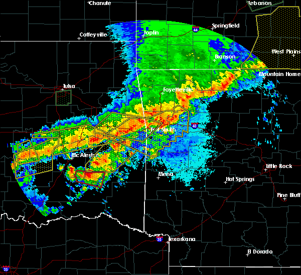 At 837 pm cdt, severe thunderstorms were located along a line extending from 2 miles east of van buren to 3 miles south of muldrow to 4 miles southwest of tamaha, moving southeast at 55 mph (radar indicated). Hazards include 60 mph wind gusts and quarter size hail. Hail damage to vehicles is expected. expect wind damage to roofs, siding, and trees. locations in or near the path include, fort smith, van buren, sallisaw, cedarville, alma, muldrow, roland, spiro, arkoma, porum, gans, tamaha, moffett, rudy, figure five, concord, cowlington, shibley, scullyville, braden, this includes the following highways, interstate 40 in arkansas between mile markers 0 and 12. interstate 40 in oklahoma near mile marker 274, and between mile markers 296 and 328. interstate 540 between mile markers 1 and 12. interstate 49 between mile markers 22 and 24. A tornado watch remains in effect until 1100 pm cdt for northwestern and west central arkansas, and southeastern and east central oklahoma. At 837 pm cdt, severe thunderstorms were located along a line extending from 2 miles east of van buren to 3 miles south of muldrow to 4 miles southwest of tamaha, moving southeast at 55 mph (radar indicated). Hazards include 60 mph wind gusts and quarter size hail. Hail damage to vehicles is expected. expect wind damage to roofs, siding, and trees. locations in or near the path include, fort smith, van buren, sallisaw, cedarville, alma, muldrow, roland, spiro, arkoma, porum, gans, tamaha, moffett, rudy, figure five, concord, cowlington, shibley, scullyville, braden, this includes the following highways, interstate 40 in arkansas between mile markers 0 and 12. interstate 40 in oklahoma near mile marker 274, and between mile markers 296 and 328. interstate 540 between mile markers 1 and 12. interstate 49 between mile markers 22 and 24. A tornado watch remains in effect until 1100 pm cdt for northwestern and west central arkansas, and southeastern and east central oklahoma.
|
| 4/28/2020 8:18 PM CDT |
 At 818 pm cdt, severe thunderstorms were located along a line extending from 8 miles east of winslow to near cedarville to 4 miles northeast of brushy to 4 miles west of tamaha, moving southeast at 50 mph (radar indicated). Hazards include 60 mph wind gusts and quarter size hail. Hail damage to vehicles is expected. expect wind damage to roofs, siding, and trees. locations in or near the path include, fort smith, van buren, sallisaw, poteau, ozark, charleston, cedarville, mountainburg, natural dam, greenwood, alma, barling, pocola, muldrow, roland, lavaca, spiro, arkoma, mulberry, panama, this includes the following highways, interstate 40 in arkansas between mile markers 0 and 42. interstate 40 in oklahoma between mile markers 297 and 328. interstate 540 between mile markers 1 and 14. interstate 49 between mile markers 22 and 38. A tornado watch remains in effect until 1100 pm cdt for northwestern and west central arkansas, and southeastern, northeastern and east central oklahoma. At 818 pm cdt, severe thunderstorms were located along a line extending from 8 miles east of winslow to near cedarville to 4 miles northeast of brushy to 4 miles west of tamaha, moving southeast at 50 mph (radar indicated). Hazards include 60 mph wind gusts and quarter size hail. Hail damage to vehicles is expected. expect wind damage to roofs, siding, and trees. locations in or near the path include, fort smith, van buren, sallisaw, poteau, ozark, charleston, cedarville, mountainburg, natural dam, greenwood, alma, barling, pocola, muldrow, roland, lavaca, spiro, arkoma, mulberry, panama, this includes the following highways, interstate 40 in arkansas between mile markers 0 and 42. interstate 40 in oklahoma between mile markers 297 and 328. interstate 540 between mile markers 1 and 14. interstate 49 between mile markers 22 and 38. A tornado watch remains in effect until 1100 pm cdt for northwestern and west central arkansas, and southeastern, northeastern and east central oklahoma.
|
| 4/28/2020 7:57 PM CDT |
 At 757 pm cdt, severe thunderstorms were located along a line extending from 3 miles northwest of cherokee landing state park to 3 miles southwest of warner, moving east at 55 mph (radar indicated). Hazards include 60 mph wind gusts and quarter size hail. Hail damage to vehicles is expected. expect wind damage to roofs, siding, and trees. locations in or near the path include, fort smith, van buren, sallisaw, cedarville, alma, muldrow, roland, spiro, arkoma, warner, vian, gore, porum, webbers falls, gans, marble city, tamaha, moffett, rudy, brushy, this includes the following highways, interstate 40 in arkansas between mile markers 0 and 12. interstate 40 in oklahoma between mile markers 274 and 328. interstate 540 between mile markers 1 and 12. interstate 49 between mile markers 22 and 25. A tornado watch remains in effect until 1100 pm cdt for northwestern and west central arkansas, and southeastern, northeastern and east central oklahoma. At 757 pm cdt, severe thunderstorms were located along a line extending from 3 miles northwest of cherokee landing state park to 3 miles southwest of warner, moving east at 55 mph (radar indicated). Hazards include 60 mph wind gusts and quarter size hail. Hail damage to vehicles is expected. expect wind damage to roofs, siding, and trees. locations in or near the path include, fort smith, van buren, sallisaw, cedarville, alma, muldrow, roland, spiro, arkoma, warner, vian, gore, porum, webbers falls, gans, marble city, tamaha, moffett, rudy, brushy, this includes the following highways, interstate 40 in arkansas between mile markers 0 and 12. interstate 40 in oklahoma between mile markers 274 and 328. interstate 540 between mile markers 1 and 12. interstate 49 between mile markers 22 and 25. A tornado watch remains in effect until 1100 pm cdt for northwestern and west central arkansas, and southeastern, northeastern and east central oklahoma.
|
| 4/28/2020 7:57 PM CDT |
 The national weather service in tulsa has issued a * severe thunderstorm warning for. southwestern crawford county in northwestern arkansas. northwestern sebastian county in west central arkansas. northeastern haskell county in southeastern oklahoma. Sequoyah county in east central oklahoma. The national weather service in tulsa has issued a * severe thunderstorm warning for. southwestern crawford county in northwestern arkansas. northwestern sebastian county in west central arkansas. northeastern haskell county in southeastern oklahoma. Sequoyah county in east central oklahoma.
|
| 4/28/2020 7:18 PM CDT |
 At 718 pm cdt, severe thunderstorms were located along a line extending from 6 miles north of porter to 4 miles northeast of bald hill to 4 miles east of welty, moving southeast at 30 mph (radar indicated). Hazards include 60 mph wind gusts and quarter size hail. Hail damage to vehicles is expected. expect wind damage to roofs, siding, and trees. Locations in or near the path include, tulsa, broken arrow, okmulgee, wagoner, bristow, bixby, jenks, okfuskee, glenpool, coweta, haskell, inola, kiefer, morris, beggs, mounds, okay, porter, taft, boynton, a tornado watch remains in effect until 1100 pm cdt for northeastern and east central oklahoma. At 718 pm cdt, severe thunderstorms were located along a line extending from 6 miles north of porter to 4 miles northeast of bald hill to 4 miles east of welty, moving southeast at 30 mph (radar indicated). Hazards include 60 mph wind gusts and quarter size hail. Hail damage to vehicles is expected. expect wind damage to roofs, siding, and trees. Locations in or near the path include, tulsa, broken arrow, okmulgee, wagoner, bristow, bixby, jenks, okfuskee, glenpool, coweta, haskell, inola, kiefer, morris, beggs, mounds, okay, porter, taft, boynton, a tornado watch remains in effect until 1100 pm cdt for northeastern and east central oklahoma.
|
| 4/28/2020 7:03 PM CDT |
 At 703 pm cdt, severe thunderstorms were located along a line extending from 7 miles south of inola to 4 miles east of mounds, moving southeast at 30 mph (radar indicated). Hazards include 60 mph wind gusts and quarter size hail. Hail damage to vehicles is expected. expect wind damage to roofs, siding, and trees. locations in or near the path include, tulsa, broken arrow, sand springs, bixby, sapulpa, jenks, glenpool, coweta, catoosa, verdigris, inola, kiefer, jenks riverside airport, stonebluff, taiwah, tiawah, oneta, liberty, mazie, hectorville, this includes interstate 44 between mile markers 205 and 244. A tornado watch remains in effect until 1100 pm cdt for northeastern and east central oklahoma. At 703 pm cdt, severe thunderstorms were located along a line extending from 7 miles south of inola to 4 miles east of mounds, moving southeast at 30 mph (radar indicated). Hazards include 60 mph wind gusts and quarter size hail. Hail damage to vehicles is expected. expect wind damage to roofs, siding, and trees. locations in or near the path include, tulsa, broken arrow, sand springs, bixby, sapulpa, jenks, glenpool, coweta, catoosa, verdigris, inola, kiefer, jenks riverside airport, stonebluff, taiwah, tiawah, oneta, liberty, mazie, hectorville, this includes interstate 44 between mile markers 205 and 244. A tornado watch remains in effect until 1100 pm cdt for northeastern and east central oklahoma.
|
| 4/28/2020 6:42 PM CDT |
 At 642 pm cdt, severe thunderstorms were located along a line extending from 6 miles west of inola to 2 miles southeast of jenks to 4 miles northeast of bristow, moving south at 30 mph (radar indicated). Hazards include 60 mph wind gusts and quarter size hail. Hail damage to vehicles is expected. expect wind damage to roofs, siding, and trees. locations in or near the path include, tulsa, broken arrow, sand springs, okmulgee, wagoner, bristow, bixby, sapulpa, jenks, okfuskee, glenpool, coweta, catoosa, verdigris, haskell, inola, kiefer, morris, beggs, mounds, this includes interstate 44 between mile markers 185 and 243. A tornado watch remains in effect until 1100 pm cdt for northeastern and east central oklahoma. At 642 pm cdt, severe thunderstorms were located along a line extending from 6 miles west of inola to 2 miles southeast of jenks to 4 miles northeast of bristow, moving south at 30 mph (radar indicated). Hazards include 60 mph wind gusts and quarter size hail. Hail damage to vehicles is expected. expect wind damage to roofs, siding, and trees. locations in or near the path include, tulsa, broken arrow, sand springs, okmulgee, wagoner, bristow, bixby, sapulpa, jenks, okfuskee, glenpool, coweta, catoosa, verdigris, haskell, inola, kiefer, morris, beggs, mounds, this includes interstate 44 between mile markers 185 and 243. A tornado watch remains in effect until 1100 pm cdt for northeastern and east central oklahoma.
|
| 4/28/2020 6:23 PM CDT |
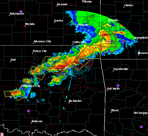 At 623 pm cdt, severe thunderstorms were located along a line extending from near owasso to 3 miles south of mannford, moving southeast at 40 mph (radar indicated). Hazards include 60 mph wind gusts and quarter size hail. Hail damage to vehicles is expected. expect wind damage to roofs, siding, and trees. locations in or near the path include, tulsa, broken arrow, sand springs, claremore, owasso, bixby, sapulpa, jenks, glenpool, coweta, catoosa, verdigris, inola, kiefer, jenks riverside airport, stonebluff, tulsa international airport, taiwah, tiawah, oneta, this includes interstate 44 between mile markers 205 and 248. A tornado watch remains in effect until 1100 pm cdt for northeastern and east central oklahoma. At 623 pm cdt, severe thunderstorms were located along a line extending from near owasso to 3 miles south of mannford, moving southeast at 40 mph (radar indicated). Hazards include 60 mph wind gusts and quarter size hail. Hail damage to vehicles is expected. expect wind damage to roofs, siding, and trees. locations in or near the path include, tulsa, broken arrow, sand springs, claremore, owasso, bixby, sapulpa, jenks, glenpool, coweta, catoosa, verdigris, inola, kiefer, jenks riverside airport, stonebluff, tulsa international airport, taiwah, tiawah, oneta, this includes interstate 44 between mile markers 205 and 248. A tornado watch remains in effect until 1100 pm cdt for northeastern and east central oklahoma.
|
| 4/24/2020 8:06 PM CDT |
 At 806 pm cdt, severe thunderstorms were located along a line extending from 3 miles east of stilwell to 5 miles northwest of roland to 7 miles north of bokoshe, moving east at 40 mph (radar indicated). Hazards include 60 mph wind gusts and quarter size hail. Hail damage to vehicles is expected. expect wind damage to roofs, siding, and trees. locations in or near the path include, fort smith, van buren, stilwell, charleston, cedarville, mountainburg, natural dam, greenwood, alma, barling, pocola, muldrow, roland, lavaca, spiro, arkoma, mulberry, dyer, hackett, bonanza, this includes the following highways, interstate 40 in arkansas between mile markers 0 and 32. interstate 40 in oklahoma between mile markers 313 and 328. interstate 540 between mile markers 1 and 14. Interstate 49 between mile markers 22 and 44. At 806 pm cdt, severe thunderstorms were located along a line extending from 3 miles east of stilwell to 5 miles northwest of roland to 7 miles north of bokoshe, moving east at 40 mph (radar indicated). Hazards include 60 mph wind gusts and quarter size hail. Hail damage to vehicles is expected. expect wind damage to roofs, siding, and trees. locations in or near the path include, fort smith, van buren, stilwell, charleston, cedarville, mountainburg, natural dam, greenwood, alma, barling, pocola, muldrow, roland, lavaca, spiro, arkoma, mulberry, dyer, hackett, bonanza, this includes the following highways, interstate 40 in arkansas between mile markers 0 and 32. interstate 40 in oklahoma between mile markers 313 and 328. interstate 540 between mile markers 1 and 14. Interstate 49 between mile markers 22 and 44.
|
| 4/24/2020 8:00 PM CDT |
 At 800 pm cdt, severe thunderstorms were located along a line extending from 5 miles southwest of stilwell to 4 miles southeast of brushy to 7 miles north of bokoshe, moving east at 50 mph (radar indicated). Hazards include 60 mph wind gusts and quarter size hail. Hail damage to vehicles is expected. expect wind damage to roofs, siding, and trees. Locations in or near the path include, sallisaw, stilwell, pocola, muldrow, roland, spiro, arkoma, gans, moffett, brushy, brushy lake state park, bunch, short, cowlington, scullyville, braden, cottonwood, this includes interstate 40 in oklahoma between mile markers 301 and 328. At 800 pm cdt, severe thunderstorms were located along a line extending from 5 miles southwest of stilwell to 4 miles southeast of brushy to 7 miles north of bokoshe, moving east at 50 mph (radar indicated). Hazards include 60 mph wind gusts and quarter size hail. Hail damage to vehicles is expected. expect wind damage to roofs, siding, and trees. Locations in or near the path include, sallisaw, stilwell, pocola, muldrow, roland, spiro, arkoma, gans, moffett, brushy, brushy lake state park, bunch, short, cowlington, scullyville, braden, cottonwood, this includes interstate 40 in oklahoma between mile markers 301 and 328.
|
| 4/24/2020 7:34 PM CDT |
 At 733 pm cdt, severe thunderstorms were located along a line extending from cherokee landing state park to 3 miles south of lake tenkiller state park to 3 miles northeast of briartown, moving east at 40 mph (radar indicated). Hazards include 60 mph wind gusts and quarter size hail. Hail damage to vehicles is expected. expect wind damage to roofs, siding, and trees. Locations in or near the path include, sallisaw, stilwell, pocola, muldrow, roland, spiro, arkoma, vian, gore, porum, webbers falls, gans, marble city, tamaha, moffett, brushy, cookson, brushy lake state park, cherokee landing state park, bunch, this includes interstate 40 in oklahoma between mile markers 285 and 328. At 733 pm cdt, severe thunderstorms were located along a line extending from cherokee landing state park to 3 miles south of lake tenkiller state park to 3 miles northeast of briartown, moving east at 40 mph (radar indicated). Hazards include 60 mph wind gusts and quarter size hail. Hail damage to vehicles is expected. expect wind damage to roofs, siding, and trees. Locations in or near the path include, sallisaw, stilwell, pocola, muldrow, roland, spiro, arkoma, vian, gore, porum, webbers falls, gans, marble city, tamaha, moffett, brushy, cookson, brushy lake state park, cherokee landing state park, bunch, this includes interstate 40 in oklahoma between mile markers 285 and 328.
|
| 3/19/2020 5:40 PM CDT |
 At 540 pm cdt, a severe thunderstorm was located near moffett, moving northeast at 35 mph (radar indicated). Hazards include 60 mph wind gusts and quarter size hail. Hail damage to vehicles is expected. expect wind damage to roofs, siding, and trees. locations in or near the path include, fort smith, van buren, cedarville, alma, roland, dyer, moffett, rudy, figure five, kibler, concord, shibley, dora, furry, mill creek, this includes the following highways, interstate 40 in arkansas between mile markers 0 and 16. interstate 40 in oklahoma between mile markers 322 and 328. interstate 540 between mile markers 1 and 8. interstate 49 between mile markers 22 and 27. A tornado watch remains in effect until 1000 pm cdt for northwestern and west central arkansas, and southeastern and east central oklahoma. At 540 pm cdt, a severe thunderstorm was located near moffett, moving northeast at 35 mph (radar indicated). Hazards include 60 mph wind gusts and quarter size hail. Hail damage to vehicles is expected. expect wind damage to roofs, siding, and trees. locations in or near the path include, fort smith, van buren, cedarville, alma, roland, dyer, moffett, rudy, figure five, kibler, concord, shibley, dora, furry, mill creek, this includes the following highways, interstate 40 in arkansas between mile markers 0 and 16. interstate 40 in oklahoma between mile markers 322 and 328. interstate 540 between mile markers 1 and 8. interstate 49 between mile markers 22 and 27. A tornado watch remains in effect until 1000 pm cdt for northwestern and west central arkansas, and southeastern and east central oklahoma.
|
| 3/19/2020 5:32 PM CDT |
 At 532 pm cdt, a severe thunderstorm was located near roland, moving northeast at 35 mph (radar indicated). Hazards include 60 mph wind gusts and quarter size hail. Hail damage to vehicles is expected. expect wind damage to roofs, siding, and trees. locations in or near the path include, fort smith, van buren, cedarville, alma, pocola, muldrow, roland, arkoma, dyer, moffett, rudy, figure five, fort smith regional airport, kibler, concord, shibley, braden, mill creek, cottonwood, dora, this includes the following highways, interstate 40 in arkansas between mile markers 0 and 16. interstate 40 in oklahoma between mile markers 316 and 328. interstate 540 between mile markers 1 and 11. interstate 49 between mile markers 22 and 27. A tornado watch remains in effect until 1000 pm cdt for northwestern and west central arkansas, and southeastern and east central oklahoma. At 532 pm cdt, a severe thunderstorm was located near roland, moving northeast at 35 mph (radar indicated). Hazards include 60 mph wind gusts and quarter size hail. Hail damage to vehicles is expected. expect wind damage to roofs, siding, and trees. locations in or near the path include, fort smith, van buren, cedarville, alma, pocola, muldrow, roland, arkoma, dyer, moffett, rudy, figure five, fort smith regional airport, kibler, concord, shibley, braden, mill creek, cottonwood, dora, this includes the following highways, interstate 40 in arkansas between mile markers 0 and 16. interstate 40 in oklahoma between mile markers 316 and 328. interstate 540 between mile markers 1 and 11. interstate 49 between mile markers 22 and 27. A tornado watch remains in effect until 1000 pm cdt for northwestern and west central arkansas, and southeastern and east central oklahoma.
|
| 3/19/2020 4:42 PM CDT |
 At 442 pm cdt, a severe thunderstorm was located near roland, moving northeast at 45 mph (radar indicated). Hazards include 60 mph wind gusts and quarter size hail. Hail damage to vehicles is expected. expect wind damage to roofs, siding, and trees. locations in or near the path include, fort smith, van buren, cedarville, mountainburg, alma, barling, muldrow, roland, spiro, arkoma, mulberry, dyer, chester, moffett, rudy, fort smith regional airport, figure five, kibler, concord, shibley, this includes the following highways, interstate 40 in arkansas between mile markers 0 and 21. interstate 40 in oklahoma between mile markers 318 and 328. interstate 540 between mile markers 1 and 14. interstate 49 between mile markers 22 and 33. A tornado watch remains in effect until 1000 pm cdt for northwestern and west central arkansas, and southeastern and east central oklahoma. At 442 pm cdt, a severe thunderstorm was located near roland, moving northeast at 45 mph (radar indicated). Hazards include 60 mph wind gusts and quarter size hail. Hail damage to vehicles is expected. expect wind damage to roofs, siding, and trees. locations in or near the path include, fort smith, van buren, cedarville, mountainburg, alma, barling, muldrow, roland, spiro, arkoma, mulberry, dyer, chester, moffett, rudy, fort smith regional airport, figure five, kibler, concord, shibley, this includes the following highways, interstate 40 in arkansas between mile markers 0 and 21. interstate 40 in oklahoma between mile markers 318 and 328. interstate 540 between mile markers 1 and 14. interstate 49 between mile markers 22 and 33. A tornado watch remains in effect until 1000 pm cdt for northwestern and west central arkansas, and southeastern and east central oklahoma.
|
| 3/19/2020 4:26 PM CDT |
 At 426 pm cdt, a severe thunderstorm was located 5 miles south of gans, moving northeast at 45 mph (radar indicated). Hazards include 60 mph wind gusts and quarter size hail. Hail damage to vehicles is expected. expect wind damage to roofs, siding, and trees. locations in or near the path include, fort smith, van buren, cedarville, mountainburg, alma, barling, muldrow, roland, spiro, arkoma, mulberry, dyer, gans, chester, moffett, rudy, fort smith regional airport, figure five, kibler, concord, this includes the following highways, interstate 40 in arkansas between mile markers 0 and 21. interstate 40 in oklahoma between mile markers 313 and 328. interstate 540 between mile markers 1 and 14. interstate 49 between mile markers 22 and 33. A tornado watch remains in effect until 1000 pm cdt for northwestern and west central arkansas, and southeastern and east central oklahoma. At 426 pm cdt, a severe thunderstorm was located 5 miles south of gans, moving northeast at 45 mph (radar indicated). Hazards include 60 mph wind gusts and quarter size hail. Hail damage to vehicles is expected. expect wind damage to roofs, siding, and trees. locations in or near the path include, fort smith, van buren, cedarville, mountainburg, alma, barling, muldrow, roland, spiro, arkoma, mulberry, dyer, gans, chester, moffett, rudy, fort smith regional airport, figure five, kibler, concord, this includes the following highways, interstate 40 in arkansas between mile markers 0 and 21. interstate 40 in oklahoma between mile markers 313 and 328. interstate 540 between mile markers 1 and 14. interstate 49 between mile markers 22 and 33. A tornado watch remains in effect until 1000 pm cdt for northwestern and west central arkansas, and southeastern and east central oklahoma.
|
| 3/19/2020 4:17 PM CDT |
 At 416 pm cdt, a severe thunderstorm was located 5 miles north of bokoshe, moving northeast at 45 mph (radar indicated). Hazards include 60 mph wind gusts and penny size hail. Expect damage to roofs, siding, and trees. locations in or near the path include, fort smith, van buren, cedarville, mountainburg, alma, barling, muldrow, roland, lavaca, spiro, arkoma, mulberry, dyer, bokoshe, gans, chester, moffett, rudy, fort smith regional airport, figure five, this includes the following highways, interstate 40 in arkansas between mile markers 0 and 21. interstate 40 in oklahoma between mile markers 313 and 328. interstate 540 between mile markers 1 and 14. interstate 49 between mile markers 22 and 33. A tornado watch remains in effect until 1000 pm cdt for northwestern and west central arkansas, and southeastern and east central oklahoma. At 416 pm cdt, a severe thunderstorm was located 5 miles north of bokoshe, moving northeast at 45 mph (radar indicated). Hazards include 60 mph wind gusts and penny size hail. Expect damage to roofs, siding, and trees. locations in or near the path include, fort smith, van buren, cedarville, mountainburg, alma, barling, muldrow, roland, lavaca, spiro, arkoma, mulberry, dyer, bokoshe, gans, chester, moffett, rudy, fort smith regional airport, figure five, this includes the following highways, interstate 40 in arkansas between mile markers 0 and 21. interstate 40 in oklahoma between mile markers 313 and 328. interstate 540 between mile markers 1 and 14. interstate 49 between mile markers 22 and 33. A tornado watch remains in effect until 1000 pm cdt for northwestern and west central arkansas, and southeastern and east central oklahoma.
|
| 3/19/2020 10:57 AM CDT |
 The severe thunderstorm warning for northwestern muskogee and northern okmulgee counties will expire at 1100 am cdt, the storm which prompted the warning has weakened below severe limits, and no longer poses an immediate threat to life or property. therefore the warning will be allowed to expire. The severe thunderstorm warning for northwestern muskogee and northern okmulgee counties will expire at 1100 am cdt, the storm which prompted the warning has weakened below severe limits, and no longer poses an immediate threat to life or property. therefore the warning will be allowed to expire.
|
| 3/19/2020 10:53 AM CDT |
 At 1051 am cdt, a severe thunderstorm was located 4 miles east of preston, moving northeast at 55 mph. the storm was weakening (radar indicated). Hazards include 60 mph wind gusts. Expect damage to roofs, siding, and trees. Locations in or near the path include, okmulgee, haskell, preston, okmulgee state park, bald hill, jamesville, hectorville,. At 1051 am cdt, a severe thunderstorm was located 4 miles east of preston, moving northeast at 55 mph. the storm was weakening (radar indicated). Hazards include 60 mph wind gusts. Expect damage to roofs, siding, and trees. Locations in or near the path include, okmulgee, haskell, preston, okmulgee state park, bald hill, jamesville, hectorville,.
|
| 3/19/2020 10:43 AM CDT |
 At 1042 am cdt, a severe thunderstorm was located near okmulgee, moving northeast at 65 mph (radar indicated. at 1025 am, damage was reported to a home 1.5 miles south of okemah). Hazards include 60 mph wind gusts. Expect damage to roofs, siding, and trees. Locations in or near the path include, broken arrow, okmulgee, bixby, okfuskee, haskell, morris, beggs, preston, bald hill, okmulgee state park, liberty, jamesville, hectorville, leonard,. At 1042 am cdt, a severe thunderstorm was located near okmulgee, moving northeast at 65 mph (radar indicated. at 1025 am, damage was reported to a home 1.5 miles south of okemah). Hazards include 60 mph wind gusts. Expect damage to roofs, siding, and trees. Locations in or near the path include, broken arrow, okmulgee, bixby, okfuskee, haskell, morris, beggs, preston, bald hill, okmulgee state park, liberty, jamesville, hectorville, leonard,.
|
| 3/19/2020 10:17 AM CDT |
 At 1017 am cdt, a severe thunderstorm was located near bearden, moving northeast at 65 mph (radar indicated). Hazards include 70 mph wind gusts. Expect considerable tree damage. damage is likely to mobile homes, roofs, and outbuildings. Locations in or near the path include, broken arrow, okmulgee, okemah, bixby, okfuskee, haskell, morris, beggs, bearden, castle, clearview, preston, bald hill, okmulgee state park, liberty, jamesville, hectorville, leonard, this includes interstate 40 in oklahoma between mile markers 212 and 230. At 1017 am cdt, a severe thunderstorm was located near bearden, moving northeast at 65 mph (radar indicated). Hazards include 70 mph wind gusts. Expect considerable tree damage. damage is likely to mobile homes, roofs, and outbuildings. Locations in or near the path include, broken arrow, okmulgee, okemah, bixby, okfuskee, haskell, morris, beggs, bearden, castle, clearview, preston, bald hill, okmulgee state park, liberty, jamesville, hectorville, leonard, this includes interstate 40 in oklahoma between mile markers 212 and 230.
|
| 1/10/2020 4:24 PM CST |
 At 424 pm cst, severe thunderstorms were located along a line extending from 2 miles north of baron to 2 miles northwest of short to 3 miles northeast of muldrow, moving northeast at 55 mph (radar indicated). Hazards include 70 mph wind gusts and quarter size hail. Hail damage to vehicles is expected. expect considerable tree damage. wind damage is also likely to mobile homes, roofs, and outbuildings. locations in or near the path include, fort smith, fayetteville, springdale, rogers, van buren, stilwell, cedarville, mountainburg, natural dam, lowell, farmington, alma, prairie grove, muldrow, roland, elkins, tontitown, bethel heights, west fork, lincoln, this includes the following highways, interstate 40 in arkansas between mile markers 0 and 30. interstate 40 in oklahoma between mile markers 318 and 328. interstate 540 between mile markers 1 and 4. interstate 49 between mile markers 22 and 82. A tornado watch remains in effect until 600 pm cst for northwestern and west central arkansas, and northeastern and east central oklahoma. At 424 pm cst, severe thunderstorms were located along a line extending from 2 miles north of baron to 2 miles northwest of short to 3 miles northeast of muldrow, moving northeast at 55 mph (radar indicated). Hazards include 70 mph wind gusts and quarter size hail. Hail damage to vehicles is expected. expect considerable tree damage. wind damage is also likely to mobile homes, roofs, and outbuildings. locations in or near the path include, fort smith, fayetteville, springdale, rogers, van buren, stilwell, cedarville, mountainburg, natural dam, lowell, farmington, alma, prairie grove, muldrow, roland, elkins, tontitown, bethel heights, west fork, lincoln, this includes the following highways, interstate 40 in arkansas between mile markers 0 and 30. interstate 40 in oklahoma between mile markers 318 and 328. interstate 540 between mile markers 1 and 4. interstate 49 between mile markers 22 and 82. A tornado watch remains in effect until 600 pm cst for northwestern and west central arkansas, and northeastern and east central oklahoma.
|
| 1/10/2020 4:13 PM CST |
 At 412 pm cst, severe thunderstorms were located along a line extending from 3 miles southeast of eldon to 4 miles east of sallisaw, moving northeast at 60 mph. wind damage to power poles and quarter size hail has been reported by emergency management in sallisaw (emergency management). Hazards include 70 mph wind gusts and quarter size hail. Hail damage to vehicles is expected. expect considerable tree damage. wind damage is also likely to mobile homes, roofs, and outbuildings. locations in or near the path include, sallisaw, stilwell, muldrow, roland, westville, marble city, brushy, adair state park, christie, maryetta, brushy lake state park, bunch, baron, short, this includes interstate 40 in oklahoma between mile markers 304 and 314, and between mile markers 326 and 328. A tornado watch remains in effect until 600 pm cst for northeastern and east central oklahoma. At 412 pm cst, severe thunderstorms were located along a line extending from 3 miles southeast of eldon to 4 miles east of sallisaw, moving northeast at 60 mph. wind damage to power poles and quarter size hail has been reported by emergency management in sallisaw (emergency management). Hazards include 70 mph wind gusts and quarter size hail. Hail damage to vehicles is expected. expect considerable tree damage. wind damage is also likely to mobile homes, roofs, and outbuildings. locations in or near the path include, sallisaw, stilwell, muldrow, roland, westville, marble city, brushy, adair state park, christie, maryetta, brushy lake state park, bunch, baron, short, this includes interstate 40 in oklahoma between mile markers 304 and 314, and between mile markers 326 and 328. A tornado watch remains in effect until 600 pm cst for northeastern and east central oklahoma.
|
| 1/10/2020 3:55 PM CST |
 At 354 pm cst, severe thunderstorms were located along a line extending from 3 miles northwest of cookson to 3 miles north of keota, moving northeast at 55 mph (radar indicated). Hazards include 70 mph wind gusts and quarter size hail. Hail damage to vehicles is expected. expect considerable tree damage. wind damage is also likely to mobile homes, roofs, and outbuildings. locations in or near the path include, sallisaw, stilwell, muldrow, roland, arkoma, westville, vian, keota, gans, marble city, tamaha, moffett, brushy, adair state park, christie, maryetta, cookson, brushy lake state park, cherokee landing state park, bunch, this includes interstate 40 in oklahoma between mile markers 292 and 328. A tornado watch remains in effect until 600 pm cst for west central arkansas, and southeastern, northeastern and east central oklahoma. At 354 pm cst, severe thunderstorms were located along a line extending from 3 miles northwest of cookson to 3 miles north of keota, moving northeast at 55 mph (radar indicated). Hazards include 70 mph wind gusts and quarter size hail. Hail damage to vehicles is expected. expect considerable tree damage. wind damage is also likely to mobile homes, roofs, and outbuildings. locations in or near the path include, sallisaw, stilwell, muldrow, roland, arkoma, westville, vian, keota, gans, marble city, tamaha, moffett, brushy, adair state park, christie, maryetta, cookson, brushy lake state park, cherokee landing state park, bunch, this includes interstate 40 in oklahoma between mile markers 292 and 328. A tornado watch remains in effect until 600 pm cst for west central arkansas, and southeastern, northeastern and east central oklahoma.
|
| 12/28/2019 3:16 PM CST |
 At 315 pm cst, severe thunderstorms were located along a line extending from 2 miles west of jenks riverside airport to 3 miles southwest of bixby to 7 miles northwest of bald hill, moving northeast at 55 mph (radar indicated). Hazards include 60 mph wind gusts. Expect damage to roofs, siding, and trees. Locations in or near the path include, tulsa, broken arrow, claremore, bixby, jenks, glenpool, coweta, catoosa, verdigris, inola, foyil, jenks riverside airport, stonebluff, taiwah, tiawah, oneta, liberty, hectorville, leonard, bushyhead, this includes interstate 44 between mile markers 217 and 259. At 315 pm cst, severe thunderstorms were located along a line extending from 2 miles west of jenks riverside airport to 3 miles southwest of bixby to 7 miles northwest of bald hill, moving northeast at 55 mph (radar indicated). Hazards include 60 mph wind gusts. Expect damage to roofs, siding, and trees. Locations in or near the path include, tulsa, broken arrow, claremore, bixby, jenks, glenpool, coweta, catoosa, verdigris, inola, foyil, jenks riverside airport, stonebluff, taiwah, tiawah, oneta, liberty, hectorville, leonard, bushyhead, this includes interstate 44 between mile markers 217 and 259.
|
| 10/21/2019 12:55 AM CDT |
 At 1254 am cdt, severe thunderstorms were located along a line extending from 5 miles east of seligman to 3 miles southeast of eureka springs to 4 miles east of wesley to near alma, moving east at 65 mph (radar indicated). Hazards include 70 mph wind gusts and quarter size hail. Hail damage to vehicles is expected. expect considerable tree damage. wind damage is also likely to mobile homes, roofs, and outbuildings. locations in or near the path include, fort smith, fayetteville, springdale, van buren, berryville, ozark, huntsville, eureka springs, cedarville, mountainburg, natural dam, alma, muldrow, roland, green forest, elkins, west fork, mulberry, greenland, dyer, this includes the following highways, interstate 40 in arkansas between mile markers 0 and 42. interstate 40 in oklahoma between mile markers 316 and 328. interstate 540 between mile markers 1 and 8. interstate 49 between mile markers 22 and 60. A tornado watch remains in effect until 300 am cdt for northwestern and west central arkansas, and southeastern, northeastern and east central oklahoma. At 1254 am cdt, severe thunderstorms were located along a line extending from 5 miles east of seligman to 3 miles southeast of eureka springs to 4 miles east of wesley to near alma, moving east at 65 mph (radar indicated). Hazards include 70 mph wind gusts and quarter size hail. Hail damage to vehicles is expected. expect considerable tree damage. wind damage is also likely to mobile homes, roofs, and outbuildings. locations in or near the path include, fort smith, fayetteville, springdale, van buren, berryville, ozark, huntsville, eureka springs, cedarville, mountainburg, natural dam, alma, muldrow, roland, green forest, elkins, west fork, mulberry, greenland, dyer, this includes the following highways, interstate 40 in arkansas between mile markers 0 and 42. interstate 40 in oklahoma between mile markers 316 and 328. interstate 540 between mile markers 1 and 8. interstate 49 between mile markers 22 and 60. A tornado watch remains in effect until 300 am cdt for northwestern and west central arkansas, and southeastern, northeastern and east central oklahoma.
|
| 10/21/2019 12:41 AM CDT |
 At 1241 am cdt, severe thunderstorms were located along a line extending from 3 miles northeast of pea ridge to 2 miles northeast of war eagle to 4 miles southwest of elkins to moffett, moving east at 70 mph (radar indicated). Hazards include 70 mph wind gusts and quarter size hail. Hail damage to vehicles is expected. expect considerable tree damage. wind damage is also likely to mobile homes, roofs, and outbuildings. locations in or near the path include, fort smith, fayetteville, springdale, rogers, bentonville, van buren, sallisaw, berryville, ozark, huntsville, eureka springs, cedarville, mountainburg, natural dam, bella vista, lowell, farmington, alma, pea ridge, prairie grove, this includes the following highways, interstate 40 in arkansas between mile markers 0 and 42. interstate 40 in oklahoma between mile markers 304 and 328. interstate 540 between mile markers 1 and 8. interstate 49 between mile markers 22 and 93. A tornado watch remains in effect until 300 am cdt for northwestern and west central arkansas, and southeastern, northeastern and east central oklahoma. At 1241 am cdt, severe thunderstorms were located along a line extending from 3 miles northeast of pea ridge to 2 miles northeast of war eagle to 4 miles southwest of elkins to moffett, moving east at 70 mph (radar indicated). Hazards include 70 mph wind gusts and quarter size hail. Hail damage to vehicles is expected. expect considerable tree damage. wind damage is also likely to mobile homes, roofs, and outbuildings. locations in or near the path include, fort smith, fayetteville, springdale, rogers, bentonville, van buren, sallisaw, berryville, ozark, huntsville, eureka springs, cedarville, mountainburg, natural dam, bella vista, lowell, farmington, alma, pea ridge, prairie grove, this includes the following highways, interstate 40 in arkansas between mile markers 0 and 42. interstate 40 in oklahoma between mile markers 304 and 328. interstate 540 between mile markers 1 and 8. interstate 49 between mile markers 22 and 93. A tornado watch remains in effect until 300 am cdt for northwestern and west central arkansas, and southeastern, northeastern and east central oklahoma.
|
| 10/21/2019 12:33 AM CDT |
 At 1232 am cdt, severe thunderstorms were located along a line extending from 3 miles southwest of lowell to 4 miles north of fayetteville to 3 miles north of blackburn to 4 miles southwest of figure five, moving east at 60 mph (radar indicated). Hazards include 70 mph wind gusts. Expect considerable tree damage. damage is likely to mobile homes, roofs, and outbuildings. locations in or near the path include, fort smith, fayetteville, springdale, rogers, bentonville, van buren, siloam springs, sallisaw, stilwell, huntsville, eureka springs, cedarville, mountainburg, natural dam, bella vista, lowell, farmington, alma, pea ridge, prairie grove, this includes the following highways, interstate 40 in arkansas between mile markers 0 and 31. interstate 40 in oklahoma between mile markers 298 and 328. interstate 540 between mile markers 1 and 7. interstate 49 between mile markers 22 and 93. A tornado watch remains in effect until 300 am cdt for northwestern and west central arkansas, and southeastern, northeastern and east central oklahoma. At 1232 am cdt, severe thunderstorms were located along a line extending from 3 miles southwest of lowell to 4 miles north of fayetteville to 3 miles north of blackburn to 4 miles southwest of figure five, moving east at 60 mph (radar indicated). Hazards include 70 mph wind gusts. Expect considerable tree damage. damage is likely to mobile homes, roofs, and outbuildings. locations in or near the path include, fort smith, fayetteville, springdale, rogers, bentonville, van buren, siloam springs, sallisaw, stilwell, huntsville, eureka springs, cedarville, mountainburg, natural dam, bella vista, lowell, farmington, alma, pea ridge, prairie grove, this includes the following highways, interstate 40 in arkansas between mile markers 0 and 31. interstate 40 in oklahoma between mile markers 298 and 328. interstate 540 between mile markers 1 and 7. interstate 49 between mile markers 22 and 93. A tornado watch remains in effect until 300 am cdt for northwestern and west central arkansas, and southeastern, northeastern and east central oklahoma.
|
| 10/21/2019 12:04 AM CDT |
 At 1204 am cdt, severe thunderstorms were located along a line extending from 3 miles west of west siloam springs to 5 miles northwest of westville to 5 miles west of stilwell to 5 miles east of tamaha, moving east at 60 mph (radar indicated). Hazards include 70 mph wind gusts. Expect considerable tree damage. damage is likely to mobile homes, roofs, and outbuildings. locations in or near the path include, fort smith, fayetteville, springdale, rogers, bentonville, van buren, siloam springs, sallisaw, stilwell, huntsville, eureka springs, cedarville, mountainburg, natural dam, bella vista, lowell, farmington, alma, pea ridge, prairie grove, this includes the following highways, interstate 40 in arkansas between mile markers 0 and 31. interstate 40 in oklahoma between mile markers 295 and 328. interstate 540 between mile markers 1 and 7. interstate 49 between mile markers 22 and 93. A tornado watch remains in effect until 300 am cdt for northwestern and west central arkansas, and southeastern, northeastern and east central oklahoma. At 1204 am cdt, severe thunderstorms were located along a line extending from 3 miles west of west siloam springs to 5 miles northwest of westville to 5 miles west of stilwell to 5 miles east of tamaha, moving east at 60 mph (radar indicated). Hazards include 70 mph wind gusts. Expect considerable tree damage. damage is likely to mobile homes, roofs, and outbuildings. locations in or near the path include, fort smith, fayetteville, springdale, rogers, bentonville, van buren, siloam springs, sallisaw, stilwell, huntsville, eureka springs, cedarville, mountainburg, natural dam, bella vista, lowell, farmington, alma, pea ridge, prairie grove, this includes the following highways, interstate 40 in arkansas between mile markers 0 and 31. interstate 40 in oklahoma between mile markers 295 and 328. interstate 540 between mile markers 1 and 7. interstate 49 between mile markers 22 and 93. A tornado watch remains in effect until 300 am cdt for northwestern and west central arkansas, and southeastern, northeastern and east central oklahoma.
|
| 10/20/2019 11:51 PM CDT |
 At 1150 pm cdt, severe thunderstorms were located along a line extending from 3 miles north of tahlequah to 5 miles north of cherokee landing state park to 2 miles east of lake tenkiller state park to 5 miles north of stigler, moving east at 70 mph (radar indicated). Hazards include 70 mph wind gusts. Expect considerable tree damage. damage is likely to mobile homes, roofs, and outbuildings. locations in or near the path include, tahlequah, sallisaw, stilwell, westville, vian, gore, webbers falls, hulbert, watts, marble city, braggs, tamaha, brushy, adair state park, christie, greenleaf state park, pumpkin center, maryetta, cookson, brushy lake state park, this includes interstate 40 in oklahoma between mile markers 280 and 314. A tornado watch remains in effect until 300 am cdt for northwestern arkansas, and southeastern, northeastern and east central oklahoma. At 1150 pm cdt, severe thunderstorms were located along a line extending from 3 miles north of tahlequah to 5 miles north of cherokee landing state park to 2 miles east of lake tenkiller state park to 5 miles north of stigler, moving east at 70 mph (radar indicated). Hazards include 70 mph wind gusts. Expect considerable tree damage. damage is likely to mobile homes, roofs, and outbuildings. locations in or near the path include, tahlequah, sallisaw, stilwell, westville, vian, gore, webbers falls, hulbert, watts, marble city, braggs, tamaha, brushy, adair state park, christie, greenleaf state park, pumpkin center, maryetta, cookson, brushy lake state park, this includes interstate 40 in oklahoma between mile markers 280 and 314. A tornado watch remains in effect until 300 am cdt for northwestern arkansas, and southeastern, northeastern and east central oklahoma.
|
| 10/20/2019 11:29 PM CDT |
 At 1128 pm cdt, severe thunderstorms were located along a line extending from 2 miles northwest of muskogee to 4 miles south of fort gibson to near warner to 3 miles west of enterprise, moving east at 80 mph (radar indicated). Hazards include 70 mph wind gusts. Expect considerable tree damage. damage is likely to mobile homes, roofs, and outbuildings. locations in or near the path include, muskogee, tahlequah, sallisaw, stilwell, fort gibson, warner, westville, vian, gore, porum, okay, webbers falls, hulbert, watts, marble city, braggs, tamaha, tullahassee, brushy, adair state park, this includes interstate 40 in oklahoma between mile markers 271 and 314. A tornado watch remains in effect until 300 am cdt for northwestern arkansas, and southeastern, northeastern and east central oklahoma. At 1128 pm cdt, severe thunderstorms were located along a line extending from 2 miles northwest of muskogee to 4 miles south of fort gibson to near warner to 3 miles west of enterprise, moving east at 80 mph (radar indicated). Hazards include 70 mph wind gusts. Expect considerable tree damage. damage is likely to mobile homes, roofs, and outbuildings. locations in or near the path include, muskogee, tahlequah, sallisaw, stilwell, fort gibson, warner, westville, vian, gore, porum, okay, webbers falls, hulbert, watts, marble city, braggs, tamaha, tullahassee, brushy, adair state park, this includes interstate 40 in oklahoma between mile markers 271 and 314. A tornado watch remains in effect until 300 am cdt for northwestern arkansas, and southeastern, northeastern and east central oklahoma.
|
| 10/20/2019 10:48 PM CDT |
 At 1048 pm cdt, a severe thunderstorm was located 3 miles southeast of bixby, moving east at 65 mph (radar indicated). Hazards include 60 mph wind gusts and penny size hail. Expect damage to roofs, siding, and trees. Locations in or near the path include, tulsa, broken arrow, wagoner, bixby, jenks, glenpool, coweta, inola, porter, stonebluff, oneta, liberty, redbird, mazie, hectorville, leonard, a tornado watch remains in effect until 300 am cdt for northeastern oklahoma. At 1048 pm cdt, a severe thunderstorm was located 3 miles southeast of bixby, moving east at 65 mph (radar indicated). Hazards include 60 mph wind gusts and penny size hail. Expect damage to roofs, siding, and trees. Locations in or near the path include, tulsa, broken arrow, wagoner, bixby, jenks, glenpool, coweta, inola, porter, stonebluff, oneta, liberty, redbird, mazie, hectorville, leonard, a tornado watch remains in effect until 300 am cdt for northeastern oklahoma.
|
| 10/20/2019 10:14 PM CDT |
 At 1014 pm cdt, a severe thunderstorm was located 3 miles northeast of preston, moving northeast at 40 mph (radar indicated). Hazards include golf ball size hail and 60 mph wind gusts. People and animals outdoors will be injured. expect hail damage to roofs, siding, windows, and vehicles. expect wind damage to roofs, siding, and trees. Locations in or near the path include, tulsa, broken arrow, okmulgee, wagoner, bixby, jenks, glenpool, coweta, haskell, beggs, porter, preston, bald hill, stonebluff, oneta, liberty, redbird, hectorville, leonard, choska, a tornado watch remains in effect until 300 am cdt for northeastern and east central oklahoma. At 1014 pm cdt, a severe thunderstorm was located 3 miles northeast of preston, moving northeast at 40 mph (radar indicated). Hazards include golf ball size hail and 60 mph wind gusts. People and animals outdoors will be injured. expect hail damage to roofs, siding, windows, and vehicles. expect wind damage to roofs, siding, and trees. Locations in or near the path include, tulsa, broken arrow, okmulgee, wagoner, bixby, jenks, glenpool, coweta, haskell, beggs, porter, preston, bald hill, stonebluff, oneta, liberty, redbird, hectorville, leonard, choska, a tornado watch remains in effect until 300 am cdt for northeastern and east central oklahoma.
|
| 10/20/2019 10:06 PM CDT |
 At 1005 pm cdt, a severe thunderstorm was located 3 miles north of beggs, moving northeast at 45 mph (radar indicated. at 1003 pm...quarter size hail was reported in beggs). Hazards include golf ball size hail and 60 mph wind gusts. People and animals outdoors will be injured. expect hail damage to roofs, siding, windows, and vehicles. expect wind damage to roofs, siding, and trees. Locations in or near the path include, broken arrow, bixby, jenks, glenpool, kiefer, beggs, mounds, preston, liberty, hectorville, leonard, a tornado watch remains in effect until 300 am cdt for northeastern and east central oklahoma. At 1005 pm cdt, a severe thunderstorm was located 3 miles north of beggs, moving northeast at 45 mph (radar indicated. at 1003 pm...quarter size hail was reported in beggs). Hazards include golf ball size hail and 60 mph wind gusts. People and animals outdoors will be injured. expect hail damage to roofs, siding, windows, and vehicles. expect wind damage to roofs, siding, and trees. Locations in or near the path include, broken arrow, bixby, jenks, glenpool, kiefer, beggs, mounds, preston, liberty, hectorville, leonard, a tornado watch remains in effect until 300 am cdt for northeastern and east central oklahoma.
|
| 10/20/2019 9:57 PM CDT |
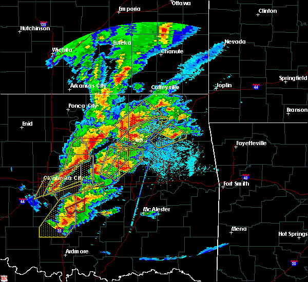 At 957 pm cdt, a severe thunderstorm was located 3 miles west of beggs, moving northeast at 55 mph (radar indicated). Hazards include golf ball size hail and 60 mph wind gusts. People and animals outdoors will be injured. expect hail damage to roofs, siding, windows, and vehicles. expect wind damage to roofs, siding, and trees. locations in or near the path include, tulsa, broken arrow, bixby, sapulpa, jenks, glenpool, kiefer, beggs, mounds, preston, jenks riverside airport, liberty, hectorville, leonard, this includes interstate 44 between mile markers 210 and 215. A tornado watch remains in effect until 300 am cdt for northeastern and east central oklahoma. At 957 pm cdt, a severe thunderstorm was located 3 miles west of beggs, moving northeast at 55 mph (radar indicated). Hazards include golf ball size hail and 60 mph wind gusts. People and animals outdoors will be injured. expect hail damage to roofs, siding, windows, and vehicles. expect wind damage to roofs, siding, and trees. locations in or near the path include, tulsa, broken arrow, bixby, sapulpa, jenks, glenpool, kiefer, beggs, mounds, preston, jenks riverside airport, liberty, hectorville, leonard, this includes interstate 44 between mile markers 210 and 215. A tornado watch remains in effect until 300 am cdt for northeastern and east central oklahoma.
|
| 10/20/2019 9:46 PM CDT |
 At 946 pm cdt, a severe thunderstorm was located near okfuskee, moving northeast at 55 mph (radar indicated). Hazards include golf ball size hail and 60 mph wind gusts. People and animals outdoors will be injured. expect hail damage to roofs, siding, windows, and vehicles. expect wind damage to roofs, siding, and trees. locations in or near the path include, tulsa, broken arrow, bixby, sapulpa, jenks, okfuskee, glenpool, kiefer, beggs, mounds, slick, preston, jenks riverside airport, liberty, hectorville, leonard, this includes interstate 44 between mile markers 210 and 215. A tornado watch remains in effect until 300 am cdt for northeastern and east central oklahoma. At 946 pm cdt, a severe thunderstorm was located near okfuskee, moving northeast at 55 mph (radar indicated). Hazards include golf ball size hail and 60 mph wind gusts. People and animals outdoors will be injured. expect hail damage to roofs, siding, windows, and vehicles. expect wind damage to roofs, siding, and trees. locations in or near the path include, tulsa, broken arrow, bixby, sapulpa, jenks, okfuskee, glenpool, kiefer, beggs, mounds, slick, preston, jenks riverside airport, liberty, hectorville, leonard, this includes interstate 44 between mile markers 210 and 215. A tornado watch remains in effect until 300 am cdt for northeastern and east central oklahoma.
|
| 10/20/2019 8:36 PM CDT |
 At 835 pm cdt, a severe thunderstorm was located 4 miles north of slick, moving northeast at 60 mph (radar indicated). Hazards include 60 mph wind gusts and quarter size hail. Hail damage to vehicles is expected. expect wind damage to roofs, siding, and trees. locations in or near the path include, tulsa, broken arrow, sand springs, bristow, owasso, bixby, sapulpa, jenks, glenpool, catoosa, verdigris, kiefer, mounds, kellyville, slick, jenks riverside airport, turley, tulsa international airport, liberty, gray, this includes interstate 44 between mile markers 189 and 242. A tornado watch remains in effect until 300 am cdt for northeastern oklahoma. At 835 pm cdt, a severe thunderstorm was located 4 miles north of slick, moving northeast at 60 mph (radar indicated). Hazards include 60 mph wind gusts and quarter size hail. Hail damage to vehicles is expected. expect wind damage to roofs, siding, and trees. locations in or near the path include, tulsa, broken arrow, sand springs, bristow, owasso, bixby, sapulpa, jenks, glenpool, catoosa, verdigris, kiefer, mounds, kellyville, slick, jenks riverside airport, turley, tulsa international airport, liberty, gray, this includes interstate 44 between mile markers 189 and 242. A tornado watch remains in effect until 300 am cdt for northeastern oklahoma.
|
| 10/10/2019 4:56 PM CDT |
 At 455 pm cdt, a severe thunderstorm was located 5 miles south of short, moving northeast at 20 mph (radar indicated). Hazards include 60 mph wind gusts and penny size hail. Expect damage to roofs, siding, and trees. locations in or near the path include, van buren, cedarville, figure five, short, uniontown, dora, furry, this includes the following highways, interstate 40 in arkansas between mile markers 0 and 5. Interstate 40 in oklahoma near mile marker 328. At 455 pm cdt, a severe thunderstorm was located 5 miles south of short, moving northeast at 20 mph (radar indicated). Hazards include 60 mph wind gusts and penny size hail. Expect damage to roofs, siding, and trees. locations in or near the path include, van buren, cedarville, figure five, short, uniontown, dora, furry, this includes the following highways, interstate 40 in arkansas between mile markers 0 and 5. Interstate 40 in oklahoma near mile marker 328.
|
| 10/10/2019 4:41 PM CDT |
 At 441 pm cdt, a severe thunderstorm was located 3 miles northeast of muldrow, moving northeast at 25 mph (radar indicated). Hazards include 60 mph wind gusts and penny size hail. Expect damage to roofs, siding, and trees. locations in or near the path include, fort smith, van buren, cedarville, muldrow, roland, moffett, figure five, short, kibler, shibley, uniontown, dora, furry, this includes the following highways, interstate 40 in arkansas between mile markers 0 and 9. interstate 40 in oklahoma between mile markers 321 and 328. Interstate 540 between mile markers 1 and 6. At 441 pm cdt, a severe thunderstorm was located 3 miles northeast of muldrow, moving northeast at 25 mph (radar indicated). Hazards include 60 mph wind gusts and penny size hail. Expect damage to roofs, siding, and trees. locations in or near the path include, fort smith, van buren, cedarville, muldrow, roland, moffett, figure five, short, kibler, shibley, uniontown, dora, furry, this includes the following highways, interstate 40 in arkansas between mile markers 0 and 9. interstate 40 in oklahoma between mile markers 321 and 328. Interstate 540 between mile markers 1 and 6.
|
| 10/10/2019 4:26 PM CDT |
 At 426 pm cdt, a severe thunderstorm was located over gans, moving northeast at 20 mph (radar indicated). Hazards include 60 mph wind gusts and nickel size hail. Expect damage to roofs, siding, and trees. locations in or near the path include, fort smith, van buren, sallisaw, cedarville, muldrow, roland, gans, moffett, figure five, short, kibler, shibley, cottonwood, uniontown, dora, furry, this includes the following highways, interstate 40 in arkansas between mile markers 0 and 9. interstate 40 in oklahoma between mile markers 309 and 328. Interstate 540 between mile markers 1 and 6. At 426 pm cdt, a severe thunderstorm was located over gans, moving northeast at 20 mph (radar indicated). Hazards include 60 mph wind gusts and nickel size hail. Expect damage to roofs, siding, and trees. locations in or near the path include, fort smith, van buren, sallisaw, cedarville, muldrow, roland, gans, moffett, figure five, short, kibler, shibley, cottonwood, uniontown, dora, furry, this includes the following highways, interstate 40 in arkansas between mile markers 0 and 9. interstate 40 in oklahoma between mile markers 309 and 328. Interstate 540 between mile markers 1 and 6.
|
| 10/5/2019 5:27 PM CDT |
 At 525 pm cdt, a severe thunderstorm was located over slick, moving southeast at 20 mph (radar indicated. at 515 pm...golfball size hail was reported by a storm chaser 8 miles east of bristow). Hazards include golf ball size hail and 60 mph wind gusts. People and animals outdoors will be injured. expect hail damage to roofs, siding, windows, and vehicles. expect wind damage to roofs, siding, and trees. Locations in or near the path include, beggs, mounds, slick, preston, liberty, hectorville,. At 525 pm cdt, a severe thunderstorm was located over slick, moving southeast at 20 mph (radar indicated. at 515 pm...golfball size hail was reported by a storm chaser 8 miles east of bristow). Hazards include golf ball size hail and 60 mph wind gusts. People and animals outdoors will be injured. expect hail damage to roofs, siding, windows, and vehicles. expect wind damage to roofs, siding, and trees. Locations in or near the path include, beggs, mounds, slick, preston, liberty, hectorville,.
|
| 10/5/2019 5:13 PM CDT |
 At 513 pm cdt, a severe thunderstorm was located near slick, moving east at 25 mph (radar indicated). Hazards include golf ball size hail and 60 mph wind gusts. People and animals outdoors will be injured. expect hail damage to roofs, siding, windows, and vehicles. expect wind damage to roofs, siding, and trees. Locations in or near the path include, beggs, mounds, slick, preston, liberty, hectorville, this includes interstate 44 between mile markers 193 and 198. At 513 pm cdt, a severe thunderstorm was located near slick, moving east at 25 mph (radar indicated). Hazards include golf ball size hail and 60 mph wind gusts. People and animals outdoors will be injured. expect hail damage to roofs, siding, windows, and vehicles. expect wind damage to roofs, siding, and trees. Locations in or near the path include, beggs, mounds, slick, preston, liberty, hectorville, this includes interstate 44 between mile markers 193 and 198.
|
| 10/5/2019 4:51 PM CDT |
 At 451 pm cdt, a severe thunderstorm was located near bristow, moving east at 25 mph (radar indicated). Hazards include golf ball size hail and 60 mph wind gusts. People and animals outdoors will be injured. expect hail damage to roofs, siding, windows, and vehicles. expect wind damage to roofs, siding, and trees. Locations in or near the path include, bristow, bixby, jenks, glenpool, kiefer, beggs, mounds, kellyville, depew, slick, preston, liberty, hectorville, this includes interstate 44 between mile markers 185 and 203. At 451 pm cdt, a severe thunderstorm was located near bristow, moving east at 25 mph (radar indicated). Hazards include golf ball size hail and 60 mph wind gusts. People and animals outdoors will be injured. expect hail damage to roofs, siding, windows, and vehicles. expect wind damage to roofs, siding, and trees. Locations in or near the path include, bristow, bixby, jenks, glenpool, kiefer, beggs, mounds, kellyville, depew, slick, preston, liberty, hectorville, this includes interstate 44 between mile markers 185 and 203.
|
| 9/26/2019 1:56 AM CDT |
 At 155 am cdt, severe thunderstorms were located along a line extending from 2 miles east of drake field airport to strickler to 4 miles northeast of bunch, moving southeast at 35 mph (radar indicated). Hazards include 60 mph wind gusts and penny size hail. Expect damage to roofs, siding, and trees. locations in or near the path include, fort smith, fayetteville, van buren, stilwell, ozark, cedarville, mountainburg, natural dam, alma, elkins, west fork, arkoma, mulberry, greenland, dyer, winslow, chester, moffett, st. paul, rudy, this includes the following highways, interstate 40 in arkansas between mile markers 0 and 38. interstate 40 in oklahoma between mile markers 325 and 328. interstate 540 between mile markers 1 and 11. Interstate 49 between mile markers 22 and 59. At 155 am cdt, severe thunderstorms were located along a line extending from 2 miles east of drake field airport to strickler to 4 miles northeast of bunch, moving southeast at 35 mph (radar indicated). Hazards include 60 mph wind gusts and penny size hail. Expect damage to roofs, siding, and trees. locations in or near the path include, fort smith, fayetteville, van buren, stilwell, ozark, cedarville, mountainburg, natural dam, alma, elkins, west fork, arkoma, mulberry, greenland, dyer, winslow, chester, moffett, st. paul, rudy, this includes the following highways, interstate 40 in arkansas between mile markers 0 and 38. interstate 40 in oklahoma between mile markers 325 and 328. interstate 540 between mile markers 1 and 11. Interstate 49 between mile markers 22 and 59.
|
| 9/26/2019 1:17 AM CDT |
 At 117 am cdt, severe thunderstorms were located along a line extending from 2 miles northeast of cincinnati to 4 miles northeast of tahlequah, moving southeast at 45 mph (radar indicated). Hazards include 60 mph wind gusts and penny size hail. Expect damage to roofs, siding, and trees. Locations in or near the path include, tahlequah, stilwell, cedarville, mountainburg, natural dam, prairie grove, lincoln, westville, watts, chester, brushy, adair state park, christie, cincinnati, maryetta, blackburn, lee creek, bunch, baron, short, this includes interstate 49 between mile markers 27 and 45. At 117 am cdt, severe thunderstorms were located along a line extending from 2 miles northeast of cincinnati to 4 miles northeast of tahlequah, moving southeast at 45 mph (radar indicated). Hazards include 60 mph wind gusts and penny size hail. Expect damage to roofs, siding, and trees. Locations in or near the path include, tahlequah, stilwell, cedarville, mountainburg, natural dam, prairie grove, lincoln, westville, watts, chester, brushy, adair state park, christie, cincinnati, maryetta, blackburn, lee creek, bunch, baron, short, this includes interstate 49 between mile markers 27 and 45.
|
| 9/12/2019 7:07 PM CDT |
 The severe thunderstorm warning for southeastern osage. northern creek. southeastern pawnee and central tulsa counties will expire at 715 pm cdt. the storms which prompted the warning have weakened below severe limits, and no longer pose an immediate threat to life or property. therefore the warning will be allowed to expire. However gusty winds. The severe thunderstorm warning for southeastern osage. northern creek. southeastern pawnee and central tulsa counties will expire at 715 pm cdt. the storms which prompted the warning have weakened below severe limits, and no longer pose an immediate threat to life or property. therefore the warning will be allowed to expire. However gusty winds.
|
| 9/12/2019 6:54 PM CDT |
 At 652 pm cdt, severe thunderstorms were located along a line extending from 2 miles northeast of walnut creek state park to 4 miles northeast of keystone state park to 7 miles northwest of kellyville to 10 miles east of drumright, moving east at 25 mph (radar indicated). Hazards include 60 mph wind gusts. Expect damage to roofs, siding, and trees. locations in or near the path include, tulsa, sand springs, bixby, sapulpa, jenks, glenpool, mannford, kiefer, sperry, mounds, kellyville, westport, keystone state park, walnut creek state park, jenks riverside airport, turley, liberty, gray, silver city, this includes interstate 44 between mile markers 198 and 224. a weakening trend has been observed over the past 10 to 15 minutes. If this trend continues, a warning will not be needed downstream. At 652 pm cdt, severe thunderstorms were located along a line extending from 2 miles northeast of walnut creek state park to 4 miles northeast of keystone state park to 7 miles northwest of kellyville to 10 miles east of drumright, moving east at 25 mph (radar indicated). Hazards include 60 mph wind gusts. Expect damage to roofs, siding, and trees. locations in or near the path include, tulsa, sand springs, bixby, sapulpa, jenks, glenpool, mannford, kiefer, sperry, mounds, kellyville, westport, keystone state park, walnut creek state park, jenks riverside airport, turley, liberty, gray, silver city, this includes interstate 44 between mile markers 198 and 224. a weakening trend has been observed over the past 10 to 15 minutes. If this trend continues, a warning will not be needed downstream.
|
| 9/12/2019 6:29 PM CDT |
 At 628 pm cdt, severe thunderstorms were located along a line extending from 2 miles north of cleveland to 4 miles northeast of terlton to 5 miles east of oilton to 3 miles northwest of drumright, moving southeast at 45 mph (radar indicated). Hazards include 60 mph wind gusts. Expect damage to roofs, siding, and trees. Locations in or near the path include, tulsa, sand springs, bixby, sapulpa, jenks, glenpool, skiatook, hominy, cleveland, mannford, drumright, kiefer, sperry, mounds, kellyville, oilton, jennings, westport, osage, terlton, this includes interstate 44 between mile markers 193 and 224. At 628 pm cdt, severe thunderstorms were located along a line extending from 2 miles north of cleveland to 4 miles northeast of terlton to 5 miles east of oilton to 3 miles northwest of drumright, moving southeast at 45 mph (radar indicated). Hazards include 60 mph wind gusts. Expect damage to roofs, siding, and trees. Locations in or near the path include, tulsa, sand springs, bixby, sapulpa, jenks, glenpool, skiatook, hominy, cleveland, mannford, drumright, kiefer, sperry, mounds, kellyville, oilton, jennings, westport, osage, terlton, this includes interstate 44 between mile markers 193 and 224.
|
| 8/27/2019 1:11 AM CDT |
 At 111 am cdt, severe thunderstorms were located along a line extending from near dyer to 2 miles southwest of fort smith regional airport to 5 miles east of porum, moving southeast at 50 mph (radar indicated). Hazards include 70 mph wind gusts. Expect considerable tree damage. damage is likely to mobile homes, roofs, and outbuildings. locations in or near the path include, fort smith, van buren, sallisaw, poteau, stigler, cedarville, greenwood, alma, barling, pocola, muldrow, roland, lavaca, spiro, arkoma, warner, vian, panama, dyer, hackett, this includes the following highways, interstate 40 in arkansas between mile markers 0 and 17. interstate 40 in oklahoma between mile markers 276 and 328. interstate 540 between mile markers 1 and 14. Interstate 49 between mile markers 22 and 26. At 111 am cdt, severe thunderstorms were located along a line extending from near dyer to 2 miles southwest of fort smith regional airport to 5 miles east of porum, moving southeast at 50 mph (radar indicated). Hazards include 70 mph wind gusts. Expect considerable tree damage. damage is likely to mobile homes, roofs, and outbuildings. locations in or near the path include, fort smith, van buren, sallisaw, poteau, stigler, cedarville, greenwood, alma, barling, pocola, muldrow, roland, lavaca, spiro, arkoma, warner, vian, panama, dyer, hackett, this includes the following highways, interstate 40 in arkansas between mile markers 0 and 17. interstate 40 in oklahoma between mile markers 276 and 328. interstate 540 between mile markers 1 and 14. Interstate 49 between mile markers 22 and 26.
|
| 8/27/2019 1:05 AM CDT |
 At 104 am cdt, severe thunderstorms were located along a line extending from 5 miles northwest of dyer to near arkoma to 5 miles north of porum, moving southeast at 50 mph (radar indicated). Hazards include 60 mph wind gusts. Expect damage to roofs, siding, and trees. locations in or near the path include, fort smith, van buren, sallisaw, poteau, stigler, cedarville, greenwood, alma, barling, pocola, muldrow, roland, lavaca, spiro, arkoma, warner, vian, panama, dyer, hackett, this includes the following highways, interstate 40 in arkansas between mile markers 0 and 17. interstate 40 in oklahoma between mile markers 276 and 328. interstate 540 between mile markers 1 and 14. Interstate 49 between mile markers 22 and 26. At 104 am cdt, severe thunderstorms were located along a line extending from 5 miles northwest of dyer to near arkoma to 5 miles north of porum, moving southeast at 50 mph (radar indicated). Hazards include 60 mph wind gusts. Expect damage to roofs, siding, and trees. locations in or near the path include, fort smith, van buren, sallisaw, poteau, stigler, cedarville, greenwood, alma, barling, pocola, muldrow, roland, lavaca, spiro, arkoma, warner, vian, panama, dyer, hackett, this includes the following highways, interstate 40 in arkansas between mile markers 0 and 17. interstate 40 in oklahoma between mile markers 276 and 328. interstate 540 between mile markers 1 and 14. Interstate 49 between mile markers 22 and 26.
|
| 8/27/2019 12:44 AM CDT |
 At 1244 am cdt, severe thunderstorms were located along a line extending from 6 miles east of stilwell to 4 miles west of brushy lake state park to 4 miles northeast of keefeton, moving southeast at 50 mph (radar indicated). Hazards include 60 mph wind gusts. Expect damage to roofs, siding, and trees. locations in or near the path include, fort smith, van buren, sallisaw, poteau, stigler, cedarville, natural dam, greenwood, alma, barling, pocola, muldrow, roland, lavaca, spiro, arkoma, warner, vian, panama, gore, this includes the following highways, interstate 40 in arkansas between mile markers 0 and 17. interstate 40 in oklahoma between mile markers 276 and 328. interstate 540 between mile markers 1 and 14. Interstate 49 between mile markers 22 and 27. At 1244 am cdt, severe thunderstorms were located along a line extending from 6 miles east of stilwell to 4 miles west of brushy lake state park to 4 miles northeast of keefeton, moving southeast at 50 mph (radar indicated). Hazards include 60 mph wind gusts. Expect damage to roofs, siding, and trees. locations in or near the path include, fort smith, van buren, sallisaw, poteau, stigler, cedarville, natural dam, greenwood, alma, barling, pocola, muldrow, roland, lavaca, spiro, arkoma, warner, vian, panama, gore, this includes the following highways, interstate 40 in arkansas between mile markers 0 and 17. interstate 40 in oklahoma between mile markers 276 and 328. interstate 540 between mile markers 1 and 14. Interstate 49 between mile markers 22 and 27.
|
| 7/29/2019 8:14 PM CDT |
 At 813 pm cdt, a severe thunderstorm was located 3 miles northeast of jenks riverside airport, moving southwest at 15 mph (trained weather spotters). Hazards include 60 mph wind gusts. Expect damage to roofs, siding, and trees. Locations in or near the path include, tulsa, broken arrow, sand springs, bixby, jenks, glenpool, jenks riverside airport, gray, this includes interstate 44 between mile markers 211 and 228. At 813 pm cdt, a severe thunderstorm was located 3 miles northeast of jenks riverside airport, moving southwest at 15 mph (trained weather spotters). Hazards include 60 mph wind gusts. Expect damage to roofs, siding, and trees. Locations in or near the path include, tulsa, broken arrow, sand springs, bixby, jenks, glenpool, jenks riverside airport, gray, this includes interstate 44 between mile markers 211 and 228.
|
| 7/29/2019 7:53 PM CDT |
 At 753 pm cdt, a severe thunderstorm was located near tulsa, moving southwest at 15 mph (radar indicated). Hazards include 60 mph wind gusts. Expect damage to roofs, siding, and trees. Locations in or near the path include, tulsa, broken arrow, sand springs, bixby, jenks, glenpool, catoosa, tulsa international airport, jenks riverside airport, gray, this includes interstate 44 between mile markers 211 and 232. At 753 pm cdt, a severe thunderstorm was located near tulsa, moving southwest at 15 mph (radar indicated). Hazards include 60 mph wind gusts. Expect damage to roofs, siding, and trees. Locations in or near the path include, tulsa, broken arrow, sand springs, bixby, jenks, glenpool, catoosa, tulsa international airport, jenks riverside airport, gray, this includes interstate 44 between mile markers 211 and 232.
|
| 7/10/2019 2:01 PM CDT |
 At 200 pm cdt, severe thunderstorms were located along a line extending from 5 miles northeast of bald hill to 4 miles northeast of beggs, moving south at 20 mph (radar indicated). Hazards include 60 mph wind gusts. Expect damage to roofs, siding, and trees. Locations in or near the path include, bixby, bald hill, preston, liberty, hectorville,. At 200 pm cdt, severe thunderstorms were located along a line extending from 5 miles northeast of bald hill to 4 miles northeast of beggs, moving south at 20 mph (radar indicated). Hazards include 60 mph wind gusts. Expect damage to roofs, siding, and trees. Locations in or near the path include, bixby, bald hill, preston, liberty, hectorville,.
|
| 7/10/2019 1:45 PM CDT |
 At 145 pm cdt, severe thunderstorms were located along a line extending from 2 miles northwest of stonebluff to 2 miles east of mounds, moving south at 10 mph (radar indicated). Hazards include 60 mph wind gusts. Expect damage to roofs, siding, and trees. Locations in or near the path include, broken arrow, bixby, glenpool, preston, bald hill, liberty, hectorville, leonard,. At 145 pm cdt, severe thunderstorms were located along a line extending from 2 miles northwest of stonebluff to 2 miles east of mounds, moving south at 10 mph (radar indicated). Hazards include 60 mph wind gusts. Expect damage to roofs, siding, and trees. Locations in or near the path include, broken arrow, bixby, glenpool, preston, bald hill, liberty, hectorville, leonard,.
|
| 6/22/2019 3:45 PM CDT |
 The national weather service in tulsa has issued a * severe thunderstorm warning for. southeastern sequoyah county in east central oklahoma. north central le flore county in southeastern oklahoma. until 430 pm cdt. At 345 pm cdt, a severe thunderstorm was located 3 miles northeast. The national weather service in tulsa has issued a * severe thunderstorm warning for. southeastern sequoyah county in east central oklahoma. north central le flore county in southeastern oklahoma. until 430 pm cdt. At 345 pm cdt, a severe thunderstorm was located 3 miles northeast.
|
| 6/16/2019 1:12 AM CDT |
 At 112 am cdt, severe thunderstorms were located along a line extending from 3 miles north of osage to 7 miles northwest of bald hill to 4 miles southwest of hanna, moving east at 45 mph (radar indicated). Hazards include 60 mph wind gusts. Expect damage to roofs, siding, and trees. locations in or near the path include, tulsa, broken arrow, sand springs, okmulgee, eufaula, pawnee, owasso, bixby, sapulpa, jenks, glenpool, coweta, skiatook, catoosa, henryetta, hominy, cleveland, mannford, haskell, kiefer, this includes the following highways, interstate 40 in oklahoma between mile markers 237 and 261. Interstate 44 between mile markers 203 and 232. At 112 am cdt, severe thunderstorms were located along a line extending from 3 miles north of osage to 7 miles northwest of bald hill to 4 miles southwest of hanna, moving east at 45 mph (radar indicated). Hazards include 60 mph wind gusts. Expect damage to roofs, siding, and trees. locations in or near the path include, tulsa, broken arrow, sand springs, okmulgee, eufaula, pawnee, owasso, bixby, sapulpa, jenks, glenpool, coweta, skiatook, catoosa, henryetta, hominy, cleveland, mannford, haskell, kiefer, this includes the following highways, interstate 40 in oklahoma between mile markers 237 and 261. Interstate 44 between mile markers 203 and 232.
|
| 6/16/2019 12:53 AM CDT |
 At 1253 am cdt, severe thunderstorms were located along a line extending from 3 miles northeast of maramec to 4 miles west of beggs to 4 miles southwest of horntown, moving east at 45 mph (radar indicated). Hazards include 60 mph wind gusts. Expect damage to roofs, siding, and trees. locations in or near the path include, tulsa, broken arrow, sand springs, okmulgee, okemah, eufaula, pawnee, owasso, bixby, sapulpa, jenks, okfuskee, glenpool, coweta, skiatook, catoosa, henryetta, hominy, cleveland, mannford, this includes the following highways, interstate 40 in oklahoma between mile markers 219 and 261. Interstate 44 between mile markers 192 and 232. At 1253 am cdt, severe thunderstorms were located along a line extending from 3 miles northeast of maramec to 4 miles west of beggs to 4 miles southwest of horntown, moving east at 45 mph (radar indicated). Hazards include 60 mph wind gusts. Expect damage to roofs, siding, and trees. locations in or near the path include, tulsa, broken arrow, sand springs, okmulgee, okemah, eufaula, pawnee, owasso, bixby, sapulpa, jenks, okfuskee, glenpool, coweta, skiatook, catoosa, henryetta, hominy, cleveland, mannford, this includes the following highways, interstate 40 in oklahoma between mile markers 219 and 261. Interstate 44 between mile markers 192 and 232.
|
| 5/29/2019 9:13 AM CDT |
 At 913 am cdt, severe thunderstorms were located along a line extending from 2 miles southeast of glenpool to 4 miles southwest of bixby, moving northeast at 40 mph (radar indicated). Hazards include 60 mph wind gusts and nickel size hail. Expect damage to roofs, siding, and trees. Locations in or near the path include, tulsa, broken arrow, bixby, jenks, glenpool, coweta, catoosa, inola, oneta, this includes interstate 44 between mile markers 226 and 241. At 913 am cdt, severe thunderstorms were located along a line extending from 2 miles southeast of glenpool to 4 miles southwest of bixby, moving northeast at 40 mph (radar indicated). Hazards include 60 mph wind gusts and nickel size hail. Expect damage to roofs, siding, and trees. Locations in or near the path include, tulsa, broken arrow, bixby, jenks, glenpool, coweta, catoosa, inola, oneta, this includes interstate 44 between mile markers 226 and 241.
|
| 5/29/2019 2:35 AM CDT |
 The severe thunderstorm warning for northeastern haskell, southeastern sequoyah and northeastern le flore counties will expire at 245 am cdt, the storms which prompted the warning have moved out of the area. therefore the warning will be allowed to expire. a severe thunderstorm watch remains in effect until 600 am cdt for southeastern, northeastern and east central oklahoma. The severe thunderstorm warning for northeastern haskell, southeastern sequoyah and northeastern le flore counties will expire at 245 am cdt, the storms which prompted the warning have moved out of the area. therefore the warning will be allowed to expire. a severe thunderstorm watch remains in effect until 600 am cdt for southeastern, northeastern and east central oklahoma.
|
| 5/29/2019 2:30 AM CDT |
 At 230 am cdt, severe thunderstorms were located along a line extending from 8 miles northwest of natural dam to 2 miles east of bonanza, moving east at 45 mph (radar indicated). Hazards include 70 mph wind gusts and quarter size hail. Hail damage to vehicles is expected. expect considerable tree damage. wind damage is also likely to mobile homes, roofs, and outbuildings. locations in or near the path include, fort smith, van buren, cedarville, mountainburg, natural dam, alma, barling, pocola, roland, lavaca, arkoma, mulberry, dyer, hackett, bonanza, chester, moffett, rudy, lee creek, fort smith regional airport, this includes the following highways, interstate 40 in arkansas between mile markers 0 and 26. interstate 40 in oklahoma between mile markers 321 and 328. interstate 540 between mile markers 1 and 14. Interstate 49 between mile markers 22 and 40. At 230 am cdt, severe thunderstorms were located along a line extending from 8 miles northwest of natural dam to 2 miles east of bonanza, moving east at 45 mph (radar indicated). Hazards include 70 mph wind gusts and quarter size hail. Hail damage to vehicles is expected. expect considerable tree damage. wind damage is also likely to mobile homes, roofs, and outbuildings. locations in or near the path include, fort smith, van buren, cedarville, mountainburg, natural dam, alma, barling, pocola, roland, lavaca, arkoma, mulberry, dyer, hackett, bonanza, chester, moffett, rudy, lee creek, fort smith regional airport, this includes the following highways, interstate 40 in arkansas between mile markers 0 and 26. interstate 40 in oklahoma between mile markers 321 and 328. interstate 540 between mile markers 1 and 14. Interstate 49 between mile markers 22 and 40.
|
| 5/29/2019 2:21 AM CDT |
 At 220 am cdt, severe thunderstorms were located along a line extending from 8 miles east of bunch to near pocola, moving east at 40 mph (radar indicated). Hazards include 70 mph wind gusts and quarter size hail. Hail damage to vehicles is expected. expect considerable tree damage. wind damage is also likely to mobile homes, roofs, and outbuildings. locations in or near the path include, fort smith, van buren, cedarville, mountainburg, natural dam, alma, barling, pocola, muldrow, roland, lavaca, arkoma, mulberry, dyer, hackett, bonanza, chester, moffett, rudy, lee creek, this includes the following highways, interstate 40 in arkansas between mile markers 0 and 26. interstate 40 in oklahoma between mile markers 318 and 328. interstate 540 between mile markers 1 and 14. Interstate 49 between mile markers 22 and 40. At 220 am cdt, severe thunderstorms were located along a line extending from 8 miles east of bunch to near pocola, moving east at 40 mph (radar indicated). Hazards include 70 mph wind gusts and quarter size hail. Hail damage to vehicles is expected. expect considerable tree damage. wind damage is also likely to mobile homes, roofs, and outbuildings. locations in or near the path include, fort smith, van buren, cedarville, mountainburg, natural dam, alma, barling, pocola, muldrow, roland, lavaca, arkoma, mulberry, dyer, hackett, bonanza, chester, moffett, rudy, lee creek, this includes the following highways, interstate 40 in arkansas between mile markers 0 and 26. interstate 40 in oklahoma between mile markers 318 and 328. interstate 540 between mile markers 1 and 14. Interstate 49 between mile markers 22 and 40.
|
| 5/29/2019 1:59 AM CDT |
 The national weather service in tulsa has issued a * severe thunderstorm warning for. northeastern haskell county in southeastern oklahoma. southeastern sequoyah county in east central oklahoma. northeastern le flore county in southeastern oklahoma. Until 245 am cdt. The national weather service in tulsa has issued a * severe thunderstorm warning for. northeastern haskell county in southeastern oklahoma. southeastern sequoyah county in east central oklahoma. northeastern le flore county in southeastern oklahoma. Until 245 am cdt.
|
| 5/26/2019 12:41 AM CDT |
 At 1241 am cdt, a severe thunderstorm with strong low level rotation that could produce a tornado at any time was located 4 miles west of broken arrow, moving east at 55 mph (radar indicated rotation). Hazards include tornado. Flying debris will be dangerous to those caught without shelter. mobile homes will be damaged or destroyed. damage to roofs, windows, and vehicles will occur. tree damage is likely. Locations in or near the path include, tulsa, broken arrow, owasso, bixby, jenks, glenpool, coweta, catoosa, verdigris, jenks riverside airport, tulsa international airport, oneta, liberty, leonard, this includes interstate 44 between mile markers 220 and 242. At 1241 am cdt, a severe thunderstorm with strong low level rotation that could produce a tornado at any time was located 4 miles west of broken arrow, moving east at 55 mph (radar indicated rotation). Hazards include tornado. Flying debris will be dangerous to those caught without shelter. mobile homes will be damaged or destroyed. damage to roofs, windows, and vehicles will occur. tree damage is likely. Locations in or near the path include, tulsa, broken arrow, owasso, bixby, jenks, glenpool, coweta, catoosa, verdigris, jenks riverside airport, tulsa international airport, oneta, liberty, leonard, this includes interstate 44 between mile markers 220 and 242.
|
| 5/26/2019 12:36 AM CDT |
 At 1234 am cdt, a confirmed extremely dangerous tornado was located over jenks, moving east at 55 mph. potentially tornadic storms were also located just northeast of glenpool and near liberty. this is a particularly dangerous situation. take cover now! (radar confirmed tornado). Hazards include damaging tornado. You are in a life-threatening situation. flying debris may be deadly to those caught without shelter. mobile homes will be destroyed. considerable damage to homes, businesses, and vehicles is likely and complete destruction is possible. Locations in or near the path include, tulsa, broken arrow, sand springs, owasso, bixby, sapulpa, jenks, glenpool, coweta, catoosa, verdigris, kiefer, mounds, kellyville, jenks riverside airport, tulsa international airport, oneta, liberty, gray, leonard, this includes interstate 44 between mile markers 199 and 242. At 1234 am cdt, a confirmed extremely dangerous tornado was located over jenks, moving east at 55 mph. potentially tornadic storms were also located just northeast of glenpool and near liberty. this is a particularly dangerous situation. take cover now! (radar confirmed tornado). Hazards include damaging tornado. You are in a life-threatening situation. flying debris may be deadly to those caught without shelter. mobile homes will be destroyed. considerable damage to homes, businesses, and vehicles is likely and complete destruction is possible. Locations in or near the path include, tulsa, broken arrow, sand springs, owasso, bixby, sapulpa, jenks, glenpool, coweta, catoosa, verdigris, kiefer, mounds, kellyville, jenks riverside airport, tulsa international airport, oneta, liberty, gray, leonard, this includes interstate 44 between mile markers 199 and 242.
|
| 5/26/2019 12:31 AM CDT |
 At 1231 am cdt, a confirmed extremely dangerous tornado was located 3 miles east of sapulpa, moving east at 55 mph. this is a particularly dangerous situation. take cover now! (radar confirmed tornado). Hazards include damaging tornado. You are in a life-threatening situation. flying debris may be deadly to those caught without shelter. mobile homes will be destroyed. considerable damage to homes, businesses, and vehicles is likely and complete destruction is possible. Locations in or near the path include, tulsa, broken arrow, sand springs, owasso, bixby, sapulpa, jenks, glenpool, coweta, catoosa, verdigris, kiefer, mounds, kellyville, jenks riverside airport, tulsa international airport, oneta, liberty, gray, leonard, this includes interstate 44 between mile markers 199 and 242. At 1231 am cdt, a confirmed extremely dangerous tornado was located 3 miles east of sapulpa, moving east at 55 mph. this is a particularly dangerous situation. take cover now! (radar confirmed tornado). Hazards include damaging tornado. You are in a life-threatening situation. flying debris may be deadly to those caught without shelter. mobile homes will be destroyed. considerable damage to homes, businesses, and vehicles is likely and complete destruction is possible. Locations in or near the path include, tulsa, broken arrow, sand springs, owasso, bixby, sapulpa, jenks, glenpool, coweta, catoosa, verdigris, kiefer, mounds, kellyville, jenks riverside airport, tulsa international airport, oneta, liberty, gray, leonard, this includes interstate 44 between mile markers 199 and 242.
|
| 5/26/2019 12:29 AM CDT |
 At 1229 am cdt, severe thunderstorms were located along a line extending from 3 miles northwest of beggs to 2 miles east of okfuskee, moving east at 30 mph (radar indicated). Hazards include 60 mph wind gusts. Expect damage to roofs, siding, and trees. Locations in or near the path include, okmulgee, beggs, bald hill, preston, okmulgee state park, hectorville,. At 1229 am cdt, severe thunderstorms were located along a line extending from 3 miles northwest of beggs to 2 miles east of okfuskee, moving east at 30 mph (radar indicated). Hazards include 60 mph wind gusts. Expect damage to roofs, siding, and trees. Locations in or near the path include, okmulgee, beggs, bald hill, preston, okmulgee state park, hectorville,.
|
| 5/26/2019 12:27 AM CDT |
 At 1227 am cdt, a confirmed dangerous tornado was located over sapulpa, moving east at 50 mph. this is a particularly dangerous situation. take cover now! (radar confirmed tornado). Hazards include damaging tornado. You are in a life-threatening situation. flying debris may be deadly to those caught without shelter. mobile homes will be destroyed. considerable damage to homes, businesses, and vehicles is likely and complete destruction is possible. Locations in or near the path include, tulsa, broken arrow, sand springs, owasso, bixby, sapulpa, jenks, glenpool, coweta, catoosa, verdigris, kiefer, mounds, kellyville, jenks riverside airport, tulsa international airport, oneta, liberty, gray, leonard, this includes interstate 44 between mile markers 199 and 242. At 1227 am cdt, a confirmed dangerous tornado was located over sapulpa, moving east at 50 mph. this is a particularly dangerous situation. take cover now! (radar confirmed tornado). Hazards include damaging tornado. You are in a life-threatening situation. flying debris may be deadly to those caught without shelter. mobile homes will be destroyed. considerable damage to homes, businesses, and vehicles is likely and complete destruction is possible. Locations in or near the path include, tulsa, broken arrow, sand springs, owasso, bixby, sapulpa, jenks, glenpool, coweta, catoosa, verdigris, kiefer, mounds, kellyville, jenks riverside airport, tulsa international airport, oneta, liberty, gray, leonard, this includes interstate 44 between mile markers 199 and 242.
|
| 5/26/2019 12:24 AM CDT |
 At 1223 am cdt, severe thunderstorms with strong low level rotation that could produce tornadoes at any time were located 3 miles north of kellyville and 4 miles southwest of kiefer, moving northeast at 60 mph (radar indicated rotation). Hazards include tornado. Flying debris will be dangerous to those caught without shelter. mobile homes will be damaged or destroyed. damage to roofs, windows, and vehicles will occur. tree damage is likely. Locations in or near the path include, tulsa, broken arrow, sand springs, owasso, bixby, sapulpa, jenks, glenpool, coweta, catoosa, verdigris, kiefer, mounds, kellyville, jenks riverside airport, tulsa international airport, oneta, liberty, gray, leonard, this includes interstate 44 between mile markers 199 and 242. At 1223 am cdt, severe thunderstorms with strong low level rotation that could produce tornadoes at any time were located 3 miles north of kellyville and 4 miles southwest of kiefer, moving northeast at 60 mph (radar indicated rotation). Hazards include tornado. Flying debris will be dangerous to those caught without shelter. mobile homes will be damaged or destroyed. damage to roofs, windows, and vehicles will occur. tree damage is likely. Locations in or near the path include, tulsa, broken arrow, sand springs, owasso, bixby, sapulpa, jenks, glenpool, coweta, catoosa, verdigris, kiefer, mounds, kellyville, jenks riverside airport, tulsa international airport, oneta, liberty, gray, leonard, this includes interstate 44 between mile markers 199 and 242.
|
| 5/26/2019 12:20 AM CDT |
 At 1219 am cdt, severe thunderstorms with strong low level rotation that could produce tornadoes at any time were located 2 miles northwest of kellyville and 7 miles northeast of slick, moving northeast at 50 mph (radar indicated rotation). Hazards include tornado. Flying debris will be dangerous to those caught without shelter. mobile homes will be damaged or destroyed. damage to roofs, windows, and vehicles will occur. tree damage is likely. Locations in or near the path include, tulsa, broken arrow, sand springs, owasso, bixby, sapulpa, jenks, glenpool, coweta, catoosa, verdigris, kiefer, mounds, kellyville, jenks riverside airport, tulsa international airport, oneta, liberty, gray, leonard, this includes interstate 44 between mile markers 199 and 242. At 1219 am cdt, severe thunderstorms with strong low level rotation that could produce tornadoes at any time were located 2 miles northwest of kellyville and 7 miles northeast of slick, moving northeast at 50 mph (radar indicated rotation). Hazards include tornado. Flying debris will be dangerous to those caught without shelter. mobile homes will be damaged or destroyed. damage to roofs, windows, and vehicles will occur. tree damage is likely. Locations in or near the path include, tulsa, broken arrow, sand springs, owasso, bixby, sapulpa, jenks, glenpool, coweta, catoosa, verdigris, kiefer, mounds, kellyville, jenks riverside airport, tulsa international airport, oneta, liberty, gray, leonard, this includes interstate 44 between mile markers 199 and 242.
|
| 5/22/2019 6:47 PM CDT |
 At 647 pm cdt, a severe thunderstorm was located near kiefer, moving northeast at 40 mph (radar indicated). Hazards include 60 mph wind gusts and quarter size hail. Hail damage to vehicles is expected. expect wind damage to roofs, siding, and trees. locations in or near the path include, tulsa, broken arrow, sand springs, claremore, owasso, bixby, sapulpa, jenks, glenpool, catoosa, verdigris, kiefer, sperry, mounds, jenks riverside airport, turley, tulsa international airport, tiawah, taiwah, liberty, this includes interstate 44 between mile markers 207 and 250. A tornado watch remains in effect until 1100 pm cdt for northeastern oklahoma. At 647 pm cdt, a severe thunderstorm was located near kiefer, moving northeast at 40 mph (radar indicated). Hazards include 60 mph wind gusts and quarter size hail. Hail damage to vehicles is expected. expect wind damage to roofs, siding, and trees. locations in or near the path include, tulsa, broken arrow, sand springs, claremore, owasso, bixby, sapulpa, jenks, glenpool, catoosa, verdigris, kiefer, sperry, mounds, jenks riverside airport, turley, tulsa international airport, tiawah, taiwah, liberty, this includes interstate 44 between mile markers 207 and 250. A tornado watch remains in effect until 1100 pm cdt for northeastern oklahoma.
|
| 5/22/2019 6:34 PM CDT |
 At 633 pm cdt, a severe thunderstorm was located near mounds, moving northeast at 35 mph (radar indicated). Hazards include 60 mph wind gusts and quarter size hail. Hail damage to vehicles is expected. expect wind damage to roofs, siding, and trees. locations in or near the path include, tulsa, broken arrow, sand springs, bixby, sapulpa, jenks, glenpool, catoosa, kiefer, mounds, kellyville, jenks riverside airport, liberty, gray, this includes interstate 44 between mile markers 202 and 231. A tornado watch remains in effect until 1100 pm cdt for northeastern oklahoma. At 633 pm cdt, a severe thunderstorm was located near mounds, moving northeast at 35 mph (radar indicated). Hazards include 60 mph wind gusts and quarter size hail. Hail damage to vehicles is expected. expect wind damage to roofs, siding, and trees. locations in or near the path include, tulsa, broken arrow, sand springs, bixby, sapulpa, jenks, glenpool, catoosa, kiefer, mounds, kellyville, jenks riverside airport, liberty, gray, this includes interstate 44 between mile markers 202 and 231. A tornado watch remains in effect until 1100 pm cdt for northeastern oklahoma.
|
| 5/22/2019 6:09 PM CDT |
 At 609 pm cdt, a severe thunderstorm was located 3 miles west of mounds, moving northeast at 65 mph (radar indicated). Hazards include ping pong ball size hail and 60 mph wind gusts. People and animals outdoors will be injured. expect hail damage to roofs, siding, windows, and vehicles. expect wind damage to roofs, siding, and trees. locations in or near the path include, tulsa, broken arrow, sand springs, bixby, sapulpa, jenks, glenpool, catoosa, kiefer, mounds, kellyville, jenks riverside airport, liberty, gray, this includes interstate 44 between mile markers 202 and 231. A tornado watch remains in effect until 1100 pm cdt for northeastern oklahoma. At 609 pm cdt, a severe thunderstorm was located 3 miles west of mounds, moving northeast at 65 mph (radar indicated). Hazards include ping pong ball size hail and 60 mph wind gusts. People and animals outdoors will be injured. expect hail damage to roofs, siding, windows, and vehicles. expect wind damage to roofs, siding, and trees. locations in or near the path include, tulsa, broken arrow, sand springs, bixby, sapulpa, jenks, glenpool, catoosa, kiefer, mounds, kellyville, jenks riverside airport, liberty, gray, this includes interstate 44 between mile markers 202 and 231. A tornado watch remains in effect until 1100 pm cdt for northeastern oklahoma.
|
| 5/22/2019 5:50 PM CDT |
 At 549 pm cdt, a severe thunderstorm with strong low level rotation that could produce a tornado at any time was located over okmulgee state park, moving northeast at 30 mph. another tornado was developing 5 miles southwest of okmulgee, moving northeast, toward okmulgee, at 30 mph (radar indicated rotation). Hazards include tornado and tennis ball size hail. Flying debris will be dangerous to those caught without shelter. mobile homes will be damaged or destroyed. damage to roofs, windows, and vehicles will occur. tree damage is likely. Locations in or near the path include, okmulgee, beggs, preston, okmulgee state park, bald hill, liberty, hectorville,. At 549 pm cdt, a severe thunderstorm with strong low level rotation that could produce a tornado at any time was located over okmulgee state park, moving northeast at 30 mph. another tornado was developing 5 miles southwest of okmulgee, moving northeast, toward okmulgee, at 30 mph (radar indicated rotation). Hazards include tornado and tennis ball size hail. Flying debris will be dangerous to those caught without shelter. mobile homes will be damaged or destroyed. damage to roofs, windows, and vehicles will occur. tree damage is likely. Locations in or near the path include, okmulgee, beggs, preston, okmulgee state park, bald hill, liberty, hectorville,.
|
| 5/22/2019 5:39 PM CDT |
 At 538 pm cdt, a confirmed large and extremely dangerous tornado was located 6 miles southwest of okmulgee state park, moving northeast at 30 mph. this is a particularly dangerous situation. take cover now! (weather spotters confirmed tornado). Hazards include damaging tornado. You are in a life-threatening situation. flying debris may be deadly to those caught without shelter. mobile homes will be destroyed. considerable damage to homes, businesses, and vehicles is likely and complete destruction is possible. Locations in or near the path include, okmulgee, beggs, preston, okmulgee state park, bald hill, liberty, hectorville,. At 538 pm cdt, a confirmed large and extremely dangerous tornado was located 6 miles southwest of okmulgee state park, moving northeast at 30 mph. this is a particularly dangerous situation. take cover now! (weather spotters confirmed tornado). Hazards include damaging tornado. You are in a life-threatening situation. flying debris may be deadly to those caught without shelter. mobile homes will be destroyed. considerable damage to homes, businesses, and vehicles is likely and complete destruction is possible. Locations in or near the path include, okmulgee, beggs, preston, okmulgee state park, bald hill, liberty, hectorville,.
|
| 5/21/2019 10:31 AM CDT |
 At 1031 am cdt, severe thunderstorms were located along a line extending from 2 miles southeast of bunch to near roland to 4 miles south of whitesboro, moving northeast at 50 mph (radar indicated). Hazards include 60 mph wind gusts and quarter size hail. Hail damage to vehicles is expected. expect wind damage to roofs, siding, and trees. locations in or near the path include, sallisaw, poteau, pocola, muldrow, heavener, roland, spiro, arkoma, panama, wister, howe, bonanza, bokoshe, fanshawe, gans, cameron, marble city, moffett, octavia, brushy, this includes interstate 40 in oklahoma between mile markers 306 and 328. A tornado watch remains in effect until noon cdt for northwestern and west central arkansas, and southeastern, northeastern and east central oklahoma. At 1031 am cdt, severe thunderstorms were located along a line extending from 2 miles southeast of bunch to near roland to 4 miles south of whitesboro, moving northeast at 50 mph (radar indicated). Hazards include 60 mph wind gusts and quarter size hail. Hail damage to vehicles is expected. expect wind damage to roofs, siding, and trees. locations in or near the path include, sallisaw, poteau, pocola, muldrow, heavener, roland, spiro, arkoma, panama, wister, howe, bonanza, bokoshe, fanshawe, gans, cameron, marble city, moffett, octavia, brushy, this includes interstate 40 in oklahoma between mile markers 306 and 328. A tornado watch remains in effect until noon cdt for northwestern and west central arkansas, and southeastern, northeastern and east central oklahoma.
|
| 5/21/2019 9:40 AM CDT |
 At 940 am cdt, severe thunderstorms were located along a line extending from 2 miles northeast of tamaha to 7 miles southwest of gans to 5 miles southeast of cloudy, moving northeast at 60 mph (radar indicated). Hazards include 60 mph wind gusts and quarter size hail. Hail damage to vehicles is expected. expect wind damage to roofs, siding, and trees. locations in or near the path include, sallisaw, poteau, pocola, muldrow, heavener, roland, spiro, arkoma, panama, talihina, wister, howe, bonanza, keota, bokoshe, fanshawe, gans, cameron, marble city, tamaha, this includes interstate 40 in oklahoma between mile markers 297 and 328. A tornado watch remains in effect until noon cdt for northwestern and west central arkansas, and southeastern, northeastern and east central oklahoma. At 940 am cdt, severe thunderstorms were located along a line extending from 2 miles northeast of tamaha to 7 miles southwest of gans to 5 miles southeast of cloudy, moving northeast at 60 mph (radar indicated). Hazards include 60 mph wind gusts and quarter size hail. Hail damage to vehicles is expected. expect wind damage to roofs, siding, and trees. locations in or near the path include, sallisaw, poteau, pocola, muldrow, heavener, roland, spiro, arkoma, panama, talihina, wister, howe, bonanza, keota, bokoshe, fanshawe, gans, cameron, marble city, tamaha, this includes interstate 40 in oklahoma between mile markers 297 and 328. A tornado watch remains in effect until noon cdt for northwestern and west central arkansas, and southeastern, northeastern and east central oklahoma.
|
| 5/21/2019 6:41 AM CDT |
 A severe thunderstorm warning remains in effect until 700 am cdt for rogers. southwestern mayes. southern washington. wagoner. northwestern muskogee. northern okmulgee and tulsa counties. At 641 am cdt, severe thunderstorms were located along a line extending from 3 miles south of vera to catoosa to 5 miles northeast of bald hill, moving northeast at 45 mph. A severe thunderstorm warning remains in effect until 700 am cdt for rogers. southwestern mayes. southern washington. wagoner. northwestern muskogee. northern okmulgee and tulsa counties. At 641 am cdt, severe thunderstorms were located along a line extending from 3 miles south of vera to catoosa to 5 miles northeast of bald hill, moving northeast at 45 mph.
|
| 5/21/2019 6:32 AM CDT |
 At 631 am cdt, severe thunderstorms were located along a line extending from near sperry to 3 miles north of broken arrow to 4 miles east of preston, moving northeast at 25 mph (radar indicated). Hazards include 60 mph wind gusts and nickel size hail. Expect damage to roofs, siding, and trees. locations in or near the path include, tulsa, broken arrow, sand springs, claremore, okmulgee, owasso, bixby, jenks, glenpool, coweta, skiatook, catoosa, collinsville, verdigris, haskell, inola, morris, beggs, sperry, oologah, this includes interstate 44 between mile markers 216 and 264. A tornado watch remains in effect until noon cdt for northeastern and east central oklahoma. At 631 am cdt, severe thunderstorms were located along a line extending from near sperry to 3 miles north of broken arrow to 4 miles east of preston, moving northeast at 25 mph (radar indicated). Hazards include 60 mph wind gusts and nickel size hail. Expect damage to roofs, siding, and trees. locations in or near the path include, tulsa, broken arrow, sand springs, claremore, okmulgee, owasso, bixby, jenks, glenpool, coweta, skiatook, catoosa, collinsville, verdigris, haskell, inola, morris, beggs, sperry, oologah, this includes interstate 44 between mile markers 216 and 264. A tornado watch remains in effect until noon cdt for northeastern and east central oklahoma.
|
| 5/21/2019 6:04 AM CDT |
 At 604 am cdt, severe thunderstorms were located along a line extending from 3 miles northeast of sapulpa to 2 miles north of beggs to 4 miles north of wetumka, moving east at 35 mph (radar indicated). Hazards include 60 mph wind gusts and nickel size hail. Expect damage to roofs, siding, and trees. locations in or near the path include, tulsa, okemah, sapulpa, jenks, okfuskee, glenpool, kiefer, beggs, mounds, kellyville, weleetka, bearden, slick, castle, clearview, preston, okmulgee state park, pharoah, liberty, mason, this includes the following highways, interstate 40 in oklahoma between mile markers 213 and 232. interstate 44 between mile markers 195 and 217. A tornado watch remains in effect until noon cdt for northeastern and east central oklahoma. At 604 am cdt, severe thunderstorms were located along a line extending from 3 miles northeast of sapulpa to 2 miles north of beggs to 4 miles north of wetumka, moving east at 35 mph (radar indicated). Hazards include 60 mph wind gusts and nickel size hail. Expect damage to roofs, siding, and trees. locations in or near the path include, tulsa, okemah, sapulpa, jenks, okfuskee, glenpool, kiefer, beggs, mounds, kellyville, weleetka, bearden, slick, castle, clearview, preston, okmulgee state park, pharoah, liberty, mason, this includes the following highways, interstate 40 in oklahoma between mile markers 213 and 232. interstate 44 between mile markers 195 and 217. A tornado watch remains in effect until noon cdt for northeastern and east central oklahoma.
|
| 5/21/2019 6:00 AM CDT |
 At 600 am cdt, severe thunderstorms were located along a line extending from 3 miles southwest of keystone state park to mounds to 6 miles northwest of pharoah, moving northeast at 60 mph (radar indicated). Hazards include 60 mph wind gusts and nickel size hail. Expect damage to roofs, siding, and trees. locations in or near the path include, tulsa, broken arrow, sand springs, claremore, okmulgee, owasso, bixby, sapulpa, jenks, glenpool, coweta, skiatook, catoosa, collinsville, verdigris, mannford, haskell, inola, kiefer, morris, this includes interstate 44 between mile markers 202 and 264. A tornado watch remains in effect until noon cdt for northeastern and east central oklahoma. At 600 am cdt, severe thunderstorms were located along a line extending from 3 miles southwest of keystone state park to mounds to 6 miles northwest of pharoah, moving northeast at 60 mph (radar indicated). Hazards include 60 mph wind gusts and nickel size hail. Expect damage to roofs, siding, and trees. locations in or near the path include, tulsa, broken arrow, sand springs, claremore, okmulgee, owasso, bixby, sapulpa, jenks, glenpool, coweta, skiatook, catoosa, collinsville, verdigris, mannford, haskell, inola, kiefer, morris, this includes interstate 44 between mile markers 202 and 264. A tornado watch remains in effect until noon cdt for northeastern and east central oklahoma.
|
| 5/21/2019 5:49 AM CDT |
 At 549 am cdt, severe thunderstorms were located along a line extending from 5 miles north of kellyville to 3 miles east of slick to 3 miles southwest of bearden, moving east at 25 mph (radar indicated). Hazards include 60 mph wind gusts and quarter size hail. Hail damage to vehicles is expected. expect wind damage to roofs, siding, and trees. locations in or near the path include, tulsa, bristow, okemah, sapulpa, jenks, okfuskee, glenpool, kiefer, beggs, boley, mounds, kellyville, weleetka, depew, paden, bearden, slick, castle, shamrock, clearview, this includes the following highways, interstate 40 in oklahoma between mile markers 212 and 232. interstate 44 between mile markers 180 and 217. A tornado watch remains in effect until noon cdt for northeastern and east central oklahoma. At 549 am cdt, severe thunderstorms were located along a line extending from 5 miles north of kellyville to 3 miles east of slick to 3 miles southwest of bearden, moving east at 25 mph (radar indicated). Hazards include 60 mph wind gusts and quarter size hail. Hail damage to vehicles is expected. expect wind damage to roofs, siding, and trees. locations in or near the path include, tulsa, bristow, okemah, sapulpa, jenks, okfuskee, glenpool, kiefer, beggs, boley, mounds, kellyville, weleetka, depew, paden, bearden, slick, castle, shamrock, clearview, this includes the following highways, interstate 40 in oklahoma between mile markers 212 and 232. interstate 44 between mile markers 180 and 217. A tornado watch remains in effect until noon cdt for northeastern and east central oklahoma.
|
| 5/21/2019 5:24 AM CDT |
 At 524 am cdt, severe thunderstorms were located along a line extending from 5 miles east of shamrock to 6 miles south of bristow to 6 miles east of seminole, moving east at 40 mph (radar indicated). Hazards include 60 mph wind gusts. Expect damage to roofs, siding, and trees. locations in or near the path include, tulsa, bristow, okemah, sapulpa, jenks, okfuskee, glenpool, kiefer, beggs, boley, mounds, kellyville, weleetka, depew, paden, bearden, slick, castle, shamrock, clearview, this includes the following highways, interstate 40 in oklahoma between mile markers 212 and 232. interstate 44 between mile markers 180 and 217. A tornado watch remains in effect until noon cdt for northeastern and east central oklahoma. At 524 am cdt, severe thunderstorms were located along a line extending from 5 miles east of shamrock to 6 miles south of bristow to 6 miles east of seminole, moving east at 40 mph (radar indicated). Hazards include 60 mph wind gusts. Expect damage to roofs, siding, and trees. locations in or near the path include, tulsa, bristow, okemah, sapulpa, jenks, okfuskee, glenpool, kiefer, beggs, boley, mounds, kellyville, weleetka, depew, paden, bearden, slick, castle, shamrock, clearview, this includes the following highways, interstate 40 in oklahoma between mile markers 212 and 232. interstate 44 between mile markers 180 and 217. A tornado watch remains in effect until noon cdt for northeastern and east central oklahoma.
|
| 5/20/2019 10:07 PM CDT |
 At 1006 pm cdt, a severe thunderstorm capable of producing a tornado was located 6 miles north of bald hill, moving northeast at 25 mph (radar indicated rotation). Hazards include tornado. Flying debris will be dangerous to those caught without shelter. mobile homes will be damaged or destroyed. damage to roofs, windows, and vehicles will occur. tree damage is likely. Locations in or near the path include, broken arrow, coweta, stonebluff, oneta, leonard,. At 1006 pm cdt, a severe thunderstorm capable of producing a tornado was located 6 miles north of bald hill, moving northeast at 25 mph (radar indicated rotation). Hazards include tornado. Flying debris will be dangerous to those caught without shelter. mobile homes will be damaged or destroyed. damage to roofs, windows, and vehicles will occur. tree damage is likely. Locations in or near the path include, broken arrow, coweta, stonebluff, oneta, leonard,.
|
| 5/20/2019 9:45 PM CDT |
 At 944 pm cdt, a severe thunderstorm was located 3 miles west of bixby, moving southeast at 10 mph (radar indicated). Hazards include 60 mph wind gusts and quarter size hail. Hail damage to vehicles is expected. expect wind damage to roofs, siding, and trees. locations in or near the path include, tulsa, broken arrow, bixby, jenks, glenpool, coweta, haskell, stonebluff, bald hill, liberty, hectorville, leonard, a tornado watch remains in effect until 1000 pm cdt for northeastern oklahoma. A tornado watch also remains in effect until 100 am cdt for northeastern and east central oklahoma. At 944 pm cdt, a severe thunderstorm was located 3 miles west of bixby, moving southeast at 10 mph (radar indicated). Hazards include 60 mph wind gusts and quarter size hail. Hail damage to vehicles is expected. expect wind damage to roofs, siding, and trees. locations in or near the path include, tulsa, broken arrow, bixby, jenks, glenpool, coweta, haskell, stonebluff, bald hill, liberty, hectorville, leonard, a tornado watch remains in effect until 1000 pm cdt for northeastern oklahoma. A tornado watch also remains in effect until 100 am cdt for northeastern and east central oklahoma.
|
| 5/18/2019 1:34 PM CDT |
 At 134 pm cdt, severe thunderstorms were located along a line extending from 5 miles southeast of baron to 6 miles southeast of octavia, moving east at 45 mph (radar indicated). Hazards include 60 mph wind gusts. Expect damage to roofs, siding, and trees. locations in or near the path include, fort smith, van buren, sallisaw, poteau, stilwell, charleston, cedarville, mountainburg, natural dam, greenwood, alma, barling, pocola, muldrow, heavener, roland, west fork, lavaca, spiro, arkoma, this includes the following highways, interstate 40 in arkansas between mile markers 0 and 23. interstate 40 in oklahoma between mile markers 291 and 328. interstate 540 between mile markers 1 and 14. interstate 49 between mile markers 22 and 52. A tornado watch remains in effect until 500 pm cdt for northwestern and west central arkansas, and southeastern, northeastern and east central oklahoma. At 134 pm cdt, severe thunderstorms were located along a line extending from 5 miles southeast of baron to 6 miles southeast of octavia, moving east at 45 mph (radar indicated). Hazards include 60 mph wind gusts. Expect damage to roofs, siding, and trees. locations in or near the path include, fort smith, van buren, sallisaw, poteau, stilwell, charleston, cedarville, mountainburg, natural dam, greenwood, alma, barling, pocola, muldrow, heavener, roland, west fork, lavaca, spiro, arkoma, this includes the following highways, interstate 40 in arkansas between mile markers 0 and 23. interstate 40 in oklahoma between mile markers 291 and 328. interstate 540 between mile markers 1 and 14. interstate 49 between mile markers 22 and 52. A tornado watch remains in effect until 500 pm cdt for northwestern and west central arkansas, and southeastern, northeastern and east central oklahoma.
|
| 5/18/2019 12:55 PM CDT |
 At 1254 pm cdt, severe thunderstorms were located along a line extending from near tahlequah to 3 miles northwest of vian to 4 miles east of porum, moving northeast at 55 mph (radar indicated). Hazards include 60 mph wind gusts. Expect damage to roofs, siding, and trees. locations in or near the path include, muskogee, sallisaw, stilwell, fort gibson, muldrow, roland, warner, vian, gore, porum, webbers falls, gans, marble city, braggs, tamaha, moffett, brushy, adair state park, greenleaf state park, pumpkin center, this includes interstate 40 in oklahoma between mile markers 269 and 328. A tornado watch remains in effect until 500 pm cdt for west central arkansas, and southeastern, northeastern and east central oklahoma. At 1254 pm cdt, severe thunderstorms were located along a line extending from near tahlequah to 3 miles northwest of vian to 4 miles east of porum, moving northeast at 55 mph (radar indicated). Hazards include 60 mph wind gusts. Expect damage to roofs, siding, and trees. locations in or near the path include, muskogee, sallisaw, stilwell, fort gibson, muldrow, roland, warner, vian, gore, porum, webbers falls, gans, marble city, braggs, tamaha, moffett, brushy, adair state park, greenleaf state park, pumpkin center, this includes interstate 40 in oklahoma between mile markers 269 and 328. A tornado watch remains in effect until 500 pm cdt for west central arkansas, and southeastern, northeastern and east central oklahoma.
|
| 5/18/2019 11:14 AM CDT |
 At 1113 am cdt, severe thunderstorms were located along a line extending from 2 miles east of bixby to 4 miles northeast of dustin, moving east at 35 mph (radar indicated). Hazards include 60 mph wind gusts. Expect damage to roofs, siding, and trees. locations in or near the path include, broken arrow, muskogee, okmulgee, wagoner, bixby, coweta, henryetta, checotah, haskell, morris, dewar, okay, porter, schulter, oktaha, taft, boynton, grayson, council hill, rentiesville, this includes interstate 40 in oklahoma between mile markers 234 and 275. A tornado watch remains in effect until 500 pm cdt for southeastern, northeastern and east central oklahoma. At 1113 am cdt, severe thunderstorms were located along a line extending from 2 miles east of bixby to 4 miles northeast of dustin, moving east at 35 mph (radar indicated). Hazards include 60 mph wind gusts. Expect damage to roofs, siding, and trees. locations in or near the path include, broken arrow, muskogee, okmulgee, wagoner, bixby, coweta, henryetta, checotah, haskell, morris, dewar, okay, porter, schulter, oktaha, taft, boynton, grayson, council hill, rentiesville, this includes interstate 40 in oklahoma between mile markers 234 and 275. A tornado watch remains in effect until 500 pm cdt for southeastern, northeastern and east central oklahoma.
|
| 5/18/2019 11:00 AM CDT |
 At 1100 am cdt, a severe thunderstorm was located 3 miles southeast of glenpool, moving northeast at 45 mph (radar indicated). Hazards include 60 mph wind gusts. Expect damage to roofs, siding, and trees. locations in or near the path include, tulsa, broken arrow, claremore, owasso, bixby, jenks, glenpool, coweta, skiatook, catoosa, collinsville, verdigris, inola, sperry, porter, jenks riverside airport, stonebluff, turley, tulsa international airport, taiwah, this includes interstate 44 between mile markers 220 and 259. A tornado watch remains in effect until 500 pm cdt for northeastern and east central oklahoma. At 1100 am cdt, a severe thunderstorm was located 3 miles southeast of glenpool, moving northeast at 45 mph (radar indicated). Hazards include 60 mph wind gusts. Expect damage to roofs, siding, and trees. locations in or near the path include, tulsa, broken arrow, claremore, owasso, bixby, jenks, glenpool, coweta, skiatook, catoosa, collinsville, verdigris, inola, sperry, porter, jenks riverside airport, stonebluff, turley, tulsa international airport, taiwah, this includes interstate 44 between mile markers 220 and 259. A tornado watch remains in effect until 500 pm cdt for northeastern and east central oklahoma.
|
| 3/23/2019 8:36 PM CDT |
 At 835 pm cdt, a severe thunderstorm was located 4 miles east of mounds, moving northeast at 30 mph (radar indicated). Hazards include quarter size hail. Damage to vehicles is expected. Locations in or near the path include, tulsa, broken arrow, bixby, jenks, glenpool, coweta, stonebluff, oneta, liberty, leonard,. At 835 pm cdt, a severe thunderstorm was located 4 miles east of mounds, moving northeast at 30 mph (radar indicated). Hazards include quarter size hail. Damage to vehicles is expected. Locations in or near the path include, tulsa, broken arrow, bixby, jenks, glenpool, coweta, stonebluff, oneta, liberty, leonard,.
|
| 3/23/2019 8:10 PM CDT |
 At 809 pm cdt, a severe thunderstorm was located 4 miles northwest of beggs, moving east at 30 mph (radar indicated). Hazards include quarter size hail. Damage to vehicles is expected. Locations in or near the path include, bixby, jenks, glenpool, beggs, preston, bald hill, liberty, hectorville,. At 809 pm cdt, a severe thunderstorm was located 4 miles northwest of beggs, moving east at 30 mph (radar indicated). Hazards include quarter size hail. Damage to vehicles is expected. Locations in or near the path include, bixby, jenks, glenpool, beggs, preston, bald hill, liberty, hectorville,.
|
| 3/23/2019 7:55 PM CDT |
 At 755 pm cdt, a severe thunderstorm was located over slick, moving east at 35 mph (radar indicated). Hazards include 60 mph wind gusts and quarter size hail. Hail damage to vehicles is expected. expect wind damage to roofs, siding, and trees. Locations in or near the path include, bixby, glenpool, beggs, mounds, slick, preston, bald hill, liberty, hectorville,. At 755 pm cdt, a severe thunderstorm was located over slick, moving east at 35 mph (radar indicated). Hazards include 60 mph wind gusts and quarter size hail. Hail damage to vehicles is expected. expect wind damage to roofs, siding, and trees. Locations in or near the path include, bixby, glenpool, beggs, mounds, slick, preston, bald hill, liberty, hectorville,.
|
| 3/9/2019 6:36 AM CST |
 At 635 am cst, severe thunderstorms were located along a line extending from 2 miles northwest of short to 3 miles southeast of cameron, moving east at 55 mph (radar indicated). Hazards include 60 mph wind gusts and penny size hail. Expect damage to roofs, siding, and trees. Locations in or near the path include, poteau, pocola, muldrow, roland, spiro, arkoma, bonanza, cameron, moffett, short, rock island, scullyville, braden, jenson, cottonwood, dora, this includes interstate 40 in oklahoma between mile markers 318 and 328. At 635 am cst, severe thunderstorms were located along a line extending from 2 miles northwest of short to 3 miles southeast of cameron, moving east at 55 mph (radar indicated). Hazards include 60 mph wind gusts and penny size hail. Expect damage to roofs, siding, and trees. Locations in or near the path include, poteau, pocola, muldrow, roland, spiro, arkoma, bonanza, cameron, moffett, short, rock island, scullyville, braden, jenson, cottonwood, dora, this includes interstate 40 in oklahoma between mile markers 318 and 328.
|
| 3/9/2019 6:22 AM CST |
 At 622 am cst, severe thunderstorms were located along a line extending from 3 miles north of brushy to 3 miles south of panama, moving northeast at 65 mph (radar indicated). Hazards include 65 mph wind gusts and nickel size hail. Expect damage to roofs, siding, and trees. Locations in or near the path include, sallisaw, poteau, pocola, muldrow, roland, spiro, arkoma, panama, bonanza, bokoshe, gans, cameron, marble city, moffett, brushy, brushy lake state park, short, shady point, rock island, cowlington, this includes interstate 40 in oklahoma between mile markers 304 and 328. At 622 am cst, severe thunderstorms were located along a line extending from 3 miles north of brushy to 3 miles south of panama, moving northeast at 65 mph (radar indicated). Hazards include 65 mph wind gusts and nickel size hail. Expect damage to roofs, siding, and trees. Locations in or near the path include, sallisaw, poteau, pocola, muldrow, roland, spiro, arkoma, panama, bonanza, bokoshe, gans, cameron, marble city, moffett, brushy, brushy lake state park, short, shady point, rock island, cowlington, this includes interstate 40 in oklahoma between mile markers 304 and 328.
|
| 3/9/2019 6:05 AM CST |
 At 605 am cst, severe thunderstorms were located along a line extending from 3 miles south of vian to 4 miles southeast of lequire, moving northeast at 70 mph (radar indicated). Hazards include 60 mph wind gusts and nickel size hail. Expect damage to roofs, siding, and trees. Locations in or near the path include, sallisaw, poteau, pocola, muldrow, roland, spiro, arkoma, vian, panama, bonanza, keota, mccurtain, bokoshe, gans, cameron, marble city, tamaha, moffett, brushy, mc curtain, this includes interstate 40 in oklahoma between mile markers 295 and 328. At 605 am cst, severe thunderstorms were located along a line extending from 3 miles south of vian to 4 miles southeast of lequire, moving northeast at 70 mph (radar indicated). Hazards include 60 mph wind gusts and nickel size hail. Expect damage to roofs, siding, and trees. Locations in or near the path include, sallisaw, poteau, pocola, muldrow, roland, spiro, arkoma, vian, panama, bonanza, keota, mccurtain, bokoshe, gans, cameron, marble city, tamaha, moffett, brushy, mc curtain, this includes interstate 40 in oklahoma between mile markers 295 and 328.
|
| 2/7/2019 2:50 AM CST |
 At 249 am cst, severe thunderstorms were located along a line extending from 3 miles west of farmington to 2 miles east of rudy to 2 miles west of moffett, moving east at 45 mph (radar indicated). Hazards include 60 mph wind gusts. Expect damage to roofs, siding, and trees. locations in or near the path include, fort smith, fayetteville, springdale, van buren, cedarville, mountainburg, natural dam, farmington, alma, prairie grove, roland, elkins, tontitown, west fork, lincoln, mulberry, greenland, dyer, winslow, chester, this includes the following highways, interstate 40 in arkansas between mile markers 0 and 31. interstate 40 in oklahoma between mile markers 320 and 328. interstate 540 between mile markers 1 and 8. Interstate 49 between mile markers 22 and 71. At 249 am cst, severe thunderstorms were located along a line extending from 3 miles west of farmington to 2 miles east of rudy to 2 miles west of moffett, moving east at 45 mph (radar indicated). Hazards include 60 mph wind gusts. Expect damage to roofs, siding, and trees. locations in or near the path include, fort smith, fayetteville, springdale, van buren, cedarville, mountainburg, natural dam, farmington, alma, prairie grove, roland, elkins, tontitown, west fork, lincoln, mulberry, greenland, dyer, winslow, chester, this includes the following highways, interstate 40 in arkansas between mile markers 0 and 31. interstate 40 in oklahoma between mile markers 320 and 328. interstate 540 between mile markers 1 and 8. Interstate 49 between mile markers 22 and 71.
|
| 2/7/2019 2:29 AM CST |
 At 228 am cst, severe thunderstorms were located along a line extending from near westville to 2 miles north of roland to 4 miles east of mc curtain, moving east at 50 mph (radar indicated). Hazards include 60 mph wind gusts. Expect damage to roofs, siding, and trees. locations in or near the path include, fort smith, fayetteville, springdale, van buren, stilwell, ozark, huntsville, cedarville, mountainburg, natural dam, greenwood, farmington, alma, barling, prairie grove, pocola, muldrow, roland, elkins, tontitown, this includes the following highways, interstate 40 in arkansas between mile markers 0 and 35. interstate 40 in oklahoma between mile markers 318 and 328. interstate 540 between mile markers 1 and 14. Interstate 49 between mile markers 22 and 73. At 228 am cst, severe thunderstorms were located along a line extending from near westville to 2 miles north of roland to 4 miles east of mc curtain, moving east at 50 mph (radar indicated). Hazards include 60 mph wind gusts. Expect damage to roofs, siding, and trees. locations in or near the path include, fort smith, fayetteville, springdale, van buren, stilwell, ozark, huntsville, cedarville, mountainburg, natural dam, greenwood, farmington, alma, barling, prairie grove, pocola, muldrow, roland, elkins, tontitown, this includes the following highways, interstate 40 in arkansas between mile markers 0 and 35. interstate 40 in oklahoma between mile markers 318 and 328. interstate 540 between mile markers 1 and 14. Interstate 49 between mile markers 22 and 73.
|
| 2/7/2019 2:12 AM CST |
 At 212 am cst, a severe thunderstorm was located 3 miles west of mccurtain, moving northeast at 90 mph (radar indicated). Hazards include 60 mph wind gusts. Expect damage to roofs, siding, and trees. locations in or near the path include, fort smith, van buren, cedarville, mountainburg, alma, barling, muldrow, roland, spiro, arkoma, mulberry, dyer, keota, mccurtain, bokoshe, gans, chester, moffett, rudy, mc curtain, this includes the following highways, interstate 40 in arkansas between mile markers 0 and 22. interstate 40 in oklahoma between mile markers 312 and 328. interstate 540 between mile markers 1 and 14. Interstate 49 between mile markers 22 and 36. At 212 am cst, a severe thunderstorm was located 3 miles west of mccurtain, moving northeast at 90 mph (radar indicated). Hazards include 60 mph wind gusts. Expect damage to roofs, siding, and trees. locations in or near the path include, fort smith, van buren, cedarville, mountainburg, alma, barling, muldrow, roland, spiro, arkoma, mulberry, dyer, keota, mccurtain, bokoshe, gans, chester, moffett, rudy, mc curtain, this includes the following highways, interstate 40 in arkansas between mile markers 0 and 22. interstate 40 in oklahoma between mile markers 312 and 328. interstate 540 between mile markers 1 and 14. Interstate 49 between mile markers 22 and 36.
|
| 11/30/2018 11:00 PM CST |
 At 1059 pm cst, severe thunderstorms were located along a line extending from 5 miles north of muldrow to 4 miles northwest of pocola to 2 miles northwest of octavia, moving northeast at 60 mph (radar indicated). Hazards include 70 mph wind gusts. Expect considerable tree damage. damage is likely to mobile homes, roofs, and outbuildings. locations in or near the path include, poteau, pocola, muldrow, heavener, roland, spiro, arkoma, panama, wister, howe, bonanza, keota, mccurtain, bokoshe, fanshawe, gans, cameron, moffett, octavia, talimena state park, this includes interstate 40 in oklahoma between mile markers 313 and 328. a tornado watch remains in effect until midnight cst for southeastern and east central oklahoma. A tornado watch also remains in effect until 200 am cst for west central arkansas. At 1059 pm cst, severe thunderstorms were located along a line extending from 5 miles north of muldrow to 4 miles northwest of pocola to 2 miles northwest of octavia, moving northeast at 60 mph (radar indicated). Hazards include 70 mph wind gusts. Expect considerable tree damage. damage is likely to mobile homes, roofs, and outbuildings. locations in or near the path include, poteau, pocola, muldrow, heavener, roland, spiro, arkoma, panama, wister, howe, bonanza, keota, mccurtain, bokoshe, fanshawe, gans, cameron, moffett, octavia, talimena state park, this includes interstate 40 in oklahoma between mile markers 313 and 328. a tornado watch remains in effect until midnight cst for southeastern and east central oklahoma. A tornado watch also remains in effect until 200 am cst for west central arkansas.
|
| 11/30/2018 10:50 PM CST |
 At 1049 pm cst, severe thunderstorms were located along a line extending from 4 miles west of sallisaw to 6 miles south of gans to 4 miles east of fanshawe, moving east at 75 mph. these are very dangerous storms (radar indicated). Hazards include 80 mph wind gusts and penny size hail. Flying debris will be dangerous to those caught without shelter. mobile homes will be heavily damaged. expect considerable damage to roofs, windows, and vehicles. extensive tree damage and power outages are likely. locations in or near the path include, fort smith, van buren, sallisaw, poteau, cedarville, mountainburg, natural dam, greenwood, alma, barling, pocola, muldrow, roland, lavaca, spiro, arkoma, mulberry, panama, mansfield, dyer, this includes the following highways, interstate 40 in arkansas between mile markers 0 and 21. interstate 40 in oklahoma between mile markers 306 and 328. interstate 540 between mile markers 1 and 14. interstate 49 between mile markers 22 and 38. a tornado watch remains in effect until midnight cst for southeastern, northeastern and east central oklahoma. A tornado watch also remains in effect until 200 am cst for northwestern and west central arkansas. At 1049 pm cst, severe thunderstorms were located along a line extending from 4 miles west of sallisaw to 6 miles south of gans to 4 miles east of fanshawe, moving east at 75 mph. these are very dangerous storms (radar indicated). Hazards include 80 mph wind gusts and penny size hail. Flying debris will be dangerous to those caught without shelter. mobile homes will be heavily damaged. expect considerable damage to roofs, windows, and vehicles. extensive tree damage and power outages are likely. locations in or near the path include, fort smith, van buren, sallisaw, poteau, cedarville, mountainburg, natural dam, greenwood, alma, barling, pocola, muldrow, roland, lavaca, spiro, arkoma, mulberry, panama, mansfield, dyer, this includes the following highways, interstate 40 in arkansas between mile markers 0 and 21. interstate 40 in oklahoma between mile markers 306 and 328. interstate 540 between mile markers 1 and 14. interstate 49 between mile markers 22 and 38. a tornado watch remains in effect until midnight cst for southeastern, northeastern and east central oklahoma. A tornado watch also remains in effect until 200 am cst for northwestern and west central arkansas.
|
| 11/30/2018 10:46 PM CST |
 At 1046 pm cst, severe thunderstorms were located along a line extending from 3 miles south of sallisaw to 3 miles east of bokoshe to 13 miles west of octavia, moving northeast at 70 mph (radar indicated). Hazards include 70 mph wind gusts. Expect considerable tree damage. damage is likely to mobile homes, roofs, and outbuildings. locations in or near the path include, poteau, pocola, muldrow, heavener, roland, spiro, arkoma, panama, talihina, wister, howe, bonanza, keota, red oak, mccurtain, bokoshe, fanshawe, gans, cameron, moffett, this includes interstate 40 in oklahoma between mile markers 313 and 328. a tornado watch remains in effect until midnight cst for southeastern and east central oklahoma. A tornado watch also remains in effect until 200 am cst for west central arkansas. At 1046 pm cst, severe thunderstorms were located along a line extending from 3 miles south of sallisaw to 3 miles east of bokoshe to 13 miles west of octavia, moving northeast at 70 mph (radar indicated). Hazards include 70 mph wind gusts. Expect considerable tree damage. damage is likely to mobile homes, roofs, and outbuildings. locations in or near the path include, poteau, pocola, muldrow, heavener, roland, spiro, arkoma, panama, talihina, wister, howe, bonanza, keota, red oak, mccurtain, bokoshe, fanshawe, gans, cameron, moffett, this includes interstate 40 in oklahoma between mile markers 313 and 328. a tornado watch remains in effect until midnight cst for southeastern and east central oklahoma. A tornado watch also remains in effect until 200 am cst for west central arkansas.
|
| 11/30/2018 10:18 PM CST |
 The national weather service in tulsa has issued a * severe thunderstorm warning for. southeastern haskell county in southeastern oklahoma. eastern pushmataha county in southeastern oklahoma. southeastern sequoyah county in east central oklahoma. Latimer county in southeastern oklahoma. The national weather service in tulsa has issued a * severe thunderstorm warning for. southeastern haskell county in southeastern oklahoma. eastern pushmataha county in southeastern oklahoma. southeastern sequoyah county in east central oklahoma. Latimer county in southeastern oklahoma.
|
| 11/30/2018 9:46 PM CST |
 At 946 pm cst, severe thunderstorms were located along a line extending from 3 miles northeast of ochelata to near collinsville to near bixby, moving northeast at 55 mph (radar indicated). Hazards include 70 mph wind gusts and nickel size hail. Expect considerable tree damage. damage is likely to mobile homes, roofs, and outbuildings. locations in or near the path include, tulsa, broken arrow, bartlesville, sand springs, claremore, nowata, owasso, bixby, sapulpa, jenks, glenpool, coweta, skiatook, catoosa, collinsville, verdigris, haskell, inola, kiefer, beggs, this includes interstate 44 between mile markers 211 and 258. A tornado watch remains in effect until midnight cst for northeastern and east central oklahoma. At 946 pm cst, severe thunderstorms were located along a line extending from 3 miles northeast of ochelata to near collinsville to near bixby, moving northeast at 55 mph (radar indicated). Hazards include 70 mph wind gusts and nickel size hail. Expect considerable tree damage. damage is likely to mobile homes, roofs, and outbuildings. locations in or near the path include, tulsa, broken arrow, bartlesville, sand springs, claremore, nowata, owasso, bixby, sapulpa, jenks, glenpool, coweta, skiatook, catoosa, collinsville, verdigris, haskell, inola, kiefer, beggs, this includes interstate 44 between mile markers 211 and 258. A tornado watch remains in effect until midnight cst for northeastern and east central oklahoma.
|
| 11/30/2018 9:12 PM CST |
 At 911 pm cst, severe thunderstorms were located along a line extending from 2 miles east of osage to 5 miles northwest of sapulpa to 3 miles north of okfuskee, moving northeast at 50 mph (radar indicated). Hazards include 70 mph wind gusts and quarter size hail. Hail damage to vehicles is expected. expect considerable tree damage. wind damage is also likely to mobile homes, roofs, and outbuildings. locations in or near the path include, tulsa, broken arrow, bartlesville, sand springs, claremore, nowata, owasso, bixby, sapulpa, jenks, okfuskee, glenpool, coweta, skiatook, catoosa, collinsville, verdigris, haskell, inola, kiefer, this includes interstate 44 between mile markers 208 and 258. A tornado watch remains in effect until midnight cst for northeastern and east central oklahoma. At 911 pm cst, severe thunderstorms were located along a line extending from 2 miles east of osage to 5 miles northwest of sapulpa to 3 miles north of okfuskee, moving northeast at 50 mph (radar indicated). Hazards include 70 mph wind gusts and quarter size hail. Hail damage to vehicles is expected. expect considerable tree damage. wind damage is also likely to mobile homes, roofs, and outbuildings. locations in or near the path include, tulsa, broken arrow, bartlesville, sand springs, claremore, nowata, owasso, bixby, sapulpa, jenks, okfuskee, glenpool, coweta, skiatook, catoosa, collinsville, verdigris, haskell, inola, kiefer, this includes interstate 44 between mile markers 208 and 258. A tornado watch remains in effect until midnight cst for northeastern and east central oklahoma.
|
| 10/9/2018 11:10 AM CDT |
 At 1109 am cdt, severe thunderstorms were located along a line extending from 3 miles east of sand springs to 5 miles south of council hill, moving northeast at 35 mph (radar indicated). Hazards include 60 mph wind gusts. Expect damage to roofs, siding, and trees. locations in or near the path include, tulsa, broken arrow, muskogee, sand springs, claremore, wagoner, owasso, bixby, jenks, glenpool, coweta, catoosa, collinsville, fort gibson, verdigris, haskell, inola, morris, oologah, okay, this includes the following highways, interstate 40 in oklahoma near mile marker 247. interstate 44 between mile markers 217 and 260. A tornado watch remains in effect until 200 pm cdt for southeastern, northeastern and east central oklahoma. At 1109 am cdt, severe thunderstorms were located along a line extending from 3 miles east of sand springs to 5 miles south of council hill, moving northeast at 35 mph (radar indicated). Hazards include 60 mph wind gusts. Expect damage to roofs, siding, and trees. locations in or near the path include, tulsa, broken arrow, muskogee, sand springs, claremore, wagoner, owasso, bixby, jenks, glenpool, coweta, catoosa, collinsville, fort gibson, verdigris, haskell, inola, morris, oologah, okay, this includes the following highways, interstate 40 in oklahoma near mile marker 247. interstate 44 between mile markers 217 and 260. A tornado watch remains in effect until 200 pm cdt for southeastern, northeastern and east central oklahoma.
|
| 10/9/2018 10:46 AM CDT |
 At 1046 am cdt, severe thunderstorms were located along a line extending from 5 miles northwest of sapulpa to 4 miles southeast of dewar, moving northeast at 35 mph (radar indicated). Hazards include 60 mph wind gusts. Expect damage to roofs, siding, and trees. locations in or near the path include, tulsa, broken arrow, sand springs, okmulgee, bixby, sapulpa, jenks, glenpool, henryetta, kiefer, morris, beggs, mounds, kellyville, dewar, schulter, boynton, grayson, council hill, slick, this includes the following highways, interstate 40 in oklahoma between mile markers 232 and 249. interstate 44 between mile markers 196 and 224. A tornado watch remains in effect until 200 pm cdt for southeastern, northeastern and east central oklahoma. At 1046 am cdt, severe thunderstorms were located along a line extending from 5 miles northwest of sapulpa to 4 miles southeast of dewar, moving northeast at 35 mph (radar indicated). Hazards include 60 mph wind gusts. Expect damage to roofs, siding, and trees. locations in or near the path include, tulsa, broken arrow, sand springs, okmulgee, bixby, sapulpa, jenks, glenpool, henryetta, kiefer, morris, beggs, mounds, kellyville, dewar, schulter, boynton, grayson, council hill, slick, this includes the following highways, interstate 40 in oklahoma between mile markers 232 and 249. interstate 44 between mile markers 196 and 224. A tornado watch remains in effect until 200 pm cdt for southeastern, northeastern and east central oklahoma.
|
| 10/9/2018 10:31 AM CDT |
 At 1030 am cdt, severe thunderstorms were located along a line extending from 4 miles northwest of kellyville to 5 miles northeast of dustin, moving northeast at 40 mph (radar indicated). Hazards include 60 mph wind gusts. Expect damage to roofs, siding, and trees. locations in or near the path include, tulsa, broken arrow, sand springs, okmulgee, bristow, bixby, sapulpa, jenks, okfuskee, glenpool, henryetta, kiefer, morris, beggs, mounds, kellyville, weleetka, dewar, schulter, boynton, this includes the following highways, interstate 40 in oklahoma between mile markers 224 and 250. interstate 44 between mile markers 191 and 224. A tornado watch remains in effect until 200 pm cdt for southeastern, northeastern and east central oklahoma. At 1030 am cdt, severe thunderstorms were located along a line extending from 4 miles northwest of kellyville to 5 miles northeast of dustin, moving northeast at 40 mph (radar indicated). Hazards include 60 mph wind gusts. Expect damage to roofs, siding, and trees. locations in or near the path include, tulsa, broken arrow, sand springs, okmulgee, bristow, bixby, sapulpa, jenks, okfuskee, glenpool, henryetta, kiefer, morris, beggs, mounds, kellyville, weleetka, dewar, schulter, boynton, this includes the following highways, interstate 40 in oklahoma between mile markers 224 and 250. interstate 44 between mile markers 191 and 224. A tornado watch remains in effect until 200 pm cdt for southeastern, northeastern and east central oklahoma.
|
| 8/16/2018 5:36 PM CDT |
 The severe thunderstorm warning for south central creek, northwestern okmulgee and north central okfuskee counties will expire at 545 pm cdt, the storms which prompted the warning have weakened below severe limits, and no longer pose an immediate threat to life or property. therefore the warning will be allowed to expire. however gusty winds and heavy rain are still possible with these thunderstorms. a severe thunderstorm watch remains in effect until 1100 pm cdt for northeastern oklahoma. The severe thunderstorm warning for south central creek, northwestern okmulgee and north central okfuskee counties will expire at 545 pm cdt, the storms which prompted the warning have weakened below severe limits, and no longer pose an immediate threat to life or property. therefore the warning will be allowed to expire. however gusty winds and heavy rain are still possible with these thunderstorms. a severe thunderstorm watch remains in effect until 1100 pm cdt for northeastern oklahoma.
|
| 8/16/2018 5:28 PM CDT |
 At 527 pm cdt, severe thunderstorms were located along a line extending from 2 miles east of preston to 3 miles southeast of welty, moving east at 30 mph (radar indicated). Hazards include 60 mph wind gusts. Expect damage to roofs, siding, and trees. Locations in or near the path include, okfuskee, beggs, slick, preston, welty, liberty, mason,. At 527 pm cdt, severe thunderstorms were located along a line extending from 2 miles east of preston to 3 miles southeast of welty, moving east at 30 mph (radar indicated). Hazards include 60 mph wind gusts. Expect damage to roofs, siding, and trees. Locations in or near the path include, okfuskee, beggs, slick, preston, welty, liberty, mason,.
|
| 8/16/2018 5:10 PM CDT |
 At 510 pm cdt, severe thunderstorms were located along a line extending from 4 miles northeast of beggs to 5 miles west of welty, moving southwest at 65 mph (radar indicated). Hazards include 60 mph wind gusts. Expect damage to roofs, siding, and trees. Locations in or near the path include, broken arrow, bixby, jenks, okfuskee, glenpool, coweta, kiefer, beggs, boley, mounds, slick, castle, preston, stonebluff, welty, liberty, mason, hectorville, leonard, this includes interstate 40 in oklahoma near mile marker 213. At 510 pm cdt, severe thunderstorms were located along a line extending from 4 miles northeast of beggs to 5 miles west of welty, moving southwest at 65 mph (radar indicated). Hazards include 60 mph wind gusts. Expect damage to roofs, siding, and trees. Locations in or near the path include, broken arrow, bixby, jenks, okfuskee, glenpool, coweta, kiefer, beggs, boley, mounds, slick, castle, preston, stonebluff, welty, liberty, mason, hectorville, leonard, this includes interstate 40 in oklahoma near mile marker 213.
|
| 8/16/2018 4:57 PM CDT |
 At 457 pm cdt, severe thunderstorms were located along a line extending from 3 miles east of jenks to 4 miles west of welty, moving southeast at 20 mph (radar indicated). Hazards include 60 mph wind gusts and nickel size hail. Expect damage to roofs, siding, and trees. locations in or near the path include, tulsa, broken arrow, sand springs, bristow, owasso, bixby, sapulpa, jenks, okfuskee, glenpool, coweta, catoosa, kiefer, beggs, boley, mounds, kellyville, depew, slick, castle, this includes the following highways, interstate 40 in oklahoma near mile marker 213. Interstate 44 between mile markers 184 and 232. At 457 pm cdt, severe thunderstorms were located along a line extending from 3 miles east of jenks to 4 miles west of welty, moving southeast at 20 mph (radar indicated). Hazards include 60 mph wind gusts and nickel size hail. Expect damage to roofs, siding, and trees. locations in or near the path include, tulsa, broken arrow, sand springs, bristow, owasso, bixby, sapulpa, jenks, okfuskee, glenpool, coweta, catoosa, kiefer, beggs, boley, mounds, kellyville, depew, slick, castle, this includes the following highways, interstate 40 in oklahoma near mile marker 213. Interstate 44 between mile markers 184 and 232.
|
| 8/16/2018 4:45 PM CDT |
 At 445 pm cdt, severe thunderstorms were located along a line extending from 3 miles northwest of bristow to near mounds to 3 miles northeast of jenks riverside airport, moving southeast at 45 mph (radar indicated). Hazards include 60 mph wind gusts and quarter size hail. Hail damage to vehicles is expected. expect wind damage to roofs, siding, and trees. Locations in or near the path include, tulsa, broken arrow, sand springs, owasso, bixby, sapulpa, jenks, glenpool, kiefer, mounds, kellyville, jenks riverside airport, tulsa international airport, turley, liberty, gray, this includes interstate 44 between mile markers 193 and 232. At 445 pm cdt, severe thunderstorms were located along a line extending from 3 miles northwest of bristow to near mounds to 3 miles northeast of jenks riverside airport, moving southeast at 45 mph (radar indicated). Hazards include 60 mph wind gusts and quarter size hail. Hail damage to vehicles is expected. expect wind damage to roofs, siding, and trees. Locations in or near the path include, tulsa, broken arrow, sand springs, owasso, bixby, sapulpa, jenks, glenpool, kiefer, mounds, kellyville, jenks riverside airport, tulsa international airport, turley, liberty, gray, this includes interstate 44 between mile markers 193 and 232.
|
| 8/16/2018 4:34 PM CDT |
 At 434 pm cdt, severe thunderstorms were located along a line extending from 5 miles north of depew to 3 miles east of kellyville to near jenks riverside airport, moving southeast at 20 mph (radar indicated). Hazards include 60 mph wind gusts and quarter size hail. Hail damage to vehicles is expected. expect wind damage to roofs, siding, and trees. Locations in or near the path include, tulsa, broken arrow, sand springs, owasso, bixby, sapulpa, jenks, glenpool, mannford, kiefer, mounds, kellyville, shamrock, keystone state park, jenks riverside airport, tulsa international airport, turley, liberty, gray, this includes interstate 44 between mile markers 194 and 232. At 434 pm cdt, severe thunderstorms were located along a line extending from 5 miles north of depew to 3 miles east of kellyville to near jenks riverside airport, moving southeast at 20 mph (radar indicated). Hazards include 60 mph wind gusts and quarter size hail. Hail damage to vehicles is expected. expect wind damage to roofs, siding, and trees. Locations in or near the path include, tulsa, broken arrow, sand springs, owasso, bixby, sapulpa, jenks, glenpool, mannford, kiefer, mounds, kellyville, shamrock, keystone state park, jenks riverside airport, tulsa international airport, turley, liberty, gray, this includes interstate 44 between mile markers 194 and 232.
|
| 8/16/2018 4:16 PM CDT |
 At 416 pm cdt, severe thunderstorms were located along a line extending from near drumright to 5 miles southeast of keystone state park to jenks riverside airport, moving east at 40 mph (radar indicated). Hazards include 60 mph wind gusts and quarter size hail. Hail damage to vehicles is expected. expect wind damage to roofs, siding, and trees. Locations in or near the path include, tulsa, broken arrow, sand springs, owasso, bixby, sapulpa, jenks, glenpool, mannford, drumright, kiefer, mounds, kellyville, oilton, jennings, westport, hallett, terlton, shamrock, jenks riverside airport, this includes interstate 44 between mile markers 194 and 232. At 416 pm cdt, severe thunderstorms were located along a line extending from near drumright to 5 miles southeast of keystone state park to jenks riverside airport, moving east at 40 mph (radar indicated). Hazards include 60 mph wind gusts and quarter size hail. Hail damage to vehicles is expected. expect wind damage to roofs, siding, and trees. Locations in or near the path include, tulsa, broken arrow, sand springs, owasso, bixby, sapulpa, jenks, glenpool, mannford, drumright, kiefer, mounds, kellyville, oilton, jennings, westport, hallett, terlton, shamrock, jenks riverside airport, this includes interstate 44 between mile markers 194 and 232.
|
| 8/16/2018 3:57 PM CDT |
 At 357 pm cdt, severe thunderstorms were located along a line extending from 3 miles west of drumright to near jennings to 2 miles north of jenks riverside airport, moving east at 20 mph (radar indicated). Hazards include 60 mph wind gusts. Expect damage to roofs, siding, and trees. Locations in or near the path include, tulsa, broken arrow, sand springs, owasso, bixby, sapulpa, jenks, glenpool, mannford, drumright, kiefer, mounds, kellyville, oilton, jennings, westport, hallett, terlton, shamrock, jenks riverside airport, this includes interstate 44 between mile markers 194 and 232. At 357 pm cdt, severe thunderstorms were located along a line extending from 3 miles west of drumright to near jennings to 2 miles north of jenks riverside airport, moving east at 20 mph (radar indicated). Hazards include 60 mph wind gusts. Expect damage to roofs, siding, and trees. Locations in or near the path include, tulsa, broken arrow, sand springs, owasso, bixby, sapulpa, jenks, glenpool, mannford, drumright, kiefer, mounds, kellyville, oilton, jennings, westport, hallett, terlton, shamrock, jenks riverside airport, this includes interstate 44 between mile markers 194 and 232.
|
| 8/7/2018 7:40 PM CDT |
 At 739 pm cdt, severe thunderstorms were located along a line extending from 2 miles northeast of cedarville to 2 miles southeast of figure five to moffett, moving east at 25 mph (radar indicated). Hazards include 60 mph wind gusts. Expect damage to roofs, siding, and trees. locations in or near the path include, fort smith, van buren, charleston, cedarville, mountainburg, greenwood, alma, barling, roland, lavaca, mulberry, dyer, hackett, bonanza, moffett, rudy, excelsior, fort smith regional airport, bloomer, washburn, this includes the following highways, interstate 40 in arkansas between mile markers 0 and 27. interstate 40 in oklahoma between mile markers 321 and 328. interstate 540 between mile markers 1 and 14. interstate 49 between mile markers 22 and 32. Several reports coming in of wind damage in the van buren area. At 739 pm cdt, severe thunderstorms were located along a line extending from 2 miles northeast of cedarville to 2 miles southeast of figure five to moffett, moving east at 25 mph (radar indicated). Hazards include 60 mph wind gusts. Expect damage to roofs, siding, and trees. locations in or near the path include, fort smith, van buren, charleston, cedarville, mountainburg, greenwood, alma, barling, roland, lavaca, mulberry, dyer, hackett, bonanza, moffett, rudy, excelsior, fort smith regional airport, bloomer, washburn, this includes the following highways, interstate 40 in arkansas between mile markers 0 and 27. interstate 40 in oklahoma between mile markers 321 and 328. interstate 540 between mile markers 1 and 14. interstate 49 between mile markers 22 and 32. Several reports coming in of wind damage in the van buren area.
|
| 8/7/2018 7:35 PM CDT |
 At 735 pm cdt, severe thunderstorms were located along a line extending from 2 miles north of cedarville to 2 miles south of figure five to near moffett, moving east at 25 mph (radar indicated). Hazards include 60 mph wind gusts. Expect damage to roofs, siding, and trees. locations in or near the path include, fort smith, van buren, cedarville, alma, barling, muldrow, roland, lavaca, mulberry, dyer, moffett, rudy, bloomer, figure five, fort smith regional airport, kibler, central city, concord, shibley, mill creek, this includes the following highways, interstate 40 in arkansas between mile markers 0 and 20. interstate 40 in oklahoma between mile markers 318 and 328. interstate 540 between mile markers 1 and 12. Interstate 49 between mile markers 22 and 29. At 735 pm cdt, severe thunderstorms were located along a line extending from 2 miles north of cedarville to 2 miles south of figure five to near moffett, moving east at 25 mph (radar indicated). Hazards include 60 mph wind gusts. Expect damage to roofs, siding, and trees. locations in or near the path include, fort smith, van buren, cedarville, alma, barling, muldrow, roland, lavaca, mulberry, dyer, moffett, rudy, bloomer, figure five, fort smith regional airport, kibler, central city, concord, shibley, mill creek, this includes the following highways, interstate 40 in arkansas between mile markers 0 and 20. interstate 40 in oklahoma between mile markers 318 and 328. interstate 540 between mile markers 1 and 12. Interstate 49 between mile markers 22 and 29.
|
| 8/7/2018 7:09 PM CDT |
 At 709 pm cdt, severe thunderstorms were located along a line extending from 4 miles northwest of short to 6 miles northwest of roland to near gans, moving east at 50 mph (radar indicated). Hazards include 60 mph wind gusts. Expect damage to roofs, siding, and trees. locations in or near the path include, fort smith, van buren, cedarville, alma, barling, muldrow, roland, lavaca, mulberry, dyer, moffett, rudy, fort smith regional airport, short, bloomer, figure five, kibler, central city, concord, shibley, this includes the following highways, interstate 40 in arkansas between mile markers 0 and 20. interstate 40 in oklahoma between mile markers 311 and 328. interstate 540 between mile markers 1 and 12. Interstate 49 between mile markers 22 and 29. At 709 pm cdt, severe thunderstorms were located along a line extending from 4 miles northwest of short to 6 miles northwest of roland to near gans, moving east at 50 mph (radar indicated). Hazards include 60 mph wind gusts. Expect damage to roofs, siding, and trees. locations in or near the path include, fort smith, van buren, cedarville, alma, barling, muldrow, roland, lavaca, mulberry, dyer, moffett, rudy, fort smith regional airport, short, bloomer, figure five, kibler, central city, concord, shibley, this includes the following highways, interstate 40 in arkansas between mile markers 0 and 20. interstate 40 in oklahoma between mile markers 311 and 328. interstate 540 between mile markers 1 and 12. Interstate 49 between mile markers 22 and 29.
|
| 8/7/2018 6:56 PM CDT |
 At 656 pm cdt, severe thunderstorms were located along a line extending from 3 miles southwest of stilwell to 2 miles northeast of brushy to 4 miles west of sallisaw, moving east at 35 mph (radar indicated). Hazards include 60 mph wind gusts. Expect damage to roofs, siding, and trees. Locations in or near the path include, sallisaw, muldrow, roland, vian, gans, marble city, moffett, brushy, brushy lake state park, bunch, short, mc key, cottonwood, dora, this includes interstate 40 in oklahoma between mile markers 292 and 328. At 656 pm cdt, severe thunderstorms were located along a line extending from 3 miles southwest of stilwell to 2 miles northeast of brushy to 4 miles west of sallisaw, moving east at 35 mph (radar indicated). Hazards include 60 mph wind gusts. Expect damage to roofs, siding, and trees. Locations in or near the path include, sallisaw, muldrow, roland, vian, gans, marble city, moffett, brushy, brushy lake state park, bunch, short, mc key, cottonwood, dora, this includes interstate 40 in oklahoma between mile markers 292 and 328.
|
| 8/7/2018 6:40 PM CDT |
 At 639 pm cdt, severe thunderstorms were located along a line extending from 5 miles northeast of cherokee landing state park to 3 miles northwest of marble city to 4 miles west of vian, moving east at 40 mph (radar indicated). Hazards include 60 mph wind gusts. Expect damage to roofs, siding, and trees. Locations in or near the path include, sallisaw, muldrow, roland, vian, gore, gans, marble city, moffett, brushy, cookson, brushy lake state park, cherokee landing state park, bunch, lake tenkiller state park, short, box, mc key, cottonwood, dora, this includes interstate 40 in oklahoma between mile markers 288 and 328. At 639 pm cdt, severe thunderstorms were located along a line extending from 5 miles northeast of cherokee landing state park to 3 miles northwest of marble city to 4 miles west of vian, moving east at 40 mph (radar indicated). Hazards include 60 mph wind gusts. Expect damage to roofs, siding, and trees. Locations in or near the path include, sallisaw, muldrow, roland, vian, gore, gans, marble city, moffett, brushy, cookson, brushy lake state park, cherokee landing state park, bunch, lake tenkiller state park, short, box, mc key, cottonwood, dora, this includes interstate 40 in oklahoma between mile markers 288 and 328.
|
| 7/30/2018 6:01 PM CDT |
 At 601 pm cdt, severe thunderstorms were located along a line extending from 3 miles south of short to 5 miles north of spiro, moving southeast at 40 mph (radar indicated). Hazards include 60 mph wind gusts and penny size hail. Expect damage to roofs, siding, and trees. locations in or near the path include, fort smith, van buren, barling, pocola, muldrow, roland, arkoma, hackett, bonanza, moffett, excelsior, fort smith regional airport, figure five, jenny lind, short, kibler, central city, concord, shibley, rye hill, this includes the following highways, interstate 40 in arkansas between mile markers 0 and 10. interstate 40 in oklahoma between mile markers 315 and 328. Interstate 540 between mile markers 1 and 14. At 601 pm cdt, severe thunderstorms were located along a line extending from 3 miles south of short to 5 miles north of spiro, moving southeast at 40 mph (radar indicated). Hazards include 60 mph wind gusts and penny size hail. Expect damage to roofs, siding, and trees. locations in or near the path include, fort smith, van buren, barling, pocola, muldrow, roland, arkoma, hackett, bonanza, moffett, excelsior, fort smith regional airport, figure five, jenny lind, short, kibler, central city, concord, shibley, rye hill, this includes the following highways, interstate 40 in arkansas between mile markers 0 and 10. interstate 40 in oklahoma between mile markers 315 and 328. Interstate 540 between mile markers 1 and 14.
|
| 7/30/2018 5:45 PM CDT |
 The national weather service in tulsa has issued a * severe thunderstorm warning for. southwestern crawford county in northwestern arkansas. northwestern sebastian county in west central arkansas. eastern sequoyah county in east central oklahoma. Northeastern le flore county in southeastern oklahoma. The national weather service in tulsa has issued a * severe thunderstorm warning for. southwestern crawford county in northwestern arkansas. northwestern sebastian county in west central arkansas. eastern sequoyah county in east central oklahoma. Northeastern le flore county in southeastern oklahoma.
|
| 7/30/2018 5:45 PM CDT |
 At 545 pm cdt, a severe thunderstorm was located 4 miles southeast of brushy, moving southeast at 40 mph (radar indicated). Hazards include 60 mph wind gusts and nickel size hail. Expect damage to roofs, siding, and trees. locations in or near the path include, fort smith, van buren, sallisaw, barling, pocola, muldrow, roland, arkoma, hackett, bonanza, gans, moffett, brushy, excelsior, fort smith regional airport, jenny lind, figure five, kibler, central city, concord, this includes the following highways, interstate 40 in arkansas between mile markers 0 and 10. interstate 40 in oklahoma between mile markers 304 and 328. Interstate 540 between mile markers 1 and 14. At 545 pm cdt, a severe thunderstorm was located 4 miles southeast of brushy, moving southeast at 40 mph (radar indicated). Hazards include 60 mph wind gusts and nickel size hail. Expect damage to roofs, siding, and trees. locations in or near the path include, fort smith, van buren, sallisaw, barling, pocola, muldrow, roland, arkoma, hackett, bonanza, gans, moffett, brushy, excelsior, fort smith regional airport, jenny lind, figure five, kibler, central city, concord, this includes the following highways, interstate 40 in arkansas between mile markers 0 and 10. interstate 40 in oklahoma between mile markers 304 and 328. Interstate 540 between mile markers 1 and 14.
|
| 6/24/2018 6:49 AM CDT |
 At 648 am cdt, severe thunderstorms were located along a line extending from 3 miles northwest of short to 3 miles north of roland to 2 miles northwest of pocola to 2 miles west of cameron, moving east at 40 mph (radar indicated). Hazards include 60 mph wind gusts and quarter size hail. Hail damage to vehicles is expected. expect wind damage to roofs, siding, and trees. locations in or near the path include, fort smith, van buren, poteau, ozark, charleston, cedarville, mountainburg, greenwood, alma, barling, pocola, muldrow, roland, lavaca, spiro, arkoma, mulberry, mansfield, dyer, hackett, this includes the following highways, interstate 40 in arkansas between mile markers 0 and 36. interstate 40 in oklahoma between mile markers 319 and 328. interstate 540 between mile markers 1 and 14. Interstate 49 between mile markers 22 and 30. At 648 am cdt, severe thunderstorms were located along a line extending from 3 miles northwest of short to 3 miles north of roland to 2 miles northwest of pocola to 2 miles west of cameron, moving east at 40 mph (radar indicated). Hazards include 60 mph wind gusts and quarter size hail. Hail damage to vehicles is expected. expect wind damage to roofs, siding, and trees. locations in or near the path include, fort smith, van buren, poteau, ozark, charleston, cedarville, mountainburg, greenwood, alma, barling, pocola, muldrow, roland, lavaca, spiro, arkoma, mulberry, mansfield, dyer, hackett, this includes the following highways, interstate 40 in arkansas between mile markers 0 and 36. interstate 40 in oklahoma between mile markers 319 and 328. interstate 540 between mile markers 1 and 14. Interstate 49 between mile markers 22 and 30.
|
| 6/24/2018 6:37 AM CDT |
 At 637 am cdt, severe thunderstorms were located along a line extending from 7 miles northeast of brushy to 7 miles southwest of short to 4 miles north of spiro to 3 miles south of panama, moving southeast at 45 mph (radar indicated). Hazards include 60 mph wind gusts. Expect damage to roofs, siding, and trees. locations in or near the path include, fort smith, van buren, sallisaw, poteau, cedarville, pocola, muldrow, roland, spiro, arkoma, panama, bonanza, bokoshe, gans, cameron, moffett, brushy, fort smith regional airport, short, figure five, this includes the following highways, interstate 40 in arkansas between mile markers 0 and 8. interstate 40 in oklahoma between mile markers 306 and 328. Interstate 540 between mile markers 1 and 14. At 637 am cdt, severe thunderstorms were located along a line extending from 7 miles northeast of brushy to 7 miles southwest of short to 4 miles north of spiro to 3 miles south of panama, moving southeast at 45 mph (radar indicated). Hazards include 60 mph wind gusts. Expect damage to roofs, siding, and trees. locations in or near the path include, fort smith, van buren, sallisaw, poteau, cedarville, pocola, muldrow, roland, spiro, arkoma, panama, bonanza, bokoshe, gans, cameron, moffett, brushy, fort smith regional airport, short, figure five, this includes the following highways, interstate 40 in arkansas between mile markers 0 and 8. interstate 40 in oklahoma between mile markers 306 and 328. Interstate 540 between mile markers 1 and 14.
|
| 6/24/2018 6:21 AM CDT |
 At 620 am cdt, severe thunderstorms were located along a line extending from near cherokee landing state park to 4 miles west of sallisaw to 4 miles northeast of lequire, moving east at 30 mph (radar indicated). Hazards include 60 mph wind gusts. Expect damage to roofs, siding, and trees. locations in or near the path include, fort smith, van buren, sallisaw, poteau, cedarville, natural dam, pocola, muldrow, roland, spiro, arkoma, panama, bonanza, keota, mccurtain, bokoshe, gans, cameron, marble city, moffett, this includes the following highways, interstate 40 in arkansas between mile markers 0 and 8. interstate 40 in oklahoma between mile markers 298 and 328. Interstate 540 between mile markers 1 and 14. At 620 am cdt, severe thunderstorms were located along a line extending from near cherokee landing state park to 4 miles west of sallisaw to 4 miles northeast of lequire, moving east at 30 mph (radar indicated). Hazards include 60 mph wind gusts. Expect damage to roofs, siding, and trees. locations in or near the path include, fort smith, van buren, sallisaw, poteau, cedarville, natural dam, pocola, muldrow, roland, spiro, arkoma, panama, bonanza, keota, mccurtain, bokoshe, gans, cameron, marble city, moffett, this includes the following highways, interstate 40 in arkansas between mile markers 0 and 8. interstate 40 in oklahoma between mile markers 298 and 328. Interstate 540 between mile markers 1 and 14.
|
| 6/24/2018 6:16 AM CDT |
 At 615 am cdt, severe thunderstorms were located along a line extending from 4 miles northwest of bunch to 4 miles west of sallisaw to 5 miles southeast of whitefield, moving east at 55 mph (radar indicated). Hazards include 60 mph wind gusts. Expect damage to roofs, siding, and trees. Locations in or near the path include, sallisaw, stigler, muldrow, vian, quinton, gore, keota, mccurtain, bokoshe, whitefield, gans, kinta, marble city, tamaha, brushy, pumpkin center, mc curtain, cookson, brushy lake state park, cherokee landing state park, this includes interstate 40 in oklahoma between mile markers 290 and 322. At 615 am cdt, severe thunderstorms were located along a line extending from 4 miles northwest of bunch to 4 miles west of sallisaw to 5 miles southeast of whitefield, moving east at 55 mph (radar indicated). Hazards include 60 mph wind gusts. Expect damage to roofs, siding, and trees. Locations in or near the path include, sallisaw, stigler, muldrow, vian, quinton, gore, keota, mccurtain, bokoshe, whitefield, gans, kinta, marble city, tamaha, brushy, pumpkin center, mc curtain, cookson, brushy lake state park, cherokee landing state park, this includes interstate 40 in oklahoma between mile markers 290 and 322.
|
| 6/24/2018 5:52 AM CDT |
 The severe thunderstorm warning for southwestern crawford, western sebastian, southeastern sequoyah and northeastern le flore counties will expire at 600 am cdt, the storms which prompted the warning have weakened below severe limits, and no longer pose an immediate threat to life or property. therefore the warning will be allowed to expire. a severe thunderstorm watch remains in effect until 1000 am cdt for southeastern and east central oklahoma. a severe thunderstorm watch also remains in effect until 1100 am cdt for northwestern and west central arkansas. The severe thunderstorm warning for southwestern crawford, western sebastian, southeastern sequoyah and northeastern le flore counties will expire at 600 am cdt, the storms which prompted the warning have weakened below severe limits, and no longer pose an immediate threat to life or property. therefore the warning will be allowed to expire. a severe thunderstorm watch remains in effect until 1000 am cdt for southeastern and east central oklahoma. a severe thunderstorm watch also remains in effect until 1100 am cdt for northwestern and west central arkansas.
|
| 6/24/2018 5:50 AM CDT |
 At 549 am cdt, severe thunderstorms were located along a line extending from 3 miles southeast of fort gibson to 4 miles east of warner to 2 miles southeast of eufaula, moving east at 55 mph (radar indicated). Hazards include 60 mph wind gusts. Expect damage to roofs, siding, and trees. Locations in or near the path include, muskogee, sallisaw, eufaula, stigler, fort gibson, muldrow, warner, vian, quinton, gore, porum, webbers falls, keota, mccurtain, bokoshe, whitefield, gans, kinta, marble city, braggs, this includes interstate 40 in oklahoma between mile markers 271 and 322. At 549 am cdt, severe thunderstorms were located along a line extending from 3 miles southeast of fort gibson to 4 miles east of warner to 2 miles southeast of eufaula, moving east at 55 mph (radar indicated). Hazards include 60 mph wind gusts. Expect damage to roofs, siding, and trees. Locations in or near the path include, muskogee, sallisaw, eufaula, stigler, fort gibson, muldrow, warner, vian, quinton, gore, porum, webbers falls, keota, mccurtain, bokoshe, whitefield, gans, kinta, marble city, braggs, this includes interstate 40 in oklahoma between mile markers 271 and 322.
|
| 6/24/2018 5:46 AM CDT |
 At 545 am cdt, severe thunderstorms were located along a line extending from roland to near hackett to 2 miles north of heavener runestone state park, moving east at 35 mph (radar indicated). Hazards include 60 mph wind gusts and penny size hail. Expect damage to roofs, siding, and trees. locations in or near the path include, fort smith, van buren, poteau, cedarville, greenwood, barling, pocola, muldrow, roland, arkoma, wister, hackett, bonanza, midland, cameron, moffett, excelsior, fort smith regional airport, jenny lind, figure five, this includes the following highways, interstate 40 in arkansas between mile markers 0 and 5. interstate 40 in oklahoma between mile markers 319 and 328. Interstate 540 between mile markers 3 and 14. At 545 am cdt, severe thunderstorms were located along a line extending from roland to near hackett to 2 miles north of heavener runestone state park, moving east at 35 mph (radar indicated). Hazards include 60 mph wind gusts and penny size hail. Expect damage to roofs, siding, and trees. locations in or near the path include, fort smith, van buren, poteau, cedarville, greenwood, barling, pocola, muldrow, roland, arkoma, wister, hackett, bonanza, midland, cameron, moffett, excelsior, fort smith regional airport, jenny lind, figure five, this includes the following highways, interstate 40 in arkansas between mile markers 0 and 5. interstate 40 in oklahoma between mile markers 319 and 328. Interstate 540 between mile markers 3 and 14.
|
| 6/24/2018 5:37 AM CDT |
 At 536 am cdt, severe thunderstorms were located along a line extending from muldrow to 3 miles northeast of cameron to 2 miles west of howe, moving east at 35 mph (radar indicated). Hazards include 60 mph wind gusts and penny size hail. Expect damage to roofs, siding, and trees. locations in or near the path include, fort smith, van buren, poteau, cedarville, greenwood, barling, pocola, muldrow, heavener, roland, spiro, arkoma, panama, wister, hackett, howe, hartford, bonanza, midland, gans, this includes the following highways, interstate 40 in arkansas between mile markers 0 and 5. interstate 40 in oklahoma between mile markers 314 and 328. Interstate 540 between mile markers 3 and 14. At 536 am cdt, severe thunderstorms were located along a line extending from muldrow to 3 miles northeast of cameron to 2 miles west of howe, moving east at 35 mph (radar indicated). Hazards include 60 mph wind gusts and penny size hail. Expect damage to roofs, siding, and trees. locations in or near the path include, fort smith, van buren, poteau, cedarville, greenwood, barling, pocola, muldrow, heavener, roland, spiro, arkoma, panama, wister, hackett, howe, hartford, bonanza, midland, gans, this includes the following highways, interstate 40 in arkansas between mile markers 0 and 5. interstate 40 in oklahoma between mile markers 314 and 328. Interstate 540 between mile markers 3 and 14.
|
| 6/24/2018 5:29 AM CDT |
 At 529 am cdt, severe thunderstorms were located along a line extending from 2 miles northeast of gans to 2 miles northwest of cameron to near lake wister state park, moving east at 35 mph (radar indicated). Hazards include 60 mph wind gusts and penny size hail. Expect damage to roofs, siding, and trees. locations in or near the path include, fort smith, van buren, sallisaw, poteau, cedarville, greenwood, barling, pocola, muldrow, heavener, roland, spiro, arkoma, panama, wister, hackett, howe, hartford, bonanza, midland, this includes the following highways, interstate 40 in arkansas between mile markers 0 and 5. interstate 40 in oklahoma between mile markers 308 and 328. Interstate 540 between mile markers 3 and 14. At 529 am cdt, severe thunderstorms were located along a line extending from 2 miles northeast of gans to 2 miles northwest of cameron to near lake wister state park, moving east at 35 mph (radar indicated). Hazards include 60 mph wind gusts and penny size hail. Expect damage to roofs, siding, and trees. locations in or near the path include, fort smith, van buren, sallisaw, poteau, cedarville, greenwood, barling, pocola, muldrow, heavener, roland, spiro, arkoma, panama, wister, hackett, howe, hartford, bonanza, midland, this includes the following highways, interstate 40 in arkansas between mile markers 0 and 5. interstate 40 in oklahoma between mile markers 308 and 328. Interstate 540 between mile markers 3 and 14.
|
| 6/24/2018 5:12 AM CDT |
 At 512 am cdt, severe thunderstorms were located along a line extending from 3 miles southwest of sallisaw to 2 miles west of panama to near fanshawe, moving east at 35 mph (radar indicated). Hazards include 60 mph wind gusts and penny size hail. Expect damage to roofs, siding, and trees. locations in or near the path include, fort smith, van buren, sallisaw, poteau, cedarville, greenwood, barling, pocola, muldrow, heavener, roland, spiro, arkoma, panama, wister, hackett, howe, hartford, bonanza, midland, this includes the following highways, interstate 40 in arkansas between mile markers 0 and 5. interstate 40 in oklahoma between mile markers 306 and 328. Interstate 540 between mile markers 3 and 14. At 512 am cdt, severe thunderstorms were located along a line extending from 3 miles southwest of sallisaw to 2 miles west of panama to near fanshawe, moving east at 35 mph (radar indicated). Hazards include 60 mph wind gusts and penny size hail. Expect damage to roofs, siding, and trees. locations in or near the path include, fort smith, van buren, sallisaw, poteau, cedarville, greenwood, barling, pocola, muldrow, heavener, roland, spiro, arkoma, panama, wister, hackett, howe, hartford, bonanza, midland, this includes the following highways, interstate 40 in arkansas between mile markers 0 and 5. interstate 40 in oklahoma between mile markers 306 and 328. Interstate 540 between mile markers 3 and 14.
|
| 6/24/2018 4:57 AM CDT |
 At 457 am cdt, severe thunderstorms were located along a line extending from near sperry to 4 miles southeast of tulsa to 5 miles east of mounds to 5 miles southeast of slick, moving east at 50 mph (radar indicated). Hazards include 60 mph wind gusts and nickel size hail. Expect damage to roofs, siding, and trees. Locations in or near the path include, tulsa, broken arrow, sand springs, claremore, okmulgee, owasso, bixby, sapulpa, jenks, glenpool, coweta, skiatook, catoosa, collinsville, verdigris, haskell, inola, kiefer, morris, beggs, this includes interstate 44 between mile markers 203 and 259. At 457 am cdt, severe thunderstorms were located along a line extending from near sperry to 4 miles southeast of tulsa to 5 miles east of mounds to 5 miles southeast of slick, moving east at 50 mph (radar indicated). Hazards include 60 mph wind gusts and nickel size hail. Expect damage to roofs, siding, and trees. Locations in or near the path include, tulsa, broken arrow, sand springs, claremore, okmulgee, owasso, bixby, sapulpa, jenks, glenpool, coweta, skiatook, catoosa, collinsville, verdigris, haskell, inola, kiefer, morris, beggs, this includes interstate 44 between mile markers 203 and 259.
|
| 6/24/2018 4:32 AM CDT |
 At 431 am cdt, severe thunderstorms were located along a line extending from 5 miles east of hominy to 4 miles northeast of keystone state park to 4 miles west of kellyville to 3 miles west of depew, moving east at 60 mph (radar indicated). Hazards include 70 mph wind gusts and nickel size hail. Expect considerable tree damage. damage is likely to mobile homes, roofs, and outbuildings. Locations in or near the path include, tulsa, broken arrow, sand springs, claremore, okmulgee, bristow, owasso, bixby, sapulpa, jenks, glenpool, coweta, skiatook, catoosa, collinsville, verdigris, hominy, mannford, haskell, inola, this includes interstate 44 between mile markers 178 and 259. At 431 am cdt, severe thunderstorms were located along a line extending from 5 miles east of hominy to 4 miles northeast of keystone state park to 4 miles west of kellyville to 3 miles west of depew, moving east at 60 mph (radar indicated). Hazards include 70 mph wind gusts and nickel size hail. Expect considerable tree damage. damage is likely to mobile homes, roofs, and outbuildings. Locations in or near the path include, tulsa, broken arrow, sand springs, claremore, okmulgee, bristow, owasso, bixby, sapulpa, jenks, glenpool, coweta, skiatook, catoosa, collinsville, verdigris, hominy, mannford, haskell, inola, this includes interstate 44 between mile markers 178 and 259.
|
| 6/23/2018 11:59 PM CDT |
 At 1159 pm cdt, a severe thunderstorm was located near mounds, moving northeast at 25 mph (radar indicated). Hazards include 60 mph wind gusts and half dollar size hail. Hail damage to vehicles is expected. expect wind damage to roofs, siding, and trees. Locations in or near the path include, bixby, jenks, glenpool, kiefer, beggs, mounds, preston, liberty, hectorville,. At 1159 pm cdt, a severe thunderstorm was located near mounds, moving northeast at 25 mph (radar indicated). Hazards include 60 mph wind gusts and half dollar size hail. Hail damage to vehicles is expected. expect wind damage to roofs, siding, and trees. Locations in or near the path include, bixby, jenks, glenpool, kiefer, beggs, mounds, preston, liberty, hectorville,.
|
| 6/23/2018 11:36 PM CDT |
 The national weather service in tulsa has issued a * severe thunderstorm warning for. southeastern creek county in northeastern oklahoma. northwestern okmulgee county in northeastern oklahoma. south central tulsa county in northeastern oklahoma. Until 1230 am cdt. The national weather service in tulsa has issued a * severe thunderstorm warning for. southeastern creek county in northeastern oklahoma. northwestern okmulgee county in northeastern oklahoma. south central tulsa county in northeastern oklahoma. Until 1230 am cdt.
|
| 6/23/2018 12:05 AM CDT |
 At 1204 am cdt, severe thunderstorms were located along a line extending from 5 miles east of collinsville to 3 miles west of kiefer, moving east at 55 mph (radar indicated). Hazards include 60 mph wind gusts. Expect damage to roofs, siding, and trees. Locations in or near the path include, tulsa, broken arrow, sand springs, owasso, bixby, sapulpa, jenks, glenpool, skiatook, catoosa, collinsville, kiefer, sperry, mounds, kellyville, jenks riverside airport, turley, tulsa international airport, liberty, gray, this includes interstate 44 between mile markers 197 and 239. At 1204 am cdt, severe thunderstorms were located along a line extending from 5 miles east of collinsville to 3 miles west of kiefer, moving east at 55 mph (radar indicated). Hazards include 60 mph wind gusts. Expect damage to roofs, siding, and trees. Locations in or near the path include, tulsa, broken arrow, sand springs, owasso, bixby, sapulpa, jenks, glenpool, skiatook, catoosa, collinsville, kiefer, sperry, mounds, kellyville, jenks riverside airport, turley, tulsa international airport, liberty, gray, this includes interstate 44 between mile markers 197 and 239.
|
| 6/22/2018 11:49 PM CDT |
 At 1149 pm cdt, severe thunderstorms were located along a line extending from near kellyville to 5 miles north of slick to 3 miles south of paden, moving east at 45 mph (radar indicated). Hazards include 70 mph wind gusts. Expect considerable tree damage. damage is likely to mobile homes, roofs, and outbuildings. locations in or near the path include, okmulgee, bristow, okemah, okfuskee, beggs, boley, mounds, depew, paden, bearden, slick, castle, shamrock, clearview, preston, okmulgee state park, welty, pharoah, liberty, milfay, this includes the following highways, interstate 40 in oklahoma between mile markers 212 and 231. Interstate 44 between mile markers 178 and 198. At 1149 pm cdt, severe thunderstorms were located along a line extending from near kellyville to 5 miles north of slick to 3 miles south of paden, moving east at 45 mph (radar indicated). Hazards include 70 mph wind gusts. Expect considerable tree damage. damage is likely to mobile homes, roofs, and outbuildings. locations in or near the path include, okmulgee, bristow, okemah, okfuskee, beggs, boley, mounds, depew, paden, bearden, slick, castle, shamrock, clearview, preston, okmulgee state park, welty, pharoah, liberty, milfay, this includes the following highways, interstate 40 in oklahoma between mile markers 212 and 231. Interstate 44 between mile markers 178 and 198.
|
| 6/22/2018 11:48 PM CDT |
 At 1148 pm cdt, severe thunderstorms were located along a line extending from 2 miles northwest of skiatook to 9 miles north of bristow, moving east at 40 mph (radar indicated). Hazards include 60 mph wind gusts. Expect damage to roofs, siding, and trees. Locations in or near the path include, tulsa, broken arrow, sand springs, owasso, bixby, sapulpa, jenks, glenpool, skiatook, catoosa, collinsville, mannford, kiefer, sperry, mounds, kellyville, westport, jenks riverside airport, keystone state park, walnut creek state park, this includes interstate 44 between mile markers 197 and 239. At 1148 pm cdt, severe thunderstorms were located along a line extending from 2 miles northwest of skiatook to 9 miles north of bristow, moving east at 40 mph (radar indicated). Hazards include 60 mph wind gusts. Expect damage to roofs, siding, and trees. Locations in or near the path include, tulsa, broken arrow, sand springs, owasso, bixby, sapulpa, jenks, glenpool, skiatook, catoosa, collinsville, mannford, kiefer, sperry, mounds, kellyville, westport, jenks riverside airport, keystone state park, walnut creek state park, this includes interstate 44 between mile markers 197 and 239.
|
| 6/22/2018 11:25 PM CDT |
 At 1125 pm cdt, severe thunderstorms were located along a line extending from 5 miles east of hominy to 4 miles west of drumright, moving east at 40 mph (radar indicated). Hazards include 60 mph wind gusts. Expect damage to roofs, siding, and trees. Locations in or near the path include, tulsa, broken arrow, sand springs, owasso, bixby, sapulpa, jenks, glenpool, skiatook, catoosa, collinsville, hominy, cleveland, mannford, drumright, kiefer, sperry, mounds, kellyville, oilton, this includes interstate 44 between mile markers 197 and 239. At 1125 pm cdt, severe thunderstorms were located along a line extending from 5 miles east of hominy to 4 miles west of drumright, moving east at 40 mph (radar indicated). Hazards include 60 mph wind gusts. Expect damage to roofs, siding, and trees. Locations in or near the path include, tulsa, broken arrow, sand springs, owasso, bixby, sapulpa, jenks, glenpool, skiatook, catoosa, collinsville, hominy, cleveland, mannford, drumright, kiefer, sperry, mounds, kellyville, oilton, this includes interstate 44 between mile markers 197 and 239.
|
| 6/22/2018 11:20 PM CDT |
 At 1120 pm cdt, severe thunderstorms were located along a line extending from 3 miles southwest of oilton to 4 miles west of shamrock to 2 miles south of chandler, moving east at 45 mph (radar indicated). Hazards include 70 mph wind gusts. Expect considerable tree damage. damage is likely to mobile homes, roofs, and outbuildings. locations in or near the path include, okmulgee, bristow, okemah, okfuskee, beggs, boley, mounds, depew, paden, bearden, slick, castle, shamrock, clearview, preston, okmulgee state park, welty, pharoah, liberty, milfay, this includes the following highways, interstate 40 in oklahoma between mile markers 212 and 231. Interstate 44 between mile markers 178 and 198. At 1120 pm cdt, severe thunderstorms were located along a line extending from 3 miles southwest of oilton to 4 miles west of shamrock to 2 miles south of chandler, moving east at 45 mph (radar indicated). Hazards include 70 mph wind gusts. Expect considerable tree damage. damage is likely to mobile homes, roofs, and outbuildings. locations in or near the path include, okmulgee, bristow, okemah, okfuskee, beggs, boley, mounds, depew, paden, bearden, slick, castle, shamrock, clearview, preston, okmulgee state park, welty, pharoah, liberty, milfay, this includes the following highways, interstate 40 in oklahoma between mile markers 212 and 231. Interstate 44 between mile markers 178 and 198.
|
| 6/12/2018 7:37 AM CDT |
 At 737 am cdt, severe thunderstorms were located along a line extending from 4 miles northeast of spiro to 3 miles east of bonanza to 4 miles southeast of van buren, moving south at 40 mph (radar indicated). Hazards include 60 mph wind gusts. Expect damage to roofs, siding, and trees. locations in or near the path include, fort smith, van buren, poteau, greenwood, alma, barling, pocola, muldrow, roland, lavaca, spiro, arkoma, mansfield, hackett, howe, hartford, huntington, bonanza, midland, cameron, this includes the following highways, interstate 40 in arkansas between mile markers 1 and 14. interstate 40 in oklahoma between mile markers 316 and 328. interstate 540 between mile markers 1 and 14. Interstate 49 between mile markers 22 and 25. At 737 am cdt, severe thunderstorms were located along a line extending from 4 miles northeast of spiro to 3 miles east of bonanza to 4 miles southeast of van buren, moving south at 40 mph (radar indicated). Hazards include 60 mph wind gusts. Expect damage to roofs, siding, and trees. locations in or near the path include, fort smith, van buren, poteau, greenwood, alma, barling, pocola, muldrow, roland, lavaca, spiro, arkoma, mansfield, hackett, howe, hartford, huntington, bonanza, midland, cameron, this includes the following highways, interstate 40 in arkansas between mile markers 1 and 14. interstate 40 in oklahoma between mile markers 316 and 328. interstate 540 between mile markers 1 and 14. Interstate 49 between mile markers 22 and 25.
|
| 6/12/2018 7:10 AM CDT |
 At 710 am cdt, severe thunderstorms were located along a line extending from 6 miles southeast of brushy to 5 miles northeast of roland to near natural dam, moving south at 40 mph (radar indicated). Hazards include 60 mph wind gusts. Expect damage to roofs, siding, and trees. locations in or near the path include, fort smith, van buren, poteau, cedarville, natural dam, greenwood, alma, barling, pocola, muldrow, roland, lavaca, spiro, arkoma, mansfield, hackett, howe, hartford, huntington, bonanza, this includes the following highways, interstate 40 in arkansas between mile markers 0 and 14. interstate 40 in oklahoma between mile markers 316 and 328. interstate 540 between mile markers 1 and 14. Interstate 49 between mile markers 22 and 25. At 710 am cdt, severe thunderstorms were located along a line extending from 6 miles southeast of brushy to 5 miles northeast of roland to near natural dam, moving south at 40 mph (radar indicated). Hazards include 60 mph wind gusts. Expect damage to roofs, siding, and trees. locations in or near the path include, fort smith, van buren, poteau, cedarville, natural dam, greenwood, alma, barling, pocola, muldrow, roland, lavaca, spiro, arkoma, mansfield, hackett, howe, hartford, huntington, bonanza, this includes the following highways, interstate 40 in arkansas between mile markers 0 and 14. interstate 40 in oklahoma between mile markers 316 and 328. interstate 540 between mile markers 1 and 14. Interstate 49 between mile markers 22 and 25.
|
| 5/31/2018 3:19 AM CDT |
 A severe thunderstorm warning remains in effect until 330 am cdt for rogers. southern washington. western wagoner. northeastern okmulgee and tulsa counties. At 318 am cdt, severe thunderstorms were located along a line extending from 4 miles southeast of watova to 3 miles northwest of verdigris to 7 miles east of mounds, moving east at 60 mph. A severe thunderstorm warning remains in effect until 330 am cdt for rogers. southern washington. western wagoner. northeastern okmulgee and tulsa counties. At 318 am cdt, severe thunderstorms were located along a line extending from 4 miles southeast of watova to 3 miles northwest of verdigris to 7 miles east of mounds, moving east at 60 mph.
|
| 5/31/2018 3:04 AM CDT |
 A severe thunderstorm warning remains in effect until 330 am cdt for rogers. southeastern osage. northeastern creek. southern washington. western wagoner. northern okmulgee and tulsa counties. At 303 am cdt, severe thunderstorms were located along a line extending from 2 miles southeast of ramona to 4 miles west of tulsa. A severe thunderstorm warning remains in effect until 330 am cdt for rogers. southeastern osage. northeastern creek. southern washington. western wagoner. northern okmulgee and tulsa counties. At 303 am cdt, severe thunderstorms were located along a line extending from 2 miles southeast of ramona to 4 miles west of tulsa.
|
| 5/31/2018 2:33 AM CDT |
 At 232 am cdt, severe thunderstorms were located along a line extending from 4 miles northwest of hominy to 3 miles southwest of mannford to 2 miles west of depew, moving east at 55 mph (radar indicated). Hazards include 60 mph wind gusts and penny size hail. Expect damage to roofs, siding, and trees. Locations in or near the path include, tulsa, broken arrow, sand springs, claremore, bristow, owasso, bixby, sapulpa, jenks, glenpool, coweta, skiatook, catoosa, collinsville, verdigris, hominy, mannford, chelsea, inola, kiefer, this includes interstate 44 between mile markers 189 and 260. At 232 am cdt, severe thunderstorms were located along a line extending from 4 miles northwest of hominy to 3 miles southwest of mannford to 2 miles west of depew, moving east at 55 mph (radar indicated). Hazards include 60 mph wind gusts and penny size hail. Expect damage to roofs, siding, and trees. Locations in or near the path include, tulsa, broken arrow, sand springs, claremore, bristow, owasso, bixby, sapulpa, jenks, glenpool, coweta, skiatook, catoosa, collinsville, verdigris, hominy, mannford, chelsea, inola, kiefer, this includes interstate 44 between mile markers 189 and 260.
|
| 5/30/2018 1:26 AM CDT |
 The severe thunderstorm warning for east central creek and southeastern tulsa counties will expire at 130 am cdt, the storms which prompted the warning have moved out of the area. therefore the warning will be allowed to expire. however gusty winds to 40 mph are still possible as additional thunderstorms pass across the area. a severe thunderstorm watch remains in effect until 400 am cdt for northeastern oklahoma. The severe thunderstorm warning for east central creek and southeastern tulsa counties will expire at 130 am cdt, the storms which prompted the warning have moved out of the area. therefore the warning will be allowed to expire. however gusty winds to 40 mph are still possible as additional thunderstorms pass across the area. a severe thunderstorm watch remains in effect until 400 am cdt for northeastern oklahoma.
|
| 5/30/2018 1:08 AM CDT |
 At 108 am cdt, severe thunderstorms were located along a line extending from 2 miles north of broken arrow to 6 miles southwest of bixby, moving east at 50 mph (radar indicated). Hazards include 60 mph wind gusts and penny size hail. Expect damage to roofs, siding, and trees. Locations in or near the path include, tulsa, broken arrow, bixby, sapulpa, jenks, glenpool, kiefer, mounds, jenks riverside airport, liberty, leonard, this includes interstate 44 between mile markers 210 and 231. At 108 am cdt, severe thunderstorms were located along a line extending from 2 miles north of broken arrow to 6 miles southwest of bixby, moving east at 50 mph (radar indicated). Hazards include 60 mph wind gusts and penny size hail. Expect damage to roofs, siding, and trees. Locations in or near the path include, tulsa, broken arrow, bixby, sapulpa, jenks, glenpool, kiefer, mounds, jenks riverside airport, liberty, leonard, this includes interstate 44 between mile markers 210 and 231.
|
| 5/30/2018 1:00 AM CDT |
 At 100 am cdt, severe thunderstorms were located along a line extending from 4 miles west of tulsa to 3 miles east of mounds, moving east at 50 mph (radar indicated). Hazards include 60 mph wind gusts and penny size hail. Expect damage to roofs, siding, and trees. Locations in or near the path include, tulsa, broken arrow, sand springs, bixby, sapulpa, jenks, glenpool, catoosa, mannford, kiefer, mounds, kellyville, keystone state park, jenks riverside airport, tulsa international airport, liberty, gray, leonard, this includes interstate 44 between mile markers 198 and 232. At 100 am cdt, severe thunderstorms were located along a line extending from 4 miles west of tulsa to 3 miles east of mounds, moving east at 50 mph (radar indicated). Hazards include 60 mph wind gusts and penny size hail. Expect damage to roofs, siding, and trees. Locations in or near the path include, tulsa, broken arrow, sand springs, bixby, sapulpa, jenks, glenpool, catoosa, mannford, kiefer, mounds, kellyville, keystone state park, jenks riverside airport, tulsa international airport, liberty, gray, leonard, this includes interstate 44 between mile markers 198 and 232.
|
| 5/30/2018 12:34 AM CDT |
 At 1234 am cdt, severe thunderstorms were located along a line extending from 2 miles east of mannford to 5 miles north of slick, moving east at 30 mph (radar indicated). Hazards include 60 mph wind gusts and quarter size hail. Hail damage to vehicles is expected. expect wind damage to roofs, siding, and trees. Locations in or near the path include, tulsa, broken arrow, sand springs, bixby, sapulpa, jenks, glenpool, catoosa, mannford, kiefer, mounds, kellyville, keystone state park, jenks riverside airport, tulsa international airport, liberty, gray, leonard, this includes interstate 44 between mile markers 198 and 232. At 1234 am cdt, severe thunderstorms were located along a line extending from 2 miles east of mannford to 5 miles north of slick, moving east at 30 mph (radar indicated). Hazards include 60 mph wind gusts and quarter size hail. Hail damage to vehicles is expected. expect wind damage to roofs, siding, and trees. Locations in or near the path include, tulsa, broken arrow, sand springs, bixby, sapulpa, jenks, glenpool, catoosa, mannford, kiefer, mounds, kellyville, keystone state park, jenks riverside airport, tulsa international airport, liberty, gray, leonard, this includes interstate 44 between mile markers 198 and 232.
|
| 5/23/2018 6:04 PM CDT |
 At 604 pm cdt, a severe thunderstorm was located 3 miles northeast of glenpool, moving northeast at 15 mph (radar indicated). Hazards include 60 mph wind gusts. Expect damage to roofs, siding, and trees. Locations in or near the path include, tulsa, broken arrow, bixby, sapulpa, jenks, glenpool, kiefer, jenks riverside airport, liberty,. At 604 pm cdt, a severe thunderstorm was located 3 miles northeast of glenpool, moving northeast at 15 mph (radar indicated). Hazards include 60 mph wind gusts. Expect damage to roofs, siding, and trees. Locations in or near the path include, tulsa, broken arrow, bixby, sapulpa, jenks, glenpool, kiefer, jenks riverside airport, liberty,.
|
| 5/23/2018 5:32 PM CDT |
 At 532 pm cdt, a severe thunderstorm was located over mounds, moving north at 25 mph (radar indicated). Hazards include 60 mph wind gusts. Expect damage to roofs, siding, and trees. Locations in or near the path include, tulsa, broken arrow, sand springs, bixby, sapulpa, jenks, glenpool, kiefer, mounds, jenks riverside airport, liberty, gray, hectorville, this includes interstate 44 between mile markers 208 and 227. At 532 pm cdt, a severe thunderstorm was located over mounds, moving north at 25 mph (radar indicated). Hazards include 60 mph wind gusts. Expect damage to roofs, siding, and trees. Locations in or near the path include, tulsa, broken arrow, sand springs, bixby, sapulpa, jenks, glenpool, kiefer, mounds, jenks riverside airport, liberty, gray, hectorville, this includes interstate 44 between mile markers 208 and 227.
|
| 5/2/2018 10:40 PM CDT |
 At 1040 pm cdt, severe thunderstorms were located along a line extending from 3 miles southwest of tulsa international airport to 5 miles northeast of bixby to 5 miles south of hoffman, moving northeast at 60 mph (trained weather spotters). Hazards include 70 mph wind gusts. Expect considerable tree damage. damage is likely to mobile homes, roofs, and outbuildings. locations in or near the path include, tulsa, broken arrow, muskogee, sand springs, claremore, okmulgee, wagoner, owasso, bixby, sapulpa, jenks, glenpool, coweta, catoosa, henryetta, verdigris, checotah, haskell, inola, kiefer, this includes the following highways, interstate 40 in oklahoma between mile markers 231 and 269. interstate 44 between mile markers 209 and 252. A tornado watch remains in effect until 300 am cdt for southeastern, northeastern and east central oklahoma. At 1040 pm cdt, severe thunderstorms were located along a line extending from 3 miles southwest of tulsa international airport to 5 miles northeast of bixby to 5 miles south of hoffman, moving northeast at 60 mph (trained weather spotters). Hazards include 70 mph wind gusts. Expect considerable tree damage. damage is likely to mobile homes, roofs, and outbuildings. locations in or near the path include, tulsa, broken arrow, muskogee, sand springs, claremore, okmulgee, wagoner, owasso, bixby, sapulpa, jenks, glenpool, coweta, catoosa, henryetta, verdigris, checotah, haskell, inola, kiefer, this includes the following highways, interstate 40 in oklahoma between mile markers 231 and 269. interstate 44 between mile markers 209 and 252. A tornado watch remains in effect until 300 am cdt for southeastern, northeastern and east central oklahoma.
|
| 5/2/2018 10:35 PM CDT |
 At 1035 pm cdt, severe thunderstorms were located along a line extending from 5 miles east of sand springs to near bixby to 6 miles south of dewar, moving east at 45 mph (radar indicated). Hazards include 60 mph wind gusts. Expect damage to roofs, siding, and trees. locations in or near the path include, tulsa, broken arrow, muskogee, sand springs, claremore, okmulgee, wagoner, owasso, bixby, sapulpa, jenks, glenpool, coweta, catoosa, henryetta, verdigris, checotah, haskell, inola, kiefer, this includes the following highways, interstate 40 in oklahoma between mile markers 231 and 269. interstate 44 between mile markers 209 and 252. A tornado watch remains in effect until 300 am cdt for southeastern, northeastern and east central oklahoma. At 1035 pm cdt, severe thunderstorms were located along a line extending from 5 miles east of sand springs to near bixby to 6 miles south of dewar, moving east at 45 mph (radar indicated). Hazards include 60 mph wind gusts. Expect damage to roofs, siding, and trees. locations in or near the path include, tulsa, broken arrow, muskogee, sand springs, claremore, okmulgee, wagoner, owasso, bixby, sapulpa, jenks, glenpool, coweta, catoosa, henryetta, verdigris, checotah, haskell, inola, kiefer, this includes the following highways, interstate 40 in oklahoma between mile markers 231 and 269. interstate 44 between mile markers 209 and 252. A tornado watch remains in effect until 300 am cdt for southeastern, northeastern and east central oklahoma.
|
| 5/2/2018 10:28 PM CDT |
 At 1028 pm cdt, severe thunderstorms were located along a line extending from near sand springs to 3 miles southwest of bixby to 5 miles south of henryetta, moving east at 45 mph (radar indicated). Hazards include 60 mph wind gusts. Expect damage to roofs, siding, and trees. locations in or near the path include, tulsa, broken arrow, muskogee, sand springs, claremore, okmulgee, wagoner, owasso, bixby, sapulpa, jenks, glenpool, coweta, catoosa, henryetta, verdigris, checotah, haskell, inola, kiefer, this includes the following highways, interstate 40 in oklahoma between mile markers 224 and 269. interstate 44 between mile markers 200 and 252. A tornado watch remains in effect until 300 am cdt for southeastern, northeastern and east central oklahoma. At 1028 pm cdt, severe thunderstorms were located along a line extending from near sand springs to 3 miles southwest of bixby to 5 miles south of henryetta, moving east at 45 mph (radar indicated). Hazards include 60 mph wind gusts. Expect damage to roofs, siding, and trees. locations in or near the path include, tulsa, broken arrow, muskogee, sand springs, claremore, okmulgee, wagoner, owasso, bixby, sapulpa, jenks, glenpool, coweta, catoosa, henryetta, verdigris, checotah, haskell, inola, kiefer, this includes the following highways, interstate 40 in oklahoma between mile markers 224 and 269. interstate 44 between mile markers 200 and 252. A tornado watch remains in effect until 300 am cdt for southeastern, northeastern and east central oklahoma.
|
| 5/2/2018 10:13 PM CDT |
 At 1012 pm cdt, severe thunderstorms were located along a line extending from 5 miles south of keystone state park to 3 miles west of mounds to 3 miles southwest of weleetka, moving east at 45 mph (radar indicated). Hazards include 60 mph wind gusts. Expect damage to roofs, siding, and trees. locations in or near the path include, tulsa, broken arrow, muskogee, sand springs, claremore, okmulgee, wagoner, owasso, bixby, sapulpa, jenks, glenpool, coweta, catoosa, henryetta, verdigris, checotah, haskell, inola, kiefer, this includes the following highways, interstate 40 in oklahoma between mile markers 224 and 269. interstate 44 between mile markers 200 and 252. A tornado watch remains in effect until 300 am cdt for southeastern, northeastern and east central oklahoma. At 1012 pm cdt, severe thunderstorms were located along a line extending from 5 miles south of keystone state park to 3 miles west of mounds to 3 miles southwest of weleetka, moving east at 45 mph (radar indicated). Hazards include 60 mph wind gusts. Expect damage to roofs, siding, and trees. locations in or near the path include, tulsa, broken arrow, muskogee, sand springs, claremore, okmulgee, wagoner, owasso, bixby, sapulpa, jenks, glenpool, coweta, catoosa, henryetta, verdigris, checotah, haskell, inola, kiefer, this includes the following highways, interstate 40 in oklahoma between mile markers 224 and 269. interstate 44 between mile markers 200 and 252. A tornado watch remains in effect until 300 am cdt for southeastern, northeastern and east central oklahoma.
|
| 4/13/2018 3:54 PM CDT |
 At 354 pm cdt, a severe thunderstorm was located 4 miles southwest of stonebluff, moving northeast at 45 mph (radar indicated). Hazards include 60 mph wind gusts and penny size hail. Expect damage to roofs, siding, and trees. Locations in or near the path include, broken arrow, wagoner, bixby, coweta, haskell, inola, okay, porter, tullahassee, bald hill, stonebluff, tiawah, oneta, taiwah, redbird, jamesville, hectorville, leonard, choska, a tornado watch remains in effect until 1000 pm cdt for northeastern and east central oklahoma. At 354 pm cdt, a severe thunderstorm was located 4 miles southwest of stonebluff, moving northeast at 45 mph (radar indicated). Hazards include 60 mph wind gusts and penny size hail. Expect damage to roofs, siding, and trees. Locations in or near the path include, broken arrow, wagoner, bixby, coweta, haskell, inola, okay, porter, tullahassee, bald hill, stonebluff, tiawah, oneta, taiwah, redbird, jamesville, hectorville, leonard, choska, a tornado watch remains in effect until 1000 pm cdt for northeastern and east central oklahoma.
|
| 4/13/2018 3:41 PM CDT |
 At 341 pm cdt, a severe thunderstorm was located 7 miles northwest of bald hill, moving northeast at 45 mph (radar indicated). Hazards include 60 mph wind gusts and penny size hail. Expect damage to roofs, siding, and trees. locations in or near the path include, tulsa, broken arrow, bixby, jenks, glenpool, coweta, catoosa, preston, jenks riverside airport, tulsa international airport, oneta, turley, liberty, hectorville, leonard, this includes interstate 44 between mile markers 221 and 232. A tornado watch remains in effect until 1000 pm cdt for northeastern oklahoma. At 341 pm cdt, a severe thunderstorm was located 7 miles northwest of bald hill, moving northeast at 45 mph (radar indicated). Hazards include 60 mph wind gusts and penny size hail. Expect damage to roofs, siding, and trees. locations in or near the path include, tulsa, broken arrow, bixby, jenks, glenpool, coweta, catoosa, preston, jenks riverside airport, tulsa international airport, oneta, turley, liberty, hectorville, leonard, this includes interstate 44 between mile markers 221 and 232. A tornado watch remains in effect until 1000 pm cdt for northeastern oklahoma.
|
| 4/13/2018 3:40 PM CDT |
 At 340 pm cdt, a severe thunderstorm was located near arkoma, moving northeast at 45 mph (radar indicated). Hazards include golf ball size hail and 60 mph wind gusts. People and animals outdoors will be injured. expect hail damage to roofs, siding, windows, and vehicles. expect wind damage to roofs, siding, and trees. locations in or near the path include, fort smith, van buren, cedarville, mountainburg, natural dam, alma, pocola, muldrow, roland, arkoma, chester, moffett, rudy, lee creek, fort smith regional airport, short, lake fort smith, figure five, concord, shibley, this includes the following highways, interstate 40 in arkansas between mile markers 0 and 15. interstate 40 in oklahoma between mile markers 316 and 328. interstate 540 between mile markers 1 and 14. interstate 49 between mile markers 22 and 40. A tornado watch remains in effect until 1000 pm cdt for northwestern and west central arkansas, and southeastern and east central oklahoma. At 340 pm cdt, a severe thunderstorm was located near arkoma, moving northeast at 45 mph (radar indicated). Hazards include golf ball size hail and 60 mph wind gusts. People and animals outdoors will be injured. expect hail damage to roofs, siding, windows, and vehicles. expect wind damage to roofs, siding, and trees. locations in or near the path include, fort smith, van buren, cedarville, mountainburg, natural dam, alma, pocola, muldrow, roland, arkoma, chester, moffett, rudy, lee creek, fort smith regional airport, short, lake fort smith, figure five, concord, shibley, this includes the following highways, interstate 40 in arkansas between mile markers 0 and 15. interstate 40 in oklahoma between mile markers 316 and 328. interstate 540 between mile markers 1 and 14. interstate 49 between mile markers 22 and 40. A tornado watch remains in effect until 1000 pm cdt for northwestern and west central arkansas, and southeastern and east central oklahoma.
|
| 4/13/2018 3:30 PM CDT |
 At 330 pm cdt, a severe thunderstorm was located over beggs, moving northeast at 45 mph (radar indicated). Hazards include 70 mph wind gusts and quarter size hail. Hail damage to vehicles is expected. expect considerable tree damage. wind damage is also likely to mobile homes, roofs, and outbuildings. locations in or near the path include, tulsa, broken arrow, sand springs, bixby, sapulpa, jenks, glenpool, coweta, catoosa, inola, kiefer, beggs, sperry, mounds, kellyville, preston, jenks riverside airport, turley, tulsa international airport, oneta, this includes interstate 44 between mile markers 205 and 232. A tornado watch remains in effect until 1000 pm cdt for northeastern oklahoma. At 330 pm cdt, a severe thunderstorm was located over beggs, moving northeast at 45 mph (radar indicated). Hazards include 70 mph wind gusts and quarter size hail. Hail damage to vehicles is expected. expect considerable tree damage. wind damage is also likely to mobile homes, roofs, and outbuildings. locations in or near the path include, tulsa, broken arrow, sand springs, bixby, sapulpa, jenks, glenpool, coweta, catoosa, inola, kiefer, beggs, sperry, mounds, kellyville, preston, jenks riverside airport, turley, tulsa international airport, oneta, this includes interstate 44 between mile markers 205 and 232. A tornado watch remains in effect until 1000 pm cdt for northeastern oklahoma.
|
| 4/13/2018 3:17 PM CDT |
 At 317 pm cdt, severe thunderstorms were located along a line extending from 4 miles southwest of slick to 3 miles east of okfuskee, moving north at 55 mph (radar indicated). Hazards include 70 mph wind gusts and quarter size hail. Hail damage to vehicles is expected. expect considerable tree damage. wind damage is also likely to mobile homes, roofs, and outbuildings. locations in or near the path include, tulsa, broken arrow, sand springs, bixby, sapulpa, jenks, okfuskee, glenpool, coweta, catoosa, mannford, inola, kiefer, beggs, sperry, mounds, kellyville, slick, preston, jenks riverside airport, this includes interstate 44 between mile markers 194 and 232. A tornado watch remains in effect until 1000 pm cdt for northeastern and east central oklahoma. At 317 pm cdt, severe thunderstorms were located along a line extending from 4 miles southwest of slick to 3 miles east of okfuskee, moving north at 55 mph (radar indicated). Hazards include 70 mph wind gusts and quarter size hail. Hail damage to vehicles is expected. expect considerable tree damage. wind damage is also likely to mobile homes, roofs, and outbuildings. locations in or near the path include, tulsa, broken arrow, sand springs, bixby, sapulpa, jenks, okfuskee, glenpool, coweta, catoosa, mannford, inola, kiefer, beggs, sperry, mounds, kellyville, slick, preston, jenks riverside airport, this includes interstate 44 between mile markers 194 and 232. A tornado watch remains in effect until 1000 pm cdt for northeastern and east central oklahoma.
|
| 12/4/2017 5:35 PM CST |
 At 535 pm cst, a severe thunderstorm was located 3 miles northeast of sallisaw, moving east at 35 mph (radar indicated). Hazards include 60 mph wind gusts and half dollar size hail. Hail damage to vehicles is expected. expect wind damage to roofs, siding, and trees. Locations in or near the path include, sallisaw, muldrow, gans, brushy lake state park, brushy, cottonwood, this includes interstate 40 in oklahoma between mile markers 304 and 322. At 535 pm cst, a severe thunderstorm was located 3 miles northeast of sallisaw, moving east at 35 mph (radar indicated). Hazards include 60 mph wind gusts and half dollar size hail. Hail damage to vehicles is expected. expect wind damage to roofs, siding, and trees. Locations in or near the path include, sallisaw, muldrow, gans, brushy lake state park, brushy, cottonwood, this includes interstate 40 in oklahoma between mile markers 304 and 322.
|
| 12/4/2017 5:13 PM CST |
 At 513 pm cst, a severe thunderstorm was located over vian, moving east at 30 mph (radar indicated). Hazards include 60 mph wind gusts and half dollar size hail. Hail damage to vehicles is expected. expect wind damage to roofs, siding, and trees. Locations in or near the path include, sallisaw, muldrow, vian, gans, brushy lake state park, brushy, mc key, cottonwood, this includes interstate 40 in oklahoma between mile markers 293 and 322. At 513 pm cst, a severe thunderstorm was located over vian, moving east at 30 mph (radar indicated). Hazards include 60 mph wind gusts and half dollar size hail. Hail damage to vehicles is expected. expect wind damage to roofs, siding, and trees. Locations in or near the path include, sallisaw, muldrow, vian, gans, brushy lake state park, brushy, mc key, cottonwood, this includes interstate 40 in oklahoma between mile markers 293 and 322.
|
| 10/22/2017 1:02 AM CDT |
 At 1258 am cdt, severe thunderstorms were located along a line extending from rudy to 4 miles southwest of hackett, moving east at 30 mph (at 1258 am a measured gust to 64 mph was reported at the fort smith regional airport. a roof was also blown off a house in bokoshe, oklahoma with this same storm). Hazards include 70 mph wind gusts. Expect considerable tree damage. damage is likely to mobile homes, roofs, and outbuildings. locations in or near the path include, fort smith, van buren, greenwood, alma, barling, pocola, muldrow, roland, lavaca, spiro, arkoma, mulberry, mansfield, dyer, hackett, huntington, bonanza, moffett, rudy, excelsior, this includes the following highways, interstate 40 in arkansas between mile markers 0 and 20. interstate 40 in oklahoma between mile markers 316 and 328. interstate 540 between mile markers 1 and 14. interstate 49 between mile markers 22 and 25. A tornado watch remains in effect until 200 am cdt for southeastern and east central oklahoma. At 1258 am cdt, severe thunderstorms were located along a line extending from rudy to 4 miles southwest of hackett, moving east at 30 mph (at 1258 am a measured gust to 64 mph was reported at the fort smith regional airport. a roof was also blown off a house in bokoshe, oklahoma with this same storm). Hazards include 70 mph wind gusts. Expect considerable tree damage. damage is likely to mobile homes, roofs, and outbuildings. locations in or near the path include, fort smith, van buren, greenwood, alma, barling, pocola, muldrow, roland, lavaca, spiro, arkoma, mulberry, mansfield, dyer, hackett, huntington, bonanza, moffett, rudy, excelsior, this includes the following highways, interstate 40 in arkansas between mile markers 0 and 20. interstate 40 in oklahoma between mile markers 316 and 328. interstate 540 between mile markers 1 and 14. interstate 49 between mile markers 22 and 25. A tornado watch remains in effect until 200 am cdt for southeastern and east central oklahoma.
|
| 10/22/2017 12:55 AM CDT |
 At 1255 am cdt, severe thunderstorms were located along a line extending from near brentwood to near figure five, moving east at 25 mph (radar indicated). Hazards include 60 mph wind gusts and nickel size hail. Expect damage to roofs, siding, and trees. locations in or near the path include, stilwell, cedarville, mountainburg, natural dam, prairie grove, west fork, lincoln, winslow, chester, brushy, blackburn, lee creek, short, devils den state park, lake fort smith, strickler, figure five, bunch, woolsey, rhea, this includes interstate 49 between mile markers 25 and 52. A tornado watch remains in effect until 200 am cdt for northeastern and east central oklahoma. At 1255 am cdt, severe thunderstorms were located along a line extending from near brentwood to near figure five, moving east at 25 mph (radar indicated). Hazards include 60 mph wind gusts and nickel size hail. Expect damage to roofs, siding, and trees. locations in or near the path include, stilwell, cedarville, mountainburg, natural dam, prairie grove, west fork, lincoln, winslow, chester, brushy, blackburn, lee creek, short, devils den state park, lake fort smith, strickler, figure five, bunch, woolsey, rhea, this includes interstate 49 between mile markers 25 and 52. A tornado watch remains in effect until 200 am cdt for northeastern and east central oklahoma.
|
| 10/22/2017 12:46 AM CDT |
 At 1245 am cdt, a severe thunderstorm was located near arkoma, moving southeast at 40 mph (radar indicated). Hazards include 70 mph wind gusts and nickel size hail. Expect considerable tree damage. damage is likely to mobile homes, roofs, and outbuildings. locations in or near the path include, fort smith, van buren, greenwood, alma, barling, pocola, muldrow, roland, lavaca, spiro, arkoma, mulberry, mansfield, dyer, hackett, huntington, bonanza, moffett, rudy, excelsior, this includes the following highways, interstate 40 in arkansas between mile markers 0 and 20. interstate 40 in oklahoma between mile markers 316 and 328. interstate 540 between mile markers 1 and 14. interstate 49 between mile markers 22 and 25. A tornado watch remains in effect until 200 am cdt for southeastern and east central oklahoma. At 1245 am cdt, a severe thunderstorm was located near arkoma, moving southeast at 40 mph (radar indicated). Hazards include 70 mph wind gusts and nickel size hail. Expect considerable tree damage. damage is likely to mobile homes, roofs, and outbuildings. locations in or near the path include, fort smith, van buren, greenwood, alma, barling, pocola, muldrow, roland, lavaca, spiro, arkoma, mulberry, mansfield, dyer, hackett, huntington, bonanza, moffett, rudy, excelsior, this includes the following highways, interstate 40 in arkansas between mile markers 0 and 20. interstate 40 in oklahoma between mile markers 316 and 328. interstate 540 between mile markers 1 and 14. interstate 49 between mile markers 22 and 25. A tornado watch remains in effect until 200 am cdt for southeastern and east central oklahoma.
|
| 10/22/2017 12:41 AM CDT |
 At 1241 am cdt, a severe thunderstorm was located 5 miles northwest of short, moving northeast at 60 mph (radar indicated). Hazards include 60 mph wind gusts and quarter size hail. Hail damage to vehicles is expected. expect wind damage to roofs, siding, and trees. locations in or near the path include, stilwell, cedarville, mountainburg, natural dam, prairie grove, west fork, lincoln, winslow, chester, brushy, blackburn, lee creek, short, devils den state park, lake fort smith, strickler, figure five, bunch, woolsey, rhea, this includes interstate 49 between mile markers 25 and 52. A tornado watch remains in effect until 200 am cdt for northeastern and east central oklahoma. At 1241 am cdt, a severe thunderstorm was located 5 miles northwest of short, moving northeast at 60 mph (radar indicated). Hazards include 60 mph wind gusts and quarter size hail. Hail damage to vehicles is expected. expect wind damage to roofs, siding, and trees. locations in or near the path include, stilwell, cedarville, mountainburg, natural dam, prairie grove, west fork, lincoln, winslow, chester, brushy, blackburn, lee creek, short, devils den state park, lake fort smith, strickler, figure five, bunch, woolsey, rhea, this includes interstate 49 between mile markers 25 and 52. A tornado watch remains in effect until 200 am cdt for northeastern and east central oklahoma.
|
| 8/15/2017 6:17 PM CDT |
 At 617 pm cdt, severe thunderstorms were located along a line extending from tulsa to 6 miles southwest of catoosa to 2 miles south of broken arrow, moving northeast at 40 mph (radar indicated). Hazards include 60 mph wind gusts. Expect damage to roofs, siding, and trees. Locations in or near the path include, tulsa, broken arrow, claremore, owasso, bixby, jenks, glenpool, coweta, catoosa, collinsville, verdigris, inola, turley, tiawah, oneta, liberty, leonard, this includes interstate 44 between mile markers 219 and 250. At 617 pm cdt, severe thunderstorms were located along a line extending from tulsa to 6 miles southwest of catoosa to 2 miles south of broken arrow, moving northeast at 40 mph (radar indicated). Hazards include 60 mph wind gusts. Expect damage to roofs, siding, and trees. Locations in or near the path include, tulsa, broken arrow, claremore, owasso, bixby, jenks, glenpool, coweta, catoosa, collinsville, verdigris, inola, turley, tiawah, oneta, liberty, leonard, this includes interstate 44 between mile markers 219 and 250.
|
| 8/15/2017 6:02 PM CDT |
 At 601 pm cdt, severe thunderstorms were located along a line extending from 4 miles southeast of sand springs to jenks to 4 miles southwest of bixby, moving northeast at 40 mph (radar indicated). Hazards include 60 mph wind gusts. Expect damage to roofs, siding, and trees. Locations in or near the path include, tulsa, broken arrow, sand springs, claremore, owasso, bixby, sapulpa, jenks, glenpool, coweta, catoosa, collinsville, verdigris, inola, turley, tiawah, oneta, liberty, gray, leonard, this includes interstate 44 between mile markers 212 and 250. At 601 pm cdt, severe thunderstorms were located along a line extending from 4 miles southeast of sand springs to jenks to 4 miles southwest of bixby, moving northeast at 40 mph (radar indicated). Hazards include 60 mph wind gusts. Expect damage to roofs, siding, and trees. Locations in or near the path include, tulsa, broken arrow, sand springs, claremore, owasso, bixby, sapulpa, jenks, glenpool, coweta, catoosa, collinsville, verdigris, inola, turley, tiawah, oneta, liberty, gray, leonard, this includes interstate 44 between mile markers 212 and 250.
|
| 8/15/2017 5:21 PM CDT |
 At 521 pm cdt, severe thunderstorms were located along a line extending from 4 miles northwest of skiatook to 2 miles northeast of turley to tulsa to 5 miles south of kellyville, moving east at 35 mph (radar indicated). Hazards include 60 mph wind gusts. Expect damage to roofs, siding, and trees. Locations in or near the path include, tulsa, broken arrow, sand springs, claremore, bristow, owasso, bixby, sapulpa, jenks, glenpool, skiatook, catoosa, collinsville, verdigris, kiefer, sperry, mounds, kellyville, oologah, ramona, this includes interstate 44 between mile markers 186 and 248. At 521 pm cdt, severe thunderstorms were located along a line extending from 4 miles northwest of skiatook to 2 miles northeast of turley to tulsa to 5 miles south of kellyville, moving east at 35 mph (radar indicated). Hazards include 60 mph wind gusts. Expect damage to roofs, siding, and trees. Locations in or near the path include, tulsa, broken arrow, sand springs, claremore, bristow, owasso, bixby, sapulpa, jenks, glenpool, skiatook, catoosa, collinsville, verdigris, kiefer, sperry, mounds, kellyville, oologah, ramona, this includes interstate 44 between mile markers 186 and 248.
|
| 8/15/2017 5:03 PM CDT |
 At 502 pm cdt, severe thunderstorms were located along a line extending from 9 miles north of walnut creek state park to 6 miles north of sand springs to 3 miles west of sapulpa to bristow, moving east at 45 mph (radar indicated). Hazards include 60 mph wind gusts and penny size hail. Expect damage to roofs, siding, and trees. Locations in or near the path include, tulsa, broken arrow, sand springs, claremore, bristow, owasso, bixby, sapulpa, jenks, glenpool, skiatook, catoosa, collinsville, verdigris, kiefer, sperry, mounds, kellyville, oologah, ramona, this includes interstate 44 between mile markers 186 and 248. At 502 pm cdt, severe thunderstorms were located along a line extending from 9 miles north of walnut creek state park to 6 miles north of sand springs to 3 miles west of sapulpa to bristow, moving east at 45 mph (radar indicated). Hazards include 60 mph wind gusts and penny size hail. Expect damage to roofs, siding, and trees. Locations in or near the path include, tulsa, broken arrow, sand springs, claremore, bristow, owasso, bixby, sapulpa, jenks, glenpool, skiatook, catoosa, collinsville, verdigris, kiefer, sperry, mounds, kellyville, oologah, ramona, this includes interstate 44 between mile markers 186 and 248.
|
| 7/3/2017 11:57 PM CDT |
 The severe thunderstorm warning for southeastern creek, northern okmulgee and southeastern tulsa counties will expire at midnight cdt, the storms which prompted the warning have weakened below severe limits, and no longer pose an immediate threat to life or property. therefore the warning will be allowed to expire. however gusty winds to 45 mph are still possible with these thunderstorms. a severe thunderstorm watch remains in effect until 300 am cdt for northeastern oklahoma. The severe thunderstorm warning for southeastern creek, northern okmulgee and southeastern tulsa counties will expire at midnight cdt, the storms which prompted the warning have weakened below severe limits, and no longer pose an immediate threat to life or property. therefore the warning will be allowed to expire. however gusty winds to 45 mph are still possible with these thunderstorms. a severe thunderstorm watch remains in effect until 300 am cdt for northeastern oklahoma.
|
| 7/3/2017 11:31 PM CDT |
 At 1131 pm cdt, severe thunderstorms were located along a line extending from 3 miles east of sapulpa to 5 miles southwest of bixby to preston, moving east at 40 mph (radar indicated). Hazards include 60 mph wind gusts. Expect damage to roofs, siding, and trees. Locations in or near the path include, tulsa, broken arrow, okmulgee, bixby, sapulpa, jenks, glenpool, kiefer, beggs, mounds, preston, bald hill, okmulgee state park, liberty, hectorville, leonard, this includes interstate 44 between mile markers 208 and 231. At 1131 pm cdt, severe thunderstorms were located along a line extending from 3 miles east of sapulpa to 5 miles southwest of bixby to preston, moving east at 40 mph (radar indicated). Hazards include 60 mph wind gusts. Expect damage to roofs, siding, and trees. Locations in or near the path include, tulsa, broken arrow, okmulgee, bixby, sapulpa, jenks, glenpool, kiefer, beggs, mounds, preston, bald hill, okmulgee state park, liberty, hectorville, leonard, this includes interstate 44 between mile markers 208 and 231.
|
| 7/3/2017 11:09 PM CDT |
 At 1109 pm cdt, severe thunderstorms were located along a line extending from 6 miles south of keystone state park to 3 miles southeast of kellyville to 3 miles southeast of slick, moving east at 40 mph (radar indicated). Hazards include 60 mph wind gusts. Expect damage to roofs, siding, and trees. Locations in or near the path include, tulsa, broken arrow, sand springs, okmulgee, bixby, sapulpa, jenks, okfuskee, glenpool, kiefer, beggs, mounds, kellyville, slick, preston, bald hill, okmulgee state park, liberty, gray, hectorville, this includes interstate 44 between mile markers 194 and 231. At 1109 pm cdt, severe thunderstorms were located along a line extending from 6 miles south of keystone state park to 3 miles southeast of kellyville to 3 miles southeast of slick, moving east at 40 mph (radar indicated). Hazards include 60 mph wind gusts. Expect damage to roofs, siding, and trees. Locations in or near the path include, tulsa, broken arrow, sand springs, okmulgee, bixby, sapulpa, jenks, okfuskee, glenpool, kiefer, beggs, mounds, kellyville, slick, preston, bald hill, okmulgee state park, liberty, gray, hectorville, this includes interstate 44 between mile markers 194 and 231.
|
| 7/2/2017 5:28 PM CDT |
 At 527 pm cdt, severe thunderstorms were located along a line extending from 3 miles northeast of sperry to tulsa to 4 miles south of bixby, moving northeast at 40 mph (radar indicated). Hazards include 60 mph wind gusts and penny size hail. Expect damage to roofs, siding, and trees. Locations in or near the path include, tulsa, broken arrow, claremore, owasso, bixby, jenks, glenpool, coweta, skiatook, catoosa, collinsville, verdigris, sperry, turley, stonebluff, oneta, leonard, this includes interstate 44 between mile markers 219 and 248. At 527 pm cdt, severe thunderstorms were located along a line extending from 3 miles northeast of sperry to tulsa to 4 miles south of bixby, moving northeast at 40 mph (radar indicated). Hazards include 60 mph wind gusts and penny size hail. Expect damage to roofs, siding, and trees. Locations in or near the path include, tulsa, broken arrow, claremore, owasso, bixby, jenks, glenpool, coweta, skiatook, catoosa, collinsville, verdigris, sperry, turley, stonebluff, oneta, leonard, this includes interstate 44 between mile markers 219 and 248.
|
| 7/2/2017 5:23 PM CDT |
 At 522 pm cdt, severe thunderstorms were located along a line extending from near sperry to tulsa to 6 miles northwest of bald hill, moving east at 30 mph (radar indicated). Hazards include 60 mph wind gusts. Expect damage to roofs, siding, and trees. Locations in or near the path include, tulsa, broken arrow, sand springs, claremore, owasso, bixby, jenks, glenpool, coweta, skiatook, catoosa, collinsville, verdigris, haskell, sperry, turley, stonebluff, oneta, liberty, hectorville, this includes interstate 44 between mile markers 217 and 248. At 522 pm cdt, severe thunderstorms were located along a line extending from near sperry to tulsa to 6 miles northwest of bald hill, moving east at 30 mph (radar indicated). Hazards include 60 mph wind gusts. Expect damage to roofs, siding, and trees. Locations in or near the path include, tulsa, broken arrow, sand springs, claremore, owasso, bixby, jenks, glenpool, coweta, skiatook, catoosa, collinsville, verdigris, haskell, sperry, turley, stonebluff, oneta, liberty, hectorville, this includes interstate 44 between mile markers 217 and 248.
|
| 7/2/2017 5:09 PM CDT |
 The national weather service in tulsa has issued a * severe thunderstorm warning for. southwestern rogers county in northeastern oklahoma. southeastern osage county in northeastern oklahoma. northeastern creek county in northeastern oklahoma. Western wagoner county in northeastern oklahoma. The national weather service in tulsa has issued a * severe thunderstorm warning for. southwestern rogers county in northeastern oklahoma. southeastern osage county in northeastern oklahoma. northeastern creek county in northeastern oklahoma. Western wagoner county in northeastern oklahoma.
|
| 7/2/2017 4:48 PM CDT |
 At 447 pm cdt, severe thunderstorms were located along a line extending from near mannford to 4 miles south of slick, moving northeast at 20 mph (radar indicated). Hazards include 60 mph wind gusts. Expect damage to roofs, siding, and trees. Locations in or near the path include, western tulsa, sand springs, bristow, bixby, sapulpa, jenks, glenpool, mannford, kiefer, beggs, sperry, mounds, kellyville, slick, keystone state park, preston, bald hill, turley, liberty, gray, this includes interstate 44 between mile markers 191 and 225. At 447 pm cdt, severe thunderstorms were located along a line extending from near mannford to 4 miles south of slick, moving northeast at 20 mph (radar indicated). Hazards include 60 mph wind gusts. Expect damage to roofs, siding, and trees. Locations in or near the path include, western tulsa, sand springs, bristow, bixby, sapulpa, jenks, glenpool, mannford, kiefer, beggs, sperry, mounds, kellyville, slick, keystone state park, preston, bald hill, turley, liberty, gray, this includes interstate 44 between mile markers 191 and 225.
|
| 7/2/2017 4:31 PM CDT |
 At 430 pm cdt, severe thunderstorms were located along a line extending from 5 miles east of oilton to 2 miles north of welty, moving east at 40 mph (radar indicated). Hazards include 60 mph wind gusts. Expect damage to roofs, siding, and trees. Locations in or near the path include, western tulsa, sand springs, bristow, bixby, sapulpa, jenks, glenpool, mannford, kiefer, beggs, sperry, mounds, kellyville, slick, keystone state park, preston, bald hill, turley, liberty, gray, this includes interstate 44 between mile markers 186 and 225. At 430 pm cdt, severe thunderstorms were located along a line extending from 5 miles east of oilton to 2 miles north of welty, moving east at 40 mph (radar indicated). Hazards include 60 mph wind gusts. Expect damage to roofs, siding, and trees. Locations in or near the path include, western tulsa, sand springs, bristow, bixby, sapulpa, jenks, glenpool, mannford, kiefer, beggs, sperry, mounds, kellyville, slick, keystone state park, preston, bald hill, turley, liberty, gray, this includes interstate 44 between mile markers 186 and 225.
|
| 6/30/2017 8:12 PM CDT |
 At 811 pm cdt, a severe thunderstorm was located near arkoma, moving east at 30 mph (radar indicated). Hazards include 70 mph wind gusts and half dollar size hail. Hail damage to vehicles is expected. expect considerable tree damage. wind damage is also likely to mobile homes, roofs, and outbuildings. locations in or near the path include, fort smith, van buren, greenwood, barling, pocola, roland, lavaca, arkoma, hackett, bonanza, moffett, excelsior, jenny lind, kibler, central city, shibley, scullyville, braden, mill creek, rye hill, this includes the following highways, interstate 40 in arkansas between mile markers 0 and 8. interstate 40 in oklahoma between mile markers 322 and 328. Interstate 540 between mile markers 1 and 14. At 811 pm cdt, a severe thunderstorm was located near arkoma, moving east at 30 mph (radar indicated). Hazards include 70 mph wind gusts and half dollar size hail. Hail damage to vehicles is expected. expect considerable tree damage. wind damage is also likely to mobile homes, roofs, and outbuildings. locations in or near the path include, fort smith, van buren, greenwood, barling, pocola, roland, lavaca, arkoma, hackett, bonanza, moffett, excelsior, jenny lind, kibler, central city, shibley, scullyville, braden, mill creek, rye hill, this includes the following highways, interstate 40 in arkansas between mile markers 0 and 8. interstate 40 in oklahoma between mile markers 322 and 328. Interstate 540 between mile markers 1 and 14.
|
| 6/30/2017 7:55 PM CDT |
 At 755 pm cdt, a severe thunderstorm was located near muldrow, moving east at 30 mph (radar indicated). Hazards include 70 mph wind gusts and half dollar size hail. Hail damage to vehicles is expected. expect considerable tree damage. wind damage is also likely to mobile homes, roofs, and outbuildings. locations in or near the path include, fort smith, van buren, greenwood, barling, pocola, muldrow, roland, lavaca, spiro, arkoma, hackett, bonanza, moffett, excelsior, jenny lind, kibler, central city, shibley, scullyville, braden, this includes the following highways, interstate 40 in arkansas between mile markers 0 and 7. interstate 40 in oklahoma between mile markers 314 and 328. Interstate 540 between mile markers 1 and 14. At 755 pm cdt, a severe thunderstorm was located near muldrow, moving east at 30 mph (radar indicated). Hazards include 70 mph wind gusts and half dollar size hail. Hail damage to vehicles is expected. expect considerable tree damage. wind damage is also likely to mobile homes, roofs, and outbuildings. locations in or near the path include, fort smith, van buren, greenwood, barling, pocola, muldrow, roland, lavaca, spiro, arkoma, hackett, bonanza, moffett, excelsior, jenny lind, kibler, central city, shibley, scullyville, braden, this includes the following highways, interstate 40 in arkansas between mile markers 0 and 7. interstate 40 in oklahoma between mile markers 314 and 328. Interstate 540 between mile markers 1 and 14.
|
| 6/30/2017 7:50 PM CDT |
 At 749 pm cdt, a severe thunderstorm was located near gans, moving east at 25 mph (radar indicated. at 730 pm quarter size hail was reported at sallisaw). Hazards include 70 mph wind gusts and quarter size hail. Hail damage to vehicles is expected. expect considerable tree damage. wind damage is also likely to mobile homes, roofs, and outbuildings. Locations in or near the path include, sallisaw, muldrow, gans, this includes interstate 40 in oklahoma between mile markers 306 and 320. At 749 pm cdt, a severe thunderstorm was located near gans, moving east at 25 mph (radar indicated. at 730 pm quarter size hail was reported at sallisaw). Hazards include 70 mph wind gusts and quarter size hail. Hail damage to vehicles is expected. expect considerable tree damage. wind damage is also likely to mobile homes, roofs, and outbuildings. Locations in or near the path include, sallisaw, muldrow, gans, this includes interstate 40 in oklahoma between mile markers 306 and 320.
|
| 6/30/2017 7:24 PM CDT |
 At 724 pm cdt, a severe thunderstorm was located 5 miles west of sallisaw, moving east at 20 mph (radar indicated). Hazards include golf ball size hail and 70 mph wind gusts. People and animals outdoors will be injured. expect hail damage to roofs, siding, windows, and vehicles. expect considerable tree damage. wind damage is also likely to mobile homes, roofs, and outbuildings. Locations in or near the path include, sallisaw, muldrow, vian, gans, tamaha, brushy lake state park, mc key, this includes interstate 40 in oklahoma between mile markers 294 and 320. At 724 pm cdt, a severe thunderstorm was located 5 miles west of sallisaw, moving east at 20 mph (radar indicated). Hazards include golf ball size hail and 70 mph wind gusts. People and animals outdoors will be injured. expect hail damage to roofs, siding, windows, and vehicles. expect considerable tree damage. wind damage is also likely to mobile homes, roofs, and outbuildings. Locations in or near the path include, sallisaw, muldrow, vian, gans, tamaha, brushy lake state park, mc key, this includes interstate 40 in oklahoma between mile markers 294 and 320.
|
| 6/30/2017 7:12 PM CDT |
 At 712 pm cdt, a severe thunderstorm was located 3 miles southeast of vian, moving east at 30 mph (radar indicated). Hazards include 70 mph wind gusts and half dollar size hail. Hail damage to vehicles is expected. expect considerable tree damage. wind damage is also likely to mobile homes, roofs, and outbuildings. Locations in or near the path include, sallisaw, muldrow, vian, gans, tamaha, brushy lake state park, mc key, this includes interstate 40 in oklahoma between mile markers 294 and 320. At 712 pm cdt, a severe thunderstorm was located 3 miles southeast of vian, moving east at 30 mph (radar indicated). Hazards include 70 mph wind gusts and half dollar size hail. Hail damage to vehicles is expected. expect considerable tree damage. wind damage is also likely to mobile homes, roofs, and outbuildings. Locations in or near the path include, sallisaw, muldrow, vian, gans, tamaha, brushy lake state park, mc key, this includes interstate 40 in oklahoma between mile markers 294 and 320.
|
| 6/18/2017 8:55 AM CDT |
 At 855 am cdt, severe thunderstorms were located along a line extending from 3 miles northeast of lake fort smith to near alma to 2 miles southeast of arkoma, moving southeast at 50 mph (radar indicated). Hazards include 60 mph wind gusts. Expect damage to roofs, siding, and trees. locations in or near the path include, fort smith, van buren, ozark, charleston, cedarville, mountainburg, natural dam, greenwood, alma, barling, pocola, muldrow, roland, lavaca, arkoma, mulberry, dyer, hackett, altus, bonanza, this includes the following highways, interstate 40 in arkansas between mile markers 0 and 42. interstate 40 in oklahoma between mile markers 315 and 328. interstate 540 between mile markers 1 and 14. Interstate 49 between mile markers 22 and 40. At 855 am cdt, severe thunderstorms were located along a line extending from 3 miles northeast of lake fort smith to near alma to 2 miles southeast of arkoma, moving southeast at 50 mph (radar indicated). Hazards include 60 mph wind gusts. Expect damage to roofs, siding, and trees. locations in or near the path include, fort smith, van buren, ozark, charleston, cedarville, mountainburg, natural dam, greenwood, alma, barling, pocola, muldrow, roland, lavaca, arkoma, mulberry, dyer, hackett, altus, bonanza, this includes the following highways, interstate 40 in arkansas between mile markers 0 and 42. interstate 40 in oklahoma between mile markers 315 and 328. interstate 540 between mile markers 1 and 14. Interstate 49 between mile markers 22 and 40.
|
| 6/18/2017 8:38 AM CDT |
 At 838 am cdt, severe thunderstorms were located along a line extending from 2 miles southwest of devils den state park to 2 miles southwest of figure five to 3 miles south of muldrow, moving southeast at 55 mph (radar indicated). Hazards include 60 mph wind gusts. Expect damage to roofs, siding, and trees. locations in or near the path include, fort smith, van buren, ozark, charleston, cedarville, mountainburg, natural dam, greenwood, alma, barling, pocola, muldrow, roland, lavaca, arkoma, mulberry, dyer, hackett, altus, bonanza, this includes the following highways, interstate 40 in arkansas between mile markers 0 and 42. interstate 40 in oklahoma between mile markers 315 and 328. interstate 540 between mile markers 1 and 14. Interstate 49 between mile markers 22 and 40. At 838 am cdt, severe thunderstorms were located along a line extending from 2 miles southwest of devils den state park to 2 miles southwest of figure five to 3 miles south of muldrow, moving southeast at 55 mph (radar indicated). Hazards include 60 mph wind gusts. Expect damage to roofs, siding, and trees. locations in or near the path include, fort smith, van buren, ozark, charleston, cedarville, mountainburg, natural dam, greenwood, alma, barling, pocola, muldrow, roland, lavaca, arkoma, mulberry, dyer, hackett, altus, bonanza, this includes the following highways, interstate 40 in arkansas between mile markers 0 and 42. interstate 40 in oklahoma between mile markers 315 and 328. interstate 540 between mile markers 1 and 14. Interstate 49 between mile markers 22 and 40.
|
| 6/18/2017 8:25 AM CDT |
 At 825 am cdt, severe thunderstorms were located along a line extending from 8 miles west of strickler to 7 miles northwest of short to 2 miles north of sallisaw, moving east at 45 mph (radar indicated). Hazards include 60 mph wind gusts. Expect damage to roofs, siding, and trees. locations in or near the path include, sallisaw, stilwell, cedarville, natural dam, muldrow, gans, marble city, adair state park, brushy, devils den state park, strickler, blackburn, maryetta, brushy lake state park, lee creek, bunch, short, mc key, uniontown, odell, this includes the following highways, interstate 40 in oklahoma between mile markers 300 and 319. Interstate 49 between mile markers 41 and 46. At 825 am cdt, severe thunderstorms were located along a line extending from 8 miles west of strickler to 7 miles northwest of short to 2 miles north of sallisaw, moving east at 45 mph (radar indicated). Hazards include 60 mph wind gusts. Expect damage to roofs, siding, and trees. locations in or near the path include, sallisaw, stilwell, cedarville, natural dam, muldrow, gans, marble city, adair state park, brushy, devils den state park, strickler, blackburn, maryetta, brushy lake state park, lee creek, bunch, short, mc key, uniontown, odell, this includes the following highways, interstate 40 in oklahoma between mile markers 300 and 319. Interstate 49 between mile markers 41 and 46.
|
| 6/18/2017 8:02 AM CDT |
 At 802 am cdt, severe thunderstorms were located along a line extending from 5 miles west of maryetta to 2 miles east of cookson to 3 miles northeast of gore, moving east at 45 mph (radar indicated). Hazards include 60 mph wind gusts. Expect damage to roofs, siding, and trees. locations in or near the path include, sallisaw, stilwell, cedarville, natural dam, muldrow, vian, gore, gans, marble city, adair state park, brushy, blackburn, maryetta, cookson, brushy lake state park, lee creek, cherokee landing state park, bunch, lake tenkiller state park, short, this includes the following highways, interstate 40 in oklahoma between mile markers 291 and 319. Interstate 49 between mile markers 41 and 46. At 802 am cdt, severe thunderstorms were located along a line extending from 5 miles west of maryetta to 2 miles east of cookson to 3 miles northeast of gore, moving east at 45 mph (radar indicated). Hazards include 60 mph wind gusts. Expect damage to roofs, siding, and trees. locations in or near the path include, sallisaw, stilwell, cedarville, natural dam, muldrow, vian, gore, gans, marble city, adair state park, brushy, blackburn, maryetta, cookson, brushy lake state park, lee creek, cherokee landing state park, bunch, lake tenkiller state park, short, this includes the following highways, interstate 40 in oklahoma between mile markers 291 and 319. Interstate 49 between mile markers 41 and 46.
|
| 6/16/2017 12:13 AM CDT |
 At 1213 am cdt, severe thunderstorms were located along a line extending from 2 miles northeast of short to near muldrow to 3 miles west of bokoshe to 4 miles southwest of kinta, moving south at 45 mph (radar indicated). Hazards include 60 mph wind gusts. Expect damage to roofs, siding, and trees. Locations in or near the path include, sallisaw, eufaula, stigler, pocola, muldrow, checotah, roland, spiro, arkoma, warner, vian, panama, quinton, gore, porum, webbers falls, keota, mccurtain, bokoshe, crowder, this includes interstate 40 in oklahoma between mile markers 257 and 328. At 1213 am cdt, severe thunderstorms were located along a line extending from 2 miles northeast of short to near muldrow to 3 miles west of bokoshe to 4 miles southwest of kinta, moving south at 45 mph (radar indicated). Hazards include 60 mph wind gusts. Expect damage to roofs, siding, and trees. Locations in or near the path include, sallisaw, eufaula, stigler, pocola, muldrow, checotah, roland, spiro, arkoma, warner, vian, panama, quinton, gore, porum, webbers falls, keota, mccurtain, bokoshe, crowder, this includes interstate 40 in oklahoma between mile markers 257 and 328.
|
| 6/15/2017 11:44 PM CDT |
 At 1143 pm cdt, severe thunderstorms were located along a line extending from 4 miles southeast of baron to 3 miles south of bunch to 3 miles south of webbers falls to 2 miles southeast of hoffman, moving south at 35 mph (radar indicated). Hazards include 60 mph wind gusts. Expect damage to roofs, siding, and trees. Locations in or near the path include, muskogee, tahlequah, okmulgee, stilwell, henryetta, fort gibson, checotah, haskell, warner, westville, morris, vian, gore, dewar, porum, okay, webbers falls, porter, schulter, oktaha, this includes interstate 40 in oklahoma between mile markers 238 and 298. At 1143 pm cdt, severe thunderstorms were located along a line extending from 4 miles southeast of baron to 3 miles south of bunch to 3 miles south of webbers falls to 2 miles southeast of hoffman, moving south at 35 mph (radar indicated). Hazards include 60 mph wind gusts. Expect damage to roofs, siding, and trees. Locations in or near the path include, muskogee, tahlequah, okmulgee, stilwell, henryetta, fort gibson, checotah, haskell, warner, westville, morris, vian, gore, dewar, porum, okay, webbers falls, porter, schulter, oktaha, this includes interstate 40 in oklahoma between mile markers 238 and 298.
|
| 6/15/2017 11:41 PM CDT |
 At 1140 pm cdt, severe thunderstorms were located along a line extending from 4 miles east of baron to 4 miles northeast of bunch to near vian to 7 miles northwest of porum, moving south at 40 mph (radar indicated). Hazards include 60 mph wind gusts. Expect damage to roofs, siding, and trees. Locations in or near the path include, sallisaw, stilwell, eufaula, stigler, pocola, muldrow, checotah, roland, spiro, arkoma, warner, westville, vian, panama, quinton, gore, porum, webbers falls, keota, mccurtain, this includes interstate 40 in oklahoma between mile markers 257 and 328. At 1140 pm cdt, severe thunderstorms were located along a line extending from 4 miles east of baron to 4 miles northeast of bunch to near vian to 7 miles northwest of porum, moving south at 40 mph (radar indicated). Hazards include 60 mph wind gusts. Expect damage to roofs, siding, and trees. Locations in or near the path include, sallisaw, stilwell, eufaula, stigler, pocola, muldrow, checotah, roland, spiro, arkoma, warner, westville, vian, panama, quinton, gore, porum, webbers falls, keota, mccurtain, this includes interstate 40 in oklahoma between mile markers 257 and 328.
|
| 6/15/2017 11:30 PM CDT |
 At 1130 pm cdt, severe thunderstorms were located along a line extending from westville to 4 miles north of bunch to 3 miles south of greenleaf state park to 2 miles southeast of morris, moving southeast at 40 mph (radar indicated). Hazards include 60 mph wind gusts. Expect damage to roofs, siding, and trees. Locations in or near the path include, southern tulsa, broken arrow, muskogee, tahlequah, okmulgee, wagoner, stilwell, bixby, jenks, glenpool, coweta, henryetta, fort gibson, checotah, haskell, warner, westville, morris, vian, gore, this includes interstate 40 in oklahoma between mile markers 238 and 298. At 1130 pm cdt, severe thunderstorms were located along a line extending from westville to 4 miles north of bunch to 3 miles south of greenleaf state park to 2 miles southeast of morris, moving southeast at 40 mph (radar indicated). Hazards include 60 mph wind gusts. Expect damage to roofs, siding, and trees. Locations in or near the path include, southern tulsa, broken arrow, muskogee, tahlequah, okmulgee, wagoner, stilwell, bixby, jenks, glenpool, coweta, henryetta, fort gibson, checotah, haskell, warner, westville, morris, vian, gore, this includes interstate 40 in oklahoma between mile markers 238 and 298.
|
| 6/15/2017 11:07 PM CDT |
 At 1106 pm cdt, severe thunderstorms were located along a line extending from 4 miles east of scraper to 3 miles south of tahlequah to 3 miles south of muskogee to 2 miles southwest of preston, moving south at 40 mph (radar indicated). Hazards include 70 mph wind gusts. Expect considerable tree damage. damage is likely to mobile homes, roofs, and outbuildings. Locations in or near the path include, southern tulsa, broken arrow, muskogee, tahlequah, okmulgee, wagoner, stilwell, bixby, jenks, glenpool, coweta, henryetta, fort gibson, checotah, haskell, warner, westville, morris, vian, gore, this includes interstate 40 in oklahoma between mile markers 238 and 298. At 1106 pm cdt, severe thunderstorms were located along a line extending from 4 miles east of scraper to 3 miles south of tahlequah to 3 miles south of muskogee to 2 miles southwest of preston, moving south at 40 mph (radar indicated). Hazards include 70 mph wind gusts. Expect considerable tree damage. damage is likely to mobile homes, roofs, and outbuildings. Locations in or near the path include, southern tulsa, broken arrow, muskogee, tahlequah, okmulgee, wagoner, stilwell, bixby, jenks, glenpool, coweta, henryetta, fort gibson, checotah, haskell, warner, westville, morris, vian, gore, this includes interstate 40 in oklahoma between mile markers 238 and 298.
|
| 6/15/2017 10:36 PM CDT |
 At 1035 pm cdt, severe thunderstorms were located along a line extending from near disney to 5 miles southwest of locust grove to near jenks, moving southeast at 50 mph (radar indicated). Hazards include 70 mph wind gusts. Expect considerable tree damage. damage is likely to mobile homes, roofs, and outbuildings. Locations in or near the path include, tulsa, broken arrow, muskogee, sand springs, claremore, tahlequah, siloam springs, okmulgee, wagoner, jay, pryor, owasso, bixby, sapulpa, jenks, glenpool, coweta, pryor creek, catoosa, fort gibson, this includes interstate 44 between mile markers 204 and 261. At 1035 pm cdt, severe thunderstorms were located along a line extending from near disney to 5 miles southwest of locust grove to near jenks, moving southeast at 50 mph (radar indicated). Hazards include 70 mph wind gusts. Expect considerable tree damage. damage is likely to mobile homes, roofs, and outbuildings. Locations in or near the path include, tulsa, broken arrow, muskogee, sand springs, claremore, tahlequah, siloam springs, okmulgee, wagoner, jay, pryor, owasso, bixby, sapulpa, jenks, glenpool, coweta, pryor creek, catoosa, fort gibson, this includes interstate 44 between mile markers 204 and 261.
|
| 6/15/2017 10:23 PM CDT |
 At 1022 pm cdt, severe thunderstorms were located along a line extending from 3 miles southeast of vinita to pryor creek to 2 miles north of sand springs, moving southeast at 60 mph (radar indicated). Hazards include 70 mph wind gusts. Expect considerable tree damage. damage is likely to mobile homes, roofs, and outbuildings. Locations in or near the path include, tulsa, broken arrow, muskogee, sand springs, claremore, tahlequah, siloam springs, okmulgee, wagoner, jay, pryor, owasso, bixby, sapulpa, jenks, glenpool, coweta, pryor creek, catoosa, fort gibson, this includes interstate 44 between mile markers 204 and 261. At 1022 pm cdt, severe thunderstorms were located along a line extending from 3 miles southeast of vinita to pryor creek to 2 miles north of sand springs, moving southeast at 60 mph (radar indicated). Hazards include 70 mph wind gusts. Expect considerable tree damage. damage is likely to mobile homes, roofs, and outbuildings. Locations in or near the path include, tulsa, broken arrow, muskogee, sand springs, claremore, tahlequah, siloam springs, okmulgee, wagoner, jay, pryor, owasso, bixby, sapulpa, jenks, glenpool, coweta, pryor creek, catoosa, fort gibson, this includes interstate 44 between mile markers 204 and 261.
|
| 5/28/2017 12:07 AM CDT |
 The severe thunderstorm warning for northern sebastian, crawford and eastern sequoyah counties will expire at 1215 am cdt, the storms which prompted the warning have weakened below severe limits, and no longer pose an immediate threat to life or property. therefore the warning will be allowed to expire. however gusty winds are still possible with these thunderstorms. a severe thunderstorm watch remains in effect until 700 am cdt for northwestern and west central arkansas, and southeastern, northeastern and east central oklahoma. The severe thunderstorm warning for northern sebastian, crawford and eastern sequoyah counties will expire at 1215 am cdt, the storms which prompted the warning have weakened below severe limits, and no longer pose an immediate threat to life or property. therefore the warning will be allowed to expire. however gusty winds are still possible with these thunderstorms. a severe thunderstorm watch remains in effect until 700 am cdt for northwestern and west central arkansas, and southeastern, northeastern and east central oklahoma.
|
| 5/27/2017 11:40 PM CDT |
 At 1140 pm cdt, severe thunderstorms were located along a line extending from 6 miles east of bunch to 4 miles southwest of short to 2 miles east of gans, moving east at 50 mph (radar indicated). Hazards include 60 mph wind gusts and penny size hail. Expect damage to roofs, siding, and trees. locations in or near the path include, fort smith, van buren, cedarville, mountainburg, alma, barling, muldrow, roland, lavaca, arkoma, mulberry, dyer, gans, moffett, rudy, short, bloomer, figure five, kibler, central city, this includes the following highways, interstate 40 in arkansas between mile markers 0 and 23. interstate 40 in oklahoma between mile markers 312 and 328. interstate 540 between mile markers 1 and 14. interstate 49 between mile markers 22 and 31. A tornado watch remains in effect until midnight cdt for northwestern and west central arkansas, and southeastern, northeastern and east central oklahoma. At 1140 pm cdt, severe thunderstorms were located along a line extending from 6 miles east of bunch to 4 miles southwest of short to 2 miles east of gans, moving east at 50 mph (radar indicated). Hazards include 60 mph wind gusts and penny size hail. Expect damage to roofs, siding, and trees. locations in or near the path include, fort smith, van buren, cedarville, mountainburg, alma, barling, muldrow, roland, lavaca, arkoma, mulberry, dyer, gans, moffett, rudy, short, bloomer, figure five, kibler, central city, this includes the following highways, interstate 40 in arkansas between mile markers 0 and 23. interstate 40 in oklahoma between mile markers 312 and 328. interstate 540 between mile markers 1 and 14. interstate 49 between mile markers 22 and 31. A tornado watch remains in effect until midnight cdt for northwestern and west central arkansas, and southeastern, northeastern and east central oklahoma.
|
| 5/27/2017 11:30 PM CDT |
 At 1130 pm cdt, severe thunderstorms were located along a line extending from 3 miles north of marble city to 2 miles north of sallisaw to 8 miles northeast of keota, moving east at 45 mph (radar indicated). Hazards include 60 mph wind gusts and penny size hail. Expect damage to roofs, siding, and trees. locations in or near the path include, fort smith, sallisaw, stigler, muldrow, roland, spiro, arkoma, vian, gore, keota, gans, marble city, tamaha, moffett, brushy, cookson, brushy lake state park, bunch, lake tenkiller state park, short, this includes interstate 40 in oklahoma between mile markers 289 and 328. A tornado watch remains in effect until midnight cdt for northwestern and west central arkansas, and southeastern, northeastern and east central oklahoma. At 1130 pm cdt, severe thunderstorms were located along a line extending from 3 miles north of marble city to 2 miles north of sallisaw to 8 miles northeast of keota, moving east at 45 mph (radar indicated). Hazards include 60 mph wind gusts and penny size hail. Expect damage to roofs, siding, and trees. locations in or near the path include, fort smith, sallisaw, stigler, muldrow, roland, spiro, arkoma, vian, gore, keota, gans, marble city, tamaha, moffett, brushy, cookson, brushy lake state park, bunch, lake tenkiller state park, short, this includes interstate 40 in oklahoma between mile markers 289 and 328. A tornado watch remains in effect until midnight cdt for northwestern and west central arkansas, and southeastern, northeastern and east central oklahoma.
|
| 5/27/2017 11:19 PM CDT |
 At 1119 pm cdt, severe thunderstorms were located along a line extending from 4 miles east of lake tenkiller state park to 2 miles southeast of vian to 3 miles south of tamaha, moving east at 50 mph (radar indicated). Hazards include 60 mph wind gusts and penny size hail. Expect damage to roofs, siding, and trees. locations in or near the path include, fort smith, sallisaw, stigler, muldrow, roland, spiro, arkoma, vian, gore, keota, gans, marble city, tamaha, moffett, brushy, cookson, brushy lake state park, bunch, lake tenkiller state park, short, this includes interstate 40 in oklahoma between mile markers 289 and 328. A tornado watch remains in effect until midnight cdt for northwestern and west central arkansas, and southeastern, northeastern and east central oklahoma. At 1119 pm cdt, severe thunderstorms were located along a line extending from 4 miles east of lake tenkiller state park to 2 miles southeast of vian to 3 miles south of tamaha, moving east at 50 mph (radar indicated). Hazards include 60 mph wind gusts and penny size hail. Expect damage to roofs, siding, and trees. locations in or near the path include, fort smith, sallisaw, stigler, muldrow, roland, spiro, arkoma, vian, gore, keota, gans, marble city, tamaha, moffett, brushy, cookson, brushy lake state park, bunch, lake tenkiller state park, short, this includes interstate 40 in oklahoma between mile markers 289 and 328. A tornado watch remains in effect until midnight cdt for northwestern and west central arkansas, and southeastern, northeastern and east central oklahoma.
|
| 5/19/2017 7:57 PM CDT |
 The severe thunderstorm warning for northwestern mcintosh, northwestern muskogee, okmulgee and east central okfuskee counties will expire at 800 pm cdt, the storms which prompted the warning have moved out of the area. therefore the warning will be allowed to expire. however gusty winds to 40 mph and heavy rain are still possible with these thunderstorms. a tornado watch remains in effect until 1100 pm cdt for southeastern and east central oklahoma. The severe thunderstorm warning for northwestern mcintosh, northwestern muskogee, okmulgee and east central okfuskee counties will expire at 800 pm cdt, the storms which prompted the warning have moved out of the area. therefore the warning will be allowed to expire. however gusty winds to 40 mph and heavy rain are still possible with these thunderstorms. a tornado watch remains in effect until 1100 pm cdt for southeastern and east central oklahoma.
|
| 5/19/2017 7:13 PM CDT |
 At 712 pm cdt, severe thunderstorms were located along a line extending from 4 miles west of mounds to 2 miles north of pharoah, moving northeast at 40 mph (radar indicated). Hazards include 60 mph wind gusts and quarter size hail. Hail damage to vehicles is expected. expect wind damage to roofs, siding, and trees. locations in or near the path include, okmulgee, henryetta, haskell, morris, beggs, dewar, schulter, boynton, grayson, council hill, hoffman, preston, bald hill, okmulgee state park, pharoah, liberty, hitchita, jamesville, hectorville, eram, this includes interstate 40 in oklahoma between mile markers 230 and 240. A tornado watch remains in effect until 1100 pm cdt for southeastern and east central oklahoma. At 712 pm cdt, severe thunderstorms were located along a line extending from 4 miles west of mounds to 2 miles north of pharoah, moving northeast at 40 mph (radar indicated). Hazards include 60 mph wind gusts and quarter size hail. Hail damage to vehicles is expected. expect wind damage to roofs, siding, and trees. locations in or near the path include, okmulgee, henryetta, haskell, morris, beggs, dewar, schulter, boynton, grayson, council hill, hoffman, preston, bald hill, okmulgee state park, pharoah, liberty, hitchita, jamesville, hectorville, eram, this includes interstate 40 in oklahoma between mile markers 230 and 240. A tornado watch remains in effect until 1100 pm cdt for southeastern and east central oklahoma.
|
| 5/19/2017 4:34 PM CDT |
 At 434 pm cdt, severe thunderstorms were located along a line extending from 3 miles west of bald hill to 3 miles west of beggs to 4 miles north of clearview, moving northeast at 35 mph (radar indicated). Hazards include 60 mph wind gusts and quarter size hail. Hail damage to vehicles is expected. expect wind damage to roofs, siding, and trees. locations in or near the path include, southwestern tulsa, broken arrow, okmulgee, okemah, bixby, sapulpa, jenks, okfuskee, glenpool, kiefer, beggs, mounds, slick, clearview, preston, bald hill, stonebluff, okmulgee state park, liberty, mason, this includes the following highways, interstate 40 in oklahoma between mile markers 221 and 227. interstate 44 between mile markers 211 and 217. A tornado watch remains in effect until 1100 pm cdt for east central oklahoma. At 434 pm cdt, severe thunderstorms were located along a line extending from 3 miles west of bald hill to 3 miles west of beggs to 4 miles north of clearview, moving northeast at 35 mph (radar indicated). Hazards include 60 mph wind gusts and quarter size hail. Hail damage to vehicles is expected. expect wind damage to roofs, siding, and trees. locations in or near the path include, southwestern tulsa, broken arrow, okmulgee, okemah, bixby, sapulpa, jenks, okfuskee, glenpool, kiefer, beggs, mounds, slick, clearview, preston, bald hill, stonebluff, okmulgee state park, liberty, mason, this includes the following highways, interstate 40 in oklahoma between mile markers 221 and 227. interstate 44 between mile markers 211 and 217. A tornado watch remains in effect until 1100 pm cdt for east central oklahoma.
|
| 5/19/2017 4:18 PM CDT |
 At 418 pm cdt, a severe thunderstorm was located 4 miles north of okfuskee, moving northeast at 50 mph (radar indicated). Hazards include 60 mph wind gusts and quarter size hail. Hail damage to vehicles is expected. expect wind damage to roofs, siding, and trees. locations in or near the path include, southwestern tulsa, broken arrow, okmulgee, okemah, bixby, sapulpa, jenks, okfuskee, glenpool, kiefer, beggs, mounds, slick, clearview, preston, bald hill, stonebluff, okmulgee state park, liberty, mason, this includes the following highways, interstate 40 in oklahoma between mile markers 221 and 227. interstate 44 between mile markers 211 and 217. A tornado watch remains in effect until 1100 pm cdt for east central oklahoma. At 418 pm cdt, a severe thunderstorm was located 4 miles north of okfuskee, moving northeast at 50 mph (radar indicated). Hazards include 60 mph wind gusts and quarter size hail. Hail damage to vehicles is expected. expect wind damage to roofs, siding, and trees. locations in or near the path include, southwestern tulsa, broken arrow, okmulgee, okemah, bixby, sapulpa, jenks, okfuskee, glenpool, kiefer, beggs, mounds, slick, clearview, preston, bald hill, stonebluff, okmulgee state park, liberty, mason, this includes the following highways, interstate 40 in oklahoma between mile markers 221 and 227. interstate 44 between mile markers 211 and 217. A tornado watch remains in effect until 1100 pm cdt for east central oklahoma.
|
| 5/18/2017 11:53 PM CDT |
 At 1153 pm cdt, severe thunderstorms were located along a line extending from 3 miles northwest of maysville to 8 miles northwest of farmington to 2 miles northwest of cedarville, moving northeast at 45 mph (radar indicated). Hazards include 70 mph wind gusts and penny size hail. Expect considerable tree damage. damage is likely to mobile homes, roofs, and outbuildings. locations in or near the path include, fayetteville, springdale, rogers, bentonville, van buren, siloam springs, stilwell, jay, cedarville, mountainburg, natural dam, bella vista, lowell, farmington, pea ridge, prairie grove, muldrow, roland, gentry, elkins, this includes the following highways, interstate 40 in arkansas between mile markers 0 and 3. interstate 40 in oklahoma between mile markers 312 and 319, and between mile markers 325 and 328. interstate 49 between mile markers 22 and 84, and between mile markers 86 and 93. a tornado watch remains in effect until midnight cdt for northwestern arkansas, and southeastern, northeastern and east central oklahoma. A tornado watch also remains in effect until 300 am cdt for northwestern and west central arkansas. At 1153 pm cdt, severe thunderstorms were located along a line extending from 3 miles northwest of maysville to 8 miles northwest of farmington to 2 miles northwest of cedarville, moving northeast at 45 mph (radar indicated). Hazards include 70 mph wind gusts and penny size hail. Expect considerable tree damage. damage is likely to mobile homes, roofs, and outbuildings. locations in or near the path include, fayetteville, springdale, rogers, bentonville, van buren, siloam springs, stilwell, jay, cedarville, mountainburg, natural dam, bella vista, lowell, farmington, pea ridge, prairie grove, muldrow, roland, gentry, elkins, this includes the following highways, interstate 40 in arkansas between mile markers 0 and 3. interstate 40 in oklahoma between mile markers 312 and 319, and between mile markers 325 and 328. interstate 49 between mile markers 22 and 84, and between mile markers 86 and 93. a tornado watch remains in effect until midnight cdt for northwestern arkansas, and southeastern, northeastern and east central oklahoma. A tornado watch also remains in effect until 300 am cdt for northwestern and west central arkansas.
|
| 5/18/2017 11:50 PM CDT |
 At 1149 pm cdt, severe thunderstorms were located along a line extending from 4 miles west of maysville to 7 miles northeast of cincinnati to 3 miles west of cedarville, moving northeast at 45 mph (radar indicated). Hazards include 70 mph wind gusts and penny size hail. Expect considerable tree damage. damage is likely to mobile homes, roofs, and outbuildings. locations in or near the path include, fayetteville, springdale, rogers, bentonville, van buren, siloam springs, stilwell, jay, cedarville, mountainburg, natural dam, bella vista, lowell, farmington, pea ridge, prairie grove, muldrow, roland, gentry, elkins, this includes the following highways, interstate 40 in arkansas between mile markers 0 and 3. interstate 40 in oklahoma between mile markers 311 and 319, and between mile markers 325 and 328. interstate 49 between mile markers 22 and 84, and between mile markers 86 and 93. a tornado watch remains in effect until midnight cdt for northwestern arkansas, northeastern oklahoma, and southeastern, northeastern and east central oklahoma. A tornado watch also remains in effect until 300 am cdt for northwestern and west central arkansas. At 1149 pm cdt, severe thunderstorms were located along a line extending from 4 miles west of maysville to 7 miles northeast of cincinnati to 3 miles west of cedarville, moving northeast at 45 mph (radar indicated). Hazards include 70 mph wind gusts and penny size hail. Expect considerable tree damage. damage is likely to mobile homes, roofs, and outbuildings. locations in or near the path include, fayetteville, springdale, rogers, bentonville, van buren, siloam springs, stilwell, jay, cedarville, mountainburg, natural dam, bella vista, lowell, farmington, pea ridge, prairie grove, muldrow, roland, gentry, elkins, this includes the following highways, interstate 40 in arkansas between mile markers 0 and 3. interstate 40 in oklahoma between mile markers 311 and 319, and between mile markers 325 and 328. interstate 49 between mile markers 22 and 84, and between mile markers 86 and 93. a tornado watch remains in effect until midnight cdt for northwestern arkansas, northeastern oklahoma, and southeastern, northeastern and east central oklahoma. A tornado watch also remains in effect until 300 am cdt for northwestern and west central arkansas.
|
| 5/18/2017 11:48 PM CDT |
 At 1148 pm cdt, severe thunderstorms were located along a line extending from 4 miles south of short to 3 miles east of spiro to 5 miles north of talimena state park, moving east at 30 mph (radar indicated). Hazards include 70 mph wind gusts and nickel size hail. Expect considerable tree damage. damage is likely to mobile homes, roofs, and outbuildings. locations in or near the path include, fort smith, van buren, poteau, cedarville, mountainburg, greenwood, alma, barling, pocola, muldrow, roland, lavaca, spiro, arkoma, mulberry, panama, mansfield, wister, dyer, hackett, this includes the following highways, interstate 40 in arkansas between mile markers 0 and 23. interstate 40 in oklahoma between mile markers 310 and 328. interstate 540 between mile markers 1 and 14. interstate 49 between mile markers 22 and 30. a tornado watch remains in effect until midnight cdt for northwestern arkansas, and southeastern and east central oklahoma. A tornado watch also remains in effect until 300 am cdt for northwestern and west central arkansas. At 1148 pm cdt, severe thunderstorms were located along a line extending from 4 miles south of short to 3 miles east of spiro to 5 miles north of talimena state park, moving east at 30 mph (radar indicated). Hazards include 70 mph wind gusts and nickel size hail. Expect considerable tree damage. damage is likely to mobile homes, roofs, and outbuildings. locations in or near the path include, fort smith, van buren, poteau, cedarville, mountainburg, greenwood, alma, barling, pocola, muldrow, roland, lavaca, spiro, arkoma, mulberry, panama, mansfield, wister, dyer, hackett, this includes the following highways, interstate 40 in arkansas between mile markers 0 and 23. interstate 40 in oklahoma between mile markers 310 and 328. interstate 540 between mile markers 1 and 14. interstate 49 between mile markers 22 and 30. a tornado watch remains in effect until midnight cdt for northwestern arkansas, and southeastern and east central oklahoma. A tornado watch also remains in effect until 300 am cdt for northwestern and west central arkansas.
|
| 5/18/2017 11:31 PM CDT |
 At 1131 pm cdt, severe thunderstorms were located along a line extending from 7 miles north of leach to 3 miles west of westville to 5 miles north of muldrow, moving northeast at 50 mph (radar indicated). Hazards include 70 mph wind gusts and penny size hail. Expect considerable tree damage. damage is likely to mobile homes, roofs, and outbuildings. locations in or near the path include, fayetteville, springdale, rogers, bentonville, van buren, siloam springs, stilwell, jay, cedarville, mountainburg, natural dam, bella vista, lowell, farmington, pea ridge, prairie grove, muldrow, roland, gentry, elkins, this includes the following highways, interstate 40 in arkansas between mile markers 0 and 3. interstate 40 in oklahoma between mile markers 311 and 319, and between mile markers 325 and 328. interstate 49 between mile markers 22 and 84, and between mile markers 86 and 93. a tornado watch remains in effect until midnight cdt for northwestern arkansas, northeastern oklahoma, and southeastern, northeastern and east central oklahoma. A tornado watch also remains in effect until 300 am cdt for northwestern and west central arkansas. At 1131 pm cdt, severe thunderstorms were located along a line extending from 7 miles north of leach to 3 miles west of westville to 5 miles north of muldrow, moving northeast at 50 mph (radar indicated). Hazards include 70 mph wind gusts and penny size hail. Expect considerable tree damage. damage is likely to mobile homes, roofs, and outbuildings. locations in or near the path include, fayetteville, springdale, rogers, bentonville, van buren, siloam springs, stilwell, jay, cedarville, mountainburg, natural dam, bella vista, lowell, farmington, pea ridge, prairie grove, muldrow, roland, gentry, elkins, this includes the following highways, interstate 40 in arkansas between mile markers 0 and 3. interstate 40 in oklahoma between mile markers 311 and 319, and between mile markers 325 and 328. interstate 49 between mile markers 22 and 84, and between mile markers 86 and 93. a tornado watch remains in effect until midnight cdt for northwestern arkansas, northeastern oklahoma, and southeastern, northeastern and east central oklahoma. A tornado watch also remains in effect until 300 am cdt for northwestern and west central arkansas.
|
| 5/18/2017 11:25 PM CDT |
 At 1124 pm cdt, severe thunderstorms were located along a line extending from 5 miles north of leach to near christie to brushy, moving northeast at 55 mph (radar indicated). Hazards include 70 mph wind gusts and quarter size hail. Hail damage to vehicles is expected. expect considerable tree damage. wind damage is also likely to mobile homes, roofs, and outbuildings. locations in or near the path include, tahlequah, sallisaw, stilwell, stigler, jay, muldrow, roland, spiro, arkoma, westville, vian, locust grove, gore, west siloam springs, colcord, kansas, webbers falls, keota, mccurtain, watts, this includes interstate 40 in oklahoma between mile markers 284 and 328. a tornado watch remains in effect until 100 am cdt for southeastern, northeastern and east central oklahoma. A tornado watch also remains in effect until 300 am cdt for west central arkansas. At 1124 pm cdt, severe thunderstorms were located along a line extending from 5 miles north of leach to near christie to brushy, moving northeast at 55 mph (radar indicated). Hazards include 70 mph wind gusts and quarter size hail. Hail damage to vehicles is expected. expect considerable tree damage. wind damage is also likely to mobile homes, roofs, and outbuildings. locations in or near the path include, tahlequah, sallisaw, stilwell, stigler, jay, muldrow, roland, spiro, arkoma, westville, vian, locust grove, gore, west siloam springs, colcord, kansas, webbers falls, keota, mccurtain, watts, this includes interstate 40 in oklahoma between mile markers 284 and 328. a tornado watch remains in effect until 100 am cdt for southeastern, northeastern and east central oklahoma. A tornado watch also remains in effect until 300 am cdt for west central arkansas.
|
| 5/18/2017 10:57 PM CDT |
 At 1056 pm cdt, severe thunderstorms were located along a line extending from 7 miles north of wagoner to 4 miles northeast of pumpkin center to 4 miles north of stigler, moving northeast at 55 mph (radar indicated). Hazards include 70 mph wind gusts and quarter size hail. Hail damage to vehicles is expected. expect considerable tree damage. wind damage is also likely to mobile homes, roofs, and outbuildings. locations in or near the path include, tahlequah, sallisaw, wagoner, stilwell, stigler, jay, fort gibson, muldrow, roland, spiro, chouteau, arkoma, westville, vian, locust grove, gore, west siloam springs, colcord, kansas, okay, this includes interstate 40 in oklahoma between mile markers 282 and 328. A tornado watch remains in effect until midnight cdt for southeastern, northeastern and east central oklahoma. At 1056 pm cdt, severe thunderstorms were located along a line extending from 7 miles north of wagoner to 4 miles northeast of pumpkin center to 4 miles north of stigler, moving northeast at 55 mph (radar indicated). Hazards include 70 mph wind gusts and quarter size hail. Hail damage to vehicles is expected. expect considerable tree damage. wind damage is also likely to mobile homes, roofs, and outbuildings. locations in or near the path include, tahlequah, sallisaw, wagoner, stilwell, stigler, jay, fort gibson, muldrow, roland, spiro, chouteau, arkoma, westville, vian, locust grove, gore, west siloam springs, colcord, kansas, okay, this includes interstate 40 in oklahoma between mile markers 282 and 328. A tornado watch remains in effect until midnight cdt for southeastern, northeastern and east central oklahoma.
|
| 5/18/2017 10:22 PM CDT |
 The national weather service in tulsa has issued a * severe thunderstorm warning for. southwestern rogers county in northeastern oklahoma. southwestern mayes county in northeastern oklahoma. wagoner county in northeastern oklahoma. West central cherokee county in east central oklahoma. The national weather service in tulsa has issued a * severe thunderstorm warning for. southwestern rogers county in northeastern oklahoma. southwestern mayes county in northeastern oklahoma. wagoner county in northeastern oklahoma. West central cherokee county in east central oklahoma.
|
| 5/18/2017 9:43 PM CDT |
 At 942 pm cdt, severe thunderstorms were located along a line extending from near keystone state park to tulsa to 3 miles northeast of oneta, moving northeast at 30 mph (radar indicated). Hazards include 70 mph wind gusts and quarter size hail. Hail damage to vehicles is expected. expect considerable tree damage. wind damage is also likely to mobile homes, roofs, and outbuildings. locations in or near the path include, tulsa, broken arrow, sand springs, claremore, okmulgee, bristow, owasso, bixby, sapulpa, jenks, glenpool, coweta, skiatook, catoosa, collinsville, verdigris, mannford, inola, kiefer, morris, this includes interstate 44 between mile markers 191 and 259. A tornado watch remains in effect until midnight cdt for northeastern and east central oklahoma. At 942 pm cdt, severe thunderstorms were located along a line extending from near keystone state park to tulsa to 3 miles northeast of oneta, moving northeast at 30 mph (radar indicated). Hazards include 70 mph wind gusts and quarter size hail. Hail damage to vehicles is expected. expect considerable tree damage. wind damage is also likely to mobile homes, roofs, and outbuildings. locations in or near the path include, tulsa, broken arrow, sand springs, claremore, okmulgee, bristow, owasso, bixby, sapulpa, jenks, glenpool, coweta, skiatook, catoosa, collinsville, verdigris, mannford, inola, kiefer, morris, this includes interstate 44 between mile markers 191 and 259. A tornado watch remains in effect until midnight cdt for northeastern and east central oklahoma.
|
| 5/18/2017 9:26 PM CDT |
 At 926 pm cdt, severe thunderstorms were located along a line extending from 8 miles south of mannford to tulsa to 5 miles southwest of oneta, moving northeast at 55 mph (radar indicated). Hazards include 70 mph wind gusts and quarter size hail. Hail damage to vehicles is expected. expect considerable tree damage. wind damage is also likely to mobile homes, roofs, and outbuildings. locations in or near the path include, tulsa, broken arrow, sand springs, claremore, okmulgee, bristow, owasso, bixby, sapulpa, jenks, glenpool, coweta, skiatook, catoosa, collinsville, verdigris, mannford, inola, kiefer, morris, this includes interstate 44 between mile markers 186 and 259. A tornado watch remains in effect until midnight cdt for northeastern and east central oklahoma. At 926 pm cdt, severe thunderstorms were located along a line extending from 8 miles south of mannford to tulsa to 5 miles southwest of oneta, moving northeast at 55 mph (radar indicated). Hazards include 70 mph wind gusts and quarter size hail. Hail damage to vehicles is expected. expect considerable tree damage. wind damage is also likely to mobile homes, roofs, and outbuildings. locations in or near the path include, tulsa, broken arrow, sand springs, claremore, okmulgee, bristow, owasso, bixby, sapulpa, jenks, glenpool, coweta, skiatook, catoosa, collinsville, verdigris, mannford, inola, kiefer, morris, this includes interstate 44 between mile markers 186 and 259. A tornado watch remains in effect until midnight cdt for northeastern and east central oklahoma.
|
| 5/18/2017 9:17 PM CDT |
 At 916 pm cdt, severe thunderstorms were located along a line extending from 8 miles west of kellyville to 2 miles northwest of glenpool to 5 miles southwest of stonebluff, moving northeast at 55 mph (radar indicated). Hazards include 70 mph wind gusts and nickel size hail. Expect considerable tree damage. damage is likely to mobile homes, roofs, and outbuildings. locations in or near the path include, tulsa, broken arrow, sand springs, okmulgee, bristow, bixby, sapulpa, jenks, glenpool, coweta, catoosa, mannford, kiefer, morris, beggs, mounds, kellyville, depew, westport, slick, this includes interstate 44 between mile markers 185 and 232. A tornado watch remains in effect until midnight cdt for northeastern and east central oklahoma. At 916 pm cdt, severe thunderstorms were located along a line extending from 8 miles west of kellyville to 2 miles northwest of glenpool to 5 miles southwest of stonebluff, moving northeast at 55 mph (radar indicated). Hazards include 70 mph wind gusts and nickel size hail. Expect considerable tree damage. damage is likely to mobile homes, roofs, and outbuildings. locations in or near the path include, tulsa, broken arrow, sand springs, okmulgee, bristow, bixby, sapulpa, jenks, glenpool, coweta, catoosa, mannford, kiefer, morris, beggs, mounds, kellyville, depew, westport, slick, this includes interstate 44 between mile markers 185 and 232. A tornado watch remains in effect until midnight cdt for northeastern and east central oklahoma.
|
| 5/18/2017 9:06 PM CDT |
 At 906 pm cdt, severe thunderstorms were located along a line extending from 3 miles northwest of bristow to 3 miles west of mounds to 2 miles west of bald hill, moving northeast at 60 mph (radar indicated). Hazards include 60 mph wind gusts and quarter size hail. Hail damage to vehicles is expected. expect wind damage to roofs, siding, and trees. locations in or near the path include, tulsa, broken arrow, sand springs, okmulgee, bristow, bixby, sapulpa, jenks, glenpool, coweta, catoosa, mannford, kiefer, morris, beggs, mounds, kellyville, depew, westport, slick, this includes interstate 44 between mile markers 185 and 232. A tornado watch remains in effect until midnight cdt for northeastern and east central oklahoma. At 906 pm cdt, severe thunderstorms were located along a line extending from 3 miles northwest of bristow to 3 miles west of mounds to 2 miles west of bald hill, moving northeast at 60 mph (radar indicated). Hazards include 60 mph wind gusts and quarter size hail. Hail damage to vehicles is expected. expect wind damage to roofs, siding, and trees. locations in or near the path include, tulsa, broken arrow, sand springs, okmulgee, bristow, bixby, sapulpa, jenks, glenpool, coweta, catoosa, mannford, kiefer, morris, beggs, mounds, kellyville, depew, westport, slick, this includes interstate 44 between mile markers 185 and 232. A tornado watch remains in effect until midnight cdt for northeastern and east central oklahoma.
|
| 5/17/2017 4:06 AM CDT |
 The severe thunderstorm warning for rogers, western mayes, northern wagoner, north central okmulgee and southeastern tulsa counties will expire at 415 am cdt, the storms which prompted the warning have weakened below severe limits, and no longer pose an immediate threat to life or property. therefore the warning will be allowed to expire. however gusty winds are still possible with these thunderstorms. The severe thunderstorm warning for rogers, western mayes, northern wagoner, north central okmulgee and southeastern tulsa counties will expire at 415 am cdt, the storms which prompted the warning have weakened below severe limits, and no longer pose an immediate threat to life or property. therefore the warning will be allowed to expire. however gusty winds are still possible with these thunderstorms.
|
| 5/17/2017 3:55 AM CDT |
 At 355 am cdt, severe thunderstorms were located along a line extending from 3 miles north of foyil to 6 miles south of inola, moving northeast at 65 mph (radar indicated). Hazards include 60 mph wind gusts and penny size hail. Expect damage to roofs, siding, and trees. Locations in or near the path include, southeastern tulsa, broken arrow, claremore, pryor, bixby, jenks, glenpool, coweta, pryor creek, catoosa, verdigris, chouteau, chelsea, inola, foyil, preston, stonebluff, tiawah, oneta, sportsmen acres community, this includes interstate 44 between mile markers 237 and 269. At 355 am cdt, severe thunderstorms were located along a line extending from 3 miles north of foyil to 6 miles south of inola, moving northeast at 65 mph (radar indicated). Hazards include 60 mph wind gusts and penny size hail. Expect damage to roofs, siding, and trees. Locations in or near the path include, southeastern tulsa, broken arrow, claremore, pryor, bixby, jenks, glenpool, coweta, pryor creek, catoosa, verdigris, chouteau, chelsea, inola, foyil, preston, stonebluff, tiawah, oneta, sportsmen acres community, this includes interstate 44 between mile markers 237 and 269.
|
| 5/17/2017 3:25 AM CDT |
 At 325 am cdt, severe thunderstorms were located along a line extending from tulsa to 7 miles northeast of preston, moving northeast at 65 mph (radar indicated). Hazards include 60 mph wind gusts and penny size hail. Expect damage to roofs, siding, and trees. Locations in or near the path include, tulsa, broken arrow, claremore, pryor, owasso, bixby, jenks, glenpool, coweta, pryor creek, catoosa, collinsville, verdigris, chouteau, chelsea, inola, foyil, preston, stonebluff, turley, this includes interstate 44 between mile markers 219 and 269. At 325 am cdt, severe thunderstorms were located along a line extending from tulsa to 7 miles northeast of preston, moving northeast at 65 mph (radar indicated). Hazards include 60 mph wind gusts and penny size hail. Expect damage to roofs, siding, and trees. Locations in or near the path include, tulsa, broken arrow, claremore, pryor, owasso, bixby, jenks, glenpool, coweta, pryor creek, catoosa, collinsville, verdigris, chouteau, chelsea, inola, foyil, preston, stonebluff, turley, this includes interstate 44 between mile markers 219 and 269.
|
| 5/11/2017 5:05 PM CDT |
 At 505 pm cdt, severe thunderstorms were located along a line extending from 2 miles north of skiatook to 6 miles west of kellyville, moving east at 35 mph (radar indicated). Hazards include 70 mph wind gusts and half dollar size hail. Hail damage to vehicles is expected. expect considerable tree damage. wind damage is also likely to mobile homes, roofs, and outbuildings. Locations in or near the path include, tulsa, broken arrow, sand springs, claremore, owasso, bixby, sapulpa, jenks, glenpool, coweta, skiatook, catoosa, collinsville, verdigris, inola, kiefer, sperry, mounds, kellyville, oologah, this includes interstate 44 between mile markers 194 and 266. At 505 pm cdt, severe thunderstorms were located along a line extending from 2 miles north of skiatook to 6 miles west of kellyville, moving east at 35 mph (radar indicated). Hazards include 70 mph wind gusts and half dollar size hail. Hail damage to vehicles is expected. expect considerable tree damage. wind damage is also likely to mobile homes, roofs, and outbuildings. Locations in or near the path include, tulsa, broken arrow, sand springs, claremore, owasso, bixby, sapulpa, jenks, glenpool, coweta, skiatook, catoosa, collinsville, verdigris, inola, kiefer, sperry, mounds, kellyville, oologah, this includes interstate 44 between mile markers 194 and 266.
|
| 5/11/2017 1:35 PM CDT |
 At 135 pm cdt, a severe thunderstorm was located near bald hill, moving northeast at 30 mph (radar indicated). Hazards include golf ball size hail and 60 mph wind gusts. People and animals outdoors will be injured. expect hail damage to roofs, siding, windows, and vehicles. expect wind damage to roofs, siding, and trees. Locations in or near the path include, okmulgee, haskell, morris, beggs, preston, okmulgee state park, bald hill, liberty, hectorville, eram,. At 135 pm cdt, a severe thunderstorm was located near bald hill, moving northeast at 30 mph (radar indicated). Hazards include golf ball size hail and 60 mph wind gusts. People and animals outdoors will be injured. expect hail damage to roofs, siding, windows, and vehicles. expect wind damage to roofs, siding, and trees. Locations in or near the path include, okmulgee, haskell, morris, beggs, preston, okmulgee state park, bald hill, liberty, hectorville, eram,.
|
| 5/11/2017 1:26 PM CDT |
 At 126 pm cdt, a severe thunderstorm was located 4 miles northwest of morris, moving northeast at 35 mph (radar indicated). Hazards include 60 mph wind gusts and quarter size hail. Hail damage to vehicles is expected. expect wind damage to roofs, siding, and trees. Locations in or near the path include, okmulgee, haskell, morris, beggs, preston, okmulgee state park, bald hill, liberty, hectorville, eram,. At 126 pm cdt, a severe thunderstorm was located 4 miles northwest of morris, moving northeast at 35 mph (radar indicated). Hazards include 60 mph wind gusts and quarter size hail. Hail damage to vehicles is expected. expect wind damage to roofs, siding, and trees. Locations in or near the path include, okmulgee, haskell, morris, beggs, preston, okmulgee state park, bald hill, liberty, hectorville, eram,.
|
| 5/11/2017 1:17 PM CDT |
 At 117 pm cdt, a severe thunderstorm was located over okmulgee, moving northeast at 35 mph (radar indicated). Hazards include 60 mph wind gusts and quarter size hail. Hail damage to vehicles is expected. expect wind damage to roofs, siding, and trees. Locations in or near the path include, okmulgee, haskell, morris, beggs, schulter, grayson, hoffman, preston, bald hill, okmulgee state park, liberty, hectorville, eram,. At 117 pm cdt, a severe thunderstorm was located over okmulgee, moving northeast at 35 mph (radar indicated). Hazards include 60 mph wind gusts and quarter size hail. Hail damage to vehicles is expected. expect wind damage to roofs, siding, and trees. Locations in or near the path include, okmulgee, haskell, morris, beggs, schulter, grayson, hoffman, preston, bald hill, okmulgee state park, liberty, hectorville, eram,.
|
| 5/3/2017 8:52 AM CDT |
 At 851 am cdt, severe thunderstorms were located along a line extending from 5 miles southwest of figure five to 2 miles south of hackett to 2 miles northwest of howe, moving northeast at 45 mph (radar indicated). Hazards include 60 mph wind gusts and quarter size hail. Hail damage to vehicles is expected. expect wind damage to roofs, siding, and trees. locations in or near the path include, fort smith, van buren, poteau, charleston, cedarville, mountainburg, greenwood, alma, barling, pocola, heavener, roland, lavaca, spiro, arkoma, mulberry, panama, mansfield, wister, dyer, this includes the following highways, interstate 40 in arkansas between mile markers 0 and 29. interstate 40 in oklahoma between mile markers 321 and 328. interstate 540 between mile markers 1 and 14. Interstate 49 between mile markers 22 and 33. At 851 am cdt, severe thunderstorms were located along a line extending from 5 miles southwest of figure five to 2 miles south of hackett to 2 miles northwest of howe, moving northeast at 45 mph (radar indicated). Hazards include 60 mph wind gusts and quarter size hail. Hail damage to vehicles is expected. expect wind damage to roofs, siding, and trees. locations in or near the path include, fort smith, van buren, poteau, charleston, cedarville, mountainburg, greenwood, alma, barling, pocola, heavener, roland, lavaca, spiro, arkoma, mulberry, panama, mansfield, wister, dyer, this includes the following highways, interstate 40 in arkansas between mile markers 0 and 29. interstate 40 in oklahoma between mile markers 321 and 328. interstate 540 between mile markers 1 and 14. Interstate 49 between mile markers 22 and 33.
|
| 5/3/2017 8:45 AM CDT |
 At 844 am cdt, a severe thunderstorm was located 4 miles north of spiro, moving northeast at 55 mph (radar indicated). Hazards include 60 mph wind gusts and quarter size hail. Hail damage to vehicles is expected. expect wind damage to roofs, siding, and trees. Locations in or near the path include, muldrow, roland, spiro, arkoma, panama, moffett, scullyville, cottonwood, braden, this includes interstate 40 in oklahoma between mile markers 316 and 328. At 844 am cdt, a severe thunderstorm was located 4 miles north of spiro, moving northeast at 55 mph (radar indicated). Hazards include 60 mph wind gusts and quarter size hail. Hail damage to vehicles is expected. expect wind damage to roofs, siding, and trees. Locations in or near the path include, muldrow, roland, spiro, arkoma, panama, moffett, scullyville, cottonwood, braden, this includes interstate 40 in oklahoma between mile markers 316 and 328.
|
| 5/3/2017 8:31 AM CDT |
 At 830 am cdt, a severe thunderstorm was located over bokoshe, moving northeast at 55 mph (radar indicated). Hazards include 60 mph wind gusts and quarter size hail. Hail damage to vehicles is expected. expect wind damage to roofs, siding, and trees. Locations in or near the path include, muldrow, roland, spiro, arkoma, panama, bokoshe, moffett, scullyville, cottonwood, milton, braden, this includes interstate 40 in oklahoma between mile markers 317 and 328. At 830 am cdt, a severe thunderstorm was located over bokoshe, moving northeast at 55 mph (radar indicated). Hazards include 60 mph wind gusts and quarter size hail. Hail damage to vehicles is expected. expect wind damage to roofs, siding, and trees. Locations in or near the path include, muldrow, roland, spiro, arkoma, panama, bokoshe, moffett, scullyville, cottonwood, milton, braden, this includes interstate 40 in oklahoma between mile markers 317 and 328.
|
| 4/28/2017 10:48 PM CDT |
 At 1048 pm cdt, a severe thunderstorm was located near short, moving northeast at 45 mph (radar indicated). Hazards include 60 mph wind gusts and quarter size hail. Hail damage to vehicles is expected. expect wind damage to roofs, siding, and trees. Locations in or near the path include, cedarville, natural dam, winslow, lee creek, devils den state park, strickler, short, blackburn, clyde, uniontown, odell, morrow, this includes interstate 49 between mile markers 37 and 46. At 1048 pm cdt, a severe thunderstorm was located near short, moving northeast at 45 mph (radar indicated). Hazards include 60 mph wind gusts and quarter size hail. Hail damage to vehicles is expected. expect wind damage to roofs, siding, and trees. Locations in or near the path include, cedarville, natural dam, winslow, lee creek, devils den state park, strickler, short, blackburn, clyde, uniontown, odell, morrow, this includes interstate 49 between mile markers 37 and 46.
|
| 4/28/2017 10:20 PM CDT |
 At 1020 pm cdt, a severe thunderstorm was located 3 miles west of poteau, moving northeast at 40 mph (radar indicated). Hazards include golf ball size hail and 60 mph wind gusts. People and animals outdoors will be injured. expect hail damage to roofs, siding, windows, and vehicles. expect wind damage to roofs, siding, and trees. Locations in or near the path include, poteau, muldrow, roland, spiro, arkoma, panama, gans, moffett, shady point, scullyville, cottonwood, braden, this includes interstate 40 in oklahoma between mile markers 313 and 328. At 1020 pm cdt, a severe thunderstorm was located 3 miles west of poteau, moving northeast at 40 mph (radar indicated). Hazards include golf ball size hail and 60 mph wind gusts. People and animals outdoors will be injured. expect hail damage to roofs, siding, windows, and vehicles. expect wind damage to roofs, siding, and trees. Locations in or near the path include, poteau, muldrow, roland, spiro, arkoma, panama, gans, moffett, shady point, scullyville, cottonwood, braden, this includes interstate 40 in oklahoma between mile markers 313 and 328.
|
| 4/28/2017 10:00 PM CDT |
 At 1000 pm cdt, a severe thunderstorm was located near wister, moving north at 50 mph (radar indicated). Hazards include 60 mph wind gusts and quarter size hail. Hail damage to vehicles is expected. expect wind damage to roofs, siding, and trees. Locations in or near the path include, poteau, muldrow, roland, spiro, arkoma, panama, wister, howe, gans, cameron, moffett, lake wister state park, shady point, scullyville, braden, cottonwood, this includes interstate 40 in oklahoma between mile markers 313 and 328. At 1000 pm cdt, a severe thunderstorm was located near wister, moving north at 50 mph (radar indicated). Hazards include 60 mph wind gusts and quarter size hail. Hail damage to vehicles is expected. expect wind damage to roofs, siding, and trees. Locations in or near the path include, poteau, muldrow, roland, spiro, arkoma, panama, wister, howe, gans, cameron, moffett, lake wister state park, shady point, scullyville, braden, cottonwood, this includes interstate 40 in oklahoma between mile markers 313 and 328.
|
| 4/26/2017 4:50 AM CDT |
 At 450 am cdt, a severe thunderstorm was located 5 miles southeast of mounds, moving northeast at 50 mph (radar indicated). Hazards include 60 mph wind gusts and quarter size hail. Hail damage to vehicles is expected. expect wind damage to roofs, siding, and trees. Locations in or near the path include, southeastern tulsa, broken arrow, bixby, jenks, glenpool, coweta, catoosa, preston, oneta, liberty, hectorville, leonard,. At 450 am cdt, a severe thunderstorm was located 5 miles southeast of mounds, moving northeast at 50 mph (radar indicated). Hazards include 60 mph wind gusts and quarter size hail. Hail damage to vehicles is expected. expect wind damage to roofs, siding, and trees. Locations in or near the path include, southeastern tulsa, broken arrow, bixby, jenks, glenpool, coweta, catoosa, preston, oneta, liberty, hectorville, leonard,.
|
| 4/26/2017 1:10 AM CDT |
 At 109 am cdt, severe thunderstorms were located along a line extending from 2 miles northeast of maryetta to near brushy to 5 miles southwest of porum, moving east at 50 mph (radar indicated). Hazards include 60 mph wind gusts and quarter size hail. Hail damage to vehicles is expected. expect wind damage to roofs, siding, and trees. locations in or near the path include, fort smith, van buren, sallisaw, stilwell, stigler, cedarville, mountainburg, natural dam, muldrow, roland, spiro, warner, vian, gore, porum, webbers falls, keota, winslow, gans, marble city, this includes the following highways, interstate 40 in arkansas between mile markers 0 and 8. interstate 40 in oklahoma between mile markers 274 and 328. interstate 540 mile marker 1 and near mile marker 4. Interstate 49 between mile markers 22 and 48. At 109 am cdt, severe thunderstorms were located along a line extending from 2 miles northeast of maryetta to near brushy to 5 miles southwest of porum, moving east at 50 mph (radar indicated). Hazards include 60 mph wind gusts and quarter size hail. Hail damage to vehicles is expected. expect wind damage to roofs, siding, and trees. locations in or near the path include, fort smith, van buren, sallisaw, stilwell, stigler, cedarville, mountainburg, natural dam, muldrow, roland, spiro, warner, vian, gore, porum, webbers falls, keota, winslow, gans, marble city, this includes the following highways, interstate 40 in arkansas between mile markers 0 and 8. interstate 40 in oklahoma between mile markers 274 and 328. interstate 540 mile marker 1 and near mile marker 4. Interstate 49 between mile markers 22 and 48.
|
| 4/26/2017 12:49 AM CDT |
 At 1249 am cdt, severe thunderstorms were located along a line extending from 5 miles southeast of tahlequah to 3 miles northwest of vian to 4 miles north of enterprise, moving east at 70 mph (radar indicated). Hazards include 60 mph wind gusts and nickel size hail. Expect damage to roofs, siding, and trees. locations in or near the path include, fort smith, van buren, tahlequah, sallisaw, stilwell, stigler, cedarville, mountainburg, natural dam, muldrow, roland, spiro, warner, vian, gore, porum, webbers falls, keota, winslow, gans, this includes the following highways, interstate 40 in arkansas between mile markers 0 and 8. interstate 40 in oklahoma between mile markers 271 and 328. interstate 540 mile marker 1 and near mile marker 4. Interstate 49 between mile markers 22 and 48. At 1249 am cdt, severe thunderstorms were located along a line extending from 5 miles southeast of tahlequah to 3 miles northwest of vian to 4 miles north of enterprise, moving east at 70 mph (radar indicated). Hazards include 60 mph wind gusts and nickel size hail. Expect damage to roofs, siding, and trees. locations in or near the path include, fort smith, van buren, tahlequah, sallisaw, stilwell, stigler, cedarville, mountainburg, natural dam, muldrow, roland, spiro, warner, vian, gore, porum, webbers falls, keota, winslow, gans, this includes the following highways, interstate 40 in arkansas between mile markers 0 and 8. interstate 40 in oklahoma between mile markers 271 and 328. interstate 540 mile marker 1 and near mile marker 4. Interstate 49 between mile markers 22 and 48.
|
| 4/21/2017 2:56 PM CDT |
 At 256 pm cdt, a severe thunderstorm was located over kellyville, moving east at 40 mph (radar indicated). Hazards include half dollar size hail. Damage to vehicles is expected. Locations in or near the path include, southern tulsa, broken arrow, bixby, sapulpa, jenks, glenpool, kiefer, kellyville, liberty, this includes interstate 44 between mile markers 202 and 214. At 256 pm cdt, a severe thunderstorm was located over kellyville, moving east at 40 mph (radar indicated). Hazards include half dollar size hail. Damage to vehicles is expected. Locations in or near the path include, southern tulsa, broken arrow, bixby, sapulpa, jenks, glenpool, kiefer, kellyville, liberty, this includes interstate 44 between mile markers 202 and 214.
|
| 4/21/2017 2:49 PM CDT |
 At 249 pm cdt, a severe thunderstorm was located 3 miles west of kellyville, moving east at 35 mph (radar indicated). Hazards include quarter size hail. Damage to vehicles is expected. Locations in or near the path include, southern tulsa, broken arrow, bixby, sapulpa, jenks, glenpool, kiefer, kellyville, liberty, this includes interstate 44 between mile markers 196 and 214. At 249 pm cdt, a severe thunderstorm was located 3 miles west of kellyville, moving east at 35 mph (radar indicated). Hazards include quarter size hail. Damage to vehicles is expected. Locations in or near the path include, southern tulsa, broken arrow, bixby, sapulpa, jenks, glenpool, kiefer, kellyville, liberty, this includes interstate 44 between mile markers 196 and 214.
|
| 4/21/2017 12:48 PM CDT |
 At 1247 pm cdt, severe thunderstorms were located along a line extending from near stilwell to 6 miles northwest of short to 4 miles north of roland to 3 miles east of spiro, moving east at 45 mph (radar indicated). Hazards include 60 mph wind gusts. Expect damage to roofs, siding, and trees. locations in or near the path include, fort smith, van buren, stilwell, cedarville, natural dam, barling, muldrow, roland, spiro, arkoma, bonanza, moffett, rudy, lee creek, short, figure five, jenny lind, concord, shibley, rye hill, this includes the following highways, interstate 40 in arkansas between mile markers 0 and 10. interstate 40 in oklahoma between mile markers 316 and 328. Interstate 540 between mile markers 1 and 14. At 1247 pm cdt, severe thunderstorms were located along a line extending from near stilwell to 6 miles northwest of short to 4 miles north of roland to 3 miles east of spiro, moving east at 45 mph (radar indicated). Hazards include 60 mph wind gusts. Expect damage to roofs, siding, and trees. locations in or near the path include, fort smith, van buren, stilwell, cedarville, natural dam, barling, muldrow, roland, spiro, arkoma, bonanza, moffett, rudy, lee creek, short, figure five, jenny lind, concord, shibley, rye hill, this includes the following highways, interstate 40 in arkansas between mile markers 0 and 10. interstate 40 in oklahoma between mile markers 316 and 328. Interstate 540 between mile markers 1 and 14.
|
| 4/21/2017 12:34 PM CDT |
 At 1233 pm cdt, severe thunderstorms were located along a line extending from 7 miles west of watts to near maryetta to 4 miles east of brushy to 4 miles south of gans, moving east at 55 mph (radar indicated). Hazards include 60 mph wind gusts. Expect damage to roofs, siding, and trees. locations in or near the path include, fort smith, van buren, sallisaw, stilwell, cedarville, natural dam, barling, prairie grove, pocola, muldrow, roland, lincoln, spiro, arkoma, bonanza, gans, marble city, moffett, rudy, adair state park, this includes the following highways, interstate 40 in arkansas between mile markers 0 and 10. interstate 40 in oklahoma between mile markers 305 and 328. Interstate 540 between mile markers 1 and 14. At 1233 pm cdt, severe thunderstorms were located along a line extending from 7 miles west of watts to near maryetta to 4 miles east of brushy to 4 miles south of gans, moving east at 55 mph (radar indicated). Hazards include 60 mph wind gusts. Expect damage to roofs, siding, and trees. locations in or near the path include, fort smith, van buren, sallisaw, stilwell, cedarville, natural dam, barling, prairie grove, pocola, muldrow, roland, lincoln, spiro, arkoma, bonanza, gans, marble city, moffett, rudy, adair state park, this includes the following highways, interstate 40 in arkansas between mile markers 0 and 10. interstate 40 in oklahoma between mile markers 305 and 328. Interstate 540 between mile markers 1 and 14.
|
| 4/21/2017 12:16 PM CDT |
 At 1215 pm cdt, severe thunderstorms were located along a line extending from 6 miles east of peggs to 4 miles northwest of cherokee landing state park to 3 miles northeast of vian to 4 miles northwest of keota, moving east at 55 mph (radar indicated). Hazards include 60 mph wind gusts. Expect damage to roofs, siding, and trees. locations in or near the path include, fort smith, van buren, tahlequah, sallisaw, stilwell, cedarville, natural dam, barling, prairie grove, pocola, muldrow, roland, lincoln, spiro, arkoma, westville, vian, bonanza, keota, gans, this includes the following highways, interstate 40 in arkansas between mile markers 0 and 10. interstate 40 in oklahoma between mile markers 294 and 328. Interstate 540 between mile markers 1 and 14. At 1215 pm cdt, severe thunderstorms were located along a line extending from 6 miles east of peggs to 4 miles northwest of cherokee landing state park to 3 miles northeast of vian to 4 miles northwest of keota, moving east at 55 mph (radar indicated). Hazards include 60 mph wind gusts. Expect damage to roofs, siding, and trees. locations in or near the path include, fort smith, van buren, tahlequah, sallisaw, stilwell, cedarville, natural dam, barling, prairie grove, pocola, muldrow, roland, lincoln, spiro, arkoma, westville, vian, bonanza, keota, gans, this includes the following highways, interstate 40 in arkansas between mile markers 0 and 10. interstate 40 in oklahoma between mile markers 294 and 328. Interstate 540 between mile markers 1 and 14.
|
| 4/21/2017 6:35 AM CDT |
 At 635 am cdt, severe thunderstorms were located along a line extending from 3 miles north of lee creek to 2 miles southwest of moffett to 5 miles south of gans, moving southeast at 40 mph (radar indicated). Hazards include 70 mph wind gusts and penny size hail. Expect considerable tree damage. damage is likely to mobile homes, roofs, and outbuildings. locations in or near the path include, fort smith, van buren, charleston, cedarville, mountainburg, natural dam, greenwood, alma, barling, pocola, muldrow, roland, lavaca, arkoma, mulberry, dyer, bonanza, winslow, chester, moffett, this includes the following highways, interstate 40 in arkansas between mile markers 0 and 26. interstate 40 in oklahoma between mile markers 315 and 328. interstate 540 between mile markers 1 and 14. Interstate 49 between mile markers 22 and 43. At 635 am cdt, severe thunderstorms were located along a line extending from 3 miles north of lee creek to 2 miles southwest of moffett to 5 miles south of gans, moving southeast at 40 mph (radar indicated). Hazards include 70 mph wind gusts and penny size hail. Expect considerable tree damage. damage is likely to mobile homes, roofs, and outbuildings. locations in or near the path include, fort smith, van buren, charleston, cedarville, mountainburg, natural dam, greenwood, alma, barling, pocola, muldrow, roland, lavaca, arkoma, mulberry, dyer, bonanza, winslow, chester, moffett, this includes the following highways, interstate 40 in arkansas between mile markers 0 and 26. interstate 40 in oklahoma between mile markers 315 and 328. interstate 540 between mile markers 1 and 14. Interstate 49 between mile markers 22 and 43.
|
| 4/21/2017 6:22 AM CDT |
 At 622 am cdt, severe thunderstorms were located along a line extending from 6 miles northwest of natural dam to 4 miles southeast of gans, moving east at 45 mph (radar indicated). Hazards include 60 mph wind gusts and penny size hail. Expect damage to roofs, siding, and trees. locations in or near the path include, fort smith, van buren, charleston, cedarville, mountainburg, natural dam, greenwood, alma, barling, pocola, muldrow, roland, lavaca, arkoma, mulberry, dyer, bonanza, winslow, chester, moffett, this includes the following highways, interstate 40 in arkansas between mile markers 0 and 26. interstate 40 in oklahoma between mile markers 315 and 328. interstate 540 between mile markers 1 and 14. Interstate 49 between mile markers 22 and 43. At 622 am cdt, severe thunderstorms were located along a line extending from 6 miles northwest of natural dam to 4 miles southeast of gans, moving east at 45 mph (radar indicated). Hazards include 60 mph wind gusts and penny size hail. Expect damage to roofs, siding, and trees. locations in or near the path include, fort smith, van buren, charleston, cedarville, mountainburg, natural dam, greenwood, alma, barling, pocola, muldrow, roland, lavaca, arkoma, mulberry, dyer, bonanza, winslow, chester, moffett, this includes the following highways, interstate 40 in arkansas between mile markers 0 and 26. interstate 40 in oklahoma between mile markers 315 and 328. interstate 540 between mile markers 1 and 14. Interstate 49 between mile markers 22 and 43.
|
| 4/21/2017 6:04 AM CDT |
 At 603 am cdt, severe thunderstorms were located along a line extending from 3 miles east of vian to 6 miles east of tamaha, moving east at 45 mph (radar indicated). Hazards include 70 mph wind gusts. Expect considerable tree damage. damage is likely to mobile homes, roofs, and outbuildings. Locations in or near the path include, sallisaw, muldrow, roland, vian, gans, marble city, brushy, brushy lake state park, bunch, short, box, mc key, cottonwood, this includes interstate 40 in oklahoma between mile markers 295 and 326. At 603 am cdt, severe thunderstorms were located along a line extending from 3 miles east of vian to 6 miles east of tamaha, moving east at 45 mph (radar indicated). Hazards include 70 mph wind gusts. Expect considerable tree damage. damage is likely to mobile homes, roofs, and outbuildings. Locations in or near the path include, sallisaw, muldrow, roland, vian, gans, marble city, brushy, brushy lake state park, bunch, short, box, mc key, cottonwood, this includes interstate 40 in oklahoma between mile markers 295 and 326.
|
| 4/21/2017 5:49 AM CDT |
 At 549 am cdt, severe thunderstorms were located along a line extending from near greenleaf state park to 3 miles southeast of webbers falls to 7 miles north of stigler, moving east at 50 mph (radar indicated). Hazards include 60 mph wind gusts. Expect damage to roofs, siding, and trees. Locations in or near the path include, sallisaw, muldrow, roland, vian, gore, webbers falls, gans, marble city, braggs, tamaha, brushy, greenleaf state park, cookson, brushy lake state park, bunch, lake tenkiller state park, short, box, mc key, cottonwood, this includes interstate 40 in oklahoma between mile markers 285 and 326. At 549 am cdt, severe thunderstorms were located along a line extending from near greenleaf state park to 3 miles southeast of webbers falls to 7 miles north of stigler, moving east at 50 mph (radar indicated). Hazards include 60 mph wind gusts. Expect damage to roofs, siding, and trees. Locations in or near the path include, sallisaw, muldrow, roland, vian, gore, webbers falls, gans, marble city, braggs, tamaha, brushy, greenleaf state park, cookson, brushy lake state park, bunch, lake tenkiller state park, short, box, mc key, cottonwood, this includes interstate 40 in oklahoma between mile markers 285 and 326.
|
| 4/4/2017 6:58 PM CDT |
 At 658 pm cdt, a severe thunderstorm was located 4 miles south of sallisaw, moving northeast at 50 mph (radar indicated). Hazards include 60 mph wind gusts and quarter size hail. quarter size hail was reported at kerr lake 655 pm. Hail damage to vehicles is expected. expect wind damage to roofs, siding, and trees. Locations in or near the path include, sallisaw, stilwell, cedarville, natural dam, muldrow, gans, brushy lake state park, brushy, lee creek, short, uniontown, this includes interstate 40 in oklahoma between mile markers 302 and 318. At 658 pm cdt, a severe thunderstorm was located 4 miles south of sallisaw, moving northeast at 50 mph (radar indicated). Hazards include 60 mph wind gusts and quarter size hail. quarter size hail was reported at kerr lake 655 pm. Hail damage to vehicles is expected. expect wind damage to roofs, siding, and trees. Locations in or near the path include, sallisaw, stilwell, cedarville, natural dam, muldrow, gans, brushy lake state park, brushy, lee creek, short, uniontown, this includes interstate 40 in oklahoma between mile markers 302 and 318.
|
| 4/4/2017 4:29 PM CDT |
 A severe thunderstorm warning remains in effect until 500 pm cdt for southeastern creek. northwestern wagoner. northwestern okmulgee and tulsa counties. at 428 pm cdt, a severe thunderstorm was located 4 miles northwest of beggs, moving northeast at 65 mph. hazard. 60 mph wind gusts and half dollar size hail. A severe thunderstorm warning remains in effect until 500 pm cdt for southeastern creek. northwestern wagoner. northwestern okmulgee and tulsa counties. at 428 pm cdt, a severe thunderstorm was located 4 miles northwest of beggs, moving northeast at 65 mph. hazard. 60 mph wind gusts and half dollar size hail.
|
| 4/4/2017 4:22 PM CDT |
 At 421 pm cdt, a severe thunderstorm was located 6 miles southeast of slick, moving northeast at 60 mph (radar indicated). Hazards include 60 mph wind gusts and half dollar size hail. Hail damage to vehicles is expected. expect wind damage to roofs, siding, and trees. Locations in or near the path include, tulsa, broken arrow, sand springs, bixby, sapulpa, jenks, okfuskee, glenpool, coweta, kiefer, beggs, mounds, kellyville, slick, preston, stonebluff, welty, oneta, okmulgee state park, turley, this includes interstate 44 between mile markers 208 and 232. At 421 pm cdt, a severe thunderstorm was located 6 miles southeast of slick, moving northeast at 60 mph (radar indicated). Hazards include 60 mph wind gusts and half dollar size hail. Hail damage to vehicles is expected. expect wind damage to roofs, siding, and trees. Locations in or near the path include, tulsa, broken arrow, sand springs, bixby, sapulpa, jenks, okfuskee, glenpool, coweta, kiefer, beggs, mounds, kellyville, slick, preston, stonebluff, welty, oneta, okmulgee state park, turley, this includes interstate 44 between mile markers 208 and 232.
|
| 3/7/2017 12:28 AM CST |
 At 1228 am cst, severe thunderstorms were located along a line extending from 2 miles south of omaha to 3 miles southeast of enterprise, moving east at 70 mph (radar indicated). Hazards include 60 mph wind gusts. Expect damage to roofs, siding, and trees. locations in or near the path include, fort smith, van buren, sallisaw, poteau, ozark, stigler, charleston, huntsville, cedarville, mountainburg, natural dam, greenwood, alma, barling, pocola, muldrow, roland, green forest, lavaca, spiro, this includes the following highways, interstate 40 in arkansas between mile markers 0 and 40. interstate 40 in oklahoma between mile markers 299 and 328. interstate 540 between mile markers 1 and 14. interstate 49 between mile markers 22 and 49. A tornado watch remains in effect until 300 am cst for northwestern and west central arkansas, and southeastern, northeastern and east central oklahoma. At 1228 am cst, severe thunderstorms were located along a line extending from 2 miles south of omaha to 3 miles southeast of enterprise, moving east at 70 mph (radar indicated). Hazards include 60 mph wind gusts. Expect damage to roofs, siding, and trees. locations in or near the path include, fort smith, van buren, sallisaw, poteau, ozark, stigler, charleston, huntsville, cedarville, mountainburg, natural dam, greenwood, alma, barling, pocola, muldrow, roland, green forest, lavaca, spiro, this includes the following highways, interstate 40 in arkansas between mile markers 0 and 40. interstate 40 in oklahoma between mile markers 299 and 328. interstate 540 between mile markers 1 and 14. interstate 49 between mile markers 22 and 49. A tornado watch remains in effect until 300 am cst for northwestern and west central arkansas, and southeastern, northeastern and east central oklahoma.
|
| 3/6/2017 11:44 PM CST |
 At 1143 pm cst, severe thunderstorms were located along a line extending from 3 miles northeast of pumpkin center to 3 miles south of hanna, moving east at 55 mph (radar indicated). Hazards include 60 mph wind gusts and quarter size hail. Hail damage to vehicles is expected. expect wind damage to roofs, siding, and trees. locations in or near the path include, sallisaw, eufaula, stigler, cedarville, natural dam, muldrow, checotah, warner, vian, quinton, gore, porum, webbers falls, keota, mccurtain, crowder, whitefield, gans, kinta, marble city, this includes the following highways, interstate 40 in oklahoma between mile markers 261 and 318. interstate 49 between mile markers 37 and 40. A tornado watch remains in effect until 300 am cst for northwestern arkansas, and southeastern, northeastern and east central oklahoma. At 1143 pm cst, severe thunderstorms were located along a line extending from 3 miles northeast of pumpkin center to 3 miles south of hanna, moving east at 55 mph (radar indicated). Hazards include 60 mph wind gusts and quarter size hail. Hail damage to vehicles is expected. expect wind damage to roofs, siding, and trees. locations in or near the path include, sallisaw, eufaula, stigler, cedarville, natural dam, muldrow, checotah, warner, vian, quinton, gore, porum, webbers falls, keota, mccurtain, crowder, whitefield, gans, kinta, marble city, this includes the following highways, interstate 40 in oklahoma between mile markers 261 and 318. interstate 49 between mile markers 37 and 40. A tornado watch remains in effect until 300 am cst for northwestern arkansas, and southeastern, northeastern and east central oklahoma.
|
| 3/6/2017 10:31 PM CST |
 At 1030 pm cst, severe thunderstorms were located along a line extending from 5 miles northwest of pryor to near bixby to 2 miles northwest of okemah, moving east at 50 mph (radar indicated). Hazards include 60 mph wind gusts and quarter size hail. Hail damage to vehicles is expected. expect wind damage to roofs, siding, and trees. locations in or near the path include, tulsa, broken arrow, claremore, okmulgee, okemah, pryor, bixby, sapulpa, jenks, okfuskee, glenpool, coweta, pryor creek, catoosa, verdigris, inola, kiefer, beggs, boley, mounds, this includes the following highways, interstate 40 in oklahoma between mile markers 212 and 224. interstate 44 between mile markers 222 and 264. A tornado watch remains in effect until 300 am cst for northeastern and east central oklahoma. At 1030 pm cst, severe thunderstorms were located along a line extending from 5 miles northwest of pryor to near bixby to 2 miles northwest of okemah, moving east at 50 mph (radar indicated). Hazards include 60 mph wind gusts and quarter size hail. Hail damage to vehicles is expected. expect wind damage to roofs, siding, and trees. locations in or near the path include, tulsa, broken arrow, claremore, okmulgee, okemah, pryor, bixby, sapulpa, jenks, okfuskee, glenpool, coweta, pryor creek, catoosa, verdigris, inola, kiefer, beggs, boley, mounds, this includes the following highways, interstate 40 in oklahoma between mile markers 212 and 224. interstate 44 between mile markers 222 and 264. A tornado watch remains in effect until 300 am cst for northeastern and east central oklahoma.
|
| 3/6/2017 10:21 PM CST |
 At 1020 pm cst, severe thunderstorms were located along a line extending from 6 miles southeast of foyil to 4 miles east of mounds to 3 miles south of paden, moving east at 40 mph (radar indicated). Hazards include 60 mph wind gusts and quarter size hail. Hail damage to vehicles is expected. expect wind damage to roofs, siding, and trees. locations in or near the path include, southeastern tulsa, broken arrow, muskogee, okmulgee, wagoner, okemah, jay, pryor, bixby, jenks, okfuskee, glenpool, coweta, pryor creek, henryetta, chouteau, haskell, inola, morris, locust grove, this includes the following highways, interstate 40 in oklahoma between mile markers 212 and 248. interstate 44 between mile markers 251 and 265. A tornado watch remains in effect until 300 am cst for northwestern arkansas, and southeastern, northeastern and east central oklahoma. At 1020 pm cst, severe thunderstorms were located along a line extending from 6 miles southeast of foyil to 4 miles east of mounds to 3 miles south of paden, moving east at 40 mph (radar indicated). Hazards include 60 mph wind gusts and quarter size hail. Hail damage to vehicles is expected. expect wind damage to roofs, siding, and trees. locations in or near the path include, southeastern tulsa, broken arrow, muskogee, okmulgee, wagoner, okemah, jay, pryor, bixby, jenks, okfuskee, glenpool, coweta, pryor creek, henryetta, chouteau, haskell, inola, morris, locust grove, this includes the following highways, interstate 40 in oklahoma between mile markers 212 and 248. interstate 44 between mile markers 251 and 265. A tornado watch remains in effect until 300 am cst for northwestern arkansas, and southeastern, northeastern and east central oklahoma.
|
| 3/6/2017 10:14 PM CST |
 At 1014 pm cst, severe thunderstorms were located along a line extending from 4 miles southeast of oologah to tulsa to 2 miles north of paden, moving east at 50 mph (radar indicated). Hazards include 60 mph wind gusts and quarter size hail. Hail damage to vehicles is expected. expect wind damage to roofs, siding, and trees. locations in or near the path include, tulsa, broken arrow, sand springs, claremore, okmulgee, bristow, okemah, pryor, owasso, bixby, sapulpa, jenks, okfuskee, glenpool, coweta, pryor creek, skiatook, catoosa, collinsville, verdigris, this includes the following highways, interstate 40 in oklahoma between mile markers 212 and 224. interstate 44 between mile markers 181 and 265. A tornado watch remains in effect until 300 am cst for northeastern and east central oklahoma. At 1014 pm cst, severe thunderstorms were located along a line extending from 4 miles southeast of oologah to tulsa to 2 miles north of paden, moving east at 50 mph (radar indicated). Hazards include 60 mph wind gusts and quarter size hail. Hail damage to vehicles is expected. expect wind damage to roofs, siding, and trees. locations in or near the path include, tulsa, broken arrow, sand springs, claremore, okmulgee, bristow, okemah, pryor, owasso, bixby, sapulpa, jenks, okfuskee, glenpool, coweta, pryor creek, skiatook, catoosa, collinsville, verdigris, this includes the following highways, interstate 40 in oklahoma between mile markers 212 and 224. interstate 44 between mile markers 181 and 265. A tornado watch remains in effect until 300 am cst for northeastern and east central oklahoma.
|
| 3/6/2017 10:14 PM CST |
 The severe thunderstorm warning for washington and pawnee counties is cancelled, the storms which prompted the warning have moved out of the warned area therefore the warning has been cancelled. a tornado watch remains in effect until 300 am cst for northeastern and east central oklahoma. The severe thunderstorm warning for washington and pawnee counties is cancelled, the storms which prompted the warning have moved out of the warned area therefore the warning has been cancelled. a tornado watch remains in effect until 300 am cst for northeastern and east central oklahoma.
|
| 3/6/2017 9:46 PM CST |
 At 946 pm cst, severe thunderstorms were located along a line extending from near vera to near keystone state park to 6 miles southeast of davenport, moving east at 35 mph (radar indicated). Hazards include 60 mph wind gusts and quarter size hail. Hail damage to vehicles is expected. expect wind damage to roofs, siding, and trees. locations in or near the path include, tulsa, broken arrow, sand springs, claremore, okmulgee, bristow, okemah, pryor, owasso, bixby, sapulpa, jenks, okfuskee, glenpool, coweta, pryor creek, skiatook, catoosa, collinsville, verdigris, this includes the following highways, interstate 40 in oklahoma between mile markers 212 and 224. interstate 44 between mile markers 178 and 265. A tornado watch remains in effect until 300 am cst for northeastern and east central oklahoma. At 946 pm cst, severe thunderstorms were located along a line extending from near vera to near keystone state park to 6 miles southeast of davenport, moving east at 35 mph (radar indicated). Hazards include 60 mph wind gusts and quarter size hail. Hail damage to vehicles is expected. expect wind damage to roofs, siding, and trees. locations in or near the path include, tulsa, broken arrow, sand springs, claremore, okmulgee, bristow, okemah, pryor, owasso, bixby, sapulpa, jenks, okfuskee, glenpool, coweta, pryor creek, skiatook, catoosa, collinsville, verdigris, this includes the following highways, interstate 40 in oklahoma between mile markers 212 and 224. interstate 44 between mile markers 178 and 265. A tornado watch remains in effect until 300 am cst for northeastern and east central oklahoma.
|
| 3/1/2017 12:47 AM CST |
 At 1247 am cst, severe thunderstorms were located along a line extending from near figure five to 4 miles north of pocola to near panama, moving east at 65 mph (radar indicated). Hazards include 60 mph wind gusts and quarter size hail. Hail damage to vehicles is expected. expect wind damage to roofs, siding, and trees. locations in or near the path include, fort smith, van buren, ozark, charleston, cedarville, greenwood, alma, barling, pocola, muldrow, roland, lavaca, spiro, arkoma, mulberry, panama, dyer, hackett, bonanza, bokoshe, this includes the following highways, interstate 40 in arkansas between mile markers 0 and 35. interstate 40 in oklahoma between mile markers 316 and 328. interstate 540 between mile markers 1 and 14. interstate 49 between mile markers 22 and 28. A tornado watch remains in effect until 600 am cst for northwestern and west central arkansas, and southeastern and east central oklahoma. At 1247 am cst, severe thunderstorms were located along a line extending from near figure five to 4 miles north of pocola to near panama, moving east at 65 mph (radar indicated). Hazards include 60 mph wind gusts and quarter size hail. Hail damage to vehicles is expected. expect wind damage to roofs, siding, and trees. locations in or near the path include, fort smith, van buren, ozark, charleston, cedarville, greenwood, alma, barling, pocola, muldrow, roland, lavaca, spiro, arkoma, mulberry, panama, dyer, hackett, bonanza, bokoshe, this includes the following highways, interstate 40 in arkansas between mile markers 0 and 35. interstate 40 in oklahoma between mile markers 316 and 328. interstate 540 between mile markers 1 and 14. interstate 49 between mile markers 22 and 28. A tornado watch remains in effect until 600 am cst for northwestern and west central arkansas, and southeastern and east central oklahoma.
|
| 9/16/2016 6:39 PM CDT |
 The severe thunderstorm warning for eastern sequoyah county will expire at 645 pm cdt, the storms which prompted the warning have moved out of the area. therefore the warning will be allowed to expire. The severe thunderstorm warning for eastern sequoyah county will expire at 645 pm cdt, the storms which prompted the warning have moved out of the area. therefore the warning will be allowed to expire.
|
| 9/16/2016 6:33 PM CDT |
 At 633 pm cdt, severe thunderstorms were located along a line extending from 3 miles east of short to near van buren to 2 miles southeast of arkoma, moving east at 45 mph (radar indicated). Hazards include 60 mph wind gusts and penny size hail. Expect damage to roofs. siding. and trees. Locations in or near the path include, muldrow, roland, moffett, short, cottonwood, this includes interstate 40 in oklahoma between mile markers 320 and 328. At 633 pm cdt, severe thunderstorms were located along a line extending from 3 miles east of short to near van buren to 2 miles southeast of arkoma, moving east at 45 mph (radar indicated). Hazards include 60 mph wind gusts and penny size hail. Expect damage to roofs. siding. and trees. Locations in or near the path include, muldrow, roland, moffett, short, cottonwood, this includes interstate 40 in oklahoma between mile markers 320 and 328.
|
| 9/16/2016 6:16 PM CDT |
 At 616 pm cdt, severe thunderstorms were located along a line extending from 4 miles east of brushy to near roland to 4 miles south of muldrow, moving east at 40 mph (radar indicated). Hazards include 70 mph wind gusts and nickel size hail. Expect considerable tree damage. damage is likely to mobile homes, roofs, and outbuildings. Locations in or near the path include, muldrow, roland, arkoma, moffett, short, braden, cottonwood, this includes interstate 40 in oklahoma between mile markers 314 and 328. At 616 pm cdt, severe thunderstorms were located along a line extending from 4 miles east of brushy to near roland to 4 miles south of muldrow, moving east at 40 mph (radar indicated). Hazards include 70 mph wind gusts and nickel size hail. Expect considerable tree damage. damage is likely to mobile homes, roofs, and outbuildings. Locations in or near the path include, muldrow, roland, arkoma, moffett, short, braden, cottonwood, this includes interstate 40 in oklahoma between mile markers 314 and 328.
|
| 9/16/2016 6:06 PM CDT |
 At 606 pm cdt, severe thunderstorms were located along a line extending from 2 miles south of brushy to near muldrow to 5 miles northwest of spiro, moving east at 45 mph (radar indicated). Hazards include 70 mph wind gusts and nickel size hail. Expect considerable tree damage. damage is likely to mobile homes, roofs, and outbuildings. Locations in or near the path include, sallisaw, pocola, muldrow, roland, spiro, arkoma, bonanza, gans, moffett, short, braden, cottonwood, scullyville, jenson, this includes interstate 40 in oklahoma between mile markers 303 and 328. At 606 pm cdt, severe thunderstorms were located along a line extending from 2 miles south of brushy to near muldrow to 5 miles northwest of spiro, moving east at 45 mph (radar indicated). Hazards include 70 mph wind gusts and nickel size hail. Expect considerable tree damage. damage is likely to mobile homes, roofs, and outbuildings. Locations in or near the path include, sallisaw, pocola, muldrow, roland, spiro, arkoma, bonanza, gans, moffett, short, braden, cottonwood, scullyville, jenson, this includes interstate 40 in oklahoma between mile markers 303 and 328.
|
| 9/16/2016 5:44 PM CDT |
 At 543 pm cdt, severe thunderstorms were located along a line extending from 3 miles south of vian to 4 miles southeast of tamaha to 2 miles northwest of keota, moving east at 45 mph (radar indicated). Hazards include 70 mph wind gusts. Expect considerable tree damage. damage is likely to mobile homes, roofs, and outbuildings. Locations in or near the path include, sallisaw, pocola, muldrow, roland, spiro, arkoma, vian, bonanza, keota, gans, tamaha, moffett, short, rock island, braden, cottonwood, mc key, scullyville, jenson, this includes interstate 40 in oklahoma between mile markers 293 and 328. At 543 pm cdt, severe thunderstorms were located along a line extending from 3 miles south of vian to 4 miles southeast of tamaha to 2 miles northwest of keota, moving east at 45 mph (radar indicated). Hazards include 70 mph wind gusts. Expect considerable tree damage. damage is likely to mobile homes, roofs, and outbuildings. Locations in or near the path include, sallisaw, pocola, muldrow, roland, spiro, arkoma, vian, bonanza, keota, gans, tamaha, moffett, short, rock island, braden, cottonwood, mc key, scullyville, jenson, this includes interstate 40 in oklahoma between mile markers 293 and 328.
|
| 7/28/2016 6:43 PM CDT |
 The severe thunderstorm warning for northeastern creek and south central tulsa counties will expire at 645 pm cdt, the storms which prompted the warning have weakened below severe limits, and have exited the warned area. therefore the warning will be allowed to expire. however gusty winds and heavy rain are still possible with these thunderstorms over southwest tulsa and eastern creek counties. to report severe weather, contact your nearest law enforcement agency. they will relay your report to the national weather service tulsa. The severe thunderstorm warning for northeastern creek and south central tulsa counties will expire at 645 pm cdt, the storms which prompted the warning have weakened below severe limits, and have exited the warned area. therefore the warning will be allowed to expire. however gusty winds and heavy rain are still possible with these thunderstorms over southwest tulsa and eastern creek counties. to report severe weather, contact your nearest law enforcement agency. they will relay your report to the national weather service tulsa.
|
| 7/28/2016 6:31 PM CDT |
 At 631 pm cdt, severe thunderstorms were located along a line extending from kellyville to 2 miles east of mounds, moving south at 15 mph (radar indicated). Hazards include 60 mph wind gusts and penny size hail. Expect damage to roofs. siding. and trees. Locations in or near the path include, southwestern tulsa, bixby, sapulpa, jenks, glenpool, kiefer, mounds, kellyville, liberty, this includes interstate 44 between mile markers 193 and 214. At 631 pm cdt, severe thunderstorms were located along a line extending from kellyville to 2 miles east of mounds, moving south at 15 mph (radar indicated). Hazards include 60 mph wind gusts and penny size hail. Expect damage to roofs. siding. and trees. Locations in or near the path include, southwestern tulsa, bixby, sapulpa, jenks, glenpool, kiefer, mounds, kellyville, liberty, this includes interstate 44 between mile markers 193 and 214.
|
| 7/28/2016 6:19 PM CDT |
 At 619 pm cdt, severe thunderstorms were located along a line extending from 6 miles northwest of kellyville to kiefer to 4 miles northeast of bixby, moving south at 10 mph (radar indicated). Hazards include 60 mph wind gusts and penny size hail. Expect damage to roofs. siding. and trees. Locations in or near the path include, southern tulsa, broken arrow, sand springs, bixby, sapulpa, jenks, glenpool, coweta, kiefer, mounds, kellyville, stonebluff, oneta, liberty, leonard, this includes interstate 44 between mile markers 192 and 225. At 619 pm cdt, severe thunderstorms were located along a line extending from 6 miles northwest of kellyville to kiefer to 4 miles northeast of bixby, moving south at 10 mph (radar indicated). Hazards include 60 mph wind gusts and penny size hail. Expect damage to roofs. siding. and trees. Locations in or near the path include, southern tulsa, broken arrow, sand springs, bixby, sapulpa, jenks, glenpool, coweta, kiefer, mounds, kellyville, stonebluff, oneta, liberty, leonard, this includes interstate 44 between mile markers 192 and 225.
|
| 7/28/2016 6:08 PM CDT |
 At 607 pm cdt, severe thunderstorms were located along a line extending from 7 miles south of mannford to 2 miles southwest of broken arrow, moving south at 15 mph (radar indicated. several reports of wind damage have been received in the tulsa metro area). Hazards include 60 mph wind gusts and penny size hail. Expect damage to roofs. siding. and trees. Locations in or near the path include, southern tulsa, broken arrow, sand springs, bixby, sapulpa, jenks, glenpool, coweta, kiefer, mounds, kellyville, stonebluff, oneta, liberty, leonard, this includes interstate 44 between mile markers 192 and 225. At 607 pm cdt, severe thunderstorms were located along a line extending from 7 miles south of mannford to 2 miles southwest of broken arrow, moving south at 15 mph (radar indicated. several reports of wind damage have been received in the tulsa metro area). Hazards include 60 mph wind gusts and penny size hail. Expect damage to roofs. siding. and trees. Locations in or near the path include, southern tulsa, broken arrow, sand springs, bixby, sapulpa, jenks, glenpool, coweta, kiefer, mounds, kellyville, stonebluff, oneta, liberty, leonard, this includes interstate 44 between mile markers 192 and 225.
|
| 7/14/2016 3:07 PM CDT |
 At 306 pm cdt, severe thunderstorms were located along a line extending from blackburn to 3 miles northwest of van buren, moving southeast at 35 mph (radar indicated). Hazards include 70 mph wind gusts and quarter size hail. Hail damage to vehicles is expected. expect considerable tree damage. wind damage is also likely to mobile homes, roofs, and outbuildings. locations in or near the path include, fort smith, fayetteville, van buren, sallisaw, poteau, ozark, charleston, cedarville, mountainburg, natural dam, greenwood, farmington, alma, barling, prairie grove, pocola, muldrow, roland, elkins, west fork, this includes the following highways, interstate 40 in arkansas between mile markers 0 and 33. interstate 40 in oklahoma between mile markers 304 and 328. interstate 540 between mile markers 1 and 14. Interstate 49 between mile markers 22 and 61. At 306 pm cdt, severe thunderstorms were located along a line extending from blackburn to 3 miles northwest of van buren, moving southeast at 35 mph (radar indicated). Hazards include 70 mph wind gusts and quarter size hail. Hail damage to vehicles is expected. expect considerable tree damage. wind damage is also likely to mobile homes, roofs, and outbuildings. locations in or near the path include, fort smith, fayetteville, van buren, sallisaw, poteau, ozark, charleston, cedarville, mountainburg, natural dam, greenwood, farmington, alma, barling, prairie grove, pocola, muldrow, roland, elkins, west fork, this includes the following highways, interstate 40 in arkansas between mile markers 0 and 33. interstate 40 in oklahoma between mile markers 304 and 328. interstate 540 between mile markers 1 and 14. Interstate 49 between mile markers 22 and 61.
|
| 7/14/2016 2:49 PM CDT |
 At 248 pm cdt, severe thunderstorms were located along a line extending from 2 miles east of prairie grove to 2 miles west of cedarville to 4 miles southwest of bokoshe to 3 miles southwest of red oak, moving east at 50 mph (radar indicated). Hazards include 70 mph wind gusts and quarter size hail. Hail damage to vehicles is expected. expect considerable tree damage. wind damage is also likely to mobile homes, roofs, and outbuildings. locations in or near the path include, fort smith, fayetteville, springdale, van buren, sallisaw, poteau, stilwell, wilburton, stigler, cedarville, mountainburg, natural dam, farmington, alma, barling, prairie grove, pocola, muldrow, roland, elkins, this includes the following highways, interstate 40 in arkansas between mile markers 0 and 23. interstate 40 in oklahoma between mile markers 295 and 328. interstate 540 between mile markers 1 and 14. Interstate 49 between mile markers 22 and 69. At 248 pm cdt, severe thunderstorms were located along a line extending from 2 miles east of prairie grove to 2 miles west of cedarville to 4 miles southwest of bokoshe to 3 miles southwest of red oak, moving east at 50 mph (radar indicated). Hazards include 70 mph wind gusts and quarter size hail. Hail damage to vehicles is expected. expect considerable tree damage. wind damage is also likely to mobile homes, roofs, and outbuildings. locations in or near the path include, fort smith, fayetteville, springdale, van buren, sallisaw, poteau, stilwell, wilburton, stigler, cedarville, mountainburg, natural dam, farmington, alma, barling, prairie grove, pocola, muldrow, roland, elkins, this includes the following highways, interstate 40 in arkansas between mile markers 0 and 23. interstate 40 in oklahoma between mile markers 295 and 328. interstate 540 between mile markers 1 and 14. Interstate 49 between mile markers 22 and 69.
|
| 7/14/2016 2:46 PM CDT |
 At 245 pm cdt, severe thunderstorms were located along a line extending from near lincoln to 5 miles northwest of natural dam to 4 miles north of muldrow, moving southeast at 40 mph (radar indicated). Hazards include 70 mph wind gusts and quarter size hail. Hail damage to vehicles is expected. expect considerable tree damage. wind damage is also likely to mobile homes, roofs, and outbuildings. locations in or near the path include, fort smith, fayetteville, van buren, sallisaw, poteau, ozark, charleston, cedarville, mountainburg, natural dam, greenwood, farmington, alma, barling, prairie grove, pocola, muldrow, roland, elkins, west fork, this includes the following highways, interstate 40 in arkansas between mile markers 0 and 33. interstate 40 in oklahoma between mile markers 304 and 328. interstate 540 between mile markers 1 and 14. Interstate 49 between mile markers 22 and 61. At 245 pm cdt, severe thunderstorms were located along a line extending from near lincoln to 5 miles northwest of natural dam to 4 miles north of muldrow, moving southeast at 40 mph (radar indicated). Hazards include 70 mph wind gusts and quarter size hail. Hail damage to vehicles is expected. expect considerable tree damage. wind damage is also likely to mobile homes, roofs, and outbuildings. locations in or near the path include, fort smith, fayetteville, van buren, sallisaw, poteau, ozark, charleston, cedarville, mountainburg, natural dam, greenwood, farmington, alma, barling, prairie grove, pocola, muldrow, roland, elkins, west fork, this includes the following highways, interstate 40 in arkansas between mile markers 0 and 33. interstate 40 in oklahoma between mile markers 304 and 328. interstate 540 between mile markers 1 and 14. Interstate 49 between mile markers 22 and 61.
|
| 7/14/2016 2:33 PM CDT |
 At 232 pm cdt, severe thunderstorms were located along a line extending from 2 miles south of cincinnati to 4 miles northeast of brushy to 3 miles north of lequire to 2 miles west of wilburton, moving east at 50 mph (radar indicated). Hazards include 70 mph wind gusts and quarter size hail. Hail damage to vehicles is expected. expect considerable tree damage. wind damage is also likely to mobile homes, roofs, and outbuildings. locations in or near the path include, fort smith, fayetteville, springdale, van buren, mcalester, tahlequah, sallisaw, poteau, stilwell, wilburton, stigler, cedarville, mountainburg, natural dam, farmington, alma, barling, prairie grove, pocola, muldrow, this includes the following highways, interstate 40 in arkansas between mile markers 0 and 23. interstate 40 in oklahoma between mile markers 274 and 328. interstate 540 between mile markers 1 and 14. Interstate 49 between mile markers 22 and 69. At 232 pm cdt, severe thunderstorms were located along a line extending from 2 miles south of cincinnati to 4 miles northeast of brushy to 3 miles north of lequire to 2 miles west of wilburton, moving east at 50 mph (radar indicated). Hazards include 70 mph wind gusts and quarter size hail. Hail damage to vehicles is expected. expect considerable tree damage. wind damage is also likely to mobile homes, roofs, and outbuildings. locations in or near the path include, fort smith, fayetteville, springdale, van buren, mcalester, tahlequah, sallisaw, poteau, stilwell, wilburton, stigler, cedarville, mountainburg, natural dam, farmington, alma, barling, prairie grove, pocola, muldrow, this includes the following highways, interstate 40 in arkansas between mile markers 0 and 23. interstate 40 in oklahoma between mile markers 274 and 328. interstate 540 between mile markers 1 and 14. Interstate 49 between mile markers 22 and 69.
|
| 7/14/2016 2:18 PM CDT |
 At 217 pm cdt, severe thunderstorms were located along a line extending from 5 miles northeast of proctor to 3 miles northwest of marble city to 5 miles southeast of enterprise to 7 miles north of hartshorne, moving east at 40 mph (radar indicated). Hazards include 70 mph wind gusts and half dollar size hail. Hail damage to vehicles is expected. expect considerable tree damage. wind damage is also likely to mobile homes, roofs, and outbuildings. locations in or near the path include, fort smith, fayetteville, springdale, van buren, mcalester, tahlequah, sallisaw, poteau, stilwell, wilburton, eufaula, stigler, cedarville, mountainburg, natural dam, farmington, alma, barling, prairie grove, pocola, this includes the following highways, interstate 40 in arkansas between mile markers 0 and 23. interstate 40 in oklahoma between mile markers 263 and 328. interstate 540 between mile markers 1 and 14. Interstate 49 between mile markers 22 and 69. At 217 pm cdt, severe thunderstorms were located along a line extending from 5 miles northeast of proctor to 3 miles northwest of marble city to 5 miles southeast of enterprise to 7 miles north of hartshorne, moving east at 40 mph (radar indicated). Hazards include 70 mph wind gusts and half dollar size hail. Hail damage to vehicles is expected. expect considerable tree damage. wind damage is also likely to mobile homes, roofs, and outbuildings. locations in or near the path include, fort smith, fayetteville, springdale, van buren, mcalester, tahlequah, sallisaw, poteau, stilwell, wilburton, eufaula, stigler, cedarville, mountainburg, natural dam, farmington, alma, barling, prairie grove, pocola, this includes the following highways, interstate 40 in arkansas between mile markers 0 and 23. interstate 40 in oklahoma between mile markers 263 and 328. interstate 540 between mile markers 1 and 14. Interstate 49 between mile markers 22 and 69.
|
| 7/14/2016 2:00 PM CDT |
 At 158 pm cdt, severe thunderstorms were located along a line extending from 2 miles northwest of scraper to near lake tenkiller state park to near raiford, moving east at 50 mph (radar indicated). Hazards include 70 mph wind gusts and half dollar size hail. Hail damage to vehicles is expected. expect considerable tree damage. wind damage is also likely to mobile homes, roofs, and outbuildings. locations in or near the path include, fort smith, fayetteville, springdale, van buren, mcalester, tahlequah, sallisaw, poteau, stilwell, wilburton, eufaula, stigler, cedarville, mountainburg, natural dam, farmington, alma, barling, prairie grove, pocola, this includes the following highways, interstate 40 in arkansas between mile markers 0 and 23. interstate 40 in oklahoma between mile markers 263 and 328. interstate 540 between mile markers 1 and 14. interstate 49 between mile markers 22 and 69. this line of storms has had a history of producing widespread wind damage. These are very dangerous storms. At 158 pm cdt, severe thunderstorms were located along a line extending from 2 miles northwest of scraper to near lake tenkiller state park to near raiford, moving east at 50 mph (radar indicated). Hazards include 70 mph wind gusts and half dollar size hail. Hail damage to vehicles is expected. expect considerable tree damage. wind damage is also likely to mobile homes, roofs, and outbuildings. locations in or near the path include, fort smith, fayetteville, springdale, van buren, mcalester, tahlequah, sallisaw, poteau, stilwell, wilburton, eufaula, stigler, cedarville, mountainburg, natural dam, farmington, alma, barling, prairie grove, pocola, this includes the following highways, interstate 40 in arkansas between mile markers 0 and 23. interstate 40 in oklahoma between mile markers 263 and 328. interstate 540 between mile markers 1 and 14. interstate 49 between mile markers 22 and 69. this line of storms has had a history of producing widespread wind damage. These are very dangerous storms.
|
| 7/14/2016 1:22 PM CDT |
 At 122 pm cdt, severe thunderstorms were located along a line extending from 4 miles northeast of inola to 5 miles north of porter to 5 miles east of bald hill, moving east at 30 mph (radar indicated). Hazards include 70 mph wind gusts. Expect considerable tree damage. damage is likely to mobile homes, roofs, and outbuildings. Locations in or near the path include, broken arrow, bixby, coweta, haskell, inola, stonebluff, bald hill, oneta, tiawah, redbird, choska, hectorville, leonard,. At 122 pm cdt, severe thunderstorms were located along a line extending from 4 miles northeast of inola to 5 miles north of porter to 5 miles east of bald hill, moving east at 30 mph (radar indicated). Hazards include 70 mph wind gusts. Expect considerable tree damage. damage is likely to mobile homes, roofs, and outbuildings. Locations in or near the path include, broken arrow, bixby, coweta, haskell, inola, stonebluff, bald hill, oneta, tiawah, redbird, choska, hectorville, leonard,.
|
| 7/14/2016 12:41 PM CDT |
 At 1241 pm cdt, severe thunderstorms were located along a line extending from tulsa to 4 miles north of bixby to 4 miles east of mounds, moving east at 30 mph (radar indicated). Hazards include 60 mph wind gusts and quarter size hail. Hail damage to vehicles is expected. expect wind damage to roofs, siding, and trees. Locations in or near the path include, tulsa, broken arrow, claremore, owasso, bixby, sapulpa, jenks, glenpool, coweta, catoosa, verdigris, haskell, inola, kiefer, sperry, mounds, stonebluff, oneta, tiawah, bald hill, this includes interstate 44 between mile markers 217 and 247. At 1241 pm cdt, severe thunderstorms were located along a line extending from tulsa to 4 miles north of bixby to 4 miles east of mounds, moving east at 30 mph (radar indicated). Hazards include 60 mph wind gusts and quarter size hail. Hail damage to vehicles is expected. expect wind damage to roofs, siding, and trees. Locations in or near the path include, tulsa, broken arrow, claremore, owasso, bixby, sapulpa, jenks, glenpool, coweta, catoosa, verdigris, haskell, inola, kiefer, sperry, mounds, stonebluff, oneta, tiawah, bald hill, this includes interstate 44 between mile markers 217 and 247.
|
| 7/14/2016 12:31 PM CDT |
 At 1230 pm cdt, severe thunderstorms were located along a line extending from tulsa to 2 miles northeast of jenks to 3 miles northwest of mounds, moving east at 30 mph (radar indicated). Hazards include 60 mph wind gusts and quarter size hail. Hail damage to vehicles is expected. expect wind damage to roofs, siding, and trees. Locations in or near the path include, tulsa, broken arrow, sand springs, claremore, owasso, bixby, sapulpa, jenks, glenpool, coweta, catoosa, verdigris, haskell, inola, kiefer, sperry, mounds, kellyville, stonebluff, oneta, this includes interstate 44 between mile markers 203 and 247. At 1230 pm cdt, severe thunderstorms were located along a line extending from tulsa to 2 miles northeast of jenks to 3 miles northwest of mounds, moving east at 30 mph (radar indicated). Hazards include 60 mph wind gusts and quarter size hail. Hail damage to vehicles is expected. expect wind damage to roofs, siding, and trees. Locations in or near the path include, tulsa, broken arrow, sand springs, claremore, owasso, bixby, sapulpa, jenks, glenpool, coweta, catoosa, verdigris, haskell, inola, kiefer, sperry, mounds, kellyville, stonebluff, oneta, this includes interstate 44 between mile markers 203 and 247.
|
| 7/14/2016 12:03 PM CDT |
 At 1203 pm cdt, severe thunderstorms were located along a line extending from 3 miles east of terlton to 4 miles south of mannford to 6 miles north of bristow, moving east at 40 mph (radar indicated). Hazards include 60 mph wind gusts and quarter size hail. Hail damage to vehicles is expected. expect wind damage to roofs, siding, and trees. Locations in or near the path include, tulsa, broken arrow, sand springs, bixby, sapulpa, jenks, glenpool, mannford, kiefer, mounds, kellyville, terlton, keystone state park, liberty, gray, leonard, this includes interstate 44 between mile markers 194 and 232. At 1203 pm cdt, severe thunderstorms were located along a line extending from 3 miles east of terlton to 4 miles south of mannford to 6 miles north of bristow, moving east at 40 mph (radar indicated). Hazards include 60 mph wind gusts and quarter size hail. Hail damage to vehicles is expected. expect wind damage to roofs, siding, and trees. Locations in or near the path include, tulsa, broken arrow, sand springs, bixby, sapulpa, jenks, glenpool, mannford, kiefer, mounds, kellyville, terlton, keystone state park, liberty, gray, leonard, this includes interstate 44 between mile markers 194 and 232.
|
| 7/14/2016 2:11 AM CDT |
 At 211 am cdt, severe thunderstorms were located along a line extending from 2 miles northwest of coweta to 2 miles northwest of morris to near cromwell, moving east at 45 mph (radar indicated). Hazards include 60 mph wind gusts and quarter size hail. Hail damage to vehicles is expected. expect wind damage to roofs, siding, and trees. Locations in or near the path include, broken arrow, muskogee, okmulgee, okemah, coweta, henryetta, fort gibson, checotah, haskell, morris, weleetka, dewar, okay, porter, schulter, oktaha, taft, boynton, grayson, council hill, this includes interstate 40 in oklahoma between mile markers 213 and 273. At 211 am cdt, severe thunderstorms were located along a line extending from 2 miles northwest of coweta to 2 miles northwest of morris to near cromwell, moving east at 45 mph (radar indicated). Hazards include 60 mph wind gusts and quarter size hail. Hail damage to vehicles is expected. expect wind damage to roofs, siding, and trees. Locations in or near the path include, broken arrow, muskogee, okmulgee, okemah, coweta, henryetta, fort gibson, checotah, haskell, morris, weleetka, dewar, okay, porter, schulter, oktaha, taft, boynton, grayson, council hill, this includes interstate 40 in oklahoma between mile markers 213 and 273.
|
| 7/14/2016 1:49 AM CDT |
 At 148 am cdt, severe thunderstorms were located along a line extending from tulsa to 5 miles southeast of mounds to 4 miles north of beggs, moving east at 35 mph (radar indicated). Hazards include 60 mph wind gusts and nickel size hail. Expect damage to roofs. siding. and trees. Locations in or near the path include, tulsa, broken arrow, okmulgee, bixby, sapulpa, jenks, glenpool, coweta, haskell, kiefer, beggs, mounds, stonebluff, bald hill, oneta, preston, liberty, hectorville, leonard, this includes interstate 44 between mile markers 211 and 215, and between mile markers 217 and 226. At 148 am cdt, severe thunderstorms were located along a line extending from tulsa to 5 miles southeast of mounds to 4 miles north of beggs, moving east at 35 mph (radar indicated). Hazards include 60 mph wind gusts and nickel size hail. Expect damage to roofs. siding. and trees. Locations in or near the path include, tulsa, broken arrow, okmulgee, bixby, sapulpa, jenks, glenpool, coweta, haskell, kiefer, beggs, mounds, stonebluff, bald hill, oneta, preston, liberty, hectorville, leonard, this includes interstate 44 between mile markers 211 and 215, and between mile markers 217 and 226.
|
| 5/25/2016 1:25 AM CDT | The national weather service in tulsa has issued a * severe thunderstorm warning for. okmulgee county in northeastern oklahoma. northern mcintosh county in southeastern oklahoma. southern wagoner county in northeastern oklahoma. Western muskogee county in east central oklahoma. |
| 5/24/2016 7:27 PM CDT | The severe thunderstorm warning for northeastern okmulgee and northwestern muskogee counties will expire at 730 pm cdt. the storm which prompted the warning has weakened below severe limits. and no longer poses an immediate threat to life or property. therefore the warning will be allowed to expire. A severe thunderstorm watch remains in effect until midnight cdt for. |
| 5/24/2016 5:52 PM CDT |
 At 552 pm cdt, a severe thunderstorm was located 5 miles southwest of kellyville, moving east at 25 mph (radar indicated). Hazards include golf ball size hail and 60 mph wind gusts. People and animals outdoors will be injured. expect hail damage to roofs, siding, windows, and vehicles. expect wind damage to roofs, siding, and trees. Locations in or near the path include, southwestern tulsa, okmulgee, bristow, bixby, sapulpa, jenks, glenpool, kiefer, beggs, mounds, kellyville, slick, preston, liberty, hectorville, this includes interstate 44 between mile markers 191 and 214. At 552 pm cdt, a severe thunderstorm was located 5 miles southwest of kellyville, moving east at 25 mph (radar indicated). Hazards include golf ball size hail and 60 mph wind gusts. People and animals outdoors will be injured. expect hail damage to roofs, siding, windows, and vehicles. expect wind damage to roofs, siding, and trees. Locations in or near the path include, southwestern tulsa, okmulgee, bristow, bixby, sapulpa, jenks, glenpool, kiefer, beggs, mounds, kellyville, slick, preston, liberty, hectorville, this includes interstate 44 between mile markers 191 and 214.
|
| 5/12/2016 3:18 AM CDT |
 At 317 am cdt, a severe thunderstorm was located near roland, moving east at 25 mph (radar indicated). Hazards include 60 mph wind gusts and penny size hail. Expect damage to roofs. siding. and trees. Locations in or near the path include, muldrow, roland, gans, moffett, cottonwood, this includes interstate 40 in oklahoma between mile markers 313 and 328. At 317 am cdt, a severe thunderstorm was located near roland, moving east at 25 mph (radar indicated). Hazards include 60 mph wind gusts and penny size hail. Expect damage to roofs. siding. and trees. Locations in or near the path include, muldrow, roland, gans, moffett, cottonwood, this includes interstate 40 in oklahoma between mile markers 313 and 328.
|
| 5/12/2016 2:55 AM CDT |
 At 255 am cdt, a severe thunderstorm was located 3 miles east of sallisaw, moving east at 25 mph (radar indicated). Hazards include 60 mph wind gusts and penny size hail. Expect damage to roofs. siding. and trees. Locations in or near the path include, sallisaw, muldrow, roland, gans, moffett, cottonwood, this includes interstate 40 in oklahoma between mile markers 307 and 328. At 255 am cdt, a severe thunderstorm was located 3 miles east of sallisaw, moving east at 25 mph (radar indicated). Hazards include 60 mph wind gusts and penny size hail. Expect damage to roofs. siding. and trees. Locations in or near the path include, sallisaw, muldrow, roland, gans, moffett, cottonwood, this includes interstate 40 in oklahoma between mile markers 307 and 328.
|
| 4/29/2016 5:56 PM CDT |
 At 555 pm cdt, a severe thunderstorm was located over gans, moving northeast at 50 mph (radar indicated). Hazards include quarter size hail. Damage to vehicles is expected. locations in or near the path include, sallisaw, muldrow, roland, gans, brushy, short, this includes interstate 40 in oklahoma between mile markers 306 and 323. the storm is on a weakening trend. If it continues, the warning will be cancelled. At 555 pm cdt, a severe thunderstorm was located over gans, moving northeast at 50 mph (radar indicated). Hazards include quarter size hail. Damage to vehicles is expected. locations in or near the path include, sallisaw, muldrow, roland, gans, brushy, short, this includes interstate 40 in oklahoma between mile markers 306 and 323. the storm is on a weakening trend. If it continues, the warning will be cancelled.
|
| 4/29/2016 5:41 PM CDT |
 At 541 pm cdt, a severe thunderstorm was located 4 miles north of bokoshe, moving northeast at 50 mph (radar indicated). Hazards include quarter size hail. Damage to vehicles is expected. Locations in or near the path include, sallisaw, muldrow, roland, keota, bokoshe, gans, brushy, short, cottonwood, this includes interstate 40 in oklahoma between mile markers 306 and 324. At 541 pm cdt, a severe thunderstorm was located 4 miles north of bokoshe, moving northeast at 50 mph (radar indicated). Hazards include quarter size hail. Damage to vehicles is expected. Locations in or near the path include, sallisaw, muldrow, roland, keota, bokoshe, gans, brushy, short, cottonwood, this includes interstate 40 in oklahoma between mile markers 306 and 324.
|
| 4/29/2016 5:34 PM CDT |
 At 534 pm cdt, a severe thunderstorm was located 3 miles northwest of mounds, moving northeast at 45 mph (radar indicated). Hazards include 60 mph wind gusts and quarter size hail. Hail damage to vehicles is expected. expect wind damage to roofs, siding, and trees. locations in or near the path include, tulsa, broken arrow, sand springs, claremore, owasso, bixby, sapulpa, jenks, glenpool, catoosa, collinsville, verdigris, kiefer, mounds, kellyville, turley, liberty, this includes interstate 44 between mile markers 208 and 248. A tornado watch remains in effect until 1000 pm cdt for northeastern oklahoma. At 534 pm cdt, a severe thunderstorm was located 3 miles northwest of mounds, moving northeast at 45 mph (radar indicated). Hazards include 60 mph wind gusts and quarter size hail. Hail damage to vehicles is expected. expect wind damage to roofs, siding, and trees. locations in or near the path include, tulsa, broken arrow, sand springs, claremore, owasso, bixby, sapulpa, jenks, glenpool, catoosa, collinsville, verdigris, kiefer, mounds, kellyville, turley, liberty, this includes interstate 44 between mile markers 208 and 248. A tornado watch remains in effect until 1000 pm cdt for northeastern oklahoma.
|
| 4/29/2016 4:41 PM CDT |
 At 441 pm cdt, a severe thunderstorm was located near gans, moving northeast at 40 mph (radar indicated). Hazards include quarter size hail. Damage to vehicles is expected. locations in or near the path include, sallisaw, cedarville, natural dam, muldrow, roland, gans, short, lee creek, odell, uniontown, cottonwood, this includes the following highways, interstate 40 in oklahoma between mile markers 308 and 328. Interstate 49 between mile markers 37 and 38. At 441 pm cdt, a severe thunderstorm was located near gans, moving northeast at 40 mph (radar indicated). Hazards include quarter size hail. Damage to vehicles is expected. locations in or near the path include, sallisaw, cedarville, natural dam, muldrow, roland, gans, short, lee creek, odell, uniontown, cottonwood, this includes the following highways, interstate 40 in oklahoma between mile markers 308 and 328. Interstate 49 between mile markers 37 and 38.
|
| 4/27/2016 12:34 AM CDT |
 At 1233 am cdt, severe thunderstorms were located along a line extending from 5 miles east of stilwell to 2 miles northwest of pocola to 3 miles southeast of muse, moving east at 45 mph (radar indicated). Hazards include 70 mph wind gusts and penny size hail. Expect considerable tree damage. damage is likely to mobile homes, roofs, and outbuildings. locations in or near the path include, fort smith, van buren, sallisaw, poteau, ozark, charleston, cedarville, mountainburg, natural dam, greenwood, alma, barling, pocola, muldrow, heavener, roland, lavaca, spiro, arkoma, mulberry, this includes the following highways, interstate 40 in arkansas between mile markers 0 and 42. interstate 40 in oklahoma between mile markers 307 and 328. interstate 540 between mile markers 1 and 14. Interstate 49 between mile markers 22 and 41. At 1233 am cdt, severe thunderstorms were located along a line extending from 5 miles east of stilwell to 2 miles northwest of pocola to 3 miles southeast of muse, moving east at 45 mph (radar indicated). Hazards include 70 mph wind gusts and penny size hail. Expect considerable tree damage. damage is likely to mobile homes, roofs, and outbuildings. locations in or near the path include, fort smith, van buren, sallisaw, poteau, ozark, charleston, cedarville, mountainburg, natural dam, greenwood, alma, barling, pocola, muldrow, heavener, roland, lavaca, spiro, arkoma, mulberry, this includes the following highways, interstate 40 in arkansas between mile markers 0 and 42. interstate 40 in oklahoma between mile markers 307 and 328. interstate 540 between mile markers 1 and 14. Interstate 49 between mile markers 22 and 41.
|
| 4/27/2016 12:16 AM CDT |
 At 1215 am cdt, severe thunderstorms were located along a line extending from 5 miles north of bunch to 3 miles northeast of bokoshe to 6 miles southwest of whitesboro, moving east at 45 mph (radar indicated). Hazards include 70 mph wind gusts and penny size hail. Expect considerable tree damage. damage is likely to mobile homes, roofs, and outbuildings. locations in or near the path include, fort smith, van buren, sallisaw, poteau, ozark, charleston, cedarville, mountainburg, natural dam, greenwood, alma, barling, pocola, muldrow, heavener, roland, lavaca, spiro, arkoma, mulberry, this includes the following highways, interstate 40 in arkansas between mile markers 0 and 42. interstate 40 in oklahoma between mile markers 293 and 328. interstate 540 between mile markers 1 and 14. Interstate 49 between mile markers 22 and 41. At 1215 am cdt, severe thunderstorms were located along a line extending from 5 miles north of bunch to 3 miles northeast of bokoshe to 6 miles southwest of whitesboro, moving east at 45 mph (radar indicated). Hazards include 70 mph wind gusts and penny size hail. Expect considerable tree damage. damage is likely to mobile homes, roofs, and outbuildings. locations in or near the path include, fort smith, van buren, sallisaw, poteau, ozark, charleston, cedarville, mountainburg, natural dam, greenwood, alma, barling, pocola, muldrow, heavener, roland, lavaca, spiro, arkoma, mulberry, this includes the following highways, interstate 40 in arkansas between mile markers 0 and 42. interstate 40 in oklahoma between mile markers 293 and 328. interstate 540 between mile markers 1 and 14. Interstate 49 between mile markers 22 and 41.
|
| 4/26/2016 11:48 PM CDT |
 At 1147 pm cdt, severe thunderstorms were located along a line extending from 3 miles southeast of rose to 2 miles southwest of vian, moving east at 40 mph (radar indicated). Hazards include 70 mph wind gusts and penny size hail. Expect considerable tree damage. damage is likely to mobile homes, roofs, and outbuildings. Locations in or near the path include, muskogee, tahlequah, sallisaw, stilwell, fort gibson, westville, vian, gore, okay, webbers falls, hulbert, oaks, marble city, braggs, bunch, sequoyah state park, adair state park, brushy, proctor, short, this includes interstate 40 in oklahoma between mile markers 278 and 310, and between mile markers 326 and 328. At 1147 pm cdt, severe thunderstorms were located along a line extending from 3 miles southeast of rose to 2 miles southwest of vian, moving east at 40 mph (radar indicated). Hazards include 70 mph wind gusts and penny size hail. Expect considerable tree damage. damage is likely to mobile homes, roofs, and outbuildings. Locations in or near the path include, muskogee, tahlequah, sallisaw, stilwell, fort gibson, westville, vian, gore, okay, webbers falls, hulbert, oaks, marble city, braggs, bunch, sequoyah state park, adair state park, brushy, proctor, short, this includes interstate 40 in oklahoma between mile markers 278 and 310, and between mile markers 326 and 328.
|
| 4/26/2016 11:43 PM CDT |
 At 1143 pm cdt, severe thunderstorms were located along a line extending from near webbers falls to 2 miles north of tuskahoma, moving northeast at 45 mph (radar indicated). Hazards include 70 mph wind gusts. Expect considerable tree damage. damage is likely to mobile homes, roofs, and outbuildings. Locations in or near the path include, sallisaw, poteau, wilburton, stigler, pocola, muldrow, heavener, roland, spiro, arkoma, panama, talihina, wister, howe, keota, red oak, mccurtain, bokoshe, fanshawe, gans, this includes interstate 40 in oklahoma between mile markers 299 and 328. At 1143 pm cdt, severe thunderstorms were located along a line extending from near webbers falls to 2 miles north of tuskahoma, moving northeast at 45 mph (radar indicated). Hazards include 70 mph wind gusts. Expect considerable tree damage. damage is likely to mobile homes, roofs, and outbuildings. Locations in or near the path include, sallisaw, poteau, wilburton, stigler, pocola, muldrow, heavener, roland, spiro, arkoma, panama, talihina, wister, howe, keota, red oak, mccurtain, bokoshe, fanshawe, gans, this includes interstate 40 in oklahoma between mile markers 299 and 328.
|
| 4/26/2016 11:29 PM CDT |
 At 1129 pm cdt, severe thunderstorms were located along a line extending from 2 miles northwest of locust grove to 5 miles southeast of warner, moving east at 45 mph (radar indicated). Hazards include 70 mph wind gusts and penny size hail. Expect considerable tree damage. damage is likely to mobile homes, roofs, and outbuildings. Locations in or near the path include, muskogee, tahlequah, sallisaw, wagoner, stilwell, fort gibson, inola, warner, westville, vian, gore, okay, webbers falls, hulbert, porter, oktaha, oaks, marble city, braggs, rentiesville, this includes interstate 40 in oklahoma between mile markers 265 and 310, and between mile markers 326 and 328. At 1129 pm cdt, severe thunderstorms were located along a line extending from 2 miles northwest of locust grove to 5 miles southeast of warner, moving east at 45 mph (radar indicated). Hazards include 70 mph wind gusts and penny size hail. Expect considerable tree damage. damage is likely to mobile homes, roofs, and outbuildings. Locations in or near the path include, muskogee, tahlequah, sallisaw, wagoner, stilwell, fort gibson, inola, warner, westville, vian, gore, okay, webbers falls, hulbert, porter, oktaha, oaks, marble city, braggs, rentiesville, this includes interstate 40 in oklahoma between mile markers 265 and 310, and between mile markers 326 and 328.
|
| 4/26/2016 10:48 PM CDT |
 At 1047 pm cdt, severe thunderstorms were located along a line extending from near talala to 6 miles southeast of catoosa to 4 miles southwest of haskell, moving northeast at 55 mph (radar indicated). Hazards include 70 mph wind gusts. Expect considerable tree damage. damage is likely to mobile homes, roofs, and outbuildings. Locations in or near the path include, tulsa, broken arrow, claremore, okmulgee, owasso, bixby, jenks, glenpool, coweta, skiatook, catoosa, collinsville, verdigris, haskell, chelsea, inola, beggs, sperry, oologah, porter, this includes interstate 44 between mile markers 220 and 259. At 1047 pm cdt, severe thunderstorms were located along a line extending from near talala to 6 miles southeast of catoosa to 4 miles southwest of haskell, moving northeast at 55 mph (radar indicated). Hazards include 70 mph wind gusts. Expect considerable tree damage. damage is likely to mobile homes, roofs, and outbuildings. Locations in or near the path include, tulsa, broken arrow, claremore, okmulgee, owasso, bixby, jenks, glenpool, coweta, skiatook, catoosa, collinsville, verdigris, haskell, chelsea, inola, beggs, sperry, oologah, porter, this includes interstate 44 between mile markers 220 and 259.
|
| 4/26/2016 10:26 PM CDT |
 At 1026 pm cdt, severe thunderstorms with strong low level rotation that could produce tornadoes at any time were located along a line extending from tulsa to 3 miles west of bixby, moving northeast at 40 mph (radar indicated rotation). Hazards include tornado. Flying debris will be dangerous to those caught without shelter. mobile homes will be damaged or destroyed. damage to roofs, windows, and vehicles will occur. tree damage is likely. Locations in or near the path include, tulsa, broken arrow, claremore, bixby, jenks, glenpool, coweta, catoosa, verdigris, inola, oneta, tiawah, liberty, leonard, this includes interstate 44 between mile markers 220 and 257. At 1026 pm cdt, severe thunderstorms with strong low level rotation that could produce tornadoes at any time were located along a line extending from tulsa to 3 miles west of bixby, moving northeast at 40 mph (radar indicated rotation). Hazards include tornado. Flying debris will be dangerous to those caught without shelter. mobile homes will be damaged or destroyed. damage to roofs, windows, and vehicles will occur. tree damage is likely. Locations in or near the path include, tulsa, broken arrow, claremore, bixby, jenks, glenpool, coweta, catoosa, verdigris, inola, oneta, tiawah, liberty, leonard, this includes interstate 44 between mile markers 220 and 257.
|
| 4/26/2016 10:20 PM CDT |
 At 1019 pm cdt, severe thunderstorms were located along a line extending from 4 miles southwest of skiatook to 2 miles south of glenpool to 4 miles south of okmulgee state park, moving northeast at 55 mph (radar indicated). Hazards include 70 mph wind gusts. Expect considerable tree damage. damage is likely to mobile homes, roofs, and outbuildings. locations in or near the path include, tulsa, broken arrow, sand springs, claremore, okmulgee, owasso, bixby, sapulpa, jenks, glenpool, coweta, skiatook, catoosa, collinsville, verdigris, haskell, chelsea, inola, kiefer, beggs, this includes interstate 44 between mile markers 209 and 259. A tornado watch remains in effect until midnight cdt for northeastern oklahoma. At 1019 pm cdt, severe thunderstorms were located along a line extending from 4 miles southwest of skiatook to 2 miles south of glenpool to 4 miles south of okmulgee state park, moving northeast at 55 mph (radar indicated). Hazards include 70 mph wind gusts. Expect considerable tree damage. damage is likely to mobile homes, roofs, and outbuildings. locations in or near the path include, tulsa, broken arrow, sand springs, claremore, okmulgee, owasso, bixby, sapulpa, jenks, glenpool, coweta, skiatook, catoosa, collinsville, verdigris, haskell, chelsea, inola, kiefer, beggs, this includes interstate 44 between mile markers 209 and 259. A tornado watch remains in effect until midnight cdt for northeastern oklahoma.
|
| 11/17/2015 4:20 AM CST |
 At 419 am cst, severe thunderstorms were located along a line extending from tulsa to 6 miles south of bixby, moving northeast at 45 mph (radar indicated). Hazards include 60 mph wind gusts. Damage to roofs. siding and trees will be possible. Locations in or near the path include, southern tulsa, broken arrow, wagoner, bixby, jenks, coweta, inola, stonebluff, oneta, leonard,. At 419 am cst, severe thunderstorms were located along a line extending from tulsa to 6 miles south of bixby, moving northeast at 45 mph (radar indicated). Hazards include 60 mph wind gusts. Damage to roofs. siding and trees will be possible. Locations in or near the path include, southern tulsa, broken arrow, wagoner, bixby, jenks, coweta, inola, stonebluff, oneta, leonard,.
|
| 11/17/2015 4:02 AM CST |
 At 402 am cst, severe thunderstorms were located along a line extending from 3 miles southeast of sand springs to 2 miles east of kellyville to 4 miles northeast of okemah, moving east at 45 mph (radar indicated). Hazards include 60 mph wind gusts. Damage to roofs. siding and trees will be possible. locations in or near the path include, tulsa, broken arrow, sand springs, okmulgee, bristow, okemah, bixby, sapulpa, jenks, okfuskee, glenpool, kiefer, beggs, boley, mounds, kellyville, paden, slick, castle, welty, this includes the following highways, interstate 40 in oklahoma between mile markers 218 and 223. Interstate 44 between mile markers 190 and 228. At 402 am cst, severe thunderstorms were located along a line extending from 3 miles southeast of sand springs to 2 miles east of kellyville to 4 miles northeast of okemah, moving east at 45 mph (radar indicated). Hazards include 60 mph wind gusts. Damage to roofs. siding and trees will be possible. locations in or near the path include, tulsa, broken arrow, sand springs, okmulgee, bristow, okemah, bixby, sapulpa, jenks, okfuskee, glenpool, kiefer, beggs, boley, mounds, kellyville, paden, slick, castle, welty, this includes the following highways, interstate 40 in oklahoma between mile markers 218 and 223. Interstate 44 between mile markers 190 and 228.
|
| 11/17/2015 3:56 AM CST |
 At 355 am cst, severe thunderstorms were located along a line extending from 2 miles east of sand springs to 2 miles southwest of kellyville to near okemah, moving east at 40 mph (radar indicated). Hazards include 60 mph wind gusts. Damage to roofs. siding and trees will be possible. locations in or near the path include, tulsa, broken arrow, sand springs, okmulgee, bristow, okemah, bixby, sapulpa, jenks, okfuskee, glenpool, henryetta, kiefer, beggs, boley, mounds, kellyville, schulter, depew, paden, this includes the following highways, interstate 40 in oklahoma between mile markers 217 and 225. Interstate 44 between mile markers 184 and 229. At 355 am cst, severe thunderstorms were located along a line extending from 2 miles east of sand springs to 2 miles southwest of kellyville to near okemah, moving east at 40 mph (radar indicated). Hazards include 60 mph wind gusts. Damage to roofs. siding and trees will be possible. locations in or near the path include, tulsa, broken arrow, sand springs, okmulgee, bristow, okemah, bixby, sapulpa, jenks, okfuskee, glenpool, henryetta, kiefer, beggs, boley, mounds, kellyville, schulter, depew, paden, this includes the following highways, interstate 40 in oklahoma between mile markers 217 and 225. Interstate 44 between mile markers 184 and 229.
|
| 11/17/2015 3:37 AM CST |
 At 337 am cst, severe thunderstorms were located along a line extending from 3 miles south of keystone state park to 4 miles northwest of bristow to near boley, moving east at 35 mph (radar indicated). Hazards include 60 mph wind gusts. Damage to roofs. siding and trees is possible. locations in or near the path include, tulsa, broken arrow, sand springs, okmulgee, bristow, okemah, bixby, sapulpa, jenks, okfuskee, glenpool, coweta, catoosa, henryetta, drumright, haskell, inola, kiefer, morris, beggs, this includes the following highways, interstate 40 in oklahoma between mile markers 217 and 225. Interstate 44 between mile markers 178 and 230. At 337 am cst, severe thunderstorms were located along a line extending from 3 miles south of keystone state park to 4 miles northwest of bristow to near boley, moving east at 35 mph (radar indicated). Hazards include 60 mph wind gusts. Damage to roofs. siding and trees is possible. locations in or near the path include, tulsa, broken arrow, sand springs, okmulgee, bristow, okemah, bixby, sapulpa, jenks, okfuskee, glenpool, coweta, catoosa, henryetta, drumright, haskell, inola, kiefer, morris, beggs, this includes the following highways, interstate 40 in oklahoma between mile markers 217 and 225. Interstate 44 between mile markers 178 and 230.
|
| 11/17/2015 3:11 AM CST |
 At 311 am cst, severe thunderstorms were located along a line extending from 2 miles north of drumright to 3 miles northwest of prague, moving east at 45 mph (radar indicated). Hazards include 60 mph wind gusts. Damage to roofs. siding and trees is possible. locations in or near the path include, tulsa, broken arrow, sand springs, okmulgee, bristow, okemah, bixby, sapulpa, jenks, okfuskee, glenpool, coweta, catoosa, henryetta, drumright, haskell, inola, kiefer, morris, beggs, this includes the following highways, interstate 40 in oklahoma between mile markers 217 and 225. Interstate 44 between mile markers 178 and 230. At 311 am cst, severe thunderstorms were located along a line extending from 2 miles north of drumright to 3 miles northwest of prague, moving east at 45 mph (radar indicated). Hazards include 60 mph wind gusts. Damage to roofs. siding and trees is possible. locations in or near the path include, tulsa, broken arrow, sand springs, okmulgee, bristow, okemah, bixby, sapulpa, jenks, okfuskee, glenpool, coweta, catoosa, henryetta, drumright, haskell, inola, kiefer, morris, beggs, this includes the following highways, interstate 40 in oklahoma between mile markers 217 and 225. Interstate 44 between mile markers 178 and 230.
|
| 11/17/2015 2:36 AM CST |
 At 236 am cst, a severe thunderstorm was located 4 miles northwest of bald hill, moving northeast at 40 mph (radar indicated). Hazards include 60 mph wind gusts. Damage to roofs. siding and trees is possible. Locations in or near the path include, eastern tulsa, broken arrow, bixby, coweta, catoosa, haskell, stonebluff, bald hill, oneta, liberty, hectorville, leonard,. At 236 am cst, a severe thunderstorm was located 4 miles northwest of bald hill, moving northeast at 40 mph (radar indicated). Hazards include 60 mph wind gusts. Damage to roofs. siding and trees is possible. Locations in or near the path include, eastern tulsa, broken arrow, bixby, coweta, catoosa, haskell, stonebluff, bald hill, oneta, liberty, hectorville, leonard,.
|
| 11/5/2015 5:58 PM CST |
 A severe thunderstorm warning remains in effect until 630 pm cst for western sebastian. western crawford. eastern sequoyah. le flore. eastern latimer. southeastern adair and southern haskell counties. at 558 pm cst. Severe thunderstorms were located along a line extending from 3 miles southeast of lee creek to near jenny lind to 7. A severe thunderstorm warning remains in effect until 630 pm cst for western sebastian. western crawford. eastern sequoyah. le flore. eastern latimer. southeastern adair and southern haskell counties. at 558 pm cst. Severe thunderstorms were located along a line extending from 3 miles southeast of lee creek to near jenny lind to 7.
|
| 11/5/2015 5:48 PM CST |
 At 547 pm cst, severe thunderstorms were located along a line extending from 5 miles northwest of short to panama to 2 miles west of albion, moving east at 30 mph (radar indicated). Hazards include 60 mph wind gusts. Expect damage to roofs. siding and trees. locations in or near the path include, fort smith, van buren, poteau, cedarville, mountainburg, natural dam, greenwood, alma, barling, pocola, muldrow, heavener, roland, spiro, arkoma, panama, talihina, wister, hackett, howe, this includes the following highways, interstate 40 in arkansas between mile markers 0 and 14. interstate 40 in oklahoma between mile markers 310 and 328. a tornado watch remains in effect until 800 pm cst for eastern oklahoma. A tornado watch also remains in effect until 900 pm cst for northwestern arkansas. At 547 pm cst, severe thunderstorms were located along a line extending from 5 miles northwest of short to panama to 2 miles west of albion, moving east at 30 mph (radar indicated). Hazards include 60 mph wind gusts. Expect damage to roofs. siding and trees. locations in or near the path include, fort smith, van buren, poteau, cedarville, mountainburg, natural dam, greenwood, alma, barling, pocola, muldrow, heavener, roland, spiro, arkoma, panama, talihina, wister, hackett, howe, this includes the following highways, interstate 40 in arkansas between mile markers 0 and 14. interstate 40 in oklahoma between mile markers 310 and 328. a tornado watch remains in effect until 800 pm cst for eastern oklahoma. A tornado watch also remains in effect until 900 pm cst for northwestern arkansas.
|
| 11/5/2015 5:28 PM CST |
 At 527 pm cst, severe thunderstorms were located along a line extending from 4 miles north of brushy to 3 miles southwest of bokoshe to 2 miles northwest of tuskahoma, moving east at 30 mph (radar indicated). Hazards include 60 mph wind gusts. Expect damage to roofs. siding and trees. locations in or near the path include, fort smith, van buren, sallisaw, poteau, cedarville, clayton, mountainburg, natural dam, greenwood, alma, barling, pocola, muldrow, heavener, roland, spiro, arkoma, panama, talihina, wister, this includes the following highways, interstate 40 in arkansas between mile markers 0 and 14. interstate 40 in oklahoma between mile markers 303 and 328. a tornado watch remains in effect until 800 pm cst for eastern oklahoma. A tornado watch also remains in effect until 900 pm cst for northwestern arkansas. At 527 pm cst, severe thunderstorms were located along a line extending from 4 miles north of brushy to 3 miles southwest of bokoshe to 2 miles northwest of tuskahoma, moving east at 30 mph (radar indicated). Hazards include 60 mph wind gusts. Expect damage to roofs. siding and trees. locations in or near the path include, fort smith, van buren, sallisaw, poteau, cedarville, clayton, mountainburg, natural dam, greenwood, alma, barling, pocola, muldrow, heavener, roland, spiro, arkoma, panama, talihina, wister, this includes the following highways, interstate 40 in arkansas between mile markers 0 and 14. interstate 40 in oklahoma between mile markers 303 and 328. a tornado watch remains in effect until 800 pm cst for eastern oklahoma. A tornado watch also remains in effect until 900 pm cst for northwestern arkansas.
|
| 11/5/2015 5:15 PM CST |
 At 514 pm cst, severe thunderstorms were located along a line extending from 3 miles northwest of bunch to 3 miles west of mccurtain to 6 miles north of stanley, moving northeast at 50 mph (radar indicated). Hazards include 60 mph wind gusts. Expect damage to roofs. siding and trees. locations in or near the path include, sallisaw, wilburton, stigler, clayton, muldrow, spiro, vian, panama, talihina, quinton, gore, webbers falls, keota, red oak, mccurtain, bokoshe, fanshawe, whitefield, gans, kinta, this includes interstate 40 in oklahoma between mile markers 285 and 321. A tornado watch remains in effect until 800 pm cst for southeastern oklahoma. At 514 pm cst, severe thunderstorms were located along a line extending from 3 miles northwest of bunch to 3 miles west of mccurtain to 6 miles north of stanley, moving northeast at 50 mph (radar indicated). Hazards include 60 mph wind gusts. Expect damage to roofs. siding and trees. locations in or near the path include, sallisaw, wilburton, stigler, clayton, muldrow, spiro, vian, panama, talihina, quinton, gore, webbers falls, keota, red oak, mccurtain, bokoshe, fanshawe, whitefield, gans, kinta, this includes interstate 40 in oklahoma between mile markers 285 and 321. A tornado watch remains in effect until 800 pm cst for southeastern oklahoma.
|
| 11/5/2015 4:56 PM CST |
 The national weather service in tulsa has issued a * severe thunderstorm warning for. sequoyah county in east central oklahoma. east central mcintosh county in southeastern oklahoma. eastern pittsburg county in southeastern oklahoma. Western le flore county in southeastern oklahoma. The national weather service in tulsa has issued a * severe thunderstorm warning for. sequoyah county in east central oklahoma. east central mcintosh county in southeastern oklahoma. eastern pittsburg county in southeastern oklahoma. Western le flore county in southeastern oklahoma.
|
| 11/5/2015 2:39 PM CST |
 At 239 pm cst, severe thunderstorms were located along a line extending from 6 miles northwest of okmulgee state park to 4 miles northwest of henryetta, moving northeast at 65 mph (radar indicated). Hazards include 60 mph wind gusts and penny size hail. Expect damage to roofs. siding and trees. locations in or near the path include, okmulgee, okfuskee, henryetta, morris, beggs, schulter, boynton, grayson, stonebluff, bald hill, preston, okmulgee state park, pharoah, hectorville, leonard, eram, this includes interstate 40 in oklahoma between mile markers 230 and 234. A tornado watch remains in effect until 800 pm cst for eastern oklahoma. At 239 pm cst, severe thunderstorms were located along a line extending from 6 miles northwest of okmulgee state park to 4 miles northwest of henryetta, moving northeast at 65 mph (radar indicated). Hazards include 60 mph wind gusts and penny size hail. Expect damage to roofs. siding and trees. locations in or near the path include, okmulgee, okfuskee, henryetta, morris, beggs, schulter, boynton, grayson, stonebluff, bald hill, preston, okmulgee state park, pharoah, hectorville, leonard, eram, this includes interstate 40 in oklahoma between mile markers 230 and 234. A tornado watch remains in effect until 800 pm cst for eastern oklahoma.
|
| 9/8/2015 5:41 PM CDT |
 At 541 pm cdt, a severe thunderstorm was located over kiefer, moving east at 15 mph (radar indicated). Hazards include 60 mph wind gusts and half dollar size hail. Hail damage to vehicles is expected. expect wind damage to roofs, siding and trees. Locations in or near the path include, southern tulsa, broken arrow, bixby, sapulpa, jenks, glenpool, kiefer, mounds, liberty, this includes interstate 44 between mile markers 208 and 214. At 541 pm cdt, a severe thunderstorm was located over kiefer, moving east at 15 mph (radar indicated). Hazards include 60 mph wind gusts and half dollar size hail. Hail damage to vehicles is expected. expect wind damage to roofs, siding and trees. Locations in or near the path include, southern tulsa, broken arrow, bixby, sapulpa, jenks, glenpool, kiefer, mounds, liberty, this includes interstate 44 between mile markers 208 and 214.
|
| 7/20/2015 5:24 PM CDT |
 The severe thunderstorm warning for southern tulsa, east central creek and north central okmulgee counties will expire at 530 pm cdt, the storm which prompted the warning has weakened below severe limits, and no longer pose an immediate threat to life or property. therefore the warning will be allowed to expire. however gusty winds are still possible with this thunderstorm. The severe thunderstorm warning for southern tulsa, east central creek and north central okmulgee counties will expire at 530 pm cdt, the storm which prompted the warning has weakened below severe limits, and no longer pose an immediate threat to life or property. therefore the warning will be allowed to expire. however gusty winds are still possible with this thunderstorm.
|
| 7/20/2015 5:12 PM CDT |
 At 511 pm cdt, a severe thunderstorm was located near haskell, and is nearly stationary (radar indicated). Hazards include 60 mph wind gusts and quarter size hail. Hail damage to vehicles is expected. expect wind damage to roofs, siding and trees. Locations impacted include, glenpool, liberty and hectorville. At 511 pm cdt, a severe thunderstorm was located near haskell, and is nearly stationary (radar indicated). Hazards include 60 mph wind gusts and quarter size hail. Hail damage to vehicles is expected. expect wind damage to roofs, siding and trees. Locations impacted include, glenpool, liberty and hectorville.
|
| 7/20/2015 4:55 PM CDT |
 At 455 pm cdt, a severe thunderstorm was located 4 miles east of mounds, moving southeast at 15 mph (radar indicated). Hazards include 60 mph wind gusts and quarter size hail. Hail damage to vehicles is expected. Expect wind damage to roofs, siding and trees. At 455 pm cdt, a severe thunderstorm was located 4 miles east of mounds, moving southeast at 15 mph (radar indicated). Hazards include 60 mph wind gusts and quarter size hail. Hail damage to vehicles is expected. Expect wind damage to roofs, siding and trees.
|
| 7/3/2015 6:55 PM CDT |
 At 655 pm cdt, severe thunderstorms were located along a line extending from near alma to 3 miles northwest of jenny lind to 5 miles west of spiro, moving southeast at 55 mph (radar indicated). Hazards include 70 mph wind gusts and penny size hail. Expect considerable tree damage. damage is likely to mobile homes, roofs and outbuildings. Locations impacted include, fort smith, van buren, sallisaw, poteau, charleston, cedarville, greenwood, alma, barling, pocola, muldrow, roland, lavaca, spiro, arkoma, panama, mansfield, hackett, hartford and huntington. At 655 pm cdt, severe thunderstorms were located along a line extending from near alma to 3 miles northwest of jenny lind to 5 miles west of spiro, moving southeast at 55 mph (radar indicated). Hazards include 70 mph wind gusts and penny size hail. Expect considerable tree damage. damage is likely to mobile homes, roofs and outbuildings. Locations impacted include, fort smith, van buren, sallisaw, poteau, charleston, cedarville, greenwood, alma, barling, pocola, muldrow, roland, lavaca, spiro, arkoma, panama, mansfield, hackett, hartford and huntington.
|
| 7/3/2015 6:38 PM CDT |
 At 638 pm cdt, a severe thunderstorm was located near arkoma, moving southeast at 30 mph (radar indicated). Hazards include 70 mph wind gusts and penny size hail. Expect considerable tree damage. Damage is likely to mobile homes, roofs and outbuildings. At 638 pm cdt, a severe thunderstorm was located near arkoma, moving southeast at 30 mph (radar indicated). Hazards include 70 mph wind gusts and penny size hail. Expect considerable tree damage. Damage is likely to mobile homes, roofs and outbuildings.
|
| 6/26/2015 4:15 PM CDT | At 415 pm cdt, severe thunderstorms were located along a line extending from 5 miles north of lee creek to van buren to hackett, moving east at 25 mph (radar indicated). Hazards include 70 mph wind gusts and quarter size hail. Hail damage to vehicles is expected. expect considerable tree damage. Wind damage is also likely to mobile homes, roofs and outbuildings. |
| 6/26/2015 4:15 PM CDT | At 415 pm cdt, severe thunderstorms were located along a line extending from 5 miles north of lee creek to van buren to hackett, moving east at 25 mph (radar indicated). Hazards include 70 mph wind gusts and quarter size hail. Hail damage to vehicles is expected. expect considerable tree damage. Wind damage is also likely to mobile homes, roofs and outbuildings. |
| 6/26/2015 4:08 PM CDT | At 407 pm cdt, severe thunderstorms were located along a line extending from 3 miles east of short to 2 miles southeast of arkoma to 2 miles south of pocola, moving east at 30 mph (radar indicated). Hazards include 70 mph wind gusts and penny size hail. Expect considerable tree damage. damage is likely to mobile homes, roofs and outbuildings. Locations impacted include, fort smith, van buren, cedarville, mountainburg, greenwood, alma, barling, pocola, muldrow, roland, lavaca, spiro, arkoma, mulberry, dyer, hackett, bonanza, moffett, rudy and figure five. |
| 6/26/2015 4:08 PM CDT | At 407 pm cdt, severe thunderstorms were located along a line extending from 3 miles east of short to 2 miles southeast of arkoma to 2 miles south of pocola, moving east at 30 mph (radar indicated). Hazards include 70 mph wind gusts and penny size hail. Expect considerable tree damage. damage is likely to mobile homes, roofs and outbuildings. Locations impacted include, fort smith, van buren, cedarville, mountainburg, greenwood, alma, barling, pocola, muldrow, roland, lavaca, spiro, arkoma, mulberry, dyer, hackett, bonanza, moffett, rudy and figure five. |
| 6/26/2015 3:51 PM CDT | At 350 pm cdt, a severe thunderstorm was located near roland, moving east at 25 mph (radar indicated). Hazards include 70 mph wind gusts and quarter size hail. Hail damage to vehicles is expected. expect considerable tree damage. Wind damage is also likely to mobile homes, roofs and outbuildings. |
| 6/26/2015 3:51 PM CDT | At 350 pm cdt, a severe thunderstorm was located near roland, moving east at 25 mph (radar indicated). Hazards include 70 mph wind gusts and quarter size hail. Hail damage to vehicles is expected. expect considerable tree damage. Wind damage is also likely to mobile homes, roofs and outbuildings. |
| 6/17/2015 7:08 PM CDT |
 At 706 pm cdt, a severe thunderstorm was located near mounds, and moving northwest at 25 mph (radar indicated). Hazards include 60 mph wind gusts. Expect damage to roofs. siding and trees. Locations in or near the path include, glenpool and kiefer. At 706 pm cdt, a severe thunderstorm was located near mounds, and moving northwest at 25 mph (radar indicated). Hazards include 60 mph wind gusts. Expect damage to roofs. siding and trees. Locations in or near the path include, glenpool and kiefer.
|
| 6/17/2015 6:57 PM CDT |
 At 655 pm cdt, a severe thunderstorm was located 5 miles southeast of mounds, and moving northwest at 25 mph (radar indicated). Hazards include 60 mph wind gusts. Expect damage to roofs. siding and trees. Locations in or near the path include, beggs, mounds, glenpool and kiefer. At 655 pm cdt, a severe thunderstorm was located 5 miles southeast of mounds, and moving northwest at 25 mph (radar indicated). Hazards include 60 mph wind gusts. Expect damage to roofs. siding and trees. Locations in or near the path include, beggs, mounds, glenpool and kiefer.
|
| 6/17/2015 6:33 PM CDT |
 At 631 pm cdt, a severe thunderstorm was located near bald hill, and moving northwest at 25 mph (radar indicated). Hazards include 60 mph wind gusts. Expect damage to roofs. siding and trees. Locations in or near the path include, preston, hectorville, beggs, liberty, mounds, glenpool, kiefer and tulsa. At 631 pm cdt, a severe thunderstorm was located near bald hill, and moving northwest at 25 mph (radar indicated). Hazards include 60 mph wind gusts. Expect damage to roofs. siding and trees. Locations in or near the path include, preston, hectorville, beggs, liberty, mounds, glenpool, kiefer and tulsa.
|
| 5/25/2015 6:57 PM CDT | At 655 pm cdt, severe thunderstorms were located along a line extending from 8 miles northeast of brushy to cedarville to dyer to branch, and moving northeast at 35 mph (radar indicated). Hazards include 60 mph wind gusts and quarter size hail. Hail damage to vehicles is expected. expect wind damage to roofs, siding and trees. locations in or near the path include, peter pender, natural dam, mulberry, pleasant hill, lee creek, cecil, mountainburg, meg, etna, toney, piney, lake fort smith, chester, lonelm, cravens, fern, locke, ozark, alix, altus, denning, wiederkehr village, jethro, mount gayler, watalula, bidville, paradise, barnes and turners bend this includes interstate 40 in oklahoma between mile markers 306 and 328. This includes interstate 40 in arkansas between mile markers 0 and 41. |
| 5/25/2015 6:57 PM CDT | At 655 pm cdt, severe thunderstorms were located along a line extending from 8 miles northeast of brushy to cedarville to dyer to branch, and moving northeast at 35 mph (radar indicated). Hazards include 60 mph wind gusts and quarter size hail. Hail damage to vehicles is expected. expect wind damage to roofs, siding and trees. locations in or near the path include, peter pender, natural dam, mulberry, pleasant hill, lee creek, cecil, mountainburg, meg, etna, toney, piney, lake fort smith, chester, lonelm, cravens, fern, locke, ozark, alix, altus, denning, wiederkehr village, jethro, mount gayler, watalula, bidville, paradise, barnes and turners bend this includes interstate 40 in oklahoma between mile markers 306 and 328. This includes interstate 40 in arkansas between mile markers 0 and 41. |
| 5/25/2015 6:44 PM CDT | At 642 pm cdt, severe thunderstorms were located along a line extending from brushy to figure five to lavaca to washburn, and moving northeast at 35 mph (radar indicated). Hazards include 70 mph wind gusts and quarter size hail. Hail damage to vehicles is expected. expect considerable tree damage. wind damage is also likely to mobile homes, roofs and outbuildings. locations in or near the path include, shibley, washburn, figure five, furry, kibler, bloomer, short, concord, cedarville, alma, uniontown, fort chaffee, ursula, rudy, dyer, charleston, natural dam, vesta, branch, mulberry, lee creek, pleasant hill, mountainburg, peter pender, piney, lake fort smith, chester, cecil, toney, meg, etna, locke, lonelm, fern, cravens, mount gayler, jethro, denning, ozark, alix, altus, bidville, wiederkehr village, turners bend, barnes, watalula and paradise this includes interstate 40 in oklahoma between mile markers 306 and 328. This includes interstate 40 in arkansas between mile markers 0 and 41. |
| 5/25/2015 6:44 PM CDT | At 642 pm cdt, severe thunderstorms were located along a line extending from brushy to figure five to lavaca to washburn, and moving northeast at 35 mph (radar indicated). Hazards include 70 mph wind gusts and quarter size hail. Hail damage to vehicles is expected. expect considerable tree damage. wind damage is also likely to mobile homes, roofs and outbuildings. locations in or near the path include, shibley, washburn, figure five, furry, kibler, bloomer, short, concord, cedarville, alma, uniontown, fort chaffee, ursula, rudy, dyer, charleston, natural dam, vesta, branch, mulberry, lee creek, pleasant hill, mountainburg, peter pender, piney, lake fort smith, chester, cecil, toney, meg, etna, locke, lonelm, fern, cravens, mount gayler, jethro, denning, ozark, alix, altus, bidville, wiederkehr village, turners bend, barnes, watalula and paradise this includes interstate 40 in oklahoma between mile markers 306 and 328. This includes interstate 40 in arkansas between mile markers 0 and 41. |
| 5/25/2015 6:40 PM CDT | At 637 pm cdt, severe thunderstorms were located along a line extending from gans to roland to barling to 5 miles east of mansfield, and moving northeast at 35 mph (radar indicated). Hazards include 60 mph wind gusts and penny size hail. Expect damage to roofs. siding and trees. locations in or near the path include, milltown, shibley, figure five, furry, kibler, washburn, lavaca, concord, bloomer, alma, rudy, short, cedarville, fort chaffee, uniontown, ursula, dyer, charleston, vesta, natural dam, mountainburg, mulberry, pleasant hill, branch, piney, lee creek, chester, lake fort smith, peter pender, cecil, toney, locke, fern, lonelm, meg, mount gayler, etna, cravens, jethro, bidville, wiederkehr village, turners bend, barnes, watalula, altus, denning, ozark, alix and paradise. this includes interstate 40 in oklahoma between mile markers 306 and 328. This includes interstate 40 in arkansas between mile markers 0 and 41. |
| 5/25/2015 6:40 PM CDT | At 637 pm cdt, severe thunderstorms were located along a line extending from gans to roland to barling to 5 miles east of mansfield, and moving northeast at 35 mph (radar indicated). Hazards include 60 mph wind gusts and penny size hail. Expect damage to roofs. siding and trees. locations in or near the path include, milltown, shibley, figure five, furry, kibler, washburn, lavaca, concord, bloomer, alma, rudy, short, cedarville, fort chaffee, uniontown, ursula, dyer, charleston, vesta, natural dam, mountainburg, mulberry, pleasant hill, branch, piney, lee creek, chester, lake fort smith, peter pender, cecil, toney, locke, fern, lonelm, meg, mount gayler, etna, cravens, jethro, bidville, wiederkehr village, turners bend, barnes, watalula, altus, denning, ozark, alix and paradise. this includes interstate 40 in oklahoma between mile markers 306 and 328. This includes interstate 40 in arkansas between mile markers 0 and 41. |
| 5/25/2015 6:34 PM CDT | At 632 pm cdt, severe thunderstorms were located along a line extending from muldrow to barling to huntington, and moving northeast at 40 mph (radar indicated). Hazards include 60 mph wind gusts and penny size hail. Expect damage to roofs. siding and trees. locations in or near the path include, burnville, milltown, dora, lavaca, van buren, bloomer, washburn, kibler, shibley, rudy, figure five, dyer, furry, cedarville, alma, fort chaffee, toney, cecil, meg, vesta, peter pender, ursula, branch, charleston, mulberry, concord, uniontown, piney, pleasant hill and short this includes interstate 40 in oklahoma between mile markers 307 and 328. This includes interstate 40 in arkansas between mile markers 0 and 27. |
| 5/25/2015 6:34 PM CDT | At 632 pm cdt, severe thunderstorms were located along a line extending from muldrow to barling to huntington, and moving northeast at 40 mph (radar indicated). Hazards include 60 mph wind gusts and penny size hail. Expect damage to roofs. siding and trees. locations in or near the path include, burnville, milltown, dora, lavaca, van buren, bloomer, washburn, kibler, shibley, rudy, figure five, dyer, furry, cedarville, alma, fort chaffee, toney, cecil, meg, vesta, peter pender, ursula, branch, charleston, mulberry, concord, uniontown, piney, pleasant hill and short this includes interstate 40 in oklahoma between mile markers 307 and 328. This includes interstate 40 in arkansas between mile markers 0 and 27. |
| 5/25/2015 6:19 PM CDT | At 619 pm cdt, severe thunderstorms were located along a line extending from brushy to excelsior to 5 miles southwest of waldron, and moving northeast at 45 mph (trained weather spotters). Hazards include 70 mph wind gusts and quarter size hail. Hail damage to vehicles is expected. expect considerable tree damage. wind damage is also likely to mobile homes, roofs and outbuildings. locations in or near the path include, mill creek, witcherville, arkoma, jenny lind, roland, dayton, moffett, greenwood, crossroads, fort smith regional airport, fort smith, burnville, dora, barling, central city, milltown, short, van buren, washburn, uniontown, shibley, bloomer, lavaca, figure five, kibler, furry, fort chaffee, cedarville, concord, ursula, alma, natural dam, rudy, charleston, lake fort smith, lee creek, dyer, chester, mountainburg, toney, cecil, meg, vesta, peter pender, branch, mulberry, piney and pleasant hill this includes interstate 40 in oklahoma between mile markers 295 and 328. This includes interstate 40 in arkansas between mile markers 0 and 27. |
| 5/25/2015 6:19 PM CDT | At 619 pm cdt, severe thunderstorms were located along a line extending from brushy to excelsior to 5 miles southwest of waldron, and moving northeast at 45 mph (trained weather spotters). Hazards include 70 mph wind gusts and quarter size hail. Hail damage to vehicles is expected. expect considerable tree damage. wind damage is also likely to mobile homes, roofs and outbuildings. locations in or near the path include, mill creek, witcherville, arkoma, jenny lind, roland, dayton, moffett, greenwood, crossroads, fort smith regional airport, fort smith, burnville, dora, barling, central city, milltown, short, van buren, washburn, uniontown, shibley, bloomer, lavaca, figure five, kibler, furry, fort chaffee, cedarville, concord, ursula, alma, natural dam, rudy, charleston, lake fort smith, lee creek, dyer, chester, mountainburg, toney, cecil, meg, vesta, peter pender, branch, mulberry, piney and pleasant hill this includes interstate 40 in oklahoma between mile markers 295 and 328. This includes interstate 40 in arkansas between mile markers 0 and 27. |
| 5/25/2015 6:12 PM CDT | At 611 pm cdt, severe thunderstorms were located along a line extending from brushy lake state park to hackett to 10 miles southwest of waldron, and moving northeast at 45 mph. these are very dangerous storms (trained weather spotters). Hazards include 80 mph wind gusts and quarter size hail. Flying debris will be dangerous to those caught without shelter. mobile homes will be heavily damaged. expect considerable damage to roofs, windows and vehicles. extensive tree damage and power outages are likely. locations in or near the path include, cottonwood, muldrow, arkola, brushy, huntington, excelsior, witcherville, mansfield, rye hill, mill creek, arkoma, jenny lind, roland, dayton, moffett, greenwood, fort smith regional airport, fort smith, crossroads, barling, burnville, dora, milltown, central city, short, van buren, washburn, bloomer, lavaca, uniontown, shibley, furry, figure five, kibler, cedarville, fort chaffee, concord, ursula, natural dam, alma, rudy, charleston, lee creek, lake fort smith, dyer, chester, mountainburg, toney, cecil, meg, peter pender, branch, mulberry, piney, pleasant hill and vesta this includes interstate 40 in oklahoma between mile markers 295 and 328. This includes interstate 40 in arkansas between mile markers 0 and 27. |
| 5/25/2015 6:12 PM CDT | At 611 pm cdt, severe thunderstorms were located along a line extending from brushy lake state park to hackett to 10 miles southwest of waldron, and moving northeast at 45 mph. these are very dangerous storms (trained weather spotters). Hazards include 80 mph wind gusts and quarter size hail. Flying debris will be dangerous to those caught without shelter. mobile homes will be heavily damaged. expect considerable damage to roofs, windows and vehicles. extensive tree damage and power outages are likely. locations in or near the path include, cottonwood, muldrow, arkola, brushy, huntington, excelsior, witcherville, mansfield, rye hill, mill creek, arkoma, jenny lind, roland, dayton, moffett, greenwood, fort smith regional airport, fort smith, crossroads, barling, burnville, dora, milltown, central city, short, van buren, washburn, bloomer, lavaca, uniontown, shibley, furry, figure five, kibler, cedarville, fort chaffee, concord, ursula, natural dam, alma, rudy, charleston, lee creek, lake fort smith, dyer, chester, mountainburg, toney, cecil, meg, peter pender, branch, mulberry, piney, pleasant hill and vesta this includes interstate 40 in oklahoma between mile markers 295 and 328. This includes interstate 40 in arkansas between mile markers 0 and 27. |
| 5/25/2015 5:50 PM CDT | At 547 pm cdt, severe thunderstorms were located along a line extending from 6 miles east of porum to poteau to 10 miles east of big cedar, and moving northeast at 45 mph (radar indicated). Hazards include 60 mph wind gusts and quarter size hail. Hail damage to vehicles is expected. expect wind damage to roofs, siding and trees. locations in or near the path include, shady point, panama, tamaha, cameron, cowlington, spiro, vian, patterson, rock island, hartford, scullyville, mc key, midland, pocola, hackett, jenson, gans, sallisaw, braden, bonanza, arkola, excelsior, muldrow, liberty, huntington, cottonwood, witcherville, brushy lake state park, mansfield, rye hill, jenny lind, dayton, mill creek, greenwood, arkoma, roland, brushy, crossroads, moffett, fort smith regional airport, burnville, barling, fort smith, central city, milltown, dora, washburn, bloomer, van buren, lavaca, short, fort chaffee, ursula, shibley, furry, kibler, figure five, concord, uniontown, charleston, cedarville, rudy, alma, vesta, lake fort smith, lee creek, dyer, chester, natural dam, mountainburg, toney, cecil, meg, peter pender, branch, mulberry, piney and pleasant hill. this includes interstate 40 in oklahoma between mile markers 296 and 328. This includes interstate 40 in arkansas between mile markers 0 and 27. |
| 5/25/2015 5:50 PM CDT | At 547 pm cdt, severe thunderstorms were located along a line extending from 6 miles east of porum to poteau to 10 miles east of big cedar, and moving northeast at 45 mph (radar indicated). Hazards include 60 mph wind gusts and quarter size hail. Hail damage to vehicles is expected. expect wind damage to roofs, siding and trees. locations in or near the path include, shady point, panama, tamaha, cameron, cowlington, spiro, vian, patterson, rock island, hartford, scullyville, mc key, midland, pocola, hackett, jenson, gans, sallisaw, braden, bonanza, arkola, excelsior, muldrow, liberty, huntington, cottonwood, witcherville, brushy lake state park, mansfield, rye hill, jenny lind, dayton, mill creek, greenwood, arkoma, roland, brushy, crossroads, moffett, fort smith regional airport, burnville, barling, fort smith, central city, milltown, dora, washburn, bloomer, van buren, lavaca, short, fort chaffee, ursula, shibley, furry, kibler, figure five, concord, uniontown, charleston, cedarville, rudy, alma, vesta, lake fort smith, lee creek, dyer, chester, natural dam, mountainburg, toney, cecil, meg, peter pender, branch, mulberry, piney and pleasant hill. this includes interstate 40 in oklahoma between mile markers 296 and 328. This includes interstate 40 in arkansas between mile markers 0 and 27. |
| 5/23/2015 9:47 PM CDT | At 946 pm cdt, severe thunderstorms were located along a line extending from watova to foyil to stonebluff, and moving northeast at 25 mph (radar indicated). Hazards include 60 mph wind gusts. Expect damage to roofs. siding and trees. locations in or near the path include, oneta, foyil, bushyhead, tiawah, coweta, new alluwe, chelsea, inola and white oak. This includes interstate 44 between mile markers 235 and 271. |
| 5/23/2015 9:11 PM CDT | Thunderstorm winds estimated to 58 mp in okmulgee county OK, 2.1 miles E of Liberty, OK |
| 5/23/2015 8:47 PM CDT | At 844 pm cdt, a severe thunderstorm capable of producing a tornado was located near okmulgee state park, and moving northeast at 35 mph (radar indicated rotation). Hazards include tornado. Flying debris will be dangerous to those caught without shelter. mobile homes will be damaged or destroyed. damage to roofs, windows and vehicles will occur. tree damage is likely. Locations in or near the path include, okmulgee state park, hectorville, beggs and preston. |
| 5/23/2015 8:40 PM CDT | At 836 pm cdt, severe thunderstorms were located along a line extending from 6 miles north of sand springs to 7 miles west of mounds, and moving east at 30 mph. the line of storms has weakened, but localized wind gusts of 50 to 60 mph remains possible (radar indicated). Hazards include 60 mph wind gusts. Expect damage to roofs. siding and trees. Locations in or near the path include, tulsa, jenks riverside airport, tulsa international airport, mounds, collinsville, skiatook, sperry, glenpool, owasso, jenks, liberty and kiefer this includes interstate 44 between mile markers 204 and 230. |
| 5/23/2015 8:23 PM CDT | At 820 pm cdt, severe thunderstorms were located along a line extending from 6 miles north of sand springs to 5 miles southwest of slick, and moving east at 30 mph (radar indicated. a wind gust to 50 mph was reported in bristow). Hazards include 60 mph wind gusts. Expect damage to roofs. siding and trees. Locations in or near the path include, kellyville, slick, sand springs, gray, sapulpa, skiatook, sperry, kiefer, tulsa, mounds, jenks riverside airport, tulsa international airport, collinsville, glenpool, owasso, jenks, hectorville, beggs, preston and liberty this includes interstate 44 between mile markers 192 and 231. |
| 5/23/2015 8:23 PM CDT | At 819 pm cdt, a severe thunderstorm capable of producing a tornado was located near okfuskee, and moving northeast at 35 mph (radar indicated rotation). Hazards include tornado. Flying debris will be dangerous to those caught without shelter. mobile homes will be damaged or destroyed. damage to roofs, windows and vehicles will occur. tree damage is likely. Locations in or near the path include, okmulgee state park, slick, preston, beggs and hectorville. |
| 5/23/2015 8:10 PM CDT | At 809 pm cdt, severe thunderstorms were located along a line extending from walnut creek state park to slick, and moving east at 30 mph (radar indicated). Hazards include 60 mph wind gusts. Expect damage to roofs. siding and trees. locations in or near the path include, slick, kellyville, sand springs, sapulpa, gray, kiefer, skiatook, mounds, sperry, beggs, tulsa, glenpool, jenks riverside airport, jenks, tulsa international airport, collinsville, owasso, hectorville, preston and liberty. This includes interstate 44 between mile markers 189 and 231. |
| 5/17/2015 1:58 AM CDT | At 157 am cdt, severe thunderstorms were located along a line extending from beaver to elkins to bokoshe, and moving east at 45 mph (radar indicated). Hazards include 60 mph wind gusts and penny size hail. Expect damage to roofs. siding and trees. locations in or near the path include, best, brentwood, tuttle, cedarville, roland, durham, wesley, arnett, winslow, cottonwood, dora, oak hill, eureka springs, hindsville, wyola, clifty, figure five, pleasant ridge, chester, mount gayler, lake fort smith, locke and mountainburg this includes interstate 40 in oklahoma between mile markers 304 and 328. this includes interstate 40 in arkansas between mile markers 0 and 4. 0. 75in. |
| 5/17/2015 1:58 AM CDT | At 157 am cdt, severe thunderstorms were located along a line extending from beaver to elkins to bokoshe, and moving east at 45 mph (radar indicated). Hazards include 60 mph wind gusts and penny size hail. Expect damage to roofs. siding and trees. locations in or near the path include, best, brentwood, tuttle, cedarville, roland, durham, wesley, arnett, winslow, cottonwood, dora, oak hill, eureka springs, hindsville, wyola, clifty, figure five, pleasant ridge, chester, mount gayler, lake fort smith, locke and mountainburg this includes interstate 40 in oklahoma between mile markers 304 and 328. this includes interstate 40 in arkansas between mile markers 0 and 4. 0. 75in. |
| 5/17/2015 1:13 AM CDT | At 112 am cdt, severe thunderstorms were located along a line extending from 5 miles north of bella vista to westville to briartown, and moving east at 45 mph (radar indicated). Hazards include 60 mph wind gusts and penny size hail. Expect damage to roofs. siding and trees. locations in or near the path include, marietta, stigler, highfill, centerton, vian, miller, vaughn, summers, bella vista, adair state park, northwest arkansas regional airport, bunch, wedington, rocky comfort, stilwell, marble city, healing springs, bentonville, rhea, tamaha, kanima, mc key, brushy lake state park, savoy, cave springs, pea ridge, harmon, lincoln, elm springs, keota, tontitown, wheeler, rogers, viney grove, oak grove, brushy, canehill, avoca, morrow, prairie grove battlefield state park, clyde, lowell, prairie grove, sallisaw, farmington, johnson, hill top, monte ne, garfield, springdale, walnut grove, walnut hill, shady grove, gateway, fayetteville, odell, cowlington, hogeye, greenland, drake field airport, larue, sonora, strickler, gans, bland, busch, beaver lake, war eagle, west fork, lookout, beaver, short, hobbs state park, goshen, woolsey, natural dam, muldrow, mayfield, best, black oak, lee creek, uniontown, blackburn, cottonwood, devils den state park, sulphur city, oak hill, elkins, eureka springs, hindsville, roland, tuttle, hicks, clifty, brentwood, pleasant ridge, cedarville, dora, wesley, durham, winslow, arnett, wyola, figure five, lake fort smith, mount gayler, locke, chester and mountainburg. this includes interstate 40 in oklahoma between mile markers 290 and 328. this includes interstate 40 in arkansas between mile markers 0 and 4. 0. 75in. |
| 5/17/2015 1:13 AM CDT | At 112 am cdt, severe thunderstorms were located along a line extending from 5 miles north of bella vista to westville to briartown, and moving east at 45 mph (radar indicated). Hazards include 60 mph wind gusts and penny size hail. Expect damage to roofs. siding and trees. locations in or near the path include, marietta, stigler, highfill, centerton, vian, miller, vaughn, summers, bella vista, adair state park, northwest arkansas regional airport, bunch, wedington, rocky comfort, stilwell, marble city, healing springs, bentonville, rhea, tamaha, kanima, mc key, brushy lake state park, savoy, cave springs, pea ridge, harmon, lincoln, elm springs, keota, tontitown, wheeler, rogers, viney grove, oak grove, brushy, canehill, avoca, morrow, prairie grove battlefield state park, clyde, lowell, prairie grove, sallisaw, farmington, johnson, hill top, monte ne, garfield, springdale, walnut grove, walnut hill, shady grove, gateway, fayetteville, odell, cowlington, hogeye, greenland, drake field airport, larue, sonora, strickler, gans, bland, busch, beaver lake, war eagle, west fork, lookout, beaver, short, hobbs state park, goshen, woolsey, natural dam, muldrow, mayfield, best, black oak, lee creek, uniontown, blackburn, cottonwood, devils den state park, sulphur city, oak hill, elkins, eureka springs, hindsville, roland, tuttle, hicks, clifty, brentwood, pleasant ridge, cedarville, dora, wesley, durham, winslow, arnett, wyola, figure five, lake fort smith, mount gayler, locke, chester and mountainburg. this includes interstate 40 in oklahoma between mile markers 290 and 328. this includes interstate 40 in arkansas between mile markers 0 and 4. 0. 75in. |
| 5/16/2015 11:42 PM CDT | The severe thunderstorm warning for western wagoner, southeastern tulsa, okmulgee, eastern okfuskee, northwestern muskogee and south central creek counties will expire at 1145 pm cdt, the line of storms which prompted the warning has moved out of the warned area. additional severe thunderstorms are still possible, and a tornado watch remains in effect until 3 am. |
| 5/16/2015 11:21 PM CDT | At 1119 pm cdt, severe thunderstorms were located along a line extending from collinsville to catoosa to bixby, and moving northeast at 55 mph (radar indicated). Hazards include 60 mph wind gusts and nickel size hail. Expect damage to roofs. siding and trees. locations in or near the path include, oneta, claremore and tiawah this includes interstate 44 between mile markers 219 and 252. 0. 88in. |
| 5/16/2015 11:02 PM CDT | At 1100 pm cdt, a severe thunderstorm was located near mounds, and moving northeast at 45 mph (radar indicated). Hazards include 70 mph wind gusts and quarter size hail. Hail damage to vehicles is expected. expect considerable tree damage. wind damage is also likely to mobile homes, roofs and outbuildings. locations in or near the path include, glenpool, bixby, leonard, jenks, jenks riverside airport, tulsa, broken arrow and oneta this includes interstate 44 between mile markers 220 and 227. 1. 00in. |
| 5/16/2015 11:01 PM CDT | At 1059 pm cdt, severe thunderstorms were located along a line extending from 7 miles northeast of slick to okfuskee to bearden, and moving northeast at 55 mph (radar indicated). Hazards include 60 mph wind gusts and nickel size hail. Expect damage to roofs. siding and trees. locations in or near the path include, beggs, okmulgee state park, clearview, liberty, preston, weleetka, hectorville, pharoah, okmulgee, wilson, bryant, leonard, bald hill, schulter, henryetta, morris, dewar, stonebluff, grayson, coweta, haskell, hoffman, choska, eram, jamesville, redbird, porter, boynton and taft. this includes interstate 40 between mile markers 216 and 243. 0. 88in. |
| 5/16/2015 10:44 PM CDT | At 1043 pm cdt, severe thunderstorms were located along a line extending from keystone state park to kellyville to slick, and moving northeast at 55 mph (radar indicated). Hazards include 60 mph wind gusts and nickel size hail. Expect damage to roofs. siding and trees. locations in or near the path include, sapulpa, kiefer, sand springs, gray, glenpool, mounds, jenks riverside airport, jenks, liberty, tulsa, tulsa international airport, bixby, owasso, broken arrow, catoosa, verdigris, oneta, claremore and tiawah. this includes interstate 44 between mile markers 198 and 252. 0. 88in. |
| 5/16/2015 10:43 PM CDT | At 1041 pm cdt, a severe thunderstorm was located near beggs, and moving northeast at 45 mph (radar indicated). Hazards include 60 mph wind gusts and quarter size hail. Hail damage to vehicles is expected. expect wind damage to roofs, siding and trees. locations in or near the path include, preston, mounds, liberty, hectorville, kiefer, glenpool, bixby, stonebluff, leonard, jenks, jenks riverside airport, tulsa, broken arrow and oneta. this includes interstate 44 between mile markers 219 and 227. 1. 00in. |
| 5/10/2015 9:01 PM CDT | At 859 pm cdt, severe thunderstorms were located along a line extending from roland to arkoma to hackett, and moving northeast at 45 mph (radar indicated). Hazards include 60 mph wind gusts and quarter size hail. Hail damage to vehicles is expected. expect wind damage to roofs, siding and trees. locations in or near the path include, dora, bonanza, fort smith regional airport, van buren, rye hill, jenny lind, shibley, figure five, furry, barling, rudy, concord, central city, kibler, alma, bloomer, lavaca and dyer this includes interstate 40 in oklahoma between mile markers 322 and 328. this includes interstate 40 in arkansas between mile markers 0 and 18. 1. 00in. |
| 5/10/2015 9:01 PM CDT | At 859 pm cdt, severe thunderstorms were located along a line extending from roland to arkoma to hackett, and moving northeast at 45 mph (radar indicated). Hazards include 60 mph wind gusts and quarter size hail. Hail damage to vehicles is expected. expect wind damage to roofs, siding and trees. locations in or near the path include, dora, bonanza, fort smith regional airport, van buren, rye hill, jenny lind, shibley, figure five, furry, barling, rudy, concord, central city, kibler, alma, bloomer, lavaca and dyer this includes interstate 40 in oklahoma between mile markers 322 and 328. this includes interstate 40 in arkansas between mile markers 0 and 18. 1. 00in. |
| 5/10/2015 8:54 PM CDT | At 852 pm cdt, severe thunderstorms were located along a line extending from muldrow to arkoma to cameron, and moving northeast at 40 mph (radar indicated). Hazards include 70 mph wind gusts and quarter size hail. Hail damage to vehicles is expected. expect considerable tree damage. wind damage is also likely to mobile homes, roofs and outbuildings. locations in or near the path include, roland, arkoma, pocola, moffett, rock island, mill creek, fort smith, jenson, dora, hackett, bonanza, fort smith regional airport, van buren, excelsior, rye hill, figure five, jenny lind, shibley, furry, greenwood, rudy, concord, barling, central city, alma, kibler, bloomer, lavaca and dyer this includes interstate 40 in oklahoma between mile markers 320 and 328. this includes interstate 40 in arkansas between mile markers 0 and 18. 1. 00in. |
| 5/10/2015 8:54 PM CDT | At 852 pm cdt, severe thunderstorms were located along a line extending from muldrow to arkoma to cameron, and moving northeast at 40 mph (radar indicated). Hazards include 70 mph wind gusts and quarter size hail. Hail damage to vehicles is expected. expect considerable tree damage. wind damage is also likely to mobile homes, roofs and outbuildings. locations in or near the path include, roland, arkoma, pocola, moffett, rock island, mill creek, fort smith, jenson, dora, hackett, bonanza, fort smith regional airport, van buren, excelsior, rye hill, figure five, jenny lind, shibley, furry, greenwood, rudy, concord, barling, central city, alma, kibler, bloomer, lavaca and dyer this includes interstate 40 in oklahoma between mile markers 320 and 328. this includes interstate 40 in arkansas between mile markers 0 and 18. 1. 00in. |
| 5/10/2015 8:38 PM CDT | At 837 pm cdt, severe thunderstorms were located along a line extending from gans to spiro to poteau, and moving northeast at 50 mph (radar indicated). Hazards include 70 mph wind gusts and quarter size hail. Hail damage to vehicles is expected. expect considerable tree damage. wind damage is also likely to mobile homes, roofs and outbuildings. locations in or near the path include, cameron, braden, pocola, rock island, cottonwood, bonanza, jenson, arkoma, hackett, mill creek, moffett, roland, fort smith regional airport, rye hill, fort smith, midland, arkola, dora, jenny lind, barling, excelsior, van buren, huntington, central city, shibley, witcherville, dayton, greenwood, figure five, crossroads, furry, kibler, concord, lavaca, alma, burnville, milltown, rudy, bloomer and dyer. this includes interstate 40 in oklahoma between mile markers 321 and 328. this includes interstate 40 in arkansas between mile markers 0 and 18. 1. 00in. |
| 5/10/2015 8:38 PM CDT | At 837 pm cdt, severe thunderstorms were located along a line extending from gans to spiro to poteau, and moving northeast at 50 mph (radar indicated). Hazards include 70 mph wind gusts and quarter size hail. Hail damage to vehicles is expected. expect considerable tree damage. wind damage is also likely to mobile homes, roofs and outbuildings. locations in or near the path include, cameron, braden, pocola, rock island, cottonwood, bonanza, jenson, arkoma, hackett, mill creek, moffett, roland, fort smith regional airport, rye hill, fort smith, midland, arkola, dora, jenny lind, barling, excelsior, van buren, huntington, central city, shibley, witcherville, dayton, greenwood, figure five, crossroads, furry, kibler, concord, lavaca, alma, burnville, milltown, rudy, bloomer and dyer. this includes interstate 40 in oklahoma between mile markers 321 and 328. this includes interstate 40 in arkansas between mile markers 0 and 18. 1. 00in. |
| 5/10/2015 10:48 AM CDT | At 1046 am cdt, severe thunderstorms were located along a line extending from 8 miles northwest of short to hartford to 5 miles northeast of octavia, and moving northeast at 50 mph (radar indicated). Hazards include 60 mph wind gusts. Expect damage to roofs. siding and trees. locations in or near the path include, mill creek, moffett, dora, hackett, uniontown, midland, fort smith, rye hill, hartford, fort smith regional airport, excelsior, van buren, jenny lind, patterson, natural dam, arkola, figure five, cedarville, barling, lee creek, witcherville, greenwood, shibley, huntington, furry, rudy, central city, mansfield, kibler, dayton, concord, burnville, alma, crossroads, lavaca, bloomer, milltown, mountainburg, chester, dyer, ursula, lake fort smith and washburn this includes interstate 40 in oklahoma between mile markers 315 and 328. this includes interstate 40 in arkansas between mile markers 0 and 21. 75in. |
| 5/10/2015 10:48 AM CDT | At 1046 am cdt, severe thunderstorms were located along a line extending from 8 miles northwest of short to hartford to 5 miles northeast of octavia, and moving northeast at 50 mph (radar indicated). Hazards include 60 mph wind gusts. Expect damage to roofs. siding and trees. locations in or near the path include, mill creek, moffett, dora, hackett, uniontown, midland, fort smith, rye hill, hartford, fort smith regional airport, excelsior, van buren, jenny lind, patterson, natural dam, arkola, figure five, cedarville, barling, lee creek, witcherville, greenwood, shibley, huntington, furry, rudy, central city, mansfield, kibler, dayton, concord, burnville, alma, crossroads, lavaca, bloomer, milltown, mountainburg, chester, dyer, ursula, lake fort smith and washburn this includes interstate 40 in oklahoma between mile markers 315 and 328. this includes interstate 40 in arkansas between mile markers 0 and 21. 75in. |
| 5/10/2015 10:27 AM CDT | At 1025 am cdt, severe thunderstorms were located along a line extending from brushy to howe to 11 miles southwest of octavia, and moving northeast at 50 mph (radar indicated). Hazards include 60 mph wind gusts. Expect damage to roofs. siding and trees. locations in or near the path include, shady point, brushy, panama, gans, poteau, hodgen, spiro, heavener, scullyville, heavener runestone state park, muldrow, cameron, octavia, cottonwood, big cedar, rock island, roland, pocola, braden, short, jenson, moffett, hackett, bonanza, arkoma, mill creek, dora, uniontown, midland, fort smith regional airport, hartford, fort smith, rye hill, natural dam, excelsior, cedarville, patterson, van buren, jenny lind, arkola, figure five, barling, witcherville, lee creek, furry, greenwood, shibley, huntington, central city, concord, rudy, mansfield, dayton, burnville, kibler, alma, crossroads, liberty, lavaca, milltown, bloomer, mountainburg, chester, dyer, lake fort smith, washburn and ursula. this includes interstate 40 in oklahoma between mile markers 305 and 328. this includes interstate 40 in arkansas between mile markers 0 and 21. 75in. |
| 5/10/2015 10:27 AM CDT | At 1025 am cdt, severe thunderstorms were located along a line extending from brushy to howe to 11 miles southwest of octavia, and moving northeast at 50 mph (radar indicated). Hazards include 60 mph wind gusts. Expect damage to roofs. siding and trees. locations in or near the path include, shady point, brushy, panama, gans, poteau, hodgen, spiro, heavener, scullyville, heavener runestone state park, muldrow, cameron, octavia, cottonwood, big cedar, rock island, roland, pocola, braden, short, jenson, moffett, hackett, bonanza, arkoma, mill creek, dora, uniontown, midland, fort smith regional airport, hartford, fort smith, rye hill, natural dam, excelsior, cedarville, patterson, van buren, jenny lind, arkola, figure five, barling, witcherville, lee creek, furry, greenwood, shibley, huntington, central city, concord, rudy, mansfield, dayton, burnville, kibler, alma, crossroads, liberty, lavaca, milltown, bloomer, mountainburg, chester, dyer, lake fort smith, washburn and ursula. this includes interstate 40 in oklahoma between mile markers 305 and 328. this includes interstate 40 in arkansas between mile markers 0 and 21. 75in. |
| 5/10/2015 1:42 AM CDT | At 137 am cdt, severe thunderstorms were located along a line extending from short to gans to pocola to wister, and moving east at 35 mph (radar indicated). Hazards include 60 mph wind gusts and penny size hail and flooding rain. Expect damage to roofs. siding and trees. locations in or near the path include, uniontown, cameron, cottonwood, roland, pocola, rock island, braden, jenson, cedarville, dora, hackett, figure five, bonanza, moffett, arkoma, fort smith, van buren, rye hill, rudy, furry, mill creek, excelsior, midland, shibley, fort smith regional airport, jenny lind, hartford, concord, arkola, alma, witcherville, greenwood, barling, huntington, kibler, dayton, burnville, central city, mansfield, dyer, crossroads, liberty, milltown, piney, pleasant hill, lavaca, mulberry, washburn, bloomer, fort chaffee, lonelm, ursula, toney, etna, mountain top, jethro, watalula, cravens, cecil, meg, vesta, peter pender, branch, charleston and ozark. this includes interstate 40 in oklahoma between mile markers 315 and 328. this includes interstate 40 in arkansas between mile markers 0 and 39. 0. 75in. |
| 5/10/2015 1:42 AM CDT | At 137 am cdt, severe thunderstorms were located along a line extending from short to gans to pocola to wister, and moving east at 35 mph (radar indicated). Hazards include 60 mph wind gusts and penny size hail and flooding rain. Expect damage to roofs. siding and trees. locations in or near the path include, uniontown, cameron, cottonwood, roland, pocola, rock island, braden, jenson, cedarville, dora, hackett, figure five, bonanza, moffett, arkoma, fort smith, van buren, rye hill, rudy, furry, mill creek, excelsior, midland, shibley, fort smith regional airport, jenny lind, hartford, concord, arkola, alma, witcherville, greenwood, barling, huntington, kibler, dayton, burnville, central city, mansfield, dyer, crossroads, liberty, milltown, piney, pleasant hill, lavaca, mulberry, washburn, bloomer, fort chaffee, lonelm, ursula, toney, etna, mountain top, jethro, watalula, cravens, cecil, meg, vesta, peter pender, branch, charleston and ozark. this includes interstate 40 in oklahoma between mile markers 315 and 328. this includes interstate 40 in arkansas between mile markers 0 and 39. 0. 75in. |
| 5/9/2015 8:02 PM CDT | At 802 pm cdt, severe thunderstorms were located along a line extending from short to moffett to pocola, and moving east at 30 mph (radar indicated). Hazards include 60 mph wind gusts and penny size hail. Expect damage to roofs. siding and trees. locations in or near the path include, dora, arkoma, uniontown, mill creek, fort smith, fort smith regional airport, van buren, cedarville, figure five, shibley, furry, barling, rudy, concord, kibler and alma this includes interstate 40 in oklahoma between mile markers 319 and 328. this includes interstate 40 in arkansas between mile markers 0 and 17. 0. 75in. |
| 5/9/2015 8:02 PM CDT | At 802 pm cdt, severe thunderstorms were located along a line extending from short to moffett to pocola, and moving east at 30 mph (radar indicated). Hazards include 60 mph wind gusts and penny size hail. Expect damage to roofs. siding and trees. locations in or near the path include, dora, arkoma, uniontown, mill creek, fort smith, fort smith regional airport, van buren, cedarville, figure five, shibley, furry, barling, rudy, concord, kibler and alma this includes interstate 40 in oklahoma between mile markers 319 and 328. this includes interstate 40 in arkansas between mile markers 0 and 17. 0. 75in. |
| 5/9/2015 7:45 PM CDT | At 743 pm cdt, severe thunderstorms were located along a line extending from brushy to muldrow to spiro, and moving east at 45 mph (radar indicated). Hazards include 60 mph wind gusts and penny size hail. Expect damage to roofs. siding and trees. locations in or near the path include, scullyville, cottonwood, roland, braden, short, dora, moffett, arkoma, mill creek, fort smith, uniontown, figure five, van buren, fort smith regional airport, cedarville, furry, shibley, barling, rudy, concord, alma and kibler. this includes interstate 40 in oklahoma between mile markers 311 and 328. this includes interstate 40 in arkansas between mile markers 0 and 17. 0. 75in. |
| 5/9/2015 7:45 PM CDT | At 743 pm cdt, severe thunderstorms were located along a line extending from brushy to muldrow to spiro, and moving east at 45 mph (radar indicated). Hazards include 60 mph wind gusts and penny size hail. Expect damage to roofs. siding and trees. locations in or near the path include, scullyville, cottonwood, roland, braden, short, dora, moffett, arkoma, mill creek, fort smith, uniontown, figure five, van buren, fort smith regional airport, cedarville, furry, shibley, barling, rudy, concord, alma and kibler. this includes interstate 40 in oklahoma between mile markers 311 and 328. this includes interstate 40 in arkansas between mile markers 0 and 17. 0. 75in. |
| 5/6/2015 3:27 AM CDT | At 326 am cdt, severe thunderstorms were located along a line extending from tulsa to bixby to 5 miles northwest of bald hill, and moving northeast at 45 mph (radar indicated). Hazards include 60 mph wind gusts. Expect damage to roofs. siding and trees. locations in or near the path include, leonard, broken arrow, tulsa, oneta, stonebluff, catoosa, coweta and verdigris this includes interstate 44 between mile markers 220 and 245. 75in. |
| 5/6/2015 3:05 AM CDT | At 303 am cdt, severe thunderstorms were located along a line extending from 6 miles southeast of keystone state park to mounds to beggs, and moving northeast at 45 mph (radar indicated). Hazards include 60 mph wind gusts. Expect damage to roofs. siding and trees. locations in or near the path include, kiefer, mounds, beggs, glenpool, liberty, jenks riverside airport, jenks, hectorville, bixby, tulsa, leonard, broken arrow, stonebluff, oneta, catoosa, coweta and verdigris. this includes interstate 44 between mile markers 210 and 245. 75in. |
| 4/19/2015 5:09 PM CDT | The national weather service in tulsa has issued a * severe thunderstorm warning for. northern sequoyah county in east central oklahoma. until 545 pm cdt * at 509 pm cdt. a severe thunderstorm was located near vian. And moving east at 40 mph. |
| 3/25/2015 10:19 PM CDT | A severe thunderstorm warning remains in effect for eastern sequoyah. northeastern le flore. northern sebastian. northwestern franklin and crawford counties until 1045 pm cdt. at 1017 pm cdt. severe thunderstorms were located along a line extending from mountainburg to bonanza. and moving east at 55 mph. hazard. 60 mph wind gusts and quarter size hail. |
| 3/25/2015 10:19 PM CDT | A severe thunderstorm warning remains in effect for eastern sequoyah. northeastern le flore. northern sebastian. northwestern franklin and crawford counties until 1045 pm cdt. at 1017 pm cdt. severe thunderstorms were located along a line extending from mountainburg to bonanza. and moving east at 55 mph. hazard. 60 mph wind gusts and quarter size hail. |
| 3/25/2015 9:53 PM CDT | The national weather service in tulsa has issued a * severe thunderstorm warning for. crawford county in northwest arkansas. northwestern franklin county in west central arkansas. northern sebastian county in west central arkansas. Southern adair county in northeast oklahoma. |
| 3/25/2015 9:53 PM CDT | The national weather service in tulsa has issued a * severe thunderstorm warning for. crawford county in northwest arkansas. northwestern franklin county in west central arkansas. northern sebastian county in west central arkansas. Southern adair county in northeast oklahoma. |
| 3/25/2015 9:50 PM CDT | A severe thunderstorm warning remains in effect for sequoyah. northern le flore and northeastern haskell counties until 1015 pm cdt. at 949 pm cdt. severe thunderstorms were located along a line extending from brushy to keota. and moving east at 55 mph. hazard. 60 mph wind gusts and quarter size hail. |
| 3/25/2015 9:31 PM CDT | The national weather service in tulsa has issued a * severe thunderstorm warning for. northeastern haskell county in southeast oklahoma. northern le flore county in southeast oklahoma. east central muskogee county in east central oklahoma. Sequoyah county in east central oklahoma. |
| 3/25/2015 7:51 PM CDT | A severe thunderstorm warning remains in effect for western wagoner. southeastern tulsa. northern okmulgee. extreme northwestern muskogee and east central creek counties until 815 pm cdt. at 748 pm cdt. severe thunderstorms were located along a line extending from broken arrow to 5 miles southeast of mounds. And. |
| 3/25/2015 7:27 PM CDT | The national weather service in tulsa has issued a * severe thunderstorm warning for. east central creek county in northeast oklahoma. extreme northwestern muskogee county in east central oklahoma. northern okmulgee county in northeast oklahoma. Southeastern tulsa county in northeast oklahoma. |
| 3/25/2015 7:10 PM CDT | A severe thunderstorm warning remains in effect for northwestern wagoner. southeastern tulsa. southern rogers. mayes. southern delaware. east central creek and northwestern cherokee counties until 730 pm cdt. at 707 pm cdt. Severe thunderstorms were located along a line extending from 5 miles southwest of pensacola to chouteau to oneta to. |
| 3/25/2015 6:41 PM CDT | The national weather service in tulsa has issued a * severe thunderstorm warning for. northwestern cherokee county in east central oklahoma. southeastern craig county in northeast oklahoma. east central creek county in northeast oklahoma. Delaware county in northeast oklahoma. |
| 1/1/0001 12:00 AM | Trees down at hectorville road and bixby roa in okmulgee county OK, 3.6 miles WNW of Liberty, OK |
Hail Maps for Liberty, OK
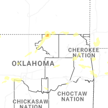


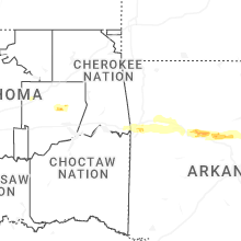
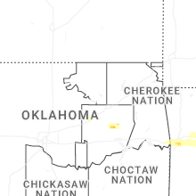
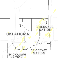


Connect with Interactive Hail Maps