

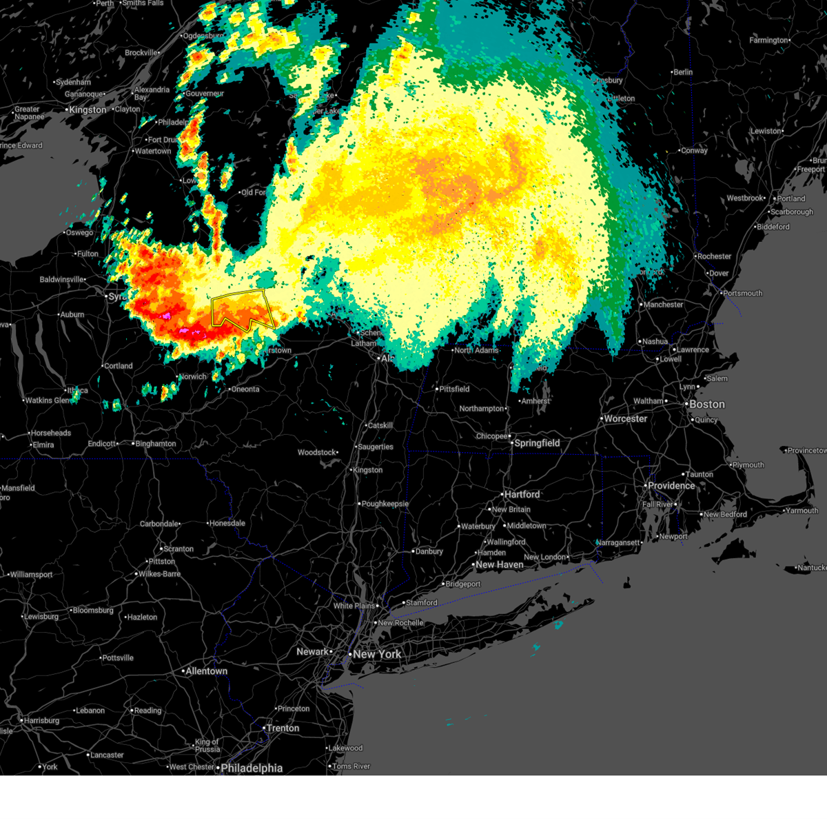
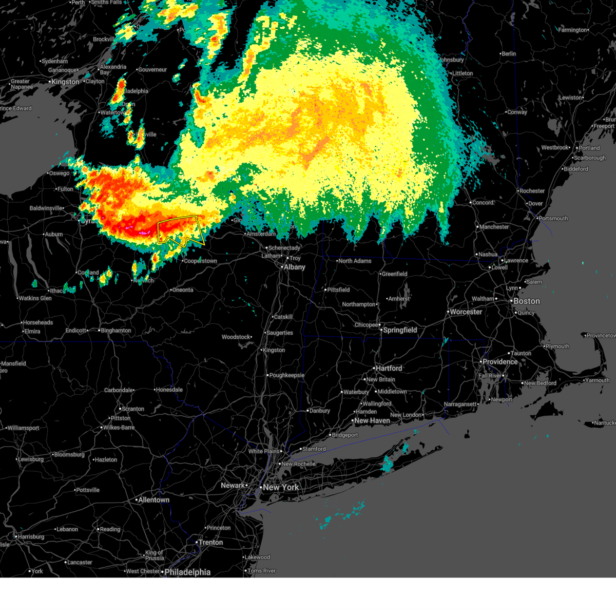
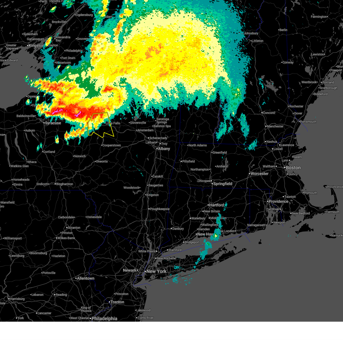
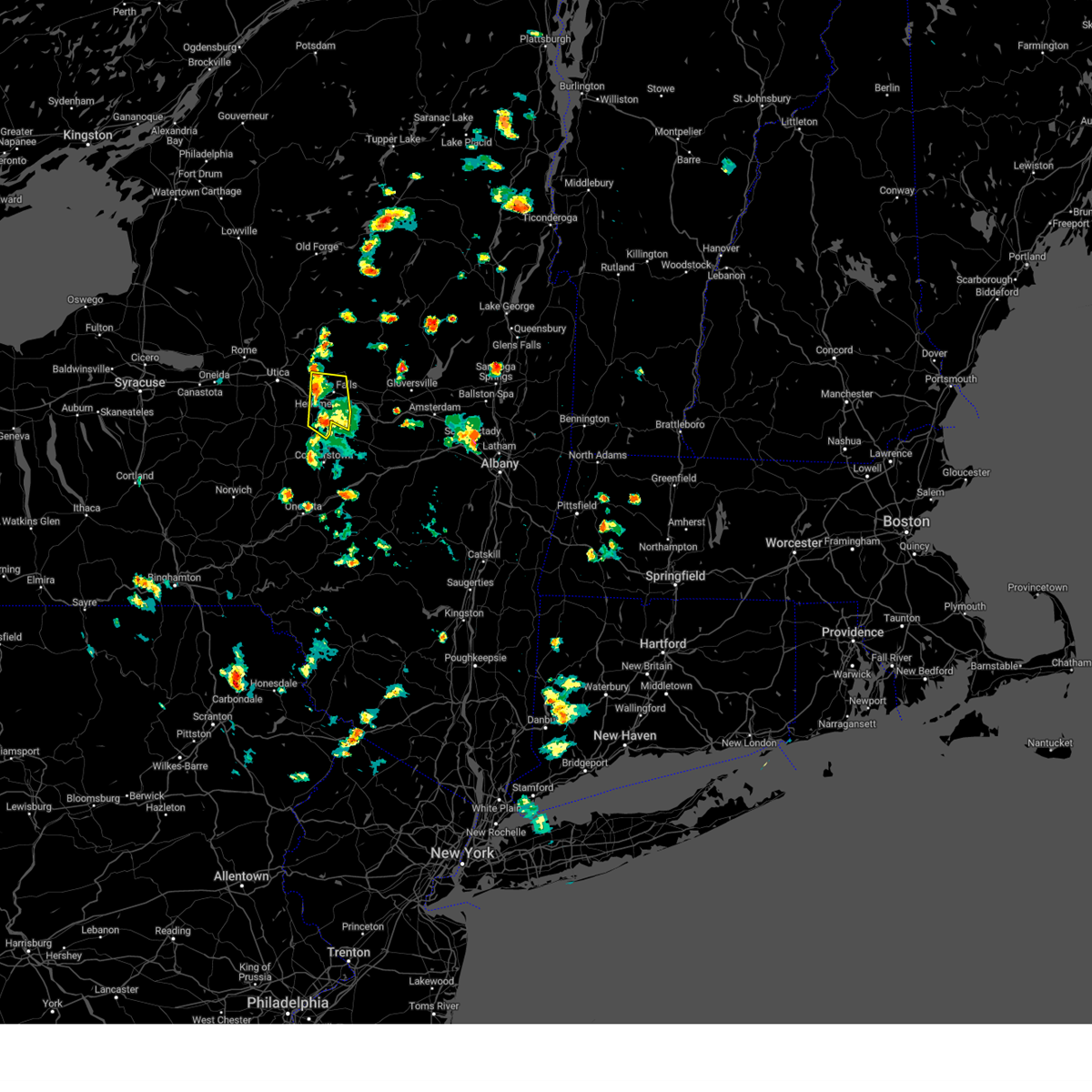
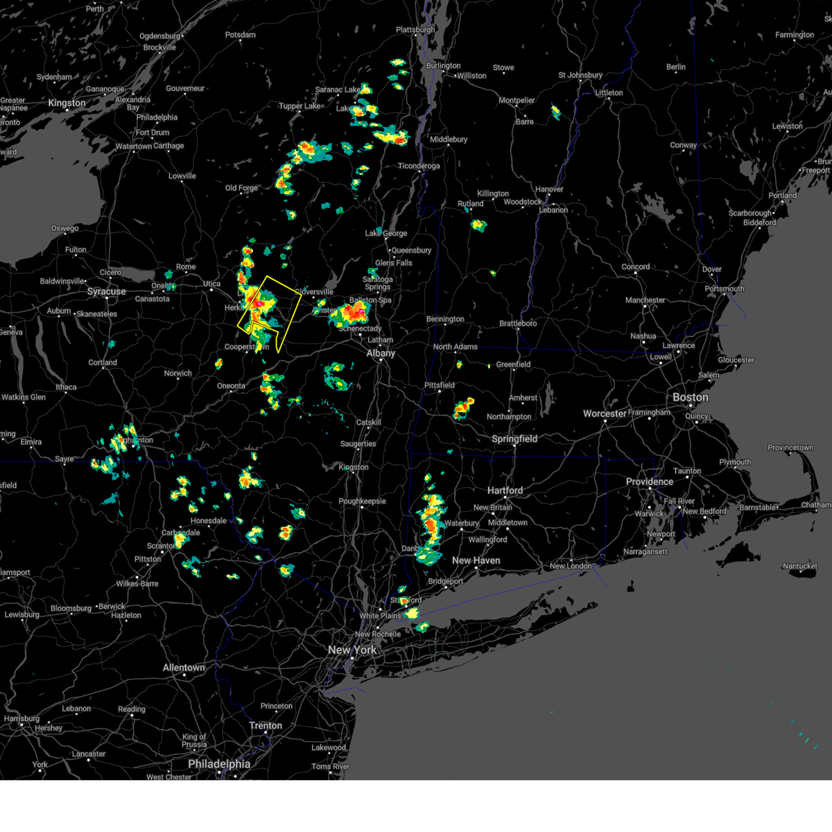
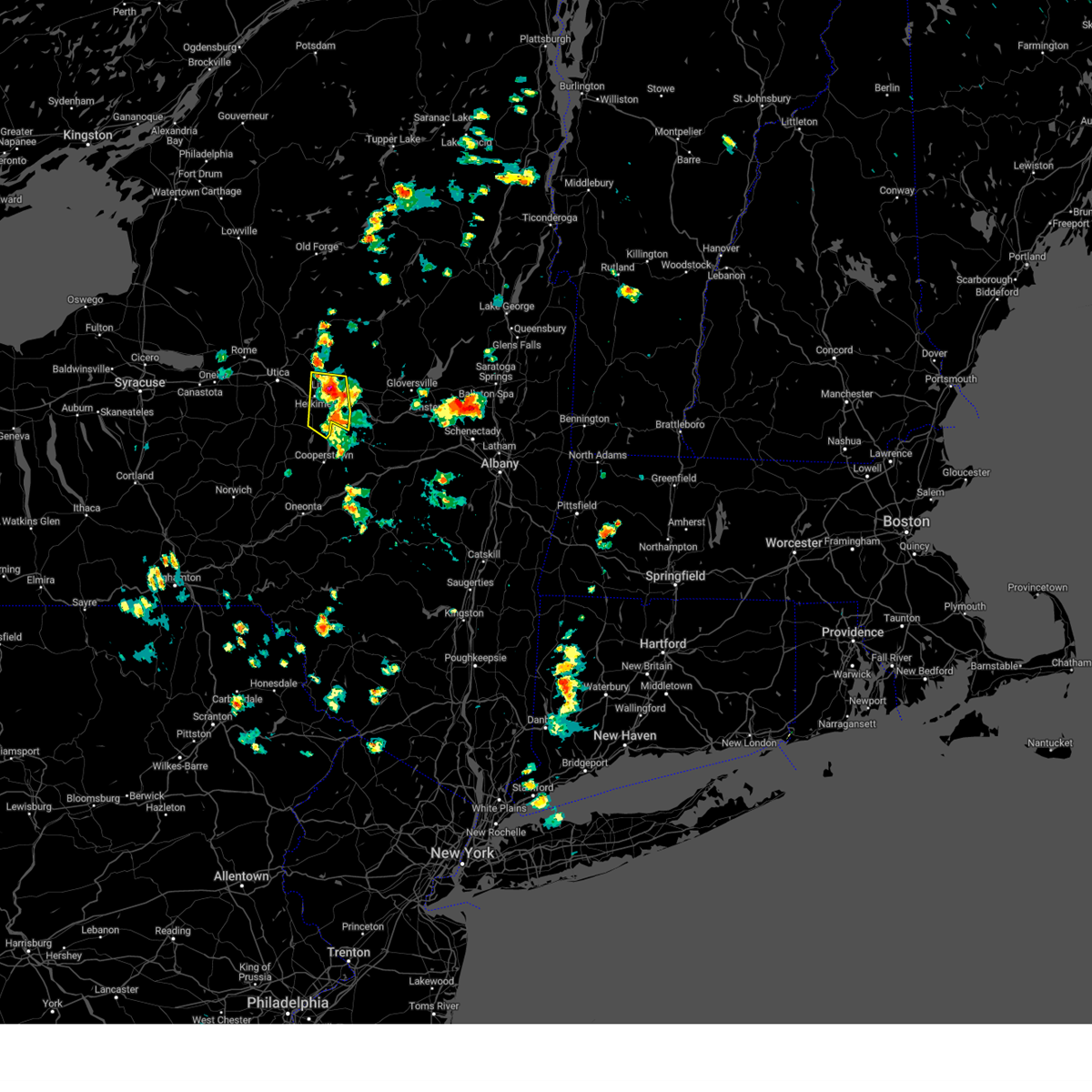
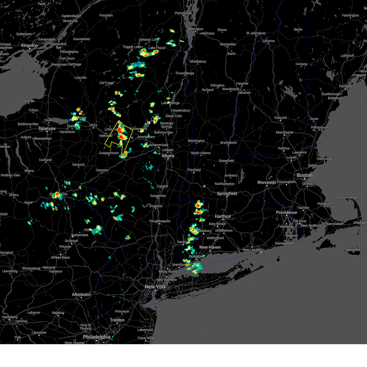
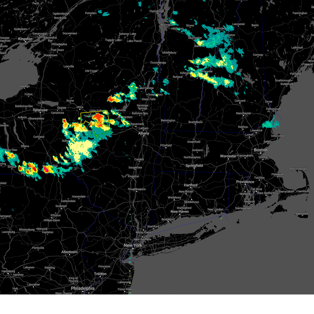
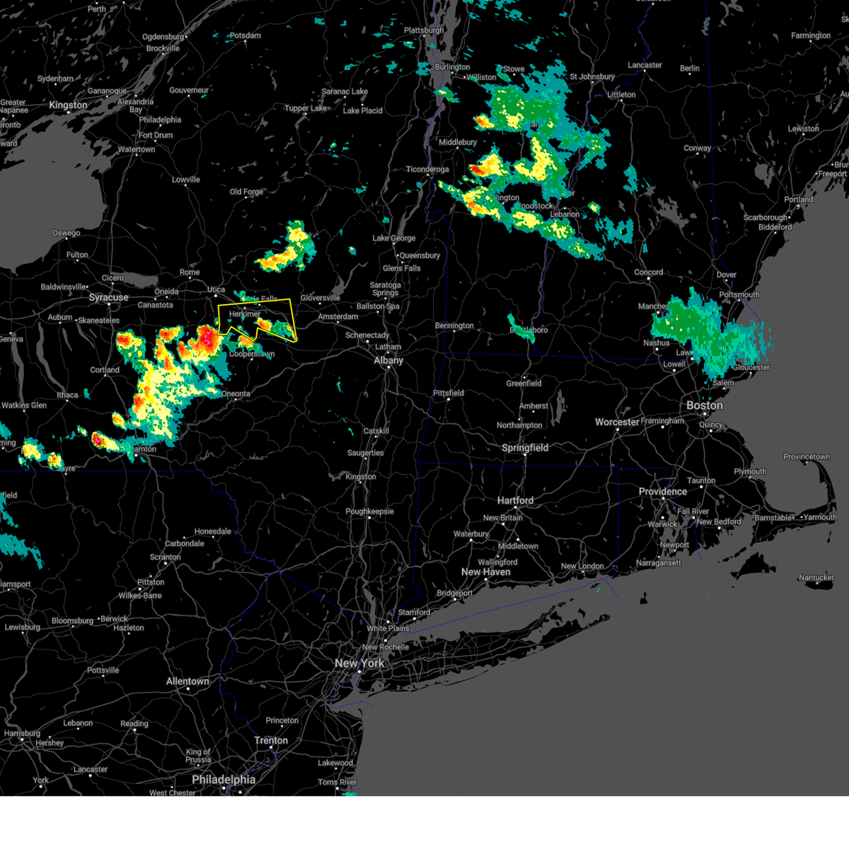
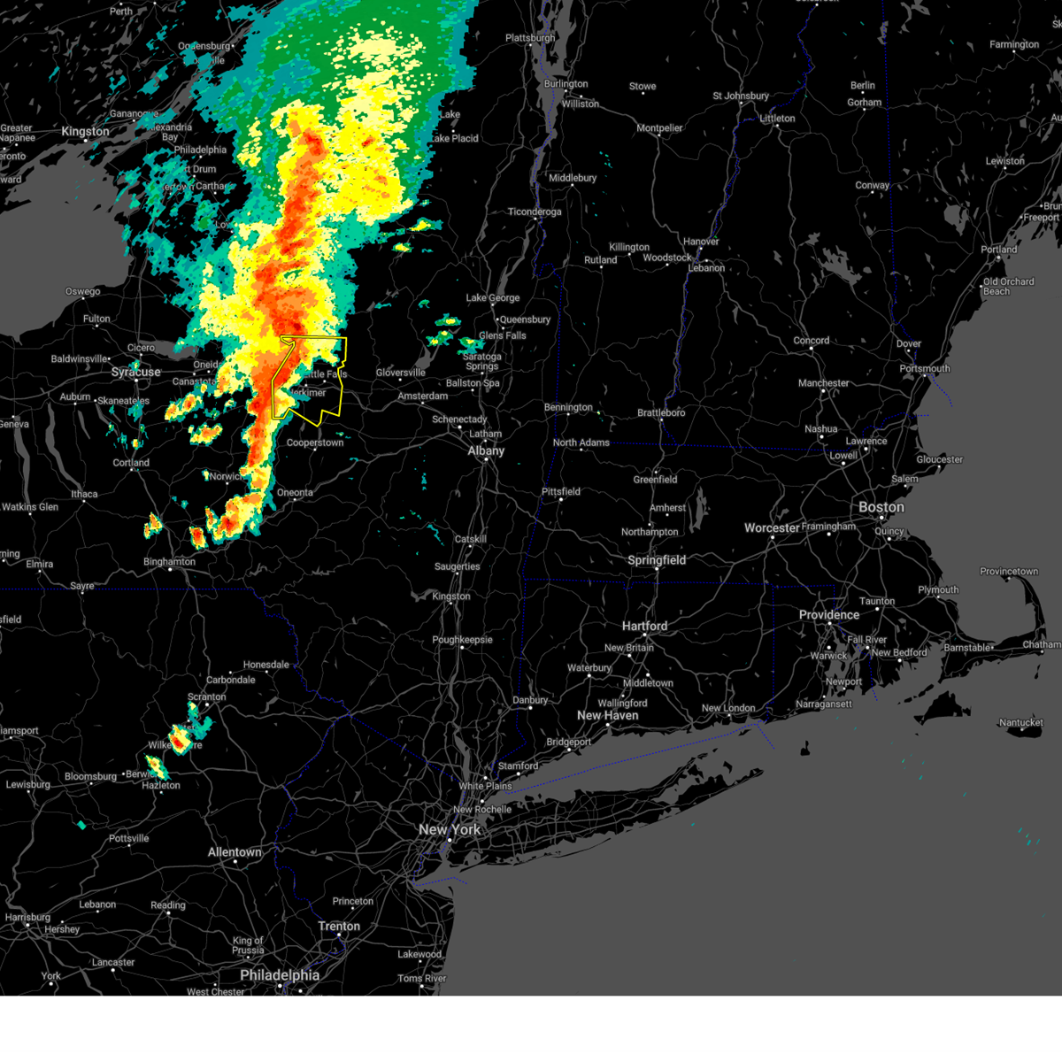
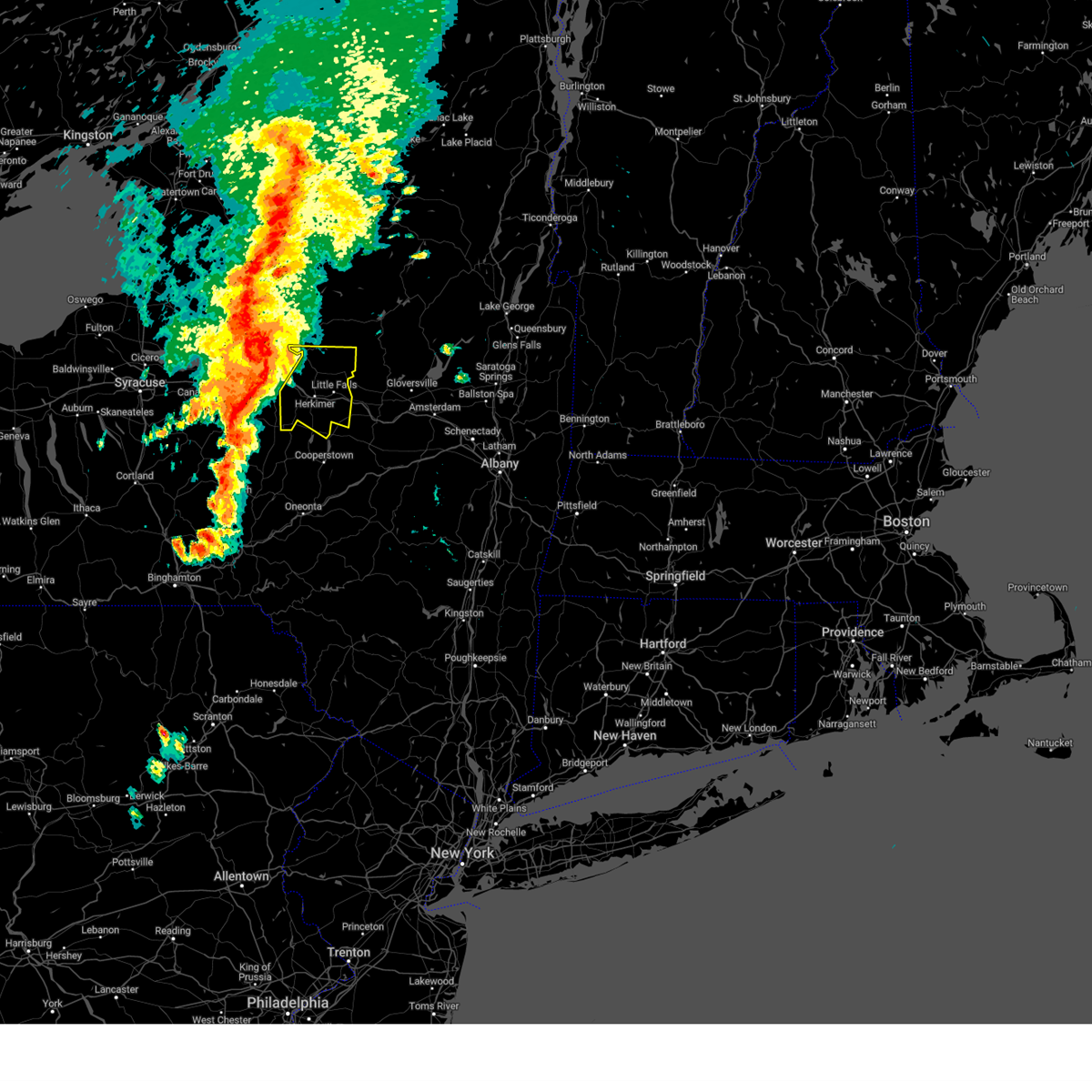
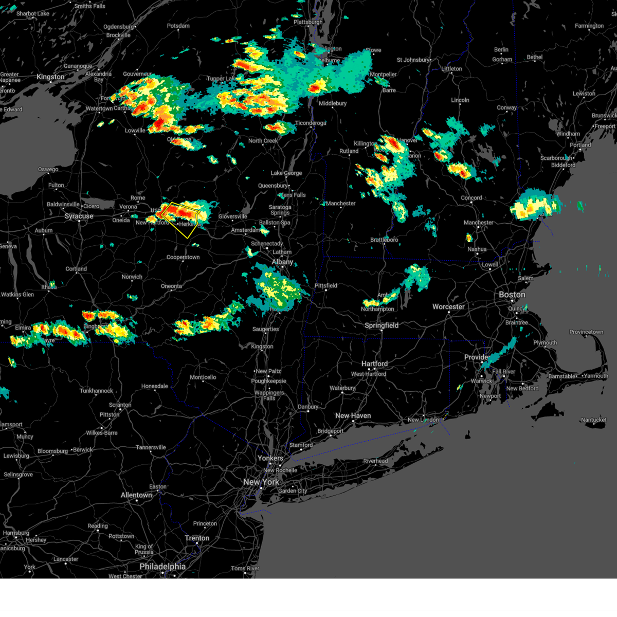
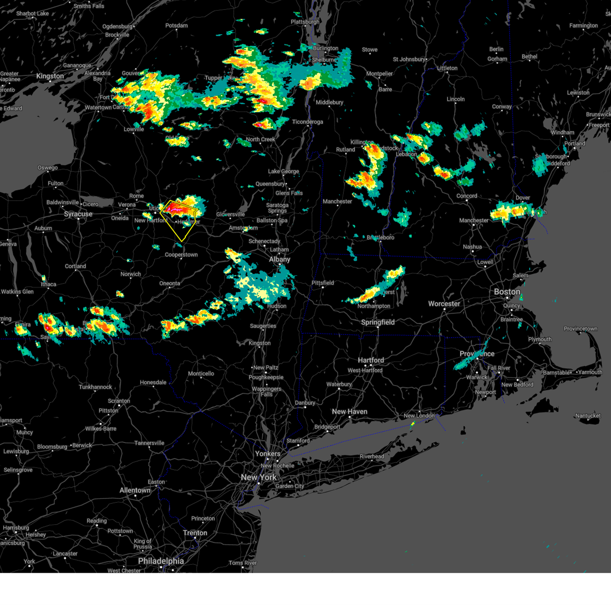
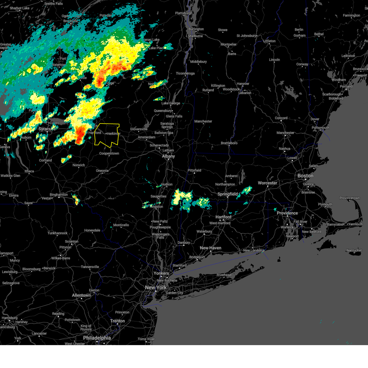
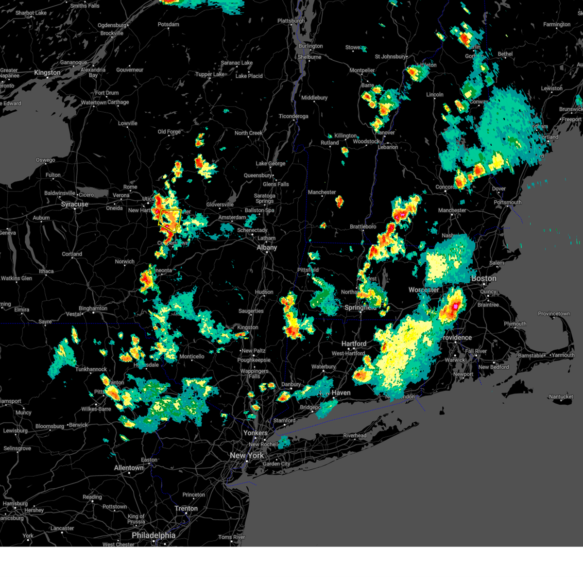
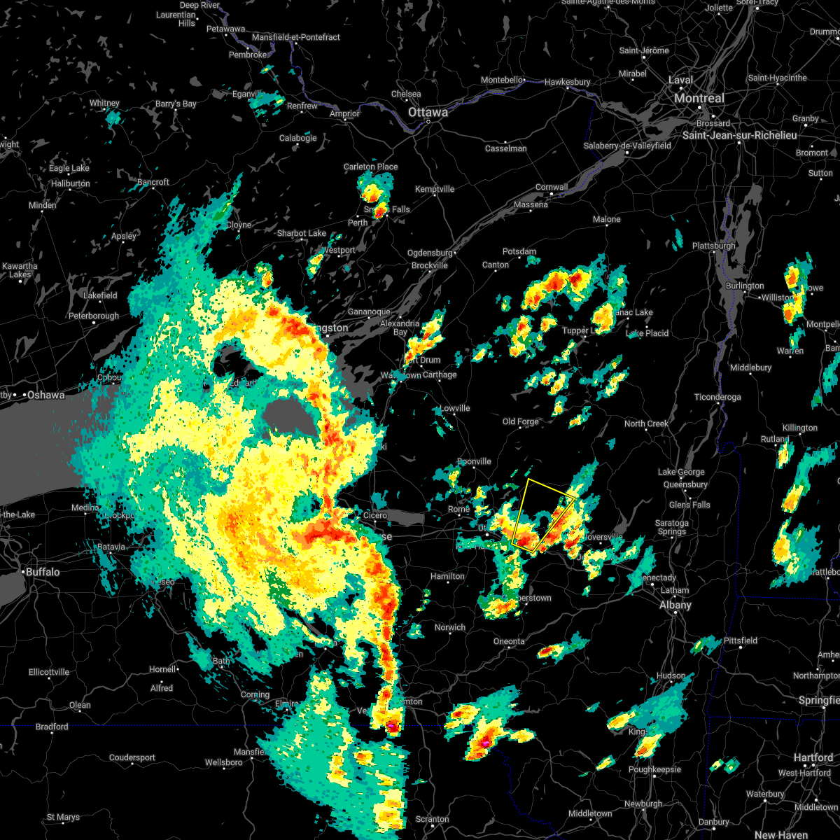
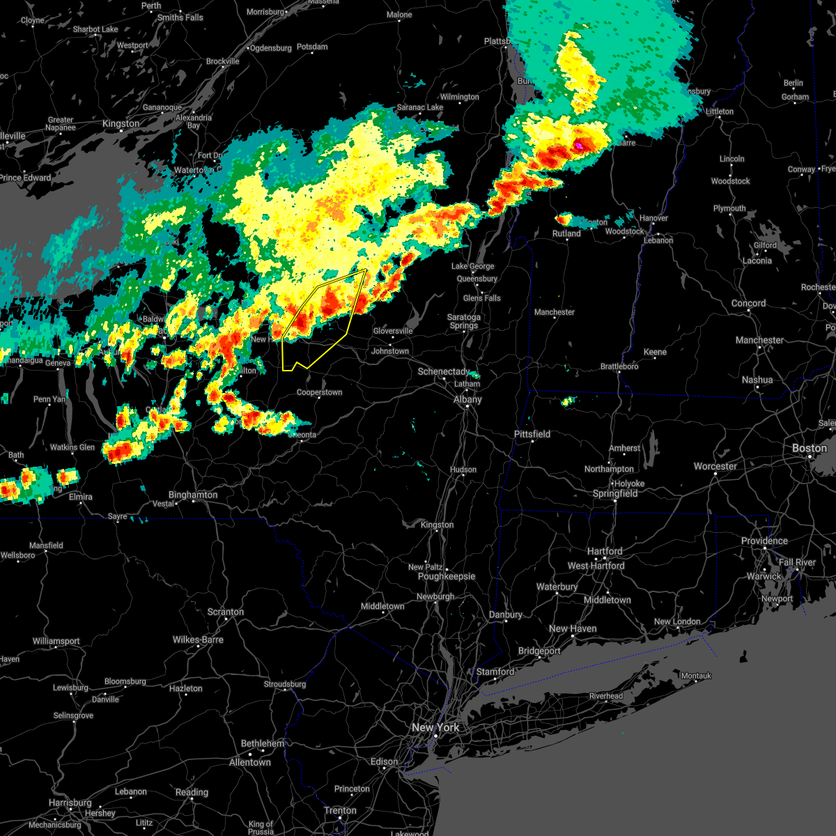
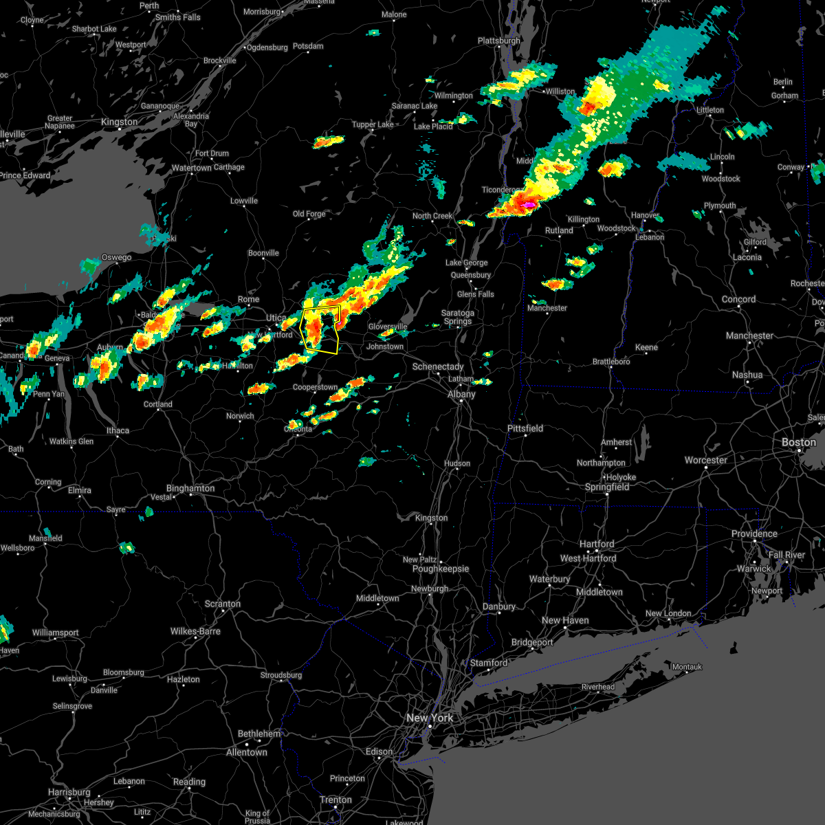
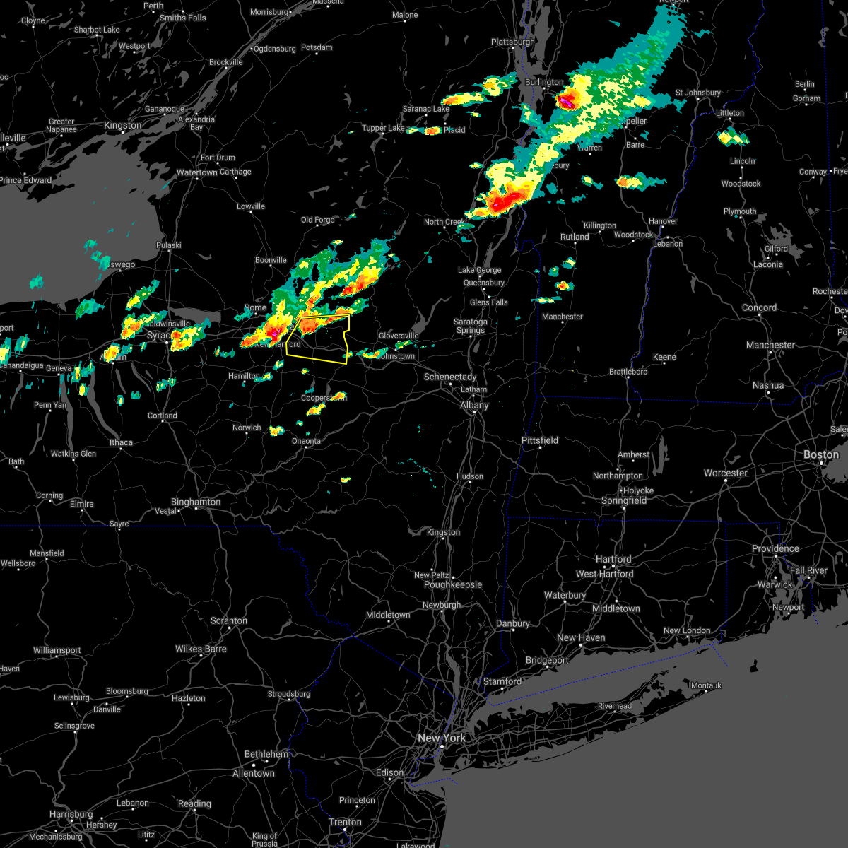
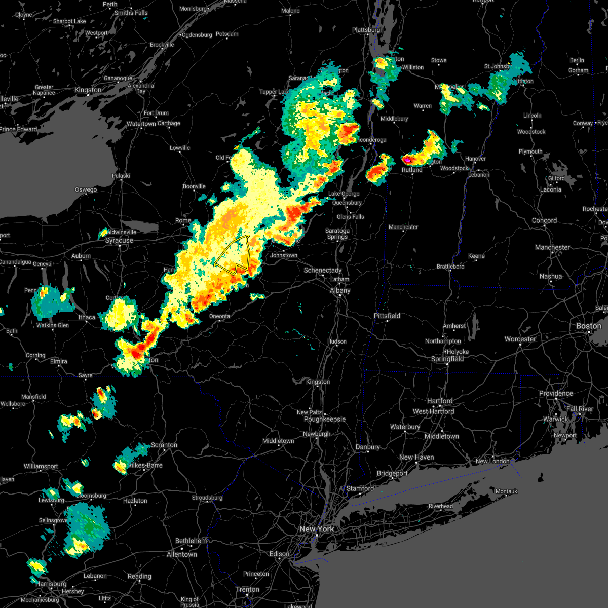
Hail Map for Little Falls, NY
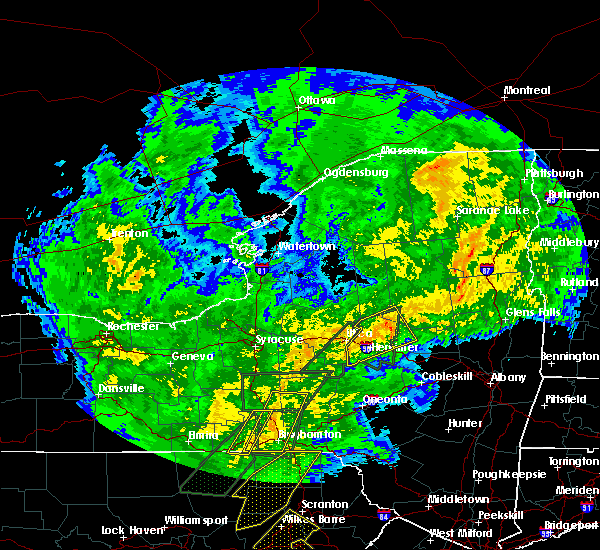
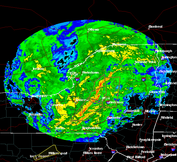
The Little Falls, NY area has had 4 reports of on-the-ground hail by trained spotters, and has been under severe weather warnings 16 times during the past 12 months. Doppler radar has detected hail at or near Little Falls, NY on 28 occasions, including 1 occasion during the past year.
| Name: | Little Falls, NY |
| Where Located: | 49.1 miles WNW of Schenectady, NY |
| Map: | Google Map for Little Falls, NY |
| Population: | 4946 |
| Housing Units: | 2665 |
| More Info: | Search Google for Little Falls, NY |
4
The Top Recent Hail Date for Little Falls, NY is Wednesday, August 14, 2024 (3rd out of 28)

Hail and Wind Damage Spotted near Little Falls, NY
| Date / Time | Report Details |
|---|---|
| 6/22/2025 4:31 AM EDT |
 The storms which prompted the warning have moved out of the area. therefore, the warning has been allowed to expire. The storms which prompted the warning have moved out of the area. therefore, the warning has been allowed to expire.
|
| 6/22/2025 4:11 AM EDT |
 At 410 am edt, severe thunderstorms were located along a line extending from near st. johnsville to near clayville, moving south at 35 mph (radar indicated). Hazards include 60 mph wind gusts. Expect damage to roofs, siding, and trees. Locations impacted include, ilion, herkimer, little falls, mohawk, frankfort, west winfield, jordanville, cedarville, elizabethtown, warren, ingham mills, jersalem hill, spinnerville, corrado corners, cedar lake, north ilion, gulph, south columbia, south ilion, and davys corners. At 410 am edt, severe thunderstorms were located along a line extending from near st. johnsville to near clayville, moving south at 35 mph (radar indicated). Hazards include 60 mph wind gusts. Expect damage to roofs, siding, and trees. Locations impacted include, ilion, herkimer, little falls, mohawk, frankfort, west winfield, jordanville, cedarville, elizabethtown, warren, ingham mills, jersalem hill, spinnerville, corrado corners, cedar lake, north ilion, gulph, south columbia, south ilion, and davys corners.
|
| 6/22/2025 3:52 AM EDT |
 Svraly the national weather service in albany has issued a * severe thunderstorm warning for, southern herkimer county in eastern new york, northwestern montgomery county in eastern new york, * until 430 am edt. * at 351 am edt, severe thunderstorms were located along a line extending from near dolgeville to new hartford, moving southeast at 50 mph (radar indicated). Hazards include 60 mph wind gusts. expect damage to roofs, siding, and trees Svraly the national weather service in albany has issued a * severe thunderstorm warning for, southern herkimer county in eastern new york, northwestern montgomery county in eastern new york, * until 430 am edt. * at 351 am edt, severe thunderstorms were located along a line extending from near dolgeville to new hartford, moving southeast at 50 mph (radar indicated). Hazards include 60 mph wind gusts. expect damage to roofs, siding, and trees
|
| 5/17/2025 4:25 PM EDT | Report of trees and wires down along curtiss rd near salisbur in herkimer county NY, 9.1 miles SSW of Little Falls, NY |
| 5/17/2025 4:25 PM EDT | Trees down along spruce lake road north of salisbur in herkimer county NY, 8.9 miles S of Little Falls, NY |
| 8/14/2024 4:00 PM EDT |
 The storm which prompted the warning has weakened below severe limits, and no longer poses an immediate threat to life or property. therefore, the warning will be allowed to expire. however, heavy rain and lightning are still possible with this thunderstorm. The storm which prompted the warning has weakened below severe limits, and no longer poses an immediate threat to life or property. therefore, the warning will be allowed to expire. however, heavy rain and lightning are still possible with this thunderstorm.
|
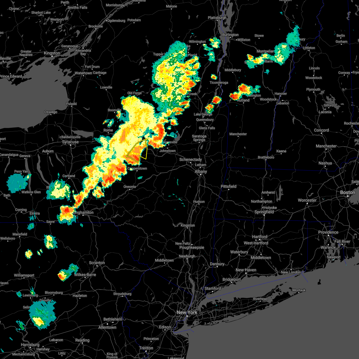
| 8/14/2024 3:29 PM EDT | Quarter sized hail reported 5.5 miles NNW of Little Falls, NY, measured quarter size hail at time of reporting. |
| 8/14/2024 3:27 PM EDT |
 The storm which prompted the warning has weakened below severe limits, and no longer poses an immediate threat to life or property. therefore, the warning will be allowed to expire. remember, a severe thunderstorm warning still remains in effect for southern herikmer county. The storm which prompted the warning has weakened below severe limits, and no longer poses an immediate threat to life or property. therefore, the warning will be allowed to expire. remember, a severe thunderstorm warning still remains in effect for southern herikmer county.
|
| 8/14/2024 3:24 PM EDT |
 Svraly the national weather service in albany has issued a * severe thunderstorm warning for, southeastern herkimer county in eastern new york, * until 400 pm edt. * at 324 pm edt, a severe thunderstorm was located over little falls, moving south at 25 mph (radar indicated). Hazards include 60 mph wind gusts and quarter size hail. Hail damage to vehicles is expected. Expect wind damage to roofs, siding, and trees. Svraly the national weather service in albany has issued a * severe thunderstorm warning for, southeastern herkimer county in eastern new york, * until 400 pm edt. * at 324 pm edt, a severe thunderstorm was located over little falls, moving south at 25 mph (radar indicated). Hazards include 60 mph wind gusts and quarter size hail. Hail damage to vehicles is expected. Expect wind damage to roofs, siding, and trees.
|
| 8/14/2024 2:27 PM EDT |
 Svraly the national weather service in albany has issued a * severe thunderstorm warning for, southwestern fulton county in eastern new york, northwestern schoharie county in east central new york, southeastern herkimer county in eastern new york, western montgomery county in eastern new york, * until 330 pm edt. * at 227 pm edt, a severe thunderstorm was located near st. johnsville, or near little falls, moving southwest at 25 mph (radar indicated). Hazards include 60 mph wind gusts and quarter size hail. Hail damage to vehicles is expected. Expect wind damage to roofs, siding, and trees. Svraly the national weather service in albany has issued a * severe thunderstorm warning for, southwestern fulton county in eastern new york, northwestern schoharie county in east central new york, southeastern herkimer county in eastern new york, western montgomery county in eastern new york, * until 330 pm edt. * at 227 pm edt, a severe thunderstorm was located near st. johnsville, or near little falls, moving southwest at 25 mph (radar indicated). Hazards include 60 mph wind gusts and quarter size hail. Hail damage to vehicles is expected. Expect wind damage to roofs, siding, and trees.
|
| 8/5/2024 4:28 PM EDT |
 The storm which prompted the warning has weakened below severe limits, and no longer poses an immediate threat to life or property. therefore, the warning will be allowed to expire. however, small hail, gusty winds and heavy rain are still possible with this thunderstorm. a severe thunderstorm watch remains in effect until 800 pm edt for eastern and east central new york. to report severe weather, contact your nearest law enforcement agency. they will relay your report to the national weather service albany. The storm which prompted the warning has weakened below severe limits, and no longer poses an immediate threat to life or property. therefore, the warning will be allowed to expire. however, small hail, gusty winds and heavy rain are still possible with this thunderstorm. a severe thunderstorm watch remains in effect until 800 pm edt for eastern and east central new york. to report severe weather, contact your nearest law enforcement agency. they will relay your report to the national weather service albany.
|
| 8/5/2024 3:49 PM EDT |
 Svraly the national weather service in albany has issued a * severe thunderstorm warning for, southwestern fulton county in eastern new york, southern herkimer county in eastern new york, western montgomery county in eastern new york, * until 430 pm edt. * at 348 pm edt, a severe thunderstorm was located over unadilla forks, or 14 miles southwest of ilion, moving east at 40 mph (radar indicated). Hazards include 60 mph wind gusts and quarter size hail. Hail damage to vehicles is expected. Expect wind damage to roofs, siding, and trees. Svraly the national weather service in albany has issued a * severe thunderstorm warning for, southwestern fulton county in eastern new york, southern herkimer county in eastern new york, western montgomery county in eastern new york, * until 430 pm edt. * at 348 pm edt, a severe thunderstorm was located over unadilla forks, or 14 miles southwest of ilion, moving east at 40 mph (radar indicated). Hazards include 60 mph wind gusts and quarter size hail. Hail damage to vehicles is expected. Expect wind damage to roofs, siding, and trees.
|
| 7/16/2024 4:38 PM EDT |
 The storm which prompted the warning has moved out of the area. therefore, the warning will be allowed to expire. however, heavy rain is still possible with this thunderstorm. a severe thunderstorm watch remains in effect until 900 pm edt for eastern new york. The storm which prompted the warning has moved out of the area. therefore, the warning will be allowed to expire. however, heavy rain is still possible with this thunderstorm. a severe thunderstorm watch remains in effect until 900 pm edt for eastern new york.
|
| 7/16/2024 4:14 PM EDT | *** 1 inj *** a tree fell down on a person at 3790 route 168 in mohawk. time estimated from rada in herkimer county NY, 4 miles S of Little Falls, NY |
| 7/16/2024 4:05 PM EDT | Report of a tree down near the entrance of little falls hospital. time estimated from rada in herkimer county NY, 0.4 miles WNW of Little Falls, NY |
| 7/16/2024 4:03 PM EDT | Tree down on burrell road. time estimated from rada in herkimer county NY, 7.5 miles S of Little Falls, NY |
| 7/16/2024 3:55 PM EDT |
 Toraly the national weather service in albany has issued a * tornado warning for, southwestern hamilton county in eastern new york, western fulton county in eastern new york, southern herkimer county in eastern new york, * until 445 pm edt. * at 354 pm edt, a severe thunderstorm capable of producing a tornado was located near cold brook, or 16 miles northeast of utica, moving east at 40 mph (radar indicated rotation). Hazards include tornado. Flying debris will be dangerous to those caught without shelter. mobile homes will be damaged or destroyed. damage to roofs, windows, and vehicles will occur. tree damage is likely. this dangerous storm will be near, ohio around 400 pm edt. Other locations impacted by this tornadic thunderstorm include ingham mills, nobleboro, curtis, farrel corner, countryman, lotville, rasbach corner, knappville, burrell corners, and kelhi corners. Toraly the national weather service in albany has issued a * tornado warning for, southwestern hamilton county in eastern new york, western fulton county in eastern new york, southern herkimer county in eastern new york, * until 445 pm edt. * at 354 pm edt, a severe thunderstorm capable of producing a tornado was located near cold brook, or 16 miles northeast of utica, moving east at 40 mph (radar indicated rotation). Hazards include tornado. Flying debris will be dangerous to those caught without shelter. mobile homes will be damaged or destroyed. damage to roofs, windows, and vehicles will occur. tree damage is likely. this dangerous storm will be near, ohio around 400 pm edt. Other locations impacted by this tornadic thunderstorm include ingham mills, nobleboro, curtis, farrel corner, countryman, lotville, rasbach corner, knappville, burrell corners, and kelhi corners.
|
| 7/16/2024 3:47 PM EDT |
 At 345 pm edt, severe thunderstorms were located along a line extending from hinckley to near new berlin, moving east at 35 mph. these are destructive storms for hinckley, ohio poland and newport (radar indicated). Hazards include 80 mph wind gusts. Flying debris will be dangerous to those caught without shelter. mobile homes will be heavily damaged. expect considerable damage to roofs, windows, and vehicles. extensive tree damage and power outages are likely. Locations impacted include, ilion, herkimer, little falls, mohawk, frankfort, dolgeville, west winfield, newport, middleville, poland, cold brook, jordanville, cedarville, russia, fairfield, elizabethtown, warren, norway, ingham mills, and spinnerville. At 345 pm edt, severe thunderstorms were located along a line extending from hinckley to near new berlin, moving east at 35 mph. these are destructive storms for hinckley, ohio poland and newport (radar indicated). Hazards include 80 mph wind gusts. Flying debris will be dangerous to those caught without shelter. mobile homes will be heavily damaged. expect considerable damage to roofs, windows, and vehicles. extensive tree damage and power outages are likely. Locations impacted include, ilion, herkimer, little falls, mohawk, frankfort, dolgeville, west winfield, newport, middleville, poland, cold brook, jordanville, cedarville, russia, fairfield, elizabethtown, warren, norway, ingham mills, and spinnerville.
|
| 7/16/2024 3:32 PM EDT |
 Svraly the national weather service in albany has issued a * severe thunderstorm warning for, southern herkimer county in eastern new york, * until 415 pm edt. * at 331 pm edt, severe thunderstorms were located along a line extending from steuben to north norwich, moving east at 35 mph (radar indicated). Hazards include 70 mph wind gusts. Expect considerable tree damage. Damage is likely to mobile homes, roofs, and outbuildings. Svraly the national weather service in albany has issued a * severe thunderstorm warning for, southern herkimer county in eastern new york, * until 415 pm edt. * at 331 pm edt, severe thunderstorms were located along a line extending from steuben to north norwich, moving east at 35 mph (radar indicated). Hazards include 70 mph wind gusts. Expect considerable tree damage. Damage is likely to mobile homes, roofs, and outbuildings.
|
| 7/15/2024 8:02 PM EDT |
 At 801 pm edt, a severe thunderstorm was located over dolgeville, or near little falls, moving northeast at 50 mph (radar indicated). Hazards include 60 mph wind gusts and penny size hail. Expect damage to roofs, siding, and trees. locations impacted include, johnstown, ilion, herkimer, little falls, canajoharie, fonda, mohawk, frankfort, fort plain, dolgeville, st. Johnsville, ephratah, west winfield, newport, stratford, middleville, poland, cold brook, ames, and caroga lake public campground. At 801 pm edt, a severe thunderstorm was located over dolgeville, or near little falls, moving northeast at 50 mph (radar indicated). Hazards include 60 mph wind gusts and penny size hail. Expect damage to roofs, siding, and trees. locations impacted include, johnstown, ilion, herkimer, little falls, canajoharie, fonda, mohawk, frankfort, fort plain, dolgeville, st. Johnsville, ephratah, west winfield, newport, stratford, middleville, poland, cold brook, ames, and caroga lake public campground.
|
| 7/15/2024 8:02 PM EDT |
 the severe thunderstorm warning has been cancelled and is no longer in effect the severe thunderstorm warning has been cancelled and is no longer in effect
|
| 7/15/2024 7:25 PM EDT |
 Svraly the national weather service in albany has issued a * severe thunderstorm warning for, southwestern hamilton county in eastern new york, western fulton county in eastern new york, southern herkimer county in eastern new york, montgomery county in eastern new york, * until 830 pm edt. * at 725 pm edt, a severe thunderstorm was located near waterville, or 11 miles south of new hartford, moving northeast at 50 mph (radar indicated). Hazards include 60 mph wind gusts and penny size hail. expect damage to roofs, siding, and trees Svraly the national weather service in albany has issued a * severe thunderstorm warning for, southwestern hamilton county in eastern new york, western fulton county in eastern new york, southern herkimer county in eastern new york, montgomery county in eastern new york, * until 830 pm edt. * at 725 pm edt, a severe thunderstorm was located near waterville, or 11 miles south of new hartford, moving northeast at 50 mph (radar indicated). Hazards include 60 mph wind gusts and penny size hail. expect damage to roofs, siding, and trees
|
| 8/4/2023 2:13 PM EDT |
 At 213 pm edt, a severe thunderstorm was located near frankfort, or near ilion, moving southeast at 15 mph (radar indicated). Hazards include 60 mph wind gusts and half dollar size hail. Hail damage to vehicles is expected. expect wind damage to roofs, siding, and trees. locations impacted include, ilion, herkimer, little falls, mohawk, frankfort, dolgeville, st. Johnsville, middleville, jordanville, cedarville, oppenheim, fairfield, elizabethtown, warren, ingham mills, spinnerville, cedar lake, countryman, south ilion and mindenville. At 213 pm edt, a severe thunderstorm was located near frankfort, or near ilion, moving southeast at 15 mph (radar indicated). Hazards include 60 mph wind gusts and half dollar size hail. Hail damage to vehicles is expected. expect wind damage to roofs, siding, and trees. locations impacted include, ilion, herkimer, little falls, mohawk, frankfort, dolgeville, st. Johnsville, middleville, jordanville, cedarville, oppenheim, fairfield, elizabethtown, warren, ingham mills, spinnerville, cedar lake, countryman, south ilion and mindenville.
|
| 8/4/2023 1:58 PM EDT |
 At 158 pm edt, a severe thunderstorm was located near clayville, or near new hartford, moving east at 15 mph (radar indicated). Hazards include 60 mph wind gusts and quarter size hail. Hail damage to vehicles is expected. Expect wind damage to roofs, siding, and trees. At 158 pm edt, a severe thunderstorm was located near clayville, or near new hartford, moving east at 15 mph (radar indicated). Hazards include 60 mph wind gusts and quarter size hail. Hail damage to vehicles is expected. Expect wind damage to roofs, siding, and trees.
|
| 8/4/2023 1:34 PM EDT |
 At 134 pm edt, a severe thunderstorm was located over little falls, moving southeast at 10 mph (radar indicated). Hazards include 60 mph wind gusts and quarter size hail. Hail damage to vehicles is expected. expect wind damage to roofs, siding, and trees. locations impacted include, ilion, herkimer, little falls, mohawk, frankfort, dolgeville, newport, middleville, fairfield, west frankfort, farrel corner, countryman, north ilion, burrell corners, kelhi corners, shedd corners, old city, ingham mills station, wrights corners and smith corners. hail threat, radar indicated max hail size, 1. 00 in wind threat, radar indicated max wind gust, 60 mph. At 134 pm edt, a severe thunderstorm was located over little falls, moving southeast at 10 mph (radar indicated). Hazards include 60 mph wind gusts and quarter size hail. Hail damage to vehicles is expected. expect wind damage to roofs, siding, and trees. locations impacted include, ilion, herkimer, little falls, mohawk, frankfort, dolgeville, newport, middleville, fairfield, west frankfort, farrel corner, countryman, north ilion, burrell corners, kelhi corners, shedd corners, old city, ingham mills station, wrights corners and smith corners. hail threat, radar indicated max hail size, 1. 00 in wind threat, radar indicated max wind gust, 60 mph.
|
| 8/4/2023 1:04 PM EDT |
 At 104 pm edt, a severe thunderstorm was located near herkimer, moving southeast at 10 mph (radar indicated). Hazards include ping pong ball size hail and 60 mph wind gusts. People and animals outdoors will be injured. expect hail damage to roofs, siding, windows, and vehicles. Expect wind damage to roofs, siding, and trees. At 104 pm edt, a severe thunderstorm was located near herkimer, moving southeast at 10 mph (radar indicated). Hazards include ping pong ball size hail and 60 mph wind gusts. People and animals outdoors will be injured. expect hail damage to roofs, siding, windows, and vehicles. Expect wind damage to roofs, siding, and trees.
|
| 8/4/2023 10:58 AM EDT |
 The severe thunderstorm warning for southwestern fulton, southern herkimer and northwestern montgomery counties will expire at 1100 am edt, the storm which prompted the warning has weakened below severe limits, and no longer poses an immediate threat to life or property. therefore, the warning will be allowed to expire. however gusty winds, small hail and heavy rain are still possible with this thunderstorm. The severe thunderstorm warning for southwestern fulton, southern herkimer and northwestern montgomery counties will expire at 1100 am edt, the storm which prompted the warning has weakened below severe limits, and no longer poses an immediate threat to life or property. therefore, the warning will be allowed to expire. however gusty winds, small hail and heavy rain are still possible with this thunderstorm.
|
| 8/4/2023 10:52 AM EDT | Multiple trees and wires down throughout the city of little falls including along west main street and near the intersection of ny route 5 and south ann street. also da in herkimer county NY, 0.2 miles NE of Little Falls, NY |
| 8/4/2023 10:26 AM EDT |
 At 1026 am edt, a severe thunderstorm was located near cedarville, or near ilion, moving east at 35 mph (radar indicated). Hazards include 60 mph wind gusts and quarter size hail. Hail damage to vehicles is expected. expect wind damage to roofs, siding, and trees. locations impacted include, ilion, herkimer, little falls, canajoharie, mohawk, frankfort, fort plain, dolgeville, st. johnsville, jordanville, cedarville, oppenheim, elizabethtown, palatine bridge, nelliston, ingham mills, cook corners, spinnerville, corrado corners and north ilion. hail threat, radar indicated max hail size, 1. 00 in wind threat, radar indicated max wind gust, 60 mph. At 1026 am edt, a severe thunderstorm was located near cedarville, or near ilion, moving east at 35 mph (radar indicated). Hazards include 60 mph wind gusts and quarter size hail. Hail damage to vehicles is expected. expect wind damage to roofs, siding, and trees. locations impacted include, ilion, herkimer, little falls, canajoharie, mohawk, frankfort, fort plain, dolgeville, st. johnsville, jordanville, cedarville, oppenheim, elizabethtown, palatine bridge, nelliston, ingham mills, cook corners, spinnerville, corrado corners and north ilion. hail threat, radar indicated max hail size, 1. 00 in wind threat, radar indicated max wind gust, 60 mph.
|
| 8/4/2023 10:01 AM EDT |
 At 1000 am edt, a severe thunderstorm was located over bridgewater, or 11 miles south of new hartford, moving east at 40 mph (radar indicated). Hazards include 60 mph wind gusts and quarter size hail. Hail damage to vehicles is expected. Expect wind damage to roofs, siding, and trees. At 1000 am edt, a severe thunderstorm was located over bridgewater, or 11 miles south of new hartford, moving east at 40 mph (radar indicated). Hazards include 60 mph wind gusts and quarter size hail. Hail damage to vehicles is expected. Expect wind damage to roofs, siding, and trees.
|
| 7/29/2023 12:37 PM EDT |
 At 1237 pm edt, a severe thunderstorm was located near little falls, moving east at 25 mph (radar indicated). Hazards include 60 mph wind gusts and quarter size hail. Hail damage to vehicles is expected. expect wind damage to roofs, siding, and trees. locations impacted include, canajoharie, fort plain, st. johnsville, oppenheim, palatine bridge, nelliston, ingham mills, crum creek, garlock corners, charlesworth corners, starkville, kringsbush, fink basin, mindenville, davys corners, fical corners, scotchbrush, indian castle, ingham mills station and newville. hail threat, radar indicated max hail size, 1. 00 in wind threat, radar indicated max wind gust, 60 mph. At 1237 pm edt, a severe thunderstorm was located near little falls, moving east at 25 mph (radar indicated). Hazards include 60 mph wind gusts and quarter size hail. Hail damage to vehicles is expected. expect wind damage to roofs, siding, and trees. locations impacted include, canajoharie, fort plain, st. johnsville, oppenheim, palatine bridge, nelliston, ingham mills, crum creek, garlock corners, charlesworth corners, starkville, kringsbush, fink basin, mindenville, davys corners, fical corners, scotchbrush, indian castle, ingham mills station and newville. hail threat, radar indicated max hail size, 1. 00 in wind threat, radar indicated max wind gust, 60 mph.
|
| 7/29/2023 12:35 PM EDT | Tree down. time estimated from rada in herkimer county NY, 4.9 miles NW of Little Falls, NY |
| 7/29/2023 12:22 PM EDT |
 At 1222 pm edt, a severe thunderstorm was located near jordanville, or near little falls, moving east at 25 mph (radar indicated). Hazards include 60 mph wind gusts and half dollar size hail. Hail damage to vehicles is expected. Expect wind damage to roofs, siding, and trees. At 1222 pm edt, a severe thunderstorm was located near jordanville, or near little falls, moving east at 25 mph (radar indicated). Hazards include 60 mph wind gusts and half dollar size hail. Hail damage to vehicles is expected. Expect wind damage to roofs, siding, and trees.
|
| 7/29/2023 12:01 PM EDT |
 At 1201 pm edt, a severe thunderstorm was located over frankfort, or over ilion, moving east at 30 mph (radar indicated). Hazards include 60 mph wind gusts and quarter size hail. Hail damage to vehicles is expected. expect wind damage to roofs, siding, and trees. locations impacted include, ilion, herkimer, little falls, mohawk, frankfort, dolgeville, west winfield, middleville, jordanville, cedarville, fairfield, elizabethtown, warren, spinnerville, cedar lake, countryman, south ilion, kelhi corners, chepachet and shedd corners. hail threat, radar indicated max hail size, 1. 00 in wind threat, radar indicated max wind gust, 60 mph. At 1201 pm edt, a severe thunderstorm was located over frankfort, or over ilion, moving east at 30 mph (radar indicated). Hazards include 60 mph wind gusts and quarter size hail. Hail damage to vehicles is expected. expect wind damage to roofs, siding, and trees. locations impacted include, ilion, herkimer, little falls, mohawk, frankfort, dolgeville, west winfield, middleville, jordanville, cedarville, fairfield, elizabethtown, warren, spinnerville, cedar lake, countryman, south ilion, kelhi corners, chepachet and shedd corners. hail threat, radar indicated max hail size, 1. 00 in wind threat, radar indicated max wind gust, 60 mph.
|
| 7/29/2023 11:20 AM EDT |
 At 1119 am edt, a severe thunderstorm was located near clinton, or 8 miles southwest of new hartford, moving east at 35 mph (radar indicated). Hazards include 60 mph wind gusts and quarter size hail. Hail damage to vehicles is expected. Expect wind damage to roofs, siding, and trees. At 1119 am edt, a severe thunderstorm was located near clinton, or 8 miles southwest of new hartford, moving east at 35 mph (radar indicated). Hazards include 60 mph wind gusts and quarter size hail. Hail damage to vehicles is expected. Expect wind damage to roofs, siding, and trees.
|
| 7/24/2023 1:30 PM EDT | Downed trees and broken limbs from thunderstorm cell that passed throug in herkimer county NY, 0.6 miles SSE of Little Falls, NY |
| 7/15/2023 1:02 AM EDT |
 At 101 am edt, a severe thunderstorm was located near little falls, moving northeast at 25 mph (radar indicated). Hazards include 60 mph wind gusts and quarter size hail. Hail damage to vehicles is expected. expect wind damage to roofs, siding, and trees. locations impacted include, little falls, dolgeville, st. johnsville, stratford, oppenheim, ingham mills, crum creek, garlock corners, lotville, rasbach corner, doxtater corner, fink basin, mindenville, davys corners, shedd corners, indian castle, phipps corners, ingham mills station, newville and west saint johnsville. hail threat, observed max hail size, 1. 00 in wind threat, observed max wind gust, 60 mph. At 101 am edt, a severe thunderstorm was located near little falls, moving northeast at 25 mph (radar indicated). Hazards include 60 mph wind gusts and quarter size hail. Hail damage to vehicles is expected. expect wind damage to roofs, siding, and trees. locations impacted include, little falls, dolgeville, st. johnsville, stratford, oppenheim, ingham mills, crum creek, garlock corners, lotville, rasbach corner, doxtater corner, fink basin, mindenville, davys corners, shedd corners, indian castle, phipps corners, ingham mills station, newville and west saint johnsville. hail threat, observed max hail size, 1. 00 in wind threat, observed max wind gust, 60 mph.
|
| 7/15/2023 12:20 AM EDT |
 At 1219 am edt, a severe thunderstorm was located near richfield springs, or 11 miles northwest of cooperstown, moving northeast at 25 mph (radar indicated). Hazards include ping pong ball size hail and 60 mph wind gusts. People and animals outdoors will be injured. expect hail damage to roofs, siding, windows, and vehicles. Expect wind damage to roofs, siding, and trees. At 1219 am edt, a severe thunderstorm was located near richfield springs, or 11 miles northwest of cooperstown, moving northeast at 25 mph (radar indicated). Hazards include ping pong ball size hail and 60 mph wind gusts. People and animals outdoors will be injured. expect hail damage to roofs, siding, windows, and vehicles. Expect wind damage to roofs, siding, and trees.
|
| 7/14/2023 5:30 PM EDT |
 At 529 pm edt, a severe thunderstorm was located near st. johnsville, or 8 miles southeast of little falls, moving north at 15 mph (radar indicated). Hazards include 60 mph wind gusts and half dollar size hail. Hail damage to vehicles is expected. expect wind damage to roofs, siding, and trees. locations impacted include, dolgeville, st. johnsville, oppenheim, ingham mills, crum creek, garlock corners, charlesworth corners, lotville, rasbach corner, doxtater corner, fink basin, mindenville, davys corners, shedd corners, indian castle, phipps corners, ingham mills station, west saint johnsville, fordsbush and saint johnsville. hail threat, radar indicated max hail size, 1. 25 in wind threat, radar indicated max wind gust, 60 mph. At 529 pm edt, a severe thunderstorm was located near st. johnsville, or 8 miles southeast of little falls, moving north at 15 mph (radar indicated). Hazards include 60 mph wind gusts and half dollar size hail. Hail damage to vehicles is expected. expect wind damage to roofs, siding, and trees. locations impacted include, dolgeville, st. johnsville, oppenheim, ingham mills, crum creek, garlock corners, charlesworth corners, lotville, rasbach corner, doxtater corner, fink basin, mindenville, davys corners, shedd corners, indian castle, phipps corners, ingham mills station, west saint johnsville, fordsbush and saint johnsville. hail threat, radar indicated max hail size, 1. 25 in wind threat, radar indicated max wind gust, 60 mph.
|
| 7/14/2023 5:19 PM EDT |
 At 519 pm edt, a severe thunderstorm was located near st. johnsville, or 8 miles west of canajoharie, moving north at 10 mph (radar indicated). Hazards include 60 mph wind gusts and half dollar size hail. Hail damage to vehicles is expected. expect wind damage to roofs, siding, and trees. locations impacted include, little falls, dolgeville, st. johnsville, oppenheim, ingham mills, crum creek, garlock corners, buel, hessville, charlesworth corners, starkville, lotville, rasbach corner, doxtater corner, fink basin, salt springville, willse four corners, mindenville, kelhi corners and davys corners. hail threat, radar indicated max hail size, 1. 25 in wind threat, radar indicated max wind gust, 60 mph. At 519 pm edt, a severe thunderstorm was located near st. johnsville, or 8 miles west of canajoharie, moving north at 10 mph (radar indicated). Hazards include 60 mph wind gusts and half dollar size hail. Hail damage to vehicles is expected. expect wind damage to roofs, siding, and trees. locations impacted include, little falls, dolgeville, st. johnsville, oppenheim, ingham mills, crum creek, garlock corners, buel, hessville, charlesworth corners, starkville, lotville, rasbach corner, doxtater corner, fink basin, salt springville, willse four corners, mindenville, kelhi corners and davys corners. hail threat, radar indicated max hail size, 1. 25 in wind threat, radar indicated max wind gust, 60 mph.
|
| 7/14/2023 5:08 PM EDT |
 At 507 pm edt, a severe thunderstorm was located near springfield, or 9 miles west of canajoharie, moving north at 15 mph (radar indicated). Hazards include 60 mph wind gusts and quarter size hail. Hail damage to vehicles is expected. Expect wind damage to roofs, siding, and trees. At 507 pm edt, a severe thunderstorm was located near springfield, or 9 miles west of canajoharie, moving north at 15 mph (radar indicated). Hazards include 60 mph wind gusts and quarter size hail. Hail damage to vehicles is expected. Expect wind damage to roofs, siding, and trees.
|
| 7/13/2023 5:03 PM EDT |
 At 503 pm edt, severe thunderstorms were located along a line extending from near little falls to near hartwick, moving east at 25 mph (radar indicated). Hazards include 60 mph wind gusts and penny size hail. Expect damage to roofs, siding, and trees. locations impacted include, little falls, fort plain, st. johnsville, jordanville, warren, nelliston, south columbia, mindenville, davys corners, ripple corners, columbia center, west saint johnsville, sand hill, wrights corners, smith corners, schuyler corners, brookman corners, van hornesville, east creek and edicks. hail threat, radar indicated max hail size, 0. 75 in wind threat, radar indicated max wind gust, 60 mph. At 503 pm edt, severe thunderstorms were located along a line extending from near little falls to near hartwick, moving east at 25 mph (radar indicated). Hazards include 60 mph wind gusts and penny size hail. Expect damage to roofs, siding, and trees. locations impacted include, little falls, fort plain, st. johnsville, jordanville, warren, nelliston, south columbia, mindenville, davys corners, ripple corners, columbia center, west saint johnsville, sand hill, wrights corners, smith corners, schuyler corners, brookman corners, van hornesville, east creek and edicks. hail threat, radar indicated max hail size, 0. 75 in wind threat, radar indicated max wind gust, 60 mph.
|
| 7/13/2023 5:02 PM EDT |
 At 502 pm edt, severe thunderstorms were located along a line extending from 7 miles northeast of newcomb to near jordanville, moving east at 35 mph (radar indicated). Hazards include 70 mph wind gusts and quarter size hail. Hail damage to vehicles is expected. expect considerable tree damage. wind damage is also likely to mobile homes, roofs, and outbuildings. locations impacted include, gloversville, ilion, herkimer, little falls, indian lake, speculator, mohawk, dolgeville, broadalbin, northville, mayfield, lake pleasant, wells, stratford, cranberry creek, northampton beach public campground, moffitt beach campground, caroga lake, caroga lake public campground and sacandaga campground. thunderstorm damage threat, considerable hail threat, radar indicated max hail size, 1. 00 in wind threat, radar indicated max wind gust, 70 mph. At 502 pm edt, severe thunderstorms were located along a line extending from 7 miles northeast of newcomb to near jordanville, moving east at 35 mph (radar indicated). Hazards include 70 mph wind gusts and quarter size hail. Hail damage to vehicles is expected. expect considerable tree damage. wind damage is also likely to mobile homes, roofs, and outbuildings. locations impacted include, gloversville, ilion, herkimer, little falls, indian lake, speculator, mohawk, dolgeville, broadalbin, northville, mayfield, lake pleasant, wells, stratford, cranberry creek, northampton beach public campground, moffitt beach campground, caroga lake, caroga lake public campground and sacandaga campground. thunderstorm damage threat, considerable hail threat, radar indicated max hail size, 1. 00 in wind threat, radar indicated max wind gust, 70 mph.
|
| 7/13/2023 4:47 PM EDT |
 At 447 pm edt, severe thunderstorms were located along a line extending from near newcomb to near jordanville, moving east at 45 mph (radar indicated). Hazards include 70 mph wind gusts and quarter size hail. Hail damage to vehicles is expected. expect considerable tree damage. wind damage is also likely to mobile homes, roofs, and outbuildings. locations impacted include, gloversville, ilion, herkimer, little falls, indian lake, speculator, mohawk, frankfort, dolgeville, broadalbin, northville, mayfield, lake pleasant, wells, stratford, middleville, blue mountain lake, lake eaton campground, cranberry creek and northampton beach public campground. thunderstorm damage threat, considerable hail threat, radar indicated max hail size, 1. 00 in wind threat, radar indicated max wind gust, 70 mph. At 447 pm edt, severe thunderstorms were located along a line extending from near newcomb to near jordanville, moving east at 45 mph (radar indicated). Hazards include 70 mph wind gusts and quarter size hail. Hail damage to vehicles is expected. expect considerable tree damage. wind damage is also likely to mobile homes, roofs, and outbuildings. locations impacted include, gloversville, ilion, herkimer, little falls, indian lake, speculator, mohawk, frankfort, dolgeville, broadalbin, northville, mayfield, lake pleasant, wells, stratford, middleville, blue mountain lake, lake eaton campground, cranberry creek and northampton beach public campground. thunderstorm damage threat, considerable hail threat, radar indicated max hail size, 1. 00 in wind threat, radar indicated max wind gust, 70 mph.
|
| 7/13/2023 4:34 PM EDT |
 At 433 pm edt, severe thunderstorms were located along a line extending from near ilion to edmeston, moving east at 25 mph (radar indicated). Hazards include 60 mph wind gusts and penny size hail. expect damage to roofs, siding, and trees At 433 pm edt, severe thunderstorms were located along a line extending from near ilion to edmeston, moving east at 25 mph (radar indicated). Hazards include 60 mph wind gusts and penny size hail. expect damage to roofs, siding, and trees
|
| 7/13/2023 4:30 PM EDT |
 At 429 pm edt, severe thunderstorms were located along a line extending from 8 miles northeast of lake eaton campground to near little falls, moving east at 45 mph (radar indicated). Hazards include 70 mph wind gusts and quarter size hail. Hail damage to vehicles is expected. expect considerable tree damage. wind damage is also likely to mobile homes, roofs, and outbuildings. locations impacted include, gloversville, ilion, herkimer, little falls, indian lake, speculator, mohawk, frankfort, dolgeville, broadalbin, northville, ohio, mayfield, lake pleasant, wells, newport, stratford, middleville, poland and inlet. thunderstorm damage threat, considerable hail threat, radar indicated max hail size, 1. 00 in wind threat, radar indicated max wind gust, 70 mph. At 429 pm edt, severe thunderstorms were located along a line extending from 8 miles northeast of lake eaton campground to near little falls, moving east at 45 mph (radar indicated). Hazards include 70 mph wind gusts and quarter size hail. Hail damage to vehicles is expected. expect considerable tree damage. wind damage is also likely to mobile homes, roofs, and outbuildings. locations impacted include, gloversville, ilion, herkimer, little falls, indian lake, speculator, mohawk, frankfort, dolgeville, broadalbin, northville, ohio, mayfield, lake pleasant, wells, newport, stratford, middleville, poland and inlet. thunderstorm damage threat, considerable hail threat, radar indicated max hail size, 1. 00 in wind threat, radar indicated max wind gust, 70 mph.
|
| 7/13/2023 4:15 PM EDT |
 At 415 pm edt, severe thunderstorms were located along a line extending from near horseshoe lake to near cedarville, moving east at 35 mph (radar indicated). Hazards include 60 mph wind gusts and quarter size hail. Hail damage to vehicles is expected. Expect wind damage to roofs, siding, and trees. At 415 pm edt, severe thunderstorms were located along a line extending from near horseshoe lake to near cedarville, moving east at 35 mph (radar indicated). Hazards include 60 mph wind gusts and quarter size hail. Hail damage to vehicles is expected. Expect wind damage to roofs, siding, and trees.
|
| 7/7/2023 3:58 PM EDT |
 At 357 pm edt, a severe thunderstorm was located over springfield, or 11 miles south of little falls, moving northeast at 20 mph (radar indicated). Hazards include 60 mph wind gusts and quarter size hail. Hail damage to vehicles is expected. expect wind damage to roofs, siding, and trees. this severe thunderstorm will be near, little falls around 425 pm edt. fort plain around 430 pm edt. st. johnsville around 435 pm edt. dolgeville and ephratah around 445 pm edt. other locations impacted by this severe thunderstorm include ingham mills, cook corners, spinnerville, countryman, north ilion, south columbia, rasbach corner, burrell corners, south ilion and mindenville. please report hail size, damaging winds and reports of trees down to the national weather service by email at alb. stormreport@noaa. gov, on facebook at www. facebook. com/nwsalbany or twitter @nwsalbany hail threat, radar indicated max hail size, 1. 00 in wind threat, radar indicated max wind gust, 60 mph. At 357 pm edt, a severe thunderstorm was located over springfield, or 11 miles south of little falls, moving northeast at 20 mph (radar indicated). Hazards include 60 mph wind gusts and quarter size hail. Hail damage to vehicles is expected. expect wind damage to roofs, siding, and trees. this severe thunderstorm will be near, little falls around 425 pm edt. fort plain around 430 pm edt. st. johnsville around 435 pm edt. dolgeville and ephratah around 445 pm edt. other locations impacted by this severe thunderstorm include ingham mills, cook corners, spinnerville, countryman, north ilion, south columbia, rasbach corner, burrell corners, south ilion and mindenville. please report hail size, damaging winds and reports of trees down to the national weather service by email at alb. stormreport@noaa. gov, on facebook at www. facebook. com/nwsalbany or twitter @nwsalbany hail threat, radar indicated max hail size, 1. 00 in wind threat, radar indicated max wind gust, 60 mph.
|
| 6/2/2023 4:55 PM EDT |
 The severe thunderstorm warning for south central herkimer county will expire at 500 pm edt, the storm which prompted the warning has moved out of the area. therefore, the warning will be allowed to expire. The severe thunderstorm warning for south central herkimer county will expire at 500 pm edt, the storm which prompted the warning has moved out of the area. therefore, the warning will be allowed to expire.
|
| 6/2/2023 4:22 PM EDT |
 At 422 pm edt, a severe thunderstorm was located over mohawk, or over herkimer, moving south at 20 mph (radar indicated). Hazards include 60 mph wind gusts and quarter size hail. Hail damage to vehicles is expected. Expect wind damage to roofs, siding, and trees. At 422 pm edt, a severe thunderstorm was located over mohawk, or over herkimer, moving south at 20 mph (radar indicated). Hazards include 60 mph wind gusts and quarter size hail. Hail damage to vehicles is expected. Expect wind damage to roofs, siding, and trees.
|
| 7/22/2022 8:55 PM EDT | Approximately 30 trees down at a residence on dairy hill rd. time estimated from radar in herkimer county NY, 8.9 miles S of Little Falls, NY |
| 7/21/2022 12:12 PM EDT |
 At 1212 pm edt, a severe thunderstorm was located near jordanville, or 7 miles south of little falls, moving east at 30 mph (radar indicated). Hazards include 60 mph wind gusts and penny size hail. expect damage to roofs, siding, and trees At 1212 pm edt, a severe thunderstorm was located near jordanville, or 7 miles south of little falls, moving east at 30 mph (radar indicated). Hazards include 60 mph wind gusts and penny size hail. expect damage to roofs, siding, and trees
|
| 5/16/2022 3:25 PM EDT |
 At 324 pm edt, severe thunderstorms were located along a line extending from near ohio to 6 miles west of stratford to near little falls, moving northeast at 35 mph (law enforcement. at 3:08 pm, law enforcement reported a tree down 5 miles northeast of west winfield with this line of storms ). Hazards include 60 mph wind gusts. Expect damage to roofs, siding, and trees. locations impacted include, johnstown, ilion, herkimer, little falls, mohawk, frankfort, fort plain, dolgeville, st. johnsville, ephratah, richfield springs, ohio, newport, stratford, middleville, poland, cold brook, jordanville, caroga lake and caroga lake public campground. hail threat, radar indicated max hail size, <. 75 in wind threat, observed max wind gust, 60 mph. At 324 pm edt, severe thunderstorms were located along a line extending from near ohio to 6 miles west of stratford to near little falls, moving northeast at 35 mph (law enforcement. at 3:08 pm, law enforcement reported a tree down 5 miles northeast of west winfield with this line of storms ). Hazards include 60 mph wind gusts. Expect damage to roofs, siding, and trees. locations impacted include, johnstown, ilion, herkimer, little falls, mohawk, frankfort, fort plain, dolgeville, st. johnsville, ephratah, richfield springs, ohio, newport, stratford, middleville, poland, cold brook, jordanville, caroga lake and caroga lake public campground. hail threat, radar indicated max hail size, <. 75 in wind threat, observed max wind gust, 60 mph.
|
| 5/16/2022 3:00 PM EDT |
 At 300 pm edt, severe thunderstorms were located along a line extending from near holland patent to near frankfort to near richfield springs, moving northeast at 50 mph (radar indicated). Hazards include 60 mph wind gusts and penny size hail. expect damage to roofs, siding, and trees At 300 pm edt, severe thunderstorms were located along a line extending from near holland patent to near frankfort to near richfield springs, moving northeast at 50 mph (radar indicated). Hazards include 60 mph wind gusts and penny size hail. expect damage to roofs, siding, and trees
|
| 5/16/2022 1:24 PM EDT |
 At 124 pm edt, a severe thunderstorm was located near middleville, or near little falls, moving northeast at 30 mph (radar indicated). Hazards include 60 mph wind gusts and quarter size hail. Hail damage to vehicles is expected. Expect wind damage to roofs, siding, and trees. At 124 pm edt, a severe thunderstorm was located near middleville, or near little falls, moving northeast at 30 mph (radar indicated). Hazards include 60 mph wind gusts and quarter size hail. Hail damage to vehicles is expected. Expect wind damage to roofs, siding, and trees.
|
| 10/16/2021 1:08 PM EDT |
 At 108 pm edt, severe thunderstorms were located along a line extending from 9 miles east of ohio to near little falls, moving northeast at 50 mph (radar indicated). Hazards include 60 mph wind gusts. Expect damage to roofs, siding, and trees. severe thunderstorms will be near, caroga lake and caroga lake public campground around 130 pm edt. lake pleasant and moffitt beach campground around 135 pm edt. speculator and northampton beach public campground around 145 pm edt. northville, wells and sacandaga campground around 150 pm edt. other locations impacted by these severe thunderstorms include ingham mills, girards sugarbush, curtis, sweets crossing, pinnacle, lotville, whitehouse, rasbach corner, knappville and shaker place. please report hail size, damaging winds and reports of trees down to the national weather service by email at alb. stormreport@noaa. gov, on facebook at www. facebook. Com/nwsalbany or twitter @nwsalbany. At 108 pm edt, severe thunderstorms were located along a line extending from 9 miles east of ohio to near little falls, moving northeast at 50 mph (radar indicated). Hazards include 60 mph wind gusts. Expect damage to roofs, siding, and trees. severe thunderstorms will be near, caroga lake and caroga lake public campground around 130 pm edt. lake pleasant and moffitt beach campground around 135 pm edt. speculator and northampton beach public campground around 145 pm edt. northville, wells and sacandaga campground around 150 pm edt. other locations impacted by these severe thunderstorms include ingham mills, girards sugarbush, curtis, sweets crossing, pinnacle, lotville, whitehouse, rasbach corner, knappville and shaker place. please report hail size, damaging winds and reports of trees down to the national weather service by email at alb. stormreport@noaa. gov, on facebook at www. facebook. Com/nwsalbany or twitter @nwsalbany.
|
| 10/16/2021 1:01 PM EDT | Trees and wires down. time estiamted from rada in herkimer county NY, 2.9 miles SE of Little Falls, NY |
| 9/6/2021 11:45 AM EDT |
 At 1144 am edt, severe thunderstorms were located along a line extending from stratford to near dolgeville to near little falls, moving east at 40 mph (radar indicated). Hazards include 60 mph wind gusts and penny size hail. Expect damage to roofs, siding, and trees. locations impacted include, gloversville, johnstown, herkimer, little falls, fort plain, dolgeville, st. johnsville, ephratah, stratford, caroga lake public campground, caroga lake, oppenheim, nelliston, bleecker, ingham mills, meco, cook corners, curtis, pinnacle and lotville. hail threat, radar indicated max hail size, 0. 75 in wind threat, radar indicated max wind gust, 60 mph. At 1144 am edt, severe thunderstorms were located along a line extending from stratford to near dolgeville to near little falls, moving east at 40 mph (radar indicated). Hazards include 60 mph wind gusts and penny size hail. Expect damage to roofs, siding, and trees. locations impacted include, gloversville, johnstown, herkimer, little falls, fort plain, dolgeville, st. johnsville, ephratah, stratford, caroga lake public campground, caroga lake, oppenheim, nelliston, bleecker, ingham mills, meco, cook corners, curtis, pinnacle and lotville. hail threat, radar indicated max hail size, 0. 75 in wind threat, radar indicated max wind gust, 60 mph.
|
| 9/6/2021 11:30 AM EDT | Downed tree blocking rte 169 between parkhurst rd and davis r in herkimer county NY, 7.5 miles SE of Little Falls, NY |
| 9/6/2021 11:15 AM EDT |
 At 1115 am edt, severe thunderstorms were located along a line extending from near poland to 6 miles southwest of newport to near utica, moving east southeast at 50 mph (radar indicated). Hazards include 60 mph wind gusts and penny size hail. expect damage to roofs, siding, and trees At 1115 am edt, severe thunderstorms were located along a line extending from near poland to 6 miles southwest of newport to near utica, moving east southeast at 50 mph (radar indicated). Hazards include 60 mph wind gusts and penny size hail. expect damage to roofs, siding, and trees
|
| 8/13/2021 3:20 PM EDT |
 At 319 pm edt, a severe thunderstorm was located near st. johnsville, or 10 miles east of little falls, moving east at 25 mph (radar indicated). Hazards include 60 mph wind gusts and quarter size hail. Hail damage to vehicles is expected. expect wind damage to roofs, siding, and trees. locations impacted include, little falls, fort plain, dolgeville, st. johnsville, ephratah, oppenheim, palatine bridge, nelliston, ingham mills, cook corners, lotville, rasbach corner, mindenville, davys corners, fical corners, shedd corners, mckinley, phipps corners, ingham mills station and west saint johnsville. hail threat, radar indicated max hail size, 1. 00 in wind threat, radar indicated max wind gust, 60 mph. At 319 pm edt, a severe thunderstorm was located near st. johnsville, or 10 miles east of little falls, moving east at 25 mph (radar indicated). Hazards include 60 mph wind gusts and quarter size hail. Hail damage to vehicles is expected. expect wind damage to roofs, siding, and trees. locations impacted include, little falls, fort plain, dolgeville, st. johnsville, ephratah, oppenheim, palatine bridge, nelliston, ingham mills, cook corners, lotville, rasbach corner, mindenville, davys corners, fical corners, shedd corners, mckinley, phipps corners, ingham mills station and west saint johnsville. hail threat, radar indicated max hail size, 1. 00 in wind threat, radar indicated max wind gust, 60 mph.
|
| 8/13/2021 3:12 PM EDT | Large oak tree dow in herkimer county NY, 0.6 miles SSE of Little Falls, NY |
| 8/13/2021 3:01 PM EDT | Large oak tree dow in herkimer county NY, 0.6 miles SSE of Little Falls, NY |
| 7/20/2021 7:45 PM EDT | Several trees down in herkimer county NY, 3.5 miles W of Little Falls, NY |
| 7/20/2021 7:41 PM EDT |
 At 740 pm edt, severe thunderstorms were located along a line extending from 10 miles southwest of johnsburg to near caroga lake to near herkimer, moving east at 30 mph (radar indicated). Hazards include 60 mph wind gusts. expect damage to roofs, siding, and trees At 740 pm edt, severe thunderstorms were located along a line extending from 10 miles southwest of johnsburg to near caroga lake to near herkimer, moving east at 30 mph (radar indicated). Hazards include 60 mph wind gusts. expect damage to roofs, siding, and trees
|
| 7/20/2021 7:31 PM EDT |
 At 730 pm edt, severe thunderstorms were located along a line extending from near stratford to middleville to new hartford, moving east at 35 mph (radar indicated). Hazards include 60 mph wind gusts. Expect damage to roofs, siding, and trees. Locations impacted include, ilion, herkimer, little falls, mohawk, frankfort, dolgeville, west winfield, newport, stratford, middleville, poland, cold brook, jordanville, cedarville, fairfield, elizabethtown, norway, ingham mills, spinnerville and cedar lake. At 730 pm edt, severe thunderstorms were located along a line extending from near stratford to middleville to new hartford, moving east at 35 mph (radar indicated). Hazards include 60 mph wind gusts. Expect damage to roofs, siding, and trees. Locations impacted include, ilion, herkimer, little falls, mohawk, frankfort, dolgeville, west winfield, newport, stratford, middleville, poland, cold brook, jordanville, cedarville, fairfield, elizabethtown, norway, ingham mills, spinnerville and cedar lake.
|
| 7/20/2021 7:02 PM EDT |
 At 701 pm edt, severe thunderstorms were located along a line extending from 9 miles south of mckeever to holland patent to verona, moving east at 30 mph (radar indicated). Hazards include 60 mph wind gusts. expect damage to roofs, siding, and trees At 701 pm edt, severe thunderstorms were located along a line extending from 9 miles south of mckeever to holland patent to verona, moving east at 30 mph (radar indicated). Hazards include 60 mph wind gusts. expect damage to roofs, siding, and trees
|
| 7/7/2021 11:42 PM EDT |
 At 1142 pm edt, severe thunderstorms were located along a line extending from near jordanville to near richmondville to roxbury, moving northeast at 45 mph (radar indicated). Hazards include 60 mph wind gusts. Expect damage to roofs, siding, and trees. locations impacted include, johnstown, ilion, herkimer, little falls, cobleskill, canajoharie, fonda, jefferson, mohawk, frankfort, fort plain, dolgeville, st. Johnsville, ephratah, middleburgh, gilboa, summit, schoharie, richmondville and west winfield. At 1142 pm edt, severe thunderstorms were located along a line extending from near jordanville to near richmondville to roxbury, moving northeast at 45 mph (radar indicated). Hazards include 60 mph wind gusts. Expect damage to roofs, siding, and trees. locations impacted include, johnstown, ilion, herkimer, little falls, cobleskill, canajoharie, fonda, jefferson, mohawk, frankfort, fort plain, dolgeville, st. Johnsville, ephratah, middleburgh, gilboa, summit, schoharie, richmondville and west winfield.
|
| 7/7/2021 11:20 PM EDT |
 At 1119 pm edt, severe thunderstorms were located along a line extending from near exeter center to davenport to near andes, moving northeast at 45 mph (radar indicated). Hazards include 60 mph wind gusts and penny size hail. expect damage to roofs, siding, and trees At 1119 pm edt, severe thunderstorms were located along a line extending from near exeter center to davenport to near andes, moving northeast at 45 mph (radar indicated). Hazards include 60 mph wind gusts and penny size hail. expect damage to roofs, siding, and trees
|
| 6/30/2021 1:56 PM EDT |
 The severe thunderstorm warning for southeastern herkimer county will expire at 200 pm edt, the storm which prompted the warning has weakened below severe limits, and no longer poses an immediate threat to life or property. therefore, the warning will be allowed to expire. however gusty winds are still possible with this thunderstorm. a severe thunderstorm watch remains in effect until 800 pm edt for eastern new york. The severe thunderstorm warning for southeastern herkimer county will expire at 200 pm edt, the storm which prompted the warning has weakened below severe limits, and no longer poses an immediate threat to life or property. therefore, the warning will be allowed to expire. however gusty winds are still possible with this thunderstorm. a severe thunderstorm watch remains in effect until 800 pm edt for eastern new york.
|
| 6/30/2021 1:46 PM EDT |
 At 146 pm edt, a severe thunderstorm was located near little falls, moving east at 50 mph (radar indicated). Hazards include 60 mph wind gusts and quarter size hail. Hail damage to vehicles is expected. expect wind damage to roofs, siding, and trees. Locations impacted include, herkimer, little falls, mohawk, dolgeville, newport, middleville, fairfield, ingham mills, garlock corners, curtis, countryman, burrell corners, fink basin, kelhi corners, davys corners, shedd corners, indian castle, eatonville, old city and ingham mills station. At 146 pm edt, a severe thunderstorm was located near little falls, moving east at 50 mph (radar indicated). Hazards include 60 mph wind gusts and quarter size hail. Hail damage to vehicles is expected. expect wind damage to roofs, siding, and trees. Locations impacted include, herkimer, little falls, mohawk, dolgeville, newport, middleville, fairfield, ingham mills, garlock corners, curtis, countryman, burrell corners, fink basin, kelhi corners, davys corners, shedd corners, indian castle, eatonville, old city and ingham mills station.
|
| 6/30/2021 1:41 PM EDT |
 At 141 pm edt, a severe thunderstorm was located over dolgeville, or near little falls, moving east at 45 mph (radar indicated). Hazards include 60 mph wind gusts and quarter size hail. Hail damage to vehicles is expected. Expect wind damage to roofs, siding, and trees. At 141 pm edt, a severe thunderstorm was located over dolgeville, or near little falls, moving east at 45 mph (radar indicated). Hazards include 60 mph wind gusts and quarter size hail. Hail damage to vehicles is expected. Expect wind damage to roofs, siding, and trees.
|
| 6/30/2021 1:22 PM EDT |
 At 122 pm edt, a severe thunderstorm was located over yorkville, or over utica, moving east at 45 mph (radar indicated). Hazards include 60 mph wind gusts and quarter size hail. Hail damage to vehicles is expected. Expect wind damage to roofs, siding, and trees. At 122 pm edt, a severe thunderstorm was located over yorkville, or over utica, moving east at 45 mph (radar indicated). Hazards include 60 mph wind gusts and quarter size hail. Hail damage to vehicles is expected. Expect wind damage to roofs, siding, and trees.
|
| 6/21/2021 7:07 PM EDT | Trees down in herkimer county NY, 0.6 miles SSE of Little Falls, NY |
| 6/21/2021 7:04 PM EDT | Multiple trees down in herkimer county NY, 6.2 miles S of Little Falls, NY |
| 6/21/2021 6:59 PM EDT |
 At 658 pm edt, severe thunderstorms were located along a line extending from 13 miles southeast of nicks lake campground to near middleville, moving east at 55 mph (radar indicated). Hazards include 60 mph wind gusts and quarter size hail. Hail damage to vehicles is expected. expect wind damage to roofs, siding, and trees. Locations impacted include, ilion, herkimer, little falls, indian lake, speculator, mohawk, frankfort, dolgeville, northville, ohio, lake pleasant, wells, newport, stratford, middleville, poland, cold brook, cranberry creek, northampton beach public campground and moffitt beach campground. At 658 pm edt, severe thunderstorms were located along a line extending from 13 miles southeast of nicks lake campground to near middleville, moving east at 55 mph (radar indicated). Hazards include 60 mph wind gusts and quarter size hail. Hail damage to vehicles is expected. expect wind damage to roofs, siding, and trees. Locations impacted include, ilion, herkimer, little falls, indian lake, speculator, mohawk, frankfort, dolgeville, northville, ohio, lake pleasant, wells, newport, stratford, middleville, poland, cold brook, cranberry creek, northampton beach public campground and moffitt beach campground.
|
| 6/21/2021 6:39 PM EDT |
 At 639 pm edt, severe thunderstorms were located along a line extending from 10 miles southeast of mckeever to near clinton, moving east at 55 mph (radar indicated). Hazards include 60 mph wind gusts and quarter size hail. Hail damage to vehicles is expected. expect wind damage to roofs, siding, and trees. Locations impacted include, ilion, herkimer, little falls, indian lake, speculator, mohawk, frankfort, dolgeville, northville, ohio, lake pleasant, wells, newport, stratford, middleville, poland, cold brook, cranberry creek, northampton beach public campground and moffitt beach campground. At 639 pm edt, severe thunderstorms were located along a line extending from 10 miles southeast of mckeever to near clinton, moving east at 55 mph (radar indicated). Hazards include 60 mph wind gusts and quarter size hail. Hail damage to vehicles is expected. expect wind damage to roofs, siding, and trees. Locations impacted include, ilion, herkimer, little falls, indian lake, speculator, mohawk, frankfort, dolgeville, northville, ohio, lake pleasant, wells, newport, stratford, middleville, poland, cold brook, cranberry creek, northampton beach public campground and moffitt beach campground.
|
| 6/21/2021 6:28 PM EDT |
 At 628 pm edt, severe thunderstorms were located along a line extending from 6 miles east of forestport to augusta, moving east at 55 mph (radar indicated). Hazards include 60 mph wind gusts and penny size hail. expect damage to roofs, siding, and trees At 628 pm edt, severe thunderstorms were located along a line extending from 6 miles east of forestport to augusta, moving east at 55 mph (radar indicated). Hazards include 60 mph wind gusts and penny size hail. expect damage to roofs, siding, and trees
|
| 6/14/2021 3:07 PM EDT |
 The severe thunderstorm warning for western fulton, southeastern herkimer and northwestern montgomery counties will expire at 315 pm edt, the storm which prompted the warning has weakened below severe limits, and no longer poses an immediate threat to life or property. therefore, the warning will be allowed to expire. another storm continues to impact ocations west of canajoharie. The severe thunderstorm warning for western fulton, southeastern herkimer and northwestern montgomery counties will expire at 315 pm edt, the storm which prompted the warning has weakened below severe limits, and no longer poses an immediate threat to life or property. therefore, the warning will be allowed to expire. another storm continues to impact ocations west of canajoharie.
|
| 6/14/2021 2:44 PM EDT |
 At 243 pm edt, a severe thunderstorm was located over little falls, moving northeast at 30 mph (radar indicated). Hazards include 60 mph wind gusts and quarter size hail. Hail damage to vehicles is expected. expect wind damage to roofs, siding, and trees. locations impacted include, little falls, dolgeville, st. Johnsville, stratford, jordanville, caroga lake public campground, caroga lake, oppenheim, ingham mills, lotville, rasbach corner, knappville, mindenville, davys corners, fical corners, shedd corners, phipps corners, ingham mills station, west saint johnsville and wrights corners. At 243 pm edt, a severe thunderstorm was located over little falls, moving northeast at 30 mph (radar indicated). Hazards include 60 mph wind gusts and quarter size hail. Hail damage to vehicles is expected. expect wind damage to roofs, siding, and trees. locations impacted include, little falls, dolgeville, st. Johnsville, stratford, jordanville, caroga lake public campground, caroga lake, oppenheim, ingham mills, lotville, rasbach corner, knappville, mindenville, davys corners, fical corners, shedd corners, phipps corners, ingham mills station, west saint johnsville and wrights corners.
|
| 6/14/2021 2:18 PM EDT |
 At 218 pm edt, a severe thunderstorm was located near cedarville, or near ilion, moving northeast at 30 mph (radar indicated). Hazards include 60 mph wind gusts and quarter size hail. Hail damage to vehicles is expected. Expect wind damage to roofs, siding, and trees. At 218 pm edt, a severe thunderstorm was located near cedarville, or near ilion, moving northeast at 30 mph (radar indicated). Hazards include 60 mph wind gusts and quarter size hail. Hail damage to vehicles is expected. Expect wind damage to roofs, siding, and trees.
|
| 5/26/2021 3:13 PM EDT |
 The severe thunderstorm warning for southeastern herkimer county will expire at 315 pm edt, the storm which prompted the warning has weakened below severe limits, and has exited the warned area. therefore, the warning will be allowed to expire. a severe thunderstorm watch remains in effect until 800 pm edt for eastern new york. The severe thunderstorm warning for southeastern herkimer county will expire at 315 pm edt, the storm which prompted the warning has weakened below severe limits, and has exited the warned area. therefore, the warning will be allowed to expire. a severe thunderstorm watch remains in effect until 800 pm edt for eastern new york.
|
| 5/26/2021 3:01 PM EDT |
 A severe thunderstorm warning remains in effect until 315 pm edt for southeastern herkimer county. at 300 pm edt, a severe thunderstorm was located near jordanville, or 7 miles south of little falls, moving east at 40 mph. hazard. 60 mph wind gusts and penny size hail. source. Radar indicated. A severe thunderstorm warning remains in effect until 315 pm edt for southeastern herkimer county. at 300 pm edt, a severe thunderstorm was located near jordanville, or 7 miles south of little falls, moving east at 40 mph. hazard. 60 mph wind gusts and penny size hail. source. Radar indicated.
|
| 5/26/2021 2:32 PM EDT |
 At 232 pm edt, a severe thunderstorm was located near clayville, or near new hartford, moving east at 35 mph (radar indicated). Hazards include 60 mph wind gusts and penny size hail. expect damage to roofs, siding, and trees At 232 pm edt, a severe thunderstorm was located near clayville, or near new hartford, moving east at 35 mph (radar indicated). Hazards include 60 mph wind gusts and penny size hail. expect damage to roofs, siding, and trees
|
| 10/7/2020 3:15 PM EDT |
 At 314 pm edt, severe thunderstorms were located along a line extending from near day center to near cranberry creek to near st. johnsville, moving east at 65 mph (radar indicated). Hazards include 70 mph wind gusts. Expect considerable tree damage. damage is likely to mobile homes, roofs, and outbuildings. locations impacted include, amsterdam, gloversville, johnstown, little falls, canajoharie, fonda, glenville, corinth, fort plain, dolgeville, st. Johnsville, ephratah, broadalbin, hagaman, edinburg, northville, mayfield, sharon springs, fort johnson and galway. At 314 pm edt, severe thunderstorms were located along a line extending from near day center to near cranberry creek to near st. johnsville, moving east at 65 mph (radar indicated). Hazards include 70 mph wind gusts. Expect considerable tree damage. damage is likely to mobile homes, roofs, and outbuildings. locations impacted include, amsterdam, gloversville, johnstown, little falls, canajoharie, fonda, glenville, corinth, fort plain, dolgeville, st. Johnsville, ephratah, broadalbin, hagaman, edinburg, northville, mayfield, sharon springs, fort johnson and galway.
|
| 10/7/2020 3:04 PM EDT |
 At 304 pm edt, severe thunderstorms were located along a line extending from near sacandaga campground to near caroga lake public campground to near jordanville, moving east at 65 mph (radar indicated). Hazards include 60 mph wind gusts. Expect damage to roofs, siding, and trees. locations impacted include, amsterdam, gloversville, johnstown, ilion, herkimer, little falls, canajoharie, fonda, glenville, mohawk, corinth, fort plain, dolgeville, st. Johnsville, ephratah, broadalbin, hagaman, edinburg, northville and mayfield. At 304 pm edt, severe thunderstorms were located along a line extending from near sacandaga campground to near caroga lake public campground to near jordanville, moving east at 65 mph (radar indicated). Hazards include 60 mph wind gusts. Expect damage to roofs, siding, and trees. locations impacted include, amsterdam, gloversville, johnstown, ilion, herkimer, little falls, canajoharie, fonda, glenville, mohawk, corinth, fort plain, dolgeville, st. Johnsville, ephratah, broadalbin, hagaman, edinburg, northville and mayfield.
|
| 10/7/2020 2:59 PM EDT | Multiple trees down in little falls in herkimer county NY, 0.6 miles SSE of Little Falls, NY |
| 10/7/2020 2:46 PM EDT |
 At 245 pm edt, severe thunderstorms were located along a line extending from 13 miles southwest of lake pleasant to near stratford to near clayville, moving east at 65 mph (radar indicated). Hazards include 60 mph wind gusts. expect damage to roofs, siding, and trees At 245 pm edt, severe thunderstorms were located along a line extending from 13 miles southwest of lake pleasant to near stratford to near clayville, moving east at 65 mph (radar indicated). Hazards include 60 mph wind gusts. expect damage to roofs, siding, and trees
|
| 8/29/2020 3:09 PM EDT |
 At 308 pm edt, a severe thunderstorm was located near dolgeville, or near little falls, moving east at 25 mph (radar indicated). Hazards include 60 mph wind gusts and quarter size hail. Hail damage to vehicles is expected. expect wind damage to roofs, siding, and trees. Locations impacted include, little falls, dolgeville, stratford, caroga lake, caroga lake public campground, fairfield, arietta, oregon, curtis, lotville, rasbach corner, doxtater corner, knappville, burrell corners, kelhi corners, shedd corners, phipps corners, wheelerville, canada lake and glasgow mills. At 308 pm edt, a severe thunderstorm was located near dolgeville, or near little falls, moving east at 25 mph (radar indicated). Hazards include 60 mph wind gusts and quarter size hail. Hail damage to vehicles is expected. expect wind damage to roofs, siding, and trees. Locations impacted include, little falls, dolgeville, stratford, caroga lake, caroga lake public campground, fairfield, arietta, oregon, curtis, lotville, rasbach corner, doxtater corner, knappville, burrell corners, kelhi corners, shedd corners, phipps corners, wheelerville, canada lake and glasgow mills.
|
| 8/29/2020 2:42 PM EDT |
 At 241 pm edt, a severe thunderstorm was located near frankfort, or near ilion, moving east at 25 mph (radar indicated). Hazards include 60 mph wind gusts and quarter size hail. Hail damage to vehicles is expected. Expect wind damage to roofs, siding, and trees. At 241 pm edt, a severe thunderstorm was located near frankfort, or near ilion, moving east at 25 mph (radar indicated). Hazards include 60 mph wind gusts and quarter size hail. Hail damage to vehicles is expected. Expect wind damage to roofs, siding, and trees.
|
| 7/1/2020 7:10 PM EDT | Trees down lake view dr and spruce lake rd in herkimer county NY, 8.9 miles S of Little Falls, NY |
| 3/20/2020 2:43 PM EDT |
 At 243 pm edt, severe thunderstorms were located along a line extending from near mckeever to near cicero, moving east at 60 mph (radar indicated). Hazards include 60 mph wind gusts. expect damage to roofs, siding, and trees At 243 pm edt, severe thunderstorms were located along a line extending from near mckeever to near cicero, moving east at 60 mph (radar indicated). Hazards include 60 mph wind gusts. expect damage to roofs, siding, and trees
|
| 10/31/2019 8:35 PM EDT |
 At 834 pm edt, a severe thunderstorm was located near stratford, or 11 miles north of little falls, moving northeast at 55 mph (radar indicated). Hazards include 60 mph wind gusts. Expect damage to roofs, siding, and trees. Locations impacted include, ilion, herkimer, little falls, mohawk, frankfort, dolgeville, ohio, west winfield, newport, stratford, middleville, poland, cold brook, cedarville, russia, oppenheim, fairfield, elizabethtown, norway and ingham mills. At 834 pm edt, a severe thunderstorm was located near stratford, or 11 miles north of little falls, moving northeast at 55 mph (radar indicated). Hazards include 60 mph wind gusts. Expect damage to roofs, siding, and trees. Locations impacted include, ilion, herkimer, little falls, mohawk, frankfort, dolgeville, ohio, west winfield, newport, stratford, middleville, poland, cold brook, cedarville, russia, oppenheim, fairfield, elizabethtown, norway and ingham mills.
|
| 10/31/2019 7:44 PM EDT |
 At 743 pm edt, severe thunderstorms were located along a line extending from inlet to near northwood to ohio to earlville, moving northeast at 40 mph (radar indicated). Hazards include 60 mph wind gusts. expect damage to roofs, siding, and trees At 743 pm edt, severe thunderstorms were located along a line extending from inlet to near northwood to ohio to earlville, moving northeast at 40 mph (radar indicated). Hazards include 60 mph wind gusts. expect damage to roofs, siding, and trees
|
| 10/31/2019 7:32 PM EDT |
 At 731 pm edt, severe thunderstorms were located along a line extending from near big moose to near boonville to holland patent to augusta, moving east at 30 mph (radar indicated). Hazards include 60 mph wind gusts. Expect damage to roofs, siding, and trees. Locations impacted include, ilion, herkimer, little falls, old forge, mohawk, frankfort, dolgeville, ohio, west winfield, newport, middleville, poland, inlet, cold brook, jordanville, brown tract pond campground, big moose, eighth lake campground, nicks lake campground and raquette lake. At 731 pm edt, severe thunderstorms were located along a line extending from near big moose to near boonville to holland patent to augusta, moving east at 30 mph (radar indicated). Hazards include 60 mph wind gusts. Expect damage to roofs, siding, and trees. Locations impacted include, ilion, herkimer, little falls, old forge, mohawk, frankfort, dolgeville, ohio, west winfield, newport, middleville, poland, inlet, cold brook, jordanville, brown tract pond campground, big moose, eighth lake campground, nicks lake campground and raquette lake.
|
| 10/31/2019 7:20 PM EDT |
 At 719 pm edt, severe thunderstorms were located along a line extending from 7 miles northwest of big moose to near boonville to near floyd to near peterboro, moving east at 40 mph (radar indicated. new york state mesonet weather stations have gusted up to 45-55mph in these storms). Hazards include 60 mph wind gusts. Expect damage to roofs, siding, and trees. Locations impacted include, ilion, herkimer, little falls, old forge, mohawk, frankfort, dolgeville, ohio, west winfield, newport, middleville, poland, inlet, cold brook, jordanville, brown tract pond campground, big moose, eighth lake campground, nicks lake campground and raquette lake. At 719 pm edt, severe thunderstorms were located along a line extending from 7 miles northwest of big moose to near boonville to near floyd to near peterboro, moving east at 40 mph (radar indicated. new york state mesonet weather stations have gusted up to 45-55mph in these storms). Hazards include 60 mph wind gusts. Expect damage to roofs, siding, and trees. Locations impacted include, ilion, herkimer, little falls, old forge, mohawk, frankfort, dolgeville, ohio, west winfield, newport, middleville, poland, inlet, cold brook, jordanville, brown tract pond campground, big moose, eighth lake campground, nicks lake campground and raquette lake.
|
| 10/31/2019 6:41 PM EDT |
 At 639 pm edt, severe thunderstorms were located along a line extending from 10 miles northeast of lowville to near kirkville, moving east at 30 mph (radar indicated. a new york state mesonet station has gusted to 56mph). Hazards include 60 mph wind gusts. expect damage to roofs, siding, and trees At 639 pm edt, severe thunderstorms were located along a line extending from 10 miles northeast of lowville to near kirkville, moving east at 30 mph (radar indicated. a new york state mesonet station has gusted to 56mph). Hazards include 60 mph wind gusts. expect damage to roofs, siding, and trees
|
| 8/18/2019 4:22 PM EDT | Trees and wires dow in herkimer county NY, 6.2 miles S of Little Falls, NY |
| 8/18/2019 3:28 PM EDT |
 At 327 pm edt, a severe thunderstorm was located near utica, moving east at 30 mph (radar indicated). Hazards include 60 mph wind gusts and quarter size hail. Hail damage to vehicles is expected. expect wind damage to roofs, siding, and trees. this severe thunderstorm will be near, newport, poland and cold brook around 345 pm edt. middleville around 355 pm edt. little falls around 405 pm edt. Dolgeville around 415 pm edt. At 327 pm edt, a severe thunderstorm was located near utica, moving east at 30 mph (radar indicated). Hazards include 60 mph wind gusts and quarter size hail. Hail damage to vehicles is expected. expect wind damage to roofs, siding, and trees. this severe thunderstorm will be near, newport, poland and cold brook around 345 pm edt. middleville around 355 pm edt. little falls around 405 pm edt. Dolgeville around 415 pm edt.
|
| 8/8/2019 4:36 PM EDT |
 The severe thunderstorm warning for southeastern herkimer county will expire at 445 pm edt, the storms which prompted the warning have moved out of the area. therefore, the warning will be allowed to expire. a severe thunderstorm watch remains in effect until 800 pm edt for eastern new york. The severe thunderstorm warning for southeastern herkimer county will expire at 445 pm edt, the storms which prompted the warning have moved out of the area. therefore, the warning will be allowed to expire. a severe thunderstorm watch remains in effect until 800 pm edt for eastern new york.
|
| 8/8/2019 4:26 PM EDT |
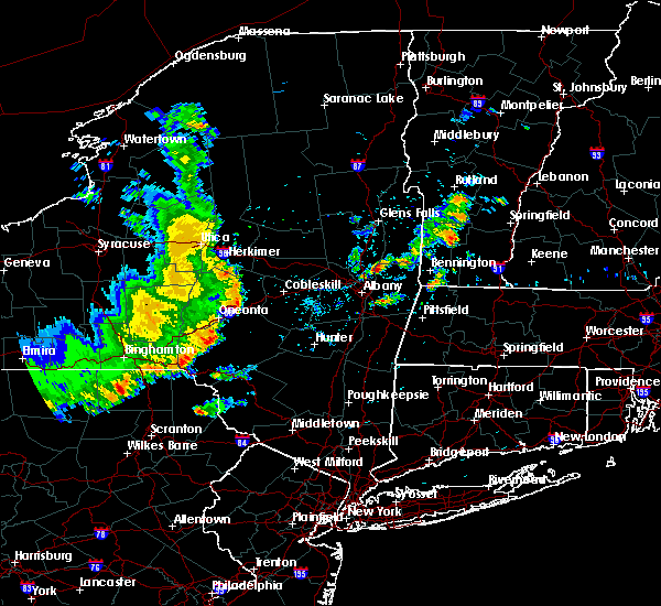 At 426 pm edt, severe thunderstorms were located along a line extending from near little falls to near fort plain, moving east at 30 mph (radar indicated). Hazards include 60 mph wind gusts. Expect damage to roofs, siding, and trees. these severe storms will be near, dolgeville around 440 pm edt. Other locations impacted by these severe thunderstorms include garlock corners, countryman, starkville, fink basin, willse four corners, kelhi corners, davys corners, indian castle, eatonville and ingham mills station. At 426 pm edt, severe thunderstorms were located along a line extending from near little falls to near fort plain, moving east at 30 mph (radar indicated). Hazards include 60 mph wind gusts. Expect damage to roofs, siding, and trees. these severe storms will be near, dolgeville around 440 pm edt. Other locations impacted by these severe thunderstorms include garlock corners, countryman, starkville, fink basin, willse four corners, kelhi corners, davys corners, indian castle, eatonville and ingham mills station.
|
| 8/8/2019 4:04 PM EDT |
 At 404 pm edt, severe thunderstorms were located along a line extending from frankfort to near bowerstown, moving east at 40 mph (radar indicated). Hazards include 60 mph wind gusts. Expect damage to roofs, siding, and trees. these severe storms will be near, little falls around 420 pm edt. dolgeville around 425 pm edt. Other locations impacted by these severe thunderstorms include jersalem hill, spinnerville, corrado corners, cedar lake, countryman, north ilion, gulph, south columbia, south ilion and kelhi corners. At 404 pm edt, severe thunderstorms were located along a line extending from frankfort to near bowerstown, moving east at 40 mph (radar indicated). Hazards include 60 mph wind gusts. Expect damage to roofs, siding, and trees. these severe storms will be near, little falls around 420 pm edt. dolgeville around 425 pm edt. Other locations impacted by these severe thunderstorms include jersalem hill, spinnerville, corrado corners, cedar lake, countryman, north ilion, gulph, south columbia, south ilion and kelhi corners.
|
| 8/8/2019 3:39 PM EDT |
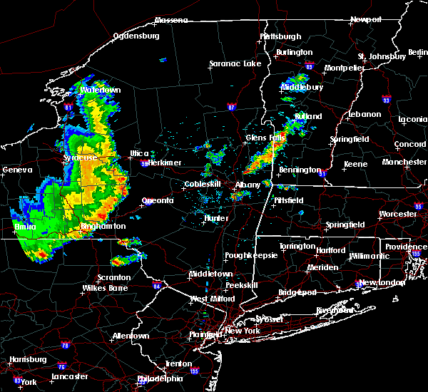 At 339 pm edt, severe thunderstorms were located along a line extending from near clayville to near edmeston to mt upton, moving east at 50 mph (radar indicated). Hazards include 60 mph wind gusts. Expect damage to roofs, siding, and trees. severe thunderstorms will be near, cedarville around 350 pm edt. ilion and frankfort around 355 pm edt. herkimer, mohawk and jordanville around 400 pm edt. little falls around 410 pm edt. Other locations impacted by these severe thunderstorms include jersalem hill, spinnerville, corrado corners, cedar lake, countryman, north ilion, gulph, south columbia, south ilion and kelhi corners. At 339 pm edt, severe thunderstorms were located along a line extending from near clayville to near edmeston to mt upton, moving east at 50 mph (radar indicated). Hazards include 60 mph wind gusts. Expect damage to roofs, siding, and trees. severe thunderstorms will be near, cedarville around 350 pm edt. ilion and frankfort around 355 pm edt. herkimer, mohawk and jordanville around 400 pm edt. little falls around 410 pm edt. Other locations impacted by these severe thunderstorms include jersalem hill, spinnerville, corrado corners, cedar lake, countryman, north ilion, gulph, south columbia, south ilion and kelhi corners.
|
| 8/6/2019 5:33 PM EDT |
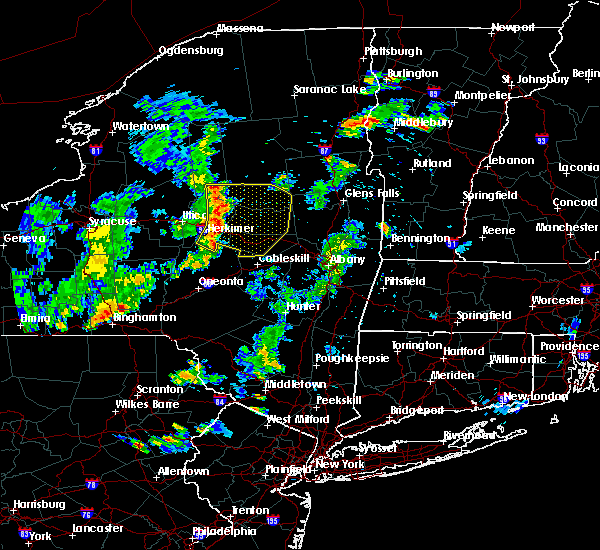 At 533 pm edt, severe thunderstorms were located along a line extending from 14 miles northeast of ohio to near stratford to near dolgeville to near springfield, moving east at 30 mph (radar indicated). Hazards include 60 mph wind gusts and penny size hail. Expect damage to roofs, siding, and trees. locations impacted include, gloversville, johnstown, herkimer, little falls, canajoharie, fonda, mohawk, fort plain, dolgeville, st. Johnsville, ephratah, broadalbin, northville, mayfield, lake pleasant, wells, stratford, sharon springs, middleville and ames. At 533 pm edt, severe thunderstorms were located along a line extending from 14 miles northeast of ohio to near stratford to near dolgeville to near springfield, moving east at 30 mph (radar indicated). Hazards include 60 mph wind gusts and penny size hail. Expect damage to roofs, siding, and trees. locations impacted include, gloversville, johnstown, herkimer, little falls, canajoharie, fonda, mohawk, fort plain, dolgeville, st. Johnsville, ephratah, broadalbin, northville, mayfield, lake pleasant, wells, stratford, sharon springs, middleville and ames.
|
| 8/6/2019 5:16 PM EDT |
 At 515 pm edt, severe thunderstorms were located along a line extending from near northwood to near little falls to near cedarville, moving east at 30 mph (radar indicated). Hazards include 60 mph wind gusts and penny size hail. expect damage to roofs, siding, and trees At 515 pm edt, severe thunderstorms were located along a line extending from near northwood to near little falls to near cedarville, moving east at 30 mph (radar indicated). Hazards include 60 mph wind gusts and penny size hail. expect damage to roofs, siding, and trees
|
| 7/29/2019 5:51 PM EDT |
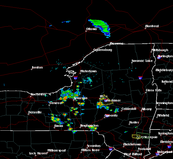 At 550 pm edt, a severe thunderstorm was located over clayville, or 9 miles south of new hartford, moving northeast at 15 mph (radar indicated). Hazards include 60 mph wind gusts and quarter size hail. Hail damage to vehicles is expected. Expect wind damage to roofs, siding, and trees. At 550 pm edt, a severe thunderstorm was located over clayville, or 9 miles south of new hartford, moving northeast at 15 mph (radar indicated). Hazards include 60 mph wind gusts and quarter size hail. Hail damage to vehicles is expected. Expect wind damage to roofs, siding, and trees.
|
| 7/20/2019 7:35 PM EDT | Trees and wires dow in herkimer county NY, 0.6 miles SSE of Little Falls, NY |
| 7/20/2019 7:21 PM EDT |
 At 721 pm edt, severe thunderstorms were located along a line extending from 8 miles east of ohio to near clayville, moving east at 15 mph (radar indicated). Hazards include 70 mph wind gusts. Expect considerable tree damage. Damage is likely to mobile homes, roofs, and outbuildings. At 721 pm edt, severe thunderstorms were located along a line extending from 8 miles east of ohio to near clayville, moving east at 15 mph (radar indicated). Hazards include 70 mph wind gusts. Expect considerable tree damage. Damage is likely to mobile homes, roofs, and outbuildings.
|
| 5/23/2019 8:40 PM EDT |
 At 838 pm edt, severe thunderstorms were located along a line extending from 10 miles east of ohio to near frankfort, moving southeast at 45 mph (radar indicated). Hazards include 70 mph wind gusts. Expect considerable tree damage. damage is likely to mobile homes, roofs, and outbuildings. locations impacted include, gloversville, johnstown, ilion, herkimer, little falls, canajoharie, mohawk, frankfort, fort plain, dolgeville, st. Johnsville, ephratah, stratford, ames, jordanville, caroga lake, caroga lake public campground, cedarville, oppenheim and fairfield. At 838 pm edt, severe thunderstorms were located along a line extending from 10 miles east of ohio to near frankfort, moving southeast at 45 mph (radar indicated). Hazards include 70 mph wind gusts. Expect considerable tree damage. damage is likely to mobile homes, roofs, and outbuildings. locations impacted include, gloversville, johnstown, ilion, herkimer, little falls, canajoharie, mohawk, frankfort, fort plain, dolgeville, st. Johnsville, ephratah, stratford, ames, jordanville, caroga lake, caroga lake public campground, cedarville, oppenheim and fairfield.
|
| 5/23/2019 8:14 PM EDT |
 At 813 pm edt, severe thunderstorms were located along a line extending from 7 miles south of mckeever to westmoreland, moving southeast at 45 mph (radar indicated). Hazards include 60 mph wind gusts. expect damage to roofs, siding, and trees At 813 pm edt, severe thunderstorms were located along a line extending from 7 miles south of mckeever to westmoreland, moving southeast at 45 mph (radar indicated). Hazards include 60 mph wind gusts. expect damage to roofs, siding, and trees
|
| 8/17/2018 6:57 PM EDT |
 At 611 pm edt, severe thunderstorms were located along a line extending from 6 miles northeast of ohio to utica, moving east at 25 mph (radar indicated). Hazards include 60 mph wind gusts and penny size hail. Expect damage to roofs, siding, and trees. severe thunderstorms will be near, ohio around 615 pm edt. ilion around 630 pm edt. herkimer, mohawk and middleville around 635 pm edt. little falls around 655 pm edt. dolgeville around 705 pm edt. st. Johnsville around 715 pm edt. At 611 pm edt, severe thunderstorms were located along a line extending from 6 miles northeast of ohio to utica, moving east at 25 mph (radar indicated). Hazards include 60 mph wind gusts and penny size hail. Expect damage to roofs, siding, and trees. severe thunderstorms will be near, ohio around 615 pm edt. ilion around 630 pm edt. herkimer, mohawk and middleville around 635 pm edt. little falls around 655 pm edt. dolgeville around 705 pm edt. st. Johnsville around 715 pm edt.
|
| 8/17/2018 6:12 PM EDT |
 At 611 pm edt, severe thunderstorms were located along a line extending from 6 miles northeast of ohio to utica, moving east at 25 mph (radar indicated). Hazards include 60 mph wind gusts and penny size hail. Expect damage to roofs, siding, and trees. severe thunderstorms will be near, ohio around 615 pm edt. ilion around 630 pm edt. herkimer, mohawk and middleville around 635 pm edt. little falls around 655 pm edt. dolgeville around 705 pm edt. st. Johnsville around 715 pm edt. At 611 pm edt, severe thunderstorms were located along a line extending from 6 miles northeast of ohio to utica, moving east at 25 mph (radar indicated). Hazards include 60 mph wind gusts and penny size hail. Expect damage to roofs, siding, and trees. severe thunderstorms will be near, ohio around 615 pm edt. ilion around 630 pm edt. herkimer, mohawk and middleville around 635 pm edt. little falls around 655 pm edt. dolgeville around 705 pm edt. st. Johnsville around 715 pm edt.
|
| 7/27/2018 9:25 PM EDT |
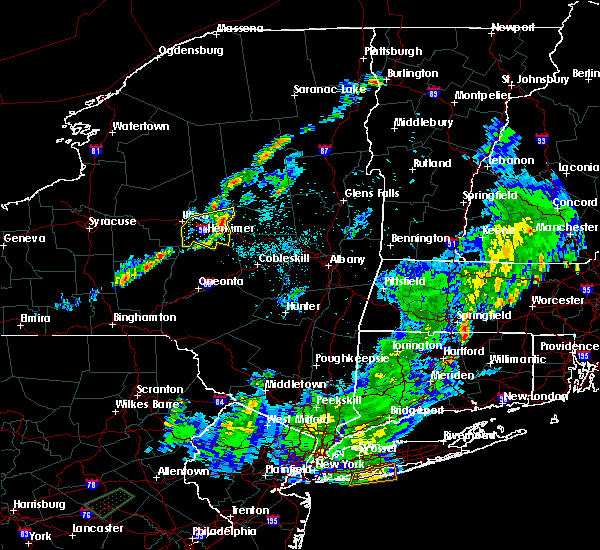 The severe thunderstorm warning for southern herkimer county will expire at 930 pm edt, the storm which prompted the warning has weakened below severe limits, and no longer poses an immediate threat to life or property. therefore, the warning will be allowed to expire. The severe thunderstorm warning for southern herkimer county will expire at 930 pm edt, the storm which prompted the warning has weakened below severe limits, and no longer poses an immediate threat to life or property. therefore, the warning will be allowed to expire.
|
| 7/27/2018 8:46 PM EDT |
 At 846 pm edt, a severe thunderstorm was located near clayville, or 8 miles southwest of ilion, moving east at 30 mph (radar indicated). Hazards include 60 mph wind gusts and quarter size hail. Hail damage to vehicles is expected. expect wind damage to roofs, siding, and trees. this severe storm will be near, cedarville around 855 pm edt. ilion and frankfort around 900 pm edt. herkimer and mohawk around 905 pm edt. jordanville around 910 pm edt. little falls around 920 pm edt. dolgeville around 930 pm edt. Other locations impacted by this severe thunderstorm include ingham mills, jersalem hill, west frankfort, spinnerville, corrado corners, cedar lake, curtis, countryman, north ilion and gulph. At 846 pm edt, a severe thunderstorm was located near clayville, or 8 miles southwest of ilion, moving east at 30 mph (radar indicated). Hazards include 60 mph wind gusts and quarter size hail. Hail damage to vehicles is expected. expect wind damage to roofs, siding, and trees. this severe storm will be near, cedarville around 855 pm edt. ilion and frankfort around 900 pm edt. herkimer and mohawk around 905 pm edt. jordanville around 910 pm edt. little falls around 920 pm edt. dolgeville around 930 pm edt. Other locations impacted by this severe thunderstorm include ingham mills, jersalem hill, west frankfort, spinnerville, corrado corners, cedar lake, curtis, countryman, north ilion and gulph.
|
| 7/27/2018 8:25 PM EDT |
 At 824 pm edt, a severe thunderstorm was located over waterville, or 9 miles northeast of hamilton, moving east at 30 mph (radar indicated). Hazards include 60 mph wind gusts and quarter size hail. Hail damage to vehicles is expected. expect wind damage to roofs, siding, and trees. this severe thunderstorm will be near, west winfield around 850 pm edt. cedarville around 855 pm edt. ilion and frankfort around 905 pm edt. herkimer, mohawk and jordanville around 910 pm edt. little falls around 925 pm edt. dolgeville around 930 pm edt. Other locations impacted by this severe thunderstorm include ingham mills, jersalem hill, west frankfort, spinnerville, corrado corners, cedar lake, curtis, countryman, north ilion and gulph. At 824 pm edt, a severe thunderstorm was located over waterville, or 9 miles northeast of hamilton, moving east at 30 mph (radar indicated). Hazards include 60 mph wind gusts and quarter size hail. Hail damage to vehicles is expected. expect wind damage to roofs, siding, and trees. this severe thunderstorm will be near, west winfield around 850 pm edt. cedarville around 855 pm edt. ilion and frankfort around 905 pm edt. herkimer, mohawk and jordanville around 910 pm edt. little falls around 925 pm edt. dolgeville around 930 pm edt. Other locations impacted by this severe thunderstorm include ingham mills, jersalem hill, west frankfort, spinnerville, corrado corners, cedar lake, curtis, countryman, north ilion and gulph.
|
| 6/18/2018 3:08 PM EDT |
 The severe thunderstorm warning for southwestern fulton, southern herkimer and northwestern montgomery counties will expire at 315 pm edt, the storm which prompted the warning has weakened below severe limits, and has exited the warned area. therefore, the warning will be allowed to expire. a severe thunderstorm watch remains in effect until 1000 pm edt for eastern new york. The severe thunderstorm warning for southwestern fulton, southern herkimer and northwestern montgomery counties will expire at 315 pm edt, the storm which prompted the warning has weakened below severe limits, and has exited the warned area. therefore, the warning will be allowed to expire. a severe thunderstorm watch remains in effect until 1000 pm edt for eastern new york.
|
| 6/18/2018 2:44 PM EDT | Trees dow in herkimer county NY, 6.2 miles S of Little Falls, NY |
| 6/18/2018 2:30 PM EDT |
 At 229 pm edt, a severe thunderstorm was located over frankfort, or near ilion, moving east at 40 mph (radar indicated). Hazards include 60 mph wind gusts. Expect damage to roofs, siding, and trees. this severe thunderstorm will be near, herkimer and mohawk around 235 pm edt. middleville around 240 pm edt. little falls around 250 pm edt. dolgeville around 255 pm edt. st. johnsville around 300 pm edt. fort plain around 305 pm edt. Other locations impacted by this severe thunderstorm include ingham mills, corrado corners, countryman, north ilion, lotville, rasbach corner, burrell corners, south ilion, mindenville and kelhi corners. At 229 pm edt, a severe thunderstorm was located over frankfort, or near ilion, moving east at 40 mph (radar indicated). Hazards include 60 mph wind gusts. Expect damage to roofs, siding, and trees. this severe thunderstorm will be near, herkimer and mohawk around 235 pm edt. middleville around 240 pm edt. little falls around 250 pm edt. dolgeville around 255 pm edt. st. johnsville around 300 pm edt. fort plain around 305 pm edt. Other locations impacted by this severe thunderstorm include ingham mills, corrado corners, countryman, north ilion, lotville, rasbach corner, burrell corners, south ilion, mindenville and kelhi corners.
|
| 5/4/2018 7:12 PM EDT |
 At 712 pm edt, severe thunderstorms were located along a line extending from newcomb to 6 miles southwest of lake pleasant to near jordanville, moving east at 50 mph (radar indicated). Hazards include 60 mph wind gusts. expect damage to roofs, siding, and trees At 712 pm edt, severe thunderstorms were located along a line extending from newcomb to 6 miles southwest of lake pleasant to near jordanville, moving east at 50 mph (radar indicated). Hazards include 60 mph wind gusts. expect damage to roofs, siding, and trees
|
| 5/4/2018 6:53 PM EDT |
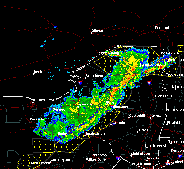 At 652 pm edt, severe thunderstorms were located along a line extending from 8 miles northeast of lake eaton campground to near raquette lake to 9 miles south of limekiln lake campground to ohio to near newport, moving northeast at 95 mph (radar indicated). Hazards include 60 mph wind gusts. Expect damage to roofs, siding, and trees. these severe storms will be near, blue mountain lake, lake durant campground and forked lake public campground around 700 pm edt. golden beach campground around 705 pm edt. moffitt beach campground around 710 pm edt. speculator and lewey lake campground around 715 pm edt. other locations impacted by these severe thunderstorms include ingham mills, spinnerville, cedar lake, farrel corner, countryman, south ilion, kelhi corners, chepachet, shedd corners and old city. A tornado watch remains in effect until 1000 pm edt for eastern new york. At 652 pm edt, severe thunderstorms were located along a line extending from 8 miles northeast of lake eaton campground to near raquette lake to 9 miles south of limekiln lake campground to ohio to near newport, moving northeast at 95 mph (radar indicated). Hazards include 60 mph wind gusts. Expect damage to roofs, siding, and trees. these severe storms will be near, blue mountain lake, lake durant campground and forked lake public campground around 700 pm edt. golden beach campground around 705 pm edt. moffitt beach campground around 710 pm edt. speculator and lewey lake campground around 715 pm edt. other locations impacted by these severe thunderstorms include ingham mills, spinnerville, cedar lake, farrel corner, countryman, south ilion, kelhi corners, chepachet, shedd corners and old city. A tornado watch remains in effect until 1000 pm edt for eastern new york.
|
| 5/4/2018 6:22 PM EDT |
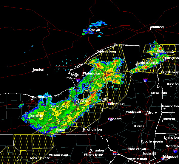 At 621 pm edt, severe thunderstorms were located along a line extending from 7 miles east of highmarket to near verona to cuyler, moving east at 55 mph (radar indicated). Hazards include 60 mph wind gusts. Expect damage to roofs, siding, and trees. severe thunderstorms will be near, mckeever around 635 pm edt. old forge, poland and nicks lake campground around 645 pm edt. newport, cold brook, alger island public campground, northwood and big moose around 650 pm edt. ohio, inlet, limekiln lake campground and eagle bay around 655 pm edt. eighth lake campground and brown tract pond campground around 700 pm edt. west winfield and raquette lake around 705 pm edt. cedarville and golden beach campground around 710 pm edt. ilion, herkimer, mohawk, jordanville, lake durant campground and blue mountain lake around 715 pm edt. A tornado watch remains in effect until 1000 pm edt for eastern new york. At 621 pm edt, severe thunderstorms were located along a line extending from 7 miles east of highmarket to near verona to cuyler, moving east at 55 mph (radar indicated). Hazards include 60 mph wind gusts. Expect damage to roofs, siding, and trees. severe thunderstorms will be near, mckeever around 635 pm edt. old forge, poland and nicks lake campground around 645 pm edt. newport, cold brook, alger island public campground, northwood and big moose around 650 pm edt. ohio, inlet, limekiln lake campground and eagle bay around 655 pm edt. eighth lake campground and brown tract pond campground around 700 pm edt. west winfield and raquette lake around 705 pm edt. cedarville and golden beach campground around 710 pm edt. ilion, herkimer, mohawk, jordanville, lake durant campground and blue mountain lake around 715 pm edt. A tornado watch remains in effect until 1000 pm edt for eastern new york.
|
| 10/15/2017 7:55 PM EDT | Tree down blocking ashe road in herkimer county NY, 3.7 miles WNW of Little Falls, NY |
| 10/15/2017 7:55 PM EDT |
 At 754 pm edt, severe thunderstorms were located along a line extending from 9 miles southwest of lake pleasant to stratford to near ilion, moving east at 40 mph (radar indicated). Hazards include 60 mph wind gusts. Expect damage to trees, and power lines. these severe storms will be near, caroga lake and caroga lake public campground around 810 pm edt. little falls and st. johnsville around 815 pm edt. Other locations impacted by these severe thunderstorms include ingham mills, meco, charleston, west perth, spinnerville, sweets crossing, fultonville, young corners, south ilion and mindenville. At 754 pm edt, severe thunderstorms were located along a line extending from 9 miles southwest of lake pleasant to stratford to near ilion, moving east at 40 mph (radar indicated). Hazards include 60 mph wind gusts. Expect damage to trees, and power lines. these severe storms will be near, caroga lake and caroga lake public campground around 810 pm edt. little falls and st. johnsville around 815 pm edt. Other locations impacted by these severe thunderstorms include ingham mills, meco, charleston, west perth, spinnerville, sweets crossing, fultonville, young corners, south ilion and mindenville.
|
| 10/15/2017 7:34 PM EDT | Tree down blocking both lanes of state route 170-a in herkimer county NY, 6.1 miles S of Little Falls, NY |
| 10/15/2017 7:09 PM EDT |
 The national weather service in albany has issued a * severe thunderstorm warning for. southwestern hamilton county in eastern new york. fulton county in eastern new york. southern herkimer county in eastern new york. Montgomery county in eastern new york. The national weather service in albany has issued a * severe thunderstorm warning for. southwestern hamilton county in eastern new york. fulton county in eastern new york. southern herkimer county in eastern new york. Montgomery county in eastern new york.
|
| 8/22/2017 7:04 PM EDT |
 At 703 pm edt, a severe thunderstorm was located near little falls, moving east at 25 mph (radar indicated). Hazards include 60 mph wind gusts. Expect damage to trees, and power lines. this severe thunderstorm will be near, st. johnsville around 730 pm edt. fort plain around 735 pm edt. canajoharie around 740 pm edt. ephratah around 745 pm edt. caroga lake public campground around 755 pm edt. gloversville, johnstown, fonda and tribes hill around 800 pm edt. A tornado watch remains in effect until 900 pm edt for eastern new york. At 703 pm edt, a severe thunderstorm was located near little falls, moving east at 25 mph (radar indicated). Hazards include 60 mph wind gusts. Expect damage to trees, and power lines. this severe thunderstorm will be near, st. johnsville around 730 pm edt. fort plain around 735 pm edt. canajoharie around 740 pm edt. ephratah around 745 pm edt. caroga lake public campground around 755 pm edt. gloversville, johnstown, fonda and tribes hill around 800 pm edt. A tornado watch remains in effect until 900 pm edt for eastern new york.
|
| 8/22/2017 6:55 PM EDT | Trees leaning on wire in herkimer county NY, 0.2 miles NE of Little Falls, NY |
| 8/22/2017 6:41 PM EDT |
 At 641 pm edt, severe thunderstorms were located along a line extending from 8 miles southeast of eighth lake campground to frankfort, moving east at 30 mph (radar indicated). Hazards include 60 mph wind gusts. Expect damage to trees, and power lines. these severe storms will be near, little falls, speculator, lewey lake campground and jordanville around 700 pm edt. A tornado watch remains in effect until 900 pm edt for eastern new york. At 641 pm edt, severe thunderstorms were located along a line extending from 8 miles southeast of eighth lake campground to frankfort, moving east at 30 mph (radar indicated). Hazards include 60 mph wind gusts. Expect damage to trees, and power lines. these severe storms will be near, little falls, speculator, lewey lake campground and jordanville around 700 pm edt. A tornado watch remains in effect until 900 pm edt for eastern new york.
|
| 8/22/2017 6:20 PM EDT |
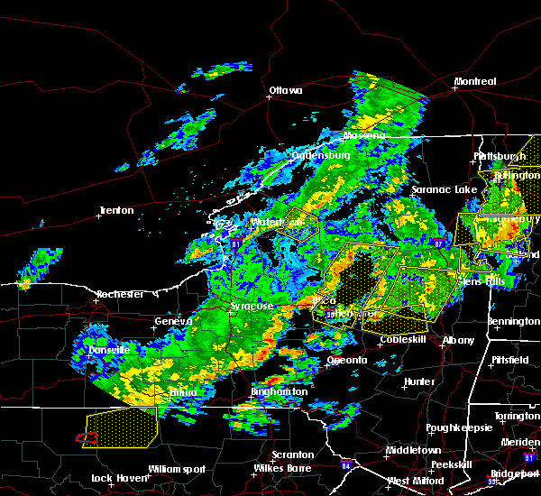 At 619 pm edt, severe thunderstorms were located along a line extending from inlet to new hartford, moving east at 30 mph (radar indicated). Hazards include 60 mph wind gusts. Expect damage to trees, and power lines. severe thunderstorms will be near, inlet, limekiln lake campground, eighth lake campground and eagle bay around 625 pm edt. frankfort and cedarville around 640 pm edt. ilion, herkimer and mohawk around 645 pm edt. jordanville around 655 pm edt. little falls, speculator and lewey lake campground around 700 pm edt. other locations impacted by these severe thunderstorms include ingham mills, spinnerville, cedar lake, farrel corner, countryman, south ilion, kelhi corners, shedd corners, old city and powley place. A tornado watch remains in effect until 900 pm edt for eastern new york. At 619 pm edt, severe thunderstorms were located along a line extending from inlet to new hartford, moving east at 30 mph (radar indicated). Hazards include 60 mph wind gusts. Expect damage to trees, and power lines. severe thunderstorms will be near, inlet, limekiln lake campground, eighth lake campground and eagle bay around 625 pm edt. frankfort and cedarville around 640 pm edt. ilion, herkimer and mohawk around 645 pm edt. jordanville around 655 pm edt. little falls, speculator and lewey lake campground around 700 pm edt. other locations impacted by these severe thunderstorms include ingham mills, spinnerville, cedar lake, farrel corner, countryman, south ilion, kelhi corners, shedd corners, old city and powley place. A tornado watch remains in effect until 900 pm edt for eastern new york.
|
| 8/22/2017 5:59 PM EDT |
 At 558 pm edt, a severe thunderstorm capable of producing a tornado was located over jordanville, or near herkimer, moving east at 30 mph (radar indicated rotation). Hazards include tornado. Flying debris will be dangerous to those caught without shelter. mobile homes will be damaged or destroyed. damage to roofs, windows, and vehicles will occur. tree damage is likely. this dangerous storm will be near, little falls and st. johnsville around 615 pm edt. Trained spotters reported a funnel cloud in columbia center at 548 pm edt. At 558 pm edt, a severe thunderstorm capable of producing a tornado was located over jordanville, or near herkimer, moving east at 30 mph (radar indicated rotation). Hazards include tornado. Flying debris will be dangerous to those caught without shelter. mobile homes will be damaged or destroyed. damage to roofs, windows, and vehicles will occur. tree damage is likely. this dangerous storm will be near, little falls and st. johnsville around 615 pm edt. Trained spotters reported a funnel cloud in columbia center at 548 pm edt.
|
| 8/22/2017 5:28 PM EDT |
 The national weather service in albany has issued a * tornado warning for. southwestern fulton county in eastern new york. southern herkimer county in eastern new york. western montgomery county in eastern new york. Until 615 pm edt. The national weather service in albany has issued a * tornado warning for. southwestern fulton county in eastern new york. southern herkimer county in eastern new york. western montgomery county in eastern new york. Until 615 pm edt.
|
| 8/22/2017 5:01 PM EDT |
 At 501 pm edt, severe thunderstorms were located along a line extending from speculator to 10 miles north of stratford to herkimer, moving east at 35 mph (radar indicated). Hazards include 60 mph wind gusts and penny size hail. Expect damage to trees, and power lines. these severe storms will be near, moffitt beach campground around 505 pm edt. speculator around 510 pm edt. dolgeville and st. johnsville around 515 pm edt. A tornado watch remains in effect until 900 pm edt for eastern and east central new york. At 501 pm edt, severe thunderstorms were located along a line extending from speculator to 10 miles north of stratford to herkimer, moving east at 35 mph (radar indicated). Hazards include 60 mph wind gusts and penny size hail. Expect damage to trees, and power lines. these severe storms will be near, moffitt beach campground around 505 pm edt. speculator around 510 pm edt. dolgeville and st. johnsville around 515 pm edt. A tornado watch remains in effect until 900 pm edt for eastern and east central new york.
|
| 8/22/2017 4:55 PM EDT |
 At 454 pm edt, a severe thunderstorm capable of producing a tornado was located near poland, or 7 miles northeast of utica, moving east at 35 mph (radar indicated rotation). Hazards include tornado and quarter size hail. Flying debris will be dangerous to those caught without shelter. mobile homes will be damaged or destroyed. damage to roofs, windows, and vehicles will occur. tree damage is likely. this dangerous storm will be near, poland around 500 pm edt. newport and cold brook around 505 pm edt. middleville around 510 pm edt. dolgeville around 525 pm edt. Other locations impacted by this tornadic thunderstorm include ingham mills, west frankfort, garlock corners, curtis, harbor, farrel corner, countryman, russia, burrell corners and kelhi corners. At 454 pm edt, a severe thunderstorm capable of producing a tornado was located near poland, or 7 miles northeast of utica, moving east at 35 mph (radar indicated rotation). Hazards include tornado and quarter size hail. Flying debris will be dangerous to those caught without shelter. mobile homes will be damaged or destroyed. damage to roofs, windows, and vehicles will occur. tree damage is likely. this dangerous storm will be near, poland around 500 pm edt. newport and cold brook around 505 pm edt. middleville around 510 pm edt. dolgeville around 525 pm edt. Other locations impacted by this tornadic thunderstorm include ingham mills, west frankfort, garlock corners, curtis, harbor, farrel corner, countryman, russia, burrell corners and kelhi corners.
|
| 8/22/2017 4:19 PM EDT |
 At 419 pm edt, severe thunderstorms were located along a line extending from 7 miles southeast of nicks lake campground to remsen to near clinton, moving east at 35 mph (radar indicated). Hazards include 60 mph wind gusts and penny size hail. Expect damage to trees, and power lines. severe thunderstorms will be near, poland, cold brook and northwood around 430 pm edt. ohio around 435 pm edt. frankfort around 450 pm edt. ilion, herkimer and mohawk around 455 pm edt. middleville, lewey lake campground and moffitt beach campground around 500 pm edt. speculator around 505 pm edt. little falls around 510 pm edt. dolgeville and st. johnsville around 515 pm edt. A tornado watch remains in effect until 900 pm edt for east central new york. At 419 pm edt, severe thunderstorms were located along a line extending from 7 miles southeast of nicks lake campground to remsen to near clinton, moving east at 35 mph (radar indicated). Hazards include 60 mph wind gusts and penny size hail. Expect damage to trees, and power lines. severe thunderstorms will be near, poland, cold brook and northwood around 430 pm edt. ohio around 435 pm edt. frankfort around 450 pm edt. ilion, herkimer and mohawk around 455 pm edt. middleville, lewey lake campground and moffitt beach campground around 500 pm edt. speculator around 505 pm edt. little falls around 510 pm edt. dolgeville and st. johnsville around 515 pm edt. A tornado watch remains in effect until 900 pm edt for east central new york.
|
| 8/15/2017 4:13 PM EDT |
 At 413 pm edt, a severe thunderstorm was located near frankfort, or near ilion, moving east at 30 mph (radar indicated). Hazards include 60 mph wind gusts and quarter size hail. Minor damage to vehicles is possible. expect wind damage to trees, and power lines. this severe thunderstorm will be near, ilion, herkimer and mohawk around 425 pm edt. jordanville around 435 pm edt. little falls around 445 pm edt. Other locations impacted by this severe thunderstorm include ingham mills, jersalem hill, west frankfort, spinnerville, corrado corners, cedar lake, countryman, north ilion, gulph and south columbia. At 413 pm edt, a severe thunderstorm was located near frankfort, or near ilion, moving east at 30 mph (radar indicated). Hazards include 60 mph wind gusts and quarter size hail. Minor damage to vehicles is possible. expect wind damage to trees, and power lines. this severe thunderstorm will be near, ilion, herkimer and mohawk around 425 pm edt. jordanville around 435 pm edt. little falls around 445 pm edt. Other locations impacted by this severe thunderstorm include ingham mills, jersalem hill, west frankfort, spinnerville, corrado corners, cedar lake, countryman, north ilion, gulph and south columbia.
|
| 8/4/2017 4:25 PM EDT | Tree dow in herkimer county NY, 6.3 miles SSE of Little Falls, NY |
| 8/4/2017 4:19 PM EDT |
 At 419 pm edt, a severe thunderstorm was located over middleville, or 7 miles northwest of little falls, moving northeast at 25 mph (radar indicated). Hazards include 60 mph wind gusts and quarter size hail. Minor damage to vehicles is possible. expect wind damage to trees, and power lines. this severe thunderstorm will be near, dolgeville around 430 pm edt. stratford around 445 pm edt. Other locations impacted by this severe thunderstorm include oregon, curtis, farrel corner, clockmill corners, countryman, lotville, rasbach corner, doxtater corner, knappville and shaker place. At 419 pm edt, a severe thunderstorm was located over middleville, or 7 miles northwest of little falls, moving northeast at 25 mph (radar indicated). Hazards include 60 mph wind gusts and quarter size hail. Minor damage to vehicles is possible. expect wind damage to trees, and power lines. this severe thunderstorm will be near, dolgeville around 430 pm edt. stratford around 445 pm edt. Other locations impacted by this severe thunderstorm include oregon, curtis, farrel corner, clockmill corners, countryman, lotville, rasbach corner, doxtater corner, knappville and shaker place.
|
| 8/4/2017 4:12 PM EDT | Tree dow in herkimer county NY, 6.3 miles SSE of Little Falls, NY |
| 7/17/2017 2:55 PM EDT |
 The severe thunderstorm warning for southwestern hamilton, northwestern fulton and southern herkimer counties will expire at 300 pm edt, the storm which prompted the warning has weakened below severe limits, and no longer poses an immediate threat to life or property. therefore the warning will be allowed to expire. however heavy rain is still possible with this thunderstorm. a severe thunderstorm watch remains in effect until 800 pm edt for eastern new york. The severe thunderstorm warning for southwestern hamilton, northwestern fulton and southern herkimer counties will expire at 300 pm edt, the storm which prompted the warning has weakened below severe limits, and no longer poses an immediate threat to life or property. therefore the warning will be allowed to expire. however heavy rain is still possible with this thunderstorm. a severe thunderstorm watch remains in effect until 800 pm edt for eastern new york.
|
| 7/17/2017 1:54 PM EDT |
 At 154 pm edt, a severe thunderstorm was located 7 miles northwest of stratford, or 13 miles north of little falls, moving northeast at 25 mph (radar indicated). Hazards include 60 mph wind gusts and quarter size hail. Minor damage to vehicles is possible. expect wind damage to trees, and power lines. this severe thunderstorm will be near, stratford around 200 pm edt. Other locations impacted by this severe thunderstorm include west frankfort, corrado corners, curtis, farrel corner, countryman, north ilion, whitehouse, rasbach corner, knappville and shaker place. At 154 pm edt, a severe thunderstorm was located 7 miles northwest of stratford, or 13 miles north of little falls, moving northeast at 25 mph (radar indicated). Hazards include 60 mph wind gusts and quarter size hail. Minor damage to vehicles is possible. expect wind damage to trees, and power lines. this severe thunderstorm will be near, stratford around 200 pm edt. Other locations impacted by this severe thunderstorm include west frankfort, corrado corners, curtis, farrel corner, countryman, north ilion, whitehouse, rasbach corner, knappville and shaker place.
|
| 7/1/2017 4:32 PM EDT |
 At 431 pm edt, a severe thunderstorm was located near st. johnsville, or 8 miles southeast of little falls, moving east at 40 mph (radar indicated). Hazards include 60 mph wind gusts. Expect damage to trees, and power lines. locations impacted include, johnstown, little falls, canajoharie, fonda, fort plain, st. Johnsville, ephratah, jordanville, glen, warren, fultonville, palatine bridge, nelliston, ingham mills, cook corners, south columbia, salt springville, mindenville, davys corners and ripple corners. At 431 pm edt, a severe thunderstorm was located near st. johnsville, or 8 miles southeast of little falls, moving east at 40 mph (radar indicated). Hazards include 60 mph wind gusts. Expect damage to trees, and power lines. locations impacted include, johnstown, little falls, canajoharie, fonda, fort plain, st. Johnsville, ephratah, jordanville, glen, warren, fultonville, palatine bridge, nelliston, ingham mills, cook corners, south columbia, salt springville, mindenville, davys corners and ripple corners.
|
| 7/1/2017 3:44 PM EDT |
 At 344 pm edt, a severe thunderstorm was located over clayville, or 8 miles south of new hartford, moving east at 40 mph (radar indicated). Hazards include 60 mph wind gusts. Expect damage to trees, and power lines. this severe thunderstorm will be near, west winfield around 350 pm edt. cedarville around 355 pm edt. frankfort around 400 pm edt. ilion, herkimer and mohawk around 405 pm edt. jordanville around 410 pm edt. little falls around 420 pm edt. dolgeville around 425 pm edt. st. johnsville around 430 pm edt. Other locations impacted by this severe thunderstorm include ingham mills, meco, spinnerville, cedar lake, fultonville, farrel corner, countryman, south ilion, mindenville and kelhi corners. At 344 pm edt, a severe thunderstorm was located over clayville, or 8 miles south of new hartford, moving east at 40 mph (radar indicated). Hazards include 60 mph wind gusts. Expect damage to trees, and power lines. this severe thunderstorm will be near, west winfield around 350 pm edt. cedarville around 355 pm edt. frankfort around 400 pm edt. ilion, herkimer and mohawk around 405 pm edt. jordanville around 410 pm edt. little falls around 420 pm edt. dolgeville around 425 pm edt. st. johnsville around 430 pm edt. Other locations impacted by this severe thunderstorm include ingham mills, meco, spinnerville, cedar lake, fultonville, farrel corner, countryman, south ilion, mindenville and kelhi corners.
|
| 7/1/2017 8:12 AM EDT |
 The severe thunderstorm warning for southwestern fulton, southeastern herkimer and northwestern montgomery counties will expire at 815 am edt, the storm which prompted the warning has weakened below severe limits, and no longer poses an immediate threat to life or property. therefore the warning will be allowed to expire. The severe thunderstorm warning for southwestern fulton, southeastern herkimer and northwestern montgomery counties will expire at 815 am edt, the storm which prompted the warning has weakened below severe limits, and no longer poses an immediate threat to life or property. therefore the warning will be allowed to expire.
|
| 7/1/2017 7:52 AM EDT |
 At 752 am edt, a severe thunderstorm was located over st. johnsville, or 7 miles northwest of canajoharie, moving northeast at 35 mph (radar indicated). Hazards include 60 mph wind gusts and quarter size hail. Minor damage to vehicles is possible. expect wind damage to trees, and power lines. locations impacted include, gloversville, johnstown, fort plain, st. Johnsville, ephratah, caroga lake public campground, caroga lake, oppenheim, berkshire, palatine bridge, nelliston, ingham mills, meco, mindenville, davys corners, fical corners, phipps corners, ingham mills station, west saint johnsville and sand hill. At 752 am edt, a severe thunderstorm was located over st. johnsville, or 7 miles northwest of canajoharie, moving northeast at 35 mph (radar indicated). Hazards include 60 mph wind gusts and quarter size hail. Minor damage to vehicles is possible. expect wind damage to trees, and power lines. locations impacted include, gloversville, johnstown, fort plain, st. Johnsville, ephratah, caroga lake public campground, caroga lake, oppenheim, berkshire, palatine bridge, nelliston, ingham mills, meco, mindenville, davys corners, fical corners, phipps corners, ingham mills station, west saint johnsville and sand hill.
|
| 7/1/2017 7:26 AM EDT |
 At 726 am edt, a severe thunderstorm was located over jordanville, or 7 miles south of ilion, moving northeast at 30 mph (radar indicated). Hazards include 60 mph wind gusts and quarter size hail. Minor damage to vehicles is possible. expect wind damage to trees, and power lines. this severe thunderstorm will be near, jordanville around 730 am edt. herkimer and mohawk around 735 am edt. little falls around 750 am edt. dolgeville and st. johnsville around 800 am edt. stratford around 810 am edt. caroga lake and caroga lake public campground around 815 am edt. Other locations impacted by this severe thunderstorm include ingham mills, meco, spinnerville, south ilion, mindenville, kelhi corners, chepachet, shedd corners, ripple corners and west saint johnsville. At 726 am edt, a severe thunderstorm was located over jordanville, or 7 miles south of ilion, moving northeast at 30 mph (radar indicated). Hazards include 60 mph wind gusts and quarter size hail. Minor damage to vehicles is possible. expect wind damage to trees, and power lines. this severe thunderstorm will be near, jordanville around 730 am edt. herkimer and mohawk around 735 am edt. little falls around 750 am edt. dolgeville and st. johnsville around 800 am edt. stratford around 810 am edt. caroga lake and caroga lake public campground around 815 am edt. Other locations impacted by this severe thunderstorm include ingham mills, meco, spinnerville, south ilion, mindenville, kelhi corners, chepachet, shedd corners, ripple corners and west saint johnsville.
|
| 6/27/2017 3:10 PM EDT | Tree down in herkimer county NY, 0.6 miles SSE of Little Falls, NY |
| 6/27/2017 11:57 AM EDT |
 The severe thunderstorm warning for western fulton, southeastern herkimer and northwestern montgomery counties will expire at 400 pm edt, the severe thunderstorm which prompted the warning has weakened. therefore, the warning will be allowed to expire. The severe thunderstorm warning for western fulton, southeastern herkimer and northwestern montgomery counties will expire at 400 pm edt, the severe thunderstorm which prompted the warning has weakened. therefore, the warning will be allowed to expire.
|
| 6/27/2017 11:17 AM EDT |
 At 317 pm edt, a severe thunderstorm was located over dolgeville, or 8 miles northeast of little falls, moving northeast at 60 mph (radar indicated). Hazards include 60 mph wind gusts and quarter size hail. Minor damage to vehicles is possible. expect wind damage to trees, and power lines. this severe storm will be near, stratford around 320 pm edt. caroga lake and caroga lake public campground around 330 pm edt. Other locations impacted by this severe thunderstorm include ingham mills, meco, curtis, countryman, lotville, rasbach corner, burrell corners, berkshire, mindenville and kelhi corners. At 317 pm edt, a severe thunderstorm was located over dolgeville, or 8 miles northeast of little falls, moving northeast at 60 mph (radar indicated). Hazards include 60 mph wind gusts and quarter size hail. Minor damage to vehicles is possible. expect wind damage to trees, and power lines. this severe storm will be near, stratford around 320 pm edt. caroga lake and caroga lake public campground around 330 pm edt. Other locations impacted by this severe thunderstorm include ingham mills, meco, curtis, countryman, lotville, rasbach corner, burrell corners, berkshire, mindenville and kelhi corners.
|
| 6/27/2017 10:54 AM EDT |
 At 254 pm edt, a severe thunderstorm was located near cedarville, or near ilion, moving east at 35 mph (radar indicated). Hazards include 60 mph wind gusts and quarter size hail. Minor damage to vehicles is possible. expect wind damage to trees, and power lines. this severe thunderstorm will be near, ilion and frankfort around 300 pm edt. herkimer, mohawk and jordanville around 305 pm edt. little falls around 320 pm edt. dolgeville and st. johnsville around 330 pm edt. stratford around 340 pm edt. caroga lake and caroga lake public campground around 355 pm edt. Other locations impacted by this severe thunderstorm include ingham mills, meco, spinnerville, cedar lake, countryman, south ilion, mindenville, kelhi corners, chepachet and shedd corners. At 254 pm edt, a severe thunderstorm was located near cedarville, or near ilion, moving east at 35 mph (radar indicated). Hazards include 60 mph wind gusts and quarter size hail. Minor damage to vehicles is possible. expect wind damage to trees, and power lines. this severe thunderstorm will be near, ilion and frankfort around 300 pm edt. herkimer, mohawk and jordanville around 305 pm edt. little falls around 320 pm edt. dolgeville and st. johnsville around 330 pm edt. stratford around 340 pm edt. caroga lake and caroga lake public campground around 355 pm edt. Other locations impacted by this severe thunderstorm include ingham mills, meco, spinnerville, cedar lake, countryman, south ilion, mindenville, kelhi corners, chepachet and shedd corners.
|
| 5/18/2017 6:17 PM EDT |
 At 617 pm edt, severe thunderstorms were located along a line extending from near waterville to near brookfield to near north norwich, moving east at 50 mph (radar indicated). Hazards include 70 mph wind gusts and quarter size hail. Hail damage to vehicles is expected. expect considerable tree damage. wind damage is also likely to mobile homes, roofs, and outbuildings. severe thunderstorms will be near, west winfield around 630 pm edt. ilion, frankfort and cedarville around 635 pm edt. herkimer, mohawk and jordanville around 640 pm edt. little falls around 650 pm edt. canajoharie, fort plain, st. johnsville, sharon springs and ames around 700 pm edt. Other locations impacted by these severe thunderstorms include jersalem hill, zeh corners, spinnerville, corrado corners, cedar lake, beekman corners, west richmondville, seward, north ilion and gulph. At 617 pm edt, severe thunderstorms were located along a line extending from near waterville to near brookfield to near north norwich, moving east at 50 mph (radar indicated). Hazards include 70 mph wind gusts and quarter size hail. Hail damage to vehicles is expected. expect considerable tree damage. wind damage is also likely to mobile homes, roofs, and outbuildings. severe thunderstorms will be near, west winfield around 630 pm edt. ilion, frankfort and cedarville around 635 pm edt. herkimer, mohawk and jordanville around 640 pm edt. little falls around 650 pm edt. canajoharie, fort plain, st. johnsville, sharon springs and ames around 700 pm edt. Other locations impacted by these severe thunderstorms include jersalem hill, zeh corners, spinnerville, corrado corners, cedar lake, beekman corners, west richmondville, seward, north ilion and gulph.
|
| 5/1/2017 8:39 PM EDT |
 At 839 pm edt, severe thunderstorms were located along a line extending from 7 miles east of speculator to near richfield springs, moving east at 35 mph (radar indicated). Hazards include 60 mph wind gusts. Expect damage to roofs, siding, and trees. these severe storms will be near, canajoharie, fort plain and ames around 910 pm edt. warrensburg around 915 pm edt. Other locations impacted by these severe thunderstorms include meco, charleston, spinnerville, glenwild, whitehouse, wiley corners, mindenville, kelhi corners, ripple corners and garnet lake. At 839 pm edt, severe thunderstorms were located along a line extending from 7 miles east of speculator to near richfield springs, moving east at 35 mph (radar indicated). Hazards include 60 mph wind gusts. Expect damage to roofs, siding, and trees. these severe storms will be near, canajoharie, fort plain and ames around 910 pm edt. warrensburg around 915 pm edt. Other locations impacted by these severe thunderstorms include meco, charleston, spinnerville, glenwild, whitehouse, wiley corners, mindenville, kelhi corners, ripple corners and garnet lake.
|
| 5/1/2017 8:31 PM EDT |
 At 831 pm edt, severe thunderstorms were located along a line extending from near speculator to near richfield springs, moving east at 35 mph (radar indicated). Hazards include 60 mph wind gusts. Expect damage to roofs, siding, and trees. severe thunderstorms will be near, speculator around 835 pm edt. fort plain and ames around 905 pm edt. canajoharie around 910 pm edt. warrensburg around 915 pm edt. Other locations impacted by these severe thunderstorms include meco, charleston, spinnerville, countryman, glenwild, whitehouse, wiley corners, south ilion, mindenville and kelhi corners. At 831 pm edt, severe thunderstorms were located along a line extending from near speculator to near richfield springs, moving east at 35 mph (radar indicated). Hazards include 60 mph wind gusts. Expect damage to roofs, siding, and trees. severe thunderstorms will be near, speculator around 835 pm edt. fort plain and ames around 905 pm edt. canajoharie around 910 pm edt. warrensburg around 915 pm edt. Other locations impacted by these severe thunderstorms include meco, charleston, spinnerville, countryman, glenwild, whitehouse, wiley corners, south ilion, mindenville and kelhi corners.
|
| 5/1/2017 8:10 PM EDT |
 At 809 pm edt, severe thunderstorms were located along a line extending from 11 miles west of lake pleasant to near cedarville, moving east at 40 mph (radar indicated). Hazards include 60 mph wind gusts. Expect damage to roofs, siding, and trees. these severe storms will be near, speculator, st. johnsville, lake pleasant and moffitt beach campground around 830 pm edt. Other locations impacted by these severe thunderstorms include ingham mills, spinnerville, cedar lake, farrel corner, countryman, whitehouse, south ilion, mindenville, kelhi corners and chepachet. At 809 pm edt, severe thunderstorms were located along a line extending from 11 miles west of lake pleasant to near cedarville, moving east at 40 mph (radar indicated). Hazards include 60 mph wind gusts. Expect damage to roofs, siding, and trees. these severe storms will be near, speculator, st. johnsville, lake pleasant and moffitt beach campground around 830 pm edt. Other locations impacted by these severe thunderstorms include ingham mills, spinnerville, cedar lake, farrel corner, countryman, whitehouse, south ilion, mindenville, kelhi corners and chepachet.
|
| 5/1/2017 7:39 PM EDT |
 At 738 pm edt, severe thunderstorms were located along a line extending from near northwood to near solsville, moving east at 55 mph (radar indicated). Hazards include 60 mph wind gusts. Expect damage to roofs, siding, and trees. severe thunderstorms will be near, ohio and northwood around 745 pm edt. west winfield around 755 pm edt. cedarville around 800 pm edt. ilion, herkimer and mohawk around 805 pm edt. jordanville around 810 pm edt. little falls, lake pleasant and moffitt beach campground around 815 pm edt. speculator around 820 pm edt. canajoharie, fort plain and st. johnsville around 825 pm edt. Other locations impacted by these severe thunderstorms include ingham mills, spinnerville, cedar lake, farrel corner, countryman, whitehouse, south ilion, mindenville, kelhi corners and chepachet. At 738 pm edt, severe thunderstorms were located along a line extending from near northwood to near solsville, moving east at 55 mph (radar indicated). Hazards include 60 mph wind gusts. Expect damage to roofs, siding, and trees. severe thunderstorms will be near, ohio and northwood around 745 pm edt. west winfield around 755 pm edt. cedarville around 800 pm edt. ilion, herkimer and mohawk around 805 pm edt. jordanville around 810 pm edt. little falls, lake pleasant and moffitt beach campground around 815 pm edt. speculator around 820 pm edt. canajoharie, fort plain and st. johnsville around 825 pm edt. Other locations impacted by these severe thunderstorms include ingham mills, spinnerville, cedar lake, farrel corner, countryman, whitehouse, south ilion, mindenville, kelhi corners and chepachet.
|
| 2/25/2017 3:13 PM EST |
 At 312 pm est, a severe thunderstorm was located near cooperstown, moving northeast at 45 mph (radar indicated). Hazards include 60 mph wind gusts and penny size hail. Expect damage to roofs, siding, and trees. this severe thunderstorm will be near, canajoharie, fort plain and st. johnsville around 340 pm est. ephratah around 350 pm est. caroga lake public campground and caroga lake around 400 pm est. Other locations impacted by this severe thunderstorm include ingham mills, meco, cook corners, lotville, rasbach corner, knappville, mindenville, davys corners, fical corners and shedd corners. At 312 pm est, a severe thunderstorm was located near cooperstown, moving northeast at 45 mph (radar indicated). Hazards include 60 mph wind gusts and penny size hail. Expect damage to roofs, siding, and trees. this severe thunderstorm will be near, canajoharie, fort plain and st. johnsville around 340 pm est. ephratah around 350 pm est. caroga lake public campground and caroga lake around 400 pm est. Other locations impacted by this severe thunderstorm include ingham mills, meco, cook corners, lotville, rasbach corner, knappville, mindenville, davys corners, fical corners and shedd corners.
|
| 2/25/2017 2:00 PM EST | Power outage in herkimer county NY, 4.7 miles S of Little Falls, NY |
| 9/8/2016 4:45 PM EDT | Trees and wires down on dockey rd in herkimer county NY, 4 miles W of Little Falls, NY |
| 9/8/2016 4:31 PM EDT |
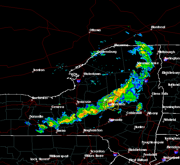 At 430 pm edt, severe thunderstorms were located along a line extending from 7 miles northwest of stratford to little falls to west winfield, moving east at 30 mph (radar indicated). Hazards include 60 mph wind gusts. Expect damage to roofs. siding. and trees. these severe storms will be near, little falls around 435 pm edt. dolgeville around 440 pm edt. Jordanville around 445 pm edt. At 430 pm edt, severe thunderstorms were located along a line extending from 7 miles northwest of stratford to little falls to west winfield, moving east at 30 mph (radar indicated). Hazards include 60 mph wind gusts. Expect damage to roofs. siding. and trees. these severe storms will be near, little falls around 435 pm edt. dolgeville around 440 pm edt. Jordanville around 445 pm edt.
|
| 9/8/2016 3:48 PM EDT |
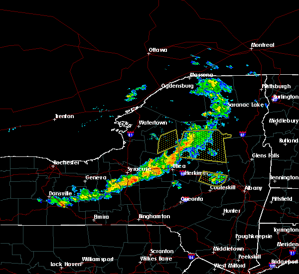 At 348 pm edt, severe thunderstorms were located along a line extending from northwood to yorkville to near augusta, moving southeast at 30 mph (radar indicated). Hazards include 60 mph wind gusts. Expect damage to roofs. siding. and trees. severe thunderstorms will be near, northwood around 355 pm edt. ohio, poland and cold brook around 400 pm edt. frankfort around 410 pm edt. ilion, herkimer, mohawk and cedarville around 415 pm edt. west winfield around 420 pm edt. little falls and jordanville around 430 pm edt. Dolgeville around 435 pm edt. At 348 pm edt, severe thunderstorms were located along a line extending from northwood to yorkville to near augusta, moving southeast at 30 mph (radar indicated). Hazards include 60 mph wind gusts. Expect damage to roofs. siding. and trees. severe thunderstorms will be near, northwood around 355 pm edt. ohio, poland and cold brook around 400 pm edt. frankfort around 410 pm edt. ilion, herkimer, mohawk and cedarville around 415 pm edt. west winfield around 420 pm edt. little falls and jordanville around 430 pm edt. Dolgeville around 435 pm edt.
|
| 8/16/2016 8:37 PM EDT |
 At 836 pm edt, severe thunderstorms were located along a line extending from near nicks lake campground to stockbridge, moving east at 45 mph (radar indicated). Hazards include 60 mph wind gusts. Expect damage to roofs. siding. and trees. severe thunderstorms will be near, mckeever around 840 pm edt. west winfield around 905 pm edt. frankfort and cedarville around 910 pm edt. ilion, herkimer and mohawk around 915 pm edt. jordanville around 920 pm edt. little falls and lewey lake campground around 925 pm edt. st. johnsville around 930 pm edt. Other locations impacted by these severe thunderstorms include youngs crossing, martin corners, fical corners, deck, kast bridge, ripple corners, west canada lakes, birmingham corners, west schuyler and mountain home. At 836 pm edt, severe thunderstorms were located along a line extending from near nicks lake campground to stockbridge, moving east at 45 mph (radar indicated). Hazards include 60 mph wind gusts. Expect damage to roofs. siding. and trees. severe thunderstorms will be near, mckeever around 840 pm edt. west winfield around 905 pm edt. frankfort and cedarville around 910 pm edt. ilion, herkimer and mohawk around 915 pm edt. jordanville around 920 pm edt. little falls and lewey lake campground around 925 pm edt. st. johnsville around 930 pm edt. Other locations impacted by these severe thunderstorms include youngs crossing, martin corners, fical corners, deck, kast bridge, ripple corners, west canada lakes, birmingham corners, west schuyler and mountain home.
|
| 8/13/2016 6:26 PM EDT |
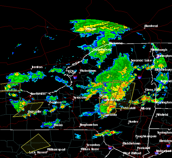 The severe thunderstorm warning for northwestern montgomery, herkimer, southwestern hamilton and northwestern fulton counties will expire at 630 pm edt, the storms which prompted the warning havemoved east of the warned area. therefore the warning will be allowed to expire for portions of the area. a severe thunderstorm watch remains in effect until 100 am edt for eastern new york. The severe thunderstorm warning for northwestern montgomery, herkimer, southwestern hamilton and northwestern fulton counties will expire at 630 pm edt, the storms which prompted the warning havemoved east of the warned area. therefore the warning will be allowed to expire for portions of the area. a severe thunderstorm watch remains in effect until 100 am edt for eastern new york.
|
| 8/13/2016 6:16 PM EDT |
 At 616 pm edt, severe thunderstorms were located along a line extending from 6 miles south of eighth lake campground to 6 miles northeast of stratford to near springfield, moving east at 40 mph (radar indicated). Hazards include 70 mph wind gusts and quarter size hail. Hail damage to vehicles is expected. expect considerable tree damage. wind damage is also likely to mobile homes, roofs, and outbuildings. severe thunderstorms will be near, caroga lake and caroga lake public campground around 630 pm edt. sharon springs and lewey lake campground around 635 pm edt. moffitt beach campground around 640 pm edt. speculator, northville, mayfield, cranberry creek and northampton beach public campground around 645 pm edt. broadalbin around 650 pm edt. Other locations impacted by these severe thunderstorms include smiths corners, kingsboro, kilmartin corners, stone arabia, munsonville, auriesville, braman corners, mckinley, rockton and market corners. At 616 pm edt, severe thunderstorms were located along a line extending from 6 miles south of eighth lake campground to 6 miles northeast of stratford to near springfield, moving east at 40 mph (radar indicated). Hazards include 70 mph wind gusts and quarter size hail. Hail damage to vehicles is expected. expect considerable tree damage. wind damage is also likely to mobile homes, roofs, and outbuildings. severe thunderstorms will be near, caroga lake and caroga lake public campground around 630 pm edt. sharon springs and lewey lake campground around 635 pm edt. moffitt beach campground around 640 pm edt. speculator, northville, mayfield, cranberry creek and northampton beach public campground around 645 pm edt. broadalbin around 650 pm edt. Other locations impacted by these severe thunderstorms include smiths corners, kingsboro, kilmartin corners, stone arabia, munsonville, auriesville, braman corners, mckinley, rockton and market corners.
|
| 8/13/2016 5:28 PM EDT |
 At 527 pm edt, severe thunderstorms were located along a line extending from near limekiln lake campground to near trenton falls to near vernon, moving southeast at 25 mph (radar indicated). Hazards include 60 mph wind gusts and quarter size hail. Hail damage to vehicles is expected. expect wind damage to roofs, siding, and trees. severe thunderstorms will be near, poland and cold brook around 535 pm edt. newport around 540 pm edt. middleville around 550 pm edt. frankfort around 555 pm edt. ilion and herkimer around 600 pm edt. mohawk around 605 pm edt. little falls and west winfield around 615 pm edt. jordanville around 620 pm edt. Other locations impacted by these severe thunderstorms include youngs crossing, martin corners, deck, kast bridge, west canada lakes, birmingham corners, west schuyler, mountain home, wilmurt corners and irish settlement. At 527 pm edt, severe thunderstorms were located along a line extending from near limekiln lake campground to near trenton falls to near vernon, moving southeast at 25 mph (radar indicated). Hazards include 60 mph wind gusts and quarter size hail. Hail damage to vehicles is expected. expect wind damage to roofs, siding, and trees. severe thunderstorms will be near, poland and cold brook around 535 pm edt. newport around 540 pm edt. middleville around 550 pm edt. frankfort around 555 pm edt. ilion and herkimer around 600 pm edt. mohawk around 605 pm edt. little falls and west winfield around 615 pm edt. jordanville around 620 pm edt. Other locations impacted by these severe thunderstorms include youngs crossing, martin corners, deck, kast bridge, west canada lakes, birmingham corners, west schuyler, mountain home, wilmurt corners and irish settlement.
|
| 7/15/2016 4:14 PM EDT | 2 trees down rt. 169 near davis road intersection...time estimated in herkimer county NY, 6.2 miles SE of Little Falls, NY |
| 7/15/2016 4:12 PM EDT | Tree down rasbach rd. near intersection with west end road...time estiimated in herkimer county NY, 6.6 miles ESE of Little Falls, NY |
| 6/28/2016 2:43 PM EDT |
 At 242 pm edt, a severe thunderstorm was located near clayville, or 7 miles west of ilion, moving northeast at 20 mph (radar indicated). Hazards include 60 mph wind gusts and quarter size hail. Hail damage to vehicles is expected. Expect wind damage to roofs, siding, and trees. At 242 pm edt, a severe thunderstorm was located near clayville, or 7 miles west of ilion, moving northeast at 20 mph (radar indicated). Hazards include 60 mph wind gusts and quarter size hail. Hail damage to vehicles is expected. Expect wind damage to roofs, siding, and trees.
|
| 6/21/2016 12:33 AM EDT | Wires down and power pole snapped at base and leaning into wires in herkimer county NY, 2.9 miles SE of Little Falls, NY |
| 6/21/2016 12:33 AM EDT | Large branches downed and in roadway in herkimer county NY, 0.7 miles SSW of Little Falls, NY |
| 6/7/2016 3:17 PM EDT |
 At 317 pm edt, a severe thunderstorm was located near dolgeville, or near little falls, moving east at 25 mph (radar indicated). Hazards include 60 mph wind gusts and quarter size hail. Hail damage to vehicles is expected. expect wind damage to roofs, siding, and trees. locations impacted include, little falls, fort plain, dolgeville, st. Johnsville, stratford, oppenheim, fairfield, garlock corners, fink basin, ingham mills, ingham mills station, emmonsburg, saint johnsville, fairview corners, phipps corners, bull hill, hallsville, goodell corners, oregon and black creek reservoir. At 317 pm edt, a severe thunderstorm was located near dolgeville, or near little falls, moving east at 25 mph (radar indicated). Hazards include 60 mph wind gusts and quarter size hail. Hail damage to vehicles is expected. expect wind damage to roofs, siding, and trees. locations impacted include, little falls, fort plain, dolgeville, st. Johnsville, stratford, oppenheim, fairfield, garlock corners, fink basin, ingham mills, ingham mills station, emmonsburg, saint johnsville, fairview corners, phipps corners, bull hill, hallsville, goodell corners, oregon and black creek reservoir.
|
| 6/7/2016 2:33 PM EDT |
 At 233 pm edt, a severe thunderstorm was located over utica, moving east at 25 mph (radar indicated). Hazards include 60 mph wind gusts and quarter size hail. Hail damage to vehicles is expected. Expect wind damage to roofs, siding, and trees. At 233 pm edt, a severe thunderstorm was located over utica, moving east at 25 mph (radar indicated). Hazards include 60 mph wind gusts and quarter size hail. Hail damage to vehicles is expected. Expect wind damage to roofs, siding, and trees.
|
| 8/14/2015 5:52 PM EDT |
 A severe thunderstorm warning remains in effect until 600 pm edt for southeastern herkimer and northwestern fulton counties. at 551 pm edt. a severe thunderstorm was located 7 miles northeast of stratford. or 16 miles northwest of gloversville. moving east at 30 mph. hazard. 60 mph wind gusts and quarter size hail. A severe thunderstorm warning remains in effect until 600 pm edt for southeastern herkimer and northwestern fulton counties. at 551 pm edt. a severe thunderstorm was located 7 miles northeast of stratford. or 16 miles northwest of gloversville. moving east at 30 mph. hazard. 60 mph wind gusts and quarter size hail.
|
| 8/14/2015 5:52 PM EDT |
 At 551 pm edt, a severe thunderstorm was located 7 miles northeast of stratford, or 16 miles northwest of gloversville, moving east at 30 mph (radar indicated). Hazards include 60 mph wind gusts and quarter size hail. Hail damage to vehicles is expected. expect wind damage to roofs, siding and trees. Locations impacted include, dolgeville, stratford, caroga lake. At 551 pm edt, a severe thunderstorm was located 7 miles northeast of stratford, or 16 miles northwest of gloversville, moving east at 30 mph (radar indicated). Hazards include 60 mph wind gusts and quarter size hail. Hail damage to vehicles is expected. expect wind damage to roofs, siding and trees. Locations impacted include, dolgeville, stratford, caroga lake.
|
| 8/14/2015 5:12 PM EDT |
 At 512 pm edt, a severe thunderstorm was located near utica, moving east at 35 mph (radar indicated). Hazards include 60 mph wind gusts and quarter size hail. Hail damage to vehicles is expected. expect wind damage to roofs, siding and trees. this severe thunderstorm will be near, ilion and frankfort around 515 pm edt. herkimer, mohawk and newport around 520 pm edt. middleville around 525 pm edt. dolgeville around 535 pm edt. stratford around 545 pm edt. caroga lake around 555 pm edt. Other locations impacted by this severe thunderstorm include windfall, martin corners, beacon light corners, kast bridge, emmonsburg, fairview corners, dempster corners, days corners, corrado corners and west schuyler. At 512 pm edt, a severe thunderstorm was located near utica, moving east at 35 mph (radar indicated). Hazards include 60 mph wind gusts and quarter size hail. Hail damage to vehicles is expected. expect wind damage to roofs, siding and trees. this severe thunderstorm will be near, ilion and frankfort around 515 pm edt. herkimer, mohawk and newport around 520 pm edt. middleville around 525 pm edt. dolgeville around 535 pm edt. stratford around 545 pm edt. caroga lake around 555 pm edt. Other locations impacted by this severe thunderstorm include windfall, martin corners, beacon light corners, kast bridge, emmonsburg, fairview corners, dempster corners, days corners, corrado corners and west schuyler.
|
| 6/12/2015 6:29 PM EDT |
 At 628 pm edt, severe thunderstorms were located along a line extending from 10 miles southeast of limekiln lake campground to middleville to bridgewater, moving east at 25 mph (radar indicated). Hazards include 60 mph wind gusts. Expect damage to roofs. siding and trees. these severe storms will be near, little falls around 640 pm edt. dolgeville around 645 pm edt. other locations impacted by these severe thunderstorms include youngs crossing, windfall, fink basin, van hornesville, beacon light corners, deck, kast bridge, fairview corners, days corners and birmingham corners. A tornado watch remains in effect until 1100 pm edt for eastern new york. At 628 pm edt, severe thunderstorms were located along a line extending from 10 miles southeast of limekiln lake campground to middleville to bridgewater, moving east at 25 mph (radar indicated). Hazards include 60 mph wind gusts. Expect damage to roofs. siding and trees. these severe storms will be near, little falls around 640 pm edt. dolgeville around 645 pm edt. other locations impacted by these severe thunderstorms include youngs crossing, windfall, fink basin, van hornesville, beacon light corners, deck, kast bridge, fairview corners, days corners and birmingham corners. A tornado watch remains in effect until 1100 pm edt for eastern new york.
|
| 6/12/2015 5:46 PM EDT |
 At 544 pm edt, severe thunderstorms were located along a line extending from near nicks lake campground to oriskany to near morrisville, moving east at 25 mph (radar indicated). Hazards include 60 mph wind gusts. Expect damage to roofs. siding and trees. severe thunderstorms will be near, nicks lake campground and mckeever around 550 pm edt. frankfort, poland and cold brook around 615 pm edt. newport around 620 pm edt. herkimer and middleville around 625 pm edt. west winfield around 635 pm edt. little falls around 640 pm edt. dolgeville and cedarville around 645 pm edt. other locations impacted by these severe thunderstorms include youngs crossing, martin corners, deck, kast bridge, birmingham corners, west schuyler, wilmurt corners, irish settlement, atwell and east creek. A tornado watch remains in effect until 1100 pm edt for eastern new york. At 544 pm edt, severe thunderstorms were located along a line extending from near nicks lake campground to oriskany to near morrisville, moving east at 25 mph (radar indicated). Hazards include 60 mph wind gusts. Expect damage to roofs. siding and trees. severe thunderstorms will be near, nicks lake campground and mckeever around 550 pm edt. frankfort, poland and cold brook around 615 pm edt. newport around 620 pm edt. herkimer and middleville around 625 pm edt. west winfield around 635 pm edt. little falls around 640 pm edt. dolgeville and cedarville around 645 pm edt. other locations impacted by these severe thunderstorms include youngs crossing, martin corners, deck, kast bridge, birmingham corners, west schuyler, wilmurt corners, irish settlement, atwell and east creek. A tornado watch remains in effect until 1100 pm edt for eastern new york.
|
| 7/3/2014 4:28 PM EDT | Trees and wires down in herkimer county NY, 5.7 miles NNW of Little Falls, NY |
| 6/17/2014 11:05 PM EDT | Trees down in herkimer county NY, 0.6 miles SSE of Little Falls, NY |
| 9/2/2013 6:25 PM EDT | Silo down on a barn. time estimated by rada in herkimer county NY, 0.6 miles SSE of Little Falls, NY |
| 6/30/2013 4:45 PM EDT | Quarter sized hail reported 3.5 miles W of Little Falls, NY, trained spotter |
| 6/30/2013 4:45 PM EDT | Multiple trees down... hay wagons tipped over... siding off house... barn damaged in herkimer county NY, 3.5 miles W of Little Falls, NY |
| 6/30/2013 4:45 PM EDT | Several small trees and limbs down blocking burrell roa in herkimer county NY, 2.1 miles SSW of Little Falls, NY |
| 5/29/2013 5:59 PM EDT | Wires down at 568 bronner road in herkimer county NY, 3.5 miles W of Little Falls, NY |
| 5/21/2013 5:27 PM EDT | Ping Pong Ball sized hail reported 5.5 miles SSE of Little Falls, NY, trained spotter...many hail stones greater than 1 inch. |
| 5/21/2013 5:15 PM EDT | Half Dollar sized hail reported 5.5 miles SSE of Little Falls, NY, trained spotter |
| 9/8/2012 2:30 PM EDT | Trees down in herkimer county NY, 0.6 miles SSE of Little Falls, NY |
| 1/1/0001 12:00 AM | People trapped between 2 fallen trees - no injuries in herkimer county NY, 2 miles NW of Little Falls, NY |
| 1/1/0001 12:00 AM | Tree down on travis roa in van hornsville county NY, 8.5 miles N of Little Falls, NY |
Hail Maps for Little Falls, NY


Connect with Interactive Hail Maps