

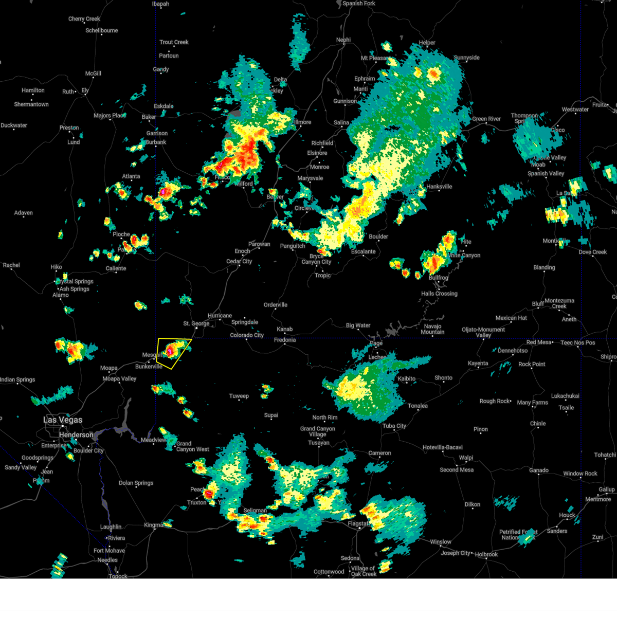
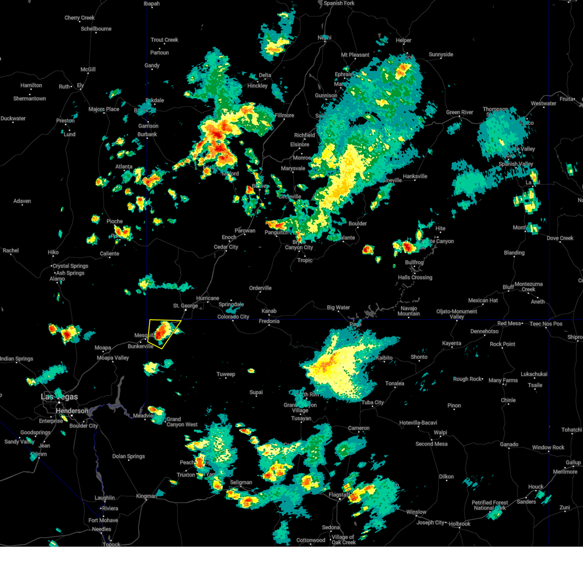
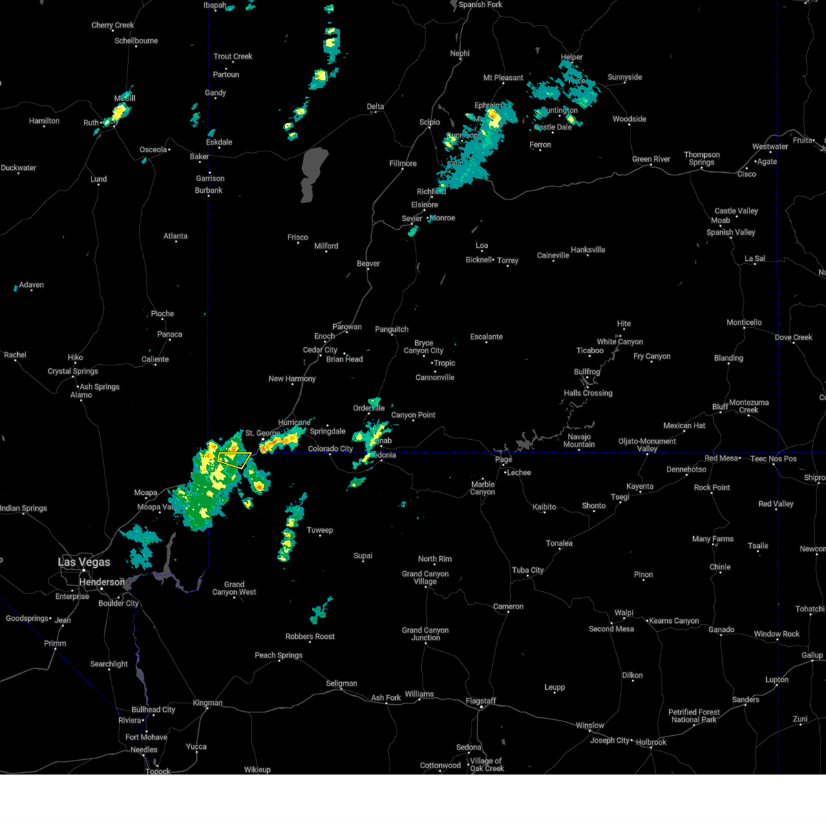
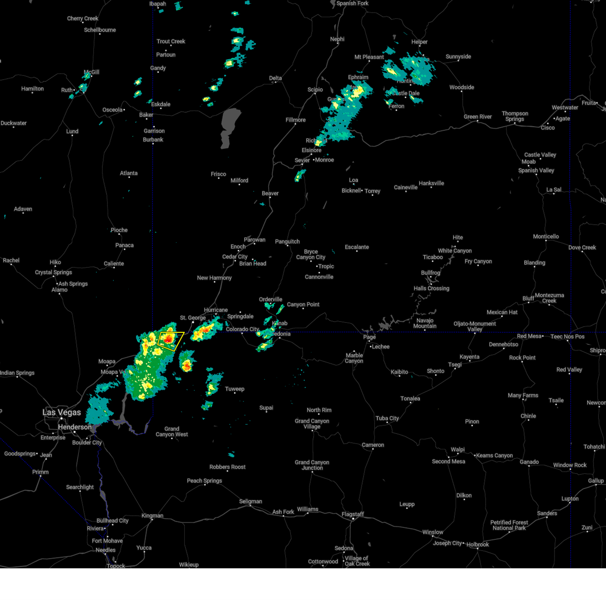
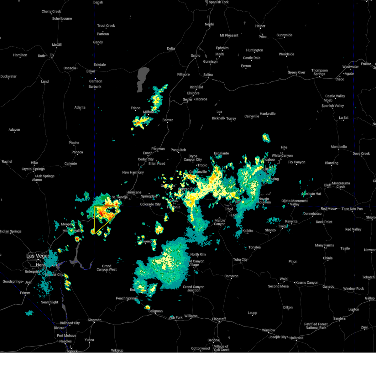
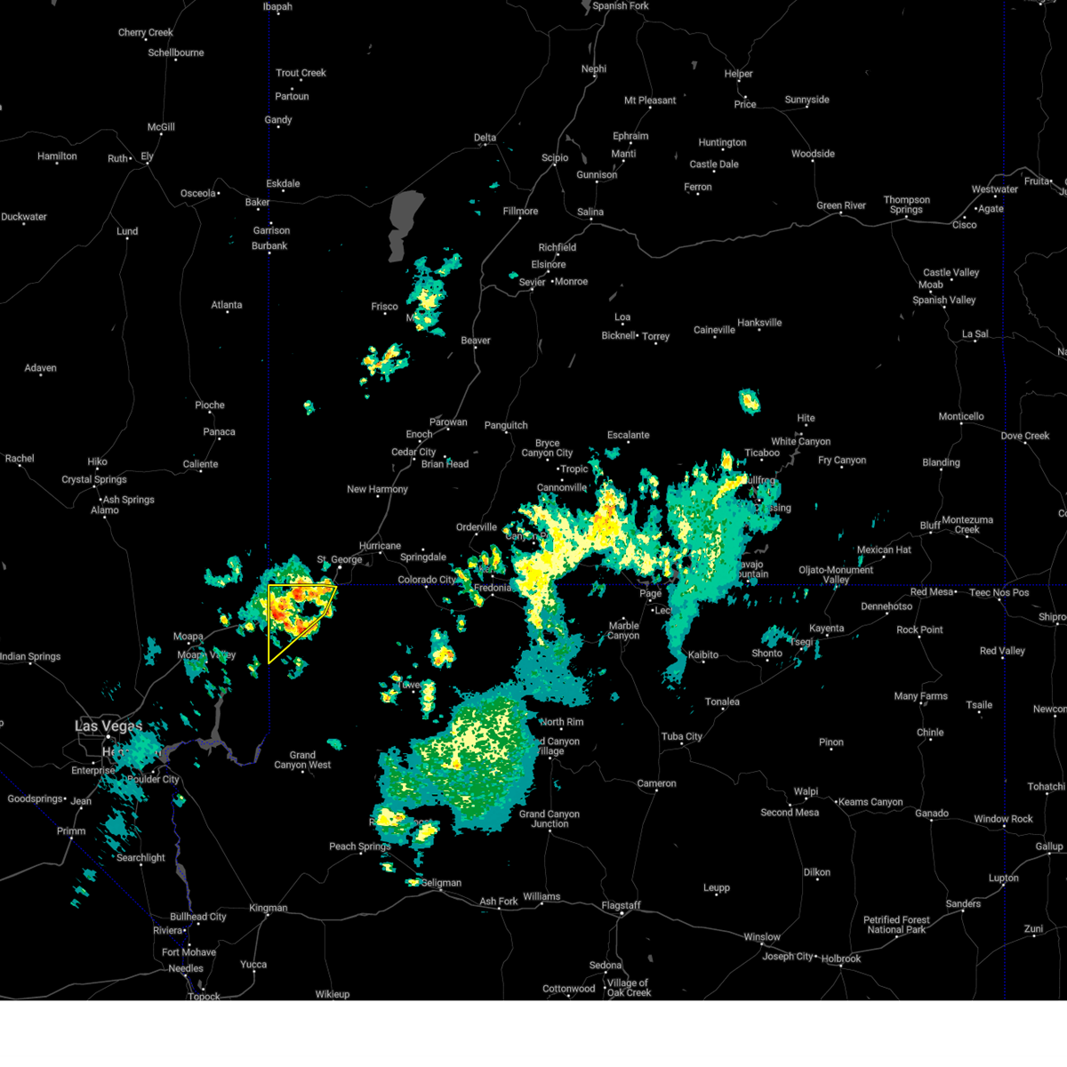
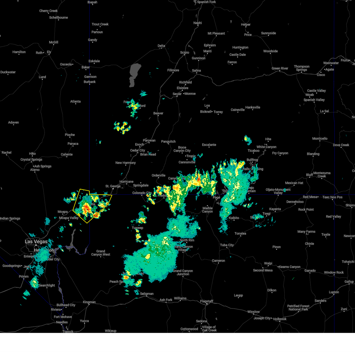
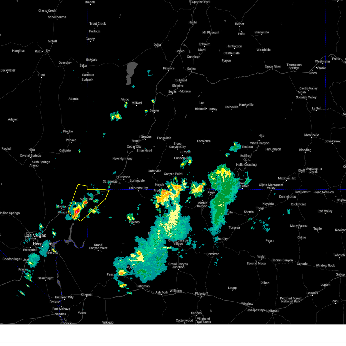
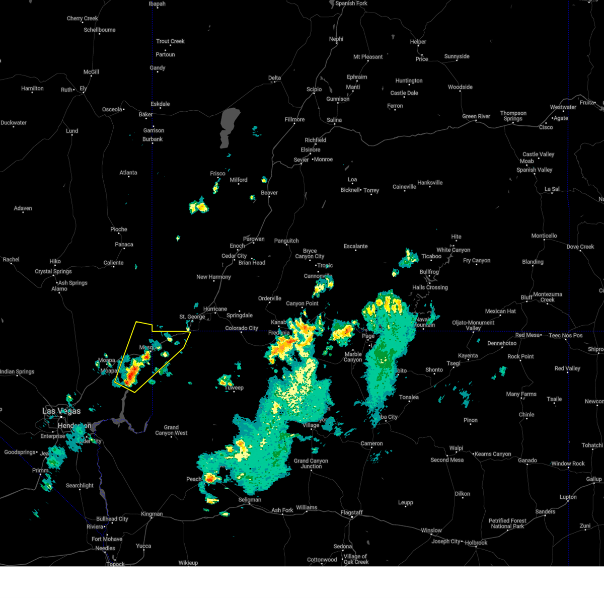
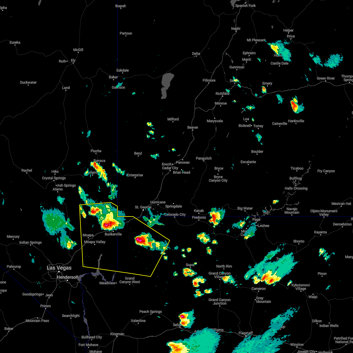
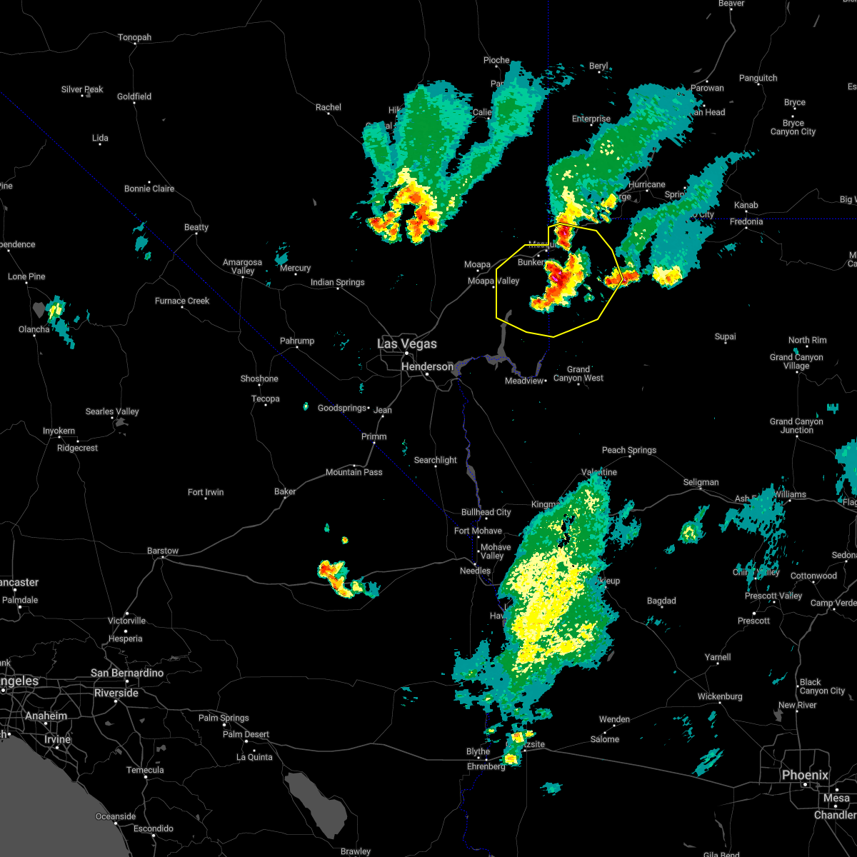
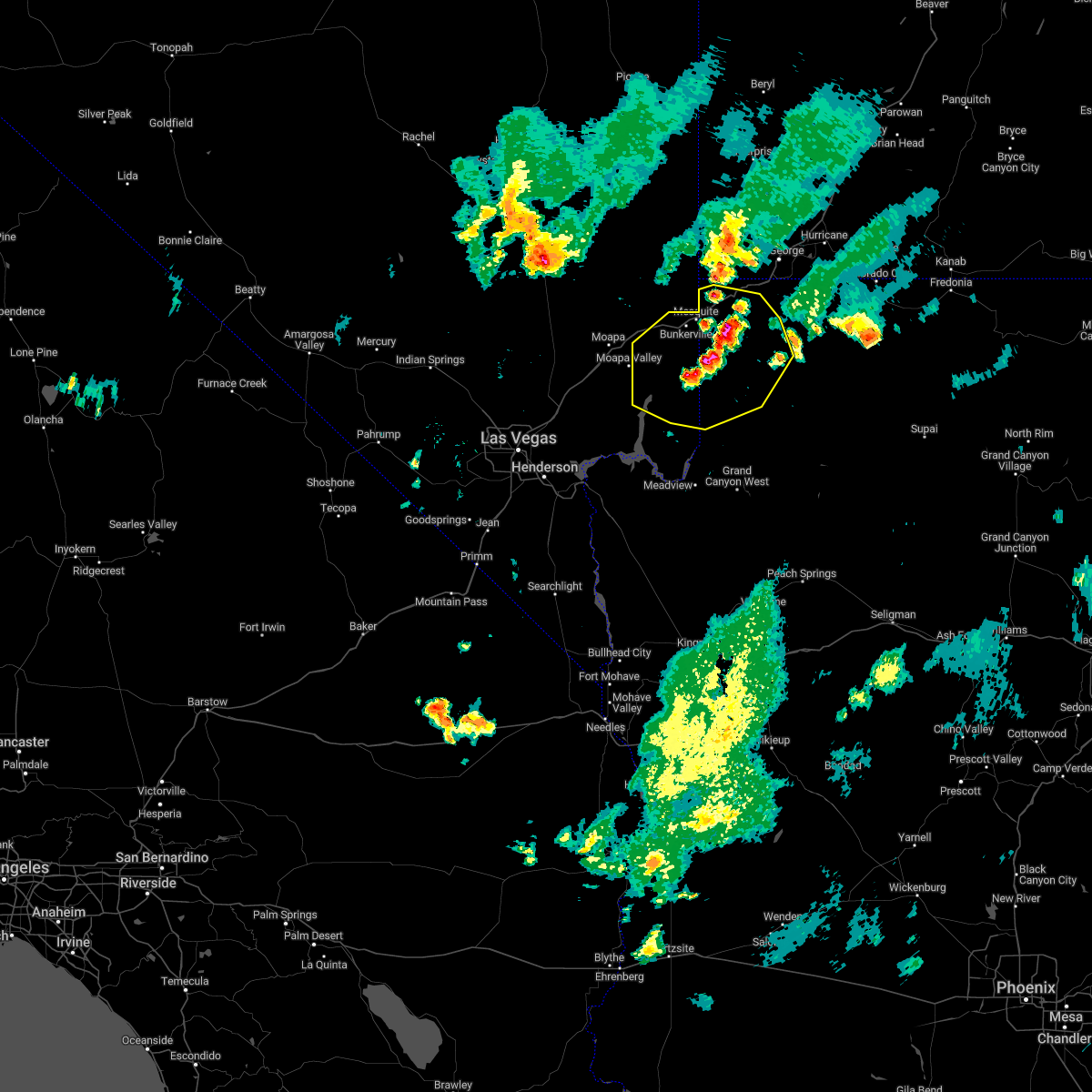
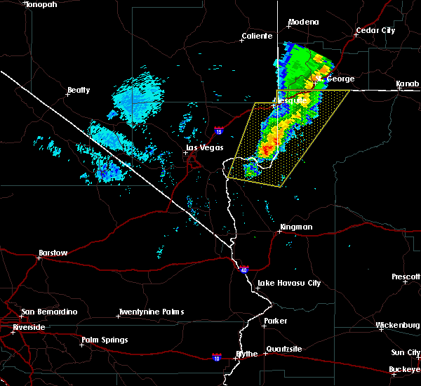
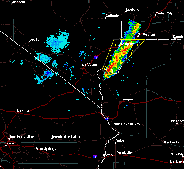
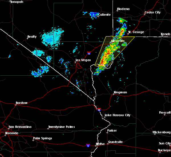
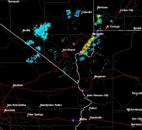
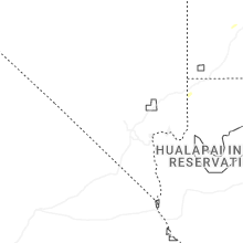
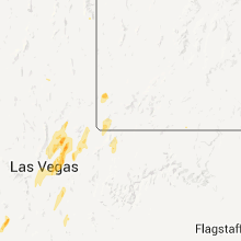
Hail Map for Littlefield, AZ
The Littlefield, AZ area has had 0 reports of on-the-ground hail by trained spotters, and has been under severe weather warnings 6 times during the past 12 months. Doppler radar has detected hail at or near Littlefield, AZ on 13 occasions, including 2 occasions during the past year.
| Name: | Littlefield, AZ |
| Where Located: | 25.7 miles SW of Saint George, UT |
| Map: | Google Map for Littlefield, AZ |
| Population: | 308 |
| Housing Units: | 153 |
| More Info: | Search Google for Littlefield, AZ |
4
The Top Recent Hail Date for Littlefield, AZ is Sunday, August 11, 2024 (3rd out of 13)

Hail and Wind Damage Spotted near Littlefield, AZ
| Date / Time | Report Details |
|---|---|
| 7/17/2025 3:08 PM PDT |
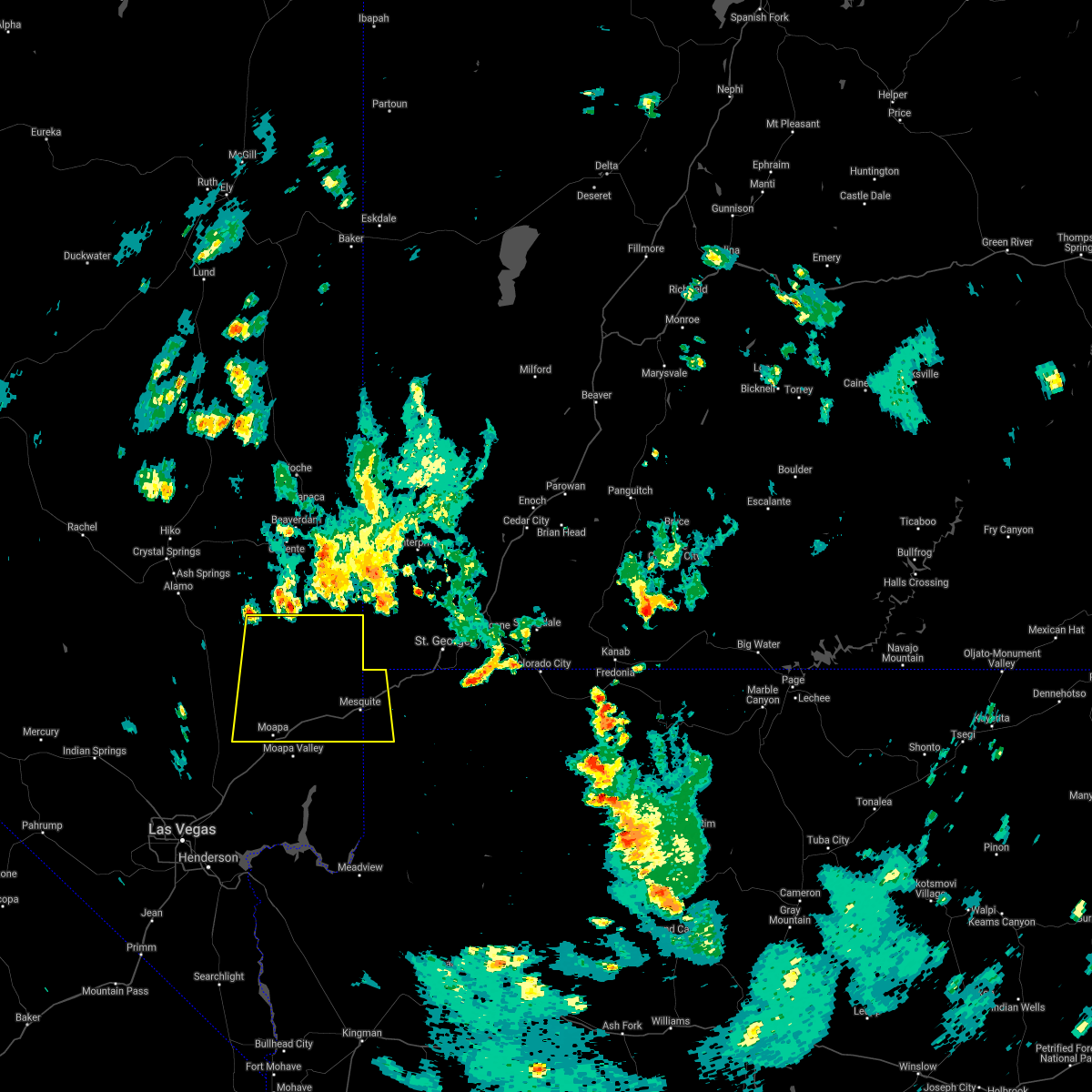
 The storm which prompted the warning has moved out of the area. therefore, the warning will be allowed to expire. The storm which prompted the warning has moved out of the area. therefore, the warning will be allowed to expire.
|
| 7/17/2025 2:50 PM PDT |
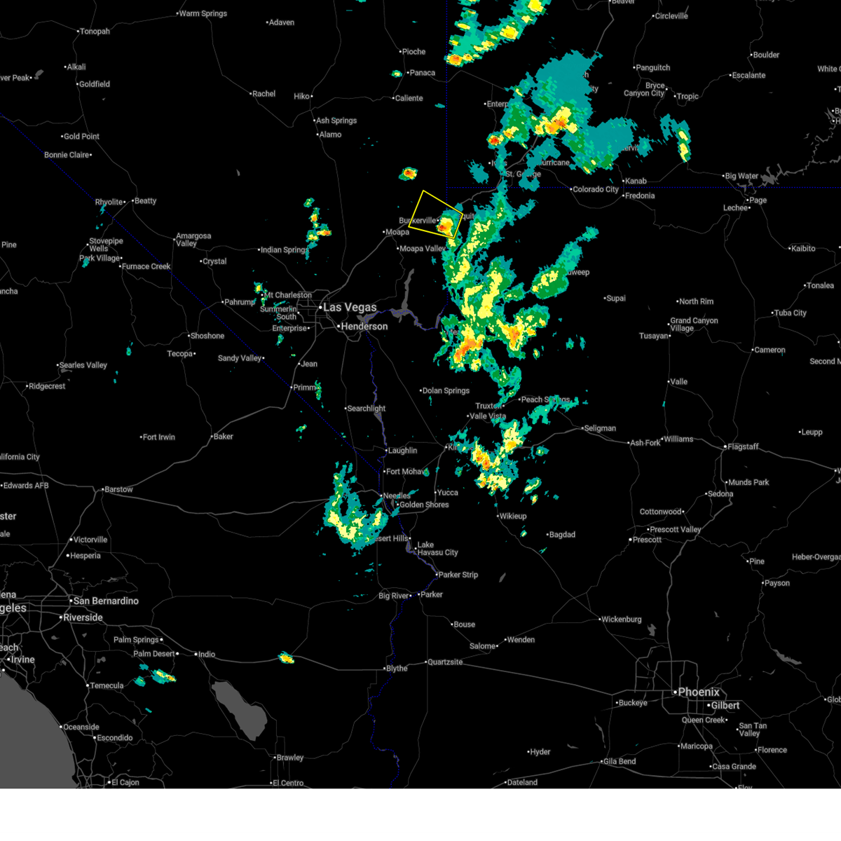
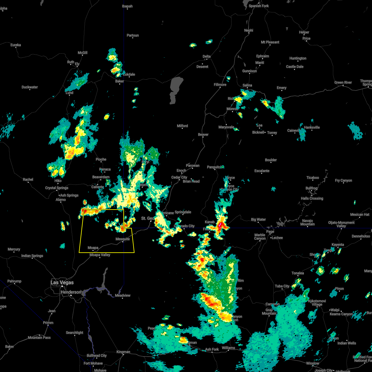
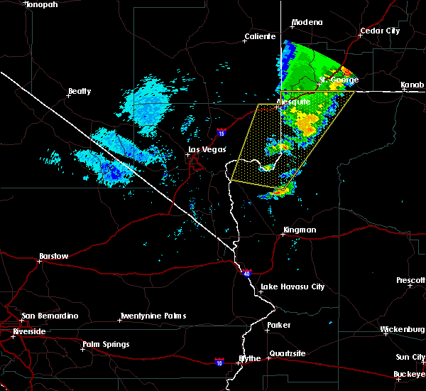
 At 249 pm pdt/249 pm mst/, a severe thunderstorm was located just southeast of mesquite, moving west at 15 mph (radar indicated). Hazards include 60 mph wind gusts and quarter size hail. Hail damage to vehicles is expected. expect wind damage to roofs and trees. locations impacted include, mesquite and bunkerville. this includes the following roads, interstate 15 in arizona between mile markers 0 and 4. Interstate 15 in nevada between mile markers 105 and 120. At 249 pm pdt/249 pm mst/, a severe thunderstorm was located just southeast of mesquite, moving west at 15 mph (radar indicated). Hazards include 60 mph wind gusts and quarter size hail. Hail damage to vehicles is expected. expect wind damage to roofs and trees. locations impacted include, mesquite and bunkerville. this includes the following roads, interstate 15 in arizona between mile markers 0 and 4. Interstate 15 in nevada between mile markers 105 and 120.
|
| 7/17/2025 2:25 PM PDT |
 Svrvef the national weather service in las vegas has issued a * severe thunderstorm warning for, north central mohave county in northwestern arizona, southeastern lincoln county in south central nevada, northeastern clark county in southern nevada, * until 315 pm pdt/315 pm mst/. * at 223 pm pdt/223 pm mst/, a severe thunderstorm was located near mesquite, moving west at 15 mph (radar indicated). Hazards include 60 mph wind gusts and quarter size hail. Hail damage to vehicles is expected. Expect wind damage to roofs and trees. Svrvef the national weather service in las vegas has issued a * severe thunderstorm warning for, north central mohave county in northwestern arizona, southeastern lincoln county in south central nevada, northeastern clark county in southern nevada, * until 315 pm pdt/315 pm mst/. * at 223 pm pdt/223 pm mst/, a severe thunderstorm was located near mesquite, moving west at 15 mph (radar indicated). Hazards include 60 mph wind gusts and quarter size hail. Hail damage to vehicles is expected. Expect wind damage to roofs and trees.
|
| 5/17/2025 9:33 PM MST | Peak gust at mesonet station qtwa3 tweeds point. single gust over 58 mph associated with thunderstorm outflo in mohave county AZ, 22.5 miles NNW of Littlefield, AZ |
| 4/17/2025 7:33 PM MST | Tweeds point raws recorded a wind gust of 61 mph at 193 in mohave county AZ, 22.5 miles NNW of Littlefield, AZ |
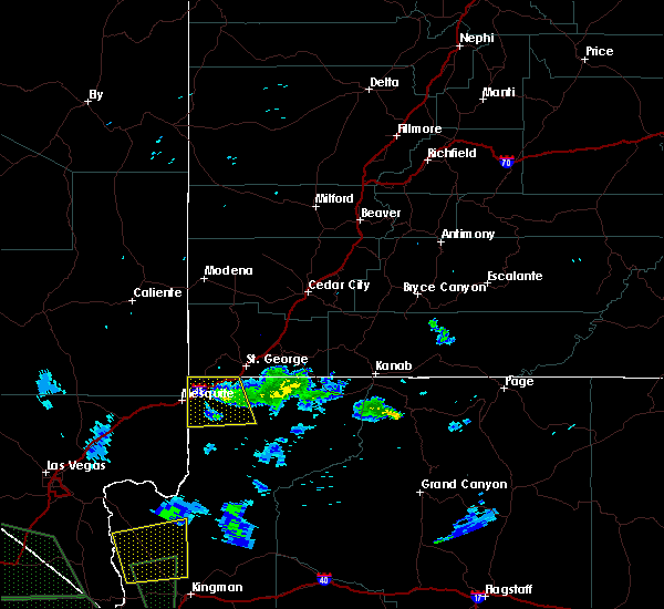
| 8/11/2024 5:58 PM MST |
 The storm which prompted the warning has weakened, and no longer poses an immediate threat to life or property. therefore, the warning will be allowed to expire. however, gusty winds and small hail are still possible with this thunderstorm. The storm which prompted the warning has weakened, and no longer poses an immediate threat to life or property. therefore, the warning will be allowed to expire. however, gusty winds and small hail are still possible with this thunderstorm.
|
| 8/11/2024 5:42 PM MST |
 At 541 pm mst, doppler radar continued to indicate a severe thunderstorm was located near littlefield, moving northeast at 5 mph (radar indicated). Hazards include 60 mph wind gusts and quarter size hail. Hail damage to vehicles is expected. expect wind damage to roofs and trees. locations impacted include, beaver dam, littlefield, virgin river gorge, and virgin river campground. This includes interstate 15 in arizona between mile markers 1 and 28. At 541 pm mst, doppler radar continued to indicate a severe thunderstorm was located near littlefield, moving northeast at 5 mph (radar indicated). Hazards include 60 mph wind gusts and quarter size hail. Hail damage to vehicles is expected. expect wind damage to roofs and trees. locations impacted include, beaver dam, littlefield, virgin river gorge, and virgin river campground. This includes interstate 15 in arizona between mile markers 1 and 28.
|
| 8/11/2024 5:29 PM MST |
 Svrvef the national weather service in las vegas has issued a * severe thunderstorm warning for, northern mohave county in northwestern arizona, * until 600 pm mst. * at 529 pm mst, a severe thunderstorm was located near littlefield, and is nearly stationary (radar indicated). Hazards include 60 mph wind gusts and quarter size hail. Hail damage to vehicles is expected. Expect wind damage to roofs and trees. Svrvef the national weather service in las vegas has issued a * severe thunderstorm warning for, northern mohave county in northwestern arizona, * until 600 pm mst. * at 529 pm mst, a severe thunderstorm was located near littlefield, and is nearly stationary (radar indicated). Hazards include 60 mph wind gusts and quarter size hail. Hail damage to vehicles is expected. Expect wind damage to roofs and trees.
|
| 9/20/2023 5:38 PM MST |
 The severe thunderstorm warning for northern mohave county will expire at 545 pm mst, the storm which prompted the warning has moved out of the area. therefore, the warning will be allowed to expire. The severe thunderstorm warning for northern mohave county will expire at 545 pm mst, the storm which prompted the warning has moved out of the area. therefore, the warning will be allowed to expire.
|
| 9/20/2023 5:32 PM MST |
 At 532 pm mst, a severe thunderstorm was located near virgin river gorge, moving north at 20 mph (radar indicated). Hazards include 60 mph wind gusts and quarter size hail. Hail damage to vehicles is expected. expect wind damage to roofs and trees. locations impacted include, virgin river gorge and virgin river campground. hail threat, radar indicated max hail size, 1. 00 in wind threat, radar indicated max wind gust, 60 mph. At 532 pm mst, a severe thunderstorm was located near virgin river gorge, moving north at 20 mph (radar indicated). Hazards include 60 mph wind gusts and quarter size hail. Hail damage to vehicles is expected. expect wind damage to roofs and trees. locations impacted include, virgin river gorge and virgin river campground. hail threat, radar indicated max hail size, 1. 00 in wind threat, radar indicated max wind gust, 60 mph.
|
| 9/20/2023 5:21 PM MST |
 At 520 pm mst, a severe thunderstorm was located near virgin river gorge, moving north at 20 mph (radar indicated). Hazards include 60 mph wind gusts and quarter size hail. Hail damage to vehicles is expected. Expect wind damage to roofs and trees. At 520 pm mst, a severe thunderstorm was located near virgin river gorge, moving north at 20 mph (radar indicated). Hazards include 60 mph wind gusts and quarter size hail. Hail damage to vehicles is expected. Expect wind damage to roofs and trees.
|
| 8/31/2023 7:55 PM MST |
 The severe thunderstorm warning for north central mohave county will expire at 800 pm mst, the storm which prompted the warning is weakening and is moving out of the area. therefore, the warning will be allowed to expire. The severe thunderstorm warning for north central mohave county will expire at 800 pm mst, the storm which prompted the warning is weakening and is moving out of the area. therefore, the warning will be allowed to expire.
|
| 8/31/2023 7:44 PM MST |
 At 743 pm mst, a severe thunderstorm was located near beaver dam, moving northeast at 25 mph (radar indicated). Hazards include 60 mph wind gusts and frequent lightning. Expect damage to roofs and trees. locations impacted include, beaver dam, littlefield, virgin river gorge and virgin river campground. this includes interstate 15 in arizona between mile markers 0 and 28. hail threat, radar indicated max hail size, <. 75 in wind threat, radar indicated max wind gust, 60 mph. At 743 pm mst, a severe thunderstorm was located near beaver dam, moving northeast at 25 mph (radar indicated). Hazards include 60 mph wind gusts and frequent lightning. Expect damage to roofs and trees. locations impacted include, beaver dam, littlefield, virgin river gorge and virgin river campground. this includes interstate 15 in arizona between mile markers 0 and 28. hail threat, radar indicated max hail size, <. 75 in wind threat, radar indicated max wind gust, 60 mph.
|
| 8/31/2023 7:30 PM MST |
 At 728 pm pdt, a severe thunderstorm was located over mesquite, moving northeast at 25 mph. this storm has weakened slightly, and large hail is no longer expected, but damaging wind gusts are still possible (radar indicated). Hazards include 60 mph wind gusts and frequent lightning. Expect damage to roofs and trees, blowing dust, and frequent cloud to ground lightning. some power outages will be possible. locations impacted include, mesquite, beaver dam, littlefield, virgin river gorge, virgin river campground and bunkerville. this includes the following roads, interstate 15 in arizona between mile markers 0 and 28. interstate 15 in nevada between mile markers 104 and 120. hail threat, radar indicated max hail size, <. 75 in wind threat, radar indicated max wind gust, 60 mph. At 728 pm pdt, a severe thunderstorm was located over mesquite, moving northeast at 25 mph. this storm has weakened slightly, and large hail is no longer expected, but damaging wind gusts are still possible (radar indicated). Hazards include 60 mph wind gusts and frequent lightning. Expect damage to roofs and trees, blowing dust, and frequent cloud to ground lightning. some power outages will be possible. locations impacted include, mesquite, beaver dam, littlefield, virgin river gorge, virgin river campground and bunkerville. this includes the following roads, interstate 15 in arizona between mile markers 0 and 28. interstate 15 in nevada between mile markers 104 and 120. hail threat, radar indicated max hail size, <. 75 in wind threat, radar indicated max wind gust, 60 mph.
|
| 8/31/2023 7:06 PM MST |
 At 705 pm pdt, a severe thunderstorm was located near bunkerville, or 8 miles southwest of mesquite, moving northeast at 25 mph (radar indicated). Hazards include 60 mph wind gusts and quarter size hail. Hail damage to vehicles is expected. expect wind damage to roofs and trees and frequent lightning. locations impacted include, mesquite, virgin river gorge, beaver dam, littlefield, moapa valley, virgin river campground and bunkerville. this includes the following roads, interstate 15 in arizona between mile markers 0 and 28. interstate 15 in nevada between mile markers 104 and 120. hail threat, radar indicated max hail size, 1. 00 in wind threat, radar indicated max wind gust, 60 mph. At 705 pm pdt, a severe thunderstorm was located near bunkerville, or 8 miles southwest of mesquite, moving northeast at 25 mph (radar indicated). Hazards include 60 mph wind gusts and quarter size hail. Hail damage to vehicles is expected. expect wind damage to roofs and trees and frequent lightning. locations impacted include, mesquite, virgin river gorge, beaver dam, littlefield, moapa valley, virgin river campground and bunkerville. this includes the following roads, interstate 15 in arizona between mile markers 0 and 28. interstate 15 in nevada between mile markers 104 and 120. hail threat, radar indicated max hail size, 1. 00 in wind threat, radar indicated max wind gust, 60 mph.
|
| 8/31/2023 6:56 PM MST |
 At 654 pm pdt/654 pm mst/, a severe thunderstorm was located 7 miles southwest of bunkerville, or 11 miles southwest of mesquite, moving northeast at 25 mph (radar indicated). Hazards include 60 mph wind gusts and frequent lightning. Expect damage to roofs and trees. Possible power outages due to wind and frequent lightning. At 654 pm pdt/654 pm mst/, a severe thunderstorm was located 7 miles southwest of bunkerville, or 11 miles southwest of mesquite, moving northeast at 25 mph (radar indicated). Hazards include 60 mph wind gusts and frequent lightning. Expect damage to roofs and trees. Possible power outages due to wind and frequent lightning.
|
| 8/18/2023 8:33 PM MST | Tweeds point raws site in northern arizona observed a sustained wind speed of 73 mph and a gust of 61 mph... coupled with a 10 degree temperature drop and a 44% relativ in mohave county AZ, 22.5 miles NNW of Littlefield, AZ |
| 7/23/2023 6:15 PM MST | At approximately 6:15 pm pdt... the nevershine raws recorded a thunderstorm wind gust of 61 mph. time estimated using rada in mohave county AZ, 42.4 miles N of Littlefield, AZ |
| 8/21/2022 5:37 PM MST |
 At 530 pm pdt/530 pm mst/, a severe thunderstorm was located 30 miles west of mesquite along the lincoln and clark county border moving south at 10 mph and a second severe thunderstorm was located 25 miles southeast of mesquite moving south at 10 mph (radar indicated). Hazards include 60 mph wind gusts and quarter size hail. Hail damage to vehicles is expected. expect wind damage to roofs and trees. locations impacted include, mesquite, virgin river gorge, overton, beaver dam, littlefield, moapa town, moapa valley, echo bay, echo bay campground, bunkerville, virgin river campground, valley of fire, overton beach, logandale and carp. this includes the following highways, interstate 15 in arizona between mile markers 0 and 23. Interstate 15 in nevada between mile markers 80 and 120. At 530 pm pdt/530 pm mst/, a severe thunderstorm was located 30 miles west of mesquite along the lincoln and clark county border moving south at 10 mph and a second severe thunderstorm was located 25 miles southeast of mesquite moving south at 10 mph (radar indicated). Hazards include 60 mph wind gusts and quarter size hail. Hail damage to vehicles is expected. expect wind damage to roofs and trees. locations impacted include, mesquite, virgin river gorge, overton, beaver dam, littlefield, moapa town, moapa valley, echo bay, echo bay campground, bunkerville, virgin river campground, valley of fire, overton beach, logandale and carp. this includes the following highways, interstate 15 in arizona between mile markers 0 and 23. Interstate 15 in nevada between mile markers 80 and 120.
|
| 8/21/2022 5:00 PM MST |
 At 458 pm pdt/458 pm mst/, a severe thunderstorm was located 10 miles west of bunkerville, or 10 miles west of mesquite, moving south at 30 mph. another severe thunderstorm was located 15 miles east southeast of mesquite moving south at 20 mph (radar indicated). Hazards include 60 mph wind gusts and quarter size hail. Hail damage to vehicles is expected. Expect wind damage to roofs and trees. At 458 pm pdt/458 pm mst/, a severe thunderstorm was located 10 miles west of bunkerville, or 10 miles west of mesquite, moving south at 30 mph. another severe thunderstorm was located 15 miles east southeast of mesquite moving south at 20 mph (radar indicated). Hazards include 60 mph wind gusts and quarter size hail. Hail damage to vehicles is expected. Expect wind damage to roofs and trees.
|
| 7/29/2022 7:00 PM MST | Wind gust of 58 mph was measured at olaf knolls raws site. observation came in at 733pm... but actual gust was likely closer to 7pm based on rada in mohave county AZ, 25.2 miles NNW of Littlefield, AZ |
| 7/28/2022 7:13 PM MST |
 At 712 pm pdt/712 pm mst/, a severe thunderstorm was located 12 miles southeast of bunkerville, or 16 miles south of mesquite, moving southwest at 20 mph (radar indicated). Hazards include 60 mph wind gusts and quarter size hail. Hail damage to vehicles is expected. expect wind damage to roofs and trees. locations impacted include, mesquite, virgin river gorge, beaver dam, littlefield, overton, moapa valley, overton beach and bunkerville. this includes the following highways, interstate 15 in arizona between mile markers 0 and 2, and between mile markers 4 and 17. interstate 15 in nevada between mile markers 107 and 120. hail threat, radar indicated max hail size, 1. 00 in wind threat, radar indicated max wind gust, 60 mph. At 712 pm pdt/712 pm mst/, a severe thunderstorm was located 12 miles southeast of bunkerville, or 16 miles south of mesquite, moving southwest at 20 mph (radar indicated). Hazards include 60 mph wind gusts and quarter size hail. Hail damage to vehicles is expected. expect wind damage to roofs and trees. locations impacted include, mesquite, virgin river gorge, beaver dam, littlefield, overton, moapa valley, overton beach and bunkerville. this includes the following highways, interstate 15 in arizona between mile markers 0 and 2, and between mile markers 4 and 17. interstate 15 in nevada between mile markers 107 and 120. hail threat, radar indicated max hail size, 1. 00 in wind threat, radar indicated max wind gust, 60 mph.
|
| 7/28/2022 6:51 PM MST |
 At 651 pm pdt/651 pm mst/, a severe thunderstorm was located 11 miles southeast of bunkerville, or 12 miles southeast of mesquite, moving southwest at 20 mph (radar indicated). Hazards include 60 mph wind gusts. expect damage to roofs and trees At 651 pm pdt/651 pm mst/, a severe thunderstorm was located 11 miles southeast of bunkerville, or 12 miles southeast of mesquite, moving southwest at 20 mph (radar indicated). Hazards include 60 mph wind gusts. expect damage to roofs and trees
|
| 10/5/2021 12:50 PM MST | Tweeds point raws measured a gust to 58 mph at the 1333 hourly ob. time of gust estimated to be 1250 by rada in mohave county AZ, 22.5 miles NNW of Littlefield, AZ |
| 7/23/2021 6:26 PM PDT |
 At 623 pm pdt/623 pm mst/, a cluster of thunderstorms generating strong outflow winds were located 5 miles north of mesquite, moving south at 40 mph (radar indicated). Hazards include 60 mph wind gusts. Expect damage to roofs and trees. locations impacted include, mesquite, beaver dam, littlefield, moapa town, moapa valley, bunkerville and carp. this includes the following highways, interstate 15 in arizona between mile markers 0 and 2, and between mile markers 4 and 10. Interstate 15 in nevada between mile markers 90 and 120. At 623 pm pdt/623 pm mst/, a cluster of thunderstorms generating strong outflow winds were located 5 miles north of mesquite, moving south at 40 mph (radar indicated). Hazards include 60 mph wind gusts. Expect damage to roofs and trees. locations impacted include, mesquite, beaver dam, littlefield, moapa town, moapa valley, bunkerville and carp. this includes the following highways, interstate 15 in arizona between mile markers 0 and 2, and between mile markers 4 and 10. Interstate 15 in nevada between mile markers 90 and 120.
|
| 7/23/2021 5:52 PM PDT |
 At 550 pm pdt/550 pm mst/, outflow from thunderstorms were along a line extending from 16 miles southwest of gunlock state park to 26 miles southwest of cabin pines campground, moving south at 40 mph (radar indicated). Hazards include 60 mph wind gusts. expect damage to roofs and trees At 550 pm pdt/550 pm mst/, outflow from thunderstorms were along a line extending from 16 miles southwest of gunlock state park to 26 miles southwest of cabin pines campground, moving south at 40 mph (radar indicated). Hazards include 60 mph wind gusts. expect damage to roofs and trees
|
| 7/13/2021 9:52 PM MST |
 The severe thunderstorm warning for northeastern mohave county will expire at 1000 pm mst, the storms which prompted the warning have weakened below severe limits. therefore, the warning will be allowed to expire. however gusty winds to 50 mph are still possible. The severe thunderstorm warning for northeastern mohave county will expire at 1000 pm mst, the storms which prompted the warning have weakened below severe limits. therefore, the warning will be allowed to expire. however gusty winds to 50 mph are still possible.
|
| 7/13/2021 8:55 PM MST | Corrects previous tstm wnd dmg report from 1 n littlefield. winds resulting in fallen trees blocking roadways and trees falling on power lines resulting in power outage in mohave county AZ, 3.2 miles S of Littlefield, AZ |
| 7/13/2021 8:29 PM MST |
 At 829 pm mst, a severe thunderstorm was located over littlefield, moving southeast at 15 mph (radar indicated). Hazards include 60 mph wind gusts. expect damage to roofs and trees At 829 pm mst, a severe thunderstorm was located over littlefield, moving southeast at 15 mph (radar indicated). Hazards include 60 mph wind gusts. expect damage to roofs and trees
|
| 7/19/2018 7:25 PM MST | Olaf knolls raws recorded 62mph wind gusts. time estimated from rada in mohave county AZ, 25.2 miles NNW of Littlefield, AZ |
| 9/8/2017 6:21 PM MST |
 The severe thunderstorm warning for north central mohave county will expire at 630 pm mst, the storm which prompted the warning has weakened and no longer poses an immediate threat to life or property. therefore the warning will be allowed to expire. however heavy rain is still possible along interstate 15 in the virgin river gorge between 645 pm mst and 715 pm mst. The severe thunderstorm warning for north central mohave county will expire at 630 pm mst, the storm which prompted the warning has weakened and no longer poses an immediate threat to life or property. therefore the warning will be allowed to expire. however heavy rain is still possible along interstate 15 in the virgin river gorge between 645 pm mst and 715 pm mst.
|
| 9/8/2017 6:05 PM MST |
 At 604 pm mst, a severe thunderstorm was located 7 miles south of virgin river gorge, moving north at 25 mph. this storm will likely affect littlefield between 615 and 630 pm (radar indicated). Hazards include 60 mph wind gusts and quarter size hail. Hail damage to vehicles is expected. expect wind damage to roofs, siding, and trees. locations impacted include, beaver dam, littlefield, virgin river gorge and virgin river campground. This includes interstate 15 in arizona between mile markers 0 and 28. At 604 pm mst, a severe thunderstorm was located 7 miles south of virgin river gorge, moving north at 25 mph. this storm will likely affect littlefield between 615 and 630 pm (radar indicated). Hazards include 60 mph wind gusts and quarter size hail. Hail damage to vehicles is expected. expect wind damage to roofs, siding, and trees. locations impacted include, beaver dam, littlefield, virgin river gorge and virgin river campground. This includes interstate 15 in arizona between mile markers 0 and 28.
|
| 9/8/2017 5:44 PM MST |
 At 543 pm mst, a severe thunderstorm was located 16 miles southeast of littlefield, moving north at 25 mph (radar indicated). Hazards include 60 mph wind gusts and quarter size hail. Hail damage to vehicles is expected. Expect wind damage to roofs, siding, and trees. At 543 pm mst, a severe thunderstorm was located 16 miles southeast of littlefield, moving north at 25 mph (radar indicated). Hazards include 60 mph wind gusts and quarter size hail. Hail damage to vehicles is expected. Expect wind damage to roofs, siding, and trees.
|
| 9/8/2017 5:33 PM MST | Tweeds point raws station at 5200 feet reported a wind gust of 61 mph at 533 pm local tim in mohave county AZ, 21.9 miles NNW of Littlefield, AZ |
| 9/5/2017 8:33 PM MST | Wind gust to 58 mph associated with thunderstorm activity recorded at olaf knolls qoka in mohave county AZ, 25.2 miles NNW of Littlefield, AZ |
| 9/5/2017 8:33 PM MST | Tweeds point raws qtwa3 gusted to 58 mph. associated with thunderstorm activit in mohave county AZ, 21.9 miles NNW of Littlefield, AZ |
| 9/22/2016 4:23 PM MST |
 The severe thunderstorm warning for northwestern mohave and northeastern clark counties will expire at 430 pm pdt/430 pm mst/, the storms which prompted the warning have weakened. therefore the warning will be allowed to expire. The severe thunderstorm warning for northwestern mohave and northeastern clark counties will expire at 430 pm pdt/430 pm mst/, the storms which prompted the warning have weakened. therefore the warning will be allowed to expire.
|
| 9/22/2016 3:49 PM MST |
 At 348 pm pdt/348 pm mst/, doppler radar indicated severe thunderstorms capable of producing quarter size hail and damaging winds in excess of 60 mph. these storms were located along a line extending from near virgin river campground to near temple bar campground, moving northeast at 30 mph. locations impacted include, mesquite, beaver dam, littlefield, virgin river gorge, moapa valley, temple bar campground, meadview, echo bay, bunkerville, grand canyon ranch, overton beach, virgin river campground, south cove, echo bay campground, valley of fire and temple bar. At 348 pm pdt/348 pm mst/, doppler radar indicated severe thunderstorms capable of producing quarter size hail and damaging winds in excess of 60 mph. these storms were located along a line extending from near virgin river campground to near temple bar campground, moving northeast at 30 mph. locations impacted include, mesquite, beaver dam, littlefield, virgin river gorge, moapa valley, temple bar campground, meadview, echo bay, bunkerville, grand canyon ranch, overton beach, virgin river campground, south cove, echo bay campground, valley of fire and temple bar.
|
| 9/22/2016 3:25 PM MST |
 At 324 pm pdt/324 pm mst/, doppler radar indicated a line of severe thunderstorms capable of producing quarter size hail and damaging winds in excess of 60 mph. these storms were located along a line extending from near virgin river gorge to 8 miles west of temple bar campground, and moving northeast at 25 mph. At 324 pm pdt/324 pm mst/, doppler radar indicated a line of severe thunderstorms capable of producing quarter size hail and damaging winds in excess of 60 mph. these storms were located along a line extending from near virgin river gorge to 8 miles west of temple bar campground, and moving northeast at 25 mph.
|
| 9/22/2016 3:09 PM PDT |
 At 307 pm pdt/307 pm mst/, doppler radar indicated severe thunderstorms capable of producing quarter size hail and damaging winds in excess of 60 mph. these storms were located along a line extending from near mesquite to 7 miles northwest of temple bar campground, moving northeast at 25 mph. locations impacted include, mesquite, beaver dam, littlefield, virgin river gorge, moapa valley, temple bar campground, overton beach, virgin river campground, echo bay, bunkerville, echo bay campground, valley of fire and temple bar. At 307 pm pdt/307 pm mst/, doppler radar indicated severe thunderstorms capable of producing quarter size hail and damaging winds in excess of 60 mph. these storms were located along a line extending from near mesquite to 7 miles northwest of temple bar campground, moving northeast at 25 mph. locations impacted include, mesquite, beaver dam, littlefield, virgin river gorge, moapa valley, temple bar campground, overton beach, virgin river campground, echo bay, bunkerville, echo bay campground, valley of fire and temple bar.
|
| 9/22/2016 2:45 PM PDT |
 At 243 pm pdt/243 pm mst/, doppler radar indicated a line of severe thunderstorms capable of producing quarter size hail and damaging winds in excess of 60 mph. these storms were located along a line extending from 7 miles south of bunkerville to 6 miles southwest of echo bay campground, and moving northeast at 30 mph. At 243 pm pdt/243 pm mst/, doppler radar indicated a line of severe thunderstorms capable of producing quarter size hail and damaging winds in excess of 60 mph. these storms were located along a line extending from 7 miles south of bunkerville to 6 miles southwest of echo bay campground, and moving northeast at 30 mph.
|
| 7/30/2016 8:55 PM MST |
 The severe thunderstorm warning for northeastern mohave county will expire at 900 pm mst, the storm which prompted the warning has weakened below severe limits, and no longer poses an immediate threat to life or property. therefore the warning will be allowed to expire. however gusty winds and heavy rain are still possible with this thunderstorm and additional thunderstorms in the warned area. The severe thunderstorm warning for northeastern mohave county will expire at 900 pm mst, the storm which prompted the warning has weakened below severe limits, and no longer poses an immediate threat to life or property. therefore the warning will be allowed to expire. however gusty winds and heavy rain are still possible with this thunderstorm and additional thunderstorms in the warned area.
|
| 7/30/2016 8:41 PM MST |
 At 838 pm mst, doppler radar indicated a severe thunderstorm capable of producing quarter size hail and damaging winds in excess of 60 mph. this storm was located 14 miles south of st. george, or 15 miles south of st george, moving southeast at 10 mph. locations impacted include, colorado city, beaver dam, littlefield, virgin river gorge, virgin river campground, kaibab and pipe spring. At 838 pm mst, doppler radar indicated a severe thunderstorm capable of producing quarter size hail and damaging winds in excess of 60 mph. this storm was located 14 miles south of st. george, or 15 miles south of st george, moving southeast at 10 mph. locations impacted include, colorado city, beaver dam, littlefield, virgin river gorge, virgin river campground, kaibab and pipe spring.
|
| 7/30/2016 8:23 PM MST |
 At 821 pm mst, doppler radar indicated multiple severe thunderstorms capable of producing quarter size hail and damaging winds in excess of 60 mph. these storms were located from st george to hurricane, with additional thunderstorms developing towrad colorado city. storms are generally moving east at 35 mph. At 821 pm mst, doppler radar indicated multiple severe thunderstorms capable of producing quarter size hail and damaging winds in excess of 60 mph. these storms were located from st george to hurricane, with additional thunderstorms developing towrad colorado city. storms are generally moving east at 35 mph.
|
| 7/18/2015 3:39 PM MST |
 The severe thunderstorm warning for north central mohave county will expire at 345 pm mst, the storm which prompted the warning is moving out of the warned area and into southwest utah. therefore the warning will be allowed to expire at 345 pm. however gusty winds are still possible with this thunderstorm in the virgin river gorge along interstate 15. The severe thunderstorm warning for north central mohave county will expire at 345 pm mst, the storm which prompted the warning is moving out of the warned area and into southwest utah. therefore the warning will be allowed to expire at 345 pm. however gusty winds are still possible with this thunderstorm in the virgin river gorge along interstate 15.
|
| 7/18/2015 3:32 PM MST |
 At 331 pm mst, doppler radar continued to indicated a severe thunderstorm capable of producing damaging winds in excess of 60 mph. this storm was located near virgin river gorge, moving northeast at 30 mph. locations impacted include, beaver dam, littlefield, virgin river gorge and virgin river campground. this includes interstate 15 in arizona between mile markers 0 and 29. At 331 pm mst, doppler radar continued to indicated a severe thunderstorm capable of producing damaging winds in excess of 60 mph. this storm was located near virgin river gorge, moving northeast at 30 mph. locations impacted include, beaver dam, littlefield, virgin river gorge and virgin river campground. this includes interstate 15 in arizona between mile markers 0 and 29.
|
| 7/18/2015 3:19 PM MST |
 At 318 pm mst, doppler radar indicated a severe thunderstorm capable of producing damaging winds in excess of 60 mph. this storm was located over littlefield, and moving northeast at 30 mph. At 318 pm mst, doppler radar indicated a severe thunderstorm capable of producing damaging winds in excess of 60 mph. this storm was located over littlefield, and moving northeast at 30 mph.
|
Hail Maps for Littlefield, AZ


Connect with Interactive Hail Maps