

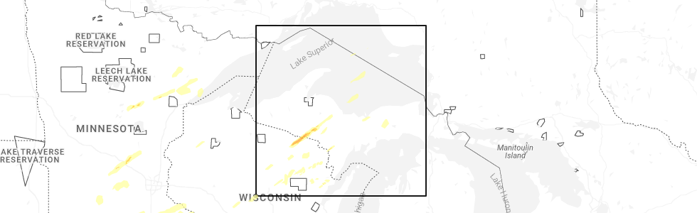
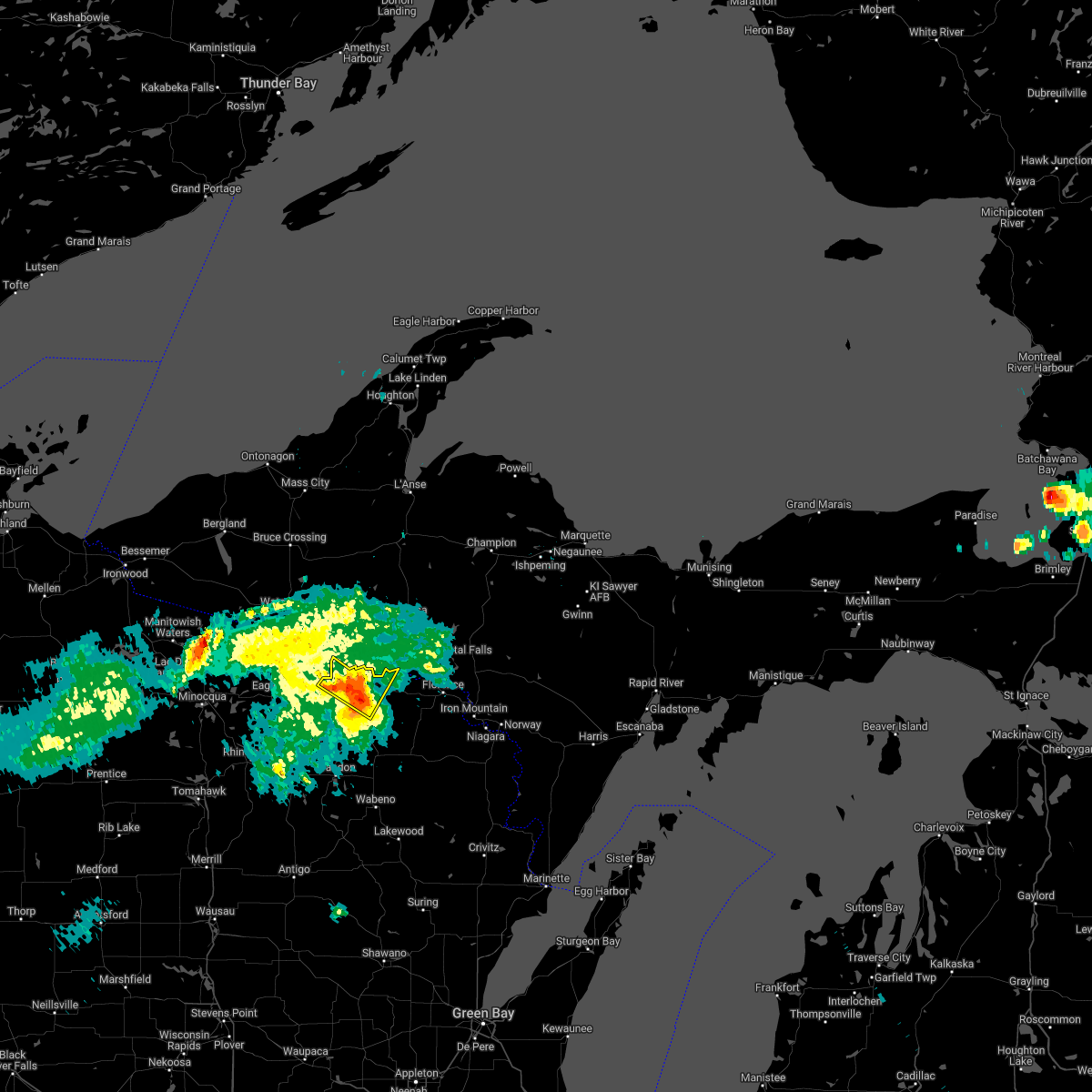
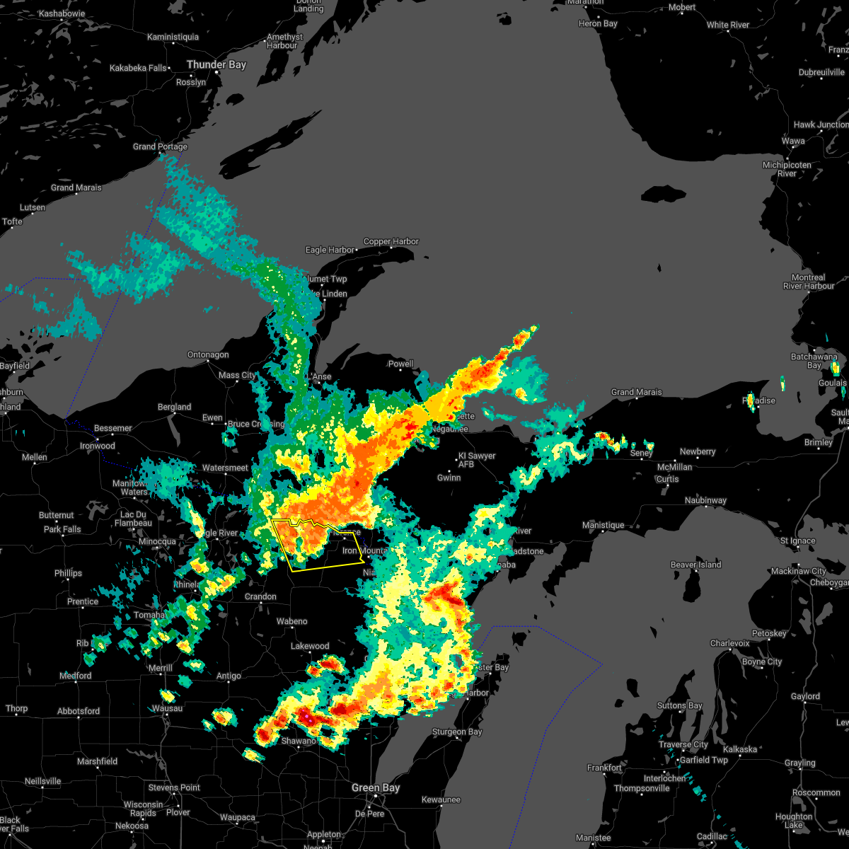
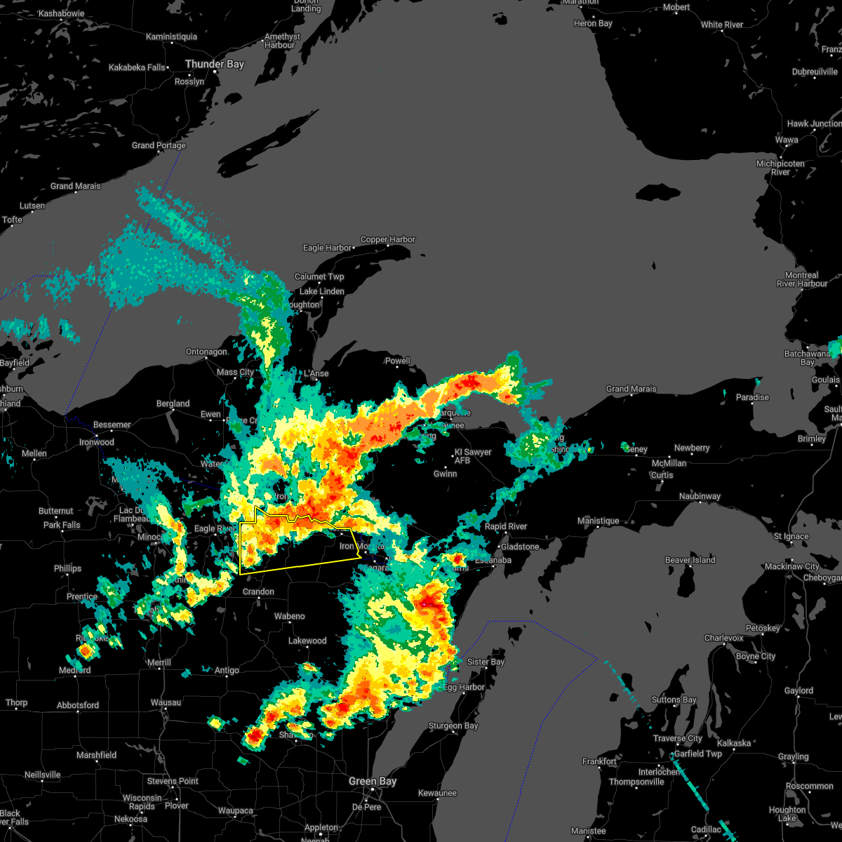
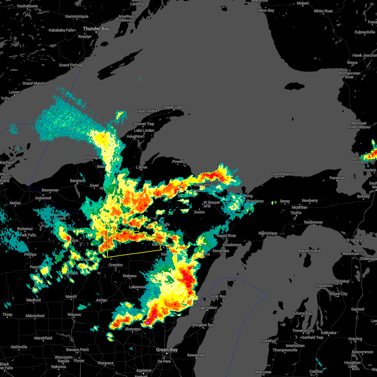
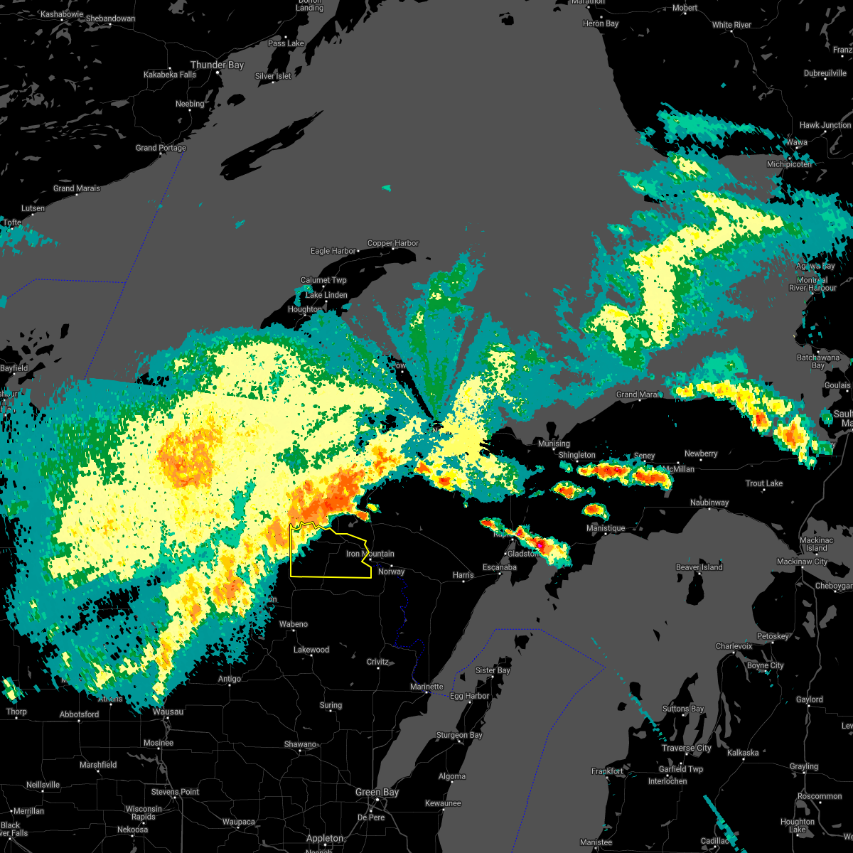
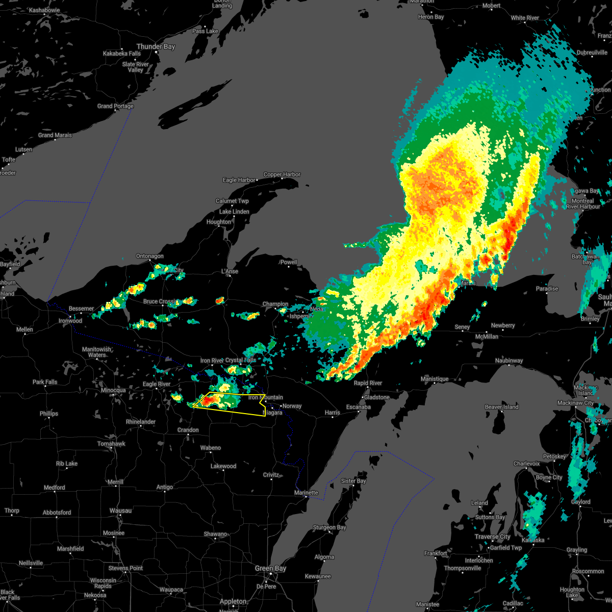
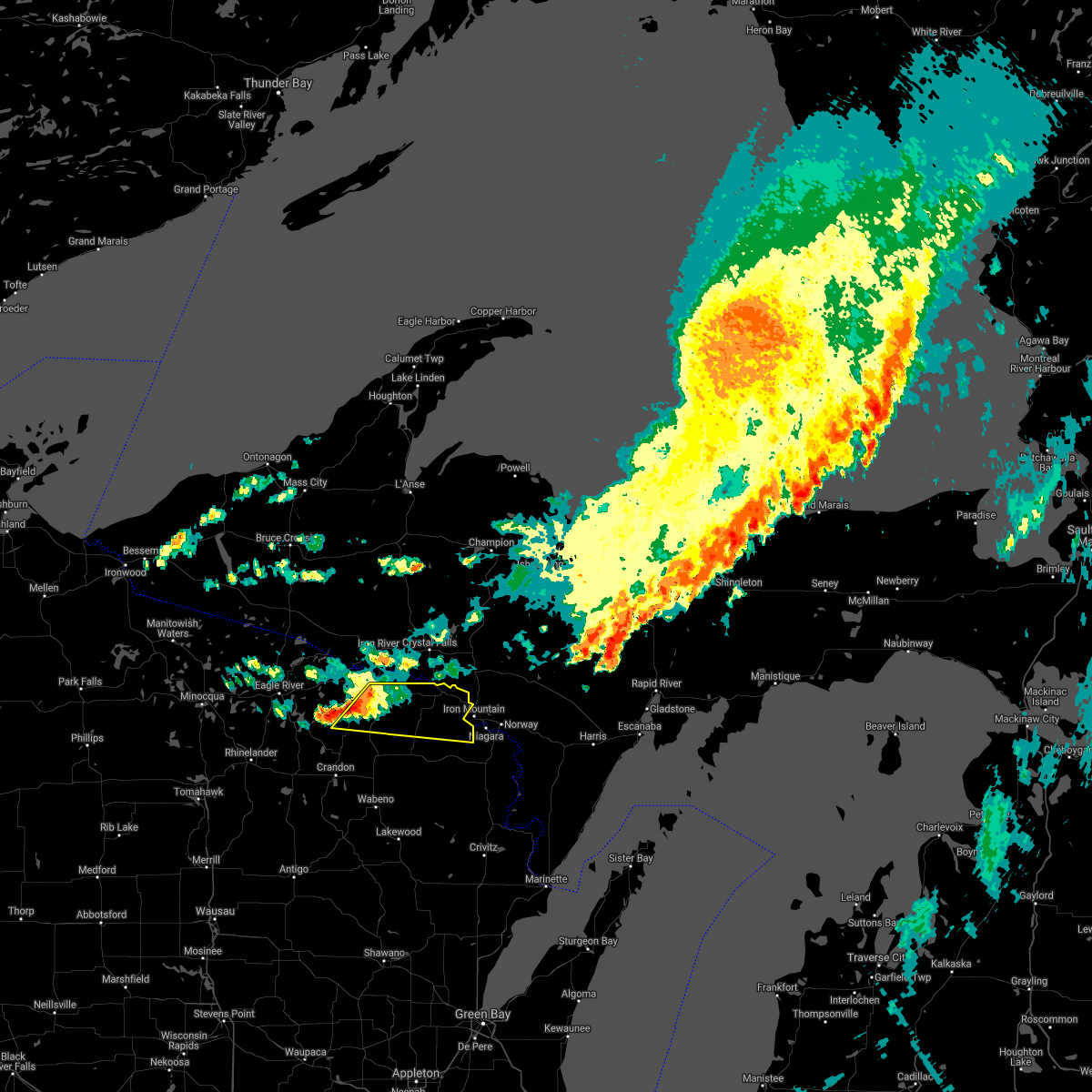
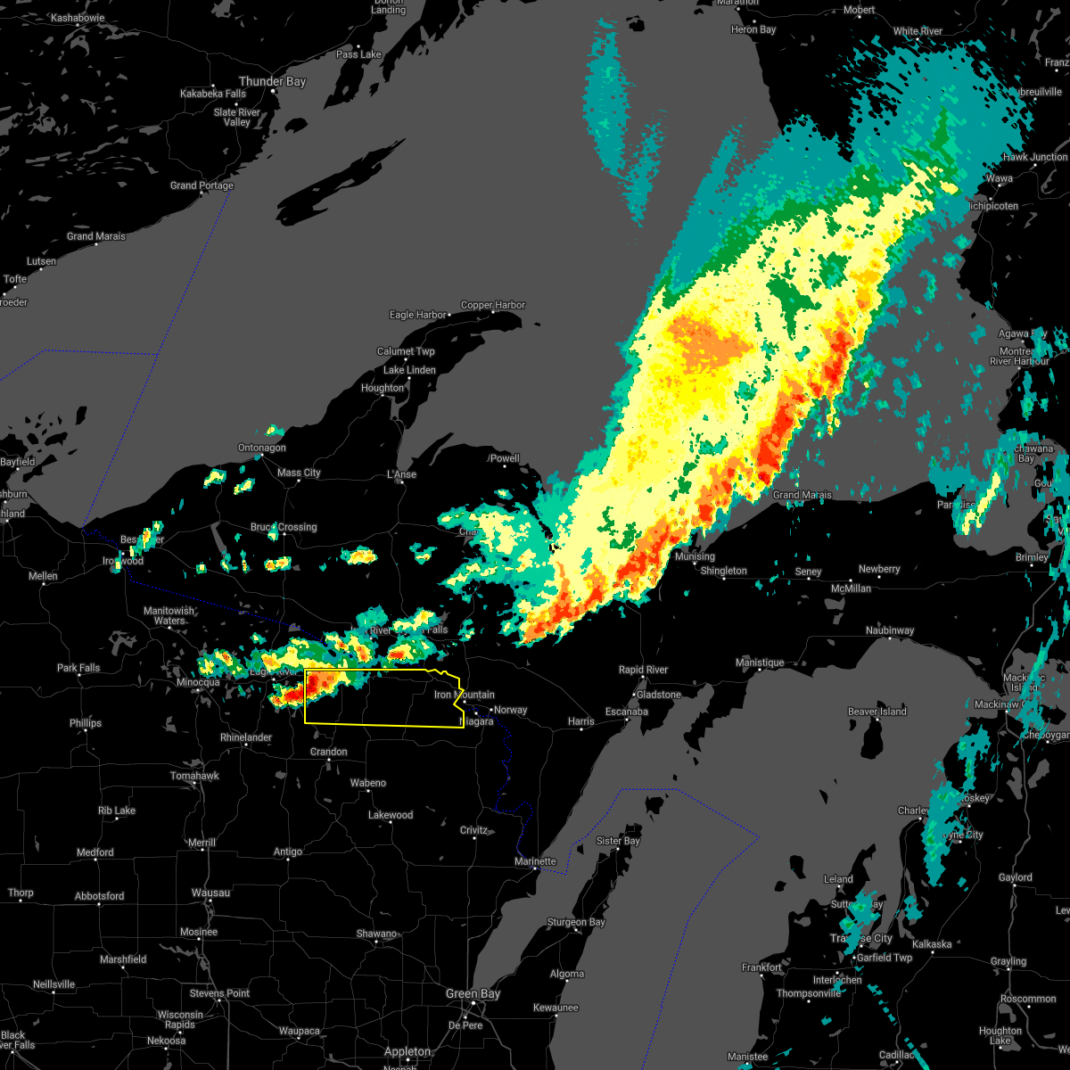
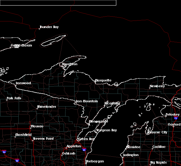
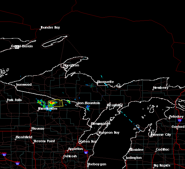
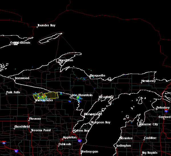
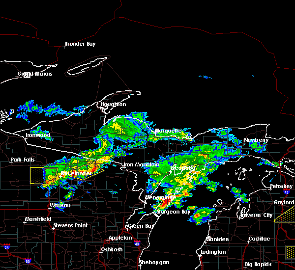
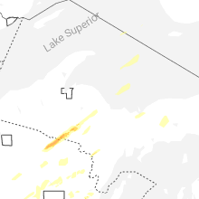
Hail Map for Long Lake, WI
The Long Lake, WI area has had 0 reports of on-the-ground hail by trained spotters, and has been under severe weather warnings 0 times during the past 12 months. Doppler radar has detected hail at or near Long Lake, WI on 24 occasions, including 1 occasion during the past year.
| Name: | Long Lake, WI |
| Where Located: | 38.6 miles ENE of Rhinelander, WI |
| Map: | Google Map for Long Lake, WI |
| Population: | 50 |
| Housing Units: | 70 |
| More Info: | Search Google for Long Lake, WI |
0
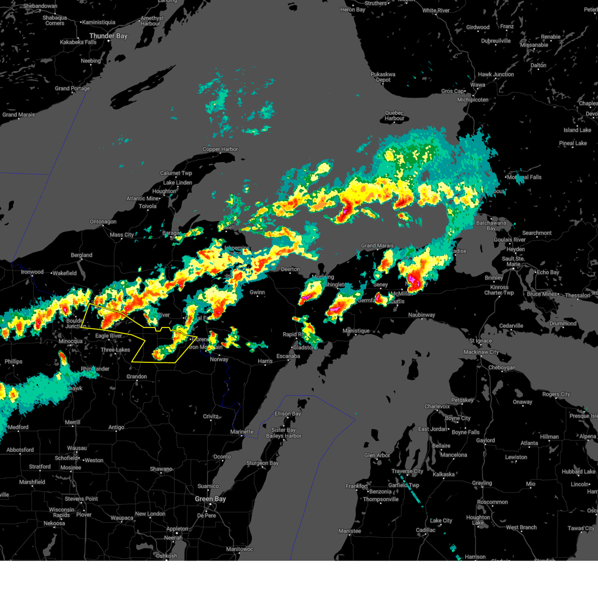
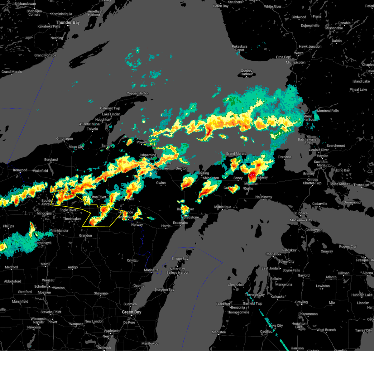
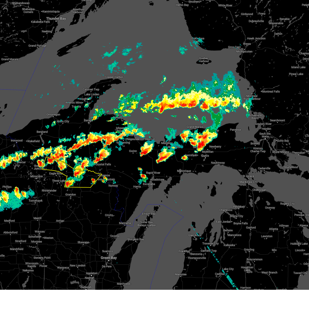
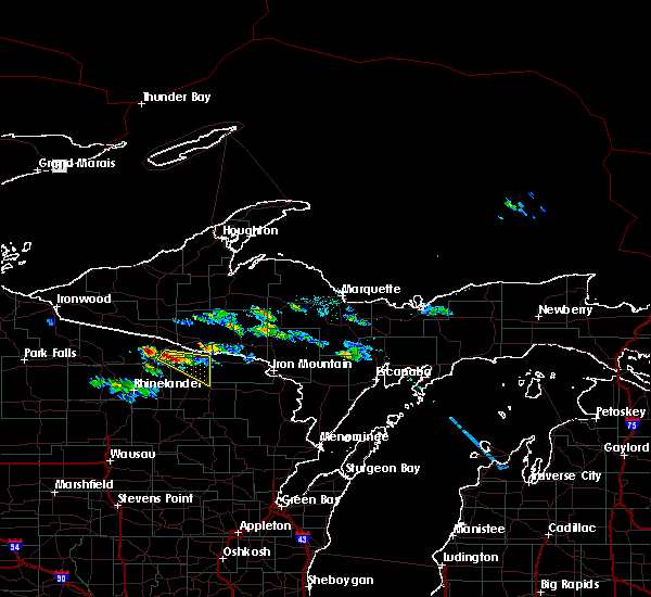
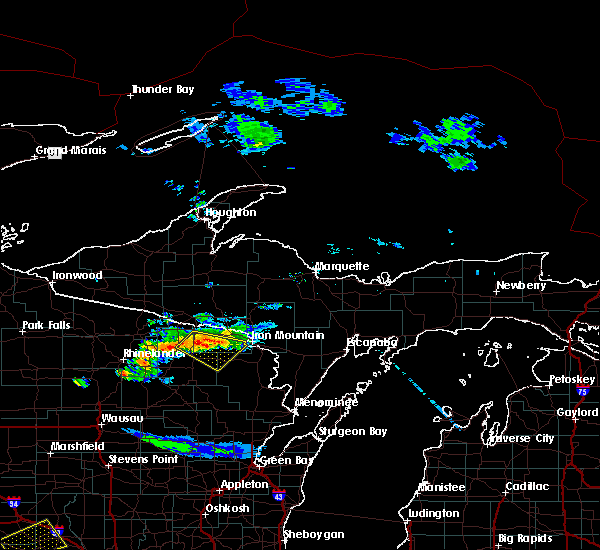
The Top Recent Hail Date for Long Lake, WI is Monday, April 28, 2025 (12th out of 24)
Hail and Wind Damage Spotted near Long Lake, WI
| Date / Time | Report Details |
|---|---|
| 7/10/2023 6:51 PM CDT |
 The severe thunderstorm warning for northern forest, northeastern vilas and florence counties will expire at 700 pm cdt, the storms which prompted the warning have weakened below severe limits, and no longer pose an immediate threat to life or property. therefore, the warning will be allowed to expire. however small hail is still possible with these thunderstorms. a severe thunderstorm watch remains in effect until midnight cdt for north central and northeastern wisconsin. The severe thunderstorm warning for northern forest, northeastern vilas and florence counties will expire at 700 pm cdt, the storms which prompted the warning have weakened below severe limits, and no longer pose an immediate threat to life or property. therefore, the warning will be allowed to expire. however small hail is still possible with these thunderstorms. a severe thunderstorm watch remains in effect until midnight cdt for north central and northeastern wisconsin.
|
| 7/10/2023 6:42 PM CDT |
 At 642 pm cdt, severe thunderstorms were located along a line extending from near whisker lake wilderness to near popple river, moving east at 45 mph. additional strong storms were moving through northeast vilas county (radar indicated). Hazards include quarter size hail. Damage to vehicles is expected. locations impacted include, florence, phelps, fern, tipler, popple river, kentuck lake campground, wisconsin slough natural area, whisker lake wilderness, johnson lake barrens natural area and conover. hail threat, radar indicated max hail size, 1. 00 in wind threat, radar indicated max wind gust, <50 mph. At 642 pm cdt, severe thunderstorms were located along a line extending from near whisker lake wilderness to near popple river, moving east at 45 mph. additional strong storms were moving through northeast vilas county (radar indicated). Hazards include quarter size hail. Damage to vehicles is expected. locations impacted include, florence, phelps, fern, tipler, popple river, kentuck lake campground, wisconsin slough natural area, whisker lake wilderness, johnson lake barrens natural area and conover. hail threat, radar indicated max hail size, 1. 00 in wind threat, radar indicated max wind gust, <50 mph.
|
| 7/10/2023 6:31 PM CDT |
 At 629 pm cdt, a severe thunderstorm was located near tipler, or 11 miles south of iron river, moving east at 45 mph. this storm has a history of large hail up to quarter size. additional strong storms were located in northern vilas county and north of hiles, and could become severe (radar indicated). Hazards include 60 mph wind gusts and half dollar size hail. Hail damage to vehicles is expected. expect wind damage to roofs, siding, and trees. locations impacted include, florence, phelps, fern, tipler, popple river, headwaters wilderness, kentuck lake campground, wisconsin slough natural area, whisker lake wilderness and johnson lake barrens natural area. hail threat, radar indicated max hail size, 1. 25 in wind threat, radar indicated max wind gust, 60 mph. At 629 pm cdt, a severe thunderstorm was located near tipler, or 11 miles south of iron river, moving east at 45 mph. this storm has a history of large hail up to quarter size. additional strong storms were located in northern vilas county and north of hiles, and could become severe (radar indicated). Hazards include 60 mph wind gusts and half dollar size hail. Hail damage to vehicles is expected. expect wind damage to roofs, siding, and trees. locations impacted include, florence, phelps, fern, tipler, popple river, headwaters wilderness, kentuck lake campground, wisconsin slough natural area, whisker lake wilderness and johnson lake barrens natural area. hail threat, radar indicated max hail size, 1. 25 in wind threat, radar indicated max wind gust, 60 mph.
|
| 7/10/2023 6:17 PM CDT |
 At 616 pm cdt, a severe thunderstorm was located near kentuck lake campground, or 15 miles southwest of iron river, moving east at 55 mph. other strong storms were developing in western vilas and northeast oneida counties, and could intensify as they shift east toward the warned area (radar indicated). Hazards include 60 mph wind gusts and quarter size hail. Hail damage to vehicles is expected. expect wind damage to roofs, siding, and trees. locations impacted include, eagle river, florence, phelps, fern, tipler, popple river, headwaters wilderness, kentuck lake campground, wisconsin slough natural area and whisker lake wilderness. hail threat, radar indicated max hail size, 1. 00 in wind threat, radar indicated max wind gust, 60 mph. At 616 pm cdt, a severe thunderstorm was located near kentuck lake campground, or 15 miles southwest of iron river, moving east at 55 mph. other strong storms were developing in western vilas and northeast oneida counties, and could intensify as they shift east toward the warned area (radar indicated). Hazards include 60 mph wind gusts and quarter size hail. Hail damage to vehicles is expected. expect wind damage to roofs, siding, and trees. locations impacted include, eagle river, florence, phelps, fern, tipler, popple river, headwaters wilderness, kentuck lake campground, wisconsin slough natural area and whisker lake wilderness. hail threat, radar indicated max hail size, 1. 00 in wind threat, radar indicated max wind gust, 60 mph.
|
| 7/10/2023 6:09 PM CDT |
 At 608 pm cdt, severe thunderstorms were located along a line extending from 6 miles northeast of kentuck lake campground to 7 miles northwest of headwaters wilderness, moving east at 40 mph. quarter size hail was recently reported 3 miles west of eagle river (radar indicated). Hazards include 60 mph wind gusts and half dollar size hail. Hail damage to vehicles is expected. expect wind damage to roofs, siding, and trees. locations impacted include, eagle river, florence, phelps, fern, tipler, popple river, headwaters wilderness, kentuck lake campground, wisconsin slough natural area and whisker lake wilderness. hail threat, radar indicated max hail size, 1. 25 in wind threat, radar indicated max wind gust, 60 mph. At 608 pm cdt, severe thunderstorms were located along a line extending from 6 miles northeast of kentuck lake campground to 7 miles northwest of headwaters wilderness, moving east at 40 mph. quarter size hail was recently reported 3 miles west of eagle river (radar indicated). Hazards include 60 mph wind gusts and half dollar size hail. Hail damage to vehicles is expected. expect wind damage to roofs, siding, and trees. locations impacted include, eagle river, florence, phelps, fern, tipler, popple river, headwaters wilderness, kentuck lake campground, wisconsin slough natural area and whisker lake wilderness. hail threat, radar indicated max hail size, 1. 25 in wind threat, radar indicated max wind gust, 60 mph.
|
| 7/10/2023 5:59 PM CDT |
 At 557 pm cdt, severe thunderstorms were located along a line extending from near phelps to near eagle river, moving east at 40 mph. another developing severe storm was located near boulder junction (radar indicated). Hazards include 60 mph wind gusts and quarter size hail. Hail damage to vehicles is expected. Expect wind damage to roofs, siding, and trees. At 557 pm cdt, severe thunderstorms were located along a line extending from near phelps to near eagle river, moving east at 40 mph. another developing severe storm was located near boulder junction (radar indicated). Hazards include 60 mph wind gusts and quarter size hail. Hail damage to vehicles is expected. Expect wind damage to roofs, siding, and trees.
|
| 6/15/2022 5:56 AM CDT |
 At 556 am cdt, a severe thunderstorm was located 8 miles west of tipler, or 13 miles southwest of iron river, moving northeast at 40 mph (radar indicated). Hazards include 60 mph wind gusts. Expect damage to roofs, siding, and trees. this severe thunderstorm will be near, wisconsin slough natural area around 605 am cdt. hail threat, radar indicated max hail size, <. 75 in wind threat, radar indicated max wind gust, 60 mph. At 556 am cdt, a severe thunderstorm was located 8 miles west of tipler, or 13 miles southwest of iron river, moving northeast at 40 mph (radar indicated). Hazards include 60 mph wind gusts. Expect damage to roofs, siding, and trees. this severe thunderstorm will be near, wisconsin slough natural area around 605 am cdt. hail threat, radar indicated max hail size, <. 75 in wind threat, radar indicated max wind gust, 60 mph.
|
| 5/12/2022 4:58 PM CDT |
 At 458 pm cdt, a severe thunderstorm was located over fern, or 15 miles west of kingsford, moving east at 25 mph (radar indicated). Hazards include 60 mph wind gusts and quarter size hail. Hail damage to vehicles is expected. expect wind damage to roofs, siding, and trees. locations impacted include, kingsford, florence, homestead, fern, tipler, popple river, wisconsin slough natural area, whisker lake wilderness, commonwealth and alvin. hail threat, radar indicated max hail size, 1. 00 in wind threat, radar indicated max wind gust, 60 mph. At 458 pm cdt, a severe thunderstorm was located over fern, or 15 miles west of kingsford, moving east at 25 mph (radar indicated). Hazards include 60 mph wind gusts and quarter size hail. Hail damage to vehicles is expected. expect wind damage to roofs, siding, and trees. locations impacted include, kingsford, florence, homestead, fern, tipler, popple river, wisconsin slough natural area, whisker lake wilderness, commonwealth and alvin. hail threat, radar indicated max hail size, 1. 00 in wind threat, radar indicated max wind gust, 60 mph.
|
| 5/12/2022 4:43 PM CDT |
 At 442 pm cdt, a severe thunderstorm was located near tipler, or 12 miles southwest of iron river, moving northeast at 40 mph (radar indicated). Hazards include 60 mph wind gusts and quarter size hail. Hail damage to vehicles is expected. expect wind damage to roofs, siding, and trees. locations impacted include, wisconsin slough natural area and whisker lake wilderness. hail threat, radar indicated max hail size, 1. 00 in wind threat, radar indicated max wind gust, 60 mph. At 442 pm cdt, a severe thunderstorm was located near tipler, or 12 miles southwest of iron river, moving northeast at 40 mph (radar indicated). Hazards include 60 mph wind gusts and quarter size hail. Hail damage to vehicles is expected. expect wind damage to roofs, siding, and trees. locations impacted include, wisconsin slough natural area and whisker lake wilderness. hail threat, radar indicated max hail size, 1. 00 in wind threat, radar indicated max wind gust, 60 mph.
|
| 5/12/2022 4:28 PM CDT |
 At 427 pm cdt, a severe thunderstorm was located near headwaters wilderness, or 13 miles southeast of eagle river, moving northeast at 20 mph (public). Hazards include 60 mph wind gusts and quarter size hail. Hail damage to vehicles is expected. expect wind damage to roofs, siding, and trees. this severe thunderstorm will be near, headwaters wilderness around 430 pm cdt. other locations in the path of this severe thunderstorm include tipler, wisconsin slough natural area and whisker lake wilderness. hail threat, observed max hail size, 1. 00 in wind threat, radar indicated max wind gust, 60 mph. At 427 pm cdt, a severe thunderstorm was located near headwaters wilderness, or 13 miles southeast of eagle river, moving northeast at 20 mph (public). Hazards include 60 mph wind gusts and quarter size hail. Hail damage to vehicles is expected. expect wind damage to roofs, siding, and trees. this severe thunderstorm will be near, headwaters wilderness around 430 pm cdt. other locations in the path of this severe thunderstorm include tipler, wisconsin slough natural area and whisker lake wilderness. hail threat, observed max hail size, 1. 00 in wind threat, radar indicated max wind gust, 60 mph.
|
| 7/26/2021 11:06 PM CDT |
 At 1105 pm cdt, a severe thunderstorm was located near wisconsin slough natural area, or 9 miles southwest of iron river, moving east at 35 mph (radar indicated). Hazards include 60 mph wind gusts and penny size hail. Expect damage to roofs, siding, and trees. this severe thunderstorm will be near, tipler and wisconsin slough natural area around 1115 pm cdt. Other locations in the path of this severe thunderstorm include whisker lake wilderness, fern, florence, homestead and kingsford. At 1105 pm cdt, a severe thunderstorm was located near wisconsin slough natural area, or 9 miles southwest of iron river, moving east at 35 mph (radar indicated). Hazards include 60 mph wind gusts and penny size hail. Expect damage to roofs, siding, and trees. this severe thunderstorm will be near, tipler and wisconsin slough natural area around 1115 pm cdt. Other locations in the path of this severe thunderstorm include whisker lake wilderness, fern, florence, homestead and kingsford.
|
| 9/25/2020 11:08 PM CDT |
 At 1107 pm cdt, a severe thunderstorm was located near fern, or 19 miles south of iron river, moving east at 50 mph (radar indicated). Hazards include 60 mph wind gusts and penny size hail. Expect damage to roofs, siding, and trees. Locations impacted include, kingsford, homestead, fern, popple river, aurora, fence, long lake, popple river headwaters natural area, bastile lake natural area and lasalle falls. At 1107 pm cdt, a severe thunderstorm was located near fern, or 19 miles south of iron river, moving east at 50 mph (radar indicated). Hazards include 60 mph wind gusts and penny size hail. Expect damage to roofs, siding, and trees. Locations impacted include, kingsford, homestead, fern, popple river, aurora, fence, long lake, popple river headwaters natural area, bastile lake natural area and lasalle falls.
|
| 9/25/2020 11:00 PM CDT |
 At 1059 pm cdt, a severe thunderstorm was located near popple river, or 17 miles south of iron river, moving east at 50 mph (radar indicated). Hazards include 60 mph wind gusts and penny size hail. Expect damage to roofs, siding, and trees. Locations impacted include, kingsford, florence, homestead, fern, tipler, popple river, whisker lake wilderness, aurora, commonwealth and fence. At 1059 pm cdt, a severe thunderstorm was located near popple river, or 17 miles south of iron river, moving east at 50 mph (radar indicated). Hazards include 60 mph wind gusts and penny size hail. Expect damage to roofs, siding, and trees. Locations impacted include, kingsford, florence, homestead, fern, tipler, popple river, whisker lake wilderness, aurora, commonwealth and fence.
|
| 9/25/2020 10:44 PM CDT |
 At 1043 pm cdt, a severe thunderstorm was located near headwaters wilderness, or 15 miles east of eagle river, moving east at 50 mph (radar indicated). Hazards include 60 mph wind gusts and quarter size hail. Hail damage to vehicles is expected. Expect wind damage to roofs, siding, and trees. At 1043 pm cdt, a severe thunderstorm was located near headwaters wilderness, or 15 miles east of eagle river, moving east at 50 mph (radar indicated). Hazards include 60 mph wind gusts and quarter size hail. Hail damage to vehicles is expected. Expect wind damage to roofs, siding, and trees.
|
| 8/21/2020 8:02 PM CDT |
 At 801 pm cdt, severe thunderstorms were located along a line extending from 10 miles south of tipler to near popple river to near headwaters wilderness, moving southeast at 20 mph (radar indicated). Hazards include 60 mph wind gusts and penny size hail. Expect damage to roofs, siding, and trees. Locations impacted include, crandon, phelps, fern, tipler, popple river, headwaters wilderness, kentuck lake campground, north otter creek natural area, three lakes and laona. At 801 pm cdt, severe thunderstorms were located along a line extending from 10 miles south of tipler to near popple river to near headwaters wilderness, moving southeast at 20 mph (radar indicated). Hazards include 60 mph wind gusts and penny size hail. Expect damage to roofs, siding, and trees. Locations impacted include, crandon, phelps, fern, tipler, popple river, headwaters wilderness, kentuck lake campground, north otter creek natural area, three lakes and laona.
|
| 8/21/2020 7:39 PM CDT |
 At 739 pm cdt, severe thunderstorms were located along a line extending from phelps to 13 miles southwest of headwaters wilderness, moving southeast at 15 mph (radar indicated). Hazards include 60 mph wind gusts and penny size hail. expect damage to roofs, siding, and trees At 739 pm cdt, severe thunderstorms were located along a line extending from phelps to 13 miles southwest of headwaters wilderness, moving southeast at 15 mph (radar indicated). Hazards include 60 mph wind gusts and penny size hail. expect damage to roofs, siding, and trees
|
| 7/19/2020 1:59 AM CDT |
 At 140 am cdt, a severe thunderstorm was located over north otter creek natural area, or 7 miles east of crandon, moving east at 50 mph (radar indicated). Hazards include 60 mph wind gusts and quarter size hail. Hail damage to vehicles is expected. Expect wind damage to roofs, siding, and trees. At 140 am cdt, a severe thunderstorm was located over north otter creek natural area, or 7 miles east of crandon, moving east at 50 mph (radar indicated). Hazards include 60 mph wind gusts and quarter size hail. Hail damage to vehicles is expected. Expect wind damage to roofs, siding, and trees.
|
| 7/19/2020 1:55 AM CDT |
 The severe thunderstorm warning for central forest and florence counties will expire at 200 am cdt, the storm which prompted the warning has moved out of the area. therefore, the warning will be allowed to expire. however gusty winds are still possible with this thunderstorm. a severe thunderstorm watch remains in effect until 500 am cdt for northeastern wisconsin. a severe thunderstorm warning still remains in effect for much of florence and southeastern forest county. The severe thunderstorm warning for central forest and florence counties will expire at 200 am cdt, the storm which prompted the warning has moved out of the area. therefore, the warning will be allowed to expire. however gusty winds are still possible with this thunderstorm. a severe thunderstorm watch remains in effect until 500 am cdt for northeastern wisconsin. a severe thunderstorm warning still remains in effect for much of florence and southeastern forest county.
|
| 7/19/2020 1:49 AM CDT |
 At 147 am cdt, a cluster of severe thunderstorms was located through much of florence county and portions of forest county, moving east at 50 mph (radar indicated). Hazards include 60 mph wind gusts and quarter size hail. Hail damage to vehicles is expected. expect wind damage to roofs, siding, and trees. Locations impacted include, florence, fern, tipler, popple river, wisconsin slough natural area, whisker lake wilderness, commonwealth, long lake, popple river headwaters natural area and bastile lake natural area. At 147 am cdt, a cluster of severe thunderstorms was located through much of florence county and portions of forest county, moving east at 50 mph (radar indicated). Hazards include 60 mph wind gusts and quarter size hail. Hail damage to vehicles is expected. expect wind damage to roofs, siding, and trees. Locations impacted include, florence, fern, tipler, popple river, wisconsin slough natural area, whisker lake wilderness, commonwealth, long lake, popple river headwaters natural area and bastile lake natural area.
|
| 7/19/2020 1:40 AM CDT |
 At 140 am cdt, a severe thunderstorm was located over north otter creek natural area, or 7 miles east of crandon, moving east at 50 mph (radar indicated). Hazards include 60 mph wind gusts and quarter size hail. Hail damage to vehicles is expected. Expect wind damage to roofs, siding, and trees. At 140 am cdt, a severe thunderstorm was located over north otter creek natural area, or 7 miles east of crandon, moving east at 50 mph (radar indicated). Hazards include 60 mph wind gusts and quarter size hail. Hail damage to vehicles is expected. Expect wind damage to roofs, siding, and trees.
|
| 7/19/2020 1:32 AM CDT |
 At 131 am cdt, a severe thunderstorm was located over tipler, or 14 miles south of iron river, moving east at 45 mph (radar indicated). Hazards include 60 mph wind gusts and quarter size hail. Hail damage to vehicles is expected. expect wind damage to roofs, siding, and trees. Locations impacted include, florence, fern, tipler, popple river, wisconsin slough natural area, whisker lake wilderness, commonwealth, alvin, long lake and popple river headwaters natural area. At 131 am cdt, a severe thunderstorm was located over tipler, or 14 miles south of iron river, moving east at 45 mph (radar indicated). Hazards include 60 mph wind gusts and quarter size hail. Hail damage to vehicles is expected. expect wind damage to roofs, siding, and trees. Locations impacted include, florence, fern, tipler, popple river, wisconsin slough natural area, whisker lake wilderness, commonwealth, alvin, long lake and popple river headwaters natural area.
|
| 7/19/2020 1:24 AM CDT |
 At 124 am cdt, a severe thunderstorm was located near tipler, or 14 miles southwest of iron river, moving east at 50 mph (radar indicated). Hazards include 60 mph wind gusts and quarter size hail. Hail damage to vehicles is expected. Expect wind damage to roofs, siding, and trees. At 124 am cdt, a severe thunderstorm was located near tipler, or 14 miles southwest of iron river, moving east at 50 mph (radar indicated). Hazards include 60 mph wind gusts and quarter size hail. Hail damage to vehicles is expected. Expect wind damage to roofs, siding, and trees.
|
| 7/9/2020 1:03 AM CDT |
 At 102 am cdt, a severe thunderstorm was located near tipler, or 16 miles south of iron river, moving east at 35 mph (radar indicated). Hazards include 60 mph wind gusts and quarter size hail. Hail damage to vehicles is expected. Expect wind damage to roofs, siding, and trees. At 102 am cdt, a severe thunderstorm was located near tipler, or 16 miles south of iron river, moving east at 35 mph (radar indicated). Hazards include 60 mph wind gusts and quarter size hail. Hail damage to vehicles is expected. Expect wind damage to roofs, siding, and trees.
|
| 8/5/2019 1:57 PM CDT |
 At 157 pm cdt, severe thunderstorms were located along a line extending from near stambaugh to 8 miles northwest of goodman to 9 miles northeast of carter to near woodlawn, moving east at 50 mph (radar indicated). Hazards include 60 mph wind gusts. Expect damage to roofs, siding, and trees. Locations impacted include, kingsford, florence, crivitz, pembine, goodman, wausaukee, homestead, fern, tipler and popple river. At 157 pm cdt, severe thunderstorms were located along a line extending from near stambaugh to 8 miles northwest of goodman to 9 miles northeast of carter to near woodlawn, moving east at 50 mph (radar indicated). Hazards include 60 mph wind gusts. Expect damage to roofs, siding, and trees. Locations impacted include, kingsford, florence, crivitz, pembine, goodman, wausaukee, homestead, fern, tipler and popple river.
|
| 8/5/2019 1:54 PM CDT |
 The severe thunderstorm warning for forest, southeastern vilas and eastern oneida counties will expire at 200 pm cdt, the storms which prompted the warning have moved out of the area. therefore, the warning will be allowed to expire. however gusty winds are still possible with these thunderstorms. a severe thunderstorm watch remains in effect until 1000 pm cdt for northeastern wisconsin. remember, a new severe thunderstorm warning still remains in effect for eastern forest county until 245 pm cdt. The severe thunderstorm warning for forest, southeastern vilas and eastern oneida counties will expire at 200 pm cdt, the storms which prompted the warning have moved out of the area. therefore, the warning will be allowed to expire. however gusty winds are still possible with these thunderstorms. a severe thunderstorm watch remains in effect until 1000 pm cdt for northeastern wisconsin. remember, a new severe thunderstorm warning still remains in effect for eastern forest county until 245 pm cdt.
|
| 8/5/2019 1:40 PM CDT |
 At 139 pm cdt, severe thunderstorms were located along a line extending from 10 miles northeast of phelps to near popple river to near ma ka ja wan scout reservation, moving east at 55 mph (radar indicated). Hazards include 60 mph wind gusts. expect damage to roofs, siding, and trees At 139 pm cdt, severe thunderstorms were located along a line extending from 10 miles northeast of phelps to near popple river to near ma ka ja wan scout reservation, moving east at 55 mph (radar indicated). Hazards include 60 mph wind gusts. expect damage to roofs, siding, and trees
|
| 8/5/2019 1:29 PM CDT |
 At 128 pm cdt, severe thunderstorms were located along a line extending from near kentuck lake campground to near headwaters wilderness to 12 miles northwest of pearson, moving east at 45 mph (radar indicated). Hazards include 60 mph wind gusts. Expect damage to roofs, siding, and trees. Locations impacted include, crandon, phelps, popple river, headwaters wilderness, kentuck lake campground, north otter creek natural area, three lakes, laona, nashville and argonne. At 128 pm cdt, severe thunderstorms were located along a line extending from near kentuck lake campground to near headwaters wilderness to 12 miles northwest of pearson, moving east at 45 mph (radar indicated). Hazards include 60 mph wind gusts. Expect damage to roofs, siding, and trees. Locations impacted include, crandon, phelps, popple river, headwaters wilderness, kentuck lake campground, north otter creek natural area, three lakes, laona, nashville and argonne.
|
| 8/5/2019 1:16 PM CDT |
 At 115 pm cdt, severe thunderstorms were located along a line extending from 6 miles southwest of phelps to 10 miles southwest of headwaters wilderness to near harrison, moving east at 45 mph (radar indicated). Hazards include 60 mph wind gusts. Expect damage to roofs, siding, and trees. Locations impacted include, rhinelander, crandon, eagle river, tomahawk, phelps, woodboro, popple river, headwaters wilderness, kentuck lake campground and north otter creek natural area. At 115 pm cdt, severe thunderstorms were located along a line extending from 6 miles southwest of phelps to 10 miles southwest of headwaters wilderness to near harrison, moving east at 45 mph (radar indicated). Hazards include 60 mph wind gusts. Expect damage to roofs, siding, and trees. Locations impacted include, rhinelander, crandon, eagle river, tomahawk, phelps, woodboro, popple river, headwaters wilderness, kentuck lake campground and north otter creek natural area.
|
| 8/5/2019 1:02 PM CDT |
 At 102 pm cdt, severe thunderstorms were located along a line extending from 9 miles north of rainbow flowage to near crystal lake scout reservation to near tomahawk, moving east at 40 mph (radar indicated). Hazards include 60 mph wind gusts. expect damage to roofs, siding, and trees At 102 pm cdt, severe thunderstorms were located along a line extending from 9 miles north of rainbow flowage to near crystal lake scout reservation to near tomahawk, moving east at 40 mph (radar indicated). Hazards include 60 mph wind gusts. expect damage to roofs, siding, and trees
|
| 7/12/2019 2:06 PM CDT |
 At 205 pm cdt, a severe thunderstorm was located 10 miles northeast of eagle river, moving southeast at 35 mph (radar indicated). Hazards include ping pong ball size hail and 60 mph wind gusts. People and animals outdoors will be injured. expect hail damage to roofs, siding, windows, and vehicles. expect wind damage to roofs, siding, and trees. Locations impacted include, popple river, kentuck lake campground, luna-white deer campground, franklin lake campground, popple river headwaters natural area, bastile lake natural area, anvil lake campground, newald, windsor dam campground and stevens lake campground. At 205 pm cdt, a severe thunderstorm was located 10 miles northeast of eagle river, moving southeast at 35 mph (radar indicated). Hazards include ping pong ball size hail and 60 mph wind gusts. People and animals outdoors will be injured. expect hail damage to roofs, siding, windows, and vehicles. expect wind damage to roofs, siding, and trees. Locations impacted include, popple river, kentuck lake campground, luna-white deer campground, franklin lake campground, popple river headwaters natural area, bastile lake natural area, anvil lake campground, newald, windsor dam campground and stevens lake campground.
|
| 7/12/2019 1:52 PM CDT |
 At 152 pm cdt, a severe thunderstorm was located near phelps, or 8 miles north of eagle river, moving southeast at 35 mph (radar indicated). Hazards include 60 mph wind gusts and quarter size hail. Hail damage to vehicles is expected. Expect wind damage to roofs, siding, and trees. At 152 pm cdt, a severe thunderstorm was located near phelps, or 8 miles north of eagle river, moving southeast at 35 mph (radar indicated). Hazards include 60 mph wind gusts and quarter size hail. Hail damage to vehicles is expected. Expect wind damage to roofs, siding, and trees.
|
| 6/17/2018 6:54 PM CDT |
 At 654 pm cdt, severe thunderstorms were located along a line extending from 6 miles southeast of tipler to 7 miles southeast of popple river to near crandon, moving east at 40 mph (radar indicated). Hazards include 60 mph wind gusts. Expect damage to roofs, siding, and trees. these severe storms will be near, florence around 715 pm cdt. homestead around 720 pm cdt. kingsford around 725 pm cdt. Other locations impacted by these severe thunderstorms include blackwell, lasalle falls, spread eagle, nashville, mole lake, aurora, laona, argonne, wabeno and commonwealth. At 654 pm cdt, severe thunderstorms were located along a line extending from 6 miles southeast of tipler to 7 miles southeast of popple river to near crandon, moving east at 40 mph (radar indicated). Hazards include 60 mph wind gusts. Expect damage to roofs, siding, and trees. these severe storms will be near, florence around 715 pm cdt. homestead around 720 pm cdt. kingsford around 725 pm cdt. Other locations impacted by these severe thunderstorms include blackwell, lasalle falls, spread eagle, nashville, mole lake, aurora, laona, argonne, wabeno and commonwealth.
|
| 6/17/2018 6:34 PM CDT |
 At 633 pm cdt, severe thunderstorms were located along a line extending from 8 miles northwest of tipler to 8 miles northwest of popple river to 9 miles northwest of crandon, moving east at 40 mph (radar indicated). Hazards include 60 mph wind gusts. Expect damage to roofs, siding, and trees. severe thunderstorms will be near, popple river around 645 pm cdt. tipler around 650 pm cdt. florence around 710 pm cdt. homestead around 720 pm cdt. kingsford around 725 pm cdt. Other locations impacted by these severe thunderstorms include gagen, blackwell, aurora, argonne, wabeno, commonwealth, lost lake campground, bear lake campground, fence and monico. At 633 pm cdt, severe thunderstorms were located along a line extending from 8 miles northwest of tipler to 8 miles northwest of popple river to 9 miles northwest of crandon, moving east at 40 mph (radar indicated). Hazards include 60 mph wind gusts. Expect damage to roofs, siding, and trees. severe thunderstorms will be near, popple river around 645 pm cdt. tipler around 650 pm cdt. florence around 710 pm cdt. homestead around 720 pm cdt. kingsford around 725 pm cdt. Other locations impacted by these severe thunderstorms include gagen, blackwell, aurora, argonne, wabeno, commonwealth, lost lake campground, bear lake campground, fence and monico.
|
| 7/12/2017 6:45 PM CDT |
 At 645 pm cdt, a severe thunderstorm was located 7 miles east of popple river, or 20 miles west of kingsford, moving southeast at 25 mph (radar indicated). Hazards include ping pong ball size hail and 60 mph wind gusts. People and animals outdoors will be injured. expect hail damage to roofs, siding, windows, and vehicles. expect wind damage to roofs, siding, and trees. Locations impacted include, kingsford, goodman, homestead, popple river, armstrong creek, fence, long lake, lasalle falls, morgan lake campground and newald. At 645 pm cdt, a severe thunderstorm was located 7 miles east of popple river, or 20 miles west of kingsford, moving southeast at 25 mph (radar indicated). Hazards include ping pong ball size hail and 60 mph wind gusts. People and animals outdoors will be injured. expect hail damage to roofs, siding, windows, and vehicles. expect wind damage to roofs, siding, and trees. Locations impacted include, kingsford, goodman, homestead, popple river, armstrong creek, fence, long lake, lasalle falls, morgan lake campground and newald.
|
| 7/12/2017 6:40 PM CDT |
 At 639 pm cdt, a severe thunderstorm was located near popple river, or 20 miles south of iron river, moving southeast at 25 mph (radar indicated). Hazards include 60 mph wind gusts and half dollar size hail. Hail damage to vehicles is expected. expect wind damage to roofs, siding, and trees. Locations impacted include, kingsford, goodman, homestead, tipler, popple river, armstrong creek, fence, long lake, lasalle falls and morgan lake campground. At 639 pm cdt, a severe thunderstorm was located near popple river, or 20 miles south of iron river, moving southeast at 25 mph (radar indicated). Hazards include 60 mph wind gusts and half dollar size hail. Hail damage to vehicles is expected. expect wind damage to roofs, siding, and trees. Locations impacted include, kingsford, goodman, homestead, tipler, popple river, armstrong creek, fence, long lake, lasalle falls and morgan lake campground.
|
| 7/12/2017 6:27 PM CDT |
 At 627 pm cdt, a severe thunderstorm was located over popple river, or 18 miles south of iron river, moving southeast at 25 mph (radar indicated). Hazards include 60 mph wind gusts and quarter size hail. Hail damage to vehicles is expected. Expect wind damage to roofs, siding, and trees. At 627 pm cdt, a severe thunderstorm was located over popple river, or 18 miles south of iron river, moving southeast at 25 mph (radar indicated). Hazards include 60 mph wind gusts and quarter size hail. Hail damage to vehicles is expected. Expect wind damage to roofs, siding, and trees.
|
| 7/6/2017 7:58 PM CDT |
 At 747 pm cdt, severe thunderstorms were located along a line extending from 6 miles west of florence to tipler, moving east at 30 mph (radar indicated). Hazards include 60 mph wind gusts and quarter size hail. Hail damage to vehicles is expected. expect wind damage to roofs, siding, and trees. Locations impacted include, kingsford, florence, homestead, tipler, aurora, commonwealth, long lake, lasalle falls, spread eagle and morgan lake campground. At 747 pm cdt, severe thunderstorms were located along a line extending from 6 miles west of florence to tipler, moving east at 30 mph (radar indicated). Hazards include 60 mph wind gusts and quarter size hail. Hail damage to vehicles is expected. expect wind damage to roofs, siding, and trees. Locations impacted include, kingsford, florence, homestead, tipler, aurora, commonwealth, long lake, lasalle falls, spread eagle and morgan lake campground.
|
| 7/6/2017 7:47 PM CDT |
 At 747 pm cdt, severe thunderstorms were located along a line extending from 6 miles west of florence to tipler, moving east at 30 mph (radar indicated). Hazards include 60 mph wind gusts and quarter size hail. Hail damage to vehicles is expected. expect wind damage to roofs, siding, and trees. Locations impacted include, kingsford, florence, homestead, tipler, aurora, commonwealth, long lake, lasalle falls, spread eagle and morgan lake campground. At 747 pm cdt, severe thunderstorms were located along a line extending from 6 miles west of florence to tipler, moving east at 30 mph (radar indicated). Hazards include 60 mph wind gusts and quarter size hail. Hail damage to vehicles is expected. expect wind damage to roofs, siding, and trees. Locations impacted include, kingsford, florence, homestead, tipler, aurora, commonwealth, long lake, lasalle falls, spread eagle and morgan lake campground.
|
| 7/6/2017 7:28 PM CDT |
 At 728 pm cdt, a severe thunderstorm was located over florence, or 10 miles south of crystal falls, moving east at 30 mph (radar indicated). Hazards include 60 mph wind gusts and quarter size hail. Hail damage to vehicles is expected. Expect wind damage to roofs, siding, and trees. At 728 pm cdt, a severe thunderstorm was located over florence, or 10 miles south of crystal falls, moving east at 30 mph (radar indicated). Hazards include 60 mph wind gusts and quarter size hail. Hail damage to vehicles is expected. Expect wind damage to roofs, siding, and trees.
|
| 6/11/2017 9:12 PM CDT |
 At 912 pm cdt, a severe thunderstorm was located near homestead, or 10 miles west of kingsford, moving east at 50 mph (radar indicated). Hazards include 60 mph wind gusts and penny size hail. Expect damage to roofs, siding, and trees. Locations impacted include, kingsford, florence, homestead, aurora, commonwealth, fence, long lake, lasalle falls, spread eagle and morgan lake campground. At 912 pm cdt, a severe thunderstorm was located near homestead, or 10 miles west of kingsford, moving east at 50 mph (radar indicated). Hazards include 60 mph wind gusts and penny size hail. Expect damage to roofs, siding, and trees. Locations impacted include, kingsford, florence, homestead, aurora, commonwealth, fence, long lake, lasalle falls, spread eagle and morgan lake campground.
|
| 6/11/2017 8:52 PM CDT |
 At 852 pm cdt, a severe thunderstorm was located near popple river, or 18 miles northeast of crandon, moving east at 50 mph (radar indicated). Hazards include 60 mph wind gusts and penny size hail. expect damage to roofs, siding, and trees At 852 pm cdt, a severe thunderstorm was located near popple river, or 18 miles northeast of crandon, moving east at 50 mph (radar indicated). Hazards include 60 mph wind gusts and penny size hail. expect damage to roofs, siding, and trees
|
| 6/11/2017 8:04 PM CDT |
 At 803 pm cdt, a severe thunderstorm was located 8 miles southwest of florence, or 15 miles west of kingsford, moving east at 35 mph (radar indicated). Hazards include 70 mph wind gusts and nickel size hail. Expect considerable tree damage. damage is likely to mobile homes, roofs, and outbuildings. Locations impacted include, kingsford, florence, homestead, tipler, aurora, commonwealth, fence, long lake, lasalle falls and spread eagle. At 803 pm cdt, a severe thunderstorm was located 8 miles southwest of florence, or 15 miles west of kingsford, moving east at 35 mph (radar indicated). Hazards include 70 mph wind gusts and nickel size hail. Expect considerable tree damage. damage is likely to mobile homes, roofs, and outbuildings. Locations impacted include, kingsford, florence, homestead, tipler, aurora, commonwealth, fence, long lake, lasalle falls and spread eagle.
|
| 6/11/2017 7:56 PM CDT |
 At 756 pm cdt, a severe thunderstorm was located near tipler, or 16 miles southeast of iron river, moving east at 35 mph (radar indicated). Hazards include 60 mph wind gusts and nickel size hail. expect damage to roofs, siding, and trees At 756 pm cdt, a severe thunderstorm was located near tipler, or 16 miles southeast of iron river, moving east at 35 mph (radar indicated). Hazards include 60 mph wind gusts and nickel size hail. expect damage to roofs, siding, and trees
|
| 6/11/2017 12:52 PM CDT |
 At 1251 pm cdt, severe thunderstorms were located along a line extending from near stambaugh to 9 miles northwest of goodman to near carter, moving east at 60 mph (radar indicated). Hazards include 60 mph wind gusts and quarter size hail. Hail damage to vehicles is expected. expect wind damage to roofs, siding, and trees. Locations impacted include, kingsford, florence, pembine, goodman, homestead, tipler, popple river, carter, niagara and laona. At 1251 pm cdt, severe thunderstorms were located along a line extending from near stambaugh to 9 miles northwest of goodman to near carter, moving east at 60 mph (radar indicated). Hazards include 60 mph wind gusts and quarter size hail. Hail damage to vehicles is expected. expect wind damage to roofs, siding, and trees. Locations impacted include, kingsford, florence, pembine, goodman, homestead, tipler, popple river, carter, niagara and laona.
|
| 6/11/2017 12:38 PM CDT |
 At 1237 pm cdt, severe thunderstorms were located along a line extending from 6 miles northeast of phelps to 7 miles east of crandon to near wittenberg, moving east at 55 mph (radar indicated). Hazards include 60 mph wind gusts and quarter size hail. Hail damage to vehicles is expected. expect wind damage to roofs, siding, and trees. severe thunderstorms will be near, goodman around 100 pm cdt. pembine around 115 pm cdt. Other locations impacted by these severe thunderstorms include blackwell, beecher, silver cliff, aurora, argonne, mcclintock county park, wabeno, commonwealth, bear lake campground and lost lake campground. At 1237 pm cdt, severe thunderstorms were located along a line extending from 6 miles northeast of phelps to 7 miles east of crandon to near wittenberg, moving east at 55 mph (radar indicated). Hazards include 60 mph wind gusts and quarter size hail. Hail damage to vehicles is expected. expect wind damage to roofs, siding, and trees. severe thunderstorms will be near, goodman around 100 pm cdt. pembine around 115 pm cdt. Other locations impacted by these severe thunderstorms include blackwell, beecher, silver cliff, aurora, argonne, mcclintock county park, wabeno, commonwealth, bear lake campground and lost lake campground.
|
| 6/3/2017 6:07 PM CDT |
 At 606 pm cdt, severe thunderstorms were located along a line extending from 6 miles southeast of pembine to near goodman to 19 miles southeast of popple river to 9 miles north of carter, moving southeast at 35 mph (radar indicated). Hazards include 60 mph wind gusts and quarter size hail. Hail damage to vehicles is expected. expect wind damage to roofs, siding, and trees. Locations impacted include, crandon, kingsford, pembine, goodman, wausaukee, homestead, popple river, carter, niagara and laona. At 606 pm cdt, severe thunderstorms were located along a line extending from 6 miles southeast of pembine to near goodman to 19 miles southeast of popple river to 9 miles north of carter, moving southeast at 35 mph (radar indicated). Hazards include 60 mph wind gusts and quarter size hail. Hail damage to vehicles is expected. expect wind damage to roofs, siding, and trees. Locations impacted include, crandon, kingsford, pembine, goodman, wausaukee, homestead, popple river, carter, niagara and laona.
|
| 6/3/2017 5:48 PM CDT |
 At 547 pm cdt, severe thunderstorms were located along a line extending from near kingsford to near goodman to 11 miles southeast of popple river to near crandon, moving east at 30 mph (radar indicated). Hazards include 60 mph wind gusts and quarter size hail. Hail damage to vehicles is expected. expect wind damage to roofs, siding, and trees. Locations impacted include, crandon, kingsford, pembine, goodman, wausaukee, homestead, popple river, carter, niagara and laona. At 547 pm cdt, severe thunderstorms were located along a line extending from near kingsford to near goodman to 11 miles southeast of popple river to near crandon, moving east at 30 mph (radar indicated). Hazards include 60 mph wind gusts and quarter size hail. Hail damage to vehicles is expected. expect wind damage to roofs, siding, and trees. Locations impacted include, crandon, kingsford, pembine, goodman, wausaukee, homestead, popple river, carter, niagara and laona.
|
| 6/3/2017 5:34 PM CDT |
 At 534 pm cdt, severe thunderstorms were located along a line extending from near kingsford to 9 miles southeast of popple river, moving east at 30 mph (radar indicated). Hazards include 60 mph wind gusts and quarter size hail. Hail damage to vehicles is expected. Expect wind damage to roofs, siding, and trees. At 534 pm cdt, severe thunderstorms were located along a line extending from near kingsford to 9 miles southeast of popple river, moving east at 30 mph (radar indicated). Hazards include 60 mph wind gusts and quarter size hail. Hail damage to vehicles is expected. Expect wind damage to roofs, siding, and trees.
|
| 5/17/2017 8:42 PM CDT |
 At 841 pm cdt, severe thunderstorms were located along a line extending from 11 miles northeast of boulder junction to near tipler to 7 miles southeast of popple river to 6 miles southwest of carter, moving northeast at 65 mph (radar indicated). Hazards include 60 mph wind gusts and quarter size hail. Hail damage to vehicles is expected. expect wind damage to roofs, siding, and trees. locations impacted include, crandon, phelps, popple river, pearson, conover, laona, freeman, argonne, blackwell and alvin. A tornado watch remains in effect until 100 am cdt for north central wisconsin. At 841 pm cdt, severe thunderstorms were located along a line extending from 11 miles northeast of boulder junction to near tipler to 7 miles southeast of popple river to 6 miles southwest of carter, moving northeast at 65 mph (radar indicated). Hazards include 60 mph wind gusts and quarter size hail. Hail damage to vehicles is expected. expect wind damage to roofs, siding, and trees. locations impacted include, crandon, phelps, popple river, pearson, conover, laona, freeman, argonne, blackwell and alvin. A tornado watch remains in effect until 100 am cdt for north central wisconsin.
|
| 5/17/2017 8:39 PM CDT |
 At 839 pm cdt, a severe thunderstorm was located 10 miles southeast of popple river, or 15 miles east of crandon, moving northeast at 50 mph (radar indicated). Hazards include 60 mph wind gusts and quarter size hail. Hail damage to vehicles is expected. Expect wind damage to roofs, siding, and trees. At 839 pm cdt, a severe thunderstorm was located 10 miles southeast of popple river, or 15 miles east of crandon, moving northeast at 50 mph (radar indicated). Hazards include 60 mph wind gusts and quarter size hail. Hail damage to vehicles is expected. Expect wind damage to roofs, siding, and trees.
|
| 5/17/2017 8:26 PM CDT |
 At 825 pm cdt, severe thunderstorms were located along a line extending from 6 miles southwest of boulder junction to 12 miles west of popple river to near crandon to 8 miles west of white lake, moving northeast at 65 mph (radar indicated). Hazards include 60 mph wind gusts and quarter size hail. Hail damage to vehicles is expected. expect wind damage to roofs, siding, and trees. locations impacted include, antigo, crandon, eagle river, lac du flambeau, phelps, boulder junction, popple river, pearson, arbor vitae and three lakes. A tornado watch remains in effect until 1100 pm cdt for north central wisconsin. At 825 pm cdt, severe thunderstorms were located along a line extending from 6 miles southwest of boulder junction to 12 miles west of popple river to near crandon to 8 miles west of white lake, moving northeast at 65 mph (radar indicated). Hazards include 60 mph wind gusts and quarter size hail. Hail damage to vehicles is expected. expect wind damage to roofs, siding, and trees. locations impacted include, antigo, crandon, eagle river, lac du flambeau, phelps, boulder junction, popple river, pearson, arbor vitae and three lakes. A tornado watch remains in effect until 1100 pm cdt for north central wisconsin.
|
| 5/17/2017 8:10 PM CDT |
 At 810 pm cdt, severe thunderstorms were located along a line extending from 11 miles east of squirrel lake to 7 miles west of crandon to near pearson, moving northeast at 65 mph (radar indicated). Hazards include 60 mph wind gusts and quarter size hail. Hail damage to vehicles is expected. Expect wind damage to roofs, siding, and trees. At 810 pm cdt, severe thunderstorms were located along a line extending from 11 miles east of squirrel lake to 7 miles west of crandon to near pearson, moving northeast at 65 mph (radar indicated). Hazards include 60 mph wind gusts and quarter size hail. Hail damage to vehicles is expected. Expect wind damage to roofs, siding, and trees.
|
| 5/17/2017 4:00 PM CDT |
 At 359 pm cdt, severe thunderstorms were located along a line extending from near iron river to 6 miles east of popple river, moving northeast at 50 mph (radar indicated). Hazards include 60 mph wind gusts. expect damage to roofs, siding, and trees At 359 pm cdt, severe thunderstorms were located along a line extending from near iron river to 6 miles east of popple river, moving northeast at 50 mph (radar indicated). Hazards include 60 mph wind gusts. expect damage to roofs, siding, and trees
|
| 4/10/2017 1:14 AM CDT |
 At 113 am cdt, severe thunderstorms were located along a line extending from near popple river to 13 miles south of tipler to 9 miles east of crandon, moving east at 55 mph (radar indicated). Hazards include 60 mph wind gusts and quarter size hail. Hail damage to vehicles is expected. expect wind damage to roofs, siding, and trees. Locations impacted include, florence, tipler, popple river, laona, armstrong creek, commonwealth, fence, long lake, lasalle falls and cavour. At 113 am cdt, severe thunderstorms were located along a line extending from near popple river to 13 miles south of tipler to 9 miles east of crandon, moving east at 55 mph (radar indicated). Hazards include 60 mph wind gusts and quarter size hail. Hail damage to vehicles is expected. expect wind damage to roofs, siding, and trees. Locations impacted include, florence, tipler, popple river, laona, armstrong creek, commonwealth, fence, long lake, lasalle falls and cavour.
|
| 4/10/2017 12:54 AM CDT |
 At 1253 am cdt, severe thunderstorms were located along a line extending from 11 miles southeast of eagle river to 17 miles east of rhinelander to 7 miles west of crandon, moving east at 50 mph (radar indicated). Hazards include 60 mph wind gusts and quarter size hail. Hail damage to vehicles is expected. Expect wind damage to roofs, siding, and trees. At 1253 am cdt, severe thunderstorms were located along a line extending from 11 miles southeast of eagle river to 17 miles east of rhinelander to 7 miles west of crandon, moving east at 50 mph (radar indicated). Hazards include 60 mph wind gusts and quarter size hail. Hail damage to vehicles is expected. Expect wind damage to roofs, siding, and trees.
|
| 4/9/2017 7:49 PM CDT |
 At 748 pm cdt, a severe thunderstorm was located near popple river, or 19 miles northeast of crandon, moving east at 45 mph (radar indicated). Hazards include quarter size hail. Damage to vehicles is expected. Locations impacted include, kingsford, florence, homestead, tipler, popple river, aurora, commonwealth, fence, long lake and lasalle falls. At 748 pm cdt, a severe thunderstorm was located near popple river, or 19 miles northeast of crandon, moving east at 45 mph (radar indicated). Hazards include quarter size hail. Damage to vehicles is expected. Locations impacted include, kingsford, florence, homestead, tipler, popple river, aurora, commonwealth, fence, long lake and lasalle falls.
|
| 4/9/2017 7:33 PM CDT |
 At 732 pm cdt, a severe thunderstorm was located 8 miles southwest of popple river, or 12 miles north of crandon, moving east at 45 mph (radar indicated). Hazards include quarter size hail. Damage to vehicles is expected. Locations impacted include, kingsford, florence, homestead, tipler, popple river, aurora, argonne, commonwealth, fence and long lake. At 732 pm cdt, a severe thunderstorm was located 8 miles southwest of popple river, or 12 miles north of crandon, moving east at 45 mph (radar indicated). Hazards include quarter size hail. Damage to vehicles is expected. Locations impacted include, kingsford, florence, homestead, tipler, popple river, aurora, argonne, commonwealth, fence and long lake.
|
| 4/9/2017 7:13 PM CDT |
 At 711 pm cdt, a severe thunderstorm was located 14 miles northwest of crandon, moving east at 50 mph (radar indicated). Hazards include quarter size hail. damage to vehicles is expected At 711 pm cdt, a severe thunderstorm was located 14 miles northwest of crandon, moving east at 50 mph (radar indicated). Hazards include quarter size hail. damage to vehicles is expected
|
| 8/29/2016 5:58 PM CDT |
 At 545 pm cdt, a severe thunderstorm was located 11 miles east of eagle river, moving east at 30 mph (radar indicated). Hazards include 60 mph wind gusts and quarter size hail. Hail damage to vehicles is expected. Expect wind damage to roofs, siding, and trees. At 545 pm cdt, a severe thunderstorm was located 11 miles east of eagle river, moving east at 30 mph (radar indicated). Hazards include 60 mph wind gusts and quarter size hail. Hail damage to vehicles is expected. Expect wind damage to roofs, siding, and trees.
|
| 8/29/2016 5:45 PM CDT |
 At 545 pm cdt, a severe thunderstorm was located 11 miles east of eagle river, moving east at 30 mph (radar indicated). Hazards include 60 mph wind gusts and quarter size hail. Hail damage to vehicles is expected. Expect wind damage to roofs, siding, and trees. At 545 pm cdt, a severe thunderstorm was located 11 miles east of eagle river, moving east at 30 mph (radar indicated). Hazards include 60 mph wind gusts and quarter size hail. Hail damage to vehicles is expected. Expect wind damage to roofs, siding, and trees.
|
| 7/21/2016 6:46 AM CDT |
 At 646 am cdt, severe thunderstorms were located along a line extending from near florence to 9 miles northwest of antigo, moving east at 50 mph (radar indicated). Hazards include 70 mph wind gusts and nickel size hail. Expect considerable tree damage. damage is likely to mobile homes, roofs, and outbuildings. severe thunderstorms will be near, florence around 650 am cdt. kingsford around 700 am cdt. white lake around 715 am cdt. Other locations impacted by these severe thunderstorms include ormsby, bryant, monico, lennox, commonwealth, elmhurst, mole lake, post lake, lost lake campground and stevens lake campground. At 646 am cdt, severe thunderstorms were located along a line extending from near florence to 9 miles northwest of antigo, moving east at 50 mph (radar indicated). Hazards include 70 mph wind gusts and nickel size hail. Expect considerable tree damage. damage is likely to mobile homes, roofs, and outbuildings. severe thunderstorms will be near, florence around 650 am cdt. kingsford around 700 am cdt. white lake around 715 am cdt. Other locations impacted by these severe thunderstorms include ormsby, bryant, monico, lennox, commonwealth, elmhurst, mole lake, post lake, lost lake campground and stevens lake campground.
|
| 6/25/2016 9:44 PM CDT |
 At 944 pm cdt, severe thunderstorms were located along a line extending from 9 miles east of rhinelander to 10 miles northeast of parrish, moving northeast at 55 mph (radar indicated). Hazards include 60 mph wind gusts. Expect damage to roofs. siding. and trees. these severe storms will be near, crandon around 1000 pm cdt. Other locations impacted by these severe thunderstorms include monico, lennox, commonwealth, alvin, mole lake, franklin lake campground, starks, wabeno, lost lake campground and stevens lake campground. At 944 pm cdt, severe thunderstorms were located along a line extending from 9 miles east of rhinelander to 10 miles northeast of parrish, moving northeast at 55 mph (radar indicated). Hazards include 60 mph wind gusts. Expect damage to roofs. siding. and trees. these severe storms will be near, crandon around 1000 pm cdt. Other locations impacted by these severe thunderstorms include monico, lennox, commonwealth, alvin, mole lake, franklin lake campground, starks, wabeno, lost lake campground and stevens lake campground.
|
| 6/25/2016 9:31 PM CDT |
 At 930 pm cdt, severe thunderstorms were located along a line extending from near amasa to 8 miles west of popple river to 10 miles southeast of rhinelander, moving east at 40 mph (radar indicated). Hazards include 60 mph wind gusts. Expect damage to roofs. siding. and trees. these severe storms will be near, tipler and popple river around 945 pm cdt. crandon around 955 pm cdt. Other locations impacted by these severe thunderstorms include monico, lennox, commonwealth, alvin, mole lake, franklin lake campground, starks, wabeno, lost lake campground and stevens lake campground. At 930 pm cdt, severe thunderstorms were located along a line extending from near amasa to 8 miles west of popple river to 10 miles southeast of rhinelander, moving east at 40 mph (radar indicated). Hazards include 60 mph wind gusts. Expect damage to roofs. siding. and trees. these severe storms will be near, tipler and popple river around 945 pm cdt. crandon around 955 pm cdt. Other locations impacted by these severe thunderstorms include monico, lennox, commonwealth, alvin, mole lake, franklin lake campground, starks, wabeno, lost lake campground and stevens lake campground.
|
| 6/25/2016 9:15 PM CDT |
 At 915 pm cdt, severe thunderstorms were located along a line extending from 10 miles northwest of iron river to 10 miles southeast of eagle river to near woodboro, moving east at 40 mph (radar indicated). Hazards include 60 mph wind gusts. Expect damage to roofs. siding. and trees. these severe storms will be near, popple river around 945 pm cdt. tipler around 950 pm cdt. crandon around 1000 pm cdt. Other locations impacted by these severe thunderstorms include monico, lennox, anvil lake campground, commonwealth, alvin, mole lake, franklin lake campground, starks, wabeno and lost lake campground. At 915 pm cdt, severe thunderstorms were located along a line extending from 10 miles northwest of iron river to 10 miles southeast of eagle river to near woodboro, moving east at 40 mph (radar indicated). Hazards include 60 mph wind gusts. Expect damage to roofs. siding. and trees. these severe storms will be near, popple river around 945 pm cdt. tipler around 950 pm cdt. crandon around 1000 pm cdt. Other locations impacted by these severe thunderstorms include monico, lennox, anvil lake campground, commonwealth, alvin, mole lake, franklin lake campground, starks, wabeno and lost lake campground.
|
| 6/25/2016 8:57 PM CDT |
 At 856 pm cdt, severe thunderstorms were located along a line extending from 12 miles northeast of phelps to 7 miles south of eagle river to near woodboro, moving east at 55 mph (radar indicated). Hazards include 60 mph wind gusts. Expect damage to roofs. siding. and trees. severe thunderstorms will be near, popple river around 930 pm cdt. homestead around 945 pm cdt. other locations impacted by these severe thunderstorms include monico, lennox, anvil lake campground, commonwealth, alvin, mole lake, franklin lake campground, starks, wabeno and lost lake campground. This warning extends the warning already in effect for portions of vilas and oneida counties. At 856 pm cdt, severe thunderstorms were located along a line extending from 12 miles northeast of phelps to 7 miles south of eagle river to near woodboro, moving east at 55 mph (radar indicated). Hazards include 60 mph wind gusts. Expect damage to roofs. siding. and trees. severe thunderstorms will be near, popple river around 930 pm cdt. homestead around 945 pm cdt. other locations impacted by these severe thunderstorms include monico, lennox, anvil lake campground, commonwealth, alvin, mole lake, franklin lake campground, starks, wabeno and lost lake campground. This warning extends the warning already in effect for portions of vilas and oneida counties.
|
| 6/10/2016 5:16 PM CDT |
 At 515 pm cdt, severe thunderstorms were located along a line extending from 6 miles southwest of witch lake to 8 miles northeast of pearson, moving east at 55 mph (radar indicated). Hazards include 70 mph wind gusts. Expect considerable tree damage. damage is likely to mobile homes, roofs, and outbuildings. locations impacted include, crandon, kingsford, florence, goodman, homestead, tipler, popple river, niagara, laona and dunbar. A tornado watch remains in effect until 900 pm cdt for northeastern wisconsin. At 515 pm cdt, severe thunderstorms were located along a line extending from 6 miles southwest of witch lake to 8 miles northeast of pearson, moving east at 55 mph (radar indicated). Hazards include 70 mph wind gusts. Expect considerable tree damage. damage is likely to mobile homes, roofs, and outbuildings. locations impacted include, crandon, kingsford, florence, goodman, homestead, tipler, popple river, niagara, laona and dunbar. A tornado watch remains in effect until 900 pm cdt for northeastern wisconsin.
|
| 6/10/2016 5:04 PM CDT |
 At 503 pm cdt, severe thunderstorms were located along a line extending from near amasa to 7 miles north of pearson, moving east at 70 mph (radar indicated). Hazards include 70 mph wind gusts. Expect considerable tree damage. damage is likely to mobile homes, roofs, and outbuildings. locations impacted include, crandon, kingsford, florence, goodman, homestead, tipler, popple river, three lakes, niagara and laona. A tornado watch remains in effect until 900 pm cdt for northeastern wisconsin. At 503 pm cdt, severe thunderstorms were located along a line extending from near amasa to 7 miles north of pearson, moving east at 70 mph (radar indicated). Hazards include 70 mph wind gusts. Expect considerable tree damage. damage is likely to mobile homes, roofs, and outbuildings. locations impacted include, crandon, kingsford, florence, goodman, homestead, tipler, popple river, three lakes, niagara and laona. A tornado watch remains in effect until 900 pm cdt for northeastern wisconsin.
|
| 6/10/2016 4:49 PM CDT |
 At 448 pm cdt, severe thunderstorms were located along a line extending from 13 miles west of amasa to 6 miles north of parrish, moving east at 50 mph (radar indicated). Hazards include 70 mph wind gusts and penny size hail. Expect considerable tree damage. damage is likely to mobile homes, roofs, and outbuildings. these severe thunderstorms will remain over mainly rural areas of southeastern vilas, eastern oneida, forest, florence and northern marinette counties, including the following locations: monico, lennox, anvil lake campground, commonwealth, alvin, mole lake, franklin lake campground, starks, lost lake campground and stevens lake campground. A tornado watch remains in effect until 900 pm cdt for northeastern wisconsin. At 448 pm cdt, severe thunderstorms were located along a line extending from 13 miles west of amasa to 6 miles north of parrish, moving east at 50 mph (radar indicated). Hazards include 70 mph wind gusts and penny size hail. Expect considerable tree damage. damage is likely to mobile homes, roofs, and outbuildings. these severe thunderstorms will remain over mainly rural areas of southeastern vilas, eastern oneida, forest, florence and northern marinette counties, including the following locations: monico, lennox, anvil lake campground, commonwealth, alvin, mole lake, franklin lake campground, starks, lost lake campground and stevens lake campground. A tornado watch remains in effect until 900 pm cdt for northeastern wisconsin.
|
| 6/10/2016 4:45 PM CDT |
 At 445 pm cdt, severe thunderstorms were located along a line extending from 13 miles north of iron river to 8 miles southeast of rhinelander, moving east at 75 mph (radar indicated). Hazards include 70 mph wind gusts and penny size hail. Expect considerable tree damage. damage is likely to mobile homes, roofs, and outbuildings. severe thunderstorms will be near, crandon around 500 pm cdt. other locations impacted by these severe thunderstorms include monico, lennox, anvil lake campground, commonwealth, alvin, mole lake, franklin lake campground, starks, lost lake campground and stevens lake campground. A tornado watch remains in effect until 900 pm cdt for northeastern wisconsin. At 445 pm cdt, severe thunderstorms were located along a line extending from 13 miles north of iron river to 8 miles southeast of rhinelander, moving east at 75 mph (radar indicated). Hazards include 70 mph wind gusts and penny size hail. Expect considerable tree damage. damage is likely to mobile homes, roofs, and outbuildings. severe thunderstorms will be near, crandon around 500 pm cdt. other locations impacted by these severe thunderstorms include monico, lennox, anvil lake campground, commonwealth, alvin, mole lake, franklin lake campground, starks, lost lake campground and stevens lake campground. A tornado watch remains in effect until 900 pm cdt for northeastern wisconsin.
|
| 5/24/2016 7:12 PM CDT | Trees knocked power lines down... starting fires in many location in florence county WI, 7.9 miles SW of Long Lake, WI |
| 8/2/2015 12:25 PM CDT |
 At 1224 pm cdt, severe thunderstorms were located along a line extending from 9 miles east of popple river to 10 miles northwest of crandon, moving east at 30 mph (radar indicated). Hazards include 60 mph wind gusts and quarter size hail. Hail damage to vehicles is expected. expect wind damage to roofs, siding and trees. These severe thunderstorms will remain over mainly rural areas of east central oneida, southwestern florence and northwestern forest counties, including the following locations, argonne, morgan lake campground, newald, long lake, stevens lake campground, gagen, starks and hiles. At 1224 pm cdt, severe thunderstorms were located along a line extending from 9 miles east of popple river to 10 miles northwest of crandon, moving east at 30 mph (radar indicated). Hazards include 60 mph wind gusts and quarter size hail. Hail damage to vehicles is expected. expect wind damage to roofs, siding and trees. These severe thunderstorms will remain over mainly rural areas of east central oneida, southwestern florence and northwestern forest counties, including the following locations, argonne, morgan lake campground, newald, long lake, stevens lake campground, gagen, starks and hiles.
|
| 8/2/2015 12:16 PM CDT |
 At 1216 pm cdt, severe thunderstorms were located along a line extending from near tipler to 10 miles east of rhinelander, moving southeast at 40 mph (radar indicated). Hazards include golf ball size hail. People and animals outdoors will be injured. expect damage to roofs, siding, windows and vehicles. these severe storms will be near, popple river around 1220 pm cdt. crandon around 1230 pm cdt. Other locations impacted by these severe thunderstorms include pelican lake, monico, three lakes, argonne, morgan lake campground, newald, long lake, stevens lake campground, enterprise and gagen. At 1216 pm cdt, severe thunderstorms were located along a line extending from near tipler to 10 miles east of rhinelander, moving southeast at 40 mph (radar indicated). Hazards include golf ball size hail. People and animals outdoors will be injured. expect damage to roofs, siding, windows and vehicles. these severe storms will be near, popple river around 1220 pm cdt. crandon around 1230 pm cdt. Other locations impacted by these severe thunderstorms include pelican lake, monico, three lakes, argonne, morgan lake campground, newald, long lake, stevens lake campground, enterprise and gagen.
|
| 8/2/2015 12:02 PM CDT |
 At 1201 pm cdt, severe thunderstorms were located along a line extending from 10 miles southeast of phelps to 5 miles northwest of rhinelander, moving southeast at 30 mph (radar indicated). Hazards include golf ball size hail and 60 mph wind gusts. People and animals outdoors will be injured. expect hail damage to roofs, siding, windows and vehicles. expect wind damage to roofs, siding and trees. severe thunderstorms will be near, rhinelander around 1215 pm cdt. popple river around 1230 pm cdt. Other locations impacted by these severe thunderstorms include monico, windsor dam campground, enterprise, gagen, pelican lake, three lakes, argonne, clearwater lake, morgan lake campground and newald. At 1201 pm cdt, severe thunderstorms were located along a line extending from 10 miles southeast of phelps to 5 miles northwest of rhinelander, moving southeast at 30 mph (radar indicated). Hazards include golf ball size hail and 60 mph wind gusts. People and animals outdoors will be injured. expect hail damage to roofs, siding, windows and vehicles. expect wind damage to roofs, siding and trees. severe thunderstorms will be near, rhinelander around 1215 pm cdt. popple river around 1230 pm cdt. Other locations impacted by these severe thunderstorms include monico, windsor dam campground, enterprise, gagen, pelican lake, three lakes, argonne, clearwater lake, morgan lake campground and newald.
|
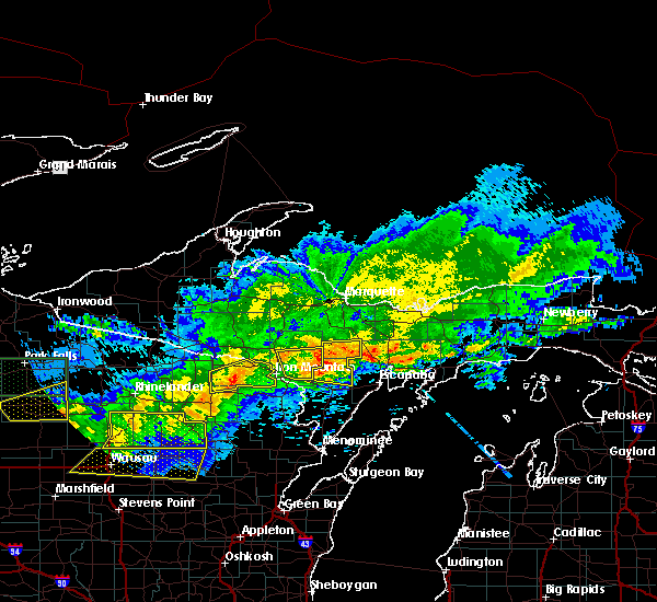
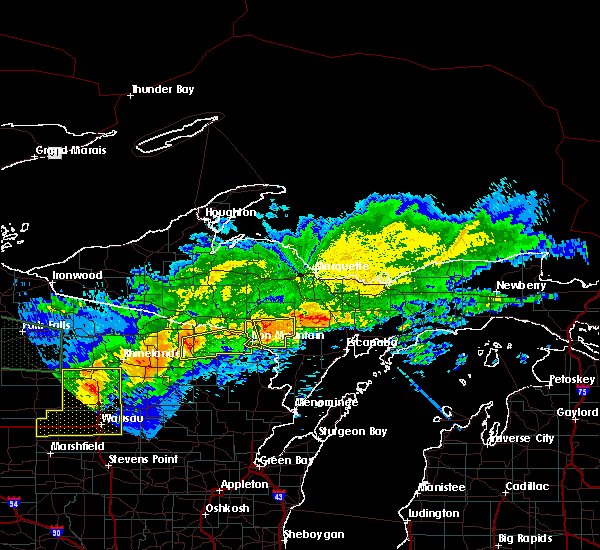
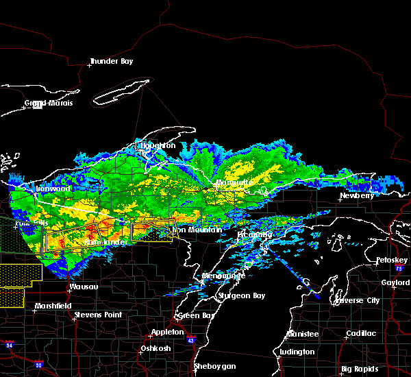
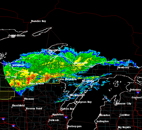
Hail Maps for Long Lake, WI


Connect with Interactive Hail Maps