

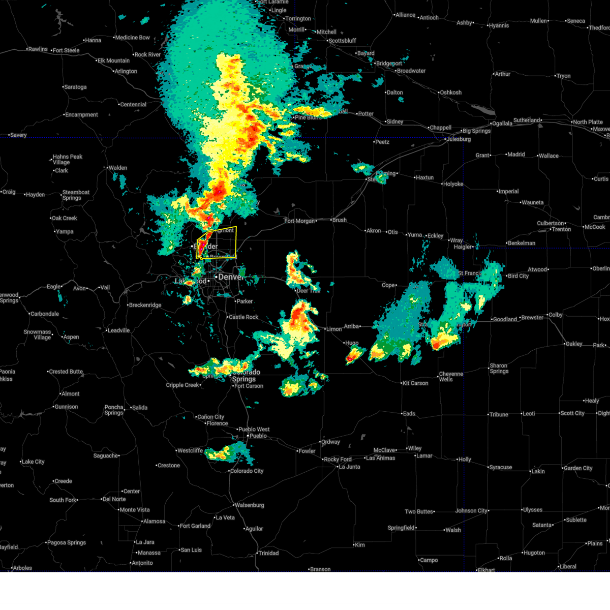
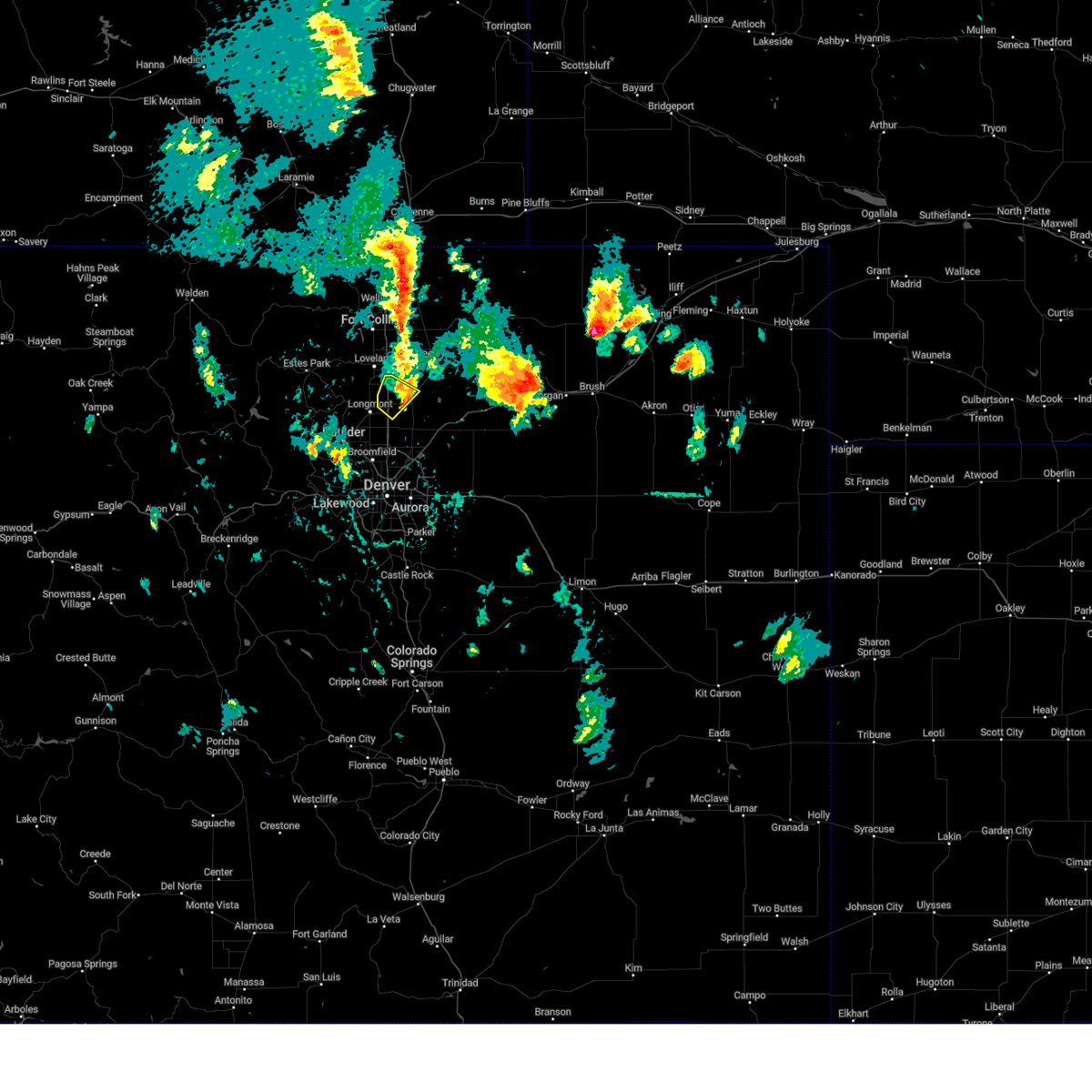
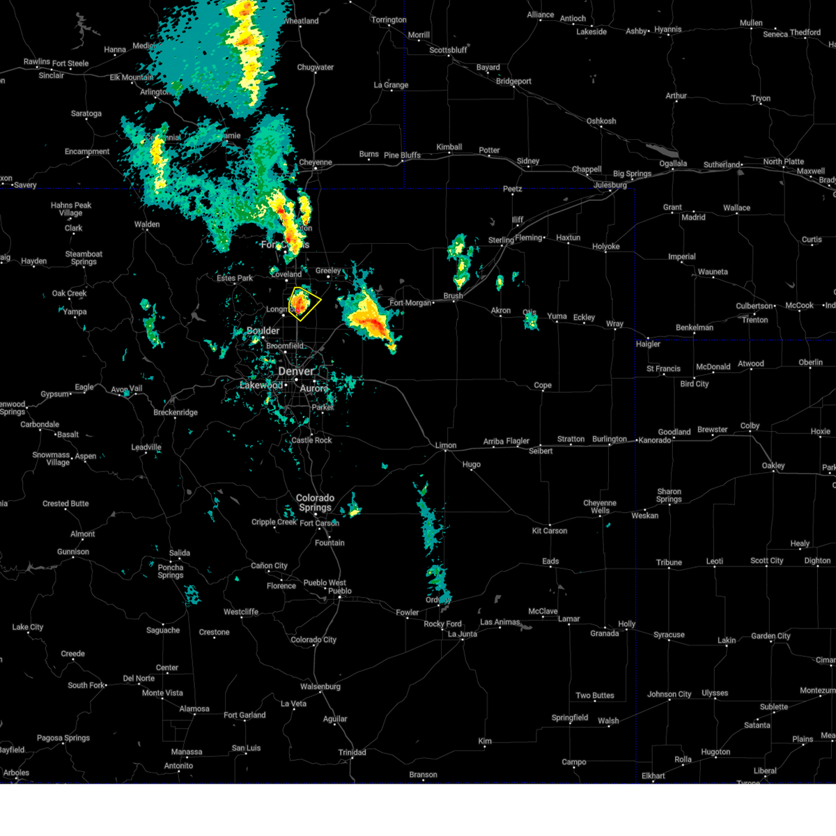
Hail Map for Longmont, CO
The Longmont, CO area has had 63 reports of on-the-ground hail by trained spotters, and has been under severe weather warnings 9 times during the past 12 months. Doppler radar has detected hail at or near Longmont, CO on 69 occasions, including 6 occasions during the past year.
| Name: | Longmont, CO |
| Where Located: | 30.1 miles N of Denver, CO |
| Map: | Google Map for Longmont, CO |
| Population: | 86270 |
| Housing Units: | 35008 |
| More Info: | Search Google for Longmont, CO |
1
The Top Recent Hail Date for Longmont, CO is Saturday, July 20, 2024 (12th out of 69)

Hail and Wind Damage Spotted near Longmont, CO
| Date / Time | Report Details |
|---|---|
| 6/25/2025 8:13 PM MDT | Quarter sized hail reported 7.8 miles WNW of Longmont, CO |
| 6/25/2025 8:09 PM MDT | Quarter sized hail reported 7.8 miles WNW of Longmont, CO, report from mping: quarter (1.00 in.). |
| 6/17/2025 2:02 PM MDT | the severe thunderstorm warning has been cancelled and is no longer in effect |
| 6/17/2025 2:02 PM MDT | At 202 pm mdt, a severe thunderstorm was located over dacono, or 23 miles north of denver, moving east at 35 mph (trained spotters reported). Hazards include quarter size hail. Damage to vehicles is expected. Locations impacted include, thornton, northeastern westminster, eastern longmont, northeastern broomfield, northern commerce city, northern northglenn, brighton, erie, firestone, frederick, fort lupton, dacono, todd creek, barr lake, wattenburg and henderson. |
| 6/17/2025 1:46 PM MDT |
 Svrbou the national weather service in denver has issued a * severe thunderstorm warning for, northwestern adams county in northeastern colorado, northeast boulder and southeast boulder county in northeastern colorado, broomfield county in northeastern colorado, southwestern weld county in northeastern colorado, * until 215 pm mdt. * at 146 pm mdt, a severe thunderstorm was located over lafayette, or 22 miles north of denver, moving east at 35 mph (radar indicated). Hazards include quarter size hail. damage to vehicles is possible Svrbou the national weather service in denver has issued a * severe thunderstorm warning for, northwestern adams county in northeastern colorado, northeast boulder and southeast boulder county in northeastern colorado, broomfield county in northeastern colorado, southwestern weld county in northeastern colorado, * until 215 pm mdt. * at 146 pm mdt, a severe thunderstorm was located over lafayette, or 22 miles north of denver, moving east at 35 mph (radar indicated). Hazards include quarter size hail. damage to vehicles is possible
|
| 5/18/2025 2:57 PM MDT |
 The storm which prompted the warning has weakened below severe limits, and no longer poses an immediate threat to life or property. therefore, the warning will be allowed to expire. a tornado watch remains in effect until 800 pm mdt sunday for a portion of northeast colorado. The storm which prompted the warning has weakened below severe limits, and no longer poses an immediate threat to life or property. therefore, the warning will be allowed to expire. a tornado watch remains in effect until 800 pm mdt sunday for a portion of northeast colorado.
|
| 5/18/2025 2:29 PM MDT |
 Svrbou the national weather service in denver has issued a * severe thunderstorm warning for, southwestern weld county in northeastern colorado, * until 300 pm mdt. * at 229 pm mdt, a severe thunderstorm was located over mead, or 20 miles southwest of greeley, moving north at 15 mph (radar indicated). Hazards include 60 mph wind gusts and half dollar size hail. Hail damage to vehicles is expected. Expect wind damage to roofs, siding, and trees. Svrbou the national weather service in denver has issued a * severe thunderstorm warning for, southwestern weld county in northeastern colorado, * until 300 pm mdt. * at 229 pm mdt, a severe thunderstorm was located over mead, or 20 miles southwest of greeley, moving north at 15 mph (radar indicated). Hazards include 60 mph wind gusts and half dollar size hail. Hail damage to vehicles is expected. Expect wind damage to roofs, siding, and trees.
|
| 7/20/2024 8:33 PM MDT |
 The storm which prompted the warning has moved out of the area. therefore, the warning has been allowed to expire. The storm which prompted the warning has moved out of the area. therefore, the warning has been allowed to expire.
|
| 7/20/2024 8:19 PM MDT | Report from mping: 1-inch tree limbs broken; shingles blown of in boulder county CO, 1.2 miles SE of Longmont, CO |
| 7/20/2024 8:04 PM MDT |
 At 804 pm mdt, a severe thunderstorm was located over northern longmont, or 24 miles southwest of greeley, moving south at 25 mph (radar indicated). Hazards include 60 mph wind gusts and half dollar size hail. Expect damage to roofs, siding, and trees. hail damage to vehicles is expected. Locations impacted include, northeastern boulder, longmont, erie, firestone, johnstown, frederick, milliken, berthoud, dacono, mead, carter lake, and niwot. At 804 pm mdt, a severe thunderstorm was located over northern longmont, or 24 miles southwest of greeley, moving south at 25 mph (radar indicated). Hazards include 60 mph wind gusts and half dollar size hail. Expect damage to roofs, siding, and trees. hail damage to vehicles is expected. Locations impacted include, northeastern boulder, longmont, erie, firestone, johnstown, frederick, milliken, berthoud, dacono, mead, carter lake, and niwot.
|
| 7/20/2024 7:58 PM MDT | Report from mping: 1-inch tree limbs broken; shingles blown of in boulder county CO, 2.1 miles SE of Longmont, CO |
| 7/20/2024 7:52 PM MDT |
 At 751 pm mdt, a severe thunderstorm was located near berthoud, or 19 miles south of fort collins, moving south at 25 mph (radar indicated). Hazards include ping pong ball size hail and 60 mph wind gusts. Expect damage to roofs, siding, and trees. people and animals outdoors will be injured. expect hail damage to roofs, siding, windows, and vehicles. Locations impacted include, northern boulder, longmont, southern loveland, erie, firestone, johnstown, frederick, milliken, berthoud, dacono, mead, lyons, carter lake, and niwot. At 751 pm mdt, a severe thunderstorm was located near berthoud, or 19 miles south of fort collins, moving south at 25 mph (radar indicated). Hazards include ping pong ball size hail and 60 mph wind gusts. Expect damage to roofs, siding, and trees. people and animals outdoors will be injured. expect hail damage to roofs, siding, windows, and vehicles. Locations impacted include, northern boulder, longmont, southern loveland, erie, firestone, johnstown, frederick, milliken, berthoud, dacono, mead, lyons, carter lake, and niwot.
|
| 7/20/2024 7:43 PM MDT |
 Svrbou the national weather service in denver colorado has issued a * severe thunderstorm warning for, southwestern weld county in northeastern colorado, southeastern larimer county in north central colorado, northeastern boulder county in northeastern colorado, * until 830 pm mdt. * at 743 pm mdt, a severe thunderstorm was located 4 miles northwest of berthoud, or 15 miles south of fort collins, moving south at 25 mph (radar indicated). Hazards include 60 mph wind gusts and half dollar size hail. Expect damage to roofs, siding, and trees. Hail damage to vehicles is expected. Svrbou the national weather service in denver colorado has issued a * severe thunderstorm warning for, southwestern weld county in northeastern colorado, southeastern larimer county in north central colorado, northeastern boulder county in northeastern colorado, * until 830 pm mdt. * at 743 pm mdt, a severe thunderstorm was located 4 miles northwest of berthoud, or 15 miles south of fort collins, moving south at 25 mph (radar indicated). Hazards include 60 mph wind gusts and half dollar size hail. Expect damage to roofs, siding, and trees. Hail damage to vehicles is expected.
|
| 7/20/2024 5:45 PM MDT | Mesonet station dw1011 longmon in boulder county CO, 7.8 miles ENE of Longmont, CO |
| 6/20/2024 3:56 PM MDT |
 The storm which prompted the warning has moved out of the area. therefore, the warning will be allowed to expire. a severe thunderstorm watch remains in effect until 700 pm mdt for northeastern colorado. The storm which prompted the warning has moved out of the area. therefore, the warning will be allowed to expire. a severe thunderstorm watch remains in effect until 700 pm mdt for northeastern colorado.
|
| 6/20/2024 3:33 PM MDT |
 Svrbou the national weather service in denver colorado has issued a * severe thunderstorm warning for, west central weld county in northeastern colorado, southeastern larimer county in north central colorado, * until 400 pm mdt. * at 333 pm mdt, a severe thunderstorm was located near mead, or 16 miles southwest of greeley, moving northeast at 20 mph (radar indicated). Hazards include quarter size hail. damage to vehicles is expected Svrbou the national weather service in denver colorado has issued a * severe thunderstorm warning for, west central weld county in northeastern colorado, southeastern larimer county in north central colorado, * until 400 pm mdt. * at 333 pm mdt, a severe thunderstorm was located near mead, or 16 miles southwest of greeley, moving northeast at 20 mph (radar indicated). Hazards include quarter size hail. damage to vehicles is expected
|
| 5/30/2024 9:00 PM MDT | Quarter sized hail reported 6.3 miles NE of Longmont, CO, size estimated... as hail was still falling. |
| 5/30/2024 8:58 PM MDT | Quarter sized hail reported 6.7 miles NE of Longmont, CO, report from mping: quarter (1.00 in.). time adjusted by radar. |
| 5/30/2024 8:47 PM MDT |
 Svrbou the national weather service in denver colorado has issued a * severe thunderstorm warning for, broomfield county in northeastern colorado, southeastern boulder county in northeastern colorado, * until 930 pm mdt. * at 846 pm mdt, a severe thunderstorm was located over southwestern boulder, or 28 miles northwest of denver, moving southeast at 20 mph (radar indicated). Hazards include quarter size hail. Damage to vehicles is expected. this severe thunderstorm will be near, boulder and niwot around 850 pm mdt. lafayette and louisville around 855 pm mdt. erie around 900 pm mdt. northwestern broomfield around 905 pm mdt. Other locations in the path of this severe thunderstorm include superior. Svrbou the national weather service in denver colorado has issued a * severe thunderstorm warning for, broomfield county in northeastern colorado, southeastern boulder county in northeastern colorado, * until 930 pm mdt. * at 846 pm mdt, a severe thunderstorm was located over southwestern boulder, or 28 miles northwest of denver, moving southeast at 20 mph (radar indicated). Hazards include quarter size hail. Damage to vehicles is expected. this severe thunderstorm will be near, boulder and niwot around 850 pm mdt. lafayette and louisville around 855 pm mdt. erie around 900 pm mdt. northwestern broomfield around 905 pm mdt. Other locations in the path of this severe thunderstorm include superior.
|
| 8/5/2023 3:31 PM MDT |
 At 331 pm mdt, a severe thunderstorm was located near masonville, or 7 miles southwest of fort collins, moving southeast at 25 mph (radar indicated). Hazards include half dollar size hail. Damage to vehicles is expected. this severe thunderstorm will be near, loveland around 340 pm mdt. other locations in the path of this severe thunderstorm include berthoud, johnstown, milliken and mead. hail threat, radar indicated max hail size, 1. 25 in wind threat, radar indicated max wind gust, <50 mph. At 331 pm mdt, a severe thunderstorm was located near masonville, or 7 miles southwest of fort collins, moving southeast at 25 mph (radar indicated). Hazards include half dollar size hail. Damage to vehicles is expected. this severe thunderstorm will be near, loveland around 340 pm mdt. other locations in the path of this severe thunderstorm include berthoud, johnstown, milliken and mead. hail threat, radar indicated max hail size, 1. 25 in wind threat, radar indicated max wind gust, <50 mph.
|
| 8/2/2023 9:52 PM MDT |
 At 952 pm mdt, a severe thunderstorm was located near erie, or 22 miles north of denver, moving north at 20 mph (radar indicated). Hazards include 60 mph wind gusts and quarter size hail. Expect damage to roofs, siding, and trees. hail damage to vehicles is expected. this severe thunderstorm will be near, dacono around 1005 pm mdt. firestone around 1010 pm mdt. other locations in the path of this severe thunderstorm include eastern longmont and frederick. hail threat, radar indicated max hail size, 1. 00 in wind threat, radar indicated max wind gust, 60 mph. At 952 pm mdt, a severe thunderstorm was located near erie, or 22 miles north of denver, moving north at 20 mph (radar indicated). Hazards include 60 mph wind gusts and quarter size hail. Expect damage to roofs, siding, and trees. hail damage to vehicles is expected. this severe thunderstorm will be near, dacono around 1005 pm mdt. firestone around 1010 pm mdt. other locations in the path of this severe thunderstorm include eastern longmont and frederick. hail threat, radar indicated max hail size, 1. 00 in wind threat, radar indicated max wind gust, 60 mph.
|
| 7/28/2023 4:15 PM MDT |
 At 415 pm mdt, a severe thunderstorm was located near crisman, or 29 miles northwest of denver, moving northeast at 20 mph (radar indicated). Hazards include 60 mph wind gusts and quarter size hail. Expect damage to roofs, siding, and trees. hail damage to vehicles is expected. locations impacted include, niwot, southwestern longmont and lyons. hail threat, radar indicated max hail size, 1. 00 in wind threat, radar indicated max wind gust, 60 mph. At 415 pm mdt, a severe thunderstorm was located near crisman, or 29 miles northwest of denver, moving northeast at 20 mph (radar indicated). Hazards include 60 mph wind gusts and quarter size hail. Expect damage to roofs, siding, and trees. hail damage to vehicles is expected. locations impacted include, niwot, southwestern longmont and lyons. hail threat, radar indicated max hail size, 1. 00 in wind threat, radar indicated max wind gust, 60 mph.
|
| 7/28/2023 3:59 PM MDT |
 At 359 pm mdt, a severe thunderstorm was located 4 miles south of wallstreet, or 28 miles northwest of denver, moving northeast at 20 mph (radar indicated). Hazards include 60 mph wind gusts and quarter size hail. Expect damage to roofs, siding, and trees. hail damage to vehicles is expected. this severe thunderstorm will be near, crisman, salina, sunshine, summerville and eldorado springs around 410 pm mdt. other locations in the path of this severe thunderstorm include boulder, jamestown and niwot. hail threat, radar indicated max hail size, 1. 00 in wind threat, radar indicated max wind gust, 60 mph. At 359 pm mdt, a severe thunderstorm was located 4 miles south of wallstreet, or 28 miles northwest of denver, moving northeast at 20 mph (radar indicated). Hazards include 60 mph wind gusts and quarter size hail. Expect damage to roofs, siding, and trees. hail damage to vehicles is expected. this severe thunderstorm will be near, crisman, salina, sunshine, summerville and eldorado springs around 410 pm mdt. other locations in the path of this severe thunderstorm include boulder, jamestown and niwot. hail threat, radar indicated max hail size, 1. 00 in wind threat, radar indicated max wind gust, 60 mph.
|
| 7/15/2023 5:05 PM MDT |
 The severe thunderstorm warning for northeastern boulder county will expire at 515 pm mdt, the storm which prompted the warning has weakened below severe limits, and no longer poses an immediate threat to life or property. therefore, the warning will be allowed to expire. however small hail is still possible with this thunderstorm. The severe thunderstorm warning for northeastern boulder county will expire at 515 pm mdt, the storm which prompted the warning has weakened below severe limits, and no longer poses an immediate threat to life or property. therefore, the warning will be allowed to expire. however small hail is still possible with this thunderstorm.
|
| 7/15/2023 4:46 PM MDT |
 At 446 pm mdt, a severe thunderstorm was located near lyons, or 23 miles south of fort collins, moving southeast at 25 mph (radar indicated). Hazards include quarter size hail. Damage to vehicles is expected. this severe thunderstorm will be near, longmont and niwot around 505 pm mdt. other locations in the path of this severe thunderstorm include lafayette and erie. hail threat, radar indicated max hail size, 1. 00 in wind threat, radar indicated max wind gust, <50 mph. At 446 pm mdt, a severe thunderstorm was located near lyons, or 23 miles south of fort collins, moving southeast at 25 mph (radar indicated). Hazards include quarter size hail. Damage to vehicles is expected. this severe thunderstorm will be near, longmont and niwot around 505 pm mdt. other locations in the path of this severe thunderstorm include lafayette and erie. hail threat, radar indicated max hail size, 1. 00 in wind threat, radar indicated max wind gust, <50 mph.
|
| 6/22/2023 3:04 PM MDT |
 At 304 pm mdt, a severe thunderstorm was located 6 miles east of jamestown, or 31 miles south of fort collins, moving east at 10 mph (radar indicated). Hazards include half dollar size hail. damage to vehicles is expected At 304 pm mdt, a severe thunderstorm was located 6 miles east of jamestown, or 31 miles south of fort collins, moving east at 10 mph (radar indicated). Hazards include half dollar size hail. damage to vehicles is expected
|
| 6/12/2023 12:45 PM MDT |
 At 1244 pm mdt, a severe thunderstorm was located over southwestern boulder, or 26 miles northwest of denver, moving east at 10 mph (trained weather spotters reported quarter sized hail in cu boulder campus). Hazards include 60 mph wind gusts and quarter size hail. Expect damage to roofs, siding, and trees. Hail damage to vehicles is expected. At 1244 pm mdt, a severe thunderstorm was located over southwestern boulder, or 26 miles northwest of denver, moving east at 10 mph (trained weather spotters reported quarter sized hail in cu boulder campus). Hazards include 60 mph wind gusts and quarter size hail. Expect damage to roofs, siding, and trees. Hail damage to vehicles is expected.
|
| 5/31/2023 4:21 PM MDT |
 The severe thunderstorm warning for southwestern weld and northeastern boulder counties will expire at 430 pm mdt, the storm which prompted the warning has weakened below severe limits, and has exited the warned area. therefore, the warning will be allowed to expire. The severe thunderstorm warning for southwestern weld and northeastern boulder counties will expire at 430 pm mdt, the storm which prompted the warning has weakened below severe limits, and has exited the warned area. therefore, the warning will be allowed to expire.
|
| 5/31/2023 3:52 PM MDT |
 At 350 pm mdt, a severe thunderstorm was located over frederick, or 23 miles southwest of greeley, moving northwest at 25 mph (trained spotters reported quarter inch hail near firestone). Hazards include half dollar size hail. Damage to vehicles is expected. locations impacted include, longmont, firestone, johnstown, frederick, milliken, berthoud, mead and platteville. hail threat, observed max hail size, 1. 25 in wind threat, radar indicated max wind gust, <50 mph. At 350 pm mdt, a severe thunderstorm was located over frederick, or 23 miles southwest of greeley, moving northwest at 25 mph (trained spotters reported quarter inch hail near firestone). Hazards include half dollar size hail. Damage to vehicles is expected. locations impacted include, longmont, firestone, johnstown, frederick, milliken, berthoud, mead and platteville. hail threat, observed max hail size, 1. 25 in wind threat, radar indicated max wind gust, <50 mph.
|
| 5/31/2023 3:44 PM MDT | Quarter sized hail reported 7.8 miles WNW of Longmont, CO, report from mping: quarter (1.00 in.). |
| 5/31/2023 3:40 PM MDT |
 At 340 pm mdt, a severe thunderstorm was located over dacono, or 23 miles north of denver, moving northwest at 25 mph (radar indicated). Hazards include half dollar size hail. damage to vehicles is expected At 340 pm mdt, a severe thunderstorm was located over dacono, or 23 miles north of denver, moving northwest at 25 mph (radar indicated). Hazards include half dollar size hail. damage to vehicles is expected
|
| 5/27/2023 3:27 PM MDT |
 At 327 pm mdt, a severe thunderstorm was located over firestone, or 22 miles southwest of greeley, moving northeast at 25 mph (radar indicated). Hazards include quarter size hail. Damage to vehicles is expected. this severe thunderstorm will be near, fort lupton around 345 pm mdt. Other locations in the path of this severe thunderstorm include platteville, gilcrest, milton reservoir and lasalle. At 327 pm mdt, a severe thunderstorm was located over firestone, or 22 miles southwest of greeley, moving northeast at 25 mph (radar indicated). Hazards include quarter size hail. Damage to vehicles is expected. this severe thunderstorm will be near, fort lupton around 345 pm mdt. Other locations in the path of this severe thunderstorm include platteville, gilcrest, milton reservoir and lasalle.
|
| 5/26/2023 2:58 PM MDT |
 At 257 pm mdt, a severe thunderstorm was located near gilcrest, or 11 miles south of greeley, moving north at 15 mph (radar indicated). Hazards include half dollar size hail. Damage to vehicles is expected. this severe thunderstorm will be near, gilcrest around 310 pm mdt. other locations in the path of this severe thunderstorm include johnstown, milliken, lasalle, evans, greeley and lucerne. hail threat, radar indicated max hail size, 1. 25 in wind threat, radar indicated max wind gust, <50 mph. At 257 pm mdt, a severe thunderstorm was located near gilcrest, or 11 miles south of greeley, moving north at 15 mph (radar indicated). Hazards include half dollar size hail. Damage to vehicles is expected. this severe thunderstorm will be near, gilcrest around 310 pm mdt. other locations in the path of this severe thunderstorm include johnstown, milliken, lasalle, evans, greeley and lucerne. hail threat, radar indicated max hail size, 1. 25 in wind threat, radar indicated max wind gust, <50 mph.
|
| 5/26/2023 2:40 PM MDT |
 At 240 pm mdt, a severe thunderstorm was located 4 miles west of mead, or 21 miles southwest of greeley, moving northeast at 20 mph (radar indicated). Hazards include quarter size hail. Damage to vehicles is expected. this severe thunderstorm will be near, mead around 250 pm mdt. berthoud around 255 pm mdt. other locations in the path of this severe thunderstorm include johnstown, loveland and milliken. hail threat, radar indicated max hail size, 1. 00 in wind threat, radar indicated max wind gust, <50 mph. At 240 pm mdt, a severe thunderstorm was located 4 miles west of mead, or 21 miles southwest of greeley, moving northeast at 20 mph (radar indicated). Hazards include quarter size hail. Damage to vehicles is expected. this severe thunderstorm will be near, mead around 250 pm mdt. berthoud around 255 pm mdt. other locations in the path of this severe thunderstorm include johnstown, loveland and milliken. hail threat, radar indicated max hail size, 1. 00 in wind threat, radar indicated max wind gust, <50 mph.
|
| 5/26/2023 2:35 PM MDT | Half Dollar sized hail reported 2.4 miles SSW of Longmont, CO |
| 5/10/2023 12:02 AM MDT | Half Dollar sized hail reported 7.8 miles WNW of Longmont, CO, w1654. |
| 5/9/2023 11:52 PM MDT |
 At 1150 pm mdt, severe thunderstorms were located along a line extending from near windsor to near todd creek, or along a line extending from 9 miles west of greeley to 19 miles north of denver, moving east at 25 mph (trained weather spotters). Hazards include 60 mph wind gusts and half dollar size hail. Expect damage to roofs, siding, and trees. hail damage to vehicles is expected. hail may accumulate on roadways causing hazardous travel. severe thunderstorms will be near, windsor and milliken around 1155 pm mdt. brighton around 1200 am mdt. greeley and severance around 1210 am mdt. other locations in the path of these severe thunderstorms include evans, fort lupton, lochbuie, eaton, lucerne, hudson, galeton, gill, keenesburg, barnesville and prospect valley. hail threat, observed max hail size, 1. 25 in wind threat, radar indicated max wind gust, 60 mph. At 1150 pm mdt, severe thunderstorms were located along a line extending from near windsor to near todd creek, or along a line extending from 9 miles west of greeley to 19 miles north of denver, moving east at 25 mph (trained weather spotters). Hazards include 60 mph wind gusts and half dollar size hail. Expect damage to roofs, siding, and trees. hail damage to vehicles is expected. hail may accumulate on roadways causing hazardous travel. severe thunderstorms will be near, windsor and milliken around 1155 pm mdt. brighton around 1200 am mdt. greeley and severance around 1210 am mdt. other locations in the path of these severe thunderstorms include evans, fort lupton, lochbuie, eaton, lucerne, hudson, galeton, gill, keenesburg, barnesville and prospect valley. hail threat, observed max hail size, 1. 25 in wind threat, radar indicated max wind gust, 60 mph.
|
| 5/9/2023 11:34 PM MDT |
 At 1133 pm mdt, a severe thunderstorm was located over berthoud, or 16 miles southwest of greeley, moving north at 15 mph (trained weather spotters). Hazards include two inch hail and 60 mph wind gusts. Expect damage to roofs, siding, and trees. people and animals outdoors will be injured. expect hail damage to roofs, siding, windows, and vehicles. locations impacted include, johnstown, milliken, loveland, windsor and southern fort collins. thunderstorm damage threat, considerable hail threat, observed max hail size, 2. 00 in wind threat, radar indicated max wind gust, 60 mph. At 1133 pm mdt, a severe thunderstorm was located over berthoud, or 16 miles southwest of greeley, moving north at 15 mph (trained weather spotters). Hazards include two inch hail and 60 mph wind gusts. Expect damage to roofs, siding, and trees. people and animals outdoors will be injured. expect hail damage to roofs, siding, windows, and vehicles. locations impacted include, johnstown, milliken, loveland, windsor and southern fort collins. thunderstorm damage threat, considerable hail threat, observed max hail size, 2. 00 in wind threat, radar indicated max wind gust, 60 mph.
|
| 5/9/2023 11:33 PM MDT | Hen Egg sized hail reported 7.8 miles WNW of Longmont, CO |
| 5/9/2023 11:20 PM MDT | Half Dollar sized hail reported 7.8 miles WNW of Longmont, CO |
| 5/9/2023 11:17 PM MDT | Hen Egg sized hail reported 2.3 miles SSE of Longmont, CO, report from mping: hen egg (2.00 in.). |
| 5/9/2023 11:12 PM MDT |
 The severe thunderstorm warning for southwestern weld and southeastern boulder counties will expire at 1115 pm mdt, the storm which prompted the warning has moved out of the area. therefore, the warning will be allowed to expire. however heavy rain is still possible with this thunderstorm. remember, a severe thunderstorm warning still remains in effect for parts of weld, boulder, and larimer counties. The severe thunderstorm warning for southwestern weld and southeastern boulder counties will expire at 1115 pm mdt, the storm which prompted the warning has moved out of the area. therefore, the warning will be allowed to expire. however heavy rain is still possible with this thunderstorm. remember, a severe thunderstorm warning still remains in effect for parts of weld, boulder, and larimer counties.
|
| 5/9/2023 11:11 PM MDT |
 At 1110 pm mdt, a severe thunderstorm was located near longmont, or 21 miles southwest of greeley, moving north at 20 mph (radar indicated). Hazards include 60 mph wind gusts and half dollar size hail. Expect damage to roofs, siding, and trees. hail damage to vehicles is expected. this severe thunderstorm will be near, mead around 1120 pm mdt. berthoud around 1130 pm mdt. other locations in the path of this severe thunderstorm include johnstown, milliken, loveland and windsor. hail threat, radar indicated max hail size, 1. 25 in wind threat, radar indicated max wind gust, 60 mph. At 1110 pm mdt, a severe thunderstorm was located near longmont, or 21 miles southwest of greeley, moving north at 20 mph (radar indicated). Hazards include 60 mph wind gusts and half dollar size hail. Expect damage to roofs, siding, and trees. hail damage to vehicles is expected. this severe thunderstorm will be near, mead around 1120 pm mdt. berthoud around 1130 pm mdt. other locations in the path of this severe thunderstorm include johnstown, milliken, loveland and windsor. hail threat, radar indicated max hail size, 1. 25 in wind threat, radar indicated max wind gust, 60 mph.
|
| 5/9/2023 10:51 PM MDT | Golf Ball sized hail reported 1 miles E of Longmont, CO, report from mping: golf ball (1.75 in.). |
| 5/9/2023 10:45 PM MDT | Quarter sized hail reported 2.3 miles SSE of Longmont, CO, co-bo-143. |
| 5/9/2023 10:38 PM MDT | Quarter sized hail reported 6.3 miles NE of Longmont, CO |
| 5/9/2023 10:35 PM MDT | Quarter sized hail reported 3.4 miles ENE of Longmont, CO |
| 5/9/2023 10:35 PM MDT | Quarter sized hail reported 3.7 miles ENE of Longmont, CO |
| 5/9/2023 10:34 PM MDT |
 At 1034 pm mdt, a severe thunderstorm was located over southwestern longmont, or 28 miles southwest of greeley, moving northeast at 35 mph (trained weather spotters). Hazards include two inch hail and 60 mph wind gusts. Expect damage to roofs, siding, and trees. people and animals outdoors will be injured. expect hail damage to roofs, siding, windows, and vehicles. this severe storm will be near, frederick around 1045 pm mdt. other locations in the path of this severe thunderstorm include berthoud and mead. thunderstorm damage threat, considerable hail threat, observed max hail size, 2. 00 in wind threat, radar indicated max wind gust, 60 mph. At 1034 pm mdt, a severe thunderstorm was located over southwestern longmont, or 28 miles southwest of greeley, moving northeast at 35 mph (trained weather spotters). Hazards include two inch hail and 60 mph wind gusts. Expect damage to roofs, siding, and trees. people and animals outdoors will be injured. expect hail damage to roofs, siding, windows, and vehicles. this severe storm will be near, frederick around 1045 pm mdt. other locations in the path of this severe thunderstorm include berthoud and mead. thunderstorm damage threat, considerable hail threat, observed max hail size, 2. 00 in wind threat, radar indicated max wind gust, 60 mph.
|
| 5/9/2023 10:28 PM MDT |
 At 1028 pm mdt, a severe thunderstorm was located near niwot, or 28 miles northwest of denver, moving northeast at 35 mph (radar indicated). Hazards include 60 mph wind gusts and quarter size hail. Expect damage to roofs, siding, and trees. hail damage to vehicles is expected. this severe thunderstorm will be near, longmont around 1040 pm mdt. firestone and frederick around 1045 pm mdt. other locations in the path of this severe thunderstorm include berthoud and mead. hail threat, radar indicated max hail size, 1. 00 in wind threat, radar indicated max wind gust, 60 mph. At 1028 pm mdt, a severe thunderstorm was located near niwot, or 28 miles northwest of denver, moving northeast at 35 mph (radar indicated). Hazards include 60 mph wind gusts and quarter size hail. Expect damage to roofs, siding, and trees. hail damage to vehicles is expected. this severe thunderstorm will be near, longmont around 1040 pm mdt. firestone and frederick around 1045 pm mdt. other locations in the path of this severe thunderstorm include berthoud and mead. hail threat, radar indicated max hail size, 1. 00 in wind threat, radar indicated max wind gust, 60 mph.
|
| 10/1/2022 3:54 PM MDT |
 At 354 pm mdt, a severe thunderstorm was located near erie, or 23 miles north of denver, moving east at 25 mph (radar indicated). Hazards include ping pong ball size hail. People and animals outdoors will be injured. expect damage to roofs, siding, windows, and vehicles. this severe thunderstorm will be near, firestone, frederick and dacono around 405 pm mdt. other locations in the path of this severe thunderstorm include fort lupton and lochbuie. hail threat, radar indicated max hail size, 1. 50 in wind threat, radar indicated max wind gust, <50 mph. At 354 pm mdt, a severe thunderstorm was located near erie, or 23 miles north of denver, moving east at 25 mph (radar indicated). Hazards include ping pong ball size hail. People and animals outdoors will be injured. expect damage to roofs, siding, windows, and vehicles. this severe thunderstorm will be near, firestone, frederick and dacono around 405 pm mdt. other locations in the path of this severe thunderstorm include fort lupton and lochbuie. hail threat, radar indicated max hail size, 1. 50 in wind threat, radar indicated max wind gust, <50 mph.
|
| 7/25/2021 6:48 PM MDT | A personal weather station recorded a sustained wind of 59.7 mph with a gust of 68.4 mph between 6:47 and 6:49 p in boulder county CO, 10.3 miles ENE of Longmont, CO |
| 6/25/2021 2:37 PM MDT |
 The severe thunderstorm warning for north central jefferson and southeastern boulder counties will expire at 245 pm mdt, the storm which prompted the warning has weakened below severe limits, and has exited the warned area. therefore, the warning will be allowed to expire. however small hail and heavy rain are still possible with this thunderstorm. The severe thunderstorm warning for north central jefferson and southeastern boulder counties will expire at 245 pm mdt, the storm which prompted the warning has weakened below severe limits, and has exited the warned area. therefore, the warning will be allowed to expire. however small hail and heavy rain are still possible with this thunderstorm.
|
| 6/25/2021 1:59 PM MDT |
 At 159 pm mdt, a severe thunderstorm was located near boulder, or 29 miles northwest of denver, moving southeast at 15 mph (radar indicated). Hazards include quarter size hail. damage to vehicles is expected At 159 pm mdt, a severe thunderstorm was located near boulder, or 29 miles northwest of denver, moving southeast at 15 mph (radar indicated). Hazards include quarter size hail. damage to vehicles is expected
|
| 8/4/2020 6:14 PM MDT | Quarter sized hail reported 7.8 miles WNW of Longmont, CO |
| 8/4/2020 5:57 PM MDT |
 At 557 pm mdt, a severe thunderstorm was located near frederick, or 22 miles southwest of greeley, moving southeast at 20 mph (radar indicated). Hazards include half dollar size hail. damage to vehicles is expected At 557 pm mdt, a severe thunderstorm was located near frederick, or 22 miles southwest of greeley, moving southeast at 20 mph (radar indicated). Hazards include half dollar size hail. damage to vehicles is expected
|
| 7/31/2020 8:49 PM MDT |
 The national weather service in denver colorado has issued a * severe thunderstorm warning for. southwestern weld county in northeastern colorado. east central boulder county in northeastern colorado. until 915 pm mdt. At 849 pm mdt, a severe thunderstorm was located 4 miles northwest. The national weather service in denver colorado has issued a * severe thunderstorm warning for. southwestern weld county in northeastern colorado. east central boulder county in northeastern colorado. until 915 pm mdt. At 849 pm mdt, a severe thunderstorm was located 4 miles northwest.
|
| 7/31/2020 8:20 PM MDT |
 At 820 pm mdt, a severe thunderstorm was located 5 miles southwest of berthoud, or 20 miles south of fort collins, moving southeast at 35 mph (radar indicated). Hazards include quarter size hail. damage to vehicles is expected At 820 pm mdt, a severe thunderstorm was located 5 miles southwest of berthoud, or 20 miles south of fort collins, moving southeast at 35 mph (radar indicated). Hazards include quarter size hail. damage to vehicles is expected
|
| 7/31/2020 5:34 PM MDT |
 At 534 pm mdt, a severe thunderstorm was located over niwot, or 29 miles northwest of denver, moving southeast at 30 mph (trained weather spotters). Hazards include quarter size hail. damage to vehicles is expected At 534 pm mdt, a severe thunderstorm was located over niwot, or 29 miles northwest of denver, moving southeast at 30 mph (trained weather spotters). Hazards include quarter size hail. damage to vehicles is expected
|
| 7/31/2020 5:32 PM MDT | Quarter sized hail reported 4.9 miles ENE of Longmont, CO |
| 7/13/2020 3:36 PM MDT |
 At 335 pm mdt, severe thunderstorms were located along a line extending from 11 miles south of hutton lake to 6 miles west of buckhorn mountain to near allenspark, or along a line extending from 22 miles south of laramie to 20 miles west of fort collins to 43 miles northwest of denver, moving east at 45 mph (radar indicated). Hazards include 60 mph wind gusts. expect damage to roofs, siding, and trees At 335 pm mdt, severe thunderstorms were located along a line extending from 11 miles south of hutton lake to 6 miles west of buckhorn mountain to near allenspark, or along a line extending from 22 miles south of laramie to 20 miles west of fort collins to 43 miles northwest of denver, moving east at 45 mph (radar indicated). Hazards include 60 mph wind gusts. expect damage to roofs, siding, and trees
|
| 6/6/2020 4:06 PM MDT | Trees uprooted or snapped; roof blown of in weld county CO, 7.5 miles W of Longmont, CO |
| 6/6/2020 3:56 PM MDT |
 At 355 pm mdt, severe thunderstorms were located along a line extending from 6 miles south of carr to 3 miles east of dacono to aurora to 5 miles east of greenland, or along a line extending from 21 miles northeast of fort collins to 24 miles south of greeley to 10 miles east of denver to 22 miles north of colorado springs, moving northeast at 60 mph. these are very dangerous storms (radar indicated). Hazards include 80 mph wind gusts. Flying debris will be dangerous to those caught without shelter. mobile homes will be heavily damaged. expect considerable damage to roofs, windows, and vehicles. Extensive tree damage and power outages are likely. At 355 pm mdt, severe thunderstorms were located along a line extending from 6 miles south of carr to 3 miles east of dacono to aurora to 5 miles east of greenland, or along a line extending from 21 miles northeast of fort collins to 24 miles south of greeley to 10 miles east of denver to 22 miles north of colorado springs, moving northeast at 60 mph. these are very dangerous storms (radar indicated). Hazards include 80 mph wind gusts. Flying debris will be dangerous to those caught without shelter. mobile homes will be heavily damaged. expect considerable damage to roofs, windows, and vehicles. Extensive tree damage and power outages are likely.
|
| 6/6/2020 3:46 PM MDT |
 At 342 pm mdt, severe thunderstorms were located along a line extending from 3 miles north of drake to near aspen springs to 7 miles west of elevenmile canyon reservoir, or along a line extending from 15 miles west of fort collins to 28 miles west of denver to 39 miles north of hayden pass burn scar, the storms are moving northeast at 60 mph. these are very dangerous storms (an automated weather station in lakewood recorded a peak wind gust to 70 mph at bear creek golf club in southwest lakewood). Hazards include 75 mph wind gusts. Flying debris will be dangerous to those caught without shelter. mobile homes will be heavily damaged. expect considerable damage to roofs, windows, and vehicles. extensive tree damage and power outages are likely. Locations impacted include, denver, fort collins, greeley, aurora, lakewood, thornton, arvada, westminster, centennial, boulder, longmont, loveland, broomfield, highlands ranch, castle rock, commerce city, parker, littleton, northglenn and brighton. At 342 pm mdt, severe thunderstorms were located along a line extending from 3 miles north of drake to near aspen springs to 7 miles west of elevenmile canyon reservoir, or along a line extending from 15 miles west of fort collins to 28 miles west of denver to 39 miles north of hayden pass burn scar, the storms are moving northeast at 60 mph. these are very dangerous storms (an automated weather station in lakewood recorded a peak wind gust to 70 mph at bear creek golf club in southwest lakewood). Hazards include 75 mph wind gusts. Flying debris will be dangerous to those caught without shelter. mobile homes will be heavily damaged. expect considerable damage to roofs, windows, and vehicles. extensive tree damage and power outages are likely. Locations impacted include, denver, fort collins, greeley, aurora, lakewood, thornton, arvada, westminster, centennial, boulder, longmont, loveland, broomfield, highlands ranch, castle rock, commerce city, parker, littleton, northglenn and brighton.
|
| 6/6/2020 3:03 PM MDT |
 At 303 pm mdt, severe thunderstorms were located along a line extending from 3 miles north of drake to near aspen springs to 8 miles west of elevenmile canyon reservoir, or along a line extending from 15 miles west of fort collins to 28 miles west of denver to 39 miles north of hayden pass burn scar, moving northeast at 65 mph. these are very dangerous storms (radar indicated). Hazards include 80 mph wind gusts. Flying debris will be dangerous to those caught without shelter. mobile homes will be heavily damaged. expect considerable damage to roofs, windows, and vehicles. Extensive tree damage and power outages are likely. At 303 pm mdt, severe thunderstorms were located along a line extending from 3 miles north of drake to near aspen springs to 8 miles west of elevenmile canyon reservoir, or along a line extending from 15 miles west of fort collins to 28 miles west of denver to 39 miles north of hayden pass burn scar, moving northeast at 65 mph. these are very dangerous storms (radar indicated). Hazards include 80 mph wind gusts. Flying debris will be dangerous to those caught without shelter. mobile homes will be heavily damaged. expect considerable damage to roofs, windows, and vehicles. Extensive tree damage and power outages are likely.
|
| 5/15/2020 6:33 PM MDT |
 At 632 pm mdt, a severe thunderstorm was located near dacono, or 24 miles south of greeley, moving east at 30 mph (radar indicated). Hazards include quarter size hail. Damage to vehicles is expected. Locations impacted include, brighton, erie, firestone, frederick, fort lupton, lochbuie, dacono and hudson. At 632 pm mdt, a severe thunderstorm was located near dacono, or 24 miles south of greeley, moving east at 30 mph (radar indicated). Hazards include quarter size hail. Damage to vehicles is expected. Locations impacted include, brighton, erie, firestone, frederick, fort lupton, lochbuie, dacono and hudson.
|
| 9/11/2019 6:18 PM MDT | Ping Pong Ball sized hail reported 7.8 miles WNW of Longmont, CO |
| 9/11/2019 6:11 PM MDT | Quarter sized hail reported 7.6 miles W of Longmont, CO |
| 9/11/2019 6:00 PM MDT | Quarter sized hail reported 7.8 miles WNW of Longmont, CO |
| 9/11/2019 5:58 PM MDT |
 At 557 pm mdt, a severe thunderstorm was located near firestone, or 22 miles southwest of greeley, moving northeast at 40 mph (radar indicated). Hazards include half dollar size hail. damage to vehicles is expected At 557 pm mdt, a severe thunderstorm was located near firestone, or 22 miles southwest of greeley, moving northeast at 40 mph (radar indicated). Hazards include half dollar size hail. damage to vehicles is expected
|
| 9/11/2019 5:57 PM MDT | Quarter sized hail reported 9 miles WNW of Longmont, CO |
| 9/11/2019 5:56 PM MDT | Quarter sized hail reported 5.4 miles W of Longmont, CO |
| 9/11/2019 5:32 PM MDT |
 A severe thunderstorm warning remains in effect until 600 pm mdt for southwestern weld county. at 532 pm mdt, a severe thunderstorm was located near mead, or 19 miles southwest of greeley, moving northeast at 40 mph. hazard. quarter size hail. source. Radar indicated. A severe thunderstorm warning remains in effect until 600 pm mdt for southwestern weld county. at 532 pm mdt, a severe thunderstorm was located near mead, or 19 miles southwest of greeley, moving northeast at 40 mph. hazard. quarter size hail. source. Radar indicated.
|
| 9/11/2019 5:24 PM MDT |
 At 524 pm mdt, a severe thunderstorm was located near longmont, or 25 miles southwest of greeley, moving northeast at 40 mph (radar indicated). Hazards include quarter size hail. damage to vehicles is expected At 524 pm mdt, a severe thunderstorm was located near longmont, or 25 miles southwest of greeley, moving northeast at 40 mph (radar indicated). Hazards include quarter size hail. damage to vehicles is expected
|
| 9/11/2019 4:37 PM MDT | Half Dollar sized hail reported 2.1 miles SE of Longmont, CO |
| 9/11/2019 4:34 PM MDT | Quarter sized hail reported 2.2 miles ESE of Longmont, CO, report from mping: quarter (1.00 in.). |
| 9/11/2019 4:30 PM MDT | Quarter sized hail reported 1.7 miles SSE of Longmont, CO |
| 9/11/2019 4:29 PM MDT |
 At 429 pm mdt, a severe thunderstorm was located over northwestern longmont, or 24 miles south of fort collins, moving northeast at 45 mph (radar indicated). Hazards include quarter size hail. damage to vehicles is expected At 429 pm mdt, a severe thunderstorm was located over northwestern longmont, or 24 miles south of fort collins, moving northeast at 45 mph (radar indicated). Hazards include quarter size hail. damage to vehicles is expected
|
| 9/11/2019 4:28 PM MDT | Quarter sized hail reported 1.2 miles SE of Longmont, CO |
| 9/11/2019 4:27 PM MDT | Quarter sized hail reported 3.7 miles ENE of Longmont, CO |
| 9/11/2019 4:27 PM MDT | Ping Pong Ball sized hail reported 3 miles SSE of Longmont, CO |
| 9/10/2019 5:50 PM MDT | Quarter sized hail reported 2.3 miles WNW of Longmont, CO |
| 9/10/2019 5:40 PM MDT |
 The national weather service in denver colorado has issued a * severe thunderstorm warning for. southwestern weld county in northeastern colorado. until 630 pm mdt. At 540 pm mdt, a severe thunderstorm was located 4 miles east of longmont, or 24 miles southwest of greeley, moving northeast at 20. The national weather service in denver colorado has issued a * severe thunderstorm warning for. southwestern weld county in northeastern colorado. until 630 pm mdt. At 540 pm mdt, a severe thunderstorm was located 4 miles east of longmont, or 24 miles southwest of greeley, moving northeast at 20.
|
| 8/13/2019 10:44 PM MDT | Quarter sized hail reported 7.8 miles WNW of Longmont, CO |
| 7/20/2019 2:36 PM MDT |
 At 236 pm mdt, a severe thunderstorm was located near jamestown, or 32 miles southwest of fort collins, moving southeast at 10 mph (radar indicated). Hazards include 60 mph wind gusts and half dollar size hail. Expect damage to roofs, siding, and trees. Hail damage to vehicles is expected. At 236 pm mdt, a severe thunderstorm was located near jamestown, or 32 miles southwest of fort collins, moving southeast at 10 mph (radar indicated). Hazards include 60 mph wind gusts and half dollar size hail. Expect damage to roofs, siding, and trees. Hail damage to vehicles is expected.
|
| 7/15/2019 3:39 PM MDT |
 At 339 pm mdt, a severe thunderstorm was located near carter lake, or 18 miles southwest of fort collins, moving east at 20 mph (trained weather spotters). Hazards include ping pong ball size hail. People and animals outdoors will be injured. expect damage to roofs, siding, windows, and vehicles. hail may accumulate on roadways causing hazardous travel. Locations impacted include, northern longmont, southern loveland, berthoud and carter lake. At 339 pm mdt, a severe thunderstorm was located near carter lake, or 18 miles southwest of fort collins, moving east at 20 mph (trained weather spotters). Hazards include ping pong ball size hail. People and animals outdoors will be injured. expect damage to roofs, siding, windows, and vehicles. hail may accumulate on roadways causing hazardous travel. Locations impacted include, northern longmont, southern loveland, berthoud and carter lake.
|
| 7/15/2019 3:24 PM MDT |
 At 324 pm mdt, a severe thunderstorm was located 4 miles west of carter lake, or 19 miles southwest of fort collins, moving east at 20 mph (radar indicated). Hazards include half dollar size hail. Damage to vehicles is possible. Hail may accumulate on roadways causing hazardous travel. At 324 pm mdt, a severe thunderstorm was located 4 miles west of carter lake, or 19 miles southwest of fort collins, moving east at 20 mph (radar indicated). Hazards include half dollar size hail. Damage to vehicles is possible. Hail may accumulate on roadways causing hazardous travel.
|
| 7/8/2019 7:21 PM MDT |
 At 720 pm mdt, a severe thunderstorm was located near dacono, or 21 miles north of denver, moving northeast at 15 mph (radar indicated). Hazards include quarter size hail. damage to vehicles is expected At 720 pm mdt, a severe thunderstorm was located near dacono, or 21 miles north of denver, moving northeast at 15 mph (radar indicated). Hazards include quarter size hail. damage to vehicles is expected
|
| 7/5/2019 8:52 PM MDT |
 At 851 pm mdt, a severe thunderstorm was located near johnstown, or 14 miles southwest of greeley, moving northeast at 20 mph (radar indicated). Hazards include half dollar size hail. Damage to vehicles is expected. Locations impacted include, northeastern longmont, southeastern loveland, windsor, johnstown, berthoud and mead. At 851 pm mdt, a severe thunderstorm was located near johnstown, or 14 miles southwest of greeley, moving northeast at 20 mph (radar indicated). Hazards include half dollar size hail. Damage to vehicles is expected. Locations impacted include, northeastern longmont, southeastern loveland, windsor, johnstown, berthoud and mead.
|
| 7/5/2019 8:37 PM MDT | Quarter sized hail reported 0.9 miles SSE of Longmont, CO, report via twitter. |
| 7/5/2019 8:34 PM MDT | Half Dollar sized hail reported 3.8 miles SE of Longmont, CO |
| 7/5/2019 8:32 PM MDT |
 At 831 pm mdt, a severe thunderstorm was located over niwot, or 26 miles north of denver, moving northeast at 25 mph (radar indicated). Hazards include quarter size hail. damage to vehicles is expected At 831 pm mdt, a severe thunderstorm was located over niwot, or 26 miles north of denver, moving northeast at 25 mph (radar indicated). Hazards include quarter size hail. damage to vehicles is expected
|
| 7/5/2019 8:28 PM MDT | Half Dollar sized hail reported 2.3 miles SSE of Longmont, CO |
| 7/5/2019 8:18 PM MDT |
 At 816 pm mdt, a severe thunderstorm was located 4 miles northwest of firestone, or 23 miles southwest of greeley, moving north at 25 mph. another severe storm was centered 4 miles southeast of loveland, moving north at 15 mph (radar indicated and trained spotters). Hazards include half dollar size hail. damage to vehicles is expected At 816 pm mdt, a severe thunderstorm was located 4 miles northwest of firestone, or 23 miles southwest of greeley, moving north at 25 mph. another severe storm was centered 4 miles southeast of loveland, moving north at 15 mph (radar indicated and trained spotters). Hazards include half dollar size hail. damage to vehicles is expected
|
| 7/5/2019 8:11 PM MDT |
 The severe thunderstorm warning for southeastern boulder county will expire at 815 pm mdt, this severe thunderstorm warning was replaced by another severe thunderstorm warning for east central boulder and southwestern weld county. a severe thunderstorm watch remains in effect until 1000 pm mdt for northeastern colorado. The severe thunderstorm warning for southeastern boulder county will expire at 815 pm mdt, this severe thunderstorm warning was replaced by another severe thunderstorm warning for east central boulder and southwestern weld county. a severe thunderstorm watch remains in effect until 1000 pm mdt for northeastern colorado.
|
| 7/5/2019 8:06 PM MDT |
 At 806 pm mdt, a severe thunderstorm was located 5 miles east of niwot, or 25 miles north of denver, moving north at 25 mph (trained weather spotters). Hazards include golf ball size hail and 60 mph wind gusts. Expect damage to roofs, siding, and trees. people and animals outdoors will be injured. expect hail damage to roofs, siding, windows, and vehicles. Locations impacted include, longmont, northern broomfield, lafayette, erie, firestone, frederick, dacono and mead. At 806 pm mdt, a severe thunderstorm was located 5 miles east of niwot, or 25 miles north of denver, moving north at 25 mph (trained weather spotters). Hazards include golf ball size hail and 60 mph wind gusts. Expect damage to roofs, siding, and trees. people and animals outdoors will be injured. expect hail damage to roofs, siding, windows, and vehicles. Locations impacted include, longmont, northern broomfield, lafayette, erie, firestone, frederick, dacono and mead.
|
| 7/5/2019 7:46 PM MDT |
 At 745 pm mdt, a severe thunderstorm was located over lafayette, or 17 miles north of denver, moving north at 30 mph (radar indicated and trained spotters reported). Hazards include ping pong ball size hail. People and animals outdoors will be injured. Expect damage to roofs, siding, windows, and vehicles. At 745 pm mdt, a severe thunderstorm was located over lafayette, or 17 miles north of denver, moving north at 30 mph (radar indicated and trained spotters reported). Hazards include ping pong ball size hail. People and animals outdoors will be injured. Expect damage to roofs, siding, windows, and vehicles.
|
| 7/5/2019 7:24 PM MDT |
 At 723 pm mdt, a severe thunderstorm was located over southwestern boulder, or 23 miles northwest of denver, moving northeast at 15 mph (radar indicated). Hazards include ping pong ball size hail. People and animals outdoors will be injured. Expect damage to roofs, siding, windows, and vehicles. At 723 pm mdt, a severe thunderstorm was located over southwestern boulder, or 23 miles northwest of denver, moving northeast at 15 mph (radar indicated). Hazards include ping pong ball size hail. People and animals outdoors will be injured. Expect damage to roofs, siding, windows, and vehicles.
|
| 6/28/2019 8:55 PM MDT | Awos station klmo longmont vance bran in boulder county CO, 4.1 miles E of Longmont, CO |
| 6/8/2019 4:35 PM MDT |
 At 434 pm mdt, a severe thunderstorm was located 4 miles north of erie, or 24 miles north of denver, moving east at 35 mph (radar indicated). Hazards include ping pong ball size hail and 60 mph wind gusts. Expect damage to roofs, siding, and trees. people and animals outdoors will be injured. Expect hail damage to roofs, siding, windows, and vehicles. At 434 pm mdt, a severe thunderstorm was located 4 miles north of erie, or 24 miles north of denver, moving east at 35 mph (radar indicated). Hazards include ping pong ball size hail and 60 mph wind gusts. Expect damage to roofs, siding, and trees. people and animals outdoors will be injured. Expect hail damage to roofs, siding, windows, and vehicles.
|
| 8/18/2018 10:10 PM MDT |
 At 1009 pm mdt, a severe thunderstorm was located near erie, or 24 miles north of denver, moving southeast at 30 mph (radar indicated). Hazards include 60 mph wind gusts and quarter size hail. Expect damage to roofs, siding, and trees. Hail damage to vehicles is expected. At 1009 pm mdt, a severe thunderstorm was located near erie, or 24 miles north of denver, moving southeast at 30 mph (radar indicated). Hazards include 60 mph wind gusts and quarter size hail. Expect damage to roofs, siding, and trees. Hail damage to vehicles is expected.
|
| 8/14/2018 5:52 PM MDT | Half Dollar sized hail reported 1.7 miles SSE of Longmont, CO |
| 8/14/2018 5:16 PM MDT |
 At 516 pm mdt, a severe thunderstorm was located over northeastern longmont, or 22 miles southwest of greeley, moving southeast at 25 mph (trained weather spotters). Hazards include quarter size hail. damage to vehicles is expected At 516 pm mdt, a severe thunderstorm was located over northeastern longmont, or 22 miles southwest of greeley, moving southeast at 25 mph (trained weather spotters). Hazards include quarter size hail. damage to vehicles is expected
|
| 8/14/2018 5:13 PM MDT | Half Dollar sized hail reported 2.3 miles SSE of Longmont, CO |
| 8/14/2018 5:12 PM MDT | Half Dollar sized hail reported 2 miles NE of Longmont, CO |
| 8/14/2018 5:10 PM MDT | Half Dollar sized hail reported 2.3 miles SSE of Longmont, CO |
| 8/14/2018 4:56 PM MDT |
 At 456 pm mdt, a severe thunderstorm was located 4 miles southwest of berthoud, or 19 miles south of fort collins, moving southeast at 20 mph (radar indicated). Hazards include quarter size hail. damage to vehicles is expected At 456 pm mdt, a severe thunderstorm was located 4 miles southwest of berthoud, or 19 miles south of fort collins, moving southeast at 20 mph (radar indicated). Hazards include quarter size hail. damage to vehicles is expected
|
| 8/7/2018 5:53 PM MDT | Quarter sized hail reported 6.8 miles WSW of Longmont, CO |
| 8/7/2018 5:53 PM MDT | Ping Pong Ball sized hail reported 8.1 miles W of Longmont, CO |
| 8/7/2018 5:39 PM MDT |
 At 517 pm mdt, a severe thunderstorm was located over berthoud, or 16 miles south of fort collins, moving southeast at 20 mph (radar indicated). Hazards include 60 mph wind gusts and quarter size hail. Expect damage to roofs, siding, and trees. Hail damage to vehicles is expected. At 517 pm mdt, a severe thunderstorm was located over berthoud, or 16 miles south of fort collins, moving southeast at 20 mph (radar indicated). Hazards include 60 mph wind gusts and quarter size hail. Expect damage to roofs, siding, and trees. Hail damage to vehicles is expected.
|
| 8/7/2018 5:17 PM MDT |
 At 517 pm mdt, a severe thunderstorm was located over berthoud, or 16 miles south of fort collins, moving southeast at 20 mph (radar indicated). Hazards include 60 mph wind gusts and quarter size hail. Expect damage to roofs, siding, and trees. Hail damage to vehicles is expected. At 517 pm mdt, a severe thunderstorm was located over berthoud, or 16 miles south of fort collins, moving southeast at 20 mph (radar indicated). Hazards include 60 mph wind gusts and quarter size hail. Expect damage to roofs, siding, and trees. Hail damage to vehicles is expected.
|
| 8/4/2018 3:47 PM MDT | Estimated wind gust to 60 mp in weld county CO, 7.8 miles WNW of Longmont, CO |
| 7/25/2018 7:08 PM MDT |
 At 707 pm mdt, a severe thunderstorm was located over northern commerce city, or 12 miles northeast of denver, moving southeast at 30 mph (radar indicated). Hazards include ping pong ball size hail and 60 mph wind gusts. Expect damage to roofs, siding, and trees. people and animals outdoors will be injured. expect hail damage to roofs, siding, windows, and vehicles. Locations impacted include, northern denver, thornton, northeastern westminster, northeastern broomfield, commerce city, northglenn, brighton, lafayette, erie, firestone, northwestern denver international airport, frederick, lochbuie, dacono and barr lake. At 707 pm mdt, a severe thunderstorm was located over northern commerce city, or 12 miles northeast of denver, moving southeast at 30 mph (radar indicated). Hazards include ping pong ball size hail and 60 mph wind gusts. Expect damage to roofs, siding, and trees. people and animals outdoors will be injured. expect hail damage to roofs, siding, windows, and vehicles. Locations impacted include, northern denver, thornton, northeastern westminster, northeastern broomfield, commerce city, northglenn, brighton, lafayette, erie, firestone, northwestern denver international airport, frederick, lochbuie, dacono and barr lake.
|
| 7/25/2018 6:38 PM MDT |
 At 637 pm mdt, a severe thunderstorm was located over erie, or 22 miles north of denver, moving southeast at 30 mph (radar indicated). Hazards include 60 mph wind gusts and half dollar size hail. Expect damage to roofs, siding, and trees. Hail damage to vehicles is expected. At 637 pm mdt, a severe thunderstorm was located over erie, or 22 miles north of denver, moving southeast at 30 mph (radar indicated). Hazards include 60 mph wind gusts and half dollar size hail. Expect damage to roofs, siding, and trees. Hail damage to vehicles is expected.
|
| 6/19/2018 1:15 PM MDT | Quarter sized hail reported 9.2 miles WNW of Longmont, CO |
| 6/19/2018 1:01 PM MDT | Half Dollar sized hail reported 4.1 miles ENE of Longmont, CO |
| 6/19/2018 1:00 PM MDT | Half Dollar sized hail reported 7.8 miles WNW of Longmont, CO |
| 6/19/2018 1:00 PM MDT |
 At 100 pm mdt, a severe thunderstorm was located over firestone, or 22 miles southwest of greeley, moving east at 25 mph (trained weather spotters). Hazards include golf ball size hail. People and animals outdoors will be injured. expect damage to roofs, siding, windows, and vehicles. locations impacted include, northeastern longmont, erie, firestone, frederick, fort lupton, dacono and mead. A tornado watch remains in effect until 700 pm mdt for northeastern colorado. At 100 pm mdt, a severe thunderstorm was located over firestone, or 22 miles southwest of greeley, moving east at 25 mph (trained weather spotters). Hazards include golf ball size hail. People and animals outdoors will be injured. expect damage to roofs, siding, windows, and vehicles. locations impacted include, northeastern longmont, erie, firestone, frederick, fort lupton, dacono and mead. A tornado watch remains in effect until 700 pm mdt for northeastern colorado.
|
| 6/19/2018 12:58 PM MDT | Ping Pong Ball sized hail reported 7.8 miles WNW of Longmont, CO |
| 6/19/2018 12:50 PM MDT | Ping Pong Ball sized hail reported 7.5 miles ENE of Longmont, CO |
| 6/19/2018 12:43 PM MDT | Half Dollar sized hail reported 2.2 miles NNE of Longmont, CO |
| 6/19/2018 12:43 PM MDT |
 At 1243 pm mdt, a severe thunderstorm was located 4 miles east of niwot, moving east at 25 mph. a trained spotter reported quarter size hail near niwot at 1239 pm mdt (trained weather spotters). Hazards include quarter size hail. Damage to vehicles is expected. locations impacted include, longmont, lafayette, erie, firestone, frederick, fort lupton, dacono, mead and niwot. A tornado watch remains in effect until 700 pm mdt for northeastern colorado. At 1243 pm mdt, a severe thunderstorm was located 4 miles east of niwot, moving east at 25 mph. a trained spotter reported quarter size hail near niwot at 1239 pm mdt (trained weather spotters). Hazards include quarter size hail. Damage to vehicles is expected. locations impacted include, longmont, lafayette, erie, firestone, frederick, fort lupton, dacono, mead and niwot. A tornado watch remains in effect until 700 pm mdt for northeastern colorado.
|
| 6/19/2018 12:40 PM MDT | Quarter sized hail reported 7.5 miles ENE of Longmont, CO |
| 6/19/2018 12:29 PM MDT |
 At 1228 pm mdt, a severe thunderstorm was located over niwot, moving east at 20 mph (radar indicated). Hazards include quarter size hail. damage to vehicles is expected At 1228 pm mdt, a severe thunderstorm was located over niwot, moving east at 20 mph (radar indicated). Hazards include quarter size hail. damage to vehicles is expected
|
| 6/19/2018 12:18 PM MDT | Quarter sized hail reported 6.6 miles NE of Longmont, CO |
| 6/19/2018 12:16 PM MDT |
 At 1216 pm mdt, a severe thunderstorm was located over north boulder, moving east at 20 mph (radar indicated). Hazards include quarter size hail. Damage to vehicles is expected. Locations impacted include, boulder, longmont, lafayette, erie and niwot. At 1216 pm mdt, a severe thunderstorm was located over north boulder, moving east at 20 mph (radar indicated). Hazards include quarter size hail. Damage to vehicles is expected. Locations impacted include, boulder, longmont, lafayette, erie and niwot.
|
| 6/19/2018 12:06 PM MDT |
 At 1205 pm mdt, a severe thunderstorm was located 6 miles west of boulder, moving east at 25 mph (radar indicated). Hazards include quarter size hail. damage to vehicles is possible At 1205 pm mdt, a severe thunderstorm was located 6 miles west of boulder, moving east at 25 mph (radar indicated). Hazards include quarter size hail. damage to vehicles is possible
|
| 6/18/2018 7:44 PM MDT |
 At 744 pm mdt, a severe thunderstorm was located over lafayette, or 20 miles north of denver, moving east at 15 mph. goldball hail has been reported with this storm (trained weather spotters). Hazards include golf ball size hail. People and animals outdoors will be injured. expect damage to roofs, siding, windows, and vehicles. Locations impacted include, northern thornton, northeastern westminster, southeastern longmont, broomfield, brighton, lafayette, louisville, erie, superior, frederick, dacono and niwot. At 744 pm mdt, a severe thunderstorm was located over lafayette, or 20 miles north of denver, moving east at 15 mph. goldball hail has been reported with this storm (trained weather spotters). Hazards include golf ball size hail. People and animals outdoors will be injured. expect damage to roofs, siding, windows, and vehicles. Locations impacted include, northern thornton, northeastern westminster, southeastern longmont, broomfield, brighton, lafayette, louisville, erie, superior, frederick, dacono and niwot.
|
| 6/18/2018 7:29 PM MDT |
 At 728 pm mdt, a severe thunderstorm was located near firestone, or 19 miles southwest of greeley, moving northeast at 15 mph. another severe thunderstorm was located 8 miles northwest of fort lupton moving northeast at 15 mph (radar indicated). Hazards include golf ball size hail. People and animals outdoors will be injured. Expect damage to roofs, siding, windows, and vehicles. At 728 pm mdt, a severe thunderstorm was located near firestone, or 19 miles southwest of greeley, moving northeast at 15 mph. another severe thunderstorm was located 8 miles northwest of fort lupton moving northeast at 15 mph (radar indicated). Hazards include golf ball size hail. People and animals outdoors will be injured. Expect damage to roofs, siding, windows, and vehicles.
|
| 6/18/2018 7:24 PM MDT |
 At 724 pm mdt, a severe thunderstorm was located near boulder, or 22 miles northwest of denver, moving northeast at 15 mph (radar indicated). Hazards include ping pong ball size hail. People and animals outdoors will be injured. Expect damage to roofs, siding, windows, and vehicles. At 724 pm mdt, a severe thunderstorm was located near boulder, or 22 miles northwest of denver, moving northeast at 15 mph (radar indicated). Hazards include ping pong ball size hail. People and animals outdoors will be injured. Expect damage to roofs, siding, windows, and vehicles.
|
| 6/18/2018 7:18 PM MDT | Golf Ball sized hail reported 7 miles W of Longmont, CO |
| 6/18/2018 7:15 PM MDT |
 At 714 pm mdt, a severe thunderstorm was located 6 miles southeast of platteville, or 17 miles south of greeley, moving northeast at 25 mph. this storm is capable of golfball size hail. another servere thunderstorm was located 4 miles southwest of platteville, capable of quarter size hail (trained weather spotters). Hazards include golf ball size hail. People and animals outdoors will be injured. expect damage to roofs, siding, windows, and vehicles. Locations impacted include, eastern longmont, firestone, frederick, fort lupton, dacono, mead, platteville, hudson and keenesburg. At 714 pm mdt, a severe thunderstorm was located 6 miles southeast of platteville, or 17 miles south of greeley, moving northeast at 25 mph. this storm is capable of golfball size hail. another servere thunderstorm was located 4 miles southwest of platteville, capable of quarter size hail (trained weather spotters). Hazards include golf ball size hail. People and animals outdoors will be injured. expect damage to roofs, siding, windows, and vehicles. Locations impacted include, eastern longmont, firestone, frederick, fort lupton, dacono, mead, platteville, hudson and keenesburg.
|
| 6/18/2018 6:59 PM MDT |
 The national weather service in denver colorado has issued a * severe thunderstorm warning for. southwestern weld county in northeastern colorado. until 730 pm mdt. At 658 pm mdt, a severe thunderstorm was located 4 miles east of firestone, or 20 miles south of greeley, moving east at 25 mph. The national weather service in denver colorado has issued a * severe thunderstorm warning for. southwestern weld county in northeastern colorado. until 730 pm mdt. At 658 pm mdt, a severe thunderstorm was located 4 miles east of firestone, or 20 miles south of greeley, moving east at 25 mph.
|
| 6/18/2018 6:48 PM MDT | Quarter sized hail reported 8.9 miles NW of Longmont, CO |
| 6/18/2018 6:35 PM MDT | Quarter sized hail reported 5.7 miles NNW of Longmont, CO, report via twitter. |
| 6/18/2018 6:33 PM MDT |
 At 632 pm mdt, a severe thunderstorm was located 4 miles north of erie, or 25 miles north of denver, moving east at 30 mph. a second severe thunderstorm was located 2 miles north of platteville, moving east at 30 mph. trained weather spotters reported quarter size hail just north of platteville (trained weather spotters). Hazards include quarter size hail. Damage to vehicles is expected. Locations impacted include, southwestern greeley, northeastern boulder, longmont, lafayette, windsor, erie, firestone, johnstown, frederick, fort lupton, milliken, berthoud, dacono, mead, platteville, hudson, keenesburg, gilcrest and niwot. At 632 pm mdt, a severe thunderstorm was located 4 miles north of erie, or 25 miles north of denver, moving east at 30 mph. a second severe thunderstorm was located 2 miles north of platteville, moving east at 30 mph. trained weather spotters reported quarter size hail just north of platteville (trained weather spotters). Hazards include quarter size hail. Damage to vehicles is expected. Locations impacted include, southwestern greeley, northeastern boulder, longmont, lafayette, windsor, erie, firestone, johnstown, frederick, fort lupton, milliken, berthoud, dacono, mead, platteville, hudson, keenesburg, gilcrest and niwot.
|
| 6/18/2018 6:25 PM MDT | Golf Ball sized hail reported 2.3 miles SSE of Longmont, CO |
| 6/18/2018 6:12 PM MDT |
 At 611 pm mdt, a severe thunderstorm was located near boulder, or 24 miles northwest of denver, moving east at 30 mph. another servere thunderstorm was located over mead, moving east at 30 mph (trained weather spotters). Hazards include half dollar size hail. damage to vehicles is expected At 611 pm mdt, a severe thunderstorm was located near boulder, or 24 miles northwest of denver, moving east at 30 mph. another servere thunderstorm was located over mead, moving east at 30 mph (trained weather spotters). Hazards include half dollar size hail. damage to vehicles is expected
|
| 6/18/2018 6:02 PM MDT |
 At 601 pm mdt, a severe thunderstorm was located over northwestern boulder, moving northeast at 20 mph (trained spotters reported quarter size hail at 555 pm mdt). Hazards include quarter size hail. Damage to vehicles is expected. Locations impacted include, boulder, western longmont, northern broomfield, lafayette, louisville, erie, crisman, and niwot. At 601 pm mdt, a severe thunderstorm was located over northwestern boulder, moving northeast at 20 mph (trained spotters reported quarter size hail at 555 pm mdt). Hazards include quarter size hail. Damage to vehicles is expected. Locations impacted include, boulder, western longmont, northern broomfield, lafayette, louisville, erie, crisman, and niwot.
|
| 6/18/2018 5:44 PM MDT |
 At 544 pm mdt, a severe thunderstorm was located just east of nederland, or 10 miles southwest of boulder, moving northeast at 20 mph (radar indicated). Hazards include quarter size hail. damage to vehicles is expected At 544 pm mdt, a severe thunderstorm was located just east of nederland, or 10 miles southwest of boulder, moving northeast at 20 mph (radar indicated). Hazards include quarter size hail. damage to vehicles is expected
|
| 5/22/2018 5:25 PM MDT | Quarter sized hail reported 3.6 miles SSE of Longmont, CO |
| 5/22/2018 5:22 PM MDT | Half Dollar sized hail reported 1.7 miles SSE of Longmont, CO |
| 5/22/2018 5:20 PM MDT | Quarter sized hail reported 1.7 miles SSE of Longmont, CO |
| 5/22/2018 5:07 PM MDT |
 At 506 pm mdt, a severe thunderstorm was located near longmont, or 27 miles southwest of greeley, moving north at 25 mph (radar indicated). Hazards include 60 mph wind gusts and quarter size hail. Hail damage to vehicles is expected. expect wind damage to roofs, siding, and trees. Locations impacted include, longmont, southwestern loveland, lafayette, erie, berthoud and niwot. At 506 pm mdt, a severe thunderstorm was located near longmont, or 27 miles southwest of greeley, moving north at 25 mph (radar indicated). Hazards include 60 mph wind gusts and quarter size hail. Hail damage to vehicles is expected. expect wind damage to roofs, siding, and trees. Locations impacted include, longmont, southwestern loveland, lafayette, erie, berthoud and niwot.
|
| 5/22/2018 4:56 PM MDT |
 At 456 pm mdt, a severe thunderstorm was located near erie, or 23 miles north of denver, moving north at 25 mph (radar indicated). Hazards include 60 mph wind gusts and quarter size hail. Hail damage to vehicles is expected. Expect wind damage to roofs, siding, and trees. At 456 pm mdt, a severe thunderstorm was located near erie, or 23 miles north of denver, moving north at 25 mph (radar indicated). Hazards include 60 mph wind gusts and quarter size hail. Hail damage to vehicles is expected. Expect wind damage to roofs, siding, and trees.
|
| 5/1/2018 2:04 PM MDT | Quarter sized hail reported 9.2 miles WNW of Longmont, CO |
| 8/4/2017 7:45 PM MDT | Tree branch knocked onto power lines on highway 52 near county line road. power knocked out in vicinity... including intersection of highways 52 and 28 in boulder county CO, 5.6 miles NNW of Longmont, CO |
| 8/4/2017 7:43 PM MDT |
 At 742 pm mdt, a severe thunderstorm was located over eastern longmont, or 24 miles southwest of greeley, moving southeast at 20 mph (radar indicated). Hazards include 60 mph wind gusts and penny size hail. expect damage to roofs, siding, and trees At 742 pm mdt, a severe thunderstorm was located over eastern longmont, or 24 miles southwest of greeley, moving southeast at 20 mph (radar indicated). Hazards include 60 mph wind gusts and penny size hail. expect damage to roofs, siding, and trees
|
| 8/4/2017 7:40 PM MDT |
 At 739 pm mdt, a severe thunderstorm was located over northeastern longmont, or 24 miles southwest of greeley, moving southeast at 20 mph (radar indicated). Hazards include 60 mph wind gusts and penny size hail. expect damage to roofs, siding, and trees At 739 pm mdt, a severe thunderstorm was located over northeastern longmont, or 24 miles southwest of greeley, moving southeast at 20 mph (radar indicated). Hazards include 60 mph wind gusts and penny size hail. expect damage to roofs, siding, and trees
|
| 7/24/2016 4:06 PM MDT |
 At 404 pm mdt, a severe thunderstorm was located near platteville, or 12 miles south of greeley, moving east at 20 mph (radar indicated). Hazards include golf ball size hail and 70 mph wind gusts. People and animals outdoors will be injured. expect hail damage to roofs, siding, windows, and vehicles. expect considerable tree damage. Wind damage is also likely to mobile homes, roofs, and outbuildings. At 404 pm mdt, a severe thunderstorm was located near platteville, or 12 miles south of greeley, moving east at 20 mph (radar indicated). Hazards include golf ball size hail and 70 mph wind gusts. People and animals outdoors will be injured. expect hail damage to roofs, siding, windows, and vehicles. expect considerable tree damage. Wind damage is also likely to mobile homes, roofs, and outbuildings.
|
| 7/19/2016 6:36 PM MDT |
 At 635 pm mdt, a severe thunderstorm was located near sunshine, or 31 miles northwest of denver, moving northeast at 20 mph (radar indicated). Hazards include 60 mph wind gusts and quarter size hail. Hail damage to vehicles is expected. Expect wind damage to roofs, siding, and trees. At 635 pm mdt, a severe thunderstorm was located near sunshine, or 31 miles northwest of denver, moving northeast at 20 mph (radar indicated). Hazards include 60 mph wind gusts and quarter size hail. Hail damage to vehicles is expected. Expect wind damage to roofs, siding, and trees.
|
| 6/23/2016 4:47 PM MDT |
 At 447 pm mdt, a severe thunderstorm was located near mead, or 20 miles southwest of greeley, moving east at 20 mph (radar indicated). Hazards include 60 mph wind gusts and quarter size hail. Hail damage to vehicles is expected. Expect wind damage to roofs, siding, and trees. At 447 pm mdt, a severe thunderstorm was located near mead, or 20 miles southwest of greeley, moving east at 20 mph (radar indicated). Hazards include 60 mph wind gusts and quarter size hail. Hail damage to vehicles is expected. Expect wind damage to roofs, siding, and trees.
|
| 6/6/2016 6:17 PM MDT |
 At 616 pm mdt, severe thunderstorms were located along a line extending from 3 miles southeast of platteville to near firestone, or along a line extending from 17 miles south of greeley to 28 miles south of fort collins, moving south at 25 mph (radar indicated). Hazards include golf ball size hail and 60 mph wind gusts. People and animals outdoors will be injured. expect hail damage to roofs, siding, windows, and vehicles. Expect wind damage to roofs, siding, and trees. At 616 pm mdt, severe thunderstorms were located along a line extending from 3 miles southeast of platteville to near firestone, or along a line extending from 17 miles south of greeley to 28 miles south of fort collins, moving south at 25 mph (radar indicated). Hazards include golf ball size hail and 60 mph wind gusts. People and animals outdoors will be injured. expect hail damage to roofs, siding, windows, and vehicles. Expect wind damage to roofs, siding, and trees.
|
| 6/6/2016 3:57 PM MDT |
 At 357 pm mdt, a severe thunderstorm was located 4 miles northeast of sunshine, or 30 miles northwest of denver, moving southeast at 15 mph (radar indicated). Hazards include quarter size hail. damage to vehicles is expected At 357 pm mdt, a severe thunderstorm was located 4 miles northeast of sunshine, or 30 miles northwest of denver, moving southeast at 15 mph (radar indicated). Hazards include quarter size hail. damage to vehicles is expected
|
| 6/25/2015 11:21 PM MDT |
 The severe thunderstorm warning for west central weld and southeastern larimer counties will expire at 1130 pm mdt, the storm which prompted the warning has weakened below severe limits, and no longer poses an immediate threat to life or property. therefore the warning will be allowed to expire. however small hail and heavy rain are still possible with this thunderstorm. The severe thunderstorm warning for west central weld and southeastern larimer counties will expire at 1130 pm mdt, the storm which prompted the warning has weakened below severe limits, and no longer poses an immediate threat to life or property. therefore the warning will be allowed to expire. however small hail and heavy rain are still possible with this thunderstorm.
|
| 6/25/2015 10:58 PM MDT |
 At 1058 pm mdt, a severe thunderstorm was located near berthoud, or 15 miles south of fort collins, moving southeast at 40 mph (radar indicated). Hazards include half dollar size hail. damage to vehicles is expected At 1058 pm mdt, a severe thunderstorm was located near berthoud, or 15 miles south of fort collins, moving southeast at 40 mph (radar indicated). Hazards include half dollar size hail. damage to vehicles is expected
|
| 6/13/2015 5:53 PM MDT | Quarter sized hail reported 7.5 miles WNW of Longmont, CO, spotter was near platteville |
| 6/4/2015 9:17 PM MDT | At 915 pm mdt, a severe thunderstorm was located near longmont, or 26 miles south of fort collins, moving east at 10 mph. another developing thunderstorm was located over broomfield, also moving east at 10 mph (radar indicated). Hazards include quarter size hail. damage to vehicles is expected |
| 6/4/2015 8:49 PM MDT | At 847 pm mdt, a severe thunderstorm was located 4 miles east of lyons, or 24 miles south of fort collins, moving east at 10 mph. thunderstorms between lyons and longmont have been nearly stationary for the past hour and a half (radar indicated). Hazards include quarter size hail. damage to vehicles is expected |
| 6/4/2015 8:30 PM MDT | Quarter sized hail reported 2.3 miles SSE of Longmont, CO |
| 6/4/2015 8:30 PM MDT | Quarter sized hail reported 3.3 miles SE of Longmont, CO |
| 6/4/2015 8:10 PM MDT | Half Dollar sized hail reported 1.5 miles SSE of Longmont, CO |
| 6/4/2015 8:09 PM MDT | At 807 pm mdt, a severe thunderstorm was located 4 miles south of lyons, or 29 miles south of fort collins, moving south at 15 mph. spotters in the berthoud area have been reporting brief funnel clouds and possible brief tornado touchdowns. heavy rains in the area will also produce flash flooding problems through this evening (radar indicated). Hazards include half dollar size hail. Damage to vehicles is expected. locations impacted include, longmont and lyons. A tornado watch remains in effect until 1000 pm mdt for central colorado. |
| 6/4/2015 7:54 PM MDT | At 753 pm mdt, a severe thunderstorm was located over lyons, or 27 miles southwest of fort collins, moving southwest at 20 mph (radar indicated). Hazards include half dollar size hail. damage to vehicles is expected |
| 6/4/2015 7:03 PM MDT | At 702 pm mdt, a confirmed tornado was located 5 miles northeast of lyons, or 21 miles south of fort collins, moving west at 15 mph (weather spotters confirmed tornado. no recent reports of a tornado have been received, but it is possible for a tornado to develop). Hazards include damaging tornado and half dollar size hail. Flying debris will be dangerous to those caught without shelter. mobile homes will be damaged or destroyed. damage to roofs, windows and vehicles will occur. Tree damage is likely. |
| 6/4/2015 6:54 PM MDT | At 653 pm mdt, a confirmed tornado was located 4 miles northwest of longmont, or 22 miles south of fort collins, moving west at 15 mph (weather spotters confirmed tornado). Hazards include damaging tornado and half dollar size hail. Flying debris will be dangerous to those caught without shelter. mobile homes will be damaged or destroyed. damage to roofs, windows and vehicles will occur. tree damage is likely. Locations impacted include, northern longmont. |
| 6/4/2015 6:52 PM MDT | At 651 pm mdt, a confirmed tornado was located 4 miles northwest of longmont, or 22 miles south of fort collins, moving west at 15 mph (weather spotters confirmed tornado). Hazards include damaging tornado and half dollar size hail. Flying debris will be dangerous to those caught without shelter. mobile homes will be damaged or destroyed. damage to roofs, windows and vehicles will occur. tree damage is likely. Locations impacted include, northern longmont, johnstown, milliken, berthoud and mead. |
| 6/4/2015 6:38 PM MDT | At 637 pm mdt, a confirmed tornado was located near berthoud, or 21 miles south of fort collins, moving west at 15 mph (weather spotters confirmed tornado). Hazards include damaging tornado and half dollar size hail. Flying debris will be dangerous to those caught without shelter. mobile homes will be damaged or destroyed. damage to roofs, windows and vehicles will occur. Tree damage is likely. |
| 6/4/2015 6:37 PM MDT | At 637 pm mdt, a confirmed tornado was located near berthoud, or 21 miles south of fort collins, moving west at 15 mph (weather spotters confirmed tornado). Hazards include damaging tornado and half dollar size hail. Flying debris will be dangerous to those caught without shelter. mobile homes will be damaged or destroyed. damage to roofs, windows and vehicles will occur. Tree damage is likely. |
| 6/4/2015 6:29 PM MDT | At 627 pm mdt, a severe thunderstorm was located 4 miles east of berthoud, or 15 miles southwest of greeley, moving south at 5 mph (trained weather spotters have reported large hail at several locations in northeast boulder, southeast larimer and south weld counties. some brief funnel clouds have also been reported). Hazards include half dollar size hail. Damage to vehicles is expected. heavy rain may also cause localized flooding or standing water, especially along the i-25 corridor between berthoud and loveland. locations impacted include, longmont, loveland, lafayette, windsor, erie, firestone, johnstown, frederick, milliken, berthoud, dacono and mead. A tornado watch remains in effect until 1000 pm mdt for northeastern colorado. |
| 6/4/2015 6:11 PM MDT | At 609 pm mdt, a severe thunderstorm was located near berthoud, or 15 miles south of fort collins, moving north at 20 mph. an additional thunderstorm was located between erie and dacono, alslo moving north at 20 mph (radar indicated. spotter reports from loveland indicate half-inch to one-inch diamater hail has fallen). Hazards include half dollar size hail. damage to vehicles is expected |
| 6/3/2015 7:18 PM MDT | At 718 pm mdt, a severe thunderstorm was located over loveland, or 8 miles south of fort collins, moving north at 35 mph (radar indicated). Hazards include ping pong ball size hail and 60 mph wind gusts. People and animals outdoors will be injured. expect hail damage to roofs, siding, windows and vehicles. Expect wind damage to roofs, siding and trees. |
| 5/15/2015 1:48 PM MDT | At 147 pm mdt, a severe thunderstorm was located over frederick, or 23 miles south of greeley, moving northeast at 25 mph (radar indicated). Hazards include ping pong ball size hail and 60 mph wind gusts. People and animals outdoors will be injured. expect hail damage to roofs, siding, windows and vehicles. Expect wind damage to roofs, siding and trees. |
| 5/15/2015 1:47 PM MDT | At 146 pm mdt, a severe thunderstorm was located over frederick, or 24 miles south of greeley, moving northeast at 25 mph (radar indicated). Hazards include ping pong ball size hail and 60 mph wind gusts. People and animals outdoors will be injured. expect hail damage to roofs, siding, windows and vehicles. Expect wind damage to roofs, siding and trees. |
| 7/14/2014 4:51 PM MDT | Storm damage reported in weld county CO, 8.1 miles NW of Longmont, CO |
| 3/30/2014 9:57 PM MDT | Storm damage reported in boulder county CO, 2.3 miles SSE of Longmont, CO |
| 6/28/2013 8:58 PM MDT | Ping Pong Ball sized hail reported 1.4 miles WSW of Longmont, CO |
| 6/28/2013 8:57 PM MDT | Golf Ball sized hail reported 1 miles E of Longmont, CO |
| 6/28/2013 8:53 PM MDT | Quarter sized hail reported 7.5 miles WSW of Longmont, CO |
| 9/3/2012 5:11 PM MDT | Storm damage reported in boulder county CO, 3.7 miles SE of Longmont, CO |
| 9/3/2012 5:05 PM MDT | Storm damage reported in boulder county CO, 2.3 miles SSE of Longmont, CO |
| 1/1/0001 12:00 AM | Quarter sized hail reported 10 miles SE of Longmont, CO, southwest edge of carter lake |
Hail Maps for Longmont, CO

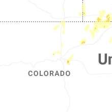
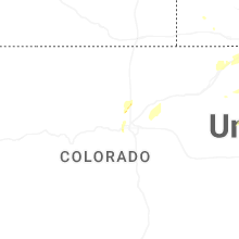


Connect with Interactive Hail Maps