

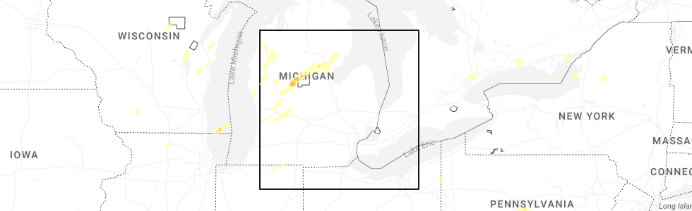
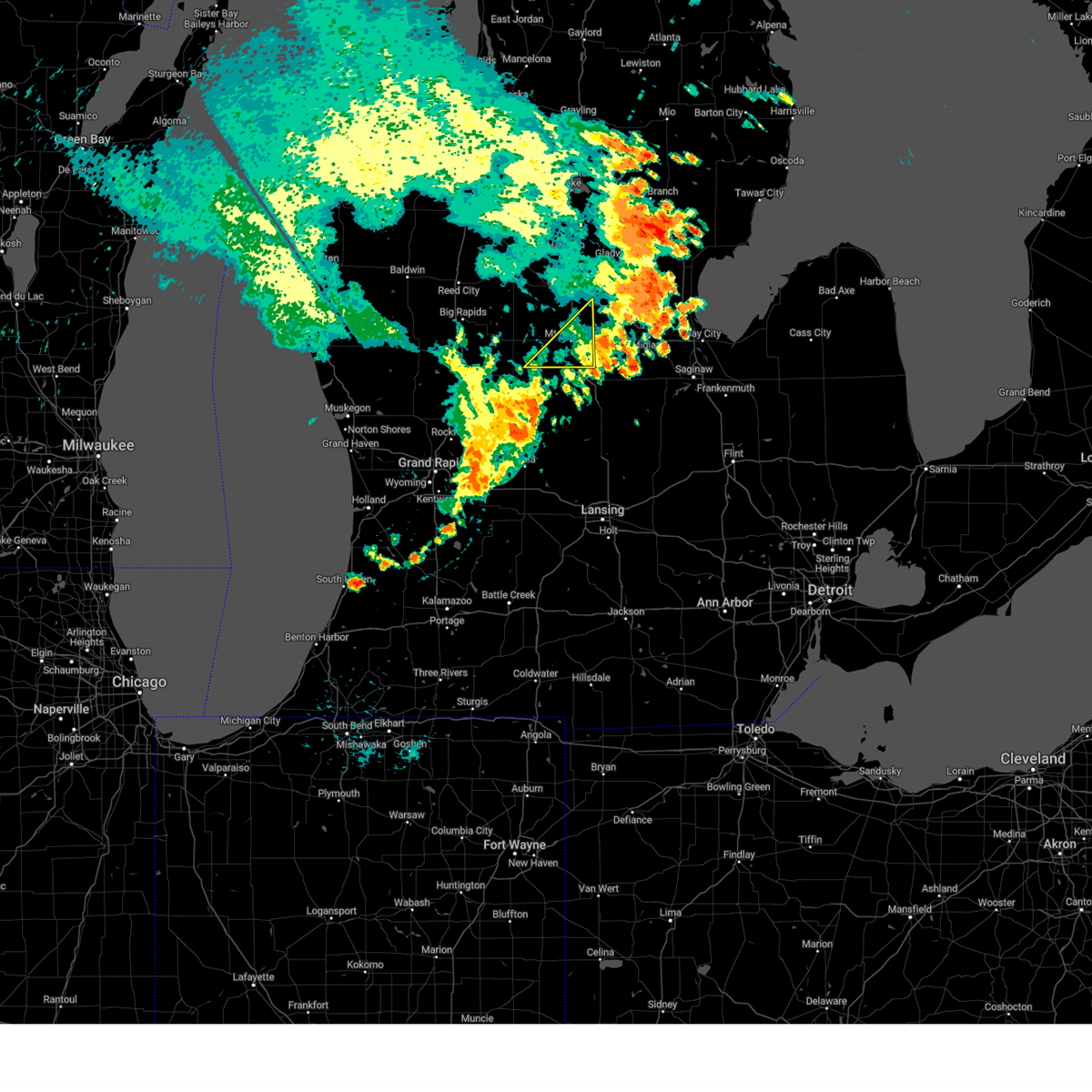
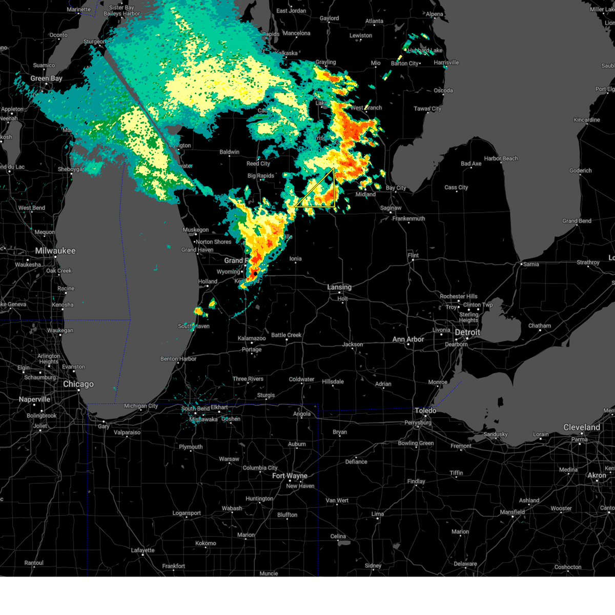
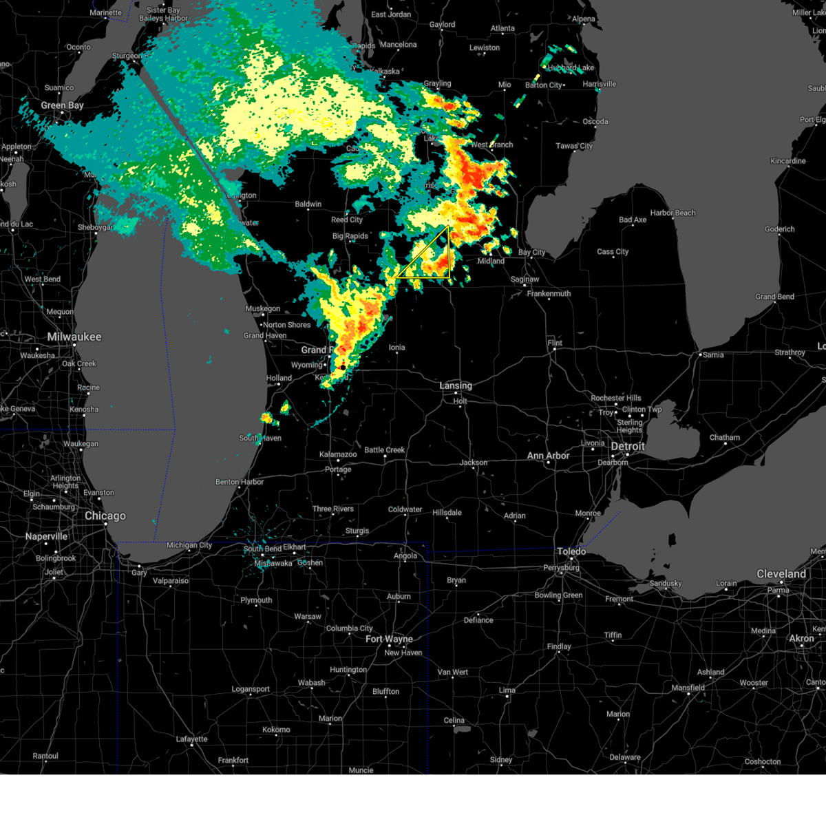
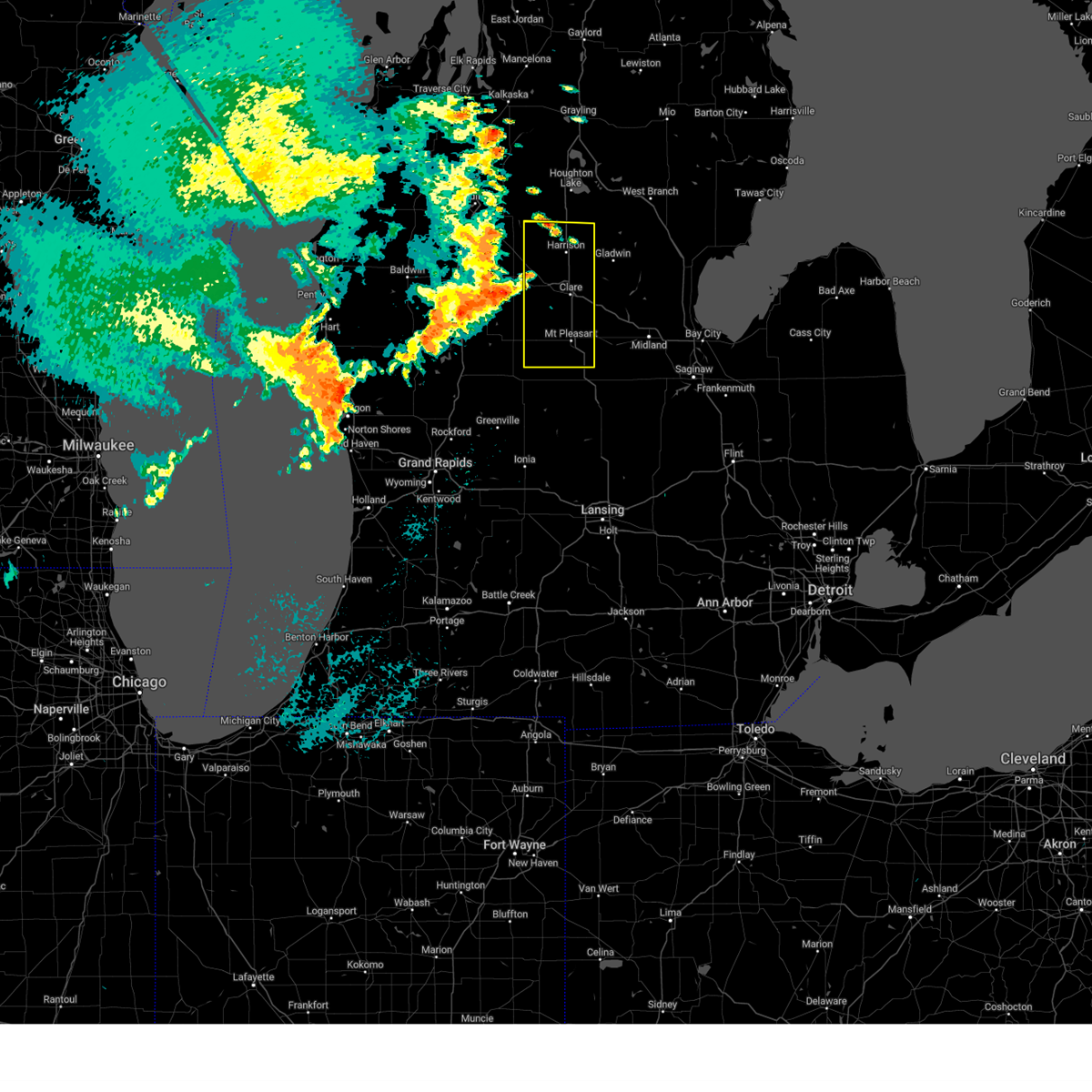
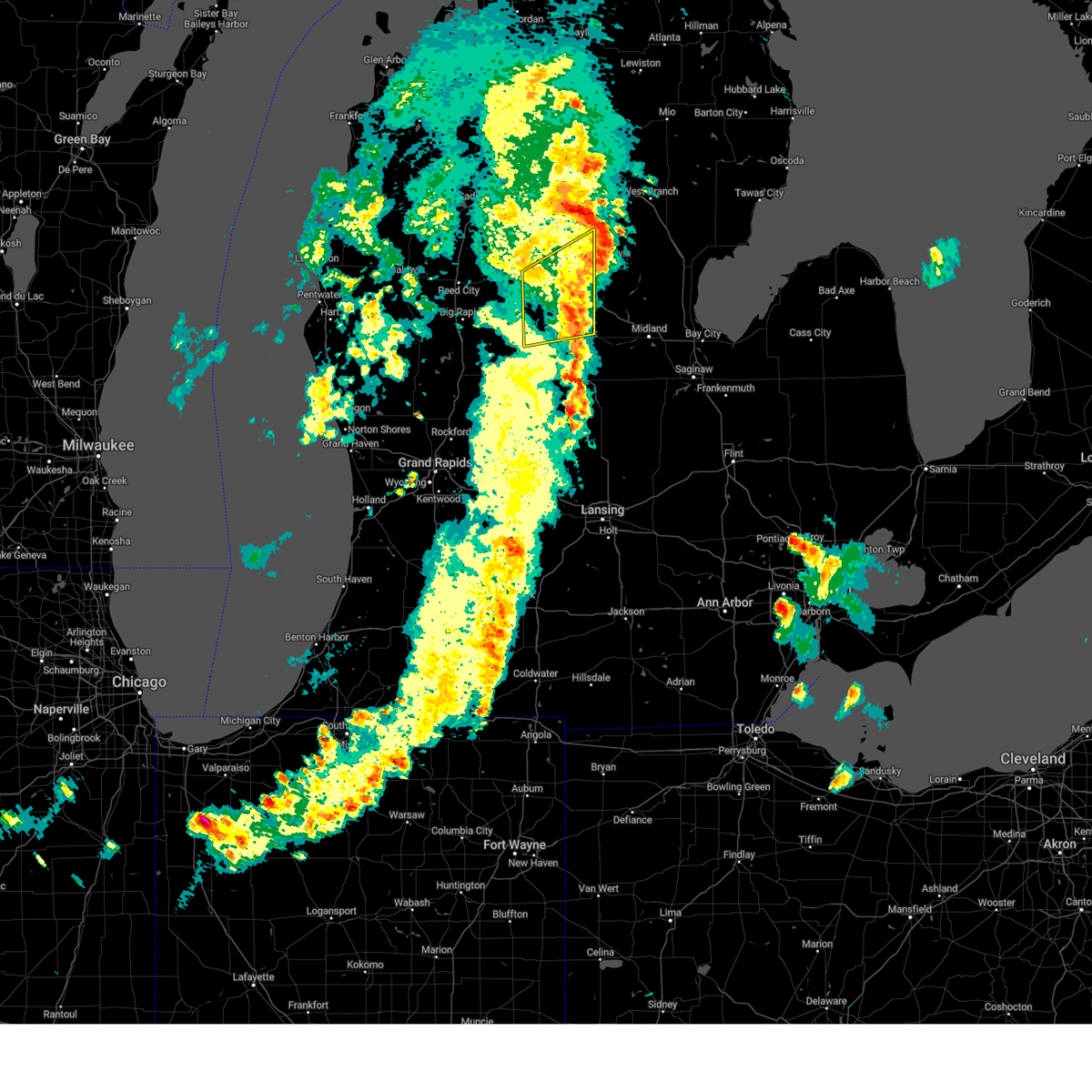
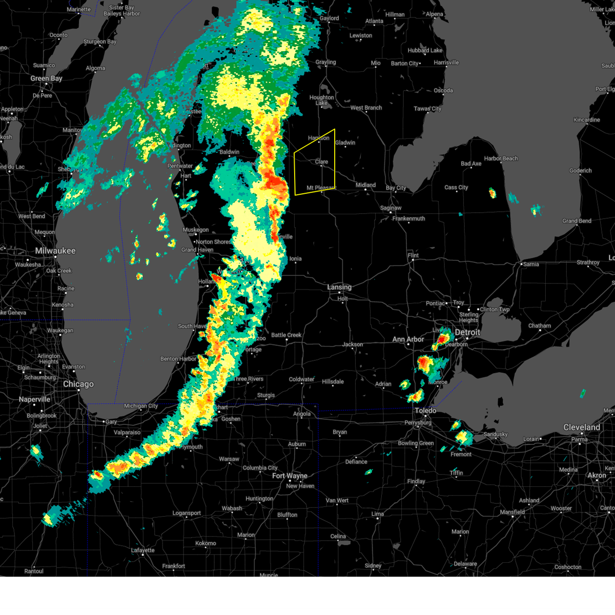
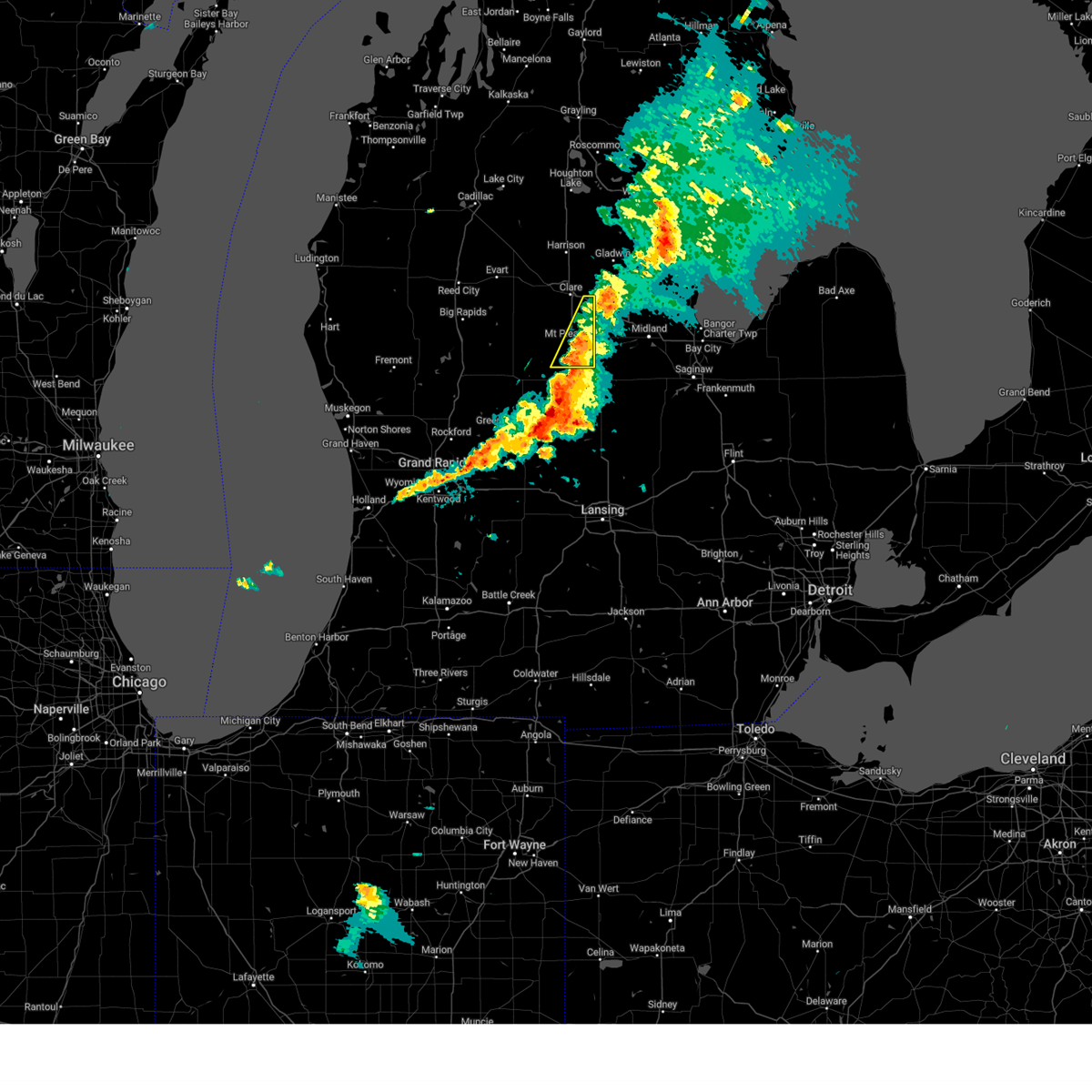
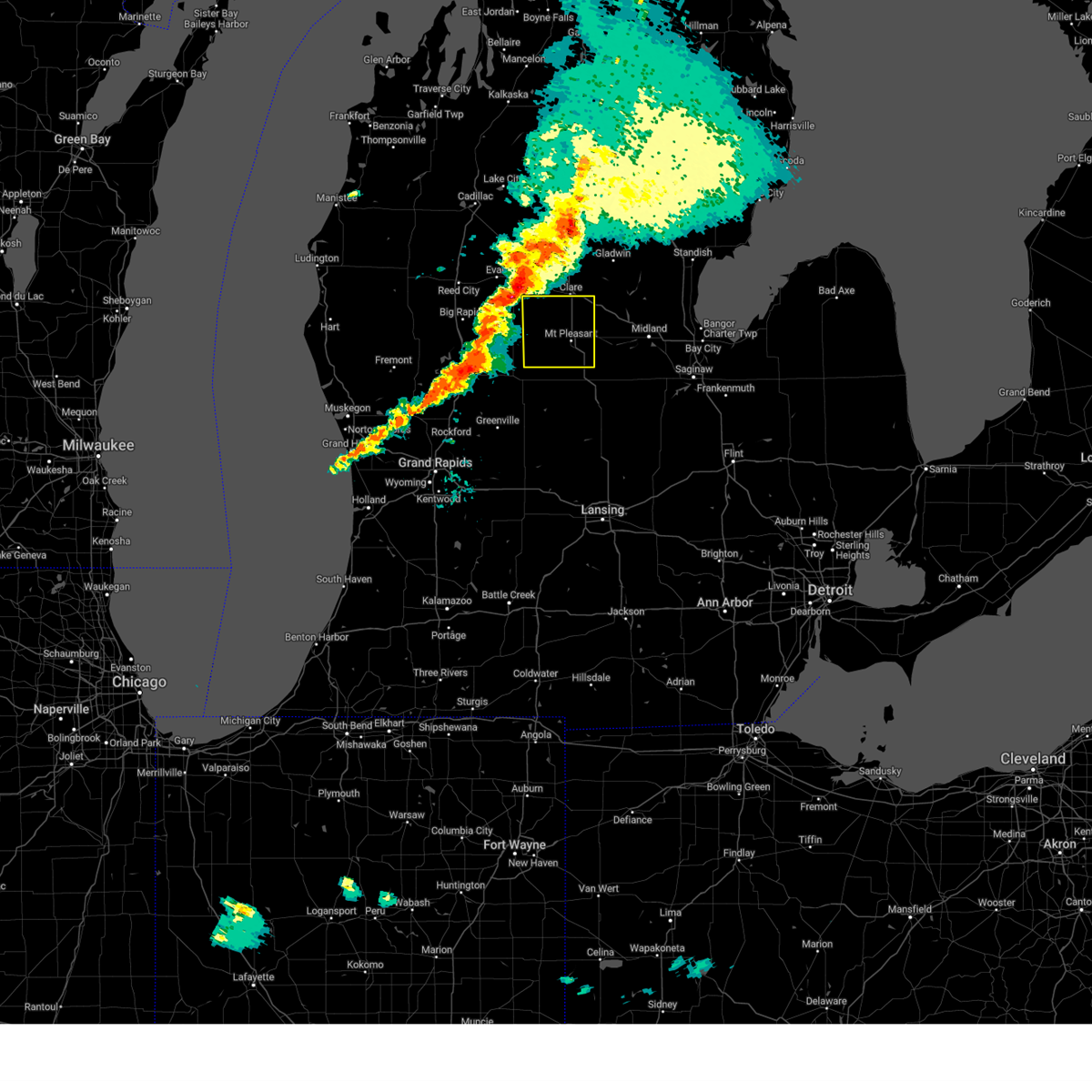
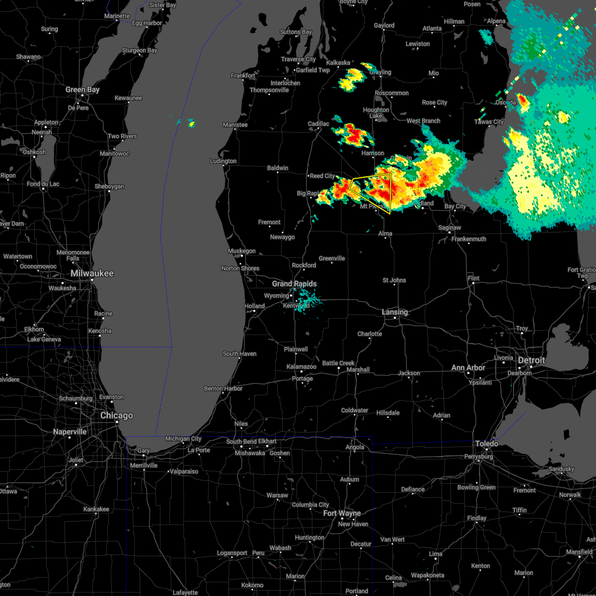
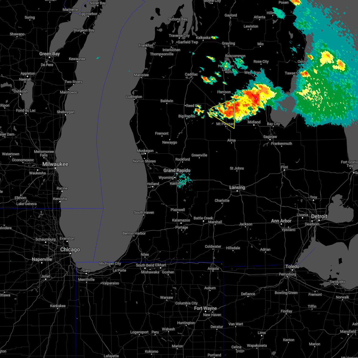
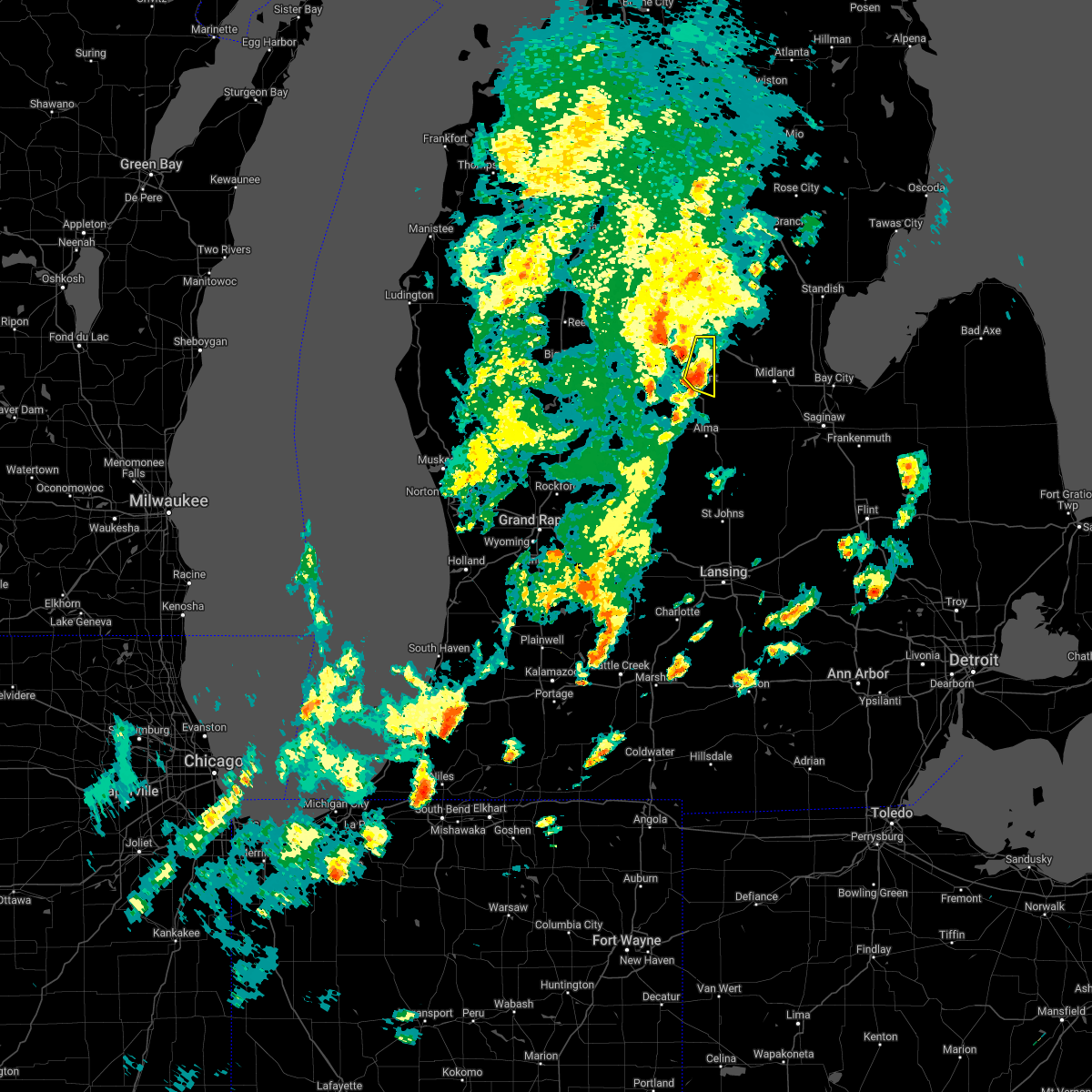
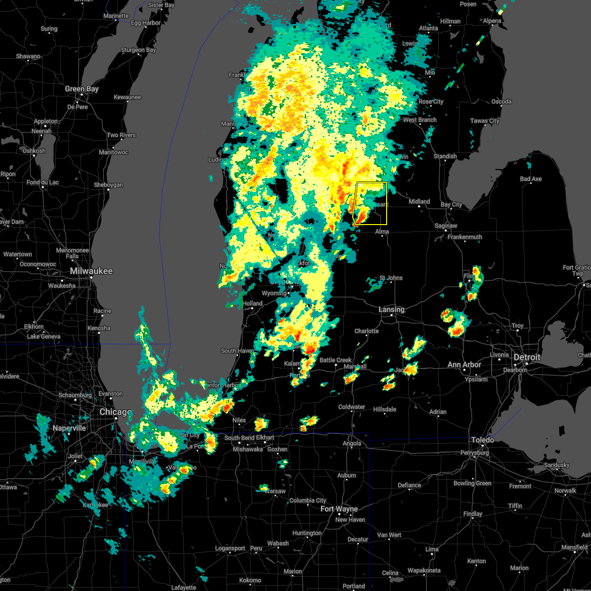
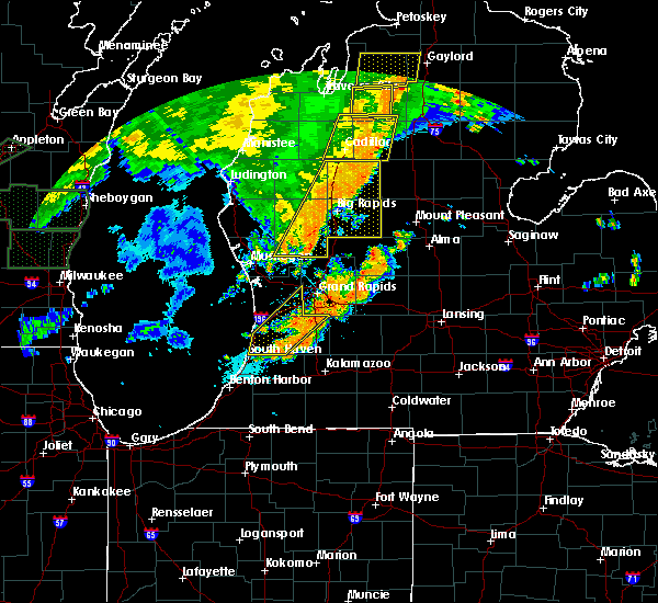
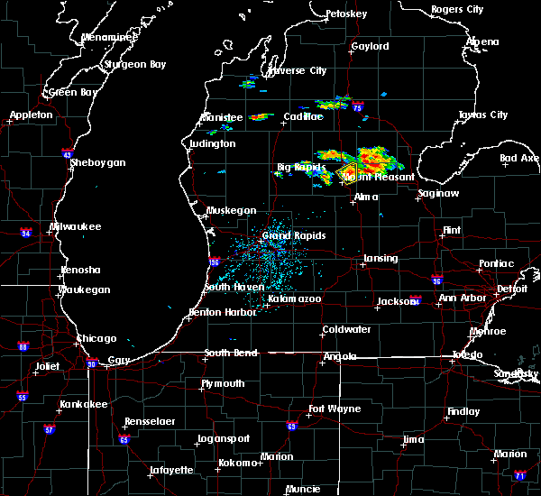
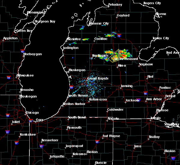
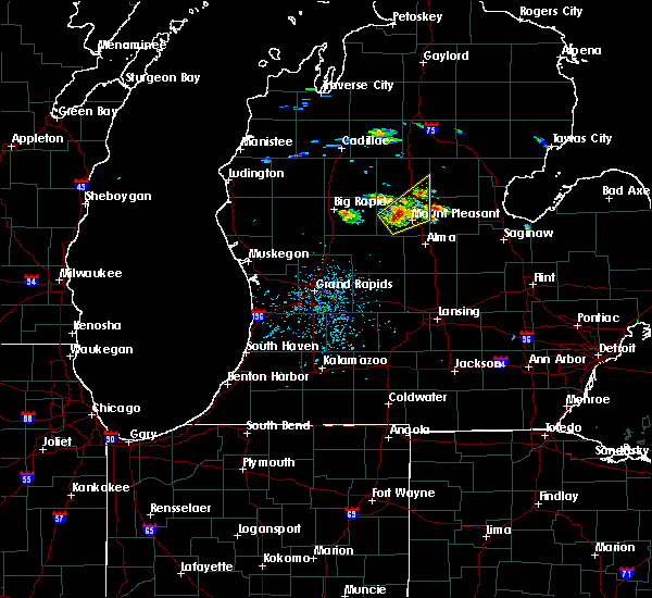
Hail Map for Loomis, MI
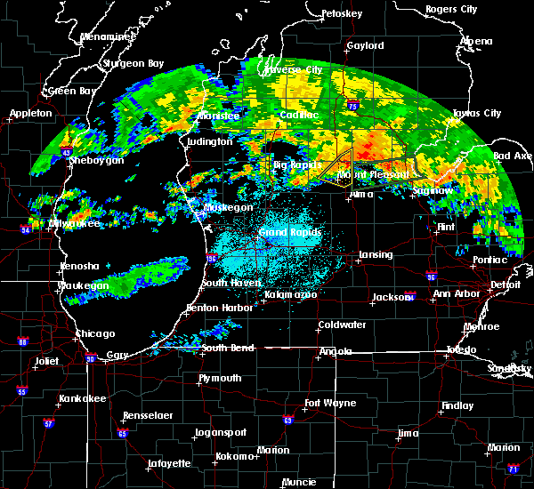
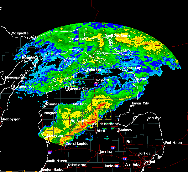
The Loomis, MI area has had 0 reports of on-the-ground hail by trained spotters, and has been under severe weather warnings 11 times during the past 12 months. Doppler radar has detected hail at or near Loomis, MI on 36 occasions, including 2 occasions during the past year.
| Name: | Loomis, MI |
| Where Located: | 73.2 miles NW of Flint, MI |
| Map: | Google Map for Loomis, MI |
| Population: | 213 |
| Housing Units: | 94 |
| More Info: | Search Google for Loomis, MI |
1
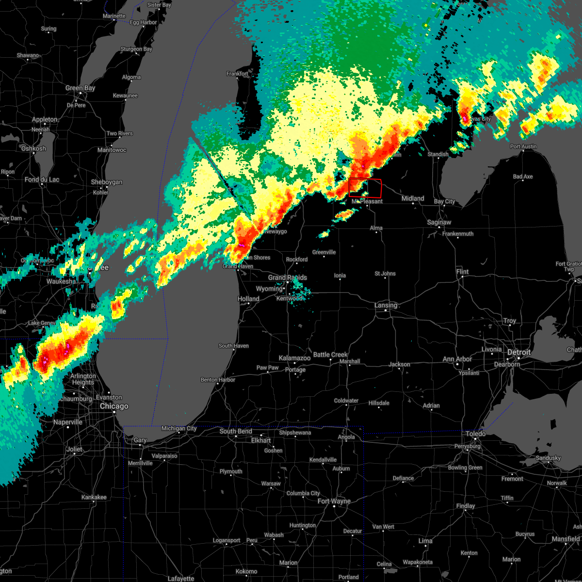
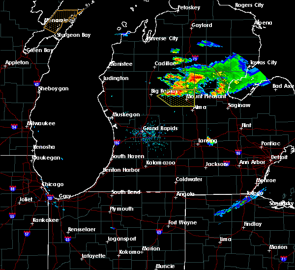
The Top Recent Hail Date for Loomis, MI is Friday, May 16, 2025 (14th out of 36)
Hail and Wind Damage Spotted near Loomis, MI
| Date / Time | Report Details |
|---|---|
| 5/16/2025 9:03 PM EDT |
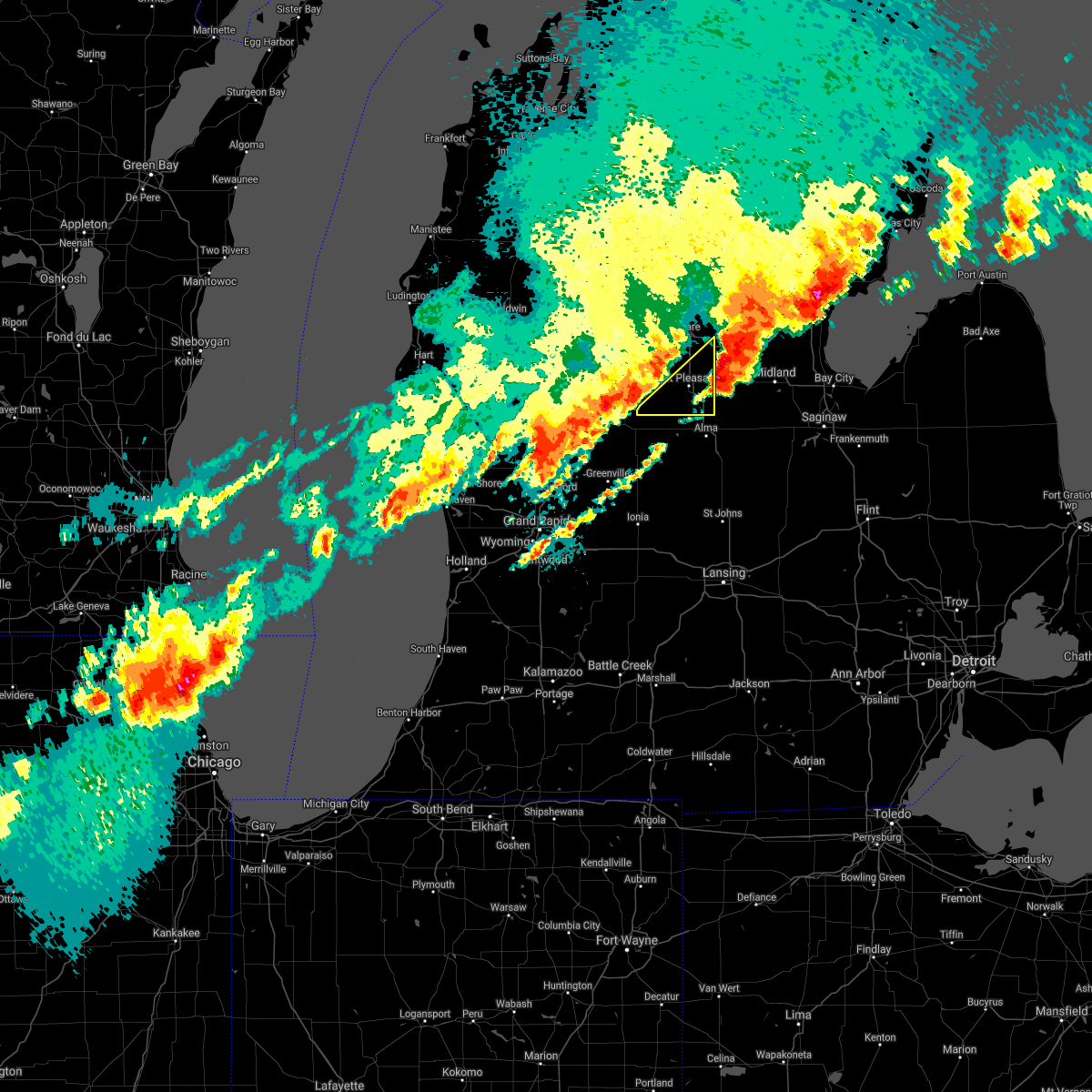
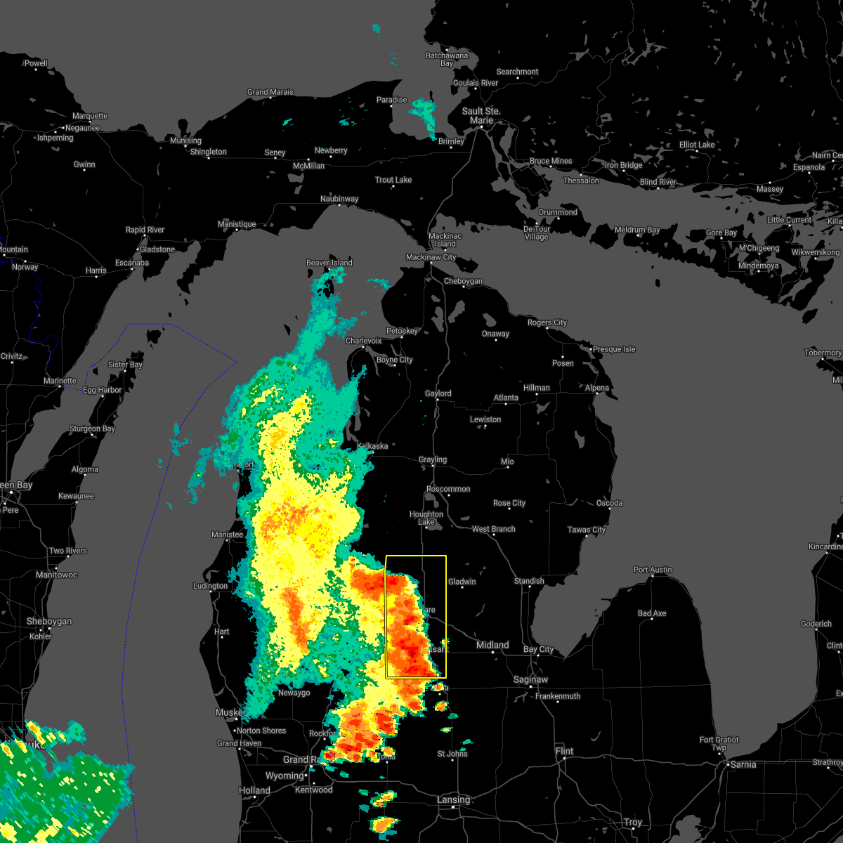
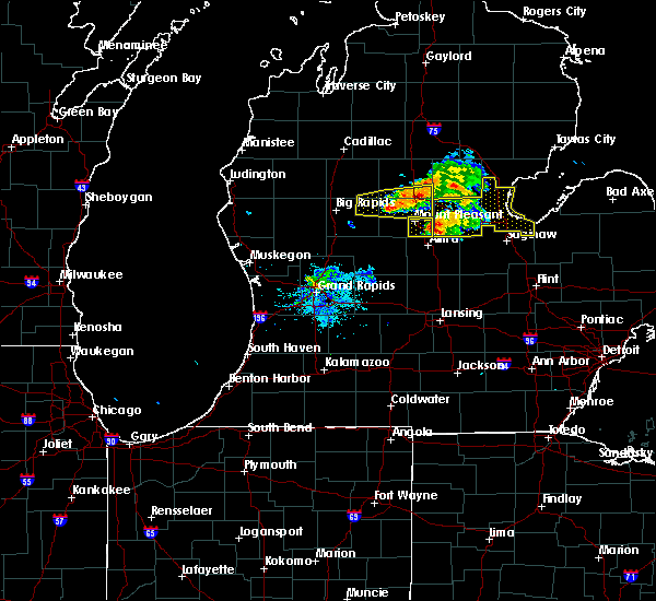
 At 902 pm edt, a severe thunderstorm was located near lake isabella, or 14 miles northwest of mount pleasant, moving northeast at 35 mph (radar indicated). Hazards include golf ball size hail and 60 mph wind gusts. People and animals outdoors will be injured. expect hail damage to roofs, siding, windows, and vehicles. expect wind damage to roofs, siding, and trees. Locations impacted include, clare, farwell, rosebush, lake isabella, harrison, brinton, springwood lakes, elbow lake, windover lake, bailey lake, five lakes, loomis, lily lake, lake george, eight point lake, temple, cranberry lake, doc and tom lake, arnold lake, long lake,. At 902 pm edt, a severe thunderstorm was located near lake isabella, or 14 miles northwest of mount pleasant, moving northeast at 35 mph (radar indicated). Hazards include golf ball size hail and 60 mph wind gusts. People and animals outdoors will be injured. expect hail damage to roofs, siding, windows, and vehicles. expect wind damage to roofs, siding, and trees. Locations impacted include, clare, farwell, rosebush, lake isabella, harrison, brinton, springwood lakes, elbow lake, windover lake, bailey lake, five lakes, loomis, lily lake, lake george, eight point lake, temple, cranberry lake, doc and tom lake, arnold lake, long lake,.
|
| 5/16/2025 8:42 PM EDT | Svrgrr the national weather service in grand rapids has issued a * severe thunderstorm warning for, western isabella county in central michigan, clare county in central michigan, * until 1015 pm edt. * at 842 pm edt, a severe thunderstorm was located near mecosta, or 17 miles southeast of big rapids, moving northeast at 40 mph (radar indicated). Hazards include ping pong ball size hail and 60 mph wind gusts. People and animals outdoors will be injured. expect hail damage to roofs, siding, windows, and vehicles. Expect wind damage to roofs, siding, and trees. |
| 5/16/2025 12:00 AM EDT |
 the severe thunderstorm warning has been cancelled and is no longer in effect the severe thunderstorm warning has been cancelled and is no longer in effect
|
| 5/15/2025 11:22 PM EDT |
 Svrgrr the national weather service in grand rapids has issued a * severe thunderstorm warning for, eastern isabella county in central michigan, clare county in central michigan, * until 1215 am edt. * at 1121 pm edt, severe thunderstorms were located along a line extending from near mcbain to 5 miles south of farwell to near shepherd, moving east at 30 mph (radar indicated). Hazards include 60 mph wind gusts. expect damage to roofs, siding, and trees Svrgrr the national weather service in grand rapids has issued a * severe thunderstorm warning for, eastern isabella county in central michigan, clare county in central michigan, * until 1215 am edt. * at 1121 pm edt, severe thunderstorms were located along a line extending from near mcbain to 5 miles south of farwell to near shepherd, moving east at 30 mph (radar indicated). Hazards include 60 mph wind gusts. expect damage to roofs, siding, and trees
|
| 3/30/2025 7:07 PM EDT | The storm which prompted the warning has weakened below severe limits, and no longer poses an immediate threat to life or property. therefore, the warning will be allowed to expire. however, gusty winds are still possible with this thunderstorm. |
| 3/30/2025 6:52 PM EDT | At 652 pm edt, a severe thunderstorm was located near mount pleasant, moving northeast at 50 mph (radar indicated). Hazards include 60 mph wind gusts and penny size hail. Expect damage to roofs, siding, and trees. Locations impacted include, brinton, mount pleasant, lake isabella, loomis, blanchard, shepherd, rosebush, delwin, beal city, winn, mount pleasant munic, weidman, clare,. |
| 3/30/2025 6:37 PM EDT | Svrgrr the national weather service in grand rapids has issued a * severe thunderstorm warning for, isabella county in central michigan, * until 715 pm edt. * at 637 pm edt, a severe thunderstorm was located 7 miles north of edmore, or 13 miles southwest of mount pleasant, moving northeast at 55 mph (radar indicated). Hazards include 60 mph wind gusts and penny size hail. expect damage to roofs, siding, and trees |
| 8/27/2024 3:54 PM EDT |
 the severe thunderstorm warning has been cancelled and is no longer in effect the severe thunderstorm warning has been cancelled and is no longer in effect
|
| 8/27/2024 3:41 PM EDT |
 the severe thunderstorm warning has been cancelled and is no longer in effect the severe thunderstorm warning has been cancelled and is no longer in effect
|
| 8/27/2024 3:41 PM EDT |
 At 340 pm edt, a severe thunderstorm was located near shepherd, moving east at 40 mph (radar indicated). Hazards include 60 mph wind gusts. Expect damage to roofs, siding, and trees. Locations impacted include, mount pleasant, shepherd, rosebush, delwin, winn, mount pleasant munic,. At 340 pm edt, a severe thunderstorm was located near shepherd, moving east at 40 mph (radar indicated). Hazards include 60 mph wind gusts. Expect damage to roofs, siding, and trees. Locations impacted include, mount pleasant, shepherd, rosebush, delwin, winn, mount pleasant munic,.
|
| 8/27/2024 2:50 PM EDT |
 Svrgrr the national weather service in grand rapids has issued a * severe thunderstorm warning for, isabella county in central michigan, clare county in central michigan, * until 415 pm edt. * at 250 pm edt, severe thunderstorms were located along a line extending from near leota to near big rapids, moving east at 40 mph (radar indicated). Hazards include 60 mph wind gusts. expect damage to roofs, siding, and trees Svrgrr the national weather service in grand rapids has issued a * severe thunderstorm warning for, isabella county in central michigan, clare county in central michigan, * until 415 pm edt. * at 250 pm edt, severe thunderstorms were located along a line extending from near leota to near big rapids, moving east at 40 mph (radar indicated). Hazards include 60 mph wind gusts. expect damage to roofs, siding, and trees
|
| 5/20/2024 8:29 PM EDT |
 The storm which prompted the warning has moved out of the area. therefore, the warning will be allowed to expire. a severe thunderstorm watch remains in effect until 1000 pm edt for central michigan. The storm which prompted the warning has moved out of the area. therefore, the warning will be allowed to expire. a severe thunderstorm watch remains in effect until 1000 pm edt for central michigan.
|
| 5/20/2024 7:29 PM EDT |
 Svrgrr the national weather service in grand rapids has issued a * severe thunderstorm warning for, isabella county in central michigan, clare county in central michigan, * until 830 pm edt. * at 728 pm edt, a severe thunderstorm was located 7 miles northeast of mecosta, or 14 miles southeast of evart, moving northeast at 30 mph (radar indicated). Hazards include 60 mph wind gusts. expect damage to roofs, siding, and trees Svrgrr the national weather service in grand rapids has issued a * severe thunderstorm warning for, isabella county in central michigan, clare county in central michigan, * until 830 pm edt. * at 728 pm edt, a severe thunderstorm was located 7 miles northeast of mecosta, or 14 miles southeast of evart, moving northeast at 30 mph (radar indicated). Hazards include 60 mph wind gusts. expect damage to roofs, siding, and trees
|
| 11/8/2023 6:07 PM EST |
 At 607 pm est, a severe thunderstorm was located over mecosta, or 15 miles east of big rapids, moving east-northeast at 45 mph (radar indicated). Hazards include quarter size hail. damage to vehicles is expected At 607 pm est, a severe thunderstorm was located over mecosta, or 15 miles east of big rapids, moving east-northeast at 45 mph (radar indicated). Hazards include quarter size hail. damage to vehicles is expected
|
| 11/6/2023 9:45 AM EST |
 At 944 am est, severe thunderstorms were located along a line extending from near lakeview to 6 miles northeast of sparta, moving east at 75 mph (radar indicated). Hazards include 60 mph wind gusts and quarter size hail. Hail damage to vehicles is expected. Expect wind damage to roofs, siding, and trees. At 944 am est, severe thunderstorms were located along a line extending from near lakeview to 6 miles northeast of sparta, moving east at 75 mph (radar indicated). Hazards include 60 mph wind gusts and quarter size hail. Hail damage to vehicles is expected. Expect wind damage to roofs, siding, and trees.
|
| 7/20/2023 1:26 PM EDT |
 At 124 pm edt, severe thunderstorms were located along a line extending from near coleman to 6 miles southwest of shepherd, moving east at 30 mph (radar indicated). Hazards include 60 mph wind gusts and quarter size hail. Hail damage to vehicles is expected. expect wind damage to roofs, siding, and trees. locations impacted include, shepherd hail threat, radar indicated max hail size, 1. 00 in wind threat, radar indicated max wind gust, 60 mph. At 124 pm edt, severe thunderstorms were located along a line extending from near coleman to 6 miles southwest of shepherd, moving east at 30 mph (radar indicated). Hazards include 60 mph wind gusts and quarter size hail. Hail damage to vehicles is expected. expect wind damage to roofs, siding, and trees. locations impacted include, shepherd hail threat, radar indicated max hail size, 1. 00 in wind threat, radar indicated max wind gust, 60 mph.
|
| 7/20/2023 12:29 PM EDT |
 At 1228 pm edt, severe thunderstorms were located along a line extending from 10 miles east of evart to near morley, moving east at 30 mph (radar indicated). Hazards include 60 mph wind gusts and quarter size hail. Hail damage to vehicles is expected. Expect wind damage to roofs, siding, and trees. At 1228 pm edt, severe thunderstorms were located along a line extending from 10 miles east of evart to near morley, moving east at 30 mph (radar indicated). Hazards include 60 mph wind gusts and quarter size hail. Hail damage to vehicles is expected. Expect wind damage to roofs, siding, and trees.
|
| 6/25/2023 6:27 PM EDT |
 The severe thunderstorm warning for gratiot and isabella counties will expire at 630 pm edt, the storms which prompted the warning have weakened and moved out of the warned area. therefore, the warning will be allowed to expire. a severe thunderstorm watch remains in effect until 700 pm edt for central michigan. The severe thunderstorm warning for gratiot and isabella counties will expire at 630 pm edt, the storms which prompted the warning have weakened and moved out of the warned area. therefore, the warning will be allowed to expire. a severe thunderstorm watch remains in effect until 700 pm edt for central michigan.
|
| 6/25/2023 6:04 PM EDT |
 At 604 pm edt, severe thunderstorms were located along a line extending from farwell to ithaca, moving northeast at 30 mph (radar indicated). Hazards include 60 mph wind gusts and penny size hail. Expect damage to roofs, siding, and trees. locations impacted include, mount pleasant, alma, clare, ithaca, st. louis, shepherd, breckenridge, rosebush, wheeler, north star, ashley, perrinton, brinton, loomis, gratiot community ai, bannister, forest hill, pompeii, delwin, beal city, hail threat, radar indicated max hail size, 0. 75 in wind threat, radar indicated max wind gust, 60 mph. At 604 pm edt, severe thunderstorms were located along a line extending from farwell to ithaca, moving northeast at 30 mph (radar indicated). Hazards include 60 mph wind gusts and penny size hail. Expect damage to roofs, siding, and trees. locations impacted include, mount pleasant, alma, clare, ithaca, st. louis, shepherd, breckenridge, rosebush, wheeler, north star, ashley, perrinton, brinton, loomis, gratiot community ai, bannister, forest hill, pompeii, delwin, beal city, hail threat, radar indicated max hail size, 0. 75 in wind threat, radar indicated max wind gust, 60 mph.
|
| 6/25/2023 5:32 PM EDT |
 At 531 pm edt, severe thunderstorms were located along a line extending from 6 miles northeast of mecosta to near carson city, moving northeast at 30 mph (radar indicated). Hazards include 60 mph wind gusts and penny size hail. expect damage to roofs, siding, and trees At 531 pm edt, severe thunderstorms were located along a line extending from 6 miles northeast of mecosta to near carson city, moving northeast at 30 mph (radar indicated). Hazards include 60 mph wind gusts and penny size hail. expect damage to roofs, siding, and trees
|
| 8/29/2022 4:12 PM EDT |
 At 411 pm edt, a severe thunderstorm was located near coleman, moving east at 45 mph (radar indicated). Hazards include 60 mph wind gusts and penny size hail. Expect damage to roofs, siding, and trees. locations impacted include, mount pleasant, clare, shepherd, farwell, rosebush, lake isabella, harrison, lake, brinton, lake george, delwin, winn, mount pleasant munic, loomis, blanchard, long lake, beal city, leota, weidman, hail threat, radar indicated max hail size, 0. 75 in wind threat, radar indicated max wind gust, 60 mph. At 411 pm edt, a severe thunderstorm was located near coleman, moving east at 45 mph (radar indicated). Hazards include 60 mph wind gusts and penny size hail. Expect damage to roofs, siding, and trees. locations impacted include, mount pleasant, clare, shepherd, farwell, rosebush, lake isabella, harrison, lake, brinton, lake george, delwin, winn, mount pleasant munic, loomis, blanchard, long lake, beal city, leota, weidman, hail threat, radar indicated max hail size, 0. 75 in wind threat, radar indicated max wind gust, 60 mph.
|
| 8/29/2022 3:33 PM EDT |
 At 332 pm edt, a severe thunderstorm was located 9 miles north of mecosta, or 10 miles east of big rapids, moving east at 45 mph (radar indicated). Hazards include 60 mph wind gusts and penny size hail. expect damage to roofs, siding, and trees At 332 pm edt, a severe thunderstorm was located 9 miles north of mecosta, or 10 miles east of big rapids, moving east at 45 mph (radar indicated). Hazards include 60 mph wind gusts and penny size hail. expect damage to roofs, siding, and trees
|
| 5/11/2022 11:29 AM EDT |
 At 1129 am edt, a severe thunderstorm was located near rosebush, or 6 miles northeast of mount pleasant, moving southeast at 10 mph (radar indicated). Hazards include 60 mph wind gusts and quarter size hail. Hail damage to vehicles is expected. expect wind damage to roofs, siding, and trees. locations impacted include, mount pleasant, shepherd, rosebush, delwin, loomis, hail threat, radar indicated max hail size, 1. 00 in wind threat, radar indicated max wind gust, 60 mph. At 1129 am edt, a severe thunderstorm was located near rosebush, or 6 miles northeast of mount pleasant, moving southeast at 10 mph (radar indicated). Hazards include 60 mph wind gusts and quarter size hail. Hail damage to vehicles is expected. expect wind damage to roofs, siding, and trees. locations impacted include, mount pleasant, shepherd, rosebush, delwin, loomis, hail threat, radar indicated max hail size, 1. 00 in wind threat, radar indicated max wind gust, 60 mph.
|
| 5/11/2022 11:28 AM EDT |
 At 1127 am edt, a severe thunderstorm was located 7 miles east of oil city, or 7 miles southwest of sanford, moving southeast at 25 mph (radar indicated). Hazards include 60 mph wind gusts and quarter size hail. Hail damage to vehicles is expected. expect wind damage to roofs, siding, and trees. locations impacted include, mount pleasant, shepherd, rosebush, delwin, loomis, hail threat, radar indicated max hail size, 1. 00 in wind threat, radar indicated max wind gust, 60 mph. At 1127 am edt, a severe thunderstorm was located 7 miles east of oil city, or 7 miles southwest of sanford, moving southeast at 25 mph (radar indicated). Hazards include 60 mph wind gusts and quarter size hail. Hail damage to vehicles is expected. expect wind damage to roofs, siding, and trees. locations impacted include, mount pleasant, shepherd, rosebush, delwin, loomis, hail threat, radar indicated max hail size, 1. 00 in wind threat, radar indicated max wind gust, 60 mph.
|
| 5/11/2022 10:58 AM EDT |
 At 1058 am edt, a severe thunderstorm was located near oil city, or 6 miles south of coleman, moving southeast at 25 mph (radar indicated). Hazards include ping pong ball size hail. People and animals outdoors will be injured. Expect damage to roofs, siding, windows, and vehicles. At 1058 am edt, a severe thunderstorm was located near oil city, or 6 miles south of coleman, moving southeast at 25 mph (radar indicated). Hazards include ping pong ball size hail. People and animals outdoors will be injured. Expect damage to roofs, siding, windows, and vehicles.
|
| 5/11/2022 10:47 AM EDT |
 At 1046 am edt, a severe thunderstorm was located near rosebush, or near coleman, moving southeast at 15 mph (radar indicated). Hazards include ping pong ball size hail and 60 mph wind gusts. People and animals outdoors will be injured. expect hail damage to roofs, siding, windows, and vehicles. expect wind damage to roofs, siding, and trees. locations impacted include, clare, farwell, rosebush, lake, brinton, delwin, loomis, hail threat, radar indicated max hail size, 1. 50 in wind threat, radar indicated max wind gust, 60 mph. At 1046 am edt, a severe thunderstorm was located near rosebush, or near coleman, moving southeast at 15 mph (radar indicated). Hazards include ping pong ball size hail and 60 mph wind gusts. People and animals outdoors will be injured. expect hail damage to roofs, siding, windows, and vehicles. expect wind damage to roofs, siding, and trees. locations impacted include, clare, farwell, rosebush, lake, brinton, delwin, loomis, hail threat, radar indicated max hail size, 1. 50 in wind threat, radar indicated max wind gust, 60 mph.
|
| 5/11/2022 10:44 AM EDT |
 At 1044 am edt, a severe thunderstorm was located near rosebush, or near coleman, moving southeast at 10 mph (radar indicated). Hazards include 60 mph wind gusts and quarter size hail. Hail damage to vehicles is expected. expect wind damage to roofs, siding, and trees. locations impacted include, clare, farwell, rosebush, lake, brinton, delwin, loomis, hail threat, radar indicated max hail size, 1. 00 in wind threat, radar indicated max wind gust, 60 mph. At 1044 am edt, a severe thunderstorm was located near rosebush, or near coleman, moving southeast at 10 mph (radar indicated). Hazards include 60 mph wind gusts and quarter size hail. Hail damage to vehicles is expected. expect wind damage to roofs, siding, and trees. locations impacted include, clare, farwell, rosebush, lake, brinton, delwin, loomis, hail threat, radar indicated max hail size, 1. 00 in wind threat, radar indicated max wind gust, 60 mph.
|
| 5/11/2022 10:18 AM EDT |
 At 1017 am edt, a severe thunderstorm was located near coleman, moving southeast at 20 mph (radar indicated). Hazards include 60 mph wind gusts and quarter size hail. Hail damage to vehicles is expected. expect wind damage to roofs, siding, and trees. locations impacted include, clare, farwell, rosebush, lake, brinton, delwin, loomis, hail threat, radar indicated max hail size, 1. 00 in wind threat, radar indicated max wind gust, 60 mph. At 1017 am edt, a severe thunderstorm was located near coleman, moving southeast at 20 mph (radar indicated). Hazards include 60 mph wind gusts and quarter size hail. Hail damage to vehicles is expected. expect wind damage to roofs, siding, and trees. locations impacted include, clare, farwell, rosebush, lake, brinton, delwin, loomis, hail threat, radar indicated max hail size, 1. 00 in wind threat, radar indicated max wind gust, 60 mph.
|
| 5/11/2022 10:02 AM EDT |
 At 1001 am edt, a severe thunderstorm was located near clare, moving east at 20 mph (radar indicated). Hazards include 60 mph wind gusts and quarter size hail. Hail damage to vehicles is expected. Expect wind damage to roofs, siding, and trees. At 1001 am edt, a severe thunderstorm was located near clare, moving east at 20 mph (radar indicated). Hazards include 60 mph wind gusts and quarter size hail. Hail damage to vehicles is expected. Expect wind damage to roofs, siding, and trees.
|
| 4/24/2022 3:50 PM EDT |
 At 350 pm edt, a severe thunderstorm was located near mount pleasant, moving northeast at 50 mph (radar indicated). Hazards include 60 mph wind gusts. Expect damage to roofs, siding, and trees. This severe thunderstorm will remain over mainly rural areas of northeastern isabella county, including the following locations, delwin and loomis. At 350 pm edt, a severe thunderstorm was located near mount pleasant, moving northeast at 50 mph (radar indicated). Hazards include 60 mph wind gusts. Expect damage to roofs, siding, and trees. This severe thunderstorm will remain over mainly rural areas of northeastern isabella county, including the following locations, delwin and loomis.
|
| 4/24/2022 3:36 PM EDT |
 At 335 pm edt, a severe thunderstorm was located 7 miles southwest of mount pleasant, moving northeast at 45 mph (radar indicated). Hazards include 60 mph wind gusts. Expect damage to roofs, siding, and trees. this severe storm will be near, mount pleasant and shepherd around 345 pm edt. rosebush around 350 pm edt. Other locations impacted by this severe thunderstorm include delwin, winn, loomis, beal city and weidman. At 335 pm edt, a severe thunderstorm was located 7 miles southwest of mount pleasant, moving northeast at 45 mph (radar indicated). Hazards include 60 mph wind gusts. Expect damage to roofs, siding, and trees. this severe storm will be near, mount pleasant and shepherd around 345 pm edt. rosebush around 350 pm edt. Other locations impacted by this severe thunderstorm include delwin, winn, loomis, beal city and weidman.
|
| 4/24/2022 3:22 PM EDT |
 At 321 pm edt, a severe thunderstorm was located over edmore, or 7 miles north of stanton, moving northeast at 50 mph (radar indicated). Hazards include 60 mph wind gusts. Expect damage to roofs, siding, and trees. this severe thunderstorm will be near, mount pleasant and shepherd around 345 pm edt. rosebush around 355 pm edt. Other locations impacted by this severe thunderstorm include mcbride, westville, cedar lake, six lakes, loomis, vestaburg, blanchard, wyman, delwin and winn. At 321 pm edt, a severe thunderstorm was located over edmore, or 7 miles north of stanton, moving northeast at 50 mph (radar indicated). Hazards include 60 mph wind gusts. Expect damage to roofs, siding, and trees. this severe thunderstorm will be near, mount pleasant and shepherd around 345 pm edt. rosebush around 355 pm edt. Other locations impacted by this severe thunderstorm include mcbride, westville, cedar lake, six lakes, loomis, vestaburg, blanchard, wyman, delwin and winn.
|
| 9/7/2021 3:08 PM EDT |
 At 308 pm edt, severe thunderstorms were located along a line extending from near rosebush to 7 miles north of edmore to 8 miles northwest of greenville, moving east at 50 mph (radar indicated). Hazards include 60 mph wind gusts. Expect damage to roofs, siding, and trees. locations impacted include, mount pleasant, shepherd, rosebush, delwin, winn, hail threat, radar indicated max hail size, <. 75 in wind threat, radar indicated max wind gust, 60 mph. At 308 pm edt, severe thunderstorms were located along a line extending from near rosebush to 7 miles north of edmore to 8 miles northwest of greenville, moving east at 50 mph (radar indicated). Hazards include 60 mph wind gusts. Expect damage to roofs, siding, and trees. locations impacted include, mount pleasant, shepherd, rosebush, delwin, winn, hail threat, radar indicated max hail size, <. 75 in wind threat, radar indicated max wind gust, 60 mph.
|
| 9/7/2021 2:41 PM EDT |
 At 241 pm edt, severe thunderstorms were located along a line extending from near clare to near canadian lakes to near grant, moving east at 50 mph (radar indicated). Hazards include 60 mph wind gusts and penny size hail. Expect damage to roofs, siding, and trees. locations impacted include, mount pleasant, big rapids, clare, newaygo, white cloud, fremont, shepherd, grant, morley, mecosta, rosebush, canadian lakes, lake isabella, croton, bridgeton, remus, millbrook, barryton, stanwood, brinton, hail threat, radar indicated max hail size, 0. 75 in wind threat, radar indicated max wind gust, 60 mph. At 241 pm edt, severe thunderstorms were located along a line extending from near clare to near canadian lakes to near grant, moving east at 50 mph (radar indicated). Hazards include 60 mph wind gusts and penny size hail. Expect damage to roofs, siding, and trees. locations impacted include, mount pleasant, big rapids, clare, newaygo, white cloud, fremont, shepherd, grant, morley, mecosta, rosebush, canadian lakes, lake isabella, croton, bridgeton, remus, millbrook, barryton, stanwood, brinton, hail threat, radar indicated max hail size, 0. 75 in wind threat, radar indicated max wind gust, 60 mph.
|
| 9/7/2021 2:23 PM EDT |
 At 223 pm edt, a severe thunderstorm capable of producing a tornado was located near clare, moving east at 60 mph (radar indicated rotation). Hazards include tornado and quarter size hail. Flying debris will be dangerous to those caught without shelter. mobile homes will be damaged or destroyed. damage to roofs, windows, and vehicles will occur. tree damage is likely. This tornadic thunderstorm will remain over mainly rural areas of northeastern isabella county, including the following locations, delwin, loomis, beal city and weidman. At 223 pm edt, a severe thunderstorm capable of producing a tornado was located near clare, moving east at 60 mph (radar indicated rotation). Hazards include tornado and quarter size hail. Flying debris will be dangerous to those caught without shelter. mobile homes will be damaged or destroyed. damage to roofs, windows, and vehicles will occur. tree damage is likely. This tornadic thunderstorm will remain over mainly rural areas of northeastern isabella county, including the following locations, delwin, loomis, beal city and weidman.
|
| 9/7/2021 2:20 PM EDT |
 At 219 pm edt, a severe thunderstorm was located over white cloud, moving east at 65 mph (radar indicated). Hazards include 60 mph wind gusts and penny size hail. expect damage to roofs, siding, and trees At 219 pm edt, a severe thunderstorm was located over white cloud, moving east at 65 mph (radar indicated). Hazards include 60 mph wind gusts and penny size hail. expect damage to roofs, siding, and trees
|
| 8/24/2021 5:56 PM EDT |
 At 556 pm edt, severe thunderstorms were located along a line extending from near harrison to 8 miles southwest of shepherd, moving east at 20 mph (radar indicated). Hazards include quarter size hail. damage to vehicles is expected At 556 pm edt, severe thunderstorms were located along a line extending from near harrison to 8 miles southwest of shepherd, moving east at 20 mph (radar indicated). Hazards include quarter size hail. damage to vehicles is expected
|
| 8/11/2021 12:07 AM EDT |
 The severe thunderstorm warning for jackson, ingham, gratiot, isabella, clare and clinton counties will expire at 1215 am edt, the storms which prompted the warning have moved out of the area. therefore, the warning will be allowed to expire. a severe thunderstorm watch remains in effect until 300 am edt for south central and central michigan. The severe thunderstorm warning for jackson, ingham, gratiot, isabella, clare and clinton counties will expire at 1215 am edt, the storms which prompted the warning have moved out of the area. therefore, the warning will be allowed to expire. a severe thunderstorm watch remains in effect until 300 am edt for south central and central michigan.
|
| 8/10/2021 11:09 PM EDT |
 At 1108 pm edt, severe thunderstorms were located along a line extending from 9 miles south of mitchell state park to near canadian lakes to 6 miles east of greenville to near nashville to 5 miles west of union city, moving east at 55 mph (radar indicated). Hazards include 60 mph wind gusts. expect damage to roofs, siding, and trees At 1108 pm edt, severe thunderstorms were located along a line extending from 9 miles south of mitchell state park to near canadian lakes to 6 miles east of greenville to near nashville to 5 miles west of union city, moving east at 55 mph (radar indicated). Hazards include 60 mph wind gusts. expect damage to roofs, siding, and trees
|
| 6/26/2021 3:47 PM EDT |
 At 346 pm edt, a confirmed tornado was located near remus, or 10 miles southeast of mecosta, moving northeast at 30 mph (radar confirmed tornado). Hazards include damaging tornado. Flying debris will be dangerous to those caught without shelter. mobile homes will be damaged or destroyed. damage to roofs, windows, and vehicles will occur. tree damage is likely. this tornado will be near, lake isabella around 405 pm edt. rosebush around 430 pm edt. farwell around 435 pm edt. clare around 440 pm edt. Other locations impacted by this tornadic thunderstorm include brinton, delwin, remus, loomis, beal city, lake, weidman and barryton. At 346 pm edt, a confirmed tornado was located near remus, or 10 miles southeast of mecosta, moving northeast at 30 mph (radar confirmed tornado). Hazards include damaging tornado. Flying debris will be dangerous to those caught without shelter. mobile homes will be damaged or destroyed. damage to roofs, windows, and vehicles will occur. tree damage is likely. this tornado will be near, lake isabella around 405 pm edt. rosebush around 430 pm edt. farwell around 435 pm edt. clare around 440 pm edt. Other locations impacted by this tornadic thunderstorm include brinton, delwin, remus, loomis, beal city, lake, weidman and barryton.
|
| 6/26/2021 3:39 PM EDT |
 At 339 pm edt, a severe thunderstorm capable of producing a tornado was located near canadian lakes, or 16 miles southeast of big rapids, moving northeast at 30 mph (radar indicated rotation). Hazards include tornado. Flying debris will be dangerous to those caught without shelter. mobile homes will be damaged or destroyed. damage to roofs, windows, and vehicles will occur. tree damage is likely. this dangerous storm will be near, lake isabella around 405 pm edt. rosebush around 425 pm edt. farwell around 430 pm edt. clare around 435 pm edt. Other locations impacted by this tornadic thunderstorm include brinton, sylvester, barryton, delwin, remus, loomis, beal city, lake and weidman. At 339 pm edt, a severe thunderstorm capable of producing a tornado was located near canadian lakes, or 16 miles southeast of big rapids, moving northeast at 30 mph (radar indicated rotation). Hazards include tornado. Flying debris will be dangerous to those caught without shelter. mobile homes will be damaged or destroyed. damage to roofs, windows, and vehicles will occur. tree damage is likely. this dangerous storm will be near, lake isabella around 405 pm edt. rosebush around 425 pm edt. farwell around 430 pm edt. clare around 435 pm edt. Other locations impacted by this tornadic thunderstorm include brinton, sylvester, barryton, delwin, remus, loomis, beal city, lake and weidman.
|
| 7/19/2020 8:47 AM EDT |
 At 846 am edt, severe thunderstorms were located along a line extending from coleman to 7 miles north of edmore, moving southeast at 35 mph (radar indicated). Hazards include 60 mph wind gusts. Expect damage to roofs, siding, and trees. Locations impacted include, mount pleasant, shepherd, rosebush, delwin, winn, blanchard, beal city,. At 846 am edt, severe thunderstorms were located along a line extending from coleman to 7 miles north of edmore, moving southeast at 35 mph (radar indicated). Hazards include 60 mph wind gusts. Expect damage to roofs, siding, and trees. Locations impacted include, mount pleasant, shepherd, rosebush, delwin, winn, blanchard, beal city,.
|
| 7/19/2020 8:25 AM EDT |
 At 825 am edt, a severe thunderstorms were located between mecosta and clare, moving southeast at 50 mph (radar indicated). Hazards include 60 mph wind gusts. expect damage to roofs, siding, and trees At 825 am edt, a severe thunderstorms were located between mecosta and clare, moving southeast at 50 mph (radar indicated). Hazards include 60 mph wind gusts. expect damage to roofs, siding, and trees
|
| 6/10/2020 1:35 PM EDT |
 At 134 pm edt, severe thunderstorms were located along a line extending from near moddersville to 6 miles east of clare to near breckenridge to near elsie, moving northeast at 45 mph (radar indicated). Hazards include 60 mph wind gusts. Expect damage to roofs, siding, and trees. locations impacted include, mount pleasant, alma, clare, ithaca, st. Louis, shepherd, breckenridge, farwell, rosebush, harrison, wheeler, north star, ashley, perrinton, lake george, forest hill, pompeii, middleton, delwin, loomis,. At 134 pm edt, severe thunderstorms were located along a line extending from near moddersville to 6 miles east of clare to near breckenridge to near elsie, moving northeast at 45 mph (radar indicated). Hazards include 60 mph wind gusts. Expect damage to roofs, siding, and trees. locations impacted include, mount pleasant, alma, clare, ithaca, st. Louis, shepherd, breckenridge, farwell, rosebush, harrison, wheeler, north star, ashley, perrinton, lake george, forest hill, pompeii, middleton, delwin, loomis,.
|
| 6/10/2020 12:51 PM EDT |
 At 1250 pm edt, severe thunderstorms were located along a line extending from 5 miles south of big rapids to 5 miles southeast of stanton, moving northeast at 60 mph (radar indicated). Hazards include 60 mph wind gusts. expect damage to roofs, siding, and trees At 1250 pm edt, severe thunderstorms were located along a line extending from 5 miles south of big rapids to 5 miles southeast of stanton, moving northeast at 60 mph (radar indicated). Hazards include 60 mph wind gusts. expect damage to roofs, siding, and trees
|
| 6/3/2020 1:58 AM EDT |
 At 1252 am edt, severe thunderstorms were located along a line extending from near evart to near ionia, moving east at 50 mph (radar indicated). Hazards include 60 mph wind gusts. expect damage to roofs, siding, and trees At 1252 am edt, severe thunderstorms were located along a line extending from near evart to near ionia, moving east at 50 mph (radar indicated). Hazards include 60 mph wind gusts. expect damage to roofs, siding, and trees
|
| 6/3/2020 12:54 AM EDT |
 At 1252 am edt, severe thunderstorms were located along a line extending from near evart to near ionia, moving east at 50 mph (radar indicated). Hazards include 60 mph wind gusts. expect damage to roofs, siding, and trees At 1252 am edt, severe thunderstorms were located along a line extending from near evart to near ionia, moving east at 50 mph (radar indicated). Hazards include 60 mph wind gusts. expect damage to roofs, siding, and trees
|
| 4/7/2020 7:56 PM EDT |
 The severe thunderstorm warning for northern isabella, southern clare and northeastern mecosta counties will expire at 800 pm edt, the storms which prompted the warning have weakened below severe limits, and have exited the warned area into southern isabella county. therefore, the warning will be allowed to expire. severe hail remains a possibility south of mount pleasant, near winn and shepherd. a severe thunderstorm watch remains in effect until 1000 pm edt for central michigan. The severe thunderstorm warning for northern isabella, southern clare and northeastern mecosta counties will expire at 800 pm edt, the storms which prompted the warning have weakened below severe limits, and have exited the warned area into southern isabella county. therefore, the warning will be allowed to expire. severe hail remains a possibility south of mount pleasant, near winn and shepherd. a severe thunderstorm watch remains in effect until 1000 pm edt for central michigan.
|
| 4/7/2020 7:33 PM EDT |
 At 732 pm edt, severe thunderstorms were located along a line extending from near farwell to 5 miles northwest of mecosta, moving east at 60 mph (radar indicated). Hazards include golf ball size hail and 60 mph wind gusts. People and animals outdoors will be injured. expect hail damage to roofs, siding, windows, and vehicles. expect wind damage to roofs, siding, and trees. Locations impacted include, mount pleasant, clare, farwell, rosebush, barryton, lake isabella, lake, brinton, delwin, loomis, beal city, weidman,. At 732 pm edt, severe thunderstorms were located along a line extending from near farwell to 5 miles northwest of mecosta, moving east at 60 mph (radar indicated). Hazards include golf ball size hail and 60 mph wind gusts. People and animals outdoors will be injured. expect hail damage to roofs, siding, windows, and vehicles. expect wind damage to roofs, siding, and trees. Locations impacted include, mount pleasant, clare, farwell, rosebush, barryton, lake isabella, lake, brinton, delwin, loomis, beal city, weidman,.
|
| 4/7/2020 7:14 PM EDT |
 At 713 pm edt, a severe thunderstorm was located 7 miles south of evart, moving east at 60 mph (radar indicated). Hazards include 60 mph wind gusts and quarter size hail. Hail damage to vehicles is expected. Expect wind damage to roofs, siding, and trees. At 713 pm edt, a severe thunderstorm was located 7 miles south of evart, moving east at 60 mph (radar indicated). Hazards include 60 mph wind gusts and quarter size hail. Hail damage to vehicles is expected. Expect wind damage to roofs, siding, and trees.
|
| 9/10/2019 7:00 PM EDT |
 The national weather service in grand rapids has issued a * severe thunderstorm warning for. northeastern isabella county in central michigan. until 730 pm edt. At 659 pm edt, a severe thunderstorm was located near rosebush, or 7 miles southwest of coleman, moving east at 45 mph. The national weather service in grand rapids has issued a * severe thunderstorm warning for. northeastern isabella county in central michigan. until 730 pm edt. At 659 pm edt, a severe thunderstorm was located near rosebush, or 7 miles southwest of coleman, moving east at 45 mph.
|
| 9/10/2019 6:37 PM EDT |
 A severe thunderstorm warning remains in effect until 700 pm edt for northern isabella and southern clare counties. at 637 pm edt, a severe thunderstorm was located 6 miles north of lake isabella, or 11 miles southwest of clare, moving east at 40 mph. hazard. 60 mph wind gusts and penny size hail. source. Radar indicated. A severe thunderstorm warning remains in effect until 700 pm edt for northern isabella and southern clare counties. at 637 pm edt, a severe thunderstorm was located 6 miles north of lake isabella, or 11 miles southwest of clare, moving east at 40 mph. hazard. 60 mph wind gusts and penny size hail. source. Radar indicated.
|
| 9/10/2019 6:22 PM EDT |
 At 622 pm edt, a severe thunderstorm was located over barryton, or 13 miles southeast of evart, moving east at 40 mph (radar indicated). Hazards include 60 mph wind gusts and penny size hail. Expect damage to roofs, siding, and trees. Locations impacted include, clare, farwell, rosebush, barryton, lake isabella, lake, brinton, gibos corners, delwin, beal city, loomis, weidman,. At 622 pm edt, a severe thunderstorm was located over barryton, or 13 miles southeast of evart, moving east at 40 mph (radar indicated). Hazards include 60 mph wind gusts and penny size hail. Expect damage to roofs, siding, and trees. Locations impacted include, clare, farwell, rosebush, barryton, lake isabella, lake, brinton, gibos corners, delwin, beal city, loomis, weidman,.
|
| 9/10/2019 6:07 PM EDT |
 At 607 pm edt, a severe thunderstorm was located 8 miles east of big rapids, moving east at 40 mph (radar indicated). Hazards include 60 mph wind gusts and penny size hail. expect damage to roofs, siding, and trees At 607 pm edt, a severe thunderstorm was located 8 miles east of big rapids, moving east at 40 mph (radar indicated). Hazards include 60 mph wind gusts and penny size hail. expect damage to roofs, siding, and trees
|
| 8/28/2018 8:51 PM EDT |
 The severe thunderstorm warning for isabella and eastern clare counties will expire at 900 pm edt, the storms which prompted the warning have weakened below severe limits, and have exited the warned area. therefore, the warning will be allowed to expire. a severe thunderstorm watch remains in effect until 100 am edt for central michigan. The severe thunderstorm warning for isabella and eastern clare counties will expire at 900 pm edt, the storms which prompted the warning have weakened below severe limits, and have exited the warned area. therefore, the warning will be allowed to expire. a severe thunderstorm watch remains in effect until 100 am edt for central michigan.
|
| 8/28/2018 8:23 PM EDT |
 At 822 pm edt, severe thunderstorms were located along a line extending from near nester township to 7 miles northeast of clare to 5 miles southeast of lake isabella, moving east at 70 mph (radar indicated). Hazards include 60 mph wind gusts. Expect damage to roofs, siding, and trees. Locations impacted include, mount pleasant, clare, shepherd, farwell, rosebush, lake isabella, lake, brinton, loomis, lake george, temple, delwin, beal city, winn, leota, weidman, blanchard,. At 822 pm edt, severe thunderstorms were located along a line extending from near nester township to 7 miles northeast of clare to 5 miles southeast of lake isabella, moving east at 70 mph (radar indicated). Hazards include 60 mph wind gusts. Expect damage to roofs, siding, and trees. Locations impacted include, mount pleasant, clare, shepherd, farwell, rosebush, lake isabella, lake, brinton, loomis, lake george, temple, delwin, beal city, winn, leota, weidman, blanchard,.
|
| 8/28/2018 7:54 PM EDT |
 At 753 pm edt, severe thunderstorms were located along a line extending from near marion to near evart to 7 miles east of white cloud, moving east at 70 mph. this storm has a history of producing widespread wind damage. additionally, weak rotation has been noted along this line (radar indicated). Hazards include 60 mph wind gusts. expect damage to roofs, siding, and trees At 753 pm edt, severe thunderstorms were located along a line extending from near marion to near evart to 7 miles east of white cloud, moving east at 70 mph. this storm has a history of producing widespread wind damage. additionally, weak rotation has been noted along this line (radar indicated). Hazards include 60 mph wind gusts. expect damage to roofs, siding, and trees
|
| 8/2/2018 2:21 PM EDT |
 A severe thunderstorm warning remains in effect until 245 pm edt for northeastern isabella county. at 220 pm edt, a severe thunderstorm was located near coleman, moving northeast at 35 mph. hazard. 60 mph wind gusts and penny size hail. source. Radar indicated. A severe thunderstorm warning remains in effect until 245 pm edt for northeastern isabella county. at 220 pm edt, a severe thunderstorm was located near coleman, moving northeast at 35 mph. hazard. 60 mph wind gusts and penny size hail. source. Radar indicated.
|
| 8/2/2018 2:10 PM EDT |
 At 209 pm edt, a severe thunderstorm was located near rosebush, or 6 miles south of clare, moving northeast at 35 mph (radar indicated). Hazards include 60 mph wind gusts and quarter size hail. Hail damage to vehicles is expected. expect wind damage to roofs, siding, and trees. Locations impacted include, mount pleasant, clare, rosebush, delwin, beal city, loomis, weidman,. At 209 pm edt, a severe thunderstorm was located near rosebush, or 6 miles south of clare, moving northeast at 35 mph (radar indicated). Hazards include 60 mph wind gusts and quarter size hail. Hail damage to vehicles is expected. expect wind damage to roofs, siding, and trees. Locations impacted include, mount pleasant, clare, rosebush, delwin, beal city, loomis, weidman,.
|
| 8/2/2018 1:51 PM EDT |
 At 151 pm edt, a severe thunderstorm was located near lake isabella, or 6 miles northwest of mount pleasant, moving northeast at 35 mph (radar indicated). Hazards include 60 mph wind gusts and quarter size hail. Hail damage to vehicles is expected. Expect wind damage to roofs, siding, and trees. At 151 pm edt, a severe thunderstorm was located near lake isabella, or 6 miles northwest of mount pleasant, moving northeast at 35 mph (radar indicated). Hazards include 60 mph wind gusts and quarter size hail. Hail damage to vehicles is expected. Expect wind damage to roofs, siding, and trees.
|
| 5/27/2018 4:25 PM EDT |
 The severe thunderstorm warning for isabella county will expire at 430 pm edt, the storms which prompted the warning have moved out of the area. therefore the warning will be allowed to expire. to report severe weather, contact your nearest law enforcement agency. they will relay your report to the national weather service grand rapids. The severe thunderstorm warning for isabella county will expire at 430 pm edt, the storms which prompted the warning have moved out of the area. therefore the warning will be allowed to expire. to report severe weather, contact your nearest law enforcement agency. they will relay your report to the national weather service grand rapids.
|
| 5/27/2018 4:00 PM EDT |
 At 359 pm edt, severe thunderstorms were located along a line extending from near clare to 5 miles west of mount pleasant, moving east at 20 mph (radar indicated). Hazards include quarter size hail. Damage to vehicles is expected. Locations impacted include, mount pleasant, clare, shepherd, rosebush, delwin, beal city, loomis, winn,. At 359 pm edt, severe thunderstorms were located along a line extending from near clare to 5 miles west of mount pleasant, moving east at 20 mph (radar indicated). Hazards include quarter size hail. Damage to vehicles is expected. Locations impacted include, mount pleasant, clare, shepherd, rosebush, delwin, beal city, loomis, winn,.
|
| 5/27/2018 3:43 PM EDT |
 At 343 pm edt, severe thunderstorms were located along a line extending from near clare to near lake isabella, moving east at 20 mph (radar indicated). Hazards include quarter size hail. damage to vehicles is expected At 343 pm edt, severe thunderstorms were located along a line extending from near clare to near lake isabella, moving east at 20 mph (radar indicated). Hazards include quarter size hail. damage to vehicles is expected
|
| 5/26/2018 7:31 PM EDT |
 At 730 pm edt, a severe thunderstorm was located near barryton, or 16 miles northwest of mount pleasant, moving southeast at 25 mph (radar indicated). Hazards include quarter size hail. damage to vehicles is expected At 730 pm edt, a severe thunderstorm was located near barryton, or 16 miles northwest of mount pleasant, moving southeast at 25 mph (radar indicated). Hazards include quarter size hail. damage to vehicles is expected
|
| 6/23/2017 1:06 AM EDT |
 The severe thunderstorm warning for eastern isabella and southeastern clare counties will expire at 115 am edt, the storms which prompted the warning have weakened below severe limits, and have exited the warned area. therefore the warning will be allowed to expire. The severe thunderstorm warning for eastern isabella and southeastern clare counties will expire at 115 am edt, the storms which prompted the warning have weakened below severe limits, and have exited the warned area. therefore the warning will be allowed to expire.
|
| 6/23/2017 12:52 AM EDT |
 At 1251 am edt, severe thunderstorms were located along a line extending from near clare to near rosebush to near lake isabella, moving southeast at 25 mph (radar indicated). Hazards include 60 mph wind gusts. Expect damage to roofs, siding, and trees. Locations impacted include, mount pleasant, clare, shepherd, rosebush, lake isabella, delwin, beal city, loomis,. At 1251 am edt, severe thunderstorms were located along a line extending from near clare to near rosebush to near lake isabella, moving southeast at 25 mph (radar indicated). Hazards include 60 mph wind gusts. Expect damage to roofs, siding, and trees. Locations impacted include, mount pleasant, clare, shepherd, rosebush, lake isabella, delwin, beal city, loomis,.
|
| 6/23/2017 12:37 AM EDT |
 At 1236 am edt, severe thunderstorms were located along a line extending from 6 miles northwest of clare to near farwell to near barryton, moving southeast at 25 mph (radar indicated). Hazards include 60 mph wind gusts. expect damage to roofs, siding, and trees At 1236 am edt, severe thunderstorms were located along a line extending from 6 miles northwest of clare to near farwell to near barryton, moving southeast at 25 mph (radar indicated). Hazards include 60 mph wind gusts. expect damage to roofs, siding, and trees
|
| 8/20/2016 4:14 PM EDT |
 At 413 pm edt, severe thunderstorms were located along a line extending from rosebush to 8 miles south of ithaca to 9 miles northeast of portland, moving northeast at 40 mph (radar indicated). Hazards include 60 mph wind gusts. Expect damage to roofs. siding. And trees. At 413 pm edt, severe thunderstorms were located along a line extending from rosebush to 8 miles south of ithaca to 9 miles northeast of portland, moving northeast at 40 mph (radar indicated). Hazards include 60 mph wind gusts. Expect damage to roofs. siding. And trees.
|
| 8/20/2016 4:00 PM EDT |
 At 359 pm edt, severe thunderstorms were located along a line extending from rosebush to pleasant valley to 5 miles southwest of ithaca, moving northeast at 55 mph (radar indicated). Hazards include 60 mph wind gusts. Expect damage to roofs. siding. and trees. locations impacted include, mount pleasant, alma, st. johns, clare, ithaca, st. Louis, shepherd, breckenridge, carson city, elsie, rosebush, eureka, wheeler, sumner, fowler, westphalia, maple rapids, ashley, perrinton, hubbardston,. At 359 pm edt, severe thunderstorms were located along a line extending from rosebush to pleasant valley to 5 miles southwest of ithaca, moving northeast at 55 mph (radar indicated). Hazards include 60 mph wind gusts. Expect damage to roofs. siding. and trees. locations impacted include, mount pleasant, alma, st. johns, clare, ithaca, st. Louis, shepherd, breckenridge, carson city, elsie, rosebush, eureka, wheeler, sumner, fowler, westphalia, maple rapids, ashley, perrinton, hubbardston,.
|
| 8/20/2016 3:33 PM EDT |
 At 332 pm edt, severe thunderstorms were located along a line extending from edmore to carson city to near ionia, moving northeast at 55 mph (radar indicated). Hazards include 60 mph wind gusts. Expect damage to roofs. siding. And trees. At 332 pm edt, severe thunderstorms were located along a line extending from edmore to carson city to near ionia, moving northeast at 55 mph (radar indicated). Hazards include 60 mph wind gusts. Expect damage to roofs. siding. And trees.
|
| 9/8/2015 3:27 PM EDT |
 At 327 pm edt, severe thunderstorms were located along a line extending from near rosebush to 6 miles southwest of mount pleasant, moving northeast at 65 mph (radar indicated). Hazards include 60 mph wind gusts. Expect damage to roofs. siding and trees. severe thunderstorms will be near, rosebush around 330 pm edt. clare and shepherd around 335 pm edt. Other locations impacted by these severe thunderstorms include wyman, sylvester, winn, loomis, weidman, beal city, delwin, six lakes, altona and brinton. At 327 pm edt, severe thunderstorms were located along a line extending from near rosebush to 6 miles southwest of mount pleasant, moving northeast at 65 mph (radar indicated). Hazards include 60 mph wind gusts. Expect damage to roofs. siding and trees. severe thunderstorms will be near, rosebush around 330 pm edt. clare and shepherd around 335 pm edt. Other locations impacted by these severe thunderstorms include wyman, sylvester, winn, loomis, weidman, beal city, delwin, six lakes, altona and brinton.
|
| 9/8/2015 3:16 PM EDT |
 At 313 pm edt, severe thunderstorms were located along a line extending from 10 miles northeast of farwell to near clare to near village of lake isabella, moving northeast at 40 mph. the storm with the strongest rotation was located 8 miles southeast of harrison and will impact east central parts of harrison county (radar indicated). Hazards include 60 mph wind gusts. Expect damage to roofs. siding and trees. Locations impacted include, mount pleasant, clare, farwell, rosebush, village of lake isab, loomis, weidman, beal city, delwin, brinton,. At 313 pm edt, severe thunderstorms were located along a line extending from 10 miles northeast of farwell to near clare to near village of lake isabella, moving northeast at 40 mph. the storm with the strongest rotation was located 8 miles southeast of harrison and will impact east central parts of harrison county (radar indicated). Hazards include 60 mph wind gusts. Expect damage to roofs. siding and trees. Locations impacted include, mount pleasant, clare, farwell, rosebush, village of lake isab, loomis, weidman, beal city, delwin, brinton,.
|
| 9/8/2015 3:00 PM EDT |
 At 254 pm edt, severe thunderstorms were located along a line extending from near farwell to 8 miles northeast of village of lake isabella to near canadian lakes, moving northeast at 45 mph. the storm with the strongest rotation was 4 miles southeast of lake george in clare county. this cell will track between harrison and farwell (radar indicated). Hazards include 60 mph wind gusts. Expect damage to roofs. siding and trees. Locations impacted include, mount pleasant, clare, farwell, morley, mecosta, rosebush, barryton, village of lake isab, canadian lakes, lake, gibos corners, rodney, weidman, beal city, brinton, sylvester, loomis, lake george, delwin, altona,. At 254 pm edt, severe thunderstorms were located along a line extending from near farwell to 8 miles northeast of village of lake isabella to near canadian lakes, moving northeast at 45 mph. the storm with the strongest rotation was 4 miles southeast of lake george in clare county. this cell will track between harrison and farwell (radar indicated). Hazards include 60 mph wind gusts. Expect damage to roofs. siding and trees. Locations impacted include, mount pleasant, clare, farwell, morley, mecosta, rosebush, barryton, village of lake isab, canadian lakes, lake, gibos corners, rodney, weidman, beal city, brinton, sylvester, loomis, lake george, delwin, altona,.
|
| 9/8/2015 2:44 PM EDT |
 At 244 pm edt, severe thunderstorms were located along a line extending from 9 miles northwest of farwell to near barryton to canadian lakes, moving east at 40 mph (radar indicated). Hazards include 60 mph wind gusts. Expect damage to roofs. siding and trees. Locations impacted include, mount pleasant, clare, farwell, morley, mecosta, rosebush, barryton, village of lake isab, canadian lakes, lake, stanwood, gibos corners, rodney, weidman, beal city, brinton, sylvester, chippewa lake, loomis, lake george,. At 244 pm edt, severe thunderstorms were located along a line extending from 9 miles northwest of farwell to near barryton to canadian lakes, moving east at 40 mph (radar indicated). Hazards include 60 mph wind gusts. Expect damage to roofs. siding and trees. Locations impacted include, mount pleasant, clare, farwell, morley, mecosta, rosebush, barryton, village of lake isab, canadian lakes, lake, stanwood, gibos corners, rodney, weidman, beal city, brinton, sylvester, chippewa lake, loomis, lake george,.
|
| 9/8/2015 2:31 PM EDT |
 At 231 pm edt, a severe thunderstorm was located near mecosta, moving northeast at 50 mph (radar indicated). Hazards include 60 mph wind gusts. Expect damage to roofs. Siding and trees. At 231 pm edt, a severe thunderstorm was located near mecosta, moving northeast at 50 mph (radar indicated). Hazards include 60 mph wind gusts. Expect damage to roofs. Siding and trees.
|
Hail Maps for Loomis, MI


Connect with Interactive Hail Maps