

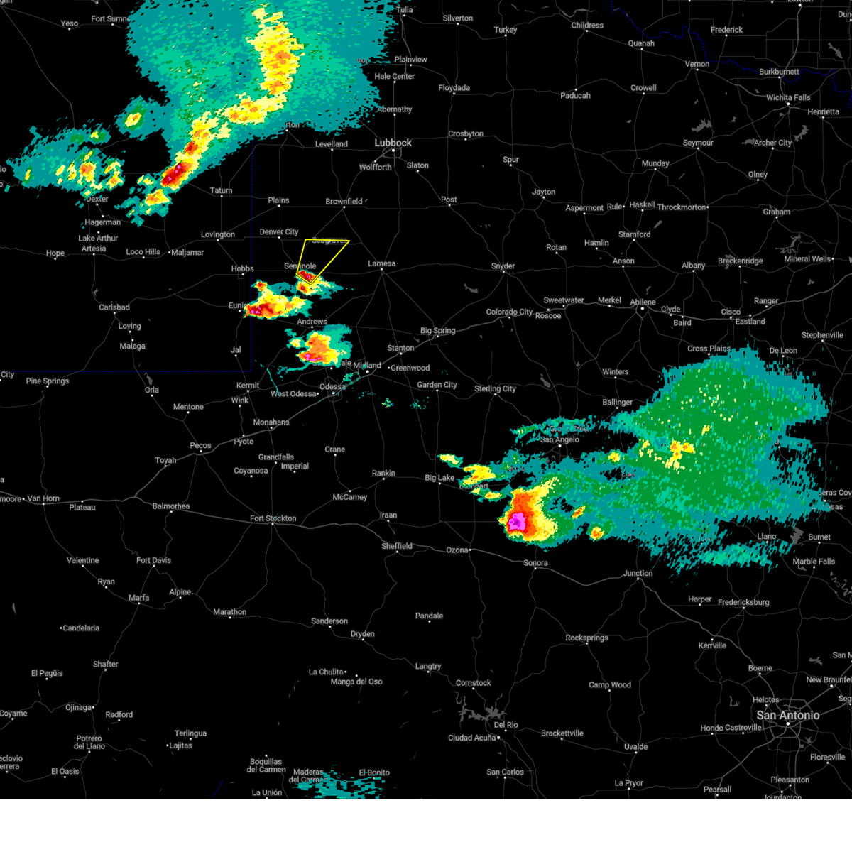
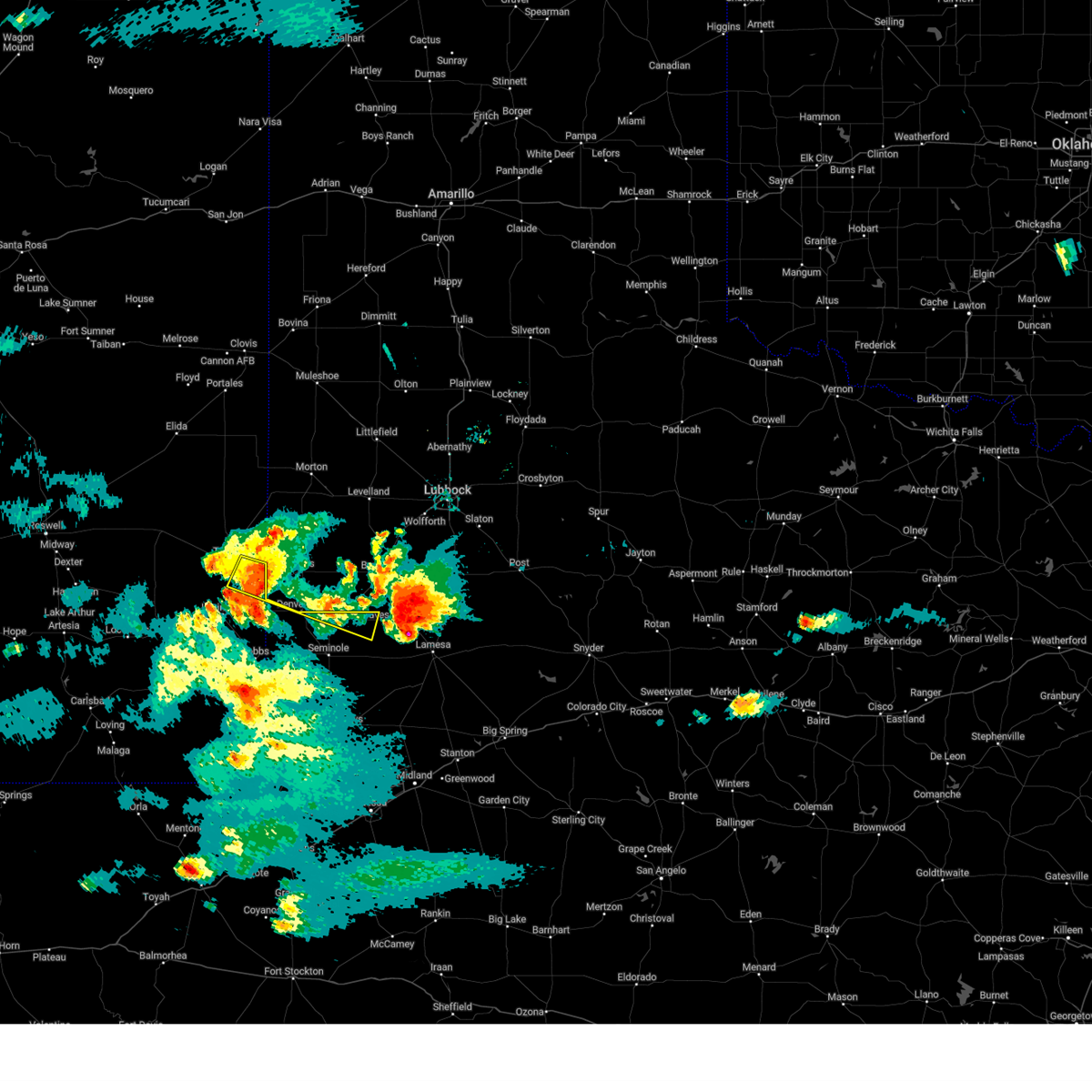
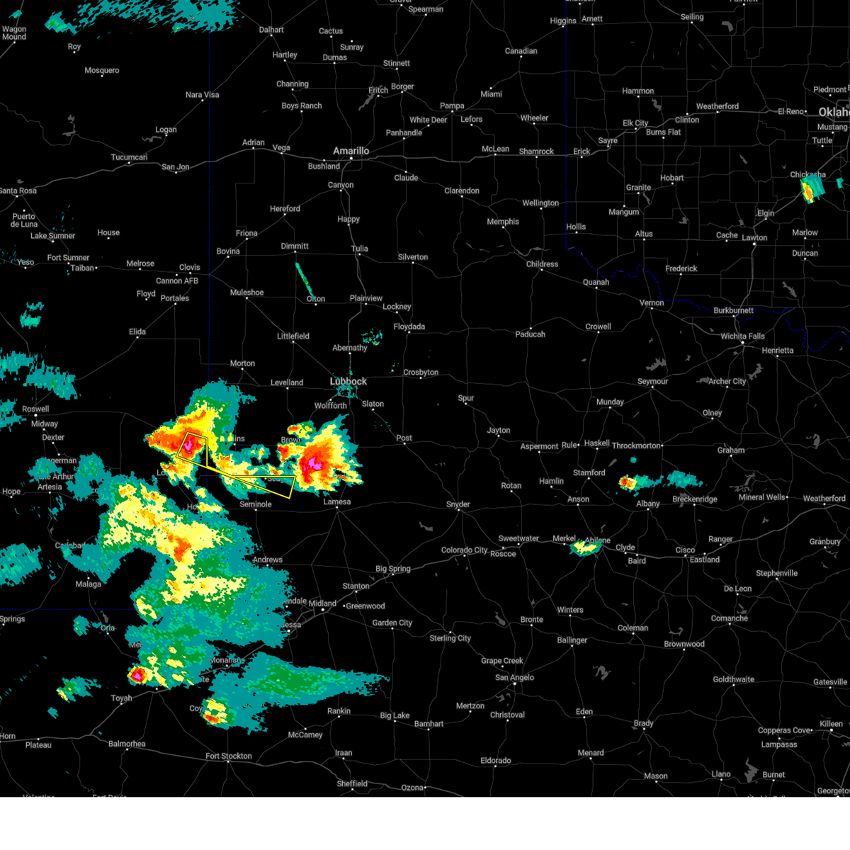
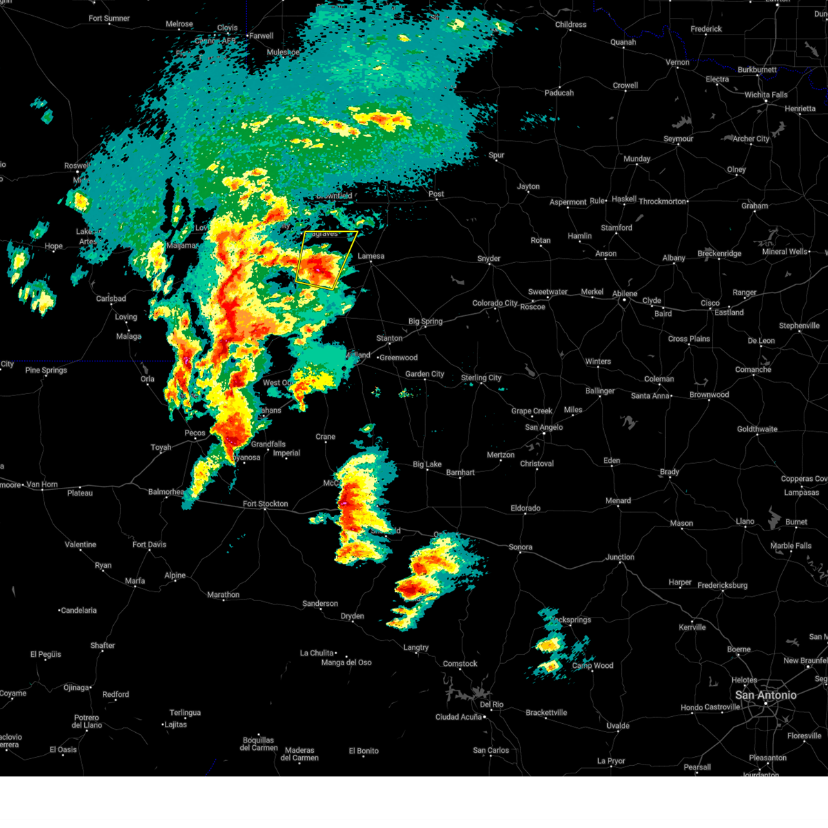
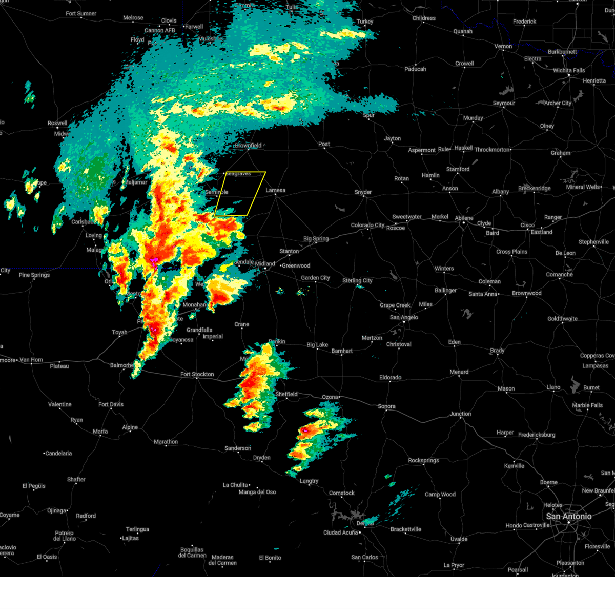
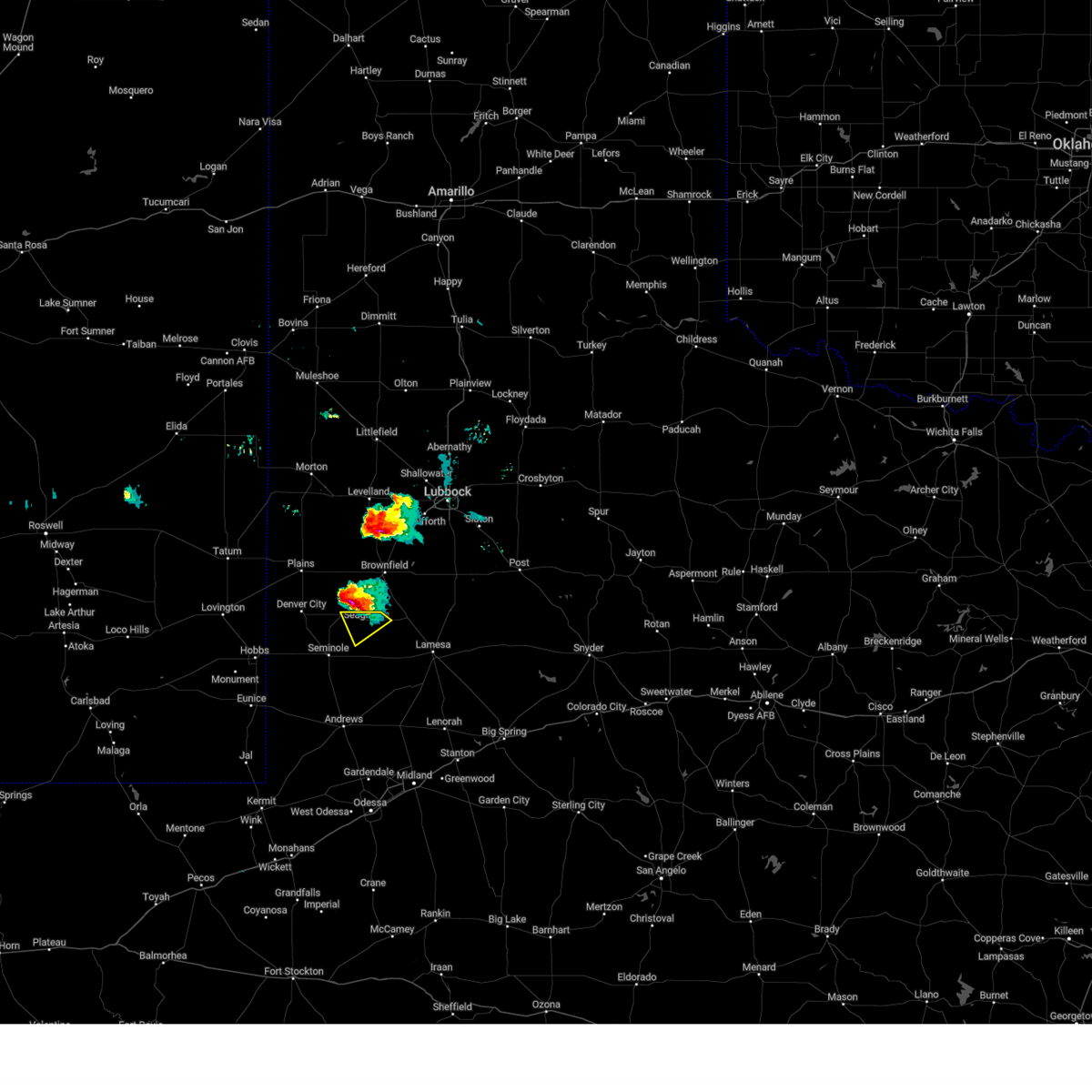
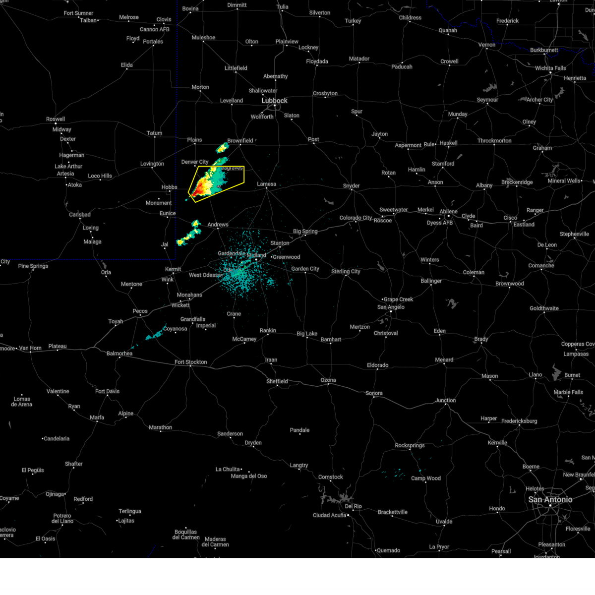
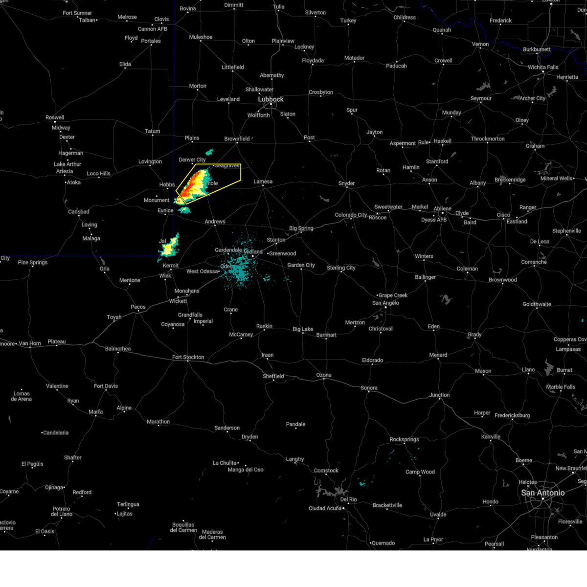
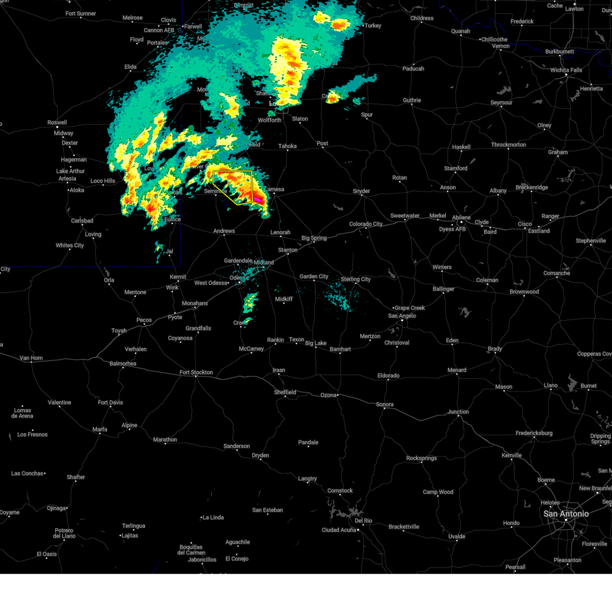
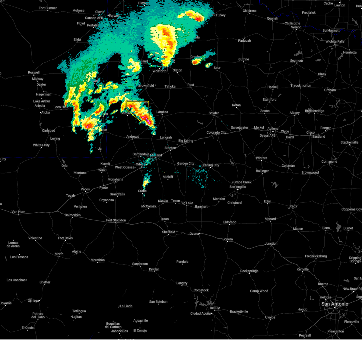
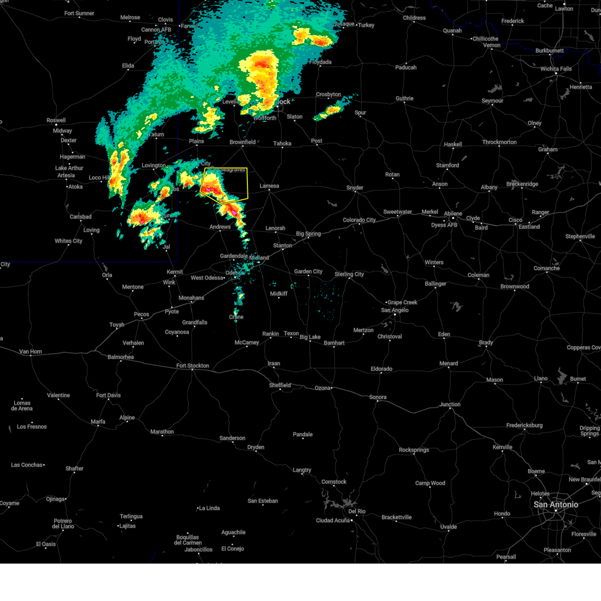
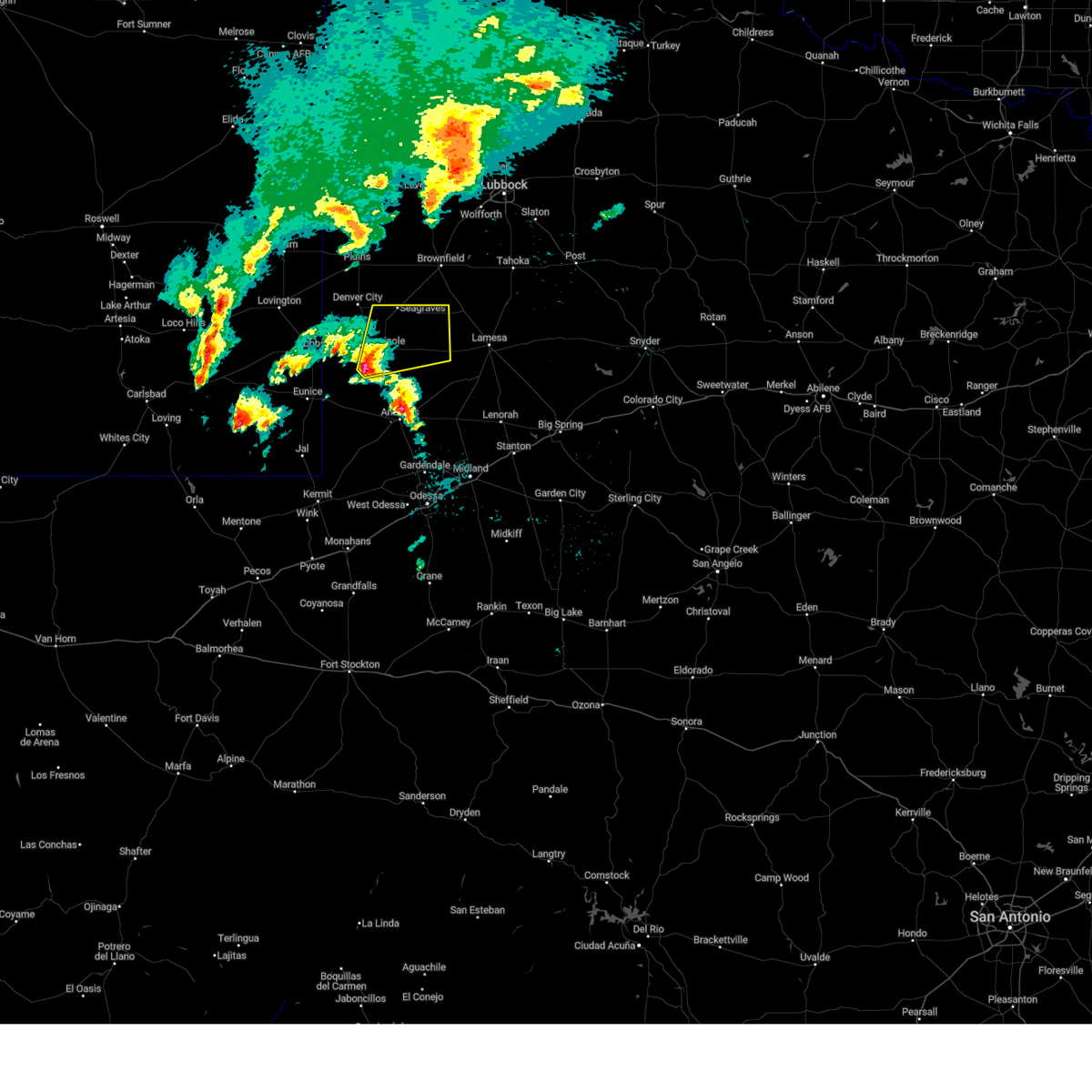
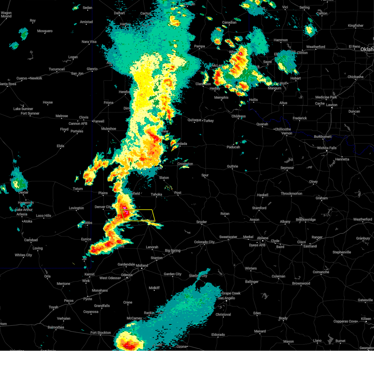
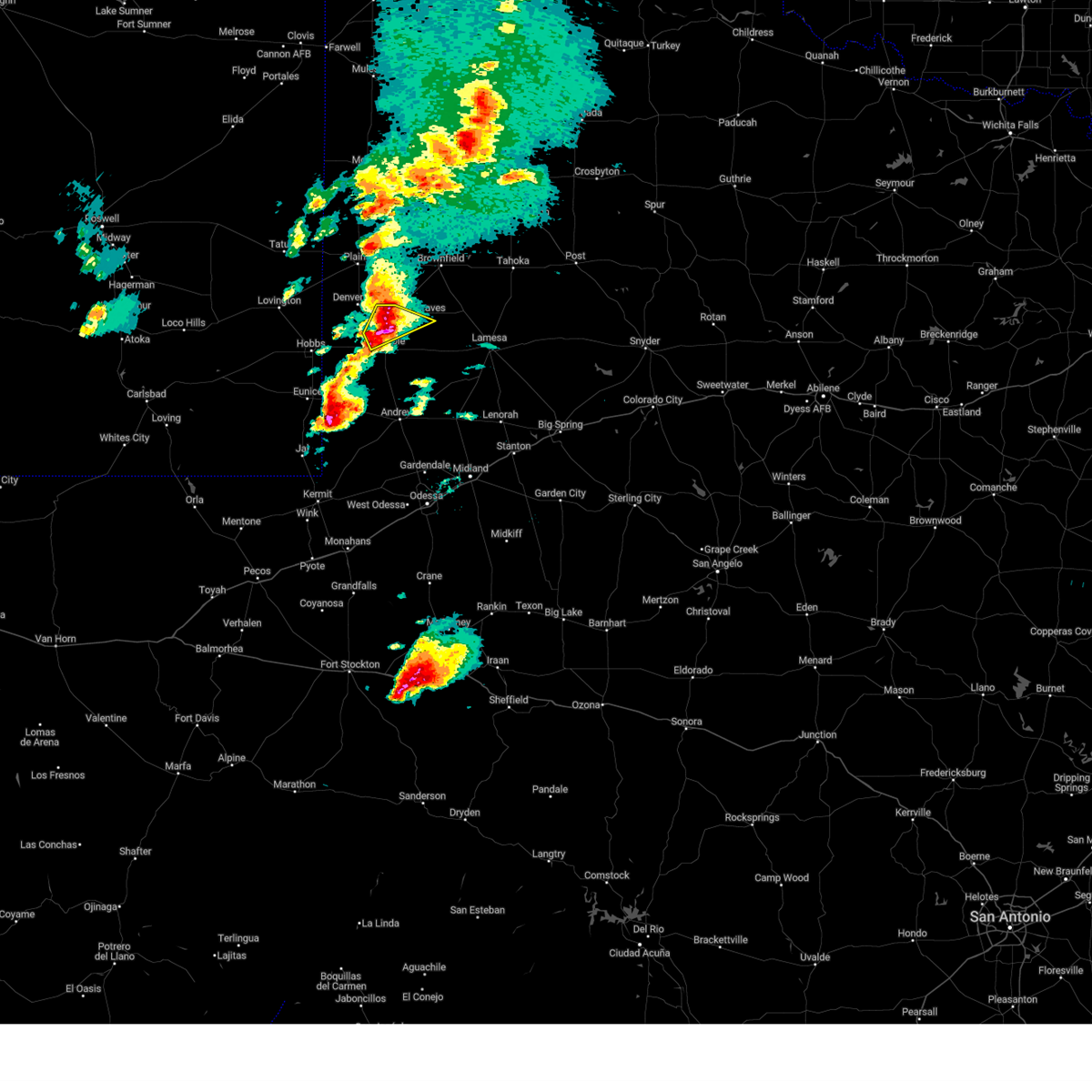
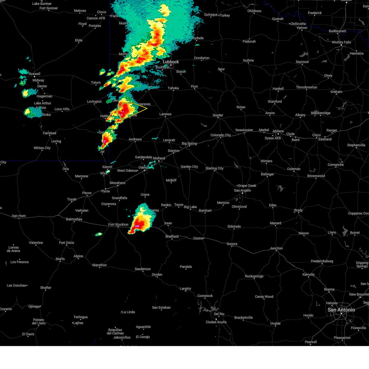
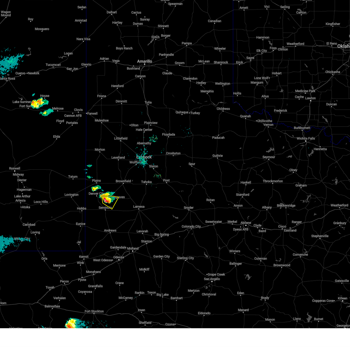
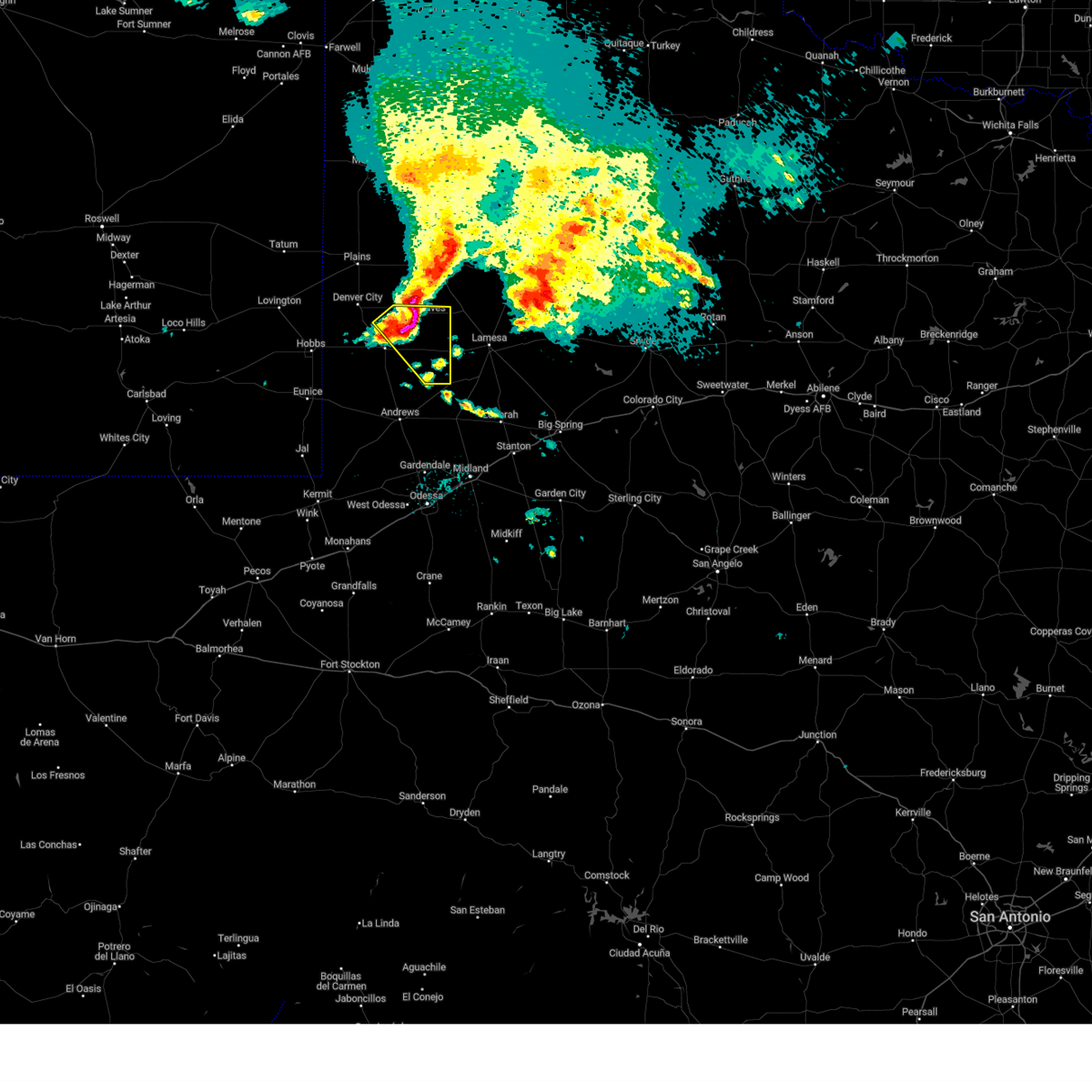
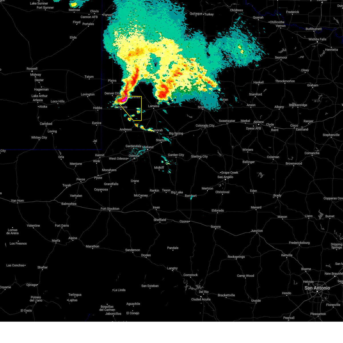
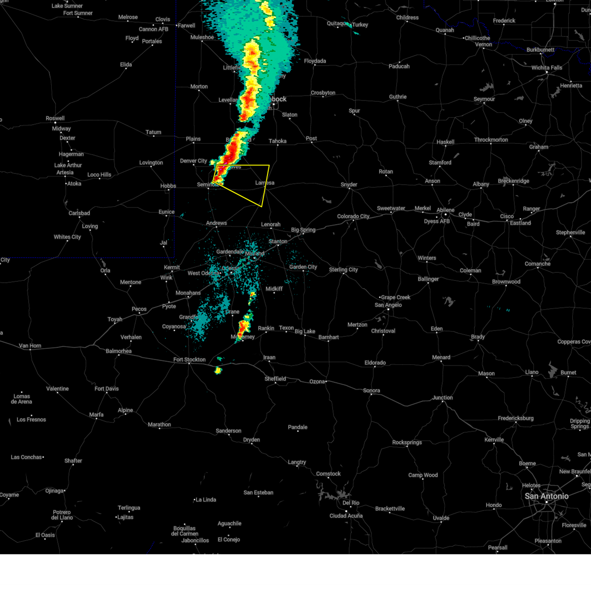
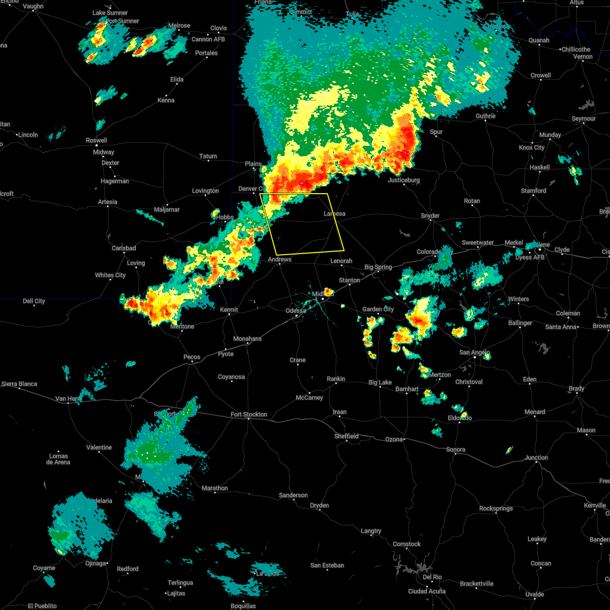
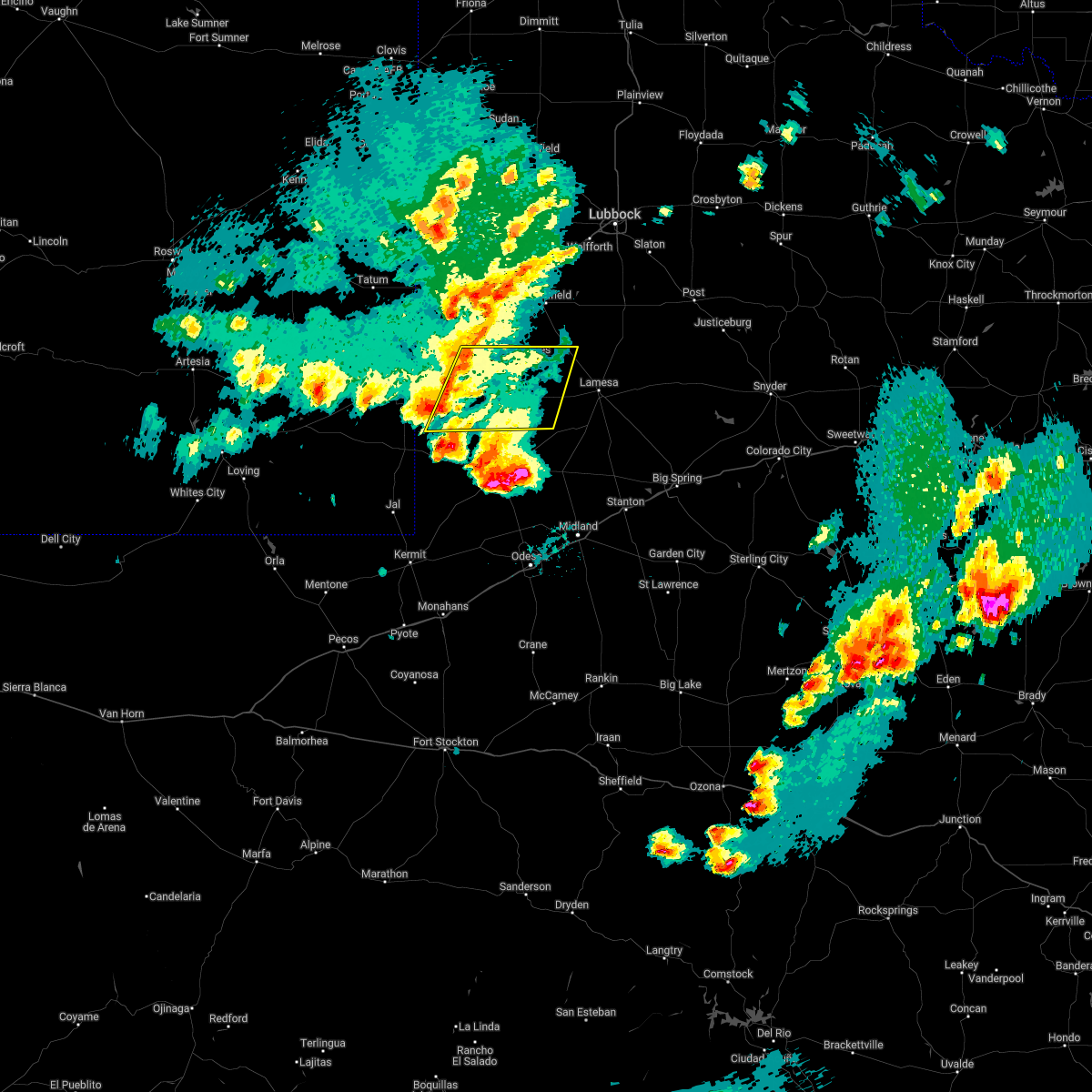
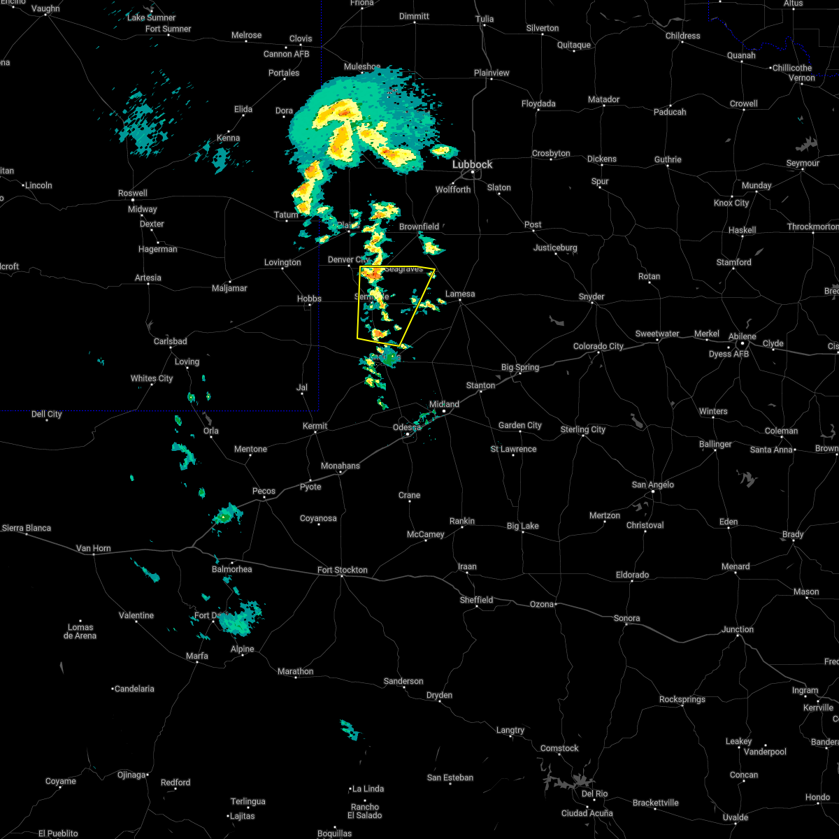
Hail Map for Loop, TX
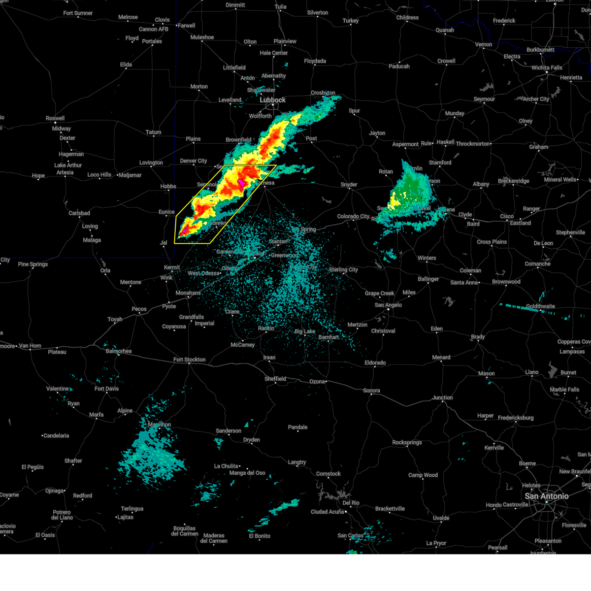
The Loop, TX area has had 1 report of on-the-ground hail by trained spotters, and has been under severe weather warnings 25 times during the past 12 months. Doppler radar has detected hail at or near Loop, TX on 72 occasions, including 6 occasions during the past year.
| Name: | Loop, TX |
| Where Located: | 56.8 miles SW of Lubbock, TX |
| Map: | Google Map for Loop, TX |
| Population: | 225 |
| Housing Units: | 99 |
| More Info: | Search Google for Loop, TX |
1
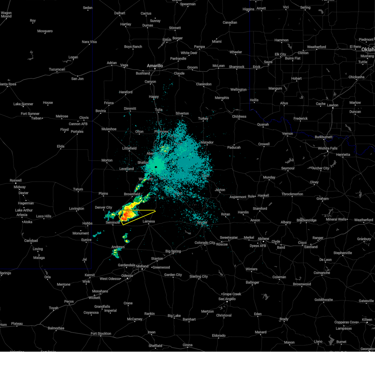
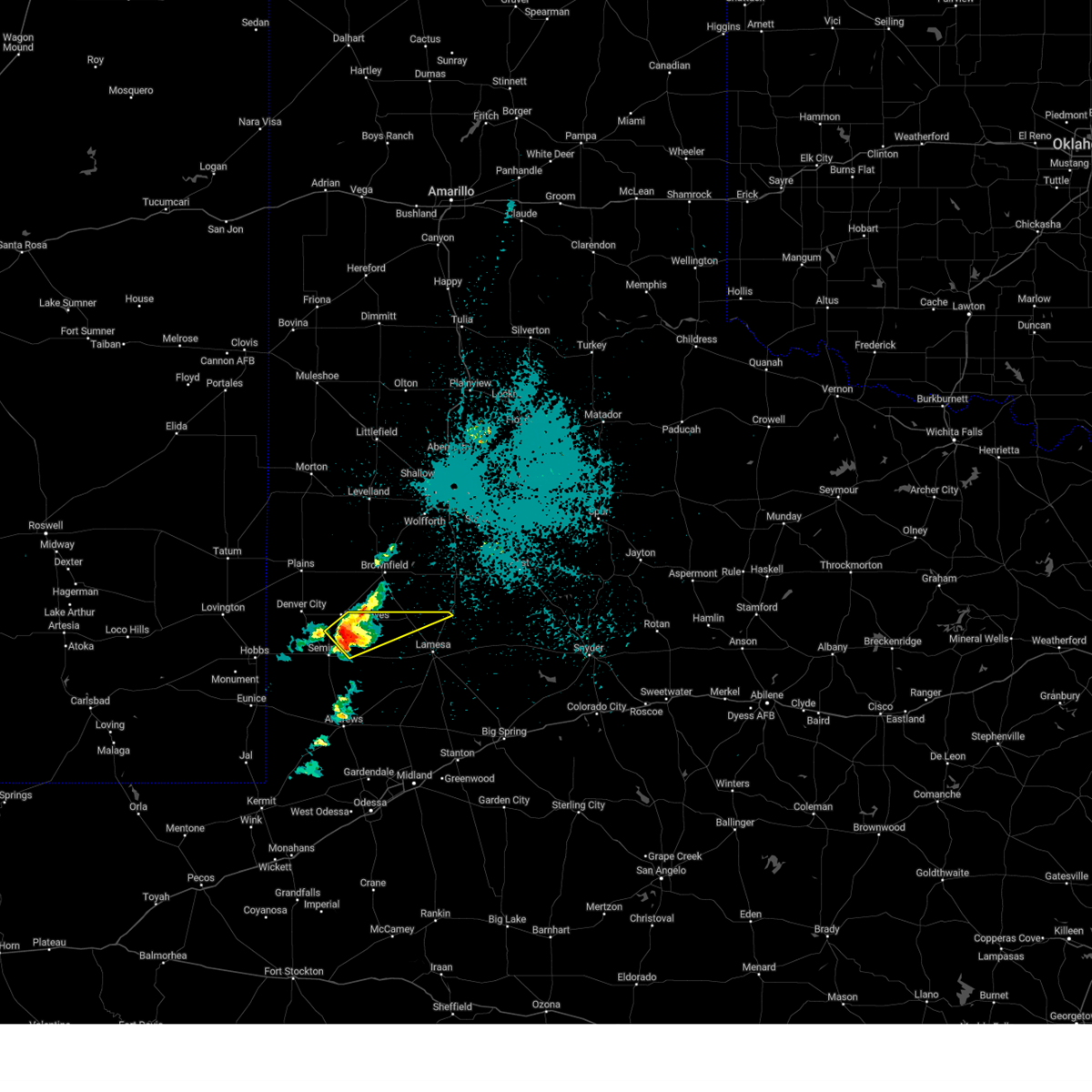
The Top Recent Hail Date for Loop, TX is Tuesday, April 29, 2025 (19th out of 72)

Hail and Wind Damage Spotted near Loop, TX
| Date / Time | Report Details |
|---|---|
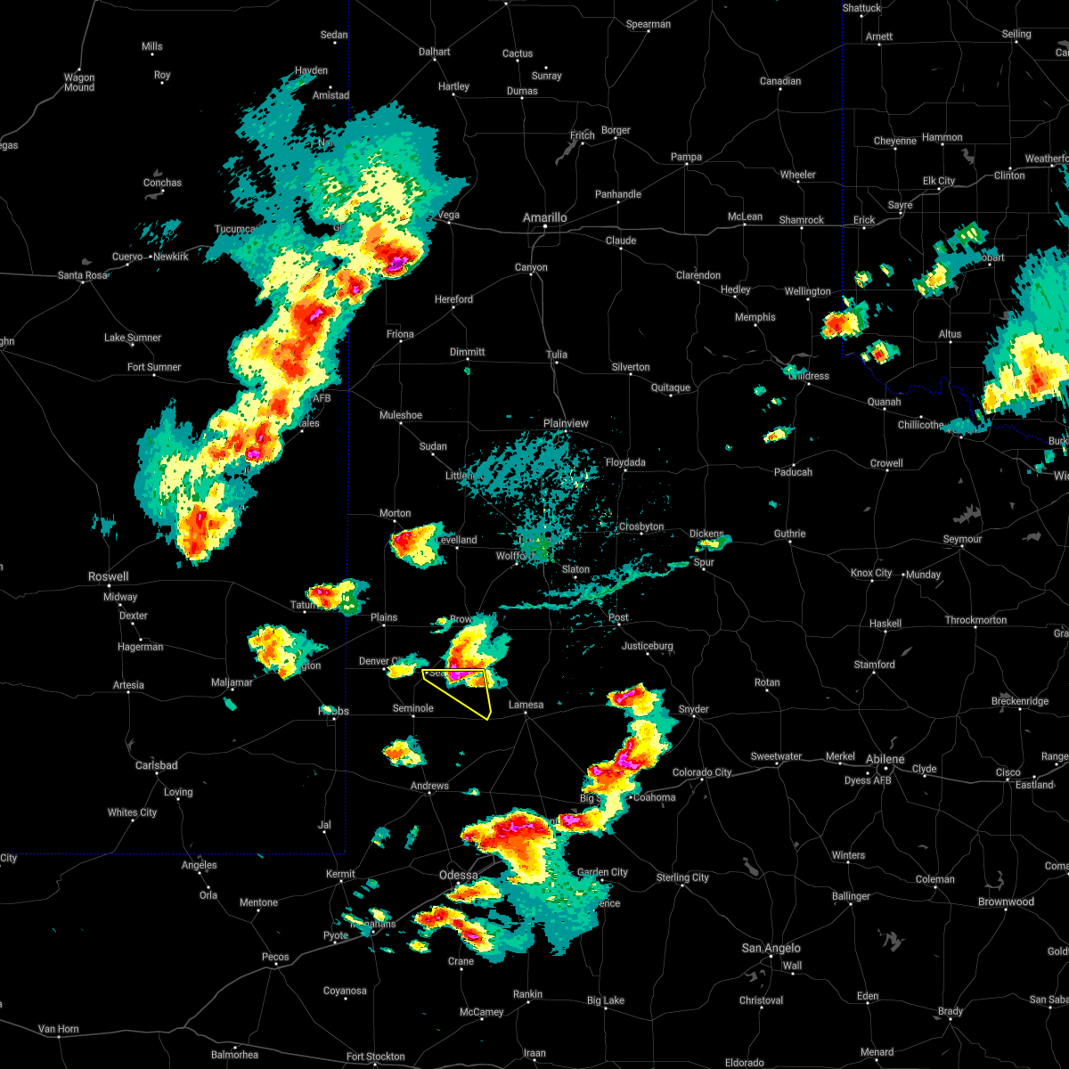
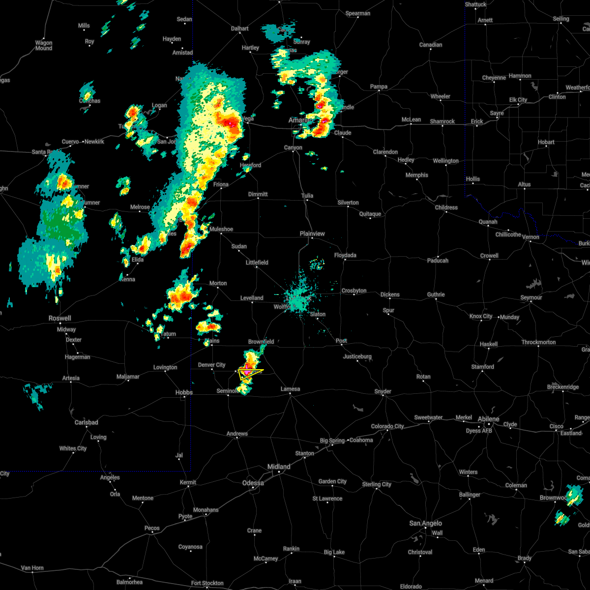
| 6/13/2025 10:27 PM CDT |
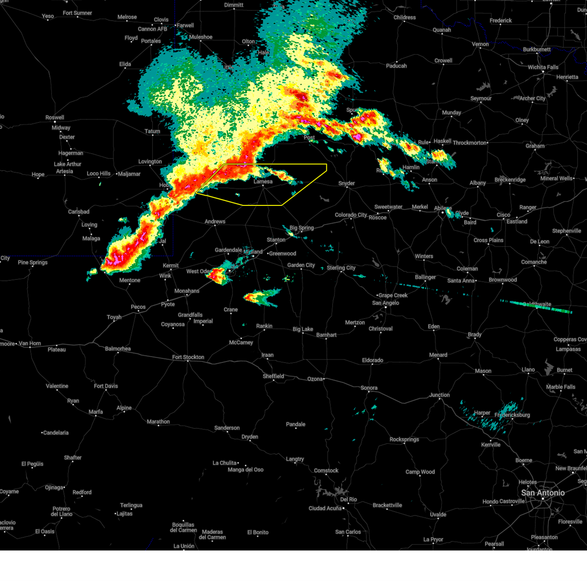
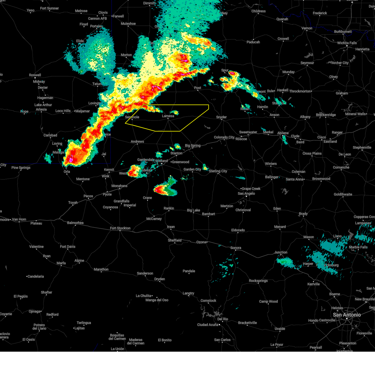
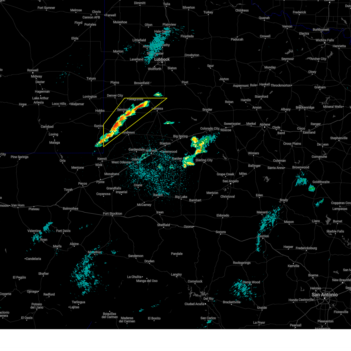
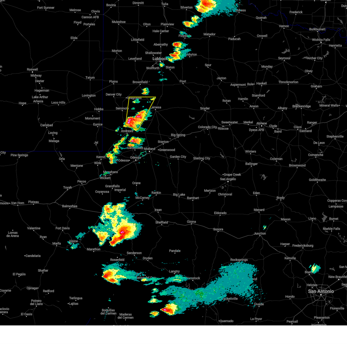
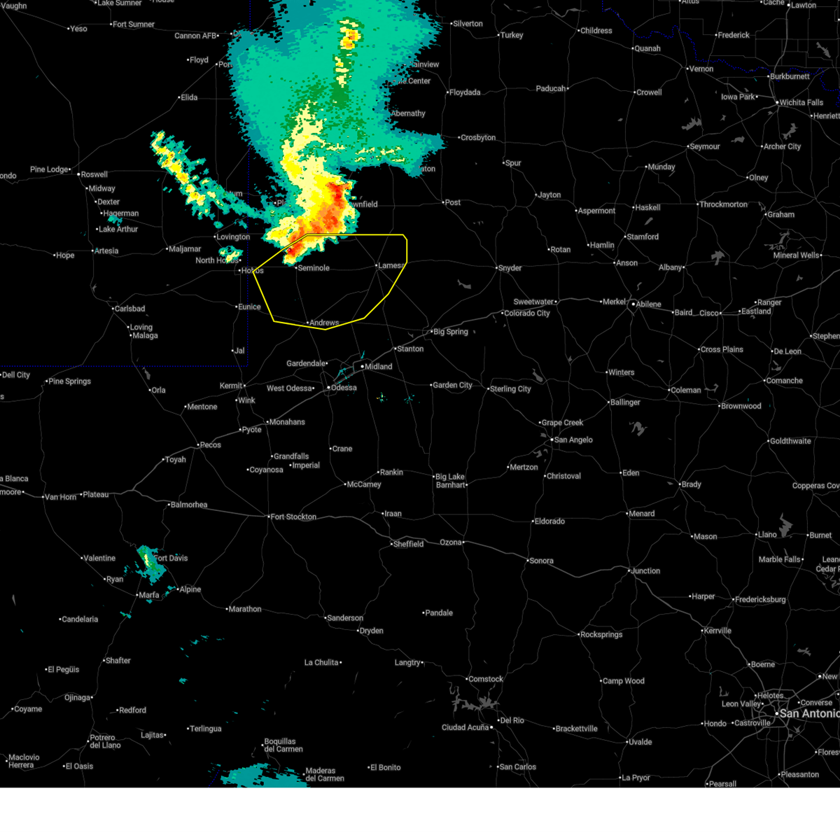 At 1026 pm cdt, severe thunderstorms were located along a line extending from near welch to 15 miles west of lamesa to 16 miles southeast of gaines county airport to 14 miles northwest of andrews to 6 miles east of eunice, moving southeast at 45 mph (radar indicated). Hazards include 70 mph wind gusts and quarter size hail. Hail damage to vehicles is expected. expect considerable tree damage. wind damage is also likely to mobile homes, roofs, and outbuildings. Locations impacted include, andrews, lamesa, seminole, seagraves, seagraves airport, lamesa municipal airport, gaines county airport, welch, los ybanez, loop, sparenberg, florey, punkin center, patricia, arvana, hancock, mckenzie lake, tenmile, frankel city, and paynes corner. At 1026 pm cdt, severe thunderstorms were located along a line extending from near welch to 15 miles west of lamesa to 16 miles southeast of gaines county airport to 14 miles northwest of andrews to 6 miles east of eunice, moving southeast at 45 mph (radar indicated). Hazards include 70 mph wind gusts and quarter size hail. Hail damage to vehicles is expected. expect considerable tree damage. wind damage is also likely to mobile homes, roofs, and outbuildings. Locations impacted include, andrews, lamesa, seminole, seagraves, seagraves airport, lamesa municipal airport, gaines county airport, welch, los ybanez, loop, sparenberg, florey, punkin center, patricia, arvana, hancock, mckenzie lake, tenmile, frankel city, and paynes corner.
|
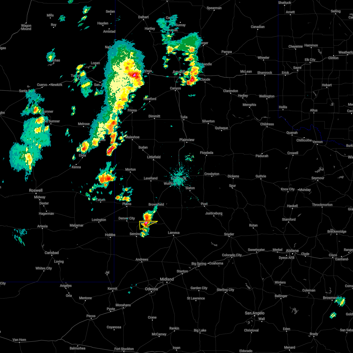
| 6/13/2025 9:58 PM CDT |
 Svrmaf the national weather service in midland has issued a * severe thunderstorm warning for, northern andrews county in western texas, gaines county in western texas, northwestern martin county in western texas, dawson county in western texas, * until 1045 pm cdt. * at 957 pm cdt, severe thunderstorms were located along a line extending from near brownfield to 9 miles east of seagraves airport to near seminole to 12 miles east of nadine to near hobbs, moving southeast at 50 mph (radar indicated). Hazards include 70 mph wind gusts and quarter size hail. Hail damage to vehicles is expected. expect considerable tree damage. Wind damage is also likely to mobile homes, roofs, and outbuildings. Svrmaf the national weather service in midland has issued a * severe thunderstorm warning for, northern andrews county in western texas, gaines county in western texas, northwestern martin county in western texas, dawson county in western texas, * until 1045 pm cdt. * at 957 pm cdt, severe thunderstorms were located along a line extending from near brownfield to 9 miles east of seagraves airport to near seminole to 12 miles east of nadine to near hobbs, moving southeast at 50 mph (radar indicated). Hazards include 70 mph wind gusts and quarter size hail. Hail damage to vehicles is expected. expect considerable tree damage. Wind damage is also likely to mobile homes, roofs, and outbuildings.
|
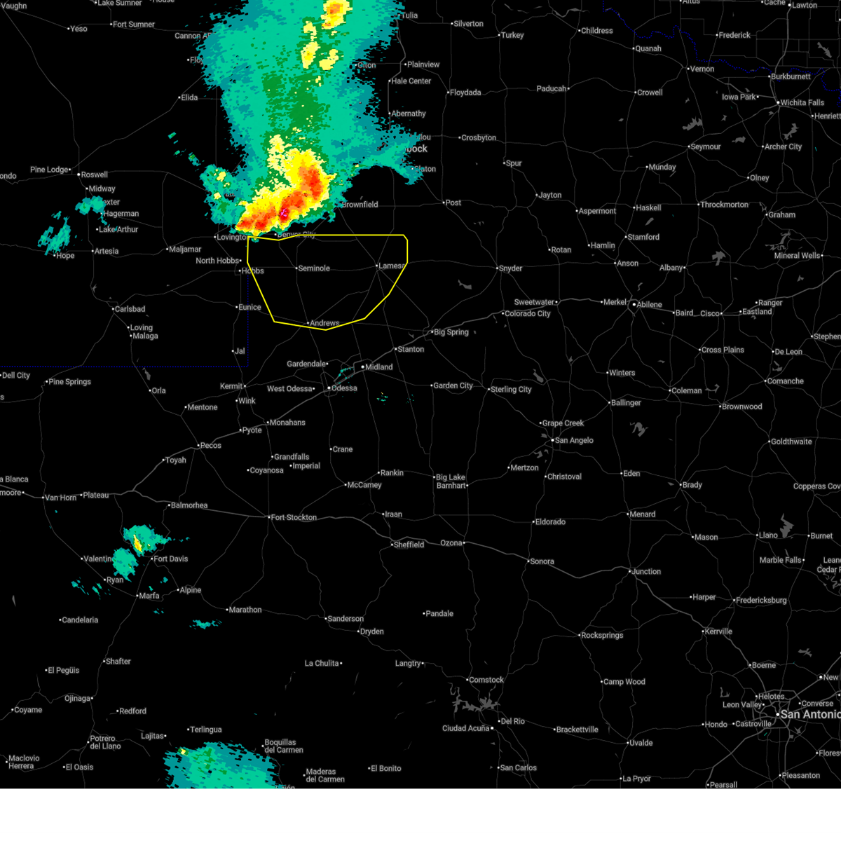
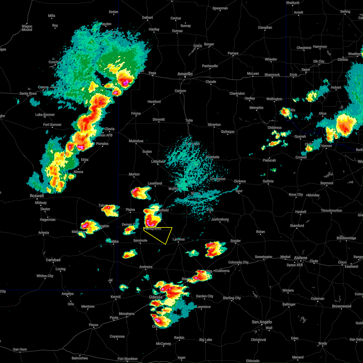
| 6/13/2025 9:30 PM CDT |
 At 930 pm cdt/830 pm mdt/, severe thunderstorms were located along a line extending from brownfield to 9 miles northwest of seagraves to 8 miles east of lovington, moving southeast at 30 mph (radar indicated). Hazards include 60 mph wind gusts and quarter size hail. Hail damage to vehicles is expected. expect wind damage to roofs, siding, and trees. Locations impacted include, seminole, seagraves, seagraves airport, gaines county airport, welch, loop, knowles, paynes corner, higginbotham, and gaines county park. At 930 pm cdt/830 pm mdt/, severe thunderstorms were located along a line extending from brownfield to 9 miles northwest of seagraves to 8 miles east of lovington, moving southeast at 30 mph (radar indicated). Hazards include 60 mph wind gusts and quarter size hail. Hail damage to vehicles is expected. expect wind damage to roofs, siding, and trees. Locations impacted include, seminole, seagraves, seagraves airport, gaines county airport, welch, loop, knowles, paynes corner, higginbotham, and gaines county park.
|
| 6/13/2025 9:09 PM CDT |
 Svrmaf the national weather service in midland has issued a * severe thunderstorm warning for, northeastern lea county in southeastern new mexico, northern gaines county in western texas, northwestern dawson county in western texas, * until 1000 pm cdt/900 pm mdt/. * at 908 pm cdt/808 pm mdt/, severe thunderstorms were located along a line extending from 7 miles southwest of locketville to near plains to near mcdonald, moving southeast at 25 mph (mesonet recorded 60 mph winds around 9 pm cdt). Hazards include 60 mph wind gusts and quarter size hail. Hail damage to vehicles is expected. Expect wind damage to roofs, siding, and trees. Svrmaf the national weather service in midland has issued a * severe thunderstorm warning for, northeastern lea county in southeastern new mexico, northern gaines county in western texas, northwestern dawson county in western texas, * until 1000 pm cdt/900 pm mdt/. * at 908 pm cdt/808 pm mdt/, severe thunderstorms were located along a line extending from 7 miles southwest of locketville to near plains to near mcdonald, moving southeast at 25 mph (mesonet recorded 60 mph winds around 9 pm cdt). Hazards include 60 mph wind gusts and quarter size hail. Hail damage to vehicles is expected. Expect wind damage to roofs, siding, and trees.
|
| 6/10/2025 1:14 AM CDT |
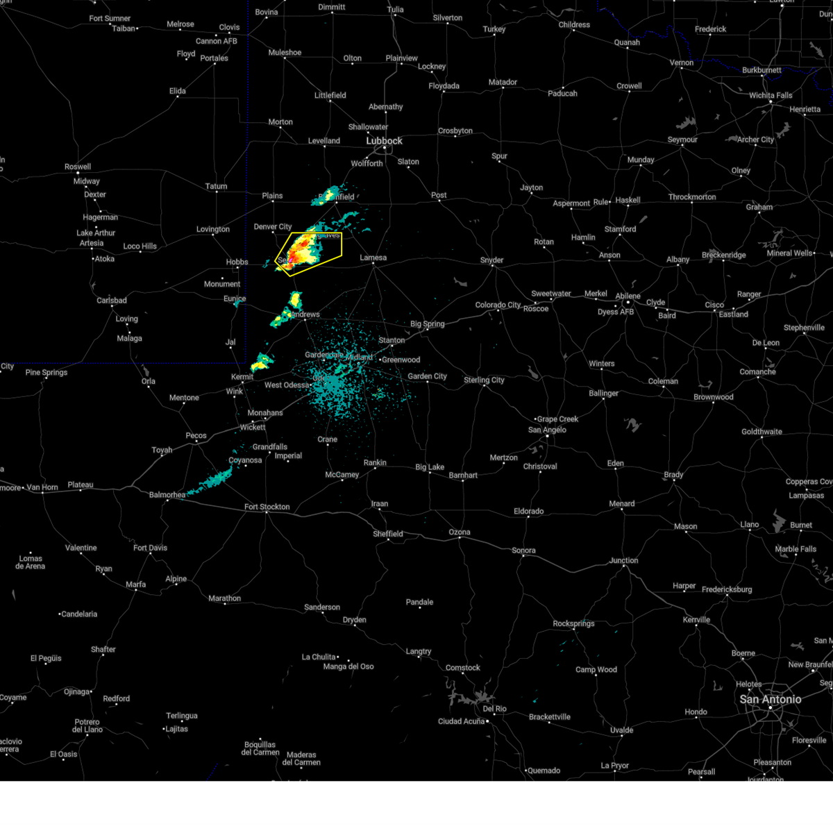
 At 114 am cdt, severe thunderstorms were located along a line extending from 8 miles northeast of new moore to near welch to 15 miles southeast of seagraves airport, moving east at 40 mph (radar indicated). Hazards include 60 mph wind gusts and quarter size hail. Hail damage to vehicles is expected. expect wind damage to roofs, siding, and trees. Locations impacted include, lamesa, seminole, gail, lamesa municipal airport, gaines county airport, welch, los ybanez, loop, sparenberg, punkin center, patricia, arvana, hancock, mckenzie lake, tenmile, key, and klondike. At 114 am cdt, severe thunderstorms were located along a line extending from 8 miles northeast of new moore to near welch to 15 miles southeast of seagraves airport, moving east at 40 mph (radar indicated). Hazards include 60 mph wind gusts and quarter size hail. Hail damage to vehicles is expected. expect wind damage to roofs, siding, and trees. Locations impacted include, lamesa, seminole, gail, lamesa municipal airport, gaines county airport, welch, los ybanez, loop, sparenberg, punkin center, patricia, arvana, hancock, mckenzie lake, tenmile, key, and klondike.
|
| 6/10/2025 12:47 AM CDT |
 Svrmaf the national weather service in midland has issued a * severe thunderstorm warning for, eastern gaines county in western texas, northern borden county in western texas, dawson county in western texas, * until 145 am cdt. * at 1247 am cdt, severe thunderstorms were located along a line extending from 6 miles east of brownfield to 7 miles southwest of seagraves, moving east at 50 mph (seagraves mesonet reported a wind gust of 60 mph). Hazards include 60 mph wind gusts and quarter size hail. Hail damage to vehicles is expected. Expect wind damage to roofs, siding, and trees. Svrmaf the national weather service in midland has issued a * severe thunderstorm warning for, eastern gaines county in western texas, northern borden county in western texas, dawson county in western texas, * until 145 am cdt. * at 1247 am cdt, severe thunderstorms were located along a line extending from 6 miles east of brownfield to 7 miles southwest of seagraves, moving east at 50 mph (seagraves mesonet reported a wind gust of 60 mph). Hazards include 60 mph wind gusts and quarter size hail. Hail damage to vehicles is expected. Expect wind damage to roofs, siding, and trees.
|
| 6/9/2025 11:13 PM CDT |
 the severe thunderstorm warning has been cancelled and is no longer in effect the severe thunderstorm warning has been cancelled and is no longer in effect
|
| 6/9/2025 10:58 PM CDT |
 At 1058 pm cdt, a severe thunderstorm was located 9 miles south of seagraves airport, or 9 miles southeast of seagraves, moving northeast at 15 mph (radar indicated). Hazards include 60 mph wind gusts and quarter size hail. Hail damage to vehicles is expected. expect wind damage to roofs, siding, and trees. Locations impacted include, loop. At 1058 pm cdt, a severe thunderstorm was located 9 miles south of seagraves airport, or 9 miles southeast of seagraves, moving northeast at 15 mph (radar indicated). Hazards include 60 mph wind gusts and quarter size hail. Hail damage to vehicles is expected. expect wind damage to roofs, siding, and trees. Locations impacted include, loop.
|
| 6/9/2025 10:40 PM CDT |
 At 1040 pm cdt, a severe thunderstorm was located 7 miles northeast of seminole, moving northeast at 15 mph (radar indicated). Hazards include ping pong ball size hail and 60 mph wind gusts. People and animals outdoors will be injured. expect hail damage to roofs, siding, windows, and vehicles. expect wind damage to roofs, siding, and trees. Locations impacted include, seagraves and loop. At 1040 pm cdt, a severe thunderstorm was located 7 miles northeast of seminole, moving northeast at 15 mph (radar indicated). Hazards include ping pong ball size hail and 60 mph wind gusts. People and animals outdoors will be injured. expect hail damage to roofs, siding, windows, and vehicles. expect wind damage to roofs, siding, and trees. Locations impacted include, seagraves and loop.
|
| 6/9/2025 10:24 PM CDT |
 Svrmaf the national weather service in midland has issued a * severe thunderstorm warning for, northeastern gaines county in western texas, * until 1130 pm cdt. * at 1024 pm cdt, a severe thunderstorm was located near seminole, moving northeast at 15 mph (radar indicated). Hazards include 60 mph wind gusts and quarter size hail. Hail damage to vehicles is expected. Expect wind damage to roofs, siding, and trees. Svrmaf the national weather service in midland has issued a * severe thunderstorm warning for, northeastern gaines county in western texas, * until 1130 pm cdt. * at 1024 pm cdt, a severe thunderstorm was located near seminole, moving northeast at 15 mph (radar indicated). Hazards include 60 mph wind gusts and quarter size hail. Hail damage to vehicles is expected. Expect wind damage to roofs, siding, and trees.
|
| 5/29/2025 6:12 PM CDT |
 the severe thunderstorm warning has been cancelled and is no longer in effect the severe thunderstorm warning has been cancelled and is no longer in effect
|
| 5/29/2025 5:58 PM CDT |
 Svrmaf the national weather service in midland has issued a * severe thunderstorm warning for, northeastern lea county in southeastern new mexico, northeastern gaines county in western texas, * until 630 pm cdt/530 pm mdt/. * at 558 pm cdt/458 pm mdt/, a severe thunderstorm was located 10 miles east of mcdonald, or 12 miles southeast of tatum, moving east at 45 mph (radar indicated). Hazards include 60 mph wind gusts and half dollar size hail. Hail damage to vehicles is expected. Expect wind damage to roofs, siding, and trees. Svrmaf the national weather service in midland has issued a * severe thunderstorm warning for, northeastern lea county in southeastern new mexico, northeastern gaines county in western texas, * until 630 pm cdt/530 pm mdt/. * at 558 pm cdt/458 pm mdt/, a severe thunderstorm was located 10 miles east of mcdonald, or 12 miles southeast of tatum, moving east at 45 mph (radar indicated). Hazards include 60 mph wind gusts and half dollar size hail. Hail damage to vehicles is expected. Expect wind damage to roofs, siding, and trees.
|
| 5/6/2025 12:14 AM CDT |
 At 1214 am cdt, a severe thunderstorm was located 13 miles east of seminole, moving northeast at 70 mph (radar indicated). Hazards include 60 mph wind gusts and quarter size hail. Hail damage to vehicles is expected. expect wind damage to roofs, siding, and trees. Locations impacted include, welch, loop, and mckenzie lake. At 1214 am cdt, a severe thunderstorm was located 13 miles east of seminole, moving northeast at 70 mph (radar indicated). Hazards include 60 mph wind gusts and quarter size hail. Hail damage to vehicles is expected. expect wind damage to roofs, siding, and trees. Locations impacted include, welch, loop, and mckenzie lake.
|
| 5/6/2025 12:06 AM CDT |
 Svrmaf the national weather service in midland has issued a * severe thunderstorm warning for, eastern gaines county in western texas, northwestern dawson county in western texas, * until 1230 am cdt. * at 1206 am cdt, a severe thunderstorm was located 12 miles east of gaines county airport, or 13 miles southeast of seminole, moving northeast at 80 mph (radar indicated). Hazards include 60 mph wind gusts and half dollar size hail. Hail damage to vehicles is expected. Expect wind damage to roofs, siding, and trees. Svrmaf the national weather service in midland has issued a * severe thunderstorm warning for, eastern gaines county in western texas, northwestern dawson county in western texas, * until 1230 am cdt. * at 1206 am cdt, a severe thunderstorm was located 12 miles east of gaines county airport, or 13 miles southeast of seminole, moving northeast at 80 mph (radar indicated). Hazards include 60 mph wind gusts and half dollar size hail. Hail damage to vehicles is expected. Expect wind damage to roofs, siding, and trees.
|
| 5/4/2025 7:34 PM CDT |
 At 734 pm cdt, a severe thunderstorm was located near seagraves, moving east at 15 mph (radar indicated). Hazards include 70 mph wind gusts and ping pong ball size hail. People and animals outdoors will be injured. expect hail damage to roofs, siding, windows, and vehicles. expect considerable tree damage. wind damage is also likely to mobile homes, roofs, and outbuildings. Locations impacted include, seagraves, seagraves airport, loop, and gaines county park. At 734 pm cdt, a severe thunderstorm was located near seagraves, moving east at 15 mph (radar indicated). Hazards include 70 mph wind gusts and ping pong ball size hail. People and animals outdoors will be injured. expect hail damage to roofs, siding, windows, and vehicles. expect considerable tree damage. wind damage is also likely to mobile homes, roofs, and outbuildings. Locations impacted include, seagraves, seagraves airport, loop, and gaines county park.
|
| 5/4/2025 7:02 PM CDT |
 Svrmaf the national weather service in midland has issued a * severe thunderstorm warning for, north central gaines county in western texas, * until 745 pm cdt. * at 702 pm cdt, a severe thunderstorm was located near denver city, moving east at 15 mph (radar indicated). Hazards include ping pong ball size hail and 60 mph wind gusts. People and animals outdoors will be injured. expect hail damage to roofs, siding, windows, and vehicles. Expect wind damage to roofs, siding, and trees. Svrmaf the national weather service in midland has issued a * severe thunderstorm warning for, north central gaines county in western texas, * until 745 pm cdt. * at 702 pm cdt, a severe thunderstorm was located near denver city, moving east at 15 mph (radar indicated). Hazards include ping pong ball size hail and 60 mph wind gusts. People and animals outdoors will be injured. expect hail damage to roofs, siding, windows, and vehicles. Expect wind damage to roofs, siding, and trees.
|
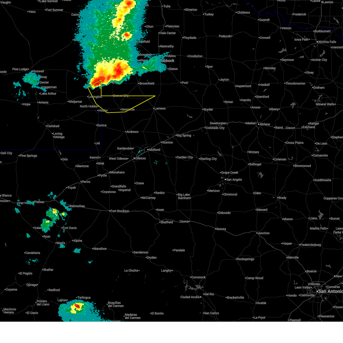
| 4/30/2025 12:22 AM CDT |
 At 1222 am cdt, a severe thunderstorm was located near seminole, moving northeast at 25 mph (public). Hazards include 60 mph wind gusts and quarter size hail. Hail damage to vehicles is expected. expect wind damage to roofs, siding, and trees. Locations impacted include, seminole, seagraves, seagraves airport, loop, paynes corner, and gaines county park. At 1222 am cdt, a severe thunderstorm was located near seminole, moving northeast at 25 mph (public). Hazards include 60 mph wind gusts and quarter size hail. Hail damage to vehicles is expected. expect wind damage to roofs, siding, and trees. Locations impacted include, seminole, seagraves, seagraves airport, loop, paynes corner, and gaines county park.
|
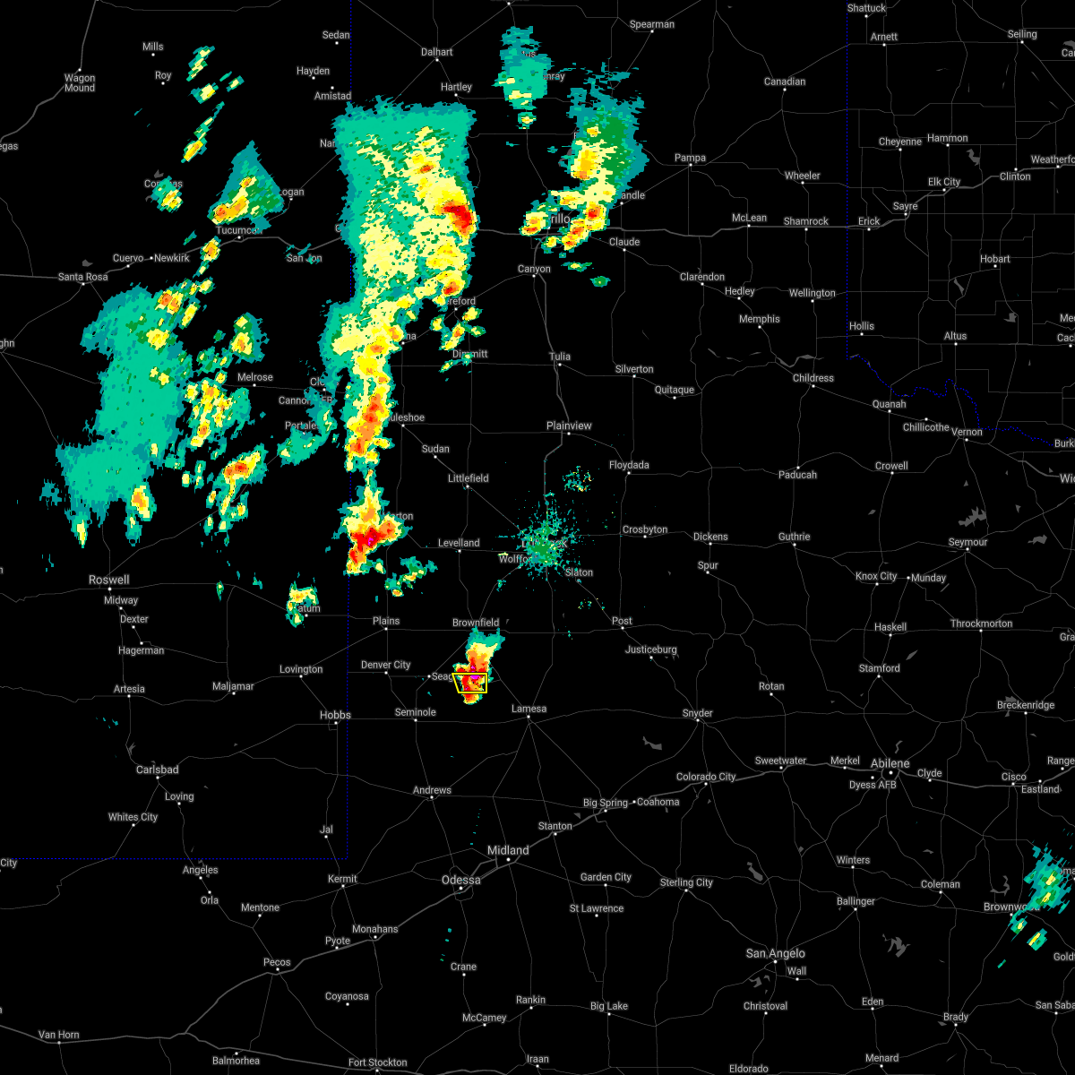
| 4/29/2025 11:57 PM CDT | Svrmaf the national weather service in midland has issued a * severe thunderstorm warning for, central gaines county in western texas, * until 100 am cdt. * at 1157 pm cdt, a severe thunderstorm was located 13 miles west of gaines county airport, or 14 miles west of seminole, moving north at 30 mph (radar indicated). Hazards include 60 mph wind gusts and quarter size hail. Hail damage to vehicles is expected. Expect wind damage to roofs, siding, and trees. |
| 4/29/2025 12:15 AM CDT |
 At 1214 am cdt, severe thunderstorms were located along a line extending from near welch to 13 miles northeast of jal airport, moving east at 10 mph (radar indicated). Hazards include golf ball size hail and 60 mph wind gusts. People and animals outdoors will be injured. expect hail damage to roofs, siding, windows, and vehicles. expect wind damage to roofs, siding, and trees. Locations impacted include, andrews, seminole, gaines county airport, welch, loop, florey, frankel city, punkin center, mckenzie lake, and andrews county airport. At 1214 am cdt, severe thunderstorms were located along a line extending from near welch to 13 miles northeast of jal airport, moving east at 10 mph (radar indicated). Hazards include golf ball size hail and 60 mph wind gusts. People and animals outdoors will be injured. expect hail damage to roofs, siding, windows, and vehicles. expect wind damage to roofs, siding, and trees. Locations impacted include, andrews, seminole, gaines county airport, welch, loop, florey, frankel city, punkin center, mckenzie lake, and andrews county airport.
|
| 4/29/2025 12:05 AM CDT |
 Svrmaf the national weather service in midland has issued a * severe thunderstorm warning for, central andrews county in western texas, eastern gaines county in western texas, northwestern dawson county in western texas, * until 100 am cdt. * at 1205 am cdt, severe thunderstorms were located along a line extending from near welch to 12 miles northeast of jal airport, moving east at 10 mph (radar indicated). Hazards include 60 mph wind gusts and half dollar size hail. Hail damage to vehicles is expected. Expect wind damage to roofs, siding, and trees. Svrmaf the national weather service in midland has issued a * severe thunderstorm warning for, central andrews county in western texas, eastern gaines county in western texas, northwestern dawson county in western texas, * until 100 am cdt. * at 1205 am cdt, severe thunderstorms were located along a line extending from near welch to 12 miles northeast of jal airport, moving east at 10 mph (radar indicated). Hazards include 60 mph wind gusts and half dollar size hail. Hail damage to vehicles is expected. Expect wind damage to roofs, siding, and trees.
|
| 4/28/2025 11:38 PM CDT |
 At 1138 pm cdt, severe thunderstorms were located along a line extending from 14 miles southeast of eunice to near welch, moving northeast at 30 mph (radar indicated). Hazards include golf ball size hail and 60 mph wind gusts. People and animals outdoors will be injured. expect hail damage to roofs, siding, windows, and vehicles. expect wind damage to roofs, siding, and trees. Locations impacted include, seminole, seagraves, seagraves airport, gaines county airport, welch, loop, florey, frankel city, punkin center, paynes corner, mckenzie lake, and gaines county park. At 1138 pm cdt, severe thunderstorms were located along a line extending from 14 miles southeast of eunice to near welch, moving northeast at 30 mph (radar indicated). Hazards include golf ball size hail and 60 mph wind gusts. People and animals outdoors will be injured. expect hail damage to roofs, siding, windows, and vehicles. expect wind damage to roofs, siding, and trees. Locations impacted include, seminole, seagraves, seagraves airport, gaines county airport, welch, loop, florey, frankel city, punkin center, paynes corner, mckenzie lake, and gaines county park.
|
| 4/28/2025 11:12 PM CDT |
 At 1111 pm cdt, a severe thunderstorm was located over gaines county airport, or near seminole, moving northeast at 45 mph (quarter size hail was reported near seminole by the public). Hazards include 60 mph wind gusts and half dollar size hail. Hail damage to vehicles is expected. expect wind damage to roofs, siding, and trees. Locations impacted include, seminole, seagraves, seagraves airport, gaines county airport, welch, loop, florey, frankel city, punkin center, paynes corner, mckenzie lake, and gaines county park. At 1111 pm cdt, a severe thunderstorm was located over gaines county airport, or near seminole, moving northeast at 45 mph (quarter size hail was reported near seminole by the public). Hazards include 60 mph wind gusts and half dollar size hail. Hail damage to vehicles is expected. expect wind damage to roofs, siding, and trees. Locations impacted include, seminole, seagraves, seagraves airport, gaines county airport, welch, loop, florey, frankel city, punkin center, paynes corner, mckenzie lake, and gaines county park.
|
| 4/28/2025 11:01 PM CDT |
 Svrmaf the national weather service in midland has issued a * severe thunderstorm warning for, northwestern andrews county in western texas, gaines county in western texas, northwestern dawson county in western texas, * until midnight cdt. * at 1101 pm cdt, a severe thunderstorm was located 11 miles southwest of gaines county airport, or 14 miles southwest of seminole, moving northeast at 40 mph (radar indicated). Hazards include 60 mph wind gusts and half dollar size hail. Hail damage to vehicles is expected. Expect wind damage to roofs, siding, and trees. Svrmaf the national weather service in midland has issued a * severe thunderstorm warning for, northwestern andrews county in western texas, gaines county in western texas, northwestern dawson county in western texas, * until midnight cdt. * at 1101 pm cdt, a severe thunderstorm was located 11 miles southwest of gaines county airport, or 14 miles southwest of seminole, moving northeast at 40 mph (radar indicated). Hazards include 60 mph wind gusts and half dollar size hail. Hail damage to vehicles is expected. Expect wind damage to roofs, siding, and trees.
|
| 4/19/2025 9:25 PM CDT |
 the severe thunderstorm warning has been cancelled and is no longer in effect the severe thunderstorm warning has been cancelled and is no longer in effect
|
| 4/19/2025 8:59 PM CDT |
 Svrmaf the national weather service in midland has issued a * severe thunderstorm warning for, gaines county in western texas, western dawson county in western texas, * until 1000 pm cdt. * at 859 pm cdt, severe thunderstorms were located along a line extending from 6 miles east of denver city to near gaines county airport, moving east at 45 mph (radar indicated). Hazards include 60 mph wind gusts. expect damage to roofs, siding, and trees Svrmaf the national weather service in midland has issued a * severe thunderstorm warning for, gaines county in western texas, western dawson county in western texas, * until 1000 pm cdt. * at 859 pm cdt, severe thunderstorms were located along a line extending from 6 miles east of denver city to near gaines county airport, moving east at 45 mph (radar indicated). Hazards include 60 mph wind gusts. expect damage to roofs, siding, and trees
|
| 6/15/2024 9:44 PM CDT |
 At 944 pm cdt, a severe thunderstorm was located 8 miles east of seagraves airport, or 9 miles east of seagraves, moving southeast at 20 mph (radar indicated). Hazards include two inch hail and 60 mph wind gusts. People and animals outdoors will be injured. expect hail damage to roofs, siding, windows, and vehicles. expect wind damage to roofs, siding, and trees. Locations impacted include, seagraves, seagraves airport, and loop. At 944 pm cdt, a severe thunderstorm was located 8 miles east of seagraves airport, or 9 miles east of seagraves, moving southeast at 20 mph (radar indicated). Hazards include two inch hail and 60 mph wind gusts. People and animals outdoors will be injured. expect hail damage to roofs, siding, windows, and vehicles. expect wind damage to roofs, siding, and trees. Locations impacted include, seagraves, seagraves airport, and loop.
|
| 6/15/2024 9:28 PM CDT |
 Svrmaf the national weather service in midland has issued a * severe thunderstorm warning for, northeastern gaines county in western texas, * until 1015 pm cdt. * at 927 pm cdt, a severe thunderstorm was located near seagraves airport, or near seagraves, moving southeast at 20 mph (radar indicated). Hazards include two inch hail and 60 mph wind gusts. People and animals outdoors will be injured. expect hail damage to roofs, siding, windows, and vehicles. Expect wind damage to roofs, siding, and trees. Svrmaf the national weather service in midland has issued a * severe thunderstorm warning for, northeastern gaines county in western texas, * until 1015 pm cdt. * at 927 pm cdt, a severe thunderstorm was located near seagraves airport, or near seagraves, moving southeast at 20 mph (radar indicated). Hazards include two inch hail and 60 mph wind gusts. People and animals outdoors will be injured. expect hail damage to roofs, siding, windows, and vehicles. Expect wind damage to roofs, siding, and trees.
|
| 5/31/2024 11:51 PM CDT |
 At 1150 pm cdt, severe thunderstorms were located along a line extending from near o'donnell to 8 miles northeast of seminole, moving south at 25 mph (welch mesonet reported a 61 mph wind gust at 1145 pm cdt). Hazards include 60 mph wind gusts and quarter size hail. Hail damage to vehicles is expected. expect wind damage to roofs, siding, and trees. Locations impacted include, lamesa, ackerly, lamesa municipal airport, welch, los ybanez, loop, sparenberg, punkin center, patricia, arvana, hancock, mckenzie lake, tenmile, key, and klondike. At 1150 pm cdt, severe thunderstorms were located along a line extending from near o'donnell to 8 miles northeast of seminole, moving south at 25 mph (welch mesonet reported a 61 mph wind gust at 1145 pm cdt). Hazards include 60 mph wind gusts and quarter size hail. Hail damage to vehicles is expected. expect wind damage to roofs, siding, and trees. Locations impacted include, lamesa, ackerly, lamesa municipal airport, welch, los ybanez, loop, sparenberg, punkin center, patricia, arvana, hancock, mckenzie lake, tenmile, key, and klondike.
|
| 5/31/2024 11:24 PM CDT |
 Svrmaf the national weather service in midland has issued a * severe thunderstorm warning for, eastern gaines county in western texas, western borden county in western texas, dawson county in western texas, * until 1230 am cdt. * at 1124 pm cdt, severe thunderstorms were located along a line extending from 6 miles south of tahoka to seagraves airport, moving south at 25 mph (radar indicated). Hazards include 60 mph wind gusts and quarter size hail. Hail damage to vehicles is expected. Expect wind damage to roofs, siding, and trees. Svrmaf the national weather service in midland has issued a * severe thunderstorm warning for, eastern gaines county in western texas, western borden county in western texas, dawson county in western texas, * until 1230 am cdt. * at 1124 pm cdt, severe thunderstorms were located along a line extending from 6 miles south of tahoka to seagraves airport, moving south at 25 mph (radar indicated). Hazards include 60 mph wind gusts and quarter size hail. Hail damage to vehicles is expected. Expect wind damage to roofs, siding, and trees.
|
| 5/1/2024 5:51 PM CDT |
 the severe thunderstorm warning has been cancelled and is no longer in effect the severe thunderstorm warning has been cancelled and is no longer in effect
|
| 5/1/2024 5:51 PM CDT |
 At 551 pm cdt, a severe thunderstorm was located 7 miles west of welch, or 15 miles south of brownfield, moving north at 40 mph (radar indicated). Hazards include 60 mph wind gusts and quarter size hail. Hail damage to vehicles is expected. expect wind damage to roofs, siding, and trees. Locations impacted include, welch, loop, mckenzie lake, and punkin center. At 551 pm cdt, a severe thunderstorm was located 7 miles west of welch, or 15 miles south of brownfield, moving north at 40 mph (radar indicated). Hazards include 60 mph wind gusts and quarter size hail. Hail damage to vehicles is expected. expect wind damage to roofs, siding, and trees. Locations impacted include, welch, loop, mckenzie lake, and punkin center.
|
| 5/1/2024 5:11 PM CDT |
 Svrmaf the national weather service in midland has issued a * severe thunderstorm warning for, northeastern andrews county in western texas, eastern gaines county in western texas, northwestern dawson county in western texas, * until 615 pm cdt. * at 511 pm cdt, a severe thunderstorm was located 17 miles southeast of gaines county airport, or 18 miles southeast of seminole, moving north at 40 mph (radar indicated). Hazards include ping pong ball size hail and 60 mph wind gusts. People and animals outdoors will be injured. expect hail damage to roofs, siding, windows, and vehicles. Expect wind damage to roofs, siding, and trees. Svrmaf the national weather service in midland has issued a * severe thunderstorm warning for, northeastern andrews county in western texas, eastern gaines county in western texas, northwestern dawson county in western texas, * until 615 pm cdt. * at 511 pm cdt, a severe thunderstorm was located 17 miles southeast of gaines county airport, or 18 miles southeast of seminole, moving north at 40 mph (radar indicated). Hazards include ping pong ball size hail and 60 mph wind gusts. People and animals outdoors will be injured. expect hail damage to roofs, siding, windows, and vehicles. Expect wind damage to roofs, siding, and trees.
|
| 4/25/2024 10:26 PM CDT |
 At 1026 pm cdt, a severe thunderstorm was located 11 miles east of seagraves airport, or 12 miles east of seagraves, moving northeast at 45 mph (radar indicated). Hazards include 60 mph wind gusts and quarter size hail. Hail damage to vehicles is expected. expect wind damage to roofs, siding, and trees. Locations impacted include, welch and loop. At 1026 pm cdt, a severe thunderstorm was located 11 miles east of seagraves airport, or 12 miles east of seagraves, moving northeast at 45 mph (radar indicated). Hazards include 60 mph wind gusts and quarter size hail. Hail damage to vehicles is expected. expect wind damage to roofs, siding, and trees. Locations impacted include, welch and loop.
|
| 4/25/2024 10:12 PM CDT |
 Svrmaf the national weather service in midland has issued a * severe thunderstorm warning for, northeastern gaines county in western texas, northwestern dawson county in western texas, * until 1045 pm cdt. * at 1012 pm cdt, a severe thunderstorm was located 7 miles south of seagraves airport, or 7 miles southeast of seagraves, moving northeast at 45 mph (law enforcement). Hazards include ping pong ball size hail and 60 mph wind gusts. People and animals outdoors will be injured. expect hail damage to roofs, siding, windows, and vehicles. Expect wind damage to roofs, siding, and trees. Svrmaf the national weather service in midland has issued a * severe thunderstorm warning for, northeastern gaines county in western texas, northwestern dawson county in western texas, * until 1045 pm cdt. * at 1012 pm cdt, a severe thunderstorm was located 7 miles south of seagraves airport, or 7 miles southeast of seagraves, moving northeast at 45 mph (law enforcement). Hazards include ping pong ball size hail and 60 mph wind gusts. People and animals outdoors will be injured. expect hail damage to roofs, siding, windows, and vehicles. Expect wind damage to roofs, siding, and trees.
|
| 4/25/2024 9:58 PM CDT |
 At 958 pm cdt, a severe thunderstorm was located over seminole, moving northeast at 40 mph (radar indicated). Hazards include ping pong ball size hail and 60 mph wind gusts. People and animals outdoors will be injured. expect hail damage to roofs, siding, windows, and vehicles. expect wind damage to roofs, siding, and trees. Locations impacted include, seminole, seagraves, seagraves airport, gaines county airport, loop, and gaines county park. At 958 pm cdt, a severe thunderstorm was located over seminole, moving northeast at 40 mph (radar indicated). Hazards include ping pong ball size hail and 60 mph wind gusts. People and animals outdoors will be injured. expect hail damage to roofs, siding, windows, and vehicles. expect wind damage to roofs, siding, and trees. Locations impacted include, seminole, seagraves, seagraves airport, gaines county airport, loop, and gaines county park.
|
| 4/25/2024 9:43 PM CDT |
 At 943 pm cdt, a severe thunderstorm was located 8 miles west of gaines county airport, or 8 miles west of seminole, moving northeast at 30 mph (radar indicated). Hazards include ping pong ball size hail and 60 mph wind gusts. People and animals outdoors will be injured. expect hail damage to roofs, siding, windows, and vehicles. expect wind damage to roofs, siding, and trees. Locations impacted include, seminole, seagraves, seagraves airport, gaines county airport, loop, paynes corner, and gaines county park. At 943 pm cdt, a severe thunderstorm was located 8 miles west of gaines county airport, or 8 miles west of seminole, moving northeast at 30 mph (radar indicated). Hazards include ping pong ball size hail and 60 mph wind gusts. People and animals outdoors will be injured. expect hail damage to roofs, siding, windows, and vehicles. expect wind damage to roofs, siding, and trees. Locations impacted include, seminole, seagraves, seagraves airport, gaines county airport, loop, paynes corner, and gaines county park.
|
| 4/25/2024 9:27 PM CDT |
 Svrmaf the national weather service in midland has issued a * severe thunderstorm warning for, central gaines county in western texas, * until 1015 pm cdt. * at 927 pm cdt, a severe thunderstorm was located 12 miles west of gaines county airport, or 12 miles west of seminole, moving northeast at 45 mph (radar indicated). Hazards include 60 mph wind gusts and quarter size hail. Hail damage to vehicles is expected. Expect wind damage to roofs, siding, and trees. Svrmaf the national weather service in midland has issued a * severe thunderstorm warning for, central gaines county in western texas, * until 1015 pm cdt. * at 927 pm cdt, a severe thunderstorm was located 12 miles west of gaines county airport, or 12 miles west of seminole, moving northeast at 45 mph (radar indicated). Hazards include 60 mph wind gusts and quarter size hail. Hail damage to vehicles is expected. Expect wind damage to roofs, siding, and trees.
|
| 4/9/2024 5:02 AM CDT |
 the severe thunderstorm warning has been cancelled and is no longer in effect the severe thunderstorm warning has been cancelled and is no longer in effect
|
| 4/9/2024 4:49 AM CDT |
 At 449 am cdt, a severe thunderstorm was located near seagraves, moving northeast at 35 mph (radar indicated). Hazards include 60 mph wind gusts and quarter size hail. Hail damage to vehicles is expected. expect wind damage to roofs, siding, and trees. Locations impacted include, seagraves, seagraves airport, loop, mckenzie lake, and gaines county park. At 449 am cdt, a severe thunderstorm was located near seagraves, moving northeast at 35 mph (radar indicated). Hazards include 60 mph wind gusts and quarter size hail. Hail damage to vehicles is expected. expect wind damage to roofs, siding, and trees. Locations impacted include, seagraves, seagraves airport, loop, mckenzie lake, and gaines county park.
|
| 4/9/2024 4:32 AM CDT |
 At 432 am cdt, a severe thunderstorm was located over seminole, moving northeast at 35 mph (radar indicated). Hazards include 60 mph wind gusts and quarter size hail. Hail damage to vehicles is expected. expect wind damage to roofs, siding, and trees. Locations impacted include, seminole, seagraves, seagraves airport, gaines county airport, loop, mckenzie lake, and gaines county park. At 432 am cdt, a severe thunderstorm was located over seminole, moving northeast at 35 mph (radar indicated). Hazards include 60 mph wind gusts and quarter size hail. Hail damage to vehicles is expected. expect wind damage to roofs, siding, and trees. Locations impacted include, seminole, seagraves, seagraves airport, gaines county airport, loop, mckenzie lake, and gaines county park.
|
| 4/9/2024 4:16 AM CDT |
 Svrmaf the national weather service in midland has issued a * severe thunderstorm warning for, central gaines county in western texas, * until 515 am cdt. * at 415 am cdt, a severe thunderstorm was located near gaines county airport, or 8 miles southwest of seminole, moving northeast at 35 mph (radar indicated). Hazards include 60 mph wind gusts and half dollar size hail. Hail damage to vehicles is expected. Expect wind damage to roofs, siding, and trees. Svrmaf the national weather service in midland has issued a * severe thunderstorm warning for, central gaines county in western texas, * until 515 am cdt. * at 415 am cdt, a severe thunderstorm was located near gaines county airport, or 8 miles southwest of seminole, moving northeast at 35 mph (radar indicated). Hazards include 60 mph wind gusts and half dollar size hail. Hail damage to vehicles is expected. Expect wind damage to roofs, siding, and trees.
|
| 6/7/2023 9:45 PM CDT |
 At 944 pm cdt, a severe thunderstorm was located 18 miles west of lamesa, moving east at 40 mph (radar indicated). Hazards include 60 mph wind gusts and quarter size hail. Hail damage to vehicles is expected. Expect wind damage to roofs, siding, and trees. At 944 pm cdt, a severe thunderstorm was located 18 miles west of lamesa, moving east at 40 mph (radar indicated). Hazards include 60 mph wind gusts and quarter size hail. Hail damage to vehicles is expected. Expect wind damage to roofs, siding, and trees.
|
| 6/7/2023 9:29 PM CDT |
 At 929 pm cdt, severe thunderstorms were located along a line extending from 14 miles east of seminole to near goldsmith, moving east at 40 mph (andrews mesonet reported a wind gust of 67 mph). Hazards include 70 mph wind gusts and quarter size hail. Hail damage to vehicles is expected. expect considerable tree damage. wind damage is also likely to mobile homes, roofs, and outbuildings. locations impacted include, midland, odessa, andrews, lamesa, seminole, seagraves, goldsmith, seagraves airport, lenorah, midland international air and space port, gaines county airport, welch, lamesa municipal airport, los ybanez, cotton flat, patricia, arvana, hancock, mckenzie lake and midland airpark. this includes interstate 20 between mile markers 121 and 149. thunderstorm damage threat, considerable hail threat, radar indicated max hail size, 1. 00 in wind threat, observed max wind gust, 70 mph. At 929 pm cdt, severe thunderstorms were located along a line extending from 14 miles east of seminole to near goldsmith, moving east at 40 mph (andrews mesonet reported a wind gust of 67 mph). Hazards include 70 mph wind gusts and quarter size hail. Hail damage to vehicles is expected. expect considerable tree damage. wind damage is also likely to mobile homes, roofs, and outbuildings. locations impacted include, midland, odessa, andrews, lamesa, seminole, seagraves, goldsmith, seagraves airport, lenorah, midland international air and space port, gaines county airport, welch, lamesa municipal airport, los ybanez, cotton flat, patricia, arvana, hancock, mckenzie lake and midland airpark. this includes interstate 20 between mile markers 121 and 149. thunderstorm damage threat, considerable hail threat, radar indicated max hail size, 1. 00 in wind threat, observed max wind gust, 70 mph.
|
| 6/7/2023 9:14 PM CDT |
 At 914 pm cdt, severe thunderstorms were located along a line extending from 7 miles northeast of seminole to 14 miles west of goldsmith, moving east at 40 mph (radar indicated). Hazards include 70 mph wind gusts and quarter size hail. Hail damage to vehicles is expected. expect considerable tree damage. wind damage is also likely to mobile homes, roofs, and outbuildings. locations impacted include, midland, odessa, andrews, lamesa, seminole, seagraves, goldsmith, seagraves airport, lenorah, midland international air and space port, gaines county airport, welch, lamesa municipal airport, los ybanez, cotton flat, patricia, arvana, hancock, mckenzie lake and midland airpark. this includes interstate 20 between mile markers 121 and 149. thunderstorm damage threat, considerable hail threat, radar indicated max hail size, 1. 00 in wind threat, radar indicated max wind gust, 70 mph. At 914 pm cdt, severe thunderstorms were located along a line extending from 7 miles northeast of seminole to 14 miles west of goldsmith, moving east at 40 mph (radar indicated). Hazards include 70 mph wind gusts and quarter size hail. Hail damage to vehicles is expected. expect considerable tree damage. wind damage is also likely to mobile homes, roofs, and outbuildings. locations impacted include, midland, odessa, andrews, lamesa, seminole, seagraves, goldsmith, seagraves airport, lenorah, midland international air and space port, gaines county airport, welch, lamesa municipal airport, los ybanez, cotton flat, patricia, arvana, hancock, mckenzie lake and midland airpark. this includes interstate 20 between mile markers 121 and 149. thunderstorm damage threat, considerable hail threat, radar indicated max hail size, 1. 00 in wind threat, radar indicated max wind gust, 70 mph.
|
| 6/7/2023 9:04 PM CDT |
 At 903 pm cdt, severe thunderstorms were located along a line extending from 6 miles north of seminole to 14 miles east of jal airport, moving east at 40 mph (radar indicated). Hazards include 70 mph wind gusts and quarter size hail. Hail damage to vehicles is expected. expect considerable tree damage. wind damage is also likely to mobile homes, roofs, and outbuildings. locations impacted include, midland, odessa, andrews, lamesa, seminole, seagraves, goldsmith, seagraves airport, lenorah, midland international air and space port, gaines county airport, welch, lamesa municipal airport, west odessa, los ybanez, cotton flat, patricia, arvana, hancock and mckenzie lake. this includes interstate 20 between mile markers 115 and 150. thunderstorm damage threat, considerable hail threat, radar indicated max hail size, 1. 00 in wind threat, radar indicated max wind gust, 70 mph. At 903 pm cdt, severe thunderstorms were located along a line extending from 6 miles north of seminole to 14 miles east of jal airport, moving east at 40 mph (radar indicated). Hazards include 70 mph wind gusts and quarter size hail. Hail damage to vehicles is expected. expect considerable tree damage. wind damage is also likely to mobile homes, roofs, and outbuildings. locations impacted include, midland, odessa, andrews, lamesa, seminole, seagraves, goldsmith, seagraves airport, lenorah, midland international air and space port, gaines county airport, welch, lamesa municipal airport, west odessa, los ybanez, cotton flat, patricia, arvana, hancock and mckenzie lake. this includes interstate 20 between mile markers 115 and 150. thunderstorm damage threat, considerable hail threat, radar indicated max hail size, 1. 00 in wind threat, radar indicated max wind gust, 70 mph.
|
| 6/7/2023 8:51 PM CDT |
 At 851 pm cdt/751 pm mdt/, severe thunderstorms were located along a line extending from 9 miles northwest of seminole to 9 miles east of jal airport, moving east at 40 mph (radar indicated). Hazards include 60 mph wind gusts and quarter size hail. Hail damage to vehicles is expected. Expect wind damage to roofs, siding, and trees. At 851 pm cdt/751 pm mdt/, severe thunderstorms were located along a line extending from 9 miles northwest of seminole to 9 miles east of jal airport, moving east at 40 mph (radar indicated). Hazards include 60 mph wind gusts and quarter size hail. Hail damage to vehicles is expected. Expect wind damage to roofs, siding, and trees.
|
| 6/2/2023 3:19 PM CDT |
 At 318 pm cdt, a severe thunderstorm was located 11 miles east of seagraves airport, or 13 miles east of seagraves, moving east at 20 mph (radar indicated). Hazards include 60 mph wind gusts and half dollar size hail. Hail damage to vehicles is expected. Expect wind damage to roofs, siding, and trees. At 318 pm cdt, a severe thunderstorm was located 11 miles east of seagraves airport, or 13 miles east of seagraves, moving east at 20 mph (radar indicated). Hazards include 60 mph wind gusts and half dollar size hail. Hail damage to vehicles is expected. Expect wind damage to roofs, siding, and trees.
|
| 6/2/2023 2:43 PM CDT |
 At 242 pm cdt, a severe thunderstorm was located 8 miles north of seminole, moving northeast at 25 mph (radar indicated). Hazards include ping pong ball size hail and 60 mph wind gusts. People and animals outdoors will be injured. expect hail damage to roofs, siding, windows, and vehicles. expect wind damage to roofs, siding, and trees. Locations impacted include, seagraves and gaines county park. At 242 pm cdt, a severe thunderstorm was located 8 miles north of seminole, moving northeast at 25 mph (radar indicated). Hazards include ping pong ball size hail and 60 mph wind gusts. People and animals outdoors will be injured. expect hail damage to roofs, siding, windows, and vehicles. expect wind damage to roofs, siding, and trees. Locations impacted include, seagraves and gaines county park.
|
| 6/2/2023 2:20 PM CDT |
 At 219 pm cdt, a severe thunderstorm was located 8 miles northwest of seminole, moving northeast at 25 mph (radar indicated). Hazards include ping pong ball size hail and 60 mph wind gusts. People and animals outdoors will be injured. expect hail damage to roofs, siding, windows, and vehicles. Expect wind damage to roofs, siding, and trees. At 219 pm cdt, a severe thunderstorm was located 8 miles northwest of seminole, moving northeast at 25 mph (radar indicated). Hazards include ping pong ball size hail and 60 mph wind gusts. People and animals outdoors will be injured. expect hail damage to roofs, siding, windows, and vehicles. Expect wind damage to roofs, siding, and trees.
|
| 5/26/2023 4:48 PM CDT |
 At 448 pm cdt, a severe thunderstorm was located near seagraves, moving east at 25 mph (radar indicated). Hazards include 60 mph wind gusts and quarter size hail. Hail damage to vehicles is expected. expect wind damage to roofs, siding, and trees. locations impacted include, seagraves, seagraves airport, loop and gaines county park. hail threat, radar indicated max hail size, 1. 00 in wind threat, radar indicated max wind gust, 60 mph. At 448 pm cdt, a severe thunderstorm was located near seagraves, moving east at 25 mph (radar indicated). Hazards include 60 mph wind gusts and quarter size hail. Hail damage to vehicles is expected. expect wind damage to roofs, siding, and trees. locations impacted include, seagraves, seagraves airport, loop and gaines county park. hail threat, radar indicated max hail size, 1. 00 in wind threat, radar indicated max wind gust, 60 mph.
|
| 5/26/2023 4:24 PM CDT |
 At 424 pm cdt, a severe thunderstorm was located near denver city, moving east at 20 mph (radar indicated). Hazards include 60 mph wind gusts and quarter size hail. Hail damage to vehicles is expected. Expect wind damage to roofs, siding, and trees. At 424 pm cdt, a severe thunderstorm was located near denver city, moving east at 20 mph (radar indicated). Hazards include 60 mph wind gusts and quarter size hail. Hail damage to vehicles is expected. Expect wind damage to roofs, siding, and trees.
|
| 5/25/2023 4:06 AM CDT |
 At 405 am cdt, a severe thunderstorm was located 10 miles southeast of seagraves airport, or 11 miles southeast of seagraves, moving southeast at 30 mph. at 346 am cdt, a wind gust of 68 mph was recorded at the seagraves mesonet (mesonet measured). Hazards include 70 mph wind gusts and half dollar size hail. Hail damage to vehicles is expected. expect considerable tree damage. wind damage is also likely to mobile homes, roofs, and outbuildings. locations impacted include, seagraves, seagraves airport, loop, mckenzie lake and gaines county park. thunderstorm damage threat, considerable hail threat, radar indicated max hail size, 1. 25 in wind threat, radar indicated max wind gust, 70 mph. At 405 am cdt, a severe thunderstorm was located 10 miles southeast of seagraves airport, or 11 miles southeast of seagraves, moving southeast at 30 mph. at 346 am cdt, a wind gust of 68 mph was recorded at the seagraves mesonet (mesonet measured). Hazards include 70 mph wind gusts and half dollar size hail. Hail damage to vehicles is expected. expect considerable tree damage. wind damage is also likely to mobile homes, roofs, and outbuildings. locations impacted include, seagraves, seagraves airport, loop, mckenzie lake and gaines county park. thunderstorm damage threat, considerable hail threat, radar indicated max hail size, 1. 25 in wind threat, radar indicated max wind gust, 70 mph.
|
| 5/25/2023 3:53 AM CDT |
 At 351 am cdt, a severe thunderstorm was located near seagraves, moving southeast at 30 mph. at 345 am cdt, a 61 mph wind gust was measured at the seagraves mesonet (mesonet measured). Hazards include golf ball size hail and 60 mph wind gusts. People and animals outdoors will be injured. expect hail damage to roofs, siding, windows, and vehicles. expect wind damage to roofs, siding, and trees. locations impacted include, seagraves, seagraves airport, loop, mckenzie lake and gaines county park. thunderstorm damage threat, considerable hail threat, radar indicated max hail size, 1. 75 in wind threat, radar indicated max wind gust, 60 mph. At 351 am cdt, a severe thunderstorm was located near seagraves, moving southeast at 30 mph. at 345 am cdt, a 61 mph wind gust was measured at the seagraves mesonet (mesonet measured). Hazards include golf ball size hail and 60 mph wind gusts. People and animals outdoors will be injured. expect hail damage to roofs, siding, windows, and vehicles. expect wind damage to roofs, siding, and trees. locations impacted include, seagraves, seagraves airport, loop, mckenzie lake and gaines county park. thunderstorm damage threat, considerable hail threat, radar indicated max hail size, 1. 75 in wind threat, radar indicated max wind gust, 60 mph.
|
| 5/25/2023 3:33 AM CDT |
 At 333 am cdt, a severe thunderstorm was located near seagraves, moving southeast at 30 mph (radar indicated). Hazards include golf ball size hail and 60 mph wind gusts. People and animals outdoors will be injured. expect hail damage to roofs, siding, windows, and vehicles. Expect wind damage to roofs, siding, and trees. At 333 am cdt, a severe thunderstorm was located near seagraves, moving southeast at 30 mph (radar indicated). Hazards include golf ball size hail and 60 mph wind gusts. People and animals outdoors will be injured. expect hail damage to roofs, siding, windows, and vehicles. Expect wind damage to roofs, siding, and trees.
|
| 5/11/2023 2:24 AM CDT |
 At 223 am cdt, a severe thunderstorm was located 7 miles southeast of seagraves airport, or 7 miles southeast of seagraves, moving northeast at 45 mph. this is a destructive storm for northeast gaines and western dawson coutnies (radar indicated). Hazards include 80 mph wind gusts and quarter size hail. Flying debris will be dangerous to those caught without shelter. mobile homes will be heavily damaged. expect considerable damage to roofs, windows, and vehicles. Extensive tree damage and power outages are likely. At 223 am cdt, a severe thunderstorm was located 7 miles southeast of seagraves airport, or 7 miles southeast of seagraves, moving northeast at 45 mph. this is a destructive storm for northeast gaines and western dawson coutnies (radar indicated). Hazards include 80 mph wind gusts and quarter size hail. Flying debris will be dangerous to those caught without shelter. mobile homes will be heavily damaged. expect considerable damage to roofs, windows, and vehicles. Extensive tree damage and power outages are likely.
|
| 8/29/2022 7:41 PM CDT |
 At 738 pm cdt, severe thunderstorms were located along a line extending from near o`donnell to 9 miles southwest of welch to 10 miles northwest of seminole, moving south at 35 mph (seagraves mesonet measured a wind gust of 58 mph at 7:23 pm cdt). Hazards include 60 mph wind gusts. Expect damage to roofs, siding, and trees. locations impacted include, lamesa, seminole, seagraves, seagraves airport, gaines county airport, welch, loop, florey, punkin center, patricia, mckenzie lake, tenmile, gaines county park and klondike. hail threat, radar indicated max hail size, <. 75 in wind threat, observed max wind gust, 60 mph. At 738 pm cdt, severe thunderstorms were located along a line extending from near o`donnell to 9 miles southwest of welch to 10 miles northwest of seminole, moving south at 35 mph (seagraves mesonet measured a wind gust of 58 mph at 7:23 pm cdt). Hazards include 60 mph wind gusts. Expect damage to roofs, siding, and trees. locations impacted include, lamesa, seminole, seagraves, seagraves airport, gaines county airport, welch, loop, florey, punkin center, patricia, mckenzie lake, tenmile, gaines county park and klondike. hail threat, radar indicated max hail size, <. 75 in wind threat, observed max wind gust, 60 mph.
|
| 8/29/2022 7:20 PM CDT |
 At 720 pm cdt, severe thunderstorms were located along a line extending from near o`donnell to 7 miles west of welch to near denver city, moving south at 35 mph (radar indicated). Hazards include 60 mph wind gusts and penny size hail. expect damage to roofs, siding, and trees At 720 pm cdt, severe thunderstorms were located along a line extending from near o`donnell to 7 miles west of welch to near denver city, moving south at 35 mph (radar indicated). Hazards include 60 mph wind gusts and penny size hail. expect damage to roofs, siding, and trees
|
| 5/24/2022 5:04 PM CDT |
 At 503 pm cdt, severe thunderstorms were located along a line extending from 7 miles northeast of seagraves airport to near gaines county airport, moving east at 40 mph (at 4:49pm cdt, seminole mesonet measured a wind gust of 60 mph). Hazards include 60 mph wind gusts and quarter size hail. Hail damage to vehicles is expected. expect wind damage to roofs, siding, and trees. locations impacted include, seminole, seagraves, seagraves airport, gaines county airport, welch, loop, mckenzie lake and gaines county park. hail threat, radar indicated max hail size, 1. 00 in wind threat, observed max wind gust, 60 mph. At 503 pm cdt, severe thunderstorms were located along a line extending from 7 miles northeast of seagraves airport to near gaines county airport, moving east at 40 mph (at 4:49pm cdt, seminole mesonet measured a wind gust of 60 mph). Hazards include 60 mph wind gusts and quarter size hail. Hail damage to vehicles is expected. expect wind damage to roofs, siding, and trees. locations impacted include, seminole, seagraves, seagraves airport, gaines county airport, welch, loop, mckenzie lake and gaines county park. hail threat, radar indicated max hail size, 1. 00 in wind threat, observed max wind gust, 60 mph.
|
| 5/24/2022 4:43 PM CDT |
 At 443 pm cdt, severe thunderstorms were located along a line extending from near seagraves to 12 miles west of gaines county airport, moving east at 40 mph (radar indicated). Hazards include 70 mph wind gusts and quarter size hail. Hail damage to vehicles is expected. expect considerable tree damage. Wind damage is also likely to mobile homes, roofs, and outbuildings. At 443 pm cdt, severe thunderstorms were located along a line extending from near seagraves to 12 miles west of gaines county airport, moving east at 40 mph (radar indicated). Hazards include 70 mph wind gusts and quarter size hail. Hail damage to vehicles is expected. expect considerable tree damage. Wind damage is also likely to mobile homes, roofs, and outbuildings.
|
| 5/16/2022 7:27 PM CDT |
 At 726 pm cdt, a cluster of severe thunderstorms extending 11 miles north of andrews, moving north-northeast at 25 mph (radar indicated). Hazards include 60 mph wind gusts. Expect damage to roofs, siding, and trees. locations impacted include, seagraves, seagraves airport, loop and mckenzie lake. hail threat, radar indicated max hail size, <. 75 in wind threat, radar indicated max wind gust, 60 mph. At 726 pm cdt, a cluster of severe thunderstorms extending 11 miles north of andrews, moving north-northeast at 25 mph (radar indicated). Hazards include 60 mph wind gusts. Expect damage to roofs, siding, and trees. locations impacted include, seagraves, seagraves airport, loop and mckenzie lake. hail threat, radar indicated max hail size, <. 75 in wind threat, radar indicated max wind gust, 60 mph.
|
| 5/16/2022 6:55 PM CDT |
 At 653 pm cdt, a cluster of severe thunderstorms were located on a line extending 10 miles southeast of gaines county airport, or 13 miles south o seminole, moving north-northeast at 25 mph. a gust of 61 mph was reported at seminole airport at 645 pm cdt (radar indicated). Hazards include 60 mph wind gusts. expect damage to roofs, siding, and trees At 653 pm cdt, a cluster of severe thunderstorms were located on a line extending 10 miles southeast of gaines county airport, or 13 miles south o seminole, moving north-northeast at 25 mph. a gust of 61 mph was reported at seminole airport at 645 pm cdt (radar indicated). Hazards include 60 mph wind gusts. expect damage to roofs, siding, and trees
|
| 5/1/2022 7:03 PM CDT |
 At 701 pm cdt, a severe thunderstorm was located over seagraves airport, or over seagraves, moving east at 10 mph. at 6:59 pm, spotters reported ping pong ball size hail 2 miles northeast of seagraves. large hail over 2 inches still possible with this storm. this is a destructive storm for seagraves and northeastern gaines county (trained weather spotters). Hazards include 80 mph wind gusts and baseball size hail. Flying debris will be dangerous to those caught without shelter. mobile homes will be heavily damaged. expect considerable damage to roofs, windows, and vehicles. extensive tree damage and power outages are likely. Locations impacted include, seagraves, seagraves airport and loop. At 701 pm cdt, a severe thunderstorm was located over seagraves airport, or over seagraves, moving east at 10 mph. at 6:59 pm, spotters reported ping pong ball size hail 2 miles northeast of seagraves. large hail over 2 inches still possible with this storm. this is a destructive storm for seagraves and northeastern gaines county (trained weather spotters). Hazards include 80 mph wind gusts and baseball size hail. Flying debris will be dangerous to those caught without shelter. mobile homes will be heavily damaged. expect considerable damage to roofs, windows, and vehicles. extensive tree damage and power outages are likely. Locations impacted include, seagraves, seagraves airport and loop.
|
| 5/1/2022 6:51 PM CDT |
 At 651 pm cdt, a severe thunderstorm was located over seagraves, moving east at 10 mph. this is a destructive storm for seagraves and northeast gaines county (radar indicated). Hazards include 80 mph wind gusts and baseball size hail. Flying debris will be dangerous to those caught without shelter. mobile homes will be heavily damaged. expect considerable damage to roofs, windows, and vehicles. Extensive tree damage and power outages are likely. At 651 pm cdt, a severe thunderstorm was located over seagraves, moving east at 10 mph. this is a destructive storm for seagraves and northeast gaines county (radar indicated). Hazards include 80 mph wind gusts and baseball size hail. Flying debris will be dangerous to those caught without shelter. mobile homes will be heavily damaged. expect considerable damage to roofs, windows, and vehicles. Extensive tree damage and power outages are likely.
|
| 5/1/2022 4:21 PM CDT |
 At 421 pm cdt, a severe thunderstorm was located near denver city, moving north at 35 mph (radar indicated). Hazards include 60 mph wind gusts and half dollar size hail. Hail damage to vehicles is expected. expect wind damage to roofs, siding, and trees. locations impacted include, seagraves, seagraves airport, loop and gaines county park. hail threat, radar indicated max hail size, 1. 25 in wind threat, radar indicated max wind gust, 60 mph. At 421 pm cdt, a severe thunderstorm was located near denver city, moving north at 35 mph (radar indicated). Hazards include 60 mph wind gusts and half dollar size hail. Hail damage to vehicles is expected. expect wind damage to roofs, siding, and trees. locations impacted include, seagraves, seagraves airport, loop and gaines county park. hail threat, radar indicated max hail size, 1. 25 in wind threat, radar indicated max wind gust, 60 mph.
|
| 5/1/2022 3:53 PM CDT |
 At 353 pm cdt/253 pm mdt/, a severe thunderstorm was located 12 miles east of eunice, moving northeast at 40 mph (radar indicated). Hazards include 60 mph wind gusts and half dollar size hail. Hail damage to vehicles is expected. Expect wind damage to roofs, siding, and trees. At 353 pm cdt/253 pm mdt/, a severe thunderstorm was located 12 miles east of eunice, moving northeast at 40 mph (radar indicated). Hazards include 60 mph wind gusts and half dollar size hail. Hail damage to vehicles is expected. Expect wind damage to roofs, siding, and trees.
|
| 6/26/2021 6:45 PM CDT |
 At 645 pm cdt, a severe thunderstorm was located 9 miles southeast of seagraves airport, or 10 miles east of seagraves, moving south at 20 mph (radar indicated). Hazards include 60 mph wind gusts and quarter size hail. Hail damage to vehicles is expected. expect wind damage to roofs, siding, and trees. Locations impacted include, seagraves, seagraves airport and loop. At 645 pm cdt, a severe thunderstorm was located 9 miles southeast of seagraves airport, or 10 miles east of seagraves, moving south at 20 mph (radar indicated). Hazards include 60 mph wind gusts and quarter size hail. Hail damage to vehicles is expected. expect wind damage to roofs, siding, and trees. Locations impacted include, seagraves, seagraves airport and loop.
|
| 6/26/2021 6:16 PM CDT |
 At 616 pm cdt, a severe thunderstorm was located near seagraves airport, or 7 miles northeast of seagraves, moving southeast at 25 mph (radar indicated). Hazards include 60 mph wind gusts and quarter size hail. Hail damage to vehicles is expected. Expect wind damage to roofs, siding, and trees. At 616 pm cdt, a severe thunderstorm was located near seagraves airport, or 7 miles northeast of seagraves, moving southeast at 25 mph (radar indicated). Hazards include 60 mph wind gusts and quarter size hail. Hail damage to vehicles is expected. Expect wind damage to roofs, siding, and trees.
|
| 5/28/2021 10:27 PM CDT |
 At 1026 pm cdt/926 pm mdt/, severe thunderstorms were located along a line extending from near welch to 15 miles east of gaines county airport to 12 miles northwest of andrews to 9 miles east of eunice to 14 miles southwest of eunice airport to 21 miles east of malaga, moving southeast at 50 mph (radar indicated). Hazards include 60 mph wind gusts and quarter size hail. Hail damage to vehicles is expected. expect wind damage to roofs, siding, and trees. Locations impacted include, hobbs, andrews, seminole, eunice, jal, monument, eunice airport, nadine, gaines county airport, welch, loop, florey, mckenzie lake, halfway, frankel city, lea county regional airport, oil center, paynes corner, gaines county park and andrews county airport. At 1026 pm cdt/926 pm mdt/, severe thunderstorms were located along a line extending from near welch to 15 miles east of gaines county airport to 12 miles northwest of andrews to 9 miles east of eunice to 14 miles southwest of eunice airport to 21 miles east of malaga, moving southeast at 50 mph (radar indicated). Hazards include 60 mph wind gusts and quarter size hail. Hail damage to vehicles is expected. expect wind damage to roofs, siding, and trees. Locations impacted include, hobbs, andrews, seminole, eunice, jal, monument, eunice airport, nadine, gaines county airport, welch, loop, florey, mckenzie lake, halfway, frankel city, lea county regional airport, oil center, paynes corner, gaines county park and andrews county airport.
|
| 5/28/2021 9:50 PM CDT |
 At 950 pm cdt/850 pm mdt/, severe thunderstorms were located along a line extending from 7 miles northwest of seagraves to 9 miles south of denver city to nadine to 20 miles south of maljamar, moving south at 35 mph (radar indicated). Hazards include 60 mph wind gusts and half dollar size hail. Hail damage to vehicles is expected. Expect wind damage to roofs, siding, and trees. At 950 pm cdt/850 pm mdt/, severe thunderstorms were located along a line extending from 7 miles northwest of seagraves to 9 miles south of denver city to nadine to 20 miles south of maljamar, moving south at 35 mph (radar indicated). Hazards include 60 mph wind gusts and half dollar size hail. Hail damage to vehicles is expected. Expect wind damage to roofs, siding, and trees.
|
| 5/28/2021 8:00 PM MDT |
 At 900 pm cdt/800 pm mdt/, severe thunderstorms were located along a line extending from 7 miles south of bledsoe to 8 miles southwest of bronco to 8 miles northeast of maljamar, moving east at 45 mph (radar indicated). Hazards include 60 mph wind gusts and half dollar size hail. Hail damage to vehicles is expected. Expect wind damage to roofs, siding, and trees. At 900 pm cdt/800 pm mdt/, severe thunderstorms were located along a line extending from 7 miles south of bledsoe to 8 miles southwest of bronco to 8 miles northeast of maljamar, moving east at 45 mph (radar indicated). Hazards include 60 mph wind gusts and half dollar size hail. Hail damage to vehicles is expected. Expect wind damage to roofs, siding, and trees.
|
| 5/18/2021 4:39 PM CDT |
 At 439 pm cdt, a severe thunderstorm was located 8 miles west of welch, or 15 miles south of brownfield, moving east at 15 mph (radar indicated). Hazards include 60 mph wind gusts and half dollar size hail. Hail damage to vehicles is expected. expect wind damage to roofs, siding, and trees. This severe thunderstorm will remain over mainly rural areas of northeastern gaines county. At 439 pm cdt, a severe thunderstorm was located 8 miles west of welch, or 15 miles south of brownfield, moving east at 15 mph (radar indicated). Hazards include 60 mph wind gusts and half dollar size hail. Hail damage to vehicles is expected. expect wind damage to roofs, siding, and trees. This severe thunderstorm will remain over mainly rural areas of northeastern gaines county.
|
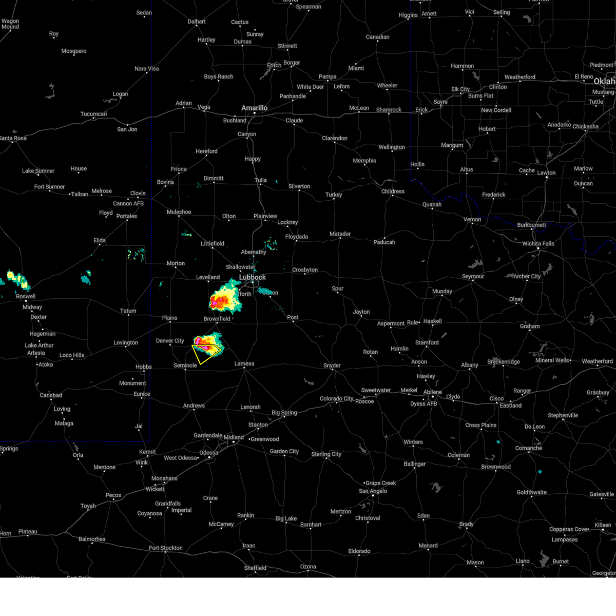
| 5/18/2021 4:36 PM CDT | Quarter sized hail reported 8.2 miles WSW of Loop, TX |
| 5/18/2021 4:15 PM CDT |
 At 415 pm cdt, a severe thunderstorm was located 7 miles east of seagraves airport, or 9 miles east of seagraves, moving northeast at 15 mph (radar indicated). Hazards include ping pong ball size hail and 60 mph wind gusts. People and animals outdoors will be injured. expect hail damage to roofs, siding, windows, and vehicles. Expect wind damage to roofs, siding, and trees. At 415 pm cdt, a severe thunderstorm was located 7 miles east of seagraves airport, or 9 miles east of seagraves, moving northeast at 15 mph (radar indicated). Hazards include ping pong ball size hail and 60 mph wind gusts. People and animals outdoors will be injured. expect hail damage to roofs, siding, windows, and vehicles. Expect wind damage to roofs, siding, and trees.
|
| 5/18/2021 4:06 PM CDT |
 At 406 pm cdt, a severe thunderstorm was located near seagraves airport, or 8 miles east of seagraves, moving northeast at 15 mph (radar indicated). Hazards include golf ball size hail and 60 mph wind gusts. People and animals outdoors will be injured. expect hail damage to roofs, siding, windows, and vehicles. expect wind damage to roofs, siding, and trees. Locations impacted include, loop. At 406 pm cdt, a severe thunderstorm was located near seagraves airport, or 8 miles east of seagraves, moving northeast at 15 mph (radar indicated). Hazards include golf ball size hail and 60 mph wind gusts. People and animals outdoors will be injured. expect hail damage to roofs, siding, windows, and vehicles. expect wind damage to roofs, siding, and trees. Locations impacted include, loop.
|
| 5/18/2021 3:56 PM CDT |
 At 353 pm cdt, a severe thunderstorm was located near seagraves airport, or near seagraves, moving northeast at 20 mph (trained weather spotters reported 1 inch hail in seagraves on highway 83). Hazards include golf ball size hail and 60 mph wind gusts. People and animals outdoors will be injured. expect hail damage to roofs, siding, windows, and vehicles. expect wind damage to roofs, siding, and trees. Locations impacted include, seagraves, seagraves airport and loop. At 353 pm cdt, a severe thunderstorm was located near seagraves airport, or near seagraves, moving northeast at 20 mph (trained weather spotters reported 1 inch hail in seagraves on highway 83). Hazards include golf ball size hail and 60 mph wind gusts. People and animals outdoors will be injured. expect hail damage to roofs, siding, windows, and vehicles. expect wind damage to roofs, siding, and trees. Locations impacted include, seagraves, seagraves airport and loop.
|
| 5/18/2021 3:45 PM CDT |
 At 345 pm cdt, a severe thunderstorm was located over seagraves airport, or near seagraves, moving northeast at 15 mph (radar indicated). Hazards include golf ball size hail and 60 mph wind gusts. People and animals outdoors will be injured. expect hail damage to roofs, siding, windows, and vehicles. expect wind damage to roofs, siding, and trees. Locations impacted include, seagraves, seagraves airport and loop. At 345 pm cdt, a severe thunderstorm was located over seagraves airport, or near seagraves, moving northeast at 15 mph (radar indicated). Hazards include golf ball size hail and 60 mph wind gusts. People and animals outdoors will be injured. expect hail damage to roofs, siding, windows, and vehicles. expect wind damage to roofs, siding, and trees. Locations impacted include, seagraves, seagraves airport and loop.
|
| 5/18/2021 3:29 PM CDT |
 At 329 pm cdt, a severe thunderstorm was located over seagraves, moving northeast at 10 mph (radar indicated). Hazards include 60 mph wind gusts and quarter size hail. Hail damage to vehicles is expected. Expect wind damage to roofs, siding, and trees. At 329 pm cdt, a severe thunderstorm was located over seagraves, moving northeast at 10 mph (radar indicated). Hazards include 60 mph wind gusts and quarter size hail. Hail damage to vehicles is expected. Expect wind damage to roofs, siding, and trees.
|
| 5/15/2021 7:53 PM CDT |
 At 734 pm cdt, a severe thunderstorm was located 7 miles south of gaines county airport, or 10 miles south of seminole, moving southeast at 5 mph (radar indicated). Hazards include golf ball size hail and 60 mph wind gusts. People and animals outdoors will be injured. expect hail damage to roofs, siding, windows, and vehicles. expect wind damage to roofs, siding, and trees. Locations impacted include, seminole, seagraves, seagraves airport, gaines county airport, loop and gaines county park. At 734 pm cdt, a severe thunderstorm was located 7 miles south of gaines county airport, or 10 miles south of seminole, moving southeast at 5 mph (radar indicated). Hazards include golf ball size hail and 60 mph wind gusts. People and animals outdoors will be injured. expect hail damage to roofs, siding, windows, and vehicles. expect wind damage to roofs, siding, and trees. Locations impacted include, seminole, seagraves, seagraves airport, gaines county airport, loop and gaines county park.
|
| 5/15/2021 7:34 PM CDT |
 At 734 pm cdt, a severe thunderstorm was located 7 miles south of gaines county airport, or 10 miles south of seminole, moving southeast at 5 mph (radar indicated). Hazards include golf ball size hail and 60 mph wind gusts. People and animals outdoors will be injured. expect hail damage to roofs, siding, windows, and vehicles. expect wind damage to roofs, siding, and trees. Locations impacted include, seminole, seagraves, seagraves airport, gaines county airport, loop and gaines county park. At 734 pm cdt, a severe thunderstorm was located 7 miles south of gaines county airport, or 10 miles south of seminole, moving southeast at 5 mph (radar indicated). Hazards include golf ball size hail and 60 mph wind gusts. People and animals outdoors will be injured. expect hail damage to roofs, siding, windows, and vehicles. expect wind damage to roofs, siding, and trees. Locations impacted include, seminole, seagraves, seagraves airport, gaines county airport, loop and gaines county park.
|
| 5/15/2021 7:28 PM CDT |
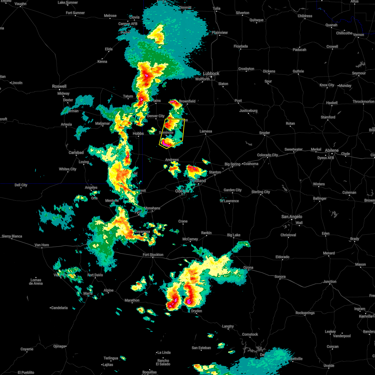 At 728 pm cdt, a severe thunderstorm was located 7 miles south of gaines county airport, or 10 miles south of seminole, moving east at 15 mph (radar indicated). Hazards include ping pong ball size hail and 60 mph wind gusts. People and animals outdoors will be injured. expect hail damage to roofs, siding, windows, and vehicles. expect wind damage to roofs, siding, and trees. Locations impacted include, seminole, seagraves, seagraves airport, gaines county airport, loop and gaines county park. At 728 pm cdt, a severe thunderstorm was located 7 miles south of gaines county airport, or 10 miles south of seminole, moving east at 15 mph (radar indicated). Hazards include ping pong ball size hail and 60 mph wind gusts. People and animals outdoors will be injured. expect hail damage to roofs, siding, windows, and vehicles. expect wind damage to roofs, siding, and trees. Locations impacted include, seminole, seagraves, seagraves airport, gaines county airport, loop and gaines county park.
|
| 5/15/2021 7:11 PM CDT |
 At 711 pm cdt, a severe thunderstorm was located near gaines county airport, or 8 miles south of seminole, moving northeast at 10 mph (radar indicated). Hazards include ping pong ball size hail and 60 mph wind gusts. People and animals outdoors will be injured. expect hail damage to roofs, siding, windows, and vehicles. Expect wind damage to roofs, siding, and trees. At 711 pm cdt, a severe thunderstorm was located near gaines county airport, or 8 miles south of seminole, moving northeast at 10 mph (radar indicated). Hazards include ping pong ball size hail and 60 mph wind gusts. People and animals outdoors will be injured. expect hail damage to roofs, siding, windows, and vehicles. Expect wind damage to roofs, siding, and trees.
|
| 5/3/2021 7:50 PM CDT |
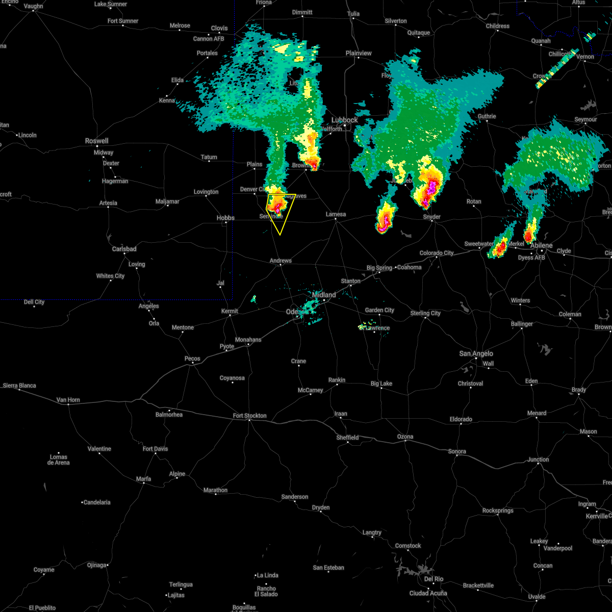 At 750 pm cdt, a severe thunderstorm was located 7 miles northeast of seminole, moving east at 30 mph (radar indicated). Hazards include 60 mph wind gusts and half dollar size hail. Hail damage to vehicles is expected. expect wind damage to roofs, siding, and trees. Locations impacted include, seagraves, seagraves airport, loop and gaines county park. At 750 pm cdt, a severe thunderstorm was located 7 miles northeast of seminole, moving east at 30 mph (radar indicated). Hazards include 60 mph wind gusts and half dollar size hail. Hail damage to vehicles is expected. expect wind damage to roofs, siding, and trees. Locations impacted include, seagraves, seagraves airport, loop and gaines county park.
|
| 5/3/2021 7:33 PM CDT |
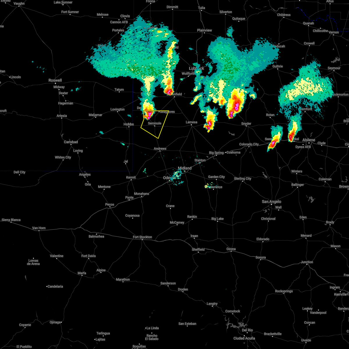 At 732 pm cdt, a severe thunderstorm was located 9 miles northwest of seminole, moving southeast at 35 mph (radar indicated). Hazards include ping pong ball size hail and 60 mph wind gusts. People and animals outdoors will be injured. expect hail damage to roofs, siding, windows, and vehicles. expect wind damage to roofs, siding, and trees. Locations impacted include, seminole, seagraves, seagraves airport, gaines county airport, loop, paynes corner and gaines county park. At 732 pm cdt, a severe thunderstorm was located 9 miles northwest of seminole, moving southeast at 35 mph (radar indicated). Hazards include ping pong ball size hail and 60 mph wind gusts. People and animals outdoors will be injured. expect hail damage to roofs, siding, windows, and vehicles. expect wind damage to roofs, siding, and trees. Locations impacted include, seminole, seagraves, seagraves airport, gaines county airport, loop, paynes corner and gaines county park.
|
| 5/3/2021 7:02 PM CDT |
 At 702 pm cdt/602 pm mdt/, a severe thunderstorm was located 12 miles west of denver city, moving east southeast at 25 mph (radar indicated). Hazards include 60 mph wind gusts and half dollar size hail. Hail damage to vehicles is expected. Expect wind damage to roofs, siding, and trees. At 702 pm cdt/602 pm mdt/, a severe thunderstorm was located 12 miles west of denver city, moving east southeast at 25 mph (radar indicated). Hazards include 60 mph wind gusts and half dollar size hail. Hail damage to vehicles is expected. Expect wind damage to roofs, siding, and trees.
|
| 4/13/2021 4:48 PM CDT |
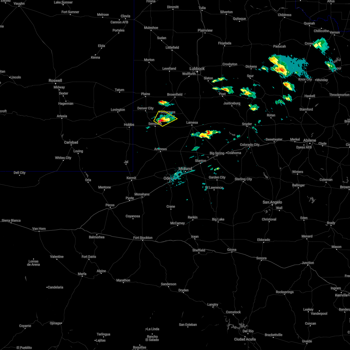 At 448 pm cdt, a severe thunderstorm was located 8 miles south of seagraves, moving northeast at 25 mph (radar indicated). Hazards include 60 mph wind gusts and quarter size hail. Hail damage to vehicles is expected. expect wind damage to roofs, siding, and trees. Locations impacted include, seagraves, seagraves airport, loop and gaines county park. At 448 pm cdt, a severe thunderstorm was located 8 miles south of seagraves, moving northeast at 25 mph (radar indicated). Hazards include 60 mph wind gusts and quarter size hail. Hail damage to vehicles is expected. expect wind damage to roofs, siding, and trees. Locations impacted include, seagraves, seagraves airport, loop and gaines county park.
|
| 4/13/2021 4:29 PM CDT |
 At 429 pm cdt, a severe thunderstorm was located over seminole, moving northeast at 25 mph (radar indicated). Hazards include golf ball size hail and 60 mph wind gusts. People and animals outdoors will be injured. expect hail damage to roofs, siding, windows, and vehicles. expect wind damage to roofs, siding, and trees. Locations impacted include, seminole, seagraves, seagraves airport, gaines county airport, loop and gaines county park. At 429 pm cdt, a severe thunderstorm was located over seminole, moving northeast at 25 mph (radar indicated). Hazards include golf ball size hail and 60 mph wind gusts. People and animals outdoors will be injured. expect hail damage to roofs, siding, windows, and vehicles. expect wind damage to roofs, siding, and trees. Locations impacted include, seminole, seagraves, seagraves airport, gaines county airport, loop and gaines county park.
|
| 4/13/2021 4:17 PM CDT |
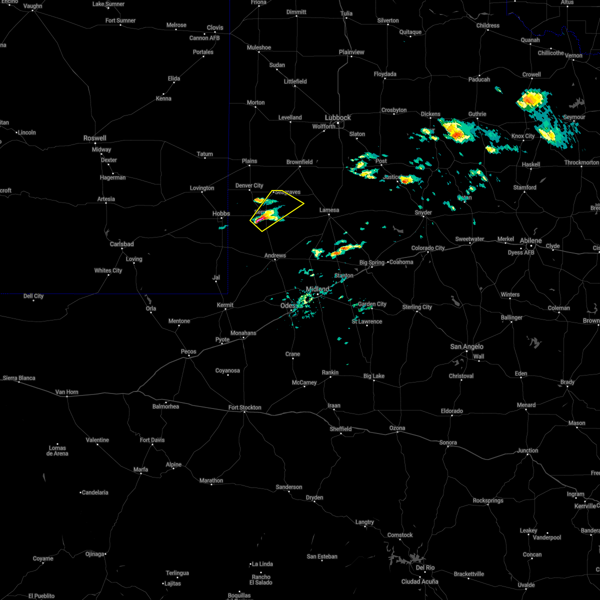 At 417 pm cdt, a severe thunderstorm was located over seminole, moving northeast at 30 mph (radar indicated). Hazards include 60 mph wind gusts and quarter size hail. Hail damage to vehicles is expected. Expect wind damage to roofs, siding, and trees. At 417 pm cdt, a severe thunderstorm was located over seminole, moving northeast at 30 mph (radar indicated). Hazards include 60 mph wind gusts and quarter size hail. Hail damage to vehicles is expected. Expect wind damage to roofs, siding, and trees.
|
| 6/23/2020 12:30 AM CDT |
 At 1228 am cdt, severe thunderstorms were located along a line extending from near spur to 11 miles west of welch, moving southeast at 50 mph. these are very dangerous storms (a 62 mph wind gust was reported at the welch mesonet with the outflow boundary. stronger winds are also being reported to the north with sustained over 40 mph). Hazards include 80 mph wind gusts and quarter size hail. Flying debris will be dangerous to those caught without shelter. mobile homes will be heavily damaged. expect considerable damage to roofs, windows, and vehicles. extensive tree damage and power outages are likely. Locations impacted include, snyder, lamesa, seminole, seagraves, ackerly, gail, seagraves airport, gaines county airport, welch, fluvanna, j b thomas reservoir, lamesa municipal airport, los ybanez, patricia, arvana, hancock, mckenzie lake, dunn, gaines county park and loop. At 1228 am cdt, severe thunderstorms were located along a line extending from near spur to 11 miles west of welch, moving southeast at 50 mph. these are very dangerous storms (a 62 mph wind gust was reported at the welch mesonet with the outflow boundary. stronger winds are also being reported to the north with sustained over 40 mph). Hazards include 80 mph wind gusts and quarter size hail. Flying debris will be dangerous to those caught without shelter. mobile homes will be heavily damaged. expect considerable damage to roofs, windows, and vehicles. extensive tree damage and power outages are likely. Locations impacted include, snyder, lamesa, seminole, seagraves, ackerly, gail, seagraves airport, gaines county airport, welch, fluvanna, j b thomas reservoir, lamesa municipal airport, los ybanez, patricia, arvana, hancock, mckenzie lake, dunn, gaines county park and loop.
|
| 6/22/2020 11:58 PM CDT |
 At 1155 pm cdt, severe thunderstorms were located along a line extending from near crosbyton to near plains, moving southeast at 50 mph. this storm has a history of wind damage across areas to the northwest. these are very dangerous storms (radar indicated). Hazards include 80 mph wind gusts and quarter size hail. Flying debris will be dangerous to those caught without shelter. mobile homes will be heavily damaged. expect considerable damage to roofs, windows, and vehicles. Extensive tree damage and power outages are likely. At 1155 pm cdt, severe thunderstorms were located along a line extending from near crosbyton to near plains, moving southeast at 50 mph. this storm has a history of wind damage across areas to the northwest. these are very dangerous storms (radar indicated). Hazards include 80 mph wind gusts and quarter size hail. Flying debris will be dangerous to those caught without shelter. mobile homes will be heavily damaged. expect considerable damage to roofs, windows, and vehicles. Extensive tree damage and power outages are likely.
|
| 6/19/2020 5:00 PM CDT |
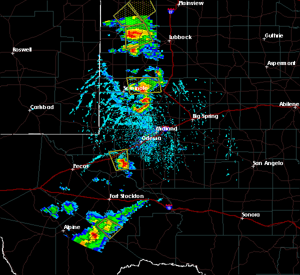 At 500 pm cdt, severe thunderstorms were located along a line extending from 10 miles southwest of welch to 19 miles southwest of lamesa to 11 miles east of andrews, moving southeast at 15 mph (radar indicated). Hazards include 70 mph wind gusts and quarter size hail. Hail damage to vehicles is expected. expect considerable tree damage. Wind damage is also likely to mobile homes, roofs, and outbuildings. At 500 pm cdt, severe thunderstorms were located along a line extending from 10 miles southwest of welch to 19 miles southwest of lamesa to 11 miles east of andrews, moving southeast at 15 mph (radar indicated). Hazards include 70 mph wind gusts and quarter size hail. Hail damage to vehicles is expected. expect considerable tree damage. Wind damage is also likely to mobile homes, roofs, and outbuildings.
|
| 6/19/2020 4:45 PM CDT |
 At 445 pm cdt, a severe thunderstorm was located 14 miles southwest of welch, or 17 miles southeast of seagraves, moving east at 15 mph (radar indicated). Hazards include 70 mph wind gusts and quarter size hail. Hail damage to vehicles is expected. expect considerable tree damage. wind damage is also likely to mobile homes, roofs, and outbuildings. Locations impacted include, seagraves, welch, seagraves airport, loop, mckenzie lake and punkin center. At 445 pm cdt, a severe thunderstorm was located 14 miles southwest of welch, or 17 miles southeast of seagraves, moving east at 15 mph (radar indicated). Hazards include 70 mph wind gusts and quarter size hail. Hail damage to vehicles is expected. expect considerable tree damage. wind damage is also likely to mobile homes, roofs, and outbuildings. Locations impacted include, seagraves, welch, seagraves airport, loop, mckenzie lake and punkin center.
|
| 6/19/2020 4:28 PM CDT |
 At 427 pm cdt, a severe thunderstorm was located 13 miles southeast of seagraves airport, or 14 miles southeast of seagraves, moving east at 20 mph (mesonet reported 58 mph wind gust at welch). Hazards include 70 mph wind gusts and ping pong ball size hail. People and animals outdoors will be injured. expect hail damage to roofs, siding, windows, and vehicles. expect considerable tree damage. wind damage is also likely to mobile homes, roofs, and outbuildings. Locations impacted include, seagraves, welch, seagraves airport, loop, mckenzie lake and punkin center. At 427 pm cdt, a severe thunderstorm was located 13 miles southeast of seagraves airport, or 14 miles southeast of seagraves, moving east at 20 mph (mesonet reported 58 mph wind gust at welch). Hazards include 70 mph wind gusts and ping pong ball size hail. People and animals outdoors will be injured. expect hail damage to roofs, siding, windows, and vehicles. expect considerable tree damage. wind damage is also likely to mobile homes, roofs, and outbuildings. Locations impacted include, seagraves, welch, seagraves airport, loop, mckenzie lake and punkin center.
|
| 6/19/2020 4:14 PM CDT |
 At 414 pm cdt, a severe thunderstorm was located 10 miles southeast of seagraves airport, or 11 miles southeast of seagraves, moving east at 20 mph (radar indicated). Hazards include 70 mph wind gusts and quarter size hail. Hail damage to vehicles is expected. expect considerable tree damage. Wind damage is also likely to mobile homes, roofs, and outbuildings. At 414 pm cdt, a severe thunderstorm was located 10 miles southeast of seagraves airport, or 11 miles southeast of seagraves, moving east at 20 mph (radar indicated). Hazards include 70 mph wind gusts and quarter size hail. Hail damage to vehicles is expected. expect considerable tree damage. Wind damage is also likely to mobile homes, roofs, and outbuildings.
|
| 4/10/2020 9:04 PM CDT |
 At 904 pm cdt, a severe thunderstorm was located 10 miles southwest of welch, or 17 miles east of seagraves, moving northeast at 35 mph (radar indicated). Hazards include 60 mph wind gusts and quarter size hail. Hail damage to vehicles is expected. expect wind damage to roofs, siding, and trees. Locations impacted include, loop. At 904 pm cdt, a severe thunderstorm was located 10 miles southwest of welch, or 17 miles east of seagraves, moving northeast at 35 mph (radar indicated). Hazards include 60 mph wind gusts and quarter size hail. Hail damage to vehicles is expected. expect wind damage to roofs, siding, and trees. Locations impacted include, loop.
|
| 4/10/2020 8:50 PM CDT |
 At 849 pm cdt, a severe thunderstorm was located 11 miles east of seminole, moving north at 30 mph. this storm just crossed us hwy 180 (radar indicated). Hazards include golf ball size hail and 60 mph wind gusts. People and animals outdoors will be injured. expect hail damage to roofs, siding, windows, and vehicles. expect wind damage to roofs, siding, and trees. Locations impacted include, seminole, seagraves, seagraves airport, gaines county airport, loop, mckenzie lake and gaines county park. At 849 pm cdt, a severe thunderstorm was located 11 miles east of seminole, moving north at 30 mph. this storm just crossed us hwy 180 (radar indicated). Hazards include golf ball size hail and 60 mph wind gusts. People and animals outdoors will be injured. expect hail damage to roofs, siding, windows, and vehicles. expect wind damage to roofs, siding, and trees. Locations impacted include, seminole, seagraves, seagraves airport, gaines county airport, loop, mckenzie lake and gaines county park.
|
| 4/10/2020 8:36 PM CDT |
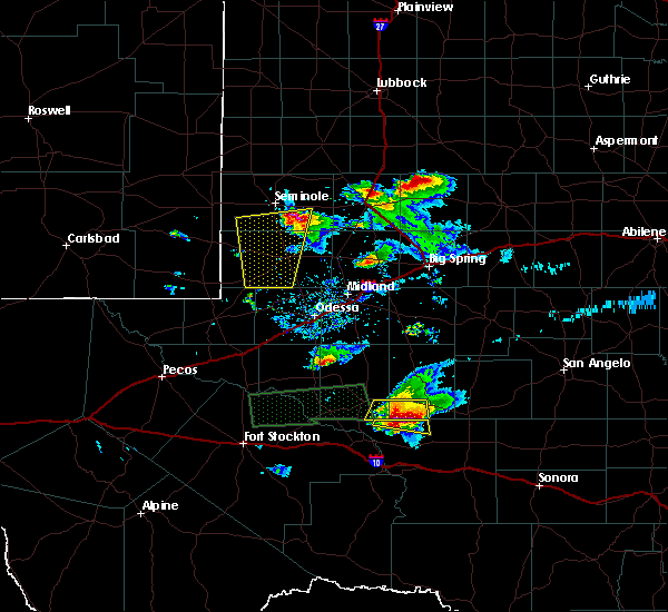 At 836 pm cdt, a severe thunderstorm was located 10 miles east of gaines county airport, or 11 miles southeast of seminole, moving north at 30 mph. this storm has a history of producing large hail (radar indicated). Hazards include golf ball size hail and 60 mph wind gusts. People and animals outdoors will be injured. expect hail damage to roofs, siding, windows, and vehicles. Expect wind damage to roofs, siding, and trees. At 836 pm cdt, a severe thunderstorm was located 10 miles east of gaines county airport, or 11 miles southeast of seminole, moving north at 30 mph. this storm has a history of producing large hail (radar indicated). Hazards include golf ball size hail and 60 mph wind gusts. People and animals outdoors will be injured. expect hail damage to roofs, siding, windows, and vehicles. Expect wind damage to roofs, siding, and trees.
|
| 6/17/2019 8:15 PM CDT |
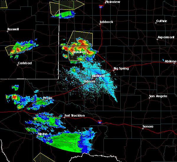 At 814 pm cdt, a severe thunderstorm was located near seagraves airport, or 8 miles east of seagraves, moving northeast at 30 mph (emergency management). Hazards include two inch hail and 60 mph wind gusts. People and animals outdoors will be injured. expect hail damage to roofs, siding, windows, and vehicles. expect wind damage to roofs, siding, and trees. Locations impacted include, seminole, seagraves, seagraves airport, gaines county airport, loop, mckenzie lake and gaines county park. At 814 pm cdt, a severe thunderstorm was located near seagraves airport, or 8 miles east of seagraves, moving northeast at 30 mph (emergency management). Hazards include two inch hail and 60 mph wind gusts. People and animals outdoors will be injured. expect hail damage to roofs, siding, windows, and vehicles. expect wind damage to roofs, siding, and trees. Locations impacted include, seminole, seagraves, seagraves airport, gaines county airport, loop, mckenzie lake and gaines county park.
|
| 6/17/2019 7:55 PM CDT |
 At 734 pm cdt, hail up to tennis ball size was reported 9 miles south of seminole by emergency management. this storm is still capable of producing large hail as it moves north (emergency management). Hazards include tennis ball size hail and 60 mph wind gusts. People and animals outdoors will be injured. expect hail damage to roofs, siding, windows, and vehicles. expect wind damage to roofs, siding, and trees. Locations impacted include, seminole, seagraves, seagraves airport, gaines county airport, loop, mckenzie lake and gaines county park. At 734 pm cdt, hail up to tennis ball size was reported 9 miles south of seminole by emergency management. this storm is still capable of producing large hail as it moves north (emergency management). Hazards include tennis ball size hail and 60 mph wind gusts. People and animals outdoors will be injured. expect hail damage to roofs, siding, windows, and vehicles. expect wind damage to roofs, siding, and trees. Locations impacted include, seminole, seagraves, seagraves airport, gaines county airport, loop, mckenzie lake and gaines county park.
|
| 6/17/2019 7:42 PM CDT |
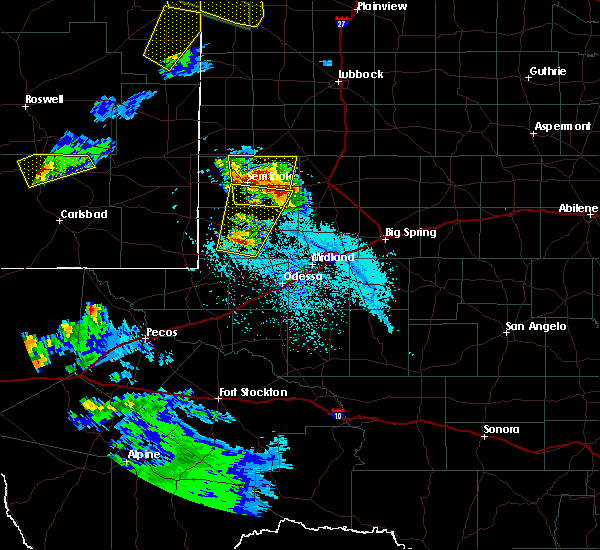 At 741 pm cdt, a severe thunderstorm was located near seminole, moving north at 25 mph. radar indicates hail up to 3 inches in diameter is possible with this storm. this is a very dangerous storm (radar indicated). Hazards include three inch hail and 60 mph wind gusts. People and animals outdoors will be severely injured. expect shattered windows, extensive damage to roofs, siding, and vehicles. Locations impacted include, seminole, seagraves, seagraves airport, gaines county airport, loop, mckenzie lake and gaines county park. At 741 pm cdt, a severe thunderstorm was located near seminole, moving north at 25 mph. radar indicates hail up to 3 inches in diameter is possible with this storm. this is a very dangerous storm (radar indicated). Hazards include three inch hail and 60 mph wind gusts. People and animals outdoors will be severely injured. expect shattered windows, extensive damage to roofs, siding, and vehicles. Locations impacted include, seminole, seagraves, seagraves airport, gaines county airport, loop, mckenzie lake and gaines county park.
|
| 6/17/2019 7:30 PM CDT |
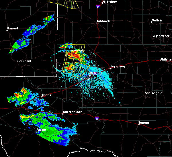 At 729 pm cdt, a severe thunderstorm was located near gaines county airport, or 7 miles southeast of seminole, moving north at 20 mph (radar indicated). Hazards include two inch hail and 60 mph wind gusts. People and animals outdoors will be injured. expect hail damage to roofs, siding, windows, and vehicles. Expect wind damage to roofs, siding, and trees. At 729 pm cdt, a severe thunderstorm was located near gaines county airport, or 7 miles southeast of seminole, moving north at 20 mph (radar indicated). Hazards include two inch hail and 60 mph wind gusts. People and animals outdoors will be injured. expect hail damage to roofs, siding, windows, and vehicles. Expect wind damage to roofs, siding, and trees.
|
| 6/2/2019 11:14 PM CDT |
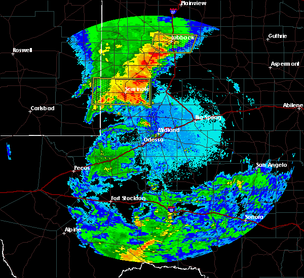 At 1114 pm cdt, a severe thunderstorm was located 14 miles east of gaines county airport, or 14 miles east of seminole, moving east at 50 mph (radar indicated). Hazards include 60 mph wind gusts and quarter size hail. Hail damage to vehicles is expected. expect wind damage to roofs, siding, and trees. Locations impacted include, seminole, seagraves, seagraves airport, gaines county airport, loop, paynes corner, higginbotham, mckenzie lake and gaines county park. At 1114 pm cdt, a severe thunderstorm was located 14 miles east of gaines county airport, or 14 miles east of seminole, moving east at 50 mph (radar indicated). Hazards include 60 mph wind gusts and quarter size hail. Hail damage to vehicles is expected. expect wind damage to roofs, siding, and trees. Locations impacted include, seminole, seagraves, seagraves airport, gaines county airport, loop, paynes corner, higginbotham, mckenzie lake and gaines county park.
|
| 6/2/2019 10:45 PM CDT |
 At 1045 pm cdt/945 pm mdt/, a severe thunderstorm was located 9 miles northwest of seminole, moving east at 50 mph (radar indicated). Hazards include 60 mph wind gusts and quarter size hail. Hail damage to vehicles is expected. Expect wind damage to roofs, siding, and trees. At 1045 pm cdt/945 pm mdt/, a severe thunderstorm was located 9 miles northwest of seminole, moving east at 50 mph (radar indicated). Hazards include 60 mph wind gusts and quarter size hail. Hail damage to vehicles is expected. Expect wind damage to roofs, siding, and trees.
|
| 5/20/2019 3:13 PM CDT |
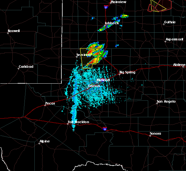 A severe thunderstorm warning remains in effect until 415 pm cdt for eastern gaines and western dawson counties. at 313 pm cdt, a severe thunderstorm was located 20 miles southwest of lamesa, moving northeast at 25 mph. hazard. ping pong ball size hail and 60 mph wind gusts. source. Radar indicated. A severe thunderstorm warning remains in effect until 415 pm cdt for eastern gaines and western dawson counties. at 313 pm cdt, a severe thunderstorm was located 20 miles southwest of lamesa, moving northeast at 25 mph. hazard. ping pong ball size hail and 60 mph wind gusts. source. Radar indicated.
|
| 5/20/2019 2:56 PM CDT |
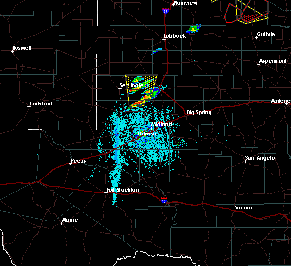 At 256 pm cdt, a severe thunderstorm was located 14 miles northeast of andrews, moving north at 25 mph (radar indicated). Hazards include 60 mph wind gusts and quarter size hail. Hail damage to vehicles is expected. Expect wind damage to roofs, siding, and trees. At 256 pm cdt, a severe thunderstorm was located 14 miles northeast of andrews, moving north at 25 mph (radar indicated). Hazards include 60 mph wind gusts and quarter size hail. Hail damage to vehicles is expected. Expect wind damage to roofs, siding, and trees.
|
| 5/7/2019 6:12 PM CDT |
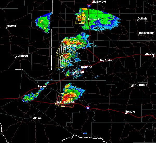 At 611 pm cdt, a severe thunderstorm was located near seagraves, moving north at 45 mph (emergency management). Hazards include golf ball size hail and 60 mph wind gusts. People and animals outdoors will be injured. expect hail damage to roofs, siding, windows, and vehicles. Expect wind damage to roofs, siding, and trees. At 611 pm cdt, a severe thunderstorm was located near seagraves, moving north at 45 mph (emergency management). Hazards include golf ball size hail and 60 mph wind gusts. People and animals outdoors will be injured. expect hail damage to roofs, siding, windows, and vehicles. Expect wind damage to roofs, siding, and trees.
|
| 5/4/2019 7:17 PM CDT |
 At 716 pm cdt/616 pm mdt/, a severe thunderstorm was located 15 miles west of denver city, moving southeast at 15 mph (radar indicated). Hazards include tennis ball size hail and 60 mph wind gusts. People and animals outdoors will be injured. expect hail damage to roofs, siding, windows, and vehicles. Expect wind damage to roofs, siding, and trees. At 716 pm cdt/616 pm mdt/, a severe thunderstorm was located 15 miles west of denver city, moving southeast at 15 mph (radar indicated). Hazards include tennis ball size hail and 60 mph wind gusts. People and animals outdoors will be injured. expect hail damage to roofs, siding, windows, and vehicles. Expect wind damage to roofs, siding, and trees.
|
| 4/22/2019 8:13 PM CDT |
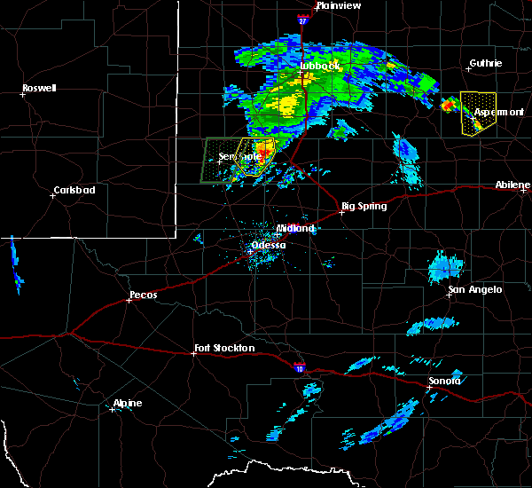 At 811 pm cdt, a severe thunderstorm was located 15 miles southwest of welch, or 16 miles west of lamesa, moving east at 15 mph (radar indicated). Hazards include 60 mph wind gusts and quarter size hail. Hail damage to vehicles is expected. expect wind damage to roofs, siding, and trees. Locations impacted include, open country of eastern gaines and northwestern dawson counties. At 811 pm cdt, a severe thunderstorm was located 15 miles southwest of welch, or 16 miles west of lamesa, moving east at 15 mph (radar indicated). Hazards include 60 mph wind gusts and quarter size hail. Hail damage to vehicles is expected. expect wind damage to roofs, siding, and trees. Locations impacted include, open country of eastern gaines and northwestern dawson counties.
|
| 4/22/2019 7:45 PM CDT |
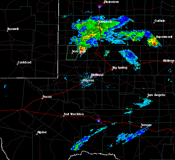 At 745 pm cdt, a severe thunderstorm was located 18 miles east of seminole, along highway 180 moving northeast at 25 mph (radar indicated). Hazards include 60 mph wind gusts and quarter size hail. Hail damage to vehicles is expected. Expect wind damage to roofs, siding, and trees. At 745 pm cdt, a severe thunderstorm was located 18 miles east of seminole, along highway 180 moving northeast at 25 mph (radar indicated). Hazards include 60 mph wind gusts and quarter size hail. Hail damage to vehicles is expected. Expect wind damage to roofs, siding, and trees.
|
| 4/22/2019 6:38 PM CDT |
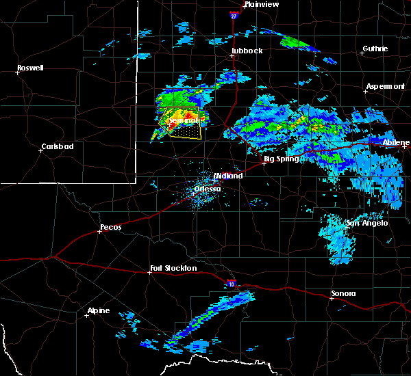 At 638 pm cdt, a severe thunderstorm was located near seminole, moving northeast at 25 mph (radar indicated). Hazards include 60 mph wind gusts and quarter size hail. Hail damage to vehicles is expected. Expect wind damage to roofs, siding, and trees. At 638 pm cdt, a severe thunderstorm was located near seminole, moving northeast at 25 mph (radar indicated). Hazards include 60 mph wind gusts and quarter size hail. Hail damage to vehicles is expected. Expect wind damage to roofs, siding, and trees.
|
| 4/5/2019 10:02 PM CDT |
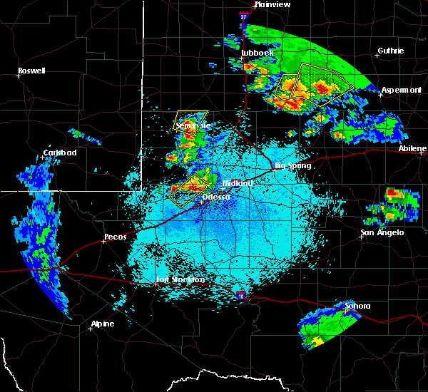 At 1001 pm cdt, a severe thunderstorm was located 8 miles northeast of seminole, moving north at 35 mph (public reported golfball sized hail approximately 9 miles south of seminole at 940 pm cdt). Hazards include 60 mph wind gusts and half dollar size hail. Hail damage to vehicles is expected. expect wind damage to roofs, siding, and trees. Locations impacted include, seminole, seagraves, seagraves airport, loop and gaines county park. At 1001 pm cdt, a severe thunderstorm was located 8 miles northeast of seminole, moving north at 35 mph (public reported golfball sized hail approximately 9 miles south of seminole at 940 pm cdt). Hazards include 60 mph wind gusts and half dollar size hail. Hail damage to vehicles is expected. expect wind damage to roofs, siding, and trees. Locations impacted include, seminole, seagraves, seagraves airport, loop and gaines county park.
|
| 4/5/2019 9:43 PM CDT |
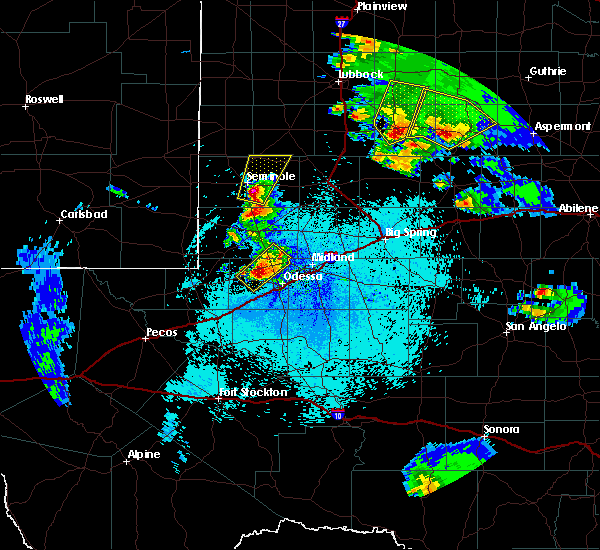 At 943 pm cdt, a severe thunderstorm was located near gaines county airport, or near seminole, moving north at 35 mph (public reported golfball sized hail approximately 9 miles south of seminole at 940 pm cdt ). Hazards include 60 mph wind gusts and half dollar size hail. Hail damage to vehicles is expected. Expect wind damage to roofs, siding, and trees. At 943 pm cdt, a severe thunderstorm was located near gaines county airport, or near seminole, moving north at 35 mph (public reported golfball sized hail approximately 9 miles south of seminole at 940 pm cdt ). Hazards include 60 mph wind gusts and half dollar size hail. Hail damage to vehicles is expected. Expect wind damage to roofs, siding, and trees.
|
| 6/3/2018 11:36 PM CDT |
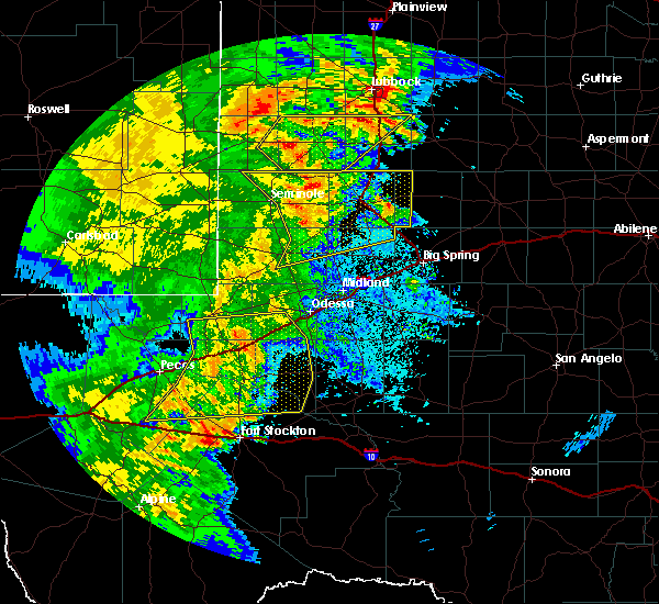 At 1136 pm cdt, severe thunderstorms were located along a line extending from 8 miles southwest of brownfield to near welch to 9 miles southwest of lamesa to 16 miles west of lenorah to 7 miles southeast of andrews, moving northeast at 50 mph (trained weather spotters). Hazards include 70 mph wind gusts and quarter size hail. Hail damage to vehicles is expected. expect considerable tree damage. wind damage is also likely to mobile homes, roofs, and outbuildings. Locations impacted include, andrews, lamesa, seagraves, ackerly, seagraves airport, lamesa municipal airport, welch, los ybanez, loop, sparenberg, patricia, punkin center, arvana, hancock, mckenzie lake, tenmile, gaines county park, key, klondike and andrews county airport. At 1136 pm cdt, severe thunderstorms were located along a line extending from 8 miles southwest of brownfield to near welch to 9 miles southwest of lamesa to 16 miles west of lenorah to 7 miles southeast of andrews, moving northeast at 50 mph (trained weather spotters). Hazards include 70 mph wind gusts and quarter size hail. Hail damage to vehicles is expected. expect considerable tree damage. wind damage is also likely to mobile homes, roofs, and outbuildings. Locations impacted include, andrews, lamesa, seagraves, ackerly, seagraves airport, lamesa municipal airport, welch, los ybanez, loop, sparenberg, patricia, punkin center, arvana, hancock, mckenzie lake, tenmile, gaines county park, key, klondike and andrews county airport.
|
| 6/3/2018 11:21 PM CDT |
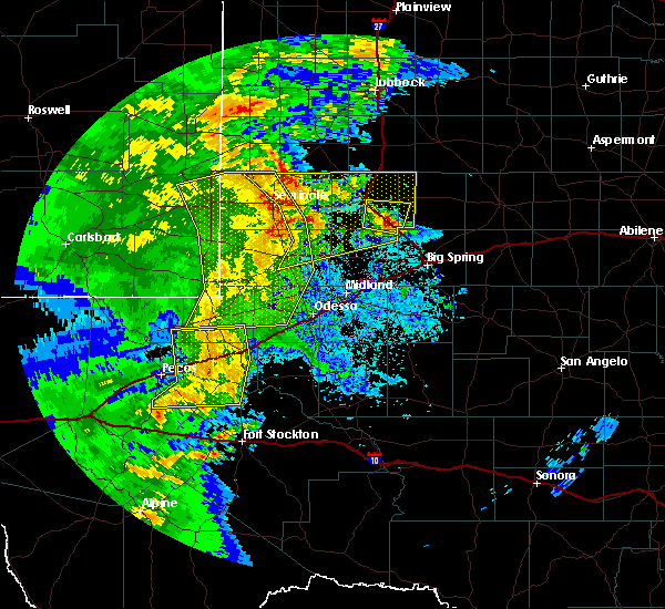 At 1121 pm cdt, severe thunderstorms were located along a line extending from near seagraves airport to 14 miles southwest of welch to 20 miles southwest of lamesa to 13 miles east of andrews to 11 miles north of goldsmith, moving northeast at 45 mph (radar indicated). Hazards include 60 mph wind gusts and quarter size hail. Hail damage to vehicles is expected. Expect wind damage to roofs, siding, and trees. At 1121 pm cdt, severe thunderstorms were located along a line extending from near seagraves airport to 14 miles southwest of welch to 20 miles southwest of lamesa to 13 miles east of andrews to 11 miles north of goldsmith, moving northeast at 45 mph (radar indicated). Hazards include 60 mph wind gusts and quarter size hail. Hail damage to vehicles is expected. Expect wind damage to roofs, siding, and trees.
|
| 4/12/2017 2:53 PM CDT |
 The severe thunderstorm warning for north central gaines county will expire at 300 pm cdt, the severe thunderstorm which prompted the warning has moved out of the warned area. therefore, the warning will be allowed to expire. a severe thunderstorm watch remains in effect until 900 pm cdt for western texas. The severe thunderstorm warning for north central gaines county will expire at 300 pm cdt, the severe thunderstorm which prompted the warning has moved out of the warned area. therefore, the warning will be allowed to expire. a severe thunderstorm watch remains in effect until 900 pm cdt for western texas.
|
| 4/12/2017 2:39 PM CDT |
 At 238 pm cdt, a severe thunderstorm was located near seagraves, moving east at 30 mph (radar indicated). Hazards include 60 mph wind gusts and half dollar size hail. Hail damage to vehicles is expected. expect wind damage to roofs, siding, and trees. Locations impacted include, seagraves, loop and seagraves airport. At 238 pm cdt, a severe thunderstorm was located near seagraves, moving east at 30 mph (radar indicated). Hazards include 60 mph wind gusts and half dollar size hail. Hail damage to vehicles is expected. expect wind damage to roofs, siding, and trees. Locations impacted include, seagraves, loop and seagraves airport.
|
| 4/12/2017 2:28 PM CDT |
 At 228 pm cdt, a severe thunderstorm was located near denver city, moving east at 30 mph (radar indicated). Hazards include 60 mph wind gusts and half dollar size hail. Hail damage to vehicles is expected. Expect wind damage to roofs, siding, and trees. At 228 pm cdt, a severe thunderstorm was located near denver city, moving east at 30 mph (radar indicated). Hazards include 60 mph wind gusts and half dollar size hail. Hail damage to vehicles is expected. Expect wind damage to roofs, siding, and trees.
|
| 1/1/2017 8:24 PM CST |
 At 823 pm cst, severe thunderstorms were located along a line extending from seagraves airport to 10 miles north of andrews to 9 miles northwest of goldsmith, moving east at 55 mph (radar indicated). Hazards include 60 mph wind gusts and penny size hail. expect damage to roofs, siding, and trees At 823 pm cst, severe thunderstorms were located along a line extending from seagraves airport to 10 miles north of andrews to 9 miles northwest of goldsmith, moving east at 55 mph (radar indicated). Hazards include 60 mph wind gusts and penny size hail. expect damage to roofs, siding, and trees
|
| 1/1/2017 7:52 PM CST |
 At 751 pm cst/651 pm mst/, severe thunderstorms were located along a line extending from 10 miles north of bronco to near denver city to near winkler county airport, moving northeast at 65 mph (69 mph wind gust reported at lea county regional airport). Hazards include 70 mph wind gusts and penny size hail. Expect considerable tree damage. damage is likely to mobile homes, roofs, and outbuildings. Locations impacted include, hobbs, andrews, seminole, kermit, denver city, eunice, seagraves, jal, seagraves airport, nadine, jal airport, gaines county airport, welch, gaines county park, winkler county airport, loop, knowles, frankel city, higginbotham and cedar lake. At 751 pm cst/651 pm mst/, severe thunderstorms were located along a line extending from 10 miles north of bronco to near denver city to near winkler county airport, moving northeast at 65 mph (69 mph wind gust reported at lea county regional airport). Hazards include 70 mph wind gusts and penny size hail. Expect considerable tree damage. damage is likely to mobile homes, roofs, and outbuildings. Locations impacted include, hobbs, andrews, seminole, kermit, denver city, eunice, seagraves, jal, seagraves airport, nadine, jal airport, gaines county airport, welch, gaines county park, winkler county airport, loop, knowles, frankel city, higginbotham and cedar lake.
|
| 1/1/2017 7:28 PM CST |
 At 728 pm cst/628 pm mst/, severe thunderstorms were located along a line extending from near tatum to near hobbs to 6 miles south of mentone, moving northeast at 65 mph (radar indicated). Hazards include 60 mph wind gusts and penny size hail. expect damage to roofs, siding, and trees At 728 pm cst/628 pm mst/, severe thunderstorms were located along a line extending from near tatum to near hobbs to 6 miles south of mentone, moving northeast at 65 mph (radar indicated). Hazards include 60 mph wind gusts and penny size hail. expect damage to roofs, siding, and trees
|
| 6/11/2016 10:15 PM CDT |
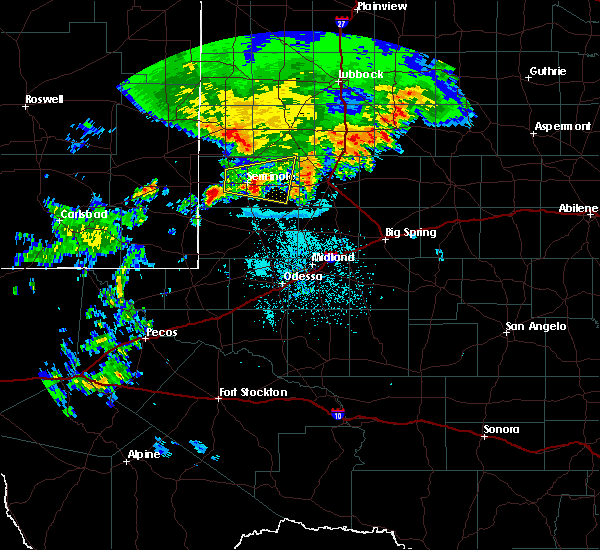 At 1015 pm cdt, a severe thunderstorm was located 7 miles east of seminole, moving southeast at 15 mph (radar indicated). Hazards include 60 mph wind gusts and quarter size hail. Hail damage to vehicles is expected. expect wind damage to roofs, siding, and trees. Locations impacted include, seminole, cedar lake, gaines county airport, fairview, loop, paynes corner, ashmore, gaines county park and mckenzie lake. At 1015 pm cdt, a severe thunderstorm was located 7 miles east of seminole, moving southeast at 15 mph (radar indicated). Hazards include 60 mph wind gusts and quarter size hail. Hail damage to vehicles is expected. expect wind damage to roofs, siding, and trees. Locations impacted include, seminole, cedar lake, gaines county airport, fairview, loop, paynes corner, ashmore, gaines county park and mckenzie lake.
|
| 6/11/2016 9:39 PM CDT |
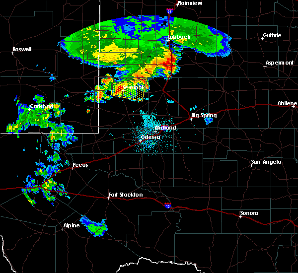 At 933 pm cdt, a severe thunderstorm was located near seminole, moving east at 10 mph. quarter size hail reported 6 miles west of seminole (trained weather spotters). Hazards include quarter size hail. Damage to vehicles is expected. Locations impacted include, seminole, cedar lake, gaines county airport, fairview, loop, paynes corner, ashmore, gaines county park and mckenzie lake. At 933 pm cdt, a severe thunderstorm was located near seminole, moving east at 10 mph. quarter size hail reported 6 miles west of seminole (trained weather spotters). Hazards include quarter size hail. Damage to vehicles is expected. Locations impacted include, seminole, cedar lake, gaines county airport, fairview, loop, paynes corner, ashmore, gaines county park and mckenzie lake.
|
| 6/11/2016 9:23 PM CDT |
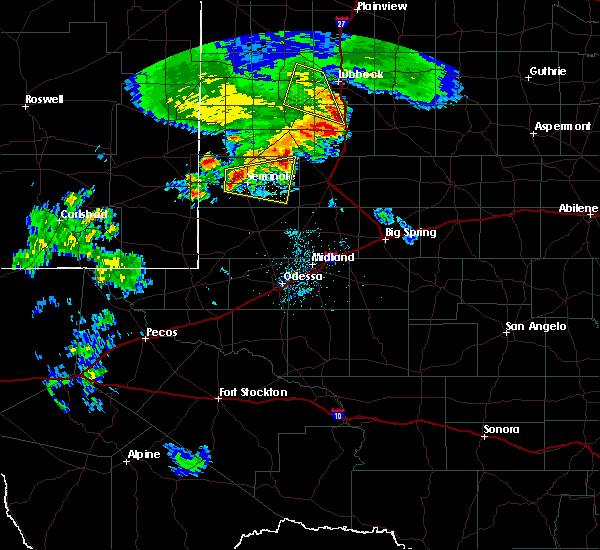 At 923 pm cdt, a severe thunderstorm was located near paynes corner, moving east at 15 mph (radar indicated). Hazards include 60 mph wind gusts and quarter size hail. Hail damage to vehicles is expected. Expect wind damage to roofs, siding, and trees. At 923 pm cdt, a severe thunderstorm was located near paynes corner, moving east at 15 mph (radar indicated). Hazards include 60 mph wind gusts and quarter size hail. Hail damage to vehicles is expected. Expect wind damage to roofs, siding, and trees.
|
| 5/21/2016 8:28 PM CDT | A severe thunderstorm warning remains in effect until 845 pm cdt for northeastern gaines county. at 828 pm cdt. a severe thunderstorm was located over loop. or 7 miles east of seagraves. moving northeast at 30 mph. hazard. 60 mph wind gusts and half dollar size hail. source. Radar indicated. |
| 4/21/2016 2:30 AM CDT |
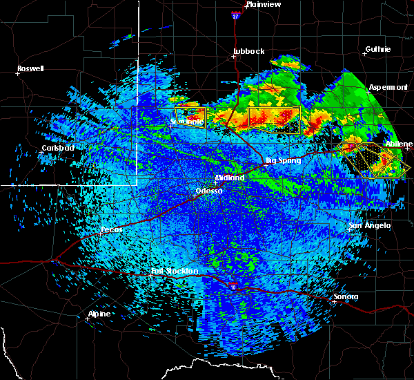 At 229 am cdt, a severe thunderstorm was located near cedar lake, or 15 miles southeast of seagraves, moving southeast at 30 mph (radar indicated). Hazards include 60 mph wind gusts and half dollar size hail. Hail damage to vehicles is expected. expect wind damage to roofs, siding, and trees. Locations impacted include, seagraves, cedar lake, ashmore, loop, seagraves airport and mckenzie lake. At 229 am cdt, a severe thunderstorm was located near cedar lake, or 15 miles southeast of seagraves, moving southeast at 30 mph (radar indicated). Hazards include 60 mph wind gusts and half dollar size hail. Hail damage to vehicles is expected. expect wind damage to roofs, siding, and trees. Locations impacted include, seagraves, cedar lake, ashmore, loop, seagraves airport and mckenzie lake.
|
| 4/21/2016 1:59 AM CDT |
 At 158 am cdt, a severe thunderstorm was located near loop, or near seagraves, moving southeast at 30 mph (radar indicated). Hazards include 60 mph wind gusts and half dollar size hail. Hail damage to vehicles is expected. Expect wind damage to roofs, siding, and trees. At 158 am cdt, a severe thunderstorm was located near loop, or near seagraves, moving southeast at 30 mph (radar indicated). Hazards include 60 mph wind gusts and half dollar size hail. Hail damage to vehicles is expected. Expect wind damage to roofs, siding, and trees.
|
| 11/16/2015 6:53 PM CST | Two snapped powerpoles reported at us hwy 180 and fm30 in gaines county TX, 13.5 miles N of Loop, TX |
| 8/21/2015 9:39 PM CDT |
 At 938 pm cdt/838 pm mdt/, severe thunderstorms were located along a line extending from near cedar lake to near nadine, moving southeast at 25 mph (radar indicated). Hazards include 60 mph wind gusts. Expect damage to roofs. siding and trees. Locations impacted include, hobbs, seminole, denver city, seagraves, higginbotham, ashmore, fairview in gaines county, gaines county park, nadine, cedar lake, gaines county airport, loop, paynes corner, seagraves airport and mckenzie lake. At 938 pm cdt/838 pm mdt/, severe thunderstorms were located along a line extending from near cedar lake to near nadine, moving southeast at 25 mph (radar indicated). Hazards include 60 mph wind gusts. Expect damage to roofs. siding and trees. Locations impacted include, hobbs, seminole, denver city, seagraves, higginbotham, ashmore, fairview in gaines county, gaines county park, nadine, cedar lake, gaines county airport, loop, paynes corner, seagraves airport and mckenzie lake.
|
| 8/21/2015 9:10 PM CDT |
 At 909 pm cdt/809 pm mdt/, severe thunderstorms were located along a line extending from near loop to near hobbs, moving southeast at 25 mph (radar indicated). Hazards include 60 mph wind gusts. Expect damage to roofs. Siding and trees. At 909 pm cdt/809 pm mdt/, severe thunderstorms were located along a line extending from near loop to near hobbs, moving southeast at 25 mph (radar indicated). Hazards include 60 mph wind gusts. Expect damage to roofs. Siding and trees.
|
| 6/13/2015 8:11 PM CDT |
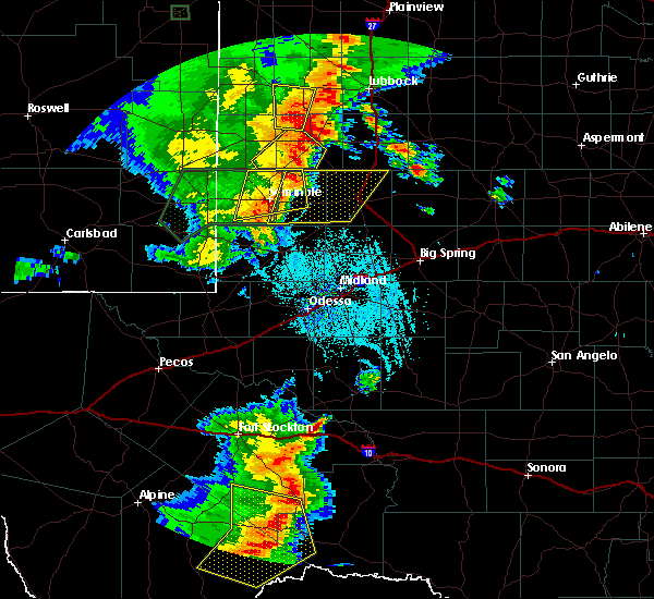 At 805 pm cdt, a severe thunderstorm was located 6 miles southwest of loop, and moving east at 30 mph (radar indicated). Hazards include 70 mph wind gusts and quarter size hail. Hail damage to vehicles is expected. expect considerable tree damage. wind damage is also likely to mobile homes, roofs and outbuildings. Locations impacted include, loop and seminole. At 805 pm cdt, a severe thunderstorm was located 6 miles southwest of loop, and moving east at 30 mph (radar indicated). Hazards include 70 mph wind gusts and quarter size hail. Hail damage to vehicles is expected. expect considerable tree damage. wind damage is also likely to mobile homes, roofs and outbuildings. Locations impacted include, loop and seminole.
|
| 6/13/2015 8:00 PM CDT |
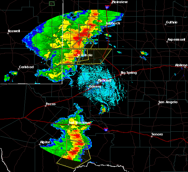 At 756 pm cdt, a severe thunderstorm was located 8 miles east of gaines county park, and moving east at 20 mph (radar indicated). Hazards include 70 mph wind gusts and quarter size hail. Hail damage to vehicles is expected. expect considerable tree damage. Wind damage is also likely to mobile homes, roofs and outbuildings. At 756 pm cdt, a severe thunderstorm was located 8 miles east of gaines county park, and moving east at 20 mph (radar indicated). Hazards include 70 mph wind gusts and quarter size hail. Hail damage to vehicles is expected. expect considerable tree damage. Wind damage is also likely to mobile homes, roofs and outbuildings.
|
| 6/13/2015 7:28 PM CDT |
 The national weather service in midland has issued a * severe thunderstorm warning for. gaines county in west texas. until 830 pm cdt * at 726 pm cdt. a severe thunderstorm was located 9 miles west of paynes corner. And moving east at 25 mph. The national weather service in midland has issued a * severe thunderstorm warning for. gaines county in west texas. until 830 pm cdt * at 726 pm cdt. a severe thunderstorm was located 9 miles west of paynes corner. And moving east at 25 mph.
|
| 6/12/2015 7:48 PM CDT |
 A tornado warning remains in effect for northeastern gaines county until 800 pm cdt. at 743 pm cdt. a severe thunderstorm capable of producing a tornado was located near cedar lake. and moving southeast at 10 mph. this storm was moving toward u. s. 180. hazard. Tornado and golf ball size hail. A tornado warning remains in effect for northeastern gaines county until 800 pm cdt. at 743 pm cdt. a severe thunderstorm capable of producing a tornado was located near cedar lake. and moving southeast at 10 mph. this storm was moving toward u. s. 180. hazard. Tornado and golf ball size hail.
|
| 6/12/2015 7:30 PM CDT |
 At 729 pm cdt, a severe thunderstorm capable of producing a tornado was located 5 miles northwest of cedar lake, and moving southeast at 10 mph (radar indicated rotation). Hazards include tornado and golf ball size hail. Flying debris will be dangerous to those caught without shelter. mobile homes will be damaged or destroyed. damage to roofs, windows and vehicles will occur. tree damage is likely. This dangerous storm will be near, cedar lake around 755 pm cdt. At 729 pm cdt, a severe thunderstorm capable of producing a tornado was located 5 miles northwest of cedar lake, and moving southeast at 10 mph (radar indicated rotation). Hazards include tornado and golf ball size hail. Flying debris will be dangerous to those caught without shelter. mobile homes will be damaged or destroyed. damage to roofs, windows and vehicles will occur. tree damage is likely. This dangerous storm will be near, cedar lake around 755 pm cdt.
|
| 6/12/2015 6:20 PM CDT |
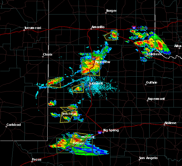 At 617 pm cdt, a severe thunderstorm was located near loop, and moving southeast at 15 mph (radar indicated). Hazards include 60 mph wind gusts and quarter size hail. Hail damage to vehicles is expected. expect wind damage to roofs, siding and trees. Locations impacted include, loop and ashmore. At 617 pm cdt, a severe thunderstorm was located near loop, and moving southeast at 15 mph (radar indicated). Hazards include 60 mph wind gusts and quarter size hail. Hail damage to vehicles is expected. expect wind damage to roofs, siding and trees. Locations impacted include, loop and ashmore.
|
| 6/12/2015 5:50 PM CDT |
 The national weather service in midland has issued a * severe thunderstorm warning for. northeastern gaines county in west texas. until 645 pm cdt * at 545 pm cdt. a severe thunderstorm was located near seagraves. And moving southeast at 15 mph. The national weather service in midland has issued a * severe thunderstorm warning for. northeastern gaines county in west texas. until 645 pm cdt * at 545 pm cdt. a severe thunderstorm was located near seagraves. And moving southeast at 15 mph.
|
| 5/29/2015 11:22 PM CDT | At 1120 pm cdt, severe thunderstorms were located along a line extending from grandview to 6 miles northeast of fairview to nadine, and moving southeast at 15 mph (radar indicated). Hazards include 60 mph wind gusts and quarter size hail. Hail damage to vehicles is expected. expect wind damage to roofs, siding and trees. Locations impacted include, seminole, cedar lake, grandview, gaines county airport, fairview, fairview in gaines county, punkin center and mckenzie lake. |
| 5/29/2015 10:47 PM CDT | At 1045 pm cdt/945 pm mdt/, severe thunderstorms were located along a line extending from 5 miles east of union to gaines county park to lea county regional airport, and moving southeast at 15 mph (radar indicated). Hazards include 70 mph wind gusts and quarter size hail. Hail damage to vehicles is expected. expect considerable tree damage. Wind damage is also likely to mobile homes, roofs and outbuildings. |
| 5/29/2015 10:47 PM CDT | At 1045 pm cdt/945 pm mdt/, severe thunderstorms were located along a line extending from 5 miles east of union to gaines county park to lea county regional airport, and moving southeast at 15 mph (radar indicated). Hazards include 70 mph wind gusts and quarter size hail. Hail damage to vehicles is expected. expect considerable tree damage. Wind damage is also likely to mobile homes, roofs and outbuildings. |
| 5/4/2015 5:29 PM CDT | At 525 pm cdt, a severe thunderstorm was located near seagraves, and moving east at 5 mph (radar indicated). Hazards include 60 mph wind gusts and quarter size hail. Hail damage to vehicles is expected. Expect wind damage to roofs, siding and trees. |
Hail Maps for Loop, TX


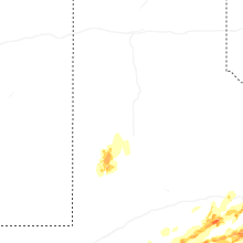


Connect with Interactive Hail Maps