

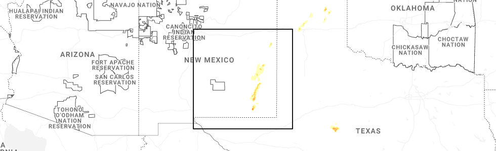
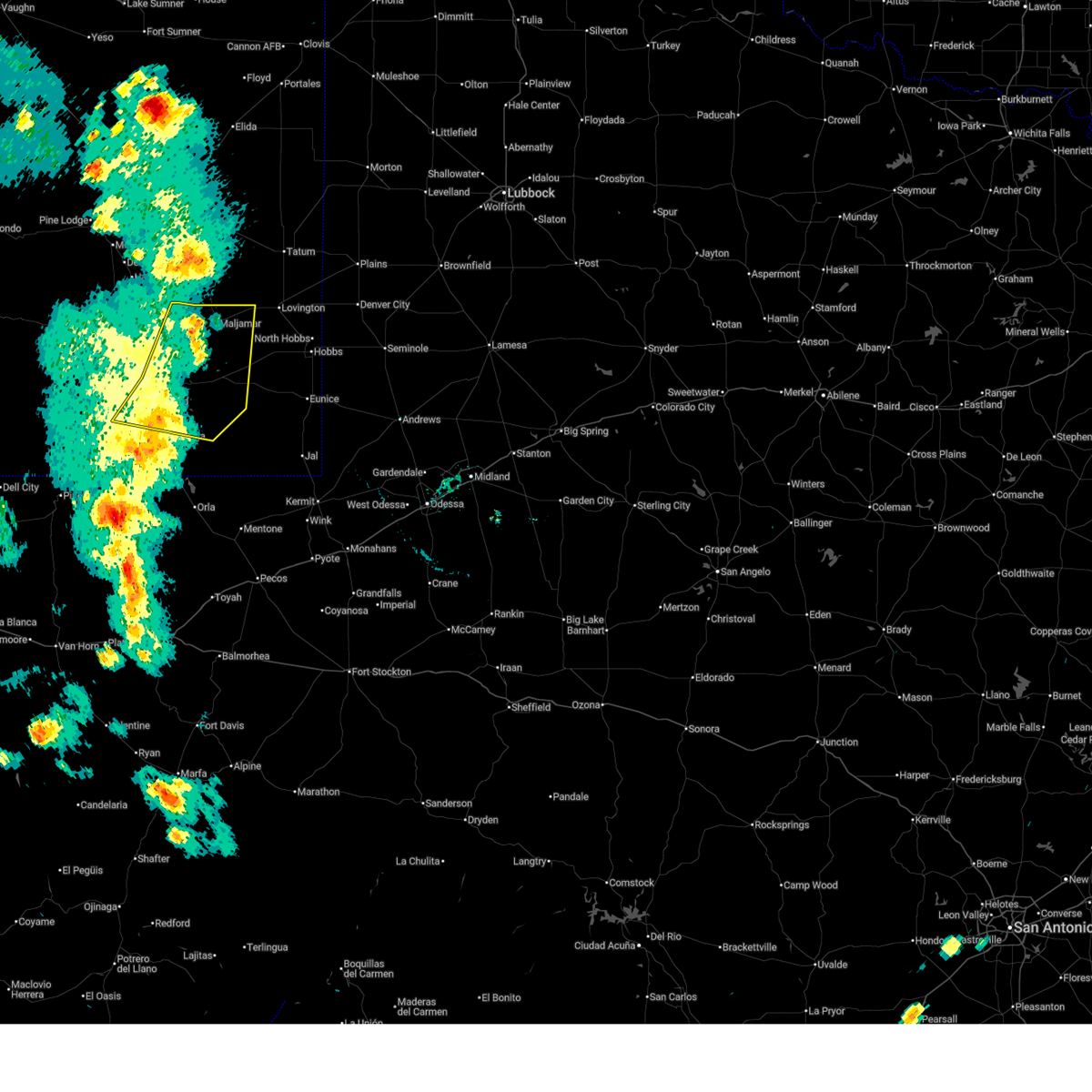
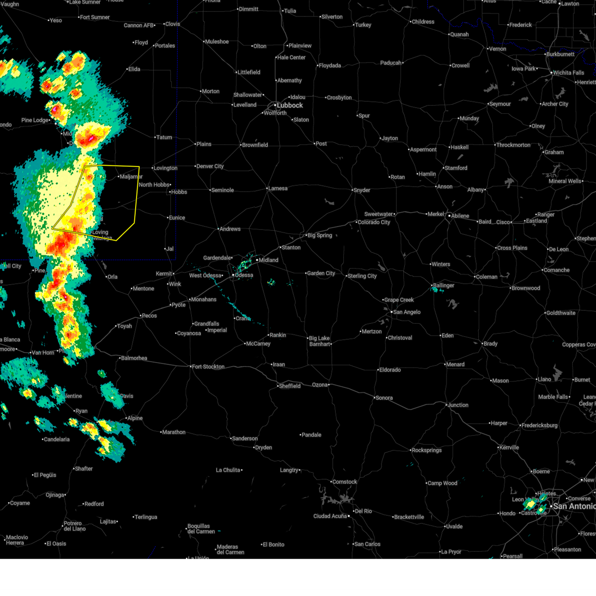
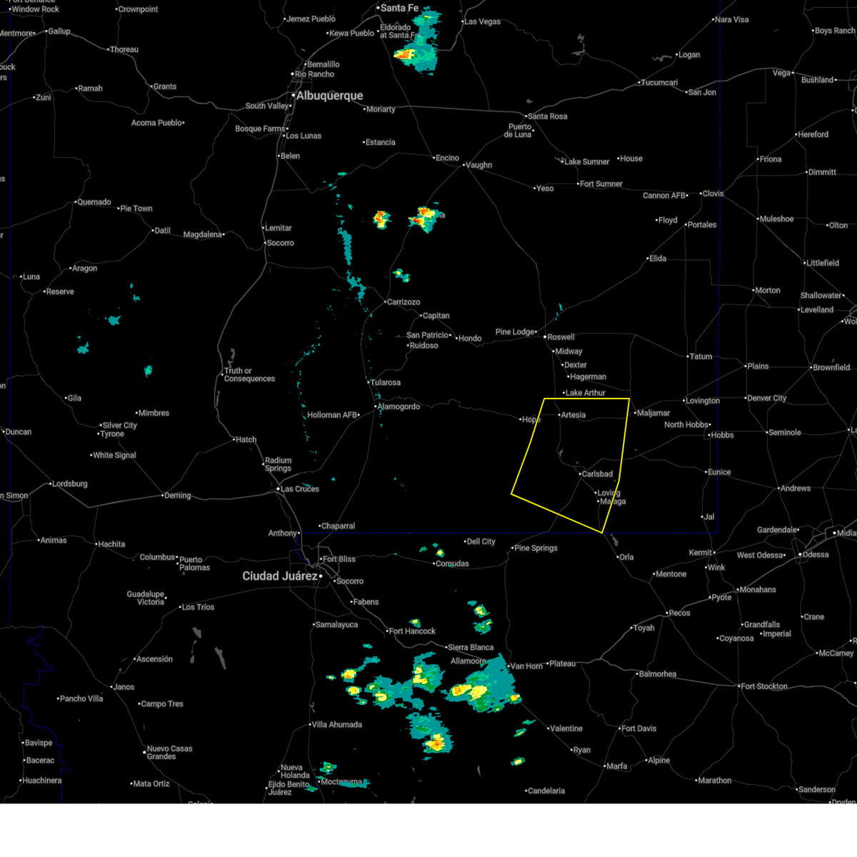
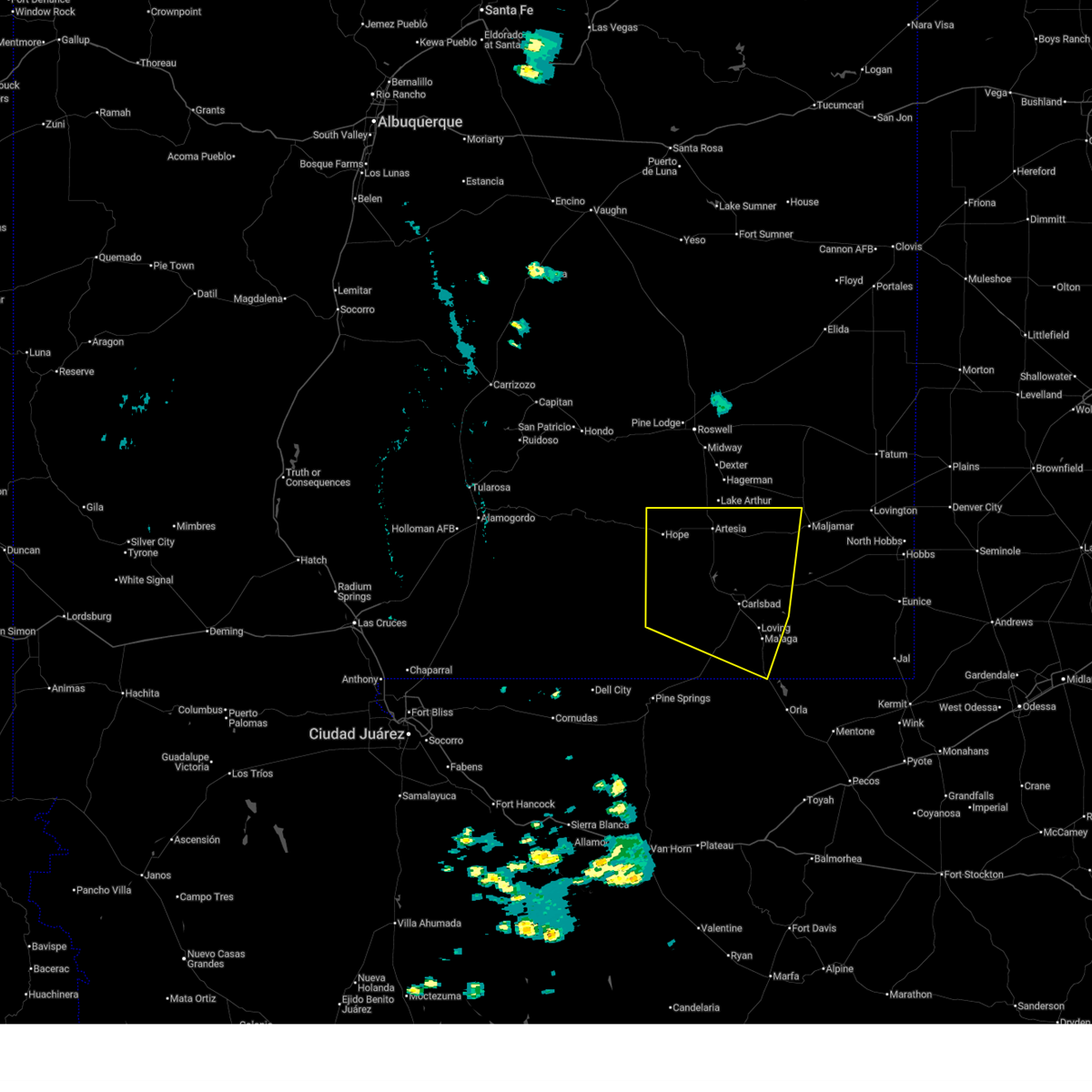
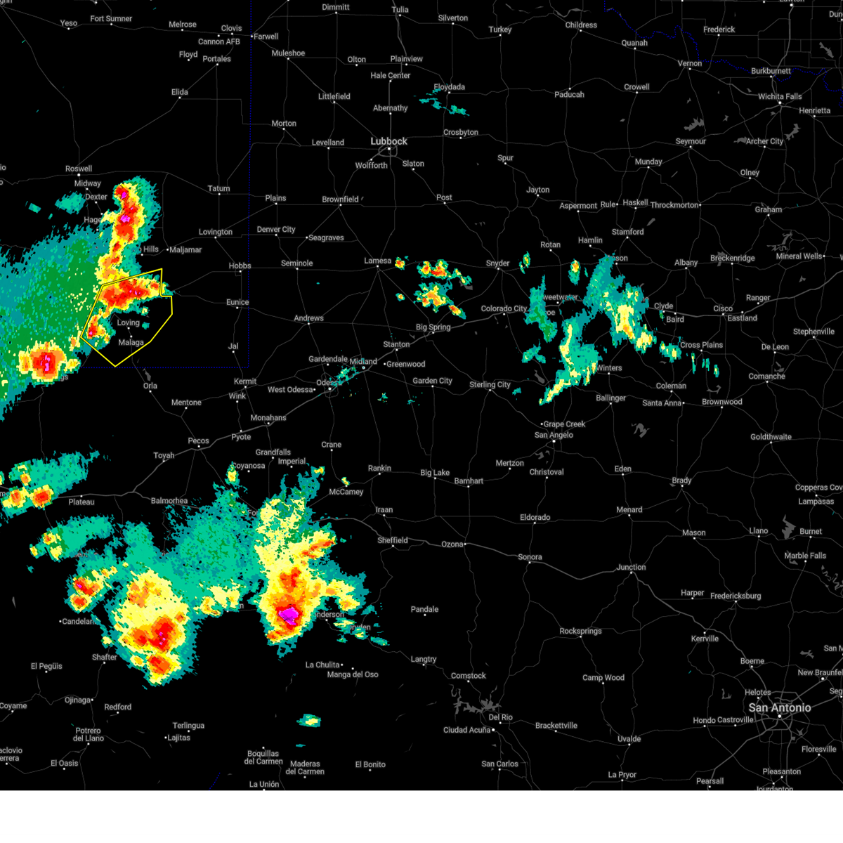
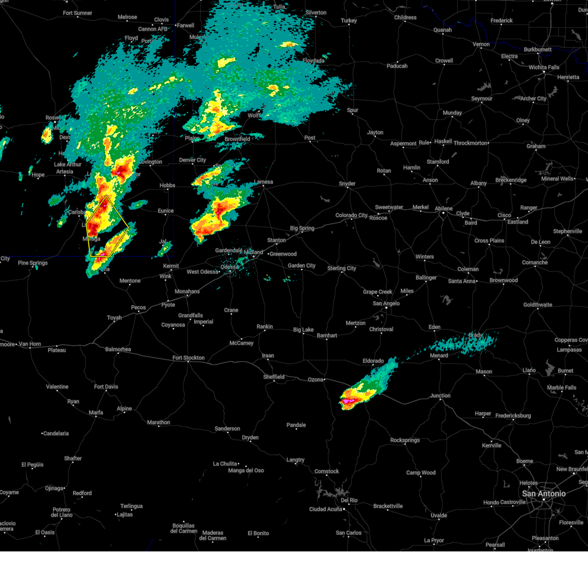
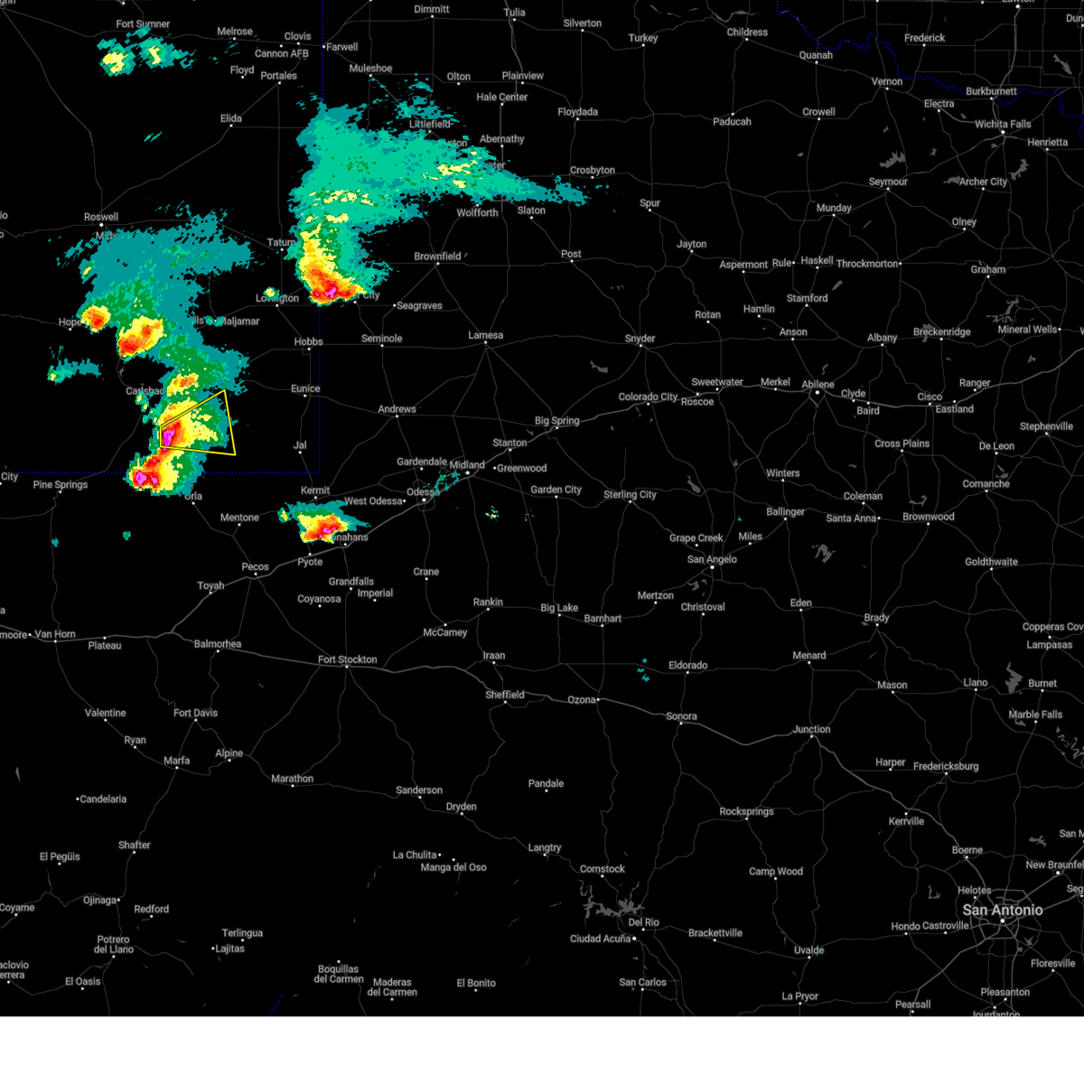
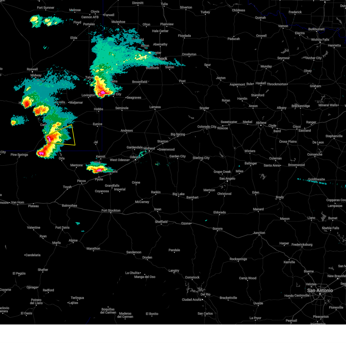
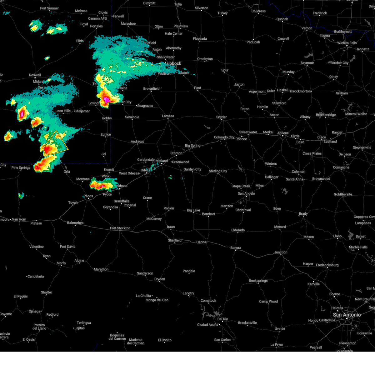
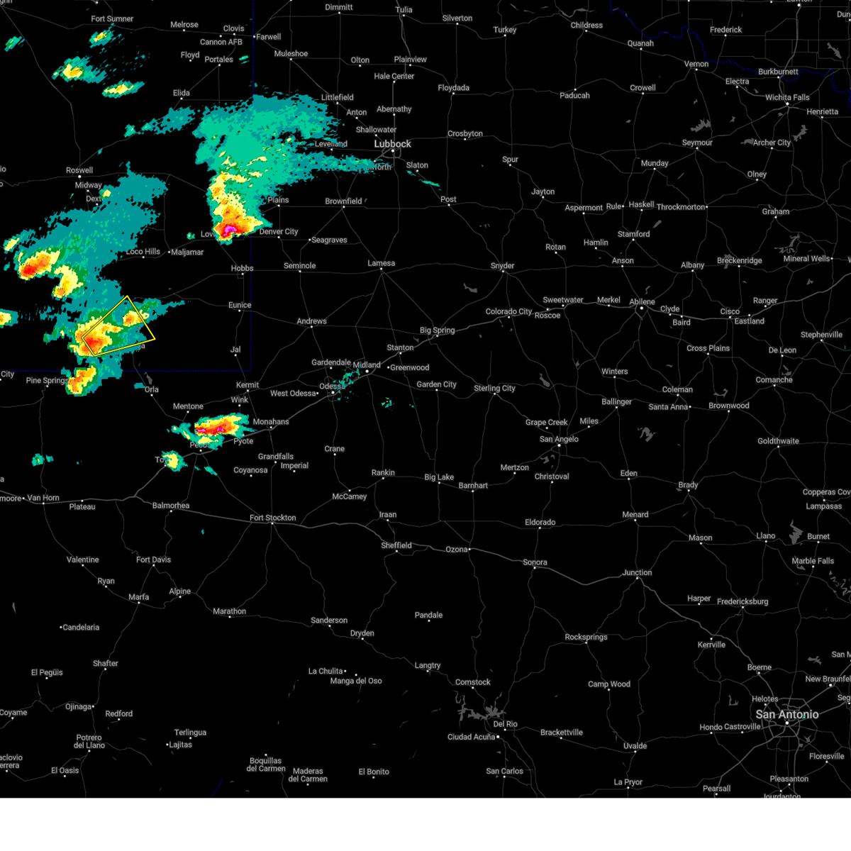
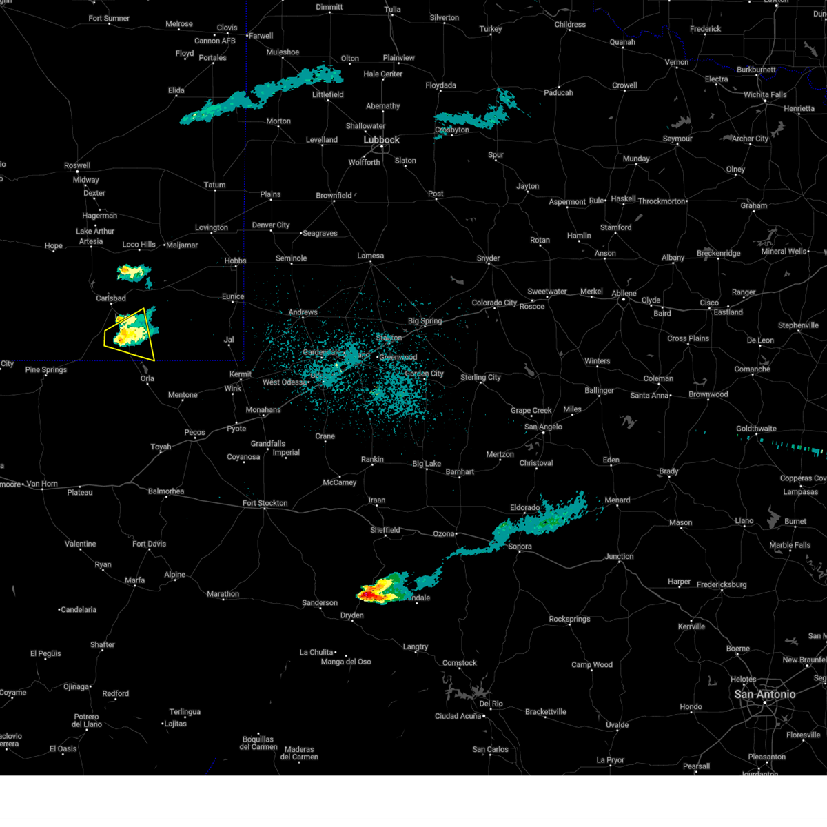
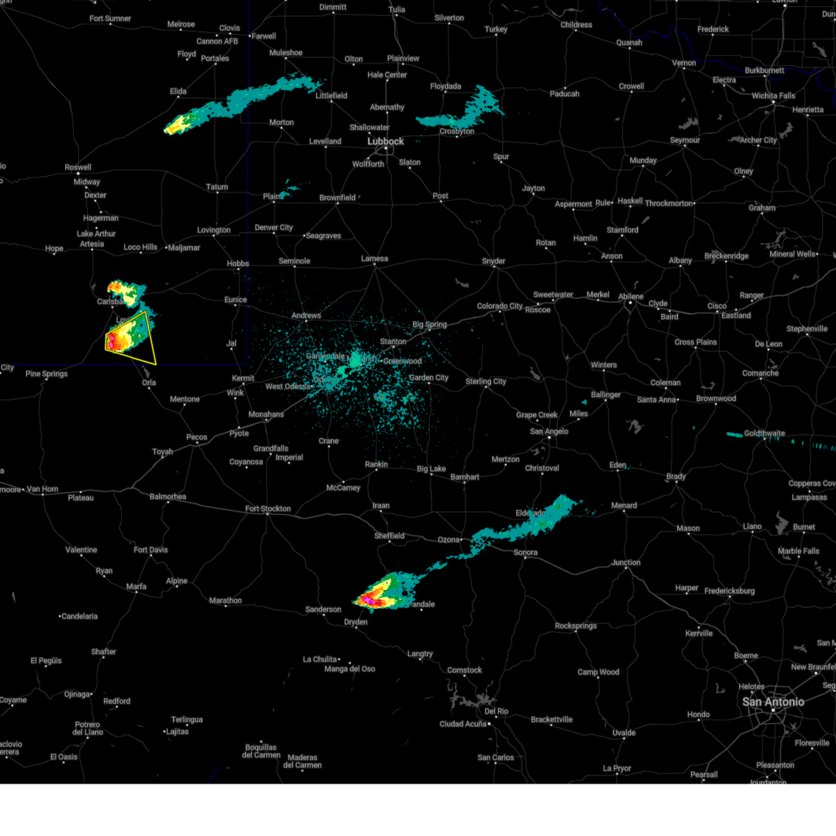
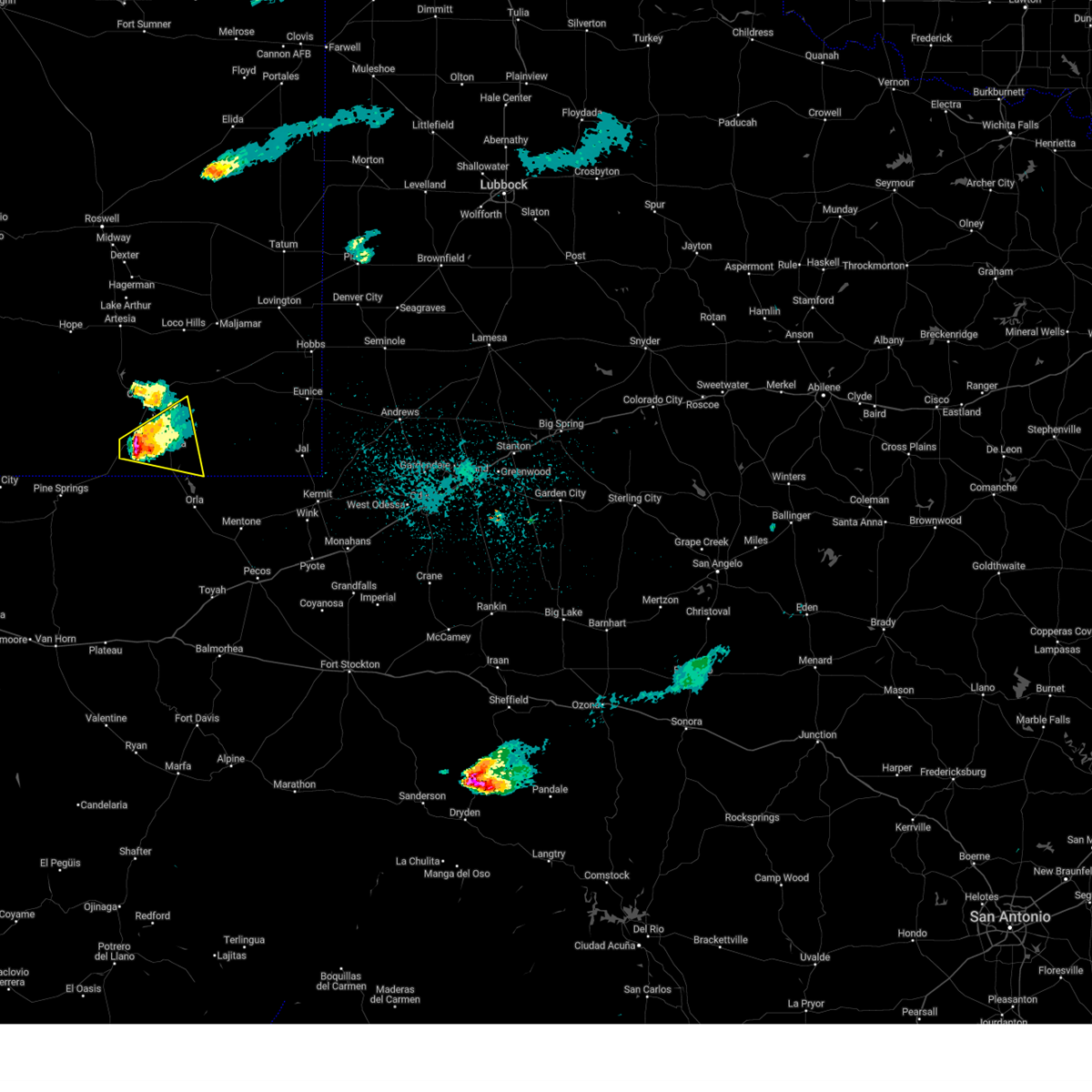
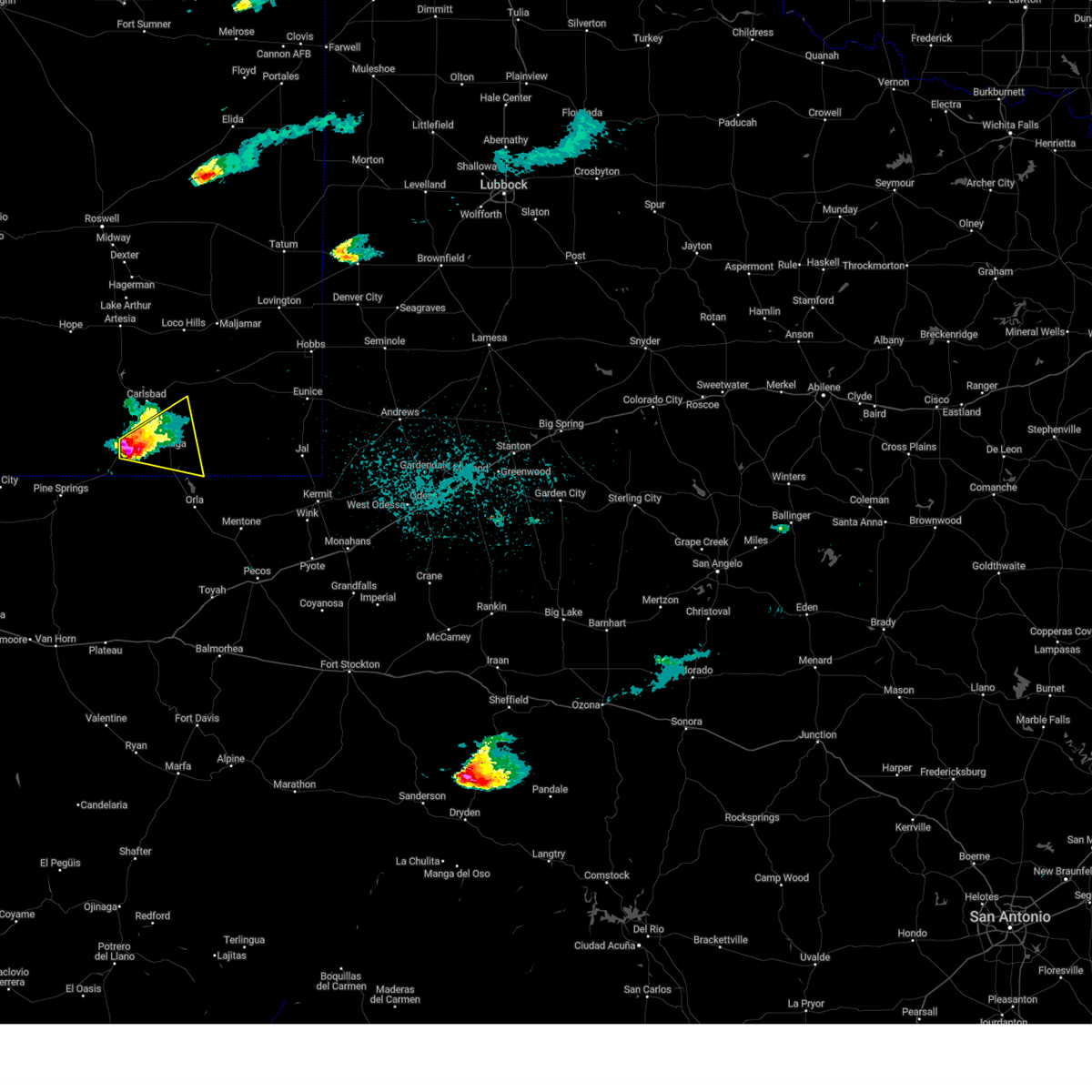
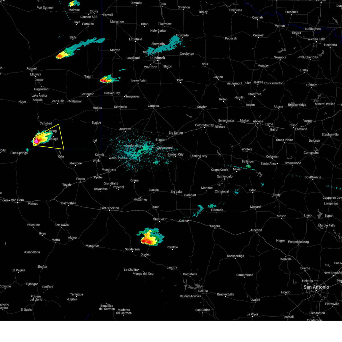
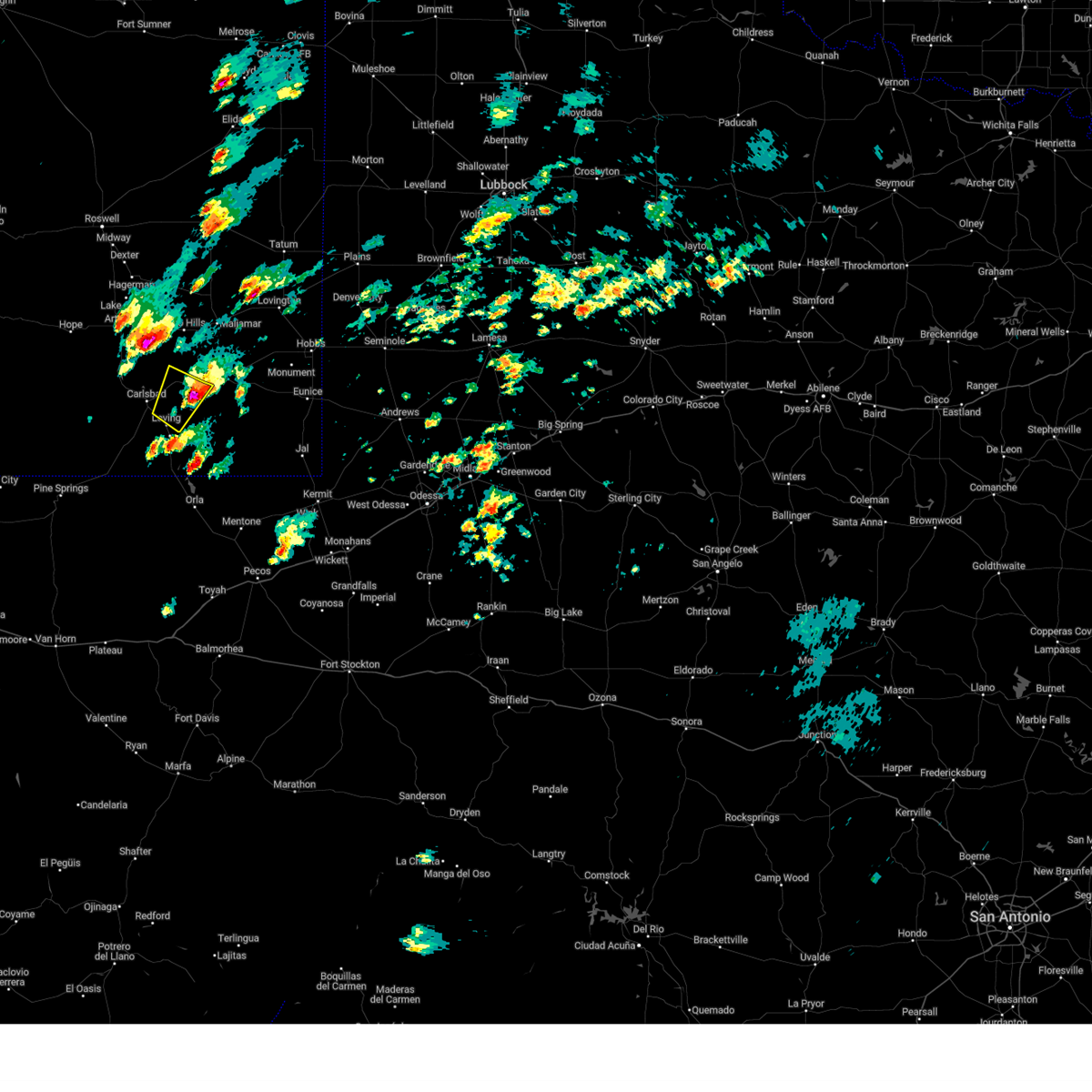
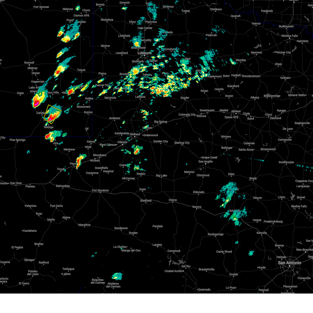
Hail Map for Loving, NM
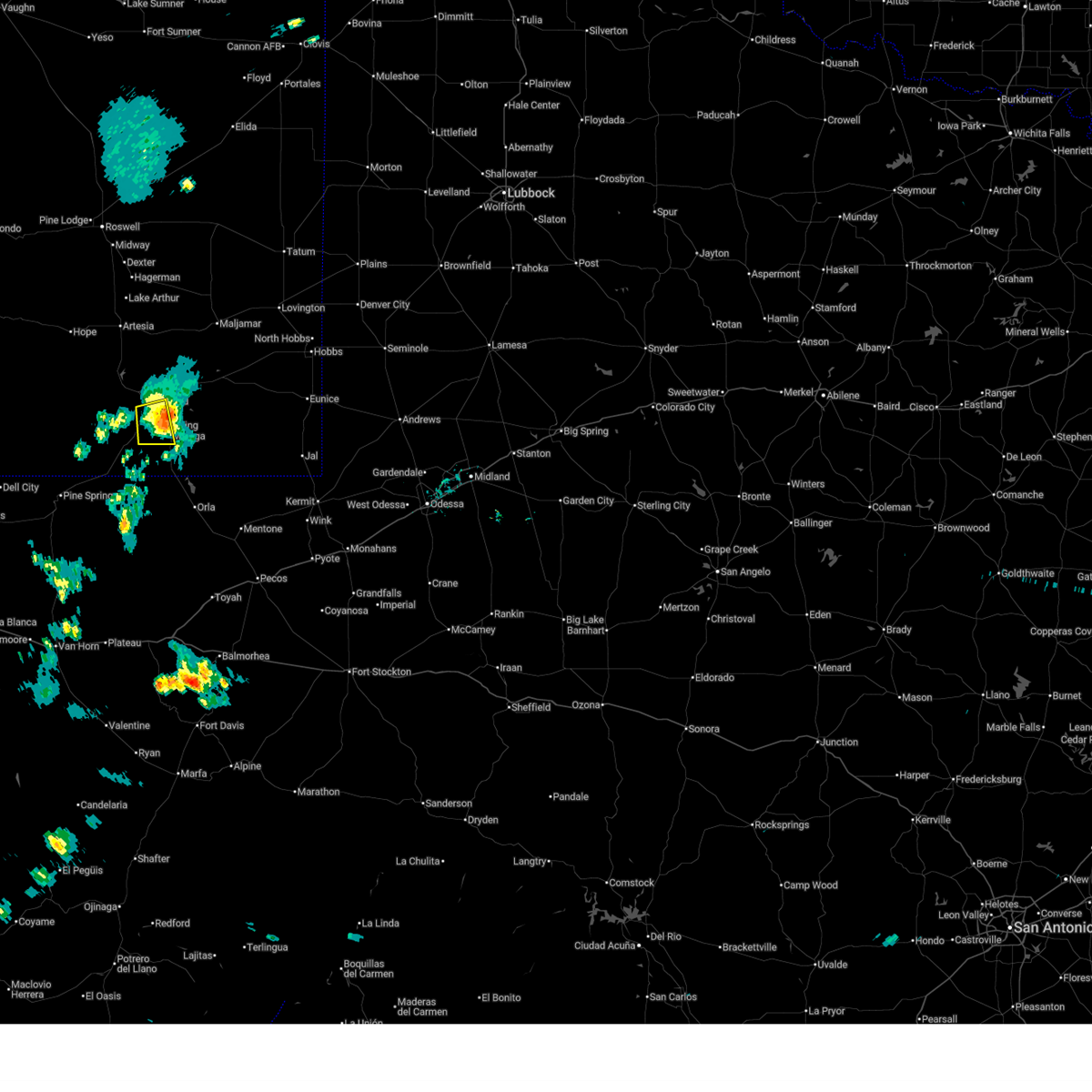
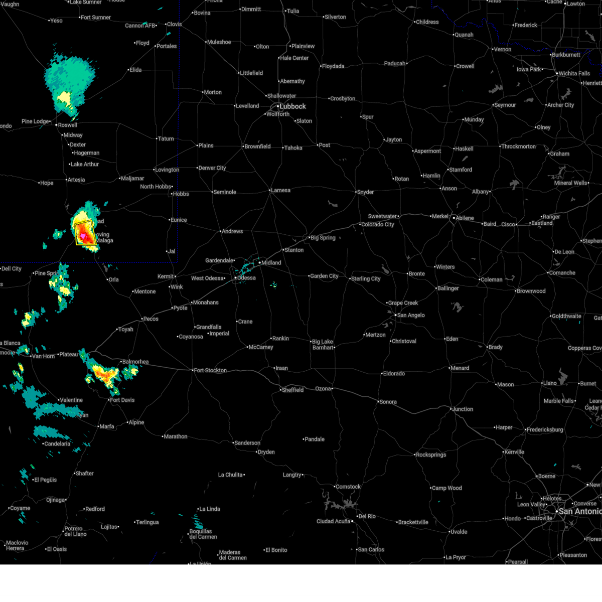
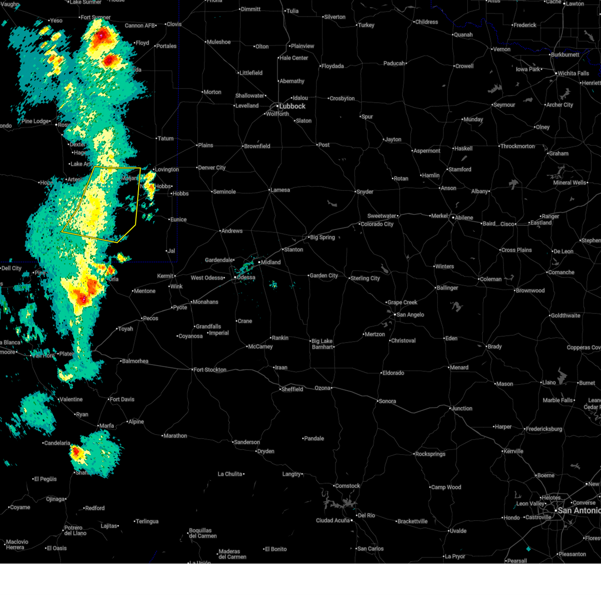
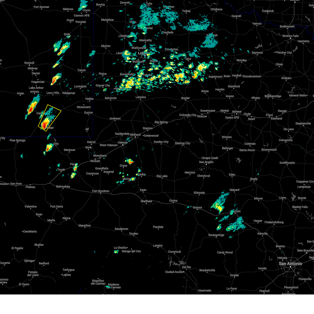
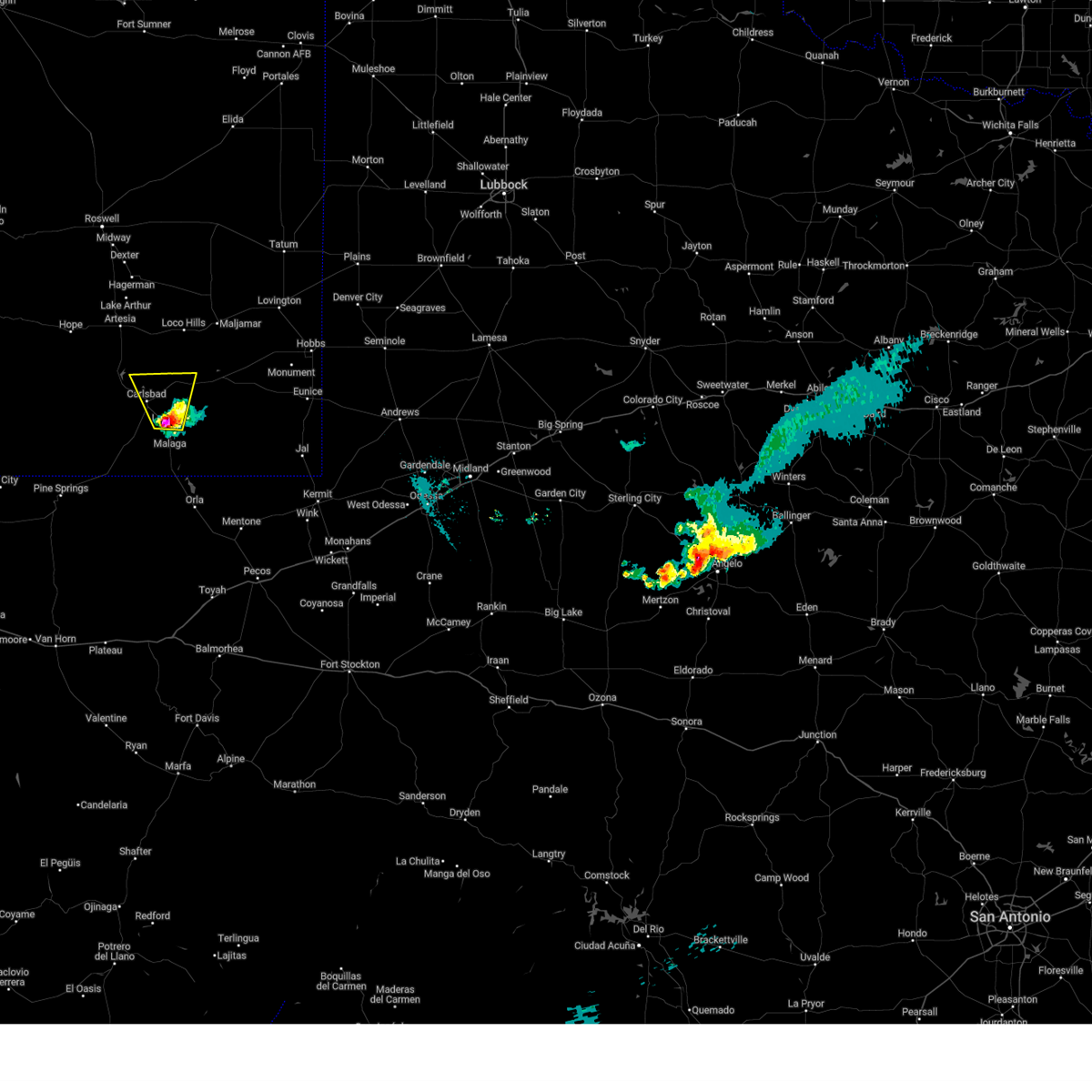
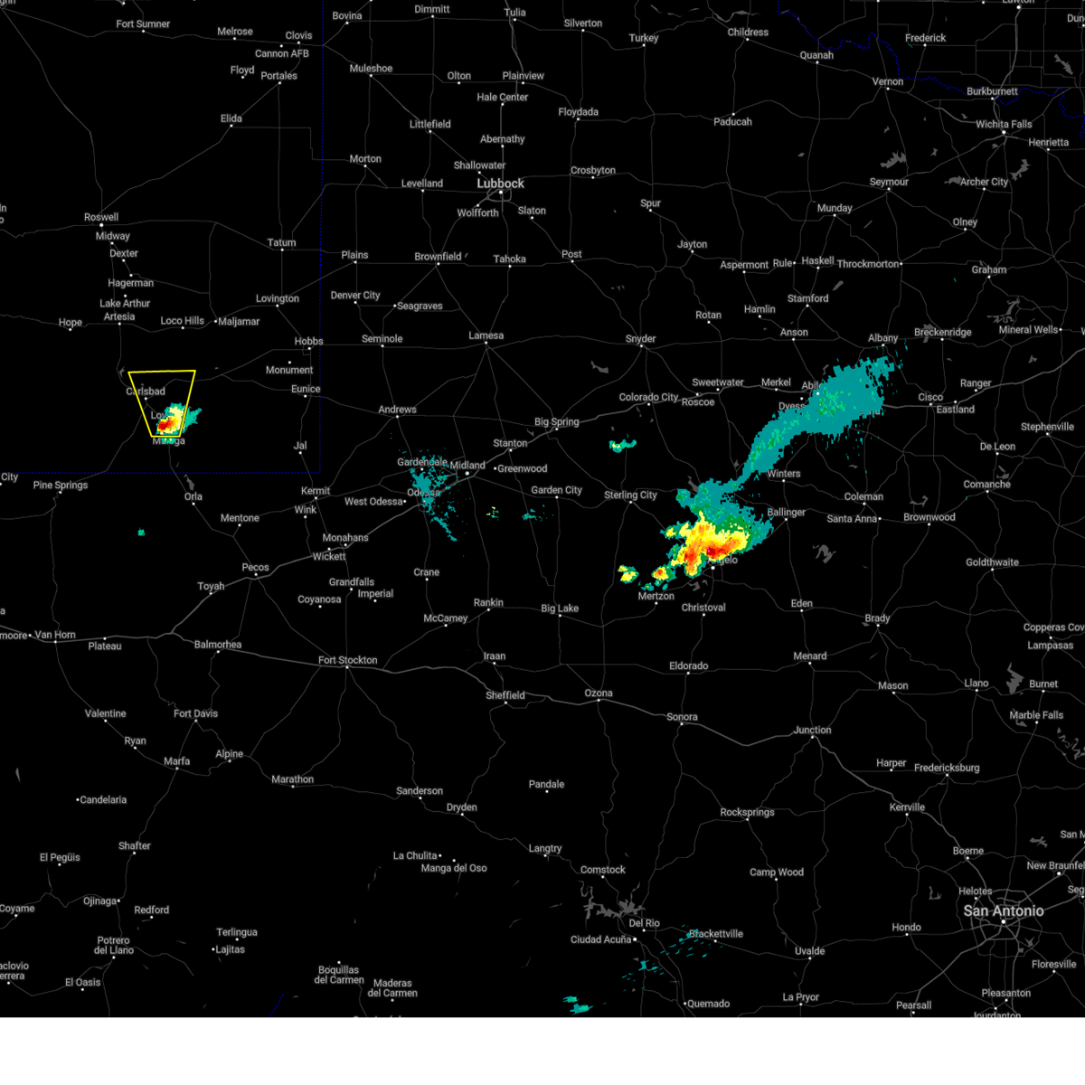
The Loving, NM area has had 8 reports of on-the-ground hail by trained spotters, and has been under severe weather warnings 28 times during the past 12 months. Doppler radar has detected hail at or near Loving, NM on 47 occasions, including 7 occasions during the past year.
| Name: | Loving, NM |
| Where Located: | 80.3 miles SSE of Roswell, NM |
| Map: | Google Map for Loving, NM |
| Population: | 1413 |
| Housing Units: | 541 |
| More Info: | Search Google for Loving, NM |
3
The Top Recent Hail Date for Loving, NM is Friday, November 1, 2024 (2nd out of 47)
Hail and Wind Damage Spotted near Loving, NM
| Date / Time | Report Details |
|---|---|
| 6/21/2025 4:57 PM MDT |
 the severe thunderstorm warning has been cancelled and is no longer in effect the severe thunderstorm warning has been cancelled and is no longer in effect
|
| 6/21/2025 4:28 PM MDT |
 Svrmaf the national weather service in midland has issued a * severe thunderstorm warning for, south central eddy county in southeastern new mexico, * until 515 pm mdt. * at 428 pm mdt, a severe thunderstorm was located near carlsbad, moving east at 10 mph (radar indicated). Hazards include 60 mph wind gusts and penny size hail. expect damage to roofs, siding, and trees Svrmaf the national weather service in midland has issued a * severe thunderstorm warning for, south central eddy county in southeastern new mexico, * until 515 pm mdt. * at 428 pm mdt, a severe thunderstorm was located near carlsbad, moving east at 10 mph (radar indicated). Hazards include 60 mph wind gusts and penny size hail. expect damage to roofs, siding, and trees
|
| 6/15/2025 5:37 PM MDT |
 The storms which prompted the warning have weakened below severe limits, and no longer pose an immediate threat to life or property. therefore, the warning has been allowed to expire. a severe thunderstorm watch remains in effect until 1100 pm mdt for southeastern new mexico. The storms which prompted the warning have weakened below severe limits, and no longer pose an immediate threat to life or property. therefore, the warning has been allowed to expire. a severe thunderstorm watch remains in effect until 1100 pm mdt for southeastern new mexico.
|
| 6/15/2025 4:55 PM MDT |
 At 453 pm mdt, severe thunderstorms were located along a line extending from 7 miles west of maljamar to 12 miles east of carlsbad north to near loving, moving east at 25 mph (radar indicated). Hazards include 70 mph wind gusts and penny size hail. Expect considerable tree damage. damage is likely to mobile homes, roofs, and outbuildings. Locations impacted include, carlsbad, loving, avalon, maljamar, carlsbad north, lea county zip franklin memorial airport, halfway, loco hills, lake avalon, otis, cavern city air terminal, and living desert state park. At 453 pm mdt, severe thunderstorms were located along a line extending from 7 miles west of maljamar to 12 miles east of carlsbad north to near loving, moving east at 25 mph (radar indicated). Hazards include 70 mph wind gusts and penny size hail. Expect considerable tree damage. damage is likely to mobile homes, roofs, and outbuildings. Locations impacted include, carlsbad, loving, avalon, maljamar, carlsbad north, lea county zip franklin memorial airport, halfway, loco hills, lake avalon, otis, cavern city air terminal, and living desert state park.
|
| 6/15/2025 4:28 PM MDT |
 Svrmaf the national weather service in midland has issued a * severe thunderstorm warning for, northeastern eddy county in southeastern new mexico, southwestern lea county in southeastern new mexico, * until 530 pm mdt. * at 427 pm mdt, severe thunderstorms were located along a line extending from 17 miles east of artesia to 6 miles east of avalon to near carlsbad, moving east at 25 mph (radar indicated). Hazards include 70 mph wind gusts and quarter size hail. Hail damage to vehicles is expected. expect considerable tree damage. Wind damage is also likely to mobile homes, roofs, and outbuildings. Svrmaf the national weather service in midland has issued a * severe thunderstorm warning for, northeastern eddy county in southeastern new mexico, southwestern lea county in southeastern new mexico, * until 530 pm mdt. * at 427 pm mdt, severe thunderstorms were located along a line extending from 17 miles east of artesia to 6 miles east of avalon to near carlsbad, moving east at 25 mph (radar indicated). Hazards include 70 mph wind gusts and quarter size hail. Hail damage to vehicles is expected. expect considerable tree damage. Wind damage is also likely to mobile homes, roofs, and outbuildings.
|
| 6/15/2025 3:55 PM MDT |
 At 355 pm mdt, severe thunderstorms were located along a line extending from 8 miles southeast of artesia to near brantley lake state park to near carlsbad caverns national park, moving east at 25 mph (radar indicated). Hazards include 70 mph wind gusts and quarter size hail. Hail damage to vehicles is expected. expect considerable tree damage. wind damage is also likely to mobile homes, roofs, and outbuildings. Locations impacted include, carlsbad, artesia, loving, avalon, seven rivers airport, malaga, brantley lake state park, carlsbad north, whites city, carlsbad caverns national park, lincoln national forest, lea county zip franklin memorial airport, loco hills, artesia municipal airport, otis, cavern city air terminal, living desert state park, dayton, lakewood, and atoka. At 355 pm mdt, severe thunderstorms were located along a line extending from 8 miles southeast of artesia to near brantley lake state park to near carlsbad caverns national park, moving east at 25 mph (radar indicated). Hazards include 70 mph wind gusts and quarter size hail. Hail damage to vehicles is expected. expect considerable tree damage. wind damage is also likely to mobile homes, roofs, and outbuildings. Locations impacted include, carlsbad, artesia, loving, avalon, seven rivers airport, malaga, brantley lake state park, carlsbad north, whites city, carlsbad caverns national park, lincoln national forest, lea county zip franklin memorial airport, loco hills, artesia municipal airport, otis, cavern city air terminal, living desert state park, dayton, lakewood, and atoka.
|
| 6/15/2025 3:25 PM MDT |
 Svrmaf the national weather service in midland has issued a * severe thunderstorm warning for, eddy county in southeastern new mexico, * until 430 pm mdt. * at 324 pm mdt, severe thunderstorms were located along a line extending from near artesia to 8 miles southwest of seven rivers airport to 13 miles north of carlsbad caverns national park, moving east at 30 mph (radar indicated). Hazards include 70 mph wind gusts and quarter size hail. Hail damage to vehicles is expected. expect considerable tree damage. Wind damage is also likely to mobile homes, roofs, and outbuildings. Svrmaf the national weather service in midland has issued a * severe thunderstorm warning for, eddy county in southeastern new mexico, * until 430 pm mdt. * at 324 pm mdt, severe thunderstorms were located along a line extending from near artesia to 8 miles southwest of seven rivers airport to 13 miles north of carlsbad caverns national park, moving east at 30 mph (radar indicated). Hazards include 70 mph wind gusts and quarter size hail. Hail damage to vehicles is expected. expect considerable tree damage. Wind damage is also likely to mobile homes, roofs, and outbuildings.
|
| 6/10/2025 3:41 PM MDT | At 341 pm mdt, severe thunderstorms were located along a line extending from 16 miles east of carlsbad north to near carlsbad to near whites city, moving southeast at 15 mph (radar indicated). Hazards include 60 mph wind gusts and quarter size hail. Hail damage to vehicles is expected. expect wind damage to roofs, siding, and trees. Locations impacted include, carlsbad, loving, avalon, carlsbad north, malaga, whites city, carlsbad caverns national park, otis, cavern city air terminal, living desert state park, and lake avalon. |
| 6/10/2025 3:18 PM MDT |
 Svrmaf the national weather service in midland has issued a * severe thunderstorm warning for, southeastern eddy county in southeastern new mexico, * until 415 pm mdt. * at 317 pm mdt, severe thunderstorms were located along a line extending from 12 miles east of avalon to near carlsbad north to near whites city, moving southeast at 15 mph (radar indicated). Hazards include 60 mph wind gusts and half dollar size hail. Hail damage to vehicles is expected. Expect wind damage to roofs, siding, and trees. Svrmaf the national weather service in midland has issued a * severe thunderstorm warning for, southeastern eddy county in southeastern new mexico, * until 415 pm mdt. * at 317 pm mdt, severe thunderstorms were located along a line extending from 12 miles east of avalon to near carlsbad north to near whites city, moving southeast at 15 mph (radar indicated). Hazards include 60 mph wind gusts and half dollar size hail. Hail damage to vehicles is expected. Expect wind damage to roofs, siding, and trees.
|
| 6/9/2025 10:44 PM MDT |
 Svrmaf the national weather service in midland has issued a * severe thunderstorm warning for, southeastern eddy county in southeastern new mexico, southwestern lea county in southeastern new mexico, * until 1145 pm mdt. * at 1044 pm mdt, severe thunderstorms were located along a line extending from 21 miles northeast of loving to near whites city, moving east at 20 mph (radar indicated). Hazards include ping pong ball size hail and 60 mph wind gusts. People and animals outdoors will be injured. expect hail damage to roofs, siding, windows, and vehicles. Expect wind damage to roofs, siding, and trees. Svrmaf the national weather service in midland has issued a * severe thunderstorm warning for, southeastern eddy county in southeastern new mexico, southwestern lea county in southeastern new mexico, * until 1145 pm mdt. * at 1044 pm mdt, severe thunderstorms were located along a line extending from 21 miles northeast of loving to near whites city, moving east at 20 mph (radar indicated). Hazards include ping pong ball size hail and 60 mph wind gusts. People and animals outdoors will be injured. expect hail damage to roofs, siding, windows, and vehicles. Expect wind damage to roofs, siding, and trees.
|
| 5/27/2025 8:51 PM MDT |
 At 951 pm cdt/851 pm mdt/, severe thunderstorms were located along a line extending from 13 miles west of maljamar to 13 miles northeast of loving to 15 miles south of whites city, moving east at 15 mph (radar indicated). Hazards include 60 mph wind gusts and quarter size hail. Hail damage to vehicles is expected. expect wind damage to roofs, siding, and trees. Locations impacted include, carlsbad, loving, malaga, otis, lea county zip franklin memorial airport, and loco hills. At 951 pm cdt/851 pm mdt/, severe thunderstorms were located along a line extending from 13 miles west of maljamar to 13 miles northeast of loving to 15 miles south of whites city, moving east at 15 mph (radar indicated). Hazards include 60 mph wind gusts and quarter size hail. Hail damage to vehicles is expected. expect wind damage to roofs, siding, and trees. Locations impacted include, carlsbad, loving, malaga, otis, lea county zip franklin memorial airport, and loco hills.
|
| 5/27/2025 8:26 PM MDT |
 Svrmaf the national weather service in midland has issued a * severe thunderstorm warning for, eastern eddy county in southeastern new mexico, northeastern culberson county in southwestern texas, * until 1015 pm cdt/915 pm mdt/. * at 926 pm cdt/826 pm mdt/, severe thunderstorms were located along a line extending from 18 miles west of maljamar to 8 miles east of carlsbad north to 13 miles south of whites city, moving east at 15 mph (the carlsbad airport reported a 59 mph wind gust recently). Hazards include 60 mph wind gusts and quarter size hail. Hail damage to vehicles is expected. Expect wind damage to roofs, siding, and trees. Svrmaf the national weather service in midland has issued a * severe thunderstorm warning for, eastern eddy county in southeastern new mexico, northeastern culberson county in southwestern texas, * until 1015 pm cdt/915 pm mdt/. * at 926 pm cdt/826 pm mdt/, severe thunderstorms were located along a line extending from 18 miles west of maljamar to 8 miles east of carlsbad north to 13 miles south of whites city, moving east at 15 mph (the carlsbad airport reported a 59 mph wind gust recently). Hazards include 60 mph wind gusts and quarter size hail. Hail damage to vehicles is expected. Expect wind damage to roofs, siding, and trees.
|
| 5/5/2025 8:52 PM MDT |
 Svrmaf the national weather service in midland has issued a * severe thunderstorm warning for, southeastern eddy county in southeastern new mexico, southwestern lea county in southeastern new mexico, * until 945 pm mdt. * at 852 pm mdt, a severe thunderstorm was located near red bluff reservoir, or 29 miles northwest of mentone, moving north at 30 mph (radar indicated). Hazards include 60 mph wind gusts and half dollar size hail. Hail damage to vehicles is expected. Expect wind damage to roofs, siding, and trees. Svrmaf the national weather service in midland has issued a * severe thunderstorm warning for, southeastern eddy county in southeastern new mexico, southwestern lea county in southeastern new mexico, * until 945 pm mdt. * at 852 pm mdt, a severe thunderstorm was located near red bluff reservoir, or 29 miles northwest of mentone, moving north at 30 mph (radar indicated). Hazards include 60 mph wind gusts and half dollar size hail. Hail damage to vehicles is expected. Expect wind damage to roofs, siding, and trees.
|
| 5/4/2025 6:10 PM MDT | Ping Pong Ball sized hail reported 20.6 miles WNW of Loving, NM, report from mping: ping pong ball (1.50 in). time estimated by radar. |
| 5/4/2025 5:25 PM MDT |
 At 525 pm mdt, a severe thunderstorm was located near malaga, or 18 miles southeast of carlsbad, moving east at 30 mph (radar indicated). Hazards include golf ball size hail and 60 mph wind gusts. People and animals outdoors will be injured. expect hail damage to roofs, siding, windows, and vehicles. expect wind damage to roofs, siding, and trees. Locations impacted include, malaga. At 525 pm mdt, a severe thunderstorm was located near malaga, or 18 miles southeast of carlsbad, moving east at 30 mph (radar indicated). Hazards include golf ball size hail and 60 mph wind gusts. People and animals outdoors will be injured. expect hail damage to roofs, siding, windows, and vehicles. expect wind damage to roofs, siding, and trees. Locations impacted include, malaga.
|
| 5/4/2025 5:13 PM MDT |
 Svrmaf the national weather service in midland has issued a * severe thunderstorm warning for, southeastern eddy county in southeastern new mexico, southwestern lea county in southeastern new mexico, * until 600 pm mdt. * at 513 pm mdt, a severe thunderstorm was located over malaga, or 14 miles southeast of carlsbad, moving east at 30 mph (radar indicated). Hazards include 60 mph wind gusts and half dollar size hail. Hail damage to vehicles is expected. Expect wind damage to roofs, siding, and trees. Svrmaf the national weather service in midland has issued a * severe thunderstorm warning for, southeastern eddy county in southeastern new mexico, southwestern lea county in southeastern new mexico, * until 600 pm mdt. * at 513 pm mdt, a severe thunderstorm was located over malaga, or 14 miles southeast of carlsbad, moving east at 30 mph (radar indicated). Hazards include 60 mph wind gusts and half dollar size hail. Hail damage to vehicles is expected. Expect wind damage to roofs, siding, and trees.
|
| 5/4/2025 5:05 PM MDT |
 At 505 pm mdt, a severe thunderstorm was located 7 miles southwest of loving, or 12 miles south of carlsbad, moving east at 25 mph (radar indicated). Hazards include 60 mph wind gusts and half dollar size hail. Hail damage to vehicles is expected. expect wind damage to roofs, siding, and trees. Locations impacted include, loving and malaga. At 505 pm mdt, a severe thunderstorm was located 7 miles southwest of loving, or 12 miles south of carlsbad, moving east at 25 mph (radar indicated). Hazards include 60 mph wind gusts and half dollar size hail. Hail damage to vehicles is expected. expect wind damage to roofs, siding, and trees. Locations impacted include, loving and malaga.
|
| 5/4/2025 4:52 PM MDT |
 At 452 pm mdt, a severe thunderstorm was located near whites city, or 11 miles south of carlsbad, moving northeast at 25 mph (radar indicated). Hazards include 60 mph wind gusts and half dollar size hail. Hail damage to vehicles is expected. expect wind damage to roofs, siding, and trees. Locations impacted include, carlsbad, loving, malaga, otis, and cavern city air terminal. At 452 pm mdt, a severe thunderstorm was located near whites city, or 11 miles south of carlsbad, moving northeast at 25 mph (radar indicated). Hazards include 60 mph wind gusts and half dollar size hail. Hail damage to vehicles is expected. expect wind damage to roofs, siding, and trees. Locations impacted include, carlsbad, loving, malaga, otis, and cavern city air terminal.
|
| 5/4/2025 4:37 PM MDT |
 Svrmaf the national weather service in midland has issued a * severe thunderstorm warning for, southeastern eddy county in southeastern new mexico, * until 515 pm mdt. * at 437 pm mdt, a severe thunderstorm was located near whites city, or 14 miles southwest of carlsbad, moving northeast at 25 mph (radar indicated). Hazards include 60 mph wind gusts and half dollar size hail. Hail damage to vehicles is expected. Expect wind damage to roofs, siding, and trees. Svrmaf the national weather service in midland has issued a * severe thunderstorm warning for, southeastern eddy county in southeastern new mexico, * until 515 pm mdt. * at 437 pm mdt, a severe thunderstorm was located near whites city, or 14 miles southwest of carlsbad, moving northeast at 25 mph (radar indicated). Hazards include 60 mph wind gusts and half dollar size hail. Hail damage to vehicles is expected. Expect wind damage to roofs, siding, and trees.
|
| 4/26/2025 10:31 PM MDT |
 the severe thunderstorm warning has been cancelled and is no longer in effect the severe thunderstorm warning has been cancelled and is no longer in effect
|
| 4/26/2025 10:16 PM MDT |
 At 1015 pm mdt, a severe thunderstorm was located 8 miles southwest of malaga, or 17 miles south of carlsbad, moving east at 20 mph (radar indicated). Hazards include 60 mph wind gusts and quarter size hail. Hail damage to vehicles is expected. expect wind damage to roofs, siding, and trees. Locations impacted include, loving and malaga. At 1015 pm mdt, a severe thunderstorm was located 8 miles southwest of malaga, or 17 miles south of carlsbad, moving east at 20 mph (radar indicated). Hazards include 60 mph wind gusts and quarter size hail. Hail damage to vehicles is expected. expect wind damage to roofs, siding, and trees. Locations impacted include, loving and malaga.
|
| 4/26/2025 10:03 PM MDT |
 At 1002 pm mdt, a severe thunderstorm was located near whites city, or 15 miles south of carlsbad, moving east at 20 mph (radar indicated). Hazards include golf ball size hail and 60 mph wind gusts. People and animals outdoors will be injured. expect hail damage to roofs, siding, windows, and vehicles. expect wind damage to roofs, siding, and trees. Locations impacted include, loving, malaga, whites city, and carlsbad caverns national park. At 1002 pm mdt, a severe thunderstorm was located near whites city, or 15 miles south of carlsbad, moving east at 20 mph (radar indicated). Hazards include golf ball size hail and 60 mph wind gusts. People and animals outdoors will be injured. expect hail damage to roofs, siding, windows, and vehicles. expect wind damage to roofs, siding, and trees. Locations impacted include, loving, malaga, whites city, and carlsbad caverns national park.
|
| 4/26/2025 9:53 PM MDT |
 At 953 pm mdt, a severe thunderstorm was located over whites city, or 17 miles south of carlsbad, moving east at 20 mph (radar indicated). Hazards include tennis ball size hail and 70 mph wind gusts. People and animals outdoors will be injured. expect hail damage to roofs, siding, windows, and vehicles. expect considerable tree damage. wind damage is also likely to mobile homes, roofs, and outbuildings. Locations impacted include, loving, malaga, whites city, and carlsbad caverns national park. At 953 pm mdt, a severe thunderstorm was located over whites city, or 17 miles south of carlsbad, moving east at 20 mph (radar indicated). Hazards include tennis ball size hail and 70 mph wind gusts. People and animals outdoors will be injured. expect hail damage to roofs, siding, windows, and vehicles. expect considerable tree damage. wind damage is also likely to mobile homes, roofs, and outbuildings. Locations impacted include, loving, malaga, whites city, and carlsbad caverns national park.
|
| 4/26/2025 9:42 PM MDT |
 Svrmaf the national weather service in midland has issued a * severe thunderstorm warning for, southeastern eddy county in southeastern new mexico, * until 1045 pm mdt. * at 942 pm mdt, a severe thunderstorm was located over whites city, or 19 miles southwest of carlsbad, moving east at 20 mph (radar indicated). Hazards include ping pong ball size hail and 60 mph wind gusts. People and animals outdoors will be injured. expect hail damage to roofs, siding, windows, and vehicles. Expect wind damage to roofs, siding, and trees. Svrmaf the national weather service in midland has issued a * severe thunderstorm warning for, southeastern eddy county in southeastern new mexico, * until 1045 pm mdt. * at 942 pm mdt, a severe thunderstorm was located over whites city, or 19 miles southwest of carlsbad, moving east at 20 mph (radar indicated). Hazards include ping pong ball size hail and 60 mph wind gusts. People and animals outdoors will be injured. expect hail damage to roofs, siding, windows, and vehicles. Expect wind damage to roofs, siding, and trees.
|
| 11/2/2024 1:33 PM MDT |
 the severe thunderstorm warning has been cancelled and is no longer in effect the severe thunderstorm warning has been cancelled and is no longer in effect
|
| 11/2/2024 1:13 PM MDT |
 At 112 pm mdt, a severe thunderstorm was located near loving, or 12 miles east of carlsbad, moving northeast at 25 mph (public). Hazards include golf ball size hail and 60 mph wind gusts. People and animals outdoors will be injured. expect hail damage to roofs, siding, windows, and vehicles. expect wind damage to roofs, siding, and trees. Locations impacted include, loving and otis. At 112 pm mdt, a severe thunderstorm was located near loving, or 12 miles east of carlsbad, moving northeast at 25 mph (public). Hazards include golf ball size hail and 60 mph wind gusts. People and animals outdoors will be injured. expect hail damage to roofs, siding, windows, and vehicles. expect wind damage to roofs, siding, and trees. Locations impacted include, loving and otis.
|
| 11/2/2024 12:42 PM MDT |
 Svrmaf the national weather service in midland has issued a * severe thunderstorm warning for, southeastern eddy county in southeastern new mexico, * until 145 pm mdt. * at 1242 pm mdt, a severe thunderstorm was located near loving, or 10 miles south of carlsbad, moving northeast at 25 mph (radar indicated). Hazards include 60 mph wind gusts and quarter size hail. Hail damage to vehicles is expected. Expect wind damage to roofs, siding, and trees. Svrmaf the national weather service in midland has issued a * severe thunderstorm warning for, southeastern eddy county in southeastern new mexico, * until 145 pm mdt. * at 1242 pm mdt, a severe thunderstorm was located near loving, or 10 miles south of carlsbad, moving northeast at 25 mph (radar indicated). Hazards include 60 mph wind gusts and quarter size hail. Hail damage to vehicles is expected. Expect wind damage to roofs, siding, and trees.
|
| 11/1/2024 7:59 PM MDT |
 At 759 pm mdt, a severe thunderstorm was located over loving, or 9 miles southeast of carlsbad, moving north at 15 mph (radar indicated). Hazards include two inch hail and 60 mph wind gusts. People and animals outdoors will be injured. expect hail damage to roofs, siding, windows, and vehicles. expect wind damage to roofs, siding, and trees. Locations impacted include, carlsbad, loving, avalon, carlsbad north, lake avalon, otis, and living desert state park. At 759 pm mdt, a severe thunderstorm was located over loving, or 9 miles southeast of carlsbad, moving north at 15 mph (radar indicated). Hazards include two inch hail and 60 mph wind gusts. People and animals outdoors will be injured. expect hail damage to roofs, siding, windows, and vehicles. expect wind damage to roofs, siding, and trees. Locations impacted include, carlsbad, loving, avalon, carlsbad north, lake avalon, otis, and living desert state park.
|
| 11/1/2024 7:51 PM MDT | Golf Ball sized hail reported 0.3 miles S of Loving, NM, spotter relayed photo from facebook of ping pong ball to golf ball size hail in loving. |
| 11/1/2024 7:51 PM MDT |
 Svrmaf the national weather service in midland has issued a * severe thunderstorm warning for, southeastern eddy county in southeastern new mexico, * until 845 pm mdt. * at 751 pm mdt, a severe thunderstorm was located over loving, or 10 miles southeast of carlsbad, moving north at 15 mph (radar indicated). Hazards include 60 mph wind gusts and quarter size hail. Hail damage to vehicles is expected. Expect wind damage to roofs, siding, and trees. Svrmaf the national weather service in midland has issued a * severe thunderstorm warning for, southeastern eddy county in southeastern new mexico, * until 845 pm mdt. * at 751 pm mdt, a severe thunderstorm was located over loving, or 10 miles southeast of carlsbad, moving north at 15 mph (radar indicated). Hazards include 60 mph wind gusts and quarter size hail. Hail damage to vehicles is expected. Expect wind damage to roofs, siding, and trees.
|
| 6/10/2024 3:35 PM MDT |
 At 334 pm mdt, a severe thunderstorm was located 7 miles north of whites city, or 12 miles southwest of carlsbad, moving southeast at 30 mph (radar indicated). Hazards include golf ball size hail and 70 mph wind gusts. People and animals outdoors will be injured. expect hail damage to roofs, siding, windows, and vehicles. expect considerable tree damage. wind damage is also likely to mobile homes, roofs, and outbuildings. Locations impacted include, carlsbad, loving, malaga, otis, and cavern city air terminal. At 334 pm mdt, a severe thunderstorm was located 7 miles north of whites city, or 12 miles southwest of carlsbad, moving southeast at 30 mph (radar indicated). Hazards include golf ball size hail and 70 mph wind gusts. People and animals outdoors will be injured. expect hail damage to roofs, siding, windows, and vehicles. expect considerable tree damage. wind damage is also likely to mobile homes, roofs, and outbuildings. Locations impacted include, carlsbad, loving, malaga, otis, and cavern city air terminal.
|
| 6/10/2024 3:20 PM MDT |
 At 320 pm mdt, a severe thunderstorm was located 12 miles northwest of whites city, or 13 miles west of carlsbad, moving southeast at 40 mph (radar indicated). Hazards include ping pong ball size hail and 60 mph wind gusts. People and animals outdoors will be injured. expect hail damage to roofs, siding, windows, and vehicles. expect wind damage to roofs, siding, and trees. Locations impacted include, carlsbad, loving, carlsbad north, malaga, otis, cavern city air terminal, and living desert state park. At 320 pm mdt, a severe thunderstorm was located 12 miles northwest of whites city, or 13 miles west of carlsbad, moving southeast at 40 mph (radar indicated). Hazards include ping pong ball size hail and 60 mph wind gusts. People and animals outdoors will be injured. expect hail damage to roofs, siding, windows, and vehicles. expect wind damage to roofs, siding, and trees. Locations impacted include, carlsbad, loving, carlsbad north, malaga, otis, cavern city air terminal, and living desert state park.
|
| 6/10/2024 3:00 PM MDT |
 Svrmaf the national weather service in midland has issued a * severe thunderstorm warning for, central eddy county in southeastern new mexico, * until 400 pm mdt. * at 259 pm mdt, a severe thunderstorm was located 14 miles southwest of seven rivers airport, or 22 miles west of carlsbad, moving east at 30 mph (radar indicated). Hazards include ping pong ball size hail and 60 mph wind gusts. People and animals outdoors will be injured. expect hail damage to roofs, siding, windows, and vehicles. Expect wind damage to roofs, siding, and trees. Svrmaf the national weather service in midland has issued a * severe thunderstorm warning for, central eddy county in southeastern new mexico, * until 400 pm mdt. * at 259 pm mdt, a severe thunderstorm was located 14 miles southwest of seven rivers airport, or 22 miles west of carlsbad, moving east at 30 mph (radar indicated). Hazards include ping pong ball size hail and 60 mph wind gusts. People and animals outdoors will be injured. expect hail damage to roofs, siding, windows, and vehicles. Expect wind damage to roofs, siding, and trees.
|
| 10/2/2023 6:41 PM MDT |
 At 641 pm mdt, a severe thunderstorm was located near loving, or 13 miles southeast of carlsbad, moving northeast at 20 mph (radar indicated). Hazards include 60 mph wind gusts and half dollar size hail. Hail damage to vehicles is expected. expect wind damage to roofs, siding, and trees. locations impacted include, loving, malaga, and otis. hail threat, radar indicated max hail size, 1. 25 in wind threat, radar indicated max wind gust, 60 mph. At 641 pm mdt, a severe thunderstorm was located near loving, or 13 miles southeast of carlsbad, moving northeast at 20 mph (radar indicated). Hazards include 60 mph wind gusts and half dollar size hail. Hail damage to vehicles is expected. expect wind damage to roofs, siding, and trees. locations impacted include, loving, malaga, and otis. hail threat, radar indicated max hail size, 1. 25 in wind threat, radar indicated max wind gust, 60 mph.
|
| 10/2/2023 6:27 PM MDT |
 At 627 pm mdt, a severe thunderstorm was located over loving, or 12 miles southeast of carlsbad, moving northeast at 20 mph (radar indicated). Hazards include 60 mph wind gusts and half dollar size hail. Hail damage to vehicles is expected. Expect wind damage to roofs, siding, and trees. At 627 pm mdt, a severe thunderstorm was located over loving, or 12 miles southeast of carlsbad, moving northeast at 20 mph (radar indicated). Hazards include 60 mph wind gusts and half dollar size hail. Hail damage to vehicles is expected. Expect wind damage to roofs, siding, and trees.
|
| 10/2/2023 6:17 PM MDT |
 At 617 pm mdt, a severe thunderstorm was located near carlsbad, moving northeast at 25 mph (radar indicated). Hazards include 60 mph wind gusts and half dollar size hail. Hail damage to vehicles is expected. expect wind damage to roofs, siding, and trees. locations impacted include, carlsbad, loving, and otis. hail threat, radar indicated max hail size, 1. 25 in wind threat, radar indicated max wind gust, 60 mph. At 617 pm mdt, a severe thunderstorm was located near carlsbad, moving northeast at 25 mph (radar indicated). Hazards include 60 mph wind gusts and half dollar size hail. Hail damage to vehicles is expected. expect wind damage to roofs, siding, and trees. locations impacted include, carlsbad, loving, and otis. hail threat, radar indicated max hail size, 1. 25 in wind threat, radar indicated max wind gust, 60 mph.
|
| 10/2/2023 6:02 PM MDT |
 At 601 pm mdt, a severe thunderstorm was located near whites city, or 10 miles southwest of carlsbad, moving northeast at 25 mph (radar indicated. park rangers at carlsbad caverns np reported golf ball size hail earlier in this storm). Hazards include 60 mph wind gusts and half dollar size hail. Hail damage to vehicles is expected. expect wind damage to roofs, siding, and trees. locations impacted include, carlsbad, loving, whites city, carlsbad caverns national park, otis, cavern city air terminal, and living desert state park. hail threat, radar indicated max hail size, 1. 25 in wind threat, radar indicated max wind gust, 60 mph. At 601 pm mdt, a severe thunderstorm was located near whites city, or 10 miles southwest of carlsbad, moving northeast at 25 mph (radar indicated. park rangers at carlsbad caverns np reported golf ball size hail earlier in this storm). Hazards include 60 mph wind gusts and half dollar size hail. Hail damage to vehicles is expected. expect wind damage to roofs, siding, and trees. locations impacted include, carlsbad, loving, whites city, carlsbad caverns national park, otis, cavern city air terminal, and living desert state park. hail threat, radar indicated max hail size, 1. 25 in wind threat, radar indicated max wind gust, 60 mph.
|
| 10/2/2023 5:38 PM MDT |
 At 538 pm mdt, a severe thunderstorm was located near whites city, or 20 miles southwest of carlsbad, moving northeast at 25 mph (radar indicated). Hazards include 60 mph wind gusts and half dollar size hail. Hail damage to vehicles is expected. Expect wind damage to roofs, siding, and trees. At 538 pm mdt, a severe thunderstorm was located near whites city, or 20 miles southwest of carlsbad, moving northeast at 25 mph (radar indicated). Hazards include 60 mph wind gusts and half dollar size hail. Hail damage to vehicles is expected. Expect wind damage to roofs, siding, and trees.
|
| 9/11/2023 7:11 PM MDT |
 At 810 pm cdt/710 pm mdt/, severe thunderstorms were located along a line extending from 6 miles northwest of monument to 10 miles northeast of loving to 8 miles north of whites city, moving east at 50 mph (asos measured 66 mph wind gusts in carlsbad). Hazards include 70 mph wind gusts and penny size hail, as well as blowing dust reducing visibility. Expect considerable tree damage. Damage is likely to mobile homes, roofs, and outbuildings. At 810 pm cdt/710 pm mdt/, severe thunderstorms were located along a line extending from 6 miles northwest of monument to 10 miles northeast of loving to 8 miles north of whites city, moving east at 50 mph (asos measured 66 mph wind gusts in carlsbad). Hazards include 70 mph wind gusts and penny size hail, as well as blowing dust reducing visibility. Expect considerable tree damage. Damage is likely to mobile homes, roofs, and outbuildings.
|
| 6/7/2023 6:03 PM MDT |
 At 603 pm mdt, a severe thunderstorm was located 8 miles east of carlsbad north, or 8 miles east of carlsbad, moving east at 15 mph (radar indicated). Hazards include 60 mph wind gusts and quarter size hail. Hail damage to vehicles is expected. expect wind damage to roofs, siding, and trees. locations impacted include, loving, malaga and otis. hail threat, radar indicated max hail size, 1. 00 in wind threat, radar indicated max wind gust, 60 mph. At 603 pm mdt, a severe thunderstorm was located 8 miles east of carlsbad north, or 8 miles east of carlsbad, moving east at 15 mph (radar indicated). Hazards include 60 mph wind gusts and quarter size hail. Hail damage to vehicles is expected. expect wind damage to roofs, siding, and trees. locations impacted include, loving, malaga and otis. hail threat, radar indicated max hail size, 1. 00 in wind threat, radar indicated max wind gust, 60 mph.
|
| 6/7/2023 5:39 PM MDT |
 At 539 pm mdt, a severe thunderstorm was located over carlsbad north, or over carlsbad, moving east at 10 mph (radar indicated). Hazards include 60 mph wind gusts and quarter size hail. Hail damage to vehicles is expected. Expect wind damage to roofs, siding, and trees. At 539 pm mdt, a severe thunderstorm was located over carlsbad north, or over carlsbad, moving east at 10 mph (radar indicated). Hazards include 60 mph wind gusts and quarter size hail. Hail damage to vehicles is expected. Expect wind damage to roofs, siding, and trees.
|
| 5/26/2023 9:09 PM MDT |
 At 909 pm mdt, a severe thunderstorm was located near whites city, or 15 miles south of carlsbad, moving northeast at 35 mph (radar indicated). Hazards include 60 mph wind gusts and quarter size hail. Hail damage to vehicles is expected. expect wind damage to roofs, siding, and trees. locations impacted include, carlsbad, loving, malaga, whites city, carlsbad north, carlsbad caverns national park, otis and cavern city air terminal. hail threat, radar indicated max hail size, 1. 00 in wind threat, radar indicated max wind gust, 60 mph. At 909 pm mdt, a severe thunderstorm was located near whites city, or 15 miles south of carlsbad, moving northeast at 35 mph (radar indicated). Hazards include 60 mph wind gusts and quarter size hail. Hail damage to vehicles is expected. expect wind damage to roofs, siding, and trees. locations impacted include, carlsbad, loving, malaga, whites city, carlsbad north, carlsbad caverns national park, otis and cavern city air terminal. hail threat, radar indicated max hail size, 1. 00 in wind threat, radar indicated max wind gust, 60 mph.
|
| 5/26/2023 8:55 PM MDT |
 At 954 pm cdt/854 pm mdt/, a severe thunderstorm was located near whites city, or 22 miles south of carlsbad, moving northeast at 40 mph (radar indicated). Hazards include ping pong ball size hail and 60 mph wind gusts. People and animals outdoors will be injured. expect hail damage to roofs, siding, windows, and vehicles. Expect wind damage to roofs, siding, and trees. At 954 pm cdt/854 pm mdt/, a severe thunderstorm was located near whites city, or 22 miles south of carlsbad, moving northeast at 40 mph (radar indicated). Hazards include ping pong ball size hail and 60 mph wind gusts. People and animals outdoors will be injured. expect hail damage to roofs, siding, windows, and vehicles. Expect wind damage to roofs, siding, and trees.
|
| 5/22/2023 4:19 PM MDT |
 At 419 pm mdt, a severe thunderstorm was located near loving, or 8 miles southeast of carlsbad, moving southeast at 10 mph (radar indicated). Hazards include 60 mph wind gusts and quarter size hail. Hail damage to vehicles is expected. expect wind damage to roofs, siding, and trees. locations impacted include, loving, malaga and otis. hail threat, radar indicated max hail size, 1. 00 in wind threat, radar indicated max wind gust, 60 mph. At 419 pm mdt, a severe thunderstorm was located near loving, or 8 miles southeast of carlsbad, moving southeast at 10 mph (radar indicated). Hazards include 60 mph wind gusts and quarter size hail. Hail damage to vehicles is expected. expect wind damage to roofs, siding, and trees. locations impacted include, loving, malaga and otis. hail threat, radar indicated max hail size, 1. 00 in wind threat, radar indicated max wind gust, 60 mph.
|
| 5/22/2023 3:56 PM MDT |
 At 356 pm mdt, a severe thunderstorm was located near carlsbad, moving southeast at 10 mph (radar indicated). Hazards include 60 mph wind gusts and quarter size hail. Hail damage to vehicles is expected. Expect wind damage to roofs, siding, and trees. At 356 pm mdt, a severe thunderstorm was located near carlsbad, moving southeast at 10 mph (radar indicated). Hazards include 60 mph wind gusts and quarter size hail. Hail damage to vehicles is expected. Expect wind damage to roofs, siding, and trees.
|
| 5/3/2023 6:03 PM MDT |
 At 603 pm mdt, severe thunderstorms were located along a line extending from near loving to near brantley lake state park, moving northeast at 25 mph (radar indicated). Hazards include 60 mph wind gusts and quarter size hail. Hail damage to vehicles is expected. Expect wind damage to roofs, siding, and trees. At 603 pm mdt, severe thunderstorms were located along a line extending from near loving to near brantley lake state park, moving northeast at 25 mph (radar indicated). Hazards include 60 mph wind gusts and quarter size hail. Hail damage to vehicles is expected. Expect wind damage to roofs, siding, and trees.
|
| 7/21/2022 9:00 PM MDT | Quarter sized hail reported 0.3 miles S of Loving, NM, nickel to quarter sized hail with heavy rain and strong winds in loving. |
| 7/21/2022 8:46 PM MDT |
 At 846 pm mdt, a severe thunderstorm was located near loving, or 14 miles southeast of carlsbad, moving south at 25 mph (radar indicated). Hazards include 60 mph wind gusts and quarter size hail. Hail damage to vehicles is expected. Expect wind damage to roofs, siding, and trees. At 846 pm mdt, a severe thunderstorm was located near loving, or 14 miles southeast of carlsbad, moving south at 25 mph (radar indicated). Hazards include 60 mph wind gusts and quarter size hail. Hail damage to vehicles is expected. Expect wind damage to roofs, siding, and trees.
|
| 6/3/2022 6:26 PM MDT |
 At 726 pm cdt/626 pm mdt/, a severe thunderstorm was located 10 miles south of whites city, or 26 miles south of carlsbad, moving east at 10 mph (radar indicated). Hazards include 60 mph wind gusts and half dollar size hail. Hail damage to vehicles is expected. Expect wind damage to roofs, siding, and trees. At 726 pm cdt/626 pm mdt/, a severe thunderstorm was located 10 miles south of whites city, or 26 miles south of carlsbad, moving east at 10 mph (radar indicated). Hazards include 60 mph wind gusts and half dollar size hail. Hail damage to vehicles is expected. Expect wind damage to roofs, siding, and trees.
|
| 6/3/2022 6:06 PM MDT |
 At 606 pm mdt, a severe thunderstorm was located 10 miles southwest of carlsbad, moving southeast at 15 mph (radar indicated). Hazards include ping pong ball size hail and 60 mph wind gusts. People and animals outdoors will be injured. expect hail damage to roofs, siding, windows, and vehicles. expect wind damage to roofs, siding, and trees. locations impacted include, carlsbad, loving, whites city, carlsbad caverns national park, otis, cavern city air terminal and living desert state park. hail threat, radar indicated max hail size, 1. 50 in wind threat, radar indicated max wind gust, 60 mph. At 606 pm mdt, a severe thunderstorm was located 10 miles southwest of carlsbad, moving southeast at 15 mph (radar indicated). Hazards include ping pong ball size hail and 60 mph wind gusts. People and animals outdoors will be injured. expect hail damage to roofs, siding, windows, and vehicles. expect wind damage to roofs, siding, and trees. locations impacted include, carlsbad, loving, whites city, carlsbad caverns national park, otis, cavern city air terminal and living desert state park. hail threat, radar indicated max hail size, 1. 50 in wind threat, radar indicated max wind gust, 60 mph.
|
| 6/3/2022 5:56 PM MDT |
 At 556 pm mdt, a severe thunderstorm was located 12 miles west of carlsbad, moving southeast at 15 mph (radar indicated). Hazards include ping pong ball size hail and 60 mph wind gusts. People and animals outdoors will be injured. expect hail damage to roofs, siding, windows, and vehicles. expect wind damage to roofs, siding, and trees. locations impacted include, carlsbad, loving, whites city, carlsbad caverns national park, otis, cavern city air terminal and living desert state park. hail threat, radar indicated max hail size, 1. 50 in wind threat, radar indicated max wind gust, 60 mph. At 556 pm mdt, a severe thunderstorm was located 12 miles west of carlsbad, moving southeast at 15 mph (radar indicated). Hazards include ping pong ball size hail and 60 mph wind gusts. People and animals outdoors will be injured. expect hail damage to roofs, siding, windows, and vehicles. expect wind damage to roofs, siding, and trees. locations impacted include, carlsbad, loving, whites city, carlsbad caverns national park, otis, cavern city air terminal and living desert state park. hail threat, radar indicated max hail size, 1. 50 in wind threat, radar indicated max wind gust, 60 mph.
|
| 6/3/2022 5:42 PM MDT |
 At 542 pm mdt, a severe thunderstorm was located 11 miles southwest of brantley lake state park, or 14 miles west of carlsbad, moving southeast at 15 mph (radar indicated). Hazards include 60 mph wind gusts and half dollar size hail. Hail damage to vehicles is expected. Expect wind damage to roofs, siding, and trees. At 542 pm mdt, a severe thunderstorm was located 11 miles southwest of brantley lake state park, or 14 miles west of carlsbad, moving southeast at 15 mph (radar indicated). Hazards include 60 mph wind gusts and half dollar size hail. Hail damage to vehicles is expected. Expect wind damage to roofs, siding, and trees.
|
| 7/5/2021 3:31 AM MDT |
 At 331 am mdt, severe thunderstorms were located along a line extending from near nadine to 7 miles west of eunice airport to 14 miles east of loving to near brantley lake state park to 11 miles southeast of hope, moving south at 30 mph (radar indicated). Hazards include 60 mph wind gusts and nickel size hail. Expect damage to roofs, siding, and trees. Locations impacted include, hobbs, carlsbad, artesia, lovington, eunice, loving, monument, humble city, avalon, maljamar, eunice airport, seven rivers airport, nadine, brantley lake state park, carlsbad north, malaga, loco hills, otis, dayton and halfway. At 331 am mdt, severe thunderstorms were located along a line extending from near nadine to 7 miles west of eunice airport to 14 miles east of loving to near brantley lake state park to 11 miles southeast of hope, moving south at 30 mph (radar indicated). Hazards include 60 mph wind gusts and nickel size hail. Expect damage to roofs, siding, and trees. Locations impacted include, hobbs, carlsbad, artesia, lovington, eunice, loving, monument, humble city, avalon, maljamar, eunice airport, seven rivers airport, nadine, brantley lake state park, carlsbad north, malaga, loco hills, otis, dayton and halfway.
|
| 7/5/2021 3:00 AM MDT |
 At 300 am mdt, severe thunderstorms were located along a line extending from 7 miles northeast of hobbs to 6 miles west of monument to 22 miles east of carlsbad north to 7 miles south of artesia to 10 miles northeast of hope, moving south at 35 mph (radar indicated). Hazards include 60 mph wind gusts and nickel size hail. expect damage to roofs, siding, and trees At 300 am mdt, severe thunderstorms were located along a line extending from 7 miles northeast of hobbs to 6 miles west of monument to 22 miles east of carlsbad north to 7 miles south of artesia to 10 miles northeast of hope, moving south at 35 mph (radar indicated). Hazards include 60 mph wind gusts and nickel size hail. expect damage to roofs, siding, and trees
|
| 5/28/2021 11:27 PM CDT |
 At 1127 pm cdt/1027 pm mdt/, a severe thunderstorm was located 12 miles west of red bluff reservoir, or 33 miles west of mentone, moving south at 25 mph (radar indicated). Hazards include ping pong ball size hail and 60 mph wind gusts. People and animals outdoors will be injured. expect hail damage to roofs, siding, windows, and vehicles. expect wind damage to roofs, siding, and trees. Locations impacted include, kermit, eunice, jal, wink, mentone, loving, malaga, jal airport, red bluff reservoir, orla, whites city, carlsbad caverns national park, slash ranch, bennett, red bluff and winkler county airport. At 1127 pm cdt/1027 pm mdt/, a severe thunderstorm was located 12 miles west of red bluff reservoir, or 33 miles west of mentone, moving south at 25 mph (radar indicated). Hazards include ping pong ball size hail and 60 mph wind gusts. People and animals outdoors will be injured. expect hail damage to roofs, siding, windows, and vehicles. expect wind damage to roofs, siding, and trees. Locations impacted include, kermit, eunice, jal, wink, mentone, loving, malaga, jal airport, red bluff reservoir, orla, whites city, carlsbad caverns national park, slash ranch, bennett, red bluff and winkler county airport.
|
| 5/28/2021 11:14 PM CDT |
 At 1114 pm cdt/1014 pm mdt/, a severe thunderstorm was located 11 miles west of red bluff reservoir, or 30 miles south of carlsbad, moving southeast at 20 mph (radar indicated). Hazards include 60 mph wind gusts and half dollar size hail. Hail damage to vehicles is expected. expect wind damage to roofs, siding, and trees. Locations impacted include, kermit, eunice, jal, wink, mentone, loving, malaga, jal airport, red bluff reservoir, orla, whites city, carlsbad caverns national park, slash ranch, bennett, red bluff and winkler county airport. At 1114 pm cdt/1014 pm mdt/, a severe thunderstorm was located 11 miles west of red bluff reservoir, or 30 miles south of carlsbad, moving southeast at 20 mph (radar indicated). Hazards include 60 mph wind gusts and half dollar size hail. Hail damage to vehicles is expected. expect wind damage to roofs, siding, and trees. Locations impacted include, kermit, eunice, jal, wink, mentone, loving, malaga, jal airport, red bluff reservoir, orla, whites city, carlsbad caverns national park, slash ranch, bennett, red bluff and winkler county airport.
|
| 5/28/2021 9:40 PM MDT |
 At 1039 pm cdt/939 pm mdt/, a severe thunderstorm was located over loving, or 9 miles southeast of carlsbad, moving southeast at 25 mph (radar indicated). Hazards include 60 mph wind gusts and half dollar size hail. Hail damage to vehicles is expected. Expect wind damage to roofs, siding, and trees. At 1039 pm cdt/939 pm mdt/, a severe thunderstorm was located over loving, or 9 miles southeast of carlsbad, moving southeast at 25 mph (radar indicated). Hazards include 60 mph wind gusts and half dollar size hail. Hail damage to vehicles is expected. Expect wind damage to roofs, siding, and trees.
|
| 5/28/2021 9:29 PM MDT |
 At 929 pm mdt, severe thunderstorms were located along a line extending from 25 miles west of eunice airport to 16 miles northeast of malaga to near loving to near carlsbad to 12 miles southwest of brantley lake state park, moving southeast at 25 mph (radar indicated). Hazards include ping pong ball size hail and 60 mph wind gusts. People and animals outdoors will be injured. expect hail damage to roofs, siding, windows, and vehicles. expect wind damage to roofs, siding, and trees. Locations impacted include, carlsbad, loving, avalon, malaga, carlsbad north, whites city, carlsbad caverns national park, lincoln national forest, otis, cavern city air terminal, living desert state park, halfway and lake avalon. At 929 pm mdt, severe thunderstorms were located along a line extending from 25 miles west of eunice airport to 16 miles northeast of malaga to near loving to near carlsbad to 12 miles southwest of brantley lake state park, moving southeast at 25 mph (radar indicated). Hazards include ping pong ball size hail and 60 mph wind gusts. People and animals outdoors will be injured. expect hail damage to roofs, siding, windows, and vehicles. expect wind damage to roofs, siding, and trees. Locations impacted include, carlsbad, loving, avalon, malaga, carlsbad north, whites city, carlsbad caverns national park, lincoln national forest, otis, cavern city air terminal, living desert state park, halfway and lake avalon.
|
| 5/28/2021 8:54 PM MDT |
 At 853 pm mdt, severe thunderstorms were located along a line extending from 16 miles southeast of maljamar to near avalon to 14 miles west of seven rivers airport, moving south at 45 mph (radar indicated). Hazards include ping pong ball size hail and 60 mph wind gusts. People and animals outdoors will be injured. expect hail damage to roofs, siding, windows, and vehicles. expect wind damage to roofs, siding, and trees. Locations impacted include, carlsbad, loving, avalon, seven rivers airport, malaga, brantley lake state park, carlsbad north, whites city, carlsbad caverns national park, lincoln national forest, otis, cavern city air terminal, living desert state park, lakewood, halfway and lake avalon. At 853 pm mdt, severe thunderstorms were located along a line extending from 16 miles southeast of maljamar to near avalon to 14 miles west of seven rivers airport, moving south at 45 mph (radar indicated). Hazards include ping pong ball size hail and 60 mph wind gusts. People and animals outdoors will be injured. expect hail damage to roofs, siding, windows, and vehicles. expect wind damage to roofs, siding, and trees. Locations impacted include, carlsbad, loving, avalon, seven rivers airport, malaga, brantley lake state park, carlsbad north, whites city, carlsbad caverns national park, lincoln national forest, otis, cavern city air terminal, living desert state park, lakewood, halfway and lake avalon.
|
| 5/28/2021 8:38 PM MDT |
 At 838 pm mdt, a severe thunderstorm was located 8 miles north of avalon, or 14 miles north of carlsbad, moving southeast at 35 mph (radar indicated). Hazards include ping pong ball size hail and 60 mph wind gusts. People and animals outdoors will be injured. expect hail damage to roofs, siding, windows, and vehicles. Expect wind damage to roofs, siding, and trees. At 838 pm mdt, a severe thunderstorm was located 8 miles north of avalon, or 14 miles north of carlsbad, moving southeast at 35 mph (radar indicated). Hazards include ping pong ball size hail and 60 mph wind gusts. People and animals outdoors will be injured. expect hail damage to roofs, siding, windows, and vehicles. Expect wind damage to roofs, siding, and trees.
|
| 5/14/2021 7:46 PM MDT |
 At 746 pm mdt, a severe thunderstorm was located 7 miles south of carlsbad, moving east at 10 mph (radar indicated). Hazards include 60 mph wind gusts and quarter size hail. Hail damage to vehicles is expected. expect wind damage to roofs, siding, and trees. Locations impacted include, carlsbad, loving, carlsbad north, carlsbad caverns national park, otis, cavern city air terminal and living desert state park. At 746 pm mdt, a severe thunderstorm was located 7 miles south of carlsbad, moving east at 10 mph (radar indicated). Hazards include 60 mph wind gusts and quarter size hail. Hail damage to vehicles is expected. expect wind damage to roofs, siding, and trees. Locations impacted include, carlsbad, loving, carlsbad north, carlsbad caverns national park, otis, cavern city air terminal and living desert state park.
|
| 5/14/2021 7:33 PM MDT |
 At 732 pm mdt, a severe thunderstorm was located 8 miles southwest of carlsbad, moving east at 15 mph (radar indicated). Hazards include two inch hail and 70 mph wind gusts. People and animals outdoors will be injured. expect hail damage to roofs, siding, windows, and vehicles. expect considerable tree damage. wind damage is also likely to mobile homes, roofs, and outbuildings. Locations impacted include, carlsbad, loving, carlsbad north, carlsbad caverns national park, otis, cavern city air terminal and living desert state park. At 732 pm mdt, a severe thunderstorm was located 8 miles southwest of carlsbad, moving east at 15 mph (radar indicated). Hazards include two inch hail and 70 mph wind gusts. People and animals outdoors will be injured. expect hail damage to roofs, siding, windows, and vehicles. expect considerable tree damage. wind damage is also likely to mobile homes, roofs, and outbuildings. Locations impacted include, carlsbad, loving, carlsbad north, carlsbad caverns national park, otis, cavern city air terminal and living desert state park.
|
| 5/14/2021 7:11 PM MDT |
 At 711 pm mdt, a severe thunderstorm was located 9 miles northwest of whites city, or 13 miles southwest of carlsbad, moving east at 10 mph (radar indicated). Hazards include two inch hail and 70 mph wind gusts. People and animals outdoors will be injured. expect hail damage to roofs, siding, windows, and vehicles. expect considerable tree damage. Wind damage is also likely to mobile homes, roofs, and outbuildings. At 711 pm mdt, a severe thunderstorm was located 9 miles northwest of whites city, or 13 miles southwest of carlsbad, moving east at 10 mph (radar indicated). Hazards include two inch hail and 70 mph wind gusts. People and animals outdoors will be injured. expect hail damage to roofs, siding, windows, and vehicles. expect considerable tree damage. Wind damage is also likely to mobile homes, roofs, and outbuildings.
|
| 9/8/2020 3:28 PM MDT |
 At 328 pm mdt, a severe thunderstorm was located near loving, or 13 miles southeast of carlsbad, moving northeast at 25 mph (radar indicated). Hazards include 60 mph wind gusts and quarter size hail. Hail damage to vehicles is expected. expect wind damage to roofs, siding, and trees. Locations impacted include, loving, malaga and otis. At 328 pm mdt, a severe thunderstorm was located near loving, or 13 miles southeast of carlsbad, moving northeast at 25 mph (radar indicated). Hazards include 60 mph wind gusts and quarter size hail. Hail damage to vehicles is expected. expect wind damage to roofs, siding, and trees. Locations impacted include, loving, malaga and otis.
|
| 9/8/2020 3:06 PM MDT |
 At 305 pm mdt, a severe thunderstorm was located near malaga, or 14 miles south of carlsbad, moving northeast at 25 mph (radar indicated). Hazards include 60 mph wind gusts and quarter size hail. Hail damage to vehicles is expected. Expect wind damage to roofs, siding, and trees. At 305 pm mdt, a severe thunderstorm was located near malaga, or 14 miles south of carlsbad, moving northeast at 25 mph (radar indicated). Hazards include 60 mph wind gusts and quarter size hail. Hail damage to vehicles is expected. Expect wind damage to roofs, siding, and trees.
|
| 6/23/2020 9:36 PM MDT |
 At 1032 pm cdt/932 pm mdt/, severe thunderstorms were located from 10 miles southeast of malaga to 15 miles southeast of whites city or 25 miles south of carlsbad, moving southeast at 35 mph (radar indicated). Hazards include 60 mph wind gusts and quarter size hail. Hail damage to vehicles is expected. expect wind damage to roofs, siding, and trees. Locations impacted include, carlsbad, mentone, pine springs, loving, mckittrick canyon, avalon, malaga, carlsbad north, guadalupe mountains national park, red bluff reservoir, orla, carlsbad caverns national park, whites city, lincoln national forest, queen, slash ranch, otis, cavern city air terminal, living desert state park and halfway. At 1032 pm cdt/932 pm mdt/, severe thunderstorms were located from 10 miles southeast of malaga to 15 miles southeast of whites city or 25 miles south of carlsbad, moving southeast at 35 mph (radar indicated). Hazards include 60 mph wind gusts and quarter size hail. Hail damage to vehicles is expected. expect wind damage to roofs, siding, and trees. Locations impacted include, carlsbad, mentone, pine springs, loving, mckittrick canyon, avalon, malaga, carlsbad north, guadalupe mountains national park, red bluff reservoir, orla, carlsbad caverns national park, whites city, lincoln national forest, queen, slash ranch, otis, cavern city air terminal, living desert state park and halfway.
|
| 6/23/2020 9:00 PM MDT |
 At 959 pm cdt/859 pm mdt/, a severe thunderstorm was located 9 miles north of whites city, or 10 miles southwest of carlsbad, moving southeast at 35 mph (radar indicated). Hazards include 60 mph wind gusts and quarter size hail. Hail damage to vehicles is expected. Expect wind damage to roofs, siding, and trees. At 959 pm cdt/859 pm mdt/, a severe thunderstorm was located 9 miles north of whites city, or 10 miles southwest of carlsbad, moving southeast at 35 mph (radar indicated). Hazards include 60 mph wind gusts and quarter size hail. Hail damage to vehicles is expected. Expect wind damage to roofs, siding, and trees.
|
| 9/29/2019 3:26 PM MDT |
 At 326 pm mdt, a severe thunderstorm was located near malaga, or 12 miles south of carlsbad, moving north at 45 mph (radar indicated). Hazards include ping pong ball size hail and 60 mph wind gusts. People and animals outdoors will be injured. expect hail damage to roofs, siding, windows, and vehicles. Expect wind damage to roofs, siding, and trees. At 326 pm mdt, a severe thunderstorm was located near malaga, or 12 miles south of carlsbad, moving north at 45 mph (radar indicated). Hazards include ping pong ball size hail and 60 mph wind gusts. People and animals outdoors will be injured. expect hail damage to roofs, siding, windows, and vehicles. Expect wind damage to roofs, siding, and trees.
|
| 9/29/2019 3:01 PM MDT |
 At 400 pm cdt/300 pm mdt/, a severe thunderstorm was located 11 miles west of red bluff reservoir, or 30 miles south of carlsbad, moving north at 45 mph. trained spotter reported quarter sized hail 18 miles west of orla along ranch road 652 at 353 pm cdt (trained weather spotters). Hazards include ping pong ball size hail and 60 mph wind gusts. People and animals outdoors will be injured. expect hail damage to roofs, siding, windows, and vehicles. expect wind damage to roofs, siding, and trees. Locations impacted include, loving, malaga and otis. At 400 pm cdt/300 pm mdt/, a severe thunderstorm was located 11 miles west of red bluff reservoir, or 30 miles south of carlsbad, moving north at 45 mph. trained spotter reported quarter sized hail 18 miles west of orla along ranch road 652 at 353 pm cdt (trained weather spotters). Hazards include ping pong ball size hail and 60 mph wind gusts. People and animals outdoors will be injured. expect hail damage to roofs, siding, windows, and vehicles. expect wind damage to roofs, siding, and trees. Locations impacted include, loving, malaga and otis.
|
| 9/29/2019 2:51 PM MDT |
 At 351 pm cdt/251 pm mdt/, a severe thunderstorm was located 13 miles west of red bluff reservoir, or 34 miles west of mentone, moving north at 45 mph (radar indicated). Hazards include 60 mph wind gusts and quarter size hail. Hail damage to vehicles is expected. Expect wind damage to roofs, siding, and trees. At 351 pm cdt/251 pm mdt/, a severe thunderstorm was located 13 miles west of red bluff reservoir, or 34 miles west of mentone, moving north at 45 mph (radar indicated). Hazards include 60 mph wind gusts and quarter size hail. Hail damage to vehicles is expected. Expect wind damage to roofs, siding, and trees.
|
| 9/28/2019 10:14 PM MDT |
 At 1014 pm mdt, a severe thunderstorm was located near loving, or near carlsbad, moving northeast at 25 mph (trained weather spotters). Hazards include 60 mph wind gusts and half dollar size hail. Hail damage to vehicles is expected. expect wind damage to roofs, siding, and trees. Locations impacted include, carlsbad, loving, carlsbad north, otis and cavern city air terminal. At 1014 pm mdt, a severe thunderstorm was located near loving, or near carlsbad, moving northeast at 25 mph (trained weather spotters). Hazards include 60 mph wind gusts and half dollar size hail. Hail damage to vehicles is expected. expect wind damage to roofs, siding, and trees. Locations impacted include, carlsbad, loving, carlsbad north, otis and cavern city air terminal.
|
| 9/28/2019 9:56 PM MDT |
 At 955 pm mdt, a severe thunderstorm was located near carlsbad, moving northeast at 25 mph (radar indicated). Hazards include 60 mph wind gusts and half dollar size hail. Hail damage to vehicles is expected. Expect wind damage to roofs, siding, and trees. At 955 pm mdt, a severe thunderstorm was located near carlsbad, moving northeast at 25 mph (radar indicated). Hazards include 60 mph wind gusts and half dollar size hail. Hail damage to vehicles is expected. Expect wind damage to roofs, siding, and trees.
|
| 6/5/2019 3:57 PM MDT |
 At 357 pm mdt, a severe thunderstorm was located 8 miles northeast of loving, or 13 miles east of carlsbad, moving northeast at 25 mph (radar indicated). Hazards include 60 mph wind gusts and quarter size hail. Hail damage to vehicles is expected. expect wind damage to roofs, siding, and trees. Locations impacted include, loving and halfway. At 357 pm mdt, a severe thunderstorm was located 8 miles northeast of loving, or 13 miles east of carlsbad, moving northeast at 25 mph (radar indicated). Hazards include 60 mph wind gusts and quarter size hail. Hail damage to vehicles is expected. expect wind damage to roofs, siding, and trees. Locations impacted include, loving and halfway.
|
| 6/5/2019 3:37 PM MDT |
 At 336 pm mdt, a severe thunderstorm was located near loving, or 7 miles southeast of carlsbad, moving northeast at 25 mph (radar indicated). Hazards include 60 mph wind gusts and quarter size hail. Hail damage to vehicles is expected. Expect wind damage to roofs, siding, and trees. At 336 pm mdt, a severe thunderstorm was located near loving, or 7 miles southeast of carlsbad, moving northeast at 25 mph (radar indicated). Hazards include 60 mph wind gusts and quarter size hail. Hail damage to vehicles is expected. Expect wind damage to roofs, siding, and trees.
|
| 6/5/2019 3:28 PM MDT |
 At 328 pm mdt, a severe thunderstorm was located near carlsbad, moving northeast at 35 mph (radar indicated). Hazards include 60 mph wind gusts and quarter size hail. Hail damage to vehicles is expected. expect wind damage to roofs, siding, and trees. Locations impacted include, carlsbad, loving, avalon, carlsbad north, malaga, whites city, carlsbad caverns national park, lake avalon, otis, cavern city air terminal and living desert state park. At 328 pm mdt, a severe thunderstorm was located near carlsbad, moving northeast at 35 mph (radar indicated). Hazards include 60 mph wind gusts and quarter size hail. Hail damage to vehicles is expected. expect wind damage to roofs, siding, and trees. Locations impacted include, carlsbad, loving, avalon, carlsbad north, malaga, whites city, carlsbad caverns national park, lake avalon, otis, cavern city air terminal and living desert state park.
|
| 6/5/2019 3:15 PM MDT |
 At 315 pm mdt, a severe thunderstorm was located 7 miles north of whites city, or 11 miles southwest of carlsbad, moving northeast at 25 mph (radar indicated). Hazards include 60 mph wind gusts and quarter size hail. Hail damage to vehicles is expected. expect wind damage to roofs, siding, and trees. Locations impacted include, carlsbad, loving, avalon, carlsbad north, malaga, whites city, carlsbad caverns national park, lake avalon, otis, cavern city air terminal and living desert state park. At 315 pm mdt, a severe thunderstorm was located 7 miles north of whites city, or 11 miles southwest of carlsbad, moving northeast at 25 mph (radar indicated). Hazards include 60 mph wind gusts and quarter size hail. Hail damage to vehicles is expected. expect wind damage to roofs, siding, and trees. Locations impacted include, carlsbad, loving, avalon, carlsbad north, malaga, whites city, carlsbad caverns national park, lake avalon, otis, cavern city air terminal and living desert state park.
|
| 6/5/2019 2:58 PM MDT |
 At 258 pm mdt, a severe thunderstorm was located near whites city, or 13 miles southwest of carlsbad, moving northeast at 35 mph (radar indicated). Hazards include 60 mph wind gusts and quarter size hail. Hail damage to vehicles is expected. Expect wind damage to roofs, siding, and trees. At 258 pm mdt, a severe thunderstorm was located near whites city, or 13 miles southwest of carlsbad, moving northeast at 35 mph (radar indicated). Hazards include 60 mph wind gusts and quarter size hail. Hail damage to vehicles is expected. Expect wind damage to roofs, siding, and trees.
|
| 6/3/2019 8:21 PM MDT |
 At 821 pm mdt, a severe thunderstorm was located 11 miles northeast of loving, or 16 miles east of carlsbad, moving northeast at 30 mph (radar indicated). Hazards include 70 mph wind gusts and quarter size hail. Hail damage to vehicles is expected. expect considerable tree damage. wind damage is also likely to mobile homes, roofs, and outbuildings. Locations impacted include, loving. At 821 pm mdt, a severe thunderstorm was located 11 miles northeast of loving, or 16 miles east of carlsbad, moving northeast at 30 mph (radar indicated). Hazards include 70 mph wind gusts and quarter size hail. Hail damage to vehicles is expected. expect considerable tree damage. wind damage is also likely to mobile homes, roofs, and outbuildings. Locations impacted include, loving.
|
| 6/3/2019 7:57 PM MDT |
 At 756 pm mdt, a severe thunderstorm was located 7 miles south of malaga, or 22 miles southeast of carlsbad, moving east at 25 mph (radar indicated). Hazards include 70 mph wind gusts and quarter size hail. Hail damage to vehicles is expected. expect considerable tree damage. wind damage is also likely to mobile homes, roofs, and outbuildings. Locations impacted include, loving and malaga. At 756 pm mdt, a severe thunderstorm was located 7 miles south of malaga, or 22 miles southeast of carlsbad, moving east at 25 mph (radar indicated). Hazards include 70 mph wind gusts and quarter size hail. Hail damage to vehicles is expected. expect considerable tree damage. wind damage is also likely to mobile homes, roofs, and outbuildings. Locations impacted include, loving and malaga.
|
| 6/3/2019 7:53 PM MDT |
 At 753 pm mdt, a severe thunderstorm was located near loving, or 7 miles southeast of carlsbad, moving northeast at 30 mph (radar indicated). Hazards include 70 mph wind gusts and quarter size hail. Hail damage to vehicles is expected. expect considerable tree damage. Wind damage is also likely to mobile homes, roofs, and outbuildings. At 753 pm mdt, a severe thunderstorm was located near loving, or 7 miles southeast of carlsbad, moving northeast at 30 mph (radar indicated). Hazards include 70 mph wind gusts and quarter size hail. Hail damage to vehicles is expected. expect considerable tree damage. Wind damage is also likely to mobile homes, roofs, and outbuildings.
|
| 6/3/2019 7:40 PM MDT |
 At 740 pm mdt, a severe thunderstorm was located 10 miles south of malaga, or 22 miles south of carlsbad, moving east at 25 mph (radar indicated). Hazards include 70 mph wind gusts and quarter size hail. Hail damage to vehicles is expected. expect considerable tree damage. Wind damage is also likely to mobile homes, roofs, and outbuildings. At 740 pm mdt, a severe thunderstorm was located 10 miles south of malaga, or 22 miles south of carlsbad, moving east at 25 mph (radar indicated). Hazards include 70 mph wind gusts and quarter size hail. Hail damage to vehicles is expected. expect considerable tree damage. Wind damage is also likely to mobile homes, roofs, and outbuildings.
|
| 6/1/2019 8:20 PM MDT |
 At 820 pm mdt, a severe thunderstorm was located near loving, or 9 miles southeast of carlsbad, moving northeast at 25 mph (radar indicated). Hazards include 60 mph wind gusts and half dollar size hail. Hail damage to vehicles is expected. expect wind damage to roofs, siding, and trees. Locations impacted include, loving. At 820 pm mdt, a severe thunderstorm was located near loving, or 9 miles southeast of carlsbad, moving northeast at 25 mph (radar indicated). Hazards include 60 mph wind gusts and half dollar size hail. Hail damage to vehicles is expected. expect wind damage to roofs, siding, and trees. Locations impacted include, loving.
|
| 6/1/2019 8:08 PM MDT |
 At 808 pm mdt, a severe thunderstorm was located over loving, or 11 miles southeast of carlsbad, moving northeast at 30 mph (radar indicated). Hazards include 60 mph wind gusts and half dollar size hail. Hail damage to vehicles is expected. expect wind damage to roofs, siding, and trees. Locations impacted include, carlsbad, loving, avalon, carlsbad north, malaga, lake avalon, otis, cavern city air terminal and living desert state park. At 808 pm mdt, a severe thunderstorm was located over loving, or 11 miles southeast of carlsbad, moving northeast at 30 mph (radar indicated). Hazards include 60 mph wind gusts and half dollar size hail. Hail damage to vehicles is expected. expect wind damage to roofs, siding, and trees. Locations impacted include, carlsbad, loving, avalon, carlsbad north, malaga, lake avalon, otis, cavern city air terminal and living desert state park.
|
| 6/1/2019 7:53 PM MDT |
 At 752 pm mdt, a severe thunderstorm was located 7 miles east of whites city, or 15 miles south of carlsbad, moving northeast at 25 mph (radar indicated). Hazards include 60 mph wind gusts and half dollar size hail. Hail damage to vehicles is expected. Expect wind damage to roofs, siding, and trees. At 752 pm mdt, a severe thunderstorm was located 7 miles east of whites city, or 15 miles south of carlsbad, moving northeast at 25 mph (radar indicated). Hazards include 60 mph wind gusts and half dollar size hail. Hail damage to vehicles is expected. Expect wind damage to roofs, siding, and trees.
|
| 6/1/2019 4:01 PM MDT |
 At 401 pm mdt, a severe thunderstorm was located 8 miles southeast of whites city, or 23 miles south of carlsbad, moving east at 25 mph (radar indicated). Hazards include 60 mph wind gusts and quarter size hail. Hail damage to vehicles is expected. expect wind damage to roofs, siding, and trees. Locations impacted include, loving and malaga. At 401 pm mdt, a severe thunderstorm was located 8 miles southeast of whites city, or 23 miles south of carlsbad, moving east at 25 mph (radar indicated). Hazards include 60 mph wind gusts and quarter size hail. Hail damage to vehicles is expected. expect wind damage to roofs, siding, and trees. Locations impacted include, loving and malaga.
|
| 6/1/2019 3:44 PM MDT |
 At 343 pm mdt, a severe thunderstorm was located 8 miles southeast of carlsbad caverns national park, or 24 miles northeast of pine springs, moving northeast at 25 mph (radar indicated). Hazards include 60 mph wind gusts and quarter size hail. Hail damage to vehicles is expected. expect wind damage to roofs, siding, and trees. Locations impacted include, carlsbad, loving, malaga, whites city, carlsbad north, carlsbad caverns national park, otis and cavern city air terminal. At 343 pm mdt, a severe thunderstorm was located 8 miles southeast of carlsbad caverns national park, or 24 miles northeast of pine springs, moving northeast at 25 mph (radar indicated). Hazards include 60 mph wind gusts and quarter size hail. Hail damage to vehicles is expected. expect wind damage to roofs, siding, and trees. Locations impacted include, carlsbad, loving, malaga, whites city, carlsbad north, carlsbad caverns national park, otis and cavern city air terminal.
|
| 6/1/2019 3:33 PM MDT |
 At 430 pm cdt/330 pm mdt/, a severe thunderstorm was located 8 miles south of carlsbad caverns national park, or 20 miles northeast of pine springs, moving northeast at 25 mph (radar indicated). Hazards include 60 mph wind gusts and quarter size hail. Hail damage to vehicles is expected. Expect wind damage to roofs, siding, and trees. At 430 pm cdt/330 pm mdt/, a severe thunderstorm was located 8 miles south of carlsbad caverns national park, or 20 miles northeast of pine springs, moving northeast at 25 mph (radar indicated). Hazards include 60 mph wind gusts and quarter size hail. Hail damage to vehicles is expected. Expect wind damage to roofs, siding, and trees.
|
| 5/16/2019 7:31 PM MDT |
 The national weather service in midland has issued a * severe thunderstorm warning for. south central eddy county in southeastern new mexico. until 815 pm mdt. At 731 pm mdt, a severe thunderstorm was located near whites city, or 19 miles southwest of carlsbad, moving northeast at 25 mph. The national weather service in midland has issued a * severe thunderstorm warning for. south central eddy county in southeastern new mexico. until 815 pm mdt. At 731 pm mdt, a severe thunderstorm was located near whites city, or 19 miles southwest of carlsbad, moving northeast at 25 mph.
|
| 3/12/2019 6:34 PM MDT |
 At 633 pm mdt, a severe thunderstorm capable of producing a tornado was located 13 miles east of loving, or 22 miles east of carlsbad, moving east at 40 mph. a tornado was reported earlier with this storm (radar indicated rotation). Hazards include tornado and two inch hail. Flying debris will be dangerous to those caught without shelter. mobile homes will be damaged or destroyed. damage to roofs, windows, and vehicles will occur. tree damage is likely. Locations impacted include, loving and malaga. At 633 pm mdt, a severe thunderstorm capable of producing a tornado was located 13 miles east of loving, or 22 miles east of carlsbad, moving east at 40 mph. a tornado was reported earlier with this storm (radar indicated rotation). Hazards include tornado and two inch hail. Flying debris will be dangerous to those caught without shelter. mobile homes will be damaged or destroyed. damage to roofs, windows, and vehicles will occur. tree damage is likely. Locations impacted include, loving and malaga.
|
| 3/12/2019 6:32 PM MDT |
 At 732 pm cdt/632 pm mdt/, a severe thunderstorm was located 10 miles east of loving, or 18 miles east of carlsbad, moving northeast at 40 mph (radar indicated). Hazards include 70 mph wind gusts and half dollar size hail. Hail damage to vehicles is expected. expect considerable tree damage. wind damage is also likely to mobile homes, roofs, and outbuildings. locations impacted include, loving, malaga, red bluff reservoir and halfway. A tornado watch remains in effect until 1100 pm cdt/1000 pm mdt/ for southeastern new mexico, and western and southwestern texas. At 732 pm cdt/632 pm mdt/, a severe thunderstorm was located 10 miles east of loving, or 18 miles east of carlsbad, moving northeast at 40 mph (radar indicated). Hazards include 70 mph wind gusts and half dollar size hail. Hail damage to vehicles is expected. expect considerable tree damage. wind damage is also likely to mobile homes, roofs, and outbuildings. locations impacted include, loving, malaga, red bluff reservoir and halfway. A tornado watch remains in effect until 1100 pm cdt/1000 pm mdt/ for southeastern new mexico, and western and southwestern texas.
|
| 3/12/2019 6:29 PM MDT |
 At 629 pm mdt, a severe thunderstorm was located 18 miles northeast of avalon, or 22 miles northeast of carlsbad, moving east at 30 mph (radar indicated). Hazards include 60 mph wind gusts and quarter size hail. Hail damage to vehicles is expected. expect wind damage to roofs, siding, and trees. locations impacted include, carlsbad, avalon, carlsbad north, lea county zip franklin memorial airport, loco hills, lake avalon, otis, cavern city air terminal and living desert state park. A tornado watch remains in effect until 1000 pm mdt for southeastern new mexico. At 629 pm mdt, a severe thunderstorm was located 18 miles northeast of avalon, or 22 miles northeast of carlsbad, moving east at 30 mph (radar indicated). Hazards include 60 mph wind gusts and quarter size hail. Hail damage to vehicles is expected. expect wind damage to roofs, siding, and trees. locations impacted include, carlsbad, avalon, carlsbad north, lea county zip franklin memorial airport, loco hills, lake avalon, otis, cavern city air terminal and living desert state park. A tornado watch remains in effect until 1000 pm mdt for southeastern new mexico.
|
| 3/12/2019 6:20 PM MDT |
 At 620 pm mdt, a confirmed tornado was located in loving, or 15 miles southeast of carlsbad, moving east at 30 mph (emergency management confirmed tornado). Hazards include damaging tornado and hail up to two inches in diameter. Flying debris will be dangerous to those caught without shelter. mobile homes will be damaged or destroyed. damage to roofs, windows, and vehicles will occur. tree damage is likely. This tornadic thunderstorm will remain over mainly rural areas of southeastern eddy county. At 620 pm mdt, a confirmed tornado was located in loving, or 15 miles southeast of carlsbad, moving east at 30 mph (emergency management confirmed tornado). Hazards include damaging tornado and hail up to two inches in diameter. Flying debris will be dangerous to those caught without shelter. mobile homes will be damaged or destroyed. damage to roofs, windows, and vehicles will occur. tree damage is likely. This tornadic thunderstorm will remain over mainly rural areas of southeastern eddy county.
|
| 3/12/2019 6:16 PM MDT |
 At 716 pm cdt/616 pm mdt/, a severe thunderstorm was located over malaga, or 14 miles southeast of carlsbad, moving northeast at 40 mph (radar indicated). Hazards include 70 mph wind gusts and half dollar size hail. Hail damage to vehicles is expected. expect considerable tree damage. Wind damage is also likely to mobile homes, roofs, and outbuildings. At 716 pm cdt/616 pm mdt/, a severe thunderstorm was located over malaga, or 14 miles southeast of carlsbad, moving northeast at 40 mph (radar indicated). Hazards include 70 mph wind gusts and half dollar size hail. Hail damage to vehicles is expected. expect considerable tree damage. Wind damage is also likely to mobile homes, roofs, and outbuildings.
|
| 3/12/2019 6:11 PM MDT | Golf Ball sized hail reported 0.3 miles S of Loving, NM |
| 3/12/2019 6:09 PM MDT |
 At 608 pm mdt, a severe thunderstorm was located 8 miles northeast of avalon, or 14 miles northeast of carlsbad, moving east at 45 mph (radar indicated). Hazards include 60 mph wind gusts and quarter size hail. Hail damage to vehicles is expected. Expect wind damage to roofs, siding, and trees. At 608 pm mdt, a severe thunderstorm was located 8 miles northeast of avalon, or 14 miles northeast of carlsbad, moving east at 45 mph (radar indicated). Hazards include 60 mph wind gusts and quarter size hail. Hail damage to vehicles is expected. Expect wind damage to roofs, siding, and trees.
|
| 3/12/2019 5:49 PM MDT |
 At 547 pm mdt, a severe thunderstorm capable of producing a tornado was located near whites city, or 16 miles south of carlsbad, moving east at 50 mph. at 545 pm mdt a park ranger at carlsbad national park reported hail up to golfball size cover the ground (radar indicated rotation). Hazards include tornado and two inch hail. Flying debris will be dangerous to those caught without shelter. mobile homes will be damaged or destroyed. damage to roofs, windows, and vehicles will occur. tree damage is likely. this dangerous storm will be near, malaga around 600 pm mdt. Loving around 605 pm mdt. At 547 pm mdt, a severe thunderstorm capable of producing a tornado was located near whites city, or 16 miles south of carlsbad, moving east at 50 mph. at 545 pm mdt a park ranger at carlsbad national park reported hail up to golfball size cover the ground (radar indicated rotation). Hazards include tornado and two inch hail. Flying debris will be dangerous to those caught without shelter. mobile homes will be damaged or destroyed. damage to roofs, windows, and vehicles will occur. tree damage is likely. this dangerous storm will be near, malaga around 600 pm mdt. Loving around 605 pm mdt.
|
| 3/12/2019 5:40 PM MDT |
 At 540 pm mdt, a severe thunderstorm capable of producing a tornado was located near whites city, or 22 miles southwest of carlsbad, moving east at 50 mph (radar indicated rotation). Hazards include tornado and hail up to two inches in diameter. Flying debris will be dangerous to those caught without shelter. mobile homes will be damaged or destroyed. damage to roofs, windows, and vehicles will occur. tree damage is likely. This dangerous storm will be near, loving and malaga around 605 pm mdt. At 540 pm mdt, a severe thunderstorm capable of producing a tornado was located near whites city, or 22 miles southwest of carlsbad, moving east at 50 mph (radar indicated rotation). Hazards include tornado and hail up to two inches in diameter. Flying debris will be dangerous to those caught without shelter. mobile homes will be damaged or destroyed. damage to roofs, windows, and vehicles will occur. tree damage is likely. This dangerous storm will be near, loving and malaga around 605 pm mdt.
|
| 3/12/2019 6:26 PM CDT |
 At 625 pm cdt/525 pm mdt/, a severe thunderstorm was located 12 miles northeast of pine springs, moving east at 35 mph (radar indicated). Hazards include ping pong ball size hail and 60 mph wind gusts. People and animals outdoors will be injured. expect hail damage to roofs, siding, windows, and vehicles. expect wind damage to roofs, siding, and trees. locations impacted include, pine springs, loving, mckittrick canyon, guadalupe mountains national park, malaga, carlsbad caverns national park and whites city. A tornado watch remains in effect until 1100 pm cdt/1000 pm mdt/ for southeastern new mexico, and southwestern texas. At 625 pm cdt/525 pm mdt/, a severe thunderstorm was located 12 miles northeast of pine springs, moving east at 35 mph (radar indicated). Hazards include ping pong ball size hail and 60 mph wind gusts. People and animals outdoors will be injured. expect hail damage to roofs, siding, windows, and vehicles. expect wind damage to roofs, siding, and trees. locations impacted include, pine springs, loving, mckittrick canyon, guadalupe mountains national park, malaga, carlsbad caverns national park and whites city. A tornado watch remains in effect until 1100 pm cdt/1000 pm mdt/ for southeastern new mexico, and southwestern texas.
|
| 3/12/2019 6:06 PM CDT |
 At 605 pm cdt/505 pm mdt/, a severe thunderstorm was located over mckittrick canyon, or near pine springs, moving east at 50 mph (radar indicated). Hazards include 60 mph wind gusts and quarter size hail. Hail damage to vehicles is expected. Expect wind damage to roofs, siding, and trees. At 605 pm cdt/505 pm mdt/, a severe thunderstorm was located over mckittrick canyon, or near pine springs, moving east at 50 mph (radar indicated). Hazards include 60 mph wind gusts and quarter size hail. Hail damage to vehicles is expected. Expect wind damage to roofs, siding, and trees.
|
| 10/6/2018 5:24 PM MDT |
 At 524 pm mdt, a severe thunderstorm was located near loving, or 9 miles southeast of carlsbad, moving east at 20 mph (radar indicated). Hazards include 60 mph wind gusts and quarter size hail. Hail damage to vehicles is expected. expect wind damage to roofs, siding, and trees. Locations impacted include, carlsbad, loving, malaga and otis. At 524 pm mdt, a severe thunderstorm was located near loving, or 9 miles southeast of carlsbad, moving east at 20 mph (radar indicated). Hazards include 60 mph wind gusts and quarter size hail. Hail damage to vehicles is expected. expect wind damage to roofs, siding, and trees. Locations impacted include, carlsbad, loving, malaga and otis.
|
| 10/6/2018 5:10 PM MDT |
 At 510 pm mdt, a severe thunderstorm was located 7 miles northeast of whites city, or 11 miles south of carlsbad, moving east at 15 mph (radar indicated). Hazards include 60 mph wind gusts and quarter size hail. Hail damage to vehicles is expected. expect wind damage to roofs, siding, and trees. Locations impacted include, loving. At 510 pm mdt, a severe thunderstorm was located 7 miles northeast of whites city, or 11 miles south of carlsbad, moving east at 15 mph (radar indicated). Hazards include 60 mph wind gusts and quarter size hail. Hail damage to vehicles is expected. expect wind damage to roofs, siding, and trees. Locations impacted include, loving.
|
| 10/6/2018 5:08 PM MDT |
 At 507 pm mdt, a severe thunderstorm was located 8 miles south of carlsbad, moving northeast at 20 mph (radar indicated). Hazards include 60 mph wind gusts and quarter size hail. Hail damage to vehicles is expected. Expect wind damage to roofs, siding, and trees. At 507 pm mdt, a severe thunderstorm was located 8 miles south of carlsbad, moving northeast at 20 mph (radar indicated). Hazards include 60 mph wind gusts and quarter size hail. Hail damage to vehicles is expected. Expect wind damage to roofs, siding, and trees.
|
| 10/6/2018 4:56 PM MDT |
 At 455 pm mdt, a severe thunderstorm was located near whites city, or 12 miles south of carlsbad, moving east at 15 mph (radar indicated). Hazards include 60 mph wind gusts and quarter size hail. Hail damage to vehicles is expected. Expect wind damage to roofs, siding, and trees. At 455 pm mdt, a severe thunderstorm was located near whites city, or 12 miles south of carlsbad, moving east at 15 mph (radar indicated). Hazards include 60 mph wind gusts and quarter size hail. Hail damage to vehicles is expected. Expect wind damage to roofs, siding, and trees.
|
| 6/16/2018 2:06 PM MDT |
 At 206 pm mdt, severe thunderstorms were located along a line extending from 9 miles southwest of maljamar to 12 miles east of malaga, moving northeast at 20 mph (radar indicated). Hazards include 60 mph wind gusts and nickel size hail. Expect damage to roofs, siding, and trees. Locations impacted include, loving, malaga and halfway. At 206 pm mdt, severe thunderstorms were located along a line extending from 9 miles southwest of maljamar to 12 miles east of malaga, moving northeast at 20 mph (radar indicated). Hazards include 60 mph wind gusts and nickel size hail. Expect damage to roofs, siding, and trees. Locations impacted include, loving, malaga and halfway.
|
| 6/16/2018 1:24 PM MDT |
 At 124 pm mdt, severe thunderstorms were located along a line extending from 16 miles northeast of avalon to 6 miles southeast of malaga, moving northeast at 20 mph (radar indicated). Hazards include 60 mph wind gusts and nickel size hail. expect damage to roofs, siding, and trees At 124 pm mdt, severe thunderstorms were located along a line extending from 16 miles northeast of avalon to 6 miles southeast of malaga, moving northeast at 20 mph (radar indicated). Hazards include 60 mph wind gusts and nickel size hail. expect damage to roofs, siding, and trees
|
| 6/16/2018 12:46 PM MDT |
 At 1245 pm mdt, severe thunderstorms were located along a line extending from avalon to near carlsbad to near malaga, moving northeast at 25 mph (automated surface observing system at cavern city air terminal). Hazards include 70 mph wind gusts and nickel size hail. Expect considerable tree damage. damage is likely to mobile homes, roofs, and outbuildings. Locations impacted include, carlsbad, loving, avalon, carlsbad north, malaga, lake avalon, otis, cavern city air terminal and living desert state park. At 1245 pm mdt, severe thunderstorms were located along a line extending from avalon to near carlsbad to near malaga, moving northeast at 25 mph (automated surface observing system at cavern city air terminal). Hazards include 70 mph wind gusts and nickel size hail. Expect considerable tree damage. damage is likely to mobile homes, roofs, and outbuildings. Locations impacted include, carlsbad, loving, avalon, carlsbad north, malaga, lake avalon, otis, cavern city air terminal and living desert state park.
|
| 6/16/2018 12:37 PM MDT |
 At 1237 pm mdt, severe thunderstorms were located along a line extending from near avalon to near carlsbad to 8 miles east of whites city, moving north at 20 mph (radar indicated). Hazards include 60 mph wind gusts and nickel size hail. expect damage to roofs, siding, and trees At 1237 pm mdt, severe thunderstorms were located along a line extending from near avalon to near carlsbad to 8 miles east of whites city, moving north at 20 mph (radar indicated). Hazards include 60 mph wind gusts and nickel size hail. expect damage to roofs, siding, and trees
|
| 6/3/2018 9:08 PM MDT |
 At 955 pm cdt/855 pm mdt/, severe thunderstorms were located along a line extending from 20 miles east of hagerman to 11 miles south of maljamar to 20 miles west of jal to 7 miles southeast of orla, moving northeast at 40 mph (radar indicated). Hazards include 70 mph wind gusts and ping pong ball size hail. People and animals outdoors will be injured. expect hail damage to roofs, siding, windows, and vehicles. expect considerable tree damage. wind damage is also likely to mobile homes, roofs, and outbuildings. Locations impacted include, artesia, loving, maljamar, red bluff reservoir, orla, malaga, lea county zip franklin memorial airport, halfway, loco hills, slash ranch and red bluff. At 955 pm cdt/855 pm mdt/, severe thunderstorms were located along a line extending from 20 miles east of hagerman to 11 miles south of maljamar to 20 miles west of jal to 7 miles southeast of orla, moving northeast at 40 mph (radar indicated). Hazards include 70 mph wind gusts and ping pong ball size hail. People and animals outdoors will be injured. expect hail damage to roofs, siding, windows, and vehicles. expect considerable tree damage. wind damage is also likely to mobile homes, roofs, and outbuildings. Locations impacted include, artesia, loving, maljamar, red bluff reservoir, orla, malaga, lea county zip franklin memorial airport, halfway, loco hills, slash ranch and red bluff.
|
| 6/3/2018 9:08 PM MDT |
 The severe thunderstorm warning for eastern eddy, southwestern lea, northwestern reeves, northeastern culberson and northwestern loving counties will expire at 1015 pm cdt/915 pm mdt/, the storms which prompted the warning are moving out of the area. therefore, the warning will be allowed to expire. however small hail, gusty winds and heavy rain are still possible with these thunderstorms. a severe thunderstorm watch remains in effect until midnight cdt/1100 pm mdt/ for southeastern new mexico, and southwestern texas. a severe thunderstorm watch also remains in effect until 500 am cdt/400 am mdt/ for southeastern new mexico, and western texas. The severe thunderstorm warning for eastern eddy, southwestern lea, northwestern reeves, northeastern culberson and northwestern loving counties will expire at 1015 pm cdt/915 pm mdt/, the storms which prompted the warning are moving out of the area. therefore, the warning will be allowed to expire. however small hail, gusty winds and heavy rain are still possible with these thunderstorms. a severe thunderstorm watch remains in effect until midnight cdt/1100 pm mdt/ for southeastern new mexico, and southwestern texas. a severe thunderstorm watch also remains in effect until 500 am cdt/400 am mdt/ for southeastern new mexico, and western texas.
|
| 6/3/2018 8:55 PM MDT |
 At 955 pm cdt/855 pm mdt/, severe thunderstorms were located along a line extending from 20 miles east of hagerman to 11 miles south of maljamar to 20 miles west of jal to 7 miles southeast of orla, moving northeast at 40 mph (radar indicated). Hazards include 70 mph wind gusts and ping pong ball size hail. People and animals outdoors will be injured. expect hail damage to roofs, siding, windows, and vehicles. expect considerable tree damage. wind damage is also likely to mobile homes, roofs, and outbuildings. Locations impacted include, artesia, loving, maljamar, red bluff reservoir, orla, malaga, lea county zip franklin memorial airport, halfway, loco hills, slash ranch and red bluff. At 955 pm cdt/855 pm mdt/, severe thunderstorms were located along a line extending from 20 miles east of hagerman to 11 miles south of maljamar to 20 miles west of jal to 7 miles southeast of orla, moving northeast at 40 mph (radar indicated). Hazards include 70 mph wind gusts and ping pong ball size hail. People and animals outdoors will be injured. expect hail damage to roofs, siding, windows, and vehicles. expect considerable tree damage. wind damage is also likely to mobile homes, roofs, and outbuildings. Locations impacted include, artesia, loving, maljamar, red bluff reservoir, orla, malaga, lea county zip franklin memorial airport, halfway, loco hills, slash ranch and red bluff.
|
| 6/3/2018 8:30 PM MDT |
 At 930 pm cdt/830 pm mdt/, severe thunderstorms were located along a line extending from 10 miles southeast of hagerman to 20 miles east of avalon to 15 miles northeast of red bluff reservoir to 13 miles south of orla, moving northeast at 40 mph (radar indicated). Hazards include 70 mph wind gusts and ping pong ball size hail. People and animals outdoors will be injured. expect hail damage to roofs, siding, windows, and vehicles. expect considerable tree damage. Wind damage is also likely to mobile homes, roofs, and outbuildings. At 930 pm cdt/830 pm mdt/, severe thunderstorms were located along a line extending from 10 miles southeast of hagerman to 20 miles east of avalon to 15 miles northeast of red bluff reservoir to 13 miles south of orla, moving northeast at 40 mph (radar indicated). Hazards include 70 mph wind gusts and ping pong ball size hail. People and animals outdoors will be injured. expect hail damage to roofs, siding, windows, and vehicles. expect considerable tree damage. Wind damage is also likely to mobile homes, roofs, and outbuildings.
|
| 6/3/2018 8:10 PM MDT |
 At 910 pm cdt/810 pm mdt/, severe thunderstorms were located along a line extending from near artesia to near carlsbad north to near red bluff reservoir to 28 miles southwest of orla, moving northeast at 35 mph (radar indicated). Hazards include 70 mph wind gusts and ping pong ball size hail. People and animals outdoors will be injured. expect hail damage to roofs, siding, windows, and vehicles. expect considerable tree damage. Wind damage is also likely to mobile homes, roofs, and outbuildings. At 910 pm cdt/810 pm mdt/, severe thunderstorms were located along a line extending from near artesia to near carlsbad north to near red bluff reservoir to 28 miles southwest of orla, moving northeast at 35 mph (radar indicated). Hazards include 70 mph wind gusts and ping pong ball size hail. People and animals outdoors will be injured. expect hail damage to roofs, siding, windows, and vehicles. expect considerable tree damage. Wind damage is also likely to mobile homes, roofs, and outbuildings.
|
| 6/3/2018 6:31 PM MDT |
 At 631 pm mdt, a severe thunderstorm was located near loving, or 14 miles southeast of carlsbad, moving northeast at 10 mph (radar indicated). Hazards include ping pong ball size hail and 60 mph wind gusts. People and animals outdoors will be injured. expect hail damage to roofs, siding, windows, and vehicles. Expect wind damage to roofs, siding, and trees. At 631 pm mdt, a severe thunderstorm was located near loving, or 14 miles southeast of carlsbad, moving northeast at 10 mph (radar indicated). Hazards include ping pong ball size hail and 60 mph wind gusts. People and animals outdoors will be injured. expect hail damage to roofs, siding, windows, and vehicles. Expect wind damage to roofs, siding, and trees.
|
| 5/23/2018 4:21 PM MDT |
 At 419 pm mdt, a severe thunderstorm was located near loving, or 7 miles southeast of carlsbad, and is nearly stationary (radar indicated). Hazards include 60 mph wind gusts and half dollar size hail. Hail damage to vehicles is expected. expect wind damage to roofs, siding, and trees. Locations impacted include, carlsbad east and otis. At 419 pm mdt, a severe thunderstorm was located near loving, or 7 miles southeast of carlsbad, and is nearly stationary (radar indicated). Hazards include 60 mph wind gusts and half dollar size hail. Hail damage to vehicles is expected. expect wind damage to roofs, siding, and trees. Locations impacted include, carlsbad east and otis.
|
| 5/23/2018 3:45 PM MDT |
 At 444 pm cdt/344 pm mdt/, a severe thunderstorm was located 9 miles southeast of whites city, moving north at 30 mph (radar indicated). Hazards include two inch hail and 60 mph wind gusts. People and animals outdoors will be injured. Expect wind damage to roofs, siding, and trees. At 444 pm cdt/344 pm mdt/, a severe thunderstorm was located 9 miles southeast of whites city, moving north at 30 mph (radar indicated). Hazards include two inch hail and 60 mph wind gusts. People and animals outdoors will be injured. Expect wind damage to roofs, siding, and trees.
|
| 5/22/2018 7:46 PM MDT |
 At 745 pm mdt, a severe thunderstorm was located near carlsbad, moving north at 30 mph. at 735 pm cdt, public reported hail up to 2.00 inches in otis (public). Hazards include two inch hail and 60 mph wind gusts. People and animals outdoors will be injured. expect hail damage to roofs, siding, windows, and vehicles. expect wind damage to roofs, siding, and trees. Locations impacted include, carlsbad, loving, avalon, carlsbad north, lake avalon, otis and cavern city air terminal. At 745 pm mdt, a severe thunderstorm was located near carlsbad, moving north at 30 mph. at 735 pm cdt, public reported hail up to 2.00 inches in otis (public). Hazards include two inch hail and 60 mph wind gusts. People and animals outdoors will be injured. expect hail damage to roofs, siding, windows, and vehicles. expect wind damage to roofs, siding, and trees. Locations impacted include, carlsbad, loving, avalon, carlsbad north, lake avalon, otis and cavern city air terminal.
|
| 5/22/2018 7:38 PM MDT |
 At 738 pm mdt, a severe thunderstorm was located near carlsbad, moving north at 30 mph (radar indicated). Hazards include golf ball size hail and 60 mph wind gusts. People and animals outdoors will be injured. expect hail damage to roofs, siding, windows, and vehicles. Expect wind damage to roofs, siding, and trees. At 738 pm mdt, a severe thunderstorm was located near carlsbad, moving north at 30 mph (radar indicated). Hazards include golf ball size hail and 60 mph wind gusts. People and animals outdoors will be injured. expect hail damage to roofs, siding, windows, and vehicles. Expect wind damage to roofs, siding, and trees.
|
| 5/17/2018 2:28 PM MDT | Quarter sized hail reported 13.3 miles WSW of Loving, NM, mile marker 9 on hwy 128 at 228 pm mdt |
| 9/23/2017 7:08 PM MDT |
 The severe thunderstorm warning for south central eddy county will expire at 715 pm mdt, the storm which prompted the warning has weakened below severe limits, and no longer poses an immediate threat to life or property. therefore the warning will be allowed to expire. however heavy rain is still possible with this thunderstorm. The severe thunderstorm warning for south central eddy county will expire at 715 pm mdt, the storm which prompted the warning has weakened below severe limits, and no longer poses an immediate threat to life or property. therefore the warning will be allowed to expire. however heavy rain is still possible with this thunderstorm.
|
| 9/23/2017 6:48 PM MDT |
 At 648 pm mdt, a severe thunderstorm was located 8 miles east of whites city, or 15 miles south of carlsbad, moving east at 30 mph (radar indicated). Hazards include 60 mph wind gusts and half dollar size hail. Hail damage to vehicles is expected. expect wind damage to roofs, siding, and trees. Locations impacted include, loving, malaga and otis. At 648 pm mdt, a severe thunderstorm was located 8 miles east of whites city, or 15 miles south of carlsbad, moving east at 30 mph (radar indicated). Hazards include 60 mph wind gusts and half dollar size hail. Hail damage to vehicles is expected. expect wind damage to roofs, siding, and trees. Locations impacted include, loving, malaga and otis.
|
| 9/23/2017 6:32 PM MDT |
 At 632 pm mdt, a severe thunderstorm was located near whites city, or 19 miles south of carlsbad, moving northeast at 30 mph (radar indicated). Hazards include 60 mph wind gusts and half dollar size hail. Hail damage to vehicles is expected. expect wind damage to roofs, siding, and trees. Locations impacted include, loving, malaga, whites city, carlsbad caverns national park and otis. At 632 pm mdt, a severe thunderstorm was located near whites city, or 19 miles south of carlsbad, moving northeast at 30 mph (radar indicated). Hazards include 60 mph wind gusts and half dollar size hail. Hail damage to vehicles is expected. expect wind damage to roofs, siding, and trees. Locations impacted include, loving, malaga, whites city, carlsbad caverns national park and otis.
|
| 9/23/2017 6:14 PM MDT |
 At 614 pm mdt, a severe thunderstorm was located near carlsbad caverns national park, or 23 miles northeast of pine springs, moving east at 25 mph (radar indicated). Hazards include golf ball size hail and 60 mph wind gusts. People and animals outdoors will be injured. expect hail damage to roofs, siding, windows, and vehicles. Expect wind damage to roofs, siding, and trees. At 614 pm mdt, a severe thunderstorm was located near carlsbad caverns national park, or 23 miles northeast of pine springs, moving east at 25 mph (radar indicated). Hazards include golf ball size hail and 60 mph wind gusts. People and animals outdoors will be injured. expect hail damage to roofs, siding, windows, and vehicles. Expect wind damage to roofs, siding, and trees.
|
| 5/22/2017 6:49 PM MDT |
 At 748 pm cdt/648 pm mdt/, a severe thunderstorm was located 19 miles south of whites city, or 25 miles west of orla, moving south at 40 mph (radar indicated). Hazards include 60 mph wind gusts and quarter size hail. Hail damage to vehicles is expected. expect wind damage to roofs, siding, and trees. Locations impacted include, carlsbad, loving, malaga, whites city, carlsbad caverns national park, otis and cavern city air terminal. At 748 pm cdt/648 pm mdt/, a severe thunderstorm was located 19 miles south of whites city, or 25 miles west of orla, moving south at 40 mph (radar indicated). Hazards include 60 mph wind gusts and quarter size hail. Hail damage to vehicles is expected. expect wind damage to roofs, siding, and trees. Locations impacted include, carlsbad, loving, malaga, whites city, carlsbad caverns national park, otis and cavern city air terminal.
|
| 5/22/2017 6:34 PM MDT | Quarter sized hail reported 3.4 miles NNW of Loving, NM |
| 5/22/2017 6:31 PM MDT |
 At 729 pm cdt/629 pm mdt/, a severe thunderstorm was located near whites city, or 23 miles southwest of carlsbad, moving south at 40 mph (trained spotter reported golf ball size hail at carlsbad caverns at 6:20 pm mdt). Hazards include golf ball size hail and 60 mph wind gusts. People and animals outdoors will be injured. expect hail damage to roofs, siding, windows, and vehicles. expect wind damage to roofs, siding, and trees. Locations impacted include, carlsbad, loving, living desert state park, carlsbad north, malaga, carlsbad caverns national park, whites city, otis and cavern city air terminal. At 729 pm cdt/629 pm mdt/, a severe thunderstorm was located near whites city, or 23 miles southwest of carlsbad, moving south at 40 mph (trained spotter reported golf ball size hail at carlsbad caverns at 6:20 pm mdt). Hazards include golf ball size hail and 60 mph wind gusts. People and animals outdoors will be injured. expect hail damage to roofs, siding, windows, and vehicles. expect wind damage to roofs, siding, and trees. Locations impacted include, carlsbad, loving, living desert state park, carlsbad north, malaga, carlsbad caverns national park, whites city, otis and cavern city air terminal.
|
| 5/22/2017 6:13 PM MDT |
 At 713 pm cdt/613 pm mdt/, a severe thunderstorm was located near whites city, or 15 miles southwest of carlsbad, moving south at 40 mph (radar indicated). Hazards include golf ball size hail and 60 mph wind gusts. People and animals outdoors will be injured. expect hail damage to roofs, siding, windows, and vehicles. Expect wind damage to roofs, siding, and trees. At 713 pm cdt/613 pm mdt/, a severe thunderstorm was located near whites city, or 15 miles southwest of carlsbad, moving south at 40 mph (radar indicated). Hazards include golf ball size hail and 60 mph wind gusts. People and animals outdoors will be injured. expect hail damage to roofs, siding, windows, and vehicles. Expect wind damage to roofs, siding, and trees.
|
| 5/30/2016 3:40 PM MDT | The severe thunderstorm warning for southwestern eddy county will expire at 345 pm mdt, the storm which prompted the warning has weakened below severe limits, and no longer pose an immediate threat to life or property. therefore the warning will be allowed to expire. |
| 5/30/2016 3:22 PM MDT |
 At 322 pm mdt, a severe thunderstorm was located 7 miles northeast of carlsbad caverns national park, or 18 miles southwest of carlsbad, moving northeast at 20 mph (radar indicated). Hazards include 60 mph wind gusts and quarter size hail. Hail damage to vehicles is expected. expect wind damage to roofs, siding, and trees. Locations impacted include, carlsbad, whites city, cavern city air terminal and carlsbad caverns national park. At 322 pm mdt, a severe thunderstorm was located 7 miles northeast of carlsbad caverns national park, or 18 miles southwest of carlsbad, moving northeast at 20 mph (radar indicated). Hazards include 60 mph wind gusts and quarter size hail. Hail damage to vehicles is expected. expect wind damage to roofs, siding, and trees. Locations impacted include, carlsbad, whites city, cavern city air terminal and carlsbad caverns national park.
|
| 5/30/2016 2:51 PM MDT |
 At 251 pm mdt, a severe thunderstorm was located near carlsbad caverns national park, or 19 miles northeast of pine springs, moving northeast at 20 mph (radar indicated). Hazards include 60 mph wind gusts and quarter size hail. Hail damage to vehicles is expected. Expect wind damage to roofs, siding, and trees. At 251 pm mdt, a severe thunderstorm was located near carlsbad caverns national park, or 19 miles northeast of pine springs, moving northeast at 20 mph (radar indicated). Hazards include 60 mph wind gusts and quarter size hail. Hail damage to vehicles is expected. Expect wind damage to roofs, siding, and trees.
|
| 4/8/2016 11:45 PM MDT | Quarter sized hail reported 0.3 miles S of Loving, NM |
| 4/8/2016 11:44 PM MDT |
 At 1143 pm mdt, a severe thunderstorm was located near loving, or 9 miles southeast of carlsbad, moving north at 45 mph (radar indicated). Hazards include 60 mph wind gusts and quarter size hail. Hail damage to vehicles is expected. Expect wind damage to roofs, siding, and trees. At 1143 pm mdt, a severe thunderstorm was located near loving, or 9 miles southeast of carlsbad, moving north at 45 mph (radar indicated). Hazards include 60 mph wind gusts and quarter size hail. Hail damage to vehicles is expected. Expect wind damage to roofs, siding, and trees.
|
| 4/8/2016 11:34 PM MDT |
 At 1233 am cdt/1133 pm mdt/, a severe thunderstorm was located near malaga, or 13 miles south of carlsbad, moving north at 40 mph (radar indicated). Hazards include 60 mph wind gusts and quarter size hail. Hail damage to vehicles is expected. expect wind damage to roofs, siding, and trees. Locations impacted include, loving, malaga and red bluff reservoir. At 1233 am cdt/1133 pm mdt/, a severe thunderstorm was located near malaga, or 13 miles south of carlsbad, moving north at 40 mph (radar indicated). Hazards include 60 mph wind gusts and quarter size hail. Hail damage to vehicles is expected. expect wind damage to roofs, siding, and trees. Locations impacted include, loving, malaga and red bluff reservoir.
|
| 4/8/2016 10:56 PM MDT |
 At 1155 pm cdt/1055 pm mdt/, doppler radar indicated a severe thunderstorm capable of producing quarter size hail and damaging winds in excess of 60 mph. this storm was located 25 miles southeast of carlsbad caverns national park, or 26 miles east of pine springs, and moving northeast at 40 mph. At 1155 pm cdt/1055 pm mdt/, doppler radar indicated a severe thunderstorm capable of producing quarter size hail and damaging winds in excess of 60 mph. this storm was located 25 miles southeast of carlsbad caverns national park, or 26 miles east of pine springs, and moving northeast at 40 mph.
|
| 10/21/2015 10:39 PM MDT |
 At 1138 pm cdt/1038 pm mdt/, doppler radar indicated a line of severe thunderstorms capable of producing quarter size hail and damaging winds in excess of 60 mph. these storms were located along a line extending from near eunice to 7 miles west of winkler county airport, and moving northeast at 35 mph. At 1138 pm cdt/1038 pm mdt/, doppler radar indicated a line of severe thunderstorms capable of producing quarter size hail and damaging winds in excess of 60 mph. these storms were located along a line extending from near eunice to 7 miles west of winkler county airport, and moving northeast at 35 mph.
|
| 10/7/2015 4:43 PM MDT |
 At 443 pm mdt, a severe thunderstorm was located 9 miles northwest of whites city, or 15 miles southwest of carlsbad, moving northeast at 15 mph (radar indicated). Hazards include 60 mph wind gusts and half dollar size hail. Hail damage to vehicles is expected. Expect wind damage to roofs, siding and trees. At 443 pm mdt, a severe thunderstorm was located 9 miles northwest of whites city, or 15 miles southwest of carlsbad, moving northeast at 15 mph (radar indicated). Hazards include 60 mph wind gusts and half dollar size hail. Hail damage to vehicles is expected. Expect wind damage to roofs, siding and trees.
|
| 10/3/2015 6:57 PM MDT |
 At 656 pm mdt, a severe thunderstorm was located over lake avalon, or near carlsbad north, moving east at 35 mph (radar indicated). Hazards include 60 mph wind gusts and quarter size hail. Hail damage to vehicles is expected. expect wind damage to roofs, siding and trees. Locations impacted include, carlsbad, carlsbad north, loving, malaga, avalon, seven rivers, lake avalon, cavern city air terminal, brantley lake state park, otis, seven rivers airport and living desert state park. At 656 pm mdt, a severe thunderstorm was located over lake avalon, or near carlsbad north, moving east at 35 mph (radar indicated). Hazards include 60 mph wind gusts and quarter size hail. Hail damage to vehicles is expected. expect wind damage to roofs, siding and trees. Locations impacted include, carlsbad, carlsbad north, loving, malaga, avalon, seven rivers, lake avalon, cavern city air terminal, brantley lake state park, otis, seven rivers airport and living desert state park.
|
| 10/3/2015 6:32 PM MDT |
 At 629 pm mdt, a severe thunderstorm was located 9 miles southwest of brantley lake state park, or 15 miles west of carlsbad, moving east at 20 mph. this storm will impact us 285 and north sections of carlsbad (radar indicated). Hazards include 60 mph wind gusts and quarter size hail. Hail damage to vehicles is expected. Expect wind damage to roofs, siding and trees. At 629 pm mdt, a severe thunderstorm was located 9 miles southwest of brantley lake state park, or 15 miles west of carlsbad, moving east at 20 mph. this storm will impact us 285 and north sections of carlsbad (radar indicated). Hazards include 60 mph wind gusts and quarter size hail. Hail damage to vehicles is expected. Expect wind damage to roofs, siding and trees.
|
| 9/18/2015 6:13 PM MDT |
 At 612 pm mdt, a severe thunderstorm was located near cavern city air terminal, or 7 miles south of carlsbad, moving east at 15 mph. at 606 pm mdt the carlsbad asos measured a wind gust of 56 knots (radar indicated). Hazards include 60 mph wind gusts and quarter size hail. Hail damage to vehicles is expected. expect wind damage to roofs, siding and trees. Locations impacted include, carlsbad, loving, malaga, cavern city air terminal and otis. At 612 pm mdt, a severe thunderstorm was located near cavern city air terminal, or 7 miles south of carlsbad, moving east at 15 mph. at 606 pm mdt the carlsbad asos measured a wind gust of 56 knots (radar indicated). Hazards include 60 mph wind gusts and quarter size hail. Hail damage to vehicles is expected. expect wind damage to roofs, siding and trees. Locations impacted include, carlsbad, loving, malaga, cavern city air terminal and otis.
|
| 9/18/2015 5:55 PM MDT |
 At 554 pm mdt, a severe thunderstorm was located over cavern city air terminal, or near carlsbad, moving east at 15 mph (radar indicated). Hazards include 60 mph wind gusts and quarter size hail. Hail damage to vehicles is expected. Expect wind damage to roofs, siding and trees. At 554 pm mdt, a severe thunderstorm was located over cavern city air terminal, or near carlsbad, moving east at 15 mph (radar indicated). Hazards include 60 mph wind gusts and quarter size hail. Hail damage to vehicles is expected. Expect wind damage to roofs, siding and trees.
|
| 4/9/2012 5:00 PM MDT | Half Dollar sized hail reported 4.9 miles NNW of Loving, NM, hail covered the ground and cracked a windshield and dented a truck |
Hail Maps for Loving, NM
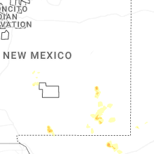
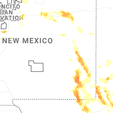
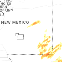
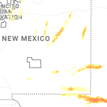
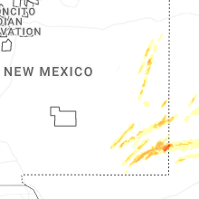
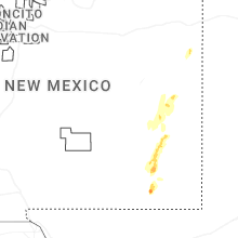


Connect with Interactive Hail Maps