

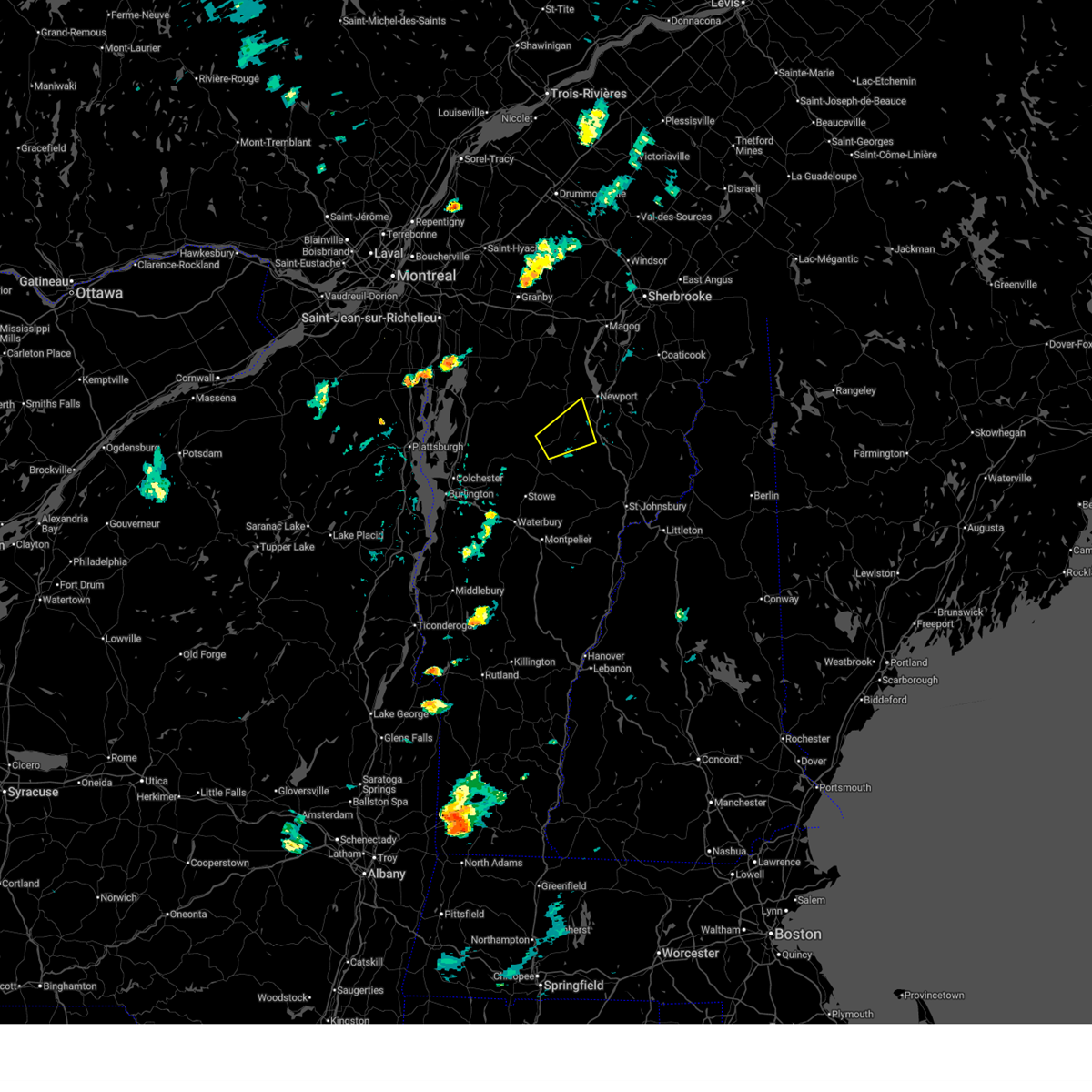
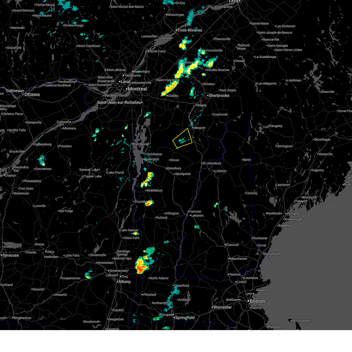
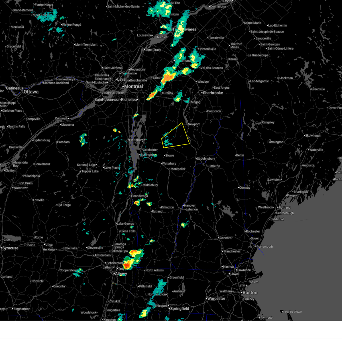
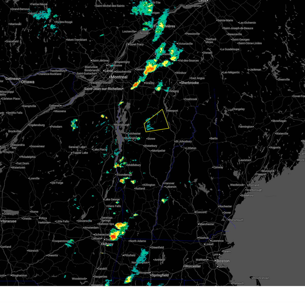
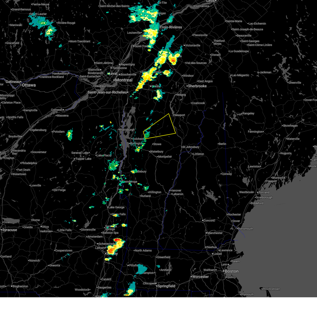
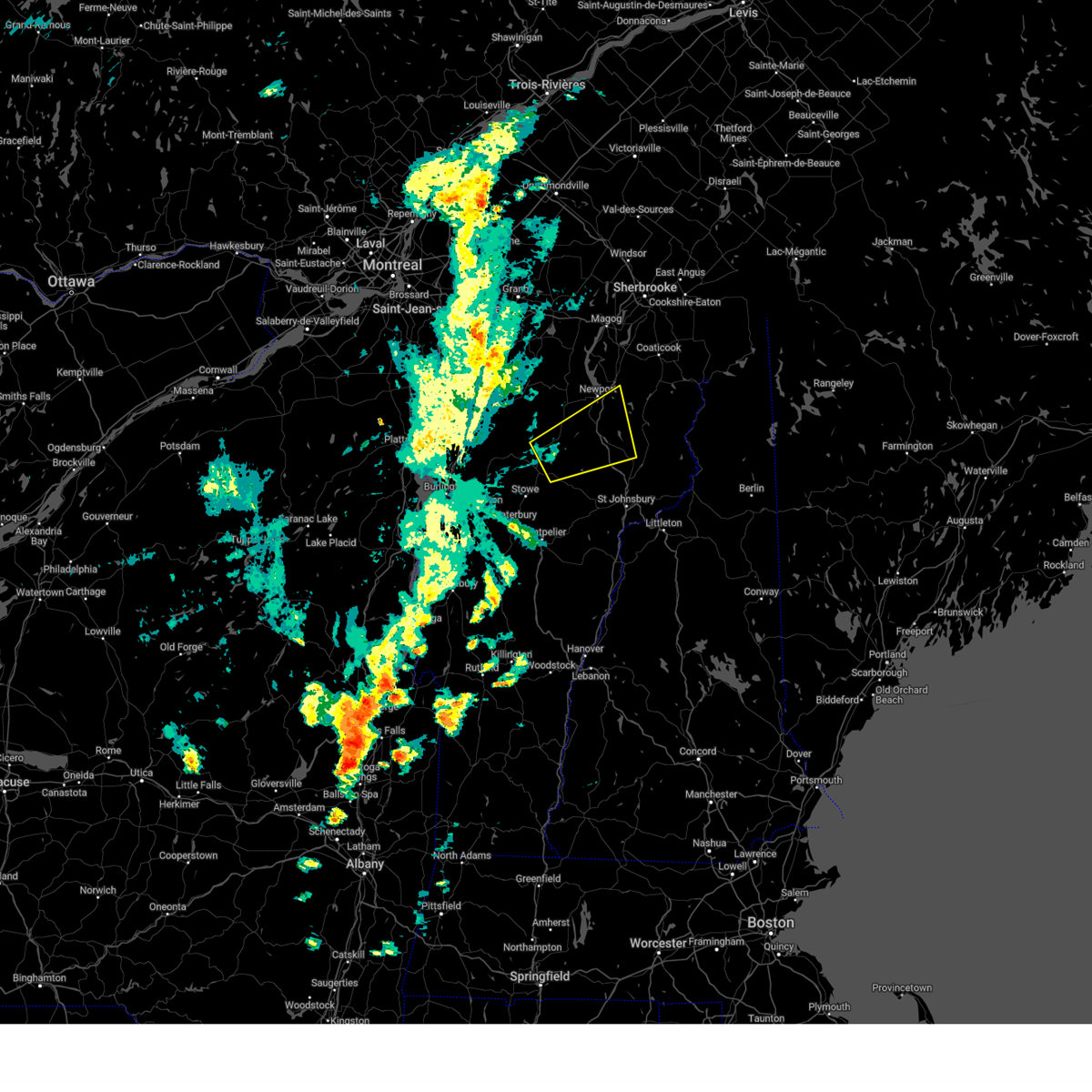
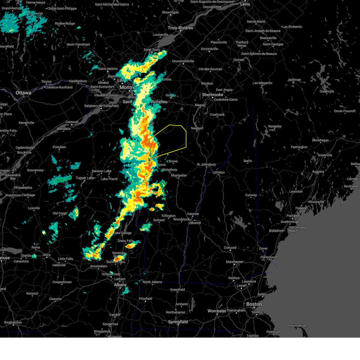
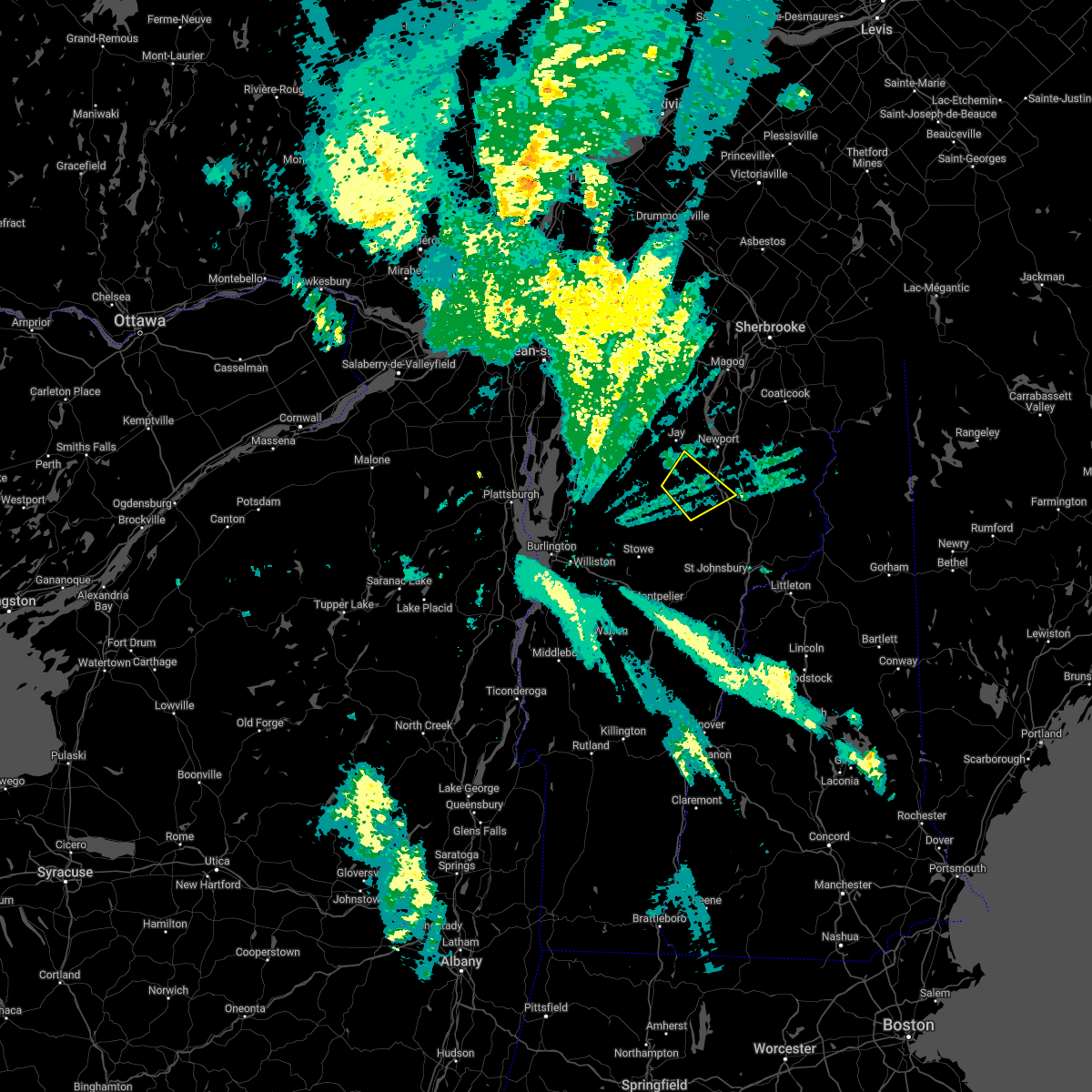
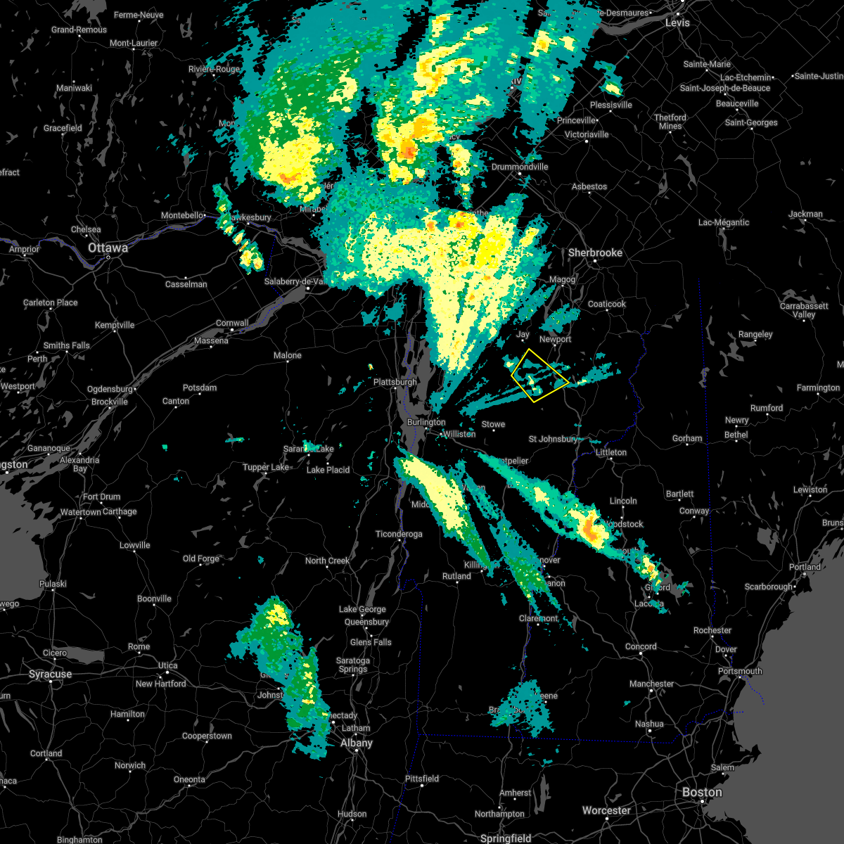
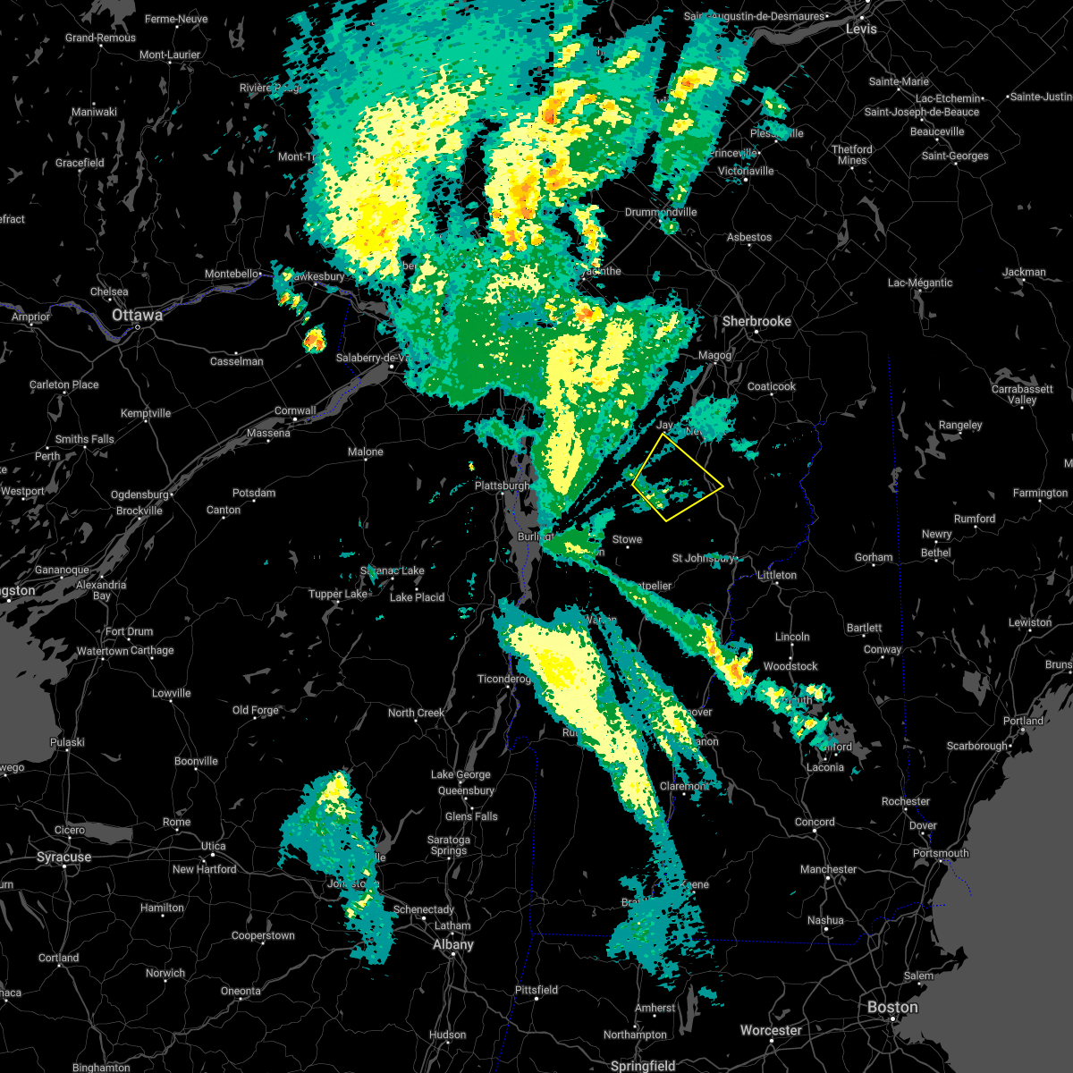
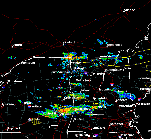
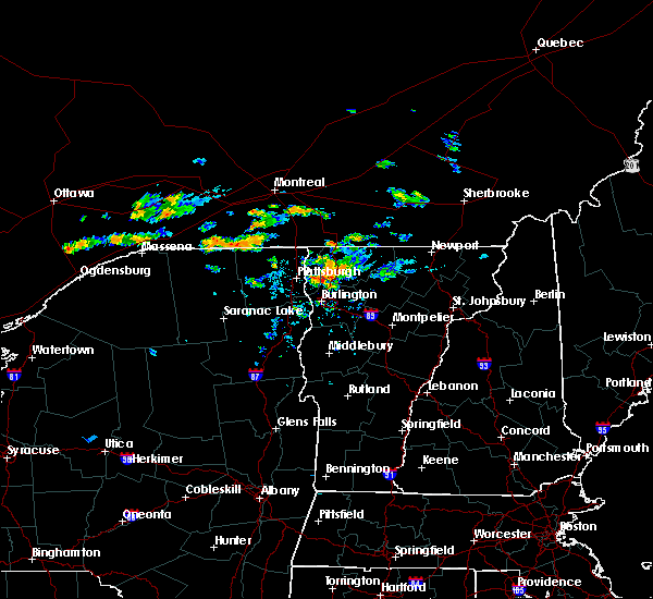
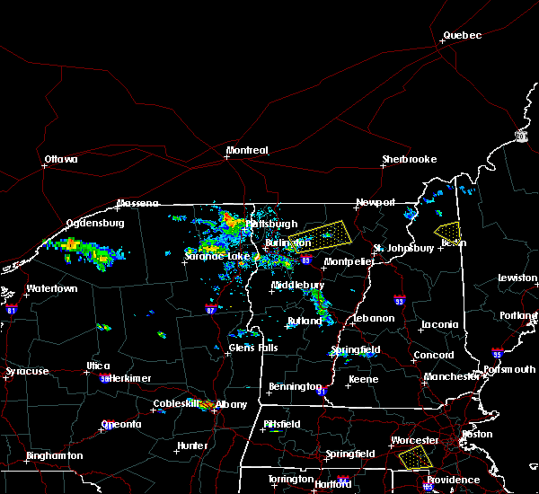
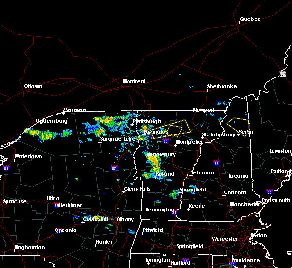
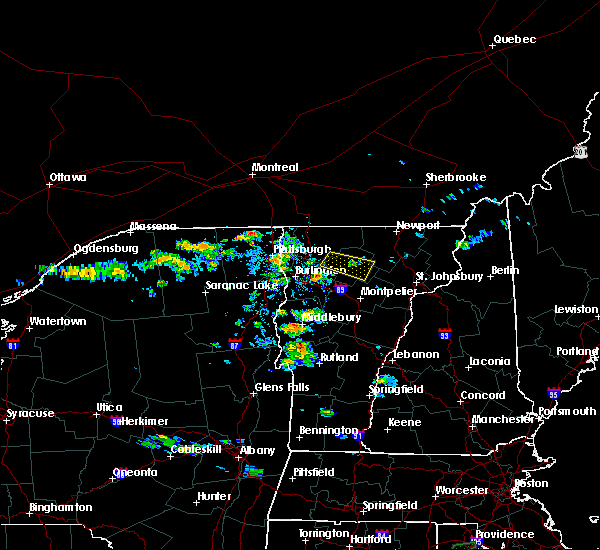
Hail Map for Lowell, VT
The Lowell, VT area has had 2 reports of on-the-ground hail by trained spotters, and has been under severe weather warnings 18 times during the past 12 months. Doppler radar has detected hail at or near Lowell, VT on 10 occasions.
| Name: | Lowell, VT |
| Where Located: | 43.6 miles ENE of Burlington, VT |
| Map: | Google Map for Lowell, VT |
| Population: | 228 |
| Housing Units: | 106 |
| More Info: | Search Google for Lowell, VT |
5
The Top Recent Hail Date for Lowell, VT is Tuesday, May 29, 2012 (1st out of 10)

Hail and Wind Damage Spotted near Lowell, VT
| Date / Time | Report Details |
|---|---|
| 7/10/2025 6:41 PM EDT | The storm which prompted the warning has weakened below severe limits, and has exited the warned area. therefore, the warning will be allowed to expire. however, heavy rain is still possible with this thunderstorm. to report severe weather, contact your nearest law enforcement agency. they will relay your report to the national weather service burlington. |
| 7/10/2025 6:20 PM EDT | At 620 pm edt, a severe thunderstorm was located over north hyde park, moving northeast at 20 mph (trained weather spotters). Hazards include 60 mph wind gusts and quarter size hail. Minor hail damage to vehicles is possible. expect wind damage to trees and powerlines. Locations impacted include, waterville, johnson village, eden, westfield, albany, johnson, hyde park, albany village, lowell, belvidere center, hyde park village, belvidere, montgomery, morristown, craftsbury, cambridge, irasburg, jay, glover, and troy. |
| 7/10/2025 6:10 PM EDT | At 609 pm edt, a severe thunderstorm was located over east johnson, moving northeast at 20 mph (trained weather spotters). Hazards include 60 mph wind gusts and quarter size hail. Minor hail damage to vehicles is possible. expect wind damage to trees and powerlines. Locations impacted include, morrisville, waterville, johnson village, eden, cambridge, westfield, morrisville village, albany, johnson, jeffersonville village, hyde park, albany village, lowell, belvidere center, morristown, hyde park village, belvidere, craftsbury, montgomery, and irasburg. |
| 7/10/2025 6:10 PM EDT | the severe thunderstorm warning has been cancelled and is no longer in effect |
| 7/10/2025 6:00 PM EDT | At 558 pm edt, a severe thunderstorm was located near johnson village, moving northeast at 20 mph (trained weather spotters. at 5:34 pm dime size hail was reported at spruce peak at stowe mountain resort area). Hazards include 60 mph wind gusts and quarter size hail. Minor hail damage to vehicles is possible. expect wind damage to trees and powerlines. Locations impacted include, morrisville, johnson village, eden, cambridge, cambridge village, stowe, albany, jeffersonville village, hyde park, montgomery, belvidere center, belvidere, waterville, westfield, morrisville village, johnson, underhill state park, albany village, lowell, and craftsbury. |
| 7/10/2025 5:50 PM EDT | Svrbtv the national weather service in burlington has issued a * severe thunderstorm warning for, lamoille county in northwestern vermont, southwestern orleans county in northeastern vermont, northeastern chittenden county in northwestern vermont, southeastern franklin county in northwestern vermont, * until 645 pm edt. * at 550 pm edt, a severe thunderstorm was located over smugglers notch, moving northeast at 20 mph (radar indicated). Hazards include 60 mph wind gusts and quarter size hail. Minor hail damage to vehicles is possible. Expect wind damage to trees and powerlines. |
| 7/3/2025 7:35 PM EDT | the severe thunderstorm warning has been cancelled and is no longer in effect |
| 7/3/2025 7:23 PM EDT | At 722 pm edt, a severe thunderstorm was located near lowell, moving east at 15 mph (public). Hazards include 60 mph wind gusts and quarter size hail. Minor hail damage to vehicles is possible. expect wind damage to trees and powerlines. Locations impacted include, newport city, orleans, derby center, jay, newport town, jay in franklin county, orleans village, montgomery center, brownington, albany, montgomery, coventry, barton, troy, brownington village, irasburg, derby line village, westfield, newport center, and north troy village. |
| 7/3/2025 6:55 PM EDT | Svrbtv the national weather service in burlington has issued a * severe thunderstorm warning for, north central lamoille county in northwestern vermont, orleans county in northeastern vermont, northeastern franklin county in northwestern vermont, * until 800 pm edt. * at 655 pm edt, a severe thunderstorm was located over east berkshire, moving east at 35 mph (radar indicated). Hazards include 60 mph wind gusts and quarter size hail. Minor hail damage to vehicles is possible. Expect wind damage to trees and powerlines. |
| 6/19/2025 4:28 PM EDT |
 The storm which prompted the warning has weakened below severe limits, and no longer poses an immediate threat to life or property. therefore, the warning will be allowed to expire. however, gusty winds are still possible with this thunderstorm. a severe thunderstorm watch remains in effect until 900 pm edt for northeastern and northwestern vermont. The storm which prompted the warning has weakened below severe limits, and no longer poses an immediate threat to life or property. therefore, the warning will be allowed to expire. however, gusty winds are still possible with this thunderstorm. a severe thunderstorm watch remains in effect until 900 pm edt for northeastern and northwestern vermont.
|
| 6/19/2025 4:18 PM EDT |
 the severe thunderstorm warning has been cancelled and is no longer in effect the severe thunderstorm warning has been cancelled and is no longer in effect
|
| 6/19/2025 4:18 PM EDT |
 At 417 pm edt, a severe thunderstorm was located near albany center, moving northeast at 40 mph (public. at 4:05 pm edt, trees were reported down in eden, vt). Hazards include 60 mph wind gusts. Expect damage to trees and powerlines. Locations impacted include, irasburg, eden, albany village, lowell, albany, newport town, craftsbury, hyde park, glover, westfield, troy, coventry, barton, west glover, east albany, eden mills, albany center, and south newport. At 417 pm edt, a severe thunderstorm was located near albany center, moving northeast at 40 mph (public. at 4:05 pm edt, trees were reported down in eden, vt). Hazards include 60 mph wind gusts. Expect damage to trees and powerlines. Locations impacted include, irasburg, eden, albany village, lowell, albany, newport town, craftsbury, hyde park, glover, westfield, troy, coventry, barton, west glover, east albany, eden mills, albany center, and south newport.
|
| 6/19/2025 4:05 PM EDT | Tree down onto belvidere road (vt 118) north of vt 10 in lamoille county VT, 7 miles ENE of Lowell, VT |
| 6/19/2025 4:04 PM EDT |
 the severe thunderstorm warning has been cancelled and is no longer in effect the severe thunderstorm warning has been cancelled and is no longer in effect
|
| 6/19/2025 4:04 PM EDT |
 At 403 pm edt, a severe thunderstorm was located over eden, moving northeast at 40 mph (radar indicated). Hazards include 60 mph wind gusts. Expect damage to trees and powerlines. Locations impacted include, johnson village, irasburg, eden, glover, albany, johnson, hyde park, albany village, lowell, belvidere center, craftsbury, hyde park village, belvidere, newport town, waterville, westfield, troy, greensboro, sheffield, and coventry. At 403 pm edt, a severe thunderstorm was located over eden, moving northeast at 40 mph (radar indicated). Hazards include 60 mph wind gusts. Expect damage to trees and powerlines. Locations impacted include, johnson village, irasburg, eden, glover, albany, johnson, hyde park, albany village, lowell, belvidere center, craftsbury, hyde park village, belvidere, newport town, waterville, westfield, troy, greensboro, sheffield, and coventry.
|
| 6/19/2025 3:44 PM EDT |
 Svrbtv the national weather service in burlington has issued a * severe thunderstorm warning for, northern lamoille county in northwestern vermont, northwestern caledonia county in northeastern vermont, western orleans county in northeastern vermont, northeastern chittenden county in northwestern vermont, southeastern franklin county in northwestern vermont, * until 430 pm edt. * at 344 pm edt, a severe thunderstorm was located over cambridge junction, moving northeast at 40 mph (radar indicated). Hazards include 60 mph wind gusts. expect damage to trees and powerlines Svrbtv the national weather service in burlington has issued a * severe thunderstorm warning for, northern lamoille county in northwestern vermont, northwestern caledonia county in northeastern vermont, western orleans county in northeastern vermont, northeastern chittenden county in northwestern vermont, southeastern franklin county in northwestern vermont, * until 430 pm edt. * at 344 pm edt, a severe thunderstorm was located over cambridge junction, moving northeast at 40 mph (radar indicated). Hazards include 60 mph wind gusts. expect damage to trees and powerlines
|
| 5/17/2025 4:23 PM EDT |
 Svrbtv the national weather service in burlington has issued a * severe thunderstorm warning for, northeastern lamoille county in northwestern vermont, northern caledonia county in northeastern vermont, central orleans county in northeastern vermont, * until 515 pm edt. * at 423 pm edt, a severe thunderstorm was located over tromp point, moving northeast at 30 mph (radar indicated). Hazards include 60 mph wind gusts and quarter size hail. Minor hail damage to vehicles is possible. Expect wind damage to trees and powerlines. Svrbtv the national weather service in burlington has issued a * severe thunderstorm warning for, northeastern lamoille county in northwestern vermont, northern caledonia county in northeastern vermont, central orleans county in northeastern vermont, * until 515 pm edt. * at 423 pm edt, a severe thunderstorm was located over tromp point, moving northeast at 30 mph (radar indicated). Hazards include 60 mph wind gusts and quarter size hail. Minor hail damage to vehicles is possible. Expect wind damage to trees and powerlines.
|
| 5/17/2025 3:53 PM EDT |
 At 352 pm edt, a severe thunderstorm was located over st albans, moving northeast at 35 mph (radar indicated). Hazards include 60 mph wind gusts and quarter size hail. Minor hail damage to vehicles is possible. expect wind damage to trees and powerlines. locations impacted include, jay, sheldon junction, stevens mills, bakersfield, north cambridge, berkshire, lazy lady island, montgomery center, north enosburg, south richford, hathaway point, east fairfield, montgomery, west georgia, st. Albans city, fairfax, west berkshire, sheldon, belvidere center, and georgia. At 352 pm edt, a severe thunderstorm was located over st albans, moving northeast at 35 mph (radar indicated). Hazards include 60 mph wind gusts and quarter size hail. Minor hail damage to vehicles is possible. expect wind damage to trees and powerlines. locations impacted include, jay, sheldon junction, stevens mills, bakersfield, north cambridge, berkshire, lazy lady island, montgomery center, north enosburg, south richford, hathaway point, east fairfield, montgomery, west georgia, st. Albans city, fairfax, west berkshire, sheldon, belvidere center, and georgia.
|
| 5/17/2025 3:36 PM EDT |
 Svrbtv the national weather service in burlington has issued a * severe thunderstorm warning for, northern lamoille county in northwestern vermont, northwestern orleans county in northeastern vermont, northeastern chittenden county in northwestern vermont, franklin county in northwestern vermont, * until 415 pm edt. * at 335 pm edt, a severe thunderstorm was located from st albans south through milton, moving northeast at 35 mph (radar indicated). Hazards include 60 mph wind gusts and quarter size hail. Minor hail damage to vehicles is possible. Expect wind damage to trees and powerlines. Svrbtv the national weather service in burlington has issued a * severe thunderstorm warning for, northern lamoille county in northwestern vermont, northwestern orleans county in northeastern vermont, northeastern chittenden county in northwestern vermont, franklin county in northwestern vermont, * until 415 pm edt. * at 335 pm edt, a severe thunderstorm was located from st albans south through milton, moving northeast at 35 mph (radar indicated). Hazards include 60 mph wind gusts and quarter size hail. Minor hail damage to vehicles is possible. Expect wind damage to trees and powerlines.
|
| 5/21/2024 5:58 PM EDT |
 The storm which prompted the warning has weakened below severe limits, and no longer poses an immediate threat to life or property. therefore, the warning will be allowed to expire. The storm which prompted the warning has weakened below severe limits, and no longer poses an immediate threat to life or property. therefore, the warning will be allowed to expire.
|
| 5/21/2024 5:40 PM EDT |
 At 540 pm edt, a severe thunderstorm was located over montgomery center, moving east at 30 mph (public). Hazards include 60 mph wind gusts and quarter size hail. Minor hail damage to vehicles is possible. expect wind damage to trees and powerlines. Locations impacted include, newport city, enosburg falls, orleans, jay, newport town, jay in franklin county, irasburg, bakersfield, westfield, orleans village, newport center, berkshire, north troy village, montgomery center, richford, montgomery, coventry, enosburg falls village, troy, and lake carmi state park. At 540 pm edt, a severe thunderstorm was located over montgomery center, moving east at 30 mph (public). Hazards include 60 mph wind gusts and quarter size hail. Minor hail damage to vehicles is possible. expect wind damage to trees and powerlines. Locations impacted include, newport city, enosburg falls, orleans, jay, newport town, jay in franklin county, irasburg, bakersfield, westfield, orleans village, newport center, berkshire, north troy village, montgomery center, richford, montgomery, coventry, enosburg falls village, troy, and lake carmi state park.
|
| 5/21/2024 4:59 PM EDT |
 Svrbtv the national weather service in burlington has issued a * severe thunderstorm warning for, north central lamoille county in northwestern vermont, northwestern orleans county in northeastern vermont, northeastern franklin county in northwestern vermont, * until 600 pm edt. * at 459 pm edt, a severe thunderstorm was located over lake carmi state park, moving east at 25 mph (radar indicated). Hazards include 60 mph wind gusts and quarter size hail. Minor hail damage to vehicles is possible. Expect wind damage to trees and powerlines. Svrbtv the national weather service in burlington has issued a * severe thunderstorm warning for, north central lamoille county in northwestern vermont, northwestern orleans county in northeastern vermont, northeastern franklin county in northwestern vermont, * until 600 pm edt. * at 459 pm edt, a severe thunderstorm was located over lake carmi state park, moving east at 25 mph (radar indicated). Hazards include 60 mph wind gusts and quarter size hail. Minor hail damage to vehicles is possible. Expect wind damage to trees and powerlines.
|
| 7/13/2023 6:59 PM EDT |
 At 659 pm edt, a severe thunderstorm was located over jay in franklin county, moving north at 20 mph (radar indicated). Hazards include 60 mph wind gusts and quarter size hail. Minor hail damage to vehicles is possible. expect wind damage to trees and powerlines. locations impacted include, newport city, morrisville, orleans, derby center, jay, newport town, jay in franklin county, eden, orleans village, brownington, albany, hyde park, wolcott, coventry, troy, brownington village, irasburg, derby line village, westfield, and morrisville village. hail threat, radar indicated max hail size, 1. 00 in wind threat, radar indicated max wind gust, 60 mph. At 659 pm edt, a severe thunderstorm was located over jay in franklin county, moving north at 20 mph (radar indicated). Hazards include 60 mph wind gusts and quarter size hail. Minor hail damage to vehicles is possible. expect wind damage to trees and powerlines. locations impacted include, newport city, morrisville, orleans, derby center, jay, newport town, jay in franklin county, eden, orleans village, brownington, albany, hyde park, wolcott, coventry, troy, brownington village, irasburg, derby line village, westfield, and morrisville village. hail threat, radar indicated max hail size, 1. 00 in wind threat, radar indicated max wind gust, 60 mph.
|
| 7/13/2023 6:33 PM EDT |
 At 633 pm edt, a severe thunderstorm was located near lowell, moving north at 20 mph (radar indicated). Hazards include 60 mph wind gusts and quarter size hail. Minor hail damage to vehicles is possible. Expect wind damage to trees and powerlines. At 633 pm edt, a severe thunderstorm was located near lowell, moving north at 20 mph (radar indicated). Hazards include 60 mph wind gusts and quarter size hail. Minor hail damage to vehicles is possible. Expect wind damage to trees and powerlines.
|
| 7/7/2023 1:37 PM EDT |
 The severe thunderstorm warning for northeastern lamoille, northwestern caledonia, orleans and northwestern essex counties will expire at 145 pm edt, the storm which prompted the warning has weakened below severe limits, and no longer poses an immediate threat to life or property. therefore, the warning will be allowed to expire. however heavy rain is still possible with this thunderstorm. to report severe weather, contact your nearest law enforcement agency. they will relay your report to the national weather service burlington. The severe thunderstorm warning for northeastern lamoille, northwestern caledonia, orleans and northwestern essex counties will expire at 145 pm edt, the storm which prompted the warning has weakened below severe limits, and no longer poses an immediate threat to life or property. therefore, the warning will be allowed to expire. however heavy rain is still possible with this thunderstorm. to report severe weather, contact your nearest law enforcement agency. they will relay your report to the national weather service burlington.
|
| 7/7/2023 1:33 PM EDT |
 At 133 pm edt, a severe thunderstorm was located over south bay in orleans county, moving northeast at 10 mph (radar indicated). Hazards include 60 mph wind gusts and quarter size hail. Minor hail damage to vehicles is possible. expect wind damage to trees and powerlines. locations impacted include, newport city, orleans, greensboro, newport town, eden, westmore, orleans village, glover, brownington, albany, hyde park, wolcott, coventry, barton, troy, brownington village, irasburg, newport center, willoughby, and barton village. hail threat, radar indicated max hail size, 1. 00 in wind threat, radar indicated max wind gust, 60 mph. At 133 pm edt, a severe thunderstorm was located over south bay in orleans county, moving northeast at 10 mph (radar indicated). Hazards include 60 mph wind gusts and quarter size hail. Minor hail damage to vehicles is possible. expect wind damage to trees and powerlines. locations impacted include, newport city, orleans, greensboro, newport town, eden, westmore, orleans village, glover, brownington, albany, hyde park, wolcott, coventry, barton, troy, brownington village, irasburg, newport center, willoughby, and barton village. hail threat, radar indicated max hail size, 1. 00 in wind threat, radar indicated max wind gust, 60 mph.
|
| 7/7/2023 12:42 PM EDT |
 At 1242 pm edt, a severe thunderstorm was located over green river reservoir, moving northeast at 25 mph (radar indicated). Hazards include 60 mph wind gusts and quarter size hail. Minor hail damage to vehicles is possible. Expect wind damage to trees and powerlines. At 1242 pm edt, a severe thunderstorm was located over green river reservoir, moving northeast at 25 mph (radar indicated). Hazards include 60 mph wind gusts and quarter size hail. Minor hail damage to vehicles is possible. Expect wind damage to trees and powerlines.
|
| 9/22/2022 2:40 AM EDT |
 At 239 am edt, a severe thunderstorm was located jericho and beekmantown point, moving east at 55 mph (radar indicated). Hazards include 60 mph wind gusts and quarter size hail. Minor hail damage to vehicles is possible. Expect wind damage to trees and powerlines. At 239 am edt, a severe thunderstorm was located jericho and beekmantown point, moving east at 55 mph (radar indicated). Hazards include 60 mph wind gusts and quarter size hail. Minor hail damage to vehicles is possible. Expect wind damage to trees and powerlines.
|
| 7/25/2022 12:57 PM EDT |
 The severe thunderstorm warning for northeastern lamoille, central orleans and east central franklin counties will expire at 100 pm edt, the storm which prompted the warning has weakened below severe limits, and no longer poses an immediate threat to life or property. therefore, the warning will be allowed to expire. however gusty winds of 40 to 45 mph are still possible with this thunderstorm. The severe thunderstorm warning for northeastern lamoille, central orleans and east central franklin counties will expire at 100 pm edt, the storm which prompted the warning has weakened below severe limits, and no longer poses an immediate threat to life or property. therefore, the warning will be allowed to expire. however gusty winds of 40 to 45 mph are still possible with this thunderstorm.
|
| 7/25/2022 12:44 PM EDT |
 At 1244 pm edt, a severe thunderstorm was located near irasburg, moving east at 40 mph (radar indicated). Hazards include 60 mph wind gusts. Expect damage to trees and powerlines. locations impacted include, newport city, orleans, derby center, newport town, irasburg, eden, westfield, orleans village, newport center, brownington, albany, derby, coventry, barton, barton village, albany village, lowell, brownington village, derby center village and westmore. hail threat, radar indicated max hail size, <. 75 in wind threat, radar indicated max wind gust, 60 mph. At 1244 pm edt, a severe thunderstorm was located near irasburg, moving east at 40 mph (radar indicated). Hazards include 60 mph wind gusts. Expect damage to trees and powerlines. locations impacted include, newport city, orleans, derby center, newport town, irasburg, eden, westfield, orleans village, newport center, brownington, albany, derby, coventry, barton, barton village, albany village, lowell, brownington village, derby center village and westmore. hail threat, radar indicated max hail size, <. 75 in wind threat, radar indicated max wind gust, 60 mph.
|
| 7/25/2022 12:34 PM EDT | A dozen large trees were down along and near 58 wes in orleans county VT, 3.4 miles SE of Lowell, VT |
| 7/25/2022 12:21 PM EDT |
 At 1221 pm edt, a severe thunderstorm was located over belvidere, moving east at 40 mph (radar indicated). Hazards include 60 mph wind gusts. expect damage to trees and powerlines At 1221 pm edt, a severe thunderstorm was located over belvidere, moving east at 40 mph (radar indicated). Hazards include 60 mph wind gusts. expect damage to trees and powerlines
|
| 7/21/2022 5:13 PM EDT |
 The severe thunderstorm warning for central lamoille, northern caledonia, central orleans and east central franklin counties will expire at 515 pm edt, the storm which prompted the warning has weakened below severe limits, and no longer poses an immediate threat to life or property. therefore, the warning will be allowed to expire. however small hail, gusty winds and heavy rain are still possible with this thunderstorm. a severe thunderstorm watch remains in effect until 800 pm edt for northeastern and northwestern vermont. The severe thunderstorm warning for central lamoille, northern caledonia, central orleans and east central franklin counties will expire at 515 pm edt, the storm which prompted the warning has weakened below severe limits, and no longer poses an immediate threat to life or property. therefore, the warning will be allowed to expire. however small hail, gusty winds and heavy rain are still possible with this thunderstorm. a severe thunderstorm watch remains in effect until 800 pm edt for northeastern and northwestern vermont.
|
| 7/21/2022 4:48 PM EDT |
 At 448 pm edt, a severe thunderstorm was located over albany center, moving northeast at 55 mph (radar indicated). Hazards include 60 mph wind gusts and penny size hail. Expect damage to trees and powerlines. locations impacted include, newport city, morrisville, orleans, greensboro, johnson village, newport town, eden, orleans village, glover, brownington, albany, hyde park, sutton, wolcott, coventry, barton, sheffield, brownington village, west burke village and irasburg. hail threat, radar indicated max hail size, 0. 75 in wind threat, radar indicated max wind gust, 60 mph. At 448 pm edt, a severe thunderstorm was located over albany center, moving northeast at 55 mph (radar indicated). Hazards include 60 mph wind gusts and penny size hail. Expect damage to trees and powerlines. locations impacted include, newport city, morrisville, orleans, greensboro, johnson village, newport town, eden, orleans village, glover, brownington, albany, hyde park, sutton, wolcott, coventry, barton, sheffield, brownington village, west burke village and irasburg. hail threat, radar indicated max hail size, 0. 75 in wind threat, radar indicated max wind gust, 60 mph.
|
| 7/21/2022 4:34 PM EDT |
 At 434 pm edt, a severe thunderstorm was located over north hyde park, moving northeast at 55 mph (radar indicated). Hazards include 60 mph wind gusts and penny size hail. Expect damage to trees and powerlines. locations impacted include, newport city, morrisville, orleans, greensboro, johnson village, newport town, eden, cambridge, orleans village, cambridge village, glover, brownington, albany, jeffersonville village, hyde park, sutton, wolcott, coventry, barton and sheffield. hail threat, radar indicated max hail size, 0. 75 in wind threat, radar indicated max wind gust, 60 mph. At 434 pm edt, a severe thunderstorm was located over north hyde park, moving northeast at 55 mph (radar indicated). Hazards include 60 mph wind gusts and penny size hail. Expect damage to trees and powerlines. locations impacted include, newport city, morrisville, orleans, greensboro, johnson village, newport town, eden, cambridge, orleans village, cambridge village, glover, brownington, albany, jeffersonville village, hyde park, sutton, wolcott, coventry, barton and sheffield. hail threat, radar indicated max hail size, 0. 75 in wind threat, radar indicated max wind gust, 60 mph.
|
| 7/21/2022 4:16 PM EDT |
 At 416 pm edt, a severe thunderstorm was located over underhill, moving northeast at 55 mph (radar indicated). Hazards include 60 mph wind gusts and penny size hail. expect damage to trees and powerlines At 416 pm edt, a severe thunderstorm was located over underhill, moving northeast at 55 mph (radar indicated). Hazards include 60 mph wind gusts and penny size hail. expect damage to trees and powerlines
|
| 7/21/2022 12:39 PM EDT |
 At 1239 pm edt, a severe thunderstorm was located over east albany, moving northeast at 35 mph (radar indicated). Hazards include ping pong ball size hail and 60 mph wind gusts. People and animals outdoors will be injured. expect hail damage to roofs, siding, windows, and vehicles. expect wind damage to trees and powerlines. locations impacted include, newport city, orleans, irasburg, orleans village, glover, brownington, albany, willoughby, coventry, barton, barton village, albany village, lowell, craftsbury, brownington village, derby, westmore, eden, newport town and sutton. hail threat, radar indicated max hail size, 1. 50 in wind threat, radar indicated max wind gust, 60 mph. At 1239 pm edt, a severe thunderstorm was located over east albany, moving northeast at 35 mph (radar indicated). Hazards include ping pong ball size hail and 60 mph wind gusts. People and animals outdoors will be injured. expect hail damage to roofs, siding, windows, and vehicles. expect wind damage to trees and powerlines. locations impacted include, newport city, orleans, irasburg, orleans village, glover, brownington, albany, willoughby, coventry, barton, barton village, albany village, lowell, craftsbury, brownington village, derby, westmore, eden, newport town and sutton. hail threat, radar indicated max hail size, 1. 50 in wind threat, radar indicated max wind gust, 60 mph.
|
| 7/21/2022 12:09 PM EDT |
 At 1209 pm edt, a severe thunderstorm was located over morrisville village, moving northeast at 30 mph (radar indicated). Hazards include 60 mph wind gusts and quarter size hail. Minor hail damage to vehicles is possible. Expect wind damage to trees and powerlines. At 1209 pm edt, a severe thunderstorm was located over morrisville village, moving northeast at 30 mph (radar indicated). Hazards include 60 mph wind gusts and quarter size hail. Minor hail damage to vehicles is possible. Expect wind damage to trees and powerlines.
|
| 6/16/2022 7:11 PM EDT |
 At 711 pm edt, a severe thunderstorm was located over south franklin, moving east at 45 mph (radar indicated). Hazards include 60 mph wind gusts and quarter size hail. Minor hail damage to vehicles is possible. Expect wind damage to trees and powerlines. At 711 pm edt, a severe thunderstorm was located over south franklin, moving east at 45 mph (radar indicated). Hazards include 60 mph wind gusts and quarter size hail. Minor hail damage to vehicles is possible. Expect wind damage to trees and powerlines.
|
| 5/21/2022 6:17 PM EDT |
 At 617 pm edt, a severe thunderstorm was located over eden mills, moving east at 35 mph (radar indicated). Hazards include 60 mph wind gusts and quarter size hail. Minor hail damage to vehicles is possible. Expect wind damage to trees and powerlines. At 617 pm edt, a severe thunderstorm was located over eden mills, moving east at 35 mph (radar indicated). Hazards include 60 mph wind gusts and quarter size hail. Minor hail damage to vehicles is possible. Expect wind damage to trees and powerlines.
|
| 5/16/2022 7:55 PM EDT |
 The severe thunderstorm warning for northeastern lamoille, northern caledonia and western orleans counties will expire at 800 pm edt, the storm which prompted the warning has weakened below severe limits, and no longer poses an immediate threat to life or property. therefore, the warning will be allowed to expire. however gusty winds are still possible with this thunderstorm. a severe thunderstorm watch remains in effect until 800 pm edt for northeastern and northwestern vermont. The severe thunderstorm warning for northeastern lamoille, northern caledonia and western orleans counties will expire at 800 pm edt, the storm which prompted the warning has weakened below severe limits, and no longer poses an immediate threat to life or property. therefore, the warning will be allowed to expire. however gusty winds are still possible with this thunderstorm. a severe thunderstorm watch remains in effect until 800 pm edt for northeastern and northwestern vermont.
|
| 5/16/2022 7:43 PM EDT |
 At 742 pm edt, a severe thunderstorm was located over albany center, moving northeast at 30 mph (radar indicated). Hazards include 60 mph wind gusts. Expect damage to trees and powerlines. locations impacted include, irasburg, barton, barton village, albany village, lowell, glover, craftsbury, albany, westfield, troy, eden, greensboro, newport town, east craftsbury, west glover, east albany, south albany, albany center, craftsbury common and crystal lake state park. hail threat, radar indicated max hail size, <. 75 in wind threat, radar indicated max wind gust, 60 mph. At 742 pm edt, a severe thunderstorm was located over albany center, moving northeast at 30 mph (radar indicated). Hazards include 60 mph wind gusts. Expect damage to trees and powerlines. locations impacted include, irasburg, barton, barton village, albany village, lowell, glover, craftsbury, albany, westfield, troy, eden, greensboro, newport town, east craftsbury, west glover, east albany, south albany, albany center, craftsbury common and crystal lake state park. hail threat, radar indicated max hail size, <. 75 in wind threat, radar indicated max wind gust, 60 mph.
|
| 5/16/2022 7:31 PM EDT |
 At 730 pm edt, a severe thunderstorm was located near eden mills, moving northeast at 30 mph (radar indicated). Hazards include 60 mph wind gusts. expect damage to trees and powerlines At 730 pm edt, a severe thunderstorm was located near eden mills, moving northeast at 30 mph (radar indicated). Hazards include 60 mph wind gusts. expect damage to trees and powerlines
|
| 10/16/2021 3:56 PM EDT |
 The severe thunderstorm warning for northern lamoille, western orleans, northeastern chittenden and eastern franklin counties will expire at 400 pm edt, the storms which prompted the warning have weakened below severe limits, and no longer pose an immediate threat to life or property. therefore, the warning will be allowed to expire. however gusty winds are still possible with these thunderstorms. a severe thunderstorm watch remains in effect until 700 pm edt for northwestern vermont. The severe thunderstorm warning for northern lamoille, western orleans, northeastern chittenden and eastern franklin counties will expire at 400 pm edt, the storms which prompted the warning have weakened below severe limits, and no longer pose an immediate threat to life or property. therefore, the warning will be allowed to expire. however gusty winds are still possible with these thunderstorms. a severe thunderstorm watch remains in effect until 700 pm edt for northwestern vermont.
|
| 10/16/2021 3:21 PM EDT |
 At 320 pm edt, severe thunderstorms were located along a line extending from 16 miles north of morses line to near east franklin to east sheldon, moving northeast at 60 mph (radar indicated). Hazards include 60 mph wind gusts. Expect damage to trees and powerlines. locations impacted include, enosburg falls, franklin, johnson village, jay, jay in franklin county, eden, cambridge, bakersfield, cambridge village, berkshire, montgomery center, jeffersonville village, hyde park, montgomery, troy, sheldon, belvidere center, lake carmi state park, enosburg and belvidere. hail threat, radar indicated max hail size, <. 75 in wind threat, radar indicated max wind gust, 60 mph. At 320 pm edt, severe thunderstorms were located along a line extending from 16 miles north of morses line to near east franklin to east sheldon, moving northeast at 60 mph (radar indicated). Hazards include 60 mph wind gusts. Expect damage to trees and powerlines. locations impacted include, enosburg falls, franklin, johnson village, jay, jay in franklin county, eden, cambridge, bakersfield, cambridge village, berkshire, montgomery center, jeffersonville village, hyde park, montgomery, troy, sheldon, belvidere center, lake carmi state park, enosburg and belvidere. hail threat, radar indicated max hail size, <. 75 in wind threat, radar indicated max wind gust, 60 mph.
|
| 10/16/2021 2:55 PM EDT |
 At 255 pm edt, severe thunderstorms were located along a line extending from province point to st. albans city to west milton, moving northeast at 55 mph (radar indicated). Hazards include 60 mph wind gusts. expect damage to trees and powerlines At 255 pm edt, severe thunderstorms were located along a line extending from province point to st. albans city to west milton, moving northeast at 55 mph (radar indicated). Hazards include 60 mph wind gusts. expect damage to trees and powerlines
|
| 7/20/2021 8:11 PM EDT |
 At 808 pm edt, a line of severe thunderstorms over northern and central vermont was located along a line extending from near east richford to near wolcott to ainsworth state park to near pittsfield, moving east at 30 mph (radar indicated). Hazards include 60 mph wind gusts and quarter size hail. Expect wind damage to trees and powerlines. minor hail damage to vehicles is possible. these storms have a history of producing wind damage and power outages. locations impacted include, barre, montpelier, island pond, lyndon, st. Johnsbury, middlebury, newport city, vergennes, crown point, morrisville, enosburg falls, orleans, derby center, charleston, braintree hill, glover, waterbury village, montgomery center, websterville and orwell. At 808 pm edt, a line of severe thunderstorms over northern and central vermont was located along a line extending from near east richford to near wolcott to ainsworth state park to near pittsfield, moving east at 30 mph (radar indicated). Hazards include 60 mph wind gusts and quarter size hail. Expect wind damage to trees and powerlines. minor hail damage to vehicles is possible. these storms have a history of producing wind damage and power outages. locations impacted include, barre, montpelier, island pond, lyndon, st. Johnsbury, middlebury, newport city, vergennes, crown point, morrisville, enosburg falls, orleans, derby center, charleston, braintree hill, glover, waterbury village, montgomery center, websterville and orwell.
|
| 7/20/2021 7:32 PM EDT |
 At 730 pm edt, a line of severe thunderstorms over western vermont was located along a line extending from near east franklin to stowe to east warren to mossy point, moving east at 40 mph (radar indicated). Hazards include 60 mph wind gusts and quarter size hail. Expect wind damage to trees and powerlines. minor hail damage to vehicles is possible. This line of storms has a history of producing wind damage and power outages. At 730 pm edt, a line of severe thunderstorms over western vermont was located along a line extending from near east franklin to stowe to east warren to mossy point, moving east at 40 mph (radar indicated). Hazards include 60 mph wind gusts and quarter size hail. Expect wind damage to trees and powerlines. minor hail damage to vehicles is possible. This line of storms has a history of producing wind damage and power outages.
|
| 7/8/2020 4:04 PM EDT |
 At 403 pm edt, a severe thunderstorm was located over south newport, moving southeast at 15 mph (radar indicated). Hazards include 60 mph wind gusts and quarter size hail. Minor hail damage to vehicles is possible. expect wind damage to trees and powerlines. Locations impacted include, orleans, newport town, irasburg, westfield, orleans village, glover, albany, willoughby, coventry, barton, barton village, albany village, brownington village, troy, lowell, brownington, westmore, greensboro, craftsbury and sheffield. At 403 pm edt, a severe thunderstorm was located over south newport, moving southeast at 15 mph (radar indicated). Hazards include 60 mph wind gusts and quarter size hail. Minor hail damage to vehicles is possible. expect wind damage to trees and powerlines. Locations impacted include, orleans, newport town, irasburg, westfield, orleans village, glover, albany, willoughby, coventry, barton, barton village, albany village, brownington village, troy, lowell, brownington, westmore, greensboro, craftsbury and sheffield.
|
| 7/8/2020 3:38 PM EDT |
 At 338 pm edt, a severe thunderstorm was located over jay in franklin county, moving southeast at 20 mph (radar indicated). Hazards include 60 mph wind gusts and quarter size hail. Minor hail damage to vehicles is possible. Expect wind damage to trees and powerlines. At 338 pm edt, a severe thunderstorm was located over jay in franklin county, moving southeast at 20 mph (radar indicated). Hazards include 60 mph wind gusts and quarter size hail. Minor hail damage to vehicles is possible. Expect wind damage to trees and powerlines.
|
| 3/20/2020 3:43 PM EDT |
 At 343 pm edt, severe thunderstorms were located along a line extending from bluff point to mount marcy, moving east at 65 mph (radar indicated). Hazards include 60 mph wind gusts. expect damage to trees and powerlines At 343 pm edt, severe thunderstorms were located along a line extending from bluff point to mount marcy, moving east at 65 mph (radar indicated). Hazards include 60 mph wind gusts. expect damage to trees and powerlines
|
| 7/30/2019 5:30 PM EDT |
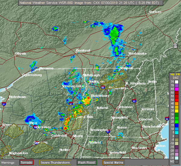 At 529 pm edt, a severe thunderstorm was located near craftsbury, moving northeast at 35 mph (radar indicated). Hazards include 60 mph wind gusts and penny size hail. Expect damage to trees and powerlines. Locations impacted include, orleans, charleston, greensboro, eden, westmore, orleans village, glover, brownington, albany, hyde park, wolcott, coventry, barton, brownington village, irasburg, willoughby, barton village, albany village, lowell and craftsbury. At 529 pm edt, a severe thunderstorm was located near craftsbury, moving northeast at 35 mph (radar indicated). Hazards include 60 mph wind gusts and penny size hail. Expect damage to trees and powerlines. Locations impacted include, orleans, charleston, greensboro, eden, westmore, orleans village, glover, brownington, albany, hyde park, wolcott, coventry, barton, brownington village, irasburg, willoughby, barton village, albany village, lowell and craftsbury.
|
| 7/30/2019 4:59 PM EDT |
 At 459 pm edt, a severe thunderstorm was located near smugglers notch, moving northeast at 35 mph (radar indicated). Hazards include 60 mph wind gusts and quarter size hail. Minor hail damage to vehicles is possible. Expect wind damage to trees and powerlines. At 459 pm edt, a severe thunderstorm was located near smugglers notch, moving northeast at 35 mph (radar indicated). Hazards include 60 mph wind gusts and quarter size hail. Minor hail damage to vehicles is possible. Expect wind damage to trees and powerlines.
|
| 6/29/2019 8:20 PM EDT |
 At 820 pm edt, a severe thunderstorm was located over east fairfield, moving southeast at 25 mph (radar indicated). Hazards include 60 mph wind gusts and quarter size hail. Minor hail damage to vehicles is possible. Expect wind damage to trees and powerlines. At 820 pm edt, a severe thunderstorm was located over east fairfield, moving southeast at 25 mph (radar indicated). Hazards include 60 mph wind gusts and quarter size hail. Minor hail damage to vehicles is possible. Expect wind damage to trees and powerlines.
|
| 6/26/2019 5:32 PM EDT |
 At 530 pm edt, severe thunderstorms were located along a line extending from near westford to essex to near st. george, moving east at 45 mph (new york state mesonet in essex, ny reported wind gusts of 54 knots. additionally, social media reports tree branch downed on vehicle in downtown burlington). Hazards include 60 mph wind gusts and penny size hail. Expect damage to trees and powerlines. Locations impacted include, essex junction, south burlington, burlington international airport, burlington, willsboro, morrisville, johnson village, cambridge, winooski, monkton ridge, waterbury village, westford, monkton boro, hyde park, colchester, essex junction village, williston, worcester, middlesex and belvidere center. At 530 pm edt, severe thunderstorms were located along a line extending from near westford to essex to near st. george, moving east at 45 mph (new york state mesonet in essex, ny reported wind gusts of 54 knots. additionally, social media reports tree branch downed on vehicle in downtown burlington). Hazards include 60 mph wind gusts and penny size hail. Expect damage to trees and powerlines. Locations impacted include, essex junction, south burlington, burlington international airport, burlington, willsboro, morrisville, johnson village, cambridge, winooski, monkton ridge, waterbury village, westford, monkton boro, hyde park, colchester, essex junction village, williston, worcester, middlesex and belvidere center.
|
| 6/26/2019 5:08 PM EDT |
 At 508 pm edt, severe thunderstorms were located along a line extending from allen point to near the four brothers to near reber, moving east at 45 mph (radar indicated). Hazards include 60 mph wind gusts and penny size hail. expect damage to trees and powerlines At 508 pm edt, severe thunderstorms were located along a line extending from allen point to near the four brothers to near reber, moving east at 45 mph (radar indicated). Hazards include 60 mph wind gusts and penny size hail. expect damage to trees and powerlines
|
| 5/4/2018 7:12 PM EDT |
 At 711 pm edt, a severe thunderstorm was located over colchester, moving east at 40 mph (radar indicated). Hazards include 60 mph wind gusts and quarter size hail. Minor hail damage to vehicles is possible. Expect wind damage to trees and powerlines. At 711 pm edt, a severe thunderstorm was located over colchester, moving east at 40 mph (radar indicated). Hazards include 60 mph wind gusts and quarter size hail. Minor hail damage to vehicles is possible. Expect wind damage to trees and powerlines.
|
| 8/22/2017 6:40 PM EDT |
 The severe thunderstorm warning for northern lamoille, northeastern caledonia, orleans and eastern franklin counties will expire at 645 pm edt, the storm which prompted the warning has weakened below severe limits, and no longer pose an immediate threat to life or property. therefore the warning will be allowed to expire. however gusty winds are still possible with this thunderstorm. a tornado watch remains in effect until 900 pm edt for northwestern vermont. a severe thunderstorm watch remains in effect until midnight edt for northeastern and northwestern vermont. The severe thunderstorm warning for northern lamoille, northeastern caledonia, orleans and eastern franklin counties will expire at 645 pm edt, the storm which prompted the warning has weakened below severe limits, and no longer pose an immediate threat to life or property. therefore the warning will be allowed to expire. however gusty winds are still possible with this thunderstorm. a tornado watch remains in effect until 900 pm edt for northwestern vermont. a severe thunderstorm watch remains in effect until midnight edt for northeastern and northwestern vermont.
|
| 8/22/2017 6:07 PM EDT |
 At 607 pm edt, a severe thunderstorm was located over montgomery, moving east at 25 mph (radar indicated). Hazards include 60 mph wind gusts and penny size hail. Expect damage to trees and powerlines. locations impacted include, newport city, enosburg falls, orleans, derby center, charleston, jay, newport town, jay in franklin county, glover, montgomery center, albany, montgomery, fairfax, troy, belvidere center, newark, brownington village, enosburg, west burke village and waterville. A tornado watch remains in effect until 900 pm edt for northwestern vermont. At 607 pm edt, a severe thunderstorm was located over montgomery, moving east at 25 mph (radar indicated). Hazards include 60 mph wind gusts and penny size hail. Expect damage to trees and powerlines. locations impacted include, newport city, enosburg falls, orleans, derby center, charleston, jay, newport town, jay in franklin county, glover, montgomery center, albany, montgomery, fairfax, troy, belvidere center, newark, brownington village, enosburg, west burke village and waterville. A tornado watch remains in effect until 900 pm edt for northwestern vermont.
|
| 8/22/2017 5:46 PM EDT |
 At 545 pm edt, a severe thunderstorm was located over bakersfield, moving east at 40 mph (radar indicated). Hazards include 60 mph wind gusts. expect damage to trees and powerlines At 545 pm edt, a severe thunderstorm was located over bakersfield, moving east at 40 mph (radar indicated). Hazards include 60 mph wind gusts. expect damage to trees and powerlines
|
| 8/12/2017 7:00 PM EDT |
 At 700 pm edt, severe thunderstorms were located along a line extending from cove island to near elmore state park, moving east at 40 mph (radar indicated). Hazards include 60 mph wind gusts and quarter size hail. Minor hail damage to vehicles is possible. Expect wind damage to trees and powerlines. At 700 pm edt, severe thunderstorms were located along a line extending from cove island to near elmore state park, moving east at 40 mph (radar indicated). Hazards include 60 mph wind gusts and quarter size hail. Minor hail damage to vehicles is possible. Expect wind damage to trees and powerlines.
|
| 5/18/2017 5:50 PM EDT |
 At 549 pm edt, a severe thunderstorm was located over underhill state park, moving east at 40 mph (radar indicated). Hazards include 60 mph wind gusts and quarter size hail. Minor hail damage to vehicles is possible. expect wind damage to trees and powerlines. Locations impacted include, morrisville, johnson village, eden, cambridge, cambridge village, stowe, hardwick, jeffersonville village, hyde park, wolcott, worcester, cabot village, waterville, morrisville village, woodbury, cabot, johnson, waterbury, lowell and craftsbury. At 549 pm edt, a severe thunderstorm was located over underhill state park, moving east at 40 mph (radar indicated). Hazards include 60 mph wind gusts and quarter size hail. Minor hail damage to vehicles is possible. expect wind damage to trees and powerlines. Locations impacted include, morrisville, johnson village, eden, cambridge, cambridge village, stowe, hardwick, jeffersonville village, hyde park, wolcott, worcester, cabot village, waterville, morrisville village, woodbury, cabot, johnson, waterbury, lowell and craftsbury.
|
| 5/18/2017 5:29 PM EDT |
 At 528 pm edt, a severe thunderstorm was located over north williston, moving east at 40 mph (radar indicated). Hazards include 60 mph wind gusts and quarter size hail. Minor hail damage to vehicles is possible. Expect wind damage to trees and powerlines. At 528 pm edt, a severe thunderstorm was located over north williston, moving east at 40 mph (radar indicated). Hazards include 60 mph wind gusts and quarter size hail. Minor hail damage to vehicles is possible. Expect wind damage to trees and powerlines.
|
| 8/28/2016 5:08 PM EDT |
 At 507 pm edt, a severe thunderstorm was located near belvidere center, moving east at 25 mph (radar indicated). Hazards include 60 mph wind gusts and quarter size hail. Hail damage to vehicles is expected. Expect wind damage to roofs, siding, and trees. At 507 pm edt, a severe thunderstorm was located near belvidere center, moving east at 25 mph (radar indicated). Hazards include 60 mph wind gusts and quarter size hail. Hail damage to vehicles is expected. Expect wind damage to roofs, siding, and trees.
|
| 7/22/2016 11:36 PM EDT |
 At 1134 pm edt, severe thunderstorms were located along a line extending from north troy to mount worcester, moving east at 35 mph (radar indicated). Hazards include 60 mph wind gusts and quarter size hail. Hail damage to vehicles is expected. expect wind damage to roofs, siding, and trees. Locations impacted include, island pond, stowe, hardwick, richford, danville, morrisville, berkshire, wolcott, troy, johnson, eden, bakersfield, concord, craftsbury, montgomery, irasburg, glover, coventry, sutton and canaan. At 1134 pm edt, severe thunderstorms were located along a line extending from north troy to mount worcester, moving east at 35 mph (radar indicated). Hazards include 60 mph wind gusts and quarter size hail. Hail damage to vehicles is expected. expect wind damage to roofs, siding, and trees. Locations impacted include, island pond, stowe, hardwick, richford, danville, morrisville, berkshire, wolcott, troy, johnson, eden, bakersfield, concord, craftsbury, montgomery, irasburg, glover, coventry, sutton and canaan.
|
| 7/22/2016 10:43 PM EDT |
 At 1041 pm edt, severe thunderstorms were located along a line extending from alburg vermont to burlington vermont, moving east at 35 to 40 mph. other strong to severe thunderstorms were located over northeast vermont moving east at 35 mph (radar indicated). Hazards include 60 mph wind gusts and quarter size hail. Hail damage to vehicles is expected. Expect wind damage to roofs, siding, and trees. At 1041 pm edt, severe thunderstorms were located along a line extending from alburg vermont to burlington vermont, moving east at 35 to 40 mph. other strong to severe thunderstorms were located over northeast vermont moving east at 35 mph (radar indicated). Hazards include 60 mph wind gusts and quarter size hail. Hail damage to vehicles is expected. Expect wind damage to roofs, siding, and trees.
|
| 7/7/2016 3:36 PM EDT |
 The severe thunderstorm warning for lamoille, northeastern chittenden, southwestern orleans, southern franklin and northwestern caledonia counties will expire at 345 pm edt, the storm which prompted the warning has weakened below severe limits, and no longer pose an immediate threat to life or property. therefore the warning will be allowed to expire. however heavy rain is still possible with this thunderstorm. The severe thunderstorm warning for lamoille, northeastern chittenden, southwestern orleans, southern franklin and northwestern caledonia counties will expire at 345 pm edt, the storm which prompted the warning has weakened below severe limits, and no longer pose an immediate threat to life or property. therefore the warning will be allowed to expire. however heavy rain is still possible with this thunderstorm.
|
| 7/7/2016 3:00 PM EDT |
 At 300 pm edt, a severe thunderstorm was located over underhill state park, moving east at 25 mph (radar indicated). Hazards include 60 mph wind gusts and quarter size hail. Hail damage to vehicles is expected. expect wind damage to roofs, siding, and trees. locations impacted include, morrisville, wolcott, johnson, eden, craftsbury, greensboro, hyde park, cambridge, albany, underhill state park, jeffersonville, albany center, north underhill, south cambridge, north wolcott, green river reservoir, cloverdale, east johnson, lake elmore and tromp point. At 300 pm edt, a severe thunderstorm was located over underhill state park, moving east at 25 mph (radar indicated). Hazards include 60 mph wind gusts and quarter size hail. Hail damage to vehicles is expected. expect wind damage to roofs, siding, and trees. locations impacted include, morrisville, wolcott, johnson, eden, craftsbury, greensboro, hyde park, cambridge, albany, underhill state park, jeffersonville, albany center, north underhill, south cambridge, north wolcott, green river reservoir, cloverdale, east johnson, lake elmore and tromp point.
|
| 7/7/2016 2:38 PM EDT |
 At 238 pm edt, a severe thunderstorm was located over underhill, moving east at 25 mph (radar indicated). Hazards include 60 mph wind gusts and quarter size hail. Hail damage to vehicles is expected. Expect wind damage to roofs, siding, and trees. At 238 pm edt, a severe thunderstorm was located over underhill, moving east at 25 mph (radar indicated). Hazards include 60 mph wind gusts and quarter size hail. Hail damage to vehicles is expected. Expect wind damage to roofs, siding, and trees.
|
| 5/27/2015 2:09 PM EDT | The severe thunderstorm warning for northern lamoille, southern grand isle, northern chittenden, southwestern orleans and franklin counties will expire at 215 pm edt, the storm which prompted the warning has weakened below severe limits, and no longer poses an immediate threat to life or property. therefore the warning will be allowed to expire. however gusty winds and heavy rain are still possible with this thunderstorm. |
| 5/27/2015 1:57 PM EDT | At 156 pm edt, doppler radar indicated a severe thunderstorm capable of producing quarter size hail and damaging winds in excess of 60 mph. this storm was located over georgia center, moving northeast at 40 mph. locations impacted include, south burlington, colchester, essex junction, burlington international airport, winooski, fairfax, underhill, richford, sheldon, westford, fairfield, berkshire, south hero, johnson, enosburg falls, eden, bakersfield, fletcher, montgomery and lowell. |
| 5/27/2015 1:43 PM EDT | At 141 pm edt, doppler radar indicated a severe thunderstorm capable of producing quarter size hail and damaging winds in excess of 60 mph. this storm was located over south hero, moving northeast at 35 mph. locations impacted include, south burlington, colchester, essex junction, burlington international airport, winooski, peru, fairfax, underhill, richford, sheldon, westford, fairfield, berkshire, south hero, johnson, enosburg falls, eden, bakersfield, fletcher and montgomery. |
| 5/27/2015 1:43 PM EDT | At 141 pm edt, doppler radar indicated a severe thunderstorm capable of producing quarter size hail and damaging winds in excess of 60 mph. this storm was located over south hero, moving northeast at 35 mph. locations impacted include, south burlington, colchester, essex junction, burlington international airport, winooski, peru, fairfax, underhill, richford, sheldon, westford, fairfield, berkshire, south hero, johnson, enosburg falls, eden, bakersfield, fletcher and montgomery. |
| 5/27/2015 1:21 PM EDT | At 121 pm edt, doppler radar indicated a severe thunderstorm capable of producing quarter size hail and damaging winds in excess of 60 mph. this storm was located near peru, and moving northeast at 40 mph. * locations to be impacted include, south burlington, colchester, essex junction, burlington international airport, winooski, peru, jericho, fairfax, underhill, richford, sheldon, westford, fairfield, berkshire, south hero, johnson, enosburg falls, eden, bakersfield and fletcher. |
| 5/27/2015 1:21 PM EDT | At 121 pm edt, doppler radar indicated a severe thunderstorm capable of producing quarter size hail and damaging winds in excess of 60 mph. this storm was located near peru, and moving northeast at 40 mph. * locations to be impacted include, south burlington, colchester, essex junction, burlington international airport, winooski, peru, jericho, fairfax, underhill, richford, sheldon, westford, fairfield, berkshire, south hero, johnson, enosburg falls, eden, bakersfield and fletcher. |
| 5/29/2012 3:05 PM EDT | Half Dollar sized hail reported 0.6 miles SSE of Lowell, VT |
| 5/29/2012 3:00 PM EDT | Quarter sized hail reported 7.3 miles NE of Lowell, VT, at least quarter-size hail and strong winds |
| 1/1/0001 12:00 AM | Trees down on powerlines in lamoille county VT, 7.6 miles NE of Lowell, VT |
| 1/1/0001 12:00 AM | Trees down along route 100 between lowell and ede in orleans county VT, 2.9 miles NNE of Lowell, VT |
Hail Maps for Lowell, VT


Connect with Interactive Hail Maps