

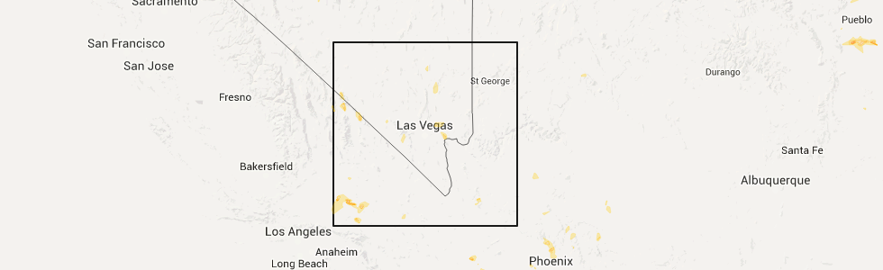
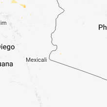
Hail Map for Lucerne Valley, CA
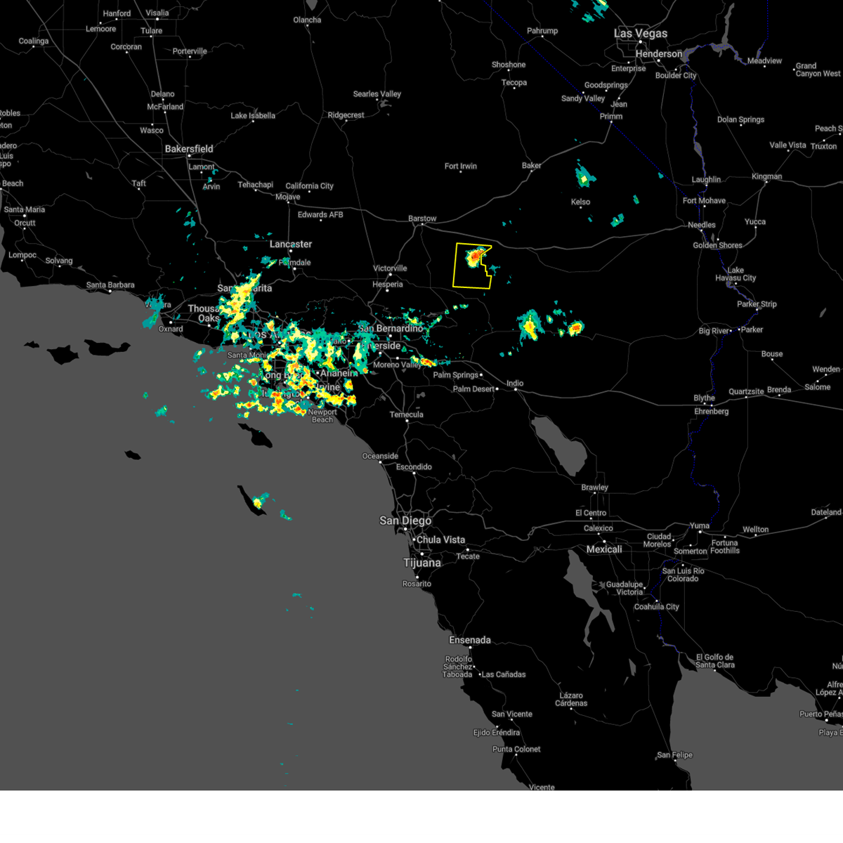
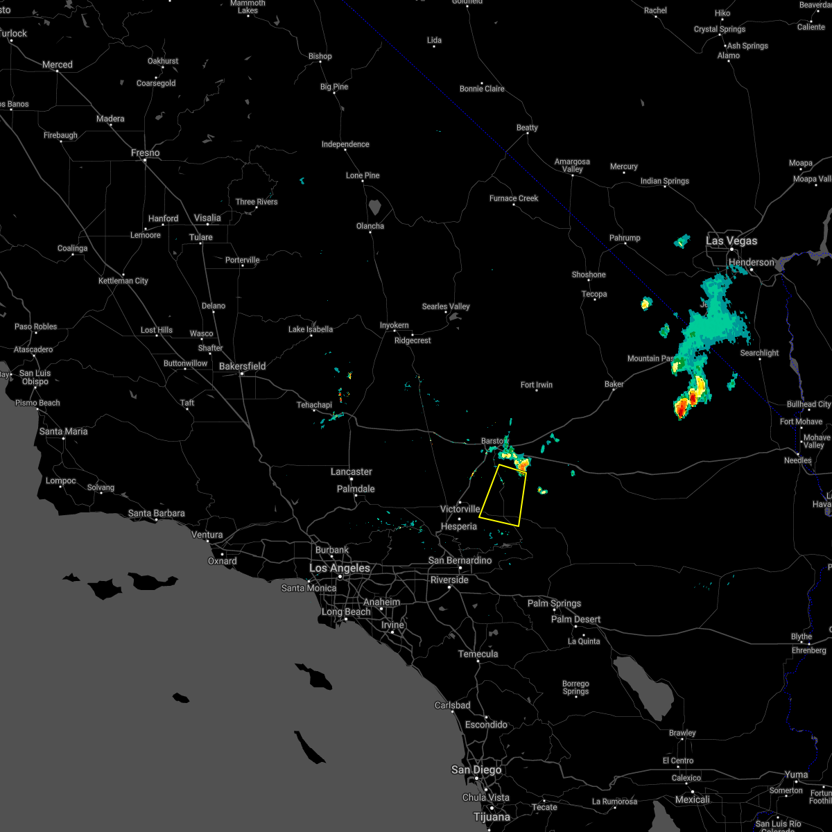
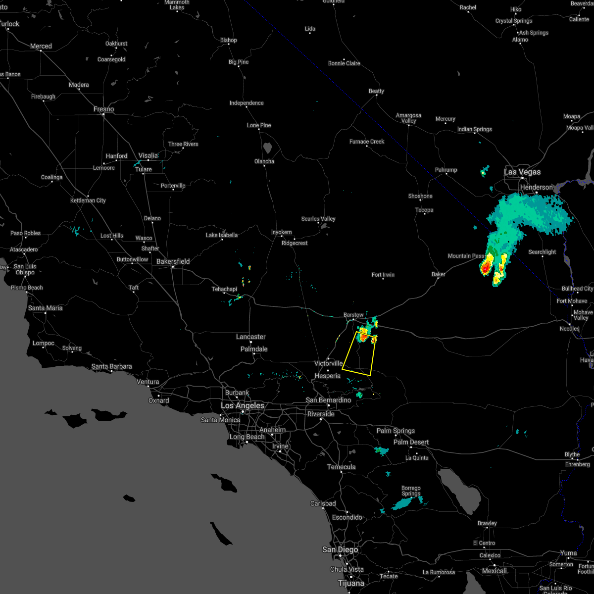
The Lucerne Valley, CA area has had 0 reports of on-the-ground hail by trained spotters, and has been under severe weather warnings 1 time during the past 12 months. Doppler radar has detected hail at or near Lucerne Valley, CA on 7 occasions.
| Name: | Lucerne Valley, CA |
| Where Located: | 35.5 miles NW of Yucca Valley, CA |
| Map: | Google Map for Lucerne Valley, CA |
| Population: | 5811 |
| Housing Units: | 2949 |
| More Info: | Search Google for Lucerne Valley, CA |
5
The Top Recent Hail Date for Lucerne Valley, CA is Friday, July 1, 2016 (1st out of 7)
Hail and Wind Damage Spotted near Lucerne Valley, CA
| Date / Time | Report Details |
|---|---|
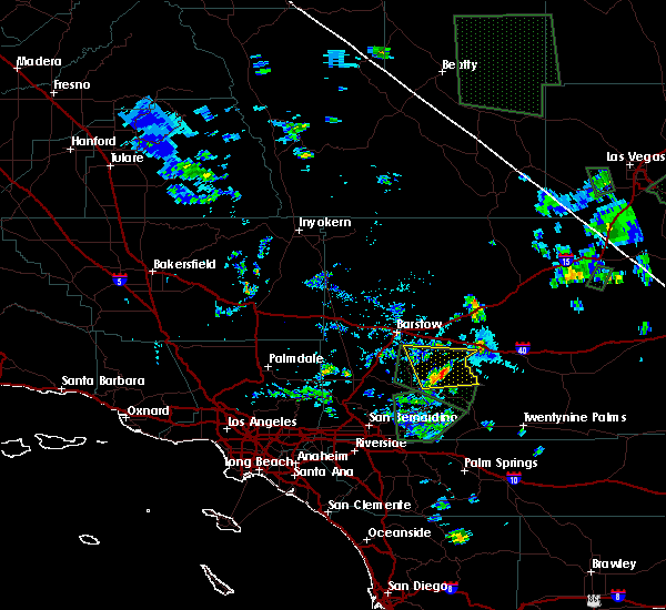
| 6/3/2025 4:26 PM PDT |
 Svrsgx the national weather service in san diego has issued a * severe thunderstorm warning for, san bernardino county in southern california, * until 530 pm pdt. * at 426 pm pdt, a severe thunderstorm was located 10 miles southeast of newberry springs, or 21 miles southeast of daggett, moving north at 20 mph (radar indicated). Hazards include 60 mph wind gusts and penny size hail. Damage to roofs, siding, and trees possible. This severe thunderstorm will remain over mainly rural areas of san bernardino county. Svrsgx the national weather service in san diego has issued a * severe thunderstorm warning for, san bernardino county in southern california, * until 530 pm pdt. * at 426 pm pdt, a severe thunderstorm was located 10 miles southeast of newberry springs, or 21 miles southeast of daggett, moving north at 20 mph (radar indicated). Hazards include 60 mph wind gusts and penny size hail. Damage to roofs, siding, and trees possible. This severe thunderstorm will remain over mainly rural areas of san bernardino county.
|
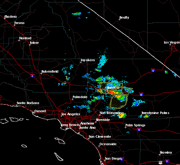
| 10/15/2022 8:18 PM PDT |
 At 816 pm pdt, a severe thunderstorm was located near apple valley, moving southwest at 50 mph (radar indicated). Hazards include 60 mph wind gusts and penny size hail. expect damage to roofs, siding, and trees At 816 pm pdt, a severe thunderstorm was located near apple valley, moving southwest at 50 mph (radar indicated). Hazards include 60 mph wind gusts and penny size hail. expect damage to roofs, siding, and trees
|
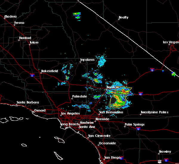
| 7/30/2022 4:58 PM PDT |
 At 458 pm pdt, a severe thunderstorm was located 7 miles east of hwy 173 between lake arrowhead and hesperia, or 8 miles northeast of lake arrowhead, moving southwest at 25 mph (radar indicated). Hazards include 60 mph wind gusts and quarter size hail. Hail damage to vehicles is expected. Expect wind damage to roofs, siding, and trees. At 458 pm pdt, a severe thunderstorm was located 7 miles east of hwy 173 between lake arrowhead and hesperia, or 8 miles northeast of lake arrowhead, moving southwest at 25 mph (radar indicated). Hazards include 60 mph wind gusts and quarter size hail. Hail damage to vehicles is expected. Expect wind damage to roofs, siding, and trees.
|
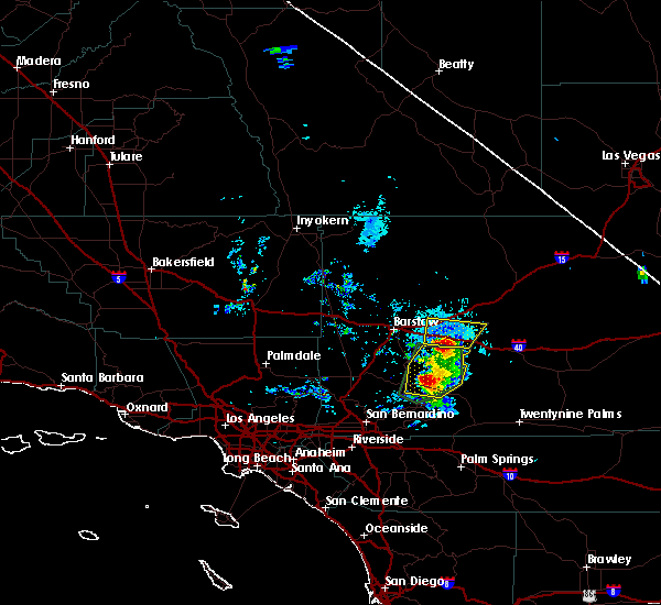
| 9/9/2021 2:54 PM PDT |
 At 253 pm pdt, a severe thunderstorm was located over hwy 18 between running springs and big bear, or 8 miles east of lake arrowhead, moving northwest at 10 mph (radar indicated). Hazards include 60 mph wind gusts and quarter size hail. Hail damage to vehicles is expected. Expect wind damage to roofs, siding, and trees. At 253 pm pdt, a severe thunderstorm was located over hwy 18 between running springs and big bear, or 8 miles east of lake arrowhead, moving northwest at 10 mph (radar indicated). Hazards include 60 mph wind gusts and quarter size hail. Hail damage to vehicles is expected. Expect wind damage to roofs, siding, and trees.
|
| 8/22/2020 4:57 PM PDT |
 The severe thunderstorm warning for san bernardino county will expire at 500 pm pdt, the storm which prompted the warning has weakened below severe limits, and no longer poses an immediate threat to life or property. therefore, the warning will be allowed to expire. however, heavy downpours will continue, and an urban and small stream flood advisory is now in effect for the area. The severe thunderstorm warning for san bernardino county will expire at 500 pm pdt, the storm which prompted the warning has weakened below severe limits, and no longer poses an immediate threat to life or property. therefore, the warning will be allowed to expire. however, heavy downpours will continue, and an urban and small stream flood advisory is now in effect for the area.
|
| 8/22/2020 4:13 PM PDT |
 At 413 pm pdt, a severe thunderstorm was located 11 miles south of daggett, moving south at 15 mph (radar indicated). Hazards include 70 mph wind gusts and penny size hail. Expect considerable tree damage. Damage is likely to mobile homes, roofs, and outbuildings. At 413 pm pdt, a severe thunderstorm was located 11 miles south of daggett, moving south at 15 mph (radar indicated). Hazards include 70 mph wind gusts and penny size hail. Expect considerable tree damage. Damage is likely to mobile homes, roofs, and outbuildings.
|
| 7/19/2018 1:42 PM PDT |
 At 142 pm pdt, a severe thunderstorm was located 7 miles north of hwy 173 between lake arrowhead and hesperia, or 8 miles east of hesperia, moving northwest at 15 mph (radar indicated). Hazards include 60 mph wind gusts and penny size hail. expect damage to roofs, siding, and trees At 142 pm pdt, a severe thunderstorm was located 7 miles north of hwy 173 between lake arrowhead and hesperia, or 8 miles east of hesperia, moving northwest at 15 mph (radar indicated). Hazards include 60 mph wind gusts and penny size hail. expect damage to roofs, siding, and trees
|
| 7/12/2018 1:09 PM PDT |
 At 109 pm pdt, a severe thunderstorm was located over northeastern lucerne valley, moving north at 15 mph (radar indicated). Hazards include 60 mph wind gusts and penny size hail. expect damage to roofs, siding, and trees At 109 pm pdt, a severe thunderstorm was located over northeastern lucerne valley, moving north at 15 mph (radar indicated). Hazards include 60 mph wind gusts and penny size hail. expect damage to roofs, siding, and trees
|
| 7/1/2016 4:11 PM PDT |
 The severe thunderstorm warning for san bernardino county will expire at 415 pm pdt, the storm which prompted the warning has moved out of the area. therefore the warning will be allowed to expire at 415 pm. The severe thunderstorm warning for san bernardino county will expire at 415 pm pdt, the storm which prompted the warning has moved out of the area. therefore the warning will be allowed to expire at 415 pm.
|
| 7/1/2016 3:39 PM PDT |
 At 334 pm pdt, doppler radar continued to indicated a severe thunderstorm capable of producing damaging winds in excess of 60 mph. this storm was located over highway 247 approximately 8 miles easy of lucerne valley. locations impacted include, lucerne valley and northwestern johnson valley. At 334 pm pdt, doppler radar continued to indicated a severe thunderstorm capable of producing damaging winds in excess of 60 mph. this storm was located over highway 247 approximately 8 miles easy of lucerne valley. locations impacted include, lucerne valley and northwestern johnson valley.
|
| 7/1/2016 3:14 PM PDT |
 At 312 pm pdt, doppler radar indicated a severe thunderstorm capable of producing damaging winds in excess of 60 mph. this storm was located 11 miles northwest of johnson valley, or 12 miles east of lucerne valley, and nealy stationary. the storm may also produce penny size hail. At 312 pm pdt, doppler radar indicated a severe thunderstorm capable of producing damaging winds in excess of 60 mph. this storm was located 11 miles northwest of johnson valley, or 12 miles east of lucerne valley, and nealy stationary. the storm may also produce penny size hail.
|
| 10/15/2015 4:06 PM PDT |
 At 403 pm pdt, doppler radar indicated the severe thunderstorm had weakened somewhat and was over interstate 15, about half way between victorville and barstow, moving north at 30 mph. the thunderstorm had produced quarter size hail just northeast of apple valley shortly after 330 pm. the storm is still capable of damaging winds around 60 mph. locations impacted include, interstate 15 south of barstow. At 403 pm pdt, doppler radar indicated the severe thunderstorm had weakened somewhat and was over interstate 15, about half way between victorville and barstow, moving north at 30 mph. the thunderstorm had produced quarter size hail just northeast of apple valley shortly after 330 pm. the storm is still capable of damaging winds around 60 mph. locations impacted include, interstate 15 south of barstow.
|
| 10/15/2015 3:43 PM PDT |
 At 342 pm pdt, doppler radar indicated a severe thunderstorm producing quarter size hail and capable of producing damaging winds in excess of 60 mph. this storm was located near apple valley, and moving north at 30 mph. quarter size hail was reported 3 miles north of apple valley at 339 pm. At 342 pm pdt, doppler radar indicated a severe thunderstorm producing quarter size hail and capable of producing damaging winds in excess of 60 mph. this storm was located near apple valley, and moving north at 30 mph. quarter size hail was reported 3 miles north of apple valley at 339 pm.
|
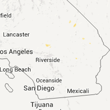
Hail Maps for Lucerne Valley, CA


Connect with Interactive Hail Maps